

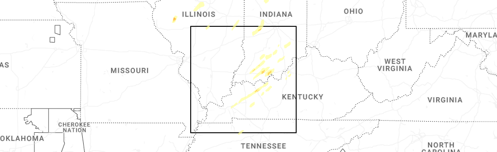
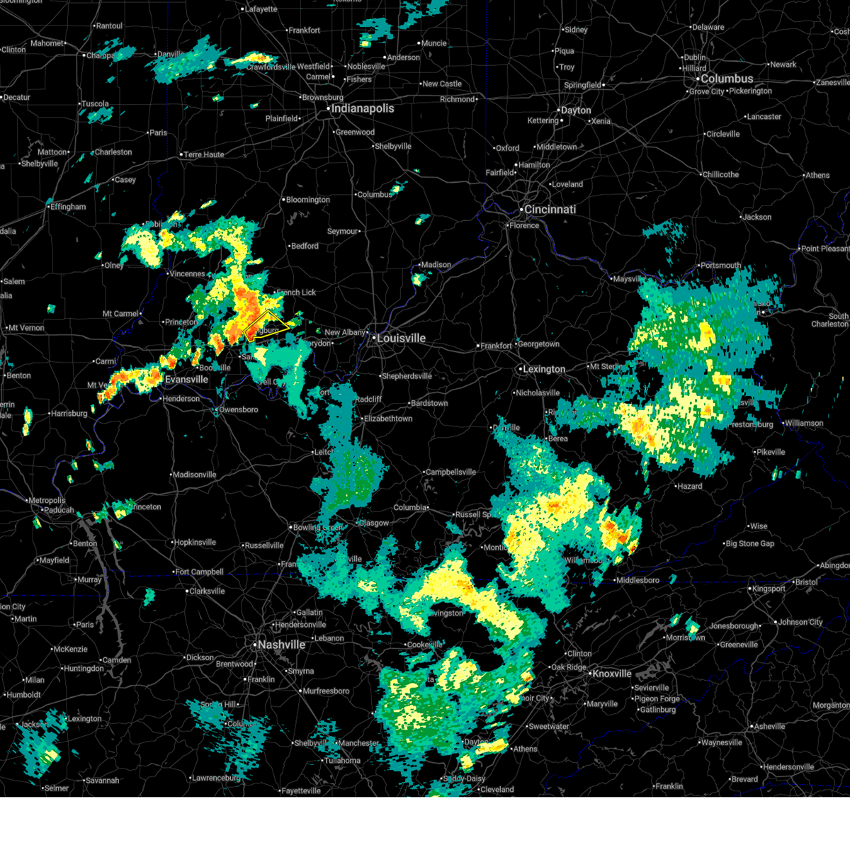
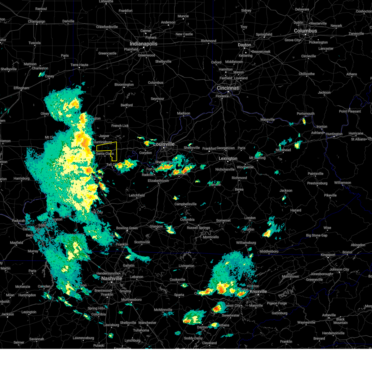
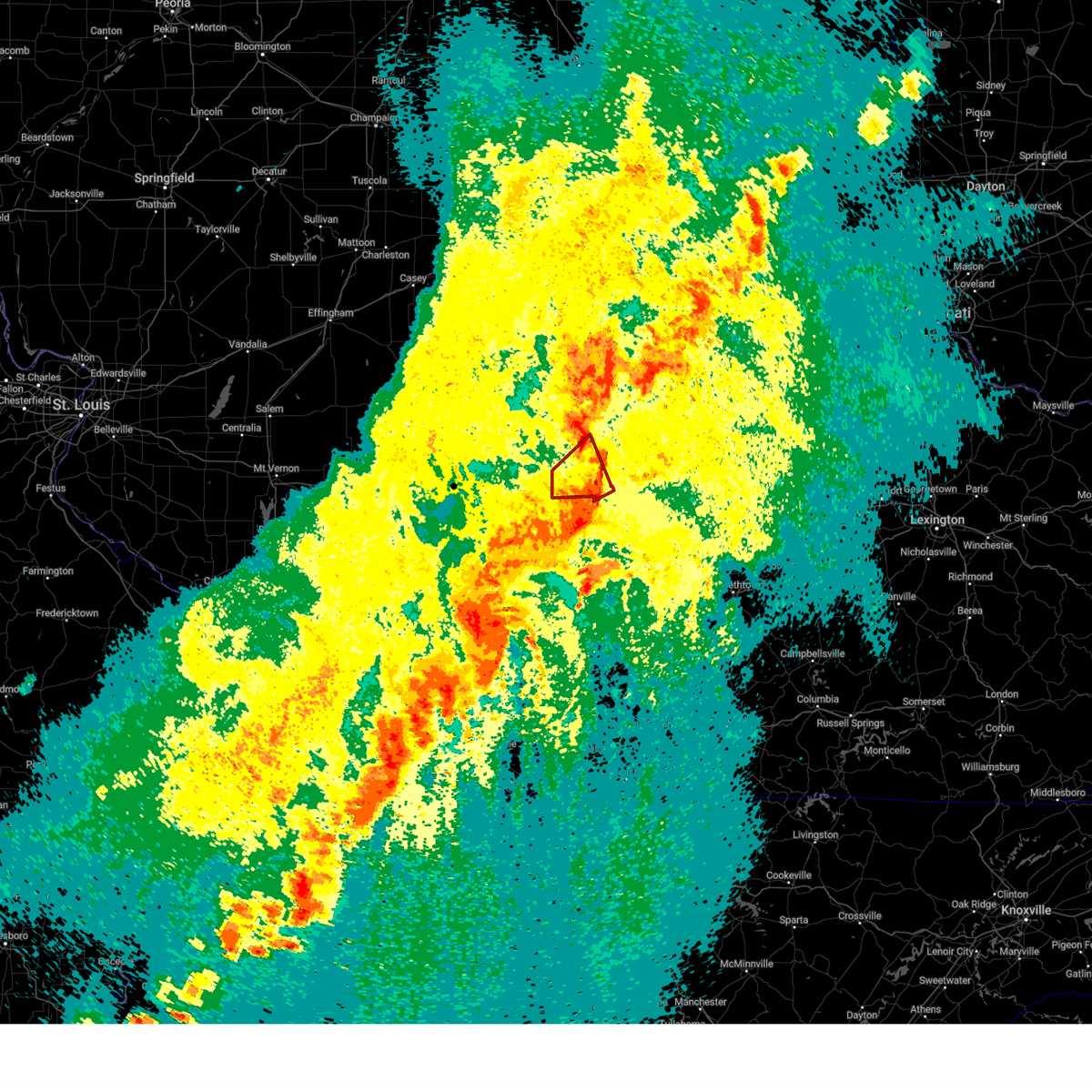
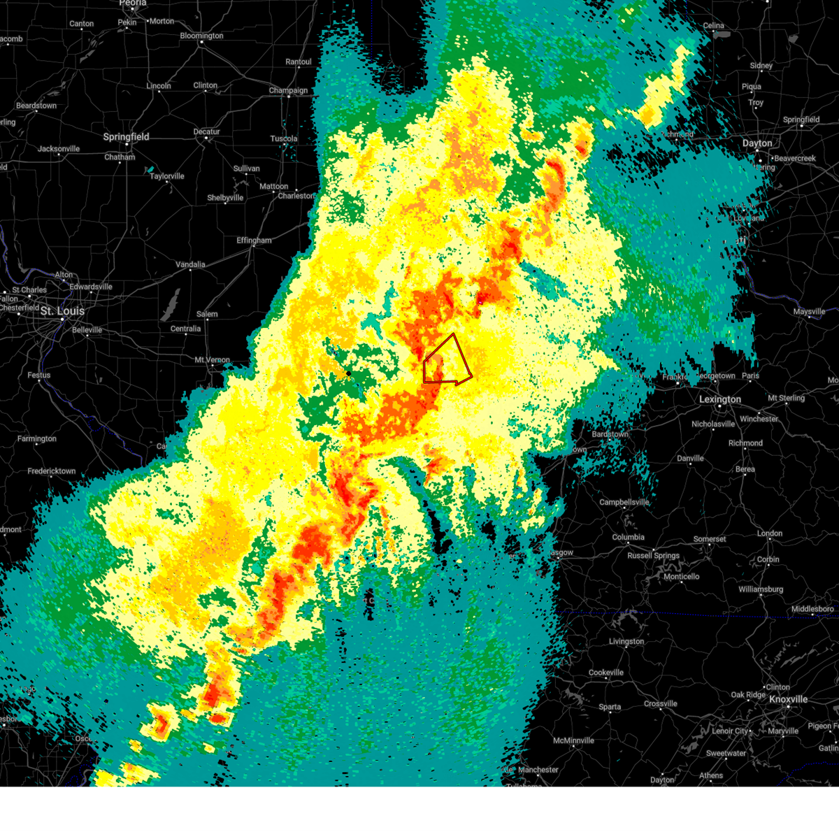
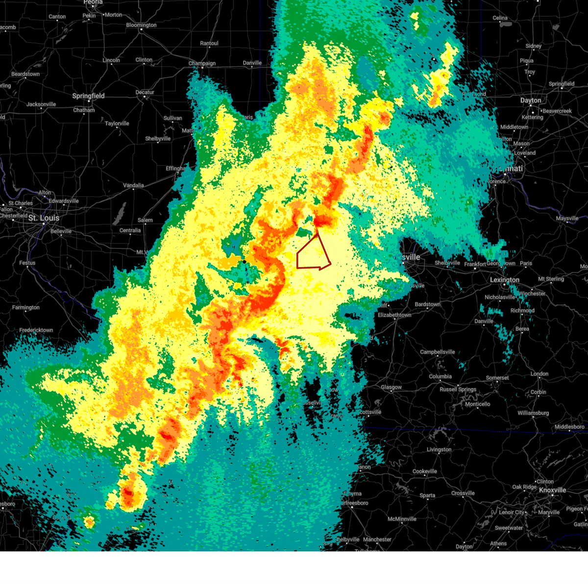
Hail Map for Birdseye, IN
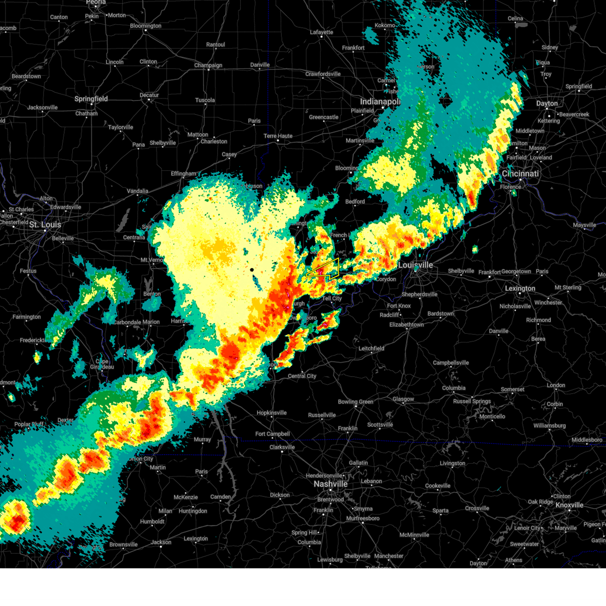
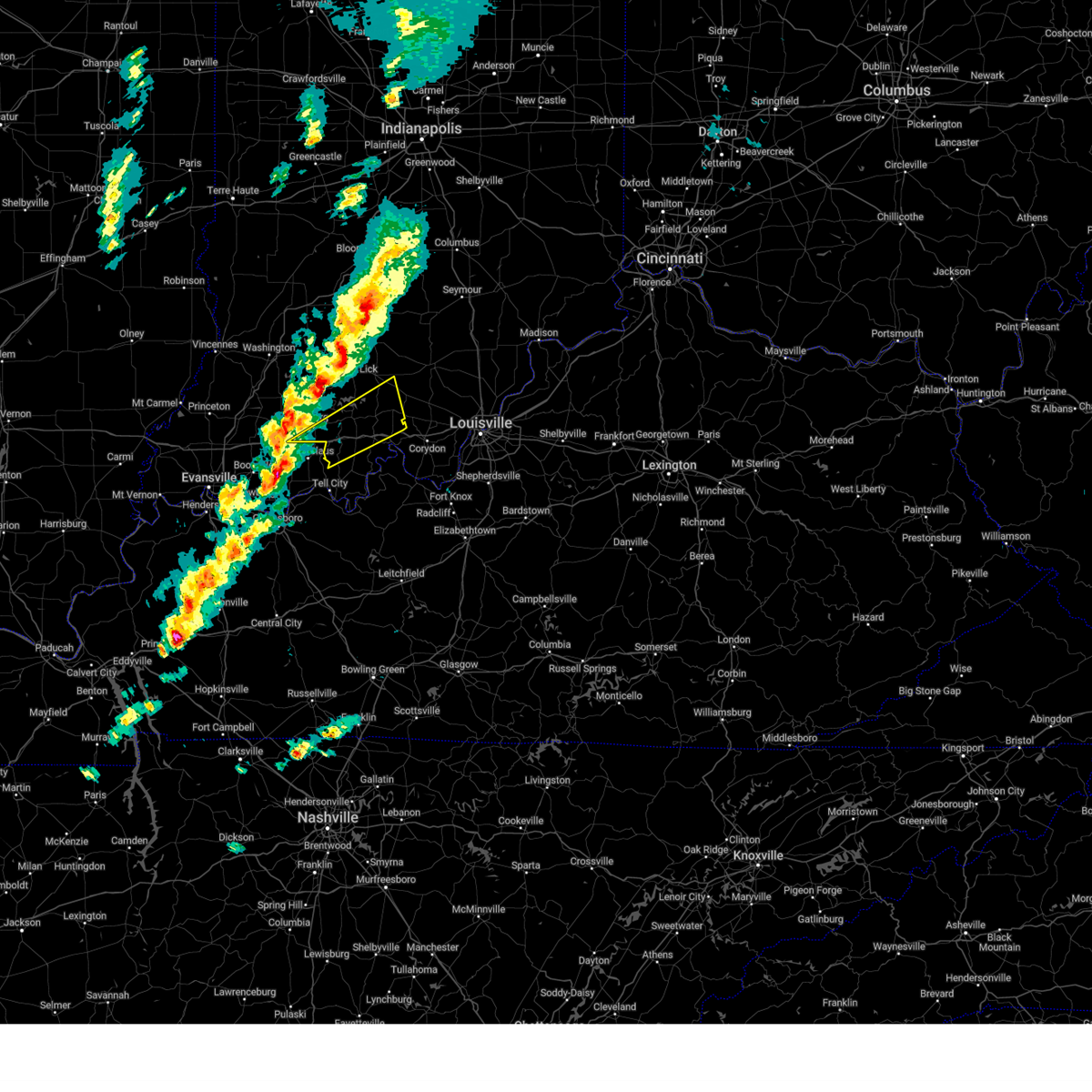
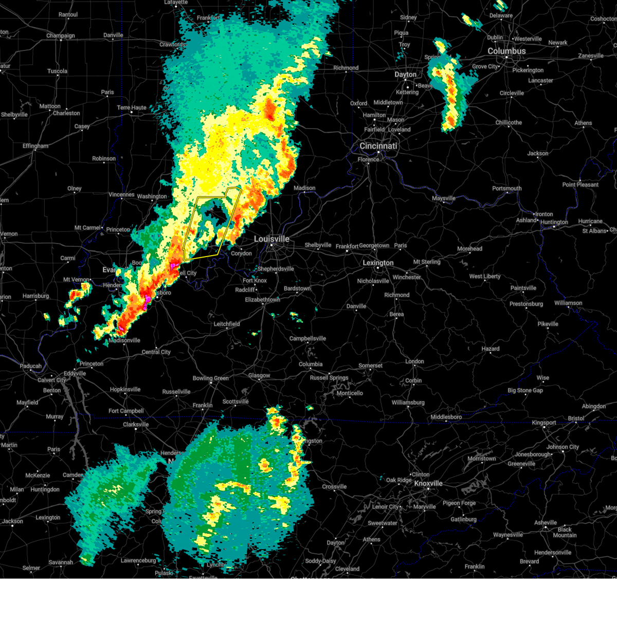
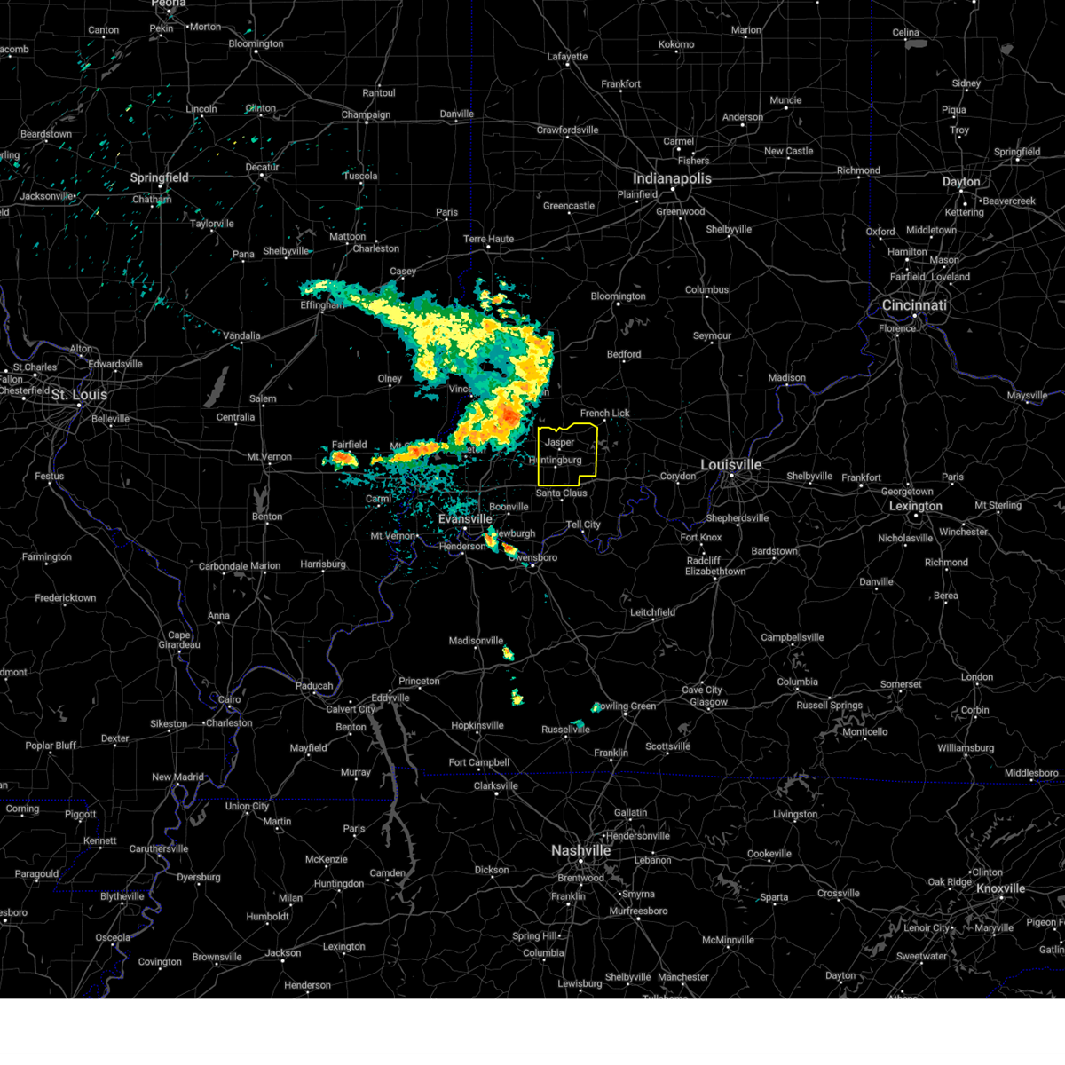
The Birdseye, IN area has had 4 reports of on-the-ground hail by trained spotters, and has been under severe weather warnings 32 times during the past 12 months. Doppler radar has detected hail at or near Birdseye, IN on 62 occasions, including 5 occasions during the past year.
| Name: | Birdseye, IN |
| Where Located: | 52.8 miles ENE of Evansville, IN |
| Map: | Google Map for Birdseye, IN |
| Population: | 416 |
| Housing Units: | 199 |
| More Info: | Search Google for Birdseye, IN |
1
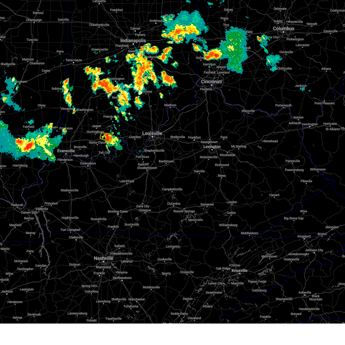
The Top Recent Hail Date for Birdseye, IN is Wednesday, March 19, 2025 (15th out of 62)
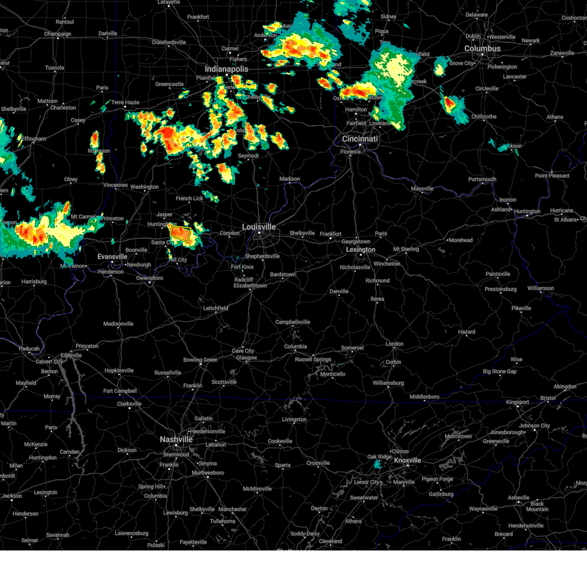
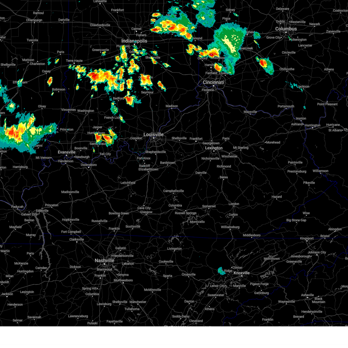
Hail and Wind Damage Spotted near Birdseye, IN
| Date / Time | Report Details |
|---|---|
| 6/18/2025 4:32 PM EDT | Tree blocking 1 ln of trave in dubois county IN, 4.5 miles SSE of Birdseye, IN |
| 6/18/2025 4:28 PM EDT | Svrlmk the national weather service in louisville has issued a * severe thunderstorm warning for, northeastern dubois county in south central indiana, northwestern crawford county in south central indiana, orange county in south central indiana, west central washington county in south central indiana, * until 515 pm edt. * at 428 pm edt, a severe thunderstorm was located 12 miles west of english, moving northeast at 40 mph (radar indicated). Hazards include 60 mph wind gusts and quarter size hail. Hail damage to vehicles is expected. Expect wind damage to roofs, siding, and trees. |
| 6/18/2025 4:20 PM EDT | Tree down blocking both lane in dubois county IN, 4.4 miles ENE of Birdseye, IN |
| 6/18/2025 4:18 PM EDT |
 At 418 pm edt, a severe thunderstorm was located 9 miles northeast of jasper, moving northeast at 40 mph (radar indicated). Hazards include 60 mph wind gusts and quarter size hail. Hail damage to vehicles is expected. expect wind damage to roofs, siding, and trees. Locations impacted include, jasper, paoli, huntingburg, french lick, orangeville, west baden springs, birdseye, dubois, hillham, and celestine. At 418 pm edt, a severe thunderstorm was located 9 miles northeast of jasper, moving northeast at 40 mph (radar indicated). Hazards include 60 mph wind gusts and quarter size hail. Hail damage to vehicles is expected. expect wind damage to roofs, siding, and trees. Locations impacted include, jasper, paoli, huntingburg, french lick, orangeville, west baden springs, birdseye, dubois, hillham, and celestine.
|
| 6/18/2025 4:16 PM EDT | Corrects time for previous tstm wnd dmg report from 1 se kyana. tree down blocking both lane in dubois county IN, 4.4 miles ENE of Birdseye, IN |
| 6/18/2025 4:07 PM EDT |
 Svrlmk the national weather service in louisville has issued a * severe thunderstorm warning for, dubois county in south central indiana, northwestern crawford county in south central indiana, northwestern orange county in south central indiana, * until 430 pm edt. * at 407 pm edt, a severe thunderstorm was located over jasper, moving northeast at 40 mph (radar indicated). Hazards include 60 mph wind gusts and quarter size hail. Hail damage to vehicles is expected. Expect wind damage to roofs, siding, and trees. Svrlmk the national weather service in louisville has issued a * severe thunderstorm warning for, dubois county in south central indiana, northwestern crawford county in south central indiana, northwestern orange county in south central indiana, * until 430 pm edt. * at 407 pm edt, a severe thunderstorm was located over jasper, moving northeast at 40 mph (radar indicated). Hazards include 60 mph wind gusts and quarter size hail. Hail damage to vehicles is expected. Expect wind damage to roofs, siding, and trees.
|
| 6/13/2025 7:30 PM EDT |
 the severe thunderstorm warning has been cancelled and is no longer in effect the severe thunderstorm warning has been cancelled and is no longer in effect
|
| 6/13/2025 7:23 PM EDT | At 723 pm edt, a severe thunderstorm was located 12 miles west of english, moving northeast at 25 mph (radar indicated). Hazards include 60 mph wind gusts and penny size hail. Expect damage to roofs, siding, and trees. Locations impacted include, birdseye, riceville, wickliffe, mentor, and schnellville. |
| 6/13/2025 7:10 PM EDT |
 Svrlmk the national weather service in louisville has issued a * severe thunderstorm warning for, southeastern dubois county in south central indiana, northwestern crawford county in south central indiana, southwestern orange county in south central indiana, * until 745 pm edt. * at 710 pm edt, a severe thunderstorm was located 12 miles southeast of jasper, moving northeast at 25 mph (radar indicated). Hazards include 60 mph wind gusts and penny size hail. expect damage to roofs, siding, and trees Svrlmk the national weather service in louisville has issued a * severe thunderstorm warning for, southeastern dubois county in south central indiana, northwestern crawford county in south central indiana, southwestern orange county in south central indiana, * until 745 pm edt. * at 710 pm edt, a severe thunderstorm was located 12 miles southeast of jasper, moving northeast at 25 mph (radar indicated). Hazards include 60 mph wind gusts and penny size hail. expect damage to roofs, siding, and trees
|
| 5/16/2025 9:23 PM EDT | the severe thunderstorm warning has been cancelled and is no longer in effect |
| 5/16/2025 9:23 PM EDT |
 At 922 pm edt, a severe thunderstorm was located 10 miles east of jasper, moving northeast at 70 mph (radar indicated). Hazards include 60 mph wind gusts and quarter size hail. Hail damage to vehicles is expected. expect wind damage to roofs, siding, and trees. Locations impacted include, birdseye, riceville, dubois, celestine, saint marks, taswell, norton, mentor, eckerty, and ellsworth. At 922 pm edt, a severe thunderstorm was located 10 miles east of jasper, moving northeast at 70 mph (radar indicated). Hazards include 60 mph wind gusts and quarter size hail. Hail damage to vehicles is expected. expect wind damage to roofs, siding, and trees. Locations impacted include, birdseye, riceville, dubois, celestine, saint marks, taswell, norton, mentor, eckerty, and ellsworth.
|
| 5/16/2025 9:03 PM EDT |
 Svrlmk the national weather service in louisville has issued a * severe thunderstorm warning for, dubois county in south central indiana, northwestern crawford county in south central indiana, northwestern perry county in south central indiana, southwestern orange county in south central indiana, * until 930 pm edt/830 pm cdt/. * at 902 pm edt/802 pm cdt/, a severe thunderstorm was located near folsomville, moving northeast at 60 mph (radar indicated). Hazards include 60 mph wind gusts and quarter size hail. Hail damage to vehicles is expected. Expect wind damage to roofs, siding, and trees. Svrlmk the national weather service in louisville has issued a * severe thunderstorm warning for, dubois county in south central indiana, northwestern crawford county in south central indiana, northwestern perry county in south central indiana, southwestern orange county in south central indiana, * until 930 pm edt/830 pm cdt/. * at 902 pm edt/802 pm cdt/, a severe thunderstorm was located near folsomville, moving northeast at 60 mph (radar indicated). Hazards include 60 mph wind gusts and quarter size hail. Hail damage to vehicles is expected. Expect wind damage to roofs, siding, and trees.
|
| 4/10/2025 4:46 PM CDT |
 The storm which prompted the warning has moved out of the area. therefore, the warning has been allowed to expire. however, small hail, gusty winds and heavy rain are still possible with this thunderstorm. remember, a severe thunderstorm warning still remains in effect for this area. The storm which prompted the warning has moved out of the area. therefore, the warning has been allowed to expire. however, small hail, gusty winds and heavy rain are still possible with this thunderstorm. remember, a severe thunderstorm warning still remains in effect for this area.
|
| 4/10/2025 4:35 PM CDT |
 At 535 pm edt/435 pm cdt/, a severe thunderstorm was located 8 miles northeast of santa claus, moving east at 40 mph (radar indicated). Hazards include 60 mph wind gusts and penny size hail. Expect damage to roofs, siding, and trees. Locations impacted include, huntingburg, ferdinand, holland, birdseye, ranger, saint marks, sassafras, bristow, bretzville, and mentor. At 535 pm edt/435 pm cdt/, a severe thunderstorm was located 8 miles northeast of santa claus, moving east at 40 mph (radar indicated). Hazards include 60 mph wind gusts and penny size hail. Expect damage to roofs, siding, and trees. Locations impacted include, huntingburg, ferdinand, holland, birdseye, ranger, saint marks, sassafras, bristow, bretzville, and mentor.
|
| 4/10/2025 4:15 PM CDT |
 Svrlmk the national weather service in louisville has issued a * severe thunderstorm warning for, southern dubois county in south central indiana, northwestern perry county in south central indiana, * until 545 pm edt/445 pm cdt/. * at 515 pm edt/415 pm cdt/, a severe thunderstorm was located near dale, moving east at 40 mph (radar indicated). Hazards include 60 mph wind gusts and penny size hail. expect damage to roofs, siding, and trees Svrlmk the national weather service in louisville has issued a * severe thunderstorm warning for, southern dubois county in south central indiana, northwestern perry county in south central indiana, * until 545 pm edt/445 pm cdt/. * at 515 pm edt/415 pm cdt/, a severe thunderstorm was located near dale, moving east at 40 mph (radar indicated). Hazards include 60 mph wind gusts and penny size hail. expect damage to roofs, siding, and trees
|
| 4/2/2025 11:16 PM EDT | Power line blocking both lane in dubois county IN, 3.9 miles ESE of Birdseye, IN |
| 4/2/2025 10:09 PM CDT | The storms which prompted the warning have moved out of the area. therefore, the warning will be allowed to expire. however, gusty winds and heavy rain are still possible with these thunderstorms. a tornado watch remains in effect until 200 am edt/100 am cdt/ for south central indiana, and central kentucky. |
| 4/2/2025 10:00 PM CDT | The storms which prompted the warning have moved out of the area. therefore, the warning will be allowed to expire. however, gusty winds and heavy rain are still possible with these thunderstorms. a tornado watch remains in effect until 200 am edt/100 am cdt/ for south central indiana, and central kentucky. to report severe weather, contact your nearest law enforcement agency. they will relay your report to the national weather service louisville. remember, a severe thunderstorm warning still remains in effect. |
| 4/2/2025 10:44 PM EDT |
 The storm which prompted the warning has moved out of the area. therefore, the warning will be allowed to expire. a tornado watch remains in effect until 200 am edt/100 am cdt/ for south central indiana. remember, a tornado warning still remains in effect for eastern portions of dubois county. The storm which prompted the warning has moved out of the area. therefore, the warning will be allowed to expire. a tornado watch remains in effect until 200 am edt/100 am cdt/ for south central indiana. remember, a tornado warning still remains in effect for eastern portions of dubois county.
|
| 4/2/2025 9:39 PM CDT | Torlmk the national weather service in louisville has issued a * tornado warning for, eastern dubois county in south central indiana, western crawford county in south central indiana, northern perry county in south central indiana, southern orange county in south central indiana, * until 1115 pm edt/1015 pm cdt/. * at 1039 pm edt/939 pm cdt/, severe thunderstorms capable of producing a tornado were located along a line extending from near jasper to near santa claus, moving east at 50 mph (radar indicated rotation). Hazards include tornado. Flying debris will be dangerous to those caught without shelter. mobile homes will be damaged or destroyed. damage to roofs, windows, and vehicles will occur. tree damage is likely. these dangerous storms will be near, english around 1100 pm edt. Other locations impacted by these tornadic storms include celestine, ranger, bretzville, bacon, birdseye, syria, adyeville, fargo, doolittle mills, and deuchars. |
| 4/2/2025 9:37 PM CDT | At 1037 pm edt/937 pm cdt/, severe thunderstorms were located along a line extending from 11 miles southwest of shoals to 10 miles northeast of santa claus to grandview, moving northeast at 60 mph (radar indicated). Hazards include 70 mph wind gusts and nickel size hail. Expect considerable tree damage. damage is likely to mobile homes, roofs, and outbuildings. Locations impacted include, jasper, tell city, paoli, corydon, brandenburg, hardinsburg, hawesville, english, carefree town, and mount pleasant. |
| 4/2/2025 10:35 PM EDT |
 At 1035 pm edt/935 pm cdt/, a severe thunderstorm capable of producing a tornado was located 8 miles south of jasper, moving northeast at 55 mph (radar indicated rotation). Hazards include tornado. Flying debris will be dangerous to those caught without shelter. mobile homes will be damaged or destroyed. damage to roofs, windows, and vehicles will occur. tree damage is likely. This tornadic thunderstorm will remain over mainly rural areas of dubois and northwestern perry counties, including the following locations, dubois, celestine, saint marks, millersport, bretzville, dubois crossroads, huntingburg, mentor, kellerville, and duff. At 1035 pm edt/935 pm cdt/, a severe thunderstorm capable of producing a tornado was located 8 miles south of jasper, moving northeast at 55 mph (radar indicated rotation). Hazards include tornado. Flying debris will be dangerous to those caught without shelter. mobile homes will be damaged or destroyed. damage to roofs, windows, and vehicles will occur. tree damage is likely. This tornadic thunderstorm will remain over mainly rural areas of dubois and northwestern perry counties, including the following locations, dubois, celestine, saint marks, millersport, bretzville, dubois crossroads, huntingburg, mentor, kellerville, and duff.
|
| 4/2/2025 9:19 PM CDT | Svrlmk the national weather service in louisville has issued a * severe thunderstorm warning for, harrison county in south central indiana, dubois county in south central indiana, crawford county in south central indiana, perry county in south central indiana, orange county in south central indiana, western washington county in south central indiana, meade county in central kentucky, hancock county in central kentucky, breckinridge county in central kentucky, northeastern ohio county in central kentucky, * until 1100 pm edt/1000 pm cdt/. * at 1018 pm edt/918 pm cdt/, severe thunderstorms were located along a line extending from near petersburg to near folsomville to stanley, moving northeast at 75 mph (radar indicated). Hazards include 70 mph wind gusts and nickel size hail. Expect considerable tree damage. Damage is likely to mobile homes, roofs, and outbuildings. |
| 4/2/2025 10:18 PM EDT |
 Torlmk the national weather service in louisville has issued a * tornado warning for, dubois county in south central indiana, northwestern perry county in south central indiana, * until 1045 pm edt/945 pm cdt/. * at 1018 pm edt/918 pm cdt/, a severe thunderstorm capable of producing a tornado was located over folsomville, moving northeast at 65 mph (radar indicated rotation). Hazards include tornado. Flying debris will be dangerous to those caught without shelter. mobile homes will be damaged or destroyed. damage to roofs, windows, and vehicles will occur. tree damage is likely. this dangerous storm will be near, jasper around 1035 pm edt. Other locations impacted by this tornadic thunderstorm include dubois, celestine, saint marks, millersport, bretzville, dubois crossroads, huntingburg, mentor, kellerville, and duff. Torlmk the national weather service in louisville has issued a * tornado warning for, dubois county in south central indiana, northwestern perry county in south central indiana, * until 1045 pm edt/945 pm cdt/. * at 1018 pm edt/918 pm cdt/, a severe thunderstorm capable of producing a tornado was located over folsomville, moving northeast at 65 mph (radar indicated rotation). Hazards include tornado. Flying debris will be dangerous to those caught without shelter. mobile homes will be damaged or destroyed. damage to roofs, windows, and vehicles will occur. tree damage is likely. this dangerous storm will be near, jasper around 1035 pm edt. Other locations impacted by this tornadic thunderstorm include dubois, celestine, saint marks, millersport, bretzville, dubois crossroads, huntingburg, mentor, kellerville, and duff.
|
| 3/30/2025 8:37 PM EDT |
 At 837 pm edt/737 pm cdt/, a severe thunderstorm was located 9 miles northeast of dale, moving northeast at 45 mph (radar indicated). Hazards include quarter size hail. Damage to vehicles is expected. at 837 pm edt/737 pm cdt/, nickel sized hail was reported over ferdinand. Locations impacted include, ferdinand, birdseye, saint marks, mentor, adyeville, huntingburg airport, saint anthony, siberia, schnellville, and saint henry. At 837 pm edt/737 pm cdt/, a severe thunderstorm was located 9 miles northeast of dale, moving northeast at 45 mph (radar indicated). Hazards include quarter size hail. Damage to vehicles is expected. at 837 pm edt/737 pm cdt/, nickel sized hail was reported over ferdinand. Locations impacted include, ferdinand, birdseye, saint marks, mentor, adyeville, huntingburg airport, saint anthony, siberia, schnellville, and saint henry.
|
| 3/30/2025 8:27 PM EDT | Svrlmk the national weather service in louisville has issued a * severe thunderstorm warning for, southern dubois county in south central indiana, northwestern perry county in south central indiana, * until 845 pm edt/745 pm cdt/. * at 827 pm edt/727 pm cdt/, a severe thunderstorm was located over dale, moving northeast at 45 mph (radar indicated). Hazards include quarter size hail. damage to vehicles is expected |
| 3/30/2025 7:41 PM EDT | Svrlmk the national weather service in louisville has issued a * severe thunderstorm warning for, northeastern dubois county in south central indiana, northwestern crawford county in south central indiana, orange county in south central indiana, * until 815 pm edt. * at 740 pm edt, severe thunderstorms were located along a line extending from near jasper to 12 miles west of english, moving northeast at 40 mph (trained weather spotters). Hazards include ping pong ball size hail and 60 mph wind gusts. People and animals outdoors will be injured. expect hail damage to roofs, siding, windows, and vehicles. expect wind damage to roofs, siding, and trees. At 735 pm edt, trained spotters reported ping pong ball size hail east of jasper. |
| 3/19/2025 8:29 PM EDT | Multiple trees downed and power lines down along indiana state road 145 south of birdseye. time estimated from rada in dubois county IN, 1.1 miles NNW of Birdseye, IN |
| 3/19/2025 8:08 PM EDT |
 Svrlmk the national weather service in louisville has issued a * severe thunderstorm warning for, southeastern dubois county in south central indiana, crawford county in south central indiana, northern perry county in south central indiana, southeastern orange county in south central indiana, * until 845 pm edt/745 pm cdt/. * at 808 pm edt/708 pm cdt/, a severe thunderstorm was located over santa claus, moving northeast at 60 mph (radar indicated). Hazards include 60 mph wind gusts and penny size hail. expect damage to roofs, siding, and trees Svrlmk the national weather service in louisville has issued a * severe thunderstorm warning for, southeastern dubois county in south central indiana, crawford county in south central indiana, northern perry county in south central indiana, southeastern orange county in south central indiana, * until 845 pm edt/745 pm cdt/. * at 808 pm edt/708 pm cdt/, a severe thunderstorm was located over santa claus, moving northeast at 60 mph (radar indicated). Hazards include 60 mph wind gusts and penny size hail. expect damage to roofs, siding, and trees
|
| 3/15/2025 5:43 AM EDT |
 The storms which prompted the warning have moved out of the area. therefore, the warning will be allowed to expire. however, another strong, possibly severe storm will approach this area from the southwest over the next 30 minutes. a tornado watch remains in effect until 1000 am edt/900 am cdt/ for south central indiana. The storms which prompted the warning have moved out of the area. therefore, the warning will be allowed to expire. however, another strong, possibly severe storm will approach this area from the southwest over the next 30 minutes. a tornado watch remains in effect until 1000 am edt/900 am cdt/ for south central indiana.
|
| 3/15/2025 5:12 AM EDT | The storms which prompted the warning have moved out of the warned area. therefore, the warning will be allowed to expire. a tornado watch remains in effect until 1000 am edt/900 am cdt/ for south central indiana. remember, a severe thunderstorm warning still remains in effect for eastern dubois county, crawford, orange, and perry counties. |
| 3/15/2025 5:11 AM EDT | Svrlmk the national weather service in louisville has issued a * severe thunderstorm warning for, southeastern dubois county in south central indiana, crawford county in south central indiana, northern perry county in south central indiana, orange county in south central indiana, western washington county in south central indiana, * until 545 am edt/445 am cdt/. * at 510 am edt/410 am cdt/, severe thunderstorms were located along a line extending from near salem to 10 miles northeast of tell city, moving east at 45 mph (radar indicated). Hazards include 60 mph wind gusts and quarter size hail. Hail damage to vehicles is expected. Expect wind damage to roofs, siding, and trees. |
| 3/15/2025 4:34 AM EDT | Svrlmk the national weather service in louisville has issued a * severe thunderstorm warning for, eastern dubois county in south central indiana, crawford county in south central indiana, northern perry county in south central indiana, orange county in south central indiana, western washington county in south central indiana, * until 515 am edt/415 am cdt/. * at 433 am edt/333 am cdt/, severe thunderstorms were located along a line extending from 7 miles west of shoals to near jasper to near folsomville, moving east at 55 mph (radar indicated). Hazards include 70 mph wind gusts and quarter size hail. Hail damage to vehicles is expected. expect considerable tree damage. Wind damage is also likely to mobile homes, roofs, and outbuildings. |
| 7/30/2024 11:58 AM EDT |
 Svrlmk the national weather service in louisville has issued a * severe thunderstorm warning for, dubois county in south central indiana, southwestern orange county in south central indiana, * until 1245 pm edt. * at 1158 am edt, a severe thunderstorm was located near washington, moving east at 40 mph (radar indicated). Hazards include 60 mph wind gusts. expect damage to roofs, siding, and trees Svrlmk the national weather service in louisville has issued a * severe thunderstorm warning for, dubois county in south central indiana, southwestern orange county in south central indiana, * until 1245 pm edt. * at 1158 am edt, a severe thunderstorm was located near washington, moving east at 40 mph (radar indicated). Hazards include 60 mph wind gusts. expect damage to roofs, siding, and trees
|
| 7/29/2024 11:44 PM EDT |
 The storm which prompted the warning has weakened below severe limits, and no longer poses an immediate threat to life or property. therefore, the warning will be allowed to expire. however, gusty winds are still possible with this thunderstorm. a severe thunderstorm watch remains in effect until 400 am edt/300 am cdt/ for south central indiana. The storm which prompted the warning has weakened below severe limits, and no longer poses an immediate threat to life or property. therefore, the warning will be allowed to expire. however, gusty winds are still possible with this thunderstorm. a severe thunderstorm watch remains in effect until 400 am edt/300 am cdt/ for south central indiana.
|
| 7/29/2024 11:27 PM EDT |
 At 1125 pm edt/1025 pm cdt/, a severe thunderstorm was located 13 miles southeast of jasper, moving east at 15 mph (radar indicated). Hazards include 60 mph wind gusts and nickel size hail. Expect damage to roofs, siding, and trees. Locations impacted include, ferdinand, birdseye, saint marks, sassafras, saint anthony, siberia, uniontown, kitterman corners, and kyana. At 1125 pm edt/1025 pm cdt/, a severe thunderstorm was located 13 miles southeast of jasper, moving east at 15 mph (radar indicated). Hazards include 60 mph wind gusts and nickel size hail. Expect damage to roofs, siding, and trees. Locations impacted include, ferdinand, birdseye, saint marks, sassafras, saint anthony, siberia, uniontown, kitterman corners, and kyana.
|
| 7/29/2024 11:14 PM EDT |
 Svrlmk the national weather service in louisville has issued a * severe thunderstorm warning for, southeastern dubois county in south central indiana, western crawford county in south central indiana, northwestern perry county in south central indiana, * until 1145 pm edt/1045 pm cdt/. * at 1114 pm edt/1014 pm cdt/, a severe thunderstorm was located 10 miles southeast of jasper, moving east at 15 mph (radar indicated). Hazards include 60 mph wind gusts and nickel size hail. expect damage to roofs, siding, and trees Svrlmk the national weather service in louisville has issued a * severe thunderstorm warning for, southeastern dubois county in south central indiana, western crawford county in south central indiana, northwestern perry county in south central indiana, * until 1145 pm edt/1045 pm cdt/. * at 1114 pm edt/1014 pm cdt/, a severe thunderstorm was located 10 miles southeast of jasper, moving east at 15 mph (radar indicated). Hazards include 60 mph wind gusts and nickel size hail. expect damage to roofs, siding, and trees
|
| 7/5/2024 8:30 AM EDT | Tree down and brought down power lines with i in crawford county IN, 4.7 miles W of Birdseye, IN |
| 5/26/2024 9:44 PM CDT |
 The storms which prompted the warning have moved out of the area. therefore, the warning will be allowed to expire. however, gusty winds are still possible with these thunderstorms. a tornado watch remains in effect until 200 am edt/100 am cdt/ for south central indiana, and central kentucky. The storms which prompted the warning have moved out of the area. therefore, the warning will be allowed to expire. however, gusty winds are still possible with these thunderstorms. a tornado watch remains in effect until 200 am edt/100 am cdt/ for south central indiana, and central kentucky.
|
| 5/26/2024 10:29 PM EDT |
 the tornado warning has been cancelled and is no longer in effect the tornado warning has been cancelled and is no longer in effect
|
| 5/26/2024 9:18 PM CDT |
 At 1017 pm edt/917 pm cdt/, severe thunderstorms were located along a line extending from near washington to boonville, moving east at 50 mph (radar indicated). Hazards include 60 mph wind gusts and penny size hail. Expect damage to roofs, siding, and trees. Locations impacted include, jasper, tell city, hawesville, huntingburg, ferdinand, lewisport, cannelton, holland, birdseye, and troy. At 1017 pm edt/917 pm cdt/, severe thunderstorms were located along a line extending from near washington to boonville, moving east at 50 mph (radar indicated). Hazards include 60 mph wind gusts and penny size hail. Expect damage to roofs, siding, and trees. Locations impacted include, jasper, tell city, hawesville, huntingburg, ferdinand, lewisport, cannelton, holland, birdseye, and troy.
|
| 5/26/2024 10:00 PM EDT |
 Torlmk the national weather service in louisville has issued a * tornado warning for, dubois county in south central indiana, * until 1045 pm edt. * at 1000 pm edt, severe thunderstorms capable of producing both tornadoes and extensive straight line wind damage were located near oakland city, moving east at 65 mph (radar indicated rotation). Hazards include tornado. Flying debris will be dangerous to those caught without shelter. mobile homes will be damaged or destroyed. damage to roofs, windows, and vehicles will occur. tree damage is likely. This tornadic thunderstorm will remain over mainly rural areas of dubois county, including the following locations, dubois, hillham, celestine, millersport, bretzville, huntingburg, mentor, birdseye, ellsworth, and duff. Torlmk the national weather service in louisville has issued a * tornado warning for, dubois county in south central indiana, * until 1045 pm edt. * at 1000 pm edt, severe thunderstorms capable of producing both tornadoes and extensive straight line wind damage were located near oakland city, moving east at 65 mph (radar indicated rotation). Hazards include tornado. Flying debris will be dangerous to those caught without shelter. mobile homes will be damaged or destroyed. damage to roofs, windows, and vehicles will occur. tree damage is likely. This tornadic thunderstorm will remain over mainly rural areas of dubois county, including the following locations, dubois, hillham, celestine, millersport, bretzville, huntingburg, mentor, birdseye, ellsworth, and duff.
|
| 5/26/2024 8:52 PM CDT |
 Svrlmk the national weather service in louisville has issued a * severe thunderstorm warning for, dubois county in south central indiana, western perry county in south central indiana, northern hancock county in central kentucky, * until 1045 pm edt/945 pm cdt/. * at 951 pm edt/851 pm cdt/, severe thunderstorms were located along a line extending from near vincennes to near kasson, moving east at 50 mph (radar indicated). Hazards include 70 mph wind gusts and quarter size hail. Hail damage to vehicles is expected. expect considerable tree damage. Wind damage is also likely to mobile homes, roofs, and outbuildings. Svrlmk the national weather service in louisville has issued a * severe thunderstorm warning for, dubois county in south central indiana, western perry county in south central indiana, northern hancock county in central kentucky, * until 1045 pm edt/945 pm cdt/. * at 951 pm edt/851 pm cdt/, severe thunderstorms were located along a line extending from near vincennes to near kasson, moving east at 50 mph (radar indicated). Hazards include 70 mph wind gusts and quarter size hail. Hail damage to vehicles is expected. expect considerable tree damage. Wind damage is also likely to mobile homes, roofs, and outbuildings.
|
| 4/18/2024 11:16 PM EDT |
 The storms which prompted the warning have weakened below severe limits, and no longer pose an immediate threat to life or property. therefore, the warning has been allowed to expire. however, gusty winds are still possible with these thunderstorms. a severe thunderstorm watch remains in effect until 300 am edt/200 am cdt/ for south central indiana, and central kentucky. The storms which prompted the warning have weakened below severe limits, and no longer pose an immediate threat to life or property. therefore, the warning has been allowed to expire. however, gusty winds are still possible with these thunderstorms. a severe thunderstorm watch remains in effect until 300 am edt/200 am cdt/ for south central indiana, and central kentucky.
|
| 4/18/2024 10:52 PM EDT |
 Svrlmk the national weather service in louisville has issued a * severe thunderstorm warning for, dubois county in south central indiana, crawford county in south central indiana, northern perry county in south central indiana, southern orange county in south central indiana, * until 1115 pm edt/1015 pm cdt/. * at 1051 pm edt/951 pm cdt/, severe thunderstorms were located along a line extending from 13 miles southwest of shoals to near jasper to near dale, moving east at 60 mph (radar indicated). Hazards include 60 mph wind gusts. expect damage to roofs, siding, and trees Svrlmk the national weather service in louisville has issued a * severe thunderstorm warning for, dubois county in south central indiana, crawford county in south central indiana, northern perry county in south central indiana, southern orange county in south central indiana, * until 1115 pm edt/1015 pm cdt/. * at 1051 pm edt/951 pm cdt/, severe thunderstorms were located along a line extending from 13 miles southwest of shoals to near jasper to near dale, moving east at 60 mph (radar indicated). Hazards include 60 mph wind gusts. expect damage to roofs, siding, and trees
|
| 4/2/2024 6:48 AM CDT |
 The storm which prompted the warning has weakened below severe limits, and no longer poses an immediate threat to life or property. therefore, the warning has been allowed to expire. a tornado watch remains in effect until noon edt/1100 am cdt/ for south central indiana, and central kentucky. remember, a tornado warning still remains in effect for portions of perry and crawford county until 815 am edt. The storm which prompted the warning has weakened below severe limits, and no longer poses an immediate threat to life or property. therefore, the warning has been allowed to expire. a tornado watch remains in effect until noon edt/1100 am cdt/ for south central indiana, and central kentucky. remember, a tornado warning still remains in effect for portions of perry and crawford county until 815 am edt.
|
| 4/2/2024 6:35 AM CDT |
 the severe thunderstorm warning has been cancelled and is no longer in effect the severe thunderstorm warning has been cancelled and is no longer in effect
|
| 4/2/2024 6:35 AM CDT |
 At 734 am edt/634 am cdt/, a severe thunderstorm was located 14 miles northeast of santa claus, moving east at 75 mph (radar indicated). Hazards include 60 mph wind gusts and penny size hail. Expect damage to roofs, siding, and trees. Locations impacted include, english, mount pleasant, ferdinand, leopold, birdseye, ranger, terry, west fork, taswell, and mentor. At 734 am edt/634 am cdt/, a severe thunderstorm was located 14 miles northeast of santa claus, moving east at 75 mph (radar indicated). Hazards include 60 mph wind gusts and penny size hail. Expect damage to roofs, siding, and trees. Locations impacted include, english, mount pleasant, ferdinand, leopold, birdseye, ranger, terry, west fork, taswell, and mentor.
|
| 4/2/2024 6:19 AM CDT |
 Torlmk the national weather service in louisville has issued a * tornado warning for, southern dubois county in south central indiana, western crawford county in south central indiana, northern perry county in south central indiana, * until 745 am edt/645 am cdt/. * at 719 am edt/619 am cdt/, a severe thunderstorm capable of producing a tornado was located near folsomville, moving east at 65 mph (radar indicated rotation). Hazards include tornado. Flying debris will be dangerous to those caught without shelter. mobile homes will be damaged or destroyed. damage to roofs, windows, and vehicles will occur. tree damage is likely. This tornadic thunderstorm will remain over mainly rural areas of southern dubois, western crawford and northern perry counties, including the following locations, ranger, bretzville, terry, west fork, taswell, mentor, birdseye, sulphur, eckerty, and adyeville. Torlmk the national weather service in louisville has issued a * tornado warning for, southern dubois county in south central indiana, western crawford county in south central indiana, northern perry county in south central indiana, * until 745 am edt/645 am cdt/. * at 719 am edt/619 am cdt/, a severe thunderstorm capable of producing a tornado was located near folsomville, moving east at 65 mph (radar indicated rotation). Hazards include tornado. Flying debris will be dangerous to those caught without shelter. mobile homes will be damaged or destroyed. damage to roofs, windows, and vehicles will occur. tree damage is likely. This tornadic thunderstorm will remain over mainly rural areas of southern dubois, western crawford and northern perry counties, including the following locations, ranger, bretzville, terry, west fork, taswell, mentor, birdseye, sulphur, eckerty, and adyeville.
|
| 4/2/2024 6:07 AM CDT |
 Svrlmk the national weather service in louisville has issued a * severe thunderstorm warning for, dubois county in south central indiana, western crawford county in south central indiana, perry county in south central indiana, southwestern orange county in south central indiana, * until 745 am edt/645 am cdt/. * at 706 am edt/606 am cdt/, severe thunderstorms were located along a line extending from oakland city to near chandler, moving east at 65 mph (radar indicated). Hazards include 70 mph wind gusts and penny size hail. Expect considerable tree damage. Damage is likely to mobile homes, roofs, and outbuildings. Svrlmk the national weather service in louisville has issued a * severe thunderstorm warning for, dubois county in south central indiana, western crawford county in south central indiana, perry county in south central indiana, southwestern orange county in south central indiana, * until 745 am edt/645 am cdt/. * at 706 am edt/606 am cdt/, severe thunderstorms were located along a line extending from oakland city to near chandler, moving east at 65 mph (radar indicated). Hazards include 70 mph wind gusts and penny size hail. Expect considerable tree damage. Damage is likely to mobile homes, roofs, and outbuildings.
|
| 3/30/2024 10:09 PM EDT |
 The storm which prompted the warning has moved out of the area. therefore, the warning has been allowed to expire. to report severe weather, contact your nearest law enforcement agency. they will relay your report to the national weather service louisville. The storm which prompted the warning has moved out of the area. therefore, the warning has been allowed to expire. to report severe weather, contact your nearest law enforcement agency. they will relay your report to the national weather service louisville.
|
| 3/30/2024 9:53 PM EDT |
 At 952 pm edt/852 pm cdt/, a severe thunderstorm was located 11 miles east of jasper, moving east at 45 mph (radar indicated). Hazards include 60 mph wind gusts and penny size hail. Expect damage to roofs, siding, and trees. Locations impacted include, jasper, birdseye, dubois, celestine, saint marks, bretzville, dubois crossroads, norton, mentor, and kellerville. At 952 pm edt/852 pm cdt/, a severe thunderstorm was located 11 miles east of jasper, moving east at 45 mph (radar indicated). Hazards include 60 mph wind gusts and penny size hail. Expect damage to roofs, siding, and trees. Locations impacted include, jasper, birdseye, dubois, celestine, saint marks, bretzville, dubois crossroads, norton, mentor, and kellerville.
|
| 3/30/2024 9:37 PM EDT |
 At 936 pm edt/836 pm cdt/, a severe thunderstorm was located over jasper, moving east at 45 mph (radar indicated). Hazards include 60 mph wind gusts and quarter size hail. Hail damage to vehicles is expected. expect wind damage to roofs, siding, and trees. Locations impacted include, jasper, huntingburg, birdseye, dubois, celestine, millersport, bretzville, mentor, ellsworth, and duff. At 936 pm edt/836 pm cdt/, a severe thunderstorm was located over jasper, moving east at 45 mph (radar indicated). Hazards include 60 mph wind gusts and quarter size hail. Hail damage to vehicles is expected. expect wind damage to roofs, siding, and trees. Locations impacted include, jasper, huntingburg, birdseye, dubois, celestine, millersport, bretzville, mentor, ellsworth, and duff.
|
| 3/30/2024 9:25 PM EDT |
 Svrlmk the national weather service in louisville has issued a * severe thunderstorm warning for, dubois county in south central indiana, western crawford county in south central indiana, northwestern perry county in south central indiana, southwestern orange county in south central indiana, * until 1000 pm edt/900 pm cdt/. * at 925 pm edt/825 pm cdt/, a severe thunderstorm was located near jasper, moving east at 45 mph (radar indicated). Hazards include 60 mph wind gusts and quarter size hail. Hail damage to vehicles is expected. Expect wind damage to roofs, siding, and trees. Svrlmk the national weather service in louisville has issued a * severe thunderstorm warning for, dubois county in south central indiana, western crawford county in south central indiana, northwestern perry county in south central indiana, southwestern orange county in south central indiana, * until 1000 pm edt/900 pm cdt/. * at 925 pm edt/825 pm cdt/, a severe thunderstorm was located near jasper, moving east at 45 mph (radar indicated). Hazards include 60 mph wind gusts and quarter size hail. Hail damage to vehicles is expected. Expect wind damage to roofs, siding, and trees.
|
| 3/14/2024 10:55 PM EDT |
 Svrlmk the national weather service in louisville has issued a * severe thunderstorm warning for, eastern dubois county in south central indiana, crawford county in south central indiana, northern perry county in south central indiana, orange county in south central indiana, western washington county in south central indiana, * until 1130 pm edt/1030 pm cdt/. * at 1054 pm edt/954 pm cdt/, severe thunderstorms were located along a line extending from 9 miles south of bedford to near santa claus, moving east at 50 mph (radar indicated). Hazards include 60 mph wind gusts and quarter size hail. Hail damage to vehicles is expected. Expect wind damage to roofs, siding, and trees. Svrlmk the national weather service in louisville has issued a * severe thunderstorm warning for, eastern dubois county in south central indiana, crawford county in south central indiana, northern perry county in south central indiana, orange county in south central indiana, western washington county in south central indiana, * until 1130 pm edt/1030 pm cdt/. * at 1054 pm edt/954 pm cdt/, severe thunderstorms were located along a line extending from 9 miles south of bedford to near santa claus, moving east at 50 mph (radar indicated). Hazards include 60 mph wind gusts and quarter size hail. Hail damage to vehicles is expected. Expect wind damage to roofs, siding, and trees.
|
| 3/14/2024 10:54 PM EDT |
 The storm which prompted the warning has weakened below severe limits, and no longer appears capable of producing a tornado. therefore, the warning will be allowed to expire. however, small hail and gusty winds are still possible with this thunderstorm. a tornado watch remains in effect until midnight edt for south central indiana. a tornado watch also remains in effect until 400 am edt for south central indiana. remember, a severe thunderstorm warning still remains in effect for portions of dubois county. The storm which prompted the warning has weakened below severe limits, and no longer appears capable of producing a tornado. therefore, the warning will be allowed to expire. however, small hail and gusty winds are still possible with this thunderstorm. a tornado watch remains in effect until midnight edt for south central indiana. a tornado watch also remains in effect until 400 am edt for south central indiana. remember, a severe thunderstorm warning still remains in effect for portions of dubois county.
|
| 3/14/2024 10:43 PM EDT |
 At 1043 pm edt, a severe thunderstorm capable of producing a tornado was located near jasper, moving east at 50 mph (radar indicated rotation). Hazards include tornado and quarter size hail. Flying debris will be dangerous to those caught without shelter. mobile homes will be damaged or destroyed. damage to roofs, windows, and vehicles will occur. tree damage is likely. This tornadic thunderstorm will remain over mainly rural areas of northeastern dubois county, including the following locations, dubois, celestine, saint marks, bretzville, dubois crossroads, norton, mentor, birdseye, kellerville, and ellsworth. At 1043 pm edt, a severe thunderstorm capable of producing a tornado was located near jasper, moving east at 50 mph (radar indicated rotation). Hazards include tornado and quarter size hail. Flying debris will be dangerous to those caught without shelter. mobile homes will be damaged or destroyed. damage to roofs, windows, and vehicles will occur. tree damage is likely. This tornadic thunderstorm will remain over mainly rural areas of northeastern dubois county, including the following locations, dubois, celestine, saint marks, bretzville, dubois crossroads, norton, mentor, birdseye, kellerville, and ellsworth.
|
| 3/14/2024 10:27 PM EDT |
 Torlmk the national weather service in louisville has issued a * tornado warning for, dubois county in south central indiana, * until 1100 pm edt. * at 1026 pm edt, a severe thunderstorm capable of producing a tornado was located near winslow, moving east at 50 mph (radar indicated rotation). Hazards include tornado and quarter size hail. Flying debris will be dangerous to those caught without shelter. mobile homes will be damaged or destroyed. damage to roofs, windows, and vehicles will occur. tree damage is likely. this dangerous storm will be near, jasper around 1030 pm edt. Other locations impacted by this tornadic thunderstorm include dubois, celestine, saint marks, millersport, dubois crossroads, norton, mentor, birdseye, kellerville, and haysville. Torlmk the national weather service in louisville has issued a * tornado warning for, dubois county in south central indiana, * until 1100 pm edt. * at 1026 pm edt, a severe thunderstorm capable of producing a tornado was located near winslow, moving east at 50 mph (radar indicated rotation). Hazards include tornado and quarter size hail. Flying debris will be dangerous to those caught without shelter. mobile homes will be damaged or destroyed. damage to roofs, windows, and vehicles will occur. tree damage is likely. this dangerous storm will be near, jasper around 1030 pm edt. Other locations impacted by this tornadic thunderstorm include dubois, celestine, saint marks, millersport, dubois crossroads, norton, mentor, birdseye, kellerville, and haysville.
|
| 3/14/2024 10:14 PM EDT |
 Svrlmk the national weather service in louisville has issued a * severe thunderstorm warning for, dubois county in south central indiana, northwestern crawford county in south central indiana, northwestern perry county in south central indiana, western orange county in south central indiana, northwestern hancock county in central kentucky, * until 1100 pm edt/1000 pm cdt/. * at 1013 pm edt/913 pm cdt/, severe thunderstorms were located along a line extending from 9 miles north of washington to near oakland city to near mount vernon, moving east at 40 mph (radar indicated). Hazards include 60 mph wind gusts and quarter size hail. Hail damage to vehicles is expected. Expect wind damage to roofs, siding, and trees. Svrlmk the national weather service in louisville has issued a * severe thunderstorm warning for, dubois county in south central indiana, northwestern crawford county in south central indiana, northwestern perry county in south central indiana, western orange county in south central indiana, northwestern hancock county in central kentucky, * until 1100 pm edt/1000 pm cdt/. * at 1013 pm edt/913 pm cdt/, severe thunderstorms were located along a line extending from 9 miles north of washington to near oakland city to near mount vernon, moving east at 40 mph (radar indicated). Hazards include 60 mph wind gusts and quarter size hail. Hail damage to vehicles is expected. Expect wind damage to roofs, siding, and trees.
|
| 9/27/2023 11:50 PM EDT |
 At 1150 pm edt, a severe thunderstorm was located near jasper, moving east at 25 mph (radar indicated). Hazards include quarter size hail. damage to vehicles is expected At 1150 pm edt, a severe thunderstorm was located near jasper, moving east at 25 mph (radar indicated). Hazards include quarter size hail. damage to vehicles is expected
|
| 8/7/2023 12:19 AM EDT |
 At 1218 am edt, severe thunderstorms were located along a line extending from 7 miles west of shoals to 9 miles northeast of winslow to near oakland city, moving east-southeast at 40 mph (radar indicated). Hazards include 60 mph wind gusts and quarter size hail. Hail damage to vehicles is expected. Expect wind damage to roofs, siding, and trees. At 1218 am edt, severe thunderstorms were located along a line extending from 7 miles west of shoals to 9 miles northeast of winslow to near oakland city, moving east-southeast at 40 mph (radar indicated). Hazards include 60 mph wind gusts and quarter size hail. Hail damage to vehicles is expected. Expect wind damage to roofs, siding, and trees.
|
| 7/1/2023 8:17 PM EDT |
 At 817 pm edt, a severe thunderstorm was located near winslow, moving east at 60 mph (radar indicated). Hazards include 60 mph wind gusts. expect damage to roofs, siding, and trees At 817 pm edt, a severe thunderstorm was located near winslow, moving east at 60 mph (radar indicated). Hazards include 60 mph wind gusts. expect damage to roofs, siding, and trees
|
| 7/1/2023 10:11 AM EDT |
 The severe thunderstorm warning for dubois county will expire at 1015 am edt, the storm which prompted the warning has weakened below severe limits, and has exited the warned area. therefore, the warning will be allowed to expire. however gusty winds are still possible with this thunderstorm. The severe thunderstorm warning for dubois county will expire at 1015 am edt, the storm which prompted the warning has weakened below severe limits, and has exited the warned area. therefore, the warning will be allowed to expire. however gusty winds are still possible with this thunderstorm.
|
| 7/1/2023 10:01 AM EDT |
 At 1001 am edt, a severe thunderstorm was located 9 miles southeast of jasper, moving east at 40 mph (radar indicated). Hazards include 60 mph wind gusts and penny size hail. Expect damage to roofs, siding, and trees. locations impacted include, jasper, huntingburg, ferdinand, birdseye, dubois, hillham, celestine, bretzville, mentor and ellsworth. hail threat, radar indicated max hail size, 0. 75 in wind threat, radar indicated max wind gust, 60 mph. At 1001 am edt, a severe thunderstorm was located 9 miles southeast of jasper, moving east at 40 mph (radar indicated). Hazards include 60 mph wind gusts and penny size hail. Expect damage to roofs, siding, and trees. locations impacted include, jasper, huntingburg, ferdinand, birdseye, dubois, hillham, celestine, bretzville, mentor and ellsworth. hail threat, radar indicated max hail size, 0. 75 in wind threat, radar indicated max wind gust, 60 mph.
|
| 7/1/2023 9:29 AM EDT |
 At 929 am edt, a severe thunderstorm was located near winslow, moving east at 45 mph (radar indicated). Hazards include 60 mph wind gusts and penny size hail. expect damage to roofs, siding, and trees At 929 am edt, a severe thunderstorm was located near winslow, moving east at 45 mph (radar indicated). Hazards include 60 mph wind gusts and penny size hail. expect damage to roofs, siding, and trees
|
| 6/29/2023 4:17 PM EDT |
 At 416 pm edt, severe thunderstorms were located along a line extending from 7 miles north of salem to near santa claus, moving southeast at 60 mph (trained weather spotters). Hazards include 60 mph wind gusts and penny size hail. Expect damage to roofs, siding, and trees. locations impacted include, jasper, paoli, english, huntingburg, ferdinand, orleans, french lick, stampers creek, marengo and orangeville. hail threat, radar indicated max hail size, 0. 75 in wind threat, observed max wind gust, 60 mph. At 416 pm edt, severe thunderstorms were located along a line extending from 7 miles north of salem to near santa claus, moving southeast at 60 mph (trained weather spotters). Hazards include 60 mph wind gusts and penny size hail. Expect damage to roofs, siding, and trees. locations impacted include, jasper, paoli, english, huntingburg, ferdinand, orleans, french lick, stampers creek, marengo and orangeville. hail threat, radar indicated max hail size, 0. 75 in wind threat, observed max wind gust, 60 mph.
|
| 6/29/2023 3:41 PM EDT |
 At 341 pm edt, severe thunderstorms were located along a line extending from 11 miles east of bloomfield to patoka, moving southeast at 60 mph (radar indicated). Hazards include 60 mph wind gusts and quarter size hail. Hail damage to vehicles is expected. Expect wind damage to roofs, siding, and trees. At 341 pm edt, severe thunderstorms were located along a line extending from 11 miles east of bloomfield to patoka, moving southeast at 60 mph (radar indicated). Hazards include 60 mph wind gusts and quarter size hail. Hail damage to vehicles is expected. Expect wind damage to roofs, siding, and trees.
|
| 6/25/2023 5:34 PM EDT |
 At 533 pm edt/433 pm cdt/, a severe thunderstorm was located 11 miles southeast of jasper, moving east at 60 mph (radar indicated). Hazards include golf ball size hail and 60 mph wind gusts. People and animals outdoors will be injured. expect hail damage to roofs, siding, windows, and vehicles. expect wind damage to roofs, siding, and trees. at 529 pm edt, golf ball sized hail was reported west of jasper. locations impacted include, jasper, huntingburg, ferdinand, holland, birdseye, riceville, saint marks, sassafras, millersport and bretzville. thunderstorm damage threat, considerable hail threat, observed max hail size, 1. 75 in wind threat, radar indicated max wind gust, 60 mph. At 533 pm edt/433 pm cdt/, a severe thunderstorm was located 11 miles southeast of jasper, moving east at 60 mph (radar indicated). Hazards include golf ball size hail and 60 mph wind gusts. People and animals outdoors will be injured. expect hail damage to roofs, siding, windows, and vehicles. expect wind damage to roofs, siding, and trees. at 529 pm edt, golf ball sized hail was reported west of jasper. locations impacted include, jasper, huntingburg, ferdinand, holland, birdseye, riceville, saint marks, sassafras, millersport and bretzville. thunderstorm damage threat, considerable hail threat, observed max hail size, 1. 75 in wind threat, radar indicated max wind gust, 60 mph.
|
| 6/25/2023 5:14 PM EDT |
 At 514 pm edt/414 pm cdt/, a severe thunderstorm was located 8 miles southeast of winslow, moving east at 60 mph (radar indicated). Hazards include 60 mph wind gusts and quarter size hail. Hail damage to vehicles is expected. Expect wind damage to roofs, siding, and trees. At 514 pm edt/414 pm cdt/, a severe thunderstorm was located 8 miles southeast of winslow, moving east at 60 mph (radar indicated). Hazards include 60 mph wind gusts and quarter size hail. Hail damage to vehicles is expected. Expect wind damage to roofs, siding, and trees.
|
| 4/5/2023 3:04 PM CDT |
 At 404 pm edt/304 pm cdt/, a severe thunderstorm was located 11 miles northeast of santa claus, moving east at 40 mph (radar indicated). Hazards include 60 mph wind gusts. Expect damage to roofs, siding, and trees. at 4 pm edt, power lines were reported down in holland, in association with these storms. locations impacted include, ferdinand, birdseye, bretzville, west fork, taswell, mentor, eckerty, adyeville, siberia and uniontown. hail threat, radar indicated max hail size, <. 75 in wind threat, radar indicated max wind gust, 60 mph. At 404 pm edt/304 pm cdt/, a severe thunderstorm was located 11 miles northeast of santa claus, moving east at 40 mph (radar indicated). Hazards include 60 mph wind gusts. Expect damage to roofs, siding, and trees. at 4 pm edt, power lines were reported down in holland, in association with these storms. locations impacted include, ferdinand, birdseye, bretzville, west fork, taswell, mentor, eckerty, adyeville, siberia and uniontown. hail threat, radar indicated max hail size, <. 75 in wind threat, radar indicated max wind gust, 60 mph.
|
| 4/5/2023 2:41 PM CDT |
 At 340 pm edt/240 pm cdt/, a severe thunderstorm was located near dale, moving east at 65 mph (radar indicated). Hazards include 60 mph wind gusts. Expect damage to roofs, siding, and trees. this severe thunderstorm will remain over mainly rural areas of southern dubois, central crawford and northern perry counties, including the following locations, bretzville, huntingburg, west fork, taswell, mentor, birdseye, eckerty, adyeville, ferdinand and huntingburg airport. hail threat, radar indicated max hail size, <. 75 in wind threat, radar indicated max wind gust, 60 mph. At 340 pm edt/240 pm cdt/, a severe thunderstorm was located near dale, moving east at 65 mph (radar indicated). Hazards include 60 mph wind gusts. Expect damage to roofs, siding, and trees. this severe thunderstorm will remain over mainly rural areas of southern dubois, central crawford and northern perry counties, including the following locations, bretzville, huntingburg, west fork, taswell, mentor, birdseye, eckerty, adyeville, ferdinand and huntingburg airport. hail threat, radar indicated max hail size, <. 75 in wind threat, radar indicated max wind gust, 60 mph.
|
| 3/3/2023 2:33 PM EST |
 At 233 pm est/133 pm cst/, severe thunderstorms were located along a line extending from 12 miles south of bloomfield to 7 miles northwest of english, moving north at 75 mph (trained weather spotters). Hazards include 70 mph wind gusts. Expect considerable tree damage. damage is likely to mobile homes, roofs, and outbuildings. These severe thunderstorms will remain over mainly rural areas of northeastern dubois, crawford, northeastern perry, orange and southwestern washington counties, including the following locations, hillham, celestine, livonia, chambersburg, bacon, birdseye, french lick, syria, mahan crossing and thales. At 233 pm est/133 pm cst/, severe thunderstorms were located along a line extending from 12 miles south of bloomfield to 7 miles northwest of english, moving north at 75 mph (trained weather spotters). Hazards include 70 mph wind gusts. Expect considerable tree damage. damage is likely to mobile homes, roofs, and outbuildings. These severe thunderstorms will remain over mainly rural areas of northeastern dubois, crawford, northeastern perry, orange and southwestern washington counties, including the following locations, hillham, celestine, livonia, chambersburg, bacon, birdseye, french lick, syria, mahan crossing and thales.
|
| 3/3/2023 2:28 PM EST |
 The severe thunderstorm warning for dubois and northwestern perry counties will expire at 230 pm est/130 pm cst/, the storms which prompted the warning have moved out of the area. therefore, the warning will be allowed to expire. a tornado watch remains in effect until 500 pm est/400 pm cst/ for south central indiana. The severe thunderstorm warning for dubois and northwestern perry counties will expire at 230 pm est/130 pm cst/, the storms which prompted the warning have moved out of the area. therefore, the warning will be allowed to expire. a tornado watch remains in effect until 500 pm est/400 pm cst/ for south central indiana.
|
| 3/3/2023 2:25 PM EST |
 At 225 pm est/125 pm cst/, a severe thunderstorm capable of producing a tornado was located 10 miles east of jasper, moving northeast at 70 mph (radar indicated rotation). Hazards include tornado. Flying debris will be dangerous to those caught without shelter. mobile homes will be damaged or destroyed. damage to roofs, windows, and vehicles will occur. tree damage is likely. Locations impacted include, jasper, french lick, birdseye, dubois, hillham, celestine, taswell, mentor, eckerty and ellsworth. At 225 pm est/125 pm cst/, a severe thunderstorm capable of producing a tornado was located 10 miles east of jasper, moving northeast at 70 mph (radar indicated rotation). Hazards include tornado. Flying debris will be dangerous to those caught without shelter. mobile homes will be damaged or destroyed. damage to roofs, windows, and vehicles will occur. tree damage is likely. Locations impacted include, jasper, french lick, birdseye, dubois, hillham, celestine, taswell, mentor, eckerty and ellsworth.
|
| 3/3/2023 2:15 PM EST |
 At 215 pm est/115 pm cst/, severe thunderstorms were located along a line extending from 9 miles northwest of jasper to 8 miles north of tell city, moving north at 80 mph (radar indicated). Hazards include 70 mph wind gusts. Expect considerable tree damage. damage is likely to mobile homes, roofs, and outbuildings. severe thunderstorms will be near, english around 230 pm est. Other locations in the path of these severe thunderstorms include paoli. At 215 pm est/115 pm cst/, severe thunderstorms were located along a line extending from 9 miles northwest of jasper to 8 miles north of tell city, moving north at 80 mph (radar indicated). Hazards include 70 mph wind gusts. Expect considerable tree damage. damage is likely to mobile homes, roofs, and outbuildings. severe thunderstorms will be near, english around 230 pm est. Other locations in the path of these severe thunderstorms include paoli.
|
| 3/3/2023 1:12 PM CST |
 At 212 pm est/112 pm cst/, a severe thunderstorm capable of producing a tornado was located near dale, moving northeast at 60 mph (radar indicated rotation). Hazards include tornado. Flying debris will be dangerous to those caught without shelter. mobile homes will be damaged or destroyed. damage to roofs, windows, and vehicles will occur. tree damage is likely. This tornadic thunderstorm will remain over mainly rural areas of dubois, northwestern crawford, northwestern perry and southwestern orange counties, including the following locations, dubois, hillham, celestine, bretzville, huntingburg, taswell, mentor, birdseye, french lick and eckerty. At 212 pm est/112 pm cst/, a severe thunderstorm capable of producing a tornado was located near dale, moving northeast at 60 mph (radar indicated rotation). Hazards include tornado. Flying debris will be dangerous to those caught without shelter. mobile homes will be damaged or destroyed. damage to roofs, windows, and vehicles will occur. tree damage is likely. This tornadic thunderstorm will remain over mainly rural areas of dubois, northwestern crawford, northwestern perry and southwestern orange counties, including the following locations, dubois, hillham, celestine, bretzville, huntingburg, taswell, mentor, birdseye, french lick and eckerty.
|
| 3/3/2023 1:42 PM EST |
 At 142 pm est/1242 pm cst/, severe thunderstorms were located along a line extending from near haubstadt to near stanley, moving northeast at 65 mph. these are destructive storms! (radar indicated). Hazards include 80 mph wind gusts. Flying debris will be dangerous to those caught without shelter. mobile homes will be heavily damaged. expect considerable damage to roofs, windows, and vehicles. extensive tree damage and power outages are likely. These severe thunderstorms will remain over mainly rural areas of dubois and northwestern perry counties, including the following locations, celestine, ranger, millersport, bretzville, huntingburg, mentor, birdseye, duff, adyeville and ferdinand. At 142 pm est/1242 pm cst/, severe thunderstorms were located along a line extending from near haubstadt to near stanley, moving northeast at 65 mph. these are destructive storms! (radar indicated). Hazards include 80 mph wind gusts. Flying debris will be dangerous to those caught without shelter. mobile homes will be heavily damaged. expect considerable damage to roofs, windows, and vehicles. extensive tree damage and power outages are likely. These severe thunderstorms will remain over mainly rural areas of dubois and northwestern perry counties, including the following locations, celestine, ranger, millersport, bretzville, huntingburg, mentor, birdseye, duff, adyeville and ferdinand.
|
| 1/12/2023 4:01 AM CST |
 At 501 am est/401 am cst/, a severe thunderstorm was located over santa claus, moving northeast at 55 mph (radar indicated). Hazards include 60 mph wind gusts and quarter size hail. Hail damage to vehicles is expected. expect wind damage to roofs, siding, and trees. this severe thunderstorm will remain over mainly rural areas of southern dubois, northwestern crawford, northwestern perry and southwestern orange counties, including the following locations, celestine, ranger, bretzville, huntingburg, west fork, taswell, mentor, birdseye, eckerty and ellsworth. hail threat, radar indicated max hail size, 1. 00 in wind threat, radar indicated max wind gust, 60 mph. At 501 am est/401 am cst/, a severe thunderstorm was located over santa claus, moving northeast at 55 mph (radar indicated). Hazards include 60 mph wind gusts and quarter size hail. Hail damage to vehicles is expected. expect wind damage to roofs, siding, and trees. this severe thunderstorm will remain over mainly rural areas of southern dubois, northwestern crawford, northwestern perry and southwestern orange counties, including the following locations, celestine, ranger, bretzville, huntingburg, west fork, taswell, mentor, birdseye, eckerty and ellsworth. hail threat, radar indicated max hail size, 1. 00 in wind threat, radar indicated max wind gust, 60 mph.
|
| 7/24/2022 9:41 PM EDT |
 The severe thunderstorm warning for dubois county will expire at 945 pm edt, the storm which prompted the warning has moved out of the area. therefore, the warning will be allowed to expire. however gusty winds are still possible with this thunderstorm. a severe thunderstorm watch remains in effect until midnight edt for south central indiana. The severe thunderstorm warning for dubois county will expire at 945 pm edt, the storm which prompted the warning has moved out of the area. therefore, the warning will be allowed to expire. however gusty winds are still possible with this thunderstorm. a severe thunderstorm watch remains in effect until midnight edt for south central indiana.
|
| 7/24/2022 9:28 PM EDT |
 At 927 pm edt, a severe thunderstorm was located near jasper, moving southeast at 25 mph (radar indicated). Hazards include 60 mph wind gusts. Expect damage to roofs, siding, and trees. this severe thunderstorm will remain over mainly rural areas of dubois county, including the following locations, dubois, hillham, celestine, saint marks, bretzville, dubois crossroads, norton, mentor, birdseye and kellerville. hail threat, radar indicated max hail size, <. 75 in wind threat, radar indicated max wind gust, 60 mph. At 927 pm edt, a severe thunderstorm was located near jasper, moving southeast at 25 mph (radar indicated). Hazards include 60 mph wind gusts. Expect damage to roofs, siding, and trees. this severe thunderstorm will remain over mainly rural areas of dubois county, including the following locations, dubois, hillham, celestine, saint marks, bretzville, dubois crossroads, norton, mentor, birdseye and kellerville. hail threat, radar indicated max hail size, <. 75 in wind threat, radar indicated max wind gust, 60 mph.
|
| 7/24/2022 9:15 PM EDT |
 At 914 pm edt, a severe thunderstorm was located near jasper, moving southeast at 25 mph (radar indicated). Hazards include 60 mph wind gusts. Expect damage to roofs, siding, and trees. this severe thunderstorm will be near, jasper around 920 pm edt. hail threat, radar indicated max hail size, <. 75 in wind threat, radar indicated max wind gust, 60 mph. At 914 pm edt, a severe thunderstorm was located near jasper, moving southeast at 25 mph (radar indicated). Hazards include 60 mph wind gusts. Expect damage to roofs, siding, and trees. this severe thunderstorm will be near, jasper around 920 pm edt. hail threat, radar indicated max hail size, <. 75 in wind threat, radar indicated max wind gust, 60 mph.
|
| 6/17/2022 9:28 AM EDT |
 The severe thunderstorm warning for dubois county will expire at 930 am edt, the storms which prompted the warning have weakened below severe limits, and no longer pose an immediate threat to life or property. therefore, the warning will be allowed to expire. a severe thunderstorm watch remains in effect until noon edt for south central indiana. remember, a severe thunderstorm warning still remains in effect for northeast dubois county until 1015 am edt. The severe thunderstorm warning for dubois county will expire at 930 am edt, the storms which prompted the warning have weakened below severe limits, and no longer pose an immediate threat to life or property. therefore, the warning will be allowed to expire. a severe thunderstorm watch remains in effect until noon edt for south central indiana. remember, a severe thunderstorm warning still remains in effect for northeast dubois county until 1015 am edt.
|
| 6/17/2022 8:52 AM EDT |
 At 851 am edt, severe thunderstorms were located along a line extending from near petersburg to 6 miles south of winslow to near boonville, moving southeast at 40 mph (radar indicated). Hazards include 60 mph wind gusts. expect damage to roofs, siding, and trees At 851 am edt, severe thunderstorms were located along a line extending from near petersburg to 6 miles south of winslow to near boonville, moving southeast at 40 mph (radar indicated). Hazards include 60 mph wind gusts. expect damage to roofs, siding, and trees
|
| 5/26/2022 6:06 PM CDT |
 At 705 pm edt/605 pm cdt/, a severe thunderstorm was located 14 miles southwest of english, moving northeast at 35 mph (radar indicated). Hazards include 60 mph wind gusts. expect damage to roofs, siding, and trees At 705 pm edt/605 pm cdt/, a severe thunderstorm was located 14 miles southwest of english, moving northeast at 35 mph (radar indicated). Hazards include 60 mph wind gusts. expect damage to roofs, siding, and trees
|
| 5/21/2022 2:27 PM CDT |
 At 326 pm edt/226 pm cdt/, severe thunderstorms were located along a line extending from 9 miles south of shoals to near grandview, moving east at 30 mph (trained weather spotters). Hazards include 60 mph wind gusts and penny size hail. Expect damage to roofs, siding, and trees. these severe thunderstorms will remain over mainly rural areas of eastern dubois and northwestern perry counties, including the following locations, dubois, hillham, celestine, saint marks, sassafras, bristow, bretzville, dubois crossroads, norton and mentor. hail threat, radar indicated max hail size, 0. 75 in wind threat, observed max wind gust, 60 mph. At 326 pm edt/226 pm cdt/, severe thunderstorms were located along a line extending from 9 miles south of shoals to near grandview, moving east at 30 mph (trained weather spotters). Hazards include 60 mph wind gusts and penny size hail. Expect damage to roofs, siding, and trees. these severe thunderstorms will remain over mainly rural areas of eastern dubois and northwestern perry counties, including the following locations, dubois, hillham, celestine, saint marks, sassafras, bristow, bretzville, dubois crossroads, norton and mentor. hail threat, radar indicated max hail size, 0. 75 in wind threat, observed max wind gust, 60 mph.
|
| 5/21/2022 3:18 PM EDT |
 At 317 pm edt/217 pm cdt/, severe thunderstorms were located along a line extending from near shoals to 7 miles south of santa claus, moving east at 50 mph (trained weather spotters). Hazards include 60 mph wind gusts and quarter size hail. Hail damage to vehicles is expected. Expect wind damage to roofs, siding, and trees. At 317 pm edt/217 pm cdt/, severe thunderstorms were located along a line extending from near shoals to 7 miles south of santa claus, moving east at 50 mph (trained weather spotters). Hazards include 60 mph wind gusts and quarter size hail. Hail damage to vehicles is expected. Expect wind damage to roofs, siding, and trees.
|
| 5/21/2022 3:08 PM EDT |
 At 308 pm edt/208 pm cdt/, severe thunderstorms were located along a line extending from 10 miles north of jasper to near grandview, moving east at 30 mph (trained weather spotters). Hazards include 60 mph wind gusts and quarter size hail. Hail damage to vehicles is expected. expect wind damage to roofs, siding, and trees. these severe storms will be near, jasper around 315 pm edt. hail threat, radar indicated max hail size, 1. 00 in wind threat, observed max wind gust, 60 mph. At 308 pm edt/208 pm cdt/, severe thunderstorms were located along a line extending from 10 miles north of jasper to near grandview, moving east at 30 mph (trained weather spotters). Hazards include 60 mph wind gusts and quarter size hail. Hail damage to vehicles is expected. expect wind damage to roofs, siding, and trees. these severe storms will be near, jasper around 315 pm edt. hail threat, radar indicated max hail size, 1. 00 in wind threat, observed max wind gust, 60 mph.
|
| 5/21/2022 2:55 PM EDT |
 At 255 pm edt/155 pm cdt/, severe thunderstorms were located along a line extending from 10 miles southeast of washington to 6 miles north of eureka, moving east at 30 mph (radar indicated). Hazards include 60 mph wind gusts and quarter size hail. Hail damage to vehicles is expected. expect wind damage to roofs, siding, and trees. severe thunderstorms will be near, jasper around 310 pm edt. hail threat, radar indicated max hail size, 1. 00 in wind threat, radar indicated max wind gust, 60 mph. At 255 pm edt/155 pm cdt/, severe thunderstorms were located along a line extending from 10 miles southeast of washington to 6 miles north of eureka, moving east at 30 mph (radar indicated). Hazards include 60 mph wind gusts and quarter size hail. Hail damage to vehicles is expected. expect wind damage to roofs, siding, and trees. severe thunderstorms will be near, jasper around 310 pm edt. hail threat, radar indicated max hail size, 1. 00 in wind threat, radar indicated max wind gust, 60 mph.
|
| 5/19/2022 11:58 PM EDT |
 At 1157 pm edt, severe thunderstorms were located along a line extending from shoals to 10 miles east of jasper to near dale, moving northeast at 55 mph (radar indicated). Hazards include 60 mph wind gusts and penny size hail. expect damage to roofs, siding, and trees At 1157 pm edt, severe thunderstorms were located along a line extending from shoals to 10 miles east of jasper to near dale, moving northeast at 55 mph (radar indicated). Hazards include 60 mph wind gusts and penny size hail. expect damage to roofs, siding, and trees
|
| 5/19/2022 11:52 PM EDT |
 At 1151 pm edt, severe thunderstorms were located along a line extending from 10 miles south of shoals to near jasper to near dale, moving east at 45 mph (radar indicated). Hazards include 60 mph wind gusts and nickel size hail. Expect damage to roofs, siding, and trees. Locations impacted include, jasper, huntingburg, ferdinand, holland, birdseye, dubois, hillham, celestine, millersport, and bretzville. At 1151 pm edt, severe thunderstorms were located along a line extending from 10 miles south of shoals to near jasper to near dale, moving east at 45 mph (radar indicated). Hazards include 60 mph wind gusts and nickel size hail. Expect damage to roofs, siding, and trees. Locations impacted include, jasper, huntingburg, ferdinand, holland, birdseye, dubois, hillham, celestine, millersport, and bretzville.
|
| 5/19/2022 11:34 PM EDT |
 At 1133 pm edt, severe thunderstorms were located along a line extending from 7 miles northwest of jasper to 9 miles northwest of dale to near folsomville, moving east at 45 mph (radar indicated). Hazards include 60 mph wind gusts and nickel size hail. expect damage to roofs, siding, and trees At 1133 pm edt, severe thunderstorms were located along a line extending from 7 miles northwest of jasper to 9 miles northwest of dale to near folsomville, moving east at 45 mph (radar indicated). Hazards include 60 mph wind gusts and nickel size hail. expect damage to roofs, siding, and trees
|
| 5/19/2022 1:53 PM CDT |
 At 252 pm edt/152 pm cdt/, a severe thunderstorm was located near dale, moving east at 20 mph (radar indicated). Hazards include 70 mph wind gusts and ping pong ball size hail. People and animals outdoors will be injured. expect hail damage to roofs, siding, windows, and vehicles. expect considerable tree damage. wind damage is also likely to mobile homes, roofs, and outbuildings. this severe thunderstorm will remain over mainly rural areas of southeastern dubois, northwestern crawford and northwestern perry counties, including the following locations, riceville, sassafras, bristow, celina, taswell, mentor, birdseye, eckerty, saint croix and adyeville. thunderstorm damage threat, considerable hail threat, radar indicated max hail size, 1. 50 in wind threat, radar indicated max wind gust, 70 mph. At 252 pm edt/152 pm cdt/, a severe thunderstorm was located near dale, moving east at 20 mph (radar indicated). Hazards include 70 mph wind gusts and ping pong ball size hail. People and animals outdoors will be injured. expect hail damage to roofs, siding, windows, and vehicles. expect considerable tree damage. wind damage is also likely to mobile homes, roofs, and outbuildings. this severe thunderstorm will remain over mainly rural areas of southeastern dubois, northwestern crawford and northwestern perry counties, including the following locations, riceville, sassafras, bristow, celina, taswell, mentor, birdseye, eckerty, saint croix and adyeville. thunderstorm damage threat, considerable hail threat, radar indicated max hail size, 1. 50 in wind threat, radar indicated max wind gust, 70 mph.
|
| 3/7/2022 3:25 AM EST |
 At 325 am est, a severe thunderstorm was located 10 miles southeast of jasper, moving east at 60 mph (radar indicated). Hazards include 60 mph wind gusts. Expect damage to roofs, siding, and trees. Locations impacted include, english, birdseye, riceville, celestine, ethel, saint marks, taswell, mentor, eckerty and mifflin. At 325 am est, a severe thunderstorm was located 10 miles southeast of jasper, moving east at 60 mph (radar indicated). Hazards include 60 mph wind gusts. Expect damage to roofs, siding, and trees. Locations impacted include, english, birdseye, riceville, celestine, ethel, saint marks, taswell, mentor, eckerty and mifflin.
|
| 3/7/2022 3:14 AM EST |
 At 314 am est, a severe thunderstorm was located 7 miles north of dale, moving east at 65 mph (radar indicated). Hazards include 60 mph wind gusts. expect damage to roofs, siding, and trees At 314 am est, a severe thunderstorm was located 7 miles north of dale, moving east at 65 mph (radar indicated). Hazards include 60 mph wind gusts. expect damage to roofs, siding, and trees
|
| 6/29/2021 10:20 PM EDT |
 The severe thunderstorm warning for southeastern dubois county will expire at 1030 pm edt, the storm which prompted the warning has weakened below severe limits, and has exited the warned area. therefore, the warning will be allowed to expire. to report severe weather, contact your nearest law enforcement agency. they will relay your report to the national weather service louisville. The severe thunderstorm warning for southeastern dubois county will expire at 1030 pm edt, the storm which prompted the warning has weakened below severe limits, and has exited the warned area. therefore, the warning will be allowed to expire. to report severe weather, contact your nearest law enforcement agency. they will relay your report to the national weather service louisville.
|
| 6/29/2021 10:12 PM EDT |
 At 1012 pm edt, a severe thunderstorm was located 11 miles southeast of jasper, moving north at 15 mph (radar indicated). Hazards include 60 mph wind gusts. Expect damage to roofs, siding, and trees. Locations impacted include, ferdinand, birdseye, saint marks, bretzville, mentor, kyana and saint anthony. At 1012 pm edt, a severe thunderstorm was located 11 miles southeast of jasper, moving north at 15 mph (radar indicated). Hazards include 60 mph wind gusts. Expect damage to roofs, siding, and trees. Locations impacted include, ferdinand, birdseye, saint marks, bretzville, mentor, kyana and saint anthony.
|
| 6/29/2021 8:59 PM CDT |
 At 958 pm edt/858 pm cdt/, a severe thunderstorm was located 10 miles northeast of santa claus, moving north at 10 mph (radar indicated). Hazards include 60 mph wind gusts and penny size hail. Expect damage to roofs, siding, and trees. This severe thunderstorm will remain over mainly rural areas of southeastern dubois and northwestern perry counties, including the following locations, saint marks, adyeville, ferdinand, bretzville, siberia, mentor, birdseye, kyana and saint anthony. At 958 pm edt/858 pm cdt/, a severe thunderstorm was located 10 miles northeast of santa claus, moving north at 10 mph (radar indicated). Hazards include 60 mph wind gusts and penny size hail. Expect damage to roofs, siding, and trees. This severe thunderstorm will remain over mainly rural areas of southeastern dubois and northwestern perry counties, including the following locations, saint marks, adyeville, ferdinand, bretzville, siberia, mentor, birdseye, kyana and saint anthony.
|
| 10/23/2020 5:15 PM EDT |
 At 515 pm edt, a severe thunderstorm was located near jasper, moving east at 30 mph (radar indicated). Hazards include 60 mph wind gusts. Expect damage to roofs, siding, and trees. Locations impacted include, jasper, ferdinand, birdseye, dubois, hillham, celestine, saint marks, bretzville, dubois crossroads and mentor. At 515 pm edt, a severe thunderstorm was located near jasper, moving east at 30 mph (radar indicated). Hazards include 60 mph wind gusts. Expect damage to roofs, siding, and trees. Locations impacted include, jasper, ferdinand, birdseye, dubois, hillham, celestine, saint marks, bretzville, dubois crossroads and mentor.
|
| 10/23/2020 4:51 PM EDT |
 At 450 pm edt, a severe thunderstorm was located 8 miles southwest of jasper, moving east at 35 mph (radar indicated). Hazards include 60 mph wind gusts and penny size hail. expect damage to roofs, siding, and trees At 450 pm edt, a severe thunderstorm was located 8 miles southwest of jasper, moving east at 35 mph (radar indicated). Hazards include 60 mph wind gusts and penny size hail. expect damage to roofs, siding, and trees
|
| 4/8/2020 10:02 PM EDT |
 At 1001 pm edt/901 pm cdt/, a severe thunderstorm was located 8 miles west of english, moving southeast at 70 mph (radar indicated). Hazards include 70 mph wind gusts. Expect considerable tree damage. Damage is likely to mobile homes, roofs, and outbuildings. At 1001 pm edt/901 pm cdt/, a severe thunderstorm was located 8 miles west of english, moving southeast at 70 mph (radar indicated). Hazards include 70 mph wind gusts. Expect considerable tree damage. Damage is likely to mobile homes, roofs, and outbuildings.
|
| 4/8/2020 9:30 PM EDT |
 At 930 pm edt, severe thunderstorms were located along a line extending from 6 miles north of bloomington to 6 miles northeast of lancaster, moving east at 45 mph (radar indicated). Hazards include 70 mph wind gusts. Expect considerable tree damage. Damage is likely to mobile homes, roofs, and outbuildings. At 930 pm edt, severe thunderstorms were located along a line extending from 6 miles north of bloomington to 6 miles northeast of lancaster, moving east at 45 mph (radar indicated). Hazards include 70 mph wind gusts. Expect considerable tree damage. Damage is likely to mobile homes, roofs, and outbuildings.
|
| 3/28/2020 10:11 PM EDT |
 At 1011 pm edt/911 pm cdt/, a severe thunderstorm was located near paoli, moving northeast at 65 mph (radar indicated). Hazards include 70 mph wind gusts. Expect considerable tree damage. damage is likely to mobile homes, roofs, and outbuildings. Locations impacted include, paoli, english, orleans, french lick, stampers creek, orangeville, west baden springs, birdseye, hardinsburg and livonia. At 1011 pm edt/911 pm cdt/, a severe thunderstorm was located near paoli, moving northeast at 65 mph (radar indicated). Hazards include 70 mph wind gusts. Expect considerable tree damage. damage is likely to mobile homes, roofs, and outbuildings. Locations impacted include, paoli, english, orleans, french lick, stampers creek, orangeville, west baden springs, birdseye, hardinsburg and livonia.
|
| 3/28/2020 9:56 PM EDT |
 At 956 pm edt/856 pm cdt/, a severe thunderstorm was located 10 miles east of jasper, moving northeast at 65 mph (radar indicated). Hazards include 70 mph wind gusts. Expect considerable tree damage. Damage is likely to mobile homes, roofs, and outbuildings. At 956 pm edt/856 pm cdt/, a severe thunderstorm was located 10 miles east of jasper, moving northeast at 65 mph (radar indicated). Hazards include 70 mph wind gusts. Expect considerable tree damage. Damage is likely to mobile homes, roofs, and outbuildings.
|
| 3/28/2020 8:37 PM CDT |
 At 937 pm edt/837 pm cdt/, a severe thunderstorm capable of producing a tornado was located near folsomville, moving northeast at 60 mph (radar indicated rotation). Hazards include tornado. Flying debris will be dangerous to those caught without shelter. mobile homes will be damaged or destroyed. damage to roofs, windows, and vehicles will occur. Tree damage is likely. At 937 pm edt/837 pm cdt/, a severe thunderstorm capable of producing a tornado was located near folsomville, moving northeast at 60 mph (radar indicated rotation). Hazards include tornado. Flying debris will be dangerous to those caught without shelter. mobile homes will be damaged or destroyed. damage to roofs, windows, and vehicles will occur. Tree damage is likely.
|
| 10/26/2019 5:44 PM EDT |
 At 543 pm edt/443 pm cdt/, severe thunderstorms were located along a line extending from near jasper to near brandenburg, moving north at 65 mph (radar indicated). Hazards include 65 mph wind gusts. expect damage to roofs, siding, and trees At 543 pm edt/443 pm cdt/, severe thunderstorms were located along a line extending from near jasper to near brandenburg, moving north at 65 mph (radar indicated). Hazards include 65 mph wind gusts. expect damage to roofs, siding, and trees
|
| 10/26/2019 4:22 PM CDT |
 At 520 pm edt/420 pm cdt/, severe thunderstorms were located along a line extending from near grandview to near hardinsburg, moving north at 70 mph (radar indicated). Hazards include 65 mph wind gusts. expect damage to roofs, siding, and trees At 520 pm edt/420 pm cdt/, severe thunderstorms were located along a line extending from near grandview to near hardinsburg, moving north at 70 mph (radar indicated). Hazards include 65 mph wind gusts. expect damage to roofs, siding, and trees
|
| 8/20/2019 3:30 PM EDT |
 The national weather service in louisville has issued a * severe thunderstorm warning for. southern dubois county in south central indiana. northwestern crawford county in south central indiana. northwestern perry county in south central indiana. Orange county in south central indiana. The national weather service in louisville has issued a * severe thunderstorm warning for. southern dubois county in south central indiana. northwestern crawford county in south central indiana. northwestern perry county in south central indiana. Orange county in south central indiana.
|
| 6/30/2019 8:04 PM EDT |
 At 803 pm edt, severe thunderstorms were located along a line extending from 13 miles northeast of english to 6 miles northwest of dale, moving south at 30 mph (radar indicated). Hazards include 60 mph wind gusts. Expect damage to roofs, siding, and trees. Locations impacted include, jasper, english, huntingburg, ferdinand, marengo, holland, birdseye, dubois, hillham, and celestine. At 803 pm edt, severe thunderstorms were located along a line extending from 13 miles northeast of english to 6 miles northwest of dale, moving south at 30 mph (radar indicated). Hazards include 60 mph wind gusts. Expect damage to roofs, siding, and trees. Locations impacted include, jasper, english, huntingburg, ferdinand, marengo, holland, birdseye, dubois, hillham, and celestine.
|
| 6/30/2019 7:27 PM EDT |
 At 727 pm edt, severe thunderstorms were located along a line extending from 11 miles northeast of paoli to 8 miles east of petersburg, moving south at 30 mph (radar indicated). Hazards include 60 mph wind gusts and penny size hail. expect damage to roofs, siding, and trees At 727 pm edt, severe thunderstorms were located along a line extending from 11 miles northeast of paoli to 8 miles east of petersburg, moving south at 30 mph (radar indicated). Hazards include 60 mph wind gusts and penny size hail. expect damage to roofs, siding, and trees
|
| 3/14/2019 2:11 PM EDT |
 At 210 pm edt/110 pm cdt/, a severe thunderstorm was located near holiday world, moving northeast at 65 mph (radar indicated). Hazards include 60 mph wind gusts and penny size hail. expect damage to roofs, siding, and trees At 210 pm edt/110 pm cdt/, a severe thunderstorm was located near holiday world, moving northeast at 65 mph (radar indicated). Hazards include 60 mph wind gusts and penny size hail. expect damage to roofs, siding, and trees
|
| 3/14/2019 1:18 PM EDT |
 At 118 pm edt, a severe thunderstorm was located near dale, moving northeast at 65 mph (radar indicated). Hazards include 70 mph wind gusts and penny size hail. Expect considerable tree damage. Damage is likely to mobile homes, roofs, and outbuildings. At 118 pm edt, a severe thunderstorm was located near dale, moving northeast at 65 mph (radar indicated). Hazards include 70 mph wind gusts and penny size hail. Expect considerable tree damage. Damage is likely to mobile homes, roofs, and outbuildings.
|
| 8/15/2018 6:29 PM EDT |
 At 528 pm cdt, severe thunderstorms were located along a line extending from 8 miles east of winslow to near jasper to 8 miles northeast of holiday world, moving northeast at 30 mph. winds gusted to 43 mph as the storm passed the huntingburg airport (radar indicated). Hazards include 60 mph wind gusts. expect damage to roofs, siding, and trees At 528 pm cdt, severe thunderstorms were located along a line extending from 8 miles east of winslow to near jasper to 8 miles northeast of holiday world, moving northeast at 30 mph. winds gusted to 43 mph as the storm passed the huntingburg airport (radar indicated). Hazards include 60 mph wind gusts. expect damage to roofs, siding, and trees
|
| 6/26/2018 12:30 PM EDT | Storm damage reported in dubois county IN, 0.4 miles NE of Birdseye, IN |
| 6/26/2018 12:12 PM EDT |
 The national weather service in louisville has issued a * severe thunderstorm warning for. dubois county in south central indiana. northwestern crawford county in south central indiana. northern perry county in south central indiana. Western orange county in south central indiana. The national weather service in louisville has issued a * severe thunderstorm warning for. dubois county in south central indiana. northwestern crawford county in south central indiana. northern perry county in south central indiana. Western orange county in south central indiana.
|
| 5/31/2018 11:37 PM CDT |
 At 1237 am edt/1137 pm cdt/, a severe thunderstorm was located 13 miles northeast of holiday world, moving east at 45 mph (radar indicated). Hazards include 60 mph wind gusts. Expect damage to roofs, siding, and trees. Locations impacted include, birdseye, ranger, sassafras, bristow, celina, terry, mentor, saint croix, adyeville and apalona. At 1237 am edt/1137 pm cdt/, a severe thunderstorm was located 13 miles northeast of holiday world, moving east at 45 mph (radar indicated). Hazards include 60 mph wind gusts. Expect damage to roofs, siding, and trees. Locations impacted include, birdseye, ranger, sassafras, bristow, celina, terry, mentor, saint croix, adyeville and apalona.
|
| 5/31/2018 11:22 PM CDT |
 At 1222 am edt/1122 pm cdt/, a severe thunderstorm was located 8 miles northeast of dale, moving east at 50 mph (radar indicated). Hazards include 60 mph wind gusts. expect damage to roofs, siding, and trees At 1222 am edt/1122 pm cdt/, a severe thunderstorm was located 8 miles northeast of dale, moving east at 50 mph (radar indicated). Hazards include 60 mph wind gusts. expect damage to roofs, siding, and trees
|
| 5/31/2018 1:53 PM EDT |
 The severe thunderstorm warning for dubois, crawford, northern perry and orange counties will expire at 200 pm edt/100 pm cdt/, the storms which prompted the warning have moved out of the area. therefore the warning will be allowed to expire. a severe thunderstorm watch remains in effect until 600 pm edt/500 pm cdt/ for south central indiana, and central kentucky. report severe weather to local law enforcement, post your report to the national weather service louisville facebook page, or tweet your report using hashtag l, m, k, spotter. The severe thunderstorm warning for dubois, crawford, northern perry and orange counties will expire at 200 pm edt/100 pm cdt/, the storms which prompted the warning have moved out of the area. therefore the warning will be allowed to expire. a severe thunderstorm watch remains in effect until 600 pm edt/500 pm cdt/ for south central indiana, and central kentucky. report severe weather to local law enforcement, post your report to the national weather service louisville facebook page, or tweet your report using hashtag l, m, k, spotter.
|
| 5/31/2018 1:30 PM EDT |
 At 112 pm edt/1212 pm cdt/, severe thunderstorms were located along a line extending from 8 miles west of shoals to near holiday world, moving east at 55 mph (radar indicated). Hazards include 70 mph wind gusts. Expect considerable tree damage. Damage is likely to mobile homes, roofs, and outbuildings. At 112 pm edt/1212 pm cdt/, severe thunderstorms were located along a line extending from 8 miles west of shoals to near holiday world, moving east at 55 mph (radar indicated). Hazards include 70 mph wind gusts. Expect considerable tree damage. Damage is likely to mobile homes, roofs, and outbuildings.
|
| 5/31/2018 1:13 PM EDT |
 The national weather service in louisville has issued a * severe thunderstorm warning for. dubois county in south central indiana. crawford county in south central indiana. northern perry county in south central indiana. Orange county in south central indiana. The national weather service in louisville has issued a * severe thunderstorm warning for. dubois county in south central indiana. crawford county in south central indiana. northern perry county in south central indiana. Orange county in south central indiana.
|
| 5/31/2018 1:08 PM EDT |
 At 1207 pm cdt, severe thunderstorms were located along a line extending from 9 miles southeast of washington to near grandview, moving east at 55 mph (radar indicated). Hazards include 70 mph wind gusts. Expect considerable tree damage. damage is likely to mobile homes, roofs, and outbuildings. Locations impacted include, jasper, huntingburg, ferdinand, holland, birdseye, dubois, hillham, celestine, millersport and bretzville. At 1207 pm cdt, severe thunderstorms were located along a line extending from 9 miles southeast of washington to near grandview, moving east at 55 mph (radar indicated). Hazards include 70 mph wind gusts. Expect considerable tree damage. damage is likely to mobile homes, roofs, and outbuildings. Locations impacted include, jasper, huntingburg, ferdinand, holland, birdseye, dubois, hillham, celestine, millersport and bretzville.
|
| 5/31/2018 12:53 PM EDT |
 At 1152 am cdt, severe thunderstorms were located along a line extending from near petersburg to 7 miles northwest of rockport, moving east at 55 mph (radar indicated). Hazards include 70 mph wind gusts. Expect considerable tree damage. Damage is likely to mobile homes, roofs, and outbuildings. At 1152 am cdt, severe thunderstorms were located along a line extending from near petersburg to 7 miles northwest of rockport, moving east at 55 mph (radar indicated). Hazards include 70 mph wind gusts. Expect considerable tree damage. Damage is likely to mobile homes, roofs, and outbuildings.
|
| 10/7/2017 7:02 PM EDT |
 The national weather service in louisville has issued a * tornado warning for. southeastern dubois county in south central indiana. northern crawford county in south central indiana. south central orange county in south central indiana. Until 730 pm edt. The national weather service in louisville has issued a * tornado warning for. southeastern dubois county in south central indiana. northern crawford county in south central indiana. south central orange county in south central indiana. Until 730 pm edt.
|
| 7/23/2017 6:44 AM CDT |
 At 744 am edt/644 am cdt/, severe thunderstorms were located along a line extending from near jasper to 12 miles east of dale to 7 miles south of holiday world, moving east at 65 mph (radar indicated). Hazards include 60 mph wind gusts. expect damage to roofs, siding, and trees At 744 am edt/644 am cdt/, severe thunderstorms were located along a line extending from near jasper to 12 miles east of dale to 7 miles south of holiday world, moving east at 65 mph (radar indicated). Hazards include 60 mph wind gusts. expect damage to roofs, siding, and trees
|
| 7/23/2017 3:12 AM EDT |
 At 312 am edt/212 am cdt/, severe thunderstorms were located along a line extending from 7 miles north of corydon to near dale, moving southeast at 40 mph (radar indicated). Hazards include 60 mph wind gusts. expect damage to roofs, siding, and trees At 312 am edt/212 am cdt/, severe thunderstorms were located along a line extending from 7 miles north of corydon to near dale, moving southeast at 40 mph (radar indicated). Hazards include 60 mph wind gusts. expect damage to roofs, siding, and trees
|
| 7/23/2017 3:09 AM EDT | One tree dow in dubois county IN, 0.4 miles SW of Birdseye, IN |
| 7/13/2017 1:50 PM CDT |
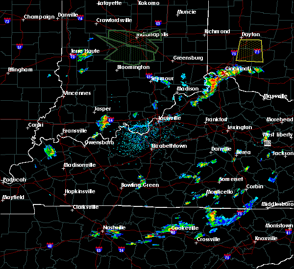 At 250 pm edt/150 pm cdt/, a severe thunderstorm was located 13 miles southwest of english, moving east at 20 mph (radar indicated). Hazards include 60 mph wind gusts. expect damage to roofs, siding, and trees At 250 pm edt/150 pm cdt/, a severe thunderstorm was located 13 miles southwest of english, moving east at 20 mph (radar indicated). Hazards include 60 mph wind gusts. expect damage to roofs, siding, and trees
|
| 6/30/2017 7:59 PM EDT |
 At 742 pm edt, severe thunderstorms were located along a line extending from 9 miles southwest of shoals to near jasper, moving east at 40 mph (radar indicated). Hazards include 60 mph wind gusts. expect damage to roofs, siding, and trees At 742 pm edt, severe thunderstorms were located along a line extending from 9 miles southwest of shoals to near jasper, moving east at 40 mph (radar indicated). Hazards include 60 mph wind gusts. expect damage to roofs, siding, and trees
|
| 6/30/2017 7:42 PM EDT |
 At 742 pm edt, severe thunderstorms were located along a line extending from 9 miles southwest of shoals to near jasper, moving east at 40 mph (radar indicated). Hazards include 60 mph wind gusts. expect damage to roofs, siding, and trees At 742 pm edt, severe thunderstorms were located along a line extending from 9 miles southwest of shoals to near jasper, moving east at 40 mph (radar indicated). Hazards include 60 mph wind gusts. expect damage to roofs, siding, and trees
|
| 5/27/2017 4:35 PM EDT | Golf Ball sized hail reported 4.2 miles WNW of Birdseye, IN |
| 4/28/2017 11:53 PM CDT | Half Dollar sized hail reported 8.9 miles NNW of Birdseye, IN |
| 4/28/2017 10:14 PM EDT |
 At 1013 pm edt, a severe thunderstorm was located 10 miles east of jasper, moving east at 50 mph (radar indicated). Hazards include 60 mph wind gusts and quarter size hail. Hail damage to vehicles is expected. Expect wind damage to roofs, siding, and trees. At 1013 pm edt, a severe thunderstorm was located 10 miles east of jasper, moving east at 50 mph (radar indicated). Hazards include 60 mph wind gusts and quarter size hail. Hail damage to vehicles is expected. Expect wind damage to roofs, siding, and trees.
|
| 3/1/2017 5:33 AM EST |
 At 532 am est, severe thunderstorms were located along a line extending from 8 miles north of paoli to 8 miles south of jasper, moving east at 60 mph (radar indicated). Hazards include 60 mph wind gusts. expect damage to roofs, siding, and trees At 532 am est, severe thunderstorms were located along a line extending from 8 miles north of paoli to 8 miles south of jasper, moving east at 60 mph (radar indicated). Hazards include 60 mph wind gusts. expect damage to roofs, siding, and trees
|
| 3/1/2017 2:02 AM EST |
 At 201 am est/101 am cst/, a severe thunderstorm was located 11 miles southeast of jasper, moving east at 50 mph (radar indicated). Hazards include 60 mph wind gusts and half dollar size hail. Hail damage to vehicles is expected. expect wind damage to roofs, siding, and trees. locations impacted include, huntingburg, ferdinand, birdseye, bretzville, mentor, eckerty, adyeville, huntingburg airport, uniontown and siberia. A tornado watch remains in effect until 500 am est/400 am cst/ for south central indiana. At 201 am est/101 am cst/, a severe thunderstorm was located 11 miles southeast of jasper, moving east at 50 mph (radar indicated). Hazards include 60 mph wind gusts and half dollar size hail. Hail damage to vehicles is expected. expect wind damage to roofs, siding, and trees. locations impacted include, huntingburg, ferdinand, birdseye, bretzville, mentor, eckerty, adyeville, huntingburg airport, uniontown and siberia. A tornado watch remains in effect until 500 am est/400 am cst/ for south central indiana.
|
| 3/1/2017 1:43 AM EST |
 At 142 am est/1242 am cst/, a severe thunderstorm was located 7 miles northwest of dale, moving east at 55 mph (radar indicated). Hazards include 60 mph wind gusts and half dollar size hail. Hail damage to vehicles is expected. Expect wind damage to roofs, siding, and trees. At 142 am est/1242 am cst/, a severe thunderstorm was located 7 miles northwest of dale, moving east at 55 mph (radar indicated). Hazards include 60 mph wind gusts and half dollar size hail. Hail damage to vehicles is expected. Expect wind damage to roofs, siding, and trees.
|
| 7/15/2016 3:54 PM EDT |
 At 354 pm edt, severe thunderstorms were located along a line extending from near english to 14 miles west of carefree town, moving southeast at 25 mph (radar indicated). Hazards include 60 mph wind gusts and quarter size hail. Hail damage to vehicles is expected. expect wind damage to roofs, siding, and trees. Locations impacted include, english, birdseye, taswell, riceville, eckerty, mentor, mifflin, grantsburg, west fork and wickliffe. At 354 pm edt, severe thunderstorms were located along a line extending from near english to 14 miles west of carefree town, moving southeast at 25 mph (radar indicated). Hazards include 60 mph wind gusts and quarter size hail. Hail damage to vehicles is expected. expect wind damage to roofs, siding, and trees. Locations impacted include, english, birdseye, taswell, riceville, eckerty, mentor, mifflin, grantsburg, west fork and wickliffe.
|
| 7/15/2016 3:34 PM EDT |
 At 334 pm edt, a severe thunderstorm was located 10 miles west of english, moving east at 25 mph (radar indicated). Hazards include 60 mph wind gusts and quarter size hail. Hail damage to vehicles is expected. Expect wind damage to roofs, siding, and trees. At 334 pm edt, a severe thunderstorm was located 10 miles west of english, moving east at 25 mph (radar indicated). Hazards include 60 mph wind gusts and quarter size hail. Hail damage to vehicles is expected. Expect wind damage to roofs, siding, and trees.
|
| 7/13/2016 8:04 PM EDT |
 At 804 pm edt/704 pm cdt/, severe thunderstorms were located along a line extending from near shoals to near jasper to near rockport, moving east at 40 mph (radar indicated). Hazards include 60 mph wind gusts. Expect damage to roofs. siding. And trees. At 804 pm edt/704 pm cdt/, severe thunderstorms were located along a line extending from near shoals to near jasper to near rockport, moving east at 40 mph (radar indicated). Hazards include 60 mph wind gusts. Expect damage to roofs. siding. And trees.
|
| 7/8/2016 10:07 AM EDT |
 At 1007 am edt/907 am cdt/, a severe thunderstorm was located near english, moving east at 40 mph (radar indicated). Hazards include 60 mph wind gusts and nickel size hail. Expect damage to roofs. siding. and trees. Locations impacted include, english, carefree town, mount pleasant, marengo, milltown, leopold, birdseye, leavenworth, alton and valeene. At 1007 am edt/907 am cdt/, a severe thunderstorm was located near english, moving east at 40 mph (radar indicated). Hazards include 60 mph wind gusts and nickel size hail. Expect damage to roofs. siding. and trees. Locations impacted include, english, carefree town, mount pleasant, marengo, milltown, leopold, birdseye, leavenworth, alton and valeene.
|
| 7/8/2016 9:51 AM EDT |
 At 950 am edt/850 am cdt/, a severe thunderstorm was located 11 miles east of jasper, moving east at 55 mph (radar indicated). Hazards include 60 mph wind gusts and quarter size hail. Hail damage to vehicles is expected. Expect wind damage to roofs, siding, and trees. At 950 am edt/850 am cdt/, a severe thunderstorm was located 11 miles east of jasper, moving east at 55 mph (radar indicated). Hazards include 60 mph wind gusts and quarter size hail. Hail damage to vehicles is expected. Expect wind damage to roofs, siding, and trees.
|
| 6/15/2016 6:59 PM EDT |
 At 659 pm edt/559 pm cdt/, severe thunderstorms were located along a line extending from 11 miles west of english to 7 miles northeast of holiday world, moving southeast at 35 mph (radar indicated). Hazards include 60 mph wind gusts and penny size hail. Expect damage to roofs. siding. And trees. At 659 pm edt/559 pm cdt/, severe thunderstorms were located along a line extending from 11 miles west of english to 7 miles northeast of holiday world, moving southeast at 35 mph (radar indicated). Hazards include 60 mph wind gusts and penny size hail. Expect damage to roofs. siding. And trees.
|
| 6/14/2016 3:48 PM EDT | Trees dow in dubois county IN, 1.7 miles SE of Birdseye, IN |
| 6/14/2016 3:39 PM EDT |
 At 339 pm edt/239 pm cdt/, a severe thunderstorm was located 10 miles southeast of jasper, moving northeast at 25 mph (radar indicated). Hazards include 60 mph wind gusts and quarter size hail. Hail damage to vehicles is expected. Expect wind damage to roofs, siding, and trees. At 339 pm edt/239 pm cdt/, a severe thunderstorm was located 10 miles southeast of jasper, moving northeast at 25 mph (radar indicated). Hazards include 60 mph wind gusts and quarter size hail. Hail damage to vehicles is expected. Expect wind damage to roofs, siding, and trees.
|
| 5/11/2016 7:35 PM EDT |
 At 734 pm edt/634 pm cdt/, a severe thunderstorm was located 10 miles northeast of dale, moving east at 50 mph (radar indicated). Hazards include 60 mph wind gusts and quarter size hail. Hail damage to vehicles is expected. Expect wind damage to roofs, siding, and trees. At 734 pm edt/634 pm cdt/, a severe thunderstorm was located 10 miles northeast of dale, moving east at 50 mph (radar indicated). Hazards include 60 mph wind gusts and quarter size hail. Hail damage to vehicles is expected. Expect wind damage to roofs, siding, and trees.
|
| 5/11/2016 7:07 PM EDT |
 At 706 pm edt, severe thunderstorms were located along a line extending from near petersburg to near boonville, moving east at 25 mph (radar indicated). Hazards include 60 mph wind gusts and quarter size hail. Hail damage to vehicles is expected. Expect wind damage to roofs, siding, and trees. At 706 pm edt, severe thunderstorms were located along a line extending from near petersburg to near boonville, moving east at 25 mph (radar indicated). Hazards include 60 mph wind gusts and quarter size hail. Hail damage to vehicles is expected. Expect wind damage to roofs, siding, and trees.
|
| 5/7/2016 7:56 PM CDT |
 At 856 pm edt/756 pm cdt/, severe thunderstorms were located along a line extending from 12 miles northwest of shoals to near stanley, moving east at 35 mph (radar indicated). Hazards include 60 mph wind gusts and quarter size hail. Hail damage to vehicles is expected. Expect wind damage to roofs, siding, and trees. At 856 pm edt/756 pm cdt/, severe thunderstorms were located along a line extending from 12 miles northwest of shoals to near stanley, moving east at 35 mph (radar indicated). Hazards include 60 mph wind gusts and quarter size hail. Hail damage to vehicles is expected. Expect wind damage to roofs, siding, and trees.
|
| 5/7/2016 8:55 PM EDT | Trees down across highway 6 in dubois county IN, 0.9 miles ENE of Birdseye, IN |
| 5/7/2016 7:42 PM CDT |
 At 842 pm edt/742 pm cdt/, severe thunderstorms were located along a line extending from 9 miles north of jasper to 7 miles north of hartford, moving southeast at 60 mph (trained weather spotters. wind gusts estimated near 60 mph were reported near ireland). Hazards include 60 mph wind gusts and quarter size hail. Hail damage to vehicles is expected. expect wind damage to roofs, siding, and trees. Locations impacted include, jasper, tell city, hawesville, huntingburg, ferdinand, french lick, lewisport, cannelton, cloverport and leopold. At 842 pm edt/742 pm cdt/, severe thunderstorms were located along a line extending from 9 miles north of jasper to 7 miles north of hartford, moving southeast at 60 mph (trained weather spotters. wind gusts estimated near 60 mph were reported near ireland). Hazards include 60 mph wind gusts and quarter size hail. Hail damage to vehicles is expected. expect wind damage to roofs, siding, and trees. Locations impacted include, jasper, tell city, hawesville, huntingburg, ferdinand, french lick, lewisport, cannelton, cloverport and leopold.
|
| 5/7/2016 7:22 PM CDT |
 At 821 pm edt/721 pm cdt/, severe thunderstorms were located along a line extending from near washington to near masonville, moving southeast at 60 mph. these storms have a history of producing wind damage (radar indicated). Hazards include 60 mph wind gusts and quarter size hail. Hail damage to vehicles is expected. Expect wind damage to roofs, siding, and trees. At 821 pm edt/721 pm cdt/, severe thunderstorms were located along a line extending from near washington to near masonville, moving southeast at 60 mph. these storms have a history of producing wind damage (radar indicated). Hazards include 60 mph wind gusts and quarter size hail. Hail damage to vehicles is expected. Expect wind damage to roofs, siding, and trees.
|
| 5/7/2016 7:46 PM EDT |
 At 746 pm edt, a severe thunderstorm was located 9 miles southeast of washington, moving southeast at 40 mph (radar indicated). Hazards include 60 mph wind gusts and half dollar size hail. Hail damage to vehicles is expected. Expect wind damage to roofs, siding, and trees. At 746 pm edt, a severe thunderstorm was located 9 miles southeast of washington, moving southeast at 40 mph (radar indicated). Hazards include 60 mph wind gusts and half dollar size hail. Hail damage to vehicles is expected. Expect wind damage to roofs, siding, and trees.
|
| 4/26/2016 7:11 PM CDT |
 At 811 pm edt/711 pm cdt/, severe thunderstorms were located along a line extending from 6 miles southwest of english to near hartford, moving east at 25 mph. perry county reported multiple power outages and trees down across the county (law enforcement). Hazards include 60 mph wind gusts and quarter size hail. Hail damage to vehicles is expected. expect wind damage to roofs, siding, and trees. Locations impacted include, tell city, hawesville, mount pleasant, lewisport, cannelton, cloverport, leopold, fordsville, birdseye and troy. At 811 pm edt/711 pm cdt/, severe thunderstorms were located along a line extending from 6 miles southwest of english to near hartford, moving east at 25 mph. perry county reported multiple power outages and trees down across the county (law enforcement). Hazards include 60 mph wind gusts and quarter size hail. Hail damage to vehicles is expected. expect wind damage to roofs, siding, and trees. Locations impacted include, tell city, hawesville, mount pleasant, lewisport, cannelton, cloverport, leopold, fordsville, birdseye and troy.
|
| 4/26/2016 6:36 PM CDT |
 At 736 pm edt/636 pm cdt/, severe thunderstorms were located along a line extending from 6 miles southeast of jasper to near livermore, moving east at 30 mph (trained weather spotters). Hazards include 60 mph wind gusts and quarter size hail. Hail damage to vehicles is expected. expect wind damage to roofs, siding, and trees. Locations impacted include, tell city, hawesville, mount pleasant, lewisport, cannelton, cloverport, leopold, fordsville, birdseye and troy. At 736 pm edt/636 pm cdt/, severe thunderstorms were located along a line extending from 6 miles southeast of jasper to near livermore, moving east at 30 mph (trained weather spotters). Hazards include 60 mph wind gusts and quarter size hail. Hail damage to vehicles is expected. expect wind damage to roofs, siding, and trees. Locations impacted include, tell city, hawesville, mount pleasant, lewisport, cannelton, cloverport, leopold, fordsville, birdseye and troy.
|
| 4/26/2016 6:25 PM CDT |
 At 723 pm edt/623 pm cdt/, severe thunderstorms were located along a line extending from 6 miles southwest of jasper to calhoun, moving east at 30 mph. these storms have a history of producing damaging winds (trained weather spotters). Hazards include 60 mph wind gusts and quarter size hail. Hail damage to vehicles is expected. Expect wind damage to roofs, siding, and trees. At 723 pm edt/623 pm cdt/, severe thunderstorms were located along a line extending from 6 miles southwest of jasper to calhoun, moving east at 30 mph. these storms have a history of producing damaging winds (trained weather spotters). Hazards include 60 mph wind gusts and quarter size hail. Hail damage to vehicles is expected. Expect wind damage to roofs, siding, and trees.
|
| 3/27/2016 8:13 PM EDT |
 At 813 pm edt, a severe thunderstorm was located 13 miles west of english, moving northeast at 30 mph (radar indicated). Hazards include quarter size hail. damage to vehicles is expected At 813 pm edt, a severe thunderstorm was located 13 miles west of english, moving northeast at 30 mph (radar indicated). Hazards include quarter size hail. damage to vehicles is expected
|
| 3/27/2016 8:06 PM EDT |
 At 806 pm edt, a severe thunderstorm was located 12 miles southeast of jasper, moving northeast at 30 mph (radar indicated). Hazards include quarter size hail. Damage to vehicles is expected. Locations impacted include, birdseye, saint marks, kyana, ellsworth, riceville, mentor, greenbrier, french lick municipal airport, schnellville and norton. At 806 pm edt, a severe thunderstorm was located 12 miles southeast of jasper, moving northeast at 30 mph (radar indicated). Hazards include quarter size hail. Damage to vehicles is expected. Locations impacted include, birdseye, saint marks, kyana, ellsworth, riceville, mentor, greenbrier, french lick municipal airport, schnellville and norton.
|
| 3/27/2016 7:51 PM EDT |
 At 751 pm edt/651 pm cdt/, a severe thunderstorm was located 9 miles northeast of holiday world, moving northeast at 40 mph (radar indicated). Hazards include quarter size hail. damage to vehicles is expected At 751 pm edt/651 pm cdt/, a severe thunderstorm was located 9 miles northeast of holiday world, moving northeast at 40 mph (radar indicated). Hazards include quarter size hail. damage to vehicles is expected
|
| 12/23/2015 5:42 PM EST | At 542 pm est, a severe thunderstorm was located 7 miles east of jasper, moving northeast at 80 mph (radar indicated). Hazards include 60 mph wind gusts and penny size hail. Expect damage to roofs. Siding and trees. |
| 12/23/2015 2:08 PM CST | At 308 pm est /208 pm cst/, severe thunderstorms were located along a line extending from near shoals to 9 miles southeast of jasper to near grandview, moving east at 45 mph (radar indicated). Hazards include 60 mph wind gusts. Expect damage to roofs. Siding and trees. |
| 12/23/2015 2:08 PM CST | At 308 pm est /208 pm cst/, severe thunderstorms were located along a line extending from near shoals to 9 miles southeast of jasper to near grandview, moving east at 45 mph (radar indicated). Hazards include 60 mph wind gusts. Expect damage to roofs. Siding and trees. |
| 8/15/2015 6:36 PM EDT |
 At 536 pm cdt, a severe thunderstorm was located near jasper, moving southwest at 15 mph (radar indicated). Hazards include 60 mph wind gusts and quarter size hail. Hail damage to vehicles is expected. expect wind damage to roofs, siding and trees. Locations impacted include, huntingburg, ferdinand, birdseye, kyana, saint anthony, mentor, bretzville, celestine, schnellville, saint marks, saint henry, maltersville and huntingburg airport. At 536 pm cdt, a severe thunderstorm was located near jasper, moving southwest at 15 mph (radar indicated). Hazards include 60 mph wind gusts and quarter size hail. Hail damage to vehicles is expected. expect wind damage to roofs, siding and trees. Locations impacted include, huntingburg, ferdinand, birdseye, kyana, saint anthony, mentor, bretzville, celestine, schnellville, saint marks, saint henry, maltersville and huntingburg airport.
|
| 7/29/2015 5:55 PM EDT |
 At 552 pm edt, a severe thunderstorm was located 12 miles west of english, and moving southeast at 30 mph (radar indicated). Hazards include 60 mph wind gusts. Expect damage to roofs. Siding and trees. At 552 pm edt, a severe thunderstorm was located 12 miles west of english, and moving southeast at 30 mph (radar indicated). Hazards include 60 mph wind gusts. Expect damage to roofs. Siding and trees.
|
| 4/10/2015 1:32 AM EDT | The national weather service in louisville has issued a * severe thunderstorm warning for. crawford county in south central indiana. southeastern dubois county in south central indiana. northern perry county in south central indiana. Until 200 am edt/100 am cdt/. |
| 4/10/2015 1:28 AM EDT | A severe thunderstorm warning remains in effect for eastern dubois county until 135 am edt. at 127 am edt. a severe thunderstorm was located 6 miles east of jasper. and moving northeast at 55 mph. this produced a 52 mph wind gust in huntingburg at 122 am. hazard. 60 mph wind gusts. |
| 4/10/2015 1:20 AM EDT | A severe thunderstorm warning remains in effect for dubois county until 135 am edt. at 116 am edt. a severe thunderstorm was located near huntingburg. and moving northeast at 55 mph. this produced 50 mph winds in ireland at 114 am. hazard. 60 mph wind gusts. |
| 4/10/2015 1:06 AM EDT | The national weather service in louisville has issued a * severe thunderstorm warning for. western crawford county in south central indiana. southern dubois county in south central indiana. northern perry county in south central indiana. Until 135 am edt/1235 am cdt/. |
| 4/10/2015 12:53 AM EDT | The national weather service in louisville has issued a * severe thunderstorm warning for. dubois county in south central indiana. until 135 am edt * at 1251 am edt. a severe thunderstorm was located 10 miles southwest of jasper. And moving northeast at 55 mph. |
| 4/7/2015 4:21 PM EDT | The national weather service in louisville has issued a * severe thunderstorm warning for. crawford county in south central indiana. southeastern dubois county in south central indiana. northwestern perry county in south central indiana. Until 445 pm edt/345 pm cdt/. |
| 4/7/2015 4:17 PM EDT | Trees down in orange county IN, 7.8 miles SSW of Birdseye, IN |
| 4/7/2015 3:53 PM EDT | The national weather service in louisville has issued a * severe thunderstorm warning for. northwestern crawford county in south central indiana. central dubois county in south central indiana. until 425 pm edt * at 350 pm edt. a severe thunderstorm was located near jasper. And. |
| 12/21/2013 8:11 PM EST | Relayed report from dispatch of several trees down on the west side of the county in crawford county IN, 5.2 miles W of Birdseye, IN |
| 5/29/2012 5:00 AM EDT | Trees down in dubois county IN, 0.4 miles NE of Birdseye, IN |
| 5/4/2012 4:00 PM EDT | Storm damage reported in crawford county IN, 4.1 miles W of Birdseye, IN |
| 3/2/2012 2:23 PM EST | Hen Egg sized hail reported 0.4 miles NE of Birdseye, IN, two inch hail covering the ground |
| 3/2/2012 2:15 PM EST | Quarter sized hail reported 0.4 miles NE of Birdseye, IN |
| 1/1/0001 12:00 AM | Dispatch reports trees down along indiana state highway 64 near the intersection of hardscrabble r in crawford county IN, 1.3 miles SW of Birdseye, IN |
| 1/1/0001 12:00 AM | Storm damage reported in crawford county IN, 2.7 miles WSW of Birdseye, IN |
| 1/1/0001 12:00 AM | Storm damage reported in dubois county IN, 0.4 miles NE of Birdseye, IN |
Hail Maps for Birdseye, IN


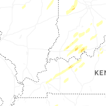


Connect with Interactive Hail Maps