

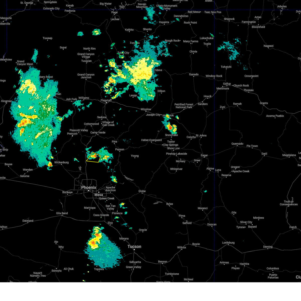
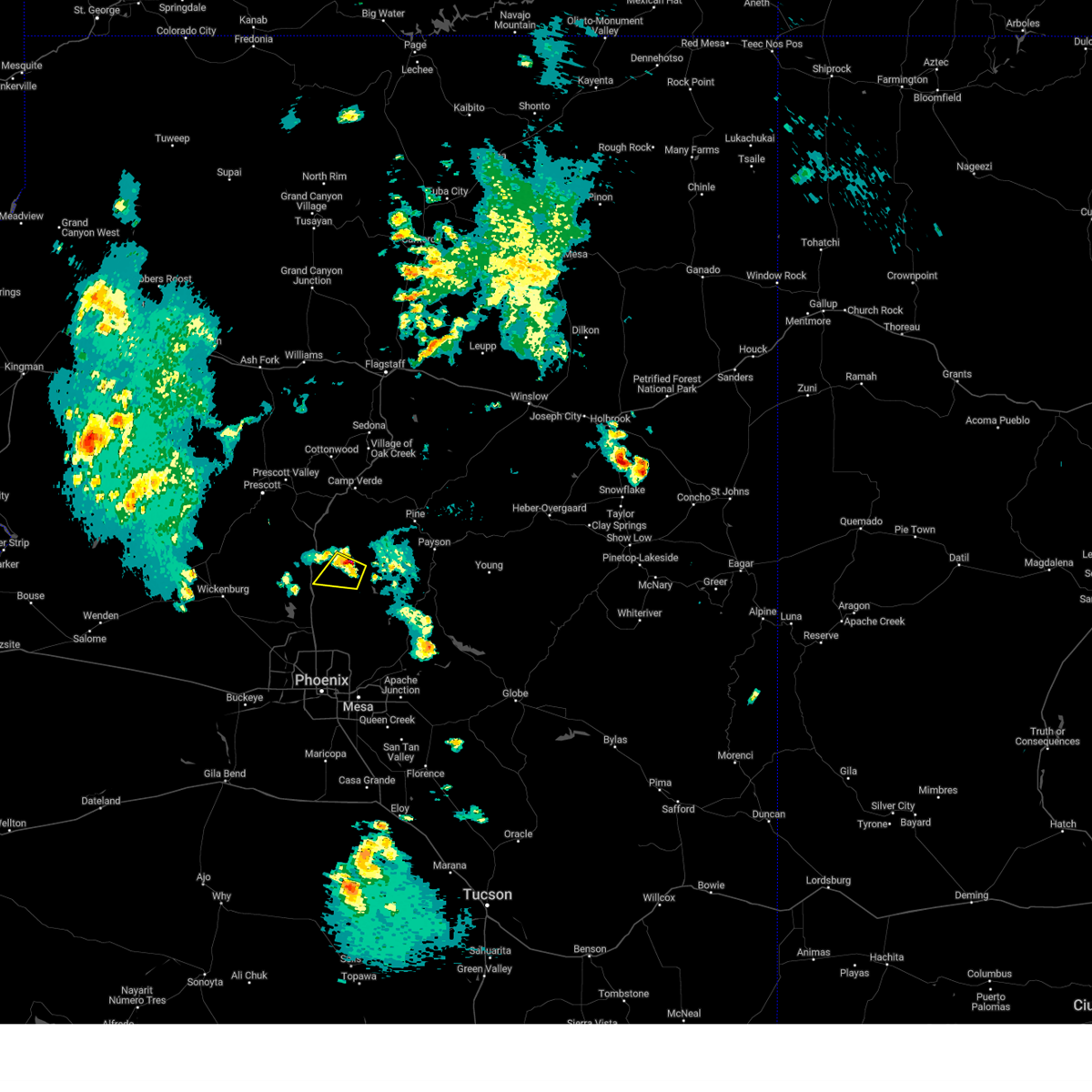
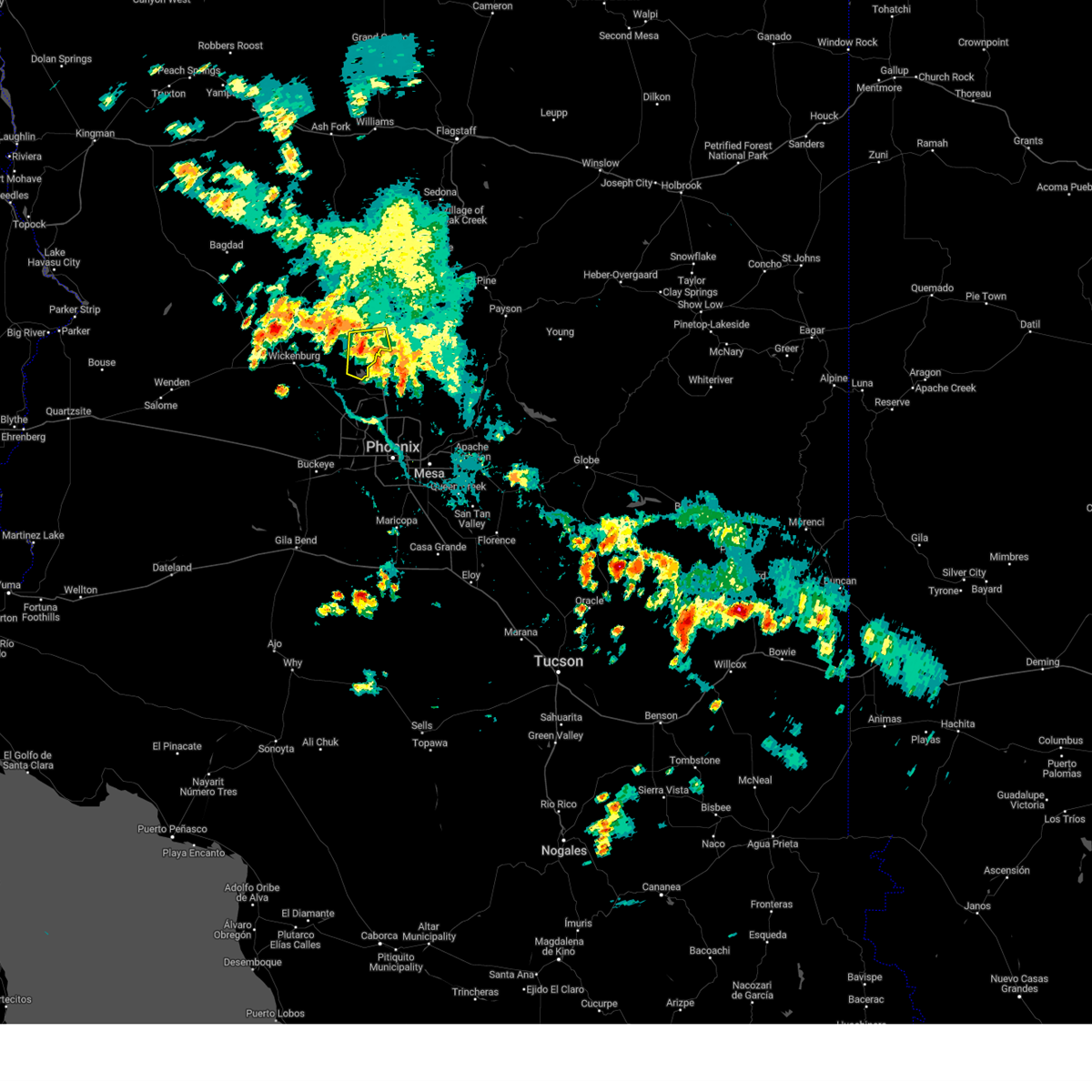
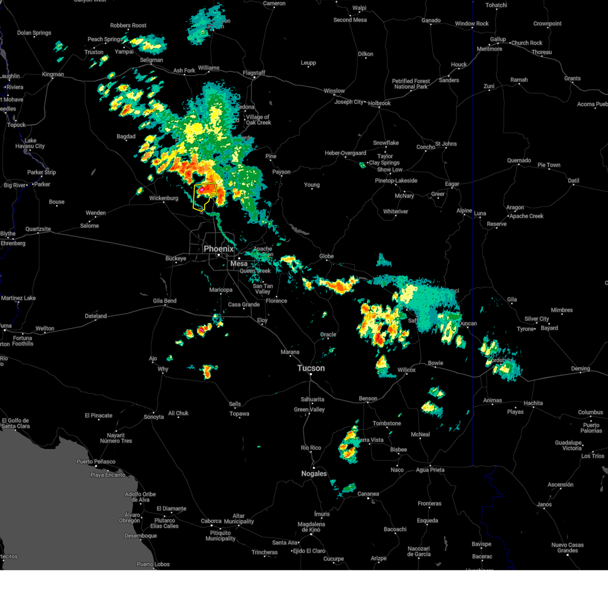
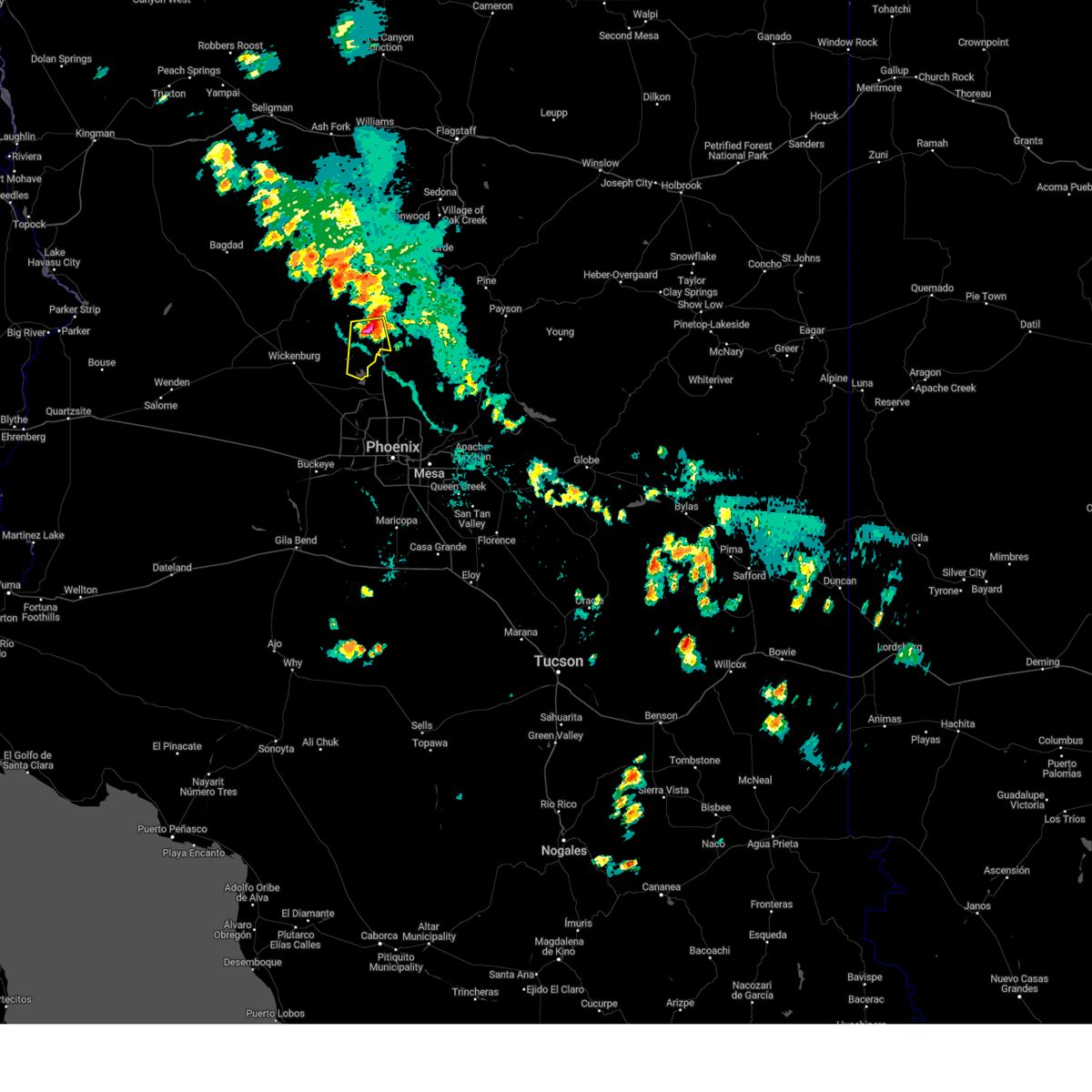
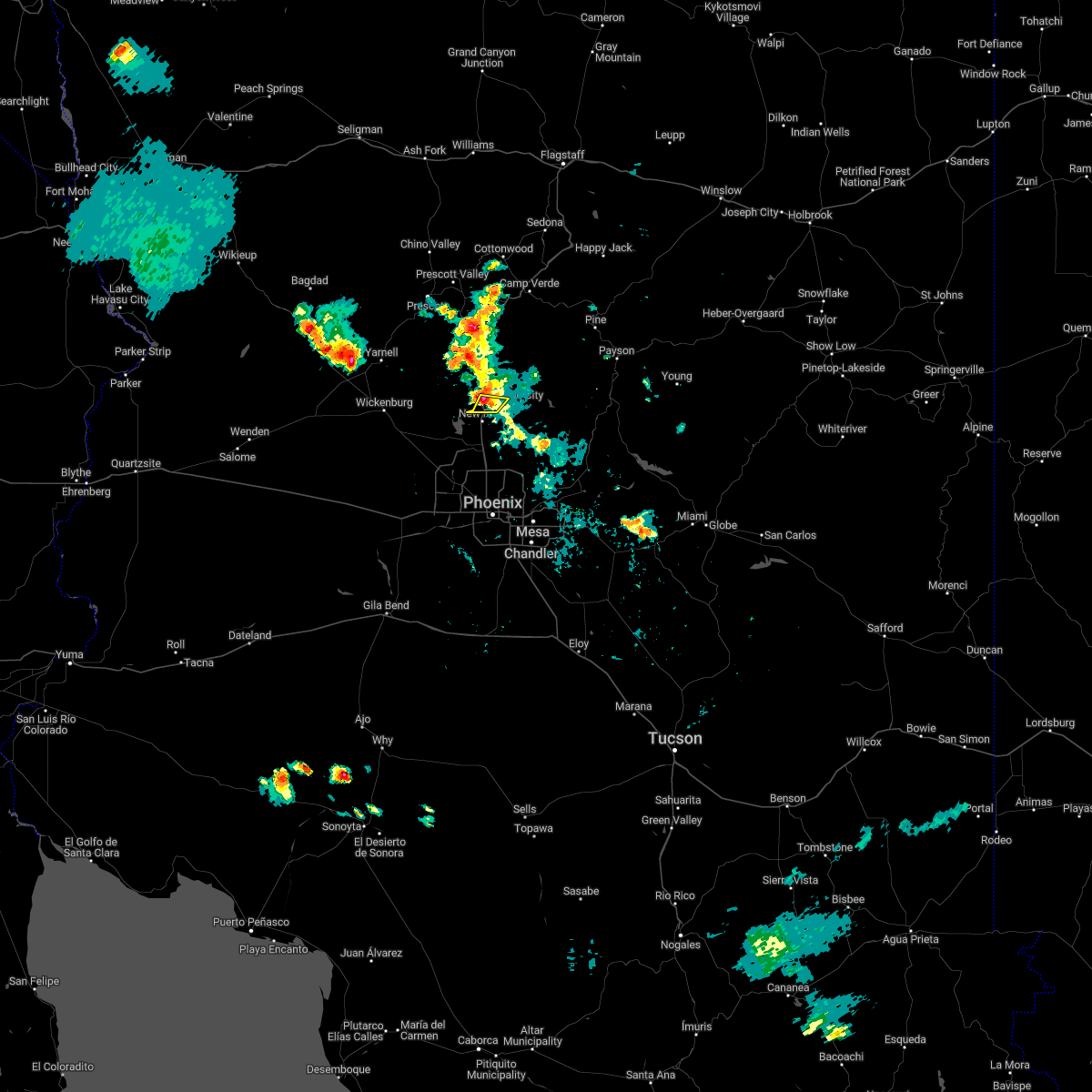
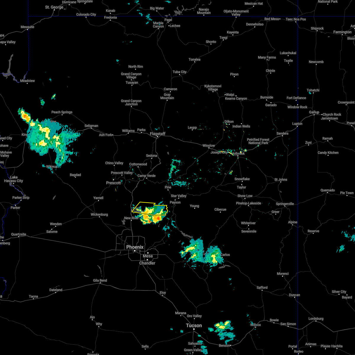
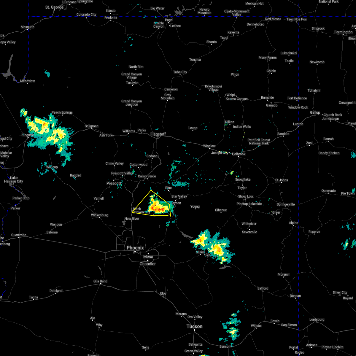
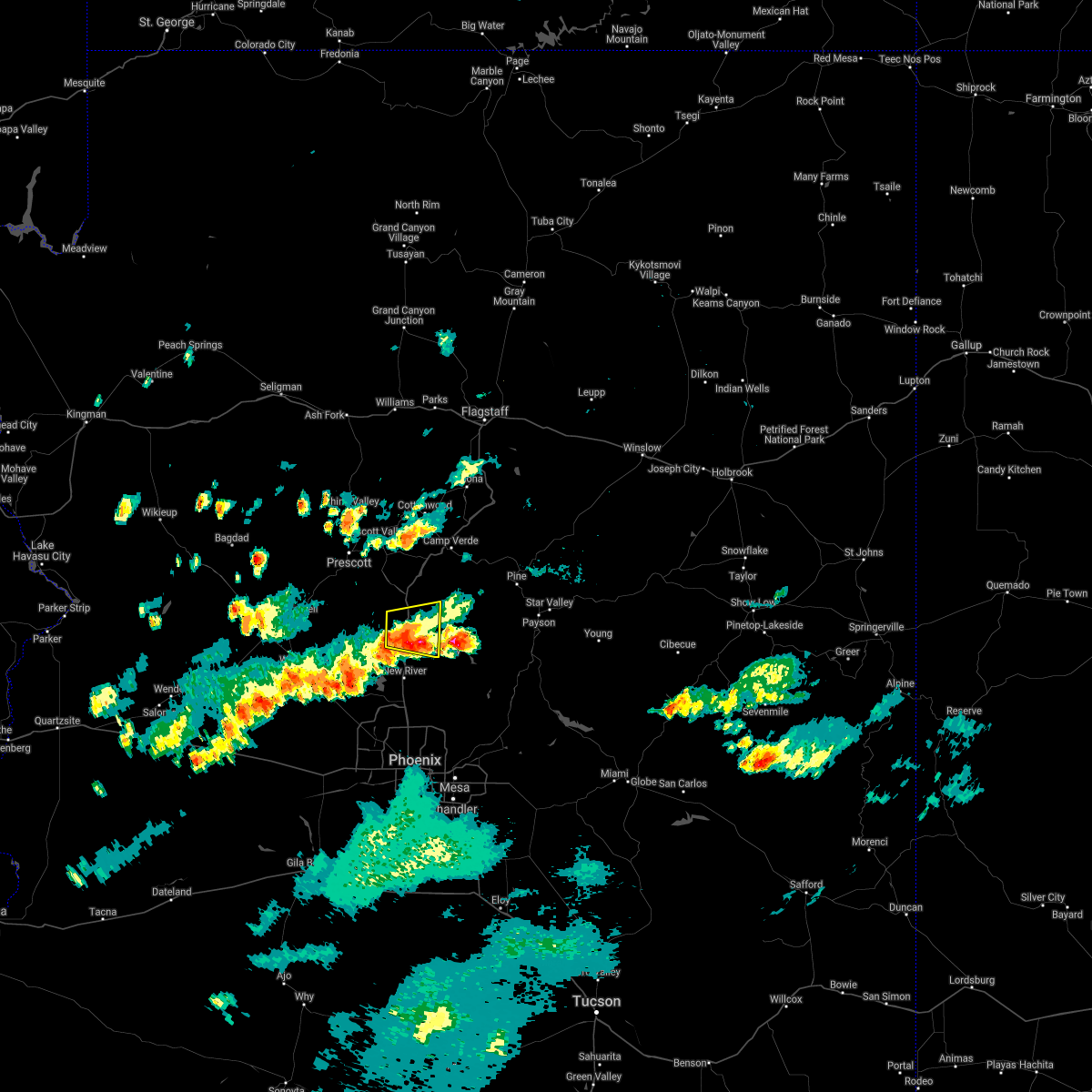
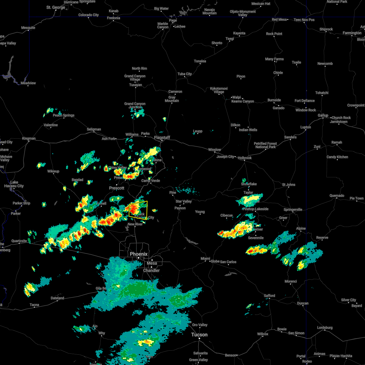
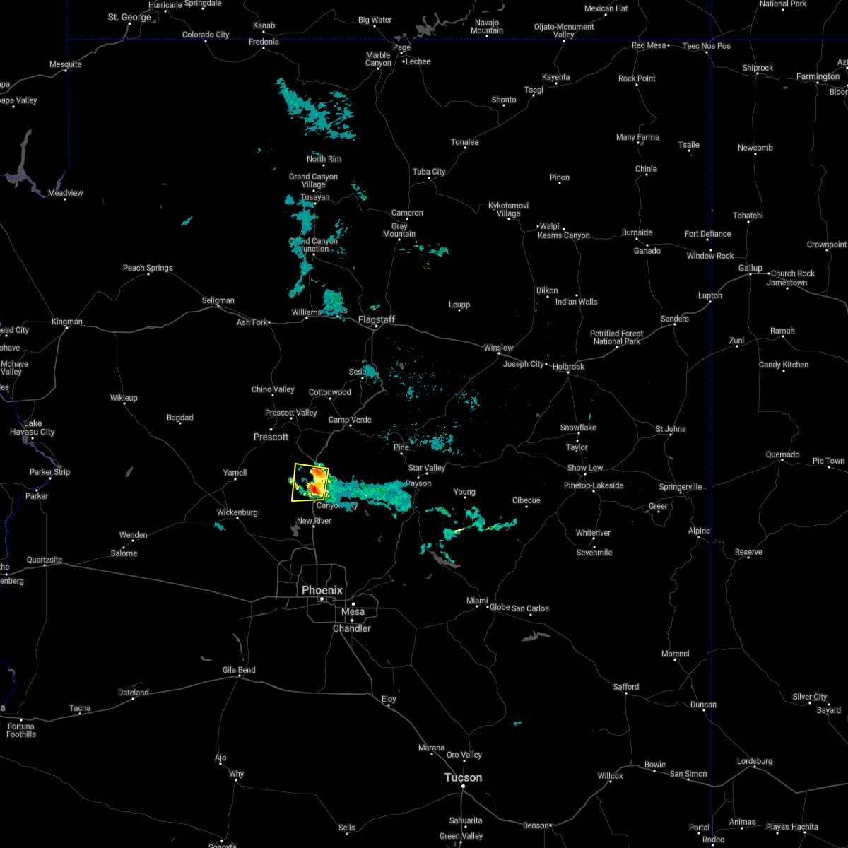
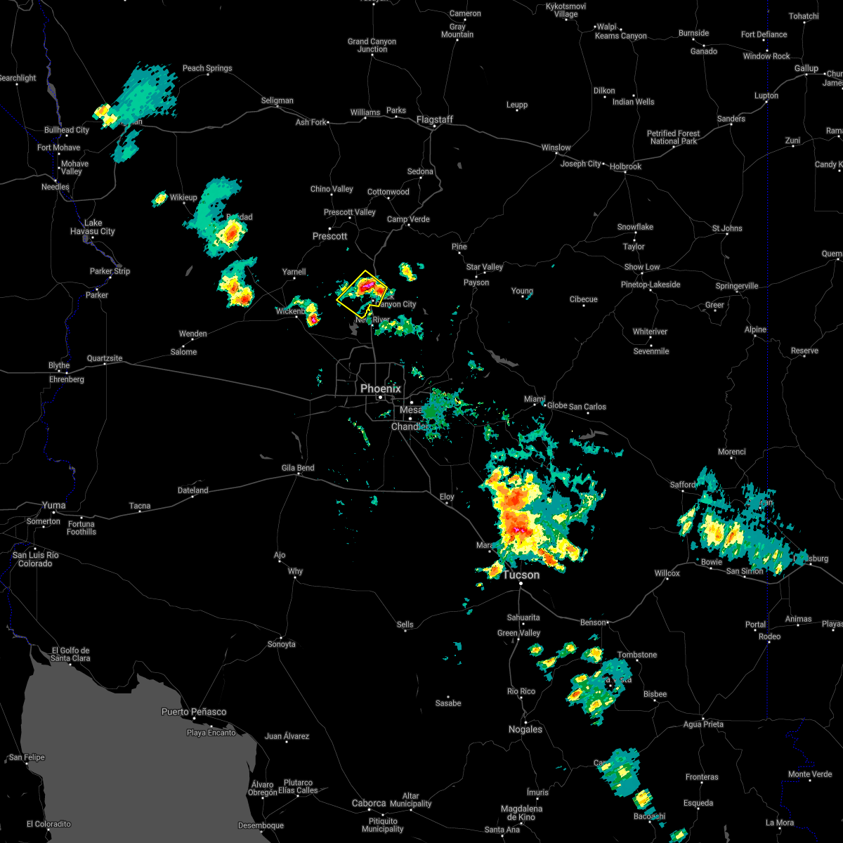
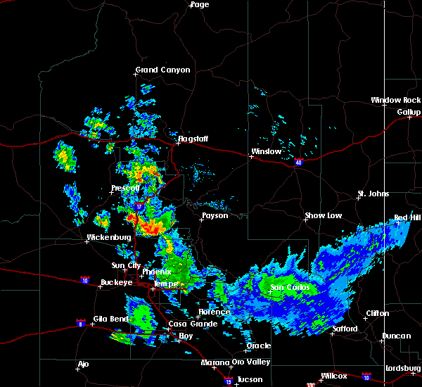
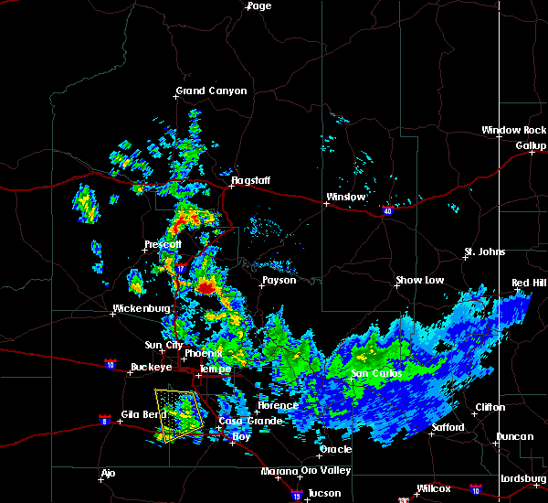
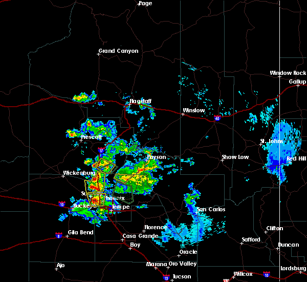
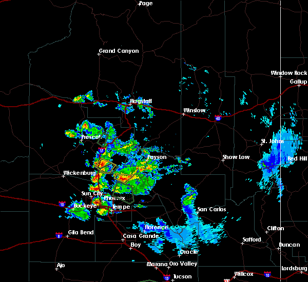
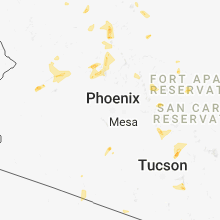
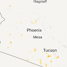
Hail Map for Black Canyon City, AZ
The Black Canyon City, AZ area has had 1 report of on-the-ground hail by trained spotters, and has been under severe weather warnings 10 times during the past 12 months. Doppler radar has detected hail at or near Black Canyon City, AZ on 38 occasions, including 4 occasions during the past year.
| Name: | Black Canyon City, AZ |
| Where Located: | 43.8 miles N of Phoenix, AZ |
| Map: | Google Map for Black Canyon City, AZ |
| Population: | 2837 |
| Housing Units: | 1563 |
| More Info: | Search Google for Black Canyon City, AZ |
1
The Top Recent Hail Date for Black Canyon City, AZ is Sunday, July 14, 2024 (10th out of 38)

Hail and Wind Damage Spotted near Black Canyon City, AZ
| Date / Time | Report Details |
|---|---|
| 8/7/2024 5:06 PM MST | Golf Ball sized hail reported 14.5 miles SE of Black Canyon City, AZ, fb report. golf ball sized hail in crown king. |
| 8/6/2024 6:51 PM MST |
 The storm which prompted the warning has weakened below severe limits, and no longer poses an immediate threat to life or property. therefore, the warning will be allowed to expire. The storm which prompted the warning has weakened below severe limits, and no longer poses an immediate threat to life or property. therefore, the warning will be allowed to expire.
|
| 8/6/2024 6:35 PM MST |
 Svrfgz the national weather service in flagstaff has issued a * severe thunderstorm warning for, yavapai county in west central arizona, * until 700 pm mst. * at 635 pm mst, a severe thunderstorm was located 10 miles east of agua fria national monument, or 19 miles northeast of new river, moving southwest at 15 mph (radar indicated). Hazards include 60 mph wind gusts and quarter size hail. Hail damage to vehicles is expected. Expect wind damage to roofs, siding, and trees. Svrfgz the national weather service in flagstaff has issued a * severe thunderstorm warning for, yavapai county in west central arizona, * until 700 pm mst. * at 635 pm mst, a severe thunderstorm was located 10 miles east of agua fria national monument, or 19 miles northeast of new river, moving southwest at 15 mph (radar indicated). Hazards include 60 mph wind gusts and quarter size hail. Hail damage to vehicles is expected. Expect wind damage to roofs, siding, and trees.
|
| 7/21/2024 3:44 PM MST |
 The storm which prompted the warning has weakened below severe limits, and no longer poses an immediate threat to life or property. therefore, the warning will be allowed to expire. however, small hail, gusty winds up to 50 mph and heavy rain are still possible with this thunderstorm in the black canyon city area. a severe thunderstorm watch remains in effect until 800 pm mst for west central arizona. The storm which prompted the warning has weakened below severe limits, and no longer poses an immediate threat to life or property. therefore, the warning will be allowed to expire. however, small hail, gusty winds up to 50 mph and heavy rain are still possible with this thunderstorm in the black canyon city area. a severe thunderstorm watch remains in effect until 800 pm mst for west central arizona.
|
| 7/21/2024 3:22 PM MST |
 At 321 pm mst, a severe thunderstorm was located near new river, moving southeast at 20 mph (radar indicated). Hazards include 60 mph wind gusts and penny size hail. Expect damage to roofs, siding, and trees. locations impacted include, new river, cave creek, carefree, lake pleasant, and anthem. this includes the following highways, az interstate 17 between mile markers 225 and 241. Az route 74 between mile markers 13 and 24. At 321 pm mst, a severe thunderstorm was located near new river, moving southeast at 20 mph (radar indicated). Hazards include 60 mph wind gusts and penny size hail. Expect damage to roofs, siding, and trees. locations impacted include, new river, cave creek, carefree, lake pleasant, and anthem. this includes the following highways, az interstate 17 between mile markers 225 and 241. Az route 74 between mile markers 13 and 24.
|
| 7/21/2024 3:22 PM MST |
 At 322 pm mst, a severe thunderstorm was located near black canyon city, or 15 miles northwest of new river, moving south at 15 mph (radar indicated). Hazards include 60 mph wind gusts and penny size hail. Expect damage to roofs, siding, and trees. locations impacted include, castle creek boat ramp, coles bay, lake pleasant, black canyon city, castle hot springs, casa rosa, humbug, rock springs, humbug bay, cottonwood day use area, goose bay, agua fria national monument, and castle creek wilderness. This includes interstate 17 between mile markers 242 and 249. At 322 pm mst, a severe thunderstorm was located near black canyon city, or 15 miles northwest of new river, moving south at 15 mph (radar indicated). Hazards include 60 mph wind gusts and penny size hail. Expect damage to roofs, siding, and trees. locations impacted include, castle creek boat ramp, coles bay, lake pleasant, black canyon city, castle hot springs, casa rosa, humbug, rock springs, humbug bay, cottonwood day use area, goose bay, agua fria national monument, and castle creek wilderness. This includes interstate 17 between mile markers 242 and 249.
|
| 7/21/2024 3:02 PM MST |
 Svrfgz the national weather service in flagstaff has issued a * severe thunderstorm warning for, yavapai county in west central arizona from bumble bee to black canyon city, * until 345 pm mst. * at 301 pm mst, a severe thunderstorm was located near horse thief basin, or 19 miles northwest of new river, moving south at 15 mph (radar indicated). Hazards include 60 mph wind gusts and penny size hail. expect damage to roofs, siding, and trees Svrfgz the national weather service in flagstaff has issued a * severe thunderstorm warning for, yavapai county in west central arizona from bumble bee to black canyon city, * until 345 pm mst. * at 301 pm mst, a severe thunderstorm was located near horse thief basin, or 19 miles northwest of new river, moving south at 15 mph (radar indicated). Hazards include 60 mph wind gusts and penny size hail. expect damage to roofs, siding, and trees
|
| 7/21/2024 2:58 PM MST |
 Svrpsr the national weather service in phoenix has issued a * severe thunderstorm warning for, maricopa county in south central arizona, * until 345 pm mst. * at 257 pm mst, a severe thunderstorm was located over rock springs, or 13 miles north of new river, moving south at 25 mph (radar indicated). Hazards include 60 mph wind gusts and penny size hail. expect damage to roofs, siding, and trees Svrpsr the national weather service in phoenix has issued a * severe thunderstorm warning for, maricopa county in south central arizona, * until 345 pm mst. * at 257 pm mst, a severe thunderstorm was located over rock springs, or 13 miles north of new river, moving south at 25 mph (radar indicated). Hazards include 60 mph wind gusts and penny size hail. expect damage to roofs, siding, and trees
|
| 7/14/2024 10:53 PM MST |
 The storm which prompted the warning has weakened below severe limits, and no longer poses an immediate threat to life or property. therefore, the warning will be allowed to expire. The storm which prompted the warning has weakened below severe limits, and no longer poses an immediate threat to life or property. therefore, the warning will be allowed to expire.
|
| 7/14/2024 10:34 PM MST |
 At 1034 pm mst, a severe thunderstorm was located near new river, moving northwest at 10 mph (radar indicated). Hazards include 60 mph wind gusts and penny size hail. Expect damage to roofs, siding, and trees. locations impacted include, new river. This includes az interstate 17 between mile markers 232 and 238. At 1034 pm mst, a severe thunderstorm was located near new river, moving northwest at 10 mph (radar indicated). Hazards include 60 mph wind gusts and penny size hail. Expect damage to roofs, siding, and trees. locations impacted include, new river. This includes az interstate 17 between mile markers 232 and 238.
|
| 7/14/2024 10:13 PM MST |
 Svrpsr the national weather service in phoenix has issued a * severe thunderstorm warning for, maricopa county in south central arizona, * until 1100 pm mst. * at 1013 pm mst, a severe thunderstorm was located near cave creek, or near new river, moving northwest at 10 mph (radar indicated). Hazards include 60 mph wind gusts and penny size hail. expect damage to roofs, siding, and trees Svrpsr the national weather service in phoenix has issued a * severe thunderstorm warning for, maricopa county in south central arizona, * until 1100 pm mst. * at 1013 pm mst, a severe thunderstorm was located near cave creek, or near new river, moving northwest at 10 mph (radar indicated). Hazards include 60 mph wind gusts and penny size hail. expect damage to roofs, siding, and trees
|
| 8/31/2023 10:40 PM MST |
 The severe thunderstorm warning for maricopa county will expire at 1045 pm mst, the storm which prompted the warning has weakened below severe limits, and no longer poses an immediate threat to life or property. therefore, the warning will be allowed to expire. however, heavy rain is still possible with this thunderstorm. The severe thunderstorm warning for maricopa county will expire at 1045 pm mst, the storm which prompted the warning has weakened below severe limits, and no longer poses an immediate threat to life or property. therefore, the warning will be allowed to expire. however, heavy rain is still possible with this thunderstorm.
|
| 8/31/2023 9:45 PM MST |
 At 945 pm mst, a severe thunderstorm was located over new river, moving northwest at 5 mph (radar indicated). Hazards include 60 mph wind gusts and penny size hail. expect damage to roofs, siding, and trees At 945 pm mst, a severe thunderstorm was located over new river, moving northwest at 5 mph (radar indicated). Hazards include 60 mph wind gusts and penny size hail. expect damage to roofs, siding, and trees
|
| 7/26/2023 11:11 PM MST |
 The severe thunderstorm warning for gila and maricopa counties will expire at 1115 pm mst, the thunderstorm winds which prompted the warning have weakened below severe limits. therefore, the warning will be allowed to expire. The severe thunderstorm warning for gila and maricopa counties will expire at 1115 pm mst, the thunderstorm winds which prompted the warning have weakened below severe limits. therefore, the warning will be allowed to expire.
|
| 7/26/2023 10:33 PM MST |
 At 1033 pm mst, severe thunderstorm winds were located along a line extending from near peoria to 6 miles north of desert ridge marketplace to round valley, moving northwest at 45 mph (radar indicated). Hazards include 60 mph wind gusts. expect damage to roofs, siding, and trees At 1033 pm mst, severe thunderstorm winds were located along a line extending from near peoria to 6 miles north of desert ridge marketplace to round valley, moving northwest at 45 mph (radar indicated). Hazards include 60 mph wind gusts. expect damage to roofs, siding, and trees
|
| 10/15/2022 2:04 PM MST |
 At 204 pm mst, severe thunderstorms were located along a line extending from 9 miles northwest of sycamore creek to near camp creek to near peoria, moving north at 35 mph (radar indicated). Hazards include 60 mph wind gusts. Expect damage to roofs, siding, and trees. locations impacted include, phoenix, scottsdale, new river, cave creek, carefree, deer valley airport, lake pleasant, desert mountain, desert ridge marketplace, camp creek, horseshoe reservoir, anthem and seven springs. this includes the following highways, az interstate 17 between mile markers 210 and 241. az route 51 between mile markers 13 and 15. az route 101 between mile markers 21 and 33. hail threat, radar indicated max hail size, <. 75 in wind threat, radar indicated max wind gust, 60 mph. At 204 pm mst, severe thunderstorms were located along a line extending from 9 miles northwest of sycamore creek to near camp creek to near peoria, moving north at 35 mph (radar indicated). Hazards include 60 mph wind gusts. Expect damage to roofs, siding, and trees. locations impacted include, phoenix, scottsdale, new river, cave creek, carefree, deer valley airport, lake pleasant, desert mountain, desert ridge marketplace, camp creek, horseshoe reservoir, anthem and seven springs. this includes the following highways, az interstate 17 between mile markers 210 and 241. az route 51 between mile markers 13 and 15. az route 101 between mile markers 21 and 33. hail threat, radar indicated max hail size, <. 75 in wind threat, radar indicated max wind gust, 60 mph.
|
| 10/15/2022 1:54 PM MST |
 At 154 pm mst, severe thunderstorms were located along a line extending from near sycamore creek to near desert mountain to near arrowhead mall, moving north at 35 mph (radar indicated). Hazards include 60 mph wind gusts. Expect damage to roofs, siding, and trees. locations impacted include, phoenix, scottsdale, paradise valley, round valley, new river, sycamore creek, sunflower, cave creek, carefree, piestewa peak park, deer valley airport, lake pleasant, mcdowell mountain park, north mountain park and desert mountain. this includes the following highways, az interstate 17 between mile markers 210 and 241. az route 51 between mile markers 3 and 15. az route 87 between mile markers 211 and 219. hail threat, radar indicated max hail size, <. 75 in wind threat, radar indicated max wind gust, 60 mph. At 154 pm mst, severe thunderstorms were located along a line extending from near sycamore creek to near desert mountain to near arrowhead mall, moving north at 35 mph (radar indicated). Hazards include 60 mph wind gusts. Expect damage to roofs, siding, and trees. locations impacted include, phoenix, scottsdale, paradise valley, round valley, new river, sycamore creek, sunflower, cave creek, carefree, piestewa peak park, deer valley airport, lake pleasant, mcdowell mountain park, north mountain park and desert mountain. this includes the following highways, az interstate 17 between mile markers 210 and 241. az route 51 between mile markers 3 and 15. az route 87 between mile markers 211 and 219. hail threat, radar indicated max hail size, <. 75 in wind threat, radar indicated max wind gust, 60 mph.
|
| 10/15/2022 1:38 PM MST |
 At 137 pm mst, severe thunderstorms were located along a line extending from near round valley to near scottsdale to near downtown glendale, moving north at 35 mph (radar indicated). Hazards include 60 mph wind gusts. expect damage to roofs, siding, and trees At 137 pm mst, severe thunderstorms were located along a line extending from near round valley to near scottsdale to near downtown glendale, moving north at 35 mph (radar indicated). Hazards include 60 mph wind gusts. expect damage to roofs, siding, and trees
|
| 9/2/2022 5:23 PM MST |
 The severe thunderstorm warning for maricopa county will expire at 530 pm mst, the storm which prompted the warning has weakened below severe limits, and no longer poses an immediate threat to life or property. therefore, the warning will be allowed to expire. however gusty winds and heavy rain are still possible with this thunderstorm. a severe thunderstorm watch remains in effect until 1100 pm mst for south central arizona. The severe thunderstorm warning for maricopa county will expire at 530 pm mst, the storm which prompted the warning has weakened below severe limits, and no longer poses an immediate threat to life or property. therefore, the warning will be allowed to expire. however gusty winds and heavy rain are still possible with this thunderstorm. a severe thunderstorm watch remains in effect until 1100 pm mst for south central arizona.
|
| 9/2/2022 5:18 PM MST |
 At 517 pm mst, a severe thunderstorm was located near rock springs, or near new river, moving southwest at 20 mph (radar indicated). Hazards include 60 mph wind gusts and penny size hail. Expect damage to roofs, siding, and trees. this severe thunderstorm will remain over mainly rural areas of maricopa county. this includes az interstate 17 between mile markers 236 and 241. hail threat, radar indicated max hail size, 0. 75 in wind threat, radar indicated max wind gust, 60 mph. At 517 pm mst, a severe thunderstorm was located near rock springs, or near new river, moving southwest at 20 mph (radar indicated). Hazards include 60 mph wind gusts and penny size hail. Expect damage to roofs, siding, and trees. this severe thunderstorm will remain over mainly rural areas of maricopa county. this includes az interstate 17 between mile markers 236 and 241. hail threat, radar indicated max hail size, 0. 75 in wind threat, radar indicated max wind gust, 60 mph.
|
| 9/2/2022 5:09 PM MST |
 At 509 pm mst, a severe thunderstorm was located near black canyon city, or 7 miles northeast of new river, moving southwest at 20 mph (radar indicated). Hazards include 60 mph wind gusts and penny size hail. Expect damage to roofs, siding, and trees. locations impacted include, new river. this includes az interstate 17 between mile markers 229 and 241. hail threat, radar indicated max hail size, 0. 75 in wind threat, radar indicated max wind gust, 60 mph. At 509 pm mst, a severe thunderstorm was located near black canyon city, or 7 miles northeast of new river, moving southwest at 20 mph (radar indicated). Hazards include 60 mph wind gusts and penny size hail. Expect damage to roofs, siding, and trees. locations impacted include, new river. this includes az interstate 17 between mile markers 229 and 241. hail threat, radar indicated max hail size, 0. 75 in wind threat, radar indicated max wind gust, 60 mph.
|
| 9/2/2022 4:55 PM MST | Called spotter and had 55 mph sustained on the hill east of the 17 with at least a 62 mph gust via weather station she has access to. damage to smaller billboard sign a in yavapai county AZ, 0 miles NNW of Black Canyon City, AZ |
| 9/2/2022 4:48 PM MST |
 At 446 pm mst, severe thunderstorms were located along a line extending from 7 miles northeast of cordes junction to 8 miles northwest of camp creek, moving west at 25 mph (radar indicated). Hazards include 70 mph wind gusts and dime to half dollar size hail. Hail damage to vehicles is expected. expect considerable tree damage. wind damage is also likely to mobile homes, roofs, and outbuildings. locations impacted include, cordes junction, bumble bee, cordes lakes, black canyon city, rock springs, cordes and spring valley. this includes the following highways, interstate 17 between mile markers 242 and 271. state route 69 between mile markers 263 and 269. thunderstorm damage threat, considerable hail threat, radar indicated max hail size, 1. 25 in wind threat, radar indicated max wind gust, 70 mph. At 446 pm mst, severe thunderstorms were located along a line extending from 7 miles northeast of cordes junction to 8 miles northwest of camp creek, moving west at 25 mph (radar indicated). Hazards include 70 mph wind gusts and dime to half dollar size hail. Hail damage to vehicles is expected. expect considerable tree damage. wind damage is also likely to mobile homes, roofs, and outbuildings. locations impacted include, cordes junction, bumble bee, cordes lakes, black canyon city, rock springs, cordes and spring valley. this includes the following highways, interstate 17 between mile markers 242 and 271. state route 69 between mile markers 263 and 269. thunderstorm damage threat, considerable hail threat, radar indicated max hail size, 1. 25 in wind threat, radar indicated max wind gust, 70 mph.
|
| 9/2/2022 4:47 PM MST |
 At 447 pm mst, a severe thunderstorm was located 9 miles east of black canyon city, or 14 miles northeast of new river, moving southwest at 20 mph (radar indicated). Hazards include 60 mph wind gusts and nickel size hail. expect damage to roofs, siding, and trees At 447 pm mst, a severe thunderstorm was located 9 miles east of black canyon city, or 14 miles northeast of new river, moving southwest at 20 mph (radar indicated). Hazards include 60 mph wind gusts and nickel size hail. expect damage to roofs, siding, and trees
|
| 9/2/2022 4:28 PM MST |
 At 427 pm mst, severe thunderstorms were located along a line extending from 12 miles northeast of cordes junction to near horseshoe reservoir, moving west at 25 mph (radar indicated). Hazards include 60 mph wind gusts and quarter size hail. Hail damage to vehicles is expected. Expect wind damage to roofs, siding, and trees. At 427 pm mst, severe thunderstorms were located along a line extending from 12 miles northeast of cordes junction to near horseshoe reservoir, moving west at 25 mph (radar indicated). Hazards include 60 mph wind gusts and quarter size hail. Hail damage to vehicles is expected. Expect wind damage to roofs, siding, and trees.
|
| 8/28/2022 2:18 PM MST | At 217 pm mst, a severe thunderstorm was located near rock springs, or 17 miles north of new river, moving south at 20 mph (radar indicated). Hazards include 60 mph wind gusts and penny size hail. Expect damage to roofs, siding, and trees. locations impacted include, rock springs, bumble bee, black canyon city and hazlett hollow campground. hail threat, radar indicated max hail size, 0. 75 in wind threat, radar indicated max wind gust, 60 mph. |
| 8/28/2022 1:48 PM MST | At 147 pm mst, a severe thunderstorm was located near bumble bee, or 9 miles north of new river, moving southeast at 20 mph (radar indicated). Hazards include 60 mph wind gusts and quarter size hail. Hail damage to vehicles is expected. Expect wind damage to roofs, siding, and trees. |
| 8/23/2022 3:39 PM MST | The severe thunderstorm warning for yavapai county will expire at 345 pm mst, the storm which prompted the warning has weakened below severe limits, and has exited the warned area. therefore, the warning will be allowed to expire. however small hail is still possible with this thunderstorm. |
| 8/23/2022 3:12 PM MST | At 312 pm mst, a severe thunderstorm was located near camp creek, or 14 miles east of new river, moving southwest at 10 mph (radar indicated). Hazards include 60 mph wind gusts. expect damage to roofs, siding, and trees |
| 8/23/2022 3:09 PM MST | At 309 pm mst, a severe thunderstorm was located 11 miles northwest of horseshoe reservoir, or 17 miles northeast of new river, moving southwest at 10 mph (radar indicated). Hazards include 60 mph wind gusts and half dollar size hail. Hail damage to vehicles is expected. Expect wind damage to roofs, siding, and trees. |
| 8/21/2022 6:10 PM MST | The severe thunderstorm warning for maricopa county will expire at 615 pm mst, the storm which prompted the warning has weakened below severe limits, and has exited the warned area. therefore, the warning will be allowed to expire. however gusty winds and heavy rain are still possible with this thunderstorm. |
| 8/21/2022 5:48 PM MST |
 At 547 pm mst, a severe thunderstorm was located over new river, moving south at 20 mph (radar indicated). Hazards include 60 mph wind gusts. Expect damage to roofs, siding, and trees. locations impacted include, scottsdale, new river, cave creek, carefree, lake pleasant, desert mountain and anthem. this includes the following highways, az interstate 17 between mile markers 220 and 241. az route 74 between mile markers 16 and 30. az route 303 between mile markers 129 and 139. hail threat, radar indicated max hail size, <. 75 in wind threat, radar indicated max wind gust, 60 mph. At 547 pm mst, a severe thunderstorm was located over new river, moving south at 20 mph (radar indicated). Hazards include 60 mph wind gusts. Expect damage to roofs, siding, and trees. locations impacted include, scottsdale, new river, cave creek, carefree, lake pleasant, desert mountain and anthem. this includes the following highways, az interstate 17 between mile markers 220 and 241. az route 74 between mile markers 16 and 30. az route 303 between mile markers 129 and 139. hail threat, radar indicated max hail size, <. 75 in wind threat, radar indicated max wind gust, 60 mph.
|
| 8/21/2022 5:29 PM MST |
 At 528 pm mst, a severe thunderstorm was located 7 miles northeast of new river, and is nearly stationary (radar indicated). Hazards include 60 mph wind gusts. expect damage to roofs, siding, and trees At 528 pm mst, a severe thunderstorm was located 7 miles northeast of new river, and is nearly stationary (radar indicated). Hazards include 60 mph wind gusts. expect damage to roofs, siding, and trees
|
| 8/20/2022 8:58 PM MST |
 At 857 pm mst, a severe thunderstorm was located near peoria, moving south at 20 mph (radar indicated). Hazards include 60 mph wind gusts. Expect damage to roofs, siding, and trees. locations impacted include, phoenix, glendale, scottsdale, peoria, surprise, el mirage, fountain hills, paradise valley, youngtown, new river, sun city west, sun city, cave creek, carefree and piestewa peak park. this includes the following highways, az interstate 17 between mile markers 203 and 241. az route 51 between mile markers 3 and 15. us highway 60 between mile markers 135 and 159. hail threat, radar indicated max hail size, <. 75 in wind threat, radar indicated max wind gust, 60 mph. At 857 pm mst, a severe thunderstorm was located near peoria, moving south at 20 mph (radar indicated). Hazards include 60 mph wind gusts. Expect damage to roofs, siding, and trees. locations impacted include, phoenix, glendale, scottsdale, peoria, surprise, el mirage, fountain hills, paradise valley, youngtown, new river, sun city west, sun city, cave creek, carefree and piestewa peak park. this includes the following highways, az interstate 17 between mile markers 203 and 241. az route 51 between mile markers 3 and 15. us highway 60 between mile markers 135 and 159. hail threat, radar indicated max hail size, <. 75 in wind threat, radar indicated max wind gust, 60 mph.
|
| 8/20/2022 8:42 PM MST |
 At 842 pm mst, a severe thunderstorm was located near lake pleasant, or 8 miles southwest of new river, moving south at 20 mph (radar indicated). Hazards include 60 mph wind gusts. expect damage to roofs, siding, and trees At 842 pm mst, a severe thunderstorm was located near lake pleasant, or 8 miles southwest of new river, moving south at 20 mph (radar indicated). Hazards include 60 mph wind gusts. expect damage to roofs, siding, and trees
|
| 8/20/2022 8:30 PM MST |
 At 829 pm mst, a severe thunderstorm was located near lake pleasant, or 8 miles southwest of new river, moving south at 30 mph (radar indicated). Hazards include 60 mph wind gusts. Expect damage to roofs, siding, and trees. locations impacted include, phoenix, glendale, scottsdale, peoria, new river, cave creek, carefree, deer valley airport, lake pleasant, desert mountain, desert ridge marketplace, anthem and seven springs. this includes the following highways, az interstate 17 between mile markers 215 and 241. az route 101 between mile markers 17 and 32. az route 74 between mile markers 19 and 30. hail threat, radar indicated max hail size, <. 75 in wind threat, radar indicated max wind gust, 60 mph. At 829 pm mst, a severe thunderstorm was located near lake pleasant, or 8 miles southwest of new river, moving south at 30 mph (radar indicated). Hazards include 60 mph wind gusts. Expect damage to roofs, siding, and trees. locations impacted include, phoenix, glendale, scottsdale, peoria, new river, cave creek, carefree, deer valley airport, lake pleasant, desert mountain, desert ridge marketplace, anthem and seven springs. this includes the following highways, az interstate 17 between mile markers 215 and 241. az route 101 between mile markers 17 and 32. az route 74 between mile markers 19 and 30. hail threat, radar indicated max hail size, <. 75 in wind threat, radar indicated max wind gust, 60 mph.
|
| 8/20/2022 8:18 PM MST |
 At 817 pm mst, a severe thunderstorm was located near lake pleasant, or 7 miles northwest of new river, moving south at 10 mph (radar indicated). Hazards include 60 mph wind gusts. expect damage to roofs, siding, and trees At 817 pm mst, a severe thunderstorm was located near lake pleasant, or 7 miles northwest of new river, moving south at 10 mph (radar indicated). Hazards include 60 mph wind gusts. expect damage to roofs, siding, and trees
|
| 8/14/2022 3:44 PM MST |
 At 344 pm mst, severe thunderstorms were located along a line extending from near desert mountain to near new river, moving south at 10 mph (radar indicated). Hazards include 60 mph wind gusts and penny size hail. Expect damage to roofs, siding, and trees. locations impacted include, scottsdale, round valley, new river, sycamore creek, cave creek, carefree, desert mountain, camp creek, rio verde, horseshoe reservoir, anthem and seven springs. this includes the following highways, az interstate 17 between mile markers 224 and 241. az route 87 near mile marker 213. hail threat, radar indicated max hail size, 0. 75 in wind threat, radar indicated max wind gust, 60 mph. At 344 pm mst, severe thunderstorms were located along a line extending from near desert mountain to near new river, moving south at 10 mph (radar indicated). Hazards include 60 mph wind gusts and penny size hail. Expect damage to roofs, siding, and trees. locations impacted include, scottsdale, round valley, new river, sycamore creek, cave creek, carefree, desert mountain, camp creek, rio verde, horseshoe reservoir, anthem and seven springs. this includes the following highways, az interstate 17 between mile markers 224 and 241. az route 87 near mile marker 213. hail threat, radar indicated max hail size, 0. 75 in wind threat, radar indicated max wind gust, 60 mph.
|
| 8/14/2022 3:09 PM MST |
 At 308 pm mst, severe thunderstorms were located along a line extending from near camp creek to new river, and are nearly stationary (radar indicated). Hazards include 60 mph wind gusts. expect damage to roofs, siding, and trees At 308 pm mst, severe thunderstorms were located along a line extending from near camp creek to new river, and are nearly stationary (radar indicated). Hazards include 60 mph wind gusts. expect damage to roofs, siding, and trees
|
| 8/7/2022 6:53 PM MST |
 The severe thunderstorm warning for yavapai county will expire at 700 pm mst, the storm which prompted the warning has moved out of the area. therefore, the warning will be allowed to expire. however gusty winds and heavy rain are still possible with this thunderstorm. The severe thunderstorm warning for yavapai county will expire at 700 pm mst, the storm which prompted the warning has moved out of the area. therefore, the warning will be allowed to expire. however gusty winds and heavy rain are still possible with this thunderstorm.
|
| 8/7/2022 6:39 PM MST |
 The severe thunderstorm warning for yavapai county will expire at 645 pm mst, the storm which prompted the warning has weakened below severe limits, and no longer poses an immediate threat to life or property. therefore, the warning will be allowed to expire. remember, a severe thunderstorm warning still remains in effect for areas near lake pleasant north and south of the maricopa county line. The severe thunderstorm warning for yavapai county will expire at 645 pm mst, the storm which prompted the warning has weakened below severe limits, and no longer poses an immediate threat to life or property. therefore, the warning will be allowed to expire. remember, a severe thunderstorm warning still remains in effect for areas near lake pleasant north and south of the maricopa county line.
|
| 8/7/2022 6:37 PM MST |
 At 637 pm mst, a severe thunderstorm was located near lake pleasant, or 9 miles northwest of new river, moving south at 10 mph (radar indicated). Hazards include 60 mph wind gusts and quarter size hail. Hail damage to vehicles is expected. Expect wind damage to roofs, siding, and trees. At 637 pm mst, a severe thunderstorm was located near lake pleasant, or 9 miles northwest of new river, moving south at 10 mph (radar indicated). Hazards include 60 mph wind gusts and quarter size hail. Hail damage to vehicles is expected. Expect wind damage to roofs, siding, and trees.
|
| 8/7/2022 6:32 PM MST |
 At 632 pm mst, a severe thunderstorm was located near lake pleasant, or 8 miles west of new river, moving south at 10 mph (radar indicated). Hazards include 60 mph wind gusts and nickel size hail. Expect damage to roofs, siding, and trees. locations impacted include, new river, lake pleasant and anthem. this includes the following highways, az interstate 17 between mile markers 227 and 241. az route 74 between mile markers 13 and 22. hail threat, radar indicated max hail size, 0. 88 in wind threat, radar indicated max wind gust, 60 mph. At 632 pm mst, a severe thunderstorm was located near lake pleasant, or 8 miles west of new river, moving south at 10 mph (radar indicated). Hazards include 60 mph wind gusts and nickel size hail. Expect damage to roofs, siding, and trees. locations impacted include, new river, lake pleasant and anthem. this includes the following highways, az interstate 17 between mile markers 227 and 241. az route 74 between mile markers 13 and 22. hail threat, radar indicated max hail size, 0. 88 in wind threat, radar indicated max wind gust, 60 mph.
|
| 8/7/2022 6:17 PM MST |
 At 616 pm mst, a severe thunderstorm was located near castle hot springs, or 12 miles northwest of new river, moving south at 10 mph (radar indicated). Hazards include 60 mph wind gusts and quarter size hail. Hail damage to vehicles is expected. Expect wind damage to roofs, siding, and trees. At 616 pm mst, a severe thunderstorm was located near castle hot springs, or 12 miles northwest of new river, moving south at 10 mph (radar indicated). Hazards include 60 mph wind gusts and quarter size hail. Hail damage to vehicles is expected. Expect wind damage to roofs, siding, and trees.
|
| 8/7/2022 6:15 PM MST |
 At 614 pm mst, a severe thunderstorm was located near castle hot springs, or 9 miles northwest of new river, moving south at 10 mph (radar indicated). Hazards include 60 mph wind gusts and nickel size hail. expect damage to roofs, siding, and trees At 614 pm mst, a severe thunderstorm was located near castle hot springs, or 9 miles northwest of new river, moving south at 10 mph (radar indicated). Hazards include 60 mph wind gusts and nickel size hail. expect damage to roofs, siding, and trees
|
| 7/30/2022 7:01 PM MST |
 At 700 pm mst, a severe thunderstorm was located near black canyon city, or near new river, moving northwest at 35 mph (public). Hazards include 60 mph wind gusts. Expect damage to roofs, siding, and trees. locations impacted include, scottsdale, new river, cave creek, carefree, lake pleasant, desert mountain and anthem. this includes the following highways, az interstate 17 between mile markers 222 and 241. az route 74 between mile markers 21 and 30. az route 303 between mile markers 133 and 139. hail threat, radar indicated max hail size, <. 75 in wind threat, radar indicated max wind gust, 60 mph. At 700 pm mst, a severe thunderstorm was located near black canyon city, or near new river, moving northwest at 35 mph (public). Hazards include 60 mph wind gusts. Expect damage to roofs, siding, and trees. locations impacted include, scottsdale, new river, cave creek, carefree, lake pleasant, desert mountain and anthem. this includes the following highways, az interstate 17 between mile markers 222 and 241. az route 74 between mile markers 21 and 30. az route 303 between mile markers 133 and 139. hail threat, radar indicated max hail size, <. 75 in wind threat, radar indicated max wind gust, 60 mph.
|
| 7/30/2022 6:30 PM MST |
 At 629 pm mst, severe thunderstorms were located along a line extending from arrowhead mall to deer valley airport to scottsdale, moving north at 20 mph (radar indicated). Hazards include 60 mph wind gusts and penny size hail. expect damage to roofs, siding, and trees At 629 pm mst, severe thunderstorms were located along a line extending from arrowhead mall to deer valley airport to scottsdale, moving north at 20 mph (radar indicated). Hazards include 60 mph wind gusts and penny size hail. expect damage to roofs, siding, and trees
|
| 8/18/2021 1:12 PM MST |
 At 112 pm mst, a severe thunderstorm was located 9 miles west of horseshoe reservoir, or 15 miles northeast of new river, moving north at 10 mph (radar indicated). Hazards include 60 mph wind gusts and quarter size hail. Hail damage to vehicles is expected. expect wind damage to roofs, siding, and trees. Locations impacted include, scottsdale, new river, cave creek, carefree, desert mountain, camp creek and seven springs. At 112 pm mst, a severe thunderstorm was located 9 miles west of horseshoe reservoir, or 15 miles northeast of new river, moving north at 10 mph (radar indicated). Hazards include 60 mph wind gusts and quarter size hail. Hail damage to vehicles is expected. expect wind damage to roofs, siding, and trees. Locations impacted include, scottsdale, new river, cave creek, carefree, desert mountain, camp creek and seven springs.
|
| 8/18/2021 1:00 PM MST |
 At 100 pm mst, a severe thunderstorm was located 8 miles northwest of camp creek, or 14 miles northeast of new river, moving north at 10 mph (radar indicated). Hazards include 60 mph wind gusts and quarter size hail. Hail damage to vehicles is expected. Expect wind damage to roofs, siding, and trees. At 100 pm mst, a severe thunderstorm was located 8 miles northwest of camp creek, or 14 miles northeast of new river, moving north at 10 mph (radar indicated). Hazards include 60 mph wind gusts and quarter size hail. Hail damage to vehicles is expected. Expect wind damage to roofs, siding, and trees.
|
| 8/18/2021 12:05 PM MST |
 At 1205 pm mst, a severe thunderstorm was located near black canyon city, or near new river, moving northeast at 10 mph (radar indicated). Hazards include 60 mph wind gusts. Expect damage to roofs, siding, and trees. locations impacted include, new river and lake pleasant. this includes az interstate 17 between mile markers 229 and 241. hail threat, radar indicated max hail size, <. 75 in wind threat, radar indicated max wind gust, 60 mph. At 1205 pm mst, a severe thunderstorm was located near black canyon city, or near new river, moving northeast at 10 mph (radar indicated). Hazards include 60 mph wind gusts. Expect damage to roofs, siding, and trees. locations impacted include, new river and lake pleasant. this includes az interstate 17 between mile markers 229 and 241. hail threat, radar indicated max hail size, <. 75 in wind threat, radar indicated max wind gust, 60 mph.
|
| 8/18/2021 11:46 AM MST |
 At 1145 am mst, a severe thunderstorm was located near new river, moving northeast at 10 mph (radar indicated). Hazards include 60 mph wind gusts. expect damage to roofs, siding, and trees At 1145 am mst, a severe thunderstorm was located near new river, moving northeast at 10 mph (radar indicated). Hazards include 60 mph wind gusts. expect damage to roofs, siding, and trees
|
| 8/17/2021 12:10 AM MST |
 The severe thunderstorm warning for maricopa county will expire at 1215 am mst, the storm which prompted the warning has weakened below severe limits, and has exited the warned area. therefore, the warning will be allowed to expire. however gusty winds are still possible with this thunderstorm. a severe thunderstorm watch remains in effect until 200 am mst for south central arizona. The severe thunderstorm warning for maricopa county will expire at 1215 am mst, the storm which prompted the warning has weakened below severe limits, and has exited the warned area. therefore, the warning will be allowed to expire. however gusty winds are still possible with this thunderstorm. a severe thunderstorm watch remains in effect until 200 am mst for south central arizona.
|
| 8/16/2021 11:31 PM MST |
 At 1131 pm mst, a severe thunderstorm was located 8 miles southeast of black canyon city, or 9 miles northeast of new river, moving southwest at 10 mph (radar indicated). Hazards include 60 mph wind gusts and quarter size hail. Hail damage to vehicles is expected. Expect wind damage to roofs, siding, and trees. At 1131 pm mst, a severe thunderstorm was located 8 miles southeast of black canyon city, or 9 miles northeast of new river, moving southwest at 10 mph (radar indicated). Hazards include 60 mph wind gusts and quarter size hail. Hail damage to vehicles is expected. Expect wind damage to roofs, siding, and trees.
|
| 8/16/2021 10:14 PM MST |
 At 1014 pm mst, severe thunderstorms were located along a line extending from near camp creek to near rio verde to near apache junction to near gold canyon to near superior, moving southwest at 30 mph (radar indicated). Hazards include 70 mph wind gusts and quarter size hail. Hail damage to vehicles is expected. expect considerable tree damage. Wind damage is also likely to mobile homes, roofs, and outbuildings. At 1014 pm mst, severe thunderstorms were located along a line extending from near camp creek to near rio verde to near apache junction to near gold canyon to near superior, moving southwest at 30 mph (radar indicated). Hazards include 70 mph wind gusts and quarter size hail. Hail damage to vehicles is expected. expect considerable tree damage. Wind damage is also likely to mobile homes, roofs, and outbuildings.
|
| 8/13/2021 9:03 PM MST |
 At 903 pm mst, severe thunderstorms were located along a line extending from near crown king to near rock springs to near new river, moving west at 35 mph (radar indicated). Hazards include 60 mph wind gusts and quarter size hail. Hail damage to vehicles is expected. Expect wind damage to roofs, siding, and trees. At 903 pm mst, severe thunderstorms were located along a line extending from near crown king to near rock springs to near new river, moving west at 35 mph (radar indicated). Hazards include 60 mph wind gusts and quarter size hail. Hail damage to vehicles is expected. Expect wind damage to roofs, siding, and trees.
|
| 8/13/2021 9:03 PM MST |
 At 902 pm mst, a severe thunderstorm was located 8 miles south of walker, moving west at 35 mph (radar indicated). Hazards include 60 mph wind gusts. expect damage to roofs, siding, and trees At 902 pm mst, a severe thunderstorm was located 8 miles south of walker, moving west at 35 mph (radar indicated). Hazards include 60 mph wind gusts. expect damage to roofs, siding, and trees
|
| 8/13/2021 8:51 PM MST |
 At 850 pm mst, a severe thunderstorm was located over spring valley, or 22 miles southeast of prescott valley, moving west at 30 mph (radar indicated). Hazards include 60 mph wind gusts. half dollar size hail in the area of cordes junction. Hail damage to vehicles is expected. expect wind damage to roofs, siding, and trees. locations impacted include, camp verde, cordes junction, bumble bee, cordes lakes, black canyon city, rock springs, cordes, spring valley, childs power plant and clear creek campgrounds. hail threat, radar indicated max hail size, 1. 25 in wind threat, radar indicated max wind gust, 60 mph. At 850 pm mst, a severe thunderstorm was located over spring valley, or 22 miles southeast of prescott valley, moving west at 30 mph (radar indicated). Hazards include 60 mph wind gusts. half dollar size hail in the area of cordes junction. Hail damage to vehicles is expected. expect wind damage to roofs, siding, and trees. locations impacted include, camp verde, cordes junction, bumble bee, cordes lakes, black canyon city, rock springs, cordes, spring valley, childs power plant and clear creek campgrounds. hail threat, radar indicated max hail size, 1. 25 in wind threat, radar indicated max wind gust, 60 mph.
|
| 8/13/2021 8:38 PM MST |
 At 838 pm mst, a severe thunderstorm was located near cordes lakes, or 18 miles southwest of camp verde, moving west at 25 mph (radar indicated). Hazards include 60 mph wind gusts. expect damage to roofs, siding, and trees At 838 pm mst, a severe thunderstorm was located near cordes lakes, or 18 miles southwest of camp verde, moving west at 25 mph (radar indicated). Hazards include 60 mph wind gusts. expect damage to roofs, siding, and trees
|
| 7/10/2021 7:07 PM MST |
 At 706 pm mst, a severe thunderstorm was located near cave creek, or 10 miles east of new river, moving southwest at 20 mph (radar indicated). Hazards include 70 mph wind gusts and quarter size hail. Hail damage to vehicles is expected. expect considerable tree damage. wind damage is also likely to mobile homes, roofs, and outbuildings. Locations impacted include, horseshoe reservoir and black canyon city. At 706 pm mst, a severe thunderstorm was located near cave creek, or 10 miles east of new river, moving southwest at 20 mph (radar indicated). Hazards include 70 mph wind gusts and quarter size hail. Hail damage to vehicles is expected. expect considerable tree damage. wind damage is also likely to mobile homes, roofs, and outbuildings. Locations impacted include, horseshoe reservoir and black canyon city.
|
| 7/10/2021 6:44 PM MST |
 At 644 pm mst, a severe thunderstorm was located near horseshoe reservoir, or 19 miles northwest of sycamore creek, moving southwest at 25 mph (radar indicated). Hazards include 70 mph wind gusts and quarter size hail. Hail damage to vehicles is expected. expect considerable tree damage. Wind damage is also likely to mobile homes, roofs, and outbuildings. At 644 pm mst, a severe thunderstorm was located near horseshoe reservoir, or 19 miles northwest of sycamore creek, moving southwest at 25 mph (radar indicated). Hazards include 70 mph wind gusts and quarter size hail. Hail damage to vehicles is expected. expect considerable tree damage. Wind damage is also likely to mobile homes, roofs, and outbuildings.
|
| 8/30/2020 5:27 PM MST |
 The severe thunderstorm warning for yavapai county will expire at 530 pm mst, the storm which prompted the warning has weakened below severe limits, and no longer poses an immediate threat to life or property. therefore, the warning will be allowed to expire. however small hail and gusty winds are still possible with this thunderstorm. The severe thunderstorm warning for yavapai county will expire at 530 pm mst, the storm which prompted the warning has weakened below severe limits, and no longer poses an immediate threat to life or property. therefore, the warning will be allowed to expire. however small hail and gusty winds are still possible with this thunderstorm.
|
| 8/30/2020 5:03 PM MST |
 At 502 pm mst, a severe thunderstorm was located near bumble bee, or 16 miles north of new river, moving east at 15 mph (radar indicated). Hazards include 60 mph wind gusts and quarter size hail. Hail damage to vehicles is expected. Expect wind damage to roofs, siding, and trees. At 502 pm mst, a severe thunderstorm was located near bumble bee, or 16 miles north of new river, moving east at 15 mph (radar indicated). Hazards include 60 mph wind gusts and quarter size hail. Hail damage to vehicles is expected. Expect wind damage to roofs, siding, and trees.
|
| 8/23/2020 12:11 AM MST |
 At 1210 am mst, a severe thunderstorm was located near bumble bee, or 16 miles north of new river, moving west at 25 mph (radar indicated). Hazards include 70 mph wind gusts and quarter size hail. Hail damage to vehicles is expected. expect considerable tree damage. Wind damage is also likely to mobile homes, roofs, and outbuildings. At 1210 am mst, a severe thunderstorm was located near bumble bee, or 16 miles north of new river, moving west at 25 mph (radar indicated). Hazards include 70 mph wind gusts and quarter size hail. Hail damage to vehicles is expected. expect considerable tree damage. Wind damage is also likely to mobile homes, roofs, and outbuildings.
|
| 8/16/2020 4:55 PM MST |
 At 454 pm mst, a severe thunderstorm was located near bumble bee, or 16 miles north of new river, moving southwest at 10 mph (radar indicated). Hazards include 60 mph wind gusts and quarter size hail. Hail damage to vehicles is expected. Expect wind damage to roofs, siding, and trees. At 454 pm mst, a severe thunderstorm was located near bumble bee, or 16 miles north of new river, moving southwest at 10 mph (radar indicated). Hazards include 60 mph wind gusts and quarter size hail. Hail damage to vehicles is expected. Expect wind damage to roofs, siding, and trees.
|
| 8/16/2020 4:53 PM MST | Mesonet station qspa3 sunset poin in yavapai county AZ, 7.7 miles S of Black Canyon City, AZ |
| 9/14/2019 5:41 PM MST |
 At 514 pm mst, a severe thunderstorm was located 12 miles southwest of childs power plant, or 24 miles south of camp verde, moving south at 10 mph (radar indicated). Hazards include 70 mph wind gusts and half dollar size hail. Hail damage to vehicles is expected. expect considerable tree damage. Wind damage is also likely to mobile homes, roofs, and outbuildings. At 514 pm mst, a severe thunderstorm was located 12 miles southwest of childs power plant, or 24 miles south of camp verde, moving south at 10 mph (radar indicated). Hazards include 70 mph wind gusts and half dollar size hail. Hail damage to vehicles is expected. expect considerable tree damage. Wind damage is also likely to mobile homes, roofs, and outbuildings.
|
| 9/14/2019 5:15 PM MST |
 At 514 pm mst, a severe thunderstorm was located 12 miles southwest of childs power plant, or 24 miles south of camp verde, moving south at 10 mph (radar indicated). Hazards include 70 mph wind gusts and half dollar size hail. Hail damage to vehicles is expected. expect considerable tree damage. Wind damage is also likely to mobile homes, roofs, and outbuildings. At 514 pm mst, a severe thunderstorm was located 12 miles southwest of childs power plant, or 24 miles south of camp verde, moving south at 10 mph (radar indicated). Hazards include 70 mph wind gusts and half dollar size hail. Hail damage to vehicles is expected. expect considerable tree damage. Wind damage is also likely to mobile homes, roofs, and outbuildings.
|
| 8/29/2019 6:54 PM MST |
 At 652 pm mst, a severe thunderstorm was located near lake pleasant, or 7 miles northwest of new river, moving south at 15 mph (radar indicated). Hazards include 60 mph wind gusts and quarter size hail. Hail damage to vehicles is expected. Expect wind damage to roofs, siding, and trees. At 652 pm mst, a severe thunderstorm was located near lake pleasant, or 7 miles northwest of new river, moving south at 15 mph (radar indicated). Hazards include 60 mph wind gusts and quarter size hail. Hail damage to vehicles is expected. Expect wind damage to roofs, siding, and trees.
|
| 8/7/2019 4:43 PM MST |
 The severe thunderstorm warning for maricopa county will expire at 445 pm mst, the storm which prompted the warning has weakened below severe limits, and has exited the warned area. therefore, the warning will be allowed to expire. however gusty winds are still possible with this thunderstorm. The severe thunderstorm warning for maricopa county will expire at 445 pm mst, the storm which prompted the warning has weakened below severe limits, and has exited the warned area. therefore, the warning will be allowed to expire. however gusty winds are still possible with this thunderstorm.
|
| 8/7/2019 4:28 PM MST |
 At 427 pm mst, a severe thunderstorm was located near rock springs, or near new river, moving northeast at 5 mph (radar indicated). Hazards include 60 mph wind gusts and penny size hail. expect damage to roofs, siding, and trees At 427 pm mst, a severe thunderstorm was located near rock springs, or near new river, moving northeast at 5 mph (radar indicated). Hazards include 60 mph wind gusts and penny size hail. expect damage to roofs, siding, and trees
|
| 7/14/2019 5:20 PM MST |
 At 517 pm mst, a severe thunderstorm was located near new river, moving south at 15 mph (radar indicated). Hazards include 70 mph wind gusts and penny size hail. Strong outflow winds could affect boaters on lake pleasant. Locations impacted include, lake pleasant. At 517 pm mst, a severe thunderstorm was located near new river, moving south at 15 mph (radar indicated). Hazards include 70 mph wind gusts and penny size hail. Strong outflow winds could affect boaters on lake pleasant. Locations impacted include, lake pleasant.
|
| 7/14/2019 5:03 PM MST |
 At 459 pm mst, a severe thunderstorm was located near rock springs, or 8 miles northwest of new river, moving south at 15 mph (radar indicated). Hazards include 70 mph wind gusts and quarter size hail. Wind gusts to affect boaters on lake pleasant. wind damage is also likely to mobile homes, roofs, and outbuildings. Hail damage possible. At 459 pm mst, a severe thunderstorm was located near rock springs, or 8 miles northwest of new river, moving south at 15 mph (radar indicated). Hazards include 70 mph wind gusts and quarter size hail. Wind gusts to affect boaters on lake pleasant. wind damage is also likely to mobile homes, roofs, and outbuildings. Hail damage possible.
|
| 10/23/2018 4:53 PM MST |
 The severe thunderstorm warning for maricopa county will expire at 500 pm mst, the storm which prompted the warning has weakened below severe limits, and no longer poses an immediate threat to life or property. therefore, the warning will be allowed to expire. however small hail and heavy rain are still possible with this thunderstorm. The severe thunderstorm warning for maricopa county will expire at 500 pm mst, the storm which prompted the warning has weakened below severe limits, and no longer poses an immediate threat to life or property. therefore, the warning will be allowed to expire. however small hail and heavy rain are still possible with this thunderstorm.
|
| 10/23/2018 4:29 PM MST |
 At 428 pm mst, a severe thunderstorm was located 8 miles southeast of lake pleasant, or 8 miles south of new river, moving north at 5 mph (radar indicated). Hazards include quarter size hail. Damage to vehicles is expected. locations impacted include, new river, lake pleasant, vistancia and anthem. this includes the following highways, az interstate 17 between mile markers 219 and 241. az route 74 between mile markers 17 and 30. Az route 303 between mile markers 123 and 139. At 428 pm mst, a severe thunderstorm was located 8 miles southeast of lake pleasant, or 8 miles south of new river, moving north at 5 mph (radar indicated). Hazards include quarter size hail. Damage to vehicles is expected. locations impacted include, new river, lake pleasant, vistancia and anthem. this includes the following highways, az interstate 17 between mile markers 219 and 241. az route 74 between mile markers 17 and 30. Az route 303 between mile markers 123 and 139.
|
| 10/23/2018 4:26 PM MST |
 At 425 pm mst, a severe thunderstorm was located 7 miles northeast of black canyon city, or 16 miles north of new river, moving southeast at 10 mph (radar indicated). Hazards include 60 mph wind gusts and penny size hail. Expect damage to roofs, siding, and trees. this severe thunderstorm will remain over mainly rural areas of yavapai county. This includes interstate 17 between mile markers 246 and 256. At 425 pm mst, a severe thunderstorm was located 7 miles northeast of black canyon city, or 16 miles north of new river, moving southeast at 10 mph (radar indicated). Hazards include 60 mph wind gusts and penny size hail. Expect damage to roofs, siding, and trees. this severe thunderstorm will remain over mainly rural areas of yavapai county. This includes interstate 17 between mile markers 246 and 256.
|
| 10/23/2018 4:23 PM MST |
 At 422 pm mst, a severe thunderstorm was located 8 miles northeast of peoria, moving north at 5 mph (radar indicated). Hazards include quarter size hail. damage to vehicles is expected At 422 pm mst, a severe thunderstorm was located 8 miles northeast of peoria, moving north at 5 mph (radar indicated). Hazards include quarter size hail. damage to vehicles is expected
|
| 10/23/2018 4:12 PM MST |
 At 412 pm mst, a severe thunderstorm was located near bumble bee, or 17 miles north of new river, moving southeast at 10 mph (radar indicated). Hazards include 60 mph wind gusts and quarter size hail. Hail damage to vehicles is expected. expect wind damage to roofs, siding, and trees. this severe thunderstorm will remain over mainly rural areas of yavapai county. This includes interstate 17 between mile markers 246 and 256. At 412 pm mst, a severe thunderstorm was located near bumble bee, or 17 miles north of new river, moving southeast at 10 mph (radar indicated). Hazards include 60 mph wind gusts and quarter size hail. Hail damage to vehicles is expected. expect wind damage to roofs, siding, and trees. this severe thunderstorm will remain over mainly rural areas of yavapai county. This includes interstate 17 between mile markers 246 and 256.
|
| 7/30/2018 6:33 PM MST |
 At 632 pm mst, severe thunderstorms were located along a line extending from sunset point to near horseshoe reservoir, moving south at 10 mph (radar indicated). Hazards include 60 mph wind gusts and penny size hail. expect damage to roofs, siding, and trees At 632 pm mst, severe thunderstorms were located along a line extending from sunset point to near horseshoe reservoir, moving south at 10 mph (radar indicated). Hazards include 60 mph wind gusts and penny size hail. expect damage to roofs, siding, and trees
|
| 7/30/2018 6:00 PM MST | 70 mph wind gust recorded by sunset point raws. time of event is estimated due to 60 minute observation interva in yavapai county AZ, 7.7 miles S of Black Canyon City, AZ |
| 7/28/2018 7:18 PM MST |
 At 716 pm mst, severe thunderstorms were located along a line extending from near yarnell to near castle hot springs, moving southwest at 25 mph (radar indicated). Hazards include 60 mph wind gusts and quarter size hail. hail threat mainly over rural area south of crown king. Hail damage to vehicles is expected. expect wind damage to roofs, siding, and trees. locations impacted include, walnut grove, crown king, castle hot springs, wagoner, lake pleasant, turney gulch group campground and hazlett hollow campground. This includes interstate 17 between mile markers 244 and 245. At 716 pm mst, severe thunderstorms were located along a line extending from near yarnell to near castle hot springs, moving southwest at 25 mph (radar indicated). Hazards include 60 mph wind gusts and quarter size hail. hail threat mainly over rural area south of crown king. Hail damage to vehicles is expected. expect wind damage to roofs, siding, and trees. locations impacted include, walnut grove, crown king, castle hot springs, wagoner, lake pleasant, turney gulch group campground and hazlett hollow campground. This includes interstate 17 between mile markers 244 and 245.
|
| 7/28/2018 6:50 PM MST |
 At 649 pm mst, severe thunderstorms were located along a line extending from near wagoner to black canyon city, moving southwest at 25 mph (radar indicated). Hazards include 60 mph wind gusts and nickel size hail. expect damage to roofs, siding, and trees At 649 pm mst, severe thunderstorms were located along a line extending from near wagoner to black canyon city, moving southwest at 25 mph (radar indicated). Hazards include 60 mph wind gusts and nickel size hail. expect damage to roofs, siding, and trees
|
| 7/19/2018 8:08 PM MST |
 The severe thunderstorm warning for yavapai county will expire at 815 pm mst, the storms which prompted the warning have weakened below severe limits, and no longer pose an immediate threat to life or property. therefore the warning will be allowed to expire. however small hail and torrential rain are still possible with these thunderstorms. The severe thunderstorm warning for yavapai county will expire at 815 pm mst, the storms which prompted the warning have weakened below severe limits, and no longer pose an immediate threat to life or property. therefore the warning will be allowed to expire. however small hail and torrential rain are still possible with these thunderstorms.
|
| 7/19/2018 7:27 PM MST |
 At 726 pm mst, severe thunderstorms were located along a line extending from 7 miles northwest of childs power plant to 15 miles north of horseshoe reservoir, moving west at 15 mph (radar indicated). Hazards include 60 mph wind gusts and quarter size hail. Hail damage to vehicles is expected. Expect wind damage to roofs, siding, and trees. At 726 pm mst, severe thunderstorms were located along a line extending from 7 miles northwest of childs power plant to 15 miles north of horseshoe reservoir, moving west at 15 mph (radar indicated). Hazards include 60 mph wind gusts and quarter size hail. Hail damage to vehicles is expected. Expect wind damage to roofs, siding, and trees.
|
| 7/22/2017 2:56 PM MST |
 At 255 pm mst, a severe thunderstorm was located 10 miles east of black canyon city, or 15 miles northeast of new river, moving south at 20 mph (radar indicated). Hazards include 60 mph wind gusts and quarter size hail. Hail damage to vehicles is expected. expect wind damage to roofs, siding, and trees. This severe thunderstorm will remain over mainly rural areas of yavapai county. At 255 pm mst, a severe thunderstorm was located 10 miles east of black canyon city, or 15 miles northeast of new river, moving south at 20 mph (radar indicated). Hazards include 60 mph wind gusts and quarter size hail. Hail damage to vehicles is expected. expect wind damage to roofs, siding, and trees. This severe thunderstorm will remain over mainly rural areas of yavapai county.
|
| 7/15/2017 4:30 PM MST |
 At 429 pm mst, a severe thunderstorm was located 8 miles southeast of crown king, or 19 miles northwest of new river, moving southwest at 15 mph (radar indicated). Hazards include 60 mph wind gusts and half dollar size hail. Hail damage to vehicles is expected. Expect wind damage to roofs, siding, and trees. At 429 pm mst, a severe thunderstorm was located 8 miles southeast of crown king, or 19 miles northwest of new river, moving southwest at 15 mph (radar indicated). Hazards include 60 mph wind gusts and half dollar size hail. Hail damage to vehicles is expected. Expect wind damage to roofs, siding, and trees.
|
| 7/15/2017 4:15 PM MST |
 At 414 pm mst, a severe thunderstorm was located near crown king, or 19 miles north of new river, moving south at 10 mph. other severe storms were located 2 miles northeast of black canyon city (radar indicated). Hazards include 60 mph wind gusts and half dollar size hail. Hail damage to vehicles is expected. expect wind damage to roofs, siding, and trees. locations impacted include, cordes junction, bumble bee, cordes lakes, crown king, black canyon city, rock springs, cordes, spring valley, turney gulch group campground and hazlett hollow campground. this includes the following highways, interstate 17 between mile markers 242 and 265. State route 69 between mile markers 263 and 266. At 414 pm mst, a severe thunderstorm was located near crown king, or 19 miles north of new river, moving south at 10 mph. other severe storms were located 2 miles northeast of black canyon city (radar indicated). Hazards include 60 mph wind gusts and half dollar size hail. Hail damage to vehicles is expected. expect wind damage to roofs, siding, and trees. locations impacted include, cordes junction, bumble bee, cordes lakes, crown king, black canyon city, rock springs, cordes, spring valley, turney gulch group campground and hazlett hollow campground. this includes the following highways, interstate 17 between mile markers 242 and 265. State route 69 between mile markers 263 and 266.
|
| 7/15/2017 4:01 PM MST |
 At 400 pm mst, severe thunderstorms were located along a line extending from 11 miles east of bumble bee to 9 miles east of black canyon city to 6 miles north of camp creek, moving south at 15 mph (radar indicated). Hazards include 60 mph wind gusts and nickel size hail. Expect damage to roofs, siding, and trees. locations impacted include, cordes junction, bumble bee, cordes lakes, crown king, black canyon city, rock springs, spring valley, turney gulch group campground and hazlett hollow campground. this includes the following highways, interstate 17 between mile markers 242 and 265. State route 69 between mile markers 263 and 266. At 400 pm mst, severe thunderstorms were located along a line extending from 11 miles east of bumble bee to 9 miles east of black canyon city to 6 miles north of camp creek, moving south at 15 mph (radar indicated). Hazards include 60 mph wind gusts and nickel size hail. Expect damage to roofs, siding, and trees. locations impacted include, cordes junction, bumble bee, cordes lakes, crown king, black canyon city, rock springs, spring valley, turney gulch group campground and hazlett hollow campground. this includes the following highways, interstate 17 between mile markers 242 and 265. State route 69 between mile markers 263 and 266.
|
| 7/15/2017 3:46 PM MST |
 At 345 pm mst, severe thunderstorms were located along a line extending from 11 miles southeast of cordes lakes to 10 miles northwest of horseshoe reservoir, moving west at 20 mph (radar indicated). Hazards include 60 mph wind gusts and quarter size hail. Hail damage to vehicles is expected. Expect wind damage to roofs, siding, and trees. At 345 pm mst, severe thunderstorms were located along a line extending from 11 miles southeast of cordes lakes to 10 miles northwest of horseshoe reservoir, moving west at 20 mph (radar indicated). Hazards include 60 mph wind gusts and quarter size hail. Hail damage to vehicles is expected. Expect wind damage to roofs, siding, and trees.
|
| 7/29/2016 7:12 PM MST | The severe thunderstorm warning for southeastern yavapai county will expire at 715 pm mst, the storms which prompted the warning have weakened below severe limits, therefore the warning will be allowed to expire. however very heavy rain is still likely with these thunderstorms. |
| 7/29/2016 6:55 PM MST |
 At 654 pm mst, doppler radar indicated severe thunderstorms capable of producing destructive winds in excess of 70 mph. these storms were located along a line extending from 6 miles northwest of rock springs to 7 miles east of camp creek, moving south at 30 mph. penny size hail may also accompany the damaging winds. locations impacted include, rock springs, horseshoe reservoir, bumble bee, black canyon city, castle hot springs, lake pleasant, turney gulch group campground and hazlett hollow campground. At 654 pm mst, doppler radar indicated severe thunderstorms capable of producing destructive winds in excess of 70 mph. these storms were located along a line extending from 6 miles northwest of rock springs to 7 miles east of camp creek, moving south at 30 mph. penny size hail may also accompany the damaging winds. locations impacted include, rock springs, horseshoe reservoir, bumble bee, black canyon city, castle hot springs, lake pleasant, turney gulch group campground and hazlett hollow campground.
|
| 7/29/2016 6:29 PM MST |
 At 628 pm mst, doppler radar indicated a line of severe thunderstorms capable of producing quarter size hail and destructive winds in excess of 70 mph. these storms were located along a line extending from near bumble bee to near horseshoe reservoir, and moving south at 30 mph. At 628 pm mst, doppler radar indicated a line of severe thunderstorms capable of producing quarter size hail and destructive winds in excess of 70 mph. these storms were located along a line extending from near bumble bee to near horseshoe reservoir, and moving south at 30 mph.
|
| 7/29/2016 6:11 PM MST |
 At 609 pm mst, doppler radar indicated severe thunderstorms capable of producing damaging winds in excess of 60 mph. these storms were located along a line extending from 15 miles northeast of black canyon city to 7 miles southeast of horseshoe reservoir, moving southwest at 25 mph. penny size hail may also accompany the damaging winds. locations impacted include, horseshoe reservoir. At 609 pm mst, doppler radar indicated severe thunderstorms capable of producing damaging winds in excess of 60 mph. these storms were located along a line extending from 15 miles northeast of black canyon city to 7 miles southeast of horseshoe reservoir, moving southwest at 25 mph. penny size hail may also accompany the damaging winds. locations impacted include, horseshoe reservoir.
|
| 7/29/2016 5:48 PM MST |
 At 546 pm mst, doppler radar indicated a line of severe thunderstorms capable of producing quarter size hail and damaging winds in excess of 60 mph. these storms were located along a line extending from 6 miles southwest of childs power plant to 11 miles northeast of horseshoe reservoir, and moving southwest at 25 mph. At 546 pm mst, doppler radar indicated a line of severe thunderstorms capable of producing quarter size hail and damaging winds in excess of 60 mph. these storms were located along a line extending from 6 miles southwest of childs power plant to 11 miles northeast of horseshoe reservoir, and moving southwest at 25 mph.
|
| 7/1/2016 5:00 PM MST |
 At 458 pm mst, doppler radar indicated severe thunderstorms near the community of anthem, capable of producing quarter size hail and damaging winds in excess of 60 mph. this storm was located near anthem and beginning to move south at 8 mph. locations impacted include, new river, cave creek, carefree, camp creek, desert mountain, anthem and seven springs. At 458 pm mst, doppler radar indicated severe thunderstorms near the community of anthem, capable of producing quarter size hail and damaging winds in excess of 60 mph. this storm was located near anthem and beginning to move south at 8 mph. locations impacted include, new river, cave creek, carefree, camp creek, desert mountain, anthem and seven springs.
|
| 7/1/2016 4:31 PM MST |
 At 430 pm mst, doppler radar indicated a severe thunderstorm capable of producing quarter size hail and damaging winds in excess of 60 mph. this storm was located near new river. this storm was nearly stationary or moving south at 3 mph. At 430 pm mst, doppler radar indicated a severe thunderstorm capable of producing quarter size hail and damaging winds in excess of 60 mph. this storm was located near new river. this storm was nearly stationary or moving south at 3 mph.
|
| 7/1/2016 3:54 PM MST |
 At 353 pm mst, doppler radar indicated a severe thunderstorm capable of producing quarter size hail and damaging winds in excess of 60 mph. this storm was located near rock springs, or 7 miles northwest of new river, and moving east at 15 mph. * this severe thunderstorm will affect travel on interstate 17 between black canyon city and new river. At 353 pm mst, doppler radar indicated a severe thunderstorm capable of producing quarter size hail and damaging winds in excess of 60 mph. this storm was located near rock springs, or 7 miles northwest of new river, and moving east at 15 mph. * this severe thunderstorm will affect travel on interstate 17 between black canyon city and new river.
|
| 7/1/2016 3:44 PM MST |
 At 343 pm mst, doppler radar indicated additional severe thunderstorms capable of producing damaging winds in excess of 60 mph. this storm was located near rock springs, or near new river, and moving south at 15 mph. the severe thunderstorms are close to interstate 17. At 343 pm mst, doppler radar indicated additional severe thunderstorms capable of producing damaging winds in excess of 60 mph. this storm was located near rock springs, or near new river, and moving south at 15 mph. the severe thunderstorms are close to interstate 17.
|
| 7/1/2016 3:29 PM MST |
 A severe thunderstorm warning remains in effect until 345 pm mst for northeastern maricopa county, the severe thunderstorm warning issued for the area along i-17 between the towns of rock springs and new river continues until 345 pm. at 326 pm mst, doppler radar still indicated severe thunderstorms capable of producing damaging winds in excess of 60 mph. this storm was located near new river, moving southeast at 15 mph. locations impacted include, new river. A severe thunderstorm warning remains in effect until 345 pm mst for northeastern maricopa county, the severe thunderstorm warning issued for the area along i-17 between the towns of rock springs and new river continues until 345 pm. at 326 pm mst, doppler radar still indicated severe thunderstorms capable of producing damaging winds in excess of 60 mph. this storm was located near new river, moving southeast at 15 mph. locations impacted include, new river.
|
| 7/1/2016 3:28 PM MST |
 At 325 pm mst, doppler radar indicated a severe thunderstorm capable of producing damaging winds in excess of 60 mph. this storm was located near new river, moving southeast at 5 mph. locations impacted include, rock springs. those traveling on intertate 17 between new river and black canyoncity are in the path of this storm and should prepare for imminent dangerous weather conditions. At 325 pm mst, doppler radar indicated a severe thunderstorm capable of producing damaging winds in excess of 60 mph. this storm was located near new river, moving southeast at 5 mph. locations impacted include, rock springs. those traveling on intertate 17 between new river and black canyoncity are in the path of this storm and should prepare for imminent dangerous weather conditions.
|
| 7/1/2016 3:14 PM MST |
 At 314 pm mst, doppler radar indicated a severe thunderstorm capable of producing half dollar size hail and damaging winds in excess of 60 mph. this storm was located near rock springs, or near new river, and moving southeast at 40 mph. At 314 pm mst, doppler radar indicated a severe thunderstorm capable of producing half dollar size hail and damaging winds in excess of 60 mph. this storm was located near rock springs, or near new river, and moving southeast at 40 mph.
|
| 7/1/2016 3:09 PM MST |
 At 307 pm mst, doppler radar indicated a severe thunderstorm capable of producing damaging winds in excess of 60 mph. this storm was located near new river, and moving southeast at 15 mph. the area between new river and rock springs is most vulnerable. At 307 pm mst, doppler radar indicated a severe thunderstorm capable of producing damaging winds in excess of 60 mph. this storm was located near new river, and moving southeast at 15 mph. the area between new river and rock springs is most vulnerable.
|
| 10/20/2015 5:27 AM MST |
 At 524 am mst, doppler radar indicated a severe thunderstorm capable of producing half dollar size hail and damaging winds in excess of 60 mph. this storm was located over bumble bee, or 18 miles north of new river, moving northwest at 25 mph. this storm will be crossing i-17 between mile markers 245 and 255 from 530 to 540 am mst. locations impacted include, rock springs, bumble bee and black canyon city. At 524 am mst, doppler radar indicated a severe thunderstorm capable of producing half dollar size hail and damaging winds in excess of 60 mph. this storm was located over bumble bee, or 18 miles north of new river, moving northwest at 25 mph. this storm will be crossing i-17 between mile markers 245 and 255 from 530 to 540 am mst. locations impacted include, rock springs, bumble bee and black canyon city.
|
| 10/20/2015 5:09 AM MST |
 At 509 am mst, doppler radar indicated a severe thunderstorm capable of producing half dollar size hail and damaging winds in excess of 60 mph. this storm was located near black canyon city, or 13 miles north of new river, and moving north at 25 mph. At 509 am mst, doppler radar indicated a severe thunderstorm capable of producing half dollar size hail and damaging winds in excess of 60 mph. this storm was located near black canyon city, or 13 miles north of new river, and moving north at 25 mph.
|
| 10/20/2015 4:39 AM MST |
 At 438 am mst, doppler radar continued to indicate a severe thunderstorm capable of producing damaging winds in excess of 60 mph. this storm was located near new river, moving northwest at 30 mph. penny size hail may also accompany the damaging winds. locations impacted include, north scottsdale, new river, cave creek, carefree, camp creek, desert mountain and seven springs. At 438 am mst, doppler radar continued to indicate a severe thunderstorm capable of producing damaging winds in excess of 60 mph. this storm was located near new river, moving northwest at 30 mph. penny size hail may also accompany the damaging winds. locations impacted include, north scottsdale, new river, cave creek, carefree, camp creek, desert mountain and seven springs.
|
| 10/20/2015 4:21 AM MST |
 At 421 am mst, doppler radar indicated a severe thunderstorm capable of producing damaging winds in excess of 60 mph. this storm was located over carefree, or 10 miles north of scottsdale, and moving north at 30 mph. penny size hail may also accompany the damaging winds. At 421 am mst, doppler radar indicated a severe thunderstorm capable of producing damaging winds in excess of 60 mph. this storm was located over carefree, or 10 miles north of scottsdale, and moving north at 30 mph. penny size hail may also accompany the damaging winds.
|
| 6/29/2015 7:11 PM MST |
 At 707 pm mst, national weather service meteorologists detected severe thunderstorms capable of producing damaging winds in excess of 60 mph. these storms were located near wickenburg and castle hot springs moving slowly southwest. At 707 pm mst, national weather service meteorologists detected severe thunderstorms capable of producing damaging winds in excess of 60 mph. these storms were located near wickenburg and castle hot springs moving slowly southwest.
|
| 7/22/2012 4:50 PM MST | At sunset point in yavapai county AZ, 7.6 miles S of Black Canyon City, AZ |
Hail Maps for Black Canyon City, AZ


Connect with Interactive Hail Maps