

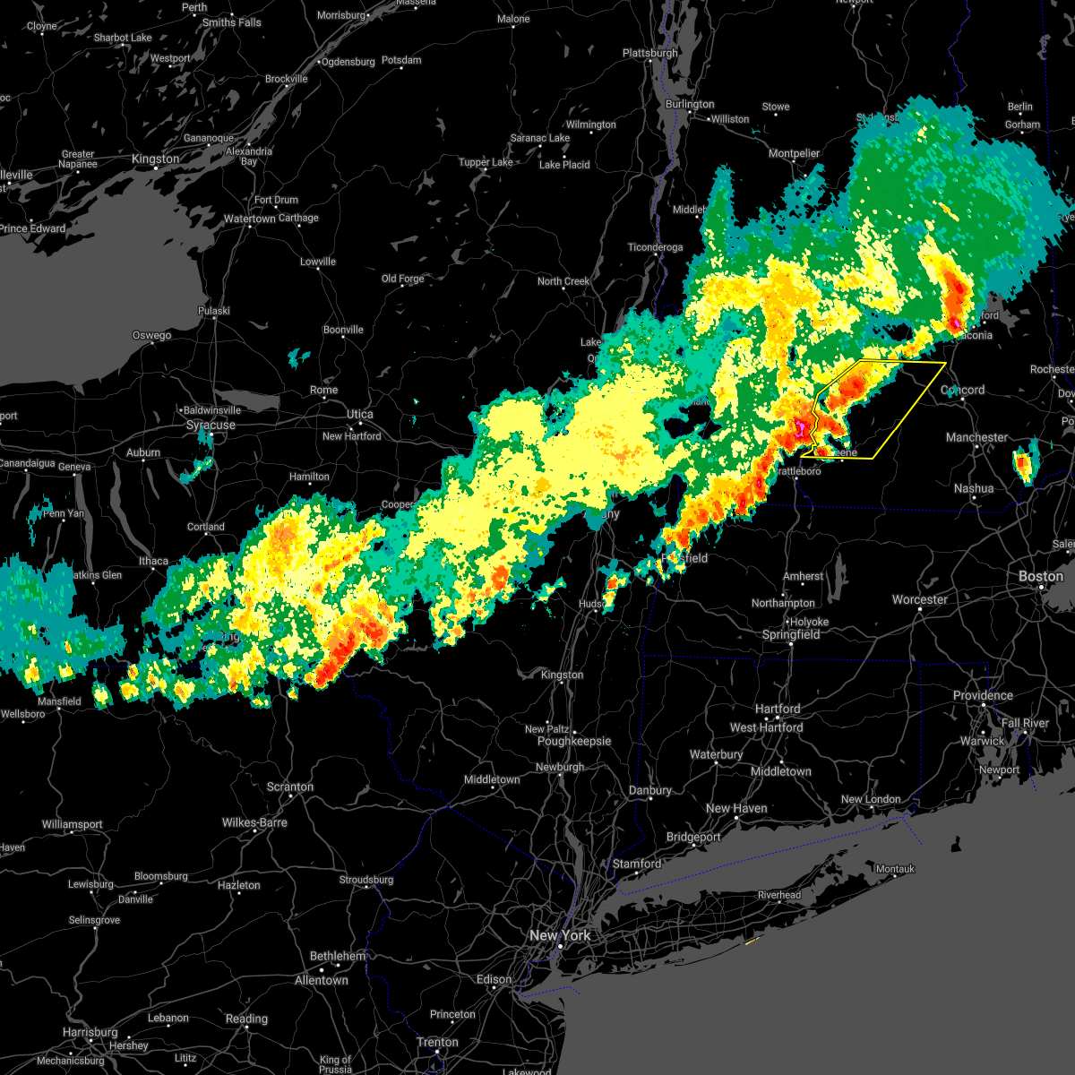
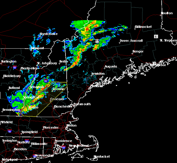
Hail Map for Blodgett Landing, NH
The Blodgett Landing, NH area has had 0 reports of on-the-ground hail by trained spotters, and has been under severe weather warnings 2 times during the past 12 months. Doppler radar has detected hail at or near Blodgett Landing, NH on 6 occasions.
| Name: | Blodgett Landing, NH |
| Where Located: | 91.6 miles WSW of Portland, ME |
| Map: | Google Map for Blodgett Landing, NH |
| Population: | 101 |
| Housing Units: | 159 |
| More Info: | Search Google for Blodgett Landing, NH |
0
The Top Recent Hail Date for Blodgett Landing, NH is Friday, August 4, 2023 (2nd out of 6)

Hail and Wind Damage Spotted near Blodgett Landing, NH
| Date / Time | Report Details |
|---|---|
| 7/16/2024 6:38 PM EDT |
 At 638 pm edt, severe thunderstorms were located along a line extending from 9 miles southwest of lebanon to near claremont to charlestown to 11 miles west of westmoreland, moving east at 50 mph (radar indicated). Hazards include 70 mph wind gusts. Expect considerable tree damage. damage is likely to mobile homes, roofs, and outbuildings. locations impacted include, claremont, lebanon, henniker, new london, grafton, hanover, charlestown, enfield, canaan, bradford, danbury, groton, newport, gilsum, walpole, warner, alstead, marlow, stoddard, and surry. this also includes, mount kearsage and mount sunapee. This includes interstate 89 between mile markers 16 and 60. At 638 pm edt, severe thunderstorms were located along a line extending from 9 miles southwest of lebanon to near claremont to charlestown to 11 miles west of westmoreland, moving east at 50 mph (radar indicated). Hazards include 70 mph wind gusts. Expect considerable tree damage. damage is likely to mobile homes, roofs, and outbuildings. locations impacted include, claremont, lebanon, henniker, new london, grafton, hanover, charlestown, enfield, canaan, bradford, danbury, groton, newport, gilsum, walpole, warner, alstead, marlow, stoddard, and surry. this also includes, mount kearsage and mount sunapee. This includes interstate 89 between mile markers 16 and 60.
|
| 7/16/2024 6:25 PM EDT |
 Svrgyx the national weather service in gray maine has issued a * severe thunderstorm warning for, sullivan county in central new hampshire, southwestern grafton county in northern new hampshire, northwestern cheshire county in southern new hampshire, northwestern merrimack county in central new hampshire, * until 715 pm edt. * at 624 pm edt, severe thunderstorms were located along a line extending from 18 miles southwest of lebanon to 6 miles west of claremont to 7 miles southwest of charlestown to 20 miles west of chesterfield, moving east at 55 mph (radar indicated). Hazards include 70 mph wind gusts. Expect considerable tree damage. Damage is likely to mobile homes, roofs, and outbuildings. Svrgyx the national weather service in gray maine has issued a * severe thunderstorm warning for, sullivan county in central new hampshire, southwestern grafton county in northern new hampshire, northwestern cheshire county in southern new hampshire, northwestern merrimack county in central new hampshire, * until 715 pm edt. * at 624 pm edt, severe thunderstorms were located along a line extending from 18 miles southwest of lebanon to 6 miles west of claremont to 7 miles southwest of charlestown to 20 miles west of chesterfield, moving east at 55 mph (radar indicated). Hazards include 70 mph wind gusts. Expect considerable tree damage. Damage is likely to mobile homes, roofs, and outbuildings.
|
| 6/19/2024 3:20 PM EDT |
 Svrgyx the national weather service in gray maine has issued a * severe thunderstorm warning for, northern sullivan county in central new hampshire, southwestern grafton county in northern new hampshire, northwestern merrimack county in central new hampshire, * until 400 pm edt. * at 319 pm edt, a severe thunderstorm was located 7 miles south of lebanon, moving east at 15 mph (radar indicated). Hazards include 60 mph wind gusts and quarter size hail. Hail damage to vehicles is expected. Expect wind damage to roofs, siding, and trees. Svrgyx the national weather service in gray maine has issued a * severe thunderstorm warning for, northern sullivan county in central new hampshire, southwestern grafton county in northern new hampshire, northwestern merrimack county in central new hampshire, * until 400 pm edt. * at 319 pm edt, a severe thunderstorm was located 7 miles south of lebanon, moving east at 15 mph (radar indicated). Hazards include 60 mph wind gusts and quarter size hail. Hail damage to vehicles is expected. Expect wind damage to roofs, siding, and trees.
|
| 9/7/2023 10:52 PM EDT |
 At 1051 pm edt, severe thunderstorms were located along a line extending from 20 miles northwest of littleton to 7 miles north of hanover, moving north at 85 mph (radar indicated). Hazards include 60 mph wind gusts and quarter size hail. Expect wind damage to trees and power lines. minor hail damage to vehicles is possible. locations impacted include, franklin, littleton, bethlehem, lincoln, new london, plymouth, grafton, hanover, haverhill, enfield, canaan, bradford, danbury, franconia, groton, woodstock, piermont, newport, walpole and alstead. hail threat, radar indicated max hail size, 1. 00 in wind threat, observed max wind gust, 60 mph. At 1051 pm edt, severe thunderstorms were located along a line extending from 20 miles northwest of littleton to 7 miles north of hanover, moving north at 85 mph (radar indicated). Hazards include 60 mph wind gusts and quarter size hail. Expect wind damage to trees and power lines. minor hail damage to vehicles is possible. locations impacted include, franklin, littleton, bethlehem, lincoln, new london, plymouth, grafton, hanover, haverhill, enfield, canaan, bradford, danbury, franconia, groton, woodstock, piermont, newport, walpole and alstead. hail threat, radar indicated max hail size, 1. 00 in wind threat, observed max wind gust, 60 mph.
|
| 9/7/2023 10:18 PM EDT |
 At 1018 pm edt, severe thunderstorms were located along a line extending from 17 miles northwest of hanover to near charlestown, moving north at 85 mph (radar indicated). Hazards include 60 mph wind gusts and quarter size hail. Expect wind damage to trees and power lines. Minor hail damage to vehicles is possible. At 1018 pm edt, severe thunderstorms were located along a line extending from 17 miles northwest of hanover to near charlestown, moving north at 85 mph (radar indicated). Hazards include 60 mph wind gusts and quarter size hail. Expect wind damage to trees and power lines. Minor hail damage to vehicles is possible.
|
| 8/26/2022 3:06 PM EDT | The severe thunderstorm warning for northern sullivan, south central grafton, northwestern belknap and northwestern merrimack counties will expire at 315 pm edt, the storms which prompted the warning have weakened below severe limits, and no longer pose an immediate threat to life or property. therefore, the warning will be allowed to expire. however heavy rain is still possible with these thunderstorms. a severe thunderstorm watch remains in effect until 800 pm edt for central and northern new hampshire. |
| 8/26/2022 2:28 PM EDT | Spotter me87 reported trees down in sunape in sullivan county NH, 2.1 miles E of Blodgett Landing, NH |
| 8/26/2022 2:27 PM EDT | At 227 pm edt, severe thunderstorms were located along a line extending from 6 miles northeast of claremont to near new london to bradford, moving northeast at 60 mph (radar indicated). Hazards include 60 mph wind gusts and nickel size hail. expect damage to roofs, siding, and trees |
| 8/4/2022 7:10 PM EDT |
 At 710 pm edt, severe thunderstorms were located along a line extending from 6 miles southwest of lebanon to 8 miles northeast of claremont to newport to marlow, moving east at 30 mph (radar indicated). Hazards include 60 mph wind gusts. Expect damage to roofs, siding, and trees. locations impacted include, claremont, new london, grafton, charlestown, enfield, bradford, danbury, newport, warner, grantham, andover, cornish, lempster, hill, acworth, goshen, croydon, plainfield, newbury and wilmot. this includes interstate 89 between mile markers 20 and 48. hail threat, radar indicated max hail size, <. 75 in wind threat, radar indicated max wind gust, 60 mph. At 710 pm edt, severe thunderstorms were located along a line extending from 6 miles southwest of lebanon to 8 miles northeast of claremont to newport to marlow, moving east at 30 mph (radar indicated). Hazards include 60 mph wind gusts. Expect damage to roofs, siding, and trees. locations impacted include, claremont, new london, grafton, charlestown, enfield, bradford, danbury, newport, warner, grantham, andover, cornish, lempster, hill, acworth, goshen, croydon, plainfield, newbury and wilmot. this includes interstate 89 between mile markers 20 and 48. hail threat, radar indicated max hail size, <. 75 in wind threat, radar indicated max wind gust, 60 mph.
|
| 8/4/2022 6:56 PM EDT |
 At 656 pm edt, severe thunderstorms were located along a line extending from 13 miles southwest of lebanon to 10 miles northwest of newport to near claremont to 6 miles north of alstead to near walpole, moving east at 30 mph (radar indicated). Hazards include 60 mph wind gusts. Expect damage to roofs, siding, and trees. locations impacted include, claremont, henniker, new london, grafton, charlestown, enfield, bradford, danbury, newport, warner, marlow, alstead, hillsborough, grantham, andover, cornish, lempster, hill, acworth and goshen. this includes interstate 89 between mile markers 18 and 48. hail threat, radar indicated max hail size, <. 75 in wind threat, radar indicated max wind gust, 60 mph. At 656 pm edt, severe thunderstorms were located along a line extending from 13 miles southwest of lebanon to 10 miles northwest of newport to near claremont to 6 miles north of alstead to near walpole, moving east at 30 mph (radar indicated). Hazards include 60 mph wind gusts. Expect damage to roofs, siding, and trees. locations impacted include, claremont, henniker, new london, grafton, charlestown, enfield, bradford, danbury, newport, warner, marlow, alstead, hillsborough, grantham, andover, cornish, lempster, hill, acworth and goshen. this includes interstate 89 between mile markers 18 and 48. hail threat, radar indicated max hail size, <. 75 in wind threat, radar indicated max wind gust, 60 mph.
|
| 8/4/2022 6:29 PM EDT |
 At 629 pm edt, severe thunderstorms were located along a line extending from 26 miles west of lebanon to 13 miles west of claremont to 8 miles northwest of charlestown to 8 miles northwest of walpole to 9 miles northwest of westmoreland, moving east at 30 mph (radar indicated). Hazards include 60 mph wind gusts. expect damage to roofs, siding, and trees At 629 pm edt, severe thunderstorms were located along a line extending from 26 miles west of lebanon to 13 miles west of claremont to 8 miles northwest of charlestown to 8 miles northwest of walpole to 9 miles northwest of westmoreland, moving east at 30 mph (radar indicated). Hazards include 60 mph wind gusts. expect damage to roofs, siding, and trees
|
| 7/12/2022 4:24 PM EDT |
 At 422 pm edt, severe thunderstorms were located along a line extending from plymouth to near hillsborough, moving east at 40 mph (trained weather spotters. these storms have a history of producing damaging winds). Hazards include 60 mph wind gusts and quarter size hail. Hail damage to vehicles is expected. Expect wind damage to roofs, siding, and trees. At 422 pm edt, severe thunderstorms were located along a line extending from plymouth to near hillsborough, moving east at 40 mph (trained weather spotters. these storms have a history of producing damaging winds). Hazards include 60 mph wind gusts and quarter size hail. Hail damage to vehicles is expected. Expect wind damage to roofs, siding, and trees.
|
| 7/12/2022 4:09 PM EDT |
 At 409 pm edt, severe thunderstorms were located along a line extending from 10 miles northwest of groton to near marlow, moving east at 40 mph (radar indicated). Hazards include 60 mph wind gusts and quarter size hail. Hail damage to vehicles is expected. expect wind damage to roofs, siding, and trees. locations impacted include, claremont, henniker, new london, plymouth, grafton, hanover, charlestown, enfield, canaan, holderness, ashland, bradford, danbury, groton, newport, warner, marlow, alstead, woodstock and hillsborough. this includes the following highways, interstate 89 between mile markers 19 and 49. interstate 93 between mile markers 78 and 93. hail threat, radar indicated max hail size, 1. 00 in wind threat, radar indicated max wind gust, 60 mph. At 409 pm edt, severe thunderstorms were located along a line extending from 10 miles northwest of groton to near marlow, moving east at 40 mph (radar indicated). Hazards include 60 mph wind gusts and quarter size hail. Hail damage to vehicles is expected. expect wind damage to roofs, siding, and trees. locations impacted include, claremont, henniker, new london, plymouth, grafton, hanover, charlestown, enfield, canaan, holderness, ashland, bradford, danbury, groton, newport, warner, marlow, alstead, woodstock and hillsborough. this includes the following highways, interstate 89 between mile markers 19 and 49. interstate 93 between mile markers 78 and 93. hail threat, radar indicated max hail size, 1. 00 in wind threat, radar indicated max wind gust, 60 mph.
|
| 7/12/2022 3:46 PM EDT |
 At 345 pm edt, severe thunderstorms were located along a line extending from 10 miles southwest of piermont to near charlestown, moving east at 40 mph (radar indicated). Hazards include 60 mph wind gusts and quarter size hail. Hail damage to vehicles is expected. expect wind damage to roofs, siding, and trees. locations impacted include, claremont, lebanon, henniker, new london, plymouth, grafton, hanover, charlestown, enfield, canaan, holderness, ashland, bradford, danbury, groton, newport, warner, marlow, piermont and alstead. this includes the following highways, interstate 89 between mile markers 19 and 60. interstate 93 between mile markers 78 and 93. hail threat, radar indicated max hail size, 1. 00 in wind threat, radar indicated max wind gust, 60 mph. At 345 pm edt, severe thunderstorms were located along a line extending from 10 miles southwest of piermont to near charlestown, moving east at 40 mph (radar indicated). Hazards include 60 mph wind gusts and quarter size hail. Hail damage to vehicles is expected. expect wind damage to roofs, siding, and trees. locations impacted include, claremont, lebanon, henniker, new london, plymouth, grafton, hanover, charlestown, enfield, canaan, holderness, ashland, bradford, danbury, groton, newport, warner, marlow, piermont and alstead. this includes the following highways, interstate 89 between mile markers 19 and 60. interstate 93 between mile markers 78 and 93. hail threat, radar indicated max hail size, 1. 00 in wind threat, radar indicated max wind gust, 60 mph.
|
| 7/12/2022 3:32 PM EDT |
 At 331 pm edt, severe thunderstorms were located along a line extending from 13 miles northwest of hanover to 11 miles west of charlestown, moving east at 40 mph (radar indicated). Hazards include 60 mph wind gusts and nickel size hail. expect damage to roofs, siding, and trees At 331 pm edt, severe thunderstorms were located along a line extending from 13 miles northwest of hanover to 11 miles west of charlestown, moving east at 40 mph (radar indicated). Hazards include 60 mph wind gusts and nickel size hail. expect damage to roofs, siding, and trees
|
| 5/16/2022 6:50 PM EDT |
 At 649 pm edt, a severe thunderstorm was located 7 miles south of lebanon, moving northeast at 35 mph (radar indicated). Hazards include 60 mph wind gusts and penny size hail. Expect damage to roofs, siding, and trees. locations impacted include, claremont, lebanon, new london, grafton, hanover, enfield, canaan, danbury, newport, grantham, andover, cornish, croydon, dorchester, plainfield, wilmot, orange, sunapee, springfield and sulton. This includes interstate 89 between mile markers 30 and 60. At 649 pm edt, a severe thunderstorm was located 7 miles south of lebanon, moving northeast at 35 mph (radar indicated). Hazards include 60 mph wind gusts and penny size hail. Expect damage to roofs, siding, and trees. locations impacted include, claremont, lebanon, new london, grafton, hanover, enfield, canaan, danbury, newport, grantham, andover, cornish, croydon, dorchester, plainfield, wilmot, orange, sunapee, springfield and sulton. This includes interstate 89 between mile markers 30 and 60.
|
| 5/16/2022 6:45 PM EDT |
 At 644 pm edt, severe thunderstorms were located along a line extending from newport to windsor to near troy, moving northeast at 40 mph (radar indicated). Hazards include 60 mph wind gusts and penny size hail. expect damage to roofs, siding, and trees At 644 pm edt, severe thunderstorms were located along a line extending from newport to windsor to near troy, moving northeast at 40 mph (radar indicated). Hazards include 60 mph wind gusts and penny size hail. expect damage to roofs, siding, and trees
|
| 5/16/2022 6:36 PM EDT |
 At 636 pm edt, a severe thunderstorm was located over claremont, moving northeast at 30 mph (radar indicated). Hazards include 60 mph wind gusts and penny size hail. expect damage to roofs, siding, and trees At 636 pm edt, a severe thunderstorm was located over claremont, moving northeast at 30 mph (radar indicated). Hazards include 60 mph wind gusts and penny size hail. expect damage to roofs, siding, and trees
|
| 5/16/2022 6:20 PM EDT |
 At 619 pm edt, severe thunderstorms were located along a line extending from 6 miles southwest of charlestown to near chesterfield to 23 miles south of hinsdale, moving east at 35 mph (radar indicated). Hazards include 60 mph wind gusts and nickel size hail. Expect damage to roofs, siding, and trees. locations impacted include, keene, claremont, jaffrey, henniker, peterborough, hopkinton, new boston, charlestown, winchester, antrim, mont vernon, greenfield, lyndeborough, bradford, dublin, francestown, bennington, richmond, harrisville and nelson. this includes interstate 89 between mile markers 18 and 30. hail threat, radar indicated max hail size, 0. 88 in wind threat, radar indicated max wind gust, 60 mph. At 619 pm edt, severe thunderstorms were located along a line extending from 6 miles southwest of charlestown to near chesterfield to 23 miles south of hinsdale, moving east at 35 mph (radar indicated). Hazards include 60 mph wind gusts and nickel size hail. Expect damage to roofs, siding, and trees. locations impacted include, keene, claremont, jaffrey, henniker, peterborough, hopkinton, new boston, charlestown, winchester, antrim, mont vernon, greenfield, lyndeborough, bradford, dublin, francestown, bennington, richmond, harrisville and nelson. this includes interstate 89 between mile markers 18 and 30. hail threat, radar indicated max hail size, 0. 88 in wind threat, radar indicated max wind gust, 60 mph.
|
| 5/16/2022 5:43 PM EDT |
 At 543 pm edt, severe thunderstorms were located along a line extending from 22 miles west of westmoreland to 14 miles west of hinsdale to 41 miles southwest of winchester, moving east at 35 mph (radar indicated). Hazards include 60 mph wind gusts and nickel size hail. expect damage to roofs, siding, and trees At 543 pm edt, severe thunderstorms were located along a line extending from 22 miles west of westmoreland to 14 miles west of hinsdale to 41 miles southwest of winchester, moving east at 35 mph (radar indicated). Hazards include 60 mph wind gusts and nickel size hail. expect damage to roofs, siding, and trees
|
| 9/15/2021 4:24 PM EDT |
 At 424 pm edt, a severe thunderstorm was located over bradford, or 10 miles south of new london, moving east at 40 mph (radar indicated). Hazards include 60 mph wind gusts and quarter size hail. Hail damage to vehicles is expected. expect wind damage to roofs, siding, and trees. locations impacted include, concord, franklin, henniker, new london, hopkinton, new boston, antrim, canterbury, greenfield, hancock, bradford, francestown, bennington, danbury, nelson, gilsum, windsor, deering, warner and hillsborough. hail threat, radar indicated max hail size, 1. 00 in wind threat, radar indicated max wind gust, 60 mph. At 424 pm edt, a severe thunderstorm was located over bradford, or 10 miles south of new london, moving east at 40 mph (radar indicated). Hazards include 60 mph wind gusts and quarter size hail. Hail damage to vehicles is expected. expect wind damage to roofs, siding, and trees. locations impacted include, concord, franklin, henniker, new london, hopkinton, new boston, antrim, canterbury, greenfield, hancock, bradford, francestown, bennington, danbury, nelson, gilsum, windsor, deering, warner and hillsborough. hail threat, radar indicated max hail size, 1. 00 in wind threat, radar indicated max wind gust, 60 mph.
|
| 9/15/2021 4:07 PM EDT |
 At 407 pm edt, a severe thunderstorm was located 7 miles north of marlow, or 11 miles southeast of claremont, moving east at 40 mph (radar indicated). Hazards include 60 mph wind gusts and quarter size hail. Hail damage to vehicles is expected. Expect wind damage to roofs, siding, and trees. At 407 pm edt, a severe thunderstorm was located 7 miles north of marlow, or 11 miles southeast of claremont, moving east at 40 mph (radar indicated). Hazards include 60 mph wind gusts and quarter size hail. Hail damage to vehicles is expected. Expect wind damage to roofs, siding, and trees.
|
| 9/15/2021 3:35 PM EDT |
 At 334 pm edt, a severe thunderstorm was located over new london, moving east at 45 mph (radar indicated). Hazards include 60 mph wind gusts and quarter size hail. Hail damage to vehicles is expected. expect wind damage to roofs, siding, and trees. locations impacted include, claremont, franklin, new london, grafton, enfield, danbury, newport, warner, bristol, grantham, andover, cornish, hill, croydon, wilmot, sunapee, springfield, salisbury, new hampton and sulton. hail threat, radar indicated max hail size, 1. 00 in wind threat, radar indicated max wind gust, 60 mph. At 334 pm edt, a severe thunderstorm was located over new london, moving east at 45 mph (radar indicated). Hazards include 60 mph wind gusts and quarter size hail. Hail damage to vehicles is expected. expect wind damage to roofs, siding, and trees. locations impacted include, claremont, franklin, new london, grafton, enfield, danbury, newport, warner, bristol, grantham, andover, cornish, hill, croydon, wilmot, sunapee, springfield, salisbury, new hampton and sulton. hail threat, radar indicated max hail size, 1. 00 in wind threat, radar indicated max wind gust, 60 mph.
|
| 7/20/2021 10:14 PM EDT |
 At 1014 pm edt, severe thunderstorms were located along a line extending from near newport to near westmoreland, moving east at 35 mph (radar indicated). Hazards include 60 mph wind gusts and quarter size hail. Hail damage to vehicles is expected. Expect wind damage to roofs, siding, and trees. At 1014 pm edt, severe thunderstorms were located along a line extending from near newport to near westmoreland, moving east at 35 mph (radar indicated). Hazards include 60 mph wind gusts and quarter size hail. Hail damage to vehicles is expected. Expect wind damage to roofs, siding, and trees.
|
| 5/26/2021 5:58 PM EDT |
 At 557 pm edt, severe thunderstorms were located along a line extending from near bradford to near windsor to near richmond, moving east at 40 mph. these storms have a history of producing wind damage (radar indicated). Hazards include 60 mph wind gusts. expect damage to roofs, siding, and trees At 557 pm edt, severe thunderstorms were located along a line extending from near bradford to near windsor to near richmond, moving east at 40 mph. these storms have a history of producing wind damage (radar indicated). Hazards include 60 mph wind gusts. expect damage to roofs, siding, and trees
|
| 5/26/2021 5:36 PM EDT |
 At 536 pm edt, a severe thunderstorm was located near grafton, or 8 miles north of new london, moving east at 45 mph (radar indicated). Hazards include 60 mph wind gusts. Expect damage to roofs, siding, and trees. locations impacted include, claremont, lebanon, franklin, new london, plymouth, grafton, hanover, charlestown, enfield, canaan, holderness, ashland, danbury, groton, newport, warner, bristol, grantham, andover and cornish. this also includes, mount kearsage. this includes the following highways, interstate 89 between mile markers 26 and 59. Interstate 93 between mile markers 73 and 83. At 536 pm edt, a severe thunderstorm was located near grafton, or 8 miles north of new london, moving east at 45 mph (radar indicated). Hazards include 60 mph wind gusts. Expect damage to roofs, siding, and trees. locations impacted include, claremont, lebanon, franklin, new london, plymouth, grafton, hanover, charlestown, enfield, canaan, holderness, ashland, danbury, groton, newport, warner, bristol, grantham, andover and cornish. this also includes, mount kearsage. this includes the following highways, interstate 89 between mile markers 26 and 59. Interstate 93 between mile markers 73 and 83.
|
| 5/26/2021 5:07 PM EDT |
 At 507 pm edt, severe thunderstorms were located along a line extending from near hanover to 6 miles west of claremont, moving east at 50 mph (radar indicated). Hazards include 60 mph wind gusts. expect damage to roofs, siding, and trees At 507 pm edt, severe thunderstorms were located along a line extending from near hanover to 6 miles west of claremont, moving east at 50 mph (radar indicated). Hazards include 60 mph wind gusts. expect damage to roofs, siding, and trees
|
| 5/15/2020 7:56 PM EDT |
 The severe thunderstorm warning for sullivan, southern grafton and northwestern merrimack counties will expire at 800 pm edt, the storms which prompted the warning have moved out of the area. therefore, the warning will be allowed to expire. however gusty winds and heavy rain are still possible with these thunderstorms. a tornado watch remains in effect until 1000 pm edt for central and northern new hampshire. The severe thunderstorm warning for sullivan, southern grafton and northwestern merrimack counties will expire at 800 pm edt, the storms which prompted the warning have moved out of the area. therefore, the warning will be allowed to expire. however gusty winds and heavy rain are still possible with these thunderstorms. a tornado watch remains in effect until 1000 pm edt for central and northern new hampshire.
|
| 5/15/2020 7:43 PM EDT |
 At 743 pm edt, severe thunderstorms were located along a line extending from 8 miles north of groton to 7 miles west of grafton to near claremont, moving east at 60 mph (radar indicated). Hazards include 60 mph wind gusts. expect damage to roofs, siding, and trees At 743 pm edt, severe thunderstorms were located along a line extending from 8 miles north of groton to 7 miles west of grafton to near claremont, moving east at 60 mph (radar indicated). Hazards include 60 mph wind gusts. expect damage to roofs, siding, and trees
|
| 5/15/2020 7:16 PM EDT |
 At 715 pm edt, severe thunderstorms were located along a line extending from 9 miles northeast of hanover to 10 miles northwest of claremont, moving east at 50 mph (radar indicated). Hazards include 60 mph wind gusts and penny size hail. expect damage to roofs, siding, and trees At 715 pm edt, severe thunderstorms were located along a line extending from 9 miles northeast of hanover to 10 miles northwest of claremont, moving east at 50 mph (radar indicated). Hazards include 60 mph wind gusts and penny size hail. expect damage to roofs, siding, and trees
|
| 8/17/2019 7:58 PM EDT |
 At 726 pm edt, severe thunderstorms were located along a line extending from 10 miles southwest of piermont to near hanover to 8 miles north of claremont to charlestown, moving northeast at 45 mph (radar indicated). Hazards include 60 mph wind gusts. expect damage to roofs, siding, and trees At 726 pm edt, severe thunderstorms were located along a line extending from 10 miles southwest of piermont to near hanover to 8 miles north of claremont to charlestown, moving northeast at 45 mph (radar indicated). Hazards include 60 mph wind gusts. expect damage to roofs, siding, and trees
|
| 8/17/2019 7:26 PM EDT |
 At 726 pm edt, severe thunderstorms were located along a line extending from 10 miles southwest of piermont to near hanover to 8 miles north of claremont to charlestown, moving northeast at 45 mph (radar indicated). Hazards include 60 mph wind gusts. expect damage to roofs, siding, and trees At 726 pm edt, severe thunderstorms were located along a line extending from 10 miles southwest of piermont to near hanover to 8 miles north of claremont to charlestown, moving northeast at 45 mph (radar indicated). Hazards include 60 mph wind gusts. expect damage to roofs, siding, and trees
|
| 8/3/2018 3:15 PM EDT |
 At 314 pm edt, a severe thunderstorm was located near alstead, or 12 miles south of claremont, moving northeast at 35 mph (radar indicated). Hazards include 60 mph wind gusts and penny size hail. expect damage to roofs, siding, and trees At 314 pm edt, a severe thunderstorm was located near alstead, or 12 miles south of claremont, moving northeast at 35 mph (radar indicated). Hazards include 60 mph wind gusts and penny size hail. expect damage to roofs, siding, and trees
|
| 7/17/2018 10:25 AM EDT |
 At 1025 am edt, a severe thunderstorm was located over bradford, or 8 miles northwest of henniker, moving east at 40 mph (radar indicated). Hazards include 60 mph wind gusts. Expect damage to roofs, siding, and trees. locations impacted include, concord, franklin, henniker, new london, hopkinton, bradford, danbury, newport, warner, hillsborough, windsor, boscawen, bristol, grantham, andover, lempster, hill, goshen, croydon and washington. this also includes, mount kearsage and mount sunapee. This includes interstate 89 between mile markers 7 and 41. At 1025 am edt, a severe thunderstorm was located over bradford, or 8 miles northwest of henniker, moving east at 40 mph (radar indicated). Hazards include 60 mph wind gusts. Expect damage to roofs, siding, and trees. locations impacted include, concord, franklin, henniker, new london, hopkinton, bradford, danbury, newport, warner, hillsborough, windsor, boscawen, bristol, grantham, andover, lempster, hill, goshen, croydon and washington. this also includes, mount kearsage and mount sunapee. This includes interstate 89 between mile markers 7 and 41.
|
| 7/17/2018 10:14 AM EDT |
 At 1014 am edt, a severe thunderstorm was located near bradford, or 11 miles south of new london, moving east at 40 mph (radar indicated). Hazards include 60 mph wind gusts. expect damage to roofs, siding, and trees At 1014 am edt, a severe thunderstorm was located near bradford, or 11 miles south of new london, moving east at 40 mph (radar indicated). Hazards include 60 mph wind gusts. expect damage to roofs, siding, and trees
|
| 5/4/2018 10:06 PM EDT |
 At 940 pm edt, severe thunderstorms were located along a line extending from near canaan to bradford to hancock to near fitzwilliam, moving east at 55 mph (radar indicated). Hazards include 60 mph wind gusts. Expect damage to roofs, siding, and trees. locations impacted include, concord, keene, franklin, jaffrey, henniker, new london, milford, swanzey, peterborough, hopkinton, new boston, winchester, antrim, mont vernon, greenfield, lyndeborough, bradford, dublin, francestown and bennington. this also includes, mount monadnock, north pack monadnock, mount kearsage, and mount sunapee. This includes interstate 89 between mile markers 7 and 46. At 940 pm edt, severe thunderstorms were located along a line extending from near canaan to bradford to hancock to near fitzwilliam, moving east at 55 mph (radar indicated). Hazards include 60 mph wind gusts. Expect damage to roofs, siding, and trees. locations impacted include, concord, keene, franklin, jaffrey, henniker, new london, milford, swanzey, peterborough, hopkinton, new boston, winchester, antrim, mont vernon, greenfield, lyndeborough, bradford, dublin, francestown and bennington. this also includes, mount monadnock, north pack monadnock, mount kearsage, and mount sunapee. This includes interstate 89 between mile markers 7 and 46.
|
| 5/4/2018 9:40 PM EDT |
 At 908 pm edt, severe thunderstorms were located along a line extending from 17 miles west of hanover to 8 miles northwest of charlestown to 7 miles west of westmoreland to 8 miles west of hinsdale, moving east at 55 mph (radar indicated). Hazards include 60 mph wind gusts. expect damage to roofs, siding, and trees At 908 pm edt, severe thunderstorms were located along a line extending from 17 miles west of hanover to 8 miles northwest of charlestown to 7 miles west of westmoreland to 8 miles west of hinsdale, moving east at 55 mph (radar indicated). Hazards include 60 mph wind gusts. expect damage to roofs, siding, and trees
|
| 5/4/2018 9:09 PM EDT |
 At 908 pm edt, severe thunderstorms were located along a line extending from 17 miles west of hanover to 8 miles northwest of charlestown to 7 miles west of westmoreland to 8 miles west of hinsdale, moving east at 55 mph (radar indicated). Hazards include 60 mph wind gusts. expect damage to roofs, siding, and trees At 908 pm edt, severe thunderstorms were located along a line extending from 17 miles west of hanover to 8 miles northwest of charlestown to 7 miles west of westmoreland to 8 miles west of hinsdale, moving east at 55 mph (radar indicated). Hazards include 60 mph wind gusts. expect damage to roofs, siding, and trees
|
| 8/22/2017 9:53 PM EDT |
 At 953 pm edt, severe thunderstorms were located along a line extending from 8 miles north of canaan to new london to near winchester, moving east at 45 mph (radar indicated). Hazards include 60 mph wind gusts. Expect damage to trees, and power lines. locations impacted include, keene, jaffrey, new london, grafton, peterborough, enfield, winchester, canaan, bradford, dublin, danbury, richmond, harrisville, nelson, groton, rindge, walpole, alstead, westmoreland and swanzey. this also includes, mount monadnock and mount sunapee. This includes interstate 89 between mile markers 28 and 39. At 953 pm edt, severe thunderstorms were located along a line extending from 8 miles north of canaan to new london to near winchester, moving east at 45 mph (radar indicated). Hazards include 60 mph wind gusts. Expect damage to trees, and power lines. locations impacted include, keene, jaffrey, new london, grafton, peterborough, enfield, winchester, canaan, bradford, dublin, danbury, richmond, harrisville, nelson, groton, rindge, walpole, alstead, westmoreland and swanzey. this also includes, mount monadnock and mount sunapee. This includes interstate 89 between mile markers 28 and 39.
|
| 8/22/2017 9:52 PM EDT |
 At 952 pm edt, severe thunderstorms were located along a line extending from 10 miles southeast of piermont to groton to near danbury to near new london to 6 miles southeast of newport, moving east at 40 mph (radar indicated). Hazards include 60 mph wind gusts. expect damage to trees, and power lines At 952 pm edt, severe thunderstorms were located along a line extending from 10 miles southeast of piermont to groton to near danbury to near new london to 6 miles southeast of newport, moving east at 40 mph (radar indicated). Hazards include 60 mph wind gusts. expect damage to trees, and power lines
|
| 8/22/2017 9:20 PM EDT |
 At 920 pm edt, severe thunderstorms were located along a line extending from 10 miles west of hanover to 6 miles west of claremont to 17 miles west of hinsdale, moving east at 45 mph (radar indicated). Hazards include 60 mph wind gusts. expect damage to trees, and power lines At 920 pm edt, severe thunderstorms were located along a line extending from 10 miles west of hanover to 6 miles west of claremont to 17 miles west of hinsdale, moving east at 45 mph (radar indicated). Hazards include 60 mph wind gusts. expect damage to trees, and power lines
|
| 7/8/2017 12:16 PM EDT |
 At 1216 pm edt, severe thunderstorms were located along a line extending from near sandwich to 9 miles southwest of hinsdale, moving east at 25 mph (public). Hazards include 60 mph wind gusts. expect damage to trees, and power lines At 1216 pm edt, severe thunderstorms were located along a line extending from near sandwich to 9 miles southwest of hinsdale, moving east at 25 mph (public). Hazards include 60 mph wind gusts. expect damage to trees, and power lines
|
| 7/1/2017 7:43 PM EDT |
 At 743 pm edt, severe thunderstorms were located along a line extending from 8 miles north of claremont to 8 miles north of marlow to near westmoreland, moving east at 35 mph (radar indicated). Hazards include 60 mph wind gusts. Expect damage to trees, and power lines. locations impacted include, claremont, lebanon, henniker, new london, grafton, enfield, canaan, antrim, bradford, bennington, nelson, newport, gilsum, windsor, warner, hillsborough, alstead, marlow, sullivan and surry. this also includes, mount kearsage and mount sunapee. This includes interstate 89 between mile markers 17 and 55. At 743 pm edt, severe thunderstorms were located along a line extending from 8 miles north of claremont to 8 miles north of marlow to near westmoreland, moving east at 35 mph (radar indicated). Hazards include 60 mph wind gusts. Expect damage to trees, and power lines. locations impacted include, claremont, lebanon, henniker, new london, grafton, enfield, canaan, antrim, bradford, bennington, nelson, newport, gilsum, windsor, warner, hillsborough, alstead, marlow, sullivan and surry. this also includes, mount kearsage and mount sunapee. This includes interstate 89 between mile markers 17 and 55.
|
| 7/1/2017 7:16 PM EDT |
 At 716 pm edt, severe thunderstorms were located along a line extending from 15 miles west of claremont to near charlestown to 9 miles west of chesterfield, moving east at 35 mph (radar indicated). Hazards include 60 mph wind gusts. expect damage to trees, and power lines At 716 pm edt, severe thunderstorms were located along a line extending from 15 miles west of claremont to near charlestown to 9 miles west of chesterfield, moving east at 35 mph (radar indicated). Hazards include 60 mph wind gusts. expect damage to trees, and power lines
|
| 6/19/2017 3:44 PM EDT |
 At 344 pm edt, severe thunderstorms were located along a line extending from new london to 6 miles northeast of bradford to near warner, moving northeast at 55 mph (radar indicated). Hazards include 60 mph wind gusts. expect damage to trees, and power lines At 344 pm edt, severe thunderstorms were located along a line extending from new london to 6 miles northeast of bradford to near warner, moving northeast at 55 mph (radar indicated). Hazards include 60 mph wind gusts. expect damage to trees, and power lines
|
| 5/18/2017 9:25 PM EDT |
 At 925 pm edt, severe thunderstorms were located along a line extending from 6 miles northeast of claremont to near marlow to marlborough to 9 miles south of winchester, moving east at 50 mph (radar indicated). Hazards include 60 mph wind gusts. Expect damage to trees, and power lines. locations impacted include, keene, claremont, jaffrey, henniker, new london, swanzey, peterborough, charlestown, winchester, antrim, greenfield, lyndeborough, bradford, dublin, francestown, bennington, danbury, richmond, harrisville and nelson. This includes interstate 89 between mile markers 19 and 40. At 925 pm edt, severe thunderstorms were located along a line extending from 6 miles northeast of claremont to near marlow to marlborough to 9 miles south of winchester, moving east at 50 mph (radar indicated). Hazards include 60 mph wind gusts. Expect damage to trees, and power lines. locations impacted include, keene, claremont, jaffrey, henniker, new london, swanzey, peterborough, charlestown, winchester, antrim, greenfield, lyndeborough, bradford, dublin, francestown, bennington, danbury, richmond, harrisville and nelson. This includes interstate 89 between mile markers 19 and 40.
|
| 5/18/2017 8:42 PM EDT |
 At 841 pm edt, severe thunderstorms were located along a line extending from 24 miles west of charlestown to 13 miles west of westmoreland to 13 miles west of hinsdale to 36 miles southwest of winchester, moving east at 50 mph (radar indicated). Hazards include 60 mph wind gusts. expect damage to trees, and power lines At 841 pm edt, severe thunderstorms were located along a line extending from 24 miles west of charlestown to 13 miles west of westmoreland to 13 miles west of hinsdale to 36 miles southwest of winchester, moving east at 50 mph (radar indicated). Hazards include 60 mph wind gusts. expect damage to trees, and power lines
|
| 9/11/2016 8:37 AM EDT |
 At 837 am edt, severe thunderstorms were located along a line extending from near canaan to near gilsum, moving northeast at 40 mph (radar indicated). Hazards include 60 mph wind gusts. Expect damage to roofs. siding. and trees. Locations impacted include, keene, franklin, henniker, new london, grafton, hopkinton, enfield, antrim, bradford, danbury, nelson, warner, hillsborough, marlow, sullivan, gilsum, windsor, newport, deering and surry. At 837 am edt, severe thunderstorms were located along a line extending from near canaan to near gilsum, moving northeast at 40 mph (radar indicated). Hazards include 60 mph wind gusts. Expect damage to roofs. siding. and trees. Locations impacted include, keene, franklin, henniker, new london, grafton, hopkinton, enfield, antrim, bradford, danbury, nelson, warner, hillsborough, marlow, sullivan, gilsum, windsor, newport, deering and surry.
|
| 9/11/2016 8:23 AM EDT |
 At 822 am edt, severe thunderstorms were located along a line extending from 6 miles southwest of enfield to 6 miles southwest of hinsdale, moving east at 35 mph. this line of storms has the history of producing wind damage (radar indicated). Hazards include 60 mph wind gusts. Expect damage to roofs. siding. And trees. At 822 am edt, severe thunderstorms were located along a line extending from 6 miles southwest of enfield to 6 miles southwest of hinsdale, moving east at 35 mph. this line of storms has the history of producing wind damage (radar indicated). Hazards include 60 mph wind gusts. Expect damage to roofs. siding. And trees.
|
| 7/1/2016 7:55 PM EDT |
 At 755 pm edt, severe thunderstorms were located along a line extending from near enfield to near newport to near westminster, moving east at 15 mph (radar indicated). Hazards include 60 mph wind gusts. Expect damage to roofs. siding. and trees. Locations impacted include, claremont, lebanon, new london, plymouth, grafton, hanover, charlestown, enfield, canaan, bradford, danbury, groton, newport, marlow, warner, bristol, grantham, andover, lyme and cornish. At 755 pm edt, severe thunderstorms were located along a line extending from near enfield to near newport to near westminster, moving east at 15 mph (radar indicated). Hazards include 60 mph wind gusts. Expect damage to roofs. siding. and trees. Locations impacted include, claremont, lebanon, new london, plymouth, grafton, hanover, charlestown, enfield, canaan, bradford, danbury, groton, newport, marlow, warner, bristol, grantham, andover, lyme and cornish.
|
| 7/1/2016 7:26 PM EDT |
 At 726 pm edt, severe thunderstorms were located along a line extending from hanover to near claremont to near townshend, moving east at 15 mph (radar indicated). Hazards include 60 mph wind gusts. Expect damage to roofs. siding. And trees. At 726 pm edt, severe thunderstorms were located along a line extending from hanover to near claremont to near townshend, moving east at 15 mph (radar indicated). Hazards include 60 mph wind gusts. Expect damage to roofs. siding. And trees.
|
| 9/8/2015 2:37 PM EDT |
 At 236 pm edt, doppler radar indicated a severe thunderstorm capable of producing quarter size hail and damaging winds in excess of 60 mph. this storm was located near marlow, or 11 miles east of bellows falls, and moving northeast at 55 mph. At 236 pm edt, doppler radar indicated a severe thunderstorm capable of producing quarter size hail and damaging winds in excess of 60 mph. this storm was located near marlow, or 11 miles east of bellows falls, and moving northeast at 55 mph.
|
| 8/4/2015 6:20 PM EDT |
 At 620 pm edt, doppler radar indicated a severe thunderstorm capable of producing damaging winds in excess of 60 mph. this storm was located near bradford, or 7 miles south of new london, moving east at 30 mph. nickel size hail may also accompany the damaging winds. locations impacted include, franklin, henniker, new london, hopkinton, bradford, warner, mount sunapee state park, john hay national wildlife refuge, wadleigh state park, newport, boscawen, southern andover, lempster, goshen, newbury, rollins state park, webster, sunapee, winslow state park and sulton. At 620 pm edt, doppler radar indicated a severe thunderstorm capable of producing damaging winds in excess of 60 mph. this storm was located near bradford, or 7 miles south of new london, moving east at 30 mph. nickel size hail may also accompany the damaging winds. locations impacted include, franklin, henniker, new london, hopkinton, bradford, warner, mount sunapee state park, john hay national wildlife refuge, wadleigh state park, newport, boscawen, southern andover, lempster, goshen, newbury, rollins state park, webster, sunapee, winslow state park and sulton.
|
| 8/4/2015 6:07 PM EDT |
 At 607 pm edt, doppler radar indicated a severe thunderstorm capable of producing quarter size hail and damaging winds in excess of 60 mph. this storm was located near mount sunapee state park, or 11 miles southeast of claremont, and moving east at 30 mph. At 607 pm edt, doppler radar indicated a severe thunderstorm capable of producing quarter size hail and damaging winds in excess of 60 mph. this storm was located near mount sunapee state park, or 11 miles southeast of claremont, and moving east at 30 mph.
|
| 8/3/2015 5:58 PM EDT |
 At 528 pm edt, doppler radar indicated a line of severe thunderstorms capable of producing damaging winds in excess of 60 mph. these storms were located along a line extending from lebanon to 8 miles north of newport to near claremont to westminster to near guilford center, moving northeast at 35 mph. locations impacted include, keene, claremont, southwestern lebanon, jaffrey, new london, swanzey, charlestown, enfield, winchester, hinsdale, chesterfield, antrim, marlborough, fitzwilliam, troy, westmoreland, bradford, dublin, danbury and richmond. At 528 pm edt, doppler radar indicated a line of severe thunderstorms capable of producing damaging winds in excess of 60 mph. these storms were located along a line extending from lebanon to 8 miles north of newport to near claremont to westminster to near guilford center, moving northeast at 35 mph. locations impacted include, keene, claremont, southwestern lebanon, jaffrey, new london, swanzey, charlestown, enfield, winchester, hinsdale, chesterfield, antrim, marlborough, fitzwilliam, troy, westmoreland, bradford, dublin, danbury and richmond.
|
| 8/3/2015 5:57 PM EDT |
 At 556 pm edt, doppler radar indicated a line of severe thunderstorms capable of producing damaging winds in excess of 60 mph. these storms were located along a line extending from groton to new london to near keene, and moving east at 40 mph. At 556 pm edt, doppler radar indicated a line of severe thunderstorms capable of producing damaging winds in excess of 60 mph. these storms were located along a line extending from groton to new london to near keene, and moving east at 40 mph.
|
| 8/3/2015 5:29 PM EDT |
 At 528 pm edt, doppler radar indicated a line of severe thunderstorms capable of producing damaging winds in excess of 60 mph. these storms were located along a line extending from lebanon to 8 miles north of newport to near claremont to westminster to near guilford center, moving northeast at 35 mph. locations impacted include, keene, claremont, southwestern lebanon, jaffrey, new london, swanzey, charlestown, enfield, winchester, hinsdale, chesterfield, antrim, marlborough, fitzwilliam, troy, westmoreland, bradford, dublin, danbury and richmond. At 528 pm edt, doppler radar indicated a line of severe thunderstorms capable of producing damaging winds in excess of 60 mph. these storms were located along a line extending from lebanon to 8 miles north of newport to near claremont to westminster to near guilford center, moving northeast at 35 mph. locations impacted include, keene, claremont, southwestern lebanon, jaffrey, new london, swanzey, charlestown, enfield, winchester, hinsdale, chesterfield, antrim, marlborough, fitzwilliam, troy, westmoreland, bradford, dublin, danbury and richmond.
|
| 8/3/2015 5:08 PM EDT |
 At 508 pm edt, doppler radar indicated a line of severe thunderstorms capable of producing damaging winds in excess of 60 mph. these storms were located along a line extending from near hartland to near claremont to near charlestown to near putney to near heath, and moving northeast at 35 mph. At 508 pm edt, doppler radar indicated a line of severe thunderstorms capable of producing damaging winds in excess of 60 mph. these storms were located along a line extending from near hartland to near claremont to near charlestown to near putney to near heath, and moving northeast at 35 mph.
|
| 7/19/2015 7:57 PM EDT |
 At 757 pm edt, doppler radar indicated a severe thunderstorm capable of producing quarter size hail and damaging winds in excess of 60 mph. this storm was located near wadleigh state park, or near new london, and moving east at 45 mph. At 757 pm edt, doppler radar indicated a severe thunderstorm capable of producing quarter size hail and damaging winds in excess of 60 mph. this storm was located near wadleigh state park, or near new london, and moving east at 45 mph.
|
| 7/19/2015 7:47 PM EDT |
 At 747 pm edt, doppler radar indicated a severe thunderstorm capable of producing quarter size hail and damaging winds in excess of 60 mph. this storm was located near john hay national wildlife refuge, or 7 miles southwest of new london, moving east at 30 mph. locations impacted include, claremont, new london, bradford, danbury, newport, mount sunapee state park, john hay national wildlife refuge, wadleigh state park, warner, grantham, western andover, cornish, lempster, goshen, croydon, springfield, wilmot, newbury, sunapee and sulton. At 747 pm edt, doppler radar indicated a severe thunderstorm capable of producing quarter size hail and damaging winds in excess of 60 mph. this storm was located near john hay national wildlife refuge, or 7 miles southwest of new london, moving east at 30 mph. locations impacted include, claremont, new london, bradford, danbury, newport, mount sunapee state park, john hay national wildlife refuge, wadleigh state park, warner, grantham, western andover, cornish, lempster, goshen, croydon, springfield, wilmot, newbury, sunapee and sulton.
|
| 7/19/2015 7:17 PM EDT |
 At 717 pm edt, doppler radar indicated a severe thunderstorm capable of producing quarter size hail and damaging winds in excess of 60 mph. this storm was located near springfield, and moving east at 45 mph. At 717 pm edt, doppler radar indicated a severe thunderstorm capable of producing quarter size hail and damaging winds in excess of 60 mph. this storm was located near springfield, and moving east at 45 mph.
|
| 6/9/2015 5:21 PM EDT |
 At 520 pm edt, doppler radar indicated a severe thunderstorm capable of producing damaging winds in excess of 60 mph. this storm was located near newport, or 8 miles northeast of claremont, and moving northeast at 45 mph. At 520 pm edt, doppler radar indicated a severe thunderstorm capable of producing damaging winds in excess of 60 mph. this storm was located near newport, or 8 miles northeast of claremont, and moving northeast at 45 mph.
|
| 6/30/2013 5:06 PM EDT | Trees down on jobs creek road in sullivan county NH, 2.7 miles SE of Blodgett Landing, NH |
| 6/30/2013 5:05 PM EDT | Tree and powerlines down on trow hill road in sullivan county NH, 4.1 miles SE of Blodgett Landing, NH |
| 1/1/0001 12:00 AM | Large branches down in merrimack county NH, 3.8 miles N of Blodgett Landing, NH |
Hail Maps for Blodgett Landing, NH


Connect with Interactive Hail Maps