

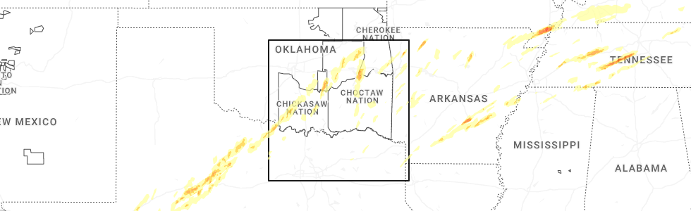
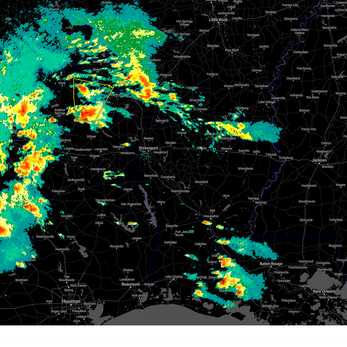
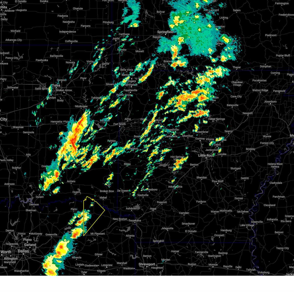
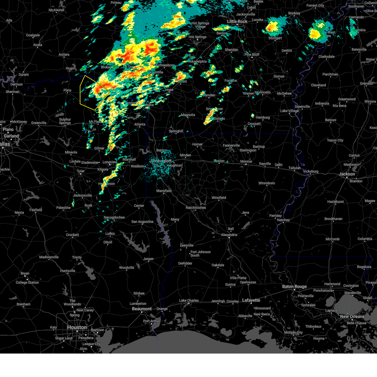
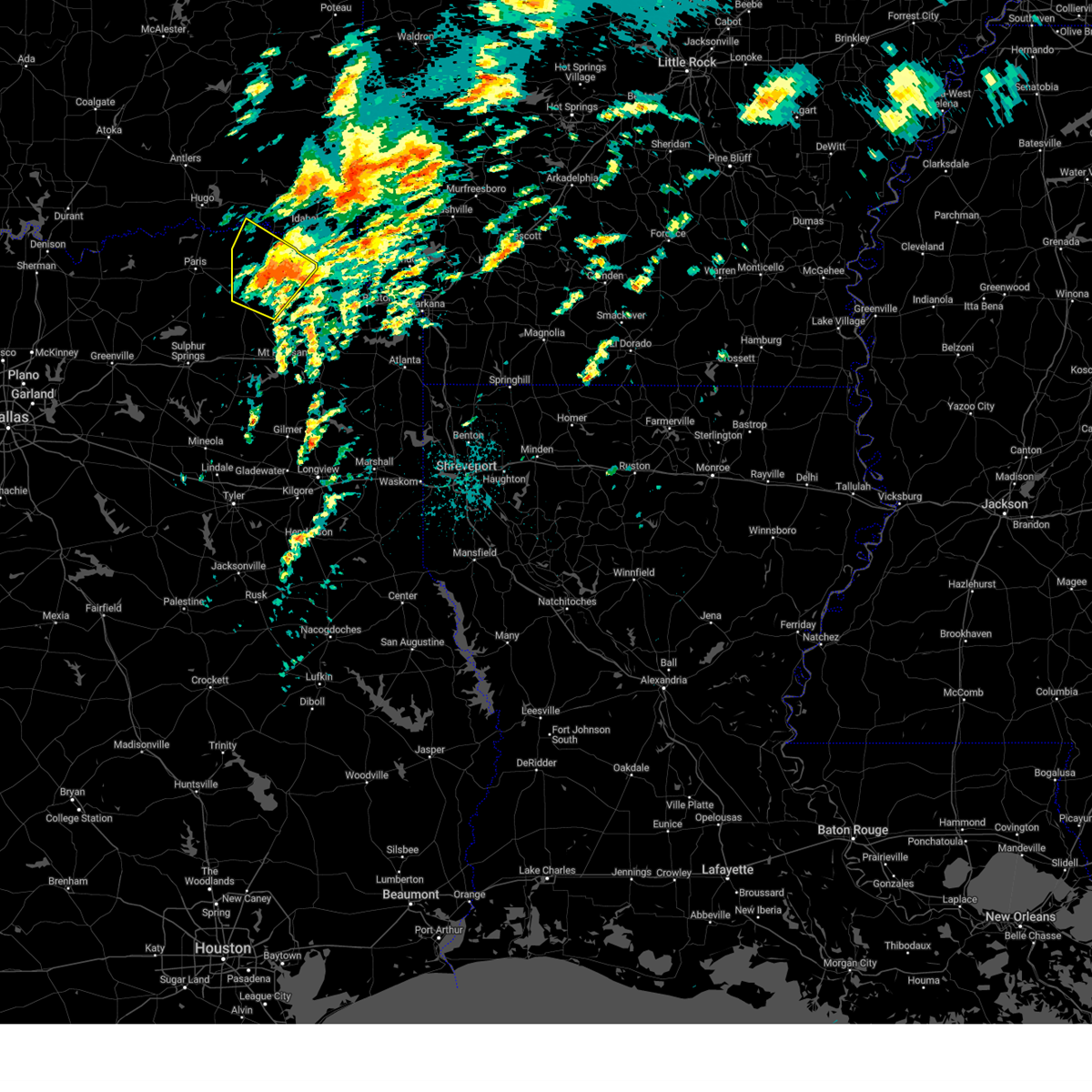
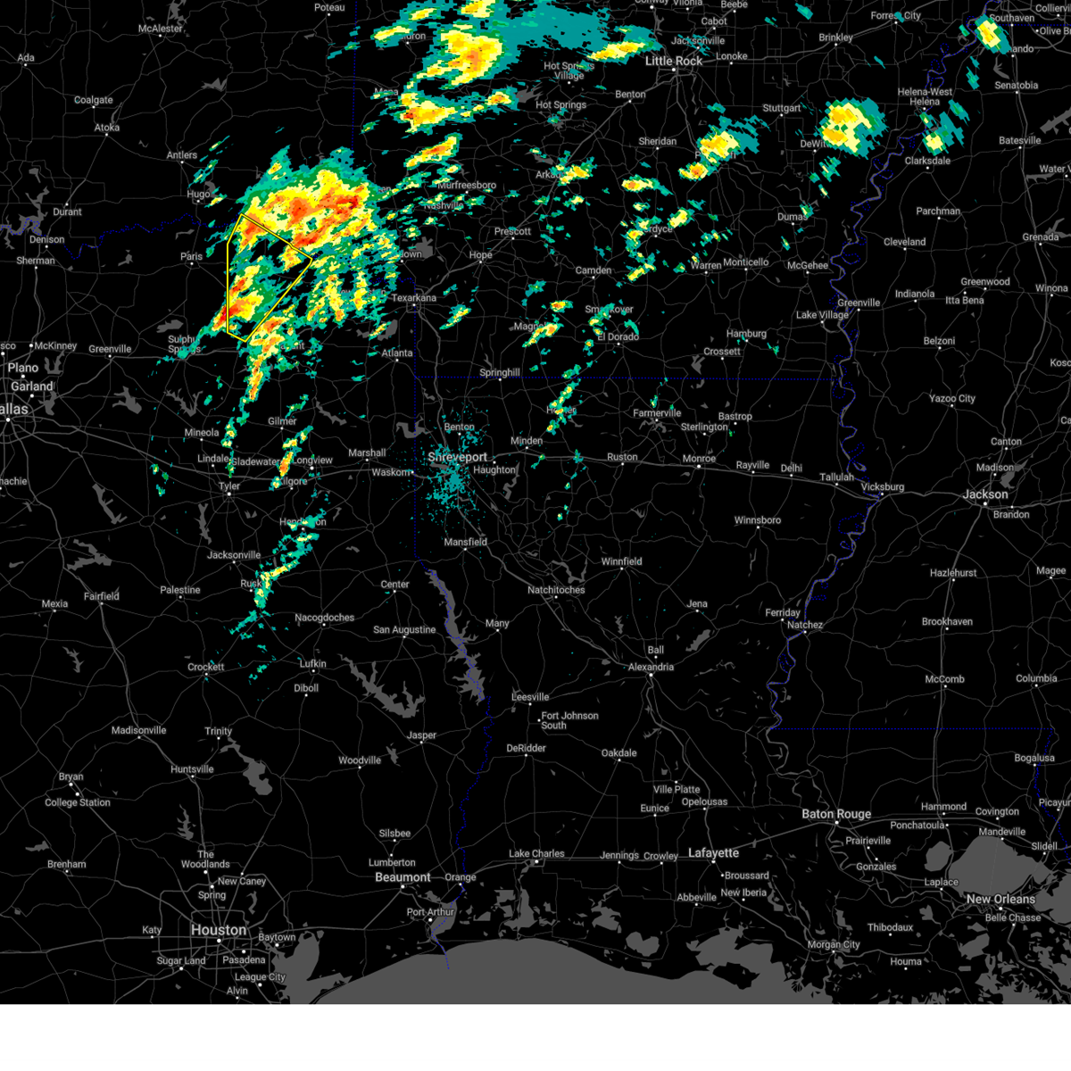
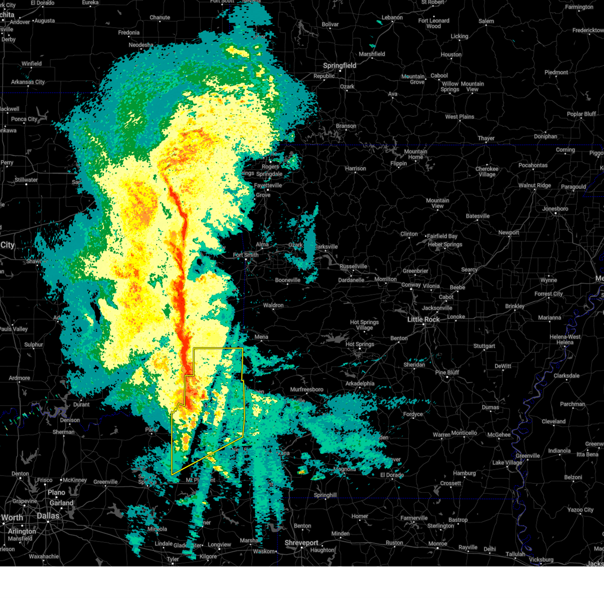
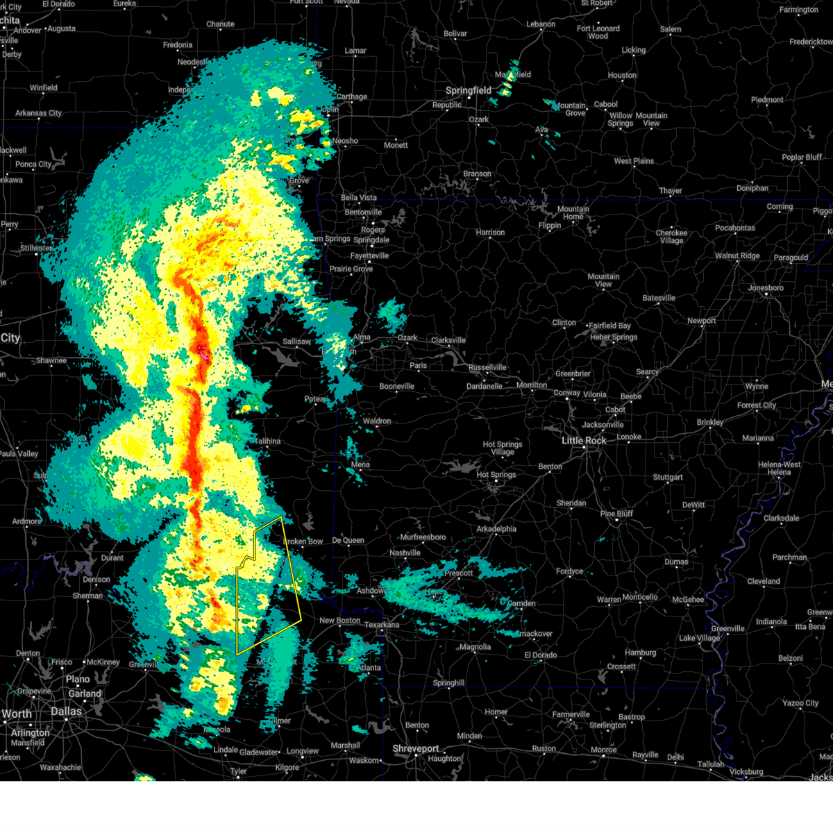
Hail Map for Bogata, TX
The Bogata, TX area has had 12 reports of on-the-ground hail by trained spotters, and has been under severe weather warnings 17 times during the past 12 months. Doppler radar has detected hail at or near Bogata, TX on 64 occasions, including 3 occasions during the past year.
| Name: | Bogata, TX |
| Where Located: | 82.2 miles SE of Atoka, OK |
| Map: | Google Map for Bogata, TX |
| Population: | 1153 |
| Housing Units: | 613 |
| More Info: | Search Google for Bogata, TX |
1
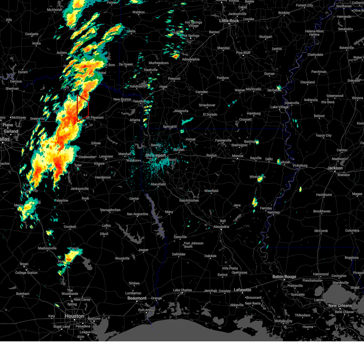
The Top Recent Hail Date for Bogata, TX is Thursday, April 3, 2025 (10th out of 64)
Hail and Wind Damage Spotted near Bogata, TX
| Date / Time | Report Details |
|---|---|
| 6/8/2025 11:11 PM CDT |
 Svrshv the national weather service in shreveport has issued a * severe thunderstorm warning for, central mccurtain county in southeastern oklahoma, western cass county in northeastern texas, northern franklin county in northeastern texas, western bowie county in northeastern texas, morris county in northeastern texas, titus county in northeastern texas, red river county in northeastern texas, * until 1230 am cdt. * at 1111 pm cdt, severe thunderstorms were located along a line extending from near raymond gary state park to near mount vernon, moving east at 50 mph (radar indicated). Hazards include 60 mph wind gusts and quarter size hail. Hail damage to vehicles is expected. Expect wind damage to roofs, siding, and trees. Svrshv the national weather service in shreveport has issued a * severe thunderstorm warning for, central mccurtain county in southeastern oklahoma, western cass county in northeastern texas, northern franklin county in northeastern texas, western bowie county in northeastern texas, morris county in northeastern texas, titus county in northeastern texas, red river county in northeastern texas, * until 1230 am cdt. * at 1111 pm cdt, severe thunderstorms were located along a line extending from near raymond gary state park to near mount vernon, moving east at 50 mph (radar indicated). Hazards include 60 mph wind gusts and quarter size hail. Hail damage to vehicles is expected. Expect wind damage to roofs, siding, and trees.
|
| 6/8/2025 10:14 PM CDT |
 Svrshv the national weather service in shreveport has issued a * severe thunderstorm warning for, franklin county in northeastern texas, northwestern morris county in northeastern texas, titus county in northeastern texas, northwestern camp county in northeastern texas, southwestern red river county in northeastern texas, * until 1115 pm cdt. * at 1013 pm cdt, a severe thunderstorm was located 8 miles northeast of mount vernon, or 8 miles southeast of hagansport, moving southeast at 35 mph (radar indicated). Hazards include 60 mph wind gusts and half dollar size hail. Hail damage to vehicles is expected. Expect wind damage to roofs, siding, and trees. Svrshv the national weather service in shreveport has issued a * severe thunderstorm warning for, franklin county in northeastern texas, northwestern morris county in northeastern texas, titus county in northeastern texas, northwestern camp county in northeastern texas, southwestern red river county in northeastern texas, * until 1115 pm cdt. * at 1013 pm cdt, a severe thunderstorm was located 8 miles northeast of mount vernon, or 8 miles southeast of hagansport, moving southeast at 35 mph (radar indicated). Hazards include 60 mph wind gusts and half dollar size hail. Hail damage to vehicles is expected. Expect wind damage to roofs, siding, and trees.
|
| 5/6/2025 12:05 PM CDT | At 1205 pm cdt, a severe thunderstorm was located 7 miles southeast of clarksville, moving north at 35 mph (radar indicated). Hazards include golf ball size hail and 60 mph wind gusts. People and animals outdoors will be injured. expect hail damage to roofs, siding, windows, and vehicles. expect wind damage to roofs, siding, and trees. Locations impacted include, clarksville, boxelder, hagansport, de kalb, bogata, wilkerson, bagwell, dalby springs, detroit, talco, avery, annona, cuthand, harts bluff, english, johntown, lydia, beaverdams and almont. |
| 5/6/2025 11:40 AM CDT |
 At 1140 am cdt, a severe thunderstorm was located 6 miles west of wilkerson, or 11 miles east of hagansport, moving north at 35 mph (radar indicated). Hazards include golf ball size hail and 60 mph wind gusts. People and animals outdoors will be injured. expect hail damage to roofs, siding, windows, and vehicles. expect wind damage to roofs, siding, and trees. Locations impacted include, mount pleasant, clarksville, boxelder, hagansport, mount vernon, de kalb, bogata, wilkerson, dalby springs, us 259 and i 30 intersection, cookville, bagwell, detroit, winfield, talco, avery, annona, miller's cove, harts bluff and cuthand. At 1140 am cdt, a severe thunderstorm was located 6 miles west of wilkerson, or 11 miles east of hagansport, moving north at 35 mph (radar indicated). Hazards include golf ball size hail and 60 mph wind gusts. People and animals outdoors will be injured. expect hail damage to roofs, siding, windows, and vehicles. expect wind damage to roofs, siding, and trees. Locations impacted include, mount pleasant, clarksville, boxelder, hagansport, mount vernon, de kalb, bogata, wilkerson, dalby springs, us 259 and i 30 intersection, cookville, bagwell, detroit, winfield, talco, avery, annona, miller's cove, harts bluff and cuthand.
|
| 5/6/2025 11:40 AM CDT |
 the severe thunderstorm warning has been cancelled and is no longer in effect the severe thunderstorm warning has been cancelled and is no longer in effect
|
| 5/6/2025 11:29 AM CDT |
 Svrshv the national weather service in shreveport has issued a * severe thunderstorm warning for, northwestern bowie county in northeastern texas, northwestern camp county in northeastern texas, franklin county in northeastern texas, northwestern morris county in northeastern texas, red river county in northeastern texas, titus county in northeastern texas, * until 1215 pm cdt. * at 1129 am cdt, a severe thunderstorm was located 7 miles northwest of mount pleasant, moving north at 35 mph (radar indicated). Hazards include 60 mph wind gusts and quarter size hail. Hail damage to vehicles is expected. Expect wind damage to roofs, siding, and trees. Svrshv the national weather service in shreveport has issued a * severe thunderstorm warning for, northwestern bowie county in northeastern texas, northwestern camp county in northeastern texas, franklin county in northeastern texas, northwestern morris county in northeastern texas, red river county in northeastern texas, titus county in northeastern texas, * until 1215 pm cdt. * at 1129 am cdt, a severe thunderstorm was located 7 miles northwest of mount pleasant, moving north at 35 mph (radar indicated). Hazards include 60 mph wind gusts and quarter size hail. Hail damage to vehicles is expected. Expect wind damage to roofs, siding, and trees.
|
| 4/4/2025 3:34 PM CDT |
 Torshv the national weather service in shreveport has issued a * tornado warning for, northern franklin county in northeastern texas, northwestern titus county in northeastern texas, southwestern red river county in northeastern texas, * until 415 pm cdt. * at 334 pm cdt, a severe thunderstorm capable of producing a tornado was located 9 miles north of como, or 10 miles east of sulphur springs, moving northeast at 35 mph (radar indicated rotation). Hazards include tornado and half dollar size hail. Flying debris will be dangerous to those caught without shelter. mobile homes will be damaged or destroyed. damage to roofs, windows, and vehicles will occur. tree damage is likely. this dangerous storm will be near, hagansport around 355 pm cdt. Other locations impacted by this tornadic thunderstorm include johntown, talco, and deport. Torshv the national weather service in shreveport has issued a * tornado warning for, northern franklin county in northeastern texas, northwestern titus county in northeastern texas, southwestern red river county in northeastern texas, * until 415 pm cdt. * at 334 pm cdt, a severe thunderstorm capable of producing a tornado was located 9 miles north of como, or 10 miles east of sulphur springs, moving northeast at 35 mph (radar indicated rotation). Hazards include tornado and half dollar size hail. Flying debris will be dangerous to those caught without shelter. mobile homes will be damaged or destroyed. damage to roofs, windows, and vehicles will occur. tree damage is likely. this dangerous storm will be near, hagansport around 355 pm cdt. Other locations impacted by this tornadic thunderstorm include johntown, talco, and deport.
|
| 4/4/2025 3:19 PM CDT |
 At 318 pm cdt, a severe thunderstorm capable of producing a tornado was located near bagwell, or 12 miles northwest of clarksville, moving north at 55 mph (radar indicated rotation). Hazards include tornado and half dollar size hail. Flying debris will be dangerous to those caught without shelter. mobile homes will be damaged or destroyed. damage to roofs, windows, and vehicles will occur. tree damage is likely. this dangerous storm will be near, manchester around 325 pm cdt. Other locations impacted by this tornadic thunderstorm include negley, silver city, johntown, detroit, albion, and bryarly. At 318 pm cdt, a severe thunderstorm capable of producing a tornado was located near bagwell, or 12 miles northwest of clarksville, moving north at 55 mph (radar indicated rotation). Hazards include tornado and half dollar size hail. Flying debris will be dangerous to those caught without shelter. mobile homes will be damaged or destroyed. damage to roofs, windows, and vehicles will occur. tree damage is likely. this dangerous storm will be near, manchester around 325 pm cdt. Other locations impacted by this tornadic thunderstorm include negley, silver city, johntown, detroit, albion, and bryarly.
|
| 4/4/2025 3:19 PM CDT |
 the tornado warning has been cancelled and is no longer in effect the tornado warning has been cancelled and is no longer in effect
|
| 4/4/2025 2:46 PM CDT |
 Torshv the national weather service in shreveport has issued a * tornado warning for, northwestern franklin county in northeastern texas, western red river county in northeastern texas, * until 330 pm cdt. * at 246 pm cdt, a severe thunderstorm capable of producing a tornado was located 11 miles east of cooper lake state park, or 12 miles west of hagansport, moving northeast at 55 mph (radar indicated rotation). Hazards include tornado and half dollar size hail. Flying debris will be dangerous to those caught without shelter. mobile homes will be damaged or destroyed. damage to roofs, windows, and vehicles will occur. tree damage is likely. this dangerous storm will be near, manchester around 325 pm cdt. Other locations impacted by this tornadic thunderstorm include silver city, detroit, negley, johntown, albion, bryarly, and deport. Torshv the national weather service in shreveport has issued a * tornado warning for, northwestern franklin county in northeastern texas, western red river county in northeastern texas, * until 330 pm cdt. * at 246 pm cdt, a severe thunderstorm capable of producing a tornado was located 11 miles east of cooper lake state park, or 12 miles west of hagansport, moving northeast at 55 mph (radar indicated rotation). Hazards include tornado and half dollar size hail. Flying debris will be dangerous to those caught without shelter. mobile homes will be damaged or destroyed. damage to roofs, windows, and vehicles will occur. tree damage is likely. this dangerous storm will be near, manchester around 325 pm cdt. Other locations impacted by this tornadic thunderstorm include silver city, detroit, negley, johntown, albion, bryarly, and deport.
|
| 4/4/2025 2:42 PM CDT |
 Svrshv the national weather service in shreveport has issued a * severe thunderstorm warning for, northern franklin county in northeastern texas, northwestern titus county in northeastern texas, red river county in northeastern texas, * until 330 pm cdt. * at 242 pm cdt, a severe thunderstorm was located 9 miles east of cooper lake state park, or 11 miles northeast of sulphur springs, moving northeast at 55 mph (radar indicated). Hazards include 60 mph wind gusts and half dollar size hail. Hail damage to vehicles is expected. Expect wind damage to roofs, siding, and trees. Svrshv the national weather service in shreveport has issued a * severe thunderstorm warning for, northern franklin county in northeastern texas, northwestern titus county in northeastern texas, red river county in northeastern texas, * until 330 pm cdt. * at 242 pm cdt, a severe thunderstorm was located 9 miles east of cooper lake state park, or 11 miles northeast of sulphur springs, moving northeast at 55 mph (radar indicated). Hazards include 60 mph wind gusts and half dollar size hail. Hail damage to vehicles is expected. Expect wind damage to roofs, siding, and trees.
|
| 4/3/2025 2:36 PM CDT |
 The storm which prompted the warning has weakened below severe limits, and no longer poses an immediate threat to life or property. therefore, the warning will be allowed to expire. a tornado watch remains in effect until 1000 pm cdt for northeastern texas. a severe thunderstorm watch remains in effect until 1000 pm cdt for southeastern oklahoma, and northeastern texas. The storm which prompted the warning has weakened below severe limits, and no longer poses an immediate threat to life or property. therefore, the warning will be allowed to expire. a tornado watch remains in effect until 1000 pm cdt for northeastern texas. a severe thunderstorm watch remains in effect until 1000 pm cdt for southeastern oklahoma, and northeastern texas.
|
| 4/3/2025 2:19 PM CDT |
 the severe thunderstorm warning has been cancelled and is no longer in effect the severe thunderstorm warning has been cancelled and is no longer in effect
|
| 4/3/2025 2:19 PM CDT |
 At 218 pm cdt, a severe thunderstorm was located near bagwell, or near clarksville, moving northeast at 40 mph (radar indicated). Hazards include 60 mph wind gusts and quarter size hail. Hail damage to vehicles is expected. expect wind damage to roofs, siding, and trees. Locations impacted include, detroit, clarksville, negley, cuthand, annona, woodland, silver city, english, bagwell, kanawha, bogata, manchester, kiomatia, bryarly, and deport. At 218 pm cdt, a severe thunderstorm was located near bagwell, or near clarksville, moving northeast at 40 mph (radar indicated). Hazards include 60 mph wind gusts and quarter size hail. Hail damage to vehicles is expected. expect wind damage to roofs, siding, and trees. Locations impacted include, detroit, clarksville, negley, cuthand, annona, woodland, silver city, english, bagwell, kanawha, bogata, manchester, kiomatia, bryarly, and deport.
|
| 4/3/2025 1:55 PM CDT |
 Svrshv the national weather service in shreveport has issued a * severe thunderstorm warning for, northern franklin county in northeastern texas, northwestern titus county in northeastern texas, red river county in northeastern texas, * until 245 pm cdt. * at 154 pm cdt, a severe thunderstorm was located near hagansport, moving northeast at 35 mph (radar indicated). Hazards include 60 mph wind gusts and quarter size hail. Hail damage to vehicles is expected. Expect wind damage to roofs, siding, and trees. Svrshv the national weather service in shreveport has issued a * severe thunderstorm warning for, northern franklin county in northeastern texas, northwestern titus county in northeastern texas, red river county in northeastern texas, * until 245 pm cdt. * at 154 pm cdt, a severe thunderstorm was located near hagansport, moving northeast at 35 mph (radar indicated). Hazards include 60 mph wind gusts and quarter size hail. Hail damage to vehicles is expected. Expect wind damage to roofs, siding, and trees.
|
| 3/4/2025 7:24 AM CST |
 Svrshv the national weather service in shreveport has issued a * severe thunderstorm warning for, northwestern little river county in southwestern arkansas, northwestern sevier county in southwestern arkansas, mccurtain county in southeastern oklahoma, northwestern bowie county in northeastern texas, northern franklin county in northeastern texas, red river county in northeastern texas, northwestern titus county in northeastern texas, * until 815 am cst. * at 724 am cst, severe thunderstorms were located along a line from 10 miles northwest of idabel to 6 miles northeast of mount vernon, or along a line from 25 miles north of clarksville to 10 miles west of mount pleasant, moving east at 50 mph (radar indicated). Hazards include 60 mph wind gusts and quarter size hail. Hail damage to vehicles is expected. Expect wind damage to roofs, siding, and trees. Svrshv the national weather service in shreveport has issued a * severe thunderstorm warning for, northwestern little river county in southwestern arkansas, northwestern sevier county in southwestern arkansas, mccurtain county in southeastern oklahoma, northwestern bowie county in northeastern texas, northern franklin county in northeastern texas, red river county in northeastern texas, northwestern titus county in northeastern texas, * until 815 am cst. * at 724 am cst, severe thunderstorms were located along a line from 10 miles northwest of idabel to 6 miles northeast of mount vernon, or along a line from 25 miles north of clarksville to 10 miles west of mount pleasant, moving east at 50 mph (radar indicated). Hazards include 60 mph wind gusts and quarter size hail. Hail damage to vehicles is expected. Expect wind damage to roofs, siding, and trees.
|
| 3/4/2025 6:45 AM CST |
 Svrshv the national weather service in shreveport has issued a * severe thunderstorm warning for, southwestern mccurtain county in southeastern oklahoma, northern franklin county in northeastern texas, red river county in northeastern texas, northwestern titus county in northeastern texas, * until 730 am cst. * at 645 am cst, severe thunderstorms were located along a line from 21 miles west of manchester to 13 miles west of hagansport, or along a line from 33 miles northwest of clarksville to 13 miles west of hagansport, moving northeast at 60 mph (radar indicated). Hazards include 60 mph wind gusts and quarter size hail. Hail damage to vehicles is expected. Expect wind damage to roofs, siding, and trees. Svrshv the national weather service in shreveport has issued a * severe thunderstorm warning for, southwestern mccurtain county in southeastern oklahoma, northern franklin county in northeastern texas, red river county in northeastern texas, northwestern titus county in northeastern texas, * until 730 am cst. * at 645 am cst, severe thunderstorms were located along a line from 21 miles west of manchester to 13 miles west of hagansport, or along a line from 33 miles northwest of clarksville to 13 miles west of hagansport, moving northeast at 60 mph (radar indicated). Hazards include 60 mph wind gusts and quarter size hail. Hail damage to vehicles is expected. Expect wind damage to roofs, siding, and trees.
|
| 6/2/2024 6:37 PM CDT |
 Svrshv the national weather service in shreveport has issued a * severe thunderstorm warning for, southern mccurtain county in southeastern oklahoma, northern franklin county in northeastern texas, northwestern bowie county in northeastern texas, northwestern morris county in northeastern texas, northern titus county in northeastern texas, red river county in northeastern texas, * until 715 pm cdt. * at 636 pm cdt, severe thunderstorms were located along a line extending from near raymond gary state park to clarksville to 10 miles east of cooper lake state park, moving east at 40 mph (radar indicated). Hazards include 60 mph wind gusts and nickel size hail. expect damage to roofs, siding, and trees Svrshv the national weather service in shreveport has issued a * severe thunderstorm warning for, southern mccurtain county in southeastern oklahoma, northern franklin county in northeastern texas, northwestern bowie county in northeastern texas, northwestern morris county in northeastern texas, northern titus county in northeastern texas, red river county in northeastern texas, * until 715 pm cdt. * at 636 pm cdt, severe thunderstorms were located along a line extending from near raymond gary state park to clarksville to 10 miles east of cooper lake state park, moving east at 40 mph (radar indicated). Hazards include 60 mph wind gusts and nickel size hail. expect damage to roofs, siding, and trees
|
| 5/22/2024 8:42 PM CDT |
 At 841 pm cdt, a severe thunderstorm was located near clarksville, moving east at 35 mph (radar indicated). Hazards include ping pong ball size hail and 60 mph wind gusts. People and animals outdoors will be injured. expect hail damage to roofs, siding, windows, and vehicles. expect wind damage to roofs, siding, and trees. Locations impacted include, clarksville, hagansport, boxelder, bogata, wilkerson, deport, talco, annona, english, harts bluff, johntown, and cuthand. At 841 pm cdt, a severe thunderstorm was located near clarksville, moving east at 35 mph (radar indicated). Hazards include ping pong ball size hail and 60 mph wind gusts. People and animals outdoors will be injured. expect hail damage to roofs, siding, windows, and vehicles. expect wind damage to roofs, siding, and trees. Locations impacted include, clarksville, hagansport, boxelder, bogata, wilkerson, deport, talco, annona, english, harts bluff, johntown, and cuthand.
|
| 5/22/2024 8:42 PM CDT |
 the severe thunderstorm warning has been cancelled and is no longer in effect the severe thunderstorm warning has been cancelled and is no longer in effect
|
| 5/22/2024 8:11 PM CDT |
 Svrshv the national weather service in shreveport has issued a * severe thunderstorm warning for, southwestern mccurtain county in southeastern oklahoma, northern franklin county in northeastern texas, northwestern morris county in northeastern texas, northern titus county in northeastern texas, red river county in northeastern texas, * until 900 pm cdt. * at 810 pm cdt, a severe thunderstorm was located over blossom, or 11 miles east of paris, moving east at 35 mph (radar indicated). Hazards include ping pong ball size hail and 60 mph wind gusts. People and animals outdoors will be injured. expect hail damage to roofs, siding, windows, and vehicles. Expect wind damage to roofs, siding, and trees. Svrshv the national weather service in shreveport has issued a * severe thunderstorm warning for, southwestern mccurtain county in southeastern oklahoma, northern franklin county in northeastern texas, northwestern morris county in northeastern texas, northern titus county in northeastern texas, red river county in northeastern texas, * until 900 pm cdt. * at 810 pm cdt, a severe thunderstorm was located over blossom, or 11 miles east of paris, moving east at 35 mph (radar indicated). Hazards include ping pong ball size hail and 60 mph wind gusts. People and animals outdoors will be injured. expect hail damage to roofs, siding, windows, and vehicles. Expect wind damage to roofs, siding, and trees.
|
| 5/9/2024 5:15 PM CDT | Golf Ball sized hail reported 0.2 miles WSW of Bogata, TX, golf ball size hail (1.75 inch) reported in bogota... tx. |
| 5/9/2024 5:04 PM CDT | Quarter sized hail reported 0.4 miles E of Bogata, TX |
| 5/9/2024 4:59 PM CDT |
 Torshv the national weather service in shreveport has issued a * tornado warning for, northern franklin county in northeastern texas, northern titus county in northeastern texas, southern red river county in northeastern texas, * until 545 pm cdt. * at 458 pm cdt, a confirmed tornado was located just southwest of bogata, moving east at 45 mph (weather spotters confirmed tornado). Hazards include damaging tornado and tennis ball size hail. Flying debris will be dangerous to those caught without shelter. mobile homes will be damaged or destroyed. damage to roofs, windows, and vehicles will occur. tree damage is likely. the tornado will be near, bogata around 505 pm cdt. wilkerson around 520 pm cdt. Other locations impacted by this tornadic thunderstorm include johntown, cuthand, talco, harts bluff, and deport. Torshv the national weather service in shreveport has issued a * tornado warning for, northern franklin county in northeastern texas, northern titus county in northeastern texas, southern red river county in northeastern texas, * until 545 pm cdt. * at 458 pm cdt, a confirmed tornado was located just southwest of bogata, moving east at 45 mph (weather spotters confirmed tornado). Hazards include damaging tornado and tennis ball size hail. Flying debris will be dangerous to those caught without shelter. mobile homes will be damaged or destroyed. damage to roofs, windows, and vehicles will occur. tree damage is likely. the tornado will be near, bogata around 505 pm cdt. wilkerson around 520 pm cdt. Other locations impacted by this tornadic thunderstorm include johntown, cuthand, talco, harts bluff, and deport.
|
| 5/9/2024 4:50 PM CDT |
 Svrshv the national weather service in shreveport has issued a * severe thunderstorm warning for, northern franklin county in northeastern texas, northwestern morris county in northeastern texas, titus county in northeastern texas, southern red river county in northeastern texas, * until 545 pm cdt. * at 450 pm cdt, a severe thunderstorm was located 7 miles south of pattonville, or 11 miles northwest of hagansport, moving east southeast at 45 mph (radar indicated). Hazards include tennis ball size hail and 60 mph wind gusts. People and animals outdoors will be injured. expect hail damage to roofs, siding, windows, and vehicles. Expect wind damage to roofs, siding, and trees. Svrshv the national weather service in shreveport has issued a * severe thunderstorm warning for, northern franklin county in northeastern texas, northwestern morris county in northeastern texas, titus county in northeastern texas, southern red river county in northeastern texas, * until 545 pm cdt. * at 450 pm cdt, a severe thunderstorm was located 7 miles south of pattonville, or 11 miles northwest of hagansport, moving east southeast at 45 mph (radar indicated). Hazards include tennis ball size hail and 60 mph wind gusts. People and animals outdoors will be injured. expect hail damage to roofs, siding, windows, and vehicles. Expect wind damage to roofs, siding, and trees.
|
| 3/14/2024 10:01 PM CDT |
 Svrshv the national weather service in shreveport has issued a * severe thunderstorm warning for, west central little river county in southwestern arkansas, southern mccurtain county in southeastern oklahoma, northwestern franklin county in northeastern texas, northwestern bowie county in northeastern texas, red river county in northeastern texas, * until 1045 pm cdt. * at 1000 pm cdt, a severe thunderstorm was located over blossom, or 10 miles east of paris, moving northeast at 50 mph (radar indicated). Hazards include 60 mph wind gusts and half dollar size hail. Hail damage to vehicles is expected. Expect wind damage to roofs, siding, and trees. Svrshv the national weather service in shreveport has issued a * severe thunderstorm warning for, west central little river county in southwestern arkansas, southern mccurtain county in southeastern oklahoma, northwestern franklin county in northeastern texas, northwestern bowie county in northeastern texas, red river county in northeastern texas, * until 1045 pm cdt. * at 1000 pm cdt, a severe thunderstorm was located over blossom, or 10 miles east of paris, moving northeast at 50 mph (radar indicated). Hazards include 60 mph wind gusts and half dollar size hail. Hail damage to vehicles is expected. Expect wind damage to roofs, siding, and trees.
|
| 7/16/2023 12:34 PM CDT |
 At 1233 pm cdt, severe thunderstorms were located along a line extending from near manchester to near mount pleasant to near hawkins, moving east at 30 mph (radar indicated). Hazards include 60 mph wind gusts and quarter size hail. Hail damage to vehicles is expected. Expect wind damage to roofs, siding, and trees. At 1233 pm cdt, severe thunderstorms were located along a line extending from near manchester to near mount pleasant to near hawkins, moving east at 30 mph (radar indicated). Hazards include 60 mph wind gusts and quarter size hail. Hail damage to vehicles is expected. Expect wind damage to roofs, siding, and trees.
|
| 7/16/2023 11:38 AM CDT |
 At 1138 am cdt, severe thunderstorms were located along a line extending from near arthur city to 10 miles northeast of big creek lake to near lake sulphur springs, moving east at 40 mph (radar indicated). Hazards include 60 mph wind gusts and quarter size hail. Hail damage to vehicles is expected. Expect wind damage to roofs, siding, and trees. At 1138 am cdt, severe thunderstorms were located along a line extending from near arthur city to 10 miles northeast of big creek lake to near lake sulphur springs, moving east at 40 mph (radar indicated). Hazards include 60 mph wind gusts and quarter size hail. Hail damage to vehicles is expected. Expect wind damage to roofs, siding, and trees.
|
| 6/18/2023 6:51 AM CDT |
 At 651 am cdt, severe thunderstorms were located along a line extending from 8 miles west of arkinda to 10 miles northeast of boxelder to near clarksville to near bogata to 7 miles west of hagansport, moving east at 50 mph (radar indicated). Hazards include 60 mph wind gusts and quarter size hail. Hail damage to vehicles is expected. Expect wind damage to roofs, siding, and trees. At 651 am cdt, severe thunderstorms were located along a line extending from 8 miles west of arkinda to 10 miles northeast of boxelder to near clarksville to near bogata to 7 miles west of hagansport, moving east at 50 mph (radar indicated). Hazards include 60 mph wind gusts and quarter size hail. Hail damage to vehicles is expected. Expect wind damage to roofs, siding, and trees.
|
| 6/18/2023 3:35 AM CDT |
 At 335 am cdt, a severe thunderstorm was located near pattonville, or 13 miles west of clarksville, moving east at 40 mph (radar indicated). Hazards include 60 mph wind gusts and half dollar size hail. Hail damage to vehicles is expected. Expect wind damage to roofs, siding, and trees. At 335 am cdt, a severe thunderstorm was located near pattonville, or 13 miles west of clarksville, moving east at 40 mph (radar indicated). Hazards include 60 mph wind gusts and half dollar size hail. Hail damage to vehicles is expected. Expect wind damage to roofs, siding, and trees.
|
| 6/18/2023 12:23 AM CDT |
 At 1223 am cdt, severe thunderstorms were located along a line extending from whitesboro to 7 miles east of arthur city, moving east at 40 mph (radar indicated). Hazards include 70 mph wind gusts and nickel size hail. Expect considerable tree damage. damage is likely to mobile homes, roofs, and outbuildings. locations impacted include, de queen, clarksville, horatio, foreman, boxelder, idabel, broken bow, de kalb, bogata, gillham, arkinda, bagwell, manchester, wright city, valliant, detroit, deport, avery, millerton and annona. thunderstorm damage threat, considerable hail threat, radar indicated max hail size, 0. 88 in wind threat, radar indicated max wind gust, 70 mph. At 1223 am cdt, severe thunderstorms were located along a line extending from whitesboro to 7 miles east of arthur city, moving east at 40 mph (radar indicated). Hazards include 70 mph wind gusts and nickel size hail. Expect considerable tree damage. damage is likely to mobile homes, roofs, and outbuildings. locations impacted include, de queen, clarksville, horatio, foreman, boxelder, idabel, broken bow, de kalb, bogata, gillham, arkinda, bagwell, manchester, wright city, valliant, detroit, deport, avery, millerton and annona. thunderstorm damage threat, considerable hail threat, radar indicated max hail size, 0. 88 in wind threat, radar indicated max wind gust, 70 mph.
|
| 6/17/2023 11:59 PM CDT |
 At 1158 pm cdt, severe thunderstorms were located along a line extending from near tuskahoma to near sumner, moving east at 40 mph (radar indicated). Hazards include 60 mph wind gusts and nickel size hail. expect damage to roofs, siding, and trees At 1158 pm cdt, severe thunderstorms were located along a line extending from near tuskahoma to near sumner, moving east at 40 mph (radar indicated). Hazards include 60 mph wind gusts and nickel size hail. expect damage to roofs, siding, and trees
|
| 6/16/2023 12:08 AM CDT |
 At 1207 am cdt, severe thunderstorms were located along a line extending from near wilkerson to rosewood, moving east at 50 mph. these are destructive storms for mount pleasant, pittsburg, and gilmer (radar indicated). Hazards include 80 mph wind gusts and ping pong ball size hail. Flying debris will be dangerous to those caught without shelter. mobile homes will be heavily damaged. expect considerable damage to roofs, windows, and vehicles. extensive tree damage and power outages are likely. Locations impacted include, mount pleasant, gilmer, pittsburg, winnsboro, leesburg, hagansport, mount vernon, naples, bogata, omaha, cason, us 259 and i 30 intersection, cookville, scroggins, pleasant grove, rosewood, wilkerson, newsome, purley and dalby springs. At 1207 am cdt, severe thunderstorms were located along a line extending from near wilkerson to rosewood, moving east at 50 mph. these are destructive storms for mount pleasant, pittsburg, and gilmer (radar indicated). Hazards include 80 mph wind gusts and ping pong ball size hail. Flying debris will be dangerous to those caught without shelter. mobile homes will be heavily damaged. expect considerable damage to roofs, windows, and vehicles. extensive tree damage and power outages are likely. Locations impacted include, mount pleasant, gilmer, pittsburg, winnsboro, leesburg, hagansport, mount vernon, naples, bogata, omaha, cason, us 259 and i 30 intersection, cookville, scroggins, pleasant grove, rosewood, wilkerson, newsome, purley and dalby springs.
|
| 6/15/2023 11:43 PM CDT |
 At 1142 pm cdt, severe thunderstorms were located along a line extending from near hagansport to near quitman, moving southeast at 45 mph. these are destructive storms for bogata, talco, mount vernon, mount pleasant, and winnsboro (radar indicated). Hazards include 80 mph wind gusts and ping pong ball size hail. Flying debris will be dangerous to those caught without shelter. mobile homes will be heavily damaged. expect considerable damage to roofs, windows, and vehicles. Extensive tree damage and power outages are likely. At 1142 pm cdt, severe thunderstorms were located along a line extending from near hagansport to near quitman, moving southeast at 45 mph. these are destructive storms for bogata, talco, mount vernon, mount pleasant, and winnsboro (radar indicated). Hazards include 80 mph wind gusts and ping pong ball size hail. Flying debris will be dangerous to those caught without shelter. mobile homes will be heavily damaged. expect considerable damage to roofs, windows, and vehicles. Extensive tree damage and power outages are likely.
|
| 6/15/2023 11:34 PM CDT |
 At 1133 pm cdt, severe thunderstorms were located along a line extending from near bogata to near como, moving east at 45 mph (radar indicated). Hazards include 70 mph wind gusts and ping pong ball size hail. People and animals outdoors will be injured. expect hail damage to roofs, siding, windows, and vehicles. expect considerable tree damage. wind damage is also likely to mobile homes, roofs, and outbuildings. Locations impacted include, clarksville, hagansport, mount vernon, bogata, purley, deport, talco, cypress, johntown and cuthand. At 1133 pm cdt, severe thunderstorms were located along a line extending from near bogata to near como, moving east at 45 mph (radar indicated). Hazards include 70 mph wind gusts and ping pong ball size hail. People and animals outdoors will be injured. expect hail damage to roofs, siding, windows, and vehicles. expect considerable tree damage. wind damage is also likely to mobile homes, roofs, and outbuildings. Locations impacted include, clarksville, hagansport, mount vernon, bogata, purley, deport, talco, cypress, johntown and cuthand.
|
| 6/15/2023 11:11 PM CDT |
 At 1110 pm cdt, a severe thunderstorm was located 10 miles northeast of cooper lake state park, or 16 miles west of hagansport, moving southeast at 30 mph (radar indicated). Hazards include 60 mph wind gusts and half dollar size hail. Hail damage to vehicles is expected. Expect wind damage to roofs, siding, and trees. At 1110 pm cdt, a severe thunderstorm was located 10 miles northeast of cooper lake state park, or 16 miles west of hagansport, moving southeast at 30 mph (radar indicated). Hazards include 60 mph wind gusts and half dollar size hail. Hail damage to vehicles is expected. Expect wind damage to roofs, siding, and trees.
|
| 6/14/2023 11:52 AM CDT |
 At 1151 am cdt, a severe thunderstorm was located 8 miles east of bogata, or 10 miles west of boxelder, moving east at 50 mph. this is a destructive storm for southern red river county and far northern portions of titus county (radar indicated). Hazards include 80 mph wind gusts and golf ball size hail. Flying debris will be dangerous to those caught without shelter. mobile homes will be heavily damaged. expect considerable damage to roofs, windows, and vehicles. extensive tree damage and power outages are likely. Locations impacted include, boxelder, bogata, wilkerson, talco, avery, annona, harts bluff, lydia, johntown and cuthand. At 1151 am cdt, a severe thunderstorm was located 8 miles east of bogata, or 10 miles west of boxelder, moving east at 50 mph. this is a destructive storm for southern red river county and far northern portions of titus county (radar indicated). Hazards include 80 mph wind gusts and golf ball size hail. Flying debris will be dangerous to those caught without shelter. mobile homes will be heavily damaged. expect considerable damage to roofs, windows, and vehicles. extensive tree damage and power outages are likely. Locations impacted include, boxelder, bogata, wilkerson, talco, avery, annona, harts bluff, lydia, johntown and cuthand.
|
| 6/14/2023 11:38 AM CDT | Trees and power lines down across bogat in red river county TX, 0.8 miles W of Bogata, TX |
| 6/14/2023 11:38 AM CDT |
 At 1137 am cdt, a severe thunderstorm was located over bogata, or 10 miles north of hagansport, moving east at 45 mph (radar indicated). Hazards include golf ball size hail and 70 mph wind gusts. People and animals outdoors will be injured. expect hail damage to roofs, siding, windows, and vehicles. expect considerable tree damage. wind damage is also likely to mobile homes, roofs, and outbuildings. locations impacted include, clarksville, boxelder, bogata, wilkerson, bagwell, detroit, deport, talco, avery, annona, harts bluff, lydia, cuthand, english and johntown. thunderstorm damage threat, considerable hail threat, radar indicated max hail size, 1. 75 in wind threat, radar indicated max wind gust, 70 mph. At 1137 am cdt, a severe thunderstorm was located over bogata, or 10 miles north of hagansport, moving east at 45 mph (radar indicated). Hazards include golf ball size hail and 70 mph wind gusts. People and animals outdoors will be injured. expect hail damage to roofs, siding, windows, and vehicles. expect considerable tree damage. wind damage is also likely to mobile homes, roofs, and outbuildings. locations impacted include, clarksville, boxelder, bogata, wilkerson, bagwell, detroit, deport, talco, avery, annona, harts bluff, lydia, cuthand, english and johntown. thunderstorm damage threat, considerable hail threat, radar indicated max hail size, 1. 75 in wind threat, radar indicated max wind gust, 70 mph.
|
| 6/14/2023 11:19 AM CDT |
 At 1118 am cdt, a severe thunderstorm was located over blossom, or 9 miles east of paris, moving east at 55 mph (radar indicated). Hazards include golf ball size hail and 60 mph wind gusts. People and animals outdoors will be injured. expect hail damage to roofs, siding, windows, and vehicles. Expect wind damage to roofs, siding, and trees. At 1118 am cdt, a severe thunderstorm was located over blossom, or 9 miles east of paris, moving east at 55 mph (radar indicated). Hazards include golf ball size hail and 60 mph wind gusts. People and animals outdoors will be injured. expect hail damage to roofs, siding, windows, and vehicles. Expect wind damage to roofs, siding, and trees.
|
| 6/13/2023 4:20 PM CDT |
 At 420 pm cdt, a severe thunderstorm was located near bagwell, or 7 miles west of clarksville, moving northeast at 60 mph (radar indicated). Hazards include tennis ball size hail and 60 mph wind gusts. People and animals outdoors will be injured. expect hail damage to roofs, siding, windows, and vehicles. expect wind damage to roofs, siding, and trees. locations impacted include, clarksville, bogata, bagwell, manchester, detroit, avery, annona, english, negley, johntown and cuthand. thunderstorm damage threat, considerable hail threat, radar indicated max hail size, 2. 50 in wind threat, radar indicated max wind gust, 60 mph. At 420 pm cdt, a severe thunderstorm was located near bagwell, or 7 miles west of clarksville, moving northeast at 60 mph (radar indicated). Hazards include tennis ball size hail and 60 mph wind gusts. People and animals outdoors will be injured. expect hail damage to roofs, siding, windows, and vehicles. expect wind damage to roofs, siding, and trees. locations impacted include, clarksville, bogata, bagwell, manchester, detroit, avery, annona, english, negley, johntown and cuthand. thunderstorm damage threat, considerable hail threat, radar indicated max hail size, 2. 50 in wind threat, radar indicated max wind gust, 60 mph.
|
| 6/13/2023 4:04 PM CDT |
 At 404 pm cdt, a severe thunderstorm was located 9 miles northwest of hagansport, moving northeast at 50 mph (radar indicated). Hazards include 60 mph wind gusts and half dollar size hail. Hail damage to vehicles is expected. Expect wind damage to roofs, siding, and trees. At 404 pm cdt, a severe thunderstorm was located 9 miles northwest of hagansport, moving northeast at 50 mph (radar indicated). Hazards include 60 mph wind gusts and half dollar size hail. Hail damage to vehicles is expected. Expect wind damage to roofs, siding, and trees.
|
| 6/13/2023 6:08 AM CDT |
 At 607 am cdt, a severe thunderstorm was located near cooper lake state park, or 14 miles north of sulphur springs, moving southeast at 40 mph (radar indicated). Hazards include ping pong ball size hail and 60 mph wind gusts. People and animals outdoors will be injured. expect hail damage to roofs, siding, windows, and vehicles. Expect wind damage to roofs, siding, and trees. At 607 am cdt, a severe thunderstorm was located near cooper lake state park, or 14 miles north of sulphur springs, moving southeast at 40 mph (radar indicated). Hazards include ping pong ball size hail and 60 mph wind gusts. People and animals outdoors will be injured. expect hail damage to roofs, siding, windows, and vehicles. Expect wind damage to roofs, siding, and trees.
|
| 6/11/2023 11:13 PM CDT |
 At 1112 pm cdt, a severe thunderstorm was located about 5 miles north of bogata, or 8 miles west of clarksville, moving east at 35 mph (radar indicated). Hazards include 60 mph wind gusts and quarter size hail. Hail damage to vehicles is expected. Expect wind damage to roofs, siding, and trees. At 1112 pm cdt, a severe thunderstorm was located about 5 miles north of bogata, or 8 miles west of clarksville, moving east at 35 mph (radar indicated). Hazards include 60 mph wind gusts and quarter size hail. Hail damage to vehicles is expected. Expect wind damage to roofs, siding, and trees.
|
| 6/11/2023 11:01 PM CDT | Corrects previous tstm wnd dmg report from bogata. a power line was downed in bogata... setting a tree on fir in red river county TX, 0.8 miles SSW of Bogata, TX |
| 6/11/2023 10:45 PM CDT |
 At 1045 pm cdt, a severe thunderstorm was located 10 miles northwest of hagansport, moving southeast at 25 mph (radar indicated). Hazards include golf ball size hail and 60 mph wind gusts. People and animals outdoors will be injured. expect hail damage to roofs, siding, windows, and vehicles. Expect wind damage to roofs, siding, and trees. At 1045 pm cdt, a severe thunderstorm was located 10 miles northwest of hagansport, moving southeast at 25 mph (radar indicated). Hazards include golf ball size hail and 60 mph wind gusts. People and animals outdoors will be injured. expect hail damage to roofs, siding, windows, and vehicles. Expect wind damage to roofs, siding, and trees.
|
| 6/11/2023 10:01 PM CDT | A power line was downed in bogata... setting a tree on fir in red river county TX, 0.8 miles SSW of Bogata, TX |
| 6/10/2023 10:25 AM CDT |
 At 1025 am cdt, severe thunderstorms were located along a line extending from 8 miles west of de queen to 10 miles northwest of de kalb to near bogata, moving east at 35 mph (radar indicated). Hazards include 60 mph wind gusts and quarter size hail. Hail damage to vehicles is expected. expect wind damage to roofs, siding, and trees. locations impacted include, de queen, clarksville, horatio, foreman, boxelder, idabel, broken bow, de kalb, bogata, lockesburg, winthrop, arkinda, bagwell, detroit, avery, annona, haworth, eagletown, moon and cerrogordo. hail threat, radar indicated max hail size, 1. 00 in wind threat, radar indicated max wind gust, 60 mph. At 1025 am cdt, severe thunderstorms were located along a line extending from 8 miles west of de queen to 10 miles northwest of de kalb to near bogata, moving east at 35 mph (radar indicated). Hazards include 60 mph wind gusts and quarter size hail. Hail damage to vehicles is expected. expect wind damage to roofs, siding, and trees. locations impacted include, de queen, clarksville, horatio, foreman, boxelder, idabel, broken bow, de kalb, bogata, lockesburg, winthrop, arkinda, bagwell, detroit, avery, annona, haworth, eagletown, moon and cerrogordo. hail threat, radar indicated max hail size, 1. 00 in wind threat, radar indicated max wind gust, 60 mph.
|
| 6/10/2023 9:51 AM CDT |
 At 950 am cdt, severe thunderstorms were located along a line extending from 6 miles northwest of broken bow to 6 miles north of clarksville to near pattonville, moving east at 35 mph (radar indicated). Hazards include 60 mph wind gusts and quarter size hail. Hail damage to vehicles is expected. Expect wind damage to roofs, siding, and trees. At 950 am cdt, severe thunderstorms were located along a line extending from 6 miles northwest of broken bow to 6 miles north of clarksville to near pattonville, moving east at 35 mph (radar indicated). Hazards include 60 mph wind gusts and quarter size hail. Hail damage to vehicles is expected. Expect wind damage to roofs, siding, and trees.
|
| 5/7/2023 12:16 AM CDT |
 At 1216 am cdt, a severe thunderstorm was located near manchester, or 19 miles northwest of clarksville, moving northeast at 50 mph (radar indicated). Hazards include 60 mph wind gusts and quarter size hail. Hail damage to vehicles is expected. Expect wind damage to roofs, siding, and trees. At 1216 am cdt, a severe thunderstorm was located near manchester, or 19 miles northwest of clarksville, moving northeast at 50 mph (radar indicated). Hazards include 60 mph wind gusts and quarter size hail. Hail damage to vehicles is expected. Expect wind damage to roofs, siding, and trees.
|
| 5/4/2023 10:54 PM CDT |
 At 1053 pm cdt, severe thunderstorms were located along a line extending from near sawyer to 8 miles northwest of bagwell to near pattonville, moving east at 45 mph (radar indicated). Hazards include 60 mph wind gusts. expect damage to roofs, siding, and trees At 1053 pm cdt, severe thunderstorms were located along a line extending from near sawyer to 8 miles northwest of bagwell to near pattonville, moving east at 45 mph (radar indicated). Hazards include 60 mph wind gusts. expect damage to roofs, siding, and trees
|
| 4/20/2023 5:17 PM CDT |
 At 516 pm cdt, severe thunderstorms were located along a line extending from near clarksville to near bogata to hagansport, moving east at 35 mph (radar indicated). Hazards include 60 mph wind gusts and quarter size hail. Hail damage to vehicles is expected. Expect wind damage to roofs, siding, and trees. At 516 pm cdt, severe thunderstorms were located along a line extending from near clarksville to near bogata to hagansport, moving east at 35 mph (radar indicated). Hazards include 60 mph wind gusts and quarter size hail. Hail damage to vehicles is expected. Expect wind damage to roofs, siding, and trees.
|
| 4/20/2023 4:37 PM CDT |
 At 436 pm cdt, a severe thunderstorm was located near pattonville, or 12 miles northwest of hagansport, moving east at 35 mph (radar indicated). Hazards include 60 mph wind gusts and half dollar size hail. Hail damage to vehicles is expected. Expect wind damage to roofs, siding, and trees. At 436 pm cdt, a severe thunderstorm was located near pattonville, or 12 miles northwest of hagansport, moving east at 35 mph (radar indicated). Hazards include 60 mph wind gusts and half dollar size hail. Hail damage to vehicles is expected. Expect wind damage to roofs, siding, and trees.
|
| 3/2/2023 8:57 PM CST |
 At 857 pm cst, severe thunderstorms were located along a line extending from near octavia to 10 miles northwest of broken bow to 8 miles east of manchester to 7 miles northeast of clarksville to near wilkerson, moving east at 30 mph (radar indicated). Hazards include 60 mph wind gusts and quarter size hail. Hail damage to vehicles is expected. Expect wind damage to roofs, siding, and trees. At 857 pm cst, severe thunderstorms were located along a line extending from near octavia to 10 miles northwest of broken bow to 8 miles east of manchester to 7 miles northeast of clarksville to near wilkerson, moving east at 30 mph (radar indicated). Hazards include 60 mph wind gusts and quarter size hail. Hail damage to vehicles is expected. Expect wind damage to roofs, siding, and trees.
|
| 3/2/2023 8:33 PM CST |
 At 832 pm cst, severe thunderstorms were located along a line extending from 13 miles southeast of albion to 14 miles northeast of fort towson to 7 miles southeast of raymond gary state park to near manchester to near bogata to near hagansport, moving east at 30 mph (radar indicated). Hazards include 60 mph wind gusts and quarter size hail. Hail damage to vehicles is expected. expect wind damage to roofs, siding, and trees. Locations impacted include, clarksville, hagansport, boxelder, idabel, broken bow, de kalb, bogata, us 259 and i 30 intersection, dalby springs, wilkerson, bagwell, manchester, wright city, valliant, detroit, deport, talco, avery, millerton and annona. At 832 pm cst, severe thunderstorms were located along a line extending from 13 miles southeast of albion to 14 miles northeast of fort towson to 7 miles southeast of raymond gary state park to near manchester to near bogata to near hagansport, moving east at 30 mph (radar indicated). Hazards include 60 mph wind gusts and quarter size hail. Hail damage to vehicles is expected. expect wind damage to roofs, siding, and trees. Locations impacted include, clarksville, hagansport, boxelder, idabel, broken bow, de kalb, bogata, us 259 and i 30 intersection, dalby springs, wilkerson, bagwell, manchester, wright city, valliant, detroit, deport, talco, avery, millerton and annona.
|
| 3/2/2023 8:03 PM CST |
 At 803 pm cst, severe thunderstorms were located along a line extending from near nashoba to near hugo lake state park to near powderly to 10 miles northeast of big creek lake, moving east at 40 mph (radar indicated). Hazards include 60 mph wind gusts and quarter size hail. Hail damage to vehicles is expected. Expect wind damage to roofs, siding, and trees. At 803 pm cst, severe thunderstorms were located along a line extending from near nashoba to near hugo lake state park to near powderly to 10 miles northeast of big creek lake, moving east at 40 mph (radar indicated). Hazards include 60 mph wind gusts and quarter size hail. Hail damage to vehicles is expected. Expect wind damage to roofs, siding, and trees.
|
| 3/2/2023 5:43 PM CST |
 The severe thunderstorm warning for northern franklin, northwestern titus and southern red river counties will expire at 545 pm cst, the storm which prompted the warning has moved out of the area. therefore, the warning will be allowed to expire. a tornado watch remains in effect until 1000 pm cst for northeastern texas. The severe thunderstorm warning for northern franklin, northwestern titus and southern red river counties will expire at 545 pm cst, the storm which prompted the warning has moved out of the area. therefore, the warning will be allowed to expire. a tornado watch remains in effect until 1000 pm cst for northeastern texas.
|
| 3/2/2023 5:43 PM CST |
 The tornado warning for western red river county will expire at 545 pm cst, the storm which prompted the warning has weakened below severe limits, and no longer appears capable of producing a tornado. therefore, the warning will be allowed to expire. a tornado watch remains in effect until 1000 pm cst for northeastern texas. The tornado warning for western red river county will expire at 545 pm cst, the storm which prompted the warning has weakened below severe limits, and no longer appears capable of producing a tornado. therefore, the warning will be allowed to expire. a tornado watch remains in effect until 1000 pm cst for northeastern texas.
|
| 3/2/2023 5:28 PM CST |
 At 528 pm cst, a severe thunderstorm capable of producing a tornado was located near bogata, or 10 miles southwest of clarksville, moving north at 40 mph (radar indicated rotation). Hazards include tornado. Flying debris will be dangerous to those caught without shelter. mobile homes will be damaged or destroyed. damage to roofs, windows, and vehicles will occur. tree damage is likely. this dangerous storm will be near, bagwell around 540 pm cst. manchester around 600 pm cst. Other locations impacted by this tornadic thunderstorm include negley, kiomatia and detroit. At 528 pm cst, a severe thunderstorm capable of producing a tornado was located near bogata, or 10 miles southwest of clarksville, moving north at 40 mph (radar indicated rotation). Hazards include tornado. Flying debris will be dangerous to those caught without shelter. mobile homes will be damaged or destroyed. damage to roofs, windows, and vehicles will occur. tree damage is likely. this dangerous storm will be near, bagwell around 540 pm cst. manchester around 600 pm cst. Other locations impacted by this tornadic thunderstorm include negley, kiomatia and detroit.
|
| 3/2/2023 5:09 PM CST |
 At 509 pm cst, a confirmed tornado was located near hagansport, moving northeast at 45 mph (weather spotters confirmed tornado). Hazards include damaging tornado. Flying debris will be dangerous to those caught without shelter. mobile homes will be damaged or destroyed. damage to roofs, windows, and vehicles will occur. tree damage is likely. the tornado will be near, bogata around 515 pm cst. clarksville and bagwell around 535 pm cst. Other locations impacted by this tornadic thunderstorm include english, detroit, talco, negley, kiomatia, johntown, cuthand, bryarly and annona. At 509 pm cst, a confirmed tornado was located near hagansport, moving northeast at 45 mph (weather spotters confirmed tornado). Hazards include damaging tornado. Flying debris will be dangerous to those caught without shelter. mobile homes will be damaged or destroyed. damage to roofs, windows, and vehicles will occur. tree damage is likely. the tornado will be near, bogata around 515 pm cst. clarksville and bagwell around 535 pm cst. Other locations impacted by this tornadic thunderstorm include english, detroit, talco, negley, kiomatia, johntown, cuthand, bryarly and annona.
|
| 3/2/2023 4:58 PM CST |
 At 457 pm cst, a severe thunderstorm was located near hagansport, moving northeast at 30 mph (radar indicated). Hazards include 60 mph wind gusts and quarter size hail. Hail damage to vehicles is expected. Expect wind damage to roofs, siding, and trees. At 457 pm cst, a severe thunderstorm was located near hagansport, moving northeast at 30 mph (radar indicated). Hazards include 60 mph wind gusts and quarter size hail. Hail damage to vehicles is expected. Expect wind damage to roofs, siding, and trees.
|
| 3/2/2023 4:33 PM CST |
 At 432 pm cst, a confirmed tornado was located near purley, or 10 miles north of winnsboro, moving northeast at 35 mph (weather spotters confirmed tornado. at 430 pm cst, a tornado was reported by a trained spotter near pickton). Hazards include damaging tornado and quarter size hail. Flying debris will be dangerous to those caught without shelter. mobile homes will be damaged or destroyed. damage to roofs, windows, and vehicles will occur. tree damage is likely. the tornado will be near, purley around 435 pm cst. mount vernon around 445 pm cst. hagansport around 500 pm cst. Other locations impacted by this tornadic thunderstorm include winfield, talco, cypress, hopewell, harts bluff, johntown and miller`s cove. At 432 pm cst, a confirmed tornado was located near purley, or 10 miles north of winnsboro, moving northeast at 35 mph (weather spotters confirmed tornado. at 430 pm cst, a tornado was reported by a trained spotter near pickton). Hazards include damaging tornado and quarter size hail. Flying debris will be dangerous to those caught without shelter. mobile homes will be damaged or destroyed. damage to roofs, windows, and vehicles will occur. tree damage is likely. the tornado will be near, purley around 435 pm cst. mount vernon around 445 pm cst. hagansport around 500 pm cst. Other locations impacted by this tornadic thunderstorm include winfield, talco, cypress, hopewell, harts bluff, johntown and miller`s cove.
|
| 12/13/2022 12:13 PM CST |
 At 1213 pm cst, severe thunderstorms were located along a line extending from 6 miles northeast of clarksville to 7 miles east of bogata to near hagansport to near purley to near quitman, moving east at 25 mph (radar indicated). Hazards include 60 mph wind gusts and quarter size hail. Hail damage to vehicles is expected. expect wind damage to roofs, siding, and trees. Locations impacted include, mount pleasant, winnsboro, clarksville, hagansport, boxelder, mount vernon, bogata, scroggins, pleasant grove, wilkerson, newsome, purley, winfield, talco, avery, yantis, annona, miller`s cove, rocky mound and johntown. At 1213 pm cst, severe thunderstorms were located along a line extending from 6 miles northeast of clarksville to 7 miles east of bogata to near hagansport to near purley to near quitman, moving east at 25 mph (radar indicated). Hazards include 60 mph wind gusts and quarter size hail. Hail damage to vehicles is expected. expect wind damage to roofs, siding, and trees. Locations impacted include, mount pleasant, winnsboro, clarksville, hagansport, boxelder, mount vernon, bogata, scroggins, pleasant grove, wilkerson, newsome, purley, winfield, talco, avery, yantis, annona, miller`s cove, rocky mound and johntown.
|
| 12/13/2022 11:31 AM CST |
 At 1131 am cst, severe thunderstorms were located along a line extending from 6 miles east of blossom to near deport to 10 miles east of cooper lake park south sulphur to 6 miles west of como to near emory, moving east at 25 mph (radar indicated). Hazards include 60 mph wind gusts and quarter size hail. Hail damage to vehicles is expected. Expect wind damage to roofs, siding, and trees. At 1131 am cst, severe thunderstorms were located along a line extending from 6 miles east of blossom to near deport to 10 miles east of cooper lake park south sulphur to 6 miles west of como to near emory, moving east at 25 mph (radar indicated). Hazards include 60 mph wind gusts and quarter size hail. Hail damage to vehicles is expected. Expect wind damage to roofs, siding, and trees.
|
| 11/4/2022 6:17 PM CDT |
 At 617 pm cdt, a confirmed tornado was located near bagwell, or 7 miles west of clarksville, moving northeast at 50 mph (law enforcement confirmed tornado). Hazards include damaging tornado and quarter size hail. Flying debris will be dangerous to those caught without shelter. mobile homes will be damaged or destroyed. damage to roofs, windows, and vehicles will occur. tree damage is likely. this tornado will be near, bagwell around 620 pm cdt. clarksville around 625 pm cdt. Other locations impacted by this tornadic thunderstorm include negley and detroit. At 617 pm cdt, a confirmed tornado was located near bagwell, or 7 miles west of clarksville, moving northeast at 50 mph (law enforcement confirmed tornado). Hazards include damaging tornado and quarter size hail. Flying debris will be dangerous to those caught without shelter. mobile homes will be damaged or destroyed. damage to roofs, windows, and vehicles will occur. tree damage is likely. this tornado will be near, bagwell around 620 pm cdt. clarksville around 625 pm cdt. Other locations impacted by this tornadic thunderstorm include negley and detroit.
|
| 11/4/2022 5:53 PM CDT |
 At 553 pm cdt, a severe thunderstorm capable of producing a tornado was located 11 miles west of hagansport, moving northeast at 50 mph (radar indicated rotation). Hazards include tornado and quarter size hail. Flying debris will be dangerous to those caught without shelter. mobile homes will be damaged or destroyed. damage to roofs, windows, and vehicles will occur. tree damage is likely. this dangerous storm will be near, bogata around 610 pm cdt. bagwell around 620 pm cdt. clarksville around 625 pm cdt. Other locations impacted by this tornadic thunderstorm include negley and detroit. At 553 pm cdt, a severe thunderstorm capable of producing a tornado was located 11 miles west of hagansport, moving northeast at 50 mph (radar indicated rotation). Hazards include tornado and quarter size hail. Flying debris will be dangerous to those caught without shelter. mobile homes will be damaged or destroyed. damage to roofs, windows, and vehicles will occur. tree damage is likely. this dangerous storm will be near, bogata around 610 pm cdt. bagwell around 620 pm cdt. clarksville around 625 pm cdt. Other locations impacted by this tornadic thunderstorm include negley and detroit.
|
| 4/13/2022 12:47 PM CDT |
 At 1247 pm cdt, severe thunderstorms were located along a line extending from near deport to east tawakoni, moving east at 40 mph (radar indicated). Hazards include 60 mph wind gusts and quarter size hail. Hail damage to vehicles is expected. Expect wind damage to roofs, siding, and trees. At 1247 pm cdt, severe thunderstorms were located along a line extending from near deport to east tawakoni, moving east at 40 mph (radar indicated). Hazards include 60 mph wind gusts and quarter size hail. Hail damage to vehicles is expected. Expect wind damage to roofs, siding, and trees.
|
| 4/13/2022 9:56 AM CDT |
 At 956 am cdt, a severe thunderstorm was located 7 miles west of wilkerson, or 8 miles east of hagansport, moving east at 40 mph (radar indicated). Hazards include 60 mph wind gusts and nickel size hail. expect damage to roofs, siding, and trees At 956 am cdt, a severe thunderstorm was located 7 miles west of wilkerson, or 8 miles east of hagansport, moving east at 40 mph (radar indicated). Hazards include 60 mph wind gusts and nickel size hail. expect damage to roofs, siding, and trees
|
| 4/4/2022 11:07 PM CDT |
 At 1106 pm cdt, severe thunderstorms were located along a line extending from 9 miles southwest of deport to 6 miles northeast of sulphur springs, moving east at 45 mph (radar indicated). Hazards include 60 mph wind gusts and quarter size hail. Hail damage to vehicles is expected. Expect wind damage to roofs, siding, and trees. At 1106 pm cdt, severe thunderstorms were located along a line extending from 9 miles southwest of deport to 6 miles northeast of sulphur springs, moving east at 45 mph (radar indicated). Hazards include 60 mph wind gusts and quarter size hail. Hail damage to vehicles is expected. Expect wind damage to roofs, siding, and trees.
|
| 3/30/2022 6:06 AM CDT |
 At 605 am cdt, severe thunderstorms were located along a line extending from 6 miles north of blossom to near deport to 7 miles northeast of sulphur springs, moving northeast at 60 mph (radar indicated). Hazards include 60 mph wind gusts and penny size hail. expect damage to roofs, siding, and trees At 605 am cdt, severe thunderstorms were located along a line extending from 6 miles north of blossom to near deport to 7 miles northeast of sulphur springs, moving northeast at 60 mph (radar indicated). Hazards include 60 mph wind gusts and penny size hail. expect damage to roofs, siding, and trees
|
| 3/21/2022 9:42 PM CDT |
 At 942 pm cdt, a severe thunderstorm was located near clarksville, moving northeast at 65 mph (radar indicated). Hazards include 60 mph wind gusts and penny size hail. expect damage to roofs, siding, and trees At 942 pm cdt, a severe thunderstorm was located near clarksville, moving northeast at 65 mph (radar indicated). Hazards include 60 mph wind gusts and penny size hail. expect damage to roofs, siding, and trees
|
| 12/10/2021 6:20 PM CST | Hen Egg sized hail reported 0.2 miles WSW of Bogata, TX, wind gusts estimated at 62 mph and hail from one to up to two inch estimated hail size. |
| 12/10/2021 6:15 PM CST |
 At 615 pm cst, a severe thunderstorm was located near deport, or 7 miles northwest of hagansport, moving northeast at 55 mph (radar indicated). Hazards include 60 mph wind gusts and quarter size hail. Hail damage to vehicles is expected. Expect wind damage to roofs, siding, and trees. At 615 pm cst, a severe thunderstorm was located near deport, or 7 miles northwest of hagansport, moving northeast at 55 mph (radar indicated). Hazards include 60 mph wind gusts and quarter size hail. Hail damage to vehicles is expected. Expect wind damage to roofs, siding, and trees.
|
| 10/10/2021 11:24 PM CDT |
 At 1123 pm cdt, severe thunderstorms were located along a line extending from near raymond gary state park to 7 miles southeast of paris to 6 miles northwest of sulphur springs, moving east at 45 mph (radar indicated). Hazards include 60 mph wind gusts and quarter size hail. Hail damage to vehicles is expected. Expect wind damage to roofs, siding, and trees. At 1123 pm cdt, severe thunderstorms were located along a line extending from near raymond gary state park to 7 miles southeast of paris to 6 miles northwest of sulphur springs, moving east at 45 mph (radar indicated). Hazards include 60 mph wind gusts and quarter size hail. Hail damage to vehicles is expected. Expect wind damage to roofs, siding, and trees.
|
| 5/10/2021 12:41 PM CDT |
 At 1240 pm cdt, a severe thunderstorm was located 8 miles west of hagansport, moving east at 40 mph (radar indicated). Hazards include hail up to half dollar size possible. damage to vehicles is expected At 1240 pm cdt, a severe thunderstorm was located 8 miles west of hagansport, moving east at 40 mph (radar indicated). Hazards include hail up to half dollar size possible. damage to vehicles is expected
|
| 5/3/2021 11:48 PM CDT |
 At 1147 pm cdt, severe thunderstorms were located along a line extending from near boxelder to near mount pleasant to near pittsburg to 7 miles north of rosewood, moving east at 55 mph (radar indicated. at 1135 pm, trees were downed across franklin county). Hazards include 70 mph wind gusts. Expect considerable tree damage. damage is likely to mobile homes, roofs, and outbuildings. Locations impacted include, mount pleasant, pittsburg, leesburg, hagansport, mount vernon, bogata, wilkerson, scroggins, newsome, winfield, talco, miller`s cove, rocky mound, perryville, hopewell, harts bluff, monticello, cuthand, johntown and grice. At 1147 pm cdt, severe thunderstorms were located along a line extending from near boxelder to near mount pleasant to near pittsburg to 7 miles north of rosewood, moving east at 55 mph (radar indicated. at 1135 pm, trees were downed across franklin county). Hazards include 70 mph wind gusts. Expect considerable tree damage. damage is likely to mobile homes, roofs, and outbuildings. Locations impacted include, mount pleasant, pittsburg, leesburg, hagansport, mount vernon, bogata, wilkerson, scroggins, newsome, winfield, talco, miller`s cove, rocky mound, perryville, hopewell, harts bluff, monticello, cuthand, johntown and grice.
|
| 5/3/2021 11:10 PM CDT |
 At 1110 pm cdt, severe thunderstorms were located along a line extending from 11 miles east of cooper lake park south sulphur to 6 miles southwest of como to near quitman to near mineola, moving northeast at 45 mph. these are very dangerous storms (radar indicated. at 1105 pm, the sulphur spring airport in hopkins county recorded an 87 mph wind gust). Hazards include 80 mph wind gusts and quarter size hail. Flying debris will be dangerous to those caught without shelter. mobile homes will be heavily damaged. expect considerable damage to roofs, windows, and vehicles. extensive tree damage and power outages are likely. Locations impacted include, mount pleasant, gilmer, mineola, pittsburg, winnsboro, leesburg, hagansport, lindale, mount vernon, quitman, big sandy, hawkins, bogata, scroggins, pleasant grove, hainesville, golden, rosewood, hoard and wilkerson. At 1110 pm cdt, severe thunderstorms were located along a line extending from 11 miles east of cooper lake park south sulphur to 6 miles southwest of como to near quitman to near mineola, moving northeast at 45 mph. these are very dangerous storms (radar indicated. at 1105 pm, the sulphur spring airport in hopkins county recorded an 87 mph wind gust). Hazards include 80 mph wind gusts and quarter size hail. Flying debris will be dangerous to those caught without shelter. mobile homes will be heavily damaged. expect considerable damage to roofs, windows, and vehicles. extensive tree damage and power outages are likely. Locations impacted include, mount pleasant, gilmer, mineola, pittsburg, winnsboro, leesburg, hagansport, lindale, mount vernon, quitman, big sandy, hawkins, bogata, scroggins, pleasant grove, hainesville, golden, rosewood, hoard and wilkerson.
|
| 5/3/2021 10:55 PM CDT |
 At 1055 pm cdt, severe thunderstorms were located along a line extending from near cooper lake park south sulphur to near emory to van, moving east northeast at 45 mph (radar indicated). Hazards include 60 mph wind gusts and quarter size hail. Hail damage to vehicles is expected. Expect wind damage to roofs, siding, and trees. At 1055 pm cdt, severe thunderstorms were located along a line extending from near cooper lake park south sulphur to near emory to van, moving east northeast at 45 mph (radar indicated). Hazards include 60 mph wind gusts and quarter size hail. Hail damage to vehicles is expected. Expect wind damage to roofs, siding, and trees.
|
| 4/9/2021 10:48 PM CDT |
 At 1047 pm cdt, severe thunderstorms were located along a line extending from 9 miles northeast of broken bow to near bogata, moving southeast at 50 mph. in addition, severe thunderstorms ahead of this line were located north of dekalb texas to southwest of horatio, moving east near 25 mph (radar indicated). Hazards include 60 mph wind gusts and half dollar size hail. Hail damage to vehicles is expected. Expect wind damage to roofs, siding, and trees. At 1047 pm cdt, severe thunderstorms were located along a line extending from 9 miles northeast of broken bow to near bogata, moving southeast at 50 mph. in addition, severe thunderstorms ahead of this line were located north of dekalb texas to southwest of horatio, moving east near 25 mph (radar indicated). Hazards include 60 mph wind gusts and half dollar size hail. Hail damage to vehicles is expected. Expect wind damage to roofs, siding, and trees.
|
| 2/25/2021 9:45 PM CST |
 At 944 pm cst, a severe thunderstorm was located 9 miles south of clarksville, moving east at 55 mph (law enforcement. at 939 pm cst, two inch diameter hail was reported by law enforcment in bogata). Hazards include two inch hail and 60 mph wind gusts. People and animals outdoors will be injured. expect hail damage to roofs, siding, windows, and vehicles. expect wind damage to roofs, siding, and trees. Locations impacted include, clarksville, boxelder, de kalb, bogata, talco, avery, annona, almont, beaverdams, harts bluff, lydia, cuthand, english, johntown and goodlake. At 944 pm cst, a severe thunderstorm was located 9 miles south of clarksville, moving east at 55 mph (law enforcement. at 939 pm cst, two inch diameter hail was reported by law enforcment in bogata). Hazards include two inch hail and 60 mph wind gusts. People and animals outdoors will be injured. expect hail damage to roofs, siding, windows, and vehicles. expect wind damage to roofs, siding, and trees. Locations impacted include, clarksville, boxelder, de kalb, bogata, talco, avery, annona, almont, beaverdams, harts bluff, lydia, cuthand, english, johntown and goodlake.
|
| 2/25/2021 9:39 PM CST | Hen Egg sized hail reported 0.2 miles WSW of Bogata, TX |
| 2/25/2021 9:37 PM CST |
 At 937 pm cst, a severe thunderstorm was located over bogata, or 8 miles northeast of hagansport, moving east at 55 mph (radar indicated). Hazards include quarter size hail. damage to vehicles is expected At 937 pm cst, a severe thunderstorm was located over bogata, or 8 miles northeast of hagansport, moving east at 55 mph (radar indicated). Hazards include quarter size hail. damage to vehicles is expected
|
| 11/24/2020 10:32 PM CST |
 At 1032 pm cst, severe thunderstorms were located along a line extending from 8 miles northwest of idabel to 6 miles northeast of clarksville to bogata, moving east at 60 mph (radar indicated). Hazards include 60 mph wind gusts and penny size hail. Expect damage to roofs, siding, and trees. Locations impacted include, clarksville, boxelder, idabel, de kalb, bogata, bagwell, manchester, avery, annona, haworth, moon, beaverdams, lydia, goodlake, redland, america, johntown, bokhoma, farmers hill and almont. At 1032 pm cst, severe thunderstorms were located along a line extending from 8 miles northwest of idabel to 6 miles northeast of clarksville to bogata, moving east at 60 mph (radar indicated). Hazards include 60 mph wind gusts and penny size hail. Expect damage to roofs, siding, and trees. Locations impacted include, clarksville, boxelder, idabel, de kalb, bogata, bagwell, manchester, avery, annona, haworth, moon, beaverdams, lydia, goodlake, redland, america, johntown, bokhoma, farmers hill and almont.
|
| 11/24/2020 10:02 PM CST |
 At 1002 pm cst, severe thunderstorms were located along a line extending from 11 miles south of sawyer to 6 miles west of deport to cooper lake park doctors creek, moving east at 55 mph (radar indicated). Hazards include 60 mph wind gusts and penny size hail. expect damage to roofs, siding, and trees At 1002 pm cst, severe thunderstorms were located along a line extending from 11 miles south of sawyer to 6 miles west of deport to cooper lake park doctors creek, moving east at 55 mph (radar indicated). Hazards include 60 mph wind gusts and penny size hail. expect damage to roofs, siding, and trees
|
| 9/27/2020 11:29 PM CDT |
 At 1129 pm cdt, a severe thunderstorm was located near deport, or 12 miles north of hagansport, moving east at 20 mph (radar indicated). Hazards include 60 mph wind gusts and quarter size hail. Hail damage to vehicles is expected. Expect wind damage to roofs, siding, and trees. At 1129 pm cdt, a severe thunderstorm was located near deport, or 12 miles north of hagansport, moving east at 20 mph (radar indicated). Hazards include 60 mph wind gusts and quarter size hail. Hail damage to vehicles is expected. Expect wind damage to roofs, siding, and trees.
|
| 5/24/2020 5:02 PM CDT |
 At 502 pm cdt, severe thunderstorms were located along a line extending from near bogata to 7 miles west of boxelder to 12 miles east of clarksville to near de kalb, moving north at 60 mph (radar indicated). Hazards include 60 mph wind gusts and nickel size hail. Expect damage to roofs, siding, and trees. Locations impacted include, clarksville, hagansport, boxelder, de kalb, bogata, wilkerson, bagwell, manchester, dalby springs, detroit, talco, avery, annona, beaverdams, harts bluff, lydia, negley, cuthand, woodland and english. At 502 pm cdt, severe thunderstorms were located along a line extending from near bogata to 7 miles west of boxelder to 12 miles east of clarksville to near de kalb, moving north at 60 mph (radar indicated). Hazards include 60 mph wind gusts and nickel size hail. Expect damage to roofs, siding, and trees. Locations impacted include, clarksville, hagansport, boxelder, de kalb, bogata, wilkerson, bagwell, manchester, dalby springs, detroit, talco, avery, annona, beaverdams, harts bluff, lydia, negley, cuthand, woodland and english.
|
| 5/24/2020 4:21 PM CDT |
 At 421 pm cdt, severe thunderstorms were located along a line extending from near scroggins to near pittsburg to near rocky branch, moving north at 45 mph (radar indicated. large hail and damaging winds have been reported throughout upshur county with these storms). Hazards include 60 mph wind gusts and quarter size hail. Hail damage to vehicles is expected. Expect wind damage to roofs, siding, and trees. At 421 pm cdt, severe thunderstorms were located along a line extending from near scroggins to near pittsburg to near rocky branch, moving north at 45 mph (radar indicated. large hail and damaging winds have been reported throughout upshur county with these storms). Hazards include 60 mph wind gusts and quarter size hail. Hail damage to vehicles is expected. Expect wind damage to roofs, siding, and trees.
|
| 5/8/2020 4:34 AM CDT |
 At 433 am cdt, severe thunderstorms were located along a line extending from 8 miles southwest of new boston to near dalby springs to near wilkerson to 8 miles southwest of deport, moving southeast at 55 mph (radar indicated). Hazards include 60 mph wind gusts and quarter size hail. Hail damage to vehicles is expected. expect wind damage to roofs, siding, and trees. Locations impacted include, mount pleasant, pittsburg, winnsboro, clarksville, leesburg, hagansport, boxelder, mount vernon, daingerfield, hughes springs, naples, bogata, omaha, cason, us 259 and i 30 intersection, cookville, scroggins, rocky branch, wilkerson and jenkins. At 433 am cdt, severe thunderstorms were located along a line extending from 8 miles southwest of new boston to near dalby springs to near wilkerson to 8 miles southwest of deport, moving southeast at 55 mph (radar indicated). Hazards include 60 mph wind gusts and quarter size hail. Hail damage to vehicles is expected. expect wind damage to roofs, siding, and trees. Locations impacted include, mount pleasant, pittsburg, winnsboro, clarksville, leesburg, hagansport, boxelder, mount vernon, daingerfield, hughes springs, naples, bogata, omaha, cason, us 259 and i 30 intersection, cookville, scroggins, rocky branch, wilkerson and jenkins.
|
| 5/8/2020 4:06 AM CDT | Report from mping: 1-inch tree limbs broken; shingles blown of in red river county TX, 1.2 miles SE of Bogata, TX |
| 5/8/2020 3:58 AM CDT |
 At 358 am cdt, a severe thunderstorm was located near clarksville, moving southeast at 60 mph (radar indicated). Hazards include 60 mph wind gusts and quarter size hail. Hail damage to vehicles is expected. Expect wind damage to roofs, siding, and trees. At 358 am cdt, a severe thunderstorm was located near clarksville, moving southeast at 60 mph (radar indicated). Hazards include 60 mph wind gusts and quarter size hail. Hail damage to vehicles is expected. Expect wind damage to roofs, siding, and trees.
|
| 4/28/2020 11:25 PM CDT |
 At 1124 pm cdt, severe thunderstorms were located along a line extending from near blevins to near hope to 6 miles southwest of fulton to near new boston to near boxelder to near bogata, moving south at 40 mph (radar indicated). Hazards include 70 mph wind gusts and quarter size hail. Hail damage to vehicles is expected. expect considerable tree damage. wind damage is also likely to mobile homes, roofs, and outbuildings. Locations impacted include, texarkana, wake village, ashdown, nashville, new boston, clarksville, mineral springs, foreman, boxelder, nash, hooks, de kalb, bogata, redwater, maud, red lick, wilton, blevins, tollette and fulton. At 1124 pm cdt, severe thunderstorms were located along a line extending from near blevins to near hope to 6 miles southwest of fulton to near new boston to near boxelder to near bogata, moving south at 40 mph (radar indicated). Hazards include 70 mph wind gusts and quarter size hail. Hail damage to vehicles is expected. expect considerable tree damage. wind damage is also likely to mobile homes, roofs, and outbuildings. Locations impacted include, texarkana, wake village, ashdown, nashville, new boston, clarksville, mineral springs, foreman, boxelder, nash, hooks, de kalb, bogata, redwater, maud, red lick, wilton, blevins, tollette and fulton.
|
| 4/28/2020 11:01 PM CDT |
 At 1100 pm cdt, severe thunderstorms were located along a line extending from near corinth to near ben lomond to near foreman to 12 miles south of idabel to near bagwell, moving southeast at 45 mph (radar indicated). Hazards include 70 mph wind gusts and quarter size hail. Hail damage to vehicles is expected. expect considerable tree damage. Wind damage is also likely to mobile homes, roofs, and outbuildings. At 1100 pm cdt, severe thunderstorms were located along a line extending from near corinth to near ben lomond to near foreman to 12 miles south of idabel to near bagwell, moving southeast at 45 mph (radar indicated). Hazards include 70 mph wind gusts and quarter size hail. Hail damage to vehicles is expected. expect considerable tree damage. Wind damage is also likely to mobile homes, roofs, and outbuildings.
|
| 4/28/2020 11:01 PM CDT |
 The national weather service in shreveport has issued a * severe thunderstorm warning for. little river county in southwestern arkansas. central hempstead county in southwestern arkansas. northwestern miller county in southwestern arkansas. Southeastern sevier county in southwestern arkansas. The national weather service in shreveport has issued a * severe thunderstorm warning for. little river county in southwestern arkansas. central hempstead county in southwestern arkansas. northwestern miller county in southwestern arkansas. Southeastern sevier county in southwestern arkansas.
|
| 4/28/2020 10:25 PM CDT |
 At 1025 pm cdt, severe thunderstorms were located along a line extending from near albert pike recreation area to 7 miles northeast of manchester, moving southeast at 60 mph (radar indicated). Hazards include 70 mph wind gusts and quarter size hail. Hail damage to vehicles is expected. expect considerable tree damage. Wind damage is also likely to mobile homes, roofs, and outbuildings. At 1025 pm cdt, severe thunderstorms were located along a line extending from near albert pike recreation area to 7 miles northeast of manchester, moving southeast at 60 mph (radar indicated). Hazards include 70 mph wind gusts and quarter size hail. Hail damage to vehicles is expected. expect considerable tree damage. Wind damage is also likely to mobile homes, roofs, and outbuildings.
|
| 4/24/2020 7:53 PM CDT |
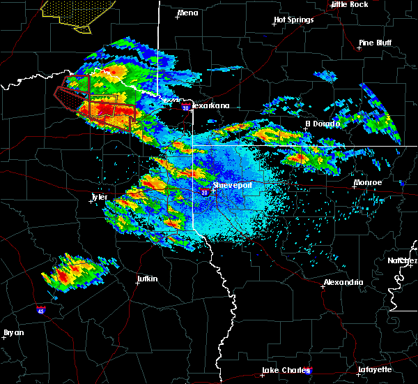 At 752 pm cdt, a severe thunderstorm capable of producing a tornado was located near bogata, or near hagansport, moving east at 35 mph (radar indicated rotation). Hazards include tornado and two inch hail. Flying debris will be dangerous to those caught without shelter. mobile homes will be damaged or destroyed. damage to roofs, windows, and vehicles will occur. tree damage is likely. this dangerous storm will be near, wilkerson around 815 pm cdt. boxelder around 820 pm cdt. Other locations impacted by this tornadic thunderstorm include lydia, johntown, cuthand, talco and harts bluff. At 752 pm cdt, a severe thunderstorm capable of producing a tornado was located near bogata, or near hagansport, moving east at 35 mph (radar indicated rotation). Hazards include tornado and two inch hail. Flying debris will be dangerous to those caught without shelter. mobile homes will be damaged or destroyed. damage to roofs, windows, and vehicles will occur. tree damage is likely. this dangerous storm will be near, wilkerson around 815 pm cdt. boxelder around 820 pm cdt. Other locations impacted by this tornadic thunderstorm include lydia, johntown, cuthand, talco and harts bluff.
|
| 4/24/2020 7:40 PM CDT | Quarter sized hail reported 0.2 miles WSW of Bogata, TX, hail photo submitted via social media. |
| 4/24/2020 7:40 PM CDT |
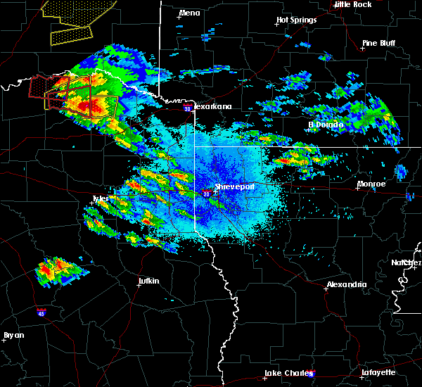 At 740 pm cdt, a severe thunderstorm capable of producing a tornado was located near deport, or 8 miles northwest of hagansport, moving east at 35 mph (radar indicated rotation). Hazards include tornado and golf ball size hail. Flying debris will be dangerous to those caught without shelter. mobile homes will be damaged or destroyed. damage to roofs, windows, and vehicles will occur. tree damage is likely. this dangerous storm will be near, bogata around 745 pm cdt. hagansport around 750 pm cdt. wilkerson around 815 pm cdt. boxelder around 820 pm cdt. Other locations impacted by this tornadic thunderstorm include lydia, johntown, cuthand, talco and harts bluff. At 740 pm cdt, a severe thunderstorm capable of producing a tornado was located near deport, or 8 miles northwest of hagansport, moving east at 35 mph (radar indicated rotation). Hazards include tornado and golf ball size hail. Flying debris will be dangerous to those caught without shelter. mobile homes will be damaged or destroyed. damage to roofs, windows, and vehicles will occur. tree damage is likely. this dangerous storm will be near, bogata around 745 pm cdt. hagansport around 750 pm cdt. wilkerson around 815 pm cdt. boxelder around 820 pm cdt. Other locations impacted by this tornadic thunderstorm include lydia, johntown, cuthand, talco and harts bluff.
|
| 4/24/2020 7:33 PM CDT |
 At 732 pm cdt, a severe thunderstorm was located over deport, or 14 miles northwest of hagansport, moving east at 35 mph (radar indicated). Hazards include golf ball size hail and 70 mph wind gusts. People and animals outdoors will be injured. expect hail damage to roofs, siding, windows, and vehicles. expect considerable tree damage. wind damage is also likely to mobile homes, roofs, and outbuildings. Locations impacted include, clarksville, bogata, johntown and cuthand. At 732 pm cdt, a severe thunderstorm was located over deport, or 14 miles northwest of hagansport, moving east at 35 mph (radar indicated). Hazards include golf ball size hail and 70 mph wind gusts. People and animals outdoors will be injured. expect hail damage to roofs, siding, windows, and vehicles. expect considerable tree damage. wind damage is also likely to mobile homes, roofs, and outbuildings. Locations impacted include, clarksville, bogata, johntown and cuthand.
|
| 4/24/2020 7:08 PM CDT |
 At 708 pm cdt, a severe thunderstorm was located near paris, moving east at 35 mph (radar indicated). Hazards include golf ball size hail and 60 mph wind gusts. People and animals outdoors will be injured. expect hail damage to roofs, siding, windows, and vehicles. Expect wind damage to roofs, siding, and trees. At 708 pm cdt, a severe thunderstorm was located near paris, moving east at 35 mph (radar indicated). Hazards include golf ball size hail and 60 mph wind gusts. People and animals outdoors will be injured. expect hail damage to roofs, siding, windows, and vehicles. Expect wind damage to roofs, siding, and trees.
|
| 10/21/2019 2:12 AM CDT |
 At 212 am cdt, severe thunderstorms were located along a line extending from 13 miles south of idabel to near boxelder to near purley, moving east at 50 mph (radar indicated). Hazards include 60 mph wind gusts and quarter size hail. Hail damage to vehicles is expected. expect wind damage to roofs, siding, and trees. Locations impacted include, mount pleasant, winnsboro, clarksville, hagansport, boxelder, mount vernon, de kalb, bogata, wilkerson, purley, scroggins, winfield, talco, avery, annona, miller`s cove, beaverdams, lydia, johntown and almont. At 212 am cdt, severe thunderstorms were located along a line extending from 13 miles south of idabel to near boxelder to near purley, moving east at 50 mph (radar indicated). Hazards include 60 mph wind gusts and quarter size hail. Hail damage to vehicles is expected. expect wind damage to roofs, siding, and trees. Locations impacted include, mount pleasant, winnsboro, clarksville, hagansport, boxelder, mount vernon, de kalb, bogata, wilkerson, purley, scroggins, winfield, talco, avery, annona, miller`s cove, beaverdams, lydia, johntown and almont.
|
| 10/21/2019 1:35 AM CDT |
 At 135 am cdt, severe thunderstorms were located along a line extending from 9 miles west of manchester to 7 miles southwest of deport to hawk cove, moving east at 50 mph (radar indicated). Hazards include 60 mph wind gusts and quarter size hail. Hail damage to vehicles is expected. Expect wind damage to roofs, siding, and trees. At 135 am cdt, severe thunderstorms were located along a line extending from 9 miles west of manchester to 7 miles southwest of deport to hawk cove, moving east at 50 mph (radar indicated). Hazards include 60 mph wind gusts and quarter size hail. Hail damage to vehicles is expected. Expect wind damage to roofs, siding, and trees.
|
| 10/20/2019 11:45 PM CDT |
 At 1144 pm cdt, severe thunderstorms were located along a line extending from 8 miles northwest of de queen to 8 miles west of horatio to 10 miles southwest of arkinda to 6 miles northwest of wilkerson, moving east at 45 mph (radar indicated). Hazards include 60 mph wind gusts. Expect damage to roofs, siding, and trees. Locations impacted include, de queen, clarksville, horatio, foreman, boxelder, de kalb, bogata, lockesburg, winthrop, arkinda, avery, annona, haworth, eagletown, moon, cerrogordo, beaverdams, lydia, goodlake and geneva. At 1144 pm cdt, severe thunderstorms were located along a line extending from 8 miles northwest of de queen to 8 miles west of horatio to 10 miles southwest of arkinda to 6 miles northwest of wilkerson, moving east at 45 mph (radar indicated). Hazards include 60 mph wind gusts. Expect damage to roofs, siding, and trees. Locations impacted include, de queen, clarksville, horatio, foreman, boxelder, de kalb, bogata, lockesburg, winthrop, arkinda, avery, annona, haworth, eagletown, moon, cerrogordo, beaverdams, lydia, goodlake and geneva.
|
| 10/20/2019 11:16 PM CDT |
 At 1116 pm cdt, severe thunderstorms were located along a line extending from near broken bow to near idabel to near clarksville to 10 miles west of hagansport, moving east at 45 mph (radar indicated. power lines were downed near valliant oklahoma with these storms, and a roof was removed off of a building). Hazards include 60 mph wind gusts. expect damage to roofs, siding, and trees At 1116 pm cdt, severe thunderstorms were located along a line extending from near broken bow to near idabel to near clarksville to 10 miles west of hagansport, moving east at 45 mph (radar indicated. power lines were downed near valliant oklahoma with these storms, and a roof was removed off of a building). Hazards include 60 mph wind gusts. expect damage to roofs, siding, and trees
|
| 6/23/2019 7:45 PM CDT |
 At 745 pm cdt, severe thunderstorms were located along a line extending from 7 miles south of albert pike recreation area to 11 miles northeast of cooper lake park doctors creek, moving east at 30 mph (radar indicated). Hazards include 60 mph wind gusts and quarter size hail. Hail damage to vehicles is expected. Expect wind damage to roofs, siding, and trees. At 745 pm cdt, severe thunderstorms were located along a line extending from 7 miles south of albert pike recreation area to 11 miles northeast of cooper lake park doctors creek, moving east at 30 mph (radar indicated). Hazards include 60 mph wind gusts and quarter size hail. Hail damage to vehicles is expected. Expect wind damage to roofs, siding, and trees.
|
| 6/23/2019 7:05 PM CDT |
 At 704 pm cdt, severe thunderstorms were located along a line extending from near hartley to near blossom, moving northeast at 25 mph (radar indicated). Hazards include 60 mph wind gusts and quarter size hail. Hail damage to vehicles is expected. Expect wind damage to roofs, siding, and trees. At 704 pm cdt, severe thunderstorms were located along a line extending from near hartley to near blossom, moving northeast at 25 mph (radar indicated). Hazards include 60 mph wind gusts and quarter size hail. Hail damage to vehicles is expected. Expect wind damage to roofs, siding, and trees.
|
| 6/23/2019 7:05 PM CDT |
 The national weather service in shreveport has issued a * severe thunderstorm warning for. northwestern sevier county in southwestern arkansas. central mccurtain county in southeastern oklahoma. northern red river county in northeastern texas. Until 745 pm cdt. The national weather service in shreveport has issued a * severe thunderstorm warning for. northwestern sevier county in southwestern arkansas. central mccurtain county in southeastern oklahoma. northern red river county in northeastern texas. Until 745 pm cdt.
|
| 6/19/2019 11:45 PM CDT |
 At 1145 pm cdt, a severe thunderstorm was located near deport, or 14 miles west of clarksville, moving east at 40 mph (radar indicated). Hazards include 60 mph wind gusts and quarter size hail. Hail damage to vehicles is expected. Expect wind damage to roofs, siding, and trees. At 1145 pm cdt, a severe thunderstorm was located near deport, or 14 miles west of clarksville, moving east at 40 mph (radar indicated). Hazards include 60 mph wind gusts and quarter size hail. Hail damage to vehicles is expected. Expect wind damage to roofs, siding, and trees.
|
| 5/29/2019 7:06 PM CDT |
 At 706 pm cdt, a severe thunderstorm capable of producing a tornado was located 4 miles north of bogata, or 9 miles southwest of clarksville, moving east at 40 mph (radar indicated rotation). Hazards include tornado. Flying debris will be dangerous to those caught without shelter. mobile homes will be damaged or destroyed. damage to roofs, windows, and vehicles will occur. tree damage is likely. Other locations impacted by this tornadic thunderstorm include lydia, cuthand, avery and annona. At 706 pm cdt, a severe thunderstorm capable of producing a tornado was located 4 miles north of bogata, or 9 miles southwest of clarksville, moving east at 40 mph (radar indicated rotation). Hazards include tornado. Flying debris will be dangerous to those caught without shelter. mobile homes will be damaged or destroyed. damage to roofs, windows, and vehicles will occur. tree damage is likely. Other locations impacted by this tornadic thunderstorm include lydia, cuthand, avery and annona.
|
| 5/18/2019 4:54 PM CDT |
 At 454 pm cdt, severe thunderstorms were located along a line extending from 11 miles west of hagansport to 6 miles northwest of purley to near winnsboro, moving east at 55 mph (radar indicated). Hazards include 70 mph wind gusts and quarter size hail. Hail damage to vehicles is expected. expect considerable tree damage. Wind damage is also likely to mobile homes, roofs, and outbuildings. At 454 pm cdt, severe thunderstorms were located along a line extending from 11 miles west of hagansport to 6 miles northwest of purley to near winnsboro, moving east at 55 mph (radar indicated). Hazards include 70 mph wind gusts and quarter size hail. Hail damage to vehicles is expected. expect considerable tree damage. Wind damage is also likely to mobile homes, roofs, and outbuildings.
|
| 5/1/2019 9:30 PM CDT |
 At 930 pm cdt, severe thunderstorms were located along a line extending from near broken bow to clarksville to near hagansport, moving northeast at 45 mph (radar indicated). Hazards include golf ball size hail. People and animals outdoors will be injured. expect damage to roofs, siding, windows, and vehicles. Locations impacted include, clarksville, hagansport, boxelder, idabel, broken bow, mount vernon, bogata, wilkerson, purley, winfield, talco, annona, haworth, miller`s cove, eagletown, johntown, oak hill, hopewell, harts bluff and harris. At 930 pm cdt, severe thunderstorms were located along a line extending from near broken bow to clarksville to near hagansport, moving northeast at 45 mph (radar indicated). Hazards include golf ball size hail. People and animals outdoors will be injured. expect damage to roofs, siding, windows, and vehicles. Locations impacted include, clarksville, hagansport, boxelder, idabel, broken bow, mount vernon, bogata, wilkerson, purley, winfield, talco, annona, haworth, miller`s cove, eagletown, johntown, oak hill, hopewell, harts bluff and harris.
|
| 5/1/2019 9:15 PM CDT | Quarter sized hail reported 0.2 miles WSW of Bogata, TX, quarter size hail reported around the bogata area. |
| 5/1/2019 9:08 PM CDT |
 At 908 pm cdt, severe thunderstorms were located along a line extending from 9 miles northeast of manchester to near bogata to 6 miles east of cooper lake park south sulphur, moving northeast at 40 mph (radar indicated). Hazards include quarter size hail. damage to vehicles is expected At 908 pm cdt, severe thunderstorms were located along a line extending from 9 miles northeast of manchester to near bogata to 6 miles east of cooper lake park south sulphur, moving northeast at 40 mph (radar indicated). Hazards include quarter size hail. damage to vehicles is expected
|
| 5/1/2019 8:50 PM CDT |
 At 850 pm cdt, a severe thunderstorm was located over bogata, or 7 miles north of hagansport, moving northeast at 55 mph (radar indicated). Hazards include 60 mph wind gusts and quarter size hail. Hail damage to vehicles is expected. Expect wind damage to roofs, siding, and trees. At 850 pm cdt, a severe thunderstorm was located over bogata, or 7 miles north of hagansport, moving northeast at 55 mph (radar indicated). Hazards include 60 mph wind gusts and quarter size hail. Hail damage to vehicles is expected. Expect wind damage to roofs, siding, and trees.
|
| 11/30/2018 11:44 PM CST |
 At 1143 pm cst, severe thunderstorms were located along a line extending from near bogata to 6 miles east of hagansport to near mount vernon to near como, moving east at 45 mph (radar indicated). Hazards include 60 mph wind gusts and penny size hail. Expect damage to roofs, siding, and trees. Locations impacted include, mount pleasant, winnsboro, clarksville, hagansport, boxelder, mount vernon, bogata, omaha, us 259 and i 30 intersection, wilkerson, cookville, purley, winfield, talco, annona, miller`s cove, hopewell, harts bluff, monticello and cuthand. At 1143 pm cst, severe thunderstorms were located along a line extending from near bogata to 6 miles east of hagansport to near mount vernon to near como, moving east at 45 mph (radar indicated). Hazards include 60 mph wind gusts and penny size hail. Expect damage to roofs, siding, and trees. Locations impacted include, mount pleasant, winnsboro, clarksville, hagansport, boxelder, mount vernon, bogata, omaha, us 259 and i 30 intersection, wilkerson, cookville, purley, winfield, talco, annona, miller`s cove, hopewell, harts bluff, monticello and cuthand.
|
| 11/30/2018 11:23 PM CST |
 At 1123 pm cst, a severe thunderstorm was located 7 miles east of sulphur springs, moving northeast at 60 mph (radar indicated). Hazards include 60 mph wind gusts and penny size hail. expect damage to roofs, siding, and trees At 1123 pm cst, a severe thunderstorm was located 7 miles east of sulphur springs, moving northeast at 60 mph (radar indicated). Hazards include 60 mph wind gusts and penny size hail. expect damage to roofs, siding, and trees
|
| 4/6/2018 4:52 PM CDT | Trees down along county road 110 in red river county TX, 6.3 miles NNE of Bogata, TX |
| 4/6/2018 4:43 PM CDT |
 At 443 pm cdt, a severe thunderstorm was located near hagansport, moving southeast at 45 mph (radar indicated). Hazards include golf ball size hail and 60 mph wind gusts. People and animals outdoors will be injured. expect hail damage to roofs, siding, windows, and vehicles. expect wind damage to roofs, siding, and trees. locations impacted include, hagansport, boxelder, bogata, wilkerson, winfield, talco, miller`s cove, harts bluff, johntown, cuthand and monticello. A tornado watch remains in effect until 1100 pm cdt for northeastern texas. At 443 pm cdt, a severe thunderstorm was located near hagansport, moving southeast at 45 mph (radar indicated). Hazards include golf ball size hail and 60 mph wind gusts. People and animals outdoors will be injured. expect hail damage to roofs, siding, windows, and vehicles. expect wind damage to roofs, siding, and trees. locations impacted include, hagansport, boxelder, bogata, wilkerson, winfield, talco, miller`s cove, harts bluff, johntown, cuthand and monticello. A tornado watch remains in effect until 1100 pm cdt for northeastern texas.
|
| 4/6/2018 4:29 PM CDT |
 At 429 pm cdt, a severe thunderstorm was located over deport, or 12 miles northwest of hagansport, moving southeast at 25 mph (radar indicated). Hazards include 60 mph wind gusts and half dollar size hail. Hail damage to vehicles is expected. Expect wind damage to roofs, siding, and trees. At 429 pm cdt, a severe thunderstorm was located over deport, or 12 miles northwest of hagansport, moving southeast at 25 mph (radar indicated). Hazards include 60 mph wind gusts and half dollar size hail. Hail damage to vehicles is expected. Expect wind damage to roofs, siding, and trees.
|
| 4/6/2018 3:05 PM CDT |
 At 305 pm cdt, a severe thunderstorm was located near bogata, or 9 miles northeast of hagansport, moving east at 35 mph (radar indicated). Hazards include 60 mph wind gusts and quarter size hail. Hail damage to vehicles is expected. Expect wind damage to roofs, siding, and trees. At 305 pm cdt, a severe thunderstorm was located near bogata, or 9 miles northeast of hagansport, moving east at 35 mph (radar indicated). Hazards include 60 mph wind gusts and quarter size hail. Hail damage to vehicles is expected. Expect wind damage to roofs, siding, and trees.
|
| 7/3/2017 4:25 AM CDT |
 At 425 am cdt, a severe thunderstorm was located near bagwell, or 9 miles west of clarksville, moving east at 25 mph (radar indicated). Hazards include 60 mph wind gusts and quarter size hail. Hail damage to vehicles is expected. expect wind damage to roofs, siding, and trees. Locations impacted include, clarksville, boxelder, idabel, bogata, us 259 and i 30 intersection, wilkerson, bagwell, dalby springs, detroit, talco, avery, annona, harts bluff, lydia, negley, harris, cuthand, english, johntown and bryarly. At 425 am cdt, a severe thunderstorm was located near bagwell, or 9 miles west of clarksville, moving east at 25 mph (radar indicated). Hazards include 60 mph wind gusts and quarter size hail. Hail damage to vehicles is expected. expect wind damage to roofs, siding, and trees. Locations impacted include, clarksville, boxelder, idabel, bogata, us 259 and i 30 intersection, wilkerson, bagwell, dalby springs, detroit, talco, avery, annona, harts bluff, lydia, negley, harris, cuthand, english, johntown and bryarly.
|
| 7/3/2017 4:06 AM CDT |
 At 405 am cdt, a severe thunderstorm was located near deport, or 12 miles southeast of paris, moving east at 25 mph (radar indicated). Hazards include 60 mph wind gusts and quarter size hail. Hail damage to vehicles is expected. Expect wind damage to roofs, siding, and trees. At 405 am cdt, a severe thunderstorm was located near deport, or 12 miles southeast of paris, moving east at 25 mph (radar indicated). Hazards include 60 mph wind gusts and quarter size hail. Hail damage to vehicles is expected. Expect wind damage to roofs, siding, and trees.
|
| 6/23/2017 9:54 PM CDT |
 At 954 pm cdt, a severe thunderstorm was located about 7 miles south southwest of clarksville, moving southeast at 10 mph. another severe thunderstorm was located just northwest of bogota, also moving southeast at 10 mph (radar indicated). Hazards include 60 mph wind gusts and penny size hail. expect damage to roofs, siding, and trees At 954 pm cdt, a severe thunderstorm was located about 7 miles south southwest of clarksville, moving southeast at 10 mph. another severe thunderstorm was located just northwest of bogota, also moving southeast at 10 mph (radar indicated). Hazards include 60 mph wind gusts and penny size hail. expect damage to roofs, siding, and trees
|
| 4/29/2017 8:18 PM CDT |
 At 817 pm cdt, a severe thunderstorm was located over bogata, or 10 miles north of hagansport, moving northeast at 50 mph (radar indicated). Hazards include 60 mph wind gusts and nickel size hail. expect damage to roofs, siding, and trees At 817 pm cdt, a severe thunderstorm was located over bogata, or 10 miles north of hagansport, moving northeast at 50 mph (radar indicated). Hazards include 60 mph wind gusts and nickel size hail. expect damage to roofs, siding, and trees
|
| 4/29/2017 7:59 PM CDT |
 At 759 pm cdt, a severe thunderstorm was located near mount vernon, or 8 miles south of hagansport, moving northeast at 45 mph (radar indicated). Hazards include 70 mph wind gusts and quarter size hail. Hail damage to vehicles is expected. expect considerable tree damage. Wind damage is also likely to mobile homes, roofs, and outbuildings. At 759 pm cdt, a severe thunderstorm was located near mount vernon, or 8 miles south of hagansport, moving northeast at 45 mph (radar indicated). Hazards include 70 mph wind gusts and quarter size hail. Hail damage to vehicles is expected. expect considerable tree damage. Wind damage is also likely to mobile homes, roofs, and outbuildings.
|
| 4/4/2017 9:45 PM CDT |
 At 944 pm cdt, a severe thunderstorm was located over deport, or 13 miles west of clarksville, moving northeast at 50 mph (radar indicated). Hazards include quarter size hail. damage to vehicles is expected At 944 pm cdt, a severe thunderstorm was located over deport, or 13 miles west of clarksville, moving northeast at 50 mph (radar indicated). Hazards include quarter size hail. damage to vehicles is expected
|
| 3/27/2017 12:48 AM CDT |
 At 1248 am cdt, a severe thunderstorm was located over bogata, or near hagansport, moving northeast at 50 mph (radar indicated). Hazards include 60 mph wind gusts and quarter size hail. Hail damage to vehicles is expected. Expect wind damage to roofs, siding, and trees. At 1248 am cdt, a severe thunderstorm was located over bogata, or near hagansport, moving northeast at 50 mph (radar indicated). Hazards include 60 mph wind gusts and quarter size hail. Hail damage to vehicles is expected. Expect wind damage to roofs, siding, and trees.
|
| 3/26/2017 11:31 PM CDT |
 At 1131 pm cdt, a severe thunderstorm was located near blossom, or 14 miles east of paris, moving east at 30 mph (radar indicated). Hazards include 60 mph wind gusts and quarter size hail. Hail damage to vehicles is expected. Expect wind damage to roofs, siding, and trees. At 1131 pm cdt, a severe thunderstorm was located near blossom, or 14 miles east of paris, moving east at 30 mph (radar indicated). Hazards include 60 mph wind gusts and quarter size hail. Hail damage to vehicles is expected. Expect wind damage to roofs, siding, and trees.
|
| 12/12/2015 5:04 PM CST | Tree down highway 37 in red river county TX, 0.2 miles WSW of Bogata, TX |
| 12/12/2015 5:03 PM CST |
 At 503 pm cst, a severe thunderstorm capable of producing a tornado was located near bogata, or near hagansport, moving north at 40 mph (radar indicated rotation). Hazards include tornado. Flying debris will be dangerous to those caught without shelter. mobile homes will be damaged or destroyed. damage to roofs, windows, and vehicles will occur. tree damage is likely. this dangerous storm will be near, bagwell around 530 pm cst. Other locations impacted by this tornadic thunderstorm include woodland, negley, detroit and johntown. At 503 pm cst, a severe thunderstorm capable of producing a tornado was located near bogata, or near hagansport, moving north at 40 mph (radar indicated rotation). Hazards include tornado. Flying debris will be dangerous to those caught without shelter. mobile homes will be damaged or destroyed. damage to roofs, windows, and vehicles will occur. tree damage is likely. this dangerous storm will be near, bagwell around 530 pm cst. Other locations impacted by this tornadic thunderstorm include woodland, negley, detroit and johntown.
|
| 12/12/2015 4:46 PM CST | Power outages and trees down 37 south and fm196 in red river county TX, 0.2 miles WSW of Bogata, TX |
| 12/12/2015 4:46 PM CST | Power outages and trees down 37 south and fm196 in red river county TX, 0.2 miles WSW of Bogata, TX |
| 5/25/2015 5:28 PM CDT | At 527 pm cdt, severe thunderstorms were located along a line extending from 6 miles southeast of clarksville to near mount pleasant to near leesburg, moving east at 60 mph (radar indicated). Hazards include 60 mph wind gusts and quarter size hail. Hail damage to vehicles is expected. Expect wind damage to roofs, siding and trees. |
| 5/25/2015 5:28 PM CDT | At 527 pm cdt, severe thunderstorms were located along a line extending from 6 miles southeast of clarksville to near mount pleasant to near leesburg, moving east at 60 mph (radar indicated). Hazards include 60 mph wind gusts and quarter size hail. Hail damage to vehicles is expected. Expect wind damage to roofs, siding and trees. |
| 5/25/2015 5:28 PM CDT | At 527 pm cdt, severe thunderstorms were located along a line extending from 6 miles southeast of clarksville to near mount pleasant to near leesburg, moving east at 60 mph (radar indicated). Hazards include 60 mph wind gusts and quarter size hail. Hail damage to vehicles is expected. Expect wind damage to roofs, siding and trees. |
| 5/25/2015 4:46 PM CDT | At 446 pm cdt, severe thunderstorms were located along a line extending from 9 miles northeast of cooper to 9 miles southwest of como to near canton, moving east at 85 mph (radar indicated). Hazards include 60 mph wind gusts and quarter size hail. Hail damage to vehicles is expected. Expect wind damage to roofs, siding and trees. |
| 5/25/2015 4:46 PM CDT | At 446 pm cdt, severe thunderstorms were located along a line extending from 9 miles northeast of cooper to 9 miles southwest of como to near canton, moving east at 85 mph (radar indicated). Hazards include 60 mph wind gusts and quarter size hail. Hail damage to vehicles is expected. Expect wind damage to roofs, siding and trees. |
| 5/9/2015 6:32 PM CDT | At 631 pm cdt, a severe thunderstorm capable of producing a tornado was located near boxelder, moving northeast at 40 mph (radar indicated rotation). Hazards include tornado and quarter size hail. Flying debris will be dangerous to those caught without shelter. mobile homes will be damaged or destroyed. damage to roofs, windows and vehicles will occur. tree damage is likely. locations impacted include, clarksville, hagansport, bogata, bagwell, talco, annona, johntown and cuthand. Radar indicated. |
| 5/9/2015 6:16 PM CDT | At 615 pm cdt, a severe thunderstorm capable of producing a tornado was located near hagansport, moving northeast at 35 mph (radar indicated rotation). Hazards include tornado. Flying debris will be dangerous to those caught without shelter. mobile homes will be damaged or destroyed. damage to roofs, windows and vehicles will occur. tree damage is likely. this dangerous storm will be near, hagansport around 625 pm cdt. bogata around 640 pm cdt. clarksville and bagwell around 700 pm cdt. other locations impacted by this tornadic thunderstorm include johntown, talco, cuthand and annona. Radar indicated. |
| 5/9/2015 5:53 PM CDT | At 552 pm cdt, a severe thunderstorm capable of producing a tornado was located near bogata and clarksville, moving east at 40 mph (radar indicated rotation). Hazards include tornado and quarter size hail. Flying debris will be dangerous to those caught without shelter. mobile homes will be damaged or destroyed. damage to roofs, windows and vehicles will occur. tree damage is likely. locations impacted include, boxelder, hagansport, bogata, wilkerson, talco, avery, annona, johntown, cuthand, lydia and harts bluff. Radar indicated. |
| 5/9/2015 5:30 PM CDT | At 530 pm cdt, a severe thunderstorm capable of producing a tornado was located near bogata, or near hagansport, moving east at 40 mph (radar indicated rotation). Hazards include tornado and quarter size hail. Flying debris will be dangerous to those caught without shelter. mobile homes will be damaged or destroyed. damage to roofs, windows and vehicles will occur. Tree damage is likely. |
| 5/9/2015 5:22 PM CDT | At 521 pm cdt, a severe thunderstorm capable of producing a tornado was located near bogata, or near hagansport, moving east at 30 mph (radar indicated rotation). Hazards include tornado and quarter size hail. Flying debris will be dangerous to those caught without shelter. mobile homes will be damaged or destroyed. damage to roofs, windows and vehicles will occur. Tree damage is likely. |
| 8/16/2014 6:05 PM CDT | Trees and power lines down in rosalee area near hwy 909 and in bogata in red river county TX, 0.2 miles WSW of Bogata, TX |
| 3/28/2014 5:30 PM CDT | Quarter sized hail reported 0.2 miles WSW of Bogata, TX |
| 5/7/2012 7:11 PM CDT | Quarter sized hail reported 2.8 miles NW of Bogata, TX, quarter sized hail reported in johntown |
| 4/3/2012 5:00 PM CDT | Hen Egg sized hail reported 9.5 miles W of Bogata, TX, two inch hail reported by emergency manager. |
| 4/3/2012 4:55 PM CDT | Trees down across highway 37 south...rotation was noted with the storm by law enforcemen in red river county TX, 4.8 miles N of Bogata, TX |
| 6/28/2011 7:15 PM CDT | Half Dollar sized hail reported 5.9 miles SSE of Bogata, TX, half dollar size hail falling south of detroit or about 3 nne of deport just inside western red river county. |
| 1/1/0001 12:00 AM | Tree down b in red river county TX, 0.2 miles WSW of Bogata, TX |
| 1/1/0001 12:00 AM | Golf Ball sized hail reported 0.2 miles WSW of Bogata, TX, marble to golf ball in b |
| 1/1/0001 12:00 AM | Quarter sized hail reported 0.2 miles WSW of Bogata, TX, marble to quarter sized hail reported from a gas station in bogata |
Hail Maps for Bogata, TX
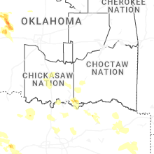
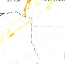
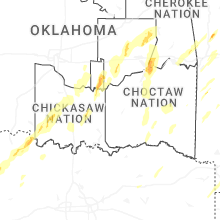


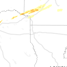


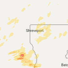


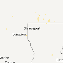


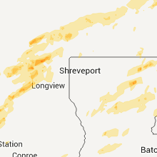


Connect with Interactive Hail Maps