

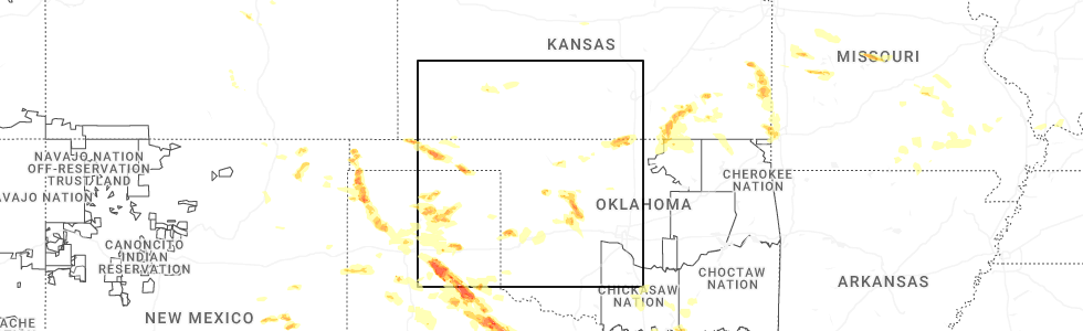
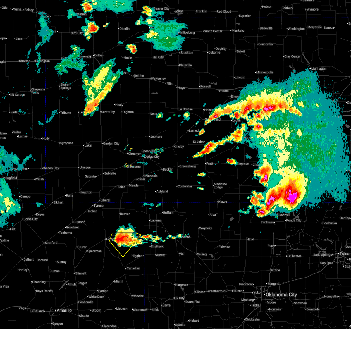
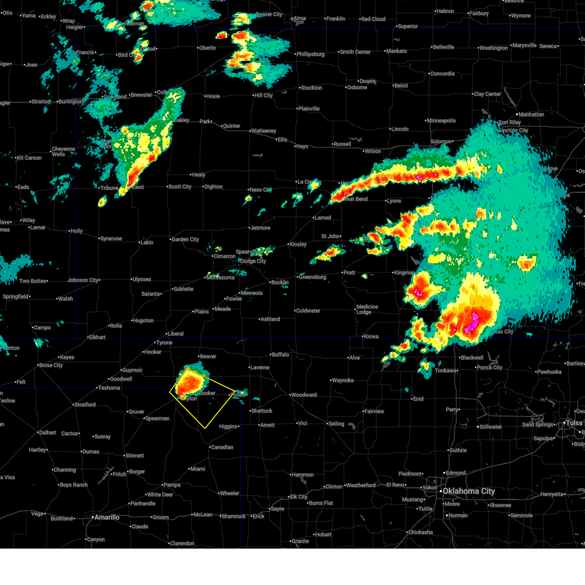
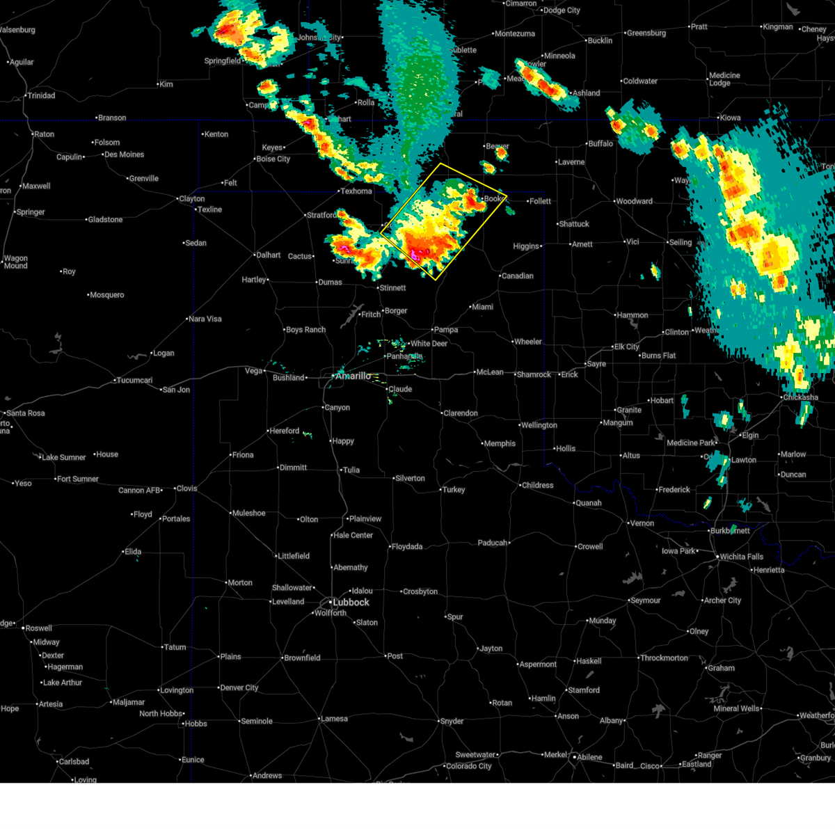
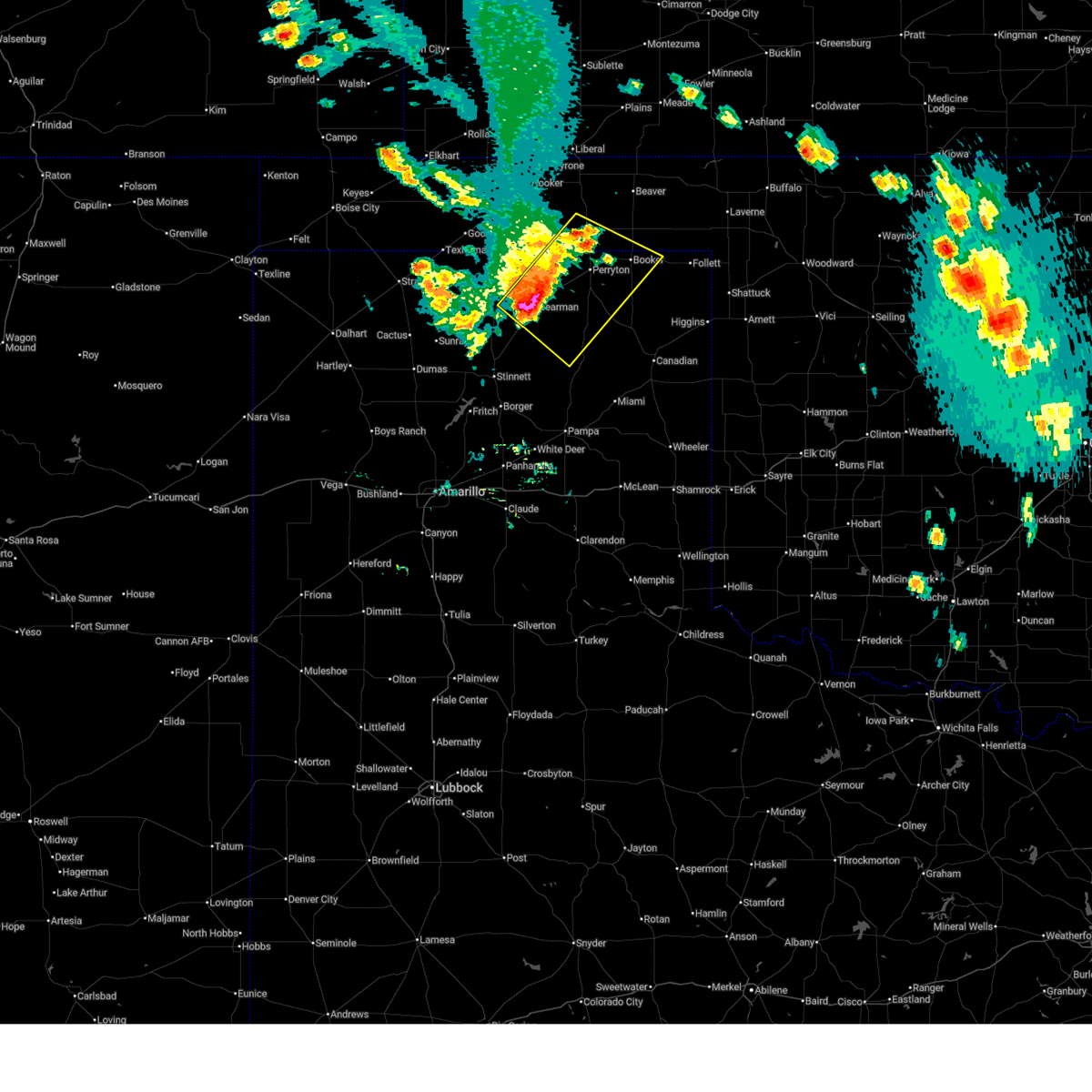
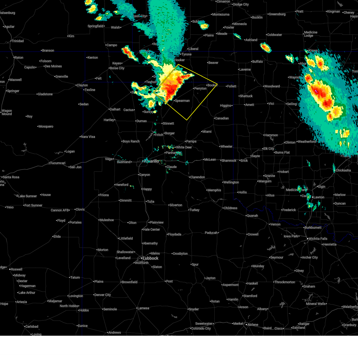
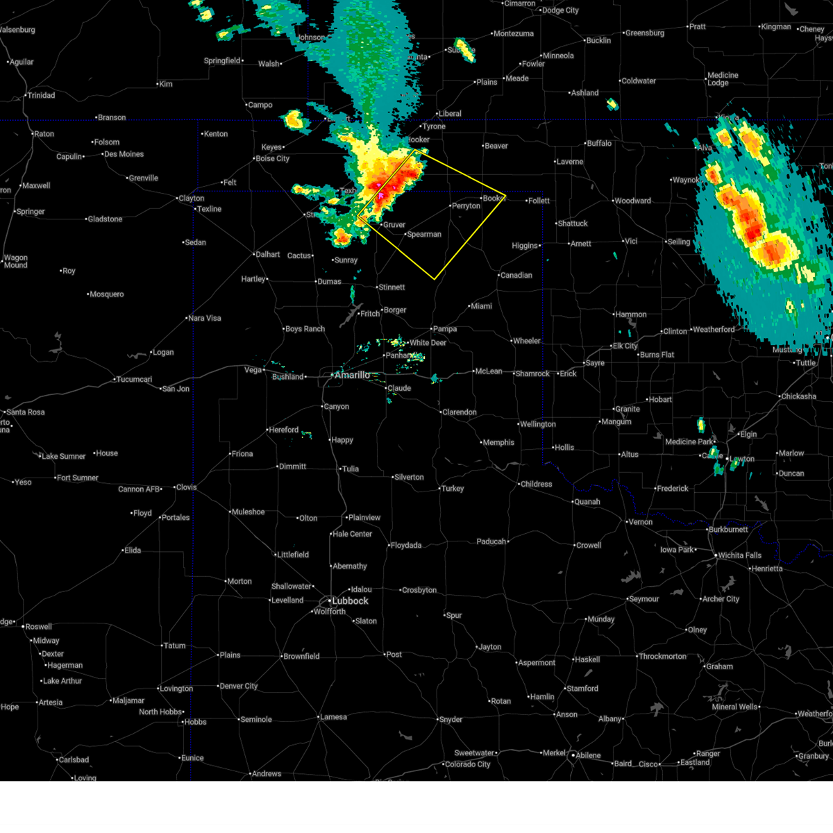
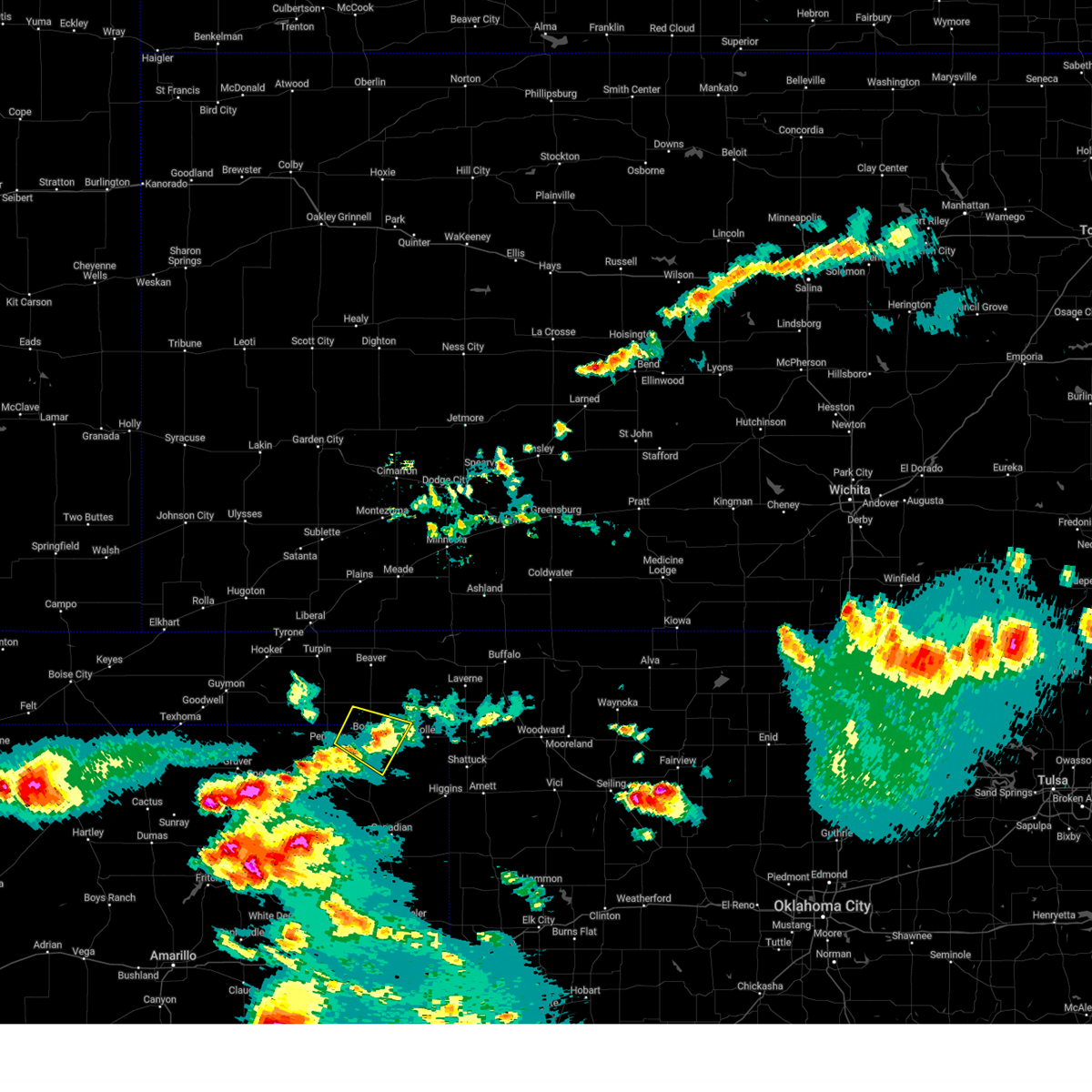
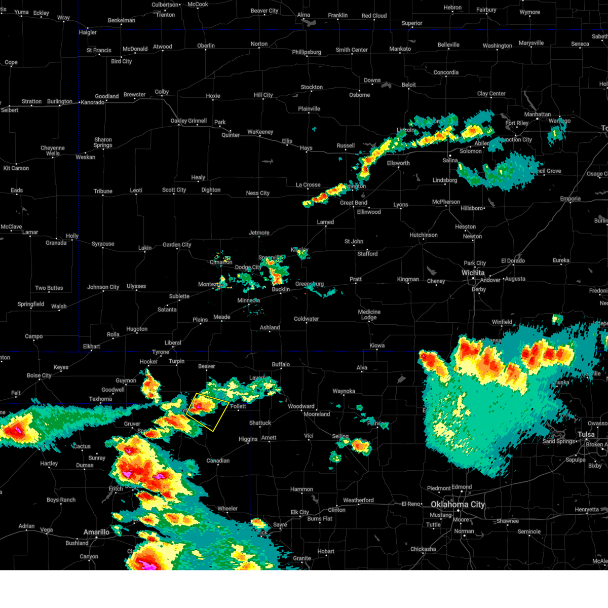
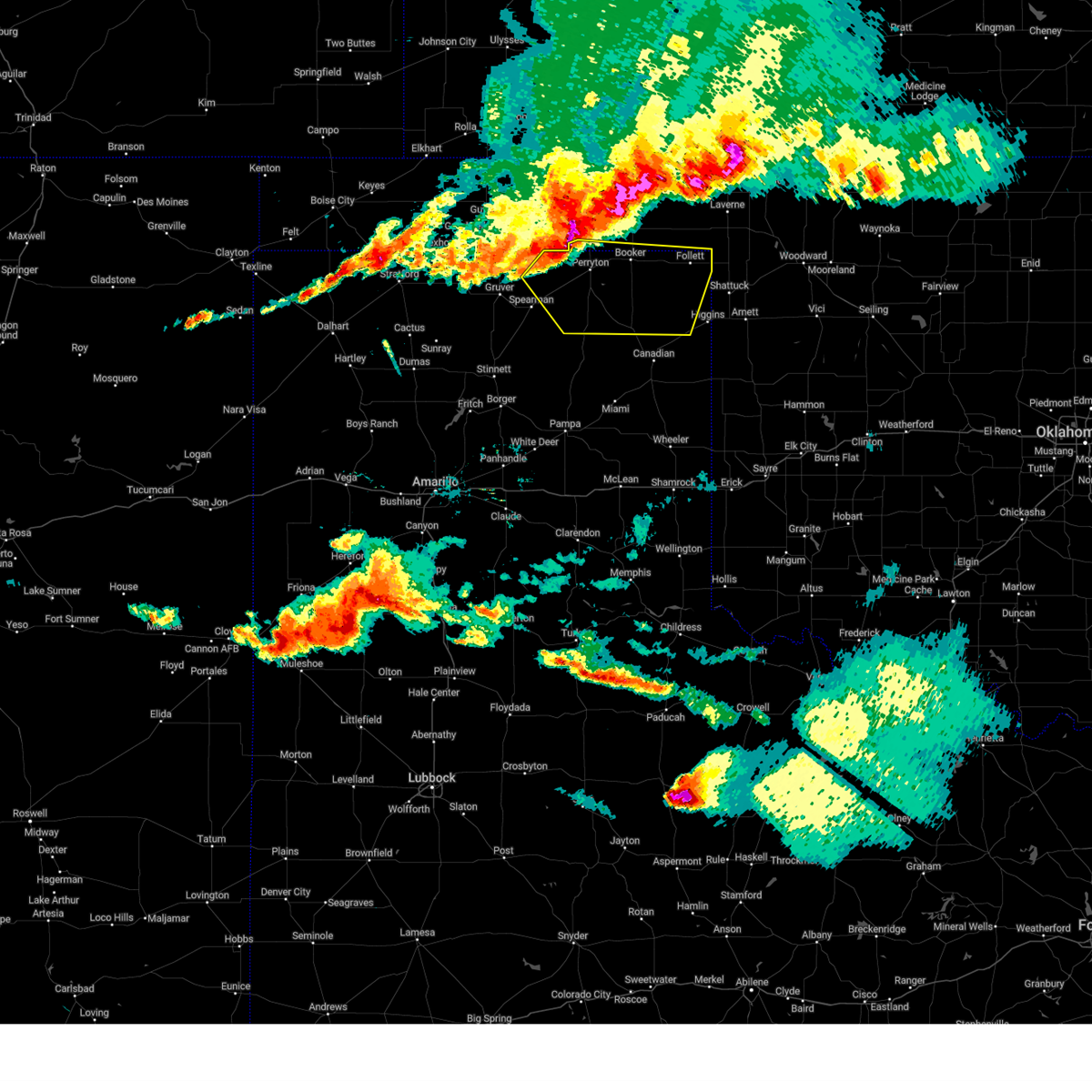
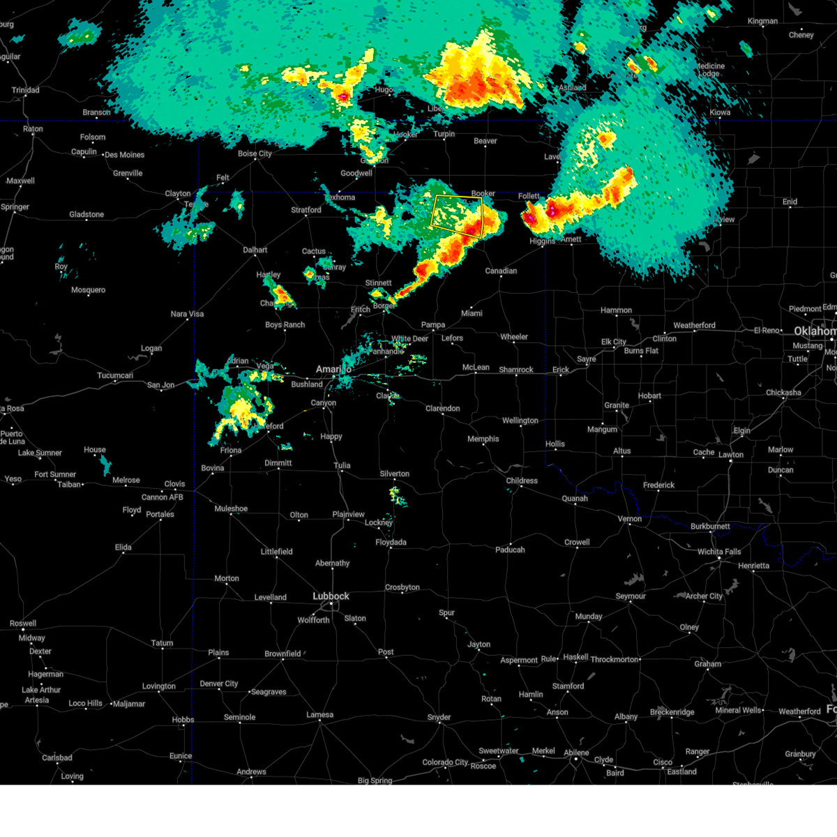
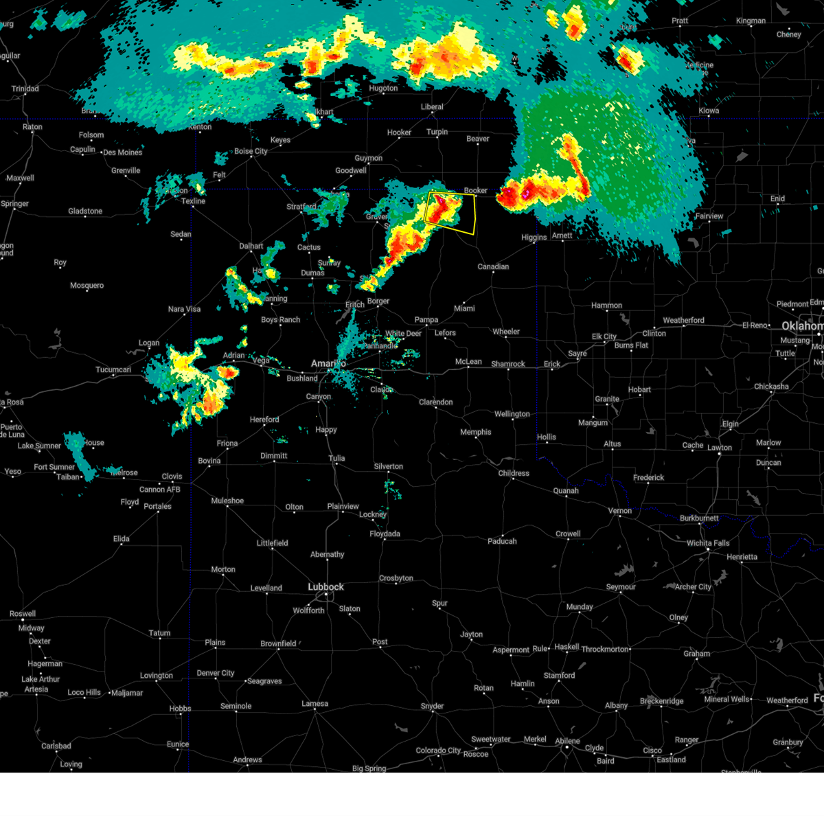
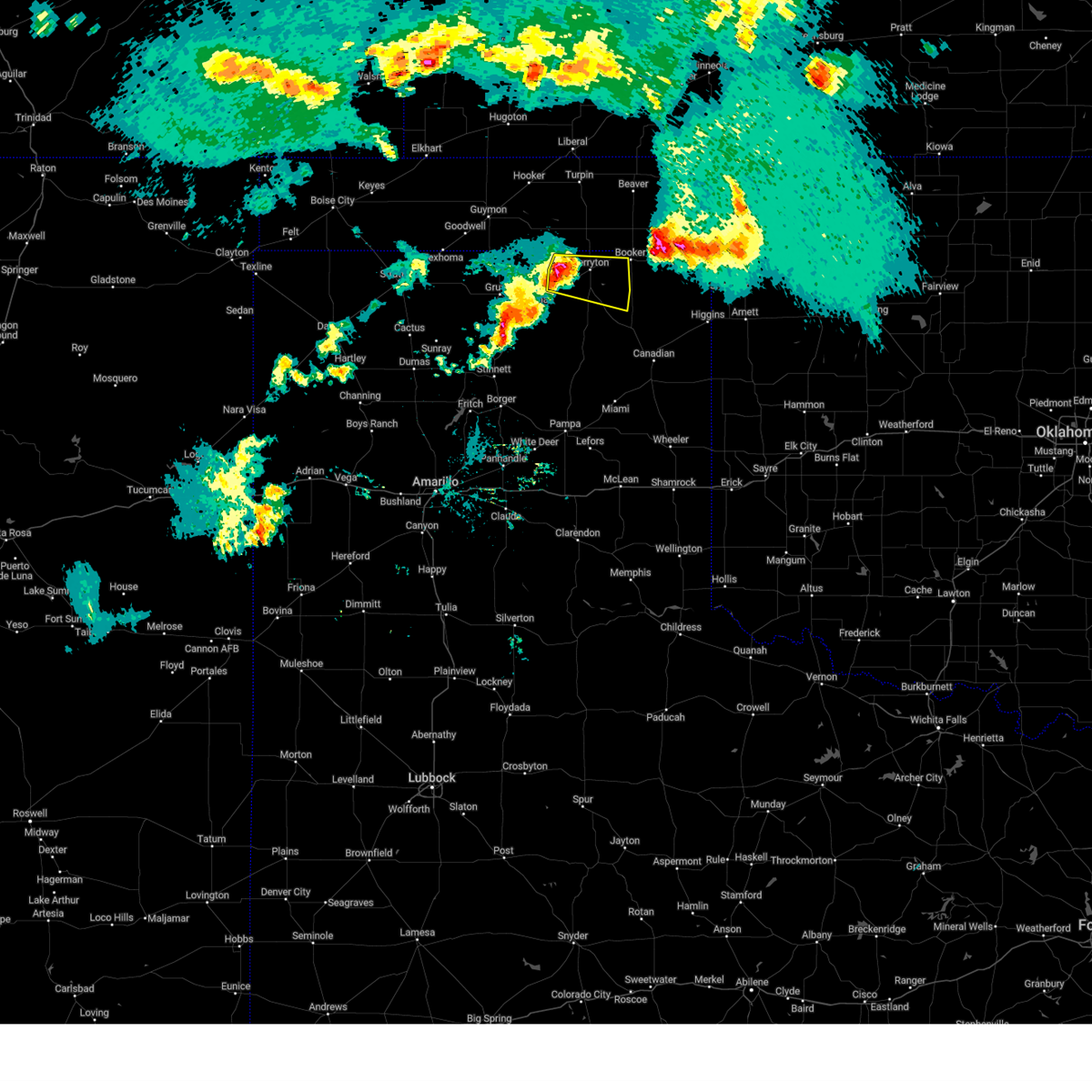
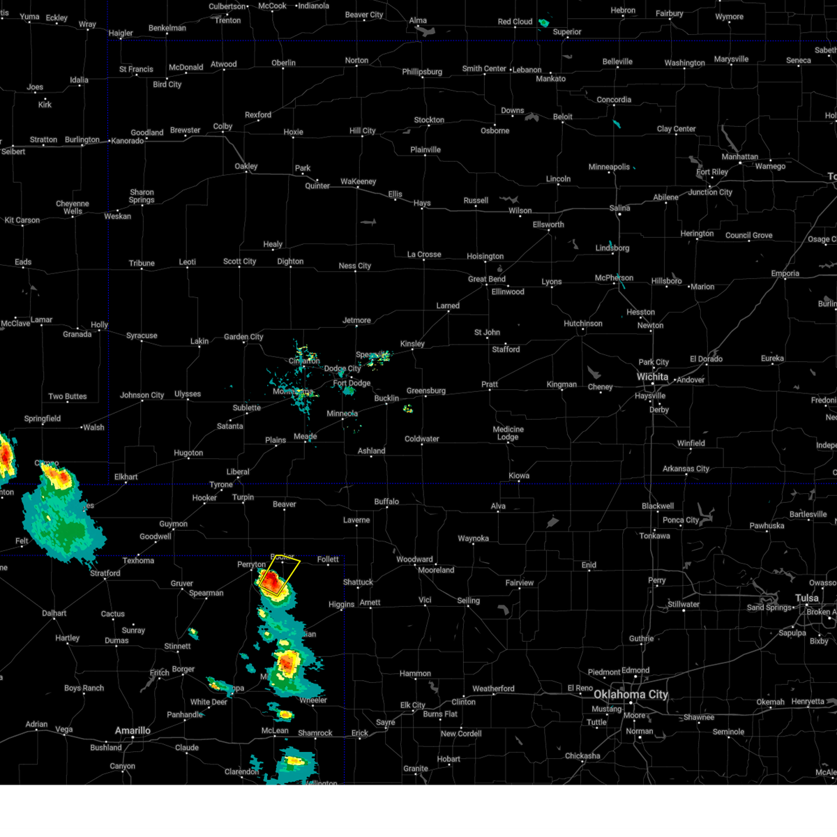
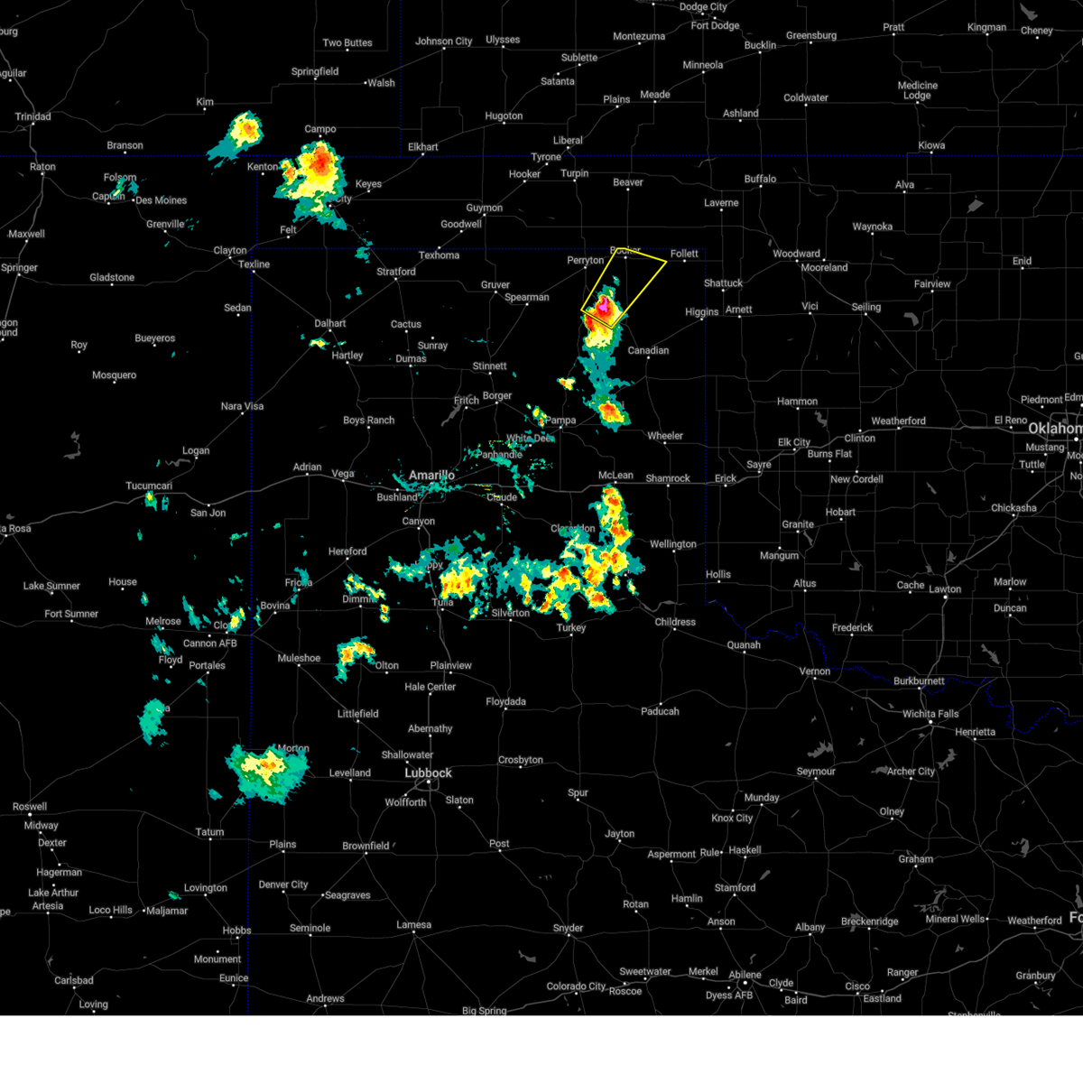
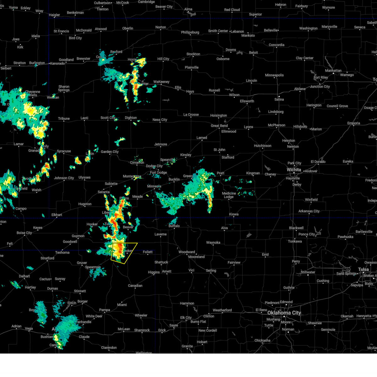
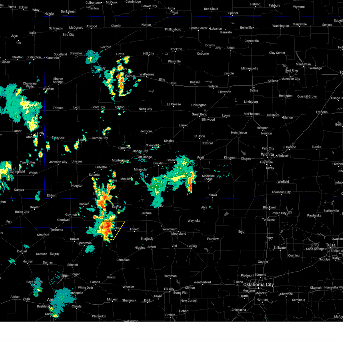
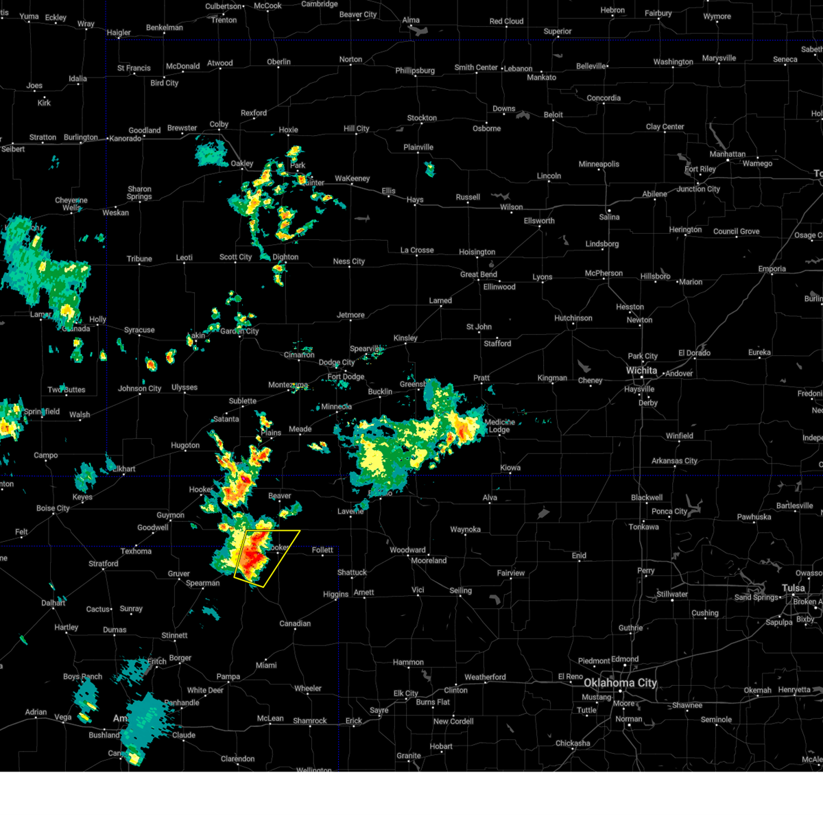
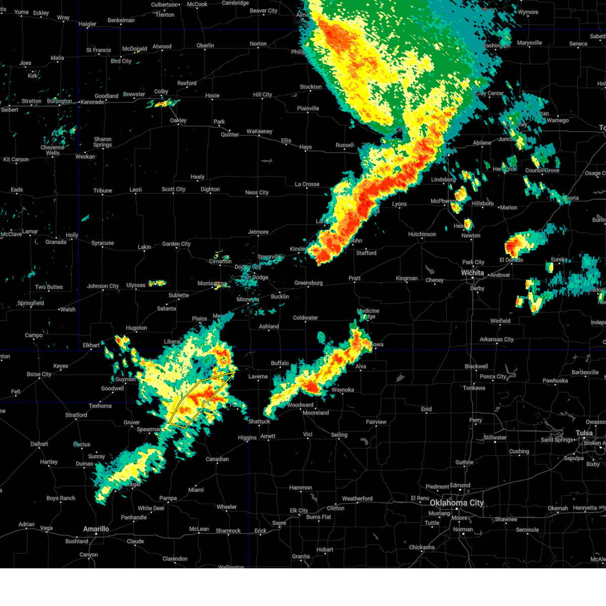
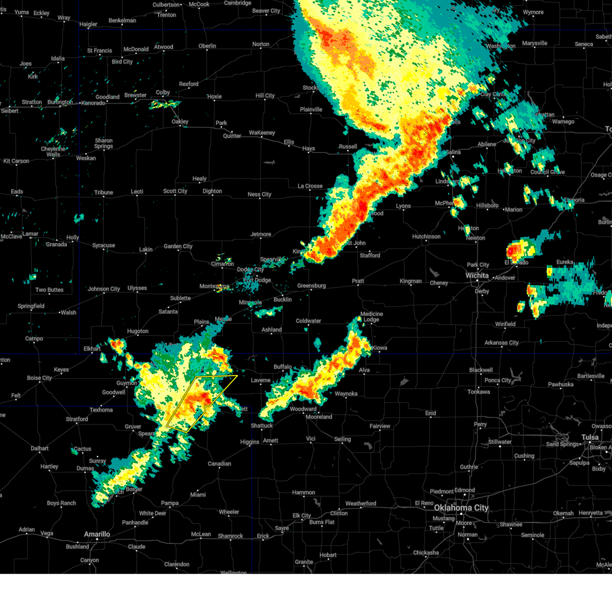
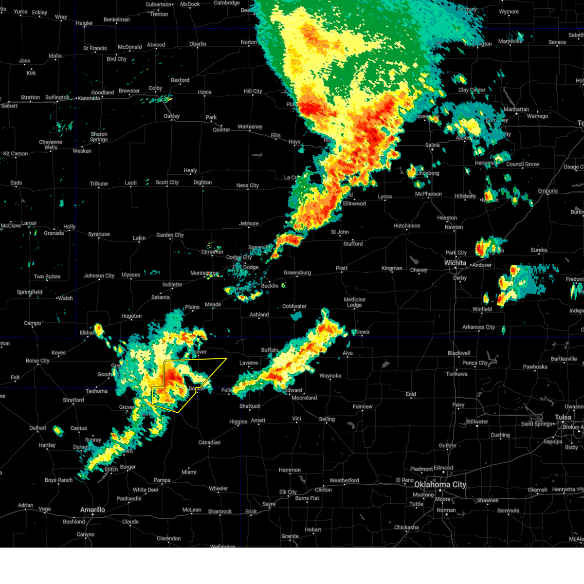
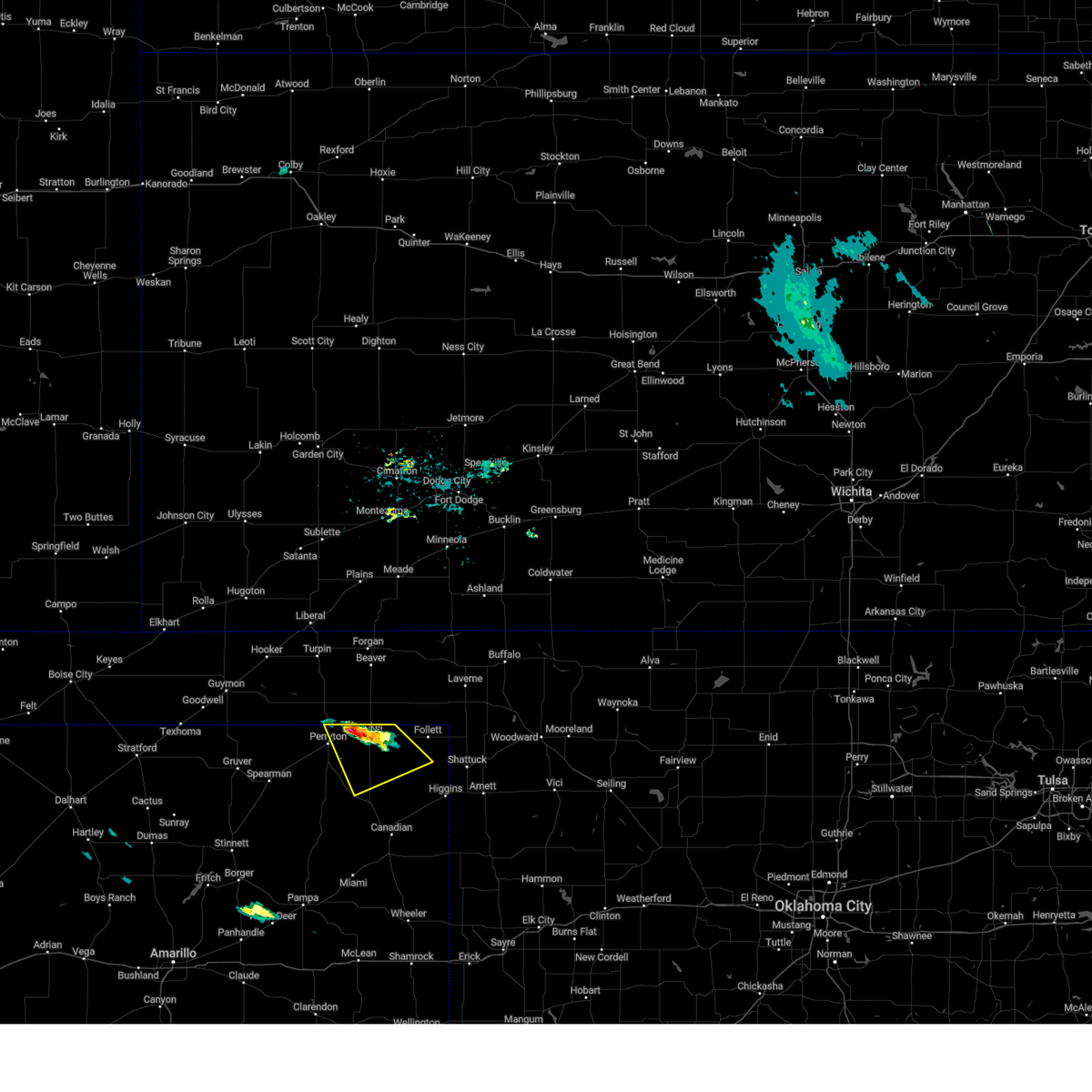
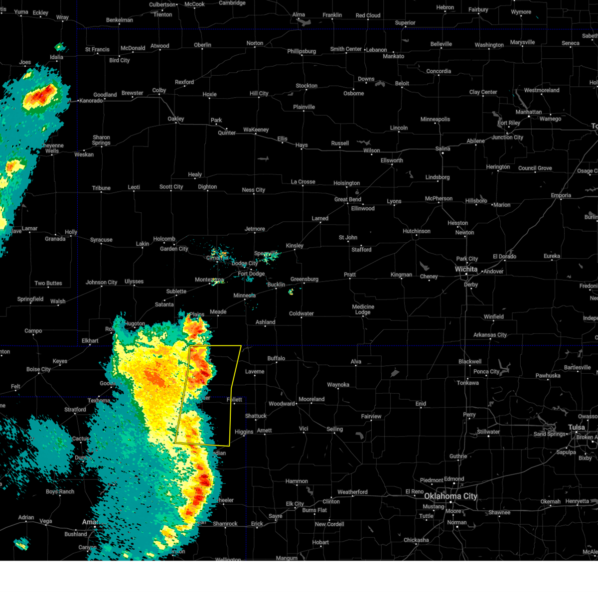
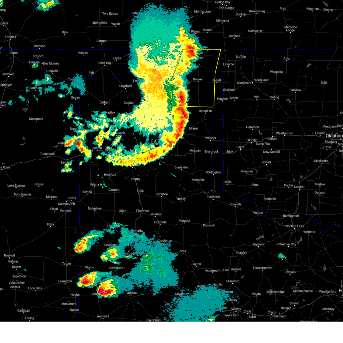
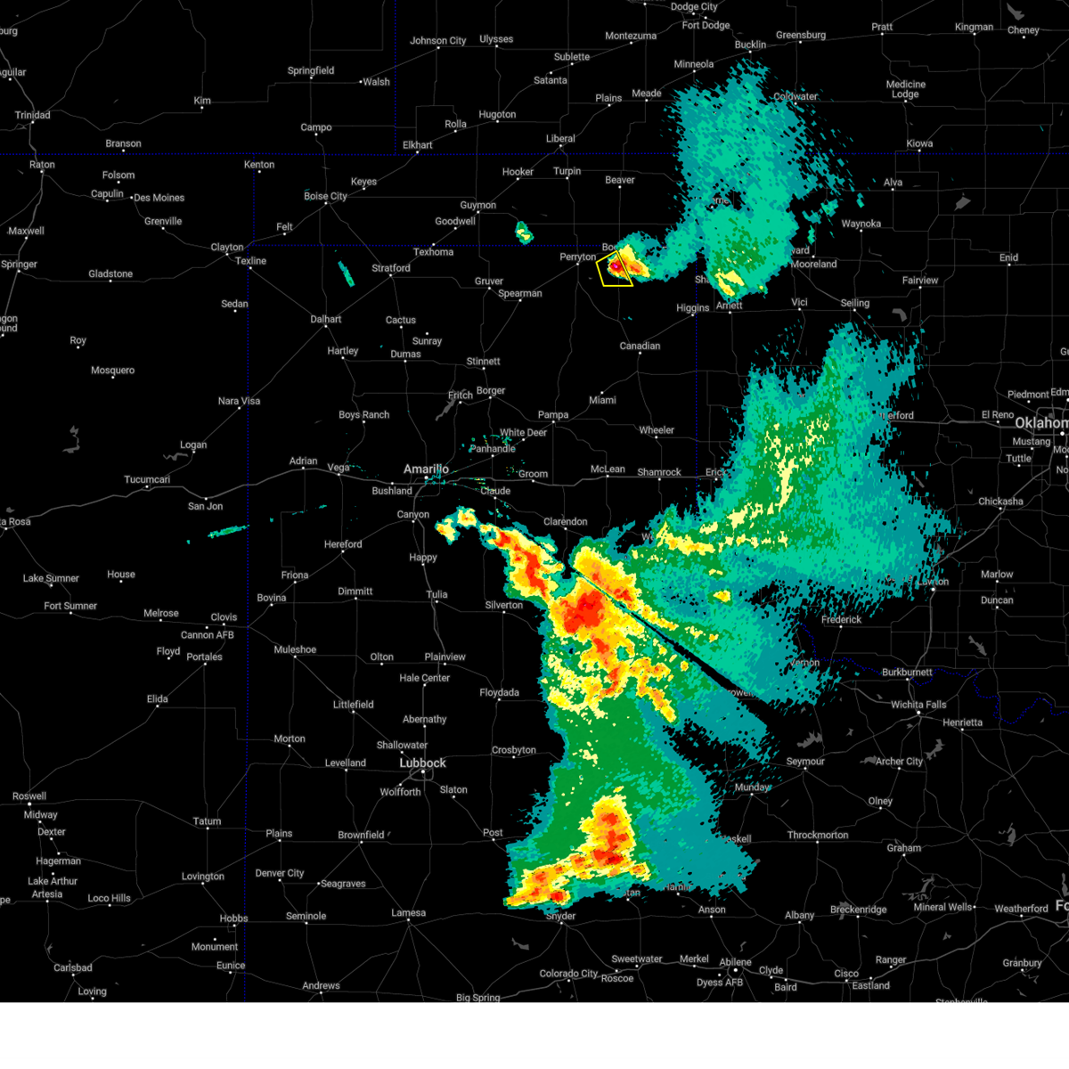
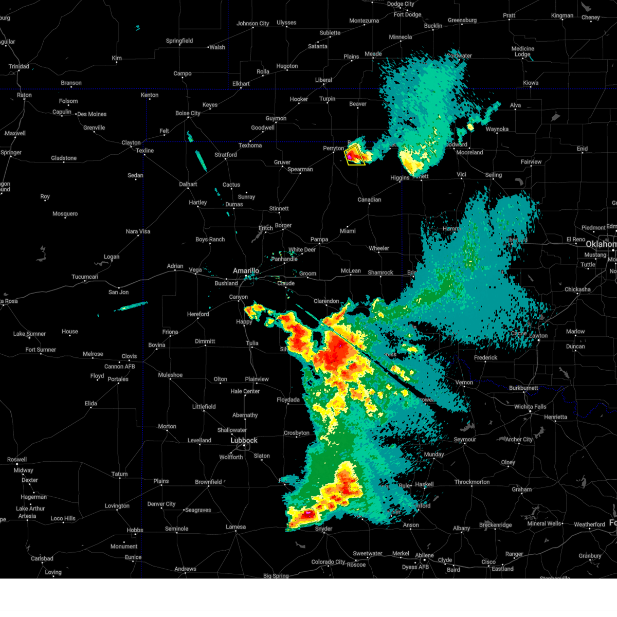
Hail Map for Booker, TX
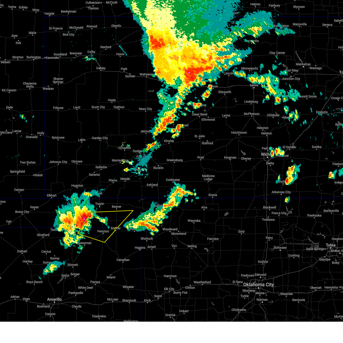
The Booker, TX area has had 41 reports of on-the-ground hail by trained spotters, and has been under severe weather warnings 41 times during the past 12 months. Doppler radar has detected hail at or near Booker, TX on 91 occasions, including 4 occasions during the past year.
| Name: | Booker, TX |
| Where Located: | 63.5 miles W of Woodward, OK |
| Map: | Google Map for Booker, TX |
| Population: | 1516 |
| Housing Units: | 542 |
| More Info: | Search Google for Booker, TX |
1
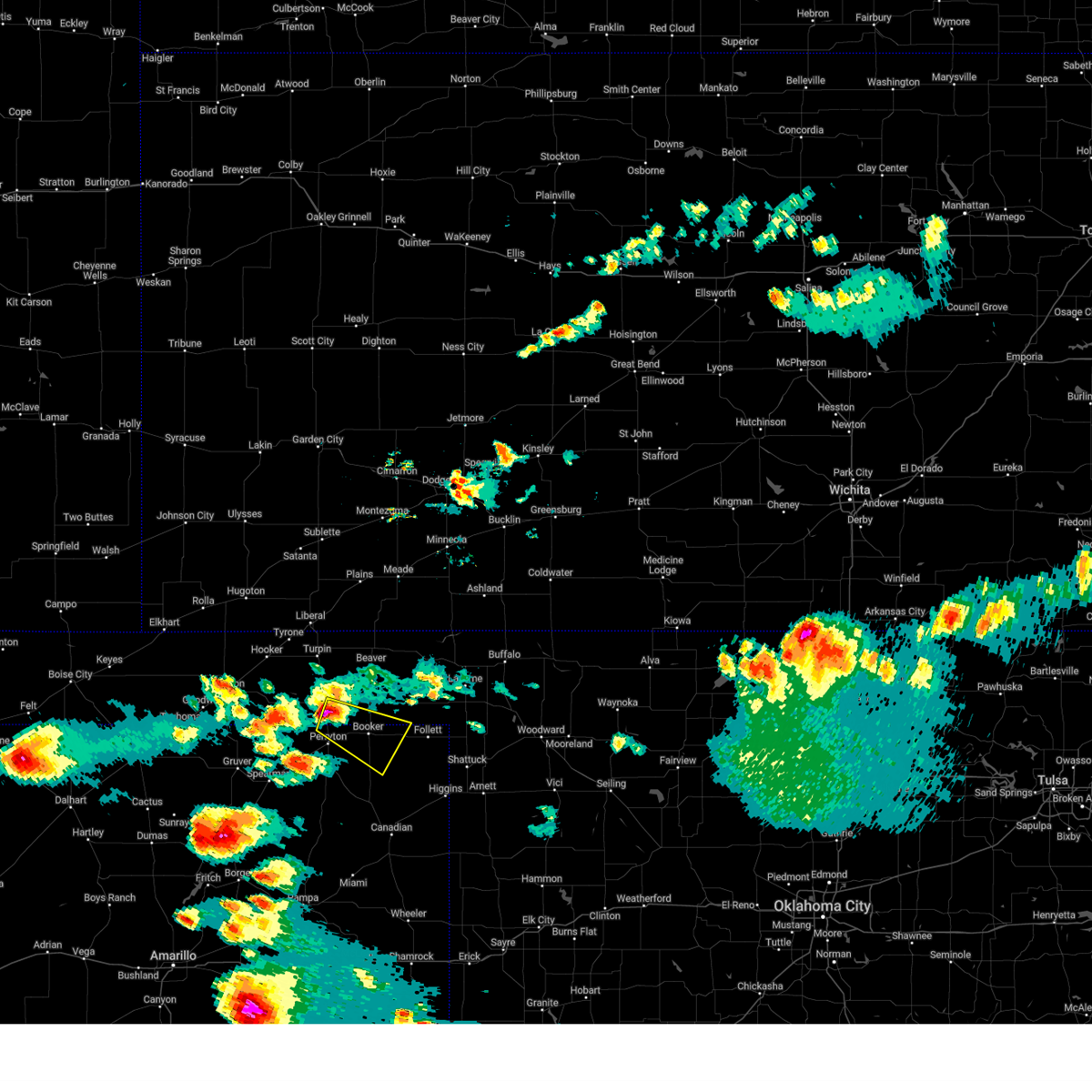
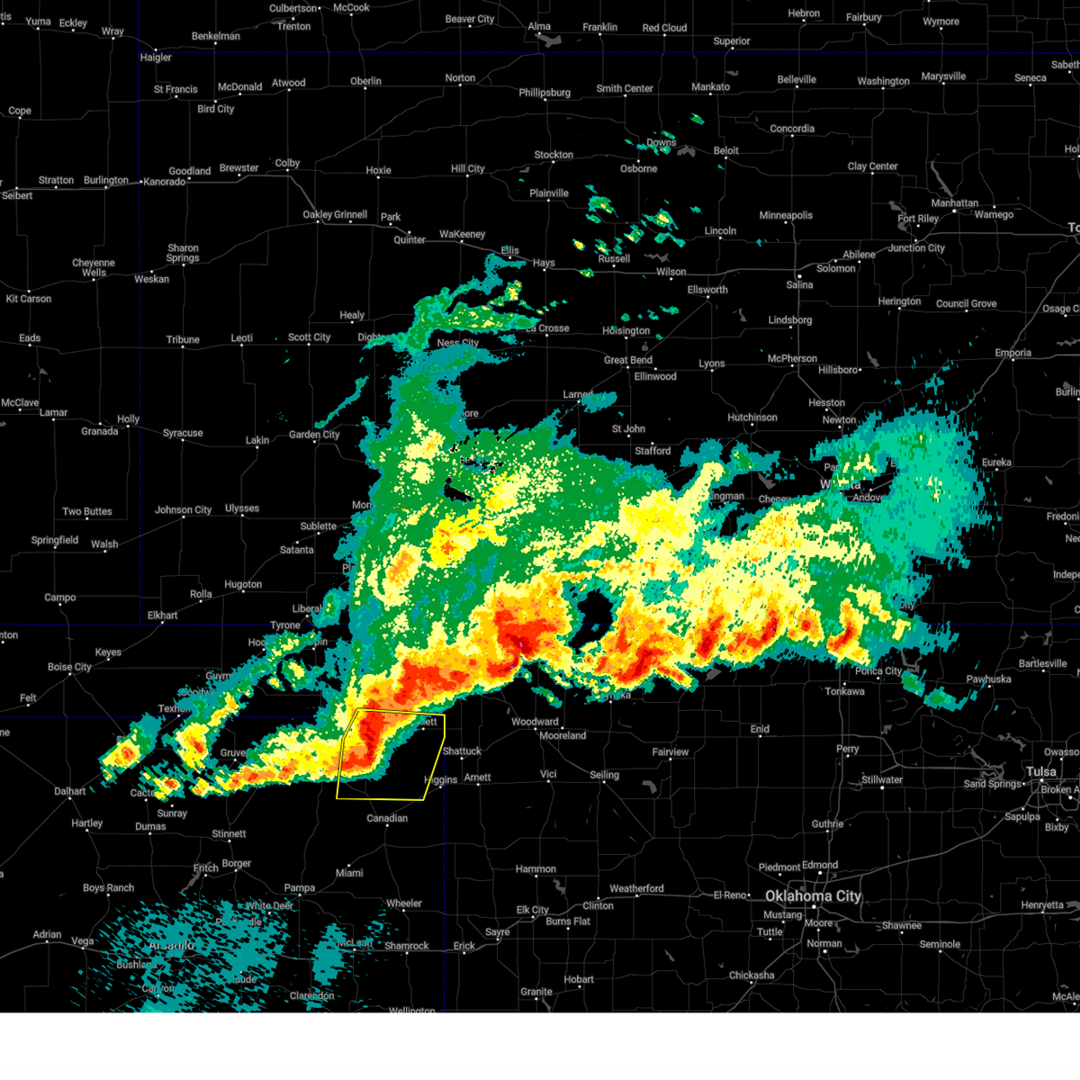
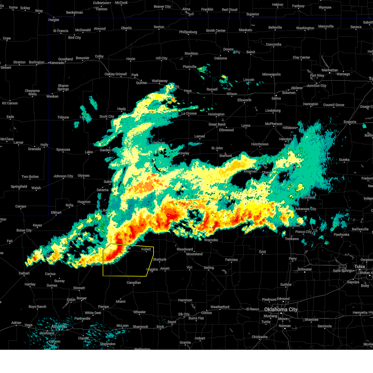
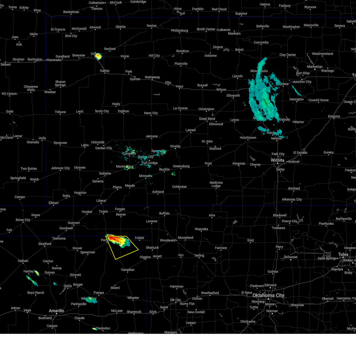
The Top Recent Hail Date for Booker, TX is Sunday, June 8, 2025 (23rd out of 91)
Hail and Wind Damage Spotted near Booker, TX
| Date / Time | Report Details |
|---|---|
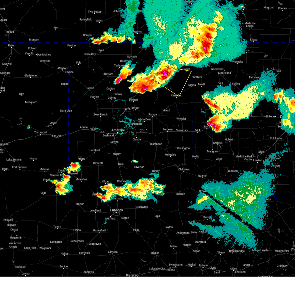
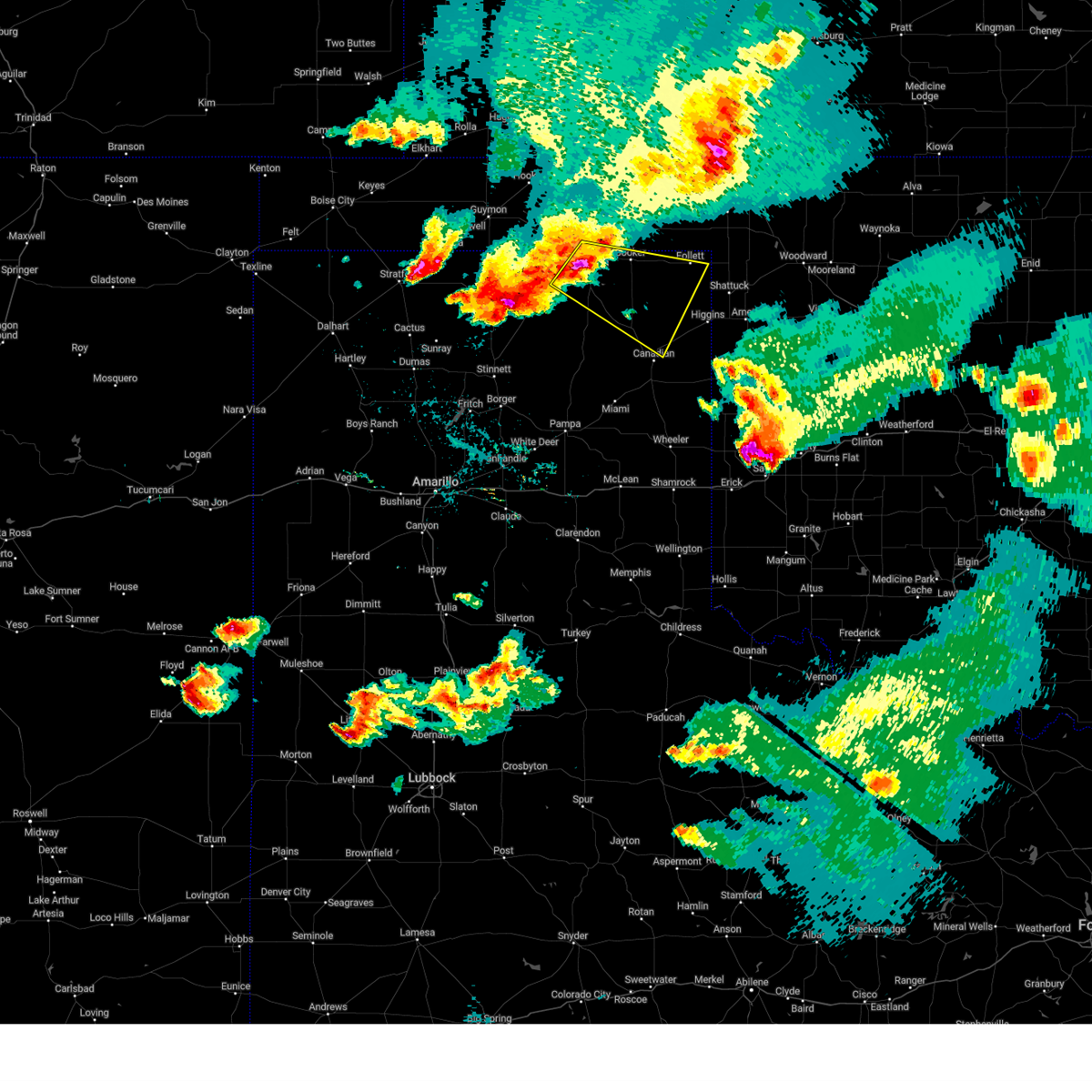
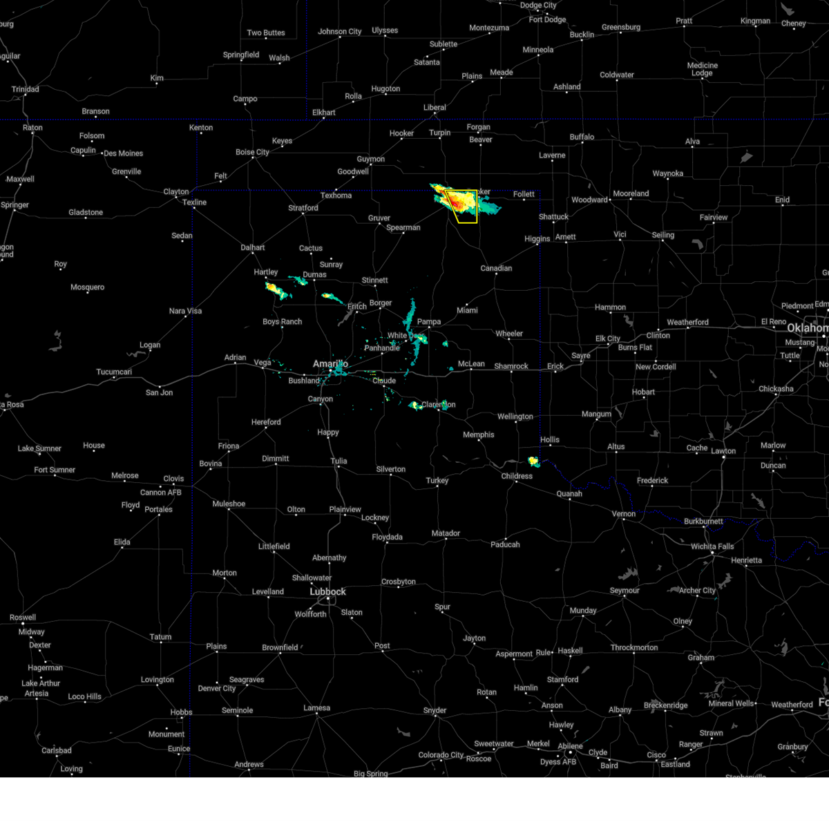
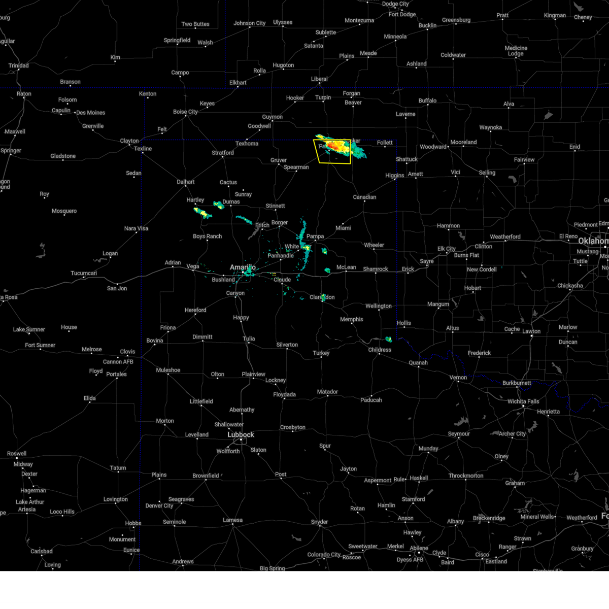
| 6/17/2025 7:25 PM CDT | Quarter sized hail reported 9.1 miles NW of Booker, TX |
| 6/17/2025 7:14 PM CDT |
 the severe thunderstorm warning has been cancelled and is no longer in effect the severe thunderstorm warning has been cancelled and is no longer in effect
|
| 6/17/2025 7:14 PM CDT |
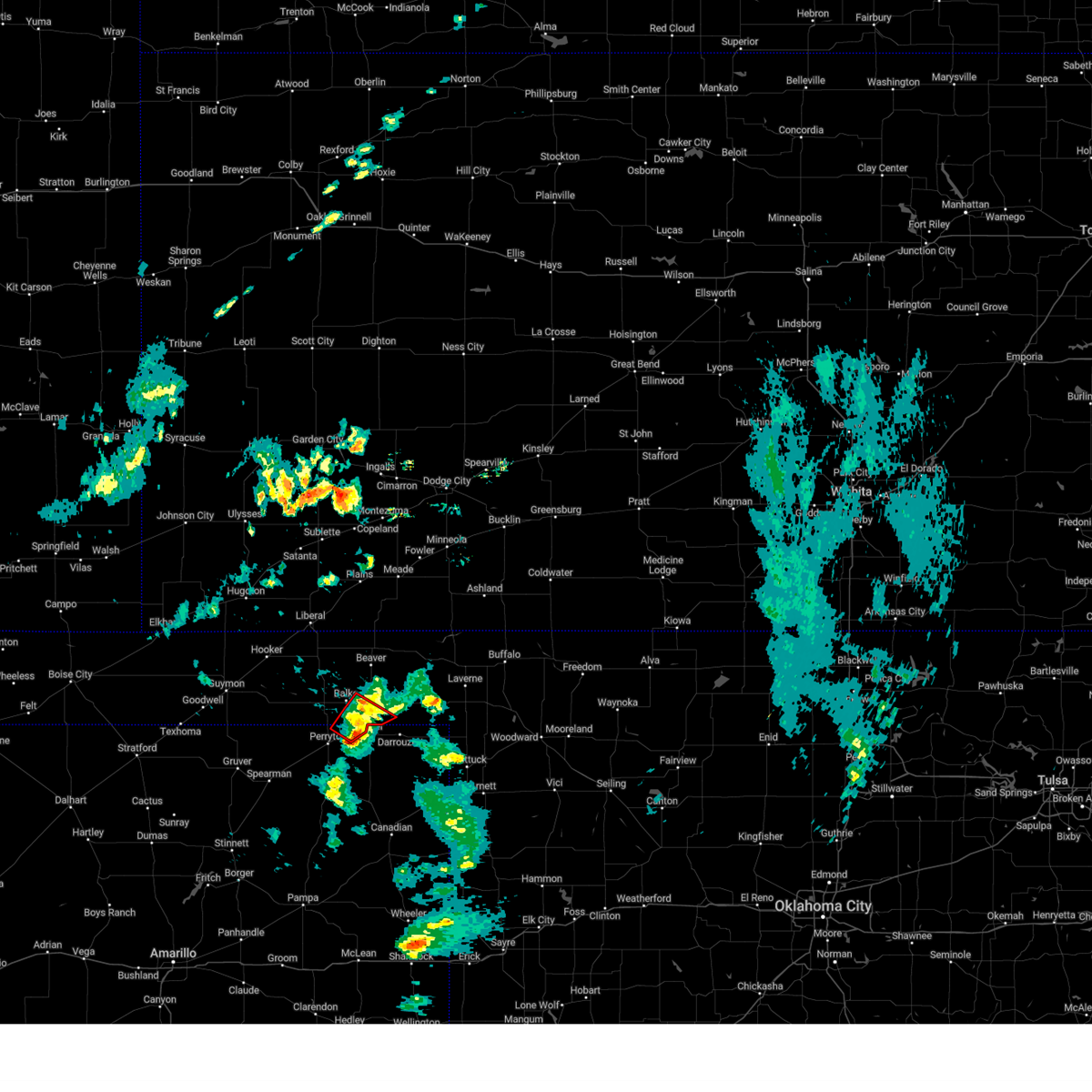
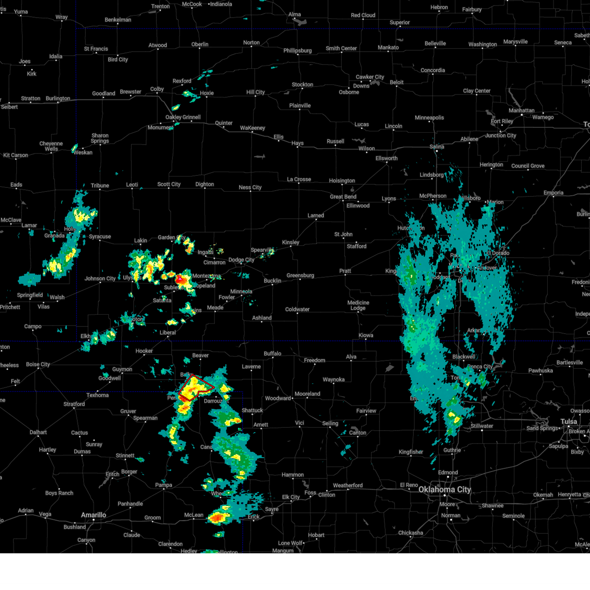
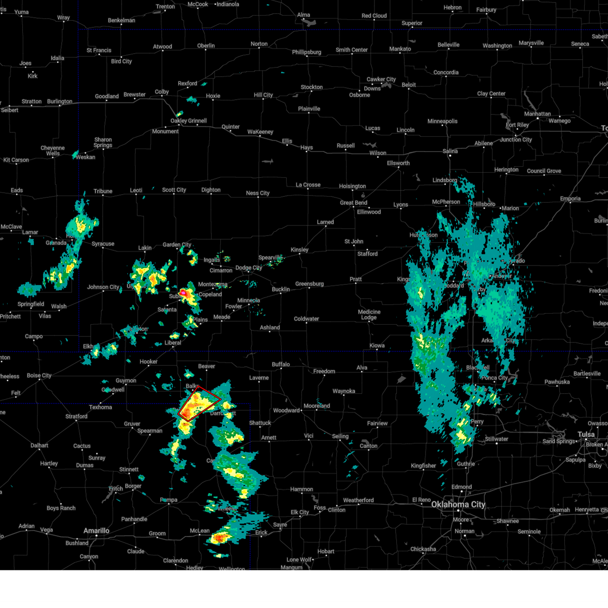
 At 713 pm cdt, a severe thunderstorm was located near booker, or 15 miles northwest of lipscomb, moving east at 45 mph (radar indicated). Hazards include ping pong ball size hail and 60 mph wind gusts. People and animals outdoors will be injured. expect hail damage to roofs, siding, windows, and vehicles. expect wind damage to roofs, siding, and trees. Locations impacted include, booker, follett, and darrouzett. At 713 pm cdt, a severe thunderstorm was located near booker, or 15 miles northwest of lipscomb, moving east at 45 mph (radar indicated). Hazards include ping pong ball size hail and 60 mph wind gusts. People and animals outdoors will be injured. expect hail damage to roofs, siding, windows, and vehicles. expect wind damage to roofs, siding, and trees. Locations impacted include, booker, follett, and darrouzett.
|
| 6/17/2025 6:49 PM CDT |
 Svrama the national weather service in amarillo has issued a * severe thunderstorm warning for, southwestern beaver county in the panhandle of oklahoma, western lipscomb county in the panhandle of texas, northeastern ochiltree county in the panhandle of texas, * until 730 pm cdt. * at 648 pm cdt, a severe thunderstorm was located 7 miles west of booker, or 9 miles northeast of perryton, moving southeast at 55 mph (radar indicated). Hazards include ping pong ball size hail and 60 mph wind gusts. People and animals outdoors will be injured. expect hail damage to roofs, siding, windows, and vehicles. Expect wind damage to roofs, siding, and trees. Svrama the national weather service in amarillo has issued a * severe thunderstorm warning for, southwestern beaver county in the panhandle of oklahoma, western lipscomb county in the panhandle of texas, northeastern ochiltree county in the panhandle of texas, * until 730 pm cdt. * at 648 pm cdt, a severe thunderstorm was located 7 miles west of booker, or 9 miles northeast of perryton, moving southeast at 55 mph (radar indicated). Hazards include ping pong ball size hail and 60 mph wind gusts. People and animals outdoors will be injured. expect hail damage to roofs, siding, windows, and vehicles. Expect wind damage to roofs, siding, and trees.
|
| 6/15/2025 4:31 AM CDT |
 At 431 am cdt, severe thunderstorms were located along a line extending from 3 miles southwest of booker to 13 miles southwest of wolf creek park to 16 miles south of spearman, moving southeast at 35 mph (radar indicated). Hazards include 70 mph wind gusts and nickel size hail. Expect some tree damage. damage is likely to mobile homes, roofs, and outbuildings. Locations impacted include, spearman, wolf creek park, perryton, bryans corner, booker, farnsworth, and waka. At 431 am cdt, severe thunderstorms were located along a line extending from 3 miles southwest of booker to 13 miles southwest of wolf creek park to 16 miles south of spearman, moving southeast at 35 mph (radar indicated). Hazards include 70 mph wind gusts and nickel size hail. Expect some tree damage. damage is likely to mobile homes, roofs, and outbuildings. Locations impacted include, spearman, wolf creek park, perryton, bryans corner, booker, farnsworth, and waka.
|
| 6/15/2025 4:09 AM CDT |
 At 409 am cdt, severe thunderstorms were located along a line extending from 5 miles northwest of perryton to 7 miles south of spearman, moving southeast at 35 mph (radar indicated). Hazards include 70 mph wind gusts and quarter size hail. Expect some tree damage. damage is likely to mobile homes, roofs, and outbuildings. hail damage to vehicles is expected. Locations impacted include, spearman, wolf creek park, perryton, bryans corner, booker, farnsworth, and waka. At 409 am cdt, severe thunderstorms were located along a line extending from 5 miles northwest of perryton to 7 miles south of spearman, moving southeast at 35 mph (radar indicated). Hazards include 70 mph wind gusts and quarter size hail. Expect some tree damage. damage is likely to mobile homes, roofs, and outbuildings. hail damage to vehicles is expected. Locations impacted include, spearman, wolf creek park, perryton, bryans corner, booker, farnsworth, and waka.
|
| 6/15/2025 3:58 AM CDT |
 At 358 am cdt, severe thunderstorms were located along a line extending from 4 miles southwest of bryans corner to 8 miles southwest of spearman, moving southeast at 40 mph (radar indicated). Hazards include 70 mph wind gusts and quarter size hail. Expect some tree damage. damage is likely to mobile homes, roofs, and outbuildings. hail damage to vehicles is expected. Locations impacted include, spearman, wolf creek park, hardesty, perryton, bryans corner, booker, adams, farnsworth, waka, and gruver. At 358 am cdt, severe thunderstorms were located along a line extending from 4 miles southwest of bryans corner to 8 miles southwest of spearman, moving southeast at 40 mph (radar indicated). Hazards include 70 mph wind gusts and quarter size hail. Expect some tree damage. damage is likely to mobile homes, roofs, and outbuildings. hail damage to vehicles is expected. Locations impacted include, spearman, wolf creek park, hardesty, perryton, bryans corner, booker, adams, farnsworth, waka, and gruver.
|
| 6/15/2025 3:41 AM CDT |
 Svrama the national weather service in amarillo has issued a * severe thunderstorm warning for, southwestern beaver county in the panhandle of oklahoma, southeastern texas county in the panhandle of oklahoma, northwestern lipscomb county in the panhandle of texas, northeastern hutchinson county in the panhandle of texas, hansford county in the panhandle of texas, northwestern roberts county in the panhandle of texas, ochiltree county in the panhandle of texas, * until 445 am cdt. * at 341 am cdt, severe thunderstorms were located along a line extending from 4 miles south of adams to 4 miles northwest of gruver, moving southeast at 40 mph (radar indicated). Hazards include 60 mph wind gusts and quarter size hail. Minor damage to roofs, siding, and trees is possible. Hail damage to vehicles is expected. Svrama the national weather service in amarillo has issued a * severe thunderstorm warning for, southwestern beaver county in the panhandle of oklahoma, southeastern texas county in the panhandle of oklahoma, northwestern lipscomb county in the panhandle of texas, northeastern hutchinson county in the panhandle of texas, hansford county in the panhandle of texas, northwestern roberts county in the panhandle of texas, ochiltree county in the panhandle of texas, * until 445 am cdt. * at 341 am cdt, severe thunderstorms were located along a line extending from 4 miles south of adams to 4 miles northwest of gruver, moving southeast at 40 mph (radar indicated). Hazards include 60 mph wind gusts and quarter size hail. Minor damage to roofs, siding, and trees is possible. Hail damage to vehicles is expected.
|
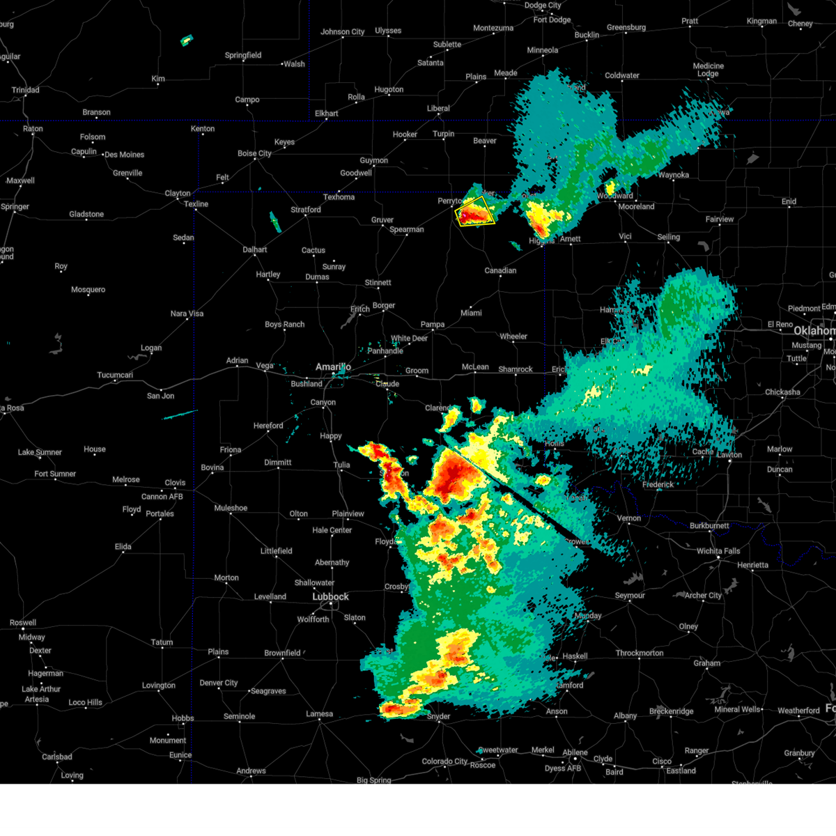
| 6/8/2025 4:38 PM CDT |
 The storm which prompted the warning has weakened below severe limits, and no longer poses an immediate threat to life or property. therefore, the warning will be allowed to expire. a severe thunderstorm watch remains in effect until 900 pm cdt for the panhandle of oklahoma, and the panhandle of texas. The storm which prompted the warning has weakened below severe limits, and no longer poses an immediate threat to life or property. therefore, the warning will be allowed to expire. a severe thunderstorm watch remains in effect until 900 pm cdt for the panhandle of oklahoma, and the panhandle of texas.
|
| 6/8/2025 4:20 PM CDT |
 At 420 pm cdt, a severe thunderstorm was located 4 miles west of booker, or 11 miles east of perryton, moving southeast at 30 mph (radar indicated). Hazards include ping pong ball size hail and 60 mph wind gusts. Minor damage to roofs, siding, and trees is possible. people and animals outdoors will be injured. expect hail damage to roofs, siding, windows, and vehicles. Locations impacted include, booker and darrouzett. At 420 pm cdt, a severe thunderstorm was located 4 miles west of booker, or 11 miles east of perryton, moving southeast at 30 mph (radar indicated). Hazards include ping pong ball size hail and 60 mph wind gusts. Minor damage to roofs, siding, and trees is possible. people and animals outdoors will be injured. expect hail damage to roofs, siding, windows, and vehicles. Locations impacted include, booker and darrouzett.
|
| 6/8/2025 4:06 PM CDT |
 At 406 pm cdt, a severe thunderstorm was located 7 miles south of balko, or 10 miles northeast of perryton, moving east at 30 mph (radar indicated). Hazards include tennis ball size hail and 60 mph wind gusts. Minor damage to roofs, siding, and trees is possible. people and animals outdoors will be injured. expect hail damage to roofs, siding, windows, and vehicles. Locations impacted include, booker and darrouzett. At 406 pm cdt, a severe thunderstorm was located 7 miles south of balko, or 10 miles northeast of perryton, moving east at 30 mph (radar indicated). Hazards include tennis ball size hail and 60 mph wind gusts. Minor damage to roofs, siding, and trees is possible. people and animals outdoors will be injured. expect hail damage to roofs, siding, windows, and vehicles. Locations impacted include, booker and darrouzett.
|
| 6/8/2025 3:51 PM CDT |
 Svrama the national weather service in amarillo has issued a * severe thunderstorm warning for, southwestern beaver county in the panhandle of oklahoma, northwestern lipscomb county in the panhandle of texas, northeastern ochiltree county in the panhandle of texas, * until 445 pm cdt. * at 351 pm cdt, a severe thunderstorm was located 4 miles south of bryans corner, or 12 miles north of perryton, moving east at 30 mph (radar indicated). Hazards include ping pong ball size hail and 60 mph wind gusts. Minor damage to roofs, siding, and trees is possible. people and animals outdoors will be injured. Expect hail damage to roofs, siding, windows, and vehicles. Svrama the national weather service in amarillo has issued a * severe thunderstorm warning for, southwestern beaver county in the panhandle of oklahoma, northwestern lipscomb county in the panhandle of texas, northeastern ochiltree county in the panhandle of texas, * until 445 pm cdt. * at 351 pm cdt, a severe thunderstorm was located 4 miles south of bryans corner, or 12 miles north of perryton, moving east at 30 mph (radar indicated). Hazards include ping pong ball size hail and 60 mph wind gusts. Minor damage to roofs, siding, and trees is possible. people and animals outdoors will be injured. Expect hail damage to roofs, siding, windows, and vehicles.
|
| 6/7/2025 12:41 AM CDT | Svrama the national weather service in amarillo has issued a * severe thunderstorm warning for, lipscomb county in the panhandle of texas, northeastern hemphill county in the panhandle of texas, * until 130 am cdt. * at 1241 am cdt, a severe thunderstorm was located near lipscomb, moving southeast at 40 mph (radar indicated). Hazards include 60 mph wind gusts and penny size hail. minor damage to roofs, siding, and trees is possible |
| 6/7/2025 12:25 AM CDT | At 1224 am cdt, automated weather equipment reported a severe thunderstorm was located 9 miles south of booker, or 13 miles northwest of lipscomb, moving east at 35 mph (automated weather equipment). Hazards include 70 mph wind gusts and penny size hail. Expect some tree damage. damage is likely to mobile homes, roofs, and outbuildings. Locations impacted include, lipscomb, wolf creek park, booker, follett, and darrouzett. |
| 6/7/2025 12:25 AM CDT | the severe thunderstorm warning has been cancelled and is no longer in effect |
| 6/7/2025 12:15 AM CDT |
 At 1214 am cdt, a severe thunderstorm was located 7 miles north of wolf creek park, or 12 miles southeast of perryton, moving southeast at 40 mph (radar indicated). Hazards include 60 mph wind gusts and quarter size hail. Minor damage to roofs, siding, and trees is possible. hail damage to vehicles is expected. Locations impacted include, lipscomb, wolf creek park, perryton, booker, follett, and darrouzett. At 1214 am cdt, a severe thunderstorm was located 7 miles north of wolf creek park, or 12 miles southeast of perryton, moving southeast at 40 mph (radar indicated). Hazards include 60 mph wind gusts and quarter size hail. Minor damage to roofs, siding, and trees is possible. hail damage to vehicles is expected. Locations impacted include, lipscomb, wolf creek park, perryton, booker, follett, and darrouzett.
|
| 6/6/2025 11:59 PM CDT |
 Svrama the national weather service in amarillo has issued a * severe thunderstorm warning for, southwestern beaver county in the panhandle of oklahoma, lipscomb county in the panhandle of texas, northwestern hemphill county in the panhandle of texas, ochiltree county in the panhandle of texas, * until 1245 am cdt. * at 1159 pm cdt, a severe thunderstorm was located over perryton, moving southeast at 45 mph (radar indicated). Hazards include 60 mph wind gusts and half dollar size hail. Minor damage to roofs, siding, and trees is possible. Hail damage to vehicles is expected. Svrama the national weather service in amarillo has issued a * severe thunderstorm warning for, southwestern beaver county in the panhandle of oklahoma, lipscomb county in the panhandle of texas, northwestern hemphill county in the panhandle of texas, ochiltree county in the panhandle of texas, * until 1245 am cdt. * at 1159 pm cdt, a severe thunderstorm was located over perryton, moving southeast at 45 mph (radar indicated). Hazards include 60 mph wind gusts and half dollar size hail. Minor damage to roofs, siding, and trees is possible. Hail damage to vehicles is expected.
|
| 6/6/2025 1:00 AM CDT |
 At 1259 am cdt, a severe thunderstorm was located 7 miles west of lipscomb, moving southeast at 50 mph (radar indicated). Hazards include 60 mph wind gusts and quarter size hail. Minor damage to roofs, siding, and trees is possible. hail damage to vehicles is expected. Locations impacted include, lipscomb, wolf creek park, booker, follett, and darrouzett. At 1259 am cdt, a severe thunderstorm was located 7 miles west of lipscomb, moving southeast at 50 mph (radar indicated). Hazards include 60 mph wind gusts and quarter size hail. Minor damage to roofs, siding, and trees is possible. hail damage to vehicles is expected. Locations impacted include, lipscomb, wolf creek park, booker, follett, and darrouzett.
|
| 6/6/2025 12:42 AM CDT |
 the severe thunderstorm warning has been cancelled and is no longer in effect the severe thunderstorm warning has been cancelled and is no longer in effect
|
| 6/6/2025 12:42 AM CDT |
 At 1241 am cdt, a severe thunderstorm was located 5 miles southwest of booker, or 11 miles east of perryton, moving southeast at 40 mph (radar indicated). Hazards include ping pong ball size hail and 60 mph wind gusts. Minor damage to roofs, siding, and trees is possible. people and animals outdoors will be injured. expect hail damage to roofs, siding, windows, and vehicles. Locations impacted include, wolf creek park, perryton, booker, farnsworth, lipscomb, follett, and darrouzett. At 1241 am cdt, a severe thunderstorm was located 5 miles southwest of booker, or 11 miles east of perryton, moving southeast at 40 mph (radar indicated). Hazards include ping pong ball size hail and 60 mph wind gusts. Minor damage to roofs, siding, and trees is possible. people and animals outdoors will be injured. expect hail damage to roofs, siding, windows, and vehicles. Locations impacted include, wolf creek park, perryton, booker, farnsworth, lipscomb, follett, and darrouzett.
|
| 6/6/2025 12:20 AM CDT |
 Svrama the national weather service in amarillo has issued a * severe thunderstorm warning for, southern beaver county in the panhandle of oklahoma, lipscomb county in the panhandle of texas, northeastern hansford county in the panhandle of texas, ochiltree county in the panhandle of texas, * until 115 am cdt. * at 1219 am cdt, a severe thunderstorm was located 8 miles north of perryton, moving southeast at 40 mph (radar indicated). Hazards include golf ball size hail and 60 mph wind gusts. Minor damage to roofs, siding, and trees is possible. people and animals outdoors will be injured. Expect hail damage to roofs, siding, windows, and vehicles. Svrama the national weather service in amarillo has issued a * severe thunderstorm warning for, southern beaver county in the panhandle of oklahoma, lipscomb county in the panhandle of texas, northeastern hansford county in the panhandle of texas, ochiltree county in the panhandle of texas, * until 115 am cdt. * at 1219 am cdt, a severe thunderstorm was located 8 miles north of perryton, moving southeast at 40 mph (radar indicated). Hazards include golf ball size hail and 60 mph wind gusts. Minor damage to roofs, siding, and trees is possible. people and animals outdoors will be injured. Expect hail damage to roofs, siding, windows, and vehicles.
|
| 5/28/2025 9:06 PM CDT |
 The storm which prompted the warning has moved out of the area. therefore, the warning will be allowed to expire. a tornado watch remains in effect until 1000 pm cdt for the panhandle of texas. remember, a severe thunderstorm warning still remains in effect for portions of ochiltree and lipscomb county!. The storm which prompted the warning has moved out of the area. therefore, the warning will be allowed to expire. a tornado watch remains in effect until 1000 pm cdt for the panhandle of texas. remember, a severe thunderstorm warning still remains in effect for portions of ochiltree and lipscomb county!.
|
| 5/28/2025 8:34 PM CDT |
 At 834 pm cdt, a severe thunderstorm was located near perryton, moving east at 25 mph (radar indicated). Hazards include ping pong ball size hail and 60 mph wind gusts. Minor damage to roofs, siding, and trees is possible. people and animals outdoors will be injured. expect hail damage to roofs, siding, windows, and vehicles. Locations impacted include, perryton, wolf creek park, and farnsworth. At 834 pm cdt, a severe thunderstorm was located near perryton, moving east at 25 mph (radar indicated). Hazards include ping pong ball size hail and 60 mph wind gusts. Minor damage to roofs, siding, and trees is possible. people and animals outdoors will be injured. expect hail damage to roofs, siding, windows, and vehicles. Locations impacted include, perryton, wolf creek park, and farnsworth.
|
| 5/28/2025 8:17 PM CDT |
 Svrama the national weather service in amarillo has issued a * severe thunderstorm warning for, northern ochiltree county in the panhandle of texas, * until 915 pm cdt. * at 816 pm cdt, a severe thunderstorm was located 5 miles north of farnsworth, or 10 miles west of perryton, moving east at 25 mph (radar indicated). Hazards include ping pong ball size hail and 60 mph wind gusts. Minor damage to roofs, siding, and trees is possible. people and animals outdoors will be injured. Expect hail damage to roofs, siding, windows, and vehicles. Svrama the national weather service in amarillo has issued a * severe thunderstorm warning for, northern ochiltree county in the panhandle of texas, * until 915 pm cdt. * at 816 pm cdt, a severe thunderstorm was located 5 miles north of farnsworth, or 10 miles west of perryton, moving east at 25 mph (radar indicated). Hazards include ping pong ball size hail and 60 mph wind gusts. Minor damage to roofs, siding, and trees is possible. people and animals outdoors will be injured. Expect hail damage to roofs, siding, windows, and vehicles.
|
| 9/14/2024 6:16 PM CDT |
 At 615 pm cdt, a severe thunderstorm was located 7 miles north of wolf creek park, or 12 miles southeast of perryton, moving northeast at 25 mph (radar indicated). Hazards include 60 mph wind gusts and nickel size hail. Minor damage to roofs, siding, and trees is possible. Locations impacted include, booker. At 615 pm cdt, a severe thunderstorm was located 7 miles north of wolf creek park, or 12 miles southeast of perryton, moving northeast at 25 mph (radar indicated). Hazards include 60 mph wind gusts and nickel size hail. Minor damage to roofs, siding, and trees is possible. Locations impacted include, booker.
|
| 9/14/2024 5:50 PM CDT |
 Svrama the national weather service in amarillo has issued a * severe thunderstorm warning for, northwestern lipscomb county in the panhandle of texas, eastern ochiltree county in the panhandle of texas, * until 630 pm cdt. * at 549 pm cdt, a severe thunderstorm was located near wolf creek park, or 15 miles southeast of perryton, moving northeast at 30 mph (radar indicated). Hazards include 60 mph wind gusts and quarter size hail. Minor damage to roofs, siding, and trees is possible. Hail damage to vehicles is expected. Svrama the national weather service in amarillo has issued a * severe thunderstorm warning for, northwestern lipscomb county in the panhandle of texas, eastern ochiltree county in the panhandle of texas, * until 630 pm cdt. * at 549 pm cdt, a severe thunderstorm was located near wolf creek park, or 15 miles southeast of perryton, moving northeast at 30 mph (radar indicated). Hazards include 60 mph wind gusts and quarter size hail. Minor damage to roofs, siding, and trees is possible. Hail damage to vehicles is expected.
|
| 8/25/2024 7:59 PM CDT |
 the severe thunderstorm warning has been cancelled and is no longer in effect the severe thunderstorm warning has been cancelled and is no longer in effect
|
| 8/25/2024 7:45 PM CDT |
 At 745 pm cdt, a severe thunderstorm was located 5 miles west of booker, or 11 miles northeast of perryton, moving northeast at 15 mph (radar indicated). Hazards include 60 mph wind gusts. Minor damage to roofs, siding, and trees is possible. Locations impacted include, perryton and booker. At 745 pm cdt, a severe thunderstorm was located 5 miles west of booker, or 11 miles northeast of perryton, moving northeast at 15 mph (radar indicated). Hazards include 60 mph wind gusts. Minor damage to roofs, siding, and trees is possible. Locations impacted include, perryton and booker.
|
| 8/25/2024 7:29 PM CDT |
 Svrama the national weather service in amarillo has issued a * severe thunderstorm warning for, southwestern beaver county in the panhandle of oklahoma, northwestern lipscomb county in the panhandle of texas, northeastern ochiltree county in the panhandle of texas, * until 815 pm cdt. * at 728 pm cdt, a severe thunderstorm was located 8 miles west of booker, or 8 miles northeast of perryton, moving northeast at 25 mph (radar indicated). Hazards include 70 mph wind gusts. Expect some tree damage. Damage is likely to mobile homes, roofs, and outbuildings. Svrama the national weather service in amarillo has issued a * severe thunderstorm warning for, southwestern beaver county in the panhandle of oklahoma, northwestern lipscomb county in the panhandle of texas, northeastern ochiltree county in the panhandle of texas, * until 815 pm cdt. * at 728 pm cdt, a severe thunderstorm was located 8 miles west of booker, or 8 miles northeast of perryton, moving northeast at 25 mph (radar indicated). Hazards include 70 mph wind gusts. Expect some tree damage. Damage is likely to mobile homes, roofs, and outbuildings.
|
| 7/16/2024 11:01 PM CDT |
 the severe thunderstorm warning has been cancelled and is no longer in effect the severe thunderstorm warning has been cancelled and is no longer in effect
|
| 7/16/2024 10:47 PM CDT |
 At 1046 pm cdt, severe thunderstorms were located along a line extending from 4 miles west of rosston to 4 miles southeast of slapout to 8 miles south of follett to 3 miles southeast of lipscomb to 6 miles northwest of glazier to 14 miles northwest of lora to 10 miles north of skellytown, moving southeast at 45 mph (radar indicated). Hazards include 60 mph wind gusts and penny size hail. Minor damage to roofs, siding, and trees is possible. Locations impacted include, lipscomb, canadian, miami, follett, higgins, darrouzett, wolf creek park, lora, slapout, glazier, codman, and lake marvin. At 1046 pm cdt, severe thunderstorms were located along a line extending from 4 miles west of rosston to 4 miles southeast of slapout to 8 miles south of follett to 3 miles southeast of lipscomb to 6 miles northwest of glazier to 14 miles northwest of lora to 10 miles north of skellytown, moving southeast at 45 mph (radar indicated). Hazards include 60 mph wind gusts and penny size hail. Minor damage to roofs, siding, and trees is possible. Locations impacted include, lipscomb, canadian, miami, follett, higgins, darrouzett, wolf creek park, lora, slapout, glazier, codman, and lake marvin.
|
| 7/16/2024 10:34 PM CDT |
 At 1033 pm cdt, severe thunderstorms were located along a line extending from 8 miles south of knowles to 5 miles northeast of darrouzett to 5 miles northwest of lipscomb to 12 miles northwest of glazier to 11 miles northwest of canadian to 16 miles northwest of codman to borger, moving southeast at 35 mph (radar indicated). Hazards include 60 mph wind gusts and penny size hail. Minor damage to roofs, siding, and trees is possible. Locations impacted include, perryton, lipscomb, canadian, beaver, miami, booker, follett, higgins, darrouzett, gate, knowles, wolf creek park, elmwood, farnsworth, waka, glazier, lake marvin, bryans corner, lora, and mocane. At 1033 pm cdt, severe thunderstorms were located along a line extending from 8 miles south of knowles to 5 miles northeast of darrouzett to 5 miles northwest of lipscomb to 12 miles northwest of glazier to 11 miles northwest of canadian to 16 miles northwest of codman to borger, moving southeast at 35 mph (radar indicated). Hazards include 60 mph wind gusts and penny size hail. Minor damage to roofs, siding, and trees is possible. Locations impacted include, perryton, lipscomb, canadian, beaver, miami, booker, follett, higgins, darrouzett, gate, knowles, wolf creek park, elmwood, farnsworth, waka, glazier, lake marvin, bryans corner, lora, and mocane.
|
| 7/16/2024 10:34 PM CDT |
 the severe thunderstorm warning has been cancelled and is no longer in effect the severe thunderstorm warning has been cancelled and is no longer in effect
|
| 7/16/2024 10:09 PM CDT |
 Svrama the national weather service in amarillo has issued a * severe thunderstorm warning for, beaver county in the panhandle of oklahoma, lipscomb county in the panhandle of texas, hutchinson county in the panhandle of texas, roberts county in the panhandle of texas, hemphill county in the panhandle of texas, ochiltree county in the panhandle of texas, northeastern moore county in the panhandle of texas, * until 1145 pm cdt. * at 1008 pm cdt, severe thunderstorms were located along a line extending from 6 miles east of beaver to 3 miles southeast of elmwood to 8 miles south of booker to wolf creek park to 19 miles southeast of farnsworth to 17 miles east of pringle to 4 miles northwest of sanford, moving southeast at 35 mph (radar indicated). Hazards include 60 mph wind gusts and penny size hail. minor damage to roofs, siding, and trees is possible Svrama the national weather service in amarillo has issued a * severe thunderstorm warning for, beaver county in the panhandle of oklahoma, lipscomb county in the panhandle of texas, hutchinson county in the panhandle of texas, roberts county in the panhandle of texas, hemphill county in the panhandle of texas, ochiltree county in the panhandle of texas, northeastern moore county in the panhandle of texas, * until 1145 pm cdt. * at 1008 pm cdt, severe thunderstorms were located along a line extending from 6 miles east of beaver to 3 miles southeast of elmwood to 8 miles south of booker to wolf creek park to 19 miles southeast of farnsworth to 17 miles east of pringle to 4 miles northwest of sanford, moving southeast at 35 mph (radar indicated). Hazards include 60 mph wind gusts and penny size hail. minor damage to roofs, siding, and trees is possible
|
| 7/16/2024 10:04 PM CDT |
 At 1004 pm cdt, severe thunderstorms were located along a line extending from near elmwood to 5 miles north of wolf creek park to 20 miles southeast of spearman, moving southeast at 30 mph (radar indicated). Hazards include 60 mph wind gusts. Minor damage to roofs, siding, and trees is possible. Locations impacted include, perryton, spearman, beaver, booker, forgan, wolf creek park, elmwood, farnsworth, boyd, waka, floris, bryans corner, mocane, turpin, and balko. At 1004 pm cdt, severe thunderstorms were located along a line extending from near elmwood to 5 miles north of wolf creek park to 20 miles southeast of spearman, moving southeast at 30 mph (radar indicated). Hazards include 60 mph wind gusts. Minor damage to roofs, siding, and trees is possible. Locations impacted include, perryton, spearman, beaver, booker, forgan, wolf creek park, elmwood, farnsworth, boyd, waka, floris, bryans corner, mocane, turpin, and balko.
|
| 7/16/2024 9:18 PM CDT |
 Svrama the national weather service in amarillo has issued a * severe thunderstorm warning for, beaver county in the panhandle of oklahoma, eastern texas county in the panhandle of oklahoma, northwestern lipscomb county in the panhandle of texas, hansford county in the panhandle of texas, ochiltree county in the panhandle of texas, * until 1015 pm cdt. * at 917 pm cdt, severe thunderstorms were located along a line extending from near turpin to 11 miles north of farnsworth to 5 miles west of spearman, moving southeast at 30 mph (radar indicated). Hazards include 60 mph wind gusts. minor damage to roofs, siding, and trees is possible Svrama the national weather service in amarillo has issued a * severe thunderstorm warning for, beaver county in the panhandle of oklahoma, eastern texas county in the panhandle of oklahoma, northwestern lipscomb county in the panhandle of texas, hansford county in the panhandle of texas, ochiltree county in the panhandle of texas, * until 1015 pm cdt. * at 917 pm cdt, severe thunderstorms were located along a line extending from near turpin to 11 miles north of farnsworth to 5 miles west of spearman, moving southeast at 30 mph (radar indicated). Hazards include 60 mph wind gusts. minor damage to roofs, siding, and trees is possible
|
| 7/4/2024 12:20 AM CDT |
 At 1220 am cdt, severe thunderstorms were located along a line extending from 4 miles southeast of elmwood to 7 miles east of perryton, moving east at 40 mph (radar indicated). Hazards include 60 mph wind gusts. Minor damage to roofs, siding, and trees is possible. Locations impacted include, perryton and elmwood. At 1220 am cdt, severe thunderstorms were located along a line extending from 4 miles southeast of elmwood to 7 miles east of perryton, moving east at 40 mph (radar indicated). Hazards include 60 mph wind gusts. Minor damage to roofs, siding, and trees is possible. Locations impacted include, perryton and elmwood.
|
| 7/4/2024 12:13 AM CDT |
 At 1212 am cdt, severe thunderstorms were located along a line extending from near elmwood to 4 miles northeast of perryton, moving east at 40 mph (radar indicated). Hazards include 60 mph wind gusts. Minor damage to roofs, siding, and trees is possible. Locations impacted include, perryton, elmwood, balko, and farnsworth. At 1212 am cdt, severe thunderstorms were located along a line extending from near elmwood to 4 miles northeast of perryton, moving east at 40 mph (radar indicated). Hazards include 60 mph wind gusts. Minor damage to roofs, siding, and trees is possible. Locations impacted include, perryton, elmwood, balko, and farnsworth.
|
| 7/4/2024 12:04 AM CDT |
 Svrama the national weather service in amarillo has issued a * severe thunderstorm warning for, southeastern beaver county in the panhandle of oklahoma, lipscomb county in the panhandle of texas, northeastern hemphill county in the panhandle of texas, east central ochiltree county in the panhandle of texas, * until 1245 am cdt. * at 1204 am cdt, severe thunderstorms were located along a line extending from 6 miles east of elmwood to near wolf creek park, moving east at 45 mph (radar indicated). Hazards include 60 mph wind gusts. minor damage to roofs, siding, and trees is possible Svrama the national weather service in amarillo has issued a * severe thunderstorm warning for, southeastern beaver county in the panhandle of oklahoma, lipscomb county in the panhandle of texas, northeastern hemphill county in the panhandle of texas, east central ochiltree county in the panhandle of texas, * until 1245 am cdt. * at 1204 am cdt, severe thunderstorms were located along a line extending from 6 miles east of elmwood to near wolf creek park, moving east at 45 mph (radar indicated). Hazards include 60 mph wind gusts. minor damage to roofs, siding, and trees is possible
|
| 7/3/2024 11:54 PM CDT |
 At 1154 pm cdt, severe thunderstorms were located along a line extending from near balko to 6 miles northwest of perryton, moving east at 30 mph (radar indicated). Hazards include 60 mph wind gusts. Minor damage to roofs, siding, and trees is possible. Locations impacted include, perryton, elmwood, bryans corner, balko, farnsworth, and boyd. At 1154 pm cdt, severe thunderstorms were located along a line extending from near balko to 6 miles northwest of perryton, moving east at 30 mph (radar indicated). Hazards include 60 mph wind gusts. Minor damage to roofs, siding, and trees is possible. Locations impacted include, perryton, elmwood, bryans corner, balko, farnsworth, and boyd.
|
| 7/3/2024 11:54 PM CDT |
 the severe thunderstorm warning has been cancelled and is no longer in effect the severe thunderstorm warning has been cancelled and is no longer in effect
|
| 7/3/2024 11:24 PM CDT |
 Svrama the national weather service in amarillo has issued a * severe thunderstorm warning for, southern beaver county in the panhandle of oklahoma, southeastern texas county in the panhandle of oklahoma, northeastern hansford county in the panhandle of texas, northern ochiltree county in the panhandle of texas, * until 1230 am cdt. * at 1123 pm cdt, severe thunderstorms were located along a line extending from 4 miles east of adams to 11 miles southwest of hardesty, moving east at 40 mph (radar indicated). Hazards include 60 mph wind gusts. minor damage to roofs, siding, and trees is possible Svrama the national weather service in amarillo has issued a * severe thunderstorm warning for, southern beaver county in the panhandle of oklahoma, southeastern texas county in the panhandle of oklahoma, northeastern hansford county in the panhandle of texas, northern ochiltree county in the panhandle of texas, * until 1230 am cdt. * at 1123 pm cdt, severe thunderstorms were located along a line extending from 4 miles east of adams to 11 miles southwest of hardesty, moving east at 40 mph (radar indicated). Hazards include 60 mph wind gusts. minor damage to roofs, siding, and trees is possible
|
| 6/27/2024 10:24 PM CDT |
 The storms which prompted the warning have weakened below severe limits, and no longer pose an immediate threat to life or property. therefore, the warning will be allowed to expire. however, gusty winds are still possible with these thunderstorms. a severe thunderstorm watch remains in effect until midnight cdt for the panhandle of oklahoma, and the panhandle of texas. The storms which prompted the warning have weakened below severe limits, and no longer pose an immediate threat to life or property. therefore, the warning will be allowed to expire. however, gusty winds are still possible with these thunderstorms. a severe thunderstorm watch remains in effect until midnight cdt for the panhandle of oklahoma, and the panhandle of texas.
|
| 6/27/2024 10:18 PM CDT |
 At 1018 pm cdt, severe thunderstorms were located along a line extending from 8 miles east of forgan to 7 miles northwest of perryton, moving east at 40 mph (radar indicated). Hazards include 60 mph wind gusts. Minor damage to roofs, siding, and trees is possible. Locations impacted include, perryton, beaver, booker, forgan, follett, darrouzett, gate, knowles, elmwood, boyd, floris, bryans corner, mocane, turpin, slapout, and balko. At 1018 pm cdt, severe thunderstorms were located along a line extending from 8 miles east of forgan to 7 miles northwest of perryton, moving east at 40 mph (radar indicated). Hazards include 60 mph wind gusts. Minor damage to roofs, siding, and trees is possible. Locations impacted include, perryton, beaver, booker, forgan, follett, darrouzett, gate, knowles, elmwood, boyd, floris, bryans corner, mocane, turpin, slapout, and balko.
|
| 6/27/2024 10:18 PM CDT |
 the severe thunderstorm warning has been cancelled and is no longer in effect the severe thunderstorm warning has been cancelled and is no longer in effect
|
| 6/27/2024 9:43 PM CDT |
 the severe thunderstorm warning has been cancelled and is no longer in effect the severe thunderstorm warning has been cancelled and is no longer in effect
|
| 6/27/2024 9:43 PM CDT |
 At 942 pm cdt, severe thunderstorms were located along a line extending from 4 miles north of forgan to 6 miles southeast of hardesty, moving east at 25 mph (radar indicated). Hazards include 60 mph wind gusts and quarter size hail. Minor damage to roofs, siding, and trees is possible. hail damage to vehicles is expected. Locations impacted include, perryton, beaver, booker, forgan, follett, darrouzett, hardesty, gate, knowles, elmwood, adams, boyd, floris, bryans corner, baker, mocane, turpin, slapout, and balko. At 942 pm cdt, severe thunderstorms were located along a line extending from 4 miles north of forgan to 6 miles southeast of hardesty, moving east at 25 mph (radar indicated). Hazards include 60 mph wind gusts and quarter size hail. Minor damage to roofs, siding, and trees is possible. hail damage to vehicles is expected. Locations impacted include, perryton, beaver, booker, forgan, follett, darrouzett, hardesty, gate, knowles, elmwood, adams, boyd, floris, bryans corner, baker, mocane, turpin, slapout, and balko.
|
| 6/27/2024 8:57 PM CDT |
 Svrama the national weather service in amarillo has issued a * severe thunderstorm warning for, beaver county in the panhandle of oklahoma, eastern texas county in the panhandle of oklahoma, northern lipscomb county in the panhandle of texas, northern hansford county in the panhandle of texas, northern ochiltree county in the panhandle of texas, * until 1030 pm cdt. * at 856 pm cdt, severe thunderstorms were located along a line extending from 5 miles northwest of forgan to 13 miles southwest of hardesty, moving east at 35 mph (radar indicated). Hazards include 60 mph wind gusts and quarter size hail. Minor damage to roofs, siding, and trees is possible. Hail damage to vehicles is expected. Svrama the national weather service in amarillo has issued a * severe thunderstorm warning for, beaver county in the panhandle of oklahoma, eastern texas county in the panhandle of oklahoma, northern lipscomb county in the panhandle of texas, northern hansford county in the panhandle of texas, northern ochiltree county in the panhandle of texas, * until 1030 pm cdt. * at 856 pm cdt, severe thunderstorms were located along a line extending from 5 miles northwest of forgan to 13 miles southwest of hardesty, moving east at 35 mph (radar indicated). Hazards include 60 mph wind gusts and quarter size hail. Minor damage to roofs, siding, and trees is possible. Hail damage to vehicles is expected.
|
| 6/19/2024 12:58 AM CDT |
 At 1258 am cdt, severe thunderstorms were located along a line extending from near balko to 5 miles east of hardesty to 5 miles southeast of goodwell, moving east at 20 mph (radar indicated). Hazards include 60 mph wind gusts and penny size hail. Minor damage to roofs, siding, and trees is possible. Locations impacted include, goodwell, hardesty, bryans corner, balko, and boyd. At 1258 am cdt, severe thunderstorms were located along a line extending from near balko to 5 miles east of hardesty to 5 miles southeast of goodwell, moving east at 20 mph (radar indicated). Hazards include 60 mph wind gusts and penny size hail. Minor damage to roofs, siding, and trees is possible. Locations impacted include, goodwell, hardesty, bryans corner, balko, and boyd.
|
| 6/19/2024 12:32 AM CDT |
 At 1232 am cdt, severe thunderstorms were located along a line extending from 5 miles southeast of bryans corner to near hardesty to 10 miles southeast of goodwell, moving east at 15 mph (radar indicated). Hazards include 60 mph wind gusts and penny size hail. Minor damage to roofs, siding, and trees is possible. Locations impacted include, goodwell, hardesty, bryans corner, balko, and boyd. At 1232 am cdt, severe thunderstorms were located along a line extending from 5 miles southeast of bryans corner to near hardesty to 10 miles southeast of goodwell, moving east at 15 mph (radar indicated). Hazards include 60 mph wind gusts and penny size hail. Minor damage to roofs, siding, and trees is possible. Locations impacted include, goodwell, hardesty, bryans corner, balko, and boyd.
|
| 6/19/2024 12:11 AM CDT |
 Svrama the national weather service in amarillo has issued a * severe thunderstorm warning for, southwestern beaver county in the panhandle of oklahoma, southeastern texas county in the panhandle of oklahoma, northern hansford county in the panhandle of texas, northeastern sherman county in the panhandle of texas, northern ochiltree county in the panhandle of texas, * until 115 am cdt. * at 1211 am cdt, severe thunderstorms were located along a line extending from 3 miles south of bryans corner to 7 miles west of hardesty to 7 miles south of goodwell, moving east at 15 mph (radar indicated). Hazards include 60 mph wind gusts and quarter size hail. Minor damage to roofs, siding, and trees is possible. Hail damage to vehicles is expected. Svrama the national weather service in amarillo has issued a * severe thunderstorm warning for, southwestern beaver county in the panhandle of oklahoma, southeastern texas county in the panhandle of oklahoma, northern hansford county in the panhandle of texas, northeastern sherman county in the panhandle of texas, northern ochiltree county in the panhandle of texas, * until 115 am cdt. * at 1211 am cdt, severe thunderstorms were located along a line extending from 3 miles south of bryans corner to 7 miles west of hardesty to 7 miles south of goodwell, moving east at 15 mph (radar indicated). Hazards include 60 mph wind gusts and quarter size hail. Minor damage to roofs, siding, and trees is possible. Hail damage to vehicles is expected.
|
| 6/3/2024 6:04 PM CDT |
 At 603 pm cdt, a severe thunderstorm was located 6 miles south of booker, or 14 miles east of perryton, moving south at 10 mph (radar indicated). Hazards include 60 mph wind gusts and quarter size hail. Minor damage to roofs, siding, and trees is possible. hail damage to vehicles is expected. This severe thunderstorm will remain over mainly rural areas of northeastern ochiltree county. At 603 pm cdt, a severe thunderstorm was located 6 miles south of booker, or 14 miles east of perryton, moving south at 10 mph (radar indicated). Hazards include 60 mph wind gusts and quarter size hail. Minor damage to roofs, siding, and trees is possible. hail damage to vehicles is expected. This severe thunderstorm will remain over mainly rural areas of northeastern ochiltree county.
|
| 6/3/2024 6:04 PM CDT |
 the severe thunderstorm warning has been cancelled and is no longer in effect the severe thunderstorm warning has been cancelled and is no longer in effect
|
| 6/3/2024 6:01 PM CDT |
 Svrama the national weather service in amarillo has issued a * severe thunderstorm warning for, northeastern ochiltree county in the panhandle of texas, * until 700 pm cdt. * at 600 pm cdt, a severe thunderstorm was located near perryton, moving south at 10 mph (radar indicated). Hazards include 60 mph wind gusts and quarter size hail. Minor damage to roofs, siding, and trees is possible. Hail damage to vehicles is expected. Svrama the national weather service in amarillo has issued a * severe thunderstorm warning for, northeastern ochiltree county in the panhandle of texas, * until 700 pm cdt. * at 600 pm cdt, a severe thunderstorm was located near perryton, moving south at 10 mph (radar indicated). Hazards include 60 mph wind gusts and quarter size hail. Minor damage to roofs, siding, and trees is possible. Hail damage to vehicles is expected.
|
| 6/3/2024 5:40 PM CDT |
 At 540 pm cdt, a severe thunderstorm was located 4 miles southwest of booker, or 12 miles east of perryton, moving southeast at 15 mph (radar indicated). Hazards include 60 mph wind gusts and half dollar size hail. Minor damage to roofs, siding, and trees is possible. hail damage to vehicles is expected. Locations impacted include, booker and wolf creek park. At 540 pm cdt, a severe thunderstorm was located 4 miles southwest of booker, or 12 miles east of perryton, moving southeast at 15 mph (radar indicated). Hazards include 60 mph wind gusts and half dollar size hail. Minor damage to roofs, siding, and trees is possible. hail damage to vehicles is expected. Locations impacted include, booker and wolf creek park.
|
| 6/3/2024 5:20 PM CDT | Quarter sized hail reported 0.4 miles NNE of Booker, TX, quarter size hail fell in booker. |
| 6/3/2024 5:18 PM CDT |
 Svrama the national weather service in amarillo has issued a * severe thunderstorm warning for, northern lipscomb county in the panhandle of texas, eastern ochiltree county in the panhandle of texas, * until 615 pm cdt. * at 518 pm cdt, a severe thunderstorm was located over booker, or 13 miles east of perryton, moving southeast at 10 mph (radar indicated). Hazards include golf ball size hail and 70 mph wind gusts. Expect some tree damage. damage is likely to mobile homes, roofs, and outbuildings. people and animals outdoors will be injured. Expect hail damage to roofs, siding, windows, and vehicles. Svrama the national weather service in amarillo has issued a * severe thunderstorm warning for, northern lipscomb county in the panhandle of texas, eastern ochiltree county in the panhandle of texas, * until 615 pm cdt. * at 518 pm cdt, a severe thunderstorm was located over booker, or 13 miles east of perryton, moving southeast at 10 mph (radar indicated). Hazards include golf ball size hail and 70 mph wind gusts. Expect some tree damage. damage is likely to mobile homes, roofs, and outbuildings. people and animals outdoors will be injured. Expect hail damage to roofs, siding, windows, and vehicles.
|
| 6/1/2024 10:33 PM CDT |
 At 1032 pm cdt, severe thunderstorms were located along a line extending from 3 miles northwest of booker to 6 miles northeast of gruver, moving southeast at 20 mph (radar indicated). Hazards include 60 mph wind gusts and half dollar size hail. Minor damage to roofs, siding, and trees is possible. hail damage to vehicles is expected. Locations impacted include, perryton, gruver, hardesty, bryans corner, and farnsworth. At 1032 pm cdt, severe thunderstorms were located along a line extending from 3 miles northwest of booker to 6 miles northeast of gruver, moving southeast at 20 mph (radar indicated). Hazards include 60 mph wind gusts and half dollar size hail. Minor damage to roofs, siding, and trees is possible. hail damage to vehicles is expected. Locations impacted include, perryton, gruver, hardesty, bryans corner, and farnsworth.
|
| 6/1/2024 10:23 PM CDT |
 At 1023 pm cdt, severe thunderstorms were located along a line extending from 6 miles northwest of booker to 6 miles northeast of gruver, moving southeast at 20 mph (radar indicated). Hazards include 60 mph wind gusts and half dollar size hail. Minor damage to roofs, siding, and trees is possible. hail damage to vehicles is expected. Locations impacted include, perryton, goodwell, gruver, hardesty, bryans corner, and farnsworth. At 1023 pm cdt, severe thunderstorms were located along a line extending from 6 miles northwest of booker to 6 miles northeast of gruver, moving southeast at 20 mph (radar indicated). Hazards include 60 mph wind gusts and half dollar size hail. Minor damage to roofs, siding, and trees is possible. hail damage to vehicles is expected. Locations impacted include, perryton, goodwell, gruver, hardesty, bryans corner, and farnsworth.
|
| 6/1/2024 10:08 PM CDT |
 At 1008 pm cdt, severe thunderstorms were located along a line extending from 6 miles south of balko to 7 miles north of gruver, moving southeast at 30 mph (radar indicated). Hazards include golf ball size hail and 60 mph wind gusts. Minor damage to roofs, siding, and trees is possible. people and animals outdoors will be injured. expect hail damage to roofs, siding, windows, and vehicles. Locations impacted include, perryton, goodwell, gruver, hardesty, bryans corner, and farnsworth. At 1008 pm cdt, severe thunderstorms were located along a line extending from 6 miles south of balko to 7 miles north of gruver, moving southeast at 30 mph (radar indicated). Hazards include golf ball size hail and 60 mph wind gusts. Minor damage to roofs, siding, and trees is possible. people and animals outdoors will be injured. expect hail damage to roofs, siding, windows, and vehicles. Locations impacted include, perryton, goodwell, gruver, hardesty, bryans corner, and farnsworth.
|
| 6/1/2024 9:47 PM CDT |
 At 946 pm cdt, severe thunderstorms were located along a line extending from bryans corner to 10 miles south of goodwell, moving southeast at 20 mph (radar indicated). Hazards include golf ball size hail and 60 mph wind gusts. Minor damage to roofs, siding, and trees is possible. people and animals outdoors will be injured. expect hail damage to roofs, siding, windows, and vehicles. Locations impacted include, perryton, goodwell, gruver, hardesty, bryans corner, farnsworth, and texhoma. At 946 pm cdt, severe thunderstorms were located along a line extending from bryans corner to 10 miles south of goodwell, moving southeast at 20 mph (radar indicated). Hazards include golf ball size hail and 60 mph wind gusts. Minor damage to roofs, siding, and trees is possible. people and animals outdoors will be injured. expect hail damage to roofs, siding, windows, and vehicles. Locations impacted include, perryton, goodwell, gruver, hardesty, bryans corner, farnsworth, and texhoma.
|
| 6/1/2024 9:40 PM CDT |
 Svrama the national weather service in amarillo has issued a * severe thunderstorm warning for, southwestern beaver county in the panhandle of oklahoma, southern texas county in the panhandle of oklahoma, hansford county in the panhandle of texas, northeastern sherman county in the panhandle of texas, northern ochiltree county in the panhandle of texas, * until 1045 pm cdt. * at 940 pm cdt, severe thunderstorms were located along a line extending from 3 miles northwest of bryans corner to 8 miles south of goodwell, moving southeast at 20 mph (radar indicated). Hazards include ping pong ball size hail and 60 mph wind gusts. Minor damage to roofs, siding, and trees is possible. people and animals outdoors will be injured. Expect hail damage to roofs, siding, windows, and vehicles. Svrama the national weather service in amarillo has issued a * severe thunderstorm warning for, southwestern beaver county in the panhandle of oklahoma, southern texas county in the panhandle of oklahoma, hansford county in the panhandle of texas, northeastern sherman county in the panhandle of texas, northern ochiltree county in the panhandle of texas, * until 1045 pm cdt. * at 940 pm cdt, severe thunderstorms were located along a line extending from 3 miles northwest of bryans corner to 8 miles south of goodwell, moving southeast at 20 mph (radar indicated). Hazards include ping pong ball size hail and 60 mph wind gusts. Minor damage to roofs, siding, and trees is possible. people and animals outdoors will be injured. Expect hail damage to roofs, siding, windows, and vehicles.
|
| 5/30/2024 7:43 PM CDT |
 At 742 pm cdt, severe thunderstorms were located along a line extending from near forgan to elmwood to 10 miles south of wolf creek park, moving east at 30 mph (radar indicated). Hazards include 70 mph wind gusts and nickel size hail. Expect some tree damage. damage is likely to mobile homes, roofs, and outbuildings. Locations impacted include, lipscomb, beaver, booker, forgan, darrouzett, knowles, wolf creek park, elmwood, mocane, and balko. At 742 pm cdt, severe thunderstorms were located along a line extending from near forgan to elmwood to 10 miles south of wolf creek park, moving east at 30 mph (radar indicated). Hazards include 70 mph wind gusts and nickel size hail. Expect some tree damage. damage is likely to mobile homes, roofs, and outbuildings. Locations impacted include, lipscomb, beaver, booker, forgan, darrouzett, knowles, wolf creek park, elmwood, mocane, and balko.
|
| 5/30/2024 7:43 PM CDT |
 the severe thunderstorm warning has been cancelled and is no longer in effect the severe thunderstorm warning has been cancelled and is no longer in effect
|
| 5/30/2024 7:11 PM CDT |
 At 708 pm cdt, severe thunderstorms were located along a line extending from 7 miles north of forgan to 4 miles south of bryans corner to 14 miles southwest of wolf creek park, moving east at 35 mph (radar indicated). Hazards include 70 mph wind gusts and quarter size hail. Expect some tree damage. damage is likely to mobile homes, roofs, and outbuildings. hail damage to vehicles is expected. Locations impacted include, perryton, lipscomb, beaver, booker, forgan, darrouzett, knowles, wolf creek park, elmwood, farnsworth, boyd, waka, floris, bryans corner, mocane, turpin, and balko. At 708 pm cdt, severe thunderstorms were located along a line extending from 7 miles north of forgan to 4 miles south of bryans corner to 14 miles southwest of wolf creek park, moving east at 35 mph (radar indicated). Hazards include 70 mph wind gusts and quarter size hail. Expect some tree damage. damage is likely to mobile homes, roofs, and outbuildings. hail damage to vehicles is expected. Locations impacted include, perryton, lipscomb, beaver, booker, forgan, darrouzett, knowles, wolf creek park, elmwood, farnsworth, boyd, waka, floris, bryans corner, mocane, turpin, and balko.
|
| 5/30/2024 7:11 PM CDT |
 the severe thunderstorm warning has been cancelled and is no longer in effect the severe thunderstorm warning has been cancelled and is no longer in effect
|
| 5/30/2024 6:51 PM CDT |
 Svrama the national weather service in amarillo has issued a * severe thunderstorm warning for, beaver county in the panhandle of oklahoma, eastern texas county in the panhandle of oklahoma, lipscomb county in the panhandle of texas, northeastern hutchinson county in the panhandle of texas, eastern hansford county in the panhandle of texas, northern roberts county in the panhandle of texas, northwestern hemphill county in the panhandle of texas, ochiltree county in the panhandle of texas, * until 800 pm cdt. * at 650 pm cdt, severe thunderstorms were located along a line extending from 8 miles southeast of hayne to 11 miles southeast of hardesty to 14 miles southeast of spearman, moving east at 40 mph (radar indicated). Hazards include 70 mph wind gusts and penny size hail. Expect some tree damage. Damage is likely to mobile homes, roofs, and outbuildings. Svrama the national weather service in amarillo has issued a * severe thunderstorm warning for, beaver county in the panhandle of oklahoma, eastern texas county in the panhandle of oklahoma, lipscomb county in the panhandle of texas, northeastern hutchinson county in the panhandle of texas, eastern hansford county in the panhandle of texas, northern roberts county in the panhandle of texas, northwestern hemphill county in the panhandle of texas, ochiltree county in the panhandle of texas, * until 800 pm cdt. * at 650 pm cdt, severe thunderstorms were located along a line extending from 8 miles southeast of hayne to 11 miles southeast of hardesty to 14 miles southeast of spearman, moving east at 40 mph (radar indicated). Hazards include 70 mph wind gusts and penny size hail. Expect some tree damage. Damage is likely to mobile homes, roofs, and outbuildings.
|
| 5/30/2024 5:58 PM CDT |
 Svrama the national weather service in amarillo has issued a * severe thunderstorm warning for, western beaver county in the panhandle of oklahoma, texas county in the panhandle of oklahoma, northeastern hutchinson county in the panhandle of texas, hansford county in the panhandle of texas, northern roberts county in the panhandle of texas, ochiltree county in the panhandle of texas, * until 700 pm cdt. * at 558 pm cdt, severe thunderstorms were located along a line extending from 5 miles south of guymon to 14 miles southwest of hardesty to 3 miles south of gruver, moving southeast at 45 mph (radar indicated). Hazards include 70 mph wind gusts. Expect some tree damage. Damage is likely to mobile homes, roofs, and outbuildings. Svrama the national weather service in amarillo has issued a * severe thunderstorm warning for, western beaver county in the panhandle of oklahoma, texas county in the panhandle of oklahoma, northeastern hutchinson county in the panhandle of texas, hansford county in the panhandle of texas, northern roberts county in the panhandle of texas, ochiltree county in the panhandle of texas, * until 700 pm cdt. * at 558 pm cdt, severe thunderstorms were located along a line extending from 5 miles south of guymon to 14 miles southwest of hardesty to 3 miles south of gruver, moving southeast at 45 mph (radar indicated). Hazards include 70 mph wind gusts. Expect some tree damage. Damage is likely to mobile homes, roofs, and outbuildings.
|
| 5/1/2024 8:54 PM CDT |
 The storm which prompted the warning has weakened below severe limits, and no longer poses an immediate threat to life or property. therefore, the warning will be allowed to expire. a tornado watch remains in effect until 1100 pm cdt for the panhandle of texas. The storm which prompted the warning has weakened below severe limits, and no longer poses an immediate threat to life or property. therefore, the warning will be allowed to expire. a tornado watch remains in effect until 1100 pm cdt for the panhandle of texas.
|
| 5/1/2024 8:42 PM CDT |
 At 842 pm cdt, a severe thunderstorm was located 7 miles south of booker, or 13 miles east of perryton, moving east at 20 mph (radar indicated). Hazards include ping pong ball size hail and 60 mph wind gusts. Minor damage to roofs, siding, and trees is possible. people and animals outdoors will be injured. expect hail damage to roofs, siding, windows, and vehicles. Locations impacted include, booker. At 842 pm cdt, a severe thunderstorm was located 7 miles south of booker, or 13 miles east of perryton, moving east at 20 mph (radar indicated). Hazards include ping pong ball size hail and 60 mph wind gusts. Minor damage to roofs, siding, and trees is possible. people and animals outdoors will be injured. expect hail damage to roofs, siding, windows, and vehicles. Locations impacted include, booker.
|
| 5/1/2024 8:29 PM CDT |
 At 828 pm cdt, a severe thunderstorm was located 7 miles north of wolf creek park, or 10 miles southeast of perryton, moving east at 30 mph (radar indicated). Hazards include ping pong ball size hail and 60 mph wind gusts. Minor damage to roofs, siding, and trees is possible. people and animals outdoors will be injured. expect hail damage to roofs, siding, windows, and vehicles. Locations impacted include, booker. At 828 pm cdt, a severe thunderstorm was located 7 miles north of wolf creek park, or 10 miles southeast of perryton, moving east at 30 mph (radar indicated). Hazards include ping pong ball size hail and 60 mph wind gusts. Minor damage to roofs, siding, and trees is possible. people and animals outdoors will be injured. expect hail damage to roofs, siding, windows, and vehicles. Locations impacted include, booker.
|
| 5/1/2024 8:10 PM CDT |
 At 810 pm cdt, a severe thunderstorm was located 6 miles south of perryton, moving east at 20 mph (radar indicated). Hazards include ping pong ball size hail and 60 mph wind gusts. Minor damage to roofs, siding, and trees is possible. people and animals outdoors will be injured. expect hail damage to roofs, siding, windows, and vehicles. Locations impacted include, perryton and booker. At 810 pm cdt, a severe thunderstorm was located 6 miles south of perryton, moving east at 20 mph (radar indicated). Hazards include ping pong ball size hail and 60 mph wind gusts. Minor damage to roofs, siding, and trees is possible. people and animals outdoors will be injured. expect hail damage to roofs, siding, windows, and vehicles. Locations impacted include, perryton and booker.
|
| 5/1/2024 7:53 PM CDT |
 Svrama the national weather service in amarillo has issued a * severe thunderstorm warning for, west central lipscomb county in the panhandle of texas, northeastern ochiltree county in the panhandle of texas, * until 900 pm cdt. * at 753 pm cdt, a severe thunderstorm was located 4 miles southeast of farnsworth, or 10 miles southwest of perryton, moving east at 20 mph (radar indicated). Hazards include golf ball size hail and 60 mph wind gusts. Minor damage to roofs, siding, and trees is possible. people and animals outdoors will be injured. Expect hail damage to roofs, siding, windows, and vehicles. Svrama the national weather service in amarillo has issued a * severe thunderstorm warning for, west central lipscomb county in the panhandle of texas, northeastern ochiltree county in the panhandle of texas, * until 900 pm cdt. * at 753 pm cdt, a severe thunderstorm was located 4 miles southeast of farnsworth, or 10 miles southwest of perryton, moving east at 20 mph (radar indicated). Hazards include golf ball size hail and 60 mph wind gusts. Minor damage to roofs, siding, and trees is possible. people and animals outdoors will be injured. Expect hail damage to roofs, siding, windows, and vehicles.
|
| 3/24/2024 3:33 PM CDT |
 the tornado warning has been cancelled and is no longer in effect the tornado warning has been cancelled and is no longer in effect
|
| 3/24/2024 3:22 PM CDT |
 the tornado warning has been cancelled and is no longer in effect the tornado warning has been cancelled and is no longer in effect
|
| 3/24/2024 3:22 PM CDT |
 At 321 pm cdt, a severe thunderstorm capable of producing a tornado was located 4 miles northeast of perryton, moving northeast at 40 mph (radar indicated rotation). Hazards include tornado and quarter size hail. Flying debris will be dangerous to those caught without shelter. mobile homes will be damaged or destroyed. damage to roofs, windows, and vehicles will occur. tree damage is likely. Locations impacted include, elmwood. At 321 pm cdt, a severe thunderstorm capable of producing a tornado was located 4 miles northeast of perryton, moving northeast at 40 mph (radar indicated rotation). Hazards include tornado and quarter size hail. Flying debris will be dangerous to those caught without shelter. mobile homes will be damaged or destroyed. damage to roofs, windows, and vehicles will occur. tree damage is likely. Locations impacted include, elmwood.
|
| 3/24/2024 3:12 PM CDT |
 Torama the national weather service in amarillo has issued a * tornado warning for, south central beaver county in the panhandle of oklahoma, northwestern lipscomb county in the panhandle of texas, northeastern ochiltree county in the panhandle of texas, * until 345 pm cdt. * at 311 pm cdt, a severe thunderstorm capable of producing a tornado was located over perryton, moving northeast at 40 mph (radar indicated rotation). Hazards include tornado and ping pong ball size hail. Flying debris will be dangerous to those caught without shelter. mobile homes will be damaged or destroyed. damage to roofs, windows, and vehicles will occur. Tree damage is likely. Torama the national weather service in amarillo has issued a * tornado warning for, south central beaver county in the panhandle of oklahoma, northwestern lipscomb county in the panhandle of texas, northeastern ochiltree county in the panhandle of texas, * until 345 pm cdt. * at 311 pm cdt, a severe thunderstorm capable of producing a tornado was located over perryton, moving northeast at 40 mph (radar indicated rotation). Hazards include tornado and ping pong ball size hail. Flying debris will be dangerous to those caught without shelter. mobile homes will be damaged or destroyed. damage to roofs, windows, and vehicles will occur. Tree damage is likely.
|
| 10/3/2023 9:29 PM CDT |
 At 929 pm cdt, a severe thunderstorm was located near darrouzett, or 15 miles north of lipscomb, moving northeast at 30 mph (radar indicated). Hazards include 60 mph wind gusts and nickel size hail. Minor damage to roofs, siding, and trees is possible. hail may accumulate on roadways causing hazardous travel. locations impacted include, follett, darrouzett, and slapout. hail threat, radar indicated max hail size, 0. 88in wind threat, radar indicated max wind gust, 60 mph. At 929 pm cdt, a severe thunderstorm was located near darrouzett, or 15 miles north of lipscomb, moving northeast at 30 mph (radar indicated). Hazards include 60 mph wind gusts and nickel size hail. Minor damage to roofs, siding, and trees is possible. hail may accumulate on roadways causing hazardous travel. locations impacted include, follett, darrouzett, and slapout. hail threat, radar indicated max hail size, 0. 88in wind threat, radar indicated max wind gust, 60 mph.
|
| 10/3/2023 9:25 PM CDT |
 At 925 pm cdt, a severe thunderstorm was located over darrouzett, or 13 miles north of lipscomb, moving east at 40 mph (radar indicated). Hazards include 60 mph wind gusts and quarter size hail. Minor damage to roofs, siding, and trees is possible. hail damage to vehicles is expected. hail may accumulate on roadways causing hazardous travel. locations impacted include, booker, follett, darrouzett, wolf creek park, and slapout. hail threat, radar indicated max hail size, 1. 00in wind threat, radar indicated max wind gust, 60 mph. At 925 pm cdt, a severe thunderstorm was located over darrouzett, or 13 miles north of lipscomb, moving east at 40 mph (radar indicated). Hazards include 60 mph wind gusts and quarter size hail. Minor damage to roofs, siding, and trees is possible. hail damage to vehicles is expected. hail may accumulate on roadways causing hazardous travel. locations impacted include, booker, follett, darrouzett, wolf creek park, and slapout. hail threat, radar indicated max hail size, 1. 00in wind threat, radar indicated max wind gust, 60 mph.
|
| 10/3/2023 9:11 PM CDT |
 At 911 pm cdt, a severe thunderstorm was located 6 miles southeast of booker, or 15 miles northwest of lipscomb, moving northeast at 30 mph (radar indicated). Hazards include 60 mph wind gusts and quarter size hail. Minor damage to roofs, siding, and trees is possible. hail damage to vehicles is expected. hail may accumulate on roadways causing hazardous travel. locations impacted include, booker, follett, darrouzett, wolf creek park, and slapout. hail threat, radar indicated max hail size, 1. 00in wind threat, radar indicated max wind gust, 60 mph. At 911 pm cdt, a severe thunderstorm was located 6 miles southeast of booker, or 15 miles northwest of lipscomb, moving northeast at 30 mph (radar indicated). Hazards include 60 mph wind gusts and quarter size hail. Minor damage to roofs, siding, and trees is possible. hail damage to vehicles is expected. hail may accumulate on roadways causing hazardous travel. locations impacted include, booker, follett, darrouzett, wolf creek park, and slapout. hail threat, radar indicated max hail size, 1. 00in wind threat, radar indicated max wind gust, 60 mph.
|
| 10/3/2023 8:54 PM CDT |
 At 854 pm cdt, a severe thunderstorm was located 8 miles southwest of booker, or 12 miles east of perryton, moving northeast at 30 mph (radar indicated). Hazards include 60 mph wind gusts and quarter size hail. Minor damage to roofs, siding, and trees is possible. hail damage to vehicles is expected. Hail may accumulate on roadways causing hazardous travel. At 854 pm cdt, a severe thunderstorm was located 8 miles southwest of booker, or 12 miles east of perryton, moving northeast at 30 mph (radar indicated). Hazards include 60 mph wind gusts and quarter size hail. Minor damage to roofs, siding, and trees is possible. hail damage to vehicles is expected. Hail may accumulate on roadways causing hazardous travel.
|
| 9/10/2023 8:51 PM CDT |
 At 851 pm cdt, severe thunderstorms were located along a line extending from 5 miles southeast of booker to 11 miles northwest of waka, moving southeast at 35 mph (radar indicated). Hazards include 60 mph wind gusts and quarter size hail. Minor damage to roofs, siding, and trees is possible. Hail damage to vehicles is expected. At 851 pm cdt, severe thunderstorms were located along a line extending from 5 miles southeast of booker to 11 miles northwest of waka, moving southeast at 35 mph (radar indicated). Hazards include 60 mph wind gusts and quarter size hail. Minor damage to roofs, siding, and trees is possible. Hail damage to vehicles is expected.
|
| 9/10/2023 8:47 PM CDT |
 At 847 pm cdt, severe thunderstorms were located along a line extending from 11 miles south of hardesty to 5 miles northwest of perryton to 3 miles east of booker, moving southeast at 30 mph (radar indicated). Hazards include 60 mph wind gusts and penny size hail. Minor damage to roofs, siding, and trees is possible. locations impacted include, perryton, booker, darrouzett, waka, and farnsworth. hail threat, radar indicated max hail size, 0. 75in wind threat, radar indicated max wind gust, 60 mph. At 847 pm cdt, severe thunderstorms were located along a line extending from 11 miles south of hardesty to 5 miles northwest of perryton to 3 miles east of booker, moving southeast at 30 mph (radar indicated). Hazards include 60 mph wind gusts and penny size hail. Minor damage to roofs, siding, and trees is possible. locations impacted include, perryton, booker, darrouzett, waka, and farnsworth. hail threat, radar indicated max hail size, 0. 75in wind threat, radar indicated max wind gust, 60 mph.
|
| 9/10/2023 8:38 PM CDT |
 At 838 pm cdt, severe thunderstorms were located along a line extending from 12 miles northwest of waka to near booker to 8 miles east of elmwood, moving southeast at 25 mph (radar indicated). Hazards include 70 mph wind gusts and quarter size hail. Expect some tree damage. damage is likely to mobile homes, roofs, and outbuildings. hail damage to vehicles is expected. locations impacted include, perryton, booker, darrouzett, hardesty, elmwood, bryans corner, farnsworth, waka, and balko. thunderstorm damage threat, considerable hail threat, radar indicated max hail size, 1. 00in wind threat, radar indicated max wind gust, 70 mph. At 838 pm cdt, severe thunderstorms were located along a line extending from 12 miles northwest of waka to near booker to 8 miles east of elmwood, moving southeast at 25 mph (radar indicated). Hazards include 70 mph wind gusts and quarter size hail. Expect some tree damage. damage is likely to mobile homes, roofs, and outbuildings. hail damage to vehicles is expected. locations impacted include, perryton, booker, darrouzett, hardesty, elmwood, bryans corner, farnsworth, waka, and balko. thunderstorm damage threat, considerable hail threat, radar indicated max hail size, 1. 00in wind threat, radar indicated max wind gust, 70 mph.
|
| 9/10/2023 8:18 PM CDT |
 At 818 pm cdt, automated weather equipment reported severe thunderstorms were located along a line extending from 9 miles south of hardesty to 5 miles south of balko to 5 miles northeast of elmwood, moving southeast at 35 mph (automated weather equipment. at 810 pm cdt, automated weather equipment recorded a 70 mph wind gust in beaver). Hazards include 70 mph wind gusts and half dollar size hail. Expect some tree damage. damage is likely to mobile homes, roofs, and outbuildings. hail damage to vehicles is expected. locations impacted include, perryton, beaver, booker, darrouzett, hardesty, elmwood, bryans corner, farnsworth, boyd, waka, and balko. thunderstorm damage threat, considerable hail threat, radar indicated max hail size, 1. 25 in wind threat, observed max wind gust, 70 mph. At 818 pm cdt, automated weather equipment reported severe thunderstorms were located along a line extending from 9 miles south of hardesty to 5 miles south of balko to 5 miles northeast of elmwood, moving southeast at 35 mph (automated weather equipment. at 810 pm cdt, automated weather equipment recorded a 70 mph wind gust in beaver). Hazards include 70 mph wind gusts and half dollar size hail. Expect some tree damage. damage is likely to mobile homes, roofs, and outbuildings. hail damage to vehicles is expected. locations impacted include, perryton, beaver, booker, darrouzett, hardesty, elmwood, bryans corner, farnsworth, boyd, waka, and balko. thunderstorm damage threat, considerable hail threat, radar indicated max hail size, 1. 25 in wind threat, observed max wind gust, 70 mph.
|
| 9/10/2023 8:13 PM CDT |
 At 813 pm cdt, automated weather equipment reported severe thunderstorms were located along a line extending from 7 miles south of hardesty to 7 miles southwest of beaver, moving southeast at 25 mph (automated weather equipment. at 805 pm cdt, automated weather equipment recorded a 61 mph wind gust in beaver). Hazards include 60 mph wind gusts and half dollar size hail. Minor damage to roofs, siding, and trees is possible. hail damage to vehicles is expected. locations impacted include, perryton, beaver, booker, forgan, optima, darrouzett, hardesty, elmwood, adams, farnsworth, boyd, waka, floris, bryans corner, mocane, turpin, and balko. hail threat, radar indicated max hail size, 1. 25 in wind threat, observed max wind gust, 60 mph. At 813 pm cdt, automated weather equipment reported severe thunderstorms were located along a line extending from 7 miles south of hardesty to 7 miles southwest of beaver, moving southeast at 25 mph (automated weather equipment. at 805 pm cdt, automated weather equipment recorded a 61 mph wind gust in beaver). Hazards include 60 mph wind gusts and half dollar size hail. Minor damage to roofs, siding, and trees is possible. hail damage to vehicles is expected. locations impacted include, perryton, beaver, booker, forgan, optima, darrouzett, hardesty, elmwood, adams, farnsworth, boyd, waka, floris, bryans corner, mocane, turpin, and balko. hail threat, radar indicated max hail size, 1. 25 in wind threat, observed max wind gust, 60 mph.
|
| 9/10/2023 8:04 PM CDT |
 At 804 pm cdt, severe thunderstorms were located along a line extending from 5 miles south of hardesty to 7 miles southwest of beaver, moving southeast at 25 mph (radar indicated). Hazards include 60 mph wind gusts and half dollar size hail. Minor damage to roofs, siding, and trees is possible. Hail damage to vehicles is expected. At 804 pm cdt, severe thunderstorms were located along a line extending from 5 miles south of hardesty to 7 miles southwest of beaver, moving southeast at 25 mph (radar indicated). Hazards include 60 mph wind gusts and half dollar size hail. Minor damage to roofs, siding, and trees is possible. Hail damage to vehicles is expected.
|
| 8/7/2023 4:18 AM CDT |
 At 417 am cdt, a severe thunderstorm was located 4 miles north of darrouzett, or 19 miles north of lipscomb, moving southeast at 55 mph (radar indicated). Hazards include ping pong ball size hail and 60 mph wind gusts. Minor damage to roofs, siding, and trees is possible. people and animals outdoors will be injured. expect hail damage to roofs, siding, windows, and vehicles. locations impacted include, follett, darrouzett, elmwood and slapout. hail threat, radar indicated max hail size, 1. 50 in wind threat, radar indicated max wind gust, 60 mph. At 417 am cdt, a severe thunderstorm was located 4 miles north of darrouzett, or 19 miles north of lipscomb, moving southeast at 55 mph (radar indicated). Hazards include ping pong ball size hail and 60 mph wind gusts. Minor damage to roofs, siding, and trees is possible. people and animals outdoors will be injured. expect hail damage to roofs, siding, windows, and vehicles. locations impacted include, follett, darrouzett, elmwood and slapout. hail threat, radar indicated max hail size, 1. 50 in wind threat, radar indicated max wind gust, 60 mph.
|
| 8/7/2023 4:14 AM CDT |
 At 414 am cdt, a severe thunderstorm was located 7 miles northwest of darrouzett, or 20 miles south of beaver, moving southeast at 55 mph (radar indicated). Hazards include ping pong ball size hail and 60 mph wind gusts. Minor damage to roofs, siding, and trees is possible. people and animals outdoors will be injured. expect hail damage to roofs, siding, windows, and vehicles. locations impacted include, follett, darrouzett, elmwood and slapout. hail threat, radar indicated max hail size, 1. 50 in wind threat, radar indicated max wind gust, 60 mph. At 414 am cdt, a severe thunderstorm was located 7 miles northwest of darrouzett, or 20 miles south of beaver, moving southeast at 55 mph (radar indicated). Hazards include ping pong ball size hail and 60 mph wind gusts. Minor damage to roofs, siding, and trees is possible. people and animals outdoors will be injured. expect hail damage to roofs, siding, windows, and vehicles. locations impacted include, follett, darrouzett, elmwood and slapout. hail threat, radar indicated max hail size, 1. 50 in wind threat, radar indicated max wind gust, 60 mph.
|
| 8/7/2023 4:01 AM CDT |
 At 401 am cdt, a severe thunderstorm was located 4 miles northwest of elmwood, or 11 miles south of beaver, moving southeast at 50 mph (radar indicated). Hazards include 60 mph wind gusts and quarter size hail. Minor damage to roofs, siding, and trees is possible. Hail damage to vehicles is expected. At 401 am cdt, a severe thunderstorm was located 4 miles northwest of elmwood, or 11 miles south of beaver, moving southeast at 50 mph (radar indicated). Hazards include 60 mph wind gusts and quarter size hail. Minor damage to roofs, siding, and trees is possible. Hail damage to vehicles is expected.
|
| 7/21/2023 1:07 AM CDT |
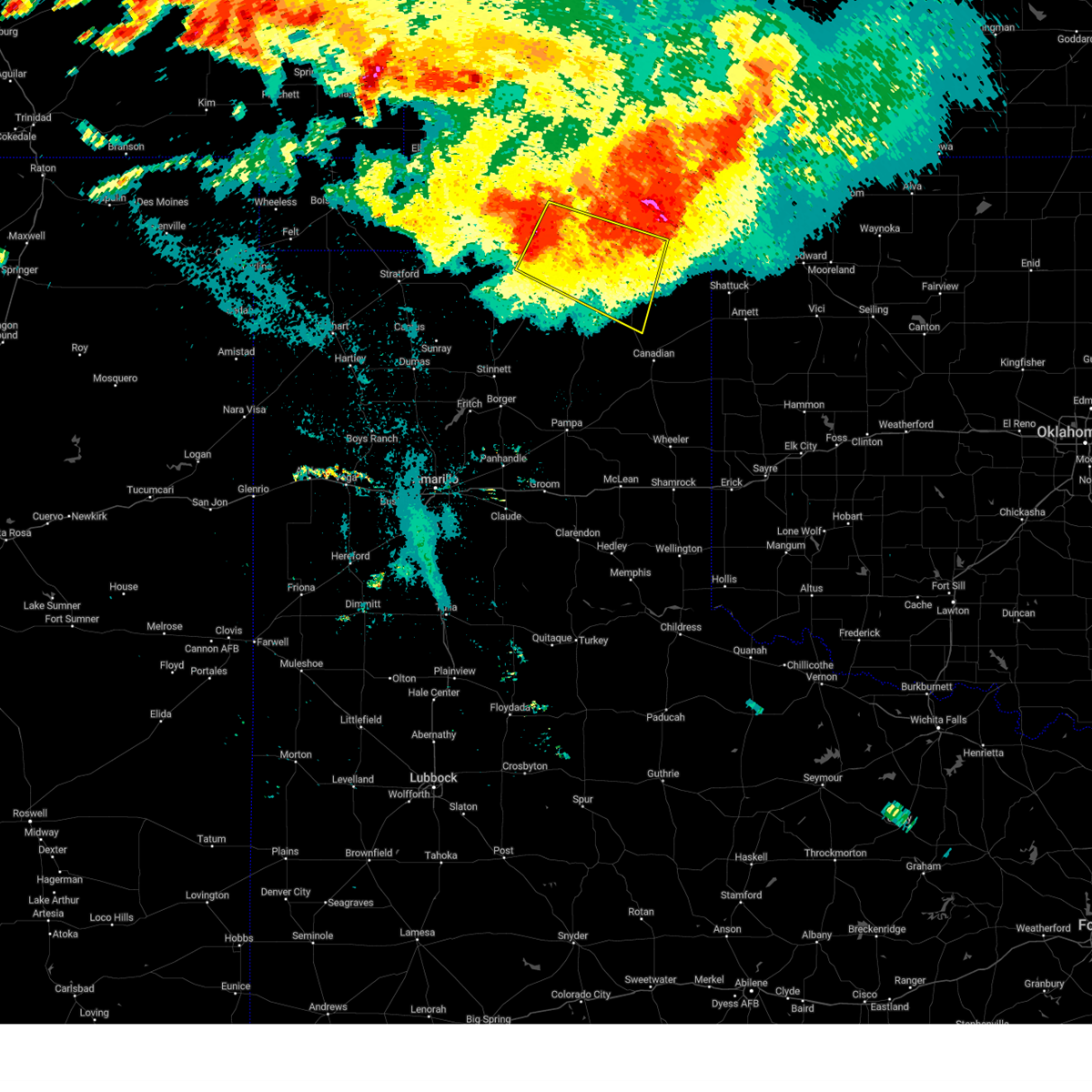 At 107 am cdt, a severe thunderstorm was located 10 miles southeast of hardesty, or 16 miles northwest of perryton, moving southeast at 45 mph (radar indicated). Hazards include 70 mph wind gusts and penny size hail. Expect some tree damage. Damage is likely to mobile homes, roofs, and outbuildings. At 107 am cdt, a severe thunderstorm was located 10 miles southeast of hardesty, or 16 miles northwest of perryton, moving southeast at 45 mph (radar indicated). Hazards include 70 mph wind gusts and penny size hail. Expect some tree damage. Damage is likely to mobile homes, roofs, and outbuildings.
|
| 7/21/2023 1:07 AM CDT |
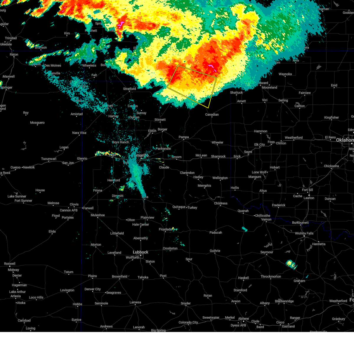 At 107 am cdt, a severe thunderstorm was located 10 miles southeast of hardesty, or 16 miles northwest of perryton, moving southeast at 45 mph (radar indicated). Hazards include 70 mph wind gusts and penny size hail. Expect some tree damage. Damage is likely to mobile homes, roofs, and outbuildings. At 107 am cdt, a severe thunderstorm was located 10 miles southeast of hardesty, or 16 miles northwest of perryton, moving southeast at 45 mph (radar indicated). Hazards include 70 mph wind gusts and penny size hail. Expect some tree damage. Damage is likely to mobile homes, roofs, and outbuildings.
|
| 7/9/2023 12:44 AM CDT |
 At 1244 am cdt, severe thunderstorms were located along a line extending from 7 miles south of follett to 3 miles south of spearman, moving southeast at 40 mph (radar indicated). Hazards include 60 mph wind gusts and nickel size hail. Minor damage to roofs, siding, and trees is possible. locations impacted include, perryton, spearman, lipscomb, booker, gruver, follett, higgins, darrouzett, wolf creek park, farnsworth and waka. hail threat, radar indicated max hail size, 0. 88in wind threat, radar indicated max wind gust, 60 mph. At 1244 am cdt, severe thunderstorms were located along a line extending from 7 miles south of follett to 3 miles south of spearman, moving southeast at 40 mph (radar indicated). Hazards include 60 mph wind gusts and nickel size hail. Minor damage to roofs, siding, and trees is possible. locations impacted include, perryton, spearman, lipscomb, booker, gruver, follett, higgins, darrouzett, wolf creek park, farnsworth and waka. hail threat, radar indicated max hail size, 0. 88in wind threat, radar indicated max wind gust, 60 mph.
|
| 7/9/2023 12:35 AM CDT |
 At 1235 am cdt, severe thunderstorms were located along a line extending from near follett to 6 miles east of gruver, moving south at 30 mph (radar indicated). Hazards include 60 mph wind gusts and penny size hail. Minor damage to roofs, siding, and trees is possible. locations impacted include, perryton, spearman, lipscomb, booker, gruver, follett, higgins, darrouzett, wolf creek park, farnsworth and waka. hail threat, radar indicated max hail size, 0. 75in wind threat, radar indicated max wind gust, 60 mph. At 1235 am cdt, severe thunderstorms were located along a line extending from near follett to 6 miles east of gruver, moving south at 30 mph (radar indicated). Hazards include 60 mph wind gusts and penny size hail. Minor damage to roofs, siding, and trees is possible. locations impacted include, perryton, spearman, lipscomb, booker, gruver, follett, higgins, darrouzett, wolf creek park, farnsworth and waka. hail threat, radar indicated max hail size, 0. 75in wind threat, radar indicated max wind gust, 60 mph.
|
| 7/9/2023 12:22 AM CDT |
 At 1222 am cdt, severe thunderstorms were located along a line extending from 8 miles northwest of follett to 7 miles northeast of gruver, moving south at 30 mph (radar indicated). Hazards include 60 mph wind gusts and quarter size hail. Minor damage to roofs, siding, and trees is possible. hail damage to vehicles is expected. locations impacted include, perryton, spearman, lipscomb, booker, gruver, follett, higgins, darrouzett, hardesty, wolf creek park, elmwood, farnsworth, waka, bryans corner, slapout and balko. hail threat, radar indicated max hail size, 1. 00in wind threat, radar indicated max wind gust, 60 mph. At 1222 am cdt, severe thunderstorms were located along a line extending from 8 miles northwest of follett to 7 miles northeast of gruver, moving south at 30 mph (radar indicated). Hazards include 60 mph wind gusts and quarter size hail. Minor damage to roofs, siding, and trees is possible. hail damage to vehicles is expected. locations impacted include, perryton, spearman, lipscomb, booker, gruver, follett, higgins, darrouzett, hardesty, wolf creek park, elmwood, farnsworth, waka, bryans corner, slapout and balko. hail threat, radar indicated max hail size, 1. 00in wind threat, radar indicated max wind gust, 60 mph.
|
| 7/8/2023 11:54 PM CDT |
 At 1153 pm cdt, severe thunderstorms were located along a line extending from 9 miles southwest of knowles to 7 miles south of guymon, moving south at 30 mph (radar indicated). Hazards include 60 mph wind gusts and quarter size hail. Minor damage to roofs, siding, and trees is possible. Hail damage to vehicles is expected. At 1153 pm cdt, severe thunderstorms were located along a line extending from 9 miles southwest of knowles to 7 miles south of guymon, moving south at 30 mph (radar indicated). Hazards include 60 mph wind gusts and quarter size hail. Minor damage to roofs, siding, and trees is possible. Hail damage to vehicles is expected.
|
| 7/7/2023 7:43 PM CDT |
 At 743 pm cdt, severe thunderstorms were located along a line extending from 6 miles south of follett to lake marvin to near wheeler, moving east at 45 mph (radar indicated). Hazards include 70 mph wind gusts and penny size hail. Expect some tree damage. damage is likely to mobile homes, roofs, and outbuildings. Locations impacted include, lipscomb, canadian, briscoe, wheeler, booker, follett, higgins, darrouzett, elmwood, new mobeetie, allison, glazier, lake marvin, slapout and mobeetie. At 743 pm cdt, severe thunderstorms were located along a line extending from 6 miles south of follett to lake marvin to near wheeler, moving east at 45 mph (radar indicated). Hazards include 70 mph wind gusts and penny size hail. Expect some tree damage. damage is likely to mobile homes, roofs, and outbuildings. Locations impacted include, lipscomb, canadian, briscoe, wheeler, booker, follett, higgins, darrouzett, elmwood, new mobeetie, allison, glazier, lake marvin, slapout and mobeetie.
|
| 7/7/2023 7:22 PM CDT |
 At 722 pm cdt, severe thunderstorms were located along a line extending from 5 miles southwest of darrouzett to near canadian to 7 miles northwest of kellerville, moving east at 50 mph (radar indicated). Hazards include 70 mph wind gusts and penny size hail. Expect some tree damage. Damage is likely to mobile homes, roofs, and outbuildings. At 722 pm cdt, severe thunderstorms were located along a line extending from 5 miles southwest of darrouzett to near canadian to 7 miles northwest of kellerville, moving east at 50 mph (radar indicated). Hazards include 70 mph wind gusts and penny size hail. Expect some tree damage. Damage is likely to mobile homes, roofs, and outbuildings.
|
| 7/7/2023 6:36 PM CDT |
 At 635 pm cdt, severe thunderstorms were located along a line extending from 7 miles northwest of forgan to 5 miles east of boyd to 6 miles north of farnsworth, moving east at 30 mph (radar indicated). Hazards include 60 mph wind gusts and quarter size hail. Minor damage to roofs, siding, and trees is possible. Hail damage to vehicles is expected. At 635 pm cdt, severe thunderstorms were located along a line extending from 7 miles northwest of forgan to 5 miles east of boyd to 6 miles north of farnsworth, moving east at 30 mph (radar indicated). Hazards include 60 mph wind gusts and quarter size hail. Minor damage to roofs, siding, and trees is possible. Hail damage to vehicles is expected.
|
| 7/7/2023 4:39 AM CDT |
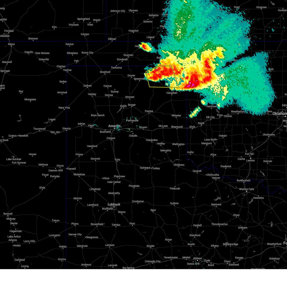 At 439 am cdt, a severe thunderstorm was located near wolf creek park, or 13 miles southeast of perryton, moving southeast at 25 mph (radar indicated). Hazards include 60 mph wind gusts. Minor damage to roofs, siding, and trees is possible. locations impacted include, perryton, booker, wolf creek park and farnsworth. hail threat, radar indicated max hail size, <. 75 in wind threat, radar indicated max wind gust, 60 mph. At 439 am cdt, a severe thunderstorm was located near wolf creek park, or 13 miles southeast of perryton, moving southeast at 25 mph (radar indicated). Hazards include 60 mph wind gusts. Minor damage to roofs, siding, and trees is possible. locations impacted include, perryton, booker, wolf creek park and farnsworth. hail threat, radar indicated max hail size, <. 75 in wind threat, radar indicated max wind gust, 60 mph.
|
| 7/7/2023 4:29 AM CDT |
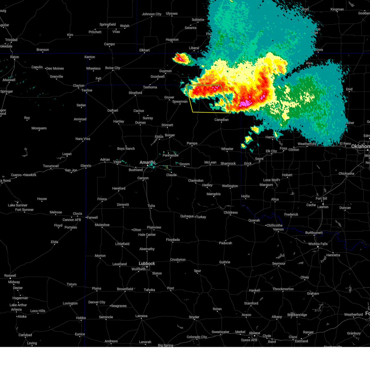 At 428 am cdt, a severe thunderstorm was located 6 miles east of perryton, moving southeast at 35 mph (radar indicated). Hazards include 60 mph wind gusts and quarter size hail. Minor damage to roofs, siding, and trees is possible. hail damage to vehicles is expected. locations impacted include, perryton, booker, wolf creek park and farnsworth. hail threat, radar indicated max hail size, 1. 00in wind threat, radar indicated max wind gust, 60 mph. At 428 am cdt, a severe thunderstorm was located 6 miles east of perryton, moving southeast at 35 mph (radar indicated). Hazards include 60 mph wind gusts and quarter size hail. Minor damage to roofs, siding, and trees is possible. hail damage to vehicles is expected. locations impacted include, perryton, booker, wolf creek park and farnsworth. hail threat, radar indicated max hail size, 1. 00in wind threat, radar indicated max wind gust, 60 mph.
|
| 7/7/2023 4:09 AM CDT |
 At 408 am cdt, a severe thunderstorm was located 4 miles south of bryans corner, or 11 miles north of perryton, moving southeast at 35 mph (radar indicated). Hazards include 70 mph wind gusts and quarter size hail. Expect some tree damage. damage is likely to mobile homes, roofs, and outbuildings. Hail damage to vehicles is expected. At 408 am cdt, a severe thunderstorm was located 4 miles south of bryans corner, or 11 miles north of perryton, moving southeast at 35 mph (radar indicated). Hazards include 70 mph wind gusts and quarter size hail. Expect some tree damage. damage is likely to mobile homes, roofs, and outbuildings. Hail damage to vehicles is expected.
|
| 7/7/2023 4:09 AM CDT |
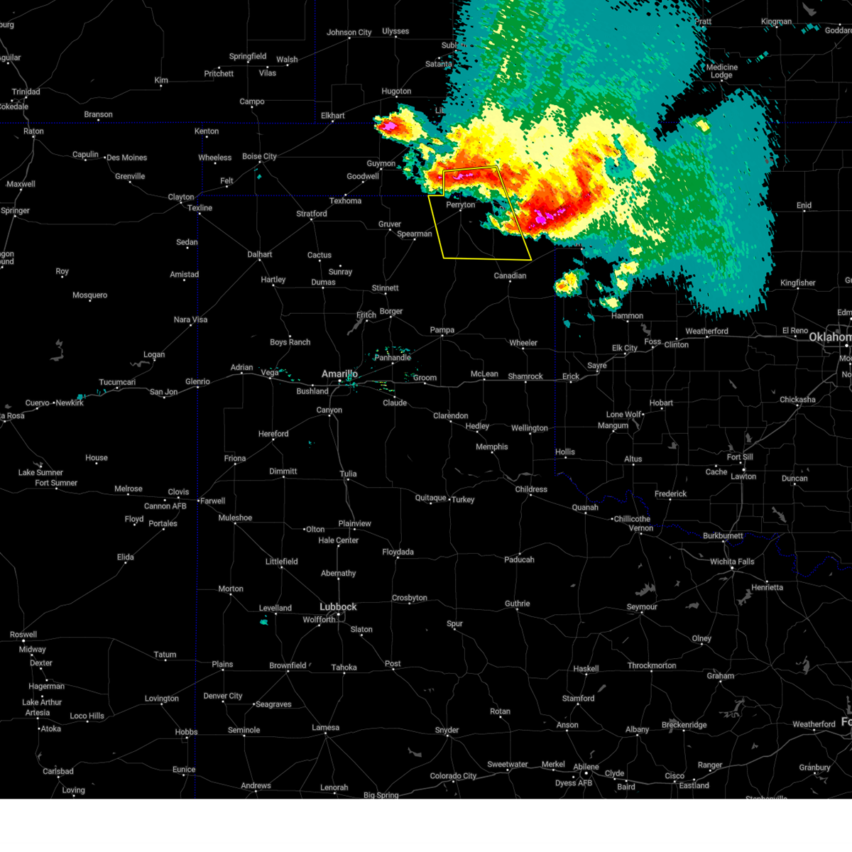 At 408 am cdt, a severe thunderstorm was located 4 miles south of bryans corner, or 11 miles north of perryton, moving southeast at 35 mph (radar indicated). Hazards include 70 mph wind gusts and quarter size hail. Expect some tree damage. damage is likely to mobile homes, roofs, and outbuildings. Hail damage to vehicles is expected. At 408 am cdt, a severe thunderstorm was located 4 miles south of bryans corner, or 11 miles north of perryton, moving southeast at 35 mph (radar indicated). Hazards include 70 mph wind gusts and quarter size hail. Expect some tree damage. damage is likely to mobile homes, roofs, and outbuildings. Hail damage to vehicles is expected.
|
| 7/7/2023 3:42 AM CDT |
 At 341 am cdt, automated weather equipment reported a severe thunderstorm was located 5 miles east of darrouzett, or 13 miles north of lipscomb, moving southeast at 35 mph. this is a destructive storm for darrouzett and follett (automated weather equipment. at 330 am cdt, a 62 mph wind gust was recorded 8 miles west of slapout. earlier, at 300 am cdt, an 83 mph wind gust was reported with this storm at beaver). Hazards include 80 mph wind gusts and baseball size hail. People and animals outdoors will be severely injured. expect shattered windows, extensive damage to roofs, siding, and vehicles. locations impacted include, lipscomb, booker, follett, higgins, darrouzett, elmwood and slapout. thunderstorm damage threat, destructive hail threat, radar indicated max hail size, 2. 75 in wind threat, observed max wind gust, 80 mph. At 341 am cdt, automated weather equipment reported a severe thunderstorm was located 5 miles east of darrouzett, or 13 miles north of lipscomb, moving southeast at 35 mph. this is a destructive storm for darrouzett and follett (automated weather equipment. at 330 am cdt, a 62 mph wind gust was recorded 8 miles west of slapout. earlier, at 300 am cdt, an 83 mph wind gust was reported with this storm at beaver). Hazards include 80 mph wind gusts and baseball size hail. People and animals outdoors will be severely injured. expect shattered windows, extensive damage to roofs, siding, and vehicles. locations impacted include, lipscomb, booker, follett, higgins, darrouzett, elmwood and slapout. thunderstorm damage threat, destructive hail threat, radar indicated max hail size, 2. 75 in wind threat, observed max wind gust, 80 mph.
|
| 7/7/2023 3:20 AM CDT | At 319 am cdt, a severe thunderstorm was located 9 miles east of elmwood, or 17 miles southeast of beaver, moving southeast at 40 mph. this is a destructive storm for elmwood, slapout, booker, darrouzett, follett, and lipscomb! (automated weather equipment. at 300 am cdt, automated weather equipment recorded an 83 mph wind gust 1 mile south southwest of beaver). Hazards include 80 mph wind gusts and baseball size hail. People and animals outdoors will be severely injured. Expect shattered windows, extensive damage to roofs, siding, and vehicles. |
| 7/7/2023 3:20 AM CDT | At 319 am cdt, a severe thunderstorm was located 9 miles east of elmwood, or 17 miles southeast of beaver, moving southeast at 40 mph. this is a destructive storm for elmwood, slapout, booker, darrouzett, follett, and lipscomb! (automated weather equipment. at 300 am cdt, automated weather equipment recorded an 83 mph wind gust 1 mile south southwest of beaver). Hazards include 80 mph wind gusts and baseball size hail. People and animals outdoors will be severely injured. Expect shattered windows, extensive damage to roofs, siding, and vehicles. |
| 7/6/2023 3:24 AM CDT |
 At 324 am cdt, severe thunderstorms were located along a line extending from 4 miles northwest of morse to 3 miles northeast of wolf creek park to 5 miles north of follett, moving south at 35 mph (automated weather equipment. at 315 am cdt, a 60 mph wind gust was recorded at the perryton airport). Hazards include 60 mph wind gusts. minor damage to roofs, siding, and trees is possible At 324 am cdt, severe thunderstorms were located along a line extending from 4 miles northwest of morse to 3 miles northeast of wolf creek park to 5 miles north of follett, moving south at 35 mph (automated weather equipment. at 315 am cdt, a 60 mph wind gust was recorded at the perryton airport). Hazards include 60 mph wind gusts. minor damage to roofs, siding, and trees is possible
|
| 6/22/2023 2:12 PM CDT |
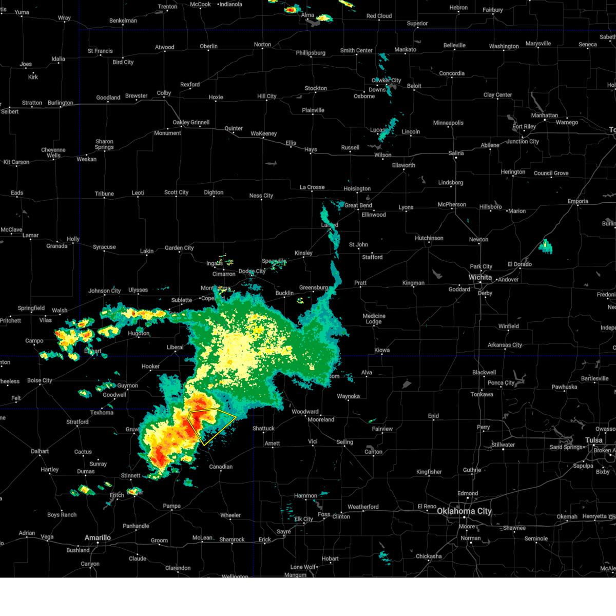 At 211 pm cdt, a severe thunderstorm was located 9 miles south of booker, or 13 miles northwest of lipscomb, moving southeast at 15 mph (radar indicated). Hazards include 60 mph wind gusts and quarter size hail. Minor damage to roofs, siding, and trees is possible. hail damage to vehicles is expected. locations impacted include, booker and darrouzett. hail threat, radar indicated max hail size, 1. 00in wind threat, radar indicated max wind gust, 60 mph. At 211 pm cdt, a severe thunderstorm was located 9 miles south of booker, or 13 miles northwest of lipscomb, moving southeast at 15 mph (radar indicated). Hazards include 60 mph wind gusts and quarter size hail. Minor damage to roofs, siding, and trees is possible. hail damage to vehicles is expected. locations impacted include, booker and darrouzett. hail threat, radar indicated max hail size, 1. 00in wind threat, radar indicated max wind gust, 60 mph.
|
| 6/22/2023 1:51 PM CDT |
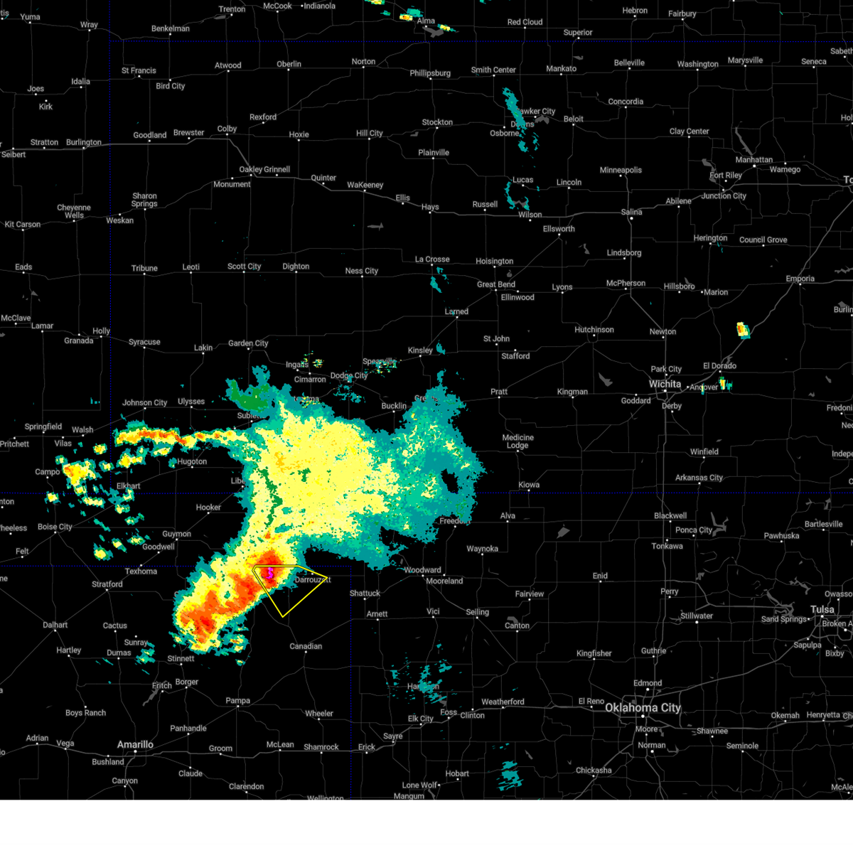 At 151 pm cdt, a severe thunderstorm was located 5 miles south of booker, or 13 miles east of perryton, moving southeast at 15 mph (radar indicated). Hazards include golf ball size hail and 60 mph wind gusts. Minor damage to roofs, siding, and trees is possible. people and animals outdoors will be injured. expect hail damage to roofs, siding, windows, and vehicles. locations impacted include, booker and darrouzett. thunderstorm damage threat, considerable hail threat, radar indicated max hail size, 1. 75 in wind threat, radar indicated max wind gust, 60 mph. At 151 pm cdt, a severe thunderstorm was located 5 miles south of booker, or 13 miles east of perryton, moving southeast at 15 mph (radar indicated). Hazards include golf ball size hail and 60 mph wind gusts. Minor damage to roofs, siding, and trees is possible. people and animals outdoors will be injured. expect hail damage to roofs, siding, windows, and vehicles. locations impacted include, booker and darrouzett. thunderstorm damage threat, considerable hail threat, radar indicated max hail size, 1. 75 in wind threat, radar indicated max wind gust, 60 mph.
|
| 6/22/2023 1:43 PM CDT |
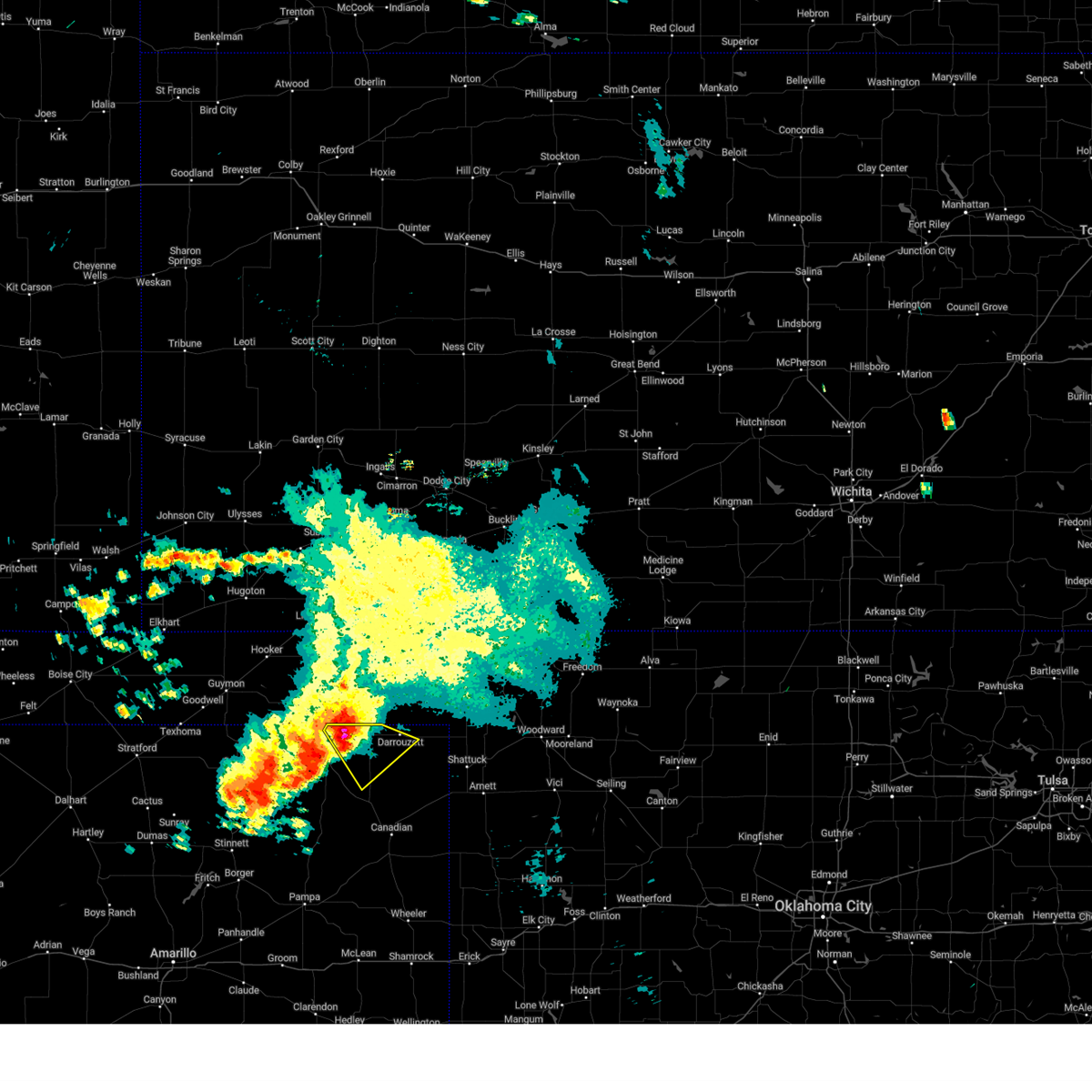 At 143 pm cdt, a severe thunderstorm was located 5 miles southwest of booker, or 12 miles east of perryton, moving southeast at 15 mph (radar indicated). Hazards include 60 mph wind gusts and quarter size hail. Minor damage to roofs, siding, and trees is possible. Hail damage to vehicles is expected. At 143 pm cdt, a severe thunderstorm was located 5 miles southwest of booker, or 12 miles east of perryton, moving southeast at 15 mph (radar indicated). Hazards include 60 mph wind gusts and quarter size hail. Minor damage to roofs, siding, and trees is possible. Hail damage to vehicles is expected.
|
| 6/17/2023 7:18 PM CDT |
 At 717 pm cdt, severe thunderstorms were located along a line extending from near boyd to 12 miles northwest of perryton to 9 miles northwest of waka, moving east at 30 mph (radar indicated). Hazards include 70 mph wind gusts and quarter size hail. Expect some tree damage. damage is likely to mobile homes, roofs, and outbuildings. Hail damage to vehicles is expected. At 717 pm cdt, severe thunderstorms were located along a line extending from near boyd to 12 miles northwest of perryton to 9 miles northwest of waka, moving east at 30 mph (radar indicated). Hazards include 70 mph wind gusts and quarter size hail. Expect some tree damage. damage is likely to mobile homes, roofs, and outbuildings. Hail damage to vehicles is expected.
|
| 6/15/2023 5:43 PM CDT |
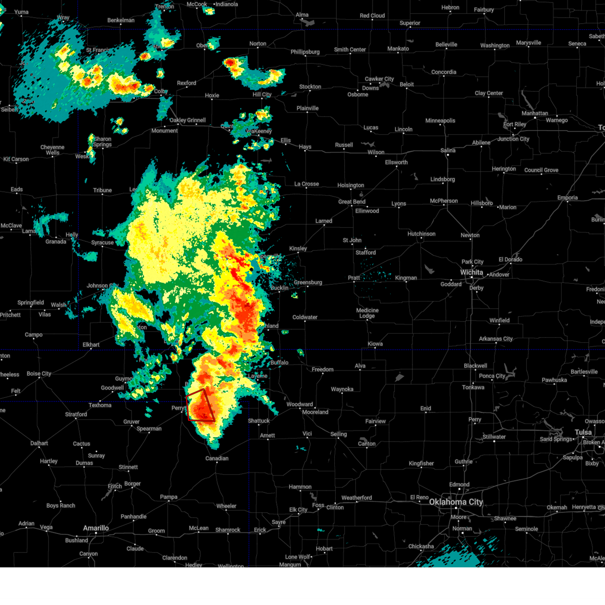 At 542 pm cdt, a severe thunderstorm capable of producing a tornado was located near booker, or 18 miles northwest of lipscomb, moving east at 30 mph (radar indicated rotation). Hazards include tornado and baseball size hail. Flying debris will be dangerous to those caught without shelter. mobile homes will be damaged or destroyed. damage to roofs, windows, and vehicles will occur. tree damage is likely. Locations impacted include, booker. At 542 pm cdt, a severe thunderstorm capable of producing a tornado was located near booker, or 18 miles northwest of lipscomb, moving east at 30 mph (radar indicated rotation). Hazards include tornado and baseball size hail. Flying debris will be dangerous to those caught without shelter. mobile homes will be damaged or destroyed. damage to roofs, windows, and vehicles will occur. tree damage is likely. Locations impacted include, booker.
|
| 6/15/2023 5:23 PM CDT |
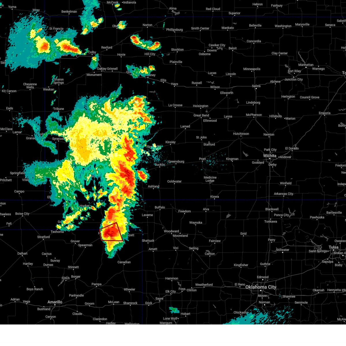 At 523 pm cdt, a confirmed tornado was located located 7 miles southwest of booker, or 8 miles east of perryton, moving east at 30 mph (live storm chaser video confirmed tornado). Hazards include damaging tornado and baseball size hail. Flying debris will be dangerous to those caught without shelter. mobile homes will be damaged or destroyed. damage to roofs, windows, and vehicles will occur. tree damage is likely. Locations impacted include, perryton and booker. At 523 pm cdt, a confirmed tornado was located located 7 miles southwest of booker, or 8 miles east of perryton, moving east at 30 mph (live storm chaser video confirmed tornado). Hazards include damaging tornado and baseball size hail. Flying debris will be dangerous to those caught without shelter. mobile homes will be damaged or destroyed. damage to roofs, windows, and vehicles will occur. tree damage is likely. Locations impacted include, perryton and booker.
|
| 6/15/2023 5:20 PM CDT |
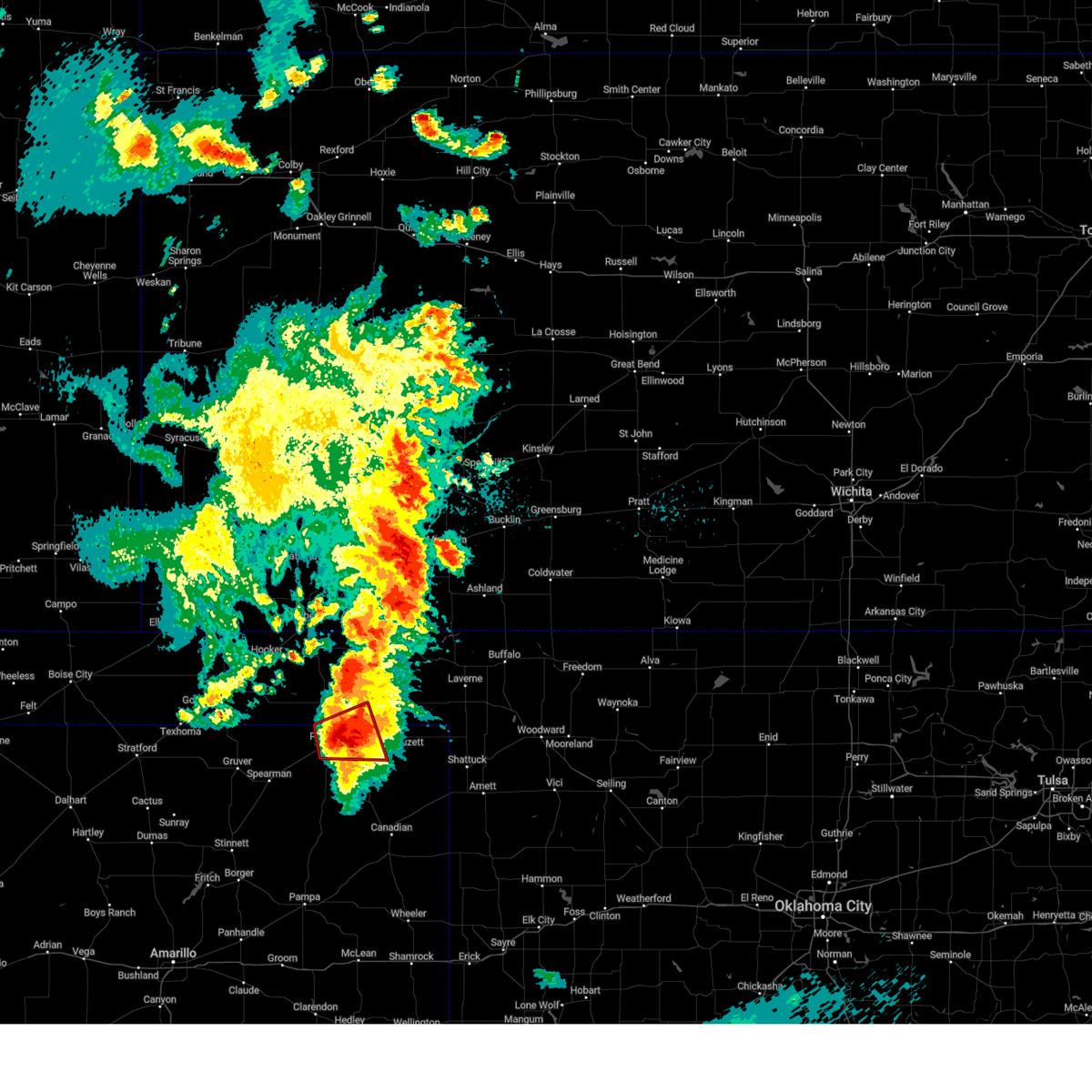 At 519 pm cdt, a severe thunderstorm capable of producing a tornado was located 6 miles east of perryton, moving east at 30 mph (radar indicated rotation). Hazards include tornado and baseball size hail. Flying debris will be dangerous to those caught without shelter. mobile homes will be damaged or destroyed. damage to roofs, windows, and vehicles will occur. tree damage is likely. Locations impacted include, perryton and booker. At 519 pm cdt, a severe thunderstorm capable of producing a tornado was located 6 miles east of perryton, moving east at 30 mph (radar indicated rotation). Hazards include tornado and baseball size hail. Flying debris will be dangerous to those caught without shelter. mobile homes will be damaged or destroyed. damage to roofs, windows, and vehicles will occur. tree damage is likely. Locations impacted include, perryton and booker.
|
| 6/15/2023 5:20 PM CDT |
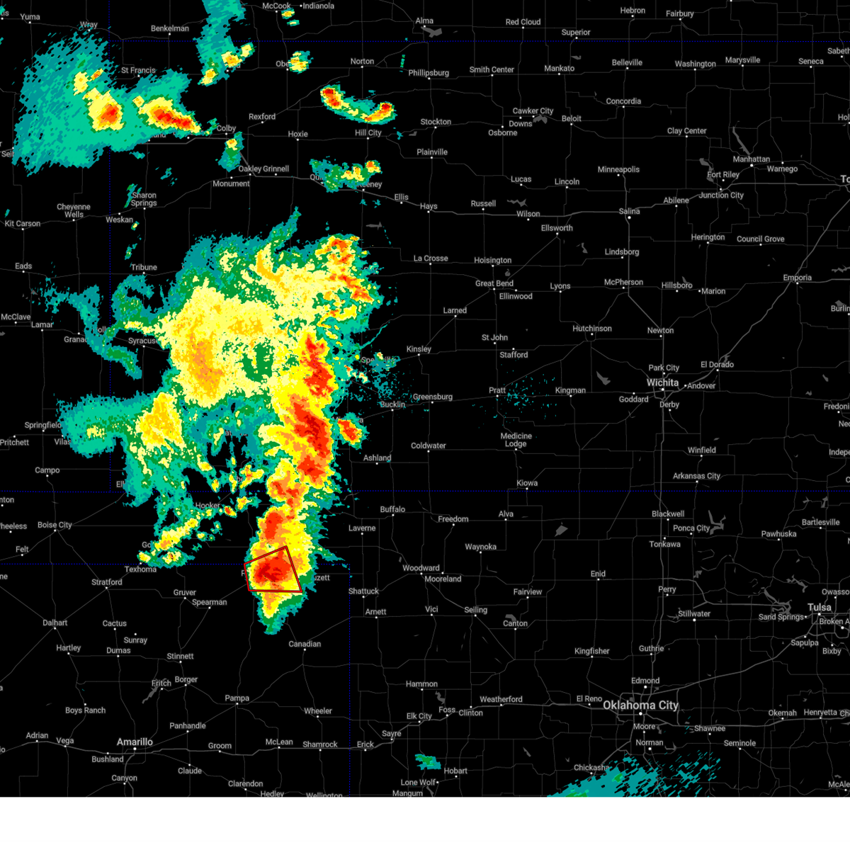 At 519 pm cdt, a severe thunderstorm capable of producing a tornado was located 6 miles east of perryton, moving east at 30 mph (radar indicated rotation). Hazards include tornado and baseball size hail. Flying debris will be dangerous to those caught without shelter. mobile homes will be damaged or destroyed. damage to roofs, windows, and vehicles will occur. tree damage is likely. Locations impacted include, perryton and booker. At 519 pm cdt, a severe thunderstorm capable of producing a tornado was located 6 miles east of perryton, moving east at 30 mph (radar indicated rotation). Hazards include tornado and baseball size hail. Flying debris will be dangerous to those caught without shelter. mobile homes will be damaged or destroyed. damage to roofs, windows, and vehicles will occur. tree damage is likely. Locations impacted include, perryton and booker.
|
| 6/15/2023 5:13 PM CDT |
 At 513 pm cdt, a confirmed tornado was located located over perryton, moving east at 25 mph (live storm chaser video confirmed tornado). Hazards include damaging tornado and baseball size hail. Flying debris will be dangerous to those caught without shelter. mobile homes will be damaged or destroyed. damage to roofs, windows, and vehicles will occur. tree damage is likely. Locations impacted include, perryton and booker. At 513 pm cdt, a confirmed tornado was located located over perryton, moving east at 25 mph (live storm chaser video confirmed tornado). Hazards include damaging tornado and baseball size hail. Flying debris will be dangerous to those caught without shelter. mobile homes will be damaged or destroyed. damage to roofs, windows, and vehicles will occur. tree damage is likely. Locations impacted include, perryton and booker.
|
| 6/15/2023 5:13 PM CDT |
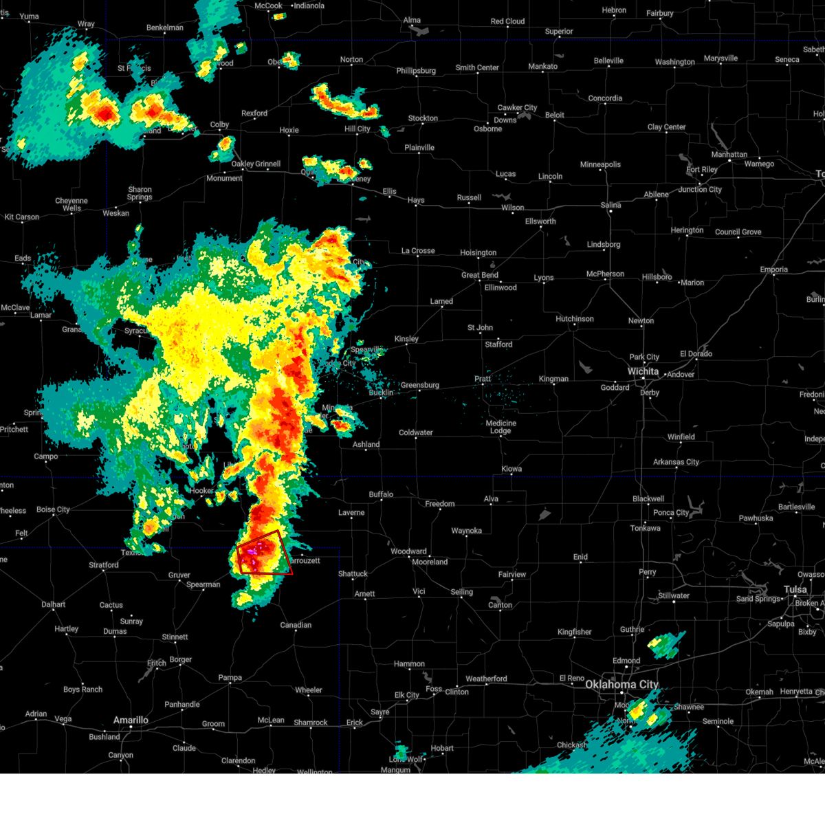 At 513 pm cdt, a confirmed tornado was located located over perryton, moving east at 25 mph (live storm chaser video confirmed tornado). Hazards include damaging tornado and baseball size hail. Flying debris will be dangerous to those caught without shelter. mobile homes will be damaged or destroyed. damage to roofs, windows, and vehicles will occur. tree damage is likely. Locations impacted include, perryton and booker. At 513 pm cdt, a confirmed tornado was located located over perryton, moving east at 25 mph (live storm chaser video confirmed tornado). Hazards include damaging tornado and baseball size hail. Flying debris will be dangerous to those caught without shelter. mobile homes will be damaged or destroyed. damage to roofs, windows, and vehicles will occur. tree damage is likely. Locations impacted include, perryton and booker.
|
| 6/15/2023 5:10 PM CDT |
 At 510 pm cdt, a confirmed tornado was located located over perryton, moving east at 25 mph (live storm chaser video confirmed tornado). Hazards include damaging tornado and baseball size hail. Flying debris will be dangerous to those caught without shelter. mobile homes will be damaged or destroyed. damage to roofs, windows, and vehicles will occur. tree damage is likely. Locations impacted include, perryton and booker. At 510 pm cdt, a confirmed tornado was located located over perryton, moving east at 25 mph (live storm chaser video confirmed tornado). Hazards include damaging tornado and baseball size hail. Flying debris will be dangerous to those caught without shelter. mobile homes will be damaged or destroyed. damage to roofs, windows, and vehicles will occur. tree damage is likely. Locations impacted include, perryton and booker.
|
| 6/15/2023 5:10 PM CDT |
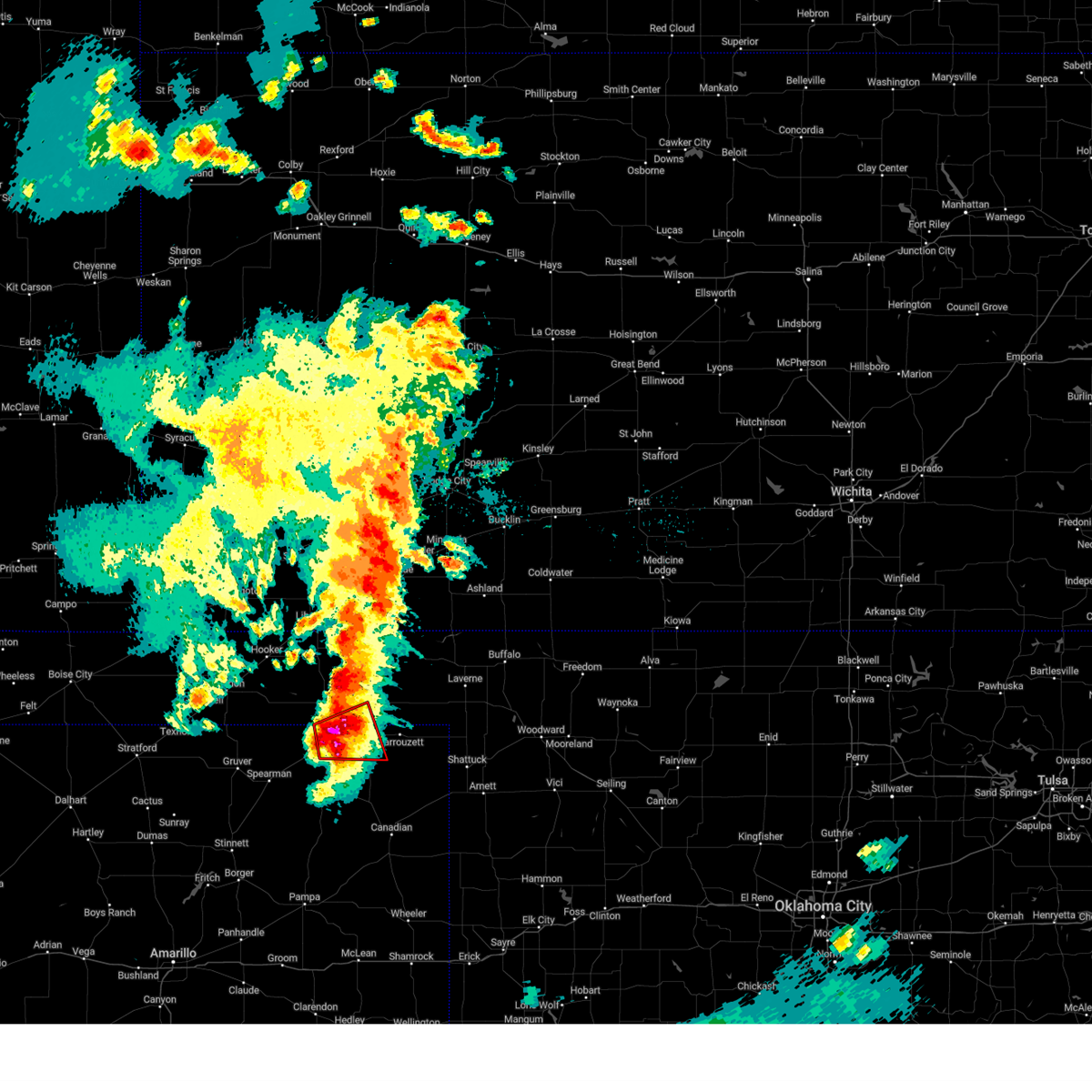 At 510 pm cdt, a confirmed tornado was located located over perryton, moving east at 25 mph (live storm chaser video confirmed tornado). Hazards include damaging tornado and baseball size hail. Flying debris will be dangerous to those caught without shelter. mobile homes will be damaged or destroyed. damage to roofs, windows, and vehicles will occur. tree damage is likely. Locations impacted include, perryton and booker. At 510 pm cdt, a confirmed tornado was located located over perryton, moving east at 25 mph (live storm chaser video confirmed tornado). Hazards include damaging tornado and baseball size hail. Flying debris will be dangerous to those caught without shelter. mobile homes will be damaged or destroyed. damage to roofs, windows, and vehicles will occur. tree damage is likely. Locations impacted include, perryton and booker.
|
| 6/15/2023 5:06 PM CDT |
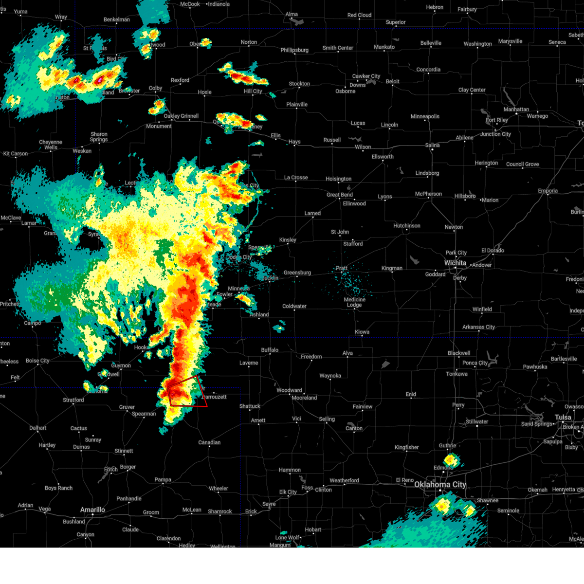 At 506 pm cdt, a severe thunderstorm capable of producing a tornado was located over perryton, moving east at 30 mph (radar indicated rotation). Hazards include tornado and baseball size hail. Flying debris will be dangerous to those caught without shelter. mobile homes will be damaged or destroyed. damage to roofs, windows, and vehicles will occur. Tree damage is likely. At 506 pm cdt, a severe thunderstorm capable of producing a tornado was located over perryton, moving east at 30 mph (radar indicated rotation). Hazards include tornado and baseball size hail. Flying debris will be dangerous to those caught without shelter. mobile homes will be damaged or destroyed. damage to roofs, windows, and vehicles will occur. Tree damage is likely.
|
| 6/15/2023 5:06 PM CDT |
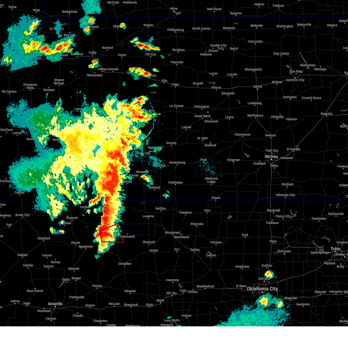 At 506 pm cdt, a severe thunderstorm capable of producing a tornado was located over perryton, moving east at 30 mph (radar indicated rotation). Hazards include tornado and baseball size hail. Flying debris will be dangerous to those caught without shelter. mobile homes will be damaged or destroyed. damage to roofs, windows, and vehicles will occur. Tree damage is likely. At 506 pm cdt, a severe thunderstorm capable of producing a tornado was located over perryton, moving east at 30 mph (radar indicated rotation). Hazards include tornado and baseball size hail. Flying debris will be dangerous to those caught without shelter. mobile homes will be damaged or destroyed. damage to roofs, windows, and vehicles will occur. Tree damage is likely.
|
| 6/15/2023 5:00 PM CDT |
 At 500 pm cdt, a severe thunderstorm was located over perryton, moving east at 30 mph (radar indicated). Hazards include tennis ball size hail and 60 mph wind gusts. Minor damage to roofs, siding, and trees is possible. people and animals outdoors will be injured. expect hail damage to roofs, siding, windows, and vehicles. Locations impacted include, perryton, lipscomb, booker, follett, darrouzett, wolf creek park, farnsworth and waka. At 500 pm cdt, a severe thunderstorm was located over perryton, moving east at 30 mph (radar indicated). Hazards include tennis ball size hail and 60 mph wind gusts. Minor damage to roofs, siding, and trees is possible. people and animals outdoors will be injured. expect hail damage to roofs, siding, windows, and vehicles. Locations impacted include, perryton, lipscomb, booker, follett, darrouzett, wolf creek park, farnsworth and waka.
|
| 6/15/2023 4:50 PM CDT |
 At 450 pm cdt, a severe thunderstorm was located near perryton, moving northeast at 35 mph (radar indicated). Hazards include two inch hail and 60 mph wind gusts. Minor damage to roofs, siding, and trees is possible. people and animals outdoors will be injured. expect hail damage to roofs, siding, windows, and vehicles. Locations impacted include, perryton, lipscomb, booker, follett, darrouzett, wolf creek park, farnsworth and waka. At 450 pm cdt, a severe thunderstorm was located near perryton, moving northeast at 35 mph (radar indicated). Hazards include two inch hail and 60 mph wind gusts. Minor damage to roofs, siding, and trees is possible. people and animals outdoors will be injured. expect hail damage to roofs, siding, windows, and vehicles. Locations impacted include, perryton, lipscomb, booker, follett, darrouzett, wolf creek park, farnsworth and waka.
|
| 6/15/2023 4:38 PM CDT |
 At 438 pm cdt, a severe thunderstorm was located 6 miles northwest of perryton, moving east at 30 mph (radar indicated). Hazards include ping pong ball size hail and 60 mph wind gusts. Minor damage to roofs, siding, and trees is possible. people and animals outdoors will be injured. expect hail damage to roofs, siding, windows, and vehicles. locations impacted include, perryton, lipscomb, booker, follett, darrouzett, wolf creek park, farnsworth and waka. hail threat, radar indicated max hail size, 1. 50 in wind threat, radar indicated max wind gust, 60 mph. At 438 pm cdt, a severe thunderstorm was located 6 miles northwest of perryton, moving east at 30 mph (radar indicated). Hazards include ping pong ball size hail and 60 mph wind gusts. Minor damage to roofs, siding, and trees is possible. people and animals outdoors will be injured. expect hail damage to roofs, siding, windows, and vehicles. locations impacted include, perryton, lipscomb, booker, follett, darrouzett, wolf creek park, farnsworth and waka. hail threat, radar indicated max hail size, 1. 50 in wind threat, radar indicated max wind gust, 60 mph.
|
| 6/15/2023 4:29 PM CDT |
 At 429 pm cdt, a severe thunderstorm was located 9 miles north of farnsworth, or 11 miles northwest of perryton, moving east at 30 mph (radar indicated). Hazards include golf ball size hail and 60 mph wind gusts. Minor damage to roofs, siding, and trees is possible. people and animals outdoors will be injured. Expect hail damage to roofs, siding, windows, and vehicles. At 429 pm cdt, a severe thunderstorm was located 9 miles north of farnsworth, or 11 miles northwest of perryton, moving east at 30 mph (radar indicated). Hazards include golf ball size hail and 60 mph wind gusts. Minor damage to roofs, siding, and trees is possible. people and animals outdoors will be injured. Expect hail damage to roofs, siding, windows, and vehicles.
|
| 6/2/2023 5:53 PM CDT |
 At 552 pm cdt, a severe thunderstorm was located over elmwood, or 11 miles south of beaver, moving north at 50 mph (radar indicated). Hazards include 60 mph wind gusts. Minor damage to roofs, siding, and trees is possible. locations impacted include, perryton, beaver, booker, tyrone, forgan, follett, darrouzett, gate, knowles, elmwood, adams, farnsworth, boyd, waka, floris, bryans corner, baker, mocane, turpin and slapout. hail threat, radar indicated max hail size, <. 75 in wind threat, radar indicated max wind gust, 60 mph. At 552 pm cdt, a severe thunderstorm was located over elmwood, or 11 miles south of beaver, moving north at 50 mph (radar indicated). Hazards include 60 mph wind gusts. Minor damage to roofs, siding, and trees is possible. locations impacted include, perryton, beaver, booker, tyrone, forgan, follett, darrouzett, gate, knowles, elmwood, adams, farnsworth, boyd, waka, floris, bryans corner, baker, mocane, turpin and slapout. hail threat, radar indicated max hail size, <. 75 in wind threat, radar indicated max wind gust, 60 mph.
|
| 6/2/2023 5:12 PM CDT |
 At 512 pm cdt, a severe thunderstorm was located 7 miles southeast of perryton, moving north at 30 mph (radar indicated). Hazards include 60 mph wind gusts. Minor damage to roofs, siding, and trees is possible. locations impacted include, perryton, beaver, booker, tyrone, forgan, follett, darrouzett, gate, knowles, elmwood, adams, farnsworth, boyd, waka, floris, bryans corner, baker, mocane, turpin and slapout. hail threat, radar indicated max hail size, <. 75 in wind threat, radar indicated max wind gust, 60 mph. At 512 pm cdt, a severe thunderstorm was located 7 miles southeast of perryton, moving north at 30 mph (radar indicated). Hazards include 60 mph wind gusts. Minor damage to roofs, siding, and trees is possible. locations impacted include, perryton, beaver, booker, tyrone, forgan, follett, darrouzett, gate, knowles, elmwood, adams, farnsworth, boyd, waka, floris, bryans corner, baker, mocane, turpin and slapout. hail threat, radar indicated max hail size, <. 75 in wind threat, radar indicated max wind gust, 60 mph.
|
| 6/2/2023 4:53 PM CDT |
 At 453 pm cdt, a severe thunderstorm was located near mocane, or 4 miles northeast of beaver, moving northeast at 35 mph (radar indicated). Hazards include 60 mph wind gusts. minor damage to roofs, siding, and trees is possible At 453 pm cdt, a severe thunderstorm was located near mocane, or 4 miles northeast of beaver, moving northeast at 35 mph (radar indicated). Hazards include 60 mph wind gusts. minor damage to roofs, siding, and trees is possible
|
| 5/31/2023 12:15 AM CDT |
 At 1214 am cdt, severe thunderstorms were located along a line extending from 10 miles west of slapout to 3 miles east of perryton, moving southeast at 35 mph (radar indicated). Hazards include 60 mph wind gusts. Minor damage to roofs, siding, and trees is possible. locations impacted include, perryton, lipscomb, beaver, booker, follett, darrouzett, gate, knowles, wolf creek park, elmwood, bryans corner, slapout and balko. hail threat, radar indicated max hail size, <. 75 in wind threat, radar indicated max wind gust, 60 mph. At 1214 am cdt, severe thunderstorms were located along a line extending from 10 miles west of slapout to 3 miles east of perryton, moving southeast at 35 mph (radar indicated). Hazards include 60 mph wind gusts. Minor damage to roofs, siding, and trees is possible. locations impacted include, perryton, lipscomb, beaver, booker, follett, darrouzett, gate, knowles, wolf creek park, elmwood, bryans corner, slapout and balko. hail threat, radar indicated max hail size, <. 75 in wind threat, radar indicated max wind gust, 60 mph.
|
| 5/30/2023 11:39 PM CDT |
 At 1138 pm cdt, automated weather equipment reported severe thunderstorms were located along a line extending from near mocane to 7 miles west of bryans corner, moving east at 35 mph (automated weather equipment). Hazards include 70 mph wind gusts. Expect some tree damage. damage is likely to mobile homes, roofs, and outbuildings. locations impacted include, perryton, lipscomb, beaver, booker, forgan, follett, darrouzett, gate, knowles, wolf creek park, elmwood, boyd, floris, bryans corner, mocane, slapout and balko. thunderstorm damage threat, considerable hail threat, radar indicated max hail size, <. 75 in wind threat, radar indicated max wind gust, 70 mph. At 1138 pm cdt, automated weather equipment reported severe thunderstorms were located along a line extending from near mocane to 7 miles west of bryans corner, moving east at 35 mph (automated weather equipment). Hazards include 70 mph wind gusts. Expect some tree damage. damage is likely to mobile homes, roofs, and outbuildings. locations impacted include, perryton, lipscomb, beaver, booker, forgan, follett, darrouzett, gate, knowles, wolf creek park, elmwood, boyd, floris, bryans corner, mocane, slapout and balko. thunderstorm damage threat, considerable hail threat, radar indicated max hail size, <. 75 in wind threat, radar indicated max wind gust, 70 mph.
|
| 5/30/2023 11:31 PM CDT |
 At 1130 pm cdt, severe thunderstorms were located along a line extending from forgan to 7 miles southeast of adams, moving southeast at 35 mph (radar indicated). Hazards include 60 mph wind gusts and penny size hail. minor damage to roofs, siding, and trees is possible At 1130 pm cdt, severe thunderstorms were located along a line extending from forgan to 7 miles southeast of adams, moving southeast at 35 mph (radar indicated). Hazards include 60 mph wind gusts and penny size hail. minor damage to roofs, siding, and trees is possible
|
| 5/24/2023 11:06 PM CDT |
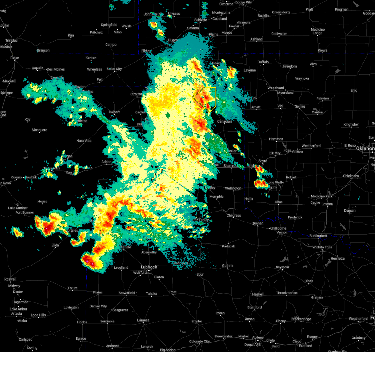 The severe thunderstorm warning for northeastern ochiltree county will expire at 1115 pm cdt, the storm which prompted the warning has weakened below severe limits, and no longer poses an immediate threat to life or property. therefore, the warning will be allowed to expire. The severe thunderstorm warning for northeastern ochiltree county will expire at 1115 pm cdt, the storm which prompted the warning has weakened below severe limits, and no longer poses an immediate threat to life or property. therefore, the warning will be allowed to expire.
|
| 5/24/2023 10:37 PM CDT |
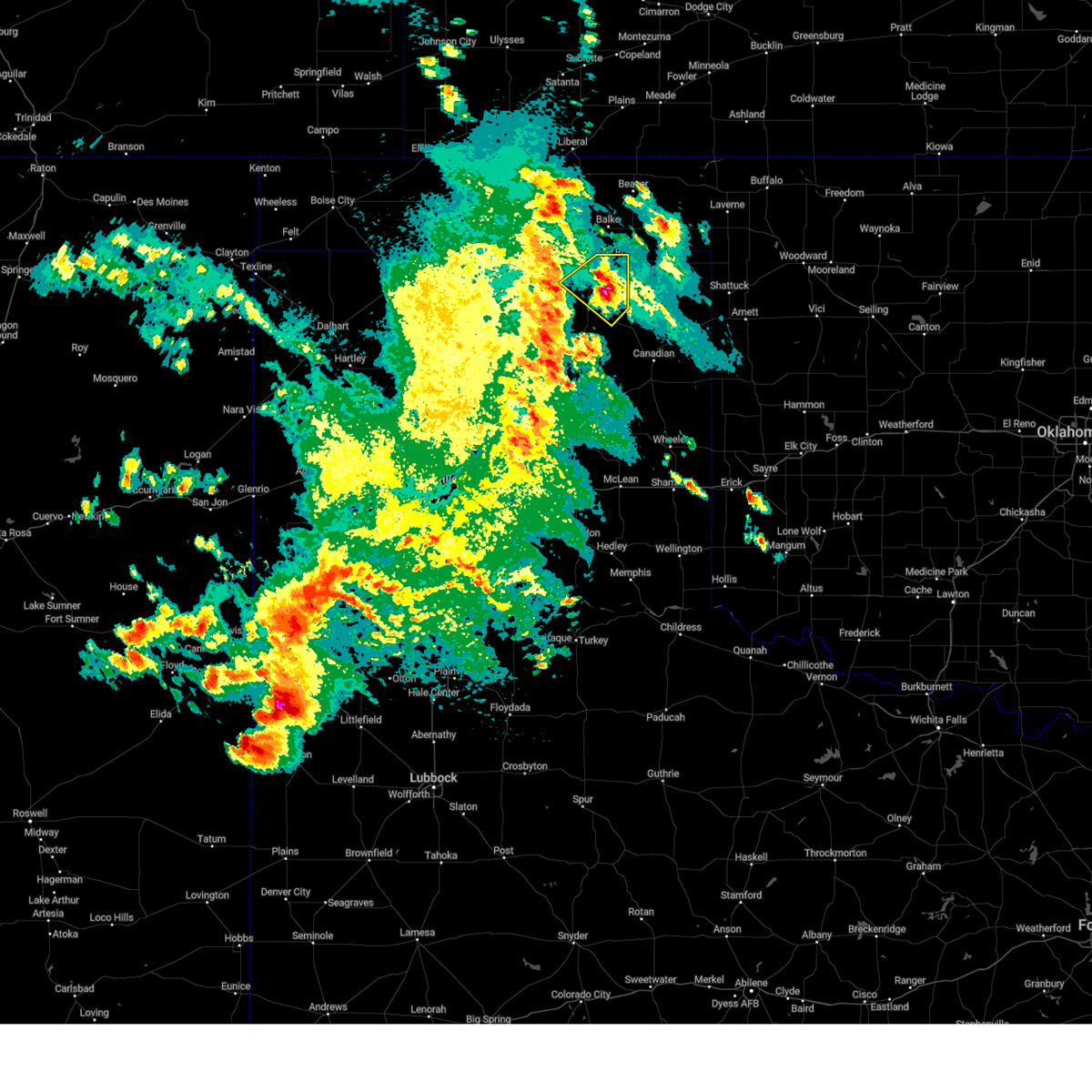 At 1037 pm cdt, a severe thunderstorm was located 6 miles northwest of wolf creek park, or 9 miles southeast of perryton, and is nearly stationary (radar indicated). Hazards include 60 mph wind gusts and quarter size hail. Minor damage to roofs, siding, and trees is possible. hail damage to vehicles is expected. locations impacted include, perryton, wolf creek park and farnsworth. hail threat, radar indicated max hail size, 1. 00in wind threat, radar indicated max wind gust, 60 mph. At 1037 pm cdt, a severe thunderstorm was located 6 miles northwest of wolf creek park, or 9 miles southeast of perryton, and is nearly stationary (radar indicated). Hazards include 60 mph wind gusts and quarter size hail. Minor damage to roofs, siding, and trees is possible. hail damage to vehicles is expected. locations impacted include, perryton, wolf creek park and farnsworth. hail threat, radar indicated max hail size, 1. 00in wind threat, radar indicated max wind gust, 60 mph.
|
| 5/24/2023 10:28 PM CDT |
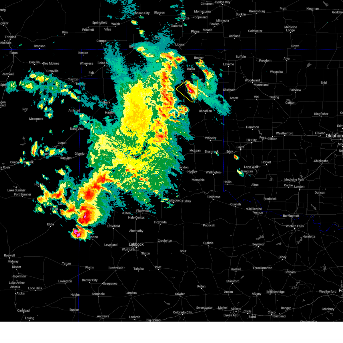 At 1027 pm cdt, a severe thunderstorm was located 6 miles northwest of wolf creek park, or 9 miles southeast of perryton, and is nearly stationary (radar indicated). Hazards include 60 mph wind gusts and half dollar size hail. Minor damage to roofs, siding, and trees is possible. hail damage to vehicles is expected. locations impacted include, perryton, wolf creek park and farnsworth. hail threat, radar indicated max hail size, 1. 25 in wind threat, radar indicated max wind gust, 60 mph. At 1027 pm cdt, a severe thunderstorm was located 6 miles northwest of wolf creek park, or 9 miles southeast of perryton, and is nearly stationary (radar indicated). Hazards include 60 mph wind gusts and half dollar size hail. Minor damage to roofs, siding, and trees is possible. hail damage to vehicles is expected. locations impacted include, perryton, wolf creek park and farnsworth. hail threat, radar indicated max hail size, 1. 25 in wind threat, radar indicated max wind gust, 60 mph.
|
| 5/24/2023 10:22 PM CDT |
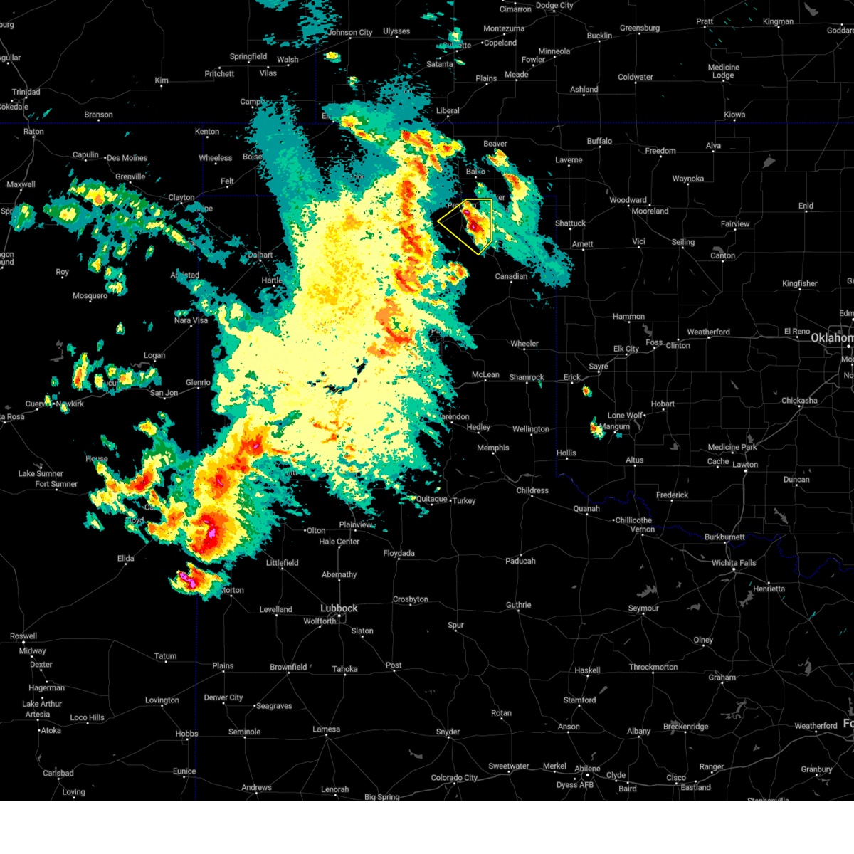 At 1022 pm cdt, a severe thunderstorm was located 6 miles northwest of wolf creek park, or 8 miles southeast of perryton, and is nearly stationary (radar indicated). Hazards include 60 mph wind gusts and quarter size hail. Minor damage to roofs, siding, and trees is possible. Hail damage to vehicles is expected. At 1022 pm cdt, a severe thunderstorm was located 6 miles northwest of wolf creek park, or 8 miles southeast of perryton, and is nearly stationary (radar indicated). Hazards include 60 mph wind gusts and quarter size hail. Minor damage to roofs, siding, and trees is possible. Hail damage to vehicles is expected.
|
| 5/24/2023 9:36 PM CDT |
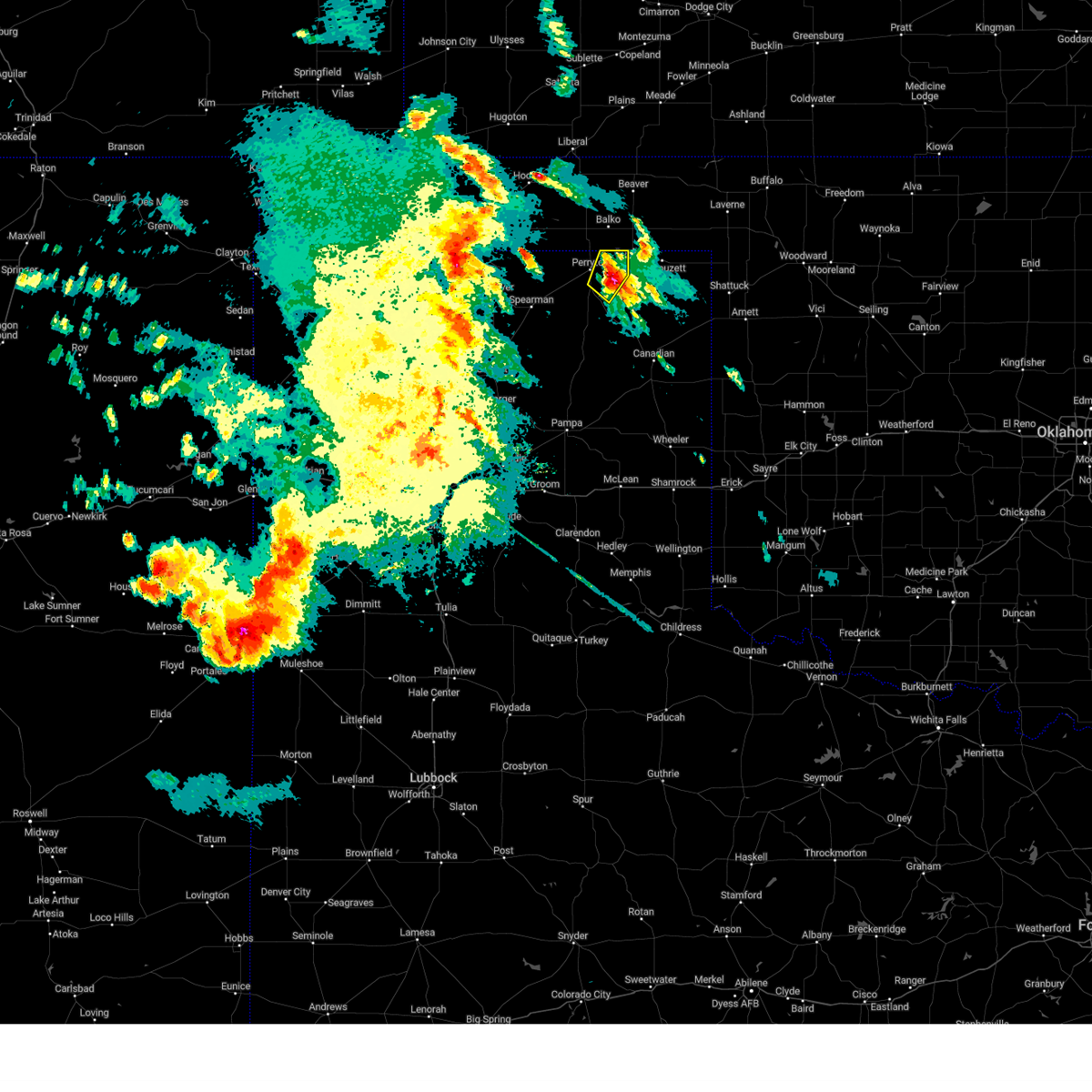 At 935 pm cdt, a severe thunderstorm was located 8 miles southwest of booker, or 9 miles east of perryton, moving northeast at 5 mph (radar indicated). Hazards include 60 mph wind gusts and half dollar size hail. Minor damage to roofs, siding, and trees is possible. hail damage to vehicles is expected. locations impacted include, perryton. hail threat, radar indicated max hail size, 1. 25 in wind threat, radar indicated max wind gust, 60 mph. At 935 pm cdt, a severe thunderstorm was located 8 miles southwest of booker, or 9 miles east of perryton, moving northeast at 5 mph (radar indicated). Hazards include 60 mph wind gusts and half dollar size hail. Minor damage to roofs, siding, and trees is possible. hail damage to vehicles is expected. locations impacted include, perryton. hail threat, radar indicated max hail size, 1. 25 in wind threat, radar indicated max wind gust, 60 mph.
|
| 5/24/2023 9:27 PM CDT |
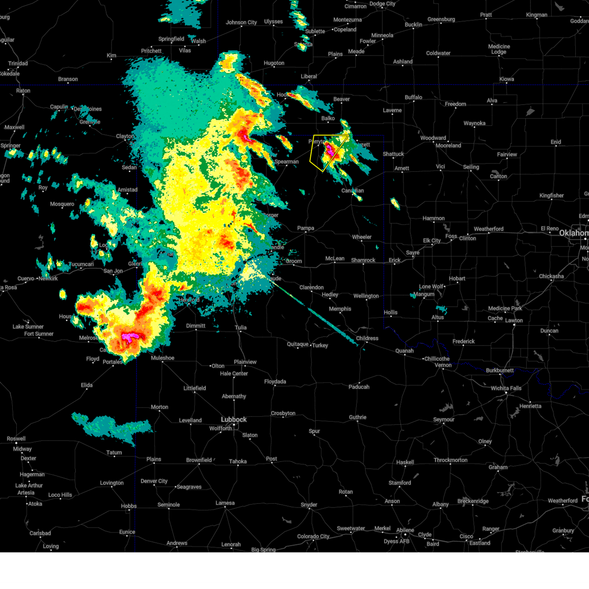 At 926 pm cdt, a severe thunderstorm was located 7 miles east of perryton, moving southwest at 10 mph (radar indicated). Hazards include two inch hail and 60 mph wind gusts. Minor damage to roofs, siding, and trees is possible. people and animals outdoors will be injured. expect hail damage to roofs, siding, windows, and vehicles. locations impacted include, perryton and booker. thunderstorm damage threat, considerable hail threat, radar indicated max hail size, 2. 00 in wind threat, radar indicated max wind gust, 60 mph. At 926 pm cdt, a severe thunderstorm was located 7 miles east of perryton, moving southwest at 10 mph (radar indicated). Hazards include two inch hail and 60 mph wind gusts. Minor damage to roofs, siding, and trees is possible. people and animals outdoors will be injured. expect hail damage to roofs, siding, windows, and vehicles. locations impacted include, perryton and booker. thunderstorm damage threat, considerable hail threat, radar indicated max hail size, 2. 00 in wind threat, radar indicated max wind gust, 60 mph.
|
| 5/24/2023 9:15 PM CDT |
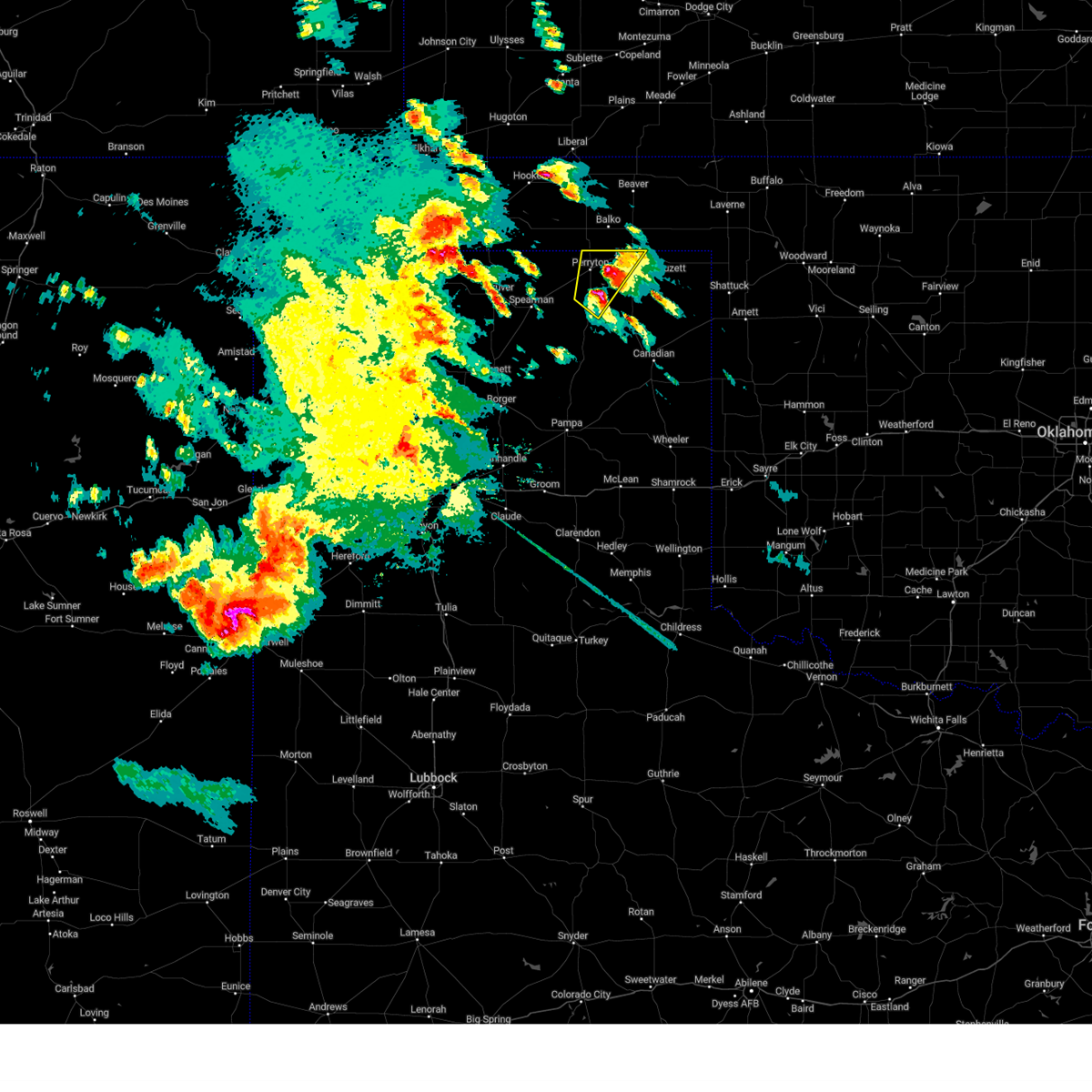 At 915 pm cdt, a severe thunderstorm was located 7 miles east of perryton, moving southwest at 10 mph (radar indicated). Hazards include ping pong ball size hail and 60 mph wind gusts. Minor damage to roofs, siding, and trees is possible. people and animals outdoors will be injured. expect hail damage to roofs, siding, windows, and vehicles. locations impacted include, perryton and booker. hail threat, radar indicated max hail size, 1. 50 in wind threat, radar indicated max wind gust, 60 mph. At 915 pm cdt, a severe thunderstorm was located 7 miles east of perryton, moving southwest at 10 mph (radar indicated). Hazards include ping pong ball size hail and 60 mph wind gusts. Minor damage to roofs, siding, and trees is possible. people and animals outdoors will be injured. expect hail damage to roofs, siding, windows, and vehicles. locations impacted include, perryton and booker. hail threat, radar indicated max hail size, 1. 50 in wind threat, radar indicated max wind gust, 60 mph.
|
| 5/24/2023 9:02 PM CDT |
 At 902 pm cdt, a severe thunderstorm was located 8 miles west of wolf creek park, or 10 miles south of perryton, moving northeast at 15 mph (radar indicated). Hazards include ping pong ball size hail and 60 mph wind gusts. Minor damage to roofs, siding, and trees is possible. people and animals outdoors will be injured. expect hail damage to roofs, siding, windows, and vehicles. locations impacted include, perryton, booker and farnsworth. hail threat, radar indicated max hail size, 1. 50 in wind threat, radar indicated max wind gust, 60 mph. At 902 pm cdt, a severe thunderstorm was located 8 miles west of wolf creek park, or 10 miles south of perryton, moving northeast at 15 mph (radar indicated). Hazards include ping pong ball size hail and 60 mph wind gusts. Minor damage to roofs, siding, and trees is possible. people and animals outdoors will be injured. expect hail damage to roofs, siding, windows, and vehicles. locations impacted include, perryton, booker and farnsworth. hail threat, radar indicated max hail size, 1. 50 in wind threat, radar indicated max wind gust, 60 mph.
|
| 5/24/2023 8:39 PM CDT |
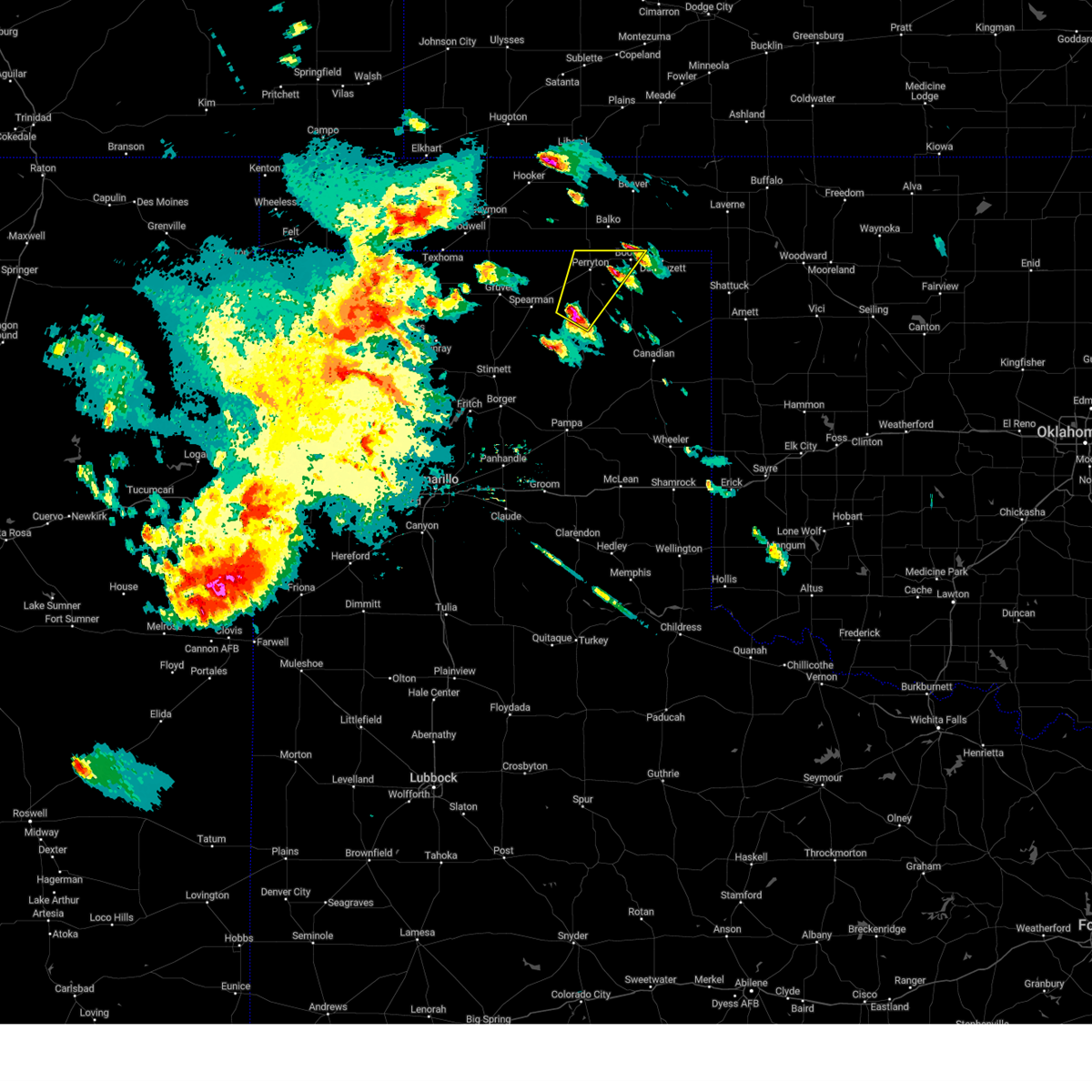 At 839 pm cdt, a severe thunderstorm was located 9 miles southeast of farnsworth, or 13 miles south of perryton, moving northeast at 25 mph (radar indicated). Hazards include golf ball size hail and 60 mph wind gusts. Minor damage to roofs, siding, and trees is possible. people and animals outdoors will be injured. Expect hail damage to roofs, siding, windows, and vehicles. At 839 pm cdt, a severe thunderstorm was located 9 miles southeast of farnsworth, or 13 miles south of perryton, moving northeast at 25 mph (radar indicated). Hazards include golf ball size hail and 60 mph wind gusts. Minor damage to roofs, siding, and trees is possible. people and animals outdoors will be injured. Expect hail damage to roofs, siding, windows, and vehicles.
|
| 2/26/2023 5:43 PM CST |
 The severe thunderstorm warning for beaver, eastern texas, northwestern lipscomb, eastern hansford and northern ochiltree counties will expire at 545 pm cst, the storms which prompted the warning have weakened below severe limits, and no longer pose an immediate threat to life or property. therefore, the warning will be allowed to expire. however gusty winds and blowing dust are still possible with these thunderstorms. a tornado watch remains in effect until 900 pm cst for the panhandle of oklahoma, and the panhandle of texas. The severe thunderstorm warning for beaver, eastern texas, northwestern lipscomb, eastern hansford and northern ochiltree counties will expire at 545 pm cst, the storms which prompted the warning have weakened below severe limits, and no longer pose an immediate threat to life or property. therefore, the warning will be allowed to expire. however gusty winds and blowing dust are still possible with these thunderstorms. a tornado watch remains in effect until 900 pm cst for the panhandle of oklahoma, and the panhandle of texas.
|
| 2/26/2023 5:42 PM CST |
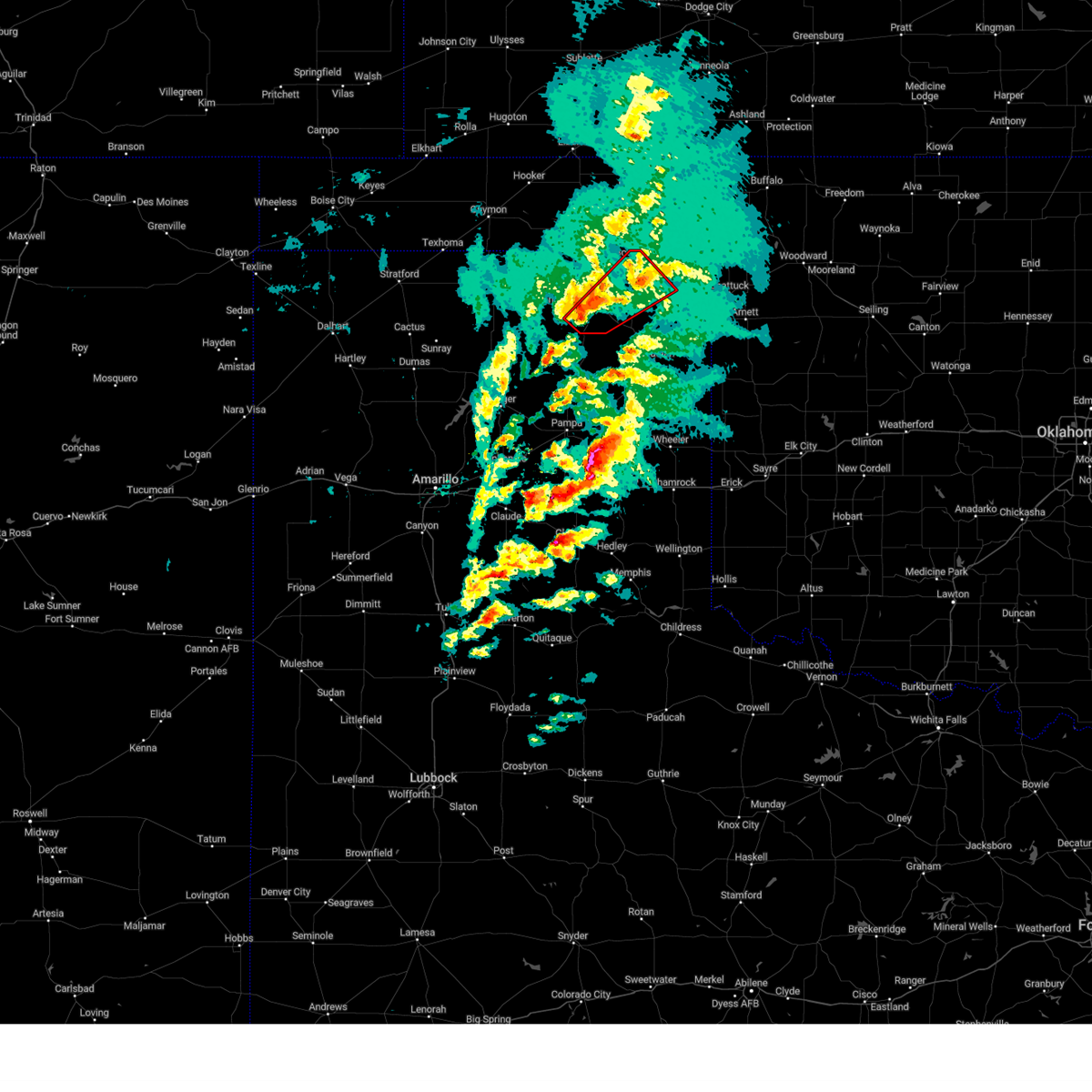 The tornado warning for northwestern lipscomb and southeastern ochiltree counties will expire at 545 pm cst, the storm which prompted the warning no longer appears capable of producing a tornado. therefore, the tornado warning will be allowed to expire. a tornado watch remains in effect until 900 pm cst for the panhandle of oklahoma, and the panhandle of texas. The tornado warning for northwestern lipscomb and southeastern ochiltree counties will expire at 545 pm cst, the storm which prompted the warning no longer appears capable of producing a tornado. therefore, the tornado warning will be allowed to expire. a tornado watch remains in effect until 900 pm cst for the panhandle of oklahoma, and the panhandle of texas.
|
| 2/26/2023 5:22 PM CST |
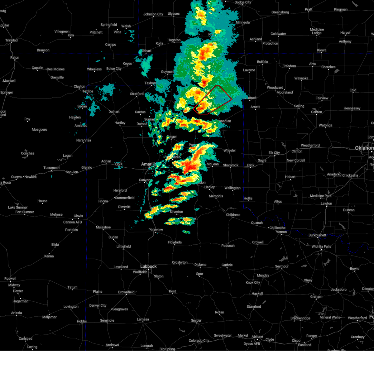 At 521 pm cst, a severe thunderstorm capable of producing a tornado was located 8 miles southwest of wolf creek park, or 17 miles south of perryton, moving northeast at 70 mph (radar indicated rotation). Hazards include tornado. Flying debris will be dangerous to those caught without shelter. mobile homes will be damaged or destroyed. damage to roofs, windows, and vehicles will occur. tree damage is likely. Locations impacted include, booker and wolf creek park. At 521 pm cst, a severe thunderstorm capable of producing a tornado was located 8 miles southwest of wolf creek park, or 17 miles south of perryton, moving northeast at 70 mph (radar indicated rotation). Hazards include tornado. Flying debris will be dangerous to those caught without shelter. mobile homes will be damaged or destroyed. damage to roofs, windows, and vehicles will occur. tree damage is likely. Locations impacted include, booker and wolf creek park.
|
| 2/26/2023 5:18 PM CST |
 At 518 pm cst, severe thunderstorms were located along a line extending from 7 miles northwest of floris to 6 miles southeast of bryans corner, moving northeast at 65 mph (radar indicated). Hazards include 70 mph wind gusts and penny size hail. Expect some tree damage. damage is likely to mobile homes, roofs, and outbuildings. locations impacted include, perryton, spearman, beaver, hooker, booker, tyrone, forgan, hardesty, elmwood, adams, farnsworth, boyd, waka, floris, bryans corner, baker, mocane, turpin and balko. thunderstorm damage threat, considerable hail threat, radar indicated max hail size, 0. 75in wind threat, radar indicated max wind gust, 70 mph. At 518 pm cst, severe thunderstorms were located along a line extending from 7 miles northwest of floris to 6 miles southeast of bryans corner, moving northeast at 65 mph (radar indicated). Hazards include 70 mph wind gusts and penny size hail. Expect some tree damage. damage is likely to mobile homes, roofs, and outbuildings. locations impacted include, perryton, spearman, beaver, hooker, booker, tyrone, forgan, hardesty, elmwood, adams, farnsworth, boyd, waka, floris, bryans corner, baker, mocane, turpin and balko. thunderstorm damage threat, considerable hail threat, radar indicated max hail size, 0. 75in wind threat, radar indicated max wind gust, 70 mph.
|
| 2/26/2023 5:11 PM CST |
 At 511 pm cst, a severe thunderstorm capable of producing a tornado was located 17 miles southeast of spearman, moving northeast at 60 mph (radar indicated rotation). Hazards include tornado and golf ball size hail. Flying debris will be dangerous to those caught without shelter. mobile homes will be damaged or destroyed. damage to roofs, windows, and vehicles will occur. tree damage is likely. Locations impacted include, perryton, booker and wolf creek park. At 511 pm cst, a severe thunderstorm capable of producing a tornado was located 17 miles southeast of spearman, moving northeast at 60 mph (radar indicated rotation). Hazards include tornado and golf ball size hail. Flying debris will be dangerous to those caught without shelter. mobile homes will be damaged or destroyed. damage to roofs, windows, and vehicles will occur. tree damage is likely. Locations impacted include, perryton, booker and wolf creek park.
|
| 2/26/2023 5:06 PM CST |
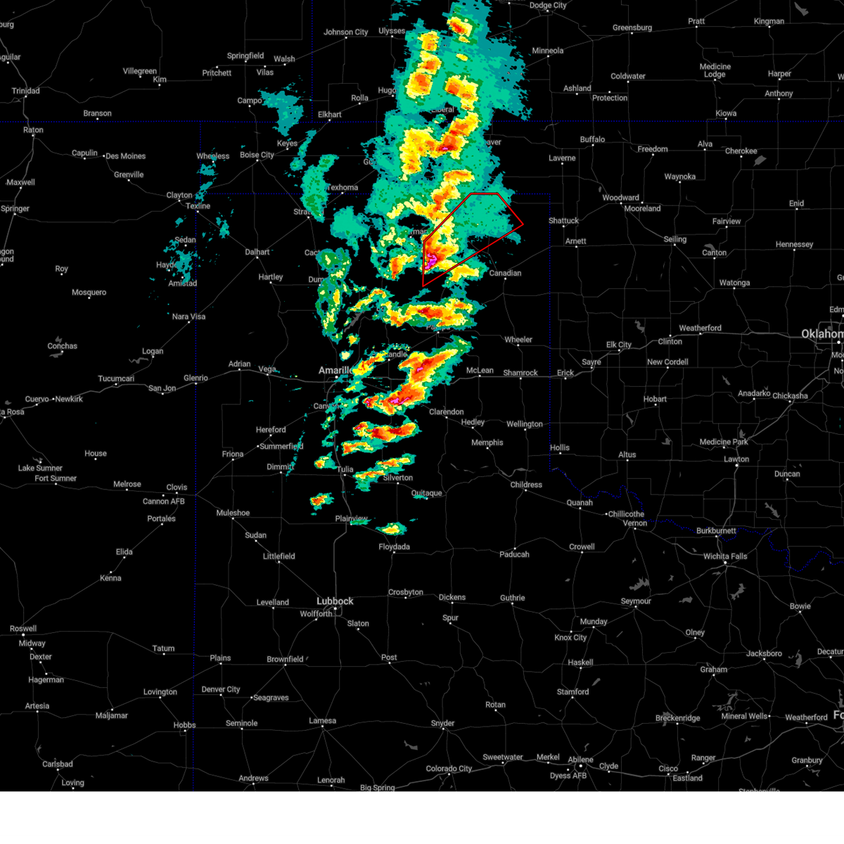 At 506 pm cst, a severe thunderstorm capable of producing a tornado was located 17 miles southeast of spearman, moving northeast at 60 mph (radar indicated rotation). Hazards include tornado. Flying debris will be dangerous to those caught without shelter. mobile homes will be damaged or destroyed. damage to roofs, windows, and vehicles will occur. tree damage is likely. Locations impacted include, perryton, booker and wolf creek park. At 506 pm cst, a severe thunderstorm capable of producing a tornado was located 17 miles southeast of spearman, moving northeast at 60 mph (radar indicated rotation). Hazards include tornado. Flying debris will be dangerous to those caught without shelter. mobile homes will be damaged or destroyed. damage to roofs, windows, and vehicles will occur. tree damage is likely. Locations impacted include, perryton, booker and wolf creek park.
|
| 2/26/2023 5:01 PM CST |
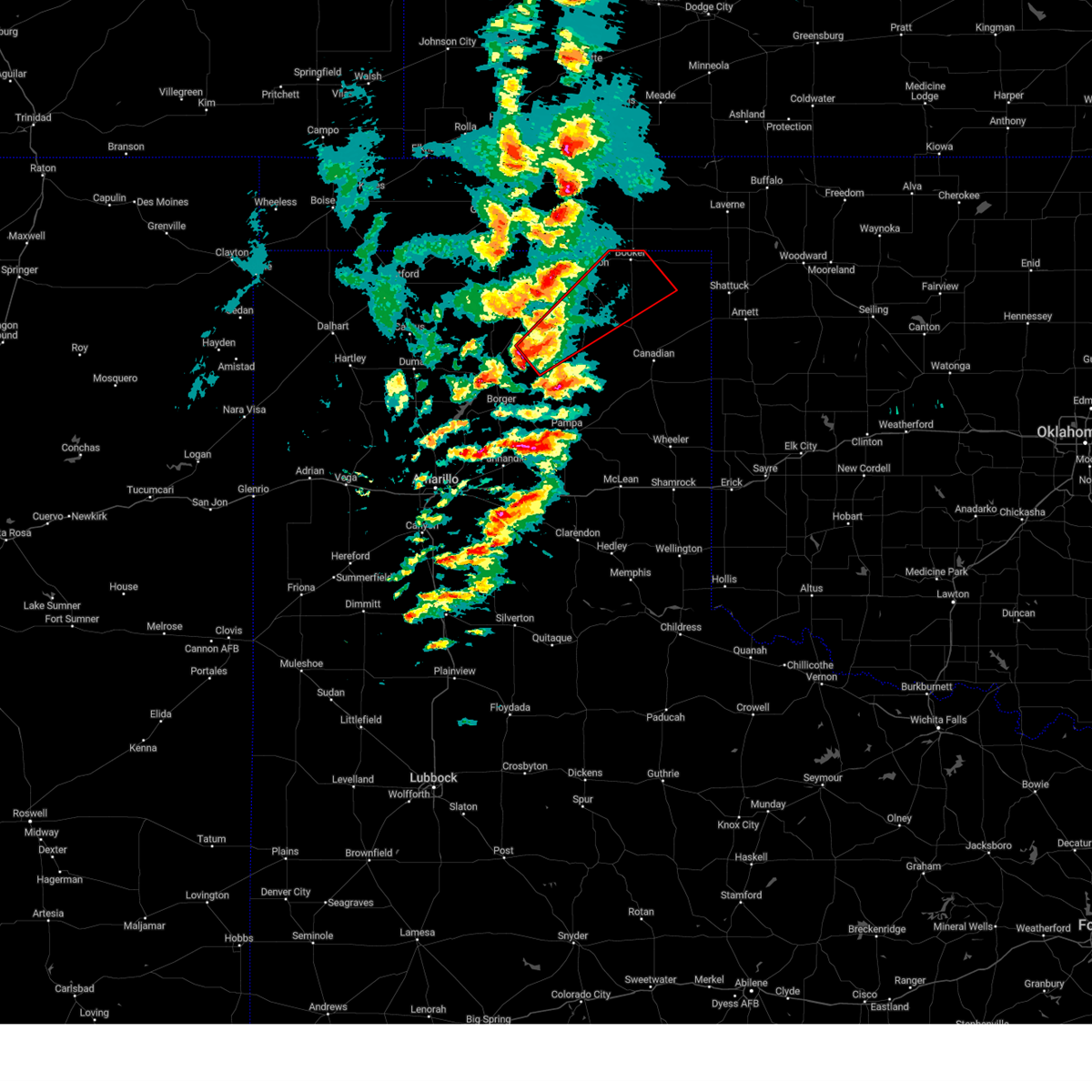 At 501 pm cst, a severe thunderstorm capable of producing a tornado was located 18 miles southeast of spearman, moving northeast at 60 mph (radar indicated rotation). Hazards include tornado and baseball size hail. Flying debris will be dangerous to those caught without shelter. mobile homes will be damaged or destroyed. damage to roofs, windows, and vehicles will occur. Tree damage is likely. At 501 pm cst, a severe thunderstorm capable of producing a tornado was located 18 miles southeast of spearman, moving northeast at 60 mph (radar indicated rotation). Hazards include tornado and baseball size hail. Flying debris will be dangerous to those caught without shelter. mobile homes will be damaged or destroyed. damage to roofs, windows, and vehicles will occur. Tree damage is likely.
|
| 2/26/2023 4:57 PM CST |
 At 457 pm cst, severe thunderstorms were located along a line extending from 5 miles north of waka to 16 miles east of pringle to near white deer, moving northeast at 60 mph (radar indicated). Hazards include two inch hail and 70 mph wind gusts. Expect some tree damage. damage is likely to mobile homes, roofs, and outbuildings. people and animals outdoors will be injured. expect hail damage to roofs, siding, windows, and vehicles. locations impacted include, pampa, borger, perryton, spearman, lipscomb, canadian, panhandle, miami, booker, white deer, skellytown, darrouzett, wolf creek park, farnsworth, waka, glazier, lora, kingsmill and codman. thunderstorm damage threat, considerable hail threat, radar indicated max hail size, 2. 00 in wind threat, radar indicated max wind gust, 70 mph. At 457 pm cst, severe thunderstorms were located along a line extending from 5 miles north of waka to 16 miles east of pringle to near white deer, moving northeast at 60 mph (radar indicated). Hazards include two inch hail and 70 mph wind gusts. Expect some tree damage. damage is likely to mobile homes, roofs, and outbuildings. people and animals outdoors will be injured. expect hail damage to roofs, siding, windows, and vehicles. locations impacted include, pampa, borger, perryton, spearman, lipscomb, canadian, panhandle, miami, booker, white deer, skellytown, darrouzett, wolf creek park, farnsworth, waka, glazier, lora, kingsmill and codman. thunderstorm damage threat, considerable hail threat, radar indicated max hail size, 2. 00 in wind threat, radar indicated max wind gust, 70 mph.
|
| 2/26/2023 4:50 PM CST |
 At 450 pm cst, severe thunderstorms were located along a line extending from 4 miles northwest of waka to 12 miles northeast of skellytown to white deer, moving northeast at 55 mph (radar indicated). Hazards include 70 mph wind gusts and quarter size hail. Expect some tree damage. damage is likely to mobile homes, roofs, and outbuildings. Hail damage to vehicles is expected. At 450 pm cst, severe thunderstorms were located along a line extending from 4 miles northwest of waka to 12 miles northeast of skellytown to white deer, moving northeast at 55 mph (radar indicated). Hazards include 70 mph wind gusts and quarter size hail. Expect some tree damage. damage is likely to mobile homes, roofs, and outbuildings. Hail damage to vehicles is expected.
|
| 2/26/2023 4:48 PM CST |
 At 448 pm cst, severe thunderstorms were located along a line extending from near liberal to 7 miles south of adams to near waka, moving northeast at 55 mph (radar indicated). Hazards include 70 mph wind gusts and quarter size hail. Expect some tree damage. damage is likely to mobile homes, roofs, and outbuildings. Hail damage to vehicles is expected. At 448 pm cst, severe thunderstorms were located along a line extending from near liberal to 7 miles south of adams to near waka, moving northeast at 55 mph (radar indicated). Hazards include 70 mph wind gusts and quarter size hail. Expect some tree damage. damage is likely to mobile homes, roofs, and outbuildings. Hail damage to vehicles is expected.
|
| 12/12/2022 8:58 PM CST |
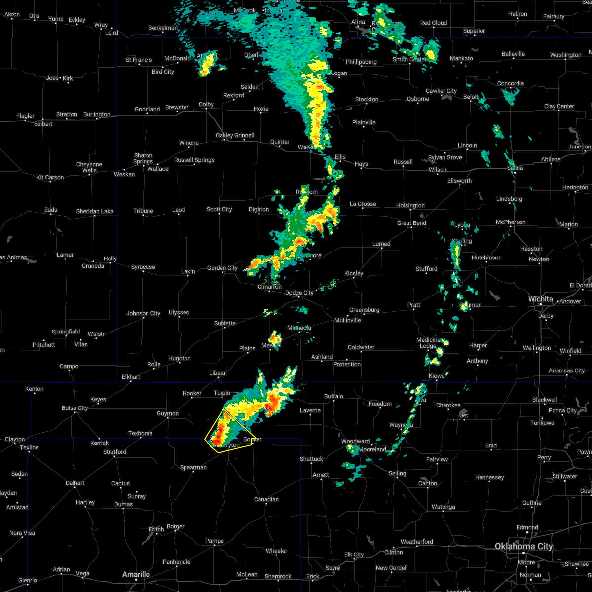 At 858 pm cst, a severe thunderstorm was located 7 miles southwest of bryans corner, or 10 miles north of perryton, moving northeast at 45 mph (radar indicated). Hazards include ping pong ball size hail and 60 mph wind gusts. Minor damage to roofs, siding, and trees is possible. people and animals outdoors will be injured. expect hail damage to roofs, siding, windows, and vehicles. Locations impacted include, perryton, bryans corner, balko and boyd. At 858 pm cst, a severe thunderstorm was located 7 miles southwest of bryans corner, or 10 miles north of perryton, moving northeast at 45 mph (radar indicated). Hazards include ping pong ball size hail and 60 mph wind gusts. Minor damage to roofs, siding, and trees is possible. people and animals outdoors will be injured. expect hail damage to roofs, siding, windows, and vehicles. Locations impacted include, perryton, bryans corner, balko and boyd.
|
| 12/12/2022 8:34 PM CST |
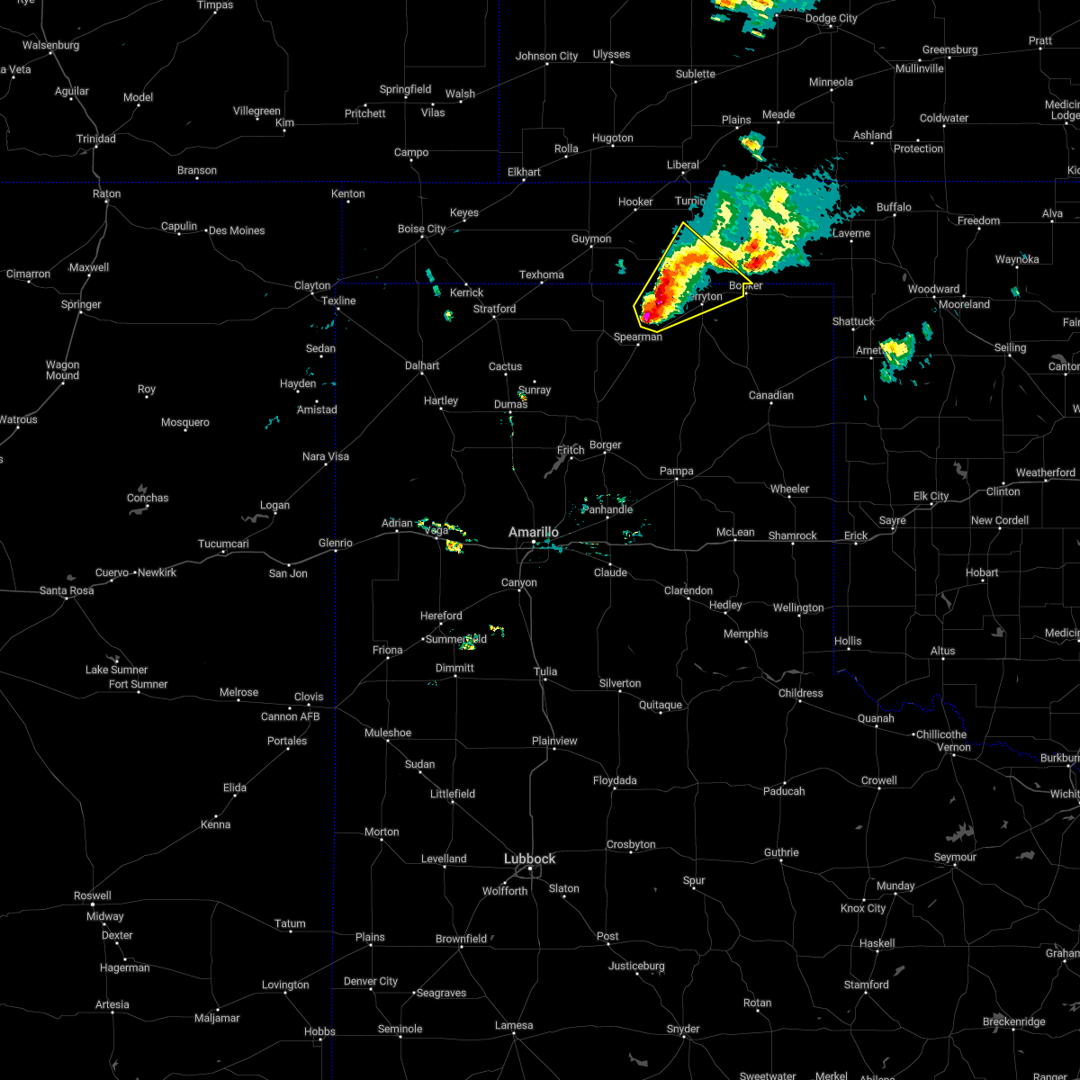 At 833 pm cst, a severe thunderstorm was located 7 miles northwest of farnsworth, or 12 miles west of perryton, moving northeast at 35 mph (radar indicated). Hazards include ping pong ball size hail and 60 mph wind gusts. Minor damage to roofs, siding, and trees is possible. people and animals outdoors will be injured. expect hail damage to roofs, siding, windows, and vehicles. Locations impacted include, perryton, waka, bryans corner, farnsworth, boyd and balko. At 833 pm cst, a severe thunderstorm was located 7 miles northwest of farnsworth, or 12 miles west of perryton, moving northeast at 35 mph (radar indicated). Hazards include ping pong ball size hail and 60 mph wind gusts. Minor damage to roofs, siding, and trees is possible. people and animals outdoors will be injured. expect hail damage to roofs, siding, windows, and vehicles. Locations impacted include, perryton, waka, bryans corner, farnsworth, boyd and balko.
|
| 12/12/2022 8:23 PM CST |
 At 822 pm cst, a severe thunderstorm was located 6 miles northwest of waka, or 13 miles northeast of spearman, moving northeast at 45 mph (radar indicated). Hazards include 60 mph wind gusts and half dollar size hail. Minor damage to roofs, siding, and trees is possible. hail damage to vehicles is expected. locations impacted include, perryton, spearman, bryans corner, farnsworth, boyd, waka and balko. hail threat, radar indicated max hail size, 1. 25 in wind threat, radar indicated max wind gust, 60 mph. At 822 pm cst, a severe thunderstorm was located 6 miles northwest of waka, or 13 miles northeast of spearman, moving northeast at 45 mph (radar indicated). Hazards include 60 mph wind gusts and half dollar size hail. Minor damage to roofs, siding, and trees is possible. hail damage to vehicles is expected. locations impacted include, perryton, spearman, bryans corner, farnsworth, boyd, waka and balko. hail threat, radar indicated max hail size, 1. 25 in wind threat, radar indicated max wind gust, 60 mph.
|
| 12/12/2022 8:20 PM CST |
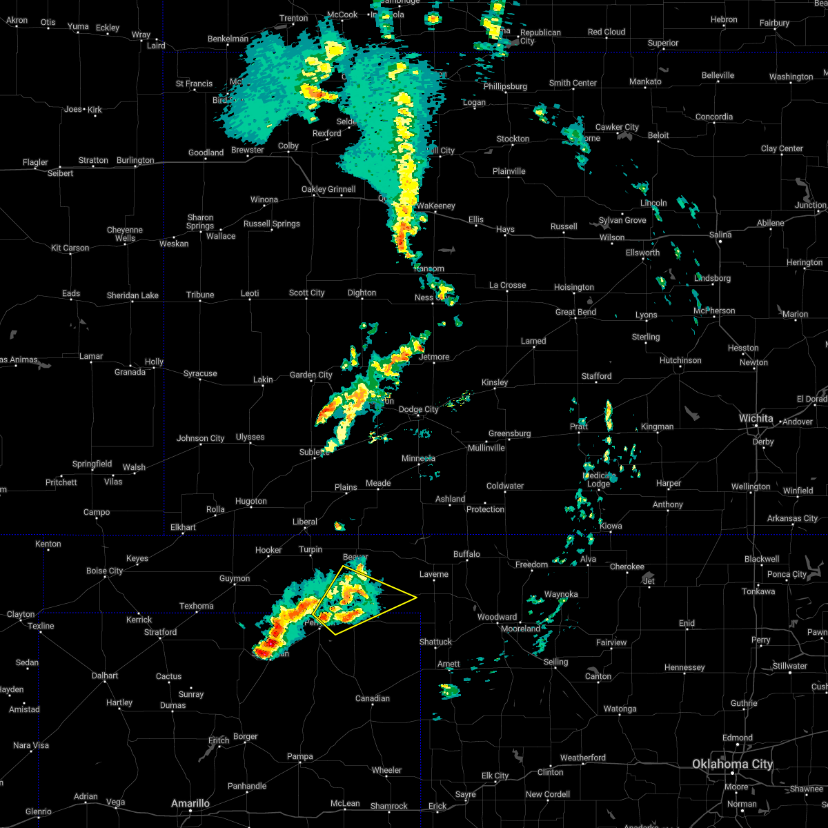 At 819 pm cst, a severe thunderstorm was located 4 miles south of beaver, moving northeast at 60 mph (radar indicated). Hazards include 60 mph wind gusts and quarter size hail. Minor damage to roofs, siding, and trees is possible. hail damage to vehicles is expected. Locations impacted include, booker, elmwood, slapout and balko. At 819 pm cst, a severe thunderstorm was located 4 miles south of beaver, moving northeast at 60 mph (radar indicated). Hazards include 60 mph wind gusts and quarter size hail. Minor damage to roofs, siding, and trees is possible. hail damage to vehicles is expected. Locations impacted include, booker, elmwood, slapout and balko.
|
| 12/12/2022 8:18 PM CST |
 At 817 pm cst, a severe thunderstorm was located 7 miles northwest of waka, or 9 miles north of spearman, moving northeast at 45 mph (radar indicated). Hazards include 60 mph wind gusts and quarter size hail. Minor damage to roofs, siding, and trees is possible. Hail damage to vehicles is expected. At 817 pm cst, a severe thunderstorm was located 7 miles northwest of waka, or 9 miles north of spearman, moving northeast at 45 mph (radar indicated). Hazards include 60 mph wind gusts and quarter size hail. Minor damage to roofs, siding, and trees is possible. Hail damage to vehicles is expected.
|
| 12/12/2022 7:52 PM CST |
 At 751 pm cst, a severe thunderstorm was located over perryton, moving northeast at 60 mph (radar indicated). Hazards include 60 mph wind gusts and quarter size hail. Minor damage to roofs, siding, and trees is possible. Hail damage to vehicles is expected. At 751 pm cst, a severe thunderstorm was located over perryton, moving northeast at 60 mph (radar indicated). Hazards include 60 mph wind gusts and quarter size hail. Minor damage to roofs, siding, and trees is possible. Hail damage to vehicles is expected.
|
| 12/12/2022 7:52 PM CST |
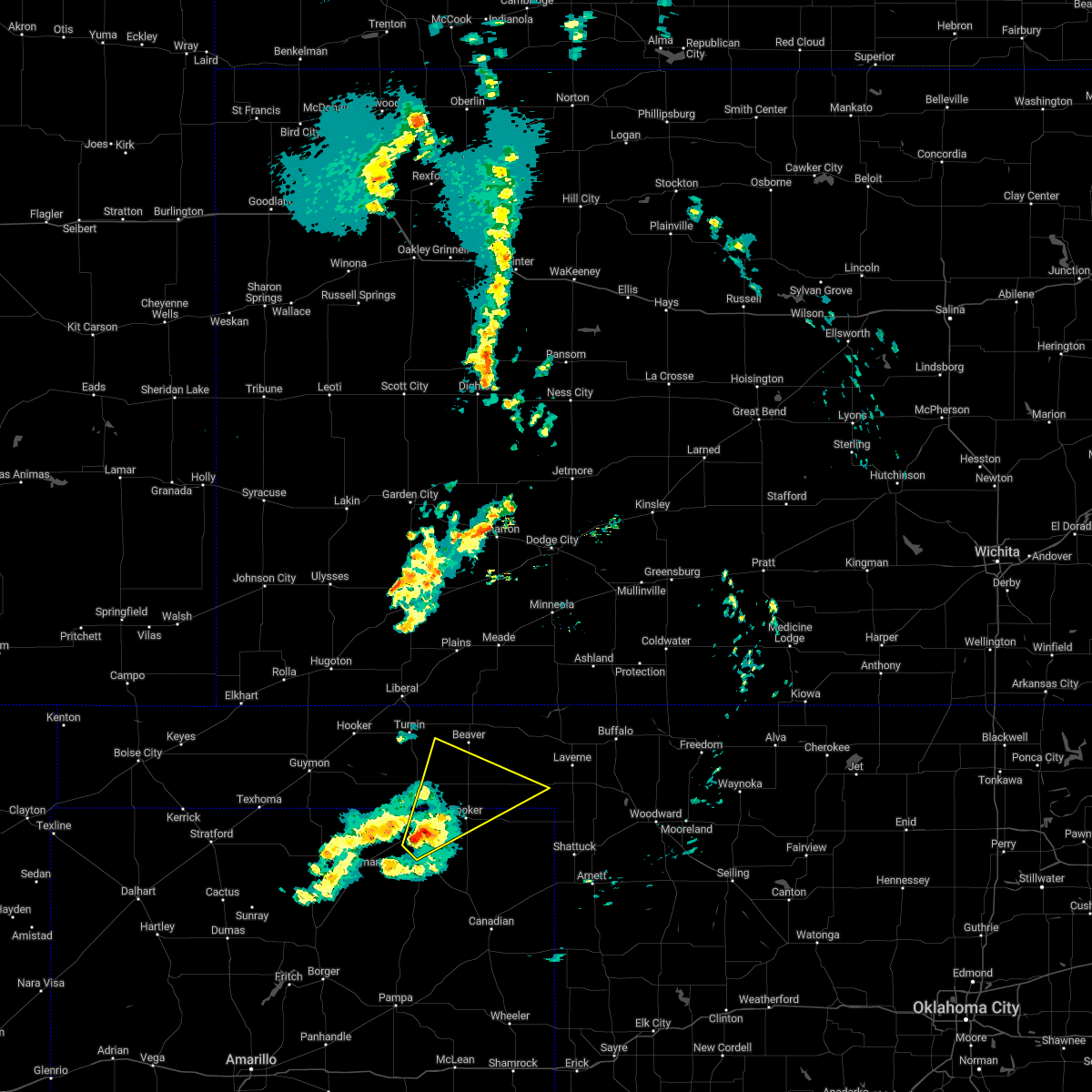 At 751 pm cst, a severe thunderstorm was located over perryton, moving northeast at 60 mph (radar indicated). Hazards include 60 mph wind gusts and quarter size hail. Minor damage to roofs, siding, and trees is possible. Hail damage to vehicles is expected. At 751 pm cst, a severe thunderstorm was located over perryton, moving northeast at 60 mph (radar indicated). Hazards include 60 mph wind gusts and quarter size hail. Minor damage to roofs, siding, and trees is possible. Hail damage to vehicles is expected.
|
| 11/4/2022 3:43 AM CDT |
 At 343 am cdt, a severe thunderstorm was located 10 miles south of wolf creek park, or 17 miles northwest of canadian, moving northeast at 65 mph (radar indicated). Hazards include 60 mph wind gusts and quarter size hail. Minor damage to roofs, siding, and trees is possible. Hail damage to vehicles is expected. At 343 am cdt, a severe thunderstorm was located 10 miles south of wolf creek park, or 17 miles northwest of canadian, moving northeast at 65 mph (radar indicated). Hazards include 60 mph wind gusts and quarter size hail. Minor damage to roofs, siding, and trees is possible. Hail damage to vehicles is expected.
|
| 8/29/2022 9:45 PM CDT |
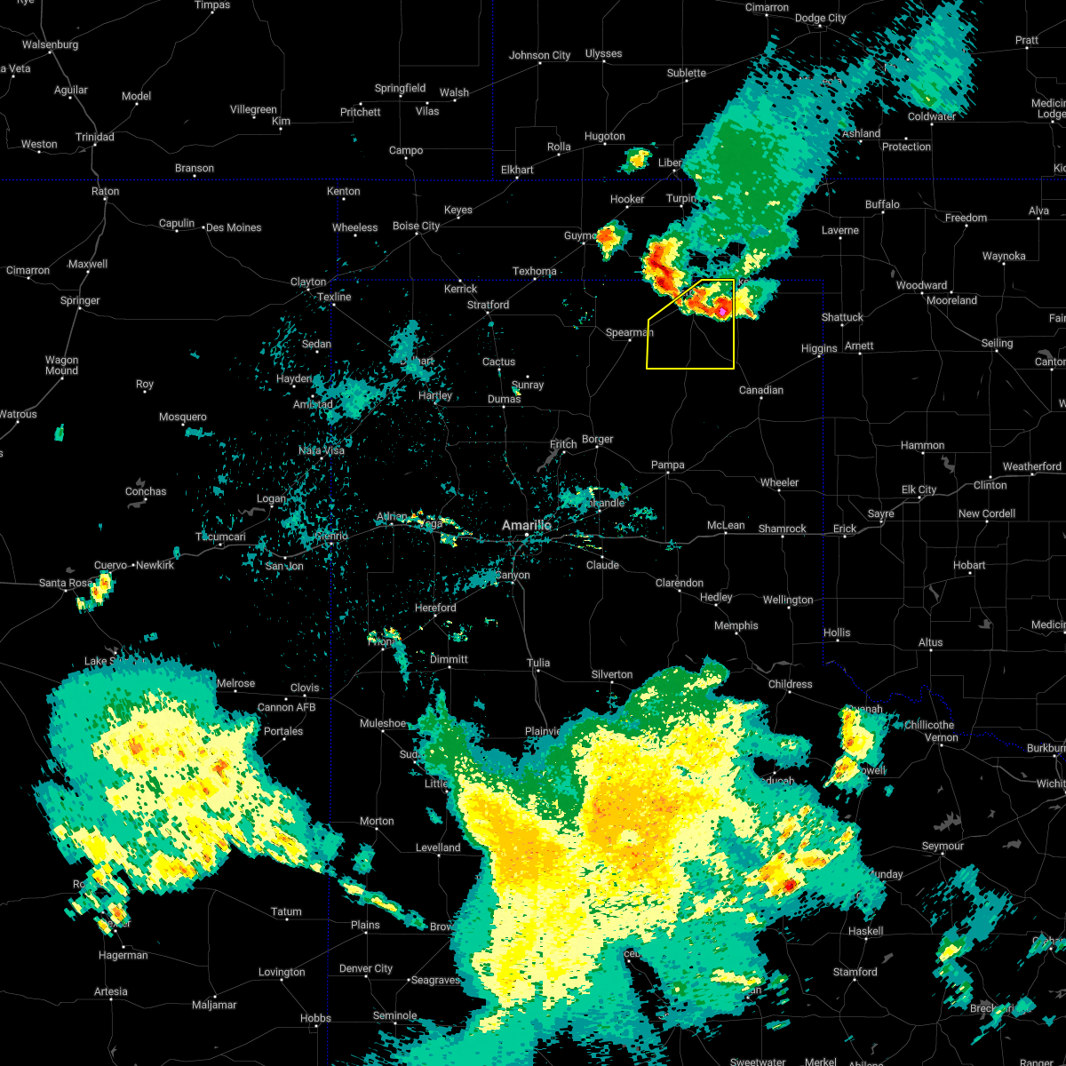 At 945 pm cdt, a severe thunderstorm was located 6 miles north of wolf creek park, or 10 miles southeast of perryton, moving southwest at 35 mph (radar indicated). Hazards include 60 mph wind gusts and quarter size hail. Minor damage to roofs, siding, and trees is possible. hail damage to vehicles is expected. locations impacted include, perryton, waka, wolf creek park and farnsworth. hail threat, radar indicated max hail size, 1. 00in wind threat, radar indicated max wind gust, 60 mph. At 945 pm cdt, a severe thunderstorm was located 6 miles north of wolf creek park, or 10 miles southeast of perryton, moving southwest at 35 mph (radar indicated). Hazards include 60 mph wind gusts and quarter size hail. Minor damage to roofs, siding, and trees is possible. hail damage to vehicles is expected. locations impacted include, perryton, waka, wolf creek park and farnsworth. hail threat, radar indicated max hail size, 1. 00in wind threat, radar indicated max wind gust, 60 mph.
|
| 8/29/2022 9:22 PM CDT |
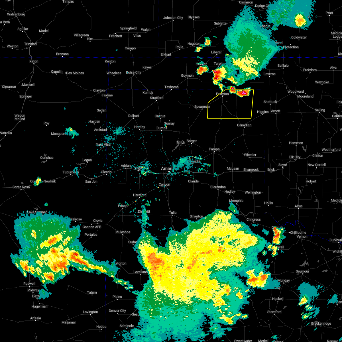 At 921 pm cdt, severe thunderstorms were located along a line extending from 4 miles northwest of booker to 3 miles west of darrouzett, moving southwest at 35 mph (radar indicated). Hazards include 60 mph wind gusts and quarter size hail. Minor damage to roofs, siding, and trees is possible. Hail damage to vehicles is expected. At 921 pm cdt, severe thunderstorms were located along a line extending from 4 miles northwest of booker to 3 miles west of darrouzett, moving southwest at 35 mph (radar indicated). Hazards include 60 mph wind gusts and quarter size hail. Minor damage to roofs, siding, and trees is possible. Hail damage to vehicles is expected.
|
| 7/11/2022 9:04 PM CDT |
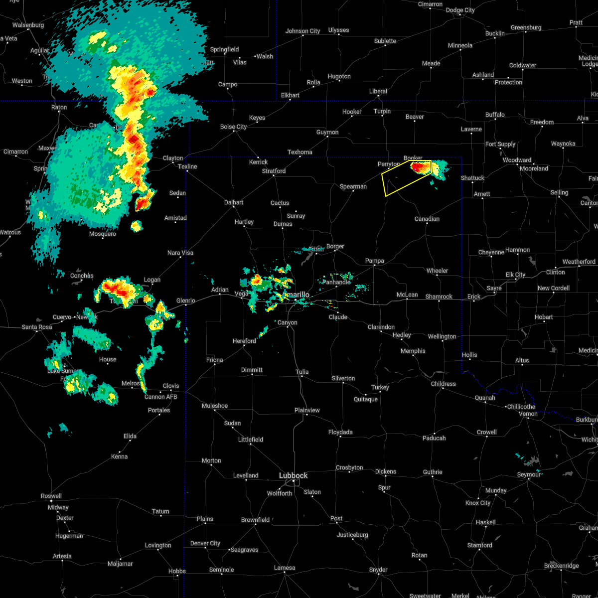 At 904 pm cdt, a severe thunderstorm was located 5 miles southeast of booker, or 16 miles northwest of lipscomb, moving southwest at 15 mph (radar indicated). Hazards include 60 mph wind gusts. Minor damage to roofs, siding, and trees is possible. locations impacted include, perryton and booker. hail threat, radar indicated max hail size, <. 75 in wind threat, radar indicated max wind gust, 60 mph. At 904 pm cdt, a severe thunderstorm was located 5 miles southeast of booker, or 16 miles northwest of lipscomb, moving southwest at 15 mph (radar indicated). Hazards include 60 mph wind gusts. Minor damage to roofs, siding, and trees is possible. locations impacted include, perryton and booker. hail threat, radar indicated max hail size, <. 75 in wind threat, radar indicated max wind gust, 60 mph.
|
| 7/11/2022 8:51 PM CDT |
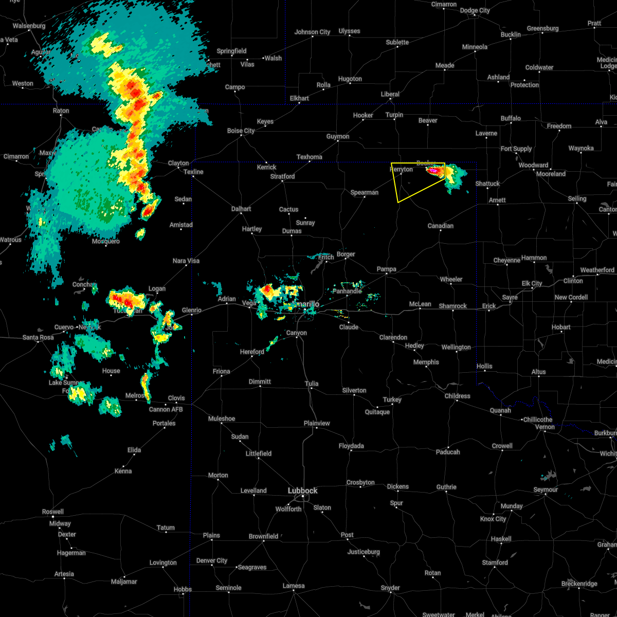 At 851 pm cdt, a severe thunderstorm was located near booker, or 17 miles east of perryton, moving west at 20 mph (radar indicated). Hazards include 60 mph wind gusts and quarter size hail. Minor damage to roofs, siding, and trees is possible. Hail damage to vehicles is expected. At 851 pm cdt, a severe thunderstorm was located near booker, or 17 miles east of perryton, moving west at 20 mph (radar indicated). Hazards include 60 mph wind gusts and quarter size hail. Minor damage to roofs, siding, and trees is possible. Hail damage to vehicles is expected.
|
| 7/6/2022 5:15 PM CDT |
 At 514 pm cdt, a severe thunderstorm was located over booker, or 13 miles east of perryton, moving northeast at 20 mph (radar indicated). Hazards include 70 mph wind gusts and quarter size hail. Expect some tree damage. damage is likely to mobile homes, roofs, and outbuildings. Hail damage to vehicles is expected. At 514 pm cdt, a severe thunderstorm was located over booker, or 13 miles east of perryton, moving northeast at 20 mph (radar indicated). Hazards include 70 mph wind gusts and quarter size hail. Expect some tree damage. damage is likely to mobile homes, roofs, and outbuildings. Hail damage to vehicles is expected.
|
| 7/6/2022 5:15 PM CDT |
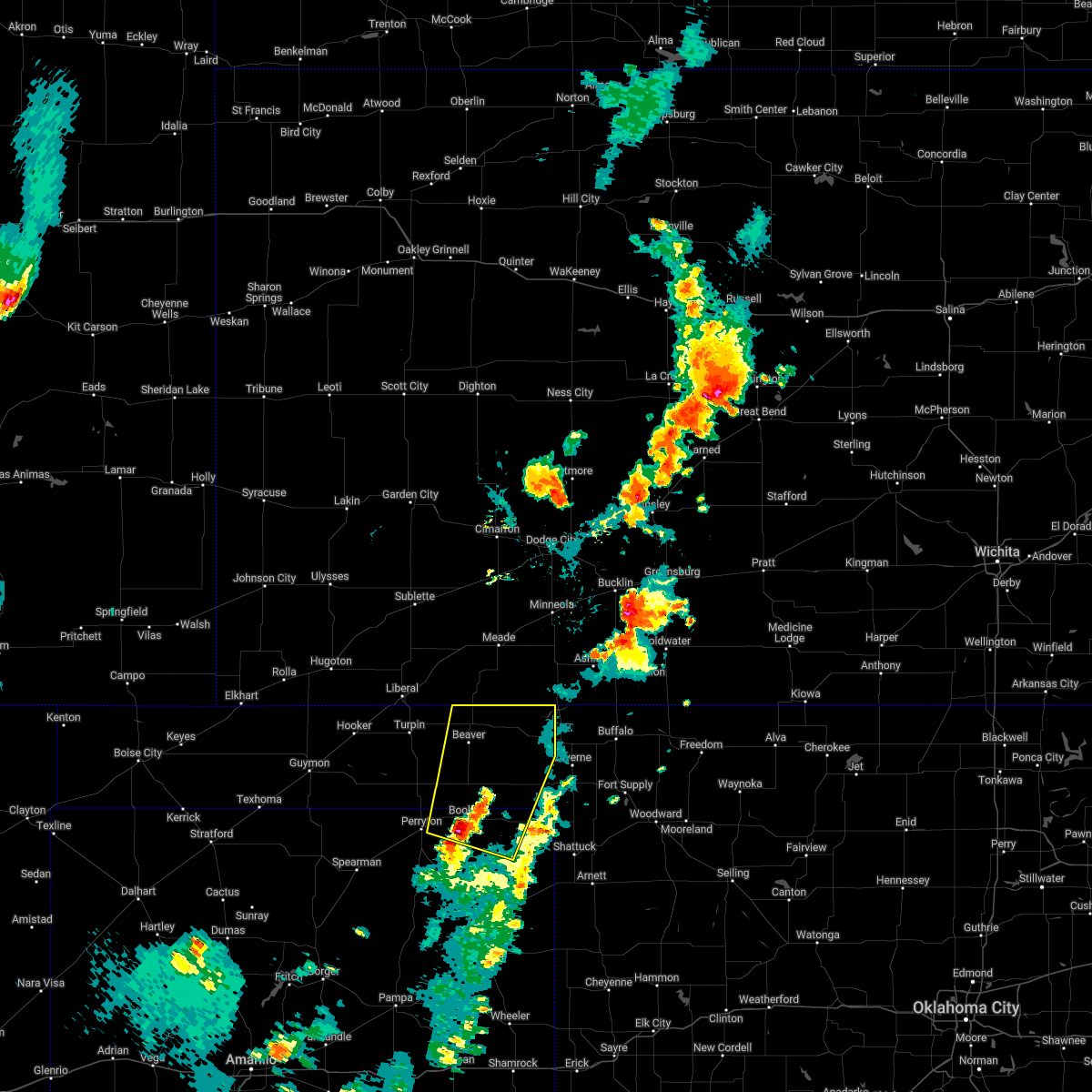 At 514 pm cdt, a severe thunderstorm was located over booker, or 13 miles east of perryton, moving northeast at 20 mph (radar indicated). Hazards include 70 mph wind gusts and quarter size hail. Expect some tree damage. damage is likely to mobile homes, roofs, and outbuildings. Hail damage to vehicles is expected. At 514 pm cdt, a severe thunderstorm was located over booker, or 13 miles east of perryton, moving northeast at 20 mph (radar indicated). Hazards include 70 mph wind gusts and quarter size hail. Expect some tree damage. damage is likely to mobile homes, roofs, and outbuildings. Hail damage to vehicles is expected.
|
| 6/8/2022 5:25 AM CDT |
 At 525 am cdt, severe thunderstorms were located along a line extending from near wolf creek park to spearman to 13 miles northeast of sunray to 8 miles east of conlen, moving southeast at 25 mph (radar indicated). Hazards include 70 mph wind gusts and ping pong ball size hail. Expect some tree damage. damage is likely to mobile homes, roofs, and outbuildings. people and animals outdoors will be injured. Expect hail damage to roofs, siding, windows, and vehicles. At 525 am cdt, severe thunderstorms were located along a line extending from near wolf creek park to spearman to 13 miles northeast of sunray to 8 miles east of conlen, moving southeast at 25 mph (radar indicated). Hazards include 70 mph wind gusts and ping pong ball size hail. Expect some tree damage. damage is likely to mobile homes, roofs, and outbuildings. people and animals outdoors will be injured. Expect hail damage to roofs, siding, windows, and vehicles.
|
| 6/8/2022 5:01 AM CDT |
 At 501 am cdt, severe thunderstorms were located along a line extending from near booker to 9 miles northwest of waka to 3 miles southwest of texhoma, moving southeast at 45 mph (radar indicated). Hazards include 70 mph wind gusts and ping pong ball size hail. Expect some tree damage. damage is likely to mobile homes, roofs, and outbuildings. people and animals outdoors will be injured. expect hail damage to roofs, siding, windows, and vehicles. locations impacted include, guymon, perryton, spearman, lipscomb, stratford, booker, goodwell, gruver, darrouzett, hardesty, wolf creek park, elmwood, adams, farnsworth, boyd, waka, bryans corner, balko, morse and texhoma. thunderstorm damage threat, considerable hail threat, radar indicated max hail size, 1. 50 in wind threat, radar indicated max wind gust, 70 mph. At 501 am cdt, severe thunderstorms were located along a line extending from near booker to 9 miles northwest of waka to 3 miles southwest of texhoma, moving southeast at 45 mph (radar indicated). Hazards include 70 mph wind gusts and ping pong ball size hail. Expect some tree damage. damage is likely to mobile homes, roofs, and outbuildings. people and animals outdoors will be injured. expect hail damage to roofs, siding, windows, and vehicles. locations impacted include, guymon, perryton, spearman, lipscomb, stratford, booker, goodwell, gruver, darrouzett, hardesty, wolf creek park, elmwood, adams, farnsworth, boyd, waka, bryans corner, balko, morse and texhoma. thunderstorm damage threat, considerable hail threat, radar indicated max hail size, 1. 50 in wind threat, radar indicated max wind gust, 70 mph.
|
| 6/8/2022 4:42 AM CDT |
 At 442 am cdt, severe thunderstorms were located along a line extending from 4 miles southeast of elmwood to 7 miles south of hardesty to 6 miles east of griggs, moving southeast at 55 mph (radar indicated). Hazards include 70 mph wind gusts and half dollar size hail. Expect some tree damage. damage is likely to mobile homes, roofs, and outbuildings. hail damage to vehicles is expected. locations impacted include, guymon, perryton, spearman, lipscomb, stratford, beaver, booker, goodwell, gruver, optima, darrouzett, hardesty, wolf creek park, elmwood, adams, farnsworth, boyd, waka, eva and bryans corner. thunderstorm damage threat, considerable hail threat, radar indicated max hail size, 1. 25 in wind threat, radar indicated max wind gust, 70 mph. At 442 am cdt, severe thunderstorms were located along a line extending from 4 miles southeast of elmwood to 7 miles south of hardesty to 6 miles east of griggs, moving southeast at 55 mph (radar indicated). Hazards include 70 mph wind gusts and half dollar size hail. Expect some tree damage. damage is likely to mobile homes, roofs, and outbuildings. hail damage to vehicles is expected. locations impacted include, guymon, perryton, spearman, lipscomb, stratford, beaver, booker, goodwell, gruver, optima, darrouzett, hardesty, wolf creek park, elmwood, adams, farnsworth, boyd, waka, eva and bryans corner. thunderstorm damage threat, considerable hail threat, radar indicated max hail size, 1. 25 in wind threat, radar indicated max wind gust, 70 mph.
|
| 6/8/2022 4:28 AM CDT |
 At 427 am cdt, severe thunderstorms were located along a line extending from 3 miles east of elmwood to 5 miles southeast of guymon to 9 miles south of keyes, moving southeast at 55 mph (radar indicated). Hazards include 70 mph wind gusts and half dollar size hail. Expect some tree damage. damage is likely to mobile homes, roofs, and outbuildings. Hail damage to vehicles is expected. At 427 am cdt, severe thunderstorms were located along a line extending from 3 miles east of elmwood to 5 miles southeast of guymon to 9 miles south of keyes, moving southeast at 55 mph (radar indicated). Hazards include 70 mph wind gusts and half dollar size hail. Expect some tree damage. damage is likely to mobile homes, roofs, and outbuildings. Hail damage to vehicles is expected.
|
| 6/7/2022 2:13 AM CDT |
 The severe thunderstorm warning for beaver, lipscomb and eastern ochiltree counties will expire at 215 am cdt, the storms which prompted the warning have weakened below severe limits, and no longer pose an immediate threat to life or property. therefore, the warning will be allowed to expire. however small hail and gusty winds are still possible with these thunderstorms. a severe thunderstorm watch remains in effect until 500 am cdt for the panhandle of oklahoma. a severe thunderstorm watch also remains in effect until 500 am cdt for the panhandle of texas. The severe thunderstorm warning for beaver, lipscomb and eastern ochiltree counties will expire at 215 am cdt, the storms which prompted the warning have weakened below severe limits, and no longer pose an immediate threat to life or property. therefore, the warning will be allowed to expire. however small hail and gusty winds are still possible with these thunderstorms. a severe thunderstorm watch remains in effect until 500 am cdt for the panhandle of oklahoma. a severe thunderstorm watch also remains in effect until 500 am cdt for the panhandle of texas.
|
| 6/7/2022 1:47 AM CDT |
 At 147 am cdt, severe thunderstorms were located along a line extending from 8 miles east of beaver to 6 miles west of lipscomb to 9 miles south of wolf creek park, moving southeast at 50 mph (radar indicated). Hazards include 60 mph wind gusts and penny size hail. Minor damage to roofs, siding, and trees is possible. locations impacted include, lipscomb, beaver, booker, forgan, follett, darrouzett, gate, knowles, wolf creek park, elmwood, mocane, slapout and balko. hail threat, radar indicated max hail size, 0. 75in wind threat, radar indicated max wind gust, 60 mph. At 147 am cdt, severe thunderstorms were located along a line extending from 8 miles east of beaver to 6 miles west of lipscomb to 9 miles south of wolf creek park, moving southeast at 50 mph (radar indicated). Hazards include 60 mph wind gusts and penny size hail. Minor damage to roofs, siding, and trees is possible. locations impacted include, lipscomb, beaver, booker, forgan, follett, darrouzett, gate, knowles, wolf creek park, elmwood, mocane, slapout and balko. hail threat, radar indicated max hail size, 0. 75in wind threat, radar indicated max wind gust, 60 mph.
|
| 6/7/2022 1:27 AM CDT |
 At 126 am cdt, severe thunderstorms were located along a line extending from mocane to 7 miles southwest of booker to 6 miles southeast of waka, moving east at 60 mph (radar indicated). Hazards include 60 mph wind gusts and penny size hail. Minor damage to roofs, siding, and trees is possible. locations impacted include, perryton, spearman, lipscomb, beaver, booker, forgan, follett, darrouzett, gate, knowles, wolf creek park, elmwood, farnsworth, waka, mocane, slapout and balko. hail threat, radar indicated max hail size, 0. 75in wind threat, radar indicated max wind gust, 60 mph. At 126 am cdt, severe thunderstorms were located along a line extending from mocane to 7 miles southwest of booker to 6 miles southeast of waka, moving east at 60 mph (radar indicated). Hazards include 60 mph wind gusts and penny size hail. Minor damage to roofs, siding, and trees is possible. locations impacted include, perryton, spearman, lipscomb, beaver, booker, forgan, follett, darrouzett, gate, knowles, wolf creek park, elmwood, farnsworth, waka, mocane, slapout and balko. hail threat, radar indicated max hail size, 0. 75in wind threat, radar indicated max wind gust, 60 mph.
|
| 6/7/2022 12:47 AM CDT |
 At 1247 am cdt, severe thunderstorms were located along a line extending from 6 miles east of adams to 5 miles south of hardesty to 12 miles north of gruver, moving southeast at 55 mph (radar indicated). Hazards include 70 mph wind gusts and quarter size hail. Expect some tree damage. damage is likely to mobile homes, roofs, and outbuildings. Hail damage to vehicles is expected. At 1247 am cdt, severe thunderstorms were located along a line extending from 6 miles east of adams to 5 miles south of hardesty to 12 miles north of gruver, moving southeast at 55 mph (radar indicated). Hazards include 70 mph wind gusts and quarter size hail. Expect some tree damage. damage is likely to mobile homes, roofs, and outbuildings. Hail damage to vehicles is expected.
|
| 5/19/2022 12:01 AM CDT |
 At 1201 am cdt, automated weather equipment reported severe thunderstorms were located along a line extending from 8 miles southwest of medicine lodge to gage, moving east at 55 mph (automated weather equipment). Hazards include 60 mph wind gusts and quarter size hail. Minor damage to roofs, siding, and trees is possible. hail damage to vehicles is expected. locations impacted include, lipscomb, canadian, booker, follett, higgins, darrouzett, glazier and lake marvin. hail threat, radar indicated max hail size, 1. 00in wind threat, radar indicated max wind gust, 60 mph. At 1201 am cdt, automated weather equipment reported severe thunderstorms were located along a line extending from 8 miles southwest of medicine lodge to gage, moving east at 55 mph (automated weather equipment). Hazards include 60 mph wind gusts and quarter size hail. Minor damage to roofs, siding, and trees is possible. hail damage to vehicles is expected. locations impacted include, lipscomb, canadian, booker, follett, higgins, darrouzett, glazier and lake marvin. hail threat, radar indicated max hail size, 1. 00in wind threat, radar indicated max wind gust, 60 mph.
|
| 5/18/2022 11:46 PM CDT |
 At 1146 pm cdt, automated weather equipment reported severe thunderstorms were located along a line extending from 9 miles north of aetna to 7 miles northwest of shattuck, moving east at 55 mph (automated weather equipment). Hazards include 60 mph wind gusts and quarter size hail. Minor damage to roofs, siding, and trees is possible. hail damage to vehicles is expected. locations impacted include, perryton, lipscomb, canadian, beaver, booker, forgan, follett, higgins, darrouzett, gate, knowles, wolf creek park, elmwood, boyd, floris, glazier, lake marvin, bryans corner, mocane and slapout. hail threat, radar indicated max hail size, 1. 00in wind threat, radar indicated max wind gust, 60 mph. At 1146 pm cdt, automated weather equipment reported severe thunderstorms were located along a line extending from 9 miles north of aetna to 7 miles northwest of shattuck, moving east at 55 mph (automated weather equipment). Hazards include 60 mph wind gusts and quarter size hail. Minor damage to roofs, siding, and trees is possible. hail damage to vehicles is expected. locations impacted include, perryton, lipscomb, canadian, beaver, booker, forgan, follett, higgins, darrouzett, gate, knowles, wolf creek park, elmwood, boyd, floris, glazier, lake marvin, bryans corner, mocane and slapout. hail threat, radar indicated max hail size, 1. 00in wind threat, radar indicated max wind gust, 60 mph.
|
| 5/18/2022 11:27 PM CDT |
 At 1127 pm cdt, automated weather equipment reported severe thunderstorms were located along a line extending from 7 miles south of wilmore to 7 miles south of darrouzett, moving east at 55 mph (automated weather equipment). Hazards include 60 mph wind gusts and penny size hail. Minor damage to roofs, siding, and trees is possible. locations impacted include, perryton, lipscomb, canadian, beaver, booker, forgan, follett, higgins, darrouzett, gate, knowles, wolf creek park, elmwood, farnsworth, boyd, waka, floris, glazier, lake marvin and bryans corner. hail threat, radar indicated max hail size, 0. 75in wind threat, radar indicated max wind gust, 60 mph. At 1127 pm cdt, automated weather equipment reported severe thunderstorms were located along a line extending from 7 miles south of wilmore to 7 miles south of darrouzett, moving east at 55 mph (automated weather equipment). Hazards include 60 mph wind gusts and penny size hail. Minor damage to roofs, siding, and trees is possible. locations impacted include, perryton, lipscomb, canadian, beaver, booker, forgan, follett, higgins, darrouzett, gate, knowles, wolf creek park, elmwood, farnsworth, boyd, waka, floris, glazier, lake marvin and bryans corner. hail threat, radar indicated max hail size, 0. 75in wind threat, radar indicated max wind gust, 60 mph.
|
| 5/18/2022 11:25 PM CDT |
 At 1125 pm cdt, automated weather equipment reported severe thunderstorms were located along a line extending from 7 miles south of wilmore to 7 miles south of darrouzett, moving east at 55 mph (automated weather equipment). Hazards include 60 mph wind gusts and penny size hail. Minor damage to roofs, siding, and trees is possible. locations impacted include, perryton, spearman, lipscomb, canadian, beaver, booker, gruver, forgan, follett, higgins, darrouzett, hardesty, gate, knowles, wolf creek park, lake marvin, slapout, balko, elmwood and farnsworth. hail threat, radar indicated max hail size, 0. 75in wind threat, radar indicated max wind gust, 60 mph. At 1125 pm cdt, automated weather equipment reported severe thunderstorms were located along a line extending from 7 miles south of wilmore to 7 miles south of darrouzett, moving east at 55 mph (automated weather equipment). Hazards include 60 mph wind gusts and penny size hail. Minor damage to roofs, siding, and trees is possible. locations impacted include, perryton, spearman, lipscomb, canadian, beaver, booker, gruver, forgan, follett, higgins, darrouzett, hardesty, gate, knowles, wolf creek park, lake marvin, slapout, balko, elmwood and farnsworth. hail threat, radar indicated max hail size, 0. 75in wind threat, radar indicated max wind gust, 60 mph.
|
| 5/18/2022 10:58 PM CDT |
 At 1057 pm cdt, severe thunderstorms were located along a line extending from 6 miles north of sitka to 4 miles east of perryton, moving east at 55 mph (radar indicated). Hazards include 60 mph wind gusts and penny size hail. minor damage to roofs, siding, and trees is possible At 1057 pm cdt, severe thunderstorms were located along a line extending from 6 miles north of sitka to 4 miles east of perryton, moving east at 55 mph (radar indicated). Hazards include 60 mph wind gusts and penny size hail. minor damage to roofs, siding, and trees is possible
|
| 5/18/2022 10:47 PM CDT |
 At 1047 pm cdt, automated weather equipment reported severe thunderstorms were located along a line extending from 6 miles north of ashland to 4 miles west of perryton, moving east at 55 mph (automated weather equipment). Hazards include 60 mph wind gusts. Minor damage to roofs, siding, and trees is possible. locations impacted include, perryton, beaver, booker, gruver, forgan, hardesty, gate, knowles, wolf creek park, elmwood, adams, farnsworth, boyd, waka, floris, bryans corner, mocane, turpin and balko. hail threat, radar indicated max hail size, <. 75 in wind threat, radar indicated max wind gust, 60 mph. At 1047 pm cdt, automated weather equipment reported severe thunderstorms were located along a line extending from 6 miles north of ashland to 4 miles west of perryton, moving east at 55 mph (automated weather equipment). Hazards include 60 mph wind gusts. Minor damage to roofs, siding, and trees is possible. locations impacted include, perryton, beaver, booker, gruver, forgan, hardesty, gate, knowles, wolf creek park, elmwood, adams, farnsworth, boyd, waka, floris, bryans corner, mocane, turpin and balko. hail threat, radar indicated max hail size, <. 75 in wind threat, radar indicated max wind gust, 60 mph.
|
| 5/18/2022 10:34 PM CDT |
 At 1034 pm cdt, automated weather equipment reported severe thunderstorms were located along a line extending from 10 miles south of minneola to 8 miles northwest of farnsworth, moving east at 55 mph (automated weather equipment). Hazards include 60 mph wind gusts. Minor damage to roofs, siding, and trees is possible. locations impacted include, guymon, perryton, beaver, hooker, booker, gruver, tyrone, forgan, optima, hardesty, gate, knowles, wolf creek park, elmwood, adams, farnsworth, boyd, waka, floris and bryans corner. hail threat, radar indicated max hail size, <. 75 in wind threat, radar indicated max wind gust, 60 mph. At 1034 pm cdt, automated weather equipment reported severe thunderstorms were located along a line extending from 10 miles south of minneola to 8 miles northwest of farnsworth, moving east at 55 mph (automated weather equipment). Hazards include 60 mph wind gusts. Minor damage to roofs, siding, and trees is possible. locations impacted include, guymon, perryton, beaver, hooker, booker, gruver, tyrone, forgan, optima, hardesty, gate, knowles, wolf creek park, elmwood, adams, farnsworth, boyd, waka, floris and bryans corner. hail threat, radar indicated max hail size, <. 75 in wind threat, radar indicated max wind gust, 60 mph.
|
| 5/18/2022 10:20 PM CDT |
 At 1020 pm cdt, automated weather equipment reported severe thunderstorms were located along a line extending from 4 miles south of fowler to 13 miles southwest of hardesty, moving east at 55 mph (automated weather equipment). Hazards include 60 mph wind gusts. Minor damage to roofs, siding, and trees is possible. locations impacted include, guymon, perryton, beaver, hooker, booker, goodwell, gruver, tyrone, forgan, optima, hardesty, gate, knowles, wolf creek park, baker, balko, elmwood, hough, adams and farnsworth. hail threat, radar indicated max hail size, <. 75 in wind threat, radar indicated max wind gust, 60 mph. At 1020 pm cdt, automated weather equipment reported severe thunderstorms were located along a line extending from 4 miles south of fowler to 13 miles southwest of hardesty, moving east at 55 mph (automated weather equipment). Hazards include 60 mph wind gusts. Minor damage to roofs, siding, and trees is possible. locations impacted include, guymon, perryton, beaver, hooker, booker, goodwell, gruver, tyrone, forgan, optima, hardesty, gate, knowles, wolf creek park, baker, balko, elmwood, hough, adams and farnsworth. hail threat, radar indicated max hail size, <. 75 in wind threat, radar indicated max wind gust, 60 mph.
|
| 5/18/2022 10:01 PM CDT |
 At 1001 pm cdt, severe thunderstorms were located along a line extending from near missler to 10 miles southeast of goodwell, moving east at 55 mph (radar indicated). Hazards include 60 mph wind gusts. minor damage to roofs, siding, and trees is possible At 1001 pm cdt, severe thunderstorms were located along a line extending from near missler to 10 miles southeast of goodwell, moving east at 55 mph (radar indicated). Hazards include 60 mph wind gusts. minor damage to roofs, siding, and trees is possible
|
| 5/10/2022 8:27 PM CDT |
 At 826 pm cdt, severe thunderstorms were located along a line extending from 16 miles north of codman to 6 miles southeast of miami to 5 miles southwest of kellerville to 7 miles north of brice, moving northeast at 55 mph (radar indicated). Hazards include 70 mph wind gusts and quarter size hail. Expect some tree damage. damage is likely to mobile homes, roofs, and outbuildings. Hail damage to vehicles is expected. At 826 pm cdt, severe thunderstorms were located along a line extending from 16 miles north of codman to 6 miles southeast of miami to 5 miles southwest of kellerville to 7 miles north of brice, moving northeast at 55 mph (radar indicated). Hazards include 70 mph wind gusts and quarter size hail. Expect some tree damage. damage is likely to mobile homes, roofs, and outbuildings. Hail damage to vehicles is expected.
|
| 5/10/2022 6:58 PM CDT |
 At 658 pm cdt, severe thunderstorms were located along a line extending from 7 miles south of bryans corner to 4 miles east of booker to 5 miles north of glazier, moving north at 45 mph (radar indicated). Hazards include 60 mph wind gusts and quarter size hail. Minor damage to roofs, siding, and trees is possible. Hail damage to vehicles is expected. At 658 pm cdt, severe thunderstorms were located along a line extending from 7 miles south of bryans corner to 4 miles east of booker to 5 miles north of glazier, moving north at 45 mph (radar indicated). Hazards include 60 mph wind gusts and quarter size hail. Minor damage to roofs, siding, and trees is possible. Hail damage to vehicles is expected.
|
| 5/10/2022 5:55 PM CDT |
 At 555 pm cdt, a severe thunderstorm was located 8 miles northwest of glazier, or 11 miles southwest of lipscomb, moving north at 30 mph (radar indicated). Hazards include 60 mph wind gusts and half dollar size hail. Minor damage to roofs, siding, and trees is possible. Hail damage to vehicles is expected. At 555 pm cdt, a severe thunderstorm was located 8 miles northwest of glazier, or 11 miles southwest of lipscomb, moving north at 30 mph (radar indicated). Hazards include 60 mph wind gusts and half dollar size hail. Minor damage to roofs, siding, and trees is possible. Hail damage to vehicles is expected.
|
| 5/4/2022 11:17 PM CDT |
 At 1117 pm cdt, a severe thunderstorm was located 10 miles southeast of wolf creek park, or 14 miles northwest of canadian, moving northeast at 40 mph (radar indicated). Hazards include 60 mph wind gusts and half dollar size hail. Minor damage to roofs, siding, and trees is possible. Hail damage to vehicles is expected. At 1117 pm cdt, a severe thunderstorm was located 10 miles southeast of wolf creek park, or 14 miles northwest of canadian, moving northeast at 40 mph (radar indicated). Hazards include 60 mph wind gusts and half dollar size hail. Minor damage to roofs, siding, and trees is possible. Hail damage to vehicles is expected.
|
| 4/23/2022 4:00 AM CDT |
 At 400 am cdt, a severe thunderstorm was located 5 miles northwest of darrouzett, or 19 miles north of lipscomb, moving northeast at 60 mph (radar indicated). Hazards include 60 mph wind gusts and quarter size hail. Minor damage to roofs, siding, and trees is possible. hail damage to vehicles is expected. locations impacted include, booker, darrouzett, gate, knowles, elmwood and slapout. hail threat, radar indicated max hail size, 1. 00in wind threat, radar indicated max wind gust, 60 mph. At 400 am cdt, a severe thunderstorm was located 5 miles northwest of darrouzett, or 19 miles north of lipscomb, moving northeast at 60 mph (radar indicated). Hazards include 60 mph wind gusts and quarter size hail. Minor damage to roofs, siding, and trees is possible. hail damage to vehicles is expected. locations impacted include, booker, darrouzett, gate, knowles, elmwood and slapout. hail threat, radar indicated max hail size, 1. 00in wind threat, radar indicated max wind gust, 60 mph.
|
| 4/23/2022 3:54 AM CDT |
 At 354 am cdt, a severe thunderstorm was located near booker, or 19 miles east of perryton, moving northeast at 60 mph (radar indicated). Hazards include ping pong ball size hail and 60 mph wind gusts. Minor damage to roofs, siding, and trees is possible. people and animals outdoors will be injured. expect hail damage to roofs, siding, windows, and vehicles. locations impacted include, booker, darrouzett, gate, knowles, elmwood and slapout. hail threat, radar indicated max hail size, 1. 50 in wind threat, radar indicated max wind gust, 60 mph. At 354 am cdt, a severe thunderstorm was located near booker, or 19 miles east of perryton, moving northeast at 60 mph (radar indicated). Hazards include ping pong ball size hail and 60 mph wind gusts. Minor damage to roofs, siding, and trees is possible. people and animals outdoors will be injured. expect hail damage to roofs, siding, windows, and vehicles. locations impacted include, booker, darrouzett, gate, knowles, elmwood and slapout. hail threat, radar indicated max hail size, 1. 50 in wind threat, radar indicated max wind gust, 60 mph.
|
| 4/23/2022 3:47 AM CDT |
 At 347 am cdt, a severe thunderstorm was located near booker, or 12 miles east of perryton, moving northeast at 60 mph (radar indicated). Hazards include 60 mph wind gusts and half dollar size hail. Minor damage to roofs, siding, and trees is possible. Hail damage to vehicles is expected. At 347 am cdt, a severe thunderstorm was located near booker, or 12 miles east of perryton, moving northeast at 60 mph (radar indicated). Hazards include 60 mph wind gusts and half dollar size hail. Minor damage to roofs, siding, and trees is possible. Hail damage to vehicles is expected.
|
| 4/23/2022 2:39 AM CDT |
 At 239 am cdt, severe thunderstorms were located along a line extending from 5 miles northwest of hayne to near baker to 8 miles west of stinnett, moving northeast at 55 mph (radar indicated). Hazards include 60 mph wind gusts. Minor damage to roofs, siding, and trees is possible. locations impacted include, borger, perryton, spearman, lipscomb, canadian, beaver, miami, fritch, hooker, stinnett, booker, gruver, tyrone, forgan, follett, higgins, optima, darrouzett, hardesty and sanford. hail threat, radar indicated max hail size, <. 75 in wind threat, radar indicated max wind gust, 60 mph. At 239 am cdt, severe thunderstorms were located along a line extending from 5 miles northwest of hayne to near baker to 8 miles west of stinnett, moving northeast at 55 mph (radar indicated). Hazards include 60 mph wind gusts. Minor damage to roofs, siding, and trees is possible. locations impacted include, borger, perryton, spearman, lipscomb, canadian, beaver, miami, fritch, hooker, stinnett, booker, gruver, tyrone, forgan, follett, higgins, optima, darrouzett, hardesty and sanford. hail threat, radar indicated max hail size, <. 75 in wind threat, radar indicated max wind gust, 60 mph.
|
| 4/23/2022 2:27 AM CDT |
 At 226 am cdt, severe thunderstorms were located along a line extending from 6 miles southeast of liberal to 6 miles west of boyd to fritch, moving east at 55 mph (radar indicated). Hazards include 60 mph wind gusts. Minor damage to roofs, siding, and trees is possible. locations impacted include, borger, guymon, perryton, spearman, lipscomb, canadian, beaver, miami, fritch, sunray, hooker, stinnett, booker, gruver, tyrone, forgan, follett, higgins, optima and darrouzett. hail threat, radar indicated max hail size, <. 75 in wind threat, radar indicated max wind gust, 60 mph. At 226 am cdt, severe thunderstorms were located along a line extending from 6 miles southeast of liberal to 6 miles west of boyd to fritch, moving east at 55 mph (radar indicated). Hazards include 60 mph wind gusts. Minor damage to roofs, siding, and trees is possible. locations impacted include, borger, guymon, perryton, spearman, lipscomb, canadian, beaver, miami, fritch, sunray, hooker, stinnett, booker, gruver, tyrone, forgan, follett, higgins, optima and darrouzett. hail threat, radar indicated max hail size, <. 75 in wind threat, radar indicated max wind gust, 60 mph.
|
| 4/23/2022 1:55 AM CDT |
 At 153 am cdt, severe thunderstorms were located along a line extending from 12 miles northeast of hough to guymon to 7 miles west of masterson, moving east at 55 mph (radar indicated). Hazards include 60 mph wind gusts. minor damage to roofs, siding, and trees is possible At 153 am cdt, severe thunderstorms were located along a line extending from 12 miles northeast of hough to guymon to 7 miles west of masterson, moving east at 55 mph (radar indicated). Hazards include 60 mph wind gusts. minor damage to roofs, siding, and trees is possible
|
| 4/22/2022 9:06 PM CDT |
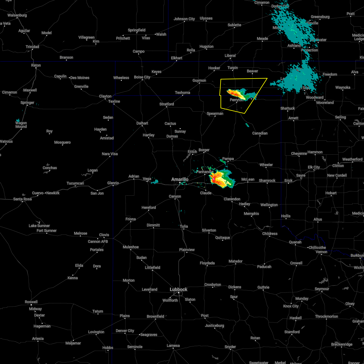 The severe thunderstorm warning for southwestern beaver, southeastern texas, northwestern lipscomb and northern ochiltree counties will expire at 915 pm cdt, the severe thunderstorm which prompted the warning has weakened. therefore, the warning will be allowed to expire. however small hail is still possible with this thunderstorm. a severe thunderstorm watch remains in effect until 1000 pm cdt for the panhandle of oklahoma, and the panhandle of texas. The severe thunderstorm warning for southwestern beaver, southeastern texas, northwestern lipscomb and northern ochiltree counties will expire at 915 pm cdt, the severe thunderstorm which prompted the warning has weakened. therefore, the warning will be allowed to expire. however small hail is still possible with this thunderstorm. a severe thunderstorm watch remains in effect until 1000 pm cdt for the panhandle of oklahoma, and the panhandle of texas.
|
| 4/22/2022 8:47 PM CDT |
 At 846 pm cdt, a severe thunderstorm was located near farnsworth, or 9 miles west of perryton, moving northeast at 45 mph (trained weather spotters). Hazards include two inch hail and 60 mph wind gusts. Minor damage to roofs, siding, and trees is possible. people and animals outdoors will be injured. expect hail damage to roofs, siding, windows, and vehicles. locations impacted include, perryton, booker, elmwood, bryans corner, farnsworth, boyd and balko. thunderstorm damage threat, considerable hail threat, observed max hail size, 2. 00 in wind threat, radar indicated max wind gust, 60 mph. At 846 pm cdt, a severe thunderstorm was located near farnsworth, or 9 miles west of perryton, moving northeast at 45 mph (trained weather spotters). Hazards include two inch hail and 60 mph wind gusts. Minor damage to roofs, siding, and trees is possible. people and animals outdoors will be injured. expect hail damage to roofs, siding, windows, and vehicles. locations impacted include, perryton, booker, elmwood, bryans corner, farnsworth, boyd and balko. thunderstorm damage threat, considerable hail threat, observed max hail size, 2. 00 in wind threat, radar indicated max wind gust, 60 mph.
|
| 4/22/2022 8:47 PM CDT |
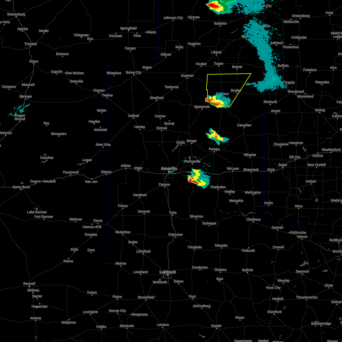 At 846 pm cdt, a severe thunderstorm was located near farnsworth, or 9 miles west of perryton, moving northeast at 45 mph (trained weather spotters). Hazards include two inch hail and 60 mph wind gusts. Minor damage to roofs, siding, and trees is possible. people and animals outdoors will be injured. expect hail damage to roofs, siding, windows, and vehicles. locations impacted include, perryton, booker, elmwood, bryans corner, farnsworth, boyd and balko. thunderstorm damage threat, considerable hail threat, observed max hail size, 2. 00 in wind threat, radar indicated max wind gust, 60 mph. At 846 pm cdt, a severe thunderstorm was located near farnsworth, or 9 miles west of perryton, moving northeast at 45 mph (trained weather spotters). Hazards include two inch hail and 60 mph wind gusts. Minor damage to roofs, siding, and trees is possible. people and animals outdoors will be injured. expect hail damage to roofs, siding, windows, and vehicles. locations impacted include, perryton, booker, elmwood, bryans corner, farnsworth, boyd and balko. thunderstorm damage threat, considerable hail threat, observed max hail size, 2. 00 in wind threat, radar indicated max wind gust, 60 mph.
|
| 4/22/2022 8:22 PM CDT |
 At 821 pm cdt, a severe thunderstorm was located over spearman, moving northeast at 50 mph (radar indicated). Hazards include two inch hail and 60 mph wind gusts. Minor damage to roofs, siding, and trees is possible. people and animals outdoors will be injured. Expect hail damage to roofs, siding, windows, and vehicles. At 821 pm cdt, a severe thunderstorm was located over spearman, moving northeast at 50 mph (radar indicated). Hazards include two inch hail and 60 mph wind gusts. Minor damage to roofs, siding, and trees is possible. people and animals outdoors will be injured. Expect hail damage to roofs, siding, windows, and vehicles.
|
| 10/12/2021 11:00 PM CDT |
 At 1100 pm cdt, severe thunderstorms were located along a line extending from 5 miles north of knowles to 5 miles southeast of booker, moving east at 35 mph (radar indicated). Hazards include 60 mph wind gusts and penny size hail. minor damage to roofs, siding, and trees is possible At 1100 pm cdt, severe thunderstorms were located along a line extending from 5 miles north of knowles to 5 miles southeast of booker, moving east at 35 mph (radar indicated). Hazards include 60 mph wind gusts and penny size hail. minor damage to roofs, siding, and trees is possible
|
| 10/12/2021 10:18 PM CDT |
 At 1017 pm cdt, severe thunderstorms were located along a line extending from 6 miles south of balko to 8 miles southeast of farnsworth, moving east at 30 mph (radar indicated). Hazards include 60 mph wind gusts and penny size hail. Minor damage to roofs, siding, and trees is possible. Locations impacted include, perryton, wolf creek park, waka, bryans corner, balko and farnsworth. At 1017 pm cdt, severe thunderstorms were located along a line extending from 6 miles south of balko to 8 miles southeast of farnsworth, moving east at 30 mph (radar indicated). Hazards include 60 mph wind gusts and penny size hail. Minor damage to roofs, siding, and trees is possible. Locations impacted include, perryton, wolf creek park, waka, bryans corner, balko and farnsworth.
|
| 10/12/2021 10:18 PM CDT |
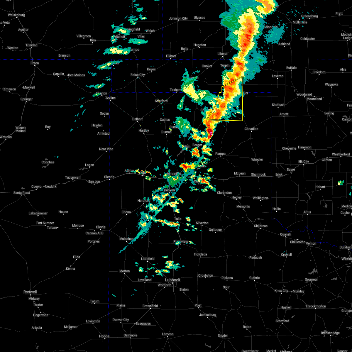 At 1017 pm cdt, severe thunderstorms were located along a line extending from 6 miles south of balko to 8 miles southeast of farnsworth, moving east at 30 mph (radar indicated). Hazards include 60 mph wind gusts and penny size hail. Minor damage to roofs, siding, and trees is possible. Locations impacted include, perryton, wolf creek park, waka, bryans corner, balko and farnsworth. At 1017 pm cdt, severe thunderstorms were located along a line extending from 6 miles south of balko to 8 miles southeast of farnsworth, moving east at 30 mph (radar indicated). Hazards include 60 mph wind gusts and penny size hail. Minor damage to roofs, siding, and trees is possible. Locations impacted include, perryton, wolf creek park, waka, bryans corner, balko and farnsworth.
|
| 10/12/2021 9:58 PM CDT |
 At 957 pm cdt, severe thunderstorms were located along a line extending from 8 miles north of perryton to 5 miles southeast of waka, moving east at 30 mph (radar indicated). Hazards include 60 mph wind gusts and quarter size hail. Minor damage to roofs, siding, and trees is possible. hail damage to vehicles is expected. locations impacted include, perryton, spearman, wolf creek park, bryans corner, farnsworth, waka and balko. hail threat, radar indicated max hail size, 1. 00in wind threat, radar indicated max wind gust, 60 mph. At 957 pm cdt, severe thunderstorms were located along a line extending from 8 miles north of perryton to 5 miles southeast of waka, moving east at 30 mph (radar indicated). Hazards include 60 mph wind gusts and quarter size hail. Minor damage to roofs, siding, and trees is possible. hail damage to vehicles is expected. locations impacted include, perryton, spearman, wolf creek park, bryans corner, farnsworth, waka and balko. hail threat, radar indicated max hail size, 1. 00in wind threat, radar indicated max wind gust, 60 mph.
|
| 10/12/2021 9:34 PM CDT |
 At 933 pm cdt, severe thunderstorms were located along a line extending from 10 miles northwest of farnsworth to spearman, moving east at 30 mph (radar indicated). Hazards include 70 mph wind gusts and ping pong ball size hail. Expect some tree damage. damage is likely to mobile homes, roofs, and outbuildings. people and animals outdoors will be injured. Expect hail damage to roofs, siding, windows, and vehicles. At 933 pm cdt, severe thunderstorms were located along a line extending from 10 miles northwest of farnsworth to spearman, moving east at 30 mph (radar indicated). Hazards include 70 mph wind gusts and ping pong ball size hail. Expect some tree damage. damage is likely to mobile homes, roofs, and outbuildings. people and animals outdoors will be injured. Expect hail damage to roofs, siding, windows, and vehicles.
|
| 8/21/2021 5:03 PM CDT |
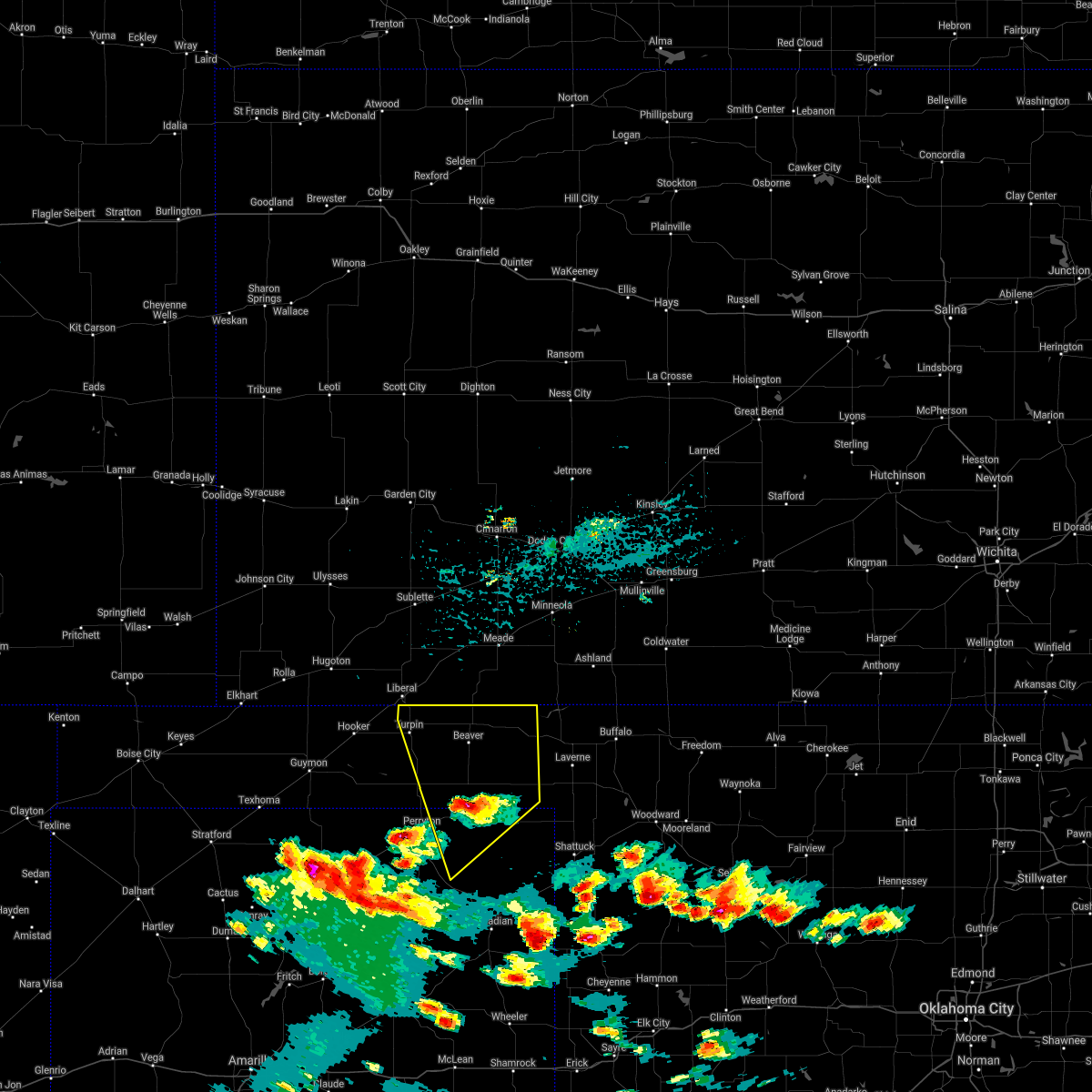 At 503 pm cdt, a severe thunderstorm was located 4 miles south of elmwood, or 17 miles south of beaver, moving north at 25 mph (radar indicated). Hazards include 60 mph wind gusts and half dollar size hail. Minor damage to roofs, siding, and trees is possible. hail damage to vehicles is expected. locations impacted include, beaver, booker, forgan, darrouzett, knowles, wolf creek park, elmwood, boyd, floris, bryans corner, mocane, turpin, slapout and balko. hail threat, radar indicated max hail size, 1. 25 in wind threat, radar indicated max wind gust, 60 mph. At 503 pm cdt, a severe thunderstorm was located 4 miles south of elmwood, or 17 miles south of beaver, moving north at 25 mph (radar indicated). Hazards include 60 mph wind gusts and half dollar size hail. Minor damage to roofs, siding, and trees is possible. hail damage to vehicles is expected. locations impacted include, beaver, booker, forgan, darrouzett, knowles, wolf creek park, elmwood, boyd, floris, bryans corner, mocane, turpin, slapout and balko. hail threat, radar indicated max hail size, 1. 25 in wind threat, radar indicated max wind gust, 60 mph.
|
| 8/21/2021 5:03 PM CDT |
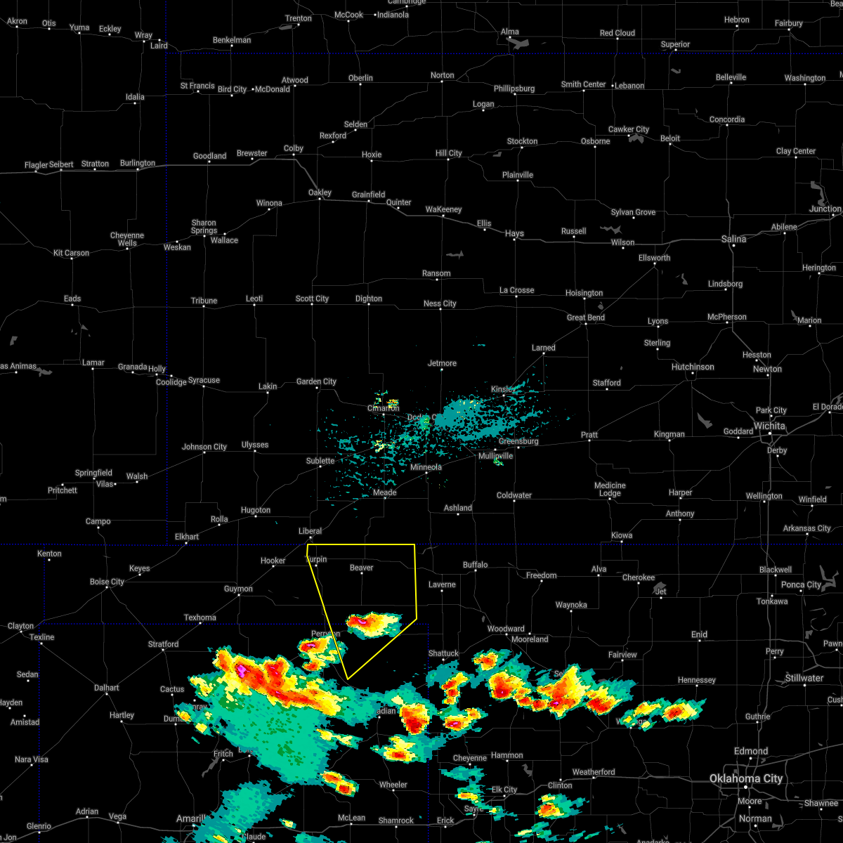 At 503 pm cdt, a severe thunderstorm was located 4 miles south of elmwood, or 17 miles south of beaver, moving north at 25 mph (radar indicated). Hazards include 60 mph wind gusts and half dollar size hail. Minor damage to roofs, siding, and trees is possible. hail damage to vehicles is expected. locations impacted include, beaver, booker, forgan, darrouzett, knowles, wolf creek park, elmwood, boyd, floris, bryans corner, mocane, turpin, slapout and balko. hail threat, radar indicated max hail size, 1. 25 in wind threat, radar indicated max wind gust, 60 mph. At 503 pm cdt, a severe thunderstorm was located 4 miles south of elmwood, or 17 miles south of beaver, moving north at 25 mph (radar indicated). Hazards include 60 mph wind gusts and half dollar size hail. Minor damage to roofs, siding, and trees is possible. hail damage to vehicles is expected. locations impacted include, beaver, booker, forgan, darrouzett, knowles, wolf creek park, elmwood, boyd, floris, bryans corner, mocane, turpin, slapout and balko. hail threat, radar indicated max hail size, 1. 25 in wind threat, radar indicated max wind gust, 60 mph.
|
| 8/21/2021 4:56 PM CDT | Golf Ball sized hail reported 1.8 miles N of Booker, TX, social media report of golf ball sized hail. |
| 8/21/2021 4:47 PM CDT | Golf Ball sized hail reported 0.6 miles NW of Booker, TX |
| 8/21/2021 4:47 PM CDT |
 At 447 pm cdt, a severe thunderstorm was located over booker, or 16 miles east of perryton, moving north at 25 mph (radar indicated). Hazards include 60 mph wind gusts and quarter size hail. Minor damage to roofs, siding, and trees is possible. hail damage to vehicles is expected. locations impacted include, lipscomb, beaver, booker, forgan, follett, darrouzett, knowles, wolf creek park, elmwood, boyd, floris, bryans corner, mocane, turpin, slapout and balko. hail threat, radar indicated max hail size, 1. 00in wind threat, radar indicated max wind gust, 60 mph. At 447 pm cdt, a severe thunderstorm was located over booker, or 16 miles east of perryton, moving north at 25 mph (radar indicated). Hazards include 60 mph wind gusts and quarter size hail. Minor damage to roofs, siding, and trees is possible. hail damage to vehicles is expected. locations impacted include, lipscomb, beaver, booker, forgan, follett, darrouzett, knowles, wolf creek park, elmwood, boyd, floris, bryans corner, mocane, turpin, slapout and balko. hail threat, radar indicated max hail size, 1. 00in wind threat, radar indicated max wind gust, 60 mph.
|
| 8/21/2021 4:45 PM CDT | Golf Ball sized hail reported 0.3 miles SSE of Booker, TX, public reports on social media quarter to golf ball size hail. |
| 8/21/2021 4:44 PM CDT | Hen Egg sized hail reported 0.3 miles SSE of Booker, TX, picture with hail measurement sent to us via social media. |
| 8/21/2021 4:15 PM CDT |
 At 414 pm cdt, a severe thunderstorm was located 9 miles northeast of wolf creek park, or 12 miles west of lipscomb, moving north at 25 mph (radar indicated). Hazards include 60 mph wind gusts and quarter size hail. Minor damage to roofs, siding, and trees is possible. Hail damage to vehicles is expected. At 414 pm cdt, a severe thunderstorm was located 9 miles northeast of wolf creek park, or 12 miles west of lipscomb, moving north at 25 mph (radar indicated). Hazards include 60 mph wind gusts and quarter size hail. Minor damage to roofs, siding, and trees is possible. Hail damage to vehicles is expected.
|
| 8/7/2021 8:55 PM CDT |
 The severe thunderstorm warning for beaver, southeastern texas, northern lipscomb, northern hansford and northern ochiltree counties will expire at 900 pm cdt, the storms which prompted the warning have weakened below severe limits, and no longer pose an immediate threat to life or property. therefore, the warning will be allowed to expire. however gusty winds are still possible with these thunderstorms. a severe thunderstorm watch remains in effect until 1100 pm cdt for the panhandle of oklahoma, and the panhandle of texas. The severe thunderstorm warning for beaver, southeastern texas, northern lipscomb, northern hansford and northern ochiltree counties will expire at 900 pm cdt, the storms which prompted the warning have weakened below severe limits, and no longer pose an immediate threat to life or property. therefore, the warning will be allowed to expire. however gusty winds are still possible with these thunderstorms. a severe thunderstorm watch remains in effect until 1100 pm cdt for the panhandle of oklahoma, and the panhandle of texas.
|
| 8/7/2021 8:26 PM CDT |
 At 825 pm cdt, severe thunderstorms were located along a line extending from 7 miles south of knowles to 3 miles northeast of booker to 7 miles northwest of gruver, moving southeast at 40 mph (radar indicated). Hazards include 60 mph wind gusts. Minor damage to roofs, siding, and trees is possible. locations impacted include, perryton, beaver, booker, gruver, follett, darrouzett, hardesty, gate, elmwood, farnsworth, boyd, waka, bryans corner, slapout and balko. hail threat, radar indicated max hail size, <. 75 in wind threat, radar indicated max wind gust, 60 mph. At 825 pm cdt, severe thunderstorms were located along a line extending from 7 miles south of knowles to 3 miles northeast of booker to 7 miles northwest of gruver, moving southeast at 40 mph (radar indicated). Hazards include 60 mph wind gusts. Minor damage to roofs, siding, and trees is possible. locations impacted include, perryton, beaver, booker, gruver, follett, darrouzett, hardesty, gate, elmwood, farnsworth, boyd, waka, bryans corner, slapout and balko. hail threat, radar indicated max hail size, <. 75 in wind threat, radar indicated max wind gust, 60 mph.
|
| 8/7/2021 8:00 PM CDT |
 At 800 pm cdt, severe thunderstorms were located along a line extending from 5 miles west of forgan to near balko to 11 miles northwest of gruver, moving southeast at 40 mph (radar indicated). Hazards include 60 mph wind gusts and quarter size hail. Minor damage to roofs, siding, and trees is possible. Hail damage to vehicles is expected. At 800 pm cdt, severe thunderstorms were located along a line extending from 5 miles west of forgan to near balko to 11 miles northwest of gruver, moving southeast at 40 mph (radar indicated). Hazards include 60 mph wind gusts and quarter size hail. Minor damage to roofs, siding, and trees is possible. Hail damage to vehicles is expected.
|
| 7/25/2021 5:26 PM CDT |
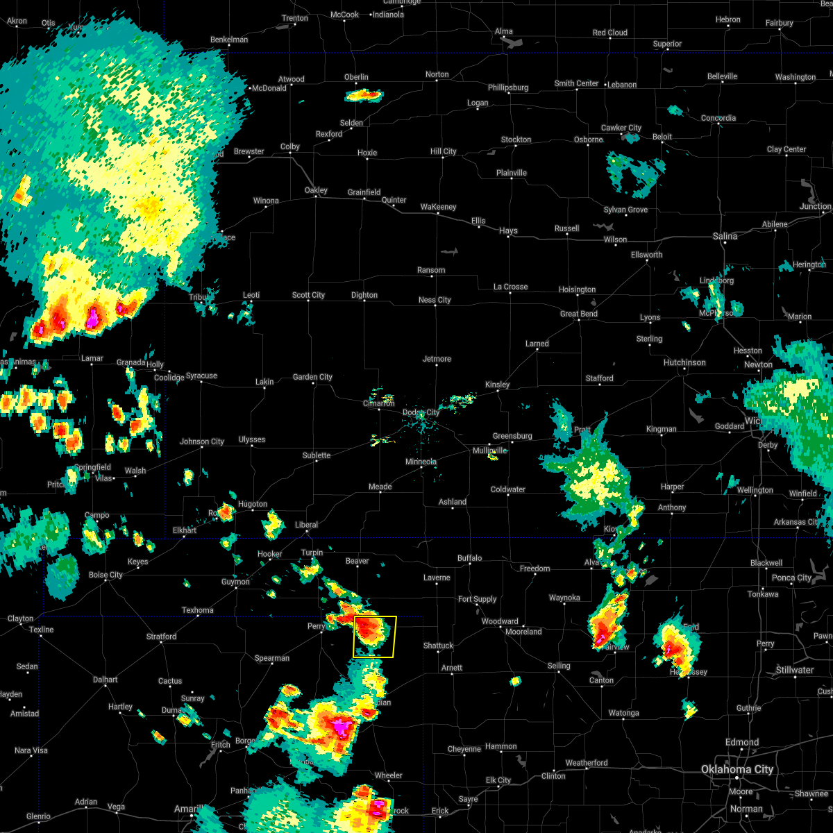 The severe thunderstorm warning for northwestern lipscomb county will expire at 530 pm cdt, the storm which prompted the warning has weakened below severe limits, and no longer poses an immediate threat to life or property. therefore, the warning will be allowed to expire. however small hail and gusty winds are still possible with this thunderstorm. The severe thunderstorm warning for northwestern lipscomb county will expire at 530 pm cdt, the storm which prompted the warning has weakened below severe limits, and no longer poses an immediate threat to life or property. therefore, the warning will be allowed to expire. however small hail and gusty winds are still possible with this thunderstorm.
|
| 7/25/2021 5:03 PM CDT |
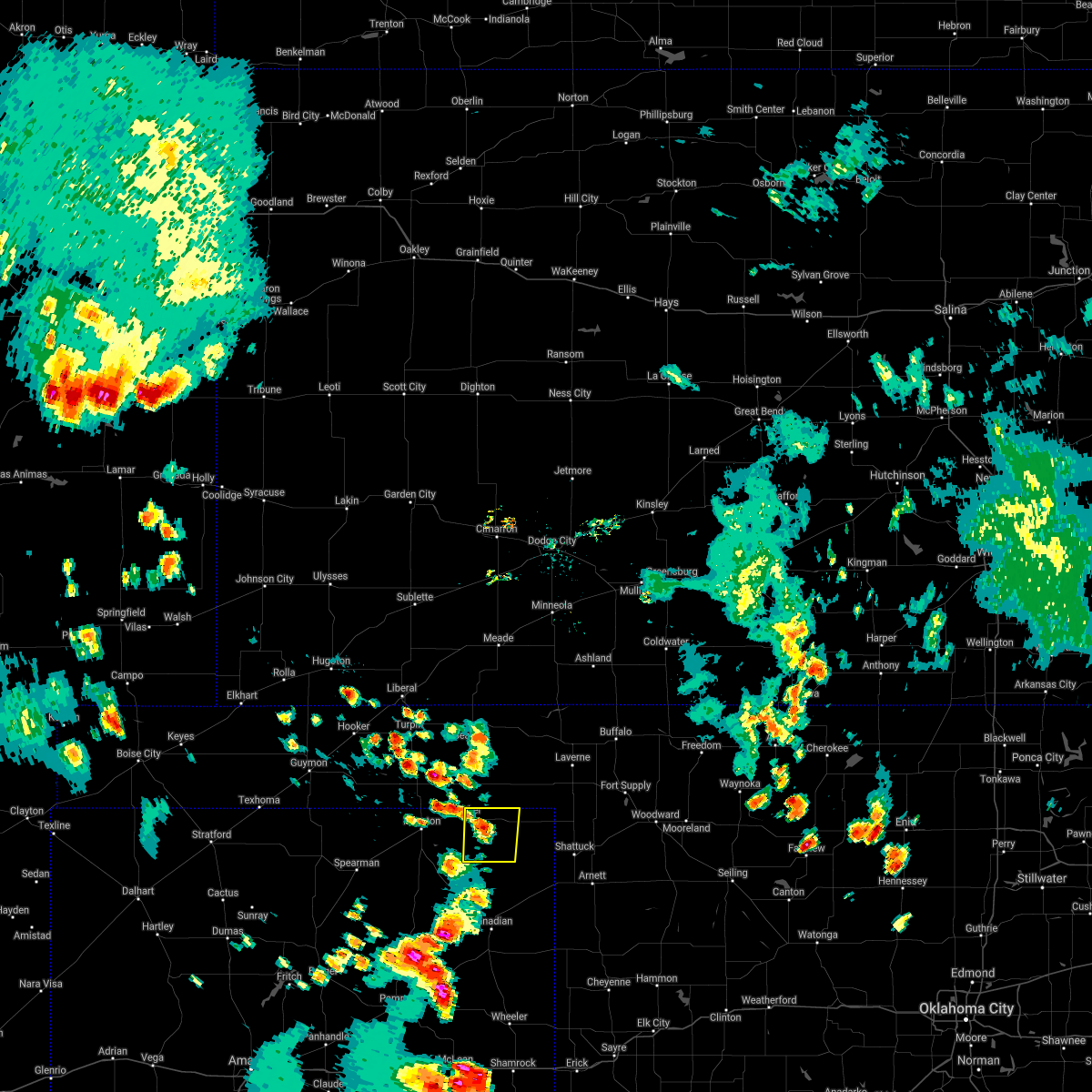 At 503 pm cdt, a severe thunderstorm was located 6 miles southwest of darrouzett, or 12 miles northwest of lipscomb, moving southeast at 10 mph (radar indicated). Hazards include 60 mph wind gusts and quarter size hail. Minor damage to roofs, siding, and trees is possible. Hail damage to vehicles is expected. At 503 pm cdt, a severe thunderstorm was located 6 miles southwest of darrouzett, or 12 miles northwest of lipscomb, moving southeast at 10 mph (radar indicated). Hazards include 60 mph wind gusts and quarter size hail. Minor damage to roofs, siding, and trees is possible. Hail damage to vehicles is expected.
|
| 6/25/2021 7:10 PM CDT |
 At 709 pm cdt, a severe thunderstorm was located 6 miles northeast of boyd, or 11 miles southwest of beaver, moving east at 35 mph. this is a very dangerous storm (radar indicated). Hazards include 80 mph wind gusts and quarter size hail. additionally, blowing dust and dangerously low visibilities are occurring with this storm. Flying debris will be dangerous to those caught without shelter. mobile homes will be heavily damaged. expect considerable damage to roofs, windows, and vehicles. tree damage and power outages are likely. hail damage to vehicles is expected. Locations impacted include, beaver, booker, forgan, follett, darrouzett, gate, knowles, elmwood, mocane, slapout and balko. At 709 pm cdt, a severe thunderstorm was located 6 miles northeast of boyd, or 11 miles southwest of beaver, moving east at 35 mph. this is a very dangerous storm (radar indicated). Hazards include 80 mph wind gusts and quarter size hail. additionally, blowing dust and dangerously low visibilities are occurring with this storm. Flying debris will be dangerous to those caught without shelter. mobile homes will be heavily damaged. expect considerable damage to roofs, windows, and vehicles. tree damage and power outages are likely. hail damage to vehicles is expected. Locations impacted include, beaver, booker, forgan, follett, darrouzett, gate, knowles, elmwood, mocane, slapout and balko.
|
| 6/25/2021 6:16 PM CDT |
 At 616 pm cdt, severe thunderstorms were located along a line extending from 5 miles northeast of perryton to 10 miles southeast of booker to 6 miles southwest of lipscomb, moving northeast at 35 mph (radar indicated). Hazards include 60 mph wind gusts and quarter size hail. Minor damage to roofs, siding, and trees is possible. Hail damage to vehicles is expected. At 616 pm cdt, severe thunderstorms were located along a line extending from 5 miles northeast of perryton to 10 miles southeast of booker to 6 miles southwest of lipscomb, moving northeast at 35 mph (radar indicated). Hazards include 60 mph wind gusts and quarter size hail. Minor damage to roofs, siding, and trees is possible. Hail damage to vehicles is expected.
|
| 6/24/2021 9:24 PM CDT | One power pole blown down by thunderstorm wind gus in beaver county OK, 11.1 miles SE of Booker, TX |
| 6/24/2021 9:22 PM CDT |
 At 922 pm cdt, a severe thunderstorm was located 8 miles northeast of perryton, moving northeast at 45 mph (radar indicated). Hazards include two inch hail and 60 mph wind gusts. Minor damage to roofs, siding, and trees is possible. people and animals outdoors will be injured. expect hail damage to roofs, siding, windows, and vehicles. Locations impacted include, perryton, booker, gate, knowles, elmwood, slapout and balko. At 922 pm cdt, a severe thunderstorm was located 8 miles northeast of perryton, moving northeast at 45 mph (radar indicated). Hazards include two inch hail and 60 mph wind gusts. Minor damage to roofs, siding, and trees is possible. people and animals outdoors will be injured. expect hail damage to roofs, siding, windows, and vehicles. Locations impacted include, perryton, booker, gate, knowles, elmwood, slapout and balko.
|
| 6/24/2021 9:20 PM CDT |
 At 920 pm cdt, a severe thunderstorm was located 6 miles north of perryton, moving northeast at 45 mph (radar indicated). Hazards include 60 mph wind gusts and quarter size hail. Minor damage to roofs, siding, and trees is possible. Hail damage to vehicles is expected. At 920 pm cdt, a severe thunderstorm was located 6 miles north of perryton, moving northeast at 45 mph (radar indicated). Hazards include 60 mph wind gusts and quarter size hail. Minor damage to roofs, siding, and trees is possible. Hail damage to vehicles is expected.
|
| 6/24/2021 9:20 PM CDT |
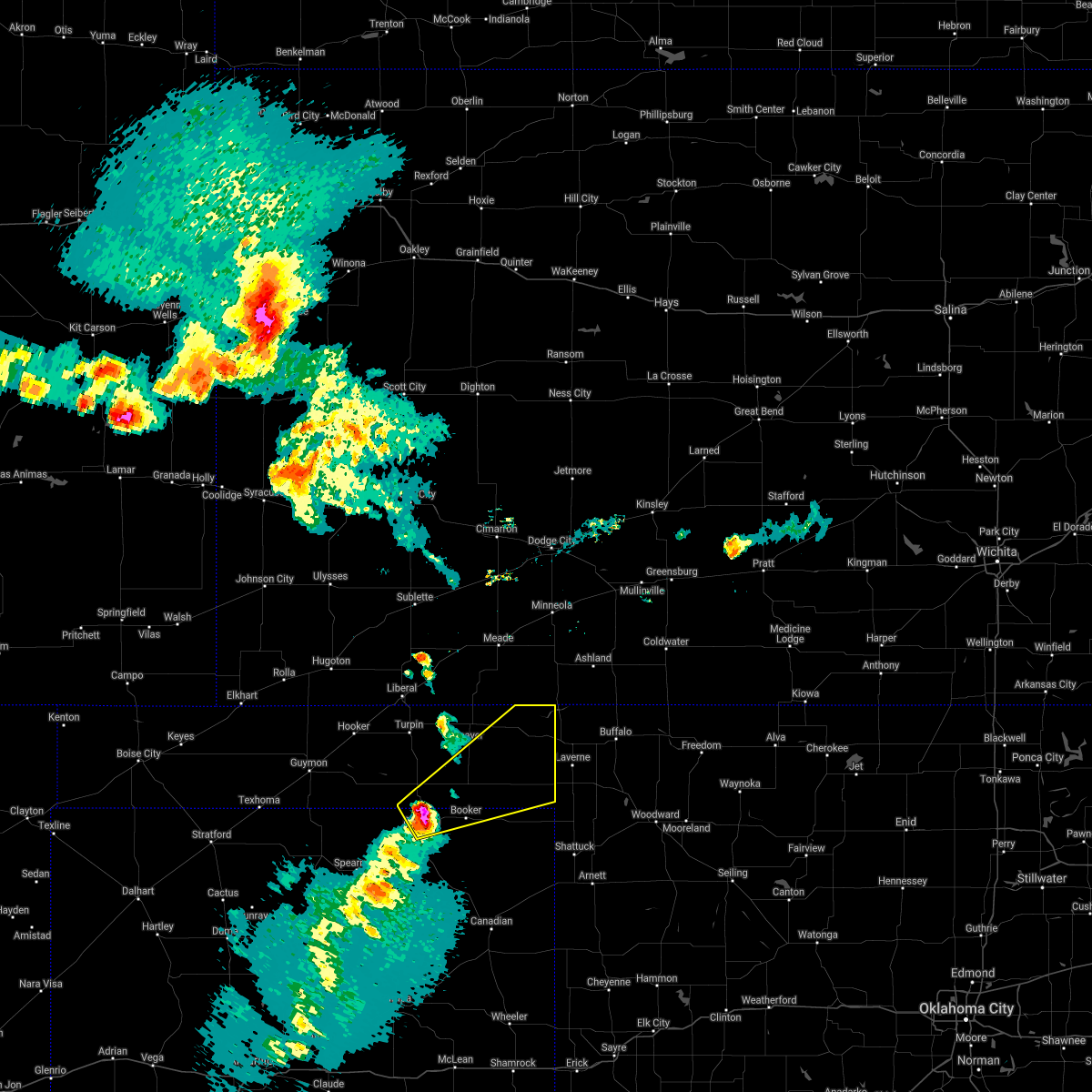 At 920 pm cdt, a severe thunderstorm was located 6 miles north of perryton, moving northeast at 45 mph (radar indicated). Hazards include 60 mph wind gusts and quarter size hail. Minor damage to roofs, siding, and trees is possible. Hail damage to vehicles is expected. At 920 pm cdt, a severe thunderstorm was located 6 miles north of perryton, moving northeast at 45 mph (radar indicated). Hazards include 60 mph wind gusts and quarter size hail. Minor damage to roofs, siding, and trees is possible. Hail damage to vehicles is expected.
|
| 6/24/2021 9:10 PM CDT |
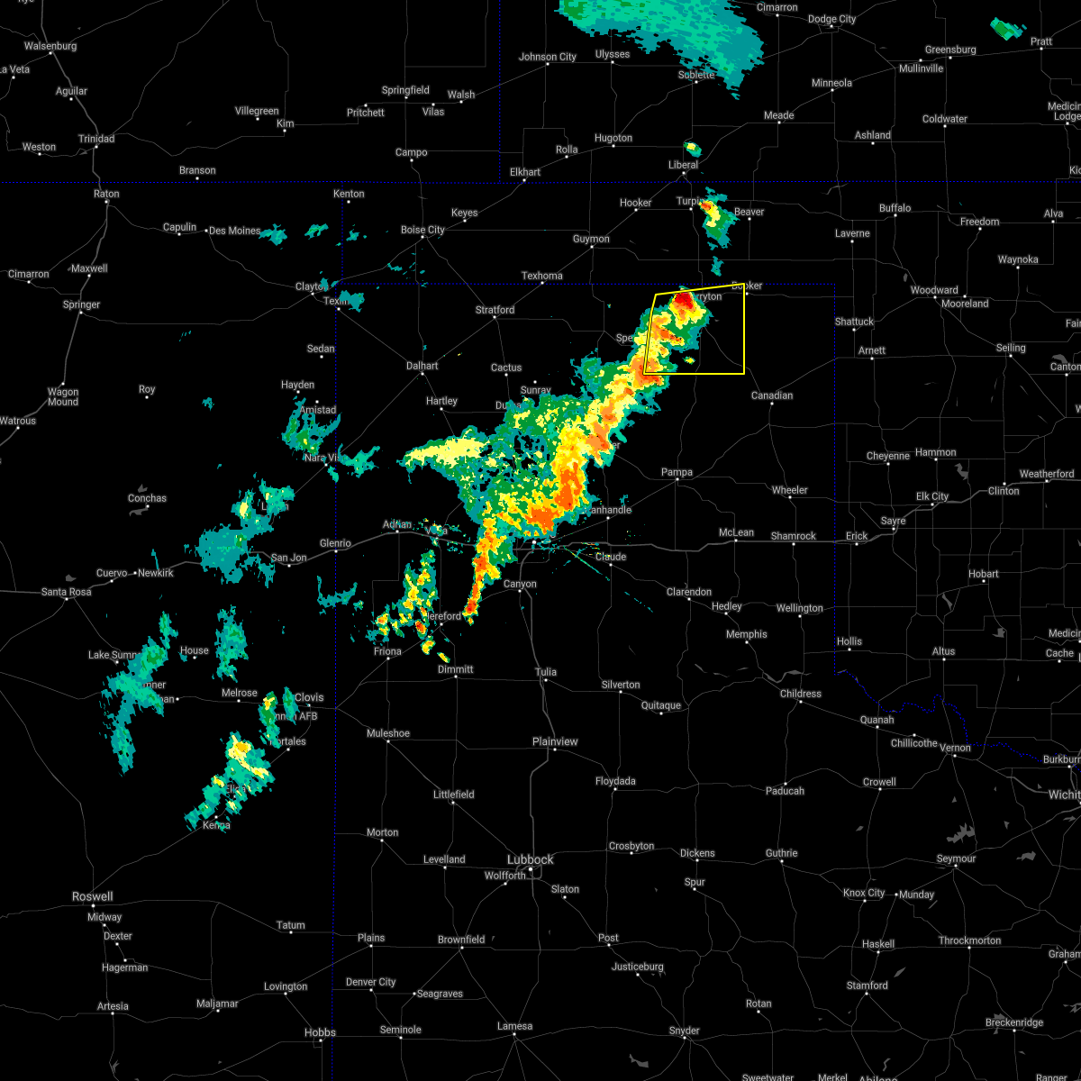 At 909 pm cdt, automated weather equipment reported a severe thunderstorm was located 4 miles northwest of perryton, moving east at 40 mph (automated weather equipment). Hazards include 60 mph wind gusts and quarter size hail. Minor damage to roofs, siding, and trees is possible. hail damage to vehicles is expected. Locations impacted include, perryton, wolf creek park, waka and farnsworth. At 909 pm cdt, automated weather equipment reported a severe thunderstorm was located 4 miles northwest of perryton, moving east at 40 mph (automated weather equipment). Hazards include 60 mph wind gusts and quarter size hail. Minor damage to roofs, siding, and trees is possible. hail damage to vehicles is expected. Locations impacted include, perryton, wolf creek park, waka and farnsworth.
|
| 6/24/2021 8:52 PM CDT |
 At 852 pm cdt, a severe thunderstorm was located over farnsworth, or 10 miles west of perryton, moving east at 40 mph (automated weather equipment. at 842 pm cdt, automated weather equipment recorded a 70 mph wind gust at palo duro reservoir). Hazards include 60 mph wind gusts and quarter size hail. Minor damage to roofs, siding, and trees is possible. Hail damage to vehicles is expected. At 852 pm cdt, a severe thunderstorm was located over farnsworth, or 10 miles west of perryton, moving east at 40 mph (automated weather equipment. at 842 pm cdt, automated weather equipment recorded a 70 mph wind gust at palo duro reservoir). Hazards include 60 mph wind gusts and quarter size hail. Minor damage to roofs, siding, and trees is possible. Hail damage to vehicles is expected.
|
| 5/26/2021 8:51 PM CDT |
 At 851 pm cdt, a severe thunderstorm was located over booker, or 16 miles east of perryton, moving east at 30 mph (radar indicated). Hazards include 70 mph wind gusts and quarter size hail. Expect some tree damage. damage is likely to mobile homes, roofs, and outbuildings. hail damage to vehicles is expected. locations impacted include, booker, follett and darrouzett. A tornado watch remains in effect until midnight cdt for the panhandle of oklahoma, and the panhandle of texas. At 851 pm cdt, a severe thunderstorm was located over booker, or 16 miles east of perryton, moving east at 30 mph (radar indicated). Hazards include 70 mph wind gusts and quarter size hail. Expect some tree damage. damage is likely to mobile homes, roofs, and outbuildings. hail damage to vehicles is expected. locations impacted include, booker, follett and darrouzett. A tornado watch remains in effect until midnight cdt for the panhandle of oklahoma, and the panhandle of texas.
|
| 5/26/2021 8:42 PM CDT |
 At 842 pm cdt, a severe thunderstorm was located near booker, or 12 miles east of perryton, moving east at 30 mph (radar indicated). Hazards include golf ball size hail and 70 mph wind gusts. Expect some tree damage. damage is likely to mobile homes, roofs, and outbuildings. people and animals outdoors will be injured. Expect hail damage to roofs, siding, windows, and vehicles. At 842 pm cdt, a severe thunderstorm was located near booker, or 12 miles east of perryton, moving east at 30 mph (radar indicated). Hazards include golf ball size hail and 70 mph wind gusts. Expect some tree damage. damage is likely to mobile homes, roofs, and outbuildings. people and animals outdoors will be injured. Expect hail damage to roofs, siding, windows, and vehicles.
|
| 5/26/2021 8:36 PM CDT |
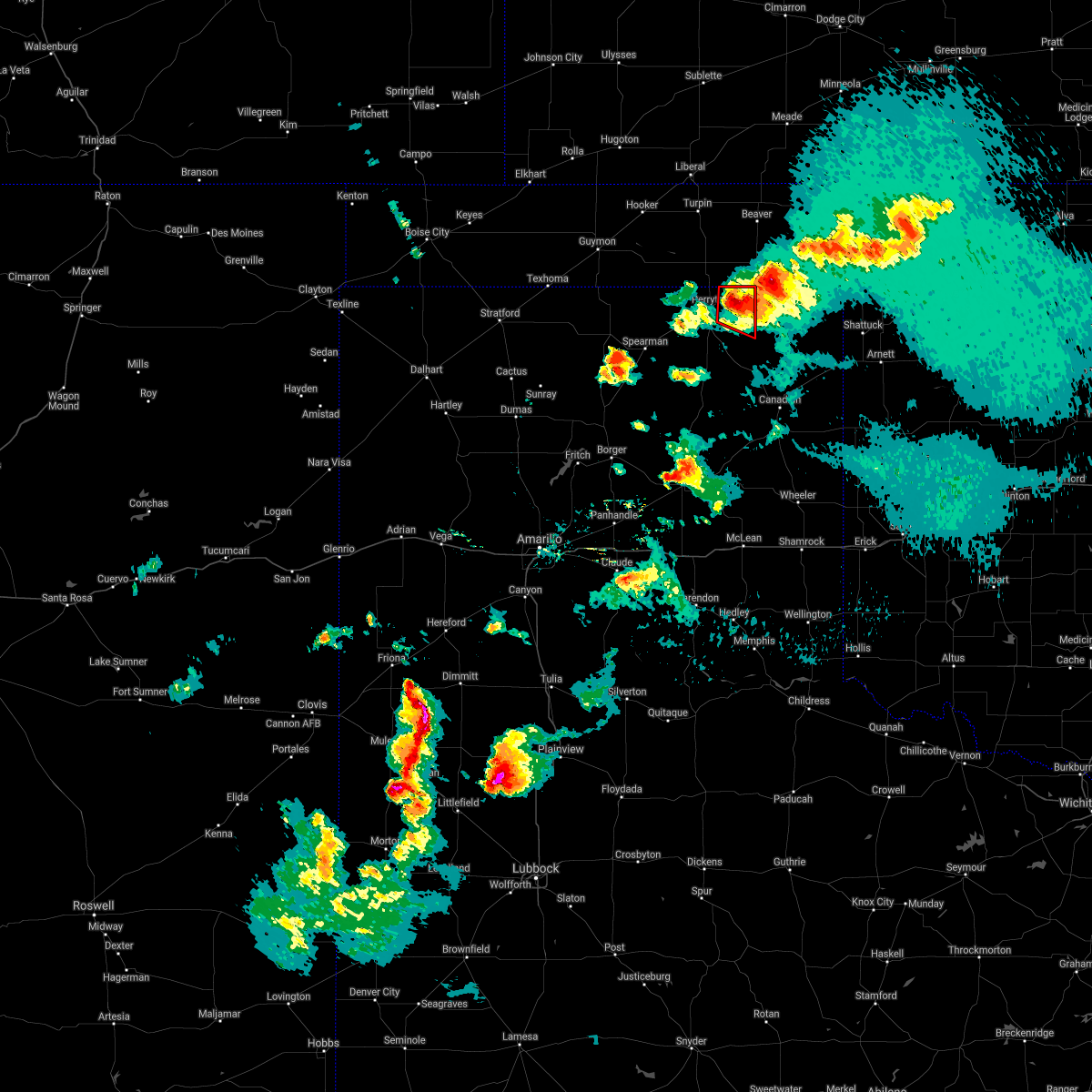 At 836 pm cdt, a severe thunderstorm capable of producing a tornado was located 8 miles southwest of booker, or 8 miles east of perryton, moving east at 25 mph (weather spotters reported a rotating wall cloud). Hazards include tornado and baseball size hail. Flying debris will be dangerous to those caught without shelter. mobile homes will be damaged or destroyed. damage to roofs, windows, and vehicles will occur. tree damage is likely. Locations impacted include, booker. At 836 pm cdt, a severe thunderstorm capable of producing a tornado was located 8 miles southwest of booker, or 8 miles east of perryton, moving east at 25 mph (weather spotters reported a rotating wall cloud). Hazards include tornado and baseball size hail. Flying debris will be dangerous to those caught without shelter. mobile homes will be damaged or destroyed. damage to roofs, windows, and vehicles will occur. tree damage is likely. Locations impacted include, booker.
|
| 5/26/2021 8:31 PM CDT |
 At 831 pm cdt, a severe thunderstorm was located 5 miles northeast of booker, or 20 miles east of perryton, moving northeast at 25 mph (radar indicated). Hazards include two inch hail and 70 mph wind gusts. Expect some tree damage. damage is likely to mobile homes, roofs, and outbuildings. people and animals outdoors will be injured. Expect hail damage to roofs, siding, windows, and vehicles. At 831 pm cdt, a severe thunderstorm was located 5 miles northeast of booker, or 20 miles east of perryton, moving northeast at 25 mph (radar indicated). Hazards include two inch hail and 70 mph wind gusts. Expect some tree damage. damage is likely to mobile homes, roofs, and outbuildings. people and animals outdoors will be injured. Expect hail damage to roofs, siding, windows, and vehicles.
|
| 5/26/2021 8:27 PM CDT |
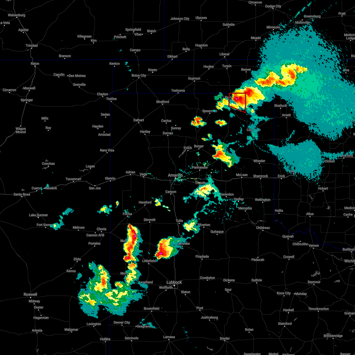 At 825 pm cdt, a severe thunderstorm capable of producing a tornado was located near perryton, moving east at 15 mph (weather spotters reported a rotating wall cloud near perryton and radar indicated rotation). Hazards include tornado and baseball size hail. Flying debris will be dangerous to those caught without shelter. mobile homes will be damaged or destroyed. damage to roofs, windows, and vehicles will occur. tree damage is likely. Locations impacted include, perryton and booker. At 825 pm cdt, a severe thunderstorm capable of producing a tornado was located near perryton, moving east at 15 mph (weather spotters reported a rotating wall cloud near perryton and radar indicated rotation). Hazards include tornado and baseball size hail. Flying debris will be dangerous to those caught without shelter. mobile homes will be damaged or destroyed. damage to roofs, windows, and vehicles will occur. tree damage is likely. Locations impacted include, perryton and booker.
|
| 5/26/2021 8:15 PM CDT |
 At 814 pm cdt, a severe thunderstorm was located over booker, or 17 miles east of perryton, moving northeast at 15 mph (radar indicated). Hazards include 60 mph wind gusts and quarter size hail. Minor damage to roofs, siding, and trees is possible. hail damage to vehicles is expected. locations impacted include, follett and darrouzett. A tornado watch remains in effect until midnight cdt for the panhandle of oklahoma, and the panhandle of texas. At 814 pm cdt, a severe thunderstorm was located over booker, or 17 miles east of perryton, moving northeast at 15 mph (radar indicated). Hazards include 60 mph wind gusts and quarter size hail. Minor damage to roofs, siding, and trees is possible. hail damage to vehicles is expected. locations impacted include, follett and darrouzett. A tornado watch remains in effect until midnight cdt for the panhandle of oklahoma, and the panhandle of texas.
|
| 5/26/2021 8:07 PM CDT |
 At 806 pm cdt, a severe thunderstorm capable of producing a tornado was located over perryton, moving east at 25 mph (radar indicated rotation). Hazards include tornado and baseball size hail. Flying debris will be dangerous to those caught without shelter. mobile homes will be damaged or destroyed. damage to roofs, windows, and vehicles will occur. Tree damage is likely. At 806 pm cdt, a severe thunderstorm capable of producing a tornado was located over perryton, moving east at 25 mph (radar indicated rotation). Hazards include tornado and baseball size hail. Flying debris will be dangerous to those caught without shelter. mobile homes will be damaged or destroyed. damage to roofs, windows, and vehicles will occur. Tree damage is likely.
|
| 5/26/2021 7:33 PM CDT |
 At 733 pm cdt, a severe thunderstorm was located 8 miles southwest of booker, or 10 miles east of perryton, moving northeast at 25 mph (radar indicated). Hazards include golf ball size hail and 60 mph wind gusts. Minor damage to roofs, siding, and trees is possible. people and animals outdoors will be injured. Expect hail damage to roofs, siding, windows, and vehicles. At 733 pm cdt, a severe thunderstorm was located 8 miles southwest of booker, or 10 miles east of perryton, moving northeast at 25 mph (radar indicated). Hazards include golf ball size hail and 60 mph wind gusts. Minor damage to roofs, siding, and trees is possible. people and animals outdoors will be injured. Expect hail damage to roofs, siding, windows, and vehicles.
|
| 5/26/2021 7:12 PM CDT |
 At 712 pm cdt, a severe thunderstorm was located 5 miles northwest of wolf creek park, or 9 miles southeast of perryton, moving northeast at 30 mph (radar indicated). Hazards include two inch hail and 60 mph wind gusts. Minor damage to roofs, siding, and trees is possible. people and animals outdoors will be injured. expect hail damage to roofs, siding, windows, and vehicles. locations impacted include, perryton and wolf creek park. A tornado watch remains in effect until midnight cdt for the panhandle of texas. At 712 pm cdt, a severe thunderstorm was located 5 miles northwest of wolf creek park, or 9 miles southeast of perryton, moving northeast at 30 mph (radar indicated). Hazards include two inch hail and 60 mph wind gusts. Minor damage to roofs, siding, and trees is possible. people and animals outdoors will be injured. expect hail damage to roofs, siding, windows, and vehicles. locations impacted include, perryton and wolf creek park. A tornado watch remains in effect until midnight cdt for the panhandle of texas.
|
| 5/26/2021 6:37 PM CDT |
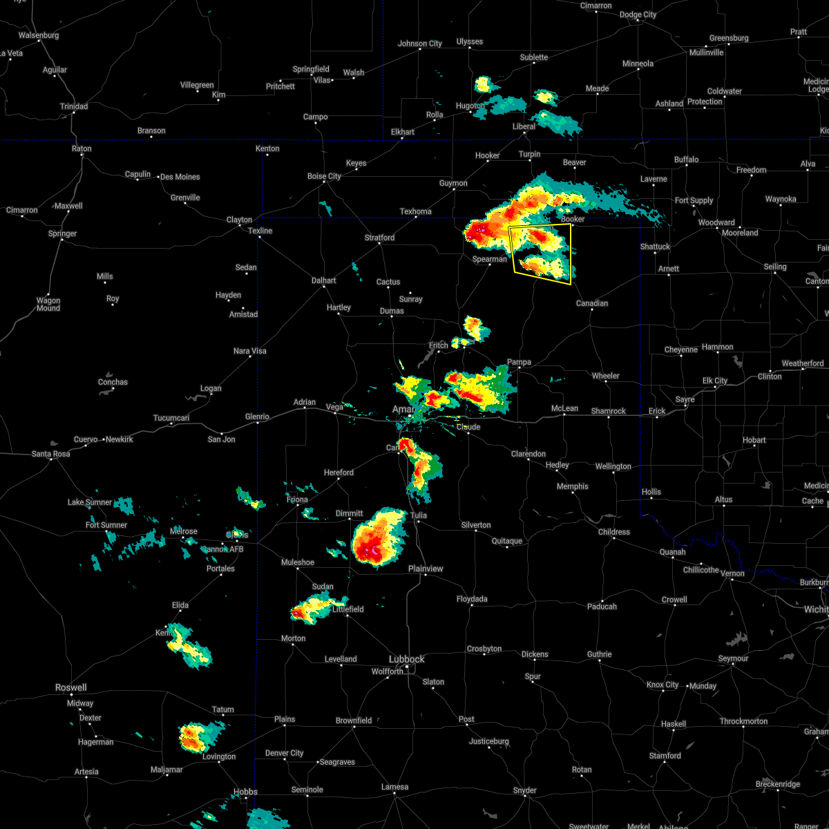 At 637 pm cdt, a severe thunderstorm was located 10 miles southeast of farnsworth, or 14 miles south of perryton, moving east at 20 mph (radar indicated). Hazards include 60 mph wind gusts and quarter size hail. Minor damage to roofs, siding, and trees is possible. Hail damage to vehicles is expected. At 637 pm cdt, a severe thunderstorm was located 10 miles southeast of farnsworth, or 14 miles south of perryton, moving east at 20 mph (radar indicated). Hazards include 60 mph wind gusts and quarter size hail. Minor damage to roofs, siding, and trees is possible. Hail damage to vehicles is expected.
|
| 5/26/2021 6:35 PM CDT |
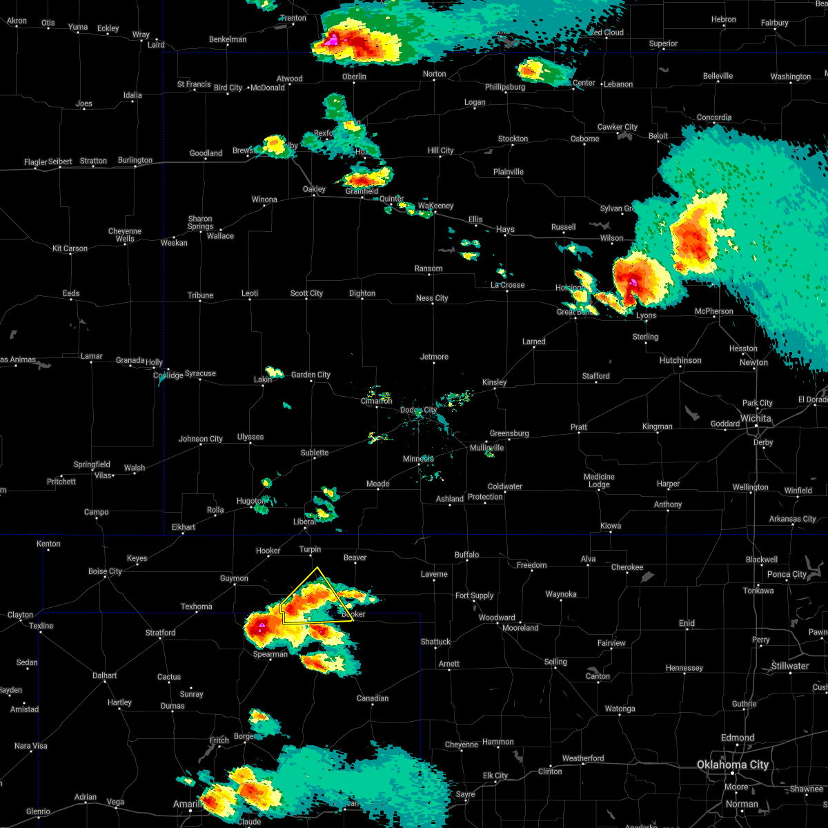 At 635 pm cdt, a severe thunderstorm was located 10 miles southeast of hardesty, or 15 miles northwest of perryton, moving east at 20 mph (radar indicated). Hazards include ping pong ball size hail and 60 mph wind gusts. Minor damage to roofs, siding, and trees is possible. people and animals outdoors will be injured. Expect hail damage to roofs, siding, windows, and vehicles. At 635 pm cdt, a severe thunderstorm was located 10 miles southeast of hardesty, or 15 miles northwest of perryton, moving east at 20 mph (radar indicated). Hazards include ping pong ball size hail and 60 mph wind gusts. Minor damage to roofs, siding, and trees is possible. people and animals outdoors will be injured. Expect hail damage to roofs, siding, windows, and vehicles.
|
| 5/25/2021 8:19 PM CDT |
 At 819 pm cdt, severe thunderstorms were located along a line extending from 6 miles east of perryton to 4 miles south of waka to 5 miles southwest of spearman, moving southeast at 5 mph (radar indicated). Hazards include 60 mph wind gusts and half dollar size hail. Minor damage to roofs, siding, and trees is possible. Hail damage to vehicles is expected. At 819 pm cdt, severe thunderstorms were located along a line extending from 6 miles east of perryton to 4 miles south of waka to 5 miles southwest of spearman, moving southeast at 5 mph (radar indicated). Hazards include 60 mph wind gusts and half dollar size hail. Minor damage to roofs, siding, and trees is possible. Hail damage to vehicles is expected.
|
| 7/14/2020 9:28 PM CDT |
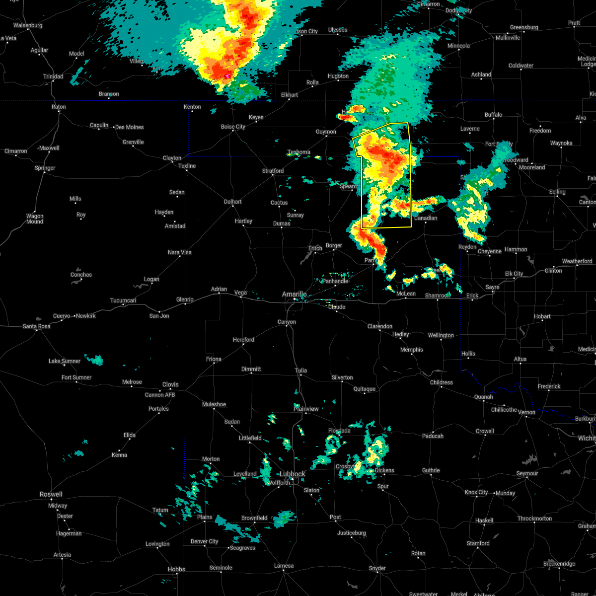 The severe thunderstorm warning for southwestern beaver, southeastern texas, northern roberts and ochiltree counties will expire at 930 pm cdt, the storms which prompted the warning have weakened below severe limits, and no longer pose an immediate threat to life or property. therefore, the warning will be allowed to expire. however up to nickel size hail and gusty winds up to 55 mph are still possible with these thunderstorms. consequently, a significant weather advisory is in effect for beaver, southeastern texas, lipscomb, roberts, northern hemphill, and ochiltree counties until 1100 pm cdt. a severe thunderstorm watch remains in effect until 300 am cdt for the panhandle of oklahoma, and the panhandle of texas. The severe thunderstorm warning for southwestern beaver, southeastern texas, northern roberts and ochiltree counties will expire at 930 pm cdt, the storms which prompted the warning have weakened below severe limits, and no longer pose an immediate threat to life or property. therefore, the warning will be allowed to expire. however up to nickel size hail and gusty winds up to 55 mph are still possible with these thunderstorms. consequently, a significant weather advisory is in effect for beaver, southeastern texas, lipscomb, roberts, northern hemphill, and ochiltree counties until 1100 pm cdt. a severe thunderstorm watch remains in effect until 300 am cdt for the panhandle of oklahoma, and the panhandle of texas.
|
| 7/14/2020 9:18 PM CDT |
 At 918 pm cdt, severe thunderstorms were located along a line extending from 7 miles southeast of adams to perryton to 21 miles southeast of spearman, moving east at 30 mph (radar indicated). Hazards include 60 mph wind gusts and quarter size hail. Minor damage to roofs, siding, and trees is possible. hail damage to vehicles is expected. Locations impacted include, perryton, wolf creek park, bryans corner, farnsworth, boyd, waka and balko. At 918 pm cdt, severe thunderstorms were located along a line extending from 7 miles southeast of adams to perryton to 21 miles southeast of spearman, moving east at 30 mph (radar indicated). Hazards include 60 mph wind gusts and quarter size hail. Minor damage to roofs, siding, and trees is possible. hail damage to vehicles is expected. Locations impacted include, perryton, wolf creek park, bryans corner, farnsworth, boyd, waka and balko.
|
| 7/14/2020 9:18 PM CDT |
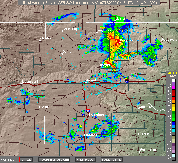 At 918 pm cdt, severe thunderstorms were located along a line extending from 7 miles southeast of adams to perryton to 21 miles southeast of spearman, moving east at 30 mph (radar indicated). Hazards include 60 mph wind gusts and quarter size hail. Minor damage to roofs, siding, and trees is possible. hail damage to vehicles is expected. Locations impacted include, perryton, wolf creek park, bryans corner, farnsworth, boyd, waka and balko. At 918 pm cdt, severe thunderstorms were located along a line extending from 7 miles southeast of adams to perryton to 21 miles southeast of spearman, moving east at 30 mph (radar indicated). Hazards include 60 mph wind gusts and quarter size hail. Minor damage to roofs, siding, and trees is possible. hail damage to vehicles is expected. Locations impacted include, perryton, wolf creek park, bryans corner, farnsworth, boyd, waka and balko.
|
| 7/14/2020 9:00 PM CDT |
 At 859 pm cdt, automated weather equipment reported severe thunderstorms were located along a line extending from 4 miles southeast of optima to hardesty to 3 miles east of waka to 16 miles east of pringle, moving east at 35 mph (automated weather equipment. at 841 pm cdt, automated weather equipment recorded a 63 mph gust at palo duro reservoir). Hazards include 70 mph wind gusts and quarter size hail. Expect some tree damage. damage is likely to mobile homes, roofs, and outbuildings. hail damage to vehicles is expected. Locations impacted include, perryton, spearman, hooker, optima, hardesty, wolf creek park, adams, farnsworth, boyd, waka, floris, bryans corner, baker, turpin and balko. At 859 pm cdt, automated weather equipment reported severe thunderstorms were located along a line extending from 4 miles southeast of optima to hardesty to 3 miles east of waka to 16 miles east of pringle, moving east at 35 mph (automated weather equipment. at 841 pm cdt, automated weather equipment recorded a 63 mph gust at palo duro reservoir). Hazards include 70 mph wind gusts and quarter size hail. Expect some tree damage. damage is likely to mobile homes, roofs, and outbuildings. hail damage to vehicles is expected. Locations impacted include, perryton, spearman, hooker, optima, hardesty, wolf creek park, adams, farnsworth, boyd, waka, floris, bryans corner, baker, turpin and balko.
|
| 7/14/2020 8:47 PM CDT |
 At 845 pm cdt, automated weather equipment reported severe thunderstorms were located along a line extending from 3 miles southeast of guymon to 3 miles west of spearman to 10 miles east of pringle, moving east at 45 mph (automated weather equipment. at 838 pm cdt, automated weather equipment recorded a 60 mph wind gust at palo duro reservoir). Hazards include 70 mph wind gusts and quarter size hail. Expect some tree damage. damage is likely to mobile homes, roofs, and outbuildings. hail damage to vehicles is expected. Locations impacted include, guymon, perryton, spearman, hooker, gruver, optima, hardesty, wolf creek park, adams, farnsworth, boyd, waka, floris, pringle, morse, bryans corner, baker, turpin and balko. At 845 pm cdt, automated weather equipment reported severe thunderstorms were located along a line extending from 3 miles southeast of guymon to 3 miles west of spearman to 10 miles east of pringle, moving east at 45 mph (automated weather equipment. at 838 pm cdt, automated weather equipment recorded a 60 mph wind gust at palo duro reservoir). Hazards include 70 mph wind gusts and quarter size hail. Expect some tree damage. damage is likely to mobile homes, roofs, and outbuildings. hail damage to vehicles is expected. Locations impacted include, guymon, perryton, spearman, hooker, gruver, optima, hardesty, wolf creek park, adams, farnsworth, boyd, waka, floris, pringle, morse, bryans corner, baker, turpin and balko.
|
| 7/14/2020 8:27 PM CDT |
 At 826 pm cdt, automated weather equipment reported severe thunderstorms were located along a line extending from goodwell to 4 miles west of gruver to pringle, moving east at 40 mph (automated weather equipment. at 820 pm cdt, automated weather equipment recorded a 62 mph wind gust at goodwell). Hazards include 70 mph wind gusts and quarter size hail. Expect some tree damage. damage is likely to mobile homes, roofs, and outbuildings. hail damage to vehicles is expected. Locations impacted include, guymon, perryton, spearman, hooker, goodwell, gruver, optima, hardesty, wolf creek park, adams, farnsworth, boyd, waka, floris, pringle, morse, bryans corner, baker, turpin and balko. At 826 pm cdt, automated weather equipment reported severe thunderstorms were located along a line extending from goodwell to 4 miles west of gruver to pringle, moving east at 40 mph (automated weather equipment. at 820 pm cdt, automated weather equipment recorded a 62 mph wind gust at goodwell). Hazards include 70 mph wind gusts and quarter size hail. Expect some tree damage. damage is likely to mobile homes, roofs, and outbuildings. hail damage to vehicles is expected. Locations impacted include, guymon, perryton, spearman, hooker, goodwell, gruver, optima, hardesty, wolf creek park, adams, farnsworth, boyd, waka, floris, pringle, morse, bryans corner, baker, turpin and balko.
|
| 7/14/2020 8:24 PM CDT |
 At 823 pm cdt, severe thunderstorms were located along a line extending from goodwell to 5 miles northwest of gruver to 3 miles northwest of pringle, moving east at 30 mph (radar indicated). Hazards include 70 mph wind gusts and quarter size hail. Expect some tree damage. damage is likely to mobile homes, roofs, and outbuildings. hail damage to vehicles is expected. Locations impacted include, guymon, perryton, spearman, hooker, goodwell, gruver, optima, hardesty, wolf creek park, adams, farnsworth, boyd, waka, floris, pringle, morse, bryans corner, baker, turpin and balko. At 823 pm cdt, severe thunderstorms were located along a line extending from goodwell to 5 miles northwest of gruver to 3 miles northwest of pringle, moving east at 30 mph (radar indicated). Hazards include 70 mph wind gusts and quarter size hail. Expect some tree damage. damage is likely to mobile homes, roofs, and outbuildings. hail damage to vehicles is expected. Locations impacted include, guymon, perryton, spearman, hooker, goodwell, gruver, optima, hardesty, wolf creek park, adams, farnsworth, boyd, waka, floris, pringle, morse, bryans corner, baker, turpin and balko.
|
| 7/14/2020 7:59 PM CDT |
 At 758 pm cdt, severe thunderstorms were located along a line extending from 8 miles northwest of goodwell to 12 miles southeast of texhoma to 8 miles east of sunray, moving east at 40 mph (radar indicated). Hazards include 70 mph wind gusts and quarter size hail. Expect some tree damage. damage is likely to mobile homes, roofs, and outbuildings. Hail damage to vehicles is expected. At 758 pm cdt, severe thunderstorms were located along a line extending from 8 miles northwest of goodwell to 12 miles southeast of texhoma to 8 miles east of sunray, moving east at 40 mph (radar indicated). Hazards include 70 mph wind gusts and quarter size hail. Expect some tree damage. damage is likely to mobile homes, roofs, and outbuildings. Hail damage to vehicles is expected.
|
| 7/14/2020 7:59 PM CDT |
 The national weather service in amarillo has issued a * severe thunderstorm warning for. western beaver county in the panhandle of oklahoma. texas county in the panhandle of oklahoma. northern hutchinson county in the panhandle of texas. Hansford county in the panhandle of texas. The national weather service in amarillo has issued a * severe thunderstorm warning for. western beaver county in the panhandle of oklahoma. texas county in the panhandle of oklahoma. northern hutchinson county in the panhandle of texas. Hansford county in the panhandle of texas.
|
| 7/13/2020 2:06 AM CDT |
 At 206 am cdt, severe thunderstorms were located along a line extending from 8 miles north of darrouzett to near lipscomb, moving east at 35 mph (radar indicated). Hazards include 60 mph wind gusts and nickel size hail. minor damage to roofs, siding, and trees is possible At 206 am cdt, severe thunderstorms were located along a line extending from 8 miles north of darrouzett to near lipscomb, moving east at 35 mph (radar indicated). Hazards include 60 mph wind gusts and nickel size hail. minor damage to roofs, siding, and trees is possible
|
| 7/11/2020 7:11 PM CDT |
 At 711 pm cdt, a severe thunderstorm was located 7 miles southeast of elmwood, or 18 miles southeast of beaver, moving east at 30 mph (radar indicated). Hazards include 70 mph wind gusts and quarter size hail. Expect some tree damage. damage is likely to mobile homes, roofs, and outbuildings. Hail damage to vehicles is expected. At 711 pm cdt, a severe thunderstorm was located 7 miles southeast of elmwood, or 18 miles southeast of beaver, moving east at 30 mph (radar indicated). Hazards include 70 mph wind gusts and quarter size hail. Expect some tree damage. damage is likely to mobile homes, roofs, and outbuildings. Hail damage to vehicles is expected.
|
| 6/21/2020 8:49 PM CDT |
 At 848 pm cdt, severe thunderstorms were located along a line extending from 4 miles east of follett to 3 miles west of farnsworth, moving southeast at 20 mph (radar indicated). Hazards include 70 mph wind gusts and half dollar size hail. Expect some tree damage. damage is likely to mobile homes, roofs, and outbuildings. hail damage to vehicles is expected. Locations impacted include, perryton, lipscomb, booker, follett, higgins, darrouzett, wolf creek park, elmwood, farnsworth, waka, slapout and balko. At 848 pm cdt, severe thunderstorms were located along a line extending from 4 miles east of follett to 3 miles west of farnsworth, moving southeast at 20 mph (radar indicated). Hazards include 70 mph wind gusts and half dollar size hail. Expect some tree damage. damage is likely to mobile homes, roofs, and outbuildings. hail damage to vehicles is expected. Locations impacted include, perryton, lipscomb, booker, follett, higgins, darrouzett, wolf creek park, elmwood, farnsworth, waka, slapout and balko.
|
| 6/21/2020 8:25 PM CDT |
 At 825 pm cdt, severe thunderstorms were located along a line extending from 11 miles southwest of may to 10 miles northwest of waka, moving east at 40 mph (radar indicated). Hazards include tennis ball size hail and 70 mph wind gusts. Expect some tree damage. damage is likely to mobile homes, roofs, and outbuildings. people and animals outdoors will be injured. Expect hail damage to roofs, siding, windows, and vehicles. At 825 pm cdt, severe thunderstorms were located along a line extending from 11 miles southwest of may to 10 miles northwest of waka, moving east at 40 mph (radar indicated). Hazards include tennis ball size hail and 70 mph wind gusts. Expect some tree damage. damage is likely to mobile homes, roofs, and outbuildings. people and animals outdoors will be injured. Expect hail damage to roofs, siding, windows, and vehicles.
|
| 6/21/2020 7:52 PM CDT |
 At 752 pm cdt, a severe thunderstorm was located 5 miles south of elmwood, or 18 miles northeast of perryton, moving southeast at 20 mph. this is a very dangerous storm (trained weather spotters). Hazards include three inch hail and 70 mph wind gusts. People and animals outdoors will be severely injured. expect shattered windows, extensive damage to roofs, siding, and vehicles. Locations impacted include, lipscomb, beaver, booker, forgan, follett, darrouzett, gate, knowles, elmwood, mocane, slapout and balko. At 752 pm cdt, a severe thunderstorm was located 5 miles south of elmwood, or 18 miles northeast of perryton, moving southeast at 20 mph. this is a very dangerous storm (trained weather spotters). Hazards include three inch hail and 70 mph wind gusts. People and animals outdoors will be severely injured. expect shattered windows, extensive damage to roofs, siding, and vehicles. Locations impacted include, lipscomb, beaver, booker, forgan, follett, darrouzett, gate, knowles, elmwood, mocane, slapout and balko.
|
| 6/21/2020 7:44 PM CDT |
 At 744 pm cdt, a severe thunderstorm was located 11 miles west of slapout, or 14 miles southeast of beaver, moving southeast at 45 mph (radar indicated). Hazards include 70 mph wind gusts and ping pong ball size hail. Expect some tree damage. damage is likely to mobile homes, roofs, and outbuildings. people and animals outdoors will be injured. Expect hail damage to roofs, siding, windows, and vehicles. At 744 pm cdt, a severe thunderstorm was located 11 miles west of slapout, or 14 miles southeast of beaver, moving southeast at 45 mph (radar indicated). Hazards include 70 mph wind gusts and ping pong ball size hail. Expect some tree damage. damage is likely to mobile homes, roofs, and outbuildings. people and animals outdoors will be injured. Expect hail damage to roofs, siding, windows, and vehicles.
|
| 6/4/2020 4:45 PM CDT |
 At 445 pm cdt, a severe thunderstorm was located 11 miles south of farnsworth, or 16 miles south of perryton, moving southeast at 20 mph (radar indicated). Hazards include ping pong ball size hail and 60 mph wind gusts. Minor damage to roofs, siding, and trees is possible. people and animals outdoors will be injured. expect hail damage to roofs, siding, windows, and vehicles. Locations impacted include, perryton, lipscomb, booker, follett, higgins, darrouzett, wolf creek park and farnsworth. At 445 pm cdt, a severe thunderstorm was located 11 miles south of farnsworth, or 16 miles south of perryton, moving southeast at 20 mph (radar indicated). Hazards include ping pong ball size hail and 60 mph wind gusts. Minor damage to roofs, siding, and trees is possible. people and animals outdoors will be injured. expect hail damage to roofs, siding, windows, and vehicles. Locations impacted include, perryton, lipscomb, booker, follett, higgins, darrouzett, wolf creek park and farnsworth.
|
| 6/4/2020 4:36 PM CDT |
 At 436 pm cdt, a severe thunderstorm was located 10 miles southeast of waka, or 14 miles east of spearman, moving southeast at 20 mph (radar indicated). Hazards include 60 mph wind gusts and half dollar size hail. Minor damage to roofs, siding, and trees is possible. hail damage to vehicles is expected. Locations impacted include, perryton, lipscomb, booker, follett, higgins, darrouzett, wolf creek park, farnsworth and waka. At 436 pm cdt, a severe thunderstorm was located 10 miles southeast of waka, or 14 miles east of spearman, moving southeast at 20 mph (radar indicated). Hazards include 60 mph wind gusts and half dollar size hail. Minor damage to roofs, siding, and trees is possible. hail damage to vehicles is expected. Locations impacted include, perryton, lipscomb, booker, follett, higgins, darrouzett, wolf creek park, farnsworth and waka.
|
| 6/4/2020 4:23 PM CDT |
 At 423 pm cdt, a severe thunderstorm was located 6 miles southeast of waka, or 11 miles east of spearman, moving southeast at 25 mph (radar indicated). Hazards include 60 mph wind gusts and half dollar size hail. Minor damage to roofs, siding, and trees is possible. hail damage to vehicles is expected. Locations impacted include, perryton, lipscomb, booker, follett, higgins, darrouzett, wolf creek park, farnsworth and waka. At 423 pm cdt, a severe thunderstorm was located 6 miles southeast of waka, or 11 miles east of spearman, moving southeast at 25 mph (radar indicated). Hazards include 60 mph wind gusts and half dollar size hail. Minor damage to roofs, siding, and trees is possible. hail damage to vehicles is expected. Locations impacted include, perryton, lipscomb, booker, follett, higgins, darrouzett, wolf creek park, farnsworth and waka.
|
| 6/4/2020 4:13 PM CDT |
 At 412 pm cdt, a severe thunderstorm was located near waka, or 8 miles east of spearman, moving east at 25 mph (radar indicated). Hazards include 60 mph wind gusts and half dollar size hail. Minor damage to roofs, siding, and trees is possible. hail damage to vehicles is expected. Locations impacted include, perryton, spearman, lipscomb, booker, follett, higgins, darrouzett, wolf creek park, morse, bryans corner, farnsworth and waka. At 412 pm cdt, a severe thunderstorm was located near waka, or 8 miles east of spearman, moving east at 25 mph (radar indicated). Hazards include 60 mph wind gusts and half dollar size hail. Minor damage to roofs, siding, and trees is possible. hail damage to vehicles is expected. Locations impacted include, perryton, spearman, lipscomb, booker, follett, higgins, darrouzett, wolf creek park, morse, bryans corner, farnsworth and waka.
|
| 6/4/2020 3:56 PM CDT |
 At 356 pm cdt, a severe thunderstorm was located 8 miles northwest of perryton, moving southeast at 20 mph (radar indicated). Hazards include ping pong ball size hail and 60 mph wind gusts. Minor damage to roofs, siding, and trees is possible. people and animals outdoors will be injured. expect hail damage to roofs, siding, windows, and vehicles. Locations impacted include, perryton, spearman, lipscomb, booker, follett, higgins, darrouzett, wolf creek park, morse, bryans corner, farnsworth and waka. At 356 pm cdt, a severe thunderstorm was located 8 miles northwest of perryton, moving southeast at 20 mph (radar indicated). Hazards include ping pong ball size hail and 60 mph wind gusts. Minor damage to roofs, siding, and trees is possible. people and animals outdoors will be injured. expect hail damage to roofs, siding, windows, and vehicles. Locations impacted include, perryton, spearman, lipscomb, booker, follett, higgins, darrouzett, wolf creek park, morse, bryans corner, farnsworth and waka.
|
| 6/4/2020 3:44 PM CDT |
 At 344 pm cdt, a severe thunderstorm was located 10 miles southwest of bryans corner, or 12 miles northwest of perryton, moving southeast at 20 mph (radar indicated). Hazards include ping pong ball size hail and 60 mph wind gusts. Minor damage to roofs, siding, and trees is possible. people and animals outdoors will be injured. Expect hail damage to roofs, siding, windows, and vehicles. At 344 pm cdt, a severe thunderstorm was located 10 miles southwest of bryans corner, or 12 miles northwest of perryton, moving southeast at 20 mph (radar indicated). Hazards include ping pong ball size hail and 60 mph wind gusts. Minor damage to roofs, siding, and trees is possible. people and animals outdoors will be injured. Expect hail damage to roofs, siding, windows, and vehicles.
|
| 5/23/2020 6:40 PM CDT | Quarter sized hail reported 14.4 miles SSE of Booker, TX |
| 5/7/2020 10:17 PM CDT |
 At 1017 pm cdt, severe thunderstorms were located along a line extending from 5 miles northwest of fargo to 6 miles north of shattuck to 7 miles south of follett, moving east at 45 mph (radar indicated). Hazards include 60 mph wind gusts and quarter size hail. Minor damage to roofs, siding, and trees is possible. hail damage to vehicles is expected. Locations impacted include, lipscomb, booker, follett, darrouzett and wolf creek park. At 1017 pm cdt, severe thunderstorms were located along a line extending from 5 miles northwest of fargo to 6 miles north of shattuck to 7 miles south of follett, moving east at 45 mph (radar indicated). Hazards include 60 mph wind gusts and quarter size hail. Minor damage to roofs, siding, and trees is possible. hail damage to vehicles is expected. Locations impacted include, lipscomb, booker, follett, darrouzett and wolf creek park.
|
| 5/7/2020 10:08 PM CDT | Quarter sized hail reported 0.3 miles SSE of Booker, TX |
| 5/7/2020 9:31 PM CDT |
 At 931 pm cdt, severe thunderstorms were located along a line extending from 6 miles southwest of slapout to 6 miles east of booker to 8 miles northeast of perryton, moving east at 45 mph (radar indicated). Hazards include two inch hail and 60 mph wind gusts. Minor damage to roofs, siding, and trees is possible. people and animals outdoors will be injured. expect hail damage to roofs, siding, windows, and vehicles. Locations impacted include, perryton, lipscomb, booker, follett, darrouzett, wolf creek park and farnsworth. At 931 pm cdt, severe thunderstorms were located along a line extending from 6 miles southwest of slapout to 6 miles east of booker to 8 miles northeast of perryton, moving east at 45 mph (radar indicated). Hazards include two inch hail and 60 mph wind gusts. Minor damage to roofs, siding, and trees is possible. people and animals outdoors will be injured. expect hail damage to roofs, siding, windows, and vehicles. Locations impacted include, perryton, lipscomb, booker, follett, darrouzett, wolf creek park and farnsworth.
|
| 5/7/2020 9:25 PM CDT |
 At 924 pm cdt, severe thunderstorms were located along a line extending from 8 miles north of darrouzett to near booker to 5 miles northeast of perryton, moving east at 45 mph (radar indicated). Hazards include 60 mph wind gusts and quarter size hail. Minor damage to roofs, siding, and trees is possible. Hail damage to vehicles is expected. At 924 pm cdt, severe thunderstorms were located along a line extending from 8 miles north of darrouzett to near booker to 5 miles northeast of perryton, moving east at 45 mph (radar indicated). Hazards include 60 mph wind gusts and quarter size hail. Minor damage to roofs, siding, and trees is possible. Hail damage to vehicles is expected.
|
| 9/28/2019 5:56 PM CDT | Ping Pong Ball sized hail reported 13.5 miles N of Booker, TX |
| 8/23/2019 10:13 PM CDT |
 At 1013 pm cdt, severe thunderstorms were located along a line extending from 4 miles north of darrouzett to 5 miles south of wolf creek park to 17 miles northwest of codman, moving east at 25 mph (radar indicated). Hazards include 60 mph wind gusts and half dollar size hail. Minor damage to roofs, siding, and trees is possible. Hail damage to vehicles is expected. At 1013 pm cdt, severe thunderstorms were located along a line extending from 4 miles north of darrouzett to 5 miles south of wolf creek park to 17 miles northwest of codman, moving east at 25 mph (radar indicated). Hazards include 60 mph wind gusts and half dollar size hail. Minor damage to roofs, siding, and trees is possible. Hail damage to vehicles is expected.
|
| 8/23/2019 9:46 PM CDT |
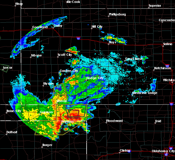 At 945 pm cdt, severe thunderstorms were located along a line extending from 4 miles northeast of boyd to 7 miles east of perryton to 15 miles southeast of waka, moving east at 25 mph (radar indicated). Hazards include 60 mph wind gusts and quarter size hail. Minor damage to roofs, siding, and trees is possible. hail damage to vehicles is expected. Locations impacted include, perryton, beaver, booker, forgan, follett, darrouzett, gate, knowles, wolf creek park, elmwood, farnsworth, boyd, waka, floris, bryans corner, mocane, turpin, slapout and balko. At 945 pm cdt, severe thunderstorms were located along a line extending from 4 miles northeast of boyd to 7 miles east of perryton to 15 miles southeast of waka, moving east at 25 mph (radar indicated). Hazards include 60 mph wind gusts and quarter size hail. Minor damage to roofs, siding, and trees is possible. hail damage to vehicles is expected. Locations impacted include, perryton, beaver, booker, forgan, follett, darrouzett, gate, knowles, wolf creek park, elmwood, farnsworth, boyd, waka, floris, bryans corner, mocane, turpin, slapout and balko.
|
| 8/23/2019 9:43 PM CDT | Report send via twitter of debris... and power lines across highway 23 and county road c blocking the road for traffi in lipscomb county TX, 1.7 miles SSW of Booker, TX |
| 8/23/2019 9:40 PM CDT | One inch tree limbs broken. shingles blown of in ochiltree county TX, 3.3 miles SE of Booker, TX |
| 8/23/2019 8:57 PM CDT |
 At 856 pm cdt, severe thunderstorms were located along a line extending from 5 miles northwest of turpin to 11 miles north of farnsworth to 8 miles north of morse, moving east at 30 mph (radar indicated). Hazards include 60 mph wind gusts and quarter size hail. Minor damage to roofs, siding, and trees is possible. Hail damage to vehicles is expected. At 856 pm cdt, severe thunderstorms were located along a line extending from 5 miles northwest of turpin to 11 miles north of farnsworth to 8 miles north of morse, moving east at 30 mph (radar indicated). Hazards include 60 mph wind gusts and quarter size hail. Minor damage to roofs, siding, and trees is possible. Hail damage to vehicles is expected.
|
| 8/19/2019 5:28 PM CDT |
 At 528 pm cdt, a severe thunderstorm was located 6 miles south of perryton, moving northeast at 15 mph (radar indicated). Hazards include 60 mph wind gusts and quarter size hail. Minor damage to roofs, siding, and trees is possible. Hail damage to vehicles is expected. At 528 pm cdt, a severe thunderstorm was located 6 miles south of perryton, moving northeast at 15 mph (radar indicated). Hazards include 60 mph wind gusts and quarter size hail. Minor damage to roofs, siding, and trees is possible. Hail damage to vehicles is expected.
|
| 8/19/2019 4:10 PM CDT |
 At 410 pm cdt, a severe thunderstorm was located 6 miles northwest of wolf creek park, or 8 miles southeast of perryton, moving northeast at 10 mph (radar indicated). Hazards include 60 mph wind gusts and nickel size hail. minor damage to roofs, siding, and trees is possible At 410 pm cdt, a severe thunderstorm was located 6 miles northwest of wolf creek park, or 8 miles southeast of perryton, moving northeast at 10 mph (radar indicated). Hazards include 60 mph wind gusts and nickel size hail. minor damage to roofs, siding, and trees is possible
|
| 6/23/2019 3:03 AM CDT |
 At 303 am cdt, severe thunderstorms were located along a line extending from 8 miles southeast of elmwood to near canadian, moving east at 35 mph (radar indicated). Hazards include 60 mph wind gusts and half dollar size hail. Minor damage to roofs, siding, and trees is possible. Hail damage to vehicles is expected. At 303 am cdt, severe thunderstorms were located along a line extending from 8 miles southeast of elmwood to near canadian, moving east at 35 mph (radar indicated). Hazards include 60 mph wind gusts and half dollar size hail. Minor damage to roofs, siding, and trees is possible. Hail damage to vehicles is expected.
|
| 6/3/2019 11:10 PM CDT |
 The severe thunderstorm warning for south central beaver and northeastern ochiltree counties will expire at 1115 pm cdt, the storm which prompted the warning has weakened below severe limits, and no longer poses an immediate threat to life or property. therefore, the warning will be allowed to expire. however gusty winds and heavy rain are still possible with this thunderstorm. The severe thunderstorm warning for south central beaver and northeastern ochiltree counties will expire at 1115 pm cdt, the storm which prompted the warning has weakened below severe limits, and no longer poses an immediate threat to life or property. therefore, the warning will be allowed to expire. however gusty winds and heavy rain are still possible with this thunderstorm.
|
| 6/3/2019 10:54 PM CDT |
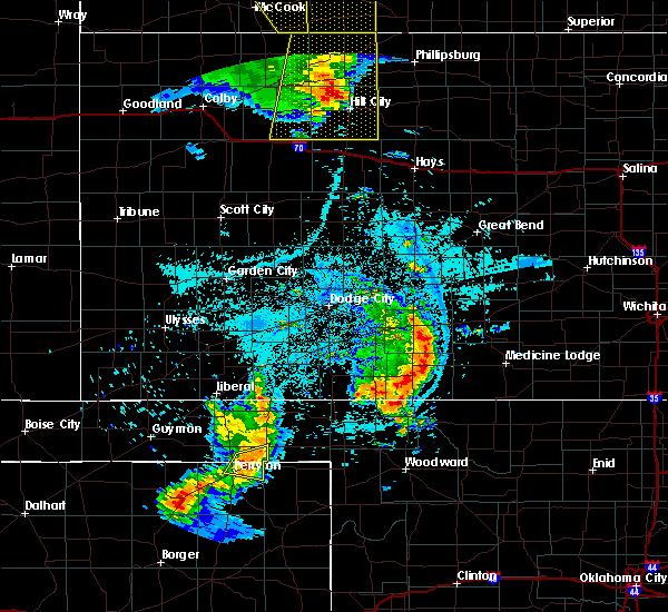 At 1054 pm cdt, a severe thunderstorm was located 7 miles west of booker, or 8 miles northeast of perryton, moving east at 25 mph (radar indicated). Hazards include 60 mph wind gusts and quarter size hail. Minor damage to roofs, siding, and trees is possible. hail damage to vehicles is expected. Locations impacted include, perryton and elmwood. At 1054 pm cdt, a severe thunderstorm was located 7 miles west of booker, or 8 miles northeast of perryton, moving east at 25 mph (radar indicated). Hazards include 60 mph wind gusts and quarter size hail. Minor damage to roofs, siding, and trees is possible. hail damage to vehicles is expected. Locations impacted include, perryton and elmwood.
|
| 6/3/2019 10:35 PM CDT |
 At 1035 pm cdt, a severe thunderstorm was located 7 miles north of perryton, moving east at 30 mph (radar indicated). Hazards include 60 mph wind gusts and quarter size hail. Minor damage to roofs, siding, and trees is possible. hail damage to vehicles is expected. Locations impacted include, perryton, elmwood, bryans corner and balko. At 1035 pm cdt, a severe thunderstorm was located 7 miles north of perryton, moving east at 30 mph (radar indicated). Hazards include 60 mph wind gusts and quarter size hail. Minor damage to roofs, siding, and trees is possible. hail damage to vehicles is expected. Locations impacted include, perryton, elmwood, bryans corner and balko.
|
| 6/3/2019 10:24 PM CDT |
 At 1023 pm cdt, a severe thunderstorm was located 10 miles southwest of bryans corner, or 11 miles northwest of perryton, moving east at 30 mph (radar indicated). Hazards include 60 mph wind gusts and quarter size hail. Minor damage to roofs, siding, and trees is possible. hail damage to vehicles is expected. Locations impacted include, perryton, elmwood, bryans corner and balko. At 1023 pm cdt, a severe thunderstorm was located 10 miles southwest of bryans corner, or 11 miles northwest of perryton, moving east at 30 mph (radar indicated). Hazards include 60 mph wind gusts and quarter size hail. Minor damage to roofs, siding, and trees is possible. hail damage to vehicles is expected. Locations impacted include, perryton, elmwood, bryans corner and balko.
|
| 6/3/2019 10:24 PM CDT |
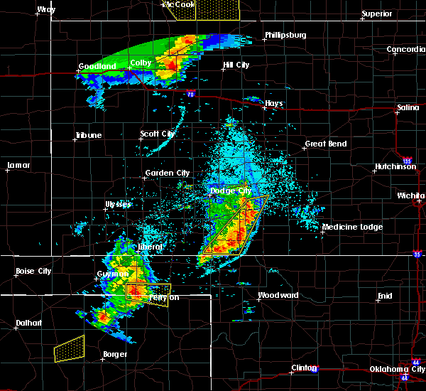 A severe thunderstorm warning remains in effect until 1115 pm cdt for southwestern beaver. southeastern texas and northern ochiltree counties. At 1023 pm cdt, a severe thunderstorm was located 10 miles southwest of bryans corner, or 11 miles northwest of perryton, moving east at 30 mph. A severe thunderstorm warning remains in effect until 1115 pm cdt for southwestern beaver. southeastern texas and northern ochiltree counties. At 1023 pm cdt, a severe thunderstorm was located 10 miles southwest of bryans corner, or 11 miles northwest of perryton, moving east at 30 mph.
|
| 6/3/2019 10:09 PM CDT |
 At 1009 pm cdt, a severe thunderstorm was located 8 miles southeast of hardesty, or 17 miles northwest of perryton, moving east at 30 mph (radar indicated). Hazards include 60 mph wind gusts and quarter size hail. Minor damage to roofs, siding, and trees is possible. Hail damage to vehicles is expected. At 1009 pm cdt, a severe thunderstorm was located 8 miles southeast of hardesty, or 17 miles northwest of perryton, moving east at 30 mph (radar indicated). Hazards include 60 mph wind gusts and quarter size hail. Minor damage to roofs, siding, and trees is possible. Hail damage to vehicles is expected.
|
| 5/26/2019 11:05 PM CDT |
 At 1103 pm cdt, a severe thunderstorm was located 5 miles northeast of follett, or 17 miles northwest of shattuck, moving northeast at 55 mph (radar indicated). Hazards include 70 mph wind gusts. Expect some tree damage. damage is likely to mobile homes, roofs, and outbuildings. locations impacted include, booker, follett, darrouzett and slapout. A tornado watch remains in effect until 200 am cdt for the panhandle of oklahoma, and the panhandle of texas. At 1103 pm cdt, a severe thunderstorm was located 5 miles northeast of follett, or 17 miles northwest of shattuck, moving northeast at 55 mph (radar indicated). Hazards include 70 mph wind gusts. Expect some tree damage. damage is likely to mobile homes, roofs, and outbuildings. locations impacted include, booker, follett, darrouzett and slapout. A tornado watch remains in effect until 200 am cdt for the panhandle of oklahoma, and the panhandle of texas.
|
| 5/26/2019 10:38 PM CDT |
 At 1038 pm cdt, a severe thunderstorm was located 8 miles southwest of darrouzett, or 11 miles northwest of lipscomb, moving northeast at 60 mph (radar indicated). Hazards include 60 mph wind gusts and quarter size hail. Minor damage to roofs, siding, and trees is possible. Hail damage to vehicles is expected. At 1038 pm cdt, a severe thunderstorm was located 8 miles southwest of darrouzett, or 11 miles northwest of lipscomb, moving northeast at 60 mph (radar indicated). Hazards include 60 mph wind gusts and quarter size hail. Minor damage to roofs, siding, and trees is possible. Hail damage to vehicles is expected.
|
| 5/26/2019 10:27 PM CDT |
 The severe thunderstorm warning for beaver, eastern texas, northwestern lipscomb, eastern hansford and ochiltree counties will expire at 1030 pm cdt, the storms which prompted the warning have weakened below severe limits, and no longer pose an immediate threat to life or property. therefore, the warning will be allowed to expire. however gusty winds up to 55 mph are still possible with these thunderstorms. a tornado watch remains in effect until 200 am cdt for the panhandle of oklahoma, and the panhandle of texas. The severe thunderstorm warning for beaver, eastern texas, northwestern lipscomb, eastern hansford and ochiltree counties will expire at 1030 pm cdt, the storms which prompted the warning have weakened below severe limits, and no longer pose an immediate threat to life or property. therefore, the warning will be allowed to expire. however gusty winds up to 55 mph are still possible with these thunderstorms. a tornado watch remains in effect until 200 am cdt for the panhandle of oklahoma, and the panhandle of texas.
|
| 5/26/2019 10:03 PM CDT |
 At 1002 pm cdt, automated weather equipment reported severe thunderstorms were located along a line extending from tyrone to 4 miles south of bryans corner to 4 miles southeast of waka, moving northeast at 60 mph. these are very dangerous storms (automated weather equipment. at 940 pm cdt, an 82 mph gust was reported in hooker). Hazards include 80 mph wind gusts and quarter size hail. Flying debris will be dangerous to those caught without shelter. mobile homes will be heavily damaged. expect considerable damage to roofs, windows, and vehicles. tree damage and power outages are likely. hail damage to vehicles is expected. locations impacted include, perryton, spearman, lipscomb, beaver, booker, tyrone, forgan, darrouzett, knowles, wolf creek park, elmwood, adams, farnsworth, boyd, waka, floris, bryans corner, baker, mocane and turpin. A tornado watch remains in effect until 200 am cdt for the panhandle of oklahoma, and the panhandle of texas. At 1002 pm cdt, automated weather equipment reported severe thunderstorms were located along a line extending from tyrone to 4 miles south of bryans corner to 4 miles southeast of waka, moving northeast at 60 mph. these are very dangerous storms (automated weather equipment. at 940 pm cdt, an 82 mph gust was reported in hooker). Hazards include 80 mph wind gusts and quarter size hail. Flying debris will be dangerous to those caught without shelter. mobile homes will be heavily damaged. expect considerable damage to roofs, windows, and vehicles. tree damage and power outages are likely. hail damage to vehicles is expected. locations impacted include, perryton, spearman, lipscomb, beaver, booker, tyrone, forgan, darrouzett, knowles, wolf creek park, elmwood, adams, farnsworth, boyd, waka, floris, bryans corner, baker, mocane and turpin. A tornado watch remains in effect until 200 am cdt for the panhandle of oklahoma, and the panhandle of texas.
|
| 5/26/2019 9:36 PM CDT |
 At 936 pm cdt, severe thunderstorms were located along a line extending from 7 miles north of optima to 11 miles south of hardesty to 7 miles southwest of spearman, moving northeast at 60 mph (radar indicated). Hazards include 60 mph wind gusts and quarter size hail. Minor damage to roofs, siding, and trees is possible. Hail damage to vehicles is expected. At 936 pm cdt, severe thunderstorms were located along a line extending from 7 miles north of optima to 11 miles south of hardesty to 7 miles southwest of spearman, moving northeast at 60 mph (radar indicated). Hazards include 60 mph wind gusts and quarter size hail. Minor damage to roofs, siding, and trees is possible. Hail damage to vehicles is expected.
|
| 5/26/2019 4:38 PM CDT |
 The severe thunderstorm warning for southwestern beaver, southeastern texas, western lipscomb, northeastern hutchinson, eastern hansford, northern roberts, northwestern hemphill and ochiltree counties will expire at 445 pm cdt, the storms which prompted the warning have weakened below severe limits, and no longer pose an immediate threat to life or property. therefore, the warning will be allowed to expire. however gusty winds are still possible with these thunderstorms. a tornado watch remains in effect until 1000 pm cdt for the panhandle of oklahoma. The severe thunderstorm warning for southwestern beaver, southeastern texas, western lipscomb, northeastern hutchinson, eastern hansford, northern roberts, northwestern hemphill and ochiltree counties will expire at 445 pm cdt, the storms which prompted the warning have weakened below severe limits, and no longer pose an immediate threat to life or property. therefore, the warning will be allowed to expire. however gusty winds are still possible with these thunderstorms. a tornado watch remains in effect until 1000 pm cdt for the panhandle of oklahoma.
|
| 5/26/2019 4:31 PM CDT |
 At 431 pm cdt, severe thunderstorms were located along a line extending from 5 miles south of floris to 6 miles southeast of wolf creek park to 16 miles west of canadian, moving east at 55 mph (radar indicated). Hazards include 60 mph wind gusts and penny size hail. Minor damage to roofs, siding, and trees is possible. locations impacted include, perryton, spearman, booker, wolf creek park, elmwood, bryans corner, farnsworth, boyd, waka and balko. A tornado watch remains in effect until 1000 pm cdt for the panhandle of oklahoma. At 431 pm cdt, severe thunderstorms were located along a line extending from 5 miles south of floris to 6 miles southeast of wolf creek park to 16 miles west of canadian, moving east at 55 mph (radar indicated). Hazards include 60 mph wind gusts and penny size hail. Minor damage to roofs, siding, and trees is possible. locations impacted include, perryton, spearman, booker, wolf creek park, elmwood, bryans corner, farnsworth, boyd, waka and balko. A tornado watch remains in effect until 1000 pm cdt for the panhandle of oklahoma.
|
| 5/26/2019 4:06 PM CDT |
 At 406 pm cdt, severe thunderstorms were located along a line extending from near adams to 14 miles southeast of waka to 22 miles southeast of spearman, moving east at 55 mph (radar indicated). Hazards include 70 mph wind gusts and penny size hail. Expect some tree damage. damage is likely to mobile homes, roofs, and outbuildings. locations impacted include, guymon, perryton, spearman, booker, gruver, hardesty, wolf creek park, elmwood, farnsworth, boyd, waka, bryans corner and balko. A tornado watch remains in effect until 1000 pm cdt for the panhandle of oklahoma. At 406 pm cdt, severe thunderstorms were located along a line extending from near adams to 14 miles southeast of waka to 22 miles southeast of spearman, moving east at 55 mph (radar indicated). Hazards include 70 mph wind gusts and penny size hail. Expect some tree damage. damage is likely to mobile homes, roofs, and outbuildings. locations impacted include, guymon, perryton, spearman, booker, gruver, hardesty, wolf creek park, elmwood, farnsworth, boyd, waka, bryans corner and balko. A tornado watch remains in effect until 1000 pm cdt for the panhandle of oklahoma.
|
| 5/26/2019 3:43 PM CDT |
 The national weather service in amarillo has issued a * severe thunderstorm warning for. southwestern beaver county in the panhandle of oklahoma. southeastern texas county in the panhandle of oklahoma. western lipscomb county in the panhandle of texas. Eastern hutchinson county in the panhandle of texas. The national weather service in amarillo has issued a * severe thunderstorm warning for. southwestern beaver county in the panhandle of oklahoma. southeastern texas county in the panhandle of oklahoma. western lipscomb county in the panhandle of texas. Eastern hutchinson county in the panhandle of texas.
|
| 5/26/2019 3:43 PM CDT |
 At 343 pm cdt, severe thunderstorms were located along a line extending from 14 miles southwest of hardesty to 12 miles south of spearman to 6 miles northwest of skellytown, moving east at 55 mph (radar indicated). Hazards include 70 mph wind gusts and quarter size hail. Expect some tree damage. damage is likely to mobile homes, roofs, and outbuildings. Hail damage to vehicles is expected. At 343 pm cdt, severe thunderstorms were located along a line extending from 14 miles southwest of hardesty to 12 miles south of spearman to 6 miles northwest of skellytown, moving east at 55 mph (radar indicated). Hazards include 70 mph wind gusts and quarter size hail. Expect some tree damage. damage is likely to mobile homes, roofs, and outbuildings. Hail damage to vehicles is expected.
|
| 5/23/2019 7:55 PM CDT |
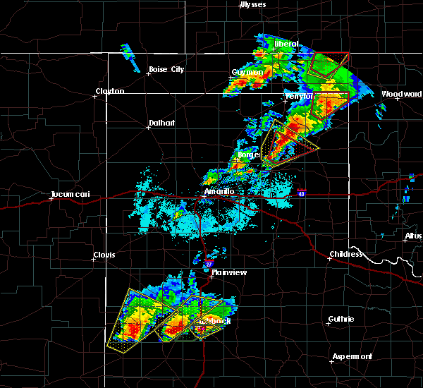 At 755 pm cdt, a severe thunderstorm was located 13 miles south of wolf creek park, or 18 miles northwest of canadian, moving northeast at 35 mph (radar indicated). Hazards include ping pong ball size hail and 60 mph wind gusts. Minor damage to roofs, siding, and trees is possible. people and animals outdoors will be injured. Expect hail damage to roofs, siding, windows, and vehicles. At 755 pm cdt, a severe thunderstorm was located 13 miles south of wolf creek park, or 18 miles northwest of canadian, moving northeast at 35 mph (radar indicated). Hazards include ping pong ball size hail and 60 mph wind gusts. Minor damage to roofs, siding, and trees is possible. people and animals outdoors will be injured. Expect hail damage to roofs, siding, windows, and vehicles.
|
| 5/23/2019 7:00 PM CDT |
 At 700 pm cdt, a severe thunderstorm capable of producing a tornado was located near booker, or 14 miles northeast of perryton, moving northeast at 30 mph (radar indicated rotation). Hazards include tornado and quarter size hail. Flying debris will be dangerous to those caught without shelter. mobile homes will be damaged or destroyed. damage to roofs, windows, and vehicles will occur. Tree damage is likely. At 700 pm cdt, a severe thunderstorm capable of producing a tornado was located near booker, or 14 miles northeast of perryton, moving northeast at 30 mph (radar indicated rotation). Hazards include tornado and quarter size hail. Flying debris will be dangerous to those caught without shelter. mobile homes will be damaged or destroyed. damage to roofs, windows, and vehicles will occur. Tree damage is likely.
|
| 5/23/2019 7:00 PM CDT |
 The national weather service in amarillo has issued a * tornado warning for. southeastern beaver county in the panhandle of oklahoma. northwestern lipscomb county in the panhandle of texas. northeastern ochiltree county in the panhandle of texas. Until 745 pm cdt. The national weather service in amarillo has issued a * tornado warning for. southeastern beaver county in the panhandle of oklahoma. northwestern lipscomb county in the panhandle of texas. northeastern ochiltree county in the panhandle of texas. Until 745 pm cdt.
|
| 5/23/2019 6:44 PM CDT |
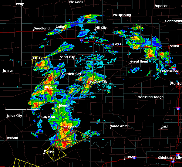 At 644 pm cdt, a severe thunderstorm was located 5 miles east of perryton, moving northeast at 45 mph (radar indicated). Hazards include ping pong ball size hail and 60 mph wind gusts. Minor damage to roofs, siding, and trees is possible. people and animals outdoors will be injured. Expect hail damage to roofs, siding, windows, and vehicles. At 644 pm cdt, a severe thunderstorm was located 5 miles east of perryton, moving northeast at 45 mph (radar indicated). Hazards include ping pong ball size hail and 60 mph wind gusts. Minor damage to roofs, siding, and trees is possible. people and animals outdoors will be injured. Expect hail damage to roofs, siding, windows, and vehicles.
|
| 5/20/2019 3:33 PM CDT |
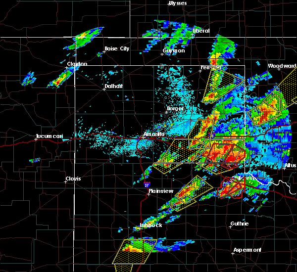 At 333 pm cdt, a severe thunderstorm was located 11 miles west of canadian, moving northeast at 65 mph (radar indicated). Hazards include quarter size hail. Damage to vehicles is expected. locations impacted include, lipscomb and wolf creek park. A tornado watch remains in effect until 800 pm cdt for the panhandle of texas. At 333 pm cdt, a severe thunderstorm was located 11 miles west of canadian, moving northeast at 65 mph (radar indicated). Hazards include quarter size hail. Damage to vehicles is expected. locations impacted include, lipscomb and wolf creek park. A tornado watch remains in effect until 800 pm cdt for the panhandle of texas.
|
| 5/20/2019 3:17 PM CDT |
 At 316 pm cdt, a severe thunderstorm was located 4 miles northwest of miami, moving northeast at 50 mph (radar indicated). Hazards include quarter size hail. Damage to vehicles is expected. locations impacted include, lipscomb, canadian, miami, higgins, wolf creek park, lora, glazier and lake marvin. A tornado watch remains in effect until 800 pm cdt for the panhandle of texas. At 316 pm cdt, a severe thunderstorm was located 4 miles northwest of miami, moving northeast at 50 mph (radar indicated). Hazards include quarter size hail. Damage to vehicles is expected. locations impacted include, lipscomb, canadian, miami, higgins, wolf creek park, lora, glazier and lake marvin. A tornado watch remains in effect until 800 pm cdt for the panhandle of texas.
|
| 5/20/2019 3:02 PM CDT |
 At 302 pm cdt, a severe thunderstorm was located over codman, or 7 miles southwest of miami, moving northeast at 65 mph (radar indicated). Hazards include ping pong ball size hail. People and animals outdoors will be injured. Expect damage to roofs, siding, windows, and vehicles. At 302 pm cdt, a severe thunderstorm was located over codman, or 7 miles southwest of miami, moving northeast at 65 mph (radar indicated). Hazards include ping pong ball size hail. People and animals outdoors will be injured. Expect damage to roofs, siding, windows, and vehicles.
|
| 5/20/2019 6:49 AM CDT |
 At 641 am cdt, severe thunderstorms were located along a line extending from 3 miles north of perryton to 8 miles northwest of wolf creek park to 13 miles southeast of farnsworth to 19 miles southeast of waka, moving east at 35 mph. these are very dangerous storms (radar indicated). Hazards include three inch hail and 60 mph wind gusts. People and animals outdoors will be severely injured. Expect shattered windows, extensive damage to roofs, siding, and vehicles. At 641 am cdt, severe thunderstorms were located along a line extending from 3 miles north of perryton to 8 miles northwest of wolf creek park to 13 miles southeast of farnsworth to 19 miles southeast of waka, moving east at 35 mph. these are very dangerous storms (radar indicated). Hazards include three inch hail and 60 mph wind gusts. People and animals outdoors will be severely injured. Expect shattered windows, extensive damage to roofs, siding, and vehicles.
|
| 5/20/2019 6:49 AM CDT |
 At 649 am cdt, severe thunderstorms were located along a line extending from 7 miles west of booker to 8 miles southeast of perryton to 6 miles southwest of wolf creek park to 20 miles southeast of waka, moving east at 35 mph. these are very dangerous storms (radar indicated). Hazards include three inch hail and 60 mph wind gusts. People and animals outdoors will be severely injured. expect shattered windows, extensive damage to roofs, siding, and vehicles. Locations impacted include, lipscomb, booker, follett, darrouzett, wolf creek park and glazier. At 649 am cdt, severe thunderstorms were located along a line extending from 7 miles west of booker to 8 miles southeast of perryton to 6 miles southwest of wolf creek park to 20 miles southeast of waka, moving east at 35 mph. these are very dangerous storms (radar indicated). Hazards include three inch hail and 60 mph wind gusts. People and animals outdoors will be severely injured. expect shattered windows, extensive damage to roofs, siding, and vehicles. Locations impacted include, lipscomb, booker, follett, darrouzett, wolf creek park and glazier.
|
| 5/20/2019 6:41 AM CDT |
 The national weather service in amarillo has issued a * severe thunderstorm warning for. southern beaver county in the panhandle of oklahoma. lipscomb county in the panhandle of texas. northern roberts county in the panhandle of texas. Northwestern hemphill county in the panhandle of texas. The national weather service in amarillo has issued a * severe thunderstorm warning for. southern beaver county in the panhandle of oklahoma. lipscomb county in the panhandle of texas. northern roberts county in the panhandle of texas. Northwestern hemphill county in the panhandle of texas.
|
| 5/20/2019 6:41 AM CDT |
 At 641 am cdt, severe thunderstorms were located along a line extending from 3 miles north of perryton to 8 miles northwest of wolf creek park to 13 miles southeast of farnsworth to 19 miles southeast of waka, moving east at 35 mph. these are very dangerous storms (radar indicated). Hazards include three inch hail and 60 mph wind gusts. People and animals outdoors will be severely injured. Expect shattered windows, extensive damage to roofs, siding, and vehicles. At 641 am cdt, severe thunderstorms were located along a line extending from 3 miles north of perryton to 8 miles northwest of wolf creek park to 13 miles southeast of farnsworth to 19 miles southeast of waka, moving east at 35 mph. these are very dangerous storms (radar indicated). Hazards include three inch hail and 60 mph wind gusts. People and animals outdoors will be severely injured. Expect shattered windows, extensive damage to roofs, siding, and vehicles.
|
| 5/7/2019 8:13 PM CDT |
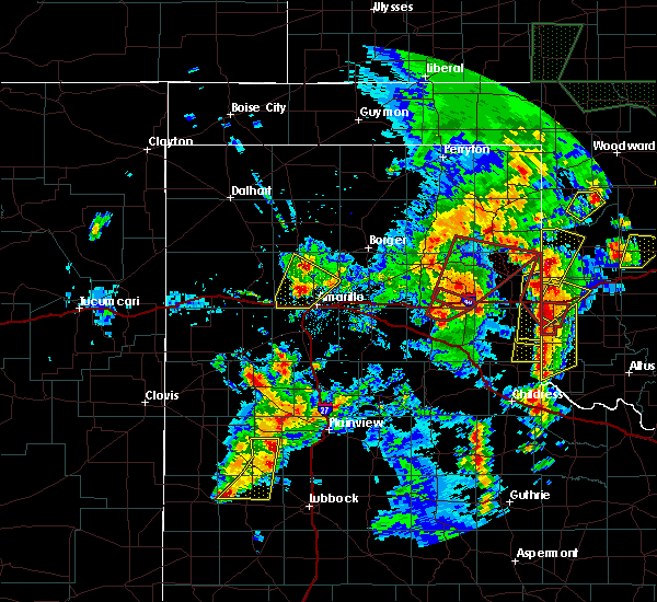 At 813 pm cdt, a severe thunderstorm was located 4 miles south of canadian, moving northeast at 55 mph (radar indicated). Hazards include 60 mph wind gusts and quarter size hail. Minor damage to roofs, siding, and trees is possible. Hail damage to vehicles is expected. At 813 pm cdt, a severe thunderstorm was located 4 miles south of canadian, moving northeast at 55 mph (radar indicated). Hazards include 60 mph wind gusts and quarter size hail. Minor damage to roofs, siding, and trees is possible. Hail damage to vehicles is expected.
|
| 5/7/2019 6:42 PM CDT |
 At 642 pm cdt, a severe thunderstorm was located over booker, or 15 miles east of perryton, moving northeast at 30 mph (radar indicated). Hazards include half dollar size hail. damage to vehicles is expected At 642 pm cdt, a severe thunderstorm was located over booker, or 15 miles east of perryton, moving northeast at 30 mph (radar indicated). Hazards include half dollar size hail. damage to vehicles is expected
|
| 7/29/2018 11:54 PM CDT |
 At 1154 pm cdt, a severe thunderstorm was located near hardesty, or 20 miles east of guymon, moving southeast at 30 mph (radar indicated). Hazards include 70 mph wind gusts and half dollar size hail. Expect some tree damage. damage is likely to mobile homes, roofs, and outbuildings. hail damage to vehicles is expected. Locations impacted include, guymon, perryton, spearman, lipscomb, booker, optima, darrouzett, hardesty, wolf creek park, elmwood, adams, farnsworth, boyd, waka, floris, bryans corner, turpin and balko. At 1154 pm cdt, a severe thunderstorm was located near hardesty, or 20 miles east of guymon, moving southeast at 30 mph (radar indicated). Hazards include 70 mph wind gusts and half dollar size hail. Expect some tree damage. damage is likely to mobile homes, roofs, and outbuildings. hail damage to vehicles is expected. Locations impacted include, guymon, perryton, spearman, lipscomb, booker, optima, darrouzett, hardesty, wolf creek park, elmwood, adams, farnsworth, boyd, waka, floris, bryans corner, turpin and balko.
|
| 7/29/2018 11:31 PM CDT |
 At 1130 pm cdt, a severe thunderstorm was located 4 miles southeast of optima, or 11 miles east of guymon, moving southeast at 30 mph (radar indicated). Hazards include 70 mph wind gusts and half dollar size hail. Expect some tree damage. damage is likely to mobile homes, roofs, and outbuildings. Hail damage to vehicles is expected. At 1130 pm cdt, a severe thunderstorm was located 4 miles southeast of optima, or 11 miles east of guymon, moving southeast at 30 mph (radar indicated). Hazards include 70 mph wind gusts and half dollar size hail. Expect some tree damage. damage is likely to mobile homes, roofs, and outbuildings. Hail damage to vehicles is expected.
|
| 7/29/2018 12:32 AM CDT | Storm damage reported in lipscomb county TX, 0.4 miles NNE of Booker, TX |
| 7/29/2018 12:14 AM CDT |
 At 1213 am cdt, a severe thunderstorm was located 4 miles southeast of bryans corner, or 12 miles north of perryton, moving southeast at 40 mph (radar indicated). Hazards include 70 mph wind gusts and quarter size hail. Expect some tree damage. damage is likely to mobile homes, roofs, and outbuildings. Hail damage to vehicles is expected. At 1213 am cdt, a severe thunderstorm was located 4 miles southeast of bryans corner, or 12 miles north of perryton, moving southeast at 40 mph (radar indicated). Hazards include 70 mph wind gusts and quarter size hail. Expect some tree damage. damage is likely to mobile homes, roofs, and outbuildings. Hail damage to vehicles is expected.
|
| 7/28/2018 1:06 AM CDT |
 The severe thunderstorm warning for southern beaver, lipscomb and northeastern ochiltree counties will expire at 115 am cdt, the storms which prompted the warning have weakened below severe limits, and no longer pose an immediate threat to life or property. therefore, the warning will be allowed to expire. however heavy rain is still possible with these thunderstorms. a severe thunderstorm watch remains in effect until 500 am cdt for the panhandle of oklahoma, and the panhandle of texas. The severe thunderstorm warning for southern beaver, lipscomb and northeastern ochiltree counties will expire at 115 am cdt, the storms which prompted the warning have weakened below severe limits, and no longer pose an immediate threat to life or property. therefore, the warning will be allowed to expire. however heavy rain is still possible with these thunderstorms. a severe thunderstorm watch remains in effect until 500 am cdt for the panhandle of oklahoma, and the panhandle of texas.
|
| 7/28/2018 12:45 AM CDT |
 At 1245 am cdt, severe thunderstorms were located along a line extending from 4 miles south of laverne to 6 miles southwest of booker, moving southeast at 25 mph (radar indicated). Hazards include 60 mph wind gusts. Minor damage to roofs, siding, and trees is possible. Locations impacted include, lipscomb, booker, follett, higgins, darrouzett, gate, elmwood, slapout and balko. At 1245 am cdt, severe thunderstorms were located along a line extending from 4 miles south of laverne to 6 miles southwest of booker, moving southeast at 25 mph (radar indicated). Hazards include 60 mph wind gusts. Minor damage to roofs, siding, and trees is possible. Locations impacted include, lipscomb, booker, follett, higgins, darrouzett, gate, elmwood, slapout and balko.
|
| 7/28/2018 12:26 AM CDT |
 At 1200 am cdt, severe thunderstorms were located along a line extending from 3 miles southwest of knowles to 4 miles northwest of elmwood, moving southeast at 45 mph (radar indicated). Hazards include 60 mph wind gusts. minor damage to roofs, siding, and trees is possible At 1200 am cdt, severe thunderstorms were located along a line extending from 3 miles southwest of knowles to 4 miles northwest of elmwood, moving southeast at 45 mph (radar indicated). Hazards include 60 mph wind gusts. minor damage to roofs, siding, and trees is possible
|
| 7/28/2018 12:26 AM CDT |
 At 1226 am cdt, severe thunderstorms were located along a line extending from 7 miles northeast of slapout to 5 miles south of elmwood, moving southeast at 35 mph (radar indicated). Hazards include 60 mph wind gusts. Minor damage to roofs, siding, and trees is possible. Locations impacted include, lipscomb, booker, follett, higgins, darrouzett, gate, knowles, elmwood, slapout and balko. At 1226 am cdt, severe thunderstorms were located along a line extending from 7 miles northeast of slapout to 5 miles south of elmwood, moving southeast at 35 mph (radar indicated). Hazards include 60 mph wind gusts. Minor damage to roofs, siding, and trees is possible. Locations impacted include, lipscomb, booker, follett, higgins, darrouzett, gate, knowles, elmwood, slapout and balko.
|
| 7/28/2018 12:00 AM CDT |
 At 1200 am cdt, severe thunderstorms were located along a line extending from 3 miles southwest of knowles to 4 miles northwest of elmwood, moving southeast at 45 mph (radar indicated). Hazards include 60 mph wind gusts. minor damage to roofs, siding, and trees is possible At 1200 am cdt, severe thunderstorms were located along a line extending from 3 miles southwest of knowles to 4 miles northwest of elmwood, moving southeast at 45 mph (radar indicated). Hazards include 60 mph wind gusts. minor damage to roofs, siding, and trees is possible
|
| 7/19/2018 6:59 PM CDT | Storm damage reported in lipscomb county TX, 0.4 miles NNE of Booker, TX |
| 6/30/2018 11:30 PM CDT |
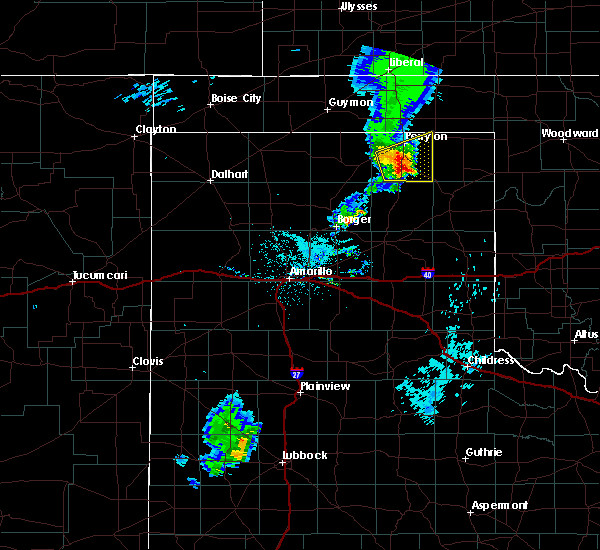 At 1127 pm cdt, a severe thunderstorm was located 8 miles southeast of farnsworth, or 10 miles south of perryton, moving east at 30 mph (radar indicated. spotters also confirmed winds of at least 60 mph and hail to quarter size 15 miles east of spearman). Hazards include 60 mph wind gusts and quarter size hail. Minor damage to roofs, siding, and trees is possible. hail damage to vehicles is expected. Locations impacted include, perryton, wolf creek park and farnsworth. At 1127 pm cdt, a severe thunderstorm was located 8 miles southeast of farnsworth, or 10 miles south of perryton, moving east at 30 mph (radar indicated. spotters also confirmed winds of at least 60 mph and hail to quarter size 15 miles east of spearman). Hazards include 60 mph wind gusts and quarter size hail. Minor damage to roofs, siding, and trees is possible. hail damage to vehicles is expected. Locations impacted include, perryton, wolf creek park and farnsworth.
|
| 6/30/2018 10:55 PM CDT |
 At 1055 pm cdt, a severe thunderstorm was located 4 miles east of spearman, moving east at 30 mph (radar indicated). Hazards include 60 mph wind gusts and quarter size hail. Minor damage to roofs, siding, and trees is possible. Hail damage to vehicles is expected. At 1055 pm cdt, a severe thunderstorm was located 4 miles east of spearman, moving east at 30 mph (radar indicated). Hazards include 60 mph wind gusts and quarter size hail. Minor damage to roofs, siding, and trees is possible. Hail damage to vehicles is expected.
|
| 6/24/2018 11:34 PM CDT |
 At 1133 pm cdt, severe thunderstorms were located along a line extending from 6 miles west of may to 3 miles southwest of lipscomb, moving southeast at 35 mph (radar indicated). Hazards include 60 mph wind gusts and nickel size hail. Minor damage to roofs, siding, and trees is possible. Locations impacted include, lipscomb, booker, follett, higgins, darrouzett, glazier and lake marvin. At 1133 pm cdt, severe thunderstorms were located along a line extending from 6 miles west of may to 3 miles southwest of lipscomb, moving southeast at 35 mph (radar indicated). Hazards include 60 mph wind gusts and nickel size hail. Minor damage to roofs, siding, and trees is possible. Locations impacted include, lipscomb, booker, follett, higgins, darrouzett, glazier and lake marvin.
|
| 6/24/2018 11:15 PM CDT |
 At 1115 pm cdt, severe thunderstorms were located along a line extending from 5 miles northeast of slapout to 10 miles east of wolf creek park, moving southeast at 35 mph (radar indicated). Hazards include 70 mph wind gusts and quarter size hail. Expect some tree damage. damage is likely to mobile homes, roofs, and outbuildings. Hail damage to vehicles is expected. At 1115 pm cdt, severe thunderstorms were located along a line extending from 5 miles northeast of slapout to 10 miles east of wolf creek park, moving southeast at 35 mph (radar indicated). Hazards include 70 mph wind gusts and quarter size hail. Expect some tree damage. damage is likely to mobile homes, roofs, and outbuildings. Hail damage to vehicles is expected.
|
| 6/24/2018 10:50 PM CDT | Sheriffs office reported from deputys in the field that winds estimated at least 60 mph with the stor in lipscomb county TX, 0.3 miles SSE of Booker, TX |
| 6/24/2018 10:15 PM CDT |
 At 1014 pm cdt, severe thunderstorms were located along a line extending from 8 miles southwest of knowles to 6 miles north of perryton, moving southeast at 45 mph (radar indicated). Hazards include 70 mph wind gusts and half dollar size hail. Expect some tree damage. damage is likely to mobile homes, roofs, and outbuildings. Hail damage to vehicles is expected. At 1014 pm cdt, severe thunderstorms were located along a line extending from 8 miles southwest of knowles to 6 miles north of perryton, moving southeast at 45 mph (radar indicated). Hazards include 70 mph wind gusts and half dollar size hail. Expect some tree damage. damage is likely to mobile homes, roofs, and outbuildings. Hail damage to vehicles is expected.
|
| 6/22/2018 7:59 PM CDT |
 At 758 pm cdt, severe thunderstorms were located along a line extending from 10 miles southwest of may to 8 miles west of durham, moving southeast at 80 mph (radar indicated). Hazards include 60 mph wind gusts and quarter size hail. Minor damage to roofs, siding, and trees is possible. hail damage to vehicles is expected. Locations impacted include, lipscomb, booker, follett, higgins and darrouzett. At 758 pm cdt, severe thunderstorms were located along a line extending from 10 miles southwest of may to 8 miles west of durham, moving southeast at 80 mph (radar indicated). Hazards include 60 mph wind gusts and quarter size hail. Minor damage to roofs, siding, and trees is possible. hail damage to vehicles is expected. Locations impacted include, lipscomb, booker, follett, higgins and darrouzett.
|
| 6/22/2018 7:59 PM CDT |
 At 741 pm cdt, severe thunderstorms were located along a line extending from 8 miles northwest of slapout to 4 miles west of glazier, moving southeast at 80 mph (radar indicated). Hazards include 70 mph wind gusts and quarter size hail. Expect some tree damage. damage is likely to mobile homes, roofs, and outbuildings. Hail damage to vehicles is expected. At 741 pm cdt, severe thunderstorms were located along a line extending from 8 miles northwest of slapout to 4 miles west of glazier, moving southeast at 80 mph (radar indicated). Hazards include 70 mph wind gusts and quarter size hail. Expect some tree damage. damage is likely to mobile homes, roofs, and outbuildings. Hail damage to vehicles is expected.
|
| 6/22/2018 7:41 PM CDT |
 The national weather service in amarillo has issued a * severe thunderstorm warning for. eastern beaver county in the panhandle of oklahoma. lipscomb county in the panhandle of texas. northeastern roberts county in the panhandle of texas. Northwestern hemphill county in the panhandle of texas. The national weather service in amarillo has issued a * severe thunderstorm warning for. eastern beaver county in the panhandle of oklahoma. lipscomb county in the panhandle of texas. northeastern roberts county in the panhandle of texas. Northwestern hemphill county in the panhandle of texas.
|
| 6/22/2018 7:41 PM CDT |
 At 741 pm cdt, severe thunderstorms were located along a line extending from 8 miles northwest of slapout to 4 miles west of glazier, moving southeast at 80 mph (radar indicated). Hazards include 70 mph wind gusts and quarter size hail. Expect some tree damage. damage is likely to mobile homes, roofs, and outbuildings. Hail damage to vehicles is expected. At 741 pm cdt, severe thunderstorms were located along a line extending from 8 miles northwest of slapout to 4 miles west of glazier, moving southeast at 80 mph (radar indicated). Hazards include 70 mph wind gusts and quarter size hail. Expect some tree damage. damage is likely to mobile homes, roofs, and outbuildings. Hail damage to vehicles is expected.
|
| 6/22/2018 2:41 AM CDT |
 The severe thunderstorm warning for northeastern hansford and ochiltree counties will expire at 245 am cdt, the storm which prompted the warning has weakened below severe limits, and no longer poses an immediate threat to life or property. therefore the warning will be allowed to expire. however small hail and gusty winds are still possible with this thunderstorm. The severe thunderstorm warning for northeastern hansford and ochiltree counties will expire at 245 am cdt, the storm which prompted the warning has weakened below severe limits, and no longer poses an immediate threat to life or property. therefore the warning will be allowed to expire. however small hail and gusty winds are still possible with this thunderstorm.
|
| 6/22/2018 2:12 AM CDT |
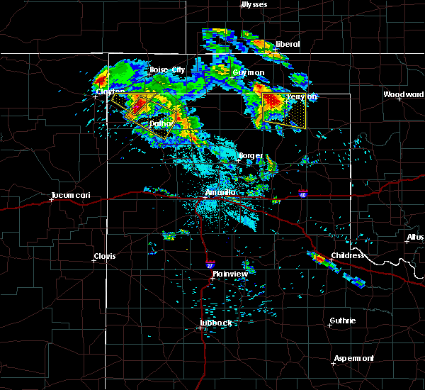 At 212 am cdt, a severe thunderstorm was located 4 miles southwest of perryton, moving east at 40 mph (radar indicated). Hazards include tennis ball size hail and 60 mph wind gusts. Minor damage to roofs, siding, and trees is possible. people and animals outdoors will be injured. expect hail damage to roofs, siding, windows, and vehicles. Locations impacted include, perryton, wolf creek park, waka and farnsworth. At 212 am cdt, a severe thunderstorm was located 4 miles southwest of perryton, moving east at 40 mph (radar indicated). Hazards include tennis ball size hail and 60 mph wind gusts. Minor damage to roofs, siding, and trees is possible. people and animals outdoors will be injured. expect hail damage to roofs, siding, windows, and vehicles. Locations impacted include, perryton, wolf creek park, waka and farnsworth.
|
| 6/22/2018 1:45 AM CDT |
 At 145 am cdt, a severe thunderstorm was located 10 miles northwest of waka, or 15 miles north of spearman, moving east at 40 mph (radar indicated). Hazards include ping pong ball size hail and 60 mph wind gusts. Minor damage to roofs, siding, and trees is possible. people and animals outdoors will be injured. Expect hail damage to roofs, siding, windows, and vehicles. At 145 am cdt, a severe thunderstorm was located 10 miles northwest of waka, or 15 miles north of spearman, moving east at 40 mph (radar indicated). Hazards include ping pong ball size hail and 60 mph wind gusts. Minor damage to roofs, siding, and trees is possible. people and animals outdoors will be injured. Expect hail damage to roofs, siding, windows, and vehicles.
|
| 5/31/2018 12:22 AM CDT |
 The severe thunderstorm warning for south central beaver, northwestern lipscomb and northeastern ochiltree counties will expire at 1230 am cdt, the storm which prompted the warning has weakened below severe limits, and no longer poses an immediate threat to life or property. therefore the warning will be allowed to expire. however small hail, gusty winds and heavy rain are still possible with this thunderstorm. The severe thunderstorm warning for south central beaver, northwestern lipscomb and northeastern ochiltree counties will expire at 1230 am cdt, the storm which prompted the warning has weakened below severe limits, and no longer poses an immediate threat to life or property. therefore the warning will be allowed to expire. however small hail, gusty winds and heavy rain are still possible with this thunderstorm.
|
| 5/31/2018 12:22 AM CDT |
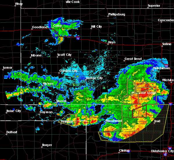 The severe thunderstorm warning for south central beaver, northwestern lipscomb and northeastern ochiltree counties will expire at 1230 am cdt, the storm which prompted the warning has weakened below severe limits, and no longer poses an immediate threat to life or property. therefore the warning will be allowed to expire. however small hail, gusty winds and heavy rain are still possible with this thunderstorm. The severe thunderstorm warning for south central beaver, northwestern lipscomb and northeastern ochiltree counties will expire at 1230 am cdt, the storm which prompted the warning has weakened below severe limits, and no longer poses an immediate threat to life or property. therefore the warning will be allowed to expire. however small hail, gusty winds and heavy rain are still possible with this thunderstorm.
|
| 5/31/2018 12:06 AM CDT |
 At 1206 am cdt, a severe thunderstorm was located 5 miles east of booker, or 18 miles northwest of lipscomb, moving east at 45 mph (radar indicated). Hazards include 70 mph wind gusts and quarter size hail. Expect some tree damage. damage is likely to mobile homes, roofs, and outbuildings. hail damage to vehicles is expected. Locations impacted include, booker, darrouzett and elmwood. At 1206 am cdt, a severe thunderstorm was located 5 miles east of booker, or 18 miles northwest of lipscomb, moving east at 45 mph (radar indicated). Hazards include 70 mph wind gusts and quarter size hail. Expect some tree damage. damage is likely to mobile homes, roofs, and outbuildings. hail damage to vehicles is expected. Locations impacted include, booker, darrouzett and elmwood.
|
| 5/31/2018 12:06 AM CDT |
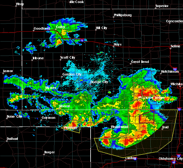 At 1206 am cdt, a severe thunderstorm was located 5 miles east of booker, or 18 miles northwest of lipscomb, moving east at 45 mph (radar indicated). Hazards include 70 mph wind gusts and quarter size hail. Expect some tree damage. damage is likely to mobile homes, roofs, and outbuildings. hail damage to vehicles is expected. Locations impacted include, booker, darrouzett and elmwood. At 1206 am cdt, a severe thunderstorm was located 5 miles east of booker, or 18 miles northwest of lipscomb, moving east at 45 mph (radar indicated). Hazards include 70 mph wind gusts and quarter size hail. Expect some tree damage. damage is likely to mobile homes, roofs, and outbuildings. hail damage to vehicles is expected. Locations impacted include, booker, darrouzett and elmwood.
|
| 5/30/2018 11:46 PM CDT |
 At 1144 pm cdt, a severe thunderstorm was located 8 miles southeast of bryans corner, or 9 miles north of perryton, moving east at 45 mph (radar indicated). Hazards include 70 mph wind gusts and ping pong ball size hail. Expect some tree damage. damage is likely to mobile homes, roofs, and outbuildings. people and animals outdoors will be injured. expect hail damage to roofs, siding, windows, and vehicles. Locations impacted include, beaver, booker, darrouzett, elmwood, bryans corner, boyd and balko. At 1144 pm cdt, a severe thunderstorm was located 8 miles southeast of bryans corner, or 9 miles north of perryton, moving east at 45 mph (radar indicated). Hazards include 70 mph wind gusts and ping pong ball size hail. Expect some tree damage. damage is likely to mobile homes, roofs, and outbuildings. people and animals outdoors will be injured. expect hail damage to roofs, siding, windows, and vehicles. Locations impacted include, beaver, booker, darrouzett, elmwood, bryans corner, boyd and balko.
|
| 5/30/2018 11:46 PM CDT |
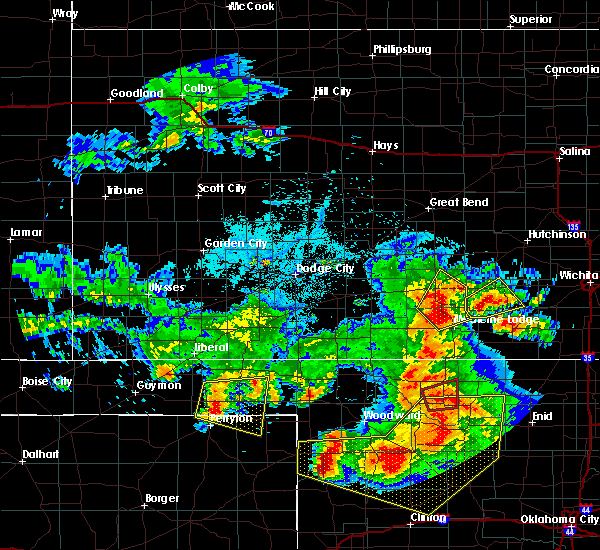 At 1144 pm cdt, a severe thunderstorm was located 8 miles southeast of bryans corner, or 9 miles north of perryton, moving east at 45 mph (radar indicated). Hazards include 70 mph wind gusts and ping pong ball size hail. Expect some tree damage. damage is likely to mobile homes, roofs, and outbuildings. people and animals outdoors will be injured. expect hail damage to roofs, siding, windows, and vehicles. Locations impacted include, beaver, booker, darrouzett, elmwood, bryans corner, boyd and balko. At 1144 pm cdt, a severe thunderstorm was located 8 miles southeast of bryans corner, or 9 miles north of perryton, moving east at 45 mph (radar indicated). Hazards include 70 mph wind gusts and ping pong ball size hail. Expect some tree damage. damage is likely to mobile homes, roofs, and outbuildings. people and animals outdoors will be injured. expect hail damage to roofs, siding, windows, and vehicles. Locations impacted include, beaver, booker, darrouzett, elmwood, bryans corner, boyd and balko.
|
| 5/30/2018 11:32 PM CDT |
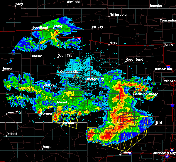 At 1132 pm cdt, a severe thunderstorm was located 7 miles southwest of bryans corner, or 12 miles northwest of perryton, moving east at 45 mph (radar indicated. mid-level rotation is also being detected on radar). Hazards include two inch hail and 70 mph wind gusts. Expect some tree damage. damage is likely to mobile homes, roofs, and outbuildings. people and animals outdoors will be injured. expect hail damage to roofs, siding, windows, and vehicles. Locations impacted include, beaver, booker, darrouzett, elmwood, bryans corner, boyd and balko. At 1132 pm cdt, a severe thunderstorm was located 7 miles southwest of bryans corner, or 12 miles northwest of perryton, moving east at 45 mph (radar indicated. mid-level rotation is also being detected on radar). Hazards include two inch hail and 70 mph wind gusts. Expect some tree damage. damage is likely to mobile homes, roofs, and outbuildings. people and animals outdoors will be injured. expect hail damage to roofs, siding, windows, and vehicles. Locations impacted include, beaver, booker, darrouzett, elmwood, bryans corner, boyd and balko.
|
| 5/30/2018 11:32 PM CDT |
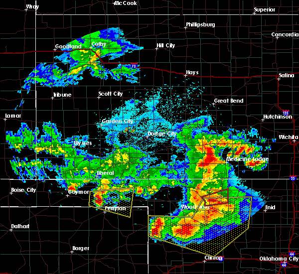 At 1132 pm cdt, a severe thunderstorm was located 7 miles southwest of bryans corner, or 12 miles northwest of perryton, moving east at 45 mph (radar indicated. mid-level rotation is also being detected on radar). Hazards include two inch hail and 70 mph wind gusts. Expect some tree damage. damage is likely to mobile homes, roofs, and outbuildings. people and animals outdoors will be injured. expect hail damage to roofs, siding, windows, and vehicles. Locations impacted include, beaver, booker, darrouzett, elmwood, bryans corner, boyd and balko. At 1132 pm cdt, a severe thunderstorm was located 7 miles southwest of bryans corner, or 12 miles northwest of perryton, moving east at 45 mph (radar indicated. mid-level rotation is also being detected on radar). Hazards include two inch hail and 70 mph wind gusts. Expect some tree damage. damage is likely to mobile homes, roofs, and outbuildings. people and animals outdoors will be injured. expect hail damage to roofs, siding, windows, and vehicles. Locations impacted include, beaver, booker, darrouzett, elmwood, bryans corner, boyd and balko.
|
| 5/30/2018 11:28 PM CDT |
 At 1127 pm cdt, a severe thunderstorm was located 9 miles southwest of bryans corner, or 15 miles northwest of perryton, moving east at 45 mph (radar indicated). Hazards include two inch hail and 70 mph wind gusts. Expect some tree damage. damage is likely to mobile homes, roofs, and outbuildings. people and animals outdoors will be injured. Expect hail damage to roofs, siding, windows, and vehicles. At 1127 pm cdt, a severe thunderstorm was located 9 miles southwest of bryans corner, or 15 miles northwest of perryton, moving east at 45 mph (radar indicated). Hazards include two inch hail and 70 mph wind gusts. Expect some tree damage. damage is likely to mobile homes, roofs, and outbuildings. people and animals outdoors will be injured. Expect hail damage to roofs, siding, windows, and vehicles.
|
| 5/30/2018 10:13 PM CDT |
 At 1012 pm cdt, severe thunderstorms were located along a line extending from 6 miles west of laverne to 5 miles east of lipscomb, moving east at 40 mph. these are very dangerous storms (radar indicated). Hazards include baseball size hail and 70 mph wind gusts. People and animals outdoors will be severely injured. expect shattered windows, extensive damage to roofs, siding, and vehicles. Locations impacted include, lipscomb, follett, higgins, darrouzett, gate, knowles, slapout and glazier. At 1012 pm cdt, severe thunderstorms were located along a line extending from 6 miles west of laverne to 5 miles east of lipscomb, moving east at 40 mph. these are very dangerous storms (radar indicated). Hazards include baseball size hail and 70 mph wind gusts. People and animals outdoors will be severely injured. expect shattered windows, extensive damage to roofs, siding, and vehicles. Locations impacted include, lipscomb, follett, higgins, darrouzett, gate, knowles, slapout and glazier.
|
| 5/30/2018 10:05 PM CDT |
 At 1005 pm cdt, severe thunderstorms were located along a line extending from 7 miles south of gate to lipscomb, moving east at 40 mph. these are very dangerous storms (radar indicated). Hazards include baseball size hail and 70 mph wind gusts. People and animals outdoors will be severely injured. expect shattered windows, extensive damage to roofs, siding, and vehicles. Locations impacted include, lipscomb, booker, follett, higgins, darrouzett, gate, knowles, elmwood, slapout and glazier. At 1005 pm cdt, severe thunderstorms were located along a line extending from 7 miles south of gate to lipscomb, moving east at 40 mph. these are very dangerous storms (radar indicated). Hazards include baseball size hail and 70 mph wind gusts. People and animals outdoors will be severely injured. expect shattered windows, extensive damage to roofs, siding, and vehicles. Locations impacted include, lipscomb, booker, follett, higgins, darrouzett, gate, knowles, elmwood, slapout and glazier.
|
| 5/30/2018 10:00 PM CDT |
 At 1000 pm cdt, severe thunderstorms were located along a line extending from 7 miles south of knowles to near lipscomb, moving east at 40 mph. these are very dangerous storms (radar indicated). Hazards include baseball size hail and 70 mph wind gusts. People and animals outdoors will be severely injured. expect shattered windows, extensive damage to roofs, siding, and vehicles. Locations impacted include, lipscomb, beaver, booker, follett, higgins, darrouzett, gate, knowles, elmwood, slapout and glazier. At 1000 pm cdt, severe thunderstorms were located along a line extending from 7 miles south of knowles to near lipscomb, moving east at 40 mph. these are very dangerous storms (radar indicated). Hazards include baseball size hail and 70 mph wind gusts. People and animals outdoors will be severely injured. expect shattered windows, extensive damage to roofs, siding, and vehicles. Locations impacted include, lipscomb, beaver, booker, follett, higgins, darrouzett, gate, knowles, elmwood, slapout and glazier.
|
| 5/30/2018 10:00 PM CDT |
 At 941 pm cdt, severe thunderstorms were located along a line extending from 8 miles east of beaver to 7 miles northeast of wolf creek park, moving east at 45 mph. these are very dangerous storms (broadcast media and trained spotters have reported wind damage in and around perryton). Hazards include baseball size hail and 70 mph wind gusts. People and animals outdoors will be severely injured. expect shattered windows, extensive damage to roofs, siding, and vehicles. Locations impacted include, perryton, lipscomb, beaver, booker, forgan, follett, higgins, darrouzett, gate, knowles, wolf creek park, elmwood, boyd, floris, glazier, bryans corner, mocane, slapout and balko. At 941 pm cdt, severe thunderstorms were located along a line extending from 8 miles east of beaver to 7 miles northeast of wolf creek park, moving east at 45 mph. these are very dangerous storms (broadcast media and trained spotters have reported wind damage in and around perryton). Hazards include baseball size hail and 70 mph wind gusts. People and animals outdoors will be severely injured. expect shattered windows, extensive damage to roofs, siding, and vehicles. Locations impacted include, perryton, lipscomb, beaver, booker, forgan, follett, higgins, darrouzett, gate, knowles, wolf creek park, elmwood, boyd, floris, glazier, bryans corner, mocane, slapout and balko.
|
| 5/30/2018 9:43 PM CDT |
 At 941 pm cdt, severe thunderstorms were located along a line extending from 8 miles east of beaver to 7 miles northeast of wolf creek park, moving east at 45 mph. these are very dangerous storms (broadcast media and trained spotters have reported wind damage in and around perryton). Hazards include baseball size hail and 70 mph wind gusts. People and animals outdoors will be severely injured. expect shattered windows, extensive damage to roofs, siding, and vehicles. Locations impacted include, perryton, lipscomb, beaver, booker, forgan, follett, higgins, darrouzett, gate, knowles, wolf creek park, elmwood, boyd, floris, glazier, bryans corner, mocane, slapout and balko. At 941 pm cdt, severe thunderstorms were located along a line extending from 8 miles east of beaver to 7 miles northeast of wolf creek park, moving east at 45 mph. these are very dangerous storms (broadcast media and trained spotters have reported wind damage in and around perryton). Hazards include baseball size hail and 70 mph wind gusts. People and animals outdoors will be severely injured. expect shattered windows, extensive damage to roofs, siding, and vehicles. Locations impacted include, perryton, lipscomb, beaver, booker, forgan, follett, higgins, darrouzett, gate, knowles, wolf creek park, elmwood, boyd, floris, glazier, bryans corner, mocane, slapout and balko.
|
| 5/30/2018 9:23 PM CDT |
 At 922 pm cdt, severe thunderstorms were located along a line extending from 4 miles southeast of floris to 5 miles south of perryton, moving east at 40 mph. these are very dangerous storms (radar indicated). Hazards include baseball size hail and 60 mph wind gusts. People and animals outdoors will be severely injured. Expect shattered windows, extensive damage to roofs, siding, and vehicles. At 922 pm cdt, severe thunderstorms were located along a line extending from 4 miles southeast of floris to 5 miles south of perryton, moving east at 40 mph. these are very dangerous storms (radar indicated). Hazards include baseball size hail and 60 mph wind gusts. People and animals outdoors will be severely injured. Expect shattered windows, extensive damage to roofs, siding, and vehicles.
|
| 5/30/2018 9:23 PM CDT |
 The national weather service in amarillo has issued a * severe thunderstorm warning for. beaver county in the panhandle of oklahoma. southeastern texas county in the panhandle of oklahoma. lipscomb county in the panhandle of texas. Northeastern hansford county in the panhandle of texas. The national weather service in amarillo has issued a * severe thunderstorm warning for. beaver county in the panhandle of oklahoma. southeastern texas county in the panhandle of oklahoma. lipscomb county in the panhandle of texas. Northeastern hansford county in the panhandle of texas.
|
| 5/29/2018 5:25 PM CDT | Golf Ball sized hail reported 6.3 miles WNW of Booker, TX, picture received of golf ball size hail. |
| 5/29/2018 5:25 PM CDT |
 At 525 pm cdt, a severe thunderstorm was located 5 miles southeast of booker, or 15 miles northwest of lipscomb, moving northeast at 25 mph (radar indicated). Hazards include ping pong ball size hail and 60 mph wind gusts. Minor damage to roofs, siding, and trees is possible. people and animals outdoors will be injured. Expect hail damage to roofs, siding, windows, and vehicles. At 525 pm cdt, a severe thunderstorm was located 5 miles southeast of booker, or 15 miles northwest of lipscomb, moving northeast at 25 mph (radar indicated). Hazards include ping pong ball size hail and 60 mph wind gusts. Minor damage to roofs, siding, and trees is possible. people and animals outdoors will be injured. Expect hail damage to roofs, siding, windows, and vehicles.
|
| 5/29/2018 5:22 PM CDT |
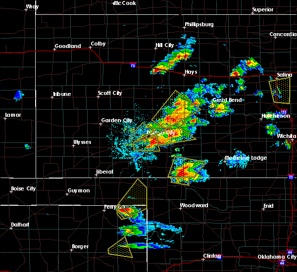 At 522 pm cdt, a severe thunderstorm was located 6 miles southeast of booker, or 15 miles northwest of lipscomb, moving northeast at 30 mph (radar indicated). Hazards include ping pong ball size hail and 60 mph wind gusts. Minor damage to roofs, siding, and trees is possible. people and animals outdoors will be injured. expect hail damage to roofs, siding, windows, and vehicles. locations impacted include, booker. A tornado watch remains in effect until 1000 pm cdt for the panhandle of oklahoma, and the panhandle of texas. At 522 pm cdt, a severe thunderstorm was located 6 miles southeast of booker, or 15 miles northwest of lipscomb, moving northeast at 30 mph (radar indicated). Hazards include ping pong ball size hail and 60 mph wind gusts. Minor damage to roofs, siding, and trees is possible. people and animals outdoors will be injured. expect hail damage to roofs, siding, windows, and vehicles. locations impacted include, booker. A tornado watch remains in effect until 1000 pm cdt for the panhandle of oklahoma, and the panhandle of texas.
|
| 5/29/2018 5:07 PM CDT |
 At 507 pm cdt, a severe thunderstorm was located 8 miles northeast of wolf creek park, or 14 miles east of perryton, moving northeast at 40 mph (radar indicated). Hazards include 60 mph wind gusts and quarter size hail. Minor damage to roofs, siding, and trees is possible. hail damage to vehicles is expected. locations impacted include, lipscomb, booker and wolf creek park. A tornado watch remains in effect until 1000 pm cdt for the panhandle of oklahoma, and the panhandle of texas. At 507 pm cdt, a severe thunderstorm was located 8 miles northeast of wolf creek park, or 14 miles east of perryton, moving northeast at 40 mph (radar indicated). Hazards include 60 mph wind gusts and quarter size hail. Minor damage to roofs, siding, and trees is possible. hail damage to vehicles is expected. locations impacted include, lipscomb, booker and wolf creek park. A tornado watch remains in effect until 1000 pm cdt for the panhandle of oklahoma, and the panhandle of texas.
|
| 5/29/2018 4:40 PM CDT |
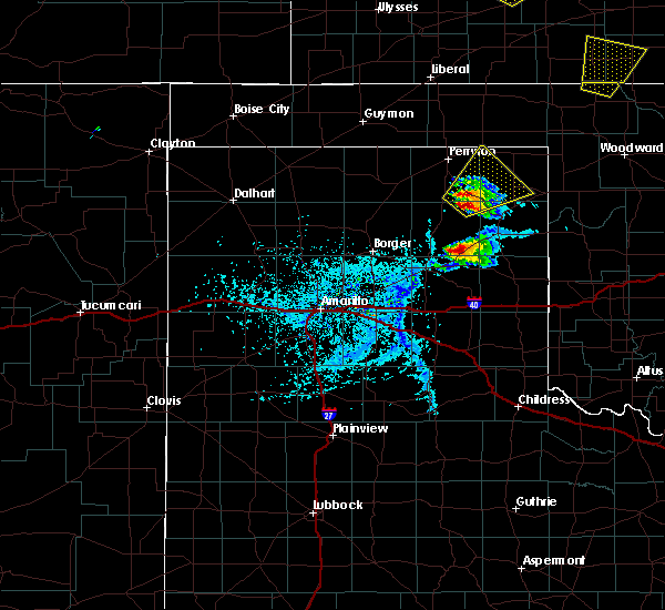 At 439 pm cdt, a severe thunderstorm was located 7 miles south of wolf creek park, or 20 miles northwest of canadian, moving northeast at 25 mph (radar indicated). Hazards include 60 mph wind gusts and quarter size hail. Minor damage to roofs, siding, and trees is possible. Hail damage to vehicles is expected. At 439 pm cdt, a severe thunderstorm was located 7 miles south of wolf creek park, or 20 miles northwest of canadian, moving northeast at 25 mph (radar indicated). Hazards include 60 mph wind gusts and quarter size hail. Minor damage to roofs, siding, and trees is possible. Hail damage to vehicles is expected.
|
| 5/18/2018 6:12 PM CDT |
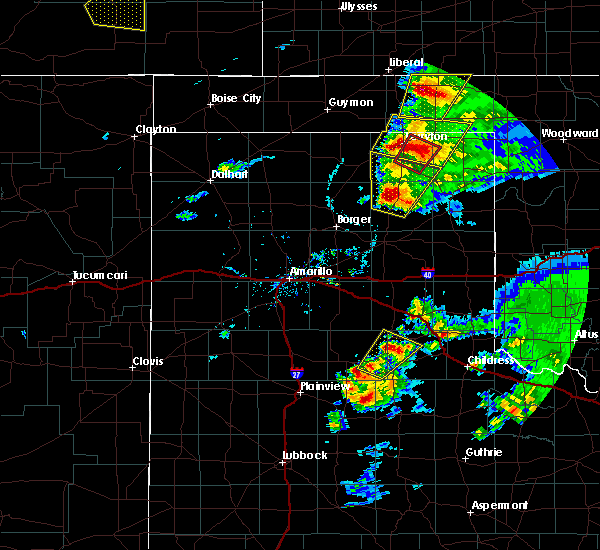 At 612 pm cdt, a severe thunderstorm was located near perryton, moving northeast at 25 mph (radar indicated). Hazards include golf ball size hail and 70 mph wind gusts. Expect some tree damage. damage is likely to mobile homes, roofs, and outbuildings. people and animals outdoors will be injured. Expect hail damage to roofs, siding, windows, and vehicles. At 612 pm cdt, a severe thunderstorm was located near perryton, moving northeast at 25 mph (radar indicated). Hazards include golf ball size hail and 70 mph wind gusts. Expect some tree damage. damage is likely to mobile homes, roofs, and outbuildings. people and animals outdoors will be injured. Expect hail damage to roofs, siding, windows, and vehicles.
|
| 5/18/2018 5:05 PM CDT |
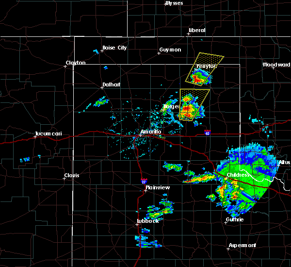 At 504 pm cdt, a severe thunderstorm was located 7 miles west of wolf creek park, or 10 miles south of perryton, moving northeast at 35 mph (radar indicated). Hazards include 60 mph wind gusts and half dollar size hail. Minor damage to roofs, siding, and trees is possible. Hail damage to vehicles is expected. At 504 pm cdt, a severe thunderstorm was located 7 miles west of wolf creek park, or 10 miles south of perryton, moving northeast at 35 mph (radar indicated). Hazards include 60 mph wind gusts and half dollar size hail. Minor damage to roofs, siding, and trees is possible. Hail damage to vehicles is expected.
|
| 5/17/2018 10:30 AM CDT |
 At 1030 am cdt, severe thunderstorms were located along a line extending from forgan to near lipscomb to 5 miles west of higgins, moving northeast at 15 mph (radar indicated). Hazards include 60 mph wind gusts and half dollar size hail. Minor damage to roofs, siding, and trees is possible. hail damage to vehicles is expected. Locations impacted include, lipscomb, beaver, forgan, follett, higgins, darrouzett, gate, knowles, elmwood, mocane, slapout and floris. At 1030 am cdt, severe thunderstorms were located along a line extending from forgan to near lipscomb to 5 miles west of higgins, moving northeast at 15 mph (radar indicated). Hazards include 60 mph wind gusts and half dollar size hail. Minor damage to roofs, siding, and trees is possible. hail damage to vehicles is expected. Locations impacted include, lipscomb, beaver, forgan, follett, higgins, darrouzett, gate, knowles, elmwood, mocane, slapout and floris.
|
| 5/17/2018 10:30 AM CDT |
 At 1007 am cdt, severe thunderstorms were located along a line extending from 4 miles southeast of floris to 6 miles west of lipscomb to 4 miles northeast of glazier, moving east at 20 mph (radar indicated). Hazards include 60 mph wind gusts and half dollar size hail. Minor damage to roofs, siding, and trees is possible. Hail damage to vehicles is expected. At 1007 am cdt, severe thunderstorms were located along a line extending from 4 miles southeast of floris to 6 miles west of lipscomb to 4 miles northeast of glazier, moving east at 20 mph (radar indicated). Hazards include 60 mph wind gusts and half dollar size hail. Minor damage to roofs, siding, and trees is possible. Hail damage to vehicles is expected.
|
| 5/17/2018 10:07 AM CDT |
 At 1007 am cdt, severe thunderstorms were located along a line extending from 4 miles southeast of floris to 6 miles west of lipscomb to 4 miles northeast of glazier, moving east at 20 mph (radar indicated). Hazards include 60 mph wind gusts and half dollar size hail. Minor damage to roofs, siding, and trees is possible. Hail damage to vehicles is expected. At 1007 am cdt, severe thunderstorms were located along a line extending from 4 miles southeast of floris to 6 miles west of lipscomb to 4 miles northeast of glazier, moving east at 20 mph (radar indicated). Hazards include 60 mph wind gusts and half dollar size hail. Minor damage to roofs, siding, and trees is possible. Hail damage to vehicles is expected.
|
| 5/13/2018 6:36 PM CDT |
 At 634 pm cdt, severe thunderstorms were located along a line extending from 7 miles northeast of elmwood to 10 miles southwest of lipscomb, moving northeast at 40 mph. these are very dangerous storms (radar indicated. the storm southeast of wolf creek park could have up to 3 inch hail). Hazards include three inch hail and 60 mph wind gusts. People and animals outdoors will be severely injured. expect shattered windows, extensive damage to roofs, siding, and vehicles. Locations impacted include, lipscomb, booker, follett, darrouzett, elmwood and slapout. At 634 pm cdt, severe thunderstorms were located along a line extending from 7 miles northeast of elmwood to 10 miles southwest of lipscomb, moving northeast at 40 mph. these are very dangerous storms (radar indicated. the storm southeast of wolf creek park could have up to 3 inch hail). Hazards include three inch hail and 60 mph wind gusts. People and animals outdoors will be severely injured. expect shattered windows, extensive damage to roofs, siding, and vehicles. Locations impacted include, lipscomb, booker, follett, darrouzett, elmwood and slapout.
|
| 5/13/2018 6:24 PM CDT |
 At 612 pm cdt, severe thunderstorms were located along a line extending from booker to 8 miles southeast of wolf creek park, moving northeast at 40 mph (trained weather spotters. reports of ping pong ball size hail 12 miles southeast of wolf creek park and quarter size hail 2 miles west of booker, tx). Hazards include ping pong ball size hail and 60 mph wind gusts. Minor damage to roofs, siding, and trees is possible. people and animals outdoors will be injured. expect hail damage to roofs, siding, windows, and vehicles. Locations impacted include, lipscomb, booker, follett, darrouzett, wolf creek park, elmwood and slapout. At 612 pm cdt, severe thunderstorms were located along a line extending from booker to 8 miles southeast of wolf creek park, moving northeast at 40 mph (trained weather spotters. reports of ping pong ball size hail 12 miles southeast of wolf creek park and quarter size hail 2 miles west of booker, tx). Hazards include ping pong ball size hail and 60 mph wind gusts. Minor damage to roofs, siding, and trees is possible. people and animals outdoors will be injured. expect hail damage to roofs, siding, windows, and vehicles. Locations impacted include, lipscomb, booker, follett, darrouzett, wolf creek park, elmwood and slapout.
|
| 5/13/2018 6:24 PM CDT |
 At 623 pm cdt, severe thunderstorms were located along a line extending from 6 miles south of elmwood to 11 miles northwest of glazier, moving northeast at 35 mph (radar indicated). Hazards include tennis ball size hail and 60 mph wind gusts. Minor damage to roofs, siding, and trees is possible. people and animals outdoors will be injured. expect hail damage to roofs, siding, windows, and vehicles. Locations impacted include, lipscomb, booker, follett, darrouzett, wolf creek park, elmwood and slapout. At 623 pm cdt, severe thunderstorms were located along a line extending from 6 miles south of elmwood to 11 miles northwest of glazier, moving northeast at 35 mph (radar indicated). Hazards include tennis ball size hail and 60 mph wind gusts. Minor damage to roofs, siding, and trees is possible. people and animals outdoors will be injured. expect hail damage to roofs, siding, windows, and vehicles. Locations impacted include, lipscomb, booker, follett, darrouzett, wolf creek park, elmwood and slapout.
|
| 5/13/2018 6:14 PM CDT |
 At 612 pm cdt, severe thunderstorms were located along a line extending from booker to 8 miles southeast of wolf creek park, moving northeast at 40 mph (trained weather spotters. reports of ping pong ball size hail 12 miles southeast of wolf creek park and quarter size hail 2 miles west of booker, tx). Hazards include ping pong ball size hail and 60 mph wind gusts. Minor damage to roofs, siding, and trees is possible. people and animals outdoors will be injured. expect hail damage to roofs, siding, windows, and vehicles. Locations impacted include, lipscomb, booker, follett, darrouzett, wolf creek park, elmwood and slapout. At 612 pm cdt, severe thunderstorms were located along a line extending from booker to 8 miles southeast of wolf creek park, moving northeast at 40 mph (trained weather spotters. reports of ping pong ball size hail 12 miles southeast of wolf creek park and quarter size hail 2 miles west of booker, tx). Hazards include ping pong ball size hail and 60 mph wind gusts. Minor damage to roofs, siding, and trees is possible. people and animals outdoors will be injured. expect hail damage to roofs, siding, windows, and vehicles. Locations impacted include, lipscomb, booker, follett, darrouzett, wolf creek park, elmwood and slapout.
|
| 5/13/2018 6:11 PM CDT | Quarter sized hail reported 1.2 miles ESE of Booker, TX |
| 5/13/2018 5:56 PM CDT |
 At 556 pm cdt, severe thunderstorms were located along a line extending from 7 miles south of booker to 12 miles northwest of canadian, moving northeast at 40 mph (radar indicated). Hazards include 60 mph wind gusts and half dollar size hail. Minor damage to roofs, siding, and trees is possible. Hail damage to vehicles is expected. At 556 pm cdt, severe thunderstorms were located along a line extending from 7 miles south of booker to 12 miles northwest of canadian, moving northeast at 40 mph (radar indicated). Hazards include 60 mph wind gusts and half dollar size hail. Minor damage to roofs, siding, and trees is possible. Hail damage to vehicles is expected.
|
| 5/2/2018 3:17 PM CDT |
 At 317 pm cdt, a severe thunderstorm was located 4 miles west of darrouzett, or 17 miles northwest of lipscomb, moving northeast at 45 mph (radar indicated). Hazards include 60 mph wind gusts and half dollar size hail. Minor damage to roofs, siding, and trees is possible. Hail damage to vehicles is expected. At 317 pm cdt, a severe thunderstorm was located 4 miles west of darrouzett, or 17 miles northwest of lipscomb, moving northeast at 45 mph (radar indicated). Hazards include 60 mph wind gusts and half dollar size hail. Minor damage to roofs, siding, and trees is possible. Hail damage to vehicles is expected.
|
| 5/2/2018 3:04 PM CDT |
 At 215 pm cdt, a severe thunderstorm was located 5 miles southwest of elmwood, or 16 miles northeast of perryton, moving northeast at 30 mph (radar indicated). Hazards include ping pong ball size hail and 60 mph wind gusts. Minor damage to roofs, siding, and trees is possible. people and animals outdoors will be injured. Expect hail damage to roofs, siding, windows, and vehicles. At 215 pm cdt, a severe thunderstorm was located 5 miles southwest of elmwood, or 16 miles northeast of perryton, moving northeast at 30 mph (radar indicated). Hazards include ping pong ball size hail and 60 mph wind gusts. Minor damage to roofs, siding, and trees is possible. people and animals outdoors will be injured. Expect hail damage to roofs, siding, windows, and vehicles.
|
| 5/2/2018 3:04 PM CDT |
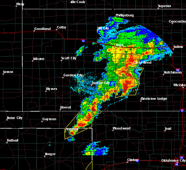 At 215 pm cdt, a severe thunderstorm was located 5 miles southwest of elmwood, or 16 miles northeast of perryton, moving northeast at 30 mph (radar indicated). Hazards include ping pong ball size hail and 60 mph wind gusts. Minor damage to roofs, siding, and trees is possible. people and animals outdoors will be injured. Expect hail damage to roofs, siding, windows, and vehicles. At 215 pm cdt, a severe thunderstorm was located 5 miles southwest of elmwood, or 16 miles northeast of perryton, moving northeast at 30 mph (radar indicated). Hazards include ping pong ball size hail and 60 mph wind gusts. Minor damage to roofs, siding, and trees is possible. people and animals outdoors will be injured. Expect hail damage to roofs, siding, windows, and vehicles.
|
| 5/2/2018 2:41 PM CDT | Quarter sized hail reported 0.3 miles SSE of Booker, TX |
| 5/2/2018 2:15 PM CDT |
 At 215 pm cdt, a severe thunderstorm was located 5 miles southwest of elmwood, or 16 miles northeast of perryton, moving northeast at 30 mph (radar indicated). Hazards include ping pong ball size hail and 60 mph wind gusts. Minor damage to roofs, siding, and trees is possible. people and animals outdoors will be injured. Expect hail damage to roofs, siding, windows, and vehicles. At 215 pm cdt, a severe thunderstorm was located 5 miles southwest of elmwood, or 16 miles northeast of perryton, moving northeast at 30 mph (radar indicated). Hazards include ping pong ball size hail and 60 mph wind gusts. Minor damage to roofs, siding, and trees is possible. people and animals outdoors will be injured. Expect hail damage to roofs, siding, windows, and vehicles.
|
| 5/2/2018 2:15 PM CDT |
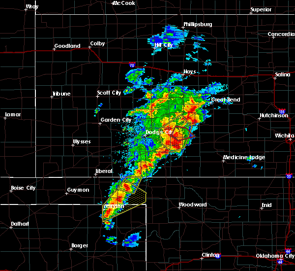 At 215 pm cdt, a severe thunderstorm was located 5 miles southwest of elmwood, or 16 miles northeast of perryton, moving northeast at 30 mph (radar indicated). Hazards include ping pong ball size hail and 60 mph wind gusts. Minor damage to roofs, siding, and trees is possible. people and animals outdoors will be injured. Expect hail damage to roofs, siding, windows, and vehicles. At 215 pm cdt, a severe thunderstorm was located 5 miles southwest of elmwood, or 16 miles northeast of perryton, moving northeast at 30 mph (radar indicated). Hazards include ping pong ball size hail and 60 mph wind gusts. Minor damage to roofs, siding, and trees is possible. people and animals outdoors will be injured. Expect hail damage to roofs, siding, windows, and vehicles.
|
| 3/18/2018 8:53 PM CDT |
 At 851 pm cdt, severe thunderstorms were located along a line extending from 4 miles northeast of booker to near canadian, moving east at 35 mph (radar indicated and spotters reported quarter size hail 9 miles souteast of wolf creek park at 8:48 pm cdt). Hazards include 60 mph wind gusts and quarter size hail. Minor damage to roofs, siding, and trees is possible. hail damage to vehicles is expected. Locations impacted include, lipscomb, canadian, booker, follett, higgins, darrouzett, glazier and lake marvin. At 851 pm cdt, severe thunderstorms were located along a line extending from 4 miles northeast of booker to near canadian, moving east at 35 mph (radar indicated and spotters reported quarter size hail 9 miles souteast of wolf creek park at 8:48 pm cdt). Hazards include 60 mph wind gusts and quarter size hail. Minor damage to roofs, siding, and trees is possible. hail damage to vehicles is expected. Locations impacted include, lipscomb, canadian, booker, follett, higgins, darrouzett, glazier and lake marvin.
|
| 3/18/2018 8:28 PM CDT |
 At 827 pm cdt, severe thunderstorms were located along a line extending from 3 miles southeast of balko to 9 miles south of wolf creek park, moving northeast at 40 mph (radar indicated). Hazards include 60 mph wind gusts and quarter size hail. Minor damage to roofs, siding, and trees is possible. Hail damage to vehicles is expected. At 827 pm cdt, severe thunderstorms were located along a line extending from 3 miles southeast of balko to 9 miles south of wolf creek park, moving northeast at 40 mph (radar indicated). Hazards include 60 mph wind gusts and quarter size hail. Minor damage to roofs, siding, and trees is possible. Hail damage to vehicles is expected.
|
| 10/6/2017 9:52 PM CDT |
 At 951 pm cdt, severe thunderstorms were located along a line extending from near darrouzett to 3 miles northwest of lipscomb to 12 miles northwest of glazier, moving east at 85 mph (radar indicated). Hazards include 60 mph wind gusts and quarter size hail. Minor damage to roofs, siding, and trees is possible. Hail damage to vehicles is expected. At 951 pm cdt, severe thunderstorms were located along a line extending from near darrouzett to 3 miles northwest of lipscomb to 12 miles northwest of glazier, moving east at 85 mph (radar indicated). Hazards include 60 mph wind gusts and quarter size hail. Minor damage to roofs, siding, and trees is possible. Hail damage to vehicles is expected.
|
| 10/6/2017 9:00 PM CDT |
 At 900 pm cdt, a severe thunderstorm was located 8 miles northwest of slapout, or 18 miles southeast of beaver, moving east at 65 mph (radar indicated). Hazards include 60 mph wind gusts and quarter size hail. Minor damage to roofs, siding, and trees is possible. hail damage to vehicles is expected. Locations impacted include, booker, follett, darrouzett, gate, knowles, elmwood and slapout. At 900 pm cdt, a severe thunderstorm was located 8 miles northwest of slapout, or 18 miles southeast of beaver, moving east at 65 mph (radar indicated). Hazards include 60 mph wind gusts and quarter size hail. Minor damage to roofs, siding, and trees is possible. hail damage to vehicles is expected. Locations impacted include, booker, follett, darrouzett, gate, knowles, elmwood and slapout.
|
| 10/6/2017 8:50 PM CDT | Half Dollar sized hail reported 0.3 miles SSE of Booker, TX, social media post showed hail the size from nickels to half dollars. |
| 10/6/2017 8:43 PM CDT |
 At 843 pm cdt, a severe thunderstorm was located near elmwood, or 16 miles south of beaver, moving east at 65 mph (radar indicated). Hazards include 60 mph wind gusts and quarter size hail. Minor damage to roofs, siding, and trees is possible. hail damage to vehicles is expected. Locations impacted include, perryton, booker, follett, darrouzett, gate, knowles, elmwood, bryans corner, slapout and balko. At 843 pm cdt, a severe thunderstorm was located near elmwood, or 16 miles south of beaver, moving east at 65 mph (radar indicated). Hazards include 60 mph wind gusts and quarter size hail. Minor damage to roofs, siding, and trees is possible. hail damage to vehicles is expected. Locations impacted include, perryton, booker, follett, darrouzett, gate, knowles, elmwood, bryans corner, slapout and balko.
|
| 10/6/2017 8:13 PM CDT |
 At 813 pm cdt, a severe thunderstorm was located 10 miles north of waka, or 16 miles north of spearman, moving east at 65 mph (radar indicated). Hazards include 60 mph wind gusts and quarter size hail. Minor damage to roofs, siding, and trees is possible. Hail damage to vehicles is expected. At 813 pm cdt, a severe thunderstorm was located 10 miles north of waka, or 16 miles north of spearman, moving east at 65 mph (radar indicated). Hazards include 60 mph wind gusts and quarter size hail. Minor damage to roofs, siding, and trees is possible. Hail damage to vehicles is expected.
|
| 8/18/2017 1:34 AM CDT |
 At 134 am cdt, a severe thunderstorm was located 6 miles south of turpin, or 18 miles south of liberal, moving southeast at 25 mph (radar indicated). Hazards include 60 mph wind gusts and quarter size hail. Minor damage to roofs, siding, and trees is possible. hail damage to vehicles is expected. Locations impacted include, beaver, booker, forgan, follett, darrouzett, elmwood, bryans corner, boyd, mocane, turpin, floris and balko. At 134 am cdt, a severe thunderstorm was located 6 miles south of turpin, or 18 miles south of liberal, moving southeast at 25 mph (radar indicated). Hazards include 60 mph wind gusts and quarter size hail. Minor damage to roofs, siding, and trees is possible. hail damage to vehicles is expected. Locations impacted include, beaver, booker, forgan, follett, darrouzett, elmwood, bryans corner, boyd, mocane, turpin, floris and balko.
|
| 8/18/2017 1:20 AM CDT |
 At 119 am cdt, severe thunderstorms were located along a line extending from near turpin to near booker, moving east at 35 mph (radar indicated). Hazards include 60 mph wind gusts and quarter size hail. Minor damage to roofs, siding, and trees is possible. hail damage to vehicles is expected. Locations impacted include, beaver, booker, tyrone, forgan, follett, darrouzett, gate, knowles, elmwood, boyd, floris, bryans corner, baker, mocane, turpin, slapout and balko. At 119 am cdt, severe thunderstorms were located along a line extending from near turpin to near booker, moving east at 35 mph (radar indicated). Hazards include 60 mph wind gusts and quarter size hail. Minor damage to roofs, siding, and trees is possible. hail damage to vehicles is expected. Locations impacted include, beaver, booker, tyrone, forgan, follett, darrouzett, gate, knowles, elmwood, boyd, floris, bryans corner, baker, mocane, turpin, slapout and balko.
|
| 8/18/2017 12:46 AM CDT |
 At 1245 am cdt, severe thunderstorms were located along a line extending from 3 miles southwest of tyrone to 7 miles south of balko, moving east at 10 mph (radar indicated). Hazards include 60 mph wind gusts and quarter size hail. Minor damage to roofs, siding, and trees is possible. Hail damage to vehicles is expected. At 1245 am cdt, severe thunderstorms were located along a line extending from 3 miles southwest of tyrone to 7 miles south of balko, moving east at 10 mph (radar indicated). Hazards include 60 mph wind gusts and quarter size hail. Minor damage to roofs, siding, and trees is possible. Hail damage to vehicles is expected.
|
| 8/10/2017 11:16 PM CDT |
 At 1116 pm cdt, severe thunderstorms were located along a line extending from 9 miles northwest of slapout to 9 miles east of wolf creek park, moving southeast at 25 mph (radar indicated). Hazards include 70 mph wind gusts and half dollar size hail. Expect some tree damage. damage is likely to mobile homes, roofs, and outbuildings. hail damage to vehicles is expected. Locations impacted include, lipscomb, beaver, booker, forgan, follett, higgins, darrouzett, gate, knowles, wolf creek park, elmwood, mocane and slapout. At 1116 pm cdt, severe thunderstorms were located along a line extending from 9 miles northwest of slapout to 9 miles east of wolf creek park, moving southeast at 25 mph (radar indicated). Hazards include 70 mph wind gusts and half dollar size hail. Expect some tree damage. damage is likely to mobile homes, roofs, and outbuildings. hail damage to vehicles is expected. Locations impacted include, lipscomb, beaver, booker, forgan, follett, higgins, darrouzett, gate, knowles, wolf creek park, elmwood, mocane and slapout.
|
| 8/10/2017 10:44 PM CDT |
 At 1044 pm cdt, severe thunderstorms were located along a line extending from bryans corner to 6 miles southeast of slapout, moving east at 30 mph (radar indicated). Hazards include 70 mph wind gusts and half dollar size hail. Expect some tree damage. damage is likely to mobile homes, roofs, and outbuildings. Hail damage to vehicles is expected. At 1044 pm cdt, severe thunderstorms were located along a line extending from bryans corner to 6 miles southeast of slapout, moving east at 30 mph (radar indicated). Hazards include 70 mph wind gusts and half dollar size hail. Expect some tree damage. damage is likely to mobile homes, roofs, and outbuildings. Hail damage to vehicles is expected.
|
| 7/3/2017 4:34 PM CDT |
 At 433 pm cdt, severe thunderstorms were located near wolf creek park and west of lipscomb, moving east at 10 mph (radar indicated). Hazards include golf ball size hail and 60 mph wind gusts. Minor damage to roofs, siding, and trees is possible. people and animals outdoors will be injured. expect hail damage to roofs, siding, windows, and vehicles. Locations impacted include, lipscomb, booker, follett, higgins, darrouzett and wolf creek park. At 433 pm cdt, severe thunderstorms were located near wolf creek park and west of lipscomb, moving east at 10 mph (radar indicated). Hazards include golf ball size hail and 60 mph wind gusts. Minor damage to roofs, siding, and trees is possible. people and animals outdoors will be injured. expect hail damage to roofs, siding, windows, and vehicles. Locations impacted include, lipscomb, booker, follett, higgins, darrouzett and wolf creek park.
|
| 7/3/2017 4:08 PM CDT |
 At 408 pm cdt, a severe thunderstorm was located near wolf creek park, or 17 miles west of lipscomb, moving east at 10 mph (radar indicated). Hazards include 60 mph wind gusts and half dollar size hail. Minor damage to roofs, siding, and trees is possible. Hail damage to vehicles is expected. At 408 pm cdt, a severe thunderstorm was located near wolf creek park, or 17 miles west of lipscomb, moving east at 10 mph (radar indicated). Hazards include 60 mph wind gusts and half dollar size hail. Minor damage to roofs, siding, and trees is possible. Hail damage to vehicles is expected.
|
| 6/21/2017 8:38 PM CDT | Storm damage reported in beaver county OK, 14.4 miles SSE of Booker, TX |
| 6/13/2017 6:41 PM CDT |
 At 641 pm cdt, a severe thunderstorm was located 6 miles east of wolf creek park, or 14 miles west of lipscomb, moving northeast at 60 mph (radar indicated). Hazards include 60 mph wind gusts and quarter size hail. Minor damage to roofs, siding, and trees is possible. Hail damage to vehicles is expected. At 641 pm cdt, a severe thunderstorm was located 6 miles east of wolf creek park, or 14 miles west of lipscomb, moving northeast at 60 mph (radar indicated). Hazards include 60 mph wind gusts and quarter size hail. Minor damage to roofs, siding, and trees is possible. Hail damage to vehicles is expected.
|
| 6/13/2017 5:47 PM CDT |
 At 547 pm cdt, a severe thunderstorm was located near booker, or 19 miles east of perryton, moving northeast at 50 mph (radar indicated). Hazards include 70 mph wind gusts and ping pong ball size hail. Expect some tree damage. damage is likely to mobile homes, roofs, and outbuildings. people and animals outdoors will be injured. expect hail damage to roofs, siding, windows, and vehicles. Locations impacted include, booker, follett, darrouzett and elmwood. At 547 pm cdt, a severe thunderstorm was located near booker, or 19 miles east of perryton, moving northeast at 50 mph (radar indicated). Hazards include 70 mph wind gusts and ping pong ball size hail. Expect some tree damage. damage is likely to mobile homes, roofs, and outbuildings. people and animals outdoors will be injured. expect hail damage to roofs, siding, windows, and vehicles. Locations impacted include, booker, follett, darrouzett and elmwood.
|
| 6/13/2017 5:45 PM CDT | Golf Ball sized hail reported 0.3 miles SSE of Booker, TX |
| 6/13/2017 5:25 PM CDT |
 At 524 pm cdt, a severe thunderstorm was located over wolf creek park, or 15 miles southeast of perryton, moving northeast at 50 mph (radar indicated). Hazards include ping pong ball size hail and 60 mph wind gusts. Minor damage to roofs, siding, and trees is possible. people and animals outdoors will be injured. expect hail damage to roofs, siding, windows, and vehicles. Locations impacted include, lipscomb, booker, follett, darrouzett, wolf creek park and elmwood. At 524 pm cdt, a severe thunderstorm was located over wolf creek park, or 15 miles southeast of perryton, moving northeast at 50 mph (radar indicated). Hazards include ping pong ball size hail and 60 mph wind gusts. Minor damage to roofs, siding, and trees is possible. people and animals outdoors will be injured. expect hail damage to roofs, siding, windows, and vehicles. Locations impacted include, lipscomb, booker, follett, darrouzett, wolf creek park and elmwood.
|
| 5/27/2017 9:53 PM CDT |
 At 952 pm cdt, severe thunderstorms were located along a line extending from 5 miles southeast of floris to 8 miles southwest of slapout to 5 miles southwest of darrouzett, moving southeast at 50 mph. these are very dangerous storms (emergency management has reported wind damage in and around elmwood as well as baseball size hail southeast of beaver). Hazards include baseball size hail and 70 mph wind gusts. People and animals outdoors will be severely injured. expect shattered windows, extensive damage to roofs, siding, and vehicles. Locations impacted include, lipscomb, beaver, booker, forgan, follett, higgins, darrouzett, gate, knowles, mocane, slapout and floris. At 952 pm cdt, severe thunderstorms were located along a line extending from 5 miles southeast of floris to 8 miles southwest of slapout to 5 miles southwest of darrouzett, moving southeast at 50 mph. these are very dangerous storms (emergency management has reported wind damage in and around elmwood as well as baseball size hail southeast of beaver). Hazards include baseball size hail and 70 mph wind gusts. People and animals outdoors will be severely injured. expect shattered windows, extensive damage to roofs, siding, and vehicles. Locations impacted include, lipscomb, beaver, booker, forgan, follett, higgins, darrouzett, gate, knowles, mocane, slapout and floris.
|
| 5/27/2017 9:37 PM CDT |
 At 936 pm cdt, severe thunderstorms were located along a line extending from 5 miles northeast of turpin to 5 miles east of elmwood to booker, moving southeast at 50 mph (trained weather spotters). Hazards include two inch hail and 70 mph wind gusts. Expect some tree damage. damage is likely to mobile homes, roofs, and outbuildings. people and animals outdoors will be injured. Expect hail damage to roofs, siding, windows, and vehicles. At 936 pm cdt, severe thunderstorms were located along a line extending from 5 miles northeast of turpin to 5 miles east of elmwood to booker, moving southeast at 50 mph (trained weather spotters). Hazards include two inch hail and 70 mph wind gusts. Expect some tree damage. damage is likely to mobile homes, roofs, and outbuildings. people and animals outdoors will be injured. Expect hail damage to roofs, siding, windows, and vehicles.
|
| 5/27/2017 9:22 PM CDT | Numerous downed powerlines due to straightline wind in beaver county OK, 14.4 miles SSE of Booker, TX |
| 5/27/2017 9:20 PM CDT |
 At 919 pm cdt, severe thunderstorms were located along a line extending from 5 miles northwest of turpin to 5 miles north of balko to 7 miles north of perryton, moving east at 50 mph (at 909 pm cdt, trained weather spotters reported 2 inch hail 4 miles north-northwest of boyd). Hazards include two inch hail and 70 mph wind gusts. Expect some tree damage. damage is likely to mobile homes, roofs, and outbuildings. people and animals outdoors will be injured. expect hail damage to roofs, siding, windows, and vehicles. Locations impacted include, perryton, beaver, booker, tyrone, forgan, knowles, elmwood, boyd, floris, bryans corner, baker, mocane, turpin and balko. At 919 pm cdt, severe thunderstorms were located along a line extending from 5 miles northwest of turpin to 5 miles north of balko to 7 miles north of perryton, moving east at 50 mph (at 909 pm cdt, trained weather spotters reported 2 inch hail 4 miles north-northwest of boyd). Hazards include two inch hail and 70 mph wind gusts. Expect some tree damage. damage is likely to mobile homes, roofs, and outbuildings. people and animals outdoors will be injured. expect hail damage to roofs, siding, windows, and vehicles. Locations impacted include, perryton, beaver, booker, tyrone, forgan, knowles, elmwood, boyd, floris, bryans corner, baker, mocane, turpin and balko.
|
| 5/27/2017 9:00 PM CDT |
 At 900 pm cdt, severe thunderstorms were located along a line extending from 6 miles north of tyrone to near baker to near hardesty, moving east at 40 mph (a mesonet site 1 mile west of hooker reported 68 mph wind gust). Hazards include 70 mph wind gusts and quarter size hail. Expect some tree damage. damage is likely to mobile homes, roofs, and outbuildings. hail damage to vehicles is expected. Locations impacted include, perryton, beaver, booker, tyrone, forgan, hardesty, knowles, elmwood, adams, boyd, floris, bryans corner, baker, mocane, turpin and balko. At 900 pm cdt, severe thunderstorms were located along a line extending from 6 miles north of tyrone to near baker to near hardesty, moving east at 40 mph (a mesonet site 1 mile west of hooker reported 68 mph wind gust). Hazards include 70 mph wind gusts and quarter size hail. Expect some tree damage. damage is likely to mobile homes, roofs, and outbuildings. hail damage to vehicles is expected. Locations impacted include, perryton, beaver, booker, tyrone, forgan, hardesty, knowles, elmwood, adams, boyd, floris, bryans corner, baker, mocane, turpin and balko.
|
| 5/27/2017 8:51 PM CDT |
 At 851 pm cdt, severe thunderstorms were located along a line extending from 7 miles southwest of woods to near baker to 7 miles northwest of hardesty, moving east at 40 mph (radar indicated). Hazards include 60 mph wind gusts and quarter size hail. Minor damage to roofs, siding, and trees is possible. Hail damage to vehicles is expected. At 851 pm cdt, severe thunderstorms were located along a line extending from 7 miles southwest of woods to near baker to 7 miles northwest of hardesty, moving east at 40 mph (radar indicated). Hazards include 60 mph wind gusts and quarter size hail. Minor damage to roofs, siding, and trees is possible. Hail damage to vehicles is expected.
|
| 5/2/2017 11:20 PM CDT |
 At 1120 pm cdt, a severe thunderstorm was located 10 miles northwest of lipscomb, moving east at 30 mph (radar indicated). Hazards include ping pong ball size hail and 60 mph wind gusts. Minor damage to roofs, siding, and trees is possible. people and animals outdoors will be injured. expect hail damage to roofs, siding, windows, and vehicles. Locations impacted include, lipscomb, booker, follett, higgins and darrouzett. At 1120 pm cdt, a severe thunderstorm was located 10 miles northwest of lipscomb, moving east at 30 mph (radar indicated). Hazards include ping pong ball size hail and 60 mph wind gusts. Minor damage to roofs, siding, and trees is possible. people and animals outdoors will be injured. expect hail damage to roofs, siding, windows, and vehicles. Locations impacted include, lipscomb, booker, follett, higgins and darrouzett.
|
| 5/2/2017 11:15 PM CDT |
 At 1114 pm cdt, a severe thunderstorm was located 11 miles northeast of wolf creek park, or 11 miles west of lipscomb, moving east at 30 mph (radar indicated). Hazards include ping pong ball size hail and 60 mph wind gusts. Minor damage to roofs, siding, and trees is possible. people and animals outdoors will be injured. expect hail damage to roofs, siding, windows, and vehicles. Locations impacted include, lipscomb, booker, follett, higgins and darrouzett. At 1114 pm cdt, a severe thunderstorm was located 11 miles northeast of wolf creek park, or 11 miles west of lipscomb, moving east at 30 mph (radar indicated). Hazards include ping pong ball size hail and 60 mph wind gusts. Minor damage to roofs, siding, and trees is possible. people and animals outdoors will be injured. expect hail damage to roofs, siding, windows, and vehicles. Locations impacted include, lipscomb, booker, follett, higgins and darrouzett.
|
| 5/2/2017 11:07 PM CDT |
 At 1107 pm cdt, a severe thunderstorm was located 7 miles northeast of wolf creek park, or 14 miles west of lipscomb, moving east at 30 mph (radar indicated). Hazards include 60 mph wind gusts and half dollar size hail. Minor damage to roofs, siding, and trees is possible. hail damage to vehicles is expected. Locations impacted include, lipscomb, booker, follett, higgins, darrouzett and wolf creek park. At 1107 pm cdt, a severe thunderstorm was located 7 miles northeast of wolf creek park, or 14 miles west of lipscomb, moving east at 30 mph (radar indicated). Hazards include 60 mph wind gusts and half dollar size hail. Minor damage to roofs, siding, and trees is possible. hail damage to vehicles is expected. Locations impacted include, lipscomb, booker, follett, higgins, darrouzett and wolf creek park.
|
| 5/2/2017 10:52 PM CDT |
 At 1050 pm cdt, a severe thunderstorm was located 4 miles northwest of follett, or 18 miles north of lipscomb, moving east at 30 mph. another severe thunderstorm was located 3 miles north of wolf creek park moving southeast at 30 mph (radar indicated). Hazards include 60 mph wind gusts and half dollar size hail. Minor damage to roofs, siding, and trees is possible. hail damage to vehicles is expected. Locations impacted include, perryton, lipscomb, booker, follett, higgins, darrouzett and wolf creek park. At 1050 pm cdt, a severe thunderstorm was located 4 miles northwest of follett, or 18 miles north of lipscomb, moving east at 30 mph. another severe thunderstorm was located 3 miles north of wolf creek park moving southeast at 30 mph (radar indicated). Hazards include 60 mph wind gusts and half dollar size hail. Minor damage to roofs, siding, and trees is possible. hail damage to vehicles is expected. Locations impacted include, perryton, lipscomb, booker, follett, higgins, darrouzett and wolf creek park.
|
| 5/2/2017 10:43 PM CDT |
 At 1043 pm cdt, a severe thunderstorm was located 6 miles southeast of perryton, moving east at 30 mph (radar indicated). Hazards include 60 mph wind gusts and half dollar size hail. Minor damage to roofs, siding, and trees is possible. hail damage to vehicles is expected. Locations impacted include, perryton, lipscomb, booker, follett, higgins, darrouzett and wolf creek park. At 1043 pm cdt, a severe thunderstorm was located 6 miles southeast of perryton, moving east at 30 mph (radar indicated). Hazards include 60 mph wind gusts and half dollar size hail. Minor damage to roofs, siding, and trees is possible. hail damage to vehicles is expected. Locations impacted include, perryton, lipscomb, booker, follett, higgins, darrouzett and wolf creek park.
|
| 5/2/2017 10:36 PM CDT |
 At 1036 pm cdt, a severe thunderstorm was located 5 miles south of perryton, moving east at 25 mph (radar indicated). Hazards include 60 mph wind gusts and half dollar size hail. Minor damage to roofs, siding, and trees is possible. hail damage to vehicles is expected. Locations impacted include, perryton, lipscomb, booker, follett, higgins, darrouzett and wolf creek park. At 1036 pm cdt, a severe thunderstorm was located 5 miles south of perryton, moving east at 25 mph (radar indicated). Hazards include 60 mph wind gusts and half dollar size hail. Minor damage to roofs, siding, and trees is possible. hail damage to vehicles is expected. Locations impacted include, perryton, lipscomb, booker, follett, higgins, darrouzett and wolf creek park.
|
| 5/2/2017 10:23 PM CDT |
 At 1023 pm cdt, a severe thunderstorm was located over elmwood, or 13 miles south of beaver, moving east at 25 mph (radar indicated). Hazards include 60 mph wind gusts and quarter size hail. Minor damage to roofs, siding, and trees is possible. hail damage to vehicles is expected. Locations impacted include, beaver, booker, forgan, follett, darrouzett, gate, knowles, elmwood, bryans corner, mocane, slapout and balko. At 1023 pm cdt, a severe thunderstorm was located over elmwood, or 13 miles south of beaver, moving east at 25 mph (radar indicated). Hazards include 60 mph wind gusts and quarter size hail. Minor damage to roofs, siding, and trees is possible. hail damage to vehicles is expected. Locations impacted include, beaver, booker, forgan, follett, darrouzett, gate, knowles, elmwood, bryans corner, mocane, slapout and balko.
|
| 5/2/2017 10:13 PM CDT | Quarter sized hail reported 2.3 miles E of Booker, TX |
| 5/2/2017 10:09 PM CDT |
 At 1008 pm cdt, a severe thunderstorm was located near elmwood, or 12 miles south of beaver, moving east at 25 mph (radar indicated). Hazards include ping pong ball size hail and 60 mph wind gusts. Minor damage to roofs, siding, and trees is possible. people and animals outdoors will be injured. expect hail damage to roofs, siding, windows, and vehicles. Locations impacted include, beaver, booker, forgan, follett, darrouzett, hardesty, gate, knowles, elmwood, adams, boyd, floris, bryans corner, baker, mocane, turpin, slapout and balko. At 1008 pm cdt, a severe thunderstorm was located near elmwood, or 12 miles south of beaver, moving east at 25 mph (radar indicated). Hazards include ping pong ball size hail and 60 mph wind gusts. Minor damage to roofs, siding, and trees is possible. people and animals outdoors will be injured. expect hail damage to roofs, siding, windows, and vehicles. Locations impacted include, beaver, booker, forgan, follett, darrouzett, hardesty, gate, knowles, elmwood, adams, boyd, floris, bryans corner, baker, mocane, turpin, slapout and balko.
|
| 5/2/2017 10:01 PM CDT |
 At 1000 pm cdt, a severe thunderstorm was located over booker, or 16 miles east of perryton, moving east at 30 mph (law enforcement reported a wall cloud with this storm). Hazards include 60 mph wind gusts and half dollar size hail. Minor damage to roofs, siding, and trees is possible. hail damage to vehicles is expected. Locations impacted include, perryton, lipscomb, booker, follett, higgins, darrouzett and wolf creek park. At 1000 pm cdt, a severe thunderstorm was located over booker, or 16 miles east of perryton, moving east at 30 mph (law enforcement reported a wall cloud with this storm). Hazards include 60 mph wind gusts and half dollar size hail. Minor damage to roofs, siding, and trees is possible. hail damage to vehicles is expected. Locations impacted include, perryton, lipscomb, booker, follett, higgins, darrouzett and wolf creek park.
|
| 5/2/2017 9:55 PM CDT |
 At 954 pm cdt, a severe thunderstorm was located near booker, or 13 miles northeast of perryton, moving east at 30 mph. another severe thunderstorm was located 15 miles west of perryton moving east at 30 mph (radar indicated). Hazards include 60 mph wind gusts and half dollar size hail. Minor damage to roofs, siding, and trees is possible. Hail damage to vehicles is expected. At 954 pm cdt, a severe thunderstorm was located near booker, or 13 miles northeast of perryton, moving east at 30 mph. another severe thunderstorm was located 15 miles west of perryton moving east at 30 mph (radar indicated). Hazards include 60 mph wind gusts and half dollar size hail. Minor damage to roofs, siding, and trees is possible. Hail damage to vehicles is expected.
|
| 5/2/2017 9:48 PM CDT |
 At 948 pm cdt, a severe thunderstorm was located 7 miles northwest of booker, or 11 miles northeast of perryton, moving east at 20 mph (radar indicated). Hazards include 60 mph wind gusts and half dollar size hail. Minor damage to roofs, siding, and trees is possible. hail damage to vehicles is expected. Locations impacted include, beaver, booker, forgan, follett, darrouzett, hardesty, gate, knowles, elmwood, adams, boyd, floris, bryans corner, baker, mocane, turpin, slapout and balko. At 948 pm cdt, a severe thunderstorm was located 7 miles northwest of booker, or 11 miles northeast of perryton, moving east at 20 mph (radar indicated). Hazards include 60 mph wind gusts and half dollar size hail. Minor damage to roofs, siding, and trees is possible. hail damage to vehicles is expected. Locations impacted include, beaver, booker, forgan, follett, darrouzett, hardesty, gate, knowles, elmwood, adams, boyd, floris, bryans corner, baker, mocane, turpin, slapout and balko.
|
| 5/2/2017 9:41 PM CDT |
 At 941 pm cdt, a severe thunderstorm was located 5 miles southeast of bryans corner, or 12 miles north of perryton, moving east at 25 mph (radar indicated). Hazards include ping pong ball size hail and 60 mph wind gusts. Minor damage to roofs, siding, and trees is possible. people and animals outdoors will be injured. expect hail damage to roofs, siding, windows, and vehicles. Locations impacted include, beaver, booker, forgan, follett, darrouzett, hardesty, gate, knowles, elmwood, adams, boyd, floris, bryans corner, baker, mocane, turpin, slapout and balko. At 941 pm cdt, a severe thunderstorm was located 5 miles southeast of bryans corner, or 12 miles north of perryton, moving east at 25 mph (radar indicated). Hazards include ping pong ball size hail and 60 mph wind gusts. Minor damage to roofs, siding, and trees is possible. people and animals outdoors will be injured. expect hail damage to roofs, siding, windows, and vehicles. Locations impacted include, beaver, booker, forgan, follett, darrouzett, hardesty, gate, knowles, elmwood, adams, boyd, floris, bryans corner, baker, mocane, turpin, slapout and balko.
|
| 5/2/2017 9:31 PM CDT |
 At 931 pm cdt, a severe thunderstorm was located near bryans corner, or 12 miles north of perryton, moving east at 20 mph (radar indicated). Hazards include ping pong ball size hail and 60 mph wind gusts. Minor damage to roofs, siding, and trees is possible. people and animals outdoors will be injured. expect hail damage to roofs, siding, windows, and vehicles. Locations impacted include, beaver, booker, forgan, follett, darrouzett, hardesty, gate, knowles, elmwood, adams, boyd, floris, bryans corner, baker, mocane, turpin, slapout and balko. At 931 pm cdt, a severe thunderstorm was located near bryans corner, or 12 miles north of perryton, moving east at 20 mph (radar indicated). Hazards include ping pong ball size hail and 60 mph wind gusts. Minor damage to roofs, siding, and trees is possible. people and animals outdoors will be injured. expect hail damage to roofs, siding, windows, and vehicles. Locations impacted include, beaver, booker, forgan, follett, darrouzett, hardesty, gate, knowles, elmwood, adams, boyd, floris, bryans corner, baker, mocane, turpin, slapout and balko.
|
| 5/2/2017 9:26 PM CDT |
 At 925 pm cdt, a severe thunderstorm was located 5 miles southwest of bryans corner, or 13 miles northwest of perryton, moving east at 20 mph (trained weather spotters have reported a large rotating wall cloud with this storm). Hazards include ping pong ball size hail and 60 mph wind gusts. Minor damage to roofs, siding, and trees is possible. people and animals outdoors will be injured. expect hail damage to roofs, siding, windows, and vehicles. Locations impacted include, beaver, booker, tyrone, forgan, follett, darrouzett, hardesty, gate, knowles, elmwood, adams, boyd, floris, bryans corner, baker, mocane, turpin, slapout and balko. At 925 pm cdt, a severe thunderstorm was located 5 miles southwest of bryans corner, or 13 miles northwest of perryton, moving east at 20 mph (trained weather spotters have reported a large rotating wall cloud with this storm). Hazards include ping pong ball size hail and 60 mph wind gusts. Minor damage to roofs, siding, and trees is possible. people and animals outdoors will be injured. expect hail damage to roofs, siding, windows, and vehicles. Locations impacted include, beaver, booker, tyrone, forgan, follett, darrouzett, hardesty, gate, knowles, elmwood, adams, boyd, floris, bryans corner, baker, mocane, turpin, slapout and balko.
|
| 5/2/2017 9:18 PM CDT |
 At 918 pm cdt, a severe thunderstorm was located 7 miles southwest of bryans corner, or 14 miles northwest of perryton, moving east at 20 mph (radar indicated). Hazards include ping pong ball size hail and 60 mph wind gusts. Minor damage to roofs, siding, and trees is possible. people and animals outdoors will be injured. expect hail damage to roofs, siding, windows, and vehicles. Locations impacted include, beaver, booker, tyrone, forgan, follett, darrouzett, hardesty, gate, knowles, elmwood, adams, boyd, floris, bryans corner, baker, mocane, turpin, slapout and balko. At 918 pm cdt, a severe thunderstorm was located 7 miles southwest of bryans corner, or 14 miles northwest of perryton, moving east at 20 mph (radar indicated). Hazards include ping pong ball size hail and 60 mph wind gusts. Minor damage to roofs, siding, and trees is possible. people and animals outdoors will be injured. expect hail damage to roofs, siding, windows, and vehicles. Locations impacted include, beaver, booker, tyrone, forgan, follett, darrouzett, hardesty, gate, knowles, elmwood, adams, boyd, floris, bryans corner, baker, mocane, turpin, slapout and balko.
|
| 5/2/2017 9:00 PM CDT |
 At 859 pm cdt, a severe thunderstorm was located 9 miles southeast of hardesty, or 17 miles northwest of perryton, moving east at 20 mph (radar indicated). Hazards include 60 mph wind gusts and half dollar size hail. Minor damage to roofs, siding, and trees is possible. Hail damage to vehicles is expected. At 859 pm cdt, a severe thunderstorm was located 9 miles southeast of hardesty, or 17 miles northwest of perryton, moving east at 20 mph (radar indicated). Hazards include 60 mph wind gusts and half dollar size hail. Minor damage to roofs, siding, and trees is possible. Hail damage to vehicles is expected.
|
| 4/21/2017 5:45 AM CDT |
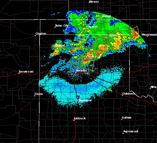 At 544 am cdt, severe thunderstorms were located along a line extending from near booker to 10 miles southwest of lipscomb, moving northeast at 30 mph (radar indicated). Hazards include half dollar size hail. Damage to vehicles is expected. Locations impacted include, lipscomb, booker, darrouzett and glazier. At 544 am cdt, severe thunderstorms were located along a line extending from near booker to 10 miles southwest of lipscomb, moving northeast at 30 mph (radar indicated). Hazards include half dollar size hail. Damage to vehicles is expected. Locations impacted include, lipscomb, booker, darrouzett and glazier.
|
| 4/21/2017 5:14 AM CDT |
 At 514 am cdt, severe thunderstorms were located along a line extending from 4 miles southeast of perryton to 12 miles south of wolf creek park, moving northeast at 30 mph (radar indicated). Hazards include golf ball size hail. People and animals outdoors will be injured. expect damage to roofs, siding, windows, and vehicles. Locations impacted include, perryton, lipscomb, booker, darrouzett, wolf creek park, elmwood and glazier. At 514 am cdt, severe thunderstorms were located along a line extending from 4 miles southeast of perryton to 12 miles south of wolf creek park, moving northeast at 30 mph (radar indicated). Hazards include golf ball size hail. People and animals outdoors will be injured. expect damage to roofs, siding, windows, and vehicles. Locations impacted include, perryton, lipscomb, booker, darrouzett, wolf creek park, elmwood and glazier.
|
| 4/21/2017 5:07 AM CDT |
 At 507 am cdt, severe thunderstorms were located along a line extending from 4 miles southeast of perryton to 12 miles south of wolf creek park, moving northeast at 25 mph (radar indicated). Hazards include ping pong ball size hail. People and animals outdoors will be injured. Expect damage to roofs, siding, windows, and vehicles. At 507 am cdt, severe thunderstorms were located along a line extending from 4 miles southeast of perryton to 12 miles south of wolf creek park, moving northeast at 25 mph (radar indicated). Hazards include ping pong ball size hail. People and animals outdoors will be injured. Expect damage to roofs, siding, windows, and vehicles.
|
| 4/21/2017 5:07 AM CDT |
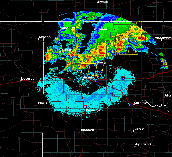 At 507 am cdt, severe thunderstorms were located along a line extending from 4 miles southeast of perryton to 12 miles south of wolf creek park, moving northeast at 25 mph (radar indicated). Hazards include ping pong ball size hail. People and animals outdoors will be injured. Expect damage to roofs, siding, windows, and vehicles. At 507 am cdt, severe thunderstorms were located along a line extending from 4 miles southeast of perryton to 12 miles south of wolf creek park, moving northeast at 25 mph (radar indicated). Hazards include ping pong ball size hail. People and animals outdoors will be injured. Expect damage to roofs, siding, windows, and vehicles.
|
| 9/9/2016 7:21 PM CDT |
 At 721 pm cdt, a severe thunderstorm was located 8 miles northwest of lipscomb, moving east at 15 mph (radar indicated). Hazards include 60 mph wind gusts and half dollar size hail. Minor damage to roofs. siding. and trees is possible. hail damage to vehicles is expected. Locations impacted include, lipscomb, booker, follett, darrouzett and slapout. At 721 pm cdt, a severe thunderstorm was located 8 miles northwest of lipscomb, moving east at 15 mph (radar indicated). Hazards include 60 mph wind gusts and half dollar size hail. Minor damage to roofs. siding. and trees is possible. hail damage to vehicles is expected. Locations impacted include, lipscomb, booker, follett, darrouzett and slapout.
|
| 9/9/2016 7:12 PM CDT |
 At 711 pm cdt, a severe thunderstorm was located over darrouzett, or 14 miles north of lipscomb, moving east at 25 mph (radar indicated). Hazards include 60 mph wind gusts and quarter size hail. Minor damage to roofs. siding. and trees is possible. hail damage to vehicles is expected. Locations impacted include, lipscomb, booker, follett, darrouzett, wolf creek park and slapout. At 711 pm cdt, a severe thunderstorm was located over darrouzett, or 14 miles north of lipscomb, moving east at 25 mph (radar indicated). Hazards include 60 mph wind gusts and quarter size hail. Minor damage to roofs. siding. and trees is possible. hail damage to vehicles is expected. Locations impacted include, lipscomb, booker, follett, darrouzett, wolf creek park and slapout.
|
| 9/9/2016 6:47 PM CDT |
 At 647 pm cdt, a severe thunderstorm was located near booker, or 18 miles east of perryton, moving east at 20 mph (radar indicated). Hazards include 60 mph wind gusts and quarter size hail. Minor damage to roofs. siding. and trees is possible. hail damage to vehicles is expected. Locations impacted include, perryton, lipscomb, booker, follett, darrouzett, elmwood, slapout and wolf creek park. At 647 pm cdt, a severe thunderstorm was located near booker, or 18 miles east of perryton, moving east at 20 mph (radar indicated). Hazards include 60 mph wind gusts and quarter size hail. Minor damage to roofs. siding. and trees is possible. hail damage to vehicles is expected. Locations impacted include, perryton, lipscomb, booker, follett, darrouzett, elmwood, slapout and wolf creek park.
|
| 9/9/2016 6:01 PM CDT |
 At 601 pm cdt, a severe thunderstorm was located over balko, or 15 miles north of perryton, moving southeast at 20 mph (radar indicated). Hazards include 60 mph wind gusts and half dollar size hail. Minor damage to roofs. siding. and trees is possible. Hail damage to vehicles is expected. At 601 pm cdt, a severe thunderstorm was located over balko, or 15 miles north of perryton, moving southeast at 20 mph (radar indicated). Hazards include 60 mph wind gusts and half dollar size hail. Minor damage to roofs. siding. and trees is possible. Hail damage to vehicles is expected.
|
| 8/8/2016 6:22 PM CDT |
 At 621 pm cdt, severe thunderstorms were located along a line extending from near booker to 15 miles northwest of lora, moving east at 20 mph (radar indicated). Hazards include 60 mph wind gusts and quarter size hail. Minor damage to roofs. siding. and trees is possible. Hail damage to vehicles is expected. At 621 pm cdt, severe thunderstorms were located along a line extending from near booker to 15 miles northwest of lora, moving east at 20 mph (radar indicated). Hazards include 60 mph wind gusts and quarter size hail. Minor damage to roofs. siding. and trees is possible. Hail damage to vehicles is expected.
|
| 7/15/2016 7:49 PM CDT |
 At 748 pm cdt, severe thunderstorms were located along a line extending from 3 miles southeast of gate to 7 miles northwest of lipscomb to 16 miles southwest of wolf creek park, moving east at 40 mph (radar indicated). Hazards include 70 mph wind gusts. Expect some tree damage. damage is likely to mobile homes. roofs, and outbuildings. Locations impacted include, perryton, lipscomb, booker, follett, darrouzett, gate, knowles, slapout and wolf creek park. At 748 pm cdt, severe thunderstorms were located along a line extending from 3 miles southeast of gate to 7 miles northwest of lipscomb to 16 miles southwest of wolf creek park, moving east at 40 mph (radar indicated). Hazards include 70 mph wind gusts. Expect some tree damage. damage is likely to mobile homes. roofs, and outbuildings. Locations impacted include, perryton, lipscomb, booker, follett, darrouzett, gate, knowles, slapout and wolf creek park.
|
| 7/15/2016 7:30 PM CDT |
 At 730 pm cdt, severe thunderstorms were located along a line extending from 5 miles northwest of knowles to booker to 6 miles east of spearman, moving east at 40 mph (radar indicated). Hazards include 60 mph wind gusts. Minor damage to roofs. siding. And trees is possible. At 730 pm cdt, severe thunderstorms were located along a line extending from 5 miles northwest of knowles to booker to 6 miles east of spearman, moving east at 40 mph (radar indicated). Hazards include 60 mph wind gusts. Minor damage to roofs. siding. And trees is possible.
|
| 7/8/2016 12:22 AM CDT |
 At 1220 am cdt, a severe thunderstorm was located 9 miles east of wolf creek park, or 11 miles west of lipscomb, moving east at 30 mph (radar indicated. at 1155 pm wind gusts of 64 mph were measured by the awos at perryton ochiltree airport 3 miles ene of perryton). Hazards include 70 mph wind gusts and ping pong ball size hail. Expect some tree damage. damage is likely to mobile homes, roofs, and outbuildings. people and animals outdoors will be injured. expect hail damage to roofs, siding, windows, and vehicles. Locations impacted include, lipscomb, booker, follett, darrouzett and wolf creek park. At 1220 am cdt, a severe thunderstorm was located 9 miles east of wolf creek park, or 11 miles west of lipscomb, moving east at 30 mph (radar indicated. at 1155 pm wind gusts of 64 mph were measured by the awos at perryton ochiltree airport 3 miles ene of perryton). Hazards include 70 mph wind gusts and ping pong ball size hail. Expect some tree damage. damage is likely to mobile homes, roofs, and outbuildings. people and animals outdoors will be injured. expect hail damage to roofs, siding, windows, and vehicles. Locations impacted include, lipscomb, booker, follett, darrouzett and wolf creek park.
|
| 7/8/2016 12:17 AM CDT |
 At 1212 am cdt, a severe thunderstorm was located 6 miles northeast of wolf creek park, or 15 miles west of lipscomb, moving east at 25 mph (radar. at 1115 pm wind gusts of 64 mph were measured by the awos at perryton ochiltree airport 3 miles ene of of perryton). Hazards include 70 mph wind gusts and ping pong ball size hail. Expect some tree damage. damage is likely to mobile homes, roofs, and outbuildings. people and animals outdoors will be injured. expect hail damage to roofs, siding, windows, and vehicles. Locations impacted include, perryton, lipscomb, booker, follett, darrouzett and wolf creek park. At 1212 am cdt, a severe thunderstorm was located 6 miles northeast of wolf creek park, or 15 miles west of lipscomb, moving east at 25 mph (radar. at 1115 pm wind gusts of 64 mph were measured by the awos at perryton ochiltree airport 3 miles ene of of perryton). Hazards include 70 mph wind gusts and ping pong ball size hail. Expect some tree damage. damage is likely to mobile homes, roofs, and outbuildings. people and animals outdoors will be injured. expect hail damage to roofs, siding, windows, and vehicles. Locations impacted include, perryton, lipscomb, booker, follett, darrouzett and wolf creek park.
|
| 7/7/2016 11:41 PM CDT |
 At 1140 pm cdt, a severe thunderstorm was located 6 miles southeast of perryton, moving east at 35 mph (radar indicated). Hazards include 70 mph wind gusts and penny size hail. Expect some tree damage. Damage is likely to mobile homes, roofs, and outbuildings. At 1140 pm cdt, a severe thunderstorm was located 6 miles southeast of perryton, moving east at 35 mph (radar indicated). Hazards include 70 mph wind gusts and penny size hail. Expect some tree damage. Damage is likely to mobile homes, roofs, and outbuildings.
|
| 7/2/2016 9:12 PM CDT | Storm damage reported in lipscomb county TX, 0.4 miles NNE of Booker, TX |
| 5/24/2016 8:00 PM CDT |
 At 816 pm cdt, a severe thunderstorm was located near wolf creek park, or 11 miles southeast of perryton, moving northeast at 25 mph (radar indicated). Hazards include 60 mph wind gusts and half dollar size hail. Minor damage to roofs. siding. and trees is possible. hail damage to vehicles is expected. locations impacted include, perryton, lipscomb, booker, darrouzett and wolf creek park. A tornado watch remains in effect until midnight cdt. At 816 pm cdt, a severe thunderstorm was located near wolf creek park, or 11 miles southeast of perryton, moving northeast at 25 mph (radar indicated). Hazards include 60 mph wind gusts and half dollar size hail. Minor damage to roofs. siding. and trees is possible. hail damage to vehicles is expected. locations impacted include, perryton, lipscomb, booker, darrouzett and wolf creek park. A tornado watch remains in effect until midnight cdt.
|
| 5/23/2016 9:38 PM CDT | Quarter sized hail reported 1.2 miles ESE of Booker, TX |
| 5/16/2016 7:52 PM CDT |
 At 752 pm cdt, a severe thunderstorm was located 9 miles south of waka, or 10 miles east of spearman, moving east at 40 mph (trained weather spotters). Hazards include golf ball size hail and 70 mph wind gusts. Expect some tree damage. damage is likely to mobile homes. roofs, and outbuildings. people and animals outdoors will be injured. expect hail damage to roofs, siding, windows, and vehicles. hail may accumulate on roadways causing hazardous travel. locations impacted include, perryton, spearman, wolf creek park, waka and farnsworth. A tornado watch remains in effect until 1000 pm cdt. At 752 pm cdt, a severe thunderstorm was located 9 miles south of waka, or 10 miles east of spearman, moving east at 40 mph (trained weather spotters). Hazards include golf ball size hail and 70 mph wind gusts. Expect some tree damage. damage is likely to mobile homes. roofs, and outbuildings. people and animals outdoors will be injured. expect hail damage to roofs, siding, windows, and vehicles. hail may accumulate on roadways causing hazardous travel. locations impacted include, perryton, spearman, wolf creek park, waka and farnsworth. A tornado watch remains in effect until 1000 pm cdt.
|
| 5/16/2016 7:35 PM CDT |
 At 733 pm cdt, severe thunderstorms were located along a line extending from 7 miles northwest of waka to 9 miles east of morse, moving east at 35 mph (radar indicated). Hazards include 70 mph wind gusts and ping pong ball size hail. Expect some tree damage. damage is likely to mobile homes, roofs, and outbuildings. people and animals outdoors will be injured. expect hail damage to roofs, siding, windows, and vehicles. Hail may accumulate on roadways causing hazardous travel. At 733 pm cdt, severe thunderstorms were located along a line extending from 7 miles northwest of waka to 9 miles east of morse, moving east at 35 mph (radar indicated). Hazards include 70 mph wind gusts and ping pong ball size hail. Expect some tree damage. damage is likely to mobile homes, roofs, and outbuildings. people and animals outdoors will be injured. expect hail damage to roofs, siding, windows, and vehicles. Hail may accumulate on roadways causing hazardous travel.
|
| 4/29/2016 4:17 AM CDT |
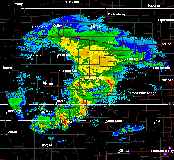 At 417 am cdt, a severe thunderstorm was located 5 miles west of booker, or 10 miles east of perryton, moving northeast at 40 mph (radar indicated). Hazards include 60 mph wind gusts and quarter size hail. Minor damage to roofs. siding. and trees is possible. hail damage to vehicles is expected. Locations impacted include, booker and slapout. At 417 am cdt, a severe thunderstorm was located 5 miles west of booker, or 10 miles east of perryton, moving northeast at 40 mph (radar indicated). Hazards include 60 mph wind gusts and quarter size hail. Minor damage to roofs. siding. and trees is possible. hail damage to vehicles is expected. Locations impacted include, booker and slapout.
|
| 4/29/2016 4:08 AM CDT |
 At 408 am cdt, a severe thunderstorm was located near perryton, moving northeast at 35 mph (radar indicated). Hazards include 60 mph wind gusts and half dollar size hail. Minor damage to roofs. siding. and trees is possible. hail damage to vehicles is expected. Locations impacted include, perryton, booker, elmwood and slapout. At 408 am cdt, a severe thunderstorm was located near perryton, moving northeast at 35 mph (radar indicated). Hazards include 60 mph wind gusts and half dollar size hail. Minor damage to roofs. siding. and trees is possible. hail damage to vehicles is expected. Locations impacted include, perryton, booker, elmwood and slapout.
|
| 4/29/2016 3:59 AM CDT |
 At 359 am cdt, a severe thunderstorm was located over perryton, moving northeast at 40 mph (radar indicated). Hazards include 60 mph wind gusts and half dollar size hail. Minor damage to roofs. siding. and trees is possible. Hail damage to vehicles is expected. At 359 am cdt, a severe thunderstorm was located over perryton, moving northeast at 40 mph (radar indicated). Hazards include 60 mph wind gusts and half dollar size hail. Minor damage to roofs. siding. and trees is possible. Hail damage to vehicles is expected.
|
| 4/29/2016 3:59 AM CDT |
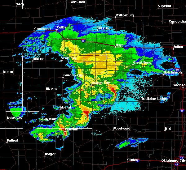 At 359 am cdt, a severe thunderstorm was located over perryton, moving northeast at 40 mph (radar indicated). Hazards include 60 mph wind gusts and half dollar size hail. Minor damage to roofs. siding. and trees is possible. Hail damage to vehicles is expected. At 359 am cdt, a severe thunderstorm was located over perryton, moving northeast at 40 mph (radar indicated). Hazards include 60 mph wind gusts and half dollar size hail. Minor damage to roofs. siding. and trees is possible. Hail damage to vehicles is expected.
|
| 11/16/2015 9:07 PM CST |
 At 907 pm cst, a severe thunderstorm capable of producing a tornado was located near booker, or 15 miles northwest of lipscomb, moving northeast at 40 mph (radar indicated rotation). Hazards include tornado and quarter size hail. Flying debris will be dangerous to those caught without shelter. mobile homes will be damaged or destroyed. damage to roofs, windows and vehicles will occur. tree damage is likely. Locations impacted include, booker and darrouzett. At 907 pm cst, a severe thunderstorm capable of producing a tornado was located near booker, or 15 miles northwest of lipscomb, moving northeast at 40 mph (radar indicated rotation). Hazards include tornado and quarter size hail. Flying debris will be dangerous to those caught without shelter. mobile homes will be damaged or destroyed. damage to roofs, windows and vehicles will occur. tree damage is likely. Locations impacted include, booker and darrouzett.
|
| 11/16/2015 9:07 PM CST |
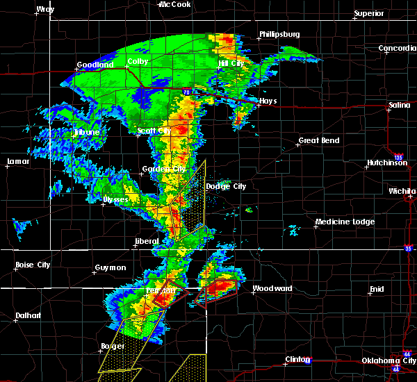 At 907 pm cst, a severe thunderstorm capable of producing a tornado was located near booker, or 15 miles northwest of lipscomb, moving northeast at 40 mph (radar indicated rotation). Hazards include tornado and quarter size hail. Flying debris will be dangerous to those caught without shelter. mobile homes will be damaged or destroyed. damage to roofs, windows and vehicles will occur. tree damage is likely. Locations impacted include, booker and darrouzett. At 907 pm cst, a severe thunderstorm capable of producing a tornado was located near booker, or 15 miles northwest of lipscomb, moving northeast at 40 mph (radar indicated rotation). Hazards include tornado and quarter size hail. Flying debris will be dangerous to those caught without shelter. mobile homes will be damaged or destroyed. damage to roofs, windows and vehicles will occur. tree damage is likely. Locations impacted include, booker and darrouzett.
|
| 11/16/2015 8:52 PM CST |
 At 852 pm cst, a severe thunderstorm capable of producing a tornado was located near wolf creek park, or 12 miles southeast of perryton, moving northeast at 40 mph (radar indicated rotation). Hazards include tornado and quarter size hail. Flying debris will be dangerous to those caught without shelter. mobile homes will be damaged or destroyed. damage to roofs, windows and vehicles will occur. Tree damage is likely. At 852 pm cst, a severe thunderstorm capable of producing a tornado was located near wolf creek park, or 12 miles southeast of perryton, moving northeast at 40 mph (radar indicated rotation). Hazards include tornado and quarter size hail. Flying debris will be dangerous to those caught without shelter. mobile homes will be damaged or destroyed. damage to roofs, windows and vehicles will occur. Tree damage is likely.
|
| 11/16/2015 8:52 PM CST |
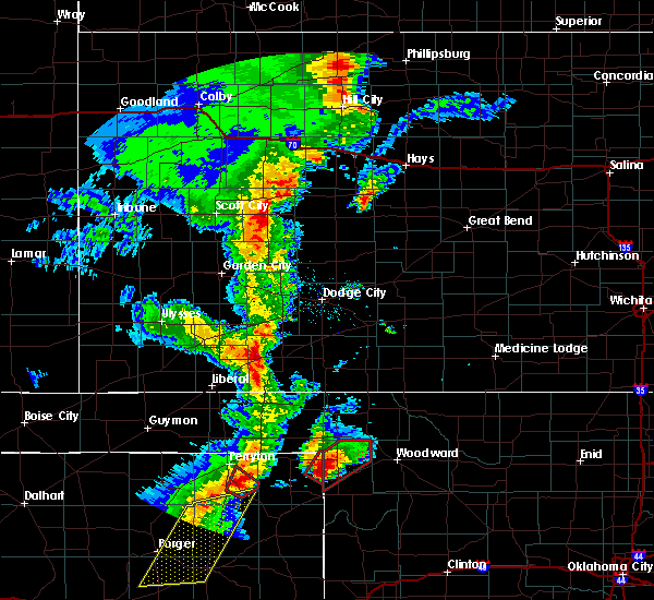 At 852 pm cst, a severe thunderstorm capable of producing a tornado was located near wolf creek park, or 12 miles southeast of perryton, moving northeast at 40 mph (radar indicated rotation). Hazards include tornado and quarter size hail. Flying debris will be dangerous to those caught without shelter. mobile homes will be damaged or destroyed. damage to roofs, windows and vehicles will occur. Tree damage is likely. At 852 pm cst, a severe thunderstorm capable of producing a tornado was located near wolf creek park, or 12 miles southeast of perryton, moving northeast at 40 mph (radar indicated rotation). Hazards include tornado and quarter size hail. Flying debris will be dangerous to those caught without shelter. mobile homes will be damaged or destroyed. damage to roofs, windows and vehicles will occur. Tree damage is likely.
|
| 11/16/2015 7:03 PM CST |
 At 703 pm cst, a confirmed large and extremely dangerous tornado was located over booker, or 15 miles northeast of perryton, moving northeast at 50 mph. this is a particularly dangerous situation (weather spotters confirmed tornado). Hazards include damaging tornado. You are in a life threatening situation. flying debris may be deadly to those caught without shelter. mobile homes will be destroyed. considerable damage to homes, businesses and vehicles is likely and complete destruction is possible. Locations impacted include, booker, elmwood and balko. At 703 pm cst, a confirmed large and extremely dangerous tornado was located over booker, or 15 miles northeast of perryton, moving northeast at 50 mph. this is a particularly dangerous situation (weather spotters confirmed tornado). Hazards include damaging tornado. You are in a life threatening situation. flying debris may be deadly to those caught without shelter. mobile homes will be destroyed. considerable damage to homes, businesses and vehicles is likely and complete destruction is possible. Locations impacted include, booker, elmwood and balko.
|
| 11/16/2015 6:58 PM CST |
 At 657 pm cst, a severe thunderstorm was located 7 miles west of booker, or 9 miles northeast of perryton, moving north at 45 mph (radar indicated). Hazards include ping pong ball size hail and 60 mph wind gusts. People and animals outdoors will be injured. expect hail damage to roofs, siding, windows and vehicles. minor wind damage to roofs, siding and trees is possible. locations impacted include, beaver, booker, forgan, gate, knowles, elmwood, mocane, balko, bryans corner, floris and boyd. A tornado watch remains in effect until 900 pm cst for central oklahoma and central texas. At 657 pm cst, a severe thunderstorm was located 7 miles west of booker, or 9 miles northeast of perryton, moving north at 45 mph (radar indicated). Hazards include ping pong ball size hail and 60 mph wind gusts. People and animals outdoors will be injured. expect hail damage to roofs, siding, windows and vehicles. minor wind damage to roofs, siding and trees is possible. locations impacted include, beaver, booker, forgan, gate, knowles, elmwood, mocane, balko, bryans corner, floris and boyd. A tornado watch remains in effect until 900 pm cst for central oklahoma and central texas.
|
| 11/16/2015 6:57 PM CST |
 At 657 pm cst, a severe thunderstorm capable of producing a tornado was located near booker, or 10 miles east of perryton, moving northeast at 50 mph (radar indicated rotation). Hazards include tornado and quarter size hail. Flying debris will be dangerous to those caught without shelter. mobile homes will be damaged or destroyed. damage to roofs, windows and vehicles will occur. tree damage is likely. Locations impacted include, booker, elmwood and balko. At 657 pm cst, a severe thunderstorm capable of producing a tornado was located near booker, or 10 miles east of perryton, moving northeast at 50 mph (radar indicated rotation). Hazards include tornado and quarter size hail. Flying debris will be dangerous to those caught without shelter. mobile homes will be damaged or destroyed. damage to roofs, windows and vehicles will occur. tree damage is likely. Locations impacted include, booker, elmwood and balko.
|
| 11/16/2015 6:57 PM CST |
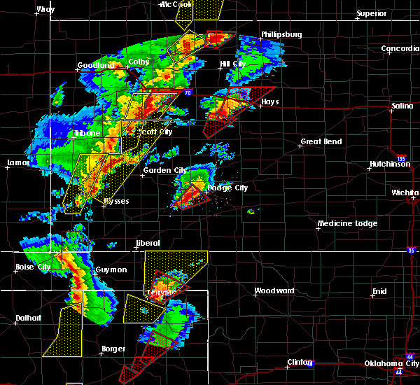 At 657 pm cst, a severe thunderstorm capable of producing a tornado was located near booker, or 10 miles east of perryton, moving northeast at 50 mph (radar indicated rotation). Hazards include tornado and quarter size hail. Flying debris will be dangerous to those caught without shelter. mobile homes will be damaged or destroyed. damage to roofs, windows and vehicles will occur. tree damage is likely. Locations impacted include, booker, elmwood and balko. At 657 pm cst, a severe thunderstorm capable of producing a tornado was located near booker, or 10 miles east of perryton, moving northeast at 50 mph (radar indicated rotation). Hazards include tornado and quarter size hail. Flying debris will be dangerous to those caught without shelter. mobile homes will be damaged or destroyed. damage to roofs, windows and vehicles will occur. tree damage is likely. Locations impacted include, booker, elmwood and balko.
|
| 11/16/2015 6:46 PM CST |
 At 646 pm cst, a severe thunderstorm capable of producing a tornado was located 7 miles north of wolf creek park, or 7 miles southeast of perryton, moving northeast at 50 mph (radar indicated rotation). Hazards include tornado. Flying debris will be dangerous to those caught without shelter. mobile homes will be damaged or destroyed. damage to roofs, windows and vehicles will occur. Tree damage is likely. At 646 pm cst, a severe thunderstorm capable of producing a tornado was located 7 miles north of wolf creek park, or 7 miles southeast of perryton, moving northeast at 50 mph (radar indicated rotation). Hazards include tornado. Flying debris will be dangerous to those caught without shelter. mobile homes will be damaged or destroyed. damage to roofs, windows and vehicles will occur. Tree damage is likely.
|
| 11/16/2015 6:46 PM CST |
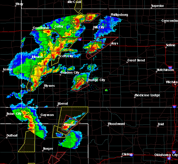 At 646 pm cst, a severe thunderstorm capable of producing a tornado was located 7 miles north of wolf creek park, or 7 miles southeast of perryton, moving northeast at 50 mph (radar indicated rotation). Hazards include tornado. Flying debris will be dangerous to those caught without shelter. mobile homes will be damaged or destroyed. damage to roofs, windows and vehicles will occur. Tree damage is likely. At 646 pm cst, a severe thunderstorm capable of producing a tornado was located 7 miles north of wolf creek park, or 7 miles southeast of perryton, moving northeast at 50 mph (radar indicated rotation). Hazards include tornado. Flying debris will be dangerous to those caught without shelter. mobile homes will be damaged or destroyed. damage to roofs, windows and vehicles will occur. Tree damage is likely.
|
| 11/16/2015 6:41 PM CST |
 At 640 pm cst, a severe thunderstorm was located 7 miles south of perryton, moving northeast at 45 mph (radar indicated). Hazards include ping pong ball size hail and 60 mph wind gusts. People and animals outdoors will be injured. expect hail damage to roofs, siding, windows and vehicles. Minor wind damage to roofs, siding and trees is possible. At 640 pm cst, a severe thunderstorm was located 7 miles south of perryton, moving northeast at 45 mph (radar indicated). Hazards include ping pong ball size hail and 60 mph wind gusts. People and animals outdoors will be injured. expect hail damage to roofs, siding, windows and vehicles. Minor wind damage to roofs, siding and trees is possible.
|
| 11/16/2015 6:41 PM CST |
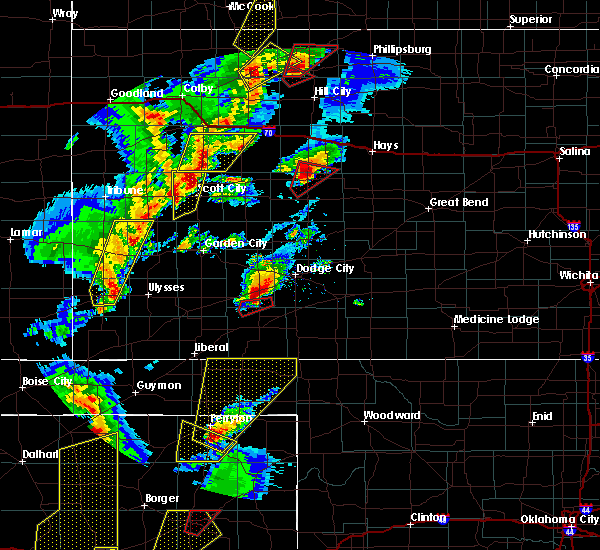 At 640 pm cst, a severe thunderstorm was located 7 miles south of perryton, moving northeast at 45 mph (radar indicated). Hazards include ping pong ball size hail and 60 mph wind gusts. People and animals outdoors will be injured. expect hail damage to roofs, siding, windows and vehicles. Minor wind damage to roofs, siding and trees is possible. At 640 pm cst, a severe thunderstorm was located 7 miles south of perryton, moving northeast at 45 mph (radar indicated). Hazards include ping pong ball size hail and 60 mph wind gusts. People and animals outdoors will be injured. expect hail damage to roofs, siding, windows and vehicles. Minor wind damage to roofs, siding and trees is possible.
|
| 9/13/2015 10:22 PM CDT |
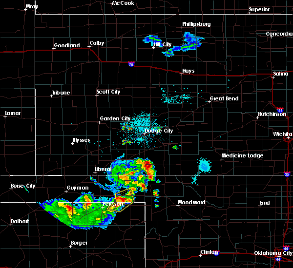 At 1021 pm cdt, severe thunderstorms were located along a line extending from near elmwood to booker to 8 miles east of perryton, moving east at 20 mph (radar indicated). Hazards include 70 mph wind gusts and penny size hail. Expect some tree damage. damage is likely to mobile homes, roofs and outbuildings. Locations impacted include, booker, darrouzett and elmwood. At 1021 pm cdt, severe thunderstorms were located along a line extending from near elmwood to booker to 8 miles east of perryton, moving east at 20 mph (radar indicated). Hazards include 70 mph wind gusts and penny size hail. Expect some tree damage. damage is likely to mobile homes, roofs and outbuildings. Locations impacted include, booker, darrouzett and elmwood.
|
| 9/13/2015 10:13 PM CDT |
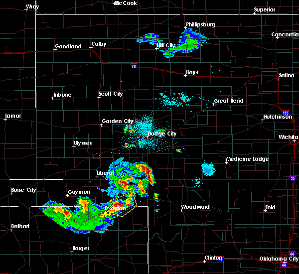 At 1011 pm cdt, a severe thunderstorm was located near booker, or 19 miles northeast of perryton, moving east at 25 mph. a 73 mph wind gust occurred at the perryton airport at 1006 pm cdt (radar indicated). Hazards include 70 mph wind gusts and penny size hail. Expect some tree damage. damage is likely to mobile homes, roofs and outbuildings. Locations impacted include, booker, darrouzett and elmwood. At 1011 pm cdt, a severe thunderstorm was located near booker, or 19 miles northeast of perryton, moving east at 25 mph. a 73 mph wind gust occurred at the perryton airport at 1006 pm cdt (radar indicated). Hazards include 70 mph wind gusts and penny size hail. Expect some tree damage. damage is likely to mobile homes, roofs and outbuildings. Locations impacted include, booker, darrouzett and elmwood.
|
| 9/13/2015 10:06 PM CDT |
 At 1005 pm cdt, a severe thunderstorm was located near booker, or 14 miles northeast of perryton, moving east at 25 mph (radar indicated). Hazards include 70 mph wind gusts and nickel size hail. Expect some tree damage. Damage is likely to mobile homes, roofs and outbuildings. At 1005 pm cdt, a severe thunderstorm was located near booker, or 14 miles northeast of perryton, moving east at 25 mph (radar indicated). Hazards include 70 mph wind gusts and nickel size hail. Expect some tree damage. Damage is likely to mobile homes, roofs and outbuildings.
|
| 9/13/2015 10:06 PM CDT |
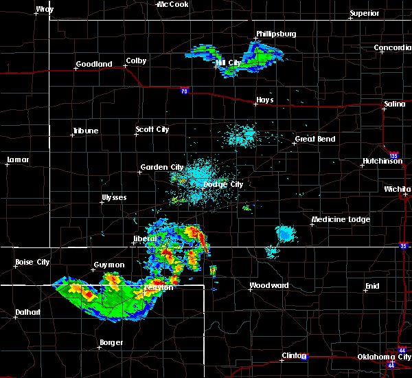 At 1005 pm cdt, a severe thunderstorm was located near booker, or 14 miles northeast of perryton, moving east at 25 mph (radar indicated). Hazards include 70 mph wind gusts and nickel size hail. Expect some tree damage. Damage is likely to mobile homes, roofs and outbuildings. At 1005 pm cdt, a severe thunderstorm was located near booker, or 14 miles northeast of perryton, moving east at 25 mph (radar indicated). Hazards include 70 mph wind gusts and nickel size hail. Expect some tree damage. Damage is likely to mobile homes, roofs and outbuildings.
|
| 8/3/2015 8:30 PM CDT | Storm damage reported in lipscomb county TX, 0.3 miles SSE of Booker, TX |
| 6/26/2015 4:22 AM CDT |
 The severe thunderstorm warning for northeastern ochiltree, northwestern lipscomb and beaver counties will expire at 430 am cdt, the line of storms which prompted the warning has weakened below severe limits, and no longer poses an immediate threat to life or property. however, gusty winds and heavy rain are still possible with these thunderstorms. The severe thunderstorm warning for northeastern ochiltree, northwestern lipscomb and beaver counties will expire at 430 am cdt, the line of storms which prompted the warning has weakened below severe limits, and no longer poses an immediate threat to life or property. however, gusty winds and heavy rain are still possible with these thunderstorms.
|
| 6/26/2015 3:27 AM CDT |
 At 321 am cdt, severe thunderstorms were located along a line extending from 8 miles northeast of forgan to 7 miles south of balko, and moving southeast at 15 mph (radar indicated. a wind gust of 64 mph was reported at 315 am in beaver ok). Hazards include 65 mph wind gusts and nickel size hail. Minor damage to roofs. Siding and trees is possible. At 321 am cdt, severe thunderstorms were located along a line extending from 8 miles northeast of forgan to 7 miles south of balko, and moving southeast at 15 mph (radar indicated. a wind gust of 64 mph was reported at 315 am in beaver ok). Hazards include 65 mph wind gusts and nickel size hail. Minor damage to roofs. Siding and trees is possible.
|
| 6/26/2015 3:27 AM CDT |
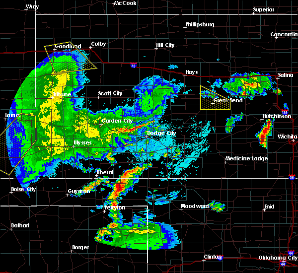 At 321 am cdt, severe thunderstorms were located along a line extending from 8 miles northeast of forgan to 7 miles south of balko, and moving southeast at 15 mph (radar indicated. a wind gust of 64 mph was reported at 315 am in beaver ok). Hazards include 65 mph wind gusts and nickel size hail. Minor damage to roofs. Siding and trees is possible. At 321 am cdt, severe thunderstorms were located along a line extending from 8 miles northeast of forgan to 7 miles south of balko, and moving southeast at 15 mph (radar indicated. a wind gust of 64 mph was reported at 315 am in beaver ok). Hazards include 65 mph wind gusts and nickel size hail. Minor damage to roofs. Siding and trees is possible.
|
| 6/11/2015 9:24 PM CDT |
 At 848 pm cdt, a severe thunderstorm was located near wolf creek park, and moving northeast at 20 mph. another severe thunderstorm was located just southwest of perryton moving northeast at 20 mph (radar indicated). Hazards include ping pong ball size hail and 60 mph wind gusts. People and animals outdoors will be injured. expect hail damage to roofs, siding, windows and vehicles. Minor wind damage to roofs, siding and trees is possible. At 848 pm cdt, a severe thunderstorm was located near wolf creek park, and moving northeast at 20 mph. another severe thunderstorm was located just southwest of perryton moving northeast at 20 mph (radar indicated). Hazards include ping pong ball size hail and 60 mph wind gusts. People and animals outdoors will be injured. expect hail damage to roofs, siding, windows and vehicles. Minor wind damage to roofs, siding and trees is possible.
|
| 6/11/2015 8:52 PM CDT |
 At 848 pm cdt, a severe thunderstorm was located near wolf creek park, and moving northeast at 20 mph. another severe thunderstorm was located just southwest of perryton moving northeast at 20 mph (radar indicated). Hazards include ping pong ball size hail and 60 mph wind gusts. People and animals outdoors will be injured. expect hail damage to roofs, siding, windows and vehicles. Minor wind damage to roofs, siding and trees is possible. At 848 pm cdt, a severe thunderstorm was located near wolf creek park, and moving northeast at 20 mph. another severe thunderstorm was located just southwest of perryton moving northeast at 20 mph (radar indicated). Hazards include ping pong ball size hail and 60 mph wind gusts. People and animals outdoors will be injured. expect hail damage to roofs, siding, windows and vehicles. Minor wind damage to roofs, siding and trees is possible.
|
| 6/7/2015 7:09 PM CDT | At 708 pm cdt, a severe thunderstorm was located 12 miles southeast of wolf creek park, and moving southeast at 35 mph (radar indicated). Hazards include 60 mph wind gusts. Minor damage to roofs. Siding and trees is possible. |
| 6/7/2015 6:39 PM CDT | At 637 pm cdt, a severe thunderstorm was located 9 miles west of wolf creek park, and moving southeast at 35 mph (radar indicated). Hazards include 60 mph wind gusts. Minor damage to roofs. Siding and trees is possible. |
| 5/27/2015 6:24 PM CDT | At 621 pm cdt, a severe thunderstorm was located 6 miles west of booker, and moving northeast at 45 mph (radar indicated). Hazards include 60 mph wind gusts and quarter size hail. Hail damage to vehicles is expected. Minor wind damage to roofs, siding and trees is possible. |
| 5/27/2015 6:24 PM CDT | At 621 pm cdt, a severe thunderstorm was located 6 miles west of booker, and moving northeast at 45 mph (radar indicated). Hazards include 60 mph wind gusts and quarter size hail. Hail damage to vehicles is expected. Minor wind damage to roofs, siding and trees is possible. |
| 5/27/2015 5:51 PM CDT | At 547 pm cdt, a severe thunderstorm was located 12 miles south of farnsworth, and moving northeast at 45 mph (radar indicated). Hazards include 60 mph wind gusts and quarter size hail. Hail damage to vehicles is expected. Minor wind damage to roofs, siding and trees is possible. |
| 5/27/2015 5:51 PM CDT | At 547 pm cdt, a severe thunderstorm was located 12 miles south of farnsworth, and moving northeast at 45 mph (radar indicated). Hazards include 60 mph wind gusts and quarter size hail. Hail damage to vehicles is expected. Minor wind damage to roofs, siding and trees is possible. |
| 5/16/2015 2:09 AM CDT | At 206 am cdt, a severe thunderstorm was located 13 miles southwest of wolf creek park, and moving northeast at 35 mph (radar indicated). Hazards include 60 mph wind gusts and quarter size hail. Hail damage to vehicles is expected. Minor wind damage to roofs, siding and trees is possible. |
| 5/16/2015 2:09 AM CDT | At 206 am cdt, a severe thunderstorm was located 13 miles southwest of wolf creek park, and moving northeast at 35 mph (radar indicated). Hazards include 60 mph wind gusts and quarter size hail. Hail damage to vehicles is expected. Minor wind damage to roofs, siding and trees is possible. |
| 5/16/2015 1:53 AM CDT | At 152 am cdt, a severe thunderstorm was located 9 miles west of wolf creek park, and moving northeast at 35 mph (radar indicated). Hazards include 60 mph wind gusts and quarter size hail. Hail damage to vehicles is expected. Minor wind damage to roofs, siding and trees is possible. |
| 5/16/2015 1:53 AM CDT | At 152 am cdt, a severe thunderstorm was located 9 miles west of wolf creek park, and moving northeast at 35 mph (radar indicated). Hazards include 60 mph wind gusts and quarter size hail. Hail damage to vehicles is expected. Minor wind damage to roofs, siding and trees is possible. |
| 5/16/2015 1:24 AM CDT | At 123 am cdt, a severe thunderstorm was located 15 miles southeast of spearman, and moving northeast at 35 mph (radar indicated). Hazards include 60 mph wind gusts and quarter size hail. Hail damage to vehicles is expected. Minor wind damage to roofs, siding and trees is possible. |
| 5/16/2015 1:24 AM CDT | At 123 am cdt, a severe thunderstorm was located 15 miles southeast of spearman, and moving northeast at 35 mph (radar indicated). Hazards include 60 mph wind gusts and quarter size hail. Hail damage to vehicles is expected. Minor wind damage to roofs, siding and trees is possible. |
| 5/9/2015 6:52 PM CDT | At 649 pm cdt, a severe thunderstorm was located 6 miles south of beaver, and moving northeast at 65 mph (radar indicated). Hazards include 60 mph wind gusts and half dollar size hail. Hail damage to vehicles is expected. Minor wind damage to roofs, siding and trees is possible. |
| 5/9/2015 6:52 PM CDT | At 649 pm cdt, a severe thunderstorm was located 6 miles south of beaver, and moving northeast at 65 mph (radar indicated). Hazards include 60 mph wind gusts and half dollar size hail. Hail damage to vehicles is expected. Minor wind damage to roofs, siding and trees is possible. |
| 5/9/2015 6:37 PM CDT | At 634 pm cdt, a severe thunderstorm was located 6 miles south of balko, and moving northeast at 30 mph (radar indicated). Hazards include 60 mph wind gusts and half dollar size hail. Hail damage to vehicles is expected. Minor wind damage to roofs, siding and trees is possible. |
| 5/9/2015 6:37 PM CDT | At 634 pm cdt, a severe thunderstorm was located 6 miles south of balko, and moving northeast at 30 mph (radar indicated). Hazards include 60 mph wind gusts and half dollar size hail. Hail damage to vehicles is expected. Minor wind damage to roofs, siding and trees is possible. |
| 4/16/2015 6:03 PM CDT | At 600 pm cdt, severe thunderstorms were located along a line extending from 6 miles northwest of lipscomb to 6 miles southeast of miami, and moving east at 25 mph. other severe thunderstorm were located over southeastern hemphill county moving northeast (radar indicated). Hazards include hen egg size hail and 60 mph wind gusts. People and animals outdoors will be injured. expect hail damage to roofs, siding, windows and vehicles. Minor wind damage to roofs, siding and trees is possible. |
| 4/16/2015 5:46 PM CDT | At 543 pm cdt, severe thunderstorms were located along a line extending from 9 miles northeast of wolf creek park to miami, and moving east at 25 mph (radar indicated). Hazards include golf ball size hail and 60 mph wind gusts. People and animals outdoors will be injured. expect hail damage to roofs, siding, windows and vehicles. Minor wind damage to roofs, siding and trees is possible. |
| 4/15/2015 7:39 PM CDT | A severe thunderstorm warning remains in effect for northwestern lipscomb and southeastern beaver counties until 800 pm cdt. at 738 pm cdt. a severe thunderstorm was located near darrouzett. and moving northeast at 25 mph. hazard. 70 mph wind gusts and quarter size hail. source. Radar indicated. |
| 4/15/2015 7:39 PM CDT | A severe thunderstorm warning remains in effect for northwestern lipscomb and southeastern beaver counties until 800 pm cdt. at 738 pm cdt. a severe thunderstorm was located near darrouzett. and moving northeast at 25 mph. hazard. 70 mph wind gusts and quarter size hail. source. Radar indicated. |
| 4/15/2015 7:26 PM CDT | A severe thunderstorm warning remains in effect for northwestern lipscomb and eastern beaver counties until 800 pm cdt. at 723 pm cdt. a severe thunderstorm was located near darrouzett. and moving northeast at 30 mph. hazard. 70 mph wind gusts and ping pong ball size hail. source. Radar indicated. |
| 4/15/2015 7:26 PM CDT | A severe thunderstorm warning remains in effect for northwestern lipscomb and eastern beaver counties until 800 pm cdt. at 723 pm cdt. a severe thunderstorm was located near darrouzett. and moving northeast at 30 mph. hazard. 70 mph wind gusts and ping pong ball size hail. source. Radar indicated. |
| 4/15/2015 7:24 PM CDT | Quarter sized hail reported 0.3 miles SSE of Booker, TX, nickel to quarter size hail |
| 4/15/2015 7:23 PM CDT | Ping Pong Ball sized hail reported 1.1 miles WSW of Booker, TX |
| 4/15/2015 7:20 PM CDT | Quarter sized hail reported 0.3 miles SSE of Booker, TX |
| 4/15/2015 7:10 PM CDT | A severe thunderstorm warning remains in effect for northeastern ochiltree. northwestern lipscomb and eastern beaver counties until 800 pm cdt. at 707 pm cdt. a severe thunderstorm was located 5 miles southeast of booker. and moving northeast at 20 mph. hazard. 70 mph wind gusts and ping pong ball size hail. |
| 4/15/2015 7:10 PM CDT | A severe thunderstorm warning remains in effect for northeastern ochiltree. northwestern lipscomb and eastern beaver counties until 800 pm cdt. at 707 pm cdt. a severe thunderstorm was located 5 miles southeast of booker. and moving northeast at 20 mph. hazard. 70 mph wind gusts and ping pong ball size hail. |
| 4/15/2015 6:57 PM CDT | The national weather service in amarillo has issued a * severe thunderstorm warning for. eastern beaver county in the panhandle of oklahoma. northwestern lipscomb county in the panhandle of texas. northeastern ochiltree county in the panhandle of texas. Until 800 pm cdt. |
| 4/15/2015 6:57 PM CDT | The national weather service in amarillo has issued a * severe thunderstorm warning for. eastern beaver county in the panhandle of oklahoma. northwestern lipscomb county in the panhandle of texas. northeastern ochiltree county in the panhandle of texas. Until 800 pm cdt. |
| 8/28/2014 6:30 PM CDT | Quarter sized hail reported 0.3 miles SSE of Booker, TX, a mix of pea to quarter size hail was falling in booker. |
| 8/27/2014 6:30 PM CDT | 13 power poles leaning or downed along hwy 41 in beaver county OK, 12.4 miles SSE of Booker, TX |
| 6/22/2014 7:18 PM CDT | Quarter sized hail reported 2.1 miles W of Booker, TX |
| 6/11/2014 9:33 PM CDT | Storm damage reported in beaver county OK, 11.4 miles S of Booker, TX |
| 9/19/2013 5:45 PM CDT | Minor wind damage to outbuildings on county road 6 at 1.5 miles south of hwy 1 in lipscomb county TX, 2.8 miles NW of Booker, TX |
| 9/19/2013 3:30 PM CDT | Minor wind damage to outbuildings on county road 6 at 1.5 miles south of hwy 15. corrected event time. there was no damage at 545 pm in lipscomb county TX, 2.8 miles NW of Booker, TX |
| 6/8/2013 8:00 PM CDT | Quarter sized hail reported 1.2 miles ESE of Booker, TX |
| 6/5/2013 8:07 PM CDT | Golf Ball sized hail reported 0.3 miles SSE of Booker, TX, golf ball sized hail is covering the ground |
| 6/5/2013 2:27 AM CDT | Quarter sized hail reported 0.3 miles SSE of Booker, TX |
| 6/4/2013 12:28 AM CDT | Golf Ball sized hail reported 0.3 miles SSE of Booker, TX |
| 6/3/2013 8:52 PM CDT | 4 to 6 inch green tree limb snapped from tre in lipscomb county TX, 7.3 miles N of Booker, TX |
| 6/3/2013 8:48 PM CDT | Camper trailer rolled over and broken to piece in lipscomb county TX, 3.9 miles N of Booker, TX |
| 6/3/2013 8:45 PM CDT | 18 inch tree limb broken from tre in lipscomb county TX, 0.3 miles SSE of Booker, TX |
| 6/3/2013 8:45 PM CDT | Center pivot irrigation system rolled ove in lipscomb county TX, 1.1 miles WSW of Booker, TX |
| 6/3/2013 8:43 PM CDT | 20 by 30 foot pole barn turned upside dow in ochiltree county TX, 0.7 miles ESE of Booker, TX |
| 6/3/2013 8:41 PM CDT | Downed power lines and power poles one mile north of huntoon in ochiltree county TX, 5.2 miles E of Booker, TX |
| 5/28/2013 6:58 PM CDT | 8 power poles down in beaver county OK, 11.8 miles SSW of Booker, TX |
| 6/14/2012 9:55 PM CDT | Quarter sized hail reported 11 miles W of Booker, TX |
| 6/14/2012 9:46 PM CDT | Quarter sized hail reported 8.3 miles SSW of Booker, TX |
| 6/14/2012 9:43 PM CDT | Quarter sized hail reported 0.3 miles SSE of Booker, TX |
| 6/2/2012 10:42 PM CDT | Trees blown down in lipscomb county TX, 0.3 miles SSE of Booker, TX |
| 6/1/2012 5:16 PM CDT | Quarter sized hail reported 3.8 miles W of Booker, TX |
| 1/1/0001 12:00 AM | Quarter sized hail reported 2.7 miles NNW of Booker, TX, quarter hail covering the ground |
| 1/1/0001 12:00 AM | Half Dollar sized hail reported 5.2 miles N of Booker, TX, quarter to half dollar size hail |
| 10/11/2011 6:16 PM CDT | Quarter sized hail reported 10.2 miles NW of Booker, TX |
| 1/1/0001 12:00 AM | Outbuilding destroyed and antenna damaged. trampoline blown completely over house. winds estimated around 60-65 mp in beaver county OK, 9.8 miles SE of Booker, TX |
| 1/1/0001 12:00 AM | Power poles down for several miles west of elmwood along highway 412 in beaver county OK, 11.4 miles S of Booker, TX |
| 1/1/0001 12:00 AM | 11-12 power poles down for at least 8 miles along highway 412. power poles were snapped off about 6 to 8 feet u in beaver county OK, 12.9 miles SSE of Booker, TX |
| 1/1/0001 12:00 AM | Power poles down for at least 8 miles along highway 41 in beaver county OK, 12.9 miles SSE of Booker, TX |
| 1/1/0001 12:00 AM | Softball sized hail reported 14.5 miles NW of Booker, TX |
| 1/1/0001 12:00 AM | Quarter sized hail reported 13 miles WNW of Booker, TX, pea size hail covering the ground. some of the hail was quarter size. |
| 1/1/0001 12:00 AM | Quarter sized hail reported 0.3 miles SSE of Booker, TX, rotaiting wall cloud with this storm. |
| 1/1/0001 12:00 AM | Quarter sized hail reported 1.1 miles N of Booker, TX |
| 1/1/0001 12:00 AM | Hen Egg sized hail reported 11.8 miles WSW of Booker, TX |
| 1/1/0001 12:00 AM | Ping Pong Ball sized hail reported 4.7 miles WNW of Booker, TX |
| 1/1/0001 12:00 AM | Golf Ball sized hail reported 3.8 miles W of Booker, TX |
| 1/1/0001 12:00 AM | Quarter sized hail reported 0.3 miles SSE of Booker, TX, nickel to quarter size hail falling. |
| 1/1/0001 12:00 AM | Quarter sized hail reported 1.1 miles WSW of Booker, TX |
Hail Maps for Booker, TX
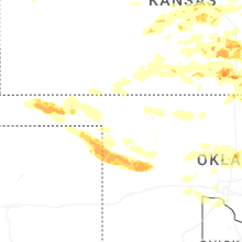
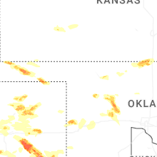
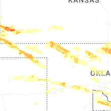


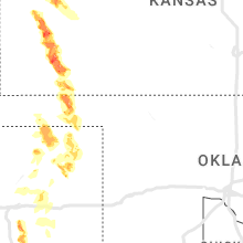

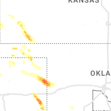


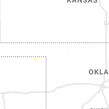


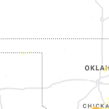


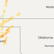


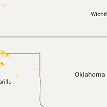


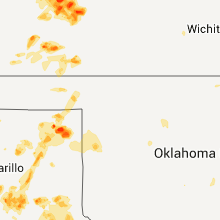


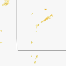


Connect with Interactive Hail Maps