

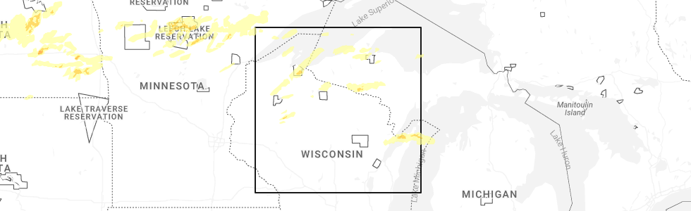
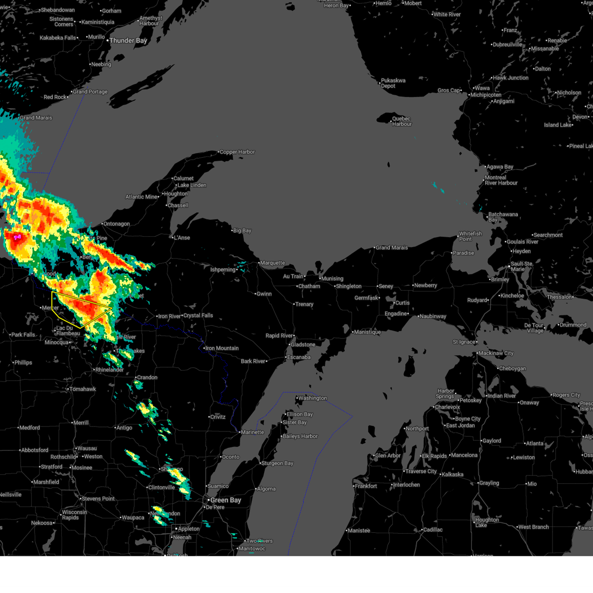
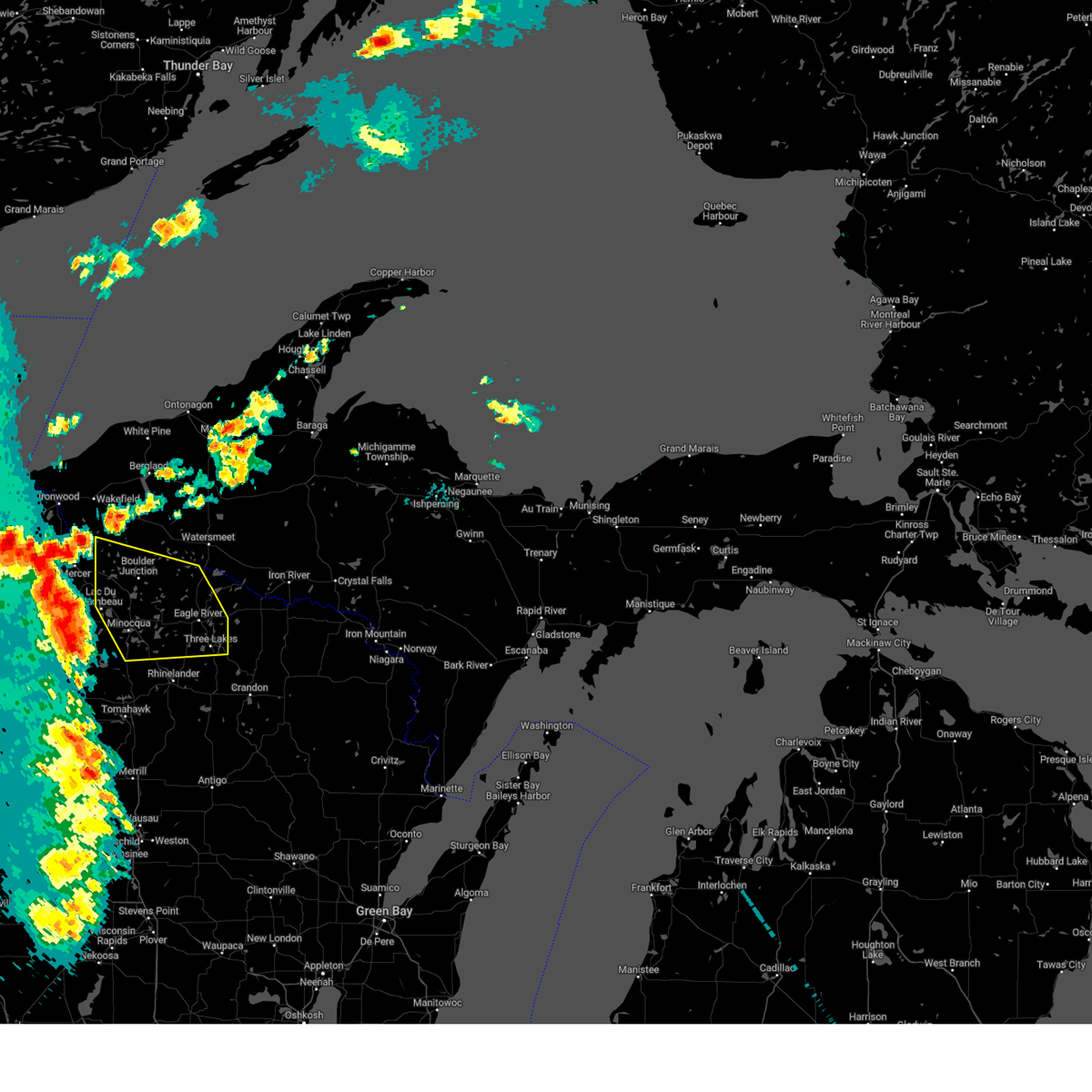
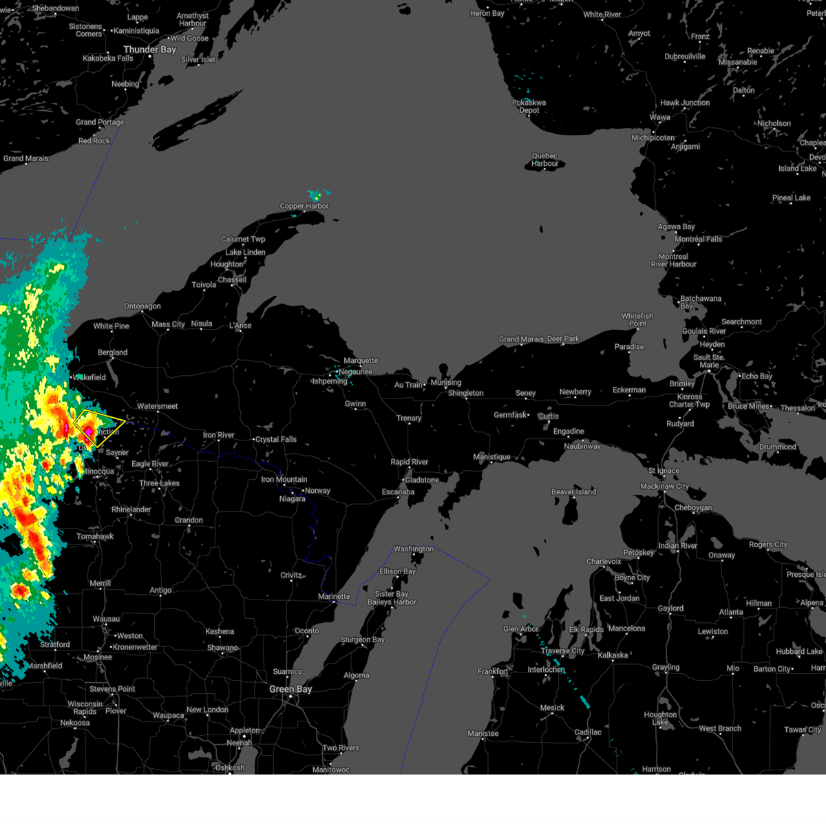
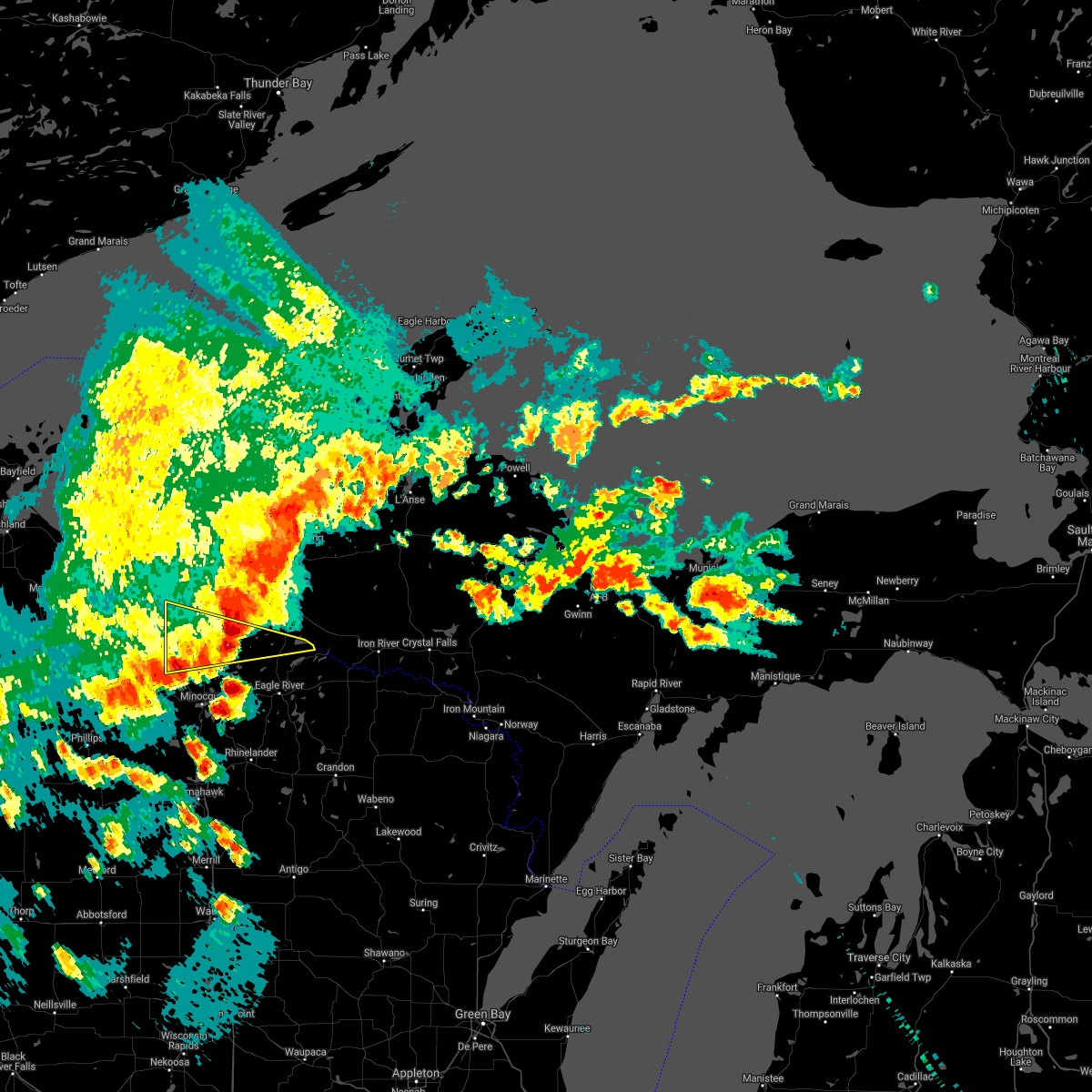
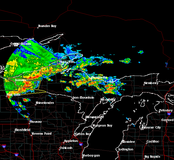
Hail Map for Boulder Junction, WI
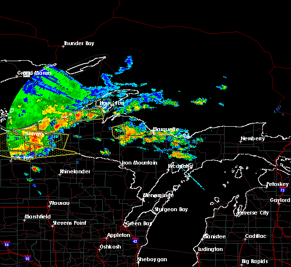
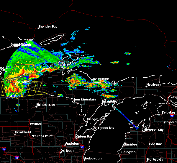
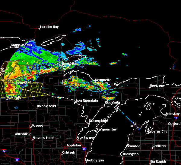
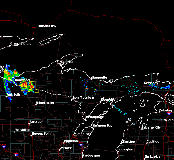
The Boulder Junction, WI area has had 4 reports of on-the-ground hail by trained spotters, and has been under severe weather warnings 9 times during the past 12 months. Doppler radar has detected hail at or near Boulder Junction, WI on 27 occasions, including 1 occasion during the past year.
| Name: | Boulder Junction, WI |
| Where Located: | 34.9 miles NNW of Rhinelander, WI |
| Map: | Google Map for Boulder Junction, WI |
| Population: | 183 |
| Housing Units: | 178 |
| More Info: | Search Google for Boulder Junction, WI |
0
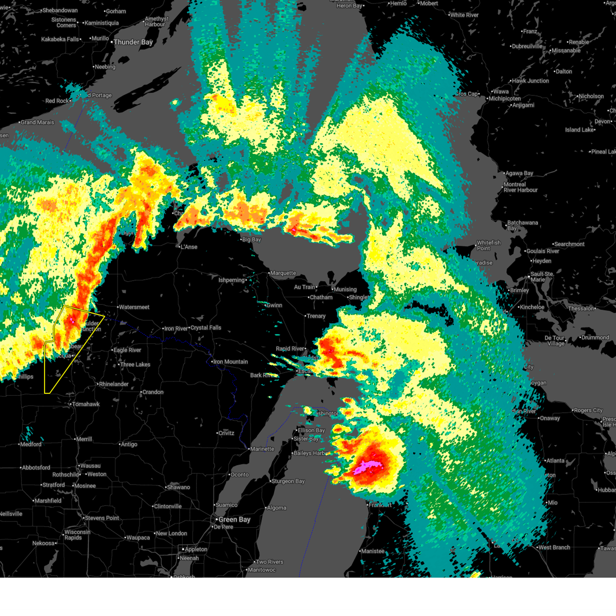
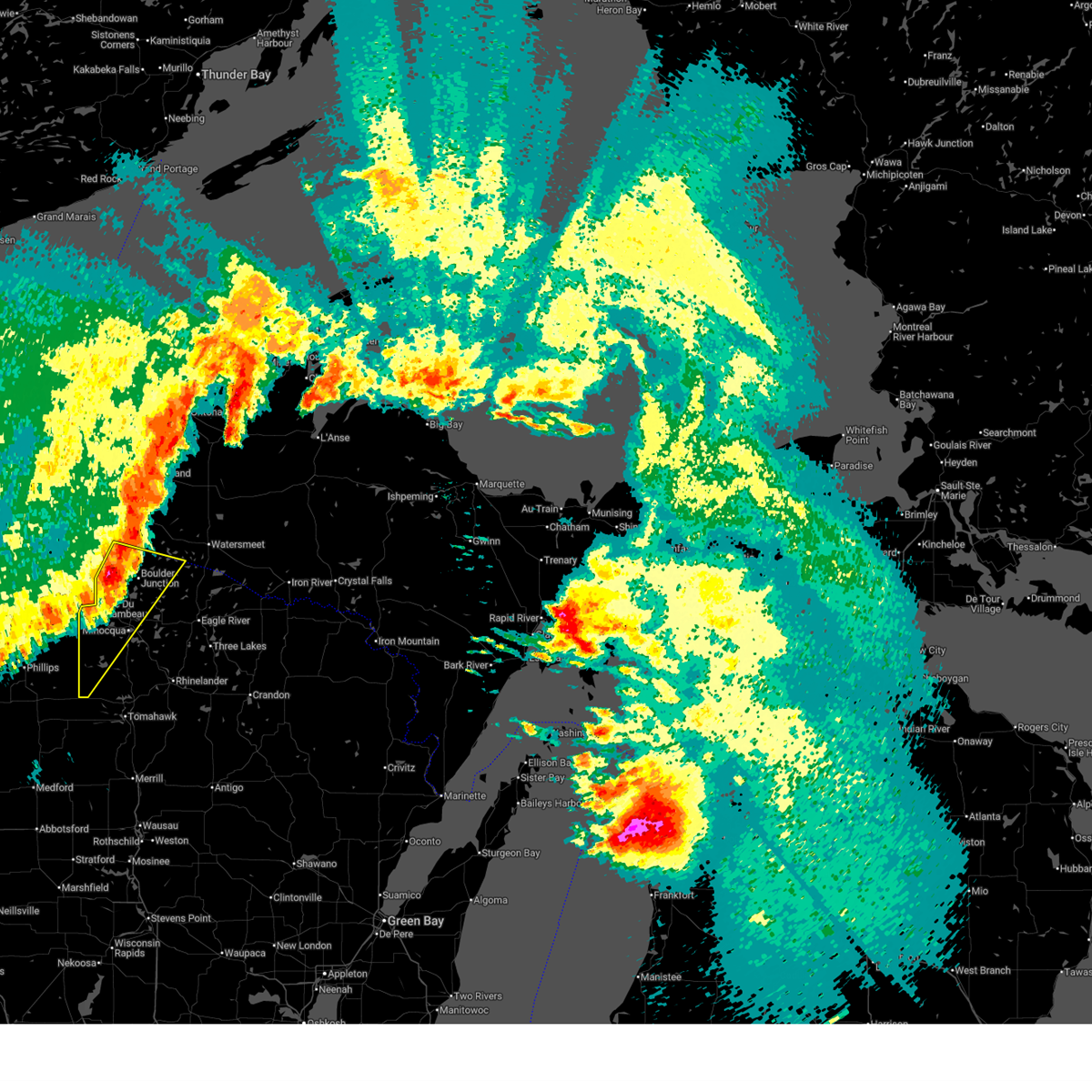
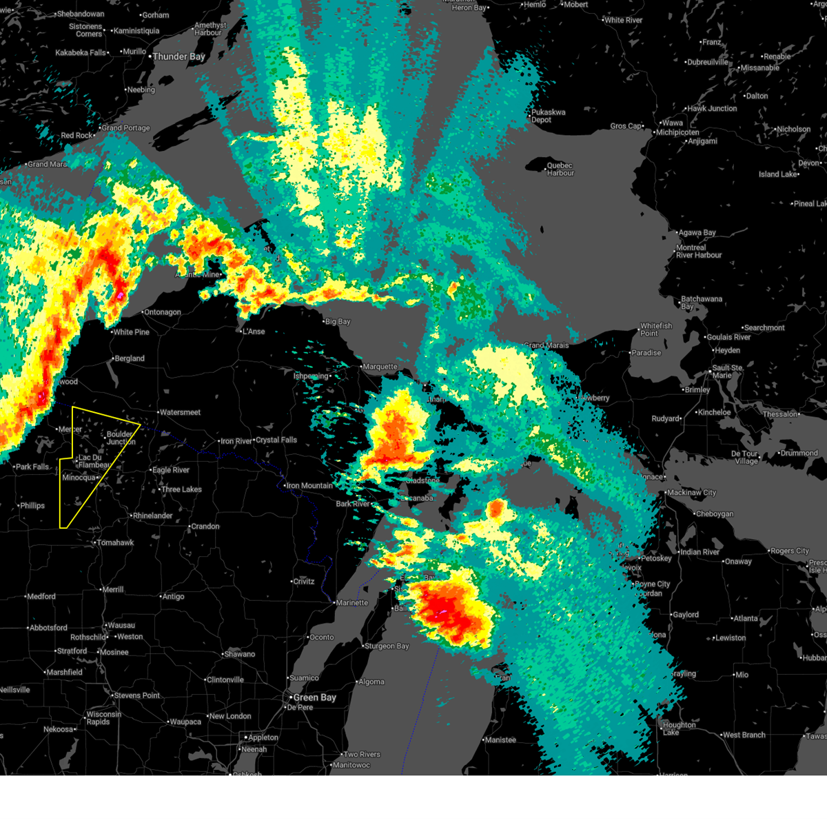
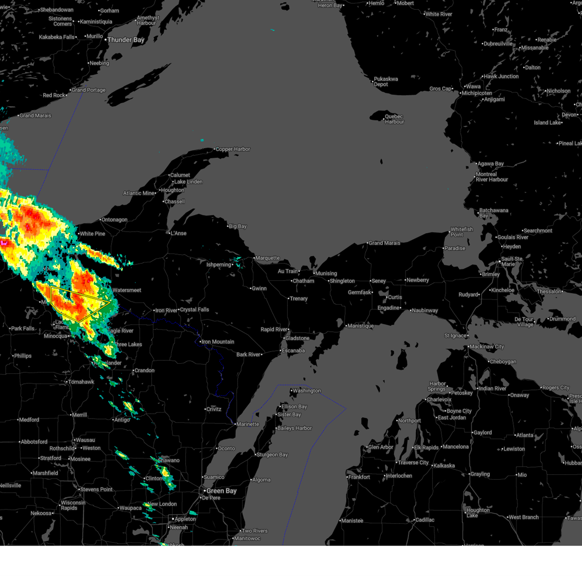
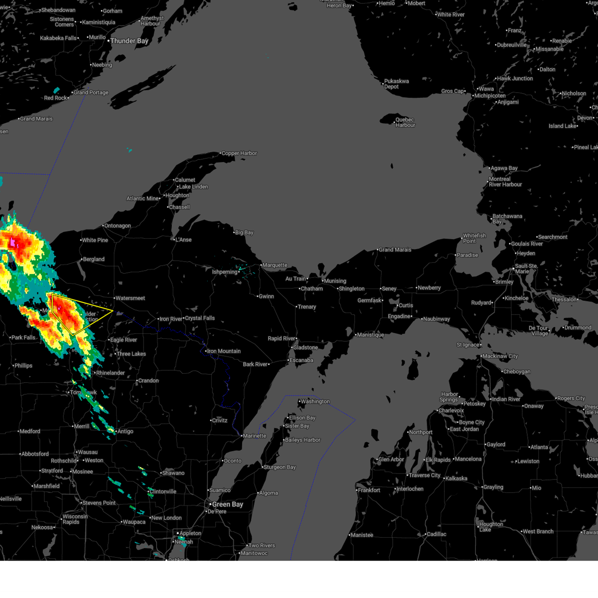
The Top Recent Hail Date for Boulder Junction, WI is Friday, June 20, 2025 (27th out of 27)
Hail and Wind Damage Spotted near Boulder Junction, WI
| Date / Time | Report Details |
|---|---|
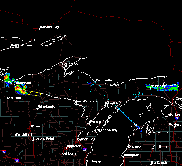
| 6/21/2025 5:24 AM CDT |
 The storms which prompted the warning have moved out of the area. therefore, the warning will be allowed to expire. to report severe weather, contact your nearest law enforcement agency. they will relay your report to the national weather service green bay. The storms which prompted the warning have moved out of the area. therefore, the warning will be allowed to expire. to report severe weather, contact your nearest law enforcement agency. they will relay your report to the national weather service green bay.
|
| 6/21/2025 5:20 AM CDT |
 At 520 am cdt, severe thunderstorms were located along a line extending from near border lakes natural area to 6 miles north of willow lake, moving southeast at 50 mph (radar indicated). Hazards include 60 mph wind gusts. Expect damage to roofs, siding, and trees. these severe storms will be near, boulder junction, squirrel lake, and johnson lake barrens natural area around 525 am cdt. willow reservoir around 530 am cdt. Other locations impacted by these severe thunderstorms include arbor vitae, van vliet hemlocks natural area, sayner, nixon lake natural area, trout lake, manitowish waters, woodruff, tomahawk river pines natural area, dunn lake natural area, and presque isle. At 520 am cdt, severe thunderstorms were located along a line extending from near border lakes natural area to 6 miles north of willow lake, moving southeast at 50 mph (radar indicated). Hazards include 60 mph wind gusts. Expect damage to roofs, siding, and trees. these severe storms will be near, boulder junction, squirrel lake, and johnson lake barrens natural area around 525 am cdt. willow reservoir around 530 am cdt. Other locations impacted by these severe thunderstorms include arbor vitae, van vliet hemlocks natural area, sayner, nixon lake natural area, trout lake, manitowish waters, woodruff, tomahawk river pines natural area, dunn lake natural area, and presque isle.
|
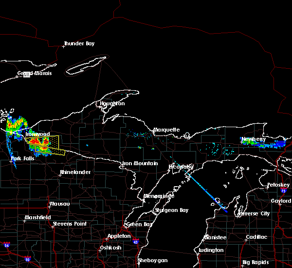
| 6/21/2025 4:49 AM CDT |
 Svrgrb the national weather service in green bay has issued a * severe thunderstorm warning for, western vilas county in north central wisconsin, northwestern oneida county in north central wisconsin, * until 530 am cdt. * at 448 am cdt, severe thunderstorms were located along a line extending from near bessemer to near park falls, moving southeast at 50 mph (radar indicated). Hazards include 60 mph wind gusts. Expect damage to roofs, siding, and trees. severe thunderstorms will be near, winchester around 500 am cdt. lac du flambeau, border lakes natural area, and rice creek natural area around 510 am cdt. squirrel lake around 515 am cdt. boulder junction around 520 am cdt. Other locations impacted by these severe thunderstorms include arbor vitae, van vliet hemlocks natural area, sayner, nixon lake natural area, trout lake, manitowish waters, woodruff, tomahawk river pines natural area, dunn lake natural area, and presque isle. Svrgrb the national weather service in green bay has issued a * severe thunderstorm warning for, western vilas county in north central wisconsin, northwestern oneida county in north central wisconsin, * until 530 am cdt. * at 448 am cdt, severe thunderstorms were located along a line extending from near bessemer to near park falls, moving southeast at 50 mph (radar indicated). Hazards include 60 mph wind gusts. Expect damage to roofs, siding, and trees. severe thunderstorms will be near, winchester around 500 am cdt. lac du flambeau, border lakes natural area, and rice creek natural area around 510 am cdt. squirrel lake around 515 am cdt. boulder junction around 520 am cdt. Other locations impacted by these severe thunderstorms include arbor vitae, van vliet hemlocks natural area, sayner, nixon lake natural area, trout lake, manitowish waters, woodruff, tomahawk river pines natural area, dunn lake natural area, and presque isle.
|
| 6/21/2025 1:46 AM CDT |
 The storm which prompted the warning has moved out of the area. therefore, the warning has been allowed to expire. however, small hail and gusty winds are still possible with this thunderstorm. The storm which prompted the warning has moved out of the area. therefore, the warning has been allowed to expire. however, small hail and gusty winds are still possible with this thunderstorm.
|
| 6/21/2025 1:32 AM CDT |
 At 131 am cdt, a severe thunderstorm was located near boulder junction, or 21 miles northwest of eagle river, moving northeast at 45 mph (radar indicated). Hazards include 60 mph wind gusts and quarter size hail. Hail damage to vehicles is expected. expect wind damage to roofs, siding, and trees. this severe storm will be near, johnson lake barrens natural area around 135 am cdt. Other locations impacted by this severe thunderstorm include van vliet hemlocks natural area, land o lakes, nixon lake natural area, trout lake, manitowish waters, dunn lake natural area, presque isle, and high lake natural area. At 131 am cdt, a severe thunderstorm was located near boulder junction, or 21 miles northwest of eagle river, moving northeast at 45 mph (radar indicated). Hazards include 60 mph wind gusts and quarter size hail. Hail damage to vehicles is expected. expect wind damage to roofs, siding, and trees. this severe storm will be near, johnson lake barrens natural area around 135 am cdt. Other locations impacted by this severe thunderstorm include van vliet hemlocks natural area, land o lakes, nixon lake natural area, trout lake, manitowish waters, dunn lake natural area, presque isle, and high lake natural area.
|
| 6/21/2025 1:12 AM CDT |
 Svrgrb the national weather service in green bay has issued a * severe thunderstorm warning for, western vilas county in north central wisconsin, * until 145 am cdt. * at 111 am cdt, a severe thunderstorm was located near boulder junction, or 24 miles east of turtle flambeau flowage, moving northeast at 40 mph (radar indicated). Hazards include 60 mph wind gusts and nickel size hail. Expect damage to roofs, siding, and trees. this severe thunderstorm will be near, boulder junction around 115 am cdt. Other locations impacted by this severe thunderstorm include van vliet hemlocks natural area, land o lakes, nixon lake natural area, trout lake, manitowish waters, dunn lake natural area, presque isle, and high lake natural area. Svrgrb the national weather service in green bay has issued a * severe thunderstorm warning for, western vilas county in north central wisconsin, * until 145 am cdt. * at 111 am cdt, a severe thunderstorm was located near boulder junction, or 24 miles east of turtle flambeau flowage, moving northeast at 40 mph (radar indicated). Hazards include 60 mph wind gusts and nickel size hail. Expect damage to roofs, siding, and trees. this severe thunderstorm will be near, boulder junction around 115 am cdt. Other locations impacted by this severe thunderstorm include van vliet hemlocks natural area, land o lakes, nixon lake natural area, trout lake, manitowish waters, dunn lake natural area, presque isle, and high lake natural area.
|
| 10/5/2024 8:39 PM CDT |
 At 838 pm cdt, a severe thunderstorm was located over rainbow flowage, or 14 miles northwest of rhinelander, moving northeast at 65 mph (radar indicated). Hazards include 60 mph wind gusts and quarter size hail. Hail damage to vehicles is expected. expect wind damage to roofs, siding, and trees. This severe thunderstorm will remain over mainly rural areas of central vilas and northwestern oneida counties, including the following locations, sayner, land o lakes, nixon lake natural area, lac vieux desert, hazelhurst, upper buckatabon springs natural area, woodruff, st germain, high lake natural area, and arbor vitae. At 838 pm cdt, a severe thunderstorm was located over rainbow flowage, or 14 miles northwest of rhinelander, moving northeast at 65 mph (radar indicated). Hazards include 60 mph wind gusts and quarter size hail. Hail damage to vehicles is expected. expect wind damage to roofs, siding, and trees. This severe thunderstorm will remain over mainly rural areas of central vilas and northwestern oneida counties, including the following locations, sayner, land o lakes, nixon lake natural area, lac vieux desert, hazelhurst, upper buckatabon springs natural area, woodruff, st germain, high lake natural area, and arbor vitae.
|
| 10/5/2024 8:27 PM CDT |
 Svrgrb the national weather service in green bay has issued a * severe thunderstorm warning for, vilas county in north central wisconsin, western oneida county in north central wisconsin, * until 915 pm cdt. * at 827 pm cdt, a severe thunderstorm was located near willow reservoir, or 17 miles west of rhinelander, moving northeast at 70 mph (radar indicated). Hazards include 60 mph wind gusts and quarter size hail. Hail damage to vehicles is expected. Expect wind damage to roofs, siding, and trees. Svrgrb the national weather service in green bay has issued a * severe thunderstorm warning for, vilas county in north central wisconsin, western oneida county in north central wisconsin, * until 915 pm cdt. * at 827 pm cdt, a severe thunderstorm was located near willow reservoir, or 17 miles west of rhinelander, moving northeast at 70 mph (radar indicated). Hazards include 60 mph wind gusts and quarter size hail. Hail damage to vehicles is expected. Expect wind damage to roofs, siding, and trees.
|
| 8/26/2024 11:04 PM CDT |
 Svrgrb the national weather service in green bay has issued a * severe thunderstorm warning for, vilas county in north central wisconsin, northeastern oneida county in north central wisconsin, * until 1145 pm cdt. * at 1104 pm cdt, severe thunderstorms were located along a line extending from 6 miles northwest of winchester to 6 miles west of rainbow flowage, moving east at 45 mph (radar indicated). Hazards include 60 mph wind gusts and quarter size hail. Hail damage to vehicles is expected. Expect wind damage to roofs, siding, and trees. Svrgrb the national weather service in green bay has issued a * severe thunderstorm warning for, vilas county in north central wisconsin, northeastern oneida county in north central wisconsin, * until 1145 pm cdt. * at 1104 pm cdt, severe thunderstorms were located along a line extending from 6 miles northwest of winchester to 6 miles west of rainbow flowage, moving east at 45 mph (radar indicated). Hazards include 60 mph wind gusts and quarter size hail. Hail damage to vehicles is expected. Expect wind damage to roofs, siding, and trees.
|
| 6/17/2024 8:49 AM CDT |
 Svrgrb the national weather service in green bay has issued a * severe thunderstorm warning for, northwestern vilas county in north central wisconsin, * until 915 am cdt. * at 849 am cdt, a severe thunderstorm was located over rice creek natural area, or 23 miles east of turtle flambeau flowage, moving northeast at 35 mph (radar indicated). Hazards include quarter size hail. damage to vehicles is expected Svrgrb the national weather service in green bay has issued a * severe thunderstorm warning for, northwestern vilas county in north central wisconsin, * until 915 am cdt. * at 849 am cdt, a severe thunderstorm was located over rice creek natural area, or 23 miles east of turtle flambeau flowage, moving northeast at 35 mph (radar indicated). Hazards include quarter size hail. damage to vehicles is expected
|
| 5/18/2024 5:36 PM CDT |
 the severe thunderstorm warning has been cancelled and is no longer in effect the severe thunderstorm warning has been cancelled and is no longer in effect
|
| 5/18/2024 5:17 PM CDT |
 At 515 pm cdt, a severe thunderstorm was located near squirrel lake, or 21 miles southeast of turtle flambeau flowage, moving east at 35 mph. one inch hail was recorded 4 miles southwest of lac du flambeau (radar indicated). Hazards include 60 mph wind gusts and half dollar size hail. Hail damage to vehicles is expected. expect wind damage to roofs, siding, and trees. Locations impacted include, eagle river, lac du flambeau, phelps, boulder junction, squirrel lake, johnson lake barrens natural area, kentuck lake campground, rainbow flowage, minocqua, and arbor vitae. At 515 pm cdt, a severe thunderstorm was located near squirrel lake, or 21 miles southeast of turtle flambeau flowage, moving east at 35 mph. one inch hail was recorded 4 miles southwest of lac du flambeau (radar indicated). Hazards include 60 mph wind gusts and half dollar size hail. Hail damage to vehicles is expected. expect wind damage to roofs, siding, and trees. Locations impacted include, eagle river, lac du flambeau, phelps, boulder junction, squirrel lake, johnson lake barrens natural area, kentuck lake campground, rainbow flowage, minocqua, and arbor vitae.
|
| 5/18/2024 4:58 PM CDT |
 Svrgrb the national weather service in green bay has issued a * severe thunderstorm warning for, vilas county in north central wisconsin, northwestern oneida county in north central wisconsin, * until 600 pm cdt. * at 457 pm cdt, a severe thunderstorm was located near squirrel lake, or 15 miles southeast of turtle flambeau flowage, moving northeast at 45 mph (radar indicated). Hazards include 60 mph wind gusts and quarter size hail. Hail damage to vehicles is expected. Expect wind damage to roofs, siding, and trees. Svrgrb the national weather service in green bay has issued a * severe thunderstorm warning for, vilas county in north central wisconsin, northwestern oneida county in north central wisconsin, * until 600 pm cdt. * at 457 pm cdt, a severe thunderstorm was located near squirrel lake, or 15 miles southeast of turtle flambeau flowage, moving northeast at 45 mph (radar indicated). Hazards include 60 mph wind gusts and quarter size hail. Hail damage to vehicles is expected. Expect wind damage to roofs, siding, and trees.
|
| 7/27/2023 6:34 PM CDT | 2-3 inch diameter branches dow in vilas county WI, 1.7 miles SSW of Boulder Junction, WI |
| 7/27/2023 6:34 PM CDT |
 At 634 pm cdt, severe thunderstorms were located along a line extending from near border lakes natural area to near boulder junction to near squirrel lake, moving east at 45 mph (radar indicated). Hazards include 60 mph wind gusts. Expect damage to roofs, siding, and trees. locations impacted include, johnson lake barrens natural area, rainbow flowage and eagle river. hail threat, radar indicated max hail size, <. 75 in wind threat, radar indicated max wind gust, 60 mph. At 634 pm cdt, severe thunderstorms were located along a line extending from near border lakes natural area to near boulder junction to near squirrel lake, moving east at 45 mph (radar indicated). Hazards include 60 mph wind gusts. Expect damage to roofs, siding, and trees. locations impacted include, johnson lake barrens natural area, rainbow flowage and eagle river. hail threat, radar indicated max hail size, <. 75 in wind threat, radar indicated max wind gust, 60 mph.
|
| 7/27/2023 6:00 PM CDT |
 At 559 pm cdt, severe thunderstorms were located along a line extending from 9 miles south of gile to near turtle flambeau flowage to near fifield, moving east at 45 mph (radar indicated). Hazards include 60 mph wind gusts and penny size hail. Expect damage to roofs, siding, and trees. severe thunderstorms will be near, lac du flambeau around 610 pm cdt. winchester around 615 pm cdt. other locations in the path of these severe thunderstorms include rice creek natural area, squirrel lake, boulder junction, border lakes natural area, johnson lake barrens natural area and rainbow flowage. hail threat, radar indicated max hail size, 0. 75 in wind threat, radar indicated max wind gust, 60 mph. At 559 pm cdt, severe thunderstorms were located along a line extending from 9 miles south of gile to near turtle flambeau flowage to near fifield, moving east at 45 mph (radar indicated). Hazards include 60 mph wind gusts and penny size hail. Expect damage to roofs, siding, and trees. severe thunderstorms will be near, lac du flambeau around 610 pm cdt. winchester around 615 pm cdt. other locations in the path of these severe thunderstorms include rice creek natural area, squirrel lake, boulder junction, border lakes natural area, johnson lake barrens natural area and rainbow flowage. hail threat, radar indicated max hail size, 0. 75 in wind threat, radar indicated max wind gust, 60 mph.
|
| 7/10/2023 5:59 PM CDT |
 At 557 pm cdt, severe thunderstorms were located along a line extending from near phelps to near eagle river, moving east at 40 mph. another developing severe storm was located near boulder junction (radar indicated). Hazards include 60 mph wind gusts and quarter size hail. Hail damage to vehicles is expected. Expect wind damage to roofs, siding, and trees. At 557 pm cdt, severe thunderstorms were located along a line extending from near phelps to near eagle river, moving east at 40 mph. another developing severe storm was located near boulder junction (radar indicated). Hazards include 60 mph wind gusts and quarter size hail. Hail damage to vehicles is expected. Expect wind damage to roofs, siding, and trees.
|
| 7/10/2023 5:38 PM CDT |
 At 537 pm cdt, a severe thunderstorm was located 8 miles north of rainbow flowage, or 12 miles west of eagle river, moving east at 45 mph (radar indicated). Hazards include 60 mph wind gusts and half dollar size hail. Hail damage to vehicles is expected. expect wind damage to roofs, siding, and trees. locations impacted include, eagle river, phelps, boulder junction, johnson lake barrens natural area, kentuck lake campground, conover, sayner, anvil lake campground, land o lakes and nixon lake natural area. hail threat, radar indicated max hail size, 1. 25 in wind threat, radar indicated max wind gust, 60 mph. At 537 pm cdt, a severe thunderstorm was located 8 miles north of rainbow flowage, or 12 miles west of eagle river, moving east at 45 mph (radar indicated). Hazards include 60 mph wind gusts and half dollar size hail. Hail damage to vehicles is expected. expect wind damage to roofs, siding, and trees. locations impacted include, eagle river, phelps, boulder junction, johnson lake barrens natural area, kentuck lake campground, conover, sayner, anvil lake campground, land o lakes and nixon lake natural area. hail threat, radar indicated max hail size, 1. 25 in wind threat, radar indicated max wind gust, 60 mph.
|
| 7/10/2023 5:28 PM CDT |
 At 528 pm cdt, a severe thunderstorm was located 8 miles south of boulder junction, or 20 miles west of eagle river, moving east at 40 mph (radar indicated). Hazards include 60 mph wind gusts and quarter size hail. Hail damage to vehicles is expected. expect wind damage to roofs, siding, and trees. locations impacted include, eagle river, lac du flambeau, phelps, boulder junction, johnson lake barrens natural area, kentuck lake campground, arbor vitae, woodruff, conover and manitowish waters. hail threat, radar indicated max hail size, 1. 00 in wind threat, radar indicated max wind gust, 60 mph. At 528 pm cdt, a severe thunderstorm was located 8 miles south of boulder junction, or 20 miles west of eagle river, moving east at 40 mph (radar indicated). Hazards include 60 mph wind gusts and quarter size hail. Hail damage to vehicles is expected. expect wind damage to roofs, siding, and trees. locations impacted include, eagle river, lac du flambeau, phelps, boulder junction, johnson lake barrens natural area, kentuck lake campground, arbor vitae, woodruff, conover and manitowish waters. hail threat, radar indicated max hail size, 1. 00 in wind threat, radar indicated max wind gust, 60 mph.
|
| 7/10/2023 5:17 PM CDT |
 At 517 pm cdt, a severe thunderstorm was located near lac du flambeau, or 17 miles east of turtle flambeau flowage, moving east at 40 mph (radar indicated). Hazards include 60 mph wind gusts and quarter size hail. Hail damage to vehicles is expected. Expect wind damage to roofs, siding, and trees. At 517 pm cdt, a severe thunderstorm was located near lac du flambeau, or 17 miles east of turtle flambeau flowage, moving east at 40 mph (radar indicated). Hazards include 60 mph wind gusts and quarter size hail. Hail damage to vehicles is expected. Expect wind damage to roofs, siding, and trees.
|
| 6/28/2022 2:42 PM CDT |
 At 241 pm cdt, severe thunderstorms were located along a line extending from 7 miles southeast of watersmeet to 6 miles north of lac du flambeau, moving east at 20 mph (radar indicated). Hazards include 60 mph wind gusts and quarter size hail. Hail damage to vehicles is expected. expect wind damage to roofs, siding, and trees. severe thunderstorms will be near, phelps around 250 pm cdt. other locations in the path of these severe thunderstorms include boulder junction. hail threat, radar indicated max hail size, 1. 00 in wind threat, radar indicated max wind gust, 60 mph. At 241 pm cdt, severe thunderstorms were located along a line extending from 7 miles southeast of watersmeet to 6 miles north of lac du flambeau, moving east at 20 mph (radar indicated). Hazards include 60 mph wind gusts and quarter size hail. Hail damage to vehicles is expected. expect wind damage to roofs, siding, and trees. severe thunderstorms will be near, phelps around 250 pm cdt. other locations in the path of these severe thunderstorms include boulder junction. hail threat, radar indicated max hail size, 1. 00 in wind threat, radar indicated max wind gust, 60 mph.
|
| 6/28/2022 2:25 PM CDT |
 At 225 pm cdt, a severe thunderstorm was located over boulder junction, or 21 miles northwest of eagle river, moving east at 30 mph (radar indicated). Hazards include 60 mph wind gusts and half dollar size hail. Hail damage to vehicles is expected. expect wind damage to roofs, siding, and trees. locations impacted include, boulder junction, winchester, johnson lake barrens natural area, rice creek natural area, manitowish waters, sayner, land o lakes, nixon lake natural area, upper buckatabon springs natural area and high lake natural area. hail threat, radar indicated max hail size, 1. 25 in wind threat, radar indicated max wind gust, 60 mph. At 225 pm cdt, a severe thunderstorm was located over boulder junction, or 21 miles northwest of eagle river, moving east at 30 mph (radar indicated). Hazards include 60 mph wind gusts and half dollar size hail. Hail damage to vehicles is expected. expect wind damage to roofs, siding, and trees. locations impacted include, boulder junction, winchester, johnson lake barrens natural area, rice creek natural area, manitowish waters, sayner, land o lakes, nixon lake natural area, upper buckatabon springs natural area and high lake natural area. hail threat, radar indicated max hail size, 1. 25 in wind threat, radar indicated max wind gust, 60 mph.
|
| 6/28/2022 2:13 PM CDT |
 At 212 pm cdt, a severe thunderstorm was located over rice creek natural area, or 22 miles east of turtle flambeau flowage, moving east at 25 mph (radar indicated). Hazards include 60 mph wind gusts and quarter size hail. Hail damage to vehicles is expected. expect wind damage to roofs, siding, and trees. locations impacted include, boulder junction and johnson lake barrens natural area. hail threat, radar indicated max hail size, 1. 00 in wind threat, radar indicated max wind gust, 60 mph. At 212 pm cdt, a severe thunderstorm was located over rice creek natural area, or 22 miles east of turtle flambeau flowage, moving east at 25 mph (radar indicated). Hazards include 60 mph wind gusts and quarter size hail. Hail damage to vehicles is expected. expect wind damage to roofs, siding, and trees. locations impacted include, boulder junction and johnson lake barrens natural area. hail threat, radar indicated max hail size, 1. 00 in wind threat, radar indicated max wind gust, 60 mph.
|
| 6/28/2022 2:03 PM CDT |
 At 202 pm cdt, a severe thunderstorm was located over rice creek natural area, or 20 miles east of turtle flambeau flowage, moving east at 30 mph (radar indicated). Hazards include 60 mph wind gusts and quarter size hail. Hail damage to vehicles is expected. expect wind damage to roofs, siding, and trees. this severe storm will be near, border lakes natural area around 210 pm cdt. other locations in the path of this severe thunderstorm include boulder junction and johnson lake barrens natural area. hail threat, radar indicated max hail size, 1. 00 in wind threat, radar indicated max wind gust, 60 mph. At 202 pm cdt, a severe thunderstorm was located over rice creek natural area, or 20 miles east of turtle flambeau flowage, moving east at 30 mph (radar indicated). Hazards include 60 mph wind gusts and quarter size hail. Hail damage to vehicles is expected. expect wind damage to roofs, siding, and trees. this severe storm will be near, border lakes natural area around 210 pm cdt. other locations in the path of this severe thunderstorm include boulder junction and johnson lake barrens natural area. hail threat, radar indicated max hail size, 1. 00 in wind threat, radar indicated max wind gust, 60 mph.
|
| 6/28/2022 1:53 PM CDT |
 At 153 pm cdt, a severe thunderstorm was located over winchester, or 17 miles northeast of turtle flambeau flowage, moving southeast at 30 mph (radar indicated). Hazards include 60 mph wind gusts and quarter size hail. Hail damage to vehicles is expected. expect wind damage to roofs, siding, and trees. this severe thunderstorm will be near, rice creek natural area around 205 pm cdt. border lakes natural area around 210 pm cdt. other locations in the path of this severe thunderstorm include boulder junction and johnson lake barrens natural area. hail threat, radar indicated max hail size, 1. 00 in wind threat, radar indicated max wind gust, 60 mph. At 153 pm cdt, a severe thunderstorm was located over winchester, or 17 miles northeast of turtle flambeau flowage, moving southeast at 30 mph (radar indicated). Hazards include 60 mph wind gusts and quarter size hail. Hail damage to vehicles is expected. expect wind damage to roofs, siding, and trees. this severe thunderstorm will be near, rice creek natural area around 205 pm cdt. border lakes natural area around 210 pm cdt. other locations in the path of this severe thunderstorm include boulder junction and johnson lake barrens natural area. hail threat, radar indicated max hail size, 1. 00 in wind threat, radar indicated max wind gust, 60 mph.
|
| 5/18/2022 7:11 PM CDT |
 The severe thunderstorm warning for central vilas and western oneida counties will expire at 715 pm cdt, the storms which prompted the warning have weakened below severe limits, and no longer pose an immediate threat to life or property. therefore, the warning will be allowed to expire. however wind gusts to 45 mph are still possible with these thunderstorms. The severe thunderstorm warning for central vilas and western oneida counties will expire at 715 pm cdt, the storms which prompted the warning have weakened below severe limits, and no longer pose an immediate threat to life or property. therefore, the warning will be allowed to expire. however wind gusts to 45 mph are still possible with these thunderstorms.
|
| 5/18/2022 7:01 PM CDT |
 At 701 pm cdt, severe thunderstorms were located along a line extending from 7 miles north of johnson lake barrens natural area to 7 miles northwest of rainbow flowage to near willow lake to near ogema to near sheldon, moving southeast at 45 mph (radar indicated). Hazards include 60 mph wind gusts. Expect damage to roofs, siding, and trees. these severe storms will be near, willow lake and johnson lake barrens natural area around 705 pm cdt. rainbow flowage around 710 pm cdt. other locations impacted by these severe thunderstorms include mc naughton, sayner, lower tomahawk river natural area, land o lakes, nixon lake natural area, harshaw, hazelhurst, upper buckatabon springs natural area, woodruff and st germain. hail threat, radar indicated max hail size, <. 75 in wind threat, radar indicated max wind gust, 60 mph. At 701 pm cdt, severe thunderstorms were located along a line extending from 7 miles north of johnson lake barrens natural area to 7 miles northwest of rainbow flowage to near willow lake to near ogema to near sheldon, moving southeast at 45 mph (radar indicated). Hazards include 60 mph wind gusts. Expect damage to roofs, siding, and trees. these severe storms will be near, willow lake and johnson lake barrens natural area around 705 pm cdt. rainbow flowage around 710 pm cdt. other locations impacted by these severe thunderstorms include mc naughton, sayner, lower tomahawk river natural area, land o lakes, nixon lake natural area, harshaw, hazelhurst, upper buckatabon springs natural area, woodruff and st germain. hail threat, radar indicated max hail size, <. 75 in wind threat, radar indicated max wind gust, 60 mph.
|
| 5/18/2022 6:50 PM CDT | A few trees reported down around arbor vitae... lac du flambeau and star lake. time estimated via rada in vilas county WI, 8.8 miles N of Boulder Junction, WI |
| 5/18/2022 6:45 PM CDT |
 At 644 pm cdt, severe thunderstorms were located along a line extending from near marenisco to near lac du flambeau to 6 miles northeast of phillips to near hawkins to near bruce, moving southeast at 45 mph (radar indicated). Hazards include 60 mph wind gusts. Expect damage to roofs, siding, and trees. these severe storms will be near, lac du flambeau around 650 pm cdt. border lakes natural area around 655 pm cdt. willow lake around 700 pm cdt. johnson lake barrens natural area around 705 pm cdt. willow reservoir around 710 pm cdt. rainbow flowage around 715 pm cdt. other locations impacted by these severe thunderstorms include mc naughton, sayner, lower tomahawk river natural area, land o lakes, nixon lake natural area, harshaw, hazelhurst, upper buckatabon springs natural area, woodruff and st germain. hail threat, radar indicated max hail size, <. 75 in wind threat, radar indicated max wind gust, 60 mph. At 644 pm cdt, severe thunderstorms were located along a line extending from near marenisco to near lac du flambeau to 6 miles northeast of phillips to near hawkins to near bruce, moving southeast at 45 mph (radar indicated). Hazards include 60 mph wind gusts. Expect damage to roofs, siding, and trees. these severe storms will be near, lac du flambeau around 650 pm cdt. border lakes natural area around 655 pm cdt. willow lake around 700 pm cdt. johnson lake barrens natural area around 705 pm cdt. willow reservoir around 710 pm cdt. rainbow flowage around 715 pm cdt. other locations impacted by these severe thunderstorms include mc naughton, sayner, lower tomahawk river natural area, land o lakes, nixon lake natural area, harshaw, hazelhurst, upper buckatabon springs natural area, woodruff and st germain. hail threat, radar indicated max hail size, <. 75 in wind threat, radar indicated max wind gust, 60 mph.
|
| 5/18/2022 6:27 PM CDT |
 At 627 pm cdt, severe thunderstorms were located along a line extending from near wakefield to near turtle flambeau flowage to 6 miles west of fifield to 10 miles southeast of winter to 7 miles southeast of birchwood, moving southeast at 45 mph (radar indicated). Hazards include 60 mph wind gusts. Expect damage to roofs, siding, and trees. severe thunderstorms will be near, lac du flambeau around 650 pm cdt. border lakes natural area around 655 pm cdt. squirrel lake around 700 pm cdt. willow lake around 705 pm cdt. johnson lake barrens natural area around 710 pm cdt. rainbow flowage around 715 pm cdt. other locations impacted by these severe thunderstorms include mc naughton, sayner, lower tomahawk river natural area, land o lakes, nixon lake natural area, harshaw, hazelhurst, upper buckatabon springs natural area, woodruff and st germain. hail threat, radar indicated max hail size, <. 75 in wind threat, radar indicated max wind gust, 60 mph. At 627 pm cdt, severe thunderstorms were located along a line extending from near wakefield to near turtle flambeau flowage to 6 miles west of fifield to 10 miles southeast of winter to 7 miles southeast of birchwood, moving southeast at 45 mph (radar indicated). Hazards include 60 mph wind gusts. Expect damage to roofs, siding, and trees. severe thunderstorms will be near, lac du flambeau around 650 pm cdt. border lakes natural area around 655 pm cdt. squirrel lake around 700 pm cdt. willow lake around 705 pm cdt. johnson lake barrens natural area around 710 pm cdt. rainbow flowage around 715 pm cdt. other locations impacted by these severe thunderstorms include mc naughton, sayner, lower tomahawk river natural area, land o lakes, nixon lake natural area, harshaw, hazelhurst, upper buckatabon springs natural area, woodruff and st germain. hail threat, radar indicated max hail size, <. 75 in wind threat, radar indicated max wind gust, 60 mph.
|
| 5/12/2022 4:31 PM CDT |
 At 430 pm cdt, a severe thunderstorm was located 7 miles northwest of rainbow flowage, or 19 miles west of eagle river, moving east at 30 mph (radar indicated). Hazards include 60 mph wind gusts and quarter size hail. Hail damage to vehicles is expected. expect wind damage to roofs, siding, and trees. Locations impacted include, eagle river, phelps, boulder junction, johnson lake barrens natural area, rainbow flowage, minocqua, arbor vitae, woodruff, hazelhurst and conover. At 430 pm cdt, a severe thunderstorm was located 7 miles northwest of rainbow flowage, or 19 miles west of eagle river, moving east at 30 mph (radar indicated). Hazards include 60 mph wind gusts and quarter size hail. Hail damage to vehicles is expected. expect wind damage to roofs, siding, and trees. Locations impacted include, eagle river, phelps, boulder junction, johnson lake barrens natural area, rainbow flowage, minocqua, arbor vitae, woodruff, hazelhurst and conover.
|
| 5/12/2022 4:09 PM CDT |
 At 409 pm cdt, a severe thunderstorm was located over squirrel lake, or 17 miles southeast of turtle flambeau flowage, moving east at 35 mph (radar indicated). Hazards include 60 mph wind gusts and quarter size hail. Hail damage to vehicles is expected. Expect wind damage to roofs, siding, and trees. At 409 pm cdt, a severe thunderstorm was located over squirrel lake, or 17 miles southeast of turtle flambeau flowage, moving east at 35 mph (radar indicated). Hazards include 60 mph wind gusts and quarter size hail. Hail damage to vehicles is expected. Expect wind damage to roofs, siding, and trees.
|
| 6/10/2021 3:39 PM CDT |
 At 339 pm cdt, severe thunderstorms were located along a line extending from 7 miles southeast of boulder junction to near eagle river, moving southeast at 10 mph (radar indicated). Hazards include 60 mph wind gusts and quarter size hail. Hail damage to vehicles is expected. expect wind damage to roofs, siding, and trees. Locations impacted include, eagle river. At 339 pm cdt, severe thunderstorms were located along a line extending from 7 miles southeast of boulder junction to near eagle river, moving southeast at 10 mph (radar indicated). Hazards include 60 mph wind gusts and quarter size hail. Hail damage to vehicles is expected. expect wind damage to roofs, siding, and trees. Locations impacted include, eagle river.
|
| 6/10/2021 3:25 PM CDT | Trees down in boulder jct - time estimated by radar in vilas county WI, 0.9 miles WNW of Boulder Junction, WI |
| 6/10/2021 3:20 PM CDT |
 At 320 pm cdt, severe thunderstorms were located along a line extending from boulder junction to near eagle river, moving southeast at 15 mph (radar indicated). Hazards include 60 mph wind gusts and quarter size hail. Hail damage to vehicles is expected. expect wind damage to roofs, siding, and trees. Severe thunderstorms will be near, eagle river around 335 pm cdt. At 320 pm cdt, severe thunderstorms were located along a line extending from boulder junction to near eagle river, moving southeast at 15 mph (radar indicated). Hazards include 60 mph wind gusts and quarter size hail. Hail damage to vehicles is expected. expect wind damage to roofs, siding, and trees. Severe thunderstorms will be near, eagle river around 335 pm cdt.
|
| 9/25/2020 9:55 PM CDT |
 The severe thunderstorm warning for vilas county will expire at 1000 pm cdt, the storm which prompted the warning has moved into the southeast half of the county. therefore, the warning will be allowed to expire for portions of vilas county. remember, a severe thunderstorm warning still remains in effect for most of vilas county. The severe thunderstorm warning for vilas county will expire at 1000 pm cdt, the storm which prompted the warning has moved into the southeast half of the county. therefore, the warning will be allowed to expire for portions of vilas county. remember, a severe thunderstorm warning still remains in effect for most of vilas county.
|
| 9/25/2020 9:45 PM CDT |
 At 944 pm cdt, a severe thunderstorm was located near johnson lake barrens natural area, or 13 miles northwest of eagle river, moving east at 40 mph. an additional severe thunderstorm was located to the southeast of manitowish waters (radar indicated). Hazards include 60 mph wind gusts and half dollar size hail. Hail damage to vehicles is expected. expect wind damage to roofs, siding, and trees. Locations impacted include, eagle river, phelps, boulder junction, winchester, johnson lake barrens natural area, kentuck lake campground, border lakes natural area, rice creek natural area, conover and presque isle. At 944 pm cdt, a severe thunderstorm was located near johnson lake barrens natural area, or 13 miles northwest of eagle river, moving east at 40 mph. an additional severe thunderstorm was located to the southeast of manitowish waters (radar indicated). Hazards include 60 mph wind gusts and half dollar size hail. Hail damage to vehicles is expected. expect wind damage to roofs, siding, and trees. Locations impacted include, eagle river, phelps, boulder junction, winchester, johnson lake barrens natural area, kentuck lake campground, border lakes natural area, rice creek natural area, conover and presque isle.
|
| 9/25/2020 9:34 PM CDT |
 At 933 pm cdt, a severe thunderstorm was located over boulder junction, or 19 miles northwest of eagle river, moving east at 45 mph (radar indicated). Hazards include 60 mph wind gusts and half dollar size hail. the storm produced ping pong ball size hail earlier in mercer. additional strong to severe thunderstorms have developed farther west. Hail damage to vehicles is expected. expect wind damage to roofs, siding, and trees. Locations impacted include, eagle river, phelps, boulder junction, winchester, johnson lake barrens natural area, kentuck lake campground, border lakes natural area, rice creek natural area, conover and presque isle. At 933 pm cdt, a severe thunderstorm was located over boulder junction, or 19 miles northwest of eagle river, moving east at 45 mph (radar indicated). Hazards include 60 mph wind gusts and half dollar size hail. the storm produced ping pong ball size hail earlier in mercer. additional strong to severe thunderstorms have developed farther west. Hail damage to vehicles is expected. expect wind damage to roofs, siding, and trees. Locations impacted include, eagle river, phelps, boulder junction, winchester, johnson lake barrens natural area, kentuck lake campground, border lakes natural area, rice creek natural area, conover and presque isle.
|
| 9/25/2020 9:17 PM CDT |
 At 916 pm cdt, a severe thunderstorm was located near winchester, or 14 miles east of turtle flambeau flowage, moving east at 35 mph (trained weather spotters). Hazards include ping pong ball size hail and 60 mph wind gusts. spotters have reported ping pong ball size hail in mercer. People and animals outdoors will be injured. expect hail damage to roofs, siding, windows, and vehicles. expect wind damage to roofs, siding, and trees. Locations impacted include, eagle river, phelps, boulder junction, winchester, johnson lake barrens natural area, kentuck lake campground, border lakes natural area, rice creek natural area, conover and presque isle. At 916 pm cdt, a severe thunderstorm was located near winchester, or 14 miles east of turtle flambeau flowage, moving east at 35 mph (trained weather spotters). Hazards include ping pong ball size hail and 60 mph wind gusts. spotters have reported ping pong ball size hail in mercer. People and animals outdoors will be injured. expect hail damage to roofs, siding, windows, and vehicles. expect wind damage to roofs, siding, and trees. Locations impacted include, eagle river, phelps, boulder junction, winchester, johnson lake barrens natural area, kentuck lake campground, border lakes natural area, rice creek natural area, conover and presque isle.
|
| 9/25/2020 8:53 PM CDT |
 At 852 pm cdt, a severe thunderstorm was located over mercer, or 10 miles northeast of turtle flambeau flowage, moving east at 40 mph (radar indicated). Hazards include 60 mph wind gusts and half dollar size hail. Hail damage to vehicles is expected. Expect wind damage to roofs, siding, and trees. At 852 pm cdt, a severe thunderstorm was located over mercer, or 10 miles northeast of turtle flambeau flowage, moving east at 40 mph (radar indicated). Hazards include 60 mph wind gusts and half dollar size hail. Hail damage to vehicles is expected. Expect wind damage to roofs, siding, and trees.
|
| 1/1/0001 12:00 AM | Trees down on rainbow lodge road. the time of this event is an estimate based on radar dat in vilas county WI, 7.5 miles WSW of Boulder Junction, WI |
| 1/1/0001 12:00 AM | Trees down at intersection of county road b and m. the time of this report is an estimate based on radar dat in vilas county WI, 4.3 miles SSW of Boulder Junction, WI |
| 8/9/2020 8:00 PM CDT |
 At 757 pm cdt, a severe thunderstorm was located 9 miles southeast of johnson lake barrens natural area, or 10 miles north of eagle river, moving northeast at 30 mph. another line of strong storms have also developed from lac du flambeau to boulder junction and are moving east at 30 mph (radar indicated). Hazards include 60 mph wind gusts and quarter size hail. Hail damage to vehicles is expected. expect wind damage to roofs, siding, and trees. Locations impacted include, phelps, boulder junction, johnson lake barrens natural area, conover, sayner, nixon lake natural area, upper buckatabon springs natural area and star lake. At 757 pm cdt, a severe thunderstorm was located 9 miles southeast of johnson lake barrens natural area, or 10 miles north of eagle river, moving northeast at 30 mph. another line of strong storms have also developed from lac du flambeau to boulder junction and are moving east at 30 mph (radar indicated). Hazards include 60 mph wind gusts and quarter size hail. Hail damage to vehicles is expected. expect wind damage to roofs, siding, and trees. Locations impacted include, phelps, boulder junction, johnson lake barrens natural area, conover, sayner, nixon lake natural area, upper buckatabon springs natural area and star lake.
|
| 8/9/2020 7:39 PM CDT |
 At 738 pm cdt, a severe thunderstorm was located near johnson lake barrens natural area, or 16 miles northwest of eagle river, moving northeast at 35 mph (radar indicated). Hazards include 60 mph wind gusts and quarter size hail. Hail damage to vehicles is expected. expect wind damage to roofs, siding, and trees. Locations impacted include, phelps, boulder junction, johnson lake barrens natural area, conover, sayner, nixon lake natural area, upper buckatabon springs natural area and star lake. At 738 pm cdt, a severe thunderstorm was located near johnson lake barrens natural area, or 16 miles northwest of eagle river, moving northeast at 35 mph (radar indicated). Hazards include 60 mph wind gusts and quarter size hail. Hail damage to vehicles is expected. expect wind damage to roofs, siding, and trees. Locations impacted include, phelps, boulder junction, johnson lake barrens natural area, conover, sayner, nixon lake natural area, upper buckatabon springs natural area and star lake.
|
| 8/9/2020 7:26 PM CDT |
 At 726 pm cdt, a severe thunderstorm was located near boulder junction, or 19 miles west of eagle river, moving northeast at 35 mph (radar indicated). Hazards include 60 mph wind gusts and quarter size hail. Hail damage to vehicles is expected. Expect wind damage to roofs, siding, and trees. At 726 pm cdt, a severe thunderstorm was located near boulder junction, or 19 miles west of eagle river, moving northeast at 35 mph (radar indicated). Hazards include 60 mph wind gusts and quarter size hail. Hail damage to vehicles is expected. Expect wind damage to roofs, siding, and trees.
|
| 7/8/2020 11:56 PM CDT |
 The severe thunderstorm warning for vilas and western oneida counties will expire at midnight cdt, the storms which prompted the warning have weakened below severe limits, and no longer pose an immediate threat to life or property. therefore, the warning will be allowed to expire. however gusty winds greater than 40 mph are still possible with these thunderstorms. The severe thunderstorm warning for vilas and western oneida counties will expire at midnight cdt, the storms which prompted the warning have weakened below severe limits, and no longer pose an immediate threat to life or property. therefore, the warning will be allowed to expire. however gusty winds greater than 40 mph are still possible with these thunderstorms.
|
| 7/8/2020 11:41 PM CDT |
 At 1141 pm cdt, severe thunderstorms were located along a line extending from near border lakes natural area to near willow lake, moving southeast at 50 mph (radar indicated). Hazards include 60 mph wind gusts and nickel size hail. Expect damage to roofs, siding, and trees. Locations impacted include, lac du flambeau, boulder junction, winchester, border lakes natural area, squirrel lake, johnson lake barrens natural area, willow lake, rainbow flowage, willow reservoir and rice creek natural area. At 1141 pm cdt, severe thunderstorms were located along a line extending from near border lakes natural area to near willow lake, moving southeast at 50 mph (radar indicated). Hazards include 60 mph wind gusts and nickel size hail. Expect damage to roofs, siding, and trees. Locations impacted include, lac du flambeau, boulder junction, winchester, border lakes natural area, squirrel lake, johnson lake barrens natural area, willow lake, rainbow flowage, willow reservoir and rice creek natural area.
|
| 7/8/2020 11:30 PM CDT |
 At 1130 pm cdt, severe thunderstorms were located along a line extending from near border lakes natural area to 11 miles east of fifield, moving southeast at 50 mph (radar indicated). Hazards include 60 mph wind gusts. Expect damage to roofs, siding, and trees. Locations impacted include, lac du flambeau, boulder junction, winchester, border lakes natural area, squirrel lake, johnson lake barrens natural area, willow lake, rainbow flowage, willow reservoir and rice creek natural area. At 1130 pm cdt, severe thunderstorms were located along a line extending from near border lakes natural area to 11 miles east of fifield, moving southeast at 50 mph (radar indicated). Hazards include 60 mph wind gusts. Expect damage to roofs, siding, and trees. Locations impacted include, lac du flambeau, boulder junction, winchester, border lakes natural area, squirrel lake, johnson lake barrens natural area, willow lake, rainbow flowage, willow reservoir and rice creek natural area.
|
| 7/8/2020 11:16 PM CDT |
 At 1115 pm cdt, severe thunderstorms were located along a line extending from 6 miles south of wakefield to park falls, moving southeast at 50 mph (radar indicated). Hazards include 60 mph wind gusts. expect damage to roofs, siding, and trees At 1115 pm cdt, severe thunderstorms were located along a line extending from 6 miles south of wakefield to park falls, moving southeast at 50 mph (radar indicated). Hazards include 60 mph wind gusts. expect damage to roofs, siding, and trees
|
| 7/8/2020 10:58 PM CDT |
 The severe thunderstorm warning for vilas county will expire at 1100 pm cdt, the storms which prompted the warning have weakened below severe limits, and no longer pose an immediate threat to life or property. therefore, the warning will be allowed to expire. however gusty winds over 40 mph are still possible with these thunderstorms. The severe thunderstorm warning for vilas county will expire at 1100 pm cdt, the storms which prompted the warning have weakened below severe limits, and no longer pose an immediate threat to life or property. therefore, the warning will be allowed to expire. however gusty winds over 40 mph are still possible with these thunderstorms.
|
| 7/8/2020 10:39 PM CDT |
 At 1038 pm cdt, severe thunderstorms were located along a line extending from boulder junction to near squirrel lake, moving east at 35 mph (radar indicated). Hazards include 60 mph wind gusts and quarter size hail. Hail damage to vehicles is expected. expect wind damage to roofs, siding, and trees. These severe thunderstorms will remain over mainly rural areas of vilas county, including the following locations, arbor vitae, van vliet hemlocks natural area, sayner, land o lakes, nixon lake natural area, trout lake, star lake, manitowish waters, dunn lake natural area and presque isle. At 1038 pm cdt, severe thunderstorms were located along a line extending from boulder junction to near squirrel lake, moving east at 35 mph (radar indicated). Hazards include 60 mph wind gusts and quarter size hail. Hail damage to vehicles is expected. expect wind damage to roofs, siding, and trees. These severe thunderstorms will remain over mainly rural areas of vilas county, including the following locations, arbor vitae, van vliet hemlocks natural area, sayner, land o lakes, nixon lake natural area, trout lake, star lake, manitowish waters, dunn lake natural area and presque isle.
|
| 7/8/2020 10:21 PM CDT |
 At 1021 pm cdt, severe thunderstorms were located along a line extending from near marenisco to 9 miles south of turtle flambeau flowage, moving east at 30 mph (radar indicated). Hazards include 60 mph wind gusts and quarter size hail. Hail damage to vehicles is expected. expect wind damage to roofs, siding, and trees. Locations impacted include, lac du flambeau, boulder junction, winchester, johnson lake barrens natural area, border lakes natural area, rice creek natural area, arbor vitae, woodruff, presque isle and manitowish waters. At 1021 pm cdt, severe thunderstorms were located along a line extending from near marenisco to 9 miles south of turtle flambeau flowage, moving east at 30 mph (radar indicated). Hazards include 60 mph wind gusts and quarter size hail. Hail damage to vehicles is expected. expect wind damage to roofs, siding, and trees. Locations impacted include, lac du flambeau, boulder junction, winchester, johnson lake barrens natural area, border lakes natural area, rice creek natural area, arbor vitae, woodruff, presque isle and manitowish waters.
|
| 7/8/2020 9:56 PM CDT |
 At 955 pm cdt, severe thunderstorms were located along a line extending from near wakefield to near park falls, moving east at 30 mph (radar indicated). Hazards include 60 mph wind gusts and quarter size hail. Hail damage to vehicles is expected. Expect wind damage to roofs, siding, and trees. At 955 pm cdt, severe thunderstorms were located along a line extending from near wakefield to near park falls, moving east at 30 mph (radar indicated). Hazards include 60 mph wind gusts and quarter size hail. Hail damage to vehicles is expected. Expect wind damage to roofs, siding, and trees.
|
| 9/24/2019 9:22 PM CDT |
 At 921 pm cdt, severe thunderstorms were located along a line extending from near watersmeet to near rainbow flowage, moving east at 40 mph (radar indicated). Hazards include 60 mph wind gusts and penny size hail. Expect damage to roofs, siding, and trees. these severe storms will be near, eagle river around 945 pm cdt. other locations impacted by these severe thunderstorms include arbor vitae, sayner, anvil lake campground, land o lakes, nixon lake natural area, lac vieux desert, trout lake, upper buckatabon springs natural area, star lake and st germain. A tornado watch remains in effect until midnight cdt for north central and northeastern wisconsin. At 921 pm cdt, severe thunderstorms were located along a line extending from near watersmeet to near rainbow flowage, moving east at 40 mph (radar indicated). Hazards include 60 mph wind gusts and penny size hail. Expect damage to roofs, siding, and trees. these severe storms will be near, eagle river around 945 pm cdt. other locations impacted by these severe thunderstorms include arbor vitae, sayner, anvil lake campground, land o lakes, nixon lake natural area, lac vieux desert, trout lake, upper buckatabon springs natural area, star lake and st germain. A tornado watch remains in effect until midnight cdt for north central and northeastern wisconsin.
|
| 9/24/2019 8:54 PM CDT |
 At 854 pm cdt, severe thunderstorms were located along a line extending from near border lakes natural area to near lac du flambeau, moving southeast at 30 mph (radar indicated). Hazards include 60 mph wind gusts and quarter size hail. Hail damage to vehicles is expected. expect wind damage to roofs, siding, and trees. these severe storms will be near, johnson lake barrens natural area around 900 pm cdt. phelps around 940 pm cdt. kentuck lake campground around 955 pm cdt. other locations impacted by these severe thunderstorms include sayner, anvil lake campground, land o lakes, nixon lake natural area, lac vieux desert, upper buckatabon springs natural area, st germain, high lake natural area, arbor vitae and van vliet hemlocks natural area. A tornado watch remains in effect until midnight cdt for north central and northeastern wisconsin. At 854 pm cdt, severe thunderstorms were located along a line extending from near border lakes natural area to near lac du flambeau, moving southeast at 30 mph (radar indicated). Hazards include 60 mph wind gusts and quarter size hail. Hail damage to vehicles is expected. expect wind damage to roofs, siding, and trees. these severe storms will be near, johnson lake barrens natural area around 900 pm cdt. phelps around 940 pm cdt. kentuck lake campground around 955 pm cdt. other locations impacted by these severe thunderstorms include sayner, anvil lake campground, land o lakes, nixon lake natural area, lac vieux desert, upper buckatabon springs natural area, st germain, high lake natural area, arbor vitae and van vliet hemlocks natural area. A tornado watch remains in effect until midnight cdt for north central and northeastern wisconsin.
|
| 9/24/2019 8:35 PM CDT |
 At 835 pm cdt, severe thunderstorms were located along a line extending from near winchester to near turtle flambeau flowage, moving east at 30 mph (radar indicated). Hazards include 60 mph wind gusts and quarter size hail. Hail damage to vehicles is expected. expect wind damage to roofs, siding, and trees. severe thunderstorms will be near, winchester around 840 pm cdt. rice creek natural area around 845 pm cdt. lac du flambeau around 850 pm cdt. border lakes natural area around 855 pm cdt. boulder junction around 920 pm cdt. johnson lake barrens natural area around 930 pm cdt. phelps around 1000 pm cdt. other locations impacted by these severe thunderstorms include sayner, anvil lake campground, land o lakes, nixon lake natural area, lac vieux desert, upper buckatabon springs natural area, st germain, high lake natural area, arbor vitae and van vliet hemlocks natural area. A tornado watch remains in effect until midnight cdt for north central and northeastern wisconsin. At 835 pm cdt, severe thunderstorms were located along a line extending from near winchester to near turtle flambeau flowage, moving east at 30 mph (radar indicated). Hazards include 60 mph wind gusts and quarter size hail. Hail damage to vehicles is expected. expect wind damage to roofs, siding, and trees. severe thunderstorms will be near, winchester around 840 pm cdt. rice creek natural area around 845 pm cdt. lac du flambeau around 850 pm cdt. border lakes natural area around 855 pm cdt. boulder junction around 920 pm cdt. johnson lake barrens natural area around 930 pm cdt. phelps around 1000 pm cdt. other locations impacted by these severe thunderstorms include sayner, anvil lake campground, land o lakes, nixon lake natural area, lac vieux desert, upper buckatabon springs natural area, st germain, high lake natural area, arbor vitae and van vliet hemlocks natural area. A tornado watch remains in effect until midnight cdt for north central and northeastern wisconsin.
|
| 6/17/2018 5:42 PM CDT |
 The severe thunderstorm warning for northwest vilas county will expire at 545 pm cdt, the storm which prompted the warning has weakened below severe limits, and no longer poses an immediate threat to life or property. therefore, the warning will be allowed to expire. however small hail, gusty winds and heavy rain are still possible through 6 pm with thunderstorms moving across the county. a severe thunderstorm watch remains in effect until midnight cdt for north central wisconsin. The severe thunderstorm warning for northwest vilas county will expire at 545 pm cdt, the storm which prompted the warning has weakened below severe limits, and no longer poses an immediate threat to life or property. therefore, the warning will be allowed to expire. however small hail, gusty winds and heavy rain are still possible through 6 pm with thunderstorms moving across the county. a severe thunderstorm watch remains in effect until midnight cdt for north central wisconsin.
|
| 6/17/2018 5:22 PM CDT |
 At 522 pm cdt, a severe thunderstorm was located near boulder junction, or 25 miles northwest of eagle river, moving east at 35 mph (radar indicated). Hazards include 60 mph wind gusts and penny size hail. Expect damage to roofs, siding, and trees. This severe thunderstorm will remain over mainly rural areas of central vilas county, including the following locations, trout lake, manitowish waters, presque isle, land o lakes and lac vieux desert. At 522 pm cdt, a severe thunderstorm was located near boulder junction, or 25 miles northwest of eagle river, moving east at 35 mph (radar indicated). Hazards include 60 mph wind gusts and penny size hail. Expect damage to roofs, siding, and trees. This severe thunderstorm will remain over mainly rural areas of central vilas county, including the following locations, trout lake, manitowish waters, presque isle, land o lakes and lac vieux desert.
|
| 6/17/2018 5:05 PM CDT |
 At 504 pm cdt, a severe thunderstorm was located near winchester, or 20 miles northeast of turtle flambeau flowage, moving east at 40 mph (radar indicated). Hazards include 70 mph wind gusts and penny size hail. Expect considerable tree damage. damage is likely to mobile homes, roofs, and outbuildings. this severe storm will be near, boulder junction around 515 pm cdt. Other locations impacted by this severe thunderstorm include trout lake, manitowish waters, presque isle, land o lakes and lac vieux desert. At 504 pm cdt, a severe thunderstorm was located near winchester, or 20 miles northeast of turtle flambeau flowage, moving east at 40 mph (radar indicated). Hazards include 70 mph wind gusts and penny size hail. Expect considerable tree damage. damage is likely to mobile homes, roofs, and outbuildings. this severe storm will be near, boulder junction around 515 pm cdt. Other locations impacted by this severe thunderstorm include trout lake, manitowish waters, presque isle, land o lakes and lac vieux desert.
|
| 6/17/2018 4:52 PM CDT |
 At 452 pm cdt, a severe thunderstorm was located over winchester, or 14 miles northeast of turtle flambeau flowage, moving east at 40 mph (radar indicated). Hazards include 70 mph wind gusts and quarter size hail. Hail damage to vehicles is expected. expect considerable tree damage. wind damage is also likely to mobile homes, roofs, and outbuildings. this severe storm will be near, winchester around 455 pm cdt. boulder junction around 515 pm cdt. Other locations impacted by this severe thunderstorm include trout lake, manitowish waters, presque isle, land o lakes and lac vieux desert. At 452 pm cdt, a severe thunderstorm was located over winchester, or 14 miles northeast of turtle flambeau flowage, moving east at 40 mph (radar indicated). Hazards include 70 mph wind gusts and quarter size hail. Hail damage to vehicles is expected. expect considerable tree damage. wind damage is also likely to mobile homes, roofs, and outbuildings. this severe storm will be near, winchester around 455 pm cdt. boulder junction around 515 pm cdt. Other locations impacted by this severe thunderstorm include trout lake, manitowish waters, presque isle, land o lakes and lac vieux desert.
|
| 6/17/2018 4:41 PM CDT |
 At 440 pm cdt, a severe thunderstorm was located near mercer, or 7 miles north of turtle flambeau flowage, moving east at 35 mph (radar indicated). Hazards include 60 mph wind gusts and quarter size hail. Hail damage to vehicles is expected. expect wind damage to roofs, siding, and trees. this severe thunderstorm will be near, winchester around 500 pm cdt. Other locations impacted by this severe thunderstorm include trout lake, manitowish waters, presque isle, land o lakes and lac vieux desert. At 440 pm cdt, a severe thunderstorm was located near mercer, or 7 miles north of turtle flambeau flowage, moving east at 35 mph (radar indicated). Hazards include 60 mph wind gusts and quarter size hail. Hail damage to vehicles is expected. expect wind damage to roofs, siding, and trees. this severe thunderstorm will be near, winchester around 500 pm cdt. Other locations impacted by this severe thunderstorm include trout lake, manitowish waters, presque isle, land o lakes and lac vieux desert.
|
| 9/22/2017 11:34 AM CDT |
 At 1133 am cdt, severe thunderstorms were located along a line extending from land o lakes to near tripoli, moving east at 45 mph (radar indicated). Hazards include 60 mph wind gusts and quarter size hail. Hail damage to vehicles is expected. expect wind damage to roofs, siding, and trees. Locations impacted include, lac du flambeau, tomahawk, boulder junction, squirrel lake, tripoli, willow reservoir, minocqua, arbor vitae, bradley and woodruff. At 1133 am cdt, severe thunderstorms were located along a line extending from land o lakes to near tripoli, moving east at 45 mph (radar indicated). Hazards include 60 mph wind gusts and quarter size hail. Hail damage to vehicles is expected. expect wind damage to roofs, siding, and trees. Locations impacted include, lac du flambeau, tomahawk, boulder junction, squirrel lake, tripoli, willow reservoir, minocqua, arbor vitae, bradley and woodruff.
|
| 9/22/2017 11:18 AM CDT |
 At 1118 am cdt, severe thunderstorms were located along a line extending from near winchester to prentice, moving east at 45 mph (radar indicated). Hazards include 60 mph wind gusts and half dollar size hail. Hail damage to vehicles is expected. expect wind damage to roofs, siding, and trees. Locations impacted include, lac du flambeau, tomahawk, boulder junction, winchester, tripoli, squirrel lake, willow reservoir, minocqua, arbor vitae and bradley. At 1118 am cdt, severe thunderstorms were located along a line extending from near winchester to prentice, moving east at 45 mph (radar indicated). Hazards include 60 mph wind gusts and half dollar size hail. Hail damage to vehicles is expected. expect wind damage to roofs, siding, and trees. Locations impacted include, lac du flambeau, tomahawk, boulder junction, winchester, tripoli, squirrel lake, willow reservoir, minocqua, arbor vitae and bradley.
|
| 9/22/2017 11:05 AM CDT |
 At 1104 am cdt, severe thunderstorms were located along a line extending from near mercer to 6 miles south of catawba, moving east at 45 mph (radar indicated). Hazards include 60 mph wind gusts and half dollar size hail. Hail damage to vehicles is expected. Expect wind damage to roofs, siding, and trees. At 1104 am cdt, severe thunderstorms were located along a line extending from near mercer to 6 miles south of catawba, moving east at 45 mph (radar indicated). Hazards include 60 mph wind gusts and half dollar size hail. Hail damage to vehicles is expected. Expect wind damage to roofs, siding, and trees.
|
| 7/6/2017 6:54 AM CDT |
 The severe thunderstorm warning for northwestern vilas county will expire at 700 am cdt, the storm which prompted the warning has weakened and exited the warned area. therefore the warning will be allowed to expire. The severe thunderstorm warning for northwestern vilas county will expire at 700 am cdt, the storm which prompted the warning has weakened and exited the warned area. therefore the warning will be allowed to expire.
|
| 7/6/2017 6:39 AM CDT |
 At 637 am cdt, a severe thunderstorm was located 9 miles east of winchester, or 25 miles northeast of turtle flambeau flowage, moving east at 35 mph (radar indicated). Hazards include quarter size hail. Damage to vehicles is expected. Locations impacted include, presque isle and locations between presque isle and land o lakes. At 637 am cdt, a severe thunderstorm was located 9 miles east of winchester, or 25 miles northeast of turtle flambeau flowage, moving east at 35 mph (radar indicated). Hazards include quarter size hail. Damage to vehicles is expected. Locations impacted include, presque isle and locations between presque isle and land o lakes.
|
| 7/6/2017 6:24 AM CDT |
 At 623 am cdt, a severe thunderstorm was located near winchester, or 19 miles southeast of ironwood, moving east at 30 mph (radar indicated). Hazards include quarter size hail. damage to vehicles is expected At 623 am cdt, a severe thunderstorm was located near winchester, or 19 miles southeast of ironwood, moving east at 30 mph (radar indicated). Hazards include quarter size hail. damage to vehicles is expected
|
| 6/11/2017 6:23 PM CDT |
 At 622 pm cdt, a severe thunderstorm was located 9 miles east of lac du flambeau, or 21 miles west of eagle river, moving northeast at 55 mph (radar indicated). Hazards include 60 mph wind gusts and penny size hail. Expect damage to roofs, siding, and trees. This severe thunderstorm will across the following locations: arbor vitae, sayner, anvil lake campground, land o lakes, lac vieux desert, trout lake, manitowish waters, star lake, woodruff and st germain. At 622 pm cdt, a severe thunderstorm was located 9 miles east of lac du flambeau, or 21 miles west of eagle river, moving northeast at 55 mph (radar indicated). Hazards include 60 mph wind gusts and penny size hail. Expect damage to roofs, siding, and trees. This severe thunderstorm will across the following locations: arbor vitae, sayner, anvil lake campground, land o lakes, lac vieux desert, trout lake, manitowish waters, star lake, woodruff and st germain.
|
| 6/11/2017 6:10 PM CDT |
 At 608 pm cdt, a severe thunderstorm was located 9 miles northwest of eagle river. another severe thunderstorm was located near lac du flambeau. the thunderstorms were moving east at 50 mph (radar indicated). Hazards include 60 mph wind gusts and penny size hail. Expect damage to roofs, siding, and trees. this severe storm will be near, eagle river around 615 pm cdt. phelps around 630 pm cdt. Other locations impacted by this severe thunderstorm include sayner, anvil lake campground, land o lakes, lac vieux desert, woodruff, st germain, arbor vitae, trout lake, manitowish waters, star lake and lac du flambeau. At 608 pm cdt, a severe thunderstorm was located 9 miles northwest of eagle river. another severe thunderstorm was located near lac du flambeau. the thunderstorms were moving east at 50 mph (radar indicated). Hazards include 60 mph wind gusts and penny size hail. Expect damage to roofs, siding, and trees. this severe storm will be near, eagle river around 615 pm cdt. phelps around 630 pm cdt. Other locations impacted by this severe thunderstorm include sayner, anvil lake campground, land o lakes, lac vieux desert, woodruff, st germain, arbor vitae, trout lake, manitowish waters, star lake and lac du flambeau.
|
| 6/11/2017 5:48 PM CDT |
 At 547 pm cdt, a severe thunderstorm was located near lac du flambeau, or 18 miles east of turtle flambeau flowage, moving east at 55 mph (radar indicated). Hazards include 60 mph wind gusts and penny size hail. Expect damage to roofs, siding, and trees. this severe thunderstorm will be near, boulder junction around 600 pm cdt. phelps around 625 pm cdt. Other locations impacted by this severe thunderstorm include sayner, anvil lake campground, land o lakes, lac vieux desert, woodruff, st germain, arbor vitae, trout lake, manitowish waters and star lake. At 547 pm cdt, a severe thunderstorm was located near lac du flambeau, or 18 miles east of turtle flambeau flowage, moving east at 55 mph (radar indicated). Hazards include 60 mph wind gusts and penny size hail. Expect damage to roofs, siding, and trees. this severe thunderstorm will be near, boulder junction around 600 pm cdt. phelps around 625 pm cdt. Other locations impacted by this severe thunderstorm include sayner, anvil lake campground, land o lakes, lac vieux desert, woodruff, st germain, arbor vitae, trout lake, manitowish waters and star lake.
|
| 6/3/2017 3:30 PM CDT |
 At 330 pm cdt, a severe thunderstorm was located 9 miles east of boulder junction, or 14 miles northwest of eagle river, moving east at 40 mph (radar indicated). Hazards include 60 mph wind gusts and quarter size hail. Hail damage to vehicles is expected. expect wind damage to roofs, siding, and trees. this severe thunderstorm will be near, phelps around 355 pm cdt. Other locations impacted by this severe thunderstorm include sayner, anvil lake campground, land o lakes, lac vieux desert, trout lake, star lake and conover. At 330 pm cdt, a severe thunderstorm was located 9 miles east of boulder junction, or 14 miles northwest of eagle river, moving east at 40 mph (radar indicated). Hazards include 60 mph wind gusts and quarter size hail. Hail damage to vehicles is expected. expect wind damage to roofs, siding, and trees. this severe thunderstorm will be near, phelps around 355 pm cdt. Other locations impacted by this severe thunderstorm include sayner, anvil lake campground, land o lakes, lac vieux desert, trout lake, star lake and conover.
|
| 5/17/2017 8:42 PM CDT |
 At 841 pm cdt, severe thunderstorms were located along a line extending from 11 miles northeast of boulder junction to near tipler to 7 miles southeast of popple river to 6 miles southwest of carter, moving northeast at 65 mph (radar indicated). Hazards include 60 mph wind gusts and quarter size hail. Hail damage to vehicles is expected. expect wind damage to roofs, siding, and trees. locations impacted include, crandon, phelps, popple river, pearson, conover, laona, freeman, argonne, blackwell and alvin. A tornado watch remains in effect until 100 am cdt for north central wisconsin. At 841 pm cdt, severe thunderstorms were located along a line extending from 11 miles northeast of boulder junction to near tipler to 7 miles southeast of popple river to 6 miles southwest of carter, moving northeast at 65 mph (radar indicated). Hazards include 60 mph wind gusts and quarter size hail. Hail damage to vehicles is expected. expect wind damage to roofs, siding, and trees. locations impacted include, crandon, phelps, popple river, pearson, conover, laona, freeman, argonne, blackwell and alvin. A tornado watch remains in effect until 100 am cdt for north central wisconsin.
|
| 5/17/2017 8:34 PM CDT | Winds that took out small to medium sized tree limbs. also heavy rai in vilas county WI, 1.7 miles SSW of Boulder Junction, WI |
| 5/17/2017 8:34 PM CDT | About 15 to 20 inch diameter trees down on roads. some roads are blocked by the trees. time estimated by rada in vilas county WI, 0.3 miles SW of Boulder Junction, WI |
| 5/17/2017 8:26 PM CDT |
 At 825 pm cdt, severe thunderstorms were located along a line extending from 6 miles southwest of boulder junction to 12 miles west of popple river to near crandon to 8 miles west of white lake, moving northeast at 65 mph (radar indicated). Hazards include 60 mph wind gusts and quarter size hail. Hail damage to vehicles is expected. expect wind damage to roofs, siding, and trees. locations impacted include, antigo, crandon, eagle river, lac du flambeau, phelps, boulder junction, popple river, pearson, arbor vitae and three lakes. A tornado watch remains in effect until 1100 pm cdt for north central wisconsin. At 825 pm cdt, severe thunderstorms were located along a line extending from 6 miles southwest of boulder junction to 12 miles west of popple river to near crandon to 8 miles west of white lake, moving northeast at 65 mph (radar indicated). Hazards include 60 mph wind gusts and quarter size hail. Hail damage to vehicles is expected. expect wind damage to roofs, siding, and trees. locations impacted include, antigo, crandon, eagle river, lac du flambeau, phelps, boulder junction, popple river, pearson, arbor vitae and three lakes. A tornado watch remains in effect until 1100 pm cdt for north central wisconsin.
|
| 5/17/2017 8:10 PM CDT |
 At 810 pm cdt, severe thunderstorms were located along a line extending from 11 miles east of squirrel lake to 7 miles west of crandon to near pearson, moving northeast at 65 mph (radar indicated). Hazards include 60 mph wind gusts and quarter size hail. Hail damage to vehicles is expected. Expect wind damage to roofs, siding, and trees. At 810 pm cdt, severe thunderstorms were located along a line extending from 11 miles east of squirrel lake to 7 miles west of crandon to near pearson, moving northeast at 65 mph (radar indicated). Hazards include 60 mph wind gusts and quarter size hail. Hail damage to vehicles is expected. Expect wind damage to roofs, siding, and trees.
|
| 4/9/2017 11:47 PM CDT |
 At 1145 pm cdt, a severe thunderstorm was located 7 miles southeast of boulder junction, or 15 miles northwest of eagle river, moving northeast at 60 mph (trained weather spotters). Hazards include golf ball size hail and 60 mph wind gusts. People and animals outdoors will be injured. expect hail damage to roofs, siding, windows, trees, and vehicles. this severe storm will be near, phelps around 1205 am cdt. Other locations impacted by this severe thunderstorm include sayner, star lake, st germain, conover, land o lakes and lac vieux desert. At 1145 pm cdt, a severe thunderstorm was located 7 miles southeast of boulder junction, or 15 miles northwest of eagle river, moving northeast at 60 mph (trained weather spotters). Hazards include golf ball size hail and 60 mph wind gusts. People and animals outdoors will be injured. expect hail damage to roofs, siding, windows, trees, and vehicles. this severe storm will be near, phelps around 1205 am cdt. Other locations impacted by this severe thunderstorm include sayner, star lake, st germain, conover, land o lakes and lac vieux desert.
|
| 4/9/2017 11:38 PM CDT |
 At 1137 pm cdt, a severe thunderstorm was located 7 miles south of boulder junction, or 21 miles west of eagle river, moving northeast at 50 mph (trained weather spotters). Hazards include ping pong ball size hail and 60 mph wind gusts. People and animals outdoors will be injured. expect hail damage to roofs, siding, windows, and vehicles. expect wind damage to roofs, siding, and trees. this severe storm will be near, boulder junction around 1145 pm cdt. Other locations impacted by this severe thunderstorm include arbor vitae, sayner, land o lakes, lac vieux desert, trout lake, star lake, st germain, conover, presque isle and woodruff. At 1137 pm cdt, a severe thunderstorm was located 7 miles south of boulder junction, or 21 miles west of eagle river, moving northeast at 50 mph (trained weather spotters). Hazards include ping pong ball size hail and 60 mph wind gusts. People and animals outdoors will be injured. expect hail damage to roofs, siding, windows, and vehicles. expect wind damage to roofs, siding, and trees. this severe storm will be near, boulder junction around 1145 pm cdt. Other locations impacted by this severe thunderstorm include arbor vitae, sayner, land o lakes, lac vieux desert, trout lake, star lake, st germain, conover, presque isle and woodruff.
|
| 4/9/2017 11:25 PM CDT |
 At 1125 pm cdt, a severe thunderstorm was located over lac du flambeau, or 18 miles southeast of turtle flambeau flowage, moving northeast at 50 mph (radar indicated). Hazards include 60 mph wind gusts and quarter size hail. Hail damage to vehicles is expected. expect wind damage to roofs, siding, and trees. this severe thunderstorm will be near, boulder junction around 1140 pm cdt. Other locations impacted by this severe thunderstorm include arbor vitae, sayner, land o lakes, lac vieux desert, trout lake, manitowish waters, star lake, st germain, conover and presque isle. At 1125 pm cdt, a severe thunderstorm was located over lac du flambeau, or 18 miles southeast of turtle flambeau flowage, moving northeast at 50 mph (radar indicated). Hazards include 60 mph wind gusts and quarter size hail. Hail damage to vehicles is expected. expect wind damage to roofs, siding, and trees. this severe thunderstorm will be near, boulder junction around 1140 pm cdt. Other locations impacted by this severe thunderstorm include arbor vitae, sayner, land o lakes, lac vieux desert, trout lake, manitowish waters, star lake, st germain, conover and presque isle.
|
| 7/21/2016 5:51 AM CDT |
 At 551 am cdt, severe thunderstorms were located along a line extending from 9 miles east of boulder junction to 11 miles east of lac du flambeau, moving east at 50 mph (radar indicated). Hazards include 60 mph wind gusts and penny size hail. Expect damage to roofs. siding. and trees. these severe storms will be near, eagle river around 610 am cdt. phelps around 625 am cdt. Other locations impacted by these severe thunderstorms include land o lakes, st germain, conover, trout lake, lac vieux desert, anvil lake campground, star lake, sayner, arbor vitae and woodruff. At 551 am cdt, severe thunderstorms were located along a line extending from 9 miles east of boulder junction to 11 miles east of lac du flambeau, moving east at 50 mph (radar indicated). Hazards include 60 mph wind gusts and penny size hail. Expect damage to roofs. siding. and trees. these severe storms will be near, eagle river around 610 am cdt. phelps around 625 am cdt. Other locations impacted by these severe thunderstorms include land o lakes, st germain, conover, trout lake, lac vieux desert, anvil lake campground, star lake, sayner, arbor vitae and woodruff.
|
| 7/21/2016 5:36 AM CDT |
 At 535 am cdt, severe thunderstorms were located along a line extending from near boulder junction to 8 miles northeast of lac du flambeau, moving east at 50 mph (radar indicated). Hazards include 60 mph wind gusts and penny size hail. Expect damage to roofs. siding. and trees. Locations impacted include, eagle river, lac du flambeau, phelps, boulder junction, winchester, arbor vitae, woodruff, conover, presque isle and manitowish waters. At 535 am cdt, severe thunderstorms were located along a line extending from near boulder junction to 8 miles northeast of lac du flambeau, moving east at 50 mph (radar indicated). Hazards include 60 mph wind gusts and penny size hail. Expect damage to roofs. siding. and trees. Locations impacted include, eagle river, lac du flambeau, phelps, boulder junction, winchester, arbor vitae, woodruff, conover, presque isle and manitowish waters.
|
| 7/21/2016 5:20 AM CDT |
 At 520 am cdt, a severe thunderstorm was located over mercer, or 9 miles northeast of turtle flambeau flowage, moving east at 50 mph (radar indicated). Hazards include 60 mph wind gusts and penny size hail. Expect damage to roofs. siding. And trees. At 520 am cdt, a severe thunderstorm was located over mercer, or 9 miles northeast of turtle flambeau flowage, moving east at 50 mph (radar indicated). Hazards include 60 mph wind gusts and penny size hail. Expect damage to roofs. siding. And trees.
|
| 6/25/2016 8:28 PM CDT |
 At 827 pm cdt, severe thunderstorms were located along a line extending from 10 miles east of marenisco to near boulder junction to near squirrel lake, moving east at 50 mph (radar indicated). Hazards include 60 mph wind gusts. Expect damage to roofs. siding. and trees. these severe storms will be near, eagle river around 845 pm cdt. phelps around 855 pm cdt. Other locations impacted by these severe thunderstorms include land o lakes, st germain, conover, trout lake, lac vieux desert, anvil lake campground, star lake, presque isle, sayner and arbor vitae. At 827 pm cdt, severe thunderstorms were located along a line extending from 10 miles east of marenisco to near boulder junction to near squirrel lake, moving east at 50 mph (radar indicated). Hazards include 60 mph wind gusts. Expect damage to roofs. siding. and trees. these severe storms will be near, eagle river around 845 pm cdt. phelps around 855 pm cdt. Other locations impacted by these severe thunderstorms include land o lakes, st germain, conover, trout lake, lac vieux desert, anvil lake campground, star lake, presque isle, sayner and arbor vitae.
|
| 6/25/2016 8:15 PM CDT |
 At 815 pm cdt, severe thunderstorms were located along a line extending from near bergland to near boulder junction to near squirrel lake, moving east at 50 mph (radar indicated). Hazards include 60 mph wind gusts. Expect damage to roofs. siding. and trees. these severe storms will be near, boulder junction around 820 pm cdt. eagle river around 845 pm cdt. phelps around 855 pm cdt. Other locations impacted by these severe thunderstorms include land o lakes, st germain, conover, trout lake, lac vieux desert, anvil lake campground, star lake, presque isle, manitowish waters and sayner. At 815 pm cdt, severe thunderstorms were located along a line extending from near bergland to near boulder junction to near squirrel lake, moving east at 50 mph (radar indicated). Hazards include 60 mph wind gusts. Expect damage to roofs. siding. and trees. these severe storms will be near, boulder junction around 820 pm cdt. eagle river around 845 pm cdt. phelps around 855 pm cdt. Other locations impacted by these severe thunderstorms include land o lakes, st germain, conover, trout lake, lac vieux desert, anvil lake campground, star lake, presque isle, manitowish waters and sayner.
|
| 6/25/2016 8:02 PM CDT |
 At 801 pm cdt, severe thunderstorms were located along a line extending from 11 miles northwest of bergland to near mercer to 8 miles east of fifield, moving east at 50 mph (radar indicated). Hazards include 60 mph wind gusts. Expect damage to roofs. siding. and trees. these severe storms will be near, winchester around 805 pm cdt. boulder junction around 820 pm cdt. eagle river around 845 pm cdt. phelps around 855 pm cdt. Other locations impacted by these severe thunderstorms include land o lakes, st germain, conover, trout lake, lac vieux desert, anvil lake campground, star lake, presque isle, manitowish waters and sayner. At 801 pm cdt, severe thunderstorms were located along a line extending from 11 miles northwest of bergland to near mercer to 8 miles east of fifield, moving east at 50 mph (radar indicated). Hazards include 60 mph wind gusts. Expect damage to roofs. siding. and trees. these severe storms will be near, winchester around 805 pm cdt. boulder junction around 820 pm cdt. eagle river around 845 pm cdt. phelps around 855 pm cdt. Other locations impacted by these severe thunderstorms include land o lakes, st germain, conover, trout lake, lac vieux desert, anvil lake campground, star lake, presque isle, manitowish waters and sayner.
|
| 6/25/2016 7:49 PM CDT |
 At 748 pm cdt, severe thunderstorms were located along a line extending from 16 miles north of bessemer to 6 miles west of mercer to park falls, moving east at 50 mph (radar indicated). Hazards include 60 mph wind gusts. Expect damage to roofs. siding. And trees. At 748 pm cdt, severe thunderstorms were located along a line extending from 16 miles north of bessemer to 6 miles west of mercer to park falls, moving east at 50 mph (radar indicated). Hazards include 60 mph wind gusts. Expect damage to roofs. siding. And trees.
|
| 6/10/2016 4:27 PM CDT |
 At 426 pm cdt, severe thunderstorms were located along a line extending from 7 miles southwest of watersmeet to 12 miles south of boulder junction, moving east at 45 mph (radar indicated). Hazards include 70 mph wind gusts and quarter size hail. Hail damage to vehicles is expected. expect considerable tree damage. wind damage is also likely to mobile homes, roofs, and outbuildings. these severe storms will be near, eagle river around 450 pm cdt. other locations impacted by these severe thunderstorms include land o lakes, st germain, conover, trout lake, lac vieux desert, anvil lake campground, star lake, sayner, arbor vitae and woodruff. A tornado watch remains in effect until 900 pm cdt for northeastern wisconsin. At 426 pm cdt, severe thunderstorms were located along a line extending from 7 miles southwest of watersmeet to 12 miles south of boulder junction, moving east at 45 mph (radar indicated). Hazards include 70 mph wind gusts and quarter size hail. Hail damage to vehicles is expected. expect considerable tree damage. wind damage is also likely to mobile homes, roofs, and outbuildings. these severe storms will be near, eagle river around 450 pm cdt. other locations impacted by these severe thunderstorms include land o lakes, st germain, conover, trout lake, lac vieux desert, anvil lake campground, star lake, sayner, arbor vitae and woodruff. A tornado watch remains in effect until 900 pm cdt for northeastern wisconsin.
|
| 6/10/2016 4:11 PM CDT |
 At 408 pm cdt, severe thunderstorms were located along a line extending from 8 miles north of boulder junction to lac du flambeau, moving east at 45 mph (radar indicated). Hazards include 70 mph wind gusts. Expect considerable tree damage. damage is likely to mobile homes, roofs, and outbuildings. severe thunderstorms will be near, eagle river around 450 pm cdt. other locations impacted by these severe thunderstorms include land o lakes, st germain, conover, trout lake, lac vieux desert, anvil lake campground, star lake, presque isle, manitowish waters and sayner. this warning replaces the previous severe thunderstorm warning for this area. precautionary/preparedness actions, a tornado watch remains in effect for the warned area. tornadoes can develop quickly from severe thunderstorms. although a tornado is not immediately likely, if one is spotted, act quickly and move to a place of safety inside a sturdy structure such as a basement or small interior room. these storms are producing wind damage across western vilas county. Seek shelter now inside a sturdy structure and stay away from windows! && a tornado watch remains in effect until 900 pm cdt for northeastern wisconsin. At 408 pm cdt, severe thunderstorms were located along a line extending from 8 miles north of boulder junction to lac du flambeau, moving east at 45 mph (radar indicated). Hazards include 70 mph wind gusts. Expect considerable tree damage. damage is likely to mobile homes, roofs, and outbuildings. severe thunderstorms will be near, eagle river around 450 pm cdt. other locations impacted by these severe thunderstorms include land o lakes, st germain, conover, trout lake, lac vieux desert, anvil lake campground, star lake, presque isle, manitowish waters and sayner. this warning replaces the previous severe thunderstorm warning for this area. precautionary/preparedness actions, a tornado watch remains in effect for the warned area. tornadoes can develop quickly from severe thunderstorms. although a tornado is not immediately likely, if one is spotted, act quickly and move to a place of safety inside a sturdy structure such as a basement or small interior room. these storms are producing wind damage across western vilas county. Seek shelter now inside a sturdy structure and stay away from windows! && a tornado watch remains in effect until 900 pm cdt for northeastern wisconsin.
|
| 6/10/2016 4:06 PM CDT |
 At 402 pm cdt, severe thunderstorms were located along a line extending from 7 miles north of boulder junction to near lac du flambeau, moving east at 40 mph (radar indicated). Hazards include 60 mph wind gusts and quarter size hail. Hail damage to vehicles is expected. expect wind damage to roofs, siding, and trees. these storms will impact presque isle, manitowish waters and lac du flambeau. other locations include: sayner, trout lake, arbor vitae and woodruff. A tornado watch remains in effect until 900 pm cdt for north central wisconsin. At 402 pm cdt, severe thunderstorms were located along a line extending from 7 miles north of boulder junction to near lac du flambeau, moving east at 40 mph (radar indicated). Hazards include 60 mph wind gusts and quarter size hail. Hail damage to vehicles is expected. expect wind damage to roofs, siding, and trees. these storms will impact presque isle, manitowish waters and lac du flambeau. other locations include: sayner, trout lake, arbor vitae and woodruff. A tornado watch remains in effect until 900 pm cdt for north central wisconsin.
|
| 6/10/2016 3:52 PM CDT |
 At 349 pm cdt, severe thunderstorms were located along a line extending from near marenisco to 8 miles west of lac du flambeau, moving east at 35 mph (radar indicated). Hazards include 60 mph wind gusts and quarter size hail. Hail damage to vehicles is expected. expect wind damage to roofs, siding, and trees. these storms will impact the winchester area. other locations to be affected by these storms include: presque isle, manitowish waters, sayner, trout lake, arbor vitae and woodruff. A tornado watch remains in effect until 900 pm cdt for north central wisconsin. At 349 pm cdt, severe thunderstorms were located along a line extending from near marenisco to 8 miles west of lac du flambeau, moving east at 35 mph (radar indicated). Hazards include 60 mph wind gusts and quarter size hail. Hail damage to vehicles is expected. expect wind damage to roofs, siding, and trees. these storms will impact the winchester area. other locations to be affected by these storms include: presque isle, manitowish waters, sayner, trout lake, arbor vitae and woodruff. A tornado watch remains in effect until 900 pm cdt for north central wisconsin.
|
| 6/10/2016 3:37 PM CDT |
 At 336 pm cdt, severe thunderstorms were located along a line extending from 8 miles north of winchester to 7 miles southwest of turtle flambeau flowage, moving east at 35 mph (radar indicated). Hazards include 60 mph wind gusts and quarter size hail. Hail damage to vehicles is expected. expect wind damage to roofs, siding, and trees. severe thunderstorms will be near, lac du flambeau around 355 pm cdt. other locations impacted by these severe thunderstorms include presque isle, manitowish waters, sayner, trout lake, arbor vitae and woodruff. A tornado watch remains in effect until 900 pm cdt for north central wisconsin. At 336 pm cdt, severe thunderstorms were located along a line extending from 8 miles north of winchester to 7 miles southwest of turtle flambeau flowage, moving east at 35 mph (radar indicated). Hazards include 60 mph wind gusts and quarter size hail. Hail damage to vehicles is expected. expect wind damage to roofs, siding, and trees. severe thunderstorms will be near, lac du flambeau around 355 pm cdt. other locations impacted by these severe thunderstorms include presque isle, manitowish waters, sayner, trout lake, arbor vitae and woodruff. A tornado watch remains in effect until 900 pm cdt for north central wisconsin.
|
| 5/24/2016 5:25 PM CDT | Trees down on power lines in vilas county WI, 0.9 miles WNW of Boulder Junction, WI |
| 6/22/2015 5:19 PM CDT |
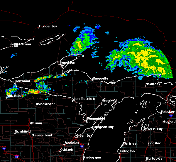 At 517 pm cdt, a severe thunderstorm was located 12 miles east of boulder junction, or 17 miles north of eagle river, moving east at 40 mph (radar indicated). Hazards include 60 mph wind gusts and penny size hail. Expect damage to roofs. siding and trees. This severe thunderstorm will remain over mainly rural areas of central vilas county, including the following locations, lac vieux desert and land o lakes. At 517 pm cdt, a severe thunderstorm was located 12 miles east of boulder junction, or 17 miles north of eagle river, moving east at 40 mph (radar indicated). Hazards include 60 mph wind gusts and penny size hail. Expect damage to roofs. siding and trees. This severe thunderstorm will remain over mainly rural areas of central vilas county, including the following locations, lac vieux desert and land o lakes.
|
| 6/22/2015 5:02 PM CDT |
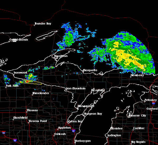 At 502 pm cdt, a severe thunderstorm was located near boulder junction, or 23 miles northwest of eagle river, moving east at 40 mph (radar indicated). Hazards include 60 mph wind gusts and quarter size hail. Hail damage to vehicles is expected. expect wind damage to roofs, siding and trees. Locations impacted include, boulder junction, lac vieux desert and land o lakes. At 502 pm cdt, a severe thunderstorm was located near boulder junction, or 23 miles northwest of eagle river, moving east at 40 mph (radar indicated). Hazards include 60 mph wind gusts and quarter size hail. Hail damage to vehicles is expected. expect wind damage to roofs, siding and trees. Locations impacted include, boulder junction, lac vieux desert and land o lakes.
|
| 6/22/2015 4:55 PM CDT |
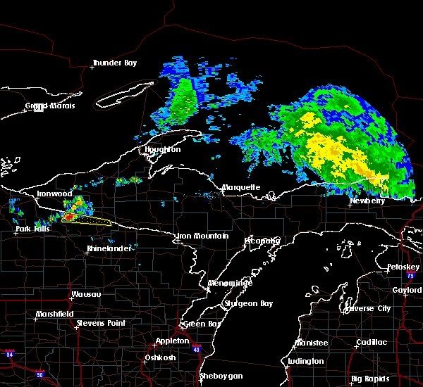 At 454 pm cdt, a severe thunderstorm was located near boulder junction, or 26 miles northwest of eagle river, moving east at 40 mph (radar indicated). Hazards include 60 mph wind gusts and quarter size hail. Hail damage to vehicles is expected. Expect wind damage to roofs, siding and trees. At 454 pm cdt, a severe thunderstorm was located near boulder junction, or 26 miles northwest of eagle river, moving east at 40 mph (radar indicated). Hazards include 60 mph wind gusts and quarter size hail. Hail damage to vehicles is expected. Expect wind damage to roofs, siding and trees.
|
| 6/10/2015 12:44 AM CDT |
 At 1243 am cdt, a severe thunderstorm was located near boulder junction, or 19 miles northwest of eagle river, moving east at 55 mph (radar indicated). Hazards include 60 mph wind gusts and quarter size hail. Hail damage to vehicles is expected. expect wind damage to roofs, siding and trees. this severe storm will be near, eagle river around 105 am cdt. phelps around 110 am cdt. Other locations impacted by this severe thunderstorm include star lake, lac vieux desert, sayner, trout lake, conover, land o lakes, anvil lake campground, arbor vitae and st germain. At 1243 am cdt, a severe thunderstorm was located near boulder junction, or 19 miles northwest of eagle river, moving east at 55 mph (radar indicated). Hazards include 60 mph wind gusts and quarter size hail. Hail damage to vehicles is expected. expect wind damage to roofs, siding and trees. this severe storm will be near, eagle river around 105 am cdt. phelps around 110 am cdt. Other locations impacted by this severe thunderstorm include star lake, lac vieux desert, sayner, trout lake, conover, land o lakes, anvil lake campground, arbor vitae and st germain.
|
| 6/10/2015 12:32 AM CDT |
 At 1231 am cdt, a severe thunderstorm was located 7 miles northeast of lac du flambeau, or 26 miles west of eagle river, moving east at 55 mph (radar indicated). Hazards include 60 mph wind gusts and quarter size hail. Hail damage to vehicles is expected. Expect wind damage to roofs, siding and trees. At 1231 am cdt, a severe thunderstorm was located 7 miles northeast of lac du flambeau, or 26 miles west of eagle river, moving east at 55 mph (radar indicated). Hazards include 60 mph wind gusts and quarter size hail. Hail damage to vehicles is expected. Expect wind damage to roofs, siding and trees.
|
| 7/6/2014 5:38 PM CDT | Quarter sized hail reported 1.7 miles SSW of Boulder Junction, WI, dime to quarter size hail lasting about 10 minutes. branches down up to 6 inch in diamter. power out in town |
| 7/6/2014 5:31 PM CDT | Quarter sized hail reported 1.7 miles SSW of Boulder Junction, WI |
| 6/29/2014 8:30 PM CDT | Quarter sized hail reported 7.1 miles S of Boulder Junction, WI, just north of the intersection of highway b and highway m. |
| 8/19/2011 1:49 PM CDT | Quarter sized hail reported 0.9 miles WNW of Boulder Junction, WI, dime to quarter size hail. |
Hail Maps for Boulder Junction, WI


Connect with Interactive Hail Maps