

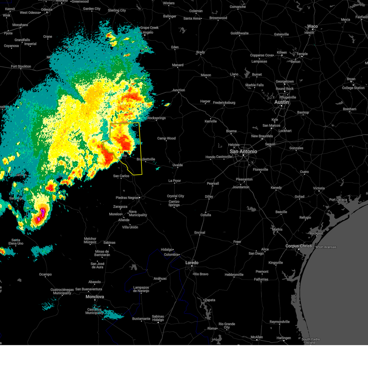
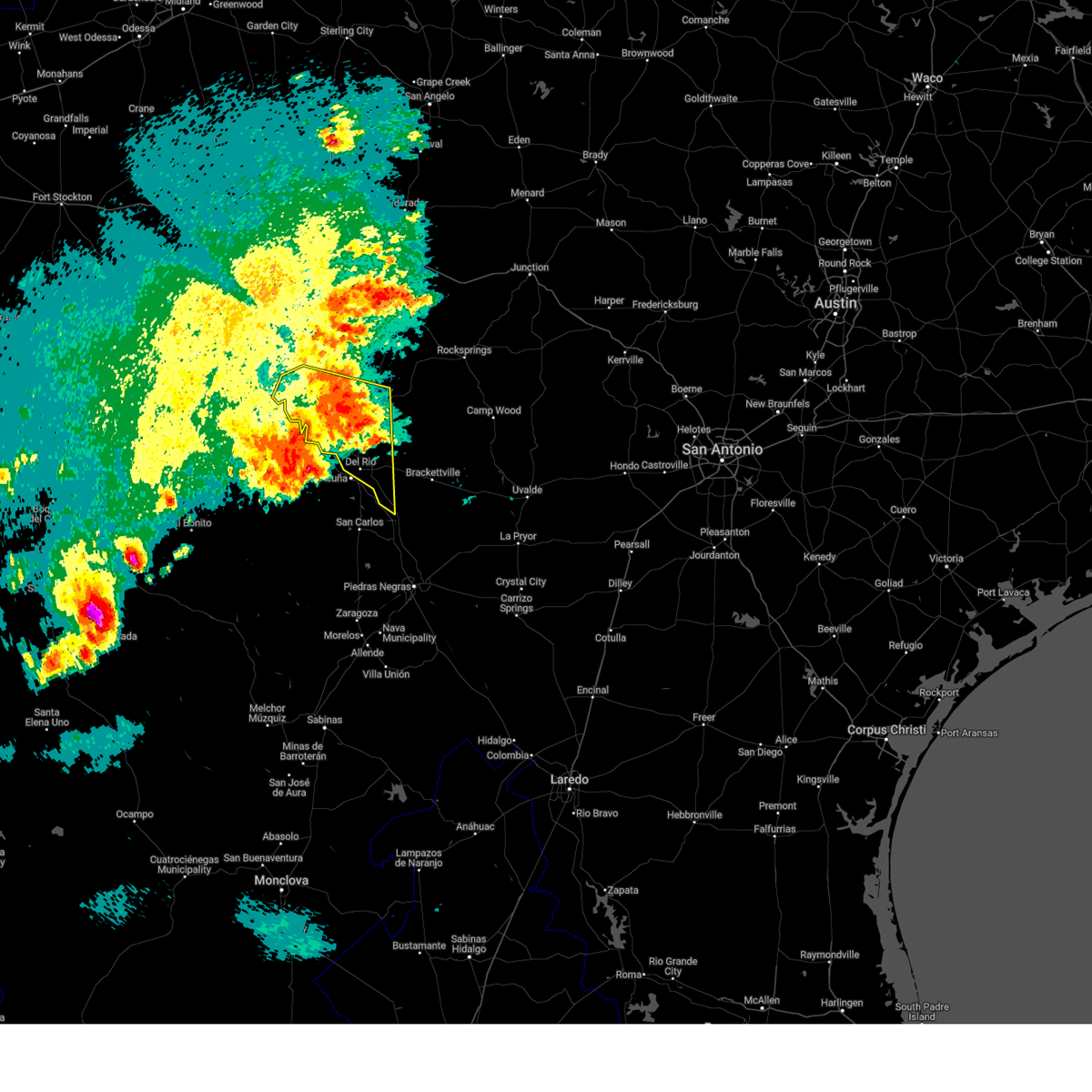
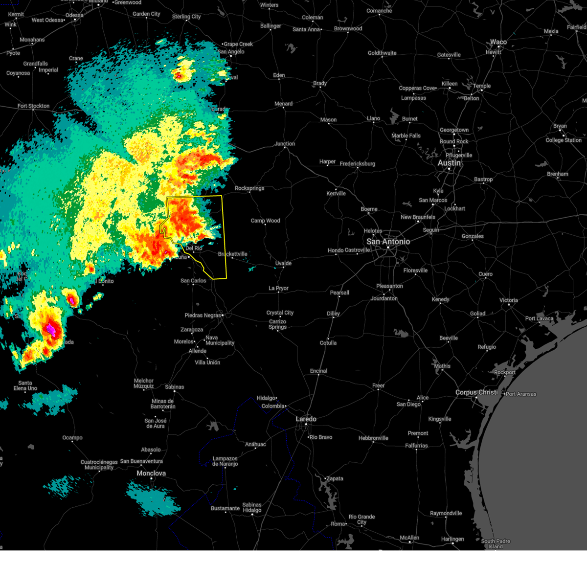
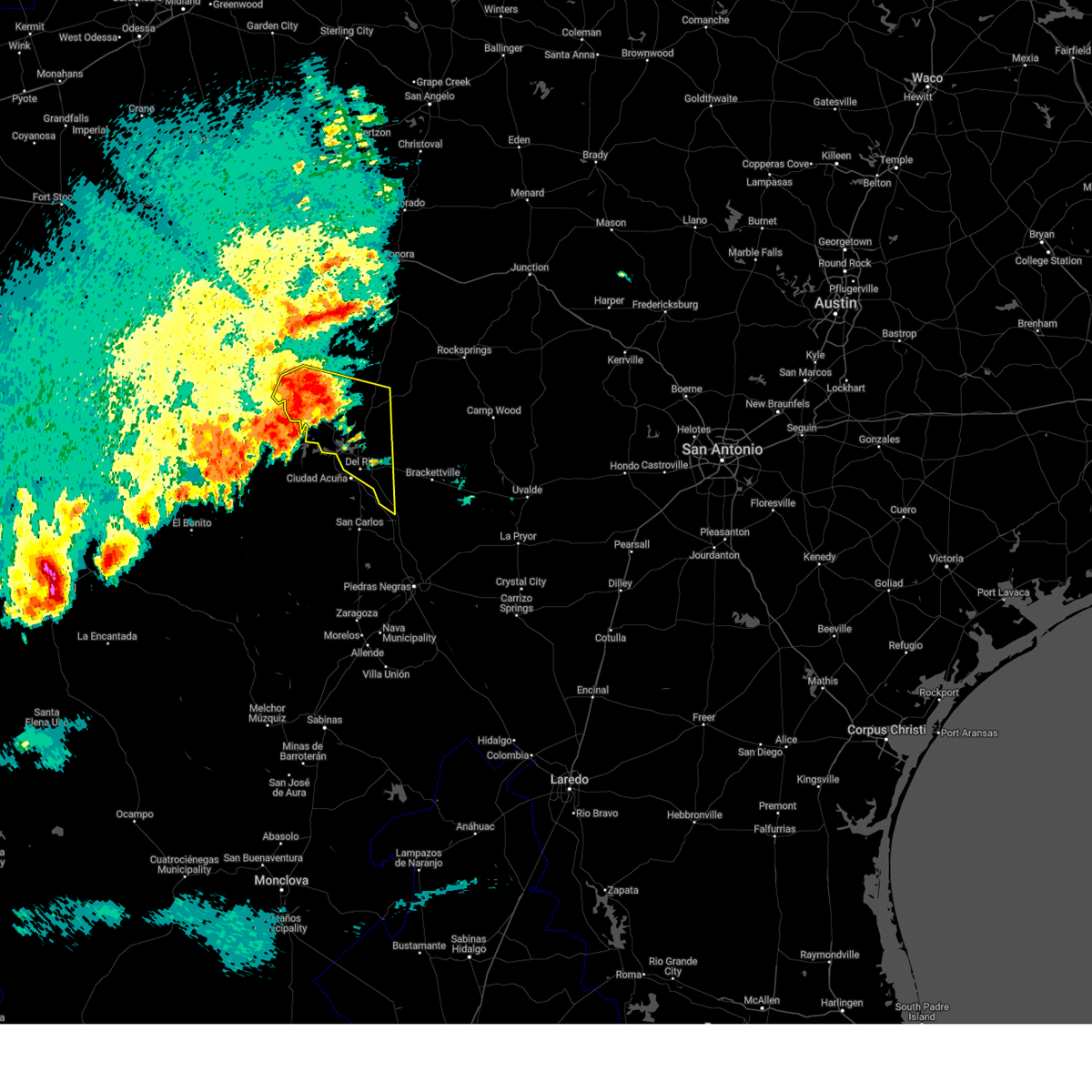
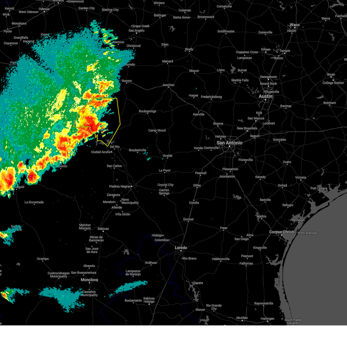
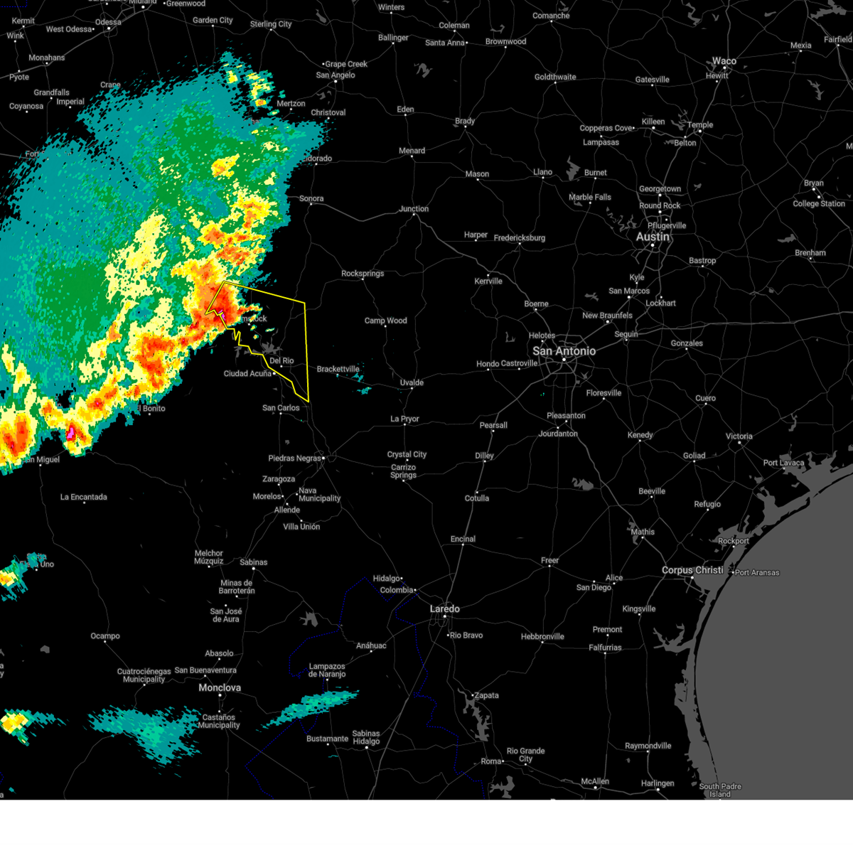
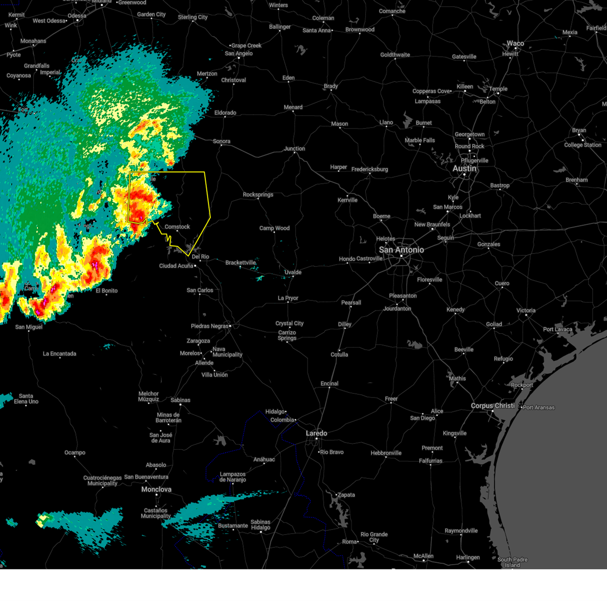
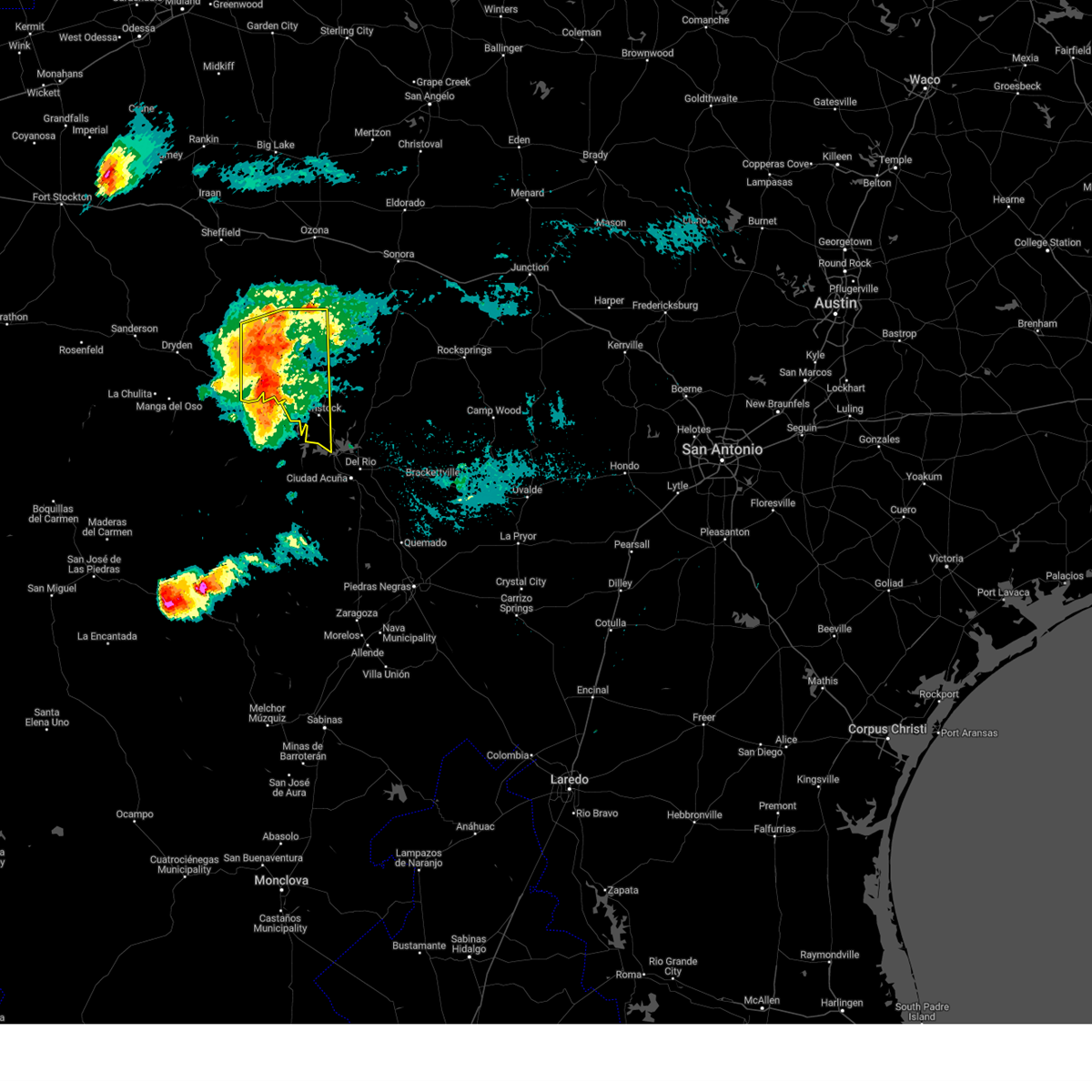
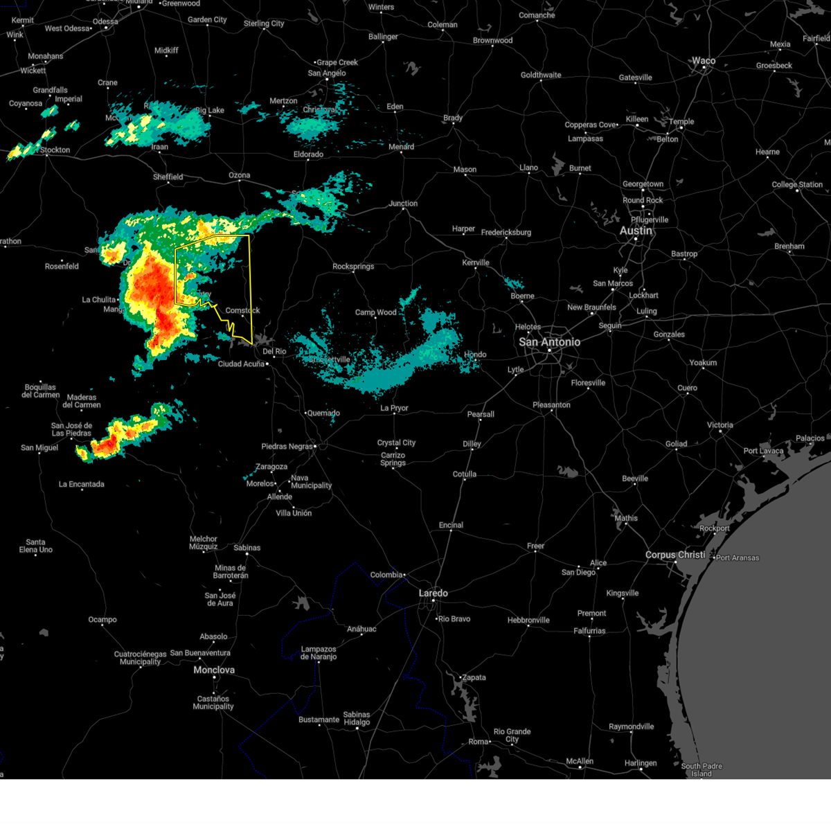
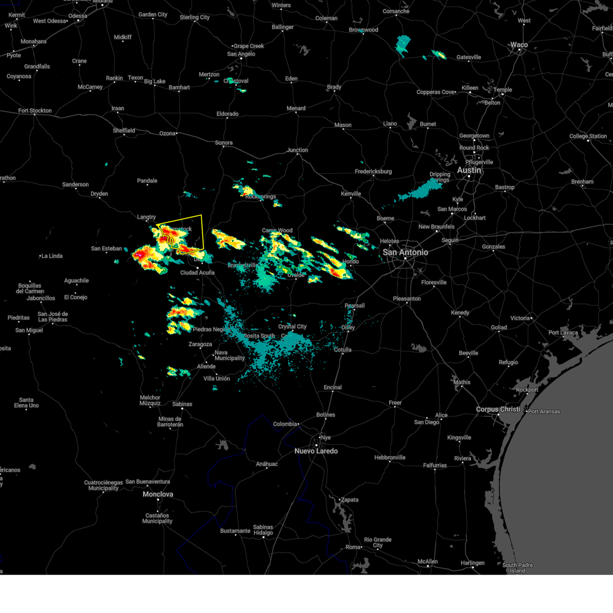
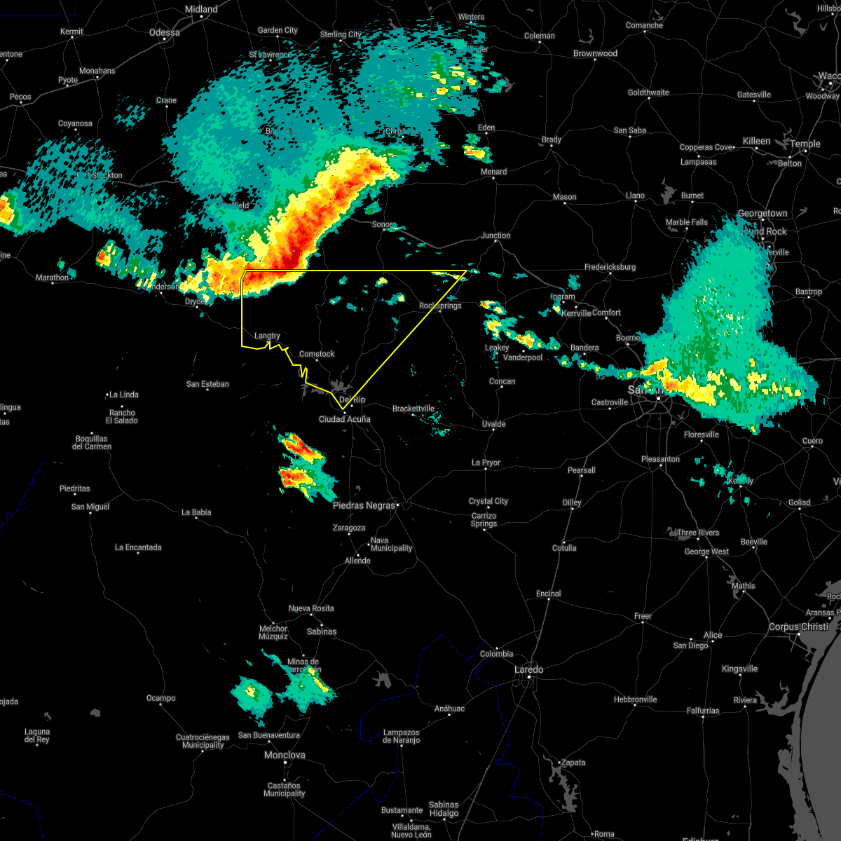
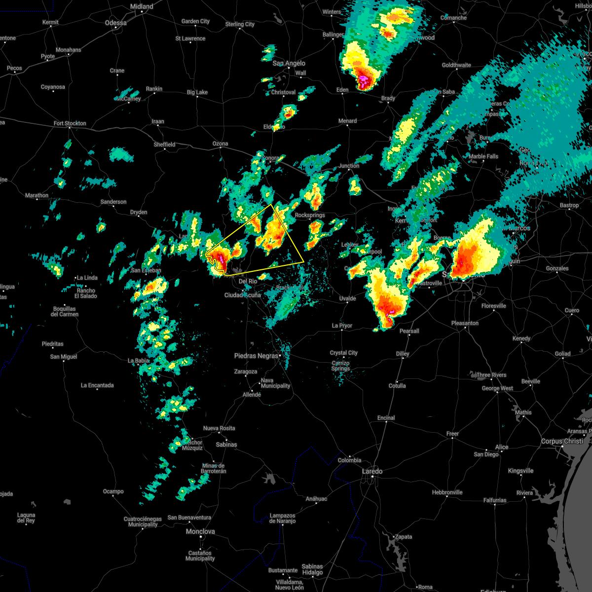
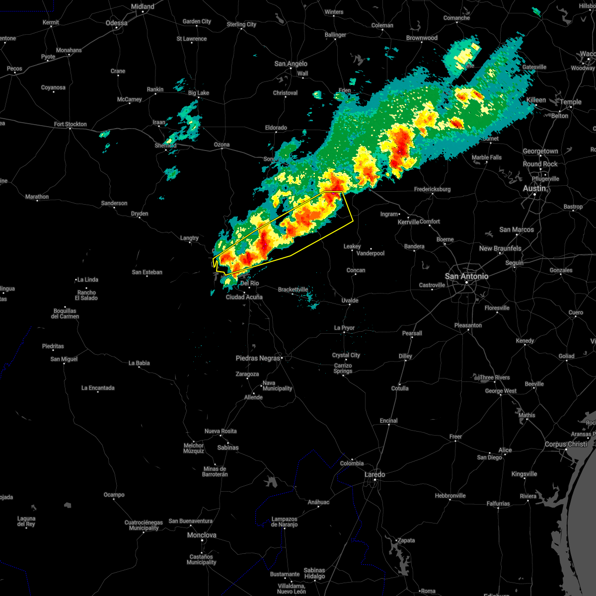
Hail Map for Box Canyon, TX
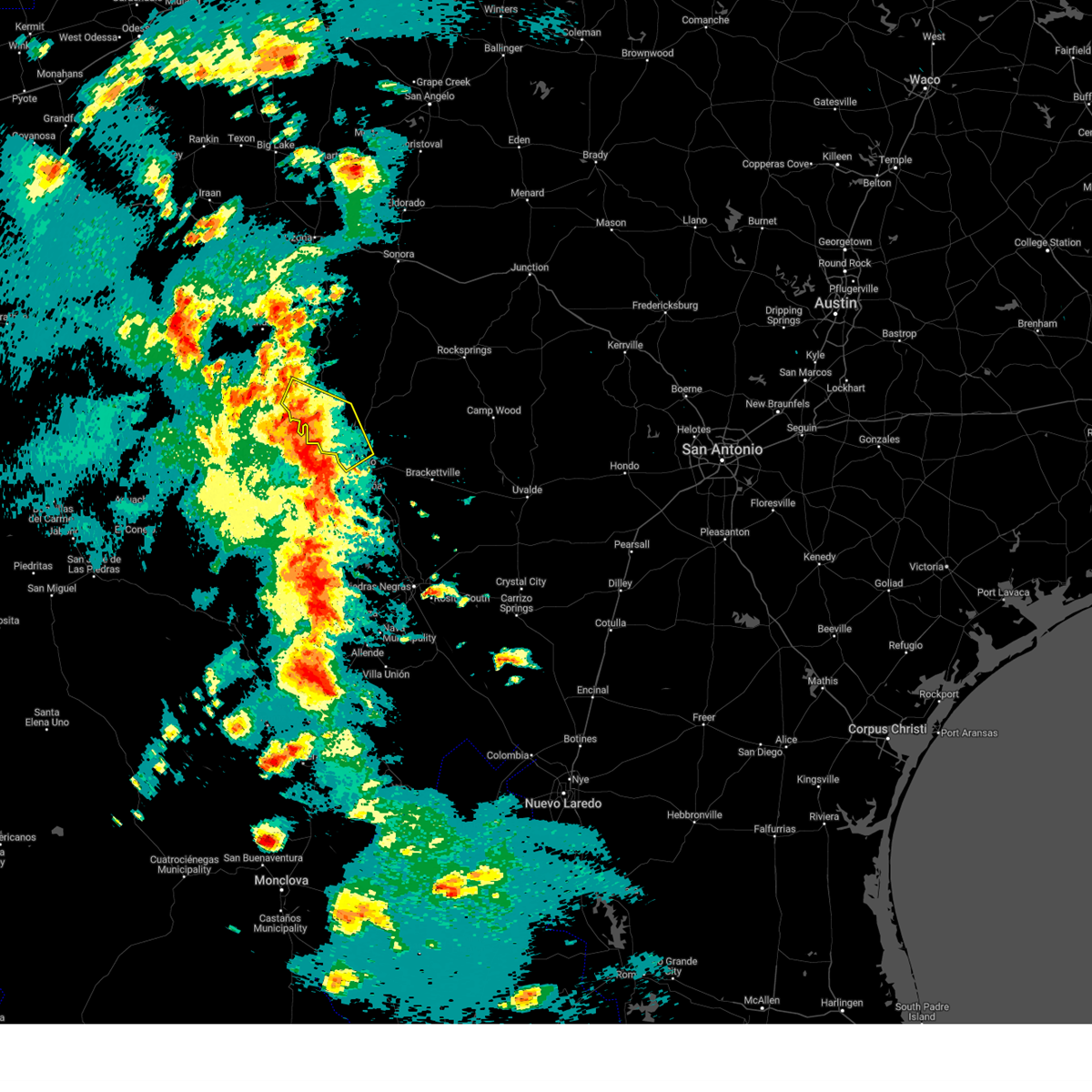
The Box Canyon, TX area has had 8 reports of on-the-ground hail by trained spotters, and has been under severe weather warnings 7 times during the past 12 months. Doppler radar has detected hail at or near Box Canyon, TX on 31 occasions.
| Name: | Box Canyon, TX |
| Where Located: | 19.5 miles NW of Del Rio, TX |
| Map: | Google Map for Box Canyon, TX |
| Population: | 34 |
| Housing Units: | 117 |
| More Info: | Search Google for Box Canyon, TX |
5
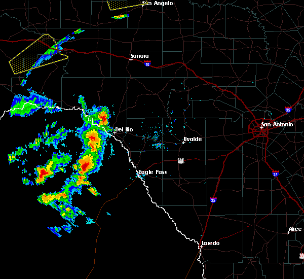
The Top Recent Hail Date for Box Canyon, TX is Thursday, April 21, 2011 (1st out of 31)

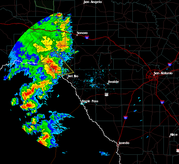
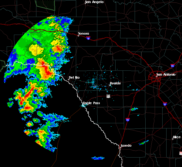
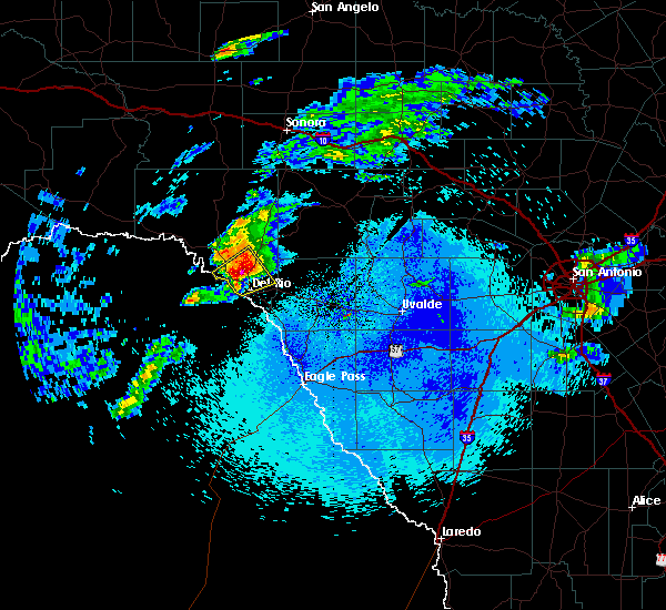
Hail and Wind Damage Spotted near Box Canyon, TX
| Date / Time | Report Details |
|---|---|
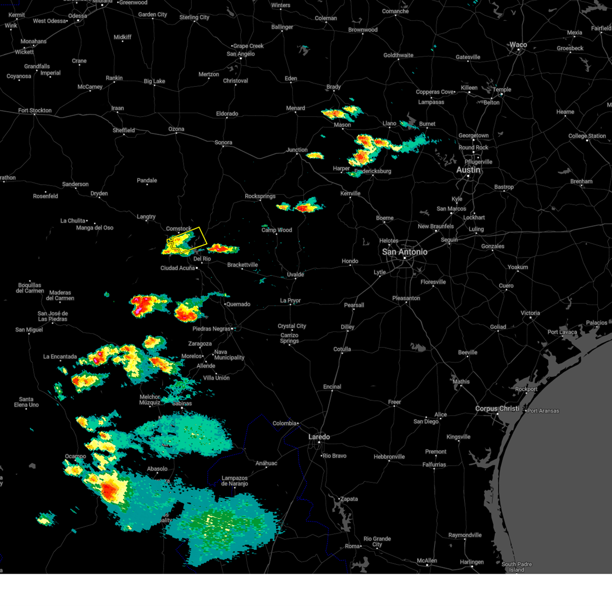
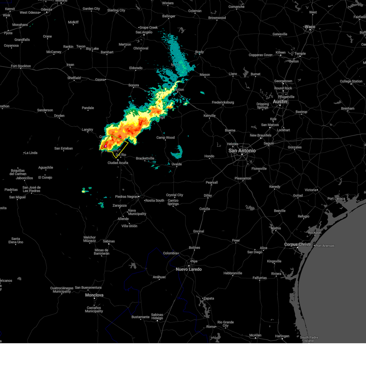
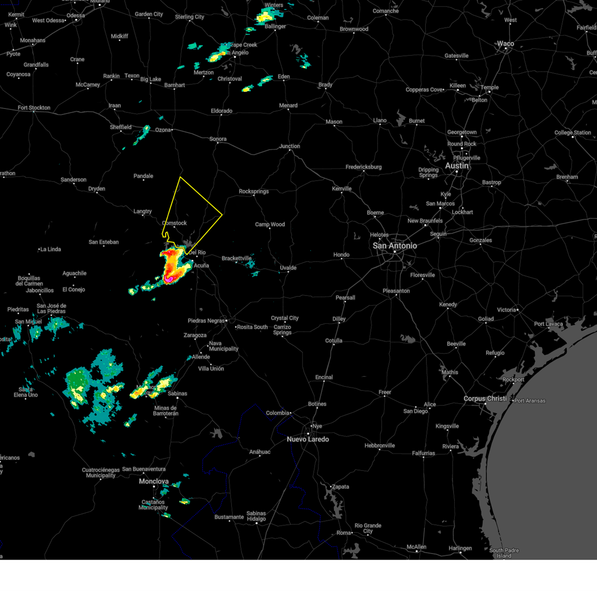
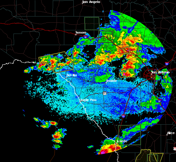
| 6/10/2025 8:06 PM CDT |
 At 806 pm cdt, a severe thunderstorm was located near long point, or 11 miles north of del rio, moving southeast at 30 mph (radar indicated). Hazards include two inch hail and 70 mph wind gusts. People and animals outdoors will be injured. expect hail damage to roofs, siding, windows, and vehicles. expect considerable tree damage. wind damage is also likely to mobile homes, roofs, and outbuildings. Locations impacted include, del rio, loma alta, lake view, amistad acres, laughlin afb, carta valley, cienegas terrace, amistad village, black brush point, amanda, box canyon, val verde park, standart, diablo east, governors landing, long point, 277 south boat ramp, 277 north campground, rough canyon recreation area, and spur 406 campground. At 806 pm cdt, a severe thunderstorm was located near long point, or 11 miles north of del rio, moving southeast at 30 mph (radar indicated). Hazards include two inch hail and 70 mph wind gusts. People and animals outdoors will be injured. expect hail damage to roofs, siding, windows, and vehicles. expect considerable tree damage. wind damage is also likely to mobile homes, roofs, and outbuildings. Locations impacted include, del rio, loma alta, lake view, amistad acres, laughlin afb, carta valley, cienegas terrace, amistad village, black brush point, amanda, box canyon, val verde park, standart, diablo east, governors landing, long point, 277 south boat ramp, 277 north campground, rough canyon recreation area, and spur 406 campground.
|
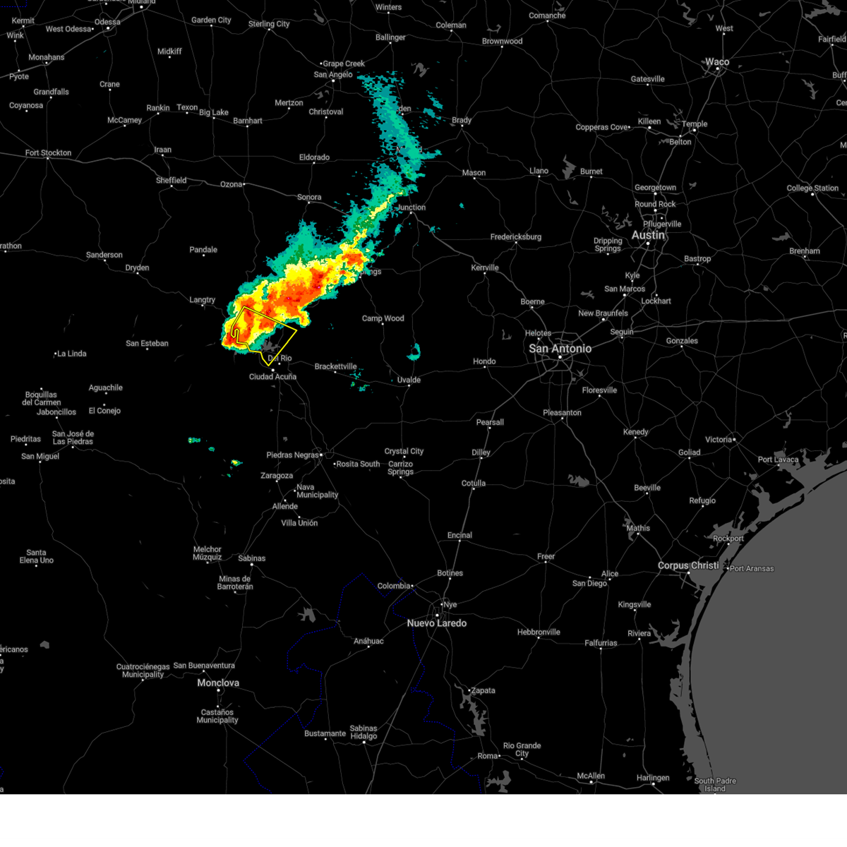
| 6/10/2025 7:44 PM CDT |
 The storm which prompted the warning has moved out of the area. therefore, the warning will be allowed to expire. a severe thunderstorm watch remains in effect until 200 am cdt for south central texas. remember, a severe thunderstorm warning still remains in effect for val verde through 845 pm cdt. The storm which prompted the warning has moved out of the area. therefore, the warning will be allowed to expire. a severe thunderstorm watch remains in effect until 200 am cdt for south central texas. remember, a severe thunderstorm warning still remains in effect for val verde through 845 pm cdt.
|
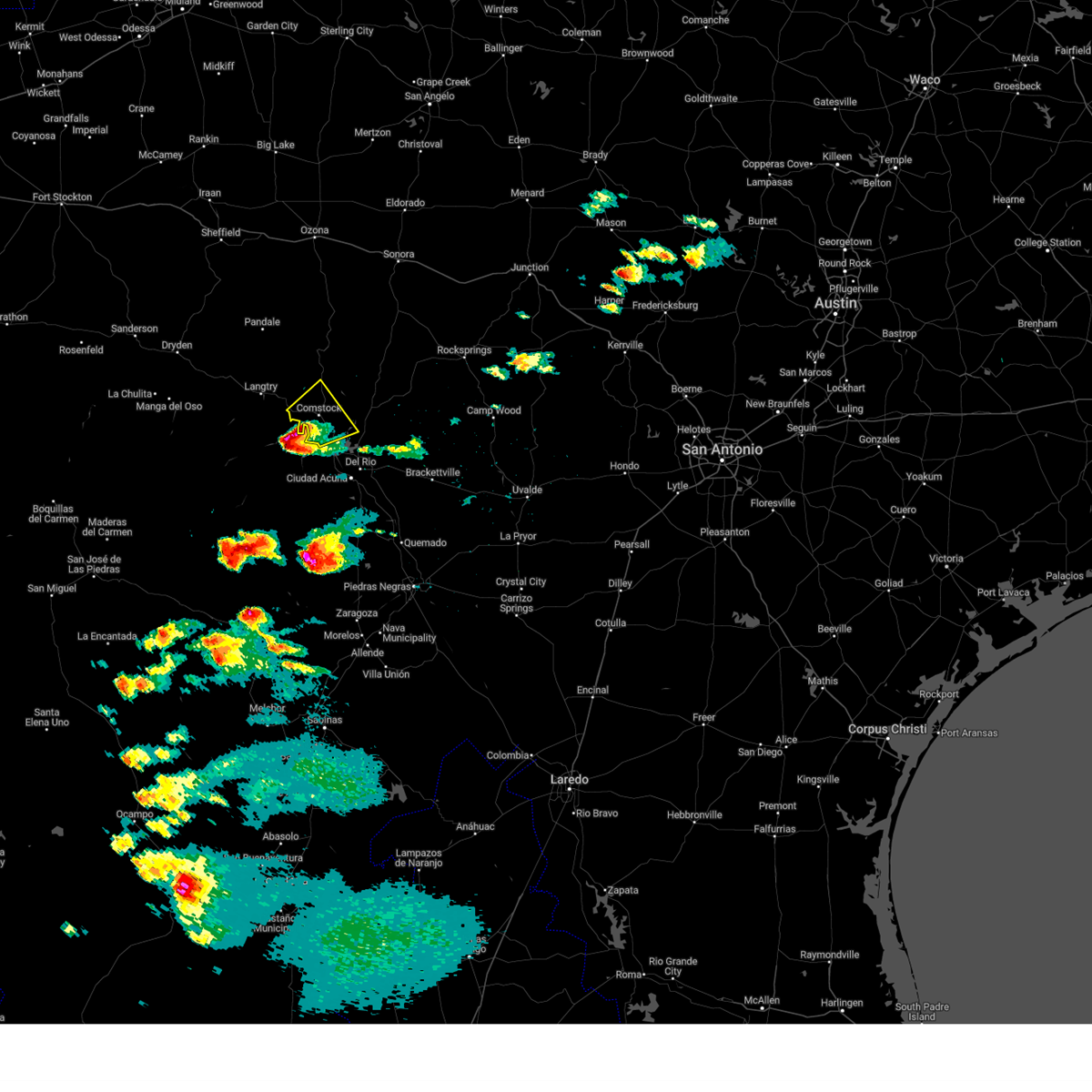
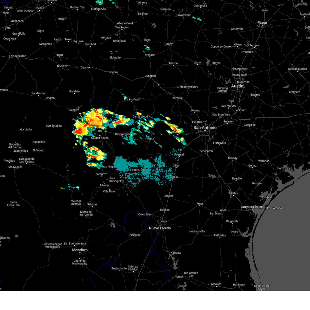
| 6/10/2025 7:43 PM CDT |
 Svrewx the national weather service in austin san antonio has issued a * severe thunderstorm warning for, western kinney county in south central texas, southwestern edwards county in south central texas, southeastern val verde county in south central texas, * until 845 pm cdt. * at 742 pm cdt, a severe thunderstorm was located 10 miles east of comstock, moving southeast at 30 mph (radar indicated). Hazards include 70 mph wind gusts and ping pong ball size hail. People and animals outdoors will be injured. expect hail damage to roofs, siding, windows, and vehicles. expect considerable tree damage. Wind damage is also likely to mobile homes, roofs, and outbuildings. Svrewx the national weather service in austin san antonio has issued a * severe thunderstorm warning for, western kinney county in south central texas, southwestern edwards county in south central texas, southeastern val verde county in south central texas, * until 845 pm cdt. * at 742 pm cdt, a severe thunderstorm was located 10 miles east of comstock, moving southeast at 30 mph (radar indicated). Hazards include 70 mph wind gusts and ping pong ball size hail. People and animals outdoors will be injured. expect hail damage to roofs, siding, windows, and vehicles. expect considerable tree damage. Wind damage is also likely to mobile homes, roofs, and outbuildings.
|
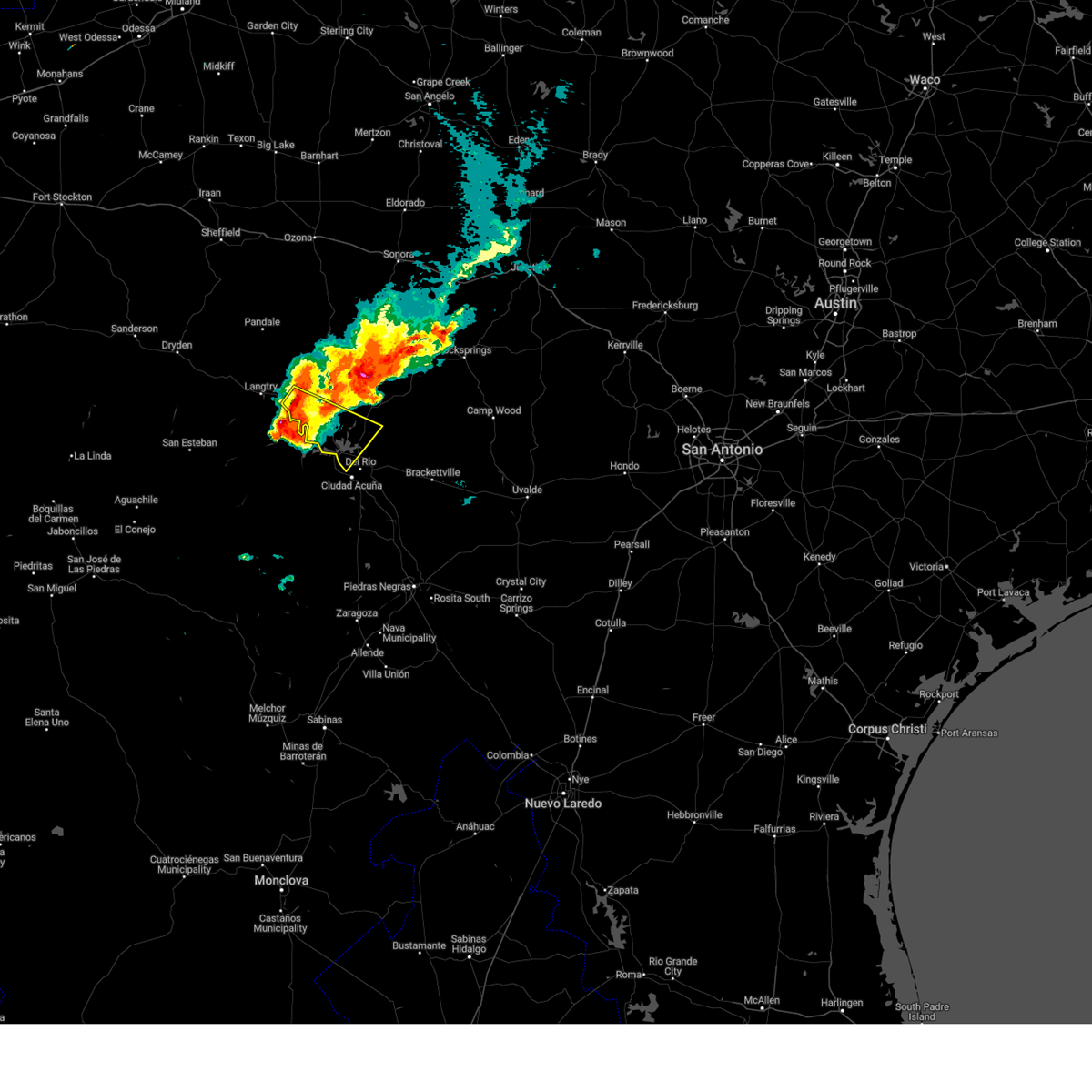
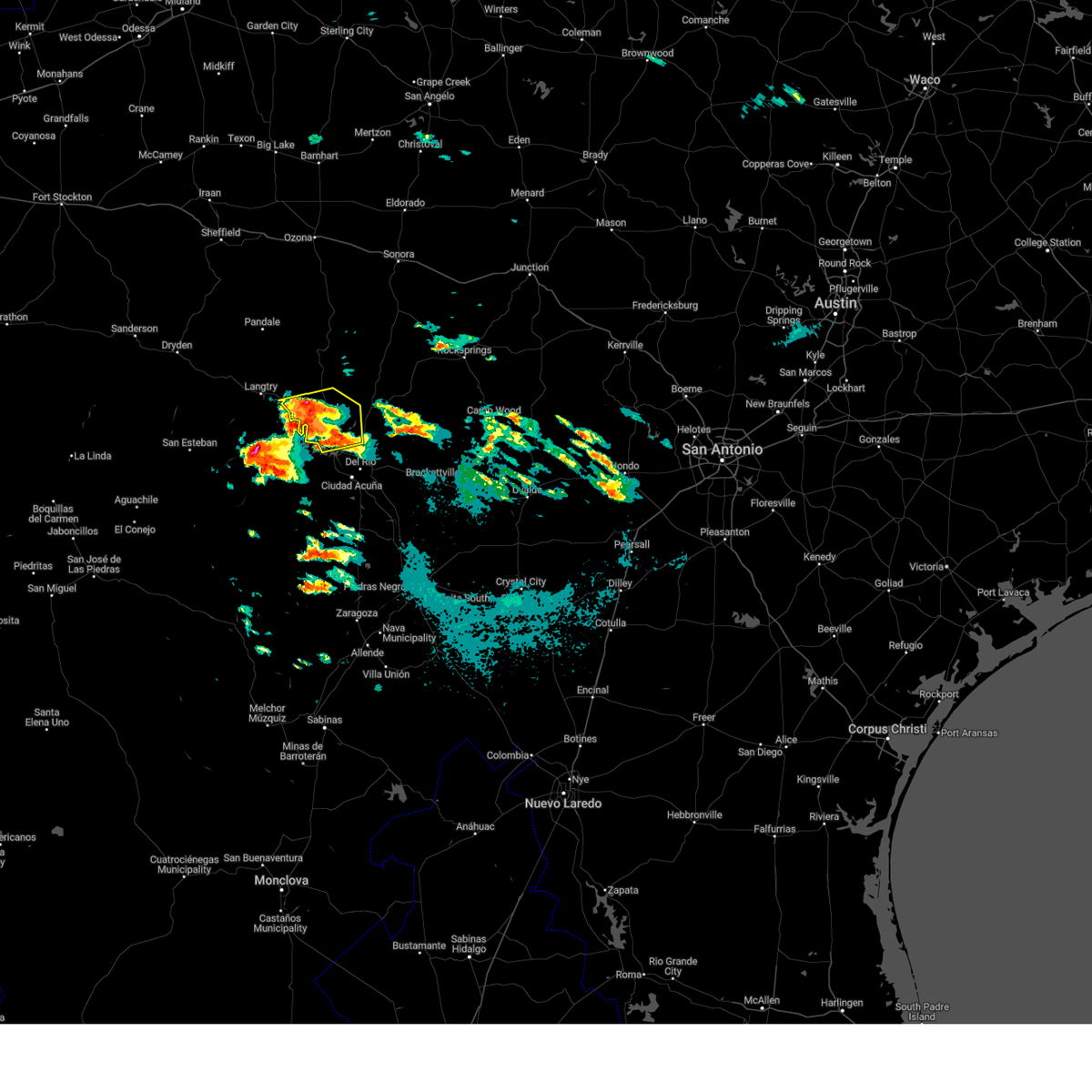
| 6/10/2025 7:12 PM CDT |
 At 712 pm cdt, a severe thunderstorm was located near comstock, moving east at 40 mph (radar indicated). Hazards include two inch hail and 70 mph wind gusts. People and animals outdoors will be injured. expect hail damage to roofs, siding, windows, and vehicles. expect considerable tree damage. wind damage is also likely to mobile homes, roofs, and outbuildings. Locations impacted include, del rio, comstock, lake view, amistad acres, laughlin afb, shumla, cienegas terrace, amistad village, black brush point, seminole canyon state park, box canyon, val verde park, diablo east, governors landing, long point, pecos river boat ramp, 277 south boat ramp, 277 north campground, rough canyon recreation area, and spur 406 campground. At 712 pm cdt, a severe thunderstorm was located near comstock, moving east at 40 mph (radar indicated). Hazards include two inch hail and 70 mph wind gusts. People and animals outdoors will be injured. expect hail damage to roofs, siding, windows, and vehicles. expect considerable tree damage. wind damage is also likely to mobile homes, roofs, and outbuildings. Locations impacted include, del rio, comstock, lake view, amistad acres, laughlin afb, shumla, cienegas terrace, amistad village, black brush point, seminole canyon state park, box canyon, val verde park, diablo east, governors landing, long point, pecos river boat ramp, 277 south boat ramp, 277 north campground, rough canyon recreation area, and spur 406 campground.
|
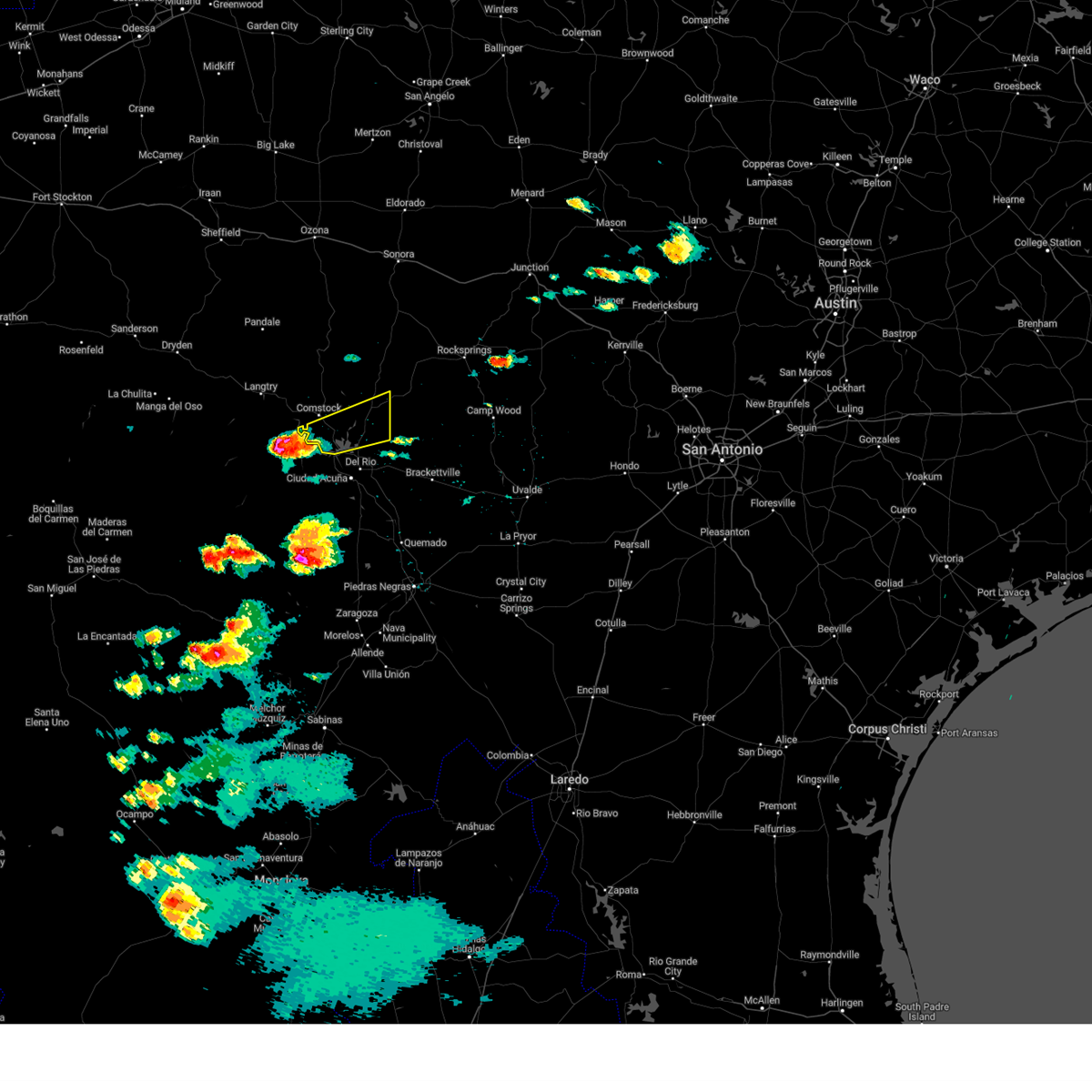
| 6/10/2025 6:55 PM CDT |
 At 655 pm cdt, a severe thunderstorm was located 10 miles south of juno, moving east at 45 mph (radar indicated). Hazards include 60 mph wind gusts and quarter size hail. Hail damage to vehicles is expected. expect wind damage to roofs, siding, and trees. Locations impacted include, comstock, juno, langtry, amistad village, amistad acres, seminole canyon state park, shumla, box canyon, diablo east, governors landing, devils shores, pafford crossing, pecos river boat ramp, bakers crossing, rough canyon recreation area, spur 406 campground, rock quarry campground, salem point, devils river state nat area del norte, and devils river state nat area big satan. At 655 pm cdt, a severe thunderstorm was located 10 miles south of juno, moving east at 45 mph (radar indicated). Hazards include 60 mph wind gusts and quarter size hail. Hail damage to vehicles is expected. expect wind damage to roofs, siding, and trees. Locations impacted include, comstock, juno, langtry, amistad village, amistad acres, seminole canyon state park, shumla, box canyon, diablo east, governors landing, devils shores, pafford crossing, pecos river boat ramp, bakers crossing, rough canyon recreation area, spur 406 campground, rock quarry campground, salem point, devils river state nat area del norte, and devils river state nat area big satan.
|
| 6/10/2025 6:52 PM CDT |
 Svrewx the national weather service in austin san antonio has issued a * severe thunderstorm warning for, western kinney county in south central texas, southern val verde county in south central texas, * until 745 pm cdt. * at 651 pm cdt, a severe thunderstorm was located over seminole canyon state park, or 10 miles west of comstock, moving east at 40 mph (radar indicated). Hazards include two inch hail and 70 mph wind gusts. People and animals outdoors will be injured. expect hail damage to roofs, siding, windows, and vehicles. expect considerable tree damage. Wind damage is also likely to mobile homes, roofs, and outbuildings. Svrewx the national weather service in austin san antonio has issued a * severe thunderstorm warning for, western kinney county in south central texas, southern val verde county in south central texas, * until 745 pm cdt. * at 651 pm cdt, a severe thunderstorm was located over seminole canyon state park, or 10 miles west of comstock, moving east at 40 mph (radar indicated). Hazards include two inch hail and 70 mph wind gusts. People and animals outdoors will be injured. expect hail damage to roofs, siding, windows, and vehicles. expect considerable tree damage. Wind damage is also likely to mobile homes, roofs, and outbuildings.
|
| 6/10/2025 6:24 PM CDT |
 Svrewx the national weather service in austin san antonio has issued a * severe thunderstorm warning for, val verde county in south central texas, * until 730 pm cdt. * at 624 pm cdt, a severe thunderstorm was located 11 miles south of pandale, or 15 miles north of langtry, moving east at 45 mph (radar indicated). Hazards include 60 mph wind gusts and quarter size hail. Hail damage to vehicles is expected. Expect wind damage to roofs, siding, and trees. Svrewx the national weather service in austin san antonio has issued a * severe thunderstorm warning for, val verde county in south central texas, * until 730 pm cdt. * at 624 pm cdt, a severe thunderstorm was located 11 miles south of pandale, or 15 miles north of langtry, moving east at 45 mph (radar indicated). Hazards include 60 mph wind gusts and quarter size hail. Hail damage to vehicles is expected. Expect wind damage to roofs, siding, and trees.
|
| 6/1/2024 11:12 PM CDT |
 At 1112 pm cdt, severe thunderstorms were located along a line extending from near pandale to 16 miles southwest of seminole canyon state park, moving east at 25 mph (radar indicated). Hazards include 60 mph wind gusts and quarter size hail. Hail damage to vehicles is expected. expect wind damage to roofs, siding, and trees. Locations impacted include, comstock, langtry, juno, shumla, box canyon, pandale, amistad acres, seminole canyon state park, pecos river boat ramp, bakers crossing, and salem point. At 1112 pm cdt, severe thunderstorms were located along a line extending from near pandale to 16 miles southwest of seminole canyon state park, moving east at 25 mph (radar indicated). Hazards include 60 mph wind gusts and quarter size hail. Hail damage to vehicles is expected. expect wind damage to roofs, siding, and trees. Locations impacted include, comstock, langtry, juno, shumla, box canyon, pandale, amistad acres, seminole canyon state park, pecos river boat ramp, bakers crossing, and salem point.
|
| 6/1/2024 10:27 PM CDT |
 Svrewx the national weather service in austin san antonio has issued a * severe thunderstorm warning for, western val verde county in south central texas, * until 1130 pm cdt. * at 1026 pm cdt, severe thunderstorms were located along a line extending from 9 miles north of pumpville to 27 miles southwest of langtry, moving east at 25 mph (radar indicated). Hazards include 60 mph wind gusts and quarter size hail. Hail damage to vehicles is expected. Expect wind damage to roofs, siding, and trees. Svrewx the national weather service in austin san antonio has issued a * severe thunderstorm warning for, western val verde county in south central texas, * until 1130 pm cdt. * at 1026 pm cdt, severe thunderstorms were located along a line extending from 9 miles north of pumpville to 27 miles southwest of langtry, moving east at 25 mph (radar indicated). Hazards include 60 mph wind gusts and quarter size hail. Hail damage to vehicles is expected. Expect wind damage to roofs, siding, and trees.
|
| 5/27/2024 4:10 PM CDT |
 the severe thunderstorm warning has been cancelled and is no longer in effect the severe thunderstorm warning has been cancelled and is no longer in effect
|
| 5/27/2024 4:10 PM CDT |
 the severe thunderstorm warning has been cancelled and is no longer in effect the severe thunderstorm warning has been cancelled and is no longer in effect
|
| 5/27/2024 3:55 PM CDT |
 At 354 pm cdt, a severe thunderstorm was located over box canyon, or 8 miles south of comstock, moving east at 40 mph (radar indicated). Hazards include golf ball size hail and 60 mph wind gusts. People and animals outdoors will be injured. expect hail damage to roofs, siding, windows, and vehicles. expect wind damage to roofs, siding, and trees. Locations impacted include, box canyon, amistad acres, devils shores, pafford crossing, rough canyon recreation area, spur 406 campground, salem point, and devils river state nat area big satan. At 354 pm cdt, a severe thunderstorm was located over box canyon, or 8 miles south of comstock, moving east at 40 mph (radar indicated). Hazards include golf ball size hail and 60 mph wind gusts. People and animals outdoors will be injured. expect hail damage to roofs, siding, windows, and vehicles. expect wind damage to roofs, siding, and trees. Locations impacted include, box canyon, amistad acres, devils shores, pafford crossing, rough canyon recreation area, spur 406 campground, salem point, and devils river state nat area big satan.
|
| 5/27/2024 3:53 PM CDT |
 Svrewx the national weather service in austin san antonio has issued a * severe thunderstorm warning for, central val verde county in south central texas, * until 500 pm cdt. * at 353 pm cdt, a severe thunderstorm was located 9 miles south of seminole canyon state park, or 13 miles southwest of comstock, moving northeast at 20 mph (radar indicated). Hazards include golf ball size hail and 60 mph wind gusts. People and animals outdoors will be injured. expect hail damage to roofs, siding, windows, and vehicles. Expect wind damage to roofs, siding, and trees. Svrewx the national weather service in austin san antonio has issued a * severe thunderstorm warning for, central val verde county in south central texas, * until 500 pm cdt. * at 353 pm cdt, a severe thunderstorm was located 9 miles south of seminole canyon state park, or 13 miles southwest of comstock, moving northeast at 20 mph (radar indicated). Hazards include golf ball size hail and 60 mph wind gusts. People and animals outdoors will be injured. expect hail damage to roofs, siding, windows, and vehicles. Expect wind damage to roofs, siding, and trees.
|
| 5/27/2024 3:37 PM CDT |
 Svrewx the national weather service in austin san antonio has issued a * severe thunderstorm warning for, southeastern val verde county in south central texas, * until 445 pm cdt. * at 337 pm cdt, a severe thunderstorm was located 11 miles west of box canyon, or 15 miles southwest of comstock, moving east at 40 mph (radar indicated). Hazards include golf ball size hail and 60 mph wind gusts. People and animals outdoors will be injured. expect hail damage to roofs, siding, windows, and vehicles. Expect wind damage to roofs, siding, and trees. Svrewx the national weather service in austin san antonio has issued a * severe thunderstorm warning for, southeastern val verde county in south central texas, * until 445 pm cdt. * at 337 pm cdt, a severe thunderstorm was located 11 miles west of box canyon, or 15 miles southwest of comstock, moving east at 40 mph (radar indicated). Hazards include golf ball size hail and 60 mph wind gusts. People and animals outdoors will be injured. expect hail damage to roofs, siding, windows, and vehicles. Expect wind damage to roofs, siding, and trees.
|
| 6/2/2023 9:37 PM CDT |
 At 937 pm cdt, a severe thunderstorm was located near governors landing, or 13 miles southeast of comstock, moving east at 30 mph (radar indicated). Hazards include ping pong ball size hail and 60 mph wind gusts. People and animals outdoors will be injured. expect hail damage to roofs, siding, windows, and vehicles. expect wind damage to roofs, siding, and trees. this severe thunderstorm will be near, lake view around 945 pm cdt. long point around 950 pm cdt. other locations impacted by this severe thunderstorm include devils shores, san pedro canyon, 277 north campground, pafford crossing, rough canyon recreation area, spur 406 campground, rock quarry campground, salem point, escondido estates and devils river state nat area big satan. hail threat, radar indicated max hail size, 1. 50 in wind threat, radar indicated max wind gust, 60 mph. At 937 pm cdt, a severe thunderstorm was located near governors landing, or 13 miles southeast of comstock, moving east at 30 mph (radar indicated). Hazards include ping pong ball size hail and 60 mph wind gusts. People and animals outdoors will be injured. expect hail damage to roofs, siding, windows, and vehicles. expect wind damage to roofs, siding, and trees. this severe thunderstorm will be near, lake view around 945 pm cdt. long point around 950 pm cdt. other locations impacted by this severe thunderstorm include devils shores, san pedro canyon, 277 north campground, pafford crossing, rough canyon recreation area, spur 406 campground, rock quarry campground, salem point, escondido estates and devils river state nat area big satan. hail threat, radar indicated max hail size, 1. 50 in wind threat, radar indicated max wind gust, 60 mph.
|
| 6/2/2023 9:19 PM CDT |
 At 918 pm cdt, a severe thunderstorm was located over box canyon, or 9 miles south of comstock, moving east at 25 mph (radar indicated). Hazards include ping pong ball size hail and 60 mph wind gusts. People and animals outdoors will be injured. expect hail damage to roofs, siding, windows, and vehicles. expect wind damage to roofs, siding, and trees. this severe storm will be near, governors landing and amistad village around 940 pm cdt. black brush point and diablo east around 945 pm cdt. lake view and long point around 950 pm cdt. other locations impacted by this severe thunderstorm include devils shores, san pedro canyon, 277 north campground, pafford crossing, rough canyon recreation area, spur 406 campground, rock quarry campground, salem point, 277 south boat ramp and lake ridge ranch. hail threat, radar indicated max hail size, 1. 50 in wind threat, radar indicated max wind gust, 60 mph. At 918 pm cdt, a severe thunderstorm was located over box canyon, or 9 miles south of comstock, moving east at 25 mph (radar indicated). Hazards include ping pong ball size hail and 60 mph wind gusts. People and animals outdoors will be injured. expect hail damage to roofs, siding, windows, and vehicles. expect wind damage to roofs, siding, and trees. this severe storm will be near, governors landing and amistad village around 940 pm cdt. black brush point and diablo east around 945 pm cdt. lake view and long point around 950 pm cdt. other locations impacted by this severe thunderstorm include devils shores, san pedro canyon, 277 north campground, pafford crossing, rough canyon recreation area, spur 406 campground, rock quarry campground, salem point, 277 south boat ramp and lake ridge ranch. hail threat, radar indicated max hail size, 1. 50 in wind threat, radar indicated max wind gust, 60 mph.
|
| 6/2/2023 9:09 PM CDT |
 At 909 pm cdt, a severe thunderstorm was located near comstock, moving southeast at 30 mph (radar indicated). Hazards include 60 mph wind gusts and half dollar size hail. Hail damage to vehicles is expected. expect wind damage to roofs, siding, and trees. this severe storm will be near, box canyon around 915 pm cdt. amistad acres around 920 pm cdt. governors landing, diablo east and amistad village around 935 pm cdt. long point and black brush point around 940 pm cdt. lake view around 945 pm cdt. other locations impacted by this severe thunderstorm include devils shores, san pedro canyon, 277 north campground, pafford crossing, rough canyon recreation area, spur 406 campground, rock quarry campground, salem point, 277 south boat ramp and lake ridge ranch. hail threat, radar indicated max hail size, 1. 25 in wind threat, radar indicated max wind gust, 60 mph. At 909 pm cdt, a severe thunderstorm was located near comstock, moving southeast at 30 mph (radar indicated). Hazards include 60 mph wind gusts and half dollar size hail. Hail damage to vehicles is expected. expect wind damage to roofs, siding, and trees. this severe storm will be near, box canyon around 915 pm cdt. amistad acres around 920 pm cdt. governors landing, diablo east and amistad village around 935 pm cdt. long point and black brush point around 940 pm cdt. lake view around 945 pm cdt. other locations impacted by this severe thunderstorm include devils shores, san pedro canyon, 277 north campground, pafford crossing, rough canyon recreation area, spur 406 campground, rock quarry campground, salem point, 277 south boat ramp and lake ridge ranch. hail threat, radar indicated max hail size, 1. 25 in wind threat, radar indicated max wind gust, 60 mph.
|
| 6/2/2023 8:54 PM CDT | Quarter sized hail reported 14.5 miles SE of Box Canyon, TX, at 08:54 pm... dime and quarter size hail was reported at seminole canyon state park. |
| 6/2/2023 8:50 PM CDT |
 At 850 pm cdt, a severe thunderstorm was located over seminole canyon state park, or 8 miles west of comstock, moving southeast at 30 mph (radar indicated). Hazards include 60 mph wind gusts and half dollar size hail. Hail damage to vehicles is expected. expect wind damage to roofs, siding, and trees. this severe thunderstorm will be near, comstock around 905 pm cdt. box canyon around 915 pm cdt. amistad acres around 920 pm cdt. governors landing, diablo east and amistad village around 935 pm cdt. long point and black brush point around 940 pm cdt. lake view around 945 pm cdt. other locations impacted by this severe thunderstorm include devils shores, san pedro canyon, 277 north campground, pafford crossing, rough canyon recreation area, spur 406 campground, pecos river boat ramp, rock quarry campground, salem point and 277 south boat ramp. hail threat, radar indicated max hail size, 1. 25 in wind threat, radar indicated max wind gust, 60 mph. At 850 pm cdt, a severe thunderstorm was located over seminole canyon state park, or 8 miles west of comstock, moving southeast at 30 mph (radar indicated). Hazards include 60 mph wind gusts and half dollar size hail. Hail damage to vehicles is expected. expect wind damage to roofs, siding, and trees. this severe thunderstorm will be near, comstock around 905 pm cdt. box canyon around 915 pm cdt. amistad acres around 920 pm cdt. governors landing, diablo east and amistad village around 935 pm cdt. long point and black brush point around 940 pm cdt. lake view around 945 pm cdt. other locations impacted by this severe thunderstorm include devils shores, san pedro canyon, 277 north campground, pafford crossing, rough canyon recreation area, spur 406 campground, pecos river boat ramp, rock quarry campground, salem point and 277 south boat ramp. hail threat, radar indicated max hail size, 1. 25 in wind threat, radar indicated max wind gust, 60 mph.
|
| 5/12/2023 6:53 PM CDT |
 At 652 pm cdt, severe thunderstorms were located along a line extending from 13 miles southeast of pandale to 11 miles east of comstock to 7 miles south of del rio, moving northeast at 30 mph (nws observation. at 6:28 pm a 62 mph gust was measured at del rio international airport). Hazards include 60 mph wind gusts and penny size hail. expect damage to roofs, siding, and trees At 652 pm cdt, severe thunderstorms were located along a line extending from 13 miles southeast of pandale to 11 miles east of comstock to 7 miles south of del rio, moving northeast at 30 mph (nws observation. at 6:28 pm a 62 mph gust was measured at del rio international airport). Hazards include 60 mph wind gusts and penny size hail. expect damage to roofs, siding, and trees
|
| 5/12/2023 6:34 PM CDT |
 At 633 pm cdt, severe thunderstorms were located along a line extending from seminole canyon state park to 6 miles southeast of comstock to near del rio, moving northeast at 20 mph (public. at 6:21, a 62 mph wind gust was measured near lake view). Hazards include 60 mph wind gusts and penny size hail. Expect damage to roofs, siding, and trees. Locations impacted include, del rio, comstock, lake view, amistad acres, shumla, amistad village, black brush point, seminole canyon state park, box canyon, diablo east, governors landing, long point, cienegas terrace, pecos river boat ramp, 277 south boat ramp, 277 north campground, rough canyon recreation area, spur 406 campground, rock quarry campground and salem point. At 633 pm cdt, severe thunderstorms were located along a line extending from seminole canyon state park to 6 miles southeast of comstock to near del rio, moving northeast at 20 mph (public. at 6:21, a 62 mph wind gust was measured near lake view). Hazards include 60 mph wind gusts and penny size hail. Expect damage to roofs, siding, and trees. Locations impacted include, del rio, comstock, lake view, amistad acres, shumla, amistad village, black brush point, seminole canyon state park, box canyon, diablo east, governors landing, long point, cienegas terrace, pecos river boat ramp, 277 south boat ramp, 277 north campground, rough canyon recreation area, spur 406 campground, rock quarry campground and salem point.
|
| 5/12/2023 6:07 PM CDT |
 At 607 pm cdt, severe thunderstorms were located along a line extending from 6 miles southwest of seminole canyon state park to near box canyon to 9 miles southwest of cienegas terrace, moving northeast at 15 mph (radar indicated). Hazards include 60 mph wind gusts and nickel size hail. expect damage to roofs, siding, and trees At 607 pm cdt, severe thunderstorms were located along a line extending from 6 miles southwest of seminole canyon state park to near box canyon to 9 miles southwest of cienegas terrace, moving northeast at 15 mph (radar indicated). Hazards include 60 mph wind gusts and nickel size hail. expect damage to roofs, siding, and trees
|
| 5/4/2023 5:04 PM CDT |
 At 503 pm cdt, a severe thunderstorm was located near amistad acres, or 15 miles south of comstock, moving northeast at 35 mph (radar indicated). Hazards include 60 mph wind gusts and half dollar size hail. Hail damage to vehicles is expected. Expect wind damage to roofs, siding, and trees. At 503 pm cdt, a severe thunderstorm was located near amistad acres, or 15 miles south of comstock, moving northeast at 35 mph (radar indicated). Hazards include 60 mph wind gusts and half dollar size hail. Hail damage to vehicles is expected. Expect wind damage to roofs, siding, and trees.
|
| 4/23/2023 2:26 AM CDT |
 The severe thunderstorm warning for central val verde county will expire at 230 am cdt, the storm which prompted the warning has weakened below severe limits, and no longer poses an immediate threat to life or property. therefore, the warning will be allowed to expire. however small hail, gusty winds and heavy rain are still possible with this thunderstorm. a severe thunderstorm watch remains in effect until 500 am cdt for south central texas. The severe thunderstorm warning for central val verde county will expire at 230 am cdt, the storm which prompted the warning has weakened below severe limits, and no longer poses an immediate threat to life or property. therefore, the warning will be allowed to expire. however small hail, gusty winds and heavy rain are still possible with this thunderstorm. a severe thunderstorm watch remains in effect until 500 am cdt for south central texas.
|
| 4/23/2023 2:09 AM CDT |
 At 209 am cdt, a severe thunderstorm was located near comstock, moving east at 30 mph (radar indicated). Hazards include 60 mph wind gusts and quarter size hail. Hail damage to vehicles is expected. expect wind damage to roofs, siding, and trees. locations impacted include, comstock, amistad acres, seminole canyon state park, box canyon, long point, devils shores, pafford crossing, pecos river boat ramp, rough canyon recreation area, spur 406 campground, rock quarry campground, salem point and devils river state nat area big satan. hail threat, radar indicated max hail size, 1. 00 in wind threat, radar indicated max wind gust, 60 mph. At 209 am cdt, a severe thunderstorm was located near comstock, moving east at 30 mph (radar indicated). Hazards include 60 mph wind gusts and quarter size hail. Hail damage to vehicles is expected. expect wind damage to roofs, siding, and trees. locations impacted include, comstock, amistad acres, seminole canyon state park, box canyon, long point, devils shores, pafford crossing, pecos river boat ramp, rough canyon recreation area, spur 406 campground, rock quarry campground, salem point and devils river state nat area big satan. hail threat, radar indicated max hail size, 1. 00 in wind threat, radar indicated max wind gust, 60 mph.
|
| 4/23/2023 1:48 AM CDT |
 At 148 am cdt, a severe thunderstorm was located near seminole canyon state park, or near comstock, moving east at 30 mph (radar indicated). Hazards include 60 mph wind gusts and quarter size hail. Hail damage to vehicles is expected. Expect wind damage to roofs, siding, and trees. At 148 am cdt, a severe thunderstorm was located near seminole canyon state park, or near comstock, moving east at 30 mph (radar indicated). Hazards include 60 mph wind gusts and quarter size hail. Hail damage to vehicles is expected. Expect wind damage to roofs, siding, and trees.
|
| 4/19/2022 1:30 PM CDT |
 At 129 pm cdt, a severe thunderstorm was located over box canyon, or 9 miles south of comstock, moving east at 30 mph (radar indicated). Hazards include quarter size hail. damage to vehicles is expected At 129 pm cdt, a severe thunderstorm was located over box canyon, or 9 miles south of comstock, moving east at 30 mph (radar indicated). Hazards include quarter size hail. damage to vehicles is expected
|
| 5/29/2021 3:44 AM CDT |
 At 344 am cdt, severe thunderstorms were located along a line extending from near loma alta to 9 miles northeast of long point to near box canyon, moving southeast at 35 mph (radar indicated). Hazards include ping pong ball size hail and 60 mph wind gusts. People and animals outdoors will be injured. expect hail damage to roofs, siding, windows, and vehicles. expect wind damage to roofs, siding, and trees. Locations impacted include, del rio, brackettville, comstock, loma alta, lake view, amistad acres, laughlin afb, alamo village, carta valley, cienegas terrace, amistad village, black brush point, amanda, box canyon, val verde park, standart, diablo east, governors landing, long point and kickapoo cavern state park. At 344 am cdt, severe thunderstorms were located along a line extending from near loma alta to 9 miles northeast of long point to near box canyon, moving southeast at 35 mph (radar indicated). Hazards include ping pong ball size hail and 60 mph wind gusts. People and animals outdoors will be injured. expect hail damage to roofs, siding, windows, and vehicles. expect wind damage to roofs, siding, and trees. Locations impacted include, del rio, brackettville, comstock, loma alta, lake view, amistad acres, laughlin afb, alamo village, carta valley, cienegas terrace, amistad village, black brush point, amanda, box canyon, val verde park, standart, diablo east, governors landing, long point and kickapoo cavern state park.
|
| 5/29/2021 3:30 AM CDT | Quarter sized hail reported 7.7 miles S of Box Canyon, TX, quarter sized hail reported by border patrol near comstock. |
| 5/29/2021 3:27 AM CDT |
 At 327 am cdt, severe thunderstorms were located along a line extending from near loma alta to 13 miles east of comstock to near seminole canyon state park, moving southeast at 35 mph (radar indicated). Hazards include ping pong ball size hail and 60 mph wind gusts. People and animals outdoors will be injured. expect hail damage to roofs, siding, windows, and vehicles. expect wind damage to roofs, siding, and trees. Locations impacted include, del rio, brackettville, comstock, loma alta, lake view, amistad acres, laughlin afb, alamo village, carta valley, cienegas terrace, amistad village, black brush point, seminole canyon state park, amanda, box canyon, val verde park, standart, diablo east, governors landing and long point. At 327 am cdt, severe thunderstorms were located along a line extending from near loma alta to 13 miles east of comstock to near seminole canyon state park, moving southeast at 35 mph (radar indicated). Hazards include ping pong ball size hail and 60 mph wind gusts. People and animals outdoors will be injured. expect hail damage to roofs, siding, windows, and vehicles. expect wind damage to roofs, siding, and trees. Locations impacted include, del rio, brackettville, comstock, loma alta, lake view, amistad acres, laughlin afb, alamo village, carta valley, cienegas terrace, amistad village, black brush point, seminole canyon state park, amanda, box canyon, val verde park, standart, diablo east, governors landing and long point.
|
| 5/29/2021 3:16 AM CDT |
 At 315 am cdt, severe thunderstorms were located along a line extending from 10 miles northwest of loma alta to 13 miles northeast of comstock to near seminole canyon state park, moving southeast at 35 mph (radar indicated). Hazards include 60 mph wind gusts and quarter size hail. Hail damage to vehicles is expected. Expect wind damage to roofs, siding, and trees. At 315 am cdt, severe thunderstorms were located along a line extending from 10 miles northwest of loma alta to 13 miles northeast of comstock to near seminole canyon state park, moving southeast at 35 mph (radar indicated). Hazards include 60 mph wind gusts and quarter size hail. Hail damage to vehicles is expected. Expect wind damage to roofs, siding, and trees.
|
| 5/29/2021 2:39 AM CDT |
 At 238 am cdt, severe thunderstorms were located along a line extending from 9 miles northwest of sonora to 11 miles southwest of juno to 7 miles west of pumpville, moving south at 60 mph (radar indicated). Hazards include 60 mph wind gusts and quarter size hail. Hail damage to vehicles is expected. expect wind damage to roofs, siding, and trees. Locations impacted include, del rio, comstock, juno, loma alta, langtry, lake view, pandale, amistad acres, shumla, carta valley, amistad village, black brush point, pumpville, seminole canyon state park, box canyon, diablo east, governors landing, long point, cienegas terrace and pecos river boat ramp. At 238 am cdt, severe thunderstorms were located along a line extending from 9 miles northwest of sonora to 11 miles southwest of juno to 7 miles west of pumpville, moving south at 60 mph (radar indicated). Hazards include 60 mph wind gusts and quarter size hail. Hail damage to vehicles is expected. expect wind damage to roofs, siding, and trees. Locations impacted include, del rio, comstock, juno, loma alta, langtry, lake view, pandale, amistad acres, shumla, carta valley, amistad village, black brush point, pumpville, seminole canyon state park, box canyon, diablo east, governors landing, long point, cienegas terrace and pecos river boat ramp.
|
| 5/29/2021 2:21 AM CDT |
 At 221 am cdt, severe thunderstorms were located along a line extending from 17 miles northeast of ozona to 17 miles northwest of juno to 8 miles west of pandale, moving south at 60 mph (radar indicated). Hazards include 60 mph wind gusts and quarter size hail. Hail damage to vehicles is expected. Expect wind damage to roofs, siding, and trees. At 221 am cdt, severe thunderstorms were located along a line extending from 17 miles northeast of ozona to 17 miles northwest of juno to 8 miles west of pandale, moving south at 60 mph (radar indicated). Hazards include 60 mph wind gusts and quarter size hail. Hail damage to vehicles is expected. Expect wind damage to roofs, siding, and trees.
|
| 4/28/2021 9:17 PM CDT |
 At 917 pm cdt, a severe thunderstorm was located 8 miles south of seminole canyon state park, or 13 miles southwest of comstock, moving east at 45 mph (radar indicated). Hazards include 60 mph wind gusts and quarter size hail. Hail damage to vehicles is expected. Expect wind damage to roofs, siding, and trees. At 917 pm cdt, a severe thunderstorm was located 8 miles south of seminole canyon state park, or 13 miles southwest of comstock, moving east at 45 mph (radar indicated). Hazards include 60 mph wind gusts and quarter size hail. Hail damage to vehicles is expected. Expect wind damage to roofs, siding, and trees.
|
| 3/24/2021 11:33 PM CDT |
 At 1133 pm cdt, severe thunderstorms were located along a line extending from near carta valley to near rocksprings, moving east at 35 mph (radar indicated). Hazards include 60 mph wind gusts and quarter size hail. Hail damage to vehicles is expected. expect wind damage to roofs, siding, and trees. Locations impacted include, rocksprings, comstock, loma alta, amistad acres, box canyon, carta valley, devils shores, pafford crossing, us-377 near the kimble- edwards county line, rough canyon recreation area, spur 406 campground, devil`s sinkhole state natural area, vinegarone and devils river state nat area big satan. At 1133 pm cdt, severe thunderstorms were located along a line extending from near carta valley to near rocksprings, moving east at 35 mph (radar indicated). Hazards include 60 mph wind gusts and quarter size hail. Hail damage to vehicles is expected. expect wind damage to roofs, siding, and trees. Locations impacted include, rocksprings, comstock, loma alta, amistad acres, box canyon, carta valley, devils shores, pafford crossing, us-377 near the kimble- edwards county line, rough canyon recreation area, spur 406 campground, devil`s sinkhole state natural area, vinegarone and devils river state nat area big satan.
|
| 3/24/2021 11:06 PM CDT |
 At 1105 pm cdt, a severe thunderstorm was located 15 miles northeast of loma alta, moving east at 40 mph (radar indicated). Hazards include 60 mph wind gusts and quarter size hail. Hail damage to vehicles is expected. Expect wind damage to roofs, siding, and trees. At 1105 pm cdt, a severe thunderstorm was located 15 miles northeast of loma alta, moving east at 40 mph (radar indicated). Hazards include 60 mph wind gusts and quarter size hail. Hail damage to vehicles is expected. Expect wind damage to roofs, siding, and trees.
|
| 5/20/2020 6:22 PM CDT |
 At 621 pm cdt, a severe thunderstorm was located near governors landing, or 11 miles southeast of comstock, moving east at 20 mph (radar indicated). Hazards include 60 mph wind gusts and quarter size hail. Hail damage to vehicles is expected. Expect wind damage to roofs, siding, and trees. At 621 pm cdt, a severe thunderstorm was located near governors landing, or 11 miles southeast of comstock, moving east at 20 mph (radar indicated). Hazards include 60 mph wind gusts and quarter size hail. Hail damage to vehicles is expected. Expect wind damage to roofs, siding, and trees.
|
| 5/15/2020 6:29 PM CDT |
 At 629 pm cdt, a severe thunderstorm was located near seminole canyon state park, or 8 miles northwest of comstock, moving northeast at 35 mph (radar indicated). Hazards include 70 mph wind gusts and quarter size hail. Hail damage to vehicles is expected. expect considerable tree damage. wind damage is also likely to mobile homes, roofs, and outbuildings. Locations impacted include, comstock, amistad acres, seminole canyon state park, shumla, box canyon, diablo east, long point, governors landing, devils shores, pafford crossing, pecos river boat ramp, bakers crossing, 277 north campground, rough canyon recreation area, spur 406 campground, rock quarry campground, salem point, and devils river state nat area big satan. At 629 pm cdt, a severe thunderstorm was located near seminole canyon state park, or 8 miles northwest of comstock, moving northeast at 35 mph (radar indicated). Hazards include 70 mph wind gusts and quarter size hail. Hail damage to vehicles is expected. expect considerable tree damage. wind damage is also likely to mobile homes, roofs, and outbuildings. Locations impacted include, comstock, amistad acres, seminole canyon state park, shumla, box canyon, diablo east, long point, governors landing, devils shores, pafford crossing, pecos river boat ramp, bakers crossing, 277 north campground, rough canyon recreation area, spur 406 campground, rock quarry campground, salem point, and devils river state nat area big satan.
|
| 5/15/2020 6:08 PM CDT |
 At 607 pm cdt, a severe thunderstorm was located 8 miles southwest of shumla, or 11 miles southeast of langtry, moving northeast at 35 mph (radar indicated). Hazards include 70 mph wind gusts and nickel size hail. Expect considerable tree damage. Damage is likely to mobile homes, roofs, and outbuildings. At 607 pm cdt, a severe thunderstorm was located 8 miles southwest of shumla, or 11 miles southeast of langtry, moving northeast at 35 mph (radar indicated). Hazards include 70 mph wind gusts and nickel size hail. Expect considerable tree damage. Damage is likely to mobile homes, roofs, and outbuildings.
|
| 4/27/2020 8:36 PM CDT |
 At 835 pm cdt, a severe thunderstorm was located over black brush point, or 9 miles northwest of del rio, moving southeast at 35 mph (radar indicated). Hazards include 70 mph wind gusts and quarter size hail. Hail damage to vehicles is expected. expect considerable tree damage. Wind damage is also likely to mobile homes, roofs, and outbuildings. At 835 pm cdt, a severe thunderstorm was located over black brush point, or 9 miles northwest of del rio, moving southeast at 35 mph (radar indicated). Hazards include 70 mph wind gusts and quarter size hail. Hail damage to vehicles is expected. expect considerable tree damage. Wind damage is also likely to mobile homes, roofs, and outbuildings.
|
| 4/11/2020 8:06 PM CDT |
 At 805 pm cdt, a severe thunderstorm was located near del rio, moving east at 30 mph (trained weather spotters). Hazards include golf ball size hail and 60 mph wind gusts. People and animals outdoors will be injured. expect hail damage to roofs, siding, windows, and vehicles. expect wind damage to roofs, siding, and trees. Locations impacted include, del rio, lake view, amistad village, black brush point, laughlin afb, val verde park, diablo east, cienegas terrace, governors landing, long point, amistad acres, box canyon, devils shores, 277 south boat ramp, 277 north campground, san pedro canyon, rough canyon recreation area, spur 406 campground, rock quarry campground and escondido estates. At 805 pm cdt, a severe thunderstorm was located near del rio, moving east at 30 mph (trained weather spotters). Hazards include golf ball size hail and 60 mph wind gusts. People and animals outdoors will be injured. expect hail damage to roofs, siding, windows, and vehicles. expect wind damage to roofs, siding, and trees. Locations impacted include, del rio, lake view, amistad village, black brush point, laughlin afb, val verde park, diablo east, cienegas terrace, governors landing, long point, amistad acres, box canyon, devils shores, 277 south boat ramp, 277 north campground, san pedro canyon, rough canyon recreation area, spur 406 campground, rock quarry campground and escondido estates.
|
| 4/11/2020 7:57 PM CDT |
 At 756 pm cdt, a severe thunderstorm was located over amistad village, or 9 miles northwest of del rio, moving northeast at 30 mph (radar indicated). Hazards include 60 mph wind gusts and half dollar size hail. Hail damage to vehicles is expected. Expect wind damage to roofs, siding, and trees. At 756 pm cdt, a severe thunderstorm was located over amistad village, or 9 miles northwest of del rio, moving northeast at 30 mph (radar indicated). Hazards include 60 mph wind gusts and half dollar size hail. Hail damage to vehicles is expected. Expect wind damage to roofs, siding, and trees.
|
| 3/19/2020 2:23 AM CDT |
 At 222 am cdt, a severe thunderstorm was located over long point, or 10 miles northwest of del rio, moving northeast at 45 mph (radar indicated). Hazards include tennis ball size hail and 60 mph wind gusts. People and animals outdoors will be injured. expect hail damage to roofs, siding, windows, and vehicles. expect wind damage to roofs, siding, and trees. Locations impacted include, lake view, amistad village, black brush point, amistad acres, box canyon, diablo east, cienegas terrace, governors landing, long point, devils shores, 277 south boat ramp, 277 north campground, san pedro canyon, rough canyon recreation area, spur 406 campground, rock quarry campground, salem point, lake ridge ranch and devils river state nat area big satan. At 222 am cdt, a severe thunderstorm was located over long point, or 10 miles northwest of del rio, moving northeast at 45 mph (radar indicated). Hazards include tennis ball size hail and 60 mph wind gusts. People and animals outdoors will be injured. expect hail damage to roofs, siding, windows, and vehicles. expect wind damage to roofs, siding, and trees. Locations impacted include, lake view, amistad village, black brush point, amistad acres, box canyon, diablo east, cienegas terrace, governors landing, long point, devils shores, 277 south boat ramp, 277 north campground, san pedro canyon, rough canyon recreation area, spur 406 campground, rock quarry campground, salem point, lake ridge ranch and devils river state nat area big satan.
|
| 3/19/2020 2:01 AM CDT |
 At 200 am cdt, a severe thunderstorm was located 13 miles southwest of amistad acres, or 21 miles west of del rio, moving northeast at 35 mph (radar indicated). Hazards include two inch hail and 60 mph wind gusts. People and animals outdoors will be injured. expect hail damage to roofs, siding, windows, and vehicles. Expect wind damage to roofs, siding, and trees. At 200 am cdt, a severe thunderstorm was located 13 miles southwest of amistad acres, or 21 miles west of del rio, moving northeast at 35 mph (radar indicated). Hazards include two inch hail and 60 mph wind gusts. People and animals outdoors will be injured. expect hail damage to roofs, siding, windows, and vehicles. Expect wind damage to roofs, siding, and trees.
|
| 5/9/2019 4:38 PM CDT |
 At 437 pm cdt, a severe thunderstorm was located 8 miles west of box canyon, or 13 miles southwest of comstock, moving east at 10 mph (radar indicated). Hazards include 60 mph wind gusts and quarter size hail. Hail damage to vehicles is expected. Expect wind damage to roofs, siding, and trees. At 437 pm cdt, a severe thunderstorm was located 8 miles west of box canyon, or 13 miles southwest of comstock, moving east at 10 mph (radar indicated). Hazards include 60 mph wind gusts and quarter size hail. Hail damage to vehicles is expected. Expect wind damage to roofs, siding, and trees.
|
| 5/2/2019 9:58 PM CDT |
 At 957 pm cdt, a severe thunderstorm was located 9 miles east of comstock, moving southeast at 25 mph. this is a very dangerous storm (radar indicated). Hazards include baseball size hail and 70 mph wind gusts. People and animals outdoors will be severely injured. Expect shattered windows, extensive damage to roofs, siding, and vehicles. At 957 pm cdt, a severe thunderstorm was located 9 miles east of comstock, moving southeast at 25 mph. this is a very dangerous storm (radar indicated). Hazards include baseball size hail and 70 mph wind gusts. People and animals outdoors will be severely injured. Expect shattered windows, extensive damage to roofs, siding, and vehicles.
|
| 5/2/2019 9:51 PM CDT |
 At 951 pm cdt, a severe thunderstorm was located 7 miles east of comstock, moving southeast at 25 mph. this is a very dangerous storm (radar indicated). Hazards include three inch hail and 70 mph wind gusts. People and animals outdoors will be severely injured. expect shattered windows, extensive damage to roofs, siding, and vehicles. Locations impacted include, del rio, comstock, lake view, amistad village, amistad recreation area - governors landing, amistad recreation area - diablo east, amistad recreation area - black brush point, amistad acres, laughlin afb, box canyon, amistad recreation area - long point, val verde park, cienegas terrace, devils shores, amistad recreation area - rock quarry campground, amistad recreation area - san pedro canyon, amistad recreation area - rough canyon, amistad recreation area - spur 406 campground, salem point and amistad recreation area - 277 north campground. At 951 pm cdt, a severe thunderstorm was located 7 miles east of comstock, moving southeast at 25 mph. this is a very dangerous storm (radar indicated). Hazards include three inch hail and 70 mph wind gusts. People and animals outdoors will be severely injured. expect shattered windows, extensive damage to roofs, siding, and vehicles. Locations impacted include, del rio, comstock, lake view, amistad village, amistad recreation area - governors landing, amistad recreation area - diablo east, amistad recreation area - black brush point, amistad acres, laughlin afb, box canyon, amistad recreation area - long point, val verde park, cienegas terrace, devils shores, amistad recreation area - rock quarry campground, amistad recreation area - san pedro canyon, amistad recreation area - rough canyon, amistad recreation area - spur 406 campground, salem point and amistad recreation area - 277 north campground.
|
| 5/2/2019 9:34 PM CDT |
 At 934 pm cdt, a severe thunderstorm was located 8 miles northeast of comstock, moving southeast at 15 mph (radar indicated). Hazards include golf ball size hail and 70 mph wind gusts. People and animals outdoors will be injured. expect hail damage to roofs, siding, windows, and vehicles. expect considerable tree damage. Wind damage is also likely to mobile homes, roofs, and outbuildings. At 934 pm cdt, a severe thunderstorm was located 8 miles northeast of comstock, moving southeast at 15 mph (radar indicated). Hazards include golf ball size hail and 70 mph wind gusts. People and animals outdoors will be injured. expect hail damage to roofs, siding, windows, and vehicles. expect considerable tree damage. Wind damage is also likely to mobile homes, roofs, and outbuildings.
|
| 4/17/2019 8:34 PM CDT |
 At 833 pm cdt, severe thunderstorms were located along a line extending from 23 miles northwest of rocksprings to 10 miles southeast of carta valley to 7 miles northeast of box canyon to 9 miles west of amistad acres, moving east at 35 mph (radar indicated). Hazards include two inch hail and 60 mph wind gusts. People and animals outdoors will be injured. expect hail damage to roofs, siding, windows, and vehicles. expect wind damage to roofs, siding, and trees. Locations impacted include, del rio, comstock, loma alta, lake view, amistad recreation area - diablo east, amistad acres, laughlin afb, amistad recreation area - long point, carta valley, cienegas terrace, amistad village, amistad recreation area - governors landing, amistad recreation area - black brush point, seminole canyon state park, box canyon, val verde park, amistad recreation area - san pedro canyon, amistad recreation area - rough canyon, amistad recreation area - spur 406 campground and salem point. At 833 pm cdt, severe thunderstorms were located along a line extending from 23 miles northwest of rocksprings to 10 miles southeast of carta valley to 7 miles northeast of box canyon to 9 miles west of amistad acres, moving east at 35 mph (radar indicated). Hazards include two inch hail and 60 mph wind gusts. People and animals outdoors will be injured. expect hail damage to roofs, siding, windows, and vehicles. expect wind damage to roofs, siding, and trees. Locations impacted include, del rio, comstock, loma alta, lake view, amistad recreation area - diablo east, amistad acres, laughlin afb, amistad recreation area - long point, carta valley, cienegas terrace, amistad village, amistad recreation area - governors landing, amistad recreation area - black brush point, seminole canyon state park, box canyon, val verde park, amistad recreation area - san pedro canyon, amistad recreation area - rough canyon, amistad recreation area - spur 406 campground and salem point.
|
| 4/17/2019 8:21 PM CDT |
 At 820 pm cdt, severe thunderstorms were located along a line extending from 20 miles south of sonora to 9 miles southwest of carta valley to near box canyon to 34 miles southwest of amistad acres, moving east at 45 mph. the storm near lake amistad will have the largest hail (radar indicated). Hazards include two inch hail and 60 mph wind gusts. People and animals outdoors will be injured. expect hail damage to roofs, siding, windows, and vehicles. expect wind damage to roofs, siding, and trees. Locations impacted include, del rio, comstock, juno, loma alta, lake view, amistad recreation area - diablo east, amistad acres, laughlin afb, amistad recreation area - long point, carta valley, cienegas terrace, amistad village, amistad recreation area - governors landing, amistad recreation area - black brush point, seminole canyon state park, box canyon, val verde park, amistad recreation area - san pedro canyon, amistad recreation area - rough canyon and amistad recreation area - spur 406 campground. At 820 pm cdt, severe thunderstorms were located along a line extending from 20 miles south of sonora to 9 miles southwest of carta valley to near box canyon to 34 miles southwest of amistad acres, moving east at 45 mph. the storm near lake amistad will have the largest hail (radar indicated). Hazards include two inch hail and 60 mph wind gusts. People and animals outdoors will be injured. expect hail damage to roofs, siding, windows, and vehicles. expect wind damage to roofs, siding, and trees. Locations impacted include, del rio, comstock, juno, loma alta, lake view, amistad recreation area - diablo east, amistad acres, laughlin afb, amistad recreation area - long point, carta valley, cienegas terrace, amistad village, amistad recreation area - governors landing, amistad recreation area - black brush point, seminole canyon state park, box canyon, val verde park, amistad recreation area - san pedro canyon, amistad recreation area - rough canyon and amistad recreation area - spur 406 campground.
|
| 4/17/2019 8:11 PM CDT |
 At 810 pm cdt, severe thunderstorms were located along a line extending from 14 miles northeast of juno to 10 miles northeast of amistad recreation area - long point to near box canyon to 40 miles south of langtry, moving east at 35 mph (radar indicated). Hazards include 60 mph wind gusts and half dollar size hail. Hail damage to vehicles is expected. Expect wind damage to roofs, siding, and trees. At 810 pm cdt, severe thunderstorms were located along a line extending from 14 miles northeast of juno to 10 miles northeast of amistad recreation area - long point to near box canyon to 40 miles south of langtry, moving east at 35 mph (radar indicated). Hazards include 60 mph wind gusts and half dollar size hail. Hail damage to vehicles is expected. Expect wind damage to roofs, siding, and trees.
|
| 12/26/2018 3:23 PM CST |
 At 323 pm cst, severe thunderstorms were located along a line extending from 10 miles north of pandale to near langtry to 13 miles southwest of seminole canyon state park to 25 miles southwest of shumla, moving east at 30 mph (radar indicated). Hazards include 60 mph wind gusts and penny size hail. Expect damage to roofs, siding, and trees. Locations impacted include, comstock, juno, langtry, pandale, pumpville, amistad acres, seminole canyon state park, shumla, box canyon, osman, amistad recreation area - rock quarry campground, bakers crossing, amistad recreation area - pecos river boat ramp, hackberry crossing and salem point. At 323 pm cst, severe thunderstorms were located along a line extending from 10 miles north of pandale to near langtry to 13 miles southwest of seminole canyon state park to 25 miles southwest of shumla, moving east at 30 mph (radar indicated). Hazards include 60 mph wind gusts and penny size hail. Expect damage to roofs, siding, and trees. Locations impacted include, comstock, juno, langtry, pandale, pumpville, amistad acres, seminole canyon state park, shumla, box canyon, osman, amistad recreation area - rock quarry campground, bakers crossing, amistad recreation area - pecos river boat ramp, hackberry crossing and salem point.
|
| 12/26/2018 3:18 PM CST |
 At 318 pm cst, severe thunderstorms were located along a line extending from 9 miles north of pandale to near osman to near langtry, moving east at 25 mph (radar indicated). Hazards include 60 mph wind gusts and penny size hail. Expect damage to roofs, siding, and trees. Locations impacted include, comstock, juno, langtry, pandale, pumpville, amistad acres, seminole canyon state park, shumla, box canyon, osman, amistad recreation area - rock quarry campground, bakers crossing, amistad recreation area - pecos river boat ramp, hackberry crossing and salem point. At 318 pm cst, severe thunderstorms were located along a line extending from 9 miles north of pandale to near osman to near langtry, moving east at 25 mph (radar indicated). Hazards include 60 mph wind gusts and penny size hail. Expect damage to roofs, siding, and trees. Locations impacted include, comstock, juno, langtry, pandale, pumpville, amistad acres, seminole canyon state park, shumla, box canyon, osman, amistad recreation area - rock quarry campground, bakers crossing, amistad recreation area - pecos river boat ramp, hackberry crossing and salem point.
|
| 12/26/2018 2:48 PM CST |
 At 247 pm cst, severe thunderstorms were located along a line extending from 6 miles southeast of terrell county gas plant to near pumpville to 16 miles southwest of osman, moving east at 35 mph (radar indicated). Hazards include 60 mph wind gusts and quarter size hail. Hail damage to vehicles is expected. Expect wind damage to roofs, siding, and trees. At 247 pm cst, severe thunderstorms were located along a line extending from 6 miles southeast of terrell county gas plant to near pumpville to 16 miles southwest of osman, moving east at 35 mph (radar indicated). Hazards include 60 mph wind gusts and quarter size hail. Hail damage to vehicles is expected. Expect wind damage to roofs, siding, and trees.
|
| 6/3/2017 1:55 AM CDT |
 At 154 am cdt, severe thunderstorms were located along a line extending from 12 miles east of comstock to 12 miles north of lake view to 8 miles north of amistad village, moving southeast at 40 mph (radar indicated). Hazards include 70 mph wind gusts and penny size hail. Expect considerable tree damage. damage is likely to mobile homes, roofs, and outbuildings. Locations impacted include, comstock, lake view, val verde park, laughlin afb, amistad village, box canyon-amistad, devils shores, pafford crossing, and rough canyon recreation area. At 154 am cdt, severe thunderstorms were located along a line extending from 12 miles east of comstock to 12 miles north of lake view to 8 miles north of amistad village, moving southeast at 40 mph (radar indicated). Hazards include 70 mph wind gusts and penny size hail. Expect considerable tree damage. damage is likely to mobile homes, roofs, and outbuildings. Locations impacted include, comstock, lake view, val verde park, laughlin afb, amistad village, box canyon-amistad, devils shores, pafford crossing, and rough canyon recreation area.
|
| 6/3/2017 1:32 AM CDT |
 At 131 am cdt, severe thunderstorms were located along a line extending from 12 miles east of shumla to near comstock to 6 miles southeast of seminole canyon state park, moving southeast at 40 mph (radar indicated). Hazards include 70 mph wind gusts and penny size hail. Expect considerable tree damage. Damage is likely to mobile homes, roofs, and outbuildings. At 131 am cdt, severe thunderstorms were located along a line extending from 12 miles east of shumla to near comstock to 6 miles southeast of seminole canyon state park, moving southeast at 40 mph (radar indicated). Hazards include 70 mph wind gusts and penny size hail. Expect considerable tree damage. Damage is likely to mobile homes, roofs, and outbuildings.
|
| 4/2/2017 1:43 AM CDT |
 At 142 am cdt, a severe thunderstorm was located 10 miles north of lake view, or 16 miles north of del rio, moving north at 25 mph (trained weather spotters. at 122 am one inch hail was reported north of del rio). Hazards include quarter size hail. Damage to vehicles is expected. locations impacted include, del rio, amistad village, lake view, box canyon-amistad, val verde park, cienegas terrace, laughlin afb, and rough canyon rec area. A tornado watch remains in effect until 600 am cdt for south central texas. At 142 am cdt, a severe thunderstorm was located 10 miles north of lake view, or 16 miles north of del rio, moving north at 25 mph (trained weather spotters. at 122 am one inch hail was reported north of del rio). Hazards include quarter size hail. Damage to vehicles is expected. locations impacted include, del rio, amistad village, lake view, box canyon-amistad, val verde park, cienegas terrace, laughlin afb, and rough canyon rec area. A tornado watch remains in effect until 600 am cdt for south central texas.
|
| 4/2/2017 1:15 AM CDT |
 At 114 am cdt, a severe thunderstorm was located near lake view, or near del rio, moving north at 25 mph (trained weather spotters). Hazards include quarter size hail. damage to vehicles is expected At 114 am cdt, a severe thunderstorm was located near lake view, or near del rio, moving north at 25 mph (trained weather spotters). Hazards include quarter size hail. damage to vehicles is expected
|
| 4/1/2017 11:47 PM CDT | Ping Pong Ball sized hail reported 15.8 miles SE of Box Canyon, TX, picture of ping pong ball sized hail from seminole canyon state park. report via twitter. |
| 4/1/2017 11:37 PM CDT | Quarter sized hail reported 15 miles SE of Box Canyon, TX, public report of hail at seminole canyon state park of lots of nickel sized hail with some quarter hail mixed in. report via twitter. |
| 4/1/2017 11:16 PM CDT |
 At 1114 pm cdt, a severe thunderstorm was located 14 miles south of juno, moving north at 35 mph (trained weather spotters. at 1059 pm golf ball size hail was reported southeast of comstock). Hazards include golf ball size hail and 60 mph wind gusts. People and animals outdoors will be injured. expect hail damage to roofs, siding, windows, and vehicles. expect wind damage to roofs, siding, and trees. locations impacted include, comstock, shumla, seminole canyon state park, box canyon-amistad, bakers crossing, and devils river state natural area. A tornado watch remains in effect until 600 am cdt for south central texas. At 1114 pm cdt, a severe thunderstorm was located 14 miles south of juno, moving north at 35 mph (trained weather spotters. at 1059 pm golf ball size hail was reported southeast of comstock). Hazards include golf ball size hail and 60 mph wind gusts. People and animals outdoors will be injured. expect hail damage to roofs, siding, windows, and vehicles. expect wind damage to roofs, siding, and trees. locations impacted include, comstock, shumla, seminole canyon state park, box canyon-amistad, bakers crossing, and devils river state natural area. A tornado watch remains in effect until 600 am cdt for south central texas.
|
| 4/1/2017 10:58 PM CDT |
 At 1057 pm cdt, a severe thunderstorm was located 8 miles northeast of seminole canyon state park, or 9 miles northwest of comstock, moving north at 35 mph (radar indicated). Hazards include golf ball size hail and 60 mph wind gusts. People and animals outdoors will be injured. expect hail damage to roofs, siding, windows, and vehicles. Expect wind damage to roofs, siding, and trees. At 1057 pm cdt, a severe thunderstorm was located 8 miles northeast of seminole canyon state park, or 9 miles northwest of comstock, moving north at 35 mph (radar indicated). Hazards include golf ball size hail and 60 mph wind gusts. People and animals outdoors will be injured. expect hail damage to roofs, siding, windows, and vehicles. Expect wind damage to roofs, siding, and trees.
|
| 4/1/2017 10:49 PM CDT |
 At 1048 pm cdt, a severe thunderstorm was located 7 miles southwest of juno, moving northeast at 50 mph. the southern end of this storm is moving northward along the rio grande (radar indicated). Hazards include golf ball size hail and 60 mph wind gusts. People and animals outdoors will be injured. expect hail damage to roofs, siding, windows, and vehicles. expect wind damage to roofs, siding, and trees. locations impacted include, langtry, loma alta, comstock, shumla, box canyon-amistad, seminole canyon state park, pafford crossing, bakers crossing, vinegarone, and devils river state natural area. A tornado watch remains in effect until 600 am cdt for south central texas. At 1048 pm cdt, a severe thunderstorm was located 7 miles southwest of juno, moving northeast at 50 mph. the southern end of this storm is moving northward along the rio grande (radar indicated). Hazards include golf ball size hail and 60 mph wind gusts. People and animals outdoors will be injured. expect hail damage to roofs, siding, windows, and vehicles. expect wind damage to roofs, siding, and trees. locations impacted include, langtry, loma alta, comstock, shumla, box canyon-amistad, seminole canyon state park, pafford crossing, bakers crossing, vinegarone, and devils river state natural area. A tornado watch remains in effect until 600 am cdt for south central texas.
|
| 4/1/2017 10:31 PM CDT |
 At 1030 pm cdt, a severe thunderstorm was located 8 miles northeast of shumla, or 15 miles northwest of comstock, moving northeast at 50 mph. the core of the northern cell is now crossing the river into texas (radar indicated). Hazards include golf ball size hail and 60 mph wind gusts. People and animals outdoors will be injured. expect hail damage to roofs, siding, windows, and vehicles. expect wind damage to roofs, siding, and trees. locations impacted include, langtry, loma alta, comstock, shumla, box canyon-amistad, seminole canyon state park, pafford crossing, bakers crossing, vinegarone, and devils river state natural area. A tornado watch remains in effect until 600 am cdt for south central texas. At 1030 pm cdt, a severe thunderstorm was located 8 miles northeast of shumla, or 15 miles northwest of comstock, moving northeast at 50 mph. the core of the northern cell is now crossing the river into texas (radar indicated). Hazards include golf ball size hail and 60 mph wind gusts. People and animals outdoors will be injured. expect hail damage to roofs, siding, windows, and vehicles. expect wind damage to roofs, siding, and trees. locations impacted include, langtry, loma alta, comstock, shumla, box canyon-amistad, seminole canyon state park, pafford crossing, bakers crossing, vinegarone, and devils river state natural area. A tornado watch remains in effect until 600 am cdt for south central texas.
|
| 4/1/2017 10:12 PM CDT |
 At 1009 pm cdt, a pair of severe thunderstorms were located 7 miles southwest of seminole canyon state park, or 13 miles southeast of langtry, moving northeast at 50 mph. these storms are currently in mexico, but will cross the river shortly (radar indicated). Hazards include golf ball size hail and 60 mph wind gusts. People and animals outdoors will be injured. expect hail damage to roofs, siding, windows, and vehicles. Expect wind damage to roofs, siding, and trees. At 1009 pm cdt, a pair of severe thunderstorms were located 7 miles southwest of seminole canyon state park, or 13 miles southeast of langtry, moving northeast at 50 mph. these storms are currently in mexico, but will cross the river shortly (radar indicated). Hazards include golf ball size hail and 60 mph wind gusts. People and animals outdoors will be injured. expect hail damage to roofs, siding, windows, and vehicles. Expect wind damage to roofs, siding, and trees.
|
| 3/28/2017 10:38 PM CDT |
 At 1037 pm cdt, severe thunderstorms were located along a line extending from 18 miles northwest of rocksprings to 6 miles southwest of loma alta to 10 miles north of lake view to 19 miles south of cienegas terrace, moving east at 70 mph (radar indicated). Hazards include 60 mph wind gusts and quarter size hail. Hail damage to vehicles is expected. expect wind damage to roofs, siding, and trees. Locations impacted include, del rio, loma alta, juno, comstock, amistad village, box canyon- amistad, seminole canyon state park, laughlin afb, amanda, lake view, flour mills, val verde park, standart, carta valley, cienegas terrace, devils shores, pafford crossing, bakers crossing, us- 277 near the sutton-edwards county line and rough canyon rec area. At 1037 pm cdt, severe thunderstorms were located along a line extending from 18 miles northwest of rocksprings to 6 miles southwest of loma alta to 10 miles north of lake view to 19 miles south of cienegas terrace, moving east at 70 mph (radar indicated). Hazards include 60 mph wind gusts and quarter size hail. Hail damage to vehicles is expected. expect wind damage to roofs, siding, and trees. Locations impacted include, del rio, loma alta, juno, comstock, amistad village, box canyon- amistad, seminole canyon state park, laughlin afb, amanda, lake view, flour mills, val verde park, standart, carta valley, cienegas terrace, devils shores, pafford crossing, bakers crossing, us- 277 near the sutton-edwards county line and rough canyon rec area.
|
| 3/28/2017 10:02 PM CDT |
 At 1001 pm cdt, severe thunderstorms were located along a line extending from 6 miles north of juno to 9 miles north of shumla to near seminole canyon state park to 19 miles southwest of box canyon-amistad, moving east at 50 mph (radar indicated). Hazards include 60 mph wind gusts and quarter size hail. Hail damage to vehicles is expected. Expect wind damage to roofs, siding, and trees. At 1001 pm cdt, severe thunderstorms were located along a line extending from 6 miles north of juno to 9 miles north of shumla to near seminole canyon state park to 19 miles southwest of box canyon-amistad, moving east at 50 mph (radar indicated). Hazards include 60 mph wind gusts and quarter size hail. Hail damage to vehicles is expected. Expect wind damage to roofs, siding, and trees.
|
| 3/28/2017 6:56 PM CDT |
 At 655 pm cdt, a severe thunderstorm was located 8 miles southeast of comstock, moving east at 25 mph (radar indicated). Hazards include 60 mph wind gusts and quarter size hail. Hail damage to vehicles is expected. Expect wind damage to roofs, siding, and trees. At 655 pm cdt, a severe thunderstorm was located 8 miles southeast of comstock, moving east at 25 mph (radar indicated). Hazards include 60 mph wind gusts and quarter size hail. Hail damage to vehicles is expected. Expect wind damage to roofs, siding, and trees.
|
| 3/28/2017 6:42 PM CDT |
 At 641 pm cdt, a severe thunderstorm was located near box canyon-amistad, or 7 miles south of comstock, moving east at 30 mph (radar indicated). Hazards include 60 mph wind gusts and quarter size hail. Hail damage to vehicles is expected. expect wind damage to roofs, siding, and trees. Locations impacted include, comstock, amistad village, lake view, box canyon-amistad, devils shores, pafford crossing, devils river state natural area and rough canyon rec area. At 641 pm cdt, a severe thunderstorm was located near box canyon-amistad, or 7 miles south of comstock, moving east at 30 mph (radar indicated). Hazards include 60 mph wind gusts and quarter size hail. Hail damage to vehicles is expected. expect wind damage to roofs, siding, and trees. Locations impacted include, comstock, amistad village, lake view, box canyon-amistad, devils shores, pafford crossing, devils river state natural area and rough canyon rec area.
|
| 3/28/2017 6:26 PM CDT |
 At 624 pm cdt, a severe thunderstorm was located near comstock, moving east at 25 mph (radar indicated). Hazards include golf ball size hail and 60 mph wind gusts. People and animals outdoors will be injured. expect hail damage to roofs, siding, windows, and vehicles. expect wind damage to roofs, siding, and trees. Locations impacted include, comstock, amistad village, lake view, box canyon-amistad, devils shores, pafford crossing, devils river state natural area and rough canyon rec area. At 624 pm cdt, a severe thunderstorm was located near comstock, moving east at 25 mph (radar indicated). Hazards include golf ball size hail and 60 mph wind gusts. People and animals outdoors will be injured. expect hail damage to roofs, siding, windows, and vehicles. expect wind damage to roofs, siding, and trees. Locations impacted include, comstock, amistad village, lake view, box canyon-amistad, devils shores, pafford crossing, devils river state natural area and rough canyon rec area.
|
| 3/28/2017 6:01 PM CDT |
 At 600 pm cdt, a severe thunderstorm was located 7 miles south of seminole canyon state park, or 12 miles southwest of comstock, moving east at 30 mph (radar indicated). Hazards include golf ball size hail and 60 mph wind gusts. People and animals outdoors will be injured. expect hail damage to roofs, siding, windows, and vehicles. Expect wind damage to roofs, siding, and trees. At 600 pm cdt, a severe thunderstorm was located 7 miles south of seminole canyon state park, or 12 miles southwest of comstock, moving east at 30 mph (radar indicated). Hazards include golf ball size hail and 60 mph wind gusts. People and animals outdoors will be injured. expect hail damage to roofs, siding, windows, and vehicles. Expect wind damage to roofs, siding, and trees.
|
| 5/26/2016 7:30 PM CDT |
 At 730 pm cdt, a severe thunderstorm was located 7 miles east of comstock, moving east at 35 mph (radar indicated). Hazards include 70 mph wind gusts and ping pong ball size hail. People and animals outdoors will be injured. expect hail damage to roofs, siding, windows, and vehicles. expect considerable tree damage. wind damage is also likely to mobile homes, roofs, and outbuildings. Locations impacted include, comstock, lake view, amistad village, box canyon-amistad, pafford crossing, rough canyon rec area and devils shores. At 730 pm cdt, a severe thunderstorm was located 7 miles east of comstock, moving east at 35 mph (radar indicated). Hazards include 70 mph wind gusts and ping pong ball size hail. People and animals outdoors will be injured. expect hail damage to roofs, siding, windows, and vehicles. expect considerable tree damage. wind damage is also likely to mobile homes, roofs, and outbuildings. Locations impacted include, comstock, lake view, amistad village, box canyon-amistad, pafford crossing, rough canyon rec area and devils shores.
|
| 5/26/2016 7:20 PM CDT |
 At 720 pm cdt, a severe thunderstorm was located near comstock, moving east at 35 mph (radar indicated). Hazards include ping pong ball size hail and 60 mph wind gusts. People and animals outdoors will be injured. expect hail damage to roofs, siding, windows, and vehicles. expect wind damage to roofs, siding, and trees. Locations impacted include, comstock, lake view, amistad village, box canyon-amistad, pafford crossing, rough canyon rec area and devils shores. At 720 pm cdt, a severe thunderstorm was located near comstock, moving east at 35 mph (radar indicated). Hazards include ping pong ball size hail and 60 mph wind gusts. People and animals outdoors will be injured. expect hail damage to roofs, siding, windows, and vehicles. expect wind damage to roofs, siding, and trees. Locations impacted include, comstock, lake view, amistad village, box canyon-amistad, pafford crossing, rough canyon rec area and devils shores.
|
| 5/26/2016 7:00 PM CDT |
 At 659 pm cdt, a severe thunderstorm was located 10 miles south of seminole canyon state park, or 14 miles southwest of comstock, moving east at 35 mph (radar indicated). Hazards include 60 mph wind gusts and quarter size hail. Hail damage to vehicles is expected. Expect wind damage to roofs, siding, and trees. At 659 pm cdt, a severe thunderstorm was located 10 miles south of seminole canyon state park, or 14 miles southwest of comstock, moving east at 35 mph (radar indicated). Hazards include 60 mph wind gusts and quarter size hail. Hail damage to vehicles is expected. Expect wind damage to roofs, siding, and trees.
|
| 5/17/2016 10:19 PM CDT |
 At 1018 pm cdt, severe thunderstorms were located along a line extending from 12 miles southwest of carta valley to near box canyon-amistad, moving southeast at 15 mph (radar indicated). Hazards include 60 mph wind gusts and quarter size hail. Hail damage to vehicles is expected. Expect wind damage to roofs, siding, and trees. At 1018 pm cdt, severe thunderstorms were located along a line extending from 12 miles southwest of carta valley to near box canyon-amistad, moving southeast at 15 mph (radar indicated). Hazards include 60 mph wind gusts and quarter size hail. Hail damage to vehicles is expected. Expect wind damage to roofs, siding, and trees.
|
| 5/17/2016 9:49 PM CDT |
 At 948 pm cdt, severe thunderstorms were located along a line extending from 12 miles southwest of carta valley to 10 miles southwest of seminole canyon state park, moving southeast at 40 mph (radar indicated). Hazards include 60 mph wind gusts and quarter size hail. Hail damage to vehicles is expected. expect wind damage to roofs, siding, and trees. Locations impacted include, comstock, langtry, osman, seminole canyon state park, box canyon-amistad, shumla, pafford crossing, devils river state natural area, rough canyon rec area, devils shores and bakers crossing. At 948 pm cdt, severe thunderstorms were located along a line extending from 12 miles southwest of carta valley to 10 miles southwest of seminole canyon state park, moving southeast at 40 mph (radar indicated). Hazards include 60 mph wind gusts and quarter size hail. Hail damage to vehicles is expected. expect wind damage to roofs, siding, and trees. Locations impacted include, comstock, langtry, osman, seminole canyon state park, box canyon-amistad, shumla, pafford crossing, devils river state natural area, rough canyon rec area, devils shores and bakers crossing.
|
| 5/17/2016 9:17 PM CDT |
 At 917 pm cdt, severe thunderstorms were located along a line extending from 11 miles west of loma alta to near langtry, moving southeast at 20 mph (radar indicated). Hazards include 60 mph wind gusts and quarter size hail. Hail damage to vehicles is expected. expect wind damage to roofs, siding, and trees. Locations impacted include, comstock, langtry, osman, seminole canyon state park, box canyon-amistad, shumla, pafford crossing, devils river state natural area, rough canyon rec area, devils shores and bakers crossing. At 917 pm cdt, severe thunderstorms were located along a line extending from 11 miles west of loma alta to near langtry, moving southeast at 20 mph (radar indicated). Hazards include 60 mph wind gusts and quarter size hail. Hail damage to vehicles is expected. expect wind damage to roofs, siding, and trees. Locations impacted include, comstock, langtry, osman, seminole canyon state park, box canyon-amistad, shumla, pafford crossing, devils river state natural area, rough canyon rec area, devils shores and bakers crossing.
|
| 5/17/2016 8:43 PM CDT |
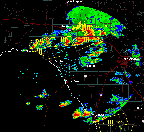 At 843 pm cdt, severe thunderstorms were located along a line extending from 12 miles southeast of juno to near osman, moving southeast at 15 mph (radar indicated). Hazards include 60 mph wind gusts and quarter size hail. Hail damage to vehicles is expected. Expect wind damage to roofs, siding, and trees. At 843 pm cdt, severe thunderstorms were located along a line extending from 12 miles southeast of juno to near osman, moving southeast at 15 mph (radar indicated). Hazards include 60 mph wind gusts and quarter size hail. Hail damage to vehicles is expected. Expect wind damage to roofs, siding, and trees.
|
| 3/24/2016 12:26 AM CDT |
 The severe thunderstorm warning for southeastern val verde and northwestern kinney counties will expire at 1230 am cdt, the storm which prompted the warning has weakened below severe limits, and no longer pose an immediate threat to life or property. therefore the warning will be allowed to expire. however small. The severe thunderstorm warning for southeastern val verde and northwestern kinney counties will expire at 1230 am cdt, the storm which prompted the warning has weakened below severe limits, and no longer pose an immediate threat to life or property. therefore the warning will be allowed to expire. however small.
|
| 3/24/2016 12:04 AM CDT |
 At 1203 am cdt, a severe thunderstorm was located near lake view, or near del rio, moving east at 35 mph (radar indicated). Hazards include 60 mph wind gusts and quarter size hail. Hail damage to vehicles is expected. expect wind damage to roofs, siding, and trees. Locations impacted include, del rio, standart, lake view, amanda, val verde park, cienegas terrace, laughlin afb, amistad village and box canyon-amistad. At 1203 am cdt, a severe thunderstorm was located near lake view, or near del rio, moving east at 35 mph (radar indicated). Hazards include 60 mph wind gusts and quarter size hail. Hail damage to vehicles is expected. expect wind damage to roofs, siding, and trees. Locations impacted include, del rio, standart, lake view, amanda, val verde park, cienegas terrace, laughlin afb, amistad village and box canyon-amistad.
|
| 3/23/2016 11:46 PM CDT |
 At 1145 pm cdt, a severe thunderstorm was located over amistad village, or 11 miles northwest of del rio, moving east at 40 mph (radar indicated). Hazards include golf ball size hail and 60 mph wind gusts. People and animals outdoors will be injured. expect hail damage to roofs, siding, windows, and vehicles. Expect wind damage to roofs, siding, and trees. At 1145 pm cdt, a severe thunderstorm was located over amistad village, or 11 miles northwest of del rio, moving east at 40 mph (radar indicated). Hazards include golf ball size hail and 60 mph wind gusts. People and animals outdoors will be injured. expect hail damage to roofs, siding, windows, and vehicles. Expect wind damage to roofs, siding, and trees.
|
| 3/8/2016 3:50 PM CST | Quarter sized hail reported 10.3 miles S of Box Canyon, TX |
| 3/8/2016 3:05 PM CST | Quarter sized hail reported 15.8 miles SE of Box Canyon, TX, hail fell between 230pm and 305pm |
| 2/22/2016 10:15 PM CST |
 At 1015 pm cst, a severe thunderstorm was located near lake view, or 12 miles northwest of del rio, moving east at 40 mph (radar indicated). Hazards include 60 mph wind gusts and quarter size hail. Hail damage to vehicles is expected. expect wind damage to roofs, siding, and trees. Locations impacted include, del rio, brackettville, alamo village, standart, lake view, amanda, val verde park, cienegas terrace, laughlin afb, amistad village, box canyon-amistad, pafford crossing, rough canyon rec area, devils shores and kickapoo cavern state park. At 1015 pm cst, a severe thunderstorm was located near lake view, or 12 miles northwest of del rio, moving east at 40 mph (radar indicated). Hazards include 60 mph wind gusts and quarter size hail. Hail damage to vehicles is expected. expect wind damage to roofs, siding, and trees. Locations impacted include, del rio, brackettville, alamo village, standart, lake view, amanda, val verde park, cienegas terrace, laughlin afb, amistad village, box canyon-amistad, pafford crossing, rough canyon rec area, devils shores and kickapoo cavern state park.
|
| 2/22/2016 10:08 PM CST |
 At 1007 pm cst, a severe thunderstorm was located near box canyon-amistad, or 10 miles southeast of comstock, moving east at 35 mph (radar indicated). Hazards include quarter size hail. damage to vehicles is expected At 1007 pm cst, a severe thunderstorm was located near box canyon-amistad, or 10 miles southeast of comstock, moving east at 35 mph (radar indicated). Hazards include quarter size hail. damage to vehicles is expected
|
| 10/30/2015 10:11 PM CDT |
 At 1010 pm cdt, severe thunderstorms were located along a line extending from 14 miles northeast of shumla to 8 miles north of comstock to 8 miles northeast of box canyon-amistad to amistad village, moving northeast at 45 mph (radar indicated). Hazards include 60 mph wind gusts and nickel size hail. Expect damage to roofs. siding and trees. Locations impacted include, del rio, comstock, langtry, shumla, lake view, seminole canyon state park, val verde park, cienegas terrace, amistad village, box canyon-amistad, laughlin afb, pafford crossing, rough canyon rec area, devils shores, bakers crossing and devils river state natural area. At 1010 pm cdt, severe thunderstorms were located along a line extending from 14 miles northeast of shumla to 8 miles north of comstock to 8 miles northeast of box canyon-amistad to amistad village, moving northeast at 45 mph (radar indicated). Hazards include 60 mph wind gusts and nickel size hail. Expect damage to roofs. siding and trees. Locations impacted include, del rio, comstock, langtry, shumla, lake view, seminole canyon state park, val verde park, cienegas terrace, amistad village, box canyon-amistad, laughlin afb, pafford crossing, rough canyon rec area, devils shores, bakers crossing and devils river state natural area.
|
| 10/30/2015 9:53 PM CDT |
 At 952 pm cdt, severe thunderstorms were located along a line extending from near shumla to near seminole canyon state park to 6 miles west of box canyon-amistad to 13 miles southwest of amistad village, moving northeast at 45 mph (radar indicated). Hazards include 70 mph wind gusts and quarter size hail. Hail damage to vehicles is expected. expect considerable tree damage. wind damage is also likely to mobile homes, roofs and outbuildings. Locations impacted include, del rio, comstock, langtry, shumla, lake view, seminole canyon state park, val verde park, cienegas terrace, amistad village, box canyon-amistad, laughlin afb, pafford crossing, rough canyon rec area, devils shores, bakers crossing and devils river state natural area. At 952 pm cdt, severe thunderstorms were located along a line extending from near shumla to near seminole canyon state park to 6 miles west of box canyon-amistad to 13 miles southwest of amistad village, moving northeast at 45 mph (radar indicated). Hazards include 70 mph wind gusts and quarter size hail. Hail damage to vehicles is expected. expect considerable tree damage. wind damage is also likely to mobile homes, roofs and outbuildings. Locations impacted include, del rio, comstock, langtry, shumla, lake view, seminole canyon state park, val verde park, cienegas terrace, amistad village, box canyon-amistad, laughlin afb, pafford crossing, rough canyon rec area, devils shores, bakers crossing and devils river state natural area.
|
| 10/30/2015 9:50 PM CDT |
 At 949 pm cdt, severe thunderstorms were located along a line extending from near langtry to near seminole canyon state park to 8 miles west of box canyon-amistad to 15 miles southwest of amistad village, moving northeast at 50 mph (radar indicated). Hazards include 70 mph wind gusts and quarter size hail. Hail damage to vehicles is expected. expect considerable tree damage. Wind damage is also likely to mobile homes, roofs and outbuildings. At 949 pm cdt, severe thunderstorms were located along a line extending from near langtry to near seminole canyon state park to 8 miles west of box canyon-amistad to 15 miles southwest of amistad village, moving northeast at 50 mph (radar indicated). Hazards include 70 mph wind gusts and quarter size hail. Hail damage to vehicles is expected. expect considerable tree damage. Wind damage is also likely to mobile homes, roofs and outbuildings.
|
| 10/30/2015 6:51 PM CDT |
 At 648 pm cdt, a severe thunderstorm was located near lake view, or 7 miles north of del rio, moving east at 30 mph. this storm will move along highway 90 along and just south of lake amistad to across the intersection with highway 277 (radar indicated). Hazards include 70 mph wind gusts and half dollar size hail. Hail damage to vehicles is expected. expect considerable tree damage. wind damage is also likely to mobile homes, roofs and outbuildings. Locations impacted include, del rio, lake view, val verde park, cienegas terrace, amistad village, laughlin afb, box canyon-amistad, pafford crossing, rough canyon rec area and devils shores. At 648 pm cdt, a severe thunderstorm was located near lake view, or 7 miles north of del rio, moving east at 30 mph. this storm will move along highway 90 along and just south of lake amistad to across the intersection with highway 277 (radar indicated). Hazards include 70 mph wind gusts and half dollar size hail. Hail damage to vehicles is expected. expect considerable tree damage. wind damage is also likely to mobile homes, roofs and outbuildings. Locations impacted include, del rio, lake view, val verde park, cienegas terrace, amistad village, laughlin afb, box canyon-amistad, pafford crossing, rough canyon rec area and devils shores.
|
| 10/30/2015 6:34 PM CDT |
 At 633 pm cdt, a severe thunderstorm was located over lake view, or 7 miles northwest of del rio, moving east at 35 mph. this storm will move across the lake amistad dam and then move toward the northern parts of del rio along highway 90 (radar indicated). Hazards include 60 mph wind gusts and quarter size hail. Hail damage to vehicles is expected. expect wind damage to roofs, siding and trees. Locations impacted include, del rio, lake view, val verde park, cienegas terrace, amistad village, laughlin afb, box canyon-amistad, pafford crossing, rough canyon rec area and devils shores. At 633 pm cdt, a severe thunderstorm was located over lake view, or 7 miles northwest of del rio, moving east at 35 mph. this storm will move across the lake amistad dam and then move toward the northern parts of del rio along highway 90 (radar indicated). Hazards include 60 mph wind gusts and quarter size hail. Hail damage to vehicles is expected. expect wind damage to roofs, siding and trees. Locations impacted include, del rio, lake view, val verde park, cienegas terrace, amistad village, laughlin afb, box canyon-amistad, pafford crossing, rough canyon rec area and devils shores.
|
| 10/30/2015 6:10 PM CDT |
 The national weather service in austin san antonio has issued a * severe thunderstorm warning for. southeastern val verde county in south central texas. until 715 pm cdt * at 609 pm cdt. a severe thunderstorm was located 9 miles south of box canyon-amistad. or 16 miles west of del rio. Moving east at. The national weather service in austin san antonio has issued a * severe thunderstorm warning for. southeastern val verde county in south central texas. until 715 pm cdt * at 609 pm cdt. a severe thunderstorm was located 9 miles south of box canyon-amistad. or 16 miles west of del rio. Moving east at.
|
| 6/23/2015 7:55 PM CDT |
 At 755 pm cdt, a severe thunderstorm was located near val verde park, or 7 miles northeast of del rio, moving northwest at 35 mph (radar indicated). Hazards include 60 mph wind gusts. Expect damage to roofs. Siding and trees. At 755 pm cdt, a severe thunderstorm was located near val verde park, or 7 miles northeast of del rio, moving northwest at 35 mph (radar indicated). Hazards include 60 mph wind gusts. Expect damage to roofs. Siding and trees.
|
| 5/28/2015 11:05 PM CDT | At 1104 pm cdt, severe thunderstorms were located along a line extending from 7 miles northwest of lost maples state park to near barksdale to 15 miles north of alamo village to 11 miles northeast of lake view to near box canyon-amistad, moving southeast at 40 mph (radar indicated). Hazards include 60 mph wind gusts and penny size hail. Expect damage to roofs. siding and trees. Locations impacted include, del rio, brackettville, leakey, langtry, loma alta, comstock, camp wood, laguna, montell, alamo village, concan, standart, lake view, amanda, val verde park, seminole canyon state park, box canyon-amistad, osman, garner state park and vance. |
| 5/28/2015 10:35 PM CDT | At 1035 pm cdt, severe thunderstorms were located along a line extending from 10 miles northwest of lost maples state park to near vance to 20 miles north of alamo village to 12 miles southwest of carta valley to near comstock, moving southeast at 40 mph (radar indicated). Hazards include 60 mph wind gusts and penny size hail. Expect damage to roofs. siding and trees. Locations impacted include, del rio, brackettville, leakey, langtry, loma alta, comstock, juno, camp wood, laguna, montell, alamo village, concan, standart, lake view, amanda, pumpville, val verde park, seminole canyon state park, box canyon-amistad and osman. |
| 5/28/2015 9:57 PM CDT | At 954 pm cdt, severe thunderstorms were located along a line extending from near telegraph to 7 miles northwest of rocksprings to near flour mills to 14 miles south of juno to 11 miles north of shumla, moving southeast at 40 mph. * the strongest winds near 70 mph will be in northwest val verde and crossing into west, southwest and south central edwards county over the next half hour. these strong winds will likely be in northern uvalde and kinney country within the next hour (radar indicated). Hazards include 70 mph wind gusts and nickel size hail. Expect considerable tree damage. Damage is likely to mobile homes, roofs and outbuildings. |
| 5/23/2015 2:40 PM CDT | At 239 pm cdt, a severe thunderstorm was located 22 miles southwest of box canyon-amistad, or 28 miles southwest of comstock, moving east at 20 mph (radar indicated). Hazards include 60 mph wind gusts and quarter size hail. Hail damage to vehicles is expected. Expect wind damage to roofs, siding and trees. |
| 5/11/2015 4:27 PM CDT | At 426 pm cdt, a severe thunderstorm was located over lake view, or near del rio, moving north at 30 mph (radar indicated). Hazards include quarter size hail. Damage to vehicles is expected. locations impacted include, del rio, cienegas terrace, amistad village, lake view, box canyon-amistad and rough canyon rec area. 1. 00in. |
| 5/11/2015 4:08 PM CDT | At 408 pm cdt, a severe thunderstorm was located near amistad village, or 7 miles west of del rio, moving northwest at 60 mph (radar indicated). Hazards include quarter size hail. damage to vehicles is expected |
| 5/11/2015 11:08 AM CDT | The severe thunderstorm warning for central val verde county will expire at 1115 am cdt, the storm which prompted the warning has weakened below severe limits, and no longer poses an immediate threat to life or property. therefore the warning will be allowed to expire. however gusty winds and heavy rain are still possible with this thunderstorm. |
| 5/11/2015 10:38 AM CDT | At 1037 am cdt, a severe thunderstorm was located near seminole canyon state park, or 13 miles west of comstock, moving east at 15 mph (radar indicated). Hazards include 60 mph wind gusts and quarter size hail. Hail damage to vehicles is expected. Expect wind damage to roofs, siding and trees. |
| 4/12/2015 6:16 PM CDT | A severe thunderstorm warning remains in effect until 645 pm cdt for val verde county. at 615 pm cdt. severe thunderstorms were located along a line extending from 7 miles east of pandale to 21 miles southwest of box canyon-amistad. moving east at 25 mph. hazard. 70 mph wind gusts and quarter size hail. |
| 4/12/2015 5:49 PM CDT | The national weather service in austin san antonio has issued a * severe thunderstorm warning for. val verde county in south central texas. until 645 pm cdt * at 548 pm cdt. Severe thunderstorms were located along a line extending from near pandale to 30 miles southwest of box. |
| 5/14/2012 3:55 AM CDT | Four inch diameter branch of a healthy palo verde tree was torn off by winds in val verde county TX, 15.8 miles SE of Box Canyon, TX |
| 5/10/2012 6:20 AM CDT | Quarter sized hail reported 11.7 miles S of Box Canyon, TX, large hail covered the ground |
| 5/10/2012 6:05 AM CDT | Storm damage reported in val verde county TX, 16 miles S of Box Canyon, TX |
| 5/10/2012 6:05 AM CDT | Quarter sized hail reported 16 miles S of Box Canyon, TX |
Hail Maps for Box Canyon, TX


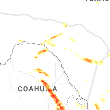


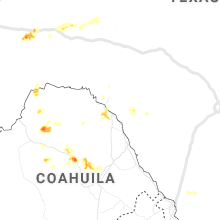
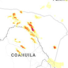


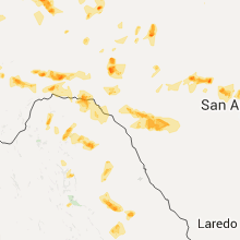
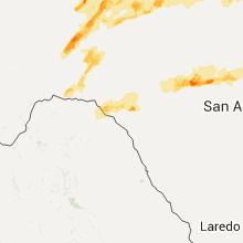

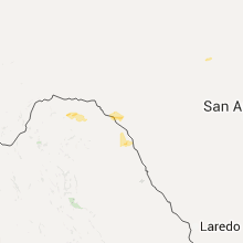


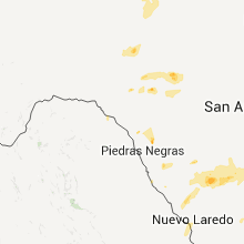


Connect with Interactive Hail Maps