

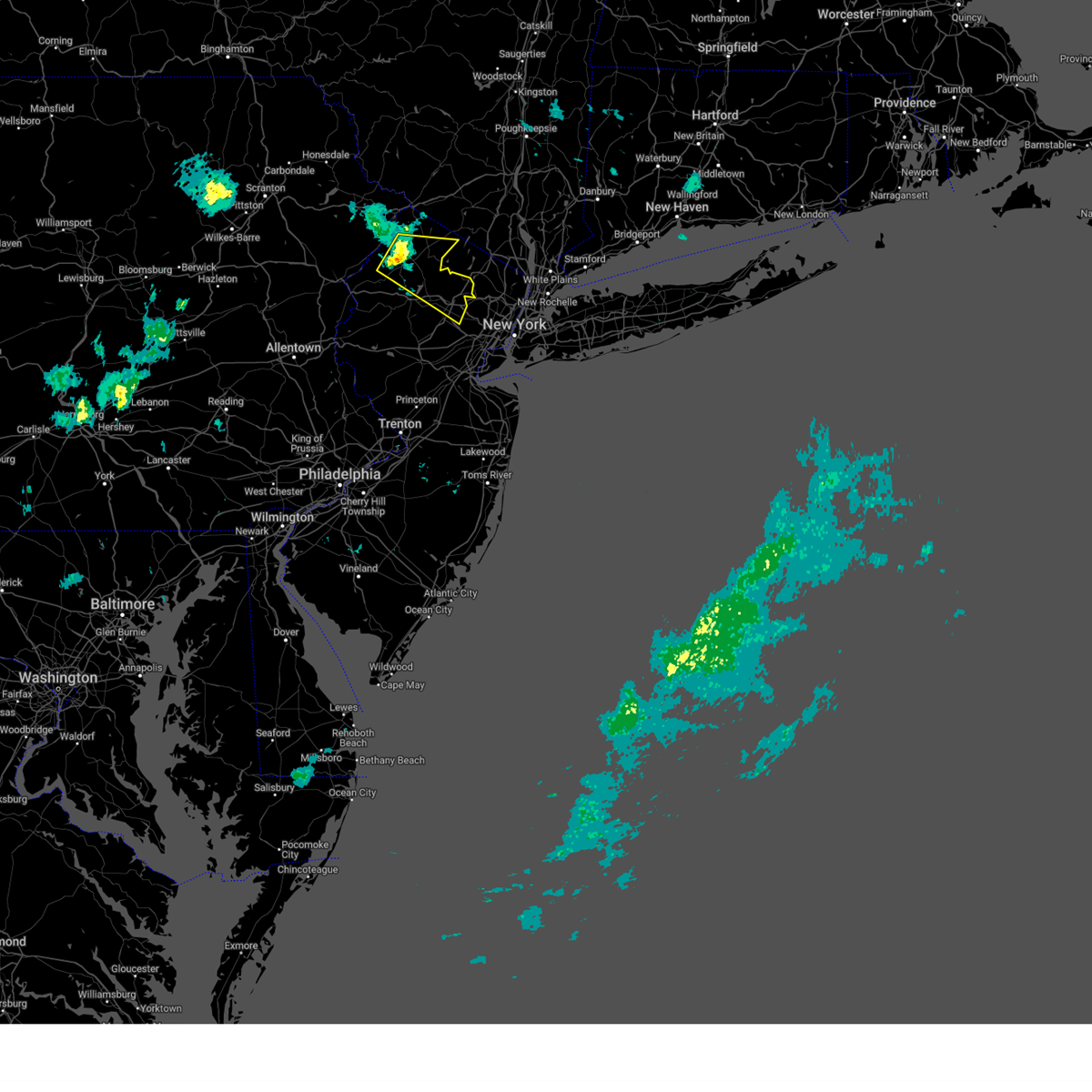
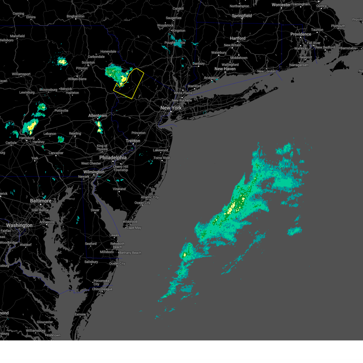
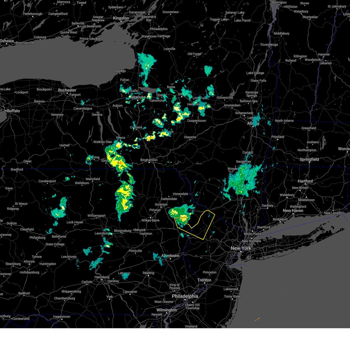
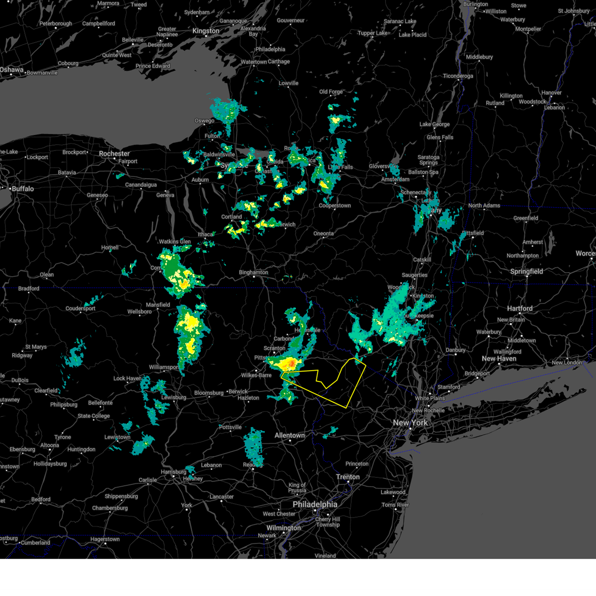
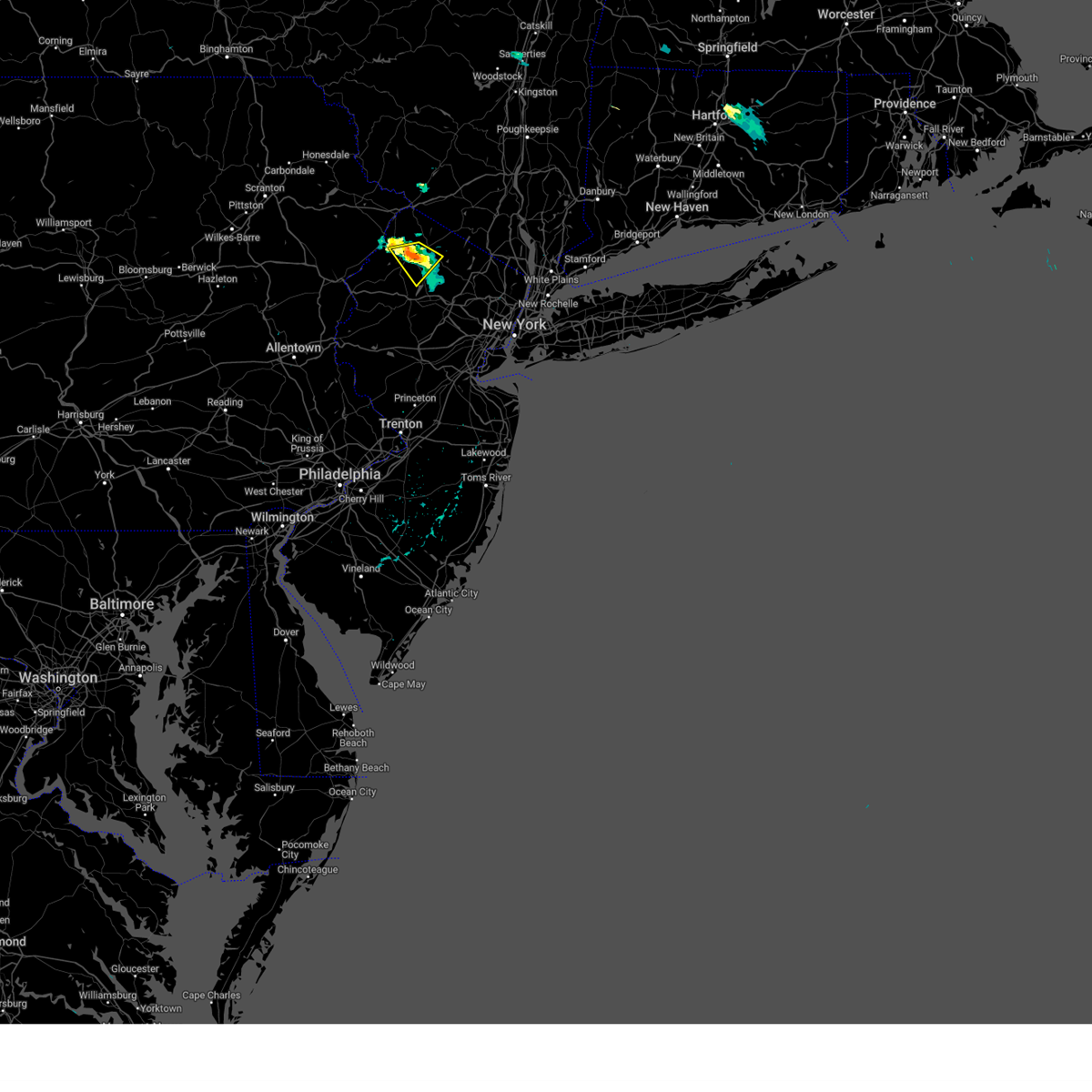
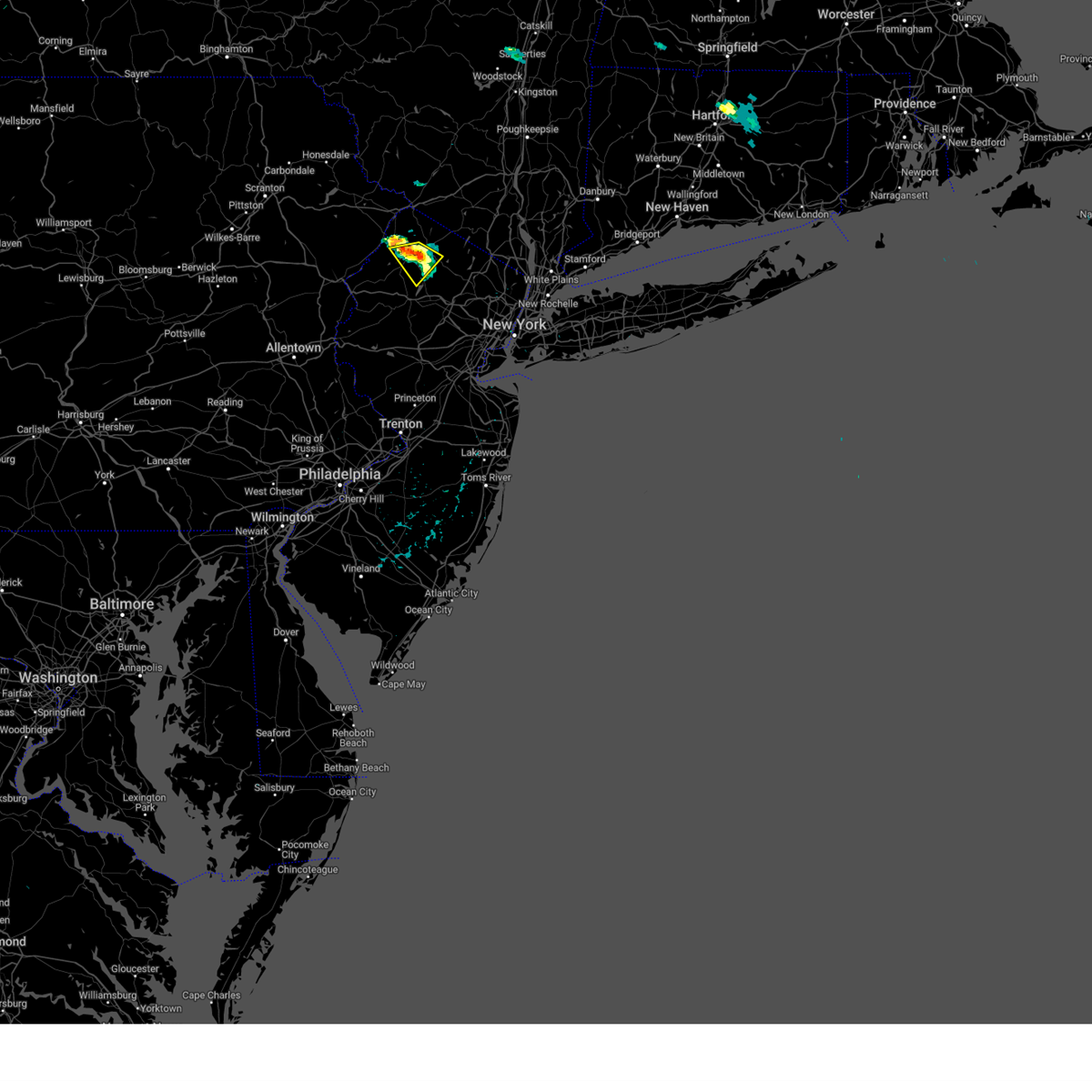
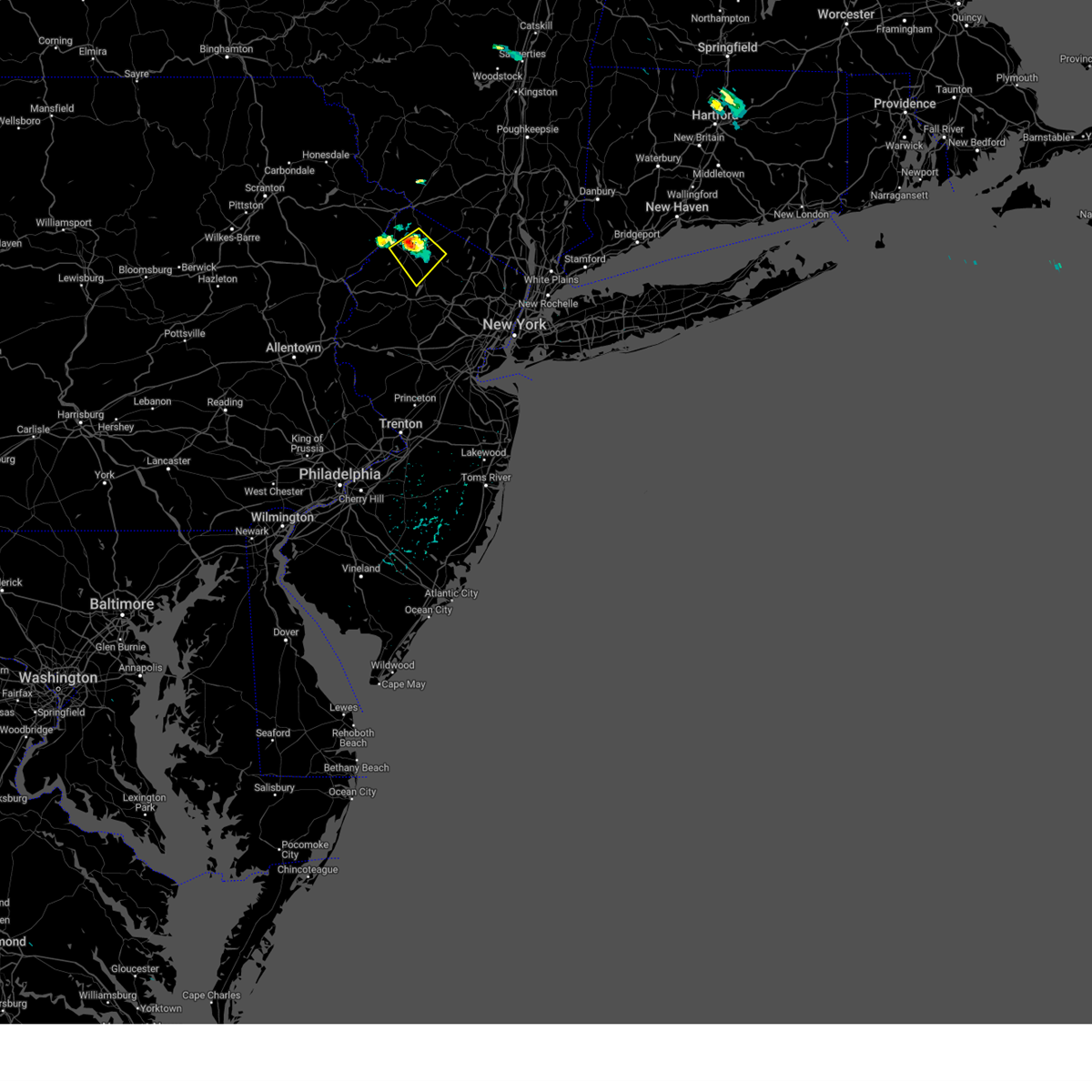
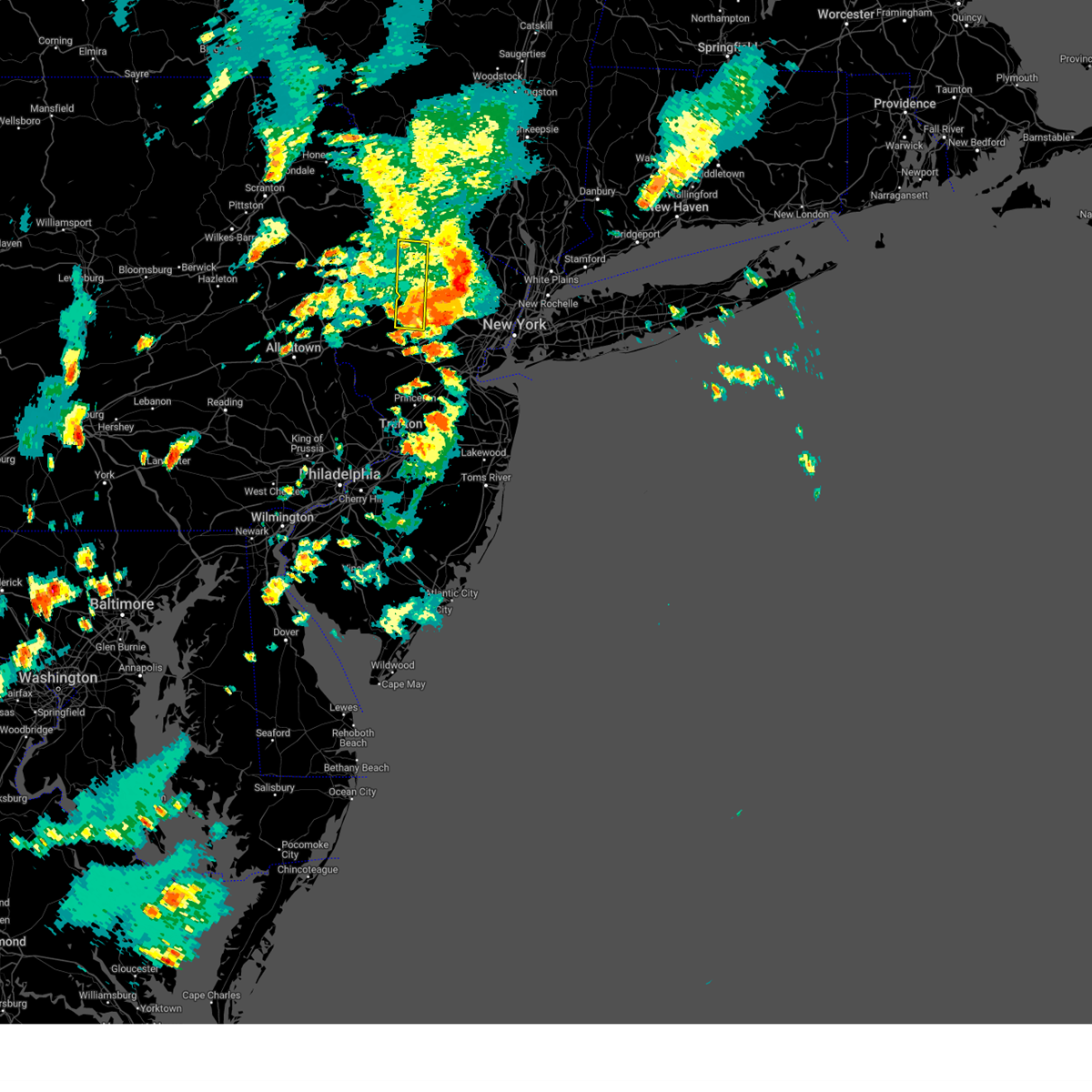
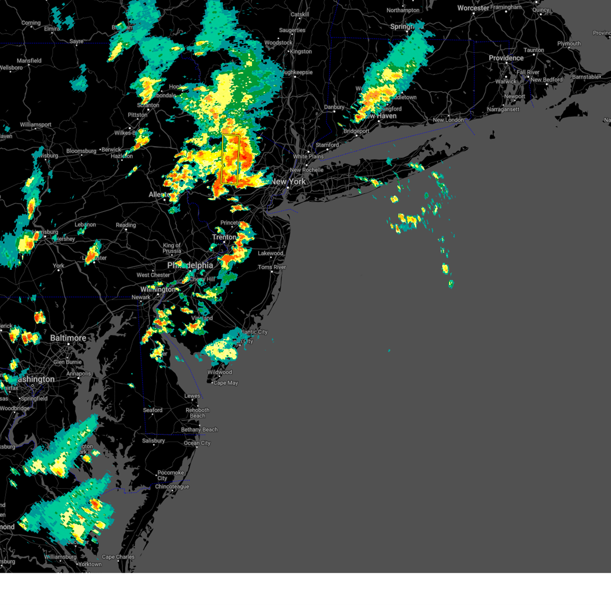
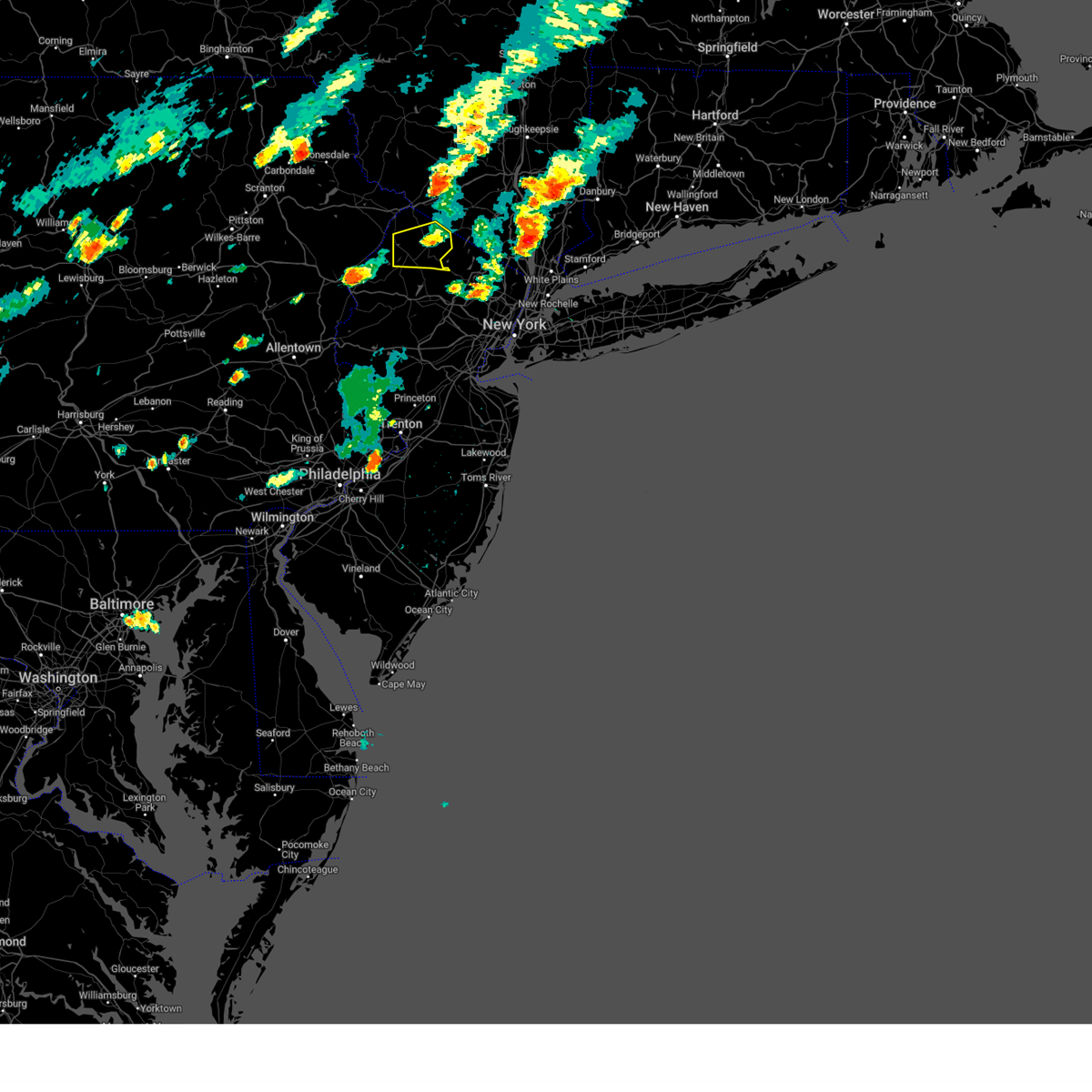
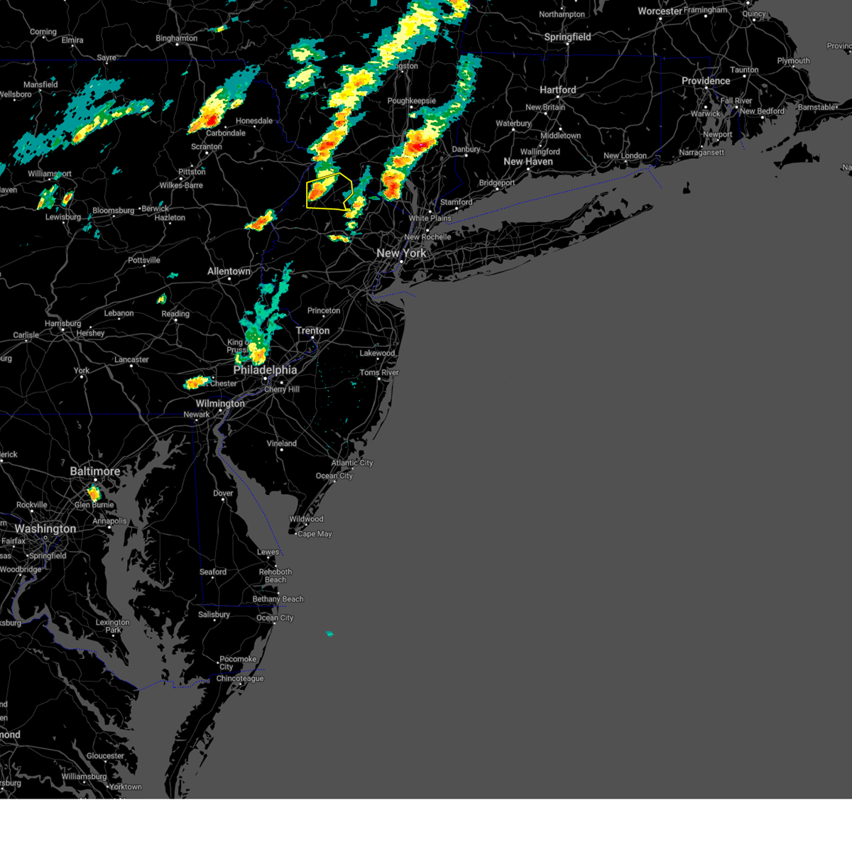
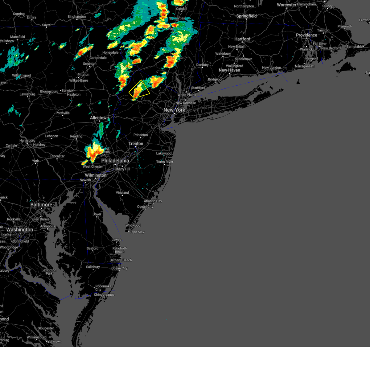
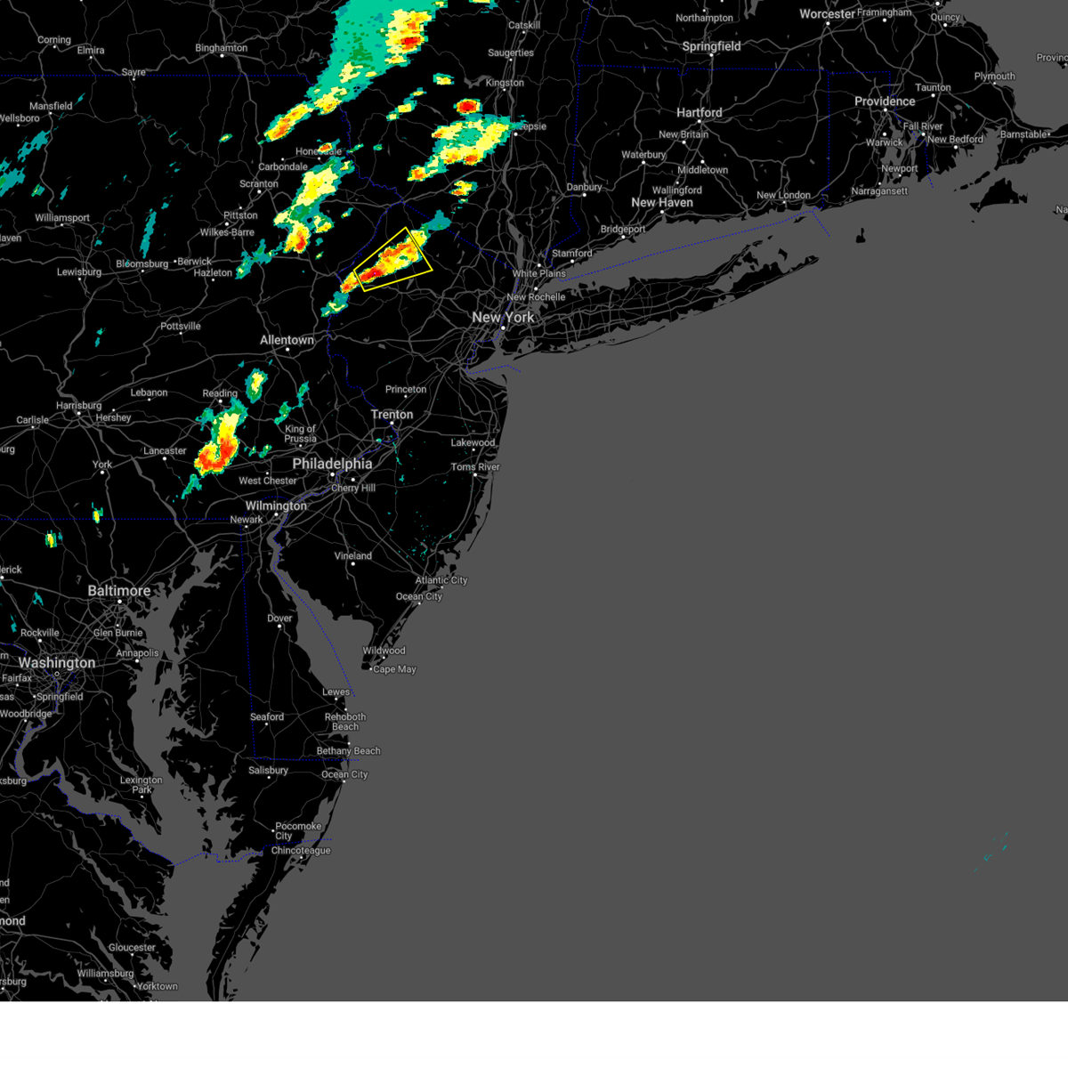
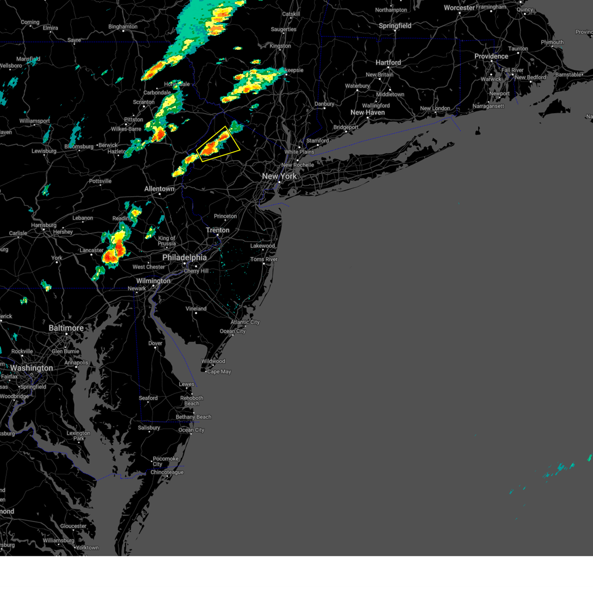
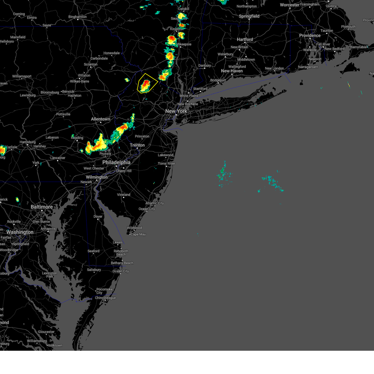
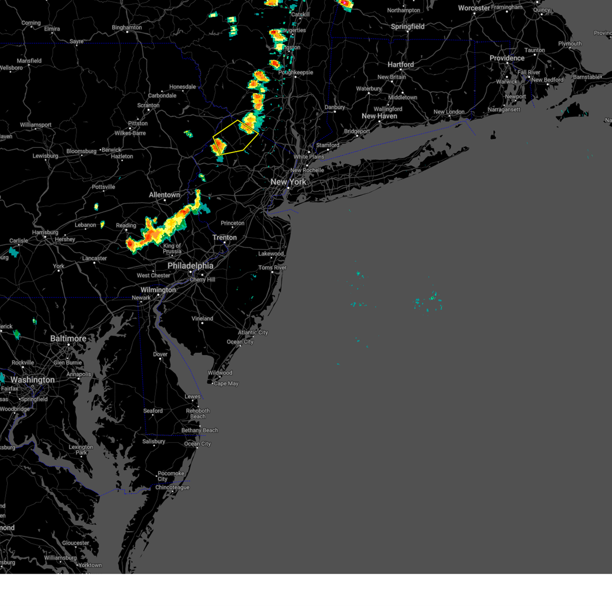
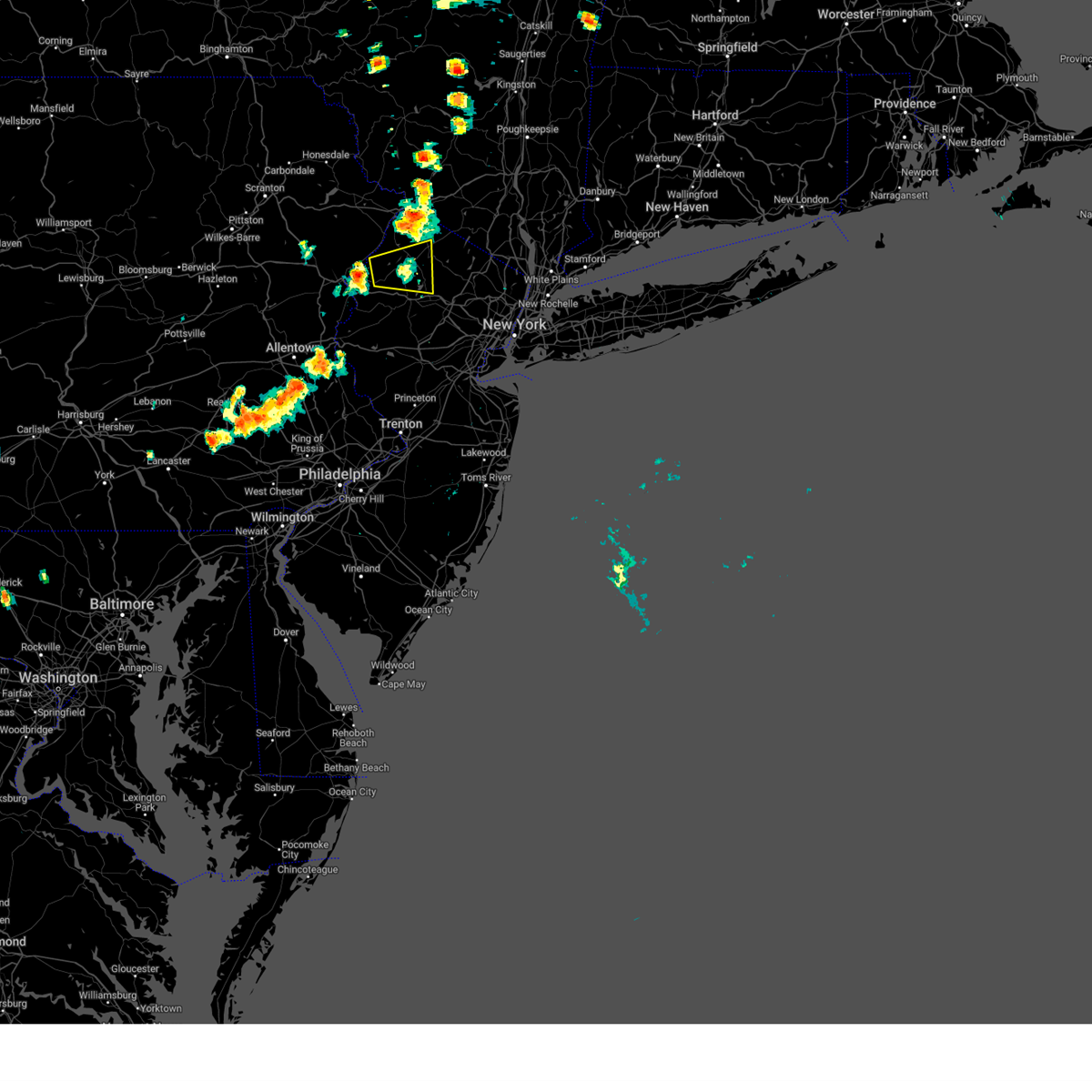
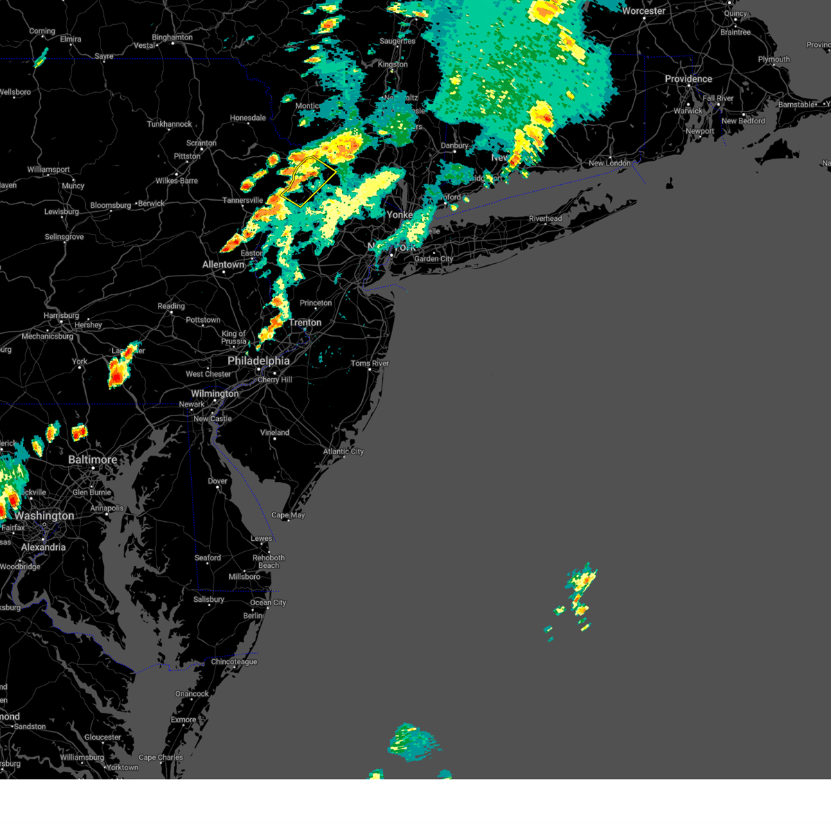
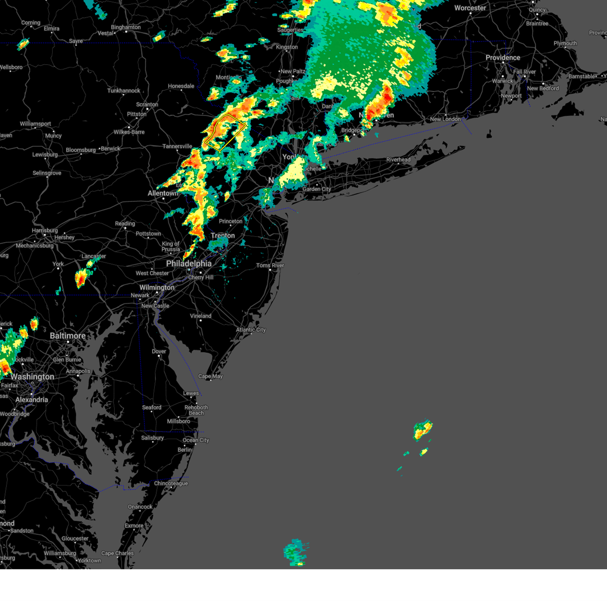
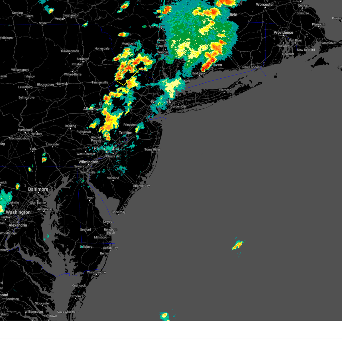
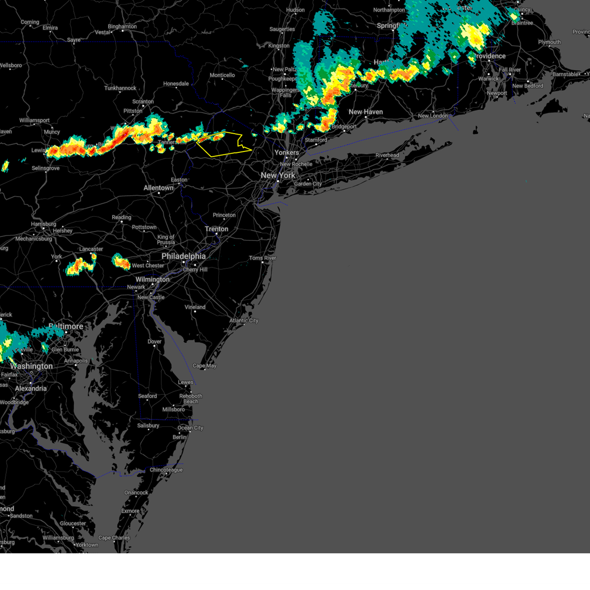
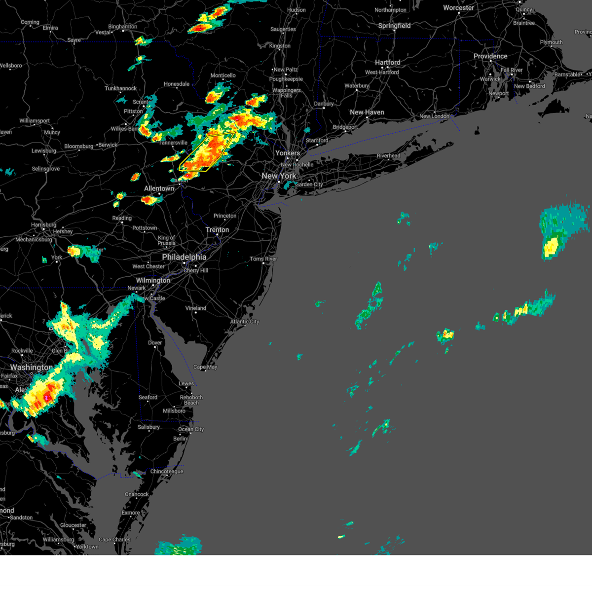
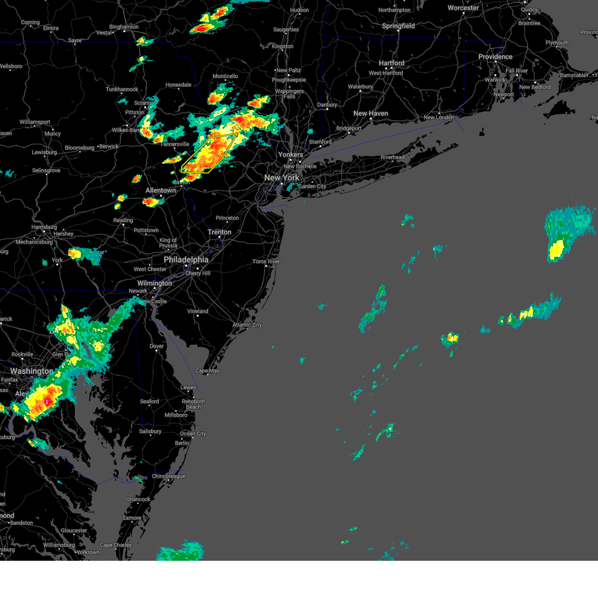
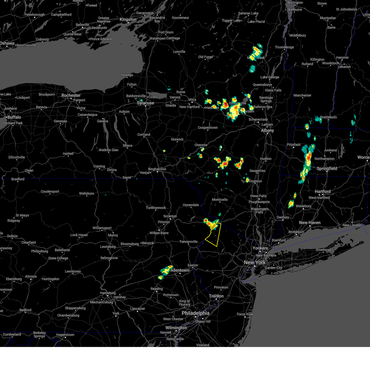
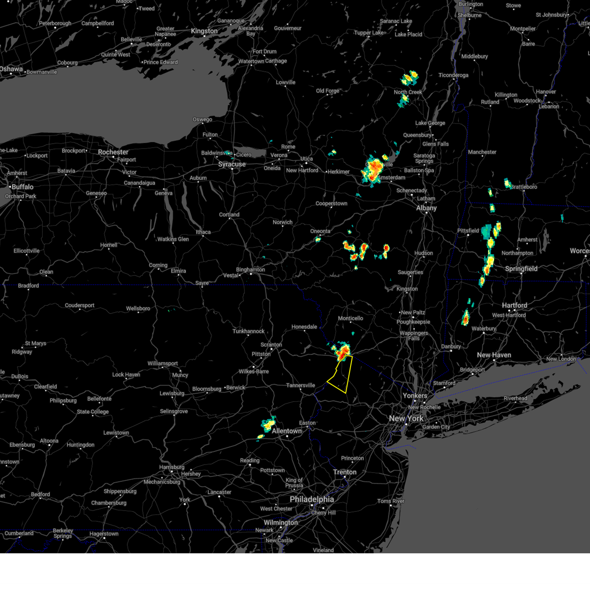
Hail Map for Branchville, NJ
The Branchville, NJ area has had 2 reports of on-the-ground hail by trained spotters, and has been under severe weather warnings 29 times during the past 12 months. Doppler radar has detected hail at or near Branchville, NJ on 21 occasions, including 2 occasions during the past year.
| Name: | Branchville, NJ |
| Where Located: | 50.6 miles NW of Brooklyn, NY |
| Map: | Google Map for Branchville, NJ |
| Population: | 841 |
| Housing Units: | 386 |
| More Info: | Search Google for Branchville, NJ |
5
The Top Recent Hail Date for Branchville, NJ is Tuesday, July 16, 2024 (2nd out of 21)

Hail and Wind Damage Spotted near Branchville, NJ
| Date / Time | Report Details |
|---|---|
| 7/8/2025 1:24 PM EDT |
 Svrphi the national weather service in mount holly nj has issued a * severe thunderstorm warning for, northeastern sussex county in northwestern new jersey, * until 215 pm edt. * at 124 pm edt, a severe thunderstorm was located near pellettown, or 7 miles southeast of montague, moving east at 15 mph (radar indicated). Hazards include 60 mph wind gusts and penny size hail. damage to roofs, siding, trees, and power lines is possible Svrphi the national weather service in mount holly nj has issued a * severe thunderstorm warning for, northeastern sussex county in northwestern new jersey, * until 215 pm edt. * at 124 pm edt, a severe thunderstorm was located near pellettown, or 7 miles southeast of montague, moving east at 15 mph (radar indicated). Hazards include 60 mph wind gusts and penny size hail. damage to roofs, siding, trees, and power lines is possible
|
| 7/3/2025 3:59 PM EDT |
 At 359 pm edt, a severe thunderstorm was located near ogdensburg, or near newton, moving east at 30 mph (radar indicated). Hazards include 60 mph wind gusts and quarter size hail. Minor damage to vehicles is possible. wind damage to roofs, siding, trees, and power lines is possible. Locations impacted include, newton, hopatcong, franklin, hamburg, ogdensburg, sussex, branchville, andover, lake mohawk, five points, pellettown, highland lake, and crandon lakes. At 359 pm edt, a severe thunderstorm was located near ogdensburg, or near newton, moving east at 30 mph (radar indicated). Hazards include 60 mph wind gusts and quarter size hail. Minor damage to vehicles is possible. wind damage to roofs, siding, trees, and power lines is possible. Locations impacted include, newton, hopatcong, franklin, hamburg, ogdensburg, sussex, branchville, andover, lake mohawk, five points, pellettown, highland lake, and crandon lakes.
|
| 7/3/2025 3:59 PM EDT |
 the severe thunderstorm warning has been cancelled and is no longer in effect the severe thunderstorm warning has been cancelled and is no longer in effect
|
| 7/3/2025 3:48 PM EDT |
 At 348 pm edt, a severe thunderstorm was located over branchville, or near newton, moving east at 30 mph (radar indicated). Hazards include 60 mph wind gusts and quarter size hail. Minor damage to vehicles is possible. wind damage to roofs, siding, trees, and power lines is possible. Locations impacted include, newton, hopatcong, franklin, hamburg, ogdensburg, sussex, branchville, andover, flatbrookville, lake mohawk, millbrook, five points, pellettown, crandon lakes, echo lake, highland lake, werry lake, and hidden lake. At 348 pm edt, a severe thunderstorm was located over branchville, or near newton, moving east at 30 mph (radar indicated). Hazards include 60 mph wind gusts and quarter size hail. Minor damage to vehicles is possible. wind damage to roofs, siding, trees, and power lines is possible. Locations impacted include, newton, hopatcong, franklin, hamburg, ogdensburg, sussex, branchville, andover, flatbrookville, lake mohawk, millbrook, five points, pellettown, crandon lakes, echo lake, highland lake, werry lake, and hidden lake.
|
| 7/3/2025 3:35 PM EDT |
 Svrphi the national weather service in mount holly nj has issued a * severe thunderstorm warning for, sussex county in northwestern new jersey, north central warren county in northwestern new jersey, east central monroe county in northeastern pennsylvania, * until 415 pm edt. * at 334 pm edt, a severe thunderstorm was located over flatbrookville, or 10 miles northwest of newton, moving east at 30 mph (radar indicated). Hazards include 60 mph wind gusts and penny size hail. damage to roofs, siding, trees, and power lines is possible Svrphi the national weather service in mount holly nj has issued a * severe thunderstorm warning for, sussex county in northwestern new jersey, north central warren county in northwestern new jersey, east central monroe county in northeastern pennsylvania, * until 415 pm edt. * at 334 pm edt, a severe thunderstorm was located over flatbrookville, or 10 miles northwest of newton, moving east at 30 mph (radar indicated). Hazards include 60 mph wind gusts and penny size hail. damage to roofs, siding, trees, and power lines is possible
|
| 4/15/2025 4:58 PM EDT |
 Svrphi the national weather service in mount holly nj has issued a * severe thunderstorm warning for, northeastern morris county in northern new jersey, central sussex county in northwestern new jersey, * until 600 pm edt. * at 456 pm edt, a severe thunderstorm was located over newton, moving east at 40 mph. this storm has a history of producing wind damage in monroe county in eastern pennsylvania (radar indicated). Hazards include 60 mph wind gusts and quarter size hail. Minor damage to vehicles is possible. Wind damage to roofs, siding, trees, and power lines is possible. Svrphi the national weather service in mount holly nj has issued a * severe thunderstorm warning for, northeastern morris county in northern new jersey, central sussex county in northwestern new jersey, * until 600 pm edt. * at 456 pm edt, a severe thunderstorm was located over newton, moving east at 40 mph. this storm has a history of producing wind damage in monroe county in eastern pennsylvania (radar indicated). Hazards include 60 mph wind gusts and quarter size hail. Minor damage to vehicles is possible. Wind damage to roofs, siding, trees, and power lines is possible.
|
| 4/15/2025 4:40 PM EDT |
 At 439 pm edt, a severe thunderstorm was located near flatbrookville, or 12 miles southwest of montague, moving east at 45 mph (law enforcement. reports of a couple trees down in skytop and mountainhome). Hazards include 60 mph wind gusts and quarter size hail. Minor damage to vehicles is possible. wind damage to roofs, siding, trees, and power lines is possible. locations impacted include, flatbrookville, high point, blairstown, werry lake, millbrook, greendell, montague, newton, five points, pellettown, crandon lakes, marshalls creek, andover, echo lake, hidden lake, branchville, sussex, hainesville, shawnee, and allamuchy-panther valley. This includes interstate 80 in new jersey between mile markers 19 and 22. At 439 pm edt, a severe thunderstorm was located near flatbrookville, or 12 miles southwest of montague, moving east at 45 mph (law enforcement. reports of a couple trees down in skytop and mountainhome). Hazards include 60 mph wind gusts and quarter size hail. Minor damage to vehicles is possible. wind damage to roofs, siding, trees, and power lines is possible. locations impacted include, flatbrookville, high point, blairstown, werry lake, millbrook, greendell, montague, newton, five points, pellettown, crandon lakes, marshalls creek, andover, echo lake, hidden lake, branchville, sussex, hainesville, shawnee, and allamuchy-panther valley. This includes interstate 80 in new jersey between mile markers 19 and 22.
|
| 4/15/2025 4:26 PM EDT |
 At 425 pm edt, a shower capable of producing severe wind gusts was located near skytop, or 11 miles northeast of mount pocono, moving east at 45 mph (radar indicated). Hazards include 60 mph wind gusts and quarter size hail. Minor damage to vehicles is possible. wind damage to roofs, siding, trees, and power lines is possible. locations impacted include, high point, henryville, blairstown, werry lake, millbrook, greendell, skytop, mountainhome, alpine mountain, pellettown, crandon lakes, andover, hidden lake, branchville, sussex, hainesville, flatbrookville, cresco, canadensis, and montague. This includes interstate 80 in new jersey between mile markers 19 and 22. At 425 pm edt, a shower capable of producing severe wind gusts was located near skytop, or 11 miles northeast of mount pocono, moving east at 45 mph (radar indicated). Hazards include 60 mph wind gusts and quarter size hail. Minor damage to vehicles is possible. wind damage to roofs, siding, trees, and power lines is possible. locations impacted include, high point, henryville, blairstown, werry lake, millbrook, greendell, skytop, mountainhome, alpine mountain, pellettown, crandon lakes, andover, hidden lake, branchville, sussex, hainesville, flatbrookville, cresco, canadensis, and montague. This includes interstate 80 in new jersey between mile markers 19 and 22.
|
| 4/15/2025 4:07 PM EDT |
 Svrphi the national weather service in mount holly nj has issued a * severe thunderstorm warning for, sussex county in northwestern new jersey, northeastern warren county in northwestern new jersey, northern monroe county in northeastern pennsylvania, * until 500 pm edt. * at 407 pm edt, a severe thunderstorm was located over lehigh, or 10 miles northwest of mount pocono, moving east at 45 mph (radar indicated). Hazards include 60 mph wind gusts and quarter size hail. Minor damage to vehicles is possible. Wind damage to roofs, siding, trees, and power lines is possible. Svrphi the national weather service in mount holly nj has issued a * severe thunderstorm warning for, sussex county in northwestern new jersey, northeastern warren county in northwestern new jersey, northern monroe county in northeastern pennsylvania, * until 500 pm edt. * at 407 pm edt, a severe thunderstorm was located over lehigh, or 10 miles northwest of mount pocono, moving east at 45 mph (radar indicated). Hazards include 60 mph wind gusts and quarter size hail. Minor damage to vehicles is possible. Wind damage to roofs, siding, trees, and power lines is possible.
|
| 8/25/2024 4:28 PM EDT |
 The storm which prompted the warning has weakened below severe limits, and no longer poses an immediate threat to life or property. therefore, the warning will be allowed to expire. to report severe weather, contact your nearest law enforcement agency. they will relay your report to the national weather service mount holly nj. The storm which prompted the warning has weakened below severe limits, and no longer poses an immediate threat to life or property. therefore, the warning will be allowed to expire. to report severe weather, contact your nearest law enforcement agency. they will relay your report to the national weather service mount holly nj.
|
| 8/25/2024 4:17 PM EDT |
 At 416 pm edt, a severe thunderstorm was located over ogdensburg, or near newton, moving southeast at 15 mph (radar indicated). Hazards include 60 mph wind gusts and penny size hail. Damage to roofs, siding, trees, and power lines is possible. Locations impacted include, newton, hopatcong, franklin, hamburg, ogdensburg, branchville, lake mohawk, and pellettown. At 416 pm edt, a severe thunderstorm was located over ogdensburg, or near newton, moving southeast at 15 mph (radar indicated). Hazards include 60 mph wind gusts and penny size hail. Damage to roofs, siding, trees, and power lines is possible. Locations impacted include, newton, hopatcong, franklin, hamburg, ogdensburg, branchville, lake mohawk, and pellettown.
|
| 8/25/2024 3:58 PM EDT |
 Svrphi the national weather service in mount holly nj has issued a * severe thunderstorm warning for, central sussex county in northwestern new jersey, * until 430 pm edt. * at 358 pm edt, a severe thunderstorm was located over pellettown, or near newton, moving southeast at 10 mph (radar indicated). Hazards include 60 mph wind gusts and penny size hail. damage to roofs, siding, trees, and power lines is possible Svrphi the national weather service in mount holly nj has issued a * severe thunderstorm warning for, central sussex county in northwestern new jersey, * until 430 pm edt. * at 358 pm edt, a severe thunderstorm was located over pellettown, or near newton, moving southeast at 10 mph (radar indicated). Hazards include 60 mph wind gusts and penny size hail. damage to roofs, siding, trees, and power lines is possible
|
| 8/18/2024 6:17 PM EDT |
 the severe thunderstorm warning has been cancelled and is no longer in effect the severe thunderstorm warning has been cancelled and is no longer in effect
|
| 8/18/2024 5:59 PM EDT |
 Svrphi the national weather service in mount holly nj has issued a * severe thunderstorm warning for, western morris county in northern new jersey, south central sussex county in northwestern new jersey, * until 645 pm edt. * at 559 pm edt, a severe thunderstorm was located over succasunna, or 10 miles west of morristown, moving north at 25 mph (radar indicated). Hazards include 60 mph wind gusts and penny size hail. damage to roofs, siding, trees, and power lines is possible Svrphi the national weather service in mount holly nj has issued a * severe thunderstorm warning for, western morris county in northern new jersey, south central sussex county in northwestern new jersey, * until 645 pm edt. * at 559 pm edt, a severe thunderstorm was located over succasunna, or 10 miles west of morristown, moving north at 25 mph (radar indicated). Hazards include 60 mph wind gusts and penny size hail. damage to roofs, siding, trees, and power lines is possible
|
| 7/17/2024 4:05 PM EDT |
 The storm which prompted the warning has weakened below severe limits, and no longer poses an immediate threat to life or property. therefore, the warning will be allowed to expire. however gusty winds are still possible with this thunderstorm. a severe thunderstorm watch remains in effect until 800 pm edt for northern and northwestern new jersey. to report severe weather, contact your nearest law enforcement agency. they will relay your report to the national weather service mount holly nj. The storm which prompted the warning has weakened below severe limits, and no longer poses an immediate threat to life or property. therefore, the warning will be allowed to expire. however gusty winds are still possible with this thunderstorm. a severe thunderstorm watch remains in effect until 800 pm edt for northern and northwestern new jersey. to report severe weather, contact your nearest law enforcement agency. they will relay your report to the national weather service mount holly nj.
|
| 7/17/2024 3:42 PM EDT |
 the severe thunderstorm warning has been cancelled and is no longer in effect the severe thunderstorm warning has been cancelled and is no longer in effect
|
| 7/17/2024 3:42 PM EDT |
 At 342 pm edt, a severe thunderstorm was located over pellettown, or 7 miles northeast of newton, moving east at 25 mph (radar indicated). Hazards include 60 mph wind gusts. Damage to roofs, siding, trees, and power lines is possible. Locations impacted include, newton, franklin, hamburg, ogdensburg, sussex, branchville, pellettown, highland lake, and vernon valley. At 342 pm edt, a severe thunderstorm was located over pellettown, or 7 miles northeast of newton, moving east at 25 mph (radar indicated). Hazards include 60 mph wind gusts. Damage to roofs, siding, trees, and power lines is possible. Locations impacted include, newton, franklin, hamburg, ogdensburg, sussex, branchville, pellettown, highland lake, and vernon valley.
|
| 7/17/2024 3:31 PM EDT | Delayed report. a tree fell down on wires causing them to burn on george hill rd. time estimate in sussex county NJ, 1.7 miles WSW of Branchville, NJ |
| 7/17/2024 3:13 PM EDT |
 Svrphi the national weather service in mount holly nj has issued a * severe thunderstorm warning for, northern morris county in northern new jersey, sussex county in northwestern new jersey, north central warren county in northwestern new jersey, * until 415 pm edt. * at 313 pm edt, a severe thunderstorm was located near crandon lakes, or 10 miles northwest of newton, moving east at 25 mph (radar indicated). Hazards include 60 mph wind gusts. damage to roofs, siding, trees, and power lines is possible Svrphi the national weather service in mount holly nj has issued a * severe thunderstorm warning for, northern morris county in northern new jersey, sussex county in northwestern new jersey, north central warren county in northwestern new jersey, * until 415 pm edt. * at 313 pm edt, a severe thunderstorm was located near crandon lakes, or 10 miles northwest of newton, moving east at 25 mph (radar indicated). Hazards include 60 mph wind gusts. damage to roofs, siding, trees, and power lines is possible
|
| 7/17/2024 3:06 PM EDT |
 the severe thunderstorm warning has been cancelled and is no longer in effect the severe thunderstorm warning has been cancelled and is no longer in effect
|
| 7/17/2024 3:06 PM EDT |
 At 306 pm edt, a severe thunderstorm was located over andover, or near newton, moving east at 15 mph (radar indicated). Hazards include 60 mph wind gusts and quarter size hail. Minor damage to vehicles is possible. wind damage to roofs, siding, trees, and power lines is possible. Locations impacted include, newton, hopatcong, franklin, ogdensburg, branchville, andover, lake mohawk, pellettown, and greendell. At 306 pm edt, a severe thunderstorm was located over andover, or near newton, moving east at 15 mph (radar indicated). Hazards include 60 mph wind gusts and quarter size hail. Minor damage to vehicles is possible. wind damage to roofs, siding, trees, and power lines is possible. Locations impacted include, newton, hopatcong, franklin, ogdensburg, branchville, andover, lake mohawk, pellettown, and greendell.
|
| 7/17/2024 2:33 PM EDT |
 At 232 pm edt, a severe thunderstorm was located near greendell, or 7 miles southwest of newton, moving northeast at 15 mph (radar indicated). Hazards include 70 mph wind gusts and quarter size hail. Minor damage to vehicles is possible. expect considerable tree damage. wind damage is also likely to mobile homes, roofs, and outbuildings. locations impacted include, newton, hopatcong, blairstown, franklin, ogdensburg, branchville, andover, lake mohawk, greendell, five points, pellettown, crandon lakes, and allamuchy-panther valley. This includes interstate 80 in new jersey between mile markers 12 and 17. At 232 pm edt, a severe thunderstorm was located near greendell, or 7 miles southwest of newton, moving northeast at 15 mph (radar indicated). Hazards include 70 mph wind gusts and quarter size hail. Minor damage to vehicles is possible. expect considerable tree damage. wind damage is also likely to mobile homes, roofs, and outbuildings. locations impacted include, newton, hopatcong, blairstown, franklin, ogdensburg, branchville, andover, lake mohawk, greendell, five points, pellettown, crandon lakes, and allamuchy-panther valley. This includes interstate 80 in new jersey between mile markers 12 and 17.
|
| 7/17/2024 2:25 PM EDT |
 Svrphi the national weather service in mount holly nj has issued a * severe thunderstorm warning for, north central morris county in northern new jersey, southwestern sussex county in northwestern new jersey, northeastern warren county in northwestern new jersey, * until 330 pm edt. * at 225 pm edt, a severe thunderstorm was located near blairstown, or 9 miles southwest of newton, moving northeast at 15 mph (radar indicated). Hazards include 60 mph wind gusts and quarter size hail. Minor damage to vehicles is possible. Wind damage to roofs, siding, trees, and power lines is possible. Svrphi the national weather service in mount holly nj has issued a * severe thunderstorm warning for, north central morris county in northern new jersey, southwestern sussex county in northwestern new jersey, northeastern warren county in northwestern new jersey, * until 330 pm edt. * at 225 pm edt, a severe thunderstorm was located near blairstown, or 9 miles southwest of newton, moving northeast at 15 mph (radar indicated). Hazards include 60 mph wind gusts and quarter size hail. Minor damage to vehicles is possible. Wind damage to roofs, siding, trees, and power lines is possible.
|
| 7/16/2024 5:57 PM EDT |
 At 557 pm edt, a severe thunderstorm was located near sussex, or 9 miles northwest of west milford, moving east at 45 mph (radar indicated). Hazards include 70 mph wind gusts and quarter size hail. Minor damage to vehicles is possible. expect considerable tree damage. wind damage is also likely to mobile homes, roofs, and outbuildings. Locations impacted include, franklin, hamburg, ogdensburg, sussex, branchville, pellettown, highland lake, vernon valley, and lake mohawk. At 557 pm edt, a severe thunderstorm was located near sussex, or 9 miles northwest of west milford, moving east at 45 mph (radar indicated). Hazards include 70 mph wind gusts and quarter size hail. Minor damage to vehicles is possible. expect considerable tree damage. wind damage is also likely to mobile homes, roofs, and outbuildings. Locations impacted include, franklin, hamburg, ogdensburg, sussex, branchville, pellettown, highland lake, vernon valley, and lake mohawk.
|
| 7/16/2024 5:45 PM EDT |
 At 545 pm edt, a severe thunderstorm was located over pellettown, or near newton, moving east at 45 mph (radar indicated). Hazards include 70 mph wind gusts and quarter size hail. Minor damage to vehicles is possible. expect considerable tree damage. wind damage is also likely to mobile homes, roofs, and outbuildings. Locations impacted include, newton, franklin, hamburg, ogdensburg, sussex, branchville, pellettown, crandon lakes, highland lake, vernon valley, and lake mohawk. At 545 pm edt, a severe thunderstorm was located over pellettown, or near newton, moving east at 45 mph (radar indicated). Hazards include 70 mph wind gusts and quarter size hail. Minor damage to vehicles is possible. expect considerable tree damage. wind damage is also likely to mobile homes, roofs, and outbuildings. Locations impacted include, newton, franklin, hamburg, ogdensburg, sussex, branchville, pellettown, crandon lakes, highland lake, vernon valley, and lake mohawk.
|
| 7/16/2024 5:44 PM EDT | Numerous trees a wires down across the county from frankford twp... to sussex... to vernon tw in sussex county NJ, 0.9 miles S of Branchville, NJ |
| 7/16/2024 5:41 PM EDT |
 Svrphi the national weather service in mount holly nj has issued a * severe thunderstorm warning for, sussex county in northwestern new jersey, * until 630 pm edt. * at 541 pm edt, a severe thunderstorm was located over branchville, or near newton, moving east at 45 mph (radar indicated). Hazards include 60 mph wind gusts and quarter size hail. Minor damage to vehicles is possible. Wind damage to roofs, siding, trees, and power lines is possible. Svrphi the national weather service in mount holly nj has issued a * severe thunderstorm warning for, sussex county in northwestern new jersey, * until 630 pm edt. * at 541 pm edt, a severe thunderstorm was located over branchville, or near newton, moving east at 45 mph (radar indicated). Hazards include 60 mph wind gusts and quarter size hail. Minor damage to vehicles is possible. Wind damage to roofs, siding, trees, and power lines is possible.
|
| 7/16/2024 5:23 PM EDT |
 At 522 pm edt, a severe thunderstorm was located over blairstown, or 13 miles west of newton, moving east at 40 mph (radar indicated). Hazards include 60 mph wind gusts and quarter size hail. Minor damage to vehicles is possible. wind damage to roofs, siding, trees, and power lines is possible. Locations impacted include, newton, hopatcong, mount arlington, franklin, hamburg, ogdensburg, branchville, andover, flatbrookville, lake mohawk, greendell, millbrook, five points, pellettown, and crandon lakes. At 522 pm edt, a severe thunderstorm was located over blairstown, or 13 miles west of newton, moving east at 40 mph (radar indicated). Hazards include 60 mph wind gusts and quarter size hail. Minor damage to vehicles is possible. wind damage to roofs, siding, trees, and power lines is possible. Locations impacted include, newton, hopatcong, mount arlington, franklin, hamburg, ogdensburg, branchville, andover, flatbrookville, lake mohawk, greendell, millbrook, five points, pellettown, and crandon lakes.
|
| 7/16/2024 5:10 PM EDT |
 the severe thunderstorm warning has been cancelled and is no longer in effect the severe thunderstorm warning has been cancelled and is no longer in effect
|
| 7/16/2024 5:10 PM EDT |
 At 510 pm edt, a severe thunderstorm was located near five points, or near newton, moving east at 30 mph (radar indicated). Hazards include 60 mph wind gusts and quarter size hail. Minor damage to vehicles is possible. wind damage to roofs, siding, trees, and power lines is possible. Locations impacted include, newton, hopatcong, mount arlington, franklin, hamburg, ogdensburg, branchville, andover, flatbrookville, lake mohawk, greendell, millbrook, five points, pellettown, and crandon lakes. At 510 pm edt, a severe thunderstorm was located near five points, or near newton, moving east at 30 mph (radar indicated). Hazards include 60 mph wind gusts and quarter size hail. Minor damage to vehicles is possible. wind damage to roofs, siding, trees, and power lines is possible. Locations impacted include, newton, hopatcong, mount arlington, franklin, hamburg, ogdensburg, branchville, andover, flatbrookville, lake mohawk, greendell, millbrook, five points, pellettown, and crandon lakes.
|
| 7/16/2024 4:59 PM EDT |
 Svrphi the national weather service in mount holly nj has issued a * severe thunderstorm warning for, northwestern morris county in northern new jersey, southwestern sussex county in northwestern new jersey, northeastern warren county in northwestern new jersey, east central monroe county in northeastern pennsylvania, * until 545 pm edt. * at 459 pm edt, a severe thunderstorm was located over blairstown, or 12 miles west of newton, moving east at 30 mph (radar indicated). Hazards include 60 mph wind gusts and quarter size hail. Minor damage to vehicles is possible. Wind damage to roofs, siding, trees, and power lines is possible. Svrphi the national weather service in mount holly nj has issued a * severe thunderstorm warning for, northwestern morris county in northern new jersey, southwestern sussex county in northwestern new jersey, northeastern warren county in northwestern new jersey, east central monroe county in northeastern pennsylvania, * until 545 pm edt. * at 459 pm edt, a severe thunderstorm was located over blairstown, or 12 miles west of newton, moving east at 30 mph (radar indicated). Hazards include 60 mph wind gusts and quarter size hail. Minor damage to vehicles is possible. Wind damage to roofs, siding, trees, and power lines is possible.
|
| 6/30/2024 1:57 PM EDT |
 Svrphi the national weather service in mount holly nj has issued a * severe thunderstorm warning for, sussex county in northwestern new jersey, northeastern warren county in northwestern new jersey, northeastern monroe county in northeastern pennsylvania, * until 245 pm edt. * at 157 pm edt, a severe thunderstorm was located over alpine mountain, or 7 miles east of mount pocono, moving east at 45 mph (radar indicated). Hazards include 60 mph wind gusts. damage to roofs, siding, trees, and power lines is possible Svrphi the national weather service in mount holly nj has issued a * severe thunderstorm warning for, sussex county in northwestern new jersey, northeastern warren county in northwestern new jersey, northeastern monroe county in northeastern pennsylvania, * until 245 pm edt. * at 157 pm edt, a severe thunderstorm was located over alpine mountain, or 7 miles east of mount pocono, moving east at 45 mph (radar indicated). Hazards include 60 mph wind gusts. damage to roofs, siding, trees, and power lines is possible
|
| 6/26/2024 7:59 PM EDT |
 At 759 pm edt, severe thunderstorms were located along a line extending from vernon valley to near martinsville, moving east at 55 mph (radar indicated). Hazards include 70 mph wind gusts. Expect considerable tree damage. damage is likely to mobile homes, roofs, and outbuildings. locations impacted include, new brunswick, perth amboy, morristown, somerville, newton, somerset, edison, east brunswick, bridgewater, carteret, dover, madison, hopatcong, middlesex, florham park, east hanover, lincoln park, bound brook, manville, and kinnelon. this includes the following highways, new jersey turnpike between exits 10 and 13. interstate 78 in new jersey between mile markers 20 and 42. interstate 80 in new jersey between mile markers 20 and 47. interstate 287 in new jersey between mile markers 0 and 54. Garden state parkway between mile markers 125 and 134. At 759 pm edt, severe thunderstorms were located along a line extending from vernon valley to near martinsville, moving east at 55 mph (radar indicated). Hazards include 70 mph wind gusts. Expect considerable tree damage. damage is likely to mobile homes, roofs, and outbuildings. locations impacted include, new brunswick, perth amboy, morristown, somerville, newton, somerset, edison, east brunswick, bridgewater, carteret, dover, madison, hopatcong, middlesex, florham park, east hanover, lincoln park, bound brook, manville, and kinnelon. this includes the following highways, new jersey turnpike between exits 10 and 13. interstate 78 in new jersey between mile markers 20 and 42. interstate 80 in new jersey between mile markers 20 and 47. interstate 287 in new jersey between mile markers 0 and 54. Garden state parkway between mile markers 125 and 134.
|
| 6/26/2024 7:46 PM EDT | Delayed report. trees and power lines down around frankford twp. time estimate in sussex county NJ, 1 miles SSW of Branchville, NJ |
| 6/26/2024 7:37 PM EDT |
 Svrphi the national weather service in mount holly nj has issued a * severe thunderstorm warning for, hunterdon county in northwestern new jersey, morris county in northern new jersey, sussex county in northwestern new jersey, eastern warren county in northwestern new jersey, somerset county in northern new jersey, northeastern middlesex county in northern new jersey, * until 815 pm edt. * at 737 pm edt, severe thunderstorms were located along a line extending from near crandon lakes to near clinton, moving east at 55 mph (radar indicated). Hazards include 70 mph wind gusts. Expect considerable tree damage. Damage is likely to mobile homes, roofs, and outbuildings. Svrphi the national weather service in mount holly nj has issued a * severe thunderstorm warning for, hunterdon county in northwestern new jersey, morris county in northern new jersey, sussex county in northwestern new jersey, eastern warren county in northwestern new jersey, somerset county in northern new jersey, northeastern middlesex county in northern new jersey, * until 815 pm edt. * at 737 pm edt, severe thunderstorms were located along a line extending from near crandon lakes to near clinton, moving east at 55 mph (radar indicated). Hazards include 70 mph wind gusts. Expect considerable tree damage. Damage is likely to mobile homes, roofs, and outbuildings.
|
| 6/26/2024 7:32 PM EDT |
 At 732 pm edt, severe thunderstorms were located along a line extending from pecks pond to near flatbrookville, moving northeast at 60 mph (trained weather spotters). Hazards include 60 mph wind gusts. Damage to roofs, siding, trees, and power lines is possible. locations impacted include, newton, montague, franklin, hamburg, sussex, branchville, flatbrookville, high point, werry lake, millbrook, delaware water gap, vernon valley, five points, pellettown, crandon lakes, echo lake, highland lake, hainesville, shawnee, and marshalls creek. this includes the following highways, interstate 80 in pennsylvania near mile marker 314. Interstate 80 in new jersey between mile markers 0 and 2. At 732 pm edt, severe thunderstorms were located along a line extending from pecks pond to near flatbrookville, moving northeast at 60 mph (trained weather spotters). Hazards include 60 mph wind gusts. Damage to roofs, siding, trees, and power lines is possible. locations impacted include, newton, montague, franklin, hamburg, sussex, branchville, flatbrookville, high point, werry lake, millbrook, delaware water gap, vernon valley, five points, pellettown, crandon lakes, echo lake, highland lake, hainesville, shawnee, and marshalls creek. this includes the following highways, interstate 80 in pennsylvania near mile marker 314. Interstate 80 in new jersey between mile markers 0 and 2.
|
| 6/26/2024 7:14 PM EDT |
 the severe thunderstorm warning has been cancelled and is no longer in effect the severe thunderstorm warning has been cancelled and is no longer in effect
|
| 6/26/2024 7:14 PM EDT |
 At 714 pm edt, severe thunderstorms were located along a line extending from tobyhanna to analomink, moving northeast at 60 mph (trained weather spotters). Hazards include 60 mph wind gusts. Damage to roofs, siding, trees, and power lines is possible. locations impacted include, newton, montague, mount pocono, east stroudsburg, tobyhanna, franklin, hamburg, sussex, branchville, stormville, high point, henryville, werry lake, millbrook, delaware water gap, vernon valley, skytop, tannersville, mountainhome, and alpine mountain. this includes the following highways, interstate 80 in pennsylvania between mile markers 301 and 314. interstate 80 in new jersey between mile markers 0 and 2. Interstate 380 in pennsylvania between mile markers 5 and 13. At 714 pm edt, severe thunderstorms were located along a line extending from tobyhanna to analomink, moving northeast at 60 mph (trained weather spotters). Hazards include 60 mph wind gusts. Damage to roofs, siding, trees, and power lines is possible. locations impacted include, newton, montague, mount pocono, east stroudsburg, tobyhanna, franklin, hamburg, sussex, branchville, stormville, high point, henryville, werry lake, millbrook, delaware water gap, vernon valley, skytop, tannersville, mountainhome, and alpine mountain. this includes the following highways, interstate 80 in pennsylvania between mile markers 301 and 314. interstate 80 in new jersey between mile markers 0 and 2. Interstate 380 in pennsylvania between mile markers 5 and 13.
|
| 6/26/2024 6:59 PM EDT |
 Svrphi the national weather service in mount holly nj has issued a * severe thunderstorm warning for, sussex county in northwestern new jersey, northwestern warren county in northwestern new jersey, northeastern carbon county in northeastern pennsylvania, monroe county in northeastern pennsylvania, * until 745 pm edt. * at 659 pm edt, severe thunderstorms were located along a line extending from stoddartsville to gilbert, moving northeast at 60 mph (radar indicated). Hazards include 60 mph wind gusts. damage to roofs, siding, trees, and power lines is possible Svrphi the national weather service in mount holly nj has issued a * severe thunderstorm warning for, sussex county in northwestern new jersey, northwestern warren county in northwestern new jersey, northeastern carbon county in northeastern pennsylvania, monroe county in northeastern pennsylvania, * until 745 pm edt. * at 659 pm edt, severe thunderstorms were located along a line extending from stoddartsville to gilbert, moving northeast at 60 mph (radar indicated). Hazards include 60 mph wind gusts. damage to roofs, siding, trees, and power lines is possible
|
| 6/22/2024 12:45 PM EDT |
 At 1244 pm edt, a severe thunderstorm was located near newton, moving southeast at 25 mph (radar indicated). Hazards include 60 mph wind gusts and penny size hail. Damage to roofs, siding, trees, and power lines is possible. Locations impacted include, franklin, hamburg, ogdensburg, sussex, branchville, pellettown, highland lake, and crandon lakes. At 1244 pm edt, a severe thunderstorm was located near newton, moving southeast at 25 mph (radar indicated). Hazards include 60 mph wind gusts and penny size hail. Damage to roofs, siding, trees, and power lines is possible. Locations impacted include, franklin, hamburg, ogdensburg, sussex, branchville, pellettown, highland lake, and crandon lakes.
|
| 6/22/2024 12:26 PM EDT |
 Svrphi the national weather service in mount holly nj has issued a * severe thunderstorm warning for, central sussex county in northwestern new jersey, * until 100 pm edt. * at 1226 pm edt, a severe thunderstorm was located over branchville, or 8 miles north of newton, moving east at 25 mph (radar indicated). Hazards include 60 mph wind gusts and penny size hail. damage to roofs, siding, trees, and power lines is possible Svrphi the national weather service in mount holly nj has issued a * severe thunderstorm warning for, central sussex county in northwestern new jersey, * until 100 pm edt. * at 1226 pm edt, a severe thunderstorm was located over branchville, or 8 miles north of newton, moving east at 25 mph (radar indicated). Hazards include 60 mph wind gusts and penny size hail. damage to roofs, siding, trees, and power lines is possible
|
| 6/14/2024 5:37 PM EDT |
 The storm which prompted the warning has moved out of the area. therefore, the warning will be allowed to expire. a severe thunderstorm watch remains in effect until 900 pm edt for northwestern new jersey. remember, a severe thunderstorm warning still remains in effect for southeastern sussex county until 600 pm. The storm which prompted the warning has moved out of the area. therefore, the warning will be allowed to expire. a severe thunderstorm watch remains in effect until 900 pm edt for northwestern new jersey. remember, a severe thunderstorm warning still remains in effect for southeastern sussex county until 600 pm.
|
| 6/14/2024 5:02 PM EDT |
 Svrphi the national weather service in mount holly nj has issued a * severe thunderstorm warning for, northeastern sussex county in northwestern new jersey, * until 545 pm edt. * at 502 pm edt, a severe thunderstorm was located over hainesville, or near montague, moving east at 35 mph (radar indicated). Hazards include 60 mph wind gusts and quarter size hail. Minor damage to vehicles is possible. Wind damage to roofs, siding, trees, and power lines is possible. Svrphi the national weather service in mount holly nj has issued a * severe thunderstorm warning for, northeastern sussex county in northwestern new jersey, * until 545 pm edt. * at 502 pm edt, a severe thunderstorm was located over hainesville, or near montague, moving east at 35 mph (radar indicated). Hazards include 60 mph wind gusts and quarter size hail. Minor damage to vehicles is possible. Wind damage to roofs, siding, trees, and power lines is possible.
|
| 6/14/2024 4:52 PM EDT |
 The storms which prompted the warning have weakened below severe limits, and no longer pose an immediate threat to life or property. therefore, the warning will be allowed to expire. however gusty winds are still possible with these thunderstorms. The storms which prompted the warning have weakened below severe limits, and no longer pose an immediate threat to life or property. therefore, the warning will be allowed to expire. however gusty winds are still possible with these thunderstorms.
|
| 6/14/2024 4:48 PM EDT |
 At 447 pm edt, severe thunderstorms were located along a line extending from near milford to bangor, moving east at 40 mph (radar indicated). Hazards include 60 mph wind gusts. Damage to roofs, siding, trees, and power lines is possible. locations impacted include, newton, east stroudsburg, blairstown, bangor, pen argyl, sussex, hope, east bangor, branchville, werry lake, greendell, millbrook, delaware water gap, pellettown, crandon lakes, hainesville, great meadows-vienna, flatbrookville, allamuchy-panther valley, and five points. this includes the following highways, interstate 80 in pennsylvania between mile markers 310 and 314. Interstate 80 in new jersey between mile markers 0 and 19. At 447 pm edt, severe thunderstorms were located along a line extending from near milford to bangor, moving east at 40 mph (radar indicated). Hazards include 60 mph wind gusts. Damage to roofs, siding, trees, and power lines is possible. locations impacted include, newton, east stroudsburg, blairstown, bangor, pen argyl, sussex, hope, east bangor, branchville, werry lake, greendell, millbrook, delaware water gap, pellettown, crandon lakes, hainesville, great meadows-vienna, flatbrookville, allamuchy-panther valley, and five points. this includes the following highways, interstate 80 in pennsylvania between mile markers 310 and 314. Interstate 80 in new jersey between mile markers 0 and 19.
|
| 6/14/2024 4:25 PM EDT |
 At 425 pm edt, severe thunderstorms were located along a line extending from near skytop to gilbert, moving east at 35 mph (asos indicated. at 4:14 pm, mount pocono regional airport reported a gust of 58 mph). Hazards include 60 mph wind gusts. Damage to roofs, siding, trees, and power lines is possible. locations impacted include, newton, east stroudsburg, blairstown, bangor, pen argyl, sussex, hope, east bangor, branchville, andover, stormville, henryville, brodheadsville, werry lake, gilbert, greendell, millbrook, delaware water gap, tannersville, and mountainhome. this includes the following highways, interstate 80 in pennsylvania between mile markers 299 and 314. Interstate 80 in new jersey between mile markers 0 and 21. At 425 pm edt, severe thunderstorms were located along a line extending from near skytop to gilbert, moving east at 35 mph (asos indicated. at 4:14 pm, mount pocono regional airport reported a gust of 58 mph). Hazards include 60 mph wind gusts. Damage to roofs, siding, trees, and power lines is possible. locations impacted include, newton, east stroudsburg, blairstown, bangor, pen argyl, sussex, hope, east bangor, branchville, andover, stormville, henryville, brodheadsville, werry lake, gilbert, greendell, millbrook, delaware water gap, tannersville, and mountainhome. this includes the following highways, interstate 80 in pennsylvania between mile markers 299 and 314. Interstate 80 in new jersey between mile markers 0 and 21.
|
| 6/14/2024 4:14 PM EDT |
 Svrphi the national weather service in mount holly nj has issued a * severe thunderstorm warning for, sussex county in northwestern new jersey, northern warren county in northwestern new jersey, central monroe county in northeastern pennsylvania, northeastern northampton county in eastern pennsylvania, * until 500 pm edt. * at 414 pm edt, severe thunderstorms were located along a line extending from near skytop to near jonas, moving east at 45 mph (radar indicated). Hazards include 60 mph wind gusts. damage to roofs, siding, trees, and power lines is possible Svrphi the national weather service in mount holly nj has issued a * severe thunderstorm warning for, sussex county in northwestern new jersey, northern warren county in northwestern new jersey, central monroe county in northeastern pennsylvania, northeastern northampton county in eastern pennsylvania, * until 500 pm edt. * at 414 pm edt, severe thunderstorms were located along a line extending from near skytop to near jonas, moving east at 45 mph (radar indicated). Hazards include 60 mph wind gusts. damage to roofs, siding, trees, and power lines is possible
|
| 9/8/2023 6:22 PM EDT |
 The severe thunderstorm warning for northern sussex county will expire at 630 pm edt, the storm which prompted the warning has weakened below severe limits, and no longer poses an immediate threat to life or property. therefore, the warning will be allowed to expire. however gusty winds and heavy rain are still possible with this thunderstorm. a severe thunderstorm watch remains in effect until 1100 pm edt for northwestern new jersey. to report severe weather, contact your nearest law enforcement agency. they will relay your report to the national weather service mount holly nj. The severe thunderstorm warning for northern sussex county will expire at 630 pm edt, the storm which prompted the warning has weakened below severe limits, and no longer poses an immediate threat to life or property. therefore, the warning will be allowed to expire. however gusty winds and heavy rain are still possible with this thunderstorm. a severe thunderstorm watch remains in effect until 1100 pm edt for northwestern new jersey. to report severe weather, contact your nearest law enforcement agency. they will relay your report to the national weather service mount holly nj.
|
| 9/8/2023 6:06 PM EDT |
 At 606 pm edt, a severe thunderstorm was located over hainesville, or near montague, moving northeast at 15 mph (radar indicated). Hazards include 60 mph wind gusts and penny size hail. Damage to roofs, siding, trees, and power lines is possible. locations impacted include, newton, montague, sussex, branchville, high point, five points, pellettown, crandon lakes and hainesville. hail threat, radar indicated max hail size, 0. 75 in wind threat, radar indicated max wind gust, 60 mph. At 606 pm edt, a severe thunderstorm was located over hainesville, or near montague, moving northeast at 15 mph (radar indicated). Hazards include 60 mph wind gusts and penny size hail. Damage to roofs, siding, trees, and power lines is possible. locations impacted include, newton, montague, sussex, branchville, high point, five points, pellettown, crandon lakes and hainesville. hail threat, radar indicated max hail size, 0. 75 in wind threat, radar indicated max wind gust, 60 mph.
|
| 9/8/2023 5:49 PM EDT |
 At 549 pm edt, a severe thunderstorm was located over montague, moving northeast at 30 mph (radar indicated). Hazards include 60 mph wind gusts and nickel size hail. damage to roofs, siding, trees, and power lines is possible At 549 pm edt, a severe thunderstorm was located over montague, moving northeast at 30 mph (radar indicated). Hazards include 60 mph wind gusts and nickel size hail. damage to roofs, siding, trees, and power lines is possible
|
| 9/7/2023 6:30 PM EDT |
 At 630 pm edt, a severe thunderstorm was located over five points, or 7 miles west of newton, moving northeast at 30 mph (radar indicated). Hazards include 60 mph wind gusts and quarter size hail. Minor damage to vehicles is possible. Wind damage to roofs, siding, trees, and power lines is possible. At 630 pm edt, a severe thunderstorm was located over five points, or 7 miles west of newton, moving northeast at 30 mph (radar indicated). Hazards include 60 mph wind gusts and quarter size hail. Minor damage to vehicles is possible. Wind damage to roofs, siding, trees, and power lines is possible.
|
| 7/27/2023 6:17 PM EDT |
 At 617 pm edt, severe thunderstorms were located along a line extending from near pellettown to flatbrookville, moving east at 30 mph (radar indicated). Hazards include 60 mph wind gusts and quarter size hail. Minor damage to vehicles is possible. Wind damage to roofs, siding, trees, and power lines is possible. At 617 pm edt, severe thunderstorms were located along a line extending from near pellettown to flatbrookville, moving east at 30 mph (radar indicated). Hazards include 60 mph wind gusts and quarter size hail. Minor damage to vehicles is possible. Wind damage to roofs, siding, trees, and power lines is possible.
|
| 7/25/2023 2:41 PM EDT |
 The severe thunderstorm warning for northeastern hunterdon, morris, sussex, northeastern warren, northern somerset and east central monroe counties will expire at 245 pm edt, the storms which prompted the warning have moved out of the area. therefore, the warning will be allowed to expire. a severe thunderstorm watch remains in effect until 800 pm edt for northern and northwestern new jersey, and northeastern pennsylvania. remember, a severe thunderstorm warning still remains in effect for portions of morris, sussex, and somerset counties until 3:30 pm edt. The severe thunderstorm warning for northeastern hunterdon, morris, sussex, northeastern warren, northern somerset and east central monroe counties will expire at 245 pm edt, the storms which prompted the warning have moved out of the area. therefore, the warning will be allowed to expire. a severe thunderstorm watch remains in effect until 800 pm edt for northern and northwestern new jersey, and northeastern pennsylvania. remember, a severe thunderstorm warning still remains in effect for portions of morris, sussex, and somerset counties until 3:30 pm edt.
|
| 7/25/2023 2:06 PM EDT |
 At 206 pm edt, severe thunderstorms were located along a line extending from echo lake to hackettstown to near white house station, moving east at 40 mph (radar indicated). Hazards include 60 mph wind gusts and penny size hail. damage to roofs, siding, trees, and power lines is possible At 206 pm edt, severe thunderstorms were located along a line extending from echo lake to hackettstown to near white house station, moving east at 40 mph (radar indicated). Hazards include 60 mph wind gusts and penny size hail. damage to roofs, siding, trees, and power lines is possible
|
| 7/14/2023 7:23 PM EDT |
 At 723 pm edt, severe thunderstorms were located along a line extending from near newton to near belvidere, moving east at 20 mph (law enforcement). Hazards include 60 mph wind gusts and half dollar size hail. Minor damage to vehicles is possible. wind damage to roofs, siding, trees, and power lines is possible. locations impacted include, newton, hackettstown, blairstown, bangor, franklin, hamburg, belvidere, oxford, hope, east bangor, branchville, andover, great meadows-vienna, allamuchy-panther valley, greendell, five points, columbia, crandon lakes, lake mohawk and portland. this includes interstate 80 in new jersey between mile markers 3 and 23. hail threat, radar indicated max hail size, 1. 25 in wind threat, observed max wind gust, 60 mph. At 723 pm edt, severe thunderstorms were located along a line extending from near newton to near belvidere, moving east at 20 mph (law enforcement). Hazards include 60 mph wind gusts and half dollar size hail. Minor damage to vehicles is possible. wind damage to roofs, siding, trees, and power lines is possible. locations impacted include, newton, hackettstown, blairstown, bangor, franklin, hamburg, belvidere, oxford, hope, east bangor, branchville, andover, great meadows-vienna, allamuchy-panther valley, greendell, five points, columbia, crandon lakes, lake mohawk and portland. this includes interstate 80 in new jersey between mile markers 3 and 23. hail threat, radar indicated max hail size, 1. 25 in wind threat, observed max wind gust, 60 mph.
|
| 7/14/2023 7:00 PM EDT |
 At 659 pm edt, severe thunderstorms were located along a line extending from near echo lake to east bangor, moving east at 20 mph. this storm has a history of producing wind damage in east stroudsburg (law enforcement). Hazards include 60 mph wind gusts and half dollar size hail. Minor damage to vehicles is possible. wind damage to roofs, siding, trees, and power lines is possible. locations impacted include, newton, east stroudsburg, hackettstown, blairstown, bangor, franklin, pen argyl, hamburg, belvidere, oxford, hope, east bangor, branchville, andover, werry lake, greendell, millbrook, delaware water gap, crandon lakes and great meadows-vienna. this includes the following highways, interstate 80 in pennsylvania between mile markers 313 and 314. interstate 80 in new jersey between mile markers 0 and 23. hail threat, radar indicated max hail size, 1. 25 in wind threat, observed max wind gust, 60 mph. At 659 pm edt, severe thunderstorms were located along a line extending from near echo lake to east bangor, moving east at 20 mph. this storm has a history of producing wind damage in east stroudsburg (law enforcement). Hazards include 60 mph wind gusts and half dollar size hail. Minor damage to vehicles is possible. wind damage to roofs, siding, trees, and power lines is possible. locations impacted include, newton, east stroudsburg, hackettstown, blairstown, bangor, franklin, pen argyl, hamburg, belvidere, oxford, hope, east bangor, branchville, andover, werry lake, greendell, millbrook, delaware water gap, crandon lakes and great meadows-vienna. this includes the following highways, interstate 80 in pennsylvania between mile markers 313 and 314. interstate 80 in new jersey between mile markers 0 and 23. hail threat, radar indicated max hail size, 1. 25 in wind threat, observed max wind gust, 60 mph.
|
| 7/14/2023 6:52 PM EDT |
 At 651 pm edt, severe thunderstorms were located along a line extending from near echo lake to bangor, moving east at 20 mph (radar indicated). Hazards include 60 mph wind gusts and half dollar size hail. Minor damage to vehicles is possible. Wind damage to roofs, siding, trees, and power lines is possible. At 651 pm edt, severe thunderstorms were located along a line extending from near echo lake to bangor, moving east at 20 mph (radar indicated). Hazards include 60 mph wind gusts and half dollar size hail. Minor damage to vehicles is possible. Wind damage to roofs, siding, trees, and power lines is possible.
|
| 7/13/2023 9:40 PM EDT |
 At 940 pm edt, a severe thunderstorm was located over pellettown, or 9 miles northeast of newton, moving east at 25 mph (radar indicated). Hazards include 60 mph wind gusts and quarter size hail. Minor damage to vehicles is possible. wind damage to roofs, siding, trees, and power lines is possible. locations impacted include, montague, franklin, hamburg, sussex, high point, pellettown, highland lake, vernon valley and hainesville. hail threat, radar indicated max hail size, 1. 00 in wind threat, radar indicated max wind gust, 60 mph. At 940 pm edt, a severe thunderstorm was located over pellettown, or 9 miles northeast of newton, moving east at 25 mph (radar indicated). Hazards include 60 mph wind gusts and quarter size hail. Minor damage to vehicles is possible. wind damage to roofs, siding, trees, and power lines is possible. locations impacted include, montague, franklin, hamburg, sussex, high point, pellettown, highland lake, vernon valley and hainesville. hail threat, radar indicated max hail size, 1. 00 in wind threat, radar indicated max wind gust, 60 mph.
|
| 7/13/2023 9:25 PM EDT |
 At 925 pm edt, a severe thunderstorm was located over branchville, or 7 miles north of newton, moving east at 25 mph (radar indicated). Hazards include 60 mph wind gusts and quarter size hail. Minor damage to vehicles is possible. wind damage to roofs, siding, trees, and power lines is possible. locations impacted include, montague, franklin, hamburg, sussex, branchville, high point, pellettown, highland lake, vernon valley, hainesville and crandon lakes. hail threat, radar indicated max hail size, 1. 00 in wind threat, radar indicated max wind gust, 60 mph. At 925 pm edt, a severe thunderstorm was located over branchville, or 7 miles north of newton, moving east at 25 mph (radar indicated). Hazards include 60 mph wind gusts and quarter size hail. Minor damage to vehicles is possible. wind damage to roofs, siding, trees, and power lines is possible. locations impacted include, montague, franklin, hamburg, sussex, branchville, high point, pellettown, highland lake, vernon valley, hainesville and crandon lakes. hail threat, radar indicated max hail size, 1. 00 in wind threat, radar indicated max wind gust, 60 mph.
|
| 7/13/2023 9:10 PM EDT |
 At 910 pm edt, a severe thunderstorm was located near dingmans ferry, or 10 miles northwest of newton, moving east at 20 mph (radar indicated). Hazards include 60 mph wind gusts and half dollar size hail. Minor damage to vehicles is possible. wind damage to roofs, siding, trees, and power lines is possible. locations impacted include, montague, franklin, hamburg, sussex, branchville, high point, pellettown, crandon lakes, highland lake, vernon valley and hainesville. hail threat, radar indicated max hail size, 1. 25 in wind threat, radar indicated max wind gust, 60 mph. At 910 pm edt, a severe thunderstorm was located near dingmans ferry, or 10 miles northwest of newton, moving east at 20 mph (radar indicated). Hazards include 60 mph wind gusts and half dollar size hail. Minor damage to vehicles is possible. wind damage to roofs, siding, trees, and power lines is possible. locations impacted include, montague, franklin, hamburg, sussex, branchville, high point, pellettown, crandon lakes, highland lake, vernon valley and hainesville. hail threat, radar indicated max hail size, 1. 25 in wind threat, radar indicated max wind gust, 60 mph.
|
| 7/13/2023 8:53 PM EDT |
 At 853 pm edt, a severe thunderstorm was located near bushkill, or 13 miles southwest of montague, moving east at 25 mph (radar indicated). Hazards include 60 mph wind gusts and quarter size hail. Minor damage to vehicles is possible. Wind damage to roofs, siding, trees, and power lines is possible. At 853 pm edt, a severe thunderstorm was located near bushkill, or 13 miles southwest of montague, moving east at 25 mph (radar indicated). Hazards include 60 mph wind gusts and quarter size hail. Minor damage to vehicles is possible. Wind damage to roofs, siding, trees, and power lines is possible.
|
| 6/2/2023 1:07 PM EDT |
 The severe thunderstorm warning for western sussex county will expire at 115 pm edt, the storm which prompted the warning has weakened below severe limits, and no longer poses an immediate threat to life or property. therefore, the warning will be allowed to expire. however gusty winds are still possible with this thunderstorm. to report severe weather, contact your nearest law enforcement agency. they will relay your report to the national weather service mount holly nj. The severe thunderstorm warning for western sussex county will expire at 115 pm edt, the storm which prompted the warning has weakened below severe limits, and no longer poses an immediate threat to life or property. therefore, the warning will be allowed to expire. however gusty winds are still possible with this thunderstorm. to report severe weather, contact your nearest law enforcement agency. they will relay your report to the national weather service mount holly nj.
|
| 6/2/2023 12:49 PM EDT |
 At 1248 pm edt, a severe thunderstorm was located over montague, moving south at 25 mph (radar indicated). Hazards include 60 mph wind gusts and nickel size hail. damage to roofs, siding, trees, and power lines is possible At 1248 pm edt, a severe thunderstorm was located over montague, moving south at 25 mph (radar indicated). Hazards include 60 mph wind gusts and nickel size hail. damage to roofs, siding, trees, and power lines is possible
|
| 4/22/2023 7:24 PM EDT |
 At 724 pm edt, a severe thunderstorm was located near lebanon, or 12 miles northwest of somerville, moving north at 40 mph (radar indicated). Hazards include 60 mph wind gusts and quarter size hail. Minor damage to vehicles is possible. Wind damage to roofs, siding, trees, and power lines is possible. At 724 pm edt, a severe thunderstorm was located near lebanon, or 12 miles northwest of somerville, moving north at 40 mph (radar indicated). Hazards include 60 mph wind gusts and quarter size hail. Minor damage to vehicles is possible. Wind damage to roofs, siding, trees, and power lines is possible.
|
| 7/24/2022 9:26 PM EDT |
 The severe thunderstorm warning for central sussex county will expire at 930 pm edt, the storms which prompted the warning have weakened below severe limits, and have exited the warned area. therefore, the warning will be allowed to expire. The severe thunderstorm warning for central sussex county will expire at 930 pm edt, the storms which prompted the warning have weakened below severe limits, and have exited the warned area. therefore, the warning will be allowed to expire.
|
| 7/24/2022 9:04 PM EDT |
 At 903 pm edt, severe thunderstorms were located along a line extending from near branchville to near newton, moving east at 30 mph (radar indicated). Hazards include 60 mph wind gusts. Damage to roofs, siding, trees, and power lines is possible. locations impacted include, newton, franklin, hamburg, ogdensburg, sussex, branchville, pellettown, highland lake, vernon valley and lake mohawk. hail threat, radar indicated max hail size, <. 75 in wind threat, radar indicated max wind gust, 60 mph. At 903 pm edt, severe thunderstorms were located along a line extending from near branchville to near newton, moving east at 30 mph (radar indicated). Hazards include 60 mph wind gusts. Damage to roofs, siding, trees, and power lines is possible. locations impacted include, newton, franklin, hamburg, ogdensburg, sussex, branchville, pellettown, highland lake, vernon valley and lake mohawk. hail threat, radar indicated max hail size, <. 75 in wind threat, radar indicated max wind gust, 60 mph.
|
| 7/24/2022 8:54 PM EDT |
 At 853 pm edt, severe thunderstorms were located along a line extending from near branchville to newton, moving northeast at 40 mph (radar indicated). Hazards include 60 mph wind gusts. Damage to roofs, siding, trees, and power lines is possible. locations impacted include, newton, montague, franklin, hamburg, ogdensburg, sussex, branchville, high point, lake mohawk, vernon valley, five points, pellettown, crandon lakes, highland lake and hainesville. hail threat, radar indicated max hail size, <. 75 in wind threat, radar indicated max wind gust, 60 mph. At 853 pm edt, severe thunderstorms were located along a line extending from near branchville to newton, moving northeast at 40 mph (radar indicated). Hazards include 60 mph wind gusts. Damage to roofs, siding, trees, and power lines is possible. locations impacted include, newton, montague, franklin, hamburg, ogdensburg, sussex, branchville, high point, lake mohawk, vernon valley, five points, pellettown, crandon lakes, highland lake and hainesville. hail threat, radar indicated max hail size, <. 75 in wind threat, radar indicated max wind gust, 60 mph.
|
| 7/24/2022 8:37 PM EDT |
 At 837 pm edt, severe thunderstorms were located along a line extending from near bushkill to near blairstown to columbia, moving east at 30 mph (radar indicated). Hazards include 60 mph wind gusts. damage to roofs, siding, trees, and power lines is possible At 837 pm edt, severe thunderstorms were located along a line extending from near bushkill to near blairstown to columbia, moving east at 30 mph (radar indicated). Hazards include 60 mph wind gusts. damage to roofs, siding, trees, and power lines is possible
|
| 3/31/2022 8:40 PM EDT |
 At 839 pm edt, severe thunderstorms were located along a line extending from near unionville to near old orchard, moving east at 60 mph (radar indicated). Hazards include 60 mph wind gusts and penny size hail. damage to roofs, siding, trees, and power lines is possible At 839 pm edt, severe thunderstorms were located along a line extending from near unionville to near old orchard, moving east at 60 mph (radar indicated). Hazards include 60 mph wind gusts and penny size hail. damage to roofs, siding, trees, and power lines is possible
|
| 3/31/2022 8:29 PM EDT |
 At 828 pm edt, severe thunderstorms were located along a line extending from adhesively to millbrook, moving northeast at 50 mph (radar indicated). Hazards include 60 mph wind gusts. Damage to roofs, siding, trees, and power lines is possible. locations impacted include, easton, montague, forks, east stroudsburg, wilson, blairstown, nazareth, bangor, pen argyl, wind gap, bath, belvidere, belfast, west easton, tatamy, east bangor, branchville, steuben, glendon and stormville. this includes the following highways, interstate 78 in pennsylvania between mile markers 72 and 73. interstate 80 in pennsylvania between mile markers 310 and 314. interstate 80 in new jersey between mile markers 0 and 12. hail threat, radar indicated max hail size, <. 75 in wind threat, radar indicated max wind gust, 60 mph. At 828 pm edt, severe thunderstorms were located along a line extending from adhesively to millbrook, moving northeast at 50 mph (radar indicated). Hazards include 60 mph wind gusts. Damage to roofs, siding, trees, and power lines is possible. locations impacted include, easton, montague, forks, east stroudsburg, wilson, blairstown, nazareth, bangor, pen argyl, wind gap, bath, belvidere, belfast, west easton, tatamy, east bangor, branchville, steuben, glendon and stormville. this includes the following highways, interstate 78 in pennsylvania between mile markers 72 and 73. interstate 80 in pennsylvania between mile markers 310 and 314. interstate 80 in new jersey between mile markers 0 and 12. hail threat, radar indicated max hail size, <. 75 in wind threat, radar indicated max wind gust, 60 mph.
|
| 3/31/2022 8:04 PM EDT |
 At 803 pm edt, severe thunderstorms were located along a line extending from near pecks pond to kresgeville, moving northeast at 75 mph (radar indicated). Hazards include 60 mph wind gusts. damage to roofs, siding, trees, and power lines is possible At 803 pm edt, severe thunderstorms were located along a line extending from near pecks pond to kresgeville, moving northeast at 75 mph (radar indicated). Hazards include 60 mph wind gusts. damage to roofs, siding, trees, and power lines is possible
|
| 3/7/2022 8:46 PM EST |
 At 844 pm est, severe showers and embedded thunderstorms were located along a line extending from near vernon valley to near clinton to royersford, moving east at 50 mph. this line has a history of producing areas of wind damage (trained weather spotters). Hazards include 70 mph wind gusts. Expect considerable tree damage. damage is likely to mobile homes, roofs, and outbuildings. locations impacted include, easton, morristown, somerville, newton, bridgewater, pottstown, dover, lansdale, madison, hopatcong, florham park, east hanover, lincoln park, kinnelon, hackettstown, quakertown, perkasie, doylestown, byram and boonton. this includes the following highways, northeast extension between mile markers 25 and 45. interstate 78 in new jersey between mile markers 0 and 37. interstate 80 in new jersey between mile markers 12 and 47. interstate 287 in new jersey between mile markers 16 and 54. thunderstorm damage threat, considerable hail threat, radar indicated max hail size, <. 75 in wind threat, radar indicated max wind gust, 70 mph. At 844 pm est, severe showers and embedded thunderstorms were located along a line extending from near vernon valley to near clinton to royersford, moving east at 50 mph. this line has a history of producing areas of wind damage (trained weather spotters). Hazards include 70 mph wind gusts. Expect considerable tree damage. damage is likely to mobile homes, roofs, and outbuildings. locations impacted include, easton, morristown, somerville, newton, bridgewater, pottstown, dover, lansdale, madison, hopatcong, florham park, east hanover, lincoln park, kinnelon, hackettstown, quakertown, perkasie, doylestown, byram and boonton. this includes the following highways, northeast extension between mile markers 25 and 45. interstate 78 in new jersey between mile markers 0 and 37. interstate 80 in new jersey between mile markers 12 and 47. interstate 287 in new jersey between mile markers 16 and 54. thunderstorm damage threat, considerable hail threat, radar indicated max hail size, <. 75 in wind threat, radar indicated max wind gust, 70 mph.
|
| 3/7/2022 8:29 PM EST |
 At 826 pm est, severe showers and embedded thunderstorms were located along a line extending from near milford to alpha to near new morgan, moving east at 55 mph. this line has had a history of producing areas of wind damage (trained weather spotters. a 66 mph wind gust was measured in forks township in northampton county). Hazards include 70 mph wind gusts. Expect considerable tree damage. damage is likely to mobile homes, roofs, and outbuildings. locations impacted include, allentown, reading, easton, morristown, somerville, newton, montague, bethlehem, bridgewater, pottstown, dover, lansdale, madison, hopatcong, forks, florham park, emmaus, east hanover, lincoln park and wyomissing. this includes the following highways, pennsylvania turnpike between mile markers 295 and 303. northeast extension between mile markers 26 and 57. interstate 78 in pennsylvania between mile markers 54 and 76. interstate 78 in new jersey between mile markers 0 and 37. interstate 80 in pennsylvania between mile markers 310 and 314. interstate 80 in new jersey between mile markers 0 and 47. interstate 287 in new jersey between mile markers 16 and 54. interstate 176 in pennsylvania between mile markers 1 and 11. thunderstorm damage threat, considerable hail threat, radar indicated max hail size, <. 75 in wind threat, radar indicated max wind gust, 70 mph. At 826 pm est, severe showers and embedded thunderstorms were located along a line extending from near milford to alpha to near new morgan, moving east at 55 mph. this line has had a history of producing areas of wind damage (trained weather spotters. a 66 mph wind gust was measured in forks township in northampton county). Hazards include 70 mph wind gusts. Expect considerable tree damage. damage is likely to mobile homes, roofs, and outbuildings. locations impacted include, allentown, reading, easton, morristown, somerville, newton, montague, bethlehem, bridgewater, pottstown, dover, lansdale, madison, hopatcong, forks, florham park, emmaus, east hanover, lincoln park and wyomissing. this includes the following highways, pennsylvania turnpike between mile markers 295 and 303. northeast extension between mile markers 26 and 57. interstate 78 in pennsylvania between mile markers 54 and 76. interstate 78 in new jersey between mile markers 0 and 37. interstate 80 in pennsylvania between mile markers 310 and 314. interstate 80 in new jersey between mile markers 0 and 47. interstate 287 in new jersey between mile markers 16 and 54. interstate 176 in pennsylvania between mile markers 1 and 11. thunderstorm damage threat, considerable hail threat, radar indicated max hail size, <. 75 in wind threat, radar indicated max wind gust, 70 mph.
|
| 3/7/2022 8:11 PM EST |
 At 810 pm est, severe showers and embedded thunderstorms were located along a line extending from blooming grove to near northampton to near denver, moving east at 55 mph (public). Hazards include 60 mph wind gusts. a 59 mph wind gust was reported in lehighton pennsylvania. Damage to roofs, siding, trees, and power lines is possible. locations impacted include, allentown, reading, easton, morristown, somerville, newton, montague, bethlehem, bridgewater, pottstown, dover, lansdale, madison, hopatcong, forks, florham park, emmaus, east hanover, lincoln park and wyomissing. this includes the following highways, pennsylvania turnpike between mile markers 295 and 303. northeast extension between mile markers 26 and 57. interstate 78 in pennsylvania between mile markers 54 and 76. interstate 78 in new jersey between mile markers 0 and 37. interstate 80 in pennsylvania between mile markers 308 and 314. interstate 80 in new jersey between mile markers 0 and 47. interstate 287 in new jersey between mile markers 16 and 54. interstate 176 in pennsylvania between mile markers 1 and 11. hail threat, radar indicated max hail size, <. 75 in wind threat, radar indicated max wind gust, 60 mph. At 810 pm est, severe showers and embedded thunderstorms were located along a line extending from blooming grove to near northampton to near denver, moving east at 55 mph (public). Hazards include 60 mph wind gusts. a 59 mph wind gust was reported in lehighton pennsylvania. Damage to roofs, siding, trees, and power lines is possible. locations impacted include, allentown, reading, easton, morristown, somerville, newton, montague, bethlehem, bridgewater, pottstown, dover, lansdale, madison, hopatcong, forks, florham park, emmaus, east hanover, lincoln park and wyomissing. this includes the following highways, pennsylvania turnpike between mile markers 295 and 303. northeast extension between mile markers 26 and 57. interstate 78 in pennsylvania between mile markers 54 and 76. interstate 78 in new jersey between mile markers 0 and 37. interstate 80 in pennsylvania between mile markers 308 and 314. interstate 80 in new jersey between mile markers 0 and 47. interstate 287 in new jersey between mile markers 16 and 54. interstate 176 in pennsylvania between mile markers 1 and 11. hail threat, radar indicated max hail size, <. 75 in wind threat, radar indicated max wind gust, 60 mph.
|
| 3/7/2022 8:05 PM EST |
 At 803 pm est, severe showers and embedded thunderstorms were located along a line extending from near hawley to kunkletown to wernersville, moving east at 50 mph. this line has had a history of producing areas of wind damage (radar indicated). Hazards include 60 mph wind gusts. damage to roofs, siding, trees, and power lines is possible At 803 pm est, severe showers and embedded thunderstorms were located along a line extending from near hawley to kunkletown to wernersville, moving east at 50 mph. this line has had a history of producing areas of wind damage (radar indicated). Hazards include 60 mph wind gusts. damage to roofs, siding, trees, and power lines is possible
|
| 8/12/2021 4:01 PM EDT |
 At 359 pm edt, severe thunderstorms were located along a line extending from shohola to hainesville to bushkill, moving east at 50 mph (law enforcement). Hazards include 60 mph wind gusts. Damage to roofs, siding, trees, and power lines is possible. locations impacted include, newton, montague, hopatcong, blairstown, franklin, stanhope, hamburg, ogdensburg, sussex, hope, branchville, andover, high point, lake mohawk, werry lake, greendell, millbrook, delaware water gap, vernon valley and pellettown. people at the new jersey state fair should seek safe shelter immediately! this includes the following highways, interstate 80 in pennsylvania near mile marker 314. interstate 80 in new jersey between mile markers 0 and 24. hail threat, radar indicated max hail size, <. 75 in wind threat, observed max wind gust, 60 mph. At 359 pm edt, severe thunderstorms were located along a line extending from shohola to hainesville to bushkill, moving east at 50 mph (law enforcement). Hazards include 60 mph wind gusts. Damage to roofs, siding, trees, and power lines is possible. locations impacted include, newton, montague, hopatcong, blairstown, franklin, stanhope, hamburg, ogdensburg, sussex, hope, branchville, andover, high point, lake mohawk, werry lake, greendell, millbrook, delaware water gap, vernon valley and pellettown. people at the new jersey state fair should seek safe shelter immediately! this includes the following highways, interstate 80 in pennsylvania near mile marker 314. interstate 80 in new jersey between mile markers 0 and 24. hail threat, radar indicated max hail size, <. 75 in wind threat, observed max wind gust, 60 mph.
|
| 8/12/2021 3:33 PM EDT |
 At 333 pm edt, severe thunderstorms were located along a line extending from ledgerdale to near canadensis to mcmichael, moving east at 50 mph (law enforcement. at around 3:25 pm, downed trees were reported in tobyhanna. these storms have a history of producing wind damage). Hazards include 60 mph wind gusts. damage to roofs, siding, trees, and power lines is possible At 333 pm edt, severe thunderstorms were located along a line extending from ledgerdale to near canadensis to mcmichael, moving east at 50 mph (law enforcement. at around 3:25 pm, downed trees were reported in tobyhanna. these storms have a history of producing wind damage). Hazards include 60 mph wind gusts. damage to roofs, siding, trees, and power lines is possible
|
| 7/27/2021 5:38 PM EDT |
 At 537 pm edt, a severe thunderstorm was located over sterling, or 14 miles north of mount pocono, moving southeast at 40 mph (radar indicated). Hazards include 60 mph wind gusts and penny size hail. damage to roofs, siding, trees, and power lines is possible At 537 pm edt, a severe thunderstorm was located over sterling, or 14 miles north of mount pocono, moving southeast at 40 mph (radar indicated). Hazards include 60 mph wind gusts and penny size hail. damage to roofs, siding, trees, and power lines is possible
|
| 7/16/2021 6:05 PM EDT |
 The severe thunderstorm warning for northern sussex county will expire at 615 pm edt, the storm which prompted the warning has weakened below severe limits, and no longer poses an immediate threat to life or property. therefore, the warning will be allowed to expire. however gusty winds are still possible with this thunderstorm. The severe thunderstorm warning for northern sussex county will expire at 615 pm edt, the storm which prompted the warning has weakened below severe limits, and no longer poses an immediate threat to life or property. therefore, the warning will be allowed to expire. however gusty winds are still possible with this thunderstorm.
|
| 7/16/2021 5:44 PM EDT |
 At 544 pm edt, a severe thunderstorm was located over vernon valley, or 9 miles west of warwick, moving east at 20 mph (radar indicated). Hazards include 60 mph wind gusts and penny size hail. Damage to roofs, siding, trees, and power lines is possible. Locations impacted include, hamburg, sussex, branchville, pellettown, vernon valley, hainesville and highland lake. At 544 pm edt, a severe thunderstorm was located over vernon valley, or 9 miles west of warwick, moving east at 20 mph (radar indicated). Hazards include 60 mph wind gusts and penny size hail. Damage to roofs, siding, trees, and power lines is possible. Locations impacted include, hamburg, sussex, branchville, pellettown, vernon valley, hainesville and highland lake.
|
| 7/16/2021 5:29 PM EDT |
 At 529 pm edt, a severe thunderstorm was located over sussex, or 10 miles southeast of montague, moving southeast at 15 mph (radar indicated). Hazards include 60 mph wind gusts and quarter size hail. Minor damage to vehicles is possible. Wind damage to roofs, siding, trees, and power lines is possible. At 529 pm edt, a severe thunderstorm was located over sussex, or 10 miles southeast of montague, moving southeast at 15 mph (radar indicated). Hazards include 60 mph wind gusts and quarter size hail. Minor damage to vehicles is possible. Wind damage to roofs, siding, trees, and power lines is possible.
|
| 7/8/2021 6:52 PM EDT |
 The severe thunderstorm warning for northern hunterdon, northwestern morris, southwestern sussex, warren and northeastern northampton counties will expire at 700 pm edt, the severe thunderstorm which prompted the warning has weakened. therefore, the warning will be allowed to expire. a severe thunderstorm watch remains in effect until 900 pm edt for northern and northwestern new jersey, and eastern pennsylvania. The severe thunderstorm warning for northern hunterdon, northwestern morris, southwestern sussex, warren and northeastern northampton counties will expire at 700 pm edt, the severe thunderstorm which prompted the warning has weakened. therefore, the warning will be allowed to expire. a severe thunderstorm watch remains in effect until 900 pm edt for northern and northwestern new jersey, and eastern pennsylvania.
|
| 7/8/2021 6:52 PM EDT |
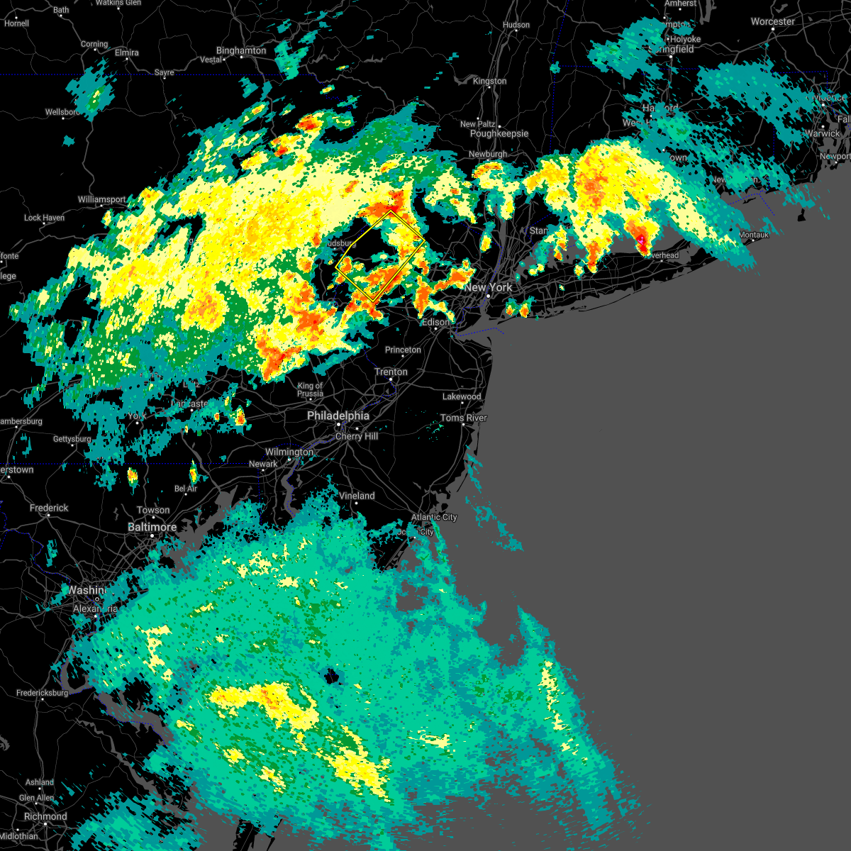 The severe thunderstorm warning for northern hunterdon, northwestern morris, southwestern sussex, warren and northeastern northampton counties will expire at 700 pm edt, the severe thunderstorm which prompted the warning has weakened. therefore, the warning will be allowed to expire. a severe thunderstorm watch remains in effect until 900 pm edt for northern and northwestern new jersey, and eastern pennsylvania. The severe thunderstorm warning for northern hunterdon, northwestern morris, southwestern sussex, warren and northeastern northampton counties will expire at 700 pm edt, the severe thunderstorm which prompted the warning has weakened. therefore, the warning will be allowed to expire. a severe thunderstorm watch remains in effect until 900 pm edt for northern and northwestern new jersey, and eastern pennsylvania.
|
| 7/8/2021 6:40 PM EDT |
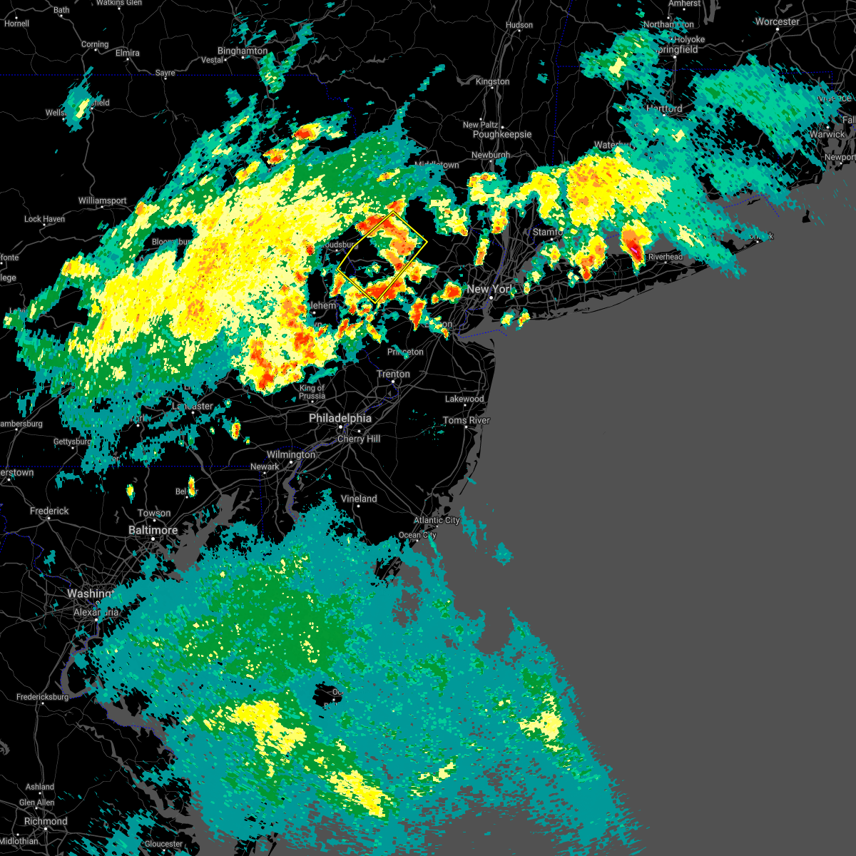 At 637 pm edt, a severe thunderstorm was located over allamuchy-panther valley, or 10 miles southwest of newton, moving northeast at 25 mph (radar indicated). Hazards include 60 mph wind gusts and quarter size hail. Minor damage to vehicles is possible. wind damage to roofs, siding, trees, and power lines is possible. locations impacted include, newton, hopatcong, hackettstown, washington, blairstown, mount arlington, franklin, stanhope, netcong, belvidere, oxford, ogdensburg, hope, glen gardner, hampton, east bangor, branchville, andover, brass castle and lake mohawk. This includes interstate 80 in new jersey between mile markers 2 and 28. At 637 pm edt, a severe thunderstorm was located over allamuchy-panther valley, or 10 miles southwest of newton, moving northeast at 25 mph (radar indicated). Hazards include 60 mph wind gusts and quarter size hail. Minor damage to vehicles is possible. wind damage to roofs, siding, trees, and power lines is possible. locations impacted include, newton, hopatcong, hackettstown, washington, blairstown, mount arlington, franklin, stanhope, netcong, belvidere, oxford, ogdensburg, hope, glen gardner, hampton, east bangor, branchville, andover, brass castle and lake mohawk. This includes interstate 80 in new jersey between mile markers 2 and 28.
|
| 7/8/2021 6:16 PM EDT |
 At 616 pm edt, a severe thunderstorm was located over oxford, or 16 miles northeast of easton, moving northeast at 25 mph (radar indicated). Hazards include 60 mph wind gusts and quarter size hail. Minor damage to vehicles is possible. Wind damage to roofs, siding, trees, and power lines is possible. At 616 pm edt, a severe thunderstorm was located over oxford, or 16 miles northeast of easton, moving northeast at 25 mph (radar indicated). Hazards include 60 mph wind gusts and quarter size hail. Minor damage to vehicles is possible. Wind damage to roofs, siding, trees, and power lines is possible.
|
| 7/6/2021 5:50 PM EDT |
 At 550 pm edt, severe thunderstorms were located along a line extending from near highland lake to budd lake to near kunkletown, moving east at 45 mph (radar indicated). Hazards include 70 mph wind gusts and quarter size hail. Minor damage to vehicles is possible. expect considerable tree damage. wind damage is also likely to mobile homes, roofs, and outbuildings. locations impacted include, easton, newton, dover, hopatcong, forks, kinnelon, east stroudsburg, hackettstown, boonton, wilson, butler, wharton, washington, rockaway, blairstown, nazareth, bangor, mount arlington, franklin and jim thorpe. this includes the following highways, northeast extension between mile markers 79 and 86. interstate 80 in pennsylvania between mile markers 305 and 314. Interstate 80 in new jersey between mile markers 0 and 42. At 550 pm edt, severe thunderstorms were located along a line extending from near highland lake to budd lake to near kunkletown, moving east at 45 mph (radar indicated). Hazards include 70 mph wind gusts and quarter size hail. Minor damage to vehicles is possible. expect considerable tree damage. wind damage is also likely to mobile homes, roofs, and outbuildings. locations impacted include, easton, newton, dover, hopatcong, forks, kinnelon, east stroudsburg, hackettstown, boonton, wilson, butler, wharton, washington, rockaway, blairstown, nazareth, bangor, mount arlington, franklin and jim thorpe. this includes the following highways, northeast extension between mile markers 79 and 86. interstate 80 in pennsylvania between mile markers 305 and 314. Interstate 80 in new jersey between mile markers 0 and 42.
|
| 7/6/2021 5:15 PM EDT |
 At 515 pm edt, severe thunderstorms were located along a line extending from near dingmans ferry to east stroudsburg to sun valley, moving east at 40 mph (radar indicated). Hazards include 70 mph wind gusts and quarter size hail. Minor damage to vehicles is possible. expect considerable tree damage. Wind damage is also likely to mobile homes, roofs, and outbuildings. At 515 pm edt, severe thunderstorms were located along a line extending from near dingmans ferry to east stroudsburg to sun valley, moving east at 40 mph (radar indicated). Hazards include 70 mph wind gusts and quarter size hail. Minor damage to vehicles is possible. expect considerable tree damage. Wind damage is also likely to mobile homes, roofs, and outbuildings.
|
| 6/21/2021 8:55 PM EDT |
 At 854 pm edt, severe thunderstorms were located along a line extending from near high point to budd lake, moving northeast at 40 mph (law enforcement. this line has a history of wind damage in northampton and warren counties). Hazards include 60 mph wind gusts. Damage to roofs, siding, trees, and power lines is possible. locations impacted include, newton, montague, hopatcong, hackettstown, mount arlington, franklin, stanhope, hamburg, netcong, ogdensburg, sussex, branchville, andover, high point, lake mohawk, greendell, vernon valley, green pond, pellettown and allamuchy-panther valley. This includes interstate 80 in new jersey between mile markers 18 and 31. At 854 pm edt, severe thunderstorms were located along a line extending from near high point to budd lake, moving northeast at 40 mph (law enforcement. this line has a history of wind damage in northampton and warren counties). Hazards include 60 mph wind gusts. Damage to roofs, siding, trees, and power lines is possible. locations impacted include, newton, montague, hopatcong, hackettstown, mount arlington, franklin, stanhope, hamburg, netcong, ogdensburg, sussex, branchville, andover, high point, lake mohawk, greendell, vernon valley, green pond, pellettown and allamuchy-panther valley. This includes interstate 80 in new jersey between mile markers 18 and 31.
|
| 6/21/2021 8:42 PM EDT |
 At 842 pm edt, severe thunderstorms were located along a line extending from near hainesville to near oxford, moving northeast at 35 mph (law enforcement. several reports of wind damage have been received from northampton county). Hazards include 60 mph wind gusts. Damage to roofs, siding, trees, and power lines is possible. locations impacted include, newton, montague, hopatcong, hackettstown, washington, blairstown, mount arlington, franklin, stanhope, hamburg, netcong, oxford, ogdensburg, sussex, hope, branchville, andover, high point, lake mohawk and greendell. This includes interstate 80 in new jersey between mile markers 0 and 30. At 842 pm edt, severe thunderstorms were located along a line extending from near hainesville to near oxford, moving northeast at 35 mph (law enforcement. several reports of wind damage have been received from northampton county). Hazards include 60 mph wind gusts. Damage to roofs, siding, trees, and power lines is possible. locations impacted include, newton, montague, hopatcong, hackettstown, washington, blairstown, mount arlington, franklin, stanhope, hamburg, netcong, oxford, ogdensburg, sussex, hope, branchville, andover, high point, lake mohawk and greendell. This includes interstate 80 in new jersey between mile markers 0 and 30.
|
| 6/21/2021 8:30 PM EDT |
 At 830 pm edt, severe thunderstorms were located along a line extending from near lackawaxen to roxburg, moving northeast at 35 mph (law enforcement). Hazards include 60 mph wind gusts. Damage to roofs, siding, trees, and power lines is possible. locations impacted include, easton, newton, montague, hopatcong, east stroudsburg, hackettstown, washington, blairstown, mount arlington, franklin, stanhope, hamburg, netcong, belvidere, harmony, oxford, ogdensburg, alpha, sussex and hope. this includes the following highways, interstate 78 in new jersey between mile markers 0 and 4. interstate 80 in pennsylvania between mile markers 313 and 314. Interstate 80 in new jersey between mile markers 0 and 30. At 830 pm edt, severe thunderstorms were located along a line extending from near lackawaxen to roxburg, moving northeast at 35 mph (law enforcement). Hazards include 60 mph wind gusts. Damage to roofs, siding, trees, and power lines is possible. locations impacted include, easton, newton, montague, hopatcong, east stroudsburg, hackettstown, washington, blairstown, mount arlington, franklin, stanhope, hamburg, netcong, belvidere, harmony, oxford, ogdensburg, alpha, sussex and hope. this includes the following highways, interstate 78 in new jersey between mile markers 0 and 4. interstate 80 in pennsylvania between mile markers 313 and 314. Interstate 80 in new jersey between mile markers 0 and 30.
|
| 6/21/2021 8:13 PM EDT |
 At 812 pm edt, severe thunderstorms were located along a line extending from paupack to near bangor, moving northeast at 45 mph (law enforcement). Hazards include 60 mph wind gusts. damage to roofs, siding, trees, and power lines is possible At 812 pm edt, severe thunderstorms were located along a line extending from paupack to near bangor, moving northeast at 45 mph (law enforcement). Hazards include 60 mph wind gusts. damage to roofs, siding, trees, and power lines is possible
|
| 6/4/2021 1:49 PM EDT |
 At 148 pm edt, a severe thunderstorm was located over stormville, or 15 miles north of easton, moving east at 40 mph (radar indicated). Hazards include 60 mph wind gusts and penny size hail. damage to roofs, siding, trees, and power lines is possible At 148 pm edt, a severe thunderstorm was located over stormville, or 15 miles north of easton, moving east at 40 mph (radar indicated). Hazards include 60 mph wind gusts and penny size hail. damage to roofs, siding, trees, and power lines is possible
|
| 4/28/2021 8:52 PM EDT |
 The severe thunderstorm warning for central sussex county will expire at 900 pm edt, the storm which prompted the warning has moved out of the area. therefore, the warning will be allowed to expire. The severe thunderstorm warning for central sussex county will expire at 900 pm edt, the storm which prompted the warning has moved out of the area. therefore, the warning will be allowed to expire.
|
| 4/28/2021 8:33 PM EDT |
 At 832 pm edt, a severe thunderstorm was located near sussex, or 10 miles northwest of west milford, moving east at 45 mph (radar indicated). Hazards include 60 mph wind gusts and penny size hail. Damage to roofs, siding, trees, and power lines is possible. Locations impacted include, franklin, hamburg, ogdensburg, sussex, branchville, pellettown, crandon lakes, highland lake and vernon valley. At 832 pm edt, a severe thunderstorm was located near sussex, or 10 miles northwest of west milford, moving east at 45 mph (radar indicated). Hazards include 60 mph wind gusts and penny size hail. Damage to roofs, siding, trees, and power lines is possible. Locations impacted include, franklin, hamburg, ogdensburg, sussex, branchville, pellettown, crandon lakes, highland lake and vernon valley.
|
| 4/28/2021 8:17 PM EDT |
 At 815 pm edt, a severe thunderstorm was located over hainesville, or near montague, moving east at 45 mph (law enforcement. downed trees and power lines have been reported with this storm to the west). Hazards include 60 mph wind gusts and penny size hail. damage to roofs, siding, trees, and power lines is possible At 815 pm edt, a severe thunderstorm was located over hainesville, or near montague, moving east at 45 mph (law enforcement. downed trees and power lines have been reported with this storm to the west). Hazards include 60 mph wind gusts and penny size hail. damage to roofs, siding, trees, and power lines is possible
|
| 4/21/2021 12:51 PM EDT |
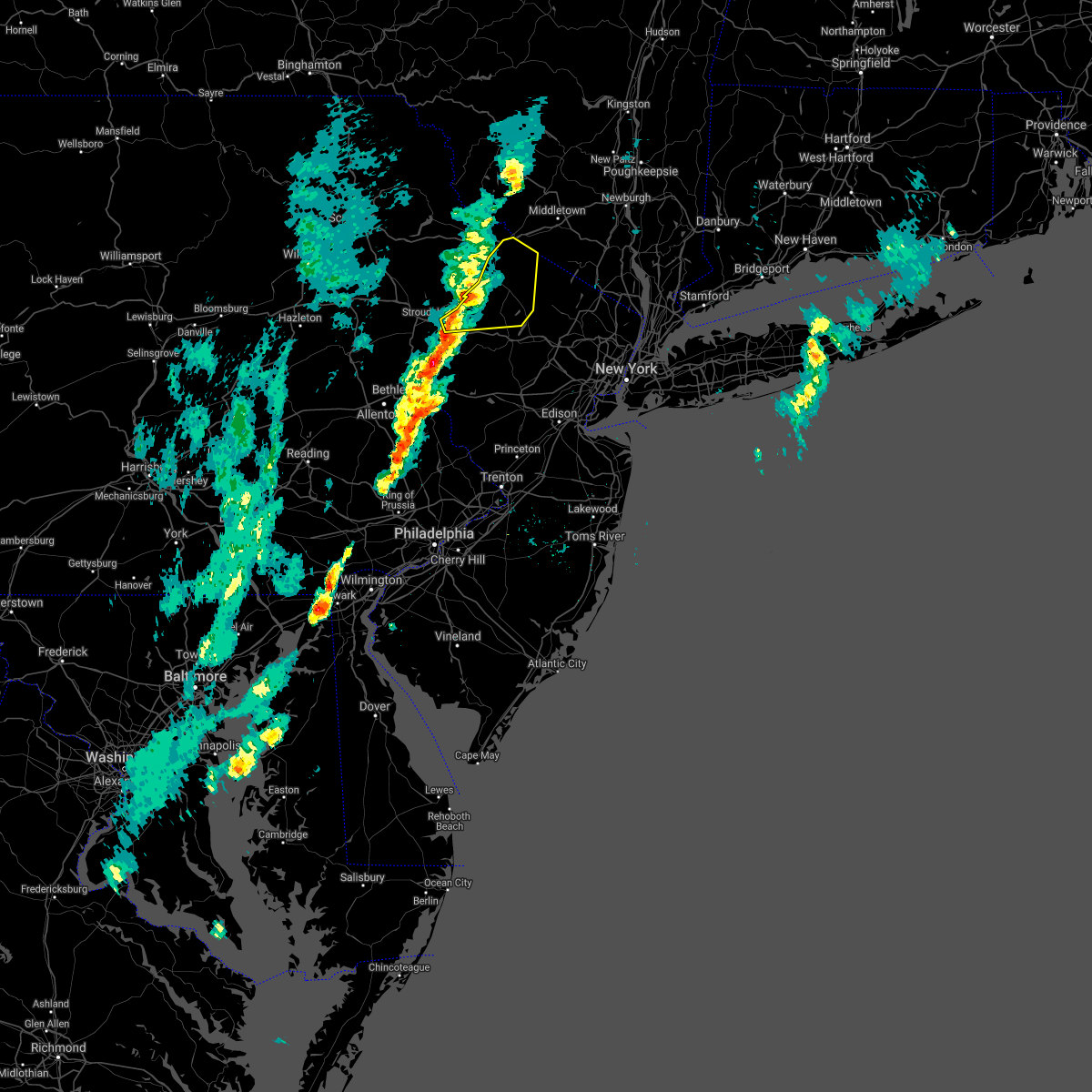 At 1251 pm edt, a severe thunderstorm was located over flatbrookville, or 9 miles west of newton, moving northeast at 35 mph (radar indicated). Hazards include 60 mph wind gusts and quarter size hail. Minor damage to vehicles is possible. Wind damage to roofs, siding, trees, and power lines is possible. At 1251 pm edt, a severe thunderstorm was located over flatbrookville, or 9 miles west of newton, moving northeast at 35 mph (radar indicated). Hazards include 60 mph wind gusts and quarter size hail. Minor damage to vehicles is possible. Wind damage to roofs, siding, trees, and power lines is possible.
|
| 11/15/2020 7:20 PM EST |
 At 718 pm est, intense showers and embedded severe thunderstorms were located along a line extending from near dingmans ferry to harmony to near ottsville to near pottstown, moving east at 60 mph. this line may contain little or no lightning. do not wait until you hear thunder before taking cover (radar indicated). Hazards include 60 mph wind gusts. Damage to roofs, siding, trees, and power lines is possible. locations impacted include, easton, newton, montague, bethlehem, pottstown, dover, phoenixville, lansdale, west norriton, hopatcong, forks, east norriton, east stroudsburg, hackettstown, quakertown, perkasie, doylestown, byram, wilson and hatboro. this includes the following highways, pennsylvania turnpike between mile markers 342 and 347. northeast extension between mile markers 23 and 48. interstate 78 in pennsylvania between mile markers 62 and 76. interstate 78 in new jersey between mile markers 0 and 25. interstate 80 in pennsylvania between mile markers 309 and 314. Interstate 80 in new jersey between mile markers 0 and 38. At 718 pm est, intense showers and embedded severe thunderstorms were located along a line extending from near dingmans ferry to harmony to near ottsville to near pottstown, moving east at 60 mph. this line may contain little or no lightning. do not wait until you hear thunder before taking cover (radar indicated). Hazards include 60 mph wind gusts. Damage to roofs, siding, trees, and power lines is possible. locations impacted include, easton, newton, montague, bethlehem, pottstown, dover, phoenixville, lansdale, west norriton, hopatcong, forks, east norriton, east stroudsburg, hackettstown, quakertown, perkasie, doylestown, byram, wilson and hatboro. this includes the following highways, pennsylvania turnpike between mile markers 342 and 347. northeast extension between mile markers 23 and 48. interstate 78 in pennsylvania between mile markers 62 and 76. interstate 78 in new jersey between mile markers 0 and 25. interstate 80 in pennsylvania between mile markers 309 and 314. Interstate 80 in new jersey between mile markers 0 and 38.
|
| 11/15/2020 6:44 PM EST |
 At 643 pm est, intense showers and some embedded severe thunderstorms were located along a line extending from near sterling to near jordan valley to near fleetwood to near terre hill, moving northeast at 70 mph. this line may contain little or no lightning. do not wait until you hear thunder before taking cover (radar indicated). Hazards include 60 mph wind gusts. damage to roofs, siding, trees, and power lines is possible At 643 pm est, intense showers and some embedded severe thunderstorms were located along a line extending from near sterling to near jordan valley to near fleetwood to near terre hill, moving northeast at 70 mph. this line may contain little or no lightning. do not wait until you hear thunder before taking cover (radar indicated). Hazards include 60 mph wind gusts. damage to roofs, siding, trees, and power lines is possible
|
| 8/18/2020 1:38 AM EDT |
 At 137 am edt, severe thunderstorms were located along a line extending from branchville to beatyestown to ferndale, moving east at 30 mph (radar indicated). Hazards include 60 mph wind gusts. damage to roofs, siding, trees, and power lines is possible At 137 am edt, severe thunderstorms were located along a line extending from branchville to beatyestown to ferndale, moving east at 30 mph (radar indicated). Hazards include 60 mph wind gusts. damage to roofs, siding, trees, and power lines is possible
|
| 8/18/2020 1:35 AM EDT |
 At 135 am edt, severe thunderstorms were located along a line extending from near lake mohawk to hackettstown to pleasant valley, moving east at 30 mph (radar indicated). Hazards include 60 mph wind gusts and penny size hail. Damage to roofs, siding, trees, and power lines is possible. locations impacted include, newton, hopatcong, hackettstown, washington, mount arlington, franklin, high bridge, stanhope, hamburg, netcong, clinton, belvidere, harmony, oxford, ogdensburg, hope, glen gardner, hampton, lebanon and califon. this includes the following highways, interstate 78 in new jersey between mile markers 15 and 22. Interstate 80 in new jersey between mile markers 11 and 30. At 135 am edt, severe thunderstorms were located along a line extending from near lake mohawk to hackettstown to pleasant valley, moving east at 30 mph (radar indicated). Hazards include 60 mph wind gusts and penny size hail. Damage to roofs, siding, trees, and power lines is possible. locations impacted include, newton, hopatcong, hackettstown, washington, mount arlington, franklin, high bridge, stanhope, hamburg, netcong, clinton, belvidere, harmony, oxford, ogdensburg, hope, glen gardner, hampton, lebanon and califon. this includes the following highways, interstate 78 in new jersey between mile markers 15 and 22. Interstate 80 in new jersey between mile markers 11 and 30.
|
| 8/18/2020 1:09 AM EDT |
 At 109 am edt, severe thunderstorms were located along a line extending from flatbrookville to near columbia to belfast, moving east at 30 mph (radar indicated). Hazards include 60 mph wind gusts and penny size hail. Damage to roofs, siding, trees, and power lines is possible. locations impacted include, newton, hopatcong, hackettstown, washington, blairstown, bangor, mount arlington, franklin, high bridge, stanhope, pen argyl, hamburg, netcong, wind gap, clinton, belvidere, harmony, oxford, ogdensburg and sussex. this includes the following highways, interstate 78 in new jersey between mile markers 15 and 22. interstate 80 in pennsylvania near mile marker 314. Interstate 80 in new jersey between mile markers 0 and 30. At 109 am edt, severe thunderstorms were located along a line extending from flatbrookville to near columbia to belfast, moving east at 30 mph (radar indicated). Hazards include 60 mph wind gusts and penny size hail. Damage to roofs, siding, trees, and power lines is possible. locations impacted include, newton, hopatcong, hackettstown, washington, blairstown, bangor, mount arlington, franklin, high bridge, stanhope, pen argyl, hamburg, netcong, wind gap, clinton, belvidere, harmony, oxford, ogdensburg and sussex. this includes the following highways, interstate 78 in new jersey between mile markers 15 and 22. interstate 80 in pennsylvania near mile marker 314. Interstate 80 in new jersey between mile markers 0 and 30.
|
| 8/18/2020 1:02 AM EDT |
 At 102 am edt, severe thunderstorms were located along a line extending from bushkill to near columbia to near belfast, moving east at 30 mph (radar indicated). Hazards include 60 mph wind gusts and penny size hail. Damage to roofs, siding, trees, and power lines is possible. locations impacted include, newton, mount pocono, hopatcong, east stroudsburg, hackettstown, washington, blairstown, bangor, mount arlington, franklin, high bridge, stanhope, pen argyl, hamburg, netcong, wind gap, clinton, belvidere, harmony and oxford. this includes the following highways, interstate 78 in new jersey between mile markers 15 and 22. interstate 80 in pennsylvania between mile markers 296 and 314. interstate 80 in new jersey between mile markers 0 and 30. Interstate 380 in pennsylvania between mile markers 0 and 5. At 102 am edt, severe thunderstorms were located along a line extending from bushkill to near columbia to near belfast, moving east at 30 mph (radar indicated). Hazards include 60 mph wind gusts and penny size hail. Damage to roofs, siding, trees, and power lines is possible. locations impacted include, newton, mount pocono, hopatcong, east stroudsburg, hackettstown, washington, blairstown, bangor, mount arlington, franklin, high bridge, stanhope, pen argyl, hamburg, netcong, wind gap, clinton, belvidere, harmony and oxford. this includes the following highways, interstate 78 in new jersey between mile markers 15 and 22. interstate 80 in pennsylvania between mile markers 296 and 314. interstate 80 in new jersey between mile markers 0 and 30. Interstate 380 in pennsylvania between mile markers 0 and 5.
|
| 8/18/2020 12:39 AM EDT |
 The national weather service in mount holly nj has issued a * severe thunderstorm warning for. western morris county in northern new jersey. northeastern hunterdon county in northwestern new jersey. sussex county in northwestern new jersey. Warren county in northwestern new jersey. The national weather service in mount holly nj has issued a * severe thunderstorm warning for. western morris county in northern new jersey. northeastern hunterdon county in northwestern new jersey. sussex county in northwestern new jersey. Warren county in northwestern new jersey.
|
| 8/18/2020 12:39 AM EDT |
 At 1238 am edt, severe thunderstorms were located along a line extending from near skytop to near reeders to near rossland, moving east at 30 mph (radar indicated). Hazards include 60 mph wind gusts and penny size hail. damage to roofs, siding, trees, and power lines is possible At 1238 am edt, severe thunderstorms were located along a line extending from near skytop to near reeders to near rossland, moving east at 30 mph (radar indicated). Hazards include 60 mph wind gusts and penny size hail. damage to roofs, siding, trees, and power lines is possible
|
| 7/22/2020 3:04 PM EDT |
 At 303 pm edt, a severe thunderstorm was located over dingmans ferry, or 7 miles southwest of montague, moving northeast at 30 mph (radar indicated). Hazards include 70 mph wind gusts and quarter size hail. Minor damage to vehicles is possible. expect considerable tree damage. Wind damage is also likely to mobile homes, roofs, and outbuildings. At 303 pm edt, a severe thunderstorm was located over dingmans ferry, or 7 miles southwest of montague, moving northeast at 30 mph (radar indicated). Hazards include 70 mph wind gusts and quarter size hail. Minor damage to vehicles is possible. expect considerable tree damage. Wind damage is also likely to mobile homes, roofs, and outbuildings.
|
| 7/6/2020 7:48 PM EDT |
 At 747 pm edt, a severe thunderstorm was located over dingmans ferry, or near montague, moving southeast at 15 mph (radar indicated). Hazards include 60 mph wind gusts and quarter size hail. Minor damage to vehicles is possible. wind damage to roofs, siding, trees, and power lines is possible. Locations impacted include, newton, blairstown, franklin, ogdensburg, branchville, andover, flatbrookville, werry lake, greendell, millbrook, five points, crandon lakes, echo lake, hainesville, lake mohawk and hidden lake. At 747 pm edt, a severe thunderstorm was located over dingmans ferry, or near montague, moving southeast at 15 mph (radar indicated). Hazards include 60 mph wind gusts and quarter size hail. Minor damage to vehicles is possible. wind damage to roofs, siding, trees, and power lines is possible. Locations impacted include, newton, blairstown, franklin, ogdensburg, branchville, andover, flatbrookville, werry lake, greendell, millbrook, five points, crandon lakes, echo lake, hainesville, lake mohawk and hidden lake.
|
| 7/6/2020 7:48 PM EDT |
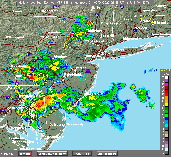 At 747 pm edt, a severe thunderstorm was located over dingmans ferry, or near montague, moving southeast at 15 mph (radar indicated). Hazards include 60 mph wind gusts and quarter size hail. Minor damage to vehicles is possible. wind damage to roofs, siding, trees, and power lines is possible. Locations impacted include, newton, blairstown, franklin, ogdensburg, branchville, andover, flatbrookville, werry lake, greendell, millbrook, five points, crandon lakes, echo lake, hainesville, lake mohawk and hidden lake. At 747 pm edt, a severe thunderstorm was located over dingmans ferry, or near montague, moving southeast at 15 mph (radar indicated). Hazards include 60 mph wind gusts and quarter size hail. Minor damage to vehicles is possible. wind damage to roofs, siding, trees, and power lines is possible. Locations impacted include, newton, blairstown, franklin, ogdensburg, branchville, andover, flatbrookville, werry lake, greendell, millbrook, five points, crandon lakes, echo lake, hainesville, lake mohawk and hidden lake.
|
| 7/6/2020 7:18 PM EDT |
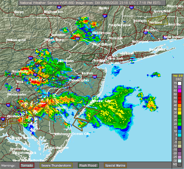 At 716 pm edt, a severe thunderstorm was located near greeley, or 7 miles northwest of montague, moving southeast at 15 mph (radar indicated). Hazards include 60 mph wind gusts and half dollar size hail. Minor damage to vehicles is possible. Wind damage to roofs, siding, trees, and power lines is possible. At 716 pm edt, a severe thunderstorm was located near greeley, or 7 miles northwest of montague, moving southeast at 15 mph (radar indicated). Hazards include 60 mph wind gusts and half dollar size hail. Minor damage to vehicles is possible. Wind damage to roofs, siding, trees, and power lines is possible.
|
| 7/3/2020 7:08 PM EDT |
 The severe thunderstorm warning for northeastern sussex county will expire at 715 pm edt, the storm which prompted the warning has weakened below severe limits, and no longer poses an immediate threat to life or property. therefore, the warning will be allowed to expire. however, gusty winds and heavy rain are still possible with this thunderstorm. several reports of power lines down have been received in the vernon valley and sussex areas. The severe thunderstorm warning for northeastern sussex county will expire at 715 pm edt, the storm which prompted the warning has weakened below severe limits, and no longer poses an immediate threat to life or property. therefore, the warning will be allowed to expire. however, gusty winds and heavy rain are still possible with this thunderstorm. several reports of power lines down have been received in the vernon valley and sussex areas.
|
| 7/3/2020 6:50 PM EDT |
 At 650 pm edt, a severe thunderstorm was located over vernon valley, or 9 miles northwest of west milford, moving south at 30 mph (radar indicated). Hazards include 60 mph wind gusts and quarter size hail. Minor damage to vehicles is possible. wind damage to roofs, siding, trees, and power lines is possible. Locations impacted include, montague, franklin, hamburg, ogdensburg, sussex, branchville, high point, pellettown, highland lake and vernon valley. At 650 pm edt, a severe thunderstorm was located over vernon valley, or 9 miles northwest of west milford, moving south at 30 mph (radar indicated). Hazards include 60 mph wind gusts and quarter size hail. Minor damage to vehicles is possible. wind damage to roofs, siding, trees, and power lines is possible. Locations impacted include, montague, franklin, hamburg, ogdensburg, sussex, branchville, high point, pellettown, highland lake and vernon valley.
|
| 7/3/2020 6:35 PM EDT |
 At 635 pm edt, a severe thunderstorm was located over unionville, or 8 miles southeast of matamoras, moving south at 30 mph (radar indicated). Hazards include 60 mph wind gusts and quarter size hail. Minor damage to vehicles is possible. Wind damage to roofs, siding, trees, and power lines is possible. At 635 pm edt, a severe thunderstorm was located over unionville, or 8 miles southeast of matamoras, moving south at 30 mph (radar indicated). Hazards include 60 mph wind gusts and quarter size hail. Minor damage to vehicles is possible. Wind damage to roofs, siding, trees, and power lines is possible.
|
| 6/28/2020 1:52 PM EDT |
 The severe thunderstorm warning for northern sussex county will expire at 200 pm edt, the storm which prompted the warning has weakened below severe limits, and is also exiting the warned area. therefore, the warning will be allowed to expire. however small hail and gusty winds are still possible with this thunderstorm before it completely moves out. a severe thunderstorm watch remains in effect until 800 pm edt for northwestern new jersey. to report severe weather, contact your nearest law enforcement agency. they will relay your report to the national weather service mount holly nj. The severe thunderstorm warning for northern sussex county will expire at 200 pm edt, the storm which prompted the warning has weakened below severe limits, and is also exiting the warned area. therefore, the warning will be allowed to expire. however small hail and gusty winds are still possible with this thunderstorm before it completely moves out. a severe thunderstorm watch remains in effect until 800 pm edt for northwestern new jersey. to report severe weather, contact your nearest law enforcement agency. they will relay your report to the national weather service mount holly nj.
|
| 6/28/2020 1:32 PM EDT |
 At 132 pm edt, a severe thunderstorm was located over high point, or near matamoras, moving east at 20 mph (radar indicated). Hazards include ping pong ball size hail and 60 mph wind gusts. People and animals outdoors will be injured. expect hail damage to roofs, siding, windows, and vehicles. wind damage to roofs, siding, trees, and power lines is possible. Locations impacted include, montague, franklin, hamburg, sussex, branchville, high point, pellettown, highland lake, vernon valley, hainesville and crandon lakes. At 132 pm edt, a severe thunderstorm was located over high point, or near matamoras, moving east at 20 mph (radar indicated). Hazards include ping pong ball size hail and 60 mph wind gusts. People and animals outdoors will be injured. expect hail damage to roofs, siding, windows, and vehicles. wind damage to roofs, siding, trees, and power lines is possible. Locations impacted include, montague, franklin, hamburg, sussex, branchville, high point, pellettown, highland lake, vernon valley, hainesville and crandon lakes.
|
| 6/28/2020 1:22 PM EDT |
 At 122 pm edt, a severe thunderstorm was located over hainesville, or near montague, moving east at 20 mph (radar indicated). Hazards include 60 mph wind gusts and quarter size hail. Minor damage to vehicles is possible. Wind damage to roofs, siding, trees, and power lines is possible. At 122 pm edt, a severe thunderstorm was located over hainesville, or near montague, moving east at 20 mph (radar indicated). Hazards include 60 mph wind gusts and quarter size hail. Minor damage to vehicles is possible. Wind damage to roofs, siding, trees, and power lines is possible.
|
| 6/3/2020 8:06 PM EDT |
 The severe thunderstorm warning for sussex, northeastern warren and east central monroe counties will expire at 815 pm edt, the storms which prompted the warning have moved out of the area, however another warning remains in effect to the east. The severe thunderstorm warning for sussex, northeastern warren and east central monroe counties will expire at 815 pm edt, the storms which prompted the warning have moved out of the area, however another warning remains in effect to the east.
|
| 6/3/2020 7:47 PM EDT |
 At 747 pm edt, severe thunderstorms were located along a line extending from near monroe to unionville to sussex to branchville to near werry lake, moving southeast at 45 mph (radar indicated). Hazards include 70 mph wind gusts and penny size hail. Expect considerable tree damage. damage is likely to mobile homes, roofs, and outbuildings. locations impacted include, newton, montague, hopatcong, franklin, stanhope, hamburg, netcong, ogdensburg, sussex, branchville, andover, high point, lake mohawk, werry lake, greendell, millbrook, vernon valley, pellettown, crandon lakes and hainesville. This includes interstate 80 in new jersey between mile markers 21 and 23. At 747 pm edt, severe thunderstorms were located along a line extending from near monroe to unionville to sussex to branchville to near werry lake, moving southeast at 45 mph (radar indicated). Hazards include 70 mph wind gusts and penny size hail. Expect considerable tree damage. damage is likely to mobile homes, roofs, and outbuildings. locations impacted include, newton, montague, hopatcong, franklin, stanhope, hamburg, netcong, ogdensburg, sussex, branchville, andover, high point, lake mohawk, werry lake, greendell, millbrook, vernon valley, pellettown, crandon lakes and hainesville. This includes interstate 80 in new jersey between mile markers 21 and 23.
|
| 6/3/2020 7:40 PM EDT |
 At 740 pm edt, severe thunderstorms were located along a line extending from near chester to high point to near sussex to near crandon lakes to near alpine mountain, moving southeast at 50 mph (radar indicated). Hazards include 60 mph wind gusts and penny size hail. Damage to roofs, siding, trees, and power lines is possible. locations impacted include, newton, montague, hopatcong, franklin, stanhope, hamburg, netcong, ogdensburg, sussex, branchville, andover, high point, lake mohawk, werry lake, greendell, millbrook, vernon valley, pellettown, crandon lakes and hainesville. This includes interstate 80 in new jersey between mile markers 21 and 23. At 740 pm edt, severe thunderstorms were located along a line extending from near chester to high point to near sussex to near crandon lakes to near alpine mountain, moving southeast at 50 mph (radar indicated). Hazards include 60 mph wind gusts and penny size hail. Damage to roofs, siding, trees, and power lines is possible. locations impacted include, newton, montague, hopatcong, franklin, stanhope, hamburg, netcong, ogdensburg, sussex, branchville, andover, high point, lake mohawk, werry lake, greendell, millbrook, vernon valley, pellettown, crandon lakes and hainesville. This includes interstate 80 in new jersey between mile markers 21 and 23.
|
| 6/3/2020 7:11 PM EDT |
 At 710 pm edt, severe thunderstorms were located along a line extending from near rock hill to near eldred to greentown to scranton, moving southeast at 45 mph (radar indicated). Hazards include 60 mph wind gusts and penny size hail. damage to roofs, siding, trees, and power lines is possible At 710 pm edt, severe thunderstorms were located along a line extending from near rock hill to near eldred to greentown to scranton, moving southeast at 45 mph (radar indicated). Hazards include 60 mph wind gusts and penny size hail. damage to roofs, siding, trees, and power lines is possible
|
| 10/31/2019 11:35 PM EDT |
 At 1134 pm edt, severe thunderstorms were located along a line extending from five points to near pleasant valley, moving northeast at 50 mph (radar indicated). Hazards include 60 mph wind gusts. Damage to roofs, siding, trees, and power lines is possible. locations impacted include, port jervis, newton, montague, hopatcong, hackettstown, washington, blairstown, mount arlington, franklin, stanhope, hamburg, netcong, belvidere, oxford, ogdensburg, alpha, sussex, hope, hampton and bloomsbury. this includes the following highways, interstate 78 in new jersey between mile markers 3 and 7. Interstate 80 in new jersey between mile markers 6 and 25. At 1134 pm edt, severe thunderstorms were located along a line extending from five points to near pleasant valley, moving northeast at 50 mph (radar indicated). Hazards include 60 mph wind gusts. Damage to roofs, siding, trees, and power lines is possible. locations impacted include, port jervis, newton, montague, hopatcong, hackettstown, washington, blairstown, mount arlington, franklin, stanhope, hamburg, netcong, belvidere, oxford, ogdensburg, alpha, sussex, hope, hampton and bloomsbury. this includes the following highways, interstate 78 in new jersey between mile markers 3 and 7. Interstate 80 in new jersey between mile markers 6 and 25.
|
| 10/31/2019 10:43 PM EDT |
 At 1043 pm edt, severe thunderstorms were located along a line extending from near werry lake to near hellertown, moving northeast at 65 mph (radar indicated). Hazards include 60 mph wind gusts. damage to roofs, siding, trees, and power lines is possible At 1043 pm edt, severe thunderstorms were located along a line extending from near werry lake to near hellertown, moving northeast at 65 mph (radar indicated). Hazards include 60 mph wind gusts. damage to roofs, siding, trees, and power lines is possible
|
| 8/18/2019 7:07 PM EDT |
 A severe thunderstorm warning remains in effect until 745 pm edt for morris. northeastern hunterdon. sussex. central warren. north central somerset and northeastern northampton counties. At 707 pm edt, severe thunderstorms were located along a line extending from near highland lake to near lake mohawk to near hackettstown, moving east at 40 mph. A severe thunderstorm warning remains in effect until 745 pm edt for morris. northeastern hunterdon. sussex. central warren. north central somerset and northeastern northampton counties. At 707 pm edt, severe thunderstorms were located along a line extending from near highland lake to near lake mohawk to near hackettstown, moving east at 40 mph.
|
| 8/18/2019 6:40 PM EDT |
 The national weather service in mount holly nj has issued a * severe thunderstorm warning for. morris county in northern new jersey. northeastern hunterdon county in northwestern new jersey. sussex county in northwestern new jersey. Warren county in northwestern new jersey. The national weather service in mount holly nj has issued a * severe thunderstorm warning for. morris county in northern new jersey. northeastern hunterdon county in northwestern new jersey. sussex county in northwestern new jersey. Warren county in northwestern new jersey.
|
| 8/7/2019 2:53 PM EDT |
 At 252 pm edt, a severe thunderstorm was located over pellettown, or 7 miles north of newton, moving northeast at 25 mph (radar indicated). Hazards include 60 mph wind gusts and quarter size hail. Minor damage to vehicles is possible. wind damage to roofs, siding, trees, and power lines is possible. Locations impacted include, franklin, hamburg, ogdensburg, sussex, branchville, pellettown and highland lake. At 252 pm edt, a severe thunderstorm was located over pellettown, or 7 miles north of newton, moving northeast at 25 mph (radar indicated). Hazards include 60 mph wind gusts and quarter size hail. Minor damage to vehicles is possible. wind damage to roofs, siding, trees, and power lines is possible. Locations impacted include, franklin, hamburg, ogdensburg, sussex, branchville, pellettown and highland lake.
|
| 8/7/2019 2:38 PM EDT |
 At 237 pm edt, a severe thunderstorm was located over newton, moving northeast at 20 mph (radar indicated). Hazards include 60 mph wind gusts and quarter size hail. Minor damage to vehicles is possible. wind damage to roofs, siding, trees, and power lines is possible. locations impacted include, newton, franklin, hamburg, ogdensburg, sussex, branchville, andover, five points, pellettown, crandon lakes, highland lake and lake mohawk. People attending new jersey state fair should seek safe shelter immediately!. At 237 pm edt, a severe thunderstorm was located over newton, moving northeast at 20 mph (radar indicated). Hazards include 60 mph wind gusts and quarter size hail. Minor damage to vehicles is possible. wind damage to roofs, siding, trees, and power lines is possible. locations impacted include, newton, franklin, hamburg, ogdensburg, sussex, branchville, andover, five points, pellettown, crandon lakes, highland lake and lake mohawk. People attending new jersey state fair should seek safe shelter immediately!.
|
| 8/7/2019 2:27 PM EDT |
 At 226 pm edt, a severe thunderstorm was located over greendell, or near newton, moving northeast at 20 mph (radar indicated). Hazards include 60 mph wind gusts and quarter size hail. Minor damage to vehicles is possible. Wind damage to roofs, siding, trees, and power lines is possible. At 226 pm edt, a severe thunderstorm was located over greendell, or near newton, moving northeast at 20 mph (radar indicated). Hazards include 60 mph wind gusts and quarter size hail. Minor damage to vehicles is possible. Wind damage to roofs, siding, trees, and power lines is possible.
|
| 7/31/2019 5:44 PM EDT |
 The national weather service in mount holly nj has issued a * severe thunderstorm warning for. northwestern sussex county in northwestern new jersey. until 630 pm edt. At 543 pm edt, a severe thunderstorm was located near dingmans ferry, or 12 miles southwest of montague, moving northeast at 15. The national weather service in mount holly nj has issued a * severe thunderstorm warning for. northwestern sussex county in northwestern new jersey. until 630 pm edt. At 543 pm edt, a severe thunderstorm was located near dingmans ferry, or 12 miles southwest of montague, moving northeast at 15.
|
| 7/31/2019 5:12 PM EDT |
 At 512 pm edt, severe thunderstorms were located along a line extending from near lake mohawk to columbia, moving east at 15 mph (radar indicated). Hazards include 60 mph wind gusts and penny size hail. Damage to roofs, siding, trees, and power lines is possible. Locations impacted include, newton, dover, hopatcong, east stroudsburg, hackettstown, wharton, washington, blairstown, bangor, mount arlington, stanhope, netcong, belvidere, oxford, ogdensburg, hope, east bangor, branchville, andover and brass castle. At 512 pm edt, severe thunderstorms were located along a line extending from near lake mohawk to columbia, moving east at 15 mph (radar indicated). Hazards include 60 mph wind gusts and penny size hail. Damage to roofs, siding, trees, and power lines is possible. Locations impacted include, newton, dover, hopatcong, east stroudsburg, hackettstown, wharton, washington, blairstown, bangor, mount arlington, stanhope, netcong, belvidere, oxford, ogdensburg, hope, east bangor, branchville, andover and brass castle.
|
| 7/31/2019 4:52 PM EDT |
 At 451 pm edt, severe thunderstorms were located along a line extending from newton to near east stroudsburg, moving east at 15 mph (radar indicated). Hazards include 60 mph wind gusts and penny size hail. damage to roofs, siding, trees, and power lines is possible At 451 pm edt, severe thunderstorms were located along a line extending from newton to near east stroudsburg, moving east at 15 mph (radar indicated). Hazards include 60 mph wind gusts and penny size hail. damage to roofs, siding, trees, and power lines is possible
|
| 7/22/2019 5:07 PM EDT |
 At 506 pm edt, severe thunderstorms were located along a line extending from near lake telemark to beatyestown, moving east at 30 mph (law enforcement. several reports of trees and wires down have been received from mansfield township and blairstown township as these storms passed). Hazards include 60 mph wind gusts and penny size hail. Damage to roofs, siding, trees, and power lines is possible. Locations impacted include, port jervis, newton, montague, hopatcong, hackettstown, washington, blairstown, mount arlington, franklin, stanhope, hamburg, netcong, belvidere, harmony, oxford, ogdensburg, alpha, sussex, hope and milford. At 506 pm edt, severe thunderstorms were located along a line extending from near lake telemark to beatyestown, moving east at 30 mph (law enforcement. several reports of trees and wires down have been received from mansfield township and blairstown township as these storms passed). Hazards include 60 mph wind gusts and penny size hail. Damage to roofs, siding, trees, and power lines is possible. Locations impacted include, port jervis, newton, montague, hopatcong, hackettstown, washington, blairstown, mount arlington, franklin, stanhope, hamburg, netcong, belvidere, harmony, oxford, ogdensburg, alpha, sussex, hope and milford.
|
| 7/22/2019 4:43 PM EDT |
 At 443 pm edt, severe thunderstorms were located along a line extending from near franklin to allamuchy-panther valley, moving northeast at 35 mph (radar indicated). Hazards include 60 mph wind gusts and penny size hail. Damage to roofs, siding, trees, and power lines is possible. Locations impacted include, port jervis, newton, montague, hopatcong, hackettstown, washington, blairstown, mount arlington, franklin, stanhope, hamburg, netcong, belvidere, harmony, oxford, ogdensburg, alpha, sussex, hope and milford. At 443 pm edt, severe thunderstorms were located along a line extending from near franklin to allamuchy-panther valley, moving northeast at 35 mph (radar indicated). Hazards include 60 mph wind gusts and penny size hail. Damage to roofs, siding, trees, and power lines is possible. Locations impacted include, port jervis, newton, montague, hopatcong, hackettstown, washington, blairstown, mount arlington, franklin, stanhope, hamburg, netcong, belvidere, harmony, oxford, ogdensburg, alpha, sussex, hope and milford.
|
| 7/22/2019 4:24 PM EDT |
 At 424 pm edt, severe thunderstorms were located along a line extending from andover to oxford, moving northeast at 35 mph (radar indicated). Hazards include 60 mph wind gusts and penny size hail. damage to roofs, siding, trees, and power lines is possible At 424 pm edt, severe thunderstorms were located along a line extending from andover to oxford, moving northeast at 35 mph (radar indicated). Hazards include 60 mph wind gusts and penny size hail. damage to roofs, siding, trees, and power lines is possible
|
| 7/22/2019 3:06 PM EDT |
 At 306 pm edt, severe thunderstorms were located along a line extending from near florida to hackettstown, moving east at 20 mph (radar indicated). Hazards include 60 mph wind gusts and half dollar size hail. Minor damage to vehicles is possible. wind damage to roofs, siding, trees, and power lines is possible. Locations impacted include, port jervis, newton, montague, dover, hopatcong, hackettstown, wharton, rockaway, mount arlington, franklin, mendham, stanhope, hamburg, netcong, ogdensburg, sussex, victory gardens, branchville, andover and high point. At 306 pm edt, severe thunderstorms were located along a line extending from near florida to hackettstown, moving east at 20 mph (radar indicated). Hazards include 60 mph wind gusts and half dollar size hail. Minor damage to vehicles is possible. wind damage to roofs, siding, trees, and power lines is possible. Locations impacted include, port jervis, newton, montague, dover, hopatcong, hackettstown, wharton, rockaway, mount arlington, franklin, mendham, stanhope, hamburg, netcong, ogdensburg, sussex, victory gardens, branchville, andover and high point.
|
| 7/22/2019 2:49 PM EDT |
 At 249 pm edt, severe thunderstorms were located along a line extending from near unionville to great meadows-vienna, moving east at 20 mph (radar indicated). Hazards include 60 mph wind gusts and half dollar size hail. Minor damage to vehicles is possible. wind damage to roofs, siding, trees, and power lines is possible. Locations impacted include, port jervis, newton, montague, dover, hopatcong, hackettstown, wharton, rockaway, mount arlington, franklin, mendham, stanhope, hamburg, netcong, oxford, ogdensburg, sussex, hope, chester and victory gardens. At 249 pm edt, severe thunderstorms were located along a line extending from near unionville to great meadows-vienna, moving east at 20 mph (radar indicated). Hazards include 60 mph wind gusts and half dollar size hail. Minor damage to vehicles is possible. wind damage to roofs, siding, trees, and power lines is possible. Locations impacted include, port jervis, newton, montague, dover, hopatcong, hackettstown, wharton, rockaway, mount arlington, franklin, mendham, stanhope, hamburg, netcong, oxford, ogdensburg, sussex, hope, chester and victory gardens.
|
| 7/22/2019 2:35 PM EDT |
 At 234 pm edt, severe thunderstorms were located along a line extending from near high point to near oxford, moving east at 20 mph (radar indicated). Hazards include 60 mph wind gusts and penny size hail. damage to roofs, siding, trees, and power lines is possible At 234 pm edt, severe thunderstorms were located along a line extending from near high point to near oxford, moving east at 20 mph (radar indicated). Hazards include 60 mph wind gusts and penny size hail. damage to roofs, siding, trees, and power lines is possible
|
| 7/20/2019 7:10 PM EDT |
 At 709 pm edt, a severe thunderstorm was located over pellettown, or 9 miles northeast of newton, moving east at 15 mph (radar indicated). Hazards include 60 mph wind gusts. Damage to roofs, siding, trees, and power lines is possible. Locations impacted include, franklin, hamburg, ogdensburg, sussex, branchville, high point and pellettown. At 709 pm edt, a severe thunderstorm was located over pellettown, or 9 miles northeast of newton, moving east at 15 mph (radar indicated). Hazards include 60 mph wind gusts. Damage to roofs, siding, trees, and power lines is possible. Locations impacted include, franklin, hamburg, ogdensburg, sussex, branchville, high point and pellettown.
|
| 7/20/2019 7:08 PM EDT | Several trees reported down blocking cr-519 near branchville. time estimated from rada in sussex county NJ, 0.2 miles SSE of Branchville, NJ |
| 7/20/2019 6:54 PM EDT |
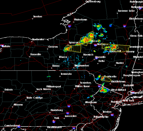 At 654 pm edt, a severe thunderstorm was located near branchville, or 8 miles southeast of montague, moving east at 15 mph (radar indicated). Hazards include 60 mph wind gusts. damage to roofs, siding, trees, and power lines is possible At 654 pm edt, a severe thunderstorm was located near branchville, or 8 miles southeast of montague, moving east at 15 mph (radar indicated). Hazards include 60 mph wind gusts. damage to roofs, siding, trees, and power lines is possible
|
| 7/17/2019 7:00 PM EDT |
 At 659 pm edt, severe thunderstorms were located along a line extending from hamburg to ogdensburg to near stanhope, moving east at 40 mph (radar indicated). Hazards include 60 mph wind gusts and penny size hail. Damage to roofs, siding, trees, and power lines is possible. Locations impacted include, newton, dover, hopatcong, kinnelon, hackettstown, butler, wharton, rockaway, mount arlington, franklin, mountain lakes, stanhope, riverdale, hamburg, netcong, ogdensburg, sussex, victory gardens, branchville and andover. At 659 pm edt, severe thunderstorms were located along a line extending from hamburg to ogdensburg to near stanhope, moving east at 40 mph (radar indicated). Hazards include 60 mph wind gusts and penny size hail. Damage to roofs, siding, trees, and power lines is possible. Locations impacted include, newton, dover, hopatcong, kinnelon, hackettstown, butler, wharton, rockaway, mount arlington, franklin, mountain lakes, stanhope, riverdale, hamburg, netcong, ogdensburg, sussex, victory gardens, branchville and andover.
|
| 7/17/2019 6:39 PM EDT |
 At 639 pm edt, severe thunderstorms were located along a line extending from branchville to near five points to near hope, moving east at 40 mph (radar indicated). Hazards include 60 mph wind gusts and penny size hail. damage to roofs, siding, trees, and power lines is possible At 639 pm edt, severe thunderstorms were located along a line extending from branchville to near five points to near hope, moving east at 40 mph (radar indicated). Hazards include 60 mph wind gusts and penny size hail. damage to roofs, siding, trees, and power lines is possible
|
| 7/17/2019 2:15 PM EDT |
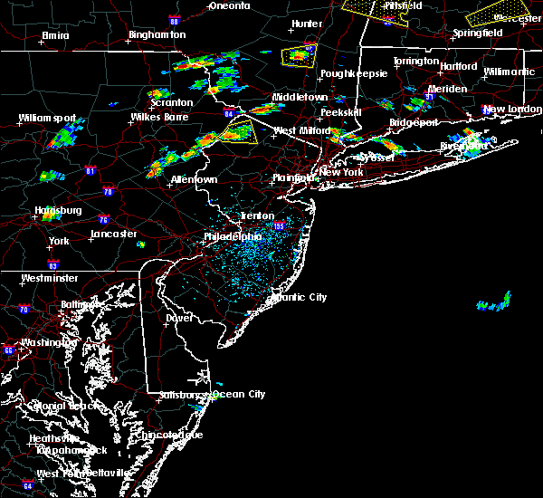 At 215 pm edt, a severe thunderstorm was located over crandon lakes, or 8 miles northwest of newton, moving east at 15 mph (radar indicated). Hazards include 60 mph wind gusts and penny size hail. Damage to roofs, siding, trees, and power lines is possible. Locations impacted include, newton, franklin, ogdensburg, sussex, branchville, flatbrookville, five points, pellettown and crandon lakes. At 215 pm edt, a severe thunderstorm was located over crandon lakes, or 8 miles northwest of newton, moving east at 15 mph (radar indicated). Hazards include 60 mph wind gusts and penny size hail. Damage to roofs, siding, trees, and power lines is possible. Locations impacted include, newton, franklin, ogdensburg, sussex, branchville, flatbrookville, five points, pellettown and crandon lakes.
|
| 7/17/2019 1:57 PM EDT |
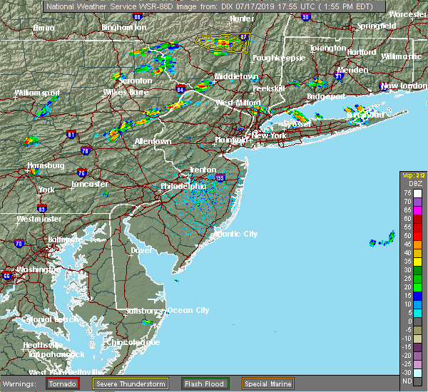 At 157 pm edt, a severe thunderstorm was located over flatbrookville, or 11 miles west of newton, moving east at 15 mph (radar indicated). Hazards include 60 mph wind gusts and penny size hail. damage to roofs, siding, trees, and power lines is possible At 157 pm edt, a severe thunderstorm was located over flatbrookville, or 11 miles west of newton, moving east at 15 mph (radar indicated). Hazards include 60 mph wind gusts and penny size hail. damage to roofs, siding, trees, and power lines is possible
|
| 7/6/2019 6:55 PM EDT |
 The severe thunderstorm warning for sussex, warren, berks, lehigh, southeastern carbon, monroe and northampton counties will expire at 700 pm edt, the storms which prompted the warning continue to move to the southeast. a new severe thunderstorm warning is in effect for these counties until 8:00 pm edt. to report severe weather, contact your nearest law enforcement agency. they will relay your report to the national weather service mount holly nj. The severe thunderstorm warning for sussex, warren, berks, lehigh, southeastern carbon, monroe and northampton counties will expire at 700 pm edt, the storms which prompted the warning continue to move to the southeast. a new severe thunderstorm warning is in effect for these counties until 8:00 pm edt. to report severe weather, contact your nearest law enforcement agency. they will relay your report to the national weather service mount holly nj.
|
| 7/6/2019 6:53 PM EDT |
 At 653 pm edt, severe thunderstorms were located along a line extending from near unionville to near nazareth to near cornwall, moving southeast at 25 mph (radar indicated). Hazards include 60 mph wind gusts. damage to roofs, siding, trees, and power lines is possible At 653 pm edt, severe thunderstorms were located along a line extending from near unionville to near nazareth to near cornwall, moving southeast at 25 mph (radar indicated). Hazards include 60 mph wind gusts. damage to roofs, siding, trees, and power lines is possible
|
| 7/6/2019 6:22 PM EDT |
 At 622 pm edt, severe thunderstorms were located along a line extending from near matamoras to beltzville state park to near palmyra, moving southeast at 30 mph (radar indicated). Hazards include 60 mph wind gusts. damage to roofs, siding, trees, and power lines is possible At 622 pm edt, severe thunderstorms were located along a line extending from near matamoras to beltzville state park to near palmyra, moving southeast at 30 mph (radar indicated). Hazards include 60 mph wind gusts. damage to roofs, siding, trees, and power lines is possible
|
| 5/28/2019 7:39 PM EDT |
 At 738 pm edt, a severe thunderstorm was located near bushkill, or 16 miles southwest of montague, moving southeast at 45 mph (radar indicated). Hazards include 60 mph wind gusts and quarter size hail. Minor damage to vehicles is possible. Wind damage to roofs, siding, trees, and power lines is possible. At 738 pm edt, a severe thunderstorm was located near bushkill, or 16 miles southwest of montague, moving southeast at 45 mph (radar indicated). Hazards include 60 mph wind gusts and quarter size hail. Minor damage to vehicles is possible. Wind damage to roofs, siding, trees, and power lines is possible.
|
| 5/19/2019 8:22 PM EDT |
 At 821 pm edt, severe thunderstorms were located along a line extending from near otisville to near sussex to near andover, moving east at 35 mph (radar indicated). Hazards include 60 mph wind gusts and quarter size hail. Minor damage to vehicles is possible. wind damage to roofs, siding, trees, and power lines is possible. Locations impacted include, port jervis, newton, montague, hopatcong, franklin, hamburg, ogdensburg, sussex, branchville, andover, flatbrookville, high point, lake mohawk, greendell, vernon valley, five points, green pond, pellettown, crandon lakes and highland lake. At 821 pm edt, severe thunderstorms were located along a line extending from near otisville to near sussex to near andover, moving east at 35 mph (radar indicated). Hazards include 60 mph wind gusts and quarter size hail. Minor damage to vehicles is possible. wind damage to roofs, siding, trees, and power lines is possible. Locations impacted include, port jervis, newton, montague, hopatcong, franklin, hamburg, ogdensburg, sussex, branchville, andover, flatbrookville, high point, lake mohawk, greendell, vernon valley, five points, green pond, pellettown, crandon lakes and highland lake.
|
| 5/19/2019 8:00 PM EDT | Tree down on layton-hainesville road in sandyston twp. time estimated from rada in sussex county NJ, 6.8 miles SSE of Branchville, NJ |
| 5/19/2019 7:52 PM EDT |
 At 752 pm edt, severe thunderstorms were located along a line extending from milford to dingmans ferry to near columbia, moving east at 35 mph (radar indicated). Hazards include 60 mph wind gusts and quarter size hail. Minor damage to vehicles is possible. Wind damage to roofs, siding, trees, and power lines is possible. At 752 pm edt, severe thunderstorms were located along a line extending from milford to dingmans ferry to near columbia, moving east at 35 mph (radar indicated). Hazards include 60 mph wind gusts and quarter size hail. Minor damage to vehicles is possible. Wind damage to roofs, siding, trees, and power lines is possible.
|
| 10/2/2018 8:56 PM EDT |
 At 856 pm edt, a severe thunderstorm was located over five points, or near newton, moving east at 20 mph (radar indicated). Hazards include 60 mph wind gusts. damage to roofs, siding, trees, and power lines is possible At 856 pm edt, a severe thunderstorm was located over five points, or near newton, moving east at 20 mph (radar indicated). Hazards include 60 mph wind gusts. damage to roofs, siding, trees, and power lines is possible
|
| 10/2/2018 7:58 PM EDT |
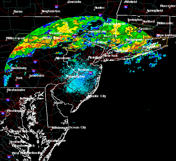 At 757 pm edt, a severe thunderstorm was located over dingmans ferry, or near montague, moving east at 20 mph (radar indicated). Hazards include 60 mph wind gusts. Damage to roofs, siding, trees, and power lines is possible. locations impacted include, port jervis, newton, montague, franklin, hamburg, ogdensburg, sussex, milford, branchville, andover, flatbrookville, high point, lake mohawk, greendell, five points, pellettown, crandon lakes and hainesville. a tornado watch remains in effect until 1100 pm edt for northeastern pennsylvania. A tornado watch also remains in effect until midnight edt for northwestern new jersey. At 757 pm edt, a severe thunderstorm was located over dingmans ferry, or near montague, moving east at 20 mph (radar indicated). Hazards include 60 mph wind gusts. Damage to roofs, siding, trees, and power lines is possible. locations impacted include, port jervis, newton, montague, franklin, hamburg, ogdensburg, sussex, milford, branchville, andover, flatbrookville, high point, lake mohawk, greendell, five points, pellettown, crandon lakes and hainesville. a tornado watch remains in effect until 1100 pm edt for northeastern pennsylvania. A tornado watch also remains in effect until midnight edt for northwestern new jersey.
|
| 10/2/2018 7:42 PM EDT |
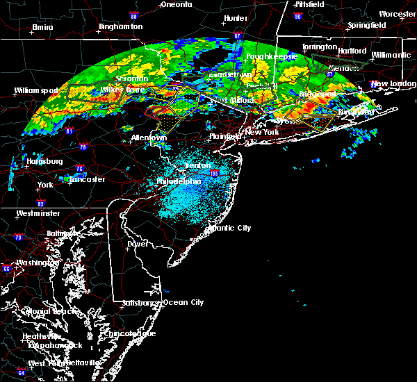 At 741 pm edt, a severe thunderstorm was located over dingmans ferry, or 7 miles southwest of montague, moving east at 25 mph (radar indicated). Hazards include 60 mph wind gusts. Damage to roofs, siding, trees, and power lines is possible. locations impacted include, port jervis, newton, montague, franklin, hamburg, ogdensburg, sussex, milford, branchville, andover, flatbrookville, high point, lake mohawk, greendell, five points, pellettown, crandon lakes and hainesville. a tornado watch remains in effect until 1100 pm edt for northeastern pennsylvania. A tornado watch also remains in effect until midnight edt for northwestern new jersey. At 741 pm edt, a severe thunderstorm was located over dingmans ferry, or 7 miles southwest of montague, moving east at 25 mph (radar indicated). Hazards include 60 mph wind gusts. Damage to roofs, siding, trees, and power lines is possible. locations impacted include, port jervis, newton, montague, franklin, hamburg, ogdensburg, sussex, milford, branchville, andover, flatbrookville, high point, lake mohawk, greendell, five points, pellettown, crandon lakes and hainesville. a tornado watch remains in effect until 1100 pm edt for northeastern pennsylvania. A tornado watch also remains in effect until midnight edt for northwestern new jersey.
|
| 10/2/2018 7:23 PM EDT |
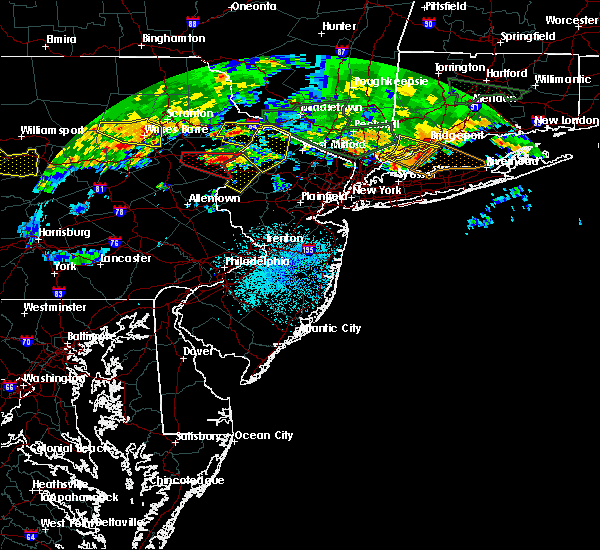 At 722 pm edt, a severe thunderstorm was located near pecks pond, or 14 miles west of montague, moving east at 25 mph (radar indicated). Hazards include 60 mph wind gusts. damage to roofs, siding, trees, and power lines is possible At 722 pm edt, a severe thunderstorm was located near pecks pond, or 14 miles west of montague, moving east at 25 mph (radar indicated). Hazards include 60 mph wind gusts. damage to roofs, siding, trees, and power lines is possible
|
| 9/6/2018 4:52 PM EDT |
 The severe thunderstorm warning for northwestern sussex county will expire at 500 pm edt, the storm which prompted the warning has weakened below severe limits, and no longer poses an immediate threat to life or property. therefore, the warning will be allowed to expire. The severe thunderstorm warning for northwestern sussex county will expire at 500 pm edt, the storm which prompted the warning has weakened below severe limits, and no longer poses an immediate threat to life or property. therefore, the warning will be allowed to expire.
|
| 9/6/2018 4:29 PM EDT |
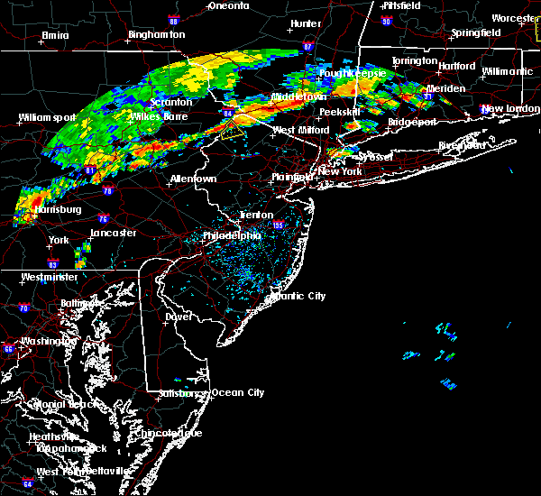 At 428 pm edt, a severe thunderstorm was located over dingmans ferry, or 7 miles southwest of montague, moving southeast at 10 mph (radar indicated). Hazards include 60 mph wind gusts and nickel size hail. damage to roofs, siding, trees, and power lines is possible At 428 pm edt, a severe thunderstorm was located over dingmans ferry, or 7 miles southwest of montague, moving southeast at 10 mph (radar indicated). Hazards include 60 mph wind gusts and nickel size hail. damage to roofs, siding, trees, and power lines is possible
|
| 8/17/2018 6:56 PM EDT |
 The severe thunderstorm warning for western sussex, northern warren and east central monroe counties will expire at 700 pm edt, the storm which prompted the warning has weakened below severe limits, and no longer poses an immediate threat to life or property. therefore, the warning will be allowed to expire. however gusty winds and heavy rain are still possible with this thunderstorm. a severe thunderstorm watch remains in effect until 1100 pm edt for northwestern new jersey, and eastern and northeastern pennsylvania. to report severe weather, contact your nearest law enforcement agency. they will relay your report to the national weather service in mount holly nj. The severe thunderstorm warning for western sussex, northern warren and east central monroe counties will expire at 700 pm edt, the storm which prompted the warning has weakened below severe limits, and no longer poses an immediate threat to life or property. therefore, the warning will be allowed to expire. however gusty winds and heavy rain are still possible with this thunderstorm. a severe thunderstorm watch remains in effect until 1100 pm edt for northwestern new jersey, and eastern and northeastern pennsylvania. to report severe weather, contact your nearest law enforcement agency. they will relay your report to the national weather service in mount holly nj.
|
| 8/17/2018 6:41 PM EDT |
 At 621 pm edt, a severe thunderstorm was located over east bangor, or 14 miles north of easton, moving northeast at 40 mph (public. several reports of wind damage have been received from northampton county during the past 20 minutes). Hazards include 70 mph wind gusts and nickel size hail. Expect considerable tree damage. Damage is likely to mobile homes, roofs, and outbuildings. At 621 pm edt, a severe thunderstorm was located over east bangor, or 14 miles north of easton, moving northeast at 40 mph (public. several reports of wind damage have been received from northampton county during the past 20 minutes). Hazards include 70 mph wind gusts and nickel size hail. Expect considerable tree damage. Damage is likely to mobile homes, roofs, and outbuildings.
|
| 8/17/2018 6:41 PM EDT |
 A severe thunderstorm warning remains in effect until 700 pm edt for western sussex. northern warren and east central monroe counties. at 640 pm edt, a severe thunderstorm was located over blairstown, or 13 miles west of newton, moving northeast at 40 mph. hazard. 70 mph wind gusts and penny size hail. A severe thunderstorm warning remains in effect until 700 pm edt for western sussex. northern warren and east central monroe counties. at 640 pm edt, a severe thunderstorm was located over blairstown, or 13 miles west of newton, moving northeast at 40 mph. hazard. 70 mph wind gusts and penny size hail.
|
| 8/17/2018 6:22 PM EDT |
 At 621 pm edt, a severe thunderstorm was located over east bangor, or 14 miles north of easton, moving northeast at 40 mph (public. several reports of wind damage have been received from northampton county during the past 20 minutes). Hazards include 70 mph wind gusts and nickel size hail. Expect considerable tree damage. Damage is likely to mobile homes, roofs, and outbuildings. At 621 pm edt, a severe thunderstorm was located over east bangor, or 14 miles north of easton, moving northeast at 40 mph (public. several reports of wind damage have been received from northampton county during the past 20 minutes). Hazards include 70 mph wind gusts and nickel size hail. Expect considerable tree damage. Damage is likely to mobile homes, roofs, and outbuildings.
|
| 5/15/2018 4:16 PM EDT |
 At 414 pm edt, a line of severe thunderstorms were located from near newton in sussex county new jersey southwest to near womelsdorf in berks county pennsylvania. the storms were moving east at 65 mph (radar indicated). Hazards include 70 mph wind gusts and quarter size hail. Minor damage to vehicles is possible. expect considerable tree damage. wind damage is also likely to mobile homes, roofs, and outbuildings. Locations impacted include, allentown, reading, easton, port jervis, newton, montague, bethlehem, dover, hopatcong, forks, emmaus, wyomissing, kinnelon, northampton, hackettstown, boonton, wilson, butler, wharton and washington. At 414 pm edt, a line of severe thunderstorms were located from near newton in sussex county new jersey southwest to near womelsdorf in berks county pennsylvania. the storms were moving east at 65 mph (radar indicated). Hazards include 70 mph wind gusts and quarter size hail. Minor damage to vehicles is possible. expect considerable tree damage. wind damage is also likely to mobile homes, roofs, and outbuildings. Locations impacted include, allentown, reading, easton, port jervis, newton, montague, bethlehem, dover, hopatcong, forks, emmaus, wyomissing, kinnelon, northampton, hackettstown, boonton, wilson, butler, wharton and washington.
|
| 5/15/2018 4:14 PM EDT | Multiple social media posts and photos of tree and property damage in branchville. time estimated from rada in sussex county NJ, 0.2 miles SSE of Branchville, NJ |
| 5/15/2018 4:12 PM EDT | Trees dow in sussex county NJ, 1.5 miles W of Branchville, NJ |
| 5/15/2018 3:46 PM EDT |
 At 344 pm edt, an area of severe thunderstorms were moving east from the southern poconos and schuylkill county. th storms are moving east at around 65 mph (radar indicated). Hazards include 70 mph wind gusts and quarter size hail. Minor damage to vehicles is possible. expect considerable tree damage. Wind damage is also likely to mobile homes, roofs, and outbuildings. At 344 pm edt, an area of severe thunderstorms were moving east from the southern poconos and schuylkill county. th storms are moving east at around 65 mph (radar indicated). Hazards include 70 mph wind gusts and quarter size hail. Minor damage to vehicles is possible. expect considerable tree damage. Wind damage is also likely to mobile homes, roofs, and outbuildings.
|
| 8/22/2017 8:37 PM EDT |
 At 837 pm edt, a severe thunderstorm was located near delaware water gap, or 17 miles southeast of mount pocono, moving east at 40 mph (radar indicated). Hazards include 60 mph wind gusts and quarter size hail. Minor damage to vehicles is possible. expect damage to trees and power lines. Locations impacted include, newton, east stroudsburg, blairstown, branchville, andover, flatbrookville, stormville, werry lake, greendell, millbrook, delaware water gap, five points, columbia, crandon lakes, echo lake, stroudsburg, portland, arlington heights, shawnee and marshalls creek. At 837 pm edt, a severe thunderstorm was located near delaware water gap, or 17 miles southeast of mount pocono, moving east at 40 mph (radar indicated). Hazards include 60 mph wind gusts and quarter size hail. Minor damage to vehicles is possible. expect damage to trees and power lines. Locations impacted include, newton, east stroudsburg, blairstown, branchville, andover, flatbrookville, stormville, werry lake, greendell, millbrook, delaware water gap, five points, columbia, crandon lakes, echo lake, stroudsburg, portland, arlington heights, shawnee and marshalls creek.
|
| 8/22/2017 8:12 PM EDT |
 At 812 pm edt, a severe thunderstorm was located over brodheadsville, or 13 miles south of mount pocono, moving east at 40 mph (radar indicated). Hazards include 60 mph wind gusts and quarter size hail. Minor damage to vehicles is possible. Expect damage to trees and power lines. At 812 pm edt, a severe thunderstorm was located over brodheadsville, or 13 miles south of mount pocono, moving east at 40 mph (radar indicated). Hazards include 60 mph wind gusts and quarter size hail. Minor damage to vehicles is possible. Expect damage to trees and power lines.
|
| 7/20/2017 6:50 PM EDT |
 At 649 pm edt, severe thunderstorms were located along a line extending from matamoras to near greendell to near stormville, moving southeast at 35 mph (radar indicated). Hazards include 60 mph wind gusts. Expect damage to trees and power lines. these severe storms will be near, newton and five points around 655 pm edt. greendell, high point and allamuchy-panther valley around 700 pm edt. hackettstown, andover and lake mohawk around 705 pm edt. hopatcong, stanhope and sussex around 710 pm edt. mount arlington, hamburg, netcong, belvidere, hope, vernon valley and budd lake around 715 pm edt. oxford, chester, succasunna-kenvil, succasunna and highland lake around 720 pm edt. dover, wharton, washington, rockaway, victory gardens, brass castle, pleasant valley and great meadows-vienna around 725 pm edt. morris plains, mendham, glen gardner, hampton, califon, upper greenwood lake, beatyestown and long valley around 730 pm edt. Other locations impacted by these severe thunderstorms include portland, white meadow lake, beattyestown, stroudsburg, shawnee, roseto, bernardsville and arlington heights. At 649 pm edt, severe thunderstorms were located along a line extending from matamoras to near greendell to near stormville, moving southeast at 35 mph (radar indicated). Hazards include 60 mph wind gusts. Expect damage to trees and power lines. these severe storms will be near, newton and five points around 655 pm edt. greendell, high point and allamuchy-panther valley around 700 pm edt. hackettstown, andover and lake mohawk around 705 pm edt. hopatcong, stanhope and sussex around 710 pm edt. mount arlington, hamburg, netcong, belvidere, hope, vernon valley and budd lake around 715 pm edt. oxford, chester, succasunna-kenvil, succasunna and highland lake around 720 pm edt. dover, wharton, washington, rockaway, victory gardens, brass castle, pleasant valley and great meadows-vienna around 725 pm edt. morris plains, mendham, glen gardner, hampton, califon, upper greenwood lake, beatyestown and long valley around 730 pm edt. Other locations impacted by these severe thunderstorms include portland, white meadow lake, beattyestown, stroudsburg, shawnee, roseto, bernardsville and arlington heights.
|
| 7/20/2017 6:24 PM EDT |
 At 623 pm edt, severe thunderstorms were located along a line extending from shohola to near werry lake to pocono pines, moving southeast at 35 mph (radar indicated). Hazards include 60 mph wind gusts. Expect damage to trees and power lines. severe thunderstorms will be near, werry lake and echo lake around 635 pm edt. millbrook, flatbrookville and paradise valley around 640 pm edt. port jervis, blairstown, milford, five points, analomink and hernyville around 645 pm edt. montague around 650 pm edt. newton, east stroudsburg, high point and stormville around 655 pm edt. bangor, pen argyl, delaware water gap, andover, greendell, delaware water gap and allamuchy-panther valley around 700 pm edt. hackettstown, east bangor, columbia and lake mohawk around 705 pm edt. hopatcong, stanhope and sussex around 710 pm edt. Other locations impacted by these severe thunderstorms include portland, cresco, marshalls creek, arlington heights, roseto, white meadow lake, hidden lake, beattyestown, stroudsburg and bartonsville. At 623 pm edt, severe thunderstorms were located along a line extending from shohola to near werry lake to pocono pines, moving southeast at 35 mph (radar indicated). Hazards include 60 mph wind gusts. Expect damage to trees and power lines. severe thunderstorms will be near, werry lake and echo lake around 635 pm edt. millbrook, flatbrookville and paradise valley around 640 pm edt. port jervis, blairstown, milford, five points, analomink and hernyville around 645 pm edt. montague around 650 pm edt. newton, east stroudsburg, high point and stormville around 655 pm edt. bangor, pen argyl, delaware water gap, andover, greendell, delaware water gap and allamuchy-panther valley around 700 pm edt. hackettstown, east bangor, columbia and lake mohawk around 705 pm edt. hopatcong, stanhope and sussex around 710 pm edt. Other locations impacted by these severe thunderstorms include portland, cresco, marshalls creek, arlington heights, roseto, white meadow lake, hidden lake, beattyestown, stroudsburg and bartonsville.
|
| 6/19/2017 4:14 PM EDT |
 At 413 pm edt, severe thunderstorms were located along a line extending from near flatbrookville to near newton to near allamuchy-panther valley, moving northeast at 60 mph (radar indicated). Hazards include 60 mph wind gusts. Expect damage to trees and power lines. these severe storms will be near, branchville and lake mohawk around 420 pm edt. montague, wharton, ogdensburg, hainesville and pellettown around 425 pm edt. port jervis, franklin, hamburg, sussex, high point, highland lake and vernon valley around 430 pm edt. Other locations impacted by these severe thunderstorms include beattyestown. At 413 pm edt, severe thunderstorms were located along a line extending from near flatbrookville to near newton to near allamuchy-panther valley, moving northeast at 60 mph (radar indicated). Hazards include 60 mph wind gusts. Expect damage to trees and power lines. these severe storms will be near, branchville and lake mohawk around 420 pm edt. montague, wharton, ogdensburg, hainesville and pellettown around 425 pm edt. port jervis, franklin, hamburg, sussex, high point, highland lake and vernon valley around 430 pm edt. Other locations impacted by these severe thunderstorms include beattyestown.
|
| 6/19/2017 3:53 PM EDT |
 At 352 pm edt, severe thunderstorms were located along a line extending from near alpine mountain to near east bangor to easton, moving northeast at 55 mph (radar indicated). Hazards include 60 mph wind gusts. Expect damage to trees and power lines. severe thunderstorms will be near, delaware water gap, columbia and echo lake around 355 pm edt. hope, werry lake, flatbrookville and millbrook around 400 pm edt. washington, blairstown, oxford and brass castle around 405 pm edt. greendell and crandon lakes around 410 pm edt. newton, hackettstown, andover, hainesville, beatyestown, allamuchy-panther valley, great meadows-vienna and five points around 415 pm edt. montague, branchville and lake mohawk around 420 pm edt. port jervis, stanhope, netcong, ogdensburg, high point, budd lake, pellettown and succasunna-kenvil around 425 pm edt. hopatcong, wharton, mount arlington, franklin, hamburg, sussex, highland lake and vernon valley around 430 pm edt. Other locations impacted by these severe thunderstorms include shawnee, portland, marshalls creek, hidden lake and beattyestown. At 352 pm edt, severe thunderstorms were located along a line extending from near alpine mountain to near east bangor to easton, moving northeast at 55 mph (radar indicated). Hazards include 60 mph wind gusts. Expect damage to trees and power lines. severe thunderstorms will be near, delaware water gap, columbia and echo lake around 355 pm edt. hope, werry lake, flatbrookville and millbrook around 400 pm edt. washington, blairstown, oxford and brass castle around 405 pm edt. greendell and crandon lakes around 410 pm edt. newton, hackettstown, andover, hainesville, beatyestown, allamuchy-panther valley, great meadows-vienna and five points around 415 pm edt. montague, branchville and lake mohawk around 420 pm edt. port jervis, stanhope, netcong, ogdensburg, high point, budd lake, pellettown and succasunna-kenvil around 425 pm edt. hopatcong, wharton, mount arlington, franklin, hamburg, sussex, highland lake and vernon valley around 430 pm edt. Other locations impacted by these severe thunderstorms include shawnee, portland, marshalls creek, hidden lake and beattyestown.
|
| 6/19/2017 3:15 PM EDT |
 At 314 pm edt, severe thunderstorms were located along a line extending from near echo lake to blairstown to near hope, moving northeast at 40 mph (radar indicated). Hazards include 60 mph wind gusts. Expect damage to trees and power lines. these severe storms will be near, millbrook and flatbrookville around 320 pm edt. five points around 330 pm edt. crandon lakes around 335 pm edt. branchville around 340 pm edt. Other locations impacted by these severe thunderstorms include shawnee, hidden lake and portland. At 314 pm edt, severe thunderstorms were located along a line extending from near echo lake to blairstown to near hope, moving northeast at 40 mph (radar indicated). Hazards include 60 mph wind gusts. Expect damage to trees and power lines. these severe storms will be near, millbrook and flatbrookville around 320 pm edt. five points around 330 pm edt. crandon lakes around 335 pm edt. branchville around 340 pm edt. Other locations impacted by these severe thunderstorms include shawnee, hidden lake and portland.
|
| 6/19/2017 2:57 PM EDT |
 At 256 pm edt, severe thunderstorms were located along a line extending from near delaware water gap to near east bangor to near bangor, moving northeast at 40 mph (radar indicated). Hazards include 60 mph wind gusts in a few locations. Expect damage to trees and power lines. severe thunderstorms will be near, delaware water gap and delaware water gap around 300 pm edt. columbia around 310 pm edt. werry lake and echo lake around 315 pm edt. blairstown and flatbrookville around 320 pm edt. millbrook around 330 pm edt. crandon lakes and five points around 335 pm edt. branchville around 340 pm edt. Other locations impacted by these severe thunderstorms include shawnee, portland, roseto and hidden lake. At 256 pm edt, severe thunderstorms were located along a line extending from near delaware water gap to near east bangor to near bangor, moving northeast at 40 mph (radar indicated). Hazards include 60 mph wind gusts in a few locations. Expect damage to trees and power lines. severe thunderstorms will be near, delaware water gap and delaware water gap around 300 pm edt. columbia around 310 pm edt. werry lake and echo lake around 315 pm edt. blairstown and flatbrookville around 320 pm edt. millbrook around 330 pm edt. crandon lakes and five points around 335 pm edt. branchville around 340 pm edt. Other locations impacted by these severe thunderstorms include shawnee, portland, roseto and hidden lake.
|
| 2/25/2017 4:54 PM EST |
 At 453 pm est, severe thunderstorms were located along a line extending from near werry lake to millbrook to pleasant valley to alpha to ottsville, moving northeast at 80 mph (radar indicated). Hazards include 60 mph wind gusts and penny size hail. Expect damage to roofs, siding, and trees. severe thunderstorms will be near, crandon lakes, five points, flatbrookville and millbrook around 500 pm est. hackettstown, clinton, branchville, annandale, hainesville and pellettown around 505 pm est. montague, high bridge, stanhope, netcong, sussex, lebanon, allamuchy-panther valley, beatyestown, great meadows-vienna and high point around 510 pm est. port jervis, hopatcong, peapack and gladstone, far hills, lake mohawk, long valley and greendell around 515 pm est. newton, mendham, chester, andover and succasunna around 520 pm est. dover, wharton, rockaway, morris plains, mount arlington, ogdensburg, victory gardens, highland lake and succasunna-kenvil around 525 pm est. boonton, franklin, mountain lakes, hamburg, lake telemark, upper greenwood lake, green pond and parsippany around 530 pm est. kinnelon, butler, riverdale, vernon valley and pequannock township around 535 pm est. Other locations impacted by these severe thunderstorms include white meadow lake, hidden lake, beattyestown and bernardsville. At 453 pm est, severe thunderstorms were located along a line extending from near werry lake to millbrook to pleasant valley to alpha to ottsville, moving northeast at 80 mph (radar indicated). Hazards include 60 mph wind gusts and penny size hail. Expect damage to roofs, siding, and trees. severe thunderstorms will be near, crandon lakes, five points, flatbrookville and millbrook around 500 pm est. hackettstown, clinton, branchville, annandale, hainesville and pellettown around 505 pm est. montague, high bridge, stanhope, netcong, sussex, lebanon, allamuchy-panther valley, beatyestown, great meadows-vienna and high point around 510 pm est. port jervis, hopatcong, peapack and gladstone, far hills, lake mohawk, long valley and greendell around 515 pm est. newton, mendham, chester, andover and succasunna around 520 pm est. dover, wharton, rockaway, morris plains, mount arlington, ogdensburg, victory gardens, highland lake and succasunna-kenvil around 525 pm est. boonton, franklin, mountain lakes, hamburg, lake telemark, upper greenwood lake, green pond and parsippany around 530 pm est. kinnelon, butler, riverdale, vernon valley and pequannock township around 535 pm est. Other locations impacted by these severe thunderstorms include white meadow lake, hidden lake, beattyestown and bernardsville.
|
| 8/13/2016 11:51 PM EDT |
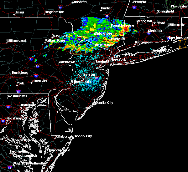 The severe thunderstorm warning for northeastern warren and southwestern sussex counties will expire at midnight edt, the storm which prompted the warning has weakened below severe limits, and no longer pose an immediate threat to life or property. therefore the warning will be allowed to expire. however gusty winds are still possible with this thunderstorm. to report severe weather, contact your nearest law enforcement agency. they will relay your report to the national weather service mount holly nj. The severe thunderstorm warning for northeastern warren and southwestern sussex counties will expire at midnight edt, the storm which prompted the warning has weakened below severe limits, and no longer pose an immediate threat to life or property. therefore the warning will be allowed to expire. however gusty winds are still possible with this thunderstorm. to report severe weather, contact your nearest law enforcement agency. they will relay your report to the national weather service mount holly nj.
|
| 8/13/2016 11:42 PM EDT |
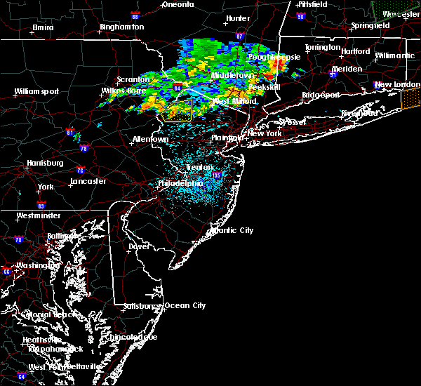 At 1141 pm edt, a severe thunderstorm was located over blairstown, or 11 miles west of newton, moving east at 25 mph (radar indicated). Hazards include 60 mph wind gusts and penny size hail. Expect damage to roofs. siding. and trees. Locations impacted include, newton, hopatcong, blairstown, stanhope, netcong, hope, branchville, andover, millbrook, greendell, crandon lakes, pellettown, flatbrookville, five points, allamuchy-panther valley and lake mohawk. At 1141 pm edt, a severe thunderstorm was located over blairstown, or 11 miles west of newton, moving east at 25 mph (radar indicated). Hazards include 60 mph wind gusts and penny size hail. Expect damage to roofs. siding. and trees. Locations impacted include, newton, hopatcong, blairstown, stanhope, netcong, hope, branchville, andover, millbrook, greendell, crandon lakes, pellettown, flatbrookville, five points, allamuchy-panther valley and lake mohawk.
|
| 8/13/2016 11:26 PM EDT |
 At 1125 pm edt, a severe thunderstorm was located over delaware water gap, or 16 miles southeast of mount pocono, moving east at 25 mph (radar indicated). Hazards include 60 mph wind gusts and penny size hail. Expect damage to roofs. siding. and trees. Locations impacted include, newton, mount pocono, hopatcong, east stroudsburg, hackettstown, tobyhanna, blairstown, bangor, stanhope, pen argyl, netcong, hope, east bangor, branchville, andover, greendell, great meadows-vienna, tannersville, mountainhome and reeders. At 1125 pm edt, a severe thunderstorm was located over delaware water gap, or 16 miles southeast of mount pocono, moving east at 25 mph (radar indicated). Hazards include 60 mph wind gusts and penny size hail. Expect damage to roofs. siding. and trees. Locations impacted include, newton, mount pocono, hopatcong, east stroudsburg, hackettstown, tobyhanna, blairstown, bangor, stanhope, pen argyl, netcong, hope, east bangor, branchville, andover, greendell, great meadows-vienna, tannersville, mountainhome and reeders.
|
| 8/13/2016 11:15 PM EDT |
 At 1114 pm edt, a severe thunderstorm was located over east stroudsburg, or 13 miles southeast of mount pocono, moving east at 25 mph (radar indicated). Hazards include 60 mph wind gusts and quarter size hail. Hail damage to vehicles is expected. Expect wind damage to roofs, siding, and trees. At 1114 pm edt, a severe thunderstorm was located over east stroudsburg, or 13 miles southeast of mount pocono, moving east at 25 mph (radar indicated). Hazards include 60 mph wind gusts and quarter size hail. Hail damage to vehicles is expected. Expect wind damage to roofs, siding, and trees.
|
| 7/25/2016 5:39 PM EDT |
 At 538 pm edt, a severe thunderstorm was located over crandon lakes, or near newton, moving east at 35 mph (radar indicated). Hazards include 60 mph wind gusts and penny size hail. frequent cloud to ground lightning is occurring. Expect damage to roofs. siding. And trees. At 538 pm edt, a severe thunderstorm was located over crandon lakes, or near newton, moving east at 35 mph (radar indicated). Hazards include 60 mph wind gusts and penny size hail. frequent cloud to ground lightning is occurring. Expect damage to roofs. siding. And trees.
|
| 7/25/2016 5:31 PM EDT |
 At 530 pm edt, a severe thunderstorm was located near hainesville, or near montague, moving east at 35 mph (radar indicated). Hazards include 60 mph wind gusts and nickel size hail. frequent lightning is occurring. Expect damage to roofs. siding. and trees. Locations impacted include, port jervis, newton, montague, franklin, hamburg, ogdensburg, sussex, branchville, vernon valley, high point, crandon lakes, hainesville, pellettown, highland lake, lake mohawk and upper greenwood lake. At 530 pm edt, a severe thunderstorm was located near hainesville, or near montague, moving east at 35 mph (radar indicated). Hazards include 60 mph wind gusts and nickel size hail. frequent lightning is occurring. Expect damage to roofs. siding. and trees. Locations impacted include, port jervis, newton, montague, franklin, hamburg, ogdensburg, sussex, branchville, vernon valley, high point, crandon lakes, hainesville, pellettown, highland lake, lake mohawk and upper greenwood lake.
|
| 7/25/2016 5:04 PM EDT |
 At 504 pm edt, a severe thunderstorm was located over pecks pond, or 14 miles west of montague, moving east at 50 mph (radar indicated). Hazards include 60 mph wind gusts and nickel size hail. frequent cloud to ground lightning is occurring. Expect damage to roofs. siding. And trees. At 504 pm edt, a severe thunderstorm was located over pecks pond, or 14 miles west of montague, moving east at 50 mph (radar indicated). Hazards include 60 mph wind gusts and nickel size hail. frequent cloud to ground lightning is occurring. Expect damage to roofs. siding. And trees.
|
| 2/16/2016 1:56 PM EST |
 At 153 pm est, doppler radar indicated a severe thunderstorm capable of producing damaging winds in excess of 60 mph. this storm was located over sussex, or 11 miles northwest of west milford, and moving northeast at 45 mph. severe gusty winds up to 60 mph are possible along the entire line of heavy showers extending from near high point southeast through morris county. * this severe thunderstorm will be near, vernon valley around 200 pm est. other locations impacted by this severe thunderstorm include white meadow lake, hanover township and bernardsville. At 153 pm est, doppler radar indicated a severe thunderstorm capable of producing damaging winds in excess of 60 mph. this storm was located over sussex, or 11 miles northwest of west milford, and moving northeast at 45 mph. severe gusty winds up to 60 mph are possible along the entire line of heavy showers extending from near high point southeast through morris county. * this severe thunderstorm will be near, vernon valley around 200 pm est. other locations impacted by this severe thunderstorm include white meadow lake, hanover township and bernardsville.
|
| 2/16/2016 1:28 PM EST |
 At 127 pm est, doppler radar indicated a severe thunderstorm capable of producing damaging winds in excess of 60 mph. this storm was located over flatbrookville, or 12 miles west of newton, moving northeast at 50 mph. locations impacted include, morristown, newton, dover, madison, hopatcong, florham park, east hanover, lincoln park, kinnelon, hackettstown, boonton, butler, wharton, rockaway, blairstown, morris plains, mount arlington, franklin, mendham and mountain lakes. At 127 pm est, doppler radar indicated a severe thunderstorm capable of producing damaging winds in excess of 60 mph. this storm was located over flatbrookville, or 12 miles west of newton, moving northeast at 50 mph. locations impacted include, morristown, newton, dover, madison, hopatcong, florham park, east hanover, lincoln park, kinnelon, hackettstown, boonton, butler, wharton, rockaway, blairstown, morris plains, mount arlington, franklin, mendham and mountain lakes.
|
| 2/16/2016 1:21 PM EST |
 At 117 pm est, doppler radar indicated a line of heavy showers, some containing strong gusty winds in excess of 60mph, just east of the delaware river. this line was moving east at 45 mph, and will be moving through the northern part of new jersey through the mid afternoon hours. At 117 pm est, doppler radar indicated a line of heavy showers, some containing strong gusty winds in excess of 60mph, just east of the delaware river. this line was moving east at 45 mph, and will be moving through the northern part of new jersey through the mid afternoon hours.
|
| 6/30/2015 7:43 PM EDT |
 At 742 pm edt, doppler radar indicated a severe thunderstorm capable of producing quarter size hail and damaging winds in excess of 60 mph. this storm was located over crandon lakes, or 8 miles northwest of newton. this storm was nearly stationary. locations impacted include, montague, sussex, branchville, hainesville, pellettown and crandon lakes. At 742 pm edt, doppler radar indicated a severe thunderstorm capable of producing quarter size hail and damaging winds in excess of 60 mph. this storm was located over crandon lakes, or 8 miles northwest of newton. this storm was nearly stationary. locations impacted include, montague, sussex, branchville, hainesville, pellettown and crandon lakes.
|
| 6/30/2015 7:13 PM EDT |
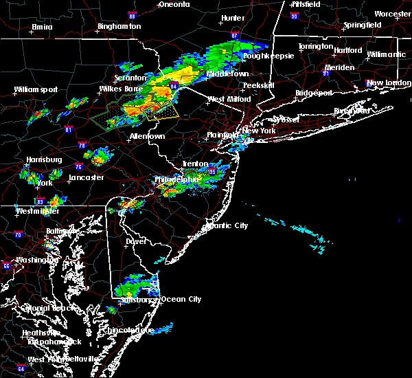 At 712 pm edt, doppler radar indicated a severe thunderstorm capable of producing quarter size hail and damaging winds in excess of 60 mph. this storm was located over werry lake, or 13 miles west of newton, and moving northeast at 25 mph. At 712 pm edt, doppler radar indicated a severe thunderstorm capable of producing quarter size hail and damaging winds in excess of 60 mph. this storm was located over werry lake, or 13 miles west of newton, and moving northeast at 25 mph.
|
| 6/23/2015 2:54 PM EDT |
 At 252 pm edt, doppler radar indicated a line of severe thunderstorms capable of producing damaging winds in excess of 60 mph. these storms were located along a line extending from near montague to near pellettown to branchville to newton to andover, moving east at 65 mph. the strongest storm in the line is near branchville. locations impacted include, newton, montague, dover, hopatcong, wharton, rockaway, mount arlington, franklin, mountain lakes, stanhope, hamburg, netcong, ogdensburg, sussex, victory gardens, branchville, andover, high point, lake mohawk and hainesville. At 252 pm edt, doppler radar indicated a line of severe thunderstorms capable of producing damaging winds in excess of 60 mph. these storms were located along a line extending from near montague to near pellettown to branchville to newton to andover, moving east at 65 mph. the strongest storm in the line is near branchville. locations impacted include, newton, montague, dover, hopatcong, wharton, rockaway, mount arlington, franklin, mountain lakes, stanhope, hamburg, netcong, ogdensburg, sussex, victory gardens, branchville, andover, high point, lake mohawk and hainesville.
|
| 6/23/2015 2:45 PM EDT |
 At 244 pm edt, doppler radar indicated a line of severe thunderstorms capable of producing damaging winds in excess of 60 mph. these storms were located along a line extending from near hainesville to bushkill to near great meadows-vienna, moving east at 65 mph. locations impacted include, newton, montague, dover, hopatcong, hackettstown, wharton, rockaway, blairstown, mount arlington, franklin, mountain lakes, stanhope, hamburg, netcong, belvidere, oxford, ogdensburg, sussex, hope and victory gardens. At 244 pm edt, doppler radar indicated a line of severe thunderstorms capable of producing damaging winds in excess of 60 mph. these storms were located along a line extending from near hainesville to bushkill to near great meadows-vienna, moving east at 65 mph. locations impacted include, newton, montague, dover, hopatcong, hackettstown, wharton, rockaway, blairstown, mount arlington, franklin, mountain lakes, stanhope, hamburg, netcong, belvidere, oxford, ogdensburg, sussex, hope and victory gardens.
|
| 6/23/2015 2:29 PM EDT |
 At 228 pm edt, doppler radar indicated a developing line of severe thunderstorms capable of producing damaging winds in excess of 60 mph. these storms were located along a line extending from near skytop to analomink to east bangor, and moving east at 75 mph. At 228 pm edt, doppler radar indicated a developing line of severe thunderstorms capable of producing damaging winds in excess of 60 mph. these storms were located along a line extending from near skytop to analomink to east bangor, and moving east at 75 mph.
|
| 6/12/2015 7:16 PM EDT |
 At 713 pm edt, doppler radar indicated a severe thunderstorm capable of producing damaging winds in excess of 60 mph. this storm was located over warwick, moving northeast at 40 mph. locations impacted include, franklin, hamburg, ogdensburg, sussex, branchville, vernon valley, pellettown, highland lake and high point. At 713 pm edt, doppler radar indicated a severe thunderstorm capable of producing damaging winds in excess of 60 mph. this storm was located over warwick, moving northeast at 40 mph. locations impacted include, franklin, hamburg, ogdensburg, sussex, branchville, vernon valley, pellettown, highland lake and high point.
|
| 6/12/2015 6:57 PM EDT |
 At 656 pm edt, doppler radar indicated a severe thunderstorm capable of producing damaging winds in excess of 60 mph. this storm was located over franklin, or 9 miles west of west milford, moving northeast at 35 mph. locations impacted include, newton, hopatcong, franklin, stanhope, hamburg, ogdensburg, sussex, branchville, andover, vernon valley, millbrook, greendell, high point, lake mohawk, crandon lakes, pellettown, flatbrookville, highland lake, five points and allamuchy-panther valley. At 656 pm edt, doppler radar indicated a severe thunderstorm capable of producing damaging winds in excess of 60 mph. this storm was located over franklin, or 9 miles west of west milford, moving northeast at 35 mph. locations impacted include, newton, hopatcong, franklin, stanhope, hamburg, ogdensburg, sussex, branchville, andover, vernon valley, millbrook, greendell, high point, lake mohawk, crandon lakes, pellettown, flatbrookville, highland lake, five points and allamuchy-panther valley.
|
| 6/12/2015 6:23 PM EDT |
 The national weather service in mount holly nj has issued a * severe thunderstorm warning for. northern warren county in northwestern new jersey. sussex county in northwestern new jersey. until 730 pm edt * at 622 pm edt. Doppler radar indicated a severe thunderstorm. The national weather service in mount holly nj has issued a * severe thunderstorm warning for. northern warren county in northwestern new jersey. sussex county in northwestern new jersey. until 730 pm edt * at 622 pm edt. Doppler radar indicated a severe thunderstorm.
|
| 5/16/2015 5:55 PM EDT | At 554 pm edt, doppler radar indicated a severe thunderstorm capable of producing quarter size hail and damaging winds in excess of 60 mph. this storm was located over five points, or near newton, moving southeast at 25 mph. this severe storm will be near, newton and greendell around 605 pm edt. andover around 610 pm edt. lake mohawk around 615 pm edt. other locations impacted by this severe thunderstorm include hidden lake. |
| 5/16/2015 5:55 PM EDT | At 554 pm edt, doppler radar indicated a severe thunderstorm capable of producing quarter size hail and damaging winds in excess of 60 mph. this storm was located over five points, or near newton, moving southeast at 25 mph. this severe storm will be near, newton and greendell around 605 pm edt. andover around 610 pm edt. lake mohawk around 615 pm edt. other locations impacted by this severe thunderstorm include hidden lake. |
| 5/16/2015 5:26 PM EDT | At 525 pm edt, doppler radar indicated a severe thunderstorm capable of producing quarter size hail and damaging winds in excess of 60 mph. this storm was located near bushkill, or 13 miles northwest of newton, and moving southeast at 25 mph. * this severe thunderstorm will be near, flatbrookville and millbrook around 535 pm edt. crandon lakes around 540 pm edt. branchville and five points around 545 pm edt. newton and greendell around 600 pm edt. andover around 605 pm edt. lake mohawk around 610 pm edt. other locations impacted by this severe thunderstorm include hidden lake. |
| 5/16/2015 5:26 PM EDT | At 525 pm edt, doppler radar indicated a severe thunderstorm capable of producing quarter size hail and damaging winds in excess of 60 mph. this storm was located near bushkill, or 13 miles northwest of newton, and moving southeast at 25 mph. * this severe thunderstorm will be near, flatbrookville and millbrook around 535 pm edt. crandon lakes around 540 pm edt. branchville and five points around 545 pm edt. newton and greendell around 600 pm edt. andover around 605 pm edt. lake mohawk around 610 pm edt. other locations impacted by this severe thunderstorm include hidden lake. |
| 7/23/2012 1:33 PM EDT | Half Dollar sized hail reported 5.7 miles SE of Branchville, NJ |
| 7/23/2012 12:37 PM EDT | Quarter sized hail reported 7.6 miles SSE of Branchville, NJ |
| 6/22/2012 4:15 PM EDT | Several trees and large branches down in brancville in sussex county NJ, 0.2 miles SSE of Branchville, NJ |
Hail Maps for Branchville, NJ
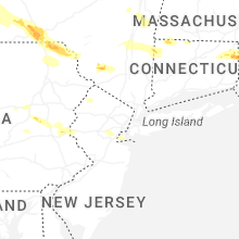


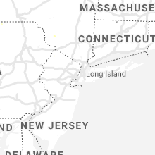


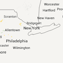


Connect with Interactive Hail Maps