

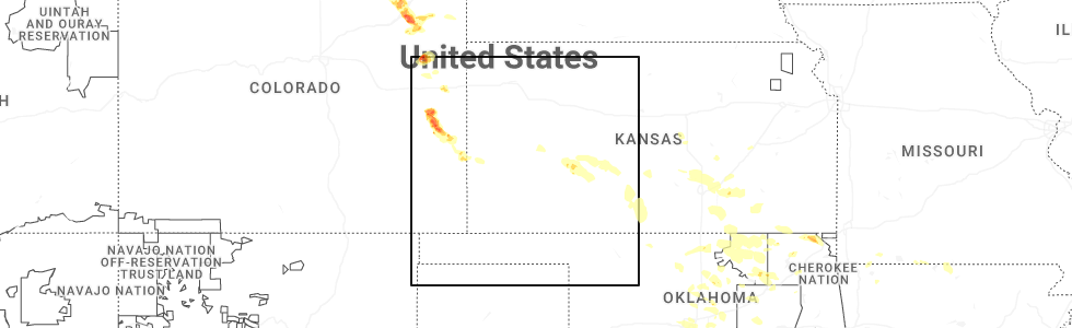
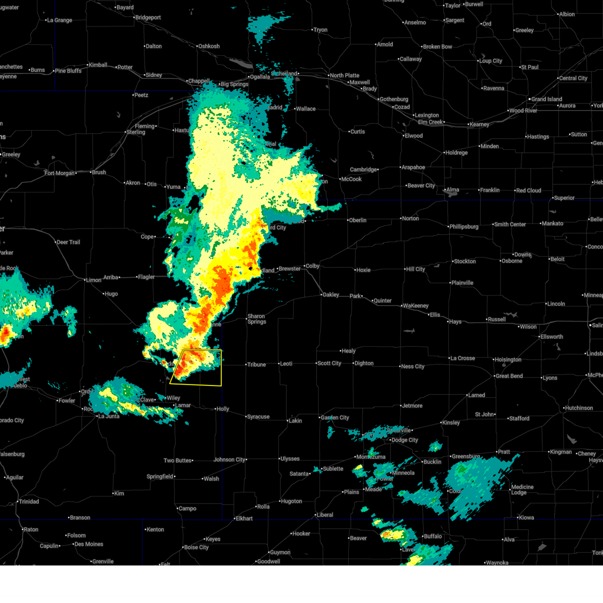
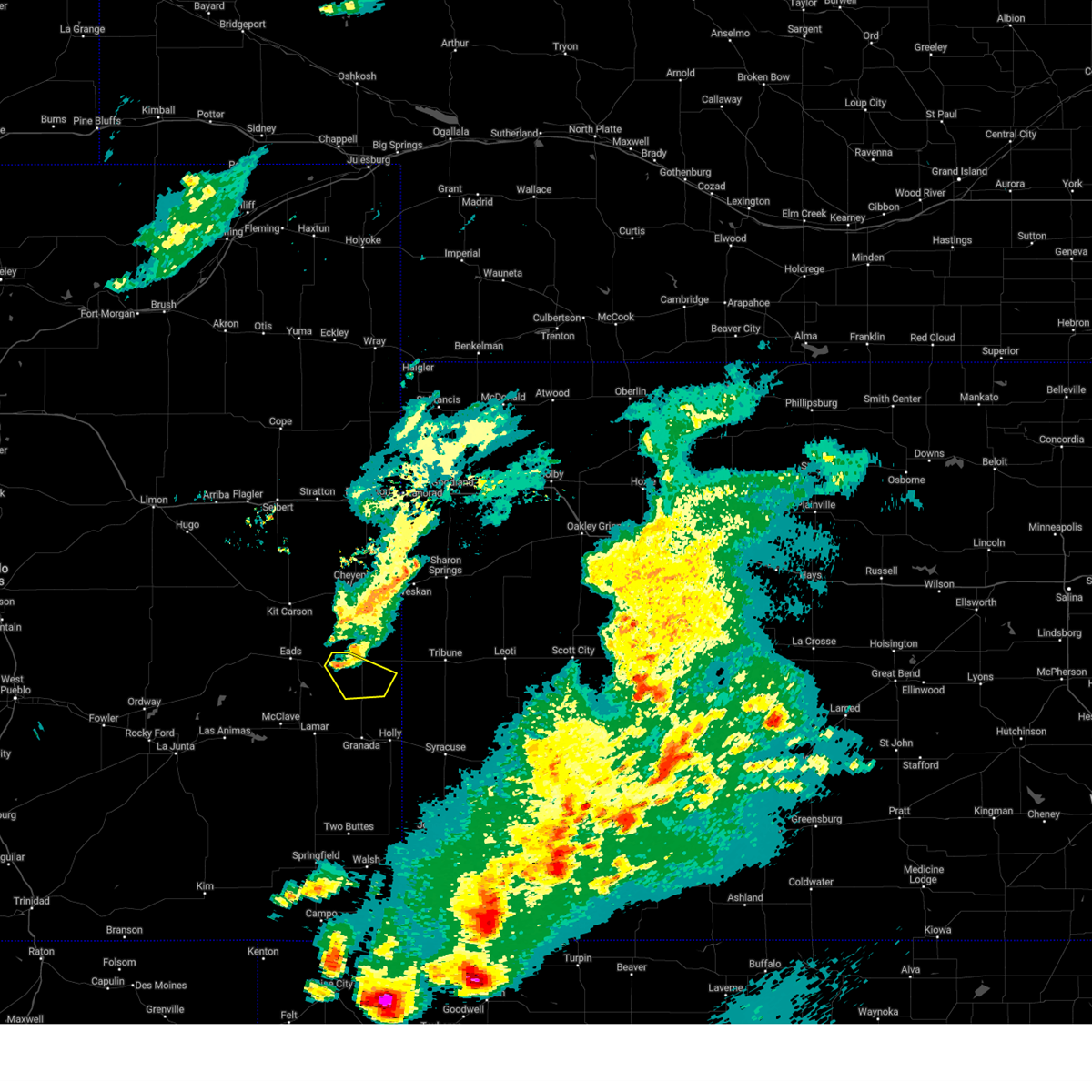
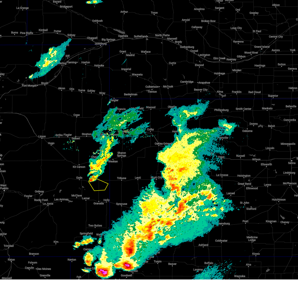
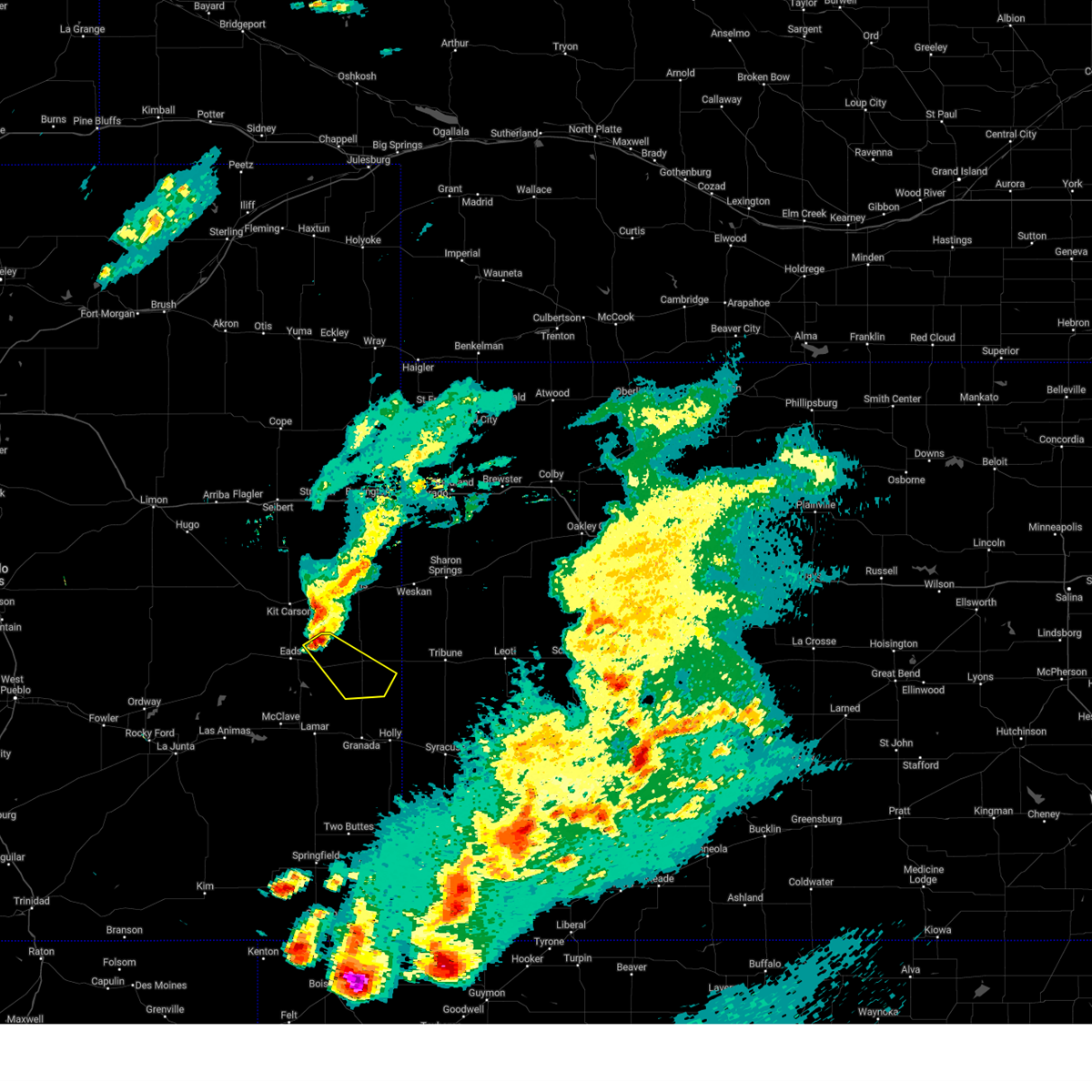
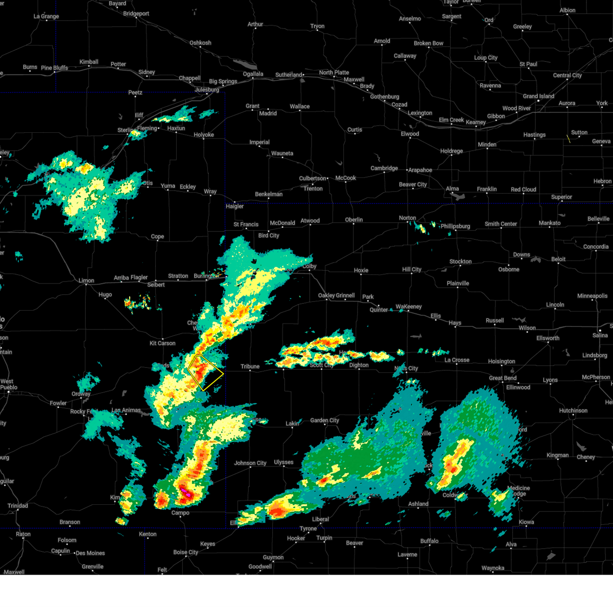
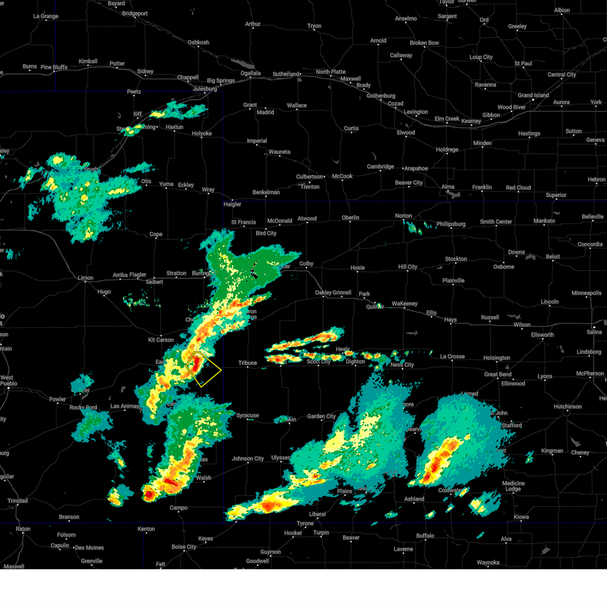
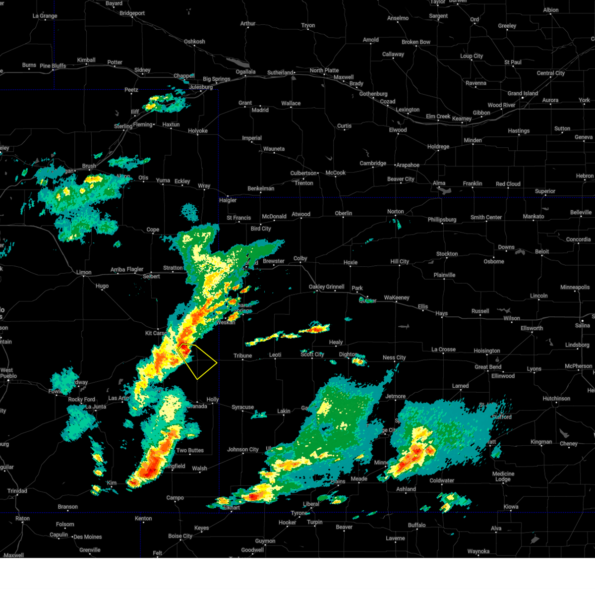
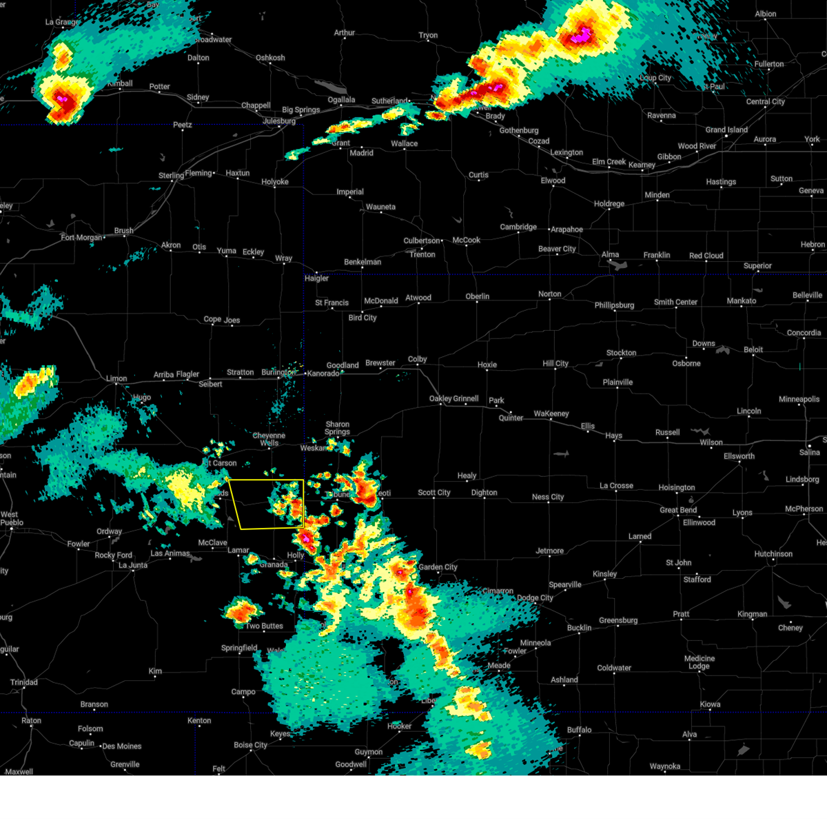
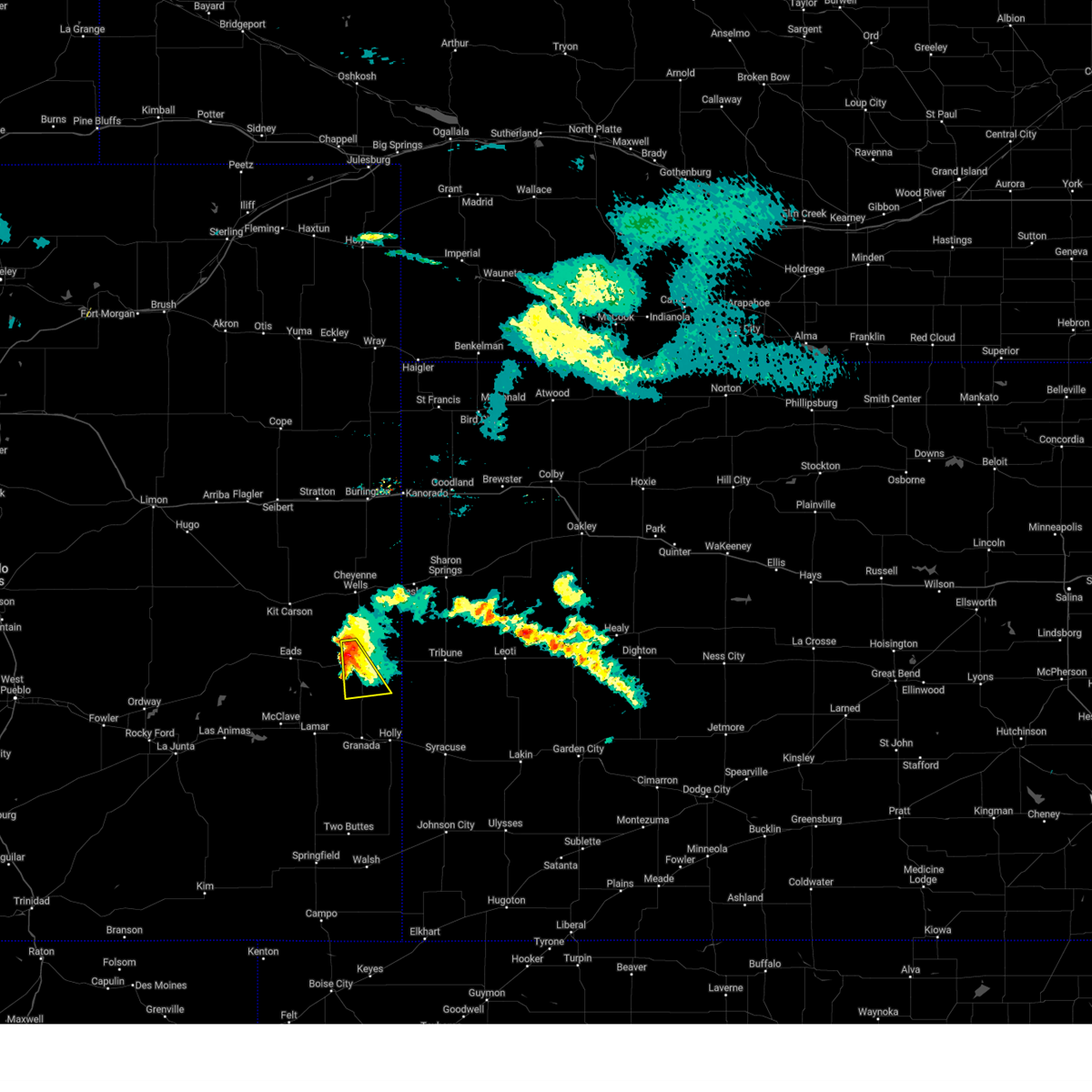
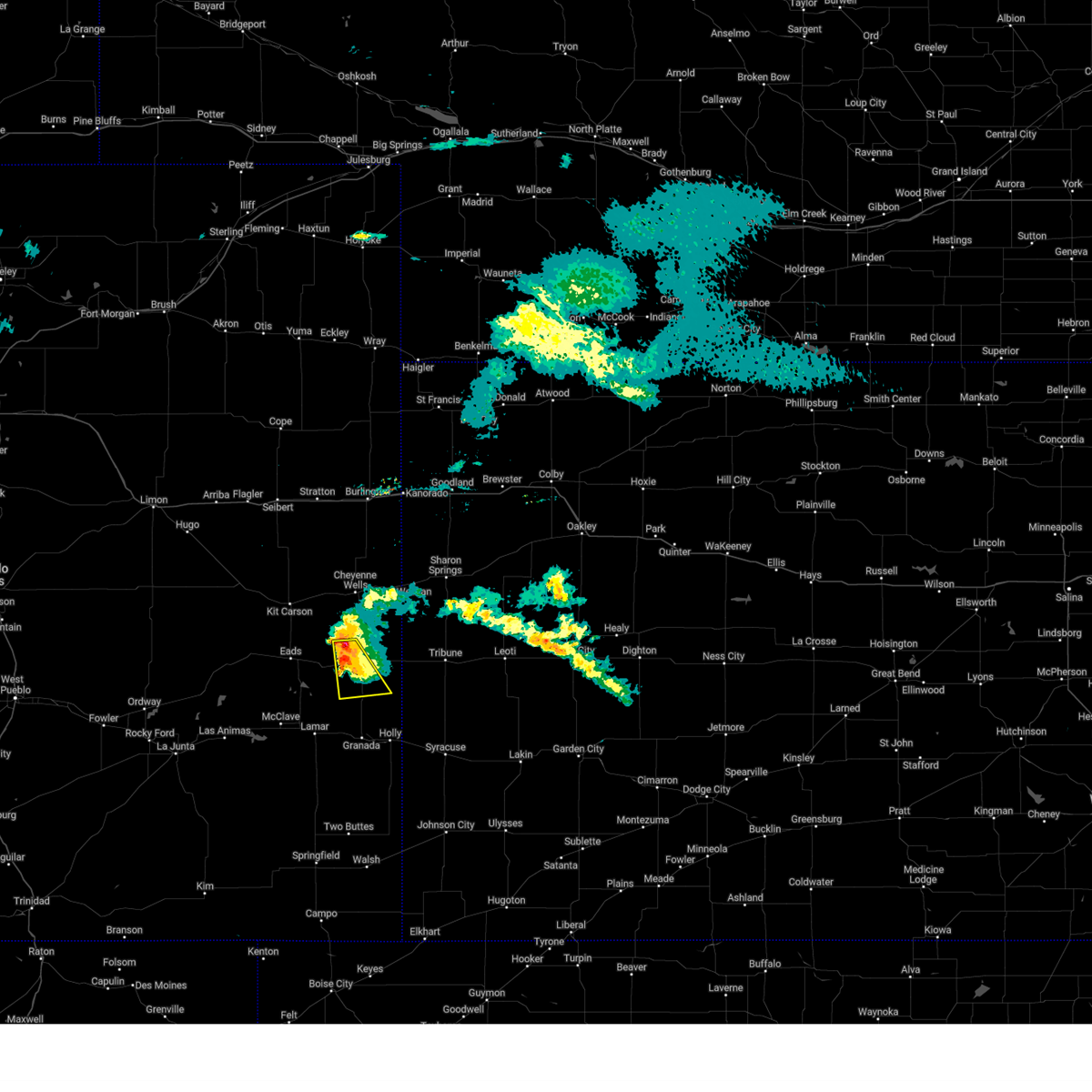
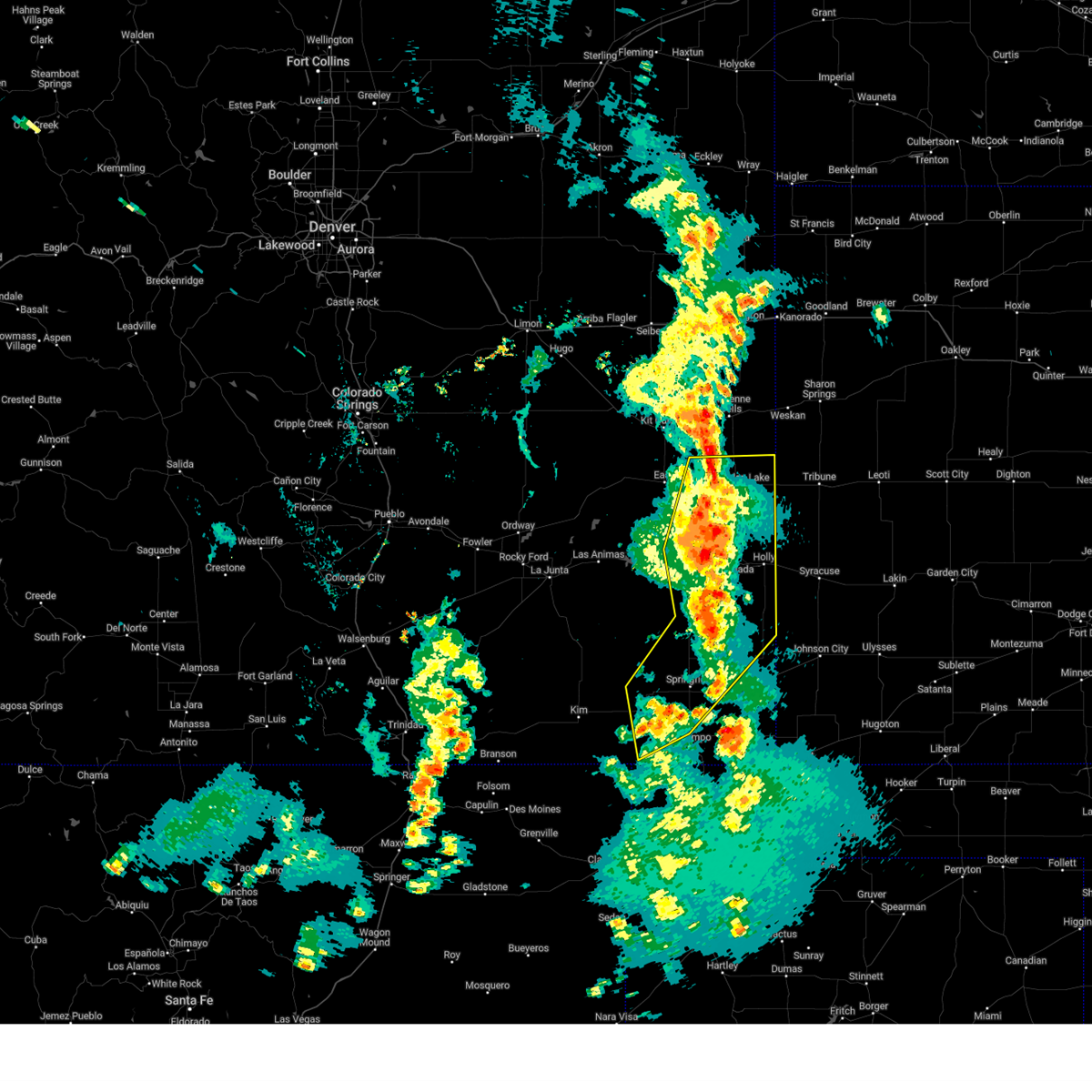
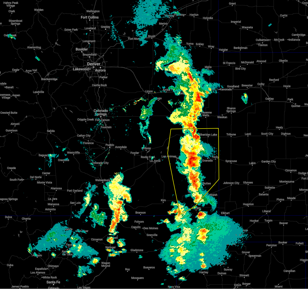
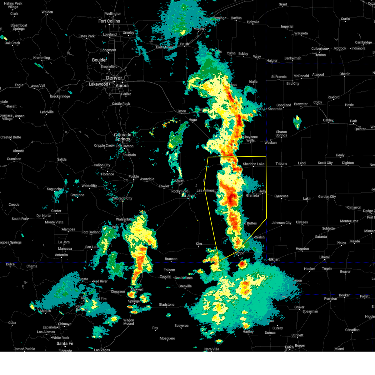
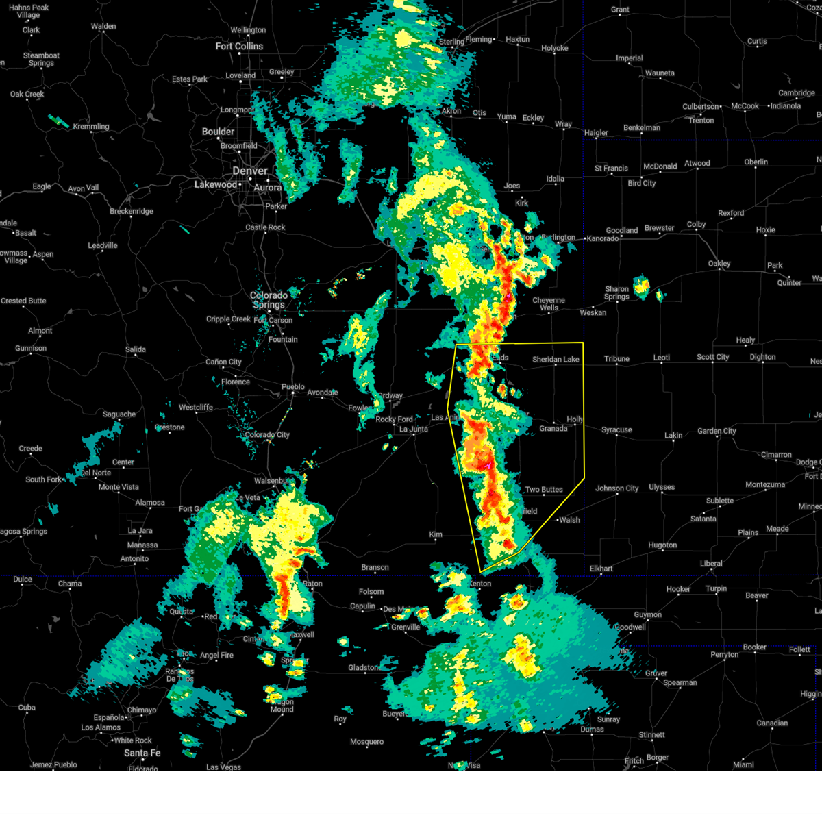
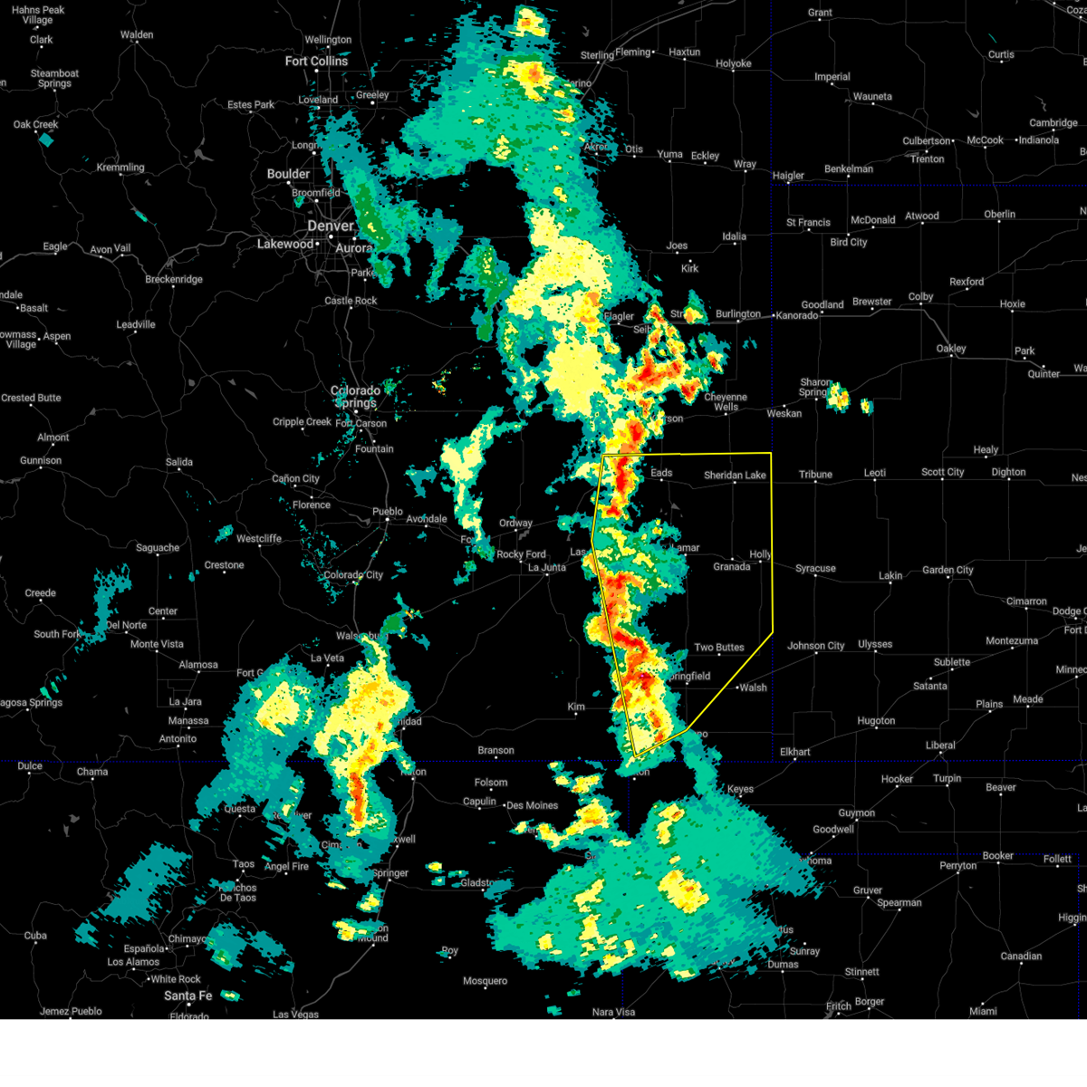
Hail Map for Brandon, CO
The Brandon, CO area has had 0 reports of on-the-ground hail by trained spotters, and has been under severe weather warnings 31 times during the past 12 months. Doppler radar has detected hail at or near Brandon, CO on 83 occasions, including 7 occasions during the past year.
| Name: | Brandon, CO |
| Where Located: | 91.4 miles WNW of Garden City, KS |
| Map: | Google Map for Brandon, CO |
| Population: | 21 |
| Housing Units: | 12 |
| More Info: | Search Google for Brandon, CO |
1
The Top Recent Hail Date for Brandon, CO is Friday, May 23, 2025 (20th out of 83)
Hail and Wind Damage Spotted near Brandon, CO
| Date / Time | Report Details |
|---|---|
| 7/11/2025 10:13 PM MDT |
 At 1013 pm mdt, severe thunderstorms were located along a line extending from 6 miles northwest of eads to queens reservoir, moving northeast at 15 mph (radar indicated). Hazards include 60 mph wind gusts and quarter size hail. Hail damage to vehicles is expected. expect wind damage to roofs, siding, and trees. Locations impacted include, eads, neeoshe reservoir, sweetwater reservoir, chivington, brandon, neegronda reservoir, and queens reservoir. At 1013 pm mdt, severe thunderstorms were located along a line extending from 6 miles northwest of eads to queens reservoir, moving northeast at 15 mph (radar indicated). Hazards include 60 mph wind gusts and quarter size hail. Hail damage to vehicles is expected. expect wind damage to roofs, siding, and trees. Locations impacted include, eads, neeoshe reservoir, sweetwater reservoir, chivington, brandon, neegronda reservoir, and queens reservoir.
|
| 7/11/2025 10:13 PM MDT |
 the severe thunderstorm warning has been cancelled and is no longer in effect the severe thunderstorm warning has been cancelled and is no longer in effect
|
| 7/11/2025 10:00 PM MDT |
 Svrpub the national weather service in pueblo has issued a * severe thunderstorm warning for, northern prowers county in southeastern colorado, central kiowa county in southeastern colorado, northeastern bent county in southeastern colorado, * until 1030 pm mdt. * at 959 pm mdt, a cluster of severe thunderstorms were located along a line extending from 6 miles east of haswell to 6 miles southwest of neegronda reservoir, moving east at 15 mph (radar indicated). Hazards include 60 mph wind gusts and quarter size hail. Hail damage to vehicles is expected. Expect wind damage to roofs, siding, and trees. Svrpub the national weather service in pueblo has issued a * severe thunderstorm warning for, northern prowers county in southeastern colorado, central kiowa county in southeastern colorado, northeastern bent county in southeastern colorado, * until 1030 pm mdt. * at 959 pm mdt, a cluster of severe thunderstorms were located along a line extending from 6 miles east of haswell to 6 miles southwest of neegronda reservoir, moving east at 15 mph (radar indicated). Hazards include 60 mph wind gusts and quarter size hail. Hail damage to vehicles is expected. Expect wind damage to roofs, siding, and trees.
|
| 7/6/2025 10:13 PM MDT |
 The storms which prompted the warning have weakened below severe limits, and no longer pose an immediate threat to life or property. therefore, the warning will be allowed to expire. however, gusty winds and heavy rain are still possible with these thunderstorms. The storms which prompted the warning have weakened below severe limits, and no longer pose an immediate threat to life or property. therefore, the warning will be allowed to expire. however, gusty winds and heavy rain are still possible with these thunderstorms.
|
| 7/6/2025 9:44 PM MDT |
 Svrpub the national weather service in pueblo has issued a * severe thunderstorm warning for, eastern kiowa county in southeastern colorado, * until 1015 pm mdt. * at 943 pm mdt, severe thunderstorms were located along a line extending from 10 miles north of sheridan lake to 6 miles south of chivington, moving southeast at 15 mph (radar indicated). Hazards include 70 mph wind gusts and nickel size hail. Expect considerable tree damage. Damage is likely to mobile homes, roofs, and outbuildings. Svrpub the national weather service in pueblo has issued a * severe thunderstorm warning for, eastern kiowa county in southeastern colorado, * until 1015 pm mdt. * at 943 pm mdt, severe thunderstorms were located along a line extending from 10 miles north of sheridan lake to 6 miles south of chivington, moving southeast at 15 mph (radar indicated). Hazards include 70 mph wind gusts and nickel size hail. Expect considerable tree damage. Damage is likely to mobile homes, roofs, and outbuildings.
|
| 7/6/2025 9:24 PM MDT |
 At 924 pm mdt, a severe thunderstorm was located near sheridan lake, or 26 miles west of tribune, moving southeast at 40 mph (radar indicated). Hazards include 70 mph wind gusts and half dollar size hail. Hail damage to vehicles is expected. expect considerable tree damage. wind damage is also likely to mobile homes, roofs, and outbuildings. Locations impacted include, sheridan lake, chivington, brandon, and towner. At 924 pm mdt, a severe thunderstorm was located near sheridan lake, or 26 miles west of tribune, moving southeast at 40 mph (radar indicated). Hazards include 70 mph wind gusts and half dollar size hail. Hail damage to vehicles is expected. expect considerable tree damage. wind damage is also likely to mobile homes, roofs, and outbuildings. Locations impacted include, sheridan lake, chivington, brandon, and towner.
|
| 7/6/2025 8:49 PM MDT |
 Svrpub the national weather service in pueblo has issued a * severe thunderstorm warning for, eastern kiowa county in southeastern colorado, * until 945 pm mdt. * at 847 pm mdt, a severe thunderstorm was located 11 miles northeast of eads, or 21 miles southwest of cheyenne wells, moving southeast at 40 mph (radar indicated). Hazards include 70 mph wind gusts. a 66 mph wind gusts was measured at a weather station in kit carson. hail up to the size of quarters may also occur with this storm. Expect considerable tree damage. Damage is likely to mobile homes, roofs, and outbuildings. Svrpub the national weather service in pueblo has issued a * severe thunderstorm warning for, eastern kiowa county in southeastern colorado, * until 945 pm mdt. * at 847 pm mdt, a severe thunderstorm was located 11 miles northeast of eads, or 21 miles southwest of cheyenne wells, moving southeast at 40 mph (radar indicated). Hazards include 70 mph wind gusts. a 66 mph wind gusts was measured at a weather station in kit carson. hail up to the size of quarters may also occur with this storm. Expect considerable tree damage. Damage is likely to mobile homes, roofs, and outbuildings.
|
| 6/13/2025 11:58 PM MDT |
 At 1158 pm mdt, severe thunderstorms were located along a line extending from 13 miles northeast of eads to 10 miles south of towner to near bristol, moving east at 55 mph (radar indicated). Hazards include 70 mph wind gusts and quarter size hail. Hail damage to vehicles is expected. expect considerable tree damage. wind damage is also likely to mobile homes, roofs, and outbuildings. Locations impacted include, lamar, holly, eads, granada, sheridan lake, hartman, towner, bristol, chivington, brandon, and neeoshe reservoir. At 1158 pm mdt, severe thunderstorms were located along a line extending from 13 miles northeast of eads to 10 miles south of towner to near bristol, moving east at 55 mph (radar indicated). Hazards include 70 mph wind gusts and quarter size hail. Hail damage to vehicles is expected. expect considerable tree damage. wind damage is also likely to mobile homes, roofs, and outbuildings. Locations impacted include, lamar, holly, eads, granada, sheridan lake, hartman, towner, bristol, chivington, brandon, and neeoshe reservoir.
|
| 6/13/2025 11:58 PM MDT |
 the severe thunderstorm warning has been cancelled and is no longer in effect the severe thunderstorm warning has been cancelled and is no longer in effect
|
| 6/13/2025 11:36 PM MDT |
 Svrpub the national weather service in pueblo has issued a * severe thunderstorm warning for, northern prowers county in southeastern colorado, eastern kiowa county in southeastern colorado, northeastern bent county in southeastern colorado, * until 1215 am mdt. * at 1135 pm mdt, severe thunderstorms were located along a line extending from 13 miles northeast of haswell to 9 miles south of brandon to near mcclave, moving east at 55 mph (radar indicated). Hazards include 70 mph wind gusts and quarter size hail. Hail damage to vehicles is expected. expect considerable tree damage. Wind damage is also likely to mobile homes, roofs, and outbuildings. Svrpub the national weather service in pueblo has issued a * severe thunderstorm warning for, northern prowers county in southeastern colorado, eastern kiowa county in southeastern colorado, northeastern bent county in southeastern colorado, * until 1215 am mdt. * at 1135 pm mdt, severe thunderstorms were located along a line extending from 13 miles northeast of haswell to 9 miles south of brandon to near mcclave, moving east at 55 mph (radar indicated). Hazards include 70 mph wind gusts and quarter size hail. Hail damage to vehicles is expected. expect considerable tree damage. Wind damage is also likely to mobile homes, roofs, and outbuildings.
|
| 6/6/2025 9:46 PM MDT |
 the severe thunderstorm warning has been cancelled and is no longer in effect the severe thunderstorm warning has been cancelled and is no longer in effect
|
| 6/6/2025 9:38 PM MDT |
 At 938 pm mdt, a severe thunderstorm was located over brandon, or 25 miles north of lamar, moving southeast at 30 mph (radar indicated). Hazards include 60 mph wind gusts and quarter size hail. Hail damage to vehicles is expected. expect wind damage to roofs, siding, and trees. Locations impacted include, sheridan lake, chivington, and brandon. At 938 pm mdt, a severe thunderstorm was located over brandon, or 25 miles north of lamar, moving southeast at 30 mph (radar indicated). Hazards include 60 mph wind gusts and quarter size hail. Hail damage to vehicles is expected. expect wind damage to roofs, siding, and trees. Locations impacted include, sheridan lake, chivington, and brandon.
|
| 6/6/2025 9:25 PM MDT |
 Svrpub the national weather service in pueblo has issued a * severe thunderstorm warning for, eastern kiowa county in southeastern colorado, * until 1000 pm mdt. * at 925 pm mdt, a severe thunderstorm was located near chivington, or 22 miles southwest of cheyenne wells, moving southeast at 45 mph (radar indicated). Hazards include 60 mph wind gusts and half dollar size hail. Hail damage to vehicles is expected. Expect wind damage to roofs, siding, and trees. Svrpub the national weather service in pueblo has issued a * severe thunderstorm warning for, eastern kiowa county in southeastern colorado, * until 1000 pm mdt. * at 925 pm mdt, a severe thunderstorm was located near chivington, or 22 miles southwest of cheyenne wells, moving southeast at 45 mph (radar indicated). Hazards include 60 mph wind gusts and half dollar size hail. Hail damage to vehicles is expected. Expect wind damage to roofs, siding, and trees.
|
| 6/5/2025 8:27 PM MDT |
 The storm which prompted the warning has weakened below severe limits, and no longer poses an immediate threat to life or property. therefore, the warning will be allowed to expire. however, small hail and gusty winds are still possible with this thunderstorm. a severe thunderstorm watch remains in effect until 100 am mdt for southeastern colorado. The storm which prompted the warning has weakened below severe limits, and no longer poses an immediate threat to life or property. therefore, the warning will be allowed to expire. however, small hail and gusty winds are still possible with this thunderstorm. a severe thunderstorm watch remains in effect until 100 am mdt for southeastern colorado.
|
| 6/5/2025 8:18 PM MDT |
 At 818 pm mdt, a severe thunderstorm was located over sheridan lake, or 25 miles south of cheyenne wells, moving southeast at 25 mph (radar indicated). Hazards include 60 mph wind gusts and quarter size hail. Hail damage to vehicles is expected. expect wind damage to roofs, siding, and trees. Locations impacted include, sheridan lake and brandon. At 818 pm mdt, a severe thunderstorm was located over sheridan lake, or 25 miles south of cheyenne wells, moving southeast at 25 mph (radar indicated). Hazards include 60 mph wind gusts and quarter size hail. Hail damage to vehicles is expected. expect wind damage to roofs, siding, and trees. Locations impacted include, sheridan lake and brandon.
|
| 6/5/2025 8:03 PM MDT |
 Svrpub the national weather service in pueblo has issued a * severe thunderstorm warning for, eastern kiowa county in southeastern colorado, * until 830 pm mdt. * at 803 pm mdt, a severe thunderstorm was located near brandon, or 19 miles south of cheyenne wells, moving southeast at 25 mph (radar indicated). Hazards include 60 mph wind gusts and quarter size hail. Hail damage to vehicles is expected. Expect wind damage to roofs, siding, and trees. Svrpub the national weather service in pueblo has issued a * severe thunderstorm warning for, eastern kiowa county in southeastern colorado, * until 830 pm mdt. * at 803 pm mdt, a severe thunderstorm was located near brandon, or 19 miles south of cheyenne wells, moving southeast at 25 mph (radar indicated). Hazards include 60 mph wind gusts and quarter size hail. Hail damage to vehicles is expected. Expect wind damage to roofs, siding, and trees.
|
| 6/2/2025 5:12 PM MDT |
 Svrpub the national weather service in pueblo has issued a * severe thunderstorm warning for, eastern kiowa county in southeastern colorado, * until 600 pm mdt. * at 511 pm mdt, a severe thunderstorm was located over towner, or 20 miles west of tribune, moving north at 20 mph (radar indicated). Hazards include 60 mph wind gusts and nickel size hail. expect damage to roofs, siding, and trees Svrpub the national weather service in pueblo has issued a * severe thunderstorm warning for, eastern kiowa county in southeastern colorado, * until 600 pm mdt. * at 511 pm mdt, a severe thunderstorm was located over towner, or 20 miles west of tribune, moving north at 20 mph (radar indicated). Hazards include 60 mph wind gusts and nickel size hail. expect damage to roofs, siding, and trees
|
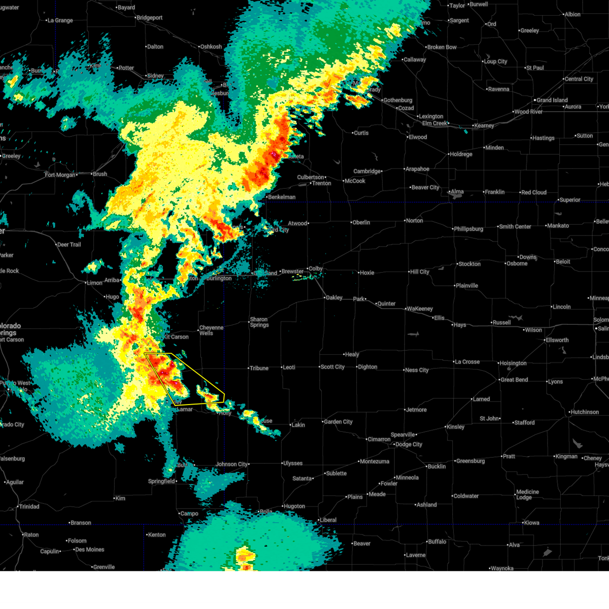
| 5/23/2025 9:03 PM MDT |
 At 902 pm mdt, a severe thunderstorm was located 11 miles north of bristol, or 21 miles northeast of lamar, moving southeast at 30 mph (trained weather spotters). Hazards include ping pong ball size hail and 60 mph wind gusts. People and animals outdoors will be injured. expect hail damage to roofs, siding, windows, and vehicles. expect wind damage to roofs, siding, and trees. Locations impacted include, brandon and sheridan lake. At 902 pm mdt, a severe thunderstorm was located 11 miles north of bristol, or 21 miles northeast of lamar, moving southeast at 30 mph (trained weather spotters). Hazards include ping pong ball size hail and 60 mph wind gusts. People and animals outdoors will be injured. expect hail damage to roofs, siding, windows, and vehicles. expect wind damage to roofs, siding, and trees. Locations impacted include, brandon and sheridan lake.
|
| 5/23/2025 8:51 PM MDT |
 At 851 pm mdt, a severe thunderstorm was located near brandon, or 23 miles northeast of lamar, moving southeast at 30 mph (trained weather spotters). Hazards include ping pong ball size hail and 60 mph wind gusts. People and animals outdoors will be injured. expect hail damage to roofs, siding, windows, and vehicles. expect wind damage to roofs, siding, and trees. Locations impacted include, brandon and sheridan lake. At 851 pm mdt, a severe thunderstorm was located near brandon, or 23 miles northeast of lamar, moving southeast at 30 mph (trained weather spotters). Hazards include ping pong ball size hail and 60 mph wind gusts. People and animals outdoors will be injured. expect hail damage to roofs, siding, windows, and vehicles. expect wind damage to roofs, siding, and trees. Locations impacted include, brandon and sheridan lake.
|
| 5/23/2025 8:46 PM MDT |
 At 845 pm mdt, a severe thunderstorm was located near brandon, or 25 miles northeast of lamar, moving southeast at 30 mph (trained weather spotters). Hazards include 60 mph wind gusts and half dollar size hail. Hail damage to vehicles is expected. expect wind damage to roofs, siding, and trees. Locations impacted include, brandon and sheridan lake. At 845 pm mdt, a severe thunderstorm was located near brandon, or 25 miles northeast of lamar, moving southeast at 30 mph (trained weather spotters). Hazards include 60 mph wind gusts and half dollar size hail. Hail damage to vehicles is expected. expect wind damage to roofs, siding, and trees. Locations impacted include, brandon and sheridan lake.
|
| 5/23/2025 8:42 PM MDT |
 Svrpub the national weather service in pueblo has issued a * severe thunderstorm warning for, eastern kiowa county in southeastern colorado, * until 915 pm mdt. * at 841 pm mdt, a severe thunderstorm was located over brandon, or 26 miles north of lamar, moving southeast at 30 mph (radar indicated). Hazards include ping pong ball size hail and 60 mph wind gusts. People and animals outdoors will be injured. expect hail damage to roofs, siding, windows, and vehicles. Expect wind damage to roofs, siding, and trees. Svrpub the national weather service in pueblo has issued a * severe thunderstorm warning for, eastern kiowa county in southeastern colorado, * until 915 pm mdt. * at 841 pm mdt, a severe thunderstorm was located over brandon, or 26 miles north of lamar, moving southeast at 30 mph (radar indicated). Hazards include ping pong ball size hail and 60 mph wind gusts. People and animals outdoors will be injured. expect hail damage to roofs, siding, windows, and vehicles. Expect wind damage to roofs, siding, and trees.
|
| 5/23/2025 8:21 PM MDT |
 Svrpub the national weather service in pueblo has issued a * severe thunderstorm warning for, eastern kiowa county in southeastern colorado, * until 845 pm mdt. * at 821 pm mdt, a severe thunderstorm was located near chivington, or 21 miles south of cheyenne wells, moving southeast at 30 mph (radar indicated). Hazards include golf ball size hail and 60 mph wind gusts. People and animals outdoors will be injured. expect hail damage to roofs, siding, windows, and vehicles. Expect wind damage to roofs, siding, and trees. Svrpub the national weather service in pueblo has issued a * severe thunderstorm warning for, eastern kiowa county in southeastern colorado, * until 845 pm mdt. * at 821 pm mdt, a severe thunderstorm was located near chivington, or 21 miles south of cheyenne wells, moving southeast at 30 mph (radar indicated). Hazards include golf ball size hail and 60 mph wind gusts. People and animals outdoors will be injured. expect hail damage to roofs, siding, windows, and vehicles. Expect wind damage to roofs, siding, and trees.
|
| 9/17/2024 5:53 PM MDT |
 the severe thunderstorm warning has been cancelled and is no longer in effect the severe thunderstorm warning has been cancelled and is no longer in effect
|
| 9/17/2024 5:53 PM MDT |
 At 550 pm mdt, a broken line of strong to severe thunderstorms was located from northeast kiowa county to lamar and southward into central baca county. the line of storms was moving northeast at 50 mph. the most intense storm was just east of lamar. a wind gusts to over 70 mph was observed at the lamar airport at 5:38 pm. a wind gust of 56 mph was reported in the springfield area at around 5:35 pm (radar indicated). Hazards include 70 mph wind gusts and nickel size hail. Expect considerable tree damage. damage is likely to mobile homes, roofs, and outbuildings. Locations impacted include, lamar, springfield, holly, granada, wiley, pritchett, vilas, sheridan lake, hartman, two buttes, neeoshe reservoir, chivington, brandon, towner, bristol, two buttes reservoir, and queens reservoir. At 550 pm mdt, a broken line of strong to severe thunderstorms was located from northeast kiowa county to lamar and southward into central baca county. the line of storms was moving northeast at 50 mph. the most intense storm was just east of lamar. a wind gusts to over 70 mph was observed at the lamar airport at 5:38 pm. a wind gust of 56 mph was reported in the springfield area at around 5:35 pm (radar indicated). Hazards include 70 mph wind gusts and nickel size hail. Expect considerable tree damage. damage is likely to mobile homes, roofs, and outbuildings. Locations impacted include, lamar, springfield, holly, granada, wiley, pritchett, vilas, sheridan lake, hartman, two buttes, neeoshe reservoir, chivington, brandon, towner, bristol, two buttes reservoir, and queens reservoir.
|
| 9/17/2024 5:39 PM MDT |
 At 538 pm mdt, a severe thunderstorm was located over lamar, moving northeast at 50 mph (the lamar weather station reported a wind gusts to 72 mph at 5:38 pm). Hazards include 72 mph wind gusts and nickel size hail. Expect considerable tree damage. damage is likely to mobile homes, roofs, and outbuildings. Locations impacted include, lamar, springfield, las animas, holly, eads, granada, wiley, pritchett, vilas, sheridan lake, hartman, haswell, two buttes, neeoshe reservoir, chivington, bristol, sweetwater reservoir, two buttes reservoir, hasty, and john martin reservoir. At 538 pm mdt, a severe thunderstorm was located over lamar, moving northeast at 50 mph (the lamar weather station reported a wind gusts to 72 mph at 5:38 pm). Hazards include 72 mph wind gusts and nickel size hail. Expect considerable tree damage. damage is likely to mobile homes, roofs, and outbuildings. Locations impacted include, lamar, springfield, las animas, holly, eads, granada, wiley, pritchett, vilas, sheridan lake, hartman, haswell, two buttes, neeoshe reservoir, chivington, bristol, sweetwater reservoir, two buttes reservoir, hasty, and john martin reservoir.
|
| 9/17/2024 5:34 PM MDT |
 At 533 pm mdt, a severe thunderstorm was located near lamar, moving northeast at 50 mph. other strong to severe storms were noted in northcentral kiowa county and 15 miles north of springfield (radar indicated). Hazards include 70 mph wind gusts and nickel size hail. Expect considerable tree damage. damage is likely to mobile homes, roofs, and outbuildings. Locations impacted include, lamar, springfield, las animas, holly, eads, granada, wiley, pritchett, vilas, sheridan lake, hartman, haswell, two buttes, neeoshe reservoir, chivington, bristol, sweetwater reservoir, two buttes reservoir, hasty, and john martin reservoir. At 533 pm mdt, a severe thunderstorm was located near lamar, moving northeast at 50 mph. other strong to severe storms were noted in northcentral kiowa county and 15 miles north of springfield (radar indicated). Hazards include 70 mph wind gusts and nickel size hail. Expect considerable tree damage. damage is likely to mobile homes, roofs, and outbuildings. Locations impacted include, lamar, springfield, las animas, holly, eads, granada, wiley, pritchett, vilas, sheridan lake, hartman, haswell, two buttes, neeoshe reservoir, chivington, bristol, sweetwater reservoir, two buttes reservoir, hasty, and john martin reservoir.
|
| 9/17/2024 5:18 PM MDT |
 At 513 pm mdt, a broken line of strong to severe thunderstorms extended southward from 5 miles west of eads, to 15 miles west of lamar, to 4 miles west of springfield. the line of storms were moving northeast at 50 mph. the most intense storms were in southeastern bent county and northwest baca county. these storms will affect highway 50 from east of the town of las animas to the kansas border, and highway 287 from near springfield to the kiowa and cheyenne county line (radar indicated). Hazards include 60 mph wind gusts and nickel size hail. Expect damage to roofs, siding, and trees. Locations impacted include, lamar, springfield, las animas, holly, eads, granada, wiley, pritchett, vilas, sheridan lake, hartman, haswell, two buttes, neeoshe reservoir, chivington, bristol, sweetwater reservoir, two buttes reservoir, hasty, and john martin reservoir. At 513 pm mdt, a broken line of strong to severe thunderstorms extended southward from 5 miles west of eads, to 15 miles west of lamar, to 4 miles west of springfield. the line of storms were moving northeast at 50 mph. the most intense storms were in southeastern bent county and northwest baca county. these storms will affect highway 50 from east of the town of las animas to the kansas border, and highway 287 from near springfield to the kiowa and cheyenne county line (radar indicated). Hazards include 60 mph wind gusts and nickel size hail. Expect damage to roofs, siding, and trees. Locations impacted include, lamar, springfield, las animas, holly, eads, granada, wiley, pritchett, vilas, sheridan lake, hartman, haswell, two buttes, neeoshe reservoir, chivington, bristol, sweetwater reservoir, two buttes reservoir, hasty, and john martin reservoir.
|
| 9/17/2024 5:09 PM MDT |
 Svrpub the national weather service in pueblo has issued a * severe thunderstorm warning for, prowers county in southeastern colorado, northwestern baca county in southeastern colorado, kiowa county in southeastern colorado, east central las animas county in southeastern colorado, bent county in southeastern colorado, * until 615 pm mdt. * at 508 pm mdt, a severe thunderstorm was located 19 miles west of two buttes reservoir, or 27 miles northwest of springfield, moving northeast at 50 mph (radar indicated). Hazards include 60 mph wind gusts and nickel size hail. expect damage to roofs, siding, and trees Svrpub the national weather service in pueblo has issued a * severe thunderstorm warning for, prowers county in southeastern colorado, northwestern baca county in southeastern colorado, kiowa county in southeastern colorado, east central las animas county in southeastern colorado, bent county in southeastern colorado, * until 615 pm mdt. * at 508 pm mdt, a severe thunderstorm was located 19 miles west of two buttes reservoir, or 27 miles northwest of springfield, moving northeast at 50 mph (radar indicated). Hazards include 60 mph wind gusts and nickel size hail. expect damage to roofs, siding, and trees
|
| 8/22/2024 7:27 PM MDT |
 The storms which prompted the warning have weakened below severe limits, and have exited the warned area. therefore, the warning will be allowed to expire. The storms which prompted the warning have weakened below severe limits, and have exited the warned area. therefore, the warning will be allowed to expire.
|
| 8/22/2024 6:58 PM MDT |
 Svrpub the national weather service in pueblo has issued a * severe thunderstorm warning for, kiowa county in southeastern colorado, * until 730 pm mdt. * at 657 pm mdt, severe thunderstorms were located along a line extending from 8 miles north of eads to 11 miles northeast of brandon to near sheridan lake, moving northeast at 60 mph (radar indicated). Hazards include 60 mph wind gusts. expect damage to roofs, siding, and trees Svrpub the national weather service in pueblo has issued a * severe thunderstorm warning for, kiowa county in southeastern colorado, * until 730 pm mdt. * at 657 pm mdt, severe thunderstorms were located along a line extending from 8 miles north of eads to 11 miles northeast of brandon to near sheridan lake, moving northeast at 60 mph (radar indicated). Hazards include 60 mph wind gusts. expect damage to roofs, siding, and trees
|
| 8/22/2024 6:29 PM MDT |
 Svrpub the national weather service in pueblo has issued a * severe thunderstorm warning for, northwestern prowers county in southeastern colorado, kiowa county in southeastern colorado, * until 700 pm mdt. * at 629 pm mdt, severe thunderstorms were located along a line extending from 11 miles east of haswell to 6 miles east of eads to 9 miles northeast of lamar, moving northeast at 55 mph (radar indicated). Hazards include 70 mph wind gusts and penny size hail. Expect considerable tree damage. Damage is likely to mobile homes, roofs, and outbuildings. Svrpub the national weather service in pueblo has issued a * severe thunderstorm warning for, northwestern prowers county in southeastern colorado, kiowa county in southeastern colorado, * until 700 pm mdt. * at 629 pm mdt, severe thunderstorms were located along a line extending from 11 miles east of haswell to 6 miles east of eads to 9 miles northeast of lamar, moving northeast at 55 mph (radar indicated). Hazards include 70 mph wind gusts and penny size hail. Expect considerable tree damage. Damage is likely to mobile homes, roofs, and outbuildings.
|
| 6/17/2024 2:48 PM MDT |
 the severe thunderstorm warning has been cancelled and is no longer in effect the severe thunderstorm warning has been cancelled and is no longer in effect
|
| 6/17/2024 2:38 PM MDT |
 At 238 pm mdt, a severe thunderstorm was located over brandon, or 25 miles north of lamar, moving north at 30 mph (radar indicated). Hazards include 60 mph wind gusts and quarter size hail. Hail damage to vehicles is expected. expect wind damage to roofs, siding, and trees. Locations impacted include, sheridan lake, chivington, brandon, neeoshe reservoir, and queens reservoir. At 238 pm mdt, a severe thunderstorm was located over brandon, or 25 miles north of lamar, moving north at 30 mph (radar indicated). Hazards include 60 mph wind gusts and quarter size hail. Hail damage to vehicles is expected. expect wind damage to roofs, siding, and trees. Locations impacted include, sheridan lake, chivington, brandon, neeoshe reservoir, and queens reservoir.
|
| 6/17/2024 2:26 PM MDT |
 At 226 pm mdt, a severe thunderstorm was located over chivington, or 25 miles north of lamar, moving north at 25 mph (radar indicated). Hazards include 60 mph wind gusts and quarter size hail. Hail damage to vehicles is expected. expect wind damage to roofs, siding, and trees. Locations impacted include, sheridan lake, chivington, brandon, neeoshe reservoir, and queens reservoir. At 226 pm mdt, a severe thunderstorm was located over chivington, or 25 miles north of lamar, moving north at 25 mph (radar indicated). Hazards include 60 mph wind gusts and quarter size hail. Hail damage to vehicles is expected. expect wind damage to roofs, siding, and trees. Locations impacted include, sheridan lake, chivington, brandon, neeoshe reservoir, and queens reservoir.
|
| 6/17/2024 2:23 PM MDT |
 Svrpub the national weather service in pueblo has issued a * severe thunderstorm warning for, north central prowers county in southeastern colorado, eastern kiowa county in southeastern colorado, * until 315 pm mdt. * at 223 pm mdt, a severe thunderstorm was located over chivington, or 24 miles north of lamar, moving north at 25 mph (radar indicated). Hazards include 60 mph wind gusts and quarter size hail. Hail damage to vehicles is expected. Expect wind damage to roofs, siding, and trees. Svrpub the national weather service in pueblo has issued a * severe thunderstorm warning for, north central prowers county in southeastern colorado, eastern kiowa county in southeastern colorado, * until 315 pm mdt. * at 223 pm mdt, a severe thunderstorm was located over chivington, or 24 miles north of lamar, moving north at 25 mph (radar indicated). Hazards include 60 mph wind gusts and quarter size hail. Hail damage to vehicles is expected. Expect wind damage to roofs, siding, and trees.
|
| 6/14/2024 5:30 PM MDT |
 The storm which prompted the warning has weakened below severe limits, and no longer poses an immediate threat to life or property. therefore, the warning will be allowed to expire. however, gusty winds are still possible with this thunderstorm. a severe thunderstorm watch remains in effect until 900 pm mdt for southeastern colorado. The storm which prompted the warning has weakened below severe limits, and no longer poses an immediate threat to life or property. therefore, the warning will be allowed to expire. however, gusty winds are still possible with this thunderstorm. a severe thunderstorm watch remains in effect until 900 pm mdt for southeastern colorado.
|
| 6/14/2024 5:20 PM MDT |
 At 519 pm mdt, a severe thunderstorm was located near holly, or near coolidge, moving east at 35 mph (radar indicated). Hazards include 60 mph wind gusts. Expect damage to roofs, siding, and trees. Locations impacted include, holly, granada, sheridan lake, hartman, towner, bristol, and brandon. At 519 pm mdt, a severe thunderstorm was located near holly, or near coolidge, moving east at 35 mph (radar indicated). Hazards include 60 mph wind gusts. Expect damage to roofs, siding, and trees. Locations impacted include, holly, granada, sheridan lake, hartman, towner, bristol, and brandon.
|
| 6/14/2024 4:53 PM MDT |
 Svrpub the national weather service in pueblo has issued a * severe thunderstorm warning for, prowers county in southeastern colorado, eastern kiowa county in southeastern colorado, * until 530 pm mdt. * at 453 pm mdt, a severe thunderstorm was located near granada, or 10 miles east of lamar, moving east at 35 mph (radar indicated). Hazards include 60 mph wind gusts and penny size hail. expect damage to roofs, siding, and trees Svrpub the national weather service in pueblo has issued a * severe thunderstorm warning for, prowers county in southeastern colorado, eastern kiowa county in southeastern colorado, * until 530 pm mdt. * at 453 pm mdt, a severe thunderstorm was located near granada, or 10 miles east of lamar, moving east at 35 mph (radar indicated). Hazards include 60 mph wind gusts and penny size hail. expect damage to roofs, siding, and trees
|
| 6/14/2024 4:48 PM MDT |
 At 448 pm mdt, a severe thunderstorm was located over lamar, moving east at 35 mph (radar indicated). Hazards include 60 mph wind gusts and penny size hail. Expect damage to roofs, siding, and trees. Locations impacted include, lamar, eads, granada, wiley, sheridan lake, neeoshe reservoir, mcclave, chivington, brandon, bristol, sweetwater reservoir, neegronda reservoir, and queens reservoir. At 448 pm mdt, a severe thunderstorm was located over lamar, moving east at 35 mph (radar indicated). Hazards include 60 mph wind gusts and penny size hail. Expect damage to roofs, siding, and trees. Locations impacted include, lamar, eads, granada, wiley, sheridan lake, neeoshe reservoir, mcclave, chivington, brandon, bristol, sweetwater reservoir, neegronda reservoir, and queens reservoir.
|
| 6/14/2024 4:39 PM MDT |
 Svrpub the national weather service in pueblo has issued a * severe thunderstorm warning for, prowers county in southeastern colorado, central kiowa county in southeastern colorado, eastern bent county in southeastern colorado, * until 500 pm mdt. * at 437 pm mdt, a severe thunderstorm was located near wiley, or 7 miles west of lamar, moving northeast at 30 mph. at 431 pm mdt, winds at the lamar airport gusted to 64 mph (radar indicated). Hazards include 60 mph wind gusts and quarter size hail. Hail damage to vehicles is expected. Expect wind damage to roofs, siding, and trees. Svrpub the national weather service in pueblo has issued a * severe thunderstorm warning for, prowers county in southeastern colorado, central kiowa county in southeastern colorado, eastern bent county in southeastern colorado, * until 500 pm mdt. * at 437 pm mdt, a severe thunderstorm was located near wiley, or 7 miles west of lamar, moving northeast at 30 mph. at 431 pm mdt, winds at the lamar airport gusted to 64 mph (radar indicated). Hazards include 60 mph wind gusts and quarter size hail. Hail damage to vehicles is expected. Expect wind damage to roofs, siding, and trees.
|
| 6/8/2024 7:15 PM MDT |
 The severe thunderstorm which prompted the warning has weakened. therefore, the warning will be allowed to expire. however, small hail, gusty winds and heavy rain are still possible with this thunderstorm. a severe thunderstorm watch remains in effect until 900 pm mdt for southeastern colorado. The severe thunderstorm which prompted the warning has weakened. therefore, the warning will be allowed to expire. however, small hail, gusty winds and heavy rain are still possible with this thunderstorm. a severe thunderstorm watch remains in effect until 900 pm mdt for southeastern colorado.
|
| 6/8/2024 6:57 PM MDT |
 At 656 pm mdt, a severe thunderstorm was located 9 miles north of brandon, or 17 miles south of cheyenne wells, moving southeast at 15 mph (radar indicated). Hazards include 60 mph wind gusts and quarter size hail. Hail damage to vehicles is expected. expect wind damage to roofs, siding, and trees. Locations impacted include, sheridan lake, chivington, brandon, and towner. At 656 pm mdt, a severe thunderstorm was located 9 miles north of brandon, or 17 miles south of cheyenne wells, moving southeast at 15 mph (radar indicated). Hazards include 60 mph wind gusts and quarter size hail. Hail damage to vehicles is expected. expect wind damage to roofs, siding, and trees. Locations impacted include, sheridan lake, chivington, brandon, and towner.
|
| 6/8/2024 6:39 PM MDT |
 At 639 pm mdt, a severe thunderstorm was located near eads, or 31 miles north of lamar, moving southeast at 15 mph (radar indicated). Hazards include 60 mph wind gusts and quarter size hail. Hail damage to vehicles is expected. expect wind damage to roofs, siding, and trees. Locations impacted include, eads, sheridan lake, neeoshe reservoir, towner, chivington, brandon, queens reservoir, and neegronda reservoir. At 639 pm mdt, a severe thunderstorm was located near eads, or 31 miles north of lamar, moving southeast at 15 mph (radar indicated). Hazards include 60 mph wind gusts and quarter size hail. Hail damage to vehicles is expected. expect wind damage to roofs, siding, and trees. Locations impacted include, eads, sheridan lake, neeoshe reservoir, towner, chivington, brandon, queens reservoir, and neegronda reservoir.
|
| 6/8/2024 6:25 PM MDT |
 At 625 pm mdt, a severe thunderstorm was located near eads, or 34 miles southwest of cheyenne wells, moving southeast at 15 mph (radar indicated). Hazards include two inch hail and 70 mph wind gusts. People and animals outdoors will be injured. expect hail damage to roofs, siding, windows, and vehicles. expect considerable tree damage. wind damage is also likely to mobile homes, roofs, and outbuildings. Locations impacted include, eads, sheridan lake, neeoshe reservoir, towner, sweetwater reservoir, chivington, brandon, neegronda reservoir, and queens reservoir. At 625 pm mdt, a severe thunderstorm was located near eads, or 34 miles southwest of cheyenne wells, moving southeast at 15 mph (radar indicated). Hazards include two inch hail and 70 mph wind gusts. People and animals outdoors will be injured. expect hail damage to roofs, siding, windows, and vehicles. expect considerable tree damage. wind damage is also likely to mobile homes, roofs, and outbuildings. Locations impacted include, eads, sheridan lake, neeoshe reservoir, towner, sweetwater reservoir, chivington, brandon, neegronda reservoir, and queens reservoir.
|
| 6/8/2024 6:13 PM MDT |
 Svrpub the national weather service in pueblo has issued a * severe thunderstorm warning for, kiowa county in southeastern colorado, * until 715 pm mdt. * at 611 pm mdt, a severe thunderstorm was located 10 miles northwest of eads, or 34 miles southwest of cheyenne wells, moving southeast at 15 mph (radar indicated). Hazards include two inch hail and 70 mph wind gusts. People and animals outdoors will be injured. expect hail damage to roofs, siding, windows, and vehicles. expect considerable tree damage. Wind damage is also likely to mobile homes, roofs, and outbuildings. Svrpub the national weather service in pueblo has issued a * severe thunderstorm warning for, kiowa county in southeastern colorado, * until 715 pm mdt. * at 611 pm mdt, a severe thunderstorm was located 10 miles northwest of eads, or 34 miles southwest of cheyenne wells, moving southeast at 15 mph (radar indicated). Hazards include two inch hail and 70 mph wind gusts. People and animals outdoors will be injured. expect hail damage to roofs, siding, windows, and vehicles. expect considerable tree damage. Wind damage is also likely to mobile homes, roofs, and outbuildings.
|
| 6/2/2024 10:45 PM MDT |
 At 1045 pm mdt, severe thunderstorms were located along a line extending from 8 miles north of towner to 6 miles north of chivington to near eads, moving east at 15 mph (radar indicated). Hazards include 60 mph wind gusts and quarter size hail. Hail damage to vehicles is expected. expect wind damage to roofs, siding, and trees. Locations impacted include, eads, sheridan lake, chivington, and brandon. At 1045 pm mdt, severe thunderstorms were located along a line extending from 8 miles north of towner to 6 miles north of chivington to near eads, moving east at 15 mph (radar indicated). Hazards include 60 mph wind gusts and quarter size hail. Hail damage to vehicles is expected. expect wind damage to roofs, siding, and trees. Locations impacted include, eads, sheridan lake, chivington, and brandon.
|
| 6/2/2024 10:34 PM MDT |
 At 1034 pm mdt, severe thunderstorms were located along a line extending from 9 miles northeast of sheridan lake to 7 miles northwest of chivington to near eads, moving east at 15 mph (radar indicated). Hazards include 60 mph wind gusts and quarter size hail. Hail damage to vehicles is expected. expect wind damage to roofs, siding, and trees. Locations impacted include, eads, sheridan lake, chivington, and brandon. At 1034 pm mdt, severe thunderstorms were located along a line extending from 9 miles northeast of sheridan lake to 7 miles northwest of chivington to near eads, moving east at 15 mph (radar indicated). Hazards include 60 mph wind gusts and quarter size hail. Hail damage to vehicles is expected. expect wind damage to roofs, siding, and trees. Locations impacted include, eads, sheridan lake, chivington, and brandon.
|
| 6/2/2024 10:23 PM MDT |
 Svrpub the national weather service in pueblo has issued a * severe thunderstorm warning for, northeastern kiowa county in southeastern colorado, * until 1100 pm mdt. * at 1023 pm mdt, severe thunderstorms were located along a line extending from 8 miles north of sheridan lake to 8 miles northwest of chivington to near eads, moving east at 15 mph (radar indicated). Hazards include 60 mph wind gusts and quarter size hail. Hail damage to vehicles is expected. Expect wind damage to roofs, siding, and trees. Svrpub the national weather service in pueblo has issued a * severe thunderstorm warning for, northeastern kiowa county in southeastern colorado, * until 1100 pm mdt. * at 1023 pm mdt, severe thunderstorms were located along a line extending from 8 miles north of sheridan lake to 8 miles northwest of chivington to near eads, moving east at 15 mph (radar indicated). Hazards include 60 mph wind gusts and quarter size hail. Hail damage to vehicles is expected. Expect wind damage to roofs, siding, and trees.
|
| 5/3/2024 5:09 PM MDT |
 The storm which prompted the warning has moved out of the area. therefore, the warning will be allowed to expire. the severe thunderstorm for far eastern kiowa county still remains in effect until 5:45 pm. a severe thunderstorm watch remains in effect until 1000 pm mdt for southeastern colorado. The storm which prompted the warning has moved out of the area. therefore, the warning will be allowed to expire. the severe thunderstorm for far eastern kiowa county still remains in effect until 5:45 pm. a severe thunderstorm watch remains in effect until 1000 pm mdt for southeastern colorado.
|
| 5/3/2024 4:38 PM MDT |
 Svrpub the national weather service in pueblo has issued a * severe thunderstorm warning for, eastern kiowa county in southeastern colorado, * until 545 pm mdt. * at 438 pm mdt, a severe thunderstorm was located 8 miles south of sheridan lake, or 24 miles northeast of lamar, moving east at 40 mph (radar indicated). Hazards include 60 mph wind gusts and quarter size hail. Hail damage to vehicles is expected. Expect wind damage to roofs, siding, and trees. Svrpub the national weather service in pueblo has issued a * severe thunderstorm warning for, eastern kiowa county in southeastern colorado, * until 545 pm mdt. * at 438 pm mdt, a severe thunderstorm was located 8 miles south of sheridan lake, or 24 miles northeast of lamar, moving east at 40 mph (radar indicated). Hazards include 60 mph wind gusts and quarter size hail. Hail damage to vehicles is expected. Expect wind damage to roofs, siding, and trees.
|
| 5/3/2024 4:24 PM MDT |
 Svrpub the national weather service in pueblo has issued a * severe thunderstorm warning for, eastern kiowa county in southeastern colorado, * until 515 pm mdt. * at 424 pm mdt, a severe thunderstorm was located near queens reservoir, or 18 miles north of lamar, moving northeast at 15 mph (radar indicated). Hazards include 70 mph wind gusts and half dollar size hail. Hail damage to vehicles is expected. expect considerable tree damage. Wind damage is also likely to mobile homes, roofs, and outbuildings. Svrpub the national weather service in pueblo has issued a * severe thunderstorm warning for, eastern kiowa county in southeastern colorado, * until 515 pm mdt. * at 424 pm mdt, a severe thunderstorm was located near queens reservoir, or 18 miles north of lamar, moving northeast at 15 mph (radar indicated). Hazards include 70 mph wind gusts and half dollar size hail. Hail damage to vehicles is expected. expect considerable tree damage. Wind damage is also likely to mobile homes, roofs, and outbuildings.
|
| 5/3/2024 4:16 PM MDT |
 At 414 pm mdt, a severe thunderstorm was located over chivington, or 23 miles north of lamar, moving northeast at 35 mph. an 82 mph wind gusts occurred in lamar around 4 pm. radar has indicated that this storm has continued to intensify and is likely producing large damaging hail (radar indicated). Hazards include 80 mph wind gusts and two inch hail. Flying debris will be dangerous to those caught without shelter. mobile homes will be heavily damaged. expect considerable damage to roofs, windows, and vehicles. extensive tree damage and power outages are likely. Locations impacted include, chivington, brandon, neeoshe reservoir, neegronda reservoir, sweetwater reservoir, and queens reservoir. At 414 pm mdt, a severe thunderstorm was located over chivington, or 23 miles north of lamar, moving northeast at 35 mph. an 82 mph wind gusts occurred in lamar around 4 pm. radar has indicated that this storm has continued to intensify and is likely producing large damaging hail (radar indicated). Hazards include 80 mph wind gusts and two inch hail. Flying debris will be dangerous to those caught without shelter. mobile homes will be heavily damaged. expect considerable damage to roofs, windows, and vehicles. extensive tree damage and power outages are likely. Locations impacted include, chivington, brandon, neeoshe reservoir, neegronda reservoir, sweetwater reservoir, and queens reservoir.
|
| 5/3/2024 4:09 PM MDT |
 At 406 pm mdt, a severe thunderstorm was located near neeoshe reservoir, or 19 miles north of lamar, moving northeast at 35 mph. this is a destructive storm for central kiowa county (radar indicated). Hazards include at 4:00 pm, a wind gusts to 82 mph was observed at the lamar airport. Flying debris will be dangerous to those caught without shelter. mobile homes will be heavily damaged. expect considerable damage to roofs, windows, and vehicles. extensive tree damage and power outages are likely. Locations impacted include, chivington, brandon, neeoshe reservoir, neegronda reservoir, sweetwater reservoir, and queens reservoir. At 406 pm mdt, a severe thunderstorm was located near neeoshe reservoir, or 19 miles north of lamar, moving northeast at 35 mph. this is a destructive storm for central kiowa county (radar indicated). Hazards include at 4:00 pm, a wind gusts to 82 mph was observed at the lamar airport. Flying debris will be dangerous to those caught without shelter. mobile homes will be heavily damaged. expect considerable damage to roofs, windows, and vehicles. extensive tree damage and power outages are likely. Locations impacted include, chivington, brandon, neeoshe reservoir, neegronda reservoir, sweetwater reservoir, and queens reservoir.
|
| 5/3/2024 4:03 PM MDT |
 At 402 pm mdt, a severe thunderstorm was located over queens reservoir, or 16 miles north of lamar, moving northeast at 30 mph (radar indicated). Hazards include ping pong ball size hail and 60 mph wind gusts. People and animals outdoors will be injured. expect hail damage to roofs, siding, windows, and vehicles. expect wind damage to roofs, siding, and trees. Locations impacted include, chivington, brandon, neeoshe reservoir, neegronda reservoir, sweetwater reservoir, and queens reservoir. At 402 pm mdt, a severe thunderstorm was located over queens reservoir, or 16 miles north of lamar, moving northeast at 30 mph (radar indicated). Hazards include ping pong ball size hail and 60 mph wind gusts. People and animals outdoors will be injured. expect hail damage to roofs, siding, windows, and vehicles. expect wind damage to roofs, siding, and trees. Locations impacted include, chivington, brandon, neeoshe reservoir, neegronda reservoir, sweetwater reservoir, and queens reservoir.
|
| 5/3/2024 3:56 PM MDT |
 Svrpub the national weather service in pueblo has issued a * severe thunderstorm warning for, eastern kiowa county in southeastern colorado, * until 430 pm mdt. * at 356 pm mdt, a severe thunderstorm was located over neeoshe reservoir, or 17 miles north of lamar, moving northeast at 35 mph (radar indicated). Hazards include 60 mph wind gusts and quarter size hail. Hail damage to vehicles is expected. Expect wind damage to roofs, siding, and trees. Svrpub the national weather service in pueblo has issued a * severe thunderstorm warning for, eastern kiowa county in southeastern colorado, * until 430 pm mdt. * at 356 pm mdt, a severe thunderstorm was located over neeoshe reservoir, or 17 miles north of lamar, moving northeast at 35 mph (radar indicated). Hazards include 60 mph wind gusts and quarter size hail. Hail damage to vehicles is expected. Expect wind damage to roofs, siding, and trees.
|
| 5/3/2024 3:34 PM MDT |
 Svrpub the national weather service in pueblo has issued a * severe thunderstorm warning for, northwestern prowers county in southeastern colorado, eastern kiowa county in southeastern colorado, northeastern bent county in southeastern colorado, * until 400 pm mdt. * at 334 pm mdt, a severe thunderstorm was located near neegronda reservoir, or 12 miles northwest of lamar, moving northeast at 30 mph (radar indicated). Hazards include 60 mph wind gusts and quarter size hail. Hail damage to vehicles is expected. Expect wind damage to roofs, siding, and trees. Svrpub the national weather service in pueblo has issued a * severe thunderstorm warning for, northwestern prowers county in southeastern colorado, eastern kiowa county in southeastern colorado, northeastern bent county in southeastern colorado, * until 400 pm mdt. * at 334 pm mdt, a severe thunderstorm was located near neegronda reservoir, or 12 miles northwest of lamar, moving northeast at 30 mph (radar indicated). Hazards include 60 mph wind gusts and quarter size hail. Hail damage to vehicles is expected. Expect wind damage to roofs, siding, and trees.
|
| 8/8/2023 10:18 PM MDT |
 At 1018 pm mdt, a severe thunderstorm was located near brandon, or 21 miles south of cheyenne wells, moving east at 30 mph (radar indicated). Hazards include 60 mph wind gusts and quarter size hail. Hail damage to vehicles is expected. expect wind damage to roofs, siding, and trees. Locations impacted include, sheridan lake, towner and brandon. At 1018 pm mdt, a severe thunderstorm was located near brandon, or 21 miles south of cheyenne wells, moving east at 30 mph (radar indicated). Hazards include 60 mph wind gusts and quarter size hail. Hail damage to vehicles is expected. expect wind damage to roofs, siding, and trees. Locations impacted include, sheridan lake, towner and brandon.
|
| 8/8/2023 10:09 PM MDT |
 At 1008 pm mdt, a severe thunderstorm was located near brandon, or 20 miles south of cheyenne wells, moving east at 30 mph (radar indicated). Hazards include two inch hail and 60 mph wind gusts. People and animals outdoors will be injured. expect hail damage to roofs, siding, windows, and vehicles. expect wind damage to roofs, siding, and trees. Locations impacted include, sheridan lake, towner and brandon. At 1008 pm mdt, a severe thunderstorm was located near brandon, or 20 miles south of cheyenne wells, moving east at 30 mph (radar indicated). Hazards include two inch hail and 60 mph wind gusts. People and animals outdoors will be injured. expect hail damage to roofs, siding, windows, and vehicles. expect wind damage to roofs, siding, and trees. Locations impacted include, sheridan lake, towner and brandon.
|
| 8/8/2023 9:56 PM MDT |
 At 956 pm mdt, a severe thunderstorm was located 9 miles north of chivington, or 21 miles southwest of cheyenne wells, moving east at 30 mph (radar indicated). Hazards include golf ball size hail and 60 mph wind gusts. People and animals outdoors will be injured. expect hail damage to roofs, siding, windows, and vehicles. Expect wind damage to roofs, siding, and trees. At 956 pm mdt, a severe thunderstorm was located 9 miles north of chivington, or 21 miles southwest of cheyenne wells, moving east at 30 mph (radar indicated). Hazards include golf ball size hail and 60 mph wind gusts. People and animals outdoors will be injured. expect hail damage to roofs, siding, windows, and vehicles. Expect wind damage to roofs, siding, and trees.
|
| 8/7/2023 8:30 PM MDT |
 At 829 pm mdt, a severe thunderstorm was located 9 miles north of chivington, or 18 miles southwest of cheyenne wells, moving east at 20 mph (radar indicated). Hazards include 60 mph wind gusts and quarter size hail. Hail damage to vehicles is expected. expect wind damage to roofs, siding, and trees. locations impacted include, sheridan lake and brandon. hail threat, radar indicated max hail size, 1. 00 in wind threat, radar indicated max wind gust, 60 mph. At 829 pm mdt, a severe thunderstorm was located 9 miles north of chivington, or 18 miles southwest of cheyenne wells, moving east at 20 mph (radar indicated). Hazards include 60 mph wind gusts and quarter size hail. Hail damage to vehicles is expected. expect wind damage to roofs, siding, and trees. locations impacted include, sheridan lake and brandon. hail threat, radar indicated max hail size, 1. 00 in wind threat, radar indicated max wind gust, 60 mph.
|
| 8/7/2023 8:18 PM MDT |
 At 817 pm mdt, a severe thunderstorm was located 11 miles north of chivington, or 19 miles southwest of cheyenne wells, moving east at 20 mph (radar indicated). Hazards include 60 mph wind gusts and half dollar size hail. Hail damage to vehicles is expected. Expect wind damage to roofs, siding, and trees. At 817 pm mdt, a severe thunderstorm was located 11 miles north of chivington, or 19 miles southwest of cheyenne wells, moving east at 20 mph (radar indicated). Hazards include 60 mph wind gusts and half dollar size hail. Hail damage to vehicles is expected. Expect wind damage to roofs, siding, and trees.
|
| 7/13/2023 4:17 PM MDT |
 At 416 pm mdt, a severe thunderstorm was located over sheridan lake, or 22 miles south of cheyenne wells, moving south at 20 mph. this is a destructive storm for sheridan lake (radar indicated). Hazards include three inch hail and 70 mph wind gusts. People and animals outdoors will be severely injured. Expect shattered windows, extensive damage to roofs, siding, and vehicles. At 416 pm mdt, a severe thunderstorm was located over sheridan lake, or 22 miles south of cheyenne wells, moving south at 20 mph. this is a destructive storm for sheridan lake (radar indicated). Hazards include three inch hail and 70 mph wind gusts. People and animals outdoors will be severely injured. Expect shattered windows, extensive damage to roofs, siding, and vehicles.
|
| 7/13/2023 3:50 PM MDT |
 At 349 pm mdt, a severe thunderstorm was located 9 miles south of cheyenne wells, moving south at 20 mph (radar indicated). Hazards include tennis ball size hail and 70 mph wind gusts. People and animals outdoors will be injured. expect hail damage to roofs, siding, windows, and vehicles. expect considerable tree damage. Wind damage is also likely to mobile homes, roofs, and outbuildings. At 349 pm mdt, a severe thunderstorm was located 9 miles south of cheyenne wells, moving south at 20 mph (radar indicated). Hazards include tennis ball size hail and 70 mph wind gusts. People and animals outdoors will be injured. expect hail damage to roofs, siding, windows, and vehicles. expect considerable tree damage. Wind damage is also likely to mobile homes, roofs, and outbuildings.
|
| 7/6/2023 9:41 PM MDT |
 At 940 pm mdt, a severe thunderstorm was located 13 miles northwest of eads, or 36 miles southwest of cheyenne wells, moving southeast at 50 mph. this is a destructive storm for kiowa and northwest prowers counties (radar indicated). Hazards include baseball size hail and 70 mph wind gusts. People and animals outdoors will be severely injured. expect shattered windows, extensive damage to roofs, siding, and vehicles. this severe thunderstorm will be near, eads around 1000 pm mdt. Other locations in the path of this severe thunderstorm include neeoshe reservoir and chivington. At 940 pm mdt, a severe thunderstorm was located 13 miles northwest of eads, or 36 miles southwest of cheyenne wells, moving southeast at 50 mph. this is a destructive storm for kiowa and northwest prowers counties (radar indicated). Hazards include baseball size hail and 70 mph wind gusts. People and animals outdoors will be severely injured. expect shattered windows, extensive damage to roofs, siding, and vehicles. this severe thunderstorm will be near, eads around 1000 pm mdt. Other locations in the path of this severe thunderstorm include neeoshe reservoir and chivington.
|
| 7/6/2023 9:17 PM MDT |
 At 917 pm mdt, a severe thunderstorm was located near wiley, or 11 miles northwest of lamar, moving southeast at 50 mph. this is a destructive storm for kiowa, prowers, and eastern bent counties (broadcast media reported baseball sized hail with this storm. radar estimated winds are up to 80 mph). Hazards include 80 mph wind gusts and tennis ball size hail. Flying debris will be dangerous to those caught without shelter. mobile homes will be heavily damaged. expect considerable damage to roofs, windows, and vehicles. extensive tree damage and power outages are likely. this severe storm will be near, wiley around 920 pm mdt. Other locations in the path of this severe thunderstorm include lamar. At 917 pm mdt, a severe thunderstorm was located near wiley, or 11 miles northwest of lamar, moving southeast at 50 mph. this is a destructive storm for kiowa, prowers, and eastern bent counties (broadcast media reported baseball sized hail with this storm. radar estimated winds are up to 80 mph). Hazards include 80 mph wind gusts and tennis ball size hail. Flying debris will be dangerous to those caught without shelter. mobile homes will be heavily damaged. expect considerable damage to roofs, windows, and vehicles. extensive tree damage and power outages are likely. this severe storm will be near, wiley around 920 pm mdt. Other locations in the path of this severe thunderstorm include lamar.
|
| 7/6/2023 9:00 PM MDT |
 At 859 pm mdt, a severe thunderstorm was located near sweetwater reservoir, or 26 miles northwest of lamar, moving southeast at 50 mph. this is a destructive storm for kiowa, prowers, and eastern bent counties (broadcast media reported baseball sized hail with this storm. radar estimated winds are up to 80 mph). Hazards include 80 mph wind gusts and three inch hail. Flying debris will be dangerous to those caught without shelter. mobile homes will be heavily damaged. expect considerable damage to roofs, windows, and vehicles. extensive tree damage and power outages are likely. this severe thunderstorm will be near, sweetwater reservoir around 905 pm mdt. neegronda reservoir and neeoshe reservoir around 910 pm mdt. queens reservoir around 915 pm mdt. Other locations in the path of this severe thunderstorm include wiley and lamar. At 859 pm mdt, a severe thunderstorm was located near sweetwater reservoir, or 26 miles northwest of lamar, moving southeast at 50 mph. this is a destructive storm for kiowa, prowers, and eastern bent counties (broadcast media reported baseball sized hail with this storm. radar estimated winds are up to 80 mph). Hazards include 80 mph wind gusts and three inch hail. Flying debris will be dangerous to those caught without shelter. mobile homes will be heavily damaged. expect considerable damage to roofs, windows, and vehicles. extensive tree damage and power outages are likely. this severe thunderstorm will be near, sweetwater reservoir around 905 pm mdt. neegronda reservoir and neeoshe reservoir around 910 pm mdt. queens reservoir around 915 pm mdt. Other locations in the path of this severe thunderstorm include wiley and lamar.
|
| 6/22/2023 4:52 AM MDT |
 At 452 am mdt, severe thunderstorms were located along a line extending from 6 miles east of sheridan lake to 13 miles south of lamar, moving southeast at 30 mph (radar indicated). Hazards include two inch hail and 70 mph wind gusts. People and animals outdoors will be injured. expect hail damage to roofs, siding, windows, and vehicles. expect considerable tree damage. wind damage is also likely to mobile homes, roofs, and outbuildings. Locations impacted include, towner. At 452 am mdt, severe thunderstorms were located along a line extending from 6 miles east of sheridan lake to 13 miles south of lamar, moving southeast at 30 mph (radar indicated). Hazards include two inch hail and 70 mph wind gusts. People and animals outdoors will be injured. expect hail damage to roofs, siding, windows, and vehicles. expect considerable tree damage. wind damage is also likely to mobile homes, roofs, and outbuildings. Locations impacted include, towner.
|
| 6/22/2023 4:24 AM MDT |
 At 424 am mdt, severe thunderstorms were located along a line extending from near brandon to 7 miles south of hasty, moving southeast at 30 mph (radar indicated). Hazards include 70 mph wind gusts and ping pong ball size hail. People and animals outdoors will be injured. expect hail damage to roofs, siding, windows, and vehicles. expect considerable tree damage. wind damage is also likely to mobile homes, roofs, and outbuildings. severe thunderstorms will be near, brandon around 430 am mdt. sheridan lake around 440 am mdt. Other locations in the path of these severe thunderstorms include towner. At 424 am mdt, severe thunderstorms were located along a line extending from near brandon to 7 miles south of hasty, moving southeast at 30 mph (radar indicated). Hazards include 70 mph wind gusts and ping pong ball size hail. People and animals outdoors will be injured. expect hail damage to roofs, siding, windows, and vehicles. expect considerable tree damage. wind damage is also likely to mobile homes, roofs, and outbuildings. severe thunderstorms will be near, brandon around 430 am mdt. sheridan lake around 440 am mdt. Other locations in the path of these severe thunderstorms include towner.
|
| 6/22/2023 4:20 AM MDT |
 A severe thunderstorm warning remains in effect until 430 am mdt for northwestern prowers. central kiowa and northeastern bent counties. At 420 am mdt, severe thunderstorms were located along a line extending from near chivington to near john martin reservoir, moving southeast at 35 mph. A severe thunderstorm warning remains in effect until 430 am mdt for northwestern prowers. central kiowa and northeastern bent counties. At 420 am mdt, severe thunderstorms were located along a line extending from near chivington to near john martin reservoir, moving southeast at 35 mph.
|
| 6/22/2023 3:47 AM MDT |
 At 346 am mdt, severe thunderstorms were located along a line extending from near eads to near las animas, moving southeast at 20 mph (radar indicated). Hazards include two inch hail and 70 mph wind gusts. People and animals outdoors will be injured. expect hail damage to roofs, siding, windows, and vehicles. expect considerable tree damage. Wind damage is also likely to mobile homes, roofs, and outbuildings. At 346 am mdt, severe thunderstorms were located along a line extending from near eads to near las animas, moving southeast at 20 mph (radar indicated). Hazards include two inch hail and 70 mph wind gusts. People and animals outdoors will be injured. expect hail damage to roofs, siding, windows, and vehicles. expect considerable tree damage. Wind damage is also likely to mobile homes, roofs, and outbuildings.
|
| 6/13/2023 3:54 PM MDT |
 At 354 pm mdt, a severe thunderstorm was located near chivington, or 23 miles north of lamar, moving southeast at 25 mph (radar indicated). Hazards include 60 mph wind gusts and quarter size hail. Hail damage to vehicles is expected. Expect wind damage to roofs, siding, and trees. At 354 pm mdt, a severe thunderstorm was located near chivington, or 23 miles north of lamar, moving southeast at 25 mph (radar indicated). Hazards include 60 mph wind gusts and quarter size hail. Hail damage to vehicles is expected. Expect wind damage to roofs, siding, and trees.
|
| 6/12/2023 5:06 PM MDT |
 At 505 pm mdt, severe thunderstorms were located along a line extending from 9 miles northwest of brandon to near chivington to near sweetwater reservoir, moving east at 25 mph (radar indicated). Hazards include 60 mph wind gusts and quarter size hail. Hail damage to vehicles is expected. expect wind damage to roofs, siding, and trees. locations impacted include, sheridan lake, neeoshe reservoir, sweetwater reservoir, chivington, brandon, neegronda reservoir and queens reservoir. hail threat, radar indicated max hail size, 1. 00 in wind threat, radar indicated max wind gust, 60 mph. At 505 pm mdt, severe thunderstorms were located along a line extending from 9 miles northwest of brandon to near chivington to near sweetwater reservoir, moving east at 25 mph (radar indicated). Hazards include 60 mph wind gusts and quarter size hail. Hail damage to vehicles is expected. expect wind damage to roofs, siding, and trees. locations impacted include, sheridan lake, neeoshe reservoir, sweetwater reservoir, chivington, brandon, neegronda reservoir and queens reservoir. hail threat, radar indicated max hail size, 1. 00 in wind threat, radar indicated max wind gust, 60 mph.
|
| 6/12/2023 4:45 PM MDT |
 At 444 pm mdt, severe thunderstorms were located along a line extending from 11 miles northwest of chivington to near eads to 11 miles west of sweetwater reservoir, moving east at 25 mph (radar indicated). Hazards include 60 mph wind gusts and quarter size hail. Hail damage to vehicles is expected. Expect wind damage to roofs, siding, and trees. At 444 pm mdt, severe thunderstorms were located along a line extending from 11 miles northwest of chivington to near eads to 11 miles west of sweetwater reservoir, moving east at 25 mph (radar indicated). Hazards include 60 mph wind gusts and quarter size hail. Hail damage to vehicles is expected. Expect wind damage to roofs, siding, and trees.
|
| 5/31/2023 3:38 PM MDT |
 The severe thunderstorm warning for eastern kiowa county will expire at 345 pm mdt, the storm which prompted the warning has weakened below severe limits, and no longer poses an immediate threat to life or property. therefore, the warning will be allowed to expire. however small hail, gusty winds and heavy rain are still possible with this thunderstorm. The severe thunderstorm warning for eastern kiowa county will expire at 345 pm mdt, the storm which prompted the warning has weakened below severe limits, and no longer poses an immediate threat to life or property. therefore, the warning will be allowed to expire. however small hail, gusty winds and heavy rain are still possible with this thunderstorm.
|
| 5/31/2023 3:18 PM MDT |
 At 317 pm mdt, a severe thunderstorm was located near queens reservoir, or 19 miles north of lamar, moving northeast at 20 mph (radar indicated). Hazards include 60 mph wind gusts and quarter size hail. Hail damage to vehicles is expected. expect wind damage to roofs, siding, and trees. locations impacted include, sheridan lake, chivington, brandon, queens reservoir and neeoshe reservoir. hail threat, radar indicated max hail size, 1. 00 in wind threat, radar indicated max wind gust, 60 mph. At 317 pm mdt, a severe thunderstorm was located near queens reservoir, or 19 miles north of lamar, moving northeast at 20 mph (radar indicated). Hazards include 60 mph wind gusts and quarter size hail. Hail damage to vehicles is expected. expect wind damage to roofs, siding, and trees. locations impacted include, sheridan lake, chivington, brandon, queens reservoir and neeoshe reservoir. hail threat, radar indicated max hail size, 1. 00 in wind threat, radar indicated max wind gust, 60 mph.
|
| 5/31/2023 3:06 PM MDT |
 At 306 pm mdt, a severe thunderstorm was located near queens reservoir, or 14 miles north of lamar, moving northeast at 20 mph (radar indicated). Hazards include 60 mph wind gusts and quarter size hail. Hail damage to vehicles is expected. expect wind damage to roofs, siding, and trees. locations impacted include, sheridan lake, chivington, brandon, queens reservoir and neeoshe reservoir. hail threat, radar indicated max hail size, 1. 00 in wind threat, radar indicated max wind gust, 60 mph. At 306 pm mdt, a severe thunderstorm was located near queens reservoir, or 14 miles north of lamar, moving northeast at 20 mph (radar indicated). Hazards include 60 mph wind gusts and quarter size hail. Hail damage to vehicles is expected. expect wind damage to roofs, siding, and trees. locations impacted include, sheridan lake, chivington, brandon, queens reservoir and neeoshe reservoir. hail threat, radar indicated max hail size, 1. 00 in wind threat, radar indicated max wind gust, 60 mph.
|
| 5/31/2023 2:55 PM MDT |
 At 255 pm mdt, a severe thunderstorm was located near queens reservoir, or 14 miles north of lamar, moving northeast at 20 mph (radar indicated). Hazards include 60 mph wind gusts and quarter size hail. Hail damage to vehicles is expected. Expect wind damage to roofs, siding, and trees. At 255 pm mdt, a severe thunderstorm was located near queens reservoir, or 14 miles north of lamar, moving northeast at 20 mph (radar indicated). Hazards include 60 mph wind gusts and quarter size hail. Hail damage to vehicles is expected. Expect wind damage to roofs, siding, and trees.
|
| 7/24/2022 9:30 PM MDT |
 At 929 pm mdt, severe thunderstorms were located along a line extending from 9 miles north of towner to 10 miles north of hartman to near coolidge, moving east at 30 mph (emergency management. as reported, this storm has a history of producing widespread wind damage to structures and trees). Hazards include 70 mph wind gusts and quarter size hail. Hail damage to vehicles is expected. expect considerable tree damage. wind damage is also likely to mobile homes, roofs, and outbuildings. Locations impacted include, holly, granada, sheridan lake, hartman, towner, bristol, chivington and brandon. At 929 pm mdt, severe thunderstorms were located along a line extending from 9 miles north of towner to 10 miles north of hartman to near coolidge, moving east at 30 mph (emergency management. as reported, this storm has a history of producing widespread wind damage to structures and trees). Hazards include 70 mph wind gusts and quarter size hail. Hail damage to vehicles is expected. expect considerable tree damage. wind damage is also likely to mobile homes, roofs, and outbuildings. Locations impacted include, holly, granada, sheridan lake, hartman, towner, bristol, chivington and brandon.
|
| 7/24/2022 8:30 PM MDT |
 At 830 pm mdt, severe thunderstorms were located along a line extending from 11 miles north of chivington to near neegronda reservoir to 7 miles southeast of lamar, moving east at 30 mph (radar indicated). Hazards include 70 mph wind gusts and quarter size hail. Hail damage to vehicles is expected. expect considerable tree damage. Wind damage is also likely to mobile homes, roofs, and outbuildings. At 830 pm mdt, severe thunderstorms were located along a line extending from 11 miles north of chivington to near neegronda reservoir to 7 miles southeast of lamar, moving east at 30 mph (radar indicated). Hazards include 70 mph wind gusts and quarter size hail. Hail damage to vehicles is expected. expect considerable tree damage. Wind damage is also likely to mobile homes, roofs, and outbuildings.
|
| 7/16/2022 6:57 PM MDT |
 The severe thunderstorm warning for northeastern kiowa county will expire at 700 pm mdt, the storm which prompted the warning has weakened below severe limits, and no longer poses an immediate threat to life or property. therefore, the warning will be allowed to expire. however small hail, gusty winds and heavy rain are still possible with this thunderstorm. The severe thunderstorm warning for northeastern kiowa county will expire at 700 pm mdt, the storm which prompted the warning has weakened below severe limits, and no longer poses an immediate threat to life or property. therefore, the warning will be allowed to expire. however small hail, gusty winds and heavy rain are still possible with this thunderstorm.
|
| 7/16/2022 6:50 PM MDT |
 At 650 pm mdt, a severe thunderstorm was located near sheridan lake, or 22 miles south of cheyenne wells, moving east at 25 mph (radar indicated). Hazards include 60 mph wind gusts and half dollar size hail. Hail damage to vehicles is expected. expect wind damage to roofs, siding, and trees. locations impacted include, sheridan lake, towner and brandon. hail threat, radar indicated max hail size, 1. 25 in wind threat, radar indicated max wind gust, 60 mph. At 650 pm mdt, a severe thunderstorm was located near sheridan lake, or 22 miles south of cheyenne wells, moving east at 25 mph (radar indicated). Hazards include 60 mph wind gusts and half dollar size hail. Hail damage to vehicles is expected. expect wind damage to roofs, siding, and trees. locations impacted include, sheridan lake, towner and brandon. hail threat, radar indicated max hail size, 1. 25 in wind threat, radar indicated max wind gust, 60 mph.
|
| 7/16/2022 6:27 PM MDT |
 At 626 pm mdt, a severe thunderstorm was located near brandon, or 21 miles south of cheyenne wells, moving east at 25 mph (radar indicated). Hazards include 60 mph wind gusts and half dollar size hail. Hail damage to vehicles is expected. Expect wind damage to roofs, siding, and trees. At 626 pm mdt, a severe thunderstorm was located near brandon, or 21 miles south of cheyenne wells, moving east at 25 mph (radar indicated). Hazards include 60 mph wind gusts and half dollar size hail. Hail damage to vehicles is expected. Expect wind damage to roofs, siding, and trees.
|
| 7/16/2022 6:03 PM MDT |
 At 603 pm mdt, a severe thunderstorm was located 7 miles north of chivington, or 22 miles southwest of cheyenne wells, moving east at 15 mph (radar indicated). Hazards include 60 mph wind gusts and half dollar size hail. Hail damage to vehicles is expected. Expect wind damage to roofs, siding, and trees. At 603 pm mdt, a severe thunderstorm was located 7 miles north of chivington, or 22 miles southwest of cheyenne wells, moving east at 15 mph (radar indicated). Hazards include 60 mph wind gusts and half dollar size hail. Hail damage to vehicles is expected. Expect wind damage to roofs, siding, and trees.
|
| 7/6/2022 10:23 PM MDT |
 At 1022 pm mdt, severe thunderstorms were located along a line extending from 11 miles northwest of brandon to 8 miles south of chivington, moving east at 40 mph (radar indicated). Hazards include 60 mph wind gusts. Expect damage to roofs, siding, and trees. Locations impacted include, sheridan lake, neeoshe reservoir, towner, chivington, brandon, queens reservoir and neegronda reservoir. At 1022 pm mdt, severe thunderstorms were located along a line extending from 11 miles northwest of brandon to 8 miles south of chivington, moving east at 40 mph (radar indicated). Hazards include 60 mph wind gusts. Expect damage to roofs, siding, and trees. Locations impacted include, sheridan lake, neeoshe reservoir, towner, chivington, brandon, queens reservoir and neegronda reservoir.
|
| 7/6/2022 9:57 PM MDT |
 At 957 pm mdt, severe thunderstorms were located along a line extending from 7 miles north of eads to neegronda reservoir, moving east at 35 mph (radar indicated). Hazards include 60 mph wind gusts. Expect damage to roofs, siding, and trees. Locations impacted include, eads, neegronda reservoir, sweetwater reservoir, neeoshe reservoir and queens reservoir. At 957 pm mdt, severe thunderstorms were located along a line extending from 7 miles north of eads to neegronda reservoir, moving east at 35 mph (radar indicated). Hazards include 60 mph wind gusts. Expect damage to roofs, siding, and trees. Locations impacted include, eads, neegronda reservoir, sweetwater reservoir, neeoshe reservoir and queens reservoir.
|
| 7/6/2022 9:35 PM MDT |
 At 934 pm mdt, severe thunderstorms were located along a line extending from 12 miles northeast of haswell to 10 miles west of neegronda reservoir, moving east at 40 mph (radar indicated). Hazards include 70 mph wind gusts and quarter size hail. Hail damage to vehicles is expected. expect considerable tree damage. wind damage is also likely to mobile homes, roofs, and outbuildings. severe thunderstorms will be near, neegronda reservoir and sweetwater reservoir around 950 pm mdt. Other locations in the path of these severe thunderstorms include eads, neeoshe reservoir and queens reservoir. At 934 pm mdt, severe thunderstorms were located along a line extending from 12 miles northeast of haswell to 10 miles west of neegronda reservoir, moving east at 40 mph (radar indicated). Hazards include 70 mph wind gusts and quarter size hail. Hail damage to vehicles is expected. expect considerable tree damage. wind damage is also likely to mobile homes, roofs, and outbuildings. severe thunderstorms will be near, neegronda reservoir and sweetwater reservoir around 950 pm mdt. Other locations in the path of these severe thunderstorms include eads, neeoshe reservoir and queens reservoir.
|
| 6/7/2022 11:17 PM MDT |
 At 1117 pm mdt, severe thunderstorms were located along a line extending from near queens reservoir to near blue lake, moving southeast at 25 mph (radar indicated). Hazards include two inch hail and 70 mph wind gusts. People and animals outdoors will be injured. expect hail damage to roofs, siding, windows, and vehicles. expect considerable tree damage. wind damage is also likely to mobile homes, roofs, and outbuildings. Locations impacted include, lamar, las animas, wiley, neeoshe reservoir, mcclave, chivington, brandon, blue lake, sweetwater reservoir, hasty, neegronda reservoir, arlington, queens reservoir, john martin reservoir, caddoa and fort lyon. At 1117 pm mdt, severe thunderstorms were located along a line extending from near queens reservoir to near blue lake, moving southeast at 25 mph (radar indicated). Hazards include two inch hail and 70 mph wind gusts. People and animals outdoors will be injured. expect hail damage to roofs, siding, windows, and vehicles. expect considerable tree damage. wind damage is also likely to mobile homes, roofs, and outbuildings. Locations impacted include, lamar, las animas, wiley, neeoshe reservoir, mcclave, chivington, brandon, blue lake, sweetwater reservoir, hasty, neegronda reservoir, arlington, queens reservoir, john martin reservoir, caddoa and fort lyon.
|
| 6/7/2022 11:09 PM MDT |
 At 1108 pm mdt, severe thunderstorms were located along a line extending from near queens reservoir to near arlington, moving southeast at 25 mph. these storms will impact the highway 50 corridor from las animas to lamar between 1130pm mdt and midnight mdt (radar indicated). Hazards include two inch hail and 70 mph wind gusts. People and animals outdoors will be injured. expect hail damage to roofs, siding, windows, and vehicles. expect considerable tree damage. wind damage is also likely to mobile homes, roofs, and outbuildings. Locations impacted include, lamar, las animas, wiley, neeoshe reservoir, mcclave, chivington, brandon, blue lake, sweetwater reservoir, hasty, neegronda reservoir, arlington, queens reservoir, john martin reservoir, caddoa and fort lyon. At 1108 pm mdt, severe thunderstorms were located along a line extending from near queens reservoir to near arlington, moving southeast at 25 mph. these storms will impact the highway 50 corridor from las animas to lamar between 1130pm mdt and midnight mdt (radar indicated). Hazards include two inch hail and 70 mph wind gusts. People and animals outdoors will be injured. expect hail damage to roofs, siding, windows, and vehicles. expect considerable tree damage. wind damage is also likely to mobile homes, roofs, and outbuildings. Locations impacted include, lamar, las animas, wiley, neeoshe reservoir, mcclave, chivington, brandon, blue lake, sweetwater reservoir, hasty, neegronda reservoir, arlington, queens reservoir, john martin reservoir, caddoa and fort lyon.
|
| 6/7/2022 11:05 PM MDT |
 At 1105 pm mdt, severe thunderstorms were located along a line extending from near neeoshe reservoir to near arlington, moving southeast at 25 mph (radar indicated). Hazards include two inch hail and 70 mph wind gusts. People and animals outdoors will be injured. expect hail damage to roofs, siding, windows, and vehicles. expect considerable tree damage. wind damage is also likely to mobile homes, roofs, and outbuildings. these severe storms will be near, neeoshe reservoir, neegronda reservoir and sweetwater reservoir around 1110 pm mdt. queens reservoir around 1115 pm mdt. las animas around 1135 pm mdt. john martin reservoir around 1140 pm mdt. hasty around 1200 am mdt. Other locations impacted by these severe thunderstorms include fort lyon and caddoa. At 1105 pm mdt, severe thunderstorms were located along a line extending from near neeoshe reservoir to near arlington, moving southeast at 25 mph (radar indicated). Hazards include two inch hail and 70 mph wind gusts. People and animals outdoors will be injured. expect hail damage to roofs, siding, windows, and vehicles. expect considerable tree damage. wind damage is also likely to mobile homes, roofs, and outbuildings. these severe storms will be near, neeoshe reservoir, neegronda reservoir and sweetwater reservoir around 1110 pm mdt. queens reservoir around 1115 pm mdt. las animas around 1135 pm mdt. john martin reservoir around 1140 pm mdt. hasty around 1200 am mdt. Other locations impacted by these severe thunderstorms include fort lyon and caddoa.
|
| 6/7/2022 11:01 PM MDT |
 At 1101 pm mdt, severe thunderstorms were located along a line extending from near neeoshe reservoir to near arlington, moving southeast at 25 mph (radar indicated). Hazards include two inch hail and 60 mph wind gusts. People and animals outdoors will be injured. expect hail damage to roofs, siding, windows, and vehicles. expect wind damage to roofs, siding, and trees. these severe storms will be near, neeoshe reservoir, neegronda reservoir and sweetwater reservoir around 1105 pm mdt. queens reservoir around 1115 pm mdt. hasty around 1205 am mdt. mcclave around 1220 am mdt. Other locations impacted by these severe thunderstorms include fort lyon and caddoa. At 1101 pm mdt, severe thunderstorms were located along a line extending from near neeoshe reservoir to near arlington, moving southeast at 25 mph (radar indicated). Hazards include two inch hail and 60 mph wind gusts. People and animals outdoors will be injured. expect hail damage to roofs, siding, windows, and vehicles. expect wind damage to roofs, siding, and trees. these severe storms will be near, neeoshe reservoir, neegronda reservoir and sweetwater reservoir around 1105 pm mdt. queens reservoir around 1115 pm mdt. hasty around 1205 am mdt. mcclave around 1220 am mdt. Other locations impacted by these severe thunderstorms include fort lyon and caddoa.
|
| 6/7/2022 10:40 PM MDT |
 At 1039 pm mdt, severe thunderstorms were located along a line extending from near sweetwater reservoir to 9 miles west of arlington, moving southeast at 25 mph (radar indicated). Hazards include golf ball size hail and 60 mph wind gusts. People and animals outdoors will be injured. expect hail damage to roofs, siding, windows, and vehicles. expect wind damage to roofs, siding, and trees. severe thunderstorms will be near, sweetwater reservoir around 1050 pm mdt. neegronda reservoir around 1055 pm mdt. neeoshe reservoir around 1100 pm mdt. wiley, queens reservoir and blue lake around 1110 pm mdt. lamar around 1130 pm mdt. las animas around 1135 pm mdt. john martin reservoir around 1140 pm mdt. hasty around 1155 pm mdt. Other locations impacted by these severe thunderstorms include fort lyon and caddoa. At 1039 pm mdt, severe thunderstorms were located along a line extending from near sweetwater reservoir to 9 miles west of arlington, moving southeast at 25 mph (radar indicated). Hazards include golf ball size hail and 60 mph wind gusts. People and animals outdoors will be injured. expect hail damage to roofs, siding, windows, and vehicles. expect wind damage to roofs, siding, and trees. severe thunderstorms will be near, sweetwater reservoir around 1050 pm mdt. neegronda reservoir around 1055 pm mdt. neeoshe reservoir around 1100 pm mdt. wiley, queens reservoir and blue lake around 1110 pm mdt. lamar around 1130 pm mdt. las animas around 1135 pm mdt. john martin reservoir around 1140 pm mdt. hasty around 1155 pm mdt. Other locations impacted by these severe thunderstorms include fort lyon and caddoa.
|
| 6/5/2022 4:38 PM MDT |
 At 438 pm mdt, a severe thunderstorm was located near brandon, or 23 miles northeast of lamar, moving southeast at 20 mph. this is a destructive storm for sheridan lake, brandon, and chivington (radar indicated). Hazards include three inch hail and 60 mph wind gusts. People and animals outdoors will be severely injured. expect shattered windows, extensive damage to roofs, siding, and vehicles. Locations impacted include, chivington and brandon. At 438 pm mdt, a severe thunderstorm was located near brandon, or 23 miles northeast of lamar, moving southeast at 20 mph. this is a destructive storm for sheridan lake, brandon, and chivington (radar indicated). Hazards include three inch hail and 60 mph wind gusts. People and animals outdoors will be severely injured. expect shattered windows, extensive damage to roofs, siding, and vehicles. Locations impacted include, chivington and brandon.
|
| 6/5/2022 4:36 PM MDT |
 At 436 pm mdt, a severe thunderstorm was located over brandon, or 26 miles south of cheyenne wells, moving southeast at 20 mph (radar indicated). Hazards include tennis ball size hail and 60 mph wind gusts. People and animals outdoors will be injured. expect hail damage to roofs, siding, windows, and vehicles. expect wind damage to roofs, siding, and trees. Locations impacted include, sheridan lake, chivington, brandon, queens reservoir and neeoshe reservoir. At 436 pm mdt, a severe thunderstorm was located over brandon, or 26 miles south of cheyenne wells, moving southeast at 20 mph (radar indicated). Hazards include tennis ball size hail and 60 mph wind gusts. People and animals outdoors will be injured. expect hail damage to roofs, siding, windows, and vehicles. expect wind damage to roofs, siding, and trees. Locations impacted include, sheridan lake, chivington, brandon, queens reservoir and neeoshe reservoir.
|
| 6/5/2022 4:17 PM MDT |
 At 416 pm mdt, a severe thunderstorm was located over chivington, or 25 miles south of cheyenne wells, moving south at 20 mph. this is a destructive storm for sheridan lake, brandon, and chivington (radar indicated). Hazards include three inch hail and 60 mph wind gusts. People and animals outdoors will be severely injured. expect shattered windows, extensive damage to roofs, siding, and vehicles. Locations impacted include, sheridan lake, chivington and brandon. At 416 pm mdt, a severe thunderstorm was located over chivington, or 25 miles south of cheyenne wells, moving south at 20 mph. this is a destructive storm for sheridan lake, brandon, and chivington (radar indicated). Hazards include three inch hail and 60 mph wind gusts. People and animals outdoors will be severely injured. expect shattered windows, extensive damage to roofs, siding, and vehicles. Locations impacted include, sheridan lake, chivington and brandon.
|
| 6/5/2022 3:56 PM MDT |
 At 356 pm mdt, a severe thunderstorm was located 10 miles north of brandon, or 16 miles southwest of cheyenne wells, moving southeast at 20 mph. this is a destructive storm for sheridan lake, brandon, and chivington (radar indicated). Hazards include softball size hail and 60 mph wind gusts. People and animals outdoors will be severely injured. expect shattered windows, extensive damage to roofs, siding, and vehicles. Locations impacted include, sheridan lake, chivington and brandon. At 356 pm mdt, a severe thunderstorm was located 10 miles north of brandon, or 16 miles southwest of cheyenne wells, moving southeast at 20 mph. this is a destructive storm for sheridan lake, brandon, and chivington (radar indicated). Hazards include softball size hail and 60 mph wind gusts. People and animals outdoors will be severely injured. expect shattered windows, extensive damage to roofs, siding, and vehicles. Locations impacted include, sheridan lake, chivington and brandon.
|
| 6/5/2022 3:52 PM MDT |
 At 351 pm mdt, a severe thunderstorm was located 12 miles north of brandon, or 15 miles southwest of cheyenne wells, moving southeast at 20 mph. this is a destructive storm for sheridan lake, brandon, and chivington (radar indicated). Hazards include three inch hail and 60 mph wind gusts. People and animals outdoors will be severely injured. Expect shattered windows, extensive damage to roofs, siding, and vehicles. At 351 pm mdt, a severe thunderstorm was located 12 miles north of brandon, or 15 miles southwest of cheyenne wells, moving southeast at 20 mph. this is a destructive storm for sheridan lake, brandon, and chivington (radar indicated). Hazards include three inch hail and 60 mph wind gusts. People and animals outdoors will be severely injured. Expect shattered windows, extensive damage to roofs, siding, and vehicles.
|
| 6/5/2022 3:45 PM MDT |
 At 344 pm mdt, a rapidly intensifying severe thunderstorm was located 14 miles north of chivington, or 14 miles southwest of cheyenne wells, moving southeast at 20 mph (radar indicated). Hazards include tennis ball size hail and 60 mph wind gusts. People and animals outdoors will be injured. expect hail damage to roofs, siding, windows, and vehicles. expect wind damage to roofs, siding, and trees. Locations impacted include, sheridan lake, chivington, brandon, neeoshe reservoir and queens reservoir. At 344 pm mdt, a rapidly intensifying severe thunderstorm was located 14 miles north of chivington, or 14 miles southwest of cheyenne wells, moving southeast at 20 mph (radar indicated). Hazards include tennis ball size hail and 60 mph wind gusts. People and animals outdoors will be injured. expect hail damage to roofs, siding, windows, and vehicles. expect wind damage to roofs, siding, and trees. Locations impacted include, sheridan lake, chivington, brandon, neeoshe reservoir and queens reservoir.
|
| 6/5/2022 3:42 PM MDT |
 At 342 pm mdt, an intensifying severe thunderstorm was located 14 miles southwest of cheyenne wells, moving southeast at 20 mph (radar indicated). Hazards include golf ball size hail and 60 mph wind gusts. People and animals outdoors will be injured. expect hail damage to roofs, siding, windows, and vehicles. expect wind damage to roofs, siding, and trees. Locations impacted include, sheridan lake, chivington, brandon, neeoshe reservoir and queens reservoir. At 342 pm mdt, an intensifying severe thunderstorm was located 14 miles southwest of cheyenne wells, moving southeast at 20 mph (radar indicated). Hazards include golf ball size hail and 60 mph wind gusts. People and animals outdoors will be injured. expect hail damage to roofs, siding, windows, and vehicles. expect wind damage to roofs, siding, and trees. Locations impacted include, sheridan lake, chivington, brandon, neeoshe reservoir and queens reservoir.
|
| 6/5/2022 3:30 PM MDT |
 At 329 pm mdt, a severe thunderstorm was located 11 miles southeast of kit carson, or 15 miles southwest of cheyenne wells, moving southeast at 20 mph (radar indicated). Hazards include ping pong ball size hail and 60 mph wind gusts. People and animals outdoors will be injured. expect hail damage to roofs, siding, windows, and vehicles. Expect wind damage to roofs, siding, and trees. At 329 pm mdt, a severe thunderstorm was located 11 miles southeast of kit carson, or 15 miles southwest of cheyenne wells, moving southeast at 20 mph (radar indicated). Hazards include ping pong ball size hail and 60 mph wind gusts. People and animals outdoors will be injured. expect hail damage to roofs, siding, windows, and vehicles. Expect wind damage to roofs, siding, and trees.
|
| 6/3/2022 6:40 PM MDT |
 At 639 pm mdt, severe thunderstorms were located along a line extending from 14 miles south of weskan to 11 miles south of sheridan lake, moving east at 35 mph (radar indicated). Hazards include 70 mph wind gusts and quarter size hail. Hail damage to vehicles is expected. expect considerable tree damage. wind damage is also likely to mobile homes, roofs, and outbuildings. locations impacted include, sheridan lake, chivington, brandon, neeoshe reservoir and queens reservoir. thunderstorm damage threat, considerable hail threat, radar indicated max hail size, 1. 00 in wind threat, radar indicated max wind gust, 70 mph. At 639 pm mdt, severe thunderstorms were located along a line extending from 14 miles south of weskan to 11 miles south of sheridan lake, moving east at 35 mph (radar indicated). Hazards include 70 mph wind gusts and quarter size hail. Hail damage to vehicles is expected. expect considerable tree damage. wind damage is also likely to mobile homes, roofs, and outbuildings. locations impacted include, sheridan lake, chivington, brandon, neeoshe reservoir and queens reservoir. thunderstorm damage threat, considerable hail threat, radar indicated max hail size, 1. 00 in wind threat, radar indicated max wind gust, 70 mph.
|
| 6/3/2022 5:36 PM MDT |
 At 536 pm mdt, severe thunderstorms were located along a line extending from 12 miles northeast of eads to 10 miles north of hasty, moving east at 35 mph (radar indicated). Hazards include golf ball size hail and 70 mph wind gusts. People and animals outdoors will be injured. expect hail damage to roofs, siding, windows, and vehicles. expect considerable tree damage. wind damage is also likely to mobile homes, roofs, and outbuildings. severe thunderstorms will be near, neegronda reservoir and sweetwater reservoir around 555 pm mdt. Other locations in the path of these severe thunderstorms include neeoshe reservoir and queens reservoir. At 536 pm mdt, severe thunderstorms were located along a line extending from 12 miles northeast of eads to 10 miles north of hasty, moving east at 35 mph (radar indicated). Hazards include golf ball size hail and 70 mph wind gusts. People and animals outdoors will be injured. expect hail damage to roofs, siding, windows, and vehicles. expect considerable tree damage. wind damage is also likely to mobile homes, roofs, and outbuildings. severe thunderstorms will be near, neegronda reservoir and sweetwater reservoir around 555 pm mdt. Other locations in the path of these severe thunderstorms include neeoshe reservoir and queens reservoir.
|
| 5/17/2022 7:23 PM MDT |
 At 723 pm mdt, a severe thunderstorm was located 10 miles northwest of chivington, or 22 miles southwest of cheyenne wells, moving southeast at 20 mph (radar indicated). Hazards include 60 mph wind gusts and penny size hail. Expect damage to roofs, siding, and trees. locations impacted include, sheridan lake, chivington, brandon and towner. hail threat, radar indicated max hail size, 0. 75 in wind threat, radar indicated max wind gust, 60 mph. At 723 pm mdt, a severe thunderstorm was located 10 miles northwest of chivington, or 22 miles southwest of cheyenne wells, moving southeast at 20 mph (radar indicated). Hazards include 60 mph wind gusts and penny size hail. Expect damage to roofs, siding, and trees. locations impacted include, sheridan lake, chivington, brandon and towner. hail threat, radar indicated max hail size, 0. 75 in wind threat, radar indicated max wind gust, 60 mph.
|
| 5/17/2022 7:02 PM MDT |
 At 702 pm mdt, a severe thunderstorm was located 9 miles southeast of kit carson, or 21 miles southwest of cheyenne wells, moving southeast at 20 mph (radar indicated). Hazards include 60 mph wind gusts and penny size hail. expect damage to roofs, siding, and trees At 702 pm mdt, a severe thunderstorm was located 9 miles southeast of kit carson, or 21 miles southwest of cheyenne wells, moving southeast at 20 mph (radar indicated). Hazards include 60 mph wind gusts and penny size hail. expect damage to roofs, siding, and trees
|
| 5/1/2022 7:06 PM MDT |
 At 705 pm mdt, severe thunderstorms were located along a line extending from 10 miles north of towner to near holly, moving northeast at 50 mph (radar indicated). Hazards include golf ball size hail and 70 mph wind gusts. People and animals outdoors will be injured. expect hail damage to roofs, siding, windows, and vehicles. expect considerable tree damage. wind damage is also likely to mobile homes, roofs, and outbuildings. Locations impacted include, holly, granada, sheridan lake, hartman, towner, bristol and brandon. At 705 pm mdt, severe thunderstorms were located along a line extending from 10 miles north of towner to near holly, moving northeast at 50 mph (radar indicated). Hazards include golf ball size hail and 70 mph wind gusts. People and animals outdoors will be injured. expect hail damage to roofs, siding, windows, and vehicles. expect considerable tree damage. wind damage is also likely to mobile homes, roofs, and outbuildings. Locations impacted include, holly, granada, sheridan lake, hartman, towner, bristol and brandon.
|
| 5/1/2022 6:50 PM MDT |
 At 650 pm mdt, severe thunderstorms were located along a line extending from near sheridan lake to near granada, moving northeast at 50 mph (radar indicated). Hazards include golf ball size hail and 70 mph wind gusts. People and animals outdoors will be injured. expect hail damage to roofs, siding, windows, and vehicles. expect considerable tree damage. Wind damage is also likely to mobile homes, roofs, and outbuildings. At 650 pm mdt, severe thunderstorms were located along a line extending from near sheridan lake to near granada, moving northeast at 50 mph (radar indicated). Hazards include golf ball size hail and 70 mph wind gusts. People and animals outdoors will be injured. expect hail damage to roofs, siding, windows, and vehicles. expect considerable tree damage. Wind damage is also likely to mobile homes, roofs, and outbuildings.
|
| 5/1/2022 6:33 PM MDT |
 At 633 pm mdt, a severe thunderstorm was located near chivington, or 20 miles north of lamar, moving northeast at 45 mph (radar indicated). Hazards include 60 mph wind gusts and quarter size hail. Hail damage to vehicles is expected. Expect wind damage to roofs, siding, and trees. At 633 pm mdt, a severe thunderstorm was located near chivington, or 20 miles north of lamar, moving northeast at 45 mph (radar indicated). Hazards include 60 mph wind gusts and quarter size hail. Hail damage to vehicles is expected. Expect wind damage to roofs, siding, and trees.
|
| 5/1/2022 5:54 PM MDT |
 At 553 pm mdt, a severe thunderstorm was located near wiley, or 13 miles northwest of lamar, moving northeast at 35 mph (radar indicated). Hazards include two inch hail and 60 mph wind gusts. People and animals outdoors will be injured. expect hail damage to roofs, siding, windows, and vehicles. expect wind damage to roofs, siding, and trees. Locations impacted include, lamar, wiley, neeoshe reservoir, bristol, sweetwater reservoir, chivington, brandon, neegronda reservoir and queens reservoir. At 553 pm mdt, a severe thunderstorm was located near wiley, or 13 miles northwest of lamar, moving northeast at 35 mph (radar indicated). Hazards include two inch hail and 60 mph wind gusts. People and animals outdoors will be injured. expect hail damage to roofs, siding, windows, and vehicles. expect wind damage to roofs, siding, and trees. Locations impacted include, lamar, wiley, neeoshe reservoir, bristol, sweetwater reservoir, chivington, brandon, neegronda reservoir and queens reservoir.
|
| 5/1/2022 5:48 PM MDT |
 At 547 pm mdt, a severe thunderstorm was located near mcclave, or 16 miles northwest of lamar, moving northeast at 35 mph (radar indicated). Hazards include two inch hail and 60 mph wind gusts. People and animals outdoors will be injured. expect hail damage to roofs, siding, windows, and vehicles. Expect wind damage to roofs, siding, and trees. At 547 pm mdt, a severe thunderstorm was located near mcclave, or 16 miles northwest of lamar, moving northeast at 35 mph (radar indicated). Hazards include two inch hail and 60 mph wind gusts. People and animals outdoors will be injured. expect hail damage to roofs, siding, windows, and vehicles. Expect wind damage to roofs, siding, and trees.
|
| 9/12/2021 7:11 PM MDT |
 The severe thunderstorm warning for eastern kiowa county will expire at 715 pm mdt, the storm which prompted the warning has weakened below severe limits, and no longer poses an immediate threat to life or property. therefore, the warning will be allowed to expire. however gusty winds are still possible with this thunderstorm. The severe thunderstorm warning for eastern kiowa county will expire at 715 pm mdt, the storm which prompted the warning has weakened below severe limits, and no longer poses an immediate threat to life or property. therefore, the warning will be allowed to expire. however gusty winds are still possible with this thunderstorm.
|
| 9/12/2021 6:51 PM MDT |
 At 650 pm mdt, a severe thunderstorm was located near eads, or 28 miles southwest of cheyenne wells, moving east at 35 mph (radar indicated). Hazards include 60 mph wind gusts and quarter size hail. Hail damage to vehicles is expected. expect wind damage to roofs, siding, and trees. locations impacted include, chivington and brandon. hail threat, radar indicated max hail size, 1. 00 in wind threat, radar indicated max wind gust, 60 mph. At 650 pm mdt, a severe thunderstorm was located near eads, or 28 miles southwest of cheyenne wells, moving east at 35 mph (radar indicated). Hazards include 60 mph wind gusts and quarter size hail. Hail damage to vehicles is expected. expect wind damage to roofs, siding, and trees. locations impacted include, chivington and brandon. hail threat, radar indicated max hail size, 1. 00 in wind threat, radar indicated max wind gust, 60 mph.
|
| 9/12/2021 6:29 PM MDT |
 At 628 pm mdt, a severe thunderstorm was located near eads, or 32 miles southwest of cheyenne wells, moving east at 40 mph (radar indicated). Hazards include 60 mph wind gusts and quarter size hail. Hail damage to vehicles is expected. expect wind damage to roofs, siding, and trees. this severe thunderstorm will be near, eads around 635 pm mdt. other locations in the path of this severe thunderstorm include chivington and brandon. hail threat, radar indicated max hail size, 1. 00 in wind threat, radar indicated max wind gust, 60 mph. At 628 pm mdt, a severe thunderstorm was located near eads, or 32 miles southwest of cheyenne wells, moving east at 40 mph (radar indicated). Hazards include 60 mph wind gusts and quarter size hail. Hail damage to vehicles is expected. expect wind damage to roofs, siding, and trees. this severe thunderstorm will be near, eads around 635 pm mdt. other locations in the path of this severe thunderstorm include chivington and brandon. hail threat, radar indicated max hail size, 1. 00 in wind threat, radar indicated max wind gust, 60 mph.
|
| 9/3/2021 9:50 PM MDT |
 At 950 pm mdt, severe thunderstorms were located along a line extending from near brandon to near mcclave, moving southeast at 20 mph (radar indicated). Hazards include 60 mph wind gusts and quarter size hail. Hail damage to vehicles is expected. expect wind damage to roofs, siding, and trees. severe thunderstorms will be near, chivington around 955 pm mdt. brandon around 1005 pm mdt. other locations in the path of these severe thunderstorms include wiley, sheridan lake and lamar. hail threat, radar indicated max hail size, 1. 00 in wind threat, radar indicated max wind gust, 60 mph. At 950 pm mdt, severe thunderstorms were located along a line extending from near brandon to near mcclave, moving southeast at 20 mph (radar indicated). Hazards include 60 mph wind gusts and quarter size hail. Hail damage to vehicles is expected. expect wind damage to roofs, siding, and trees. severe thunderstorms will be near, chivington around 955 pm mdt. brandon around 1005 pm mdt. other locations in the path of these severe thunderstorms include wiley, sheridan lake and lamar. hail threat, radar indicated max hail size, 1. 00 in wind threat, radar indicated max wind gust, 60 mph.
|
| 9/3/2021 9:32 PM MDT |
 At 932 pm mdt, severe thunderstorms were located along a line extending from 11 miles northwest of brandon to near chivington to 9 miles west of sweetwater reservoir, moving east at 30 mph (radar indicated). Hazards include 60 mph wind gusts and quarter size hail. Hail damage to vehicles is expected. expect wind damage to roofs, siding, and trees. Locations impacted include, eads, sheridan lake, neeoshe reservoir, sweetwater reservoir, chivington, brandon, neegronda reservoir and queens reservoir. At 932 pm mdt, severe thunderstorms were located along a line extending from 11 miles northwest of brandon to near chivington to 9 miles west of sweetwater reservoir, moving east at 30 mph (radar indicated). Hazards include 60 mph wind gusts and quarter size hail. Hail damage to vehicles is expected. expect wind damage to roofs, siding, and trees. Locations impacted include, eads, sheridan lake, neeoshe reservoir, sweetwater reservoir, chivington, brandon, neegronda reservoir and queens reservoir.
|
| 9/3/2021 9:19 PM MDT |
 At 919 pm mdt, severe thunderstorms were located along a line extending from 12 miles northwest of chivington to near eads, moving east at 25 mph (radar indicated). Hazards include 60 mph wind gusts and quarter size hail. Hail damage to vehicles is expected. expect wind damage to roofs, siding, and trees. Locations impacted include, eads, sheridan lake, haswell, neeoshe reservoir, sweetwater reservoir, chivington, brandon, neegronda reservoir and queens reservoir. At 919 pm mdt, severe thunderstorms were located along a line extending from 12 miles northwest of chivington to near eads, moving east at 25 mph (radar indicated). Hazards include 60 mph wind gusts and quarter size hail. Hail damage to vehicles is expected. expect wind damage to roofs, siding, and trees. Locations impacted include, eads, sheridan lake, haswell, neeoshe reservoir, sweetwater reservoir, chivington, brandon, neegronda reservoir and queens reservoir.
|
| 9/3/2021 8:58 PM MDT |
 At 858 pm mdt, severe thunderstorms were located along a line extending from 11 miles south of kit carson to 6 miles west of eads, moving east at 30 mph (radar indicated). Hazards include 70 mph wind gusts and quarter size hail. Hail damage to vehicles is expected. expect considerable tree damage. wind damage is also likely to mobile homes, roofs, and outbuildings. Locations impacted include, eads, sheridan lake, haswell, neeoshe reservoir, sweetwater reservoir, chivington, brandon, neegronda reservoir and queens reservoir. At 858 pm mdt, severe thunderstorms were located along a line extending from 11 miles south of kit carson to 6 miles west of eads, moving east at 30 mph (radar indicated). Hazards include 70 mph wind gusts and quarter size hail. Hail damage to vehicles is expected. expect considerable tree damage. wind damage is also likely to mobile homes, roofs, and outbuildings. Locations impacted include, eads, sheridan lake, haswell, neeoshe reservoir, sweetwater reservoir, chivington, brandon, neegronda reservoir and queens reservoir.
|
| 9/3/2021 8:39 PM MDT |
 At 839 pm mdt, severe thunderstorms were located along a line extending from 7 miles southwest of kit carson to 8 miles north of haswell, moving east at 25 mph (radar indicated). Hazards include 60 mph wind gusts and penny size hail. expect damage to roofs, siding, and trees At 839 pm mdt, severe thunderstorms were located along a line extending from 7 miles southwest of kit carson to 8 miles north of haswell, moving east at 25 mph (radar indicated). Hazards include 60 mph wind gusts and penny size hail. expect damage to roofs, siding, and trees
|
| 7/25/2021 4:20 PM MDT |
 At 420 pm mdt, severe thunderstorms were located along a line extending from near brandon to 10 miles southeast of haswell, moving south at 10 mph (radar indicated). Hazards include 60 mph wind gusts and quarter size hail. Hail damage to vehicles is expected. expect wind damage to roofs, siding, and trees. Locations impacted include, eads, neeoshe reservoir, sweetwater reservoir, chivington, brandon, neegronda reservoir and queens reservoir. At 420 pm mdt, severe thunderstorms were located along a line extending from near brandon to 10 miles southeast of haswell, moving south at 10 mph (radar indicated). Hazards include 60 mph wind gusts and quarter size hail. Hail damage to vehicles is expected. expect wind damage to roofs, siding, and trees. Locations impacted include, eads, neeoshe reservoir, sweetwater reservoir, chivington, brandon, neegronda reservoir and queens reservoir.
|
| 7/25/2021 3:54 PM MDT |
 At 354 pm mdt, severe thunderstorms were located along a line extending from near brandon to near haswell, moving southwest at 10 mph (radar indicated). Hazards include golf ball size hail and 70 mph wind gusts. People and animals outdoors will be injured. expect hail damage to roofs, siding, windows, and vehicles. expect considerable tree damage. wind damage is also likely to mobile homes, roofs, and outbuildings. Locations impacted include, eads, haswell, neeoshe reservoir, sweetwater reservoir, chivington, brandon, neegronda reservoir, queens reservoir and blue lake. At 354 pm mdt, severe thunderstorms were located along a line extending from near brandon to near haswell, moving southwest at 10 mph (radar indicated). Hazards include golf ball size hail and 70 mph wind gusts. People and animals outdoors will be injured. expect hail damage to roofs, siding, windows, and vehicles. expect considerable tree damage. wind damage is also likely to mobile homes, roofs, and outbuildings. Locations impacted include, eads, haswell, neeoshe reservoir, sweetwater reservoir, chivington, brandon, neegronda reservoir, queens reservoir and blue lake.
|
| 7/25/2021 3:47 PM MDT |
 At 347 pm mdt, severe thunderstorms were located along a line extending from near brandon to near haswell, moving southwest at 10 mph (radar indicated). Hazards include golf ball size hail and 70 mph wind gusts. People and animals outdoors will be injured. expect hail damage to roofs, siding, windows, and vehicles. expect considerable tree damage. wind damage is also likely to mobile homes, roofs, and outbuildings. Locations impacted include, eads, haswell, neeoshe reservoir, sweetwater reservoir, chivington, brandon, neegronda reservoir, queens reservoir and blue lake. At 347 pm mdt, severe thunderstorms were located along a line extending from near brandon to near haswell, moving southwest at 10 mph (radar indicated). Hazards include golf ball size hail and 70 mph wind gusts. People and animals outdoors will be injured. expect hail damage to roofs, siding, windows, and vehicles. expect considerable tree damage. wind damage is also likely to mobile homes, roofs, and outbuildings. Locations impacted include, eads, haswell, neeoshe reservoir, sweetwater reservoir, chivington, brandon, neegronda reservoir, queens reservoir and blue lake.
|
| 7/25/2021 3:46 PM MDT |
 At 346 pm mdt, a severe thunderstorm was located near brandon, or 23 miles south of cheyenne wells, and is nearly stationary (radar indicated). Hazards include golf ball size hail and 60 mph wind gusts. People and animals outdoors will be injured. expect hail damage to roofs, siding, windows, and vehicles. expect wind damage to roofs, siding, and trees. Locations impacted include, sheridan lake, chivington and brandon. At 346 pm mdt, a severe thunderstorm was located near brandon, or 23 miles south of cheyenne wells, and is nearly stationary (radar indicated). Hazards include golf ball size hail and 60 mph wind gusts. People and animals outdoors will be injured. expect hail damage to roofs, siding, windows, and vehicles. expect wind damage to roofs, siding, and trees. Locations impacted include, sheridan lake, chivington and brandon.
|
| 7/25/2021 3:37 PM MDT |
 At 337 pm mdt, severe thunderstorms were located along a line extending from near brandon to 7 miles northeast of haswell, moving southwest at 10 mph (radar indicated). Hazards include ping pong ball size hail and 60 mph wind gusts. People and animals outdoors will be injured. expect hail damage to roofs, siding, windows, and vehicles. Expect wind damage to roofs, siding, and trees. At 337 pm mdt, severe thunderstorms were located along a line extending from near brandon to 7 miles northeast of haswell, moving southwest at 10 mph (radar indicated). Hazards include ping pong ball size hail and 60 mph wind gusts. People and animals outdoors will be injured. expect hail damage to roofs, siding, windows, and vehicles. Expect wind damage to roofs, siding, and trees.
|
| 7/25/2021 3:17 PM MDT |
 At 317 pm mdt, a severe thunderstorm was located near brandon, or 20 miles south of cheyenne wells, moving south at 5 mph (radar indicated). Hazards include ping pong ball size hail and 60 mph wind gusts. People and animals outdoors will be injured. expect hail damage to roofs, siding, windows, and vehicles. expect wind damage to roofs, siding, and trees. Locations impacted include, sheridan lake, chivington and brandon. At 317 pm mdt, a severe thunderstorm was located near brandon, or 20 miles south of cheyenne wells, moving south at 5 mph (radar indicated). Hazards include ping pong ball size hail and 60 mph wind gusts. People and animals outdoors will be injured. expect hail damage to roofs, siding, windows, and vehicles. expect wind damage to roofs, siding, and trees. Locations impacted include, sheridan lake, chivington and brandon.
|
| 7/25/2021 2:58 PM MDT |
 At 258 pm mdt, a severe thunderstorm was located 7 miles northwest of brandon, or 19 miles south of cheyenne wells, and is nearly stationary (radar indicated). Hazards include ping pong ball size hail and 60 mph wind gusts. People and animals outdoors will be injured. expect hail damage to roofs, siding, windows, and vehicles. Expect wind damage to roofs, siding, and trees. At 258 pm mdt, a severe thunderstorm was located 7 miles northwest of brandon, or 19 miles south of cheyenne wells, and is nearly stationary (radar indicated). Hazards include ping pong ball size hail and 60 mph wind gusts. People and animals outdoors will be injured. expect hail damage to roofs, siding, windows, and vehicles. Expect wind damage to roofs, siding, and trees.
|
| 7/18/2021 2:34 PM MDT |
 At 233 pm mdt, severe thunderstorms were located along a line extending from 11 miles south of towner to 9 miles north of chivington, moving south at 15 mph. there is a small chance for a brief tornado in southeast kiowa county (radar indicated). Hazards include golf ball size hail and 70 mph wind gusts. People and animals outdoors will be injured. expect hail damage to roofs, siding, windows, and vehicles. expect considerable tree damage. wind damage is also likely to mobile homes, roofs, and outbuildings. Locations impacted include, sheridan lake, chivington, brandon and towner. At 233 pm mdt, severe thunderstorms were located along a line extending from 11 miles south of towner to 9 miles north of chivington, moving south at 15 mph. there is a small chance for a brief tornado in southeast kiowa county (radar indicated). Hazards include golf ball size hail and 70 mph wind gusts. People and animals outdoors will be injured. expect hail damage to roofs, siding, windows, and vehicles. expect considerable tree damage. wind damage is also likely to mobile homes, roofs, and outbuildings. Locations impacted include, sheridan lake, chivington, brandon and towner.
|
| 7/18/2021 2:23 PM MDT |
 At 222 pm mdt, severe thunderstorms were located along a line extending from 9 miles south of towner to 11 miles north of chivington, moving southwest at 20 mph (radar indicated). Hazards include golf ball size hail and 70 mph wind gusts. wind-driven hail. People and animals outdoors will be injured. expect hail damage to roofs, siding, windows, and vehicles. expect considerable tree damage. wind damage is also likely to mobile homes, roofs, and outbuildings. wind-driven hail may produce substantial damage. Locations impacted include, sheridan lake, chivington, brandon and towner. At 222 pm mdt, severe thunderstorms were located along a line extending from 9 miles south of towner to 11 miles north of chivington, moving southwest at 20 mph (radar indicated). Hazards include golf ball size hail and 70 mph wind gusts. wind-driven hail. People and animals outdoors will be injured. expect hail damage to roofs, siding, windows, and vehicles. expect considerable tree damage. wind damage is also likely to mobile homes, roofs, and outbuildings. wind-driven hail may produce substantial damage. Locations impacted include, sheridan lake, chivington, brandon and towner.
|
| 7/18/2021 1:51 PM MDT |
 At 150 pm mdt, scattered severe thunderstorms were located along a line extending from 7 miles east of towner to 9 miles south of cheyenne wells. this activity is moving south at 15 mph, and is expected to spread across eastern kiowa county (radar indicated). Hazards include ping pong ball size hail and 60 mph wind gusts. People and animals outdoors will be injured. expect hail damage to roofs, siding, windows, and vehicles. Expect wind damage to roofs, siding, and trees. At 150 pm mdt, scattered severe thunderstorms were located along a line extending from 7 miles east of towner to 9 miles south of cheyenne wells. this activity is moving south at 15 mph, and is expected to spread across eastern kiowa county (radar indicated). Hazards include ping pong ball size hail and 60 mph wind gusts. People and animals outdoors will be injured. expect hail damage to roofs, siding, windows, and vehicles. Expect wind damage to roofs, siding, and trees.
|
| 7/13/2021 7:41 PM MDT |
 The severe thunderstorm warning for north central prowers and southeastern kiowa counties will expire at 745 pm mdt, the storm which prompted the warning has weakened below severe limits, and no longer poses an immediate threat to life or property. therefore, the warning will be allowed to expire. however small hail, gusty winds and heavy rain are still possible with this thunderstorm. to report severe weather, contact your nearest law enforcement agency. they will relay your report to the national weather service pueblo. The severe thunderstorm warning for north central prowers and southeastern kiowa counties will expire at 745 pm mdt, the storm which prompted the warning has weakened below severe limits, and no longer poses an immediate threat to life or property. therefore, the warning will be allowed to expire. however small hail, gusty winds and heavy rain are still possible with this thunderstorm. to report severe weather, contact your nearest law enforcement agency. they will relay your report to the national weather service pueblo.
|
| 7/13/2021 7:07 PM MDT |
 At 707 pm mdt, a severe thunderstorm was located 7 miles south of chivington, or 19 miles northeast of lamar, moving northeast at 5 mph (radar indicated). Hazards include 60 mph wind gusts and quarter size hail. Hail damage to vehicles is expected. expect wind damage to roofs, siding, and trees. Locations impacted include, brandon and chivington. At 707 pm mdt, a severe thunderstorm was located 7 miles south of chivington, or 19 miles northeast of lamar, moving northeast at 5 mph (radar indicated). Hazards include 60 mph wind gusts and quarter size hail. Hail damage to vehicles is expected. expect wind damage to roofs, siding, and trees. Locations impacted include, brandon and chivington.
|
| 7/13/2021 6:57 PM MDT |
 At 657 pm mdt, a severe thunderstorm was located near chivington, or 20 miles north of lamar, moving northeast at 10 mph (radar indicated). Hazards include 60 mph wind gusts and quarter size hail. Hail damage to vehicles is expected. Expect wind damage to roofs, siding, and trees. At 657 pm mdt, a severe thunderstorm was located near chivington, or 20 miles north of lamar, moving northeast at 10 mph (radar indicated). Hazards include 60 mph wind gusts and quarter size hail. Hail damage to vehicles is expected. Expect wind damage to roofs, siding, and trees.
|
| 7/9/2021 9:53 PM MDT |
 At 952 pm mdt, a severe thunderstorm was located near brandon, or 22 miles north of lamar, moving southeast at 40 mph (radar indicated). Hazards include 60 mph wind gusts and quarter size hail. Hail damage to vehicles is expected. expect wind damage to roofs, siding, and trees. blowing dust may reduce visibility to near zero at times. Locations impacted include, granada, sheridan lake, hartman, towner, bristol, chivington and brandon. At 952 pm mdt, a severe thunderstorm was located near brandon, or 22 miles north of lamar, moving southeast at 40 mph (radar indicated). Hazards include 60 mph wind gusts and quarter size hail. Hail damage to vehicles is expected. expect wind damage to roofs, siding, and trees. blowing dust may reduce visibility to near zero at times. Locations impacted include, granada, sheridan lake, hartman, towner, bristol, chivington and brandon.
|
| 7/9/2021 9:40 PM MDT |
 At 939 pm mdt, a severe thunderstorm was located near chivington, or 24 miles southwest of cheyenne wells, moving southeast at 40 mph (radar indicated). Hazards include 70 mph wind gusts and quarter size hail. Hail damage to vehicles is expected. expect considerable tree damage. wind damage is also likely to mobile homes, roofs, and outbuildings. Near zero visibility in blowing dust will be possible as well. At 939 pm mdt, a severe thunderstorm was located near chivington, or 24 miles southwest of cheyenne wells, moving southeast at 40 mph (radar indicated). Hazards include 70 mph wind gusts and quarter size hail. Hail damage to vehicles is expected. expect considerable tree damage. wind damage is also likely to mobile homes, roofs, and outbuildings. Near zero visibility in blowing dust will be possible as well.
|
| 7/9/2021 9:32 PM MDT |
 At 931 pm mdt, a severe thunderstorm was located over eads, or 30 miles north of lamar, moving southeast at 40 mph (radar indicated). Hazards include 70 mph wind gusts and quarter size hail. Hail damage to vehicles is expected. expect considerable tree damage. wind damage is also likely to mobile homes, roofs, and outbuildings. near zero visibility in blowing dust is possible as well. Locations impacted include, eads, sheridan lake, neeoshe reservoir, towner, sweetwater reservoir, chivington, brandon, neegronda reservoir and queens reservoir. At 931 pm mdt, a severe thunderstorm was located over eads, or 30 miles north of lamar, moving southeast at 40 mph (radar indicated). Hazards include 70 mph wind gusts and quarter size hail. Hail damage to vehicles is expected. expect considerable tree damage. wind damage is also likely to mobile homes, roofs, and outbuildings. near zero visibility in blowing dust is possible as well. Locations impacted include, eads, sheridan lake, neeoshe reservoir, towner, sweetwater reservoir, chivington, brandon, neegronda reservoir and queens reservoir.
|
| 7/9/2021 9:22 PM MDT |
 At 921 pm mdt, a severe thunderstorm was located 8 miles north of eads, or 30 miles southwest of cheyenne wells, moving southeast at 40 mph (radar indicated). Hazards include 70 mph wind gusts and quarter size hail. Hail damage to vehicles is expected. expect considerable tree damage. wind damage is also likely to mobile homes, roofs, and outbuildings. blowing dust ahead of this storm will likely reduce visibility to near zero at times. Locations impacted include, eads, sheridan lake, neeoshe reservoir, towner, sweetwater reservoir, chivington, brandon, neegronda reservoir and queens reservoir. At 921 pm mdt, a severe thunderstorm was located 8 miles north of eads, or 30 miles southwest of cheyenne wells, moving southeast at 40 mph (radar indicated). Hazards include 70 mph wind gusts and quarter size hail. Hail damage to vehicles is expected. expect considerable tree damage. wind damage is also likely to mobile homes, roofs, and outbuildings. blowing dust ahead of this storm will likely reduce visibility to near zero at times. Locations impacted include, eads, sheridan lake, neeoshe reservoir, towner, sweetwater reservoir, chivington, brandon, neegronda reservoir and queens reservoir.
|
| 7/9/2021 9:13 PM MDT |
 At 912 pm mdt, a severe thunderstorm was located 7 miles southwest of kit carson, or 30 miles west of cheyenne wells, moving southeast at 40 mph (radar indicated). Hazards include 70 mph wind gusts and quarter size hail. Hail damage to vehicles is expected. expect considerable tree damage. Wind damage is also likely to mobile homes, roofs, and outbuildings. At 912 pm mdt, a severe thunderstorm was located 7 miles southwest of kit carson, or 30 miles west of cheyenne wells, moving southeast at 40 mph (radar indicated). Hazards include 70 mph wind gusts and quarter size hail. Hail damage to vehicles is expected. expect considerable tree damage. Wind damage is also likely to mobile homes, roofs, and outbuildings.
|
| 6/24/2021 8:13 PM MDT | At 812 pm mdt, severe thunderstorms were located along a line extending from near neeoshe reservoir to 7 miles southeast of wild horse point, moving northwest at 25 mph (radar indicated). Hazards include golf ball size hail and 60 mph wind gusts. blowing dust reducing visibility to near zero. People and animals outdoors will be injured. expect hail damage to roofs, siding, windows, and vehicles. expect wind damage to roofs, siding, and trees. Locations impacted include, eads, sheridan lake, haswell, neeoshe reservoir, towner, sweetwater reservoir, chivington, brandon, neegronda reservoir, arlington, queens reservoir and blue lake. |
| 6/24/2021 8:02 PM MDT | At 802 pm mdt, severe thunderstorms were located along a line extending from near queens reservoir to 8 miles west of haswell, moving northwest at 20 mph (radar indicated). Hazards include golf ball size hail and 60 mph wind gusts. People and animals outdoors will be injured. expect hail damage to roofs, siding, windows, and vehicles. expect wind damage to roofs, siding, and trees. Locations impacted include, eads, sheridan lake, haswell, neeoshe reservoir, towner, sweetwater reservoir, chivington, brandon, neegronda reservoir, arlington, queens reservoir and blue lake. |
| 6/24/2021 7:41 PM MDT | At 741 pm mdt, severe thunderstorms were located along a line extending from 7 miles south of towner to 11 miles southwest of wild horse point, moving northwest at 25 mph (radar indicated). Hazards include 60 mph wind gusts and quarter size hail. Hail damage to vehicles is expected. Expect wind damage to roofs, siding, and trees. |
| 6/19/2021 7:46 PM MDT |
 At 746 pm mdt, severe thunderstorms were located along a line extending from near eads to near holly, moving northeast at 45 mph (radar indicated). Hazards include golf ball size hail and 70 mph wind gusts. People and animals outdoors will be injured. expect hail damage to roofs, siding, windows, and vehicles. expect considerable tree damage. wind damage is also likely to mobile homes, roofs, and outbuildings. Locations impacted include, lamar, holly, eads, granada, wiley, sheridan lake, hartman, neeoshe reservoir, mcclave, chivington, brandon, towner, bristol, sweetwater reservoir, neegronda reservoir, queens reservoir and caddoa. At 746 pm mdt, severe thunderstorms were located along a line extending from near eads to near holly, moving northeast at 45 mph (radar indicated). Hazards include golf ball size hail and 70 mph wind gusts. People and animals outdoors will be injured. expect hail damage to roofs, siding, windows, and vehicles. expect considerable tree damage. wind damage is also likely to mobile homes, roofs, and outbuildings. Locations impacted include, lamar, holly, eads, granada, wiley, sheridan lake, hartman, neeoshe reservoir, mcclave, chivington, brandon, towner, bristol, sweetwater reservoir, neegronda reservoir, queens reservoir and caddoa.
|
| 6/19/2021 7:37 PM MDT |
 At 737 pm mdt, severe thunderstorms were located along a line extending from near sweetwater reservoir to hartman, moving northeast at 45 mph (radar indicated). Hazards include 70 mph wind gusts and ping pong ball size hail. People and animals outdoors will be injured. expect hail damage to roofs, siding, windows, and vehicles. expect considerable tree damage. wind damage is also likely to mobile homes, roofs, and outbuildings. Locations impacted include, lamar, holly, eads, granada, wiley, sheridan lake, hartman, neeoshe reservoir, mcclave, chivington, brandon, towner, bristol, sweetwater reservoir, neegronda reservoir, queens reservoir and caddoa. At 737 pm mdt, severe thunderstorms were located along a line extending from near sweetwater reservoir to hartman, moving northeast at 45 mph (radar indicated). Hazards include 70 mph wind gusts and ping pong ball size hail. People and animals outdoors will be injured. expect hail damage to roofs, siding, windows, and vehicles. expect considerable tree damage. wind damage is also likely to mobile homes, roofs, and outbuildings. Locations impacted include, lamar, holly, eads, granada, wiley, sheridan lake, hartman, neeoshe reservoir, mcclave, chivington, brandon, towner, bristol, sweetwater reservoir, neegronda reservoir, queens reservoir and caddoa.
|
| 6/19/2021 7:35 PM MDT |
 At 735 pm mdt, severe thunderstorms were located along a line extending from near sweetwater reservoir to hartman, moving northeast at 45 mph (radar indicated). Hazards include ping pong ball size hail. People and animals outdoors will be injured. Expect damage to roofs, siding, windows, and vehicles. At 735 pm mdt, severe thunderstorms were located along a line extending from near sweetwater reservoir to hartman, moving northeast at 45 mph (radar indicated). Hazards include ping pong ball size hail. People and animals outdoors will be injured. Expect damage to roofs, siding, windows, and vehicles.
|
| 6/19/2021 7:20 PM MDT |
 At 720 pm mdt, severe thunderstorms were located along a line extending from near sheridan lake to 12 miles southwest of granada, moving east at 40 mph (radar indicated). Hazards include 70 mph wind gusts and quarter size hail. Hail damage to vehicles is expected. expect considerable tree damage. wind damage is also likely to mobile homes, roofs, and outbuildings. Locations impacted include, lamar, holly, granada, wiley, sheridan lake, hartman, neeoshe reservoir, mcclave, chivington, brandon, towner, bristol, neegronda reservoir and queens reservoir. At 720 pm mdt, severe thunderstorms were located along a line extending from near sheridan lake to 12 miles southwest of granada, moving east at 40 mph (radar indicated). Hazards include 70 mph wind gusts and quarter size hail. Hail damage to vehicles is expected. expect considerable tree damage. wind damage is also likely to mobile homes, roofs, and outbuildings. Locations impacted include, lamar, holly, granada, wiley, sheridan lake, hartman, neeoshe reservoir, mcclave, chivington, brandon, towner, bristol, neegronda reservoir and queens reservoir.
|
| 6/19/2021 7:16 PM MDT |
 At 715 pm mdt, severe thunderstorms were located along a line extending from near sheridan lake to 14 miles southwest of granada, moving east at 40 mph (radar indicated). Hazards include 60 mph wind gusts and quarter size hail. Hail damage to vehicles is expected. Expect wind damage to roofs, siding, and trees. At 715 pm mdt, severe thunderstorms were located along a line extending from near sheridan lake to 14 miles southwest of granada, moving east at 40 mph (radar indicated). Hazards include 60 mph wind gusts and quarter size hail. Hail damage to vehicles is expected. Expect wind damage to roofs, siding, and trees.
|
| 6/19/2021 6:45 PM MDT |
 At 644 pm mdt, severe thunderstorms were located along a line extending from near lamar to 10 miles south of john martin reservoir, moving east at 25 mph. other severe thunderstorms are developing elsewhere across the warning area (radar indicated). Hazards include 60 mph wind gusts and quarter size hail. Hail damage to vehicles is expected. Expect wind damage to roofs, siding, and trees. At 644 pm mdt, severe thunderstorms were located along a line extending from near lamar to 10 miles south of john martin reservoir, moving east at 25 mph. other severe thunderstorms are developing elsewhere across the warning area (radar indicated). Hazards include 60 mph wind gusts and quarter size hail. Hail damage to vehicles is expected. Expect wind damage to roofs, siding, and trees.
|
| 5/21/2021 7:38 PM MDT |
 The severe thunderstorm warning for northwestern prowers and eastern kiowa counties will expire at 745 pm mdt, the storm which prompted the warning has moved out of the area. therefore, the warning will be allowed to expire. however small hail is still possible with this thunderstorm. The severe thunderstorm warning for northwestern prowers and eastern kiowa counties will expire at 745 pm mdt, the storm which prompted the warning has moved out of the area. therefore, the warning will be allowed to expire. however small hail is still possible with this thunderstorm.
|
| 5/21/2021 7:34 PM MDT |
 At 733 pm mdt, a severe thunderstorm was located 8 miles east of queens reservoir, or 13 miles northeast of lamar, moving northeast at 45 mph (radar indicated). Hazards include 60 mph wind gusts and quarter size hail. Hail damage to vehicles is expected. expect wind damage to roofs, siding, and trees. Locations impacted include, sheridan lake, chivington, brandon and queens reservoir. At 733 pm mdt, a severe thunderstorm was located 8 miles east of queens reservoir, or 13 miles northeast of lamar, moving northeast at 45 mph (radar indicated). Hazards include 60 mph wind gusts and quarter size hail. Hail damage to vehicles is expected. expect wind damage to roofs, siding, and trees. Locations impacted include, sheridan lake, chivington, brandon and queens reservoir.
|
| 5/21/2021 7:21 PM MDT |
 At 721 pm mdt, a severe thunderstorm was located near lamar, moving northeast at 45 mph (radar indicated). Hazards include 70 mph wind gusts and ping pong ball size hail. People and animals outdoors will be injured. expect hail damage to roofs, siding, windows, and vehicles. expect considerable tree damage. wind damage is also likely to mobile homes, roofs, and outbuildings. Locations impacted include, lamar, wiley, sheridan lake, chivington, brandon and queens reservoir. At 721 pm mdt, a severe thunderstorm was located near lamar, moving northeast at 45 mph (radar indicated). Hazards include 70 mph wind gusts and ping pong ball size hail. People and animals outdoors will be injured. expect hail damage to roofs, siding, windows, and vehicles. expect considerable tree damage. wind damage is also likely to mobile homes, roofs, and outbuildings. Locations impacted include, lamar, wiley, sheridan lake, chivington, brandon and queens reservoir.
|
| 5/21/2021 7:08 PM MDT |
 At 708 pm mdt, a severe thunderstorm was located near lamar, moving northeast at 45 mph (radar indicated). Hazards include 70 mph wind gusts and ping pong ball size hail. People and animals outdoors will be injured. expect hail damage to roofs, siding, windows, and vehicles. expect considerable tree damage. Wind damage is also likely to mobile homes, roofs, and outbuildings. At 708 pm mdt, a severe thunderstorm was located near lamar, moving northeast at 45 mph (radar indicated). Hazards include 70 mph wind gusts and ping pong ball size hail. People and animals outdoors will be injured. expect hail damage to roofs, siding, windows, and vehicles. expect considerable tree damage. Wind damage is also likely to mobile homes, roofs, and outbuildings.
|
| 5/21/2021 7:05 PM MDT |
 A severe thunderstorm warning remains in effect until 715 pm mdt for northwestern prowers and central kiowa counties. at 703 pm mdt, a severe thunderstorm was located over chivington, or 24 miles north of lamar, moving northeast at 45 mph. hazard. 60 mph wind gusts and quarter size hail. source. Radar indicated. A severe thunderstorm warning remains in effect until 715 pm mdt for northwestern prowers and central kiowa counties. at 703 pm mdt, a severe thunderstorm was located over chivington, or 24 miles north of lamar, moving northeast at 45 mph. hazard. 60 mph wind gusts and quarter size hail. source. Radar indicated.
|
| 5/21/2021 6:51 PM MDT |
 At 650 pm mdt, a strong thunderstorm located near queens reservoir, or 13 miles north of lamar, moving northeast at 45 mph (dopper radar indicated). Hazards include 70 mph wind gusts and quarter size hail. Hail damage to vehicles is expected. expect considerable tree damage. wind damage is also likely to mobile homes, roofs, and outbuildings. Locations impacted include, lamar, wiley, neeoshe reservoir, sweetwater reservoir, chivington, brandon, neegronda reservoir and queens reservoir. At 650 pm mdt, a strong thunderstorm located near queens reservoir, or 13 miles north of lamar, moving northeast at 45 mph (dopper radar indicated). Hazards include 70 mph wind gusts and quarter size hail. Hail damage to vehicles is expected. expect considerable tree damage. wind damage is also likely to mobile homes, roofs, and outbuildings. Locations impacted include, lamar, wiley, neeoshe reservoir, sweetwater reservoir, chivington, brandon, neegronda reservoir and queens reservoir.
|
| 5/21/2021 6:39 PM MDT |
 At 638 pm mdt, a severe thunderstorm was located near wiley, or near lamar, moving northeast at 45 mph (lamar asos measurement). Hazards include 70 mph wind gusts and quarter size hail. Hail damage to vehicles is expected. expect considerable tree damage. Wind damage is also likely to mobile homes, roofs, and outbuildings. At 638 pm mdt, a severe thunderstorm was located near wiley, or near lamar, moving northeast at 45 mph (lamar asos measurement). Hazards include 70 mph wind gusts and quarter size hail. Hail damage to vehicles is expected. expect considerable tree damage. Wind damage is also likely to mobile homes, roofs, and outbuildings.
|
| 5/16/2021 5:59 PM MDT |
 At 559 pm mdt, a severe thunderstorm was located 8 miles south of sheridan lake, or 23 miles northeast of lamar, moving west at 5 mph (radar indicated). Hazards include two inch hail and 60 mph wind gusts. People and animals outdoors will be injured. expect hail damage to roofs, siding, windows, and vehicles. expect wind damage to roofs, siding, and trees. Locations impacted include, sheridan lake and brandon. At 559 pm mdt, a severe thunderstorm was located 8 miles south of sheridan lake, or 23 miles northeast of lamar, moving west at 5 mph (radar indicated). Hazards include two inch hail and 60 mph wind gusts. People and animals outdoors will be injured. expect hail damage to roofs, siding, windows, and vehicles. expect wind damage to roofs, siding, and trees. Locations impacted include, sheridan lake and brandon.
|
| 5/16/2021 5:44 PM MDT |
 At 544 pm mdt, a severe thunderstorm was located 7 miles south of sheridan lake, or 25 miles northeast of lamar, and is nearly stationary (radar indicated). Hazards include ping pong ball size hail and 60 mph wind gusts. People and animals outdoors will be injured. expect hail damage to roofs, siding, windows, and vehicles. Expect wind damage to roofs, siding, and trees. At 544 pm mdt, a severe thunderstorm was located 7 miles south of sheridan lake, or 25 miles northeast of lamar, and is nearly stationary (radar indicated). Hazards include ping pong ball size hail and 60 mph wind gusts. People and animals outdoors will be injured. expect hail damage to roofs, siding, windows, and vehicles. Expect wind damage to roofs, siding, and trees.
|
| 5/16/2021 5:24 PM MDT |
 At 524 pm mdt, severe thunderstorms were located along a line extending from 8 miles southwest of towner to 8 miles northeast of eads, moving southeast at 10 mph (radar indicated). Hazards include 60 mph wind gusts and half dollar size hail. Hail damage to vehicles is expected. expect wind damage to roofs, siding, and trees. Locations impacted include, sheridan lake, chivington, brandon and towner. At 524 pm mdt, severe thunderstorms were located along a line extending from 8 miles southwest of towner to 8 miles northeast of eads, moving southeast at 10 mph (radar indicated). Hazards include 60 mph wind gusts and half dollar size hail. Hail damage to vehicles is expected. expect wind damage to roofs, siding, and trees. Locations impacted include, sheridan lake, chivington, brandon and towner.
|
| 5/16/2021 4:37 PM MDT |
 At 437 pm mdt, severe thunderstorms were located along a line extending from near towner to 8 miles northwest of chivington, moving north at 20 mph (radar indicated). Hazards include 60 mph wind gusts and half dollar size hail. Hail damage to vehicles is expected. Expect wind damage to roofs, siding, and trees. At 437 pm mdt, severe thunderstorms were located along a line extending from near towner to 8 miles northwest of chivington, moving north at 20 mph (radar indicated). Hazards include 60 mph wind gusts and half dollar size hail. Hail damage to vehicles is expected. Expect wind damage to roofs, siding, and trees.
|
| 5/2/2021 4:17 PM MDT |
 At 413 pm mdt, the leading edge of a line of severe wind gusts associated with thunderstorm activity was located along a line extending from brandon to 18 miles southeast of john martin reservoir, moving east at 50 mph (radar indicated). Hazards include 70 mph wind gusts and quarter size hail. brief, weak circulations could accompany the leading edge of this activity, producing locally higher wind gusts. also, blowing dust reducing visibilities to one-quarter mile is expected in some locations, producing very hazardous travel. this activity may produce strong, and potentially damaging cross winds along u.s. highway 287, especially in and around lamar. Hail damage to vehicles is expected. expect considerable tree damage. wind damage is also likely to mobile homes, roofs, and outbuildings. Locations impacted include, lamar, las animas, eads, wiley, sheridan lake, haswell, neeoshe reservoir, mcclave, chivington, brandon, blue lake, bristol, sweetwater reservoir, hasty, neegronda reservoir, arlington, queens reservoir, john martin reservoir, caddoa and fort lyon. At 413 pm mdt, the leading edge of a line of severe wind gusts associated with thunderstorm activity was located along a line extending from brandon to 18 miles southeast of john martin reservoir, moving east at 50 mph (radar indicated). Hazards include 70 mph wind gusts and quarter size hail. brief, weak circulations could accompany the leading edge of this activity, producing locally higher wind gusts. also, blowing dust reducing visibilities to one-quarter mile is expected in some locations, producing very hazardous travel. this activity may produce strong, and potentially damaging cross winds along u.s. highway 287, especially in and around lamar. Hail damage to vehicles is expected. expect considerable tree damage. wind damage is also likely to mobile homes, roofs, and outbuildings. Locations impacted include, lamar, las animas, eads, wiley, sheridan lake, haswell, neeoshe reservoir, mcclave, chivington, brandon, blue lake, bristol, sweetwater reservoir, hasty, neegronda reservoir, arlington, queens reservoir, john martin reservoir, caddoa and fort lyon.
|
| 5/2/2021 3:53 PM MDT |
 At 351 pm mdt, the leading edge of a line of severe wind gusts associated with thunderstorm activity was located along a line extending from near eads to 12 miles northeast of higbee, moving east at 50 mph (a measured severe wind gust of 61 mph has been reported from the la junta automated observing system). Hazards include 70 mph wind gusts and quarter size hail. brief, weak circulations could accompany the leading edge of this activity, producing locally higher wind gusts. also, blowing dust reducing visibilities to one-quarter mile is expected in some locations, producing very hazardous travel. Hail damage to vehicles is expected. expect considerable tree damage. Wind damage is also likely to mobile homes, roofs, and outbuildings. At 351 pm mdt, the leading edge of a line of severe wind gusts associated with thunderstorm activity was located along a line extending from near eads to 12 miles northeast of higbee, moving east at 50 mph (a measured severe wind gust of 61 mph has been reported from the la junta automated observing system). Hazards include 70 mph wind gusts and quarter size hail. brief, weak circulations could accompany the leading edge of this activity, producing locally higher wind gusts. also, blowing dust reducing visibilities to one-quarter mile is expected in some locations, producing very hazardous travel. Hail damage to vehicles is expected. expect considerable tree damage. Wind damage is also likely to mobile homes, roofs, and outbuildings.
|
| 7/29/2020 2:48 PM MDT |
 At 248 pm mdt, a severe thunderstorm was located near chivington, or 24 miles south of cheyenne wells, moving southeast at 15 mph (radar indicated). Hazards include 60 mph wind gusts and quarter size hail. Hail damage to vehicles is expected. expect wind damage to roofs, siding, and trees. Locations impacted include, sheridan lake, chivington and brandon. At 248 pm mdt, a severe thunderstorm was located near chivington, or 24 miles south of cheyenne wells, moving southeast at 15 mph (radar indicated). Hazards include 60 mph wind gusts and quarter size hail. Hail damage to vehicles is expected. expect wind damage to roofs, siding, and trees. Locations impacted include, sheridan lake, chivington and brandon.
|
| 7/29/2020 2:41 PM MDT |
 At 234 pm mdt, a severe thunderstorm was located near chivington, or 22 miles southwest of cheyenne wells, moving southeast at 15 mph (radar indicated). Hazards include ping pong ball size hail and 60 mph wind gusts. People and animals outdoors will be injured. expect hail damage to roofs, siding, windows, and vehicles. Expect wind damage to roofs, siding, and trees. At 234 pm mdt, a severe thunderstorm was located near chivington, or 22 miles southwest of cheyenne wells, moving southeast at 15 mph (radar indicated). Hazards include ping pong ball size hail and 60 mph wind gusts. People and animals outdoors will be injured. expect hail damage to roofs, siding, windows, and vehicles. Expect wind damage to roofs, siding, and trees.
|
| 7/29/2020 2:34 PM MDT |
 At 234 pm mdt, a severe thunderstorm was located near chivington, or 22 miles southwest of cheyenne wells, moving southeast at 15 mph (radar indicated). Hazards include ping pong ball size hail and 60 mph wind gusts. People and animals outdoors will be injured. expect hail damage to roofs, siding, windows, and vehicles. Expect wind damage to roofs, siding, and trees. At 234 pm mdt, a severe thunderstorm was located near chivington, or 22 miles southwest of cheyenne wells, moving southeast at 15 mph (radar indicated). Hazards include ping pong ball size hail and 60 mph wind gusts. People and animals outdoors will be injured. expect hail damage to roofs, siding, windows, and vehicles. Expect wind damage to roofs, siding, and trees.
|
| 7/12/2020 7:19 PM MDT |
 At 718 pm mdt, a severe thunderstorm was located near brandon, or 20 miles south of cheyenne wells, moving southeast at 20 mph (trained weather spotters reported golf ball size hail at 7:12 pm 9 miles north of brandon). Hazards include golf ball size hail. People and animals outdoors will be injured. expect damage to roofs, siding, windows, and vehicles. Locations impacted include, sheridan lake, chivington and brandon. At 718 pm mdt, a severe thunderstorm was located near brandon, or 20 miles south of cheyenne wells, moving southeast at 20 mph (trained weather spotters reported golf ball size hail at 7:12 pm 9 miles north of brandon). Hazards include golf ball size hail. People and animals outdoors will be injured. expect damage to roofs, siding, windows, and vehicles. Locations impacted include, sheridan lake, chivington and brandon.
|
| 7/12/2020 7:12 PM MDT |
 At 711 pm mdt, a severe thunderstorm was located near brandon, or 19 miles south of cheyenne wells, moving southeast at 20 mph (radar indicated). Hazards include 70 mph wind gusts and half dollar size hail. Hail damage to vehicles is expected. expect considerable tree damage. Wind damage is also likely to mobile homes, roofs, and outbuildings. At 711 pm mdt, a severe thunderstorm was located near brandon, or 19 miles south of cheyenne wells, moving southeast at 20 mph (radar indicated). Hazards include 70 mph wind gusts and half dollar size hail. Hail damage to vehicles is expected. expect considerable tree damage. Wind damage is also likely to mobile homes, roofs, and outbuildings.
|
| 7/12/2020 7:03 PM MDT |
 At 703 pm mdt, a severe thunderstorm was located 8 miles north of brandon, or 17 miles south of cheyenne wells, moving southeast at 40 mph (radar indicated). Hazards include 60 mph wind gusts and half dollar size hail. Hail damage to vehicles is expected. expect wind damage to roofs, siding, and trees. Locations impacted include, sheridan lake and brandon. At 703 pm mdt, a severe thunderstorm was located 8 miles north of brandon, or 17 miles south of cheyenne wells, moving southeast at 40 mph (radar indicated). Hazards include 60 mph wind gusts and half dollar size hail. Hail damage to vehicles is expected. expect wind damage to roofs, siding, and trees. Locations impacted include, sheridan lake and brandon.
|
| 7/12/2020 6:55 PM MDT |
 At 633 pm mdt, a severe thunderstorm was located 10 miles north of sheridan lake, or 14 miles south of cheyenne wells, moving south at 25 mph. this storm was crossing the cheyenne county/kiowa county line at 6:33 pm (radar indicated). Hazards include golf ball size hail and 70 mph wind gusts. People and animals outdoors will be injured. expect hail damage to roofs, siding, windows, and vehicles. expect considerable tree damage. wind damage is also likely to mobile homes, roofs, and outbuildings. Locations impacted include, sheridan lake, towner and brandon. At 633 pm mdt, a severe thunderstorm was located 10 miles north of sheridan lake, or 14 miles south of cheyenne wells, moving south at 25 mph. this storm was crossing the cheyenne county/kiowa county line at 6:33 pm (radar indicated). Hazards include golf ball size hail and 70 mph wind gusts. People and animals outdoors will be injured. expect hail damage to roofs, siding, windows, and vehicles. expect considerable tree damage. wind damage is also likely to mobile homes, roofs, and outbuildings. Locations impacted include, sheridan lake, towner and brandon.
|
| 7/12/2020 6:34 PM MDT |
 At 633 pm mdt, a severe thunderstorm was located 10 miles north of sheridan lake, or 14 miles south of cheyenne wells, moving south at 25 mph. this storm was crossing the cheyenne county/kiowa county line at 6:33 pm (radar indicated). Hazards include golf ball size hail and 70 mph wind gusts. People and animals outdoors will be injured. expect hail damage to roofs, siding, windows, and vehicles. expect considerable tree damage. wind damage is also likely to mobile homes, roofs, and outbuildings. Locations impacted include, sheridan lake, towner and brandon. At 633 pm mdt, a severe thunderstorm was located 10 miles north of sheridan lake, or 14 miles south of cheyenne wells, moving south at 25 mph. this storm was crossing the cheyenne county/kiowa county line at 6:33 pm (radar indicated). Hazards include golf ball size hail and 70 mph wind gusts. People and animals outdoors will be injured. expect hail damage to roofs, siding, windows, and vehicles. expect considerable tree damage. wind damage is also likely to mobile homes, roofs, and outbuildings. Locations impacted include, sheridan lake, towner and brandon.
|
| 7/12/2020 6:19 PM MDT |
 At 619 pm mdt, a severe thunderstorm was located 8 miles south of cheyenne wells, moving south at 25 mph (radar indicated). Hazards include golf ball size hail and 70 mph wind gusts. People and animals outdoors will be injured. expect hail damage to roofs, siding, windows, and vehicles. expect considerable tree damage. Wind damage is also likely to mobile homes, roofs, and outbuildings. At 619 pm mdt, a severe thunderstorm was located 8 miles south of cheyenne wells, moving south at 25 mph (radar indicated). Hazards include golf ball size hail and 70 mph wind gusts. People and animals outdoors will be injured. expect hail damage to roofs, siding, windows, and vehicles. expect considerable tree damage. Wind damage is also likely to mobile homes, roofs, and outbuildings.
|
| 6/26/2020 9:41 PM MDT |
 The severe thunderstorm warning for northwestern prowers, central kiowa and northeastern bent counties will expire at 945 pm mdt, the storms which prompted the warning have weakened below severe limits, and no longer pose an immediate threat to life or property. therefore, the warning will be allowed to expire. however small hail, gusty winds and heavy rain are still possible with these thunderstorms. a severe thunderstorm watch remains in effect until 1100 pm mdt for southeastern colorado. The severe thunderstorm warning for northwestern prowers, central kiowa and northeastern bent counties will expire at 945 pm mdt, the storms which prompted the warning have weakened below severe limits, and no longer pose an immediate threat to life or property. therefore, the warning will be allowed to expire. however small hail, gusty winds and heavy rain are still possible with these thunderstorms. a severe thunderstorm watch remains in effect until 1100 pm mdt for southeastern colorado.
|
| 6/26/2020 9:25 PM MDT |
 At 924 pm mdt, severe thunderstorms were located along a line extending from chivington to queens reservoir to near mcclave, moving east at 30 mph (radar indicated). Hazards include 60 mph wind gusts and quarter size hail. Hail damage to vehicles is expected. expect wind damage to roofs, siding, and trees. Locations impacted include, lamar, eads, wiley, neeoshe reservoir, mcclave, sweetwater reservoir, chivington, neegronda reservoir and queens reservoir. At 924 pm mdt, severe thunderstorms were located along a line extending from chivington to queens reservoir to near mcclave, moving east at 30 mph (radar indicated). Hazards include 60 mph wind gusts and quarter size hail. Hail damage to vehicles is expected. expect wind damage to roofs, siding, and trees. Locations impacted include, lamar, eads, wiley, neeoshe reservoir, mcclave, sweetwater reservoir, chivington, neegronda reservoir and queens reservoir.
|
| 6/26/2020 9:10 PM MDT |
 At 910 pm mdt, severe thunderstorms were located along a line extending from near eads to near neegronda reservoir to 6 miles north of hasty, moving east at 30 mph (radar indicated). Hazards include 60 mph wind gusts and quarter size hail. Hail damage to vehicles is expected. expect wind damage to roofs, siding, and trees. Locations impacted include, lamar, eads, wiley, neeoshe reservoir, mcclave, sweetwater reservoir, chivington, neegronda reservoir and queens reservoir. At 910 pm mdt, severe thunderstorms were located along a line extending from near eads to near neegronda reservoir to 6 miles north of hasty, moving east at 30 mph (radar indicated). Hazards include 60 mph wind gusts and quarter size hail. Hail damage to vehicles is expected. expect wind damage to roofs, siding, and trees. Locations impacted include, lamar, eads, wiley, neeoshe reservoir, mcclave, sweetwater reservoir, chivington, neegronda reservoir and queens reservoir.
|
| 6/26/2020 8:56 PM MDT |
 At 856 pm mdt, severe thunderstorms were located along a line extending from near eads to 7 miles west of neegronda reservoir to 8 miles north of john martin reservoir, moving east at 25 mph (radar indicated). Hazards include 60 mph wind gusts and quarter size hail. Hail damage to vehicles is expected. expect wind damage to roofs, siding, and trees. Locations impacted include, lamar, eads, wiley, haswell, neeoshe reservoir, mcclave, sweetwater reservoir, chivington, blue lake, neegronda reservoir and queens reservoir. At 856 pm mdt, severe thunderstorms were located along a line extending from near eads to 7 miles west of neegronda reservoir to 8 miles north of john martin reservoir, moving east at 25 mph (radar indicated). Hazards include 60 mph wind gusts and quarter size hail. Hail damage to vehicles is expected. expect wind damage to roofs, siding, and trees. Locations impacted include, lamar, eads, wiley, haswell, neeoshe reservoir, mcclave, sweetwater reservoir, chivington, blue lake, neegronda reservoir and queens reservoir.
|
| 6/26/2020 8:41 PM MDT |
 At 841 pm mdt, severe thunderstorms were located along a line extending from near haswell to 14 miles west of sweetwater reservoir to near blue lake, moving east at 30 mph (radar indicated). Hazards include 60 mph wind gusts and quarter size hail. Hail damage to vehicles is expected. Expect wind damage to roofs, siding, and trees. At 841 pm mdt, severe thunderstorms were located along a line extending from near haswell to 14 miles west of sweetwater reservoir to near blue lake, moving east at 30 mph (radar indicated). Hazards include 60 mph wind gusts and quarter size hail. Hail damage to vehicles is expected. Expect wind damage to roofs, siding, and trees.
|
| 5/21/2020 5:24 PM MDT |
 At 524 pm mdt, a severe thunderstorm was located near brandon, or 25 miles northeast of lamar, moving north at 20 mph (radar indicated). Hazards include 60 mph wind gusts and quarter size hail. Hail damage to vehicles is expected. expect wind damage to roofs, siding, and trees. Locations impacted include, sheridan lake and brandon. At 524 pm mdt, a severe thunderstorm was located near brandon, or 25 miles northeast of lamar, moving north at 20 mph (radar indicated). Hazards include 60 mph wind gusts and quarter size hail. Hail damage to vehicles is expected. expect wind damage to roofs, siding, and trees. Locations impacted include, sheridan lake and brandon.
|
| 5/21/2020 5:14 PM MDT |
 At 514 pm mdt, a severe thunderstorm was located 8 miles southeast of brandon, or 22 miles northeast of lamar, moving north at 20 mph. the storm has previously produced quarter sized hail (radar indicated). Hazards include 60 mph wind gusts and quarter size hail. Hail damage to vehicles is expected. Expect wind damage to roofs, siding, and trees. At 514 pm mdt, a severe thunderstorm was located 8 miles southeast of brandon, or 22 miles northeast of lamar, moving north at 20 mph. the storm has previously produced quarter sized hail (radar indicated). Hazards include 60 mph wind gusts and quarter size hail. Hail damage to vehicles is expected. Expect wind damage to roofs, siding, and trees.
|
| 9/8/2019 6:57 PM MDT |
 The severe thunderstorm warning for northwestern prowers, southeastern kiowa and northern bent counties will expire at 700 pm mdt, the storms which prompted the warning have weakened below severe limits, and no longer pose an immediate threat to life or property. therefore, the warning will be allowed to expire. however small hail, gusty winds to 50 mph and very heavy rain are still possible with these thunderstorms as they move northeast across northern bent, northern prowers and into southern kiowa counties. it is possible these storms could re-intensify and once again become severe. The severe thunderstorm warning for northwestern prowers, southeastern kiowa and northern bent counties will expire at 700 pm mdt, the storms which prompted the warning have weakened below severe limits, and no longer pose an immediate threat to life or property. therefore, the warning will be allowed to expire. however small hail, gusty winds to 50 mph and very heavy rain are still possible with these thunderstorms as they move northeast across northern bent, northern prowers and into southern kiowa counties. it is possible these storms could re-intensify and once again become severe.
|
| 9/8/2019 6:36 PM MDT |
 At 635 pm mdt, severe thunderstorms were located along a line extending from near las animas to 8 miles northeast of lamar, moving southwest at 30 mph (radar indicated). Hazards include 60 mph wind gusts and quarter size hail. Hail damage to vehicles is expected. expect wind damage to roofs, siding, and trees. Locations impacted include, lamar, wiley, sheridan lake, mcclave, chivington, brandon, towner, sweetwater reservoir, hasty, neenoshe reservoir, neegronda reservoir, queens reservoir, john martin reservoir and fort lyon. At 635 pm mdt, severe thunderstorms were located along a line extending from near las animas to 8 miles northeast of lamar, moving southwest at 30 mph (radar indicated). Hazards include 60 mph wind gusts and quarter size hail. Hail damage to vehicles is expected. expect wind damage to roofs, siding, and trees. Locations impacted include, lamar, wiley, sheridan lake, mcclave, chivington, brandon, towner, sweetwater reservoir, hasty, neenoshe reservoir, neegronda reservoir, queens reservoir, john martin reservoir and fort lyon.
|
| 9/8/2019 6:23 PM MDT |
 At 622 pm mdt, severe thunderstorms were located along a line extending from near las animas to 8 miles west of bristol, moving northeast at 35 mph (radar indicated). Hazards include 60 mph wind gusts and quarter size hail. Hail damage to vehicles is expected. Expect wind damage to roofs, siding, and trees. At 622 pm mdt, severe thunderstorms were located along a line extending from near las animas to 8 miles west of bristol, moving northeast at 35 mph (radar indicated). Hazards include 60 mph wind gusts and quarter size hail. Hail damage to vehicles is expected. Expect wind damage to roofs, siding, and trees.
|
| 8/23/2019 5:52 PM MDT |
 At 551 pm mdt, a severe thunderstorm was located near wiley, or near lamar, moving north at 15 mph (radar indicated). Hazards include 60 mph wind gusts and quarter size hail. Hail damage to vehicles is expected. expect wind damage to roofs, siding, and trees. Locations impacted include, sheridan lake, chivington and brandon. At 551 pm mdt, a severe thunderstorm was located near wiley, or near lamar, moving north at 15 mph (radar indicated). Hazards include 60 mph wind gusts and quarter size hail. Hail damage to vehicles is expected. expect wind damage to roofs, siding, and trees. Locations impacted include, sheridan lake, chivington and brandon.
|
| 8/23/2019 5:41 PM MDT |
 At 540 pm mdt, a severe thunderstorm was located near lamar, moving northeast at 15 mph (radar indicated). Hazards include 60 mph wind gusts and quarter size hail. Hail damage to vehicles is expected. expect wind damage to roofs, siding, and trees. Locations impacted include, sheridan lake, chivington and brandon. At 540 pm mdt, a severe thunderstorm was located near lamar, moving northeast at 15 mph (radar indicated). Hazards include 60 mph wind gusts and quarter size hail. Hail damage to vehicles is expected. expect wind damage to roofs, siding, and trees. Locations impacted include, sheridan lake, chivington and brandon.
|
| 8/23/2019 5:28 PM MDT |
 At 527 pm mdt, a severe thunderstorm was located 8 miles southeast of queens reservoir, or 9 miles north of lamar, moving north at 10 mph (radar indicated). Hazards include 60 mph wind gusts. Expect damage to roofs, siding, and trees. Locations impacted include, sheridan lake, chivington and brandon. At 527 pm mdt, a severe thunderstorm was located 8 miles southeast of queens reservoir, or 9 miles north of lamar, moving north at 10 mph (radar indicated). Hazards include 60 mph wind gusts. Expect damage to roofs, siding, and trees. Locations impacted include, sheridan lake, chivington and brandon.
|
| 8/23/2019 5:16 PM MDT |
 At 515 pm mdt, a severe thunderstorm was located 7 miles north of lamar, moving northeast at 20 mph (radar indicated). Hazards include 60 mph wind gusts. expect damage to roofs, siding, and trees At 515 pm mdt, a severe thunderstorm was located 7 miles north of lamar, moving northeast at 20 mph (radar indicated). Hazards include 60 mph wind gusts. expect damage to roofs, siding, and trees
|
| 8/22/2019 10:46 PM MDT |
 At 1045 pm mdt, a severe thunderstorm was located just north of brandon, or 21 miles south of cheyenne wells, moving east at 15 mph (radar indicated). Hazards include 60 mph wind gusts and quarter size hail. Hail damage to vehicles is expected. expect wind damage to roofs, siding, and trees. Locations impacted include, open country of northeast kiowa county, sheridan lake and brandon. At 1045 pm mdt, a severe thunderstorm was located just north of brandon, or 21 miles south of cheyenne wells, moving east at 15 mph (radar indicated). Hazards include 60 mph wind gusts and quarter size hail. Hail damage to vehicles is expected. expect wind damage to roofs, siding, and trees. Locations impacted include, open country of northeast kiowa county, sheridan lake and brandon.
|
| 8/22/2019 10:34 PM MDT |
 At 1033 pm mdt, a severe thunderstorm was located just north of chivington, or 22 miles southwest of cheyenne wells, moving east at 10 mph (radar indicated). Hazards include 60 mph wind gusts and quarter size hail. Hail damage to vehicles is expected. expect wind damage to roofs, siding, and trees. Locations impacted include, open country of northeast kiowa county, sheridan lake and brandon. At 1033 pm mdt, a severe thunderstorm was located just north of chivington, or 22 miles southwest of cheyenne wells, moving east at 10 mph (radar indicated). Hazards include 60 mph wind gusts and quarter size hail. Hail damage to vehicles is expected. expect wind damage to roofs, siding, and trees. Locations impacted include, open country of northeast kiowa county, sheridan lake and brandon.
|
| 8/22/2019 10:21 PM MDT |
 At 1021 pm mdt, a severe thunderstorm was located 7 miles northwest of chivington, or 23 miles southwest of cheyenne wells, moving east at 10 mph (radar indicated). Hazards include 60 mph wind gusts and quarter size hail. Hail damage to vehicles is expected. Expect wind damage to roofs, siding, and trees. At 1021 pm mdt, a severe thunderstorm was located 7 miles northwest of chivington, or 23 miles southwest of cheyenne wells, moving east at 10 mph (radar indicated). Hazards include 60 mph wind gusts and quarter size hail. Hail damage to vehicles is expected. Expect wind damage to roofs, siding, and trees.
|
| 8/14/2019 9:40 PM MDT |
 At 939 pm mdt, a severe thunderstorm was located 7 miles south of brandon, or 21 miles northeast of lamar, moving south at 30 mph (radar indicated. radar also showed rotation was becoming better organized with this storm). Hazards include 70 mph wind gusts and half dollar size hail. Hail damage to vehicles is expected. expect considerable tree damage. wind damage is also likely to mobile homes, roofs, and outbuildings. Locations impacted include, brandon and bristol. At 939 pm mdt, a severe thunderstorm was located 7 miles south of brandon, or 21 miles northeast of lamar, moving south at 30 mph (radar indicated. radar also showed rotation was becoming better organized with this storm). Hazards include 70 mph wind gusts and half dollar size hail. Hail damage to vehicles is expected. expect considerable tree damage. wind damage is also likely to mobile homes, roofs, and outbuildings. Locations impacted include, brandon and bristol.
|
| 8/14/2019 9:35 PM MDT |
 At 933 pm mdt, a severe thunderstorm was located near brandon, or 22 miles northeast of lamar, moving south at 30 mph (radar indicated. additionally, this storm has had a history of producing quarter to half dollar size hail as it tracked south across kiowa county). Hazards include 70 mph wind gusts and half dollar size hail. Hail damage to vehicles is expected. expect considerable tree damage. wind damage is also likely to mobile homes, roofs, and outbuildings. Locations impacted include, brandon and bristol. At 933 pm mdt, a severe thunderstorm was located near brandon, or 22 miles northeast of lamar, moving south at 30 mph (radar indicated. additionally, this storm has had a history of producing quarter to half dollar size hail as it tracked south across kiowa county). Hazards include 70 mph wind gusts and half dollar size hail. Hail damage to vehicles is expected. expect considerable tree damage. wind damage is also likely to mobile homes, roofs, and outbuildings. Locations impacted include, brandon and bristol.
|
| 8/14/2019 9:25 PM MDT |
 At 924 pm mdt, a severe thunderstorm was located over brandon, or 25 miles north of lamar, moving south at 30 mph (radar indicated). Hazards include 70 mph wind gusts and half dollar size hail. Hail damage to vehicles is expected. expect considerable tree damage. Wind damage is also likely to mobile homes, roofs, and outbuildings. At 924 pm mdt, a severe thunderstorm was located over brandon, or 25 miles north of lamar, moving south at 30 mph (radar indicated). Hazards include 70 mph wind gusts and half dollar size hail. Hail damage to vehicles is expected. expect considerable tree damage. Wind damage is also likely to mobile homes, roofs, and outbuildings.
|
| 8/14/2019 9:22 PM MDT |
 At 921 pm mdt, a severe thunderstorm was located over brandon, or 25 miles north of lamar, moving south at 35 mph. another severe storm was noted 5 miles southeast of sheridan lake (radar indicated). Hazards include 70 mph wind gusts and ping pong ball size hail. People and animals outdoors will be injured. expect hail damage to roofs, siding, windows, and vehicles. expect considerable tree damage. wind damage is also likely to mobile homes, roofs, and outbuildings. Locations impacted include, sheridan lake, chivington and brandon. At 921 pm mdt, a severe thunderstorm was located over brandon, or 25 miles north of lamar, moving south at 35 mph. another severe storm was noted 5 miles southeast of sheridan lake (radar indicated). Hazards include 70 mph wind gusts and ping pong ball size hail. People and animals outdoors will be injured. expect hail damage to roofs, siding, windows, and vehicles. expect considerable tree damage. wind damage is also likely to mobile homes, roofs, and outbuildings. Locations impacted include, sheridan lake, chivington and brandon.
|
| 8/14/2019 9:16 PM MDT |
 At 914 pm mdt, a severe thunderstorm was located 3 miles east of sheridan lake another severe storm was 9 miles west of sheridan lake both storms were moving south at 30 mph (radar indicated. in addition, a weather spotter 5 miles east of sheridan lake reported quarter size hail). Hazards include 70 mph wind gusts and ping pong ball size hail. People and animals outdoors will be injured. expect hail damage to roofs, siding, windows, and vehicles. expect considerable tree damage. wind damage is also likely to mobile homes, roofs, and outbuildings. Locations impacted include, sheridan lake, chivington and brandon. At 914 pm mdt, a severe thunderstorm was located 3 miles east of sheridan lake another severe storm was 9 miles west of sheridan lake both storms were moving south at 30 mph (radar indicated. in addition, a weather spotter 5 miles east of sheridan lake reported quarter size hail). Hazards include 70 mph wind gusts and ping pong ball size hail. People and animals outdoors will be injured. expect hail damage to roofs, siding, windows, and vehicles. expect considerable tree damage. wind damage is also likely to mobile homes, roofs, and outbuildings. Locations impacted include, sheridan lake, chivington and brandon.
|
| 8/14/2019 9:07 PM MDT |
 At 906 pm mdt, a severe thunderstorm was located over sheridan lake. another severe storm was located 11 mile northwest of sheridan lake. both storms were moving south at 25 mph (radar indicated). Hazards include 70 mph wind gusts and ping pong ball size hail. People and animals outdoors will be injured. expect hail damage to roofs, siding, windows, and vehicles. expect considerable tree damage. wind damage is also likely to mobile homes, roofs, and outbuildings. Locations impacted include, sheridan lake, chivington and brandon. At 906 pm mdt, a severe thunderstorm was located over sheridan lake. another severe storm was located 11 mile northwest of sheridan lake. both storms were moving south at 25 mph (radar indicated). Hazards include 70 mph wind gusts and ping pong ball size hail. People and animals outdoors will be injured. expect hail damage to roofs, siding, windows, and vehicles. expect considerable tree damage. wind damage is also likely to mobile homes, roofs, and outbuildings. Locations impacted include, sheridan lake, chivington and brandon.
|
| 8/14/2019 8:53 PM MDT |
 At 850 pm mdt, a severe thunderstorm was located near sheridan lake, or 17 miles south of cheyenne wells. another severe storm was located 7 miles northwest of sheridan lake. both storms were moving south at 30 mph (radar indicated). Hazards include 70 mph wind gusts and ping pong ball size hail. People and animals outdoors will be injured. expect hail damage to roofs, siding, windows, and vehicles. expect considerable tree damage. Wind damage is also likely to mobile homes, roofs, and outbuildings. At 850 pm mdt, a severe thunderstorm was located near sheridan lake, or 17 miles south of cheyenne wells. another severe storm was located 7 miles northwest of sheridan lake. both storms were moving south at 30 mph (radar indicated). Hazards include 70 mph wind gusts and ping pong ball size hail. People and animals outdoors will be injured. expect hail damage to roofs, siding, windows, and vehicles. expect considerable tree damage. Wind damage is also likely to mobile homes, roofs, and outbuildings.
|
| 8/1/2019 8:21 PM MDT |
 The severe thunderstorm warning for northeastern kiowa county will expire at 830 pm mdt, the storm which prompted the warning has weakened below severe limits, and no longer poses an immediate threat to life or property. therefore, the warning will be allowed to expire. however gusty winds and heavy rain are still possible with this thunderstorm. The severe thunderstorm warning for northeastern kiowa county will expire at 830 pm mdt, the storm which prompted the warning has weakened below severe limits, and no longer poses an immediate threat to life or property. therefore, the warning will be allowed to expire. however gusty winds and heavy rain are still possible with this thunderstorm.
|
| 8/1/2019 8:11 PM MDT |
 At 811 pm mdt, a severe thunderstorm was located over chivington, or 25 miles south of cheyenne wells, moving northeast at 10 mph (radar indicated). Hazards include 60 mph wind gusts and quarter size hail. Hail damage to vehicles is expected. expect wind damage to roofs, siding, and trees. Locations impacted include, chivington and brandon. At 811 pm mdt, a severe thunderstorm was located over chivington, or 25 miles south of cheyenne wells, moving northeast at 10 mph (radar indicated). Hazards include 60 mph wind gusts and quarter size hail. Hail damage to vehicles is expected. expect wind damage to roofs, siding, and trees. Locations impacted include, chivington and brandon.
|
| 8/1/2019 8:00 PM MDT |
 At 800 pm mdt, a severe thunderstorm was located over chivington, or 25 miles north of lamar, moving northeast at 15 mph (radar indicated). Hazards include 60 mph wind gusts and quarter size hail. Hail damage to vehicles is expected. Expect wind damage to roofs, siding, and trees. At 800 pm mdt, a severe thunderstorm was located over chivington, or 25 miles north of lamar, moving northeast at 15 mph (radar indicated). Hazards include 60 mph wind gusts and quarter size hail. Hail damage to vehicles is expected. Expect wind damage to roofs, siding, and trees.
|
| 7/20/2019 9:28 PM MDT |
 The severe thunderstorm warning for eastern kiowa county will expire at 930 pm mdt, the storm which prompted the warning has weakened below severe limits, and no longer poses an immediate threat to life or property. therefore, the warning will be allowed to expire. however, this storm was still producing torrential rainfall, especially in areas northwest of eads. a flash flood warning is in effect for parts of kiowa county. strong gusty winds to 50 to 55 mph were also likely occurring over the eastern one half of the county. abundant amounts of small hail were likely occurring with this storm northwest of eads. a severe thunderstorm watch remains in effect until 1100 pm mdt for southeastern colorado. The severe thunderstorm warning for eastern kiowa county will expire at 930 pm mdt, the storm which prompted the warning has weakened below severe limits, and no longer poses an immediate threat to life or property. therefore, the warning will be allowed to expire. however, this storm was still producing torrential rainfall, especially in areas northwest of eads. a flash flood warning is in effect for parts of kiowa county. strong gusty winds to 50 to 55 mph were also likely occurring over the eastern one half of the county. abundant amounts of small hail were likely occurring with this storm northwest of eads. a severe thunderstorm watch remains in effect until 1100 pm mdt for southeastern colorado.
|
| 7/20/2019 9:02 PM MDT |
 At 902 pm mdt, a severe thunderstorm was located over chivington, or 25 miles south of cheyenne wells, moving northeast at 40 mph (radar indicated). Hazards include 60 mph wind gusts and nickel size hail. Expect damage to roofs, siding, and trees. Locations impacted include, eads, sheridan lake, chivington, brandon and towner. At 902 pm mdt, a severe thunderstorm was located over chivington, or 25 miles south of cheyenne wells, moving northeast at 40 mph (radar indicated). Hazards include 60 mph wind gusts and nickel size hail. Expect damage to roofs, siding, and trees. Locations impacted include, eads, sheridan lake, chivington, brandon and towner.
|
| 7/20/2019 8:53 PM MDT |
 At 853 pm mdt, a severe thunderstorm was located near neenoshe reservoir, or 20 miles north of lamar, moving east at 55 mph (radar indicated). Hazards include 60 mph wind gusts and nickel size hail. expect damage to roofs, siding, and trees At 853 pm mdt, a severe thunderstorm was located near neenoshe reservoir, or 20 miles north of lamar, moving east at 55 mph (radar indicated). Hazards include 60 mph wind gusts and nickel size hail. expect damage to roofs, siding, and trees
|
| 6/17/2019 4:36 PM MDT |
 The severe thunderstorm warning for north central prowers and southeastern kiowa counties will expire at 445 pm mdt, the storm which prompted the warning has moved out of the area. therefore, the warning will be allowed to expire. however small hail is still possible with this thunderstorm. The severe thunderstorm warning for north central prowers and southeastern kiowa counties will expire at 445 pm mdt, the storm which prompted the warning has moved out of the area. therefore, the warning will be allowed to expire. however small hail is still possible with this thunderstorm.
|
| 6/17/2019 4:10 PM MDT |
 At 410 pm mdt, a severe thunderstorm was located near chivington, or 21 miles north of lamar, moving east at 10 mph (radar indicated). Hazards include 60 mph wind gusts and half dollar size hail. Hail damage to vehicles is expected. expect wind damage to roofs, siding, and trees. Locations impacted include, sheridan lake, chivington and brandon. At 410 pm mdt, a severe thunderstorm was located near chivington, or 21 miles north of lamar, moving east at 10 mph (radar indicated). Hazards include 60 mph wind gusts and half dollar size hail. Hail damage to vehicles is expected. expect wind damage to roofs, siding, and trees. Locations impacted include, sheridan lake, chivington and brandon.
|
| 6/17/2019 3:58 PM MDT |
 At 357 pm mdt, a severe thunderstorm was located near chivington, or 19 miles north of lamar, moving east at 10 mph (radar indicated). Hazards include 60 mph wind gusts and half dollar size hail. Hail damage to vehicles is expected. Expect wind damage to roofs, siding, and trees. At 357 pm mdt, a severe thunderstorm was located near chivington, or 19 miles north of lamar, moving east at 10 mph (radar indicated). Hazards include 60 mph wind gusts and half dollar size hail. Hail damage to vehicles is expected. Expect wind damage to roofs, siding, and trees.
|
| 6/17/2019 3:41 PM MDT |
 At 341 pm mdt, a severe thunderstorm capable of producing a tornado was located over chivington, or 24 miles north of lamar, moving east at 10 mph (radar indicated rotation). Hazards include tornado and golf ball size hail. Flying debris will be dangerous to those caught without shelter. mobile homes will be damaged or destroyed. damage to roofs, windows, and vehicles will occur. tree damage is likely. this dangerous storm will be near, chivington around 350 pm mdt. Brandon around 400 pm mdt. At 341 pm mdt, a severe thunderstorm capable of producing a tornado was located over chivington, or 24 miles north of lamar, moving east at 10 mph (radar indicated rotation). Hazards include tornado and golf ball size hail. Flying debris will be dangerous to those caught without shelter. mobile homes will be damaged or destroyed. damage to roofs, windows, and vehicles will occur. tree damage is likely. this dangerous storm will be near, chivington around 350 pm mdt. Brandon around 400 pm mdt.
|
| 6/17/2019 3:32 PM MDT |
 At 332 pm mdt, a severe thunderstorm capable of producing a tornado was located over chivington, or 23 miles north of lamar, moving north at 5 mph (radar indicated rotation). Hazards include tornado and two inch hail. Flying debris will be dangerous to those caught without shelter. mobile homes will be damaged or destroyed. damage to roofs, windows, and vehicles will occur. tree damage is likely. this dangerous storm will be near, chivington around 355 pm mdt. Brandon around 400 pm mdt. At 332 pm mdt, a severe thunderstorm capable of producing a tornado was located over chivington, or 23 miles north of lamar, moving north at 5 mph (radar indicated rotation). Hazards include tornado and two inch hail. Flying debris will be dangerous to those caught without shelter. mobile homes will be damaged or destroyed. damage to roofs, windows, and vehicles will occur. tree damage is likely. this dangerous storm will be near, chivington around 355 pm mdt. Brandon around 400 pm mdt.
|
| 6/17/2019 3:24 PM MDT |
 At 323 pm mdt, a severe thunderstorm capable of producing a tornado was located near chivington, or 22 miles north of lamar, moving east at 20 mph (radar indicated rotation). Hazards include tornado and baseball size hail. Flying debris will be dangerous to those caught without shelter. mobile homes will be damaged or destroyed. damage to roofs, windows, and vehicles will occur. tree damage is likely. this dangerous storm will be near, chivington around 330 pm mdt. Brandon around 350 pm mdt. At 323 pm mdt, a severe thunderstorm capable of producing a tornado was located near chivington, or 22 miles north of lamar, moving east at 20 mph (radar indicated rotation). Hazards include tornado and baseball size hail. Flying debris will be dangerous to those caught without shelter. mobile homes will be damaged or destroyed. damage to roofs, windows, and vehicles will occur. tree damage is likely. this dangerous storm will be near, chivington around 330 pm mdt. Brandon around 350 pm mdt.
|
| 6/17/2019 3:17 PM MDT |
 At 316 pm mdt, a severe thunderstorm capable of producing a tornado was located near chivington, or 22 miles north of lamar, moving southeast at 10 mph (weather spotters reported a funnel cloud). Hazards include tornado and tennis ball size hail. Flying debris will be dangerous to those caught without shelter. mobile homes will be damaged or destroyed. damage to roofs, windows, and vehicles will occur. tree damage is likely. This tornadic thunderstorm will remain over mainly rural areas of central kiowa county. At 316 pm mdt, a severe thunderstorm capable of producing a tornado was located near chivington, or 22 miles north of lamar, moving southeast at 10 mph (weather spotters reported a funnel cloud). Hazards include tornado and tennis ball size hail. Flying debris will be dangerous to those caught without shelter. mobile homes will be damaged or destroyed. damage to roofs, windows, and vehicles will occur. tree damage is likely. This tornadic thunderstorm will remain over mainly rural areas of central kiowa county.
|
| 6/17/2019 3:04 PM MDT |
 At 304 pm mdt, a severe thunderstorm capable of producing a tornado was located near chivington, or 23 miles north of lamar, and is nearly stationary (weather spotters reported a funnel cloud). Hazards include tornado and two inch hail. Flying debris will be dangerous to those caught without shelter. mobile homes will be damaged or destroyed. damage to roofs, windows, and vehicles will occur. tree damage is likely. This dangerous storm will be near, chivington around 330 pm mdt. At 304 pm mdt, a severe thunderstorm capable of producing a tornado was located near chivington, or 23 miles north of lamar, and is nearly stationary (weather spotters reported a funnel cloud). Hazards include tornado and two inch hail. Flying debris will be dangerous to those caught without shelter. mobile homes will be damaged or destroyed. damage to roofs, windows, and vehicles will occur. tree damage is likely. This dangerous storm will be near, chivington around 330 pm mdt.
|
| 6/17/2019 2:56 PM MDT |
 The severe thunderstorm warning for northeastern kiowa county will expire at 300 pm mdt, the severe thunderstorm which prompted the warning has been replaced by a tornado warning. therefore, the warning will be allowed to expire. remember, a tornado warning still remains in effect for kiowa county. The severe thunderstorm warning for northeastern kiowa county will expire at 300 pm mdt, the severe thunderstorm which prompted the warning has been replaced by a tornado warning. therefore, the warning will be allowed to expire. remember, a tornado warning still remains in effect for kiowa county.
|
| 6/17/2019 2:53 PM MDT |
 At 252 pm mdt, a severe thunderstorm capable of producing a tornado was located near chivington, or 23 miles north of lamar, and is nearly stationary (weather spotters reported funnel cloud). Hazards include tornado and golf ball size hail. Flying debris will be dangerous to those caught without shelter. mobile homes will be damaged or destroyed. damage to roofs, windows, and vehicles will occur. tree damage is likely. This dangerous storm will be near, chivington around 330 pm mdt. At 252 pm mdt, a severe thunderstorm capable of producing a tornado was located near chivington, or 23 miles north of lamar, and is nearly stationary (weather spotters reported funnel cloud). Hazards include tornado and golf ball size hail. Flying debris will be dangerous to those caught without shelter. mobile homes will be damaged or destroyed. damage to roofs, windows, and vehicles will occur. tree damage is likely. This dangerous storm will be near, chivington around 330 pm mdt.
|
| 6/17/2019 2:49 PM MDT |
 At 247 pm mdt, a severe thunderstorm was located near sweetwater reservoir, or 22 miles north of lamar, moving southwest at 80 mph (emergency management. at 2:42 pm mdt, emergency managers reported golf ball size hail 9 miles east of eads). Hazards include golf ball size hail and 60 mph wind gusts. People and animals outdoors will be injured. expect hail damage to roofs, siding, windows, and vehicles. expect wind damage to roofs, siding, and trees. Locations impacted include, chivington and brandon. At 247 pm mdt, a severe thunderstorm was located near sweetwater reservoir, or 22 miles north of lamar, moving southwest at 80 mph (emergency management. at 2:42 pm mdt, emergency managers reported golf ball size hail 9 miles east of eads). Hazards include golf ball size hail and 60 mph wind gusts. People and animals outdoors will be injured. expect hail damage to roofs, siding, windows, and vehicles. expect wind damage to roofs, siding, and trees. Locations impacted include, chivington and brandon.
|
| 6/17/2019 2:28 PM MDT |
 At 219 pm mdt, a severe thunderstorm was located near chivington, or 24 miles southwest of cheyenne wells, moving northeast at 15 mph (radar indicated). Hazards include ping pong ball size hail and 60 mph wind gusts. People and animals outdoors will be injured. expect hail damage to roofs, siding, windows, and vehicles. expect wind damage to roofs, siding, and trees. Locations impacted include, chivington and brandon. At 219 pm mdt, a severe thunderstorm was located near chivington, or 24 miles southwest of cheyenne wells, moving northeast at 15 mph (radar indicated). Hazards include ping pong ball size hail and 60 mph wind gusts. People and animals outdoors will be injured. expect hail damage to roofs, siding, windows, and vehicles. expect wind damage to roofs, siding, and trees. Locations impacted include, chivington and brandon.
|
| 6/17/2019 2:19 PM MDT |
 At 209 pm mdt, a severe thunderstorm was located near chivington, or 26 miles southwest of cheyenne wells, moving northeast at 15 mph (radar indicated). Hazards include 60 mph wind gusts and quarter size hail. Hail damage to vehicles is expected. Expect wind damage to roofs, siding, and trees. At 209 pm mdt, a severe thunderstorm was located near chivington, or 26 miles southwest of cheyenne wells, moving northeast at 15 mph (radar indicated). Hazards include 60 mph wind gusts and quarter size hail. Hail damage to vehicles is expected. Expect wind damage to roofs, siding, and trees.
|
| 6/17/2019 2:09 PM MDT |
 At 209 pm mdt, a severe thunderstorm was located near chivington, or 26 miles southwest of cheyenne wells, moving northeast at 15 mph (radar indicated). Hazards include 60 mph wind gusts and quarter size hail. Hail damage to vehicles is expected. Expect wind damage to roofs, siding, and trees. At 209 pm mdt, a severe thunderstorm was located near chivington, or 26 miles southwest of cheyenne wells, moving northeast at 15 mph (radar indicated). Hazards include 60 mph wind gusts and quarter size hail. Hail damage to vehicles is expected. Expect wind damage to roofs, siding, and trees.
|
| 6/1/2019 8:22 PM MDT |
 At 822 pm mdt, a severe thunderstorm was located 8 miles north of brandon, or 18 miles south of cheyenne wells, moving east at 25 mph (radar indicated). Hazards include 60 mph wind gusts and quarter size hail. Hail damage to vehicles is expected. expect wind damage to roofs, siding, and trees. Locations impacted include, sheridan lake and brandon. At 822 pm mdt, a severe thunderstorm was located 8 miles north of brandon, or 18 miles south of cheyenne wells, moving east at 25 mph (radar indicated). Hazards include 60 mph wind gusts and quarter size hail. Hail damage to vehicles is expected. expect wind damage to roofs, siding, and trees. Locations impacted include, sheridan lake and brandon.
|
| 6/1/2019 8:14 PM MDT |
 At 814 pm mdt, a severe thunderstorm was located 8 miles north of chivington, or 20 miles southwest of cheyenne wells, moving east at 25 mph (radar indicated). Hazards include 60 mph wind gusts and quarter size hail. Hail damage to vehicles is expected. Expect wind damage to roofs, siding, and trees. At 814 pm mdt, a severe thunderstorm was located 8 miles north of chivington, or 20 miles southwest of cheyenne wells, moving east at 25 mph (radar indicated). Hazards include 60 mph wind gusts and quarter size hail. Hail damage to vehicles is expected. Expect wind damage to roofs, siding, and trees.
|
| 6/1/2019 6:32 PM MDT |
 At 632 pm mdt, a severe thunderstorm was located over brandon, or 24 miles south of cheyenne wells, moving north at 25 mph (radar indicated). Hazards include 60 mph wind gusts and quarter size hail. Hail damage to vehicles is expected. expect wind damage to roofs, siding, and trees. Locations impacted include, sheridan lake and brandon. At 632 pm mdt, a severe thunderstorm was located over brandon, or 24 miles south of cheyenne wells, moving north at 25 mph (radar indicated). Hazards include 60 mph wind gusts and quarter size hail. Hail damage to vehicles is expected. expect wind damage to roofs, siding, and trees. Locations impacted include, sheridan lake and brandon.
|
| 6/1/2019 6:23 PM MDT |
 At 623 pm mdt, a severe thunderstorm was located over brandon, or 25 miles north of lamar, moving north at 25 mph (radar indicated). Hazards include 60 mph wind gusts and half dollar size hail. Hail damage to vehicles is expected. Expect wind damage to roofs, siding, and trees. At 623 pm mdt, a severe thunderstorm was located over brandon, or 25 miles north of lamar, moving north at 25 mph (radar indicated). Hazards include 60 mph wind gusts and half dollar size hail. Hail damage to vehicles is expected. Expect wind damage to roofs, siding, and trees.
|
| 6/1/2019 6:08 PM MDT |
 The severe thunderstorm warning for north central prowers and southeastern kiowa counties will expire at 615 pm mdt, the storm which prompted the warning has weakened below severe limits, and no longer poses an immediate threat to life or property. therefore, the warning will be allowed to expire. however small hail and heavy rain are still possible with this thunderstorm. a severe thunderstorm watch remains in effect until 1000 pm mdt for southeastern colorado. The severe thunderstorm warning for north central prowers and southeastern kiowa counties will expire at 615 pm mdt, the storm which prompted the warning has weakened below severe limits, and no longer poses an immediate threat to life or property. therefore, the warning will be allowed to expire. however small hail and heavy rain are still possible with this thunderstorm. a severe thunderstorm watch remains in effect until 1000 pm mdt for southeastern colorado.
|
| 6/1/2019 5:58 PM MDT |
 At 558 pm mdt, a severe thunderstorm was located 7 miles east of queens reservoir, or 15 miles north of lamar, moving northeast at 20 mph (radar indicated). Hazards include 60 mph wind gusts and quarter size hail. Hail damage to vehicles is expected. expect wind damage to roofs, siding, and trees. Locations impacted include, brandon and queens reservoir. At 558 pm mdt, a severe thunderstorm was located 7 miles east of queens reservoir, or 15 miles north of lamar, moving northeast at 20 mph (radar indicated). Hazards include 60 mph wind gusts and quarter size hail. Hail damage to vehicles is expected. expect wind damage to roofs, siding, and trees. Locations impacted include, brandon and queens reservoir.
|
| 6/1/2019 5:48 PM MDT |
 At 547 pm mdt, a severe thunderstorm was located near queens reservoir, or 11 miles north of lamar, moving northeast at 20 mph (radar indicated). Hazards include 60 mph wind gusts and quarter size hail. Hail damage to vehicles is expected. Expect wind damage to roofs, siding, and trees. At 547 pm mdt, a severe thunderstorm was located near queens reservoir, or 11 miles north of lamar, moving northeast at 20 mph (radar indicated). Hazards include 60 mph wind gusts and quarter size hail. Hail damage to vehicles is expected. Expect wind damage to roofs, siding, and trees.
|
| 5/26/2019 2:38 PM MDT |
 At 238 pm mdt, a confirmed tornado was located near queens reservoir, or 11 miles north of lamar, moving north at 25 mph (weather spotters confirmed tornado). Hazards include damaging tornado and half dollar size hail. Flying debris will be dangerous to those caught without shelter. mobile homes will be damaged or destroyed. damage to roofs, windows, and vehicles will occur. tree damage is likely. the tornado will be near, queens reservoir around 245 pm mdt. neeoshe reservoir around 255 pm mdt. Chivington around 310 pm mdt. At 238 pm mdt, a confirmed tornado was located near queens reservoir, or 11 miles north of lamar, moving north at 25 mph (weather spotters confirmed tornado). Hazards include damaging tornado and half dollar size hail. Flying debris will be dangerous to those caught without shelter. mobile homes will be damaged or destroyed. damage to roofs, windows, and vehicles will occur. tree damage is likely. the tornado will be near, queens reservoir around 245 pm mdt. neeoshe reservoir around 255 pm mdt. Chivington around 310 pm mdt.
|
| 5/26/2019 2:25 PM MDT |
 At 225 pm mdt, a severe thunderstorm was located near wiley, or 10 miles north of lamar, moving north at 40 mph (radar indicated). Hazards include 60 mph wind gusts and half dollar size hail. Hail damage to vehicles is expected. Expect wind damage to roofs, siding, and trees. At 225 pm mdt, a severe thunderstorm was located near wiley, or 10 miles north of lamar, moving north at 40 mph (radar indicated). Hazards include 60 mph wind gusts and half dollar size hail. Hail damage to vehicles is expected. Expect wind damage to roofs, siding, and trees.
|
| 8/3/2018 5:32 PM MDT |
 At 532 pm mdt, a severe thunderstorm was located 12 miles north of hartman, or 20 miles northwest of coolidge, moving northeast at 25 mph (radar indicated). Hazards include 70 mph wind gusts and half dollar size hail. Hail damage to vehicles is expected. expect considerable tree damage. wind damage is also likely to mobile homes, roofs, and outbuildings. Locations impacted include, sheridan lake, brandon, towner and queens reservoir. At 532 pm mdt, a severe thunderstorm was located 12 miles north of hartman, or 20 miles northwest of coolidge, moving northeast at 25 mph (radar indicated). Hazards include 70 mph wind gusts and half dollar size hail. Hail damage to vehicles is expected. expect considerable tree damage. wind damage is also likely to mobile homes, roofs, and outbuildings. Locations impacted include, sheridan lake, brandon, towner and queens reservoir.
|
| 8/3/2018 5:21 PM MDT |
 At 520 pm mdt, a severe thunderstorm was located 10 miles north of bristol, or 21 miles northeast of lamar, moving northeast at 25 mph (radar indicated). Hazards include 70 mph wind gusts and half dollar size hail. Hail damage to vehicles is expected. expect considerable tree damage. wind damage is also likely to mobile homes, roofs, and outbuildings. Locations impacted include, sheridan lake, brandon, towner and queens reservoir. At 520 pm mdt, a severe thunderstorm was located 10 miles north of bristol, or 21 miles northeast of lamar, moving northeast at 25 mph (radar indicated). Hazards include 70 mph wind gusts and half dollar size hail. Hail damage to vehicles is expected. expect considerable tree damage. wind damage is also likely to mobile homes, roofs, and outbuildings. Locations impacted include, sheridan lake, brandon, towner and queens reservoir.
|
| 8/3/2018 5:12 PM MDT |
 At 511 pm mdt, a severe thunderstorm was located 7 miles northwest of bristol, or 15 miles northeast of lamar, moving northeast at 25 mph (radar indicated). Hazards include 70 mph wind gusts and quarter size hail. Hail damage to vehicles is expected. expect considerable tree damage. wind damage is also likely to mobile homes, roofs, and outbuildings. This storm has a history of producing winds of 67 mph. At 511 pm mdt, a severe thunderstorm was located 7 miles northwest of bristol, or 15 miles northeast of lamar, moving northeast at 25 mph (radar indicated). Hazards include 70 mph wind gusts and quarter size hail. Hail damage to vehicles is expected. expect considerable tree damage. wind damage is also likely to mobile homes, roofs, and outbuildings. This storm has a history of producing winds of 67 mph.
|
| 7/29/2018 7:50 PM MDT |
 At 749 pm mdt, a severe thunderstorm was centered 12 miles northwest of bristol, or 16 miles northeast of lamar, moving south at 45 mph. this is a very dangerous storm (radar indicated). Hazards include 80 mph wind gusts and golf ball size hail. Flying debris will be dangerous to those caught without shelter. mobile homes will be heavily damaged. expect considerable damage to roofs, windows, and vehicles. extensive tree damage and power outages are likely. Locations impacted include, holly, granada, sheridan lake, hartman, bristol, brandon and queens reservoir. At 749 pm mdt, a severe thunderstorm was centered 12 miles northwest of bristol, or 16 miles northeast of lamar, moving south at 45 mph. this is a very dangerous storm (radar indicated). Hazards include 80 mph wind gusts and golf ball size hail. Flying debris will be dangerous to those caught without shelter. mobile homes will be heavily damaged. expect considerable damage to roofs, windows, and vehicles. extensive tree damage and power outages are likely. Locations impacted include, holly, granada, sheridan lake, hartman, bristol, brandon and queens reservoir.
|
| 7/29/2018 7:39 PM MDT |
 At 737 pm mdt, a severe thunderstorm was located near chivington, or 22 miles north-northeast of lamar, moving southeast at 40 mph. this is a very dangerous storm (radar indicated). Hazards include 80 mph wind gusts and golf ball size hail. Flying debris will be dangerous to those caught without shelter. mobile homes will be heavily damaged. expect considerable damage to roofs, windows, and vehicles. Extensive tree damage and power outages are likely. At 737 pm mdt, a severe thunderstorm was located near chivington, or 22 miles north-northeast of lamar, moving southeast at 40 mph. this is a very dangerous storm (radar indicated). Hazards include 80 mph wind gusts and golf ball size hail. Flying debris will be dangerous to those caught without shelter. mobile homes will be heavily damaged. expect considerable damage to roofs, windows, and vehicles. Extensive tree damage and power outages are likely.
|
| 7/29/2018 7:35 PM MDT |
 At 734 pm mdt, a severe thunderstorm was located over chivington, or 23 miles north of lamar, moving south at 55 mph. this is a very dangerous storm (radar indicated). Hazards include 80 mph wind gusts and tennis ball size hail. Flying debris will be dangerous to those caught without shelter. mobile homes will be heavily damaged. expect considerable damage to roofs, windows, and vehicles. extensive tree damage and power outages are likely. large hail is expected to remain east of eads, but eads could see damaging wind gusts. Locations impacted include, sheridan lake, neeoshe reservoir, chivington, brandon, neegronda reservoir, queens reservoir and sweetwater reservoir. At 734 pm mdt, a severe thunderstorm was located over chivington, or 23 miles north of lamar, moving south at 55 mph. this is a very dangerous storm (radar indicated). Hazards include 80 mph wind gusts and tennis ball size hail. Flying debris will be dangerous to those caught without shelter. mobile homes will be heavily damaged. expect considerable damage to roofs, windows, and vehicles. extensive tree damage and power outages are likely. large hail is expected to remain east of eads, but eads could see damaging wind gusts. Locations impacted include, sheridan lake, neeoshe reservoir, chivington, brandon, neegronda reservoir, queens reservoir and sweetwater reservoir.
|
| 7/29/2018 7:28 PM MDT |
 At 726 pm mdt, a severe thunderstorm was located near chivington, or 23 miles southwest of cheyenne wells, moving southeast at 40 mph. this is a very dangerous storm (radar indicated). Hazards include 80 mph wind gusts and tennis ball size hail. Flying debris will be dangerous to those caught without shelter. mobile homes will be heavily damaged. expect considerable damage to roofs, windows, and vehicles. extensive tree damage and power outages are likely. the large hail is expected to remain east of eads, but eads could see damaging wind gusts. Locations impacted include, eads, sheridan lake, neeoshe reservoir, sweetwater reservoir, chivington, brandon, neegronda reservoir and queens reservoir. At 726 pm mdt, a severe thunderstorm was located near chivington, or 23 miles southwest of cheyenne wells, moving southeast at 40 mph. this is a very dangerous storm (radar indicated). Hazards include 80 mph wind gusts and tennis ball size hail. Flying debris will be dangerous to those caught without shelter. mobile homes will be heavily damaged. expect considerable damage to roofs, windows, and vehicles. extensive tree damage and power outages are likely. the large hail is expected to remain east of eads, but eads could see damaging wind gusts. Locations impacted include, eads, sheridan lake, neeoshe reservoir, sweetwater reservoir, chivington, brandon, neegronda reservoir and queens reservoir.
|
| 7/29/2018 7:19 PM MDT |
 At 718 pm mdt, a severe thunderstorm was located 10 miles northeast of eads, or 22 miles southwest of cheyenne wells, moving southeast at 55 mph. this is a very dangerous storm, and has a history or producing baseball size hail near kit carson (radar indicated). Hazards include 80 mph wind gusts and tennis ball size hail. Flying debris will be dangerous to those caught without shelter. mobile homes will be heavily damaged. expect considerable damage to roofs, windows, and vehicles. extensive tree damage and power outages are likely. Locations impacted include, eads, sheridan lake, neeoshe reservoir, sweetwater reservoir, chivington, brandon, neegronda reservoir and queens reservoir. At 718 pm mdt, a severe thunderstorm was located 10 miles northeast of eads, or 22 miles southwest of cheyenne wells, moving southeast at 55 mph. this is a very dangerous storm, and has a history or producing baseball size hail near kit carson (radar indicated). Hazards include 80 mph wind gusts and tennis ball size hail. Flying debris will be dangerous to those caught without shelter. mobile homes will be heavily damaged. expect considerable damage to roofs, windows, and vehicles. extensive tree damage and power outages are likely. Locations impacted include, eads, sheridan lake, neeoshe reservoir, sweetwater reservoir, chivington, brandon, neegronda reservoir and queens reservoir.
|
| 7/29/2018 7:12 PM MDT |
 At 711 pm mdt, a severe thunderstorm was located 9 miles southeast of kit carson, or 21 miles southwest of cheyenne wells, moving southeast at 45 mph. this is a very dangerous storm (radar indicated). Hazards include 80 mph wind gusts and two inch hail. Flying debris will be dangerous to those caught without shelter. mobile homes will be heavily damaged. expect considerable damage to roofs, windows, and vehicles. extensive tree damage and power outages are likely. Locations impacted include, eads, sheridan lake, neeoshe reservoir, sweetwater reservoir, chivington, brandon, neegronda reservoir and queens reservoir. At 711 pm mdt, a severe thunderstorm was located 9 miles southeast of kit carson, or 21 miles southwest of cheyenne wells, moving southeast at 45 mph. this is a very dangerous storm (radar indicated). Hazards include 80 mph wind gusts and two inch hail. Flying debris will be dangerous to those caught without shelter. mobile homes will be heavily damaged. expect considerable damage to roofs, windows, and vehicles. extensive tree damage and power outages are likely. Locations impacted include, eads, sheridan lake, neeoshe reservoir, sweetwater reservoir, chivington, brandon, neegronda reservoir and queens reservoir.
|
| 7/29/2018 7:00 PM MDT |
 At 658 pm mdt, a severe thunderstorm was located over kit carson, or 23 miles west of cheyenne wells, moving south at 55 mph. this is a very dangerous storm (radar indicated). Hazards include 80 mph wind gusts and tennis ball size hail. Flying debris will be dangerous to those caught without shelter. mobile homes will be heavily damaged. expect considerable damage to roofs, windows, and vehicles. Extensive tree damage and power outages are likely. At 658 pm mdt, a severe thunderstorm was located over kit carson, or 23 miles west of cheyenne wells, moving south at 55 mph. this is a very dangerous storm (radar indicated). Hazards include 80 mph wind gusts and tennis ball size hail. Flying debris will be dangerous to those caught without shelter. mobile homes will be heavily damaged. expect considerable damage to roofs, windows, and vehicles. Extensive tree damage and power outages are likely.
|
| 7/27/2018 7:24 PM MDT |
 At 724 pm mdt, a severe thunderstorm was located near chivington, or 22 miles north of lamar, moving southeast at 35 mph (radar indicated). Hazards include golf ball size hail and 70 mph wind gusts. People and animals outdoors will be injured. expect hail damage to roofs, siding, windows, and vehicles. expect considerable tree damage. wind damage is also likely to mobile homes, roofs, and outbuildings. Locations impacted include, chivington, neeoshe reservoir, neegronda reservoir, sweetwater reservoir and queens reservoir. At 724 pm mdt, a severe thunderstorm was located near chivington, or 22 miles north of lamar, moving southeast at 35 mph (radar indicated). Hazards include golf ball size hail and 70 mph wind gusts. People and animals outdoors will be injured. expect hail damage to roofs, siding, windows, and vehicles. expect considerable tree damage. wind damage is also likely to mobile homes, roofs, and outbuildings. Locations impacted include, chivington, neeoshe reservoir, neegronda reservoir, sweetwater reservoir and queens reservoir.
|
| 7/27/2018 7:19 PM MDT |
 At 718 pm mdt, a severe thunderstorm was located near neeoshe reservoir, or 22 miles north of lamar, moving southeast at 25 mph (radar indicated). Hazards include 70 mph wind gusts and ping pong ball size hail. People and animals outdoors will be injured. expect hail damage to roofs, siding, windows, and vehicles. expect considerable tree damage. wind damage is also likely to mobile homes, roofs, and outbuildings. Locations impacted include, eads, chivington, neeoshe reservoir, neegronda reservoir, sweetwater reservoir and queens reservoir. At 718 pm mdt, a severe thunderstorm was located near neeoshe reservoir, or 22 miles north of lamar, moving southeast at 25 mph (radar indicated). Hazards include 70 mph wind gusts and ping pong ball size hail. People and animals outdoors will be injured. expect hail damage to roofs, siding, windows, and vehicles. expect considerable tree damage. wind damage is also likely to mobile homes, roofs, and outbuildings. Locations impacted include, eads, chivington, neeoshe reservoir, neegronda reservoir, sweetwater reservoir and queens reservoir.
|
| 7/27/2018 7:11 PM MDT |
 At 710 pm mdt, a severe thunderstorm was located near eads, or 28 miles north of lamar, moving south at 30 mph (radar indicated). Hazards include 70 mph wind gusts and quarter size hail. Hail damage to vehicles is expected. expect considerable tree damage. wind damage is also likely to mobile homes, roofs, and outbuildings. Locations impacted include, eads, chivington, neeoshe reservoir, neegronda reservoir, sweetwater reservoir and queens reservoir. At 710 pm mdt, a severe thunderstorm was located near eads, or 28 miles north of lamar, moving south at 30 mph (radar indicated). Hazards include 70 mph wind gusts and quarter size hail. Hail damage to vehicles is expected. expect considerable tree damage. wind damage is also likely to mobile homes, roofs, and outbuildings. Locations impacted include, eads, chivington, neeoshe reservoir, neegronda reservoir, sweetwater reservoir and queens reservoir.
|
| 7/27/2018 7:03 PM MDT |
 At 702 pm mdt, a severe thunderstorm was located near eads, or 26 miles southwest of cheyenne wells, moving south at 30 mph (radar indicated). Hazards include 70 mph wind gusts and nickel size hail. Expect considerable tree damage. Damage is likely to mobile homes, roofs, and outbuildings. At 702 pm mdt, a severe thunderstorm was located near eads, or 26 miles southwest of cheyenne wells, moving south at 30 mph (radar indicated). Hazards include 70 mph wind gusts and nickel size hail. Expect considerable tree damage. Damage is likely to mobile homes, roofs, and outbuildings.
|
| 7/2/2018 5:13 PM MDT |
 At 512 pm mdt, a severe thunderstorm was located 7 miles south of brandon, or 22 miles northeast of lamar, moving northeast at 20 mph (radar indicated). Hazards include 60 mph wind gusts and penny size hail. expect damage to roofs, siding, and trees At 512 pm mdt, a severe thunderstorm was located 7 miles south of brandon, or 22 miles northeast of lamar, moving northeast at 20 mph (radar indicated). Hazards include 60 mph wind gusts and penny size hail. expect damage to roofs, siding, and trees
|
| 7/2/2018 5:04 PM MDT |
 At 503 pm mdt, a severe thunderstorm was located near brandon, or 24 miles northeast of lamar, moving northeast at 30 mph (radar indicated). Hazards include 60 mph wind gusts and penny size hail. Expect damage to roofs, siding, and trees. Locations impacted include, brandon. At 503 pm mdt, a severe thunderstorm was located near brandon, or 24 miles northeast of lamar, moving northeast at 30 mph (radar indicated). Hazards include 60 mph wind gusts and penny size hail. Expect damage to roofs, siding, and trees. Locations impacted include, brandon.
|
| 7/2/2018 4:51 PM MDT |
 At 451 pm mdt, a severe thunderstorm was located 8 miles southeast of chivington, or 19 miles northeast of lamar, moving northeast at 30 mph (radar indicated). Hazards include 60 mph wind gusts and penny size hail. expect damage to roofs, siding, and trees At 451 pm mdt, a severe thunderstorm was located 8 miles southeast of chivington, or 19 miles northeast of lamar, moving northeast at 30 mph (radar indicated). Hazards include 60 mph wind gusts and penny size hail. expect damage to roofs, siding, and trees
|
| 6/22/2018 3:08 PM MDT |
 At 252 pm mdt, a severe thunderstorm was located over chivington, or 26 miles north of lamar, moving east at 25 mph (radar indicated). Hazards include 70 mph wind gusts and half dollar size hail. Hail damage to vehicles is expected. expect considerable tree damage. Wind damage is also likely to mobile homes, roofs, and outbuildings. At 252 pm mdt, a severe thunderstorm was located over chivington, or 26 miles north of lamar, moving east at 25 mph (radar indicated). Hazards include 70 mph wind gusts and half dollar size hail. Hail damage to vehicles is expected. expect considerable tree damage. Wind damage is also likely to mobile homes, roofs, and outbuildings.
|
| 6/22/2018 2:53 PM MDT |
 At 252 pm mdt, a severe thunderstorm was located over chivington, or 26 miles north of lamar, moving east at 25 mph (radar indicated). Hazards include 70 mph wind gusts and half dollar size hail. Hail damage to vehicles is expected. expect considerable tree damage. Wind damage is also likely to mobile homes, roofs, and outbuildings. At 252 pm mdt, a severe thunderstorm was located over chivington, or 26 miles north of lamar, moving east at 25 mph (radar indicated). Hazards include 70 mph wind gusts and half dollar size hail. Hail damage to vehicles is expected. expect considerable tree damage. Wind damage is also likely to mobile homes, roofs, and outbuildings.
|
| 5/18/2018 7:51 PM MDT |
 At 737 pm mdt, severe thunderstorms were located along a line extending from 11 miles south of cheyenne wells to near towner, moving northeast at 45 mph (radar indicated). Hazards include 70 mph wind gusts. Expect considerable tree damage. damage is likely to mobile homes, roofs, and outbuildings. Locations impacted include, holly, sheridan lake, hartman, towner, bristol, chivington and brandon. At 737 pm mdt, severe thunderstorms were located along a line extending from 11 miles south of cheyenne wells to near towner, moving northeast at 45 mph (radar indicated). Hazards include 70 mph wind gusts. Expect considerable tree damage. damage is likely to mobile homes, roofs, and outbuildings. Locations impacted include, holly, sheridan lake, hartman, towner, bristol, chivington and brandon.
|
| 5/18/2018 7:37 PM MDT |
 At 737 pm mdt, severe thunderstorms were located along a line extending from 11 miles south of cheyenne wells to near towner, moving northeast at 45 mph (radar indicated). Hazards include 70 mph wind gusts. Expect considerable tree damage. damage is likely to mobile homes, roofs, and outbuildings. Locations impacted include, holly, sheridan lake, hartman, towner, bristol, chivington and brandon. At 737 pm mdt, severe thunderstorms were located along a line extending from 11 miles south of cheyenne wells to near towner, moving northeast at 45 mph (radar indicated). Hazards include 70 mph wind gusts. Expect considerable tree damage. damage is likely to mobile homes, roofs, and outbuildings. Locations impacted include, holly, sheridan lake, hartman, towner, bristol, chivington and brandon.
|
| 5/18/2018 7:23 PM MDT |
 At 709 pm mdt, a severe thunderstorm was located near brandon, or 26 miles south of cheyenne wells, moving northeast at 50 mph (radar indicated). Hazards include 70 mph wind gusts. Expect considerable tree damage. Damage is likely to mobile homes, roofs, and outbuildings. At 709 pm mdt, a severe thunderstorm was located near brandon, or 26 miles south of cheyenne wells, moving northeast at 50 mph (radar indicated). Hazards include 70 mph wind gusts. Expect considerable tree damage. Damage is likely to mobile homes, roofs, and outbuildings.
|
| 5/18/2018 7:09 PM MDT |
 At 709 pm mdt, a severe thunderstorm was located near brandon, or 26 miles south of cheyenne wells, moving northeast at 50 mph (radar indicated). Hazards include 70 mph wind gusts. Expect considerable tree damage. Damage is likely to mobile homes, roofs, and outbuildings. At 709 pm mdt, a severe thunderstorm was located near brandon, or 26 miles south of cheyenne wells, moving northeast at 50 mph (radar indicated). Hazards include 70 mph wind gusts. Expect considerable tree damage. Damage is likely to mobile homes, roofs, and outbuildings.
|
| 5/18/2018 7:03 PM MDT |
 At 703 pm mdt, a severe thunderstorm was located near eads, or 26 miles north of lamar, moving east at 25 mph (radar indicated). Hazards include 60 mph wind gusts and penny size hail. Expect damage to roofs, siding, and trees. Locations impacted include, eads, haswell, chivington, brandon, neeoshe reservoir and queens reservoir. At 703 pm mdt, a severe thunderstorm was located near eads, or 26 miles north of lamar, moving east at 25 mph (radar indicated). Hazards include 60 mph wind gusts and penny size hail. Expect damage to roofs, siding, and trees. Locations impacted include, eads, haswell, chivington, brandon, neeoshe reservoir and queens reservoir.
|
| 5/18/2018 6:51 PM MDT |
 At 651 pm mdt, a severe thunderstorm was located over eads, or 28 miles north of lamar, moving east at 25 mph. another severe storm was over haswell and was moving northeast at 20 mph (radar indicated). Hazards include 60 mph wind gusts and half dollar size hail. Hail damage to vehicles is expected. expect wind damage to roofs, siding, and trees. Locations impacted include, eads, haswell, neeoshe reservoir, sweetwater reservoir, chivington, brandon, neegronda reservoir, queens reservoir and blue lake. At 651 pm mdt, a severe thunderstorm was located over eads, or 28 miles north of lamar, moving east at 25 mph. another severe storm was over haswell and was moving northeast at 20 mph (radar indicated). Hazards include 60 mph wind gusts and half dollar size hail. Hail damage to vehicles is expected. expect wind damage to roofs, siding, and trees. Locations impacted include, eads, haswell, neeoshe reservoir, sweetwater reservoir, chivington, brandon, neegronda reservoir, queens reservoir and blue lake.
|
| 5/18/2018 6:42 PM MDT |
 At 641 pm mdt, a severe thunderstorm was located near eads, or 30 miles northwest of lamar, moving east at 25 mph (radar indicated). Hazards include 60 mph wind gusts and half dollar size hail. Hail damage to vehicles is expected. Expect wind damage to roofs, siding, and trees. At 641 pm mdt, a severe thunderstorm was located near eads, or 30 miles northwest of lamar, moving east at 25 mph (radar indicated). Hazards include 60 mph wind gusts and half dollar size hail. Hail damage to vehicles is expected. Expect wind damage to roofs, siding, and trees.
|
| 9/23/2017 3:56 PM MDT |
 The severe thunderstorm warning for north central prowers and southeastern kiowa counties will expire at 400 pm mdt, the storm which prompted the warning has weakened below severe limits, and no longer poses an immediate threat to life or property. therefore the warning will be allowed to expire. however gusty winds and heavy rain are still possible with this thunderstorm. The severe thunderstorm warning for north central prowers and southeastern kiowa counties will expire at 400 pm mdt, the storm which prompted the warning has weakened below severe limits, and no longer poses an immediate threat to life or property. therefore the warning will be allowed to expire. however gusty winds and heavy rain are still possible with this thunderstorm.
|
| 9/23/2017 3:47 PM MDT |
 At 347 pm mdt, a severe thunderstorm was located 8 miles south of brandon, or 21 miles northeast of lamar, moving north at 25 mph (radar indicated). Hazards include 60 mph wind gusts. Expect damage to roofs, siding, and trees. Locations impacted include, brandon. At 347 pm mdt, a severe thunderstorm was located 8 miles south of brandon, or 21 miles northeast of lamar, moving north at 25 mph (radar indicated). Hazards include 60 mph wind gusts. Expect damage to roofs, siding, and trees. Locations impacted include, brandon.
|
| 9/23/2017 3:33 PM MDT |
 At 333 pm mdt, a severe thunderstorm was located 10 miles northwest of bristol, or 15 miles northeast of lamar, moving north at 50 mph (radar indicated). Hazards include 60 mph wind gusts and penny size hail. Expect damage to roofs, siding, and trees. Locations impacted include, brandon and bristol. At 333 pm mdt, a severe thunderstorm was located 10 miles northwest of bristol, or 15 miles northeast of lamar, moving north at 50 mph (radar indicated). Hazards include 60 mph wind gusts and penny size hail. Expect damage to roofs, siding, and trees. Locations impacted include, brandon and bristol.
|
| 9/23/2017 3:23 PM MDT |
 At 322 pm mdt, a severe thunderstorm was located 7 miles west of bristol, or 9 miles east of lamar, moving north at 40 mph (radar indicated). Hazards include 60 mph wind gusts and quarter size hail. Hail damage to vehicles is expected. Expect wind damage to roofs, siding, and trees. At 322 pm mdt, a severe thunderstorm was located 7 miles west of bristol, or 9 miles east of lamar, moving north at 40 mph (radar indicated). Hazards include 60 mph wind gusts and quarter size hail. Hail damage to vehicles is expected. Expect wind damage to roofs, siding, and trees.
|
| 7/12/2017 8:26 PM MDT |
 The severe thunderstorm warning for northeastern kiowa county will expire at 830 pm mdt, the storms which prompted the warning have weakened below severe limits, and no longer pose an immediate threat to life or property. therefore the warning will be allowed to expire. however small hail, gusty winds and heavy rain are still possible with these thunderstorms. The severe thunderstorm warning for northeastern kiowa county will expire at 830 pm mdt, the storms which prompted the warning have weakened below severe limits, and no longer pose an immediate threat to life or property. therefore the warning will be allowed to expire. however small hail, gusty winds and heavy rain are still possible with these thunderstorms.
|
| 7/12/2017 8:13 PM MDT |
 At 813 pm mdt, severe thunderstorms were located along a line extending from 7 miles north of eads to near brandon to near towner, moving north at 10 mph (radar indicated). Hazards include 60 mph wind gusts and half dollar size hail. Hail damage to vehicles is expected. expect wind damage to roofs, siding, and trees. Locations impacted include, eads, sheridan lake, chivington, brandon and towner. At 813 pm mdt, severe thunderstorms were located along a line extending from 7 miles north of eads to near brandon to near towner, moving north at 10 mph (radar indicated). Hazards include 60 mph wind gusts and half dollar size hail. Hail damage to vehicles is expected. expect wind damage to roofs, siding, and trees. Locations impacted include, eads, sheridan lake, chivington, brandon and towner.
|
| 7/12/2017 7:57 PM MDT |
 At 756 pm mdt, severe thunderstorms were located along a line extending from near eads to near brandon to 6 miles southeast of towner, moving north at 10 mph (radar indicated). Hazards include 60 mph wind gusts and half dollar size hail. Hail damage to vehicles is expected. Expect wind damage to roofs, siding, and trees. At 756 pm mdt, severe thunderstorms were located along a line extending from near eads to near brandon to 6 miles southeast of towner, moving north at 10 mph (radar indicated). Hazards include 60 mph wind gusts and half dollar size hail. Hail damage to vehicles is expected. Expect wind damage to roofs, siding, and trees.
|
| 7/12/2017 7:45 PM MDT |
 At 745 pm mdt, a severe thunderstorm was located over chivington, or 23 miles north of lamar, moving north at 30 mph (radar indicated). Hazards include 60 mph wind gusts and quarter size hail. Hail damage to vehicles is expected. expect wind damage to roofs, siding, and trees. Locations impacted include, chivington, brandon and neeoshe reservoir. At 745 pm mdt, a severe thunderstorm was located over chivington, or 23 miles north of lamar, moving north at 30 mph (radar indicated). Hazards include 60 mph wind gusts and quarter size hail. Hail damage to vehicles is expected. expect wind damage to roofs, siding, and trees. Locations impacted include, chivington, brandon and neeoshe reservoir.
|
| 7/12/2017 7:36 PM MDT |
 At 736 pm mdt, a severe thunderstorm was located over chivington, or 25 miles north of lamar, moving north at 35 mph (radar indicated). Hazards include 60 mph wind gusts and quarter size hail. Hail damage to vehicles is expected. expect wind damage to roofs, siding, and trees. Locations impacted include, chivington, brandon, neeoshe reservoir and queens reservoir. At 736 pm mdt, a severe thunderstorm was located over chivington, or 25 miles north of lamar, moving north at 35 mph (radar indicated). Hazards include 60 mph wind gusts and quarter size hail. Hail damage to vehicles is expected. expect wind damage to roofs, siding, and trees. Locations impacted include, chivington, brandon, neeoshe reservoir and queens reservoir.
|
| 7/12/2017 7:25 PM MDT |
 At 725 pm mdt, a severe thunderstorm was located over chivington, or 23 miles north of lamar, moving north at 40 mph (radar indicated). Hazards include 60 mph wind gusts and quarter size hail. Hail damage to vehicles is expected. Expect wind damage to roofs, siding, and trees. At 725 pm mdt, a severe thunderstorm was located over chivington, or 23 miles north of lamar, moving north at 40 mph (radar indicated). Hazards include 60 mph wind gusts and quarter size hail. Hail damage to vehicles is expected. Expect wind damage to roofs, siding, and trees.
|
| 6/29/2017 11:52 AM MDT |
 At 551 pm mdt, a severe thunderstorm was located near neegronda reservoir, or 13 miles north of lamar, moving east at 35 mph (trained weather spotters. the hail was reported 5 miles south of neegronda reservoir). Hazards include golf ball size hail and 60 mph wind gusts. People and animals outdoors will be injured. expect hail damage to roofs, siding, windows, and vehicles. expect wind damage to roofs, siding, and trees. Locations impacted include, holly, granada, wiley, sheridan lake, hartman, neeoshe reservoir, chivington, brandon, towner, bristol, sweetwater reservoir, neegronda reservoir and queens reservoir. At 551 pm mdt, a severe thunderstorm was located near neegronda reservoir, or 13 miles north of lamar, moving east at 35 mph (trained weather spotters. the hail was reported 5 miles south of neegronda reservoir). Hazards include golf ball size hail and 60 mph wind gusts. People and animals outdoors will be injured. expect hail damage to roofs, siding, windows, and vehicles. expect wind damage to roofs, siding, and trees. Locations impacted include, holly, granada, wiley, sheridan lake, hartman, neeoshe reservoir, chivington, brandon, towner, bristol, sweetwater reservoir, neegronda reservoir and queens reservoir.
|
| 6/29/2017 11:45 AM MDT |
 At 545 pm mdt, a severe thunderstorm was located over neegronda reservoir, or 15 miles northwest of lamar, moving east at 35 mph (radar indicated). Hazards include 60 mph wind gusts and quarter size hail. Hail damage to vehicles is expected. expect wind damage to roofs, siding, and trees. Locations impacted include, holly, granada, wiley, sheridan lake, hartman, neeoshe reservoir, chivington, brandon, towner, bristol, sweetwater reservoir, neegronda reservoir and queens reservoir. At 545 pm mdt, a severe thunderstorm was located over neegronda reservoir, or 15 miles northwest of lamar, moving east at 35 mph (radar indicated). Hazards include 60 mph wind gusts and quarter size hail. Hail damage to vehicles is expected. expect wind damage to roofs, siding, and trees. Locations impacted include, holly, granada, wiley, sheridan lake, hartman, neeoshe reservoir, chivington, brandon, towner, bristol, sweetwater reservoir, neegronda reservoir and queens reservoir.
|
| 6/29/2017 11:37 AM MDT |
 At 536 pm mdt, a severe thunderstorm was located over neegronda reservoir, or 17 miles northwest of lamar, moving east at 40 mph (radar indicated). Hazards include 60 mph wind gusts and quarter size hail. Hail damage to vehicles is expected. Expect wind damage to roofs, siding, and trees. At 536 pm mdt, a severe thunderstorm was located over neegronda reservoir, or 17 miles northwest of lamar, moving east at 40 mph (radar indicated). Hazards include 60 mph wind gusts and quarter size hail. Hail damage to vehicles is expected. Expect wind damage to roofs, siding, and trees.
|
| 6/22/2017 4:45 PM MDT |
 At 445 pm mdt, a severe thunderstorm was located 8 miles northeast of eads, or 24 miles southwest of cheyenne wells, moving east at 30 mph (radar indicated). Hazards include 60 mph wind gusts and quarter size hail. Hail damage to vehicles is expected. expect wind damage to roofs, siding, and trees. Locations impacted include, chivington, brandon and open country of northeastern kiowa county. At 445 pm mdt, a severe thunderstorm was located 8 miles northeast of eads, or 24 miles southwest of cheyenne wells, moving east at 30 mph (radar indicated). Hazards include 60 mph wind gusts and quarter size hail. Hail damage to vehicles is expected. expect wind damage to roofs, siding, and trees. Locations impacted include, chivington, brandon and open country of northeastern kiowa county.
|
| 6/22/2017 4:26 PM MDT |
 At 426 pm mdt, a severe thunderstorm was located 10 miles north of eads, or 29 miles southwest of cheyenne wells, moving southeast at 35 mph (radar indicated). Hazards include 60 mph wind gusts and quarter size hail. Hail damage to vehicles is expected. Expect wind damage to roofs, siding, and trees. At 426 pm mdt, a severe thunderstorm was located 10 miles north of eads, or 29 miles southwest of cheyenne wells, moving southeast at 35 mph (radar indicated). Hazards include 60 mph wind gusts and quarter size hail. Hail damage to vehicles is expected. Expect wind damage to roofs, siding, and trees.
|
| 6/6/2017 2:23 PM MDT |
 At 222 pm mdt, a severe thunderstorm was located near chivington, or 21 miles north of lamar, moving southeast at 15 mph (radar indicated). Hazards include 60 mph wind gusts and quarter size hail. Hail damage to vehicles is expected. expect wind damage to roofs, siding, and trees. Locations impacted include, chivington and neeoshe reservoir. At 222 pm mdt, a severe thunderstorm was located near chivington, or 21 miles north of lamar, moving southeast at 15 mph (radar indicated). Hazards include 60 mph wind gusts and quarter size hail. Hail damage to vehicles is expected. expect wind damage to roofs, siding, and trees. Locations impacted include, chivington and neeoshe reservoir.
|
| 6/6/2017 2:14 PM MDT |
 At 213 pm mdt, a severe thunderstorm was located near chivington, or 22 miles north of lamar, moving east at 10 mph (radar indicated). Hazards include 60 mph wind gusts and quarter size hail. Hail damage to vehicles is expected. Expect wind damage to roofs, siding, and trees. At 213 pm mdt, a severe thunderstorm was located near chivington, or 22 miles north of lamar, moving east at 10 mph (radar indicated). Hazards include 60 mph wind gusts and quarter size hail. Hail damage to vehicles is expected. Expect wind damage to roofs, siding, and trees.
|
| 5/9/2017 6:27 PM MDT |
 At 627 pm mdt, a severe thunderstorm was located near brandon, or 20 miles south of cheyenne wells, moving north at 35 mph (radar indicated). Hazards include 60 mph wind gusts and quarter size hail. Hail damage to vehicles is expected. expect wind damage to roofs, siding, and trees. Locations impacted include, sheridan lake and brandon. At 627 pm mdt, a severe thunderstorm was located near brandon, or 20 miles south of cheyenne wells, moving north at 35 mph (radar indicated). Hazards include 60 mph wind gusts and quarter size hail. Hail damage to vehicles is expected. expect wind damage to roofs, siding, and trees. Locations impacted include, sheridan lake and brandon.
|
| 5/9/2017 6:21 PM MDT |
 At 620 pm mdt, a severe thunderstorm was located over brandon, or 25 miles south of cheyenne wells, moving north at 45 mph (radar indicated). Hazards include 60 mph wind gusts and quarter size hail. Hail damage to vehicles is expected. Expect wind damage to roofs, siding, and trees. At 620 pm mdt, a severe thunderstorm was located over brandon, or 25 miles south of cheyenne wells, moving north at 45 mph (radar indicated). Hazards include 60 mph wind gusts and quarter size hail. Hail damage to vehicles is expected. Expect wind damage to roofs, siding, and trees.
|
| 5/9/2017 6:12 PM MDT |
 At 612 pm mdt, a severe thunderstorm was located near brandon, or 24 miles north of lamar, moving north at 40 mph (radar indicated). Hazards include 60 mph wind gusts and quarter size hail. Hail damage to vehicles is expected. expect wind damage to roofs, siding, and trees. Locations impacted include, chivington and brandon. At 612 pm mdt, a severe thunderstorm was located near brandon, or 24 miles north of lamar, moving north at 40 mph (radar indicated). Hazards include 60 mph wind gusts and quarter size hail. Hail damage to vehicles is expected. expect wind damage to roofs, siding, and trees. Locations impacted include, chivington and brandon.
|
| 5/9/2017 6:03 PM MDT |
 At 603 pm mdt, a severe thunderstorm was located over chivington, or 22 miles north of lamar, moving north at 20 mph (radar indicated). Hazards include 60 mph wind gusts and quarter size hail. Hail damage to vehicles is expected. expect wind damage to roofs, siding, and trees. Locations impacted include, chivington, brandon and neeoshe reservoir. At 603 pm mdt, a severe thunderstorm was located over chivington, or 22 miles north of lamar, moving north at 20 mph (radar indicated). Hazards include 60 mph wind gusts and quarter size hail. Hail damage to vehicles is expected. expect wind damage to roofs, siding, and trees. Locations impacted include, chivington, brandon and neeoshe reservoir.
|
| 5/9/2017 5:55 PM MDT |
 At 554 pm mdt, a severe thunderstorm was located near chivington, or 20 miles north of lamar, moving north at 30 mph (radar indicated). Hazards include 60 mph wind gusts and quarter size hail. Hail damage to vehicles is expected. Expect wind damage to roofs, siding, and trees. At 554 pm mdt, a severe thunderstorm was located near chivington, or 20 miles north of lamar, moving north at 30 mph (radar indicated). Hazards include 60 mph wind gusts and quarter size hail. Hail damage to vehicles is expected. Expect wind damage to roofs, siding, and trees.
|
| 9/6/2016 6:34 PM MDT |
 At 634 pm mdt, a severe thunderstorm was located 7 miles northeast of lamar, moving northeast at 20 mph (radar indicated). Hazards include 70 mph wind gusts and ping pong ball size hail. People and animals outdoors will be injured. expect hail damage to roofs, siding, windows, and vehicles. expect considerable tree damage. wind damage is also likely to mobile homes, roofs, and outbuildings. Locations impacted include, lamar and brandon. At 634 pm mdt, a severe thunderstorm was located 7 miles northeast of lamar, moving northeast at 20 mph (radar indicated). Hazards include 70 mph wind gusts and ping pong ball size hail. People and animals outdoors will be injured. expect hail damage to roofs, siding, windows, and vehicles. expect considerable tree damage. wind damage is also likely to mobile homes, roofs, and outbuildings. Locations impacted include, lamar and brandon.
|
| 9/6/2016 6:30 PM MDT |
 At 630 pm mdt, a severe thunderstorm was located near lamar, moving east at 25 mph (radar indicated). Hazards include 70 mph wind gusts and ping pong ball size hail. People and animals outdoors will be injured. expect hail damage to roofs, siding, windows, and vehicles. expect considerable tree damage. wind damage is also likely to mobile homes, roofs, and outbuildings. Locations impacted include, lamar and brandon. At 630 pm mdt, a severe thunderstorm was located near lamar, moving east at 25 mph (radar indicated). Hazards include 70 mph wind gusts and ping pong ball size hail. People and animals outdoors will be injured. expect hail damage to roofs, siding, windows, and vehicles. expect considerable tree damage. wind damage is also likely to mobile homes, roofs, and outbuildings. Locations impacted include, lamar and brandon.
|
| 9/6/2016 6:22 PM MDT |
 At 622 pm mdt, a severe thunderstorm was located near wiley, or 7 miles north of lamar, moving northeast at 30 mph (radar indicated). Hazards include 70 mph wind gusts and ping pong ball size hail. People and animals outdoors will be injured. expect hail damage to roofs, siding, windows, and vehicles. expect considerable tree damage. wind damage is also likely to mobile homes, roofs, and outbuildings. Locations impacted include, lamar, wiley, queens reservoir, neegronda reservoir, neeoshe reservoir, brandon and chivington. At 622 pm mdt, a severe thunderstorm was located near wiley, or 7 miles north of lamar, moving northeast at 30 mph (radar indicated). Hazards include 70 mph wind gusts and ping pong ball size hail. People and animals outdoors will be injured. expect hail damage to roofs, siding, windows, and vehicles. expect considerable tree damage. wind damage is also likely to mobile homes, roofs, and outbuildings. Locations impacted include, lamar, wiley, queens reservoir, neegronda reservoir, neeoshe reservoir, brandon and chivington.
|
| 9/6/2016 6:17 PM MDT |
 At 616 pm mdt, a severe thunderstorm was located near wiley, or 10 miles northwest of lamar, moving northeast at 20 mph (radar indicated). Hazards include 70 mph wind gusts and ping pong ball size hail. People and animals outdoors will be injured. expect hail damage to roofs, siding, windows, and vehicles. expect considerable tree damage. wind damage is also likely to mobile homes, roofs, and outbuildings. Locations impacted include, lamar, wiley, sweetwater reservoir, queens reservoir, neegronda reservoir, neeoshe reservoir, brandon, mcclave and chivington. At 616 pm mdt, a severe thunderstorm was located near wiley, or 10 miles northwest of lamar, moving northeast at 20 mph (radar indicated). Hazards include 70 mph wind gusts and ping pong ball size hail. People and animals outdoors will be injured. expect hail damage to roofs, siding, windows, and vehicles. expect considerable tree damage. wind damage is also likely to mobile homes, roofs, and outbuildings. Locations impacted include, lamar, wiley, sweetwater reservoir, queens reservoir, neegronda reservoir, neeoshe reservoir, brandon, mcclave and chivington.
|
| 9/6/2016 6:10 PM MDT |
 At 610 pm mdt, a severe thunderstorm was located near mcclave, or 11 miles northwest of lamar, moving east at 20 mph (radar indicated). Hazards include 60 mph wind gusts and quarter size hail. Hail damage to vehicles is expected. Expect wind damage to roofs, siding, and trees. At 610 pm mdt, a severe thunderstorm was located near mcclave, or 11 miles northwest of lamar, moving east at 20 mph (radar indicated). Hazards include 60 mph wind gusts and quarter size hail. Hail damage to vehicles is expected. Expect wind damage to roofs, siding, and trees.
|
| 9/4/2016 1:23 PM MDT |
 At 123 pm mdt, a severe thunderstorm was located 8 miles northwest of bristol, or 12 miles northeast of lamar, moving northeast at 35 mph (radar indicated). Hazards include 60 mph wind gusts and penny size hail. Expect damage to roofs. siding. and trees. This severe thunderstorm will remain over mainly rural areas of north central prowers and southeastern kiowa counties. At 123 pm mdt, a severe thunderstorm was located 8 miles northwest of bristol, or 12 miles northeast of lamar, moving northeast at 35 mph (radar indicated). Hazards include 60 mph wind gusts and penny size hail. Expect damage to roofs. siding. and trees. This severe thunderstorm will remain over mainly rural areas of north central prowers and southeastern kiowa counties.
|
| 9/4/2016 1:17 PM MDT |
 At 115 pm mdt, a severe thunderstorm was located 7 miles northeast of lamar, moving northeast at 35 mph (radar indicated. at 108 pm mdt the wind was gusting to 61 mph at the lamar airport). Hazards include 60 mph wind gusts. Expect damage to roofs. siding. and trees. This severe thunderstorm will remain over mainly rural areas of northwestern prowers and southeastern kiowa counties. At 115 pm mdt, a severe thunderstorm was located 7 miles northeast of lamar, moving northeast at 35 mph (radar indicated. at 108 pm mdt the wind was gusting to 61 mph at the lamar airport). Hazards include 60 mph wind gusts. Expect damage to roofs. siding. and trees. This severe thunderstorm will remain over mainly rural areas of northwestern prowers and southeastern kiowa counties.
|
| 9/4/2016 1:11 PM MDT |
 At 107 pm mdt, a severe thunderstorm was located near lamar, moving northeast at 30 mph (automated weather observing equipment). Hazards include 60 mph wind gusts. Expect damage to roofs. siding. and trees. Locations impacted include, lamar, wiley and queens reservoir. At 107 pm mdt, a severe thunderstorm was located near lamar, moving northeast at 30 mph (automated weather observing equipment). Hazards include 60 mph wind gusts. Expect damage to roofs. siding. and trees. Locations impacted include, lamar, wiley and queens reservoir.
|
| 9/4/2016 1:03 PM MDT |
 At 102 pm mdt, a severe thunderstorm was located over lamar, moving northeast at 30 mph (radar indicated). Hazards include 60 mph wind gusts. Expect damage to roofs. siding. And trees. At 102 pm mdt, a severe thunderstorm was located over lamar, moving northeast at 30 mph (radar indicated). Hazards include 60 mph wind gusts. Expect damage to roofs. siding. And trees.
|
| 9/3/2016 6:14 PM MDT |
 At 613 pm mdt, a severe thunderstorm was located near brandon, or 22 miles northeast of lamar, moving northeast at 30 mph (radar indicated). Hazards include 60 mph wind gusts and quarter size hail. Hail damage to vehicles is expected. Expect wind damage to roofs, siding, and trees. At 613 pm mdt, a severe thunderstorm was located near brandon, or 22 miles northeast of lamar, moving northeast at 30 mph (radar indicated). Hazards include 60 mph wind gusts and quarter size hail. Hail damage to vehicles is expected. Expect wind damage to roofs, siding, and trees.
|
| 9/3/2016 6:03 PM MDT |
 At 602 pm mdt, a severe thunderstorm was located 7 miles east of queens reservoir, or 16 miles north of lamar, moving northeast at 35 mph (radar indicated). Hazards include 60 mph wind gusts and half dollar size hail. Hail damage to vehicles is expected. expect wind damage to roofs, siding, and trees. Locations impacted include, brandon and open country of southeastern kiowa county. At 602 pm mdt, a severe thunderstorm was located 7 miles east of queens reservoir, or 16 miles north of lamar, moving northeast at 35 mph (radar indicated). Hazards include 60 mph wind gusts and half dollar size hail. Hail damage to vehicles is expected. expect wind damage to roofs, siding, and trees. Locations impacted include, brandon and open country of southeastern kiowa county.
|
| 9/3/2016 5:49 PM MDT |
 At 549 pm mdt, a severe thunderstorm was located near queens reservoir, or 10 miles north of lamar, moving northeast at 30 mph (radar indicated). Hazards include 60 mph wind gusts and quarter size hail. Hail damage to vehicles is expected. Expect wind damage to roofs, siding, and trees. At 549 pm mdt, a severe thunderstorm was located near queens reservoir, or 10 miles north of lamar, moving northeast at 30 mph (radar indicated). Hazards include 60 mph wind gusts and quarter size hail. Hail damage to vehicles is expected. Expect wind damage to roofs, siding, and trees.
|
| 7/26/2016 10:15 PM MDT |
 At 1015 pm mdt, severe thunderstorms were located along a line extending from sheridan lake to 7 miles southeast of brandon, moving east at 20 mph (radar indicated). Hazards include 60 mph wind gusts. Expect damage to roofs. siding. and trees. Locations impacted include, sheridan lake, towner and brandon. At 1015 pm mdt, severe thunderstorms were located along a line extending from sheridan lake to 7 miles southeast of brandon, moving east at 20 mph (radar indicated). Hazards include 60 mph wind gusts. Expect damage to roofs. siding. and trees. Locations impacted include, sheridan lake, towner and brandon.
|
| 7/26/2016 10:04 PM MDT |
 At 1003 pm mdt, severe thunderstorms were located along a line extending from near sheridan lake to near brandon, moving east at 10 mph (radar indicated). Hazards include 60 mph wind gusts. Expect damage to roofs. siding. and trees. Locations impacted include, sheridan lake, towner and brandon. At 1003 pm mdt, severe thunderstorms were located along a line extending from near sheridan lake to near brandon, moving east at 10 mph (radar indicated). Hazards include 60 mph wind gusts. Expect damage to roofs. siding. and trees. Locations impacted include, sheridan lake, towner and brandon.
|
| 7/26/2016 9:54 PM MDT |
 At 954 pm mdt, a severe thunderstorm was located near brandon, or 22 miles south of cheyenne wells, moving east at 15 mph (radar indicated). Hazards include 60 mph wind gusts and penny size hail. Expect damage to roofs. siding. and trees. Locations impacted include, sheridan lake, towner and brandon. At 954 pm mdt, a severe thunderstorm was located near brandon, or 22 miles south of cheyenne wells, moving east at 15 mph (radar indicated). Hazards include 60 mph wind gusts and penny size hail. Expect damage to roofs. siding. and trees. Locations impacted include, sheridan lake, towner and brandon.
|
| 7/26/2016 9:48 PM MDT |
 At 948 pm mdt, a severe thunderstorm was located near brandon, or 23 miles south of cheyenne wells, moving southeast at 30 mph (radar indicated). Hazards include 60 mph wind gusts. Expect damage to roofs. siding. And trees. At 948 pm mdt, a severe thunderstorm was located near brandon, or 23 miles south of cheyenne wells, moving southeast at 30 mph (radar indicated). Hazards include 60 mph wind gusts. Expect damage to roofs. siding. And trees.
|
| 7/14/2016 4:55 PM MDT |
 The severe thunderstorm warning for north central kiowa county will expire at 500 pm mdt, the storm which prompted the warning has weakened below severe limits, and no longer poses an immediate threat to life or property. therefore the warning will be allowed to expire. however heavy rain is still possible with this thunderstorm. The severe thunderstorm warning for north central kiowa county will expire at 500 pm mdt, the storm which prompted the warning has weakened below severe limits, and no longer poses an immediate threat to life or property. therefore the warning will be allowed to expire. however heavy rain is still possible with this thunderstorm.
|
| 7/14/2016 4:45 PM MDT |
 At 444 pm mdt, a severe thunderstorm was located 9 miles northeast of eads, or 23 miles southwest of cheyenne wells, moving southeast at 25 mph (radar indicated). Hazards include ping pong ball size hail and 60 mph wind gusts. People and animals outdoors will be injured. expect hail damage to roofs, siding, windows, and vehicles. expect wind damage to roofs, siding, and trees. locations impacted include, brandon and chivington. The strongest part of the storm remains in cheyenne county, but the severe thunderstorm continues to move into north central kiowa county. At 444 pm mdt, a severe thunderstorm was located 9 miles northeast of eads, or 23 miles southwest of cheyenne wells, moving southeast at 25 mph (radar indicated). Hazards include ping pong ball size hail and 60 mph wind gusts. People and animals outdoors will be injured. expect hail damage to roofs, siding, windows, and vehicles. expect wind damage to roofs, siding, and trees. locations impacted include, brandon and chivington. The strongest part of the storm remains in cheyenne county, but the severe thunderstorm continues to move into north central kiowa county.
|
| 7/14/2016 4:29 PM MDT |
 At 428 pm mdt, a severe thunderstorm was located 7 miles southeast of kit carson, or 22 miles southwest of cheyenne wells, moving southeast at 25 mph (radar indicated). Hazards include ping pong ball size hail and 60 mph wind gusts. People and animals outdoors will be injured. expect hail damage to roofs, siding, windows, and vehicles. Expect wind damage to roofs, siding, and trees. At 428 pm mdt, a severe thunderstorm was located 7 miles southeast of kit carson, or 22 miles southwest of cheyenne wells, moving southeast at 25 mph (radar indicated). Hazards include ping pong ball size hail and 60 mph wind gusts. People and animals outdoors will be injured. expect hail damage to roofs, siding, windows, and vehicles. Expect wind damage to roofs, siding, and trees.
|
| 7/8/2016 2:31 AM MDT |
 At 230 am mdt, a severe thunderstorm was located 7 miles east of queens reservoir, or 13 miles north of lamar, moving east at 25 mph (radar indicated). Hazards include two inch hail and 70 mph wind gusts. People and animals outdoors will be injured. expect hail damage to roofs, siding, windows, and vehicles. expect considerable tree damage. wind damage is also likely to mobile homes, roofs, and outbuildings. Locations impacted include, sheridan lake, brandon, chivington, towner, queens reservoir and neeoshe reservoir. At 230 am mdt, a severe thunderstorm was located 7 miles east of queens reservoir, or 13 miles north of lamar, moving east at 25 mph (radar indicated). Hazards include two inch hail and 70 mph wind gusts. People and animals outdoors will be injured. expect hail damage to roofs, siding, windows, and vehicles. expect considerable tree damage. wind damage is also likely to mobile homes, roofs, and outbuildings. Locations impacted include, sheridan lake, brandon, chivington, towner, queens reservoir and neeoshe reservoir.
|
| 7/8/2016 2:11 AM MDT |
 At 211 am mdt, a severe thunderstorm was located near queens reservoir, or 13 miles north of lamar, moving east at 20 mph (radar indicated). Hazards include two inch hail and 70 mph wind gusts. People and animals outdoors will be injured. expect hail damage to roofs, siding, windows, and vehicles. expect considerable tree damage. wind damage is also likely to mobile homes, roofs, and outbuildings. Locations impacted include, eads, sheridan lake, sweetwater reservoir, queens reservoir, neegronda reservoir, neeoshe reservoir, brandon, chivington and towner. At 211 am mdt, a severe thunderstorm was located near queens reservoir, or 13 miles north of lamar, moving east at 20 mph (radar indicated). Hazards include two inch hail and 70 mph wind gusts. People and animals outdoors will be injured. expect hail damage to roofs, siding, windows, and vehicles. expect considerable tree damage. wind damage is also likely to mobile homes, roofs, and outbuildings. Locations impacted include, eads, sheridan lake, sweetwater reservoir, queens reservoir, neegronda reservoir, neeoshe reservoir, brandon, chivington and towner.
|
| 7/8/2016 2:02 AM MDT |
 At 202 am mdt, a severe thunderstorm was located over neeoshe reservoir, or 18 miles north of lamar, moving east at 30 mph (radar indicated). Hazards include two inch hail and 70 mph wind gusts. People and animals outdoors will be injured. expect hail damage to roofs, siding, windows, and vehicles. expect considerable tree damage. wind damage is also likely to mobile homes, roofs, and outbuildings. Locations impacted include, eads, sheridan lake, sweetwater reservoir, queens reservoir, neegronda reservoir, neeoshe reservoir, brandon, chivington and towner. At 202 am mdt, a severe thunderstorm was located over neeoshe reservoir, or 18 miles north of lamar, moving east at 30 mph (radar indicated). Hazards include two inch hail and 70 mph wind gusts. People and animals outdoors will be injured. expect hail damage to roofs, siding, windows, and vehicles. expect considerable tree damage. wind damage is also likely to mobile homes, roofs, and outbuildings. Locations impacted include, eads, sheridan lake, sweetwater reservoir, queens reservoir, neegronda reservoir, neeoshe reservoir, brandon, chivington and towner.
|
| 7/8/2016 1:55 AM MDT |
 At 155 am mdt, a severe thunderstorm was located over neeoshe reservoir, or 20 miles north of lamar, moving east at 45 mph (radar indicated). Hazards include two inch hail and 70 mph wind gusts. People and animals outdoors will be injured. expect hail damage to roofs, siding, windows, and vehicles. expect considerable tree damage. Wind damage is also likely to mobile homes, roofs, and outbuildings. At 155 am mdt, a severe thunderstorm was located over neeoshe reservoir, or 20 miles north of lamar, moving east at 45 mph (radar indicated). Hazards include two inch hail and 70 mph wind gusts. People and animals outdoors will be injured. expect hail damage to roofs, siding, windows, and vehicles. expect considerable tree damage. Wind damage is also likely to mobile homes, roofs, and outbuildings.
|
| 7/8/2016 1:46 AM MDT |
 At 146 am mdt, a severe thunderstorm was located over sweetwater reservoir, or 20 miles northwest of lamar, moving east at 25 mph (radar indicated). Hazards include ping pong ball size hail and 60 mph wind gusts. People and animals outdoors will be injured. expect hail damage to roofs, siding, windows, and vehicles. expect wind damage to roofs, siding, and trees. Locations impacted include, eads, sweetwater reservoir, queens reservoir, neegronda reservoir, neeoshe reservoir, brandon and chivington. At 146 am mdt, a severe thunderstorm was located over sweetwater reservoir, or 20 miles northwest of lamar, moving east at 25 mph (radar indicated). Hazards include ping pong ball size hail and 60 mph wind gusts. People and animals outdoors will be injured. expect hail damage to roofs, siding, windows, and vehicles. expect wind damage to roofs, siding, and trees. Locations impacted include, eads, sweetwater reservoir, queens reservoir, neegronda reservoir, neeoshe reservoir, brandon and chivington.
|
| 7/8/2016 1:41 AM MDT |
 At 140 am mdt, a severe thunderstorm was located near sweetwater reservoir, or 22 miles northwest of lamar, moving east at 35 mph (radar indicated). Hazards include two inch hail and 60 mph wind gusts. People and animals outdoors will be injured. expect hail damage to roofs, siding, windows, and vehicles. expect wind damage to roofs, siding, and trees. Locations impacted include, eads, sweetwater reservoir, queens reservoir, neegronda reservoir, neeoshe reservoir, brandon and chivington. At 140 am mdt, a severe thunderstorm was located near sweetwater reservoir, or 22 miles northwest of lamar, moving east at 35 mph (radar indicated). Hazards include two inch hail and 60 mph wind gusts. People and animals outdoors will be injured. expect hail damage to roofs, siding, windows, and vehicles. expect wind damage to roofs, siding, and trees. Locations impacted include, eads, sweetwater reservoir, queens reservoir, neegronda reservoir, neeoshe reservoir, brandon and chivington.
|
| 7/8/2016 1:29 AM MDT |
 At 129 am mdt, a severe thunderstorm was located over eads, or 30 miles north of lamar, moving east at 25 mph (radar indicated). Hazards include golf ball size hail and 60 mph wind gusts. People and animals outdoors will be injured. expect hail damage to roofs, siding, windows, and vehicles. expect wind damage to roofs, siding, and trees. Locations impacted include, eads, sweetwater reservoir, queens reservoir, neegronda reservoir, neeoshe reservoir, brandon and chivington. At 129 am mdt, a severe thunderstorm was located over eads, or 30 miles north of lamar, moving east at 25 mph (radar indicated). Hazards include golf ball size hail and 60 mph wind gusts. People and animals outdoors will be injured. expect hail damage to roofs, siding, windows, and vehicles. expect wind damage to roofs, siding, and trees. Locations impacted include, eads, sweetwater reservoir, queens reservoir, neegronda reservoir, neeoshe reservoir, brandon and chivington.
|
| 7/8/2016 1:21 AM MDT |
 At 121 am mdt, a severe thunderstorm was located near eads, or 28 miles northwest of lamar, moving east at 25 mph (radar indicated). Hazards include ping pong ball size hail and 60 mph wind gusts. People and animals outdoors will be injured. expect hail damage to roofs, siding, windows, and vehicles. expect wind damage to roofs, siding, and trees. Locations impacted include, eads, sweetwater reservoir, queens reservoir, neegronda reservoir, neeoshe reservoir, brandon and chivington. At 121 am mdt, a severe thunderstorm was located near eads, or 28 miles northwest of lamar, moving east at 25 mph (radar indicated). Hazards include ping pong ball size hail and 60 mph wind gusts. People and animals outdoors will be injured. expect hail damage to roofs, siding, windows, and vehicles. expect wind damage to roofs, siding, and trees. Locations impacted include, eads, sweetwater reservoir, queens reservoir, neegronda reservoir, neeoshe reservoir, brandon and chivington.
|
| 7/8/2016 1:12 AM MDT |
 At 111 am mdt, a severe thunderstorm was located 7 miles west of eads, or 30 miles northwest of lamar, moving southeast at 20 mph (radar indicated). Hazards include ping pong ball size hail and 60 mph wind gusts. People and animals outdoors will be injured. expect hail damage to roofs, siding, windows, and vehicles. Expect wind damage to roofs, siding, and trees. At 111 am mdt, a severe thunderstorm was located 7 miles west of eads, or 30 miles northwest of lamar, moving southeast at 20 mph (radar indicated). Hazards include ping pong ball size hail and 60 mph wind gusts. People and animals outdoors will be injured. expect hail damage to roofs, siding, windows, and vehicles. Expect wind damage to roofs, siding, and trees.
|
| 5/31/2016 11:30 PM MDT |
 At 1130 pm mdt, a severe thunderstorm was located near hasty, or 20 miles west of lamar, moving east at 40 mph (radar indicated). Hazards include 60 mph wind gusts. Expect damage to roofs. siding. and trees. Locations impacted include, lamar, eads, granada, wiley, sheridan lake, hartman, john martin reservoir, bristol, sweetwater reservoir, neegronda reservoir, towner, queens reservoir, neeoshe reservoir, brandon, mcclave, chivington, hasty, blue lake, caddoa and fort lyon. At 1130 pm mdt, a severe thunderstorm was located near hasty, or 20 miles west of lamar, moving east at 40 mph (radar indicated). Hazards include 60 mph wind gusts. Expect damage to roofs. siding. and trees. Locations impacted include, lamar, eads, granada, wiley, sheridan lake, hartman, john martin reservoir, bristol, sweetwater reservoir, neegronda reservoir, towner, queens reservoir, neeoshe reservoir, brandon, mcclave, chivington, hasty, blue lake, caddoa and fort lyon.
|
| 5/31/2016 11:18 PM MDT |
 At 1117 pm mdt, a severe thunderstorm was located near hasty, or 21 miles west of lamar, moving northeast at 40 mph (radar indicated). Hazards include 60 mph wind gusts. Expect damage to roofs. siding. and trees. Locations impacted include, lamar, las animas, eads, granada, wiley, sheridan lake, hartman, john martin reservoir, bristol, sweetwater reservoir, neegronda reservoir, towner, blue lake, queens reservoir, neeoshe reservoir, brandon, mcclave, chivington, hasty and arlington. At 1117 pm mdt, a severe thunderstorm was located near hasty, or 21 miles west of lamar, moving northeast at 40 mph (radar indicated). Hazards include 60 mph wind gusts. Expect damage to roofs. siding. and trees. Locations impacted include, lamar, las animas, eads, granada, wiley, sheridan lake, hartman, john martin reservoir, bristol, sweetwater reservoir, neegronda reservoir, towner, blue lake, queens reservoir, neeoshe reservoir, brandon, mcclave, chivington, hasty and arlington.
|
| 5/31/2016 11:07 PM MDT |
 At 1107 pm mdt, a severe thunderstorm was located near las animas, or 22 miles east of north la junta, moving east at 35 mph (public). Hazards include 60 mph wind gusts. Expect damage to roofs. siding. and trees. Locations impacted include, lamar, las animas, eads, granada, wiley, sheridan lake, hartman, john martin reservoir, bristol, sweetwater reservoir, neegronda reservoir, towner, blue lake, queens reservoir, neeoshe reservoir, brandon, mcclave, chivington, hasty and arlington. At 1107 pm mdt, a severe thunderstorm was located near las animas, or 22 miles east of north la junta, moving east at 35 mph (public). Hazards include 60 mph wind gusts. Expect damage to roofs. siding. and trees. Locations impacted include, lamar, las animas, eads, granada, wiley, sheridan lake, hartman, john martin reservoir, bristol, sweetwater reservoir, neegronda reservoir, towner, blue lake, queens reservoir, neeoshe reservoir, brandon, mcclave, chivington, hasty and arlington.
|
| 5/31/2016 10:59 PM MDT |
 At 1058 pm mdt, a severe thunderstorm was located near las animas, or 21 miles northeast of north la junta, moving northeast at 45 mph (radar indicated). Hazards include 65 mph wind gusts and quarter size hail. Hail damage to vehicles is expected. expect wind damage to roofs, siding, and trees. Locations impacted include, lamar, las animas, eads, granada, wiley, sheridan lake, hartman, john martin reservoir, bristol, sweetwater reservoir, neegronda reservoir, towner, blue lake, queens reservoir, neeoshe reservoir, brandon, mcclave, chivington, hasty and arlington. At 1058 pm mdt, a severe thunderstorm was located near las animas, or 21 miles northeast of north la junta, moving northeast at 45 mph (radar indicated). Hazards include 65 mph wind gusts and quarter size hail. Hail damage to vehicles is expected. expect wind damage to roofs, siding, and trees. Locations impacted include, lamar, las animas, eads, granada, wiley, sheridan lake, hartman, john martin reservoir, bristol, sweetwater reservoir, neegronda reservoir, towner, blue lake, queens reservoir, neeoshe reservoir, brandon, mcclave, chivington, hasty and arlington.
|
| 5/31/2016 10:43 PM MDT |
 At 1043 pm mdt, a severe thunderstorm was located near las animas, or 15 miles northeast of north la junta, moving east at 35 mph (radar indicated). Hazards include 60 mph wind gusts and quarter size hail. Hail damage to vehicles is expected. Expect wind damage to roofs, siding, and trees. At 1043 pm mdt, a severe thunderstorm was located near las animas, or 15 miles northeast of north la junta, moving east at 35 mph (radar indicated). Hazards include 60 mph wind gusts and quarter size hail. Hail damage to vehicles is expected. Expect wind damage to roofs, siding, and trees.
|
| 5/30/2016 6:08 PM MDT |
 At 608 pm mdt, a severe thunderstorm was located 8 miles northwest of chivington, or 22 miles southwest of cheyenne wells, moving northeast at 25 mph (radar indicated). Hazards include 60 mph wind gusts and quarter size hail. Hail damage to vehicles is expected. expect wind damage to roofs, siding, and trees. Locations impacted include, eads, sheridan lake, brandon and chivington. At 608 pm mdt, a severe thunderstorm was located 8 miles northwest of chivington, or 22 miles southwest of cheyenne wells, moving northeast at 25 mph (radar indicated). Hazards include 60 mph wind gusts and quarter size hail. Hail damage to vehicles is expected. expect wind damage to roofs, siding, and trees. Locations impacted include, eads, sheridan lake, brandon and chivington.
|
| 5/30/2016 5:57 PM MDT |
 At 556 pm mdt, a severe thunderstorm was located near eads, or 28 miles southwest of cheyenne wells, moving northeast at 25 mph (radar indicated. at 555 pm mdt a weather spotter in eads reported ping ball size hail). Hazards include ping pong ball size hail and 60 mph wind gusts. People and animals outdoors will be injured. expect hail damage to roofs, siding, windows, and vehicles. expect wind damage to roofs, siding, and trees. Locations impacted include, eads, sheridan lake, brandon and chivington. At 556 pm mdt, a severe thunderstorm was located near eads, or 28 miles southwest of cheyenne wells, moving northeast at 25 mph (radar indicated. at 555 pm mdt a weather spotter in eads reported ping ball size hail). Hazards include ping pong ball size hail and 60 mph wind gusts. People and animals outdoors will be injured. expect hail damage to roofs, siding, windows, and vehicles. expect wind damage to roofs, siding, and trees. Locations impacted include, eads, sheridan lake, brandon and chivington.
|
| 5/30/2016 5:50 PM MDT |
 At 549 pm mdt, a severe thunderstorm was located over eads, or 29 miles north of lamar, moving northeast at 25 mph (radar indicated). Hazards include 60 mph wind gusts and half dollar size hail. Hail damage to vehicles is expected. Expect wind damage to roofs, siding, and trees. At 549 pm mdt, a severe thunderstorm was located over eads, or 29 miles north of lamar, moving northeast at 25 mph (radar indicated). Hazards include 60 mph wind gusts and half dollar size hail. Hail damage to vehicles is expected. Expect wind damage to roofs, siding, and trees.
|
| 5/27/2016 2:07 PM MDT |
 At 207 pm mdt, a severe thunderstorm was located near towner, or 21 miles southeast of cheyenne wells, moving west at 20 mph (radar indicated). Hazards include 60 mph wind gusts and quarter size hail. Hail damage to vehicles is expected. Expect wind damage to roofs, siding, and trees. At 207 pm mdt, a severe thunderstorm was located near towner, or 21 miles southeast of cheyenne wells, moving west at 20 mph (radar indicated). Hazards include 60 mph wind gusts and quarter size hail. Hail damage to vehicles is expected. Expect wind damage to roofs, siding, and trees.
|
| 5/26/2016 5:36 PM MDT |
 At 535 pm mdt, a severe thunderstorm was located near chivington, or 24 miles south of cheyenne wells, moving east at 35 mph (radar indicated). Hazards include 70 mph wind gusts and quarter size hail. Hail damage to vehicles is expected. expect considerable tree damage. wind damage is also likely to mobile homes, roofs, and outbuildings. locations impacted include, eads, sweetwater reservoir, queens reservoir, neegronda reservoir, neeoshe reservoir, brandon and chivington. A tornado watch remains in effect until 700 pm mdt for southeastern colorado. At 535 pm mdt, a severe thunderstorm was located near chivington, or 24 miles south of cheyenne wells, moving east at 35 mph (radar indicated). Hazards include 70 mph wind gusts and quarter size hail. Hail damage to vehicles is expected. expect considerable tree damage. wind damage is also likely to mobile homes, roofs, and outbuildings. locations impacted include, eads, sweetwater reservoir, queens reservoir, neegronda reservoir, neeoshe reservoir, brandon and chivington. A tornado watch remains in effect until 700 pm mdt for southeastern colorado.
|
| 5/26/2016 5:12 PM MDT |
 At 510 pm mdt, a severe thunderstorm was located over eads, or 27 miles north of lamar, moving east at 30 mph (radar indicated). Hazards include 70 mph wind gusts and quarter size hail. Hail damage to vehicles is expected. expect considerable tree damage. wind damage is also likely to mobile homes, roofs, and outbuildings. locations impacted include, eads, sweetwater reservoir, queens reservoir, neegronda reservoir, neeoshe reservoir, brandon and chivington. A tornado watch remains in effect until 700 pm mdt for southeastern colorado. At 510 pm mdt, a severe thunderstorm was located over eads, or 27 miles north of lamar, moving east at 30 mph (radar indicated). Hazards include 70 mph wind gusts and quarter size hail. Hail damage to vehicles is expected. expect considerable tree damage. wind damage is also likely to mobile homes, roofs, and outbuildings. locations impacted include, eads, sweetwater reservoir, queens reservoir, neegronda reservoir, neeoshe reservoir, brandon and chivington. A tornado watch remains in effect until 700 pm mdt for southeastern colorado.
|
| 5/26/2016 5:02 PM MDT |
 At 502 pm mdt, a severe thunderstorm was located near eads, or 28 miles northwest of lamar, moving east at 35 mph (radar indicated). Hazards include 70 mph wind gusts and quarter size hail. Hail damage to vehicles is expected. expect considerable tree damage. Wind damage is also likely to mobile homes, roofs, and outbuildings. At 502 pm mdt, a severe thunderstorm was located near eads, or 28 miles northwest of lamar, moving east at 35 mph (radar indicated). Hazards include 70 mph wind gusts and quarter size hail. Hail damage to vehicles is expected. expect considerable tree damage. Wind damage is also likely to mobile homes, roofs, and outbuildings.
|
| 5/2/2015 6:48 PM MDT | At 648 pm mdt, a severe thunderstorm was located 7 miles southwest of sweetwater reservoir, or 21 miles northwest of lamar, moving northeast at 15 mph (radar indicated). Hazards include 60 mph wind gusts and quarter size hail. Hail damage to vehicles is expected. expect wind damage to roofs, siding and trees. locations impacted include, eads, brandon, neeoshe reservoir, neegronda reservoir, chivington, sweetwater reservoir and queens reservoir. 1. 00in. |
| 5/2/2015 6:37 PM MDT | At 636 pm mdt, a severe thunderstorm was located near sweetwater reservoir, or 24 miles northwest of lamar, moving east at 20 mph (radar indicated). Hazards include 60 mph wind gusts and quarter size hail. Hail damage to vehicles is expected. expect wind damage to roofs, siding and trees. locations impacted include, eads, haswell, brandon, neeoshe reservoir, neegronda reservoir, chivington, sweetwater reservoir and queens reservoir. 1. 00in. |
| 5/2/2015 6:25 PM MDT | At 623 pm mdt, a severe thunderstorm was located near sweetwater reservoir, or 25 miles northwest of lamar, moving east at 20 mph. other strong storms were noted near arlington (radar indicated). Hazards include 60 mph wind gusts and quarter size hail. Hail damage to vehicles is expected. Expect wind damage to roofs, siding and trees. |
| 6/22/2014 4:33 PM MDT | 8 to 10 inch tree limbs blown dow in kiowa county CO, 9.2 miles S of Brandon, CO |
| 6/2/2012 5:38 PM MDT | Power pole snapped hwy 96 mile marker 182 in kiowa county CO, 3.1 miles SE of Brandon, CO |
Hail Maps for Brandon, CO
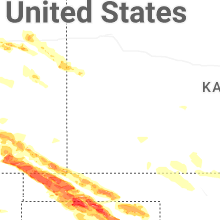
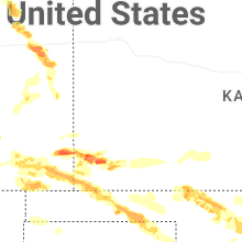
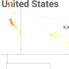
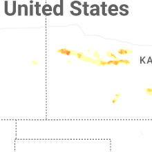
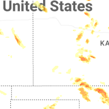


Connect with Interactive Hail Maps