

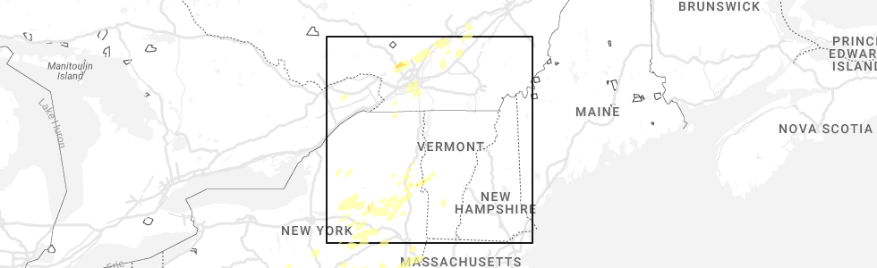
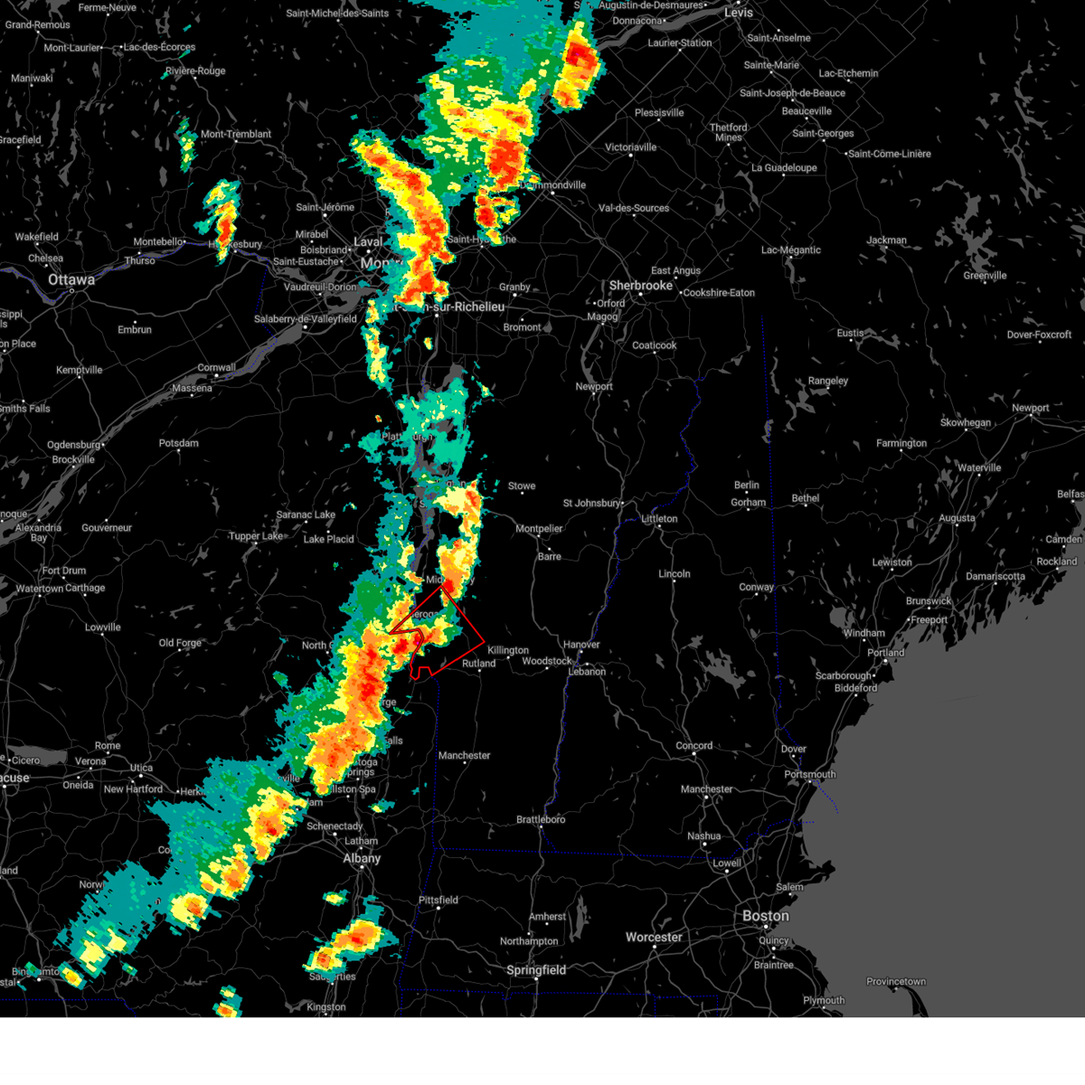
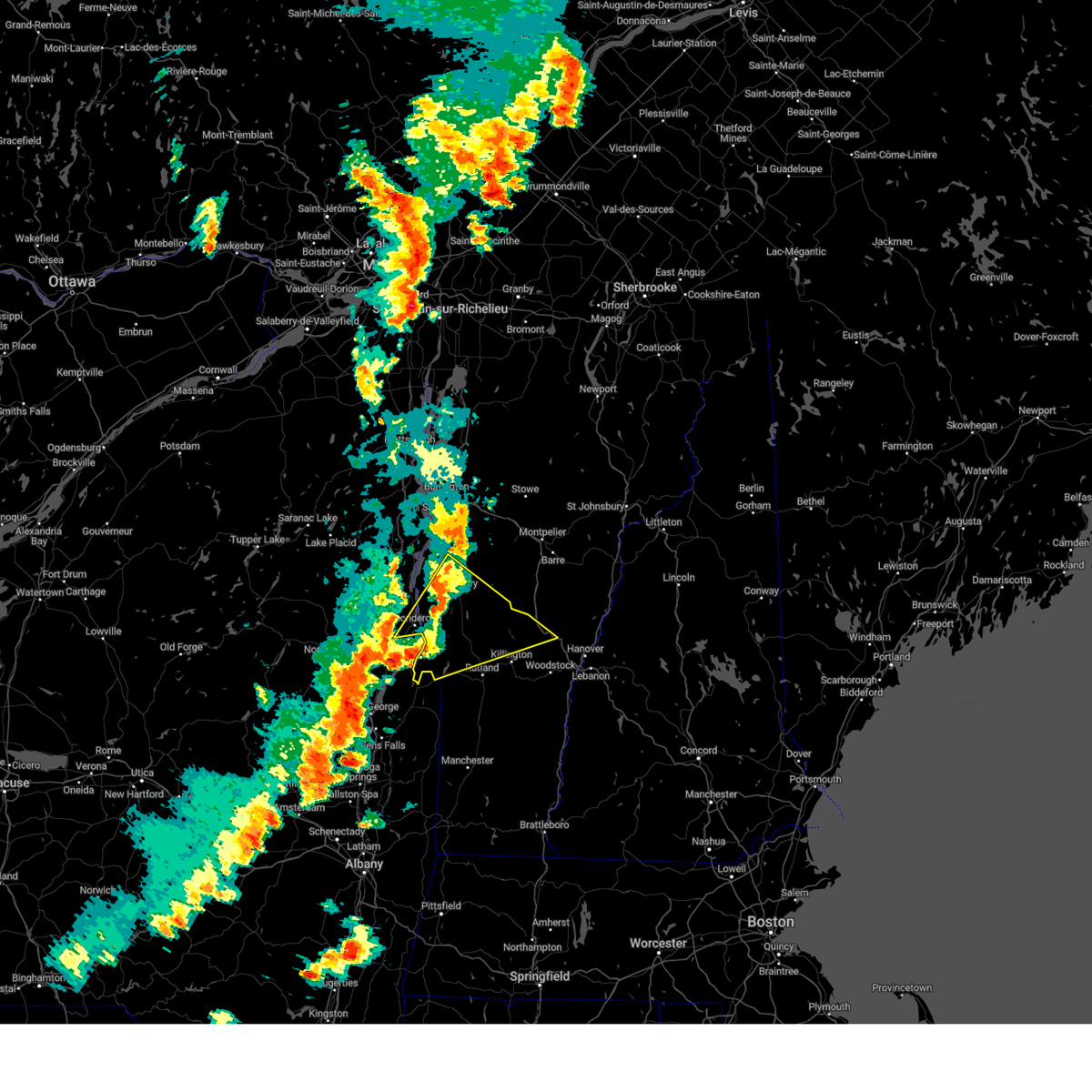
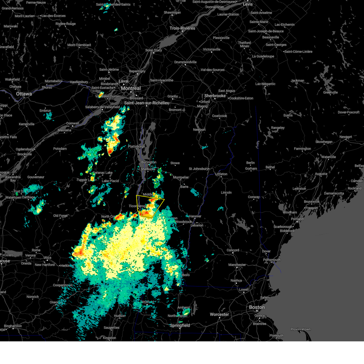
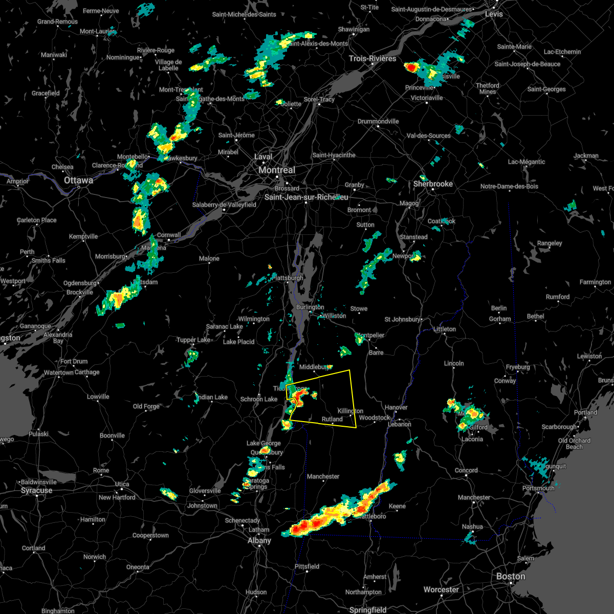
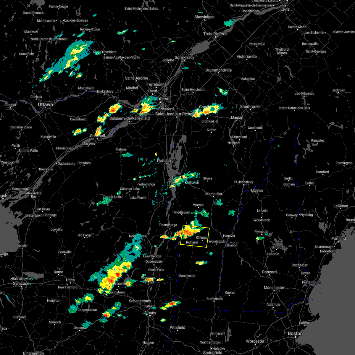
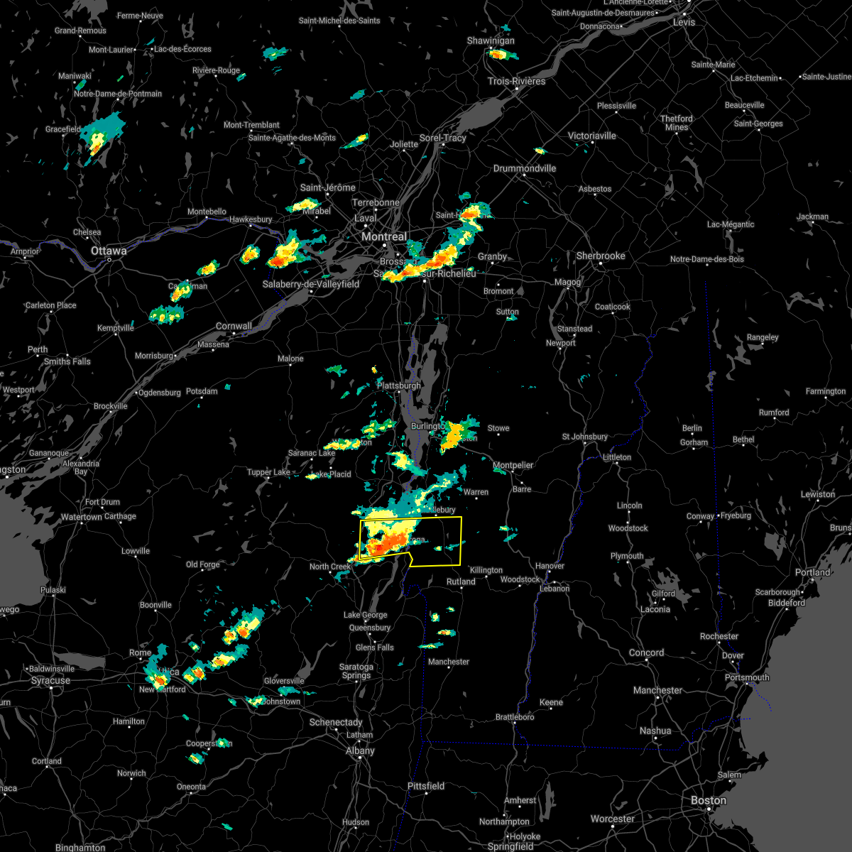
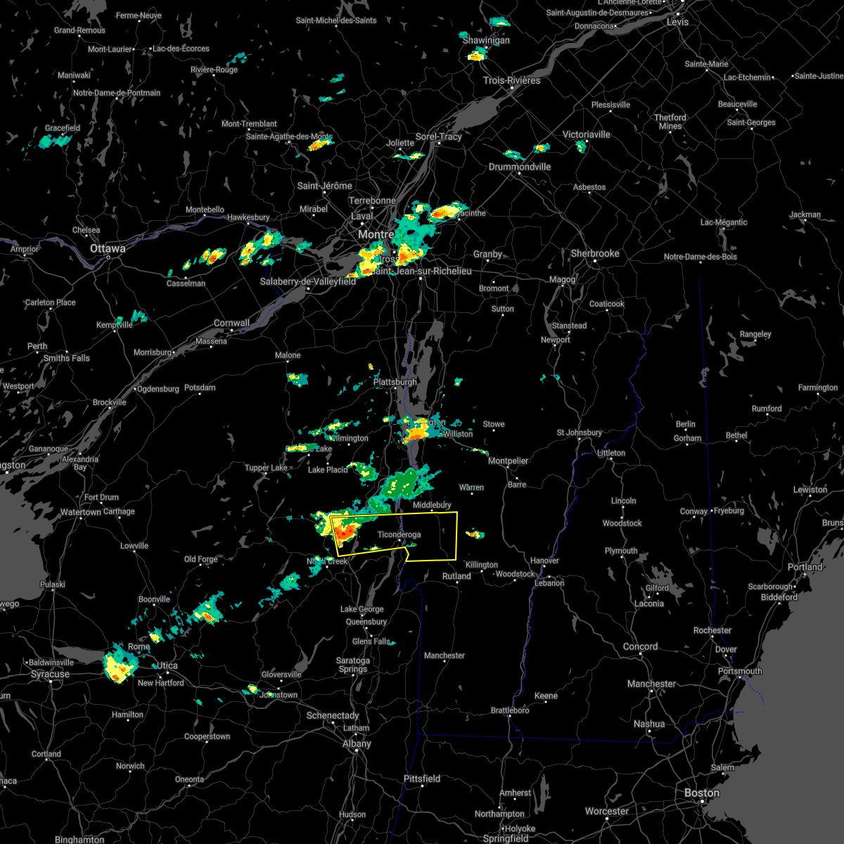
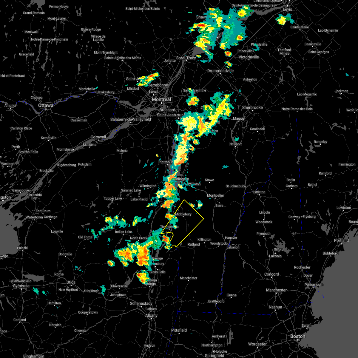
Hail Map for Brandon, VT
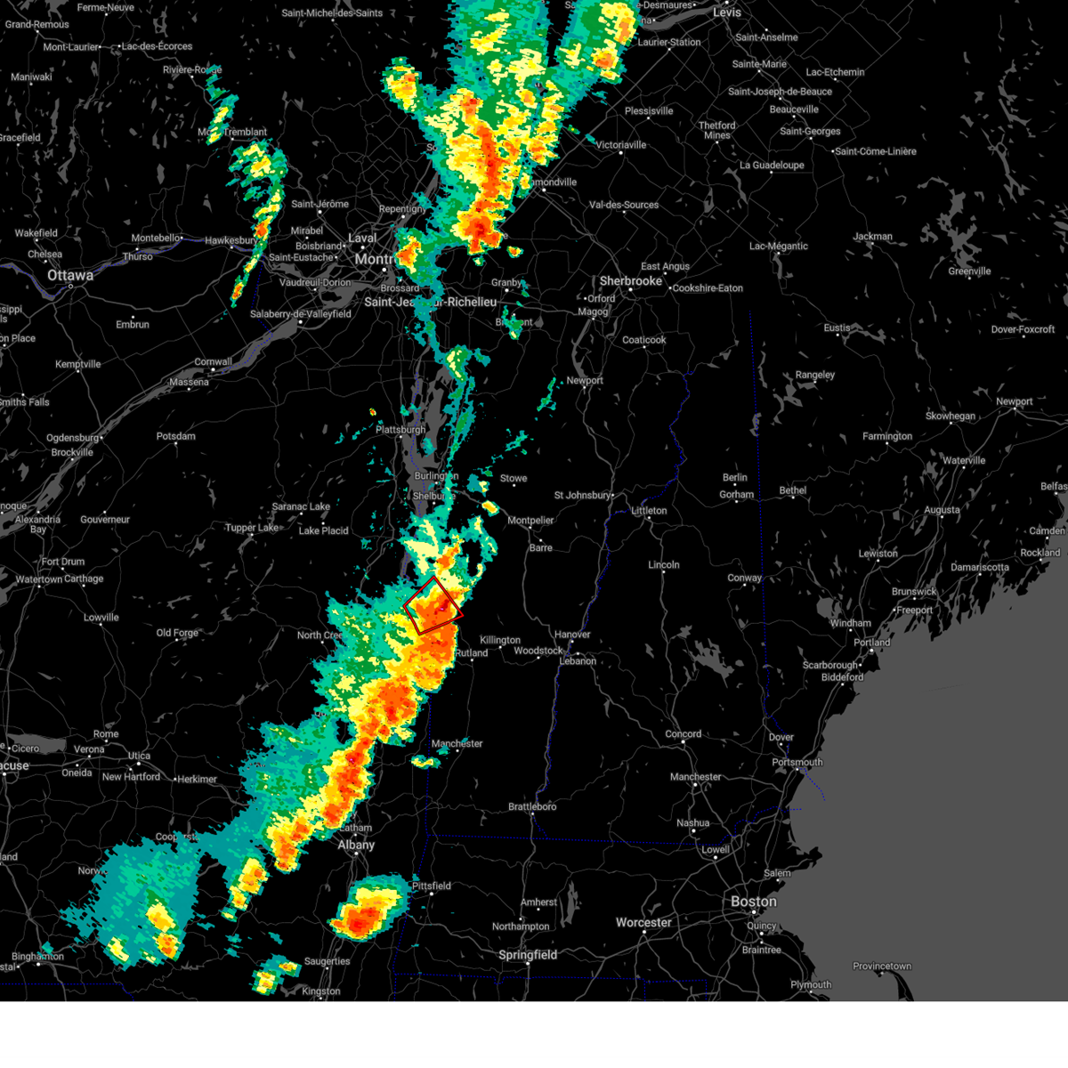
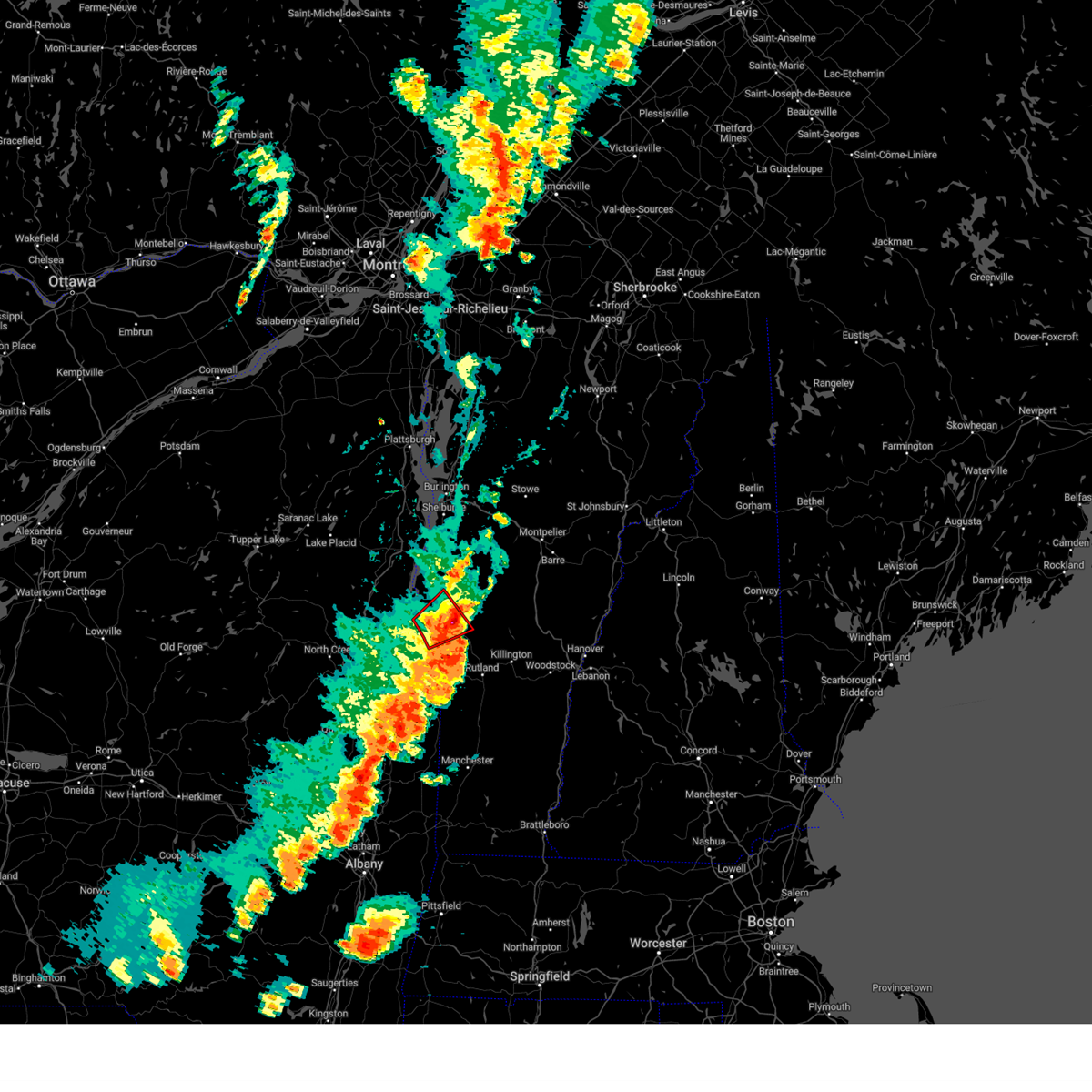
The Brandon, VT area has had 0 reports of on-the-ground hail by trained spotters, and has been under severe weather warnings 1 time during the past 12 months. Doppler radar has detected hail at or near Brandon, VT on 15 occasions.
| Name: | Brandon, VT |
| Where Located: | 47.1 miles S of Burlington, VT |
| Map: | Google Map for Brandon, VT |
| Population: | 1648 |
| Housing Units: | 790 |
| More Info: | Search Google for Brandon, VT |
0
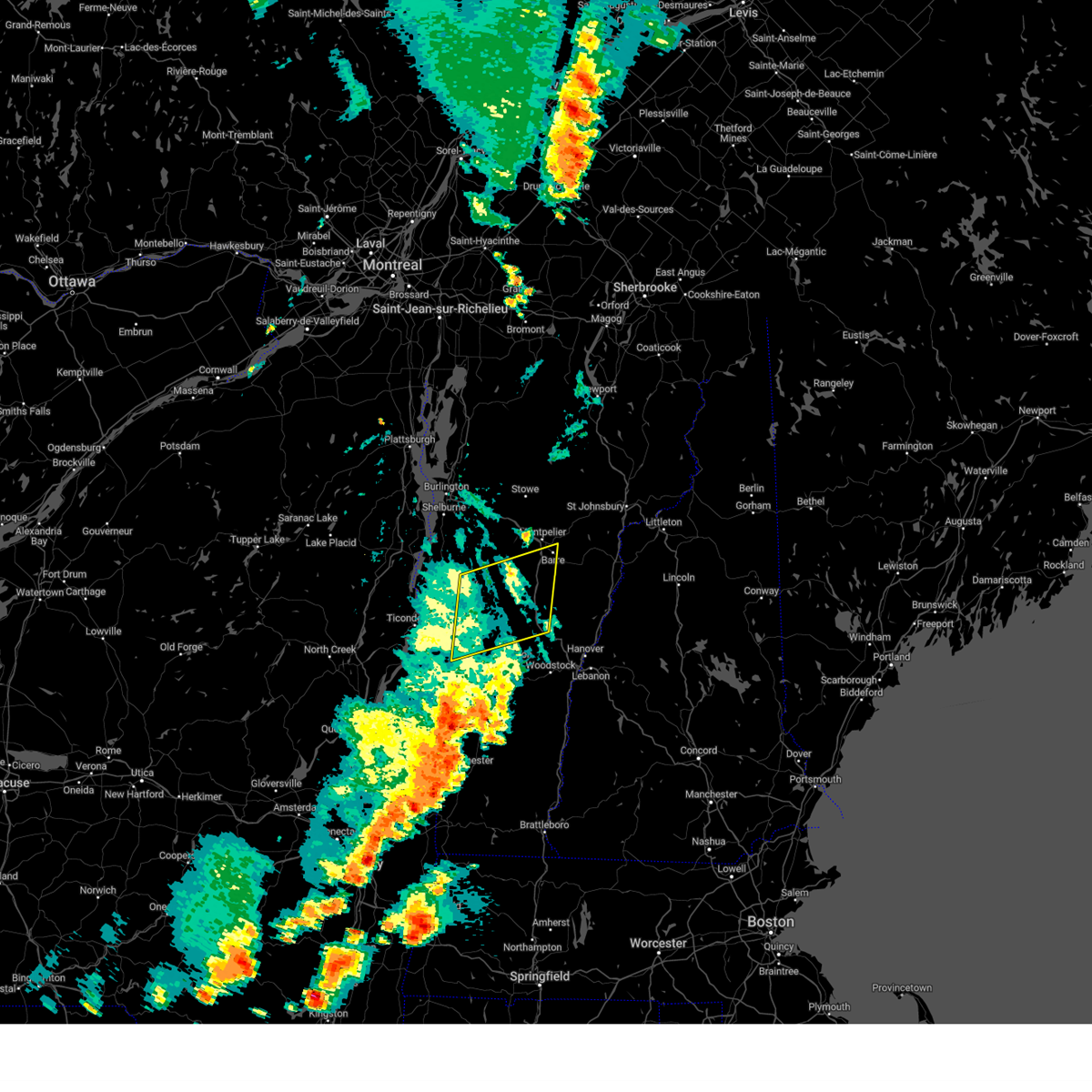
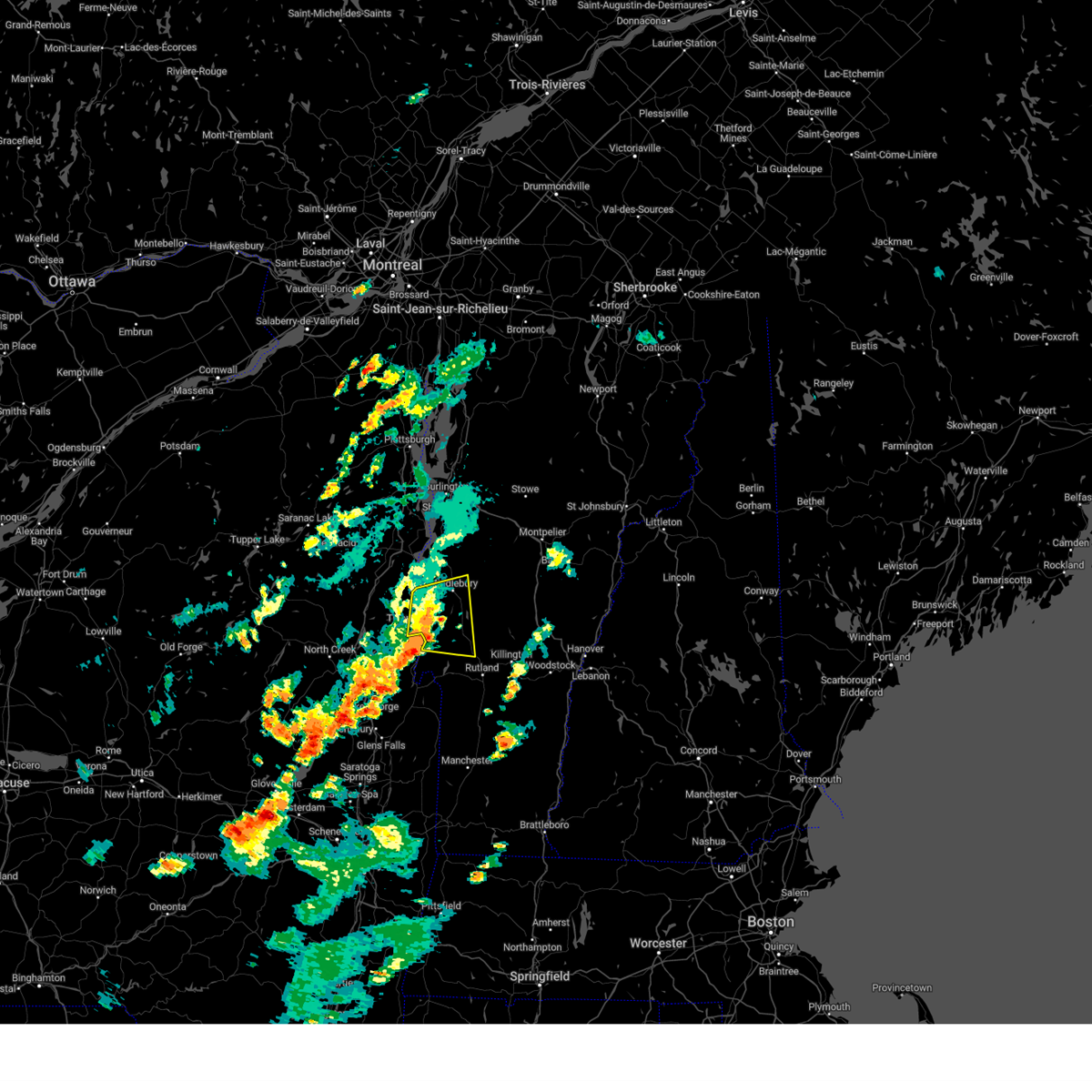
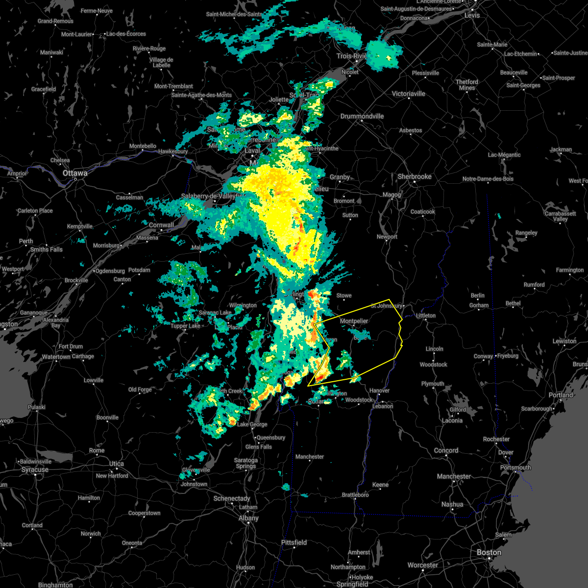
The Top Recent Hail Date for Brandon, VT is Thursday, July 13, 2023 (7th out of 15)
Hail and Wind Damage Spotted near Brandon, VT
| Date / Time | Report Details |
|---|---|
| 7/16/2024 5:39 PM EDT |
 Svrbtv the national weather service in burlington has issued a * severe thunderstorm warning for, southeastern essex county in northern new york, west central orange county in central vermont, southern addison county in central vermont, rutland county in southern vermont, western windsor county in southern vermont, * until 630 pm edt. * at 539 pm edt, severe thunderstorms were located along a line extending from chipmans point to 8 miles south of west pawlet, moving east at 45 mph (radar indicated). Hazards include 70 mph wind gusts. Expect considerable tree damage. Damage is likely to mobile homes, roofs, and outbuildings. Svrbtv the national weather service in burlington has issued a * severe thunderstorm warning for, southeastern essex county in northern new york, west central orange county in central vermont, southern addison county in central vermont, rutland county in southern vermont, western windsor county in southern vermont, * until 630 pm edt. * at 539 pm edt, severe thunderstorms were located along a line extending from chipmans point to 8 miles south of west pawlet, moving east at 45 mph (radar indicated). Hazards include 70 mph wind gusts. Expect considerable tree damage. Damage is likely to mobile homes, roofs, and outbuildings.
|
| 8/12/2023 11:43 PM EDT |
 The severe thunderstorm warning for southeastern essex, southwestern addison, northwestern rutland and northwestern windsor counties will expire at 1145 pm edt, the storm which prompted the warning has weakened below severe limits, and no longer poses an immediate threat to life or property. therefore, the warning will be allowed to expire. however gusty winds and heavy rain are still possible with this thunderstorm. The severe thunderstorm warning for southeastern essex, southwestern addison, northwestern rutland and northwestern windsor counties will expire at 1145 pm edt, the storm which prompted the warning has weakened below severe limits, and no longer poses an immediate threat to life or property. therefore, the warning will be allowed to expire. however gusty winds and heavy rain are still possible with this thunderstorm.
|
| 8/12/2023 11:35 PM EDT |
 At 1135 pm edt, a severe thunderstorm was located near north chittenden, moving northeast at 40 mph (radar indicated). Hazards include 60 mph wind gusts and penny size hail. Expect damage to trees and powerlines. locations impacted include, rutland, castleton, west castleton, sudbury, hubbardton, shoreham, salisbury, rutland city, orwell, proctor, chittenden, brandon, leicester, west rutland, whiting, pittsford, goshen, ripton, mendon, and poultney. hail threat, radar indicated max hail size, 0. 75 in wind threat, radar indicated max wind gust, 60 mph. At 1135 pm edt, a severe thunderstorm was located near north chittenden, moving northeast at 40 mph (radar indicated). Hazards include 60 mph wind gusts and penny size hail. Expect damage to trees and powerlines. locations impacted include, rutland, castleton, west castleton, sudbury, hubbardton, shoreham, salisbury, rutland city, orwell, proctor, chittenden, brandon, leicester, west rutland, whiting, pittsford, goshen, ripton, mendon, and poultney. hail threat, radar indicated max hail size, 0. 75 in wind threat, radar indicated max wind gust, 60 mph.
|
| 8/12/2023 11:24 PM EDT |
 At 1124 pm edt, a severe thunderstorm was located over hubbardton, moving northeast at 35 mph (radar indicated). Hazards include 60 mph wind gusts and penny size hail. Expect damage to trees and powerlines. locations impacted include, rutland, castleton, sudbury, salisbury, rutland city, orwell, benson, chittenden, fair haven, west rutland, whiting, goshen, west castleton, hubbardton, shoreham, proctor, brandon, leicester, pittsford, and west haven. hail threat, radar indicated max hail size, 0. 75 in wind threat, radar indicated max wind gust, 60 mph. At 1124 pm edt, a severe thunderstorm was located over hubbardton, moving northeast at 35 mph (radar indicated). Hazards include 60 mph wind gusts and penny size hail. Expect damage to trees and powerlines. locations impacted include, rutland, castleton, sudbury, salisbury, rutland city, orwell, benson, chittenden, fair haven, west rutland, whiting, goshen, west castleton, hubbardton, shoreham, proctor, brandon, leicester, pittsford, and west haven. hail threat, radar indicated max hail size, 0. 75 in wind threat, radar indicated max wind gust, 60 mph.
|
| 8/12/2023 11:01 PM EDT |
 At 1101 pm edt, a severe thunderstorm was located over west haven, moving northeast at 40 mph (radar indicated). Hazards include 60 mph wind gusts and penny size hail. expect damage to trees and powerlines At 1101 pm edt, a severe thunderstorm was located over west haven, moving northeast at 40 mph (radar indicated). Hazards include 60 mph wind gusts and penny size hail. expect damage to trees and powerlines
|
| 7/13/2023 7:26 PM EDT |
 The severe thunderstorm warning for western orange, southeastern addison, northeastern rutland, northwestern windsor and southwestern washington counties will expire at 730 pm edt, the storms which prompted the warning have weakened and moved out of the warned area. therefore, the warning will be allowed to expire. a severe thunderstorm watch remains in effect until 800 pm edt for central and southern vermont. The severe thunderstorm warning for western orange, southeastern addison, northeastern rutland, northwestern windsor and southwestern washington counties will expire at 730 pm edt, the storms which prompted the warning have weakened and moved out of the warned area. therefore, the warning will be allowed to expire. a severe thunderstorm watch remains in effect until 800 pm edt for central and southern vermont.
|
| 7/13/2023 6:43 PM EDT | Trees down in wires closing portion of vt-73. time is radar estimated in rutland county VT, 0.6 miles E of Brandon, VT |
| 7/13/2023 6:42 PM EDT |
 At 642 pm edt, severe thunderstorms were located along a line extending from near granville to east pittsford, moving east at 80 mph (radar indicated). Hazards include 60 mph wind gusts and quarter size hail. Minor hail damage to vehicles is possible. Expect wind damage to trees and powerlines. At 642 pm edt, severe thunderstorms were located along a line extending from near granville to east pittsford, moving east at 80 mph (radar indicated). Hazards include 60 mph wind gusts and quarter size hail. Minor hail damage to vehicles is possible. Expect wind damage to trees and powerlines.
|
| 7/13/2023 6:39 PM EDT |
 At 639 pm edt, a severe thunderstorm capable of producing a tornado was located over lake dunmore, moving northeast at 30 mph (radar indicated rotation). Hazards include tornado and two inch hail. Flying debris will be dangerous to those caught without shelter. mobile homes will be damaged or destroyed. damage to roofs, windows, and vehicles will occur. tree damage is likely. This tornadic thunderstorm will remain over mainly rural areas of southeastern essex, southwestern addison and northwestern rutland counties, including the following locations, benson bay, catfish bay in addison county, huntley island, forest dale, beadles cove, larrabees point, beartrap island, kerby point, hollands pasture island, and east shoreham. At 639 pm edt, a severe thunderstorm capable of producing a tornado was located over lake dunmore, moving northeast at 30 mph (radar indicated rotation). Hazards include tornado and two inch hail. Flying debris will be dangerous to those caught without shelter. mobile homes will be damaged or destroyed. damage to roofs, windows, and vehicles will occur. tree damage is likely. This tornadic thunderstorm will remain over mainly rural areas of southeastern essex, southwestern addison and northwestern rutland counties, including the following locations, benson bay, catfish bay in addison county, huntley island, forest dale, beadles cove, larrabees point, beartrap island, kerby point, hollands pasture island, and east shoreham.
|
| 7/13/2023 6:10 PM EDT |
 At 610 pm edt, a severe thunderstorm capable of producing a tornado was located over stevens bay, moving northeast at 30 mph (radar indicated rotation). Hazards include tornado and hail up to two inches in diameter. Flying debris will be dangerous to those caught without shelter. mobile homes will be damaged or destroyed. damage to roofs, windows, and vehicles will occur. tree damage is likely. this dangerous storm will be near, hubbardton, sudbury, cornwall, salisbury, shoreham, benson, orwell, leicester, whiting, and brandon around 615 pm edt. chittenden and goshen around 630 pm edt. Other locations impacted by this tornadic thunderstorm include benson bay, bomoseen state park, florence, coates point, black point, beadles cove, half moon state park, larrabees point, beartrap island, and hollands pasture island. At 610 pm edt, a severe thunderstorm capable of producing a tornado was located over stevens bay, moving northeast at 30 mph (radar indicated rotation). Hazards include tornado and hail up to two inches in diameter. Flying debris will be dangerous to those caught without shelter. mobile homes will be damaged or destroyed. damage to roofs, windows, and vehicles will occur. tree damage is likely. this dangerous storm will be near, hubbardton, sudbury, cornwall, salisbury, shoreham, benson, orwell, leicester, whiting, and brandon around 615 pm edt. chittenden and goshen around 630 pm edt. Other locations impacted by this tornadic thunderstorm include benson bay, bomoseen state park, florence, coates point, black point, beadles cove, half moon state park, larrabees point, beartrap island, and hollands pasture island.
|
| 7/13/2023 6:07 PM EDT |
 At 607 pm edt, a severe thunderstorm was located over benson bay, moving northeast at 30 mph (radar indicated). Hazards include two inch hail and 60 mph wind gusts. People and animals outdoors will be injured. expect hail damage to roofs, siding, windows, and vehicles. expect wind damage to trees and powerlines. Locations impacted include, middlebury, rutland, castleton, cornwall, sudbury, weybridge, waltham, salisbury, bethel, orwell, rochester, benson, chittenden, fair haven, whiting, new haven, goshen, west castleton, hancock, and hubbardton. At 607 pm edt, a severe thunderstorm was located over benson bay, moving northeast at 30 mph (radar indicated). Hazards include two inch hail and 60 mph wind gusts. People and animals outdoors will be injured. expect hail damage to roofs, siding, windows, and vehicles. expect wind damage to trees and powerlines. Locations impacted include, middlebury, rutland, castleton, cornwall, sudbury, weybridge, waltham, salisbury, bethel, orwell, rochester, benson, chittenden, fair haven, whiting, new haven, goshen, west castleton, hancock, and hubbardton.
|
| 7/13/2023 6:01 PM EDT |
 At 601 pm edt, a severe thunderstorm was located over benson landing, moving northeast at 30 mph (radar indicated). Hazards include 60 mph wind gusts and quarter size hail. Minor hail damage to vehicles is possible. Expect wind damage to trees and powerlines. At 601 pm edt, a severe thunderstorm was located over benson landing, moving northeast at 30 mph (radar indicated). Hazards include 60 mph wind gusts and quarter size hail. Minor hail damage to vehicles is possible. Expect wind damage to trees and powerlines.
|
| 7/13/2023 4:36 PM EDT |
 At 436 pm edt, a severe thunderstorm was located over grass island, moving northeast at 30 mph (radar indicated). Hazards include 60 mph wind gusts and quarter size hail. Minor hail damage to vehicles is possible. Expect wind damage to trees and powerlines. At 436 pm edt, a severe thunderstorm was located over grass island, moving northeast at 30 mph (radar indicated). Hazards include 60 mph wind gusts and quarter size hail. Minor hail damage to vehicles is possible. Expect wind damage to trees and powerlines.
|
| 7/9/2023 6:08 PM EDT |
 The severe thunderstorm warning for southeastern essex, southern addison and northwestern rutland counties will expire at 615 pm edt, the storm which prompted the warning has weakened below severe limits, and has exited the warned area. therefore, the warning will be allowed to expire. The severe thunderstorm warning for southeastern essex, southern addison and northwestern rutland counties will expire at 615 pm edt, the storm which prompted the warning has weakened below severe limits, and has exited the warned area. therefore, the warning will be allowed to expire.
|
| 7/9/2023 5:46 PM EDT |
 At 545 pm edt, a severe thunderstorm was located over catfish bay in addison county, moving northwest at 25 mph (radar indicated). Hazards include 60 mph wind gusts and quarter size hail. Minor hail damage to vehicles is possible. expect wind damage to trees and powerlines. locations impacted include, middlebury, crown point, cornwall, sudbury, salisbury, orwell, whiting, shoreham, ripton, brandon, leicester, bridport, hubbardton, goshen, port henry, benson, hancock, weybridge, addison, and pittsford. hail threat, radar indicated max hail size, 1. 00 in wind threat, radar indicated max wind gust, 60 mph. At 545 pm edt, a severe thunderstorm was located over catfish bay in addison county, moving northwest at 25 mph (radar indicated). Hazards include 60 mph wind gusts and quarter size hail. Minor hail damage to vehicles is possible. expect wind damage to trees and powerlines. locations impacted include, middlebury, crown point, cornwall, sudbury, salisbury, orwell, whiting, shoreham, ripton, brandon, leicester, bridport, hubbardton, goshen, port henry, benson, hancock, weybridge, addison, and pittsford. hail threat, radar indicated max hail size, 1. 00 in wind threat, radar indicated max wind gust, 60 mph.
|
| 7/9/2023 5:08 PM EDT |
 At 507 pm edt, a severe thunderstorm was located over hydeville, moving north at 20 mph (radar indicated). Hazards include 60 mph wind gusts and quarter size hail. Minor hail damage to vehicles is possible. Expect wind damage to trees and powerlines. At 507 pm edt, a severe thunderstorm was located over hydeville, moving north at 20 mph (radar indicated). Hazards include 60 mph wind gusts and quarter size hail. Minor hail damage to vehicles is possible. Expect wind damage to trees and powerlines.
|
| 7/7/2023 2:56 PM EDT |
 At 255 pm edt, a severe thunderstorm was located over shoreham, moving east at 10 mph (radar indicated). Hazards include 60 mph wind gusts and quarter size hail. Minor hail damage to vehicles is possible. expect wind damage to trees and powerlines. locations impacted include, middlebury, crown point, cornwall, sudbury, weybridge, salisbury, orwell, whiting, shoreham, brandon, leicester, pittsford, bridport, hubbardton, benson, addison, new haven, bristol, benson bay, and florence. hail threat, radar indicated max hail size, 1. 00 in wind threat, radar indicated max wind gust, 60 mph. At 255 pm edt, a severe thunderstorm was located over shoreham, moving east at 10 mph (radar indicated). Hazards include 60 mph wind gusts and quarter size hail. Minor hail damage to vehicles is possible. expect wind damage to trees and powerlines. locations impacted include, middlebury, crown point, cornwall, sudbury, weybridge, salisbury, orwell, whiting, shoreham, brandon, leicester, pittsford, bridport, hubbardton, benson, addison, new haven, bristol, benson bay, and florence. hail threat, radar indicated max hail size, 1. 00 in wind threat, radar indicated max wind gust, 60 mph.
|
| 7/7/2023 2:18 PM EDT |
 At 218 pm edt, a severe thunderstorm was located near chilson, moving east at 15 mph (radar indicated). Hazards include 60 mph wind gusts and quarter size hail. Minor hail damage to vehicles is possible. Expect wind damage to trees and powerlines. At 218 pm edt, a severe thunderstorm was located near chilson, moving east at 15 mph (radar indicated). Hazards include 60 mph wind gusts and quarter size hail. Minor hail damage to vehicles is possible. Expect wind damage to trees and powerlines.
|
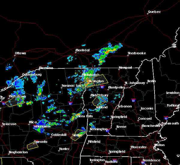
| 8/30/2022 4:58 PM EDT |
 The severe thunderstorm warning for southern addison, northwestern rutland and northwestern windsor counties will expire at 500 pm edt, the storm which prompted the warning has moved out of the area. therefore, the warning will be allowed to expire. however heavy rain is still possible with additional thunderstorms. The severe thunderstorm warning for southern addison, northwestern rutland and northwestern windsor counties will expire at 500 pm edt, the storm which prompted the warning has moved out of the area. therefore, the warning will be allowed to expire. however heavy rain is still possible with additional thunderstorms.
|
| 8/30/2022 4:33 PM EDT |
 At 433 pm edt, a severe thunderstorm was located over north chittenden, moving northeast at 40 mph (radar indicated). Hazards include 60 mph wind gusts and penny size hail. Expect damage to trees and powerlines. locations impacted include, middlebury, rutland, castleton, cornwall, sudbury, salisbury, orwell, rochester, benson, chittenden, west rutland, whiting, goshen, west castleton, hancock, hubbardton, proctor, brandon, leicester and pittsford. hail threat, radar indicated max hail size, 0. 75 in wind threat, radar indicated max wind gust, 60 mph. At 433 pm edt, a severe thunderstorm was located over north chittenden, moving northeast at 40 mph (radar indicated). Hazards include 60 mph wind gusts and penny size hail. Expect damage to trees and powerlines. locations impacted include, middlebury, rutland, castleton, cornwall, sudbury, salisbury, orwell, rochester, benson, chittenden, west rutland, whiting, goshen, west castleton, hancock, hubbardton, proctor, brandon, leicester and pittsford. hail threat, radar indicated max hail size, 0. 75 in wind threat, radar indicated max wind gust, 60 mph.
|
| 8/30/2022 4:09 PM EDT |
 At 407 pm edt, a severe thunderstorm was located near fair haven, moving northeast at 35 mph (radar indicated). Hazards include 60 mph wind gusts and penny size hail. expect damage to trees and powerlines At 407 pm edt, a severe thunderstorm was located near fair haven, moving northeast at 35 mph (radar indicated). Hazards include 60 mph wind gusts and penny size hail. expect damage to trees and powerlines
|
| 7/21/2022 5:23 PM EDT |
 The severe thunderstorm warning for western orange, southeastern addison, northern rutland and northwestern windsor counties will expire at 530 pm edt, the storm which prompted the warning has moved out of the area. therefore, the warning will be allowed to expire. a severe thunderstorm watch remains in effect until 800 pm edt for central and southern vermont. remember, a new severe thunderstorm warning has been issued for central and northern windsor county into orange county vermont. The severe thunderstorm warning for western orange, southeastern addison, northern rutland and northwestern windsor counties will expire at 530 pm edt, the storm which prompted the warning has moved out of the area. therefore, the warning will be allowed to expire. a severe thunderstorm watch remains in effect until 800 pm edt for central and southern vermont. remember, a new severe thunderstorm warning has been issued for central and northern windsor county into orange county vermont.
|
| 7/21/2022 5:02 PM EDT |
 At 502 pm edt, a severe thunderstorm was located over bradbury state park, moving east at 35 mph (radar indicated). Hazards include 60 mph wind gusts and quarter size hail. Minor hail damage to vehicles is possible. expect wind damage to trees and powerlines. locations impacted include, rutland, middlebury, castleton, sudbury, killington, salisbury, rutland city, rochester, chittenden, west rutland, granville, goshen, west castleton, hancock, hubbardton, ripton, proctor, brandon, mendon and leicester. hail threat, radar indicated max hail size, 1. 00 in wind threat, radar indicated max wind gust, 60 mph. At 502 pm edt, a severe thunderstorm was located over bradbury state park, moving east at 35 mph (radar indicated). Hazards include 60 mph wind gusts and quarter size hail. Minor hail damage to vehicles is possible. expect wind damage to trees and powerlines. locations impacted include, rutland, middlebury, castleton, sudbury, killington, salisbury, rutland city, rochester, chittenden, west rutland, granville, goshen, west castleton, hancock, hubbardton, ripton, proctor, brandon, mendon and leicester. hail threat, radar indicated max hail size, 1. 00 in wind threat, radar indicated max wind gust, 60 mph.
|
| 7/21/2022 4:59 PM EDT | Trees and power lines down in brandon... whiting... and leiceste in addison county VT, 4.9 miles SSE of Brandon, VT |
| 7/21/2022 4:55 PM EDT |
 At 454 pm edt, a severe thunderstorm was located over leicester junction, moving east at 35 mph (radar indicated). Hazards include 60 mph wind gusts and quarter size hail. Minor hail damage to vehicles is possible. expect wind damage to trees and powerlines. Locations impacted include, rutland, middlebury, castleton, sudbury, killington, salisbury, rutland city, orwell, rochester, benson, chittenden, west rutland, whiting, granville, goshen, west castleton, hancock, hubbardton, shoreham and ripton. At 454 pm edt, a severe thunderstorm was located over leicester junction, moving east at 35 mph (radar indicated). Hazards include 60 mph wind gusts and quarter size hail. Minor hail damage to vehicles is possible. expect wind damage to trees and powerlines. Locations impacted include, rutland, middlebury, castleton, sudbury, killington, salisbury, rutland city, orwell, rochester, benson, chittenden, west rutland, whiting, granville, goshen, west castleton, hancock, hubbardton, shoreham and ripton.
|
| 7/21/2022 4:43 PM EDT |
 At 443 pm edt, a severe thunderstorm was located over east shoreham, moving east at 35 mph (radar indicated). Hazards include 60 mph wind gusts and quarter size hail. Minor hail damage to vehicles is possible. expect wind damage to trees and powerlines. Locations impacted include, rutland, middlebury, castleton, sudbury, killington, salisbury, rutland city, orwell, rochester, benson, chittenden, west rutland, whiting, granville, goshen, west castleton, hancock, hubbardton, shoreham and ripton. At 443 pm edt, a severe thunderstorm was located over east shoreham, moving east at 35 mph (radar indicated). Hazards include 60 mph wind gusts and quarter size hail. Minor hail damage to vehicles is possible. expect wind damage to trees and powerlines. Locations impacted include, rutland, middlebury, castleton, sudbury, killington, salisbury, rutland city, orwell, rochester, benson, chittenden, west rutland, whiting, granville, goshen, west castleton, hancock, hubbardton, shoreham and ripton.
|
| 7/21/2022 4:27 PM EDT |
 At 427 pm edt, a severe thunderstorm was located over black point, moving east at 35 mph (radar indicated). Hazards include 60 mph wind gusts and quarter size hail. Minor hail damage to vehicles is possible. Expect wind damage to trees and powerlines. At 427 pm edt, a severe thunderstorm was located over black point, moving east at 35 mph (radar indicated). Hazards include 60 mph wind gusts and quarter size hail. Minor hail damage to vehicles is possible. Expect wind damage to trees and powerlines.
|
| 7/12/2022 2:25 PM EDT |
 At 225 pm edt, a severe thunderstorm was located over benson landing, moving east at 50 mph (radar indicated). Hazards include 60 mph wind gusts. expect damage to trees and powerlines At 225 pm edt, a severe thunderstorm was located over benson landing, moving east at 50 mph (radar indicated). Hazards include 60 mph wind gusts. expect damage to trees and powerlines
|
| 10/16/2021 3:03 PM EDT |
 At 302 pm edt, severe thunderstorms were located along a line extending from williston to near cornwall to shoreham, moving east at 45 mph. multiple reports of trees down have been reported with these storms (emergency management). Hazards include 60 mph wind gusts. Expect damage to trees and powerlines. Locations impacted include, essex junction, middlebury, vergennes, montpelier, south burlington, morrisville, johnson village, cornwall, braintree hill, weybridge, cambridge, salisbury, monkton ridge, waterbury village, lincoln, orwell, monkton, westford, monkton boro and hyde park. At 302 pm edt, severe thunderstorms were located along a line extending from williston to near cornwall to shoreham, moving east at 45 mph. multiple reports of trees down have been reported with these storms (emergency management). Hazards include 60 mph wind gusts. Expect damage to trees and powerlines. Locations impacted include, essex junction, middlebury, vergennes, montpelier, south burlington, morrisville, johnson village, cornwall, braintree hill, weybridge, cambridge, salisbury, monkton ridge, waterbury village, lincoln, orwell, monkton, westford, monkton boro and hyde park.
|
| 10/16/2021 2:40 PM EDT |
 At 239 pm edt, severe thunderstorms were located along a line extending from boquet river point to ironville to near pharoah mountain, moving east at 45 mph. there have been reports of downed trees near schroon lake in association with these storms (emergency management). Hazards include 60 mph wind gusts. expect damage to trees and powerlines At 239 pm edt, severe thunderstorms were located along a line extending from boquet river point to ironville to near pharoah mountain, moving east at 45 mph. there have been reports of downed trees near schroon lake in association with these storms (emergency management). Hazards include 60 mph wind gusts. expect damage to trees and powerlines
|
| 7/20/2021 8:11 PM EDT |
 At 808 pm edt, a line of severe thunderstorms over northern and central vermont was located along a line extending from near east richford to near wolcott to ainsworth state park to near pittsfield, moving east at 30 mph (radar indicated). Hazards include 60 mph wind gusts and quarter size hail. Expect wind damage to trees and powerlines. minor hail damage to vehicles is possible. these storms have a history of producing wind damage and power outages. locations impacted include, barre, montpelier, island pond, lyndon, st. Johnsbury, middlebury, newport city, vergennes, crown point, morrisville, enosburg falls, orleans, derby center, charleston, braintree hill, glover, waterbury village, montgomery center, websterville and orwell. At 808 pm edt, a line of severe thunderstorms over northern and central vermont was located along a line extending from near east richford to near wolcott to ainsworth state park to near pittsfield, moving east at 30 mph (radar indicated). Hazards include 60 mph wind gusts and quarter size hail. Expect wind damage to trees and powerlines. minor hail damage to vehicles is possible. these storms have a history of producing wind damage and power outages. locations impacted include, barre, montpelier, island pond, lyndon, st. Johnsbury, middlebury, newport city, vergennes, crown point, morrisville, enosburg falls, orleans, derby center, charleston, braintree hill, glover, waterbury village, montgomery center, websterville and orwell.
|
| 7/20/2021 7:32 PM EDT |
 At 730 pm edt, a line of severe thunderstorms over western vermont was located along a line extending from near east franklin to stowe to east warren to mossy point, moving east at 40 mph (radar indicated). Hazards include 60 mph wind gusts and quarter size hail. Expect wind damage to trees and powerlines. minor hail damage to vehicles is possible. This line of storms has a history of producing wind damage and power outages. At 730 pm edt, a line of severe thunderstorms over western vermont was located along a line extending from near east franklin to stowe to east warren to mossy point, moving east at 40 mph (radar indicated). Hazards include 60 mph wind gusts and quarter size hail. Expect wind damage to trees and powerlines. minor hail damage to vehicles is possible. This line of storms has a history of producing wind damage and power outages.
|
| 7/20/2021 7:06 PM EDT |
 At 704 pm edt, a line of severe thunderstorms over northwest vermont and essex county new york was located along a line extending from shad island to south burlington to near chilson, new york moving east at 35 mph (radar indicated). Hazards include 60 mph wind gusts and quarter size hail. Expect wind damage to trees and powerlines. minor hail damage to vehicles is possible. Locations impacted include, essex junction, plattsburgh international airport, burlington, burlington international airport, plattsburgh, middlebury, south burlington, vergennes, peru, beekmantown, moriah, chazy, willsboro, crown point, morrisville, enosburg falls, westport, elizabethtown, champlain and waterbury village. At 704 pm edt, a line of severe thunderstorms over northwest vermont and essex county new york was located along a line extending from shad island to south burlington to near chilson, new york moving east at 35 mph (radar indicated). Hazards include 60 mph wind gusts and quarter size hail. Expect wind damage to trees and powerlines. minor hail damage to vehicles is possible. Locations impacted include, essex junction, plattsburgh international airport, burlington, burlington international airport, plattsburgh, middlebury, south burlington, vergennes, peru, beekmantown, moriah, chazy, willsboro, crown point, morrisville, enosburg falls, westport, elizabethtown, champlain and waterbury village.
|
| 7/20/2021 6:31 PM EDT |
 At 630 pm edt, a line of severe thunderstorms over northeast new york was located along a line extending from near perry mills to near harkness to 9 miles west of schroon falls, moving east at 40 mph (radar indicated). Hazards include 60 mph wind gusts and quarter size hail. Expect wind damage to trees and powerlines. Minor hail damage to vehicles is possible. At 630 pm edt, a line of severe thunderstorms over northeast new york was located along a line extending from near perry mills to near harkness to 9 miles west of schroon falls, moving east at 40 mph (radar indicated). Hazards include 60 mph wind gusts and quarter size hail. Expect wind damage to trees and powerlines. Minor hail damage to vehicles is possible.
|
| 6/30/2021 2:47 PM EDT |
 At 247 pm edt, a severe thunderstorm was located over south pomfret, moving east at 35 mph (radar indicated). Hazards include 60 mph wind gusts and half dollar size hail. Minor hail damage to vehicles is possible. expect wind damage to trees and powerlines. Locations impacted include, woodstock, rutland, white river junction, hartland four corners, killington, rutland city, pomfret, plymouth, hartland, chittenden, west rutland, barnard, windsor, woodstock village, quechee, stockbridge, proctor, brandon, bridgewater and mendon. At 247 pm edt, a severe thunderstorm was located over south pomfret, moving east at 35 mph (radar indicated). Hazards include 60 mph wind gusts and half dollar size hail. Minor hail damage to vehicles is possible. expect wind damage to trees and powerlines. Locations impacted include, woodstock, rutland, white river junction, hartland four corners, killington, rutland city, pomfret, plymouth, hartland, chittenden, west rutland, barnard, windsor, woodstock village, quechee, stockbridge, proctor, brandon, bridgewater and mendon.
|
| 6/30/2021 2:24 PM EDT |
 At 223 pm edt, a severe thunderstorm was located near chittenden, moving east at 30 mph (radar indicated). Hazards include 60 mph wind gusts and half dollar size hail. Minor hail damage to vehicles is possible. Expect wind damage to trees and powerlines. At 223 pm edt, a severe thunderstorm was located near chittenden, moving east at 30 mph (radar indicated). Hazards include 60 mph wind gusts and half dollar size hail. Minor hail damage to vehicles is possible. Expect wind damage to trees and powerlines.
|
| 6/30/2021 2:05 PM EDT |
 At 204 pm edt, a severe thunderstorm was located over hortonia, moving east at 35 mph (law enforcement). Hazards include ping pong ball size hail and 60 mph wind gusts. People and animals outdoors will be injured. expect hail damage to roofs, siding, windows, and vehicles. expect wind damage to trees and powerlines. locations impacted include, rutland, castleton, killington, rutland city, stockbridge, proctor, brandon, chittenden, mendon, leicester, pittsfield, west rutland, pittsford, goshen, hubbardton, bethel, sudbury, rochester, bridgewater and barnard. Law enforcement reported wind damage in the ticonderoga area around 130 pm. At 204 pm edt, a severe thunderstorm was located over hortonia, moving east at 35 mph (law enforcement). Hazards include ping pong ball size hail and 60 mph wind gusts. People and animals outdoors will be injured. expect hail damage to roofs, siding, windows, and vehicles. expect wind damage to trees and powerlines. locations impacted include, rutland, castleton, killington, rutland city, stockbridge, proctor, brandon, chittenden, mendon, leicester, pittsfield, west rutland, pittsford, goshen, hubbardton, bethel, sudbury, rochester, bridgewater and barnard. Law enforcement reported wind damage in the ticonderoga area around 130 pm.
|
| 6/30/2021 2:02 PM EDT | Tree down on nickerson road in rutland county VT, 0.8 miles N of Brandon, VT |
| 6/30/2021 1:50 PM EDT |
 At 150 pm edt, a severe thunderstorm was located over orwell, moving east at 35 mph (radar indicated). Hazards include ping pong ball size hail and 60 mph wind gusts. People and animals outdoors will be injured. expect hail damage to roofs, siding, windows, and vehicles. expect wind damage to trees and powerlines. Locations impacted include, rutland, castleton, sudbury, killington, rutland city, benson, chittenden, west rutland, whiting, goshen, west castleton, hubbardton, stockbridge, proctor, brandon, mendon, leicester, pittsfield, pittsford and fair haven. At 150 pm edt, a severe thunderstorm was located over orwell, moving east at 35 mph (radar indicated). Hazards include ping pong ball size hail and 60 mph wind gusts. People and animals outdoors will be injured. expect hail damage to roofs, siding, windows, and vehicles. expect wind damage to trees and powerlines. Locations impacted include, rutland, castleton, sudbury, killington, rutland city, benson, chittenden, west rutland, whiting, goshen, west castleton, hubbardton, stockbridge, proctor, brandon, mendon, leicester, pittsfield, pittsford and fair haven.
|
| 6/30/2021 1:37 PM EDT |
 At 135 pm edt, a severe thunderstorm was located near fort ticonderoga in eastern essex county new york, moving east at 35 mph (radar indicated). Hazards include 60 mph wind gusts and quarter size hail. Minor hail damage to vehicles is possible. Expect wind damage to trees and powerlines. At 135 pm edt, a severe thunderstorm was located near fort ticonderoga in eastern essex county new york, moving east at 35 mph (radar indicated). Hazards include 60 mph wind gusts and quarter size hail. Minor hail damage to vehicles is possible. Expect wind damage to trees and powerlines.
|
| 6/30/2021 1:18 PM EDT |
 At 118 pm edt, a severe thunderstorm was located over paradox, moving east at 45 mph (radar indicated). Hazards include 60 mph wind gusts and quarter size hail. Minor hail damage to vehicles is possible. expect wind damage to trees and powerlines. Locations impacted include, middlebury, crown point, cornwall, sudbury, salisbury, orwell, whiting, goshen, shoreham, ripton, crown point center, brandon, leicester, bridport, benson, hubbardton, pittsford, chittenden, hancock and north hudson. At 118 pm edt, a severe thunderstorm was located over paradox, moving east at 45 mph (radar indicated). Hazards include 60 mph wind gusts and quarter size hail. Minor hail damage to vehicles is possible. expect wind damage to trees and powerlines. Locations impacted include, middlebury, crown point, cornwall, sudbury, salisbury, orwell, whiting, goshen, shoreham, ripton, crown point center, brandon, leicester, bridport, benson, hubbardton, pittsford, chittenden, hancock and north hudson.
|
| 6/30/2021 1:00 PM EDT |
 At 1259 pm edt, a severe thunderstorm was located near schroon falls, moving east at 45 mph (radar indicated). Hazards include 60 mph wind gusts and quarter size hail. Minor hail damage to vehicles is possible. expect wind damage to trees and powerlines. Locations impacted include, middlebury, crown point, cornwall, sudbury, salisbury, schroon lake, orwell, whiting, goshen, shoreham, ripton, crown point center, brandon, leicester, bridport, benson, hubbardton, pittsford, chittenden and hancock. At 1259 pm edt, a severe thunderstorm was located near schroon falls, moving east at 45 mph (radar indicated). Hazards include 60 mph wind gusts and quarter size hail. Minor hail damage to vehicles is possible. expect wind damage to trees and powerlines. Locations impacted include, middlebury, crown point, cornwall, sudbury, salisbury, schroon lake, orwell, whiting, goshen, shoreham, ripton, crown point center, brandon, leicester, bridport, benson, hubbardton, pittsford, chittenden and hancock.
|
| 6/30/2021 12:46 PM EDT |
 At 1245 pm edt, a severe thunderstorm was located 7 miles north of minerva, moving east at 45 mph (radar indicated). Hazards include 60 mph wind gusts and quarter size hail. Minor hail damage to vehicles is possible. Expect wind damage to trees and powerlines. At 1245 pm edt, a severe thunderstorm was located 7 miles north of minerva, moving east at 45 mph (radar indicated). Hazards include 60 mph wind gusts and quarter size hail. Minor hail damage to vehicles is possible. Expect wind damage to trees and powerlines.
|
| 6/21/2021 5:51 PM EDT |
 At 550 pm edt, a severe thunderstorm was located over east pittsford, moving east at 40 mph (radar indicated). Hazards include 60 mph wind gusts and quarter size hail. Minor hail damage to vehicles is possible. expect wind damage to trees and powerlines. Locations impacted include, rutland, woodstock, sudbury, killington, ludlow village, rutland city, wallingford, orwell, rutland - southern vermont airport, benson, plymouth, chittenden, west rutland, whiting, ira, west castleton, mount holly, poultney village, mount tabor and shrewsbury. At 550 pm edt, a severe thunderstorm was located over east pittsford, moving east at 40 mph (radar indicated). Hazards include 60 mph wind gusts and quarter size hail. Minor hail damage to vehicles is possible. expect wind damage to trees and powerlines. Locations impacted include, rutland, woodstock, sudbury, killington, ludlow village, rutland city, wallingford, orwell, rutland - southern vermont airport, benson, plymouth, chittenden, west rutland, whiting, ira, west castleton, mount holly, poultney village, mount tabor and shrewsbury.
|
| 6/21/2021 5:39 PM EDT |
 The severe thunderstorm warning for southeastern essex, addison, northwestern rutland, northwestern windsor and southwestern washington counties will expire at 545 pm edt, the storm which prompted the warning has moved out of the area. therefore, the warning will be allowed to expire. a severe thunderstorm watch remains in effect until 900 pm edt for northern new york, and central and southern vermont. to report severe weather, contact your nearest law enforcement agency. they will relay your report to the national weather service burlington. remember, a severe thunderstorm warning still remains in effect for rutland county. The severe thunderstorm warning for southeastern essex, addison, northwestern rutland, northwestern windsor and southwestern washington counties will expire at 545 pm edt, the storm which prompted the warning has moved out of the area. therefore, the warning will be allowed to expire. a severe thunderstorm watch remains in effect until 900 pm edt for northern new york, and central and southern vermont. to report severe weather, contact your nearest law enforcement agency. they will relay your report to the national weather service burlington. remember, a severe thunderstorm warning still remains in effect for rutland county.
|
| 6/21/2021 5:12 PM EDT |
 At 512 pm edt, a severe thunderstorm was located over west haven, moving east at 40 mph (radar indicated). Hazards include 60 mph wind gusts and quarter size hail. Minor hail damage to vehicles is possible. Expect wind damage to trees and powerlines. At 512 pm edt, a severe thunderstorm was located over west haven, moving east at 40 mph (radar indicated). Hazards include 60 mph wind gusts and quarter size hail. Minor hail damage to vehicles is possible. Expect wind damage to trees and powerlines.
|
| 6/21/2021 4:40 PM EDT |
 At 439 pm edt, a severe thunderstorm was located near benson landing, moving northeast at 35 mph (radar indicated). Hazards include 60 mph wind gusts and quarter size hail. Minor hail damage to vehicles is possible. Expect wind damage to trees and powerlines. At 439 pm edt, a severe thunderstorm was located near benson landing, moving northeast at 35 mph (radar indicated). Hazards include 60 mph wind gusts and quarter size hail. Minor hail damage to vehicles is possible. Expect wind damage to trees and powerlines.
|
| 3/26/2021 1:58 PM EDT |
 The severe thunderstorm warning for eastern essex, southwestern lamoille, northwestern orange, addison, northern rutland, chittenden, northwestern windsor and western washington counties will expire at 200 pm edt, the storms which prompted the warning have moved east of the area and are now covered by another warning. therefore, the original warning will be allowed to expire. a severe thunderstorm watch remains in effect until 400 pm edt for northern new york, and central, southern and northwestern vermont. The severe thunderstorm warning for eastern essex, southwestern lamoille, northwestern orange, addison, northern rutland, chittenden, northwestern windsor and western washington counties will expire at 200 pm edt, the storms which prompted the warning have moved east of the area and are now covered by another warning. therefore, the original warning will be allowed to expire. a severe thunderstorm watch remains in effect until 400 pm edt for northern new york, and central, southern and northwestern vermont.
|
| 3/26/2021 1:57 PM EDT |
 At 156 pm edt, severe thunderstorms were located along a line extending from camels hump state park to near east warren to lower granville to near hancock to near sudbury, moving east at 40 mph (radar indicated). Hazards include 60 mph wind gusts. expect damage to trees and powerlines At 156 pm edt, severe thunderstorms were located along a line extending from camels hump state park to near east warren to lower granville to near hancock to near sudbury, moving east at 40 mph (radar indicated). Hazards include 60 mph wind gusts. expect damage to trees and powerlines
|
| 3/26/2021 1:37 PM EDT |
 At 137 pm edt, severe thunderstorms were located along a line extending from near st. george to east middlebury to hortonia, moving east at 50 mph (radar indicated). Hazards include 60 mph wind gusts. Expect damage to trees and powerlines. Locations impacted include, essex junction, burlington international airport, middlebury, south burlington, burlington, vergennes, rutland, braintree hill, killington, salisbury, waterbury village, orwell, essex junction village, middlesex, addison, shoreham, ripton, shelburne, charlotte and waltham. At 137 pm edt, severe thunderstorms were located along a line extending from near st. george to east middlebury to hortonia, moving east at 50 mph (radar indicated). Hazards include 60 mph wind gusts. Expect damage to trees and powerlines. Locations impacted include, essex junction, burlington international airport, middlebury, south burlington, burlington, vergennes, rutland, braintree hill, killington, salisbury, waterbury village, orwell, essex junction village, middlesex, addison, shoreham, ripton, shelburne, charlotte and waltham.
|
| 3/26/2021 1:11 PM EDT |
 At 110 pm edt, severe thunderstorms were located along a line extending from deerhead to near ironville to near pharoah mountain, moving east at 50 mph (radar indicated). Hazards include 60 mph wind gusts. expect damage to trees and powerlines At 110 pm edt, severe thunderstorms were located along a line extending from deerhead to near ironville to near pharoah mountain, moving east at 50 mph (radar indicated). Hazards include 60 mph wind gusts. expect damage to trees and powerlines
|
| 8/29/2020 7:13 PM EDT | Large tree down on vt route 30 in rutland county VT, 6.3 miles ENE of Brandon, VT |
| 8/24/2020 4:11 PM EDT |
 At 411 pm edt, a severe thunderstorm was located 7 miles west of benson landing, moving east at 15 mph (radar indicated). Hazards include 60 mph wind gusts and quarter size hail. Minor hail damage to vehicles is possible. Expect wind damage to trees and powerlines. At 411 pm edt, a severe thunderstorm was located 7 miles west of benson landing, moving east at 15 mph (radar indicated). Hazards include 60 mph wind gusts and quarter size hail. Minor hail damage to vehicles is possible. Expect wind damage to trees and powerlines.
|
| 5/29/2020 6:35 PM EDT |
 At 634 pm edt, a severe thunderstorm was located near poultney village, moving northeast at 45 mph (radar indicated). Hazards include 70 mph wind gusts. Expect considerable tree damage. Damage is likely to mobile homes, roofs, and outbuildings. At 634 pm edt, a severe thunderstorm was located near poultney village, moving northeast at 45 mph (radar indicated). Hazards include 70 mph wind gusts. Expect considerable tree damage. Damage is likely to mobile homes, roofs, and outbuildings.
|
| 5/29/2020 4:06 PM EDT |
 The severe thunderstorm warning for west central orange, southeastern addison, northeastern rutland, northwestern windsor and southwestern washington counties will expire at 415 pm edt, the storm which prompted the warning has weakened below severe limits, and no longer poses an immediate threat to life or property. therefore, the warning will be allowed to expire. however heavy rain is still possible with this thunderstorm. a severe thunderstorm watch remains in effect until 900 pm edt for central and southern vermont. The severe thunderstorm warning for west central orange, southeastern addison, northeastern rutland, northwestern windsor and southwestern washington counties will expire at 415 pm edt, the storm which prompted the warning has weakened below severe limits, and no longer poses an immediate threat to life or property. therefore, the warning will be allowed to expire. however heavy rain is still possible with this thunderstorm. a severe thunderstorm watch remains in effect until 900 pm edt for central and southern vermont.
|
| 5/29/2020 3:50 PM EDT |
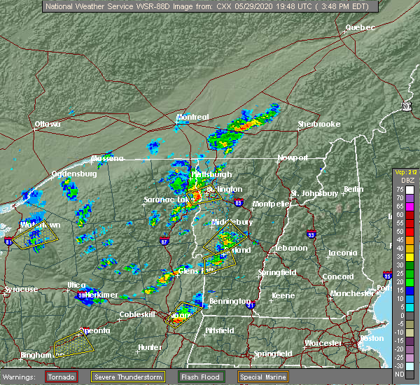 At 350 pm edt, a severe thunderstorm was located near goshen, moving northeast at 30 mph (radar indicated). Hazards include 60 mph wind gusts and quarter size hail. Minor hail damage to vehicles is possible. expect wind damage to trees and powerlines. Locations impacted include, hancock, bethel, rochester, chittenden, pittsfield, granville, goshen, ripton, leicester, brandon, braintree, warren, stockbridge, pittsford, salisbury, lincoln, randolph, west bethel, bread loaf and bradbury state park. At 350 pm edt, a severe thunderstorm was located near goshen, moving northeast at 30 mph (radar indicated). Hazards include 60 mph wind gusts and quarter size hail. Minor hail damage to vehicles is possible. expect wind damage to trees and powerlines. Locations impacted include, hancock, bethel, rochester, chittenden, pittsfield, granville, goshen, ripton, leicester, brandon, braintree, warren, stockbridge, pittsford, salisbury, lincoln, randolph, west bethel, bread loaf and bradbury state park.
|
| 5/29/2020 3:33 PM EDT |
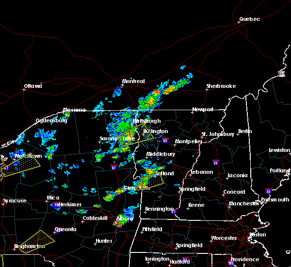 At 333 pm edt, a severe thunderstorm was located over west castleton, moving northeast at 35 mph (radar indicated). Hazards include 60 mph wind gusts and quarter size hail. Minor hail damage to vehicles is possible. Expect wind damage to trees and powerlines. At 333 pm edt, a severe thunderstorm was located over west castleton, moving northeast at 35 mph (radar indicated). Hazards include 60 mph wind gusts and quarter size hail. Minor hail damage to vehicles is possible. Expect wind damage to trees and powerlines.
|
| 3/20/2020 4:04 PM EDT |
 At 404 pm edt, severe thunderstorms were located along a line extending from williston to port henry, moving east at 55 mph (radar indicated). Hazards include 60 mph wind gusts. Expect damage to trees and powerlines. Locations impacted include, middlebury, vergennes, essex, moriah, crown point, westport, salisbury, orwell, addison, shoreham, ripton, charlotte, waltham, bristol, waitsfield, fayston, warren, d a r state park, brandon and buels gore. At 404 pm edt, severe thunderstorms were located along a line extending from williston to port henry, moving east at 55 mph (radar indicated). Hazards include 60 mph wind gusts. Expect damage to trees and powerlines. Locations impacted include, middlebury, vergennes, essex, moriah, crown point, westport, salisbury, orwell, addison, shoreham, ripton, charlotte, waltham, bristol, waitsfield, fayston, warren, d a r state park, brandon and buels gore.
|
| 3/20/2020 3:43 PM EDT |
 At 343 pm edt, severe thunderstorms were located along a line extending from bluff point to mount marcy, moving east at 65 mph (radar indicated). Hazards include 60 mph wind gusts. expect damage to trees and powerlines At 343 pm edt, severe thunderstorms were located along a line extending from bluff point to mount marcy, moving east at 65 mph (radar indicated). Hazards include 60 mph wind gusts. expect damage to trees and powerlines
|
| 6/13/2018 10:23 PM EDT |
 At 1023 pm edt, a severe thunderstorm was located over north chittenden, moving east at 40 mph (radar indicated). Hazards include 60 mph wind gusts and quarter size hail. Minor hail damage to vehicles is possible. expect wind damage to trees and powerlines. Locations impacted include, rutland, castleton, killington, rutland city, rutland - southern vermont airport, poultney, plymouth, chittenden, fair haven, clarendon, west rutland, ira, west castleton, hubbardton, poultney village, shrewsbury, stockbridge, proctor, brandon and mendon. At 1023 pm edt, a severe thunderstorm was located over north chittenden, moving east at 40 mph (radar indicated). Hazards include 60 mph wind gusts and quarter size hail. Minor hail damage to vehicles is possible. expect wind damage to trees and powerlines. Locations impacted include, rutland, castleton, killington, rutland city, rutland - southern vermont airport, poultney, plymouth, chittenden, fair haven, clarendon, west rutland, ira, west castleton, hubbardton, poultney village, shrewsbury, stockbridge, proctor, brandon and mendon.
|
| 6/13/2018 9:55 PM EDT |
 At 954 pm edt, a severe thunderstorm was located over benson landing, moving east at 35 mph (radar indicated). Hazards include 60 mph wind gusts and quarter size hail. Minor hail damage to vehicles is possible. Expect wind damage to trees and powerlines. At 954 pm edt, a severe thunderstorm was located over benson landing, moving east at 35 mph (radar indicated). Hazards include 60 mph wind gusts and quarter size hail. Minor hail damage to vehicles is possible. Expect wind damage to trees and powerlines.
|
| 5/4/2018 8:52 PM EDT |
 At 852 pm edt, severe thunderstorms were located along a line extending from near plainfield to south washington to near mendon, moving east at 55 mph (radar indicated). Hazards include 70 mph wind gusts and quarter size hail. Minor hail damage to vehicles is possible. expect considerable tree damage. wind damage is also likely to mobile homes, roofs, and outbuildings. locations impacted include, barre, rutland, woodstock, montpelier, middlebury, braintree hill, bradford, killington, salisbury, rutland city, waterbury village, websterville, pomfret, hartland, middlesex, marshfield, ira, fairlee, sharon and washington. A tornado watch remains in effect until 1000 pm edt for central, southern, northeastern and northwestern vermont. At 852 pm edt, severe thunderstorms were located along a line extending from near plainfield to south washington to near mendon, moving east at 55 mph (radar indicated). Hazards include 70 mph wind gusts and quarter size hail. Minor hail damage to vehicles is possible. expect considerable tree damage. wind damage is also likely to mobile homes, roofs, and outbuildings. locations impacted include, barre, rutland, woodstock, montpelier, middlebury, braintree hill, bradford, killington, salisbury, rutland city, waterbury village, websterville, pomfret, hartland, middlesex, marshfield, ira, fairlee, sharon and washington. A tornado watch remains in effect until 1000 pm edt for central, southern, northeastern and northwestern vermont.
|
| 5/4/2018 8:30 PM EDT |
 At 829 pm edt, severe thunderstorms were located along a line extending from north duxbury to near warren to fair haven, moving east at 50 mph (radar indicated). Hazards include 70 mph wind gusts and quarter size hail. Minor hail damage to vehicles is possible. expect considerable tree damage. wind damage is also likely to mobile homes, roofs, and outbuildings. locations impacted include, barre, rutland, woodstock, montpelier, middlebury, braintree hill, bradford, killington, salisbury, rutland city, waterbury village, websterville, pomfret, hartland, middlesex, marshfield, ira, fairlee, sharon and washington. A tornado watch remains in effect until 1000 pm edt for central, southern, northeastern and northwestern vermont. At 829 pm edt, severe thunderstorms were located along a line extending from north duxbury to near warren to fair haven, moving east at 50 mph (radar indicated). Hazards include 70 mph wind gusts and quarter size hail. Minor hail damage to vehicles is possible. expect considerable tree damage. wind damage is also likely to mobile homes, roofs, and outbuildings. locations impacted include, barre, rutland, woodstock, montpelier, middlebury, braintree hill, bradford, killington, salisbury, rutland city, waterbury village, websterville, pomfret, hartland, middlesex, marshfield, ira, fairlee, sharon and washington. A tornado watch remains in effect until 1000 pm edt for central, southern, northeastern and northwestern vermont.
|
| 5/4/2018 8:25 PM EDT |
 At 825 pm edt, severe thunderstorms were located along a line extending from near jonesville to south lincoln to near west haven, moving east at 50 mph (radar indicated). Hazards include 70 mph wind gusts and quarter size hail. Minor hail damage to vehicles is possible. expect considerable tree damage. Wind damage is also likely to mobile homes, roofs, and outbuildings. At 825 pm edt, severe thunderstorms were located along a line extending from near jonesville to south lincoln to near west haven, moving east at 50 mph (radar indicated). Hazards include 70 mph wind gusts and quarter size hail. Minor hail damage to vehicles is possible. expect considerable tree damage. Wind damage is also likely to mobile homes, roofs, and outbuildings.
|
| 5/4/2018 7:41 PM EDT |
 At 741 pm edt, a severe thunderstorm was located over severance, moving east at 45 mph (radar indicated). Hazards include 60 mph wind gusts and quarter size hail. Minor hail damage to vehicles is possible. Expect wind damage to trees and powerlines. At 741 pm edt, a severe thunderstorm was located over severance, moving east at 45 mph (radar indicated). Hazards include 60 mph wind gusts and quarter size hail. Minor hail damage to vehicles is possible. Expect wind damage to trees and powerlines.
|
| 9/5/2017 5:50 PM EDT |
 At 550 pm edt, severe thunderstorms were located along a line extending from near mount cushman state park to north sherburne to rutland - southern vermont airport, moving east at 45 mph (radar indicated). Hazards include 60 mph wind gusts and quarter size hail. Minor hail damage to vehicles is possible. expect wind damage to trees and powerlines. locations impacted include, rutland, castleton, braintree hill, killington, rutland city, middletown springs, mt. Holly, bethel, randolph, rutland - southern vermont airport, rochester, poultney, plymouth, chittenden, clarendon, west rutland, ira, goshen, barnard and hancock. At 550 pm edt, severe thunderstorms were located along a line extending from near mount cushman state park to north sherburne to rutland - southern vermont airport, moving east at 45 mph (radar indicated). Hazards include 60 mph wind gusts and quarter size hail. Minor hail damage to vehicles is possible. expect wind damage to trees and powerlines. locations impacted include, rutland, castleton, braintree hill, killington, rutland city, middletown springs, mt. Holly, bethel, randolph, rutland - southern vermont airport, rochester, poultney, plymouth, chittenden, clarendon, west rutland, ira, goshen, barnard and hancock.
|
| 9/5/2017 5:33 PM EDT |
 At 533 pm edt, severe thunderstorms were located along a line extending from goshen to proctor to lake st. catherine, moving east at 45 mph (radar indicated). Hazards include 60 mph wind gusts and quarter size hail. Minor hail damage to vehicles is possible. expect wind damage to trees and powerlines. locations impacted include, rutland, braintree hill, sudbury, killington, rutland city, orwell, rutland - southern vermont airport, benson, plymouth, chittenden, west rutland, whiting, ira, west castleton, hancock, poultney village, shrewsbury, lake st. Catherine, bridgewater and leicester. At 533 pm edt, severe thunderstorms were located along a line extending from goshen to proctor to lake st. catherine, moving east at 45 mph (radar indicated). Hazards include 60 mph wind gusts and quarter size hail. Minor hail damage to vehicles is possible. expect wind damage to trees and powerlines. locations impacted include, rutland, braintree hill, sudbury, killington, rutland city, orwell, rutland - southern vermont airport, benson, plymouth, chittenden, west rutland, whiting, ira, west castleton, hancock, poultney village, shrewsbury, lake st. Catherine, bridgewater and leicester.
|
| 9/5/2017 5:08 PM EDT |
 At 507 pm edt, severe thunderstorms were located along a line extending from chipman point to near west haven to 19 miles west of west pawlet, moving east at 25 mph (radar indicated). Hazards include 60 mph wind gusts and quarter size hail. Minor hail damage to vehicles is possible. Expect wind damage to trees and powerlines. At 507 pm edt, severe thunderstorms were located along a line extending from chipman point to near west haven to 19 miles west of west pawlet, moving east at 25 mph (radar indicated). Hazards include 60 mph wind gusts and quarter size hail. Minor hail damage to vehicles is possible. Expect wind damage to trees and powerlines.
|
| 8/22/2017 6:28 PM EDT |
 At 628 pm edt, severe thunderstorms were located along a line extending from south cambridge to near northfield to east hubbardton, moving east at 50 mph (radar indicated). Hazards include 70 mph wind gusts and penny size hail. Expect considerable tree damage. Damage is likely to mobile homes, roofs, and outbuildings. At 628 pm edt, severe thunderstorms were located along a line extending from south cambridge to near northfield to east hubbardton, moving east at 50 mph (radar indicated). Hazards include 70 mph wind gusts and penny size hail. Expect considerable tree damage. Damage is likely to mobile homes, roofs, and outbuildings.
|
| 8/22/2017 5:43 PM EDT |
 At 542 pm edt, a severe thunderstorm was located over chilson, moving east at 40 mph (radar indicated). Hazards include 60 mph wind gusts. expect damage to trees and powerlines At 542 pm edt, a severe thunderstorm was located over chilson, moving east at 40 mph (radar indicated). Hazards include 60 mph wind gusts. expect damage to trees and powerlines
|
| 8/22/2017 5:43 PM EDT |
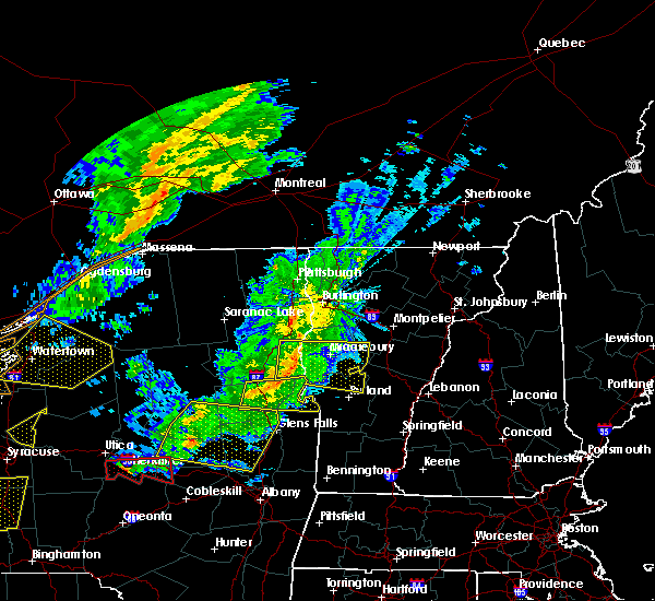 At 542 pm edt, a severe thunderstorm was located over chilson, moving east at 40 mph (radar indicated). Hazards include 60 mph wind gusts. expect damage to trees and powerlines At 542 pm edt, a severe thunderstorm was located over chilson, moving east at 40 mph (radar indicated). Hazards include 60 mph wind gusts. expect damage to trees and powerlines
|
| 7/22/2017 5:03 PM EDT |
 At 502 pm edt, a severe thunderstorm was located over orwell, moving southeast at 15 mph (radar indicated). Hazards include 60 mph wind gusts and quarter size hail. Minor hail damage to vehicles is possible. expect wind damage to trees and powerlines. Locations impacted include, castleton, west castleton, sudbury, hubbardton, shoreham, orwell, benson, brandon, leicester, whiting, bridport, goshen, cornwall, salisbury, pittsford, fair haven, chipman point, benson bay, bomoseen state park and beadles cove. At 502 pm edt, a severe thunderstorm was located over orwell, moving southeast at 15 mph (radar indicated). Hazards include 60 mph wind gusts and quarter size hail. Minor hail damage to vehicles is possible. expect wind damage to trees and powerlines. Locations impacted include, castleton, west castleton, sudbury, hubbardton, shoreham, orwell, benson, brandon, leicester, whiting, bridport, goshen, cornwall, salisbury, pittsford, fair haven, chipman point, benson bay, bomoseen state park and beadles cove.
|
| 7/22/2017 4:38 PM EDT |
 At 438 pm edt, a severe thunderstorm was located over hands cove, moving southeast at 10 mph (radar indicated). Hazards include 60 mph wind gusts and quarter size hail. Minor hail damage to vehicles is possible. Expect wind damage to trees and powerlines. At 438 pm edt, a severe thunderstorm was located over hands cove, moving southeast at 10 mph (radar indicated). Hazards include 60 mph wind gusts and quarter size hail. Minor hail damage to vehicles is possible. Expect wind damage to trees and powerlines.
|
| 6/30/2017 5:06 PM EDT |
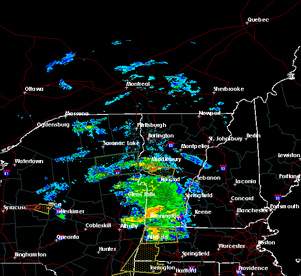 At 506 pm edt, a severe thunderstorm was located over leicester, moving east at 30 mph (radar indicated). Hazards include 60 mph wind gusts and quarter size hail. Minor hail damage to vehicles is possible. Expect wind damage to trees and powerlines. At 506 pm edt, a severe thunderstorm was located over leicester, moving east at 30 mph (radar indicated). Hazards include 60 mph wind gusts and quarter size hail. Minor hail damage to vehicles is possible. Expect wind damage to trees and powerlines.
|
| 6/27/2017 2:02 PM EDT |
 At 602 pm edt, severe thunderstorms were located along a line extending from near bridport to bond island to west castleton, moving east at 25 mph (radar indicated). Hazards include 60 mph wind gusts and quarter size hail. Minor hail damage to vehicles is possible. expect wind damage to trees and powerlines. Locations impacted include, middlebury, rutland, castleton, cornwall, sudbury, salisbury, orwell, chittenden, west rutland, whiting, goshen, west castleton, hancock, hubbardton, shoreham, ripton, proctor, brandon, mendon and leicester. At 602 pm edt, severe thunderstorms were located along a line extending from near bridport to bond island to west castleton, moving east at 25 mph (radar indicated). Hazards include 60 mph wind gusts and quarter size hail. Minor hail damage to vehicles is possible. expect wind damage to trees and powerlines. Locations impacted include, middlebury, rutland, castleton, cornwall, sudbury, salisbury, orwell, chittenden, west rutland, whiting, goshen, west castleton, hancock, hubbardton, shoreham, ripton, proctor, brandon, mendon and leicester.
|
| 6/27/2017 1:24 PM EDT |
 At 524 pm edt, severe thunderstorms were located along a line extending from near ironville to chilson to 7 miles west of west haven, moving east at 25 mph (radar indicated). Hazards include 60 mph wind gusts and quarter size hail. Minor hail damage to vehicles is possible. Expect wind damage to trees and powerlines. At 524 pm edt, severe thunderstorms were located along a line extending from near ironville to chilson to 7 miles west of west haven, moving east at 25 mph (radar indicated). Hazards include 60 mph wind gusts and quarter size hail. Minor hail damage to vehicles is possible. Expect wind damage to trees and powerlines.
|
| 5/31/2017 4:09 PM EDT |
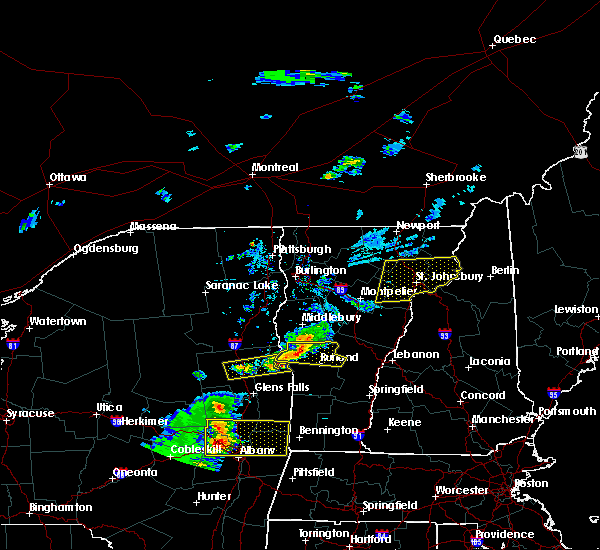 At 408 pm edt, a severe thunderstorm was located over hubbardton, moving east at 30 mph (radar indicated). Hazards include 60 mph wind gusts and quarter size hail. Minor hail damage to vehicles is possible. expect wind damage to trees and powerlines. Locations impacted include, rutland, castleton, west castleton, sudbury, hubbardton, killington, orwell, proctor, benson, brandon, chittenden, mendon, pittsfield, pittsford, rutland city, west rutland, west haven, fair haven, goshen and ira. At 408 pm edt, a severe thunderstorm was located over hubbardton, moving east at 30 mph (radar indicated). Hazards include 60 mph wind gusts and quarter size hail. Minor hail damage to vehicles is possible. expect wind damage to trees and powerlines. Locations impacted include, rutland, castleton, west castleton, sudbury, hubbardton, killington, orwell, proctor, benson, brandon, chittenden, mendon, pittsfield, pittsford, rutland city, west rutland, west haven, fair haven, goshen and ira.
|
| 5/31/2017 3:46 PM EDT |
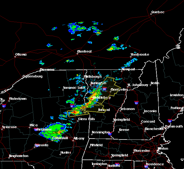 At 346 pm edt, a severe thunderstorm was located over benson bay, moving east at 25 mph (radar indicated). Hazards include 60 mph wind gusts and quarter size hail. Minor hail damage to vehicles is possible. Expect wind damage to trees and powerlines. At 346 pm edt, a severe thunderstorm was located over benson bay, moving east at 25 mph (radar indicated). Hazards include 60 mph wind gusts and quarter size hail. Minor hail damage to vehicles is possible. Expect wind damage to trees and powerlines.
|
| 9/11/2016 7:23 AM EDT |
 The severe thunderstorm warning for northwestern windsor, western orange, southwestern washington, southeastern addison and northeastern rutland counties will expire at 730 am edt, the storm which prompted the warning has moved out of the area. therefore the warning will be allowed to expire on time at 730 am. The severe thunderstorm warning for northwestern windsor, western orange, southwestern washington, southeastern addison and northeastern rutland counties will expire at 730 am edt, the storm which prompted the warning has moved out of the area. therefore the warning will be allowed to expire on time at 730 am.
|
| 9/11/2016 6:59 AM EDT |
 At 659 am edt, a severe thunderstorm was located over lower granville, moving northeast at 50 mph (radar indicated). Hazards include 60 mph wind gusts. Expect damage to roofs. siding. and trees. Locations impacted include, barre, brandon, chelsea, chittenden, randolph, castleton, williamstown, pittsford, berlin, bethel, proctor, warren, brookfield, tunbridge, rochester, salisbury, leicester, washington, stockbridge and roxbury. At 659 am edt, a severe thunderstorm was located over lower granville, moving northeast at 50 mph (radar indicated). Hazards include 60 mph wind gusts. Expect damage to roofs. siding. and trees. Locations impacted include, barre, brandon, chelsea, chittenden, randolph, castleton, williamstown, pittsford, berlin, bethel, proctor, warren, brookfield, tunbridge, rochester, salisbury, leicester, washington, stockbridge and roxbury.
|
| 9/11/2016 6:31 AM EDT |
 At 631 am edt, a severe thunderstorm was located over orwell, moving northeast at 50 mph (radar indicated). Hazards include 60 mph wind gusts. Expect damage to roofs. siding. And trees. At 631 am edt, a severe thunderstorm was located over orwell, moving northeast at 50 mph (radar indicated). Hazards include 60 mph wind gusts. Expect damage to roofs. siding. And trees.
|
| 8/16/2016 11:02 PM EDT |
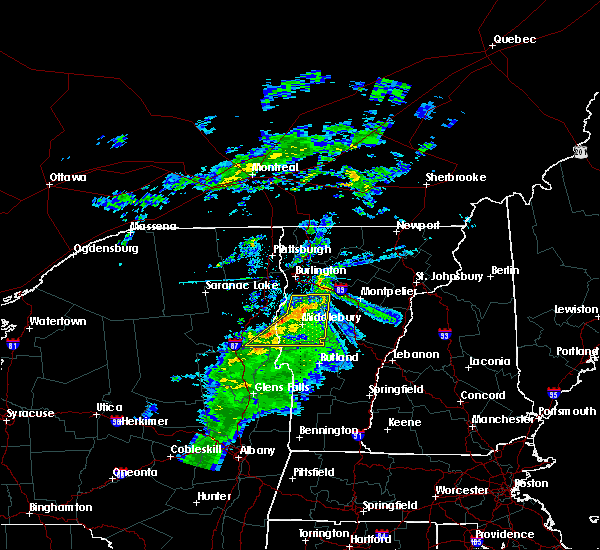 At 1101 pm edt, severe thunderstorms were located along a line extending from monkton ridge to near weybridge to near pharoah mountain, moving southeast at 15 mph (radar indicated). Hazards include 60 mph wind gusts. Expect damage to roofs. siding. and trees. Locations impacted include, bristol, fayston, lincoln, shoreham, orwell, bridport, cornwall, salisbury, leicester, weybridge, ripton, whiting, goshen, east middlebury, east shoreham, leonard bay, bread loaf, camels hump state park, huntington center and chilson. At 1101 pm edt, severe thunderstorms were located along a line extending from monkton ridge to near weybridge to near pharoah mountain, moving southeast at 15 mph (radar indicated). Hazards include 60 mph wind gusts. Expect damage to roofs. siding. and trees. Locations impacted include, bristol, fayston, lincoln, shoreham, orwell, bridport, cornwall, salisbury, leicester, weybridge, ripton, whiting, goshen, east middlebury, east shoreham, leonard bay, bread loaf, camels hump state park, huntington center and chilson.
|
| 8/16/2016 10:45 PM EDT |
 At 1045 pm edt, severe thunderstorms were located along a line extending from east charlotte to weybridge to near steep bay, moving southeast at 15 mph (radar indicated). Hazards include 60 mph wind gusts. Expect damage to roofs. siding. And trees. At 1045 pm edt, severe thunderstorms were located along a line extending from east charlotte to weybridge to near steep bay, moving southeast at 15 mph (radar indicated). Hazards include 60 mph wind gusts. Expect damage to roofs. siding. And trees.
|
| 8/13/2016 7:51 PM EDT |
 At 750 pm edt, severe thunderstorms were located along a line extending from new haven mills to east poultney, moving east at 35 mph (radar indicated). Hazards include 60 mph wind gusts and quarter size hail. Hail damage to vehicles is expected. Expect wind damage to roofs, siding, and trees. At 750 pm edt, severe thunderstorms were located along a line extending from new haven mills to east poultney, moving east at 35 mph (radar indicated). Hazards include 60 mph wind gusts and quarter size hail. Hail damage to vehicles is expected. Expect wind damage to roofs, siding, and trees.
|
| 7/23/2016 4:48 PM EDT |
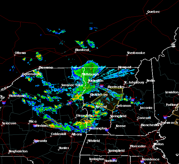 At 448 pm edt, severe thunderstorms were located along a line extending from ricker state park to near chelsea to near goshen, moving southeast at 35 mph (radar indicated). Hazards include 60 mph wind gusts. Expect damage to roofs. siding. and trees. Locations impacted include, barre, chelsea, orange, hartford, randolph, norwich, hartland, williamstown, bradford, royalton, bethel, sharon, corinth, brookfield, tunbridge, plainfield, topsham, rochester, strafford and washington. At 448 pm edt, severe thunderstorms were located along a line extending from ricker state park to near chelsea to near goshen, moving southeast at 35 mph (radar indicated). Hazards include 60 mph wind gusts. Expect damage to roofs. siding. and trees. Locations impacted include, barre, chelsea, orange, hartford, randolph, norwich, hartland, williamstown, bradford, royalton, bethel, sharon, corinth, brookfield, tunbridge, plainfield, topsham, rochester, strafford and washington.
|
| 7/23/2016 4:18 PM EDT | Trees down on main road in rutland county VT, 0.6 miles E of Brandon, VT |
| 7/23/2016 4:05 PM EDT |
 At 405 pm edt, a severe thunderstorm was located near ripton, moving south at 40 mph (radar indicated). Hazards include 60 mph wind gusts and quarter size hail. Hail damage to vehicles is expected. expect wind damage to roofs, siding, and trees. Locations impacted include, brandon, bristol, essex, addison, randolph, hinesburg, richmond, charlotte, ferrisburgh, bethel, monkton, huntington, starksboro, new haven, waitsfield, warren, moretown, fayston, brookfield and tunbridge. At 405 pm edt, a severe thunderstorm was located near ripton, moving south at 40 mph (radar indicated). Hazards include 60 mph wind gusts and quarter size hail. Hail damage to vehicles is expected. expect wind damage to roofs, siding, and trees. Locations impacted include, brandon, bristol, essex, addison, randolph, hinesburg, richmond, charlotte, ferrisburgh, bethel, monkton, huntington, starksboro, new haven, waitsfield, warren, moretown, fayston, brookfield and tunbridge.
|
| 7/23/2016 3:35 PM EDT |
 At 335 pm edt, a severe thunderstorm was located over east charlotte, moving south at 40 mph (radar indicated). Hazards include 60 mph wind gusts and quarter size hail. Hail damage to vehicles is expected. Expect wind damage to roofs, siding, and trees. At 335 pm edt, a severe thunderstorm was located over east charlotte, moving south at 40 mph (radar indicated). Hazards include 60 mph wind gusts and quarter size hail. Hail damage to vehicles is expected. Expect wind damage to roofs, siding, and trees.
|
| 7/14/2016 3:45 PM EDT |
 At 344 pm edt, a severe thunderstorm was located near north chittenden, moving northeast at 40 mph (radar indicated). Hazards include 60 mph wind gusts and quarter size hail. Hail damage to vehicles is expected. Expect wind damage to roofs, siding, and trees. At 344 pm edt, a severe thunderstorm was located near north chittenden, moving northeast at 40 mph (radar indicated). Hazards include 60 mph wind gusts and quarter size hail. Hail damage to vehicles is expected. Expect wind damage to roofs, siding, and trees.
|
| 5/27/2015 3:36 PM EDT | Report of trees down in brandon from vsp in rutland county VT, 0.6 miles E of Brandon, VT |
| 7/8/2014 9:55 PM EDT | Trees and power lines down throughout rutland county in rutland county VT, 0.6 miles E of Brandon, VT |
| 5/27/2014 4:18 PM EDT | Trees down in rutland county VT, 2.4 miles SW of Brandon, VT |
| 5/27/2014 4:12 PM EDT | Trees down in rutland county VT, 0.6 miles E of Brandon, VT |
| 5/27/2014 3:54 PM EDT | Trees down in sudbury in rutland county VT, 5 miles ESE of Brandon, VT |
| 7/4/2012 8:59 PM EDT | Spotter saw 2 trees down while doing morning errands on rte 7 near residence in leicester. time estimated from rada in addison county VT, 6.1 miles S of Brandon, VT |
Hail Maps for Brandon, VT


Connect with Interactive Hail Maps