

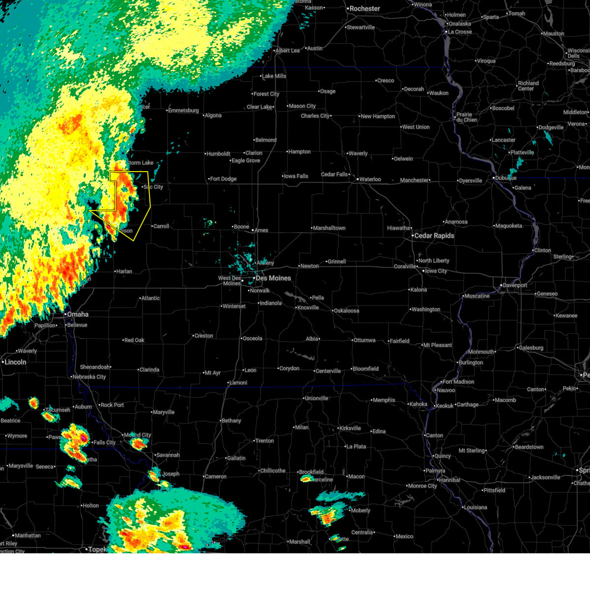
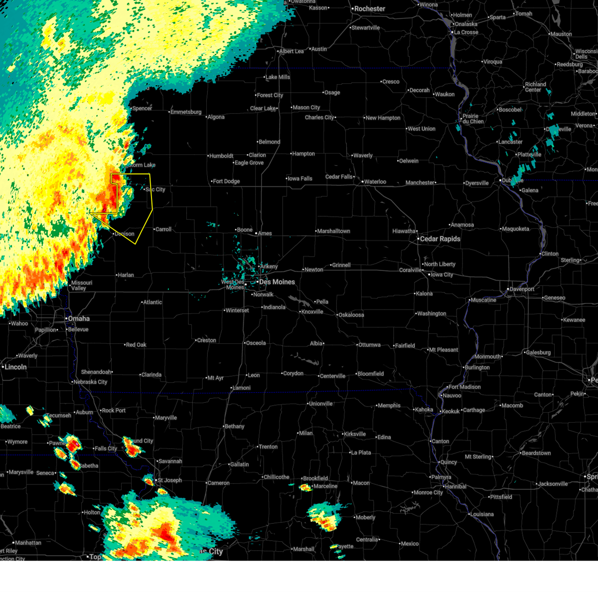
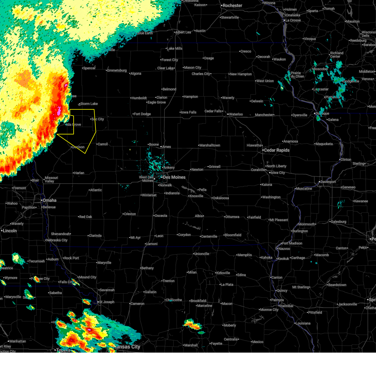
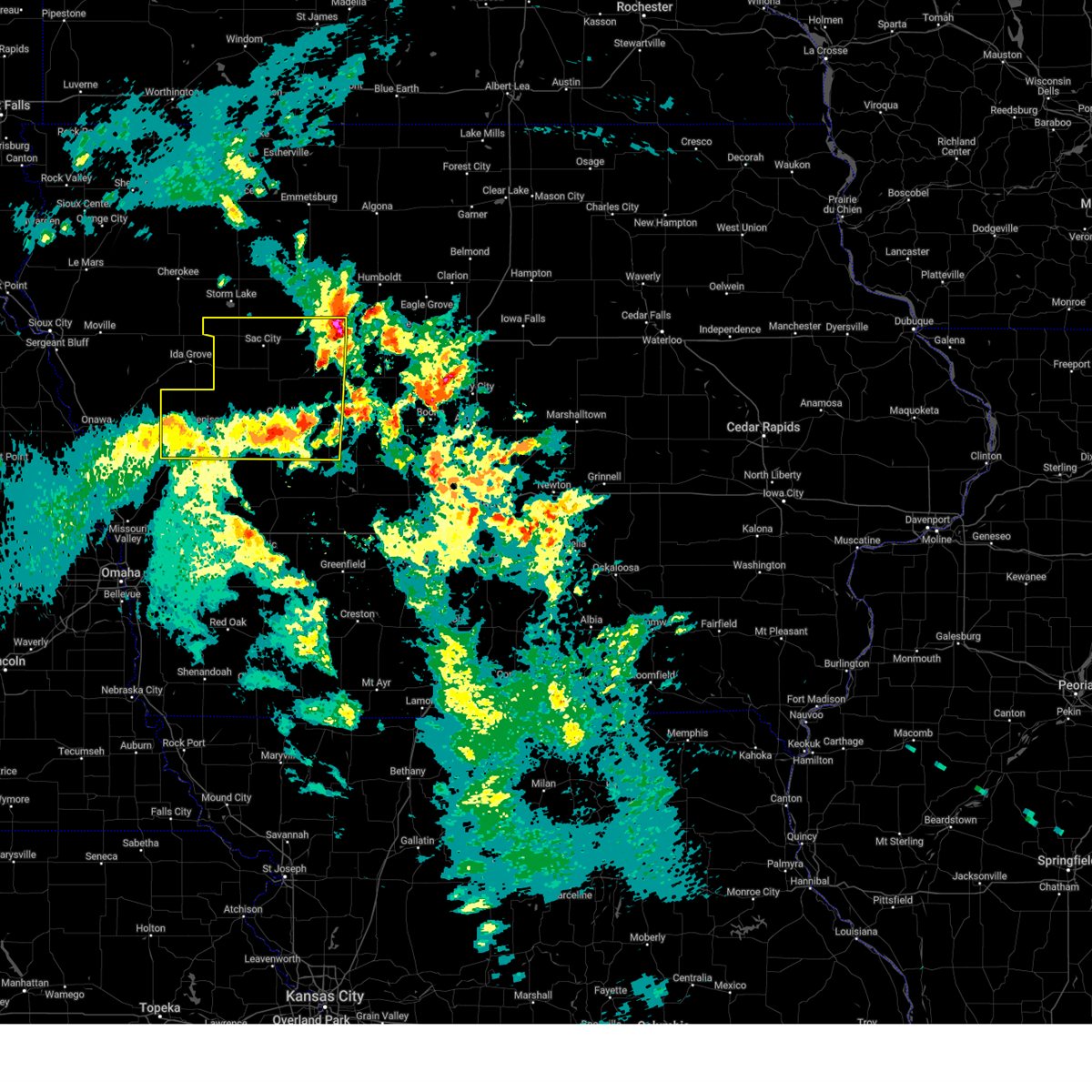
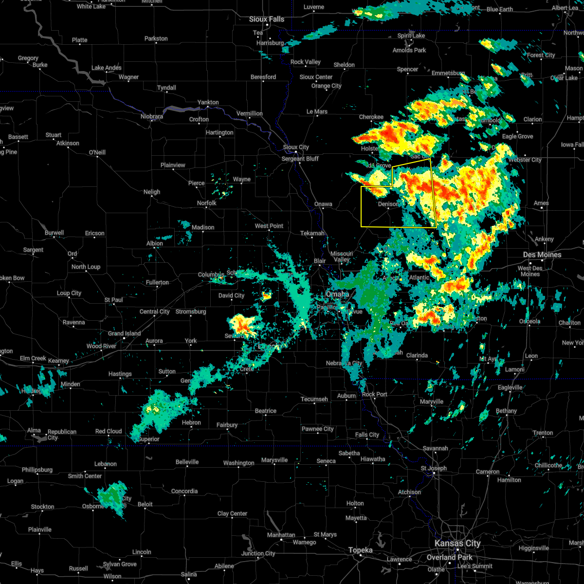
Hail Map for Breda, IA
The Breda, IA area has had 0 reports of on-the-ground hail by trained spotters, and has been under severe weather warnings 20 times during the past 12 months. Doppler radar has detected hail at or near Breda, IA on 65 occasions, including 3 occasions during the past year.
| Name: | Breda, IA |
| Where Located: | 34.1 miles SSE of Storm Lake, IA |
| Map: | Google Map for Breda, IA |
| Population: | 483 |
| Housing Units: | 226 |
| More Info: | Search Google for Breda, IA |
2
The Top Recent Hail Date for Breda, IA is Monday, July 15, 2024 (14th out of 65)

Hail and Wind Damage Spotted near Breda, IA
| Date / Time | Report Details |
|---|---|
| 6/29/2025 5:41 AM CDT |
 The storms which prompted the warning have weakened below severe limits, and no longer pose an immediate threat to life or property. therefore, the warning will be allowed to expire. The storms which prompted the warning have weakened below severe limits, and no longer pose an immediate threat to life or property. therefore, the warning will be allowed to expire.
|
| 6/29/2025 5:25 AM CDT |
 At 525 am cdt, severe thunderstorms were located along a line extending from schaller to near odebolt to near deloit, moving southeast at 35 mph (radar indicated). Hazards include 60 mph wind gusts. Expect damage to roofs, siding, and trees. Locations impacted include, sac city, lake view, odebolt, black hawk lake, schleswig, wall lake, schaller, early, arcadia, breda, vail, westside, kiron, deloit, nemaha, sac city municipal airport, blackhawk lake state park, and wall lake municipal airport. At 525 am cdt, severe thunderstorms were located along a line extending from schaller to near odebolt to near deloit, moving southeast at 35 mph (radar indicated). Hazards include 60 mph wind gusts. Expect damage to roofs, siding, and trees. Locations impacted include, sac city, lake view, odebolt, black hawk lake, schleswig, wall lake, schaller, early, arcadia, breda, vail, westside, kiron, deloit, nemaha, sac city municipal airport, blackhawk lake state park, and wall lake municipal airport.
|
| 6/29/2025 4:50 AM CDT |
 Svrdmx the national weather service in des moines has issued a * severe thunderstorm warning for, sac county in west central iowa, northeastern crawford county in west central iowa, northwestern carroll county in west central iowa, * until 545 am cdt. * at 450 am cdt, severe thunderstorms were located along a line extending from 4 miles northeast of larrabee to 6 miles south of aurelia to 4 miles southwest of battle creek, moving southeast at 35 mph (radar indicated). Hazards include 60 mph wind gusts. expect damage to roofs, siding, and trees Svrdmx the national weather service in des moines has issued a * severe thunderstorm warning for, sac county in west central iowa, northeastern crawford county in west central iowa, northwestern carroll county in west central iowa, * until 545 am cdt. * at 450 am cdt, severe thunderstorms were located along a line extending from 4 miles northeast of larrabee to 6 miles south of aurelia to 4 miles southwest of battle creek, moving southeast at 35 mph (radar indicated). Hazards include 60 mph wind gusts. expect damage to roofs, siding, and trees
|
| 6/16/2025 6:43 PM CDT | Svrdmx the national weather service in des moines has issued a * severe thunderstorm warning for, eastern sac county in west central iowa, calhoun county in west central iowa, northeastern crawford county in west central iowa, northwestern carroll county in west central iowa, * until 730 pm cdt. * at 643 pm cdt, severe thunderstorms were located along a line extending from near fonda to sac city municipal airport to near kiron, moving east at 45 mph (radar indicated). Hazards include 60 mph wind gusts and nickel size hail. expect damage to roofs, siding, and trees |
| 3/14/2025 6:04 PM CDT |
 Svrdmx the national weather service in des moines has issued a * severe thunderstorm warning for, western greene county in west central iowa, sac county in west central iowa, calhoun county in west central iowa, crawford county in west central iowa, carroll county in west central iowa, * until 645 pm cdt. * at 603 pm cdt, severe thunderstorms were located along a line extending from near ute to 4 miles northeast of scranton, moving north at 50 mph (radar indicated). Hazards include 60 mph wind gusts and nickel size hail. expect damage to roofs, siding, and trees Svrdmx the national weather service in des moines has issued a * severe thunderstorm warning for, western greene county in west central iowa, sac county in west central iowa, calhoun county in west central iowa, crawford county in west central iowa, carroll county in west central iowa, * until 645 pm cdt. * at 603 pm cdt, severe thunderstorms were located along a line extending from near ute to 4 miles northeast of scranton, moving north at 50 mph (radar indicated). Hazards include 60 mph wind gusts and nickel size hail. expect damage to roofs, siding, and trees
|
| 7/30/2024 1:34 AM CDT | At 133 am cdt, severe thunderstorms were located along a line extending from 4 miles northeast of manson to somers to 5 miles east of churdan to near jefferson municipal airport to near bagley, moving east at 65 mph (public. at 127 am, a wind gust of 60 mph was reported 2 miles south of willey from a personal weather station). Hazards include 60 mph wind gusts. Expect damage to roofs, siding, and trees. Locations impacted include, fort dodge, gowrie, fort dodge regional airport, grand junction, callender, harcourt, rippey, paton, dayton, coalville, otho, lehigh, woodman hollow state park, dolliver memorial state park, stratford, duncombe and brushy creek st recreation area. |
| 7/30/2024 1:03 AM CDT | Svrdmx the national weather service in des moines has issued a * severe thunderstorm warning for, greene county in west central iowa, webster county in central iowa, southern pocahontas county in northwestern iowa, eastern sac county in west central iowa, calhoun county in west central iowa, southern humboldt county in north central iowa, carroll county in west central iowa, * until 145 am cdt. * at 103 am cdt, severe thunderstorms were located along a line extending from 5 miles northwest of newell to 4 miles north of sac city to near auburn to 4 miles west of carroll to near templeton, moving east at 65 mph (radar indicated). Hazards include 60 mph wind gusts. Expect damage to roofs, siding, and trees. severe thunderstorms will be near, carroll, lake city, glidden, fonda, auburn, lytton, dedham and lidderdale around 110 am cdt. rockwell city, coon rapids, south twin lake, north twin lake, pomeroy, twin lakes, ralston and twin lakes state park around 115 am cdt. manson, scranton, churdan, lohrville, palmer and rinard around 120 am cdt. Other locations in the path of these severe thunderstorms include jefferson, farnhamville, somers, knierim, gowrie, barnum, jefferson municipal airport, grand junction, callender, rippey, paton, moorland, clare and dana. |
| 7/30/2024 12:37 AM CDT | Svrdmx the national weather service in des moines has issued a * severe thunderstorm warning for, sac county in west central iowa, crawford county in west central iowa, western carroll county in west central iowa, * until 115 am cdt. * at 1236 am cdt, severe thunderstorms were located along a line extending from near marcus to 4 miles northwest of battle creek to 4 miles southeast of turin, moving east at 60 mph (radar indicated). Hazards include 60 mph wind gusts. Expect damage to roofs, siding, and trees. severe thunderstorms will be near, charter oak and ricketts around 1245 am cdt. schleswig and schaller around 1250 am cdt. denison, odebolt, dow city, kiron and arion around 1255 am cdt. Other locations in the path of these severe thunderstorms include early, deloit, buck grove, denison municipal airport, sac city, lake view, black hawk lake, wall lake, vail, nemaha, blackhawk lake state park and sac city municipal airport. |
| 7/30/2024 12:24 AM CDT | Svrdmx the national weather service in des moines has issued a * severe thunderstorm warning for, sac county in west central iowa, crawford county in west central iowa, western carroll county in west central iowa, * until 115 am cdt. * at 1224 am cdt, severe thunderstorms were located along a line extending from near quimby to near battle creek to near danbury to near turin, moving east at 50 mph (radar indicated). Hazards include 60 mph wind gusts. expect damage to roofs, siding, and trees |
| 7/15/2024 4:49 PM CDT | the severe thunderstorm warning has been cancelled and is no longer in effect |
| 7/15/2024 4:49 PM CDT | At 448 pm cdt, a severe thunderstorm was located over lidderdale, or 7 miles northeast of carroll, moving southeast at 35 mph (radar indicated). Hazards include 60 mph wind gusts and quarter size hail. Hail damage to vehicles is expected. expect wind damage to roofs, siding, and trees. Locations impacted include, arcadia, breda, lidderdale, lanesboro, and hobbs county park. |
| 7/15/2024 4:42 PM CDT | At 442 pm cdt, a severe thunderstorm was located over lidderdale, or 6 miles northeast of carroll, moving southeast at 40 mph (radar indicated). Hazards include 60 mph wind gusts and quarter size hail. Hail damage to vehicles is expected. expect wind damage to roofs, siding, and trees. Locations impacted include, lake city, lake view, black hawk lake, wall lake, arcadia, breda, auburn, lidderdale, lanesboro, yetter, hobbs county park, and blackhawk lake state park. |
| 7/15/2024 4:42 PM CDT | the severe thunderstorm warning has been cancelled and is no longer in effect |
| 7/15/2024 4:32 PM CDT | At 432 pm cdt, a severe thunderstorm was located over breda, or 10 miles north of carroll, moving southeast at 35 mph (radar indicated). Hazards include 70 mph wind gusts and quarter size hail. Hail damage to vehicles is expected. expect considerable tree damage. wind damage is also likely to mobile homes, roofs, and outbuildings. Locations impacted include, lake city, lake view, black hawk lake, wall lake, arcadia, breda, lohrville, auburn, westside, lidderdale, lanesboro, yetter, hobbs county park, blackhawk lake state park, and wall lake municipal airport. |
| 7/15/2024 4:14 PM CDT | Svrdmx the national weather service in des moines has issued a * severe thunderstorm warning for, southern sac county in west central iowa, southwestern calhoun county in west central iowa, northeastern crawford county in west central iowa, northern carroll county in west central iowa, * until 500 pm cdt. * at 413 pm cdt, a severe thunderstorm was located over wall lake, or 12 miles southwest of sac city, moving southeast at 35 mph (radar indicated. at 410 pm cdt wind damage was reported in odebolt). Hazards include 70 mph wind gusts and half dollar size hail. Hail damage to vehicles is expected. expect considerable tree damage. Wind damage is also likely to mobile homes, roofs, and outbuildings. |
| 7/15/2024 3:48 PM CDT | the severe thunderstorm warning has been cancelled and is no longer in effect |
| 7/15/2024 3:48 PM CDT | At 348 pm cdt, a severe thunderstorm was located over westside, or 10 miles west of carroll, moving east at 30 mph (radar indicated). Hazards include golf ball size hail and 70 mph wind gusts. People and animals outdoors will be injured. expect hail damage to roofs, siding, windows, and vehicles. expect considerable tree damage. wind damage is also likely to mobile homes, roofs, and outbuildings. Locations impacted include, carroll, denison, manning, arcadia, breda, vail, templeton, westside, and halbur. |
| 7/15/2024 3:41 PM CDT | At 340 pm cdt, a severe thunderstorm was located over westside, or 11 miles east of denison, moving east at 35 mph (radar indicated). Hazards include 70 mph wind gusts and half dollar size hail. Hail damage to vehicles is expected. expect considerable tree damage. wind damage is also likely to mobile homes, roofs, and outbuildings. Locations impacted include, carroll, denison, manning, lake view, black hawk lake, wall lake, arcadia, breda, vail, templeton, auburn, westside, kiron, deloit, halbur, blackhawk lake state park, and wall lake municipal airport. |
| 7/15/2024 3:31 PM CDT |
 At 331 pm cdt, a severe thunderstorm was located over vail, or 8 miles northeast of denison, moving southeast at 40 mph (radar indicated). Hazards include 60 mph wind gusts and quarter size hail. Hail damage to vehicles is expected. expect wind damage to roofs, siding, and trees. Locations impacted include, carroll, denison, manning, lake view, black hawk lake, wall lake, arcadia, breda, vail, templeton, auburn, westside, kiron, deloit, halbur, blackhawk lake state park, and wall lake municipal airport. At 331 pm cdt, a severe thunderstorm was located over vail, or 8 miles northeast of denison, moving southeast at 40 mph (radar indicated). Hazards include 60 mph wind gusts and quarter size hail. Hail damage to vehicles is expected. expect wind damage to roofs, siding, and trees. Locations impacted include, carroll, denison, manning, lake view, black hawk lake, wall lake, arcadia, breda, vail, templeton, auburn, westside, kiron, deloit, halbur, blackhawk lake state park, and wall lake municipal airport.
|
| 7/15/2024 3:08 PM CDT |
 Svrdmx the national weather service in des moines has issued a * severe thunderstorm warning for, southern sac county in west central iowa, northern crawford county in west central iowa, western carroll county in west central iowa, * until 400 pm cdt. * at 307 pm cdt, a severe thunderstorm was located over kiron, or 10 miles north of denison, moving east at 35 mph (radar indicated). Hazards include 60 mph wind gusts and quarter size hail. Hail damage to vehicles is expected. Expect wind damage to roofs, siding, and trees. Svrdmx the national weather service in des moines has issued a * severe thunderstorm warning for, southern sac county in west central iowa, northern crawford county in west central iowa, western carroll county in west central iowa, * until 400 pm cdt. * at 307 pm cdt, a severe thunderstorm was located over kiron, or 10 miles north of denison, moving east at 35 mph (radar indicated). Hazards include 60 mph wind gusts and quarter size hail. Hail damage to vehicles is expected. Expect wind damage to roofs, siding, and trees.
|
| 5/24/2024 3:36 AM CDT |
 At 336 am cdt, severe thunderstorms were located along a line extending from 5 miles northwest of lake view to 4 miles northeast of aspinwall to 5 miles south of lake anita state park, moving east at 50 mph (radar indicated). Hazards include 70 mph wind gusts and quarter size hail. Hail damage to vehicles is expected. expect considerable tree damage. wind damage is also likely to mobile homes, roofs, and outbuildings. locations impacted include, carroll, denison, creston, atlantic, sac city, audubon, greenfield, rockwell city, corning, guthrie center, lake city, manning, lenox, coon rapids, glidden, lake view, griswold, odebolt, black hawk lake, and north twin lake. This includes interstate 80 between mile markers 50 and 87. At 336 am cdt, severe thunderstorms were located along a line extending from 5 miles northwest of lake view to 4 miles northeast of aspinwall to 5 miles south of lake anita state park, moving east at 50 mph (radar indicated). Hazards include 70 mph wind gusts and quarter size hail. Hail damage to vehicles is expected. expect considerable tree damage. wind damage is also likely to mobile homes, roofs, and outbuildings. locations impacted include, carroll, denison, creston, atlantic, sac city, audubon, greenfield, rockwell city, corning, guthrie center, lake city, manning, lenox, coon rapids, glidden, lake view, griswold, odebolt, black hawk lake, and north twin lake. This includes interstate 80 between mile markers 50 and 87.
|
| 5/24/2024 3:07 AM CDT |
 Svrdmx the national weather service in des moines has issued a * severe thunderstorm warning for, western greene county in west central iowa, cass county in southwestern iowa, western union county in south central iowa, guthrie county in west central iowa, audubon county in west central iowa, sac county in west central iowa, adams county in southwestern iowa, calhoun county in west central iowa, crawford county in west central iowa, northern taylor county in southwestern iowa, carroll county in west central iowa, adair county in southwestern iowa, * until 400 am cdt. * at 307 am cdt, severe thunderstorms were located along a line extending from 4 miles south of battle creek to dunlap to farm creek public wildlife area, moving east at 85 mph (radar indicated). Hazards include 70 mph wind gusts and quarter size hail. Hail damage to vehicles is expected. expect considerable tree damage. Wind damage is also likely to mobile homes, roofs, and outbuildings. Svrdmx the national weather service in des moines has issued a * severe thunderstorm warning for, western greene county in west central iowa, cass county in southwestern iowa, western union county in south central iowa, guthrie county in west central iowa, audubon county in west central iowa, sac county in west central iowa, adams county in southwestern iowa, calhoun county in west central iowa, crawford county in west central iowa, northern taylor county in southwestern iowa, carroll county in west central iowa, adair county in southwestern iowa, * until 400 am cdt. * at 307 am cdt, severe thunderstorms were located along a line extending from 4 miles south of battle creek to dunlap to farm creek public wildlife area, moving east at 85 mph (radar indicated). Hazards include 70 mph wind gusts and quarter size hail. Hail damage to vehicles is expected. expect considerable tree damage. Wind damage is also likely to mobile homes, roofs, and outbuildings.
|
| 5/21/2024 3:06 PM CDT |
 At 304 pm cdt, severe thunderstorms were located along a line extending from near auburn to near dedham, moving northeast at 65 mph (radar indicated). Hazards include 60 mph wind gusts and quarter size hail. Hail damage to vehicles is expected. expect wind damage to roofs, siding, and trees. Locations impacted include, carroll, lake city, manning, glidden, arcadia, breda, templeton, auburn, westside, dedham, halbur, lidderdale, lanesboro, willey, ralston, gray, aspinwall, yetter, hobbs county park, and arthur n neu airport. At 304 pm cdt, severe thunderstorms were located along a line extending from near auburn to near dedham, moving northeast at 65 mph (radar indicated). Hazards include 60 mph wind gusts and quarter size hail. Hail damage to vehicles is expected. expect wind damage to roofs, siding, and trees. Locations impacted include, carroll, lake city, manning, glidden, arcadia, breda, templeton, auburn, westside, dedham, halbur, lidderdale, lanesboro, willey, ralston, gray, aspinwall, yetter, hobbs county park, and arthur n neu airport.
|
| 5/21/2024 2:52 PM CDT |
 At 251 pm cdt, severe thunderstorms were located along a line extending from lake view to gray, moving northeast at 60 mph (radar indicated). Hazards include 60 mph wind gusts and quarter size hail. Hail damage to vehicles is expected. expect wind damage to roofs, siding, and trees. Locations impacted include, carroll, lake city, manning, glidden, lake view, black hawk lake, wall lake, manilla, arcadia, breda, vail, templeton, auburn, lytton, westside, dedham, halbur, lidderdale, lanesboro, and willey. At 251 pm cdt, severe thunderstorms were located along a line extending from lake view to gray, moving northeast at 60 mph (radar indicated). Hazards include 60 mph wind gusts and quarter size hail. Hail damage to vehicles is expected. expect wind damage to roofs, siding, and trees. Locations impacted include, carroll, lake city, manning, glidden, lake view, black hawk lake, wall lake, manilla, arcadia, breda, vail, templeton, auburn, lytton, westside, dedham, halbur, lidderdale, lanesboro, and willey.
|
| 5/21/2024 2:30 PM CDT |
 Svrdmx the national weather service in des moines has issued a * severe thunderstorm warning for, northwestern audubon county in west central iowa, southeastern sac county in west central iowa, western calhoun county in west central iowa, eastern crawford county in west central iowa, carroll county in west central iowa, * until 315 pm cdt. * at 230 pm cdt, severe thunderstorms were located along a line extending from near deloit to prairie rose state park, moving northeast at 60 mph (radar indicated). Hazards include 60 mph wind gusts and half dollar size hail. Hail damage to vehicles is expected. Expect wind damage to roofs, siding, and trees. Svrdmx the national weather service in des moines has issued a * severe thunderstorm warning for, northwestern audubon county in west central iowa, southeastern sac county in west central iowa, western calhoun county in west central iowa, eastern crawford county in west central iowa, carroll county in west central iowa, * until 315 pm cdt. * at 230 pm cdt, severe thunderstorms were located along a line extending from near deloit to prairie rose state park, moving northeast at 60 mph (radar indicated). Hazards include 60 mph wind gusts and half dollar size hail. Hail damage to vehicles is expected. Expect wind damage to roofs, siding, and trees.
|
| 5/20/2024 11:58 PM CDT |
 Svrdmx the national weather service in des moines has issued a * severe thunderstorm warning for, greene county in west central iowa, southwestern webster county in central iowa, northeastern guthrie county in west central iowa, southeastern sac county in west central iowa, southern calhoun county in west central iowa, boone county in central iowa, carroll county in west central iowa, northwestern dallas county in central iowa, * until 1245 am cdt. * at 1158 pm cdt, severe thunderstorms were located along a line extending from arcadia to 6 miles northwest of adel, moving northeast at 20 mph (radar indicated). Hazards include 60 mph wind gusts and quarter size hail. Hail damage to vehicles is expected. Expect wind damage to roofs, siding, and trees. Svrdmx the national weather service in des moines has issued a * severe thunderstorm warning for, greene county in west central iowa, southwestern webster county in central iowa, northeastern guthrie county in west central iowa, southeastern sac county in west central iowa, southern calhoun county in west central iowa, boone county in central iowa, carroll county in west central iowa, northwestern dallas county in central iowa, * until 1245 am cdt. * at 1158 pm cdt, severe thunderstorms were located along a line extending from arcadia to 6 miles northwest of adel, moving northeast at 20 mph (radar indicated). Hazards include 60 mph wind gusts and quarter size hail. Hail damage to vehicles is expected. Expect wind damage to roofs, siding, and trees.
|
| 5/6/2024 10:32 PM CDT |
 The storm which prompted the warning has moved out of the area. therefore, the warning has been allowed to expire. a tornado watch remains in effect until 300 am cdt for west central iowa. remember, a tornado warning still remains in effect for northeastern carroll county until 1115 pm. The storm which prompted the warning has moved out of the area. therefore, the warning has been allowed to expire. a tornado watch remains in effect until 300 am cdt for west central iowa. remember, a tornado warning still remains in effect for northeastern carroll county until 1115 pm.
|
| 5/6/2024 10:18 PM CDT |
 At 1018 pm cdt, a severe thunderstorm capable of producing a tornado was located over lytton, or 9 miles east of sac city, moving northeast at 70 mph (weather spotters reported a funnel cloud). Hazards include tornado. Flying debris will be dangerous to those caught without shelter. mobile homes will be damaged or destroyed. damage to roofs, windows, and vehicles will occur. tree damage is likely. This tornadic thunderstorm will remain over mainly rural areas of northeastern crawford and northwestern carroll counties, including the following locations, breda, arcadia, and westside. At 1018 pm cdt, a severe thunderstorm capable of producing a tornado was located over lytton, or 9 miles east of sac city, moving northeast at 70 mph (weather spotters reported a funnel cloud). Hazards include tornado. Flying debris will be dangerous to those caught without shelter. mobile homes will be damaged or destroyed. damage to roofs, windows, and vehicles will occur. tree damage is likely. This tornadic thunderstorm will remain over mainly rural areas of northeastern crawford and northwestern carroll counties, including the following locations, breda, arcadia, and westside.
|
| 5/6/2024 10:14 PM CDT |
 Svrdmx the national weather service in des moines has issued a * severe thunderstorm warning for, greene county in west central iowa, western webster county in central iowa, pocahontas county in northwestern iowa, sac county in west central iowa, calhoun county in west central iowa, western humboldt county in north central iowa, northeastern crawford county in west central iowa, carroll county in west central iowa, * until 1115 pm cdt. * at 1013 pm cdt, severe thunderstorms were located along a line extending from 4 miles east of schaller to near arcadia to near gray, moving northeast at 50 mph (radar indicated). Hazards include 70 mph wind gusts and nickel size hail. Expect considerable tree damage. Damage is likely to mobile homes, roofs, and outbuildings. Svrdmx the national weather service in des moines has issued a * severe thunderstorm warning for, greene county in west central iowa, western webster county in central iowa, pocahontas county in northwestern iowa, sac county in west central iowa, calhoun county in west central iowa, western humboldt county in north central iowa, northeastern crawford county in west central iowa, carroll county in west central iowa, * until 1115 pm cdt. * at 1013 pm cdt, severe thunderstorms were located along a line extending from 4 miles east of schaller to near arcadia to near gray, moving northeast at 50 mph (radar indicated). Hazards include 70 mph wind gusts and nickel size hail. Expect considerable tree damage. Damage is likely to mobile homes, roofs, and outbuildings.
|
| 5/6/2024 10:03 PM CDT |
 At 1003 pm cdt, severe thunderstorms were located along a line extending from near galva to 5 miles southeast of odebolt to near westside, moving north at 80 mph (radar indicated). Hazards include 70 mph wind gusts and nickel size hail. Expect considerable tree damage. damage is likely to mobile homes, roofs, and outbuildings. Locations impacted include, carroll, sac city, lake city, manning, coon rapids, glidden, lake view, odebolt, black hawk lake, wall lake, schaller, scranton, early, arcadia, breda, vail, churdan, lohrville, templeton, and auburn. At 1003 pm cdt, severe thunderstorms were located along a line extending from near galva to 5 miles southeast of odebolt to near westside, moving north at 80 mph (radar indicated). Hazards include 70 mph wind gusts and nickel size hail. Expect considerable tree damage. damage is likely to mobile homes, roofs, and outbuildings. Locations impacted include, carroll, sac city, lake city, manning, coon rapids, glidden, lake view, odebolt, black hawk lake, wall lake, schaller, scranton, early, arcadia, breda, vail, churdan, lohrville, templeton, and auburn.
|
| 5/6/2024 10:01 PM CDT |
 At 1001 pm cdt, a severe thunderstorm capable of producing a tornado was located near breda, or 10 miles northwest of carroll, moving northeast at 70 mph (weather spotters reported a funnel cloud). Hazards include tornado. Flying debris will be dangerous to those caught without shelter. mobile homes will be damaged or destroyed. damage to roofs, windows, and vehicles will occur. tree damage is likely. this dangerous storm will be near, breda around 1005 pm cdt. Other locations impacted by this tornadic thunderstorm include arcadia, deloit, breda, vail, westside, aspinwall, and manning municipal airport. At 1001 pm cdt, a severe thunderstorm capable of producing a tornado was located near breda, or 10 miles northwest of carroll, moving northeast at 70 mph (weather spotters reported a funnel cloud). Hazards include tornado. Flying debris will be dangerous to those caught without shelter. mobile homes will be damaged or destroyed. damage to roofs, windows, and vehicles will occur. tree damage is likely. this dangerous storm will be near, breda around 1005 pm cdt. Other locations impacted by this tornadic thunderstorm include arcadia, deloit, breda, vail, westside, aspinwall, and manning municipal airport.
|
| 5/6/2024 9:45 PM CDT |
 Tordmx the national weather service in des moines has issued a * tornado warning for, eastern crawford county in west central iowa, northwestern carroll county in west central iowa, * until 1030 pm cdt. * at 944 pm cdt, a severe thunderstorm capable of producing a tornado was located over manilla, or 8 miles southeast of denison, moving northeast at 70 mph (radar indicated rotation). Hazards include tornado. Flying debris will be dangerous to those caught without shelter. mobile homes will be damaged or destroyed. damage to roofs, windows, and vehicles will occur. tree damage is likely. this dangerous storm will be near, vail around 950 pm cdt. arcadia and westside around 955 pm cdt. breda around 1000 pm cdt. Other locations impacted by this tornadic thunderstorm include buck grove, arcadia, deloit, breda, vail, westside, manilla, aspinwall, and denison municipal airport. Tordmx the national weather service in des moines has issued a * tornado warning for, eastern crawford county in west central iowa, northwestern carroll county in west central iowa, * until 1030 pm cdt. * at 944 pm cdt, a severe thunderstorm capable of producing a tornado was located over manilla, or 8 miles southeast of denison, moving northeast at 70 mph (radar indicated rotation). Hazards include tornado. Flying debris will be dangerous to those caught without shelter. mobile homes will be damaged or destroyed. damage to roofs, windows, and vehicles will occur. tree damage is likely. this dangerous storm will be near, vail around 950 pm cdt. arcadia and westside around 955 pm cdt. breda around 1000 pm cdt. Other locations impacted by this tornadic thunderstorm include buck grove, arcadia, deloit, breda, vail, westside, manilla, aspinwall, and denison municipal airport.
|
| 5/6/2024 9:35 PM CDT |
 Svrdmx the national weather service in des moines has issued a * severe thunderstorm warning for, western greene county in west central iowa, sac county in west central iowa, southwestern calhoun county in west central iowa, crawford county in west central iowa, carroll county in west central iowa, * until 1015 pm cdt. * at 934 pm cdt, severe thunderstorms were located along a line extending from 5 miles south of charter oak to westphalia to near walnut, moving north at 80 mph (radar indicated). Hazards include 70 mph wind gusts and nickel size hail. Expect considerable tree damage. Damage is likely to mobile homes, roofs, and outbuildings. Svrdmx the national weather service in des moines has issued a * severe thunderstorm warning for, western greene county in west central iowa, sac county in west central iowa, southwestern calhoun county in west central iowa, crawford county in west central iowa, carroll county in west central iowa, * until 1015 pm cdt. * at 934 pm cdt, severe thunderstorms were located along a line extending from 5 miles south of charter oak to westphalia to near walnut, moving north at 80 mph (radar indicated). Hazards include 70 mph wind gusts and nickel size hail. Expect considerable tree damage. Damage is likely to mobile homes, roofs, and outbuildings.
|
| 4/30/2024 4:47 PM CDT |
 At 446 pm cdt, a severe thunderstorm was located over aspinwall, or 13 miles east of denison, moving northeast at 45 mph (trained weather spotters). Hazards include 60 mph wind gusts and quarter size hail. Hail damage to vehicles is expected. expect wind damage to roofs, siding, and trees. Locations impacted include, carroll, denison, manning, wall lake, manilla, arcadia, breda, vail, westside, halbur, lidderdale, buck grove, aspinwall, manning municipal airport, and wall lake municipal airport. At 446 pm cdt, a severe thunderstorm was located over aspinwall, or 13 miles east of denison, moving northeast at 45 mph (trained weather spotters). Hazards include 60 mph wind gusts and quarter size hail. Hail damage to vehicles is expected. expect wind damage to roofs, siding, and trees. Locations impacted include, carroll, denison, manning, wall lake, manilla, arcadia, breda, vail, westside, halbur, lidderdale, buck grove, aspinwall, manning municipal airport, and wall lake municipal airport.
|
| 4/30/2024 4:32 PM CDT |
 Svrdmx the national weather service in des moines has issued a * severe thunderstorm warning for, south central sac county in west central iowa, eastern crawford county in west central iowa, northwestern carroll county in west central iowa, * until 515 pm cdt. * at 431 pm cdt, a severe thunderstorm was located over defiance, or 11 miles south of denison, moving northeast at 45 mph (radar indicated). Hazards include 60 mph wind gusts and quarter size hail. Hail damage to vehicles is expected. Expect wind damage to roofs, siding, and trees. Svrdmx the national weather service in des moines has issued a * severe thunderstorm warning for, south central sac county in west central iowa, eastern crawford county in west central iowa, northwestern carroll county in west central iowa, * until 515 pm cdt. * at 431 pm cdt, a severe thunderstorm was located over defiance, or 11 miles south of denison, moving northeast at 45 mph (radar indicated). Hazards include 60 mph wind gusts and quarter size hail. Hail damage to vehicles is expected. Expect wind damage to roofs, siding, and trees.
|
| 4/26/2024 8:08 PM CDT |
 The storms which prompted the warning have weakened below severe limits, and no longer pose an immediate threat to life or property. therefore, the warning will be allowed to expire. however, small hail and gusty winds are still possible with these thunderstorms. a tornado watch remains in effect until midnight cdt for west central iowa. The storms which prompted the warning have weakened below severe limits, and no longer pose an immediate threat to life or property. therefore, the warning will be allowed to expire. however, small hail and gusty winds are still possible with these thunderstorms. a tornado watch remains in effect until midnight cdt for west central iowa.
|
| 4/26/2024 7:46 PM CDT |
 At 745 pm cdt, severe thunderstorms were located along a line extending from near fonda to near lake city to near gray, moving northeast at 40 mph (radar indicated). Hazards include 60 mph wind gusts and quarter size hail. Hail damage to vehicles is expected. expect wind damage to roofs, siding, and trees. Locations impacted include, carroll, sac city, pocahontas, rockwell city, lake city, manson, manning, glidden, lake view, black hawk lake, north twin lake, south twin lake, wall lake, pomeroy, fonda, rolfe, arcadia, breda, callender, and farnhamville. At 745 pm cdt, severe thunderstorms were located along a line extending from near fonda to near lake city to near gray, moving northeast at 40 mph (radar indicated). Hazards include 60 mph wind gusts and quarter size hail. Hail damage to vehicles is expected. expect wind damage to roofs, siding, and trees. Locations impacted include, carroll, sac city, pocahontas, rockwell city, lake city, manson, manning, glidden, lake view, black hawk lake, north twin lake, south twin lake, wall lake, pomeroy, fonda, rolfe, arcadia, breda, callender, and farnhamville.
|
| 4/26/2024 7:25 PM CDT |
 Svrdmx the national weather service in des moines has issued a * severe thunderstorm warning for, northwestern greene county in west central iowa, northwestern webster county in central iowa, pocahontas county in northwestern iowa, northwestern audubon county in west central iowa, sac county in west central iowa, calhoun county in west central iowa, eastern crawford county in west central iowa, carroll county in west central iowa, * until 815 pm cdt. * at 725 pm cdt, severe thunderstorms were located along a line extending from near newell to near auburn to manning municipal airport, moving northeast at 60 mph (radar indicated). Hazards include 60 mph wind gusts and quarter size hail. Hail damage to vehicles is expected. Expect wind damage to roofs, siding, and trees. Svrdmx the national weather service in des moines has issued a * severe thunderstorm warning for, northwestern greene county in west central iowa, northwestern webster county in central iowa, pocahontas county in northwestern iowa, northwestern audubon county in west central iowa, sac county in west central iowa, calhoun county in west central iowa, eastern crawford county in west central iowa, carroll county in west central iowa, * until 815 pm cdt. * at 725 pm cdt, severe thunderstorms were located along a line extending from near newell to near auburn to manning municipal airport, moving northeast at 60 mph (radar indicated). Hazards include 60 mph wind gusts and quarter size hail. Hail damage to vehicles is expected. Expect wind damage to roofs, siding, and trees.
|
| 9/23/2023 12:51 PM CDT |
 At 1251 pm cdt, severe thunderstorms were located along a line extending from fonda to near lake city to near templeton, moving northeast at 35 mph (public). Hazards include 60 mph wind gusts and quarter size hail. Hail damage to vehicles is expected. expect wind damage to roofs, siding, and trees. locations impacted include, carroll, sac city, rockwell city, lake city, manson, manning, coon rapids, glidden, lake view, north twin lake, black hawk lake, south twin lake, wall lake, pomeroy, fonda, gilmore city, arcadia, breda, lohrville, and templeton. hail threat, observed max hail size, 1. 00 in wind threat, radar indicated max wind gust, 60 mph. At 1251 pm cdt, severe thunderstorms were located along a line extending from fonda to near lake city to near templeton, moving northeast at 35 mph (public). Hazards include 60 mph wind gusts and quarter size hail. Hail damage to vehicles is expected. expect wind damage to roofs, siding, and trees. locations impacted include, carroll, sac city, rockwell city, lake city, manson, manning, coon rapids, glidden, lake view, north twin lake, black hawk lake, south twin lake, wall lake, pomeroy, fonda, gilmore city, arcadia, breda, lohrville, and templeton. hail threat, observed max hail size, 1. 00 in wind threat, radar indicated max wind gust, 60 mph.
|
| 9/23/2023 12:23 PM CDT |
 At 1223 pm cdt, severe thunderstorms were located along a line extending from near nemaha to near breda to near manilla, moving northeast at 35 mph (radar indicated). Hazards include 60 mph wind gusts and quarter size hail. Hail damage to vehicles is expected. Expect wind damage to roofs, siding, and trees. At 1223 pm cdt, severe thunderstorms were located along a line extending from near nemaha to near breda to near manilla, moving northeast at 35 mph (radar indicated). Hazards include 60 mph wind gusts and quarter size hail. Hail damage to vehicles is expected. Expect wind damage to roofs, siding, and trees.
|
| 8/5/2023 9:34 PM CDT |
 At 933 pm cdt, severe thunderstorms were located along a line extending from auburn to swan lake state park to manilla, moving southeast at 45 mph (radar indicated). Hazards include 60 mph wind gusts. Expect damage to roofs, siding, and trees. locations impacted include, carroll, denison, perry, jefferson, audubon, guthrie center, lake city, manning, coon rapids, glidden, lake view, panora, black hawk lake, lake panorama, exira, grand junction, wall lake, adair, manilla and scranton. hail threat, radar indicated max hail size, <. 75 in wind threat, radar indicated max wind gust, 60 mph. At 933 pm cdt, severe thunderstorms were located along a line extending from auburn to swan lake state park to manilla, moving southeast at 45 mph (radar indicated). Hazards include 60 mph wind gusts. Expect damage to roofs, siding, and trees. locations impacted include, carroll, denison, perry, jefferson, audubon, guthrie center, lake city, manning, coon rapids, glidden, lake view, panora, black hawk lake, lake panorama, exira, grand junction, wall lake, adair, manilla and scranton. hail threat, radar indicated max hail size, <. 75 in wind threat, radar indicated max wind gust, 60 mph.
|
| 8/5/2023 9:28 PM CDT |
 At 928 pm cdt, severe thunderstorms were located along a line extending from near lidderdale to halbur to near irwin, moving southeast at 60 mph (radar indicated). Hazards include 60 mph wind gusts. expect damage to roofs, siding, and trees At 928 pm cdt, severe thunderstorms were located along a line extending from near lidderdale to halbur to near irwin, moving southeast at 60 mph (radar indicated). Hazards include 60 mph wind gusts. expect damage to roofs, siding, and trees
|
| 5/7/2023 1:09 PM CDT |
 At 108 pm cdt, a severe thunderstorm was located near aspinwall, or 10 miles east of denison, moving east at 35 mph (radar indicated). Hazards include half dollar size hail. Damage to vehicles is expected. locations impacted include, arcadia, halbur, carroll, willey, swan lake state park, arthur n neu airport, glidden, lidderdale and ralston. hail threat, radar indicated max hail size, 1. 25 in wind threat, radar indicated max wind gust, <50 mph. At 108 pm cdt, a severe thunderstorm was located near aspinwall, or 10 miles east of denison, moving east at 35 mph (radar indicated). Hazards include half dollar size hail. Damage to vehicles is expected. locations impacted include, arcadia, halbur, carroll, willey, swan lake state park, arthur n neu airport, glidden, lidderdale and ralston. hail threat, radar indicated max hail size, 1. 25 in wind threat, radar indicated max wind gust, <50 mph.
|
| 5/7/2023 12:45 PM CDT |
 At 1245 pm cdt, a severe thunderstorm was located over denison municipal airport, or near denison, moving east at 50 mph (radar indicated). Hazards include quarter size hail. Damage to vehicles is expected. this severe thunderstorm will be near, manilla around 1250 pm cdt. deloit around 1255 pm cdt. vail around 100 pm cdt. westside around 105 pm cdt. other locations in the path of this severe thunderstorm include arcadia, halbur, breda, carroll, swan lake state park, arthur n neu airport, glidden and lidderdale. hail threat, radar indicated max hail size, 1. 00 in wind threat, radar indicated max wind gust, <50 mph. At 1245 pm cdt, a severe thunderstorm was located over denison municipal airport, or near denison, moving east at 50 mph (radar indicated). Hazards include quarter size hail. Damage to vehicles is expected. this severe thunderstorm will be near, manilla around 1250 pm cdt. deloit around 1255 pm cdt. vail around 100 pm cdt. westside around 105 pm cdt. other locations in the path of this severe thunderstorm include arcadia, halbur, breda, carroll, swan lake state park, arthur n neu airport, glidden and lidderdale. hail threat, radar indicated max hail size, 1. 00 in wind threat, radar indicated max wind gust, <50 mph.
|
| 8/18/2022 10:05 PM CDT |
 The severe thunderstorm warning for south central sac, northeastern crawford and northwestern carroll counties will expire at 1015 pm cdt, the storm which prompted the warning has weakened below severe limits, and no longer poses an immediate threat to life or property. therefore, the warning will be allowed to expire. The severe thunderstorm warning for south central sac, northeastern crawford and northwestern carroll counties will expire at 1015 pm cdt, the storm which prompted the warning has weakened below severe limits, and no longer poses an immediate threat to life or property. therefore, the warning will be allowed to expire.
|
| 8/18/2022 9:59 PM CDT |
 At 959 pm cdt, a severe thunderstorm was located 11 miles northeast of denison, moving southeast at 35 mph (radar indicated). Hazards include 60 mph wind gusts and quarter size hail. Hail damage to vehicles is expected. expect wind damage to roofs, siding, and trees. locations impacted include, westside. hail threat, radar indicated max hail size, 1. 00 in wind threat, radar indicated max wind gust, 60 mph. At 959 pm cdt, a severe thunderstorm was located 11 miles northeast of denison, moving southeast at 35 mph (radar indicated). Hazards include 60 mph wind gusts and quarter size hail. Hail damage to vehicles is expected. expect wind damage to roofs, siding, and trees. locations impacted include, westside. hail threat, radar indicated max hail size, 1. 00 in wind threat, radar indicated max wind gust, 60 mph.
|
| 8/18/2022 9:39 PM CDT |
 At 939 pm cdt, a severe thunderstorm was located near odebolt, or 10 miles southeast of ida grove, moving southeast at 35 mph (radar indicated). Hazards include 60 mph wind gusts and half dollar size hail. Hail damage to vehicles is expected. expect wind damage to roofs, siding, and trees. this severe thunderstorm will be near, deloit around 955 pm cdt. other locations in the path of this severe thunderstorm include vail and westside. hail threat, radar indicated max hail size, 1. 25 in wind threat, radar indicated max wind gust, 60 mph. At 939 pm cdt, a severe thunderstorm was located near odebolt, or 10 miles southeast of ida grove, moving southeast at 35 mph (radar indicated). Hazards include 60 mph wind gusts and half dollar size hail. Hail damage to vehicles is expected. expect wind damage to roofs, siding, and trees. this severe thunderstorm will be near, deloit around 955 pm cdt. other locations in the path of this severe thunderstorm include vail and westside. hail threat, radar indicated max hail size, 1. 25 in wind threat, radar indicated max wind gust, 60 mph.
|
| 7/23/2022 9:33 PM CDT |
 At 933 pm cdt, a severe thunderstorm was located 10 miles northwest of carroll, moving east at 50 mph (trained weather spotters). Hazards include 60 mph wind gusts and penny size hail. Expect damage to roofs, siding, and trees. locations impacted include, carroll, denison, sac city, manning, lake view, odebolt, black hawk lake, schleswig, wall lake, manilla, dow city, charter oak, arcadia, breda, vail, templeton, auburn, westside, kiron and dedham. hail threat, radar indicated max hail size, 0. 75 in wind threat, radar indicated max wind gust, 60 mph. At 933 pm cdt, a severe thunderstorm was located 10 miles northwest of carroll, moving east at 50 mph (trained weather spotters). Hazards include 60 mph wind gusts and penny size hail. Expect damage to roofs, siding, and trees. locations impacted include, carroll, denison, sac city, manning, lake view, odebolt, black hawk lake, schleswig, wall lake, manilla, dow city, charter oak, arcadia, breda, vail, templeton, auburn, westside, kiron and dedham. hail threat, radar indicated max hail size, 0. 75 in wind threat, radar indicated max wind gust, 60 mph.
|
| 7/23/2022 9:04 PM CDT |
 At 903 pm cdt, a severe thunderstorm was located 12 miles south of odebolt, or 12 miles northeast of denison, moving east at 45 mph (trained weather spotters). Hazards include 70 mph wind gusts and penny size hail. Expect considerable tree damage. damage is likely to mobile homes, roofs, and outbuildings. this severe storm will be near, arcadia and wall lake municipal airport around 910 pm cdt. other locations in the path of this severe thunderstorm include breda, carroll and auburn. thunderstorm damage threat, considerable hail threat, radar indicated max hail size, 0. 75 in wind threat, radar indicated max wind gust, 70 mph. At 903 pm cdt, a severe thunderstorm was located 12 miles south of odebolt, or 12 miles northeast of denison, moving east at 45 mph (trained weather spotters). Hazards include 70 mph wind gusts and penny size hail. Expect considerable tree damage. damage is likely to mobile homes, roofs, and outbuildings. this severe storm will be near, arcadia and wall lake municipal airport around 910 pm cdt. other locations in the path of this severe thunderstorm include breda, carroll and auburn. thunderstorm damage threat, considerable hail threat, radar indicated max hail size, 0. 75 in wind threat, radar indicated max wind gust, 70 mph.
|
| 7/23/2022 8:55 PM CDT |
 At 855 pm cdt, a severe thunderstorm was located 7 miles north of denison, moving east at 45 mph (radar indicated). Hazards include 60 mph wind gusts and penny size hail. Expect damage to roofs, siding, and trees. this severe thunderstorm will be near, vail around 900 pm cdt. arcadia and westside around 910 pm cdt. wall lake municipal airport around 915 pm cdt. other locations in the path of this severe thunderstorm include breda, carroll and auburn. hail threat, radar indicated max hail size, 0. 75 in wind threat, radar indicated max wind gust, 60 mph. At 855 pm cdt, a severe thunderstorm was located 7 miles north of denison, moving east at 45 mph (radar indicated). Hazards include 60 mph wind gusts and penny size hail. Expect damage to roofs, siding, and trees. this severe thunderstorm will be near, vail around 900 pm cdt. arcadia and westside around 910 pm cdt. wall lake municipal airport around 915 pm cdt. other locations in the path of this severe thunderstorm include breda, carroll and auburn. hail threat, radar indicated max hail size, 0. 75 in wind threat, radar indicated max wind gust, 60 mph.
|
| 7/11/2022 4:10 AM CDT |
 At 409 am cdt, a severe thunderstorm was located 10 miles northeast of glidden, or 11 miles northwest of jefferson, moving northeast at 55 mph (radar indicated. at 405 am, the carroll airport reported 79 mph winds). Hazards include 70 mph wind gusts and quarter size hail. Hail damage to vehicles is expected. expect considerable tree damage. wind damage is also likely to mobile homes, roofs, and outbuildings. locations impacted include, carroll, jefferson, rockwell city, lake city, glidden, lake view, gowrie, dayton, stratford, scranton, otho, breda, lehigh, churdan, callender, farnhamville, lohrville, auburn, harcourt and paton. thunderstorm damage threat, considerable hail threat, radar indicated max hail size, 1. 00 in wind threat, observed max wind gust, 70 mph. At 409 am cdt, a severe thunderstorm was located 10 miles northeast of glidden, or 11 miles northwest of jefferson, moving northeast at 55 mph (radar indicated. at 405 am, the carroll airport reported 79 mph winds). Hazards include 70 mph wind gusts and quarter size hail. Hail damage to vehicles is expected. expect considerable tree damage. wind damage is also likely to mobile homes, roofs, and outbuildings. locations impacted include, carroll, jefferson, rockwell city, lake city, glidden, lake view, gowrie, dayton, stratford, scranton, otho, breda, lehigh, churdan, callender, farnhamville, lohrville, auburn, harcourt and paton. thunderstorm damage threat, considerable hail threat, radar indicated max hail size, 1. 00 in wind threat, observed max wind gust, 70 mph.
|
| 7/11/2022 4:05 AM CDT |
 At 405 am cdt, a severe thunderstorm was located 10 miles northeast of glidden, or 12 miles northwest of jefferson, moving northeast at 70 mph (radar indicated). Hazards include 60 mph wind gusts and quarter size hail. Hail damage to vehicles is expected. Expect wind damage to roofs, siding, and trees. At 405 am cdt, a severe thunderstorm was located 10 miles northeast of glidden, or 12 miles northwest of jefferson, moving northeast at 70 mph (radar indicated). Hazards include 60 mph wind gusts and quarter size hail. Hail damage to vehicles is expected. Expect wind damage to roofs, siding, and trees.
|
| 7/11/2022 3:35 AM CDT |
 At 335 am cdt, severe thunderstorms were located along a line extending from near danbury to near denison to near manning, moving northeast at 50 mph (radar indicated). Hazards include 60 mph wind gusts and quarter size hail. Hail damage to vehicles is expected. Expect wind damage to roofs, siding, and trees. At 335 am cdt, severe thunderstorms were located along a line extending from near danbury to near denison to near manning, moving northeast at 50 mph (radar indicated). Hazards include 60 mph wind gusts and quarter size hail. Hail damage to vehicles is expected. Expect wind damage to roofs, siding, and trees.
|
| 5/30/2022 5:51 AM CDT |
 The severe thunderstorm warning for sac, west central calhoun, eastern crawford and northwestern carroll counties will expire at 600 am cdt, the storm which prompted the warning has weakened below severe limits, and no longer poses an immediate threat to life or property. therefore, the warning will be allowed to expire. however gusty winds are still possible with this thunderstorm. The severe thunderstorm warning for sac, west central calhoun, eastern crawford and northwestern carroll counties will expire at 600 am cdt, the storm which prompted the warning has weakened below severe limits, and no longer poses an immediate threat to life or property. therefore, the warning will be allowed to expire. however gusty winds are still possible with this thunderstorm.
|
| 5/30/2022 5:41 AM CDT |
 At 540 am cdt, a severe thunderstorm was located near odebolt, or 15 miles southwest of sac city, moving northeast at 60 mph (radar indicated). Hazards include 60 mph wind gusts and quarter size hail. Hail damage to vehicles is expected. expect wind damage to roofs, siding, and trees. locations impacted include, lake view, black hawk lake, blackhawk lake state park, sac city, early, sac city municipal airport and nemaha. hail threat, radar indicated max hail size, 1. 00 in wind threat, radar indicated max wind gust, 60 mph. At 540 am cdt, a severe thunderstorm was located near odebolt, or 15 miles southwest of sac city, moving northeast at 60 mph (radar indicated). Hazards include 60 mph wind gusts and quarter size hail. Hail damage to vehicles is expected. expect wind damage to roofs, siding, and trees. locations impacted include, lake view, black hawk lake, blackhawk lake state park, sac city, early, sac city municipal airport and nemaha. hail threat, radar indicated max hail size, 1. 00 in wind threat, radar indicated max wind gust, 60 mph.
|
| 5/30/2022 5:17 AM CDT |
 At 516 am cdt, a severe thunderstorm was located near denison, moving northeast at 50 mph (radar indicated). Hazards include 60 mph wind gusts and quarter size hail. Hail damage to vehicles is expected. expect wind damage to roofs, siding, and trees. this severe thunderstorm will be near, vail around 520 am cdt. westside and kiron around 525 am cdt. other locations in the path of this severe thunderstorm include odebolt, wall lake, wall lake municipal airport, lake view, black hawk lake, blackhawk lake state park, sac city municipal airport, sac city, lytton and nemaha. hail threat, radar indicated max hail size, 1. 00 in wind threat, radar indicated max wind gust, 60 mph. At 516 am cdt, a severe thunderstorm was located near denison, moving northeast at 50 mph (radar indicated). Hazards include 60 mph wind gusts and quarter size hail. Hail damage to vehicles is expected. expect wind damage to roofs, siding, and trees. this severe thunderstorm will be near, vail around 520 am cdt. westside and kiron around 525 am cdt. other locations in the path of this severe thunderstorm include odebolt, wall lake, wall lake municipal airport, lake view, black hawk lake, blackhawk lake state park, sac city municipal airport, sac city, lytton and nemaha. hail threat, radar indicated max hail size, 1. 00 in wind threat, radar indicated max wind gust, 60 mph.
|
| 4/12/2022 9:30 PM CDT |
 At 930 pm cdt, severe thunderstorms were located along a line extending from 14 miles northwest of humboldt to 8 miles west of coon rapids, moving east at 50 mph (radar indicated). Hazards include 60 mph wind gusts and quarter size hail. Hail damage to vehicles is expected. expect wind damage to roofs, siding, and trees. Locations impacted include, carroll, pocahontas, rockwell city, dakota city, humboldt, lake city, manson, manning, coon rapids, glidden, north twin lake, south twin lake, pomeroy, fonda, rolfe, scranton, gilmore city, breda, churdan and livermore. At 930 pm cdt, severe thunderstorms were located along a line extending from 14 miles northwest of humboldt to 8 miles west of coon rapids, moving east at 50 mph (radar indicated). Hazards include 60 mph wind gusts and quarter size hail. Hail damage to vehicles is expected. expect wind damage to roofs, siding, and trees. Locations impacted include, carroll, pocahontas, rockwell city, dakota city, humboldt, lake city, manson, manning, coon rapids, glidden, north twin lake, south twin lake, pomeroy, fonda, rolfe, scranton, gilmore city, breda, churdan and livermore.
|
| 4/12/2022 9:15 PM CDT |
 At 914 pm cdt, a severe thunderstorm capable of producing a tornado was located over manning, or 13 miles southwest of carroll, moving northeast at 45 mph (radar indicated rotation). Hazards include tornado. Flying debris will be dangerous to those caught without shelter. mobile homes will be damaged or destroyed. damage to roofs, windows, and vehicles will occur. tree damage is likely. Locations impacted include, carroll, manning, coon rapids, arcadia, breda, templeton, dedham, halbur, willey, swan lake state park and manning municipal airport. At 914 pm cdt, a severe thunderstorm capable of producing a tornado was located over manning, or 13 miles southwest of carroll, moving northeast at 45 mph (radar indicated rotation). Hazards include tornado. Flying debris will be dangerous to those caught without shelter. mobile homes will be damaged or destroyed. damage to roofs, windows, and vehicles will occur. tree damage is likely. Locations impacted include, carroll, manning, coon rapids, arcadia, breda, templeton, dedham, halbur, willey, swan lake state park and manning municipal airport.
|
| 4/12/2022 9:06 PM CDT |
 At 906 pm cdt, a severe thunderstorm capable of producing a tornado was located near manning, or 14 miles northwest of audubon, moving northeast at 45 mph (radar indicated rotation). Hazards include tornado. Flying debris will be dangerous to those caught without shelter. mobile homes will be damaged or destroyed. damage to roofs, windows, and vehicles will occur. Tree damage is likely. At 906 pm cdt, a severe thunderstorm capable of producing a tornado was located near manning, or 14 miles northwest of audubon, moving northeast at 45 mph (radar indicated rotation). Hazards include tornado. Flying debris will be dangerous to those caught without shelter. mobile homes will be damaged or destroyed. damage to roofs, windows, and vehicles will occur. Tree damage is likely.
|
| 4/12/2022 8:59 PM CDT |
 At 859 pm cdt, severe thunderstorms were located along a line extending from near laurens to near irwin, moving east at 30 mph (radar indicated). Hazards include 60 mph wind gusts and quarter size hail. Hail damage to vehicles is expected. Expect wind damage to roofs, siding, and trees. At 859 pm cdt, severe thunderstorms were located along a line extending from near laurens to near irwin, moving east at 30 mph (radar indicated). Hazards include 60 mph wind gusts and quarter size hail. Hail damage to vehicles is expected. Expect wind damage to roofs, siding, and trees.
|
| 12/15/2021 5:22 PM CST |
 At 521 pm cst, severe thunderstorms were located along a line extending from near albert city to 8 miles south of carroll, moving northeast at 75 mph. these are destructive storms for west central iowa (emergency management). Hazards include 80 mph wind gusts. Flying debris will be dangerous to those caught without shelter. mobile homes will be heavily damaged. expect considerable damage to roofs, windows, and vehicles. extensive tree damage and power outages are likely. These severe thunderstorms will remain over mainly rural areas of sac, northeastern crawford and carroll counties, including the following locations, wall lake, breda, sac city municipal airport, arthur n neu airport, auburn, willey, halbur, blackhawk lake state park, lidderdale and wall lake municipal airport. At 521 pm cst, severe thunderstorms were located along a line extending from near albert city to 8 miles south of carroll, moving northeast at 75 mph. these are destructive storms for west central iowa (emergency management). Hazards include 80 mph wind gusts. Flying debris will be dangerous to those caught without shelter. mobile homes will be heavily damaged. expect considerable damage to roofs, windows, and vehicles. extensive tree damage and power outages are likely. These severe thunderstorms will remain over mainly rural areas of sac, northeastern crawford and carroll counties, including the following locations, wall lake, breda, sac city municipal airport, arthur n neu airport, auburn, willey, halbur, blackhawk lake state park, lidderdale and wall lake municipal airport.
|
| 12/15/2021 5:10 PM CST |
 At 510 pm cst, a severe thunderstorm capable of producing a tornado was located over manning, or 13 miles southwest of carroll, moving northeast at 70 mph (radar indicated rotation). Hazards include tornado. Flying debris will be dangerous to those caught without shelter. mobile homes will be damaged or destroyed. damage to roofs, windows, and vehicles will occur. tree damage is likely. This dangerous storm will be near, carroll around 525 pm cst. At 510 pm cst, a severe thunderstorm capable of producing a tornado was located over manning, or 13 miles southwest of carroll, moving northeast at 70 mph (radar indicated rotation). Hazards include tornado. Flying debris will be dangerous to those caught without shelter. mobile homes will be damaged or destroyed. damage to roofs, windows, and vehicles will occur. tree damage is likely. This dangerous storm will be near, carroll around 525 pm cst.
|
| 12/15/2021 5:05 PM CST |
 At 504 pm cst, severe thunderstorms were located along a line extending from near aurelia to near denison, moving east at 65 mph. these are destructive storms for west central iowa (emergency management). Hazards include 80 mph wind gusts. Flying debris will be dangerous to those caught without shelter. mobile homes will be heavily damaged. expect considerable damage to roofs, windows, and vehicles. extensive tree damage and power outages are likely. Locations impacted include, carroll, denison, sac city, manning, coon rapids, lake view, odebolt, black hawk lake, schleswig, wall lake, manilla, schaller, early, arcadia, breda, vail, templeton, auburn, westside and kiron. At 504 pm cst, severe thunderstorms were located along a line extending from near aurelia to near denison, moving east at 65 mph. these are destructive storms for west central iowa (emergency management). Hazards include 80 mph wind gusts. Flying debris will be dangerous to those caught without shelter. mobile homes will be heavily damaged. expect considerable damage to roofs, windows, and vehicles. extensive tree damage and power outages are likely. Locations impacted include, carroll, denison, sac city, manning, coon rapids, lake view, odebolt, black hawk lake, schleswig, wall lake, manilla, schaller, early, arcadia, breda, vail, templeton, auburn, westside and kiron.
|
| 8/30/2021 11:23 PM CDT |
 At 1122 pm cdt, a severe thunderstorm was located near coon rapids, or 13 miles southeast of carroll, moving southeast at 25 mph (radar indicated). Hazards include 60 mph wind gusts and quarter size hail. Hail damage to vehicles is expected. expect wind damage to roofs, siding, and trees. locations impacted include, carroll, audubon, manning, coon rapids, glidden, scranton, arcadia, breda, bayard, templeton, westside, dedham, halbur, lidderdale, willey, ralston, gray, aspinwall, arthur n neu airport and manning municipal airport. hail threat, radar indicated max hail size, 1. 00 in wind threat, radar indicated max wind gust, 60 mph. At 1122 pm cdt, a severe thunderstorm was located near coon rapids, or 13 miles southeast of carroll, moving southeast at 25 mph (radar indicated). Hazards include 60 mph wind gusts and quarter size hail. Hail damage to vehicles is expected. expect wind damage to roofs, siding, and trees. locations impacted include, carroll, audubon, manning, coon rapids, glidden, scranton, arcadia, breda, bayard, templeton, westside, dedham, halbur, lidderdale, willey, ralston, gray, aspinwall, arthur n neu airport and manning municipal airport. hail threat, radar indicated max hail size, 1. 00 in wind threat, radar indicated max wind gust, 60 mph.
|
| 8/30/2021 10:58 PM CDT |
 At 1058 pm cdt, a severe thunderstorm was located near manning, or 9 miles southwest of carroll, moving southeast at 25 mph (radar indicated). Hazards include 60 mph wind gusts and quarter size hail. Hail damage to vehicles is expected. Expect wind damage to roofs, siding, and trees. At 1058 pm cdt, a severe thunderstorm was located near manning, or 9 miles southwest of carroll, moving southeast at 25 mph (radar indicated). Hazards include 60 mph wind gusts and quarter size hail. Hail damage to vehicles is expected. Expect wind damage to roofs, siding, and trees.
|
| 8/30/2021 10:36 PM CDT |
 At 1035 pm cdt, a severe thunderstorm was located 11 miles west of carroll, moving southeast at 25 mph (radar indicated). Hazards include 60 mph wind gusts and half dollar size hail. Hail damage to vehicles is expected. expect wind damage to roofs, siding, and trees. locations impacted include, denison, manning, schleswig, arcadia, breda, vail, templeton, westside, kiron, deloit, halbur, ricketts and manning municipal airport. hail threat, radar indicated max hail size, 1. 25 in wind threat, radar indicated max wind gust, 60 mph. At 1035 pm cdt, a severe thunderstorm was located 11 miles west of carroll, moving southeast at 25 mph (radar indicated). Hazards include 60 mph wind gusts and half dollar size hail. Hail damage to vehicles is expected. expect wind damage to roofs, siding, and trees. locations impacted include, denison, manning, schleswig, arcadia, breda, vail, templeton, westside, kiron, deloit, halbur, ricketts and manning municipal airport. hail threat, radar indicated max hail size, 1. 25 in wind threat, radar indicated max wind gust, 60 mph.
|
| 8/30/2021 10:25 PM CDT |
 At 1024 pm cdt, a severe thunderstorm was located 7 miles southwest of black hawk lake, or 14 miles northwest of carroll, moving southeast at 30 mph (radar indicated). Hazards include 60 mph wind gusts and half dollar size hail. Hail damage to vehicles is expected. expect wind damage to roofs, siding, and trees. locations impacted include, denison, manning, lake view, odebolt, black hawk lake, schleswig, wall lake, arcadia, breda, vail, templeton, westside, kiron, deloit, halbur, ricketts, blackhawk lake state park, wall lake municipal airport and manning municipal airport. hail threat, radar indicated max hail size, 1. 25 in wind threat, radar indicated max wind gust, 60 mph. At 1024 pm cdt, a severe thunderstorm was located 7 miles southwest of black hawk lake, or 14 miles northwest of carroll, moving southeast at 30 mph (radar indicated). Hazards include 60 mph wind gusts and half dollar size hail. Hail damage to vehicles is expected. expect wind damage to roofs, siding, and trees. locations impacted include, denison, manning, lake view, odebolt, black hawk lake, schleswig, wall lake, arcadia, breda, vail, templeton, westside, kiron, deloit, halbur, ricketts, blackhawk lake state park, wall lake municipal airport and manning municipal airport. hail threat, radar indicated max hail size, 1. 25 in wind threat, radar indicated max wind gust, 60 mph.
|
| 8/30/2021 9:58 PM CDT |
 The national weather service in des moines has issued a * severe thunderstorm warning for. sac county in west central iowa. northern crawford county in west central iowa. western carroll county in west central iowa. Until 1100 pm cdt. The national weather service in des moines has issued a * severe thunderstorm warning for. sac county in west central iowa. northern crawford county in west central iowa. western carroll county in west central iowa. Until 1100 pm cdt.
|
| 8/26/2021 8:31 AM CDT |
 At 831 am cdt, severe thunderstorms were located along a line extending from 6 miles northwest of north twin lake to near lake city to near carroll, moving east at 45 mph (radar indicated). Hazards include 60 mph wind gusts. Expect damage to roofs, siding, and trees. locations impacted include, rockwell city, north twin lake, south twin lake, manson and jefferson. hail threat, radar indicated max hail size, <. 75 in wind threat, radar indicated max wind gust, 60 mph. At 831 am cdt, severe thunderstorms were located along a line extending from 6 miles northwest of north twin lake to near lake city to near carroll, moving east at 45 mph (radar indicated). Hazards include 60 mph wind gusts. Expect damage to roofs, siding, and trees. locations impacted include, rockwell city, north twin lake, south twin lake, manson and jefferson. hail threat, radar indicated max hail size, <. 75 in wind threat, radar indicated max wind gust, 60 mph.
|
| 8/26/2021 8:18 AM CDT |
 At 818 am cdt, severe thunderstorms were located along a line extending from near sac city to 8 miles west of lake city to near carroll, moving east at 40 mph (radar indicated). Hazards include 60 mph wind gusts. Expect damage to roofs, siding, and trees. severe thunderstorms will be near, lake city around 830 am cdt. glidden, south twin lake and north twin lake around 835 am cdt. other locations in the path of these severe thunderstorms include rockwell city and jefferson. hail threat, radar indicated max hail size, <. 75 in wind threat, radar indicated max wind gust, 60 mph. At 818 am cdt, severe thunderstorms were located along a line extending from near sac city to 8 miles west of lake city to near carroll, moving east at 40 mph (radar indicated). Hazards include 60 mph wind gusts. Expect damage to roofs, siding, and trees. severe thunderstorms will be near, lake city around 830 am cdt. glidden, south twin lake and north twin lake around 835 am cdt. other locations in the path of these severe thunderstorms include rockwell city and jefferson. hail threat, radar indicated max hail size, <. 75 in wind threat, radar indicated max wind gust, 60 mph.
|
| 6/16/2021 9:51 PM CDT |
 At 950 pm cdt, a severe thunderstorm was located 13 miles south of black hawk lake, or 13 miles west of carroll, moving south at 45 mph (radar indicated). Hazards include 60 mph wind gusts and quarter size hail. Hail damage to vehicles is expected. expect wind damage to roofs, siding, and trees. this severe storm will be near, manning around 1010 pm cdt. Other locations impacted by this severe thunderstorm include kiron, deloit, breda, vail, dow city, willey, manning municipal airport, halbur, schleswig and denison municipal airport. At 950 pm cdt, a severe thunderstorm was located 13 miles south of black hawk lake, or 13 miles west of carroll, moving south at 45 mph (radar indicated). Hazards include 60 mph wind gusts and quarter size hail. Hail damage to vehicles is expected. expect wind damage to roofs, siding, and trees. this severe storm will be near, manning around 1010 pm cdt. Other locations impacted by this severe thunderstorm include kiron, deloit, breda, vail, dow city, willey, manning municipal airport, halbur, schleswig and denison municipal airport.
|
| 6/16/2021 9:39 PM CDT |
 At 938 pm cdt, a severe thunderstorm was located near odebolt, or 15 miles southeast of ida grove, moving south at 45 mph (radar indicated). Hazards include golf ball size hail and 60 mph wind gusts. People and animals outdoors will be injured. expect hail damage to roofs, siding, windows, and vehicles. expect wind damage to roofs, siding, and trees. this severe thunderstorm will be near, manning around 1005 pm cdt. Other locations impacted by this severe thunderstorm include kiron, deloit, breda, vail, dow city, willey, manning municipal airport, halbur, schleswig and denison municipal airport. At 938 pm cdt, a severe thunderstorm was located near odebolt, or 15 miles southeast of ida grove, moving south at 45 mph (radar indicated). Hazards include golf ball size hail and 60 mph wind gusts. People and animals outdoors will be injured. expect hail damage to roofs, siding, windows, and vehicles. expect wind damage to roofs, siding, and trees. this severe thunderstorm will be near, manning around 1005 pm cdt. Other locations impacted by this severe thunderstorm include kiron, deloit, breda, vail, dow city, willey, manning municipal airport, halbur, schleswig and denison municipal airport.
|
| 8/10/2020 9:57 AM CDT |
 At 957 am cdt, severe thunderstorms were located along a line extending from 6 miles south of lake city to coon rapids to 12 miles southeast of audubon, moving east at 60 mph (radar indicated). Hazards include 70 mph wind gusts and quarter size hail. Hail damage to vehicles is expected. expect considerable tree damage. wind damage is also likely to mobile homes, roofs, and outbuildings. Locations impacted include, carroll, jefferson, audubon, guthrie center, manning, coon rapids, glidden, panora, lake panorama, exira, elk horn, scranton, arcadia, breda, bayard, casey, churdan, templeton, menlo and kimballton. At 957 am cdt, severe thunderstorms were located along a line extending from 6 miles south of lake city to coon rapids to 12 miles southeast of audubon, moving east at 60 mph (radar indicated). Hazards include 70 mph wind gusts and quarter size hail. Hail damage to vehicles is expected. expect considerable tree damage. wind damage is also likely to mobile homes, roofs, and outbuildings. Locations impacted include, carroll, jefferson, audubon, guthrie center, manning, coon rapids, glidden, panora, lake panorama, exira, elk horn, scranton, arcadia, breda, bayard, casey, churdan, templeton, menlo and kimballton.
|
| 8/10/2020 9:29 AM CDT |
 At 929 am cdt, a severe thunderstorm was located 7 miles northwest of manning, or 9 miles east of denison, moving east at 55 mph (radar indicated). Hazards include 70 mph wind gusts and quarter size hail. Hail damage to vehicles is expected. expect considerable tree damage. Wind damage is also likely to mobile homes, roofs, and outbuildings. At 929 am cdt, a severe thunderstorm was located 7 miles northwest of manning, or 9 miles east of denison, moving east at 55 mph (radar indicated). Hazards include 70 mph wind gusts and quarter size hail. Hail damage to vehicles is expected. expect considerable tree damage. Wind damage is also likely to mobile homes, roofs, and outbuildings.
|
| 6/5/2020 3:21 AM CDT |
 At 320 am cdt, a severe thunderstorm was located near lake city, or 13 miles northeast of carroll, moving southeast at 35 mph (radar indicated). Hazards include 60 mph wind gusts and quarter size hail. Hail damage to vehicles is expected. expect wind damage to roofs, siding, and trees. Locations impacted include, sac city, rockwell city, lake city, lake view, south twin lake, north twin lake, black hawk lake, wall lake, arcadia, breda, lohrville, twin lakes, auburn, lytton, lanesboro, rinard, jolley, yetter, twin lakes state park and sac city municipal airport. At 320 am cdt, a severe thunderstorm was located near lake city, or 13 miles northeast of carroll, moving southeast at 35 mph (radar indicated). Hazards include 60 mph wind gusts and quarter size hail. Hail damage to vehicles is expected. expect wind damage to roofs, siding, and trees. Locations impacted include, sac city, rockwell city, lake city, lake view, south twin lake, north twin lake, black hawk lake, wall lake, arcadia, breda, lohrville, twin lakes, auburn, lytton, lanesboro, rinard, jolley, yetter, twin lakes state park and sac city municipal airport.
|
| 6/5/2020 3:03 AM CDT |
 At 302 am cdt, a severe thunderstorm was located near black hawk lake, or 8 miles southeast of sac city, moving southeast at 25 mph (radar indicated). Hazards include 60 mph wind gusts and quarter size hail. Hail damage to vehicles is expected. expect wind damage to roofs, siding, and trees. Locations impacted include, sac city, rockwell city, lake city, lake view, north twin lake, black hawk lake, south twin lake, wall lake, pomeroy, early, arcadia, breda, lohrville, twin lakes, auburn, lytton, lanesboro, rinard, jolley and yetter. At 302 am cdt, a severe thunderstorm was located near black hawk lake, or 8 miles southeast of sac city, moving southeast at 25 mph (radar indicated). Hazards include 60 mph wind gusts and quarter size hail. Hail damage to vehicles is expected. expect wind damage to roofs, siding, and trees. Locations impacted include, sac city, rockwell city, lake city, lake view, north twin lake, black hawk lake, south twin lake, wall lake, pomeroy, early, arcadia, breda, lohrville, twin lakes, auburn, lytton, lanesboro, rinard, jolley and yetter.
|
| 6/5/2020 2:45 AM CDT |
 At 245 am cdt, a severe thunderstorm was located over sac city, moving southeast at 25 mph (radar indicated). Hazards include 60 mph wind gusts and quarter size hail. Hail damage to vehicles is expected. Expect wind damage to roofs, siding, and trees. At 245 am cdt, a severe thunderstorm was located over sac city, moving southeast at 25 mph (radar indicated). Hazards include 60 mph wind gusts and quarter size hail. Hail damage to vehicles is expected. Expect wind damage to roofs, siding, and trees.
|
| 6/5/2020 2:34 AM CDT |
 At 233 am cdt, severe thunderstorms were located along a line extending from 8 miles northeast of dakota city to near odebolt, moving southeast at 30 mph (radar indicated). Hazards include 60 mph wind gusts and quarter size hail. Hail damage to vehicles is expected. expect wind damage to roofs, siding, and trees. Locations impacted include, fort dodge, clarion, sac city, pocahontas, rockwell city, dakota city, humboldt, eagle grove, lake city, manson, lake view, odebolt, black hawk lake, elm lake, north twin lake, fort dodge regional airport, south twin lake, wall lake, schaller and pomeroy. At 233 am cdt, severe thunderstorms were located along a line extending from 8 miles northeast of dakota city to near odebolt, moving southeast at 30 mph (radar indicated). Hazards include 60 mph wind gusts and quarter size hail. Hail damage to vehicles is expected. expect wind damage to roofs, siding, and trees. Locations impacted include, fort dodge, clarion, sac city, pocahontas, rockwell city, dakota city, humboldt, eagle grove, lake city, manson, lake view, odebolt, black hawk lake, elm lake, north twin lake, fort dodge regional airport, south twin lake, wall lake, schaller and pomeroy.
|
| 6/5/2020 2:23 AM CDT |
 At 222 am cdt, severe thunderstorms were located along a line extending from 8 miles northeast of dakota city to near odebolt, moving southeast at 25 mph (radar indicated). Hazards include 60 mph wind gusts and quarter size hail. Hail damage to vehicles is expected. expect wind damage to roofs, siding, and trees. Locations impacted include, fort dodge, clarion, sac city, pocahontas, rockwell city, dakota city, humboldt, eagle grove, lake city, manson, lake view, odebolt, black hawk lake, elm lake, north twin lake, fort dodge regional airport, south twin lake, wall lake, west bend and schaller. At 222 am cdt, severe thunderstorms were located along a line extending from 8 miles northeast of dakota city to near odebolt, moving southeast at 25 mph (radar indicated). Hazards include 60 mph wind gusts and quarter size hail. Hail damage to vehicles is expected. expect wind damage to roofs, siding, and trees. Locations impacted include, fort dodge, clarion, sac city, pocahontas, rockwell city, dakota city, humboldt, eagle grove, lake city, manson, lake view, odebolt, black hawk lake, elm lake, north twin lake, fort dodge regional airport, south twin lake, wall lake, west bend and schaller.
|
| 6/5/2020 2:02 AM CDT |
 At 202 am cdt, severe thunderstorms were located along a line extending from near algona to near galva, moving southeast at 25 mph (radar indicated). Hazards include 60 mph wind gusts and quarter size hail. Hail damage to vehicles is expected. Expect wind damage to roofs, siding, and trees. At 202 am cdt, severe thunderstorms were located along a line extending from near algona to near galva, moving southeast at 25 mph (radar indicated). Hazards include 60 mph wind gusts and quarter size hail. Hail damage to vehicles is expected. Expect wind damage to roofs, siding, and trees.
|
| 8/20/2019 4:04 AM CDT |
 A severe thunderstorm warning remains in effect until 430 am cdt for southeastern sac. northeastern crawford and northwestern carroll counties. At 404 am cdt, a severe thunderstorm was located 9 miles south of black hawk lake, or 12 miles northwest of carroll, moving southeast at 35 mph. A severe thunderstorm warning remains in effect until 430 am cdt for southeastern sac. northeastern crawford and northwestern carroll counties. At 404 am cdt, a severe thunderstorm was located 9 miles south of black hawk lake, or 12 miles northwest of carroll, moving southeast at 35 mph.
|
| 8/20/2019 3:44 AM CDT |
 At 344 am cdt, a severe thunderstorm was located over odebolt, or 10 miles east of ida grove, moving southeast at 30 mph (radar indicated). Hazards include 60 mph wind gusts and quarter size hail. Hail damage to vehicles is expected. Expect wind damage to roofs, siding, and trees. At 344 am cdt, a severe thunderstorm was located over odebolt, or 10 miles east of ida grove, moving southeast at 30 mph (radar indicated). Hazards include 60 mph wind gusts and quarter size hail. Hail damage to vehicles is expected. Expect wind damage to roofs, siding, and trees.
|
| 8/20/2019 3:24 AM CDT |
 At 238 am cdt, a severe thunderstorm was located near carroll, moving northeast at 25 mph (radar indicated). Hazards include half dollar size hail. damage to vehicles is expected At 238 am cdt, a severe thunderstorm was located near carroll, moving northeast at 25 mph (radar indicated). Hazards include half dollar size hail. damage to vehicles is expected
|
| 8/20/2019 2:38 AM CDT |
 At 238 am cdt, a severe thunderstorm was located near carroll, moving northeast at 25 mph (radar indicated). Hazards include half dollar size hail. damage to vehicles is expected At 238 am cdt, a severe thunderstorm was located near carroll, moving northeast at 25 mph (radar indicated). Hazards include half dollar size hail. damage to vehicles is expected
|
| 9/20/2018 5:43 PM CDT |
 At 543 pm cdt, severe thunderstorms were located along a line extending from 8 miles southeast of battle creek to near dunlap, moving northeast at 65 mph (radar indicated). Hazards include 60 mph wind gusts. expect damage to roofs, siding, and trees At 543 pm cdt, severe thunderstorms were located along a line extending from 8 miles southeast of battle creek to near dunlap, moving northeast at 65 mph (radar indicated). Hazards include 60 mph wind gusts. expect damage to roofs, siding, and trees
|
| 8/7/2018 3:45 AM CDT |
 At 345 am cdt, a severe thunderstorm was located near carroll, moving east at 30 mph (radar indicated). Hazards include 60 mph wind gusts and nickel size hail. expect damage to roofs, siding, and trees At 345 am cdt, a severe thunderstorm was located near carroll, moving east at 30 mph (radar indicated). Hazards include 60 mph wind gusts and nickel size hail. expect damage to roofs, siding, and trees
|
| 8/6/2018 12:08 AM CDT |
 The severe thunderstorm warning for southeastern sac, southwestern calhoun and northern carroll counties will expire at 1215 am cdt, the storm which prompted the warning has weakened below severe limits, and no longer poses an immediate threat to life or property. therefore, the warning will be allowed to expire. however small hail and gusty winds are still possible with this thunderstorm. The severe thunderstorm warning for southeastern sac, southwestern calhoun and northern carroll counties will expire at 1215 am cdt, the storm which prompted the warning has weakened below severe limits, and no longer poses an immediate threat to life or property. therefore, the warning will be allowed to expire. however small hail and gusty winds are still possible with this thunderstorm.
|
| 8/5/2018 11:56 PM CDT |
 At 1155 pm cdt, a severe thunderstorm was located 7 miles southwest of lake city, or 8 miles north of carroll, moving east at 40 mph (radar indicated). Hazards include 60 mph wind gusts and quarter size hail. Hail damage to vehicles is expected. expect wind damage to roofs, siding, and trees. Locations impacted include, lake city, breda, auburn, lidderdale, lanesboro and hobbs county park. At 1155 pm cdt, a severe thunderstorm was located 7 miles southwest of lake city, or 8 miles north of carroll, moving east at 40 mph (radar indicated). Hazards include 60 mph wind gusts and quarter size hail. Hail damage to vehicles is expected. expect wind damage to roofs, siding, and trees. Locations impacted include, lake city, breda, auburn, lidderdale, lanesboro and hobbs county park.
|
| 8/5/2018 11:33 PM CDT |
 At 1132 pm cdt, a severe thunderstorm was located 10 miles southwest of lake view, or 15 miles northeast of denison, moving east at 40 mph (radar indicated). Hazards include 60 mph wind gusts and quarter size hail. Hail damage to vehicles is expected. Expect wind damage to roofs, siding, and trees. At 1132 pm cdt, a severe thunderstorm was located 10 miles southwest of lake view, or 15 miles northeast of denison, moving east at 40 mph (radar indicated). Hazards include 60 mph wind gusts and quarter size hail. Hail damage to vehicles is expected. Expect wind damage to roofs, siding, and trees.
|
| 6/24/2018 4:47 PM CDT |
 At 446 pm cdt, a severe thunderstorm was located near carroll, moving southeast at 15 mph (radar indicated). Hazards include 60 mph wind gusts and quarter size hail. Hail damage to vehicles is expected. expect wind damage to roofs, siding, and trees. Locations impacted include, carroll, glidden, arcadia, breda, auburn, halbur, lidderdale, lanesboro, hobbs county park, arthur n neu airport and swan lake state park. At 446 pm cdt, a severe thunderstorm was located near carroll, moving southeast at 15 mph (radar indicated). Hazards include 60 mph wind gusts and quarter size hail. Hail damage to vehicles is expected. expect wind damage to roofs, siding, and trees. Locations impacted include, carroll, glidden, arcadia, breda, auburn, halbur, lidderdale, lanesboro, hobbs county park, arthur n neu airport and swan lake state park.
|
| 6/24/2018 4:35 PM CDT |
 At 423 pm cdt, a severe thunderstorm was located 8 miles northwest of carroll, moving southeast at 20 mph (radar indicated). Hazards include ping pong ball size hail and 60 mph wind gusts. People and animals outdoors will be injured. expect hail damage to roofs, siding, windows, and vehicles. Expect wind damage to roofs, siding, and trees. At 423 pm cdt, a severe thunderstorm was located 8 miles northwest of carroll, moving southeast at 20 mph (radar indicated). Hazards include ping pong ball size hail and 60 mph wind gusts. People and animals outdoors will be injured. expect hail damage to roofs, siding, windows, and vehicles. Expect wind damage to roofs, siding, and trees.
|
| 6/24/2018 4:30 PM CDT |
 At 430 pm cdt, a severe thunderstorm was located 7 miles southeast of black hawk lake, or 10 miles northwest of carroll, moving southeast at 10 mph (radar indicated). Hazards include ping pong ball size hail and 60 mph wind gusts. People and animals outdoors will be injured. expect hail damage to roofs, siding, windows, and vehicles. expect wind damage to roofs, siding, and trees. Locations impacted include, lake view, black hawk lake, wall lake, breda, auburn, wall lake municipal airport and blackhawk lake state park. At 430 pm cdt, a severe thunderstorm was located 7 miles southeast of black hawk lake, or 10 miles northwest of carroll, moving southeast at 10 mph (radar indicated). Hazards include ping pong ball size hail and 60 mph wind gusts. People and animals outdoors will be injured. expect hail damage to roofs, siding, windows, and vehicles. expect wind damage to roofs, siding, and trees. Locations impacted include, lake view, black hawk lake, wall lake, breda, auburn, wall lake municipal airport and blackhawk lake state park.
|
| 6/24/2018 4:24 PM CDT |
 At 423 pm cdt, a severe thunderstorm was located 8 miles northwest of carroll, moving southeast at 20 mph (radar indicated). Hazards include ping pong ball size hail and 60 mph wind gusts. People and animals outdoors will be injured. expect hail damage to roofs, siding, windows, and vehicles. Expect wind damage to roofs, siding, and trees. At 423 pm cdt, a severe thunderstorm was located 8 miles northwest of carroll, moving southeast at 20 mph (radar indicated). Hazards include ping pong ball size hail and 60 mph wind gusts. People and animals outdoors will be injured. expect hail damage to roofs, siding, windows, and vehicles. Expect wind damage to roofs, siding, and trees.
|
| 6/24/2018 4:00 PM CDT |
 At 400 pm cdt, a severe thunderstorm was located over black hawk lake, or 10 miles south of sac city, moving northeast at 5 mph (radar indicated). Hazards include 60 mph wind gusts and quarter size hail. Hail damage to vehicles is expected. Expect wind damage to roofs, siding, and trees. At 400 pm cdt, a severe thunderstorm was located over black hawk lake, or 10 miles south of sac city, moving northeast at 5 mph (radar indicated). Hazards include 60 mph wind gusts and quarter size hail. Hail damage to vehicles is expected. Expect wind damage to roofs, siding, and trees.
|
| 6/11/2018 8:01 PM CDT |
 The national weather service in des moines has issued a * severe thunderstorm warning for. southeastern sac county in west central iowa. southwestern calhoun county in west central iowa. northern carroll county in west central iowa. Until 845 pm cdt. The national weather service in des moines has issued a * severe thunderstorm warning for. southeastern sac county in west central iowa. southwestern calhoun county in west central iowa. northern carroll county in west central iowa. Until 845 pm cdt.
|
| 6/6/2018 4:59 PM CDT |
 At 459 pm cdt, severe thunderstorms were located along a line extending from 9 miles west of gowrie to near glidden to 6 miles northeast of denison, moving southeast at 20 mph (radar indicated). Hazards include 60 mph wind gusts and quarter size hail. Hail damage to vehicles is expected. Expect wind damage to roofs, siding, and trees. At 459 pm cdt, severe thunderstorms were located along a line extending from 9 miles west of gowrie to near glidden to 6 miles northeast of denison, moving southeast at 20 mph (radar indicated). Hazards include 60 mph wind gusts and quarter size hail. Hail damage to vehicles is expected. Expect wind damage to roofs, siding, and trees.
|
| 5/14/2018 3:12 AM CDT |
 The severe thunderstorm warning for northeastern crawford and northwestern carroll counties will expire at 315 am cdt. the storm which prompted the warning has moved out of the area. therefore the warning will be allowed to expire. However small hail and heavy rain are still possible with this thunderstorm. The severe thunderstorm warning for northeastern crawford and northwestern carroll counties will expire at 315 am cdt. the storm which prompted the warning has moved out of the area. therefore the warning will be allowed to expire. However small hail and heavy rain are still possible with this thunderstorm.
|
| 5/14/2018 3:07 AM CDT |
 At 306 am cdt, a severe thunderstorm was located 7 miles southeast of black hawk lake, or 10 miles north of carroll, moving northeast at 45 mph (radar indicated). Hazards include quarter size hail. damage to vehicles is expected At 306 am cdt, a severe thunderstorm was located 7 miles southeast of black hawk lake, or 10 miles north of carroll, moving northeast at 45 mph (radar indicated). Hazards include quarter size hail. damage to vehicles is expected
|
| 5/14/2018 2:53 AM CDT |
 At 252 am cdt, a severe thunderstorm was located 11 miles southwest of black hawk lake, or 13 miles west of carroll, moving northeast at 45 mph (law enforcement. at 233 am, crawford county sheriff reported quarter size hail in denison). Hazards include quarter size hail. Damage to vehicles is expected. Locations impacted include, carroll, arcadia, breda, vail and westside. At 252 am cdt, a severe thunderstorm was located 11 miles southwest of black hawk lake, or 13 miles west of carroll, moving northeast at 45 mph (law enforcement. at 233 am, crawford county sheriff reported quarter size hail in denison). Hazards include quarter size hail. Damage to vehicles is expected. Locations impacted include, carroll, arcadia, breda, vail and westside.
|
| 5/14/2018 2:40 AM CDT |
 At 240 am cdt, a severe thunderstorm was located near denison, moving northeast at 40 mph (radar indicated). Hazards include quarter size hail. Damage to vehicles is expected. Locations impacted include, carroll, denison, arcadia, breda, vail, westside, deloit and denison municipal airport. At 240 am cdt, a severe thunderstorm was located near denison, moving northeast at 40 mph (radar indicated). Hazards include quarter size hail. Damage to vehicles is expected. Locations impacted include, carroll, denison, arcadia, breda, vail, westside, deloit and denison municipal airport.
|
| 5/14/2018 2:27 AM CDT |
 At 227 am cdt, a severe thunderstorm was located near denison, moving northeast at 40 mph (radar indicated). Hazards include quarter size hail. damage to vehicles is expected At 227 am cdt, a severe thunderstorm was located near denison, moving northeast at 40 mph (radar indicated). Hazards include quarter size hail. damage to vehicles is expected
|
| 7/20/2017 7:31 PM CDT |
 At 730 pm cdt, a severe thunderstorm was located near lake view, or 11 miles southwest of sac city, moving northeast at 25 mph (radar indicated). Hazards include 60 mph wind gusts and penny size hail. Expect damage to roofs, siding, and trees. Locations impacted include, sac city, lake view, odebolt, black hawk lake, wall lake, early, breda, auburn, wall lake municipal airport, sac city municipal airport and blackhawk lake state park. At 730 pm cdt, a severe thunderstorm was located near lake view, or 11 miles southwest of sac city, moving northeast at 25 mph (radar indicated). Hazards include 60 mph wind gusts and penny size hail. Expect damage to roofs, siding, and trees. Locations impacted include, sac city, lake view, odebolt, black hawk lake, wall lake, early, breda, auburn, wall lake municipal airport, sac city municipal airport and blackhawk lake state park.
|
| 7/20/2017 7:12 PM CDT |
 At 711 pm cdt, a severe thunderstorm was located near odebolt, or 12 miles southeast of ida grove, moving northeast at 30 mph (trained weather spotters. at 705pm...an estimated wind gust of 60 mph was reported near kiron). Hazards include 60 mph wind gusts and nickel size hail. expect damage to roofs, siding, and trees At 711 pm cdt, a severe thunderstorm was located near odebolt, or 12 miles southeast of ida grove, moving northeast at 30 mph (trained weather spotters. at 705pm...an estimated wind gust of 60 mph was reported near kiron). Hazards include 60 mph wind gusts and nickel size hail. expect damage to roofs, siding, and trees
|
| 6/29/2017 2:38 PM CDT |
 The severe thunderstorm warning for eastern crawford and western carroll counties will expire at 745 pm cdt, this severe thunderstorm warning has been replaced with another severe thunderstorm warning for carroll county. a severe thunderstorm watch remains in effect until 1100 pm cdt for west central iowa. The severe thunderstorm warning for eastern crawford and western carroll counties will expire at 745 pm cdt, this severe thunderstorm warning has been replaced with another severe thunderstorm warning for carroll county. a severe thunderstorm watch remains in effect until 1100 pm cdt for west central iowa.
|
| 6/29/2017 2:31 PM CDT |
 At 731 pm cdt, a severe thunderstorm was located near carroll, moving east at 30 mph (radar indicated). Hazards include 60 mph wind gusts and quarter size hail. Hail damage to vehicles is expected. Expect wind damage to roofs, siding, and trees. At 731 pm cdt, a severe thunderstorm was located near carroll, moving east at 30 mph (radar indicated). Hazards include 60 mph wind gusts and quarter size hail. Hail damage to vehicles is expected. Expect wind damage to roofs, siding, and trees.
|
| 6/29/2017 2:27 PM CDT |
 At 727 pm cdt, a severe thunderstorm was located 11 miles north of manning, or 12 miles west of carroll, moving east at 30 mph (radar indicated). Hazards include 60 mph wind gusts and quarter size hail. Hail damage to vehicles is expected. expect wind damage to roofs, siding, and trees. Locations impacted include, carroll, manning, arcadia, breda, vail, templeton, westside and halbur. At 727 pm cdt, a severe thunderstorm was located 11 miles north of manning, or 12 miles west of carroll, moving east at 30 mph (radar indicated). Hazards include 60 mph wind gusts and quarter size hail. Hail damage to vehicles is expected. expect wind damage to roofs, siding, and trees. Locations impacted include, carroll, manning, arcadia, breda, vail, templeton, westside and halbur.
|
| 6/29/2017 2:05 PM CDT |
 At 705 pm cdt, a severe thunderstorm was located near denison, moving east at 30 mph (radar indicated). Hazards include 60 mph wind gusts and quarter size hail. Hail damage to vehicles is expected. Expect wind damage to roofs, siding, and trees. At 705 pm cdt, a severe thunderstorm was located near denison, moving east at 30 mph (radar indicated). Hazards include 60 mph wind gusts and quarter size hail. Hail damage to vehicles is expected. Expect wind damage to roofs, siding, and trees.
|
| 5/16/2017 8:54 PM CDT |
 The severe thunderstorm warning for northern greene, southwestern webster, southeastern sac, calhoun and eastern carroll counties will expire at 900 pm cdt, new severe thunderstorm warnings have been issued for portions of the area where a threat remains. a severe thunderstorm watch remains in effect until midnight cdt for central, northwestern and west central iowa. a severe thunderstorm watch also remains in effect until 300 am cdt for central iowa. remember, a severe thunderstorm warning still remains in effect for 930 pm cdt. The severe thunderstorm warning for northern greene, southwestern webster, southeastern sac, calhoun and eastern carroll counties will expire at 900 pm cdt, new severe thunderstorm warnings have been issued for portions of the area where a threat remains. a severe thunderstorm watch remains in effect until midnight cdt for central, northwestern and west central iowa. a severe thunderstorm watch also remains in effect until 300 am cdt for central iowa. remember, a severe thunderstorm warning still remains in effect for 930 pm cdt.
|
| 5/16/2017 8:32 PM CDT |
 At 831 pm cdt, a severe thunderstorm was located 8 miles east of lake city, or 9 miles south of rockwell city, moving northeast at 45 mph (a 71 mph wind gust was measured in carroll). Hazards include 70 mph wind gusts and quarter size hail. Hail damage to vehicles is expected. expect considerable tree damage. wind damage is also likely to mobile homes, roofs, and outbuildings. Locations impacted include, carroll, rockwell city, lake city, manson, glidden, lake view, gowrie, north twin lake, south twin lake, pomeroy, scranton, breda, churdan, callender, farnhamville, lohrville, twin lakes, auburn, lytton and paton. At 831 pm cdt, a severe thunderstorm was located 8 miles east of lake city, or 9 miles south of rockwell city, moving northeast at 45 mph (a 71 mph wind gust was measured in carroll). Hazards include 70 mph wind gusts and quarter size hail. Hail damage to vehicles is expected. expect considerable tree damage. wind damage is also likely to mobile homes, roofs, and outbuildings. Locations impacted include, carroll, rockwell city, lake city, manson, glidden, lake view, gowrie, north twin lake, south twin lake, pomeroy, scranton, breda, churdan, callender, farnhamville, lohrville, twin lakes, auburn, lytton and paton.
|
| 5/16/2017 8:27 PM CDT |
 The severe thunderstorm warning for audubon, sac, crawford and carroll counties will expire at 830 pm cdt, new severe thunderstorm warnings have been issued for portions of the area where a threat remains. a severe thunderstorm watch remains in effect until midnight cdt for west central iowa. to report severe weather, contact your nearest law enforcement agency. they will relay your report to the national weather service des moines . remember, a severe thunderstorm warning still remains in effect for 9 pm cdt. The severe thunderstorm warning for audubon, sac, crawford and carroll counties will expire at 830 pm cdt, new severe thunderstorm warnings have been issued for portions of the area where a threat remains. a severe thunderstorm watch remains in effect until midnight cdt for west central iowa. to report severe weather, contact your nearest law enforcement agency. they will relay your report to the national weather service des moines . remember, a severe thunderstorm warning still remains in effect for 9 pm cdt.
|
| 5/16/2017 8:15 PM CDT |
 At 814 pm cdt, a severe thunderstorm was located near glidden, or near carroll, moving northeast at 45 mph (trained weather spotters). Hazards include 70 mph wind gusts and quarter size hail. Hail damage to vehicles is expected. expect considerable tree damage. Wind damage is also likely to mobile homes, roofs, and outbuildings. At 814 pm cdt, a severe thunderstorm was located near glidden, or near carroll, moving northeast at 45 mph (trained weather spotters). Hazards include 70 mph wind gusts and quarter size hail. Hail damage to vehicles is expected. expect considerable tree damage. Wind damage is also likely to mobile homes, roofs, and outbuildings.
|
| 5/16/2017 8:06 PM CDT |
 At 806 pm cdt, a severe thunderstorm capable of producing a tornado was located near carroll, moving northeast at 50 mph (radar indicated rotation). Hazards include tornado and quarter size hail. Flying debris will be dangerous to those caught without shelter. mobile homes will be damaged or destroyed. damage to roofs, windows, and vehicles will occur. tree damage is likely. This tornadic thunderstorm will remain over mainly rural areas of northern carroll county, including the following locations: hobbs county park, lidderdale, arcadia, breda, arthur n neu airport, swan lake state park and lanesboro. At 806 pm cdt, a severe thunderstorm capable of producing a tornado was located near carroll, moving northeast at 50 mph (radar indicated rotation). Hazards include tornado and quarter size hail. Flying debris will be dangerous to those caught without shelter. mobile homes will be damaged or destroyed. damage to roofs, windows, and vehicles will occur. tree damage is likely. This tornadic thunderstorm will remain over mainly rural areas of northern carroll county, including the following locations: hobbs county park, lidderdale, arcadia, breda, arthur n neu airport, swan lake state park and lanesboro.
|
| 5/16/2017 7:59 PM CDT |
 At 759 pm cdt, a severe thunderstorm capable of producing a tornado was located near carroll, moving northeast at 50 mph (radar indicated rotation). Hazards include tornado and quarter size hail. Flying debris will be dangerous to those caught without shelter. mobile homes will be damaged or destroyed. damage to roofs, windows, and vehicles will occur. tree damage is likely. this dangerous storm will be near, carroll around 805 pm cdt. glidden around 810 pm cdt. Other locations impacted by this tornadic thunderstorm include hobbs county park, lidderdale, arcadia, breda, arthur n neu airport, swan lake state park, halbur, lanesboro and templeton. At 759 pm cdt, a severe thunderstorm capable of producing a tornado was located near carroll, moving northeast at 50 mph (radar indicated rotation). Hazards include tornado and quarter size hail. Flying debris will be dangerous to those caught without shelter. mobile homes will be damaged or destroyed. damage to roofs, windows, and vehicles will occur. tree damage is likely. this dangerous storm will be near, carroll around 805 pm cdt. glidden around 810 pm cdt. Other locations impacted by this tornadic thunderstorm include hobbs county park, lidderdale, arcadia, breda, arthur n neu airport, swan lake state park, halbur, lanesboro and templeton.
|
| 5/16/2017 7:56 PM CDT |
 At 755 pm cdt, severe thunderstorms were located along a line extending from near odebolt to near manning to 11 miles southwest of audubon, moving northeast at 45 mph (emergency management reported 70 mph wind gusts between buck grove and manila). Hazards include 60 mph wind gusts and quarter size hail. there will be swaths of higher wind gusts in a few areas. Hail damage to vehicles is expected. expect wind damage to roofs, siding, and trees. Locations impacted include, carroll, denison, audubon, manning, glidden, lake view, odebolt, black hawk lake, schleswig, exira, wall lake, manilla, schaller, elk horn, early, dow city, charter oak, arcadia, breda and vail. At 755 pm cdt, severe thunderstorms were located along a line extending from near odebolt to near manning to 11 miles southwest of audubon, moving northeast at 45 mph (emergency management reported 70 mph wind gusts between buck grove and manila). Hazards include 60 mph wind gusts and quarter size hail. there will be swaths of higher wind gusts in a few areas. Hail damage to vehicles is expected. expect wind damage to roofs, siding, and trees. Locations impacted include, carroll, denison, audubon, manning, glidden, lake view, odebolt, black hawk lake, schleswig, exira, wall lake, manilla, schaller, elk horn, early, dow city, charter oak, arcadia, breda and vail.
|
| 5/16/2017 7:41 PM CDT |
 At 741 pm cdt, severe thunderstorms were located along a line extending from 11 miles northwest of denison to near irwin to near walnut, moving northeast at 45 mph (radar indicated). Hazards include 60 mph wind gusts and quarter size hail. Hail damage to vehicles is expected. Expect wind damage to roofs, siding, and trees. At 741 pm cdt, severe thunderstorms were located along a line extending from 11 miles northwest of denison to near irwin to near walnut, moving northeast at 45 mph (radar indicated). Hazards include 60 mph wind gusts and quarter size hail. Hail damage to vehicles is expected. Expect wind damage to roofs, siding, and trees.
|
| 3/6/2017 4:19 PM CST |
 At 419 pm cst, a severe thunderstorm was located 8 miles west of manning, or 8 miles southeast of denison, moving northeast at 65 mph (radar indicated). Hazards include 60 mph wind gusts and quarter size hail. Hail damage to vehicles is expected. Expect wind damage to roofs, siding, and trees. At 419 pm cst, a severe thunderstorm was located 8 miles west of manning, or 8 miles southeast of denison, moving northeast at 65 mph (radar indicated). Hazards include 60 mph wind gusts and quarter size hail. Hail damage to vehicles is expected. Expect wind damage to roofs, siding, and trees.
|
| 8/11/2016 7:24 PM CDT |
 At 724 pm cdt, a severe thunderstorm was located near denison, moving east at 40 mph (radar indicated). Hazards include 60 mph wind gusts and quarter size hail. Hail damage to vehicles is expected. expect wind damage to roofs, siding, and trees. Locations impacted include, carroll, denison, manning, schleswig, manilla, dow city, arcadia, breda, vail, templeton, westside, kiron, deloit, halbur, arion, buck grove, aspinwall, denison municipal airport, manning municipal airport and swan lake state park. At 724 pm cdt, a severe thunderstorm was located near denison, moving east at 40 mph (radar indicated). Hazards include 60 mph wind gusts and quarter size hail. Hail damage to vehicles is expected. expect wind damage to roofs, siding, and trees. Locations impacted include, carroll, denison, manning, schleswig, manilla, dow city, arcadia, breda, vail, templeton, westside, kiron, deloit, halbur, arion, buck grove, aspinwall, denison municipal airport, manning municipal airport and swan lake state park.
|
| 8/11/2016 6:52 PM CDT |
 At 652 pm cdt, a severe thunderstorm was located near ute, or 15 miles west of denison, moving east at 55 mph (radar indicated). Hazards include 60 mph wind gusts and quarter size hail. Hail damage to vehicles is expected. Expect wind damage to roofs, siding, and trees. At 652 pm cdt, a severe thunderstorm was located near ute, or 15 miles west of denison, moving east at 55 mph (radar indicated). Hazards include 60 mph wind gusts and quarter size hail. Hail damage to vehicles is expected. Expect wind damage to roofs, siding, and trees.
|
| 7/11/2016 9:36 PM CDT |
 The severe thunderstorm warning for eastern crawford, western carroll and southern sac counties will expire at 945 pm cdt, the storm which prompted the warning has moved out of the area. therefore the warning will be allowed to expire. however gusty winds and heavy rain are still possible with this thunderstorm. a severe thunderstorm watch remains in effect until 1000 pm cdt for west central iowa. The severe thunderstorm warning for eastern crawford, western carroll and southern sac counties will expire at 945 pm cdt, the storm which prompted the warning has moved out of the area. therefore the warning will be allowed to expire. however gusty winds and heavy rain are still possible with this thunderstorm. a severe thunderstorm watch remains in effect until 1000 pm cdt for west central iowa.
|
| 7/11/2016 9:29 PM CDT |
 At 928 pm cdt, severe thunderstorms were located along a line extending from 7 miles southeast of sac city to 7 miles east of manning, moving east at 45 mph (radar indicated). Hazards include 60 mph wind gusts and penny size hail. Expect damage to roofs. siding. And trees. At 928 pm cdt, severe thunderstorms were located along a line extending from 7 miles southeast of sac city to 7 miles east of manning, moving east at 45 mph (radar indicated). Hazards include 60 mph wind gusts and penny size hail. Expect damage to roofs. siding. And trees.
|
| 7/11/2016 9:07 PM CDT |
 At 907 pm cdt, a severe thunderstorm was located 11 miles northeast of denison, moving east at 35 mph (radar indicated). Hazards include 60 mph wind gusts and penny size hail. Expect damage to roofs. siding. And trees. At 907 pm cdt, a severe thunderstorm was located 11 miles northeast of denison, moving east at 35 mph (radar indicated). Hazards include 60 mph wind gusts and penny size hail. Expect damage to roofs. siding. And trees.
|
| 7/7/2016 12:56 AM CDT |
 The severe thunderstorm warning for northern crawford, southwestern pocahontas, western calhoun, northwestern carroll and sac counties will expire at 100 am cdt, the storms which prompted the warning have moved out of the area. therefore the warning will be allowed to expire. however gusty winds and heavy rain are still possible with these thunderstorms. a severe thunderstorm watch remains in effect until 700 am cdt for west central and northwestern iowa. remember, a severe thunderstorm warning still remains in effect for eastern sac county and northern carroll county until 130 am. The severe thunderstorm warning for northern crawford, southwestern pocahontas, western calhoun, northwestern carroll and sac counties will expire at 100 am cdt, the storms which prompted the warning have moved out of the area. therefore the warning will be allowed to expire. however gusty winds and heavy rain are still possible with these thunderstorms. a severe thunderstorm watch remains in effect until 700 am cdt for west central and northwestern iowa. remember, a severe thunderstorm warning still remains in effect for eastern sac county and northern carroll county until 130 am.
|
| 7/7/2016 12:52 AM CDT |
 At 1252 am cdt, severe thunderstorms were located along a line extending from 9 miles southwest of pocahontas to 7 miles southwest of south twin lake to near carroll, moving east at 55 mph (radar indicated). Hazards include 60 mph wind gusts and nickel size hail. Expect damage to roofs. siding. and trees. severe thunderstorms will be near, rockwell city, south twin lake and north twin lake around 100 am cdt. manson around 105 am cdt. fort dodge regional airport around 125 am cdt. Other locations impacted by these severe thunderstorms include callender, palmer, paton, clare, pomeroy, dana, lanesboro, knierim, lytton and blackhawk lake state park. At 1252 am cdt, severe thunderstorms were located along a line extending from 9 miles southwest of pocahontas to 7 miles southwest of south twin lake to near carroll, moving east at 55 mph (radar indicated). Hazards include 60 mph wind gusts and nickel size hail. Expect damage to roofs. siding. and trees. severe thunderstorms will be near, rockwell city, south twin lake and north twin lake around 100 am cdt. manson around 105 am cdt. fort dodge regional airport around 125 am cdt. Other locations impacted by these severe thunderstorms include callender, palmer, paton, clare, pomeroy, dana, lanesboro, knierim, lytton and blackhawk lake state park.
|
| 7/7/2016 12:41 AM CDT |
 At 1241 am cdt, severe thunderstorms were located along a line extending from near newell to near sac city to near lake view to 6 miles north of denison, moving east at 55 mph (radar indicated). Hazards include 70 mph wind gusts and nickel size hail. Expect considerable tree damage. damage is likely to mobile homes, roofs, and outbuildings. these severe storms will be near, sac city, lake view and black hawk lake around 1245 am cdt. Other locations impacted by these severe thunderstorms include early, fonda, yetter, lytton, wall lake municipal airport, blackhawk lake state park, schleswig, wall lake, ricketts and varina. At 1241 am cdt, severe thunderstorms were located along a line extending from near newell to near sac city to near lake view to 6 miles north of denison, moving east at 55 mph (radar indicated). Hazards include 70 mph wind gusts and nickel size hail. Expect considerable tree damage. damage is likely to mobile homes, roofs, and outbuildings. these severe storms will be near, sac city, lake view and black hawk lake around 1245 am cdt. Other locations impacted by these severe thunderstorms include early, fonda, yetter, lytton, wall lake municipal airport, blackhawk lake state park, schleswig, wall lake, ricketts and varina.
|
| 7/7/2016 12:20 AM CDT |
 At 1220 am cdt, severe thunderstorms were located along a line extending from near alta to galva to near ida grove to near ute, moving east at 55 mph (radar indicated). Hazards include 70 mph wind gusts and nickel size hail. Expect considerable tree damage. damage is likely to mobile homes, roofs, and outbuildings. severe thunderstorms will be near, odebolt around 1230 am cdt. sac city around 1240 am cdt. lake view and black hawk lake around 1245 am cdt. Other locations impacted by these severe thunderstorms include early, fonda, yetter, lytton, wall lake municipal airport, blackhawk lake state park, schleswig, wall lake, ricketts and varina. At 1220 am cdt, severe thunderstorms were located along a line extending from near alta to galva to near ida grove to near ute, moving east at 55 mph (radar indicated). Hazards include 70 mph wind gusts and nickel size hail. Expect considerable tree damage. damage is likely to mobile homes, roofs, and outbuildings. severe thunderstorms will be near, odebolt around 1230 am cdt. sac city around 1240 am cdt. lake view and black hawk lake around 1245 am cdt. Other locations impacted by these severe thunderstorms include early, fonda, yetter, lytton, wall lake municipal airport, blackhawk lake state park, schleswig, wall lake, ricketts and varina.
|
| 7/5/2016 11:24 PM CDT |
 At 1123 pm cdt, a severe thunderstorm was located over carroll, moving east at 50 mph (radar indicated). Hazards include 70 mph wind gusts and quarter size hail. Hail damage to vehicles is expected. expect considerable tree damage. wind damage is also likely to mobile homes, roofs, and outbuildings. Locations impacted include, carroll, lake city, manning, glidden, lake view, odebolt, black hawk lake, wall lake, arcadia, breda, vail, templeton, auburn, lytton, westside, kiron, halbur, lidderdale, lanesboro and willey. At 1123 pm cdt, a severe thunderstorm was located over carroll, moving east at 50 mph (radar indicated). Hazards include 70 mph wind gusts and quarter size hail. Hail damage to vehicles is expected. expect considerable tree damage. wind damage is also likely to mobile homes, roofs, and outbuildings. Locations impacted include, carroll, lake city, manning, glidden, lake view, odebolt, black hawk lake, wall lake, arcadia, breda, vail, templeton, auburn, lytton, westside, kiron, halbur, lidderdale, lanesboro and willey.
|
| 7/5/2016 11:11 PM CDT |
 At 1110 pm cdt, a severe thunderstorm was located 7 miles southwest of black hawk lake, or 14 miles northwest of carroll, moving east at 55 mph (radar indicated). Hazards include 70 mph wind gusts and quarter size hail. Hail damage to vehicles is expected. expect considerable tree damage. wind damage is also likely to mobile homes, roofs, and outbuildings. Locations impacted include, carroll, sac city, lake city, manning, glidden, lake view, odebolt, black hawk lake, wall lake, arcadia, breda, vail, templeton, auburn, lytton, westside, kiron, halbur, lidderdale and lanesboro. At 1110 pm cdt, a severe thunderstorm was located 7 miles southwest of black hawk lake, or 14 miles northwest of carroll, moving east at 55 mph (radar indicated). Hazards include 70 mph wind gusts and quarter size hail. Hail damage to vehicles is expected. expect considerable tree damage. wind damage is also likely to mobile homes, roofs, and outbuildings. Locations impacted include, carroll, sac city, lake city, manning, glidden, lake view, odebolt, black hawk lake, wall lake, arcadia, breda, vail, templeton, auburn, lytton, westside, kiron, halbur, lidderdale and lanesboro.
|
| 7/5/2016 10:54 PM CDT |
 At 1054 pm cdt, a severe thunderstorm was located 8 miles north of denison, moving northeast at 65 mph (radar indicated). Hazards include 70 mph wind gusts and quarter size hail. Hail damage to vehicles is expected. expect considerable tree damage. Wind damage is also likely to mobile homes, roofs, and outbuildings. At 1054 pm cdt, a severe thunderstorm was located 8 miles north of denison, moving northeast at 65 mph (radar indicated). Hazards include 70 mph wind gusts and quarter size hail. Hail damage to vehicles is expected. expect considerable tree damage. Wind damage is also likely to mobile homes, roofs, and outbuildings.
|
| 5/26/2016 2:55 AM CDT |
 The severe thunderstorm warning for guthrie, northern cass, carroll, northern adair, western greene and eastern audubon counties will expire at 300 am cdt, the storms which prompted the warning have moved out of the area. therefore the warning will be allowed to expire. The severe thunderstorm warning for guthrie, northern cass, carroll, northern adair, western greene and eastern audubon counties will expire at 300 am cdt, the storms which prompted the warning have moved out of the area. therefore the warning will be allowed to expire.
|
| 5/26/2016 2:47 AM CDT |
 At 245 am cdt, severe thunderstorms were located along a line extending from 7 miles north of carroll to 7 miles northwest of greenfield, moving east at 50 mph (radar indicated. at 236 am cdt the carroll rwis reported a 58 mph wind gust). Hazards include 60 mph wind gusts and penny size hail. Expect damage to roofs. siding. and trees. locations impacted include, carroll, atlantic, guthrie center, coon rapids, glidden, anita, adair, scranton, breda, bayard, casey, templeton, menlo, dedham, halbur, lidderdale, brayton, lanesboro, marne and wiota. This includes interstate 80 between mile markers 50 and 89. At 245 am cdt, severe thunderstorms were located along a line extending from 7 miles north of carroll to 7 miles northwest of greenfield, moving east at 50 mph (radar indicated. at 236 am cdt the carroll rwis reported a 58 mph wind gust). Hazards include 60 mph wind gusts and penny size hail. Expect damage to roofs. siding. and trees. locations impacted include, carroll, atlantic, guthrie center, coon rapids, glidden, anita, adair, scranton, breda, bayard, casey, templeton, menlo, dedham, halbur, lidderdale, brayton, lanesboro, marne and wiota. This includes interstate 80 between mile markers 50 and 89.
|
| 5/26/2016 2:35 AM CDT |
 At 234 am cdt, severe thunderstorms were located along a line extending from 8 miles south of black hawk lake to 14 miles west of greenfield, moving east at 50 mph (radar indicated. there was wind damage reported in manning). Hazards include 70 mph wind gusts and penny size hail. Expect considerable tree damage. damage is likely to mobile homes, roofs, and outbuildings. locations impacted include, carroll, atlantic, audubon, guthrie center, manning, coon rapids, glidden, anita, exira, adair, scranton, arcadia, breda, bayard, vail, casey, templeton, menlo, westside and dedham. This includes interstate 80 between mile markers 50 and 89. At 234 am cdt, severe thunderstorms were located along a line extending from 8 miles south of black hawk lake to 14 miles west of greenfield, moving east at 50 mph (radar indicated. there was wind damage reported in manning). Hazards include 70 mph wind gusts and penny size hail. Expect considerable tree damage. damage is likely to mobile homes, roofs, and outbuildings. locations impacted include, carroll, atlantic, audubon, guthrie center, manning, coon rapids, glidden, anita, exira, adair, scranton, arcadia, breda, bayard, vail, casey, templeton, menlo, westside and dedham. This includes interstate 80 between mile markers 50 and 89.
|
| 5/26/2016 2:27 AM CDT |
 At 225 am cdt, severe thunderstorms were located along a line extending from 11 miles southeast of odebolt to 8 miles east of atlantic, moving east at 50 mph (radar indicated. at 214am cdt...the denison asos reported a wind gust of 87 mph). Hazards include 70 mph wind gusts and penny size hail. Expect considerable tree damage. damage is likely to mobile homes, roofs, and outbuildings. locations impacted include, carroll, denison, atlantic, audubon, guthrie center, manning, coon rapids, glidden, anita, exira, adair, manilla, elk horn, scranton, arcadia, breda, bayard, vail, casey and templeton. This includes interstate 80 between mile markers 50 and 89. At 225 am cdt, severe thunderstorms were located along a line extending from 11 miles southeast of odebolt to 8 miles east of atlantic, moving east at 50 mph (radar indicated. at 214am cdt...the denison asos reported a wind gust of 87 mph). Hazards include 70 mph wind gusts and penny size hail. Expect considerable tree damage. damage is likely to mobile homes, roofs, and outbuildings. locations impacted include, carroll, denison, atlantic, audubon, guthrie center, manning, coon rapids, glidden, anita, exira, adair, manilla, elk horn, scranton, arcadia, breda, bayard, vail, casey and templeton. This includes interstate 80 between mile markers 50 and 89.
|
| 5/26/2016 2:10 AM CDT |
 At 210 am cdt, severe thunderstorms were located along a line extending from 5 miles northwest of denison to 3 miles south of atlantic, moving east at 50 mph (radar indicated). Hazards include 60 mph wind gusts and penny size hail. Expect damage to roofs. siding. And trees. At 210 am cdt, severe thunderstorms were located along a line extending from 5 miles northwest of denison to 3 miles south of atlantic, moving east at 50 mph (radar indicated). Hazards include 60 mph wind gusts and penny size hail. Expect damage to roofs. siding. And trees.
|
| 11/11/2015 3:10 PM CST |
 The severe thunderstorm warning for eastern crawford and carroll counties will expire at 315 pm cst, the storm which prompted the warning has moved out of the area. therefore the warning will be allowed to expire. however gusty winds are still possible with this thunderstorm. a tornado watch remains in effect until 600 pm cst for west central iowa. The severe thunderstorm warning for eastern crawford and carroll counties will expire at 315 pm cst, the storm which prompted the warning has moved out of the area. therefore the warning will be allowed to expire. however gusty winds are still possible with this thunderstorm. a tornado watch remains in effect until 600 pm cst for west central iowa.
|
| 11/11/2015 2:47 PM CST |
 At 247 pm cst, a severe thunderstorm capable of producing a tornado was located near carroll, moving north at 55 mph (radar indicated rotation). Hazards include tornado. Flying debris will be dangerous to those caught without shelter. mobile homes will be damaged or destroyed. damage to roofs, windows and vehicles will occur. tree damage is likely. This tornadic thunderstorm will remain over mainly rural areas of northwestern carroll county, including the following locations, breda. At 247 pm cst, a severe thunderstorm capable of producing a tornado was located near carroll, moving north at 55 mph (radar indicated rotation). Hazards include tornado. Flying debris will be dangerous to those caught without shelter. mobile homes will be damaged or destroyed. damage to roofs, windows and vehicles will occur. tree damage is likely. This tornadic thunderstorm will remain over mainly rural areas of northwestern carroll county, including the following locations, breda.
|
| 11/11/2015 2:31 PM CST |
 At 230 pm cst, a severe thunderstorm capable of producing a tornado was located near manning, or 12 miles north of audubon, moving northeast at 55 mph (radar indicated rotation). Hazards include tornado. Flying debris will be dangerous to those caught without shelter. mobile homes will be damaged or destroyed. damage to roofs, windows and vehicles will occur. tree damage is likely. this dangerous storm will be near, carroll around 250 pm cst. Other locations impacted by this tornadic thunderstorm include halbur, manning municipal airport, templeton, breda and arcadia. At 230 pm cst, a severe thunderstorm capable of producing a tornado was located near manning, or 12 miles north of audubon, moving northeast at 55 mph (radar indicated rotation). Hazards include tornado. Flying debris will be dangerous to those caught without shelter. mobile homes will be damaged or destroyed. damage to roofs, windows and vehicles will occur. tree damage is likely. this dangerous storm will be near, carroll around 250 pm cst. Other locations impacted by this tornadic thunderstorm include halbur, manning municipal airport, templeton, breda and arcadia.
|
| 11/11/2015 2:28 PM CST |
 At 227 pm cst, a severe thunderstorm was located 4 miles south of manning, or 11 miles northwest of audubon, moving northeast at 50 mph (radar indicated). Hazards include 60 mph wind gusts. Expect damage to roofs. Siding and trees. At 227 pm cst, a severe thunderstorm was located 4 miles south of manning, or 11 miles northwest of audubon, moving northeast at 50 mph (radar indicated). Hazards include 60 mph wind gusts. Expect damage to roofs. Siding and trees.
|
| 8/9/2015 11:20 PM CDT |
 At 1120 pm cdt, a severe thunderstorm was located 7 miles east of manning, or 8 miles south of carroll, moving southeast at 45 mph (radar indicated). Hazards include 60 mph wind gusts. Expect damage to roofs. siding and trees. This severe thunderstorm will remain over mainly rural areas of carroll county, including the following locations, halbur, templeton, swan lake state park, arcadia, willey, arthur n neu airport, ralston, dedham, breda and lidderdale. At 1120 pm cdt, a severe thunderstorm was located 7 miles east of manning, or 8 miles south of carroll, moving southeast at 45 mph (radar indicated). Hazards include 60 mph wind gusts. Expect damage to roofs. siding and trees. This severe thunderstorm will remain over mainly rural areas of carroll county, including the following locations, halbur, templeton, swan lake state park, arcadia, willey, arthur n neu airport, ralston, dedham, breda and lidderdale.
|
| 8/9/2015 11:00 PM CDT |
 At 1100 pm cdt, a severe thunderstorm was located 12 miles south of odebolt, or 12 miles northeast of denison, moving southeast at 45 mph (radar indicated). Hazards include 60 mph wind gusts and quarter size hail. Hail damage to vehicles is expected. expect wind damage to roofs, siding and trees. this severe thunderstorm will be near, carroll around 1125 pm cdt. glidden around 1130 pm cdt. Other locations impacted by this severe thunderstorm include westside, vail, halbur, templeton, deloit, swan lake state park, arcadia, willey, arthur n neu airport and ralston. At 1100 pm cdt, a severe thunderstorm was located 12 miles south of odebolt, or 12 miles northeast of denison, moving southeast at 45 mph (radar indicated). Hazards include 60 mph wind gusts and quarter size hail. Hail damage to vehicles is expected. expect wind damage to roofs, siding and trees. this severe thunderstorm will be near, carroll around 1125 pm cdt. glidden around 1130 pm cdt. Other locations impacted by this severe thunderstorm include westside, vail, halbur, templeton, deloit, swan lake state park, arcadia, willey, arthur n neu airport and ralston.
|
| 6/24/2015 12:58 PM CDT |
 At 1258 pm cdt, a severe thunderstorm was located 10 miles southwest of lake view, or 15 miles northeast of denison, moving east at 60 mph (radar indicated). Hazards include 60 mph wind gusts and nickel size hail. Expect damage to roofs. siding and trees. Locations impacted include, carroll, denison, sac city, manning, lake view, odebolt, black hawk lake, schleswig, wall lake, manilla, schaller, early, dow city, charter oak, arcadia, breda, vail, templeton, auburn and westside. At 1258 pm cdt, a severe thunderstorm was located 10 miles southwest of lake view, or 15 miles northeast of denison, moving east at 60 mph (radar indicated). Hazards include 60 mph wind gusts and nickel size hail. Expect damage to roofs. siding and trees. Locations impacted include, carroll, denison, sac city, manning, lake view, odebolt, black hawk lake, schleswig, wall lake, manilla, schaller, early, dow city, charter oak, arcadia, breda, vail, templeton, auburn and westside.
|
| 6/24/2015 12:36 PM CDT |
 At 1236 pm cdt, a severe thunderstorm was located 8 miles southeast of danbury, or 14 miles southwest of ida grove, moving east at 55 mph (radar indicated). Hazards include 60 mph wind gusts and nickel size hail. Expect damage to roofs. Siding and trees. At 1236 pm cdt, a severe thunderstorm was located 8 miles southeast of danbury, or 14 miles southwest of ida grove, moving east at 55 mph (radar indicated). Hazards include 60 mph wind gusts and nickel size hail. Expect damage to roofs. Siding and trees.
|
| 6/24/2015 3:42 AM CDT |
 At 342 am cdt, a severe thunderstorm was located 5 miles southwest of black hawk lake, or 13 miles south of sac city, moving east at 35 mph (trained weather spotters). Hazards include quarter size hail. Damage to vehicles is expected. Locations impacted include, wall lake, breda, auburn, wall lake municipal airport and blackhawk lake state park. At 342 am cdt, a severe thunderstorm was located 5 miles southwest of black hawk lake, or 13 miles south of sac city, moving east at 35 mph (trained weather spotters). Hazards include quarter size hail. Damage to vehicles is expected. Locations impacted include, wall lake, breda, auburn, wall lake municipal airport and blackhawk lake state park.
|
| 6/24/2015 3:29 AM CDT |
 At 328 am cdt, a severe thunderstorm was located 6 miles south of odebolt, or 14 miles southeast of ida grove, moving east at 35 mph (radar indicated). Hazards include quarter size hail. damage to vehicles is expected At 328 am cdt, a severe thunderstorm was located 6 miles south of odebolt, or 14 miles southeast of ida grove, moving east at 35 mph (radar indicated). Hazards include quarter size hail. damage to vehicles is expected
|
| 6/7/2015 12:31 AM CDT | At 1231 am cdt, severe thunderstorms were located along a line extending from 6 miles east of sac city to 4 miles west of carroll to 6 miles north of irwin, moving east at 45 mph (radar indicated). Hazards include 60 mph wind gusts. Expect damage to roofs. siding and trees. Locations impacted include, carroll, denison, manning, lake view, black hawk lake, wall lake, manilla, dow city, arcadia, breda, vail, templeton, auburn, westside, halbur, arion, buck grove, aspinwall, sac city municipal airport and blackhawk lake state park. |
| 6/7/2015 12:09 AM CDT | At 1209 am cdt, severe thunderstorms were located along a line extending from near sac city to 11 miles northeast of denison to 4 miles northwest of defiance, moving east at 40 mph (radar indicated). Hazards include 60 mph wind gusts. Expect damage to roofs. siding and trees. Locations impacted include, carroll, denison, sac city, manning, lake view, odebolt, black hawk lake, schleswig, wall lake, manilla, dow city, arcadia, breda, vail, templeton, auburn, westside, kiron, deloit and halbur. |
| 6/6/2015 11:54 PM CDT | At 1154 pm cdt, severe thunderstorms were located along a line extending from near arthur to 9 miles southwest of odebolt to near dunlap, moving east at 40 mph (radar indicated). Hazards include 60 mph wind gusts. Expect damage to roofs. Siding and trees. |
| 5/25/2015 7:28 PM CDT | At 727 pm cdt, a severe thunderstorm was located 7 miles northwest of carroll, moving northeast at 20 mph (radar indicated). Hazards include quarter size hail. Damage to vehicles is expected. Locations impacted include, arcadia, breda, auburn, lidderdale and lanesboro. |
| 5/25/2015 7:10 PM CDT | At 710 pm cdt, a severe thunderstorm was located 7 miles west of carroll, moving northeast at 25 mph (radar indicated). Hazards include 60 mph wind gusts and half dollar size hail. Hail damage to vehicles is expected. Expect wind damage to roofs, siding and trees. |
| 7/25/2012 7:40 PM CDT | Multiple tree branches down throughout the town of breda...generally 1 inch in diamete in carroll county IA, 0.4 miles ENE of Breda, IA |
| 5/19/2012 9:14 PM CDT | Spotter estimated wind gusts near 60 mph for about 5 minute in carroll county IA, 0.4 miles ENE of Breda, IA |
Hail Maps for Breda, IA
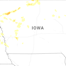


Connect with Interactive Hail Maps