

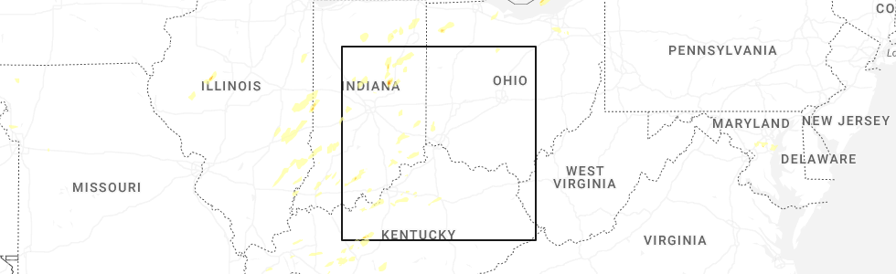
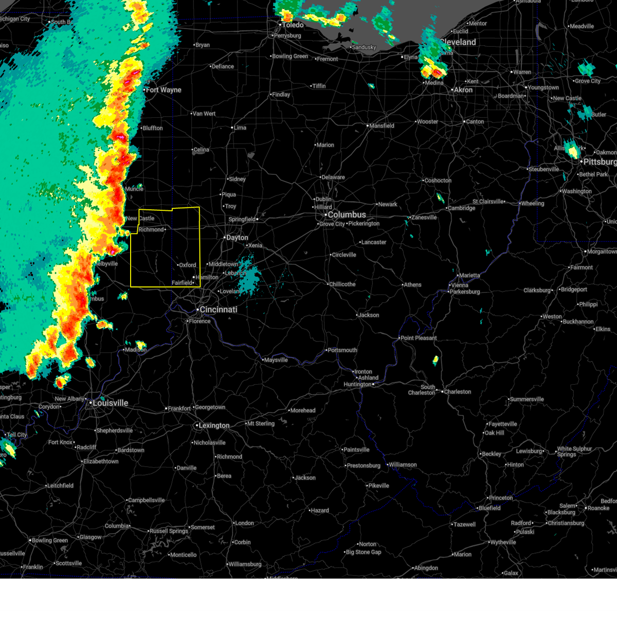
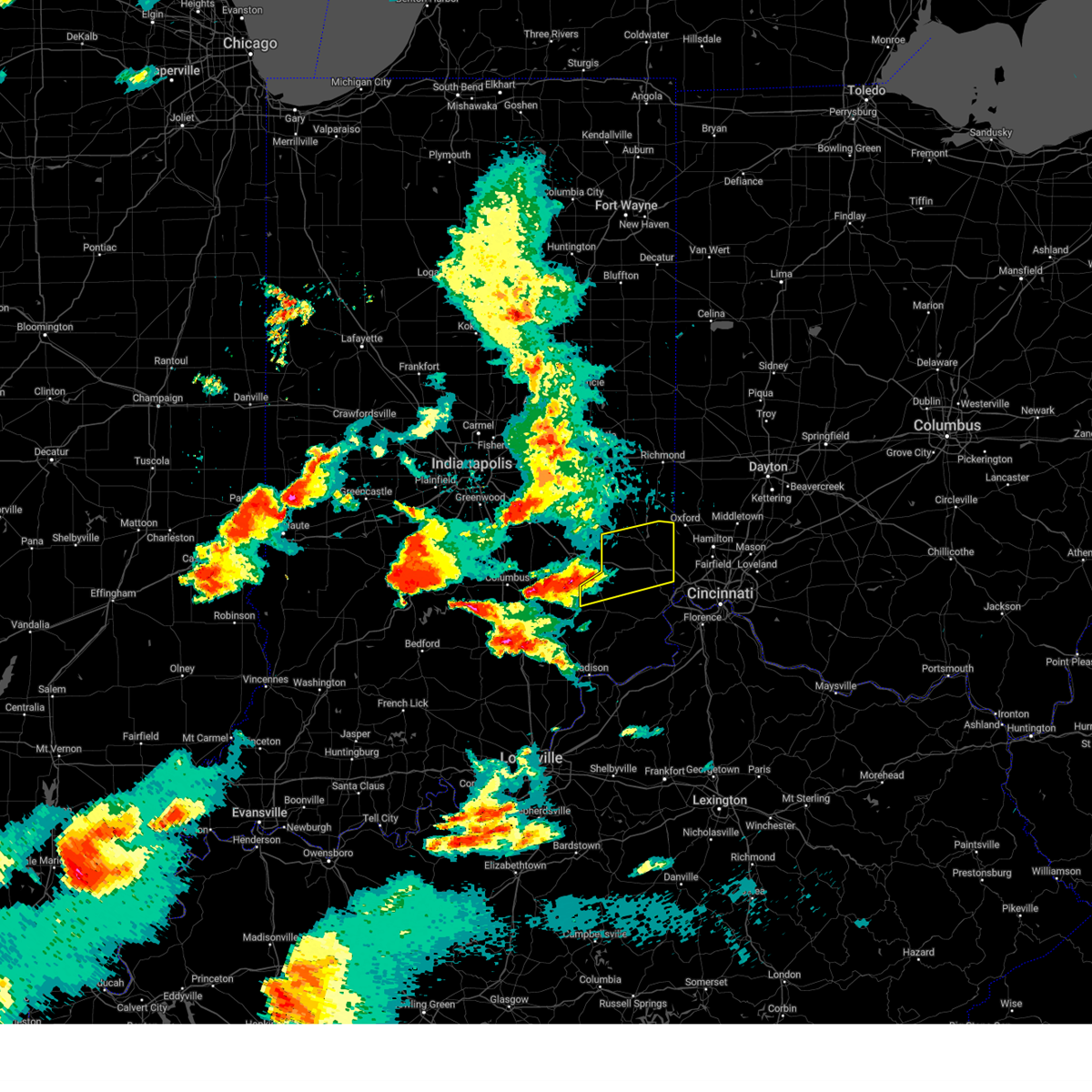
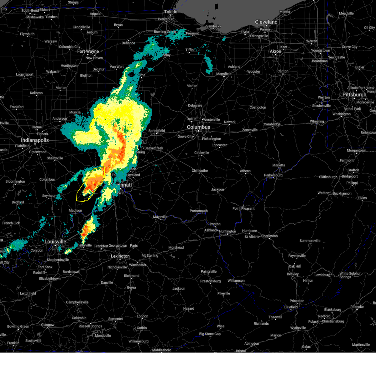
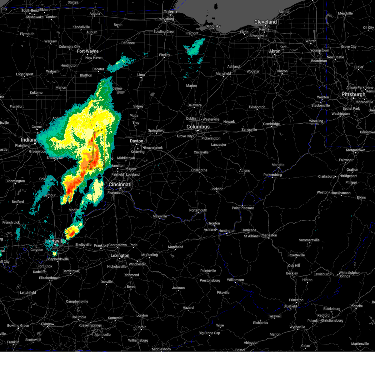
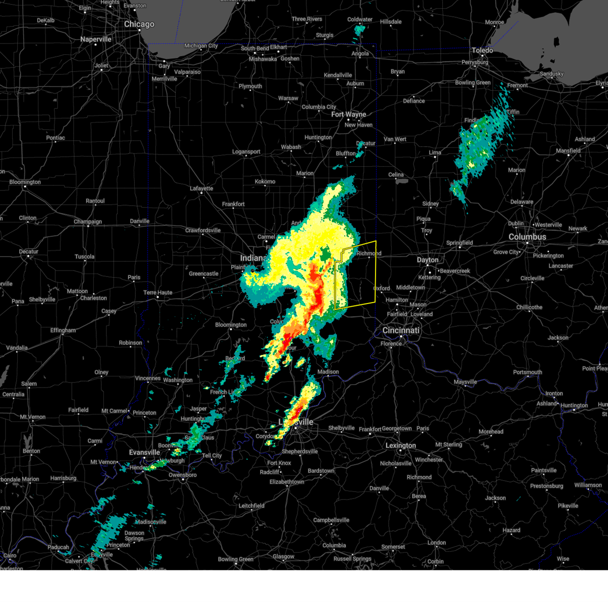
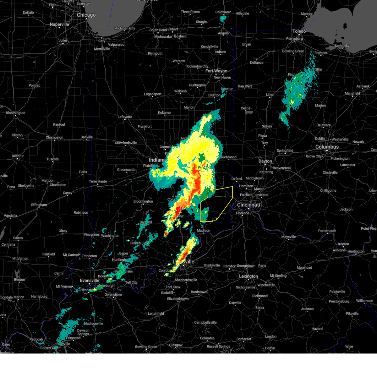
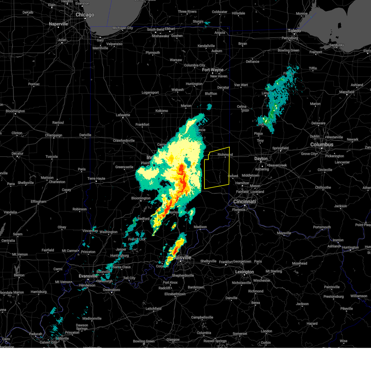
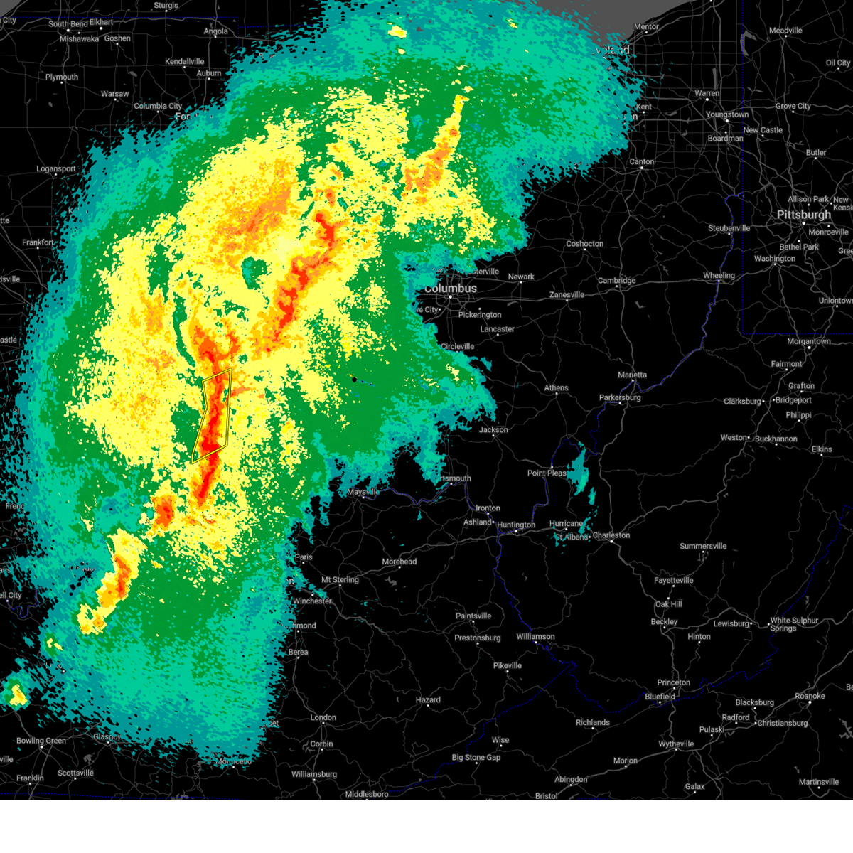
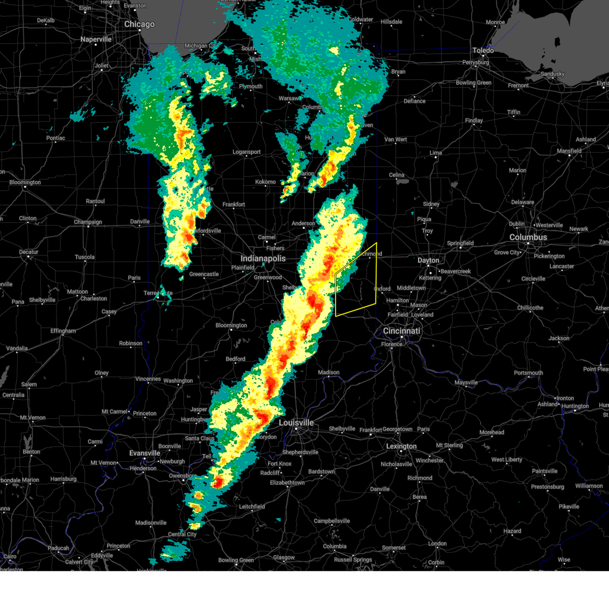
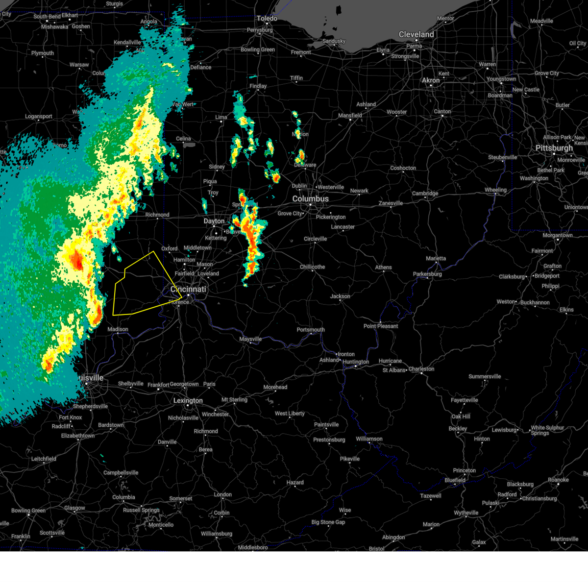
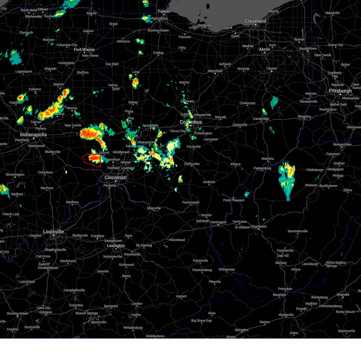
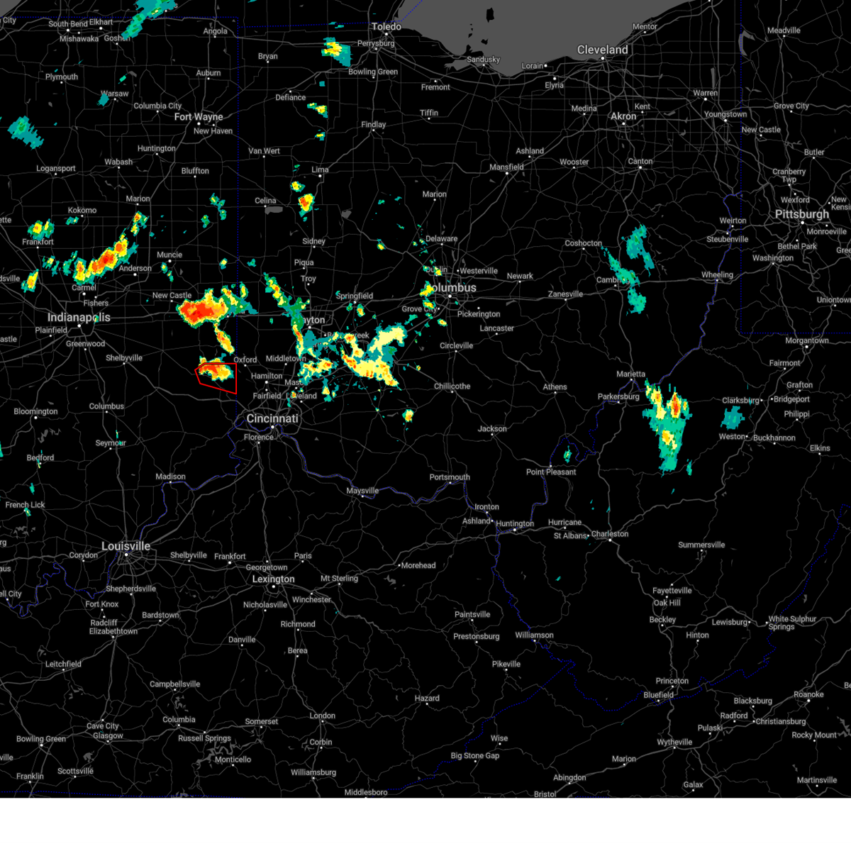
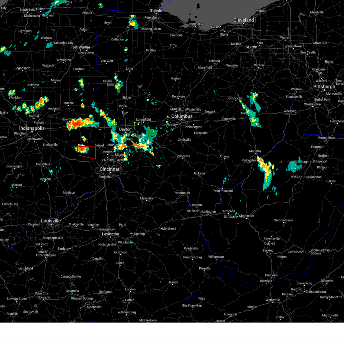
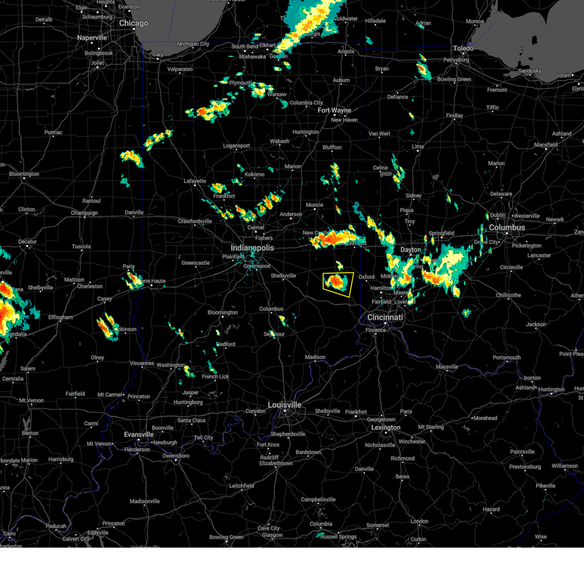
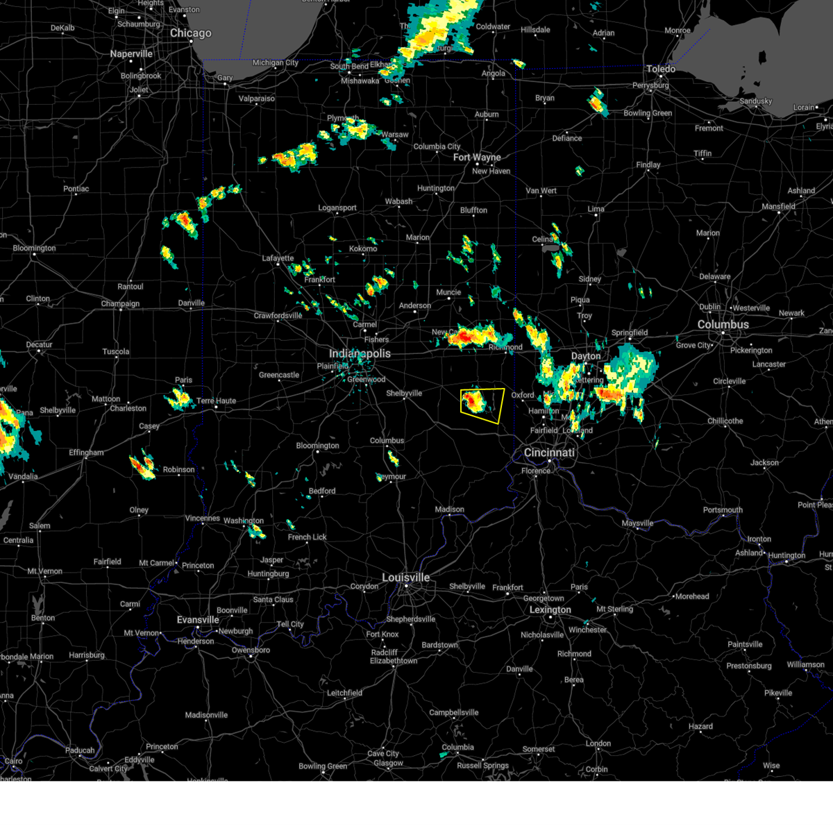
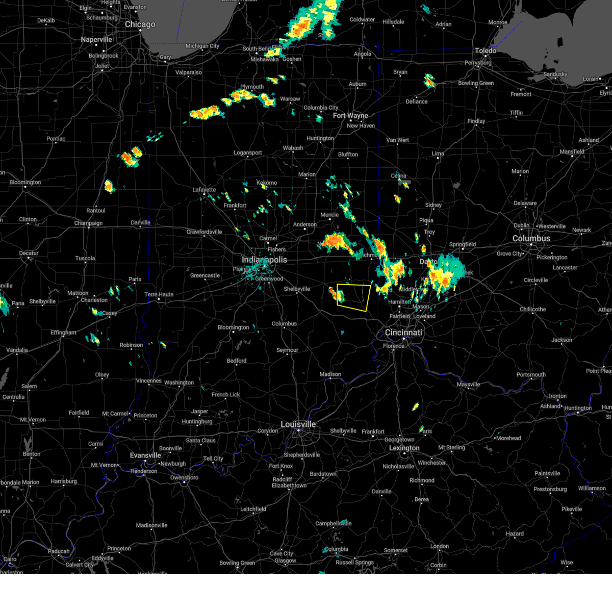
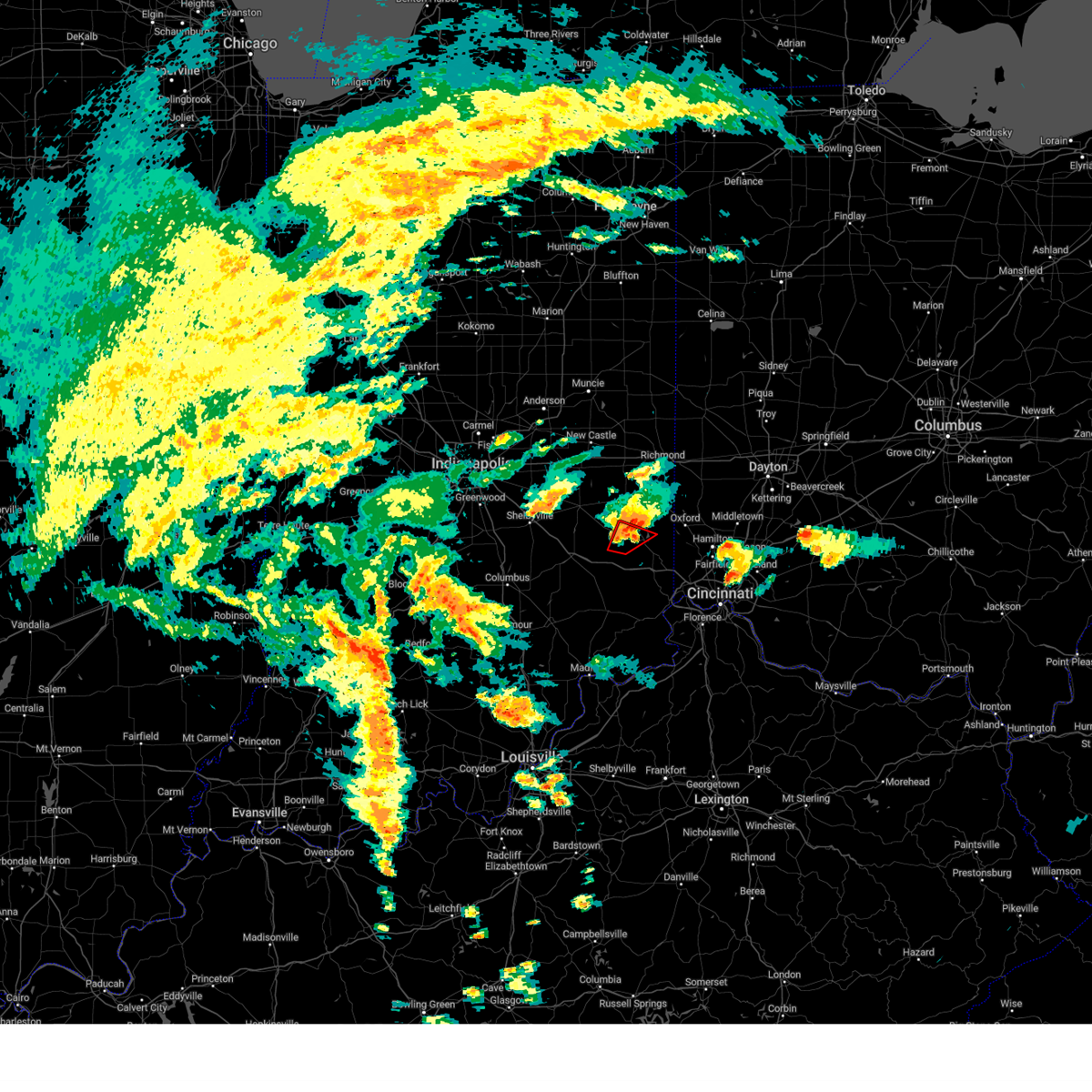
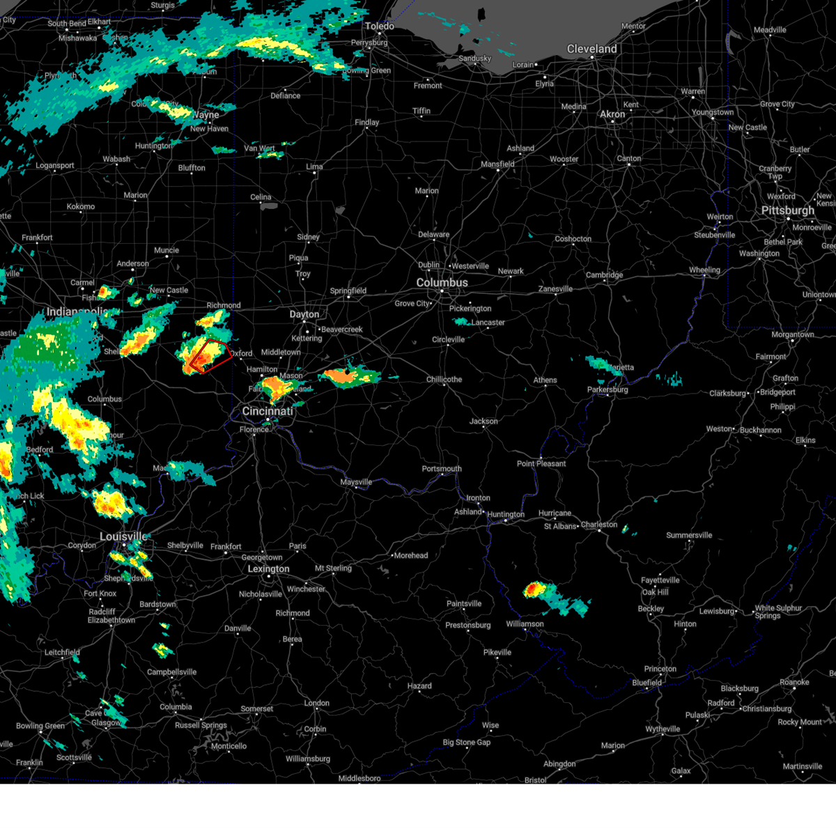
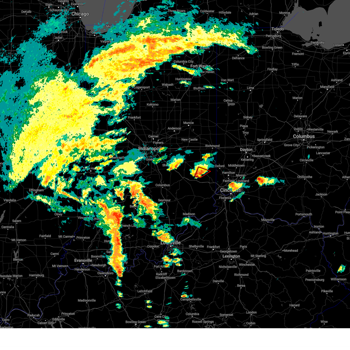
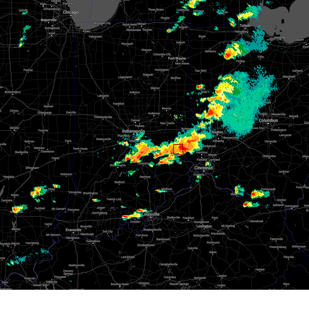
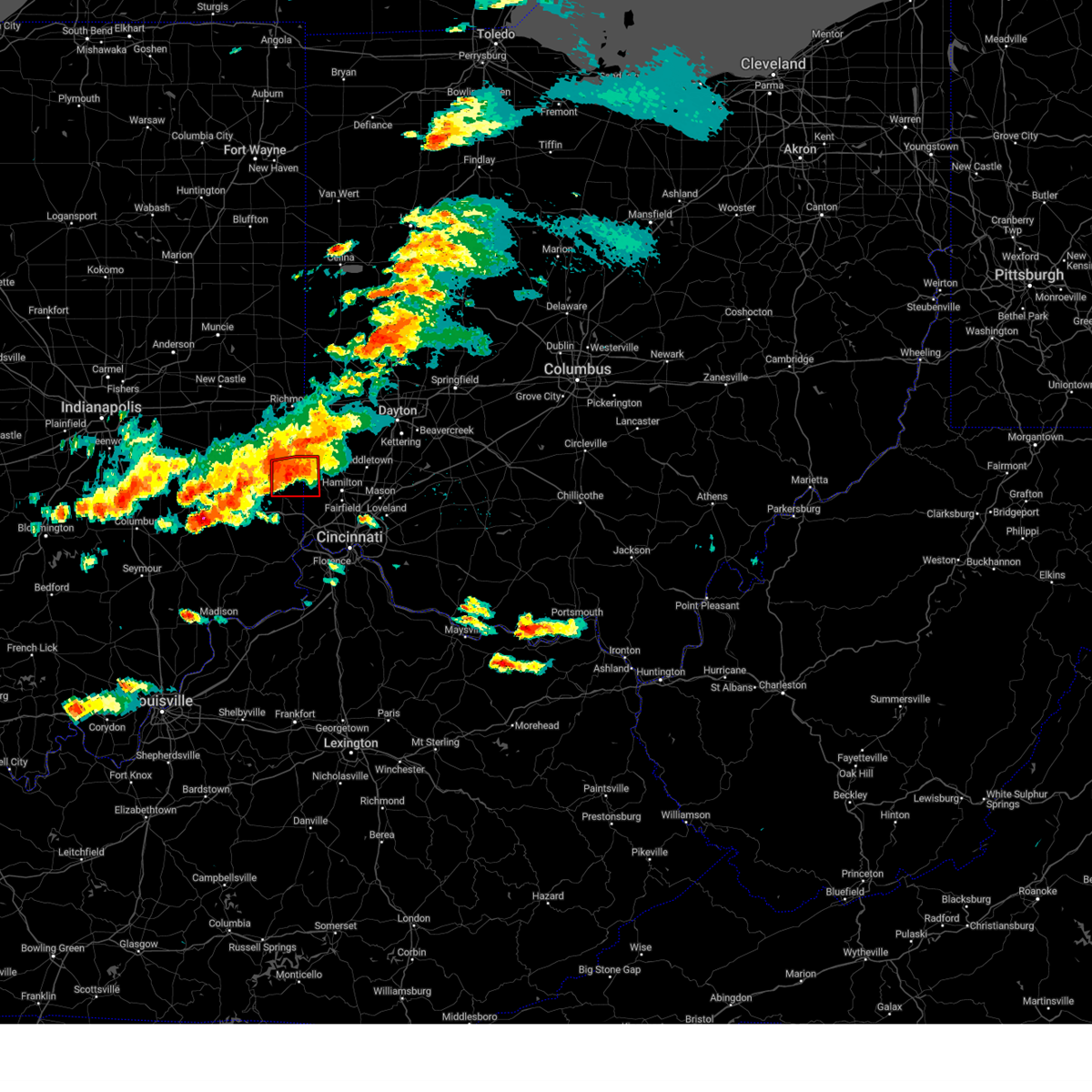
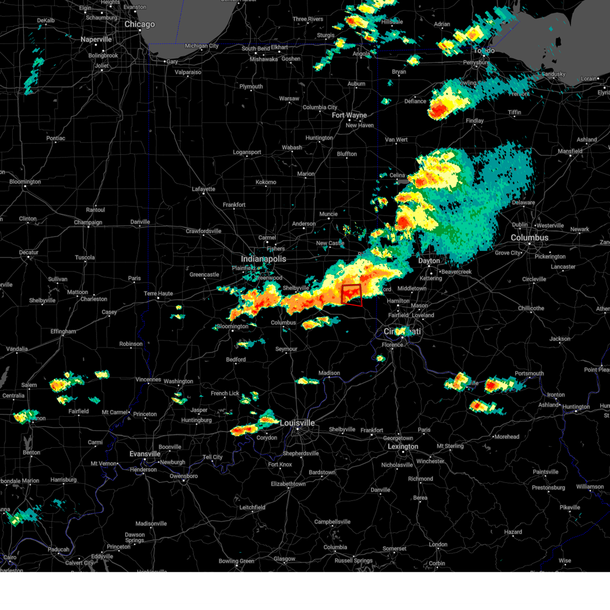
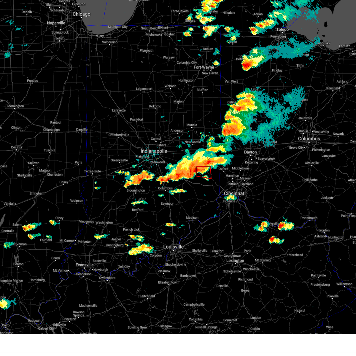
Hail Map for Brookville, IN
The Brookville, IN area has had 7 reports of on-the-ground hail by trained spotters, and has been under severe weather warnings 54 times during the past 12 months. Doppler radar has detected hail at or near Brookville, IN on 52 occasions, including 3 occasions during the past year.
| Name: | Brookville, IN |
| Where Located: | 34.9 miles NW of Cincinnati, OH |
| Map: | Google Map for Brookville, IN |
| Population: | 2596 |
| Housing Units: | 1307 |
| More Info: | Search Google for Brookville, IN |
0
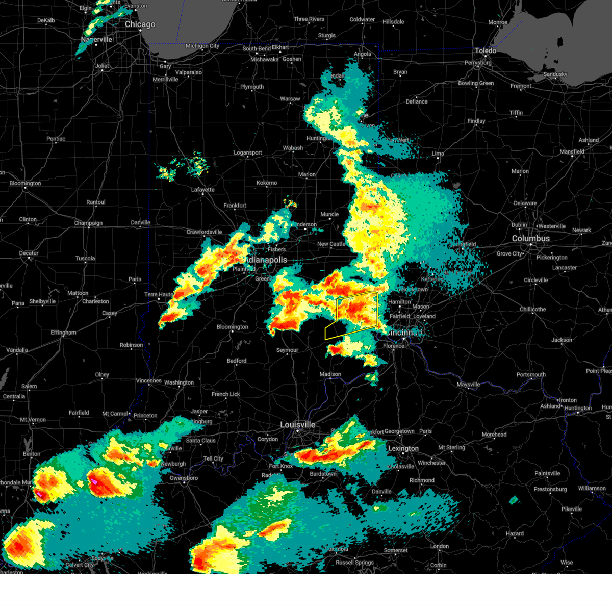
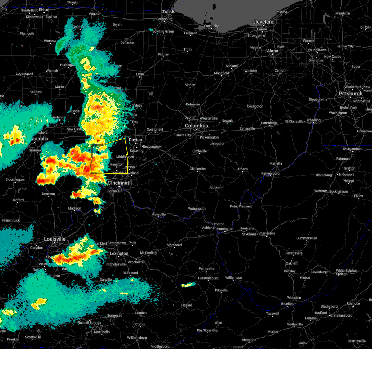
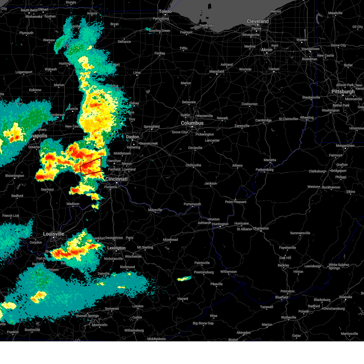
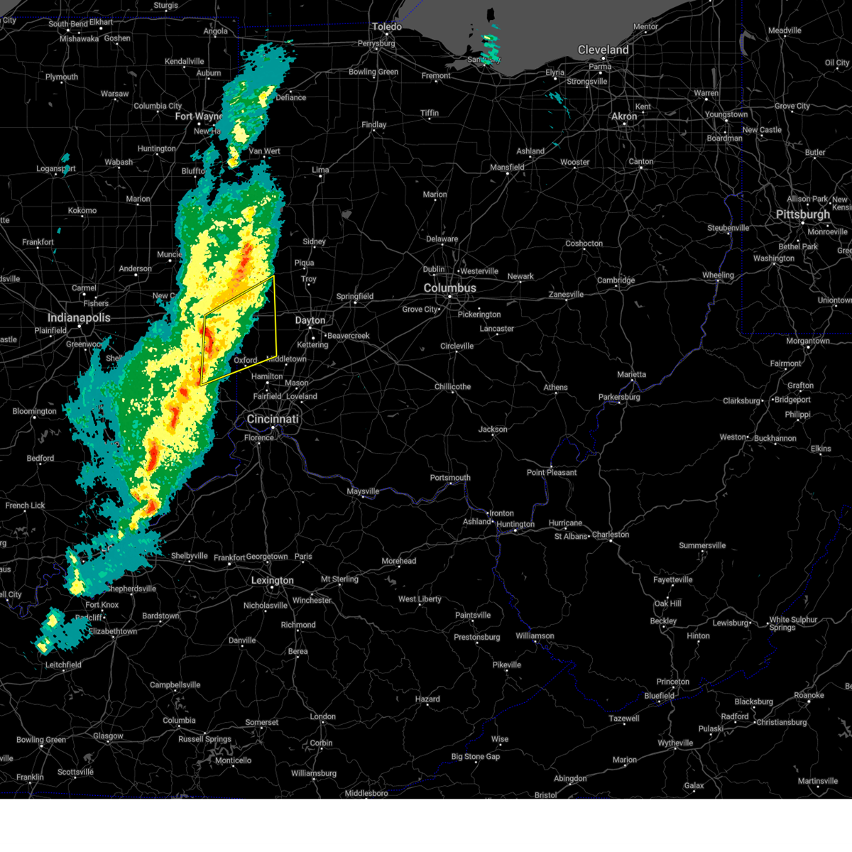
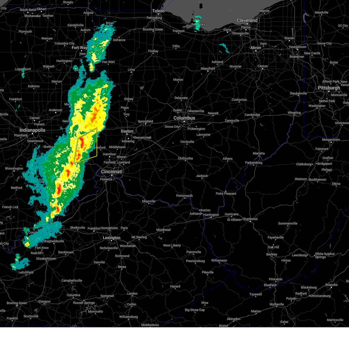
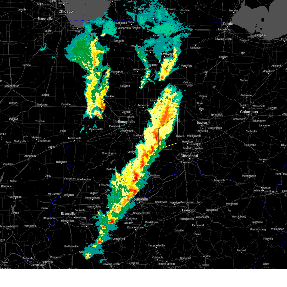
The Top Recent Hail Date for Brookville, IN is Wednesday, June 18, 2025 (43rd out of 52)
Hail and Wind Damage Spotted near Brookville, IN
| Date / Time | Report Details |
|---|---|
| 6/25/2025 2:46 PM EDT | Tree downed near s. state road 101. time estimated by rada in franklin county IN, 6.8 miles SSW of Brookville, IN |
| 6/18/2025 6:23 PM EDT |
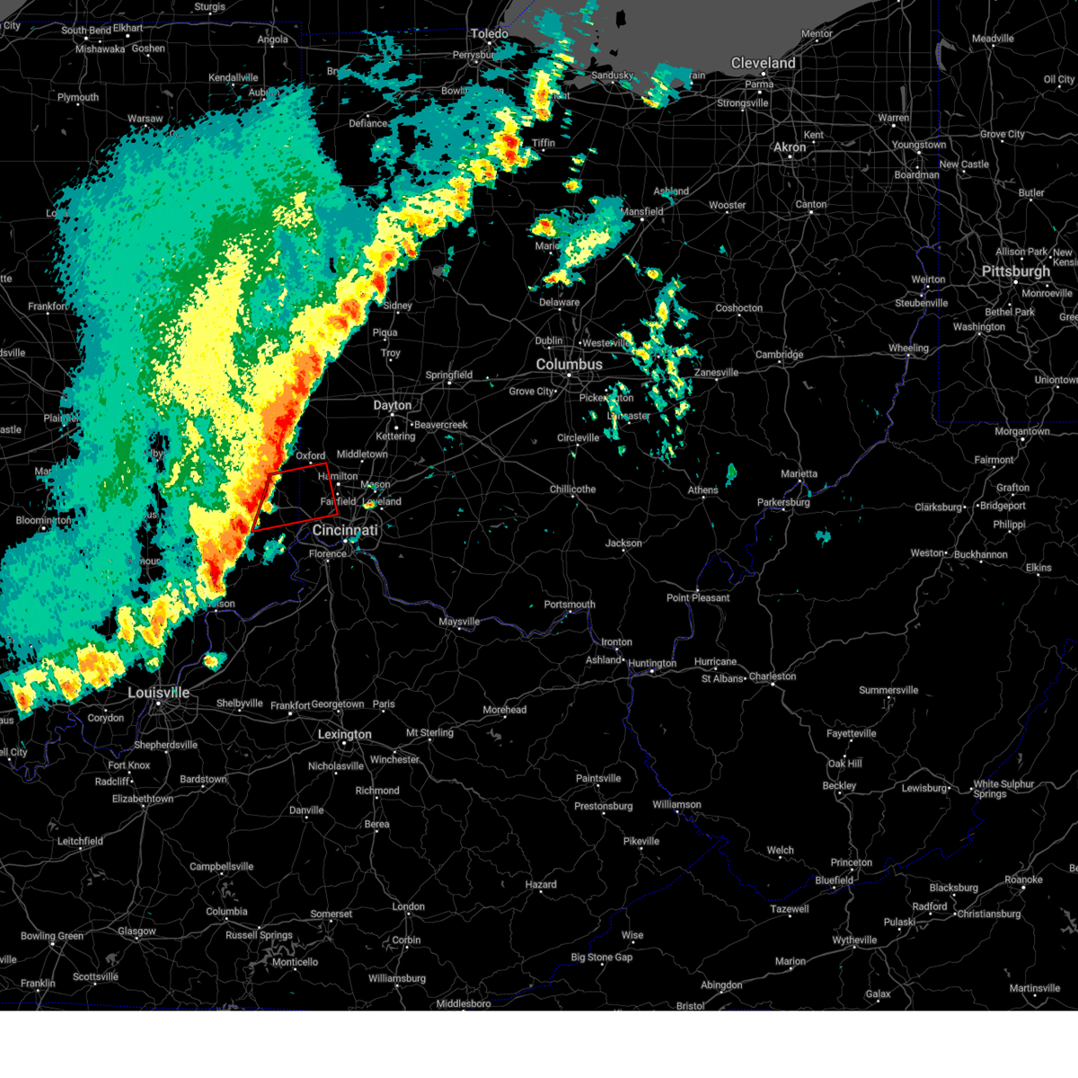
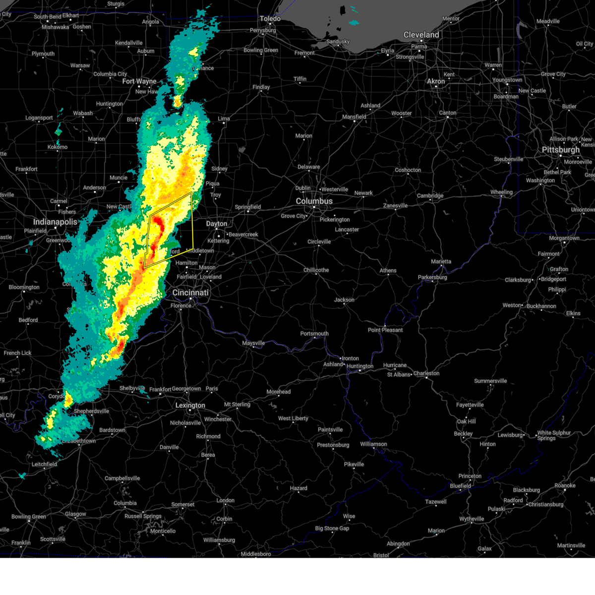
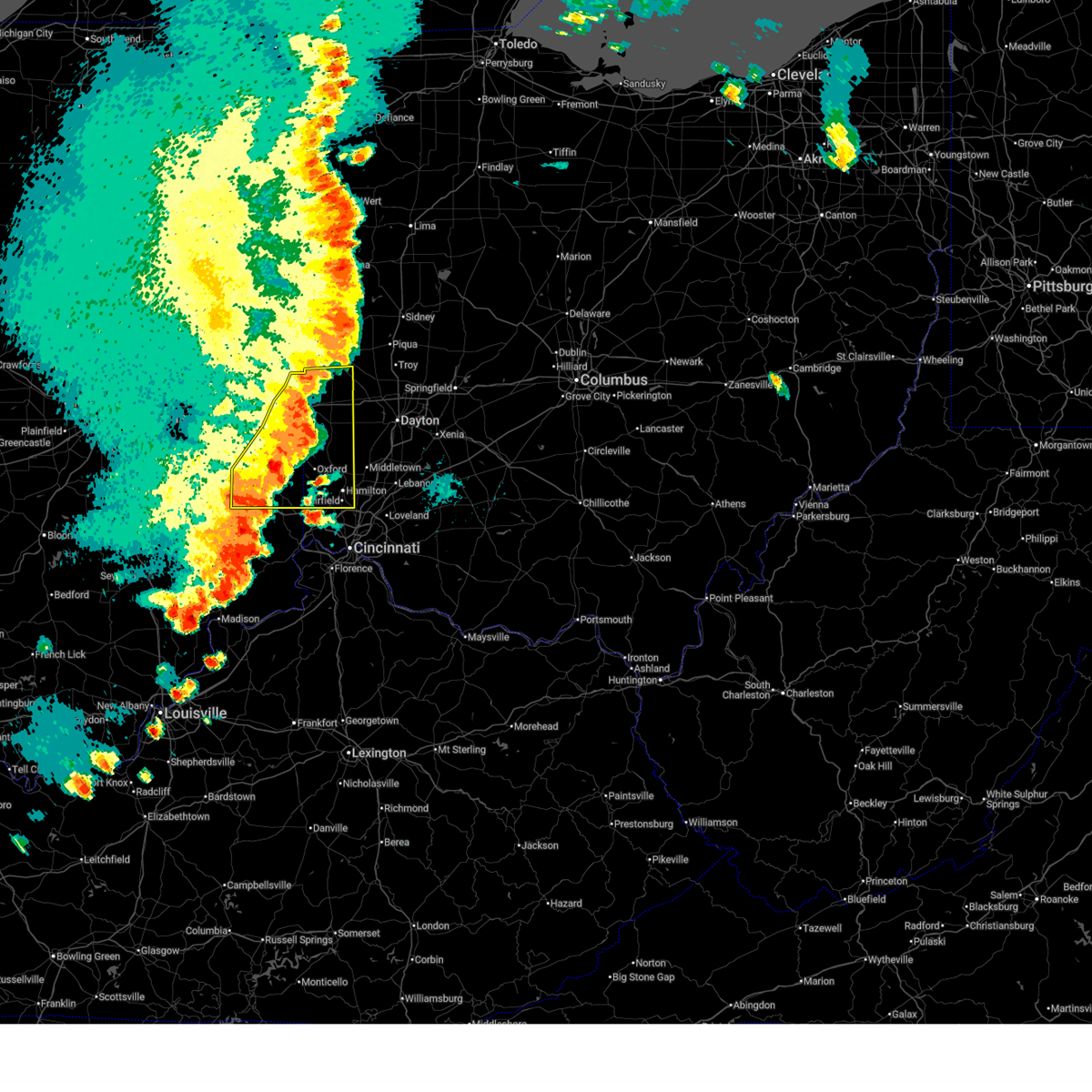 At 623 pm edt, severe thunderstorms were located along a line extending from near arcanum to near oxford, moving east at 60 mph (radar indicated). Hazards include 70 mph wind gusts and quarter size hail. Minor hail damage to vehicles is possible. expect considerable tree damage. wind damage is also likely to mobile homes, roofs, and outbuildings. locations impacted include, hamilton, fairfield, richmond, oxford, connersville, eaton, batesville, brookville, centerville, ross, liberty, arcanum, camden, lewisburg, new paris, west alexandria, new madison, gratis, fountain city, and seven mile. this includes the following interstates, i-70 in indiana between mile markers 145 and 156. i-70 in ohio between mile markers 0 and 17. I-74 in indiana between mile markers 145 and 148. At 623 pm edt, severe thunderstorms were located along a line extending from near arcanum to near oxford, moving east at 60 mph (radar indicated). Hazards include 70 mph wind gusts and quarter size hail. Minor hail damage to vehicles is possible. expect considerable tree damage. wind damage is also likely to mobile homes, roofs, and outbuildings. locations impacted include, hamilton, fairfield, richmond, oxford, connersville, eaton, batesville, brookville, centerville, ross, liberty, arcanum, camden, lewisburg, new paris, west alexandria, new madison, gratis, fountain city, and seven mile. this includes the following interstates, i-70 in indiana between mile markers 145 and 156. i-70 in ohio between mile markers 0 and 17. I-74 in indiana between mile markers 145 and 148.
|
| 6/18/2025 6:21 PM EDT |
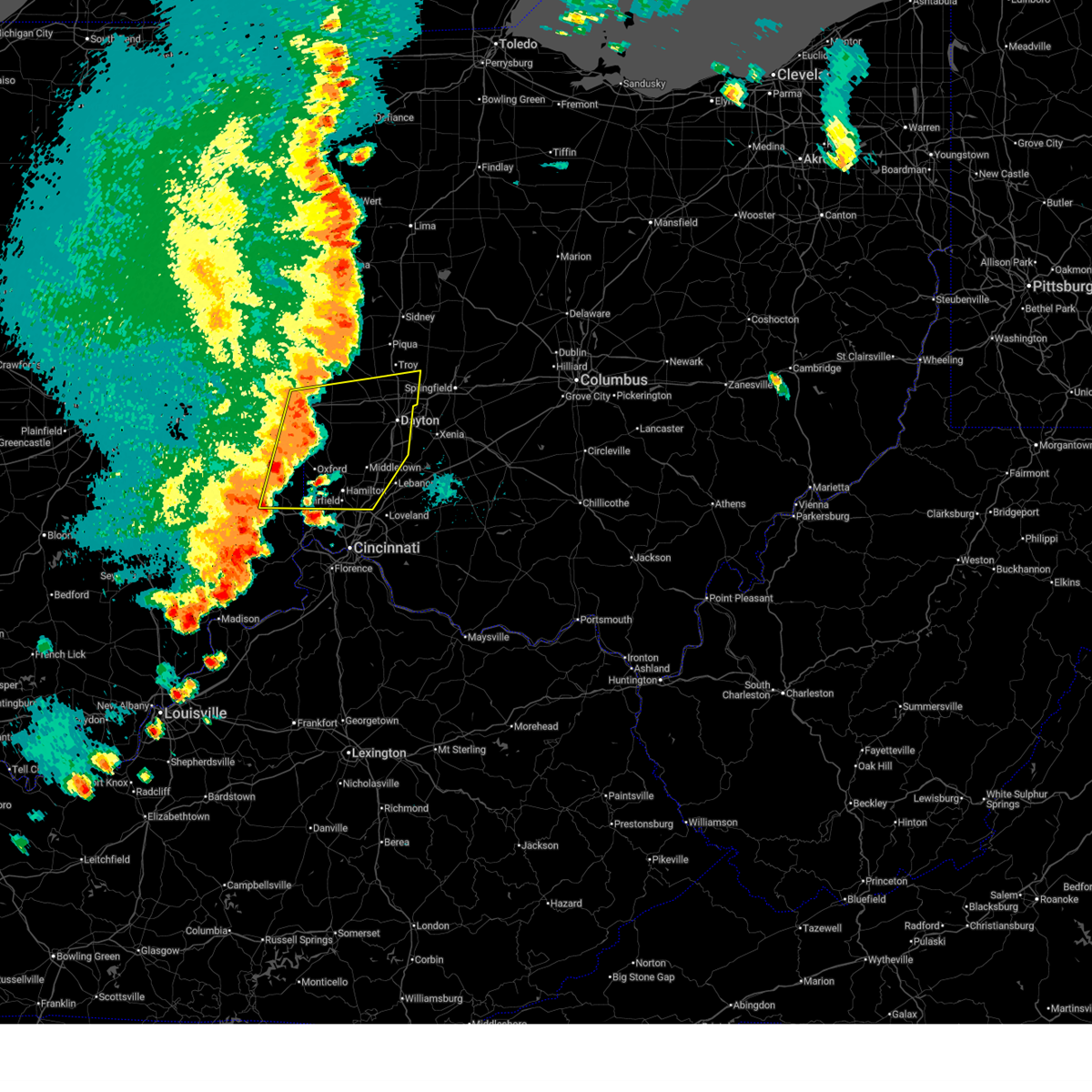 Svriln the national weather service in wilmington has issued a * severe thunderstorm warning for, eastern franklin county in southeastern indiana, southeastern wayne county in east central indiana, union county in east central indiana, preble county in west central ohio, butler county in southwestern ohio, northwestern warren county in southwestern ohio, southern darke county in west central ohio, montgomery county in west central ohio, southern miami county in west central ohio, * until 715 pm edt. * at 620 pm edt, severe thunderstorms were located along a line extending from near new madison to near brookville, moving northeast at 60 mph (radar indicated). Hazards include 70 mph wind gusts and quarter size hail. Minor hail damage to vehicles is possible. expect considerable tree damage. Wind damage is also likely to mobile homes, roofs, and outbuildings. Svriln the national weather service in wilmington has issued a * severe thunderstorm warning for, eastern franklin county in southeastern indiana, southeastern wayne county in east central indiana, union county in east central indiana, preble county in west central ohio, butler county in southwestern ohio, northwestern warren county in southwestern ohio, southern darke county in west central ohio, montgomery county in west central ohio, southern miami county in west central ohio, * until 715 pm edt. * at 620 pm edt, severe thunderstorms were located along a line extending from near new madison to near brookville, moving northeast at 60 mph (radar indicated). Hazards include 70 mph wind gusts and quarter size hail. Minor hail damage to vehicles is possible. expect considerable tree damage. Wind damage is also likely to mobile homes, roofs, and outbuildings.
|
| 6/18/2025 6:20 PM EDT | Storm damage reported in franklin county IN, 0.3 miles NNW of Brookville, IN |
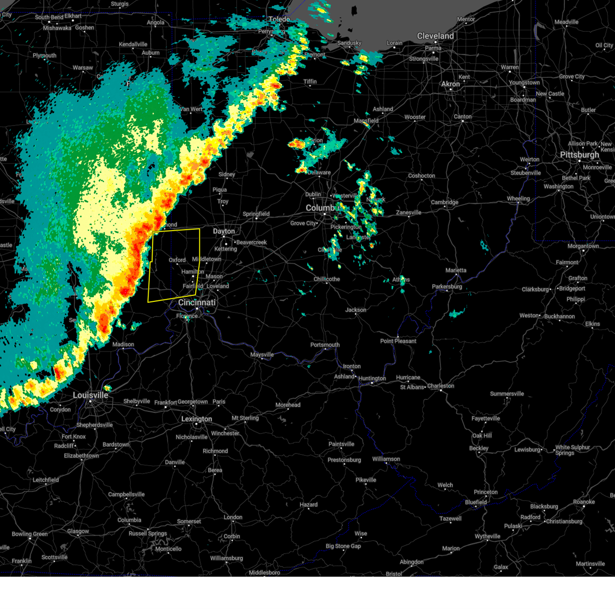
| 6/18/2025 5:57 PM EDT |
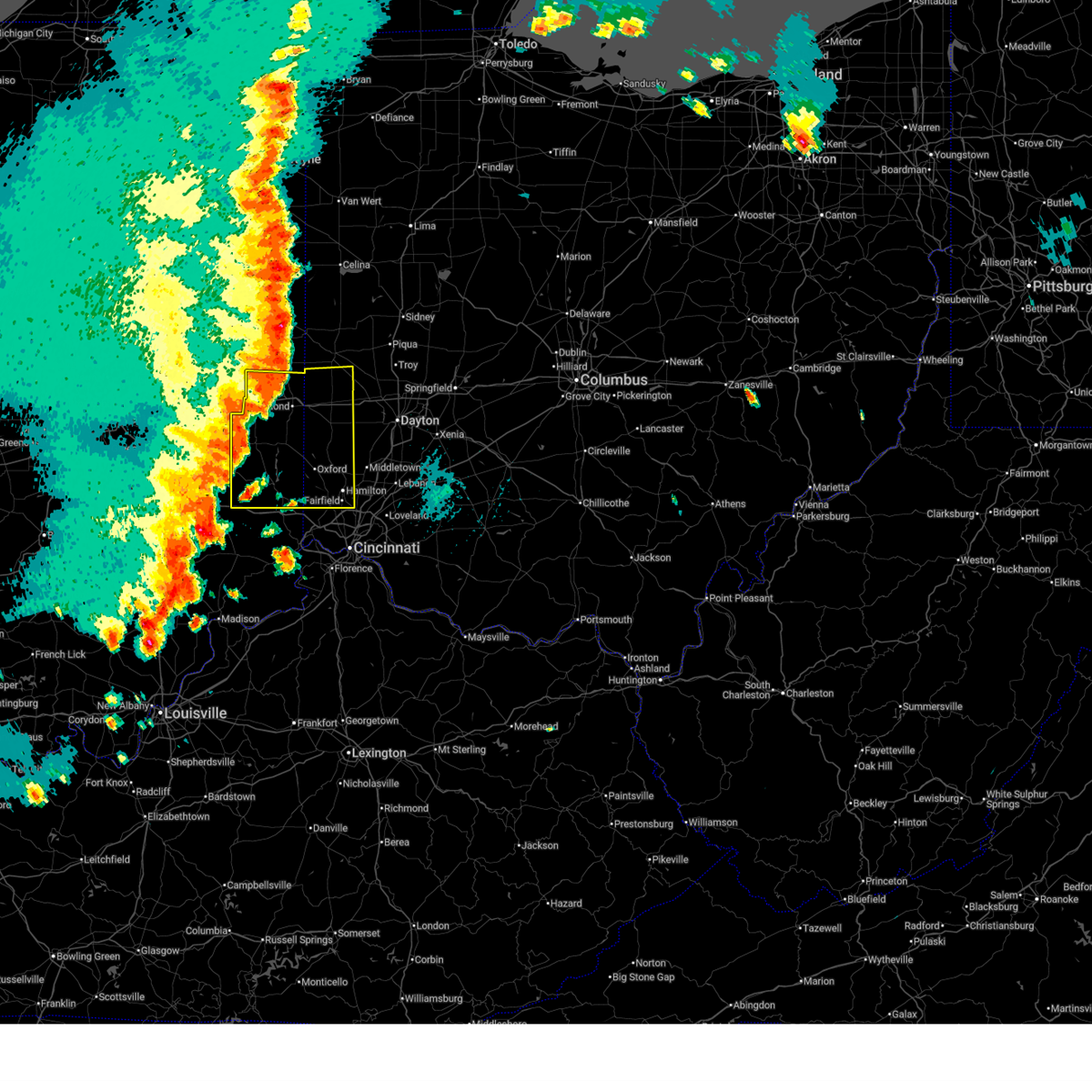 At 557 pm edt, severe thunderstorms were located along a line extending from near fountain city to near lake santee, moving east at 40 mph (trained weather spotters). Hazards include 70 mph wind gusts and penny size hail. Expect considerable tree damage. damage is likely to mobile homes, roofs, and outbuildings. locations impacted include, hamilton, fairfield, richmond, oxford, connersville, eaton, batesville, brookville, centerville, cambridge city, ross, liberty, arcanum, camden, lewisburg, hagerstown, new paris, west alexandria, new madison, and gratis. this includes the following interstates, i-70 in indiana between mile markers 134 and 156. i-70 in ohio between mile markers 0 and 17. I-74 in indiana between mile markers 145 and 148. At 557 pm edt, severe thunderstorms were located along a line extending from near fountain city to near lake santee, moving east at 40 mph (trained weather spotters). Hazards include 70 mph wind gusts and penny size hail. Expect considerable tree damage. damage is likely to mobile homes, roofs, and outbuildings. locations impacted include, hamilton, fairfield, richmond, oxford, connersville, eaton, batesville, brookville, centerville, cambridge city, ross, liberty, arcanum, camden, lewisburg, hagerstown, new paris, west alexandria, new madison, and gratis. this includes the following interstates, i-70 in indiana between mile markers 134 and 156. i-70 in ohio between mile markers 0 and 17. I-74 in indiana between mile markers 145 and 148.
|
| 6/18/2025 5:27 PM EDT |
 Svriln the national weather service in wilmington has issued a * severe thunderstorm warning for, franklin county in southeastern indiana, wayne county in east central indiana, union county in east central indiana, fayette county in east central indiana, preble county in west central ohio, butler county in southwestern ohio, southern darke county in west central ohio, * until 630 pm edt. * at 527 pm edt, severe thunderstorms were located along a line extending from 9 miles northwest of new castle to 10 miles southwest of rushville, moving east at 60 mph (public). Hazards include 70 mph wind gusts and penny size hail. Expect considerable tree damage. Damage is likely to mobile homes, roofs, and outbuildings. Svriln the national weather service in wilmington has issued a * severe thunderstorm warning for, franklin county in southeastern indiana, wayne county in east central indiana, union county in east central indiana, fayette county in east central indiana, preble county in west central ohio, butler county in southwestern ohio, southern darke county in west central ohio, * until 630 pm edt. * at 527 pm edt, severe thunderstorms were located along a line extending from 9 miles northwest of new castle to 10 miles southwest of rushville, moving east at 60 mph (public). Hazards include 70 mph wind gusts and penny size hail. Expect considerable tree damage. Damage is likely to mobile homes, roofs, and outbuildings.
|
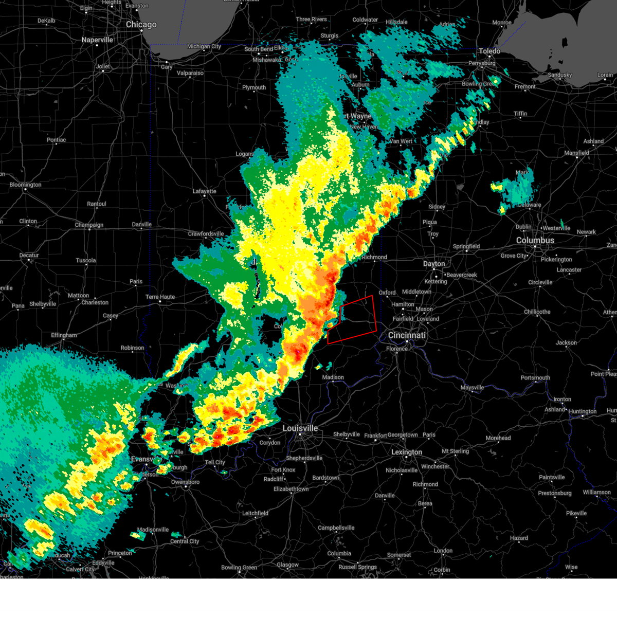
| 5/16/2025 8:26 PM EDT | The storm which prompted the warning has weakened below severe limits and no longer appears capable of producing a tornado. therefore, the warning will be allowed to expire. however, small hail, gusty winds and heavy rain are still possible with this thunderstorm. a tornado watch remains in effect until 300 am edt for southeastern indiana. please report previous tornadoes, wind damage or hail to the national weather service by going to our website at weather.gov/iln and submitting your report via social media. remember, a severe thunderstorm warning still remains in effect for a portion of franklin county indiana. |
| 5/16/2025 8:22 PM EDT | At 822 pm edt, a severe thunderstorm capable of producing a tornado was located near brookville, moving northeast at 45 mph (radar indicated rotation). Hazards include tornado and half dollar size hail. Flying debris will be dangerous to those caught without shelter. mobile homes will be damaged or destroyed. damage to roofs, windows, and vehicles will occur. tree damage is likely. Locations impacted include, brookville, sharptown, saint peter, mount carmel, cedar grove, and mixersville. |
| 5/16/2025 8:22 PM EDT | the tornado warning has been cancelled and is no longer in effect |
| 5/16/2025 8:15 PM EDT | At 814 pm edt, a severe thunderstorm capable of producing a tornado was located near brookville, moving east at 40 mph (radar indicated rotation). Hazards include tornado and half dollar size hail. Flying debris will be dangerous to those caught without shelter. mobile homes will be damaged or destroyed. damage to roofs, windows, and vehicles will occur. tree damage is likely. locations impacted include, mount carmel, cedar grove, sunman, penntown, interstate 74 at state route 101, interstate 74 at us route 52, rockdale, mixersville, st. leon, brookville, sharptown, new trenton, lawrenceville, and saint peter. This includes i-74 in indiana between mile markers 155 and 170. |
| 5/16/2025 8:11 PM EDT |
 The severe thunderstorm which prompted the warning has now has a tornado warning. a tornado watch remains in effect until 300 am edt for southeastern and east central indiana, and southwestern ohio. please report previous wind damage or hail to the national weather service by going to our website at weather.gov/iln and submitting your report via social media. remember, a tornado warning still remains in effect for portions of franklin, ripley, and dearborn counties. The severe thunderstorm which prompted the warning has now has a tornado warning. a tornado watch remains in effect until 300 am edt for southeastern and east central indiana, and southwestern ohio. please report previous wind damage or hail to the national weather service by going to our website at weather.gov/iln and submitting your report via social media. remember, a tornado warning still remains in effect for portions of franklin, ripley, and dearborn counties.
|
| 5/16/2025 8:08 PM EDT |
 Svriln the national weather service in wilmington has issued a * severe thunderstorm warning for, eastern franklin county in southeastern indiana, union county in east central indiana, butler county in southwestern ohio, southern preble county in west central ohio, southwestern montgomery county in west central ohio, * until 900 pm edt. * at 808 pm edt, a severe thunderstorm was located over brookville, moving northeast at 55 mph (radar indicated). Hazards include 60 mph wind gusts and quarter size hail. Minor hail damage to vehicles is possible. Expect wind damage to trees and power lines. Svriln the national weather service in wilmington has issued a * severe thunderstorm warning for, eastern franklin county in southeastern indiana, union county in east central indiana, butler county in southwestern ohio, southern preble county in west central ohio, southwestern montgomery county in west central ohio, * until 900 pm edt. * at 808 pm edt, a severe thunderstorm was located over brookville, moving northeast at 55 mph (radar indicated). Hazards include 60 mph wind gusts and quarter size hail. Minor hail damage to vehicles is possible. Expect wind damage to trees and power lines.
|
| 5/16/2025 8:04 PM EDT |
 Toriln the national weather service in wilmington has issued a * tornado warning for, southern franklin county in southeastern indiana, northeastern ripley county in southeastern indiana, northern dearborn county in southeastern indiana, * until 830 pm edt. * at 804 pm edt, a severe thunderstorm capable of producing a tornado was located near batesville, moving east at 45 mph (radar indicated rotation). Hazards include tornado and half dollar size hail. Flying debris will be dangerous to those caught without shelter. mobile homes will be damaged or destroyed. damage to roofs, windows, and vehicles will occur. Tree damage is likely. Toriln the national weather service in wilmington has issued a * tornado warning for, southern franklin county in southeastern indiana, northeastern ripley county in southeastern indiana, northern dearborn county in southeastern indiana, * until 830 pm edt. * at 804 pm edt, a severe thunderstorm capable of producing a tornado was located near batesville, moving east at 45 mph (radar indicated rotation). Hazards include tornado and half dollar size hail. Flying debris will be dangerous to those caught without shelter. mobile homes will be damaged or destroyed. damage to roofs, windows, and vehicles will occur. Tree damage is likely.
|
| 5/16/2025 7:43 PM EDT | At 743 pm edt, a severe thunderstorm was located 7 miles southwest of batesville, moving east at 50 mph (radar indicated). Hazards include 60 mph wind gusts and quarter size hail. Minor hail damage to vehicles is possible. expect wind damage to trees and power lines. locations impacted include, cedar grove, mounds state recreation area, huntersville, hamburg, penntown, interstate 74 at us route 52, bright, rockdale, st. leon, osgood, peppertown, west harrison, sharptown, oldenburg, saint peter, buena vista, blooming grove, mount carmel, batesville, and sunman. this includes the following interstates, i-74 in indiana between mile markers 145 and 171. I-74 in ohio near mile marker 0. |
| 5/16/2025 7:31 PM EDT |
 Svriln the national weather service in wilmington has issued a * severe thunderstorm warning for, franklin county in southeastern indiana, northern ripley county in southeastern indiana, northern dearborn county in southeastern indiana, * until 815 pm edt. * at 730 pm edt, a severe thunderstorm was located 10 miles south of greensburg, moving east at 50 mph (radar indicated). Hazards include 60 mph wind gusts and quarter size hail. Minor hail damage to vehicles is possible. Expect wind damage to trees and power lines. Svriln the national weather service in wilmington has issued a * severe thunderstorm warning for, franklin county in southeastern indiana, northern ripley county in southeastern indiana, northern dearborn county in southeastern indiana, * until 815 pm edt. * at 730 pm edt, a severe thunderstorm was located 10 miles south of greensburg, moving east at 50 mph (radar indicated). Hazards include 60 mph wind gusts and quarter size hail. Minor hail damage to vehicles is possible. Expect wind damage to trees and power lines.
|
| 4/29/2025 1:28 PM EDT |
 The storm which prompted the warning has moved out of the area. therefore, the warning will be allowed to expire. however, gusty winds and heavy rain are still possible with this thunderstorm. a severe thunderstorm watch remains in effect until 700 pm edt for southeastern indiana. please report previous wind damage or hail to the national weather service by going to our website at weather.gov/iln and submitting your report via social media. remember, a severe thunderstorm warning still remains in effect for a portion of dearborn county. The storm which prompted the warning has moved out of the area. therefore, the warning will be allowed to expire. however, gusty winds and heavy rain are still possible with this thunderstorm. a severe thunderstorm watch remains in effect until 700 pm edt for southeastern indiana. please report previous wind damage or hail to the national weather service by going to our website at weather.gov/iln and submitting your report via social media. remember, a severe thunderstorm warning still remains in effect for a portion of dearborn county.
|
| 4/29/2025 1:19 PM EDT |
 At 119 pm edt, a severe thunderstorm was located near moores hill, moving east at 45 mph (radar indicated). Hazards include 60 mph wind gusts and quarter size hail. Minor hail damage to vehicles is possible. expect wind damage to trees and power lines. locations impacted include, dillsboro, moores hill, rexville, cedar grove, cold springs, penntown, interstate 74 at us route 52, bright, rockdale, farmers retreat, st. leon, friendship, west harrison, versailles lake, sharptown, guilford, saint peter, mount sinai, mount carmel, and sunman. this includes the following interstates, i-74 in indiana between mile markers 154 and 171. I-74 in ohio near mile marker 0. At 119 pm edt, a severe thunderstorm was located near moores hill, moving east at 45 mph (radar indicated). Hazards include 60 mph wind gusts and quarter size hail. Minor hail damage to vehicles is possible. expect wind damage to trees and power lines. locations impacted include, dillsboro, moores hill, rexville, cedar grove, cold springs, penntown, interstate 74 at us route 52, bright, rockdale, farmers retreat, st. leon, friendship, west harrison, versailles lake, sharptown, guilford, saint peter, mount sinai, mount carmel, and sunman. this includes the following interstates, i-74 in indiana between mile markers 154 and 171. I-74 in ohio near mile marker 0.
|
| 4/29/2025 1:14 PM EDT |
 The storm which prompted the warning has moved out of the area. therefore, the warning will be allowed to expire. however, gusty winds and heavy rain are still possible with this thunderstorm. a severe thunderstorm watch remains in effect until 700 pm edt for southeastern and east central indiana, and west central ohio. please report previous wind damage or hail to the national weather service by going to our website at weather.gov/iln and submitting your report via social media. The storm which prompted the warning has moved out of the area. therefore, the warning will be allowed to expire. however, gusty winds and heavy rain are still possible with this thunderstorm. a severe thunderstorm watch remains in effect until 700 pm edt for southeastern and east central indiana, and west central ohio. please report previous wind damage or hail to the national weather service by going to our website at weather.gov/iln and submitting your report via social media.
|
| 4/29/2025 1:02 PM EDT |
 At 102 pm edt, a severe thunderstorm was located near liberty, moving northeast at 55 mph (radar indicated). Hazards include 70 mph wind gusts and quarter size hail. Minor hail damage to vehicles is possible. expect considerable tree damage. wind damage is also likely to mobile homes, roofs, and outbuildings. locations impacted include, richmond municipal airport, dunlapsville, whitewater state park, goodwins corner, mounds state recreation area, spring grove, abington, brownsville, cottage grove, liberty, interstate 70 at exit 145, salem, fountain city, boston, witts station, charlottesville, blooming grove, billingsville, middleboro, and clifton. this includes the following interstates, i-70 in indiana between mile markers 144 and 156. I-70 in ohio near mile marker 0. At 102 pm edt, a severe thunderstorm was located near liberty, moving northeast at 55 mph (radar indicated). Hazards include 70 mph wind gusts and quarter size hail. Minor hail damage to vehicles is possible. expect considerable tree damage. wind damage is also likely to mobile homes, roofs, and outbuildings. locations impacted include, richmond municipal airport, dunlapsville, whitewater state park, goodwins corner, mounds state recreation area, spring grove, abington, brownsville, cottage grove, liberty, interstate 70 at exit 145, salem, fountain city, boston, witts station, charlottesville, blooming grove, billingsville, middleboro, and clifton. this includes the following interstates, i-70 in indiana between mile markers 144 and 156. I-70 in ohio near mile marker 0.
|
| 4/29/2025 1:02 PM EDT |
 the severe thunderstorm warning has been cancelled and is no longer in effect the severe thunderstorm warning has been cancelled and is no longer in effect
|
| 4/29/2025 12:58 PM EDT |
 At 1258 pm edt, a severe thunderstorm was located near osgood, moving east at 55 mph (radar indicated). Hazards include 60 mph wind gusts and quarter size hail. Minor hail damage to vehicles is possible. expect wind damage to trees and power lines. locations impacted include, dillsboro, moores hill, rexville, cedar grove, huntersville, cold springs, penntown, interstate 74 at us route 52, bright, rockdale, farmers retreat, st. leon, friendship, osgood, west harrison, versailles lake, sharptown, guilford, oldenburg, and saint peter. this includes the following interstates, i-74 in indiana between mile markers 145 and 171. I-74 in ohio near mile marker 0. At 1258 pm edt, a severe thunderstorm was located near osgood, moving east at 55 mph (radar indicated). Hazards include 60 mph wind gusts and quarter size hail. Minor hail damage to vehicles is possible. expect wind damage to trees and power lines. locations impacted include, dillsboro, moores hill, rexville, cedar grove, huntersville, cold springs, penntown, interstate 74 at us route 52, bright, rockdale, farmers retreat, st. leon, friendship, osgood, west harrison, versailles lake, sharptown, guilford, oldenburg, and saint peter. this includes the following interstates, i-74 in indiana between mile markers 145 and 171. I-74 in ohio near mile marker 0.
|
| 4/29/2025 12:51 PM EDT |
 At 1251 pm edt, a severe thunderstorm was located near liberty, moving east at 55 mph (radar indicated). Hazards include 70 mph wind gusts and quarter size hail. Minor hail damage to vehicles is possible. expect considerable tree damage. wind damage is also likely to mobile homes, roofs, and outbuildings. locations impacted include, goodwins corner, dublin, abington, brownsville, waterloo, east germantown, connersville, greens fork, buena vista, boston, blooming grove, laurel, billingsville, clifton, alpine, whitewater, centerville, mixersville, brookville, and columbia. this includes the following interstates, i-70 in indiana between mile markers 134 and 156. I-70 in ohio near mile marker 0. At 1251 pm edt, a severe thunderstorm was located near liberty, moving east at 55 mph (radar indicated). Hazards include 70 mph wind gusts and quarter size hail. Minor hail damage to vehicles is possible. expect considerable tree damage. wind damage is also likely to mobile homes, roofs, and outbuildings. locations impacted include, goodwins corner, dublin, abington, brownsville, waterloo, east germantown, connersville, greens fork, buena vista, boston, blooming grove, laurel, billingsville, clifton, alpine, whitewater, centerville, mixersville, brookville, and columbia. this includes the following interstates, i-70 in indiana between mile markers 134 and 156. I-70 in ohio near mile marker 0.
|
| 4/29/2025 12:44 PM EDT |
 At 1244 pm edt, a severe thunderstorm was located 8 miles north of north vernon, moving east at 45 mph (radar indicated). Hazards include 60 mph wind gusts and quarter size hail. Minor hail damage to vehicles is possible. expect wind damage to trees and power lines. locations impacted include, dillsboro, moores hill, rexville, cedar grove, huntersville, cold springs, penntown, interstate 74 at us route 52, bright, rockdale, farmers retreat, st. leon, friendship, osgood, west harrison, versailles lake, sharptown, guilford, oldenburg, and saint peter. this includes the following interstates, i-74 in indiana between mile markers 145 and 171. I-74 in ohio near mile marker 0. At 1244 pm edt, a severe thunderstorm was located 8 miles north of north vernon, moving east at 45 mph (radar indicated). Hazards include 60 mph wind gusts and quarter size hail. Minor hail damage to vehicles is possible. expect wind damage to trees and power lines. locations impacted include, dillsboro, moores hill, rexville, cedar grove, huntersville, cold springs, penntown, interstate 74 at us route 52, bright, rockdale, farmers retreat, st. leon, friendship, osgood, west harrison, versailles lake, sharptown, guilford, oldenburg, and saint peter. this includes the following interstates, i-74 in indiana between mile markers 145 and 171. I-74 in ohio near mile marker 0.
|
| 4/29/2025 12:36 PM EDT |
 At 1235 pm edt, a severe thunderstorm was located over glenwood, moving northeast at 55 mph (radar indicated). Hazards include 70 mph wind gusts and quarter size hail. Minor hail damage to vehicles is possible. expect considerable tree damage. wind damage is also likely to mobile homes, roofs, and outbuildings. locations impacted include, goodwins corner, dublin, abington, brownsville, waterloo, east germantown, connersville, greens fork, buena vista, boston, blooming grove, laurel, billingsville, clifton, alpine, whitewater, centerville, mixersville, brookville, and columbia. this includes the following interstates, i-70 in indiana between mile markers 134 and 156. I-70 in ohio near mile marker 0. At 1235 pm edt, a severe thunderstorm was located over glenwood, moving northeast at 55 mph (radar indicated). Hazards include 70 mph wind gusts and quarter size hail. Minor hail damage to vehicles is possible. expect considerable tree damage. wind damage is also likely to mobile homes, roofs, and outbuildings. locations impacted include, goodwins corner, dublin, abington, brownsville, waterloo, east germantown, connersville, greens fork, buena vista, boston, blooming grove, laurel, billingsville, clifton, alpine, whitewater, centerville, mixersville, brookville, and columbia. this includes the following interstates, i-70 in indiana between mile markers 134 and 156. I-70 in ohio near mile marker 0.
|
| 4/29/2025 12:34 PM EDT |
 Svriln the national weather service in wilmington has issued a * severe thunderstorm warning for, southern franklin county in southeastern indiana, ripley county in southeastern indiana, dearborn county in southeastern indiana, * until 130 pm edt. * at 1234 pm edt, a severe thunderstorm was located 7 miles northwest of north vernon, moving east at 45 mph (radar indicated). Hazards include 60 mph wind gusts and quarter size hail. Minor hail damage to vehicles is possible. Expect wind damage to trees and power lines. Svriln the national weather service in wilmington has issued a * severe thunderstorm warning for, southern franklin county in southeastern indiana, ripley county in southeastern indiana, dearborn county in southeastern indiana, * until 130 pm edt. * at 1234 pm edt, a severe thunderstorm was located 7 miles northwest of north vernon, moving east at 45 mph (radar indicated). Hazards include 60 mph wind gusts and quarter size hail. Minor hail damage to vehicles is possible. Expect wind damage to trees and power lines.
|
| 4/29/2025 12:16 PM EDT |
 Svriln the national weather service in wilmington has issued a * severe thunderstorm warning for, franklin county in southeastern indiana, wayne county in east central indiana, union county in east central indiana, fayette county in east central indiana, * until 115 pm edt. * at 1216 pm edt, a severe thunderstorm was located 7 miles east of shelbyville, moving northeast at 55 mph (radar indicated). Hazards include 60 mph wind gusts and penny size hail. expect damage to trees and power lines Svriln the national weather service in wilmington has issued a * severe thunderstorm warning for, franklin county in southeastern indiana, wayne county in east central indiana, union county in east central indiana, fayette county in east central indiana, * until 115 pm edt. * at 1216 pm edt, a severe thunderstorm was located 7 miles east of shelbyville, moving northeast at 55 mph (radar indicated). Hazards include 60 mph wind gusts and penny size hail. expect damage to trees and power lines
|
| 4/3/2025 12:33 AM EDT | the severe thunderstorm warning has been cancelled and is no longer in effect |
| 4/3/2025 12:21 AM EDT |
 At 1221 am edt, a severe thunderstorm was located 8 miles south of brookville, moving northeast at 55 mph (radar indicated). Hazards include 70 mph wind gusts and penny size hail. Expect considerable tree damage. damage is likely to mobile homes, roofs, and outbuildings. locations impacted include, dillsboro, moores hill, cedar grove, cold springs, avonburg, farmers retreat, aurora, st. leon, friendship, guilford, wilmington, saint peter, mount sinai, dover, weisburg, brookville, logan, manchester, new trenton, and hartford. This includes i-74 in indiana between mile markers 157 and 167. At 1221 am edt, a severe thunderstorm was located 8 miles south of brookville, moving northeast at 55 mph (radar indicated). Hazards include 70 mph wind gusts and penny size hail. Expect considerable tree damage. damage is likely to mobile homes, roofs, and outbuildings. locations impacted include, dillsboro, moores hill, cedar grove, cold springs, avonburg, farmers retreat, aurora, st. leon, friendship, guilford, wilmington, saint peter, mount sinai, dover, weisburg, brookville, logan, manchester, new trenton, and hartford. This includes i-74 in indiana between mile markers 157 and 167.
|
| 4/3/2025 12:12 AM EDT | Svriln the national weather service in wilmington has issued a * severe thunderstorm warning for, eastern franklin county in southeastern indiana, southern union county in east central indiana, northeastern dearborn county in southeastern indiana, southeastern fayette county in east central indiana, hamilton county in southwestern ohio, butler county in southwestern ohio, northwestern clermont county in southwestern ohio, western warren county in southwestern ohio, southern montgomery county in west central ohio, * until 100 am edt. * at 1211 am edt, a severe thunderstorm was located near milan, moving east at 70 mph (radar indicated). Hazards include 70 mph wind gusts and penny size hail. Expect considerable tree damage. Damage is likely to mobile homes, roofs, and outbuildings. |
| 4/3/2025 12:08 AM EDT | At 1208 am edt, a severe thunderstorm was located near batesville, moving east at 70 mph (radar indicated). Hazards include 70 mph wind gusts and penny size hail. Expect considerable tree damage. damage is likely to mobile homes, roofs, and outbuildings. locations impacted include, dillsboro, moores hill, rexville, cedar grove, huntersville, cold springs, penntown, avonburg, farmers retreat, aurora, st. leon, friendship, osgood, versailles lake, guilford, oldenburg, wilmington, saint peter, mount sinai, and batesville. This includes i-74 in indiana between mile markers 145 and 167. |
| 4/2/2025 11:54 PM EDT | At 1154 pm edt, a severe thunderstorm was located 11 miles northeast of north vernon, moving northeast at 55 mph (radar indicated). Hazards include 70 mph wind gusts and penny size hail. Expect considerable tree damage. damage is likely to mobile homes, roofs, and outbuildings. locations impacted include, dillsboro, moores hill, rexville, cedar grove, huntersville, cold springs, penntown, avonburg, farmers retreat, aurora, st. leon, friendship, osgood, versailles lake, guilford, oldenburg, wilmington, saint peter, mount sinai, and holton. This includes i-74 in indiana between mile markers 145 and 167. |
| 4/2/2025 11:38 PM EDT | Svriln the national weather service in wilmington has issued a * severe thunderstorm warning for, ohio county in southeastern indiana, central franklin county in southeastern indiana, ripley county in southeastern indiana, dearborn county in southeastern indiana, northwestern switzerland county in southeastern indiana, * until 1245 am edt. * at 1138 pm edt, a severe thunderstorm was located 7 miles northwest of north vernon, moving northeast at 55 mph (radar indicated). Hazards include 60 mph wind gusts. expect damage to trees and power lines |
| 4/2/2025 11:30 PM EDT | Svriln the national weather service in wilmington has issued a * severe thunderstorm warning for, franklin county in southeastern indiana, southern union county in east central indiana, southern fayette county in east central indiana, northwestern butler county in southwestern ohio, southwestern preble county in west central ohio, * until 1215 am edt. * at 1130 pm edt, a severe thunderstorm was located over lake santee, moving northeast at 55 mph (radar indicated). Hazards include 60 mph wind gusts. expect damage to trees and power lines |
| 3/30/2025 8:17 PM EDT | The tornado warning that was previously in effect has been reissued for portions of ripley, hamilton, dearborn, franklin, and butler counties and is in effect until 8:45 pm edt. please refer to that bulletin for the latest severe weather information. a tornado watch remains in effect until 100 am edt for southeastern indiana. please report previous tornadoes, wind damage or hail to the national weather service by going to our website at weather.gov/iln and submitting your report via social media. remember, a tornado warning still remains in effect for portions of ripley, hamilton, dearborn, franklin, and butler counties and is in effect until 8:45 pm edt. |
| 3/30/2025 8:15 PM EDT |
 Toriln the national weather service in wilmington has issued a * tornado warning for, southeastern franklin county in southeastern indiana, east central ripley county in southeastern indiana, northern dearborn county in southeastern indiana, northwestern hamilton county in southwestern ohio, southwestern butler county in southwestern ohio, * until 845 pm edt. * at 814 pm edt, a severe thunderstorm capable of producing a tornado was located 9 miles east of batesville, moving east at 50 mph (radar indicated rotation). Hazards include tornado and quarter size hail. Flying debris will be dangerous to those caught without shelter. mobile homes will be damaged or destroyed. damage to roofs, windows, and vehicles will occur. Tree damage is likely. Toriln the national weather service in wilmington has issued a * tornado warning for, southeastern franklin county in southeastern indiana, east central ripley county in southeastern indiana, northern dearborn county in southeastern indiana, northwestern hamilton county in southwestern ohio, southwestern butler county in southwestern ohio, * until 845 pm edt. * at 814 pm edt, a severe thunderstorm capable of producing a tornado was located 9 miles east of batesville, moving east at 50 mph (radar indicated rotation). Hazards include tornado and quarter size hail. Flying debris will be dangerous to those caught without shelter. mobile homes will be damaged or destroyed. damage to roofs, windows, and vehicles will occur. Tree damage is likely.
|
| 3/30/2025 8:03 PM EDT | At 803 pm edt, a severe thunderstorm capable of producing a tornado was located near batesville, moving east at 60 mph (radar indicated rotation). Hazards include tornado and quarter size hail. Flying debris will be dangerous to those caught without shelter. mobile homes will be damaged or destroyed. damage to roofs, windows, and vehicles will occur. tree damage is likely. locations impacted include, cedar grove, mounds state recreation area, huntersville, hamburg, penntown, st. leon, osgood, peppertown, oldenburg, saint peter, batesville, sunman, dover, weisburg, ballstown, interstate 74 at state route 101, napoleon, brookville, logan, and new trenton. This includes i-74 in indiana between mile markers 146 and 167. |
| 3/30/2025 8:00 PM EDT |
 At 759 pm edt, severe thunderstorms were located along a line extending from near centerville to near osgood, moving east at 60 mph (radar indicated). Hazards include 70 mph wind gusts and quarter size hail. Minor hail damage to vehicles is possible. expect considerable tree damage. wind damage is also likely to mobile homes, roofs, and outbuildings. locations impacted include, goodwins corner, west florence, abington, morning sun, bright, st. leon, muttonville, mount healthy, boston, camden, dry ridge, blue jay, reily, college corner, brookville, logan, dunlap, new haven, sugar valley, and lawrenceville. this includes the following interstates, i-74 in indiana between mile markers 157 and 171. I-74 in ohio between mile markers 0 and 7, and near mile marker 9. At 759 pm edt, severe thunderstorms were located along a line extending from near centerville to near osgood, moving east at 60 mph (radar indicated). Hazards include 70 mph wind gusts and quarter size hail. Minor hail damage to vehicles is possible. expect considerable tree damage. wind damage is also likely to mobile homes, roofs, and outbuildings. locations impacted include, goodwins corner, west florence, abington, morning sun, bright, st. leon, muttonville, mount healthy, boston, camden, dry ridge, blue jay, reily, college corner, brookville, logan, dunlap, new haven, sugar valley, and lawrenceville. this includes the following interstates, i-74 in indiana between mile markers 157 and 171. I-74 in ohio between mile markers 0 and 7, and near mile marker 9.
|
| 3/30/2025 7:55 PM EDT |
 Svriln the national weather service in wilmington has issued a * severe thunderstorm warning for, eastern franklin county in southeastern indiana, southeastern wayne county in east central indiana, union county in east central indiana, northern dearborn county in southeastern indiana, northwestern hamilton county in southwestern ohio, butler county in southwestern ohio, preble county in west central ohio, * until 900 pm edt. * at 755 pm edt, severe thunderstorms were located along a line extending from cambridge city to near osgood, moving east at 60 mph (radar indicated). Hazards include 60 mph wind gusts and quarter size hail. Minor hail damage to vehicles is possible. Expect wind damage to trees and power lines. Svriln the national weather service in wilmington has issued a * severe thunderstorm warning for, eastern franklin county in southeastern indiana, southeastern wayne county in east central indiana, union county in east central indiana, northern dearborn county in southeastern indiana, northwestern hamilton county in southwestern ohio, butler county in southwestern ohio, preble county in west central ohio, * until 900 pm edt. * at 755 pm edt, severe thunderstorms were located along a line extending from cambridge city to near osgood, moving east at 60 mph (radar indicated). Hazards include 60 mph wind gusts and quarter size hail. Minor hail damage to vehicles is possible. Expect wind damage to trees and power lines.
|
| 3/30/2025 7:49 PM EDT |
 Toriln the national weather service in wilmington has issued a * tornado warning for, franklin county in southeastern indiana, northern ripley county in southeastern indiana, northern dearborn county in southeastern indiana, * until 815 pm edt. * at 748 pm edt, a severe thunderstorm capable of producing a tornado was located 8 miles southeast of greensburg, moving east at 60 mph (radar indicated rotation). Hazards include tornado and quarter size hail. Flying debris will be dangerous to those caught without shelter. mobile homes will be damaged or destroyed. damage to roofs, windows, and vehicles will occur. Tree damage is likely. Toriln the national weather service in wilmington has issued a * tornado warning for, franklin county in southeastern indiana, northern ripley county in southeastern indiana, northern dearborn county in southeastern indiana, * until 815 pm edt. * at 748 pm edt, a severe thunderstorm capable of producing a tornado was located 8 miles southeast of greensburg, moving east at 60 mph (radar indicated rotation). Hazards include tornado and quarter size hail. Flying debris will be dangerous to those caught without shelter. mobile homes will be damaged or destroyed. damage to roofs, windows, and vehicles will occur. Tree damage is likely.
|
| 3/19/2025 10:09 PM EDT |
 At 1009 pm edt, a severe thunderstorm was located over richmond, moving northeast at 50 mph (radar indicated). Hazards include 60 mph wind gusts. Expect damage to trees and power lines. locations impacted include, goodwins corner, west florence, abington, brownsville, morning sun, new madison, west alexandria, wheatville, interstate 70 at us route 127, muttonville, new hope, boston, camden, fairhaven, billingsville, arcanum, clifton, whitewater, lewisburg, and new paris. this includes the following interstates, i-70 in indiana between mile markers 145 and 156. I-70 in ohio between mile markers 0 and 17. At 1009 pm edt, a severe thunderstorm was located over richmond, moving northeast at 50 mph (radar indicated). Hazards include 60 mph wind gusts. Expect damage to trees and power lines. locations impacted include, goodwins corner, west florence, abington, brownsville, morning sun, new madison, west alexandria, wheatville, interstate 70 at us route 127, muttonville, new hope, boston, camden, fairhaven, billingsville, arcanum, clifton, whitewater, lewisburg, and new paris. this includes the following interstates, i-70 in indiana between mile markers 145 and 156. I-70 in ohio between mile markers 0 and 17.
|
| 3/19/2025 10:09 PM EDT |
 the severe thunderstorm warning has been cancelled and is no longer in effect the severe thunderstorm warning has been cancelled and is no longer in effect
|
| 3/19/2025 10:00 PM EDT |
 The storm which prompted the warning has moved out of the area. therefore, this warning will be allowed to expire, with a new warning issued upstream. a severe thunderstorm watch remains in effect until 100 am edt for southeastern and east central indiana. please report previous wind damage or hail to the national weather service by going to our website at weather.gov/iln and submitting your report via social media. remember, a severe thunderstorm warning still remains in effect. The storm which prompted the warning has moved out of the area. therefore, this warning will be allowed to expire, with a new warning issued upstream. a severe thunderstorm watch remains in effect until 100 am edt for southeastern and east central indiana. please report previous wind damage or hail to the national weather service by going to our website at weather.gov/iln and submitting your report via social media. remember, a severe thunderstorm warning still remains in effect.
|
| 3/19/2025 9:58 PM EDT |
 Svriln the national weather service in wilmington has issued a * severe thunderstorm warning for, northeastern franklin county in southeastern indiana, southeastern wayne county in east central indiana, union county in east central indiana, southeastern fayette county in east central indiana, northwestern butler county in southwestern ohio, preble county in west central ohio, southern darke county in west central ohio, * until 1045 pm edt. * at 958 pm edt, a severe thunderstorm was located 7 miles south of centerville, moving northeast at 50 mph (radar indicated). Hazards include 60 mph wind gusts. expect damage to trees and power lines Svriln the national weather service in wilmington has issued a * severe thunderstorm warning for, northeastern franklin county in southeastern indiana, southeastern wayne county in east central indiana, union county in east central indiana, southeastern fayette county in east central indiana, northwestern butler county in southwestern ohio, preble county in west central ohio, southern darke county in west central ohio, * until 1045 pm edt. * at 958 pm edt, a severe thunderstorm was located 7 miles south of centerville, moving northeast at 50 mph (radar indicated). Hazards include 60 mph wind gusts. expect damage to trees and power lines
|
| 3/19/2025 9:51 PM EDT |
 At 951 pm edt, a severe thunderstorm was located near connersville, moving northeast at 65 mph (radar indicated). Hazards include 60 mph wind gusts. Expect damage to trees and power lines. locations impacted include, richmond municipal airport, dunlapsville, whitewater state park, goodwins corner, mounds state recreation area, abington, mettel field, brownsville, hamburg, cottage grove, bunker hill, liberty, waterloo, connersville, peppertown, salem, oldenburg, springersville, boston, and witts station. this includes the following interstates, i-70 in indiana near mile marker 155. I-74 in indiana between mile markers 145 and 148. At 951 pm edt, a severe thunderstorm was located near connersville, moving northeast at 65 mph (radar indicated). Hazards include 60 mph wind gusts. Expect damage to trees and power lines. locations impacted include, richmond municipal airport, dunlapsville, whitewater state park, goodwins corner, mounds state recreation area, abington, mettel field, brownsville, hamburg, cottage grove, bunker hill, liberty, waterloo, connersville, peppertown, salem, oldenburg, springersville, boston, and witts station. this includes the following interstates, i-70 in indiana near mile marker 155. I-74 in indiana between mile markers 145 and 148.
|
| 3/19/2025 9:36 PM EDT |
 At 936 pm edt, a severe thunderstorm was located near lake santee, moving northeast at 55 mph (radar indicated). Hazards include 60 mph wind gusts and penny size hail. Expect damage to trees and power lines. locations impacted include, goodwins corner, abington, brownsville, waterloo, connersville, oldenburg, buena vista, boston, blooming grove, laurel, billingsville, clifton, alpine, whitewater, centerville, mixersville, brookville, columbia, kitchel, and richmond. this includes the following interstates, i-70 in indiana between mile markers 146 and 156. i-70 in ohio near mile marker 0. I-74 in indiana between mile markers 145 and 148. At 936 pm edt, a severe thunderstorm was located near lake santee, moving northeast at 55 mph (radar indicated). Hazards include 60 mph wind gusts and penny size hail. Expect damage to trees and power lines. locations impacted include, goodwins corner, abington, brownsville, waterloo, connersville, oldenburg, buena vista, boston, blooming grove, laurel, billingsville, clifton, alpine, whitewater, centerville, mixersville, brookville, columbia, kitchel, and richmond. this includes the following interstates, i-70 in indiana between mile markers 146 and 156. i-70 in ohio near mile marker 0. I-74 in indiana between mile markers 145 and 148.
|
| 3/19/2025 9:18 PM EDT |
 Svriln the national weather service in wilmington has issued a * severe thunderstorm warning for, franklin county in southeastern indiana, southern wayne county in east central indiana, union county in east central indiana, fayette county in east central indiana, * until 1000 pm edt. * at 917 pm edt, a severe thunderstorm was located over greensburg, moving northeast at 55 mph (radar indicated). Hazards include 60 mph wind gusts and penny size hail. expect damage to trees and power lines Svriln the national weather service in wilmington has issued a * severe thunderstorm warning for, franklin county in southeastern indiana, southern wayne county in east central indiana, union county in east central indiana, fayette county in east central indiana, * until 1000 pm edt. * at 917 pm edt, a severe thunderstorm was located over greensburg, moving northeast at 55 mph (radar indicated). Hazards include 60 mph wind gusts and penny size hail. expect damage to trees and power lines
|
| 3/15/2025 6:24 AM EDT |
 The storm which prompted the warning has weakened below severe limits and no longer poses an immediate threat to life or property. therefore, the warning will be allowed to expire. however, gusty winds are still possible with this thunderstorm. a tornado watch remains in effect until 1000 am edt for southeastern indiana, northern kentucky, and southwestern ohio. please report previous wind damage or hail to the national weather service by going to our website at weather.gov/iln and submitting your report via social media. The storm which prompted the warning has weakened below severe limits and no longer poses an immediate threat to life or property. therefore, the warning will be allowed to expire. however, gusty winds are still possible with this thunderstorm. a tornado watch remains in effect until 1000 am edt for southeastern indiana, northern kentucky, and southwestern ohio. please report previous wind damage or hail to the national weather service by going to our website at weather.gov/iln and submitting your report via social media.
|
| 3/15/2025 6:06 AM EDT |
 At 606 am edt, a severe thunderstorm was located near milan, moving northeast at 60 mph (radar indicated). Hazards include 60 mph wind gusts and penny size hail. Expect damage to trees and power lines. locations impacted include, dillsboro, rexville, addyston, huntersville, idlewild, cold springs, penntown, interstate 74 at us route 52, bright, aurora, st. leon, osgood, petersburg, west harrison, versailles lake, sharptown, miami heights, guilford, hidden valley, and oldenburg. this includes the following interstates, i-74 in indiana between mile markers 145 and 171. I-74 in ohio between mile markers 0 and 8. At 606 am edt, a severe thunderstorm was located near milan, moving northeast at 60 mph (radar indicated). Hazards include 60 mph wind gusts and penny size hail. Expect damage to trees and power lines. locations impacted include, dillsboro, rexville, addyston, huntersville, idlewild, cold springs, penntown, interstate 74 at us route 52, bright, aurora, st. leon, osgood, petersburg, west harrison, versailles lake, sharptown, miami heights, guilford, hidden valley, and oldenburg. this includes the following interstates, i-74 in indiana between mile markers 145 and 171. I-74 in ohio between mile markers 0 and 8.
|
| 3/15/2025 5:49 AM EDT |
 At 548 am edt, a severe thunderstorm was located 9 miles southwest of versailles, moving northeast at 65 mph (radar indicated). Hazards include 60 mph wind gusts and quarter size hail. Minor hail damage to vehicles is possible. expect wind damage to trees and power lines. locations impacted include, dillsboro, rexville, addyston, huntersville, idlewild, cold springs, penntown, interstate 74 at us route 52, bright, aurora, st. leon, osgood, petersburg, west harrison, versailles lake, sharptown, miami heights, guilford, hidden valley, and oldenburg. this includes the following interstates, i-74 in indiana between mile markers 145 and 171. I-74 in ohio between mile markers 0 and 8. At 548 am edt, a severe thunderstorm was located 9 miles southwest of versailles, moving northeast at 65 mph (radar indicated). Hazards include 60 mph wind gusts and quarter size hail. Minor hail damage to vehicles is possible. expect wind damage to trees and power lines. locations impacted include, dillsboro, rexville, addyston, huntersville, idlewild, cold springs, penntown, interstate 74 at us route 52, bright, aurora, st. leon, osgood, petersburg, west harrison, versailles lake, sharptown, miami heights, guilford, hidden valley, and oldenburg. this includes the following interstates, i-74 in indiana between mile markers 145 and 171. I-74 in ohio between mile markers 0 and 8.
|
| 3/15/2025 5:41 AM EDT |
 Svriln the national weather service in wilmington has issued a * severe thunderstorm warning for, ohio county in southeastern indiana, central franklin county in southeastern indiana, ripley county in southeastern indiana, dearborn county in southeastern indiana, northern boone county in northern kentucky, western hamilton county in southwestern ohio, southwestern butler county in southwestern ohio, * until 630 am edt. * at 540 am edt, a severe thunderstorm was located near vernon, moving northeast at 65 mph (radar indicated). Hazards include 60 mph wind gusts and nickel size hail. expect damage to trees and power lines Svriln the national weather service in wilmington has issued a * severe thunderstorm warning for, ohio county in southeastern indiana, central franklin county in southeastern indiana, ripley county in southeastern indiana, dearborn county in southeastern indiana, northern boone county in northern kentucky, western hamilton county in southwestern ohio, southwestern butler county in southwestern ohio, * until 630 am edt. * at 540 am edt, a severe thunderstorm was located near vernon, moving northeast at 65 mph (radar indicated). Hazards include 60 mph wind gusts and nickel size hail. expect damage to trees and power lines
|
| 7/29/2024 9:48 PM EDT | Several trees knocked down. damage to property. possible tornad in franklin county IN, 3 miles WSW of Brookville, IN |
| 7/29/2024 9:31 PM EDT |
 The storm which prompted the warning has weakened below severe limits and no longer appears capable of producing a tornado. therefore, the warning has been allowed to expire. please report previous tornadoes, wind damage or hail to the national weather service by going to our website at weather.gov/iln and submitting your report via social media. The storm which prompted the warning has weakened below severe limits and no longer appears capable of producing a tornado. therefore, the warning has been allowed to expire. please report previous tornadoes, wind damage or hail to the national weather service by going to our website at weather.gov/iln and submitting your report via social media.
|
| 7/29/2024 9:15 PM EDT |
 At 914 pm edt, a severe thunderstorm capable of producing a tornado was located near brookville, moving east at 25 mph (radar indicated rotation). Hazards include tornado. Flying debris will be dangerous to those caught without shelter. mobile homes will be damaged or destroyed. damage to roofs, windows, and vehicles will occur. tree damage is likely. Locations impacted include, brookville, blooming grove, metamora, cedar grove, mount carmel, sharptown, mounds state recreation area, and mixersville. At 914 pm edt, a severe thunderstorm capable of producing a tornado was located near brookville, moving east at 25 mph (radar indicated rotation). Hazards include tornado. Flying debris will be dangerous to those caught without shelter. mobile homes will be damaged or destroyed. damage to roofs, windows, and vehicles will occur. tree damage is likely. Locations impacted include, brookville, blooming grove, metamora, cedar grove, mount carmel, sharptown, mounds state recreation area, and mixersville.
|
| 7/29/2024 9:05 PM EDT |
 Toriln the national weather service in wilmington has issued a * tornado warning for, northern franklin county in southeastern indiana, * until 930 pm edt. * at 905 pm edt, a severe thunderstorm capable of producing a tornado was located near brookville, moving east at 25 mph (radar indicated rotation). Hazards include tornado. Flying debris will be dangerous to those caught without shelter. mobile homes will be damaged or destroyed. damage to roofs, windows, and vehicles will occur. Tree damage is likely. Toriln the national weather service in wilmington has issued a * tornado warning for, northern franklin county in southeastern indiana, * until 930 pm edt. * at 905 pm edt, a severe thunderstorm capable of producing a tornado was located near brookville, moving east at 25 mph (radar indicated rotation). Hazards include tornado. Flying debris will be dangerous to those caught without shelter. mobile homes will be damaged or destroyed. damage to roofs, windows, and vehicles will occur. Tree damage is likely.
|
| 7/29/2024 8:59 PM EDT |
 The storm which prompted the warning has weakened below severe limits and no longer poses an immediate threat to life or property. therefore, the warning will be allowed to expire. however, gusty winds and small hail are still possible with this thunderstorm. please report previous wind damage or hail to the national weather service by going to our website at weather.gov/iln and submitting your report via social media. The storm which prompted the warning has weakened below severe limits and no longer poses an immediate threat to life or property. therefore, the warning will be allowed to expire. however, gusty winds and small hail are still possible with this thunderstorm. please report previous wind damage or hail to the national weather service by going to our website at weather.gov/iln and submitting your report via social media.
|
| 7/29/2024 8:45 PM EDT |
 At 844 pm edt, a severe thunderstorm was located 8 miles northwest of brookville, moving east at 25 mph (radar indicated). Hazards include 60 mph wind gusts and nickel size hail. Expect damage to trees and power lines. Locations impacted include, brookville, blooming grove, columbia, metamora, laurel, nulltown, billingsville, mounds state recreation area, alpine, everton, and buena vista. At 844 pm edt, a severe thunderstorm was located 8 miles northwest of brookville, moving east at 25 mph (radar indicated). Hazards include 60 mph wind gusts and nickel size hail. Expect damage to trees and power lines. Locations impacted include, brookville, blooming grove, columbia, metamora, laurel, nulltown, billingsville, mounds state recreation area, alpine, everton, and buena vista.
|
| 7/29/2024 8:26 PM EDT |
 Svriln the national weather service in wilmington has issued a * severe thunderstorm warning for, northwestern franklin county in southeastern indiana, southwestern union county in east central indiana, southern fayette county in east central indiana, * until 900 pm edt. * at 826 pm edt, a severe thunderstorm was located near lake santee, moving east at 25 mph (radar indicated). Hazards include 60 mph wind gusts and nickel size hail. expect damage to trees and power lines Svriln the national weather service in wilmington has issued a * severe thunderstorm warning for, northwestern franklin county in southeastern indiana, southwestern union county in east central indiana, southern fayette county in east central indiana, * until 900 pm edt. * at 826 pm edt, a severe thunderstorm was located near lake santee, moving east at 25 mph (radar indicated). Hazards include 60 mph wind gusts and nickel size hail. expect damage to trees and power lines
|
| 7/9/2024 8:26 PM EDT |
 The storm which prompted the warning has moved out of the area. therefore, the warning will be allowed to expire. a tornado watch remains in effect until midnight edt for southeastern and east central indiana. please report previous tornadoes, wind damage or hail to the national weather service by going to our website at weather.gov/iln and submitting your report via social media. remember, a tornado warning still remains in effect for portions of northern franklin, southeastern fayette and union counties in indiana. The storm which prompted the warning has moved out of the area. therefore, the warning will be allowed to expire. a tornado watch remains in effect until midnight edt for southeastern and east central indiana. please report previous tornadoes, wind damage or hail to the national weather service by going to our website at weather.gov/iln and submitting your report via social media. remember, a tornado warning still remains in effect for portions of northern franklin, southeastern fayette and union counties in indiana.
|
| 7/9/2024 8:22 PM EDT |
 Toriln the national weather service in wilmington has issued a * tornado warning for, northeastern franklin county in southeastern indiana, southern union county in east central indiana, southeastern fayette county in east central indiana, * until 845 pm edt. * at 822 pm edt, a severe thunderstorm capable of producing a tornado was located near brookville, moving northeast at 30 mph (radar indicated rotation). Hazards include tornado. Flying debris will be dangerous to those caught without shelter. mobile homes will be damaged or destroyed. damage to roofs, windows, and vehicles will occur. Tree damage is likely. Toriln the national weather service in wilmington has issued a * tornado warning for, northeastern franklin county in southeastern indiana, southern union county in east central indiana, southeastern fayette county in east central indiana, * until 845 pm edt. * at 822 pm edt, a severe thunderstorm capable of producing a tornado was located near brookville, moving northeast at 30 mph (radar indicated rotation). Hazards include tornado. Flying debris will be dangerous to those caught without shelter. mobile homes will be damaged or destroyed. damage to roofs, windows, and vehicles will occur. Tree damage is likely.
|
| 7/9/2024 8:14 PM EDT |
 At 813 pm edt, a severe thunderstorm capable of producing a tornado was located near brookville, moving northeast at 30 mph (radar indicated rotation). Hazards include tornado. Flying debris will be dangerous to those caught without shelter. mobile homes will be damaged or destroyed. damage to roofs, windows, and vehicles will occur. tree damage is likely. Locations impacted include, brookville, metamora, laurel, hamburg, and peppertown. At 813 pm edt, a severe thunderstorm capable of producing a tornado was located near brookville, moving northeast at 30 mph (radar indicated rotation). Hazards include tornado. Flying debris will be dangerous to those caught without shelter. mobile homes will be damaged or destroyed. damage to roofs, windows, and vehicles will occur. tree damage is likely. Locations impacted include, brookville, metamora, laurel, hamburg, and peppertown.
|
| 7/9/2024 7:58 PM EDT |
 Toriln the national weather service in wilmington has issued a * tornado warning for, western franklin county in southeastern indiana, * until 830 pm edt. * at 758 pm edt, a severe thunderstorm capable of producing a tornado was located over oldenburg, moving northeast at 30 mph (radar indicated rotation). Hazards include tornado. Flying debris will be dangerous to those caught without shelter. mobile homes will be damaged or destroyed. damage to roofs, windows, and vehicles will occur. Tree damage is likely. Toriln the national weather service in wilmington has issued a * tornado warning for, western franklin county in southeastern indiana, * until 830 pm edt. * at 758 pm edt, a severe thunderstorm capable of producing a tornado was located over oldenburg, moving northeast at 30 mph (radar indicated rotation). Hazards include tornado. Flying debris will be dangerous to those caught without shelter. mobile homes will be damaged or destroyed. damage to roofs, windows, and vehicles will occur. Tree damage is likely.
|
| 6/29/2024 6:14 PM EDT |
 the severe thunderstorm warning has been cancelled and is no longer in effect the severe thunderstorm warning has been cancelled and is no longer in effect
|
| 6/29/2024 6:14 PM EDT |
 At 613 pm edt, severe thunderstorms were located along a line extending from near camden to 6 miles northwest of ross to near batesville, moving east at 45 mph (public). Hazards include 60 mph wind gusts. Expect damage to trees and power lines. locations impacted include, hamilton, oxford, harrison, batesville, brookville, bright, ross, liberty, west college corner, taylor creek, blue jay, darrtown, dunlap, dry ridge, salem, logan, reily, new haven, grandview, and blooming grove. this includes the following interstates, i-74 in indiana between mile markers 152 and 171. I-74 in ohio between mile markers 0 and 9. At 613 pm edt, severe thunderstorms were located along a line extending from near camden to 6 miles northwest of ross to near batesville, moving east at 45 mph (public). Hazards include 60 mph wind gusts. Expect damage to trees and power lines. locations impacted include, hamilton, oxford, harrison, batesville, brookville, bright, ross, liberty, west college corner, taylor creek, blue jay, darrtown, dunlap, dry ridge, salem, logan, reily, new haven, grandview, and blooming grove. this includes the following interstates, i-74 in indiana between mile markers 152 and 171. I-74 in ohio between mile markers 0 and 9.
|
| 6/29/2024 6:02 PM EDT |
 At 601 pm edt, severe thunderstorms were located along a line extending from near west college corner to 6 miles southeast of brookville to 6 miles southwest of batesville, moving east at 45 mph (public). Hazards include 60 mph wind gusts. Expect damage to trees and power lines. locations impacted include, hamilton, oxford, harrison, batesville, lawrenceburg, greendale, brookville, bright, hidden valley, ross, cleves, liberty, milan, west college corner, oldenburg, shawnee, moores hill, taylor creek, blue jay, and darrtown. this includes the following interstates, i-74 in indiana between mile markers 145 and 171. I-74 in ohio between mile markers 0 and 9. At 601 pm edt, severe thunderstorms were located along a line extending from near west college corner to 6 miles southeast of brookville to 6 miles southwest of batesville, moving east at 45 mph (public). Hazards include 60 mph wind gusts. Expect damage to trees and power lines. locations impacted include, hamilton, oxford, harrison, batesville, lawrenceburg, greendale, brookville, bright, hidden valley, ross, cleves, liberty, milan, west college corner, oldenburg, shawnee, moores hill, taylor creek, blue jay, and darrtown. this includes the following interstates, i-74 in indiana between mile markers 145 and 171. I-74 in ohio between mile markers 0 and 9.
|
| 6/29/2024 5:38 PM EDT |
 Svriln the national weather service in wilmington has issued a * severe thunderstorm warning for, franklin county in southeastern indiana, northern ripley county in southeastern indiana, union county in east central indiana, dearborn county in southeastern indiana, southeastern fayette county in east central indiana, northwestern hamilton county in southwestern ohio, southwestern preble county in west central ohio, western butler county in southwestern ohio, * until 630 pm edt. * at 537 pm edt, severe thunderstorms were located along a line extending from near connersville to 6 miles north of oldenburg to 7 miles southwest of greensburg, moving east at 45 mph (public). Hazards include 70 mph wind gusts and nickel size hail. Expect considerable tree damage. Damage is likely to mobile homes, roofs, and outbuildings. Svriln the national weather service in wilmington has issued a * severe thunderstorm warning for, franklin county in southeastern indiana, northern ripley county in southeastern indiana, union county in east central indiana, dearborn county in southeastern indiana, southeastern fayette county in east central indiana, northwestern hamilton county in southwestern ohio, southwestern preble county in west central ohio, western butler county in southwestern ohio, * until 630 pm edt. * at 537 pm edt, severe thunderstorms were located along a line extending from near connersville to 6 miles north of oldenburg to 7 miles southwest of greensburg, moving east at 45 mph (public). Hazards include 70 mph wind gusts and nickel size hail. Expect considerable tree damage. Damage is likely to mobile homes, roofs, and outbuildings.
|
| 5/26/2024 1:40 PM EDT |
 The storms which prompted the warning have weakened below severe limits and no longer pose an immediate threat to life or property. therefore, the warning will be allowed to expire. however, gusty winds are still possible with these thunderstorms. a severe thunderstorm watch remains in effect until 800 pm edt for southeastern and east central indiana, northern kentucky, and southwestern ohio. please report previous wind damage or hail to the national weather service by going to our website at weather.gov/iln and submitting your report via social media. The storms which prompted the warning have weakened below severe limits and no longer pose an immediate threat to life or property. therefore, the warning will be allowed to expire. however, gusty winds are still possible with these thunderstorms. a severe thunderstorm watch remains in effect until 800 pm edt for southeastern and east central indiana, northern kentucky, and southwestern ohio. please report previous wind damage or hail to the national weather service by going to our website at weather.gov/iln and submitting your report via social media.
|
| 5/26/2024 1:30 PM EDT |
 At 129 pm edt, severe thunderstorms were located along a line extending from 6 miles west of rushville to near milan, moving north at 45 mph (radar indicated). Hazards include 60 mph wind gusts. Expect damage to trees and power lines. locations impacted include, connersville, batesville, lawrenceburg, greendale, aurora, brookville, rising sun, bright, hidden valley, versailles, milan, osgood, dillsboro, oldenburg, moores hill, glenwood, lake santee, guilford, wilmington, and logan. this includes the following interstates, i-74 in indiana between mile markers 145 and 171. I-74 in ohio near mile marker 0. At 129 pm edt, severe thunderstorms were located along a line extending from 6 miles west of rushville to near milan, moving north at 45 mph (radar indicated). Hazards include 60 mph wind gusts. Expect damage to trees and power lines. locations impacted include, connersville, batesville, lawrenceburg, greendale, aurora, brookville, rising sun, bright, hidden valley, versailles, milan, osgood, dillsboro, oldenburg, moores hill, glenwood, lake santee, guilford, wilmington, and logan. this includes the following interstates, i-74 in indiana between mile markers 145 and 171. I-74 in ohio near mile marker 0.
|
| 5/26/2024 1:01 PM EDT |
 Svriln the national weather service in wilmington has issued a * severe thunderstorm warning for, ohio county in southeastern indiana, franklin county in southeastern indiana, ripley county in southeastern indiana, southwestern union county in east central indiana, dearborn county in southeastern indiana, fayette county in east central indiana, north central switzerland county in southeastern indiana, * until 145 pm edt. * at 101 pm edt, severe thunderstorms were located along a line extending from 9 miles northwest of north vernon to 6 miles northwest of carrollton, moving northeast at 40 mph (radar indicated). Hazards include 60 mph wind gusts. expect damage to trees and power lines Svriln the national weather service in wilmington has issued a * severe thunderstorm warning for, ohio county in southeastern indiana, franklin county in southeastern indiana, ripley county in southeastern indiana, southwestern union county in east central indiana, dearborn county in southeastern indiana, fayette county in east central indiana, north central switzerland county in southeastern indiana, * until 145 pm edt. * at 101 pm edt, severe thunderstorms were located along a line extending from 9 miles northwest of north vernon to 6 miles northwest of carrollton, moving northeast at 40 mph (radar indicated). Hazards include 60 mph wind gusts. expect damage to trees and power lines
|
| 5/7/2024 9:00 PM EDT |
 The tornado warning that was previously in effect has been reissued for portions of union, preble, butler, and franklin counties and is in effect until 9:30 pm edt. please refer to that bulletin for the latest severe weather information. a tornado watch remains in effect until 100 am edt for southeastern and east central indiana. please report previous tornadoes, wind damage or hail to the national weather service by going to our website at weather.gov/iln and submitting your report via social media. remember, a tornado warning still remains in effect for portions of union, preble, butler, and franklin counties and is in effect until 9:30 pm edt. The tornado warning that was previously in effect has been reissued for portions of union, preble, butler, and franklin counties and is in effect until 9:30 pm edt. please refer to that bulletin for the latest severe weather information. a tornado watch remains in effect until 100 am edt for southeastern and east central indiana. please report previous tornadoes, wind damage or hail to the national weather service by going to our website at weather.gov/iln and submitting your report via social media. remember, a tornado warning still remains in effect for portions of union, preble, butler, and franklin counties and is in effect until 9:30 pm edt.
|
| 5/7/2024 8:54 PM EDT |
 Toriln the national weather service in wilmington has issued a * tornado warning for, northeastern franklin county in southeastern indiana, southern union county in east central indiana, northwestern butler county in southwestern ohio, * until 930 pm edt. * at 854 pm edt, a severe thunderstorm capable of producing a tornado was located near brookville, moving east at 30 mph (radar indicated rotation). Hazards include tornado and quarter size hail. Flying debris will be dangerous to those caught without shelter. mobile homes will be damaged or destroyed. damage to roofs, windows, and vehicles will occur. Tree damage is likely. Toriln the national weather service in wilmington has issued a * tornado warning for, northeastern franklin county in southeastern indiana, southern union county in east central indiana, northwestern butler county in southwestern ohio, * until 930 pm edt. * at 854 pm edt, a severe thunderstorm capable of producing a tornado was located near brookville, moving east at 30 mph (radar indicated rotation). Hazards include tornado and quarter size hail. Flying debris will be dangerous to those caught without shelter. mobile homes will be damaged or destroyed. damage to roofs, windows, and vehicles will occur. Tree damage is likely.
|
| 5/7/2024 8:42 PM EDT |
 At 842 pm edt, a severe thunderstorm capable of producing a tornado was located 7 miles northwest of brookville, moving east at 40 mph (radar indicated rotation). Hazards include tornado. Flying debris will be dangerous to those caught without shelter. mobile homes will be damaged or destroyed. damage to roofs, windows, and vehicles will occur. tree damage is likely. Locations impacted include, brookville, blooming grove, columbia, metamora, laurel, nulltown, alpine, and everton. At 842 pm edt, a severe thunderstorm capable of producing a tornado was located 7 miles northwest of brookville, moving east at 40 mph (radar indicated rotation). Hazards include tornado. Flying debris will be dangerous to those caught without shelter. mobile homes will be damaged or destroyed. damage to roofs, windows, and vehicles will occur. tree damage is likely. Locations impacted include, brookville, blooming grove, columbia, metamora, laurel, nulltown, alpine, and everton.
|
| 5/7/2024 8:26 PM EDT |
 Toriln the national weather service in wilmington has issued a * tornado warning for, northwestern franklin county in southeastern indiana, southwestern union county in east central indiana, southern fayette county in east central indiana, * until 900 pm edt. * at 826 pm edt, a severe thunderstorm capable of producing a tornado was located near lake santee, moving east at 40 mph (radar indicated rotation). Hazards include tornado. Flying debris will be dangerous to those caught without shelter. mobile homes will be damaged or destroyed. damage to roofs, windows, and vehicles will occur. Tree damage is likely. Toriln the national weather service in wilmington has issued a * tornado warning for, northwestern franklin county in southeastern indiana, southwestern union county in east central indiana, southern fayette county in east central indiana, * until 900 pm edt. * at 826 pm edt, a severe thunderstorm capable of producing a tornado was located near lake santee, moving east at 40 mph (radar indicated rotation). Hazards include tornado. Flying debris will be dangerous to those caught without shelter. mobile homes will be damaged or destroyed. damage to roofs, windows, and vehicles will occur. Tree damage is likely.
|
| 4/2/2024 5:28 AM EDT |
 The storm which prompted the warning has moved out of the area. therefore, the warning will be allowed to expire. please report previous wind damage or hail to the national weather service by going to our website at weather.gov/iln and submitting your report via social media. The storm which prompted the warning has moved out of the area. therefore, the warning will be allowed to expire. please report previous wind damage or hail to the national weather service by going to our website at weather.gov/iln and submitting your report via social media.
|
| 4/2/2024 5:17 AM EDT |
 At 516 am edt, a severe thunderstorm was located near west college corner, moving east at 50 mph (radar indicated). Hazards include 60 mph wind gusts and quarter size hail. Minor hail damage to vehicles is possible. expect wind damage to trees and power lines. Locations impacted include, brookville, liberty, west college corner, oldenburg, salem, blooming grove, metamora, scipio, college corner, cedar grove, mount carmel, dunlapsville, whitewater state park, charlottesville, goodwins corner, billingsville, mounds state recreation area, cottage grove, mixersville, and peppertown. At 516 am edt, a severe thunderstorm was located near west college corner, moving east at 50 mph (radar indicated). Hazards include 60 mph wind gusts and quarter size hail. Minor hail damage to vehicles is possible. expect wind damage to trees and power lines. Locations impacted include, brookville, liberty, west college corner, oldenburg, salem, blooming grove, metamora, scipio, college corner, cedar grove, mount carmel, dunlapsville, whitewater state park, charlottesville, goodwins corner, billingsville, mounds state recreation area, cottage grove, mixersville, and peppertown.
|
| 4/2/2024 5:17 AM EDT |
 the severe thunderstorm warning has been cancelled and is no longer in effect the severe thunderstorm warning has been cancelled and is no longer in effect
|
| 4/2/2024 5:12 AM EDT | Several trees downed along u.s. 52. time estimated by rada in franklin county IN, 0.3 miles NNW of Brookville, IN |
| 4/2/2024 4:54 AM EDT |
 At 454 am edt, a severe thunderstorm was located 8 miles southeast of glenwood, moving east at 50 mph (radar indicated). Hazards include 60 mph wind gusts and quarter size hail. Minor hail damage to vehicles is possible. expect wind damage to trees and power lines. Locations impacted include, connersville, brookville, liberty, west college corner, oldenburg, glenwood, lake santee, salem, blooming grove, columbia, metamora, bunker hill, brownsville, laurel, scipio, college corner, cedar grove, mount carmel, dunlapsville, and whitewater state park. At 454 am edt, a severe thunderstorm was located 8 miles southeast of glenwood, moving east at 50 mph (radar indicated). Hazards include 60 mph wind gusts and quarter size hail. Minor hail damage to vehicles is possible. expect wind damage to trees and power lines. Locations impacted include, connersville, brookville, liberty, west college corner, oldenburg, glenwood, lake santee, salem, blooming grove, columbia, metamora, bunker hill, brownsville, laurel, scipio, college corner, cedar grove, mount carmel, dunlapsville, and whitewater state park.
|
| 4/2/2024 4:39 AM EDT |
 Svriln the national weather service in wilmington has issued a * severe thunderstorm warning for, franklin county in southeastern indiana, union county in east central indiana, southern fayette county in east central indiana, * until 530 am edt. * at 439 am edt, a severe thunderstorm was located 9 miles north of greensburg, moving east at 50 mph (radar indicated). Hazards include 60 mph wind gusts and quarter size hail. Minor hail damage to vehicles is possible. Expect wind damage to trees and power lines. Svriln the national weather service in wilmington has issued a * severe thunderstorm warning for, franklin county in southeastern indiana, union county in east central indiana, southern fayette county in east central indiana, * until 530 am edt. * at 439 am edt, a severe thunderstorm was located 9 miles north of greensburg, moving east at 50 mph (radar indicated). Hazards include 60 mph wind gusts and quarter size hail. Minor hail damage to vehicles is possible. Expect wind damage to trees and power lines.
|
| 8/14/2023 6:35 PM EDT | Outbuilding damage and garage damage to structure along 8100 block of pea ridge road. possible tornado. time estimated by rada in franklin county IN, 5 miles SW of Brookville, IN |
| 7/29/2023 4:33 AM EDT |
 At 433 am edt, a severe thunderstorm was located over brookville, moving east at 45 mph (radar indicated). Hazards include 60 mph wind gusts and penny size hail. expect damage to trees and power lines At 433 am edt, a severe thunderstorm was located over brookville, moving east at 45 mph (radar indicated). Hazards include 60 mph wind gusts and penny size hail. expect damage to trees and power lines
|
| 7/29/2023 4:19 AM EDT |
 At 419 am edt, a severe thunderstorm was located near brookville, moving east at 45 mph (radar indicated). Hazards include 60 mph wind gusts and penny size hail. expect damage to trees and power lines At 419 am edt, a severe thunderstorm was located near brookville, moving east at 45 mph (radar indicated). Hazards include 60 mph wind gusts and penny size hail. expect damage to trees and power lines
|
| 7/23/2023 6:12 PM EDT |
 The severe thunderstorm warning for western franklin county in southeastern indiana, southern wayne, western union and fayette counties in east central indiana will expire at 615 pm edt, the storms which prompted the warning have south into southwestern franklin county indiana. a new severe thundestorm warning has been issued for this storm as it moves to the southeast. therefore, the warning will be allowed to expire. please report previous wind damage or hail to the national weather service by going to our website at weather.gov/iln and submitting your report via social media. remember, a severe thunderstorm warning still remains in effect for southwestern franklin county indiana until 7:00 pm edt. The severe thunderstorm warning for western franklin county in southeastern indiana, southern wayne, western union and fayette counties in east central indiana will expire at 615 pm edt, the storms which prompted the warning have south into southwestern franklin county indiana. a new severe thundestorm warning has been issued for this storm as it moves to the southeast. therefore, the warning will be allowed to expire. please report previous wind damage or hail to the national weather service by going to our website at weather.gov/iln and submitting your report via social media. remember, a severe thunderstorm warning still remains in effect for southwestern franklin county indiana until 7:00 pm edt.
|
| 7/23/2023 5:48 PM EDT |
 At 547 pm edt, severe thunderstorms were located along a line extending from near dublin to near lake santee, moving southeast at 20 mph (radar indicated). Hazards include ping pong ball size hail and 60 mph wind gusts. People and animals outdoors will be injured. expect hail damage to roofs, siding, windows, and vehicles. expect wind damage to trees and power lines. locations impacted include, richmond, connersville, brookville, centerville, cambridge city, dublin, oldenburg, glenwood, lake santee, waterloo, blooming grove, columbia, metamora, bunker hill, abington, brownsville, laurel, east germantown, mount auburn and dunlapsville. this includes i-70 in indiana between mile markers 134 and 137. hail threat, radar indicated max hail size, 1. 50 in wind threat, radar indicated max wind gust, 60 mph. At 547 pm edt, severe thunderstorms were located along a line extending from near dublin to near lake santee, moving southeast at 20 mph (radar indicated). Hazards include ping pong ball size hail and 60 mph wind gusts. People and animals outdoors will be injured. expect hail damage to roofs, siding, windows, and vehicles. expect wind damage to trees and power lines. locations impacted include, richmond, connersville, brookville, centerville, cambridge city, dublin, oldenburg, glenwood, lake santee, waterloo, blooming grove, columbia, metamora, bunker hill, abington, brownsville, laurel, east germantown, mount auburn and dunlapsville. this includes i-70 in indiana between mile markers 134 and 137. hail threat, radar indicated max hail size, 1. 50 in wind threat, radar indicated max wind gust, 60 mph.
|
| 7/23/2023 5:36 PM EDT |
 At 535 pm edt, severe thunderstorms were located along a line extending from near dublin to near lake santee, moving southeast at 20 mph (radar indicated). Hazards include 60 mph wind gusts and quarter size hail. Minor hail damage to vehicles is possible. Expect wind damage to trees and power lines. At 535 pm edt, severe thunderstorms were located along a line extending from near dublin to near lake santee, moving southeast at 20 mph (radar indicated). Hazards include 60 mph wind gusts and quarter size hail. Minor hail damage to vehicles is possible. Expect wind damage to trees and power lines.
|
| 7/17/2023 8:16 PM EDT |
 At 815 pm edt, a severe thunderstorm was located 7 miles east of brookville, moving east at 35 mph (radar indicated). Hazards include 60 mph wind gusts and penny size hail. Expect damage to trees and power lines. locations impacted include, batesville, brookville, bright, west college corner, oldenburg, salem, logan, sunman, st. leon, cedar grove, mount carmel, huntersville, cottage grove, penntown, interstate 74 at us route 52, rockdale, sharptown, saint peter, charlottesville and billingsville. this includes i-74 in indiana between mile markers 146 and 170. hail threat, radar indicated max hail size, 0. 75 in wind threat, radar indicated max wind gust, 60 mph. At 815 pm edt, a severe thunderstorm was located 7 miles east of brookville, moving east at 35 mph (radar indicated). Hazards include 60 mph wind gusts and penny size hail. Expect damage to trees and power lines. locations impacted include, batesville, brookville, bright, west college corner, oldenburg, salem, logan, sunman, st. leon, cedar grove, mount carmel, huntersville, cottage grove, penntown, interstate 74 at us route 52, rockdale, sharptown, saint peter, charlottesville and billingsville. this includes i-74 in indiana between mile markers 146 and 170. hail threat, radar indicated max hail size, 0. 75 in wind threat, radar indicated max wind gust, 60 mph.
|
| 7/17/2023 8:03 PM EDT |
 At 803 pm edt, a severe thunderstorm was located over brookville, moving southeast at 30 mph (radar indicated). Hazards include 60 mph wind gusts and quarter size hail. Minor hail damage to vehicles is possible. expect wind damage to trees and power lines. locations impacted include, batesville, brookville, oldenburg, lake santee, blooming grove, metamora, brownsville, dunlapsville, alquina, huntersville, hamburg, peppertown, everton, buena vista and springersville. this includes i-74 in indiana between mile markers 145 and 148. hail threat, radar indicated max hail size, 1. 00 in wind threat, radar indicated max wind gust, 60 mph. At 803 pm edt, a severe thunderstorm was located over brookville, moving southeast at 30 mph (radar indicated). Hazards include 60 mph wind gusts and quarter size hail. Minor hail damage to vehicles is possible. expect wind damage to trees and power lines. locations impacted include, batesville, brookville, oldenburg, lake santee, blooming grove, metamora, brownsville, dunlapsville, alquina, huntersville, hamburg, peppertown, everton, buena vista and springersville. this includes i-74 in indiana between mile markers 145 and 148. hail threat, radar indicated max hail size, 1. 00 in wind threat, radar indicated max wind gust, 60 mph.
|
| 7/17/2023 8:01 PM EDT | A few trees were downed in the brookville are in franklin county IN, 0.3 miles NNW of Brookville, IN |
| 7/17/2023 7:54 PM EDT |
 At 754 pm edt, a severe thunderstorm was located 7 miles northwest of brookville, moving east at 35 mph (radar indicated). Hazards include 60 mph wind gusts and quarter size hail. Minor hail damage to vehicles is possible. Expect wind damage to trees and power lines. At 754 pm edt, a severe thunderstorm was located 7 miles northwest of brookville, moving east at 35 mph (radar indicated). Hazards include 60 mph wind gusts and quarter size hail. Minor hail damage to vehicles is possible. Expect wind damage to trees and power lines.
|
| 7/17/2023 7:47 PM EDT |
 At 746 pm edt, a severe thunderstorm was located 7 miles south of connersville, moving southeast at 35 mph (radar indicated). Hazards include 60 mph wind gusts and quarter size hail. Minor hail damage to vehicles is possible. expect wind damage to trees and power lines. locations impacted include, connersville, batesville, brookville, oldenburg, glenwood, lake santee, blooming grove, columbia, metamora, bunker hill, brownsville, laurel, dunlapsville, alquina, andersonville, huntersville, hamburg, alpine, nulltown and peppertown. this includes i-74 in indiana between mile markers 145 and 148. hail threat, radar indicated max hail size, 1. 00 in wind threat, radar indicated max wind gust, 60 mph. At 746 pm edt, a severe thunderstorm was located 7 miles south of connersville, moving southeast at 35 mph (radar indicated). Hazards include 60 mph wind gusts and quarter size hail. Minor hail damage to vehicles is possible. expect wind damage to trees and power lines. locations impacted include, connersville, batesville, brookville, oldenburg, glenwood, lake santee, blooming grove, columbia, metamora, bunker hill, brownsville, laurel, dunlapsville, alquina, andersonville, huntersville, hamburg, alpine, nulltown and peppertown. this includes i-74 in indiana between mile markers 145 and 148. hail threat, radar indicated max hail size, 1. 00 in wind threat, radar indicated max wind gust, 60 mph.
|
| 7/17/2023 7:34 PM EDT |
 At 733 pm edt, a severe thunderstorm was located over rushville, moving southeast at 30 mph (radar indicated). Hazards include 60 mph wind gusts and quarter size hail. Minor hail damage to vehicles is possible. Expect wind damage to trees and power lines. At 733 pm edt, a severe thunderstorm was located over rushville, moving southeast at 30 mph (radar indicated). Hazards include 60 mph wind gusts and quarter size hail. Minor hail damage to vehicles is possible. Expect wind damage to trees and power lines.
|
| 7/2/2023 5:45 PM EDT |
 At 545 pm edt, severe thunderstorms were located along a line extending from near fountain city to 6 miles south of brookville, moving east at 65 mph (radar indicated). Hazards include 70 mph wind gusts. Expect considerable tree damage. damage is likely to mobile homes, roofs, and outbuildings. locations impacted include, richmond, brookville, centerville, liberty, fountain city, west college corner, salem, abington, scipio, spring grove, bethel, cedar grove, boston, mount carmel, whitewater, richmond municipal airport, dunlapsville, whitewater state park, goodwins corner and mounds state recreation area. this includes the following interstates, i-70 in indiana between mile markers 147 and 156. i-70 in ohio near mile marker 0. thunderstorm damage threat, considerable hail threat, radar indicated max hail size, <. 75 in wind threat, radar indicated max wind gust, 70 mph. At 545 pm edt, severe thunderstorms were located along a line extending from near fountain city to 6 miles south of brookville, moving east at 65 mph (radar indicated). Hazards include 70 mph wind gusts. Expect considerable tree damage. damage is likely to mobile homes, roofs, and outbuildings. locations impacted include, richmond, brookville, centerville, liberty, fountain city, west college corner, salem, abington, scipio, spring grove, bethel, cedar grove, boston, mount carmel, whitewater, richmond municipal airport, dunlapsville, whitewater state park, goodwins corner and mounds state recreation area. this includes the following interstates, i-70 in indiana between mile markers 147 and 156. i-70 in ohio near mile marker 0. thunderstorm damage threat, considerable hail threat, radar indicated max hail size, <. 75 in wind threat, radar indicated max wind gust, 70 mph.
|
| 7/2/2023 5:16 PM EDT |
 At 516 pm edt, severe thunderstorms were located along a line extending from 8 miles north of hagerstown to near lake santee, moving east at 35 mph (radar indicated). Hazards include 70 mph wind gusts and penny size hail. Expect considerable tree damage. Damage is likely to mobile homes, roofs, and outbuildings. At 516 pm edt, severe thunderstorms were located along a line extending from 8 miles north of hagerstown to near lake santee, moving east at 35 mph (radar indicated). Hazards include 70 mph wind gusts and penny size hail. Expect considerable tree damage. Damage is likely to mobile homes, roofs, and outbuildings.
|
| 6/25/2023 7:25 PM EDT |
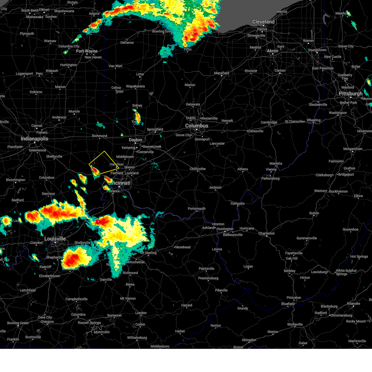 At 725 pm edt, a severe thunderstorm was located near brookville, moving northeast at 55 mph (radar indicated). Hazards include quarter size hail. Minor damage to vehicles is possible. locations impacted include, hamilton, oxford, brookville, west college corner, darrtown, reily, millville, st. leon, scipio, college corner, cedar grove, mount carmel, mounds state recreation area, cottage grove, rockdale, mcgonigle, sharptown, layhigh, charlottesville and hueston woods state park. hail threat, radar indicated max hail size, 1. 00 in wind threat, radar indicated max wind gust, <50 mph. At 725 pm edt, a severe thunderstorm was located near brookville, moving northeast at 55 mph (radar indicated). Hazards include quarter size hail. Minor damage to vehicles is possible. locations impacted include, hamilton, oxford, brookville, west college corner, darrtown, reily, millville, st. leon, scipio, college corner, cedar grove, mount carmel, mounds state recreation area, cottage grove, rockdale, mcgonigle, sharptown, layhigh, charlottesville and hueston woods state park. hail threat, radar indicated max hail size, 1. 00 in wind threat, radar indicated max wind gust, <50 mph.
|
| 6/25/2023 7:19 PM EDT |
 At 719 pm edt, a severe thunderstorm was located near brookville, moving northeast at 55 mph (radar indicated). Hazards include quarter size hail. minor damage to vehicles is possible At 719 pm edt, a severe thunderstorm was located near brookville, moving northeast at 55 mph (radar indicated). Hazards include quarter size hail. minor damage to vehicles is possible
|
| 6/25/2023 5:16 PM EDT |
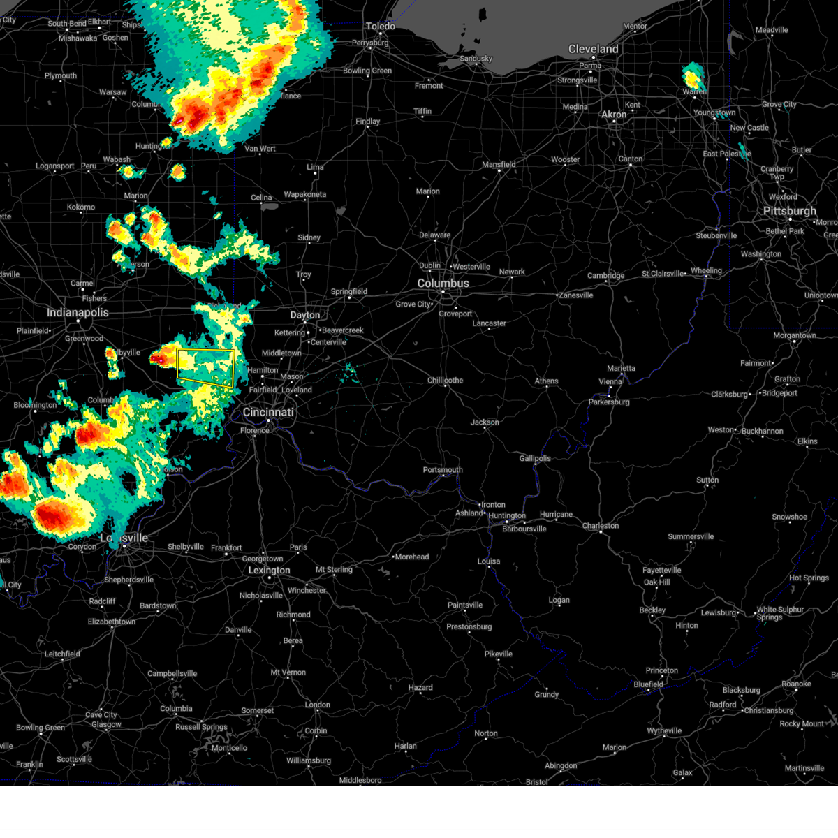 At 516 pm edt, a severe thunderstorm was located near lake santee, moving east at 50 mph (radar indicated). Hazards include 60 mph wind gusts and half dollar size hail. Minor hail damage to vehicles is possible. expect wind damage to trees and power lines. locations impacted include, brookville, west college corner, lake santee, blooming grove, columbia, metamora, laurel, scipio, college corner, cedar grove, mount carmel, charlottesville, andersonville, mounds state recreation area, billingsville, alpine, mixersville, peppertown, sharptown and everton. hail threat, radar indicated max hail size, 1. 25 in wind threat, radar indicated max wind gust, 60 mph. At 516 pm edt, a severe thunderstorm was located near lake santee, moving east at 50 mph (radar indicated). Hazards include 60 mph wind gusts and half dollar size hail. Minor hail damage to vehicles is possible. expect wind damage to trees and power lines. locations impacted include, brookville, west college corner, lake santee, blooming grove, columbia, metamora, laurel, scipio, college corner, cedar grove, mount carmel, charlottesville, andersonville, mounds state recreation area, billingsville, alpine, mixersville, peppertown, sharptown and everton. hail threat, radar indicated max hail size, 1. 25 in wind threat, radar indicated max wind gust, 60 mph.
|
| 6/25/2023 5:08 PM EDT |
 At 507 pm edt, a severe thunderstorm was located 8 miles south of rushville, moving east at 50 mph (radar indicated). Hazards include 70 mph wind gusts and half dollar size hail. Minor hail damage to vehicles is possible. expect considerable tree damage. wind damage is also likely to mobile homes, roofs, and outbuildings. locations impacted include, connersville, brookville, liberty, west college corner, glenwood, lake santee, salem, blooming grove, columbia, metamora, bunker hill, laurel, scipio, college corner, cedar grove, mount carmel, dunlapsville, whitewater state park, goodwins corner and mounds state recreation area. thunderstorm damage threat, considerable hail threat, radar indicated max hail size, 1. 25 in wind threat, observed max wind gust, 70 mph. At 507 pm edt, a severe thunderstorm was located 8 miles south of rushville, moving east at 50 mph (radar indicated). Hazards include 70 mph wind gusts and half dollar size hail. Minor hail damage to vehicles is possible. expect considerable tree damage. wind damage is also likely to mobile homes, roofs, and outbuildings. locations impacted include, connersville, brookville, liberty, west college corner, glenwood, lake santee, salem, blooming grove, columbia, metamora, bunker hill, laurel, scipio, college corner, cedar grove, mount carmel, dunlapsville, whitewater state park, goodwins corner and mounds state recreation area. thunderstorm damage threat, considerable hail threat, radar indicated max hail size, 1. 25 in wind threat, observed max wind gust, 70 mph.
|
| 6/25/2023 4:58 PM EDT |
 At 458 pm edt, a severe thunderstorm was located near rushville, moving east at 50 mph (radar indicated). Hazards include golf ball size hail and 70 mph wind gusts. People and animals outdoors will be injured. expect hail damage to roofs, siding, windows, and vehicles. expect considerable tree damage. Wind damage is also likely to mobile homes, roofs, and outbuildings. At 458 pm edt, a severe thunderstorm was located near rushville, moving east at 50 mph (radar indicated). Hazards include golf ball size hail and 70 mph wind gusts. People and animals outdoors will be injured. expect hail damage to roofs, siding, windows, and vehicles. expect considerable tree damage. Wind damage is also likely to mobile homes, roofs, and outbuildings.
|
| 6/13/2023 5:56 PM EDT |
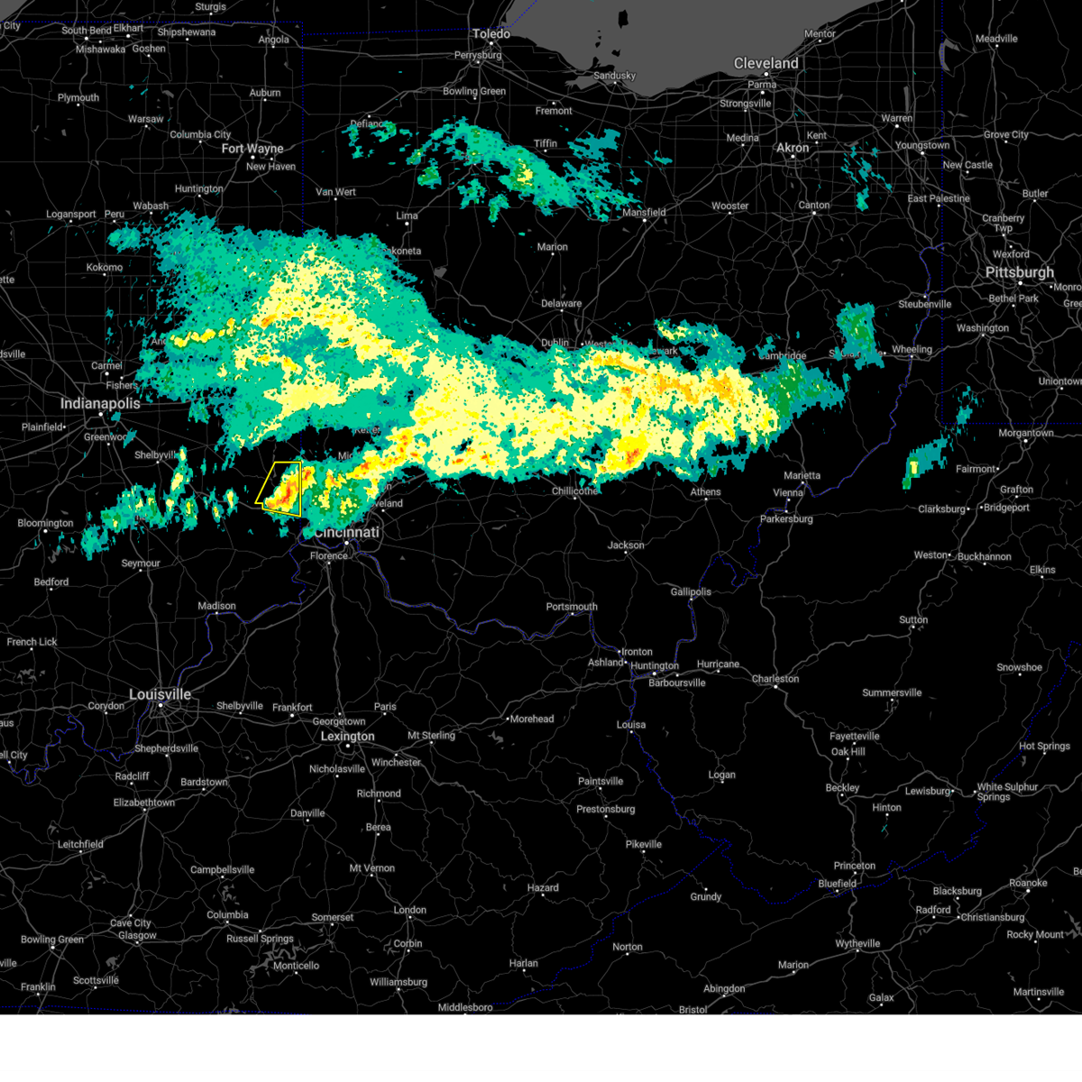 The severe thunderstorm warning for eastern franklin and northeastern dearborn counties will expire at 600 pm edt, the storm which prompted the warning has weakened below severe limits, and has exited the warned area. therefore, the warning will be allowed to expire. please report previous wind damage or hail to the national weather service by going to our website at weather.gov/iln and submitting your report via social media. The severe thunderstorm warning for eastern franklin and northeastern dearborn counties will expire at 600 pm edt, the storm which prompted the warning has weakened below severe limits, and has exited the warned area. therefore, the warning will be allowed to expire. please report previous wind damage or hail to the national weather service by going to our website at weather.gov/iln and submitting your report via social media.
|
| 6/13/2023 5:49 PM EDT |
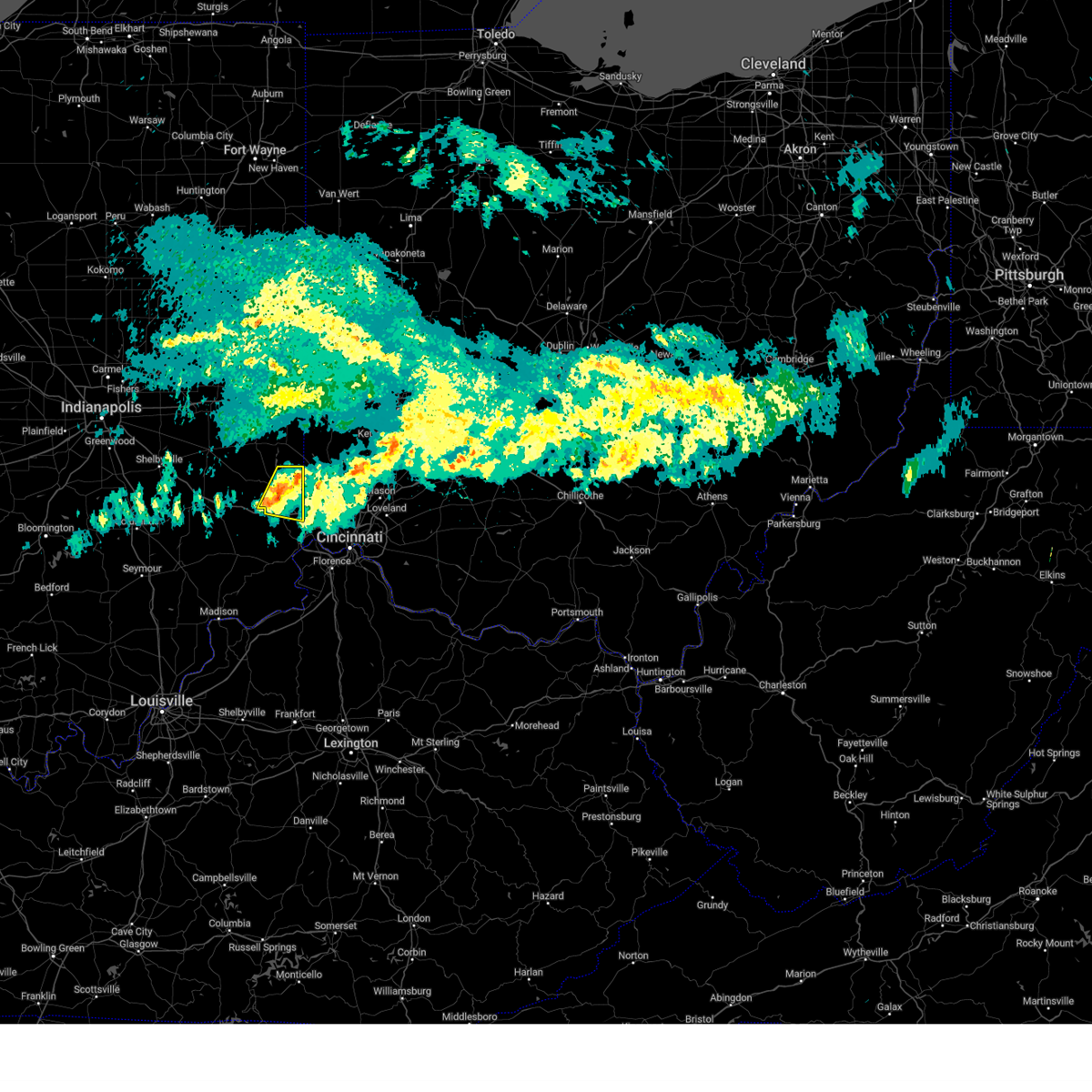 At 548 pm edt, a severe thunderstorm was located near brookville, moving east at 40 mph (radar indicated). Hazards include 60 mph wind gusts. Expect damage to trees and power lines. locations impacted include, brookville, bright, st. leon, west harrison, cedar grove, mount carmel, mounds state recreation area, interstate 74 at us route 52, rockdale, mixersville, sharptown, new trenton, lawrenceville and saint peter. this includes the following interstates, i-74 in indiana between mile markers 158 and 171. i-74 in ohio near mile marker 0. hail threat, radar indicated max hail size, <. 75 in wind threat, radar indicated max wind gust, 60 mph. At 548 pm edt, a severe thunderstorm was located near brookville, moving east at 40 mph (radar indicated). Hazards include 60 mph wind gusts. Expect damage to trees and power lines. locations impacted include, brookville, bright, st. leon, west harrison, cedar grove, mount carmel, mounds state recreation area, interstate 74 at us route 52, rockdale, mixersville, sharptown, new trenton, lawrenceville and saint peter. this includes the following interstates, i-74 in indiana between mile markers 158 and 171. i-74 in ohio near mile marker 0. hail threat, radar indicated max hail size, <. 75 in wind threat, radar indicated max wind gust, 60 mph.
|
| 6/13/2023 5:37 PM EDT |
 At 537 pm edt, a severe thunderstorm was located near brookville, moving east at 40 mph (radar indicated). Hazards include 60 mph wind gusts. Expect damage to trees and power lines. locations impacted include, batesville, brookville, bright, oldenburg, blooming grove, metamora, st. leon, west harrison, cedar grove, mount carmel, mounds state recreation area, huntersville, interstate 74 at us route 52, rockdale, mixersville, peppertown, sharptown, new trenton, lawrenceville and saint peter. this includes the following interstates, i-74 in indiana near mile marker 148, and between mile markers 158 and 171. i-74 in ohio near mile marker 0. hail threat, radar indicated max hail size, <. 75 in wind threat, radar indicated max wind gust, 60 mph. At 537 pm edt, a severe thunderstorm was located near brookville, moving east at 40 mph (radar indicated). Hazards include 60 mph wind gusts. Expect damage to trees and power lines. locations impacted include, batesville, brookville, bright, oldenburg, blooming grove, metamora, st. leon, west harrison, cedar grove, mount carmel, mounds state recreation area, huntersville, interstate 74 at us route 52, rockdale, mixersville, peppertown, sharptown, new trenton, lawrenceville and saint peter. this includes the following interstates, i-74 in indiana near mile marker 148, and between mile markers 158 and 171. i-74 in ohio near mile marker 0. hail threat, radar indicated max hail size, <. 75 in wind threat, radar indicated max wind gust, 60 mph.
|
| 6/13/2023 5:21 PM EDT |
 At 521 pm edt, a severe thunderstorm was located near lake santee, moving east at 45 mph (radar indicated). Hazards include 60 mph wind gusts. expect damage to trees and power lines At 521 pm edt, a severe thunderstorm was located near lake santee, moving east at 45 mph (radar indicated). Hazards include 60 mph wind gusts. expect damage to trees and power lines
|
| 2/27/2023 2:20 PM EST | Golf Ball sized hail reported 7.6 miles W of Brookville, IN, photo verified. |
| 2/27/2023 2:09 PM EST | Half Dollar sized hail reported 4.4 miles N of Brookville, IN, photo verified. |
| 2/27/2023 1:59 PM EST |
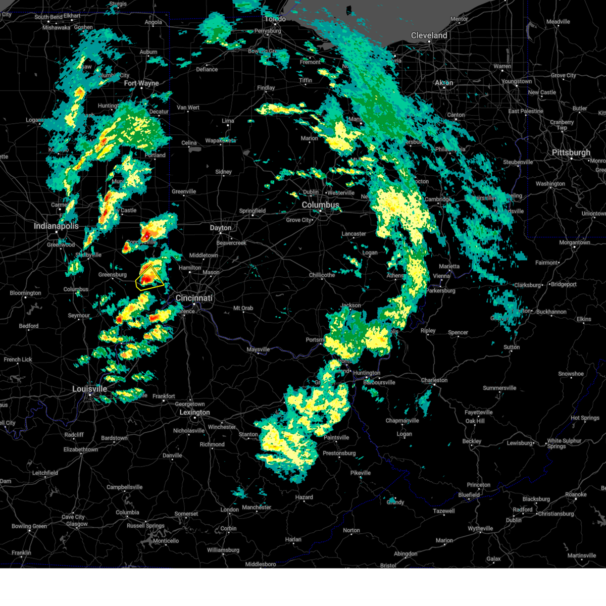 At 159 pm est, a severe thunderstorm was located near oldenburg, moving northeast at 55 mph (radar indicated). Hazards include 60 mph wind gusts. Expect damage to trees and power lines. locations impacted include, batesville, brookville, sunman, st. leon, cedar grove, new trenton, penntown, lawrenceville, saint peter and interstate 74 at state route 101. This includes i-74 in indiana between mile markers 150 and 166. At 159 pm est, a severe thunderstorm was located near oldenburg, moving northeast at 55 mph (radar indicated). Hazards include 60 mph wind gusts. Expect damage to trees and power lines. locations impacted include, batesville, brookville, sunman, st. leon, cedar grove, new trenton, penntown, lawrenceville, saint peter and interstate 74 at state route 101. This includes i-74 in indiana between mile markers 150 and 166.
|
| 2/27/2023 1:58 PM EST |
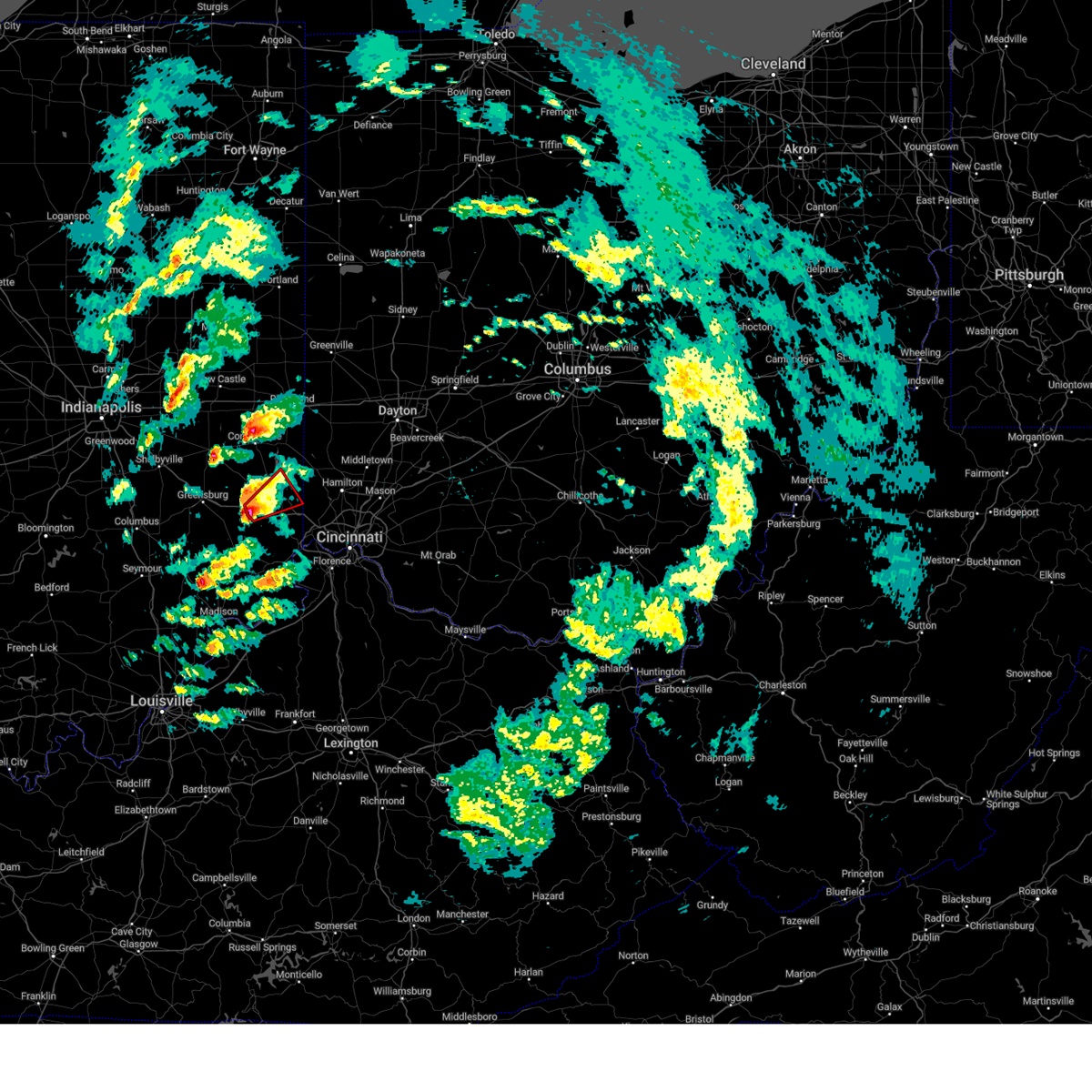 At 157 pm est, a severe thunderstorm capable of producing a tornado was located near batesville, moving northeast at 50 mph (radar indicated rotation). Hazards include tornado and quarter size hail. Flying debris will be dangerous to those caught without shelter. mobile homes will be damaged or destroyed. damage to roofs, windows, and vehicles will occur. tree damage is likely. locations impacted include, batesville, brookville, st. leon, cedar grove, sharptown, mounds state recreation area, new trenton, penntown, lawrenceville, saint peter and interstate 74 at state route 101. This includes i-74 in indiana between mile markers 150 and 162. At 157 pm est, a severe thunderstorm capable of producing a tornado was located near batesville, moving northeast at 50 mph (radar indicated rotation). Hazards include tornado and quarter size hail. Flying debris will be dangerous to those caught without shelter. mobile homes will be damaged or destroyed. damage to roofs, windows, and vehicles will occur. tree damage is likely. locations impacted include, batesville, brookville, st. leon, cedar grove, sharptown, mounds state recreation area, new trenton, penntown, lawrenceville, saint peter and interstate 74 at state route 101. This includes i-74 in indiana between mile markers 150 and 162.
|
| 2/27/2023 1:52 PM EST |
 At 152 pm est, a severe thunderstorm capable of producing a tornado was located over batesville, moving northeast at 55 mph (radar indicated rotation). Hazards include tornado and quarter size hail. Flying debris will be dangerous to those caught without shelter. mobile homes will be damaged or destroyed. damage to roofs, windows, and vehicles will occur. Tree damage is likely. At 152 pm est, a severe thunderstorm capable of producing a tornado was located over batesville, moving northeast at 55 mph (radar indicated rotation). Hazards include tornado and quarter size hail. Flying debris will be dangerous to those caught without shelter. mobile homes will be damaged or destroyed. damage to roofs, windows, and vehicles will occur. Tree damage is likely.
|
| 2/27/2023 1:47 PM EST |
 At 147 pm est, a severe thunderstorm was located near batesville, moving northeast at 55 mph (radar indicated). Hazards include 60 mph wind gusts. expect damage to trees and power lines At 147 pm est, a severe thunderstorm was located near batesville, moving northeast at 55 mph (radar indicated). Hazards include 60 mph wind gusts. expect damage to trees and power lines
|
| 8/1/2022 10:36 AM EDT |
 The severe thunderstorm warning for franklin county in southeastern indiana and union counties in east central indiana will expire at 1045 am edt, the storms which prompted the warning have weakened below severe limits, and are exiting the warned area. therefore, the warning will be allowed to expire. gusty winds are still possible with these thunderstorms. please report previous wind damage or hail to the national weather service by going to our website at weather.gov/iln and submitting your report via social media. The severe thunderstorm warning for franklin county in southeastern indiana and union counties in east central indiana will expire at 1045 am edt, the storms which prompted the warning have weakened below severe limits, and are exiting the warned area. therefore, the warning will be allowed to expire. gusty winds are still possible with these thunderstorms. please report previous wind damage or hail to the national weather service by going to our website at weather.gov/iln and submitting your report via social media.
|
| 8/1/2022 10:28 AM EDT |
 At 1028 am edt, severe thunderstorms were located along a line extending from brookville to 6 miles northeast of liberty, moving east at 50 mph (radar indicated). Hazards include 60 mph wind gusts. Expect damage to trees and power lines. locations impacted include, batesville, brookville, liberty, west college corner, oldenburg, salem, blooming grove, metamora, brownsville, laurel, witts station, dunlapsville, whitewater state park, charlottesville, goodwins corner, mounds state recreation area, billingsville, huntersville, cottage grove and hamburg. this includes i-74 in indiana between mile markers 145 and 148. hail threat, radar indicated max hail size, <. 75 in wind threat, radar indicated max wind gust, 60 mph. At 1028 am edt, severe thunderstorms were located along a line extending from brookville to 6 miles northeast of liberty, moving east at 50 mph (radar indicated). Hazards include 60 mph wind gusts. Expect damage to trees and power lines. locations impacted include, batesville, brookville, liberty, west college corner, oldenburg, salem, blooming grove, metamora, brownsville, laurel, witts station, dunlapsville, whitewater state park, charlottesville, goodwins corner, mounds state recreation area, billingsville, huntersville, cottage grove and hamburg. this includes i-74 in indiana between mile markers 145 and 148. hail threat, radar indicated max hail size, <. 75 in wind threat, radar indicated max wind gust, 60 mph.
|
| 8/1/2022 10:18 AM EDT |
 At 1018 am edt, severe thunderstorms were located along a line extending from brookville to richmond, moving east at 45 mph (radar indicated). Hazards include 60 mph wind gusts. Expect damage to trees and power lines. locations impacted include, richmond, batesville, brookville, centerville, liberty, fountain city, west college corner, oldenburg, salem, blooming grove, metamora, abington, brownsville, laurel, spring grove, bethel, boston, whitewater, richmond municipal airport and dunlapsville. this includes the following interstates, i-70 in indiana between mile markers 144 and 156. i-74 in indiana between mile markers 145 and 148. hail threat, radar indicated max hail size, <. 75 in wind threat, radar indicated max wind gust, 60 mph. At 1018 am edt, severe thunderstorms were located along a line extending from brookville to richmond, moving east at 45 mph (radar indicated). Hazards include 60 mph wind gusts. Expect damage to trees and power lines. locations impacted include, richmond, batesville, brookville, centerville, liberty, fountain city, west college corner, oldenburg, salem, blooming grove, metamora, abington, brownsville, laurel, spring grove, bethel, boston, whitewater, richmond municipal airport and dunlapsville. this includes the following interstates, i-70 in indiana between mile markers 144 and 156. i-74 in indiana between mile markers 145 and 148. hail threat, radar indicated max hail size, <. 75 in wind threat, radar indicated max wind gust, 60 mph.
|
| 8/1/2022 10:09 AM EDT |
 At 1009 am edt, severe thunderstorms were located along a line extending from lake santee to centerville, moving east at 50 mph (radar indicated). Hazards include 60 mph wind gusts. Expect damage to trees and power lines. locations impacted include, richmond, connersville, batesville, brookville, centerville, cambridge city, liberty, hagerstown, fountain city, west college corner, oldenburg, lake santee, salem, waterloo, blooming grove, columbia, metamora, bunker hill, abington and brownsville. this includes the following interstates, i-70 in indiana between mile markers 137 and 156. i-74 in indiana between mile markers 145 and 148. hail threat, radar indicated max hail size, <. 75 in wind threat, radar indicated max wind gust, 60 mph. At 1009 am edt, severe thunderstorms were located along a line extending from lake santee to centerville, moving east at 50 mph (radar indicated). Hazards include 60 mph wind gusts. Expect damage to trees and power lines. locations impacted include, richmond, connersville, batesville, brookville, centerville, cambridge city, liberty, hagerstown, fountain city, west college corner, oldenburg, lake santee, salem, waterloo, blooming grove, columbia, metamora, bunker hill, abington and brownsville. this includes the following interstates, i-70 in indiana between mile markers 137 and 156. i-74 in indiana between mile markers 145 and 148. hail threat, radar indicated max hail size, <. 75 in wind threat, radar indicated max wind gust, 60 mph.
|
| 8/1/2022 9:54 AM EDT |
 At 953 am edt, severe thunderstorms were located along a line extending from rushville to hagerstown, moving east at 45 mph (radar indicated). Hazards include 60 mph wind gusts. Expect damage to trees and power lines. locations impacted include, richmond, connersville, batesville, brookville, centerville, cambridge city, liberty, hagerstown, fountain city, dublin, west college corner, oldenburg, lake santee, franklin, salem, waterloo, blooming grove, columbia, metamora and bunker hill. this includes the following interstates, i-70 in indiana between mile markers 134 and 156. i-74 in indiana between mile markers 145 and 148. hail threat, radar indicated max hail size, <. 75 in wind threat, radar indicated max wind gust, 60 mph. At 953 am edt, severe thunderstorms were located along a line extending from rushville to hagerstown, moving east at 45 mph (radar indicated). Hazards include 60 mph wind gusts. Expect damage to trees and power lines. locations impacted include, richmond, connersville, batesville, brookville, centerville, cambridge city, liberty, hagerstown, fountain city, dublin, west college corner, oldenburg, lake santee, franklin, salem, waterloo, blooming grove, columbia, metamora and bunker hill. this includes the following interstates, i-70 in indiana between mile markers 134 and 156. i-74 in indiana between mile markers 145 and 148. hail threat, radar indicated max hail size, <. 75 in wind threat, radar indicated max wind gust, 60 mph.
|
| 8/1/2022 9:42 AM EDT |
 At 941 am edt, severe thunderstorms were located along a line extending from shelbyville to new castle, moving east at 45 mph (radar indicated). Hazards include 60 mph wind gusts. expect damage to trees and power lines At 941 am edt, severe thunderstorms were located along a line extending from shelbyville to new castle, moving east at 45 mph (radar indicated). Hazards include 60 mph wind gusts. expect damage to trees and power lines
|
| 6/6/2022 4:11 PM EDT |
 The severe thunderstorm warning for eastern franklin county in southeastern indiana, southeastern union county in east central indiana, north central dearborn county in southeastern indiana, southwestern preble county in west central ohio and northwestern butler counties in southwestern ohio will expire at 415 pm edt, the severe thunderstorm which prompted the warning has weakened. therefore, the warning will be allowed to expire. however gusty winds and heavy rain are still possible with this thunderstorm. please report previous wind damage or hail to the national weather service by going to our website at weather.gov/iln and submitting your report via social media. The severe thunderstorm warning for eastern franklin county in southeastern indiana, southeastern union county in east central indiana, north central dearborn county in southeastern indiana, southwestern preble county in west central ohio and northwestern butler counties in southwestern ohio will expire at 415 pm edt, the severe thunderstorm which prompted the warning has weakened. therefore, the warning will be allowed to expire. however gusty winds and heavy rain are still possible with this thunderstorm. please report previous wind damage or hail to the national weather service by going to our website at weather.gov/iln and submitting your report via social media.
|
| 6/6/2022 4:11 PM EDT |
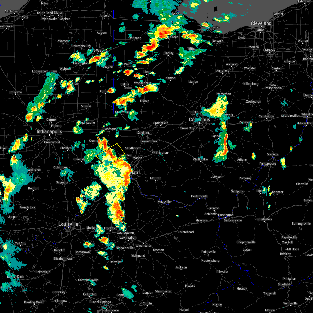 The severe thunderstorm warning for eastern franklin county in southeastern indiana, southeastern union county in east central indiana, north central dearborn county in southeastern indiana, southwestern preble county in west central ohio and northwestern butler counties in southwestern ohio will expire at 415 pm edt, the severe thunderstorm which prompted the warning has weakened. therefore, the warning will be allowed to expire. however gusty winds and heavy rain are still possible with this thunderstorm. please report previous wind damage or hail to the national weather service by going to our website at weather.gov/iln and submitting your report via social media. The severe thunderstorm warning for eastern franklin county in southeastern indiana, southeastern union county in east central indiana, north central dearborn county in southeastern indiana, southwestern preble county in west central ohio and northwestern butler counties in southwestern ohio will expire at 415 pm edt, the severe thunderstorm which prompted the warning has weakened. therefore, the warning will be allowed to expire. however gusty winds and heavy rain are still possible with this thunderstorm. please report previous wind damage or hail to the national weather service by going to our website at weather.gov/iln and submitting your report via social media.
|
| 6/6/2022 3:55 PM EDT | Tree down on wires on west klein. time estimated from rada in franklin county IN, 0.4 miles S of Brookville, IN |
| 6/6/2022 3:50 PM EDT |
 At 350 pm edt, a severe thunderstorm was located near brookville, moving northeast at 45 mph (radar indicated). Hazards include 60 mph wind gusts. Expect damage to trees and power lines. locations impacted include, hamilton, oxford, brookville, west college corner, oldenburg, darrtown, reily, metamora, st. leon, scipio, college corner, cedar grove, mount carmel, mounds state recreation area, morning sun, rockdale, peppertown, mcgonigle, sharptown and saint peter. this includes i-74 in indiana between mile markers 158 and 165. hail threat, radar indicated max hail size, <. 75 in wind threat, radar indicated max wind gust, 60 mph. At 350 pm edt, a severe thunderstorm was located near brookville, moving northeast at 45 mph (radar indicated). Hazards include 60 mph wind gusts. Expect damage to trees and power lines. locations impacted include, hamilton, oxford, brookville, west college corner, oldenburg, darrtown, reily, metamora, st. leon, scipio, college corner, cedar grove, mount carmel, mounds state recreation area, morning sun, rockdale, peppertown, mcgonigle, sharptown and saint peter. this includes i-74 in indiana between mile markers 158 and 165. hail threat, radar indicated max hail size, <. 75 in wind threat, radar indicated max wind gust, 60 mph.
|
| 6/6/2022 3:32 PM EDT |
 At 332 pm edt, a severe thunderstorm was located near batesville, moving northeast at 45 mph (radar indicated). Hazards include 60 mph wind gusts. expect damage to trees and power lines At 332 pm edt, a severe thunderstorm was located near batesville, moving northeast at 45 mph (radar indicated). Hazards include 60 mph wind gusts. expect damage to trees and power lines
|
| 5/21/2022 5:02 PM EDT |
 At 501 pm edt, a severe thunderstorm was located near oxford, moving east at 45 mph (radar indicated). Hazards include 60 mph wind gusts and quarter size hail. Minor hail damage to vehicles is possible. expect wind damage to trees and power lines. locations impacted include, hamilton, fairfield, oxford, brookville, ross, west college corner, darrtown, salem, reily, millville, st. leon, scipio, college corner, cedar grove, mount carmel, mounds state recreation area, cottage grove, morning sun, rockdale and mcgonigle. this includes i-74 in indiana between mile markers 159 and 162. hail threat, radar indicated max hail size, 1. 00 in wind threat, radar indicated max wind gust, 60 mph. At 501 pm edt, a severe thunderstorm was located near oxford, moving east at 45 mph (radar indicated). Hazards include 60 mph wind gusts and quarter size hail. Minor hail damage to vehicles is possible. expect wind damage to trees and power lines. locations impacted include, hamilton, fairfield, oxford, brookville, ross, west college corner, darrtown, salem, reily, millville, st. leon, scipio, college corner, cedar grove, mount carmel, mounds state recreation area, cottage grove, morning sun, rockdale and mcgonigle. this includes i-74 in indiana between mile markers 159 and 162. hail threat, radar indicated max hail size, 1. 00 in wind threat, radar indicated max wind gust, 60 mph.
|
| 5/21/2022 5:02 PM EDT |
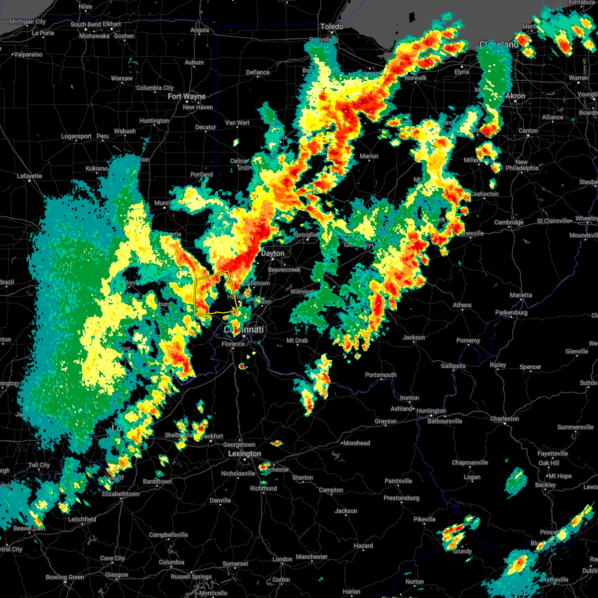 At 501 pm edt, a severe thunderstorm was located near oxford, moving east at 45 mph (radar indicated). Hazards include 60 mph wind gusts and quarter size hail. Minor hail damage to vehicles is possible. expect wind damage to trees and power lines. locations impacted include, hamilton, fairfield, oxford, brookville, ross, west college corner, darrtown, salem, reily, millville, st. leon, scipio, college corner, cedar grove, mount carmel, mounds state recreation area, cottage grove, morning sun, rockdale and mcgonigle. this includes i-74 in indiana between mile markers 159 and 162. hail threat, radar indicated max hail size, 1. 00 in wind threat, radar indicated max wind gust, 60 mph. At 501 pm edt, a severe thunderstorm was located near oxford, moving east at 45 mph (radar indicated). Hazards include 60 mph wind gusts and quarter size hail. Minor hail damage to vehicles is possible. expect wind damage to trees and power lines. locations impacted include, hamilton, fairfield, oxford, brookville, ross, west college corner, darrtown, salem, reily, millville, st. leon, scipio, college corner, cedar grove, mount carmel, mounds state recreation area, cottage grove, morning sun, rockdale and mcgonigle. this includes i-74 in indiana between mile markers 159 and 162. hail threat, radar indicated max hail size, 1. 00 in wind threat, radar indicated max wind gust, 60 mph.
|
| 5/21/2022 4:57 PM EDT | Trees uprooted in st. leon are in dearborn county IN, 9.6 miles NNW of Brookville, IN |
| 5/21/2022 4:51 PM EDT | A scoreboard was blown down and a trailer was flipped over at east central high school. time estimated from rada in dearborn county IN, 10.2 miles NNW of Brookville, IN |
| 5/21/2022 4:47 PM EDT |
 At 447 pm edt, a severe thunderstorm was located over brookville, moving east at 40 mph (radar indicated). Hazards include 70 mph wind gusts and quarter size hail. Minor hail damage to vehicles is possible. expect considerable tree damage. wind damage is also likely to mobile homes, roofs, and outbuildings. locations impacted include, hamilton, fairfield, oxford, batesville, brookville, ross, west college corner, oldenburg, darrtown, lake santee, salem, reily, blooming grove, metamora, millville, st. leon, laurel, scipio, college corner and cedar grove. this includes i-74 in indiana between mile markers 145 and 162. thunderstorm damage threat, considerable hail threat, radar indicated max hail size, 1. 00 in wind threat, radar indicated max wind gust, 70 mph. At 447 pm edt, a severe thunderstorm was located over brookville, moving east at 40 mph (radar indicated). Hazards include 70 mph wind gusts and quarter size hail. Minor hail damage to vehicles is possible. expect considerable tree damage. wind damage is also likely to mobile homes, roofs, and outbuildings. locations impacted include, hamilton, fairfield, oxford, batesville, brookville, ross, west college corner, oldenburg, darrtown, lake santee, salem, reily, blooming grove, metamora, millville, st. leon, laurel, scipio, college corner and cedar grove. this includes i-74 in indiana between mile markers 145 and 162. thunderstorm damage threat, considerable hail threat, radar indicated max hail size, 1. 00 in wind threat, radar indicated max wind gust, 70 mph.
|
| 5/21/2022 4:39 PM EDT |
 At 439 pm edt, a severe thunderstorm was located over lake santee, moving east at 45 mph (radar indicated). Hazards include 60 mph wind gusts and quarter size hail. Minor hail damage to vehicles is possible. Expect wind damage to trees and power lines. At 439 pm edt, a severe thunderstorm was located over lake santee, moving east at 45 mph (radar indicated). Hazards include 60 mph wind gusts and quarter size hail. Minor hail damage to vehicles is possible. Expect wind damage to trees and power lines.
|
| 4/13/2022 9:05 PM EDT |
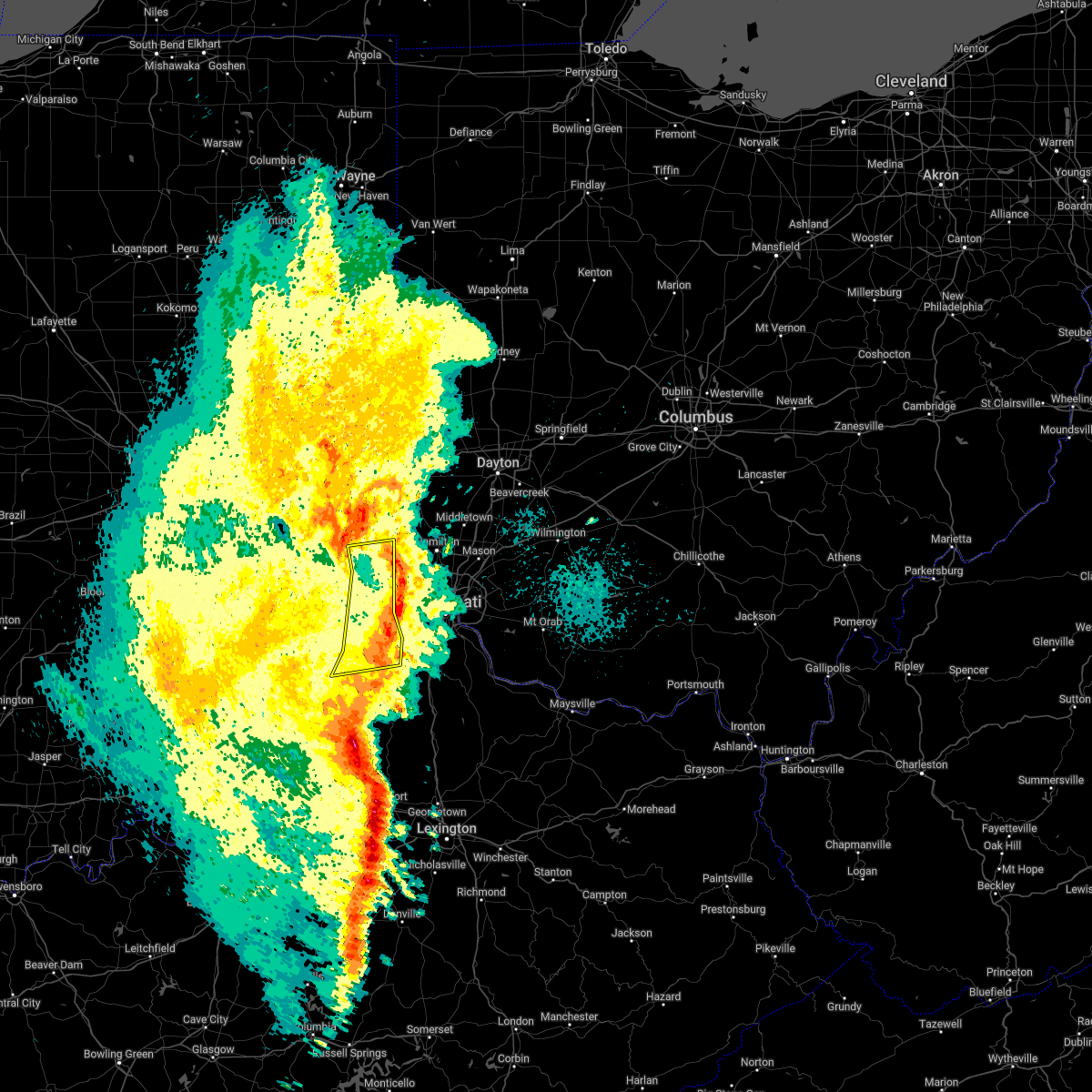 The severe thunderstorm warning for ohio, southeastern franklin, dearborn, northern switzerland and boone counties will expire at 915 pm edt, the storm which prompted the warning has weakened below severe limits, and no longer poses an immediate threat to life or property. therefore, the warning will be allowed to expire. however gusty winds are still possible with this thunderstorm as it moves into hamilton, boone, and kenton counties. please report previous wind damage or hail to the national weather service by going to our website at weather.gov/iln and submitting your report via social media. The severe thunderstorm warning for ohio, southeastern franklin, dearborn, northern switzerland and boone counties will expire at 915 pm edt, the storm which prompted the warning has weakened below severe limits, and no longer poses an immediate threat to life or property. therefore, the warning will be allowed to expire. however gusty winds are still possible with this thunderstorm as it moves into hamilton, boone, and kenton counties. please report previous wind damage or hail to the national weather service by going to our website at weather.gov/iln and submitting your report via social media.
|
| 4/13/2022 8:49 PM EDT |
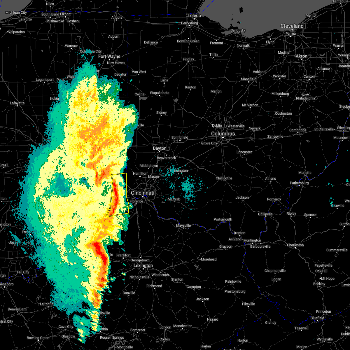 At 848 pm edt, a severe thunderstorm was located near bright, moving northeast at 45 mph (radar indicated). Hazards include 60 mph wind gusts. Expect damage to trees and power lines. locations impacted include, lawrenceburg, greendale, aurora, brookville, rising sun, bright, hidden valley, dillsboro, moores hill, guilford, wilmington, logan, manchester, french, sunman, hartford, st. leon, fairview, west harrison and cedar grove. this includes the following interstates, i-74 in indiana between mile markers 158 and 171. i-74 in ohio near mile marker 0. hail threat, radar indicated max hail size, <. 75 in wind threat, radar indicated max wind gust, 60 mph. At 848 pm edt, a severe thunderstorm was located near bright, moving northeast at 45 mph (radar indicated). Hazards include 60 mph wind gusts. Expect damage to trees and power lines. locations impacted include, lawrenceburg, greendale, aurora, brookville, rising sun, bright, hidden valley, dillsboro, moores hill, guilford, wilmington, logan, manchester, french, sunman, hartford, st. leon, fairview, west harrison and cedar grove. this includes the following interstates, i-74 in indiana between mile markers 158 and 171. i-74 in ohio near mile marker 0. hail threat, radar indicated max hail size, <. 75 in wind threat, radar indicated max wind gust, 60 mph.
|
| 4/13/2022 8:41 PM EDT |
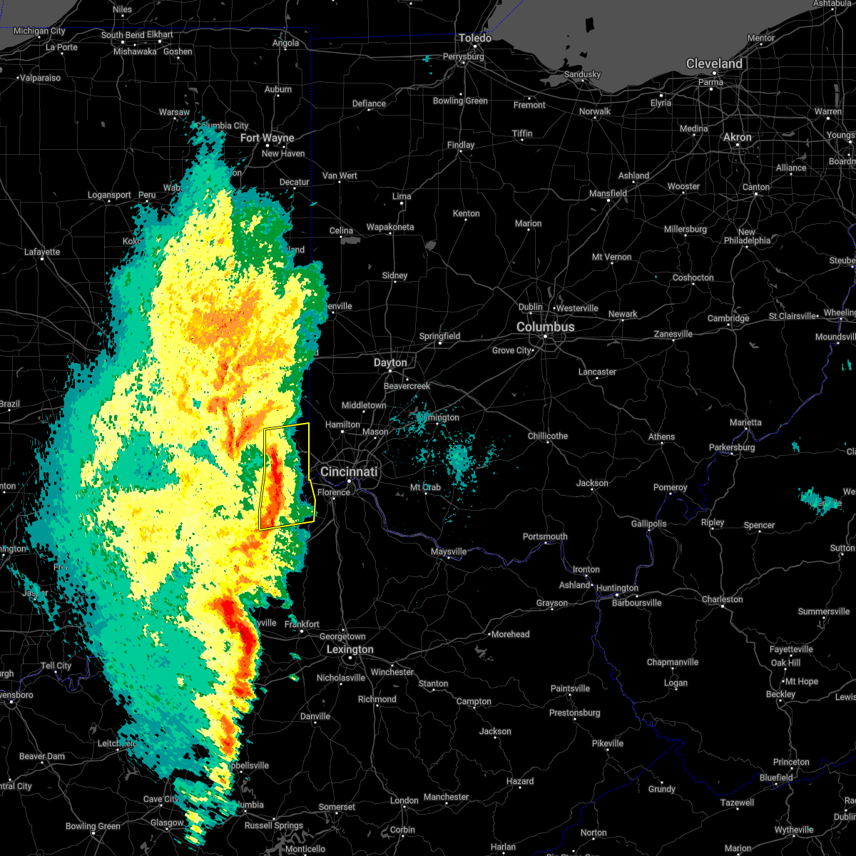 At 841 pm edt, a severe thunderstorm was located near moores hill, moving northeast at 50 mph (radar indicated). Hazards include 60 mph wind gusts. Expect damage to trees and power lines. locations impacted include, lawrenceburg, greendale, aurora, brookville, rising sun, bright, hidden valley, milan, dillsboro, shawnee, moores hill, guilford, wilmington, logan, pleasant, manchester, french, sunman, hartford and st. leon. this includes the following interstates, i-74 in indiana between mile markers 153 and 171. i-74 in ohio near mile marker 0. hail threat, radar indicated max hail size, <. 75 in wind threat, radar indicated max wind gust, 60 mph. At 841 pm edt, a severe thunderstorm was located near moores hill, moving northeast at 50 mph (radar indicated). Hazards include 60 mph wind gusts. Expect damage to trees and power lines. locations impacted include, lawrenceburg, greendale, aurora, brookville, rising sun, bright, hidden valley, milan, dillsboro, shawnee, moores hill, guilford, wilmington, logan, pleasant, manchester, french, sunman, hartford and st. leon. this includes the following interstates, i-74 in indiana between mile markers 153 and 171. i-74 in ohio near mile marker 0. hail threat, radar indicated max hail size, <. 75 in wind threat, radar indicated max wind gust, 60 mph.
|
| 4/13/2022 8:30 PM EDT |
 At 830 pm edt, a severe thunderstorm was located near milan, moving east at 45 mph (radar indicated). Hazards include 60 mph wind gusts and penny size hail. expect damage to trees and power lines At 830 pm edt, a severe thunderstorm was located near milan, moving east at 45 mph (radar indicated). Hazards include 60 mph wind gusts and penny size hail. expect damage to trees and power lines
|
| 4/13/2022 8:30 PM EDT |
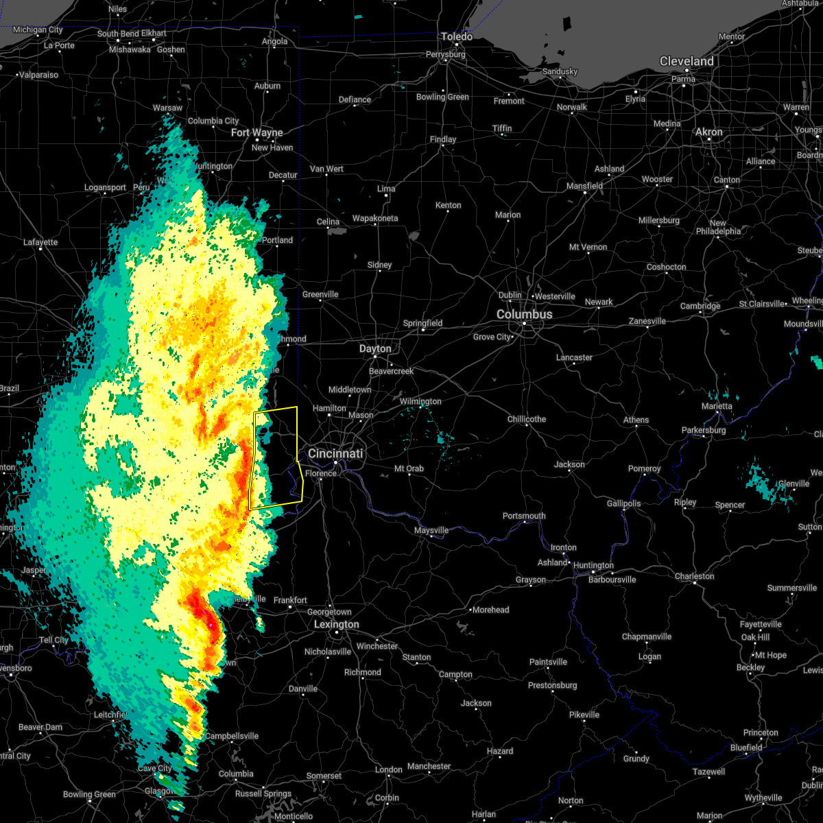 At 830 pm edt, a severe thunderstorm was located near milan, moving east at 45 mph (radar indicated). Hazards include 60 mph wind gusts and penny size hail. expect damage to trees and power lines At 830 pm edt, a severe thunderstorm was located near milan, moving east at 45 mph (radar indicated). Hazards include 60 mph wind gusts and penny size hail. expect damage to trees and power lines
|
| 7/29/2021 6:53 PM EDT |
 The severe thunderstorm warning for western franklin and northeastern ripley counties will expire at 700 pm edt, the storm which prompted the warning has weakened below severe limits, and no longer poses an immediate threat to life or property. therefore, the warning will be allowed to expire. a severe thunderstorm watch remains in effect until 1000 pm edt for southeastern indiana. please report previous wind damage or hail to the national weather service by going to our website at weather.gov/iln and submitting your report via social media. The severe thunderstorm warning for western franklin and northeastern ripley counties will expire at 700 pm edt, the storm which prompted the warning has weakened below severe limits, and no longer poses an immediate threat to life or property. therefore, the warning will be allowed to expire. a severe thunderstorm watch remains in effect until 1000 pm edt for southeastern indiana. please report previous wind damage or hail to the national weather service by going to our website at weather.gov/iln and submitting your report via social media.
|
| 7/29/2021 6:44 PM EDT |
 At 643 pm edt, a severe thunderstorm was located near lake santee, moving southeast at 20 mph (radar indicated). Hazards include 60 mph wind gusts and quarter size hail. Minor hail damage to vehicles is possible. expect wind damage to trees and power lines. locations impacted include, batesville, brookville, oldenburg, lake santee, metamora, cedar grove, andersonville, huntersville, hamburg, ballstown, penntown, interstate 74 at state route 101, peppertown, saint peter and buena vista. This includes i-74 in indiana between mile markers 145 and 157. At 643 pm edt, a severe thunderstorm was located near lake santee, moving southeast at 20 mph (radar indicated). Hazards include 60 mph wind gusts and quarter size hail. Minor hail damage to vehicles is possible. expect wind damage to trees and power lines. locations impacted include, batesville, brookville, oldenburg, lake santee, metamora, cedar grove, andersonville, huntersville, hamburg, ballstown, penntown, interstate 74 at state route 101, peppertown, saint peter and buena vista. This includes i-74 in indiana between mile markers 145 and 157.
|
| 7/29/2021 6:20 PM EDT |
 At 620 pm edt, a severe thunderstorm was located near glenwood, moving southeast at 30 mph (radar indicated). Hazards include 60 mph wind gusts and quarter size hail. Minor hail damage to vehicles is possible. Expect wind damage to trees and power lines. At 620 pm edt, a severe thunderstorm was located near glenwood, moving southeast at 30 mph (radar indicated). Hazards include 60 mph wind gusts and quarter size hail. Minor hail damage to vehicles is possible. Expect wind damage to trees and power lines.
|
| 6/18/2021 8:44 PM EDT |
 At 844 pm edt, severe thunderstorms were located along a line extending from near lake santee to 7 miles northwest of osgood, moving east at 40 mph (radar indicated). Hazards include 60 mph wind gusts. expect damage to trees and power lines At 844 pm edt, severe thunderstorms were located along a line extending from near lake santee to 7 miles northwest of osgood, moving east at 40 mph (radar indicated). Hazards include 60 mph wind gusts. expect damage to trees and power lines
|
| 6/12/2021 7:41 PM EDT |
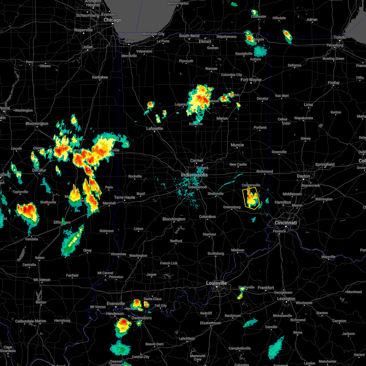 The severe thunderstorm warning for northwestern franklin and southern fayette counties will expire at 745 pm edt, the storm which prompted the warning has weakened below severe limits, and no longer poses an immediate threat to life or property. therefore, the warning will be allowed to expire. however gusty winds and heavy rain are still possible with this thunderstorm. please report previous wind damage or hail to the national weather service by going to our website at weather.gov/iln and submitting your report via social media. The severe thunderstorm warning for northwestern franklin and southern fayette counties will expire at 745 pm edt, the storm which prompted the warning has weakened below severe limits, and no longer poses an immediate threat to life or property. therefore, the warning will be allowed to expire. however gusty winds and heavy rain are still possible with this thunderstorm. please report previous wind damage or hail to the national weather service by going to our website at weather.gov/iln and submitting your report via social media.
|
| 6/12/2021 7:26 PM EDT |
 At 726 pm edt, a severe thunderstorm was located 9 miles northwest of brookville, moving south at 10 mph (radar indicated). Hazards include 60 mph wind gusts and quarter size hail. Minor hail damage to vehicles is possible. expect wind damage to trees and power lines. Locations impacted include, connersville, brookville, blooming grove, columbia, metamora, laurel, nulltown, alquina, peppertown, alpine and everton. At 726 pm edt, a severe thunderstorm was located 9 miles northwest of brookville, moving south at 10 mph (radar indicated). Hazards include 60 mph wind gusts and quarter size hail. Minor hail damage to vehicles is possible. expect wind damage to trees and power lines. Locations impacted include, connersville, brookville, blooming grove, columbia, metamora, laurel, nulltown, alquina, peppertown, alpine and everton.
|
| 6/12/2021 7:07 PM EDT |
 At 707 pm edt, a severe thunderstorm was located near connersville, moving south at 10 mph (radar indicated). Hazards include 60 mph wind gusts and quarter size hail. Minor hail damage to vehicles is possible. Expect wind damage to trees and power lines. At 707 pm edt, a severe thunderstorm was located near connersville, moving south at 10 mph (radar indicated). Hazards include 60 mph wind gusts and quarter size hail. Minor hail damage to vehicles is possible. Expect wind damage to trees and power lines.
|
| 8/25/2020 5:26 PM EDT |
 At 526 pm edt, a severe thunderstorm was located near brookville, moving south at 15 mph (radar indicated). Hazards include 60 mph wind gusts and quarter size hail. Minor hail damage to vehicles is possible. Expect wind damage to trees and power lines. At 526 pm edt, a severe thunderstorm was located near brookville, moving south at 15 mph (radar indicated). Hazards include 60 mph wind gusts and quarter size hail. Minor hail damage to vehicles is possible. Expect wind damage to trees and power lines.
|
| 8/25/2020 4:49 PM EDT | Tree down on old sr-101 near franklin-union county line. time estimated from radar dat in union county IN, 6.8 miles SSW of Brookville, IN |
| 6/9/2020 7:08 PM EDT |
 At 708 pm edt, a severe thunderstorm was located near west college corner, moving northeast at 45 mph (radar indicated). Hazards include 60 mph wind gusts. Expect damage to trees and power lines. locations impacted include, connersville, batesville, brookville, liberty, west college corner, oldenburg, salem, waterloo, blooming grove, metamora, brownsville, cedar grove, mount carmel, dunlapsville, whitewater state park, goodwins corner, mounds state recreation area, huntersville, mettel field and cottage grove. This includes i-74 in indiana near mile marker 148. At 708 pm edt, a severe thunderstorm was located near west college corner, moving northeast at 45 mph (radar indicated). Hazards include 60 mph wind gusts. Expect damage to trees and power lines. locations impacted include, connersville, batesville, brookville, liberty, west college corner, oldenburg, salem, waterloo, blooming grove, metamora, brownsville, cedar grove, mount carmel, dunlapsville, whitewater state park, goodwins corner, mounds state recreation area, huntersville, mettel field and cottage grove. This includes i-74 in indiana near mile marker 148.
|
| 6/9/2020 6:36 PM EDT |
 At 636 pm edt, a severe thunderstorm was located over lake santee, moving northeast at 45 mph (radar indicated). Hazards include 60 mph wind gusts. expect damage to trees and power lines At 636 pm edt, a severe thunderstorm was located over lake santee, moving northeast at 45 mph (radar indicated). Hazards include 60 mph wind gusts. expect damage to trees and power lines
|
| 5/10/2020 2:52 PM EDT |
 At 251 pm edt, severe thunderstorms were located along a line extending from near richmond to near brookville, moving northeast at 60 mph (radar indicated). Hazards include 60 mph wind gusts and penny size hail. expect damage to trees and power lines At 251 pm edt, severe thunderstorms were located along a line extending from near richmond to near brookville, moving northeast at 60 mph (radar indicated). Hazards include 60 mph wind gusts and penny size hail. expect damage to trees and power lines
|
| 4/8/2020 10:11 PM EDT |
 The severe thunderstorm warning for franklin county in southeastern indiana, wayne county in east central indiana, northern ripley county in southeastern indiana, union and fayette counties in east central indiana will expire at 1015 pm edt, the storm which prompted the warning has moved out of the area. therefore, the warning will be allowed to expire. a tornado watch remains in effect until 200 am edt for southeastern and east central indiana, and west central ohio. please report previous wind damage or hail to the national weather service by going to our website at weather.gov/iln and submitting your report via social media. The severe thunderstorm warning for franklin county in southeastern indiana, wayne county in east central indiana, northern ripley county in southeastern indiana, union and fayette counties in east central indiana will expire at 1015 pm edt, the storm which prompted the warning has moved out of the area. therefore, the warning will be allowed to expire. a tornado watch remains in effect until 200 am edt for southeastern and east central indiana, and west central ohio. please report previous wind damage or hail to the national weather service by going to our website at weather.gov/iln and submitting your report via social media.
|
| 4/8/2020 9:57 PM EDT | Large trees downed along holland road. time estimated by rada in franklin county IN, 2.9 miles WNW of Brookville, IN |
| 4/8/2020 9:48 PM EDT |
 At 948 pm edt, a severe thunderstorm was located near liberty, moving east at 50 mph (radar indicated). Hazards include 70 mph wind gusts and quarter size hail. Minor hail damage to vehicles is possible. expect considerable tree damage. wind damage is also likely to mobile homes, roofs, and outbuildings. locations impacted include, richmond, connersville, batesville, brookville, centerville, liberty, osgood, fountain city, west college corner, oldenburg, lake santee, salem, waterloo, blooming grove, columbia, metamora, bunker hill, abington, brownsville and laurel. this includes the following interstates, i-70 in indiana between mile markers 138 and 156. i-70 in ohio near mile marker 0. i-74 in indiana between mile markers 145 and 157. A tornado watch remains in effect until 200 am edt for southeastern and east central indiana, and west central ohio. At 948 pm edt, a severe thunderstorm was located near liberty, moving east at 50 mph (radar indicated). Hazards include 70 mph wind gusts and quarter size hail. Minor hail damage to vehicles is possible. expect considerable tree damage. wind damage is also likely to mobile homes, roofs, and outbuildings. locations impacted include, richmond, connersville, batesville, brookville, centerville, liberty, osgood, fountain city, west college corner, oldenburg, lake santee, salem, waterloo, blooming grove, columbia, metamora, bunker hill, abington, brownsville and laurel. this includes the following interstates, i-70 in indiana between mile markers 138 and 156. i-70 in ohio near mile marker 0. i-74 in indiana between mile markers 145 and 157. A tornado watch remains in effect until 200 am edt for southeastern and east central indiana, and west central ohio.
|
| 4/8/2020 9:33 PM EDT |
 At 933 pm edt, a severe thunderstorm was located near connersville, moving east at 55 mph (radar indicated). Hazards include 70 mph wind gusts and quarter size hail. Minor hail damage to vehicles is possible. expect considerable tree damage. wind damage is also likely to mobile homes, roofs, and outbuildings. locations impacted include, richmond, connersville, batesville, brookville, centerville, cambridge city, liberty, hagerstown, osgood, fountain city, dublin, west college corner, oldenburg, glenwood, lake santee, franklin, salem, waterloo, blooming grove and columbia. this includes the following interstates, i-70 in indiana between mile markers 134 and 156. i-70 in ohio near mile marker 0. i-74 in indiana between mile markers 145 and 157. A tornado watch remains in effect until 200 am edt for southeastern and east central indiana, and west central ohio. At 933 pm edt, a severe thunderstorm was located near connersville, moving east at 55 mph (radar indicated). Hazards include 70 mph wind gusts and quarter size hail. Minor hail damage to vehicles is possible. expect considerable tree damage. wind damage is also likely to mobile homes, roofs, and outbuildings. locations impacted include, richmond, connersville, batesville, brookville, centerville, cambridge city, liberty, hagerstown, osgood, fountain city, dublin, west college corner, oldenburg, glenwood, lake santee, franklin, salem, waterloo, blooming grove and columbia. this includes the following interstates, i-70 in indiana between mile markers 134 and 156. i-70 in ohio near mile marker 0. i-74 in indiana between mile markers 145 and 157. A tornado watch remains in effect until 200 am edt for southeastern and east central indiana, and west central ohio.
|
| 4/8/2020 9:21 PM EDT |
 At 921 pm edt, a severe thunderstorm was located 7 miles west of dublin, moving east at 60 mph (radar indicated). Hazards include 70 mph wind gusts and quarter size hail. Minor hail damage to vehicles is possible. expect considerable tree damage. wind damage is also likely to mobile homes, roofs, and outbuildings. locations impacted include, richmond, connersville, batesville, brookville, centerville, cambridge city, liberty, hagerstown, osgood, fountain city, dublin, west college corner, oldenburg, glenwood, lake santee, franklin, salem, waterloo, blooming grove and columbia. this includes the following interstates, i-70 in indiana between mile markers 134 and 156. i-70 in ohio near mile marker 0. i-74 in indiana between mile markers 145 and 157. A tornado watch remains in effect until 200 am edt for southeastern and east central indiana, and west central ohio. At 921 pm edt, a severe thunderstorm was located 7 miles west of dublin, moving east at 60 mph (radar indicated). Hazards include 70 mph wind gusts and quarter size hail. Minor hail damage to vehicles is possible. expect considerable tree damage. wind damage is also likely to mobile homes, roofs, and outbuildings. locations impacted include, richmond, connersville, batesville, brookville, centerville, cambridge city, liberty, hagerstown, osgood, fountain city, dublin, west college corner, oldenburg, glenwood, lake santee, franklin, salem, waterloo, blooming grove and columbia. this includes the following interstates, i-70 in indiana between mile markers 134 and 156. i-70 in ohio near mile marker 0. i-74 in indiana between mile markers 145 and 157. A tornado watch remains in effect until 200 am edt for southeastern and east central indiana, and west central ohio.
|
| 4/8/2020 9:08 PM EDT |
 At 907 pm edt, a severe thunderstorm was located 8 miles east of greenfield, moving east at 60 mph (radar indicated). Hazards include 70 mph wind gusts and quarter size hail. Minor hail damage to vehicles is possible. expect considerable tree damage. Wind damage is also likely to mobile homes, roofs, and outbuildings. At 907 pm edt, a severe thunderstorm was located 8 miles east of greenfield, moving east at 60 mph (radar indicated). Hazards include 70 mph wind gusts and quarter size hail. Minor hail damage to vehicles is possible. expect considerable tree damage. Wind damage is also likely to mobile homes, roofs, and outbuildings.
|
| 3/20/2020 3:15 AM EDT |
 At 314 am edt, a severe thunderstorm was located near liberty, moving east at 55 mph (radar indicated). Hazards include ping pong ball size hail and 60 mph wind gusts. People and animals outdoors will be injured. expect hail damage to roofs, siding, windows, and vehicles. expect wind damage to trees and power lines. Locations impacted include, brookville, liberty, west college corner, salem, dunlapsville, whitewater state park, charlottesville, goodwins corner, mounds state recreation area, billingsville, cottage grove and mixersville. At 314 am edt, a severe thunderstorm was located near liberty, moving east at 55 mph (radar indicated). Hazards include ping pong ball size hail and 60 mph wind gusts. People and animals outdoors will be injured. expect hail damage to roofs, siding, windows, and vehicles. expect wind damage to trees and power lines. Locations impacted include, brookville, liberty, west college corner, salem, dunlapsville, whitewater state park, charlottesville, goodwins corner, mounds state recreation area, billingsville, cottage grove and mixersville.
|
| 3/20/2020 3:08 AM EDT | Quarter sized hail reported 7.1 miles SSE of Brookville, IN, time of event estimated by radar. |
| 3/20/2020 3:06 AM EDT |
 At 305 am edt, a severe thunderstorm was located 7 miles northwest of brookville, moving east at 55 mph (radar indicated). Hazards include 60 mph wind gusts and half dollar size hail. Minor hail damage to vehicles is possible. expect wind damage to trees and power lines. Locations impacted include, connersville, brookville, liberty, west college corner, salem, blooming grove, columbia, metamora, laurel, mount carmel, dunlapsville, alquina, whitewater state park, charlottesville, goodwins corner, mounds state recreation area, billingsville, cottage grove, hamburg and alpine. At 305 am edt, a severe thunderstorm was located 7 miles northwest of brookville, moving east at 55 mph (radar indicated). Hazards include 60 mph wind gusts and half dollar size hail. Minor hail damage to vehicles is possible. expect wind damage to trees and power lines. Locations impacted include, connersville, brookville, liberty, west college corner, salem, blooming grove, columbia, metamora, laurel, mount carmel, dunlapsville, alquina, whitewater state park, charlottesville, goodwins corner, mounds state recreation area, billingsville, cottage grove, hamburg and alpine.
|
| 3/20/2020 2:56 AM EDT |
 At 256 am edt, a severe thunderstorm was located near lake santee, moving east at 45 mph (radar indicated). Hazards include 60 mph wind gusts and quarter size hail. Minor hail damage to vehicles is possible. expect wind damage to trees and power lines. Locations impacted include, connersville, brookville, liberty, west college corner, lake santee, salem, blooming grove, columbia, metamora, laurel, mount carmel, dunlapsville, whitewater state park, goodwins corner, mounds state recreation area, cottage grove, hamburg, peppertown, buena vista and alquina. At 256 am edt, a severe thunderstorm was located near lake santee, moving east at 45 mph (radar indicated). Hazards include 60 mph wind gusts and quarter size hail. Minor hail damage to vehicles is possible. expect wind damage to trees and power lines. Locations impacted include, connersville, brookville, liberty, west college corner, lake santee, salem, blooming grove, columbia, metamora, laurel, mount carmel, dunlapsville, whitewater state park, goodwins corner, mounds state recreation area, cottage grove, hamburg, peppertown, buena vista and alquina.
|
| 3/20/2020 2:53 AM EDT |
 At 253 am edt, a severe thunderstorm was located near lake santee, moving east at 50 mph (radar indicated). Hazards include 60 mph wind gusts and penny size hail. expect damage to trees and power lines At 253 am edt, a severe thunderstorm was located near lake santee, moving east at 50 mph (radar indicated). Hazards include 60 mph wind gusts and penny size hail. expect damage to trees and power lines
|
| 8/20/2019 4:20 PM EDT | Tree down on dogwood court. power lines down near east central high schoo in dearborn county IN, 10.8 miles NNW of Brookville, IN |
| 8/20/2019 4:19 PM EDT | Trampoline flipped from neighbors home... a support pole snapped off and pierced completely through siding of house... knocking a coffee machine over on hummingbird cou in dearborn county IN, 10.7 miles N of Brookville, IN |
| 6/15/2019 9:20 PM EDT |
 At 920 pm edt, severe thunderstorms were located along a line extending from near lake santee to 8 miles northeast of vernon, moving east at 40 mph (radar indicated). Hazards include 60 mph wind gusts. Expect damage to trees and power lines. locations impacted include, batesville, brookville, versailles, milan, osgood, oldenburg, lake santee, sunman, metamora, holton, napoleon, millhousen, mounds state recreation area, huntersville, hamburg, penntown, peppertown, versailles lake, saint peter and buena vista. this includes i-74 in indiana between mile markers 145 and 157. A tornado watch remains in effect until 200 am edt for southeastern indiana. At 920 pm edt, severe thunderstorms were located along a line extending from near lake santee to 8 miles northeast of vernon, moving east at 40 mph (radar indicated). Hazards include 60 mph wind gusts. Expect damage to trees and power lines. locations impacted include, batesville, brookville, versailles, milan, osgood, oldenburg, lake santee, sunman, metamora, holton, napoleon, millhousen, mounds state recreation area, huntersville, hamburg, penntown, peppertown, versailles lake, saint peter and buena vista. this includes i-74 in indiana between mile markers 145 and 157. A tornado watch remains in effect until 200 am edt for southeastern indiana.
|
| 6/15/2019 9:04 PM EDT |
 At 904 pm edt, severe thunderstorms were located along a line extending from near greensburg to near north vernon, moving east at 40 mph (radar indicated). Hazards include 60 mph wind gusts. expect damage to trees and power lines At 904 pm edt, severe thunderstorms were located along a line extending from near greensburg to near north vernon, moving east at 40 mph (radar indicated). Hazards include 60 mph wind gusts. expect damage to trees and power lines
|
| 6/5/2019 5:43 PM EDT |
 At 543 pm edt, a severe thunderstorm was located near west college corner, moving east at 45 mph (radar indicated). Hazards include 60 mph wind gusts and half dollar size hail. Minor hail damage to vehicles is possible. expect wind damage to trees and power lines. Locations impacted include, hamilton, oxford, brookville, ross, liberty, camden, seven mile, west college corner, darrtown, dunlap, salem, reily, blooming grove, metamora, millville, scipio, college corner, somerville, west elkton and cedar grove. At 543 pm edt, a severe thunderstorm was located near west college corner, moving east at 45 mph (radar indicated). Hazards include 60 mph wind gusts and half dollar size hail. Minor hail damage to vehicles is possible. expect wind damage to trees and power lines. Locations impacted include, hamilton, oxford, brookville, ross, liberty, camden, seven mile, west college corner, darrtown, dunlap, salem, reily, blooming grove, metamora, millville, scipio, college corner, somerville, west elkton and cedar grove.
|
| 6/5/2019 5:28 PM EDT |
 At 528 pm edt, a severe thunderstorm was located 7 miles southeast of connersville, moving east at 40 mph (radar indicated). Hazards include 70 mph wind gusts and half dollar size hail. Minor hail damage to vehicles is possible. expect considerable tree damage. Wind damage is also likely to mobile homes, roofs, and outbuildings. At 528 pm edt, a severe thunderstorm was located 7 miles southeast of connersville, moving east at 40 mph (radar indicated). Hazards include 70 mph wind gusts and half dollar size hail. Minor hail damage to vehicles is possible. expect considerable tree damage. Wind damage is also likely to mobile homes, roofs, and outbuildings.
|
| 6/5/2019 5:23 PM EDT |
 At 523 pm edt, a severe thunderstorm was located 8 miles north of brookville, moving southeast at 60 mph (trained weather spotters). Hazards include 70 mph wind gusts and half dollar size hail. Minor hail damage to vehicles is possible. expect considerable tree damage. wind damage is also likely to mobile homes, roofs, and outbuildings. Locations impacted include, connersville, brookville, glenwood, waterloo, blooming grove, columbia, bunker hill, brownsville, laurel, dunlapsville, alquina, whitewater state park, clifton, alpine, nulltown, everton, springersville and falmouth. At 523 pm edt, a severe thunderstorm was located 8 miles north of brookville, moving southeast at 60 mph (trained weather spotters). Hazards include 70 mph wind gusts and half dollar size hail. Minor hail damage to vehicles is possible. expect considerable tree damage. wind damage is also likely to mobile homes, roofs, and outbuildings. Locations impacted include, connersville, brookville, glenwood, waterloo, blooming grove, columbia, bunker hill, brownsville, laurel, dunlapsville, alquina, whitewater state park, clifton, alpine, nulltown, everton, springersville and falmouth.
|
| 6/5/2019 5:15 PM EDT |
 At 514 pm edt, a severe thunderstorm was located near connersville, moving southeast at 40 mph (trained weather spotters). Hazards include 70 mph wind gusts and half dollar size hail. Minor hail damage to vehicles is possible. expect considerable tree damage. wind damage is also likely to mobile homes, roofs, and outbuildings. Locations impacted include, connersville, brookville, glenwood, waterloo, blooming grove, columbia, bunker hill, abington, brownsville, laurel, whitewater state park, mettel field, clifton, alpine, nulltown, bentonville, philomath and beesons. At 514 pm edt, a severe thunderstorm was located near connersville, moving southeast at 40 mph (trained weather spotters). Hazards include 70 mph wind gusts and half dollar size hail. Minor hail damage to vehicles is possible. expect considerable tree damage. wind damage is also likely to mobile homes, roofs, and outbuildings. Locations impacted include, connersville, brookville, glenwood, waterloo, blooming grove, columbia, bunker hill, abington, brownsville, laurel, whitewater state park, mettel field, clifton, alpine, nulltown, bentonville, philomath and beesons.
|
| 6/5/2019 4:53 PM EDT |
 The national weather service in wilmington has issued a * severe thunderstorm warning for. northwestern franklin county in southeastern indiana. southwestern wayne county in east central indiana. western union county in east central indiana. Fayette county in east central indiana. The national weather service in wilmington has issued a * severe thunderstorm warning for. northwestern franklin county in southeastern indiana. southwestern wayne county in east central indiana. western union county in east central indiana. Fayette county in east central indiana.
|
| 5/1/2019 6:40 PM EDT |
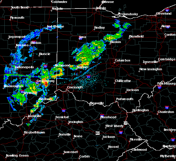 The severe thunderstorm warning for eastern franklin county in southeastern indiana, southeastern union county in east central indiana and northwestern butler counties in southwestern ohio will expire at 645 pm edt, the storm which prompted the warning has weakened below severe limits, and no longer poses an immediate threat to life or property. therefore, the warning will be allowed to expire. please report previous wind damage or hail to the national weather service by going to our website at weather.gov/iln and submitting your report via social media. The severe thunderstorm warning for eastern franklin county in southeastern indiana, southeastern union county in east central indiana and northwestern butler counties in southwestern ohio will expire at 645 pm edt, the storm which prompted the warning has weakened below severe limits, and no longer poses an immediate threat to life or property. therefore, the warning will be allowed to expire. please report previous wind damage or hail to the national weather service by going to our website at weather.gov/iln and submitting your report via social media.
|
| 5/1/2019 6:27 PM EDT |
 At 626 pm edt, a severe thunderstorm was located over brookville, moving northeast at 40 mph (radar indicated). Hazards include 60 mph wind gusts and quarter size hail. Minor hail damage to vehicles is possible. expect wind damage to trees and power lines. locations impacted include, hamilton, oxford, brookville, west college corner, darrtown, reily, mcgonigle, sharptown, st. Charles and saint peter. At 626 pm edt, a severe thunderstorm was located over brookville, moving northeast at 40 mph (radar indicated). Hazards include 60 mph wind gusts and quarter size hail. Minor hail damage to vehicles is possible. expect wind damage to trees and power lines. locations impacted include, hamilton, oxford, brookville, west college corner, darrtown, reily, mcgonigle, sharptown, st. Charles and saint peter.
|
| 5/1/2019 6:15 PM EDT |
 At 615 pm edt, a severe thunderstorm was located near oldenburg, moving northeast at 40 mph (radar indicated). Hazards include 60 mph wind gusts and quarter size hail. Minor hail damage to vehicles is possible. Expect wind damage to trees and power lines. At 615 pm edt, a severe thunderstorm was located near oldenburg, moving northeast at 40 mph (radar indicated). Hazards include 60 mph wind gusts and quarter size hail. Minor hail damage to vehicles is possible. Expect wind damage to trees and power lines.
|
| 5/31/2018 3:13 PM EDT |
 At 313 pm edt, severe thunderstorms were located along a line extending from near batesville to near dillsboro to near vevay, moving northeast at 45 mph (radar indicated). Hazards include 70 mph wind gusts. Expect considerable tree damage. Damage is likely to mobile homes, roofs, and outbuildings. At 313 pm edt, severe thunderstorms were located along a line extending from near batesville to near dillsboro to near vevay, moving northeast at 45 mph (radar indicated). Hazards include 70 mph wind gusts. Expect considerable tree damage. Damage is likely to mobile homes, roofs, and outbuildings.
|
| 5/31/2018 3:13 PM EDT |
 The national weather service in wilmington has issued a * severe thunderstorm warning for. ohio county in southeastern indiana. franklin county in southeastern indiana. ripley county in southeastern indiana. Dearborn county in southeastern indiana. The national weather service in wilmington has issued a * severe thunderstorm warning for. ohio county in southeastern indiana. franklin county in southeastern indiana. ripley county in southeastern indiana. Dearborn county in southeastern indiana.
|
| 5/31/2018 3:13 PM EDT |
 At 313 pm edt, severe thunderstorms were located along a line extending from near batesville to near dillsboro to near vevay, moving northeast at 45 mph (radar indicated). Hazards include 70 mph wind gusts. Expect considerable tree damage. Damage is likely to mobile homes, roofs, and outbuildings. At 313 pm edt, severe thunderstorms were located along a line extending from near batesville to near dillsboro to near vevay, moving northeast at 45 mph (radar indicated). Hazards include 70 mph wind gusts. Expect considerable tree damage. Damage is likely to mobile homes, roofs, and outbuildings.
|
| 4/3/2018 3:31 PM EDT |
 At 330 pm edt, a severe thunderstorm was located near brookville, moving northeast at 50 mph (radar indicated). Hazards include 60 mph wind gusts and half dollar size hail. Minor hail damage to vehicles is possible. expect wind damage to trees and power lines. locations impacted include, oxford, brookville, liberty, west college corner, darrtown, salem, reily, college corner, charlottesville, fairhaven, hueston woods state park, goodwins corner, mounds state recreation area, billingsville, cottage grove, morning sun, mixersville, mcgonigle, sugar valley and lake lakengren. A tornado watch remains in effect until 800 pm edt for southeastern and east central indiana, and southwestern and west central ohio. At 330 pm edt, a severe thunderstorm was located near brookville, moving northeast at 50 mph (radar indicated). Hazards include 60 mph wind gusts and half dollar size hail. Minor hail damage to vehicles is possible. expect wind damage to trees and power lines. locations impacted include, oxford, brookville, liberty, west college corner, darrtown, salem, reily, college corner, charlottesville, fairhaven, hueston woods state park, goodwins corner, mounds state recreation area, billingsville, cottage grove, morning sun, mixersville, mcgonigle, sugar valley and lake lakengren. A tornado watch remains in effect until 800 pm edt for southeastern and east central indiana, and southwestern and west central ohio.
|
| 4/3/2018 3:19 PM EDT |
 At 318 pm edt, a severe thunderstorm was located near oldenburg, moving northeast at 50 mph (radar indicated). Hazards include 60 mph wind gusts and quarter size hail. Minor hail damage to vehicles is possible. Expect wind damage to trees and power lines. At 318 pm edt, a severe thunderstorm was located near oldenburg, moving northeast at 50 mph (radar indicated). Hazards include 60 mph wind gusts and quarter size hail. Minor hail damage to vehicles is possible. Expect wind damage to trees and power lines.
|
| 7/17/2017 1:10 AM EDT |
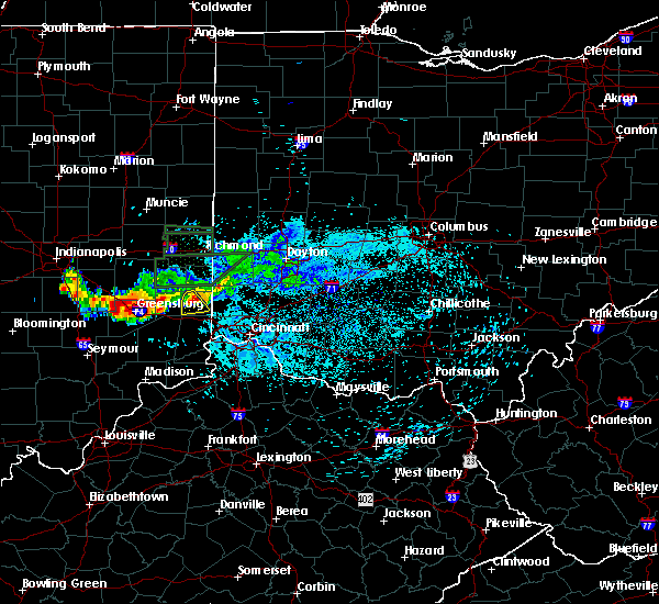 The severe thunderstorm warning for eastern franklin county will expire at 115 am edt, the storm which prompted the warning has weakened below severe limits, and no longer poses an immediate threat to life or property. therefore, the warning will be allowed to expire. however small hail is still possible with this thunderstorm. please report previous wind damage or hail to the national weather service by going to our website at weather.gov/iln and submitting your report via social media. The severe thunderstorm warning for eastern franklin county will expire at 115 am edt, the storm which prompted the warning has weakened below severe limits, and no longer poses an immediate threat to life or property. therefore, the warning will be allowed to expire. however small hail is still possible with this thunderstorm. please report previous wind damage or hail to the national weather service by going to our website at weather.gov/iln and submitting your report via social media.
|
| 7/17/2017 1:03 AM EDT | Quarter sized hail reported 1.1 miles ESE of Brookville, IN, time estimated by radar. |
| 7/17/2017 1:03 AM EDT |
 At 103 am edt, a severe thunderstorm was located over brookville, moving southeast at 20 mph (radar indicated). Hazards include quarter size hail. Minor damage to vehicles is possible. Locations impacted include, brookville, cedar grove, mount carmel, sharptown, saint peter and mounds state recreation area. At 103 am edt, a severe thunderstorm was located over brookville, moving southeast at 20 mph (radar indicated). Hazards include quarter size hail. Minor damage to vehicles is possible. Locations impacted include, brookville, cedar grove, mount carmel, sharptown, saint peter and mounds state recreation area.
|
| 7/17/2017 1:00 AM EDT |
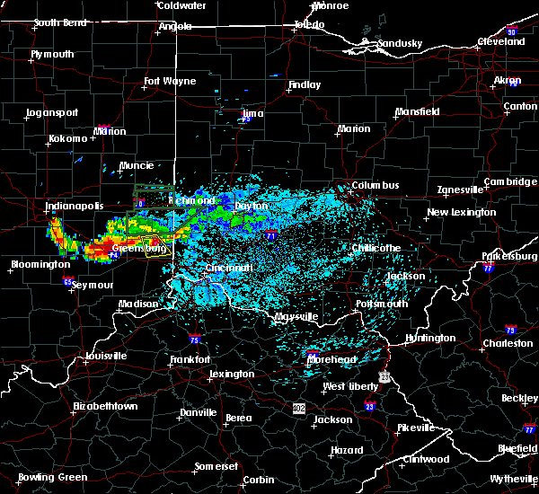 At 1259 am edt, a severe thunderstorm was located over brookville, moving southeast at 20 mph (radar indicated). Hazards include quarter size hail. Minor damage to vehicles is possible. Locations impacted include, brookville, blooming grove, cedar grove, mount carmel, sharptown, mounds state recreation area and saint peter. At 1259 am edt, a severe thunderstorm was located over brookville, moving southeast at 20 mph (radar indicated). Hazards include quarter size hail. Minor damage to vehicles is possible. Locations impacted include, brookville, blooming grove, cedar grove, mount carmel, sharptown, mounds state recreation area and saint peter.
|
| 7/17/2017 12:54 AM EDT |
 At 1253 am edt, a severe thunderstorm was located near brookville, moving southeast at 20 mph (radar indicated). Hazards include quarter size hail. Minor damage to vehicles is possible. Locations impacted include, brookville, blooming grove, metamora, cedar grove, mount carmel, sharptown, mounds state recreation area and saint peter. At 1253 am edt, a severe thunderstorm was located near brookville, moving southeast at 20 mph (radar indicated). Hazards include quarter size hail. Minor damage to vehicles is possible. Locations impacted include, brookville, blooming grove, metamora, cedar grove, mount carmel, sharptown, mounds state recreation area and saint peter.
|
| 7/17/2017 12:41 AM EDT |
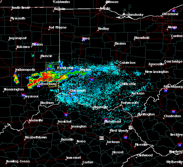 At 1241 am edt, a severe thunderstorm was located 7 miles northwest of brookville, moving southeast at 20 mph (radar indicated). Hazards include quarter size hail. minor damage to vehicles is possible At 1241 am edt, a severe thunderstorm was located 7 miles northwest of brookville, moving southeast at 20 mph (radar indicated). Hazards include quarter size hail. minor damage to vehicles is possible
|
| 7/11/2017 2:16 PM EDT |
 At 216 pm edt, a severe thunderstorm was located 8 miles northwest of bright, moving east at 60 mph (radar indicated). Hazards include 60 mph wind gusts. Expect damage to trees and power lines. locations impacted include, batesville, brookville, bright, hidden valley, logan, sunman, st. leon, west harrison, cedar grove, mount carmel, dover, weisburg, penntown, interstate 74 at state route 101, interstate 74 at us route 52, rockdale, sharptown, new trenton, lawrenceville and saint peter. This includes i-74 in indiana between mile markers 151 and 170. At 216 pm edt, a severe thunderstorm was located 8 miles northwest of bright, moving east at 60 mph (radar indicated). Hazards include 60 mph wind gusts. Expect damage to trees and power lines. locations impacted include, batesville, brookville, bright, hidden valley, logan, sunman, st. leon, west harrison, cedar grove, mount carmel, dover, weisburg, penntown, interstate 74 at state route 101, interstate 74 at us route 52, rockdale, sharptown, new trenton, lawrenceville and saint peter. This includes i-74 in indiana between mile markers 151 and 170.
|
| 7/11/2017 1:55 PM EDT |
 The national weather service in wilmington has issued a * severe thunderstorm warning for. franklin county in southeastern indiana. northeastern ripley county in southeastern indiana. northern dearborn county in southeastern indiana. Until 230 pm edt. The national weather service in wilmington has issued a * severe thunderstorm warning for. franklin county in southeastern indiana. northeastern ripley county in southeastern indiana. northern dearborn county in southeastern indiana. Until 230 pm edt.
|
| 4/5/2017 5:25 PM EDT |
 At 524 pm edt, a severe thunderstorm was located near brookville, moving northeast at 55 mph (radar indicated). Hazards include 60 mph wind gusts and quarter size hail. Hail damage to vehicles is expected. Expect wind damage to roofs, siding, and trees. At 524 pm edt, a severe thunderstorm was located near brookville, moving northeast at 55 mph (radar indicated). Hazards include 60 mph wind gusts and quarter size hail. Hail damage to vehicles is expected. Expect wind damage to roofs, siding, and trees.
|
| 3/20/2017 5:36 PM EDT |
 At 536 pm edt, a severe thunderstorm was located near brookville, moving southeast at 40 mph (radar indicated). Hazards include quarter size hail. Damage to vehicles is expected. Locations impacted include, brookville, oldenburg, lake santee, blooming grove, metamora, laurel, peppertown, andersonville, mounds state recreation area, hamburg, everton and buena vista. At 536 pm edt, a severe thunderstorm was located near brookville, moving southeast at 40 mph (radar indicated). Hazards include quarter size hail. Damage to vehicles is expected. Locations impacted include, brookville, oldenburg, lake santee, blooming grove, metamora, laurel, peppertown, andersonville, mounds state recreation area, hamburg, everton and buena vista.
|
| 3/20/2017 5:27 PM EDT |
 At 526 pm edt, a severe thunderstorm was located 7 miles northeast of lake santee, moving southeast at 40 mph (radar indicated). Hazards include golf ball size hail. People and animals outdoors will be injured. expect damage to roofs, siding, windows, and vehicles. Locations impacted include, brookville, oldenburg, lake santee, blooming grove, columbia, metamora, laurel, andersonville, mounds state recreation area, hamburg, alpine, nulltown, peppertown, everton and buena vista. At 526 pm edt, a severe thunderstorm was located 7 miles northeast of lake santee, moving southeast at 40 mph (radar indicated). Hazards include golf ball size hail. People and animals outdoors will be injured. expect damage to roofs, siding, windows, and vehicles. Locations impacted include, brookville, oldenburg, lake santee, blooming grove, columbia, metamora, laurel, andersonville, mounds state recreation area, hamburg, alpine, nulltown, peppertown, everton and buena vista.
|
| 3/20/2017 5:13 PM EDT |
 At 512 pm edt, a severe thunderstorm was located near rushville, moving southeast at 40 mph (law enforcement reported golf ball sized hail 1 wsw of arlington). Hazards include golf ball size hail. People and animals outdoors will be injured. Expect damage to roofs, siding, windows, and vehicles. At 512 pm edt, a severe thunderstorm was located near rushville, moving southeast at 40 mph (law enforcement reported golf ball sized hail 1 wsw of arlington). Hazards include golf ball size hail. People and animals outdoors will be injured. Expect damage to roofs, siding, windows, and vehicles.
|
| 3/1/2017 6:13 AM EST |
 At 613 am est, severe thunderstorms were located along a line extending from 6 miles north of brookville to near batesville to 6 miles east of vernon, moving east at 50 mph (radar indicated). Hazards include 60 mph wind gusts and quarter size hail. Hail damage to vehicles is expected. expect wind damage to roofs, siding, and trees. locations impacted include, batesville, brookville, bright, hidden valley, versailles, milan, osgood, dillsboro, west college corner, oldenburg, moores hill, guilford, salem, logan, manchester, blooming grove, sunman, metamora, st. leon and holton. this includes i-74 in indiana between mile markers 147 and 170. a tornado watch remains in effect until 700 am est for east central indiana. A tornado watch also remains in effect until 1100 am est for southeastern indiana. At 613 am est, severe thunderstorms were located along a line extending from 6 miles north of brookville to near batesville to 6 miles east of vernon, moving east at 50 mph (radar indicated). Hazards include 60 mph wind gusts and quarter size hail. Hail damage to vehicles is expected. expect wind damage to roofs, siding, and trees. locations impacted include, batesville, brookville, bright, hidden valley, versailles, milan, osgood, dillsboro, west college corner, oldenburg, moores hill, guilford, salem, logan, manchester, blooming grove, sunman, metamora, st. leon and holton. this includes i-74 in indiana between mile markers 147 and 170. a tornado watch remains in effect until 700 am est for east central indiana. A tornado watch also remains in effect until 1100 am est for southeastern indiana.
|
| 3/1/2017 5:59 AM EST |
 At 558 am est, severe thunderstorms were located along a line extending from near glenwood to southeast of greensburg to near north vernon, moving east at 50 mph (radar indicated). Hazards include 60 mph wind gusts and nickel size hail. expect damage to roofs, siding, and trees At 558 am est, severe thunderstorms were located along a line extending from near glenwood to southeast of greensburg to near north vernon, moving east at 50 mph (radar indicated). Hazards include 60 mph wind gusts and nickel size hail. expect damage to roofs, siding, and trees
|
| 1/10/2017 9:14 PM EST |
 At 912 pm est, severe thunderstorms were located along a line extending from near west alexandria to 7 miles west of bright to 12 miles east of vernon, moving southeast at 45 mph. strong to severe winds can be expected to continue for 20 minutes after the rain ends (radar indicated). Hazards include 60 mph wind gusts. Expect damage to roofs, siding, and trees. locations impacted include, dayton, hamilton, huber heights, richmond, trotwood, oxford, vandalia, englewood, trenton, harrison, eaton, batesville, moraine, lawrenceburg, greendale, aurora, bright, hidden valley, ross and cleves. this includes the following interstates, i-70 in indiana between mile markers 154 and 156. i-70 in ohio between mile markers 0 and 36. i-74 in indiana between mile markers 145 and 171. i-74 in ohio between mile markers 0 and 7. I-75 in ohio between mile markers 58 and 61. At 912 pm est, severe thunderstorms were located along a line extending from near west alexandria to 7 miles west of bright to 12 miles east of vernon, moving southeast at 45 mph. strong to severe winds can be expected to continue for 20 minutes after the rain ends (radar indicated). Hazards include 60 mph wind gusts. Expect damage to roofs, siding, and trees. locations impacted include, dayton, hamilton, huber heights, richmond, trotwood, oxford, vandalia, englewood, trenton, harrison, eaton, batesville, moraine, lawrenceburg, greendale, aurora, bright, hidden valley, ross and cleves. this includes the following interstates, i-70 in indiana between mile markers 154 and 156. i-70 in ohio between mile markers 0 and 36. i-74 in indiana between mile markers 145 and 171. i-74 in ohio between mile markers 0 and 7. I-75 in ohio between mile markers 58 and 61.
|
| 1/10/2017 9:09 PM EST |
 At 908 pm est, severe thunderstorms were located along a line extending from west alexandria to 9 miles east of batesville to 9 miles east of vernon, moving southeast at 45 mph. strong to severe winds can be expected to continue for 20 minutes after the rain ends (radar indicated). Hazards include 60 mph wind gusts. Expect damage to roofs, siding, and trees. locations impacted include, dayton, hamilton, huber heights, richmond, trotwood, oxford, vandalia, englewood, trenton, harrison, eaton, batesville, moraine, lawrenceburg, greendale, aurora, bright, hidden valley, ross and cleves. this includes the following interstates, i-70 in indiana between mile markers 154 and 156. i-70 in ohio between mile markers 0 and 36. i-74 in indiana between mile markers 145 and 171. i-74 in ohio between mile markers 0 and 7. I-75 in ohio between mile markers 58 and 61. At 908 pm est, severe thunderstorms were located along a line extending from west alexandria to 9 miles east of batesville to 9 miles east of vernon, moving southeast at 45 mph. strong to severe winds can be expected to continue for 20 minutes after the rain ends (radar indicated). Hazards include 60 mph wind gusts. Expect damage to roofs, siding, and trees. locations impacted include, dayton, hamilton, huber heights, richmond, trotwood, oxford, vandalia, englewood, trenton, harrison, eaton, batesville, moraine, lawrenceburg, greendale, aurora, bright, hidden valley, ross and cleves. this includes the following interstates, i-70 in indiana between mile markers 154 and 156. i-70 in ohio between mile markers 0 and 36. i-74 in indiana between mile markers 145 and 171. i-74 in ohio between mile markers 0 and 7. I-75 in ohio between mile markers 58 and 61.
|
| 1/10/2017 8:44 PM EST |
 At 844 pm est, severe thunderstorms were located along a line extending from new paris to lake santee to near north vernon, moving southeast at 45 mph (radar indicated). Hazards include 60 mph wind gusts. expect damage to roofs, siding, and trees At 844 pm est, severe thunderstorms were located along a line extending from new paris to lake santee to near north vernon, moving southeast at 45 mph (radar indicated). Hazards include 60 mph wind gusts. expect damage to roofs, siding, and trees
|
| 1/10/2017 8:36 PM EST |
 At 836 pm est, severe thunderstorms were located along a line extending from near new madison to near connersville to greensburg, moving east at 55 mph (radar indicated). Hazards include 60 mph wind gusts. Expect damage to roofs, siding, and trees. locations impacted include, richmond, oxford, connersville, greenville, eaton, batesville, west milton, brookville, centerville, liberty, arcanum, versailles, camden, milan, lewisburg, new paris, osgood, west alexandria, new madison and fountain city. this includes the following interstates, i-70 in indiana between mile markers 140 and 156. i-70 in ohio between mile markers 0 and 20. I-74 in indiana between mile markers 145 and 164. At 836 pm est, severe thunderstorms were located along a line extending from near new madison to near connersville to greensburg, moving east at 55 mph (radar indicated). Hazards include 60 mph wind gusts. Expect damage to roofs, siding, and trees. locations impacted include, richmond, oxford, connersville, greenville, eaton, batesville, west milton, brookville, centerville, liberty, arcanum, versailles, camden, milan, lewisburg, new paris, osgood, west alexandria, new madison and fountain city. this includes the following interstates, i-70 in indiana between mile markers 140 and 156. i-70 in ohio between mile markers 0 and 20. I-74 in indiana between mile markers 145 and 164.
|
| 1/10/2017 8:06 PM EST |
 At 805 pm est, severe thunderstorms were located along a line extending from 9 miles east of muncie to 9 miles southwest of shelbyville, moving east at 50 mph (radar indicated). Hazards include 60 mph wind gusts. expect damage to roofs, siding, and trees At 805 pm est, severe thunderstorms were located along a line extending from 9 miles east of muncie to 9 miles southwest of shelbyville, moving east at 50 mph (radar indicated). Hazards include 60 mph wind gusts. expect damage to roofs, siding, and trees
|
| 8/27/2016 1:52 PM EDT |
 At 152 pm edt, a severe thunderstorm was located over brookville, moving northeast at 30 mph (radar indicated). Hazards include 60 mph wind gusts and penny size hail. Expect damage to roofs. siding. and trees. locations impacted include, lawrenceburg, greendale, aurora, brookville, hidden valley, bright, dillsboro, moores hill, guilford, wilmington, logan, manchester, blooming grove, metamora, st. Leon, laurel, cedar grove, dover, mounds state recreation area and weisburg. At 152 pm edt, a severe thunderstorm was located over brookville, moving northeast at 30 mph (radar indicated). Hazards include 60 mph wind gusts and penny size hail. Expect damage to roofs. siding. and trees. locations impacted include, lawrenceburg, greendale, aurora, brookville, hidden valley, bright, dillsboro, moores hill, guilford, wilmington, logan, manchester, blooming grove, metamora, st. Leon, laurel, cedar grove, dover, mounds state recreation area and weisburg.
|
| 8/27/2016 1:36 PM EDT |
 At 135 pm edt, a severe thunderstorm was located near oldenburg, moving northeast at 30 mph (radar indicated). Hazards include 60 mph wind gusts and penny size hail. Expect damage to roofs. siding. and trees. Locations impacted include, batesville, lawrenceburg, greendale, aurora, brookville, hidden valley, bright, versailles, milan, dillsboro, oldenburg, moores hill, lake santee, guilford, wilmington, logan, manchester, blooming grove, sunman and metamora. At 135 pm edt, a severe thunderstorm was located near oldenburg, moving northeast at 30 mph (radar indicated). Hazards include 60 mph wind gusts and penny size hail. Expect damage to roofs. siding. and trees. Locations impacted include, batesville, lawrenceburg, greendale, aurora, brookville, hidden valley, bright, versailles, milan, dillsboro, oldenburg, moores hill, lake santee, guilford, wilmington, logan, manchester, blooming grove, sunman and metamora.
|
| 8/27/2016 1:17 PM EDT |
 At 117 pm edt, a severe thunderstorm was located near batesville, moving northeast at 30 mph (radar indicated). Hazards include 60 mph wind gusts and penny size hail. Expect damage to roofs. siding. And trees. At 117 pm edt, a severe thunderstorm was located near batesville, moving northeast at 30 mph (radar indicated). Hazards include 60 mph wind gusts and penny size hail. Expect damage to roofs. siding. And trees.
|
| 7/13/2016 8:17 PM EDT |
 At 817 pm edt, severe thunderstorms were located along a line extending from near fountain city to near oldenburg, moving east at 45 mph (radar indicated). Hazards include 60 mph wind gusts. Expect damage to roofs. siding. and trees. Locations impacted include, richmond, connersville, brookville, centerville, cambridge city, liberty, hagerstown, fountain city, dublin, glenwood, franklin, salem, waterloo, blooming grove, columbia, metamora, bunker hill, abington, brownsville and laurel. At 817 pm edt, severe thunderstorms were located along a line extending from near fountain city to near oldenburg, moving east at 45 mph (radar indicated). Hazards include 60 mph wind gusts. Expect damage to roofs. siding. and trees. Locations impacted include, richmond, connersville, brookville, centerville, cambridge city, liberty, hagerstown, fountain city, dublin, glenwood, franklin, salem, waterloo, blooming grove, columbia, metamora, bunker hill, abington, brownsville and laurel.
|
| 7/13/2016 7:51 PM EDT |
 At 751 pm edt, severe thunderstorms were located along a line extending from 6 miles northeast of new castle to 6 miles northwest of greensburg, moving east at 40 mph (radar indicated). Hazards include 60 mph wind gusts. Expect damage to roofs. siding. And trees. At 751 pm edt, severe thunderstorms were located along a line extending from 6 miles northeast of new castle to 6 miles northwest of greensburg, moving east at 40 mph (radar indicated). Hazards include 60 mph wind gusts. Expect damage to roofs. siding. And trees.
|
| 6/23/2016 4:12 AM EDT | Storm damage reported in franklin county IN, 1.1 miles ESE of Brookville, IN |
| 6/23/2016 4:00 AM EDT |
 At 400 am edt, a severe thunderstorm was located 7 miles northwest of brookville, moving southeast at 50 mph (radar indicated). Hazards include 60 mph wind gusts and penny size hail. Expect damage to roofs. siding. and trees. locations impacted include, connersville, brookville, west college corner, oldenburg, salem, blooming grove, columbia, metamora, laurel, scipio, college corner, cedar grove, mount carmel, springersville, hamburg, mounds state recreation area, everton, rockdale, saint peter and dunlapsville. A tornado watch remains in effect until 500 am edt for southeastern and east central indiana, and west central and southwestern ohio. At 400 am edt, a severe thunderstorm was located 7 miles northwest of brookville, moving southeast at 50 mph (radar indicated). Hazards include 60 mph wind gusts and penny size hail. Expect damage to roofs. siding. and trees. locations impacted include, connersville, brookville, west college corner, oldenburg, salem, blooming grove, columbia, metamora, laurel, scipio, college corner, cedar grove, mount carmel, springersville, hamburg, mounds state recreation area, everton, rockdale, saint peter and dunlapsville. A tornado watch remains in effect until 500 am edt for southeastern and east central indiana, and west central and southwestern ohio.
|
| 6/23/2016 3:41 AM EDT |
 At 341 am edt, a severe thunderstorm was located near glenwood, moving southeast at 55 mph (radar indicated). Hazards include 60 mph wind gusts and penny size hail. Expect damage to roofs. siding. And trees. At 341 am edt, a severe thunderstorm was located near glenwood, moving southeast at 55 mph (radar indicated). Hazards include 60 mph wind gusts and penny size hail. Expect damage to roofs. siding. And trees.
|
| 6/20/2016 9:41 PM EDT |
 The severe thunderstorm warning for southern fayette, north central dearborn, northeastern ripley and franklin counties will expire at 945 pm edt, the storm which prompted the warning has weakened below severe limits, and no longer poses an immediate threat to life or property. therefore the warning will be allowed to expire. a severe thunderstorm watch remains in effect until 1100 pm edt for southeastern and east central indiana. please report previous wind damage or hail to the national weather service by going to our website at weather.gov/iln and submitting your report via social media. The severe thunderstorm warning for southern fayette, north central dearborn, northeastern ripley and franklin counties will expire at 945 pm edt, the storm which prompted the warning has weakened below severe limits, and no longer poses an immediate threat to life or property. therefore the warning will be allowed to expire. a severe thunderstorm watch remains in effect until 1100 pm edt for southeastern and east central indiana. please report previous wind damage or hail to the national weather service by going to our website at weather.gov/iln and submitting your report via social media.
|
| 6/20/2016 9:27 PM EDT |
 At 926 pm edt, a severe thunderstorm was located near oldenburg, moving southeast at 25 mph (radar indicated). Hazards include 60 mph wind gusts. Expect damage to roofs. siding. and trees. locations impacted include, batesville, brookville, oldenburg, blooming grove, columbia, metamora, st. Leon, laurel, cedar grove, nulltown, andersonville, hamburg, mounds state recreation area, peppertown, alpine, huntersville, everton, interstate 74 at state route 101, buena vista and saint peter. At 926 pm edt, a severe thunderstorm was located near oldenburg, moving southeast at 25 mph (radar indicated). Hazards include 60 mph wind gusts. Expect damage to roofs. siding. and trees. locations impacted include, batesville, brookville, oldenburg, blooming grove, columbia, metamora, st. Leon, laurel, cedar grove, nulltown, andersonville, hamburg, mounds state recreation area, peppertown, alpine, huntersville, everton, interstate 74 at state route 101, buena vista and saint peter.
|
| 6/20/2016 9:14 PM EDT |
 At 914 pm edt, a severe thunderstorm was located 9 miles north of oldenburg, moving southeast at 30 mph (radar indicated). Hazards include 60 mph wind gusts. Expect damage to roofs. siding. And trees. At 914 pm edt, a severe thunderstorm was located 9 miles north of oldenburg, moving southeast at 30 mph (radar indicated). Hazards include 60 mph wind gusts. Expect damage to roofs. siding. And trees.
|
| 4/26/2016 6:19 PM EDT |
 At 619 pm edt, severe thunderstorms were located along a line extending from eaton to 6 miles east of greensburg, moving east at 45 mph (radar indicated). Hazards include 60 mph wind gusts and quarter size hail. Hail damage to vehicles is expected. expect wind damage to roofs, siding, and trees. Locations impacted include, dayton, hamilton, kettering, trotwood, oxford, miamisburg, trenton, eaton, batesville, moraine, carlisle, oakwood, brookville, west carrollton, liberty, camden, west alexandria, gratis, seven mile and west college corner. At 619 pm edt, severe thunderstorms were located along a line extending from eaton to 6 miles east of greensburg, moving east at 45 mph (radar indicated). Hazards include 60 mph wind gusts and quarter size hail. Hail damage to vehicles is expected. expect wind damage to roofs, siding, and trees. Locations impacted include, dayton, hamilton, kettering, trotwood, oxford, miamisburg, trenton, eaton, batesville, moraine, carlisle, oakwood, brookville, west carrollton, liberty, camden, west alexandria, gratis, seven mile and west college corner.
|
| 4/26/2016 6:08 PM EDT |
 At 608 pm edt, severe thunderstorms were located along a line extending from near eaton to near greensburg, moving east at 50 mph (radar indicated). Hazards include 60 mph wind gusts and quarter size hail. Hail damage to vehicles is expected. Expect wind damage to roofs, siding, and trees. At 608 pm edt, severe thunderstorms were located along a line extending from near eaton to near greensburg, moving east at 50 mph (radar indicated). Hazards include 60 mph wind gusts and quarter size hail. Hail damage to vehicles is expected. Expect wind damage to roofs, siding, and trees.
|
| 3/27/2016 10:30 PM EDT |
 At 1030 pm edt, radar indicated a severe thunderstorm located near bright, moving northeast at 60 mph. storm hazards include, winds to 60 mph, locations impacted include, lawrenceburg, greendale, brookville, hidden valley, bright, guilford, logan, st. leon, west harrison, cedar grove, mount carmel, new trenton, dover, interstate 74 at us route 52 and rockdale. this includes the following interstates, i-74 in indiana between mile markers 162 and 171. i-74 in ohio near mile marker 0. At 1030 pm edt, radar indicated a severe thunderstorm located near bright, moving northeast at 60 mph. storm hazards include, winds to 60 mph, locations impacted include, lawrenceburg, greendale, brookville, hidden valley, bright, guilford, logan, st. leon, west harrison, cedar grove, mount carmel, new trenton, dover, interstate 74 at us route 52 and rockdale. this includes the following interstates, i-74 in indiana between mile markers 162 and 171. i-74 in ohio near mile marker 0.
|
| 3/27/2016 10:16 PM EDT |
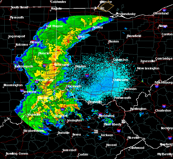 At 1015 pm edt, radar indicated a severe thunderstorm located over milan, moving northeast at 40 mph. storm hazards include, winds to 60 mph,. At 1015 pm edt, radar indicated a severe thunderstorm located over milan, moving northeast at 40 mph. storm hazards include, winds to 60 mph,.
|
| 12/23/2015 4:51 PM EST | Trees down state route 229 as well as weatherman road in franklin county IN, 6 miles NNE of Brookville, IN |
| 12/23/2015 4:51 PM EST | 2 trees down. one on state route 229 and one on weatherman road in franklin county IN, 5.1 miles N of Brookville, IN |
| 12/23/2015 4:42 PM EST | At 442 pm est, radar indicated severe thunderstorms located along a line extending from near hagerstown to 6 miles southwest of liberty to 7 miles north of brooksburg, moving northeast at 60 mph. storm hazards include, winds to 60 mph, very heavy rain which may cause minor flooding, locations impacted include, richmond, connersville, harrison, lawrenceburg, greendale, aurora, brookville, centerville, rising sun, hidden valley, bright, liberty, versailles, milan, dillsboro, west college corner, moores hill, guilford, salem and wilmington. this includes the following interstates, i-70 in indiana between mile markers 154 and 156. i-70 in ohio near mile marker 0. i-74 in indiana between mile markers 152 and 171. i-74 in ohio near mile marker 0. |
| 12/23/2015 4:09 PM EST | The national weather service in wilmington has issued a * severe thunderstorm warning for. fayette county in east central indiana. ohio county in southeastern indiana. union county in east central indiana. Dearborn county in southeastern indiana. |
| 7/13/2015 1:02 PM EDT |
 At 102 pm edt, radar indicated severe thunderstorms located along a line extending from miamisburg to near oldenburg, moving southeast at 35 mph. storm hazards include, winds to 60 mph, penny size hail, frequent cloud to ground lightning, very heavy rain which may cause minor flooding, locations impacted include, trotwood, oxford, miamisburg, springboro, moraine, carlisle, brookville, liberty, camden, west alexandria, gratis, west college corner, oldenburg, west carrollton city, salem, germantown, new lebanon, blooming grove, farmersville and metamora. At 102 pm edt, radar indicated severe thunderstorms located along a line extending from miamisburg to near oldenburg, moving southeast at 35 mph. storm hazards include, winds to 60 mph, penny size hail, frequent cloud to ground lightning, very heavy rain which may cause minor flooding, locations impacted include, trotwood, oxford, miamisburg, springboro, moraine, carlisle, brookville, liberty, camden, west alexandria, gratis, west college corner, oldenburg, west carrollton city, salem, germantown, new lebanon, blooming grove, farmersville and metamora.
|
| 7/13/2015 12:57 PM EDT |
 At 1257 pm edt, radar indicated severe thunderstorms located along a line extending from near carlisle to near oldenburg, moving southeast at 40 mph. storm hazards include, winds to 60 mph, penny size hail, frequent cloud to ground lightning, very heavy rain which may cause minor flooding,. At 1257 pm edt, radar indicated severe thunderstorms located along a line extending from near carlisle to near oldenburg, moving southeast at 40 mph. storm hazards include, winds to 60 mph, penny size hail, frequent cloud to ground lightning, very heavy rain which may cause minor flooding,.
|
| 7/13/2015 12:44 PM EDT |
 At 1244 pm edt, radar indicated severe thunderstorms located along a line extending from near west carrollton to 9 miles south of glenwood, moving south at 45 mph. storm hazards include, winds to 60 mph, penny size hail, frequent cloud to ground lightning, very heavy rain which may cause minor flooding, locations impacted include, richmond, trotwood, oxford, miamisburg, springboro, connersville, eaton, moraine, carlisle, brookville, liberty, camden, lewisburg, west alexandria, gratis, west college corner, oldenburg, glenwood, west carrollton city and salem. At 1244 pm edt, radar indicated severe thunderstorms located along a line extending from near west carrollton to 9 miles south of glenwood, moving south at 45 mph. storm hazards include, winds to 60 mph, penny size hail, frequent cloud to ground lightning, very heavy rain which may cause minor flooding, locations impacted include, richmond, trotwood, oxford, miamisburg, springboro, connersville, eaton, moraine, carlisle, brookville, liberty, camden, lewisburg, west alexandria, gratis, west college corner, oldenburg, glenwood, west carrollton city and salem.
|
| 7/13/2015 12:25 PM EDT |
 At 1225 pm edt, radar indicated severe thunderstorms located along a line extending from near lewisburg to near dublin, moving southeast at 40 mph. storm hazards include, winds to 60 mph, frequent cloud to ground lightning, very heavy rain which may cause minor flooding,. At 1225 pm edt, radar indicated severe thunderstorms located along a line extending from near lewisburg to near dublin, moving southeast at 40 mph. storm hazards include, winds to 60 mph, frequent cloud to ground lightning, very heavy rain which may cause minor flooding,.
|
| 6/29/2014 9:40 PM EDT | A large tree fell across us-52 and took down power lines... presumed to be weather relate in franklin county IN, 0.6 miles SE of Brookville, IN |
| 6/20/2014 4:12 PM EDT | A few branches down at least 3 inches in diameter. time estimated from rada in franklin county IN, 1.1 miles ESE of Brookville, IN |
| 7/19/2012 9:55 PM EDT | Several trees down...along with power lines...west of brookvill in franklin county IN, 2.1 miles E of Brookville, IN |
| 4/25/2012 10:35 PM EDT | Half Dollar sized hail reported 2.3 miles ENE of Brookville, IN, location estimated |
| 1/1/0001 12:00 AM | Tree down levee rd in franklin county IN, 3.6 miles ENE of Brookville, IN |
| 5/25/2011 6:10 PM EDT | Tea Cup sized hail reported 5.4 miles W of Brookville, IN |
| 1/1/0001 12:00 AM | Quarter sized hail reported 5.9 miles S of Brookville, IN |
Hail Maps for Brookville, IN
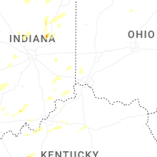


Connect with Interactive Hail Maps