

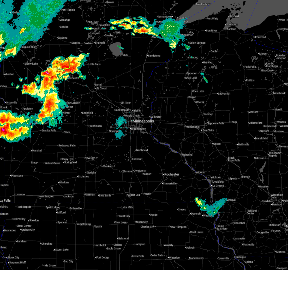
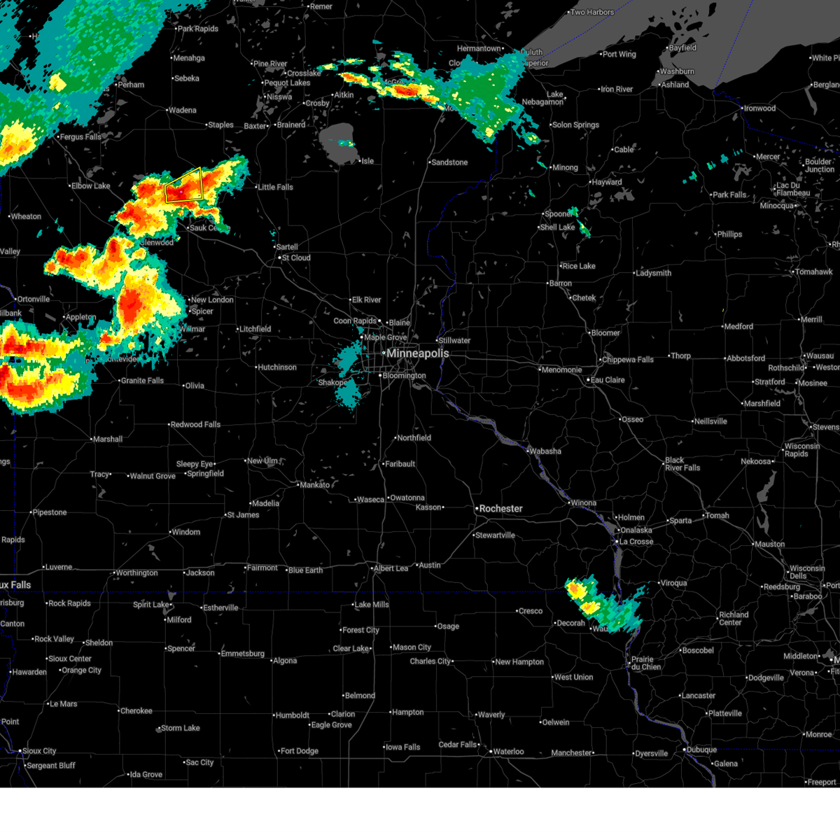
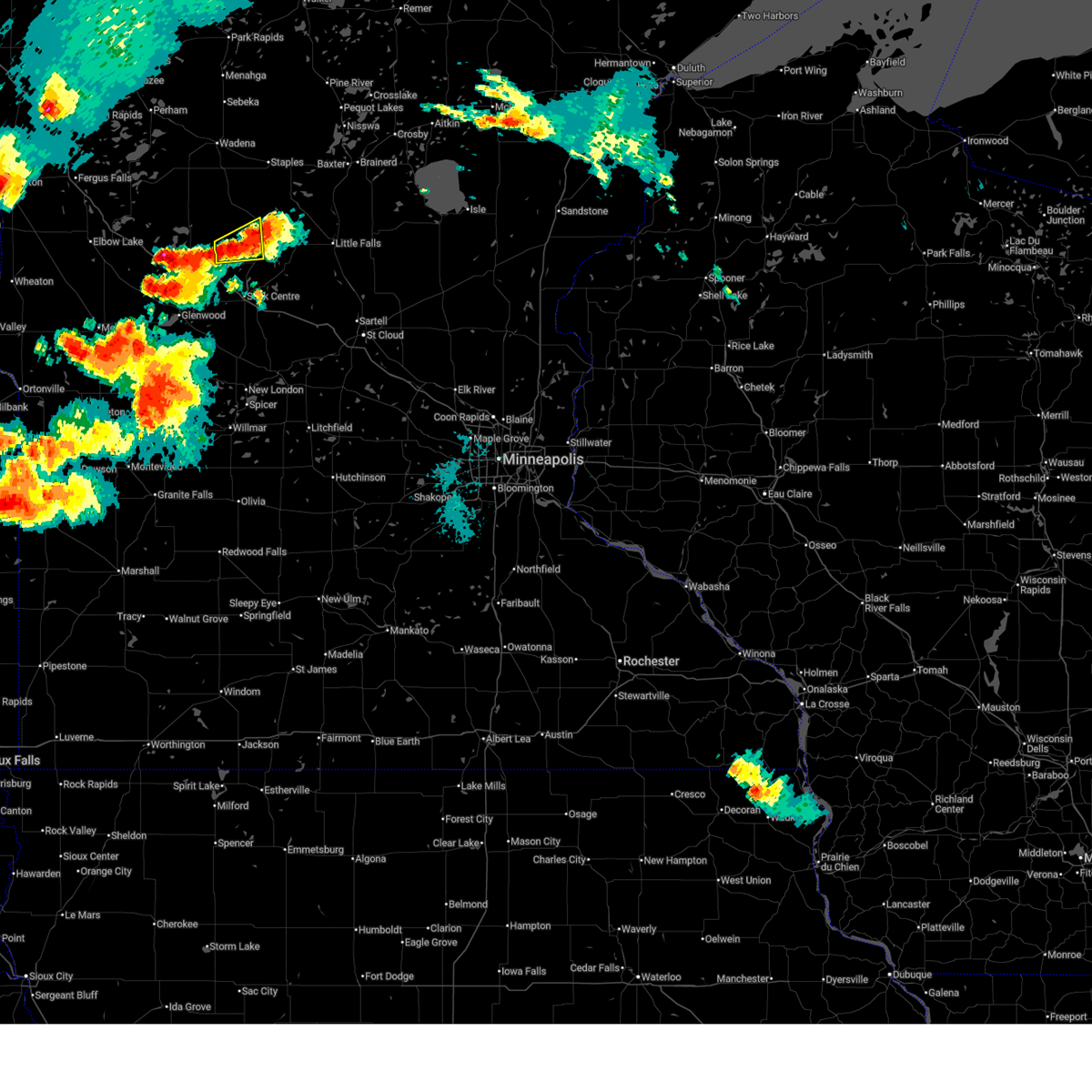
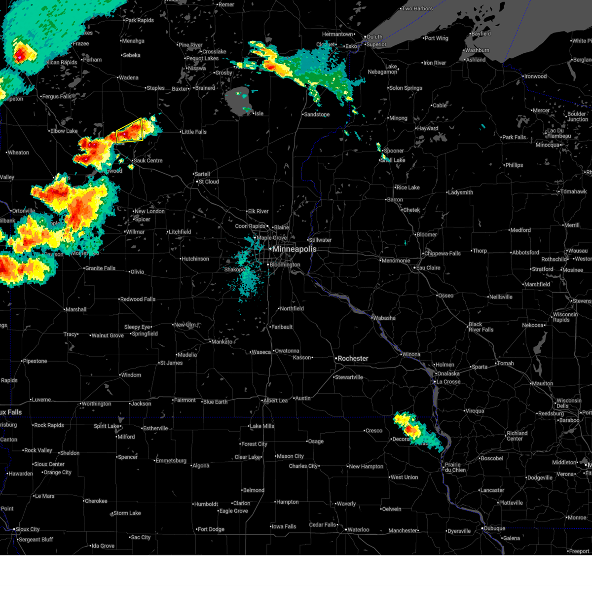
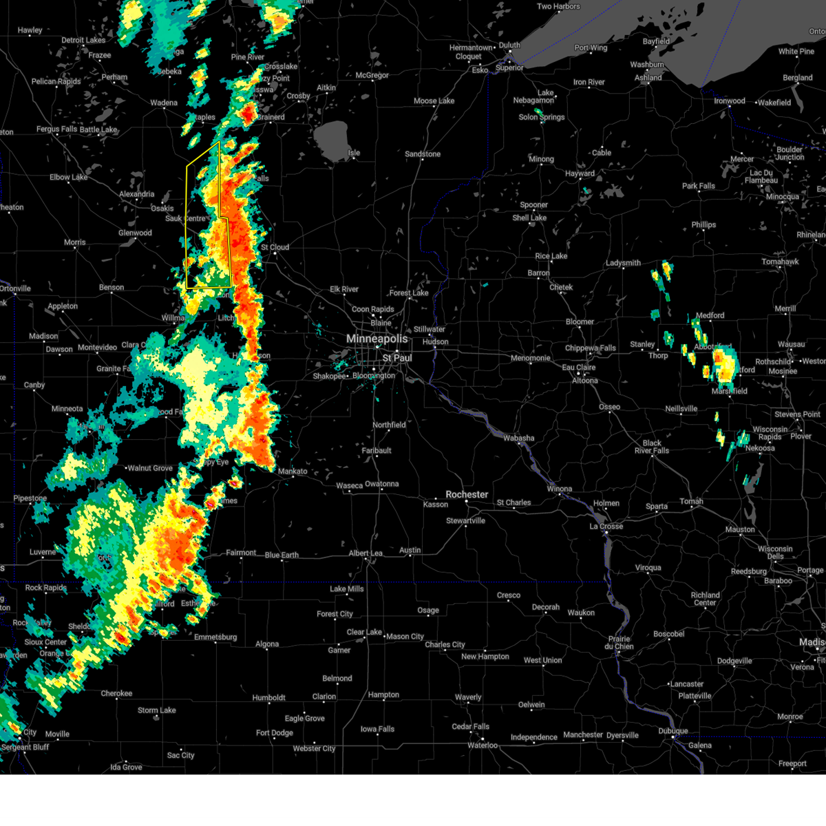
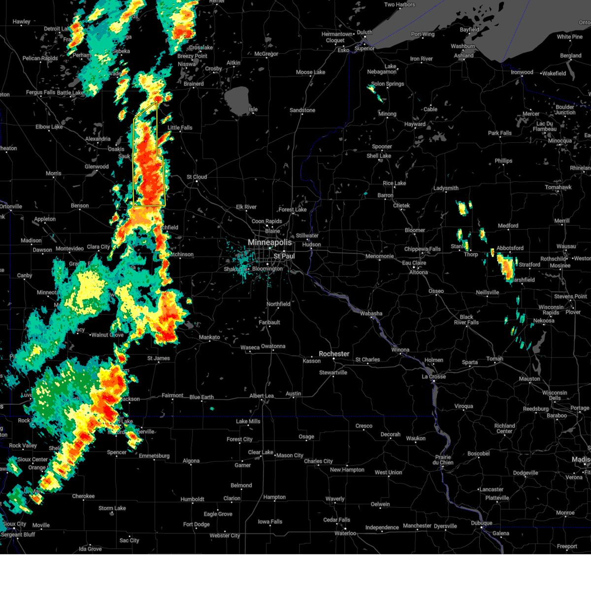
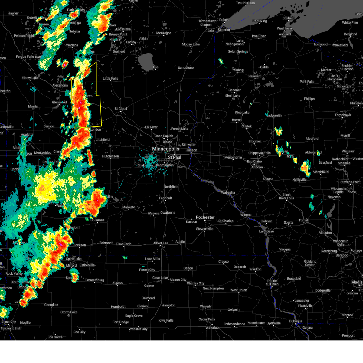
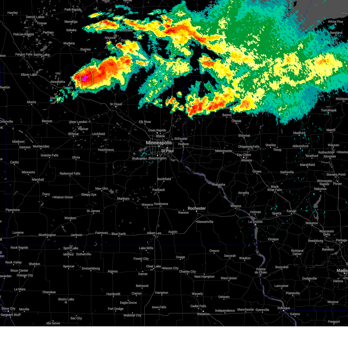
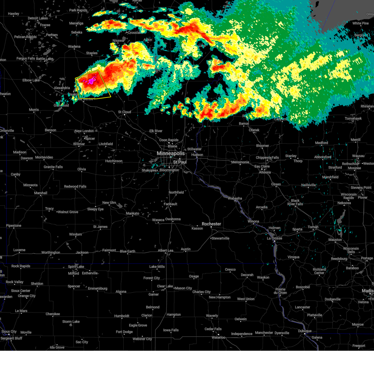
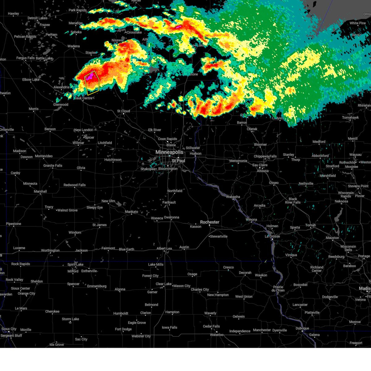
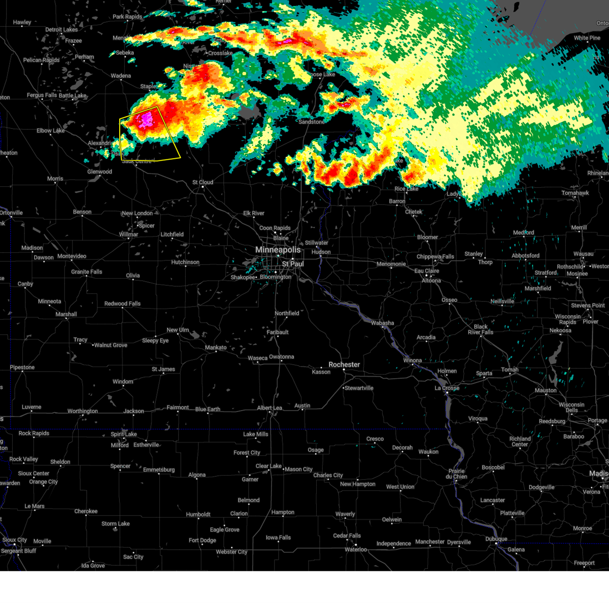
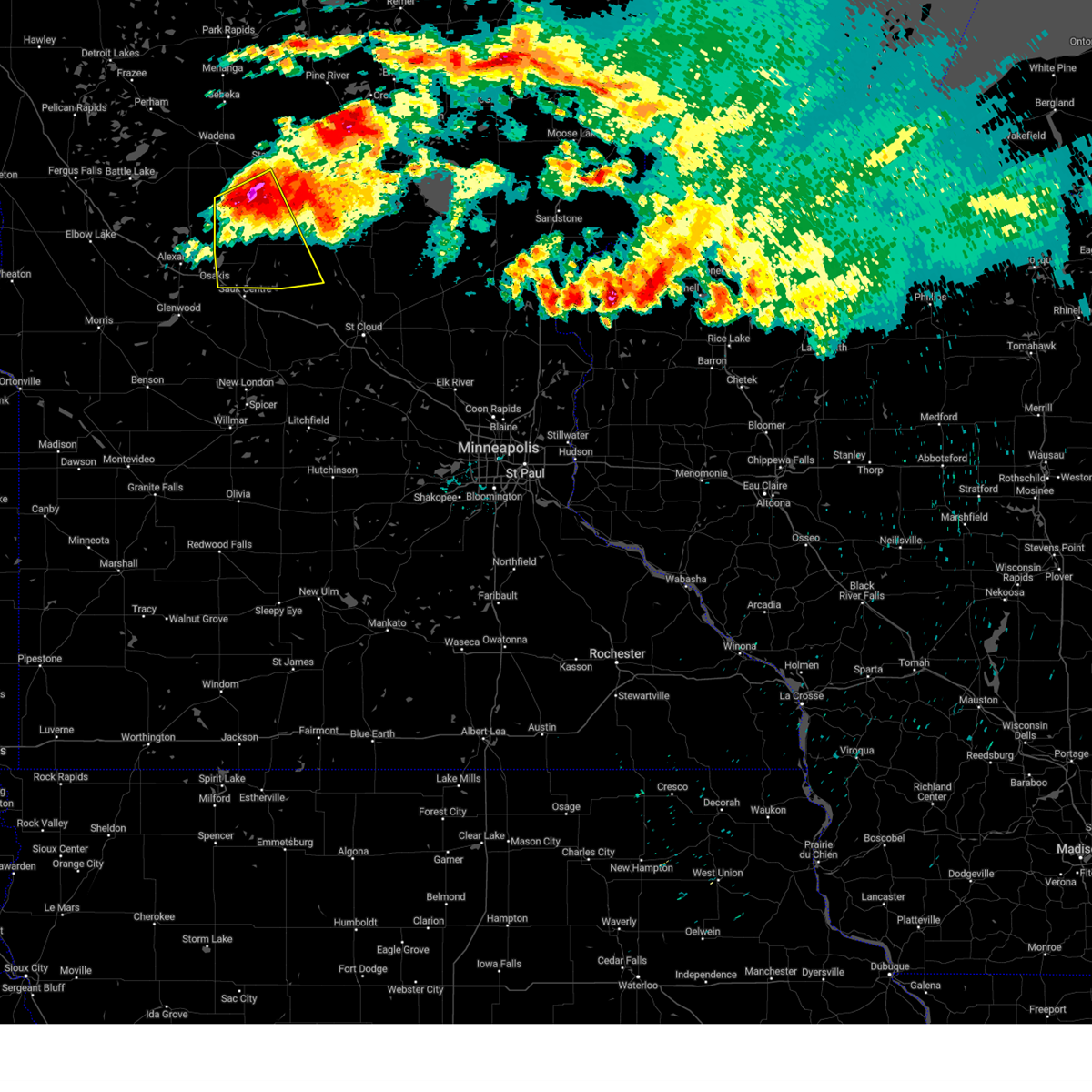
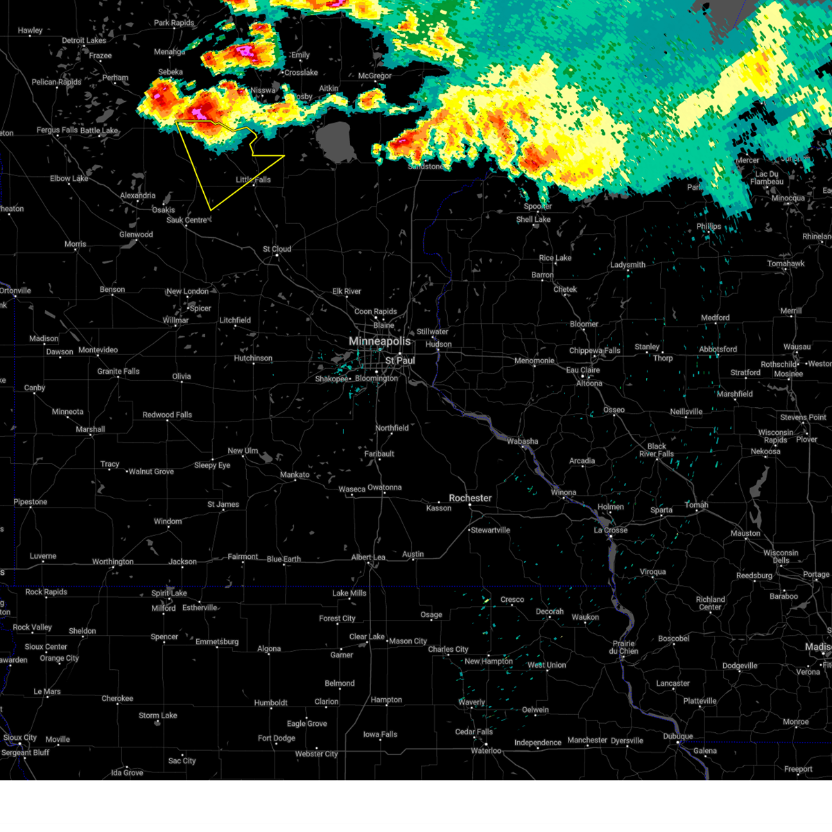
Hail Map for Browerville, MN
The Browerville, MN area has had 3 reports of on-the-ground hail by trained spotters, and has been under severe weather warnings 18 times during the past 12 months. Doppler radar has detected hail at or near Browerville, MN on 47 occasions, including 3 occasions during the past year.
| Name: | Browerville, MN |
| Where Located: | 88.4 miles NNE of Montevideo, MN |
| Map: | Google Map for Browerville, MN |
| Population: | 790 |
| Housing Units: | 366 |
| More Info: | Search Google for Browerville, MN |
5
The Top Recent Hail Date for Browerville, MN is Saturday, August 3, 2024 (1st out of 47)

Hail and Wind Damage Spotted near Browerville, MN
| Date / Time | Report Details |
|---|---|
| 6/28/2025 8:46 PM CDT |
 The storm which prompted the warning has weakened below severe limits, and no longer poses an immediate threat to life or property. therefore, the warning has been allowed to expire. a tornado watch remains in effect until 100 am cdt for a portion of central minnesota. The storm which prompted the warning has weakened below severe limits, and no longer poses an immediate threat to life or property. therefore, the warning has been allowed to expire. a tornado watch remains in effect until 100 am cdt for a portion of central minnesota.
|
| 6/28/2025 8:34 PM CDT |
 At 834 pm cdt, a severe thunderstorm was located 6 miles west of long prairie, or 18 miles east of alexandria, moving east at 25 mph (radar indicated). Hazards include 60 mph wind gusts and quarter size hail. Hail damage to vehicles is expected. expect wind damage to roofs, siding, and trees. Locations impacted include, long prairie, browerville, lake osakis and clotho. At 834 pm cdt, a severe thunderstorm was located 6 miles west of long prairie, or 18 miles east of alexandria, moving east at 25 mph (radar indicated). Hazards include 60 mph wind gusts and quarter size hail. Hail damage to vehicles is expected. expect wind damage to roofs, siding, and trees. Locations impacted include, long prairie, browerville, lake osakis and clotho.
|
| 6/28/2025 8:17 PM CDT |
 At 817 pm cdt, a severe thunderstorm was located 8 miles northeast of lake osakis, or 18 miles east of alexandria, moving east at 15 mph (radar indicated). Hazards include 60 mph wind gusts and quarter size hail. Hail damage to vehicles is expected. expect wind damage to roofs, siding, and trees. Locations impacted include, long prairie, browerville, lake osakis and clotho. At 817 pm cdt, a severe thunderstorm was located 8 miles northeast of lake osakis, or 18 miles east of alexandria, moving east at 15 mph (radar indicated). Hazards include 60 mph wind gusts and quarter size hail. Hail damage to vehicles is expected. expect wind damage to roofs, siding, and trees. Locations impacted include, long prairie, browerville, lake osakis and clotho.
|
| 6/28/2025 8:07 PM CDT |
 Svrmpx the national weather service in the twin cities has issued a * severe thunderstorm warning for, southwestern todd county in central minnesota, * until 845 pm cdt. * at 807 pm cdt, a severe thunderstorm was located 6 miles northeast of lake osakis, or 16 miles east of alexandria, moving east at 15 mph (radar indicated). Hazards include ping pong ball size hail and 60 mph wind gusts. People and animals outdoors will be injured. expect hail damage to roofs, siding, windows, and vehicles. Expect wind damage to roofs, siding, and trees. Svrmpx the national weather service in the twin cities has issued a * severe thunderstorm warning for, southwestern todd county in central minnesota, * until 845 pm cdt. * at 807 pm cdt, a severe thunderstorm was located 6 miles northeast of lake osakis, or 16 miles east of alexandria, moving east at 15 mph (radar indicated). Hazards include ping pong ball size hail and 60 mph wind gusts. People and animals outdoors will be injured. expect hail damage to roofs, siding, windows, and vehicles. Expect wind damage to roofs, siding, and trees.
|
| 8/29/2024 3:15 PM CDT |
 The storms which prompted the warning have moved out of the area. therefore, the warning has been allowed to expire. a severe thunderstorm watch remains in effect until 900 pm cdt for central minnesota. to report severe weather, contact your nearest law enforcement agency. they will relay your report to the national weather service the twin cities. The storms which prompted the warning have moved out of the area. therefore, the warning has been allowed to expire. a severe thunderstorm watch remains in effect until 900 pm cdt for central minnesota. to report severe weather, contact your nearest law enforcement agency. they will relay your report to the national weather service the twin cities.
|
| 8/29/2024 2:56 PM CDT |
 At 256 pm cdt, severe thunderstorms were located along a line extending from 7 miles northeast of browerville to near richmond, moving east at 50 mph (trained weather spotters at 59 mph wind gust at paynesville mn). Hazards include 60 mph wind gusts and quarter size hail. Hail damage to vehicles is expected. expect wind damage to roofs, siding, and trees. Locations impacted include, sauk centre, melrose, long prairie, albany, paynesville, browerville, freeport, grey eagle, little sauk, round prairie, new munich, and greenwald. At 256 pm cdt, severe thunderstorms were located along a line extending from 7 miles northeast of browerville to near richmond, moving east at 50 mph (trained weather spotters at 59 mph wind gust at paynesville mn). Hazards include 60 mph wind gusts and quarter size hail. Hail damage to vehicles is expected. expect wind damage to roofs, siding, and trees. Locations impacted include, sauk centre, melrose, long prairie, albany, paynesville, browerville, freeport, grey eagle, little sauk, round prairie, new munich, and greenwald.
|
| 8/29/2024 2:37 PM CDT |
 Svrmpx the national weather service in the twin cities has issued a * severe thunderstorm warning for, southern todd county in central minnesota, western stearns county in central minnesota, northeastern kandiyohi county in central minnesota, * until 315 pm cdt. * at 237 pm cdt, severe thunderstorms were located along a line extending from 6 miles northwest of long prairie to near paynesville, moving northeast at 50 mph (radar indicated). Hazards include 60 mph wind gusts and quarter size hail. Hail damage to vehicles is expected. Expect wind damage to roofs, siding, and trees. Svrmpx the national weather service in the twin cities has issued a * severe thunderstorm warning for, southern todd county in central minnesota, western stearns county in central minnesota, northeastern kandiyohi county in central minnesota, * until 315 pm cdt. * at 237 pm cdt, severe thunderstorms were located along a line extending from 6 miles northwest of long prairie to near paynesville, moving northeast at 50 mph (radar indicated). Hazards include 60 mph wind gusts and quarter size hail. Hail damage to vehicles is expected. Expect wind damage to roofs, siding, and trees.
|
| 8/3/2024 7:42 PM CDT |
 The storm which prompted the warning has moved out of the area. therefore, the warning will be allowed to expire. a severe thunderstorm watch remains in effect until 100 am cdt for central minnesota. to report severe weather, contact your nearest law enforcement agency. they will relay your report to the national weather service the twin cities. remember, a severe thunderstorm warning still remains in effect for southern todd county. The storm which prompted the warning has moved out of the area. therefore, the warning will be allowed to expire. a severe thunderstorm watch remains in effect until 100 am cdt for central minnesota. to report severe weather, contact your nearest law enforcement agency. they will relay your report to the national weather service the twin cities. remember, a severe thunderstorm warning still remains in effect for southern todd county.
|
| 8/3/2024 7:33 PM CDT |
 At 733 pm cdt, a severe thunderstorm was located near long prairie, or 22 miles west of little falls, moving south at 35 mph (trained weather spotters). Hazards include tennis ball size hail and 60 mph wind gusts. People and animals outdoors will be injured. expect hail damage to roofs, siding, windows, and vehicles. expect wind damage to roofs, siding, and trees. Locations impacted include, long prairie, browerville, upsala, swanville, grey eagle, flensburg, little sauk, round prairie, sobieski, burtrum, elmdale, and pleasant beach. At 733 pm cdt, a severe thunderstorm was located near long prairie, or 22 miles west of little falls, moving south at 35 mph (trained weather spotters). Hazards include tennis ball size hail and 60 mph wind gusts. People and animals outdoors will be injured. expect hail damage to roofs, siding, windows, and vehicles. expect wind damage to roofs, siding, and trees. Locations impacted include, long prairie, browerville, upsala, swanville, grey eagle, flensburg, little sauk, round prairie, sobieski, burtrum, elmdale, and pleasant beach.
|
| 8/3/2024 7:29 PM CDT |
 Svrmpx the national weather service in the twin cities has issued a * severe thunderstorm warning for, southeastern todd county in central minnesota, * until 745 pm cdt. * at 728 pm cdt, a severe thunderstorm was located near long prairie, or 21 miles west of little falls, moving southeast at 45 mph. this is a destructive storm for long prairie (trained weather spotters). Hazards include three inch hail and 60 mph wind gusts. People and animals outdoors will be severely injured. Expect shattered windows, extensive damage to roofs, siding, and vehicles. Svrmpx the national weather service in the twin cities has issued a * severe thunderstorm warning for, southeastern todd county in central minnesota, * until 745 pm cdt. * at 728 pm cdt, a severe thunderstorm was located near long prairie, or 21 miles west of little falls, moving southeast at 45 mph. this is a destructive storm for long prairie (trained weather spotters). Hazards include three inch hail and 60 mph wind gusts. People and animals outdoors will be severely injured. Expect shattered windows, extensive damage to roofs, siding, and vehicles.
|
| 8/3/2024 7:23 PM CDT |
 At 723 pm cdt, a severe thunderstorm was located over browerville, or 25 miles west of little falls, moving south at 35 mph (public). Hazards include two inch hail and 60 mph wind gusts. People and animals outdoors will be injured. expect hail damage to roofs, siding, windows, and vehicles. expect wind damage to roofs, siding, and trees. Locations impacted include, long prairie, browerville, clarissa, upsala, swanville, grey eagle, flensburg, lake osakis, little sauk, round prairie, sobieski, and burtrum. At 723 pm cdt, a severe thunderstorm was located over browerville, or 25 miles west of little falls, moving south at 35 mph (public). Hazards include two inch hail and 60 mph wind gusts. People and animals outdoors will be injured. expect hail damage to roofs, siding, windows, and vehicles. expect wind damage to roofs, siding, and trees. Locations impacted include, long prairie, browerville, clarissa, upsala, swanville, grey eagle, flensburg, lake osakis, little sauk, round prairie, sobieski, and burtrum.
|
| 8/3/2024 7:22 PM CDT | Tea Cup sized hail reported 1.2 miles S of Browerville, MN |
| 8/3/2024 7:12 PM CDT |
 Svrmpx the national weather service in the twin cities has issued a * severe thunderstorm warning for, todd county in central minnesota, southwestern morrison county in central minnesota, * until 800 pm cdt. * at 712 pm cdt, a severe thunderstorm was located near clarissa, or 29 miles northwest of little falls, moving south at 35 mph (radar indicated). Hazards include two inch hail and 60 mph wind gusts. People and animals outdoors will be injured. expect hail damage to roofs, siding, windows, and vehicles. Expect wind damage to roofs, siding, and trees. Svrmpx the national weather service in the twin cities has issued a * severe thunderstorm warning for, todd county in central minnesota, southwestern morrison county in central minnesota, * until 800 pm cdt. * at 712 pm cdt, a severe thunderstorm was located near clarissa, or 29 miles northwest of little falls, moving south at 35 mph (radar indicated). Hazards include two inch hail and 60 mph wind gusts. People and animals outdoors will be injured. expect hail damage to roofs, siding, windows, and vehicles. Expect wind damage to roofs, siding, and trees.
|
| 8/3/2024 6:25 PM CDT |
 Svrmpx the national weather service in the twin cities has issued a * severe thunderstorm warning for, eastern todd county in central minnesota, northwestern morrison county in central minnesota, * until 730 pm cdt. * at 624 pm cdt, a severe thunderstorm was located over staples, or 29 miles west of brainerd, moving southeast at 30 mph (radar indicated). Hazards include golf ball size hail and 60 mph wind gusts. People and animals outdoors will be injured. expect hail damage to roofs, siding, windows, and vehicles. Expect wind damage to roofs, siding, and trees. Svrmpx the national weather service in the twin cities has issued a * severe thunderstorm warning for, eastern todd county in central minnesota, northwestern morrison county in central minnesota, * until 730 pm cdt. * at 624 pm cdt, a severe thunderstorm was located over staples, or 29 miles west of brainerd, moving southeast at 30 mph (radar indicated). Hazards include golf ball size hail and 60 mph wind gusts. People and animals outdoors will be injured. expect hail damage to roofs, siding, windows, and vehicles. Expect wind damage to roofs, siding, and trees.
|
| 7/31/2024 2:52 PM CDT |
 The storms which prompted the warning have weakened below severe limits, and have exited the warned area. therefore, the warning will be allowed to expire. however, gusty winds and heavy rain are still possible with these thunderstorms. a severe thunderstorm watch remains in effect until 700 pm cdt for central minnesota. The storms which prompted the warning have weakened below severe limits, and have exited the warned area. therefore, the warning will be allowed to expire. however, gusty winds and heavy rain are still possible with these thunderstorms. a severe thunderstorm watch remains in effect until 700 pm cdt for central minnesota.
|
| 7/31/2024 2:44 PM CDT |
 At 244 pm cdt, severe thunderstorms were located along a line extending from 5 miles north of staples airport to 7 miles northwest of randall to near grey eagle, moving east at 40 mph (radar indicated). Hazards include 60 mph wind gusts. Expect damage to roofs, siding, and trees. Locations impacted include, long prairie, staples, browerville, clarissa, staples airport, grey eagle, little sauk, round prairie, burtrum, pleasant beach, philbrook, and long prairie airport. At 244 pm cdt, severe thunderstorms were located along a line extending from 5 miles north of staples airport to 7 miles northwest of randall to near grey eagle, moving east at 40 mph (radar indicated). Hazards include 60 mph wind gusts. Expect damage to roofs, siding, and trees. Locations impacted include, long prairie, staples, browerville, clarissa, staples airport, grey eagle, little sauk, round prairie, burtrum, pleasant beach, philbrook, and long prairie airport.
|
| 7/31/2024 2:22 PM CDT |
 At 222 pm cdt, severe thunderstorms were located along a line extending from wadena to clarissa to near lake osakis, moving northeast at 50 mph (radar indicated). Hazards include 60 mph wind gusts. Expect damage to roofs, siding, and trees. Locations impacted include, long prairie, staples, browerville, clarissa, eagle bend, staples airport, bertha, grey eagle, hewitt, lake osakis, little sauk, and round prairie. At 222 pm cdt, severe thunderstorms were located along a line extending from wadena to clarissa to near lake osakis, moving northeast at 50 mph (radar indicated). Hazards include 60 mph wind gusts. Expect damage to roofs, siding, and trees. Locations impacted include, long prairie, staples, browerville, clarissa, eagle bend, staples airport, bertha, grey eagle, hewitt, lake osakis, little sauk, and round prairie.
|
| 7/31/2024 2:07 PM CDT |
 Svrmpx the national weather service in the twin cities has issued a * severe thunderstorm warning for, todd county in central minnesota, * until 300 pm cdt. * at 205 pm cdt, severe thunderstorms were located along a line extending from near henning to 8 miles northeast of carlos to 8 miles south of alexandria, moving northeast at 55 mph (radar indicated). Hazards include 60 mph wind gusts. expect damage to roofs, siding, and trees Svrmpx the national weather service in the twin cities has issued a * severe thunderstorm warning for, todd county in central minnesota, * until 300 pm cdt. * at 205 pm cdt, severe thunderstorms were located along a line extending from near henning to 8 miles northeast of carlos to 8 miles south of alexandria, moving northeast at 55 mph (radar indicated). Hazards include 60 mph wind gusts. expect damage to roofs, siding, and trees
|
| 7/13/2024 10:43 PM CDT |
 Svrmpx the national weather service in the twin cities has issued a * severe thunderstorm warning for, central todd county in central minnesota, west central morrison county in central minnesota, * until 1130 pm cdt. * at 1043 pm cdt, a severe thunderstorm was located over clarissa, or 24 miles northeast of alexandria, moving southeast at 30 mph (radar indicated). Hazards include 60 mph wind gusts and quarter size hail. Hail damage to vehicles is expected. Expect wind damage to roofs, siding, and trees. Svrmpx the national weather service in the twin cities has issued a * severe thunderstorm warning for, central todd county in central minnesota, west central morrison county in central minnesota, * until 1130 pm cdt. * at 1043 pm cdt, a severe thunderstorm was located over clarissa, or 24 miles northeast of alexandria, moving southeast at 30 mph (radar indicated). Hazards include 60 mph wind gusts and quarter size hail. Hail damage to vehicles is expected. Expect wind damage to roofs, siding, and trees.
|
| 6/18/2024 1:24 AM CDT |
 The storm which prompted the warning has weakened below severe limits, and has exited the warned area. therefore, the warning will be allowed to expire. to report severe weather, contact your nearest law enforcement agency. they will relay your report to the national weather service in the twin cities. The storm which prompted the warning has weakened below severe limits, and has exited the warned area. therefore, the warning will be allowed to expire. to report severe weather, contact your nearest law enforcement agency. they will relay your report to the national weather service in the twin cities.
|
| 6/18/2024 1:12 AM CDT | Quarter sized hail reported 0.3 miles NE of Browerville, MN |
| 6/18/2024 1:11 AM CDT |
 At 111 am cdt, a severe thunderstorm was located over browerville, or 22 miles west of little falls, moving northeast at 35 mph (radar indicated). Hazards include quarter size hail. Damage to vehicles is expected. Locations impacted include, long prairie and browerville. At 111 am cdt, a severe thunderstorm was located over browerville, or 22 miles west of little falls, moving northeast at 35 mph (radar indicated). Hazards include quarter size hail. Damage to vehicles is expected. Locations impacted include, long prairie and browerville.
|
| 6/18/2024 12:54 AM CDT |
 Svrmpx the national weather service in the twin cities has issued a * severe thunderstorm warning for, central todd county in central minnesota, * until 130 am cdt. * at 1253 am cdt, a severe thunderstorm was located near long prairie, or 19 miles east of alexandria, moving northeast at 35 mph (radar indicated). Hazards include ping pong ball size hail. People and animals outdoors will be injured. Expect damage to roofs, siding, windows, and vehicles. Svrmpx the national weather service in the twin cities has issued a * severe thunderstorm warning for, central todd county in central minnesota, * until 130 am cdt. * at 1253 am cdt, a severe thunderstorm was located near long prairie, or 19 miles east of alexandria, moving northeast at 35 mph (radar indicated). Hazards include ping pong ball size hail. People and animals outdoors will be injured. Expect damage to roofs, siding, windows, and vehicles.
|
| 6/12/2024 5:53 PM CDT |
 The storm which prompted the warning has weakened below severe limits, and has exited the warned area. therefore, the warning will be allowed to expire. a severe thunderstorm watch remains in effect until 1000 pm cdt for central minnesota. to report severe weather, contact your nearest law enforcement agency. they will relay your report to the national weather service the twin cities. The storm which prompted the warning has weakened below severe limits, and has exited the warned area. therefore, the warning will be allowed to expire. a severe thunderstorm watch remains in effect until 1000 pm cdt for central minnesota. to report severe weather, contact your nearest law enforcement agency. they will relay your report to the national weather service the twin cities.
|
| 6/12/2024 5:41 PM CDT |
 At 541 pm cdt, a severe thunderstorm was located near browerville, or 22 miles west of little falls, moving east at 30 mph (radar indicated). Hazards include 60 mph wind gusts and quarter size hail. Hail damage to vehicles is expected. expect wind damage to roofs, siding, and trees. Locations impacted include, browerville and clarissa. At 541 pm cdt, a severe thunderstorm was located near browerville, or 22 miles west of little falls, moving east at 30 mph (radar indicated). Hazards include 60 mph wind gusts and quarter size hail. Hail damage to vehicles is expected. expect wind damage to roofs, siding, and trees. Locations impacted include, browerville and clarissa.
|
| 6/12/2024 5:20 PM CDT |
 Svrmpx the national weather service in the twin cities has issued a * severe thunderstorm warning for, central todd county in central minnesota, * until 600 pm cdt. * at 520 pm cdt, a severe thunderstorm was located 7 miles southwest of clarissa, or 17 miles northeast of alexandria, moving east at 30 mph (radar indicated). Hazards include ping pong ball size hail and 60 mph wind gusts. People and animals outdoors will be injured. expect hail damage to roofs, siding, windows, and vehicles. Expect wind damage to roofs, siding, and trees. Svrmpx the national weather service in the twin cities has issued a * severe thunderstorm warning for, central todd county in central minnesota, * until 600 pm cdt. * at 520 pm cdt, a severe thunderstorm was located 7 miles southwest of clarissa, or 17 miles northeast of alexandria, moving east at 30 mph (radar indicated). Hazards include ping pong ball size hail and 60 mph wind gusts. People and animals outdoors will be injured. expect hail damage to roofs, siding, windows, and vehicles. Expect wind damage to roofs, siding, and trees.
|
| 6/20/2022 7:23 PM CDT |
 At 722 pm cdt, a severe thunderstorm was located 6 miles southwest of randall, or 13 miles west of little falls, moving northeast at 55 mph (radar indicated). Hazards include ping pong ball size hail and 60 mph wind gusts. People and animals outdoors will be injured. expect hail damage to roofs, siding, windows, and vehicles. expect wind damage to roofs, siding, and trees. this severe thunderstorm will remain over mainly rural areas of southeastern todd and western morrison counties, including the following locations, philbrook, elmdale, little falls airport, cushing, camp ripley junction, sobieski, burtrum and crow wing state park. hail threat, radar indicated max hail size, 1. 50 in wind threat, radar indicated max wind gust, 60 mph. At 722 pm cdt, a severe thunderstorm was located 6 miles southwest of randall, or 13 miles west of little falls, moving northeast at 55 mph (radar indicated). Hazards include ping pong ball size hail and 60 mph wind gusts. People and animals outdoors will be injured. expect hail damage to roofs, siding, windows, and vehicles. expect wind damage to roofs, siding, and trees. this severe thunderstorm will remain over mainly rural areas of southeastern todd and western morrison counties, including the following locations, philbrook, elmdale, little falls airport, cushing, camp ripley junction, sobieski, burtrum and crow wing state park. hail threat, radar indicated max hail size, 1. 50 in wind threat, radar indicated max wind gust, 60 mph.
|
| 5/30/2022 5:29 PM CDT |
 At 529 pm cdt, severe thunderstorms capable of producing tornadoes were located along a line extending from near staples to 9 miles northeast of browerville to near grey eagle, moving northeast at 55 mph (radar indicated rotation). Hazards include tornado and half dollar size hail. Flying debris will be dangerous to those caught without shelter. mobile homes will be damaged or destroyed. damage to roofs, windows, and vehicles will occur. tree damage is likely. these dangerous storms will be near, staples, motley and staples airport around 535 pm cdt. randall around 550 pm cdt. Other locations impacted by these tornadic storms include philbrook, burtrum, long prairie airport, round prairie, little sauk and cushing. At 529 pm cdt, severe thunderstorms capable of producing tornadoes were located along a line extending from near staples to 9 miles northeast of browerville to near grey eagle, moving northeast at 55 mph (radar indicated rotation). Hazards include tornado and half dollar size hail. Flying debris will be dangerous to those caught without shelter. mobile homes will be damaged or destroyed. damage to roofs, windows, and vehicles will occur. tree damage is likely. these dangerous storms will be near, staples, motley and staples airport around 535 pm cdt. randall around 550 pm cdt. Other locations impacted by these tornadic storms include philbrook, burtrum, long prairie airport, round prairie, little sauk and cushing.
|
| 5/30/2022 5:26 PM CDT |
 The tornado warning for central todd county will expire at 530 pm cdt, the storm which prompted the warning has moved out of the area. therefore, the warning will be allowed to expire. a tornado watch remains in effect until 1000 pm cdt for central minnesota. to report severe weather, contact your nearest law enforcement agency. they will relay your report to the national weather service the twin cities. remember, a tornado warning still remains in effect for eastern todd county until 6 pm. The tornado warning for central todd county will expire at 530 pm cdt, the storm which prompted the warning has moved out of the area. therefore, the warning will be allowed to expire. a tornado watch remains in effect until 1000 pm cdt for central minnesota. to report severe weather, contact your nearest law enforcement agency. they will relay your report to the national weather service the twin cities. remember, a tornado warning still remains in effect for eastern todd county until 6 pm.
|
| 5/30/2022 5:17 PM CDT |
 At 517 pm cdt, severe thunderstorms capable of producing a tornado were located along a line extending from browerville to 5 miles south of long prairie, moving northeast at 40 mph (radar indicated rotation). Hazards include tornado and ping pong ball size hail. Flying debris will be dangerous to those caught without shelter. mobile homes will be damaged or destroyed. damage to roofs, windows, and vehicles will occur. tree damage is likely. these dangerous storms will be near, browerville around 520 pm cdt. motley and randall around 550 pm cdt. Other locations impacted by these tornadic storms include philbrook, burtrum, long prairie airport, round prairie, little sauk and cushing. At 517 pm cdt, severe thunderstorms capable of producing a tornado were located along a line extending from browerville to 5 miles south of long prairie, moving northeast at 40 mph (radar indicated rotation). Hazards include tornado and ping pong ball size hail. Flying debris will be dangerous to those caught without shelter. mobile homes will be damaged or destroyed. damage to roofs, windows, and vehicles will occur. tree damage is likely. these dangerous storms will be near, browerville around 520 pm cdt. motley and randall around 550 pm cdt. Other locations impacted by these tornadic storms include philbrook, burtrum, long prairie airport, round prairie, little sauk and cushing.
|
| 5/30/2022 5:13 PM CDT |
 At 513 pm cdt, a severe thunderstorm capable of producing a tornado was located near bertha, or 32 miles northeast of alexandria, moving north at 55 mph (radar indicated rotation). Hazards include tornado and ping pong ball size hail. Flying debris will be dangerous to those caught without shelter. mobile homes will be damaged or destroyed. damage to roofs, windows, and vehicles will occur. tree damage is likely. This tornadic thunderstorm will remain over mainly rural areas of central todd county, including the following locations, round prairie, little sauk and west union. At 513 pm cdt, a severe thunderstorm capable of producing a tornado was located near bertha, or 32 miles northeast of alexandria, moving north at 55 mph (radar indicated rotation). Hazards include tornado and ping pong ball size hail. Flying debris will be dangerous to those caught without shelter. mobile homes will be damaged or destroyed. damage to roofs, windows, and vehicles will occur. tree damage is likely. This tornadic thunderstorm will remain over mainly rural areas of central todd county, including the following locations, round prairie, little sauk and west union.
|
| 5/30/2022 5:02 PM CDT |
 At 502 pm cdt, a large and extremely dangerous tornado was located over eagle bend, or 23 miles northeast of alexandria, moving northeast at 55 mph. this is a particularly dangerous situation. take cover now! (radar indicated rotation). Hazards include damaging tornado. You are in a life-threatening situation. flying debris may be deadly to those caught without shelter. mobile homes will be destroyed. considerable damage to homes, businesses, and vehicles is likely and complete destruction is possible. the tornado will be near, bertha and hewitt around 510 pm cdt. Other locations impacted by this tornadic thunderstorm include rose city, belle river, round prairie, little sauk, west union and clotho. At 502 pm cdt, a large and extremely dangerous tornado was located over eagle bend, or 23 miles northeast of alexandria, moving northeast at 55 mph. this is a particularly dangerous situation. take cover now! (radar indicated rotation). Hazards include damaging tornado. You are in a life-threatening situation. flying debris may be deadly to those caught without shelter. mobile homes will be destroyed. considerable damage to homes, businesses, and vehicles is likely and complete destruction is possible. the tornado will be near, bertha and hewitt around 510 pm cdt. Other locations impacted by this tornadic thunderstorm include rose city, belle river, round prairie, little sauk, west union and clotho.
|
| 5/30/2022 4:45 PM CDT |
 At 445 pm cdt, a confirmed large and extremely dangerous tornado was located along a line extending from near carlos to 9 miles south of lake osakis, moving northeast at 60 mph. this is a particularly dangerous situation. take cover now! (emergency management confirmed tornado). Hazards include damaging tornado. You are in a life-threatening situation. flying debris may be deadly to those caught without shelter. mobile homes will be destroyed. considerable damage to homes, businesses, and vehicles is likely and complete destruction is possible. these tornadic storms will be near, lake osakis around 455 pm cdt. long prairie and eagle bend around 505 pm cdt. browerville and bertha around 510 pm cdt. clarissa and hewitt around 515 pm cdt. Other locations impacted by these tornadic storms include rose city, belle river, round prairie, little sauk, west union and clotho. At 445 pm cdt, a confirmed large and extremely dangerous tornado was located along a line extending from near carlos to 9 miles south of lake osakis, moving northeast at 60 mph. this is a particularly dangerous situation. take cover now! (emergency management confirmed tornado). Hazards include damaging tornado. You are in a life-threatening situation. flying debris may be deadly to those caught without shelter. mobile homes will be destroyed. considerable damage to homes, businesses, and vehicles is likely and complete destruction is possible. these tornadic storms will be near, lake osakis around 455 pm cdt. long prairie and eagle bend around 505 pm cdt. browerville and bertha around 510 pm cdt. clarissa and hewitt around 515 pm cdt. Other locations impacted by these tornadic storms include rose city, belle river, round prairie, little sauk, west union and clotho.
|
| 5/30/2022 5:09 AM CDT |
 The severe thunderstorm warning for central douglas, todd and western morrison counties will expire at 515 am cdt, the storms which prompted the warning have moved out of the area. therefore, the warning will be allowed to expire. a severe thunderstorm watch remains in effect until 800 am cdt for central and west central minnesota. to report severe weather, contact your nearest law enforcement agency. they will relay your report to the national weather service the twin cities. The severe thunderstorm warning for central douglas, todd and western morrison counties will expire at 515 am cdt, the storms which prompted the warning have moved out of the area. therefore, the warning will be allowed to expire. a severe thunderstorm watch remains in effect until 800 am cdt for central and west central minnesota. to report severe weather, contact your nearest law enforcement agency. they will relay your report to the national weather service the twin cities.
|
| 5/30/2022 5:01 AM CDT |
 At 500 am cdt, severe thunderstorms were located along a line extending from randall to 5 miles southwest of parkers prairie, moving north at 65 mph (radar indicated). Hazards include 70 mph wind gusts. Expect considerable tree damage. damage is likely to mobile homes, roofs, and outbuildings. locations impacted include, camp ripley. thunderstorm damage threat, considerable hail threat, radar indicated max hail size, <. 75 in wind threat, radar indicated max wind gust, 70 mph. At 500 am cdt, severe thunderstorms were located along a line extending from randall to 5 miles southwest of parkers prairie, moving north at 65 mph (radar indicated). Hazards include 70 mph wind gusts. Expect considerable tree damage. damage is likely to mobile homes, roofs, and outbuildings. locations impacted include, camp ripley. thunderstorm damage threat, considerable hail threat, radar indicated max hail size, <. 75 in wind threat, radar indicated max wind gust, 70 mph.
|
| 5/30/2022 4:37 AM CDT |
 At 437 am cdt, severe thunderstorms were located along a line extending from near freeport to near lowry, moving north at 50 mph (radar indicated). Hazards include 70 mph wind gusts. Expect considerable tree damage. damage is likely to mobile homes, roofs, and outbuildings. severe thunderstorms will be near, upsala and grey eagle around 445 am cdt. brandon, swanville and flensburg around 455 am cdt. other locations in the path of these severe thunderstorms include randall. thunderstorm damage threat, considerable hail threat, radar indicated max hail size, <. 75 in wind threat, radar indicated max wind gust, 70 mph. At 437 am cdt, severe thunderstorms were located along a line extending from near freeport to near lowry, moving north at 50 mph (radar indicated). Hazards include 70 mph wind gusts. Expect considerable tree damage. damage is likely to mobile homes, roofs, and outbuildings. severe thunderstorms will be near, upsala and grey eagle around 445 am cdt. brandon, swanville and flensburg around 455 am cdt. other locations in the path of these severe thunderstorms include randall. thunderstorm damage threat, considerable hail threat, radar indicated max hail size, <. 75 in wind threat, radar indicated max wind gust, 70 mph.
|
| 5/12/2022 7:54 PM CDT |
 At 753 pm cdt, severe thunderstorms were located along a line extending from 9 miles south of motley to near camp ripley to 5 miles east of royalton to 5 miles south of clearwater, moving northeast at 65 mph (radar indicated). Hazards include 70 mph wind gusts. Expect considerable tree damage. damage is likely to mobile homes, roofs, and outbuildings. these severe thunderstorms will remain over mainly rural areas of western wright, eastern meeker, western benton, northwestern sherburne, southern todd, eastern stearns and southwestern morrison counties, including the following locations, mayhew, sobieski, st augusta, opole, burtrum, pleasant lake, smith lake, clotho, darwin and little falls airport. thunderstorm damage threat, considerable hail threat, radar indicated max hail size, <. 75 in wind threat, radar indicated max wind gust, 70 mph. At 753 pm cdt, severe thunderstorms were located along a line extending from 9 miles south of motley to near camp ripley to 5 miles east of royalton to 5 miles south of clearwater, moving northeast at 65 mph (radar indicated). Hazards include 70 mph wind gusts. Expect considerable tree damage. damage is likely to mobile homes, roofs, and outbuildings. these severe thunderstorms will remain over mainly rural areas of western wright, eastern meeker, western benton, northwestern sherburne, southern todd, eastern stearns and southwestern morrison counties, including the following locations, mayhew, sobieski, st augusta, opole, burtrum, pleasant lake, smith lake, clotho, darwin and little falls airport. thunderstorm damage threat, considerable hail threat, radar indicated max hail size, <. 75 in wind threat, radar indicated max wind gust, 70 mph.
|
| 5/12/2022 7:31 PM CDT |
 At 731 pm cdt, severe thunderstorms were located along a line extending from near bertha to 5 miles east of long prairie to near avon, moving northeast at 75 mph (radar indicated). Hazards include 70 mph wind gusts. Expect considerable tree damage. damage is likely to mobile homes, roofs, and outbuildings. severe thunderstorms will be near, bertha and hewitt around 735 pm cdt. royalton around 740 pm cdt. staples airport around 745 pm cdt. motley around 750 pm cdt. thunderstorm damage threat, considerable hail threat, radar indicated max hail size, <. 75 in wind threat, radar indicated max wind gust, 70 mph. At 731 pm cdt, severe thunderstorms were located along a line extending from near bertha to 5 miles east of long prairie to near avon, moving northeast at 75 mph (radar indicated). Hazards include 70 mph wind gusts. Expect considerable tree damage. damage is likely to mobile homes, roofs, and outbuildings. severe thunderstorms will be near, bertha and hewitt around 735 pm cdt. royalton around 740 pm cdt. staples airport around 745 pm cdt. motley around 750 pm cdt. thunderstorm damage threat, considerable hail threat, radar indicated max hail size, <. 75 in wind threat, radar indicated max wind gust, 70 mph.
|
| 5/12/2022 7:25 PM CDT |
 At 724 pm cdt, severe thunderstorms were located along a line extending from near long prairie to near upsala to near avon to dassel, moving northeast at 75 mph (radar indicated). Hazards include 70 mph wind gusts. Expect considerable tree damage. damage is likely to mobile homes, roofs, and outbuildings. these severe storms will be near, waite park, st. joseph, collegeville, holdingford and upsala around 730 pm cdt. sartell, annandale, browerville and flensburg around 735 pm cdt. little falls, maple lake, royalton and rice around 740 pm cdt. thunderstorm damage threat, considerable hail threat, radar indicated max hail size, <. 75 in wind threat, radar indicated max wind gust, 70 mph. At 724 pm cdt, severe thunderstorms were located along a line extending from near long prairie to near upsala to near avon to dassel, moving northeast at 75 mph (radar indicated). Hazards include 70 mph wind gusts. Expect considerable tree damage. damage is likely to mobile homes, roofs, and outbuildings. these severe storms will be near, waite park, st. joseph, collegeville, holdingford and upsala around 730 pm cdt. sartell, annandale, browerville and flensburg around 735 pm cdt. little falls, maple lake, royalton and rice around 740 pm cdt. thunderstorm damage threat, considerable hail threat, radar indicated max hail size, <. 75 in wind threat, radar indicated max wind gust, 70 mph.
|
| 5/12/2022 7:08 PM CDT |
 At 707 pm cdt, severe thunderstorms were located along a line extending from 8 miles northeast of glenwood to 8 miles northeast of belgrade to near paynesville to 6 miles south of grove city, moving northeast at 70 mph (radar indicated). Hazards include 70 mph wind gusts. Expect considerable tree damage. damage is likely to mobile homes, roofs, and outbuildings. severe thunderstorms will be near, melrose around 715 pm cdt. st. anthony, freeport and lake osakis around 720 pm cdt. collegeville, albany, avon, watkins and grey eagle around 725 pm cdt. long prairie, kimball, holdingford, upsala and swanville around 730 pm cdt. rockville, browerville, clarissa, bowlus and flensburg around 735 pm cdt. thunderstorm damage threat, considerable hail threat, radar indicated max hail size, <. 75 in wind threat, radar indicated max wind gust, 70 mph. At 707 pm cdt, severe thunderstorms were located along a line extending from 8 miles northeast of glenwood to 8 miles northeast of belgrade to near paynesville to 6 miles south of grove city, moving northeast at 70 mph (radar indicated). Hazards include 70 mph wind gusts. Expect considerable tree damage. damage is likely to mobile homes, roofs, and outbuildings. severe thunderstorms will be near, melrose around 715 pm cdt. st. anthony, freeport and lake osakis around 720 pm cdt. collegeville, albany, avon, watkins and grey eagle around 725 pm cdt. long prairie, kimball, holdingford, upsala and swanville around 730 pm cdt. rockville, browerville, clarissa, bowlus and flensburg around 735 pm cdt. thunderstorm damage threat, considerable hail threat, radar indicated max hail size, <. 75 in wind threat, radar indicated max wind gust, 70 mph.
|
| 10/11/2020 7:59 PM CDT |
 At 745 pm cdt, severe thunderstorms were located along a line extending from 5 miles southeast of parkers prairie to near lake osakis to 9 miles east of lake hassel, moving northeast at 45 mph (radar indicated). Hazards include 60 mph wind gusts. Expect damage to roofs, siding, and trees. these severe storms will be near, lake osakis around 750 pm cdt. eagle bend around 800 pm cdt. long prairie, brooten, bertha and hewitt around 805 pm cdt. browerville, belgrade and clarissa around 810 pm cdt. staples around 825 pm cdt. Other locations impacted by these severe thunderstorms include glenwood airport, westport, nelson, round prairie, grove lake, villard, miltona, padua, rose city and clotho. At 745 pm cdt, severe thunderstorms were located along a line extending from 5 miles southeast of parkers prairie to near lake osakis to 9 miles east of lake hassel, moving northeast at 45 mph (radar indicated). Hazards include 60 mph wind gusts. Expect damage to roofs, siding, and trees. these severe storms will be near, lake osakis around 750 pm cdt. eagle bend around 800 pm cdt. long prairie, brooten, bertha and hewitt around 805 pm cdt. browerville, belgrade and clarissa around 810 pm cdt. staples around 825 pm cdt. Other locations impacted by these severe thunderstorms include glenwood airport, westport, nelson, round prairie, grove lake, villard, miltona, padua, rose city and clotho.
|
| 10/11/2020 7:46 PM CDT |
 At 745 pm cdt, severe thunderstorms were located along a line extending from 5 miles southeast of parkers prairie to near lake osakis to 9 miles east of lake hassel, moving northeast at 45 mph (radar indicated). Hazards include 60 mph wind gusts. Expect damage to roofs, siding, and trees. these severe storms will be near, lake osakis around 750 pm cdt. eagle bend around 800 pm cdt. long prairie, brooten, bertha and hewitt around 805 pm cdt. browerville, belgrade and clarissa around 810 pm cdt. staples around 825 pm cdt. Other locations impacted by these severe thunderstorms include glenwood airport, westport, nelson, round prairie, grove lake, villard, miltona, padua, rose city and clotho. At 745 pm cdt, severe thunderstorms were located along a line extending from 5 miles southeast of parkers prairie to near lake osakis to 9 miles east of lake hassel, moving northeast at 45 mph (radar indicated). Hazards include 60 mph wind gusts. Expect damage to roofs, siding, and trees. these severe storms will be near, lake osakis around 750 pm cdt. eagle bend around 800 pm cdt. long prairie, brooten, bertha and hewitt around 805 pm cdt. browerville, belgrade and clarissa around 810 pm cdt. staples around 825 pm cdt. Other locations impacted by these severe thunderstorms include glenwood airport, westport, nelson, round prairie, grove lake, villard, miltona, padua, rose city and clotho.
|
| 10/11/2020 7:28 PM CDT |
 At 727 pm cdt, severe thunderstorms were located along a line extending from 6 miles northeast of brandon to near alexandria to 6 miles northeast of lowry to 5 miles northeast of lake hassel, moving northeast at 45 mph (radar indicated. a personal weather station measured a 65 mph gust in garfield). Hazards include 60 mph wind gusts. Expect damage to roofs, siding, and trees. severe thunderstorms will be near, alexandria and carlos around 735 pm cdt. glenwood around 745 pm cdt. lake osakis around 750 pm cdt. eagle bend around 800 pm cdt. bertha and hewitt around 805 pm cdt. sauk centre, staples, browerville and clarissa around 815 pm cdt. Other locations impacted by these severe thunderstorms include glenwood airport, westport, nelson, round prairie, grove lake, villard, miltona, padua, rose city and clotho. At 727 pm cdt, severe thunderstorms were located along a line extending from 6 miles northeast of brandon to near alexandria to 6 miles northeast of lowry to 5 miles northeast of lake hassel, moving northeast at 45 mph (radar indicated. a personal weather station measured a 65 mph gust in garfield). Hazards include 60 mph wind gusts. Expect damage to roofs, siding, and trees. severe thunderstorms will be near, alexandria and carlos around 735 pm cdt. glenwood around 745 pm cdt. lake osakis around 750 pm cdt. eagle bend around 800 pm cdt. bertha and hewitt around 805 pm cdt. sauk centre, staples, browerville and clarissa around 815 pm cdt. Other locations impacted by these severe thunderstorms include glenwood airport, westport, nelson, round prairie, grove lake, villard, miltona, padua, rose city and clotho.
|
| 9/23/2020 11:50 PM CDT |
 At 1150 pm cdt, a severe thunderstorm was located near browerville, or 22 miles west of little falls, moving east at 20 mph (radar indicated). Hazards include half dollar size hail. Damage to vehicles is expected. This severe thunderstorm will remain over mainly rural areas of southeastern todd county. At 1150 pm cdt, a severe thunderstorm was located near browerville, or 22 miles west of little falls, moving east at 20 mph (radar indicated). Hazards include half dollar size hail. Damage to vehicles is expected. This severe thunderstorm will remain over mainly rural areas of southeastern todd county.
|
| 9/23/2020 11:42 PM CDT |
 At 1141 pm cdt, a severe thunderstorm was located over browerville, or 25 miles northeast of alexandria, moving east at 20 mph (radar indicated). Hazards include half dollar size hail. Damage to vehicles is expected. This severe storm will be near, long prairie and browerville around 1145 pm cdt. At 1141 pm cdt, a severe thunderstorm was located over browerville, or 25 miles northeast of alexandria, moving east at 20 mph (radar indicated). Hazards include half dollar size hail. Damage to vehicles is expected. This severe storm will be near, long prairie and browerville around 1145 pm cdt.
|
| 9/23/2020 11:31 PM CDT |
 At 1131 pm cdt, a severe thunderstorm was located near browerville, or 22 miles northeast of alexandria, moving east at 20 mph (radar indicated). Hazards include 60 mph wind gusts and half dollar size hail. Hail damage to vehicles is expected. expect wind damage to roofs, siding, and trees. this severe thunderstorm will be near, long prairie and browerville around 1145 pm cdt. Other locations impacted by this severe thunderstorm include clotho. At 1131 pm cdt, a severe thunderstorm was located near browerville, or 22 miles northeast of alexandria, moving east at 20 mph (radar indicated). Hazards include 60 mph wind gusts and half dollar size hail. Hail damage to vehicles is expected. expect wind damage to roofs, siding, and trees. this severe thunderstorm will be near, long prairie and browerville around 1145 pm cdt. Other locations impacted by this severe thunderstorm include clotho.
|
| 8/14/2020 5:06 PM CDT |
 At 505 pm cdt, a severe thunderstorm was located near long prairie, or 21 miles west of little falls, moving east at 55 mph (radar indicated). Hazards include 60 mph wind gusts and quarter size hail. Hail damage to vehicles is expected. expect wind damage to roofs, siding, and trees. this severe thunderstorm will remain over mainly rural areas of northeastern pope, southern todd and northwestern stearns counties, including the following locations, westport, st. Rosa, long prairie airport, round prairie, west union, sauk centre airport, burtrum, north shore, little sauk and pleasant beach. At 505 pm cdt, a severe thunderstorm was located near long prairie, or 21 miles west of little falls, moving east at 55 mph (radar indicated). Hazards include 60 mph wind gusts and quarter size hail. Hail damage to vehicles is expected. expect wind damage to roofs, siding, and trees. this severe thunderstorm will remain over mainly rural areas of northeastern pope, southern todd and northwestern stearns counties, including the following locations, westport, st. Rosa, long prairie airport, round prairie, west union, sauk centre airport, burtrum, north shore, little sauk and pleasant beach.
|
| 8/14/2020 5:00 PM CDT | Trees dow in todd county MN, 7 miles WSW of Browerville, MN |
| 8/14/2020 4:47 PM CDT |
 At 447 pm cdt, a severe thunderstorm was located over lake osakis, or 10 miles east of alexandria, moving east at 55 mph (radar indicated). Hazards include 60 mph wind gusts and quarter size hail. Hail damage to vehicles is expected. expect wind damage to roofs, siding, and trees. this severe thunderstorm will be near, long prairie around 505 pm cdt. other locations impacted by this severe thunderstorm include westport, nelson, st. Rosa, round prairie, villard, burtrum, pleasant beach, clotho, forada and long prairie airport. At 447 pm cdt, a severe thunderstorm was located over lake osakis, or 10 miles east of alexandria, moving east at 55 mph (radar indicated). Hazards include 60 mph wind gusts and quarter size hail. Hail damage to vehicles is expected. expect wind damage to roofs, siding, and trees. this severe thunderstorm will be near, long prairie around 505 pm cdt. other locations impacted by this severe thunderstorm include westport, nelson, st. Rosa, round prairie, villard, burtrum, pleasant beach, clotho, forada and long prairie airport.
|
| 8/14/2020 4:42 PM CDT |
 At 441 pm cdt, a severe thunderstorm capable of producing a tornado was located 10 miles northeast of browerville, or 20 miles northwest of little falls, moving northeast at 55 mph (radar indicated rotation). Hazards include tornado and quarter size hail. Flying debris will be dangerous to those caught without shelter. mobile homes will be damaged or destroyed. damage to roofs, windows, and vehicles will occur. tree damage is likely. Locations impacted include, browerville. At 441 pm cdt, a severe thunderstorm capable of producing a tornado was located 10 miles northeast of browerville, or 20 miles northwest of little falls, moving northeast at 55 mph (radar indicated rotation). Hazards include tornado and quarter size hail. Flying debris will be dangerous to those caught without shelter. mobile homes will be damaged or destroyed. damage to roofs, windows, and vehicles will occur. tree damage is likely. Locations impacted include, browerville.
|
| 8/14/2020 4:32 PM CDT |
 At 432 pm cdt, a severe thunderstorm capable of producing a tornado was located near browerville, or 21 miles west of little falls, moving northeast at 55 mph (radar indicated rotation). Hazards include tornado and quarter size hail. Flying debris will be dangerous to those caught without shelter. mobile homes will be damaged or destroyed. damage to roofs, windows, and vehicles will occur. tree damage is likely. This tornadic thunderstorm will remain over mainly rural areas of southeastern todd and west central morrison counties. At 432 pm cdt, a severe thunderstorm capable of producing a tornado was located near browerville, or 21 miles west of little falls, moving northeast at 55 mph (radar indicated rotation). Hazards include tornado and quarter size hail. Flying debris will be dangerous to those caught without shelter. mobile homes will be damaged or destroyed. damage to roofs, windows, and vehicles will occur. tree damage is likely. This tornadic thunderstorm will remain over mainly rural areas of southeastern todd and west central morrison counties.
|
| 8/14/2020 4:24 PM CDT |
 At 424 pm cdt, a severe thunderstorm capable of producing a tornado was located over long prairie, or 23 miles east of alexandria, moving northeast at 55 mph (radar indicated rotation). Hazards include tornado and quarter size hail. Flying debris will be dangerous to those caught without shelter. mobile homes will be damaged or destroyed. damage to roofs, windows, and vehicles will occur. tree damage is likely. this dangerous storm will be near, browerville around 430 pm cdt. Other locations impacted by this tornadic thunderstorm include long prairie airport and round prairie. At 424 pm cdt, a severe thunderstorm capable of producing a tornado was located over long prairie, or 23 miles east of alexandria, moving northeast at 55 mph (radar indicated rotation). Hazards include tornado and quarter size hail. Flying debris will be dangerous to those caught without shelter. mobile homes will be damaged or destroyed. damage to roofs, windows, and vehicles will occur. tree damage is likely. this dangerous storm will be near, browerville around 430 pm cdt. Other locations impacted by this tornadic thunderstorm include long prairie airport and round prairie.
|
| 7/17/2020 11:06 PM CDT |
 At 1106 pm cdt, severe thunderstorms were located along a line extending from 6 miles southeast of deerwood to near baxter to randall, moving east at 25 mph (radar indicated). Hazards include 60 mph wind gusts. Expect damage to roofs, siding, and trees. These severe thunderstorms will remain over mainly rural areas of central todd and northwestern morrison counties, including the following locations, cushing, clotho and crow wing state park. At 1106 pm cdt, severe thunderstorms were located along a line extending from 6 miles southeast of deerwood to near baxter to randall, moving east at 25 mph (radar indicated). Hazards include 60 mph wind gusts. Expect damage to roofs, siding, and trees. These severe thunderstorms will remain over mainly rural areas of central todd and northwestern morrison counties, including the following locations, cushing, clotho and crow wing state park.
|
| 7/17/2020 10:13 PM CDT |
 At 1012 pm cdt, severe thunderstorms were located along a line extending from near nisswa to motley to clarissa, moving east at 25 mph (law enforcement. at 910 pm cdt, trees and power lines were coming down in staples). Hazards include 70 mph wind gusts. Expect considerable tree damage. damage is likely to mobile homes, roofs, and outbuildings. severe thunderstorms will be near, randall around 1110 pm cdt. Camp ripley around 1115 pm cdt. At 1012 pm cdt, severe thunderstorms were located along a line extending from near nisswa to motley to clarissa, moving east at 25 mph (law enforcement. at 910 pm cdt, trees and power lines were coming down in staples). Hazards include 70 mph wind gusts. Expect considerable tree damage. damage is likely to mobile homes, roofs, and outbuildings. severe thunderstorms will be near, randall around 1110 pm cdt. Camp ripley around 1115 pm cdt.
|
| 7/17/2020 10:00 PM CDT |
 At 1000 pm cdt, severe thunderstorms were located along a line extending from near staples airport to near bertha, moving east at 30 mph (radar indicated). Hazards include 60 mph wind gusts and quarter size hail. Hail damage to vehicles is expected. expect wind damage to roofs, siding, and trees. These severe storms will be near, browerville around 1020 pm cdt. At 1000 pm cdt, severe thunderstorms were located along a line extending from near staples airport to near bertha, moving east at 30 mph (radar indicated). Hazards include 60 mph wind gusts and quarter size hail. Hail damage to vehicles is expected. expect wind damage to roofs, siding, and trees. These severe storms will be near, browerville around 1020 pm cdt.
|
| 7/17/2020 9:34 PM CDT |
 At 934 pm cdt, severe thunderstorms were located along a line extending from near wadena to near hewitt, moving southeast at 40 mph (radar indicated). Hazards include 70 mph wind gusts. Expect considerable tree damage. damage is likely to mobile homes, roofs, and outbuildings. these severe storms will be near, bertha around 945 pm cdt. eagle bend around 950 pm cdt. staples and staples airport around 955 pm cdt. clarissa around 1000 pm cdt. Browerville around 1005 pm cdt. At 934 pm cdt, severe thunderstorms were located along a line extending from near wadena to near hewitt, moving southeast at 40 mph (radar indicated). Hazards include 70 mph wind gusts. Expect considerable tree damage. damage is likely to mobile homes, roofs, and outbuildings. these severe storms will be near, bertha around 945 pm cdt. eagle bend around 950 pm cdt. staples and staples airport around 955 pm cdt. clarissa around 1000 pm cdt. Browerville around 1005 pm cdt.
|
| 7/17/2020 9:22 PM CDT |
 At 921 pm cdt, severe thunderstorms were located along a line extending from near bluffton to near deer creek, moving southeast at 40 mph (radar indicated). Hazards include 70 mph wind gusts. Expect considerable tree damage. damage is likely to mobile homes, roofs, and outbuildings. severe thunderstorms will be near, hewitt around 940 pm cdt. bertha around 945 pm cdt. eagle bend around 950 pm cdt. staples, clarissa and staples airport around 955 pm cdt. Browerville around 1005 pm cdt. At 921 pm cdt, severe thunderstorms were located along a line extending from near bluffton to near deer creek, moving southeast at 40 mph (radar indicated). Hazards include 70 mph wind gusts. Expect considerable tree damage. damage is likely to mobile homes, roofs, and outbuildings. severe thunderstorms will be near, hewitt around 940 pm cdt. bertha around 945 pm cdt. eagle bend around 950 pm cdt. staples, clarissa and staples airport around 955 pm cdt. Browerville around 1005 pm cdt.
|
| 7/13/2020 10:18 PM CDT |
 At 1018 pm cdt, a severe thunderstorm was located over browerville, or 23 miles west of little falls, moving east at 30 mph (radar indicated). Hazards include 60 mph wind gusts and half dollar size hail. Hail damage to vehicles is expected. expect wind damage to roofs, siding, and trees. This severe thunderstorm will remain over mainly rural areas of east central todd county. At 1018 pm cdt, a severe thunderstorm was located over browerville, or 23 miles west of little falls, moving east at 30 mph (radar indicated). Hazards include 60 mph wind gusts and half dollar size hail. Hail damage to vehicles is expected. expect wind damage to roofs, siding, and trees. This severe thunderstorm will remain over mainly rural areas of east central todd county.
|
| 7/13/2020 10:04 PM CDT |
 At 1004 pm cdt, a severe thunderstorm was located over clarissa, or 24 miles northeast of alexandria, moving east at 35 mph (radar indicated). Hazards include 60 mph wind gusts and half dollar size hail. Hail damage to vehicles is expected. expect wind damage to roofs, siding, and trees. this severe storm will be near, browerville around 1015 pm cdt. Other locations impacted by this severe thunderstorm include clotho. At 1004 pm cdt, a severe thunderstorm was located over clarissa, or 24 miles northeast of alexandria, moving east at 35 mph (radar indicated). Hazards include 60 mph wind gusts and half dollar size hail. Hail damage to vehicles is expected. expect wind damage to roofs, siding, and trees. this severe storm will be near, browerville around 1015 pm cdt. Other locations impacted by this severe thunderstorm include clotho.
|
| 7/13/2020 9:50 PM CDT |
 At 950 pm cdt, a severe thunderstorm was located over eagle bend, or 21 miles northeast of alexandria, moving east at 40 mph (radar indicated). Hazards include 60 mph wind gusts and half dollar size hail. Hail damage to vehicles is expected. expect wind damage to roofs, siding, and trees. this severe thunderstorm will be near, clarissa around 1000 pm cdt. browerville around 1005 pm cdt. other locations impacted by this severe thunderstorm include clotho. this includes u. s. Highway 71 between mile markers 187 and 208. At 950 pm cdt, a severe thunderstorm was located over eagle bend, or 21 miles northeast of alexandria, moving east at 40 mph (radar indicated). Hazards include 60 mph wind gusts and half dollar size hail. Hail damage to vehicles is expected. expect wind damage to roofs, siding, and trees. this severe thunderstorm will be near, clarissa around 1000 pm cdt. browerville around 1005 pm cdt. other locations impacted by this severe thunderstorm include clotho. this includes u. s. Highway 71 between mile markers 187 and 208.
|
| 7/19/2019 3:19 PM CDT |
 At 319 pm cdt, a severe thunderstorm was located 8 miles northwest of randall, or 18 miles northwest of little falls, moving east at 45 mph (radar indicated). Hazards include two inch hail and 60 mph wind gusts. People and animals outdoors will be injured. expect hail damage to roofs, siding, windows, and vehicles. expect wind damage to roofs, siding, and trees. Locations impacted include, little falls, long prairie, browerville, motley, randall, swanville, flensburg, camp ripley, cushing, sobieski, camp ripley junction and philbrook. At 319 pm cdt, a severe thunderstorm was located 8 miles northwest of randall, or 18 miles northwest of little falls, moving east at 45 mph (radar indicated). Hazards include two inch hail and 60 mph wind gusts. People and animals outdoors will be injured. expect hail damage to roofs, siding, windows, and vehicles. expect wind damage to roofs, siding, and trees. Locations impacted include, little falls, long prairie, browerville, motley, randall, swanville, flensburg, camp ripley, cushing, sobieski, camp ripley junction and philbrook.
|
| 7/19/2019 3:16 PM CDT |
 At 315 pm cdt, a severe thunderstorm capable of producing a tornado was located near browerville, or 21 miles west of little falls, moving east at 40 mph (radar indicated rotation). Hazards include tornado and hail up to two inches in diameter. Flying debris will be dangerous to those caught without shelter. mobile homes will be damaged or destroyed. damage to roofs, windows, and vehicles will occur. tree damage is likely. this dangerous storm will be near, randall around 340 pm cdt. little falls and camp ripley around 350 pm cdt. other locations impacted by this tornadic thunderstorm include camp ripley junction and sobieski. this includes the following highways, u. s. highway 10 in minnesota between mile markers 129 and 144, and near mile marker 147. u. s. Highway 71 between mile markers 191 and 195. At 315 pm cdt, a severe thunderstorm capable of producing a tornado was located near browerville, or 21 miles west of little falls, moving east at 40 mph (radar indicated rotation). Hazards include tornado and hail up to two inches in diameter. Flying debris will be dangerous to those caught without shelter. mobile homes will be damaged or destroyed. damage to roofs, windows, and vehicles will occur. tree damage is likely. this dangerous storm will be near, randall around 340 pm cdt. little falls and camp ripley around 350 pm cdt. other locations impacted by this tornadic thunderstorm include camp ripley junction and sobieski. this includes the following highways, u. s. highway 10 in minnesota between mile markers 129 and 144, and near mile marker 147. u. s. Highway 71 between mile markers 191 and 195.
|
| 7/19/2019 3:13 PM CDT |
 At 313 pm cdt, a severe thunderstorm was located near browerville, or 25 miles northwest of little falls, moving east at 35 mph (radar indicated). Hazards include two inch hail and 60 mph wind gusts. People and animals outdoors will be injured. expect hail damage to roofs, siding, windows, and vehicles. expect wind damage to roofs, siding, and trees. Locations impacted include, browerville and clarissa. At 313 pm cdt, a severe thunderstorm was located near browerville, or 25 miles northwest of little falls, moving east at 35 mph (radar indicated). Hazards include two inch hail and 60 mph wind gusts. People and animals outdoors will be injured. expect hail damage to roofs, siding, windows, and vehicles. expect wind damage to roofs, siding, and trees. Locations impacted include, browerville and clarissa.
|
| 7/19/2019 3:05 PM CDT |
 At 305 pm cdt, a severe thunderstorm was located near clarissa, or 27 miles northwest of little falls, moving east at 40 mph (radar indicated). Hazards include two inch hail and 60 mph wind gusts. People and animals outdoors will be injured. expect hail damage to roofs, siding, windows, and vehicles. Expect wind damage to roofs, siding, and trees. At 305 pm cdt, a severe thunderstorm was located near clarissa, or 27 miles northwest of little falls, moving east at 40 mph (radar indicated). Hazards include two inch hail and 60 mph wind gusts. People and animals outdoors will be injured. expect hail damage to roofs, siding, windows, and vehicles. Expect wind damage to roofs, siding, and trees.
|
| 7/19/2019 2:54 PM CDT |
 At 254 pm cdt, a severe thunderstorm was located over eagle bend, or 23 miles northeast of alexandria, moving east at 35 mph (radar indicated). Hazards include two inch hail and 60 mph wind gusts. People and animals outdoors will be injured. expect hail damage to roofs, siding, windows, and vehicles. Expect wind damage to roofs, siding, and trees. At 254 pm cdt, a severe thunderstorm was located over eagle bend, or 23 miles northeast of alexandria, moving east at 35 mph (radar indicated). Hazards include two inch hail and 60 mph wind gusts. People and animals outdoors will be injured. expect hail damage to roofs, siding, windows, and vehicles. Expect wind damage to roofs, siding, and trees.
|
| 6/30/2018 1:11 AM CDT |
 At 111 am cdt, severe thunderstorms were located along a line extending from 6 miles west of cushing to near swanville to near sauk centre, moving east at 35 mph (radar indicated). Hazards include ping pong ball size hail and 60 mph wind gusts. People and animals outdoors will be injured. expect hail damage to roofs, siding, windows, and vehicles. expect wind damage to roofs, siding, and trees. Locations impacted include, sauk centre, melrose, long prairie, browerville, grey eagle, little sauk, round prairie, burtrum, pleasant beach, philbrook, long prairie airport and sauk centre airport. At 111 am cdt, severe thunderstorms were located along a line extending from 6 miles west of cushing to near swanville to near sauk centre, moving east at 35 mph (radar indicated). Hazards include ping pong ball size hail and 60 mph wind gusts. People and animals outdoors will be injured. expect hail damage to roofs, siding, windows, and vehicles. expect wind damage to roofs, siding, and trees. Locations impacted include, sauk centre, melrose, long prairie, browerville, grey eagle, little sauk, round prairie, burtrum, pleasant beach, philbrook, long prairie airport and sauk centre airport.
|
| 6/30/2018 12:43 AM CDT |
 At 1243 am cdt, severe thunderstorms were located along a line extending from clarissa to near round prairie to near westport, moving east at 35 mph (radar indicated). Hazards include 70 mph wind gusts and quarter size hail. Hail damage to vehicles is expected. expect considerable tree damage. Wind damage is also likely to mobile homes, roofs, and outbuildings. At 1243 am cdt, severe thunderstorms were located along a line extending from clarissa to near round prairie to near westport, moving east at 35 mph (radar indicated). Hazards include 70 mph wind gusts and quarter size hail. Hail damage to vehicles is expected. expect considerable tree damage. Wind damage is also likely to mobile homes, roofs, and outbuildings.
|
| 6/30/2018 12:20 AM CDT |
 At 1220 am cdt, a severe thunderstorm was located over clotho, or 18 miles east of alexandria, moving northeast at 30 mph (radar indicated). Hazards include ping pong ball size hail and 60 mph wind gusts. People and animals outdoors will be injured. expect hail damage to roofs, siding, windows, and vehicles. expect wind damage to roofs, siding, and trees. Locations impacted include, long prairie, browerville, clarissa and clotho. At 1220 am cdt, a severe thunderstorm was located over clotho, or 18 miles east of alexandria, moving northeast at 30 mph (radar indicated). Hazards include ping pong ball size hail and 60 mph wind gusts. People and animals outdoors will be injured. expect hail damage to roofs, siding, windows, and vehicles. expect wind damage to roofs, siding, and trees. Locations impacted include, long prairie, browerville, clarissa and clotho.
|
| 6/29/2018 11:58 PM CDT |
 At 1157 pm cdt, a severe thunderstorm was located over lake osakis, or 11 miles east of alexandria, moving northeast at 35 mph (radar indicated). Hazards include ping pong ball size hail and 60 mph wind gusts. People and animals outdoors will be injured. expect hail damage to roofs, siding, windows, and vehicles. Expect wind damage to roofs, siding, and trees. At 1157 pm cdt, a severe thunderstorm was located over lake osakis, or 11 miles east of alexandria, moving northeast at 35 mph (radar indicated). Hazards include ping pong ball size hail and 60 mph wind gusts. People and animals outdoors will be injured. expect hail damage to roofs, siding, windows, and vehicles. Expect wind damage to roofs, siding, and trees.
|
| 6/17/2018 12:22 PM CDT |
 At 1222 pm cdt, a severe thunderstorm was located over long prairie, or 24 miles west of little falls, moving east at 35 mph (radar indicated). Hazards include 60 mph wind gusts and half dollar size hail. Hail damage to vehicles is expected. expect wind damage to roofs, siding, and trees. this severe thunderstorm will be near, randall around 1255 pm cdt. Little falls and camp ripley around 100 pm cdt. At 1222 pm cdt, a severe thunderstorm was located over long prairie, or 24 miles west of little falls, moving east at 35 mph (radar indicated). Hazards include 60 mph wind gusts and half dollar size hail. Hail damage to vehicles is expected. expect wind damage to roofs, siding, and trees. this severe thunderstorm will be near, randall around 1255 pm cdt. Little falls and camp ripley around 100 pm cdt.
|
| 6/16/2018 11:37 PM CDT |
 At 1136 pm cdt, a severe thunderstorm was located 7 miles southeast of browerville, or 17 miles west of little falls, moving northeast at 40 mph (radar indicated). Hazards include 60 mph wind gusts. expect damage to roofs, siding, and trees At 1136 pm cdt, a severe thunderstorm was located 7 miles southeast of browerville, or 17 miles west of little falls, moving northeast at 40 mph (radar indicated). Hazards include 60 mph wind gusts. expect damage to roofs, siding, and trees
|
| 6/6/2018 2:57 AM CDT |
 The severe thunderstorm warning for douglas and todd counties will expire at 300 am cdt, the storms which prompted the warning have weakened below severe limits, and no longer pose an immediate threat to life or property. therefore the warning will be allowed to expire. however wind gusts to 45 mph are still possible with these thunderstorms. a severe thunderstorm watch remains in effect until 600 am cdt for central and west central minnesota. The severe thunderstorm warning for douglas and todd counties will expire at 300 am cdt, the storms which prompted the warning have weakened below severe limits, and no longer pose an immediate threat to life or property. therefore the warning will be allowed to expire. however wind gusts to 45 mph are still possible with these thunderstorms. a severe thunderstorm watch remains in effect until 600 am cdt for central and west central minnesota.
|
| 6/6/2018 2:28 AM CDT |
 At 228 am cdt, severe thunderstorms were located along a line extending from near bertha to near carlos to 6 miles southwest of hoffman, moving east at 45 mph (radar indicated). Hazards include 60 mph wind gusts. Expect damage to roofs, siding, and trees. these severe storms will be near, carlos around 235 am cdt. staples around 240 am cdt. lake osakis around 250 am cdt. long prairie around 300 am cdt. Other locations impacted by these severe thunderstorms include nelson, garfield, melby, miltona, rose city, holmes city, clotho, philbrook and forada. At 228 am cdt, severe thunderstorms were located along a line extending from near bertha to near carlos to 6 miles southwest of hoffman, moving east at 45 mph (radar indicated). Hazards include 60 mph wind gusts. Expect damage to roofs, siding, and trees. these severe storms will be near, carlos around 235 am cdt. staples around 240 am cdt. lake osakis around 250 am cdt. long prairie around 300 am cdt. Other locations impacted by these severe thunderstorms include nelson, garfield, melby, miltona, rose city, holmes city, clotho, philbrook and forada.
|
| 6/6/2018 2:09 AM CDT |
 At 209 am cdt, severe thunderstorms were located along a line extending from near deer creek to near evansville to near herman, moving east at 45 mph (radar indicated). Hazards include 60 mph wind gusts. Expect damage to roofs, siding, and trees. severe thunderstorms will be near, hewitt around 220 am cdt. bertha around 225 am cdt. staples, carlos, and kensington around 235 am cdt. lake osakis around 245 am cdt. long prairie around 300 am cdt. other locations impacted by these severe thunderstorms include alexandria airport, nelson, garfield, melby, miltona, rose city, holmes city, clotho, philbrook and forada. this includes the following highways, interstate 94 in minnesota between mile markers 81 and 119. u. s. highway 10 in minnesota between mile markers 103 and 114, between mile markers 117 and 118, and between mile markers 123 and 125. u. s. Highway 71 between mile markers 185 and 219. At 209 am cdt, severe thunderstorms were located along a line extending from near deer creek to near evansville to near herman, moving east at 45 mph (radar indicated). Hazards include 60 mph wind gusts. Expect damage to roofs, siding, and trees. severe thunderstorms will be near, hewitt around 220 am cdt. bertha around 225 am cdt. staples, carlos, and kensington around 235 am cdt. lake osakis around 245 am cdt. long prairie around 300 am cdt. other locations impacted by these severe thunderstorms include alexandria airport, nelson, garfield, melby, miltona, rose city, holmes city, clotho, philbrook and forada. this includes the following highways, interstate 94 in minnesota between mile markers 81 and 119. u. s. highway 10 in minnesota between mile markers 103 and 114, between mile markers 117 and 118, and between mile markers 123 and 125. u. s. Highway 71 between mile markers 185 and 219.
|
| 5/29/2018 3:25 PM CDT | Quarter sized hail reported 6.1 miles W of Browerville, MN, mostly nickels... but a few quarters. |
| 7/17/2017 6:27 PM CDT |
 At 626 pm cdt, severe thunderstorms were located along a line extending from near belle river to near brandon, moving east at 30 mph (radar indicated). Hazards include 60 mph wind gusts and quarter size hail. Hail damage to vehicles is expected. expect wind damage to roofs, siding, and trees. severe thunderstorms will be near, alexandria around 650 pm cdt. long prairie and carlos around 655 pm cdt. lake osakis around 710 pm cdt. grey eagle around 715 pm cdt. swanville around 720 pm cdt. Other locations impacted by these severe thunderstorms include alexandria airport, nelson, garfield, round prairie, burtrum, miltona, rose city, clotho, long prairie airport and leaf valley. At 626 pm cdt, severe thunderstorms were located along a line extending from near belle river to near brandon, moving east at 30 mph (radar indicated). Hazards include 60 mph wind gusts and quarter size hail. Hail damage to vehicles is expected. expect wind damage to roofs, siding, and trees. severe thunderstorms will be near, alexandria around 650 pm cdt. long prairie and carlos around 655 pm cdt. lake osakis around 710 pm cdt. grey eagle around 715 pm cdt. swanville around 720 pm cdt. Other locations impacted by these severe thunderstorms include alexandria airport, nelson, garfield, round prairie, burtrum, miltona, rose city, clotho, long prairie airport and leaf valley.
|
| 7/17/2017 5:40 PM CDT | Trees down on powerlines both east & northeast of browerville. time estimated from rada in todd county MN, 3.3 miles SW of Browerville, MN |
| 7/17/2017 5:37 PM CDT |
 At 536 pm cdt, a severe thunderstorm capable of producing a tornado was located over browerville, or 25 miles west of little falls, moving east at 50 mph (radar indicated rotation). Hazards include tornado and hail up to two inches in diameter. Flying debris will be dangerous to those caught without shelter. mobile homes will be damaged or destroyed. damage to roofs, windows, and vehicles will occur. tree damage is likely. this dangerous storm will be near, randall around 600 pm cdt. Other locations impacted by this tornadic thunderstorm include sobieski. At 536 pm cdt, a severe thunderstorm capable of producing a tornado was located over browerville, or 25 miles west of little falls, moving east at 50 mph (radar indicated rotation). Hazards include tornado and hail up to two inches in diameter. Flying debris will be dangerous to those caught without shelter. mobile homes will be damaged or destroyed. damage to roofs, windows, and vehicles will occur. tree damage is likely. this dangerous storm will be near, randall around 600 pm cdt. Other locations impacted by this tornadic thunderstorm include sobieski.
|
| 7/17/2017 5:29 PM CDT |
 At 529 pm cdt, a severe thunderstorm was located over clarissa, or 26 miles northeast of alexandria, moving east at 20 mph (radar indicated). Hazards include golf ball size hail and 60 mph wind gusts. People and animals outdoors will be injured. expect hail damage to roofs, siding, windows, and vehicles. expect wind damage to roofs, siding, and trees. this severe thunderstorm will be near, browerville around 540 pm cdt. randall and fort ripley around 630 pm cdt. Other locations impacted by this severe thunderstorm include philbrook, cushing, clotho and crow wing state park. At 529 pm cdt, a severe thunderstorm was located over clarissa, or 26 miles northeast of alexandria, moving east at 20 mph (radar indicated). Hazards include golf ball size hail and 60 mph wind gusts. People and animals outdoors will be injured. expect hail damage to roofs, siding, windows, and vehicles. expect wind damage to roofs, siding, and trees. this severe thunderstorm will be near, browerville around 540 pm cdt. randall and fort ripley around 630 pm cdt. Other locations impacted by this severe thunderstorm include philbrook, cushing, clotho and crow wing state park.
|
| 8/10/2016 5:26 AM CDT |
 The severe thunderstorm warning for northwestern stearns, southern todd, northeastern swift, southeastern douglas and pope counties will expire at 530 am cdt, the storms which prompted the warning have weakened below severe limits, and no longer pose an immediate threat to life or property. therefore the warning will be allowed to expire. however small. The severe thunderstorm warning for northwestern stearns, southern todd, northeastern swift, southeastern douglas and pope counties will expire at 530 am cdt, the storms which prompted the warning have weakened below severe limits, and no longer pose an immediate threat to life or property. therefore the warning will be allowed to expire. however small.
|
| 8/10/2016 5:11 AM CDT |
 At 511 am cdt, severe thunderstorms were located along a line extending from near clarissa to near lake osakis to 6 miles south of starbuck, moving east at 40 mph (radar indicated). Hazards include 60 mph wind gusts and quarter size hail. Hail damage to vehicles is expected. expect wind damage to roofs, siding, and trees. Locations impacted include, alexandria, sauk centre, melrose, long prairie, glenwood, starbuck, browerville, brooten, belgrade, lowry, lake hassel and lake osakis. At 511 am cdt, severe thunderstorms were located along a line extending from near clarissa to near lake osakis to 6 miles south of starbuck, moving east at 40 mph (radar indicated). Hazards include 60 mph wind gusts and quarter size hail. Hail damage to vehicles is expected. expect wind damage to roofs, siding, and trees. Locations impacted include, alexandria, sauk centre, melrose, long prairie, glenwood, starbuck, browerville, brooten, belgrade, lowry, lake hassel and lake osakis.
|
| 8/10/2016 4:47 AM CDT |
 At 447 am cdt, severe thunderstorms were located along a line extending from near rose city to near nelson to lake emily, moving east at 55 mph (radar indicated). Hazards include 60 mph wind gusts and nickel size hail. Expect damage to roofs. siding. And trees. At 447 am cdt, severe thunderstorms were located along a line extending from near rose city to near nelson to lake emily, moving east at 55 mph (radar indicated). Hazards include 60 mph wind gusts and nickel size hail. Expect damage to roofs. siding. And trees.
|
| 8/4/2016 2:40 AM CDT |
 At 240 am cdt, severe thunderstorms were located along a line extending from near motley to near long prairie, moving east at 45 mph (radar indicated). Hazards include 60 mph wind gusts and nickel size hail. Expect damage to roofs. siding. and trees. severe thunderstorms will be near, motley around 245 am cdt. swanville around 250 am cdt. flensburg around 255 am cdt. randall around 300 am cdt. little falls and crow wing state park around 305 am cdt. other locations impacted by these severe thunderstorms include cushing, little falls airport, round prairie, long prairie airport, sobieski, philbrook and camp ripley junction. this includes the following highways, u. s. highway 10 in minnesota between mile markers 107 and 153. u. s. Highway 71 between mile markers 181 and 196. At 240 am cdt, severe thunderstorms were located along a line extending from near motley to near long prairie, moving east at 45 mph (radar indicated). Hazards include 60 mph wind gusts and nickel size hail. Expect damage to roofs. siding. and trees. severe thunderstorms will be near, motley around 245 am cdt. swanville around 250 am cdt. flensburg around 255 am cdt. randall around 300 am cdt. little falls and crow wing state park around 305 am cdt. other locations impacted by these severe thunderstorms include cushing, little falls airport, round prairie, long prairie airport, sobieski, philbrook and camp ripley junction. this includes the following highways, u. s. highway 10 in minnesota between mile markers 107 and 153. u. s. Highway 71 between mile markers 181 and 196.
|
| 7/21/2016 5:42 AM CDT |
 At 542 am cdt, a severe thunderstorm was located near flensburg, or 12 miles west of little falls, moving east at 20 mph (radar indicated). Hazards include ping pong ball size hail. People and animals outdoors will be injured. expect damage to roofs, siding, windows, and vehicles. this severe thunderstorm will be near, randall around 555 am cdt. flensburg around 600 am cdt. little falls around 620 am cdt. other locations impacted by this severe thunderstorm include sobieski, little falls airport, clotho and camp ripley junction. this includes the following highways, u. s. highway 10 in minnesota between mile markers 135 and 155. u. s. Highway 71 between mile markers 184 and 198. At 542 am cdt, a severe thunderstorm was located near flensburg, or 12 miles west of little falls, moving east at 20 mph (radar indicated). Hazards include ping pong ball size hail. People and animals outdoors will be injured. expect damage to roofs, siding, windows, and vehicles. this severe thunderstorm will be near, randall around 555 am cdt. flensburg around 600 am cdt. little falls around 620 am cdt. other locations impacted by this severe thunderstorm include sobieski, little falls airport, clotho and camp ripley junction. this includes the following highways, u. s. highway 10 in minnesota between mile markers 135 and 155. u. s. Highway 71 between mile markers 184 and 198.
|
| 7/21/2016 5:15 AM CDT |
 At 515 am cdt, a severe thunderstorm was located near browerville, or 24 miles east of alexandria, moving east at 45 mph (radar indicated). Hazards include 60 mph wind gusts and quarter size hail. Hail damage to vehicles is expected. expect wind damage to roofs, siding, and trees. this severe thunderstorm will be near, randall around 540 am cdt. other locations impacted by this severe thunderstorm include rose city and clotho. this includes the following highways, u. s. highway 10 in minnesota between mile markers 130 and 135. u. s. Highway 71 between mile markers 185 and 205. At 515 am cdt, a severe thunderstorm was located near browerville, or 24 miles east of alexandria, moving east at 45 mph (radar indicated). Hazards include 60 mph wind gusts and quarter size hail. Hail damage to vehicles is expected. expect wind damage to roofs, siding, and trees. this severe thunderstorm will be near, randall around 540 am cdt. other locations impacted by this severe thunderstorm include rose city and clotho. this includes the following highways, u. s. highway 10 in minnesota between mile markers 130 and 135. u. s. Highway 71 between mile markers 185 and 205.
|
| 7/21/2016 2:27 AM CDT |
 The severe thunderstorm warning for todd, douglas and northwestern morrison counties will expire at 230 am cdt, the storms which prompted the warning have weakened below severe limits, and no longer pose an immediate threat to life or property. therefore the warning will be allowed to expire. however gusty winds are still possible with these thunderstorms. a severe thunderstorm watch remains in effect until 700 am cdt for central minnesota. The severe thunderstorm warning for todd, douglas and northwestern morrison counties will expire at 230 am cdt, the storms which prompted the warning have weakened below severe limits, and no longer pose an immediate threat to life or property. therefore the warning will be allowed to expire. however gusty winds are still possible with these thunderstorms. a severe thunderstorm watch remains in effect until 700 am cdt for central minnesota.
|
| 7/21/2016 1:51 AM CDT |
 At 151 am cdt, severe thunderstorms were located along a line extending from near motley to near rose city to near campbell, moving southeast at 50 mph (radar indicated). Hazards include 60 mph wind gusts. Expect damage to roofs. siding. and trees. severe thunderstorms will be near, motley and eagle bend around 155 am cdt. clarissa around 200 am cdt. crow wing state park and long prairie around 210 am cdt. randall around 215 am cdt. camp ripley around 220 am cdt. other locations impacted by these severe thunderstorms include garfield, round prairie, nelson, clotho, alexandria airport, rose city, leaf valley, melby, miltona and holmes city. this includes the following highways, interstate 94 in minnesota between mile markers 81 and 117. u. s. highway 10 in minnesota between mile markers 104 and 138. u. s. Highway 71 between mile markers 181 and 219. At 151 am cdt, severe thunderstorms were located along a line extending from near motley to near rose city to near campbell, moving southeast at 50 mph (radar indicated). Hazards include 60 mph wind gusts. Expect damage to roofs. siding. and trees. severe thunderstorms will be near, motley and eagle bend around 155 am cdt. clarissa around 200 am cdt. crow wing state park and long prairie around 210 am cdt. randall around 215 am cdt. camp ripley around 220 am cdt. other locations impacted by these severe thunderstorms include garfield, round prairie, nelson, clotho, alexandria airport, rose city, leaf valley, melby, miltona and holmes city. this includes the following highways, interstate 94 in minnesota between mile markers 81 and 117. u. s. highway 10 in minnesota between mile markers 104 and 138. u. s. Highway 71 between mile markers 181 and 219.
|
| 6/19/2016 7:13 PM CDT |
 The severe thunderstorm warning for southern todd county will expire at 715 pm cdt, the storms which prompted the warning have weakened below severe limits, and no longer pose an immediate threat to life or property. therefore the warning will be allowed to expire. a severe thunderstorm watch remains in effect until 1100 pm cdt for west central minnesota. to report severe weather, contact your nearest law enforcement agency. they will relay your report to the national weather service the twin cities. The severe thunderstorm warning for southern todd county will expire at 715 pm cdt, the storms which prompted the warning have weakened below severe limits, and no longer pose an immediate threat to life or property. therefore the warning will be allowed to expire. a severe thunderstorm watch remains in effect until 1100 pm cdt for west central minnesota. to report severe weather, contact your nearest law enforcement agency. they will relay your report to the national weather service the twin cities.
|
| 6/19/2016 6:59 PM CDT |
 At 659 pm cdt, severe thunderstorms were located along a line extending from near long prairie to lake osakis, moving east at 30 mph (radar indicated). Hazards include 60 mph wind gusts and half dollar size hail. Hail damage to vehicles is expected. expect wind damage to roofs, siding, and trees. these severe storms will be near, long prairie around 705 pm cdt. Other locations impacted by these severe thunderstorms include burtrum, little sauk, round prairie, long prairie airport and clotho. At 659 pm cdt, severe thunderstorms were located along a line extending from near long prairie to lake osakis, moving east at 30 mph (radar indicated). Hazards include 60 mph wind gusts and half dollar size hail. Hail damage to vehicles is expected. expect wind damage to roofs, siding, and trees. these severe storms will be near, long prairie around 705 pm cdt. Other locations impacted by these severe thunderstorms include burtrum, little sauk, round prairie, long prairie airport and clotho.
|
| 6/19/2016 6:33 PM CDT |
 At 633 pm cdt, a severe thunderstorm was located over nelson, or near alexandria, moving east at 50 mph (radar indicated). Hazards include 60 mph wind gusts and half dollar size hail. Hail damage to vehicles is expected. expect wind damage to roofs, siding, and trees. this severe thunderstorm will be near, lake osakis around 640 pm cdt. long prairie around 655 pm cdt. other locations impacted by this severe thunderstorm include burtrum, little sauk, round prairie, long prairie airport, nelson, clotho, belle river and west union. this includes the following highways, interstate 94 in minnesota between mile markers 107 and 117. u. s. Highway 71 between mile markers 174 and 193. At 633 pm cdt, a severe thunderstorm was located over nelson, or near alexandria, moving east at 50 mph (radar indicated). Hazards include 60 mph wind gusts and half dollar size hail. Hail damage to vehicles is expected. expect wind damage to roofs, siding, and trees. this severe thunderstorm will be near, lake osakis around 640 pm cdt. long prairie around 655 pm cdt. other locations impacted by this severe thunderstorm include burtrum, little sauk, round prairie, long prairie airport, nelson, clotho, belle river and west union. this includes the following highways, interstate 94 in minnesota between mile markers 107 and 117. u. s. Highway 71 between mile markers 174 and 193.
|
| 6/17/2016 11:49 AM CDT |
 At 1149 am cdt, a severe thunderstorm was located over browerville, or 22 miles west of little falls, moving east at 30 mph (radar indicated). Hazards include 60 mph wind gusts and quarter size hail. Hail damage to vehicles is expected. expect wind damage to roofs, siding, and trees. Locations impacted include, long prairie, browerville, clarissa and clotho. At 1149 am cdt, a severe thunderstorm was located over browerville, or 22 miles west of little falls, moving east at 30 mph (radar indicated). Hazards include 60 mph wind gusts and quarter size hail. Hail damage to vehicles is expected. expect wind damage to roofs, siding, and trees. Locations impacted include, long prairie, browerville, clarissa and clotho.
|
| 6/17/2016 11:33 AM CDT |
 At 1132 am cdt, a severe thunderstorm was located near clotho, or 21 miles northeast of alexandria, moving southeast at 20 mph (trained weather spotters). Hazards include 60 mph wind gusts and quarter size hail. Hail damage to vehicles is expected. expect wind damage to roofs, siding, and trees. Locations impacted include, long prairie, browerville, clarissa, eagle bend and clotho. At 1132 am cdt, a severe thunderstorm was located near clotho, or 21 miles northeast of alexandria, moving southeast at 20 mph (trained weather spotters). Hazards include 60 mph wind gusts and quarter size hail. Hail damage to vehicles is expected. expect wind damage to roofs, siding, and trees. Locations impacted include, long prairie, browerville, clarissa, eagle bend and clotho.
|
| 6/17/2016 11:13 AM CDT |
 The national weather service in the twin cities has issued a * severe thunderstorm warning for. northern todd county in central minnesota. until noon cdt * at 1113 am cdt. a severe thunderstorm was located near eagle bend. or 28 miles northeast of alexandria. Moving east at 30 mph. The national weather service in the twin cities has issued a * severe thunderstorm warning for. northern todd county in central minnesota. until noon cdt * at 1113 am cdt. a severe thunderstorm was located near eagle bend. or 28 miles northeast of alexandria. Moving east at 30 mph.
|
| 8/13/2015 1:42 AM CDT |
 At 141 am cdt, severe thunderstorms were located along a line extending from camp ripley to near swanville to near belle river, moving southeast at 45 mph (radar indicated). Hazards include 60 mph wind gusts and quarter size hail. Hail damage to vehicles is expected. expect wind damage to roofs, siding and trees. these severe storms will be near, randall and camp ripley around 145 am cdt. little falls, swanville and flensburg around 150 am cdt. other locations impacted by these severe thunderstorms include burtrum, little sauk, little falls airport, round prairie, long prairie airport, clotho, sobieski, rose city and camp ripley junction. this includes the following highways, u. s. highway 10 in minnesota between mile markers 131 and 148. u. s. Highway 71 between mile markers 178 and 196. At 141 am cdt, severe thunderstorms were located along a line extending from camp ripley to near swanville to near belle river, moving southeast at 45 mph (radar indicated). Hazards include 60 mph wind gusts and quarter size hail. Hail damage to vehicles is expected. expect wind damage to roofs, siding and trees. these severe storms will be near, randall and camp ripley around 145 am cdt. little falls, swanville and flensburg around 150 am cdt. other locations impacted by these severe thunderstorms include burtrum, little sauk, little falls airport, round prairie, long prairie airport, clotho, sobieski, rose city and camp ripley junction. this includes the following highways, u. s. highway 10 in minnesota between mile markers 131 and 148. u. s. Highway 71 between mile markers 178 and 196.
|
| 8/13/2015 1:20 AM CDT |
 At 120 am cdt, severe thunderstorms were located along a line extending from near pillager to 7 miles northeast of browerville to near parkers prairie, moving southeast at 45 mph (radar indicated). Hazards include 60 mph wind gusts and quarter size hail. Hail damage to vehicles is expected. expect wind damage to roofs, siding and trees. severe thunderstorms will be near, browerville around 125 am cdt. randall and camp ripley around 140 am cdt. little falls, swanville and flensburg around 150 am cdt. other locations impacted by these severe thunderstorms include burtrum, little sauk, little falls airport, cushing, round prairie, long prairie airport, clotho, sobieski, rose city and philbrook. this includes the following highways, u. s. highway 10 in minnesota between mile markers 115 and 148. u. s. Highway 71 between mile markers 178 and 214. At 120 am cdt, severe thunderstorms were located along a line extending from near pillager to 7 miles northeast of browerville to near parkers prairie, moving southeast at 45 mph (radar indicated). Hazards include 60 mph wind gusts and quarter size hail. Hail damage to vehicles is expected. expect wind damage to roofs, siding and trees. severe thunderstorms will be near, browerville around 125 am cdt. randall and camp ripley around 140 am cdt. little falls, swanville and flensburg around 150 am cdt. other locations impacted by these severe thunderstorms include burtrum, little sauk, little falls airport, cushing, round prairie, long prairie airport, clotho, sobieski, rose city and philbrook. this includes the following highways, u. s. highway 10 in minnesota between mile markers 115 and 148. u. s. Highway 71 between mile markers 178 and 214.
|
| 8/13/2015 1:10 AM CDT |
 At 110 am cdt, severe thunderstorms were located along a line extending from near cushing to near browerville, moving southeast at 25 mph (radar indicated). Hazards include quarter size hail. Damage to vehicles is expected. these severe storms will be near, randall, swanville and flensburg around 130 am cdt. this includes u. s. Highway 10 in minnesota between mile markers 128 and 138. At 110 am cdt, severe thunderstorms were located along a line extending from near cushing to near browerville, moving southeast at 25 mph (radar indicated). Hazards include quarter size hail. Damage to vehicles is expected. these severe storms will be near, randall, swanville and flensburg around 130 am cdt. this includes u. s. Highway 10 in minnesota between mile markers 128 and 138.
|
| 8/13/2015 12:58 AM CDT |
 At 1257 am cdt, severe thunderstorms were located along a line extending from near philbrook to near clarissa, moving southeast at 30 mph (radar indicated). Hazards include 60 mph wind gusts and quarter size hail. Hail damage to vehicles is expected. expect wind damage to roofs, siding and trees. severe thunderstorms will be near, randall around 125 am cdt. swanville and flensburg around 130 am cdt. this includes the following highways, u. s. highway 10 in minnesota between mile markers 124 and 138. u. s. Highway 71 between mile markers 190 and 198. At 1257 am cdt, severe thunderstorms were located along a line extending from near philbrook to near clarissa, moving southeast at 30 mph (radar indicated). Hazards include 60 mph wind gusts and quarter size hail. Hail damage to vehicles is expected. expect wind damage to roofs, siding and trees. severe thunderstorms will be near, randall around 125 am cdt. swanville and flensburg around 130 am cdt. this includes the following highways, u. s. highway 10 in minnesota between mile markers 124 and 138. u. s. Highway 71 between mile markers 190 and 198.
|
| 8/2/2015 8:24 AM CDT |
 At 823 am cdt, a severe thunderstorm was located near eagle bend, or 20 miles northeast of alexandria, moving southeast at 55 mph (radar indicated). Hazards include golf ball size hail and 60 mph wind gusts. People and animals outdoors will be injured. expect hail damage to roofs, siding, windows and vehicles. expect wind damage to roofs, siding and trees. this severe storm will be near, browerville around 835 am cdt. long prairie around 840 am cdt. other locations impacted by this severe thunderstorm include rose city, belle river, clotho and miltona. this includes u. s. Highway 71 between mile markers 184 and 219. At 823 am cdt, a severe thunderstorm was located near eagle bend, or 20 miles northeast of alexandria, moving southeast at 55 mph (radar indicated). Hazards include golf ball size hail and 60 mph wind gusts. People and animals outdoors will be injured. expect hail damage to roofs, siding, windows and vehicles. expect wind damage to roofs, siding and trees. this severe storm will be near, browerville around 835 am cdt. long prairie around 840 am cdt. other locations impacted by this severe thunderstorm include rose city, belle river, clotho and miltona. this includes u. s. Highway 71 between mile markers 184 and 219.
|
| 8/2/2015 8:13 AM CDT |
 At 813 am cdt, a severe thunderstorm was located near wrightstown, or 24 miles north of alexandria, moving southeast at 55 mph (radar indicated). Hazards include 60 mph wind gusts and quarter size hail. Hail damage to vehicles is expected. expect wind damage to roofs, siding and trees. this severe thunderstorm will be near, eagle bend around 825 am cdt. long prairie around 840 am cdt. other locations impacted by this severe thunderstorm include rose city, belle river, clotho and miltona. this includes u. s. Highway 71 between mile markers 184 and 219. At 813 am cdt, a severe thunderstorm was located near wrightstown, or 24 miles north of alexandria, moving southeast at 55 mph (radar indicated). Hazards include 60 mph wind gusts and quarter size hail. Hail damage to vehicles is expected. expect wind damage to roofs, siding and trees. this severe thunderstorm will be near, eagle bend around 825 am cdt. long prairie around 840 am cdt. other locations impacted by this severe thunderstorm include rose city, belle river, clotho and miltona. this includes u. s. Highway 71 between mile markers 184 and 219.
|
| 7/12/2015 7:18 PM CDT |
 At 718 pm cdt, a severe thunderstorm capable of producing a tornado was located over long prairie, or 23 miles west of little falls, moving east at 15 mph (radar indicated rotation). Hazards include tornado and half dollar size hail. Flying debris will be dangerous to those caught without shelter. mobile homes will be damaged or destroyed. damage to roofs, windows and vehicles will occur. tree damage is likely. this dangerous storm will be near, swanville around 755 pm cdt. flensburg around 800 pm cdt. Other locations impacted by this tornadic thunderstorm include little sauk, round prairie, long prairie airport, clotho and sobieski. At 718 pm cdt, a severe thunderstorm capable of producing a tornado was located over long prairie, or 23 miles west of little falls, moving east at 15 mph (radar indicated rotation). Hazards include tornado and half dollar size hail. Flying debris will be dangerous to those caught without shelter. mobile homes will be damaged or destroyed. damage to roofs, windows and vehicles will occur. tree damage is likely. this dangerous storm will be near, swanville around 755 pm cdt. flensburg around 800 pm cdt. Other locations impacted by this tornadic thunderstorm include little sauk, round prairie, long prairie airport, clotho and sobieski.
|
| 7/12/2015 6:54 PM CDT | Trees and power lines down in todd county MN, 0.5 miles SSE of Browerville, MN |
| 7/12/2015 6:24 PM CDT |
 At 624 pm cdt, a severe thunderstorm capable of producing a tornado was located near parkers prairie, or 19 miles north of alexandria, moving east at 40 mph (radar indicated rotation). Hazards include tornado and half dollar size hail. Flying debris will be dangerous to those caught without shelter. mobile homes will be damaged or destroyed. damage to roofs, windows and vehicles will occur. tree damage is likely. this dangerous storm will be near, eagle bend and bertha around 640 pm cdt. clarissa and hewitt around 645 pm cdt. staples around 705 pm cdt. Other locations impacted by this tornadic thunderstorm include rose city and philbrook. At 624 pm cdt, a severe thunderstorm capable of producing a tornado was located near parkers prairie, or 19 miles north of alexandria, moving east at 40 mph (radar indicated rotation). Hazards include tornado and half dollar size hail. Flying debris will be dangerous to those caught without shelter. mobile homes will be damaged or destroyed. damage to roofs, windows and vehicles will occur. tree damage is likely. this dangerous storm will be near, eagle bend and bertha around 640 pm cdt. clarissa and hewitt around 645 pm cdt. staples around 705 pm cdt. Other locations impacted by this tornadic thunderstorm include rose city and philbrook.
|
Hail Maps for Browerville, MN


Connect with Interactive Hail Maps