

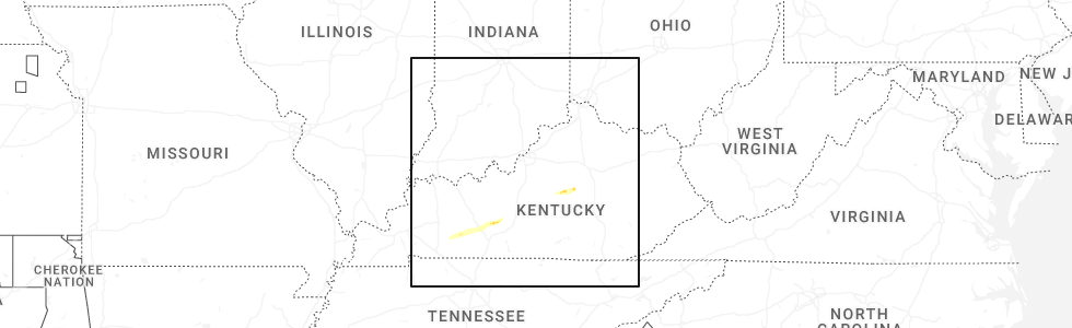
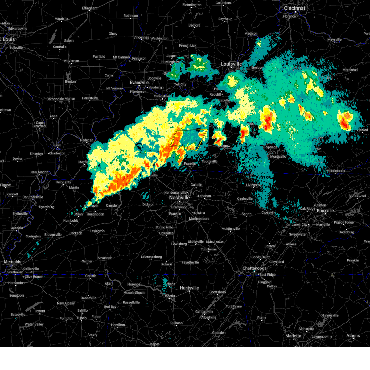
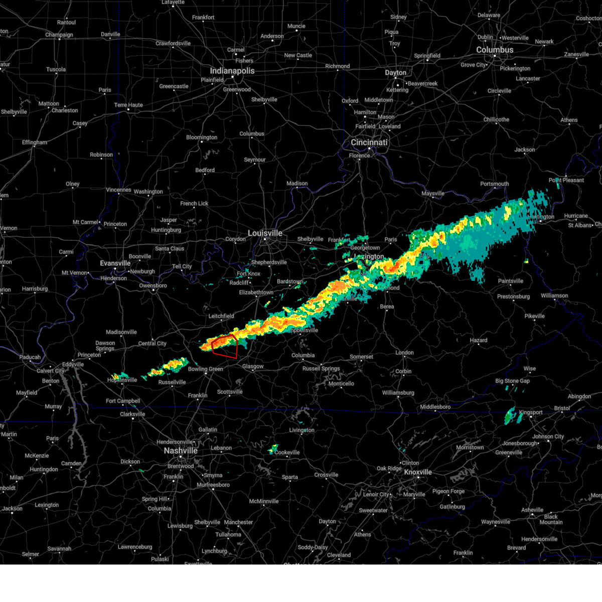
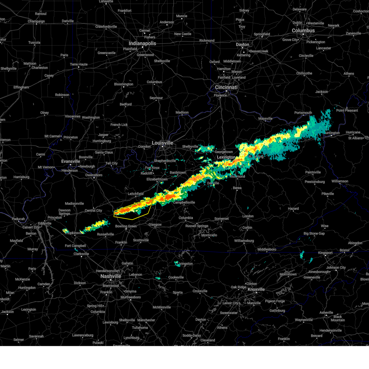
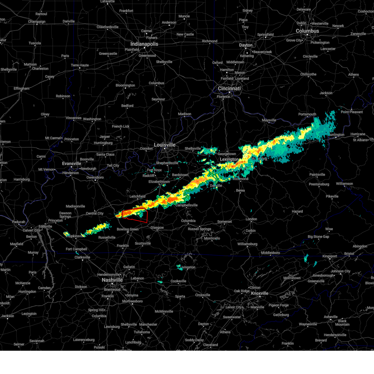
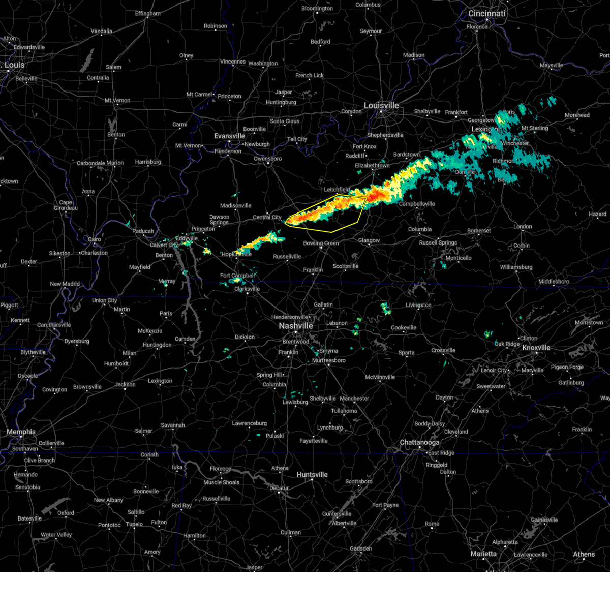
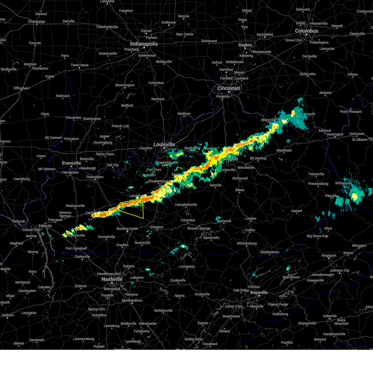
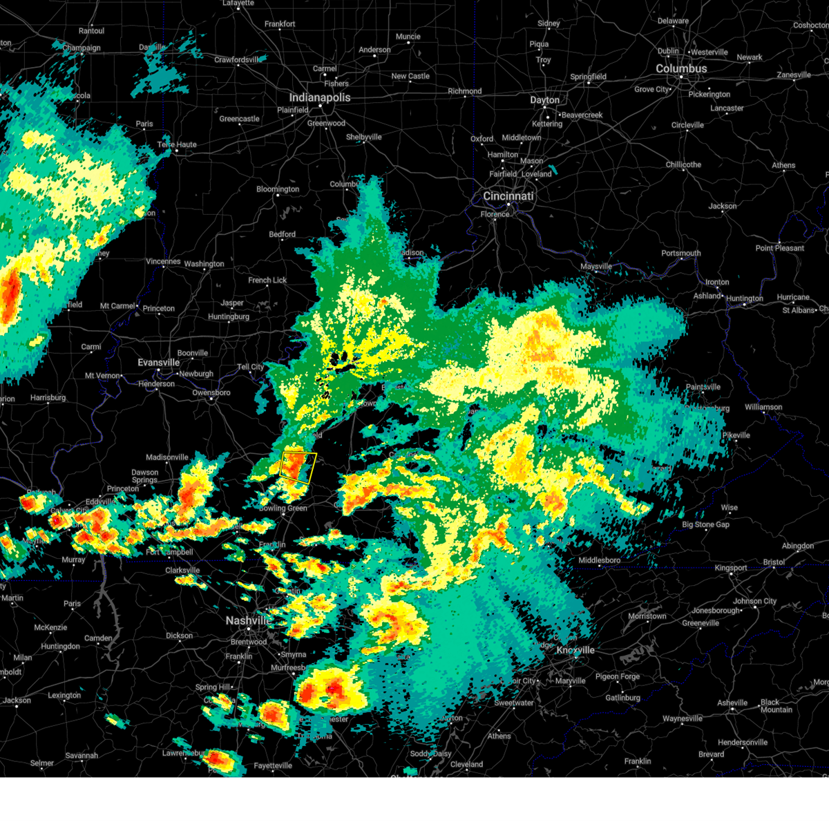
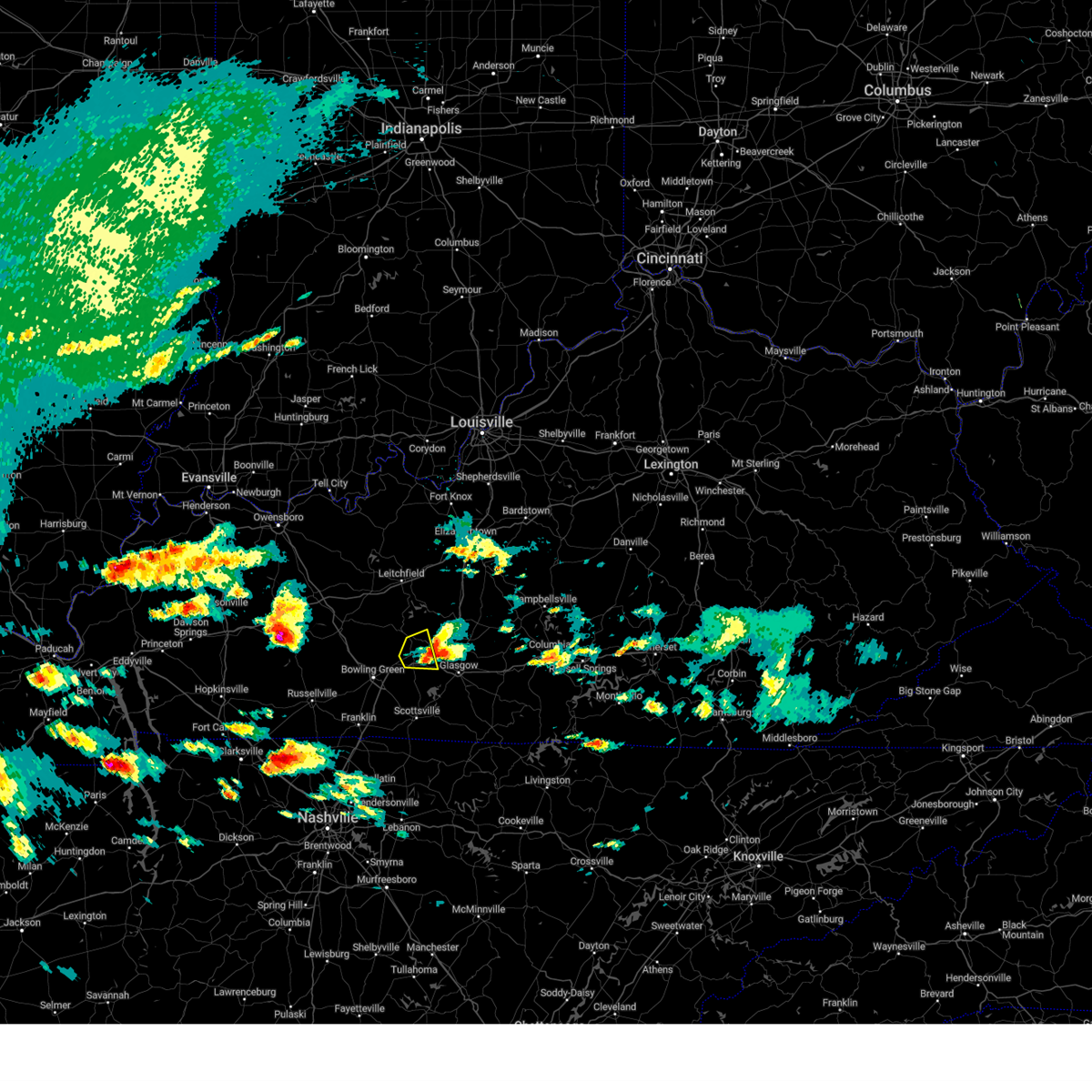
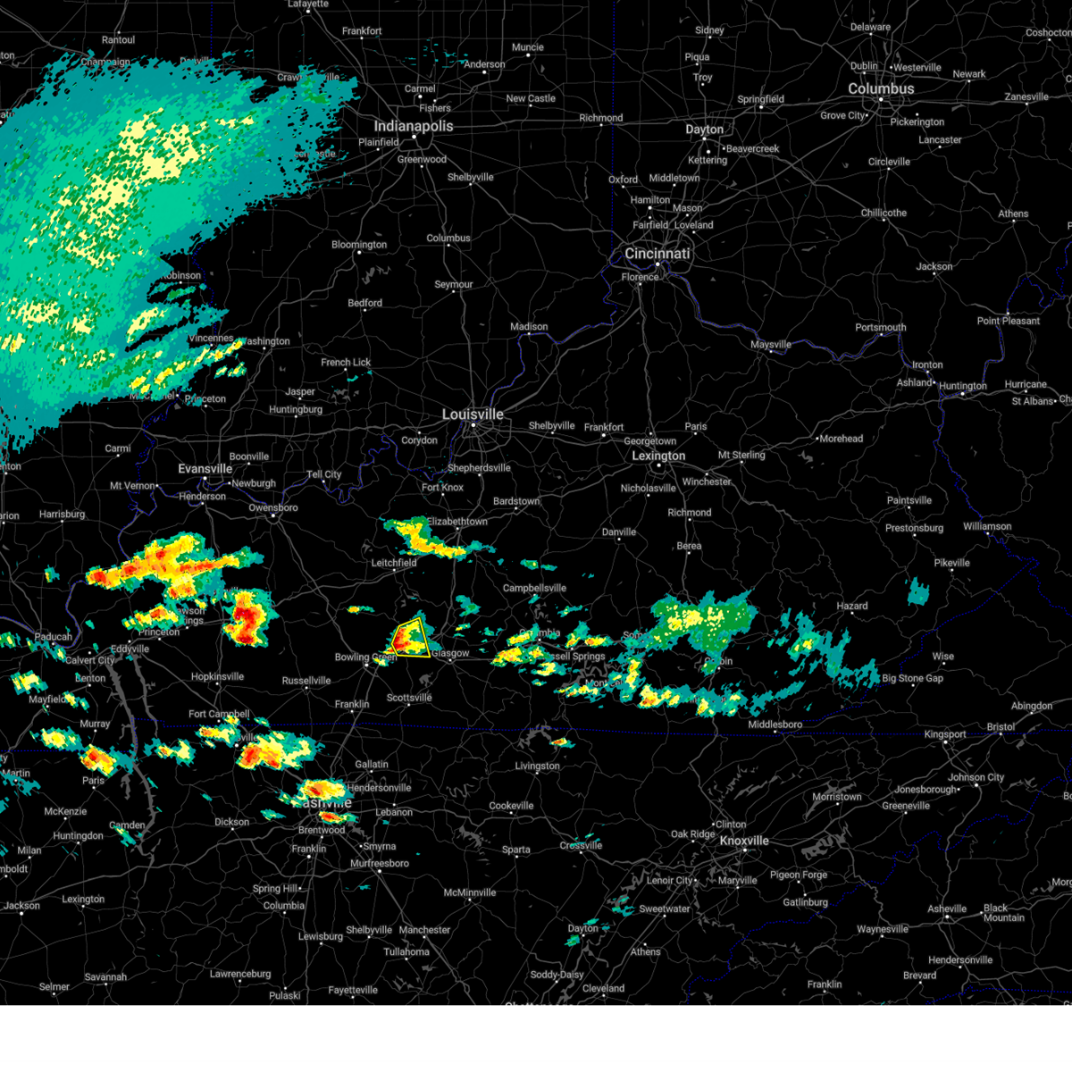
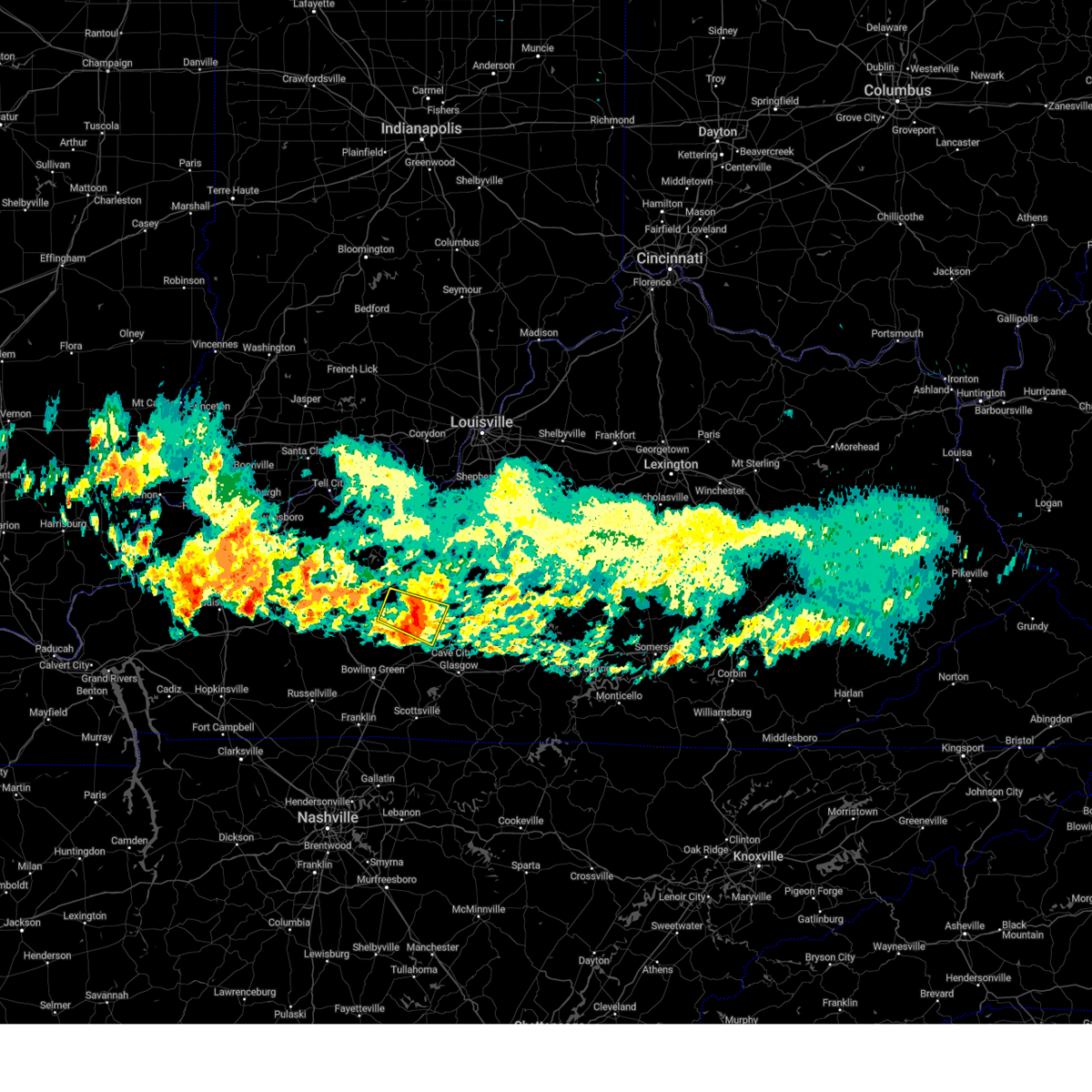
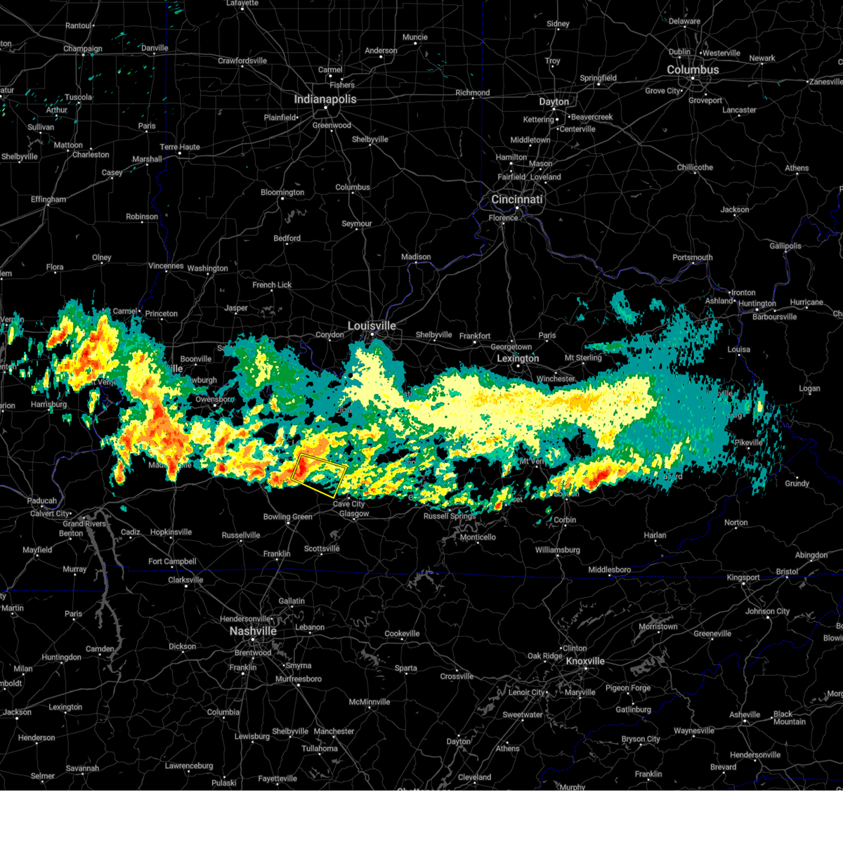
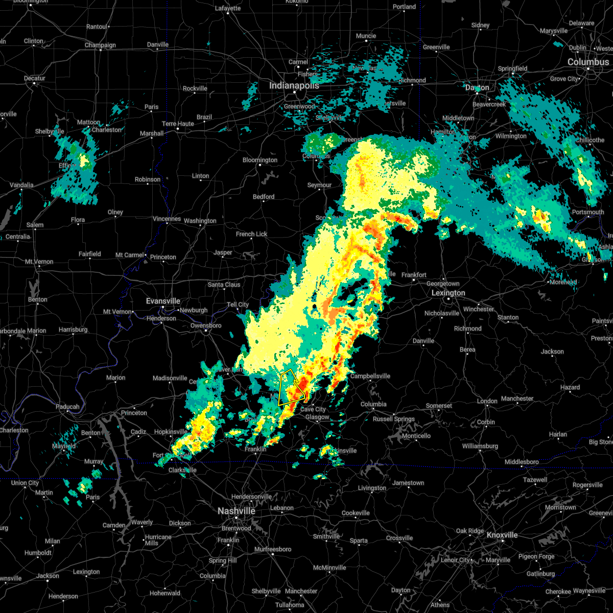
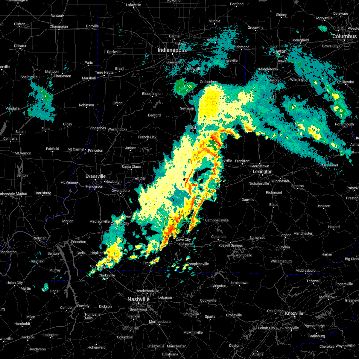
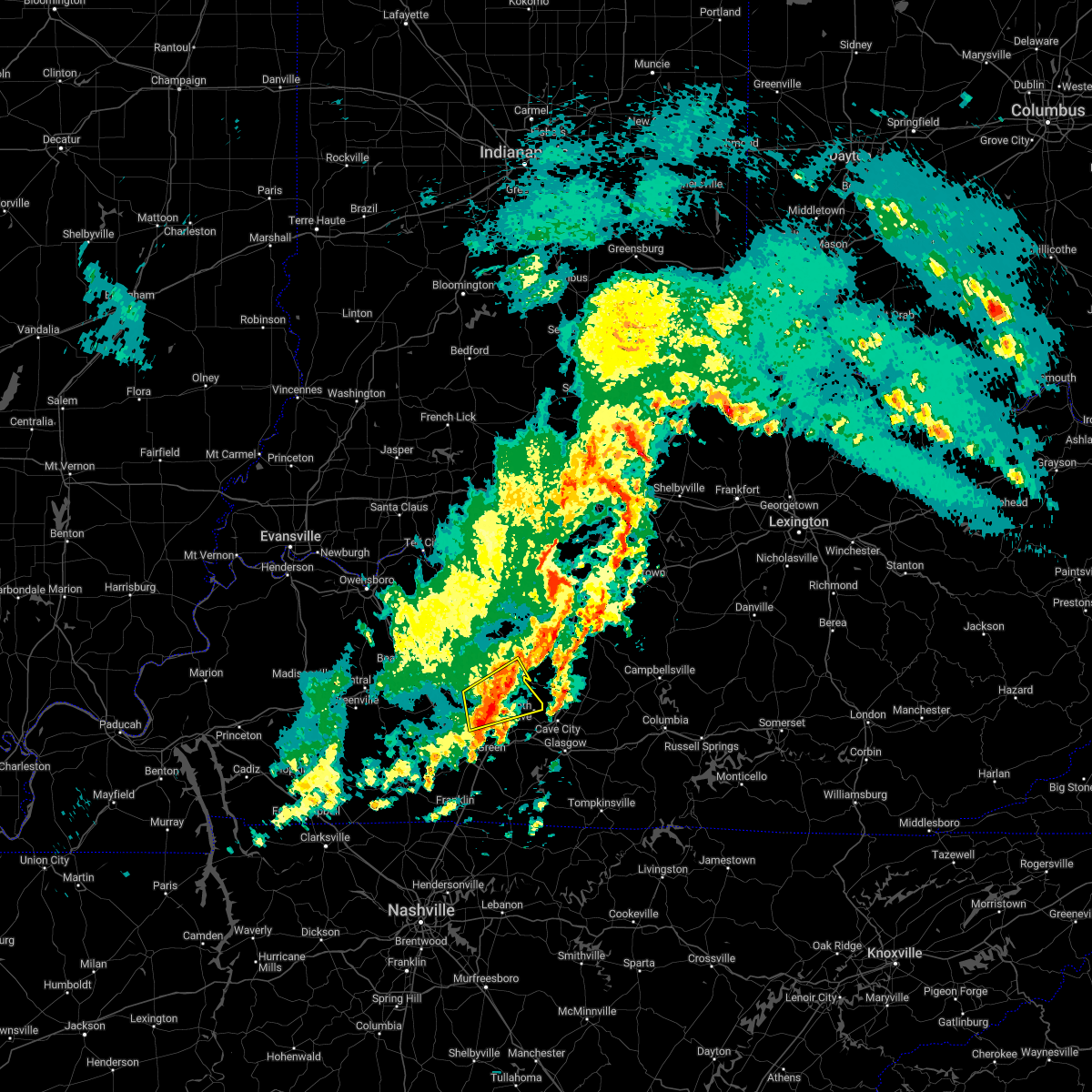
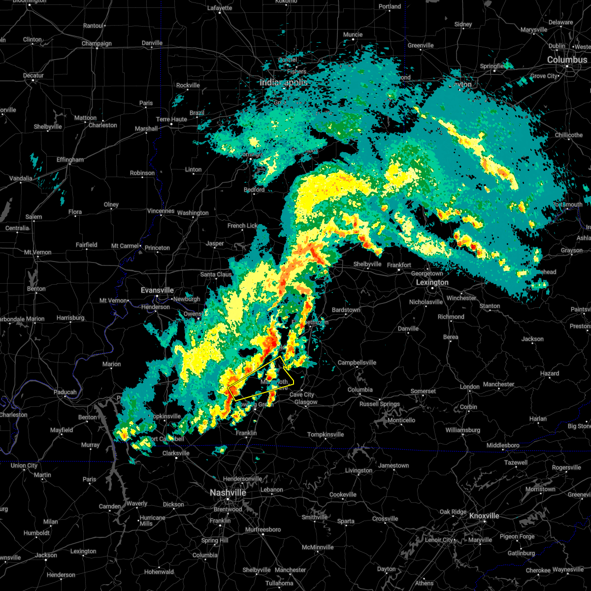
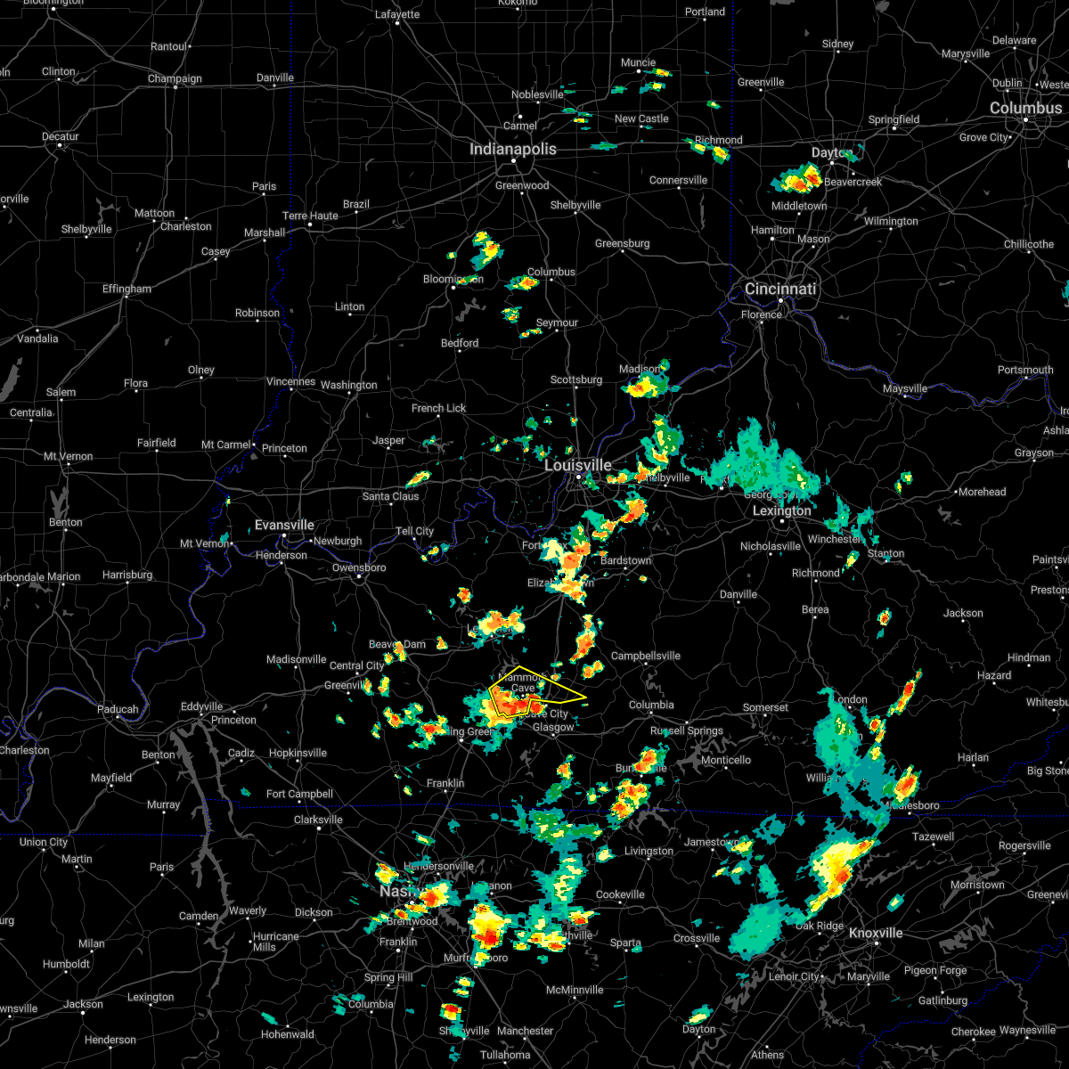
Hail Map for Brownsville, KY
The Brownsville, KY area has had 5 reports of on-the-ground hail by trained spotters, and has been under severe weather warnings 33 times during the past 12 months. Doppler radar has detected hail at or near Brownsville, KY on 61 occasions, including 6 occasions during the past year.
| Name: | Brownsville, KY |
| Where Located: | 62.6 miles SSW of Louisville, KY |
| Map: | Google Map for Brownsville, KY |
| Population: | 836 |
| Housing Units: | 442 |
| More Info: | Search Google for Brownsville, KY |
2
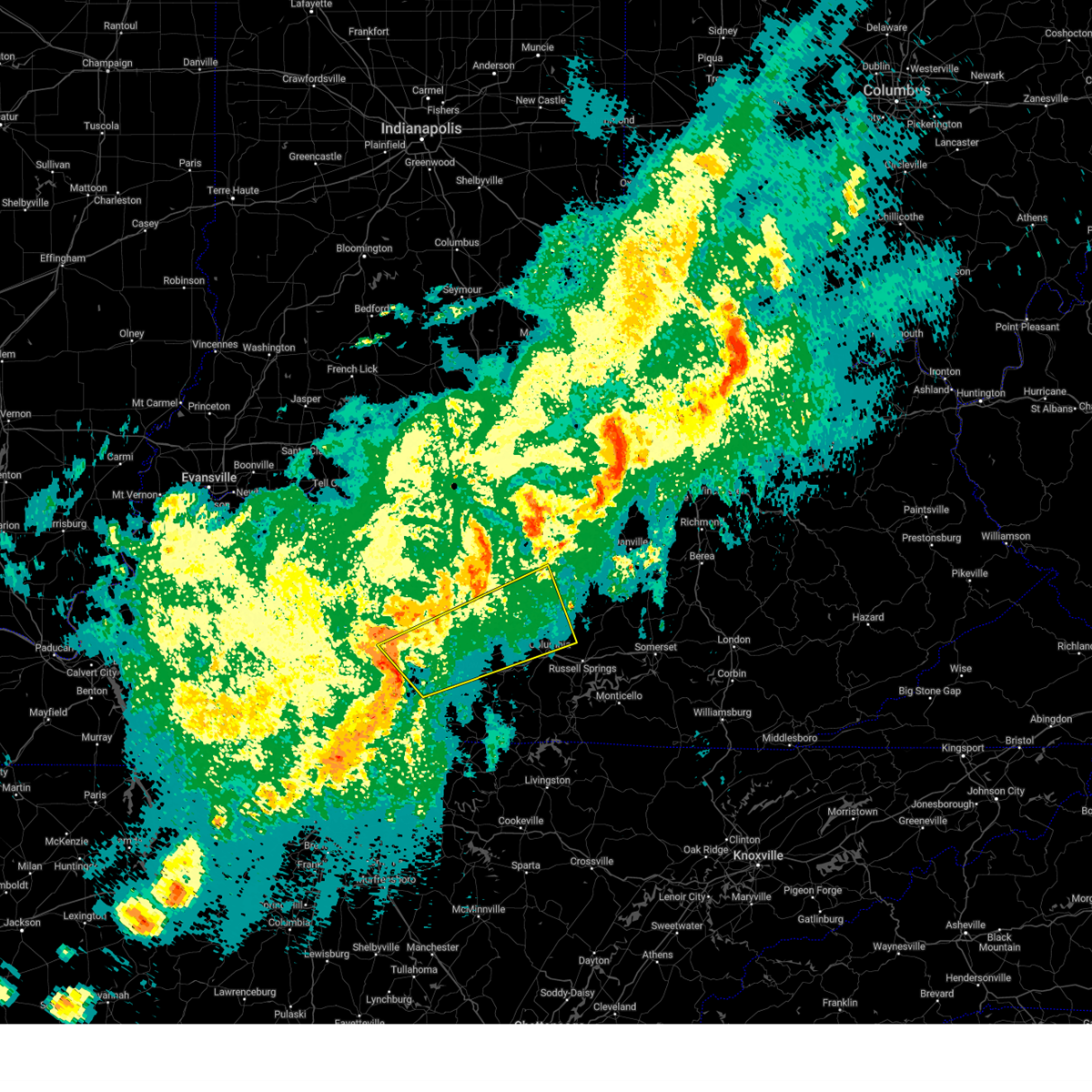
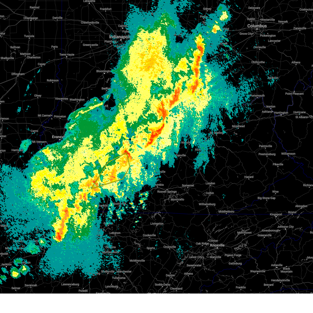
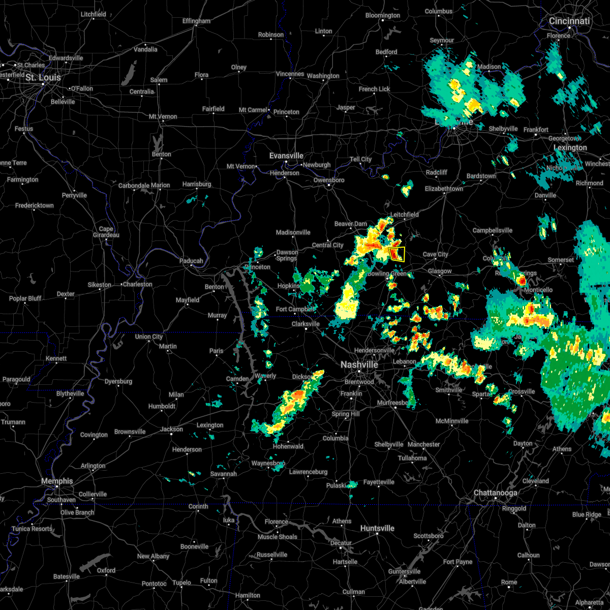
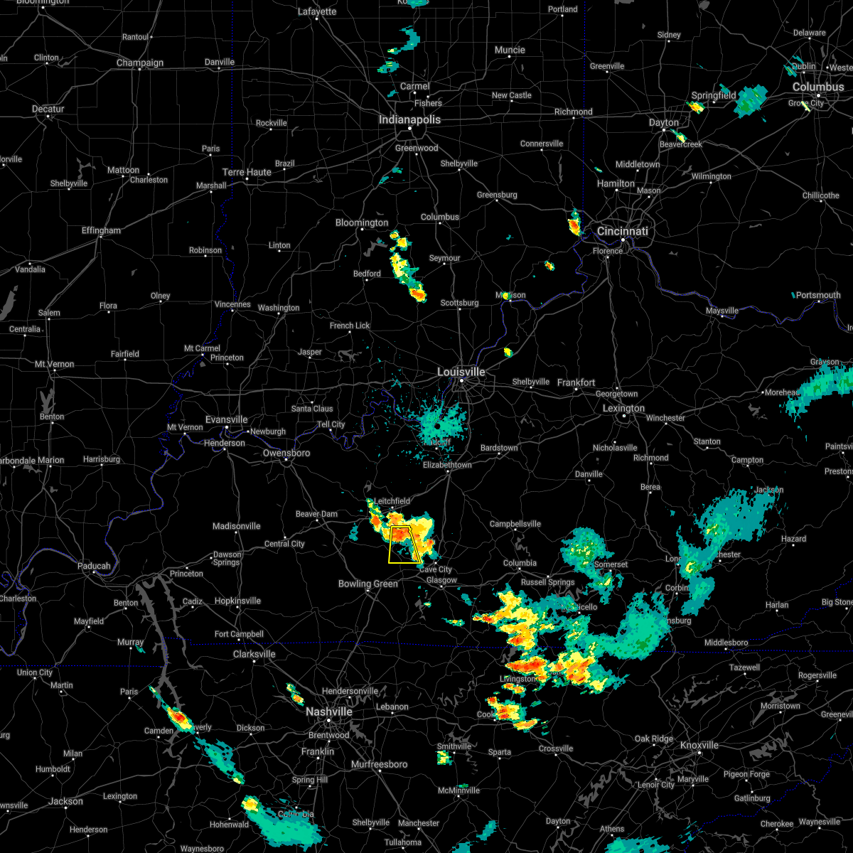
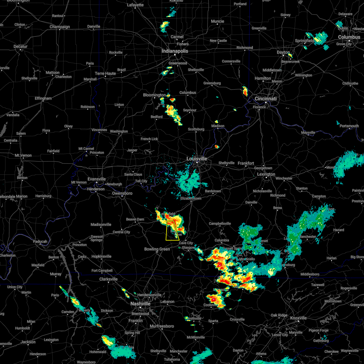
The Top Recent Hail Date for Brownsville, KY is Wednesday, February 5, 2025 (2nd out of 61)
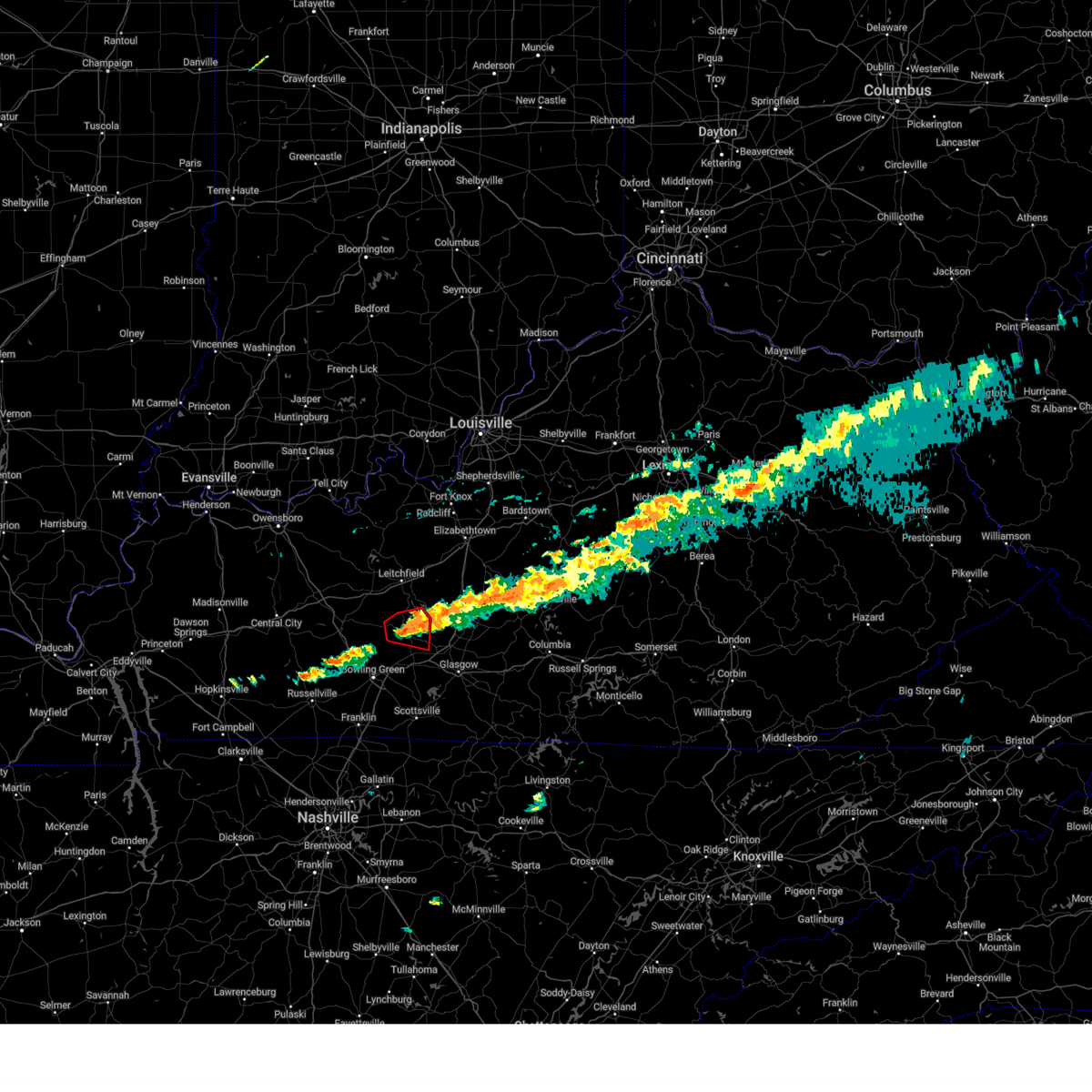
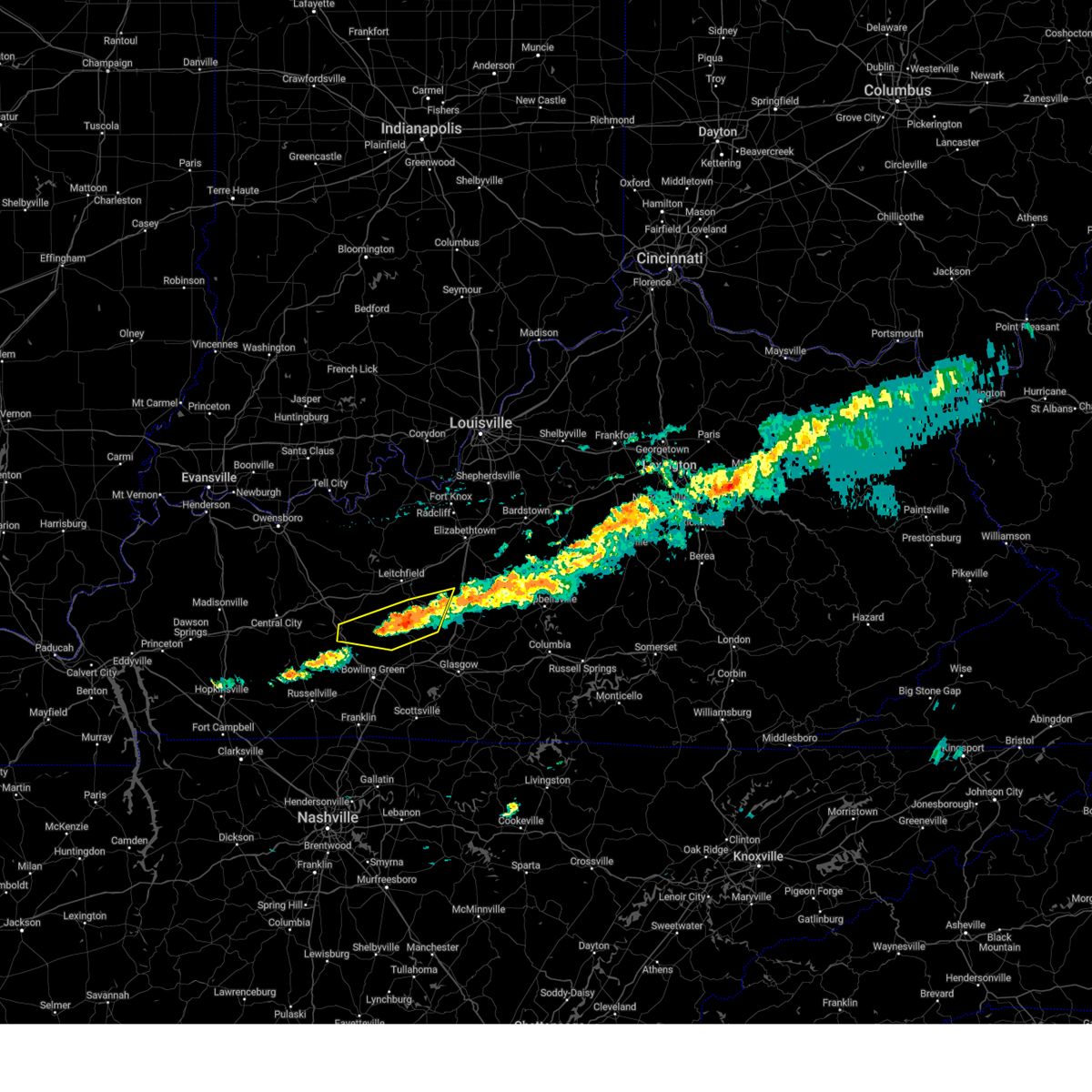
Hail and Wind Damage Spotted near Brownsville, KY
| Date / Time | Report Details |
|---|---|
| 6/18/2025 7:14 PM CDT | Svrlmk the national weather service in louisville has issued a * severe thunderstorm warning for, southern logan county in south central kentucky, simpson county in south central kentucky, southwestern hart county in central kentucky, warren county in south central kentucky, edmonson county in south central kentucky, * until 800 pm cdt. * at 714 pm cdt, severe thunderstorms were located along a line extending from near brownsville to near russellville, moving east at 30 mph (radar indicated). Hazards include 60 mph wind gusts. expect damage to roofs, siding, and trees |
| 5/16/2025 9:22 PM CDT |
 Svrlmk the national weather service in louisville has issued a * severe thunderstorm warning for, northern logan county in south central kentucky, south central larue county in central kentucky, hart county in central kentucky, southeastern butler county in south central kentucky, southeastern grayson county in central kentucky, warren county in south central kentucky, northwestern barren county in south central kentucky, edmonson county in south central kentucky, * until 1100 pm edt/1000 pm cdt/. * at 1021 pm edt/921 pm cdt/, severe thunderstorms were located along a line extending from 7 miles south of leitchfield to 9 miles west of brownsville to 9 miles southeast of morgantown to 8 miles south of dunmor, moving east at 40 mph (radar indicated). Hazards include 70 mph wind gusts. Expect considerable tree damage. Damage is likely to mobile homes, roofs, and outbuildings. Svrlmk the national weather service in louisville has issued a * severe thunderstorm warning for, northern logan county in south central kentucky, south central larue county in central kentucky, hart county in central kentucky, southeastern butler county in south central kentucky, southeastern grayson county in central kentucky, warren county in south central kentucky, northwestern barren county in south central kentucky, edmonson county in south central kentucky, * until 1100 pm edt/1000 pm cdt/. * at 1021 pm edt/921 pm cdt/, severe thunderstorms were located along a line extending from 7 miles south of leitchfield to 9 miles west of brownsville to 9 miles southeast of morgantown to 8 miles south of dunmor, moving east at 40 mph (radar indicated). Hazards include 70 mph wind gusts. Expect considerable tree damage. Damage is likely to mobile homes, roofs, and outbuildings.
|
| 5/16/2025 8:02 PM CDT | The storm which prompted the warning has moved out of the area. therefore, the warning has been allowed to expire. a tornado watch remains in effect until 1000 pm cdt for south central kentucky. a tornado watch also remains in effect until 200 am cdt for south central and central kentucky. to report severe weather, contact your nearest law enforcement agency. they will relay your report to the national weather service louisville. |
| 5/16/2025 7:59 PM CDT | Svrlmk the national weather service in louisville has issued a * severe thunderstorm warning for, southwestern green county in central kentucky, hart county in central kentucky, northeastern warren county in south central kentucky, barren county in south central kentucky, western metcalfe county in south central kentucky, eastern edmonson county in south central kentucky, * until 845 pm cdt. * at 759 pm cdt, a severe thunderstorm was located 9 miles east of plum springs, moving east at 45 mph (radar indicated). Hazards include two inch hail and 70 mph wind gusts. People and animals outdoors will be injured. expect hail damage to roofs, siding, windows, and vehicles. expect considerable tree damage. Wind damage is also likely to mobile homes, roofs, and outbuildings. |
| 5/16/2025 7:49 PM CDT | At 749 pm cdt, a severe thunderstorm was located near plum springs, moving east at 45 mph (radar indicated). Hazards include two inch hail and 70 mph wind gusts. People and animals outdoors will be injured. expect hail damage to roofs, siding, windows, and vehicles. expect considerable tree damage. wind damage is also likely to mobile homes, roofs, and outbuildings. Locations impacted include, bowling green, brownsville, plum springs, mount victor, smiths grove, oakland, windyville, chalybeate, girkin, and rocky hill. |
| 5/16/2025 7:49 PM CDT | the severe thunderstorm warning has been cancelled and is no longer in effect |
| 5/16/2025 7:40 PM CDT | At 740 pm cdt, a severe thunderstorm was located 7 miles northwest of plum springs, moving east at 45 mph (radar indicated). Hazards include two inch hail and 70 mph wind gusts. People and animals outdoors will be injured. expect hail damage to roofs, siding, windows, and vehicles. expect considerable tree damage. wind damage is also likely to mobile homes, roofs, and outbuildings. Locations impacted include, bowling green, brownsville, plum springs, mount victor, smiths grove, oakland, windyville, chalybeate, girkin, and black gold. |
| 5/16/2025 7:40 PM CDT | the severe thunderstorm warning has been cancelled and is no longer in effect |
| 5/16/2025 7:22 PM CDT |
 Svrlmk the national weather service in louisville has issued a * severe thunderstorm warning for, northeastern logan county in south central kentucky, southern butler county in south central kentucky, northern warren county in south central kentucky, western barren county in south central kentucky, edmonson county in south central kentucky, * until 800 pm cdt. * at 721 pm cdt, a severe thunderstorm was located 11 miles south of morgantown, moving east at 40 mph (radar indicated). Hazards include two inch hail and 70 mph wind gusts. People and animals outdoors will be injured. expect hail damage to roofs, siding, windows, and vehicles. expect considerable tree damage. Wind damage is also likely to mobile homes, roofs, and outbuildings. Svrlmk the national weather service in louisville has issued a * severe thunderstorm warning for, northeastern logan county in south central kentucky, southern butler county in south central kentucky, northern warren county in south central kentucky, western barren county in south central kentucky, edmonson county in south central kentucky, * until 800 pm cdt. * at 721 pm cdt, a severe thunderstorm was located 11 miles south of morgantown, moving east at 40 mph (radar indicated). Hazards include two inch hail and 70 mph wind gusts. People and animals outdoors will be injured. expect hail damage to roofs, siding, windows, and vehicles. expect considerable tree damage. Wind damage is also likely to mobile homes, roofs, and outbuildings.
|
| 5/16/2025 9:59 AM CDT |
 The storms which prompted the warning have weakened below severe limits, and no longer pose an immediate threat to life or property. therefore, the warning will be allowed to expire. however, gusty winds are still possible with these thunderstorms. a severe thunderstorm watch remains in effect until 1100 am cdt for south central kentucky, and south central and central kentucky. The storms which prompted the warning have weakened below severe limits, and no longer pose an immediate threat to life or property. therefore, the warning will be allowed to expire. however, gusty winds are still possible with these thunderstorms. a severe thunderstorm watch remains in effect until 1100 am cdt for south central kentucky, and south central and central kentucky.
|
| 5/16/2025 9:35 AM CDT |
 Svrlmk the national weather service in louisville has issued a * severe thunderstorm warning for, north central logan county in south central kentucky, butler county in south central kentucky, northwestern warren county in south central kentucky, northwestern edmonson county in south central kentucky, * until 1000 am cdt. * at 935 am cdt, severe thunderstorms were located along a line extending from 6 miles northwest of morgantown to 6 miles southeast of dunmor, moving east at 65 mph (radar indicated). Hazards include 60 mph wind gusts and nickel size hail. expect damage to roofs, siding, and trees Svrlmk the national weather service in louisville has issued a * severe thunderstorm warning for, north central logan county in south central kentucky, butler county in south central kentucky, northwestern warren county in south central kentucky, northwestern edmonson county in south central kentucky, * until 1000 am cdt. * at 935 am cdt, severe thunderstorms were located along a line extending from 6 miles northwest of morgantown to 6 miles southeast of dunmor, moving east at 65 mph (radar indicated). Hazards include 60 mph wind gusts and nickel size hail. expect damage to roofs, siding, and trees
|
| 5/16/2025 8:29 AM CDT | 1 tree down and small hai in edmonson county KY, 6.7 miles E of Brownsville, KY |
| 5/16/2025 8:29 AM CDT |
 The storm which prompted the warning has weakened below severe limits, and no longer poses an immediate threat to life or property. therefore, the warning will be allowed to expire. however, small hail and gusty winds are still possible with this thunderstorm. a severe thunderstorm watch remains in effect until 900 am cdt for south central and central kentucky. The storm which prompted the warning has weakened below severe limits, and no longer poses an immediate threat to life or property. therefore, the warning will be allowed to expire. however, small hail and gusty winds are still possible with this thunderstorm. a severe thunderstorm watch remains in effect until 900 am cdt for south central and central kentucky.
|
| 5/16/2025 8:11 AM CDT |
 At 810 am cdt, a severe thunderstorm was located near morgantown, moving east at 65 mph (radar indicated). Hazards include ping pong ball size hail and 60 mph wind gusts. People and animals outdoors will be injured. expect hail damage to roofs, siding, windows, and vehicles. expect wind damage to roofs, siding, and trees. Locations impacted include, morgantown, brownsville, casey, lee, oakland, rochester, woodbury, roundhill, mining city, and dimple. At 810 am cdt, a severe thunderstorm was located near morgantown, moving east at 65 mph (radar indicated). Hazards include ping pong ball size hail and 60 mph wind gusts. People and animals outdoors will be injured. expect hail damage to roofs, siding, windows, and vehicles. expect wind damage to roofs, siding, and trees. Locations impacted include, morgantown, brownsville, casey, lee, oakland, rochester, woodbury, roundhill, mining city, and dimple.
|
| 5/16/2025 8:06 AM CDT |
 Svrlmk the national weather service in louisville has issued a * severe thunderstorm warning for, north central logan county in south central kentucky, butler county in south central kentucky, northern warren county in south central kentucky, south central ohio county in central kentucky, western edmonson county in south central kentucky, * until 830 am cdt. * at 805 am cdt, a severe thunderstorm was located 8 miles northeast of dunmor, moving east at 65 mph (radar indicated). Hazards include 60 mph wind gusts and half dollar size hail. Hail damage to vehicles is expected. Expect wind damage to roofs, siding, and trees. Svrlmk the national weather service in louisville has issued a * severe thunderstorm warning for, north central logan county in south central kentucky, butler county in south central kentucky, northern warren county in south central kentucky, south central ohio county in central kentucky, western edmonson county in south central kentucky, * until 830 am cdt. * at 805 am cdt, a severe thunderstorm was located 8 miles northeast of dunmor, moving east at 65 mph (radar indicated). Hazards include 60 mph wind gusts and half dollar size hail. Hail damage to vehicles is expected. Expect wind damage to roofs, siding, and trees.
|
| 5/2/2025 1:32 PM CDT | Svrlmk the national weather service in louisville has issued a * severe thunderstorm warning for, western hart county in central kentucky, southeastern grayson county in central kentucky, northeastern warren county in south central kentucky, edmonson county in south central kentucky, * until 215 pm cdt. * at 131 pm cdt, a severe thunderstorm was located over brownsville, moving east at 35 mph (radar indicated). Hazards include golf ball size hail and 60 mph wind gusts. People and animals outdoors will be injured. expect hail damage to roofs, siding, windows, and vehicles. Expect wind damage to roofs, siding, and trees. |
| 5/2/2025 1:07 PM CDT | Svrlmk the national weather service in louisville has issued a * severe thunderstorm warning for, east central butler county in south central kentucky, north central warren county in south central kentucky, edmonson county in south central kentucky, * until 130 pm cdt. * at 107 pm cdt, a severe thunderstorm was located near brownsville, moving northeast at 15 mph (radar indicated). Hazards include 60 mph wind gusts and half dollar size hail. Hail damage to vehicles is expected. Expect wind damage to roofs, siding, and trees. |
| 4/5/2025 4:38 PM CDT | Svrlmk the national weather service in louisville has issued a * severe thunderstorm warning for, western hart county in central kentucky, northeastern warren county in south central kentucky, north central barren county in south central kentucky, edmonson county in south central kentucky, * until 515 pm cdt. * at 438 pm cdt, severe thunderstorms were located along a line extending from near brownsville to 10 miles northeast of mount victor to near plum springs, moving northeast at 45 mph (radar indicated). Hazards include 60 mph wind gusts. expect damage to roofs, siding, and trees |
| 4/3/2025 12:51 AM CDT |
 Svrlmk the national weather service in louisville has issued a * severe thunderstorm warning for, green county in central kentucky, southeastern larue county in central kentucky, southwestern marion county in central kentucky, hart county in central kentucky, taylor county in central kentucky, north central allen county in south central kentucky, northeastern warren county in south central kentucky, barren county in south central kentucky, central adair county in south central kentucky, northern metcalfe county in south central kentucky, southern edmonson county in south central kentucky, * until 230 am edt/130 am cdt/. * at 150 am edt/1250 am cdt/, a severe thunderstorm was located 10 miles east of plum springs, moving northeast at 80 mph (radar indicated). Hazards include 60 mph wind gusts. expect damage to roofs, siding, and trees Svrlmk the national weather service in louisville has issued a * severe thunderstorm warning for, green county in central kentucky, southeastern larue county in central kentucky, southwestern marion county in central kentucky, hart county in central kentucky, taylor county in central kentucky, north central allen county in south central kentucky, northeastern warren county in south central kentucky, barren county in south central kentucky, central adair county in south central kentucky, northern metcalfe county in south central kentucky, southern edmonson county in south central kentucky, * until 230 am edt/130 am cdt/. * at 150 am edt/1250 am cdt/, a severe thunderstorm was located 10 miles east of plum springs, moving northeast at 80 mph (radar indicated). Hazards include 60 mph wind gusts. expect damage to roofs, siding, and trees
|
| 4/3/2025 12:00 AM CDT |
 The storms which prompted the warning have moved out of the area. therefore, the warning has been allowed to expire. a tornado watch remains in effect until 200 am edt/100 am cdt/ for central kentucky. a tornado watch also remains in effect until 700 am edt/600 am cdt/ for south central and central kentucky. The storms which prompted the warning have moved out of the area. therefore, the warning has been allowed to expire. a tornado watch remains in effect until 200 am edt/100 am cdt/ for central kentucky. a tornado watch also remains in effect until 700 am edt/600 am cdt/ for south central and central kentucky.
|
| 4/2/2025 11:37 PM CDT | At 1236 am edt/1136 pm cdt/, severe thunderstorms were located along a line extending from 13 miles west of leitchfield to 13 miles northwest of brownsville to 10 miles east of morgantown, moving northeast at 60 mph (radar indicated). Hazards include 60 mph wind gusts and penny size hail. Expect damage to roofs, siding, and trees. Locations impacted include, leitchfield, morgantown, casey, lee, clarkson, caneyville, woodbury, leetown, broad ford, and do stop. |
| 4/2/2025 11:37 PM CDT | the severe thunderstorm warning has been cancelled and is no longer in effect |
| 4/2/2025 11:20 PM CDT | Svrlmk the national weather service in louisville has issued a * severe thunderstorm warning for, northwestern hart county in central kentucky, butler county in south central kentucky, grayson county in central kentucky, northwestern warren county in south central kentucky, southeastern breckinridge county in central kentucky, southwestern hardin county in central kentucky, southeastern ohio county in central kentucky, northern edmonson county in south central kentucky, * until 100 am edt/midnight cdt/. * at 1219 am edt/1119 pm cdt/, severe thunderstorms were located along a line extending from 7 miles east of hartford to morgantown to 14 miles east of dunmor, moving northeast at 55 mph (radar indicated). Hazards include 60 mph wind gusts and penny size hail. expect damage to roofs, siding, and trees |
| 3/30/2025 10:06 PM CDT | Svrlmk the national weather service in louisville has issued a * severe thunderstorm warning for, southeastern logan county in south central kentucky, simpson county in south central kentucky, hart county in central kentucky, western allen county in south central kentucky, northeastern butler county in south central kentucky, southeastern grayson county in central kentucky, warren county in south central kentucky, northern barren county in south central kentucky, edmonson county in south central kentucky, * until 1045 pm cdt. * at 1005 pm cdt, severe thunderstorms were located along a line extending from 12 miles northwest of brownsville to 8 miles north of plum springs to 11 miles south of russellville, moving east at 60 mph (radar indicated). Hazards include 60 mph wind gusts and penny size hail. expect damage to roofs, siding, and trees |
| 2/6/2025 5:37 AM CST |
 The storm which prompted the warning has moved out of the area. therefore, the warning will be allowed to expire. a tornado watch remains in effect until 1000 am cst for south central and central kentucky. remember, a tornado warning remains in effect for eastern edmonson county. The storm which prompted the warning has moved out of the area. therefore, the warning will be allowed to expire. a tornado watch remains in effect until 1000 am cst for south central and central kentucky. remember, a tornado warning remains in effect for eastern edmonson county.
|
| 2/6/2025 5:26 AM CST |
 The storms which prompted the warning have weakened below severe limits, and no longer pose an immediate threat to life or property. therefore, the warning will be allowed to expire. however, gusty winds and heavy rain are still possible with these thunderstorms. a tornado watch remains in effect until 1000 am cst for south central and central kentucky. to report severe weather, contact your nearest law enforcement agency. they will relay your report to the national weather service louisville. remember, a tornado warning remains in effect for edmonson county. The storms which prompted the warning have weakened below severe limits, and no longer pose an immediate threat to life or property. therefore, the warning will be allowed to expire. however, gusty winds and heavy rain are still possible with these thunderstorms. a tornado watch remains in effect until 1000 am cst for south central and central kentucky. to report severe weather, contact your nearest law enforcement agency. they will relay your report to the national weather service louisville. remember, a tornado warning remains in effect for edmonson county.
|
| 2/6/2025 5:24 AM CST |
 the tornado warning has been cancelled and is no longer in effect the tornado warning has been cancelled and is no longer in effect
|
| 2/6/2025 5:24 AM CST |
 At 523 am cst, a severe thunderstorm capable of producing a tornado was located near brownsville, moving east at 55 mph (radar indicated rotation). Hazards include tornado. Flying debris will be dangerous to those caught without shelter. mobile homes will be damaged or destroyed. damage to roofs, windows, and vehicles will occur. tree damage is likely. this dangerous storm will be near, brownsville around 530 am cst. Other locations impacted by this tornadic thunderstorm include windyville, ollie, segal, rhoda, lindseyville, black gold, bee spring, broadway, stockholm, and pig. At 523 am cst, a severe thunderstorm capable of producing a tornado was located near brownsville, moving east at 55 mph (radar indicated rotation). Hazards include tornado. Flying debris will be dangerous to those caught without shelter. mobile homes will be damaged or destroyed. damage to roofs, windows, and vehicles will occur. tree damage is likely. this dangerous storm will be near, brownsville around 530 am cst. Other locations impacted by this tornadic thunderstorm include windyville, ollie, segal, rhoda, lindseyville, black gold, bee spring, broadway, stockholm, and pig.
|
| 2/6/2025 5:12 AM CST |
 At 511 am cst, severe thunderstorms were located along a line extending from 12 miles northwest of munfordville to 7 miles east of morgantown, moving east at 40 mph (radar indicated). Hazards include 60 mph wind gusts and quarter size hail. Hail damage to vehicles is expected. expect wind damage to roofs, siding, and trees. Locations impacted include, morgantown, brownsville, lee, woodbury, roundhill, aberdeen, black gold, cub run, broad ford, and sunfish. At 511 am cst, severe thunderstorms were located along a line extending from 12 miles northwest of munfordville to 7 miles east of morgantown, moving east at 40 mph (radar indicated). Hazards include 60 mph wind gusts and quarter size hail. Hail damage to vehicles is expected. expect wind damage to roofs, siding, and trees. Locations impacted include, morgantown, brownsville, lee, woodbury, roundhill, aberdeen, black gold, cub run, broad ford, and sunfish.
|
| 2/6/2025 5:10 AM CST |
 Torlmk the national weather service in louisville has issued a * tornado warning for, east central butler county in south central kentucky, edmonson county in south central kentucky, * until 545 am cst. * at 510 am cst, a severe thunderstorm capable of producing a tornado was located 11 miles east of morgantown, moving east at 55 mph (radar indicated rotation). Hazards include tornado. Flying debris will be dangerous to those caught without shelter. mobile homes will be damaged or destroyed. damage to roofs, windows, and vehicles will occur. tree damage is likely. this dangerous storm will be near, brownsville around 520 am cst. Other locations impacted by this tornadic thunderstorm include windyville, roundhill, black gold, broadway, brooklyn, sunfish, straw, huff, asphalt, and reedyville. Torlmk the national weather service in louisville has issued a * tornado warning for, east central butler county in south central kentucky, edmonson county in south central kentucky, * until 545 am cst. * at 510 am cst, a severe thunderstorm capable of producing a tornado was located 11 miles east of morgantown, moving east at 55 mph (radar indicated rotation). Hazards include tornado. Flying debris will be dangerous to those caught without shelter. mobile homes will be damaged or destroyed. damage to roofs, windows, and vehicles will occur. tree damage is likely. this dangerous storm will be near, brownsville around 520 am cst. Other locations impacted by this tornadic thunderstorm include windyville, roundhill, black gold, broadway, brooklyn, sunfish, straw, huff, asphalt, and reedyville.
|
| 2/6/2025 4:59 AM CST |
 Svrlmk the national weather service in louisville has issued a * severe thunderstorm warning for, western hart county in central kentucky, butler county in south central kentucky, southeastern grayson county in central kentucky, northwestern warren county in south central kentucky, edmonson county in south central kentucky, * until 530 am cst. * at 458 am cst, severe thunderstorms were located along a line extending from 8 miles southeast of leitchfield to morgantown, moving east at 40 mph (radar indicated). Hazards include 60 mph wind gusts and quarter size hail. Hail damage to vehicles is expected. Expect wind damage to roofs, siding, and trees. Svrlmk the national weather service in louisville has issued a * severe thunderstorm warning for, western hart county in central kentucky, butler county in south central kentucky, southeastern grayson county in central kentucky, northwestern warren county in south central kentucky, edmonson county in south central kentucky, * until 530 am cst. * at 458 am cst, severe thunderstorms were located along a line extending from 8 miles southeast of leitchfield to morgantown, moving east at 40 mph (radar indicated). Hazards include 60 mph wind gusts and quarter size hail. Hail damage to vehicles is expected. Expect wind damage to roofs, siding, and trees.
|
| 2/6/2025 4:40 AM CST |
 the severe thunderstorm warning has been cancelled and is no longer in effect the severe thunderstorm warning has been cancelled and is no longer in effect
|
| 2/6/2025 4:40 AM CST |
 At 439 am cst, a severe thunderstorm was located 13 miles northeast of morgantown, moving east at 50 mph (radar indicated). Hazards include 60 mph wind gusts and quarter size hail. Hail damage to vehicles is expected. expect wind damage to roofs, siding, and trees. Locations impacted include, leitchfield, brownsville, casey, lee, caneyville, windyville, roundhill, black gold, broadway, and brooklyn. At 439 am cst, a severe thunderstorm was located 13 miles northeast of morgantown, moving east at 50 mph (radar indicated). Hazards include 60 mph wind gusts and quarter size hail. Hail damage to vehicles is expected. expect wind damage to roofs, siding, and trees. Locations impacted include, leitchfield, brownsville, casey, lee, caneyville, windyville, roundhill, black gold, broadway, and brooklyn.
|
| 2/6/2025 4:31 AM CST |
 Svrlmk the national weather service in louisville has issued a * severe thunderstorm warning for, northeastern butler county in south central kentucky, southwestern grayson county in central kentucky, east central ohio county in central kentucky, northwestern edmonson county in south central kentucky, * until 500 am cst. * at 431 am cst, a severe thunderstorm was located 9 miles northeast of morgantown, moving east at 50 mph (radar indicated). Hazards include 60 mph wind gusts and quarter size hail. Hail damage to vehicles is expected. Expect wind damage to roofs, siding, and trees. Svrlmk the national weather service in louisville has issued a * severe thunderstorm warning for, northeastern butler county in south central kentucky, southwestern grayson county in central kentucky, east central ohio county in central kentucky, northwestern edmonson county in south central kentucky, * until 500 am cst. * at 431 am cst, a severe thunderstorm was located 9 miles northeast of morgantown, moving east at 50 mph (radar indicated). Hazards include 60 mph wind gusts and quarter size hail. Hail damage to vehicles is expected. Expect wind damage to roofs, siding, and trees.
|
| 7/5/2024 7:14 AM CDT |
 The storm which prompted the warning has weakened below severe limits, and no longer poses an immediate threat to life or property. therefore, the warning will be allowed to expire. however, heavy rain is still possible with this thunderstorm. to report severe weather, contact your nearest law enforcement agency. they will relay your report to the national weather service louisville. The storm which prompted the warning has weakened below severe limits, and no longer poses an immediate threat to life or property. therefore, the warning will be allowed to expire. however, heavy rain is still possible with this thunderstorm. to report severe weather, contact your nearest law enforcement agency. they will relay your report to the national weather service louisville.
|
| 7/5/2024 7:03 AM CDT |
 At 703 am cdt, a severe thunderstorm was located near brownsville, moving northeast at 40 mph (radar indicated). Hazards include 60 mph wind gusts. Expect damage to roofs, siding, and trees. Locations impacted include, bowling green, brownsville, plum springs, crestmoor, mount victor, smiths grove, oakland, windyville, chalybeate, and girkin. At 703 am cdt, a severe thunderstorm was located near brownsville, moving northeast at 40 mph (radar indicated). Hazards include 60 mph wind gusts. Expect damage to roofs, siding, and trees. Locations impacted include, bowling green, brownsville, plum springs, crestmoor, mount victor, smiths grove, oakland, windyville, chalybeate, and girkin.
|
| 7/5/2024 6:50 AM CDT |
 At 649 am cdt, a severe thunderstorm was located near plum springs, moving northeast at 40 mph (radar indicated). Hazards include 60 mph wind gusts and penny size hail. Expect damage to roofs, siding, and trees. Locations impacted include, bowling green, brownsville, plum springs, crestmoor, memphis junction, mount victor, smiths grove, oakland, windyville, and chalybeate. At 649 am cdt, a severe thunderstorm was located near plum springs, moving northeast at 40 mph (radar indicated). Hazards include 60 mph wind gusts and penny size hail. Expect damage to roofs, siding, and trees. Locations impacted include, bowling green, brownsville, plum springs, crestmoor, memphis junction, mount victor, smiths grove, oakland, windyville, and chalybeate.
|
| 7/5/2024 6:38 AM CDT |
 Svrlmk the national weather service in louisville has issued a * severe thunderstorm warning for, southeastern butler county in south central kentucky, central warren county in south central kentucky, central edmonson county in south central kentucky, * until 715 am cdt. * at 638 am cdt, a severe thunderstorm was located near crestmoor, moving northeast at 40 mph (radar indicated). Hazards include 60 mph wind gusts and quarter size hail. Hail damage to vehicles is expected. Expect wind damage to roofs, siding, and trees. Svrlmk the national weather service in louisville has issued a * severe thunderstorm warning for, southeastern butler county in south central kentucky, central warren county in south central kentucky, central edmonson county in south central kentucky, * until 715 am cdt. * at 638 am cdt, a severe thunderstorm was located near crestmoor, moving northeast at 40 mph (radar indicated). Hazards include 60 mph wind gusts and quarter size hail. Hail damage to vehicles is expected. Expect wind damage to roofs, siding, and trees.
|
| 5/8/2024 7:53 PM CDT |
 The storm which prompted the warning has weakened below severe limits, and has exited the warned area. therefore, the warning will be allowed to expire. however, gusty winds and heavy rain are still possible with this thunderstorm. a tornado watch remains in effect until 900 pm cdt for south central and central kentucky. The storm which prompted the warning has weakened below severe limits, and has exited the warned area. therefore, the warning will be allowed to expire. however, gusty winds and heavy rain are still possible with this thunderstorm. a tornado watch remains in effect until 900 pm cdt for south central and central kentucky.
|
| 5/8/2024 7:34 PM CDT |
 the severe thunderstorm warning has been cancelled and is no longer in effect the severe thunderstorm warning has been cancelled and is no longer in effect
|
| 5/8/2024 7:33 PM CDT |
 Svrlmk the national weather service in louisville has issued a * severe thunderstorm warning for, southern hart county in central kentucky, southeastern grayson county in central kentucky, northeastern warren county in south central kentucky, northern barren county in south central kentucky, northwestern metcalfe county in south central kentucky, edmonson county in south central kentucky, * until 800 pm cdt. * at 732 pm cdt, a severe thunderstorm was located near brownsville, moving east at 40 mph (radar indicated). Hazards include 60 mph wind gusts and quarter size hail. Hail damage to vehicles is expected. Expect wind damage to roofs, siding, and trees. Svrlmk the national weather service in louisville has issued a * severe thunderstorm warning for, southern hart county in central kentucky, southeastern grayson county in central kentucky, northeastern warren county in south central kentucky, northern barren county in south central kentucky, northwestern metcalfe county in south central kentucky, edmonson county in south central kentucky, * until 800 pm cdt. * at 732 pm cdt, a severe thunderstorm was located near brownsville, moving east at 40 mph (radar indicated). Hazards include 60 mph wind gusts and quarter size hail. Hail damage to vehicles is expected. Expect wind damage to roofs, siding, and trees.
|
| 5/8/2024 7:20 PM CDT |
 At 718 pm cdt, a severe thunderstorm was located 10 miles northwest of brownsville, moving east at 40 mph (radar indicated). Hazards include 60 mph wind gusts and quarter size hail. Hail damage to vehicles is expected. expect wind damage to roofs, siding, and trees. Locations impacted include, brownsville, lee, windyville, roundhill, lindseyville, black gold, bee spring, big reedy, south, and prosperity. At 718 pm cdt, a severe thunderstorm was located 10 miles northwest of brownsville, moving east at 40 mph (radar indicated). Hazards include 60 mph wind gusts and quarter size hail. Hail damage to vehicles is expected. expect wind damage to roofs, siding, and trees. Locations impacted include, brownsville, lee, windyville, roundhill, lindseyville, black gold, bee spring, big reedy, south, and prosperity.
|
| 5/8/2024 7:20 PM CDT |
 the severe thunderstorm warning has been cancelled and is no longer in effect the severe thunderstorm warning has been cancelled and is no longer in effect
|
| 5/8/2024 6:53 PM CDT |
 Svrlmk the national weather service in louisville has issued a * severe thunderstorm warning for, northeastern butler county in south central kentucky, southwestern grayson county in central kentucky, southeastern ohio county in central kentucky, northwestern edmonson county in south central kentucky, * until 745 pm cdt. * at 653 pm cdt, a severe thunderstorm was located 9 miles north of morgantown, moving east at 35 mph (radar indicated). Hazards include 60 mph wind gusts and quarter size hail. Hail damage to vehicles is expected. Expect wind damage to roofs, siding, and trees. Svrlmk the national weather service in louisville has issued a * severe thunderstorm warning for, northeastern butler county in south central kentucky, southwestern grayson county in central kentucky, southeastern ohio county in central kentucky, northwestern edmonson county in south central kentucky, * until 745 pm cdt. * at 653 pm cdt, a severe thunderstorm was located 9 miles north of morgantown, moving east at 35 mph (radar indicated). Hazards include 60 mph wind gusts and quarter size hail. Hail damage to vehicles is expected. Expect wind damage to roofs, siding, and trees.
|
| 5/8/2024 2:38 PM CDT |
 The storm which prompted the warning has moved out of the area. therefore, the warning will be allowed to expire. a tornado watch remains in effect until 900 pm cdt for south central kentucky. The storm which prompted the warning has moved out of the area. therefore, the warning will be allowed to expire. a tornado watch remains in effect until 900 pm cdt for south central kentucky.
|
| 5/8/2024 2:22 PM CDT |
 At 222 pm cdt, a severe thunderstorm was located 7 miles south of brownsville, moving east at 30 mph (radar indicated). Hazards include 60 mph wind gusts and half dollar size hail. Hail damage to vehicles is expected. expect wind damage to roofs, siding, and trees. Locations impacted include, brownsville, smiths grove, oakland, chalybeate, rhoda, rocky hill, tuckertown, pig, hays, and bon ayr. At 222 pm cdt, a severe thunderstorm was located 7 miles south of brownsville, moving east at 30 mph (radar indicated). Hazards include 60 mph wind gusts and half dollar size hail. Hail damage to vehicles is expected. expect wind damage to roofs, siding, and trees. Locations impacted include, brownsville, smiths grove, oakland, chalybeate, rhoda, rocky hill, tuckertown, pig, hays, and bon ayr.
|
| 5/8/2024 2:08 PM CDT |
 Svrlmk the national weather service in louisville has issued a * severe thunderstorm warning for, northeastern warren county in south central kentucky, west central barren county in south central kentucky, southeastern edmonson county in south central kentucky, * until 245 pm cdt. * at 208 pm cdt, a severe thunderstorm was located near plum springs, moving east at 30 mph (radar indicated). Hazards include 60 mph wind gusts and half dollar size hail. Hail damage to vehicles is expected. Expect wind damage to roofs, siding, and trees. Svrlmk the national weather service in louisville has issued a * severe thunderstorm warning for, northeastern warren county in south central kentucky, west central barren county in south central kentucky, southeastern edmonson county in south central kentucky, * until 245 pm cdt. * at 208 pm cdt, a severe thunderstorm was located near plum springs, moving east at 30 mph (radar indicated). Hazards include 60 mph wind gusts and half dollar size hail. Hail damage to vehicles is expected. Expect wind damage to roofs, siding, and trees.
|
| 3/6/2024 10:06 AM EST |
 Torlmk the national weather service in louisville has issued a * this is a test message. tornado warning for, meade county in central kentucky, larue county in central kentucky, jessamine county in central kentucky, nicholas county in central kentucky, adair county in south central kentucky, bourbon county in central kentucky, warren county in south central kentucky, cumberland county in south central kentucky, henry county in central kentucky, russell county in south central kentucky, taylor county in central kentucky, jefferson county in central kentucky, hardin county in central kentucky, spencer county in central kentucky, scott county in central kentucky, hancock county in central kentucky, trimble county in central kentucky, monroe county in south central kentucky, metcalfe county in south central kentucky, shelby county in central kentucky, logan county in south central kentucky, nelson county in central kentucky, anderson county in central kentucky, clark county in central kentucky, marion county in central kentucky, simpson county in south central kentucky, grayson county in central kentucky, casey county in central kentucky, franklin county in central kentucky, edmonson county in south central kentucky, lincoln county in central kentucky, woodford county in central kentucky, butler county in south central kentucky, madison county in central kentucky, barren county in south central kentucky, ohio county in central kentucky, oldham county in central kentucky, garrard county in central kentucky, hart county in central kentucky, bullitt county in central kentucky, harrison county in central kentucky, mercer county in central kentucky, clinton county in south central kentucky, green county in central kentucky, allen county in south central kentucky, washington county in central kentucky, boyle county in central kentucky, breckinridge county in central kentucky, fayette county in central kentucky, * this is a test message. until 1030 am est/930 am cst/. * this is a test message. Torlmk the national weather service in louisville has issued a * this is a test message. tornado warning for, meade county in central kentucky, larue county in central kentucky, jessamine county in central kentucky, nicholas county in central kentucky, adair county in south central kentucky, bourbon county in central kentucky, warren county in south central kentucky, cumberland county in south central kentucky, henry county in central kentucky, russell county in south central kentucky, taylor county in central kentucky, jefferson county in central kentucky, hardin county in central kentucky, spencer county in central kentucky, scott county in central kentucky, hancock county in central kentucky, trimble county in central kentucky, monroe county in south central kentucky, metcalfe county in south central kentucky, shelby county in central kentucky, logan county in south central kentucky, nelson county in central kentucky, anderson county in central kentucky, clark county in central kentucky, marion county in central kentucky, simpson county in south central kentucky, grayson county in central kentucky, casey county in central kentucky, franklin county in central kentucky, edmonson county in south central kentucky, lincoln county in central kentucky, woodford county in central kentucky, butler county in south central kentucky, madison county in central kentucky, barren county in south central kentucky, ohio county in central kentucky, oldham county in central kentucky, garrard county in central kentucky, hart county in central kentucky, bullitt county in central kentucky, harrison county in central kentucky, mercer county in central kentucky, clinton county in south central kentucky, green county in central kentucky, allen county in south central kentucky, washington county in central kentucky, boyle county in central kentucky, breckinridge county in central kentucky, fayette county in central kentucky, * this is a test message. until 1030 am est/930 am cst/. * this is a test message.
|
| 7/18/2023 4:05 PM CDT |
 At 404 pm cdt, severe thunderstorms were located along a line extending from 6 miles northwest of brownsville to near westmoreland to near nashville, moving east at 45 mph (radar indicated). Hazards include 60 mph wind gusts. Expect damage to roofs, siding, and trees. locations impacted include, bowling green, scottsville, brownsville, plum springs, mount victor, smiths grove, oakland, chalybeate, hardcastle and girkin. hail threat, radar indicated max hail size, <. 75 in wind threat, radar indicated max wind gust, 60 mph. At 404 pm cdt, severe thunderstorms were located along a line extending from 6 miles northwest of brownsville to near westmoreland to near nashville, moving east at 45 mph (radar indicated). Hazards include 60 mph wind gusts. Expect damage to roofs, siding, and trees. locations impacted include, bowling green, scottsville, brownsville, plum springs, mount victor, smiths grove, oakland, chalybeate, hardcastle and girkin. hail threat, radar indicated max hail size, <. 75 in wind threat, radar indicated max wind gust, 60 mph.
|
| 7/18/2023 3:51 PM CDT |
 At 350 pm cdt, severe thunderstorms were located along a line extending from 9 miles east of morgantown to near portland to near ashland city, moving east at 55 mph (radar indicated). Hazards include 60 mph wind gusts. Expect damage to roofs, siding, and trees. locations impacted include, bowling green, scottsville, morgantown, brownsville, plum springs, crestmoor, memphis junction, mount victor, smiths grove and woodburn. hail threat, radar indicated max hail size, <. 75 in wind threat, radar indicated max wind gust, 60 mph. At 350 pm cdt, severe thunderstorms were located along a line extending from 9 miles east of morgantown to near portland to near ashland city, moving east at 55 mph (radar indicated). Hazards include 60 mph wind gusts. Expect damage to roofs, siding, and trees. locations impacted include, bowling green, scottsville, morgantown, brownsville, plum springs, crestmoor, memphis junction, mount victor, smiths grove and woodburn. hail threat, radar indicated max hail size, <. 75 in wind threat, radar indicated max wind gust, 60 mph.
|
| 7/18/2023 3:15 PM CDT |
 At 314 pm cdt, severe thunderstorms were located along a line extending from 6 miles east of powderly to 8 miles northwest of springfield to 7 miles northeast of mcewen, moving east at 45 mph (radar indicated). Hazards include 60 mph wind gusts. expect damage to roofs, siding, and trees At 314 pm cdt, severe thunderstorms were located along a line extending from 6 miles east of powderly to 8 miles northwest of springfield to 7 miles northeast of mcewen, moving east at 45 mph (radar indicated). Hazards include 60 mph wind gusts. expect damage to roofs, siding, and trees
|
| 6/25/2023 11:40 PM CDT |
 The severe thunderstorm warning for butler, northern warren, south central ohio and edmonson counties will expire at 1145 pm cdt, the storms which prompted the warning have moved out of the area. therefore, the warning will be allowed to expire. however gusty winds are still possible with these thunderstorms. a severe thunderstorm watch remains in effect until 300 am cdt for south central and central kentucky. to report severe weather, contact your nearest law enforcement agency. they will relay your report to the national weather service louisville. remember, a severe thunderstorm warning still remains in effect for warren county. The severe thunderstorm warning for butler, northern warren, south central ohio and edmonson counties will expire at 1145 pm cdt, the storms which prompted the warning have moved out of the area. therefore, the warning will be allowed to expire. however gusty winds are still possible with these thunderstorms. a severe thunderstorm watch remains in effect until 300 am cdt for south central and central kentucky. to report severe weather, contact your nearest law enforcement agency. they will relay your report to the national weather service louisville. remember, a severe thunderstorm warning still remains in effect for warren county.
|
| 6/25/2023 10:58 PM CDT |
 At 1057 pm cdt, severe thunderstorms were located along a line extending from near central city to near morgantown to brownsville, moving southeast at 45 mph (radar indicated). Hazards include 60 mph wind gusts and quarter size hail. Hail damage to vehicles is expected. Expect wind damage to roofs, siding, and trees. At 1057 pm cdt, severe thunderstorms were located along a line extending from near central city to near morgantown to brownsville, moving southeast at 45 mph (radar indicated). Hazards include 60 mph wind gusts and quarter size hail. Hail damage to vehicles is expected. Expect wind damage to roofs, siding, and trees.
|
| 6/25/2023 10:48 PM CDT |
 At 1048 pm cdt, severe thunderstorms were located along a line extending from 9 miles east of central city to 6 miles north of morgantown to near brownsville, moving southeast at 25 mph (radar indicated). Hazards include ping pong ball size hail and 60 mph wind gusts. People and animals outdoors will be injured. expect hail damage to roofs, siding, windows, and vehicles. expect wind damage to roofs, siding, and trees. locations impacted include, morgantown, brownsville, casey, lee, mchenry, rockport, rochester, roundhill, chalybeate and mining city. hail threat, radar indicated max hail size, 1. 50 in wind threat, radar indicated max wind gust, 60 mph. At 1048 pm cdt, severe thunderstorms were located along a line extending from 9 miles east of central city to 6 miles north of morgantown to near brownsville, moving southeast at 25 mph (radar indicated). Hazards include ping pong ball size hail and 60 mph wind gusts. People and animals outdoors will be injured. expect hail damage to roofs, siding, windows, and vehicles. expect wind damage to roofs, siding, and trees. locations impacted include, morgantown, brownsville, casey, lee, mchenry, rockport, rochester, roundhill, chalybeate and mining city. hail threat, radar indicated max hail size, 1. 50 in wind threat, radar indicated max wind gust, 60 mph.
|
| 6/25/2023 10:30 PM CDT |
 At 1029 pm cdt, severe thunderstorms were located along a line extending from 8 miles southwest of hartford to 11 miles north of morgantown to 8 miles northwest of brownsville, moving southeast at 25 mph (radar indicated). Hazards include two inch hail and 70 mph wind gusts. People and animals outdoors will be injured. expect hail damage to roofs, siding, windows, and vehicles. expect considerable tree damage. Wind damage is also likely to mobile homes, roofs, and outbuildings. At 1029 pm cdt, severe thunderstorms were located along a line extending from 8 miles southwest of hartford to 11 miles north of morgantown to 8 miles northwest of brownsville, moving southeast at 25 mph (radar indicated). Hazards include two inch hail and 70 mph wind gusts. People and animals outdoors will be injured. expect hail damage to roofs, siding, windows, and vehicles. expect considerable tree damage. Wind damage is also likely to mobile homes, roofs, and outbuildings.
|
| 5/7/2023 11:39 AM CDT |
 The severe thunderstorm warning for west central hart, southeastern grayson and northern edmonson counties will expire at 1145 am cdt, the storm which prompted the warning has weakened below severe limits, and no longer poses an immediate threat to life or property. therefore, the warning will be allowed to expire. however gusty winds and heavy rain are still possible with this thunderstorm. to report severe weather, contact your nearest law enforcement agency. they will relay your report to the national weather service louisville. The severe thunderstorm warning for west central hart, southeastern grayson and northern edmonson counties will expire at 1145 am cdt, the storm which prompted the warning has weakened below severe limits, and no longer poses an immediate threat to life or property. therefore, the warning will be allowed to expire. however gusty winds and heavy rain are still possible with this thunderstorm. to report severe weather, contact your nearest law enforcement agency. they will relay your report to the national weather service louisville.
|
| 5/7/2023 11:17 AM CDT |
 At 1117 am cdt, a severe thunderstorm was located 10 miles south of leitchfield, moving east at 40 mph (radar indicated). Hazards include 60 mph wind gusts and quarter size hail. Hail damage to vehicles is expected. Expect wind damage to roofs, siding, and trees. At 1117 am cdt, a severe thunderstorm was located 10 miles south of leitchfield, moving east at 40 mph (radar indicated). Hazards include 60 mph wind gusts and quarter size hail. Hail damage to vehicles is expected. Expect wind damage to roofs, siding, and trees.
|
| 4/5/2023 3:57 PM CDT |
 At 457 pm edt/357 pm cdt/, severe thunderstorms were located along a line extending from 13 miles east of leitchfield to near portland, moving east at 45 mph (radar indicated). Hazards include 60 mph wind gusts. expect damage to roofs, siding, and trees At 457 pm edt/357 pm cdt/, severe thunderstorms were located along a line extending from 13 miles east of leitchfield to near portland, moving east at 45 mph (radar indicated). Hazards include 60 mph wind gusts. expect damage to roofs, siding, and trees
|
| 4/5/2023 3:29 PM CDT |
 At 429 pm edt/329 pm cdt/, severe thunderstorms were located along a line extending from 8 miles northwest of leitchfield to 9 miles northwest of cross plains, moving east at 65 mph (radar indicated). Hazards include 60 mph wind gusts. Expect damage to roofs, siding, and trees. severe thunderstorms will be near, leitchfield around 335 pm cdt. hail threat, radar indicated max hail size, <. 75 in wind threat, radar indicated max wind gust, 60 mph. At 429 pm edt/329 pm cdt/, severe thunderstorms were located along a line extending from 8 miles northwest of leitchfield to 9 miles northwest of cross plains, moving east at 65 mph (radar indicated). Hazards include 60 mph wind gusts. Expect damage to roofs, siding, and trees. severe thunderstorms will be near, leitchfield around 335 pm cdt. hail threat, radar indicated max hail size, <. 75 in wind threat, radar indicated max wind gust, 60 mph.
|
| 1/12/2023 7:11 AM CST |
 The severe thunderstorm warning for southeastern grayson and central edmonson counties will expire at 715 am cst, the storm which prompted the warning has weakened below severe limits, and has exited the warned area. therefore, the warning will be allowed to expire. however heavy rain is still possible with this thunderstorm. a severe thunderstorm watch remains in effect until noon cst for south central and central kentucky. The severe thunderstorm warning for southeastern grayson and central edmonson counties will expire at 715 am cst, the storm which prompted the warning has weakened below severe limits, and has exited the warned area. therefore, the warning will be allowed to expire. however heavy rain is still possible with this thunderstorm. a severe thunderstorm watch remains in effect until noon cst for south central and central kentucky.
|
| 1/12/2023 7:06 AM CST |
 At 706 am cst, a severe thunderstorm was located 12 miles west of munfordville, moving northeast at 70 mph (radar indicated). Hazards include 60 mph wind gusts and quarter size hail. Hail damage to vehicles is expected. expect wind damage to roofs, siding, and trees. locations impacted include, brownsville, ollie, rhoda, lindseyville, bee spring, ponderosa, broadway, peonia, stockholm and straw. hail threat, radar indicated max hail size, 1. 00 in wind threat, radar indicated max wind gust, 60 mph. At 706 am cst, a severe thunderstorm was located 12 miles west of munfordville, moving northeast at 70 mph (radar indicated). Hazards include 60 mph wind gusts and quarter size hail. Hail damage to vehicles is expected. expect wind damage to roofs, siding, and trees. locations impacted include, brownsville, ollie, rhoda, lindseyville, bee spring, ponderosa, broadway, peonia, stockholm and straw. hail threat, radar indicated max hail size, 1. 00 in wind threat, radar indicated max wind gust, 60 mph.
|
| 1/12/2023 6:56 AM CST |
 At 655 am cst, a severe thunderstorm was located near brownsville, moving northeast at 70 mph (radar indicated). Hazards include 60 mph wind gusts and quarter size hail. Hail damage to vehicles is expected. expect wind damage to roofs, siding, and trees. this severe thunderstorm will remain over mainly rural areas of east central butler, southeastern grayson, north central warren and edmonson counties, including the following locations, roundhill, black gold, broadway, peonia, sadler, nash, sunfish, straw, huff and mammoth cave. hail threat, radar indicated max hail size, 1. 00 in wind threat, radar indicated max wind gust, 60 mph. At 655 am cst, a severe thunderstorm was located near brownsville, moving northeast at 70 mph (radar indicated). Hazards include 60 mph wind gusts and quarter size hail. Hail damage to vehicles is expected. expect wind damage to roofs, siding, and trees. this severe thunderstorm will remain over mainly rural areas of east central butler, southeastern grayson, north central warren and edmonson counties, including the following locations, roundhill, black gold, broadway, peonia, sadler, nash, sunfish, straw, huff and mammoth cave. hail threat, radar indicated max hail size, 1. 00 in wind threat, radar indicated max wind gust, 60 mph.
|
| 1/12/2023 6:50 AM CST | Tree down on reedyville rd near the butler warren county line. time estimated based on radar dat in butler county KY, 8.6 miles ENE of Brownsville, KY |
| 1/12/2023 6:38 AM CST |
 At 638 am cst, a severe thunderstorm was located 7 miles south of morgantown, moving northeast at 70 mph (radar indicated). Hazards include 60 mph wind gusts and quarter size hail. Hail damage to vehicles is expected. expect wind damage to roofs, siding, and trees. this severe thunderstorm will be near, brownsville around 655 am cst. hail threat, radar indicated max hail size, 1. 00 in wind threat, radar indicated max wind gust, 60 mph. At 638 am cst, a severe thunderstorm was located 7 miles south of morgantown, moving northeast at 70 mph (radar indicated). Hazards include 60 mph wind gusts and quarter size hail. Hail damage to vehicles is expected. expect wind damage to roofs, siding, and trees. this severe thunderstorm will be near, brownsville around 655 am cst. hail threat, radar indicated max hail size, 1. 00 in wind threat, radar indicated max wind gust, 60 mph.
|
| 1/3/2023 6:02 AM CST |
 At 701 am est/601 am cst/, severe thunderstorms were located along a line extending from 14 miles south of leitchfield to near brownsville to 6 miles northeast of plum springs, moving northeast at 50 mph (radar indicated). Hazards include 60 mph wind gusts and penny size hail. Expect damage to roofs, siding, and trees. these severe storms will be near, brownsville around 605 am cst. Other locations in the path of these severe thunderstorms include munfordville. At 701 am est/601 am cst/, severe thunderstorms were located along a line extending from 14 miles south of leitchfield to near brownsville to 6 miles northeast of plum springs, moving northeast at 50 mph (radar indicated). Hazards include 60 mph wind gusts and penny size hail. Expect damage to roofs, siding, and trees. these severe storms will be near, brownsville around 605 am cst. Other locations in the path of these severe thunderstorms include munfordville.
|
| 1/3/2023 5:52 AM CST |
 At 651 am est/551 am cst/, severe thunderstorms were located along a line extending from 9 miles west of brownsville to 7 miles north of plum springs to near bowling green, moving northeast at 50 mph (radar indicated). Hazards include 60 mph wind gusts and penny size hail. Expect damage to roofs, siding, and trees. severe thunderstorms will be near, brownsville around 605 am cst. Other locations in the path of these severe thunderstorms include munfordville. At 651 am est/551 am cst/, severe thunderstorms were located along a line extending from 9 miles west of brownsville to 7 miles north of plum springs to near bowling green, moving northeast at 50 mph (radar indicated). Hazards include 60 mph wind gusts and penny size hail. Expect damage to roofs, siding, and trees. severe thunderstorms will be near, brownsville around 605 am cst. Other locations in the path of these severe thunderstorms include munfordville.
|
| 1/3/2023 2:35 AM CST |
 At 235 am cst, a severe thunderstorm capable of producing a tornado was located near brownsville, moving northeast at 50 mph (radar indicated rotation). Hazards include tornado and quarter size hail. Flying debris will be dangerous to those caught without shelter. mobile homes will be damaged or destroyed. damage to roofs, windows, and vehicles will occur. tree damage is likely. This tornadic thunderstorm will remain over mainly rural areas of northern edmonson county, including the following locations, ollie, segal, lindseyville, black gold, bee spring, broadway, sweeden, stockholm, straw and huff. At 235 am cst, a severe thunderstorm capable of producing a tornado was located near brownsville, moving northeast at 50 mph (radar indicated rotation). Hazards include tornado and quarter size hail. Flying debris will be dangerous to those caught without shelter. mobile homes will be damaged or destroyed. damage to roofs, windows, and vehicles will occur. tree damage is likely. This tornadic thunderstorm will remain over mainly rural areas of northern edmonson county, including the following locations, ollie, segal, lindseyville, black gold, bee spring, broadway, sweeden, stockholm, straw and huff.
|
| 1/3/2023 2:30 AM CST |
 At 230 am cst, a severe thunderstorm capable of producing a tornado was located 7 miles west of brownsville, moving northeast at 45 mph (radar indicated rotation). Hazards include tornado and quarter size hail. Flying debris will be dangerous to those caught without shelter. mobile homes will be damaged or destroyed. damage to roofs, windows, and vehicles will occur. tree damage is likely. This dangerous storm will be near, brownsville around 240 am cst. At 230 am cst, a severe thunderstorm capable of producing a tornado was located 7 miles west of brownsville, moving northeast at 45 mph (radar indicated rotation). Hazards include tornado and quarter size hail. Flying debris will be dangerous to those caught without shelter. mobile homes will be damaged or destroyed. damage to roofs, windows, and vehicles will occur. tree damage is likely. This dangerous storm will be near, brownsville around 240 am cst.
|
| 1/3/2023 2:21 AM CST |
 At 221 am cst, a severe thunderstorm capable of producing a tornado was located 11 miles northwest of plum springs, moving northeast at 45 mph (radar indicated rotation). Hazards include tornado and quarter size hail. Flying debris will be dangerous to those caught without shelter. mobile homes will be damaged or destroyed. damage to roofs, windows, and vehicles will occur. tree damage is likely. This dangerous storm will be near, brownsville around 240 am cst. At 221 am cst, a severe thunderstorm capable of producing a tornado was located 11 miles northwest of plum springs, moving northeast at 45 mph (radar indicated rotation). Hazards include tornado and quarter size hail. Flying debris will be dangerous to those caught without shelter. mobile homes will be damaged or destroyed. damage to roofs, windows, and vehicles will occur. tree damage is likely. This dangerous storm will be near, brownsville around 240 am cst.
|
| 8/6/2022 2:39 PM CDT |
 At 238 pm cdt, severe thunderstorms were from 7 miles southeast of brownsville to 9 miles north of glasgow, moving east at 45 mph (radar indicated). Hazards include 60 mph wind gusts and quarter size hail. Hail damage to vehicles is expected. Expect wind damage to roofs, siding, and trees. At 238 pm cdt, severe thunderstorms were from 7 miles southeast of brownsville to 9 miles north of glasgow, moving east at 45 mph (radar indicated). Hazards include 60 mph wind gusts and quarter size hail. Hail damage to vehicles is expected. Expect wind damage to roofs, siding, and trees.
|
| 8/6/2022 2:30 PM CDT |
 At 229 pm cdt, severe thunderstorms were from near brownsville to 11 miles northwest of glasgow, moving east at 20 mph (radar indicated). Hazards include 60 mph wind gusts and nickel size hail. Expect damage to roofs, siding, and trees. locations impacted include, mammoth cave national park, brownsville, smiths grove, oakland, chalybeate, rhoda, lindseyville, girkin, black gold, nick, and tuckertown. hail threat, radar indicated max hail size, 0. 88 in wind threat, radar indicated max wind gust, 60 mph. At 229 pm cdt, severe thunderstorms were from near brownsville to 11 miles northwest of glasgow, moving east at 20 mph (radar indicated). Hazards include 60 mph wind gusts and nickel size hail. Expect damage to roofs, siding, and trees. locations impacted include, mammoth cave national park, brownsville, smiths grove, oakland, chalybeate, rhoda, lindseyville, girkin, black gold, nick, and tuckertown. hail threat, radar indicated max hail size, 0. 88 in wind threat, radar indicated max wind gust, 60 mph.
|
| 8/6/2022 2:09 PM CDT |
 At 209 pm cdt, severe thunderstorms were from 8 miles west of brownsville to 9 miles east of plum springs, moving east at 20 mph (radar indicated). Hazards include 60 mph wind gusts and quarter size hail. Hail damage to vehicles is expected. Expect wind damage to roofs, siding, and trees. At 209 pm cdt, severe thunderstorms were from 8 miles west of brownsville to 9 miles east of plum springs, moving east at 20 mph (radar indicated). Hazards include 60 mph wind gusts and quarter size hail. Hail damage to vehicles is expected. Expect wind damage to roofs, siding, and trees.
|
| 7/27/2022 6:28 PM CDT |
 At 628 pm cdt, a severe thunderstorm was located 7 miles southwest of brownsville, moving southeast at 25 mph (radar indicated). Hazards include 60 mph wind gusts and penny size hail. Expect damage to roofs, siding, and trees. this severe thunderstorm will be near, brownsville around 640 pm cdt. hail threat, radar indicated max hail size, 0. 75 in wind threat, radar indicated max wind gust, 60 mph. At 628 pm cdt, a severe thunderstorm was located 7 miles southwest of brownsville, moving southeast at 25 mph (radar indicated). Hazards include 60 mph wind gusts and penny size hail. Expect damage to roofs, siding, and trees. this severe thunderstorm will be near, brownsville around 640 pm cdt. hail threat, radar indicated max hail size, 0. 75 in wind threat, radar indicated max wind gust, 60 mph.
|
| 5/6/2022 3:28 PM CDT |
 At 327 pm cdt, a severe thunderstorm was located 8 miles west of brownsville, moving east at 15 mph (radar indicated). Hazards include 60 mph wind gusts and quarter size hail. Hail damage to vehicles is expected. expect wind damage to roofs, siding, and trees. locations impacted include, segal, asphalt, lindseyville, nick, glenmore, reedyville and windyville. hail threat, radar indicated max hail size, 1. 00 in wind threat, radar indicated max wind gust, 60 mph. At 327 pm cdt, a severe thunderstorm was located 8 miles west of brownsville, moving east at 15 mph (radar indicated). Hazards include 60 mph wind gusts and quarter size hail. Hail damage to vehicles is expected. expect wind damage to roofs, siding, and trees. locations impacted include, segal, asphalt, lindseyville, nick, glenmore, reedyville and windyville. hail threat, radar indicated max hail size, 1. 00 in wind threat, radar indicated max wind gust, 60 mph.
|
| 5/6/2022 3:22 PM CDT | Tree down on reedyville road south of roundhill. time estimated by rada in butler county KY, 8.5 miles ENE of Brownsville, KY |
| 5/6/2022 3:14 PM CDT |
 At 313 pm cdt, a severe thunderstorm was located 10 miles east of morgantown, moving east at 15 mph (radar indicated). Hazards include 60 mph wind gusts and quarter size hail. Hail damage to vehicles is expected. expect wind damage to roofs, siding, and trees. this severe thunderstorm will remain over mainly rural areas of east central butler, north central warren and southwestern edmonson counties, including the following locations, segal, asphalt, lindseyville, nick, glenmore, reedyville and windyville. hail threat, radar indicated max hail size, 1. 00 in wind threat, radar indicated max wind gust, 60 mph. At 313 pm cdt, a severe thunderstorm was located 10 miles east of morgantown, moving east at 15 mph (radar indicated). Hazards include 60 mph wind gusts and quarter size hail. Hail damage to vehicles is expected. expect wind damage to roofs, siding, and trees. this severe thunderstorm will remain over mainly rural areas of east central butler, north central warren and southwestern edmonson counties, including the following locations, segal, asphalt, lindseyville, nick, glenmore, reedyville and windyville. hail threat, radar indicated max hail size, 1. 00 in wind threat, radar indicated max wind gust, 60 mph.
|
| 4/13/2022 7:11 PM CDT |
 The severe thunderstorm warning for east central butler, grayson, northeastern warren, southwestern hardin, southeastern breckinridge and edmonson counties will expire at 815 pm edt/715 pm cdt/, the storms which prompted the warning have moved out of the area. therefore, the warning will be allowed to expire. a tornado watch remains in effect until 1100 pm edt/1000 pm cdt/ for south central and central kentucky. The severe thunderstorm warning for east central butler, grayson, northeastern warren, southwestern hardin, southeastern breckinridge and edmonson counties will expire at 815 pm edt/715 pm cdt/, the storms which prompted the warning have moved out of the area. therefore, the warning will be allowed to expire. a tornado watch remains in effect until 1100 pm edt/1000 pm cdt/ for south central and central kentucky.
|
| 4/13/2022 6:56 PM CDT |
 At 755 pm edt/655 pm cdt/, severe thunderstorms were located along a line extending from 13 miles south of carefree town to 10 miles northwest of brownsville, moving northeast at 60 mph (radar indicated). Hazards include 70 mph wind gusts and quarter size hail. Hail damage to vehicles is expected. expect considerable tree damage. wind damage is also likely to mobile homes, roofs, and outbuildings. Locations impacted include, bowling green, leitchfield, hardinsburg, brownsville, plum springs, mount victor, irvington, clarkson, smiths grove and park city. At 755 pm edt/655 pm cdt/, severe thunderstorms were located along a line extending from 13 miles south of carefree town to 10 miles northwest of brownsville, moving northeast at 60 mph (radar indicated). Hazards include 70 mph wind gusts and quarter size hail. Hail damage to vehicles is expected. expect considerable tree damage. wind damage is also likely to mobile homes, roofs, and outbuildings. Locations impacted include, bowling green, leitchfield, hardinsburg, brownsville, plum springs, mount victor, irvington, clarkson, smiths grove and park city.
|
| 1/1/0001 12:00 AM | Tree snapped along with chicken coop destroyed in sunfish... k in edmonson county KY, 8.6 miles SE of Brownsville, KY |
| 4/13/2022 6:37 PM CDT |
 At 737 pm edt/637 pm cdt/, severe thunderstorms were located along a line extending from 8 miles southeast of hawesville to 10 miles southeast of morgantown, moving northeast at 60 mph (radar indicated). Hazards include 70 mph wind gusts and quarter size hail. Hail damage to vehicles is expected. expect considerable tree damage. wind damage is also likely to mobile homes, roofs, and outbuildings. Locations impacted include, bowling green, leitchfield, morgantown, hardinsburg, brownsville, plum springs, mount victor, crestmoor, casey and webster. At 737 pm edt/637 pm cdt/, severe thunderstorms were located along a line extending from 8 miles southeast of hawesville to 10 miles southeast of morgantown, moving northeast at 60 mph (radar indicated). Hazards include 70 mph wind gusts and quarter size hail. Hail damage to vehicles is expected. expect considerable tree damage. wind damage is also likely to mobile homes, roofs, and outbuildings. Locations impacted include, bowling green, leitchfield, morgantown, hardinsburg, brownsville, plum springs, mount victor, crestmoor, casey and webster.
|
| 4/13/2022 6:31 PM CDT |
 At 730 pm edt/630 pm cdt/, severe thunderstorms were located along a line extending from 8 miles southeast of hawesville to 10 miles northwest of crestmoor, moving northeast at 60 mph (radar indicated). Hazards include 70 mph wind gusts and penny size hail. Expect considerable tree damage. Damage is likely to mobile homes, roofs, and outbuildings. At 730 pm edt/630 pm cdt/, severe thunderstorms were located along a line extending from 8 miles southeast of hawesville to 10 miles northwest of crestmoor, moving northeast at 60 mph (radar indicated). Hazards include 70 mph wind gusts and penny size hail. Expect considerable tree damage. Damage is likely to mobile homes, roofs, and outbuildings.
|
| 1/1/2022 11:08 AM CST |
 At 1108 am cst, a severe thunderstorm capable of producing a tornado was located near brownsville, moving east at 50 mph (weather spotters reported funnel cloud near brownsville). Hazards include tornado. Flying debris will be dangerous to those caught without shelter. mobile homes will be damaged or destroyed. damage to roofs, windows, and vehicles will occur. tree damage is likely. This tornadic thunderstorm will remain over mainly rural areas of southwestern hart and east central edmonson counties, including the following locations, winesap, mammoth cave, rhoda, northtown, bee, forestville, tom johns crossing, logsdon valley and stockholm. At 1108 am cst, a severe thunderstorm capable of producing a tornado was located near brownsville, moving east at 50 mph (weather spotters reported funnel cloud near brownsville). Hazards include tornado. Flying debris will be dangerous to those caught without shelter. mobile homes will be damaged or destroyed. damage to roofs, windows, and vehicles will occur. tree damage is likely. This tornadic thunderstorm will remain over mainly rural areas of southwestern hart and east central edmonson counties, including the following locations, winesap, mammoth cave, rhoda, northtown, bee, forestville, tom johns crossing, logsdon valley and stockholm.
|
| 1/1/2022 11:00 AM CST |
 At 1059 am cst, a severe thunderstorm was located near brownsville, moving east at 55 mph (radar indicated). Hazards include 60 mph wind gusts. Expect damage to roofs, siding, and trees. This severe thunderstorm will remain over mainly rural areas of central edmonson county, including the following locations, mammoth cave, chalybeate, rhoda, nick, cedar spring, stockholm, sloans crossing, pig, asphalt and ollie. At 1059 am cst, a severe thunderstorm was located near brownsville, moving east at 55 mph (radar indicated). Hazards include 60 mph wind gusts. Expect damage to roofs, siding, and trees. This severe thunderstorm will remain over mainly rural areas of central edmonson county, including the following locations, mammoth cave, chalybeate, rhoda, nick, cedar spring, stockholm, sloans crossing, pig, asphalt and ollie.
|
| 6/11/2021 9:13 PM CDT |
 At 913 pm cdt, a severe thunderstorm was located near brownsville, moving south at 25 mph (radar indicated). Hazards include 60 mph wind gusts. Expect damage to roofs, siding, and trees. Locations impacted include, bowling green and plum springs. At 913 pm cdt, a severe thunderstorm was located near brownsville, moving south at 25 mph (radar indicated). Hazards include 60 mph wind gusts. Expect damage to roofs, siding, and trees. Locations impacted include, bowling green and plum springs.
|
| 6/11/2021 8:55 PM CDT |
 At 855 pm cdt, a severe thunderstorm was located over brownsville, moving south at 25 mph (radar indicated). Hazards include 60 mph wind gusts. Expect damage to roofs, siding, and trees. this severe thunderstorm will be near, brownsville around 900 pm cdt. Other locations in the path of this severe thunderstorm include bowling green and plum springs. At 855 pm cdt, a severe thunderstorm was located over brownsville, moving south at 25 mph (radar indicated). Hazards include 60 mph wind gusts. Expect damage to roofs, siding, and trees. this severe thunderstorm will be near, brownsville around 900 pm cdt. Other locations in the path of this severe thunderstorm include bowling green and plum springs.
|
| 6/11/2021 8:44 PM CDT |
 At 844 pm cdt, a severe thunderstorm was located 7 miles north of brownsville, moving south at 25 mph (radar indicated). Hazards include 60 mph wind gusts. Expect damage to roofs, siding, and trees. Locations impacted include, brownsville, ollie, rhoda, lindseyville, bee spring, ponderosa, broadway, stockholm, straw and mammoth cave. At 844 pm cdt, a severe thunderstorm was located 7 miles north of brownsville, moving south at 25 mph (radar indicated). Hazards include 60 mph wind gusts. Expect damage to roofs, siding, and trees. Locations impacted include, brownsville, ollie, rhoda, lindseyville, bee spring, ponderosa, broadway, stockholm, straw and mammoth cave.
|
| 6/11/2021 8:32 PM CDT |
 At 832 pm cdt, a severe thunderstorm was located 8 miles southeast of leitchfield, moving south at 25 mph (radar indicated). Hazards include 60 mph wind gusts. expect damage to roofs, siding, and trees At 832 pm cdt, a severe thunderstorm was located 8 miles southeast of leitchfield, moving south at 25 mph (radar indicated). Hazards include 60 mph wind gusts. expect damage to roofs, siding, and trees
|
| 3/28/2020 11:35 PM CDT |
 At 1135 pm cdt, severe thunderstorms were located along a line extending from brownsville to 6 miles east of plum springs, moving northeast at 75 mph (radar indicated). Hazards include 60 mph wind gusts. expect damage to roofs, siding, and trees At 1135 pm cdt, severe thunderstorms were located along a line extending from brownsville to 6 miles east of plum springs, moving northeast at 75 mph (radar indicated). Hazards include 60 mph wind gusts. expect damage to roofs, siding, and trees
|
| 3/28/2020 10:39 PM CDT |
 At 1038 pm cdt, a severe thunderstorm was located over crestmoor, moving northeast at 50 mph (radar indicated). Hazards include 60 mph wind gusts and quarter size hail. Hail damage to vehicles is expected. expect wind damage to roofs, siding, and trees. Locations impacted include, bowling green, brownsville, plum springs, crestmoor, memphis junction, mount victor, smiths grove, oakland, chalybeate and rhoda. At 1038 pm cdt, a severe thunderstorm was located over crestmoor, moving northeast at 50 mph (radar indicated). Hazards include 60 mph wind gusts and quarter size hail. Hail damage to vehicles is expected. expect wind damage to roofs, siding, and trees. Locations impacted include, bowling green, brownsville, plum springs, crestmoor, memphis junction, mount victor, smiths grove, oakland, chalybeate and rhoda.
|
| 3/28/2020 10:22 PM CDT |
 At 1022 pm cdt, a severe thunderstorm was located 10 miles east of russellville, moving northeast at 50 mph (radar indicated). Hazards include 60 mph wind gusts and quarter size hail. Hail damage to vehicles is expected. Expect wind damage to roofs, siding, and trees. At 1022 pm cdt, a severe thunderstorm was located 10 miles east of russellville, moving northeast at 50 mph (radar indicated). Hazards include 60 mph wind gusts and quarter size hail. Hail damage to vehicles is expected. Expect wind damage to roofs, siding, and trees.
|
| 3/12/2020 7:39 PM CDT |
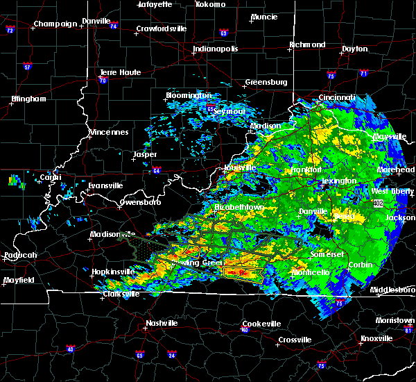 At 739 pm cdt, severe thunderstorms were located along a line extending from 15 miles west of munfordville to near brownsville, moving east at 45 mph (radar indicated). Hazards include 60 mph wind gusts and penny size hail. Expect damage to roofs, siding, and trees. Locations impacted include, brownsville, ollie, mammoth cave, rhoda, cedar spring, stockholm, sloans crossing and pig. At 739 pm cdt, severe thunderstorms were located along a line extending from 15 miles west of munfordville to near brownsville, moving east at 45 mph (radar indicated). Hazards include 60 mph wind gusts and penny size hail. Expect damage to roofs, siding, and trees. Locations impacted include, brownsville, ollie, mammoth cave, rhoda, cedar spring, stockholm, sloans crossing and pig.
|
| 3/12/2020 7:26 PM CDT |
 At 726 pm cdt, severe thunderstorms were located along a line extending from 10 miles south of leitchfield to near brownsville to 11 miles north of plum springs, moving southeast at 45 mph (radar indicated). Hazards include 60 mph wind gusts and quarter size hail. Hail damage to vehicles is expected. expect wind damage to roofs, siding, and trees. Locations impacted include, brownsville, ollie, segal, chalybeate, rhoda, lindseyville, black gold, bee spring, prosperity and stockholm. At 726 pm cdt, severe thunderstorms were located along a line extending from 10 miles south of leitchfield to near brownsville to 11 miles north of plum springs, moving southeast at 45 mph (radar indicated). Hazards include 60 mph wind gusts and quarter size hail. Hail damage to vehicles is expected. expect wind damage to roofs, siding, and trees. Locations impacted include, brownsville, ollie, segal, chalybeate, rhoda, lindseyville, black gold, bee spring, prosperity and stockholm.
|
| 3/12/2020 7:13 PM CDT |
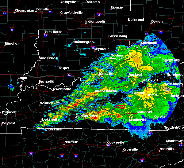 At 713 pm cdt, severe thunderstorms were located along a line extending from 10 miles southwest of leitchfield to 11 miles northwest of brownsville to 7 miles east of morgantown, moving southeast at 45 mph (radar indicated). Hazards include 60 mph wind gusts and quarter size hail. Hail damage to vehicles is expected. Expect wind damage to roofs, siding, and trees. At 713 pm cdt, severe thunderstorms were located along a line extending from 10 miles southwest of leitchfield to 11 miles northwest of brownsville to 7 miles east of morgantown, moving southeast at 45 mph (radar indicated). Hazards include 60 mph wind gusts and quarter size hail. Hail damage to vehicles is expected. Expect wind damage to roofs, siding, and trees.
|
| 3/12/2020 5:43 PM CDT |
 At 543 pm cdt, a severe thunderstorm was located 9 miles northwest of bowling green, moving east at 35 mph. this is a very dangerous storm (radar indicated). Hazards include 80 mph wind gusts and golf ball size hail. Flying debris will be dangerous to those caught without shelter. mobile homes will be heavily damaged. expect considerable damage to roofs, windows, and vehicles. extensive tree damage and power outages are likely. Locations impacted include, bowling green, plum springs, crestmoor, mount victor, smiths grove, park city, oakland, chalybeate, hardcastle and girkin. At 543 pm cdt, a severe thunderstorm was located 9 miles northwest of bowling green, moving east at 35 mph. this is a very dangerous storm (radar indicated). Hazards include 80 mph wind gusts and golf ball size hail. Flying debris will be dangerous to those caught without shelter. mobile homes will be heavily damaged. expect considerable damage to roofs, windows, and vehicles. extensive tree damage and power outages are likely. Locations impacted include, bowling green, plum springs, crestmoor, mount victor, smiths grove, park city, oakland, chalybeate, hardcastle and girkin.
|
| 3/12/2020 5:27 PM CDT |
 At 527 pm cdt, a severe thunderstorm was located 7 miles southwest of morgantown, moving east at 35 mph. this is a very dangerous storm (radar indicated). Hazards include 80 mph wind gusts and golf ball size hail. Flying debris will be dangerous to those caught without shelter. mobile homes will be heavily damaged. expect considerable damage to roofs, windows, and vehicles. Extensive tree damage and power outages are likely. At 527 pm cdt, a severe thunderstorm was located 7 miles southwest of morgantown, moving east at 35 mph. this is a very dangerous storm (radar indicated). Hazards include 80 mph wind gusts and golf ball size hail. Flying debris will be dangerous to those caught without shelter. mobile homes will be heavily damaged. expect considerable damage to roofs, windows, and vehicles. Extensive tree damage and power outages are likely.
|
| 3/12/2020 4:28 PM CDT |
 At 427 pm cdt, a severe thunderstorm was located 9 miles east of morgantown, moving east at 40 mph (radar indicated). Hazards include 60 mph wind gusts and quarter size hail. Hail damage to vehicles is expected. Expect wind damage to roofs, siding, and trees. At 427 pm cdt, a severe thunderstorm was located 9 miles east of morgantown, moving east at 40 mph (radar indicated). Hazards include 60 mph wind gusts and quarter size hail. Hail damage to vehicles is expected. Expect wind damage to roofs, siding, and trees.
|
| 3/2/2020 9:51 PM CST |
 At 951 pm cst, a severe thunderstorm was located over brownsville, moving east at 45 mph (radar indicated). Hazards include 60 mph wind gusts and quarter size hail. Hail damage to vehicles is expected. expect wind damage to roofs, siding, and trees. Locations impacted include, bowling green, brownsville, plum springs, smiths grove, oakland, ollie, segal, chalybeate, rhoda and lindseyville. At 951 pm cst, a severe thunderstorm was located over brownsville, moving east at 45 mph (radar indicated). Hazards include 60 mph wind gusts and quarter size hail. Hail damage to vehicles is expected. expect wind damage to roofs, siding, and trees. Locations impacted include, bowling green, brownsville, plum springs, smiths grove, oakland, ollie, segal, chalybeate, rhoda and lindseyville.
|
| 3/2/2020 9:30 PM CST |
 At 930 pm cst, a severe thunderstorm was located 8 miles north of bowling green, moving east at 45 mph (radar indicated). Hazards include 60 mph wind gusts and quarter size hail. Hail damage to vehicles is expected. Expect wind damage to roofs, siding, and trees. At 930 pm cst, a severe thunderstorm was located 8 miles north of bowling green, moving east at 45 mph (radar indicated). Hazards include 60 mph wind gusts and quarter size hail. Hail damage to vehicles is expected. Expect wind damage to roofs, siding, and trees.
|
| 1/11/2020 9:17 AM CST |
 At 916 am cst, severe thunderstorms were located along a line extending from 10 miles southwest of leitchfield to near brownsville, moving northeast at 50 mph (radar indicated). Hazards include 60 mph wind gusts. expect damage to roofs, siding, and trees At 916 am cst, severe thunderstorms were located along a line extending from 10 miles southwest of leitchfield to near brownsville, moving northeast at 50 mph (radar indicated). Hazards include 60 mph wind gusts. expect damage to roofs, siding, and trees
|
| 6/23/2019 3:18 PM CDT | Tree down on a power line on nolin dam roa in edmonson county KY, 6 miles S of Brownsville, KY |
| 6/23/2019 3:09 PM CDT | Tree down on houchin ferry roa in edmonson county KY, 1.1 miles WNW of Brownsville, KY |
| 6/23/2019 3:07 PM CDT |
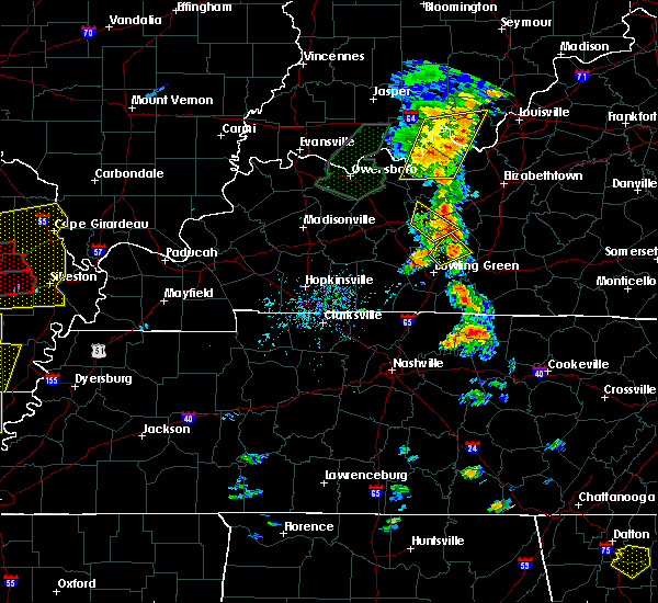 At 306 pm cdt, a severe thunderstorm was located southwest of brownsville, moving northeast at 20 mph (radar indicated). Hazards include 60 mph wind gusts and quarter size hail. Hail damage to vehicles is expected. Expect wind damage to roofs, siding, and trees. At 306 pm cdt, a severe thunderstorm was located southwest of brownsville, moving northeast at 20 mph (radar indicated). Hazards include 60 mph wind gusts and quarter size hail. Hail damage to vehicles is expected. Expect wind damage to roofs, siding, and trees.
|
| 6/21/2019 7:34 PM CDT |
 At 734 pm cdt, a severe thunderstorm was located near plum springs, moving east at 35 mph (radar indicated). Hazards include 60 mph wind gusts and penny size hail. Expect damage to roofs, siding, and trees. Locations impacted include, brownsville, smiths grove, oakland, segal, chalybeate, rhoda, girkin, nick, glenmore and tuckertown. At 734 pm cdt, a severe thunderstorm was located near plum springs, moving east at 35 mph (radar indicated). Hazards include 60 mph wind gusts and penny size hail. Expect damage to roofs, siding, and trees. Locations impacted include, brownsville, smiths grove, oakland, segal, chalybeate, rhoda, girkin, nick, glenmore and tuckertown.
|
| 6/21/2019 7:30 PM CDT | Report of tree down across ollie ridge road. time estimated from rada in edmonson county KY, 5.8 miles WSW of Brownsville, KY |
| 6/21/2019 7:19 PM CDT |
 At 719 pm cdt, a severe thunderstorm was located 9 miles northwest of bowling green, moving east at 40 mph (radar indicated). Hazards include 60 mph wind gusts and quarter size hail. Hail damage to vehicles is expected. Expect wind damage to roofs, siding, and trees. At 719 pm cdt, a severe thunderstorm was located 9 miles northwest of bowling green, moving east at 40 mph (radar indicated). Hazards include 60 mph wind gusts and quarter size hail. Hail damage to vehicles is expected. Expect wind damage to roofs, siding, and trees.
|
| 12/31/2018 2:27 PM CST | 1 tree down completely blocking p lindsey road and another tree down blocking poplar springs road. both in sweeden area. time estimated from rada in edmonson county KY, 3.6 miles SSE of Brownsville, KY |
| 12/31/2018 2:18 PM CST |
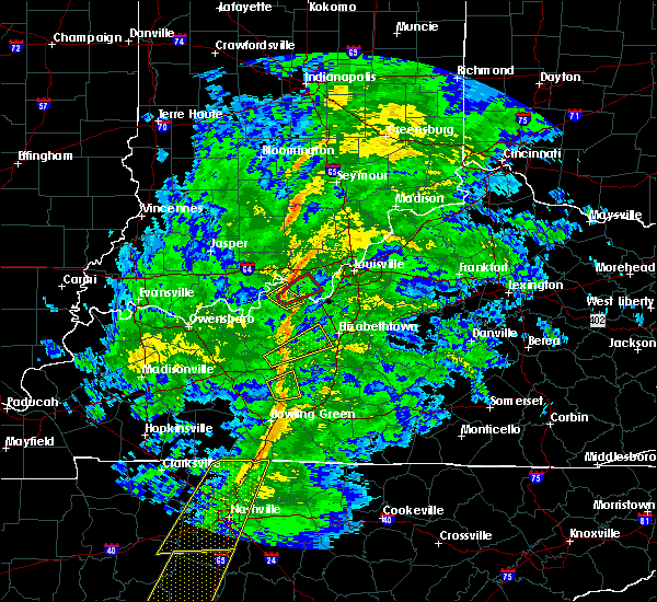 At 218 pm cst, a severe thunderstorm was located 7 miles northwest of brownsville, moving east at 50 mph (radar indicated). Hazards include 60 mph wind gusts. Expect damage to roofs, siding, and trees. Locations impacted include, brownsville, roundhill, segal, lindseyville, black gold, bee spring, big reedy, south, prosperity and broadway. At 218 pm cst, a severe thunderstorm was located 7 miles northwest of brownsville, moving east at 50 mph (radar indicated). Hazards include 60 mph wind gusts. Expect damage to roofs, siding, and trees. Locations impacted include, brownsville, roundhill, segal, lindseyville, black gold, bee spring, big reedy, south, prosperity and broadway.
|
| 12/31/2018 2:04 PM CST |
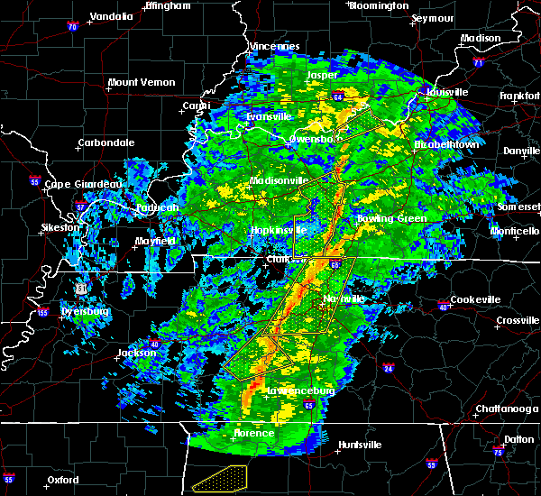 At 204 pm cst, a severe thunderstorm was located near morgantown, moving east at 50 mph (radar indicated). Hazards include 60 mph wind gusts. expect damage to roofs, siding, and trees At 204 pm cst, a severe thunderstorm was located near morgantown, moving east at 50 mph (radar indicated). Hazards include 60 mph wind gusts. expect damage to roofs, siding, and trees
|
| 11/5/2018 9:37 PM CST | 2 trees down on mammoth cave road in mammoth cave par in edmonson county KY, 7 miles WNW of Brownsville, KY |
| 11/5/2018 9:33 PM CST |
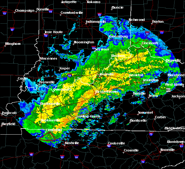 At 933 pm cst, a severe thunderstorm capable of producing a tornado was located 8 miles north of plum springs, moving northeast at 50 mph (radar indicated rotation). Hazards include tornado. Flying debris will be dangerous to those caught without shelter. mobile homes will be damaged or destroyed. damage to roofs, windows, and vehicles will occur. Tree damage is likely. At 933 pm cst, a severe thunderstorm capable of producing a tornado was located 8 miles north of plum springs, moving northeast at 50 mph (radar indicated rotation). Hazards include tornado. Flying debris will be dangerous to those caught without shelter. mobile homes will be damaged or destroyed. damage to roofs, windows, and vehicles will occur. Tree damage is likely.
|
| 11/5/2018 9:26 PM CST |
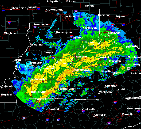 At 926 pm cst, a severe thunderstorm was located 7 miles northwest of bowling green, moving east at 40 mph (radar indicated). Hazards include 60 mph wind gusts. expect damage to roofs, siding, and trees At 926 pm cst, a severe thunderstorm was located 7 miles northwest of bowling green, moving east at 40 mph (radar indicated). Hazards include 60 mph wind gusts. expect damage to roofs, siding, and trees
|
| 8/16/2018 3:25 AM CDT |
 The severe thunderstorm warning for south central grayson and northern edmonson counties will expire at 330 am cdt, the storm which prompted the warning has weakened below severe limits, and no longer poses an immediate threat to life or property. therefore, the warning will be allowed to expire. however gusty winds are still possible with this thunderstorm. report severe weather to local law enforcement, post your report to the national weather service louisville facebook page, or tweet your report using hashtag l, m, k, spotter. The severe thunderstorm warning for south central grayson and northern edmonson counties will expire at 330 am cdt, the storm which prompted the warning has weakened below severe limits, and no longer poses an immediate threat to life or property. therefore, the warning will be allowed to expire. however gusty winds are still possible with this thunderstorm. report severe weather to local law enforcement, post your report to the national weather service louisville facebook page, or tweet your report using hashtag l, m, k, spotter.
|
| 8/16/2018 3:18 AM CDT |
 At 318 am cdt, a severe thunderstorm was located near brownsville, moving northeast at 40 mph (radar indicated). Hazards include 60 mph wind gusts. Expect damage to roofs, siding, and trees. Locations impacted include, brownsville, ollie, lindseyville, black gold, bee spring, ponderosa, south, prosperity, broadway and sadler. At 318 am cdt, a severe thunderstorm was located near brownsville, moving northeast at 40 mph (radar indicated). Hazards include 60 mph wind gusts. Expect damage to roofs, siding, and trees. Locations impacted include, brownsville, ollie, lindseyville, black gold, bee spring, ponderosa, south, prosperity, broadway and sadler.
|
| 8/16/2018 3:02 AM CDT |
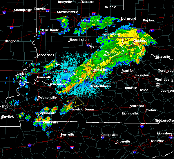 At 301 am cdt, a severe thunderstorm was located 9 miles west of brownsville, moving northeast at 40 mph (radar indicated). Hazards include 60 mph wind gusts. expect damage to roofs, siding, and trees At 301 am cdt, a severe thunderstorm was located 9 miles west of brownsville, moving northeast at 40 mph (radar indicated). Hazards include 60 mph wind gusts. expect damage to roofs, siding, and trees
|
| 7/5/2018 6:00 PM CDT |
 At 600 pm cdt, a severe thunderstorm was located over brownsville, moving southeast at 15 mph (radar indicated). Hazards include 60 mph wind gusts and quarter size hail. Hail damage to vehicles is expected. expect wind damage to roofs, siding, and trees. Locations impacted include, brownsville, lindseyville, black gold, bee spring, broadway, sweeden and ollie. At 600 pm cdt, a severe thunderstorm was located over brownsville, moving southeast at 15 mph (radar indicated). Hazards include 60 mph wind gusts and quarter size hail. Hail damage to vehicles is expected. expect wind damage to roofs, siding, and trees. Locations impacted include, brownsville, lindseyville, black gold, bee spring, broadway, sweeden and ollie.
|
| 7/5/2018 5:55 PM CDT | Telephone poles... power lines... and small trees reported down along ky 259 between bee spring and sweede in edmonson county KY, 6.6 miles S of Brownsville, KY |
| 7/5/2018 5:40 PM CDT |
 At 540 pm cdt, a severe thunderstorm was located near brownsville, moving southeast at 15 mph (radar indicated). Hazards include 60 mph wind gusts. expect damage to roofs, siding, and trees At 540 pm cdt, a severe thunderstorm was located near brownsville, moving southeast at 15 mph (radar indicated). Hazards include 60 mph wind gusts. expect damage to roofs, siding, and trees
|
| 6/26/2018 12:17 PM CDT |
 At 1217 pm cdt, severe thunderstorms were located along a line extending from 11 miles southeast of leitchfield to plum springs, moving east at 35 mph (radar indicated). Hazards include 60 mph wind gusts. expect damage to roofs, siding, and trees At 1217 pm cdt, severe thunderstorms were located along a line extending from 11 miles southeast of leitchfield to plum springs, moving east at 35 mph (radar indicated). Hazards include 60 mph wind gusts. expect damage to roofs, siding, and trees
|
| 6/26/2018 12:03 PM CDT | Corrects time from previous tstm wnd dmg report from 2 e roundhill. several trees dow in edmonson county KY, 8.9 miles ESE of Brownsville, KY |
| 6/26/2018 11:13 AM CDT | Several trees dow in edmonson county KY, 8.9 miles ESE of Brownsville, KY |
| 6/9/2018 4:00 PM CDT | Several trees... fences... and windmill blown down on j.o. davis road near roundhill k in edmonson county KY, 7.1 miles ESE of Brownsville, KY |
| 4/3/2018 9:01 PM CDT |
 At 900 pm cdt, a severe thunderstorm was located near plum springs, moving east at 65 mph (radar indicated). Hazards include 60 mph wind gusts. Expect damage to roofs, siding, and trees. locations impacted include, bowling green, brownsville, plum springs, crestmoor, memphis junction, mount victor, smiths grove, oakland, chalybeate and girkin. A tornado watch remains in effect until midnight cdt for south central kentucky. At 900 pm cdt, a severe thunderstorm was located near plum springs, moving east at 65 mph (radar indicated). Hazards include 60 mph wind gusts. Expect damage to roofs, siding, and trees. locations impacted include, bowling green, brownsville, plum springs, crestmoor, memphis junction, mount victor, smiths grove, oakland, chalybeate and girkin. A tornado watch remains in effect until midnight cdt for south central kentucky.
|
| 4/3/2018 8:46 PM CDT |
 At 846 pm cdt, a severe thunderstorm was located 14 miles northeast of russellville, moving east at 70 mph (radar indicated). Hazards include 60 mph wind gusts. expect damage to roofs, siding, and trees At 846 pm cdt, a severe thunderstorm was located 14 miles northeast of russellville, moving east at 70 mph (radar indicated). Hazards include 60 mph wind gusts. expect damage to roofs, siding, and trees
|
| 4/3/2018 7:45 PM CDT |
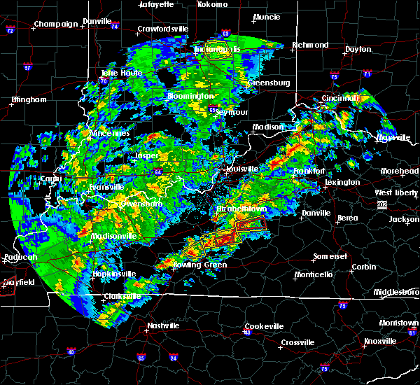 At 745 pm cdt, a severe thunderstorm was located near brownsville, moving east at 50 mph (radar indicated). Hazards include 60 mph wind gusts and half dollar size hail. Hail damage to vehicles is expected. expect wind damage to roofs, siding, and trees. locations impacted include, brownsville, ollie, rhoda, bee, big windy, stockholm, straw, pig, mammoth cave and tom johns crossing. A tornado watch remains in effect until midnight cdt for south central and central kentucky. At 745 pm cdt, a severe thunderstorm was located near brownsville, moving east at 50 mph (radar indicated). Hazards include 60 mph wind gusts and half dollar size hail. Hail damage to vehicles is expected. expect wind damage to roofs, siding, and trees. locations impacted include, brownsville, ollie, rhoda, bee, big windy, stockholm, straw, pig, mammoth cave and tom johns crossing. A tornado watch remains in effect until midnight cdt for south central and central kentucky.
|
| 4/3/2018 7:36 PM CDT |
 At 736 pm cdt, a severe thunderstorm was located near brownsville, moving east at 50 mph (radar indicated). Hazards include 60 mph wind gusts and half dollar size hail. Hail damage to vehicles is expected. Expect wind damage to roofs, siding, and trees. At 736 pm cdt, a severe thunderstorm was located near brownsville, moving east at 50 mph (radar indicated). Hazards include 60 mph wind gusts and half dollar size hail. Hail damage to vehicles is expected. Expect wind damage to roofs, siding, and trees.
|
| 4/3/2018 7:13 PM CDT |
 At 713 pm cdt, a severe thunderstorm was located 8 miles north of brownsville, moving east at 50 mph (radar indicated). Hazards include 70 mph wind gusts and ping pong ball size hail. People and animals outdoors will be injured. expect hail damage to roofs, siding, windows, and vehicles. expect considerable tree damage. wind damage is also likely to mobile homes, roofs, and outbuildings. locations impacted include, munfordville, bonnieville, rowletts, cub run, logsdon valley, lines mill, broadway, broad ford, pearman and snap. A tornado watch remains in effect until midnight cdt for south central and central kentucky. At 713 pm cdt, a severe thunderstorm was located 8 miles north of brownsville, moving east at 50 mph (radar indicated). Hazards include 70 mph wind gusts and ping pong ball size hail. People and animals outdoors will be injured. expect hail damage to roofs, siding, windows, and vehicles. expect considerable tree damage. wind damage is also likely to mobile homes, roofs, and outbuildings. locations impacted include, munfordville, bonnieville, rowletts, cub run, logsdon valley, lines mill, broadway, broad ford, pearman and snap. A tornado watch remains in effect until midnight cdt for south central and central kentucky.
|
| 4/3/2018 7:06 PM CDT |
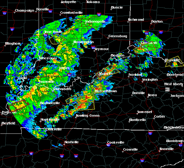 At 706 pm cdt, a severe thunderstorm was located 7 miles northwest of brownsville, moving east at 50 mph (radar indicated). Hazards include 70 mph wind gusts and ping pong ball size hail. People and animals outdoors will be injured. expect hail damage to roofs, siding, windows, and vehicles. expect considerable tree damage. wind damage is also likely to mobile homes, roofs, and outbuildings. locations impacted include, munfordville, bonnieville, roundhill, black gold, cub run, logsdon valley, broad ford, sadler, sunfish and huff. A tornado watch remains in effect until midnight cdt for south central and central kentucky. At 706 pm cdt, a severe thunderstorm was located 7 miles northwest of brownsville, moving east at 50 mph (radar indicated). Hazards include 70 mph wind gusts and ping pong ball size hail. People and animals outdoors will be injured. expect hail damage to roofs, siding, windows, and vehicles. expect considerable tree damage. wind damage is also likely to mobile homes, roofs, and outbuildings. locations impacted include, munfordville, bonnieville, roundhill, black gold, cub run, logsdon valley, broad ford, sadler, sunfish and huff. A tornado watch remains in effect until midnight cdt for south central and central kentucky.
|
| 4/3/2018 7:00 PM CDT | Cable lines down reported at brownsville... k in edmonson county KY, 0.4 miles S of Brownsville, KY |
| 4/3/2018 7:00 PM CDT | Windows blown out of a house... antenna blown ove in edmonson county KY, 5.9 miles S of Brownsville, KY |
| 4/3/2018 7:00 PM CDT | Power lines down... damage to building in edmonson county KY, 6.6 miles S of Brownsville, KY |
| 4/3/2018 6:57 PM CDT |
 At 657 pm cdt, a severe thunderstorm was located 11 miles east of morgantown, moving east at 50 mph (radar indicated). Hazards include 60 mph wind gusts and quarter size hail. Hail damage to vehicles is expected. Expect wind damage to roofs, siding, and trees. At 657 pm cdt, a severe thunderstorm was located 11 miles east of morgantown, moving east at 50 mph (radar indicated). Hazards include 60 mph wind gusts and quarter size hail. Hail damage to vehicles is expected. Expect wind damage to roofs, siding, and trees.
|
| 4/3/2018 6:45 PM CDT |
 At 645 pm cdt, a severe thunderstorm was located near morgantown, moving east at 60 mph (radar indicated). Hazards include 70 mph wind gusts and quarter size hail. Hail damage to vehicles is expected. expect considerable tree damage. wind damage is also likely to mobile homes, roofs, and outbuildings. locations impacted include, morgantown, brownsville, casey, lee, woodbury, roundhill, aberdeen, black gold, eden and peonia. A tornado watch remains in effect until midnight cdt for south central and central kentucky. At 645 pm cdt, a severe thunderstorm was located near morgantown, moving east at 60 mph (radar indicated). Hazards include 70 mph wind gusts and quarter size hail. Hail damage to vehicles is expected. expect considerable tree damage. wind damage is also likely to mobile homes, roofs, and outbuildings. locations impacted include, morgantown, brownsville, casey, lee, woodbury, roundhill, aberdeen, black gold, eden and peonia. A tornado watch remains in effect until midnight cdt for south central and central kentucky.
|
| 4/3/2018 6:30 PM CDT |
 At 630 pm cdt, a severe thunderstorm was located 9 miles west of morgantown, moving east at 65 mph (radar indicated). Hazards include 70 mph wind gusts and quarter size hail. Hail damage to vehicles is expected. expect considerable tree damage. Wind damage is also likely to mobile homes, roofs, and outbuildings. At 630 pm cdt, a severe thunderstorm was located 9 miles west of morgantown, moving east at 65 mph (radar indicated). Hazards include 70 mph wind gusts and quarter size hail. Hail damage to vehicles is expected. expect considerable tree damage. Wind damage is also likely to mobile homes, roofs, and outbuildings.
|
| 2/24/2018 10:05 PM CST |
 At 1004 pm cst, a severe thunderstorm was located 8 miles southeast of brownsville, moving east at 45 mph (radar indicated. 58 mph winds were reported in bowling green). Hazards include 60 mph wind gusts. Expect damage to roofs, siding, and trees. locations impacted include, glasgow, munfordville, brownsville, horse cave, cave city, park city, chalybeate, red cross, logsdon valley and coral hill. A tornado watch remains in effect until 200 am cst for south central and central kentucky. At 1004 pm cst, a severe thunderstorm was located 8 miles southeast of brownsville, moving east at 45 mph (radar indicated. 58 mph winds were reported in bowling green). Hazards include 60 mph wind gusts. Expect damage to roofs, siding, and trees. locations impacted include, glasgow, munfordville, brownsville, horse cave, cave city, park city, chalybeate, red cross, logsdon valley and coral hill. A tornado watch remains in effect until 200 am cst for south central and central kentucky.
|
| 2/24/2018 9:54 PM CST | Reported at hwy 70 near mammoth cave national park tree down blocking hwy 70 on both side in edmonson county KY, 5.2 miles WNW of Brownsville, KY |
| 2/24/2018 9:51 PM CST |
 At 950 pm cst, a severe thunderstorm was located near plum springs, moving east at 45 mph (radar indicated). Hazards include 60 mph wind gusts. expect damage to roofs, siding, and trees At 950 pm cst, a severe thunderstorm was located near plum springs, moving east at 45 mph (radar indicated). Hazards include 60 mph wind gusts. expect damage to roofs, siding, and trees
|
| 11/18/2017 4:07 PM CST | At least 15 trees down on a property in sweede in edmonson county KY, 3.9 miles S of Brownsville, KY |
| 11/18/2017 4:01 PM CST |
 At 401 pm cst, a severe thunderstorm was located 8 miles northwest of brownsville, moving east at 50 mph (radar indicated). Hazards include 70 mph wind gusts and penny size hail. Expect considerable tree damage. Damage is likely to mobile homes, roofs, and outbuildings. At 401 pm cst, a severe thunderstorm was located 8 miles northwest of brownsville, moving east at 50 mph (radar indicated). Hazards include 70 mph wind gusts and penny size hail. Expect considerable tree damage. Damage is likely to mobile homes, roofs, and outbuildings.
|
| 5/20/2017 4:35 PM CDT | Twitter picture of a large limb blown in to the rear window of a ca in butler county KY, 10.4 miles ESE of Brownsville, KY |
| 5/19/2017 1:54 PM CDT |
 At 154 pm cdt, a severe thunderstorm was located near plum springs, moving east at 30 mph (radar indicated). Hazards include 60 mph wind gusts. Expect damage to roofs, siding, and trees. Locations impacted include, brownsville, smiths grove, oakland, chalybeate, girkin, nick, tuckertown and anna. At 154 pm cdt, a severe thunderstorm was located near plum springs, moving east at 30 mph (radar indicated). Hazards include 60 mph wind gusts. Expect damage to roofs, siding, and trees. Locations impacted include, brownsville, smiths grove, oakland, chalybeate, girkin, nick, tuckertown and anna.
|
| 5/19/2017 1:37 PM CDT |
 At 136 pm cdt, a severe thunderstorm was located near bowling green, moving east at 30 mph (radar indicated). Hazards include 60 mph wind gusts and penny size hail. expect damage to roofs, siding, and trees At 136 pm cdt, a severe thunderstorm was located near bowling green, moving east at 30 mph (radar indicated). Hazards include 60 mph wind gusts and penny size hail. expect damage to roofs, siding, and trees
|
| 4/5/2017 4:36 PM CDT |
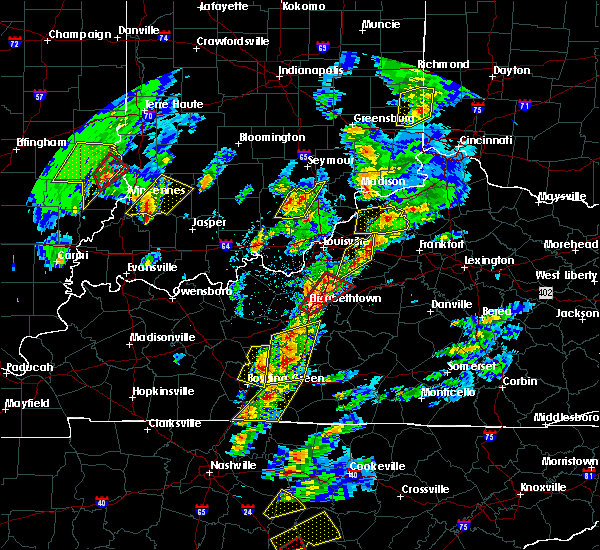 At 435 pm cdt, a severe thunderstorm was located near brownsville, moving north at 60 mph (radar indicated). Hazards include 60 mph wind gusts and half dollar size hail. Hail damage to vehicles is expected. expect wind damage to roofs, siding, and trees. locations impacted include, brownsville, segal, lindseyville, black gold, bee spring, nick, prosperity, broadway, sunfish and huff. A tornado watch remains in effect until 900 pm cdt for south central kentucky. At 435 pm cdt, a severe thunderstorm was located near brownsville, moving north at 60 mph (radar indicated). Hazards include 60 mph wind gusts and half dollar size hail. Hail damage to vehicles is expected. expect wind damage to roofs, siding, and trees. locations impacted include, brownsville, segal, lindseyville, black gold, bee spring, nick, prosperity, broadway, sunfish and huff. A tornado watch remains in effect until 900 pm cdt for south central kentucky.
|
| 4/5/2017 4:26 PM CDT |
 At 426 pm cdt, a severe thunderstorm was located over plum springs, moving north at 60 mph (radar indicated). Hazards include 60 mph wind gusts and half dollar size hail. Hail damage to vehicles is expected. Expect wind damage to roofs, siding, and trees. At 426 pm cdt, a severe thunderstorm was located over plum springs, moving north at 60 mph (radar indicated). Hazards include 60 mph wind gusts and half dollar size hail. Hail damage to vehicles is expected. Expect wind damage to roofs, siding, and trees.
|
| 4/5/2017 4:25 PM CDT |
 The severe thunderstorm warning for south central grayson, northeastern warren and central edmonson counties will expire at 430 pm cdt, the storm which prompted the warning has weakened below severe limits, and have exited the warned area. therefore the warning will be allowed to expire. a tornado watch remains in effect until 900 pm cdt for south central and central kentucky. report severe weather to local law enforcement, post your report to the national weather service louisville facebook page, or tweet your report using hashtag l, m, k, spotter. The severe thunderstorm warning for south central grayson, northeastern warren and central edmonson counties will expire at 430 pm cdt, the storm which prompted the warning has weakened below severe limits, and have exited the warned area. therefore the warning will be allowed to expire. a tornado watch remains in effect until 900 pm cdt for south central and central kentucky. report severe weather to local law enforcement, post your report to the national weather service louisville facebook page, or tweet your report using hashtag l, m, k, spotter.
|
| 4/5/2017 4:17 PM CDT | Quarter sized hail reported 6.2 miles E of Brownsville, KY |
| 4/5/2017 4:17 PM CDT | Power lines dow in edmonson county KY, 4.5 miles S of Brownsville, KY |
| 4/5/2017 4:12 PM CDT |
 At 412 pm cdt, a severe thunderstorm was located near brownsville, moving northeast at 60 mph (radar indicated). Hazards include 60 mph wind gusts and quarter size hail. Hail damage to vehicles is expected. expect wind damage to roofs, siding, and trees. locations impacted include, bowling green, brownsville, oakland, chalybeate, girkin, black gold, broadway, sadler, loving and tuckertown. A tornado watch remains in effect until 900 pm cdt for south central and central kentucky. At 412 pm cdt, a severe thunderstorm was located near brownsville, moving northeast at 60 mph (radar indicated). Hazards include 60 mph wind gusts and quarter size hail. Hail damage to vehicles is expected. expect wind damage to roofs, siding, and trees. locations impacted include, bowling green, brownsville, oakland, chalybeate, girkin, black gold, broadway, sadler, loving and tuckertown. A tornado watch remains in effect until 900 pm cdt for south central and central kentucky.
|
| 4/5/2017 4:04 PM CDT |
 At 404 pm cdt, a severe thunderstorm was located 7 miles north of plum springs, moving northeast at 55 mph. a second severe thunderstorm was located near sunfish moving northeast at 55 mph (radar indicated). Hazards include 60 mph wind gusts and quarter size hail. Hail damage to vehicles is expected. Expect wind damage to roofs, siding, and trees. At 404 pm cdt, a severe thunderstorm was located 7 miles north of plum springs, moving northeast at 55 mph. a second severe thunderstorm was located near sunfish moving northeast at 55 mph (radar indicated). Hazards include 60 mph wind gusts and quarter size hail. Hail damage to vehicles is expected. Expect wind damage to roofs, siding, and trees.
|
| 3/1/2017 7:00 AM CST |
 At 759 am est/659 am cst/, severe thunderstorms were located along a line extending from 10 miles east of morgantown to 7 miles north of campbellsville, moving southeast at 50 mph (radar indicated). Hazards include 60 mph wind gusts. Expect damage to roofs, siding, and trees. locations impacted include, campbellsville, morgantown, greensburg, munfordville, brownsville, monroe, horse cave, cave city, park city and bonnieville. a tornado watch remains in effect until 900 am est/800 am cst/ for south central and central kentucky. A tornado watch also remains in effect until 1100 am est/1000 am cst/ for south central and central kentucky. At 759 am est/659 am cst/, severe thunderstorms were located along a line extending from 10 miles east of morgantown to 7 miles north of campbellsville, moving southeast at 50 mph (radar indicated). Hazards include 60 mph wind gusts. Expect damage to roofs, siding, and trees. locations impacted include, campbellsville, morgantown, greensburg, munfordville, brownsville, monroe, horse cave, cave city, park city and bonnieville. a tornado watch remains in effect until 900 am est/800 am cst/ for south central and central kentucky. A tornado watch also remains in effect until 1100 am est/1000 am cst/ for south central and central kentucky.
|
| 3/1/2017 6:53 AM CST | Trees reported down at mammoth cave national par in edmonson county KY, 9.4 miles W of Brownsville, KY |
| 3/1/2017 6:43 AM CST |
 At 743 am est/643 am cst/, severe thunderstorms were located along a line extending from 11 miles northeast of morgantown to near campbellsville, moving southeast at 50 mph (radar indicated). Hazards include 60 mph wind gusts. Expect damage to roofs, siding, and trees. locations impacted include, campbellsville, hodgenville, morgantown, greensburg, munfordville, brownsville, casey, monroe, lee and horse cave. a tornado watch remains in effect until 900 am est/800 am cst/ for south central and central kentucky. A tornado watch also remains in effect until 1100 am est/1000 am cst/ for south central and central kentucky. At 743 am est/643 am cst/, severe thunderstorms were located along a line extending from 11 miles northeast of morgantown to near campbellsville, moving southeast at 50 mph (radar indicated). Hazards include 60 mph wind gusts. Expect damage to roofs, siding, and trees. locations impacted include, campbellsville, hodgenville, morgantown, greensburg, munfordville, brownsville, casey, monroe, lee and horse cave. a tornado watch remains in effect until 900 am est/800 am cst/ for south central and central kentucky. A tornado watch also remains in effect until 1100 am est/1000 am cst/ for south central and central kentucky.
|
| 3/1/2017 6:41 AM CST |
 At 740 am est/640 am cst/, severe thunderstorms were located along a line extending from 11 miles northeast of morgantown to near campbellsville, moving southeast at 100 mph (radar indicated). Hazards include 60 mph wind gusts. expect damage to roofs, siding, and trees At 740 am est/640 am cst/, severe thunderstorms were located along a line extending from 11 miles northeast of morgantown to near campbellsville, moving southeast at 100 mph (radar indicated). Hazards include 60 mph wind gusts. expect damage to roofs, siding, and trees
|
| 3/1/2017 6:25 AM CST |
 At 725 am est/625 am cst/, severe thunderstorms were located along a line extending from near hodgenville to near morgantown, moving southeast at 55 mph (radar indicated). Hazards include 60 mph wind gusts and penny size hail. Expect damage to roofs, siding, and trees. locations impacted include, leitchfield, hodgenville, morgantown, munfordville, brownsville, casey, monroe, lee, beaver dam and horse cave. a tornado watch remains in effect until 900 am est/800 am cst/ for south central and central kentucky. A tornado watch also remains in effect until 1100 am est/1000 am cst/ for south central and central kentucky. At 725 am est/625 am cst/, severe thunderstorms were located along a line extending from near hodgenville to near morgantown, moving southeast at 55 mph (radar indicated). Hazards include 60 mph wind gusts and penny size hail. Expect damage to roofs, siding, and trees. locations impacted include, leitchfield, hodgenville, morgantown, munfordville, brownsville, casey, monroe, lee, beaver dam and horse cave. a tornado watch remains in effect until 900 am est/800 am cst/ for south central and central kentucky. A tornado watch also remains in effect until 1100 am est/1000 am cst/ for south central and central kentucky.
|
| 3/1/2017 6:08 AM CST |
 At 708 am est/608 am cst/, severe thunderstorms were located along a line extending from near elizabethtown to 10 miles south of hartford, moving southeast at 80 mph (radar indicated). Hazards include 65 mph wind gusts and nickel size hail. expect damage to roofs, siding, and trees At 708 am est/608 am cst/, severe thunderstorms were located along a line extending from near elizabethtown to 10 miles south of hartford, moving southeast at 80 mph (radar indicated). Hazards include 65 mph wind gusts and nickel size hail. expect damage to roofs, siding, and trees
|
| 8/5/2016 3:33 PM CDT | Trees dow in butler county KY, 8.9 miles E of Brownsville, KY |
| 7/8/2016 8:48 PM CDT |
 At 848 pm cdt, a severe thunderstorm was located near morgantown, moving east at 50 mph (radar indicated). Hazards include 60 mph wind gusts. Expect damage to roofs. siding. and trees. Locations impacted include, bowling green, morgantown, brownsville, plum springs, delafield, mount victor, casey, lee, beaver dam and smiths grove. At 848 pm cdt, a severe thunderstorm was located near morgantown, moving east at 50 mph (radar indicated). Hazards include 60 mph wind gusts. Expect damage to roofs. siding. and trees. Locations impacted include, bowling green, morgantown, brownsville, plum springs, delafield, mount victor, casey, lee, beaver dam and smiths grove.
|
| 7/8/2016 8:35 PM CDT |
 At 835 pm cdt, a severe thunderstorm was located 9 miles west of morgantown, moving east at 50 mph (radar indicated). Hazards include 60 mph wind gusts. Expect damage to roofs. siding. And trees. At 835 pm cdt, a severe thunderstorm was located 9 miles west of morgantown, moving east at 50 mph (radar indicated). Hazards include 60 mph wind gusts. Expect damage to roofs. siding. And trees.
|
| 7/7/2016 3:02 PM CDT |
 At 302 pm cdt, severe thunderstorms were located along a line extending from leitchfield to glasgow, moving east at 45 mph (radar indicated). Hazards include 70 mph wind gusts. Expect considerable tree damage. Damage is likely to mobile homes, roofs, and outbuildings. At 302 pm cdt, severe thunderstorms were located along a line extending from leitchfield to glasgow, moving east at 45 mph (radar indicated). Hazards include 70 mph wind gusts. Expect considerable tree damage. Damage is likely to mobile homes, roofs, and outbuildings.
|
| 7/7/2016 2:50 PM CDT | 100 pound roof blown off livestock building and blown 50 feet. trees with 5 to 6 inch branches were damage in edmonson county KY, 9.1 miles SE of Brownsville, KY |
| 7/7/2016 2:25 PM CDT |
 At 225 pm cdt, severe thunderstorms were located along a line extending from near hartford to near weir, moving east at 60 mph (radar indicated). Hazards include 70 mph wind gusts. Expect considerable tree damage. Damage is likely to mobile homes, roofs, and outbuildings. At 225 pm cdt, severe thunderstorms were located along a line extending from near hartford to near weir, moving east at 60 mph (radar indicated). Hazards include 70 mph wind gusts. Expect considerable tree damage. Damage is likely to mobile homes, roofs, and outbuildings.
|
| 7/6/2016 3:54 PM CDT | Large tree on a trailer in lindseyville. in edmonson county KY, 3.3 miles SSE of Brownsville, KY |
| 7/6/2016 3:35 PM CDT |
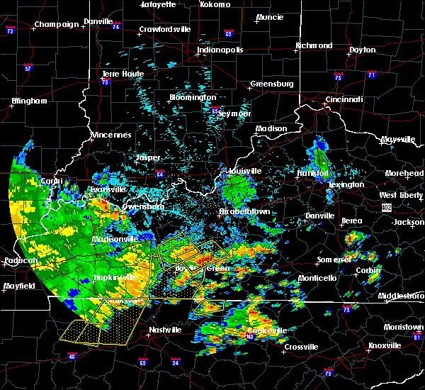 At 335 pm cdt, severe thunderstorms were located along a line extending from 13 miles southwest of leitchfield to near brownsville, moving east at 25 mph (radar indicated). Hazards include 60 mph wind gusts and penny size hail. Expect damage to roofs. siding. and trees. Locations impacted include, brownsville, casey, lee, ollie, bee spring, monford, stockholm, riverside, prosperity and huldeville. At 335 pm cdt, severe thunderstorms were located along a line extending from 13 miles southwest of leitchfield to near brownsville, moving east at 25 mph (radar indicated). Hazards include 60 mph wind gusts and penny size hail. Expect damage to roofs. siding. and trees. Locations impacted include, brownsville, casey, lee, ollie, bee spring, monford, stockholm, riverside, prosperity and huldeville.
|
| 7/6/2016 3:23 PM CDT |
 At 323 pm cdt, a severe thunderstorm was located over brownsville, moving northeast at 45 mph (radar indicated). Hazards include 60 mph wind gusts and penny size hail. Expect damage to roofs. siding. And trees. At 323 pm cdt, a severe thunderstorm was located over brownsville, moving northeast at 45 mph (radar indicated). Hazards include 60 mph wind gusts and penny size hail. Expect damage to roofs. siding. And trees.
|
| 7/6/2016 3:10 PM CDT | Power outag in edmonson county KY, 6.7 miles E of Brownsville, KY |
| 7/6/2016 3:09 PM CDT | Numerous large trees down and siding and fencing blown dow in butler county KY, 9 miles E of Brownsville, KY |
| 7/6/2016 3:04 PM CDT |
 At 304 pm cdt, severe thunderstorms were located along a line extending from near morgantown to near delafield, moving northeast at 30 mph (radar indicated). Hazards include 60 mph wind gusts and penny size hail. Expect damage to roofs. siding. And trees. At 304 pm cdt, severe thunderstorms were located along a line extending from near morgantown to near delafield, moving northeast at 30 mph (radar indicated). Hazards include 60 mph wind gusts and penny size hail. Expect damage to roofs. siding. And trees.
|
| 7/4/2016 1:19 PM CDT | A couple of trees were reported down in mammoth cave national par in edmonson county KY, 7.2 miles W of Brownsville, KY |
| 7/4/2016 1:12 PM CDT | Tree reported down on brier run roa in edmonson county KY, 9.7 miles SSW of Brownsville, KY |
| 7/4/2016 1:10 PM CDT |
 At 110 pm cdt, a severe thunderstorm was located 8 miles east of plum springs, moving east at 50 mph (radar indicated). Hazards include 60 mph wind gusts. Expect damage to roofs. siding. And trees. At 110 pm cdt, a severe thunderstorm was located 8 miles east of plum springs, moving east at 50 mph (radar indicated). Hazards include 60 mph wind gusts. Expect damage to roofs. siding. And trees.
|
| 7/4/2016 12:58 PM CDT |
 At 1258 pm cdt, a severe thunderstorm was located 9 miles west of brownsville, moving northeast at 45 mph (radar indicated). Hazards include 60 mph wind gusts. Expect damage to roofs. siding. and trees. Locations impacted include, reedyville, riverside, benleo, anna, black gold, big reedy, girkin, glenmore, asphalt and barren river. At 1258 pm cdt, a severe thunderstorm was located 9 miles west of brownsville, moving northeast at 45 mph (radar indicated). Hazards include 60 mph wind gusts. Expect damage to roofs. siding. and trees. Locations impacted include, reedyville, riverside, benleo, anna, black gold, big reedy, girkin, glenmore, asphalt and barren river.
|
| 7/4/2016 12:44 PM CDT |
 At 1244 pm cdt, a severe thunderstorm was located 10 miles south of morgantown, moving northeast at 40 mph (radar indicated). Hazards include 60 mph wind gusts. Expect damage to roofs. siding. And trees. At 1244 pm cdt, a severe thunderstorm was located 10 miles south of morgantown, moving northeast at 40 mph (radar indicated). Hazards include 60 mph wind gusts. Expect damage to roofs. siding. And trees.
|
| 7/3/2016 2:19 PM CDT |
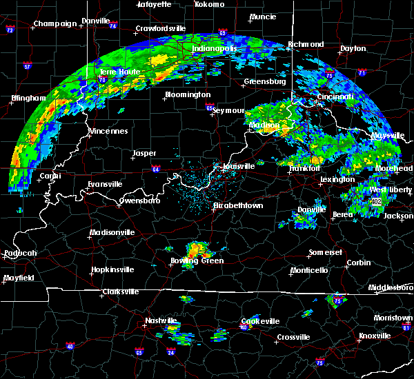 At 219 pm cdt, a severe thunderstorm was located 9 miles southeast of brownsville, moving northeast at 35 mph (radar indicated). Hazards include 60 mph wind gusts and penny size hail. Expect damage to roofs. siding. And trees. At 219 pm cdt, a severe thunderstorm was located 9 miles southeast of brownsville, moving northeast at 35 mph (radar indicated). Hazards include 60 mph wind gusts and penny size hail. Expect damage to roofs. siding. And trees.
|
| 6/23/2016 8:26 PM CDT |
 At 825 pm cdt, a severe thunderstorm was located near plum springs, moving southeast at 25 mph (radar indicated). Hazards include 60 mph wind gusts and penny size hail. Expect damage to roofs. siding. And trees. At 825 pm cdt, a severe thunderstorm was located near plum springs, moving southeast at 25 mph (radar indicated). Hazards include 60 mph wind gusts and penny size hail. Expect damage to roofs. siding. And trees.
|
| 5/26/2016 1:40 PM CDT | Facebook post with several pictures of sign and siding damage in brownsville. time estimated based on rada in edmonson county KY, 0.6 miles WNW of Brownsville, KY |
| 5/11/2016 8:33 PM CDT |
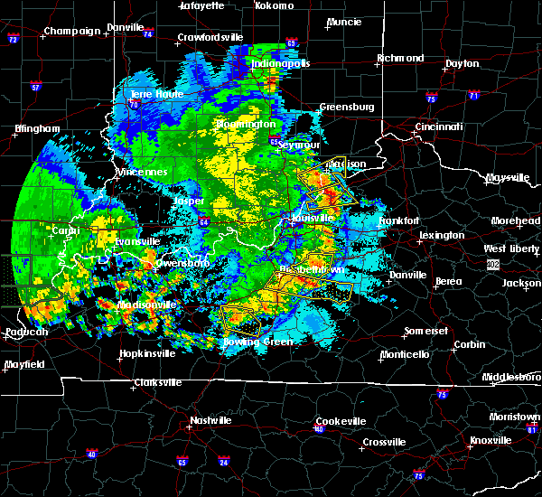 At 832 pm cdt, a severe thunderstorm was located near brownsville, moving east at 25 mph (radar indicated). Hazards include 60 mph wind gusts and quarter size hail. Hail damage to vehicles is expected. expect wind damage to roofs, siding, and trees. Locations impacted include, brownsville, sadler, ollie, bee spring, shrewsbury, stockholm, prosperity, moutardier, south and black gold. At 832 pm cdt, a severe thunderstorm was located near brownsville, moving east at 25 mph (radar indicated). Hazards include 60 mph wind gusts and quarter size hail. Hail damage to vehicles is expected. expect wind damage to roofs, siding, and trees. Locations impacted include, brownsville, sadler, ollie, bee spring, shrewsbury, stockholm, prosperity, moutardier, south and black gold.
|
| 5/11/2016 8:12 PM CDT |
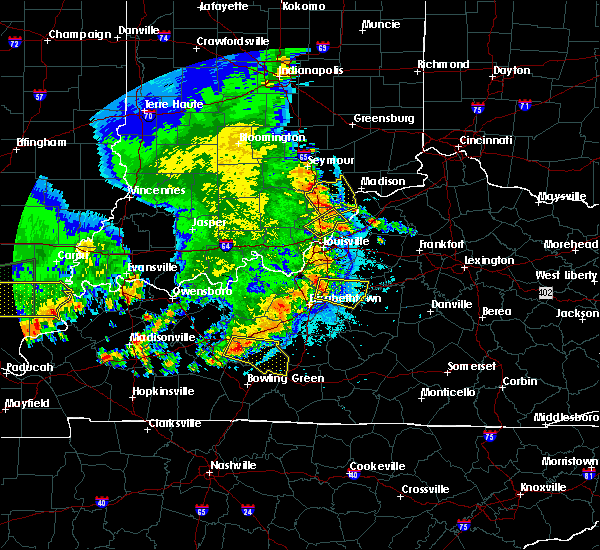 At 811 pm cdt, a severe thunderstorm was located 11 miles northwest of brownsville, moving east at 25 mph (radar indicated). Hazards include 60 mph wind gusts and quarter size hail. Hail damage to vehicles is expected. Expect wind damage to roofs, siding, and trees. At 811 pm cdt, a severe thunderstorm was located 11 miles northwest of brownsville, moving east at 25 mph (radar indicated). Hazards include 60 mph wind gusts and quarter size hail. Hail damage to vehicles is expected. Expect wind damage to roofs, siding, and trees.
|
| 4/27/2016 7:25 PM CDT |
 At 824 pm edt/724 pm cdt/, severe thunderstorms were located along a line extending from 6 miles west of leitchfield to brownsville, moving northeast at 40 mph (radar indicated). Hazards include 60 mph wind gusts. Expect damage to roofs. siding. And trees. At 824 pm edt/724 pm cdt/, severe thunderstorms were located along a line extending from 6 miles west of leitchfield to brownsville, moving northeast at 40 mph (radar indicated). Hazards include 60 mph wind gusts. Expect damage to roofs. siding. And trees.
|
| 4/27/2016 7:12 PM CDT |
 At 711 pm cdt, severe thunderstorms were located along a line extending from 8 miles north of morgantown to 6 miles north of delafield to 6 miles west of westmoreland, moving northeast at 25 mph (radar indicated). Hazards include 60 mph wind gusts and penny size hail. Expect damage to roofs. siding. and trees. locations impacted include, bowling green, leitchfield, scottsville, brownsville, plum springs, crestmoor, mount victor, delafield, memphis junction and casey. A tornado watch remains in effect until 1100 pm cdt for south central kentucky. At 711 pm cdt, severe thunderstorms were located along a line extending from 8 miles north of morgantown to 6 miles north of delafield to 6 miles west of westmoreland, moving northeast at 25 mph (radar indicated). Hazards include 60 mph wind gusts and penny size hail. Expect damage to roofs. siding. and trees. locations impacted include, bowling green, leitchfield, scottsville, brownsville, plum springs, crestmoor, mount victor, delafield, memphis junction and casey. A tornado watch remains in effect until 1100 pm cdt for south central kentucky.
|
| 4/27/2016 6:51 PM CDT |
 At 650 pm cdt, severe thunderstorms were located along a line extending from 6 miles northwest of morgantown to 7 miles west of delafield to near portland, moving northeast at 25 mph (radar indicated). Hazards include 60 mph wind gusts and penny size hail. Expect damage to roofs. siding. And trees. At 650 pm cdt, severe thunderstorms were located along a line extending from 6 miles northwest of morgantown to 7 miles west of delafield to near portland, moving northeast at 25 mph (radar indicated). Hazards include 60 mph wind gusts and penny size hail. Expect damage to roofs. siding. And trees.
|
| 4/27/2016 2:43 PM CDT | The severe thunderstorm warning for east central butler and northwestern edmonson counties will expire at 245 pm cdt. the storm which prompted the warning has moved out of the area. therefore the warning will be allowed to expire. however small hail. Gusty winds and heavy rain are still possible with additional thunderstorms. |
| 4/27/2016 2:23 PM CDT |
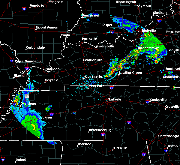 At 222 pm cdt, a severe thunderstorm was located 7 miles west of brownsville, moving northeast at 30 mph (radar indicated). Hazards include 60 mph wind gusts and quarter size hail. Hail damage to vehicles is expected. expect wind damage to roofs, siding, and trees. Locations impacted include, brownsville, big reedy, lindseyville, reedyville, asphalt, roundhill, huff, sunfish, segal and black gold. At 222 pm cdt, a severe thunderstorm was located 7 miles west of brownsville, moving northeast at 30 mph (radar indicated). Hazards include 60 mph wind gusts and quarter size hail. Hail damage to vehicles is expected. expect wind damage to roofs, siding, and trees. Locations impacted include, brownsville, big reedy, lindseyville, reedyville, asphalt, roundhill, huff, sunfish, segal and black gold.
|
| 4/27/2016 2:16 PM CDT |
 At 215 pm cdt, a severe thunderstorm was located 10 miles west of brownsville, moving northeast at 30 mph (radar indicated). Hazards include quarter size hail. damage to vehicles is expected At 215 pm cdt, a severe thunderstorm was located 10 miles west of brownsville, moving northeast at 30 mph (radar indicated). Hazards include quarter size hail. damage to vehicles is expected
|
| 3/31/2016 3:55 PM CDT |
 At 354 pm cdt, a severe thunderstorm was located 9 miles northeast of russellville, moving northeast at 55 mph (radar indicated). Hazards include 60 mph wind gusts. Expect damage to roofs. siding. And trees. At 354 pm cdt, a severe thunderstorm was located 9 miles northeast of russellville, moving northeast at 55 mph (radar indicated). Hazards include 60 mph wind gusts. Expect damage to roofs. siding. And trees.
|
| 12/23/2015 7:12 PM CST | The tornado warning for northern warren and southwestern edmonson counties will expire at 715 pm cst, the storm which prompted the warning has moved out of the area. therefore the warning will be allowed to expire. however heavy rain is still possible with this thunderstorm. a tornado watch remains in effect until 800 pm cst for south central kentucky. |
| 12/23/2015 7:06 PM CST | At 706 pm cst, a severe thunderstorm capable of producing a tornado was located near brownsville, moving northeast at 55 mph (radar indicated rotation). Hazards include tornado. Flying debris will be dangerous to those caught without shelter. mobile homes will be damaged or destroyed. damage to roofs, windows and vehicles will occur. tree damage is likely. this dangerous storm will be near, brownsville around 715 pm cst. Other locations impacted by this tornadic thunderstorm include roseburg, ollie, chalybeate, bee spring, snap, stockholm, royal, moutardier, pearman and big windy. |
| 12/23/2015 7:00 PM CST | At 700 pm cst, a severe thunderstorm capable of producing a tornado was located 7 miles north of delafield, moving northeast at 55 mph (radar indicated rotation). Hazards include tornado. Flying debris will be dangerous to those caught without shelter. mobile homes will be damaged or destroyed. damage to roofs, windows and vehicles will occur. tree damage is likely. this dangerous storm will be near, brownsville around 715 pm cst. Other locations impacted by this tornadic thunderstorm include chalybeate, riverside, benleo, anna, girkin, glenmore, asphalt, barren river, tuckertown and segal. |
| 12/23/2015 6:50 PM CST | At 650 pm cst, a severe thunderstorm capable of producing a tornado was located 8 miles northwest of memphis junction, moving northeast at 50 mph (radar indicated rotation). Hazards include tornado. Flying debris will be dangerous to those caught without shelter. mobile homes will be damaged or destroyed. damage to roofs, windows and vehicles will occur. tree damage is likely. this dangerous storm will be near, delafield and crestmoor around 700 pm cst. bowling green and plum springs around 705 pm cst. brownsville around 715 pm cst. Other locations impacted by this tornadic thunderstorm include blue level, chalybeate, riverside, benleo, browning, smiths grove, bristow, guy, rockland and nick. |
| 12/23/2015 6:45 PM CST | At 644 pm cst, a severe thunderstorm was located near morgantown, moving northeast at 70 mph (radar indicated). Hazards include 60 mph wind gusts. Expect damage to roofs. Siding and trees. |
| 12/23/2015 6:37 PM CST | At 636 pm cst, severe thunderstorms were located along a line extending from near leitchfield to 13 miles northeast of russellville, moving east at 40 mph (radar indicated). Hazards include 60 mph wind gusts. Expect damage to roofs. siding and trees. locations impacted include, russellville, morgantown, brownsville, anderson, casey, lee, lewisburg, rochester, woodbury, sadler, cooperstown, quality, huntsville, jerico, pleasant hill, riverside, prosperity, huldeville, homer and agnes. A tornado watch remains in effect until 800 pm cst for south central kentucky. |
| 12/23/2015 6:12 PM CST | At 612 pm cst, severe thunderstorms were located along a line extending from 10 miles west of leitchfield to 6 miles south of dunmor, moving northeast at 50 mph (radar indicated). Hazards include 60 mph wind gusts. Expect damage to roofs. Siding and trees. |
| 7/20/2015 11:43 PM CDT |
 At 1141 pm cdt, severe thunderstorms were located along a line extending from 7 miles north of brownsville to 6 miles southwest of brownsville to delafield, and moving east at 40 mph (radar indicated). Hazards include 60 mph wind gusts. Expect damage to roofs. Siding and trees. At 1141 pm cdt, severe thunderstorms were located along a line extending from 7 miles north of brownsville to 6 miles southwest of brownsville to delafield, and moving east at 40 mph (radar indicated). Hazards include 60 mph wind gusts. Expect damage to roofs. Siding and trees.
|
| 7/20/2015 11:33 PM CDT |
 At 1131 pm cdt, severe thunderstorms were located along a line extending from 11 miles east of whitesville to 8 miles southwest of leitchfield to 8 miles north of delafield, and moving east at 45 mph (radar indicated). Hazards include 60 mph wind gusts. Expect damage to roofs. siding and trees. Locations impacted include, brownsville, askin, millwood, glenmore, huff, south, short creek, asphalt, sadler, hickory corner, vanzant, black gold, dempster, prosperity, rockvale, windyville, falling branch, black rock, bee spring and concord. At 1131 pm cdt, severe thunderstorms were located along a line extending from 11 miles east of whitesville to 8 miles southwest of leitchfield to 8 miles north of delafield, and moving east at 45 mph (radar indicated). Hazards include 60 mph wind gusts. Expect damage to roofs. siding and trees. Locations impacted include, brownsville, askin, millwood, glenmore, huff, south, short creek, asphalt, sadler, hickory corner, vanzant, black gold, dempster, prosperity, rockvale, windyville, falling branch, black rock, bee spring and concord.
|
| 7/20/2015 11:16 PM CDT |
 At 1113 pm cdt, severe thunderstorms were located along a line extending from 7 miles northeast of hartford to 9 miles northeast of morgantown to 9 miles south of morgantown, and moving east at 45 mph (radar indicated). Hazards include 60 mph wind gusts. Expect damage to roofs. Siding and trees. At 1113 pm cdt, severe thunderstorms were located along a line extending from 7 miles northeast of hartford to 9 miles northeast of morgantown to 9 miles south of morgantown, and moving east at 45 mph (radar indicated). Hazards include 60 mph wind gusts. Expect damage to roofs. Siding and trees.
|
| 6/26/2015 2:30 PM CDT | At 227 pm cdt, a severe thunderstorm was located 11 miles north of delafield, and moving northeast at 20 mph (radar indicated). Hazards include 60 mph wind gusts and penny size hail. Expect damage to roofs. Siding and trees. |
| 6/26/2015 2:20 PM CDT | At 217 pm cdt, a severe thunderstorm was located 6 miles northwest of plum springs, and moving northeast at 20 mph (radar indicated). Hazards include 60 mph wind gusts and quarter size hail. Hail damage to vehicles is expected. expect wind damage to roofs, siding and trees. Locations impacted include, brownsville, sand hill, reedyville, girkin, glenmore, nick, asphalt, tuckertown, segal, chalybeate, windyville, lindseyville, huff and black gold. |
| 6/26/2015 2:01 PM CDT |
 At 159 pm cdt, a severe thunderstorm was located 5 miles northwest of delafield, and moving northeast at 20 mph (radar indicated). Hazards include 60 mph wind gusts and quarter size hail. Hail damage to vehicles is expected. Expect wind damage to roofs, siding and trees. At 159 pm cdt, a severe thunderstorm was located 5 miles northwest of delafield, and moving northeast at 20 mph (radar indicated). Hazards include 60 mph wind gusts and quarter size hail. Hail damage to vehicles is expected. Expect wind damage to roofs, siding and trees.
|
| 4/25/2015 7:53 PM CDT | The severe thunderstorm warning for hart, southeastern grayson, edmonson, east central butler and north central warren counties will expire at 900 pm edt, 800 pm cdt, the line of storms which prompted the warning has moved out of the warned area. additional strong thunderstorms are still possible, and a severe thunderstorm watch remains in effect until 10 pm cdt. |
| 4/25/2015 7:32 PM CDT | Storm damage reported in edmonson county KY, 0.6 miles WNW of Brownsville, KY |
| 4/25/2015 7:21 PM CDT | 15 to 20 trees dow in edmonson county KY, 6.3 miles SE of Brownsville, KY |
| 4/25/2015 7:14 PM CDT | At 713 pm cdt, severe thunderstorms were located along a line extending from leitchfield to 9 miles west of brownsville, and moving east at 50 mph (radar indicated). Hazards include 60 mph wind gusts and penny size hail. Expect damage to roofs. Siding and trees. |
| 4/10/2015 2:04 AM CDT | The national weather service in louisville has issued a * severe thunderstorm warning for. northern barren county in south central kentucky. edmonson county in south central kentucky. southwestern hart county in south central kentucky. Northern warren county in south central kentucky. |
| 12/21/2013 9:14 PM CST | Report received via facebook of 67 mph wind gust in western edmonson county in edmonson county KY, 7.3 miles E of Brownsville, KY |
| 1/30/2013 3:15 AM CST | Several trees down across the count in edmonson county KY, 0.6 miles WNW of Brownsville, KY |
| 7/19/2012 7:24 PM CDT | Tree down blocking road on highway 1015 in edmonson county KY, 10 miles SW of Brownsville, KY |
| 7/11/2012 4:35 PM CDT | The edmonson county department of highways reported three separate trees down in the northwest portion of the county. additional information on minor damage in the area in edmonson county KY, 4.8 miles SSE of Brownsville, KY |
| 7/4/2012 6:05 PM CDT | Dispatch reports tree down on ky 185 in butler county KY, 10 miles E of Brownsville, KY |
| 7/4/2012 3:36 PM CDT | Spotter called in report of trees down in brownsville... confirmed with dispatch in edmonson county KY, 0.6 miles WNW of Brownsville, KY |
| 4/2/2012 4:25 PM CDT | Golf Ball sized hail reported 8.7 miles S of Brownsville, KY, the state highway dept reported golf ball sized hail in the town of broadway. |
| 1/1/0001 12:00 AM | Quarter sized hail reported 11.1 miles SE of Brownsville, KY |
| 4/26/2011 10:51 PM CDT | Golf Ball sized hail reported 10 miles SE of Brownsville, KY |
| 1/1/0001 12:00 AM | Trees down on homes in the southern part of the count in edmonson county KY, 0.6 miles WNW of Brownsville, KY |
| 1/1/0001 12:00 AM | Quarter sized hail reported 0.6 miles WNW of Brownsville, KY |
| 1/1/0001 12:00 AM | Storm damage reported in edmonson county KY, 0.6 miles WNW of Brownsville, KY |
Hail Maps for Brownsville, KY
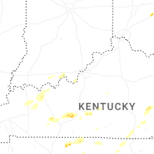
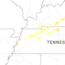
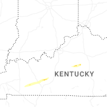


Connect with Interactive Hail Maps