

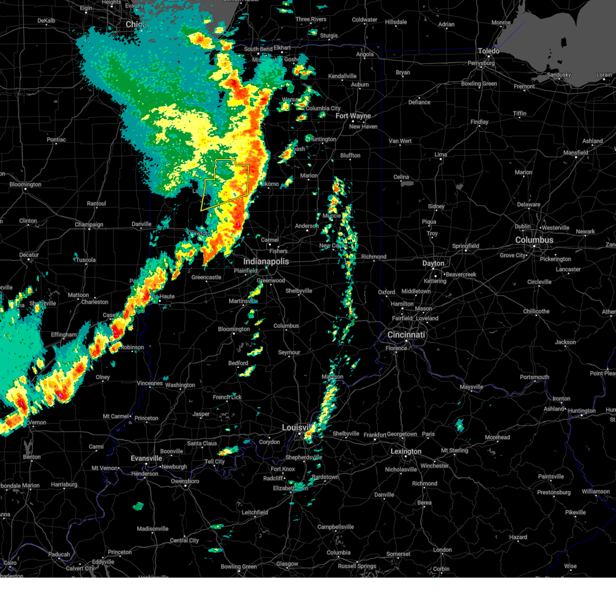
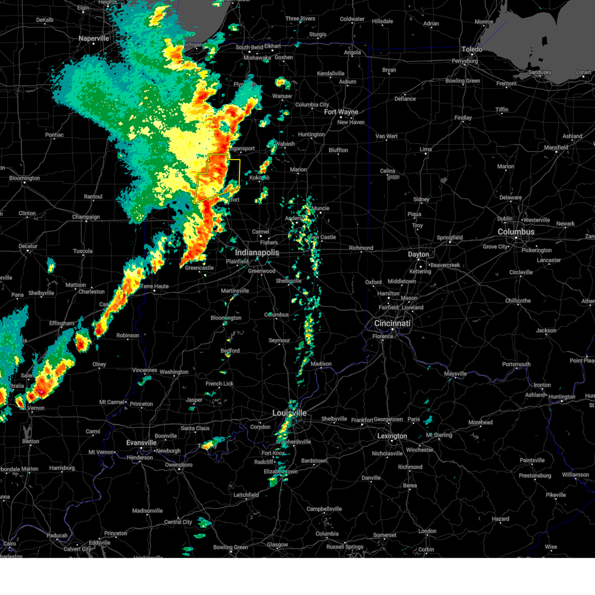
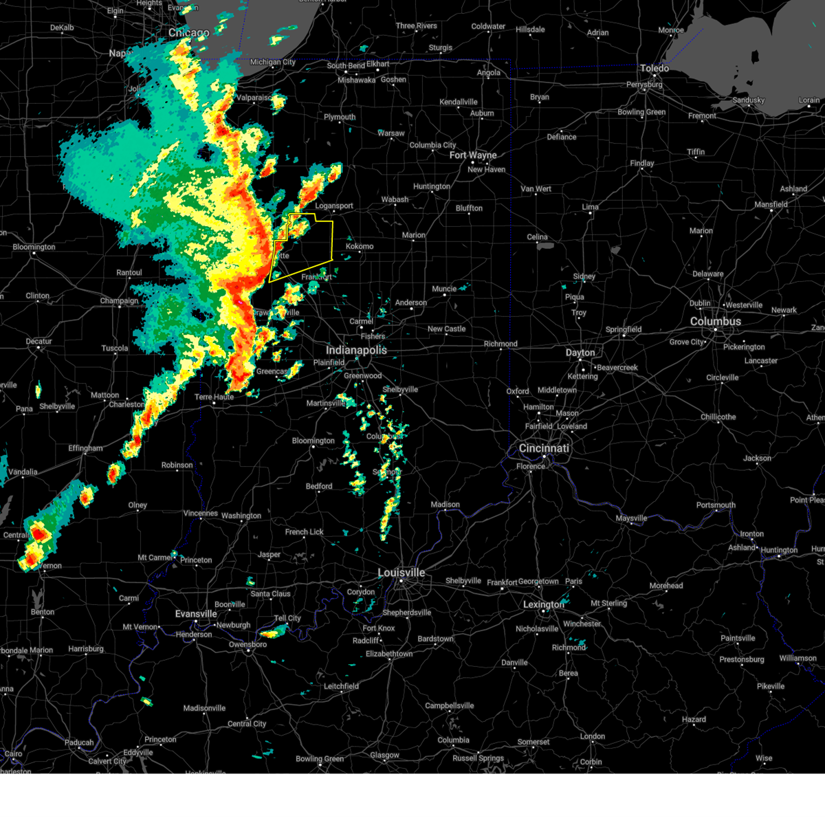
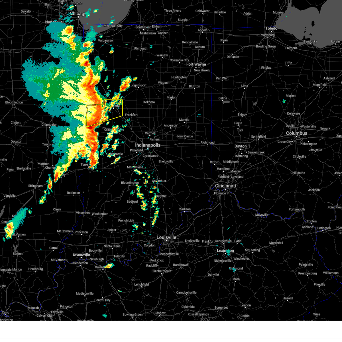
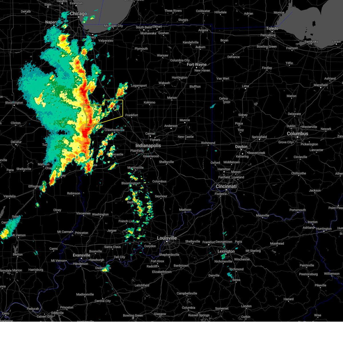
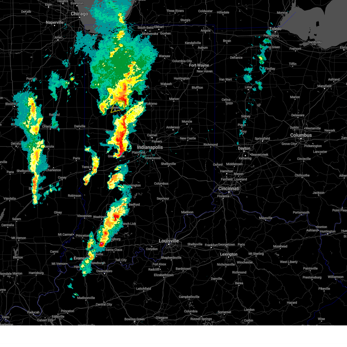
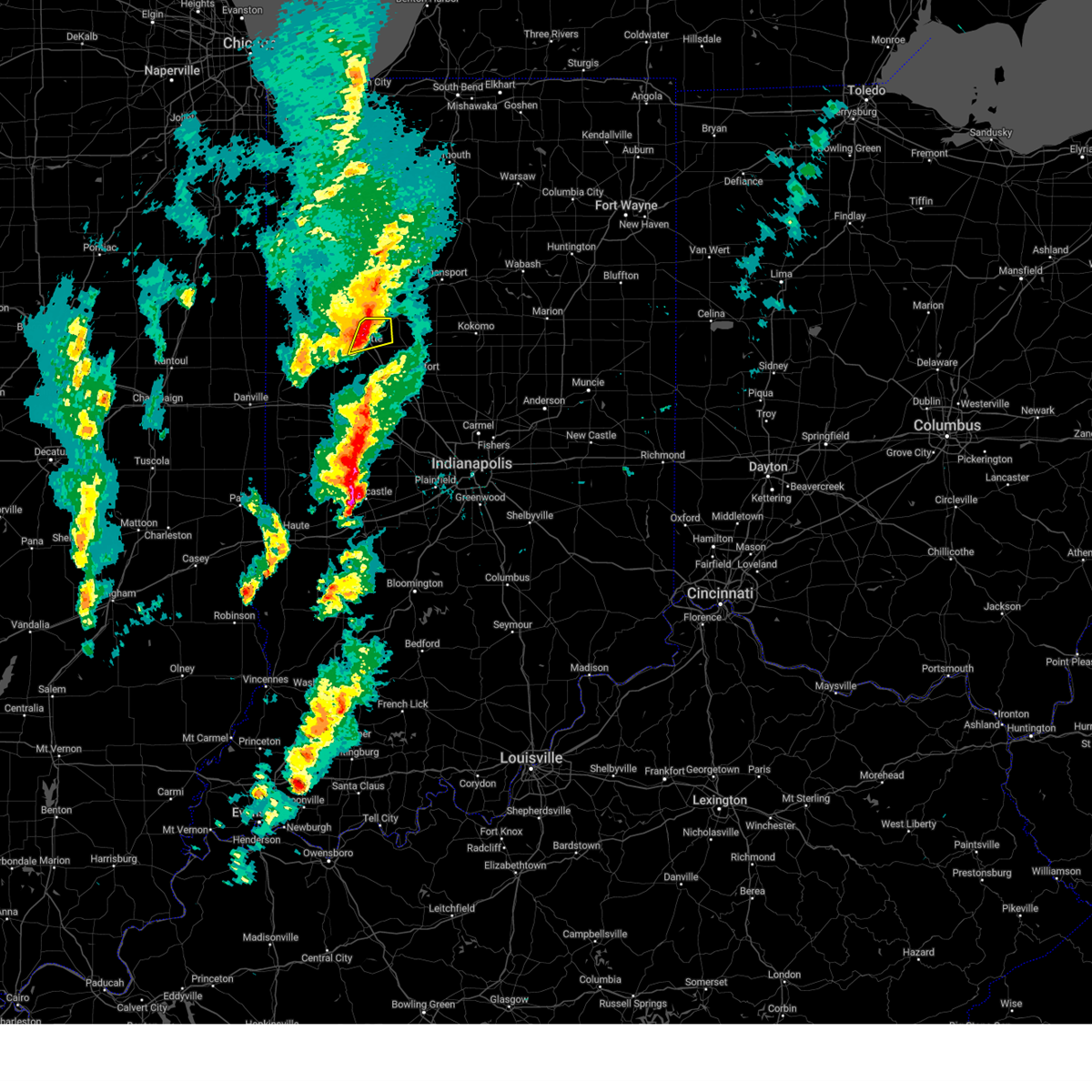
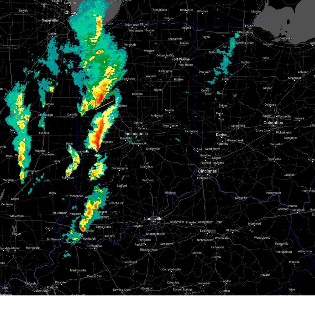
Hail Map for Buck Creek, IN
The Buck Creek, IN area has had 1 report of on-the-ground hail by trained spotters, and has been under severe weather warnings 27 times during the past 12 months. Doppler radar has detected hail at or near Buck Creek, IN on 52 occasions.
| Name: | Buck Creek, IN |
| Where Located: | 59.4 miles NNW of Indianapolis, IN |
| Map: | Google Map for Buck Creek, IN |
| Population: | 207 |
| Housing Units: | 82 |
| More Info: | Search Google for Buck Creek, IN |
0
The Top Recent Hail Date for Buck Creek, IN is Friday, July 28, 2023 (33rd out of 52)

Hail and Wind Damage Spotted near Buck Creek, IN
| Date / Time | Report Details |
|---|---|
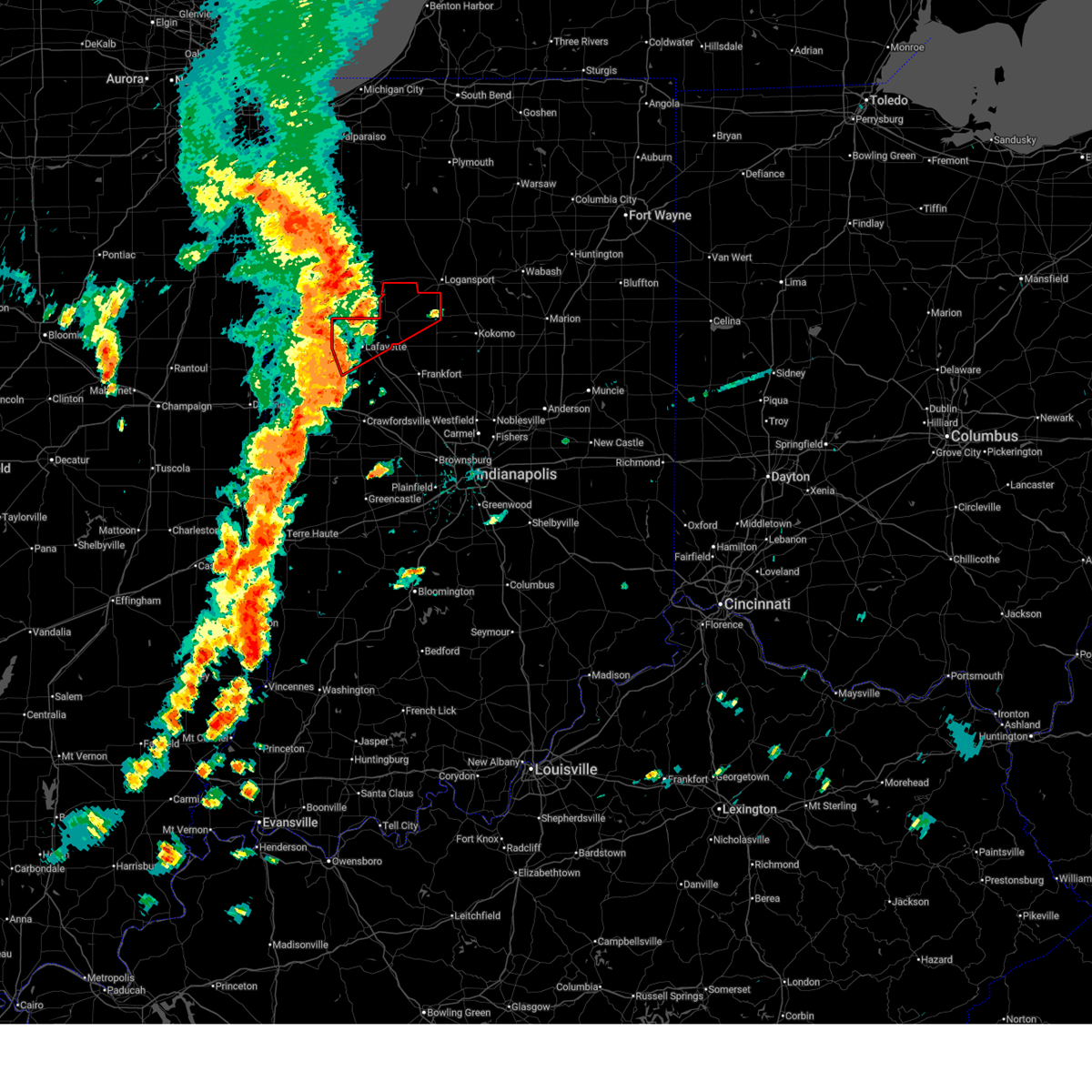
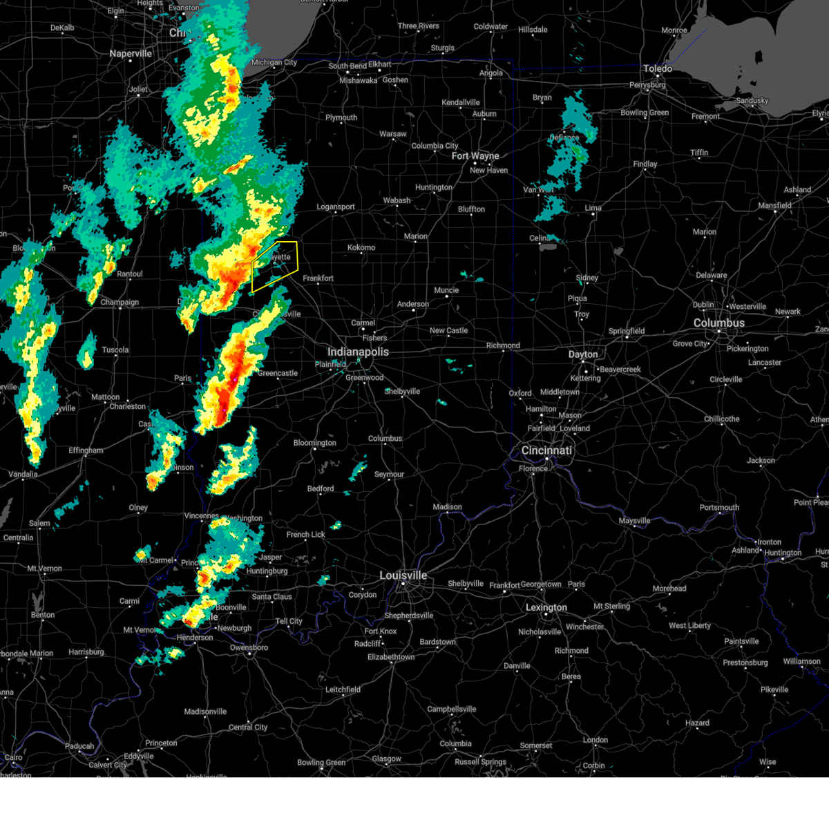
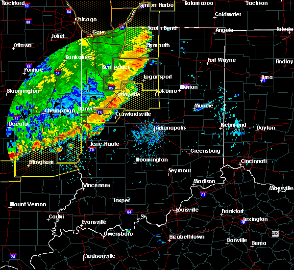
| 6/18/2025 3:43 PM EDT | Svrind the national weather service in indianapolis has issued a * severe thunderstorm warning for, carroll county in north central indiana, southeastern fountain county in west central indiana, eastern tippecanoe county in west central indiana, clinton county in central indiana, howard county in central indiana, northeastern parke county in west central indiana, boone county in central indiana, western tipton county in central indiana, montgomery county in west central indiana, * until 430 pm edt. * at 343 pm edt, severe thunderstorms were located along a line extending from 9 miles southwest of logansport to 7 miles south of crawfordsville, moving northeast at 45 mph (radar indicated). Hazards include 60 mph wind gusts and penny size hail. expect damage to roofs, siding, and trees |
| 6/18/2025 3:22 PM EDT | At 320 pm edt, severe thunderstorms were located along a line extending from 7 miles south of wolcott to west lafayette to 7 miles northwest of crawfordsville, moving northeast at 60 mph (radar indicated). Hazards include 70 mph wind gusts and penny size hail. Expect considerable tree damage. damage is likely to mobile homes, roofs, and outbuildings. locations impacted include, lafayette, crawfordsville, west lafayette, delphi, veedersburg, rossville, shadeland, dayton, battle ground, mulberry, montezuma, ladoga, waynetown, darlington, linden, colfax, new market, camden, clarks hill, and hillsboro. this includes the following highways, interstate 65 between mile markers 157 and 184. Interstate 74 between mile markers 14 and 44. |
| 6/18/2025 3:21 PM EDT | At 321 pm edt, a severe thunderstorm capable of producing a tornado was located near delphi, or 11 miles south of monticello, moving northeast at 65 mph (radar indicated rotation). Hazards include tornado. Flying debris will be dangerous to those caught without shelter. mobile homes will be damaged or destroyed. damage to roofs, windows, and vehicles will occur. tree damage is likely. Locations impacted include, delphi, flora, camden, and yeoman. |
| 6/18/2025 3:07 PM EDT |
 Torind the national weather service in indianapolis has issued a * tornado warning for, carroll county in north central indiana, tippecanoe county in west central indiana, * until 345 pm edt. * at 305 pm edt, a severe thunderstorm capable of producing a tornado was located near west lafayette, or near otterbein, moving northeast at 65 mph (radar indicated rotation). Hazards include tornado. Flying debris will be dangerous to those caught without shelter. mobile homes will be damaged or destroyed. damage to roofs, windows, and vehicles will occur. Tree damage is likely. Torind the national weather service in indianapolis has issued a * tornado warning for, carroll county in north central indiana, tippecanoe county in west central indiana, * until 345 pm edt. * at 305 pm edt, a severe thunderstorm capable of producing a tornado was located near west lafayette, or near otterbein, moving northeast at 65 mph (radar indicated rotation). Hazards include tornado. Flying debris will be dangerous to those caught without shelter. mobile homes will be damaged or destroyed. damage to roofs, windows, and vehicles will occur. Tree damage is likely.
|
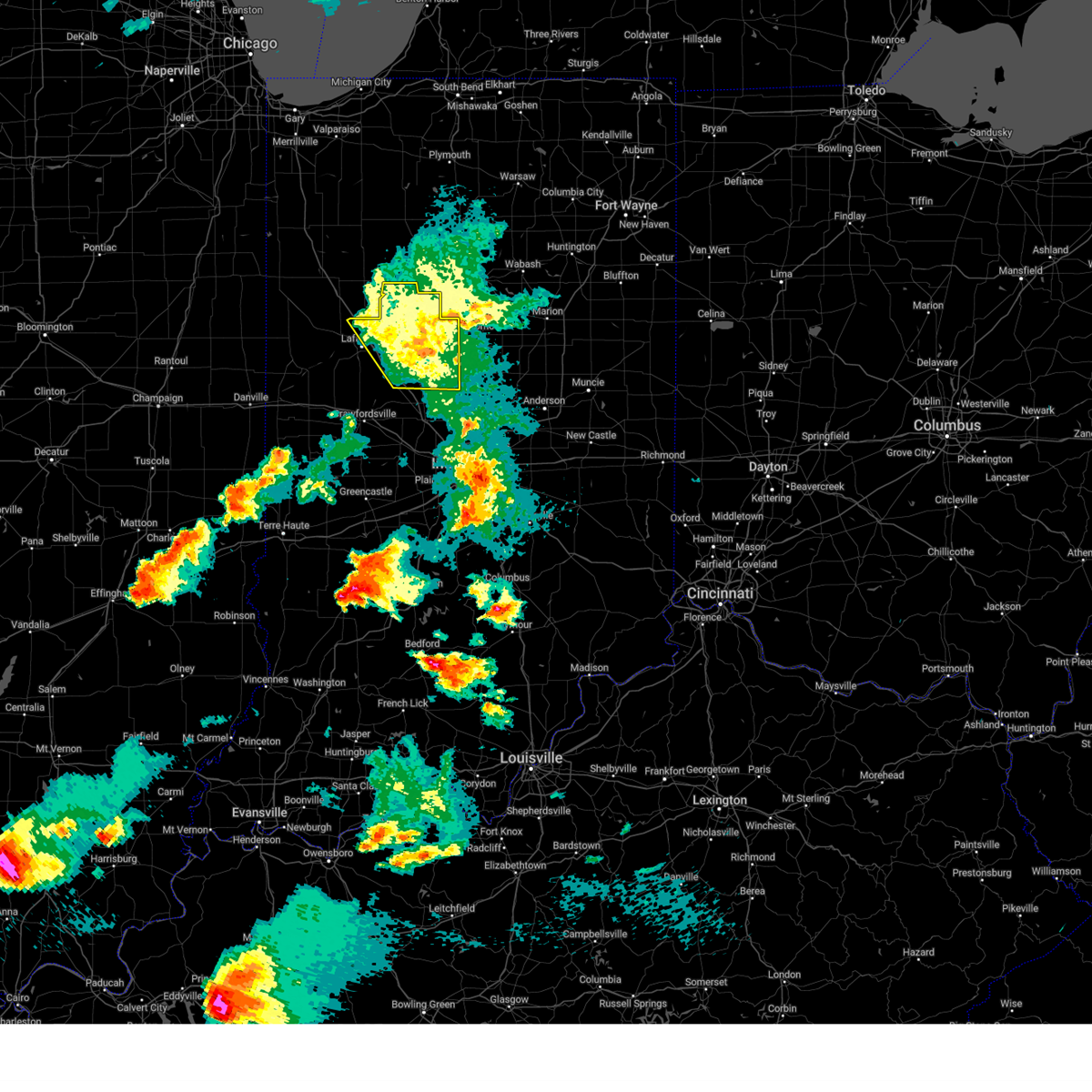
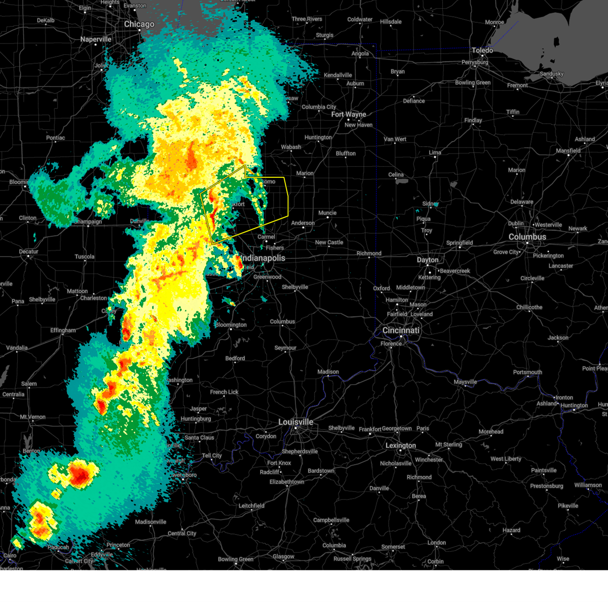
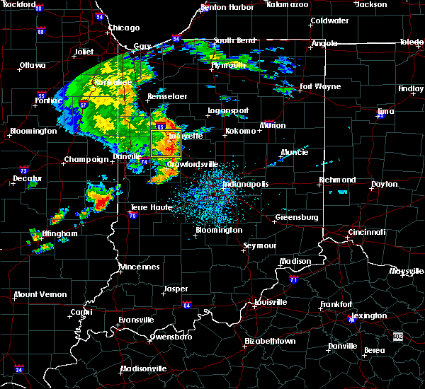
| 6/18/2025 2:57 PM EDT | At 256 pm edt, severe thunderstorms were located along a line extending from near boswell to 6 miles southeast of williamsport to 7 miles east of newport, moving east at 60 mph (radar indicated). Hazards include 70 mph wind gusts and quarter size hail. Hail damage to vehicles is expected. expect considerable tree damage. wind damage is also likely to mobile homes, roofs, and outbuildings. locations impacted include, lafayette, crawfordsville, west lafayette, delphi, covington, veedersburg, williamsport, newport, attica, rossville, shadeland, dayton, battle ground, mulberry, cayuga, montezuma, ladoga, waynetown, darlington, and linden. this includes the following highways, interstate 65 between mile markers 157 and 183. Interstate 74 between mile markers 2 and 44. |
| 6/18/2025 2:54 PM EDT | Svrind the national weather service in indianapolis has issued a * severe thunderstorm warning for, western carroll county in north central indiana, fountain county in west central indiana, tippecanoe county in west central indiana, western clinton county in central indiana, northern parke county in west central indiana, warren county in west central indiana, vermillion county in west central indiana, montgomery county in west central indiana, * until 345 pm edt. * at 254 pm edt, severe thunderstorms were located along a line extending from near boswell to 6 miles southeast of williamsport to 8 miles northeast of newport, moving northeast at 55 mph (radar indicated). Hazards include 60 mph wind gusts and quarter size hail. Hail damage to vehicles is expected. Expect wind damage to roofs, siding, and trees. |
| 5/16/2025 7:20 PM EDT | The storms which prompted the warning have weakened below severe limits, and have exited the warned area. therefore, the warning will be allowed to expire. a tornado watch remains in effect until 1100 pm edt for central, north central and west central indiana. |
| 5/16/2025 7:05 PM EDT |
 the severe thunderstorm warning has been cancelled and is no longer in effect the severe thunderstorm warning has been cancelled and is no longer in effect
|
| 5/16/2025 7:05 PM EDT |
 At 705 pm edt, severe thunderstorms were located along a line extending from 6 miles northwest of royal center to 8 miles southwest of kokomo, moving east at 70 mph (radar indicated). Hazards include 60 mph wind gusts. Expect damage to roofs, siding, and trees. locations impacted include, lafayette, frankfort, west lafayette, delphi, flora, rossville, dayton, battle ground, mulberry, russiaville, camden, burlington, michigantown, and yeoman. This includes interstate 65 between mile markers 153 and 184. At 705 pm edt, severe thunderstorms were located along a line extending from 6 miles northwest of royal center to 8 miles southwest of kokomo, moving east at 70 mph (radar indicated). Hazards include 60 mph wind gusts. Expect damage to roofs, siding, and trees. locations impacted include, lafayette, frankfort, west lafayette, delphi, flora, rossville, dayton, battle ground, mulberry, russiaville, camden, burlington, michigantown, and yeoman. This includes interstate 65 between mile markers 153 and 184.
|
| 5/16/2025 6:53 PM EDT |
 the severe thunderstorm warning has been cancelled and is no longer in effect the severe thunderstorm warning has been cancelled and is no longer in effect
|
| 5/16/2025 6:53 PM EDT |
 At 653 pm edt, severe thunderstorms were located along a line extending from near monticello to 6 miles east of frankfort, moving east at 70 mph (radar indicated). Hazards include 60 mph wind gusts. Expect damage to roofs, siding, and trees. locations impacted include, lafayette, frankfort, west lafayette, lebanon, delphi, flora, rossville, shadeland, thorntown, dayton, battle ground, mulberry, russiaville, darlington, kirklin, linden, colfax, camden, clarks hill, and burlington. this includes the following highways, interstate 65 between mile markers 136 and 184. Interstate 74 between mile markers 35 and 50. At 653 pm edt, severe thunderstorms were located along a line extending from near monticello to 6 miles east of frankfort, moving east at 70 mph (radar indicated). Hazards include 60 mph wind gusts. Expect damage to roofs, siding, and trees. locations impacted include, lafayette, frankfort, west lafayette, lebanon, delphi, flora, rossville, shadeland, thorntown, dayton, battle ground, mulberry, russiaville, darlington, kirklin, linden, colfax, camden, clarks hill, and burlington. this includes the following highways, interstate 65 between mile markers 136 and 184. Interstate 74 between mile markers 35 and 50.
|
| 5/16/2025 6:28 PM EDT | Svrind the national weather service in indianapolis has issued a * severe thunderstorm warning for, carroll county in north central indiana, fountain county in west central indiana, tippecanoe county in west central indiana, clinton county in central indiana, western howard county in central indiana, northeastern parke county in west central indiana, boone county in central indiana, warren county in west central indiana, montgomery county in west central indiana, * until 730 pm edt. * at 627 pm edt, severe thunderstorms were located along a line extending from near oxford to 7 miles southeast of crawfordsville, moving northeast at 50 mph (emergency management). Hazards include 60 mph wind gusts. expect damage to roofs, siding, and trees |
| 5/16/2025 5:37 PM EDT |
 Svrind the national weather service in indianapolis has issued a * severe thunderstorm warning for, fountain county in west central indiana, tippecanoe county in west central indiana, parke county in west central indiana, warren county in west central indiana, vermillion county in west central indiana, montgomery county in west central indiana, * until 630 pm edt. * at 537 pm edt, severe thunderstorms were located along a line extending from near gifford to near georgetown to near clinton, moving northeast at 65 mph (radar indicated). Hazards include 60 mph wind gusts. expect damage to roofs, siding, and trees Svrind the national weather service in indianapolis has issued a * severe thunderstorm warning for, fountain county in west central indiana, tippecanoe county in west central indiana, parke county in west central indiana, warren county in west central indiana, vermillion county in west central indiana, montgomery county in west central indiana, * until 630 pm edt. * at 537 pm edt, severe thunderstorms were located along a line extending from near gifford to near georgetown to near clinton, moving northeast at 65 mph (radar indicated). Hazards include 60 mph wind gusts. expect damage to roofs, siding, and trees
|
| 3/30/2025 4:26 PM EDT |
 The storm which prompted the warning has moved out of the area. therefore, the warning will be allowed to expire. a tornado watch remains in effect until 800 pm edt for central, north central and west central indiana. remember, a tornado warning still remains in effect. The storm which prompted the warning has moved out of the area. therefore, the warning will be allowed to expire. a tornado watch remains in effect until 800 pm edt for central, north central and west central indiana. remember, a tornado warning still remains in effect.
|
| 3/30/2025 4:07 PM EDT |
 At 406 pm edt, a severe thunderstorm was located 7 miles northeast of delphi, or 12 miles southeast of monticello, moving northeast at 45 mph (radar indicated). Hazards include 60 mph wind gusts and penny size hail. Expect damage to roofs, siding, and trees. locations impacted include, battle ground, camden, lafayette, flora, yeoman, burlington, rossville, delphi, dayton, and mulberry. This includes interstate 65 between mile markers 165 and 178. At 406 pm edt, a severe thunderstorm was located 7 miles northeast of delphi, or 12 miles southeast of monticello, moving northeast at 45 mph (radar indicated). Hazards include 60 mph wind gusts and penny size hail. Expect damage to roofs, siding, and trees. locations impacted include, battle ground, camden, lafayette, flora, yeoman, burlington, rossville, delphi, dayton, and mulberry. This includes interstate 65 between mile markers 165 and 178.
|
| 3/30/2025 3:47 PM EDT |
 Svrind the national weather service in indianapolis has issued a * severe thunderstorm warning for, carroll county in north central indiana, eastern tippecanoe county in west central indiana, northwestern clinton county in central indiana, * until 430 pm edt. * at 346 pm edt, severe thunderstorms were located along a line extending from near wolcott to brookston to near lafayette, moving northeast at 80 mph (radar indicated). Hazards include 60 mph wind gusts and penny size hail. expect damage to roofs, siding, and trees Svrind the national weather service in indianapolis has issued a * severe thunderstorm warning for, carroll county in north central indiana, eastern tippecanoe county in west central indiana, northwestern clinton county in central indiana, * until 430 pm edt. * at 346 pm edt, severe thunderstorms were located along a line extending from near wolcott to brookston to near lafayette, moving northeast at 80 mph (radar indicated). Hazards include 60 mph wind gusts and penny size hail. expect damage to roofs, siding, and trees
|
| 3/30/2025 3:37 PM EDT |
 At 336 pm edt, a severe thunderstorm was located near otterbein, moving northeast at 65 mph (radar indicated). Hazards include 60 mph wind gusts and penny size hail. Expect damage to roofs, siding, and trees. locations impacted include, west lebanon, attica, purdue university, covington, dayton, battle ground, newtown, pine village, west lafayette, lafayette, shadeland, williamsport, and rainsville. This includes interstate 65 between mile markers 162 and 184. At 336 pm edt, a severe thunderstorm was located near otterbein, moving northeast at 65 mph (radar indicated). Hazards include 60 mph wind gusts and penny size hail. Expect damage to roofs, siding, and trees. locations impacted include, west lebanon, attica, purdue university, covington, dayton, battle ground, newtown, pine village, west lafayette, lafayette, shadeland, williamsport, and rainsville. This includes interstate 65 between mile markers 162 and 184.
|
| 3/30/2025 3:21 PM EDT |
 Svrind the national weather service in indianapolis has issued a * severe thunderstorm warning for, northern fountain county in west central indiana, tippecanoe county in west central indiana, warren county in west central indiana, * until 400 pm edt. * at 320 pm edt, severe thunderstorms were located along a line extending from near boswell to 6 miles northwest of williamsport to near covington, moving northeast at 70 mph. these are destructive storms for rainsville, attica, shadeland, and lafayette (radar indicated). Hazards include 80 mph wind gusts and penny size hail. Flying debris will be dangerous to those caught without shelter. mobile homes will be heavily damaged. expect considerable damage to roofs, windows, and vehicles. Extensive tree damage and power outages are likely. Svrind the national weather service in indianapolis has issued a * severe thunderstorm warning for, northern fountain county in west central indiana, tippecanoe county in west central indiana, warren county in west central indiana, * until 400 pm edt. * at 320 pm edt, severe thunderstorms were located along a line extending from near boswell to 6 miles northwest of williamsport to near covington, moving northeast at 70 mph. these are destructive storms for rainsville, attica, shadeland, and lafayette (radar indicated). Hazards include 80 mph wind gusts and penny size hail. Flying debris will be dangerous to those caught without shelter. mobile homes will be heavily damaged. expect considerable damage to roofs, windows, and vehicles. Extensive tree damage and power outages are likely.
|
| 3/19/2025 7:35 PM EDT |
 the severe thunderstorm warning has been cancelled and is no longer in effect the severe thunderstorm warning has been cancelled and is no longer in effect
|
| 3/19/2025 7:25 PM EDT |
 At 724 pm edt, severe thunderstorms were located along a line extending from near brookston to near west lafayette, moving northeast at 60 mph (radar indicated). Hazards include 60 mph wind gusts and penny size hail. Expect damage to roofs, siding, and trees. Locations impacted include, battle ground, west lafayette, lafayette, purdue university, and shadeland. At 724 pm edt, severe thunderstorms were located along a line extending from near brookston to near west lafayette, moving northeast at 60 mph (radar indicated). Hazards include 60 mph wind gusts and penny size hail. Expect damage to roofs, siding, and trees. Locations impacted include, battle ground, west lafayette, lafayette, purdue university, and shadeland.
|
| 3/19/2025 7:15 PM EDT |
 At 715 pm edt, severe thunderstorms were located along a line extending from 6 miles south of brookston to west lafayette to 11 miles east of williamsport, moving northeast at 65 mph (radar indicated). Hazards include 60 mph wind gusts and penny size hail. Expect damage to roofs, siding, and trees. locations impacted include, battle ground, west lafayette, lafayette, shadeland, dayton, and purdue university. This includes interstate 65 between mile markers 168 and 181. At 715 pm edt, severe thunderstorms were located along a line extending from 6 miles south of brookston to west lafayette to 11 miles east of williamsport, moving northeast at 65 mph (radar indicated). Hazards include 60 mph wind gusts and penny size hail. Expect damage to roofs, siding, and trees. locations impacted include, battle ground, west lafayette, lafayette, shadeland, dayton, and purdue university. This includes interstate 65 between mile markers 168 and 181.
|
| 3/19/2025 7:04 PM EDT |
 Svrind the national weather service in indianapolis has issued a * severe thunderstorm warning for, tippecanoe county in west central indiana, * until 745 pm edt. * at 704 pm edt, severe thunderstorms were located along a line extending from near otterbein to near williamsport, moving northeast at 65 mph (radar indicated). Hazards include 60 mph wind gusts and nickel size hail. expect damage to roofs, siding, and trees Svrind the national weather service in indianapolis has issued a * severe thunderstorm warning for, tippecanoe county in west central indiana, * until 745 pm edt. * at 704 pm edt, severe thunderstorms were located along a line extending from near otterbein to near williamsport, moving northeast at 65 mph (radar indicated). Hazards include 60 mph wind gusts and nickel size hail. expect damage to roofs, siding, and trees
|
| 3/15/2025 3:04 AM EDT |
 At 304 am edt, severe thunderstorms were located along a line extending from 7 miles east of lafayette to 7 miles west of lebanon, moving northeast at 55 mph (radar indicated). Hazards include 70 mph wind gusts. Expect considerable tree damage. damage is likely to mobile homes, roofs, and outbuildings. locations impacted include, greentown, kokomo, ulen, michigantown, darlington, russiaville, dayton, indian heights, atlanta, burlington, kempton, rossville, colfax, sharpsville, mulberry, kirklin, advance, thorntown, tipton, and lebanon. this includes the following highways, interstate 65 between mile markers 139 and 174. Interstate 74 between mile markers 42 and 48. At 304 am edt, severe thunderstorms were located along a line extending from 7 miles east of lafayette to 7 miles west of lebanon, moving northeast at 55 mph (radar indicated). Hazards include 70 mph wind gusts. Expect considerable tree damage. damage is likely to mobile homes, roofs, and outbuildings. locations impacted include, greentown, kokomo, ulen, michigantown, darlington, russiaville, dayton, indian heights, atlanta, burlington, kempton, rossville, colfax, sharpsville, mulberry, kirklin, advance, thorntown, tipton, and lebanon. this includes the following highways, interstate 65 between mile markers 139 and 174. Interstate 74 between mile markers 42 and 48.
|
| 3/15/2025 2:57 AM EDT |
 Svrind the national weather service in indianapolis has issued a * severe thunderstorm warning for, southern carroll county in north central indiana, southeastern tippecanoe county in west central indiana, clinton county in central indiana, howard county in central indiana, northern boone county in central indiana, northern hamilton county in central indiana, tipton county in central indiana, northeastern montgomery county in west central indiana, * until 345 am edt. * at 256 am edt, severe thunderstorms were located along a line extending from near lafayette to 8 miles east of crawfordsville, moving northeast at 55 mph (radar indicated). Hazards include 60 mph wind gusts. expect damage to roofs, siding, and trees Svrind the national weather service in indianapolis has issued a * severe thunderstorm warning for, southern carroll county in north central indiana, southeastern tippecanoe county in west central indiana, clinton county in central indiana, howard county in central indiana, northern boone county in central indiana, northern hamilton county in central indiana, tipton county in central indiana, northeastern montgomery county in west central indiana, * until 345 am edt. * at 256 am edt, severe thunderstorms were located along a line extending from near lafayette to 8 miles east of crawfordsville, moving northeast at 55 mph (radar indicated). Hazards include 60 mph wind gusts. expect damage to roofs, siding, and trees
|
| 7/16/2024 12:16 AM EDT |
 Svrind the national weather service in indianapolis has issued a * severe thunderstorm warning for, northwestern madison county in central indiana, carroll county in north central indiana, eastern tippecanoe county in west central indiana, clinton county in central indiana, howard county in central indiana, northern boone county in central indiana, northern hamilton county in central indiana, tipton county in central indiana, northern montgomery county in west central indiana, * until 1245 am edt. * at 1216 am edt, severe thunderstorms were located along a line extending from near logansport to 11 miles northeast of frankfort to 12 miles northwest of lebanon, moving east at 60 mph (radar indicated). Hazards include 70 mph wind gusts. Expect considerable tree damage. Damage is likely to mobile homes, roofs, and outbuildings. Svrind the national weather service in indianapolis has issued a * severe thunderstorm warning for, northwestern madison county in central indiana, carroll county in north central indiana, eastern tippecanoe county in west central indiana, clinton county in central indiana, howard county in central indiana, northern boone county in central indiana, northern hamilton county in central indiana, tipton county in central indiana, northern montgomery county in west central indiana, * until 1245 am edt. * at 1216 am edt, severe thunderstorms were located along a line extending from near logansport to 11 miles northeast of frankfort to 12 miles northwest of lebanon, moving east at 60 mph (radar indicated). Hazards include 70 mph wind gusts. Expect considerable tree damage. Damage is likely to mobile homes, roofs, and outbuildings.
|
| 7/15/2024 11:59 PM EDT |
 Svrind the national weather service in indianapolis has issued a * severe thunderstorm warning for, carroll county in north central indiana, fountain county in west central indiana, tippecanoe county in west central indiana, clinton county in central indiana, northern parke county in west central indiana, northwestern boone county in central indiana, northern vermillion county in west central indiana, montgomery county in west central indiana, northwestern putnam county in west central indiana, * until 1230 am edt. * at 1159 pm edt, severe thunderstorms were located along a line extending from near monticello to 12 miles east of williamsport to 6 miles east of georgetown, moving east at 40 mph (radar indicated). Hazards include 60 mph wind gusts. expect damage to roofs, siding, and trees Svrind the national weather service in indianapolis has issued a * severe thunderstorm warning for, carroll county in north central indiana, fountain county in west central indiana, tippecanoe county in west central indiana, clinton county in central indiana, northern parke county in west central indiana, northwestern boone county in central indiana, northern vermillion county in west central indiana, montgomery county in west central indiana, northwestern putnam county in west central indiana, * until 1230 am edt. * at 1159 pm edt, severe thunderstorms were located along a line extending from near monticello to 12 miles east of williamsport to 6 miles east of georgetown, moving east at 40 mph (radar indicated). Hazards include 60 mph wind gusts. expect damage to roofs, siding, and trees
|
| 7/15/2024 11:21 PM EDT |
 Svrind the national weather service in indianapolis has issued a * severe thunderstorm warning for, carroll county in north central indiana, fountain county in west central indiana, tippecanoe county in west central indiana, western clinton county in central indiana, parke county in west central indiana, northwestern boone county in central indiana, warren county in west central indiana, vermillion county in west central indiana, montgomery county in west central indiana, northwestern putnam county in west central indiana, * until midnight edt. * at 1121 pm edt, severe thunderstorms were located along a line extending from 6 miles south of rensselaer to near rossville to near arcola to near sullivan, moving southeast at 60 mph (radar indicated). Hazards include 60 mph wind gusts. expect damage to roofs, siding, and trees Svrind the national weather service in indianapolis has issued a * severe thunderstorm warning for, carroll county in north central indiana, fountain county in west central indiana, tippecanoe county in west central indiana, western clinton county in central indiana, parke county in west central indiana, northwestern boone county in central indiana, warren county in west central indiana, vermillion county in west central indiana, montgomery county in west central indiana, northwestern putnam county in west central indiana, * until midnight edt. * at 1121 pm edt, severe thunderstorms were located along a line extending from 6 miles south of rensselaer to near rossville to near arcola to near sullivan, moving southeast at 60 mph (radar indicated). Hazards include 60 mph wind gusts. expect damage to roofs, siding, and trees
|
| 3/14/2024 11:06 AM EDT |
 Svrind the national weather service in indianapolis has issued a * severe thunderstorm warning for, northeastern vigo county in west central indiana, western carroll county in north central indiana, eastern fountain county in west central indiana, tippecanoe county in west central indiana, western clinton county in central indiana, northwestern hendricks county in central indiana, eastern parke county in west central indiana, western boone county in central indiana, east central warren county in west central indiana, montgomery county in west central indiana, northern putnam county in west central indiana, * until 1130 am edt. * at 1105 am edt, severe thunderstorms were located along a line extending from 8 miles south of otterbein to 12 miles west of crawfordsville to 8 miles northwest of brazil, moving northeast at 70 mph (radar indicated). Hazards include 60 mph wind gusts and quarter size hail. Hail damage to vehicles is expected. Expect wind damage to roofs, siding, and trees. Svrind the national weather service in indianapolis has issued a * severe thunderstorm warning for, northeastern vigo county in west central indiana, western carroll county in north central indiana, eastern fountain county in west central indiana, tippecanoe county in west central indiana, western clinton county in central indiana, northwestern hendricks county in central indiana, eastern parke county in west central indiana, western boone county in central indiana, east central warren county in west central indiana, montgomery county in west central indiana, northern putnam county in west central indiana, * until 1130 am edt. * at 1105 am edt, severe thunderstorms were located along a line extending from 8 miles south of otterbein to 12 miles west of crawfordsville to 8 miles northwest of brazil, moving northeast at 70 mph (radar indicated). Hazards include 60 mph wind gusts and quarter size hail. Hail damage to vehicles is expected. Expect wind damage to roofs, siding, and trees.
|
| 6/29/2023 3:57 PM EDT |
 The severe thunderstorm warning for southwestern carroll, tippecanoe, northwestern clinton, northeastern warren and northeastern montgomery counties will expire at 400 pm edt, the storms which prompted the warning have moved out of the area. therefore, the warning will be allowed to expire. a severe thunderstorm watch remains in effect until 800 pm edt for central, north central and west central indiana. The severe thunderstorm warning for southwestern carroll, tippecanoe, northwestern clinton, northeastern warren and northeastern montgomery counties will expire at 400 pm edt, the storms which prompted the warning have moved out of the area. therefore, the warning will be allowed to expire. a severe thunderstorm watch remains in effect until 800 pm edt for central, north central and west central indiana.
|
| 6/29/2023 3:30 PM EDT |
 At 330 pm edt, severe thunderstorms were located along a line extending from near west lafayette to 13 miles northeast of crawfordsville, moving east at 60 mph (radar indicated). Hazards include 60 mph wind gusts and quarter size hail. Hail damage to vehicles is expected. expect wind damage to roofs, siding, and trees. severe thunderstorms will be near, clarks hill around 335 pm edt. this includes interstate 65 between mile markers 160 and 184. hail threat, radar indicated max hail size, 1. 00 in wind threat, radar indicated max wind gust, 60 mph. At 330 pm edt, severe thunderstorms were located along a line extending from near west lafayette to 13 miles northeast of crawfordsville, moving east at 60 mph (radar indicated). Hazards include 60 mph wind gusts and quarter size hail. Hail damage to vehicles is expected. expect wind damage to roofs, siding, and trees. severe thunderstorms will be near, clarks hill around 335 pm edt. this includes interstate 65 between mile markers 160 and 184. hail threat, radar indicated max hail size, 1. 00 in wind threat, radar indicated max wind gust, 60 mph.
|
| 6/29/2023 2:44 PM EDT |
 At 243 pm edt, severe thunderstorms were located along a line extending from near cissna park to near danville, moving northeast at 75 mph (radar indicated). Hazards include 60 mph wind gusts and quarter size hail. Hail damage to vehicles is expected. expect wind damage to roofs, siding, and trees. severe thunderstorms will be near, west lebanon and pence around 255 pm edt. williamsport around 300 pm edt. other locations in the path of these severe thunderstorms include attica, pine village, rainsville, shadeland, lafayette, west lafayette, purdue university and battle ground. this includes interstate 65 between mile markers 161 and 184. hail threat, radar indicated max hail size, 1. 00 in wind threat, radar indicated max wind gust, 60 mph. At 243 pm edt, severe thunderstorms were located along a line extending from near cissna park to near danville, moving northeast at 75 mph (radar indicated). Hazards include 60 mph wind gusts and quarter size hail. Hail damage to vehicles is expected. expect wind damage to roofs, siding, and trees. severe thunderstorms will be near, west lebanon and pence around 255 pm edt. williamsport around 300 pm edt. other locations in the path of these severe thunderstorms include attica, pine village, rainsville, shadeland, lafayette, west lafayette, purdue university and battle ground. this includes interstate 65 between mile markers 161 and 184. hail threat, radar indicated max hail size, 1. 00 in wind threat, radar indicated max wind gust, 60 mph.
|
| 7/23/2022 9:27 AM EDT |
 The severe thunderstorm warning for carroll, northern tippecanoe and northern howard counties will expire at 930 am edt, the storm which prompted the warning has moved out of the area. therefore, the warning will be allowed to expire. however gusty winds are still possible with this thunderstorm. a severe thunderstorm watch remains in effect until 200 pm edt for central and north central indiana. The severe thunderstorm warning for carroll, northern tippecanoe and northern howard counties will expire at 930 am edt, the storm which prompted the warning has moved out of the area. therefore, the warning will be allowed to expire. however gusty winds are still possible with this thunderstorm. a severe thunderstorm watch remains in effect until 200 pm edt for central and north central indiana.
|
| 7/23/2022 9:14 AM EDT |
 At 913 am edt, a severe thunderstorm was located 7 miles west of kokomo, moving southeast at 45 mph (radar indicated). Hazards include 60 mph wind gusts. Expect damage to roofs, siding, and trees. locations impacted include, kokomo, west lafayette, delphi, flora, battle ground, camden, burlington and yeoman. this includes interstate 65 between mile markers 175 and 184. hail threat, radar indicated max hail size, <. 75 in wind threat, radar indicated max wind gust, 60 mph. At 913 am edt, a severe thunderstorm was located 7 miles west of kokomo, moving southeast at 45 mph (radar indicated). Hazards include 60 mph wind gusts. Expect damage to roofs, siding, and trees. locations impacted include, kokomo, west lafayette, delphi, flora, battle ground, camden, burlington and yeoman. this includes interstate 65 between mile markers 175 and 184. hail threat, radar indicated max hail size, <. 75 in wind threat, radar indicated max wind gust, 60 mph.
|
| 7/23/2022 8:59 AM EDT |
 At 859 am edt, a severe thunderstorm was located 11 miles east of delphi, or 13 miles south of logansport, moving southeast at 30 mph (radar indicated). Hazards include 60 mph wind gusts. Expect damage to roofs, siding, and trees. locations impacted include, burlington and kokomo. this includes interstate 65 between mile markers 175 and 184. hail threat, radar indicated max hail size, <. 75 in wind threat, radar indicated max wind gust, 60 mph. At 859 am edt, a severe thunderstorm was located 11 miles east of delphi, or 13 miles south of logansport, moving southeast at 30 mph (radar indicated). Hazards include 60 mph wind gusts. Expect damage to roofs, siding, and trees. locations impacted include, burlington and kokomo. this includes interstate 65 between mile markers 175 and 184. hail threat, radar indicated max hail size, <. 75 in wind threat, radar indicated max wind gust, 60 mph.
|
| 7/23/2022 8:40 AM EDT |
 At 839 am edt, a severe thunderstorm was located 7 miles east of monticello, moving southeast at 45 mph (radar indicated). Hazards include 60 mph wind gusts. Expect damage to roofs, siding, and trees. this severe thunderstorm will be near, camden around 850 am edt. other locations in the path of this severe thunderstorm include kokomo. this includes interstate 65 between mile markers 175 and 184. hail threat, radar indicated max hail size, <. 75 in wind threat, radar indicated max wind gust, 60 mph. At 839 am edt, a severe thunderstorm was located 7 miles east of monticello, moving southeast at 45 mph (radar indicated). Hazards include 60 mph wind gusts. Expect damage to roofs, siding, and trees. this severe thunderstorm will be near, camden around 850 am edt. other locations in the path of this severe thunderstorm include kokomo. this includes interstate 65 between mile markers 175 and 184. hail threat, radar indicated max hail size, <. 75 in wind threat, radar indicated max wind gust, 60 mph.
|
| 3/6/2022 2:14 AM EST |
 At 213 am est, a severe thunderstorm was located 7 miles southwest of walton, or 10 miles south of logansport, moving east at 75 mph (radar indicated). Hazards include 60 mph wind gusts. Expect damage to roofs, siding, and trees. this severe thunderstorm will remain over mainly rural areas of carroll, northeastern fountain, tippecanoe, western clinton and northern montgomery counties. this includes the following highways, interstate 65 between mile markers 154 and 178. interstate 74 between mile markers 14 and 22. hail threat, radar indicated max hail size, <. 75 in wind threat, radar indicated max wind gust, 60 mph. At 213 am est, a severe thunderstorm was located 7 miles southwest of walton, or 10 miles south of logansport, moving east at 75 mph (radar indicated). Hazards include 60 mph wind gusts. Expect damage to roofs, siding, and trees. this severe thunderstorm will remain over mainly rural areas of carroll, northeastern fountain, tippecanoe, western clinton and northern montgomery counties. this includes the following highways, interstate 65 between mile markers 154 and 178. interstate 74 between mile markers 14 and 22. hail threat, radar indicated max hail size, <. 75 in wind threat, radar indicated max wind gust, 60 mph.
|
| 3/6/2022 1:47 AM EST |
 At 146 am est, a severe thunderstorm was located 9 miles south of otterbein, moving east at 75 mph (radar indicated). Hazards include 60 mph wind gusts. Expect damage to roofs, siding, and trees. this severe thunderstorm will be near, lafayette, west lafayette, shadeland and purdue university around 155 am est. dayton and battle ground around 205 am est. delphi and rossville around 210 am est. other locations in the path of this severe thunderstorm include flora, camden and burlington. this includes the following highways, interstate 65 between mile markers 154 and 184. interstate 74 between mile markers 1 and 22. hail threat, radar indicated max hail size, <. 75 in wind threat, radar indicated max wind gust, 60 mph. At 146 am est, a severe thunderstorm was located 9 miles south of otterbein, moving east at 75 mph (radar indicated). Hazards include 60 mph wind gusts. Expect damage to roofs, siding, and trees. this severe thunderstorm will be near, lafayette, west lafayette, shadeland and purdue university around 155 am est. dayton and battle ground around 205 am est. delphi and rossville around 210 am est. other locations in the path of this severe thunderstorm include flora, camden and burlington. this includes the following highways, interstate 65 between mile markers 154 and 184. interstate 74 between mile markers 1 and 22. hail threat, radar indicated max hail size, <. 75 in wind threat, radar indicated max wind gust, 60 mph.
|
| 3/6/2022 1:23 AM EST |
 At 122 am est, a severe thunderstorm was located 10 miles east of rossville, or 17 miles northeast of danville, moving east at 75 mph (radar indicated). Hazards include 60 mph wind gusts. Expect damage to roofs, siding, and trees. this severe thunderstorm will be near, pine village and rainsville around 130 am est. lafayette, west lafayette and purdue university around 140 am est. other locations in the path of this severe thunderstorm include battle ground. this includes the following highways, interstate 65 between mile markers 161 and 183. interstate 74 between mile markers 1 and 22. hail threat, radar indicated max hail size, <. 75 in wind threat, radar indicated max wind gust, 60 mph. At 122 am est, a severe thunderstorm was located 10 miles east of rossville, or 17 miles northeast of danville, moving east at 75 mph (radar indicated). Hazards include 60 mph wind gusts. Expect damage to roofs, siding, and trees. this severe thunderstorm will be near, pine village and rainsville around 130 am est. lafayette, west lafayette and purdue university around 140 am est. other locations in the path of this severe thunderstorm include battle ground. this includes the following highways, interstate 65 between mile markers 161 and 183. interstate 74 between mile markers 1 and 22. hail threat, radar indicated max hail size, <. 75 in wind threat, radar indicated max wind gust, 60 mph.
|
| 10/11/2021 6:12 PM EDT |
 The severe thunderstorm warning for carroll, northeastern tippecanoe and northwestern clinton counties will expire at 615 pm edt, the storm which prompted the warning has moved out of the area. therefore, the warning will be allowed to expire. however gusty winds are still possible with this thunderstorm. The severe thunderstorm warning for carroll, northeastern tippecanoe and northwestern clinton counties will expire at 615 pm edt, the storm which prompted the warning has moved out of the area. therefore, the warning will be allowed to expire. however gusty winds are still possible with this thunderstorm.
|
| 10/11/2021 5:59 PM EDT |
 At 558 pm edt, a severe thunderstorm was located near delphi, or 10 miles southeast of monticello, moving northeast at 60 mph (radar indicated). Hazards include 60 mph wind gusts and nickel size hail. Expect damage to roofs, siding, and trees. this severe thunderstorm will remain over mainly rural areas of carroll, northeastern tippecanoe and northwestern clinton counties. this includes interstate 65 between mile markers 176 and 184. hail threat, radar indicated max hail size, 0. 88 in wind threat, radar indicated max wind gust, 60 mph. At 558 pm edt, a severe thunderstorm was located near delphi, or 10 miles southeast of monticello, moving northeast at 60 mph (radar indicated). Hazards include 60 mph wind gusts and nickel size hail. Expect damage to roofs, siding, and trees. this severe thunderstorm will remain over mainly rural areas of carroll, northeastern tippecanoe and northwestern clinton counties. this includes interstate 65 between mile markers 176 and 184. hail threat, radar indicated max hail size, 0. 88 in wind threat, radar indicated max wind gust, 60 mph.
|
| 10/11/2021 5:57 PM EDT |
 The severe thunderstorm warning for eastern tippecanoe and western montgomery counties will expire at 600 pm edt, the storm which prompted the warning has weakened below severe limits, and no longer poses an immediate threat to life or property. therefore, the warning will be allowed to expire. however gusty winds are still possible with this thunderstorm. The severe thunderstorm warning for eastern tippecanoe and western montgomery counties will expire at 600 pm edt, the storm which prompted the warning has weakened below severe limits, and no longer poses an immediate threat to life or property. therefore, the warning will be allowed to expire. however gusty winds are still possible with this thunderstorm.
|
| 10/11/2021 5:44 PM EDT |
 At 544 pm edt, a severe thunderstorm was located 8 miles southwest of delphi, or 8 miles northeast of lafayette, moving northeast at 60 mph (radar indicated). Hazards include 60 mph wind gusts and nickel size hail. Expect damage to roofs, siding, and trees. this severe thunderstorm will be near, delphi, flora, camden and yeoman around 555 pm edt. this includes interstate 65 between mile markers 176 and 184. hail threat, radar indicated max hail size, 0. 88 in wind threat, radar indicated max wind gust, 60 mph. At 544 pm edt, a severe thunderstorm was located 8 miles southwest of delphi, or 8 miles northeast of lafayette, moving northeast at 60 mph (radar indicated). Hazards include 60 mph wind gusts and nickel size hail. Expect damage to roofs, siding, and trees. this severe thunderstorm will be near, delphi, flora, camden and yeoman around 555 pm edt. this includes interstate 65 between mile markers 176 and 184. hail threat, radar indicated max hail size, 0. 88 in wind threat, radar indicated max wind gust, 60 mph.
|
| 10/11/2021 5:36 PM EDT |
 At 535 pm edt, a severe thunderstorm was located 11 miles north of crawfordsville, moving northeast at 60 mph (trained weather spotters). Hazards include 60 mph wind gusts and quarter size hail. Hail damage to vehicles is expected. expect wind damage to roofs, siding, and trees. locations impacted include, dayton. this includes the following highways, interstate 65 between mile markers 162 and 178. interstate 74 between mile markers 26 and 37. hail threat, radar indicated max hail size, 1. 00 in wind threat, radar indicated max wind gust, 60 mph. At 535 pm edt, a severe thunderstorm was located 11 miles north of crawfordsville, moving northeast at 60 mph (trained weather spotters). Hazards include 60 mph wind gusts and quarter size hail. Hail damage to vehicles is expected. expect wind damage to roofs, siding, and trees. locations impacted include, dayton. this includes the following highways, interstate 65 between mile markers 162 and 178. interstate 74 between mile markers 26 and 37. hail threat, radar indicated max hail size, 1. 00 in wind threat, radar indicated max wind gust, 60 mph.
|
| 10/11/2021 5:23 PM EDT |
 At 523 pm edt, a severe thunderstorm was located near crawfordsville, moving northeast at 60 mph (trained weather spotters). Hazards include 60 mph wind gusts and quarter size hail. Hail damage to vehicles is expected. expect wind damage to roofs, siding, and trees. this severe thunderstorm will be near, linden and new richmond around 535 pm edt. other locations in the path of this severe thunderstorm include dayton. this includes the following highways, interstate 65 between mile markers 162 and 178. interstate 74 between mile markers 26 and 37. hail threat, observed max hail size, 1. 00 in wind threat, radar indicated max wind gust, 60 mph. At 523 pm edt, a severe thunderstorm was located near crawfordsville, moving northeast at 60 mph (trained weather spotters). Hazards include 60 mph wind gusts and quarter size hail. Hail damage to vehicles is expected. expect wind damage to roofs, siding, and trees. this severe thunderstorm will be near, linden and new richmond around 535 pm edt. other locations in the path of this severe thunderstorm include dayton. this includes the following highways, interstate 65 between mile markers 162 and 178. interstate 74 between mile markers 26 and 37. hail threat, observed max hail size, 1. 00 in wind threat, radar indicated max wind gust, 60 mph.
|
| 8/12/2021 8:03 AM EDT |
 At 803 am edt, a severe thunderstorm was located near lafayette, moving east at 45 mph (radar indicated). Hazards include 60 mph wind gusts and quarter size hail. Hail damage to vehicles is expected. expect wind damage to roofs, siding, and trees. locations impacted include, lafayette, west lafayette, rossville, dayton and mulberry. this includes interstate 65 between mile markers 158 and 177. hail threat, radar indicated max hail size, 1. 00 in wind threat, radar indicated max wind gust, 60 mph. At 803 am edt, a severe thunderstorm was located near lafayette, moving east at 45 mph (radar indicated). Hazards include 60 mph wind gusts and quarter size hail. Hail damage to vehicles is expected. expect wind damage to roofs, siding, and trees. locations impacted include, lafayette, west lafayette, rossville, dayton and mulberry. this includes interstate 65 between mile markers 158 and 177. hail threat, radar indicated max hail size, 1. 00 in wind threat, radar indicated max wind gust, 60 mph.
|
| 8/12/2021 7:50 AM EDT |
 At 749 am edt, a severe thunderstorm was located near west lafayette, or near lafayette, moving east at 35 mph (radar indicated). Hazards include 60 mph wind gusts and quarter size hail. Hail damage to vehicles is expected. expect wind damage to roofs, siding, and trees. locations impacted include, lafayette, battle ground, dayton, mulberry and rossville. this includes interstate 65 between mile markers 158 and 180. hail threat, radar indicated max hail size, 1. 00 in wind threat, radar indicated max wind gust, 60 mph. At 749 am edt, a severe thunderstorm was located near west lafayette, or near lafayette, moving east at 35 mph (radar indicated). Hazards include 60 mph wind gusts and quarter size hail. Hail damage to vehicles is expected. expect wind damage to roofs, siding, and trees. locations impacted include, lafayette, battle ground, dayton, mulberry and rossville. this includes interstate 65 between mile markers 158 and 180. hail threat, radar indicated max hail size, 1. 00 in wind threat, radar indicated max wind gust, 60 mph.
|
| 8/12/2021 7:35 AM EDT |
 At 734 am edt, a severe thunderstorm was located 7 miles south of otterbein, moving east at 40 mph (radar indicated). Hazards include 60 mph wind gusts and quarter size hail. Hail damage to vehicles is expected. expect wind damage to roofs, siding, and trees. this severe thunderstorm will be near, shadeland and purdue university around 750 am edt. other locations in the path of this severe thunderstorm include lafayette, west lafayette, dayton, mulberry and rossville. this includes interstate 65 between mile markers 158 and 180. hail threat, radar indicated max hail size, 1. 00 in wind threat, radar indicated max wind gust, 60 mph. At 734 am edt, a severe thunderstorm was located 7 miles south of otterbein, moving east at 40 mph (radar indicated). Hazards include 60 mph wind gusts and quarter size hail. Hail damage to vehicles is expected. expect wind damage to roofs, siding, and trees. this severe thunderstorm will be near, shadeland and purdue university around 750 am edt. other locations in the path of this severe thunderstorm include lafayette, west lafayette, dayton, mulberry and rossville. this includes interstate 65 between mile markers 158 and 180. hail threat, radar indicated max hail size, 1. 00 in wind threat, radar indicated max wind gust, 60 mph.
|
| 9/8/2020 5:15 PM EDT |
 At 515 pm edt, a severe thunderstorm was located near lafayette, moving northeast at 30 mph (radar indicated). Hazards include 60 mph wind gusts and half dollar size hail. Hail damage to vehicles is expected. expect wind damage to roofs, siding, and trees. locations impacted include, lafayette, west lafayette, shadeland and dayton. This includes interstate 65 between mile markers 164 and 175. At 515 pm edt, a severe thunderstorm was located near lafayette, moving northeast at 30 mph (radar indicated). Hazards include 60 mph wind gusts and half dollar size hail. Hail damage to vehicles is expected. expect wind damage to roofs, siding, and trees. locations impacted include, lafayette, west lafayette, shadeland and dayton. This includes interstate 65 between mile markers 164 and 175.
|
| 9/8/2020 5:02 PM EDT |
 At 502 pm edt, a severe thunderstorm was located near lafayette, moving east at 30 mph (emergency management). Hazards include golf ball size hail and 60 mph wind gusts. People and animals outdoors will be injured. expect hail damage to roofs, siding, windows, and vehicles. Expect wind damage to roofs, siding, and trees. At 502 pm edt, a severe thunderstorm was located near lafayette, moving east at 30 mph (emergency management). Hazards include golf ball size hail and 60 mph wind gusts. People and animals outdoors will be injured. expect hail damage to roofs, siding, windows, and vehicles. Expect wind damage to roofs, siding, and trees.
|
| 8/10/2020 6:35 PM EDT |
 At 635 pm edt, a severe thunderstorm was located 8 miles northeast of frankfort, moving east at 65 mph (radar indicated). Hazards include 70 mph wind gusts. Expect considerable tree damage. damage is likely to mobile homes, roofs, and outbuildings. locations impacted include, lafayette, kokomo, frankfort, tipton, delphi, flora, rossville, shadeland, dayton, mulberry, russiaville, kirklin, colfax, camden, clarks hill, sharpsville, burlington, michigantown, kempton and indian heights. this storm is producing power outages. This includes interstate 65 between mile markers 151 and 174. At 635 pm edt, a severe thunderstorm was located 8 miles northeast of frankfort, moving east at 65 mph (radar indicated). Hazards include 70 mph wind gusts. Expect considerable tree damage. damage is likely to mobile homes, roofs, and outbuildings. locations impacted include, lafayette, kokomo, frankfort, tipton, delphi, flora, rossville, shadeland, dayton, mulberry, russiaville, kirklin, colfax, camden, clarks hill, sharpsville, burlington, michigantown, kempton and indian heights. this storm is producing power outages. This includes interstate 65 between mile markers 151 and 174.
|
| 8/10/2020 6:15 PM EDT |
 At 614 pm edt, a severe thunderstorm was located 8 miles east of lafayette, moving east at 55 mph (radar indicated). Hazards include 70 mph wind gusts. Expect considerable tree damage. Damage is likely to mobile homes, roofs, and outbuildings. At 614 pm edt, a severe thunderstorm was located 8 miles east of lafayette, moving east at 55 mph (radar indicated). Hazards include 70 mph wind gusts. Expect considerable tree damage. Damage is likely to mobile homes, roofs, and outbuildings.
|
| 8/10/2020 6:03 PM EDT |
 At 603 pm edt, a severe thunderstorm was located near west lafayette, or near lafayette, moving east at 45 mph (radar indicated). Hazards include 70 mph wind gusts. Expect considerable tree damage. damage is likely to mobile homes, roofs, and outbuildings. locations impacted include, lafayette, west lafayette, delphi, williamsport, attica, shadeland, dayton, battle ground, west lebanon, pine village, yeoman, purdue university and rainsville. This includes interstate 65 between mile markers 164 and 183. At 603 pm edt, a severe thunderstorm was located near west lafayette, or near lafayette, moving east at 45 mph (radar indicated). Hazards include 70 mph wind gusts. Expect considerable tree damage. damage is likely to mobile homes, roofs, and outbuildings. locations impacted include, lafayette, west lafayette, delphi, williamsport, attica, shadeland, dayton, battle ground, west lebanon, pine village, yeoman, purdue university and rainsville. This includes interstate 65 between mile markers 164 and 183.
|
| 8/10/2020 5:47 PM EDT |
 At 546 pm edt, a severe thunderstorm was located near otterbein, moving east at 60 mph (radar indicated). Hazards include 70 mph wind gusts. Expect considerable tree damage. damage is likely to mobile homes, roofs, and outbuildings. locations impacted include, lafayette, west lafayette, delphi, williamsport, attica, shadeland, dayton, battle ground, west lebanon, pine village, yeoman, purdue university, pence, tab and rainsville. This includes interstate 65 between mile markers 164 and 183. At 546 pm edt, a severe thunderstorm was located near otterbein, moving east at 60 mph (radar indicated). Hazards include 70 mph wind gusts. Expect considerable tree damage. damage is likely to mobile homes, roofs, and outbuildings. locations impacted include, lafayette, west lafayette, delphi, williamsport, attica, shadeland, dayton, battle ground, west lebanon, pine village, yeoman, purdue university, pence, tab and rainsville. This includes interstate 65 between mile markers 164 and 183.
|
| 8/10/2020 5:27 PM EDT |
 At 527 pm edt, a severe thunderstorm was located near talbot, moving east at 60 mph (radar indicated). Hazards include 70 mph wind gusts. Expect considerable tree damage. Damage is likely to mobile homes, roofs, and outbuildings. At 527 pm edt, a severe thunderstorm was located near talbot, moving east at 60 mph (radar indicated). Hazards include 70 mph wind gusts. Expect considerable tree damage. Damage is likely to mobile homes, roofs, and outbuildings.
|
| 7/21/2020 2:15 PM EDT |
 At 215 pm edt, a severe thunderstorm capable of producing a tornado was located near lafayette, moving east at 35 mph (radar indicated rotation). Hazards include tornado. Flying debris will be dangerous to those caught without shelter. mobile homes will be damaged or destroyed. damage to roofs, windows, and vehicles will occur. tree damage is likely. this dangerous storm will be near, mulberry around 220 pm edt. rossville around 230 pm edt. This includes interstate 65 between mile markers 166 and 172. At 215 pm edt, a severe thunderstorm capable of producing a tornado was located near lafayette, moving east at 35 mph (radar indicated rotation). Hazards include tornado. Flying debris will be dangerous to those caught without shelter. mobile homes will be damaged or destroyed. damage to roofs, windows, and vehicles will occur. tree damage is likely. this dangerous storm will be near, mulberry around 220 pm edt. rossville around 230 pm edt. This includes interstate 65 between mile markers 166 and 172.
|
| 7/21/2020 2:09 PM EDT |
 At 208 pm edt, a severe thunderstorm capable of producing a tornado was located over lafayette, moving east at 35 mph (radar indicated rotation). Hazards include tornado. Flying debris will be dangerous to those caught without shelter. mobile homes will be damaged or destroyed. damage to roofs, windows, and vehicles will occur. tree damage is likely. this dangerous storm will be near, mulberry around 220 pm edt. rossville around 230 pm edt. This includes interstate 65 between mile markers 166 and 176. At 208 pm edt, a severe thunderstorm capable of producing a tornado was located over lafayette, moving east at 35 mph (radar indicated rotation). Hazards include tornado. Flying debris will be dangerous to those caught without shelter. mobile homes will be damaged or destroyed. damage to roofs, windows, and vehicles will occur. tree damage is likely. this dangerous storm will be near, mulberry around 220 pm edt. rossville around 230 pm edt. This includes interstate 65 between mile markers 166 and 176.
|
| 7/21/2020 1:56 PM EDT |
 At 156 pm edt, a severe thunderstorm was located near lafayette, moving east at 45 mph (radar indicated). Hazards include 60 mph wind gusts. Expect damage to roofs, siding, and trees. locations impacted include, lafayette, west lafayette, shadeland, dayton, battle ground, clarks hill and purdue university. This includes interstate 65 between mile markers 161 and 184. At 156 pm edt, a severe thunderstorm was located near lafayette, moving east at 45 mph (radar indicated). Hazards include 60 mph wind gusts. Expect damage to roofs, siding, and trees. locations impacted include, lafayette, west lafayette, shadeland, dayton, battle ground, clarks hill and purdue university. This includes interstate 65 between mile markers 161 and 184.
|
| 7/21/2020 1:44 PM EDT |
 At 143 pm edt, a severe thunderstorm was located 7 miles east of williamsport, or 12 miles south of otterbein, moving east at 45 mph (radar indicated). Hazards include 60 mph wind gusts. expect damage to roofs, siding, and trees At 143 pm edt, a severe thunderstorm was located 7 miles east of williamsport, or 12 miles south of otterbein, moving east at 45 mph (radar indicated). Hazards include 60 mph wind gusts. expect damage to roofs, siding, and trees
|
| 7/11/2020 3:39 PM EDT |
 The severe thunderstorm warning for west central carroll and northeastern tippecanoe counties will expire at 345 pm edt, the storm which prompted the warning has weakened below severe limits, and no longer poses an immediate threat to life or property. therefore, the warning will be allowed to expire. The severe thunderstorm warning for west central carroll and northeastern tippecanoe counties will expire at 345 pm edt, the storm which prompted the warning has weakened below severe limits, and no longer poses an immediate threat to life or property. therefore, the warning will be allowed to expire.
|
| 7/11/2020 3:24 PM EDT |
 At 324 pm edt, a severe thunderstorm was located over brookston, or 11 miles southwest of monticello, moving southeast at 50 mph (radar indicated). Hazards include 60 mph wind gusts and penny size hail. Expect damage to roofs, siding, and trees. locations impacted include, lafayette, west lafayette, dayton, battle ground and purdue university. This includes interstate 65 between mile markers 165 and 184. At 324 pm edt, a severe thunderstorm was located over brookston, or 11 miles southwest of monticello, moving southeast at 50 mph (radar indicated). Hazards include 60 mph wind gusts and penny size hail. Expect damage to roofs, siding, and trees. locations impacted include, lafayette, west lafayette, dayton, battle ground and purdue university. This includes interstate 65 between mile markers 165 and 184.
|
| 7/11/2020 3:13 PM EDT |
 At 312 pm edt, a severe thunderstorm was located 8 miles west of brookston, or 11 miles northeast of otterbein, moving southeast at 45 mph (radar indicated). Hazards include 60 mph wind gusts and penny size hail. expect damage to roofs, siding, and trees At 312 pm edt, a severe thunderstorm was located 8 miles west of brookston, or 11 miles northeast of otterbein, moving southeast at 45 mph (radar indicated). Hazards include 60 mph wind gusts and penny size hail. expect damage to roofs, siding, and trees
|
| 8/20/2019 2:17 PM EDT |
 At 216 pm edt, severe thunderstorms were located along a line extending from 12 miles west of kokomo to near lebanon to near danville, moving southeast at 45 mph (radar indicated). Hazards include 60 mph wind gusts. Expect damage to roofs, siding, and trees. locations impacted include, frankfort, crawfordsville, brownsburg, lebanon, danville, avon, pittsboro, whitestown, flora, rossville, thorntown, dayton, mulberry, russiaville, ladoga, jamestown, roachdale, darlington, kirklin and colfax. this includes the following highways, interstate 65 between mile markers 129 and 170. Interstate 74 between mile markers 34 and 67. At 216 pm edt, severe thunderstorms were located along a line extending from 12 miles west of kokomo to near lebanon to near danville, moving southeast at 45 mph (radar indicated). Hazards include 60 mph wind gusts. Expect damage to roofs, siding, and trees. locations impacted include, frankfort, crawfordsville, brownsburg, lebanon, danville, avon, pittsboro, whitestown, flora, rossville, thorntown, dayton, mulberry, russiaville, ladoga, jamestown, roachdale, darlington, kirklin and colfax. this includes the following highways, interstate 65 between mile markers 129 and 170. Interstate 74 between mile markers 34 and 67.
|
| 8/20/2019 1:54 PM EDT |
 The national weather service in indianapolis has issued a * severe thunderstorm warning for. southern carroll county in north central indiana. tippecanoe county in west central indiana. clinton county in central indiana. Western howard county in central indiana. The national weather service in indianapolis has issued a * severe thunderstorm warning for. southern carroll county in north central indiana. tippecanoe county in west central indiana. clinton county in central indiana. Western howard county in central indiana.
|
| 6/5/2019 2:28 PM EDT |
 At 228 pm edt, severe thunderstorms were located along a line extending from 11 miles west of kokomo to 8 miles south of otterbein, moving east at 45 mph (radar indicated). Hazards include 60 mph wind gusts and quarter size hail. Hail damage to vehicles is expected. Expect wind damage to roofs, siding, and trees. At 228 pm edt, severe thunderstorms were located along a line extending from 11 miles west of kokomo to 8 miles south of otterbein, moving east at 45 mph (radar indicated). Hazards include 60 mph wind gusts and quarter size hail. Hail damage to vehicles is expected. Expect wind damage to roofs, siding, and trees.
|
| 6/5/2019 2:06 PM EDT |
 At 205 pm edt, severe thunderstorms were located along a line extending from near otterbein to 12 miles north of frankfort, moving east at 60 mph (radar indicated). Hazards include 60 mph wind gusts and quarter size hail. Hail damage to vehicles is expected. Expect wind damage to roofs, siding, and trees. At 205 pm edt, severe thunderstorms were located along a line extending from near otterbein to 12 miles north of frankfort, moving east at 60 mph (radar indicated). Hazards include 60 mph wind gusts and quarter size hail. Hail damage to vehicles is expected. Expect wind damage to roofs, siding, and trees.
|
| 5/27/2019 8:22 PM EDT |
 At 822 pm edt, a severe thunderstorm capable of producing a tornado was located near lafayette, moving east at 45 mph (radar indicated rotation). Hazards include tornado. Flying debris will be dangerous to those caught without shelter. mobile homes will be damaged or destroyed. damage to roofs, windows, and vehicles will occur. tree damage is likely. this tornadic thunderstorm will remain over mainly rural areas of northeastern tippecanoe county. This includes interstate 65 between mile markers 173 and 175. At 822 pm edt, a severe thunderstorm capable of producing a tornado was located near lafayette, moving east at 45 mph (radar indicated rotation). Hazards include tornado. Flying debris will be dangerous to those caught without shelter. mobile homes will be damaged or destroyed. damage to roofs, windows, and vehicles will occur. tree damage is likely. this tornadic thunderstorm will remain over mainly rural areas of northeastern tippecanoe county. This includes interstate 65 between mile markers 173 and 175.
|
| 5/27/2019 8:14 PM EDT |
 At 813 pm edt, a severe thunderstorm capable of producing a tornado was located over west lafayette, or near lafayette, moving east at 30 mph (radar indicated rotation). Hazards include tornado. Flying debris will be dangerous to those caught without shelter. mobile homes will be damaged or destroyed. damage to roofs, windows, and vehicles will occur. tree damage is likely. this dangerous storm will be near, lafayette around 820 pm edt. battle ground around 825 pm edt. This includes interstate 65 between mile markers 173 and 181. At 813 pm edt, a severe thunderstorm capable of producing a tornado was located over west lafayette, or near lafayette, moving east at 30 mph (radar indicated rotation). Hazards include tornado. Flying debris will be dangerous to those caught without shelter. mobile homes will be damaged or destroyed. damage to roofs, windows, and vehicles will occur. tree damage is likely. this dangerous storm will be near, lafayette around 820 pm edt. battle ground around 825 pm edt. This includes interstate 65 between mile markers 173 and 181.
|
| 5/27/2019 7:54 PM EDT |
 At 754 pm edt, a severe thunderstorm was located over otterbein, moving east at 25 mph (radar indicated). Hazards include golf ball size hail and 60 mph wind gusts. People and animals outdoors will be injured. expect hail damage to roofs, siding, windows, and vehicles. expect wind damage to roofs, siding, and trees. locations impacted include, lafayette, west lafayette, shadeland, dayton, battle ground and purdue university. This includes interstate 65 between mile markers 169 and 184. At 754 pm edt, a severe thunderstorm was located over otterbein, moving east at 25 mph (radar indicated). Hazards include golf ball size hail and 60 mph wind gusts. People and animals outdoors will be injured. expect hail damage to roofs, siding, windows, and vehicles. expect wind damage to roofs, siding, and trees. locations impacted include, lafayette, west lafayette, shadeland, dayton, battle ground and purdue university. This includes interstate 65 between mile markers 169 and 184.
|
| 5/27/2019 7:43 PM EDT |
 At 742 pm edt, a severe thunderstorm was located over atkinson, moving east at 30 mph (radar indicated). Hazards include golf ball size hail and 60 mph wind gusts. People and animals outdoors will be injured. expect hail damage to roofs, siding, windows, and vehicles. Expect wind damage to roofs, siding, and trees. At 742 pm edt, a severe thunderstorm was located over atkinson, moving east at 30 mph (radar indicated). Hazards include golf ball size hail and 60 mph wind gusts. People and animals outdoors will be injured. expect hail damage to roofs, siding, windows, and vehicles. Expect wind damage to roofs, siding, and trees.
|
| 5/26/2019 3:55 AM EDT |
 At 352 am edt, severe thunderstorms were located along a line extending from near west lafayette to 8 miles northeast of crawfordsville to 12 miles southeast of veedersburg, moving east at 50 mph. a 58 mph wind gust was measured at purdue university airport in west lafayette at 346 am (radar indicated). Hazards include 60 mph wind gusts and nickel size hail. Expect damage to roofs, siding, and trees. locations impacted include, lafayette, frankfort, crawfordsville, west lafayette, delphi, rossville, shadeland, thorntown, dayton, battle ground, mulberry, waynetown, darlington, linden, colfax, clarks hill, new ross, new richmond, alamo and purdue university. this includes the following highways, interstate 65 between mile markers 148 and 182. Interstate 74 between mile markers 26 and 48. At 352 am edt, severe thunderstorms were located along a line extending from near west lafayette to 8 miles northeast of crawfordsville to 12 miles southeast of veedersburg, moving east at 50 mph. a 58 mph wind gust was measured at purdue university airport in west lafayette at 346 am (radar indicated). Hazards include 60 mph wind gusts and nickel size hail. Expect damage to roofs, siding, and trees. locations impacted include, lafayette, frankfort, crawfordsville, west lafayette, delphi, rossville, shadeland, thorntown, dayton, battle ground, mulberry, waynetown, darlington, linden, colfax, clarks hill, new ross, new richmond, alamo and purdue university. this includes the following highways, interstate 65 between mile markers 148 and 182. Interstate 74 between mile markers 26 and 48.
|
| 5/26/2019 3:35 AM EDT |
 At 331 am edt, severe thunderstorms were located along a line extending from near otterbein to 6 miles east of veedersburg to near newport, moving east at 50 mph (radar indicated). Hazards include 60 mph wind gusts and nickel size hail. expect damage to roofs, siding, and trees At 331 am edt, severe thunderstorms were located along a line extending from near otterbein to 6 miles east of veedersburg to near newport, moving east at 50 mph (radar indicated). Hazards include 60 mph wind gusts and nickel size hail. expect damage to roofs, siding, and trees
|
| 5/23/2019 4:38 AM EDT |
 The severe thunderstorm warning for carroll, southern fountain, tippecanoe, western clinton, northwestern parke, central vermillion and montgomery counties will expire at 445 am edt, the storms which prompted the warning have moved out of the area. therefore, the warning will be allowed to expire. however gusty winds and heavy rain are still possible with these thunderstorms. a severe thunderstorm watch remains in effect until 1000 am edt for central, north central and west central indiana. to report severe weather, contact your nearest law enforcement agency. they will relay your report to the national weather service indianapolis. The severe thunderstorm warning for carroll, southern fountain, tippecanoe, western clinton, northwestern parke, central vermillion and montgomery counties will expire at 445 am edt, the storms which prompted the warning have moved out of the area. therefore, the warning will be allowed to expire. however gusty winds and heavy rain are still possible with these thunderstorms. a severe thunderstorm watch remains in effect until 1000 am edt for central, north central and west central indiana. to report severe weather, contact your nearest law enforcement agency. they will relay your report to the national weather service indianapolis.
|
| 5/23/2019 4:06 AM EDT |
 At 404 am edt, severe thunderstorms were located along a line extending from near monticello to 6 miles south of lafayette to near newport, moving east at 60 mph (radar indicated. at 357 am edt, media reported a measured wind gust of 62 mph 3 miles west of west lafayette). Hazards include 70 mph wind gusts and penny size hail. Expect considerable tree damage. damage is likely to mobile homes, roofs, and outbuildings. locations impacted include, lafayette, crawfordsville, west lafayette, delphi, veedersburg, newport, flora, rossville, shadeland, dayton, battle ground, mulberry, cayuga, waynetown, darlington, linden, colfax, new market, camden and clarks hill. this includes the following highways, interstate 65 between mile markers 157 and 183. Interstate 74 between mile markers 17 and 41. At 404 am edt, severe thunderstorms were located along a line extending from near monticello to 6 miles south of lafayette to near newport, moving east at 60 mph (radar indicated. at 357 am edt, media reported a measured wind gust of 62 mph 3 miles west of west lafayette). Hazards include 70 mph wind gusts and penny size hail. Expect considerable tree damage. damage is likely to mobile homes, roofs, and outbuildings. locations impacted include, lafayette, crawfordsville, west lafayette, delphi, veedersburg, newport, flora, rossville, shadeland, dayton, battle ground, mulberry, cayuga, waynetown, darlington, linden, colfax, new market, camden and clarks hill. this includes the following highways, interstate 65 between mile markers 157 and 183. Interstate 74 between mile markers 17 and 41.
|
| 5/23/2019 3:40 AM EDT |
 At 339 am edt, severe thunderstorms were located along a line extending from 6 miles east of lochiel to near williamsport to 7 miles northwest of newport, moving northeast at 60 mph (radar indicated). Hazards include 70 mph wind gusts. Expect considerable tree damage. Damage is likely to mobile homes, roofs, and outbuildings. At 339 am edt, severe thunderstorms were located along a line extending from 6 miles east of lochiel to near williamsport to 7 miles northwest of newport, moving northeast at 60 mph (radar indicated). Hazards include 70 mph wind gusts. Expect considerable tree damage. Damage is likely to mobile homes, roofs, and outbuildings.
|
| 5/19/2019 5:12 PM EDT |
 The severe thunderstorm warning for carroll, eastern tippecanoe, western clinton and northeastern montgomery counties will expire at 515 pm edt, the storms which prompted the warning have weakened below severe limits, and no longer pose an immediate threat to life or property. therefore, the warning will be allowed to expire. however gusty winds are still possible with these thunderstorms. a severe thunderstorm watch remains in effect until 1000 pm edt for central, north central and west central indiana. The severe thunderstorm warning for carroll, eastern tippecanoe, western clinton and northeastern montgomery counties will expire at 515 pm edt, the storms which prompted the warning have weakened below severe limits, and no longer pose an immediate threat to life or property. therefore, the warning will be allowed to expire. however gusty winds are still possible with these thunderstorms. a severe thunderstorm watch remains in effect until 1000 pm edt for central, north central and west central indiana.
|
| 5/19/2019 4:54 PM EDT |
 At 454 pm edt, severe thunderstorms were located along a line extending from near delphi to 9 miles northwest of crawfordsville, moving east at 35 mph (radar indicated). Hazards include 60 mph wind gusts and quarter size hail. Hail damage to vehicles is expected. expect wind damage to roofs, siding, and trees. locations impacted include, lafayette, frankfort, delphi, flora, rossville, shadeland, dayton, mulberry, linden, colfax, camden, clarks hill, new richmond and yeoman. This includes interstate 65 between mile markers 152 and 176. At 454 pm edt, severe thunderstorms were located along a line extending from near delphi to 9 miles northwest of crawfordsville, moving east at 35 mph (radar indicated). Hazards include 60 mph wind gusts and quarter size hail. Hail damage to vehicles is expected. expect wind damage to roofs, siding, and trees. locations impacted include, lafayette, frankfort, delphi, flora, rossville, shadeland, dayton, mulberry, linden, colfax, camden, clarks hill, new richmond and yeoman. This includes interstate 65 between mile markers 152 and 176.
|
| 5/19/2019 4:27 PM EDT |
 At 426 pm edt, severe thunderstorms were located along a line extending from 6 miles northeast of otterbein to near veedersburg, moving east at 35 mph (radar indicated). Hazards include 60 mph wind gusts and penny size hail. expect damage to roofs, siding, and trees At 426 pm edt, severe thunderstorms were located along a line extending from 6 miles northeast of otterbein to near veedersburg, moving east at 35 mph (radar indicated). Hazards include 60 mph wind gusts and penny size hail. expect damage to roofs, siding, and trees
|
| 10/6/2018 4:32 PM EDT |
 At 431 pm edt, severe thunderstorms were located along a line extending from near delphi to 10 miles east of west lafayette to 7 miles east of lafayette, moving east at 40 mph (radar indicated). Hazards include 60 mph wind gusts and penny size hail. Expect damage to roofs, siding, and trees. locations impacted include, lafayette, delphi, flora, rossville, battle ground, camden and yeoman. This includes interstate 65 between mile markers 170 and 178. At 431 pm edt, severe thunderstorms were located along a line extending from near delphi to 10 miles east of west lafayette to 7 miles east of lafayette, moving east at 40 mph (radar indicated). Hazards include 60 mph wind gusts and penny size hail. Expect damage to roofs, siding, and trees. locations impacted include, lafayette, delphi, flora, rossville, battle ground, camden and yeoman. This includes interstate 65 between mile markers 170 and 178.
|
| 10/6/2018 4:22 PM EDT |
 At 422 pm edt, severe thunderstorms were located along a line extending from near brookston to near west lafayette to lafayette, moving east at 35 mph (radar indicated). Hazards include 60 mph wind gusts and penny size hail. expect damage to roofs, siding, and trees At 422 pm edt, severe thunderstorms were located along a line extending from near brookston to near west lafayette to lafayette, moving east at 35 mph (radar indicated). Hazards include 60 mph wind gusts and penny size hail. expect damage to roofs, siding, and trees
|
| 8/6/2018 9:18 PM EDT |
 At 918 pm edt, a severe thunderstorm was located near brookston, or 7 miles north of lafayette, moving east at 20 mph (radar indicated). Hazards include 60 mph wind gusts and nickel size hail. expect damage to roofs, siding, and trees At 918 pm edt, a severe thunderstorm was located near brookston, or 7 miles north of lafayette, moving east at 20 mph (radar indicated). Hazards include 60 mph wind gusts and nickel size hail. expect damage to roofs, siding, and trees
|
| 6/7/2018 7:40 PM EDT |
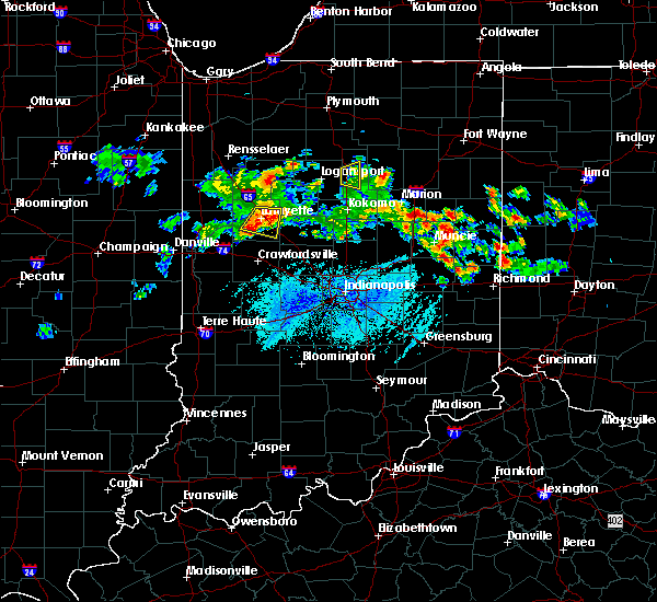 At 740 pm edt, a severe thunderstorm was located near lafayette, moving southeast at 25 mph (radar indicated). Hazards include 60 mph wind gusts and penny size hail. Expect damage to roofs, siding, and trees. locations impacted include, lafayette, west lafayette, shadeland, dayton, battle ground, clarks hill and purdue university. This includes interstate 65 between mile markers 162 and 179. At 740 pm edt, a severe thunderstorm was located near lafayette, moving southeast at 25 mph (radar indicated). Hazards include 60 mph wind gusts and penny size hail. Expect damage to roofs, siding, and trees. locations impacted include, lafayette, west lafayette, shadeland, dayton, battle ground, clarks hill and purdue university. This includes interstate 65 between mile markers 162 and 179.
|
| 6/7/2018 7:25 PM EDT |
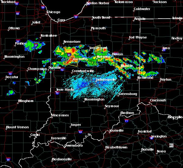 At 725 pm edt, a severe thunderstorm was located over west lafayette, or near lafayette, moving east at 15 mph (radar indicated). Hazards include 60 mph wind gusts and penny size hail. expect damage to roofs, siding, and trees At 725 pm edt, a severe thunderstorm was located over west lafayette, or near lafayette, moving east at 15 mph (radar indicated). Hazards include 60 mph wind gusts and penny size hail. expect damage to roofs, siding, and trees
|
| 4/3/2018 7:18 PM EDT |
 At 717 pm edt, a severe thunderstorm was located near delphi, or 12 miles northeast of lafayette, moving northeast at 55 mph (radar indicated). Hazards include 60 mph wind gusts and quarter size hail. Hail damage to vehicles is expected. expect wind damage to roofs, siding, and trees. Locations impacted include, delphi, flora, battle ground and camden. At 717 pm edt, a severe thunderstorm was located near delphi, or 12 miles northeast of lafayette, moving northeast at 55 mph (radar indicated). Hazards include 60 mph wind gusts and quarter size hail. Hail damage to vehicles is expected. expect wind damage to roofs, siding, and trees. Locations impacted include, delphi, flora, battle ground and camden.
|
| 4/3/2018 7:11 PM EDT |
 At 710 pm edt, a severe thunderstorm was located near lafayette, moving northeast at 55 mph (radar indicated). Hazards include 60 mph wind gusts and quarter size hail. Hail damage to vehicles is expected. Expect wind damage to roofs, siding, and trees. At 710 pm edt, a severe thunderstorm was located near lafayette, moving northeast at 55 mph (radar indicated). Hazards include 60 mph wind gusts and quarter size hail. Hail damage to vehicles is expected. Expect wind damage to roofs, siding, and trees.
|
| 7/22/2017 3:14 AM EDT |
 At 313 am edt, severe thunderstorms were located along a line extending from 9 miles west of kokomo to 7 miles southeast of frankfort to 10 miles east of crawfordsville, moving southeast at 40 mph (radar indicated. at 230 am edt, tippecanoe county sheriff reported numerous trees downed in the county). Hazards include 60 mph wind gusts. Expect damage to roofs, siding, and trees. locations impacted include, lafayette, frankfort, crawfordsville, west lafayette, lebanon, zionsville, whitestown, flora, rossville, shadeland, thorntown, dayton, mulberry, russiaville, waynetown, darlington, kirklin, linden, colfax and clarks hill. this includes the following highways, interstate 65 between mile markers 130 and 176. Interstate 74 between mile markers 25 and 45. At 313 am edt, severe thunderstorms were located along a line extending from 9 miles west of kokomo to 7 miles southeast of frankfort to 10 miles east of crawfordsville, moving southeast at 40 mph (radar indicated. at 230 am edt, tippecanoe county sheriff reported numerous trees downed in the county). Hazards include 60 mph wind gusts. Expect damage to roofs, siding, and trees. locations impacted include, lafayette, frankfort, crawfordsville, west lafayette, lebanon, zionsville, whitestown, flora, rossville, shadeland, thorntown, dayton, mulberry, russiaville, waynetown, darlington, kirklin, linden, colfax and clarks hill. this includes the following highways, interstate 65 between mile markers 130 and 176. Interstate 74 between mile markers 25 and 45.
|
| 7/22/2017 2:58 AM EDT |
 At 257 am edt, severe thunderstorms were located along a line extending from 12 miles southwest of walton to near frankfort to near crawfordsville, moving southeast at 40 mph (radar indicated). Hazards include 60 mph wind gusts. Expect damage to roofs, siding, and trees. locations impacted include, lafayette, frankfort, crawfordsville, west lafayette, lebanon, zionsville, delphi, whitestown, flora, rossville, shadeland, thorntown, dayton, battle ground, mulberry, russiaville, jamestown, waynetown, darlington and kirklin. this includes the following highways, interstate 65 between mile markers 129 and 184. Interstate 74 between mile markers 21 and 54. At 257 am edt, severe thunderstorms were located along a line extending from 12 miles southwest of walton to near frankfort to near crawfordsville, moving southeast at 40 mph (radar indicated). Hazards include 60 mph wind gusts. Expect damage to roofs, siding, and trees. locations impacted include, lafayette, frankfort, crawfordsville, west lafayette, lebanon, zionsville, delphi, whitestown, flora, rossville, shadeland, thorntown, dayton, battle ground, mulberry, russiaville, jamestown, waynetown, darlington and kirklin. this includes the following highways, interstate 65 between mile markers 129 and 184. Interstate 74 between mile markers 21 and 54.
|
| 7/22/2017 2:45 AM EDT |
 At 245 am edt, severe thunderstorms were located along a line extending from 6 miles northeast of delphi to 10 miles southeast of lafayette to 10 miles northwest of crawfordsville, moving southeast at 40 mph (radar indicated). Hazards include 60 mph wind gusts. expect damage to roofs, siding, and trees At 245 am edt, severe thunderstorms were located along a line extending from 6 miles northeast of delphi to 10 miles southeast of lafayette to 10 miles northwest of crawfordsville, moving southeast at 40 mph (radar indicated). Hazards include 60 mph wind gusts. expect damage to roofs, siding, and trees
|
| 7/22/2017 2:16 AM EDT |
 At 215 am edt, severe thunderstorms were located along a line extending from near monticello to 6 miles northeast of williamsport, moving east at 50 mph (radar indicated). Hazards include 70 mph wind gusts. Expect considerable tree damage. damage is likely to mobile homes, roofs, and outbuildings. locations impacted include, lafayette, crawfordsville, monticello, west lafayette, delphi, veedersburg, williamsport, attica, flora, rossville, shadeland, dayton, battle ground, mulberry, waynetown, linden, west lebanon, camden, clarks hill and hillsboro. this includes the following highways, interstate 65 between mile markers 158 and 183. Interstate 74 between mile markers 15 and 37. At 215 am edt, severe thunderstorms were located along a line extending from near monticello to 6 miles northeast of williamsport, moving east at 50 mph (radar indicated). Hazards include 70 mph wind gusts. Expect considerable tree damage. damage is likely to mobile homes, roofs, and outbuildings. locations impacted include, lafayette, crawfordsville, monticello, west lafayette, delphi, veedersburg, williamsport, attica, flora, rossville, shadeland, dayton, battle ground, mulberry, waynetown, linden, west lebanon, camden, clarks hill and hillsboro. this includes the following highways, interstate 65 between mile markers 158 and 183. Interstate 74 between mile markers 15 and 37.
|
| 7/22/2017 1:57 AM EDT |
 The national weather service in indianapolis has issued a * severe thunderstorm warning for. carroll county in north central indiana. eastern fountain county in west central indiana. tippecanoe county in west central indiana. Northwestern clinton county in central indiana. The national weather service in indianapolis has issued a * severe thunderstorm warning for. carroll county in north central indiana. eastern fountain county in west central indiana. tippecanoe county in west central indiana. Northwestern clinton county in central indiana.
|
| 7/7/2017 3:26 PM EDT |
 At 326 pm edt, a severe thunderstorm was located 8 miles east of lafayette, moving east at 30 mph (radar indicated). Hazards include 60 mph wind gusts and quarter size hail. Hail damage to vehicles is expected. Expect wind damage to roofs, siding, and trees. At 326 pm edt, a severe thunderstorm was located 8 miles east of lafayette, moving east at 30 mph (radar indicated). Hazards include 60 mph wind gusts and quarter size hail. Hail damage to vehicles is expected. Expect wind damage to roofs, siding, and trees.
|
| 7/7/2017 2:24 PM EDT |
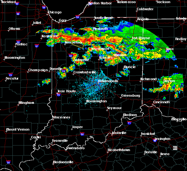 At 222 pm edt, a severe thunderstorm was located 7 miles east of lafayette, moving east at 50 mph (radar indicated). Hazards include ping pong ball size hail and 60 mph wind gusts. People and animals outdoors will be injured. expect hail damage to roofs, siding, windows, and vehicles. Expect wind damage to roofs, siding, and trees. At 222 pm edt, a severe thunderstorm was located 7 miles east of lafayette, moving east at 50 mph (radar indicated). Hazards include ping pong ball size hail and 60 mph wind gusts. People and animals outdoors will be injured. expect hail damage to roofs, siding, windows, and vehicles. Expect wind damage to roofs, siding, and trees.
|
| 6/18/2017 12:39 AM EDT |
 The severe thunderstorm warning for northeastern fountain, tippecanoe, east central warren and north central montgomery counties will expire at 1245 am edt, the storms which prompted the warning have moved out of the warned area. therefore, the warning will be allowed to expire. however heavy rain is still possible with these thunderstorms. a severe thunderstorm watch remains in effect until 700 am edt for north central and west central indiana. The severe thunderstorm warning for northeastern fountain, tippecanoe, east central warren and north central montgomery counties will expire at 1245 am edt, the storms which prompted the warning have moved out of the warned area. therefore, the warning will be allowed to expire. however heavy rain is still possible with these thunderstorms. a severe thunderstorm watch remains in effect until 700 am edt for north central and west central indiana.
|
| 6/18/2017 12:23 AM EDT |
 At 1223 am edt, severe thunderstorms were located along a line extending from 7 miles east of lafayette to 8 miles northwest of crawfordsville, moving east at 50 mph (radar indicated). Hazards include 60 mph wind gusts and penny size hail. Expect damage to roofs, siding, and trees. locations impacted include, lafayette, west lafayette, attica, shadeland, dayton, battle ground, linden, new richmond and purdue university. This includes interstate 65 between mile markers 164 and 184. At 1223 am edt, severe thunderstorms were located along a line extending from 7 miles east of lafayette to 8 miles northwest of crawfordsville, moving east at 50 mph (radar indicated). Hazards include 60 mph wind gusts and penny size hail. Expect damage to roofs, siding, and trees. locations impacted include, lafayette, west lafayette, attica, shadeland, dayton, battle ground, linden, new richmond and purdue university. This includes interstate 65 between mile markers 164 and 184.
|
| 6/17/2017 11:56 PM EDT |
 At 1155 pm edt, severe thunderstorms were located along a line extending from near atkinson to near williamsport, moving southeast at 35 mph (radar indicated). Hazards include 60 mph wind gusts and nickel size hail. expect damage to roofs, siding, and trees At 1155 pm edt, severe thunderstorms were located along a line extending from near atkinson to near williamsport, moving southeast at 35 mph (radar indicated). Hazards include 60 mph wind gusts and nickel size hail. expect damage to roofs, siding, and trees
|
| 4/10/2017 10:08 PM EDT |
 At 1007 pm edt, a severe thunderstorm was located near delphi, or 10 miles northeast of lafayette, moving northeast at 55 mph (radar indicated). Hazards include quarter size hail. Damage to vehicles is expected. locations impacted include, lafayette, monticello, west lafayette, delphi, flora, shadeland, battle ground, camden, yeoman and purdue university. This includes interstate 65 between mile markers 174 and 184. At 1007 pm edt, a severe thunderstorm was located near delphi, or 10 miles northeast of lafayette, moving northeast at 55 mph (radar indicated). Hazards include quarter size hail. Damage to vehicles is expected. locations impacted include, lafayette, monticello, west lafayette, delphi, flora, shadeland, battle ground, camden, yeoman and purdue university. This includes interstate 65 between mile markers 174 and 184.
|
| 4/10/2017 9:54 PM EDT |
 At 954 pm edt, a severe thunderstorm was located near west lafayette, or near otterbein, moving northeast at 55 mph (radar indicated). Hazards include quarter size hail. damage to vehicles is expected At 954 pm edt, a severe thunderstorm was located near west lafayette, or near otterbein, moving northeast at 55 mph (radar indicated). Hazards include quarter size hail. damage to vehicles is expected
|
| 4/10/2017 9:35 AM EDT |
 At 928 am edt, a severe thunderstorm was located over lafayette, moving northeast at 40 mph (radar indicated). Hazards include quarter size hail. damage to vehicles is expected At 928 am edt, a severe thunderstorm was located over lafayette, moving northeast at 40 mph (radar indicated). Hazards include quarter size hail. damage to vehicles is expected
|
| 4/10/2017 9:29 AM EDT |
 At 928 am edt, a severe thunderstorm was located over lafayette, moving northeast at 40 mph (radar indicated). Hazards include quarter size hail. damage to vehicles is expected At 928 am edt, a severe thunderstorm was located over lafayette, moving northeast at 40 mph (radar indicated). Hazards include quarter size hail. damage to vehicles is expected
|
| 3/7/2017 4:25 AM EST |
 The severe thunderstorm warning for carroll, central tippecanoe and northwestern clinton counties will expire at 430 am est, the storms which prompted the warning have moved out of the area. therefore the warning will be allowed to expire. however gusty winds and heavy rain are still possible with these thunderstorms. to report severe weather, contact your nearest law enforcement agency. they will relay your report to the national weather service indianapolis. The severe thunderstorm warning for carroll, central tippecanoe and northwestern clinton counties will expire at 430 am est, the storms which prompted the warning have moved out of the area. therefore the warning will be allowed to expire. however gusty winds and heavy rain are still possible with these thunderstorms. to report severe weather, contact your nearest law enforcement agency. they will relay your report to the national weather service indianapolis.
|
| 3/7/2017 4:04 AM EST |
 At 403 am est, severe thunderstorms were located along a line extending from near royal center to near delphi to 11 miles southwest of lafayette, moving east at 50 mph. a 54 mph wind gust was measured at the purdue university airport at 354 am (radar indicated). Hazards include 60 mph wind gusts and penny size hail. Expect damage to roofs, siding, and trees. locations impacted include, lafayette, monticello, west lafayette, delphi, flora, rossville, shadeland, dayton, battle ground, mulberry, camden, yeoman and purdue university. This includes interstate 65 between mile markers 163 and 178. At 403 am est, severe thunderstorms were located along a line extending from near royal center to near delphi to 11 miles southwest of lafayette, moving east at 50 mph. a 54 mph wind gust was measured at the purdue university airport at 354 am (radar indicated). Hazards include 60 mph wind gusts and penny size hail. Expect damage to roofs, siding, and trees. locations impacted include, lafayette, monticello, west lafayette, delphi, flora, rossville, shadeland, dayton, battle ground, mulberry, camden, yeoman and purdue university. This includes interstate 65 between mile markers 163 and 178.
|
| 3/7/2017 3:49 AM EST |
 At 349 am est, severe thunderstorms were located along a line extending from 8 miles west of royal center to near brookston to 6 miles southeast of williamsport, moving east at 50 mph (radar indicated). Hazards include 60 mph wind gusts. expect damage to roofs, siding, and trees At 349 am est, severe thunderstorms were located along a line extending from 8 miles west of royal center to near brookston to 6 miles southeast of williamsport, moving east at 50 mph (radar indicated). Hazards include 60 mph wind gusts. expect damage to roofs, siding, and trees
|
| 11/18/2016 5:25 PM EST |
 The severe thunderstorm warning for carroll, northwestern boone, clinton, central montgomery, eastern tippecanoe and northwestern howard counties will expire at 530 pm est, the storms which prompted the warning have weakened below severe limits, and no longer pose an immediate threat to life or property. therefore, the warning will be allowed to expire. however gusty winds to around 50 mph are still possible with these thunderstorms. The severe thunderstorm warning for carroll, northwestern boone, clinton, central montgomery, eastern tippecanoe and northwestern howard counties will expire at 530 pm est, the storms which prompted the warning have weakened below severe limits, and no longer pose an immediate threat to life or property. therefore, the warning will be allowed to expire. however gusty winds to around 50 mph are still possible with these thunderstorms.
|
| 11/18/2016 5:11 PM EST |
 At 511 pm est, severe thunderstorms were located along a line extending from 9 miles south of royal center to 10 miles southeast of delphi to near crawfordsville, moving northeast at 65 mph (radar indicated). Hazards include 60 mph wind gusts. Expect damage to roofs. siding. and trees. locations impacted include, lafayette, frankfort, crawfordsville, monticello, delphi, flora, rossville, thorntown, dayton, battle ground, mulberry, darlington, linden, colfax, clarks hill, camden, burlington, advance, michigantown and yeoman. this includes the following highways, interstate 65 between mile markers 147 and 178. Interstate 74 between mile markers 29 and 45. At 511 pm est, severe thunderstorms were located along a line extending from 9 miles south of royal center to 10 miles southeast of delphi to near crawfordsville, moving northeast at 65 mph (radar indicated). Hazards include 60 mph wind gusts. Expect damage to roofs. siding. and trees. locations impacted include, lafayette, frankfort, crawfordsville, monticello, delphi, flora, rossville, thorntown, dayton, battle ground, mulberry, darlington, linden, colfax, clarks hill, camden, burlington, advance, michigantown and yeoman. this includes the following highways, interstate 65 between mile markers 147 and 178. Interstate 74 between mile markers 29 and 45.
|
| 11/18/2016 4:54 PM EST |
 At 453 pm est, severe thunderstorms were located along a line extending from near brookston to 7 miles south of lafayette to 9 miles southwest of crawfordsville, moving northeast at 65 mph (radar indicated). Hazards include 60 mph wind gusts. Expect damage to roofs. siding. And trees. At 453 pm est, severe thunderstorms were located along a line extending from near brookston to 7 miles south of lafayette to 9 miles southwest of crawfordsville, moving northeast at 65 mph (radar indicated). Hazards include 60 mph wind gusts. Expect damage to roofs. siding. And trees.
|
| 11/18/2016 4:42 PM EST |
 At 441 pm est, severe thunderstorms were located along a line extending from 6 miles west of brookston to 11 miles northeast of veedersburg, moving northeast at 65 mph (radar indicated). Hazards include 70 mph wind gusts. Expect considerable tree damage. damage is likely to mobile homes, roofs, and outbuildings. locations impacted include, lafayette, west lafayette, veedersburg, williamsport, attica, shadeland, dayton, battle ground, hillsboro, new richmond, wingate, newtown, mellott and purdue university. this includes the following highways, interstate 65 between mile markers 165 and 184. Interstate 74 between mile markers 11 and 22. At 441 pm est, severe thunderstorms were located along a line extending from 6 miles west of brookston to 11 miles northeast of veedersburg, moving northeast at 65 mph (radar indicated). Hazards include 70 mph wind gusts. Expect considerable tree damage. damage is likely to mobile homes, roofs, and outbuildings. locations impacted include, lafayette, west lafayette, veedersburg, williamsport, attica, shadeland, dayton, battle ground, hillsboro, new richmond, wingate, newtown, mellott and purdue university. this includes the following highways, interstate 65 between mile markers 165 and 184. Interstate 74 between mile markers 11 and 22.
|
| 11/18/2016 4:25 PM EST |
 At 425 pm est, severe thunderstorms were located along a line extending from near templeton to near veedersburg, moving northeast at 65 mph (radar indicated). Hazards include 70 mph wind gusts. Expect considerable tree damage. Damage is likely to mobile homes, roofs, and outbuildings. At 425 pm est, severe thunderstorms were located along a line extending from near templeton to near veedersburg, moving northeast at 65 mph (radar indicated). Hazards include 70 mph wind gusts. Expect considerable tree damage. Damage is likely to mobile homes, roofs, and outbuildings.
|
| 8/24/2016 5:13 PM EDT |
 The tornado warning for west central carroll and northeastern tippecanoe counties will expire at 515 pm edt. the tornado warning that was previously in effect has been reissued for carroll county and is in effect until 530 pm. please refer to that bulletin for the latest severe weather information. A tornado watch remains in effect until 900 pm edt for north central. The tornado warning for west central carroll and northeastern tippecanoe counties will expire at 515 pm edt. the tornado warning that was previously in effect has been reissued for carroll county and is in effect until 530 pm. please refer to that bulletin for the latest severe weather information. A tornado watch remains in effect until 900 pm edt for north central.
|
| 8/24/2016 5:06 PM EDT |
 At 506 pm edt, a severe thunderstorm capable of producing a tornado was located near delphi, or 10 miles northeast of lafayette, moving east at 35 mph (weather spotters reported funnel cloud). Hazards include tornado. Flying debris will be dangerous to those caught without shelter. mobile homes will be damaged or destroyed. damage to roofs, windows, and vehicles will occur. tree damage is likely. this dangerous storm will be near, delphi around 515 pm edt. Flora around 525 pm edt. At 506 pm edt, a severe thunderstorm capable of producing a tornado was located near delphi, or 10 miles northeast of lafayette, moving east at 35 mph (weather spotters reported funnel cloud). Hazards include tornado. Flying debris will be dangerous to those caught without shelter. mobile homes will be damaged or destroyed. damage to roofs, windows, and vehicles will occur. tree damage is likely. this dangerous storm will be near, delphi around 515 pm edt. Flora around 525 pm edt.
|
| 8/24/2016 5:04 PM EDT |
 At 504 pm edt, a severe thunderstorm capable of producing a tornado was located near delphi, or 10 miles northeast of lafayette, moving east at 35 mph (weather spotters reported a funnel cloud). Hazards include tornado. Flying debris will be dangerous to those caught without shelter. mobile homes will be damaged or destroyed. damage to roofs, windows, and vehicles will occur. tree damage is likely. Locations impacted include, battle ground. At 504 pm edt, a severe thunderstorm capable of producing a tornado was located near delphi, or 10 miles northeast of lafayette, moving east at 35 mph (weather spotters reported a funnel cloud). Hazards include tornado. Flying debris will be dangerous to those caught without shelter. mobile homes will be damaged or destroyed. damage to roofs, windows, and vehicles will occur. tree damage is likely. Locations impacted include, battle ground.
|
| 8/24/2016 4:54 PM EDT |
 At 454 pm edt, a severe thunderstorm capable of producing a tornado was located near west lafayette, or 7 miles north of lafayette, moving east at 30 mph (radar indicated rotation). Hazards include tornado. Flying debris will be dangerous to those caught without shelter. mobile homes will be damaged or destroyed. damage to roofs, windows, and vehicles will occur. tree damage is likely. this tornadic thunderstorm will remain over mainly rural areas of west central carroll and northeastern tippecanoe counties. This includes interstate 65 between mile markers 177 and 183. At 454 pm edt, a severe thunderstorm capable of producing a tornado was located near west lafayette, or 7 miles north of lafayette, moving east at 30 mph (radar indicated rotation). Hazards include tornado. Flying debris will be dangerous to those caught without shelter. mobile homes will be damaged or destroyed. damage to roofs, windows, and vehicles will occur. tree damage is likely. this tornadic thunderstorm will remain over mainly rural areas of west central carroll and northeastern tippecanoe counties. This includes interstate 65 between mile markers 177 and 183.
|
| 8/24/2016 4:44 PM EDT |
 At 444 pm edt, a severe thunderstorm capable of producing a tornado was located near west lafayette, or near otterbein, moving east at 35 mph (radar indicated rotation). Hazards include tornado. Flying debris will be dangerous to those caught without shelter. mobile homes will be damaged or destroyed. damage to roofs, windows, and vehicles will occur. tree damage is likely. this dangerous storm will be near, battle ground around 500 pm edt. This includes interstate 65 between mile markers 177 and 184. At 444 pm edt, a severe thunderstorm capable of producing a tornado was located near west lafayette, or near otterbein, moving east at 35 mph (radar indicated rotation). Hazards include tornado. Flying debris will be dangerous to those caught without shelter. mobile homes will be damaged or destroyed. damage to roofs, windows, and vehicles will occur. tree damage is likely. this dangerous storm will be near, battle ground around 500 pm edt. This includes interstate 65 between mile markers 177 and 184.
|
| 6/23/2016 2:31 AM EDT |
 At 216 am edt, a severe thunderstorm was located over west lafayette, or near lafayette, moving southeast at 50 mph (radar indicated). Hazards include 70 mph wind gusts and quarter size hail. Hail damage to vehicles is expected. expect considerable tree damage. Wind damage is also likely to mobile homes, roofs, and outbuildings. At 216 am edt, a severe thunderstorm was located over west lafayette, or near lafayette, moving southeast at 50 mph (radar indicated). Hazards include 70 mph wind gusts and quarter size hail. Hail damage to vehicles is expected. expect considerable tree damage. Wind damage is also likely to mobile homes, roofs, and outbuildings.
|
| 6/23/2016 2:16 AM EDT |
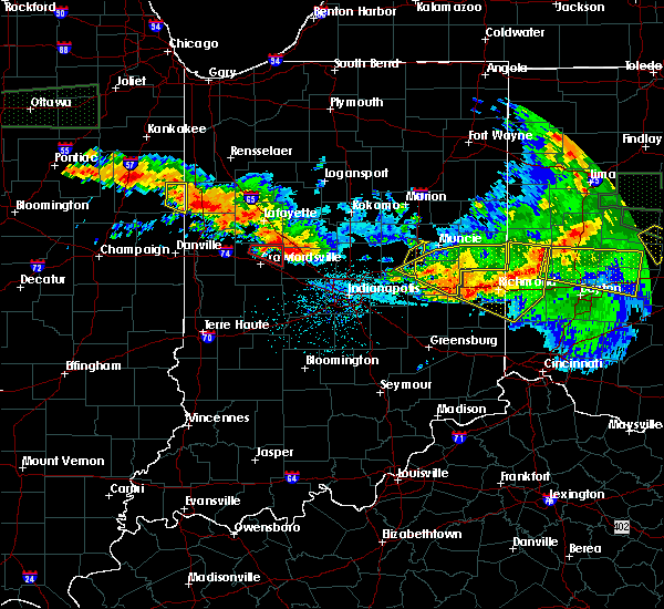 At 216 am edt, a severe thunderstorm was located over west lafayette, or near lafayette, moving southeast at 50 mph (radar indicated). Hazards include 70 mph wind gusts and quarter size hail. Hail damage to vehicles is expected. expect considerable tree damage. Wind damage is also likely to mobile homes, roofs, and outbuildings. At 216 am edt, a severe thunderstorm was located over west lafayette, or near lafayette, moving southeast at 50 mph (radar indicated). Hazards include 70 mph wind gusts and quarter size hail. Hail damage to vehicles is expected. expect considerable tree damage. Wind damage is also likely to mobile homes, roofs, and outbuildings.
|
| 6/23/2016 12:48 AM EDT |
 At 1248 am edt, a severe thunderstorm was located 12 miles east of frankfort, moving southeast at 60 mph. this is a very dangerous storm (radar indicated). Hazards include 90 mph wind gusts and quarter size hail. You are in a life-threatening situation. flying debris may be deadly to those caught without shelter. mobile homes will be heavily damaged or destroyed. homes and businesses will have substantial roof and window damage. expect extensive tree damage and power outages. locations impacted include, lafayette, frankfort, flora, rossville, dayton, mulberry, kirklin, colfax, clarks hill, burlington, michigantown and kempton. this includes interstate 65 between mile markers 151 and 174. A tornado watch remains in effect until 500 am edt for north central, west central and central indiana. At 1248 am edt, a severe thunderstorm was located 12 miles east of frankfort, moving southeast at 60 mph. this is a very dangerous storm (radar indicated). Hazards include 90 mph wind gusts and quarter size hail. You are in a life-threatening situation. flying debris may be deadly to those caught without shelter. mobile homes will be heavily damaged or destroyed. homes and businesses will have substantial roof and window damage. expect extensive tree damage and power outages. locations impacted include, lafayette, frankfort, flora, rossville, dayton, mulberry, kirklin, colfax, clarks hill, burlington, michigantown and kempton. this includes interstate 65 between mile markers 151 and 174. A tornado watch remains in effect until 500 am edt for north central, west central and central indiana.
|
| 6/23/2016 12:33 AM EDT |
 At 1233 am edt, a severe thunderstorm was located near frankfort, moving southeast at 55 mph. this is a very dangerous storm (radar indicated). Hazards include 100 mph wind gusts and quarter size hail. You are in a life-threatening situation. flying debris may be deadly to those caught without shelter. mobile homes will be destroyed. expect considerable damage to homes and businesses. expect extensive tree damage and power outages. locations impacted include, lafayette, frankfort, flora, rossville, dayton, mulberry, kirklin, colfax, clarks hill, burlington, michigantown and kempton. this includes interstate 65 between mile markers 151 and 174. A tornado watch remains in effect until 500 am edt for north central, west central and central indiana. At 1233 am edt, a severe thunderstorm was located near frankfort, moving southeast at 55 mph. this is a very dangerous storm (radar indicated). Hazards include 100 mph wind gusts and quarter size hail. You are in a life-threatening situation. flying debris may be deadly to those caught without shelter. mobile homes will be destroyed. expect considerable damage to homes and businesses. expect extensive tree damage and power outages. locations impacted include, lafayette, frankfort, flora, rossville, dayton, mulberry, kirklin, colfax, clarks hill, burlington, michigantown and kempton. this includes interstate 65 between mile markers 151 and 174. A tornado watch remains in effect until 500 am edt for north central, west central and central indiana.
|
| 6/23/2016 12:31 AM EDT |
 At 1230 am edt, severe thunderstorms were located along a line extending from near lafayette to 8 miles southeast of delphi, moving southeast at 60 mph. these are very dangerous storms (trained weather spotters). Hazards include 100 mph wind gusts and quarter size hail. You are in a life-threatening situation. flying debris may be deadly to those caught without shelter. mobile homes will be destroyed. expect considerable damage to homes and businesses. expect extensive tree damage and power outages. locations impacted include, lafayette, west lafayette, delphi, flora, shadeland, dayton, battle ground, camden, yeoman and purdue university. this includes interstate 65 between mile markers 165 and 184. A tornado watch remains in effect until 500 am edt for north central, west central and central indiana. At 1230 am edt, severe thunderstorms were located along a line extending from near lafayette to 8 miles southeast of delphi, moving southeast at 60 mph. these are very dangerous storms (trained weather spotters). Hazards include 100 mph wind gusts and quarter size hail. You are in a life-threatening situation. flying debris may be deadly to those caught without shelter. mobile homes will be destroyed. expect considerable damage to homes and businesses. expect extensive tree damage and power outages. locations impacted include, lafayette, west lafayette, delphi, flora, shadeland, dayton, battle ground, camden, yeoman and purdue university. this includes interstate 65 between mile markers 165 and 184. A tornado watch remains in effect until 500 am edt for north central, west central and central indiana.
|
| 6/23/2016 12:26 AM EDT |
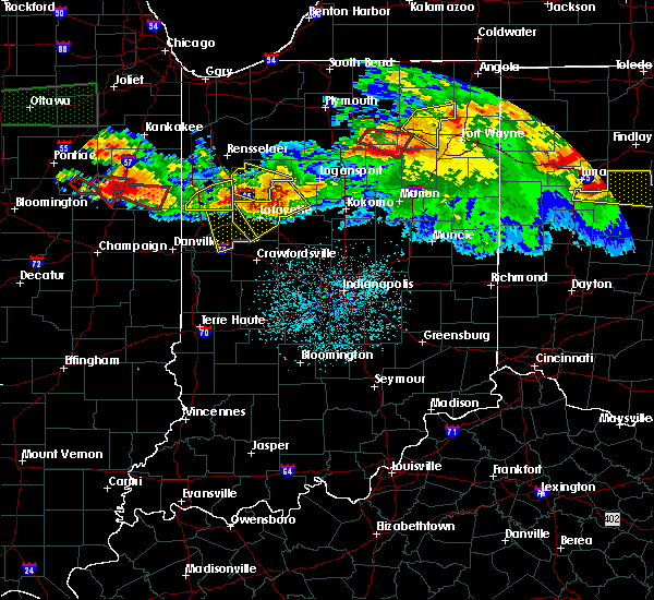 At 1226 am edt, a severe thunderstorm was located 8 miles east of lafayette, moving southeast at 65 mph. this is a very dangerous storm (radar indicated). Hazards include 100 mph wind gusts and quarter size hail. You are in a life-threatening situation. flying debris may be deadly to those caught without shelter. mobile homes will be destroyed. expect considerable damage to homes and businesses. Expect extensive tree damage and power outages. At 1226 am edt, a severe thunderstorm was located 8 miles east of lafayette, moving southeast at 65 mph. this is a very dangerous storm (radar indicated). Hazards include 100 mph wind gusts and quarter size hail. You are in a life-threatening situation. flying debris may be deadly to those caught without shelter. mobile homes will be destroyed. expect considerable damage to homes and businesses. Expect extensive tree damage and power outages.
|
| 6/23/2016 12:24 AM EDT |
 At 1223 am edt, a severe thunderstorm was located 8 miles east of lafayette, moving southeast at 60 mph. this is a very dangerous storm (trained weather spotters). Hazards include 100 mph wind gusts and quarter size hail. You are in a life-threatening situation. flying debris may be deadly to those caught without shelter. mobile homes will be destroyed. expect considerable damage to homes and businesses. expect extensive tree damage and power outages. locations impacted include, lafayette, west lafayette, delphi, flora, shadeland, dayton, battle ground, camden, yeoman and purdue university. this includes interstate 65 between mile markers 165 and 184. A tornado watch remains in effect until 500 am edt for north central, west central and central indiana. At 1223 am edt, a severe thunderstorm was located 8 miles east of lafayette, moving southeast at 60 mph. this is a very dangerous storm (trained weather spotters). Hazards include 100 mph wind gusts and quarter size hail. You are in a life-threatening situation. flying debris may be deadly to those caught without shelter. mobile homes will be destroyed. expect considerable damage to homes and businesses. expect extensive tree damage and power outages. locations impacted include, lafayette, west lafayette, delphi, flora, shadeland, dayton, battle ground, camden, yeoman and purdue university. this includes interstate 65 between mile markers 165 and 184. A tornado watch remains in effect until 500 am edt for north central, west central and central indiana.
|
| 6/23/2016 12:16 AM EDT |
 At 1215 am edt, a severe thunderstorm was located near brookston, or 8 miles north of lafayette, moving southeast at 55 mph. this is a very dangerous storm (radar indicated). Hazards include 80 mph wind gusts and quarter size hail. Flying debris will be dangerous to those caught without shelter. mobile homes will be heavily damaged. expect considerable damage to roofs, windows, and vehicles. extensive tree damage and power outages are likely. locations impacted include, lafayette, west lafayette, delphi, flora, shadeland, dayton, battle ground, camden, yeoman and purdue university. this includes interstate 65 between mile markers 165 and 184. A tornado watch remains in effect until 500 am edt for north central, west central and central indiana. At 1215 am edt, a severe thunderstorm was located near brookston, or 8 miles north of lafayette, moving southeast at 55 mph. this is a very dangerous storm (radar indicated). Hazards include 80 mph wind gusts and quarter size hail. Flying debris will be dangerous to those caught without shelter. mobile homes will be heavily damaged. expect considerable damage to roofs, windows, and vehicles. extensive tree damage and power outages are likely. locations impacted include, lafayette, west lafayette, delphi, flora, shadeland, dayton, battle ground, camden, yeoman and purdue university. this includes interstate 65 between mile markers 165 and 184. A tornado watch remains in effect until 500 am edt for north central, west central and central indiana.
|
| 6/23/2016 12:04 AM EDT |
 At 1204 am edt, a severe thunderstorm was located near wolcott, or 11 miles east of lochiel, moving southeast at 35 mph. this is a very dangerous storm (radar indicated). Hazards include 80 mph wind gusts and quarter size hail. Flying debris will be dangerous to those caught without shelter. mobile homes will be heavily damaged. expect considerable damage to roofs, windows, and vehicles. Extensive tree damage and power outages are likely. At 1204 am edt, a severe thunderstorm was located near wolcott, or 11 miles east of lochiel, moving southeast at 35 mph. this is a very dangerous storm (radar indicated). Hazards include 80 mph wind gusts and quarter size hail. Flying debris will be dangerous to those caught without shelter. mobile homes will be heavily damaged. expect considerable damage to roofs, windows, and vehicles. Extensive tree damage and power outages are likely.
|
| 6/20/2016 6:04 PM EDT |
 At 603 pm edt, a severe thunderstorm was located over delphi, or 11 miles south of monticello, moving southeast at 35 mph (trained weather spotters. at 556 pm...amateur radio operators reoprted a tree down 2 miles northwest battle ground due to thunderstorm winds). Hazards include 60 mph wind gusts and quarter size hail. Hail damage to vehicles is expected. expect wind damage to roofs, siding, and trees. locations impacted include, monticello, delphi, flora, rossville, dayton, battle ground, mulberry, camden and yeoman. This includes interstate 65 between mile markers 176 and 184. At 603 pm edt, a severe thunderstorm was located over delphi, or 11 miles south of monticello, moving southeast at 35 mph (trained weather spotters. at 556 pm...amateur radio operators reoprted a tree down 2 miles northwest battle ground due to thunderstorm winds). Hazards include 60 mph wind gusts and quarter size hail. Hail damage to vehicles is expected. expect wind damage to roofs, siding, and trees. locations impacted include, monticello, delphi, flora, rossville, dayton, battle ground, mulberry, camden and yeoman. This includes interstate 65 between mile markers 176 and 184.
|
| 6/20/2016 5:50 PM EDT |
 At 550 pm edt, a severe thunderstorm was located near brookston, or 7 miles southwest of monticello, moving southeast at 35 mph (radar indicated). Hazards include 60 mph wind gusts and quarter size hail. Hail damage to vehicles is expected. Expect wind damage to roofs, siding, and trees. At 550 pm edt, a severe thunderstorm was located near brookston, or 7 miles southwest of monticello, moving southeast at 35 mph (radar indicated). Hazards include 60 mph wind gusts and quarter size hail. Hail damage to vehicles is expected. Expect wind damage to roofs, siding, and trees.
|
| 12/23/2015 1:23 PM EST | At 122 pm est, a severe thunderstorm was located near delphi, or 11 miles south of monticello, moving northeast at 60 mph (radar indicated). Hazards include 60 mph wind gusts. Expect damage to roofs. siding and trees. locations impacted include, lafayette, west lafayette, shadeland, battle ground and purdue university. This includes interstate 65 between mile markers 170 and 183. |
| 12/23/2015 1:05 PM EST | At 104 pm est, a severe thunderstorm was located near otterbein, moving northeast at 60 mph (radar indicated). Hazards include 60 mph wind gusts. Expect damage to roofs. siding and trees. locations impacted include, lafayette, west lafayette, covington, williamsport, attica, shadeland, battle ground, west lebanon, newtown and purdue university. this includes the following highways, interstate 65 between mile markers 170 and 183. Interstate 74 between mile markers 7 and 12. |
| 12/23/2015 12:47 PM EST | At 1247 pm est, a severe thunderstorm was located over williamsport, or 17 miles south of templeton, moving northeast at 60 mph (radar indicated). Hazards include 60 mph wind gusts. Expect damage to roofs. Siding and trees. |
| 9/18/2015 11:00 PM EDT |
 At 1100 pm edt, severe thunderstorms were located along a line extending from 9 miles southwest of logansport to near lafayette, moving east at 30 mph (radar indicated). Hazards include 60 mph wind gusts and quarter size hail. Hail damage to vehicles is expected. Expect wind damage to roofs, siding and trees. At 1100 pm edt, severe thunderstorms were located along a line extending from 9 miles southwest of logansport to near lafayette, moving east at 30 mph (radar indicated). Hazards include 60 mph wind gusts and quarter size hail. Hail damage to vehicles is expected. Expect wind damage to roofs, siding and trees.
|
| 9/18/2015 10:41 PM EDT |
 At 1040 pm edt, severe thunderstorms were located along a line extending from 10 miles west of logansport to near west lafayette, moving east at 40 mph (radar indicated). Hazards include 60 mph wind gusts and half dollar size hail. Hail damage to vehicles is expected. expect wind damage to roofs, siding and trees. locations impacted include, lafayette, monticello, west lafayette, delphi, flora, shadeland, battle ground, camden, burlington, yeoman and purdue university. This includes interstate 65 between mile markers 171 and 183. At 1040 pm edt, severe thunderstorms were located along a line extending from 10 miles west of logansport to near west lafayette, moving east at 40 mph (radar indicated). Hazards include 60 mph wind gusts and half dollar size hail. Hail damage to vehicles is expected. expect wind damage to roofs, siding and trees. locations impacted include, lafayette, monticello, west lafayette, delphi, flora, shadeland, battle ground, camden, burlington, yeoman and purdue university. This includes interstate 65 between mile markers 171 and 183.
|
| 9/18/2015 10:19 PM EDT |
 At 1019 pm edt, severe thunderstorms were located along a line extending from near monticello to near templeton, moving east at 40 mph (radar indicated). Hazards include 60 mph wind gusts and half dollar size hail. Hail damage to vehicles is expected. Expect wind damage to roofs, siding and trees. At 1019 pm edt, severe thunderstorms were located along a line extending from near monticello to near templeton, moving east at 40 mph (radar indicated). Hazards include 60 mph wind gusts and half dollar size hail. Hail damage to vehicles is expected. Expect wind damage to roofs, siding and trees.
|
| 9/4/2015 5:08 PM EDT |
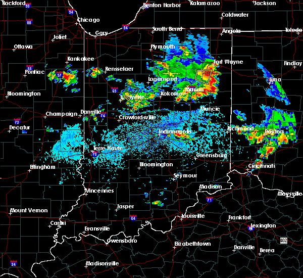 At 507 pm edt, a severe thunderstorm was located 7 miles northeast of lafayette, moving southeast at 15 mph (trained weather spotters). Hazards include 60 mph wind gusts and quarter size hail. Hail damage to vehicles is expected. expect wind damage to roofs, siding and trees. This severe thunderstorm will remain over mainly rural areas of southwestern carroll and northeastern tippecanoe counties. At 507 pm edt, a severe thunderstorm was located 7 miles northeast of lafayette, moving southeast at 15 mph (trained weather spotters). Hazards include 60 mph wind gusts and quarter size hail. Hail damage to vehicles is expected. expect wind damage to roofs, siding and trees. This severe thunderstorm will remain over mainly rural areas of southwestern carroll and northeastern tippecanoe counties.
|
| 9/4/2015 4:46 PM EDT |
 At 446 pm edt, a severe thunderstorm was located over brookston, or 11 miles north of lafayette, moving southeast at 10 mph (public). Hazards include 60 mph wind gusts and quarter size hail. Hail damage to vehicles is expected. Expect wind damage to roofs, siding and trees. At 446 pm edt, a severe thunderstorm was located over brookston, or 11 miles north of lafayette, moving southeast at 10 mph (public). Hazards include 60 mph wind gusts and quarter size hail. Hail damage to vehicles is expected. Expect wind damage to roofs, siding and trees.
|
| 8/3/2015 3:12 AM EDT |
 At 312 am edt, a severe thunderstorm was located 8 miles southeast of delphi, or 14 miles north of frankfort, moving east at 40 mph (radar indicated). Hazards include 60 mph wind gusts and quarter size hail. Hail damage to vehicles is expected. expect wind damage to roofs, siding and trees. locations impacted include, lafayette, flora, rossville, dayton, battle ground, mulberry, burlington and michigantown. This includes interstate 65 between mile markers 167 and 177. At 312 am edt, a severe thunderstorm was located 8 miles southeast of delphi, or 14 miles north of frankfort, moving east at 40 mph (radar indicated). Hazards include 60 mph wind gusts and quarter size hail. Hail damage to vehicles is expected. expect wind damage to roofs, siding and trees. locations impacted include, lafayette, flora, rossville, dayton, battle ground, mulberry, burlington and michigantown. This includes interstate 65 between mile markers 167 and 177.
|
| 8/3/2015 3:00 AM EDT |
 At 300 am edt, a severe thunderstorm was located 7 miles northeast of lafayette, moving east at 35 mph (radar indicated). Hazards include 60 mph wind gusts and quarter size hail. Hail damage to vehicles is expected. Expect wind damage to roofs, siding and trees. At 300 am edt, a severe thunderstorm was located 7 miles northeast of lafayette, moving east at 35 mph (radar indicated). Hazards include 60 mph wind gusts and quarter size hail. Hail damage to vehicles is expected. Expect wind damage to roofs, siding and trees.
|
| 7/13/2015 11:13 AM EDT | The severe thunderstorm warning for clinton, carroll, northern boone, fountain, southwestern howard, northern montgomery, tippecanoe, northwestern vermillion and warren counties will expire at 1115 am edt, the line of storms which prompted the warning has moved out of the warned area. additional strong thunderstorms are still possible, and a severe thunderstorm watch remains in effect until 400 pm edt. |
| 7/13/2015 10:44 AM EDT |
 At 1041 am edt, severe thunderstorms were located along a line extending from 13 miles west of kokomo to 7 miles west of frankfort to williamsport, and moving southeast at 45 mph (radar indicated). Hazards include 60 mph wind gusts and penny size hail. Expect damage to roofs. siding and trees. locations impacted include, frankfort, crawfordsville, veedersburg, lebanon, newtown, gessie, new richmond, linden, colfax, mellott, wingate, michigantown, perrysville, hillsboro, waynetown, thorntown, darlington, yeddo, kirklin and wallace. this includes interstate 65 between mile markers 140 and 184. This includes interstate 74 between mile markers 1 and 42. At 1041 am edt, severe thunderstorms were located along a line extending from 13 miles west of kokomo to 7 miles west of frankfort to williamsport, and moving southeast at 45 mph (radar indicated). Hazards include 60 mph wind gusts and penny size hail. Expect damage to roofs. siding and trees. locations impacted include, frankfort, crawfordsville, veedersburg, lebanon, newtown, gessie, new richmond, linden, colfax, mellott, wingate, michigantown, perrysville, hillsboro, waynetown, thorntown, darlington, yeddo, kirklin and wallace. this includes interstate 65 between mile markers 140 and 184. This includes interstate 74 between mile markers 1 and 42.
|
| 7/13/2015 10:26 AM EDT |
 At 1025 am edt, severe thunderstorms were located along a line extending from 8 miles east of delphi to 8 miles east of lafayette to 6 miles south of otterbein, and moving southeast at 45 mph (radar indicated). Hazards include 60 mph wind gusts and penny size hail. Expect damage to roofs. Siding and trees. At 1025 am edt, severe thunderstorms were located along a line extending from 8 miles east of delphi to 8 miles east of lafayette to 6 miles south of otterbein, and moving southeast at 45 mph (radar indicated). Hazards include 60 mph wind gusts and penny size hail. Expect damage to roofs. Siding and trees.
|
| 6/21/2015 1:36 AM EDT |
 At 135 am edt, severe thunderstorms were located along a line extending from 6 miles southwest of logansport to crawfordsville, and moving east at 30 mph (radar indicated). Hazards include 60 mph wind gusts. Expect damage to roofs. siding and trees. locations impacted include, clarks hill, darlington, ladoga and new ross. this includes interstate 65 between mile markers 161 and 173. This includes interstate 74 between mile markers 28 and 45. At 135 am edt, severe thunderstorms were located along a line extending from 6 miles southwest of logansport to crawfordsville, and moving east at 30 mph (radar indicated). Hazards include 60 mph wind gusts. Expect damage to roofs. siding and trees. locations impacted include, clarks hill, darlington, ladoga and new ross. this includes interstate 65 between mile markers 161 and 173. This includes interstate 74 between mile markers 28 and 45.
|
| 6/21/2015 1:23 AM EDT |
 At 121 am edt, severe thunderstorms were located along a line extending from 9 miles northeast of delphi to 9 miles west of crawfordsville, and moving east at 30 mph (radar indicated). Hazards include 60 mph wind gusts. Expect damage to roofs. siding and trees. locations impacted include, crawfordsville, linden, new market, clarks hill, darlington and ladoga. this includes interstate 65 between mile markers 161 and 180. This includes interstate 74 between mile markers 23 and 45. At 121 am edt, severe thunderstorms were located along a line extending from 9 miles northeast of delphi to 9 miles west of crawfordsville, and moving east at 30 mph (radar indicated). Hazards include 60 mph wind gusts. Expect damage to roofs. siding and trees. locations impacted include, crawfordsville, linden, new market, clarks hill, darlington and ladoga. this includes interstate 65 between mile markers 161 and 180. This includes interstate 74 between mile markers 23 and 45.
|
| 6/21/2015 1:03 AM EDT |
 At 102 am edt, severe thunderstorms were located along a line extending from monticello to 8 miles south of veedersburg, and moving east at 30 mph (radar indicated). Hazards include 60 mph wind gusts. Expect damage to roofs. Siding and trees. At 102 am edt, severe thunderstorms were located along a line extending from monticello to 8 miles south of veedersburg, and moving east at 30 mph (radar indicated). Hazards include 60 mph wind gusts. Expect damage to roofs. Siding and trees.
|
| 6/12/2015 6:00 PM EDT |
 At 559 pm edt, severe thunderstorms were located along a line extending from 8 miles southwest of swayzee to 6 miles west of crawfordsville, and moving south at 30 mph (radar indicated). Hazards include 60 mph wind gusts and quarter size hail. Hail damage to vehicles is expected. expect wind damage to roofs, siding and trees. locations impacted include, tipton, elwood, kempton, windfall, kirklin, atlanta and frankton. This includes interstate 65 between mile markers 149 and 176. At 559 pm edt, severe thunderstorms were located along a line extending from 8 miles southwest of swayzee to 6 miles west of crawfordsville, and moving south at 30 mph (radar indicated). Hazards include 60 mph wind gusts and quarter size hail. Hail damage to vehicles is expected. expect wind damage to roofs, siding and trees. locations impacted include, tipton, elwood, kempton, windfall, kirklin, atlanta and frankton. This includes interstate 65 between mile markers 149 and 176.
|
| 6/12/2015 5:42 PM EDT |
 At 540 pm edt, severe thunderstorms were located along a line extending from 9 miles northwest of swayzee to 11 miles east of veedersburg, and moving southeast at 30 mph (radar indicated). Hazards include 60 mph wind gusts. Expect damage to roofs. Siding and trees. At 540 pm edt, severe thunderstorms were located along a line extending from 9 miles northwest of swayzee to 11 miles east of veedersburg, and moving southeast at 30 mph (radar indicated). Hazards include 60 mph wind gusts. Expect damage to roofs. Siding and trees.
|
| 6/12/2015 5:27 PM EDT |
 At 513 pm edt, severe thunderstorms were located along a line extending from brookston to 8 miles north of williamsport, and moving southeast at 30 mph (radar indicated). Hazards include 60 mph wind gusts and penny size hail. Expect damage to roofs. Siding and trees. At 513 pm edt, severe thunderstorms were located along a line extending from brookston to 8 miles north of williamsport, and moving southeast at 30 mph (radar indicated). Hazards include 60 mph wind gusts and penny size hail. Expect damage to roofs. Siding and trees.
|
| 6/12/2015 5:15 PM EDT |
 At 513 pm edt, severe thunderstorms were located along a line extending from brookston to 8 miles north of williamsport, and moving southeast at 30 mph (radar indicated). Hazards include 60 mph wind gusts and penny size hail. Expect damage to roofs. Siding and trees. At 513 pm edt, severe thunderstorms were located along a line extending from brookston to 8 miles north of williamsport, and moving southeast at 30 mph (radar indicated). Hazards include 60 mph wind gusts and penny size hail. Expect damage to roofs. Siding and trees.
|
| 6/7/2015 8:19 PM EDT | At 816 pm edt, a severe thunderstorm was located 5 miles southeast of lafayette, and moving east at 60 mph (radar indicated). Hazards include 60 mph wind gusts. Expect damage to roofs. siding and trees. locations impacted include, frankfort, clarks hill, mulberry, rossville and michigantown. This includes interstate 65 between mile markers 153 and 177. |
| 6/7/2015 7:56 PM EDT | At 756 pm edt, a severe thunderstorm was located 6 miles west of west lafayette, and moving east at 55 mph (radar indicated). Hazards include 60 mph wind gusts. Expect damage to roofs. Siding and trees. |
| 6/12/2013 10:50 PM EDT | Tree downed near buck creek volunteer fire dept. tree damage also reported in colburn nearby buck cree in tippecanoe county IN, 0.5 miles ESE of Buck Creek, IN |
| 1/1/0001 12:00 AM | Trees down in the buck creek area in tippecanoe county IN, 1.9 miles NE of Buck Creek, IN |
| 1/1/0001 12:00 AM | Quarter sized hail reported 0.2 miles SW of Buck Creek, IN |
Hail Maps for Buck Creek, IN


Connect with Interactive Hail Maps