

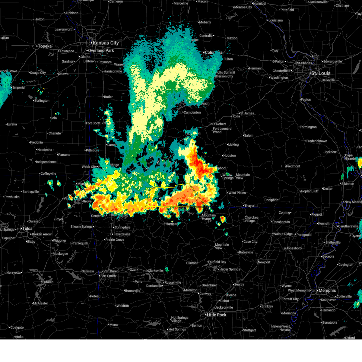
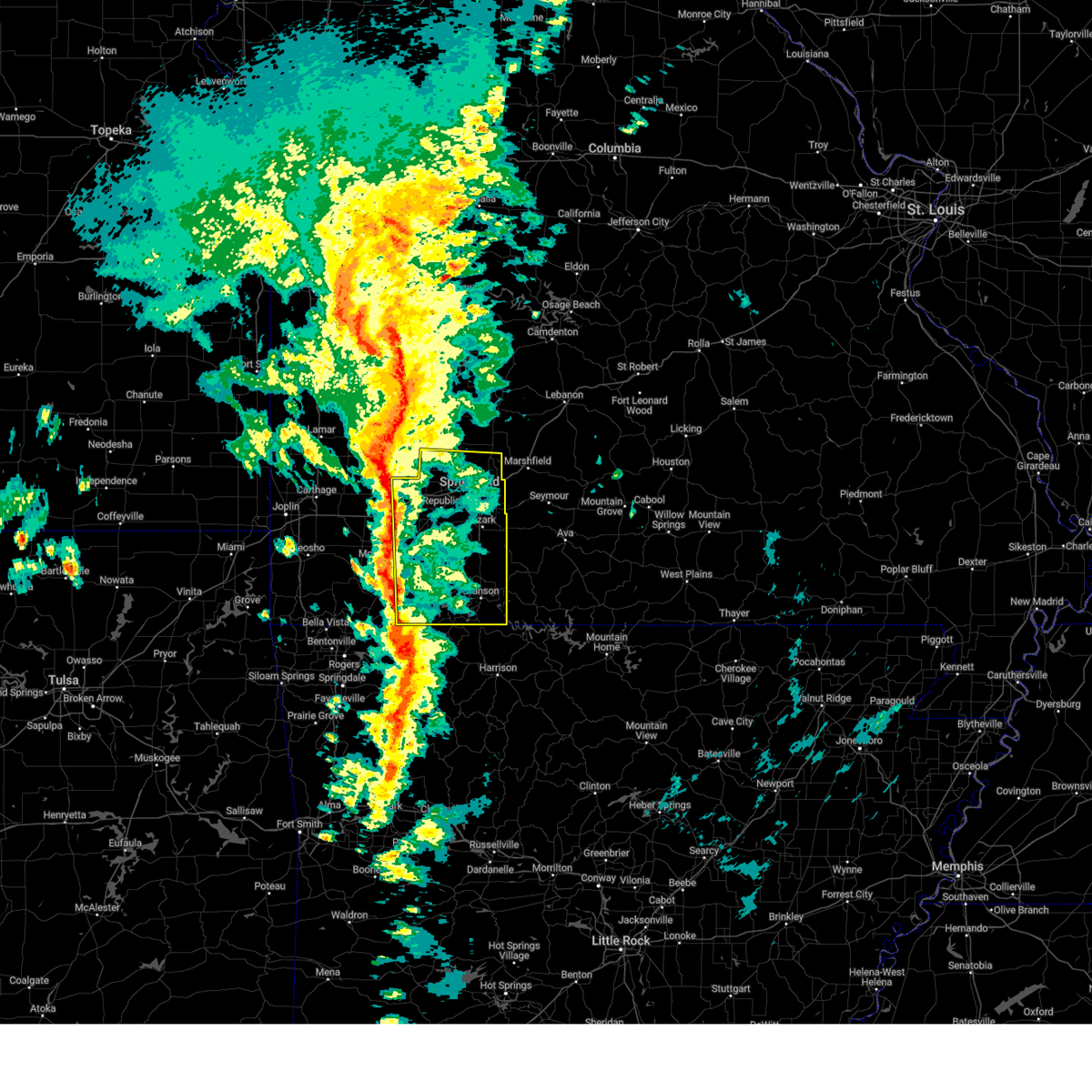
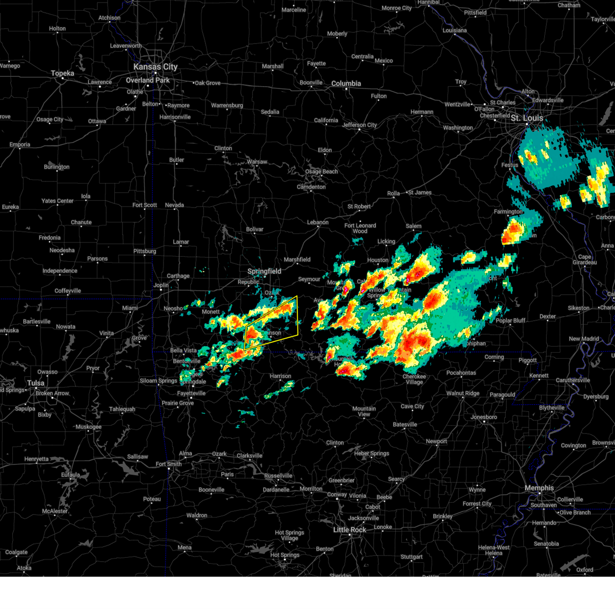
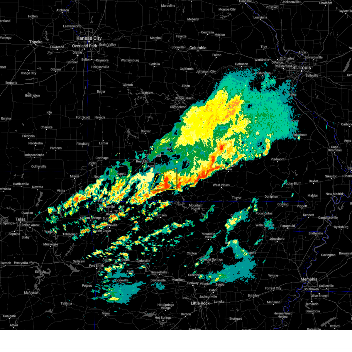
Hail Map for Bull Creek, MO
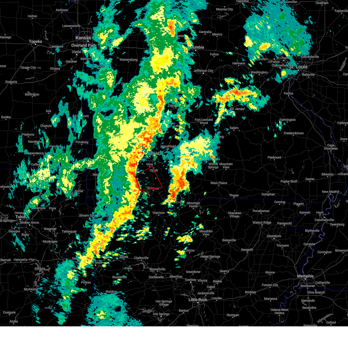
The Bull Creek, MO area has had 0 reports of on-the-ground hail by trained spotters, and has been under severe weather warnings 34 times during the past 12 months. Doppler radar has detected hail at or near Bull Creek, MO on 57 occasions, including 2 occasions during the past year.
| Name: | Bull Creek, MO |
| Where Located: | 34.4 miles S of Springfield, MO |
| Map: | Google Map for Bull Creek, MO |
| Population: | 603 |
| Housing Units: | 235 |
| More Info: | Search Google for Bull Creek, MO |
0
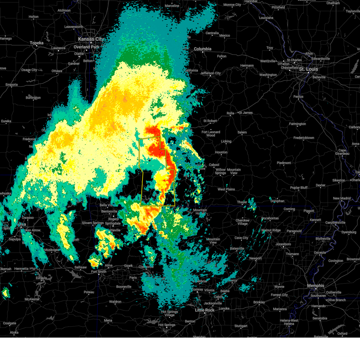
The Top Recent Hail Date for Bull Creek, MO is Saturday, March 22, 2025 (55th out of 57)

Hail and Wind Damage Spotted near Bull Creek, MO
| Date / Time | Report Details |
|---|---|
| 6/29/2025 5:56 PM CDT |
 Svrsgf the national weather service in springfield has issued a * severe thunderstorm warning for, western ozark county in southwestern missouri, southwestern douglas county in southwestern missouri, taney county in southwestern missouri, southeastern stone county in southwestern missouri, * until 645 pm cdt. * at 553 pm cdt, a line of severe thunderstorms along with remnant damaging wind continued from far southeast stone county across taney county into southwest douglas and the western half of ozark counties. movement was to the southeast at 30 mph (radar indicated). Hazards include 60 mph wind gusts. expect damage to roofs, siding, and trees Svrsgf the national weather service in springfield has issued a * severe thunderstorm warning for, western ozark county in southwestern missouri, southwestern douglas county in southwestern missouri, taney county in southwestern missouri, southeastern stone county in southwestern missouri, * until 645 pm cdt. * at 553 pm cdt, a line of severe thunderstorms along with remnant damaging wind continued from far southeast stone county across taney county into southwest douglas and the western half of ozark counties. movement was to the southeast at 30 mph (radar indicated). Hazards include 60 mph wind gusts. expect damage to roofs, siding, and trees
|
| 6/29/2025 5:43 PM CDT |
 the severe thunderstorm warning has been cancelled and is no longer in effect the severe thunderstorm warning has been cancelled and is no longer in effect
|
| 6/29/2025 5:43 PM CDT |
 At 536 pm cdt, the leading edge of damaging thunderstorm winds was moving southeast at 45 mph and approaching the arkansas border in stone into southwest taney county, however winds to 70 mph were continuing across much of stone county into southern christian county into western half of taney county (law enforcement have reported widespread tree and power line damage). Hazards include 70 mph wind gusts. Expect considerable tree damage. damage is likely to mobile homes, roofs, and outbuildings. Locations impacted include, branson, lake taneycomo, table rock lake, roaring river state park, table rock state park, shepherd of the hills state park, hollister, cassville, silver dollar city, kimberling city, forsyth, merriam woods, shell knob, reeds spring, seligman, rockaway beach, exeter, bull creek, indian point, and branson west. At 536 pm cdt, the leading edge of damaging thunderstorm winds was moving southeast at 45 mph and approaching the arkansas border in stone into southwest taney county, however winds to 70 mph were continuing across much of stone county into southern christian county into western half of taney county (law enforcement have reported widespread tree and power line damage). Hazards include 70 mph wind gusts. Expect considerable tree damage. damage is likely to mobile homes, roofs, and outbuildings. Locations impacted include, branson, lake taneycomo, table rock lake, roaring river state park, table rock state park, shepherd of the hills state park, hollister, cassville, silver dollar city, kimberling city, forsyth, merriam woods, shell knob, reeds spring, seligman, rockaway beach, exeter, bull creek, indian point, and branson west.
|
| 6/29/2025 4:47 PM CDT |
 Svrsgf the national weather service in springfield has issued a * severe thunderstorm warning for, southeastern newton county in southwestern missouri, western taney county in southwestern missouri, southwestern christian county in southwestern missouri, stone county in southwestern missouri, barry county in southwestern missouri, southern lawrence county in southwestern missouri, * until 545 pm cdt. * at 446 pm cdt, severe thunderstorms were located along a line extending from marionville to near fairview, moving southeast at 45 mph (law enforcement. at 438 pm, wind damgae roofs and trees was reported in aurora). Hazards include 70 mph wind gusts. Expect considerable tree damage. Damage is likely to mobile homes, roofs, and outbuildings. Svrsgf the national weather service in springfield has issued a * severe thunderstorm warning for, southeastern newton county in southwestern missouri, western taney county in southwestern missouri, southwestern christian county in southwestern missouri, stone county in southwestern missouri, barry county in southwestern missouri, southern lawrence county in southwestern missouri, * until 545 pm cdt. * at 446 pm cdt, severe thunderstorms were located along a line extending from marionville to near fairview, moving southeast at 45 mph (law enforcement. at 438 pm, wind damgae roofs and trees was reported in aurora). Hazards include 70 mph wind gusts. Expect considerable tree damage. Damage is likely to mobile homes, roofs, and outbuildings.
|
| 5/19/2025 8:39 PM CDT | the severe thunderstorm warning has been cancelled and is no longer in effect |
| 5/19/2025 8:39 PM CDT | At 839 pm cdt, severe thunderstorms were located along a line extending from near rogersville to 9 miles southeast of forsyth, moving east at 65 mph (radar indicated). Hazards include 60 mph wind gusts. Expect damage to roofs, siding, and trees. Locations impacted include, nixa, ozark, branson, lake taneycomo, bull shoals lake, table rock lake, table rock state park, shepherd of the hills state park, hollister, forsyth, merriam woods, sparta, kissee mills, highlandville, rockaway beach, fremont hills, bull creek, taneyville, table rock, and kirbyville. |
| 5/19/2025 8:27 PM CDT | the severe thunderstorm warning has been cancelled and is no longer in effect |
| 5/19/2025 8:27 PM CDT | At 826 pm cdt, severe thunderstorms were located along a line extending from battlefield to near indian point, moving east at 45 mph (radar indicated). Hazards include 60 mph wind gusts. Expect damage to roofs, siding, and trees. Locations impacted include, nixa, ozark, branson, lake taneycomo, table rock lake, bull shoals lake, table rock state park, shepherd of the hills state park, hollister, silver dollar city, kimberling city, forsyth, clever, merriam woods, sparta, kissee mills, billings, reeds spring, highlandville, and rockaway beach. |
| 5/19/2025 8:07 PM CDT |
 Svrsgf the national weather service in springfield has issued a * severe thunderstorm warning for, taney county in southwestern missouri, christian county in southwestern missouri, stone county in southwestern missouri, eastern barry county in southwestern missouri, * until 900 pm cdt. * at 806 pm cdt, severe thunderstorms were located along a line extending from near marionville to near grandview, moving east at 45 mph (radar indicated). Hazards include 60 mph wind gusts. expect damage to roofs, siding, and trees Svrsgf the national weather service in springfield has issued a * severe thunderstorm warning for, taney county in southwestern missouri, christian county in southwestern missouri, stone county in southwestern missouri, eastern barry county in southwestern missouri, * until 900 pm cdt. * at 806 pm cdt, severe thunderstorms were located along a line extending from near marionville to near grandview, moving east at 45 mph (radar indicated). Hazards include 60 mph wind gusts. expect damage to roofs, siding, and trees
|
| 5/19/2025 7:12 PM CDT | Svrsgf the national weather service in springfield has issued a * severe thunderstorm warning for, taney county in southwestern missouri, christian county in southwestern missouri, stone county in southwestern missouri, barry county in southwestern missouri, * until 815 pm cdt. * at 712 pm cdt, severe thunderstorms were located along a line extending from near battlefield to near osage, moving east at 45 mph (radar indicated). Hazards include 60 mph wind gusts. expect damage to roofs, siding, and trees |
| 5/19/2025 6:14 PM CDT | Svrsgf the national weather service in springfield has issued a * severe thunderstorm warning for, taney county in southwestern missouri, christian county in southwestern missouri, stone county in southwestern missouri, barry county in southwestern missouri, * until 715 pm cdt. * at 613 pm cdt, severe thunderstorms were located along a line extending from pierce city to near elkins, moving east at 65 mph (radar indicated). Hazards include 60 mph wind gusts and quarter size hail. Hail damage to vehicles is expected. Expect wind damage to roofs, siding, and trees. |
| 4/29/2025 10:05 AM CDT |
 The storms which prompted the warning have moved out of the area. therefore, the warning will be allowed to expire. a severe thunderstorm watch remains in effect until 300 pm cdt for southwestern missouri. The storms which prompted the warning have moved out of the area. therefore, the warning will be allowed to expire. a severe thunderstorm watch remains in effect until 300 pm cdt for southwestern missouri.
|
| 4/29/2025 9:09 AM CDT |
 Svrsgf the national weather service in springfield has issued a * severe thunderstorm warning for, taney county in southwestern missouri, christian county in southwestern missouri, southern polk county in southwestern missouri, stone county in southwestern missouri, greene county in southwestern missouri, * until 1015 am cdt. * at 909 am cdt, severe thunderstorms were located along a line extending from near lockwood to near mount vernon to marionville to near beaver, moving east at 55 mph (radar indicated). Hazards include 70 mph wind gusts and half dollar size hail. Hail damage to vehicles is expected. expect considerable tree damage. Wind damage is also likely to mobile homes, roofs, and outbuildings. Svrsgf the national weather service in springfield has issued a * severe thunderstorm warning for, taney county in southwestern missouri, christian county in southwestern missouri, southern polk county in southwestern missouri, stone county in southwestern missouri, greene county in southwestern missouri, * until 1015 am cdt. * at 909 am cdt, severe thunderstorms were located along a line extending from near lockwood to near mount vernon to marionville to near beaver, moving east at 55 mph (radar indicated). Hazards include 70 mph wind gusts and half dollar size hail. Hail damage to vehicles is expected. expect considerable tree damage. Wind damage is also likely to mobile homes, roofs, and outbuildings.
|
| 4/20/2025 4:09 PM CDT |
 Svrsgf the national weather service in springfield has issued a * severe thunderstorm warning for, western ozark county in southwestern missouri, webster county in southwestern missouri, wright county in southwestern missouri, western douglas county in southwestern missouri, taney county in southwestern missouri, eastern christian county in southwestern missouri, eastern greene county in southwestern missouri, * until 515 pm cdt. * at 409 pm cdt, severe thunderstorms were located along a line extending from near pleasant hope to near highlandville to near carrollton, moving northeast at 55 mph (radar indicated). Hazards include 60 mph wind gusts and quarter size hail. Hail damage to vehicles is expected. Expect wind damage to roofs, siding, and trees. Svrsgf the national weather service in springfield has issued a * severe thunderstorm warning for, western ozark county in southwestern missouri, webster county in southwestern missouri, wright county in southwestern missouri, western douglas county in southwestern missouri, taney county in southwestern missouri, eastern christian county in southwestern missouri, eastern greene county in southwestern missouri, * until 515 pm cdt. * at 409 pm cdt, severe thunderstorms were located along a line extending from near pleasant hope to near highlandville to near carrollton, moving northeast at 55 mph (radar indicated). Hazards include 60 mph wind gusts and quarter size hail. Hail damage to vehicles is expected. Expect wind damage to roofs, siding, and trees.
|
| 4/20/2025 3:59 PM CDT |
 At 358 pm cdt, severe thunderstorms were located along a line extending from morrisville to battlefield to near roberson hollow, moving northeast at 60 mph (springfield airport (sgf) asos reported a 59 mph wind gust at 353 pm cdt). Hazards include 70 mph wind gusts and quarter size hail. Hail damage to vehicles is expected. expect considerable tree damage. wind damage is also likely to mobile homes, roofs, and outbuildings. locations impacted include, glidewell, turners, fair grove, chestnutridge, silver dollar city, crane, spokane, rockaway beach, kirbyville, cave springs, billings, chadwick, hurley, blue eye, nixa, sparta, ebenezer, strafford, table rock, and selmore. This includes interstate 44 between mile markers 59 and 90. At 358 pm cdt, severe thunderstorms were located along a line extending from morrisville to battlefield to near roberson hollow, moving northeast at 60 mph (springfield airport (sgf) asos reported a 59 mph wind gust at 353 pm cdt). Hazards include 70 mph wind gusts and quarter size hail. Hail damage to vehicles is expected. expect considerable tree damage. wind damage is also likely to mobile homes, roofs, and outbuildings. locations impacted include, glidewell, turners, fair grove, chestnutridge, silver dollar city, crane, spokane, rockaway beach, kirbyville, cave springs, billings, chadwick, hurley, blue eye, nixa, sparta, ebenezer, strafford, table rock, and selmore. This includes interstate 44 between mile markers 59 and 90.
|
| 4/20/2025 3:47 PM CDT |
 At 346 pm cdt, severe thunderstorms were located along a line extending from near ash grove to near clever to near green forest, moving northeast at 60 mph (radar indicated). Hazards include 70 mph wind gusts and quarter size hail. Hail damage to vehicles is expected. expect considerable tree damage. wind damage is also likely to mobile homes, roofs, and outbuildings. locations impacted include, glidewell, turners, fair grove, chestnutridge, silver dollar city, crane, spokane, rockaway beach, kirbyville, cave springs, billings, chadwick, hurley, blue eye, nixa, sparta, ebenezer, strafford, table rock, and selmore. This includes interstate 44 between mile markers 59 and 90. At 346 pm cdt, severe thunderstorms were located along a line extending from near ash grove to near clever to near green forest, moving northeast at 60 mph (radar indicated). Hazards include 70 mph wind gusts and quarter size hail. Hail damage to vehicles is expected. expect considerable tree damage. wind damage is also likely to mobile homes, roofs, and outbuildings. locations impacted include, glidewell, turners, fair grove, chestnutridge, silver dollar city, crane, spokane, rockaway beach, kirbyville, cave springs, billings, chadwick, hurley, blue eye, nixa, sparta, ebenezer, strafford, table rock, and selmore. This includes interstate 44 between mile markers 59 and 90.
|
| 4/20/2025 3:47 PM CDT |
 the severe thunderstorm warning has been cancelled and is no longer in effect the severe thunderstorm warning has been cancelled and is no longer in effect
|
| 4/20/2025 3:25 PM CDT |
 Svrsgf the national weather service in springfield has issued a * severe thunderstorm warning for, western taney county in southwestern missouri, christian county in southwestern missouri, stone county in southwestern missouri, eastern barry county in southwestern missouri, eastern lawrence county in southwestern missouri, greene county in southwestern missouri, * until 430 pm cdt. * at 324 pm cdt, severe thunderstorms were located along a line extending from near everton to aurora to near eureka springs, moving northeast at 60 mph (radar indicated). Hazards include 70 mph wind gusts and quarter size hail. Hail damage to vehicles is expected. expect considerable tree damage. Wind damage is also likely to mobile homes, roofs, and outbuildings. Svrsgf the national weather service in springfield has issued a * severe thunderstorm warning for, western taney county in southwestern missouri, christian county in southwestern missouri, stone county in southwestern missouri, eastern barry county in southwestern missouri, eastern lawrence county in southwestern missouri, greene county in southwestern missouri, * until 430 pm cdt. * at 324 pm cdt, severe thunderstorms were located along a line extending from near everton to aurora to near eureka springs, moving northeast at 60 mph (radar indicated). Hazards include 70 mph wind gusts and quarter size hail. Hail damage to vehicles is expected. expect considerable tree damage. Wind damage is also likely to mobile homes, roofs, and outbuildings.
|
| 4/2/2025 11:47 AM CDT |
 the severe thunderstorm warning has been cancelled and is no longer in effect the severe thunderstorm warning has been cancelled and is no longer in effect
|
| 4/2/2025 11:33 AM CDT |
 At 1133 am cdt, a severe thunderstorm was located near kimberling city, moving northeast at 60 mph (radar indicated). Hazards include 60 mph wind gusts and quarter size hail. Hail damage to vehicles is expected. expect wind damage to roofs, siding, and trees. Locations impacted include, branson west, indian point, table rock lake, table rock, merriam woods, silver dollar city, shepherd of the hills state park, lampe, kimberling city, table rock state park, bull creek, branson, coney island, walnut shade, blue eye, reeds spring, rockaway beach, and lake taneycomo. At 1133 am cdt, a severe thunderstorm was located near kimberling city, moving northeast at 60 mph (radar indicated). Hazards include 60 mph wind gusts and quarter size hail. Hail damage to vehicles is expected. expect wind damage to roofs, siding, and trees. Locations impacted include, branson west, indian point, table rock lake, table rock, merriam woods, silver dollar city, shepherd of the hills state park, lampe, kimberling city, table rock state park, bull creek, branson, coney island, walnut shade, blue eye, reeds spring, rockaway beach, and lake taneycomo.
|
| 4/2/2025 11:33 AM CDT |
 the severe thunderstorm warning has been cancelled and is no longer in effect the severe thunderstorm warning has been cancelled and is no longer in effect
|
| 4/2/2025 11:19 AM CDT | At 1119 am cdt, a severe thunderstorm was located over grandview, or near berryville, moving northeast at 50 mph (radar indicated). Hazards include 60 mph wind gusts and quarter size hail. Hail damage to vehicles is expected. expect wind damage to roofs, siding, and trees. Locations impacted include, branson west, merriam woods, emerald beach, silver dollar city, galena, table rock state park, blue eye, golden, shell knob, indian point, cape fair, arrow point, table rock lake, table rock, reeds spring, shepherd of the hills state park, lampe, kimberling city, mccord bend, and bull creek. |
| 4/2/2025 11:02 AM CDT | Svrsgf the national weather service in springfield has issued a * severe thunderstorm warning for, northwestern taney county in southwestern missouri, stone county in southwestern missouri, eastern barry county in southwestern missouri, * until noon cdt. * at 1101 am cdt, a severe thunderstorm was located near war eagle, or 11 miles southwest of eureka springs, moving northeast at 55 mph (radar indicated). Hazards include golf ball size hail and 60 mph wind gusts. People and animals outdoors will be injured. expect hail damage to roofs, siding, windows, and vehicles. Expect wind damage to roofs, siding, and trees. |
| 3/30/2025 4:14 PM CDT |
 At 414 pm cdt, a severe thunderstorm was located 7 miles south of kimberling city, moving northeast at 50 mph (radar indicated). Hazards include quarter size hail. Damage to vehicles is expected. Locations impacted include, branson west, elkhead, chestnutridge, merriam woods, silver dollar city, powersite, rockaway beach, kirbyville, chadwick, table rock state park, forsyth, lake taneycomo, kissee mills, indian point, cape fair, table rock lake, table rock, reeds spring, keltner, and shepherd of the hills state park. At 414 pm cdt, a severe thunderstorm was located 7 miles south of kimberling city, moving northeast at 50 mph (radar indicated). Hazards include quarter size hail. Damage to vehicles is expected. Locations impacted include, branson west, elkhead, chestnutridge, merriam woods, silver dollar city, powersite, rockaway beach, kirbyville, chadwick, table rock state park, forsyth, lake taneycomo, kissee mills, indian point, cape fair, table rock lake, table rock, reeds spring, keltner, and shepherd of the hills state park.
|
| 3/30/2025 4:05 PM CDT |
 At 405 pm cdt, a severe thunderstorm was located over branson west, or near kimberling city, moving northeast at 50 mph (law enforcement). Hazards include tennis ball size hail. People and animals outdoors will be injured. expect damage to roofs, siding, windows, and vehicles. Locations impacted include, branson west, elkhead, chestnutridge, merriam woods, silver dollar city, powersite, rockaway beach, kirbyville, chadwick, table rock state park, forsyth, lake taneycomo, kissee mills, indian point, cape fair, table rock lake, table rock, reeds spring, keltner, and shepherd of the hills state park. At 405 pm cdt, a severe thunderstorm was located over branson west, or near kimberling city, moving northeast at 50 mph (law enforcement). Hazards include tennis ball size hail. People and animals outdoors will be injured. expect damage to roofs, siding, windows, and vehicles. Locations impacted include, branson west, elkhead, chestnutridge, merriam woods, silver dollar city, powersite, rockaway beach, kirbyville, chadwick, table rock state park, forsyth, lake taneycomo, kissee mills, indian point, cape fair, table rock lake, table rock, reeds spring, keltner, and shepherd of the hills state park.
|
| 3/30/2025 4:02 PM CDT |
 At 401 pm cdt, a severe thunderstorm was located over branson west, or near kimberling city, moving northeast at 55 mph (law enforcement). Hazards include golf ball size hail. People and animals outdoors will be injured. expect damage to roofs, siding, windows, and vehicles. Locations impacted include, branson west, elkhead, chestnutridge, merriam woods, silver dollar city, powersite, rockaway beach, kirbyville, chadwick, table rock state park, forsyth, lake taneycomo, kissee mills, indian point, cape fair, table rock lake, table rock, reeds spring, keltner, and shepherd of the hills state park. At 401 pm cdt, a severe thunderstorm was located over branson west, or near kimberling city, moving northeast at 55 mph (law enforcement). Hazards include golf ball size hail. People and animals outdoors will be injured. expect damage to roofs, siding, windows, and vehicles. Locations impacted include, branson west, elkhead, chestnutridge, merriam woods, silver dollar city, powersite, rockaway beach, kirbyville, chadwick, table rock state park, forsyth, lake taneycomo, kissee mills, indian point, cape fair, table rock lake, table rock, reeds spring, keltner, and shepherd of the hills state park.
|
| 3/30/2025 3:56 PM CDT |
 Svrsgf the national weather service in springfield has issued a * severe thunderstorm warning for, northwestern taney county in southwestern missouri, southeastern christian county in southwestern missouri, southern stone county in southwestern missouri, * until 445 pm cdt. * at 355 pm cdt, a severe thunderstorm was located near kimberling city, moving northeast at 55 mph (law enforcement). Hazards include golf ball size hail. People and animals outdoors will be injured. Expect damage to roofs, siding, windows, and vehicles. Svrsgf the national weather service in springfield has issued a * severe thunderstorm warning for, northwestern taney county in southwestern missouri, southeastern christian county in southwestern missouri, southern stone county in southwestern missouri, * until 445 pm cdt. * at 355 pm cdt, a severe thunderstorm was located near kimberling city, moving northeast at 55 mph (law enforcement). Hazards include golf ball size hail. People and animals outdoors will be injured. Expect damage to roofs, siding, windows, and vehicles.
|
| 3/30/2025 3:28 PM CDT |
 Svrsgf the national weather service in springfield has issued a * severe thunderstorm warning for, northwestern taney county in southwestern missouri, southeastern christian county in southwestern missouri, * until 415 pm cdt. * at 328 pm cdt, a severe thunderstorm was located near reeds spring, or near kimberling city, moving northeast at 50 mph (radar indicated). Hazards include quarter size hail. damage to vehicles is expected Svrsgf the national weather service in springfield has issued a * severe thunderstorm warning for, northwestern taney county in southwestern missouri, southeastern christian county in southwestern missouri, * until 415 pm cdt. * at 328 pm cdt, a severe thunderstorm was located near reeds spring, or near kimberling city, moving northeast at 50 mph (radar indicated). Hazards include quarter size hail. damage to vehicles is expected
|
| 3/22/2025 11:56 PM CDT |
 Svrsgf the national weather service in springfield has issued a * severe thunderstorm warning for, northwestern taney county in southwestern missouri, southeastern christian county in southwestern missouri, east central stone county in southwestern missouri, * until 1230 am cdt. * at 1155 pm cdt, a severe thunderstorm was located over reeds spring, or 8 miles north of kimberling city, moving northeast at 45 mph (radar indicated). Hazards include 60 mph wind gusts and quarter size hail. Hail damage to vehicles is expected. Expect wind damage to roofs, siding, and trees. Svrsgf the national weather service in springfield has issued a * severe thunderstorm warning for, northwestern taney county in southwestern missouri, southeastern christian county in southwestern missouri, east central stone county in southwestern missouri, * until 1230 am cdt. * at 1155 pm cdt, a severe thunderstorm was located over reeds spring, or 8 miles north of kimberling city, moving northeast at 45 mph (radar indicated). Hazards include 60 mph wind gusts and quarter size hail. Hail damage to vehicles is expected. Expect wind damage to roofs, siding, and trees.
|
| 12/16/2024 5:54 AM CST |
 The storm which prompted the warning has weakened below severe limits, and no longer poses an immediate threat to life or property. therefore, the warning will be allowed to expire. to report severe weather, contact your nearest law enforcement agency. they will relay your report to the national weather service springfield. The storm which prompted the warning has weakened below severe limits, and no longer poses an immediate threat to life or property. therefore, the warning will be allowed to expire. to report severe weather, contact your nearest law enforcement agency. they will relay your report to the national weather service springfield.
|
| 12/16/2024 5:37 AM CST |
 the severe thunderstorm warning has been cancelled and is no longer in effect the severe thunderstorm warning has been cancelled and is no longer in effect
|
| 12/16/2024 5:37 AM CST |
 At 536 am cst, a severe thunderstorm was located near taneyville, or 7 miles north of forsyth, moving east at 45 mph (radar indicated). Hazards include 60 mph wind gusts and quarter size hail. Hail damage to vehicles is expected. expect wind damage to roofs, siding, and trees. Locations impacted include, branson, lake taneycomo, shepherd of the hills state park, forsyth, merriam woods, rockaway beach, bull creek, taneyville, brownbranch, keltner, garrison, rome, chadwick, bradleyville, goodhope, and walnut shade. At 536 am cst, a severe thunderstorm was located near taneyville, or 7 miles north of forsyth, moving east at 45 mph (radar indicated). Hazards include 60 mph wind gusts and quarter size hail. Hail damage to vehicles is expected. expect wind damage to roofs, siding, and trees. Locations impacted include, branson, lake taneycomo, shepherd of the hills state park, forsyth, merriam woods, rockaway beach, bull creek, taneyville, brownbranch, keltner, garrison, rome, chadwick, bradleyville, goodhope, and walnut shade.
|
| 12/16/2024 5:22 AM CST |
 Svrsgf the national weather service in springfield has issued a * severe thunderstorm warning for, western douglas county in southwestern missouri, northern taney county in southwestern missouri, southeastern christian county in southwestern missouri, east central stone county in southwestern missouri, * until 600 am cst. * at 522 am cst, a severe thunderstorm was located near reeds spring, or 7 miles north of branson, moving east at 45 mph (radar indicated). Hazards include 60 mph wind gusts and quarter size hail. Hail damage to vehicles is expected. Expect wind damage to roofs, siding, and trees. Svrsgf the national weather service in springfield has issued a * severe thunderstorm warning for, western douglas county in southwestern missouri, northern taney county in southwestern missouri, southeastern christian county in southwestern missouri, east central stone county in southwestern missouri, * until 600 am cst. * at 522 am cst, a severe thunderstorm was located near reeds spring, or 7 miles north of branson, moving east at 45 mph (radar indicated). Hazards include 60 mph wind gusts and quarter size hail. Hail damage to vehicles is expected. Expect wind damage to roofs, siding, and trees.
|
| 11/4/2024 6:19 PM CST |
 Torsgf the national weather service in springfield has issued a * tornado warning for, northwestern taney county in southwestern missouri, central christian county in southwestern missouri, central stone county in southwestern missouri, * until 645 pm cst. * at 619 pm cst, tornado producing storms were located along a line extending from near crane to near reeds spring, moving east at 45 mph (radar confirmed tornado). Hazards include damaging tornado. Flying debris will be dangerous to those caught without shelter. mobile homes will be damaged or destroyed. damage to roofs, windows, and vehicles will occur. Tree damage is likely. Torsgf the national weather service in springfield has issued a * tornado warning for, northwestern taney county in southwestern missouri, central christian county in southwestern missouri, central stone county in southwestern missouri, * until 645 pm cst. * at 619 pm cst, tornado producing storms were located along a line extending from near crane to near reeds spring, moving east at 45 mph (radar confirmed tornado). Hazards include damaging tornado. Flying debris will be dangerous to those caught without shelter. mobile homes will be damaged or destroyed. damage to roofs, windows, and vehicles will occur. Tree damage is likely.
|
| 7/3/2024 8:40 PM CDT |
 the severe thunderstorm warning has been cancelled and is no longer in effect the severe thunderstorm warning has been cancelled and is no longer in effect
|
| 7/3/2024 8:40 PM CDT |
 At 840 pm cdt, a severe thunderstorm was located over forsyth, moving east at 30 mph (radar indicated). Hazards include 60 mph wind gusts and quarter size hail. Hail damage to vehicles is expected. expect wind damage to roofs, siding, and trees. Locations impacted include, branson, lake taneycomo, bull shoals lake, hollister, forsyth, merriam woods, kissee mills, rockaway beach, bull creek, table rock, kirbyville, powersite, ozark beach, and edgewater beach. At 840 pm cdt, a severe thunderstorm was located over forsyth, moving east at 30 mph (radar indicated). Hazards include 60 mph wind gusts and quarter size hail. Hail damage to vehicles is expected. expect wind damage to roofs, siding, and trees. Locations impacted include, branson, lake taneycomo, bull shoals lake, hollister, forsyth, merriam woods, kissee mills, rockaway beach, bull creek, table rock, kirbyville, powersite, ozark beach, and edgewater beach.
|
| 7/3/2024 8:25 PM CDT |
 The tornado threat has diminished and the tornado warning has been cancelled. however, large hail and damaging winds remain likely and a severe thunderstorm warning remains in effect for the area. The tornado threat has diminished and the tornado warning has been cancelled. however, large hail and damaging winds remain likely and a severe thunderstorm warning remains in effect for the area.
|
| 7/3/2024 8:24 PM CDT |
 Svrsgf the national weather service in springfield has issued a * severe thunderstorm warning for, taney county in southwestern missouri, southeastern stone county in southwestern missouri, * until 915 pm cdt. * at 823 pm cdt, a severe thunderstorm was located near branson, moving east at 30 mph (radar indicated). Hazards include 60 mph wind gusts and half dollar size hail. Hail damage to vehicles is expected. Expect wind damage to roofs, siding, and trees. Svrsgf the national weather service in springfield has issued a * severe thunderstorm warning for, taney county in southwestern missouri, southeastern stone county in southwestern missouri, * until 915 pm cdt. * at 823 pm cdt, a severe thunderstorm was located near branson, moving east at 30 mph (radar indicated). Hazards include 60 mph wind gusts and half dollar size hail. Hail damage to vehicles is expected. Expect wind damage to roofs, siding, and trees.
|
| 7/3/2024 8:17 PM CDT |
 At 816 pm cdt, a severe thunderstorm capable of producing a tornado was located over branson west, or near kimberling city, moving east at 25 mph (radar indicated rotation). Hazards include tornado and golf ball size hail. Flying debris will be dangerous to those caught without shelter. mobile homes will be damaged or destroyed. damage to roofs, windows, and vehicles will occur. tree damage is likely. Locations impacted include, branson, lake taneycomo, table rock lake, shepherd of the hills state park, hollister, silver dollar city, kimberling city, forsyth, merriam woods, reeds spring, rockaway beach, bull creek, indian point, branson west, table rock, kirbyville, powersite, ozark beach, walnut shade, and edgewater beach. At 816 pm cdt, a severe thunderstorm capable of producing a tornado was located over branson west, or near kimberling city, moving east at 25 mph (radar indicated rotation). Hazards include tornado and golf ball size hail. Flying debris will be dangerous to those caught without shelter. mobile homes will be damaged or destroyed. damage to roofs, windows, and vehicles will occur. tree damage is likely. Locations impacted include, branson, lake taneycomo, table rock lake, shepherd of the hills state park, hollister, silver dollar city, kimberling city, forsyth, merriam woods, reeds spring, rockaway beach, bull creek, indian point, branson west, table rock, kirbyville, powersite, ozark beach, walnut shade, and edgewater beach.
|
| 7/3/2024 8:00 PM CDT |
 Torsgf the national weather service in springfield has issued a * tornado warning for, western taney county in southwestern missouri, central stone county in southwestern missouri, * until 830 pm cdt. * at 800 pm cdt, a severe thunderstorm capable of producing a tornado was located near kimberling city, moving east at 25 mph (radar indicated rotation). Hazards include tornado and golf ball size hail. Flying debris will be dangerous to those caught without shelter. mobile homes will be damaged or destroyed. damage to roofs, windows, and vehicles will occur. Tree damage is likely. Torsgf the national weather service in springfield has issued a * tornado warning for, western taney county in southwestern missouri, central stone county in southwestern missouri, * until 830 pm cdt. * at 800 pm cdt, a severe thunderstorm capable of producing a tornado was located near kimberling city, moving east at 25 mph (radar indicated rotation). Hazards include tornado and golf ball size hail. Flying debris will be dangerous to those caught without shelter. mobile homes will be damaged or destroyed. damage to roofs, windows, and vehicles will occur. Tree damage is likely.
|
| 6/26/2024 7:06 AM CDT |
 The storms which prompted the warning have weakened below severe limits, and no longer pose an immediate threat to life or property. therefore, the warning will be allowed to expire. however, gusty winds are still possible with these thunderstorms. a severe thunderstorm watch remains in effect until 900 am cdt for southwestern missouri. The storms which prompted the warning have weakened below severe limits, and no longer pose an immediate threat to life or property. therefore, the warning will be allowed to expire. however, gusty winds are still possible with these thunderstorms. a severe thunderstorm watch remains in effect until 900 am cdt for southwestern missouri.
|
| 6/26/2024 6:55 AM CDT |
 At 655 am cdt, severe thunderstorms were located along a line extending from 10 miles east of sparta to taneyville to near hollister, moving southeast at 40 mph (radar indicated). Hazards include 60 mph wind gusts. Expect damage to roofs, siding, and trees. Locations impacted include, branson, lake taneycomo, bull shoals lake, hollister, forsyth, merriam woods, kissee mills, rockaway beach, bull creek, taneyville, kirbyville, brownbranch, powersite, rueter, garrison, rome, ridgedale, bradleyville, goodhope, and ozark beach. At 655 am cdt, severe thunderstorms were located along a line extending from 10 miles east of sparta to taneyville to near hollister, moving southeast at 40 mph (radar indicated). Hazards include 60 mph wind gusts. Expect damage to roofs, siding, and trees. Locations impacted include, branson, lake taneycomo, bull shoals lake, hollister, forsyth, merriam woods, kissee mills, rockaway beach, bull creek, taneyville, kirbyville, brownbranch, powersite, rueter, garrison, rome, ridgedale, bradleyville, goodhope, and ozark beach.
|
| 6/26/2024 6:24 AM CDT |
 Svrsgf the national weather service in springfield has issued a * severe thunderstorm warning for, western douglas county in southwestern missouri, taney county in southwestern missouri, eastern christian county in southwestern missouri, * until 715 am cdt. * at 624 am cdt, severe thunderstorms were located along a line extending from 7 miles southeast of fordland to near highlandville to galena, moving southeast at 40 mph (radar indicated). Hazards include 60 mph wind gusts. expect damage to roofs, siding, and trees Svrsgf the national weather service in springfield has issued a * severe thunderstorm warning for, western douglas county in southwestern missouri, taney county in southwestern missouri, eastern christian county in southwestern missouri, * until 715 am cdt. * at 624 am cdt, severe thunderstorms were located along a line extending from 7 miles southeast of fordland to near highlandville to galena, moving southeast at 40 mph (radar indicated). Hazards include 60 mph wind gusts. expect damage to roofs, siding, and trees
|
| 5/26/2024 4:26 AM CDT |
 Svrsgf the national weather service in springfield has issued a * severe thunderstorm warning for, ozark county in southwestern missouri, douglas county in southwestern missouri, taney county in southwestern missouri, eastern christian county in southwestern missouri, * until 515 am cdt. * at 425 am cdt, severe thunderstorms were located along a line extending from sparta to 6 miles southeast of forsyth to 6 miles northeast of carrollton, moving east at 60 mph (radar indicated). Hazards include golf ball size hail and 70 mph wind gusts. People and animals outdoors will be injured. expect hail damage to roofs, siding, windows, and vehicles. expect considerable tree damage. Wind damage is also likely to mobile homes, roofs, and outbuildings. Svrsgf the national weather service in springfield has issued a * severe thunderstorm warning for, ozark county in southwestern missouri, douglas county in southwestern missouri, taney county in southwestern missouri, eastern christian county in southwestern missouri, * until 515 am cdt. * at 425 am cdt, severe thunderstorms were located along a line extending from sparta to 6 miles southeast of forsyth to 6 miles northeast of carrollton, moving east at 60 mph (radar indicated). Hazards include golf ball size hail and 70 mph wind gusts. People and animals outdoors will be injured. expect hail damage to roofs, siding, windows, and vehicles. expect considerable tree damage. Wind damage is also likely to mobile homes, roofs, and outbuildings.
|
| 5/26/2024 4:09 AM CDT |
 At 408 am cdt, severe thunderstorms were located along a line extending from near clever to reeds spring to 6 miles northeast of grandview, moving east at 60 mph (public). Hazards include two inch hail and 70 mph wind gusts. People and animals outdoors will be injured. expect hail damage to roofs, siding, windows, and vehicles. expect considerable tree damage. wind damage is also likely to mobile homes, roofs, and outbuildings. Locations impacted include, nixa, ozark, branson, lake taneycomo, table rock lake, bull shoals lake, roaring river state park, table rock state park, shepherd of the hills state park, hollister, silver dollar city, kimberling city, forsyth, clever, merriam woods, sparta, crane, shell knob, kissee mills, and billings. At 408 am cdt, severe thunderstorms were located along a line extending from near clever to reeds spring to 6 miles northeast of grandview, moving east at 60 mph (public). Hazards include two inch hail and 70 mph wind gusts. People and animals outdoors will be injured. expect hail damage to roofs, siding, windows, and vehicles. expect considerable tree damage. wind damage is also likely to mobile homes, roofs, and outbuildings. Locations impacted include, nixa, ozark, branson, lake taneycomo, table rock lake, bull shoals lake, roaring river state park, table rock state park, shepherd of the hills state park, hollister, silver dollar city, kimberling city, forsyth, clever, merriam woods, sparta, crane, shell knob, kissee mills, and billings.
|
| 5/26/2024 4:09 AM CDT |
 the severe thunderstorm warning has been cancelled and is no longer in effect the severe thunderstorm warning has been cancelled and is no longer in effect
|
| 5/26/2024 3:49 AM CDT |
 Svrsgf the national weather service in springfield has issued a * severe thunderstorm warning for, taney county in southwestern missouri, christian county in southwestern missouri, stone county in southwestern missouri, eastern barry county in southwestern missouri, southeastern lawrence county in southwestern missouri, * until 430 am cdt. * at 349 am cdt, severe thunderstorms were located along a line extending from near marionville to 9 miles west of galena to near beaver, moving east at 60 mph (radar indicated). Hazards include two inch hail and 70 mph wind gusts. People and animals outdoors will be injured. expect hail damage to roofs, siding, windows, and vehicles. expect considerable tree damage. Wind damage is also likely to mobile homes, roofs, and outbuildings. Svrsgf the national weather service in springfield has issued a * severe thunderstorm warning for, taney county in southwestern missouri, christian county in southwestern missouri, stone county in southwestern missouri, eastern barry county in southwestern missouri, southeastern lawrence county in southwestern missouri, * until 430 am cdt. * at 349 am cdt, severe thunderstorms were located along a line extending from near marionville to 9 miles west of galena to near beaver, moving east at 60 mph (radar indicated). Hazards include two inch hail and 70 mph wind gusts. People and animals outdoors will be injured. expect hail damage to roofs, siding, windows, and vehicles. expect considerable tree damage. Wind damage is also likely to mobile homes, roofs, and outbuildings.
|
| 5/24/2024 11:17 PM CDT |
 the severe thunderstorm warning has been cancelled and is no longer in effect the severe thunderstorm warning has been cancelled and is no longer in effect
|
| 5/24/2024 11:00 PM CDT |
 Svrsgf the national weather service in springfield has issued a * severe thunderstorm warning for, southwestern douglas county in southwestern missouri, northwestern taney county in southwestern missouri, southeastern christian county in southwestern missouri, * until 1145 pm cdt. * at 1100 pm cdt, a severe thunderstorm was located over merriam woods, or near forsyth, moving northeast at 25 mph (law enforcement. at 10:57 pm quarter size hail was reported in walnut shade). Hazards include 60 mph wind gusts and quarter size hail. Hail damage to vehicles is expected. Expect wind damage to roofs, siding, and trees. Svrsgf the national weather service in springfield has issued a * severe thunderstorm warning for, southwestern douglas county in southwestern missouri, northwestern taney county in southwestern missouri, southeastern christian county in southwestern missouri, * until 1145 pm cdt. * at 1100 pm cdt, a severe thunderstorm was located over merriam woods, or near forsyth, moving northeast at 25 mph (law enforcement. at 10:57 pm quarter size hail was reported in walnut shade). Hazards include 60 mph wind gusts and quarter size hail. Hail damage to vehicles is expected. Expect wind damage to roofs, siding, and trees.
|
| 5/7/2024 1:45 AM CDT |
 At 145 am cdt, severe thunderstorms were located along a line extending from 7 miles southeast of fordland to 7 miles northwest of merriam woods to 6 miles south of kimberling city, moving east at 60 mph (radar indicated). Hazards include 60 mph wind gusts and penny size hail. Expect damage to roofs, siding, and trees. Locations impacted include, nixa, ozark, branson, lake taneycomo, table rock lake, bull shoals lake, table rock state park, shepherd of the hills state park, hollister, silver dollar city, kimberling city, forsyth, merriam woods, sparta, shell knob, kissee mills, reeds spring, highlandville, rockaway beach, and fremont hills. At 145 am cdt, severe thunderstorms were located along a line extending from 7 miles southeast of fordland to 7 miles northwest of merriam woods to 6 miles south of kimberling city, moving east at 60 mph (radar indicated). Hazards include 60 mph wind gusts and penny size hail. Expect damage to roofs, siding, and trees. Locations impacted include, nixa, ozark, branson, lake taneycomo, table rock lake, bull shoals lake, table rock state park, shepherd of the hills state park, hollister, silver dollar city, kimberling city, forsyth, merriam woods, sparta, shell knob, kissee mills, reeds spring, highlandville, rockaway beach, and fremont hills.
|
| 5/7/2024 1:45 AM CDT |
 the severe thunderstorm warning has been cancelled and is no longer in effect the severe thunderstorm warning has been cancelled and is no longer in effect
|
| 5/7/2024 1:35 AM CDT |
 Svrsgf the national weather service in springfield has issued a * severe thunderstorm warning for, taney county in southwestern missouri, christian county in southwestern missouri, stone county in southwestern missouri, southeastern barry county in southwestern missouri, * until 230 am cdt. * at 135 am cdt, severe thunderstorms were located along a line extending from near clever to near galena to 7 miles north of grandview, moving east at 50 mph (radar indicated). Hazards include 60 mph wind gusts and penny size hail. expect damage to roofs, siding, and trees Svrsgf the national weather service in springfield has issued a * severe thunderstorm warning for, taney county in southwestern missouri, christian county in southwestern missouri, stone county in southwestern missouri, southeastern barry county in southwestern missouri, * until 230 am cdt. * at 135 am cdt, severe thunderstorms were located along a line extending from near clever to near galena to 7 miles north of grandview, moving east at 50 mph (radar indicated). Hazards include 60 mph wind gusts and penny size hail. expect damage to roofs, siding, and trees
|
| 5/7/2024 1:00 AM CDT |
 The storms which prompted the warning have moved out of the area. therefore, the warning has been allowed to expire. however, gusty winds and heavy rain are still possible with these thunderstorms. a tornado watch remains in effect until 400 am cdt for central, southwestern and west central missouri. The storms which prompted the warning have moved out of the area. therefore, the warning has been allowed to expire. however, gusty winds and heavy rain are still possible with these thunderstorms. a tornado watch remains in effect until 400 am cdt for central, southwestern and west central missouri.
|
| 5/7/2024 12:07 AM CDT |
 Svrsgf the national weather service in springfield has issued a * severe thunderstorm warning for, hickory county in central missouri, northwestern taney county in southwestern missouri, christian county in southwestern missouri, southwestern benton county in central missouri, polk county in southwestern missouri, stone county in southwestern missouri, greene county in southwestern missouri, eastern st. clair county in west central missouri, * until 100 am cdt. * at 1207 am cdt, severe thunderstorms were located along a line extending from near schell city to near lockwood to near wheaton, moving northeast at 60 mph (radar indicated). Hazards include 70 mph wind gusts and quarter size hail. Hail damage to vehicles is expected. expect considerable tree damage. Wind damage is also likely to mobile homes, roofs, and outbuildings. Svrsgf the national weather service in springfield has issued a * severe thunderstorm warning for, hickory county in central missouri, northwestern taney county in southwestern missouri, christian county in southwestern missouri, southwestern benton county in central missouri, polk county in southwestern missouri, stone county in southwestern missouri, greene county in southwestern missouri, eastern st. clair county in west central missouri, * until 100 am cdt. * at 1207 am cdt, severe thunderstorms were located along a line extending from near schell city to near lockwood to near wheaton, moving northeast at 60 mph (radar indicated). Hazards include 70 mph wind gusts and quarter size hail. Hail damage to vehicles is expected. expect considerable tree damage. Wind damage is also likely to mobile homes, roofs, and outbuildings.
|
| 4/2/2024 1:17 AM CDT |
 At 117 am cdt, severe thunderstorms were located along a line extending from near highlandville to silver dollar city to 7 miles northeast of urbanette, moving east at 55 mph (radar indicated). Hazards include 60 mph wind gusts and penny size hail. Expect damage to roofs, siding, and trees. Locations impacted include, branson, lake taneycomo, bull shoals lake, table rock lake, table rock state park, shepherd of the hills state park, hollister, forsyth, merriam woods, kissee mills, rockaway beach, bull creek, taneyville, table rock, kirbyville, spokane, chestnutridge, powersite, protem, and rome. At 117 am cdt, severe thunderstorms were located along a line extending from near highlandville to silver dollar city to 7 miles northeast of urbanette, moving east at 55 mph (radar indicated). Hazards include 60 mph wind gusts and penny size hail. Expect damage to roofs, siding, and trees. Locations impacted include, branson, lake taneycomo, bull shoals lake, table rock lake, table rock state park, shepherd of the hills state park, hollister, forsyth, merriam woods, kissee mills, rockaway beach, bull creek, taneyville, table rock, kirbyville, spokane, chestnutridge, powersite, protem, and rome.
|
| 4/2/2024 1:13 AM CDT |
 Svrsgf the national weather service in springfield has issued a * severe thunderstorm warning for, southwestern douglas county in southwestern missouri, taney county in southwestern missouri, southeastern christian county in southwestern missouri, * until 200 am cdt. * at 113 am cdt, severe thunderstorms were located along a line extending from near reeds spring to near indian point to 6 miles northeast of urbanette, moving east at 55 mph (radar indicated). Hazards include 60 mph wind gusts and penny size hail. expect damage to roofs, siding, and trees Svrsgf the national weather service in springfield has issued a * severe thunderstorm warning for, southwestern douglas county in southwestern missouri, taney county in southwestern missouri, southeastern christian county in southwestern missouri, * until 200 am cdt. * at 113 am cdt, severe thunderstorms were located along a line extending from near reeds spring to near indian point to 6 miles northeast of urbanette, moving east at 55 mph (radar indicated). Hazards include 60 mph wind gusts and penny size hail. expect damage to roofs, siding, and trees
|
| 3/14/2024 4:05 PM CDT |
 At 404 pm cdt, severe thunderstorms were located along a line extending from springfield to near sparta to near roberson hollow, moving east at 30 mph (radar indicated). Hazards include 60 mph wind gusts and quarter size hail. Hail damage to vehicles is expected. expect wind damage to roofs, siding, and trees. Locations impacted include, ozark, branson, lake taneycomo, table rock lake, table rock state park, hollister, merriam woods, sparta, bull creek, table rock, chestnutridge, christian center, linden, and walnut shade. At 404 pm cdt, severe thunderstorms were located along a line extending from springfield to near sparta to near roberson hollow, moving east at 30 mph (radar indicated). Hazards include 60 mph wind gusts and quarter size hail. Hail damage to vehicles is expected. expect wind damage to roofs, siding, and trees. Locations impacted include, ozark, branson, lake taneycomo, table rock lake, table rock state park, hollister, merriam woods, sparta, bull creek, table rock, chestnutridge, christian center, linden, and walnut shade.
|
| 3/14/2024 4:05 PM CDT |
 the severe thunderstorm warning has been cancelled and is no longer in effect the severe thunderstorm warning has been cancelled and is no longer in effect
|
| 3/14/2024 3:44 PM CDT |
 Svrsgf the national weather service in springfield has issued a * severe thunderstorm warning for, western taney county in southwestern missouri, central christian county in southwestern missouri, eastern stone county in southwestern missouri, southeastern greene county in southwestern missouri, * until 415 pm cdt. * at 344 pm cdt, severe thunderstorms were located along a line extending from near willard to highlandville to 6 miles north of urbanette, moving east at 30 mph (radar indicated). Hazards include 60 mph wind gusts and quarter size hail. Hail damage to vehicles is expected. Expect wind damage to roofs, siding, and trees. Svrsgf the national weather service in springfield has issued a * severe thunderstorm warning for, western taney county in southwestern missouri, central christian county in southwestern missouri, eastern stone county in southwestern missouri, southeastern greene county in southwestern missouri, * until 415 pm cdt. * at 344 pm cdt, severe thunderstorms were located along a line extending from near willard to highlandville to 6 miles north of urbanette, moving east at 30 mph (radar indicated). Hazards include 60 mph wind gusts and quarter size hail. Hail damage to vehicles is expected. Expect wind damage to roofs, siding, and trees.
|
| 3/14/2024 3:40 PM CDT |
 Svrsgf the national weather service in springfield has issued a * severe thunderstorm warning for, western ozark county in southwestern missouri, taney county in southwestern missouri, * until 430 pm cdt. * at 340 pm cdt, severe thunderstorms were located along a line extending from near rogersville to 7 miles south of roberson hollow, moving east at 55 mph (radar indicated). Hazards include 60 mph wind gusts and half dollar size hail. Hail damage to vehicles is expected. Expect wind damage to roofs, siding, and trees. Svrsgf the national weather service in springfield has issued a * severe thunderstorm warning for, western ozark county in southwestern missouri, taney county in southwestern missouri, * until 430 pm cdt. * at 340 pm cdt, severe thunderstorms were located along a line extending from near rogersville to 7 miles south of roberson hollow, moving east at 55 mph (radar indicated). Hazards include 60 mph wind gusts and half dollar size hail. Hail damage to vehicles is expected. Expect wind damage to roofs, siding, and trees.
|
| 1/12/2024 12:40 AM CST |
 The severe thunderstorm warning for taney and christian counties will expire at 1245 am cst, the storms which prompted the warning have moved out of the area. therefore, the warning will be allowed to expire. The severe thunderstorm warning for taney and christian counties will expire at 1245 am cst, the storms which prompted the warning have moved out of the area. therefore, the warning will be allowed to expire.
|
| 1/12/2024 12:12 AM CST |
 At 1212 am cst, severe thunderstorms were located along a line extending from clever to 6 miles south of highlandville to near hollister, moving northeast at 60 mph (radar indicated). Hazards include 60 mph wind gusts and quarter size hail. Hail damage to vehicles is expected. expect wind damage to roofs, siding, and trees. locations impacted include, nixa, ozark, branson, lake taneycomo, table rock lake, shepherd of the hills state park, table rock state park, hollister, forsyth, clever, merriam woods, sparta, kissee mills, billings, highlandville, rockaway beach, fremont hills, bull creek, taneyville, and table rock. hail threat, radar indicated max hail size, 1. 00 in wind threat, radar indicated max wind gust, 60 mph. At 1212 am cst, severe thunderstorms were located along a line extending from clever to 6 miles south of highlandville to near hollister, moving northeast at 60 mph (radar indicated). Hazards include 60 mph wind gusts and quarter size hail. Hail damage to vehicles is expected. expect wind damage to roofs, siding, and trees. locations impacted include, nixa, ozark, branson, lake taneycomo, table rock lake, shepherd of the hills state park, table rock state park, hollister, forsyth, clever, merriam woods, sparta, kissee mills, billings, highlandville, rockaway beach, fremont hills, bull creek, taneyville, and table rock. hail threat, radar indicated max hail size, 1. 00 in wind threat, radar indicated max wind gust, 60 mph.
|
| 1/11/2024 11:56 PM CST |
 At 1155 pm cst, severe thunderstorms were located along a line extending from aurora to near galena to 6 miles northeast of urbanette, moving northeast at 60 mph (radar indicated). Hazards include 60 mph wind gusts and quarter size hail. Hail damage to vehicles is expected. Expect wind damage to roofs, siding, and trees. At 1155 pm cst, severe thunderstorms were located along a line extending from aurora to near galena to 6 miles northeast of urbanette, moving northeast at 60 mph (radar indicated). Hazards include 60 mph wind gusts and quarter size hail. Hail damage to vehicles is expected. Expect wind damage to roofs, siding, and trees.
|
| 8/13/2023 10:57 PM CDT |
 At 1057 pm cdt, a severe thunderstorm was located over forsyth, moving east at 25 mph (radar indicated). Hazards include 60 mph wind gusts and quarter size hail. Hail damage to vehicles is expected. Expect wind damage to roofs, siding, and trees. At 1057 pm cdt, a severe thunderstorm was located over forsyth, moving east at 25 mph (radar indicated). Hazards include 60 mph wind gusts and quarter size hail. Hail damage to vehicles is expected. Expect wind damage to roofs, siding, and trees.
|
| 8/13/2023 10:18 PM CDT |
 At 1018 pm cdt, a severe thunderstorm was located over reeds spring, or 8 miles northwest of branson, moving east at 35 mph (radar indicated). Hazards include 60 mph wind gusts and quarter size hail. Hail damage to vehicles is expected. Expect wind damage to roofs, siding, and trees. At 1018 pm cdt, a severe thunderstorm was located over reeds spring, or 8 miles northwest of branson, moving east at 35 mph (radar indicated). Hazards include 60 mph wind gusts and quarter size hail. Hail damage to vehicles is expected. Expect wind damage to roofs, siding, and trees.
|
| 8/9/2023 6:56 PM CDT |
 At 655 pm cdt, a severe thunderstorm was located over merriam woods, or near forsyth, moving east at 35 mph (radar indicated). Hazards include ping pong ball size hail and 60 mph wind gusts. People and animals outdoors will be injured. expect hail damage to roofs, siding, windows, and vehicles. expect wind damage to roofs, siding, and trees. Locations impacted include, branson, lake taneycomo, bull shoals lake, hollister, forsyth, merriam woods, kissee mills, rockaway beach, bull creek, taneyville, theodosia, kirbyville, wasola, sundown, powersite, thornfield, noble, brownbranch, rueter and garrison. At 655 pm cdt, a severe thunderstorm was located over merriam woods, or near forsyth, moving east at 35 mph (radar indicated). Hazards include ping pong ball size hail and 60 mph wind gusts. People and animals outdoors will be injured. expect hail damage to roofs, siding, windows, and vehicles. expect wind damage to roofs, siding, and trees. Locations impacted include, branson, lake taneycomo, bull shoals lake, hollister, forsyth, merriam woods, kissee mills, rockaway beach, bull creek, taneyville, theodosia, kirbyville, wasola, sundown, powersite, thornfield, noble, brownbranch, rueter and garrison.
|
| 8/9/2023 6:37 PM CDT |
 At 636 pm cdt, a severe thunderstorm was located near reeds spring, or 8 miles northwest of branson, moving east at 35 mph (radar indicated). Hazards include ping pong ball size hail and 60 mph wind gusts. People and animals outdoors will be injured. expect hail damage to roofs, siding, windows, and vehicles. Expect wind damage to roofs, siding, and trees. At 636 pm cdt, a severe thunderstorm was located near reeds spring, or 8 miles northwest of branson, moving east at 35 mph (radar indicated). Hazards include ping pong ball size hail and 60 mph wind gusts. People and animals outdoors will be injured. expect hail damage to roofs, siding, windows, and vehicles. Expect wind damage to roofs, siding, and trees.
|
| 8/9/2023 6:27 PM CDT |
 At 626 pm cdt, a severe thunderstorm was located over merriam woods, or near forsyth, moving east at 35 mph (radar indicated). Hazards include 60 mph wind gusts and quarter size hail. Hail damage to vehicles is expected. expect wind damage to roofs, siding, and trees. Locations impacted include, branson, lake taneycomo, shepherd of the hills state park, hollister, silver dollar city, forsyth, merriam woods, kissee mills, rockaway beach, bull creek, indian point, branson west, taneyville, kirbyville, spokane, chestnutridge, powersite, garrison, ozark beach and walnut shade. At 626 pm cdt, a severe thunderstorm was located over merriam woods, or near forsyth, moving east at 35 mph (radar indicated). Hazards include 60 mph wind gusts and quarter size hail. Hail damage to vehicles is expected. expect wind damage to roofs, siding, and trees. Locations impacted include, branson, lake taneycomo, shepherd of the hills state park, hollister, silver dollar city, forsyth, merriam woods, kissee mills, rockaway beach, bull creek, indian point, branson west, taneyville, kirbyville, spokane, chestnutridge, powersite, garrison, ozark beach and walnut shade.
|
| 8/9/2023 6:16 PM CDT |
 At 615 pm cdt, a severe thunderstorm was located near reeds spring, or 8 miles north of branson, moving east at 35 mph (radar indicated). Hazards include 60 mph wind gusts and quarter size hail. Hail damage to vehicles is expected. expect wind damage to roofs, siding, and trees. locations impacted include, branson, lake taneycomo, shepherd of the hills state park, hollister, silver dollar city, forsyth, merriam woods, kissee mills, reeds spring, rockaway beach, bull creek, indian point, branson west, taneyville, kirbyville, spokane, chestnutridge, powersite, ponce de leon and garrison. hail threat, radar indicated max hail size, 1. 00 in wind threat, radar indicated max wind gust, 60 mph. At 615 pm cdt, a severe thunderstorm was located near reeds spring, or 8 miles north of branson, moving east at 35 mph (radar indicated). Hazards include 60 mph wind gusts and quarter size hail. Hail damage to vehicles is expected. expect wind damage to roofs, siding, and trees. locations impacted include, branson, lake taneycomo, shepherd of the hills state park, hollister, silver dollar city, forsyth, merriam woods, kissee mills, reeds spring, rockaway beach, bull creek, indian point, branson west, taneyville, kirbyville, spokane, chestnutridge, powersite, ponce de leon and garrison. hail threat, radar indicated max hail size, 1. 00 in wind threat, radar indicated max wind gust, 60 mph.
|
| 8/9/2023 6:00 PM CDT |
 At 600 pm cdt, a severe thunderstorm was located over galena, or 9 miles north of kimberling city, moving east at 35 mph (radar indicated). Hazards include 60 mph wind gusts and quarter size hail. Hail damage to vehicles is expected. Expect wind damage to roofs, siding, and trees. At 600 pm cdt, a severe thunderstorm was located over galena, or 9 miles north of kimberling city, moving east at 35 mph (radar indicated). Hazards include 60 mph wind gusts and quarter size hail. Hail damage to vehicles is expected. Expect wind damage to roofs, siding, and trees.
|
| 7/30/2023 11:37 PM CDT |
 At 1136 pm cdt, severe thunderstorms were located along a line extending from near nixa to highlandville to reeds spring to near seligman, moving southeast at 50 mph (public. public weather stations reporting 60 to 70mph winds). Hazards include 70 mph wind gusts. Expect considerable tree damage. Damage is likely to mobile homes, roofs, and outbuildings. At 1136 pm cdt, severe thunderstorms were located along a line extending from near nixa to highlandville to reeds spring to near seligman, moving southeast at 50 mph (public. public weather stations reporting 60 to 70mph winds). Hazards include 70 mph wind gusts. Expect considerable tree damage. Damage is likely to mobile homes, roofs, and outbuildings.
|
| 7/30/2023 11:33 PM CDT |
 At 1132 pm cdt, severe thunderstorms were located along a line extending from near nixa to 7 miles southwest of highlandville to 6 miles northwest of kimberling city to near seligman, moving southeast at 50 mph (emergency management). Hazards include 70 mph wind gusts. Expect considerable tree damage. damage is likely to mobile homes, roofs, and outbuildings. locations impacted include, nixa, ozark, branson, lake taneycomo, table rock lake, roaring river state park, table rock state park, shepherd of the hills state park, hollister, cassville, silver dollar city, kimberling city, forsyth, clever, merriam woods, sparta, crane, shell knob, purdy and billings. thunderstorm damage threat, considerable hail threat, radar indicated max hail size, <. 75 in wind threat, observed max wind gust, 70 mph. At 1132 pm cdt, severe thunderstorms were located along a line extending from near nixa to 7 miles southwest of highlandville to 6 miles northwest of kimberling city to near seligman, moving southeast at 50 mph (emergency management). Hazards include 70 mph wind gusts. Expect considerable tree damage. damage is likely to mobile homes, roofs, and outbuildings. locations impacted include, nixa, ozark, branson, lake taneycomo, table rock lake, roaring river state park, table rock state park, shepherd of the hills state park, hollister, cassville, silver dollar city, kimberling city, forsyth, clever, merriam woods, sparta, crane, shell knob, purdy and billings. thunderstorm damage threat, considerable hail threat, radar indicated max hail size, <. 75 in wind threat, observed max wind gust, 70 mph.
|
| 7/30/2023 10:57 PM CDT |
 At 1057 pm cdt, severe thunderstorms were located along a line extending from near everton to 8 miles northwest of billings to near mount vernon to diamond, moving east at 45 mph (emergency management). Hazards include 70 mph wind gusts. Expect considerable tree damage. Damage is likely to mobile homes, roofs, and outbuildings. At 1057 pm cdt, severe thunderstorms were located along a line extending from near everton to 8 miles northwest of billings to near mount vernon to diamond, moving east at 45 mph (emergency management). Hazards include 70 mph wind gusts. Expect considerable tree damage. Damage is likely to mobile homes, roofs, and outbuildings.
|
| 7/14/2023 8:46 PM CDT |
 At 845 pm cdt, severe thunderstorms were located along a line extending from 6 miles southwest of sparta to 8 miles southeast of forsyth to near willis, moving east at 35 mph (trained weather spotters). Hazards include 70 mph wind gusts and penny size hail. Expect considerable tree damage. damage is likely to mobile homes, roofs, and outbuildings. locations impacted include, branson, lake taneycomo, bull shoals lake, hollister, forsyth, merriam woods, kissee mills, highlandville, rockaway beach, bull creek, taneyville, kirbyville, spokane, chestnutridge, powersite, protem, rome, chadwick, brownbranch and rueter. thunderstorm damage threat, considerable hail threat, radar indicated max hail size, 0. 75 in wind threat, observed max wind gust, 70 mph. At 845 pm cdt, severe thunderstorms were located along a line extending from 6 miles southwest of sparta to 8 miles southeast of forsyth to near willis, moving east at 35 mph (trained weather spotters). Hazards include 70 mph wind gusts and penny size hail. Expect considerable tree damage. damage is likely to mobile homes, roofs, and outbuildings. locations impacted include, branson, lake taneycomo, bull shoals lake, hollister, forsyth, merriam woods, kissee mills, highlandville, rockaway beach, bull creek, taneyville, kirbyville, spokane, chestnutridge, powersite, protem, rome, chadwick, brownbranch and rueter. thunderstorm damage threat, considerable hail threat, radar indicated max hail size, 0. 75 in wind threat, observed max wind gust, 70 mph.
|
| 7/14/2023 8:37 PM CDT |
 At 837 pm cdt, severe thunderstorms were located along a line extending from near highlandville to 6 miles south of forsyth to near self, moving east at 30 mph (trained weather spotters). Hazards include 70 mph wind gusts and penny size hail. Expect considerable tree damage. damage is likely to mobile homes, roofs, and outbuildings. locations impacted include, branson, lake taneycomo, bull shoals lake, table rock lake, table rock state park, shepherd of the hills state park, hollister, silver dollar city, forsyth, merriam woods, kissee mills, reeds spring, highlandville, rockaway beach, bull creek, indian point, branson west, taneyville, table rock and kirbyville. thunderstorm damage threat, considerable hail threat, radar indicated max hail size, 0. 75 in wind threat, observed max wind gust, 70 mph. At 837 pm cdt, severe thunderstorms were located along a line extending from near highlandville to 6 miles south of forsyth to near self, moving east at 30 mph (trained weather spotters). Hazards include 70 mph wind gusts and penny size hail. Expect considerable tree damage. damage is likely to mobile homes, roofs, and outbuildings. locations impacted include, branson, lake taneycomo, bull shoals lake, table rock lake, table rock state park, shepherd of the hills state park, hollister, silver dollar city, forsyth, merriam woods, kissee mills, reeds spring, highlandville, rockaway beach, bull creek, indian point, branson west, taneyville, table rock and kirbyville. thunderstorm damage threat, considerable hail threat, radar indicated max hail size, 0. 75 in wind threat, observed max wind gust, 70 mph.
|
| 7/14/2023 8:21 PM CDT |
 At 821 pm cdt, severe thunderstorms were located along a line extending from near highlandville to near hollister to 6 miles west of roberson hollow, moving east at 40 mph (trained weather spotters). Hazards include 70 mph wind gusts and penny size hail. Expect considerable tree damage. Damage is likely to mobile homes, roofs, and outbuildings. At 821 pm cdt, severe thunderstorms were located along a line extending from near highlandville to near hollister to 6 miles west of roberson hollow, moving east at 40 mph (trained weather spotters). Hazards include 70 mph wind gusts and penny size hail. Expect considerable tree damage. Damage is likely to mobile homes, roofs, and outbuildings.
|
| 7/14/2023 8:11 PM CDT |
 At 811 pm cdt, severe thunderstorms were located along a line extending from near fair play to near willard to near billings to galena to near kimberling city to near beaver, moving southeast at 40 mph (trained weather spotters). Hazards include 60 mph wind gusts and penny size hail. Expect damage to roofs, siding, and trees. locations impacted include, springfield, nixa, ozark, republic, branson, table rock lake, lake taneycomo, stockton lake, roaring river state park, table rock state park, shepherd of the hills state park, battlefield, willard, hollister, silver dollar city, kimberling city, strafford, clever, merriam woods and sparta. this includes interstate 44 between mile markers 59 and 90. hail threat, radar indicated max hail size, 0. 75 in wind threat, observed max wind gust, 60 mph. At 811 pm cdt, severe thunderstorms were located along a line extending from near fair play to near willard to near billings to galena to near kimberling city to near beaver, moving southeast at 40 mph (trained weather spotters). Hazards include 60 mph wind gusts and penny size hail. Expect damage to roofs, siding, and trees. locations impacted include, springfield, nixa, ozark, republic, branson, table rock lake, lake taneycomo, stockton lake, roaring river state park, table rock state park, shepherd of the hills state park, battlefield, willard, hollister, silver dollar city, kimberling city, strafford, clever, merriam woods and sparta. this includes interstate 44 between mile markers 59 and 90. hail threat, radar indicated max hail size, 0. 75 in wind threat, observed max wind gust, 60 mph.
|
| 7/14/2023 8:03 PM CDT |
 At 803 pm cdt, severe thunderstorms were located along a line extending from near stockton to near walnut grove to near billings to near galena to near kimberling city to near beaver, moving east at 45 mph (trained weather spotters). Hazards include 60 mph wind gusts and nickel size hail. Expect damage to roofs, siding, and trees. locations impacted include, springfield, nixa, ozark, republic, branson, table rock lake, lake taneycomo, stockton lake, roaring river state park, table rock state park, shepherd of the hills state park, aurora, battlefield, willard, hollister, cassville, silver dollar city, kimberling city, strafford and marionville. this includes interstate 44 between mile markers 53 and 90. hail threat, radar indicated max hail size, 0. 88 in wind threat, observed max wind gust, 60 mph. At 803 pm cdt, severe thunderstorms were located along a line extending from near stockton to near walnut grove to near billings to near galena to near kimberling city to near beaver, moving east at 45 mph (trained weather spotters). Hazards include 60 mph wind gusts and nickel size hail. Expect damage to roofs, siding, and trees. locations impacted include, springfield, nixa, ozark, republic, branson, table rock lake, lake taneycomo, stockton lake, roaring river state park, table rock state park, shepherd of the hills state park, aurora, battlefield, willard, hollister, cassville, silver dollar city, kimberling city, strafford and marionville. this includes interstate 44 between mile markers 53 and 90. hail threat, radar indicated max hail size, 0. 88 in wind threat, observed max wind gust, 60 mph.
|
| 7/14/2023 7:55 PM CDT |
 At 755 pm cdt, severe thunderstorms were located along a line extending from near stockton to near walnut grove to near marionville to 10 miles southwest of crane to near seligman, moving east at 40 mph (trained weather spotters). Hazards include 60 mph wind gusts and nickel size hail. Expect damage to roofs, siding, and trees. locations impacted include, springfield, nixa, ozark, republic, branson, bolivar, stockton lake, table rock lake, lake taneycomo, table rock state park, shepherd of the hills state park, roaring river state park, stockton state park, aurora, battlefield, willard, hollister, cassville, silver dollar city and kimberling city. this includes interstate 44 between mile markers 48 and 90. hail threat, radar indicated max hail size, 0. 88 in wind threat, observed max wind gust, 60 mph. At 755 pm cdt, severe thunderstorms were located along a line extending from near stockton to near walnut grove to near marionville to 10 miles southwest of crane to near seligman, moving east at 40 mph (trained weather spotters). Hazards include 60 mph wind gusts and nickel size hail. Expect damage to roofs, siding, and trees. locations impacted include, springfield, nixa, ozark, republic, branson, bolivar, stockton lake, table rock lake, lake taneycomo, table rock state park, shepherd of the hills state park, roaring river state park, stockton state park, aurora, battlefield, willard, hollister, cassville, silver dollar city and kimberling city. this includes interstate 44 between mile markers 48 and 90. hail threat, radar indicated max hail size, 0. 88 in wind threat, observed max wind gust, 60 mph.
|
| 7/14/2023 7:35 PM CDT |
 At 735 pm cdt, severe thunderstorms were located along a line extending from 7 miles south of el dorado springs to near greenfield to near mount vernon to near purdy to 7 miles northwest of washburn, moving southeast at 40 mph (trained weather spotters). Hazards include 70 mph wind gusts. Expect considerable tree damage. Damage is likely to mobile homes, roofs, and outbuildings. At 735 pm cdt, severe thunderstorms were located along a line extending from 7 miles south of el dorado springs to near greenfield to near mount vernon to near purdy to 7 miles northwest of washburn, moving southeast at 40 mph (trained weather spotters). Hazards include 70 mph wind gusts. Expect considerable tree damage. Damage is likely to mobile homes, roofs, and outbuildings.
|
| 6/18/2023 3:06 AM CDT |
 At 305 am cdt, severe thunderstorms were located along a line extending from near crane to near branson west to 7 miles northeast of omaha, moving northeast at 40 mph (trained weather spotters. this line of storms has a long history of producing wind damage). Hazards include 60 mph wind gusts. Expect damage to roofs, siding, and trees. these severe storms will be near, forsyth, merriam woods and rockaway beach around 310 am cdt. clever around 320 am cdt. taneyville around 325 am cdt. highlandville around 330 am cdt. nixa around 335 am cdt. ozark and sparta around 340 am cdt. other locations impacted by these severe thunderstorms include lake taneycomo, table rock lake, bull shoals lake, table rock state park, shepherd of the hills state park, shell knob, kissee mills, fremont hills, bull creek and mccord bend. hail threat, radar indicated max hail size, <. 75 in wind threat, observed max wind gust, 60 mph. At 305 am cdt, severe thunderstorms were located along a line extending from near crane to near branson west to 7 miles northeast of omaha, moving northeast at 40 mph (trained weather spotters. this line of storms has a long history of producing wind damage). Hazards include 60 mph wind gusts. Expect damage to roofs, siding, and trees. these severe storms will be near, forsyth, merriam woods and rockaway beach around 310 am cdt. clever around 320 am cdt. taneyville around 325 am cdt. highlandville around 330 am cdt. nixa around 335 am cdt. ozark and sparta around 340 am cdt. other locations impacted by these severe thunderstorms include lake taneycomo, table rock lake, bull shoals lake, table rock state park, shepherd of the hills state park, shell knob, kissee mills, fremont hills, bull creek and mccord bend. hail threat, radar indicated max hail size, <. 75 in wind threat, observed max wind gust, 60 mph.
|
| 6/18/2023 2:33 AM CDT |
 At 231 am cdt, severe thunderstorms were located along a line extending from near cassville to near eureka springs to near clifty, moving northeast at 60 mph (trained weather spotters. these storms have a long history of producing damaging winds). Hazards include 60 mph wind gusts. Expect damage to roofs, siding, and trees. severe thunderstorms will be near, kimberling city, crane and galena around 255 am cdt. silver dollar city, reeds spring and branson west around 300 am cdt. branson and indian point around 305 am cdt. nixa, highlandville and hollister around 310 am cdt. ozark, forsyth, merriam woods and rockaway beach around 315 am cdt. sparta and taneyville around 320 am cdt. other locations impacted by these severe thunderstorms include lake taneycomo, table rock lake, bull shoals lake, table rock state park, shepherd of the hills state park, shell knob, kissee mills, fremont hills, bull creek and mccord bend. hail threat, radar indicated max hail size, <. 75 in wind threat, observed max wind gust, 60 mph. At 231 am cdt, severe thunderstorms were located along a line extending from near cassville to near eureka springs to near clifty, moving northeast at 60 mph (trained weather spotters. these storms have a long history of producing damaging winds). Hazards include 60 mph wind gusts. Expect damage to roofs, siding, and trees. severe thunderstorms will be near, kimberling city, crane and galena around 255 am cdt. silver dollar city, reeds spring and branson west around 300 am cdt. branson and indian point around 305 am cdt. nixa, highlandville and hollister around 310 am cdt. ozark, forsyth, merriam woods and rockaway beach around 315 am cdt. sparta and taneyville around 320 am cdt. other locations impacted by these severe thunderstorms include lake taneycomo, table rock lake, bull shoals lake, table rock state park, shepherd of the hills state park, shell knob, kissee mills, fremont hills, bull creek and mccord bend. hail threat, radar indicated max hail size, <. 75 in wind threat, observed max wind gust, 60 mph.
|
| 6/11/2023 3:49 PM CDT |
 At 348 pm cdt, a severe thunderstorm was located near merriam woods, or 8 miles north of branson, moving east at 35 mph (radar indicated). Hazards include 60 mph wind gusts and quarter size hail. Hail damage to vehicles is expected. expect wind damage to roofs, siding, and trees. this severe thunderstorm will be near, merriam woods around 355 pm cdt. forsyth, hollister and rockaway beach around 400 pm cdt. taneyville around 410 pm cdt. other locations impacted by this severe thunderstorm include lake taneycomo, bull shoals lake, shepherd of the hills state park, kissee mills, bull creek, kirbyville, powersite, protem, rueter and garrison. hail threat, radar indicated max hail size, 1. 00 in wind threat, radar indicated max wind gust, 60 mph. At 348 pm cdt, a severe thunderstorm was located near merriam woods, or 8 miles north of branson, moving east at 35 mph (radar indicated). Hazards include 60 mph wind gusts and quarter size hail. Hail damage to vehicles is expected. expect wind damage to roofs, siding, and trees. this severe thunderstorm will be near, merriam woods around 355 pm cdt. forsyth, hollister and rockaway beach around 400 pm cdt. taneyville around 410 pm cdt. other locations impacted by this severe thunderstorm include lake taneycomo, bull shoals lake, shepherd of the hills state park, kissee mills, bull creek, kirbyville, powersite, protem, rueter and garrison. hail threat, radar indicated max hail size, 1. 00 in wind threat, radar indicated max wind gust, 60 mph.
|
| 4/20/2023 2:26 PM CDT |
 The severe thunderstorm warning for western taney, central christian, stone and southeastern barry counties will expire at 230 pm cdt, the storms which prompted the warning have weakened below severe limits, and no longer pose an immediate threat to life or property. therefore, the warning will be allowed to expire. however small hail, gusty winds and heavy rain are still possible with these thunderstorms. a severe thunderstorm watch remains in effect until 800 pm cdt for southwestern missouri. to report severe weather, contact your nearest law enforcement agency. they will relay your report to the national weather service springfield. The severe thunderstorm warning for western taney, central christian, stone and southeastern barry counties will expire at 230 pm cdt, the storms which prompted the warning have weakened below severe limits, and no longer pose an immediate threat to life or property. therefore, the warning will be allowed to expire. however small hail, gusty winds and heavy rain are still possible with these thunderstorms. a severe thunderstorm watch remains in effect until 800 pm cdt for southwestern missouri. to report severe weather, contact your nearest law enforcement agency. they will relay your report to the national weather service springfield.
|
| 4/20/2023 2:16 PM CDT |
 At 216 pm cdt, severe thunderstorms were located along a line extending from near rogersville to 6 miles northeast of reeds spring to 6 miles north of grandview, moving east at 25 mph (radar indicated). Hazards include 60 mph wind gusts and quarter size hail. Hail damage to vehicles is expected. expect wind damage to roofs, siding, and trees. these severe storms will be near, ozark and sparta around 220 pm cdt. kimberling city around 250 pm cdt. silver dollar city and indian point around 305 pm cdt. branson around 310 pm cdt. hollister around 315 pm cdt. other locations impacted by these severe thunderstorms include table rock lake, lake taneycomo, table rock state park, shepherd of the hills state park, shell knob, fremont hills, bull creek, mccord bend, golden and table rock. hail threat, radar indicated max hail size, 1. 00 in wind threat, radar indicated max wind gust, 60 mph. At 216 pm cdt, severe thunderstorms were located along a line extending from near rogersville to 6 miles northeast of reeds spring to 6 miles north of grandview, moving east at 25 mph (radar indicated). Hazards include 60 mph wind gusts and quarter size hail. Hail damage to vehicles is expected. expect wind damage to roofs, siding, and trees. these severe storms will be near, ozark and sparta around 220 pm cdt. kimberling city around 250 pm cdt. silver dollar city and indian point around 305 pm cdt. branson around 310 pm cdt. hollister around 315 pm cdt. other locations impacted by these severe thunderstorms include table rock lake, lake taneycomo, table rock state park, shepherd of the hills state park, shell knob, fremont hills, bull creek, mccord bend, golden and table rock. hail threat, radar indicated max hail size, 1. 00 in wind threat, radar indicated max wind gust, 60 mph.
|
| 4/20/2023 2:01 PM CDT |
 At 200 pm cdt, severe thunderstorms were located along a line extending from near ozark to near galena to near beaver, moving northeast at 40 mph (radar indicated). Hazards include 60 mph wind gusts and quarter size hail. Hail damage to vehicles is expected. expect wind damage to roofs, siding, and trees. these severe storms will be near, ozark around 205 pm cdt. highlandville around 215 pm cdt. kimberling city around 225 pm cdt. sparta around 230 pm cdt. branson, silver dollar city, reeds spring, indian point and branson west around 235 pm cdt. hollister around 245 pm cdt. merriam woods and rockaway beach around 250 pm cdt. other locations impacted by these severe thunderstorms include table rock lake, lake taneycomo, table rock state park, shepherd of the hills state park, roaring river state park, shell knob, fremont hills, bull creek, mccord bend and golden. hail threat, radar indicated max hail size, 1. 00 in wind threat, radar indicated max wind gust, 60 mph. At 200 pm cdt, severe thunderstorms were located along a line extending from near ozark to near galena to near beaver, moving northeast at 40 mph (radar indicated). Hazards include 60 mph wind gusts and quarter size hail. Hail damage to vehicles is expected. expect wind damage to roofs, siding, and trees. these severe storms will be near, ozark around 205 pm cdt. highlandville around 215 pm cdt. kimberling city around 225 pm cdt. sparta around 230 pm cdt. branson, silver dollar city, reeds spring, indian point and branson west around 235 pm cdt. hollister around 245 pm cdt. merriam woods and rockaway beach around 250 pm cdt. other locations impacted by these severe thunderstorms include table rock lake, lake taneycomo, table rock state park, shepherd of the hills state park, roaring river state park, shell knob, fremont hills, bull creek, mccord bend and golden. hail threat, radar indicated max hail size, 1. 00 in wind threat, radar indicated max wind gust, 60 mph.
|
| 4/20/2023 1:46 PM CDT |
 At 145 pm cdt, severe thunderstorms were located along a line extending from near nixa to near galena to near beaver, moving northeast at 35 mph (radar indicated). Hazards include 60 mph wind gusts and quarter size hail. Hail damage to vehicles is expected. expect wind damage to roofs, siding, and trees. these severe storms will be near, nixa and ozark around 150 pm cdt. galena around 155 pm cdt. highlandville around 215 pm cdt. kimberling city around 225 pm cdt. indian point around 230 pm cdt. branson, silver dollar city, sparta, reeds spring and branson west around 235 pm cdt. hollister, merriam woods and rockaway beach around 245 pm cdt. other locations impacted by these severe thunderstorms include table rock lake, lake taneycomo, roaring river state park, table rock state park, shepherd of the hills state park, shell knob, fremont hills, bull creek, mccord bend and golden. hail threat, radar indicated max hail size, 1. 00 in wind threat, radar indicated max wind gust, 60 mph. At 145 pm cdt, severe thunderstorms were located along a line extending from near nixa to near galena to near beaver, moving northeast at 35 mph (radar indicated). Hazards include 60 mph wind gusts and quarter size hail. Hail damage to vehicles is expected. expect wind damage to roofs, siding, and trees. these severe storms will be near, nixa and ozark around 150 pm cdt. galena around 155 pm cdt. highlandville around 215 pm cdt. kimberling city around 225 pm cdt. indian point around 230 pm cdt. branson, silver dollar city, sparta, reeds spring and branson west around 235 pm cdt. hollister, merriam woods and rockaway beach around 245 pm cdt. other locations impacted by these severe thunderstorms include table rock lake, lake taneycomo, roaring river state park, table rock state park, shepherd of the hills state park, shell knob, fremont hills, bull creek, mccord bend and golden. hail threat, radar indicated max hail size, 1. 00 in wind threat, radar indicated max wind gust, 60 mph.
|
| 4/20/2023 1:34 PM CDT |
 At 133 pm cdt, severe thunderstorms were located along a line extending from near battlefield to 8 miles southwest of crane to seligman, moving northeast at 45 mph (radar indicated). Hazards include 60 mph wind gusts and quarter size hail. Hail damage to vehicles is expected. expect wind damage to roofs, siding, and trees. these severe storms will be near, nixa around 140 pm cdt. crane and galena around 145 pm cdt. highlandville around 205 pm cdt. kimberling city around 210 pm cdt. ozark around 215 pm cdt. silver dollar city, sparta, reeds spring and branson west around 220 pm cdt. other locations impacted by these severe thunderstorms include table rock lake, lake taneycomo, roaring river state park, table rock state park, shepherd of the hills state park, shell knob, fremont hills, bull creek, mccord bend and golden. hail threat, radar indicated max hail size, 1. 00 in wind threat, radar indicated max wind gust, 60 mph. At 133 pm cdt, severe thunderstorms were located along a line extending from near battlefield to 8 miles southwest of crane to seligman, moving northeast at 45 mph (radar indicated). Hazards include 60 mph wind gusts and quarter size hail. Hail damage to vehicles is expected. expect wind damage to roofs, siding, and trees. these severe storms will be near, nixa around 140 pm cdt. crane and galena around 145 pm cdt. highlandville around 205 pm cdt. kimberling city around 210 pm cdt. ozark around 215 pm cdt. silver dollar city, sparta, reeds spring and branson west around 220 pm cdt. other locations impacted by these severe thunderstorms include table rock lake, lake taneycomo, roaring river state park, table rock state park, shepherd of the hills state park, shell knob, fremont hills, bull creek, mccord bend and golden. hail threat, radar indicated max hail size, 1. 00 in wind threat, radar indicated max wind gust, 60 mph.
|
| 4/20/2023 1:28 PM CDT |
 At 128 pm cdt, severe thunderstorms were located along a line extending from near battlefield to 10 miles southwest of crane to seligman, moving northeast at 40 mph (radar indicated). Hazards include 60 mph wind gusts and quarter size hail. Hail damage to vehicles is expected. expect wind damage to roofs, siding, and trees. severe thunderstorms will be near, nixa around 135 pm cdt. crane and galena around 145 pm cdt. highlandville around 205 pm cdt. kimberling city around 210 pm cdt. ozark and silver dollar city around 215 pm cdt. sparta, reeds spring and branson west around 220 pm cdt. other locations impacted by these severe thunderstorms include table rock lake, lake taneycomo, roaring river state park, table rock state park, shepherd of the hills state park, shell knob, fremont hills, bull creek, mccord bend and golden. hail threat, radar indicated max hail size, 1. 00 in wind threat, radar indicated max wind gust, 60 mph. At 128 pm cdt, severe thunderstorms were located along a line extending from near battlefield to 10 miles southwest of crane to seligman, moving northeast at 40 mph (radar indicated). Hazards include 60 mph wind gusts and quarter size hail. Hail damage to vehicles is expected. expect wind damage to roofs, siding, and trees. severe thunderstorms will be near, nixa around 135 pm cdt. crane and galena around 145 pm cdt. highlandville around 205 pm cdt. kimberling city around 210 pm cdt. ozark and silver dollar city around 215 pm cdt. sparta, reeds spring and branson west around 220 pm cdt. other locations impacted by these severe thunderstorms include table rock lake, lake taneycomo, roaring river state park, table rock state park, shepherd of the hills state park, shell knob, fremont hills, bull creek, mccord bend and golden. hail threat, radar indicated max hail size, 1. 00 in wind threat, radar indicated max wind gust, 60 mph.
|
| 4/15/2023 4:18 PM CDT |
 At 418 pm cdt, a severe thunderstorm was located near indian point, or near kimberling city, moving northeast at 40 mph (radar indicated). Hazards include ping pong ball size hail and 60 mph wind gusts. People and animals outdoors will be injured. expect hail damage to roofs, siding, windows, and vehicles. Expect wind damage to roofs, siding, and trees. At 418 pm cdt, a severe thunderstorm was located near indian point, or near kimberling city, moving northeast at 40 mph (radar indicated). Hazards include ping pong ball size hail and 60 mph wind gusts. People and animals outdoors will be injured. expect hail damage to roofs, siding, windows, and vehicles. Expect wind damage to roofs, siding, and trees.
|
| 4/5/2023 6:54 AM CDT |
 At 654 am cdt, a severe thunderstorm was located near branson west, or near branson, moving northeast at 65 mph (radar indicated). Hazards include 60 mph wind gusts and quarter size hail. Hail damage to vehicles is expected. expect wind damage to roofs, siding, and trees. locations impacted include, branson, lake taneycomo, table rock lake, table rock state park, shepherd of the hills state park, hollister, silver dollar city, kimberling city, forsyth, merriam woods, shell knob, kissee mills, reeds spring, rockaway beach, bull creek, indian point, branson west, taneyville, table rock and kirbyville. hail threat, radar indicated max hail size, 1. 00 in wind threat, radar indicated max wind gust, 60 mph. At 654 am cdt, a severe thunderstorm was located near branson west, or near branson, moving northeast at 65 mph (radar indicated). Hazards include 60 mph wind gusts and quarter size hail. Hail damage to vehicles is expected. expect wind damage to roofs, siding, and trees. locations impacted include, branson, lake taneycomo, table rock lake, table rock state park, shepherd of the hills state park, hollister, silver dollar city, kimberling city, forsyth, merriam woods, shell knob, kissee mills, reeds spring, rockaway beach, bull creek, indian point, branson west, taneyville, table rock and kirbyville. hail threat, radar indicated max hail size, 1. 00 in wind threat, radar indicated max wind gust, 60 mph.
|
| 4/5/2023 6:36 AM CDT |
 At 635 am cdt, a severe thunderstorm was located 8 miles north of grandview, or 11 miles northeast of eureka springs, moving northeast at 65 mph (radar indicated). Hazards include 60 mph wind gusts and quarter size hail. Hail damage to vehicles is expected. Expect wind damage to roofs, siding, and trees. At 635 am cdt, a severe thunderstorm was located 8 miles north of grandview, or 11 miles northeast of eureka springs, moving northeast at 65 mph (radar indicated). Hazards include 60 mph wind gusts and quarter size hail. Hail damage to vehicles is expected. Expect wind damage to roofs, siding, and trees.
|
| 3/23/2023 7:25 PM CDT |
 At 724 pm cdt, a severe thunderstorm was located over merriam woods, or near branson, moving northeast at 45 mph (radar indicated). Hazards include 60 mph wind gusts and half dollar size hail. Hail damage to vehicles is expected. expect wind damage to roofs, siding, and trees. locations impacted include, branson, lake taneycomo, table rock lake, table rock state park, shepherd of the hills state park, hollister, forsyth, merriam woods, sparta, kissee mills, highlandville, rockaway beach, bull creek, taneyville, table rock, kirbyville, spokane, oldfield, elkhead and chestnutridge. hail threat, radar indicated max hail size, 1. 25 in wind threat, radar indicated max wind gust, 60 mph. At 724 pm cdt, a severe thunderstorm was located over merriam woods, or near branson, moving northeast at 45 mph (radar indicated). Hazards include 60 mph wind gusts and half dollar size hail. Hail damage to vehicles is expected. expect wind damage to roofs, siding, and trees. locations impacted include, branson, lake taneycomo, table rock lake, table rock state park, shepherd of the hills state park, hollister, forsyth, merriam woods, sparta, kissee mills, highlandville, rockaway beach, bull creek, taneyville, table rock, kirbyville, spokane, oldfield, elkhead and chestnutridge. hail threat, radar indicated max hail size, 1. 25 in wind threat, radar indicated max wind gust, 60 mph.
|
| 3/23/2023 6:59 PM CDT |
 At 658 pm cdt, a severe thunderstorm was located near kimberling city, moving northeast at 55 mph (radar indicated). Hazards include 60 mph wind gusts and half dollar size hail. Hail damage to vehicles is expected. Expect wind damage to roofs, siding, and trees. At 658 pm cdt, a severe thunderstorm was located near kimberling city, moving northeast at 55 mph (radar indicated). Hazards include 60 mph wind gusts and half dollar size hail. Hail damage to vehicles is expected. Expect wind damage to roofs, siding, and trees.
|
| 2/16/2023 12:10 AM CST |
 At 1209 am cst, a severe thunderstorm was located near merriam woods, or near branson, moving northeast at 45 mph (radar indicated). Hazards include 60 mph wind gusts and quarter size hail. Hail damage to vehicles is expected. expect wind damage to roofs, siding, and trees. Locations impacted include, branson, lake taneycomo, table rock lake, shepherd of the hills state park, silver dollar city, forsyth, merriam woods, kissee mills, rockaway beach, bull creek, indian point, branson west, taneyville, ozark beach, walnut shade and edgewater beach. At 1209 am cst, a severe thunderstorm was located near merriam woods, or near branson, moving northeast at 45 mph (radar indicated). Hazards include 60 mph wind gusts and quarter size hail. Hail damage to vehicles is expected. expect wind damage to roofs, siding, and trees. Locations impacted include, branson, lake taneycomo, table rock lake, shepherd of the hills state park, silver dollar city, forsyth, merriam woods, kissee mills, rockaway beach, bull creek, indian point, branson west, taneyville, ozark beach, walnut shade and edgewater beach.
|
| 2/15/2023 11:58 PM CST |
 At 1157 pm cst, a severe thunderstorm was located over branson west, or near kimberling city, moving northeast at 45 mph (radar indicated). Hazards include 60 mph wind gusts and quarter size hail. Hail damage to vehicles is expected. Expect wind damage to roofs, siding, and trees. At 1157 pm cst, a severe thunderstorm was located over branson west, or near kimberling city, moving northeast at 45 mph (radar indicated). Hazards include 60 mph wind gusts and quarter size hail. Hail damage to vehicles is expected. Expect wind damage to roofs, siding, and trees.
|
| 10/12/2022 9:12 AM CDT |
 The severe thunderstorm warning for western douglas, northern taney and southeastern christian counties will expire at 915 am cdt, the storm which prompted the warning has weakened below severe limits, and no longer poses an immediate threat to life or property. therefore, the warning will be allowed to expire. to report severe weather, contact your nearest law enforcement agency. they will relay your report to the national weather service springfield. The severe thunderstorm warning for western douglas, northern taney and southeastern christian counties will expire at 915 am cdt, the storm which prompted the warning has weakened below severe limits, and no longer poses an immediate threat to life or property. therefore, the warning will be allowed to expire. to report severe weather, contact your nearest law enforcement agency. they will relay your report to the national weather service springfield.
|
| 10/12/2022 8:55 AM CDT |
 At 855 am cdt, a severe thunderstorm was located over merriam woods, or near forsyth, moving east at 45 mph (radar indicated). Hazards include quarter size hail. Damage to vehicles is expected. locations impacted include, branson, lake taneycomo, shepherd of the hills state park, forsyth, merriam woods, kissee mills, rockaway beach, bull creek, taneyville, spokane, brownbranch, chestnutridge, keltner, garrison, rome, chadwick, bradleyville, goodhope and walnut shade. hail threat, radar indicated max hail size, 1. 00 in wind threat, radar indicated max wind gust, <50 mph. At 855 am cdt, a severe thunderstorm was located over merriam woods, or near forsyth, moving east at 45 mph (radar indicated). Hazards include quarter size hail. Damage to vehicles is expected. locations impacted include, branson, lake taneycomo, shepherd of the hills state park, forsyth, merriam woods, kissee mills, rockaway beach, bull creek, taneyville, spokane, brownbranch, chestnutridge, keltner, garrison, rome, chadwick, bradleyville, goodhope and walnut shade. hail threat, radar indicated max hail size, 1. 00 in wind threat, radar indicated max wind gust, <50 mph.
|
| 10/12/2022 8:32 AM CDT |
 At 831 am cdt, a severe thunderstorm was located over reeds spring, or near kimberling city, moving east at 55 mph (radar indicated). Hazards include 60 mph wind gusts and quarter size hail. Hail damage to vehicles is expected. Expect wind damage to roofs, siding, and trees. At 831 am cdt, a severe thunderstorm was located over reeds spring, or near kimberling city, moving east at 55 mph (radar indicated). Hazards include 60 mph wind gusts and quarter size hail. Hail damage to vehicles is expected. Expect wind damage to roofs, siding, and trees.
|
| 8/29/2022 2:50 PM CDT |
 The severe thunderstorm warning for northwestern taney and southern stone counties will expire at 300 pm cdt, the storm which prompted the warning has weakened below severe limits, and no longer poses an immediate threat to life or property. therefore, the warning will be allowed to expire. however heavy rain is still possible with this thunderstorm. The severe thunderstorm warning for northwestern taney and southern stone counties will expire at 300 pm cdt, the storm which prompted the warning has weakened below severe limits, and no longer poses an immediate threat to life or property. therefore, the warning will be allowed to expire. however heavy rain is still possible with this thunderstorm.
|
| 8/29/2022 2:21 PM CDT | At 221 pm cdt, a severe thunderstorm was located over kimberling city, moving northeast at 10 mph (radar indicated). Hazards include 60 mph wind gusts and penny size hail. expect damage to roofs, siding, and trees |
| 8/8/2022 7:33 PM CDT |
 At 733 pm cdt, severe thunderstorms were located along a line extending from 11 miles west of ava to near taneyville to 6 miles east of hollister to indian point to 9 miles east of cassville, moving southeast at 25 mph (radar indicated). Hazards include 60 mph wind gusts and quarter size hail. Hail damage to vehicles is expected. expect wind damage to roofs, siding, and trees. locations impacted include, branson, lake taneycomo, table rock lake, table rock state park, hollister, cassville, silver dollar city, kimberling city, forsyth, merriam woods, sparta, shell knob, kissee mills, reeds spring, rockaway beach, bull creek, indian point, branson west, galena, taneyville, hail threat, radar indicated max hail size, 1. 00 in wind threat, radar indicated max wind gust, 60 mph. At 733 pm cdt, severe thunderstorms were located along a line extending from 11 miles west of ava to near taneyville to 6 miles east of hollister to indian point to 9 miles east of cassville, moving southeast at 25 mph (radar indicated). Hazards include 60 mph wind gusts and quarter size hail. Hail damage to vehicles is expected. expect wind damage to roofs, siding, and trees. locations impacted include, branson, lake taneycomo, table rock lake, table rock state park, hollister, cassville, silver dollar city, kimberling city, forsyth, merriam woods, sparta, shell knob, kissee mills, reeds spring, rockaway beach, bull creek, indian point, branson west, galena, taneyville, hail threat, radar indicated max hail size, 1. 00 in wind threat, radar indicated max wind gust, 60 mph.
|
| 8/8/2022 6:56 PM CDT |
 At 655 pm cdt, severe thunderstorms were located along a line extending from rogersville to 8 miles southeast of highlandville to near branson west to near galena to near purdy, moving southeast at 25 mph (radar indicated). Hazards include 60 mph wind gusts and quarter size hail. Hail damage to vehicles is expected. Expect wind damage to roofs, siding, and trees. At 655 pm cdt, severe thunderstorms were located along a line extending from rogersville to 8 miles southeast of highlandville to near branson west to near galena to near purdy, moving southeast at 25 mph (radar indicated). Hazards include 60 mph wind gusts and quarter size hail. Hail damage to vehicles is expected. Expect wind damage to roofs, siding, and trees.
|
| 5/18/2022 9:08 PM CDT |
 At 908 pm cdt, a severe thunderstorm was located over kimberling city, moving east at 20 mph (radar indicated). Hazards include ping pong ball size hail and 60 mph wind gusts. People and animals outdoors will be injured. expect hail damage to roofs, siding, windows, and vehicles. expect wind damage to roofs, siding, and trees. locations impacted include, branson, lake taneycomo, table rock lake, table rock state park, hollister, silver dollar city, kimberling city, forsyth, merriam woods, shell knob, reeds spring, rockaway beach, bull creek, indian point, branson west, table rock, kirbyville, blue eye, coney island, powersite, hail threat, radar indicated max hail size, 1. 50 in wind threat, radar indicated max wind gust, 60 mph. At 908 pm cdt, a severe thunderstorm was located over kimberling city, moving east at 20 mph (radar indicated). Hazards include ping pong ball size hail and 60 mph wind gusts. People and animals outdoors will be injured. expect hail damage to roofs, siding, windows, and vehicles. expect wind damage to roofs, siding, and trees. locations impacted include, branson, lake taneycomo, table rock lake, table rock state park, hollister, silver dollar city, kimberling city, forsyth, merriam woods, shell knob, reeds spring, rockaway beach, bull creek, indian point, branson west, table rock, kirbyville, blue eye, coney island, powersite, hail threat, radar indicated max hail size, 1. 50 in wind threat, radar indicated max wind gust, 60 mph.
|
| 5/18/2022 9:04 PM CDT |
 At 904 pm cdt, a severe thunderstorm was located over kimberling city, moving east at 60 mph (radar indicated). Hazards include ping pong ball size hail and 60 mph wind gusts. People and animals outdoors will be injured. expect hail damage to roofs, siding, windows, and vehicles. Expect wind damage to roofs, siding, and trees. At 904 pm cdt, a severe thunderstorm was located over kimberling city, moving east at 60 mph (radar indicated). Hazards include ping pong ball size hail and 60 mph wind gusts. People and animals outdoors will be injured. expect hail damage to roofs, siding, windows, and vehicles. Expect wind damage to roofs, siding, and trees.
|
| 5/18/2022 8:55 PM CDT |
 At 854 pm cdt, a severe thunderstorm was located near hollister, or near branson, moving east at 45 mph. spotters reported ping pong size hail just north of lampe (radar indicated). Hazards include ping pong ball size hail and 60 mph wind gusts. People and animals outdoors will be injured. expect hail damage to roofs, siding, windows, and vehicles. expect wind damage to roofs, siding, and trees. locations impacted include, branson, lake taneycomo, table rock lake, table rock state park, hollister, silver dollar city, kimberling city, forsyth, merriam woods, kissee mills, rockaway beach, bull creek, indian point, branson west, taneyville, table rock, kirbyville, blue eye, coney island, powersite, hail threat, observed max hail size, 1. 50 in wind threat, radar indicated max wind gust, 60 mph. At 854 pm cdt, a severe thunderstorm was located near hollister, or near branson, moving east at 45 mph. spotters reported ping pong size hail just north of lampe (radar indicated). Hazards include ping pong ball size hail and 60 mph wind gusts. People and animals outdoors will be injured. expect hail damage to roofs, siding, windows, and vehicles. expect wind damage to roofs, siding, and trees. locations impacted include, branson, lake taneycomo, table rock lake, table rock state park, hollister, silver dollar city, kimberling city, forsyth, merriam woods, kissee mills, rockaway beach, bull creek, indian point, branson west, taneyville, table rock, kirbyville, blue eye, coney island, powersite, hail threat, observed max hail size, 1. 50 in wind threat, radar indicated max wind gust, 60 mph.
|
| 5/18/2022 8:29 PM CDT |
 At 829 pm cdt, a severe thunderstorm was located over indian point, or near kimberling city, moving east at 20 mph (radar indicated). Hazards include 60 mph wind gusts and quarter size hail. Hail damage to vehicles is expected. Expect wind damage to roofs, siding, and trees. At 829 pm cdt, a severe thunderstorm was located over indian point, or near kimberling city, moving east at 20 mph (radar indicated). Hazards include 60 mph wind gusts and quarter size hail. Hail damage to vehicles is expected. Expect wind damage to roofs, siding, and trees.
|
| 5/15/2022 1:24 PM CDT |
 The severe thunderstorm warning for taney county will expire at 130 pm cdt, the storms which prompted the warning have weakened below severe limits, and no longer pose an immediate threat to life or property. therefore, the warning will be allowed to expire. a severe thunderstorm watch remains in effect until 400 pm cdt for southwestern missouri. to report severe weather, contact your nearest law enforcement agency. they will relay your report to the national weather service springfield. The severe thunderstorm warning for taney county will expire at 130 pm cdt, the storms which prompted the warning have weakened below severe limits, and no longer pose an immediate threat to life or property. therefore, the warning will be allowed to expire. a severe thunderstorm watch remains in effect until 400 pm cdt for southwestern missouri. to report severe weather, contact your nearest law enforcement agency. they will relay your report to the national weather service springfield.
|
| 5/15/2022 12:44 PM CDT |
 At 1244 pm cdt, severe thunderstorms were located along a line extending from 8 miles northeast of taneyville to 6 miles southeast of forsyth to near roberson hollow, moving east at 25 mph (radar indicated). Hazards include 60 mph wind gusts and nickel size hail. Expect damage to roofs, siding, and trees. locations impacted include, branson, lake taneycomo, bull shoals lake, table rock lake, table rock state park, hollister, forsyth, merriam woods, kissee mills, rockaway beach, bull creek, taneyville, table rock, kirbyville, powersite, protem, rueter, ozark beach, walnut shade, edgewater beach, hail threat, radar indicated max hail size, 0. 88 in wind threat, radar indicated max wind gust, 60 mph. At 1244 pm cdt, severe thunderstorms were located along a line extending from 8 miles northeast of taneyville to 6 miles southeast of forsyth to near roberson hollow, moving east at 25 mph (radar indicated). Hazards include 60 mph wind gusts and nickel size hail. Expect damage to roofs, siding, and trees. locations impacted include, branson, lake taneycomo, bull shoals lake, table rock lake, table rock state park, hollister, forsyth, merriam woods, kissee mills, rockaway beach, bull creek, taneyville, table rock, kirbyville, powersite, protem, rueter, ozark beach, walnut shade, edgewater beach, hail threat, radar indicated max hail size, 0. 88 in wind threat, radar indicated max wind gust, 60 mph.
|
| 5/15/2022 12:40 PM CDT |
 At 1240 pm cdt, severe thunderstorms were located along a line extending from 8 miles north of taneyville to near forsyth to near roberson hollow, moving east at 30 mph (radar indicated). Hazards include 60 mph wind gusts and quarter size hail. Hail damage to vehicles is expected. expect wind damage to roofs, siding, and trees. locations impacted include, branson, lake taneycomo, bull shoals lake, table rock lake, table rock state park, hollister, forsyth, merriam woods, kissee mills, rockaway beach, bull creek, indian point, taneyville, table rock, kirbyville, blue eye, coney island, powersite, protem, lampe, hail threat, radar indicated max hail size, 1. 00 in wind threat, radar indicated max wind gust, 60 mph. At 1240 pm cdt, severe thunderstorms were located along a line extending from 8 miles north of taneyville to near forsyth to near roberson hollow, moving east at 30 mph (radar indicated). Hazards include 60 mph wind gusts and quarter size hail. Hail damage to vehicles is expected. expect wind damage to roofs, siding, and trees. locations impacted include, branson, lake taneycomo, bull shoals lake, table rock lake, table rock state park, hollister, forsyth, merriam woods, kissee mills, rockaway beach, bull creek, indian point, taneyville, table rock, kirbyville, blue eye, coney island, powersite, protem, lampe, hail threat, radar indicated max hail size, 1. 00 in wind threat, radar indicated max wind gust, 60 mph.
|
| 5/15/2022 12:25 PM CDT |
 At 1225 pm cdt, severe thunderstorms were located along a line extending from 7 miles south of sparta to branson to near urbanette, moving southeast at 25 mph (radar indicated). Hazards include 60 mph wind gusts and quarter size hail. Hail damage to vehicles is expected. Expect wind damage to roofs, siding, and trees. At 1225 pm cdt, severe thunderstorms were located along a line extending from 7 miles south of sparta to branson to near urbanette, moving southeast at 25 mph (radar indicated). Hazards include 60 mph wind gusts and quarter size hail. Hail damage to vehicles is expected. Expect wind damage to roofs, siding, and trees.
|
| 5/15/2022 12:05 PM CDT | At 1205 pm cdt, severe thunderstorms were located along a line extending from 6 miles northeast of reeds spring to near kimberling city to near beaver, moving southeast at 35 mph (radar indicated). Hazards include 70 mph wind gusts and half dollar size hail. Hail damage to vehicles is expected. expect considerable tree damage. wind damage is also likely to mobile homes, roofs, and outbuildings. these severe storms will be near, kimberling city, silver dollar city, indian point and branson west around 1210 pm cdt. branson around 1215 pm cdt. merriam woods and rockaway beach around 1225 pm cdt. forsyth and hollister around 1230 pm cdt. other locations impacted by these severe thunderstorms include lake taneycomo, table rock lake, roaring river state park, table rock state park, shell knob, bull creek, golden, table rock, emerald beach and kirbyville. thunderstorm damage threat, considerable hail threat, radar indicated max hail size, 1. 25 in wind threat, radar indicated max wind gust, 70 mph. |
| 5/15/2022 12:01 PM CDT | At 1201 pm cdt, severe thunderstorms were located along a line extending from 6 miles southwest of highlandville to near kimberling city to 6 miles northeast of seligman, moving southeast at 40 mph (radar indicated). Hazards include 70 mph wind gusts and ping pong ball size hail. People and animals outdoors will be injured. expect hail damage to roofs, siding, windows, and vehicles. expect considerable tree damage. wind damage is also likely to mobile homes, roofs, and outbuildings. these severe storms will be near, kimberling city around 1205 pm cdt. reeds spring and branson west around 1210 pm cdt. branson and indian point around 1215 pm cdt. merriam woods around 1220 pm cdt. forsyth and rockaway beach around 1225 pm cdt. hollister around 1230 pm cdt. other locations impacted by these severe thunderstorms include lake taneycomo, table rock lake, roaring river state park, table rock state park, shell knob, bull creek, golden, table rock, emerald beach and kirbyville. thunderstorm damage threat, considerable hail threat, radar indicated max hail size, 1. 50 in wind threat, radar indicated max wind gust, 70 mph. |
| 5/15/2022 11:49 AM CDT |
 At 1148 am cdt, severe thunderstorms were located along a line extending from near highlandville to 8 miles southwest of galena to near cassville, moving southeast at 35 mph (radar indicated). Hazards include golf ball size hail and 70 mph wind gusts. People and animals outdoors will be injured. expect hail damage to roofs, siding, windows, and vehicles. expect considerable tree damage. wind damage is also likely to mobile homes, roofs, and outbuildings. these severe storms will be near, kimberling city and reeds spring around 1205 pm cdt. branson west around 1210 pm cdt. silver dollar city and merriam woods around 1220 pm cdt. forsyth, rockaway beach and indian point around 1225 pm cdt. branson and hollister around 1230 pm cdt. other locations impacted by these severe thunderstorms include lake taneycomo, table rock lake, roaring river state park, table rock state park, shell knob, bull creek, golden, table rock, emerald beach and kirbyville. thunderstorm damage threat, considerable hail threat, radar indicated max hail size, 1. 75 in wind threat, radar indicated max wind gust, 70 mph. At 1148 am cdt, severe thunderstorms were located along a line extending from near highlandville to 8 miles southwest of galena to near cassville, moving southeast at 35 mph (radar indicated). Hazards include golf ball size hail and 70 mph wind gusts. People and animals outdoors will be injured. expect hail damage to roofs, siding, windows, and vehicles. expect considerable tree damage. wind damage is also likely to mobile homes, roofs, and outbuildings. these severe storms will be near, kimberling city and reeds spring around 1205 pm cdt. branson west around 1210 pm cdt. silver dollar city and merriam woods around 1220 pm cdt. forsyth, rockaway beach and indian point around 1225 pm cdt. branson and hollister around 1230 pm cdt. other locations impacted by these severe thunderstorms include lake taneycomo, table rock lake, roaring river state park, table rock state park, shell knob, bull creek, golden, table rock, emerald beach and kirbyville. thunderstorm damage threat, considerable hail threat, radar indicated max hail size, 1. 75 in wind threat, radar indicated max wind gust, 70 mph.
|
| 5/15/2022 11:37 AM CDT |
 At 1136 am cdt, severe thunderstorms were located along a line extending from near clever to near crane to near purdy, moving southeast at 50 mph (radar indicated). Hazards include golf ball size hail and 70 mph wind gusts. People and animals outdoors will be injured. expect hail damage to roofs, siding, windows, and vehicles. expect considerable tree damage. wind damage is also likely to mobile homes, roofs, and outbuildings. severe thunderstorms will be near, highlandville and reeds spring around 1150 am cdt. kimberling city, silver dollar city and branson west around 1155 am cdt. indian point around 1200 pm cdt. branson around 1205 pm cdt. forsyth, merriam woods and rockaway beach around 1210 pm cdt. hollister around 1215 pm cdt. other locations impacted by these severe thunderstorms include lake taneycomo, table rock lake, roaring river state park, table rock state park, shell knob, bull creek, golden, table rock, emerald beach and kirbyville. thunderstorm damage threat, considerable hail threat, radar indicated max hail size, 1. 75 in wind threat, radar indicated max wind gust, 70 mph. At 1136 am cdt, severe thunderstorms were located along a line extending from near clever to near crane to near purdy, moving southeast at 50 mph (radar indicated). Hazards include golf ball size hail and 70 mph wind gusts. People and animals outdoors will be injured. expect hail damage to roofs, siding, windows, and vehicles. expect considerable tree damage. wind damage is also likely to mobile homes, roofs, and outbuildings. severe thunderstorms will be near, highlandville and reeds spring around 1150 am cdt. kimberling city, silver dollar city and branson west around 1155 am cdt. indian point around 1200 pm cdt. branson around 1205 pm cdt. forsyth, merriam woods and rockaway beach around 1210 pm cdt. hollister around 1215 pm cdt. other locations impacted by these severe thunderstorms include lake taneycomo, table rock lake, roaring river state park, table rock state park, shell knob, bull creek, golden, table rock, emerald beach and kirbyville. thunderstorm damage threat, considerable hail threat, radar indicated max hail size, 1. 75 in wind threat, radar indicated max wind gust, 70 mph.
|
| 5/14/2022 5:27 PM CDT |
 At 526 pm cdt, a severe thunderstorm was located just east of forsyth, and is nearly stationary (public reported quarter size hail 4 miles east of forsyth). Hazards include 60 mph wind gusts and quarter size hail. Hail damage to vehicles is expected. expect wind damage to roofs, siding, and trees. locations impacted include, branson, lake taneycomo, hollister, forsyth, merriam woods, kissee mills, rockaway beach, bull creek, taneyville, kirbyville, powersite, ozark beach, walnut shade, edgewater beach, hail threat, observed max hail size, 1. 00 in wind threat, radar indicated max wind gust, 60 mph. At 526 pm cdt, a severe thunderstorm was located just east of forsyth, and is nearly stationary (public reported quarter size hail 4 miles east of forsyth). Hazards include 60 mph wind gusts and quarter size hail. Hail damage to vehicles is expected. expect wind damage to roofs, siding, and trees. locations impacted include, branson, lake taneycomo, hollister, forsyth, merriam woods, kissee mills, rockaway beach, bull creek, taneyville, kirbyville, powersite, ozark beach, walnut shade, edgewater beach, hail threat, observed max hail size, 1. 00 in wind threat, radar indicated max wind gust, 60 mph.
|
| 5/14/2022 5:16 PM CDT |
 At 516 pm cdt, a severe thunderstorm was located over forsyth, moving southwest at 5 mph (radar indicated). Hazards include 60 mph wind gusts and quarter size hail. Hail damage to vehicles is expected. Expect wind damage to roofs, siding, and trees. At 516 pm cdt, a severe thunderstorm was located over forsyth, moving southwest at 5 mph (radar indicated). Hazards include 60 mph wind gusts and quarter size hail. Hail damage to vehicles is expected. Expect wind damage to roofs, siding, and trees.
|
| 5/14/2022 3:12 PM CDT |
 At 311 pm cdt, a severe thunderstorm was located over forsyth, moving southeast at 10 mph (radar indicated). Hazards include 60 mph wind gusts and quarter size hail. Hail damage to vehicles is expected. Expect wind damage to roofs, siding, and trees. At 311 pm cdt, a severe thunderstorm was located over forsyth, moving southeast at 10 mph (radar indicated). Hazards include 60 mph wind gusts and quarter size hail. Hail damage to vehicles is expected. Expect wind damage to roofs, siding, and trees.
|
| 5/2/2022 11:01 PM CDT |
 At 1100 pm cdt, severe thunderstorms were located along a line extending from 9 miles south of sparta to near omaha, moving east at 45 mph (radar indicated). Hazards include 60 mph wind gusts. Expect damage to roofs, siding, and trees. locations impacted include, branson, lake taneycomo, bull shoals lake, hollister, forsyth, merriam woods, kissee mills, rockaway beach, bull creek, taneyville, kirbyville, powersite, protem, rome, chadwick, brownbranch, keltner, christian center, rueter, garrison, hail threat, radar indicated max hail size, <. 75 in wind threat, radar indicated max wind gust, 60 mph. At 1100 pm cdt, severe thunderstorms were located along a line extending from 9 miles south of sparta to near omaha, moving east at 45 mph (radar indicated). Hazards include 60 mph wind gusts. Expect damage to roofs, siding, and trees. locations impacted include, branson, lake taneycomo, bull shoals lake, hollister, forsyth, merriam woods, kissee mills, rockaway beach, bull creek, taneyville, kirbyville, powersite, protem, rome, chadwick, brownbranch, keltner, christian center, rueter, garrison, hail threat, radar indicated max hail size, <. 75 in wind threat, radar indicated max wind gust, 60 mph.
|
| 5/2/2022 10:44 PM CDT |
 At 1043 pm cdt, severe thunderstorms were located along a line extending from 7 miles northeast of galena to 7 miles west of roberson hollow, moving east at 40 mph (radar indicated). Hazards include 60 mph wind gusts. expect damage to roofs, siding, and trees At 1043 pm cdt, severe thunderstorms were located along a line extending from 7 miles northeast of galena to 7 miles west of roberson hollow, moving east at 40 mph (radar indicated). Hazards include 60 mph wind gusts. expect damage to roofs, siding, and trees
|
| 4/11/2022 2:52 AM CDT |
 The severe thunderstorm warning for taney, christian and stone counties will expire at 300 am cdt, the storms which prompted the warning have weakened below severe limits, and no longer pose an immediate threat to life or property. therefore, the warning will be allowed to expire. 40 to 50 mph winds will still be possible. a severe thunderstorm watch remains in effect until 400 am cdt for southwestern missouri. The severe thunderstorm warning for taney, christian and stone counties will expire at 300 am cdt, the storms which prompted the warning have weakened below severe limits, and no longer pose an immediate threat to life or property. therefore, the warning will be allowed to expire. 40 to 50 mph winds will still be possible. a severe thunderstorm watch remains in effect until 400 am cdt for southwestern missouri.
|
| 4/11/2022 2:18 AM CDT |
 At 217 am cdt, severe thunderstorms were located along a line extending from 6 miles northwest of marionville to near aurora to near cassville to gateway, moving east at 60 mph (radar indicated). Hazards include 60 mph wind gusts and nickel size hail. expect damage to roofs, siding, and trees At 217 am cdt, severe thunderstorms were located along a line extending from 6 miles northwest of marionville to near aurora to near cassville to gateway, moving east at 60 mph (radar indicated). Hazards include 60 mph wind gusts and nickel size hail. expect damage to roofs, siding, and trees
|
| 3/18/2022 5:12 AM CDT |
 The severe thunderstorm warning for western taney, western christian, northern stone and south central greene counties will expire at 515 am cdt, the storms which prompted the warning have moved east of the area, where a new severe thunderstorm warning was issued. therefore, this warning will be allowed to expire. The severe thunderstorm warning for western taney, western christian, northern stone and south central greene counties will expire at 515 am cdt, the storms which prompted the warning have moved east of the area, where a new severe thunderstorm warning was issued. therefore, this warning will be allowed to expire.
|
| 3/18/2022 5:08 AM CDT |
 At 508 am cdt, severe thunderstorms were located along a line extending from near battlefield to near highlandville to near merriam woods to 7 miles southeast of hollister, moving northeast at 35 mph (radar indicated). Hazards include 60 mph wind gusts and nickel size hail. expect damage to roofs, siding, and trees At 508 am cdt, severe thunderstorms were located along a line extending from near battlefield to near highlandville to near merriam woods to 7 miles southeast of hollister, moving northeast at 35 mph (radar indicated). Hazards include 60 mph wind gusts and nickel size hail. expect damage to roofs, siding, and trees
|
| 3/18/2022 5:03 AM CDT |
 At 503 am cdt, severe thunderstorms were located along a line extending from republic to near highlandville to near merriam woods to near hollister, moving northeast at 35 mph (radar indicated). Hazards include 60 mph wind gusts and nickel size hail. Expect damage to roofs, siding, and trees. locations impacted include, nixa, republic, branson, lake taneycomo, table rock lake, table rock state park, battlefield, hollister, silver dollar city, forsyth, clever, merriam woods, kissee mills, billings, highlandville, rockaway beach, bull creek, indian point, branson west, brookline, this includes interstate 44 near mile marker 69. hail threat, radar indicated max hail size, 0. 88 in wind threat, radar indicated max wind gust, 60 mph. At 503 am cdt, severe thunderstorms were located along a line extending from republic to near highlandville to near merriam woods to near hollister, moving northeast at 35 mph (radar indicated). Hazards include 60 mph wind gusts and nickel size hail. Expect damage to roofs, siding, and trees. locations impacted include, nixa, republic, branson, lake taneycomo, table rock lake, table rock state park, battlefield, hollister, silver dollar city, forsyth, clever, merriam woods, kissee mills, billings, highlandville, rockaway beach, bull creek, indian point, branson west, brookline, this includes interstate 44 near mile marker 69. hail threat, radar indicated max hail size, 0. 88 in wind threat, radar indicated max wind gust, 60 mph.
|
| 3/18/2022 4:50 AM CDT |
 At 448 am cdt, severe thunderstorms were located along a line extending from billings to near galena to indian point to 7 miles southeast of kimberling city, moving northeast at 35 mph (radar indicated). Hazards include 60 mph wind gusts and nickel size hail. Expect damage to roofs, siding, and trees. locations impacted include, nixa, republic, branson, lake taneycomo, table rock lake, table rock state park, battlefield, hollister, silver dollar city, kimberling city, forsyth, marionville, clever, merriam woods, crane, kissee mills, billings, reeds spring, highlandville, rockaway beach, this includes interstate 44 near mile marker 69. hail threat, radar indicated max hail size, 0. 88 in wind threat, radar indicated max wind gust, 60 mph. At 448 am cdt, severe thunderstorms were located along a line extending from billings to near galena to indian point to 7 miles southeast of kimberling city, moving northeast at 35 mph (radar indicated). Hazards include 60 mph wind gusts and nickel size hail. Expect damage to roofs, siding, and trees. locations impacted include, nixa, republic, branson, lake taneycomo, table rock lake, table rock state park, battlefield, hollister, silver dollar city, kimberling city, forsyth, marionville, clever, merriam woods, crane, kissee mills, billings, reeds spring, highlandville, rockaway beach, this includes interstate 44 near mile marker 69. hail threat, radar indicated max hail size, 0. 88 in wind threat, radar indicated max wind gust, 60 mph.
|
| 3/18/2022 4:38 AM CDT |
 At 438 am cdt, severe thunderstorms were located along a line extending from 6 miles west of billings to galena to near kimberling city, moving northeast at 35 mph (radar indicated). Hazards include 60 mph wind gusts and quarter size hail. Hail damage to vehicles is expected. expect wind damage to roofs, siding, and trees. locations impacted include, nixa, republic, branson, lake taneycomo, table rock lake, table rock state park, aurora, battlefield, hollister, silver dollar city, kimberling city, forsyth, marionville, clever, merriam woods, crane, shell knob, kissee mills, billings, reeds spring, this includes interstate 44 near mile marker 69. hail threat, radar indicated max hail size, 1. 00 in wind threat, radar indicated max wind gust, 60 mph. At 438 am cdt, severe thunderstorms were located along a line extending from 6 miles west of billings to galena to near kimberling city, moving northeast at 35 mph (radar indicated). Hazards include 60 mph wind gusts and quarter size hail. Hail damage to vehicles is expected. expect wind damage to roofs, siding, and trees. locations impacted include, nixa, republic, branson, lake taneycomo, table rock lake, table rock state park, aurora, battlefield, hollister, silver dollar city, kimberling city, forsyth, marionville, clever, merriam woods, crane, shell knob, kissee mills, billings, reeds spring, this includes interstate 44 near mile marker 69. hail threat, radar indicated max hail size, 1. 00 in wind threat, radar indicated max wind gust, 60 mph.
|
| 3/18/2022 4:29 AM CDT |
 At 429 am cdt, severe thunderstorms were located along a line extending from near aurora to near galena to 6 miles southwest of kimberling city, moving northeast at 35 mph (radar indicated). Hazards include 60 mph wind gusts and quarter size hail. Hail damage to vehicles is expected. Expect wind damage to roofs, siding, and trees. At 429 am cdt, severe thunderstorms were located along a line extending from near aurora to near galena to 6 miles southwest of kimberling city, moving northeast at 35 mph (radar indicated). Hazards include 60 mph wind gusts and quarter size hail. Hail damage to vehicles is expected. Expect wind damage to roofs, siding, and trees.
|
| 6/27/2021 1:06 PM CDT |
 At 106 pm cdt, severe thunderstorms were located along a line extending from 7 miles northeast of reeds spring to near merriam woods, moving northeast at 30 mph (radar indicated). Hazards include 60 mph wind gusts and quarter size hail. Hail damage to vehicles is expected. expect wind damage to roofs, siding, and trees. Locations impacted include, branson, lake taneycomo, merriam woods, rockaway beach, bull creek, taneyville, spokane, christian center, garrison, chestnutridge, walnut shade, chadwick,. At 106 pm cdt, severe thunderstorms were located along a line extending from 7 miles northeast of reeds spring to near merriam woods, moving northeast at 30 mph (radar indicated). Hazards include 60 mph wind gusts and quarter size hail. Hail damage to vehicles is expected. expect wind damage to roofs, siding, and trees. Locations impacted include, branson, lake taneycomo, merriam woods, rockaway beach, bull creek, taneyville, spokane, christian center, garrison, chestnutridge, walnut shade, chadwick,.
|
| 6/27/2021 12:51 PM CDT |
 At 1251 pm cdt, a severe thunderstorm was located near branson west, or near branson, moving northeast at 35 mph (radar indicated). Hazards include 60 mph wind gusts and quarter size hail. Hail damage to vehicles is expected. Expect wind damage to roofs, siding, and trees. At 1251 pm cdt, a severe thunderstorm was located near branson west, or near branson, moving northeast at 35 mph (radar indicated). Hazards include 60 mph wind gusts and quarter size hail. Hail damage to vehicles is expected. Expect wind damage to roofs, siding, and trees.
|
| 5/9/2021 10:20 AM CDT |
 The severe thunderstorm warning for western taney and southeastern stone counties will expire at 1030 am cdt, the storm which prompted the warning has weakened below severe limits, and no longer poses an immediate threat to life or property. therefore, the warning will be allowed to expire. however small hail and heavy rain are still possible with this thunderstorm. to report severe weather, contact your nearest law enforcement agency. they will relay your report to the national weather service springfield. The severe thunderstorm warning for western taney and southeastern stone counties will expire at 1030 am cdt, the storm which prompted the warning has weakened below severe limits, and no longer poses an immediate threat to life or property. therefore, the warning will be allowed to expire. however small hail and heavy rain are still possible with this thunderstorm. to report severe weather, contact your nearest law enforcement agency. they will relay your report to the national weather service springfield.
|
| 5/9/2021 10:07 AM CDT |
 At 1007 am cdt, a severe thunderstorm was located over hollister, or near branson, moving east at 40 mph (radar indicated). Hazards include quarter size hail. Damage to vehicles is expected. This severe thunderstorm will remain over mainly rural areas of western taney and southeastern stone counties, including the following locations, lake taneycomo, table rock state park, table rock lake, bull creek, table rock, kirbyville, blue eye, ozark beach, powersite and walnut shade. At 1007 am cdt, a severe thunderstorm was located over hollister, or near branson, moving east at 40 mph (radar indicated). Hazards include quarter size hail. Damage to vehicles is expected. This severe thunderstorm will remain over mainly rural areas of western taney and southeastern stone counties, including the following locations, lake taneycomo, table rock state park, table rock lake, bull creek, table rock, kirbyville, blue eye, ozark beach, powersite and walnut shade.
|
| 5/9/2021 9:56 AM CDT |
 At 956 am cdt, a severe thunderstorm was located near kimberling city, moving east at 35 mph (radar indicated). Hazards include quarter size hail. Damage to vehicles is expected. this severe thunderstorm will be near, branson, silver dollar city and indian point around 1005 am cdt. hollister around 1015 am cdt. rockaway beach around 1020 am cdt. Other locations impacted by this severe thunderstorm include lake taneycomo, table rock state park, table rock lake, bull creek, table rock, kirbyville, blue eye, coney island, powersite and lampe. At 956 am cdt, a severe thunderstorm was located near kimberling city, moving east at 35 mph (radar indicated). Hazards include quarter size hail. Damage to vehicles is expected. this severe thunderstorm will be near, branson, silver dollar city and indian point around 1005 am cdt. hollister around 1015 am cdt. rockaway beach around 1020 am cdt. Other locations impacted by this severe thunderstorm include lake taneycomo, table rock state park, table rock lake, bull creek, table rock, kirbyville, blue eye, coney island, powersite and lampe.
|
| 5/9/2021 3:39 AM CDT |
 At 339 am cdt, a severe thunderstorm was located over reeds spring, or near kimberling city, moving east at 50 mph (radar indicated). Hazards include 60 mph wind gusts and quarter size hail. Hail damage to vehicles is expected. Expect wind damage to roofs, siding, and trees. At 339 am cdt, a severe thunderstorm was located over reeds spring, or near kimberling city, moving east at 50 mph (radar indicated). Hazards include 60 mph wind gusts and quarter size hail. Hail damage to vehicles is expected. Expect wind damage to roofs, siding, and trees.
|
| 4/28/2021 9:37 AM CDT |
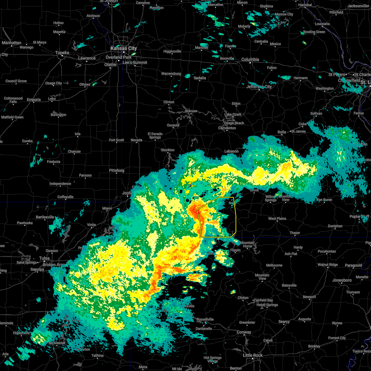 At 937 am cdt, severe thunderstorms were located along a line extending from 7 miles southeast of highlandville to near forsyth to omaha to carrollton, moving east at 35 mph (radar indicated). Hazards include 60 mph wind gusts and penny size hail. expect damage to roofs, siding, and trees At 937 am cdt, severe thunderstorms were located along a line extending from 7 miles southeast of highlandville to near forsyth to omaha to carrollton, moving east at 35 mph (radar indicated). Hazards include 60 mph wind gusts and penny size hail. expect damage to roofs, siding, and trees
|
| 4/28/2021 9:29 AM CDT |
 At 929 am cdt, a severe thunderstorm capable of producing a tornado was located near branson west, or near branson, moving northeast at 25 mph (radar indicated rotation). Hazards include tornado. Flying debris will be dangerous to those caught without shelter. mobile homes will be damaged or destroyed. damage to roofs, windows, and vehicles will occur. tree damage is likely. Locations impacted include, branson, lake taneycomo, table rock lake, table rock state park, hollister, forsyth, merriam woods, kissee mills, rockaway beach, bull creek, taneyville, table rock, kirbyville, powersite, ozark beach, walnut shade, edgewater beach,. At 929 am cdt, a severe thunderstorm capable of producing a tornado was located near branson west, or near branson, moving northeast at 25 mph (radar indicated rotation). Hazards include tornado. Flying debris will be dangerous to those caught without shelter. mobile homes will be damaged or destroyed. damage to roofs, windows, and vehicles will occur. tree damage is likely. Locations impacted include, branson, lake taneycomo, table rock lake, table rock state park, hollister, forsyth, merriam woods, kissee mills, rockaway beach, bull creek, taneyville, table rock, kirbyville, powersite, ozark beach, walnut shade, edgewater beach,.
|
| 4/28/2021 9:15 AM CDT |
 At 915 am cdt, a severe thunderstorm capable of producing a tornado was located over indian point, or near branson, moving east at 40 mph (radar indicated rotation). Hazards include tornado. Flying debris will be dangerous to those caught without shelter. mobile homes will be damaged or destroyed. damage to roofs, windows, and vehicles will occur. tree damage is likely. Locations impacted include, branson, lake taneycomo, table rock lake, table rock state park, hollister, forsyth, merriam woods, kissee mills, rockaway beach, bull creek, taneyville, table rock, kirbyville, powersite, ozark beach, walnut shade, edgewater beach,. At 915 am cdt, a severe thunderstorm capable of producing a tornado was located over indian point, or near branson, moving east at 40 mph (radar indicated rotation). Hazards include tornado. Flying debris will be dangerous to those caught without shelter. mobile homes will be damaged or destroyed. damage to roofs, windows, and vehicles will occur. tree damage is likely. Locations impacted include, branson, lake taneycomo, table rock lake, table rock state park, hollister, forsyth, merriam woods, kissee mills, rockaway beach, bull creek, taneyville, table rock, kirbyville, powersite, ozark beach, walnut shade, edgewater beach,.
|
| 4/28/2021 9:14 AM CDT |
 At 913 am cdt, a severe thunderstorm capable of producing a tornado was located over indian point, or near kimberling city, moving east at 40 mph (radar indicated rotation). Hazards include tornado. Flying debris will be dangerous to those caught without shelter. mobile homes will be damaged or destroyed. damage to roofs, windows, and vehicles will occur. Tree damage is likely. At 913 am cdt, a severe thunderstorm capable of producing a tornado was located over indian point, or near kimberling city, moving east at 40 mph (radar indicated rotation). Hazards include tornado. Flying debris will be dangerous to those caught without shelter. mobile homes will be damaged or destroyed. damage to roofs, windows, and vehicles will occur. Tree damage is likely.
|
| 4/9/2021 3:36 PM CDT |
 The severe thunderstorm warning for western taney and southeastern stone counties will expire at 345 pm cdt, the storms which prompted the warning have weakened below severe limits, and no longer pose an immediate threat to life or property. therefore, the warning will be allowed to expire. a severe thunderstorm watch remains in effect until 800 pm cdt for southwestern missouri. The severe thunderstorm warning for western taney and southeastern stone counties will expire at 345 pm cdt, the storms which prompted the warning have weakened below severe limits, and no longer pose an immediate threat to life or property. therefore, the warning will be allowed to expire. a severe thunderstorm watch remains in effect until 800 pm cdt for southwestern missouri.
|
| 4/9/2021 3:33 PM CDT |
 At 332 pm cdt, severe thunderstorms were located along a line extending from 6 miles south of kimberling city to near hollister to 9 miles south of forsyth, moving east at 35 mph (radar indicated). Hazards include quarter size hail. Damage to vehicles is expected. Locations impacted include, branson, lake taneycomo, table rock lake, bull shoals lake, table rock state park, hollister, silver dollar city, forsyth, merriam woods, kissee mills, rockaway beach, bull creek, indian point, taneyville, table rock, kirbyville, powersite, ozark beach, walnut shade, edgewater beach,. At 332 pm cdt, severe thunderstorms were located along a line extending from 6 miles south of kimberling city to near hollister to 9 miles south of forsyth, moving east at 35 mph (radar indicated). Hazards include quarter size hail. Damage to vehicles is expected. Locations impacted include, branson, lake taneycomo, table rock lake, bull shoals lake, table rock state park, hollister, silver dollar city, forsyth, merriam woods, kissee mills, rockaway beach, bull creek, indian point, taneyville, table rock, kirbyville, powersite, ozark beach, walnut shade, edgewater beach,.
|
| 4/9/2021 3:05 PM CDT |
 At 304 pm cdt, severe thunderstorms were located along a line extending from near gateway to near grandview to roberson hollow to self, moving north at 45 mph (radar indicated). Hazards include 60 mph wind gusts and half dollar size hail. Hail damage to vehicles is expected. expect wind damage to roofs, siding, and trees. Locations impacted include, branson, lake taneycomo, table rock lake, bull shoals lake, roaring river state park, table rock state park, hollister, cassville, silver dollar city, kimberling city, forsyth, merriam woods, shell knob, kissee mills, purdy, reeds spring, seligman, rockaway beach, exeter, bull creek,. At 304 pm cdt, severe thunderstorms were located along a line extending from near gateway to near grandview to roberson hollow to self, moving north at 45 mph (radar indicated). Hazards include 60 mph wind gusts and half dollar size hail. Hail damage to vehicles is expected. expect wind damage to roofs, siding, and trees. Locations impacted include, branson, lake taneycomo, table rock lake, bull shoals lake, roaring river state park, table rock state park, hollister, cassville, silver dollar city, kimberling city, forsyth, merriam woods, shell knob, kissee mills, purdy, reeds spring, seligman, rockaway beach, exeter, bull creek,.
|
| 4/9/2021 2:54 PM CDT |
 At 253 pm cdt, severe thunderstorms were located along a line extending from 6 miles southeast of gateway to near urbanette to 6 miles north of carrollton to near harrison, moving north at 30 mph (radar indicated). Hazards include half dollar size hail. damage to vehicles is expected At 253 pm cdt, severe thunderstorms were located along a line extending from 6 miles southeast of gateway to near urbanette to 6 miles north of carrollton to near harrison, moving north at 30 mph (radar indicated). Hazards include half dollar size hail. damage to vehicles is expected
|
| 11/14/2020 9:16 PM CST |
 At 916 pm cst, a severe thunderstorm was located over hollister, or near branson, moving northeast at 55 mph (radar indicated). Hazards include 60 mph wind gusts and quarter size hail. Hail damage to vehicles is expected. Expect wind damage to roofs, siding, and trees. At 916 pm cst, a severe thunderstorm was located over hollister, or near branson, moving northeast at 55 mph (radar indicated). Hazards include 60 mph wind gusts and quarter size hail. Hail damage to vehicles is expected. Expect wind damage to roofs, siding, and trees.
|
| 11/14/2020 8:22 PM CST |
 At 822 pm cst, a severe thunderstorm was located over grandview, or near berryville, moving northeast at 55 mph (radar indicated). Hazards include 60 mph wind gusts and half dollar size hail. Hail damage to vehicles is expected. Expect wind damage to roofs, siding, and trees. At 822 pm cst, a severe thunderstorm was located over grandview, or near berryville, moving northeast at 55 mph (radar indicated). Hazards include 60 mph wind gusts and half dollar size hail. Hail damage to vehicles is expected. Expect wind damage to roofs, siding, and trees.
|
| 9/27/2020 6:07 PM CDT |
 At 607 pm cdt, a severe thunderstorm was located near taneyville, or 9 miles northeast of forsyth, moving east at 30 mph (radar indicated). Hazards include 60 mph wind gusts and quarter size hail. Hail damage to vehicles is expected. expect wind damage to roofs, siding, and trees. Locations impacted include, lake taneycomo, forsyth, merriam woods, rockaway beach, bull creek, taneyville, brownbranch, rome, garrison, chadwick, bradleyville, goodhope, walnut shade,. At 607 pm cdt, a severe thunderstorm was located near taneyville, or 9 miles northeast of forsyth, moving east at 30 mph (radar indicated). Hazards include 60 mph wind gusts and quarter size hail. Hail damage to vehicles is expected. expect wind damage to roofs, siding, and trees. Locations impacted include, lake taneycomo, forsyth, merriam woods, rockaway beach, bull creek, taneyville, brownbranch, rome, garrison, chadwick, bradleyville, goodhope, walnut shade,.
|
| 9/27/2020 5:48 PM CDT |
 At 547 pm cdt, a severe thunderstorm was located 9 miles southeast of highlandville, moving east at 35 mph (radar indicated). Hazards include 60 mph wind gusts and penny size hail. expect damage to roofs, siding, and trees At 547 pm cdt, a severe thunderstorm was located 9 miles southeast of highlandville, moving east at 35 mph (radar indicated). Hazards include 60 mph wind gusts and penny size hail. expect damage to roofs, siding, and trees
|
| 6/4/2020 6:10 AM CDT |
 The severe thunderstorm warning for taney county will expire at 615 am cdt, the storms which prompted the warning have moved out of the area. therefore, the warning will be allowed to expire. however gusty winds are still possible with these thunderstorms. The severe thunderstorm warning for taney county will expire at 615 am cdt, the storms which prompted the warning have moved out of the area. therefore, the warning will be allowed to expire. however gusty winds are still possible with these thunderstorms.
|
| 6/4/2020 5:50 AM CDT |
 The severe thunderstorm warning for southeastern christian, northwestern taney and central stone counties will expire at 600 am cdt, the storms which prompted the warning have moved out of the warned area. therefore, the warning will be allowed to expire. however gusty winds are still possible with these thunderstorms. The severe thunderstorm warning for southeastern christian, northwestern taney and central stone counties will expire at 600 am cdt, the storms which prompted the warning have moved out of the warned area. therefore, the warning will be allowed to expire. however gusty winds are still possible with these thunderstorms.
|
| 6/4/2020 5:45 AM CDT |
 At 545 am cdt, severe thunderstorms were located along a line extending from near mansfield to taneyville, moving east at 50 mph (radar indicated). Hazards include 60 mph wind gusts. Expect damage to roofs, siding, and trees. Locations impacted include, branson, table rock lake, merriam woods, reeds spring, bull creek, branson west, mccord bend, garrison, elkhead, chestnutridge, walnut shade, keltner,. At 545 am cdt, severe thunderstorms were located along a line extending from near mansfield to taneyville, moving east at 50 mph (radar indicated). Hazards include 60 mph wind gusts. Expect damage to roofs, siding, and trees. Locations impacted include, branson, table rock lake, merriam woods, reeds spring, bull creek, branson west, mccord bend, garrison, elkhead, chestnutridge, walnut shade, keltner,.
|
| 6/4/2020 5:31 AM CDT |
 At 530 am cdt, severe thunderstorms were located along a line extending from seymour to 6 miles northeast of reeds spring, moving east at 70 mph (radar indicated). Hazards include 70 mph wind gusts. Expect considerable tree damage. damage is likely to mobile homes, roofs, and outbuildings. Locations impacted include, ozark, branson, table rock lake, merriam woods, sparta, crane, reeds spring, highlandville, bull creek, branson west, galena, mccord bend, hurley, spokane, oldfield, elkhead, chestnutridge, ponce de leon, chadwick, linden,. At 530 am cdt, severe thunderstorms were located along a line extending from seymour to 6 miles northeast of reeds spring, moving east at 70 mph (radar indicated). Hazards include 70 mph wind gusts. Expect considerable tree damage. damage is likely to mobile homes, roofs, and outbuildings. Locations impacted include, ozark, branson, table rock lake, merriam woods, sparta, crane, reeds spring, highlandville, bull creek, branson west, galena, mccord bend, hurley, spokane, oldfield, elkhead, chestnutridge, ponce de leon, chadwick, linden,.
|
| 6/4/2020 5:25 AM CDT |
 At 524 am cdt, severe thunderstorms were located along a line extending from near sparta to near reeds spring to 7 miles east of cassville, moving south at 60 mph (radar indicated). Hazards include 70 mph wind gusts. Expect considerable tree damage. Damage is likely to mobile homes, roofs, and outbuildings. At 524 am cdt, severe thunderstorms were located along a line extending from near sparta to near reeds spring to 7 miles east of cassville, moving south at 60 mph (radar indicated). Hazards include 70 mph wind gusts. Expect considerable tree damage. Damage is likely to mobile homes, roofs, and outbuildings.
|
| 6/4/2020 5:14 AM CDT |
 At 514 am cdt, severe thunderstorms were located along a line extending from near strafford to near crane, moving east at 70 mph (radar indicated). Hazards include 70 mph wind gusts. Expect considerable tree damage. damage is likely to mobile homes, roofs, and outbuildings. Locations impacted include, nixa, ozark, branson, table rock lake, clever, merriam woods, sparta, crane, billings, reeds spring, highlandville, fremont hills, bull creek, branson west, galena, mccord bend, hurley, spokane, oldfield, elkhead,. At 514 am cdt, severe thunderstorms were located along a line extending from near strafford to near crane, moving east at 70 mph (radar indicated). Hazards include 70 mph wind gusts. Expect considerable tree damage. damage is likely to mobile homes, roofs, and outbuildings. Locations impacted include, nixa, ozark, branson, table rock lake, clever, merriam woods, sparta, crane, billings, reeds spring, highlandville, fremont hills, bull creek, branson west, galena, mccord bend, hurley, spokane, oldfield, elkhead,.
|
| 6/4/2020 5:10 AM CDT |
 At 510 am cdt, severe thunderstorms were located along a line extending from near strafford to near crane, moving east at 70 mph (radar indicated). Hazards include 60 mph wind gusts. expect damage to roofs, siding, and trees At 510 am cdt, severe thunderstorms were located along a line extending from near strafford to near crane, moving east at 70 mph (radar indicated). Hazards include 60 mph wind gusts. expect damage to roofs, siding, and trees
|
| 5/22/2020 11:05 AM CDT |
 The severe thunderstorm warning for christian, western taney, stone and greene counties will expire at 1115 am cdt, the storms which prompted the warning have weakened below severe limits, and no longer pose an immediate threat to life or property. therefore, the warning will be allowed to expire. however small hail and gusty winds are still possible with these thunderstorms. The severe thunderstorm warning for christian, western taney, stone and greene counties will expire at 1115 am cdt, the storms which prompted the warning have weakened below severe limits, and no longer pose an immediate threat to life or property. therefore, the warning will be allowed to expire. however small hail and gusty winds are still possible with these thunderstorms.
|
| 5/22/2020 10:55 AM CDT |
 At 1055 am cdt, severe thunderstorms were located along a line extending from near willard to near highlandville to near roberson hollow, moving east at 40 mph (radar indicated). Hazards include 60 mph wind gusts and quarter size hail. Hail damage to vehicles is expected. expect wind damage to roofs, siding, and trees. Locations impacted include, springfield, nixa, ozark, republic, branson, lake taneycomo, table rock lake, table rock state park, battlefield, willard, hollister, rogersville, silver dollar city, kimberling city, strafford, forsyth, clever, merriam woods, sparta, fair grove, this includes interstate 44 between mile markers 64 and 90. At 1055 am cdt, severe thunderstorms were located along a line extending from near willard to near highlandville to near roberson hollow, moving east at 40 mph (radar indicated). Hazards include 60 mph wind gusts and quarter size hail. Hail damage to vehicles is expected. expect wind damage to roofs, siding, and trees. Locations impacted include, springfield, nixa, ozark, republic, branson, lake taneycomo, table rock lake, table rock state park, battlefield, willard, hollister, rogersville, silver dollar city, kimberling city, strafford, forsyth, clever, merriam woods, sparta, fair grove, this includes interstate 44 between mile markers 64 and 90.
|
| 5/22/2020 10:28 AM CDT |
 At 1028 am cdt, severe thunderstorms were located along a line extending from near greenfield to marionville to 6 miles northeast of beaver, moving east at 40 mph (radar indicated). Hazards include 60 mph wind gusts and quarter size hail. Hail damage to vehicles is expected. Expect wind damage to roofs, siding, and trees. At 1028 am cdt, severe thunderstorms were located along a line extending from near greenfield to marionville to 6 miles northeast of beaver, moving east at 40 mph (radar indicated). Hazards include 60 mph wind gusts and quarter size hail. Hail damage to vehicles is expected. Expect wind damage to roofs, siding, and trees.
|
| 5/14/2020 4:10 PM CDT |
 At 409 pm cdt, a severe thunderstorm was located near hollister, or near branson, moving northeast at 20 mph (radar indicated). Hazards include 60 mph wind gusts and quarter size hail. Hail damage to vehicles is expected. expect wind damage to roofs, siding, and trees. Locations impacted include, lake taneycomo, hollister, forsyth, merriam woods, kissee mills, rockaway beach, kirbyville, ozark beach, powersite, walnut shade, edgewater beach,. At 409 pm cdt, a severe thunderstorm was located near hollister, or near branson, moving northeast at 20 mph (radar indicated). Hazards include 60 mph wind gusts and quarter size hail. Hail damage to vehicles is expected. expect wind damage to roofs, siding, and trees. Locations impacted include, lake taneycomo, hollister, forsyth, merriam woods, kissee mills, rockaway beach, kirbyville, ozark beach, powersite, walnut shade, edgewater beach,.
|
| 5/14/2020 3:43 PM CDT |
 At 343 pm cdt, a severe thunderstorm was located over roberson hollow, or 11 miles southwest of branson, moving northeast at 20 mph (radar indicated). Hazards include ping pong ball size hail and 60 mph wind gusts. People and animals outdoors will be injured. expect hail damage to roofs, siding, windows, and vehicles. Expect wind damage to roofs, siding, and trees. At 343 pm cdt, a severe thunderstorm was located over roberson hollow, or 11 miles southwest of branson, moving northeast at 20 mph (radar indicated). Hazards include ping pong ball size hail and 60 mph wind gusts. People and animals outdoors will be injured. expect hail damage to roofs, siding, windows, and vehicles. Expect wind damage to roofs, siding, and trees.
|
| 5/3/2020 11:27 AM CDT |
 At 1126 am cdt, a severe thunderstorm was located near indian point, or near kimberling city, moving east at 45 mph. this replaces the previous severe thunderstorm warning (radar indicated). Hazards include 60 mph wind gusts and quarter size hail. Hail damage to vehicles is expected. Expect wind damage to roofs, siding, and trees. At 1126 am cdt, a severe thunderstorm was located near indian point, or near kimberling city, moving east at 45 mph. this replaces the previous severe thunderstorm warning (radar indicated). Hazards include 60 mph wind gusts and quarter size hail. Hail damage to vehicles is expected. Expect wind damage to roofs, siding, and trees.
|
| 5/3/2020 11:21 AM CDT |
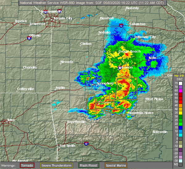 At 1116 am cdt, scattered strong to severe storms extended from goodhope to garrison to near branson west. movement was to the east southeast at 55 mph (law enforcement). Hazards include 60 mph wind gusts and nickel size hail. Expect damage to roofs, siding, and trees. Locations impacted include, merriam woods, bull creek, taneyville, rome, garrison, brownbranch, bradleyville, goodhope, walnut shade,. At 1116 am cdt, scattered strong to severe storms extended from goodhope to garrison to near branson west. movement was to the east southeast at 55 mph (law enforcement). Hazards include 60 mph wind gusts and nickel size hail. Expect damage to roofs, siding, and trees. Locations impacted include, merriam woods, bull creek, taneyville, rome, garrison, brownbranch, bradleyville, goodhope, walnut shade,.
|
| 5/3/2020 11:15 AM CDT |
 At 1114 am cdt, a severe thunderstorm was located 7 miles northeast of diamond city, or 17 miles northwest of bull shoals, moving east at 40 mph. additional storms over stone county were also moving towards the area and will be capable of producing 60 mph wind gusts and quarter size hail (radar indicated). Hazards include 60 mph wind gusts and quarter size hail. Hail damage to vehicles is expected. expect wind damage to roofs, siding, and trees. Locations impacted include, branson, lake taneycomo, bull shoals lake, table rock lake, table rock state park, hollister, forsyth, merriam woods, kissee mills, rockaway beach, bull creek, table rock, kirbyville, powersite, protem, rueter, ozark beach, edgewater beach,. At 1114 am cdt, a severe thunderstorm was located 7 miles northeast of diamond city, or 17 miles northwest of bull shoals, moving east at 40 mph. additional storms over stone county were also moving towards the area and will be capable of producing 60 mph wind gusts and quarter size hail (radar indicated). Hazards include 60 mph wind gusts and quarter size hail. Hail damage to vehicles is expected. expect wind damage to roofs, siding, and trees. Locations impacted include, branson, lake taneycomo, bull shoals lake, table rock lake, table rock state park, hollister, forsyth, merriam woods, kissee mills, rockaway beach, bull creek, table rock, kirbyville, powersite, protem, rueter, ozark beach, edgewater beach,.
|
| 5/3/2020 10:44 AM CDT |
 At 1042 am cdt, a severe thunderstorm was located over highlandville, moving southeast at 55 mph. a second area of severe storms was located between straford and tunas moving east at 50 mph (law enforcement). Hazards include 60 mph wind gusts. expect damage to roofs, siding, and trees At 1042 am cdt, a severe thunderstorm was located over highlandville, moving southeast at 55 mph. a second area of severe storms was located between straford and tunas moving east at 50 mph (law enforcement). Hazards include 60 mph wind gusts. expect damage to roofs, siding, and trees
|
| 5/3/2020 10:33 AM CDT |
 At 1033 am cdt, a severe thunderstorm was located near indian point, or near branson, moving east at 35 mph (radar indicated). Hazards include golf ball size hail and 60 mph wind gusts. People and animals outdoors will be injured. expect hail damage to roofs, siding, windows, and vehicles. Expect wind damage to roofs, siding, and trees. At 1033 am cdt, a severe thunderstorm was located near indian point, or near branson, moving east at 35 mph (radar indicated). Hazards include golf ball size hail and 60 mph wind gusts. People and animals outdoors will be injured. expect hail damage to roofs, siding, windows, and vehicles. Expect wind damage to roofs, siding, and trees.
|
| 1/10/2020 6:04 PM CST |
 At 604 pm cst, severe thunderstorms were located along a line extending from near rogersville to 7 miles southeast of highlandville to near omaha, moving east at 30 mph (radar indicated). Hazards include 60 mph wind gusts. expect damage to roofs, siding, and trees At 604 pm cst, severe thunderstorms were located along a line extending from near rogersville to 7 miles southeast of highlandville to near omaha, moving east at 30 mph (radar indicated). Hazards include 60 mph wind gusts. expect damage to roofs, siding, and trees
|
| 1/10/2020 5:38 PM CST |
 At 538 pm cst, severe thunderstorms were located along a line extending from ozark to near branson west to near silver dollar city to near hollister to near roberson hollow, moving east at 35 mph (radar indicated). Hazards include 60 mph wind gusts. Expect damage to roofs, siding, and trees. Locations impacted include, nixa, ozark, branson, lake taneycomo, table rock lake, table rock state park, hollister, silver dollar city, kimberling city, forsyth, clever, merriam woods, sparta, crane, shell knob, billings, reeds spring, highlandville, rockaway beach, fremont hills,. At 538 pm cst, severe thunderstorms were located along a line extending from ozark to near branson west to near silver dollar city to near hollister to near roberson hollow, moving east at 35 mph (radar indicated). Hazards include 60 mph wind gusts. Expect damage to roofs, siding, and trees. Locations impacted include, nixa, ozark, branson, lake taneycomo, table rock lake, table rock state park, hollister, silver dollar city, kimberling city, forsyth, clever, merriam woods, sparta, crane, shell knob, billings, reeds spring, highlandville, rockaway beach, fremont hills,.
|
| 1/10/2020 4:54 PM CST |
 At 453 pm cst, severe thunderstorms were located along a line extending from near marionville to 12 miles southwest of crane to 8 miles east of cassville to 13 miles east of exeter to near beaver, moving east at 35 mph (radar indicated). Hazards include 60 mph wind gusts. expect damage to roofs, siding, and trees At 453 pm cst, severe thunderstorms were located along a line extending from near marionville to 12 miles southwest of crane to 8 miles east of cassville to 13 miles east of exeter to near beaver, moving east at 35 mph (radar indicated). Hazards include 60 mph wind gusts. expect damage to roofs, siding, and trees
|
| 10/21/2019 1:16 AM CDT |
 At 116 am cdt, a severe thunderstorm was located over indian point, or near kimberling city, moving east at 55 mph (radar indicated). Hazards include 60 mph wind gusts and nickel size hail. expect damage to roofs, siding, and trees At 116 am cdt, a severe thunderstorm was located over indian point, or near kimberling city, moving east at 55 mph (radar indicated). Hazards include 60 mph wind gusts and nickel size hail. expect damage to roofs, siding, and trees
|
| 8/26/2019 4:02 PM CDT |
 At 402 pm cdt, a severe thunderstorm was located over branson, moving southeast at 30 mph (radar indicated). Hazards include 60 mph wind gusts and quarter size hail. Hail damage to vehicles is expected. expect wind damage to roofs, siding, and trees. Locations impacted include, branson, lake taneycomo, table rock lake, table rock state park, hollister, silver dollar city, forsyth, merriam woods, kissee mills, rockaway beach, bull creek, indian point, branson west, taneyville, table rock, kirbyville, powersite, ozark beach, walnut shade, edgewater beach,. At 402 pm cdt, a severe thunderstorm was located over branson, moving southeast at 30 mph (radar indicated). Hazards include 60 mph wind gusts and quarter size hail. Hail damage to vehicles is expected. expect wind damage to roofs, siding, and trees. Locations impacted include, branson, lake taneycomo, table rock lake, table rock state park, hollister, silver dollar city, forsyth, merriam woods, kissee mills, rockaway beach, bull creek, indian point, branson west, taneyville, table rock, kirbyville, powersite, ozark beach, walnut shade, edgewater beach,.
|
| 8/26/2019 3:54 PM CDT |
 At 354 pm cdt, a severe thunderstorm was located near merriam woods, or near branson, moving southeast at 30 mph (radar indicated). Hazards include 60 mph wind gusts and quarter size hail. Hail damage to vehicles is expected. expect wind damage to roofs, siding, and trees. Locations impacted include, branson, lake taneycomo, table rock lake, table rock state park, hollister, silver dollar city, forsyth, merriam woods, kissee mills, reeds spring, rockaway beach, bull creek, indian point, branson west, taneyville, table rock, kirbyville, spokane, chestnutridge, powersite,. At 354 pm cdt, a severe thunderstorm was located near merriam woods, or near branson, moving southeast at 30 mph (radar indicated). Hazards include 60 mph wind gusts and quarter size hail. Hail damage to vehicles is expected. expect wind damage to roofs, siding, and trees. Locations impacted include, branson, lake taneycomo, table rock lake, table rock state park, hollister, silver dollar city, forsyth, merriam woods, kissee mills, reeds spring, rockaway beach, bull creek, indian point, branson west, taneyville, table rock, kirbyville, spokane, chestnutridge, powersite,.
|
| 8/26/2019 3:36 PM CDT |
 At 336 pm cdt, a severe thunderstorm was located near reeds spring, or 8 miles south of highlandville, moving southeast at 30 mph (radar indicated). Hazards include 60 mph wind gusts and quarter size hail. Hail damage to vehicles is expected. expect wind damage to roofs, siding, and trees. Locations impacted include, nixa, branson, lake taneycomo, table rock lake, table rock state park, hollister, silver dollar city, kimberling city, forsyth, merriam woods, crane, kissee mills, reeds spring, highlandville, rockaway beach, bull creek, indian point, branson west, galena, taneyville,. At 336 pm cdt, a severe thunderstorm was located near reeds spring, or 8 miles south of highlandville, moving southeast at 30 mph (radar indicated). Hazards include 60 mph wind gusts and quarter size hail. Hail damage to vehicles is expected. expect wind damage to roofs, siding, and trees. Locations impacted include, nixa, branson, lake taneycomo, table rock lake, table rock state park, hollister, silver dollar city, kimberling city, forsyth, merriam woods, crane, kissee mills, reeds spring, highlandville, rockaway beach, bull creek, indian point, branson west, galena, taneyville,.
|
| 8/26/2019 3:13 PM CDT |
 The national weather service in springfield has issued a * severe thunderstorm warning for. western christian county in southwestern missouri. northwestern taney county in southwestern missouri. stone county in southwestern missouri. Southeastern lawrence county in southwestern missouri. The national weather service in springfield has issued a * severe thunderstorm warning for. western christian county in southwestern missouri. northwestern taney county in southwestern missouri. stone county in southwestern missouri. Southeastern lawrence county in southwestern missouri.
|
| 7/5/2019 4:45 PM CDT |
 At 444 pm cdt, severe thunderstorms were located along a line extending from 11 miles southeast of taneyville to 9 miles southwest of kimberling city, moving southeast at 15 mph (radar indicated). Hazards include 60 mph wind gusts. Expect damage to roofs, siding, and trees. Locations impacted include, branson, lake taneycomo, table rock lake, bull shoals lake, table rock state park, hollister, silver dollar city, kimberling city, forsyth, merriam woods, shell knob, kissee mills, rockaway beach, bull creek, indian point, branson west, taneyville, golden, table rock, emerald beach,. At 444 pm cdt, severe thunderstorms were located along a line extending from 11 miles southeast of taneyville to 9 miles southwest of kimberling city, moving southeast at 15 mph (radar indicated). Hazards include 60 mph wind gusts. Expect damage to roofs, siding, and trees. Locations impacted include, branson, lake taneycomo, table rock lake, bull shoals lake, table rock state park, hollister, silver dollar city, kimberling city, forsyth, merriam woods, shell knob, kissee mills, rockaway beach, bull creek, indian point, branson west, taneyville, golden, table rock, emerald beach,.
|
| 7/5/2019 4:13 PM CDT |
 At 412 pm cdt, severe thunderstorms were located along a line extending from near taneyville to 11 miles east of cassville, moving east at 15 mph (radar indicated). Hazards include 60 mph wind gusts. expect damage to roofs, siding, and trees At 412 pm cdt, severe thunderstorms were located along a line extending from near taneyville to 11 miles east of cassville, moving east at 15 mph (radar indicated). Hazards include 60 mph wind gusts. expect damage to roofs, siding, and trees
|
| 5/29/2019 1:42 PM CDT |
 At 142 pm cdt, severe thunderstorms were located along a line extending from merriam woods to near forsyth, moving northeast at 35 mph (radar indicated). Hazards include 60 mph wind gusts and half dollar size hail. Hail damage to vehicles is expected. expect wind damage to roofs, siding, and trees. Locations impacted include, lake taneycomo, forsyth, merriam woods, kissee mills, rockaway beach, bull creek, ozark beach, powersite, edgewater beach,. At 142 pm cdt, severe thunderstorms were located along a line extending from merriam woods to near forsyth, moving northeast at 35 mph (radar indicated). Hazards include 60 mph wind gusts and half dollar size hail. Hail damage to vehicles is expected. expect wind damage to roofs, siding, and trees. Locations impacted include, lake taneycomo, forsyth, merriam woods, kissee mills, rockaway beach, bull creek, ozark beach, powersite, edgewater beach,.
|
| 5/29/2019 1:32 PM CDT |
 At 132 pm cdt, severe thunderstorms were located along a line extending from near branson to near hollister, moving northeast at 35 mph (radar indicated). Hazards include golf ball size hail and 60 mph wind gusts. People and animals outdoors will be injured. expect hail damage to roofs, siding, windows, and vehicles. expect wind damage to roofs, siding, and trees. Locations impacted include, branson, lake taneycomo, bull shoals lake, hollister, forsyth, merriam woods, kissee mills, rockaway beach, bull creek, table rock, kirbyville, powersite, ozark beach, walnut shade, edgewater beach,. At 132 pm cdt, severe thunderstorms were located along a line extending from near branson to near hollister, moving northeast at 35 mph (radar indicated). Hazards include golf ball size hail and 60 mph wind gusts. People and animals outdoors will be injured. expect hail damage to roofs, siding, windows, and vehicles. expect wind damage to roofs, siding, and trees. Locations impacted include, branson, lake taneycomo, bull shoals lake, hollister, forsyth, merriam woods, kissee mills, rockaway beach, bull creek, table rock, kirbyville, powersite, ozark beach, walnut shade, edgewater beach,.
|
| 5/29/2019 1:23 PM CDT |
 At 122 pm cdt, severe thunderstorms were located along a line extending from kimberling city to near hollister, moving northeast at 45 mph (radar indicated). Hazards include two inch hail and 60 mph wind gusts. People and animals outdoors will be injured. expect hail damage to roofs, siding, windows, and vehicles. expect wind damage to roofs, siding, and trees. Locations impacted include, branson, lake taneycomo, bull shoals lake, table rock lake, table rock state park, hollister, forsyth, merriam woods, kissee mills, rockaway beach, bull creek, table rock, kirbyville, powersite, ridgedale, ozark beach, walnut shade, edgewater beach,. At 122 pm cdt, severe thunderstorms were located along a line extending from kimberling city to near hollister, moving northeast at 45 mph (radar indicated). Hazards include two inch hail and 60 mph wind gusts. People and animals outdoors will be injured. expect hail damage to roofs, siding, windows, and vehicles. expect wind damage to roofs, siding, and trees. Locations impacted include, branson, lake taneycomo, bull shoals lake, table rock lake, table rock state park, hollister, forsyth, merriam woods, kissee mills, rockaway beach, bull creek, table rock, kirbyville, powersite, ridgedale, ozark beach, walnut shade, edgewater beach,.
|
| 5/29/2019 1:17 PM CDT |
 At 117 pm cdt, a severe thunderstorm was located near indian point, or near kimberling city, moving northeast at 35 mph (radar indicated). Hazards include 60 mph wind gusts and half dollar size hail. Hail damage to vehicles is expected. Expect wind damage to roofs, siding, and trees. At 117 pm cdt, a severe thunderstorm was located near indian point, or near kimberling city, moving northeast at 35 mph (radar indicated). Hazards include 60 mph wind gusts and half dollar size hail. Hail damage to vehicles is expected. Expect wind damage to roofs, siding, and trees.
|
| 5/18/2019 3:53 PM CDT |
 At 352 pm cdt, severe thunderstorms were located along a line extending from near nixa to near sparta to taneyville to diamond city, moving northeast at 55 mph (radar indicated). Hazards include 60 mph wind gusts. Expect damage to roofs, siding, and trees. Locations impacted include, southeastern springfield, nixa, ozark, branson, lake taneycomo, bull shoals lake, hollister, rogersville, ava, forsyth, seymour, merriam woods, sparta, kissee mills, highlandville, rockaway beach, fremont hills, fordland, gainesville, bull creek,. At 352 pm cdt, severe thunderstorms were located along a line extending from near nixa to near sparta to taneyville to diamond city, moving northeast at 55 mph (radar indicated). Hazards include 60 mph wind gusts. Expect damage to roofs, siding, and trees. Locations impacted include, southeastern springfield, nixa, ozark, branson, lake taneycomo, bull shoals lake, hollister, rogersville, ava, forsyth, seymour, merriam woods, sparta, kissee mills, highlandville, rockaway beach, fremont hills, fordland, gainesville, bull creek,.
|
| 5/18/2019 3:40 PM CDT |
 At 340 pm cdt, severe thunderstorms were located along a line extending from near clever to 8 miles northwest of merriam woods to near hollister to near willis, moving east at 50 mph (radar indicated). Hazards include 60 mph wind gusts. expect damage to roofs, siding, and trees At 340 pm cdt, severe thunderstorms were located along a line extending from near clever to 8 miles northwest of merriam woods to near hollister to near willis, moving east at 50 mph (radar indicated). Hazards include 60 mph wind gusts. expect damage to roofs, siding, and trees
|
| 5/18/2019 3:35 PM CDT |
 At 334 pm cdt, severe thunderstorms were located along a line extending from clever to 6 miles west of highlandville to silver dollar city, moving northeast at 55 mph (radar indicated). Hazards include 60 mph wind gusts and quarter size hail. Hail damage to vehicles is expected. expect wind damage to roofs, siding, and trees. Locations impacted include, nixa, branson, lake taneycomo, bull shoals lake, table rock lake, table rock state park, hollister, silver dollar city, forsyth, clever, merriam woods, crane, kissee mills, billings, reeds spring, highlandville, rockaway beach, bull creek, indian point, branson west,. At 334 pm cdt, severe thunderstorms were located along a line extending from clever to 6 miles west of highlandville to silver dollar city, moving northeast at 55 mph (radar indicated). Hazards include 60 mph wind gusts and quarter size hail. Hail damage to vehicles is expected. expect wind damage to roofs, siding, and trees. Locations impacted include, nixa, branson, lake taneycomo, bull shoals lake, table rock lake, table rock state park, hollister, silver dollar city, forsyth, clever, merriam woods, crane, kissee mills, billings, reeds spring, highlandville, rockaway beach, bull creek, indian point, branson west,.
|
| 5/18/2019 3:31 PM CDT |
 At 313 pm cdt, severe thunderstorms were located along a line extending from near marionville to 11 miles southwest of galena to 7 miles south of kimberling city, moving northeast at 55 mph (radar indicated). Hazards include 60 mph wind gusts and quarter size hail. Hail damage to vehicles is expected. expect wind damage to roofs, siding, and trees. Locations impacted include, nixa, branson, lake taneycomo, table rock lake, bull shoals lake, table rock state park, hollister, silver dollar city, kimberling city, forsyth, clever, merriam woods, crane, shell knob, kissee mills, billings, reeds spring, highlandville, rockaway beach, bull creek,. At 313 pm cdt, severe thunderstorms were located along a line extending from near marionville to 11 miles southwest of galena to 7 miles south of kimberling city, moving northeast at 55 mph (radar indicated). Hazards include 60 mph wind gusts and quarter size hail. Hail damage to vehicles is expected. expect wind damage to roofs, siding, and trees. Locations impacted include, nixa, branson, lake taneycomo, table rock lake, bull shoals lake, table rock state park, hollister, silver dollar city, kimberling city, forsyth, clever, merriam woods, crane, shell knob, kissee mills, billings, reeds spring, highlandville, rockaway beach, bull creek,.
|
| 5/18/2019 3:14 PM CDT |
 At 313 pm cdt, severe thunderstorms were located along a line extending from near marionville to 11 miles southwest of galena to 7 miles south of kimberling city, moving northeast at 55 mph (radar indicated). Hazards include 60 mph wind gusts and quarter size hail. Hail damage to vehicles is expected. expect wind damage to roofs, siding, and trees. Locations impacted include, nixa, branson, lake taneycomo, table rock lake, bull shoals lake, table rock state park, hollister, silver dollar city, kimberling city, forsyth, clever, merriam woods, crane, shell knob, kissee mills, billings, reeds spring, highlandville, rockaway beach, bull creek,. At 313 pm cdt, severe thunderstorms were located along a line extending from near marionville to 11 miles southwest of galena to 7 miles south of kimberling city, moving northeast at 55 mph (radar indicated). Hazards include 60 mph wind gusts and quarter size hail. Hail damage to vehicles is expected. expect wind damage to roofs, siding, and trees. Locations impacted include, nixa, branson, lake taneycomo, table rock lake, bull shoals lake, table rock state park, hollister, silver dollar city, kimberling city, forsyth, clever, merriam woods, crane, shell knob, kissee mills, billings, reeds spring, highlandville, rockaway beach, bull creek,.
|
| 5/18/2019 2:54 PM CDT |
 At 253 pm cdt, severe thunderstorms were located along a line extending from near cassville to beaver to near eureka springs, moving northeast at 55 mph (radar indicated). Hazards include 60 mph wind gusts and half dollar size hail. Hail damage to vehicles is expected. Expect wind damage to roofs, siding, and trees. At 253 pm cdt, severe thunderstorms were located along a line extending from near cassville to beaver to near eureka springs, moving northeast at 55 mph (radar indicated). Hazards include 60 mph wind gusts and half dollar size hail. Hail damage to vehicles is expected. Expect wind damage to roofs, siding, and trees.
|
| 12/1/2018 12:36 AM CST |
 At 1236 am cst, severe thunderstorms were located along a line extending from 7 miles northwest of miller to near roberson hollow, moving northeast at 55 mph (radar indicated). Hazards include 70 mph wind gusts. Expect considerable tree damage. Damage is likely to mobile homes, roofs, and outbuildings. At 1236 am cst, severe thunderstorms were located along a line extending from 7 miles northwest of miller to near roberson hollow, moving northeast at 55 mph (radar indicated). Hazards include 70 mph wind gusts. Expect considerable tree damage. Damage is likely to mobile homes, roofs, and outbuildings.
|
| 7/19/2018 7:02 PM CDT |
 At 702 pm cdt, severe thunderstorms were located along a line extending from near taneyville to washburn, moving south at 30 mph (radar indicated). Hazards include 70 mph wind gusts. Expect considerable tree damage. damage is likely to mobile homes, roofs, and outbuildings. Locations impacted include, branson, lake taneycomo, table rock lake, bull shoals lake, roaring river state park, table rock state park, hollister, cassville, silver dollar city, kimberling city, forsyth, merriam woods, shell knob, kissee mills, reeds spring, seligman, rockaway beach, exeter, bull creek, indian point,. At 702 pm cdt, severe thunderstorms were located along a line extending from near taneyville to washburn, moving south at 30 mph (radar indicated). Hazards include 70 mph wind gusts. Expect considerable tree damage. damage is likely to mobile homes, roofs, and outbuildings. Locations impacted include, branson, lake taneycomo, table rock lake, bull shoals lake, roaring river state park, table rock state park, hollister, cassville, silver dollar city, kimberling city, forsyth, merriam woods, shell knob, kissee mills, reeds spring, seligman, rockaway beach, exeter, bull creek, indian point,.
|
| 7/19/2018 6:32 PM CDT |
 At 631 pm cdt, severe thunderstorms were located along a line extending from near sparta to near wheaton, moving southeast at 50 mph (radar indicated). Hazards include 60 mph wind gusts. expect damage to roofs, siding, and trees At 631 pm cdt, severe thunderstorms were located along a line extending from near sparta to near wheaton, moving southeast at 50 mph (radar indicated). Hazards include 60 mph wind gusts. expect damage to roofs, siding, and trees
|
| 6/26/2018 5:33 PM CDT |
 At 533 pm cdt, severe thunderstorms were located along a line extending from near marshfield to seymour to 6 miles northeast of taneyville to near urbanette, moving east at 45 mph (radar indicated). Hazards include 60 mph wind gusts. Expect damage to roofs, siding, and trees. Locations impacted include, branson, lake taneycomo, table rock lake, bull shoals lake, table rock state park, marshfield, hollister, silver dollar city, ava, kimberling city, forsyth, seymour, merriam woods, sparta, mansfield, kissee mills, rockaway beach, fordland, hartville, bull creek, this includes interstate 44 near mile marker 103, near mile marker 105, and between mile markers 107 and 109. At 533 pm cdt, severe thunderstorms were located along a line extending from near marshfield to seymour to 6 miles northeast of taneyville to near urbanette, moving east at 45 mph (radar indicated). Hazards include 60 mph wind gusts. Expect damage to roofs, siding, and trees. Locations impacted include, branson, lake taneycomo, table rock lake, bull shoals lake, table rock state park, marshfield, hollister, silver dollar city, ava, kimberling city, forsyth, seymour, merriam woods, sparta, mansfield, kissee mills, rockaway beach, fordland, hartville, bull creek, this includes interstate 44 near mile marker 103, near mile marker 105, and between mile markers 107 and 109.
|
| 6/26/2018 5:09 PM CDT |
 At 508 pm cdt, severe thunderstorms were located along a line extending from fair grove to near strafford to near highlandville to near gateway, moving east at 45 mph (radar indicated). Hazards include 70 mph wind gusts. Expect considerable tree damage. Damage is likely to mobile homes, roofs, and outbuildings. At 508 pm cdt, severe thunderstorms were located along a line extending from fair grove to near strafford to near highlandville to near gateway, moving east at 45 mph (radar indicated). Hazards include 70 mph wind gusts. Expect considerable tree damage. Damage is likely to mobile homes, roofs, and outbuildings.
|
| 6/14/2018 7:51 PM CDT |
 At 751 pm cdt, a severe thunderstorm was located 7 miles north of merriam woods, or 8 miles southeast of highlandville, moving southwest at 15 mph (radar indicated). Hazards include 60 mph wind gusts and quarter size hail. Hail damage to vehicles is expected. Expect wind damage to roofs, siding, and trees. At 751 pm cdt, a severe thunderstorm was located 7 miles north of merriam woods, or 8 miles southeast of highlandville, moving southwest at 15 mph (radar indicated). Hazards include 60 mph wind gusts and quarter size hail. Hail damage to vehicles is expected. Expect wind damage to roofs, siding, and trees.
|
| 5/31/2018 4:35 PM CDT |
 At 435 pm cdt, a severe thunderstorm was located over merriam woods, or near forsyth, moving east at 20 mph (radar indicated). Hazards include ping pong ball size hail and 60 mph wind gusts. People and animals outdoors will be injured. expect hail damage to roofs, siding, windows, and vehicles. expect wind damage to roofs, siding, and trees. Locations impacted include, branson, lake taneycomo, hollister, forsyth, merriam woods, kissee mills, rockaway beach, bull creek, taneyville, kirbyville, powersite, ozark beach, walnut shade, edgewater beach, a tornado watch remains in effect until 800 pm cdt for southwestern missouri. At 435 pm cdt, a severe thunderstorm was located over merriam woods, or near forsyth, moving east at 20 mph (radar indicated). Hazards include ping pong ball size hail and 60 mph wind gusts. People and animals outdoors will be injured. expect hail damage to roofs, siding, windows, and vehicles. expect wind damage to roofs, siding, and trees. Locations impacted include, branson, lake taneycomo, hollister, forsyth, merriam woods, kissee mills, rockaway beach, bull creek, taneyville, kirbyville, powersite, ozark beach, walnut shade, edgewater beach, a tornado watch remains in effect until 800 pm cdt for southwestern missouri.
|
| 5/31/2018 4:32 PM CDT |
 At 432 pm cdt, a severe thunderstorm was located over merriam woods, or near forsyth, moving east at 25 mph (radar indicated). Hazards include ping pong ball size hail and 60 mph wind gusts. People and animals outdoors will be injured. expect hail damage to roofs, siding, windows, and vehicles. expect wind damage to roofs, siding, and trees. Locations impacted include, branson, lake taneycomo, hollister, forsyth, merriam woods, kissee mills, rockaway beach, bull creek, taneyville, table rock, kirbyville, chestnutridge, powersite, ozark beach, walnut shade, edgewater beach, a tornado watch remains in effect until 800 pm cdt for southwestern missouri. At 432 pm cdt, a severe thunderstorm was located over merriam woods, or near forsyth, moving east at 25 mph (radar indicated). Hazards include ping pong ball size hail and 60 mph wind gusts. People and animals outdoors will be injured. expect hail damage to roofs, siding, windows, and vehicles. expect wind damage to roofs, siding, and trees. Locations impacted include, branson, lake taneycomo, hollister, forsyth, merriam woods, kissee mills, rockaway beach, bull creek, taneyville, table rock, kirbyville, chestnutridge, powersite, ozark beach, walnut shade, edgewater beach, a tornado watch remains in effect until 800 pm cdt for southwestern missouri.
|
| 5/31/2018 4:20 PM CDT |
 At 420 pm cdt, a severe thunderstorm was located near reeds spring, or 7 miles northwest of branson, moving east at 20 mph (radar indicated). Hazards include 60 mph wind gusts and half dollar size hail. Hail damage to vehicles is expected. expect wind damage to roofs, siding, and trees. Locations impacted include, branson, lake taneycomo, table rock lake, hollister, silver dollar city, forsyth, merriam woods, kissee mills, reeds spring, rockaway beach, bull creek, indian point, branson west, taneyville, table rock, kirbyville, chestnutridge, powersite, ozark beach, walnut shade, a tornado watch remains in effect until 800 pm cdt for southwestern missouri. At 420 pm cdt, a severe thunderstorm was located near reeds spring, or 7 miles northwest of branson, moving east at 20 mph (radar indicated). Hazards include 60 mph wind gusts and half dollar size hail. Hail damage to vehicles is expected. expect wind damage to roofs, siding, and trees. Locations impacted include, branson, lake taneycomo, table rock lake, hollister, silver dollar city, forsyth, merriam woods, kissee mills, reeds spring, rockaway beach, bull creek, indian point, branson west, taneyville, table rock, kirbyville, chestnutridge, powersite, ozark beach, walnut shade, a tornado watch remains in effect until 800 pm cdt for southwestern missouri.
|
| 5/31/2018 4:08 PM CDT |
 At 407 pm cdt, a severe thunderstorm was located over reeds spring, or 7 miles north of kimberling city, moving east at 20 mph (radar indicated). Hazards include 60 mph wind gusts and quarter size hail. Hail damage to vehicles is expected. Expect wind damage to roofs, siding, and trees. At 407 pm cdt, a severe thunderstorm was located over reeds spring, or 7 miles north of kimberling city, moving east at 20 mph (radar indicated). Hazards include 60 mph wind gusts and quarter size hail. Hail damage to vehicles is expected. Expect wind damage to roofs, siding, and trees.
|
| 4/13/2018 5:59 PM CDT |
 At 558 pm cdt, a severe thunderstorm was located over forsyth, moving northeast at 50 mph (radar indicated). Hazards include tennis ball size hail and 70 mph wind gusts. People and animals outdoors will be injured. expect hail damage to roofs, siding, windows, and vehicles. expect considerable tree damage. wind damage is also likely to mobile homes, roofs, and outbuildings. locations impacted include, branson, lake taneycomo, bull shoals lake, table rock lake, table rock state park, hollister, forsyth, merriam woods, kissee mills, rockaway beach, bull creek, taneyville, table rock, kirbyville, powersite, ridgedale, bradleyville, ozark beach, walnut shade, edgewater beach, a tornado warning remains in effect for southeastern taney county. a tornado watch remains in effect until 1000 pm cdt for southwestern missouri. A tornado watch also remains in effect until 100 am cdt for southwestern missouri. At 558 pm cdt, a severe thunderstorm was located over forsyth, moving northeast at 50 mph (radar indicated). Hazards include tennis ball size hail and 70 mph wind gusts. People and animals outdoors will be injured. expect hail damage to roofs, siding, windows, and vehicles. expect considerable tree damage. wind damage is also likely to mobile homes, roofs, and outbuildings. locations impacted include, branson, lake taneycomo, bull shoals lake, table rock lake, table rock state park, hollister, forsyth, merriam woods, kissee mills, rockaway beach, bull creek, taneyville, table rock, kirbyville, powersite, ridgedale, bradleyville, ozark beach, walnut shade, edgewater beach, a tornado warning remains in effect for southeastern taney county. a tornado watch remains in effect until 1000 pm cdt for southwestern missouri. A tornado watch also remains in effect until 100 am cdt for southwestern missouri.
|
| 4/13/2018 5:45 PM CDT |
 At 544 pm cdt, a severe thunderstorm was located near hollister, or near branson, moving northeast at 50 mph (radar indicated). Hazards include golf ball size hail and 70 mph wind gusts. People and animals outdoors will be injured. expect hail damage to roofs, siding, windows, and vehicles. expect considerable tree damage. wind damage is also likely to mobile homes, roofs, and outbuildings. locations impacted include, branson, lake taneycomo, bull shoals lake, table rock lake, table rock state park, hollister, forsyth, merriam woods, kissee mills, rockaway beach, bull creek, taneyville, table rock, kirbyville, powersite, ridgedale, bradleyville, ozark beach, walnut shade, edgewater beach, a tornado watch remains in effect until 1000 pm cdt for southwestern missouri. A tornado watch also remains in effect until 100 am cdt for southwestern missouri. At 544 pm cdt, a severe thunderstorm was located near hollister, or near branson, moving northeast at 50 mph (radar indicated). Hazards include golf ball size hail and 70 mph wind gusts. People and animals outdoors will be injured. expect hail damage to roofs, siding, windows, and vehicles. expect considerable tree damage. wind damage is also likely to mobile homes, roofs, and outbuildings. locations impacted include, branson, lake taneycomo, bull shoals lake, table rock lake, table rock state park, hollister, forsyth, merriam woods, kissee mills, rockaway beach, bull creek, taneyville, table rock, kirbyville, powersite, ridgedale, bradleyville, ozark beach, walnut shade, edgewater beach, a tornado watch remains in effect until 1000 pm cdt for southwestern missouri. A tornado watch also remains in effect until 100 am cdt for southwestern missouri.
|
| 4/13/2018 5:28 PM CDT |
 At 527 pm cdt, a severe thunderstorm was located near green forest, or 9 miles east of berryville, moving northeast at 50 mph (radar indicated). Hazards include 60 mph wind gusts and quarter size hail. Hail damage to vehicles is expected. Expect wind damage to roofs, siding, and trees. At 527 pm cdt, a severe thunderstorm was located near green forest, or 9 miles east of berryville, moving northeast at 50 mph (radar indicated). Hazards include 60 mph wind gusts and quarter size hail. Hail damage to vehicles is expected. Expect wind damage to roofs, siding, and trees.
|
| 10/22/2017 1:26 AM CDT |
 At 126 am cdt, severe thunderstorms were located along a line extending from near merriam woods to near roberson hollow, moving east at 35 mph (radar indicated). Hazards include 60 mph wind gusts. expect damage to roofs, siding, and trees At 126 am cdt, severe thunderstorms were located along a line extending from near merriam woods to near roberson hollow, moving east at 35 mph (radar indicated). Hazards include 60 mph wind gusts. expect damage to roofs, siding, and trees
|
| 5/27/2017 8:23 PM CDT |
 At 823 pm cdt, severe thunderstorms were located along a line extending from near lanagan to rockaway beach, moving east at 40 mph (radar indicated). Hazards include quarter size hail. damage to vehicles is expected At 823 pm cdt, severe thunderstorms were located along a line extending from near lanagan to rockaway beach, moving east at 40 mph (radar indicated). Hazards include quarter size hail. damage to vehicles is expected
|
| 5/27/2017 8:04 PM CDT |
 At 804 pm cdt, severe thunderstorms were located along a line extending from 11 miles south of ava to near forsyth to 10 miles southwest of wheaton, moving southeast at 40 mph (trained weather spotters). Hazards include ping pong ball size hail and 60 mph wind gusts. People and animals outdoors will be injured. expect hail damage to roofs, siding, windows, and vehicles. expect wind damage to roofs, siding, and trees. Locations impacted include, branson, lake taneycomo, table rock lake, bull shoals lake, roaring river state park, big sugar creek state park, table rock state park, hollister, cassville, silver dollar city, kimberling city, forsyth, anderson, noel, merriam woods, sparta, dodge, shell knob, goodman, kissee mills, a tornado watch remains in effect until 200 am cdt for southwestern missouri. At 804 pm cdt, severe thunderstorms were located along a line extending from 11 miles south of ava to near forsyth to 10 miles southwest of wheaton, moving southeast at 40 mph (trained weather spotters). Hazards include ping pong ball size hail and 60 mph wind gusts. People and animals outdoors will be injured. expect hail damage to roofs, siding, windows, and vehicles. expect wind damage to roofs, siding, and trees. Locations impacted include, branson, lake taneycomo, table rock lake, bull shoals lake, roaring river state park, big sugar creek state park, table rock state park, hollister, cassville, silver dollar city, kimberling city, forsyth, anderson, noel, merriam woods, sparta, dodge, shell knob, goodman, kissee mills, a tornado watch remains in effect until 200 am cdt for southwestern missouri.
|
| 5/27/2017 7:28 PM CDT |
 At 728 pm cdt, severe thunderstorms were located along a line extending from near sparta to near galena to near seneca, moving southeast at 40 mph (trained weather spotters). Hazards include golf ball size hail and 60 mph wind gusts. People and animals outdoors will be injured. expect hail damage to roofs, siding, windows, and vehicles. Expect wind damage to roofs, siding, and trees. At 728 pm cdt, severe thunderstorms were located along a line extending from near sparta to near galena to near seneca, moving southeast at 40 mph (trained weather spotters). Hazards include golf ball size hail and 60 mph wind gusts. People and animals outdoors will be injured. expect hail damage to roofs, siding, windows, and vehicles. Expect wind damage to roofs, siding, and trees.
|
| 5/27/2017 7:19 PM CDT |
 At 719 pm cdt, severe thunderstorms were located along a line extending from near norwood to 11 miles south of ava to near hollister, moving southeast at 55 mph (radar indicated). Hazards include 60 mph wind gusts and quarter size hail. Hail damage to vehicles is expected. expect wind damage to roofs, siding, and trees. Locations impacted include, nixa, ozark, branson, table rock lake, lake taneycomo, roaring river state park, monett, aurora, cassville, silver dollar city, kimberling city, forsyth, merriam woods, sparta, crane, shell knob, purdy, reeds spring, highlandville, rockaway beach, a tornado watch remains in effect until 200 am cdt for southwestern missouri. At 719 pm cdt, severe thunderstorms were located along a line extending from near norwood to 11 miles south of ava to near hollister, moving southeast at 55 mph (radar indicated). Hazards include 60 mph wind gusts and quarter size hail. Hail damage to vehicles is expected. expect wind damage to roofs, siding, and trees. Locations impacted include, nixa, ozark, branson, table rock lake, lake taneycomo, roaring river state park, monett, aurora, cassville, silver dollar city, kimberling city, forsyth, merriam woods, sparta, crane, shell knob, purdy, reeds spring, highlandville, rockaway beach, a tornado watch remains in effect until 200 am cdt for southwestern missouri.
|
| 5/27/2017 6:40 PM CDT |
 At 639 pm cdt, severe thunderstorms were located along a line extending from 6 miles east of strafford to near highlandville to near purdy, moving southeast at 55 mph. an addtional severe storm was located near exeter (radar indicated). Hazards include 60 mph wind gusts and quarter size hail. Hail damage to vehicles is expected. Expect wind damage to roofs, siding, and trees. At 639 pm cdt, severe thunderstorms were located along a line extending from 6 miles east of strafford to near highlandville to near purdy, moving southeast at 55 mph. an addtional severe storm was located near exeter (radar indicated). Hazards include 60 mph wind gusts and quarter size hail. Hail damage to vehicles is expected. Expect wind damage to roofs, siding, and trees.
|
| 5/19/2017 8:18 PM CDT |
 At 817 pm cdt, a severe thunderstorm was located 7 miles north of diamond city, or 15 miles southeast of forsyth, moving northeast at 15 mph. other severe thunderstorms are developing near omaha, arkansas and also across northeastern taney county (radar indicated). Hazards include 60 mph wind gusts and half dollar size hail. Hail damage to vehicles is expected. Expect wind damage to roofs, siding, and trees. At 817 pm cdt, a severe thunderstorm was located 7 miles north of diamond city, or 15 miles southeast of forsyth, moving northeast at 15 mph. other severe thunderstorms are developing near omaha, arkansas and also across northeastern taney county (radar indicated). Hazards include 60 mph wind gusts and half dollar size hail. Hail damage to vehicles is expected. Expect wind damage to roofs, siding, and trees.
|
| 5/19/2017 4:55 PM CDT |
 At 455 pm cdt, severe thunderstorms were located along a line extending from near fair grove to 6 miles northwest of roberson hollow, moving east at 25 mph (radar indicated). Hazards include 60 mph wind gusts. Expect damage to roofs, siding, and trees. locations impacted include, springfield, nixa, ozark, branson, lake taneycomo, bull shoals lake, table rock lake, table rock state park, hollister, rogersville, silver dollar city, kimberling city, strafford, forsyth, merriam woods, sparta, fair grove, kissee mills, reeds spring, highlandville, this includes interstate 44 between mile markers 77 and 90. A tornado watch remains in effect until 1000 pm cdt for southwestern missouri. At 455 pm cdt, severe thunderstorms were located along a line extending from near fair grove to 6 miles northwest of roberson hollow, moving east at 25 mph (radar indicated). Hazards include 60 mph wind gusts. Expect damage to roofs, siding, and trees. locations impacted include, springfield, nixa, ozark, branson, lake taneycomo, bull shoals lake, table rock lake, table rock state park, hollister, rogersville, silver dollar city, kimberling city, strafford, forsyth, merriam woods, sparta, fair grove, kissee mills, reeds spring, highlandville, this includes interstate 44 between mile markers 77 and 90. A tornado watch remains in effect until 1000 pm cdt for southwestern missouri.
|
| 5/19/2017 4:11 PM CDT |
 At 411 pm cdt, severe thunderstorms were located along a line extending from 7 miles south of ash grove to 6 miles north of grandview, moving northeast at 45 mph (radar indicated). Hazards include 60 mph wind gusts. expect damage to roofs, siding, and trees At 411 pm cdt, severe thunderstorms were located along a line extending from 7 miles south of ash grove to 6 miles north of grandview, moving northeast at 45 mph (radar indicated). Hazards include 60 mph wind gusts. expect damage to roofs, siding, and trees
|
| 5/19/2017 1:39 AM CDT |
 At 135 am cdt, a severe squall line capable of producing both tornadoes and extensive straight line wind damage was located along a line extending from near reeds spring to 8 miles northeast of omaha, moving east at 50 mph (radar indicated rotation). Hazards include tornado. Flying debris will be dangerous to those caught without shelter. mobile homes will be damaged or destroyed. damage to roofs, windows, and vehicles will occur. tree damage is likely. Locations impacted include, nixa, ozark, branson, lake taneycomo, bull shoals lake, table rock lake, table rock state park, hollister, forsyth, merriam woods, kissee mills, highlandville, rockaway beach, fremont hills, bull creek, taneyville, table rock, kirbyville, spokane, chestnutridge,. At 135 am cdt, a severe squall line capable of producing both tornadoes and extensive straight line wind damage was located along a line extending from near reeds spring to 8 miles northeast of omaha, moving east at 50 mph (radar indicated rotation). Hazards include tornado. Flying debris will be dangerous to those caught without shelter. mobile homes will be damaged or destroyed. damage to roofs, windows, and vehicles will occur. tree damage is likely. Locations impacted include, nixa, ozark, branson, lake taneycomo, bull shoals lake, table rock lake, table rock state park, hollister, forsyth, merriam woods, kissee mills, highlandville, rockaway beach, fremont hills, bull creek, taneyville, table rock, kirbyville, spokane, chestnutridge,.
|
| 5/19/2017 1:16 AM CDT |
 At 115 am cdt, severe thunderstorms capable of producing both tornadoes and extensive straight line wind damage were located along a line extending from 8 miles southwest of crane to 7 miles south of kimberling city, moving northeast at 40 mph (radar indicated rotation). Hazards include tornado. Flying debris will be dangerous to those caught without shelter. mobile homes will be damaged or destroyed. damage to roofs, windows, and vehicles will occur. Tree damage is likely. At 115 am cdt, severe thunderstorms capable of producing both tornadoes and extensive straight line wind damage were located along a line extending from 8 miles southwest of crane to 7 miles south of kimberling city, moving northeast at 40 mph (radar indicated rotation). Hazards include tornado. Flying debris will be dangerous to those caught without shelter. mobile homes will be damaged or destroyed. damage to roofs, windows, and vehicles will occur. Tree damage is likely.
|
| 5/11/2017 3:35 PM CDT |
 At 335 pm cdt, a severe thunderstorm was located near forsyth, moving north at 40 mph (radar indicated). Hazards include 60 mph wind gusts and half dollar size hail. Hail damage to vehicles is expected. expect wind damage to roofs, siding, and trees. Locations impacted include, branson, lake taneycomo, bull shoals lake, hollister, forsyth, merriam woods, kissee mills, rockaway beach, bull creek, taneyville, kirbyville, brownbranch, powersite, bradleyville, ozark beach, walnut shade, edgewater beach,. At 335 pm cdt, a severe thunderstorm was located near forsyth, moving north at 40 mph (radar indicated). Hazards include 60 mph wind gusts and half dollar size hail. Hail damage to vehicles is expected. expect wind damage to roofs, siding, and trees. Locations impacted include, branson, lake taneycomo, bull shoals lake, hollister, forsyth, merriam woods, kissee mills, rockaway beach, bull creek, taneyville, kirbyville, brownbranch, powersite, bradleyville, ozark beach, walnut shade, edgewater beach,.
|
| 5/11/2017 3:13 PM CDT |
 At 308 pm cdt, a severe thunderstorm was located over omaha, or 14 miles south of branson, moving northeast at 25 mph (radar indicated). Hazards include 60 mph wind gusts and half dollar size hail. Hail damage to vehicles is expected. Expect wind damage to roofs, siding, and trees. At 308 pm cdt, a severe thunderstorm was located over omaha, or 14 miles south of branson, moving northeast at 25 mph (radar indicated). Hazards include 60 mph wind gusts and half dollar size hail. Hail damage to vehicles is expected. Expect wind damage to roofs, siding, and trees.
|
| 5/11/2017 3:08 PM CDT |
 At 308 pm cdt, a severe thunderstorm was located over omaha, or 14 miles south of branson, moving northeast at 25 mph (radar indicated). Hazards include 60 mph wind gusts and half dollar size hail. Hail damage to vehicles is expected. Expect wind damage to roofs, siding, and trees. At 308 pm cdt, a severe thunderstorm was located over omaha, or 14 miles south of branson, moving northeast at 25 mph (radar indicated). Hazards include 60 mph wind gusts and half dollar size hail. Hail damage to vehicles is expected. Expect wind damage to roofs, siding, and trees.
|
| 4/29/2017 3:11 AM CDT |
 The severe thunderstorm warning for eastern christian and northwestern taney counties will expire at 315 am cdt, the storm which prompted the warning has moved out of the area. therefore the warning will be allowed to expire. additional severe thunderstorms may affect the area this morning. remain alert for additional warnings. a severe thunderstorm watch remains in effect until 500 am cdt for southwestern missouri. The severe thunderstorm warning for eastern christian and northwestern taney counties will expire at 315 am cdt, the storm which prompted the warning has moved out of the area. therefore the warning will be allowed to expire. additional severe thunderstorms may affect the area this morning. remain alert for additional warnings. a severe thunderstorm watch remains in effect until 500 am cdt for southwestern missouri.
|
| 4/29/2017 2:54 AM CDT |
 At 253 am cdt, a severe thunderstorm was located near sparta, or 13 miles east of ozark, moving northeast at 55 mph (trained weather spotters. several reports of quarter size hail have been received with this storm). Hazards include 60 mph wind gusts and quarter size hail. Hail damage to vehicles is expected. expect wind damage to roofs, siding, and trees. Locations impacted include, ozark, lake taneycomo, hollister, forsyth, merriam woods, sparta, kissee mills, rockaway beach, bull creek, taneyville, kirbyville, oldfield, elkhead, powersite, chadwick, linden, bruner, selmore, keltner, christian center,. At 253 am cdt, a severe thunderstorm was located near sparta, or 13 miles east of ozark, moving northeast at 55 mph (trained weather spotters. several reports of quarter size hail have been received with this storm). Hazards include 60 mph wind gusts and quarter size hail. Hail damage to vehicles is expected. expect wind damage to roofs, siding, and trees. Locations impacted include, ozark, lake taneycomo, hollister, forsyth, merriam woods, sparta, kissee mills, rockaway beach, bull creek, taneyville, kirbyville, oldfield, elkhead, powersite, chadwick, linden, bruner, selmore, keltner, christian center,.
|
| 4/29/2017 2:43 AM CDT |
 At 242 am cdt, a severe thunderstorm was located 8 miles southeast of highlandville, moving northeast at 55 mph (radar indicated). Hazards include 60 mph wind gusts and quarter size hail. Hail damage to vehicles is expected. expect wind damage to roofs, siding, and trees. Locations impacted include, ozark, branson, lake taneycomo, table rock lake, table rock state park, hollister, forsyth, merriam woods, sparta, kissee mills, highlandville, rockaway beach, bull creek, taneyville, table rock, kirbyville, spokane, oldfield, elkhead, chestnutridge,. At 242 am cdt, a severe thunderstorm was located 8 miles southeast of highlandville, moving northeast at 55 mph (radar indicated). Hazards include 60 mph wind gusts and quarter size hail. Hail damage to vehicles is expected. expect wind damage to roofs, siding, and trees. Locations impacted include, ozark, branson, lake taneycomo, table rock lake, table rock state park, hollister, forsyth, merriam woods, sparta, kissee mills, highlandville, rockaway beach, bull creek, taneyville, table rock, kirbyville, spokane, oldfield, elkhead, chestnutridge,.
|
| 4/29/2017 2:22 AM CDT |
 At 221 am cdt, a severe thunderstorm was located near reeds spring, or near kimberling city, moving northeast at 50 mph (radar indicated). Hazards include 60 mph wind gusts and quarter size hail. Hail damage to vehicles is expected. Expect wind damage to roofs, siding, and trees. At 221 am cdt, a severe thunderstorm was located near reeds spring, or near kimberling city, moving northeast at 50 mph (radar indicated). Hazards include 60 mph wind gusts and quarter size hail. Hail damage to vehicles is expected. Expect wind damage to roofs, siding, and trees.
|
| 4/29/2017 12:24 AM CDT |
 The severe thunderstorm warning for western taney and southern stone counties will expire at 1230 am cdt, the storm which prompted the warning has weakened below severe limits, and has exited the warned area. therefore, the warning will be allowed to expire. a severe thunderstorm watch remains in effect until 500 am cdt for southwestern missouri. The severe thunderstorm warning for western taney and southern stone counties will expire at 1230 am cdt, the storm which prompted the warning has weakened below severe limits, and has exited the warned area. therefore, the warning will be allowed to expire. a severe thunderstorm watch remains in effect until 500 am cdt for southwestern missouri.
|
| 4/28/2017 11:46 PM CDT |
 At 1146 pm cdt, a severe thunderstorm was located near urbanette, or 8 miles north of berryville, moving northeast at 45 mph (radar indicated). Hazards include half dollar size hail. damage to vehicles is expected At 1146 pm cdt, a severe thunderstorm was located near urbanette, or 8 miles north of berryville, moving northeast at 45 mph (radar indicated). Hazards include half dollar size hail. damage to vehicles is expected
|
| 4/26/2017 2:07 AM CDT |
 The severe thunderstorm warning for south central christian, western taney and northeastern stone counties will expire at 215 am cdt, the storm which prompted the warning has moved out of the area. therefore the warning will be allowed to expire. however gusty winds and heavy rain are still possible with this thunderstorm. a severe thunderstorm watch remains in effect until 600 am cdt for southwestern missouri. The severe thunderstorm warning for south central christian, western taney and northeastern stone counties will expire at 215 am cdt, the storm which prompted the warning has moved out of the area. therefore the warning will be allowed to expire. however gusty winds and heavy rain are still possible with this thunderstorm. a severe thunderstorm watch remains in effect until 600 am cdt for southwestern missouri.
|
| 4/26/2017 2:01 AM CDT |
 At 159 am cdt, a severe thunderstorm was located near reeds spring, or 8 miles north of branson, moving east at 50 mph (law enforcement). Hazards include 60 mph wind gusts and quarter size hail. Hail damage to vehicles is expected. expect wind damage to roofs, siding, and trees. Locations impacted include, branson, lake taneycomo, table rock lake, table rock state park, hollister, silver dollar city, merriam woods, crane, reeds spring, highlandville, rockaway beach, bull creek, indian point, branson west, galena, table rock, hurley, spokane, chestnutridge, ponce de leon,. At 159 am cdt, a severe thunderstorm was located near reeds spring, or 8 miles north of branson, moving east at 50 mph (law enforcement). Hazards include 60 mph wind gusts and quarter size hail. Hail damage to vehicles is expected. expect wind damage to roofs, siding, and trees. Locations impacted include, branson, lake taneycomo, table rock lake, table rock state park, hollister, silver dollar city, merriam woods, crane, reeds spring, highlandville, rockaway beach, bull creek, indian point, branson west, galena, table rock, hurley, spokane, chestnutridge, ponce de leon,.
|
| 4/26/2017 1:34 AM CDT |
 At 134 am cdt, a severe thunderstorm was located 10 miles east of cassville, moving east at 60 mph (radar indicated). Hazards include 60 mph wind gusts and quarter size hail. Hail damage to vehicles is expected. Expect wind damage to roofs, siding, and trees. At 134 am cdt, a severe thunderstorm was located 10 miles east of cassville, moving east at 60 mph (radar indicated). Hazards include 60 mph wind gusts and quarter size hail. Hail damage to vehicles is expected. Expect wind damage to roofs, siding, and trees.
|
| 4/4/2017 9:09 PM CDT |
 At 909 pm cdt, a severe thunderstorm was located over silver dollar city, or near branson, moving northeast at 40 mph (radar indicated). Hazards include 60 mph wind gusts and quarter size hail. Hail damage to vehicles is expected. Expect wind damage to roofs, siding, and trees. At 909 pm cdt, a severe thunderstorm was located over silver dollar city, or near branson, moving northeast at 40 mph (radar indicated). Hazards include 60 mph wind gusts and quarter size hail. Hail damage to vehicles is expected. Expect wind damage to roofs, siding, and trees.
|
| 3/9/2017 7:24 PM CST |
 At 724 pm cst, a severe thunderstorm capable of producing a tornado was located 10 miles north of diamond city, or 10 miles southeast of forsyth, moving southeast at 35 mph (radar indicated rotation). Hazards include tornado and ping pong ball size hail. Flying debris will be dangerous to those caught without shelter. mobile homes will be damaged or destroyed. damage to roofs, windows, and vehicles will occur. tree damage is likely. Locations impacted include, branson, lake taneycomo, bull shoals lake, table rock lake, table rock state park, hollister, silver dollar city, forsyth, merriam woods, kissee mills, rockaway beach, bull creek, indian point, branson west, table rock, kirbyville, powersite, protem, rueter, ridgedale,. At 724 pm cst, a severe thunderstorm capable of producing a tornado was located 10 miles north of diamond city, or 10 miles southeast of forsyth, moving southeast at 35 mph (radar indicated rotation). Hazards include tornado and ping pong ball size hail. Flying debris will be dangerous to those caught without shelter. mobile homes will be damaged or destroyed. damage to roofs, windows, and vehicles will occur. tree damage is likely. Locations impacted include, branson, lake taneycomo, bull shoals lake, table rock lake, table rock state park, hollister, silver dollar city, forsyth, merriam woods, kissee mills, rockaway beach, bull creek, indian point, branson west, table rock, kirbyville, powersite, protem, rueter, ridgedale,.
|
| 3/9/2017 7:03 PM CST |
 At 703 pm cst, a severe thunderstorm capable of producing a tornado was located over merriam woods, or near forsyth, moving southeast at 35 mph (radar indicated rotation). Hazards include tornado and golf ball size hail. Flying debris will be dangerous to those caught without shelter. mobile homes will be damaged or destroyed. damage to roofs, windows, and vehicles will occur. tree damage is likely. Locations impacted include, branson, lake taneycomo, table rock lake, forsyth, merriam woods, reeds spring, rockaway beach, bull creek, indian point, branson west, galena, mccord bend, cape fair, walnut shade,. At 703 pm cst, a severe thunderstorm capable of producing a tornado was located over merriam woods, or near forsyth, moving southeast at 35 mph (radar indicated rotation). Hazards include tornado and golf ball size hail. Flying debris will be dangerous to those caught without shelter. mobile homes will be damaged or destroyed. damage to roofs, windows, and vehicles will occur. tree damage is likely. Locations impacted include, branson, lake taneycomo, table rock lake, forsyth, merriam woods, reeds spring, rockaway beach, bull creek, indian point, branson west, galena, mccord bend, cape fair, walnut shade,.
|
| 3/9/2017 6:56 PM CST |
 At 655 pm cst, a severe thunderstorm capable of producing a tornado was located near merriam woods, or near branson, moving southeast at 35 mph (radar indicated rotation). Hazards include tornado and golf ball size hail. Flying debris will be dangerous to those caught without shelter. mobile homes will be damaged or destroyed. damage to roofs, windows, and vehicles will occur. Tree damage is likely. At 655 pm cst, a severe thunderstorm capable of producing a tornado was located near merriam woods, or near branson, moving southeast at 35 mph (radar indicated rotation). Hazards include tornado and golf ball size hail. Flying debris will be dangerous to those caught without shelter. mobile homes will be damaged or destroyed. damage to roofs, windows, and vehicles will occur. Tree damage is likely.
|
| 3/9/2017 6:45 PM CST |
 At 645 pm cst, a severe thunderstorm capable of producing a tornado was located near reeds spring, or 9 miles south of highlandville, moving southeast at 35 mph (radar indicated rotation). Hazards include tornado and golf ball size hail. Flying debris will be dangerous to those caught without shelter. mobile homes will be damaged or destroyed. damage to roofs, windows, and vehicles will occur. tree damage is likely. Locations impacted include, branson, lake taneycomo, table rock lake, forsyth, merriam woods, reeds spring, highlandville, rockaway beach, bull creek, indian point, branson west, galena, mccord bend, spokane, cape fair, chestnutridge, ponce de leon, walnut shade, elsey,. At 645 pm cst, a severe thunderstorm capable of producing a tornado was located near reeds spring, or 9 miles south of highlandville, moving southeast at 35 mph (radar indicated rotation). Hazards include tornado and golf ball size hail. Flying debris will be dangerous to those caught without shelter. mobile homes will be damaged or destroyed. damage to roofs, windows, and vehicles will occur. tree damage is likely. Locations impacted include, branson, lake taneycomo, table rock lake, forsyth, merriam woods, reeds spring, highlandville, rockaway beach, bull creek, indian point, branson west, galena, mccord bend, spokane, cape fair, chestnutridge, ponce de leon, walnut shade, elsey,.
|
| 3/9/2017 6:28 PM CST |
 At 628 pm cst, a severe thunderstorm capable of producing a tornado was located near galena, or 11 miles west of highlandville, moving southeast at 35 mph (radar indicated rotation). Hazards include tornado and golf ball size hail. Flying debris will be dangerous to those caught without shelter. mobile homes will be damaged or destroyed. damage to roofs, windows, and vehicles will occur. Tree damage is likely. At 628 pm cst, a severe thunderstorm capable of producing a tornado was located near galena, or 11 miles west of highlandville, moving southeast at 35 mph (radar indicated rotation). Hazards include tornado and golf ball size hail. Flying debris will be dangerous to those caught without shelter. mobile homes will be damaged or destroyed. damage to roofs, windows, and vehicles will occur. Tree damage is likely.
|
| 3/6/2017 11:59 PM CST |
 At 1158 pm cst, severe thunderstorms were located along a line extending from ava to 7 miles southeast of hollister, moving east at 65 mph (public. numerous reports of 60 to 70 mph wind gusts have been reported with this line of storms). Hazards include 70 mph wind gusts and nickel size hail. Expect considerable tree damage. damage is likely to mobile homes, roofs, and outbuildings. Locations impacted include, ozark, branson, lake taneycomo, table rock lake, roaring river state park, table rock state park, hollister, silver dollar city, ava, kimberling city, forsyth, merriam woods, sparta, shell knob, kissee mills, reeds spring, highlandville, seligman, rockaway beach, bull creek, a tornado watch remains in effect until 300 am cst for southwestern missouri. At 1158 pm cst, severe thunderstorms were located along a line extending from ava to 7 miles southeast of hollister, moving east at 65 mph (public. numerous reports of 60 to 70 mph wind gusts have been reported with this line of storms). Hazards include 70 mph wind gusts and nickel size hail. Expect considerable tree damage. damage is likely to mobile homes, roofs, and outbuildings. Locations impacted include, ozark, branson, lake taneycomo, table rock lake, roaring river state park, table rock state park, hollister, silver dollar city, ava, kimberling city, forsyth, merriam woods, sparta, shell knob, kissee mills, reeds spring, highlandville, seligman, rockaway beach, bull creek, a tornado watch remains in effect until 300 am cst for southwestern missouri.
|
| 3/6/2017 11:51 PM CST |
 At 1150 pm cst, severe thunderstorms were located along a line extending from 6 miles northwest of ava to hollister, moving east at 50 mph (public. numerous reports of wind damage have been reported with the squall line of storms across southwest missouri). Hazards include 70 mph wind gusts and quarter size hail. Hail damage to vehicles is expected. expect considerable tree damage. Wind damage is also likely to mobile homes, roofs, and outbuildings. At 1150 pm cst, severe thunderstorms were located along a line extending from 6 miles northwest of ava to hollister, moving east at 50 mph (public. numerous reports of wind damage have been reported with the squall line of storms across southwest missouri). Hazards include 70 mph wind gusts and quarter size hail. Hail damage to vehicles is expected. expect considerable tree damage. Wind damage is also likely to mobile homes, roofs, and outbuildings.
|
| 3/6/2017 11:09 PM CST |
 At 1109 pm cst, severe thunderstorms were located along a line extending from near crane to near washburn, moving east at 60 mph (public. numerous reports of wind damage have been reported with these storms across southwest missouri). Hazards include 70 mph wind gusts and nickel size hail. Expect considerable tree damage. Damage is likely to mobile homes, roofs, and outbuildings. At 1109 pm cst, severe thunderstorms were located along a line extending from near crane to near washburn, moving east at 60 mph (public. numerous reports of wind damage have been reported with these storms across southwest missouri). Hazards include 70 mph wind gusts and nickel size hail. Expect considerable tree damage. Damage is likely to mobile homes, roofs, and outbuildings.
|
| 3/1/2017 2:31 AM CST |
 At 231 am cst, severe thunderstorms were located along a line extending from 6 miles northeast of taneyville to 7 miles northeast of urbanette, moving east at 55 mph (radar indicated). Hazards include 60 mph wind gusts and quarter size hail. Hail damage to vehicles is expected. Expect wind damage to roofs, siding, and trees. At 231 am cst, severe thunderstorms were located along a line extending from 6 miles northeast of taneyville to 7 miles northeast of urbanette, moving east at 55 mph (radar indicated). Hazards include 60 mph wind gusts and quarter size hail. Hail damage to vehicles is expected. Expect wind damage to roofs, siding, and trees.
|
| 3/1/2017 1:37 AM CST |
 At 137 am cst, severe thunderstorms were located along a line extending from near rogersville to 6 miles northeast of cassville, moving east at 70 mph (radar indicated). Hazards include 60 mph wind gusts and quarter size hail. Hail damage to vehicles is expected. Expect wind damage to roofs, siding, and trees. At 137 am cst, severe thunderstorms were located along a line extending from near rogersville to 6 miles northeast of cassville, moving east at 70 mph (radar indicated). Hazards include 60 mph wind gusts and quarter size hail. Hail damage to vehicles is expected. Expect wind damage to roofs, siding, and trees.
|
| 9/16/2016 4:22 PM CDT |
 At 421 pm cdt, a severe thunderstorm was located over kimberling city, moving northeast at 25 mph (radar indicated). Hazards include 60 mph wind gusts and quarter size hail. Hail damage to vehicles is expected. Expect wind damage to roofs, siding, and trees. At 421 pm cdt, a severe thunderstorm was located over kimberling city, moving northeast at 25 mph (radar indicated). Hazards include 60 mph wind gusts and quarter size hail. Hail damage to vehicles is expected. Expect wind damage to roofs, siding, and trees.
|
| 7/10/2016 7:50 PM CDT |
 At 750 pm cdt, a severe thunderstorm was located over forsyth, moving north at 10 mph (radar indicated). Hazards include 60 mph wind gusts and half dollar size hail. Hail damage to vehicles is expected. expect wind damage to roofs, siding, and trees. Locations impacted include, branson, lake taneycomo, table rock lake, bull shoals lake, table rock state park, hollister, silver dollar city, forsyth, merriam woods, kissee mills, reeds spring, rockaway beach, bull creek, indian point, branson west, taneyville, table rock, kirbyville, edgewater beach, powersite,. At 750 pm cdt, a severe thunderstorm was located over forsyth, moving north at 10 mph (radar indicated). Hazards include 60 mph wind gusts and half dollar size hail. Hail damage to vehicles is expected. expect wind damage to roofs, siding, and trees. Locations impacted include, branson, lake taneycomo, table rock lake, bull shoals lake, table rock state park, hollister, silver dollar city, forsyth, merriam woods, kissee mills, reeds spring, rockaway beach, bull creek, indian point, branson west, taneyville, table rock, kirbyville, edgewater beach, powersite,.
|
| 7/10/2016 7:25 PM CDT |
 At 724 pm cdt, a severe thunderstorm was located near forsyth, moving north at 10 mph (radar indicated). Hazards include 60 mph wind gusts and quarter size hail. Hail damage to vehicles is expected. expect wind damage to roofs, siding, and trees. Locations impacted include, branson, lake taneycomo, table rock lake, bull shoals lake, table rock state park, hollister, silver dollar city, forsyth, merriam woods, kissee mills, reeds spring, rockaway beach, bull creek, indian point, branson west, taneyville, table rock, kirbyville, edgewater beach, powersite,. At 724 pm cdt, a severe thunderstorm was located near forsyth, moving north at 10 mph (radar indicated). Hazards include 60 mph wind gusts and quarter size hail. Hail damage to vehicles is expected. expect wind damage to roofs, siding, and trees. Locations impacted include, branson, lake taneycomo, table rock lake, bull shoals lake, table rock state park, hollister, silver dollar city, forsyth, merriam woods, kissee mills, reeds spring, rockaway beach, bull creek, indian point, branson west, taneyville, table rock, kirbyville, edgewater beach, powersite,.
|
| 7/10/2016 7:10 PM CDT |
 At 708 pm cdt, a severe thunderstorm was located over hollister, or near branson, moving north at 20 mph (radar indicated). Hazards include 60 mph wind gusts and quarter size hail. Hail damage to vehicles is expected. Expect wind damage to roofs, siding, and trees. At 708 pm cdt, a severe thunderstorm was located over hollister, or near branson, moving north at 20 mph (radar indicated). Hazards include 60 mph wind gusts and quarter size hail. Hail damage to vehicles is expected. Expect wind damage to roofs, siding, and trees.
|
| 7/8/2016 1:57 AM CDT | The severe thunderstorm warning for central christian. northwestern taney. barry and stone counties will expire at 200 am cdt. the storms which prompted the warning have weakened below severe limits. and have exited the warned area. therefore the warning will be allowed to expire. However gusty winds and heavy rain are still. |
| 7/8/2016 1:49 AM CDT |
 At 148 am cdt, severe thunderstorms were located along a line extending from 7 miles north of merriam woods to kimberling city to near washburn, moving southeast at 50 mph (radar indicated). Hazards include 60 mph wind gusts. Expect damage to roofs. siding. and trees. Locations impacted include, nixa, ozark, branson, lake taneycomo, table rock lake, table rock state park, roaring river state park, hollister, cassville, silver dollar city, kimberling city, forsyth, merriam woods, sparta, shell knob, reeds spring, highlandville, seligman, rockaway beach, fremont hills,. At 148 am cdt, severe thunderstorms were located along a line extending from 7 miles north of merriam woods to kimberling city to near washburn, moving southeast at 50 mph (radar indicated). Hazards include 60 mph wind gusts. Expect damage to roofs. siding. and trees. Locations impacted include, nixa, ozark, branson, lake taneycomo, table rock lake, table rock state park, roaring river state park, hollister, cassville, silver dollar city, kimberling city, forsyth, merriam woods, sparta, shell knob, reeds spring, highlandville, seligman, rockaway beach, fremont hills,.
|
| 7/8/2016 1:14 AM CDT |
 At 113 am cdt, severe thunderstorms were located along a line extending from near billings to near verona to near neosho, moving southeast at 50 mph (trained weather spotters. these storms have a long history of downing trees and powerlines across western missouri). Hazards include 60 mph wind gusts. Expect damage to roofs. siding. and trees. Locations impacted include, nixa, ozark, branson, lake taneycomo, table rock lake, table rock state park, big sugar creek state park, roaring river state park, hollister, cassville, silver dollar city, kimberling city, forsyth, clever, anderson, noel, merriam woods, sparta, dodge, crane,. At 113 am cdt, severe thunderstorms were located along a line extending from near billings to near verona to near neosho, moving southeast at 50 mph (trained weather spotters. these storms have a long history of downing trees and powerlines across western missouri). Hazards include 60 mph wind gusts. Expect damage to roofs. siding. and trees. Locations impacted include, nixa, ozark, branson, lake taneycomo, table rock lake, table rock state park, big sugar creek state park, roaring river state park, hollister, cassville, silver dollar city, kimberling city, forsyth, clever, anderson, noel, merriam woods, sparta, dodge, crane,.
|
| 7/8/2016 12:58 AM CDT |
 At 1257 am cdt, severe thunderstorms were located along a line extending from near miller to near pierce city to near shoal creek drive, moving southeast at 50 mph (emergency management. these storms have a long history of producing wind damage across western missouri). Hazards include 60 mph wind gusts and nickel size hail. Expect damage to roofs. siding. And trees. At 1257 am cdt, severe thunderstorms were located along a line extending from near miller to near pierce city to near shoal creek drive, moving southeast at 50 mph (emergency management. these storms have a long history of producing wind damage across western missouri). Hazards include 60 mph wind gusts and nickel size hail. Expect damage to roofs. siding. And trees.
|
| 6/30/2016 8:31 PM CDT |
 At 831 pm cdt, a severe thunderstorm was located near highlandville, moving southeast at 50 mph (radar indicated). Hazards include 60 mph wind gusts and quarter size hail. Hail damage to vehicles is expected. Expect wind damage to roofs, siding, and trees. At 831 pm cdt, a severe thunderstorm was located near highlandville, moving southeast at 50 mph (radar indicated). Hazards include 60 mph wind gusts and quarter size hail. Hail damage to vehicles is expected. Expect wind damage to roofs, siding, and trees.
|
| 5/24/2016 1:30 PM CDT |
 At 129 pm cdt, a severe thunderstorm was located near galena, or 8 miles northwest of kimberling city, moving east at 35 mph (radar indicated). Hazards include quarter size hail. damage to vehicles is expected At 129 pm cdt, a severe thunderstorm was located near galena, or 8 miles northwest of kimberling city, moving east at 35 mph (radar indicated). Hazards include quarter size hail. damage to vehicles is expected
|
| 4/27/2016 2:24 AM CDT |
 The tornado warning for northwestern taney and east central stone counties will expire at 230 am cdt, the storm which prompted the warning has moved out of the area. therefore the warning will be allowed to expire. a tornado warning remains ineffect for parts of eastern taney and southern christian county. a severe thunderstorm watch remains in effect until 400 am cdt for southwestern missouri. The tornado warning for northwestern taney and east central stone counties will expire at 230 am cdt, the storm which prompted the warning has moved out of the area. therefore the warning will be allowed to expire. a tornado warning remains ineffect for parts of eastern taney and southern christian county. a severe thunderstorm watch remains in effect until 400 am cdt for southwestern missouri.
|
| 4/27/2016 1:58 AM CDT |
 At 158 am cdt, severe thunderstorms capable of producing both tornadoes and extensive straight line wind damage were located over silver dollar city, or near kimberling city, moving northeast at 30 mph (radar indicated rotation). Hazards include tornado. Flying debris will be dangerous to those caught without shelter. mobile homes will be damaged or destroyed. damage to roofs, windows, and vehicles will occur. Tree damage is likely. At 158 am cdt, severe thunderstorms capable of producing both tornadoes and extensive straight line wind damage were located over silver dollar city, or near kimberling city, moving northeast at 30 mph (radar indicated rotation). Hazards include tornado. Flying debris will be dangerous to those caught without shelter. mobile homes will be damaged or destroyed. damage to roofs, windows, and vehicles will occur. Tree damage is likely.
|
| 4/27/2016 1:30 AM CDT |
 At 129 am cdt, severe thunderstorms were located along a line extending from 9 miles west of humansville to 7 miles northeast of beaver, moving east at 40 mph (radar indicated). Hazards include 60 mph wind gusts and penny size hail. Expect damage to roofs. siding. And trees. At 129 am cdt, severe thunderstorms were located along a line extending from 9 miles west of humansville to 7 miles northeast of beaver, moving east at 40 mph (radar indicated). Hazards include 60 mph wind gusts and penny size hail. Expect damage to roofs. siding. And trees.
|
| 2/21/2016 12:52 AM CST |
 At 1250 am cst, a severe thunderstorm was located near merriam woods, moving east at 40 mph (radar indicated). Hazards include quarter size hail. Damage to vehicles is expected. Locations impacted include, lake taneycomo, forsyth, merriam woods, reeds spring, rockaway beach, bull creek, branson west, walnut shade,. At 1250 am cst, a severe thunderstorm was located near merriam woods, moving east at 40 mph (radar indicated). Hazards include quarter size hail. Damage to vehicles is expected. Locations impacted include, lake taneycomo, forsyth, merriam woods, reeds spring, rockaway beach, bull creek, branson west, walnut shade,.
|
| 2/21/2016 12:46 AM CST |
 At 1246 am cst, a severe thunderstorm was located 7 miles northwest of merriam woods, or 9 miles north of branson, moving east at 40 mph (radar indicated). Hazards include quarter size hail. Damage to vehicles is expected. Locations impacted include, lake taneycomo, forsyth, merriam woods, reeds spring, rockaway beach, bull creek, branson west, walnut shade, chestnutridge,. At 1246 am cst, a severe thunderstorm was located 7 miles northwest of merriam woods, or 9 miles north of branson, moving east at 40 mph (radar indicated). Hazards include quarter size hail. Damage to vehicles is expected. Locations impacted include, lake taneycomo, forsyth, merriam woods, reeds spring, rockaway beach, bull creek, branson west, walnut shade, chestnutridge,.
|
| 2/21/2016 12:32 AM CST |
 At 1232 am cst, a severe thunderstorm was located near galena, or 9 miles north of kimberling city, moving east at 40 mph (radar indicated). Hazards include quarter size hail. damage to vehicles is expected At 1232 am cst, a severe thunderstorm was located near galena, or 9 miles north of kimberling city, moving east at 40 mph (radar indicated). Hazards include quarter size hail. damage to vehicles is expected
|
| 8/23/2015 5:34 AM CDT |
 At 534 am cdt, severe thunderstorms were located along a line extending from near noel to near exeter to near branson, moving southeast at 45 mph (radar indicated). Hazards include 60 mph wind gusts. Expect damage to roofs. siding and trees. Locations impacted include, branson, table rock lake, lake taneycomo, big sugar creek state park, roaring river state park, table rock state park, hollister, cassville, silver dollar city, kimberling city, anderson, noel, shell knob, reeds spring, seligman, rockaway beach, pineville, exeter, bull creek, indian point,. At 534 am cdt, severe thunderstorms were located along a line extending from near noel to near exeter to near branson, moving southeast at 45 mph (radar indicated). Hazards include 60 mph wind gusts. Expect damage to roofs. siding and trees. Locations impacted include, branson, table rock lake, lake taneycomo, big sugar creek state park, roaring river state park, table rock state park, hollister, cassville, silver dollar city, kimberling city, anderson, noel, shell knob, reeds spring, seligman, rockaway beach, pineville, exeter, bull creek, indian point,.
|
| 8/23/2015 5:20 AM CDT |
 At 520 am cdt, severe thunderstorms were located along a line extending from near noel to near exeter to 7 miles northeast of galena, moving southeast at 40 mph (radar indicated). Hazards include 60 mph wind gusts. Expect damage to roofs. siding and trees. Locations impacted include, branson, lake taneycomo, table rock lake, bull shoals lake, table rock state park, big sugar creek state park, roaring river state park, hollister, cassville, silver dollar city, kimberling city, forsyth, anderson, noel, merriam woods, crane, shell knob, goodman, kissee mills, purdy,. At 520 am cdt, severe thunderstorms were located along a line extending from near noel to near exeter to 7 miles northeast of galena, moving southeast at 40 mph (radar indicated). Hazards include 60 mph wind gusts. Expect damage to roofs. siding and trees. Locations impacted include, branson, lake taneycomo, table rock lake, bull shoals lake, table rock state park, big sugar creek state park, roaring river state park, hollister, cassville, silver dollar city, kimberling city, forsyth, anderson, noel, merriam woods, crane, shell knob, goodman, kissee mills, purdy,.
|
| 8/23/2015 5:07 AM CDT |
 At 506 am cdt, severe thunderstorms were located along a line extending from 7 miles northwest of noel to near exeter to near clever, and are nearly stationary (radar indicated). Hazards include 60 mph wind gusts. Expect damage to roofs. siding and trees. Locations impacted include, neosho, branson, lake taneycomo, table rock lake, bull shoals lake, table rock state park, big sugar creek state park, roaring river state park, monett, aurora, hollister, cassville, silver dollar city, kimberling city, seneca, forsyth, marionville, granby, anderson, noel,. At 506 am cdt, severe thunderstorms were located along a line extending from 7 miles northwest of noel to near exeter to near clever, and are nearly stationary (radar indicated). Hazards include 60 mph wind gusts. Expect damage to roofs. siding and trees. Locations impacted include, neosho, branson, lake taneycomo, table rock lake, bull shoals lake, table rock state park, big sugar creek state park, roaring river state park, monett, aurora, hollister, cassville, silver dollar city, kimberling city, seneca, forsyth, marionville, granby, anderson, noel,.
|
| 8/23/2015 5:00 AM CDT |
 At 459 am cdt, severe thunderstorms were located along a line extending from 7 miles west of lanagan to near exeter to near clever, moving southeast at 40 mph (radar indicated). Hazards include 60 mph wind gusts. Expect damage to roofs. Siding and trees. At 459 am cdt, severe thunderstorms were located along a line extending from 7 miles west of lanagan to near exeter to near clever, moving southeast at 40 mph (radar indicated). Hazards include 60 mph wind gusts. Expect damage to roofs. Siding and trees.
|
| 7/24/2015 9:56 PM CDT | The severe thunderstorm warning for taney county will expire at 1000 pm cdt, the line of storms which prompted the warning has moved out of the warned area. however, heavy rain is still possible with these thunderstorms. a severe thunderstorm watch remains in effect until midnight cdt saturday morning for southwest missouri. |
| 7/24/2015 8:53 PM CDT |
 At 850 pm cdt, severe thunderstorms were located along a line extending from rogersville to ava, and moving south at 35 mph (radar indicated). Hazards include 60 mph wind gusts. Expect damage to roofs. Siding and trees. At 850 pm cdt, severe thunderstorms were located along a line extending from rogersville to ava, and moving south at 35 mph (radar indicated). Hazards include 60 mph wind gusts. Expect damage to roofs. Siding and trees.
|
| 7/20/2015 6:53 PM CDT |
 The severe thunderstorm warning for western taney, southern stone, southeastern mcdonald and southern barry counties will expire at 700 pm cdt, the line of storms which prompted the warning has weakened. however, gusty winds and heavy rain are still possible with these thunderstorms over the next hour. frequent lightning can also be expected. The severe thunderstorm warning for western taney, southern stone, southeastern mcdonald and southern barry counties will expire at 700 pm cdt, the line of storms which prompted the warning has weakened. however, gusty winds and heavy rain are still possible with these thunderstorms over the next hour. frequent lightning can also be expected.
|
| 7/20/2015 6:39 PM CDT |
 At 636 pm cdt, severe thunderstorms were located along a line extending from forsyth to seligman, and moving southeast at 20 mph (emergency management. a few trees have been reported down in and around the galena, cape fair, and kimberling city areas). Hazards include 60 mph wind gusts and penny size hail. Expect damage to roofs. siding and trees. locations impacted include, branson west, branson, forsyth, hollister, indian point, kimberling city, merriam woods, reeds spring, rockaway beach, seligman and washburn. This warning also includes bull shoals lake, lake taneycomo, roaring river state park, table rock lake and table rock state park. At 636 pm cdt, severe thunderstorms were located along a line extending from forsyth to seligman, and moving southeast at 20 mph (emergency management. a few trees have been reported down in and around the galena, cape fair, and kimberling city areas). Hazards include 60 mph wind gusts and penny size hail. Expect damage to roofs. siding and trees. locations impacted include, branson west, branson, forsyth, hollister, indian point, kimberling city, merriam woods, reeds spring, rockaway beach, seligman and washburn. This warning also includes bull shoals lake, lake taneycomo, roaring river state park, table rock lake and table rock state park.
|
| 7/20/2015 6:11 PM CDT |
 At 609 pm cdt, severe thunderstorms were located along a line extending from merriam woods to washburn, and moving southeast at 20 mph (radar indicated). Hazards include 60 mph wind gusts and penny size hail. Expect damage to roofs. Siding and trees. At 609 pm cdt, severe thunderstorms were located along a line extending from merriam woods to washburn, and moving southeast at 20 mph (radar indicated). Hazards include 60 mph wind gusts and penny size hail. Expect damage to roofs. Siding and trees.
|
| 7/2/2015 5:54 PM CDT |
 The severe thunderstorm warning for taney and east central stone counties will expire at 600 pm cdt, the storm which prompted the warning has weakened below severe limits, and no longer poses an immediate threat to life or property. however, small hail and gusty winds are still possible with this thunderstorm. The severe thunderstorm warning for taney and east central stone counties will expire at 600 pm cdt, the storm which prompted the warning has weakened below severe limits, and no longer poses an immediate threat to life or property. however, small hail and gusty winds are still possible with this thunderstorm.
|
| 7/2/2015 5:47 PM CDT |
 At 545 pm cdt, a severe thunderstorm was located near branson, and moving southeast at 15 mph (radar indicated). Hazards include 60 mph wind gusts and quarter size hail. Hail damage to vehicles is expected. expect wind damage to roofs, siding and trees. locations impacted include, bradleyville, branson west, branson, brownbranch, edgewater beach, forsyth, hollister, indian point, kimberling city, kirbyville, kissee mills, merriam woods, ozark beach, powersite, reeds spring, rockaway beach, silver dollar city, table rock, taneyville and walnut shade. This warning also includes bull shoals lake, lake taneycomo, table rock lake and table rock state park. At 545 pm cdt, a severe thunderstorm was located near branson, and moving southeast at 15 mph (radar indicated). Hazards include 60 mph wind gusts and quarter size hail. Hail damage to vehicles is expected. expect wind damage to roofs, siding and trees. locations impacted include, bradleyville, branson west, branson, brownbranch, edgewater beach, forsyth, hollister, indian point, kimberling city, kirbyville, kissee mills, merriam woods, ozark beach, powersite, reeds spring, rockaway beach, silver dollar city, table rock, taneyville and walnut shade. This warning also includes bull shoals lake, lake taneycomo, table rock lake and table rock state park.
|
| 7/2/2015 5:07 PM CDT |
 At 506 pm cdt, a severe thunderstorm was located near reeds spring, and moving southeast at 15 mph (radar indicated). Hazards include 60 mph wind gusts and quarter size hail. Hail damage to vehicles is expected. Expect wind damage to roofs, siding and trees. At 506 pm cdt, a severe thunderstorm was located near reeds spring, and moving southeast at 15 mph (radar indicated). Hazards include 60 mph wind gusts and quarter size hail. Hail damage to vehicles is expected. Expect wind damage to roofs, siding and trees.
|
| 6/26/2015 10:56 AM CDT |
 At 1053 am cdt, severe thunderstorms were located along a line extending from christian center to kimberling city, and moving east at 35 mph (radar indicated). Hazards include 60 mph wind gusts. Expect damage to roofs. siding and trees. locations impacted include, branson, forsyth, highlandville, hollister, merriam woods, rockaway beach and taneyville. everyone at the taney county fair are in the path of these storms and should prepare for dangerous weather conditions. This warning also includes bull shoals lake, lake taneycomo, table rock lake and table rock state park. At 1053 am cdt, severe thunderstorms were located along a line extending from christian center to kimberling city, and moving east at 35 mph (radar indicated). Hazards include 60 mph wind gusts. Expect damage to roofs. siding and trees. locations impacted include, branson, forsyth, highlandville, hollister, merriam woods, rockaway beach and taneyville. everyone at the taney county fair are in the path of these storms and should prepare for dangerous weather conditions. This warning also includes bull shoals lake, lake taneycomo, table rock lake and table rock state park.
|
| 6/26/2015 10:42 AM CDT |
 At 1037 am cdt, severe thunderstorms were located along a line extending from near spokane to shell knob, and moving east at 35 mph (radar indicated). Hazards include 60 mph wind gusts. Expect damage to roofs. Siding and trees. At 1037 am cdt, severe thunderstorms were located along a line extending from near spokane to shell knob, and moving east at 35 mph (radar indicated). Hazards include 60 mph wind gusts. Expect damage to roofs. Siding and trees.
|
| 5/17/2015 2:08 AM CDT | At 203 am cdt, severe thunderstorms were located along a line extending from walnut grove to ash grove to republic to 10 miles southwest of galena, and moving northeast at 60 mph (emergency management. several reports of tree and power line damage with these storms). Hazards include 60 mph wind gusts. Expect damage to roofs. Siding and trees. |
| 5/10/2015 1:00 PM CDT | At 1258 pm cdt, severe thunderstorms were located along a line extending from 10 miles north of merriam woods to taneyville to 8 miles southeast of forsyth, and moving northeast at 55 mph (radar indicated). Hazards include 60 mph wind gusts and penny size hail. Expect damage to roofs. siding and trees. locations impacted include, bradleyville, brownbranch, edgewater beach, forsyth, kirbyville, kissee mills, merriam woods, ozark beach, powersite, rockaway beach, taneyville and walnut shade. this warning also includes bull shoals lake and lake taneycomo. 0. 75in. |
| 5/10/2015 12:46 PM CDT | At 1243 pm cdt, severe thunderstorms were located along a line extending from branson west to hollister to 10 miles south of hollister, and moving northeast at 55 mph (radar indicated). Hazards include 60 mph wind gusts and penny size hail. Expect damage to roofs. siding and trees. locations impacted include, branson west, branson, forsyth, hollister, indian point, kimberling city, merriam woods, reeds spring, rockaway beach and taneyville. this warning also includes bull shoals lake, lake taneycomo, table rock lake and table rock state park. 0. 75in. |
| 5/10/2015 12:27 PM CDT | At 1226 pm cdt, severe thunderstorms were located along a line extending from 7 miles southwest of kimberling city to 12 miles south of kimberling city to 21 miles south of kimberling city, and moving northeast at 55 mph (radar indicated). Hazards include 60 mph wind gusts and penny size hail. Expect damage to roofs. Siding and trees. |
| 4/3/2015 4:52 AM CDT | A severe thunderstorm warning remains in effect for taney. northwestern ozark. douglas and southeastern christian counties until 515 am cdt. at 451 am cdt. severe thunderstorms were located along a line extending from 6 miles northwest of ava to 12 miles east of taneyville to forsyth. And moving east at 55 mph. |
| 4/3/2015 4:42 AM CDT | A severe thunderstorm warning remains in effect for taney. southern stone. northwestern ozark. douglas and eastern christian counties until 515 am cdt. at 441 am cdt. severe thunderstorms were located along a line extending from 8 miles northwest of ava to taneyville to branson. And moving east at 55 mph. |
| 4/3/2015 4:28 AM CDT | The national weather service in springfield has issued a * severe thunderstorm warning for. east central barry county in southwest missouri. christian county in southwest missouri. douglas county in southwest missouri. Northwestern ozark county in southwest missouri. |
| 4/3/2015 4:22 AM CDT | A severe thunderstorm warning remains in effect for northwestern taney. northern stone and christian counties until 430 am cdt. at 420 am cdt. a severe thunderstorm was located 8 miles northwest of merriam woods. and moving east at 50 mph. hazard. 60 mph wind gusts and quarter size hail. source. Radar indicated. |
| 4/3/2015 4:12 AM CDT | A severe thunderstorm warning remains in effect for northwestern taney. northern stone and christian counties until 430 am cdt. at 411 am cdt. a severe thunderstorm was located 6 miles north of reeds spring. and moving east at 50 mph. hazard. 60 mph wind gusts and half dollar size hail. source. Radar indicated. |
| 4/3/2015 4:02 AM CDT | A severe thunderstorm warning remains in effect for southeastern lawrence. northwestern taney. northern stone. northeastern barry and christian counties until 430 am cdt. at 358 am cdt. a severe thunderstorm was located near crane. and moving east at 50 mph. hazard. 60 mph wind gusts and half dollar size hail. |
| 4/3/2015 3:43 AM CDT | The national weather service in springfield has issued a * severe thunderstorm warning for. northeastern barry county in southwest missouri. christian county in southwest missouri. southeastern lawrence county in southwest missouri. Northern stone county in southwest missouri. |
| 3/24/2015 6:34 PM CDT | A severe thunderstorm warning remains in effect for northern taney county until 645 pm cdt. at 632 pm cdt. a severe thunderstorm was located near merriam woods. and moving east at 55 mph. hazard. quarter size hail. source. Radar indicated. |
| 3/24/2015 6:20 PM CDT | A severe thunderstorm warning remains in effect for taney. stone and christian counties until 645 pm cdt. at 618 pm cdt. severe thunderstorms were located along a line extending from nixa to branson west. and moving east at 55 mph. hazard. half dollar size hail. source. Radar indicated. |
| 3/24/2015 5:44 PM CDT | The national weather service in springfield has issued a * severe thunderstorm warning for. christian county in southwest missouri. northern stone county in southwest missouri. northern taney county in southwest missouri. Until 645 pm cdt. |
Hail Maps for Bull Creek, MO


Connect with Interactive Hail Maps