

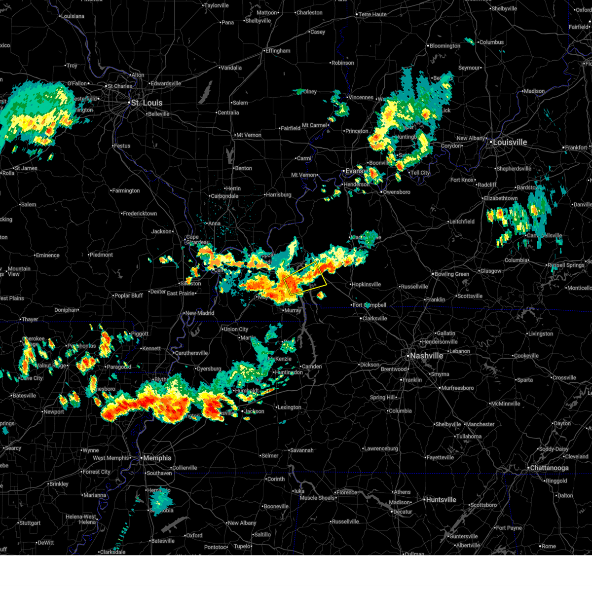
Hail Map for Cadiz, KY
The Cadiz, KY area has had 18 reports of on-the-ground hail by trained spotters, and has been under severe weather warnings 10 times during the past 12 months. Doppler radar has detected hail at or near Cadiz, KY on 74 occasions, including 1 occasion during the past year.
| Name: | Cadiz, KY |
| Where Located: | 65.1 miles NE of Mc Kenzie, TN |
| Map: | Google Map for Cadiz, KY |
| Population: | 2558 |
| Housing Units: | 1224 |
| More Info: | Search Google for Cadiz, KY |
1
The Top Recent Hail Date for Cadiz, KY is Sunday, March 15, 2026 (15th out of 74)
Hail and Wind Damage Spotted near Cadiz, KY
| Date / Time | Report Details |
|---|---|
| 6/8/2026 8:54 PM CDT |
 At 854 pm cdt, a severe thunderstorm was located near cobb, moving east at 30 mph (radar indicated). Hazards include 60 mph wind gusts and quarter size hail. Hail damage to vehicles is expected. expect wind damage to roofs, siding, and trees. Locations impacted include, hopkinsville, cadiz, turkey bay, golden pond visitors center, wranglers campground, land between the lakes area, canton, lafayette, new concord, and linton. At 854 pm cdt, a severe thunderstorm was located near cobb, moving east at 30 mph (radar indicated). Hazards include 60 mph wind gusts and quarter size hail. Hail damage to vehicles is expected. expect wind damage to roofs, siding, and trees. Locations impacted include, hopkinsville, cadiz, turkey bay, golden pond visitors center, wranglers campground, land between the lakes area, canton, lafayette, new concord, and linton.
|
| 6/8/2026 8:32 PM CDT | Large tree down on over the roa in trigg county KY, 14.2 miles ENE of Cadiz, KY |
| 6/8/2026 8:24 PM CDT |
 Svrpah the national weather service in paducah has issued a * severe thunderstorm warning for, eastern calloway county in western kentucky, central crittenden county in western kentucky, western christian county in south central kentucky, caldwell county in western kentucky, southeastern marshall county in western kentucky, trigg county in western kentucky, southwestern hopkins county in northwestern kentucky, lyon county in western kentucky, * until 915 pm cdt. * at 824 pm cdt, a severe thunderstorm was located near princeton, moving east at 25 mph (radar indicated). Hazards include 60 mph wind gusts and quarter size hail. Hail damage to vehicles is expected. Expect wind damage to roofs, siding, and trees. Svrpah the national weather service in paducah has issued a * severe thunderstorm warning for, eastern calloway county in western kentucky, central crittenden county in western kentucky, western christian county in south central kentucky, caldwell county in western kentucky, southeastern marshall county in western kentucky, trigg county in western kentucky, southwestern hopkins county in northwestern kentucky, lyon county in western kentucky, * until 915 pm cdt. * at 824 pm cdt, a severe thunderstorm was located near princeton, moving east at 25 mph (radar indicated). Hazards include 60 mph wind gusts and quarter size hail. Hail damage to vehicles is expected. Expect wind damage to roofs, siding, and trees.
|
| 6/8/2026 8:06 PM CDT |
 Svrpah the national weather service in paducah has issued a * severe thunderstorm warning for, south central caldwell county in western kentucky, central trigg county in western kentucky, southern lyon county in western kentucky, * until 845 pm cdt. * at 805 pm cdt, a severe thunderstorm was located near land between the lakes area, moving east at 30 mph (radar indicated). Hazards include 60 mph wind gusts and quarter size hail. Hail damage to vehicles is expected. Expect wind damage to roofs, siding, and trees. Svrpah the national weather service in paducah has issued a * severe thunderstorm warning for, south central caldwell county in western kentucky, central trigg county in western kentucky, southern lyon county in western kentucky, * until 845 pm cdt. * at 805 pm cdt, a severe thunderstorm was located near land between the lakes area, moving east at 30 mph (radar indicated). Hazards include 60 mph wind gusts and quarter size hail. Hail damage to vehicles is expected. Expect wind damage to roofs, siding, and trees.
|
| 4/16/2026 6:05 PM CDT |
 At 605 pm cdt, severe thunderstorms were located along a line extending from 6 miles east of cobb to near cadiz to 8 miles east of wranglers campground, moving east at 35 mph (radar indicated). Hazards include 60 mph wind gusts and quarter size hail. Hail damage to vehicles is expected. expect wind damage to roofs, siding, and trees. locations impacted include, cadiz and linton. This includes interstate 24 in kentucky between mile markers 62 and 69. At 605 pm cdt, severe thunderstorms were located along a line extending from 6 miles east of cobb to near cadiz to 8 miles east of wranglers campground, moving east at 35 mph (radar indicated). Hazards include 60 mph wind gusts and quarter size hail. Hail damage to vehicles is expected. expect wind damage to roofs, siding, and trees. locations impacted include, cadiz and linton. This includes interstate 24 in kentucky between mile markers 62 and 69.
|
| 4/16/2026 6:05 PM CDT |
 the severe thunderstorm warning has been cancelled and is no longer in effect the severe thunderstorm warning has been cancelled and is no longer in effect
|
| 4/16/2026 5:51 PM CDT |
 At 551 pm cdt, severe thunderstorms were located along a line extending from cobb to near cadiz to near wranglers campground, moving east at 40 mph (radar indicated). Hazards include 60 mph wind gusts and quarter size hail. Hail damage to vehicles is expected. expect wind damage to roofs, siding, and trees. locations impacted include, cadiz, wranglers campground, land between the lakes area, canton, cobb, and linton. This includes interstate 24 in kentucky between mile markers 55 and 69. At 551 pm cdt, severe thunderstorms were located along a line extending from cobb to near cadiz to near wranglers campground, moving east at 40 mph (radar indicated). Hazards include 60 mph wind gusts and quarter size hail. Hail damage to vehicles is expected. expect wind damage to roofs, siding, and trees. locations impacted include, cadiz, wranglers campground, land between the lakes area, canton, cobb, and linton. This includes interstate 24 in kentucky between mile markers 55 and 69.
|
| 4/16/2026 5:26 PM CDT |
 Svrpah the national weather service in paducah has issued a * severe thunderstorm warning for, northeastern calloway county in western kentucky, south central caldwell county in western kentucky, southeastern marshall county in western kentucky, trigg county in western kentucky, southern lyon county in western kentucky, * until 630 pm cdt. * at 525 pm cdt, severe thunderstorms were located along a line extending from near demumbers bay campground to near land between the lakes area to 6 miles northeast of murray, moving east at 35 mph (radar indicated). Hazards include 60 mph wind gusts and quarter size hail. Hail damage to vehicles is expected. Expect wind damage to roofs, siding, and trees. Svrpah the national weather service in paducah has issued a * severe thunderstorm warning for, northeastern calloway county in western kentucky, south central caldwell county in western kentucky, southeastern marshall county in western kentucky, trigg county in western kentucky, southern lyon county in western kentucky, * until 630 pm cdt. * at 525 pm cdt, severe thunderstorms were located along a line extending from near demumbers bay campground to near land between the lakes area to 6 miles northeast of murray, moving east at 35 mph (radar indicated). Hazards include 60 mph wind gusts and quarter size hail. Hail damage to vehicles is expected. Expect wind damage to roofs, siding, and trees.
|
| 3/15/2026 9:03 PM CDT |
 Svrpah the national weather service in paducah has issued a * severe thunderstorm warning for, southwestern muhlenberg county in south central kentucky, christian county in south central kentucky, eastern trigg county in western kentucky, todd county in south central kentucky, * until 1000 pm cdt. * at 903 pm cdt, severe thunderstorms were located along a line extending from near cobb to 6 miles northwest of big rock, moving east at 70 mph (radar indicated). Hazards include 60 mph wind gusts and penny size hail. expect damage to roofs, siding, and trees Svrpah the national weather service in paducah has issued a * severe thunderstorm warning for, southwestern muhlenberg county in south central kentucky, christian county in south central kentucky, eastern trigg county in western kentucky, todd county in south central kentucky, * until 1000 pm cdt. * at 903 pm cdt, severe thunderstorms were located along a line extending from near cobb to 6 miles northwest of big rock, moving east at 70 mph (radar indicated). Hazards include 60 mph wind gusts and penny size hail. expect damage to roofs, siding, and trees
|
| 3/7/2026 11:14 AM CST |
 At 1114 am cst, a severe thunderstorm was located near hopkinsville, moving east at 50 mph (radar indicated). Hazards include 70 mph wind gusts and nickel size hail. Expect considerable tree damage. damage is likely to mobile homes, roofs, and outbuildings. locations impacted include, hopkinsville, cadiz, pembroke, and herndon. this includes the following highways, interstate 24 in kentucky between mile markers 61 and 82. Pennyrile parkway between mile markers 1 and 20. At 1114 am cst, a severe thunderstorm was located near hopkinsville, moving east at 50 mph (radar indicated). Hazards include 70 mph wind gusts and nickel size hail. Expect considerable tree damage. damage is likely to mobile homes, roofs, and outbuildings. locations impacted include, hopkinsville, cadiz, pembroke, and herndon. this includes the following highways, interstate 24 in kentucky between mile markers 61 and 82. Pennyrile parkway between mile markers 1 and 20.
|
| 3/7/2026 11:02 AM CST | Carport heavily damaged along 68/8 in trigg county KY, 0 miles NE of Cadiz, KY |
| 3/7/2026 11:01 AM CST |
 Svrpah the national weather service in paducah has issued a * severe thunderstorm warning for, central christian county in south central kentucky, eastern trigg county in western kentucky, northwestern todd county in south central kentucky, * until 1145 am cst. * at 1100 am cst, a severe thunderstorm was located over cadiz, moving east at 50 mph (radar indicated). Hazards include 60 mph wind gusts and nickel size hail. expect damage to roofs, siding, and trees Svrpah the national weather service in paducah has issued a * severe thunderstorm warning for, central christian county in south central kentucky, eastern trigg county in western kentucky, northwestern todd county in south central kentucky, * until 1145 am cst. * at 1100 am cst, a severe thunderstorm was located over cadiz, moving east at 50 mph (radar indicated). Hazards include 60 mph wind gusts and nickel size hail. expect damage to roofs, siding, and trees
|
| 3/7/2026 10:59 AM CST | Tree limbs snapped... metal roof removed from industrial building... damage to commercial signag in trigg county KY, 2.9 miles ENE of Cadiz, KY |
| 6/19/2025 1:29 AM CDT |
 Svrpah the national weather service in paducah has issued a * severe thunderstorm warning for, southern christian county in south central kentucky, northeastern trigg county in western kentucky, southwestern todd county in south central kentucky, * until 215 am cdt. * at 128 am cdt, a severe thunderstorm was located near cadiz, moving east at 40 mph (radar indicated). Hazards include 60 mph wind gusts and nickel size hail. expect damage to roofs, siding, and trees Svrpah the national weather service in paducah has issued a * severe thunderstorm warning for, southern christian county in south central kentucky, northeastern trigg county in western kentucky, southwestern todd county in south central kentucky, * until 215 am cdt. * at 128 am cdt, a severe thunderstorm was located near cadiz, moving east at 40 mph (radar indicated). Hazards include 60 mph wind gusts and nickel size hail. expect damage to roofs, siding, and trees
|
| 6/19/2025 1:05 AM CDT |
 Svrpah the national weather service in paducah has issued a * severe thunderstorm warning for, central christian county in south central kentucky, northeastern trigg county in western kentucky, * until 130 am cdt. * at 104 am cdt, a severe thunderstorm was located over cadiz, moving east at 50 mph (radar indicated). Hazards include 60 mph wind gusts and nickel size hail. expect damage to roofs, siding, and trees Svrpah the national weather service in paducah has issued a * severe thunderstorm warning for, central christian county in south central kentucky, northeastern trigg county in western kentucky, * until 130 am cdt. * at 104 am cdt, a severe thunderstorm was located over cadiz, moving east at 50 mph (radar indicated). Hazards include 60 mph wind gusts and nickel size hail. expect damage to roofs, siding, and trees
|
| 6/19/2025 12:52 AM CDT |
 the severe thunderstorm warning has been cancelled and is no longer in effect the severe thunderstorm warning has been cancelled and is no longer in effect
|
| 6/19/2025 12:52 AM CDT |
 At 1252 am cdt, a severe thunderstorm was located near land between the lakes area, moving northeast at 40 mph (radar indicated). Hazards include 70 mph wind gusts and nickel size hail. Expect considerable tree damage. damage is likely to mobile homes, roofs, and outbuildings. locations impacted include, cadiz, energy lake campground, woodlands nature station, birmingham ferry recreation area, land between the lakes area, hillman ferry campground, cravens bay campground, and rockcastle. This includes interstate 24 in kentucky between mile markers 47 and 58. At 1252 am cdt, a severe thunderstorm was located near land between the lakes area, moving northeast at 40 mph (radar indicated). Hazards include 70 mph wind gusts and nickel size hail. Expect considerable tree damage. damage is likely to mobile homes, roofs, and outbuildings. locations impacted include, cadiz, energy lake campground, woodlands nature station, birmingham ferry recreation area, land between the lakes area, hillman ferry campground, cravens bay campground, and rockcastle. This includes interstate 24 in kentucky between mile markers 47 and 58.
|
| 6/19/2025 12:47 AM CDT |
 At 1247 am cdt, a severe thunderstorm was located near birmingham ferry recreation area, moving northeast at 40 mph (radar indicated). Hazards include 70 mph wind gusts and nickel size hail. Expect considerable tree damage. damage is likely to mobile homes, roofs, and outbuildings. locations impacted include, cadiz, energy lake campground, woodlands nature station, birmingham ferry recreation area, demumbers bay campground, land between the lakes area, hillman ferry campground, cravens bay campground, rockcastle, and aurora. This includes interstate 24 in kentucky between mile markers 46 and 58. At 1247 am cdt, a severe thunderstorm was located near birmingham ferry recreation area, moving northeast at 40 mph (radar indicated). Hazards include 70 mph wind gusts and nickel size hail. Expect considerable tree damage. damage is likely to mobile homes, roofs, and outbuildings. locations impacted include, cadiz, energy lake campground, woodlands nature station, birmingham ferry recreation area, demumbers bay campground, land between the lakes area, hillman ferry campground, cravens bay campground, rockcastle, and aurora. This includes interstate 24 in kentucky between mile markers 46 and 58.
|
| 6/19/2025 12:42 AM CDT |
 Svrpah the national weather service in paducah has issued a * severe thunderstorm warning for, south central caldwell county in western kentucky, southeastern marshall county in western kentucky, central trigg county in western kentucky, southern lyon county in western kentucky, * until 115 am cdt. * at 1242 am cdt, a severe thunderstorm was located near birmingham ferry recreation area, moving northeast at 40 mph (radar indicated). Hazards include 60 mph wind gusts and nickel size hail. expect damage to roofs, siding, and trees Svrpah the national weather service in paducah has issued a * severe thunderstorm warning for, south central caldwell county in western kentucky, southeastern marshall county in western kentucky, central trigg county in western kentucky, southern lyon county in western kentucky, * until 115 am cdt. * at 1242 am cdt, a severe thunderstorm was located near birmingham ferry recreation area, moving northeast at 40 mph (radar indicated). Hazards include 60 mph wind gusts and nickel size hail. expect damage to roofs, siding, and trees
|
| 5/20/2025 4:56 PM CDT |
 The storms which prompted the warning have moved out of the area. therefore, the warning will be allowed to expire. a tornado watch remains in effect until 1000 pm cdt for western kentucky. The storms which prompted the warning have moved out of the area. therefore, the warning will be allowed to expire. a tornado watch remains in effect until 1000 pm cdt for western kentucky.
|
| 5/20/2025 4:42 PM CDT |
 Svrpah the national weather service in paducah has issued a * severe thunderstorm warning for, christian county in south central kentucky, trigg county in western kentucky, western todd county in south central kentucky, * until 530 pm cdt. * at 442 pm cdt, severe thunderstorms were located along a line extending from 6 miles northwest of cadiz to near canton to 6 miles southeast of wranglers campground, moving east at 55 mph (radar indicated). Hazards include 70 mph wind gusts and penny size hail. Expect considerable tree damage. Damage is likely to mobile homes, roofs, and outbuildings. Svrpah the national weather service in paducah has issued a * severe thunderstorm warning for, christian county in south central kentucky, trigg county in western kentucky, western todd county in south central kentucky, * until 530 pm cdt. * at 442 pm cdt, severe thunderstorms were located along a line extending from 6 miles northwest of cadiz to near canton to 6 miles southeast of wranglers campground, moving east at 55 mph (radar indicated). Hazards include 70 mph wind gusts and penny size hail. Expect considerable tree damage. Damage is likely to mobile homes, roofs, and outbuildings.
|
| 5/20/2025 4:38 PM CDT |
 the severe thunderstorm warning has been cancelled and is no longer in effect the severe thunderstorm warning has been cancelled and is no longer in effect
|
| 5/20/2025 4:38 PM CDT |
 At 438 pm cdt, severe thunderstorms were located along a line extending from near energy lake campground to near canton to near wranglers campground, moving northeast at 55 mph (radar indicated). Hazards include 60 mph wind gusts and penny size hail. Expect damage to roofs, siding, and trees. locations impacted include, cadiz, energy lake campground, wranglers campground, land between the lakes area, canton, rockcastle, and linton. This includes interstate 24 in kentucky between mile markers 58 and 59. At 438 pm cdt, severe thunderstorms were located along a line extending from near energy lake campground to near canton to near wranglers campground, moving northeast at 55 mph (radar indicated). Hazards include 60 mph wind gusts and penny size hail. Expect damage to roofs, siding, and trees. locations impacted include, cadiz, energy lake campground, wranglers campground, land between the lakes area, canton, rockcastle, and linton. This includes interstate 24 in kentucky between mile markers 58 and 59.
|
| 5/20/2025 4:18 PM CDT |
 Svrpah the national weather service in paducah has issued a * severe thunderstorm warning for, eastern calloway county in western kentucky, southeastern marshall county in western kentucky, trigg county in western kentucky, * until 500 pm cdt. * at 418 pm cdt, severe thunderstorms were located along a line extending from 7 miles southeast of benton to 7 miles southeast of murray, moving northeast at 50 mph (radar indicated). Hazards include 60 mph wind gusts and penny size hail. expect damage to roofs, siding, and trees Svrpah the national weather service in paducah has issued a * severe thunderstorm warning for, eastern calloway county in western kentucky, southeastern marshall county in western kentucky, trigg county in western kentucky, * until 500 pm cdt. * at 418 pm cdt, severe thunderstorms were located along a line extending from 7 miles southeast of benton to 7 miles southeast of murray, moving northeast at 50 mph (radar indicated). Hazards include 60 mph wind gusts and penny size hail. expect damage to roofs, siding, and trees
|
| 5/16/2025 9:31 PM CDT |
 the tornado warning has been cancelled and is no longer in effect the tornado warning has been cancelled and is no longer in effect
|
| 5/16/2025 9:14 PM CDT |
 At 914 pm cdt, a severe thunderstorm capable of producing a tornado was located near canton, or near wranglers campground, moving east at 60 mph (radar indicated rotation). Hazards include tornado and quarter size hail. Flying debris will be dangerous to those caught without shelter. mobile homes will be damaged or destroyed. damage to roofs, windows, and vehicles will occur. tree damage is likely. This dangerous storm will be near, cadiz around 920 pm cdt. At 914 pm cdt, a severe thunderstorm capable of producing a tornado was located near canton, or near wranglers campground, moving east at 60 mph (radar indicated rotation). Hazards include tornado and quarter size hail. Flying debris will be dangerous to those caught without shelter. mobile homes will be damaged or destroyed. damage to roofs, windows, and vehicles will occur. tree damage is likely. This dangerous storm will be near, cadiz around 920 pm cdt.
|
| 5/16/2025 9:14 PM CDT |
 the tornado warning has been cancelled and is no longer in effect the tornado warning has been cancelled and is no longer in effect
|
| 5/16/2025 9:04 PM CDT |
 Svrpah the national weather service in paducah has issued a * severe thunderstorm warning for, christian county in south central kentucky, southeastern caldwell county in western kentucky, trigg county in western kentucky, west central todd county in south central kentucky, southeastern lyon county in western kentucky, * until 1000 pm cdt. * at 904 pm cdt, severe thunderstorms were located along a line extending from near cobb to near canton to golden pond visitors center to near murray, moving east at 65 mph (radar indicated). Hazards include 70 mph wind gusts and quarter size hail. Hail damage to vehicles is expected. expect considerable tree damage. Wind damage is also likely to mobile homes, roofs, and outbuildings. Svrpah the national weather service in paducah has issued a * severe thunderstorm warning for, christian county in south central kentucky, southeastern caldwell county in western kentucky, trigg county in western kentucky, west central todd county in south central kentucky, southeastern lyon county in western kentucky, * until 1000 pm cdt. * at 904 pm cdt, severe thunderstorms were located along a line extending from near cobb to near canton to golden pond visitors center to near murray, moving east at 65 mph (radar indicated). Hazards include 70 mph wind gusts and quarter size hail. Hail damage to vehicles is expected. expect considerable tree damage. Wind damage is also likely to mobile homes, roofs, and outbuildings.
|
| 5/16/2025 8:57 PM CDT |
 Torpah the national weather service in paducah has issued a * tornado warning for, north central calloway county in western kentucky, southeastern marshall county in western kentucky, central trigg county in western kentucky, * until 945 pm cdt. * at 857 pm cdt, a severe thunderstorm capable of producing a tornado was located 7 miles southeast of benton, moving east at 60 mph (radar indicated rotation). Hazards include tornado and quarter size hail. Flying debris will be dangerous to those caught without shelter. mobile homes will be damaged or destroyed. damage to roofs, windows, and vehicles will occur. tree damage is likely. this dangerous storm will be near, land between the lakes area, wranglers campground, golden pond visitors center, energy lake campground, turkey bay, and canton around 905 pm cdt. cadiz around 915 pm cdt. Other locations impacted by this tornadic thunderstorm include aurora and hardin. Torpah the national weather service in paducah has issued a * tornado warning for, north central calloway county in western kentucky, southeastern marshall county in western kentucky, central trigg county in western kentucky, * until 945 pm cdt. * at 857 pm cdt, a severe thunderstorm capable of producing a tornado was located 7 miles southeast of benton, moving east at 60 mph (radar indicated rotation). Hazards include tornado and quarter size hail. Flying debris will be dangerous to those caught without shelter. mobile homes will be damaged or destroyed. damage to roofs, windows, and vehicles will occur. tree damage is likely. this dangerous storm will be near, land between the lakes area, wranglers campground, golden pond visitors center, energy lake campground, turkey bay, and canton around 905 pm cdt. cadiz around 915 pm cdt. Other locations impacted by this tornadic thunderstorm include aurora and hardin.
|
| 5/2/2025 12:07 PM CDT |
 The storm which prompted the warning has moved out of the area. therefore, the warning will be allowed to expire. however, gusty winds between 40-50 mph are still possible behind this thunderstorm. a severe thunderstorm watch remains in effect until 500 pm cdt for south central and western kentucky. The storm which prompted the warning has moved out of the area. therefore, the warning will be allowed to expire. however, gusty winds between 40-50 mph are still possible behind this thunderstorm. a severe thunderstorm watch remains in effect until 500 pm cdt for south central and western kentucky.
|
| 5/2/2025 11:56 AM CDT |
 The storms which prompted the warning have weakened below severe limits, and no longer pose an immediate threat to life or property. therefore, the warning will be allowed to expire. however, gusty winds are still possible with these thunderstorms. a severe thunderstorm watch remains in effect until 500 pm cdt for western kentucky. The storms which prompted the warning have weakened below severe limits, and no longer pose an immediate threat to life or property. therefore, the warning will be allowed to expire. however, gusty winds are still possible with these thunderstorms. a severe thunderstorm watch remains in effect until 500 pm cdt for western kentucky.
|
| 5/2/2025 11:42 AM CDT |
 At 1142 am cdt, severe thunderstorms were located along a line extending from near benton to near woodlands nature station to near canton, moving northeast at 40 mph (radar indicated). Hazards include 60 mph wind gusts. Expect damage to roofs, siding, and trees. locations impacted include, cadiz, energy lake campground, woodlands nature station, birmingham ferry recreation area, turkey bay, land between the lakes area, golden pond visitors center, wranglers campground, cravens bay campground, canton, rockcastle, and aurora. This includes interstate 24 in kentucky between mile markers 46 and 55. At 1142 am cdt, severe thunderstorms were located along a line extending from near benton to near woodlands nature station to near canton, moving northeast at 40 mph (radar indicated). Hazards include 60 mph wind gusts. Expect damage to roofs, siding, and trees. locations impacted include, cadiz, energy lake campground, woodlands nature station, birmingham ferry recreation area, turkey bay, land between the lakes area, golden pond visitors center, wranglers campground, cravens bay campground, canton, rockcastle, and aurora. This includes interstate 24 in kentucky between mile markers 46 and 55.
|
| 5/2/2025 11:33 AM CDT |
 At 1133 am cdt, a severe thunderstorm was located 9 miles northwest of big rock, or 9 miles east of wranglers campground, moving northeast at 40 mph (radar indicated). Hazards include 60 mph wind gusts and quarter size hail. Hail damage to vehicles is expected. expect wind damage to roofs, siding, and trees. locations impacted include, hopkinsville, cadiz, lafayette, linton, and herndon. This includes interstate 24 in kentucky between mile markers 62 and 78. At 1133 am cdt, a severe thunderstorm was located 9 miles northwest of big rock, or 9 miles east of wranglers campground, moving northeast at 40 mph (radar indicated). Hazards include 60 mph wind gusts and quarter size hail. Hail damage to vehicles is expected. expect wind damage to roofs, siding, and trees. locations impacted include, hopkinsville, cadiz, lafayette, linton, and herndon. This includes interstate 24 in kentucky between mile markers 62 and 78.
|
| 5/2/2025 11:31 AM CDT |
 At 1131 am cdt, severe thunderstorms were located along a line extending from near benton to near land between the lakes area to near wranglers campground, moving northeast at 40 mph (emergency management). Hazards include 60 mph wind gusts. Expect damage to roofs, siding, and trees. locations impacted include, benton, cadiz, golden pond visitors center, hillman ferry campground, wranglers campground, energy lake campground, woodlands nature station, birmingham ferry recreation area, turkey bay, demumbers bay campground, land between the lakes area, cravens bay campground, canton, rockcastle, hardin, grand rivers, kirksey, and aurora. This includes interstate 24 in kentucky between mile markers 46 and 55. At 1131 am cdt, severe thunderstorms were located along a line extending from near benton to near land between the lakes area to near wranglers campground, moving northeast at 40 mph (emergency management). Hazards include 60 mph wind gusts. Expect damage to roofs, siding, and trees. locations impacted include, benton, cadiz, golden pond visitors center, hillman ferry campground, wranglers campground, energy lake campground, woodlands nature station, birmingham ferry recreation area, turkey bay, demumbers bay campground, land between the lakes area, cravens bay campground, canton, rockcastle, hardin, grand rivers, kirksey, and aurora. This includes interstate 24 in kentucky between mile markers 46 and 55.
|
| 5/2/2025 11:25 AM CDT |
 Svrpah the national weather service in paducah has issued a * severe thunderstorm warning for, southwestern christian county in south central kentucky, eastern trigg county in western kentucky, * until 1215 pm cdt. * at 1125 am cdt, a severe thunderstorm was located 7 miles southeast of wranglers campground, moving northeast at 40 mph (radar indicated). Hazards include 70 mph wind gusts. Expect considerable tree damage. Damage is likely to mobile homes, roofs, and outbuildings. Svrpah the national weather service in paducah has issued a * severe thunderstorm warning for, southwestern christian county in south central kentucky, eastern trigg county in western kentucky, * until 1215 pm cdt. * at 1125 am cdt, a severe thunderstorm was located 7 miles southeast of wranglers campground, moving northeast at 40 mph (radar indicated). Hazards include 70 mph wind gusts. Expect considerable tree damage. Damage is likely to mobile homes, roofs, and outbuildings.
|
| 5/2/2025 11:12 AM CDT |
 Svrpah the national weather service in paducah has issued a * severe thunderstorm warning for, calloway county in western kentucky, eastern marshall county in western kentucky, western trigg county in western kentucky, southern lyon county in western kentucky, * until noon cdt. * at 1111 am cdt, severe thunderstorms were located along a line extending from 6 miles northeast of lynnville to 6 miles northeast of murray to 6 miles north of paris landing state park, moving northeast at 40 mph (emergency management. at 11:06 am, tree and power line damage was reported near hazel in calloway county). Hazards include 70 mph wind gusts. Expect considerable tree damage. Damage is likely to mobile homes, roofs, and outbuildings. Svrpah the national weather service in paducah has issued a * severe thunderstorm warning for, calloway county in western kentucky, eastern marshall county in western kentucky, western trigg county in western kentucky, southern lyon county in western kentucky, * until noon cdt. * at 1111 am cdt, severe thunderstorms were located along a line extending from 6 miles northeast of lynnville to 6 miles northeast of murray to 6 miles north of paris landing state park, moving northeast at 40 mph (emergency management. at 11:06 am, tree and power line damage was reported near hazel in calloway county). Hazards include 70 mph wind gusts. Expect considerable tree damage. Damage is likely to mobile homes, roofs, and outbuildings.
|
| 4/4/2025 4:35 PM CDT |
 The storm which prompted the warning has weakened below severe limits, and has exited the warned area. therefore, the warning will be allowed to expire. a tornado watch remains in effect until 1000 pm cdt for south central and western kentucky. The storm which prompted the warning has weakened below severe limits, and has exited the warned area. therefore, the warning will be allowed to expire. a tornado watch remains in effect until 1000 pm cdt for south central and western kentucky.
|
| 4/4/2025 4:24 PM CDT |
 At 423 pm cdt, a severe thunderstorm was located over cadiz, moving northeast at 35 mph (radar indicated). Hazards include 60 mph wind gusts and quarter size hail. Hail damage to vehicles is expected. expect wind damage to roofs, siding, and trees. locations impacted include, cadiz. This includes interstate 24 in kentucky between mile markers 61 and 69. At 423 pm cdt, a severe thunderstorm was located over cadiz, moving northeast at 35 mph (radar indicated). Hazards include 60 mph wind gusts and quarter size hail. Hail damage to vehicles is expected. expect wind damage to roofs, siding, and trees. locations impacted include, cadiz. This includes interstate 24 in kentucky between mile markers 61 and 69.
|
| 4/4/2025 4:12 PM CDT |
 At 411 pm cdt, a severe thunderstorm was located near canton, or near cadiz, moving northeast at 30 mph (radar indicated). Hazards include 60 mph wind gusts and half dollar size hail. Hail damage to vehicles is expected. expect wind damage to roofs, siding, and trees. locations impacted include, canton and cadiz. This includes interstate 24 in kentucky between mile markers 61 and 76. At 411 pm cdt, a severe thunderstorm was located near canton, or near cadiz, moving northeast at 30 mph (radar indicated). Hazards include 60 mph wind gusts and half dollar size hail. Hail damage to vehicles is expected. expect wind damage to roofs, siding, and trees. locations impacted include, canton and cadiz. This includes interstate 24 in kentucky between mile markers 61 and 76.
|
| 4/4/2025 4:02 PM CDT |
 Svrpah the national weather service in paducah has issued a * severe thunderstorm warning for, southwestern christian county in south central kentucky, trigg county in western kentucky, * until 445 pm cdt. * at 402 pm cdt, a severe thunderstorm was located near wranglers campground, moving northeast at 30 mph (radar indicated). Hazards include golf ball size hail and 60 mph wind gusts. People and animals outdoors will be injured. expect hail damage to roofs, siding, windows, and vehicles. Expect wind damage to roofs, siding, and trees. Svrpah the national weather service in paducah has issued a * severe thunderstorm warning for, southwestern christian county in south central kentucky, trigg county in western kentucky, * until 445 pm cdt. * at 402 pm cdt, a severe thunderstorm was located near wranglers campground, moving northeast at 30 mph (radar indicated). Hazards include golf ball size hail and 60 mph wind gusts. People and animals outdoors will be injured. expect hail damage to roofs, siding, windows, and vehicles. Expect wind damage to roofs, siding, and trees.
|
| 4/4/2025 12:01 AM CDT |
 At 1201 am cdt, a severe thunderstorm was located near cadiz, moving east at 65 mph (radar indicated). Hazards include 60 mph wind gusts and quarter size hail. Hail damage to vehicles is expected. expect wind damage to roofs, siding, and trees. locations impacted include, cadiz, crofton, cobb, hopkinsville, and hawkins. this includes the following highways, interstate 24 in kentucky between mile markers 55 and 77. Pennyrile parkway between mile markers 4 and 28. At 1201 am cdt, a severe thunderstorm was located near cadiz, moving east at 65 mph (radar indicated). Hazards include 60 mph wind gusts and quarter size hail. Hail damage to vehicles is expected. expect wind damage to roofs, siding, and trees. locations impacted include, cadiz, crofton, cobb, hopkinsville, and hawkins. this includes the following highways, interstate 24 in kentucky between mile markers 55 and 77. Pennyrile parkway between mile markers 4 and 28.
|
| 4/4/2025 12:01 AM CDT |
 the severe thunderstorm warning has been cancelled and is no longer in effect the severe thunderstorm warning has been cancelled and is no longer in effect
|
| 4/3/2025 11:39 PM CDT |
 Svrpah the national weather service in paducah has issued a * severe thunderstorm warning for, north central calloway county in western kentucky, southeastern livingston county in western kentucky, central christian county in south central kentucky, southeastern caldwell county in western kentucky, eastern marshall county in western kentucky, trigg county in western kentucky, southern hopkins county in northwestern kentucky, lyon county in western kentucky, * until 1230 am cdt. * at 1139 pm cdt, a severe thunderstorm was located near birmingham ferry recreation area, moving east at 65 mph (radar indicated). Hazards include quarter size hail. damage to vehicles is expected Svrpah the national weather service in paducah has issued a * severe thunderstorm warning for, north central calloway county in western kentucky, southeastern livingston county in western kentucky, central christian county in south central kentucky, southeastern caldwell county in western kentucky, eastern marshall county in western kentucky, trigg county in western kentucky, southern hopkins county in northwestern kentucky, lyon county in western kentucky, * until 1230 am cdt. * at 1139 pm cdt, a severe thunderstorm was located near birmingham ferry recreation area, moving east at 65 mph (radar indicated). Hazards include quarter size hail. damage to vehicles is expected
|
| 4/3/2025 10:57 PM CDT |
 Svrpah the national weather service in paducah has issued a * severe thunderstorm warning for, southern muhlenberg county in south central kentucky, christian county in south central kentucky, southeastern caldwell county in western kentucky, eastern trigg county in western kentucky, southeastern hopkins county in northwestern kentucky, todd county in south central kentucky, * until 1145 pm cdt. * at 1057 pm cdt, severe thunderstorms were located along a line extending from 6 miles north of cobb to 10 miles northwest of hopkinsville to 8 miles southeast of cadiz, moving east at 60 mph (radar indicated). Hazards include 60 mph wind gusts and nickel size hail. expect damage to roofs, siding, and trees Svrpah the national weather service in paducah has issued a * severe thunderstorm warning for, southern muhlenberg county in south central kentucky, christian county in south central kentucky, southeastern caldwell county in western kentucky, eastern trigg county in western kentucky, southeastern hopkins county in northwestern kentucky, todd county in south central kentucky, * until 1145 pm cdt. * at 1057 pm cdt, severe thunderstorms were located along a line extending from 6 miles north of cobb to 10 miles northwest of hopkinsville to 8 miles southeast of cadiz, moving east at 60 mph (radar indicated). Hazards include 60 mph wind gusts and nickel size hail. expect damage to roofs, siding, and trees
|
| 4/2/2025 10:51 PM CDT |
 At 1051 pm cdt, severe thunderstorms were located along a line extending from near weir to 6 miles east of hopkinsville to near big rock, moving east at 45 mph (radar indicated). Hazards include 60 mph wind gusts. Expect damage to roofs, siding, and trees. locations impacted include, fort campbell, lafayette, hopkinsville, allegre, oak grove, clifty, herndon, pembroke, linton, and cadiz. this includes the following highways, interstate 24 in kentucky between mile markers 65 and 88. Pennyrile parkway between mile markers 1 and 21. At 1051 pm cdt, severe thunderstorms were located along a line extending from near weir to 6 miles east of hopkinsville to near big rock, moving east at 45 mph (radar indicated). Hazards include 60 mph wind gusts. Expect damage to roofs, siding, and trees. locations impacted include, fort campbell, lafayette, hopkinsville, allegre, oak grove, clifty, herndon, pembroke, linton, and cadiz. this includes the following highways, interstate 24 in kentucky between mile markers 65 and 88. Pennyrile parkway between mile markers 1 and 21.
|
| 4/2/2025 10:42 PM CDT |
 At 1042 pm cdt, severe thunderstorms were located along a line extending from 6 miles northeast of crofton to hopkinsville to big rock, moving east at 45 mph (radar indicated). Hazards include 70 mph wind gusts. Expect considerable tree damage. damage is likely to mobile homes, roofs, and outbuildings. locations impacted include, fort campbell, lafayette, hopkinsville, allegre, oak grove, linton, clifty, herndon, pembroke, and cadiz. this includes the following highways, interstate 24 in kentucky between mile markers 63 and 88. Pennyrile parkway between mile markers 1 and 21. At 1042 pm cdt, severe thunderstorms were located along a line extending from 6 miles northeast of crofton to hopkinsville to big rock, moving east at 45 mph (radar indicated). Hazards include 70 mph wind gusts. Expect considerable tree damage. damage is likely to mobile homes, roofs, and outbuildings. locations impacted include, fort campbell, lafayette, hopkinsville, allegre, oak grove, linton, clifty, herndon, pembroke, and cadiz. this includes the following highways, interstate 24 in kentucky between mile markers 63 and 88. Pennyrile parkway between mile markers 1 and 21.
|
| 4/2/2025 10:33 PM CDT |
 the tornado warning has been cancelled and is no longer in effect the tornado warning has been cancelled and is no longer in effect
|
| 4/2/2025 10:16 PM CDT |
 Svrpah the national weather service in paducah has issued a * severe thunderstorm warning for, southeastern muhlenberg county in south central kentucky, christian county in south central kentucky, eastern trigg county in western kentucky, northern todd county in south central kentucky, * until 1100 pm cdt. * at 1016 pm cdt, severe thunderstorms were located along a line extending from 7 miles east of cobb to 7 miles southeast of cadiz to 6 miles northeast of paris landing state park, moving east at 45 mph (radar indicated). Hazards include 60 mph wind gusts. expect damage to roofs, siding, and trees Svrpah the national weather service in paducah has issued a * severe thunderstorm warning for, southeastern muhlenberg county in south central kentucky, christian county in south central kentucky, eastern trigg county in western kentucky, northern todd county in south central kentucky, * until 1100 pm cdt. * at 1016 pm cdt, severe thunderstorms were located along a line extending from 7 miles east of cobb to 7 miles southeast of cadiz to 6 miles northeast of paris landing state park, moving east at 45 mph (radar indicated). Hazards include 60 mph wind gusts. expect damage to roofs, siding, and trees
|
| 4/2/2025 10:15 PM CDT |
 At 1015 pm cdt, a severe thunderstorm capable of producing a tornado was located near cobb, or 10 miles northeast of cadiz, moving northeast at 55 mph (radar indicated rotation). Hazards include tornado and quarter size hail. Flying debris will be dangerous to those caught without shelter. mobile homes will be damaged or destroyed. damage to roofs, windows, and vehicles will occur. tree damage is likely. this dangerous storm will be near, crofton around 1020 pm cdt. nortonville around 1030 pm cdt. other locations impacted by this tornadic thunderstorm include hawkins. this includes the following highways, interstate 24 in kentucky between mile markers 62 and 70. Pennyrile parkway between mile markers 13 and 31. At 1015 pm cdt, a severe thunderstorm capable of producing a tornado was located near cobb, or 10 miles northeast of cadiz, moving northeast at 55 mph (radar indicated rotation). Hazards include tornado and quarter size hail. Flying debris will be dangerous to those caught without shelter. mobile homes will be damaged or destroyed. damage to roofs, windows, and vehicles will occur. tree damage is likely. this dangerous storm will be near, crofton around 1020 pm cdt. nortonville around 1030 pm cdt. other locations impacted by this tornadic thunderstorm include hawkins. this includes the following highways, interstate 24 in kentucky between mile markers 62 and 70. Pennyrile parkway between mile markers 13 and 31.
|
| 4/2/2025 10:01 PM CDT |
 Torpah the national weather service in paducah has issued a * tornado warning for, northern christian county in south central kentucky, southeastern caldwell county in western kentucky, northeastern trigg county in western kentucky, south central hopkins county in northwestern kentucky, * until 1045 pm cdt. * at 1001 pm cdt, a severe thunderstorm capable of producing a tornado was located near cadiz, moving northeast at 55 mph (radar indicated rotation). Hazards include tornado and quarter size hail. Flying debris will be dangerous to those caught without shelter. mobile homes will be damaged or destroyed. damage to roofs, windows, and vehicles will occur. tree damage is likely. this dangerous storm will be near, cobb and cadiz around 1005 pm cdt. crofton around 1020 pm cdt. nortonville around 1030 pm cdt. other locations impacted by this tornadic thunderstorm include hawkins and rockcastle. this includes the following highways, interstate 24 in kentucky between mile markers 55 and 70. Pennyrile parkway between mile markers 13 and 31. Torpah the national weather service in paducah has issued a * tornado warning for, northern christian county in south central kentucky, southeastern caldwell county in western kentucky, northeastern trigg county in western kentucky, south central hopkins county in northwestern kentucky, * until 1045 pm cdt. * at 1001 pm cdt, a severe thunderstorm capable of producing a tornado was located near cadiz, moving northeast at 55 mph (radar indicated rotation). Hazards include tornado and quarter size hail. Flying debris will be dangerous to those caught without shelter. mobile homes will be damaged or destroyed. damage to roofs, windows, and vehicles will occur. tree damage is likely. this dangerous storm will be near, cobb and cadiz around 1005 pm cdt. crofton around 1020 pm cdt. nortonville around 1030 pm cdt. other locations impacted by this tornadic thunderstorm include hawkins and rockcastle. this includes the following highways, interstate 24 in kentucky between mile markers 55 and 70. Pennyrile parkway between mile markers 13 and 31.
|
| 4/2/2025 9:47 PM CDT |
 At 947 pm cdt, a confirmed tornado was located over turkey bay, moving northeast at 60 mph (weather spotters confirmed tornado). Hazards include damaging tornado and quarter size hail. Flying debris will be dangerous to those caught without shelter. mobile homes will be damaged or destroyed. damage to roofs, windows, and vehicles will occur. tree damage is likely. this tornado will be near, canton, land between the lakes area, energy lake campground, golden pond visitors center, wranglers campground, and turkey bay around 950 pm cdt. cadiz around 955 pm cdt. Other locations impacted by this tornadic thunderstorm include rockcastle. At 947 pm cdt, a confirmed tornado was located over turkey bay, moving northeast at 60 mph (weather spotters confirmed tornado). Hazards include damaging tornado and quarter size hail. Flying debris will be dangerous to those caught without shelter. mobile homes will be damaged or destroyed. damage to roofs, windows, and vehicles will occur. tree damage is likely. this tornado will be near, canton, land between the lakes area, energy lake campground, golden pond visitors center, wranglers campground, and turkey bay around 950 pm cdt. cadiz around 955 pm cdt. Other locations impacted by this tornadic thunderstorm include rockcastle.
|
| 4/2/2025 9:47 PM CDT |
 the tornado warning has been cancelled and is no longer in effect the tornado warning has been cancelled and is no longer in effect
|
| 4/2/2025 9:37 PM CDT |
 Torpah the national weather service in paducah has issued a * tornado warning for, northeastern calloway county in western kentucky, southeastern marshall county in western kentucky, central trigg county in western kentucky, * until 1015 pm cdt. * at 937 pm cdt, a confirmed tornado was located near murray, moving northeast at 60 mph (weather spotters confirmed tornado). Hazards include damaging tornado. Flying debris will be dangerous to those caught without shelter. mobile homes will be damaged or destroyed. damage to roofs, windows, and vehicles will occur. tree damage is likely. the tornado will be near, land between the lakes area and turkey bay around 940 pm cdt. golden pond visitors center and wranglers campground around 945 pm cdt. canton and energy lake campground around 950 pm cdt. cadiz around 955 pm cdt. Other locations impacted by this tornadic thunderstorm include aurora and rockcastle. Torpah the national weather service in paducah has issued a * tornado warning for, northeastern calloway county in western kentucky, southeastern marshall county in western kentucky, central trigg county in western kentucky, * until 1015 pm cdt. * at 937 pm cdt, a confirmed tornado was located near murray, moving northeast at 60 mph (weather spotters confirmed tornado). Hazards include damaging tornado. Flying debris will be dangerous to those caught without shelter. mobile homes will be damaged or destroyed. damage to roofs, windows, and vehicles will occur. tree damage is likely. the tornado will be near, land between the lakes area and turkey bay around 940 pm cdt. golden pond visitors center and wranglers campground around 945 pm cdt. canton and energy lake campground around 950 pm cdt. cadiz around 955 pm cdt. Other locations impacted by this tornadic thunderstorm include aurora and rockcastle.
|
| 3/30/2025 9:15 PM CDT |
 At 915 pm cdt, severe thunderstorms were located along a line extending from near cobb to 7 miles west of hopkinsville to 11 miles northeast of big rock, moving east at 55 mph (radar indicated). Hazards include 60 mph wind gusts and nickel size hail. Expect damage to roofs, siding, and trees. locations impacted include, oak grove, fort campbell, lafayette, hopkinsville, herndon, and cadiz. this includes the following highways, interstate 24 in kentucky between mile markers 64 and 89. Pennyrile parkway between mile markers 1 and 17. At 915 pm cdt, severe thunderstorms were located along a line extending from near cobb to 7 miles west of hopkinsville to 11 miles northeast of big rock, moving east at 55 mph (radar indicated). Hazards include 60 mph wind gusts and nickel size hail. Expect damage to roofs, siding, and trees. locations impacted include, oak grove, fort campbell, lafayette, hopkinsville, herndon, and cadiz. this includes the following highways, interstate 24 in kentucky between mile markers 64 and 89. Pennyrile parkway between mile markers 1 and 17.
|
| 3/30/2025 9:03 PM CDT |
 At 903 pm cdt, severe thunderstorms were located along a line extending from near cobb to cadiz to 9 miles east of wranglers campground, moving east at 55 mph (radar indicated). Hazards include 70 mph wind gusts and quarter size hail. Hail damage to vehicles is expected. expect considerable tree damage. wind damage is also likely to mobile homes, roofs, and outbuildings. locations impacted include, fort campbell, rockcastle, lafayette, hopkinsville, oak grove, linton, cadiz, canton, herndon, wranglers campground, and land between the lakes area. this includes the following highways, interstate 24 in kentucky between mile markers 59 and 89. Pennyrile parkway between mile markers 1 and 17. At 903 pm cdt, severe thunderstorms were located along a line extending from near cobb to cadiz to 9 miles east of wranglers campground, moving east at 55 mph (radar indicated). Hazards include 70 mph wind gusts and quarter size hail. Hail damage to vehicles is expected. expect considerable tree damage. wind damage is also likely to mobile homes, roofs, and outbuildings. locations impacted include, fort campbell, rockcastle, lafayette, hopkinsville, oak grove, linton, cadiz, canton, herndon, wranglers campground, and land between the lakes area. this includes the following highways, interstate 24 in kentucky between mile markers 59 and 89. Pennyrile parkway between mile markers 1 and 17.
|
| 3/30/2025 9:03 PM CDT |
 the severe thunderstorm warning has been cancelled and is no longer in effect the severe thunderstorm warning has been cancelled and is no longer in effect
|
| 3/30/2025 8:42 PM CDT |
 Svrpah the national weather service in paducah has issued a * severe thunderstorm warning for, eastern calloway county in western kentucky, southwestern christian county in south central kentucky, southeastern marshall county in western kentucky, trigg county in western kentucky, south central lyon county in western kentucky, * until 930 pm cdt. * at 841 pm cdt, severe thunderstorms were located along a line extending from near birmingham ferry recreation area to near turkey bay to 7 miles east of murray, moving east at 55 mph (radar indicated). Hazards include 70 mph wind gusts and quarter size hail. Hail damage to vehicles is expected. expect considerable tree damage. Wind damage is also likely to mobile homes, roofs, and outbuildings. Svrpah the national weather service in paducah has issued a * severe thunderstorm warning for, eastern calloway county in western kentucky, southwestern christian county in south central kentucky, southeastern marshall county in western kentucky, trigg county in western kentucky, south central lyon county in western kentucky, * until 930 pm cdt. * at 841 pm cdt, severe thunderstorms were located along a line extending from near birmingham ferry recreation area to near turkey bay to 7 miles east of murray, moving east at 55 mph (radar indicated). Hazards include 70 mph wind gusts and quarter size hail. Hail damage to vehicles is expected. expect considerable tree damage. Wind damage is also likely to mobile homes, roofs, and outbuildings.
|
| 2/15/2025 8:08 PM CST |
 At 808 pm cst, severe thunderstorms were located along a line extending from 7 miles west of hopkinsville to 9 miles northeast of big rock, moving east at 50 mph (radar indicated). Hazards include 60 mph wind gusts and quarter size hail. Hail damage to vehicles is expected. expect wind damage to roofs, siding, and trees. locations impacted include, hopkinsville, oak grove, cadiz, fort campbell, clarksville, pembroke, lafayette, and herndon. this includes the following highways, interstate 24 in kentucky between mile markers 64 and 92. Pennyrile parkway between mile markers 1 and 15. At 808 pm cst, severe thunderstorms were located along a line extending from 7 miles west of hopkinsville to 9 miles northeast of big rock, moving east at 50 mph (radar indicated). Hazards include 60 mph wind gusts and quarter size hail. Hail damage to vehicles is expected. expect wind damage to roofs, siding, and trees. locations impacted include, hopkinsville, oak grove, cadiz, fort campbell, clarksville, pembroke, lafayette, and herndon. this includes the following highways, interstate 24 in kentucky between mile markers 64 and 92. Pennyrile parkway between mile markers 1 and 15.
|
| 2/15/2025 7:42 PM CST |
 Svrpah the national weather service in paducah has issued a * severe thunderstorm warning for, southern christian county in south central kentucky, trigg county in western kentucky, * until 830 pm cst. * at 741 pm cst, severe thunderstorms were located along a line extending from canton to near wranglers campground, moving east at 55 mph (radar indicated). Hazards include 60 mph wind gusts and quarter size hail. Hail damage to vehicles is expected. Expect wind damage to roofs, siding, and trees. Svrpah the national weather service in paducah has issued a * severe thunderstorm warning for, southern christian county in south central kentucky, trigg county in western kentucky, * until 830 pm cst. * at 741 pm cst, severe thunderstorms were located along a line extending from canton to near wranglers campground, moving east at 55 mph (radar indicated). Hazards include 60 mph wind gusts and quarter size hail. Hail damage to vehicles is expected. Expect wind damage to roofs, siding, and trees.
|
| 9/13/2024 5:07 PM CDT |
 Svrpah the national weather service in paducah has issued a * severe thunderstorm warning for, southern caldwell county in western kentucky, northeastern trigg county in western kentucky, east central lyon county in western kentucky, * until 545 pm cdt. * at 507 pm cdt, a severe thunderstorm was located near cobb, or near cadiz, moving northwest at 35 mph (radar indicated). Hazards include 60 mph wind gusts. expect damage to roofs, siding, and trees Svrpah the national weather service in paducah has issued a * severe thunderstorm warning for, southern caldwell county in western kentucky, northeastern trigg county in western kentucky, east central lyon county in western kentucky, * until 545 pm cdt. * at 507 pm cdt, a severe thunderstorm was located near cobb, or near cadiz, moving northwest at 35 mph (radar indicated). Hazards include 60 mph wind gusts. expect damage to roofs, siding, and trees
|
| 8/1/2024 7:29 PM CDT |
 The storm which prompted the warning has weakened below severe limits, and no longer poses an immediate threat to life or property. therefore, the warning will be allowed to expire. however, gusty winds are still possible with this thunderstorm. The storm which prompted the warning has weakened below severe limits, and no longer poses an immediate threat to life or property. therefore, the warning will be allowed to expire. however, gusty winds are still possible with this thunderstorm.
|
| 8/1/2024 7:22 PM CDT |
 At 722 pm cdt, a severe thunderstorm was located over cadiz, moving southeast at 20 mph (radar indicated). Hazards include 60 mph wind gusts. Expect damage to roofs, siding, and trees. locations impacted include, cadiz and rockcastle. This includes interstate 24 in kentucky between mile markers 55 and 66. At 722 pm cdt, a severe thunderstorm was located over cadiz, moving southeast at 20 mph (radar indicated). Hazards include 60 mph wind gusts. Expect damage to roofs, siding, and trees. locations impacted include, cadiz and rockcastle. This includes interstate 24 in kentucky between mile markers 55 and 66.
|
| 8/1/2024 7:05 PM CDT |
 At 704 pm cdt, a severe thunderstorm was located near cadiz, moving southeast at 20 mph (radar indicated). Hazards include 60 mph wind gusts and penny size hail. Expect damage to roofs, siding, and trees. locations impacted include, cadiz, cravens bay campground, land between the lakes area, and rockcastle. This includes interstate 24 in kentucky between mile markers 49 and 66. At 704 pm cdt, a severe thunderstorm was located near cadiz, moving southeast at 20 mph (radar indicated). Hazards include 60 mph wind gusts and penny size hail. Expect damage to roofs, siding, and trees. locations impacted include, cadiz, cravens bay campground, land between the lakes area, and rockcastle. This includes interstate 24 in kentucky between mile markers 49 and 66.
|
| 8/1/2024 6:52 PM CDT |
 Svrpah the national weather service in paducah has issued a * severe thunderstorm warning for, south central caldwell county in western kentucky, northeastern trigg county in western kentucky, central lyon county in western kentucky, * until 730 pm cdt. * at 652 pm cdt, a severe thunderstorm was located near cravens bay campground, moving southeast at 20 mph (radar indicated). Hazards include 60 mph wind gusts and penny size hail. expect damage to roofs, siding, and trees Svrpah the national weather service in paducah has issued a * severe thunderstorm warning for, south central caldwell county in western kentucky, northeastern trigg county in western kentucky, central lyon county in western kentucky, * until 730 pm cdt. * at 652 pm cdt, a severe thunderstorm was located near cravens bay campground, moving southeast at 20 mph (radar indicated). Hazards include 60 mph wind gusts and penny size hail. expect damage to roofs, siding, and trees
|
| 7/30/2024 8:50 PM CDT |
 the severe thunderstorm warning has been cancelled and is no longer in effect the severe thunderstorm warning has been cancelled and is no longer in effect
|
| 7/30/2024 8:42 PM CDT |
 At 842 pm cdt, severe thunderstorms were located along a line extending from hopkinsville to near cadiz to birmingham ferry recreation area, moving southeast at 20 mph (radar indicated). Hazards include 60 mph wind gusts. Expect damage to roofs, siding, and trees. locations impacted include, hopkinsville, cadiz, eddyville, hillman ferry campground, energy lake campground, woodlands nature station, birmingham ferry recreation area, demumbers bay campground, land between the lakes area, cravens bay campground, canton, rockcastle, kuttawa, and grand rivers. this includes the following highways, interstate 24 in kentucky between mile markers 31 and 42, and between mile markers 58 and 78. interstate 69 in kentucky near mile marker 68. Pennyrile parkway between mile markers 3 and 14. At 842 pm cdt, severe thunderstorms were located along a line extending from hopkinsville to near cadiz to birmingham ferry recreation area, moving southeast at 20 mph (radar indicated). Hazards include 60 mph wind gusts. Expect damage to roofs, siding, and trees. locations impacted include, hopkinsville, cadiz, eddyville, hillman ferry campground, energy lake campground, woodlands nature station, birmingham ferry recreation area, demumbers bay campground, land between the lakes area, cravens bay campground, canton, rockcastle, kuttawa, and grand rivers. this includes the following highways, interstate 24 in kentucky between mile markers 31 and 42, and between mile markers 58 and 78. interstate 69 in kentucky near mile marker 68. Pennyrile parkway between mile markers 3 and 14.
|
| 7/30/2024 8:32 PM CDT |
 At 831 pm cdt, severe thunderstorms were located along a line extending from near hopkinsville to near cadiz to hillman ferry campground, moving southeast at 20 mph (radar indicated). Hazards include 60 mph wind gusts. Expect damage to roofs, siding, and trees. locations impacted include, hopkinsville, cadiz, eddyville, hillman ferry campground, energy lake campground, woodlands nature station, birmingham ferry recreation area, demumbers bay campground, land between the lakes area, cravens bay campground, canton, rockcastle, kuttawa, and grand rivers. this includes the following highways, interstate 24 in kentucky between mile markers 31 and 42, and between mile markers 58 and 78. interstate 69 in kentucky near mile marker 68. Pennyrile parkway between mile markers 3 and 14. At 831 pm cdt, severe thunderstorms were located along a line extending from near hopkinsville to near cadiz to hillman ferry campground, moving southeast at 20 mph (radar indicated). Hazards include 60 mph wind gusts. Expect damage to roofs, siding, and trees. locations impacted include, hopkinsville, cadiz, eddyville, hillman ferry campground, energy lake campground, woodlands nature station, birmingham ferry recreation area, demumbers bay campground, land between the lakes area, cravens bay campground, canton, rockcastle, kuttawa, and grand rivers. this includes the following highways, interstate 24 in kentucky between mile markers 31 and 42, and between mile markers 58 and 78. interstate 69 in kentucky near mile marker 68. Pennyrile parkway between mile markers 3 and 14.
|
| 7/30/2024 8:32 PM CDT |
 the severe thunderstorm warning has been cancelled and is no longer in effect the severe thunderstorm warning has been cancelled and is no longer in effect
|
| 7/30/2024 8:14 PM CDT |
 Svrpah the national weather service in paducah has issued a * severe thunderstorm warning for, southeastern livingston county in western kentucky, northwestern christian county in south central kentucky, southeastern caldwell county in western kentucky, trigg county in western kentucky, lyon county in western kentucky, * until 900 pm cdt. * at 814 pm cdt, severe thunderstorms were located along a line extending from 7 miles southwest of crofton to 6 miles east of woodlands nature station to near calvert city, moving southeast at 20 mph (radar indicated). Hazards include 60 mph wind gusts. expect damage to roofs, siding, and trees Svrpah the national weather service in paducah has issued a * severe thunderstorm warning for, southeastern livingston county in western kentucky, northwestern christian county in south central kentucky, southeastern caldwell county in western kentucky, trigg county in western kentucky, lyon county in western kentucky, * until 900 pm cdt. * at 814 pm cdt, severe thunderstorms were located along a line extending from 7 miles southwest of crofton to 6 miles east of woodlands nature station to near calvert city, moving southeast at 20 mph (radar indicated). Hazards include 60 mph wind gusts. expect damage to roofs, siding, and trees
|
| 7/5/2024 4:49 AM CDT | Storm damage reported in trigg county KY, 2.1 miles SW of Cadiz, KY |
| 7/5/2024 4:42 AM CDT |
 Svrpah the national weather service in paducah has issued a * severe thunderstorm warning for, central christian county in south central kentucky, southeastern trigg county in western kentucky, * until 530 am cdt. * at 442 am cdt, a severe thunderstorm was located near cadiz, moving east at 30 mph (radar indicated). Hazards include downburst wind gusts to 60 mph. expect damage to roofs, siding, and trees Svrpah the national weather service in paducah has issued a * severe thunderstorm warning for, central christian county in south central kentucky, southeastern trigg county in western kentucky, * until 530 am cdt. * at 442 am cdt, a severe thunderstorm was located near cadiz, moving east at 30 mph (radar indicated). Hazards include downburst wind gusts to 60 mph. expect damage to roofs, siding, and trees
|
| 6/26/2024 5:08 PM CDT |
 Svrpah the national weather service in paducah has issued a * severe thunderstorm warning for, christian county in south central kentucky, eastern trigg county in western kentucky, * until 615 pm cdt. * at 508 pm cdt, severe thunderstorms were located along a line extending from near wranglers campground to 10 miles north of big rock to near fort campbell, moving northeast at 35 mph (radar indicated). Hazards include 60 mph wind gusts and penny size hail. expect damage to roofs, siding, and trees Svrpah the national weather service in paducah has issued a * severe thunderstorm warning for, christian county in south central kentucky, eastern trigg county in western kentucky, * until 615 pm cdt. * at 508 pm cdt, severe thunderstorms were located along a line extending from near wranglers campground to 10 miles north of big rock to near fort campbell, moving northeast at 35 mph (radar indicated). Hazards include 60 mph wind gusts and penny size hail. expect damage to roofs, siding, and trees
|
| 6/17/2024 7:18 PM CDT |
 Svrpah the national weather service in paducah has issued a * severe thunderstorm warning for, northwestern christian county in south central kentucky, southeastern caldwell county in western kentucky, northeastern trigg county in western kentucky, * until 745 pm cdt. * at 718 pm cdt, a severe thunderstorm was located near cobb, or 8 miles northeast of cadiz, moving north at 30 mph (radar indicated). Hazards include 60 mph wind gusts. expect damage to roofs, siding, and trees Svrpah the national weather service in paducah has issued a * severe thunderstorm warning for, northwestern christian county in south central kentucky, southeastern caldwell county in western kentucky, northeastern trigg county in western kentucky, * until 745 pm cdt. * at 718 pm cdt, a severe thunderstorm was located near cobb, or 8 miles northeast of cadiz, moving north at 30 mph (radar indicated). Hazards include 60 mph wind gusts. expect damage to roofs, siding, and trees
|
| 5/26/2024 10:15 PM CDT |
 the severe thunderstorm warning has been cancelled and is no longer in effect the severe thunderstorm warning has been cancelled and is no longer in effect
|
| 5/26/2024 10:15 PM CDT |
 At 1015 pm cdt, severe thunderstorms were located along a line extending from 11 miles southeast of crofton to 9 miles southwest of hopkinsville to 8 miles east of murray, moving southeast at 50 mph (radar indicated). Hazards include 60 mph wind gusts and quarter size hail. Hail damage to vehicles is expected. expect wind damage to roofs, siding, and trees. locations impacted include, hopkinsville, murray, oak grove, cadiz, elkton, wranglers campground, energy lake campground, turkey bay, golden pond visitors center, fort campbell, land between the lakes area, clarksville, guthrie, pembroke, canton, dunmor, hazel, trenton, lafayette, and justice. this includes the following highways, interstate 24 in kentucky between mile markers 58 and 92. Pennyrile parkway between mile markers 1 and 21. At 1015 pm cdt, severe thunderstorms were located along a line extending from 11 miles southeast of crofton to 9 miles southwest of hopkinsville to 8 miles east of murray, moving southeast at 50 mph (radar indicated). Hazards include 60 mph wind gusts and quarter size hail. Hail damage to vehicles is expected. expect wind damage to roofs, siding, and trees. locations impacted include, hopkinsville, murray, oak grove, cadiz, elkton, wranglers campground, energy lake campground, turkey bay, golden pond visitors center, fort campbell, land between the lakes area, clarksville, guthrie, pembroke, canton, dunmor, hazel, trenton, lafayette, and justice. this includes the following highways, interstate 24 in kentucky between mile markers 58 and 92. Pennyrile parkway between mile markers 1 and 21.
|
| 5/26/2024 9:37 PM CDT |
 Svrpah the national weather service in paducah has issued a * severe thunderstorm warning for, calloway county in western kentucky, southern muhlenberg county in south central kentucky, christian county in south central kentucky, southern caldwell county in western kentucky, trigg county in western kentucky, todd county in south central kentucky, southeastern graves county in western kentucky, southeastern lyon county in western kentucky, * until 1030 pm cdt. * at 936 pm cdt, severe thunderstorms were located along a line extending from near dawson springs to near cravens bay campground to near mayfield, moving east at 85 mph (radar indicated). Hazards include 60 mph wind gusts and quarter size hail. Hail damage to vehicles is expected. Expect wind damage to roofs, siding, and trees. Svrpah the national weather service in paducah has issued a * severe thunderstorm warning for, calloway county in western kentucky, southern muhlenberg county in south central kentucky, christian county in south central kentucky, southern caldwell county in western kentucky, trigg county in western kentucky, todd county in south central kentucky, southeastern graves county in western kentucky, southeastern lyon county in western kentucky, * until 1030 pm cdt. * at 936 pm cdt, severe thunderstorms were located along a line extending from near dawson springs to near cravens bay campground to near mayfield, moving east at 85 mph (radar indicated). Hazards include 60 mph wind gusts and quarter size hail. Hail damage to vehicles is expected. Expect wind damage to roofs, siding, and trees.
|
| 5/26/2024 9:25 PM CDT |
 Svrpah the national weather service in paducah has issued a * severe thunderstorm warning for, muhlenberg county in south central kentucky, northern christian county in south central kentucky, southeastern caldwell county in western kentucky, northeastern trigg county in western kentucky, southeastern hopkins county in northwestern kentucky, north central todd county in south central kentucky, * until 1015 pm cdt. * at 925 pm cdt, severe thunderstorms were located along a line extending from 8 miles northeast of madisonville to earlington to near olney to near farmersville, moving southeast at 60 mph (radar indicated). Hazards include 60 mph wind gusts and quarter size hail. Hail damage to vehicles is expected. Expect wind damage to roofs, siding, and trees. Svrpah the national weather service in paducah has issued a * severe thunderstorm warning for, muhlenberg county in south central kentucky, northern christian county in south central kentucky, southeastern caldwell county in western kentucky, northeastern trigg county in western kentucky, southeastern hopkins county in northwestern kentucky, north central todd county in south central kentucky, * until 1015 pm cdt. * at 925 pm cdt, severe thunderstorms were located along a line extending from 8 miles northeast of madisonville to earlington to near olney to near farmersville, moving southeast at 60 mph (radar indicated). Hazards include 60 mph wind gusts and quarter size hail. Hail damage to vehicles is expected. Expect wind damage to roofs, siding, and trees.
|
| 5/26/2024 9:15 AM CDT |
 the severe thunderstorm warning has been cancelled and is no longer in effect the severe thunderstorm warning has been cancelled and is no longer in effect
|
| 5/26/2024 9:15 AM CDT |
 At 915 am cdt, severe thunderstorms were located along a line extending from near sebree to near madisonville to near fort campbell, moving northeast at 60 mph (trained weather spotters). Hazards include 70 mph wind gusts and penny size hail. Expect considerable tree damage. damage is likely to mobile homes, roofs, and outbuildings. locations impacted include, owensboro, hopkinsville, madisonville, oak grove, central city, dawson springs, elkton, calhoun, fort campbell, sebree, guthrie, earlington, livermore, nortonville, pembroke, mortons gap, dixon, crofton, powderly, and whitesville. this includes the following highways, interstate 24 in kentucky between mile markers 65 and 92. interstate 165 between mile markers 60 and 70. interstate 69 in kentucky between mile markers 94 and 137. western kentucky parkway between mile markers 39 and 65. pennyrile parkway between mile markers 1 and 34. Audubon parkway near mile marker 23. At 915 am cdt, severe thunderstorms were located along a line extending from near sebree to near madisonville to near fort campbell, moving northeast at 60 mph (trained weather spotters). Hazards include 70 mph wind gusts and penny size hail. Expect considerable tree damage. damage is likely to mobile homes, roofs, and outbuildings. locations impacted include, owensboro, hopkinsville, madisonville, oak grove, central city, dawson springs, elkton, calhoun, fort campbell, sebree, guthrie, earlington, livermore, nortonville, pembroke, mortons gap, dixon, crofton, powderly, and whitesville. this includes the following highways, interstate 24 in kentucky between mile markers 65 and 92. interstate 165 between mile markers 60 and 70. interstate 69 in kentucky between mile markers 94 and 137. western kentucky parkway between mile markers 39 and 65. pennyrile parkway between mile markers 1 and 34. Audubon parkway near mile marker 23.
|
| 5/26/2024 9:08 AM CDT |
 The storm which prompted the warning has moved out of the area. therefore, the warning will be allowed to expire. a tornado watch remains in effect until 1000 am cdt for western kentucky. a tornado watch also remains in effect until 300 pm cdt for south central kentucky. The storm which prompted the warning has moved out of the area. therefore, the warning will be allowed to expire. a tornado watch remains in effect until 1000 am cdt for western kentucky. a tornado watch also remains in effect until 300 pm cdt for south central kentucky.
|
| 5/26/2024 9:01 AM CDT |
 At 901 am cdt, a severe squall line capable of producing both tornadoes and extensive straight line wind damage was located 7 miles southwest of hopkinsville, moving east at 75 mph (radar indicated rotation). Hazards include tornado. Flying debris will be dangerous to those caught without shelter. mobile homes will be damaged or destroyed. damage to roofs, windows, and vehicles will occur. tree damage is likely. this tornadic thunderstorm will remain over mainly rural areas of eastern trigg county. This includes interstate 24 in kentucky between mile markers 58 and 69. At 901 am cdt, a severe squall line capable of producing both tornadoes and extensive straight line wind damage was located 7 miles southwest of hopkinsville, moving east at 75 mph (radar indicated rotation). Hazards include tornado. Flying debris will be dangerous to those caught without shelter. mobile homes will be damaged or destroyed. damage to roofs, windows, and vehicles will occur. tree damage is likely. this tornadic thunderstorm will remain over mainly rural areas of eastern trigg county. This includes interstate 24 in kentucky between mile markers 58 and 69.
|
| 5/26/2024 8:59 AM CDT |
 the severe thunderstorm warning has been cancelled and is no longer in effect the severe thunderstorm warning has been cancelled and is no longer in effect
|
| 5/26/2024 8:59 AM CDT |
 At 856 am cdt, severe thunderstorms were located along a line extending from clay to near olney to 7 miles north of big rock, moving east at 70 mph. these are destructive storms for all of caldwell, trigg, hopkins, and christian counties (trained weather spotters). Hazards include 80 mph wind gusts. Flying debris will be dangerous to those caught without shelter. mobile homes will be heavily damaged. expect considerable damage to roofs, windows, and vehicles. extensive tree damage and power outages are likely. locations impacted include, owensboro, hopkinsville, madisonville, oak grove, princeton, central city, providence, dawson springs, cadiz, elkton, calhoun, fort campbell, wranglers campground, land between the lakes area, sebree, guthrie, earlington, livermore, nortonville, and clay. this includes the following highways, interstate 24 in kentucky between mile markers 50 and 92. interstate 165 between mile markers 60 and 70. interstate 69 in kentucky between mile markers 76 and 137. western kentucky parkway between mile markers 39 and 65. pennyrile parkway between mile markers 1 and 34. Audubon parkway near mile marker 23. At 856 am cdt, severe thunderstorms were located along a line extending from clay to near olney to 7 miles north of big rock, moving east at 70 mph. these are destructive storms for all of caldwell, trigg, hopkins, and christian counties (trained weather spotters). Hazards include 80 mph wind gusts. Flying debris will be dangerous to those caught without shelter. mobile homes will be heavily damaged. expect considerable damage to roofs, windows, and vehicles. extensive tree damage and power outages are likely. locations impacted include, owensboro, hopkinsville, madisonville, oak grove, princeton, central city, providence, dawson springs, cadiz, elkton, calhoun, fort campbell, wranglers campground, land between the lakes area, sebree, guthrie, earlington, livermore, nortonville, and clay. this includes the following highways, interstate 24 in kentucky between mile markers 50 and 92. interstate 165 between mile markers 60 and 70. interstate 69 in kentucky between mile markers 76 and 137. western kentucky parkway between mile markers 39 and 65. pennyrile parkway between mile markers 1 and 34. Audubon parkway near mile marker 23.
|
| 5/26/2024 8:56 AM CDT | Lots of trees down... many on roads such as oliver rd and n. montgomery r in trigg county KY, 1.1 miles W of Cadiz, KY |
| 5/26/2024 8:55 AM CDT | Cadiz county hospital has no power and no generator. multiple trees on lines near hospita in trigg county KY, 1.7 miles E of Cadiz, KY |
| 5/26/2024 8:51 AM CDT |
 Svrpah the national weather service in paducah has issued a * severe thunderstorm warning for, southeastern henderson county in northwestern kentucky, caldwell county in western kentucky, trigg county in western kentucky, hopkins county in northwestern kentucky, southeastern lyon county in western kentucky, daviess county in northwestern kentucky, muhlenberg county in south central kentucky, northeastern crittenden county in western kentucky, christian county in south central kentucky, mclean county in northwestern kentucky, todd county in south central kentucky, south central union county in northwestern kentucky, webster county in northwestern kentucky, * until 930 am cdt. * at 850 am cdt, severe thunderstorms were located along a line extending from 6 miles northeast of marion to farmersville to 7 miles south of wranglers campground, moving east at 65 mph (radar indicated). Hazards include 70 mph wind gusts. Expect considerable tree damage. Damage is likely to mobile homes, roofs, and outbuildings. Svrpah the national weather service in paducah has issued a * severe thunderstorm warning for, southeastern henderson county in northwestern kentucky, caldwell county in western kentucky, trigg county in western kentucky, hopkins county in northwestern kentucky, southeastern lyon county in western kentucky, daviess county in northwestern kentucky, muhlenberg county in south central kentucky, northeastern crittenden county in western kentucky, christian county in south central kentucky, mclean county in northwestern kentucky, todd county in south central kentucky, south central union county in northwestern kentucky, webster county in northwestern kentucky, * until 930 am cdt. * at 850 am cdt, severe thunderstorms were located along a line extending from 6 miles northeast of marion to farmersville to 7 miles south of wranglers campground, moving east at 65 mph (radar indicated). Hazards include 70 mph wind gusts. Expect considerable tree damage. Damage is likely to mobile homes, roofs, and outbuildings.
|
| 5/26/2024 8:46 AM CDT |
 the tornado warning has been cancelled and is no longer in effect the tornado warning has been cancelled and is no longer in effect
|
| 5/26/2024 8:46 AM CDT |
 At 845 am cdt, a severe squall line capable of producing both tornadoes and extensive straight line wind damage was located over wranglers campground, moving east at 75 mph (radar indicated rotation). Hazards include tornado. Flying debris will be dangerous to those caught without shelter. mobile homes will be damaged or destroyed. damage to roofs, windows, and vehicles will occur. tree damage is likely. these dangerous storms will be near, cadiz around 850 am cdt. other locations impacted by this tornadic thunderstorm include rockcastle. This includes interstate 24 in kentucky between mile markers 58 and 69. At 845 am cdt, a severe squall line capable of producing both tornadoes and extensive straight line wind damage was located over wranglers campground, moving east at 75 mph (radar indicated rotation). Hazards include tornado. Flying debris will be dangerous to those caught without shelter. mobile homes will be damaged or destroyed. damage to roofs, windows, and vehicles will occur. tree damage is likely. these dangerous storms will be near, cadiz around 850 am cdt. other locations impacted by this tornadic thunderstorm include rockcastle. This includes interstate 24 in kentucky between mile markers 58 and 69.
|
| 5/26/2024 8:37 AM CDT |
 Torpah the national weather service in paducah has issued a * tornado warning for, northeastern calloway county in western kentucky, southeastern marshall county in western kentucky, trigg county in western kentucky, * until 915 am cdt. * at 837 am cdt, severe thunderstorms capable of producing both tornadoes and extensive straight line wind damage were located near turkey bay, moving east at 75 mph (radar indicated rotation). Hazards include tornado. Flying debris will be dangerous to those caught without shelter. mobile homes will be damaged or destroyed. damage to roofs, windows, and vehicles will occur. tree damage is likely. these dangerous storms will be near, land between the lakes area, wranglers campground, turkey bay, golden pond visitors center, and canton around 840 am cdt. energy lake campground around 845 am cdt. cadiz around 850 am cdt. other locations impacted by this tornadic thunderstorm include aurora, hardin, and rockcastle. This includes interstate 24 in kentucky between mile markers 58 and 70. Torpah the national weather service in paducah has issued a * tornado warning for, northeastern calloway county in western kentucky, southeastern marshall county in western kentucky, trigg county in western kentucky, * until 915 am cdt. * at 837 am cdt, severe thunderstorms capable of producing both tornadoes and extensive straight line wind damage were located near turkey bay, moving east at 75 mph (radar indicated rotation). Hazards include tornado. Flying debris will be dangerous to those caught without shelter. mobile homes will be damaged or destroyed. damage to roofs, windows, and vehicles will occur. tree damage is likely. these dangerous storms will be near, land between the lakes area, wranglers campground, turkey bay, golden pond visitors center, and canton around 840 am cdt. energy lake campground around 845 am cdt. cadiz around 850 am cdt. other locations impacted by this tornadic thunderstorm include aurora, hardin, and rockcastle. This includes interstate 24 in kentucky between mile markers 58 and 70.
|
| 5/26/2024 8:35 AM CDT |
 the severe thunderstorm warning has been cancelled and is no longer in effect the severe thunderstorm warning has been cancelled and is no longer in effect
|
| 5/26/2024 8:35 AM CDT |
 At 834 am cdt, severe thunderstorms were located along a line extending from near joy to near demumbers bay campground to near lynnville, moving east at 70 mph (radar indicated). Hazards include 70 mph wind gusts. Expect considerable tree damage. damage is likely to mobile homes, roofs, and outbuildings. locations impacted include, murray, princeton, benton, marion, dawson springs, calvert city, cadiz, eddyville, hillman ferry campground, wranglers campground, energy lake campground, woodlands nature station, turkey bay, demumbers bay campground, cravens bay campground, golden pond visitors center, birmingham ferry recreation area, land between the lakes area, salem, and burna. this includes the following highways, interstate 24 in kentucky between mile markers 26 and 69. Interstate 69 in kentucky between mile markers 38 and 50, and between mile markers 68 and 90. At 834 am cdt, severe thunderstorms were located along a line extending from near joy to near demumbers bay campground to near lynnville, moving east at 70 mph (radar indicated). Hazards include 70 mph wind gusts. Expect considerable tree damage. damage is likely to mobile homes, roofs, and outbuildings. locations impacted include, murray, princeton, benton, marion, dawson springs, calvert city, cadiz, eddyville, hillman ferry campground, wranglers campground, energy lake campground, woodlands nature station, turkey bay, demumbers bay campground, cravens bay campground, golden pond visitors center, birmingham ferry recreation area, land between the lakes area, salem, and burna. this includes the following highways, interstate 24 in kentucky between mile markers 26 and 69. Interstate 69 in kentucky between mile markers 38 and 50, and between mile markers 68 and 90.
|
| 5/26/2024 8:20 AM CDT |
 Svrpah the national weather service in paducah has issued a * severe thunderstorm warning for, eastern massac county in southern illinois, southern pope county in southern illinois, calloway county in western kentucky, crittenden county in western kentucky, livingston county in western kentucky, caldwell county in western kentucky, marshall county in western kentucky, trigg county in western kentucky, southeastern mccracken county in western kentucky, graves county in western kentucky, lyon county in western kentucky, * until 900 am cdt. * at 819 am cdt, severe thunderstorms were located along a line extending from 8 miles southwest of golconda to near reidland to near latham, moving east at 70 mph (radar indicated). Hazards include 70 mph wind gusts. Expect considerable tree damage. Damage is likely to mobile homes, roofs, and outbuildings. Svrpah the national weather service in paducah has issued a * severe thunderstorm warning for, eastern massac county in southern illinois, southern pope county in southern illinois, calloway county in western kentucky, crittenden county in western kentucky, livingston county in western kentucky, caldwell county in western kentucky, marshall county in western kentucky, trigg county in western kentucky, southeastern mccracken county in western kentucky, graves county in western kentucky, lyon county in western kentucky, * until 900 am cdt. * at 819 am cdt, severe thunderstorms were located along a line extending from 8 miles southwest of golconda to near reidland to near latham, moving east at 70 mph (radar indicated). Hazards include 70 mph wind gusts. Expect considerable tree damage. Damage is likely to mobile homes, roofs, and outbuildings.
|
| 5/8/2024 11:50 PM CDT |
 At 1148 pm cdt, a severe thunderstorm was located near cadiz, moving east at 45 mph (radar indicated). Hazards include 60 mph wind gusts and quarter size hail. Hail damage to vehicles is expected. expect wind damage to roofs, siding, and trees. locations impacted include, cadiz, energy lake campground, turkey bay, land between the lakes area, golden pond visitors center, wranglers campground, canton, rockcastle, and linton. This includes interstate 24 in kentucky between mile markers 60 and 69. At 1148 pm cdt, a severe thunderstorm was located near cadiz, moving east at 45 mph (radar indicated). Hazards include 60 mph wind gusts and quarter size hail. Hail damage to vehicles is expected. expect wind damage to roofs, siding, and trees. locations impacted include, cadiz, energy lake campground, turkey bay, land between the lakes area, golden pond visitors center, wranglers campground, canton, rockcastle, and linton. This includes interstate 24 in kentucky between mile markers 60 and 69.
|
| 5/8/2024 11:50 PM CDT |
 the severe thunderstorm warning has been cancelled and is no longer in effect the severe thunderstorm warning has been cancelled and is no longer in effect
|
| 5/8/2024 11:23 PM CDT |
 Svrpah the national weather service in paducah has issued a * severe thunderstorm warning for, northeastern calloway county in western kentucky, southeastern marshall county in western kentucky, trigg county in western kentucky, south central lyon county in western kentucky, * until 1230 am cdt. * at 1122 pm cdt, a severe thunderstorm was located 9 miles west of turkey bay, moving east at 35 mph (radar indicated). Hazards include 60 mph wind gusts and quarter size hail. Hail damage to vehicles is expected. Expect wind damage to roofs, siding, and trees. Svrpah the national weather service in paducah has issued a * severe thunderstorm warning for, northeastern calloway county in western kentucky, southeastern marshall county in western kentucky, trigg county in western kentucky, south central lyon county in western kentucky, * until 1230 am cdt. * at 1122 pm cdt, a severe thunderstorm was located 9 miles west of turkey bay, moving east at 35 mph (radar indicated). Hazards include 60 mph wind gusts and quarter size hail. Hail damage to vehicles is expected. Expect wind damage to roofs, siding, and trees.
|
| 5/8/2024 4:25 PM CDT | Tree down over road... and water over roa in trigg county KY, 9.1 miles ESE of Cadiz, KY |
| 5/8/2024 4:10 PM CDT |
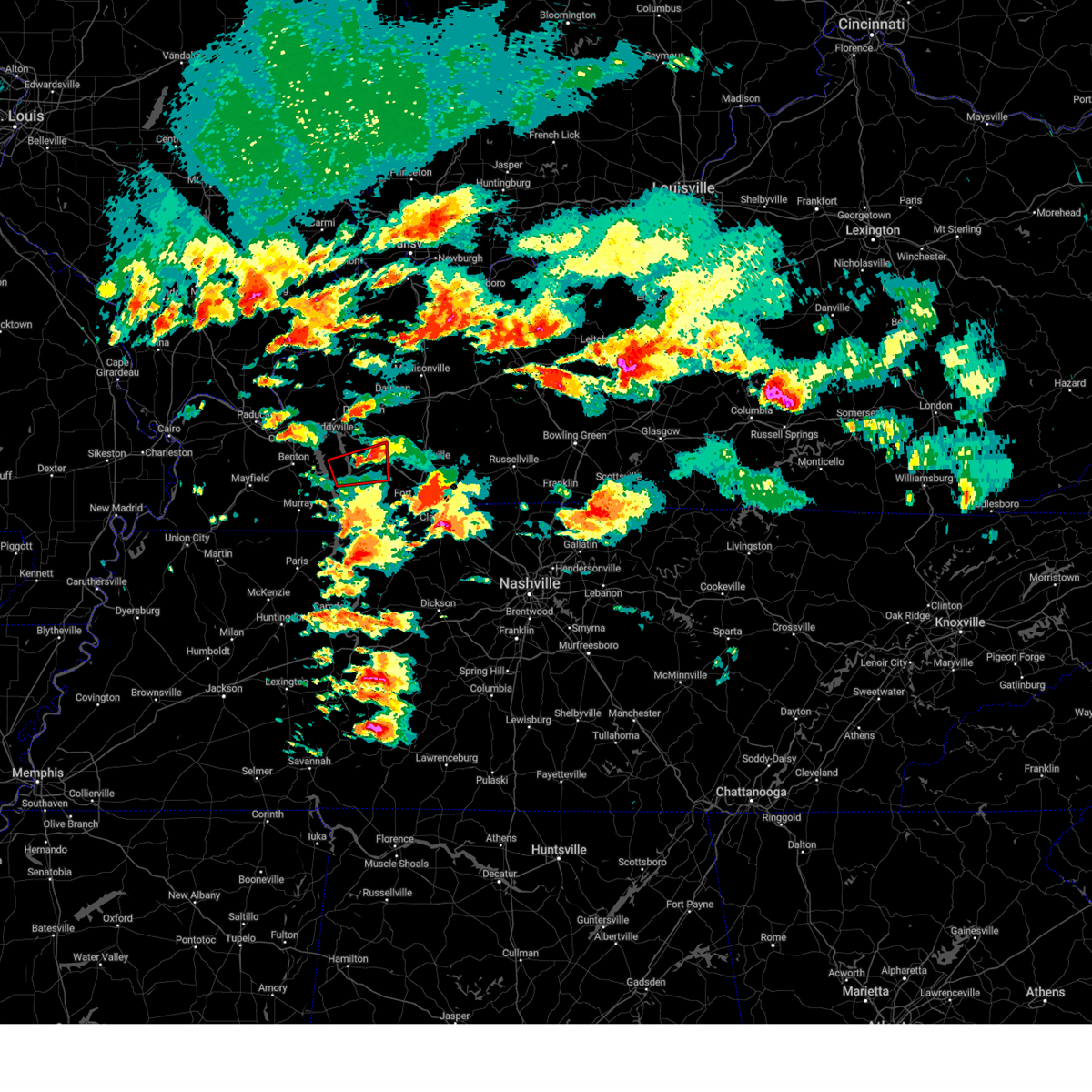 the tornado warning has been cancelled and is no longer in effect the tornado warning has been cancelled and is no longer in effect
|
| 5/8/2024 4:08 PM CDT |
 Svrpah the national weather service in paducah has issued a * severe thunderstorm warning for, central christian county in south central kentucky, northeastern trigg county in western kentucky, * until 500 pm cdt. * at 408 pm cdt, a severe thunderstorm was located over cadiz, moving east at 50 mph (radar indicated). Hazards include 60 mph wind gusts and half dollar size hail. Hail damage to vehicles is expected. Expect wind damage to roofs, siding, and trees. Svrpah the national weather service in paducah has issued a * severe thunderstorm warning for, central christian county in south central kentucky, northeastern trigg county in western kentucky, * until 500 pm cdt. * at 408 pm cdt, a severe thunderstorm was located over cadiz, moving east at 50 mph (radar indicated). Hazards include 60 mph wind gusts and half dollar size hail. Hail damage to vehicles is expected. Expect wind damage to roofs, siding, and trees.
|
| 5/8/2024 3:56 PM CDT |
 Torpah the national weather service in paducah has issued a * tornado warning for, central trigg county in western kentucky, * until 445 pm cdt. * at 355 pm cdt, a severe thunderstorm capable of producing a tornado was located over energy lake campground, moving east at 25 mph (radar indicated rotation). Hazards include tornado. Flying debris will be dangerous to those caught without shelter. mobile homes will be damaged or destroyed. damage to roofs, windows, and vehicles will occur. tree damage is likely. this dangerous storm will be near, cadiz, land between the lakes area, and canton around 400 pm cdt. other locations impacted by this tornadic thunderstorm include rockcastle. This includes interstate 24 in kentucky between mile markers 59 and 66. Torpah the national weather service in paducah has issued a * tornado warning for, central trigg county in western kentucky, * until 445 pm cdt. * at 355 pm cdt, a severe thunderstorm capable of producing a tornado was located over energy lake campground, moving east at 25 mph (radar indicated rotation). Hazards include tornado. Flying debris will be dangerous to those caught without shelter. mobile homes will be damaged or destroyed. damage to roofs, windows, and vehicles will occur. tree damage is likely. this dangerous storm will be near, cadiz, land between the lakes area, and canton around 400 pm cdt. other locations impacted by this tornadic thunderstorm include rockcastle. This includes interstate 24 in kentucky between mile markers 59 and 66.
|
| 3/6/2024 9:05 AM CST |
 Torpah the national weather service in paducah has issued a * this is a test message. tornado warning for, henderson county in northwestern kentucky, caldwell county in western kentucky, marshall county in western kentucky, trigg county in western kentucky, ballard county in western kentucky, mccracken county in western kentucky, hopkins county in northwestern kentucky, lyon county in western kentucky, fulton county in western kentucky, calloway county in western kentucky, daviess county in northwestern kentucky, muhlenberg county in south central kentucky, crittenden county in western kentucky, livingston county in western kentucky, christian county in south central kentucky, carlisle county in western kentucky, hickman county in western kentucky, mclean county in northwestern kentucky, todd county in south central kentucky, union county in northwestern kentucky, webster county in northwestern kentucky, graves county in western kentucky, * this is a test message. until 915 am cst. * this is a test message. this is a test tornado warning message. there is no severe weather occurring at this time. this test warning message is part of the annual kentucky tornado drill. if this were an actual severe weather event, you would be given information about the hazard. the national weather service, kentucky emergency management agency and the kentucky weather preparedness committee encourages the use of this time to activate and review your severe weather safety plans. repeating, this has been a test tornado warning message for the 2024 kentucky tornado drill. this concludes the test (test radar indicated rotation). Hazards include test tornado. There are no impacts. this is a test tornado warning. this is a test message. Locations include, all counties in western kentucky. Torpah the national weather service in paducah has issued a * this is a test message. tornado warning for, henderson county in northwestern kentucky, caldwell county in western kentucky, marshall county in western kentucky, trigg county in western kentucky, ballard county in western kentucky, mccracken county in western kentucky, hopkins county in northwestern kentucky, lyon county in western kentucky, fulton county in western kentucky, calloway county in western kentucky, daviess county in northwestern kentucky, muhlenberg county in south central kentucky, crittenden county in western kentucky, livingston county in western kentucky, christian county in south central kentucky, carlisle county in western kentucky, hickman county in western kentucky, mclean county in northwestern kentucky, todd county in south central kentucky, union county in northwestern kentucky, webster county in northwestern kentucky, graves county in western kentucky, * this is a test message. until 915 am cst. * this is a test message. this is a test tornado warning message. there is no severe weather occurring at this time. this test warning message is part of the annual kentucky tornado drill. if this were an actual severe weather event, you would be given information about the hazard. the national weather service, kentucky emergency management agency and the kentucky weather preparedness committee encourages the use of this time to activate and review your severe weather safety plans. repeating, this has been a test tornado warning message for the 2024 kentucky tornado drill. this concludes the test (test radar indicated rotation). Hazards include test tornado. There are no impacts. this is a test tornado warning. this is a test message. Locations include, all counties in western kentucky.
|
| 9/28/2023 4:48 AM CDT |
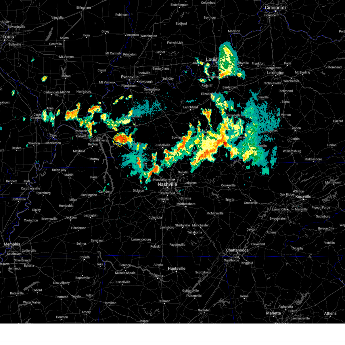 At 448 am cdt, a severe thunderstorm was located over cobb, or 8 miles northeast of cadiz, moving southeast at 30 mph (radar indicated). Hazards include 60 mph wind gusts and quarter size hail. Hail damage to vehicles is expected. expect wind damage to roofs, siding, and trees. locations impacted include, cadiz and cobb. this includes interstate 24 in kentucky between mile markers 55 and 64. hail threat, radar indicated max hail size, 1. 00 in wind threat, radar indicated max wind gust, 60 mph. At 448 am cdt, a severe thunderstorm was located over cobb, or 8 miles northeast of cadiz, moving southeast at 30 mph (radar indicated). Hazards include 60 mph wind gusts and quarter size hail. Hail damage to vehicles is expected. expect wind damage to roofs, siding, and trees. locations impacted include, cadiz and cobb. this includes interstate 24 in kentucky between mile markers 55 and 64. hail threat, radar indicated max hail size, 1. 00 in wind threat, radar indicated max wind gust, 60 mph.
|
| 9/28/2023 4:38 AM CDT |
 At 437 am cdt, a severe thunderstorm was located near cobb, or near princeton, moving southeast at 30 mph (radar indicated). Hazards include 60 mph wind gusts and quarter size hail. Hail damage to vehicles is expected. expect wind damage to roofs, siding, and trees. locations impacted include, princeton, cadiz, and cobb. this includes interstate 24 in kentucky between mile markers 52 and 64. hail threat, radar indicated max hail size, 1. 00 in wind threat, radar indicated max wind gust, 60 mph. At 437 am cdt, a severe thunderstorm was located near cobb, or near princeton, moving southeast at 30 mph (radar indicated). Hazards include 60 mph wind gusts and quarter size hail. Hail damage to vehicles is expected. expect wind damage to roofs, siding, and trees. locations impacted include, princeton, cadiz, and cobb. this includes interstate 24 in kentucky between mile markers 52 and 64. hail threat, radar indicated max hail size, 1. 00 in wind threat, radar indicated max wind gust, 60 mph.
|
| 9/28/2023 4:28 AM CDT |
 At 428 am cdt, a severe thunderstorm was located near princeton, moving southeast at 30 mph (radar indicated). Hazards include 60 mph wind gusts and quarter size hail. Hail damage to vehicles is expected. Expect wind damage to roofs, siding, and trees. At 428 am cdt, a severe thunderstorm was located near princeton, moving southeast at 30 mph (radar indicated). Hazards include 60 mph wind gusts and quarter size hail. Hail damage to vehicles is expected. Expect wind damage to roofs, siding, and trees.
|
| 8/26/2023 2:55 PM CDT |
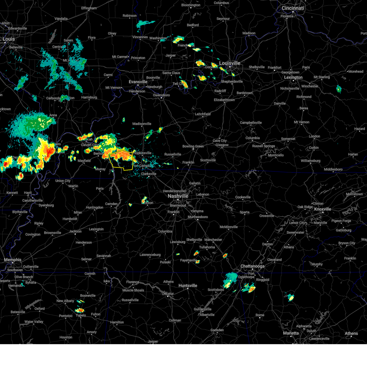 At 254 pm cdt, severe thunderstorms were located along a line extending from energy lake campground to near cadiz, moving south at 15 mph (radar indicated). Hazards include 60 mph wind gusts. expect damage to roofs, siding, and trees At 254 pm cdt, severe thunderstorms were located along a line extending from energy lake campground to near cadiz, moving south at 15 mph (radar indicated). Hazards include 60 mph wind gusts. expect damage to roofs, siding, and trees
|
| 7/29/2023 7:51 PM CDT |
 At 751 pm cdt, a severe thunderstorm was located near cobb, or 7 miles south of dawson springs, moving east at 30 mph (radar indicated). Hazards include 60 mph wind gusts and quarter size hail. Hail damage to vehicles is expected. Expect wind damage to roofs, siding, and trees. At 751 pm cdt, a severe thunderstorm was located near cobb, or 7 miles south of dawson springs, moving east at 30 mph (radar indicated). Hazards include 60 mph wind gusts and quarter size hail. Hail damage to vehicles is expected. Expect wind damage to roofs, siding, and trees.
|
| 7/29/2023 7:45 PM CDT | Kentucky mesonet sit in trigg county KY, 5.3 miles ENE of Cadiz, KY |
| 7/24/2023 4:18 PM CDT |
 At 418 pm cdt, a severe thunderstorm was located near cobb, or near princeton, moving east at 25 mph (radar indicated). Hazards include 70 mph wind gusts and nickel size hail. Expect considerable tree damage. damage is likely to mobile homes, roofs, and outbuildings. locations impacted include, princeton, cadiz and cobb. this includes the following highways, interstate 24 in kentucky between mile markers 55 and 62. interstate 69 in kentucky between mile markers 77 and 81. thunderstorm damage threat, considerable hail threat, radar indicated max hail size, 0. 88 in wind threat, radar indicated max wind gust, 70 mph. At 418 pm cdt, a severe thunderstorm was located near cobb, or near princeton, moving east at 25 mph (radar indicated). Hazards include 70 mph wind gusts and nickel size hail. Expect considerable tree damage. damage is likely to mobile homes, roofs, and outbuildings. locations impacted include, princeton, cadiz and cobb. this includes the following highways, interstate 24 in kentucky between mile markers 55 and 62. interstate 69 in kentucky between mile markers 77 and 81. thunderstorm damage threat, considerable hail threat, radar indicated max hail size, 0. 88 in wind threat, radar indicated max wind gust, 70 mph.
|
| 7/24/2023 4:10 PM CDT |
 At 409 pm cdt, a severe thunderstorm was located over cobb, or 8 miles north of cadiz, moving east at 45 mph (radar indicated). Hazards include 70 mph wind gusts and quarter size hail. Hail damage to vehicles is expected. expect considerable tree damage. Wind damage is also likely to mobile homes, roofs, and outbuildings. At 409 pm cdt, a severe thunderstorm was located over cobb, or 8 miles north of cadiz, moving east at 45 mph (radar indicated). Hazards include 70 mph wind gusts and quarter size hail. Hail damage to vehicles is expected. expect considerable tree damage. Wind damage is also likely to mobile homes, roofs, and outbuildings.
|
| 7/24/2023 3:53 PM CDT |
 At 352 pm cdt, a severe thunderstorm was located near eddyville, moving east at 25 mph (radar indicated). Hazards include 70 mph wind gusts and quarter size hail. Hail damage to vehicles is expected. expect considerable tree damage. wind damage is also likely to mobile homes, roofs, and outbuildings. locations impacted include, princeton, cadiz, eddyville, land between the lakes area, cobb and kuttawa. this includes the following highways, interstate 24 in kentucky between mile markers 36 and 62. interstate 69 in kentucky between mile markers 68 and 82. thunderstorm damage threat, considerable hail threat, radar indicated max hail size, 1. 00 in wind threat, radar indicated max wind gust, 70 mph. At 352 pm cdt, a severe thunderstorm was located near eddyville, moving east at 25 mph (radar indicated). Hazards include 70 mph wind gusts and quarter size hail. Hail damage to vehicles is expected. expect considerable tree damage. wind damage is also likely to mobile homes, roofs, and outbuildings. locations impacted include, princeton, cadiz, eddyville, land between the lakes area, cobb and kuttawa. this includes the following highways, interstate 24 in kentucky between mile markers 36 and 62. interstate 69 in kentucky between mile markers 68 and 82. thunderstorm damage threat, considerable hail threat, radar indicated max hail size, 1. 00 in wind threat, radar indicated max wind gust, 70 mph.
|
| 7/24/2023 3:48 PM CDT |
 At 347 pm cdt, a severe thunderstorm was located over eddyville, moving east at 25 mph (radar indicated). Hazards include 60 mph wind gusts and quarter size hail. Hail damage to vehicles is expected. Expect wind damage to roofs, siding, and trees. At 347 pm cdt, a severe thunderstorm was located over eddyville, moving east at 25 mph (radar indicated). Hazards include 60 mph wind gusts and quarter size hail. Hail damage to vehicles is expected. Expect wind damage to roofs, siding, and trees.
|
| 7/20/2023 11:35 AM CDT |
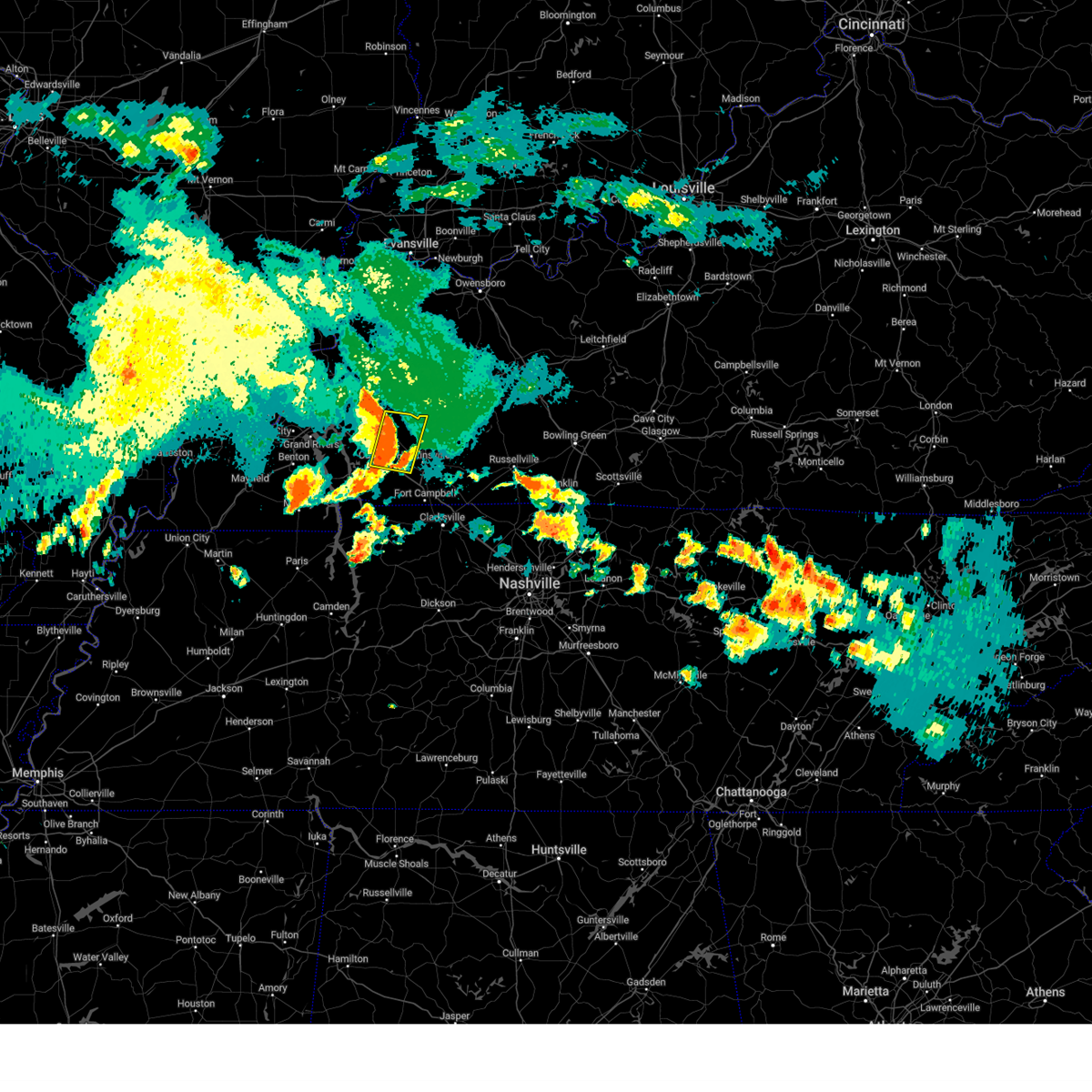 At 1134 am cdt, a severe thunderstorm was located near cobb, or 11 miles south of dawson springs, moving east at 45 mph (radar indicated). Hazards include 70 mph wind gusts. Expect considerable tree damage. damage is likely to mobile homes, roofs, and outbuildings. locations impacted include, cadiz, crofton, cobb and hawkins. this includes interstate 24 in kentucky between mile markers 60 and 71. thunderstorm damage threat, considerable hail threat, radar indicated max hail size, <. 75 in wind threat, radar indicated max wind gust, 70 mph. At 1134 am cdt, a severe thunderstorm was located near cobb, or 11 miles south of dawson springs, moving east at 45 mph (radar indicated). Hazards include 70 mph wind gusts. Expect considerable tree damage. damage is likely to mobile homes, roofs, and outbuildings. locations impacted include, cadiz, crofton, cobb and hawkins. this includes interstate 24 in kentucky between mile markers 60 and 71. thunderstorm damage threat, considerable hail threat, radar indicated max hail size, <. 75 in wind threat, radar indicated max wind gust, 70 mph.
|
| 7/20/2023 11:20 AM CDT |
 At 1120 am cdt, a severe thunderstorm was located near princeton, moving east at 45 mph (radar indicated). Hazards include 70 mph wind gusts. Expect considerable tree damage. damage is likely to mobile homes, roofs, and outbuildings. locations impacted include, princeton, cadiz, crofton, cobb, rockcastle and hawkins. this includes the following highways, interstate 24 in kentucky between mile markers 49 and 71. interstate 69 in kentucky between mile markers 76 and 84. thunderstorm damage threat, considerable hail threat, radar indicated max hail size, <. 75 in wind threat, radar indicated max wind gust, 70 mph. At 1120 am cdt, a severe thunderstorm was located near princeton, moving east at 45 mph (radar indicated). Hazards include 70 mph wind gusts. Expect considerable tree damage. damage is likely to mobile homes, roofs, and outbuildings. locations impacted include, princeton, cadiz, crofton, cobb, rockcastle and hawkins. this includes the following highways, interstate 24 in kentucky between mile markers 49 and 71. interstate 69 in kentucky between mile markers 76 and 84. thunderstorm damage threat, considerable hail threat, radar indicated max hail size, <. 75 in wind threat, radar indicated max wind gust, 70 mph.
|
| 7/20/2023 11:06 AM CDT |
 At 1105 am cdt, a severe thunderstorm was located near cravens bay campground, moving east at 45 mph (radar indicated). Hazards include 70 mph wind gusts. Expect considerable tree damage. Damage is likely to mobile homes, roofs, and outbuildings. At 1105 am cdt, a severe thunderstorm was located near cravens bay campground, moving east at 45 mph (radar indicated). Hazards include 70 mph wind gusts. Expect considerable tree damage. Damage is likely to mobile homes, roofs, and outbuildings.
|
| 7/19/2023 6:23 AM CDT | Tree down on highway 68... blocking one lane of traffi in trigg county KY, 15.7 miles ENE of Cadiz, KY |
| 7/18/2023 2:19 PM CDT |
 At 219 pm cdt, severe thunderstorms were located along a line extending from near creswell to near cobb to 6 miles north of big rock to near paris landing state park, moving east at 55 mph (radar indicated). Hazards include 60 mph wind gusts. Expect damage to roofs, siding, and trees. locations impacted include, hopkinsville, oak grove, princeton, dawson springs, cadiz, wranglers campground, fort campbell, land between the lakes area, clarksville, earlington, nortonville, pembroke, mortons gap, crofton, olney, creswell, farmersville, cobb, canton and fredonia. this includes the following highways, interstate 24 in kentucky between mile markers 48 and 92. interstate 69 in kentucky between mile markers 74 and 105. pennyrile parkway between mile markers 1 and 32. hail threat, radar indicated max hail size, <. 75 in wind threat, radar indicated max wind gust, 60 mph. At 219 pm cdt, severe thunderstorms were located along a line extending from near creswell to near cobb to 6 miles north of big rock to near paris landing state park, moving east at 55 mph (radar indicated). Hazards include 60 mph wind gusts. Expect damage to roofs, siding, and trees. locations impacted include, hopkinsville, oak grove, princeton, dawson springs, cadiz, wranglers campground, fort campbell, land between the lakes area, clarksville, earlington, nortonville, pembroke, mortons gap, crofton, olney, creswell, farmersville, cobb, canton and fredonia. this includes the following highways, interstate 24 in kentucky between mile markers 48 and 92. interstate 69 in kentucky between mile markers 74 and 105. pennyrile parkway between mile markers 1 and 32. hail threat, radar indicated max hail size, <. 75 in wind threat, radar indicated max wind gust, 60 mph.
|
| 7/18/2023 2:07 PM CDT |
 At 207 pm cdt, severe thunderstorms were located along a line extending from near marion to near cobb to 8 miles southeast of wranglers campground to near paris landing state park, moving east at 45 mph (radar indicated). Hazards include 60 mph wind gusts. Expect damage to roofs, siding, and trees. locations impacted include, hopkinsville, madisonville, oak grove, princeton, providence, dawson springs, cadiz, wranglers campground, fort campbell, land between the lakes area, clarksville, earlington, nortonville, clay, pembroke, mortons gap, crofton, olney, creswell and farmersville. this includes the following highways, interstate 24 in kentucky between mile markers 48 and 92. interstate 69 in kentucky between mile markers 74 and 110. western kentucky parkway near mile marker 39. pennyrile parkway between mile markers 1 and 34. hail threat, radar indicated max hail size, <. 75 in wind threat, radar indicated max wind gust, 60 mph. At 207 pm cdt, severe thunderstorms were located along a line extending from near marion to near cobb to 8 miles southeast of wranglers campground to near paris landing state park, moving east at 45 mph (radar indicated). Hazards include 60 mph wind gusts. Expect damage to roofs, siding, and trees. locations impacted include, hopkinsville, madisonville, oak grove, princeton, providence, dawson springs, cadiz, wranglers campground, fort campbell, land between the lakes area, clarksville, earlington, nortonville, clay, pembroke, mortons gap, crofton, olney, creswell and farmersville. this includes the following highways, interstate 24 in kentucky between mile markers 48 and 92. interstate 69 in kentucky between mile markers 74 and 110. western kentucky parkway near mile marker 39. pennyrile parkway between mile markers 1 and 34. hail threat, radar indicated max hail size, <. 75 in wind threat, radar indicated max wind gust, 60 mph.
|
| 7/18/2023 1:45 PM CDT |
 At 144 pm cdt, severe thunderstorms were located along a line extending from near rosiclare to eddyville to near turkey bay to 6 miles north of cottage grove, moving east at 55 mph (radar indicated). Hazards include 60 mph wind gusts. expect damage to roofs, siding, and trees At 144 pm cdt, severe thunderstorms were located along a line extending from near rosiclare to eddyville to near turkey bay to 6 miles north of cottage grove, moving east at 55 mph (radar indicated). Hazards include 60 mph wind gusts. expect damage to roofs, siding, and trees
|
| 7/17/2023 9:38 PM CDT |
 At 938 pm cdt, severe thunderstorms were located along a line extending from near olney to cadiz, moving east at 35 mph (radar indicated). Hazards include 60 mph wind gusts and quarter size hail. Hail damage to vehicles is expected. expect wind damage to roofs, siding, and trees. locations impacted include, hopkinsville, madisonville, dawson springs, cadiz, earlington, nortonville, mortons gap, crofton, olney, cobb, white plains, st. charles and hawkins. this includes the following highways, interstate 24 in kentucky between mile markers 59 and 74. interstate 69 in kentucky between mile markers 86 and 113. western kentucky parkway between mile markers 39 and 43. pennyrile parkway between mile markers 5 and 34. hail threat, radar indicated max hail size, 1. 00 in wind threat, radar indicated max wind gust, 60 mph. At 938 pm cdt, severe thunderstorms were located along a line extending from near olney to cadiz, moving east at 35 mph (radar indicated). Hazards include 60 mph wind gusts and quarter size hail. Hail damage to vehicles is expected. expect wind damage to roofs, siding, and trees. locations impacted include, hopkinsville, madisonville, dawson springs, cadiz, earlington, nortonville, mortons gap, crofton, olney, cobb, white plains, st. charles and hawkins. this includes the following highways, interstate 24 in kentucky between mile markers 59 and 74. interstate 69 in kentucky between mile markers 86 and 113. western kentucky parkway between mile markers 39 and 43. pennyrile parkway between mile markers 5 and 34. hail threat, radar indicated max hail size, 1. 00 in wind threat, radar indicated max wind gust, 60 mph.
|
| 7/17/2023 9:34 PM CDT |
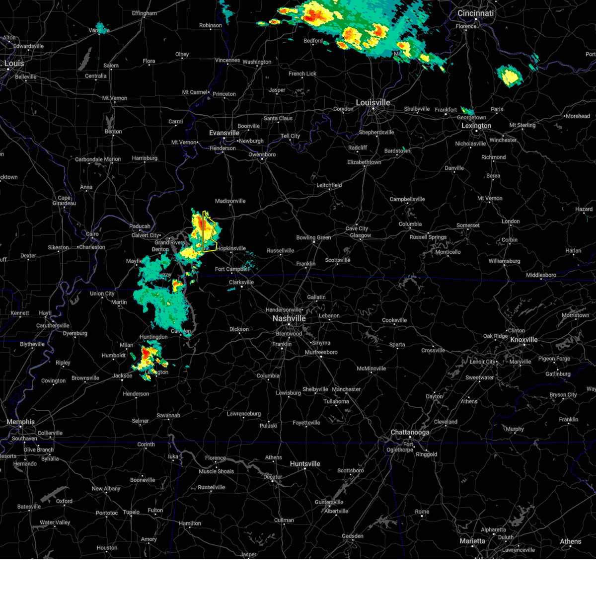 At 934 pm cdt, severe thunderstorms were located along a line extending from near olney to near cadiz, moving east at 40 mph (radar indicated). Hazards include 60 mph wind gusts. Expect damage to roofs, siding, and trees. locations impacted include, cadiz, cobb and fryer. this includes the following highways, interstate 24 in kentucky between mile markers 59 and 65. interstate 69 in kentucky between mile markers 84 and 89. hail threat, radar indicated max hail size, <. 75 in wind threat, radar indicated max wind gust, 60 mph. At 934 pm cdt, severe thunderstorms were located along a line extending from near olney to near cadiz, moving east at 40 mph (radar indicated). Hazards include 60 mph wind gusts. Expect damage to roofs, siding, and trees. locations impacted include, cadiz, cobb and fryer. this includes the following highways, interstate 24 in kentucky between mile markers 59 and 65. interstate 69 in kentucky between mile markers 84 and 89. hail threat, radar indicated max hail size, <. 75 in wind threat, radar indicated max wind gust, 60 mph.
|
| 7/17/2023 9:26 PM CDT |
 At 926 pm cdt, severe thunderstorms were located along a line extending from olney to near cadiz, moving east at 45 mph (radar indicated). Hazards include 60 mph wind gusts. Expect damage to roofs, siding, and trees. locations impacted include, princeton, cadiz, energy lake campground, woodlands nature station, land between the lakes area, creswell, cobb, farmersville, rockcastle, fredonia and fryer. this includes the following highways, interstate 24 in kentucky between mile markers 46 and 65. interstate 69 in kentucky between mile markers 72 and 89. hail threat, radar indicated max hail size, <. 75 in wind threat, radar indicated max wind gust, 60 mph. At 926 pm cdt, severe thunderstorms were located along a line extending from olney to near cadiz, moving east at 45 mph (radar indicated). Hazards include 60 mph wind gusts. Expect damage to roofs, siding, and trees. locations impacted include, princeton, cadiz, energy lake campground, woodlands nature station, land between the lakes area, creswell, cobb, farmersville, rockcastle, fredonia and fryer. this includes the following highways, interstate 24 in kentucky between mile markers 46 and 65. interstate 69 in kentucky between mile markers 72 and 89. hail threat, radar indicated max hail size, <. 75 in wind threat, radar indicated max wind gust, 60 mph.
|
| 7/17/2023 9:13 PM CDT |
 At 913 pm cdt, severe thunderstorms were located along a line extending from near farmersville to near woodlands nature station, moving east at 35 mph (radar indicated). Hazards include 60 mph wind gusts. Expect damage to roofs, siding, and trees. locations impacted include, princeton, cadiz, eddyville, energy lake campground, woodlands nature station, land between the lakes area, cravens bay campground, cobb, creswell, farmersville, rockcastle, kuttawa, fredonia and fryer. this includes the following highways, interstate 24 in kentucky between mile markers 39 and 65. interstate 69 in kentucky between mile markers 68 and 89. hail threat, radar indicated max hail size, <. 75 in wind threat, radar indicated max wind gust, 60 mph. At 913 pm cdt, severe thunderstorms were located along a line extending from near farmersville to near woodlands nature station, moving east at 35 mph (radar indicated). Hazards include 60 mph wind gusts. Expect damage to roofs, siding, and trees. locations impacted include, princeton, cadiz, eddyville, energy lake campground, woodlands nature station, land between the lakes area, cravens bay campground, cobb, creswell, farmersville, rockcastle, kuttawa, fredonia and fryer. this includes the following highways, interstate 24 in kentucky between mile markers 39 and 65. interstate 69 in kentucky between mile markers 68 and 89. hail threat, radar indicated max hail size, <. 75 in wind threat, radar indicated max wind gust, 60 mph.
|
| 7/17/2023 9:12 PM CDT |
 At 911 pm cdt, severe thunderstorms were located along a line extending from 5 miles north of princeton to canton, moving east at 35 mph (radar indicated). Hazards include 60 mph wind gusts and quarter size hail. Hail damage to vehicles is expected. Expect wind damage to roofs, siding, and trees. At 911 pm cdt, severe thunderstorms were located along a line extending from 5 miles north of princeton to canton, moving east at 35 mph (radar indicated). Hazards include 60 mph wind gusts and quarter size hail. Hail damage to vehicles is expected. Expect wind damage to roofs, siding, and trees.
|
| 7/17/2023 8:58 PM CDT |
 At 858 pm cdt, severe thunderstorms were located along a line extending from 7 miles southeast of salem to birmingham ferry recreation area, moving east at 40 mph (radar indicated). Hazards include 60 mph wind gusts. expect damage to roofs, siding, and trees At 858 pm cdt, severe thunderstorms were located along a line extending from 7 miles southeast of salem to birmingham ferry recreation area, moving east at 40 mph (radar indicated). Hazards include 60 mph wind gusts. expect damage to roofs, siding, and trees
|
| 5/9/2023 12:34 AM CDT |
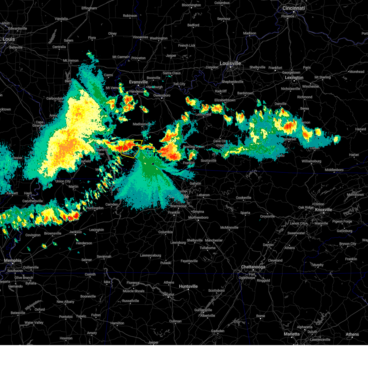 At 1234 am cdt, a severe thunderstorm was located near cobb, or 9 miles northeast of cadiz, moving east at 45 mph (radar indicated). Hazards include 60 mph wind gusts and quarter size hail. Hail damage to vehicles is expected. expect wind damage to roofs, siding, and trees. locations impacted include, cadiz, cobb and hawkins. this includes interstate 24 in kentucky between mile markers 55 and 70. hail threat, radar indicated max hail size, 1. 00 in wind threat, radar indicated max wind gust, 60 mph. At 1234 am cdt, a severe thunderstorm was located near cobb, or 9 miles northeast of cadiz, moving east at 45 mph (radar indicated). Hazards include 60 mph wind gusts and quarter size hail. Hail damage to vehicles is expected. expect wind damage to roofs, siding, and trees. locations impacted include, cadiz, cobb and hawkins. this includes interstate 24 in kentucky between mile markers 55 and 70. hail threat, radar indicated max hail size, 1. 00 in wind threat, radar indicated max wind gust, 60 mph.
|
| 5/9/2023 12:17 AM CDT |
 At 1217 am cdt, severe thunderstorms were located along a line extending from near princeton to 7 miles northeast of woodlands nature station to near cravens bay campground, moving east at 40 mph (radar indicated). Hazards include 60 mph wind gusts and quarter size hail. Hail damage to vehicles is expected. Expect wind damage to roofs, siding, and trees. At 1217 am cdt, severe thunderstorms were located along a line extending from near princeton to 7 miles northeast of woodlands nature station to near cravens bay campground, moving east at 40 mph (radar indicated). Hazards include 60 mph wind gusts and quarter size hail. Hail damage to vehicles is expected. Expect wind damage to roofs, siding, and trees.
|
| 5/7/2023 3:45 PM CDT | Half Dollar sized hail reported 3.9 miles ESE of Cadiz, KY |
| 5/7/2023 3:38 PM CDT | Quarter sized hail reported 3.9 miles SE of Cadiz, KY, slightly larger than quarter sized hail. |
| 5/7/2023 3:29 PM CDT |
 At 329 pm cdt, a severe thunderstorm was located near cadiz, moving northeast at 25 mph (radar indicated). Hazards include 60 mph wind gusts and quarter size hail. Hail damage to vehicles is expected. expect wind damage to roofs, siding, and trees. locations impacted include, hopkinsville, cadiz, woodlands nature station, land between the lakes area, cobb, rockcastle and hawkins. this includes interstate 24 in kentucky between mile markers 53 and 69. hail threat, radar indicated max hail size, 1. 00 in wind threat, radar indicated max wind gust, 60 mph. At 329 pm cdt, a severe thunderstorm was located near cadiz, moving northeast at 25 mph (radar indicated). Hazards include 60 mph wind gusts and quarter size hail. Hail damage to vehicles is expected. expect wind damage to roofs, siding, and trees. locations impacted include, hopkinsville, cadiz, woodlands nature station, land between the lakes area, cobb, rockcastle and hawkins. this includes interstate 24 in kentucky between mile markers 53 and 69. hail threat, radar indicated max hail size, 1. 00 in wind threat, radar indicated max wind gust, 60 mph.
|
| 5/7/2023 3:04 PM CDT |
 At 304 pm cdt, a severe thunderstorm was located over energy lake campground, moving northeast at 30 mph (radar indicated). Hazards include quarter size hail. damage to vehicles is expected At 304 pm cdt, a severe thunderstorm was located over energy lake campground, moving northeast at 30 mph (radar indicated). Hazards include quarter size hail. damage to vehicles is expected
|
| 4/5/2023 2:43 PM CDT |
 At 242 pm cdt, severe thunderstorms were located along a line extending from 7 miles northwest of madisonville to 8 miles southwest of crofton to 6 miles north of big rock, moving east at 60 mph (radar indicated). Hazards include 60 mph wind gusts. Expect damage to roofs, siding, and trees. locations impacted include, hopkinsville, madisonville, oak grove, central city, dawson springs, cadiz, elkton, calhoun, fort campbell, sebree, earlington, livermore, nortonville, pembroke, mortons gap, crofton, powderly, graham, beech grove and greenville. this includes the following highways, interstate 24 in kentucky between mile markers 61 and 92. interstate 69 in kentucky between mile markers 89 and 136. western kentucky parkway between mile markers 39 and 59. Pennyrile parkway between mile markers 1 and 34. At 242 pm cdt, severe thunderstorms were located along a line extending from 7 miles northwest of madisonville to 8 miles southwest of crofton to 6 miles north of big rock, moving east at 60 mph (radar indicated). Hazards include 60 mph wind gusts. Expect damage to roofs, siding, and trees. locations impacted include, hopkinsville, madisonville, oak grove, central city, dawson springs, cadiz, elkton, calhoun, fort campbell, sebree, earlington, livermore, nortonville, pembroke, mortons gap, crofton, powderly, graham, beech grove and greenville. this includes the following highways, interstate 24 in kentucky between mile markers 61 and 92. interstate 69 in kentucky between mile markers 89 and 136. western kentucky parkway between mile markers 39 and 59. Pennyrile parkway between mile markers 1 and 34.
|
| 4/5/2023 2:27 PM CDT |
 At 226 pm cdt, severe thunderstorms were located along a line extending from near providence to near cobb to near wranglers campground, moving east at 60 mph (radar indicated). Hazards include 60 mph wind gusts. expect damage to roofs, siding, and trees At 226 pm cdt, severe thunderstorms were located along a line extending from near providence to near cobb to near wranglers campground, moving east at 60 mph (radar indicated). Hazards include 60 mph wind gusts. expect damage to roofs, siding, and trees
|
| 3/3/2023 11:55 AM CST | Storm damage reported in trigg county KY, 4.9 miles ENE of Cadiz, KY |
| 3/3/2023 11:47 AM CST |
 At 1147 am cst, severe thunderstorms were located along a line extending from 9 miles west of sturgis to near eddyville to near canton, moving northeast at 65 mph (trained weather spotters. these dangerous storms have a long history of wind damage). Hazards include 70 mph wind gusts. Expect considerable tree damage. damage is likely to mobile homes, roofs, and outbuildings. locations impacted include, princeton, marion, cadiz, eddyville, sturgis, land between the lakes area, salem, olney, cobb, creswell, canton, farmersville, rockcastle, kuttawa, fredonia, fryer and dycusburg. this includes the following highways, interstate 24 in kentucky between mile markers 35 and 69. Interstate 69 in kentucky between mile markers 68 and 87. At 1147 am cst, severe thunderstorms were located along a line extending from 9 miles west of sturgis to near eddyville to near canton, moving northeast at 65 mph (trained weather spotters. these dangerous storms have a long history of wind damage). Hazards include 70 mph wind gusts. Expect considerable tree damage. damage is likely to mobile homes, roofs, and outbuildings. locations impacted include, princeton, marion, cadiz, eddyville, sturgis, land between the lakes area, salem, olney, cobb, creswell, canton, farmersville, rockcastle, kuttawa, fredonia, fryer and dycusburg. this includes the following highways, interstate 24 in kentucky between mile markers 35 and 69. Interstate 69 in kentucky between mile markers 68 and 87.
|
| 3/3/2023 11:42 AM CST |
 At 1141 am cst, severe thunderstorms were located along a line from about 10 miles southwest of cadiz to near marion. moving northeast at 70 mph. these are dangerous storms with a history of high winds and wind damage (radar indicated). Hazards include 70 mph wind gusts. Expect considerable tree damage. Damage is likely to mobile homes, roofs, and outbuildings. At 1141 am cst, severe thunderstorms were located along a line from about 10 miles southwest of cadiz to near marion. moving northeast at 70 mph. these are dangerous storms with a history of high winds and wind damage (radar indicated). Hazards include 70 mph wind gusts. Expect considerable tree damage. Damage is likely to mobile homes, roofs, and outbuildings.
|
| 3/3/2023 11:37 AM CST |
 At 1137 am cst, severe thunderstorms were located along a line extending from near rosiclare to near eddyville to 6 miles southwest of canton, moving northeast at 65 mph. this line has an extensive history of damaging wind with gusts in excess of 70 mph (trained weather spotters). Hazards include 70 mph wind gusts. Expect considerable tree damage. damage is likely to mobile homes, roofs, and outbuildings. locations impacted include, princeton, marion, calvert city, cadiz, eddyville, sturgis, land between the lakes area, salem, olney, burna, cobb, creswell, joy, canton, farmersville, rockcastle, kuttawa, fredonia, grand rivers and carrsville. this includes the following highways, interstate 24 in kentucky between mile markers 25 and 69. Interstate 69 in kentucky between mile markers 50 and 87. At 1137 am cst, severe thunderstorms were located along a line extending from near rosiclare to near eddyville to 6 miles southwest of canton, moving northeast at 65 mph. this line has an extensive history of damaging wind with gusts in excess of 70 mph (trained weather spotters). Hazards include 70 mph wind gusts. Expect considerable tree damage. damage is likely to mobile homes, roofs, and outbuildings. locations impacted include, princeton, marion, calvert city, cadiz, eddyville, sturgis, land between the lakes area, salem, olney, burna, cobb, creswell, joy, canton, farmersville, rockcastle, kuttawa, fredonia, grand rivers and carrsville. this includes the following highways, interstate 24 in kentucky between mile markers 25 and 69. Interstate 69 in kentucky between mile markers 50 and 87.
|
| 3/3/2023 11:15 AM CST |
 At 1115 am cst, severe thunderstorms were located along a line extending from 7 miles north of brookport to 6 miles west of benton to near murray, moving northeast at 65 mph (radar indicated). Hazards include 70 mph wind gusts. Expect considerable tree damage. Damage is likely to mobile homes, roofs, and outbuildings. At 1115 am cst, severe thunderstorms were located along a line extending from 7 miles north of brookport to 6 miles west of benton to near murray, moving northeast at 65 mph (radar indicated). Hazards include 70 mph wind gusts. Expect considerable tree damage. Damage is likely to mobile homes, roofs, and outbuildings.
|
| 3/1/2023 6:02 PM CST |
 At 602 pm cst, a severe thunderstorm was located 8 miles west of hopkinsville, moving east at 40 mph (radar indicated). Hazards include 60 mph wind gusts. Expect damage to roofs, siding, and trees. locations impacted include, hopkinsville. this includes the following highways, interstate 24 in kentucky between mile markers 66 and 76. pennyrile parkway between mile markers 5 and 20. hail threat, radar indicated max hail size, <. 75 in wind threat, radar indicated max wind gust, 60 mph. At 602 pm cst, a severe thunderstorm was located 8 miles west of hopkinsville, moving east at 40 mph (radar indicated). Hazards include 60 mph wind gusts. Expect damage to roofs, siding, and trees. locations impacted include, hopkinsville. this includes the following highways, interstate 24 in kentucky between mile markers 66 and 76. pennyrile parkway between mile markers 5 and 20. hail threat, radar indicated max hail size, <. 75 in wind threat, radar indicated max wind gust, 60 mph.
|
| 3/1/2023 5:51 PM CST |
 At 551 pm cst, a severe thunderstorm was located near cadiz, moving east at 45 mph (radar indicated). Hazards include 60 mph wind gusts. Expect damage to roofs, siding, and trees. locations impacted include, hopkinsville and cadiz. this includes the following highways, interstate 24 in kentucky between mile markers 60 and 76. pennyrile parkway between mile markers 5 and 21. hail threat, radar indicated max hail size, <. 75 in wind threat, radar indicated max wind gust, 60 mph. At 551 pm cst, a severe thunderstorm was located near cadiz, moving east at 45 mph (radar indicated). Hazards include 60 mph wind gusts. Expect damage to roofs, siding, and trees. locations impacted include, hopkinsville and cadiz. this includes the following highways, interstate 24 in kentucky between mile markers 60 and 76. pennyrile parkway between mile markers 5 and 21. hail threat, radar indicated max hail size, <. 75 in wind threat, radar indicated max wind gust, 60 mph.
|
| 3/1/2023 5:41 PM CST |
 At 541 pm cst, a severe thunderstorm was located near canton, or near cadiz, moving east at 45 mph (radar indicated). Hazards include 60 mph wind gusts. expect damage to roofs, siding, and trees At 541 pm cst, a severe thunderstorm was located near canton, or near cadiz, moving east at 45 mph (radar indicated). Hazards include 60 mph wind gusts. expect damage to roofs, siding, and trees
|
| 1/12/2023 5:51 AM CST |
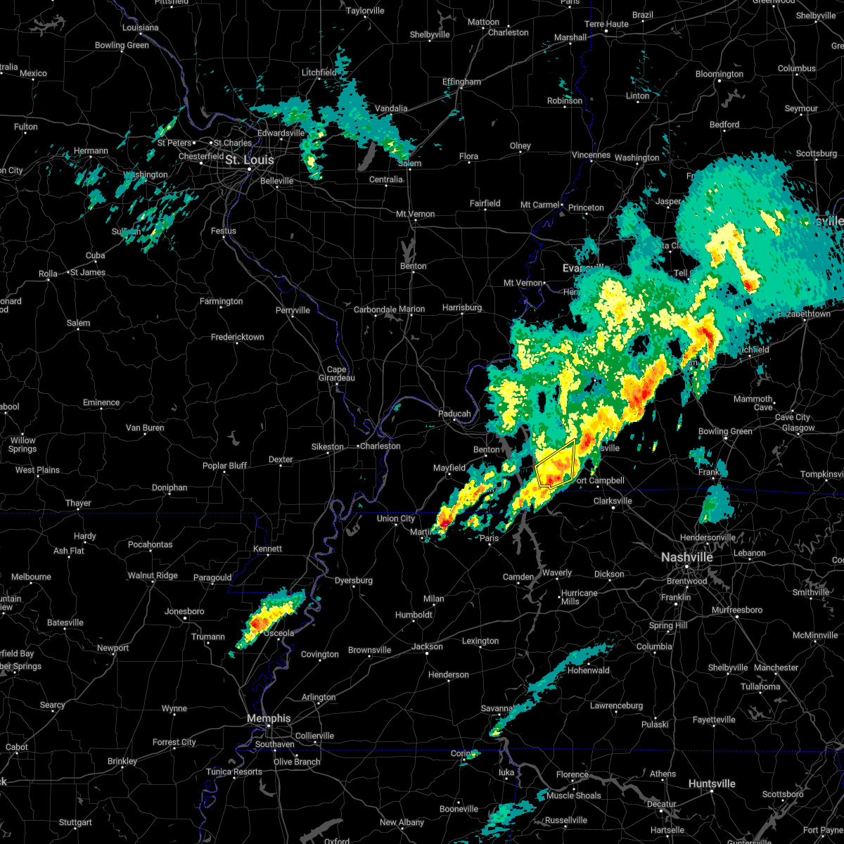 The severe thunderstorm warning for southeastern trigg county will expire at 600 am cst, the storm which prompted the warning has weakened below severe limits, and no longer poses an immediate threat to life or property. therefore, the warning will be allowed to expire. a severe thunderstorm watch remains in effect until 700 am cst for south central and western kentucky. The severe thunderstorm warning for southeastern trigg county will expire at 600 am cst, the storm which prompted the warning has weakened below severe limits, and no longer poses an immediate threat to life or property. therefore, the warning will be allowed to expire. a severe thunderstorm watch remains in effect until 700 am cst for south central and western kentucky.
|
| 1/12/2023 5:44 AM CST |
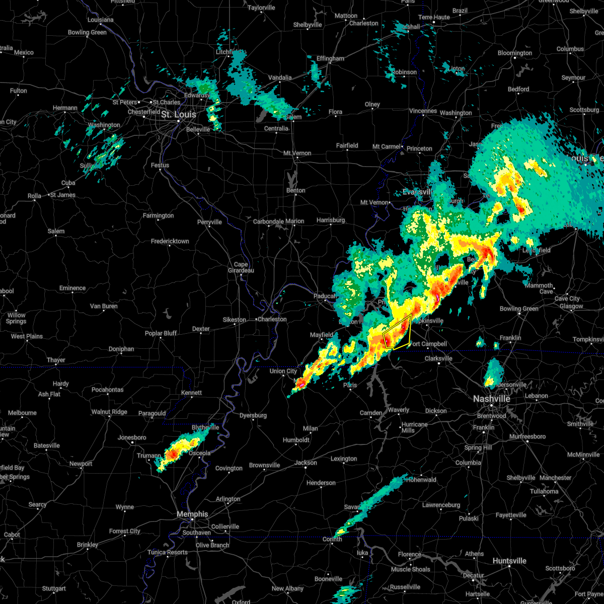 At 544 am cst, a severe thunderstorm was located 7 miles east of canton, or 7 miles south of cadiz, moving northeast at 70 mph (radar indicated). Hazards include 60 mph wind gusts and quarter size hail. Hail damage to vehicles is expected. expect wind damage to roofs, siding, and trees. this severe thunderstorm will remain over mainly rural areas of southeastern trigg county, including the following locations, linton. this includes interstate 24 in kentucky between mile markers 64 and 70. hail threat, radar indicated max hail size, 1. 00 in wind threat, radar indicated max wind gust, 60 mph. At 544 am cst, a severe thunderstorm was located 7 miles east of canton, or 7 miles south of cadiz, moving northeast at 70 mph (radar indicated). Hazards include 60 mph wind gusts and quarter size hail. Hail damage to vehicles is expected. expect wind damage to roofs, siding, and trees. this severe thunderstorm will remain over mainly rural areas of southeastern trigg county, including the following locations, linton. this includes interstate 24 in kentucky between mile markers 64 and 70. hail threat, radar indicated max hail size, 1. 00 in wind threat, radar indicated max wind gust, 60 mph.
|
| 1/12/2023 5:19 AM CST |
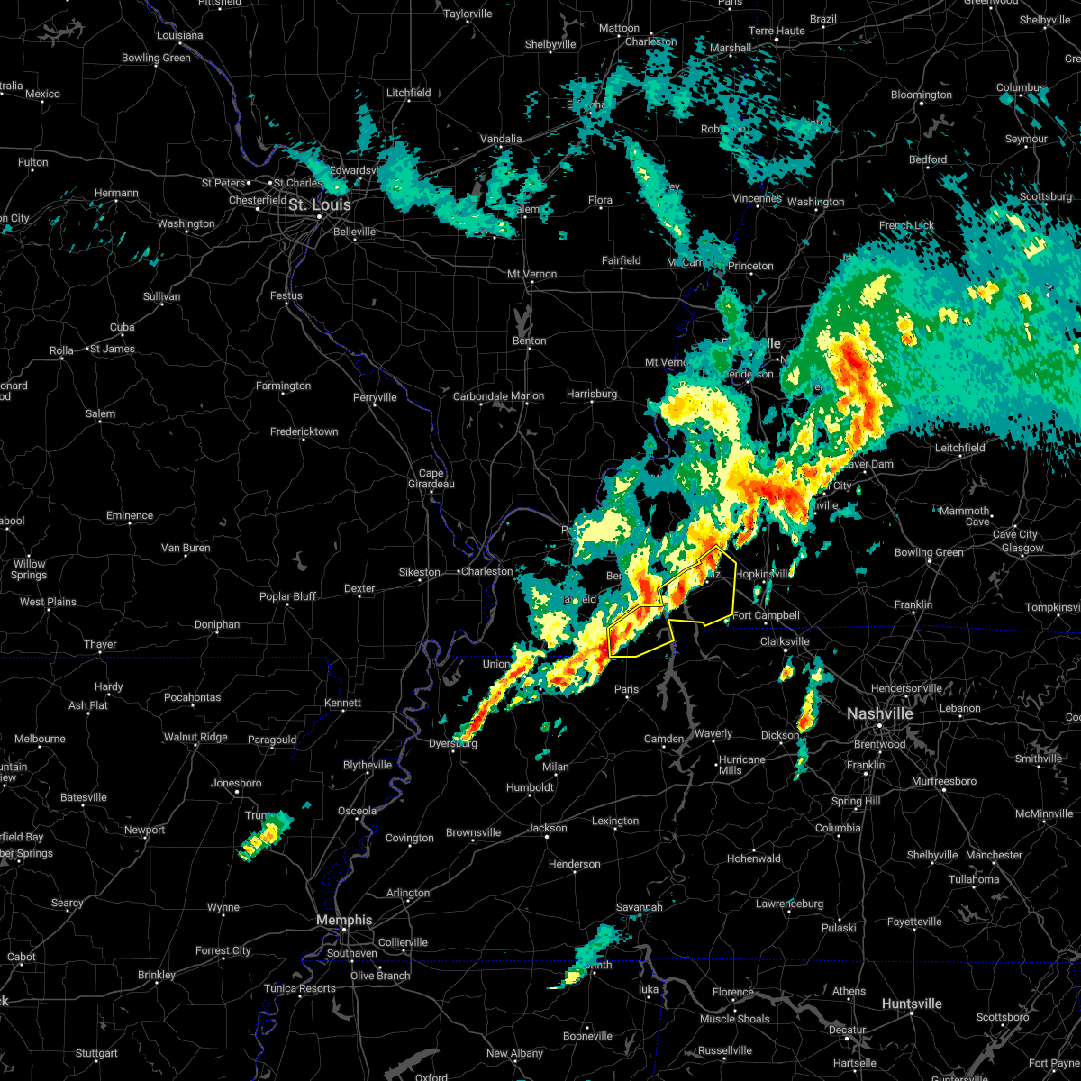 At 519 am cst, a severe thunderstorm was located near murray, moving northeast at 60 mph (radar indicated). Hazards include 60 mph wind gusts and quarter size hail. Hail damage to vehicles is expected. expect wind damage to roofs, siding, and trees. this severe thunderstorm will be near, land between the lakes area around 535 am cst. other locations in the path of this severe thunderstorm include canton and cadiz. this includes interstate 24 in kentucky between mile markers 55 and 70. hail threat, radar indicated max hail size, 1. 00 in wind threat, radar indicated max wind gust, 60 mph. At 519 am cst, a severe thunderstorm was located near murray, moving northeast at 60 mph (radar indicated). Hazards include 60 mph wind gusts and quarter size hail. Hail damage to vehicles is expected. expect wind damage to roofs, siding, and trees. this severe thunderstorm will be near, land between the lakes area around 535 am cst. other locations in the path of this severe thunderstorm include canton and cadiz. this includes interstate 24 in kentucky between mile markers 55 and 70. hail threat, radar indicated max hail size, 1. 00 in wind threat, radar indicated max wind gust, 60 mph.
|
| 1/3/2023 4:12 AM CST |
 At 412 am cst, severe thunderstorms were located along a line extending from near cobb to 9 miles northwest of big rock, moving east at 40 mph (radar indicated). Hazards include 60 mph wind gusts. Expect damage to roofs, siding, and trees. severe thunderstorms will be near, crofton around 430 am cst. other locations in the path of these severe thunderstorms include hopkinsville, oak grove and fort campbell. this includes the following highways, interstate 24 in kentucky between mile markers 59 and 91. Pennyrile parkway between mile markers 1 and 25. At 412 am cst, severe thunderstorms were located along a line extending from near cobb to 9 miles northwest of big rock, moving east at 40 mph (radar indicated). Hazards include 60 mph wind gusts. Expect damage to roofs, siding, and trees. severe thunderstorms will be near, crofton around 430 am cst. other locations in the path of these severe thunderstorms include hopkinsville, oak grove and fort campbell. this includes the following highways, interstate 24 in kentucky between mile markers 59 and 91. Pennyrile parkway between mile markers 1 and 25.
|
| 8/2/2022 1:49 AM CDT |
 At 148 am cdt, severe thunderstorms were located along a line extending from near crofton to hopkinsville to 10 miles northwest of fort campbell, moving east at 20 mph. the initial speed of movement was incorrect (radar indicated). Hazards include 60 mph wind gusts and quarter size hail. Hail damage to vehicles is expected. Expect wind damage to roofs, siding, and trees. At 148 am cdt, severe thunderstorms were located along a line extending from near crofton to hopkinsville to 10 miles northwest of fort campbell, moving east at 20 mph. the initial speed of movement was incorrect (radar indicated). Hazards include 60 mph wind gusts and quarter size hail. Hail damage to vehicles is expected. Expect wind damage to roofs, siding, and trees.
|
| 8/2/2022 1:45 AM CDT | Trees down east of cadiz on old hopkinsville road... on trigg county side of christian county lin in trigg county KY, 5 miles W of Cadiz, KY |
| 8/2/2022 1:43 AM CDT |
 At 143 am cdt, severe thunderstorms were located along a line extending from near hopkinsville to 6 miles west of pembroke to near fort campbell, moving southeast at 105 mph (radar indicated). Hazards include 60 mph wind gusts and quarter size hail. Hail damage to vehicles is expected. expect wind damage to roofs, siding, and trees. these severe thunderstorms will remain over mainly rural areas of christian and eastern trigg counties, including the following locations, lafayette, hawkins and herndon. this includes the following highways, interstate 24 in kentucky between mile markers 64 and 92. pennyrile parkway between mile markers 1 and 28. hail threat, radar indicated max hail size, 1. 00 in wind threat, radar indicated max wind gust, 60 mph. At 143 am cdt, severe thunderstorms were located along a line extending from near hopkinsville to 6 miles west of pembroke to near fort campbell, moving southeast at 105 mph (radar indicated). Hazards include 60 mph wind gusts and quarter size hail. Hail damage to vehicles is expected. expect wind damage to roofs, siding, and trees. these severe thunderstorms will remain over mainly rural areas of christian and eastern trigg counties, including the following locations, lafayette, hawkins and herndon. this includes the following highways, interstate 24 in kentucky between mile markers 64 and 92. pennyrile parkway between mile markers 1 and 28. hail threat, radar indicated max hail size, 1. 00 in wind threat, radar indicated max wind gust, 60 mph.
|
| 6/17/2022 8:54 AM CDT |
 At 853 am cdt, severe thunderstorms were located along a line extending from 9 miles north of dunmor to near hopkinsville to near land between the lakes area, moving southeast at 30 mph (radar indicated. this is an extension to the previous warning). Hazards include 60 mph wind gusts. Expect damage to roofs, siding, and trees. severe thunderstorms will be near, hopkinsville and dunmor around 910 am cdt. this includes the following highways, interstate 24 in kentucky between mile markers 66 and 75. western kentucky parkway between mile markers 54 and 65. pennyrile parkway between mile markers 7 and 20. hail threat, radar indicated max hail size, <. 75 in wind threat, radar indicated max wind gust, 60 mph. At 853 am cdt, severe thunderstorms were located along a line extending from 9 miles north of dunmor to near hopkinsville to near land between the lakes area, moving southeast at 30 mph (radar indicated. this is an extension to the previous warning). Hazards include 60 mph wind gusts. Expect damage to roofs, siding, and trees. severe thunderstorms will be near, hopkinsville and dunmor around 910 am cdt. this includes the following highways, interstate 24 in kentucky between mile markers 66 and 75. western kentucky parkway between mile markers 54 and 65. pennyrile parkway between mile markers 7 and 20. hail threat, radar indicated max hail size, <. 75 in wind threat, radar indicated max wind gust, 60 mph.
|
| 6/17/2022 8:39 AM CDT |
 At 839 am cdt, severe thunderstorms were located along a line extending from near graham to near cobb to near land between the lakes area, moving southeast at 40 mph (radar indicated). Hazards include 60 mph wind gusts. Expect damage to roofs, siding, and trees. locations impacted include, canton and hopkinsville. this includes the following highways, interstate 24 in kentucky between mile markers 42 and 75. interstate 69 in kentucky between mile markers 68 and 90. pennyrile parkway between mile markers 7 and 26. hail threat, radar indicated max hail size, <. 75 in wind threat, radar indicated max wind gust, 60 mph. At 839 am cdt, severe thunderstorms were located along a line extending from near graham to near cobb to near land between the lakes area, moving southeast at 40 mph (radar indicated). Hazards include 60 mph wind gusts. Expect damage to roofs, siding, and trees. locations impacted include, canton and hopkinsville. this includes the following highways, interstate 24 in kentucky between mile markers 42 and 75. interstate 69 in kentucky between mile markers 68 and 90. pennyrile parkway between mile markers 7 and 26. hail threat, radar indicated max hail size, <. 75 in wind threat, radar indicated max wind gust, 60 mph.
|
| 6/17/2022 8:20 AM CDT |
 At 820 am cdt, severe thunderstorms were located along a line extending from near beech grove to near olney to near eddyville, moving southeast at 40 mph (radar indicated). Hazards include 60 mph wind gusts. Expect damage to roofs, siding, and trees. severe thunderstorms will be near, princeton around 840 am cdt. other locations in the path of these severe thunderstorms include crofton and cobb. this includes the following highways, interstate 24 in kentucky between mile markers 42 and 75. interstate 69 in kentucky between mile markers 68 and 90. pennyrile parkway between mile markers 7 and 26. hail threat, radar indicated max hail size, <. 75 in wind threat, radar indicated max wind gust, 60 mph. At 820 am cdt, severe thunderstorms were located along a line extending from near beech grove to near olney to near eddyville, moving southeast at 40 mph (radar indicated). Hazards include 60 mph wind gusts. Expect damage to roofs, siding, and trees. severe thunderstorms will be near, princeton around 840 am cdt. other locations in the path of these severe thunderstorms include crofton and cobb. this includes the following highways, interstate 24 in kentucky between mile markers 42 and 75. interstate 69 in kentucky between mile markers 68 and 90. pennyrile parkway between mile markers 7 and 26. hail threat, radar indicated max hail size, <. 75 in wind threat, radar indicated max wind gust, 60 mph.
|
| 5/3/2022 12:41 AM CDT |
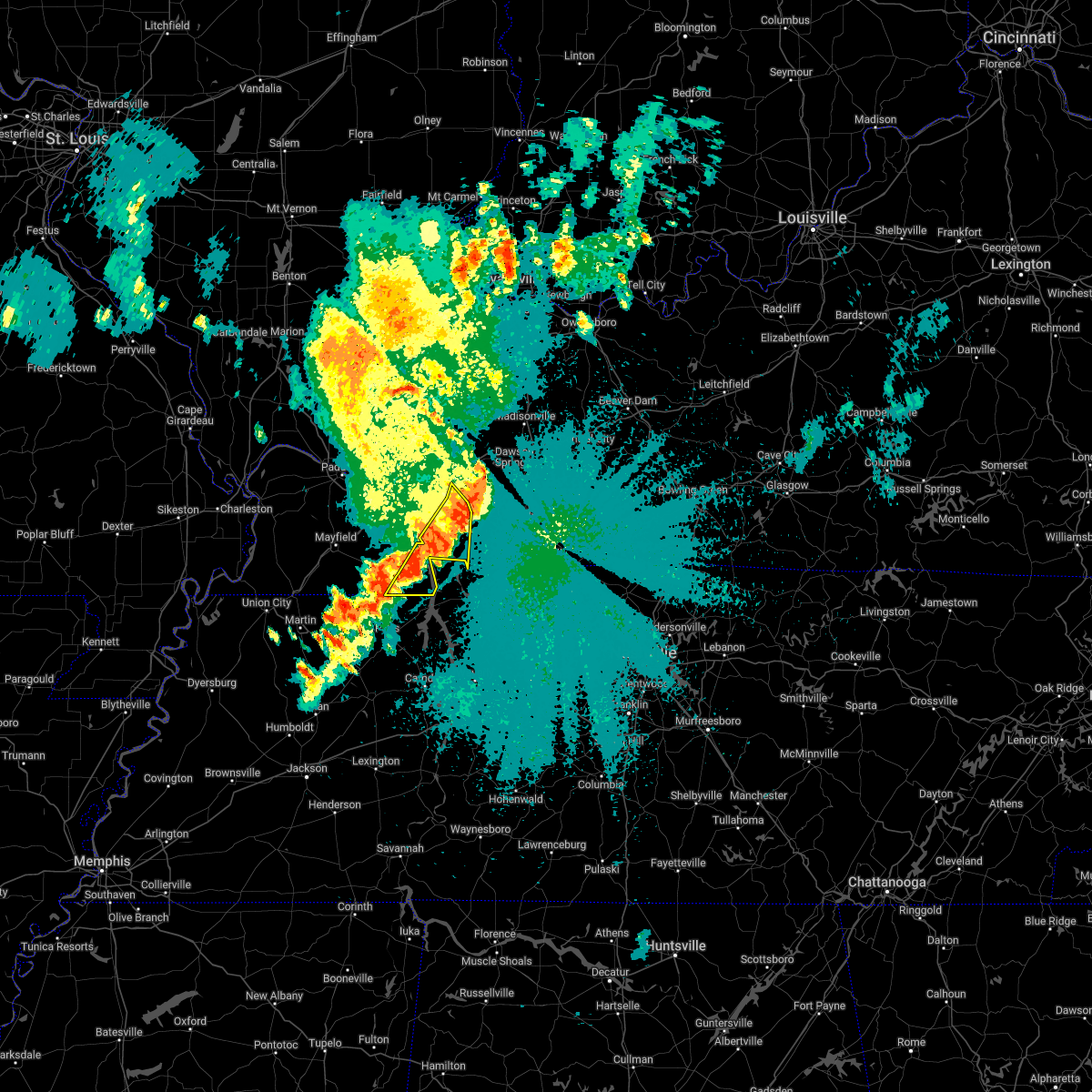 The severe thunderstorm warning for eastern calloway, south central caldwell, central trigg and southeastern lyon counties will expire at 1245 am cdt, the storms which prompted the warning is moving out of the area. therefore, the warning will be allowed to expire. however gusty winds and heavy rain are still possible with these thunderstorms. to report severe weather, contact your nearest law enforcement agency. they will relay your report to the national weather service paducah. The severe thunderstorm warning for eastern calloway, south central caldwell, central trigg and southeastern lyon counties will expire at 1245 am cdt, the storms which prompted the warning is moving out of the area. therefore, the warning will be allowed to expire. however gusty winds and heavy rain are still possible with these thunderstorms. to report severe weather, contact your nearest law enforcement agency. they will relay your report to the national weather service paducah.
|
| 5/3/2022 12:33 AM CDT |
 At 1233 am cdt, severe thunderstorms were located along a line extending from near princeton to 6 miles northwest of cadiz to near canton to 7 miles northwest of paris landing state park, moving east at 45 mph (radar indicated). Hazards include 60 mph wind gusts and penny size hail. Expect damage to roofs, siding, and trees. locations impacted include, cadiz, land between the lakes area, canton, rockcastle, hazel, new concord and linton. this includes interstate 24 in kentucky between mile markers 51 and 58. hail threat, radar indicated max hail size, 0. 75 in wind threat, radar indicated max wind gust, 60 mph. At 1233 am cdt, severe thunderstorms were located along a line extending from near princeton to 6 miles northwest of cadiz to near canton to 7 miles northwest of paris landing state park, moving east at 45 mph (radar indicated). Hazards include 60 mph wind gusts and penny size hail. Expect damage to roofs, siding, and trees. locations impacted include, cadiz, land between the lakes area, canton, rockcastle, hazel, new concord and linton. this includes interstate 24 in kentucky between mile markers 51 and 58. hail threat, radar indicated max hail size, 0. 75 in wind threat, radar indicated max wind gust, 60 mph.
|
| 5/3/2022 12:27 AM CDT |
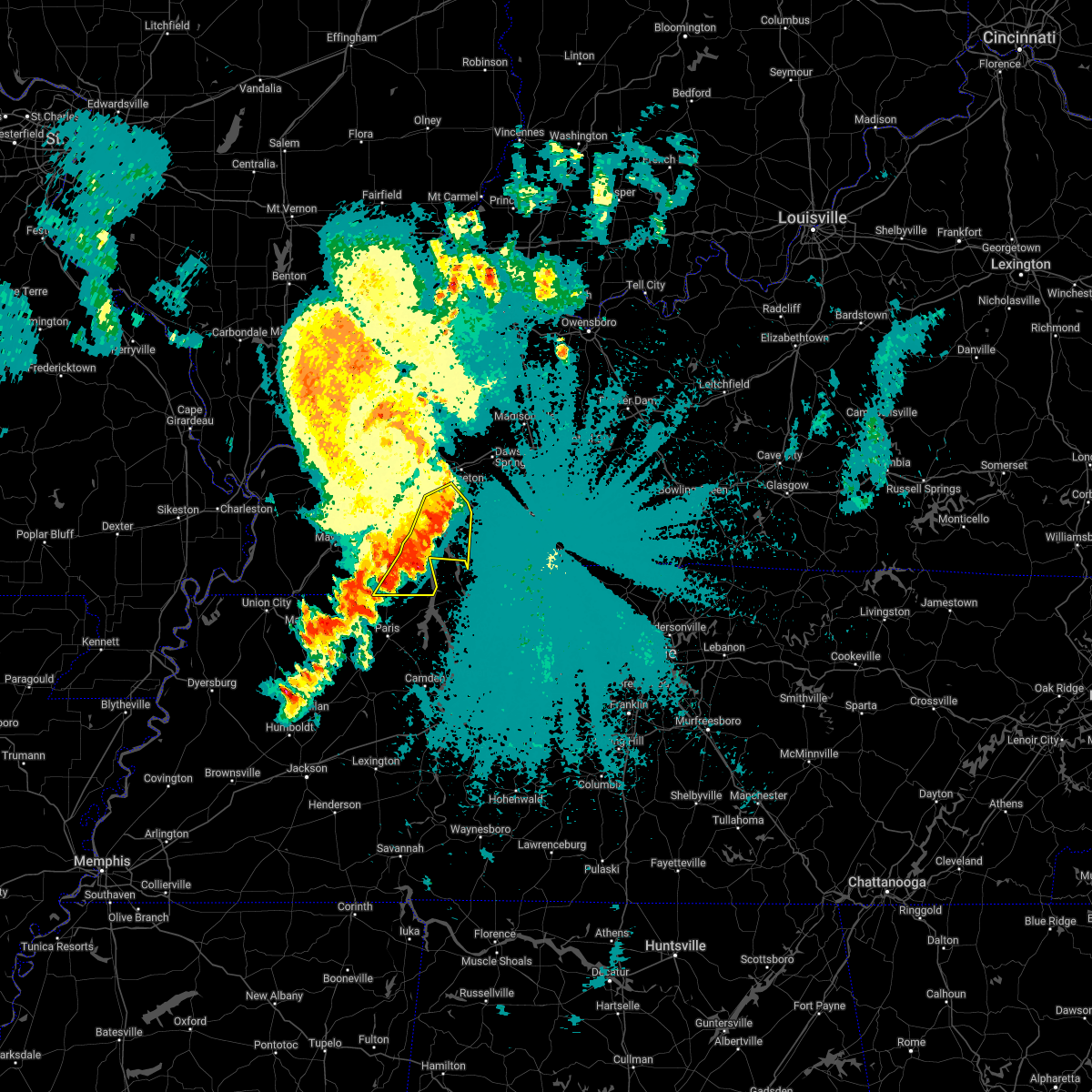 At 1226 am cdt, severe thunderstorms were located along a line extending from near eddyville to 6 miles northwest of cadiz to near canton to 7 miles southeast of land between the lakes area to 8 miles northwest of paris landing state park, moving east at 45 mph (radar indicated). Hazards include 60 mph wind gusts and penny size hail. Expect damage to roofs, siding, and trees. locations impacted include, murray, cadiz, land between the lakes area, canton, rockcastle, hazel, aurora, new concord, linton and crossland. this includes interstate 24 in kentucky between mile markers 49 and 58. hail threat, radar indicated max hail size, 0. 75 in wind threat, radar indicated max wind gust, 60 mph. At 1226 am cdt, severe thunderstorms were located along a line extending from near eddyville to 6 miles northwest of cadiz to near canton to 7 miles southeast of land between the lakes area to 8 miles northwest of paris landing state park, moving east at 45 mph (radar indicated). Hazards include 60 mph wind gusts and penny size hail. Expect damage to roofs, siding, and trees. locations impacted include, murray, cadiz, land between the lakes area, canton, rockcastle, hazel, aurora, new concord, linton and crossland. this includes interstate 24 in kentucky between mile markers 49 and 58. hail threat, radar indicated max hail size, 0. 75 in wind threat, radar indicated max wind gust, 60 mph.
|
| 5/3/2022 12:15 AM CDT |
 At 1214 am cdt, severe thunderstorms were located along a line extending from near eddyville to 10 miles northwest of canton to near land between the lakes area to 7 miles southwest of murray, moving east at 45 mph (radar indicated). Hazards include 60 mph wind gusts and penny size hail. Expect damage to roofs, siding, and trees. locations impacted include, murray, cadiz, land between the lakes area, canton, rockcastle, hazel, aurora, new concord, linton and crossland. this includes interstate 24 in kentucky between mile markers 48 and 58. hail threat, radar indicated max hail size, 0. 75 in wind threat, radar indicated max wind gust, 60 mph. At 1214 am cdt, severe thunderstorms were located along a line extending from near eddyville to 10 miles northwest of canton to near land between the lakes area to 7 miles southwest of murray, moving east at 45 mph (radar indicated). Hazards include 60 mph wind gusts and penny size hail. Expect damage to roofs, siding, and trees. locations impacted include, murray, cadiz, land between the lakes area, canton, rockcastle, hazel, aurora, new concord, linton and crossland. this includes interstate 24 in kentucky between mile markers 48 and 58. hail threat, radar indicated max hail size, 0. 75 in wind threat, radar indicated max wind gust, 60 mph.
|
| 5/2/2022 11:54 PM CDT |
 At 1153 pm cdt, severe thunderstorms were located along a line extending from near calvert city to near benton to 15 miles west of land between the lakes area to near murray to near cottage grove, moving east at 45 mph (radar indicated). Hazards include 60 mph wind gusts and penny size hail. expect damage to roofs, siding, and trees At 1153 pm cdt, severe thunderstorms were located along a line extending from near calvert city to near benton to 15 miles west of land between the lakes area to near murray to near cottage grove, moving east at 45 mph (radar indicated). Hazards include 60 mph wind gusts and penny size hail. expect damage to roofs, siding, and trees
|
| 4/13/2022 5:04 PM CDT |
 At 503 pm cdt, severe thunderstorms were located along a line extending from farmersville to 7 miles northwest of cadiz to near canton, moving northeast at 65 mph (radar indicated). Hazards include 70 mph wind gusts and nickel size hail. Expect considerable tree damage. damage is likely to mobile homes, roofs, and outbuildings. severe thunderstorms will be near, cobb, olney and creswell around 510 pm cdt. providence around 520 pm cdt. other locations in the path of these severe thunderstorms include hopkinsville, madisonville, earlington, crofton, nortonville, mortons gap, graham, weir, central city, calhoun, powderly, greenville, livermore and dunmor. this includes the following highways, interstate 24 in kentucky between mile markers 46 and 92. interstate 69 in kentucky between mile markers 73 and 138. western kentucky parkway between mile markers 39 and 65. Pennyrile parkway between mile markers 1 and 34. At 503 pm cdt, severe thunderstorms were located along a line extending from farmersville to 7 miles northwest of cadiz to near canton, moving northeast at 65 mph (radar indicated). Hazards include 70 mph wind gusts and nickel size hail. Expect considerable tree damage. damage is likely to mobile homes, roofs, and outbuildings. severe thunderstorms will be near, cobb, olney and creswell around 510 pm cdt. providence around 520 pm cdt. other locations in the path of these severe thunderstorms include hopkinsville, madisonville, earlington, crofton, nortonville, mortons gap, graham, weir, central city, calhoun, powderly, greenville, livermore and dunmor. this includes the following highways, interstate 24 in kentucky between mile markers 46 and 92. interstate 69 in kentucky between mile markers 73 and 138. western kentucky parkway between mile markers 39 and 65. Pennyrile parkway between mile markers 1 and 34.
|
| 4/13/2022 4:44 PM CDT |
 At 444 pm cdt, severe thunderstorms capable of producing both tornadoes and extensive straight line wind damage were located along a line extending from 8 miles southeast of benton to 7 miles southeast of murray, moving east at 65 mph (radar indicated rotation). Hazards include tornado. Flying debris will be dangerous to those caught without shelter. mobile homes will be damaged or destroyed. damage to roofs, windows, and vehicles will occur. tree damage is likely. these dangerous storms will be near, land between the lakes area around 450 pm cdt. canton around 455 pm cdt. other locations in the path of these tornadic storms include cadiz. This includes interstate 24 in kentucky between mile markers 58 and 70. At 444 pm cdt, severe thunderstorms capable of producing both tornadoes and extensive straight line wind damage were located along a line extending from 8 miles southeast of benton to 7 miles southeast of murray, moving east at 65 mph (radar indicated rotation). Hazards include tornado. Flying debris will be dangerous to those caught without shelter. mobile homes will be damaged or destroyed. damage to roofs, windows, and vehicles will occur. tree damage is likely. these dangerous storms will be near, land between the lakes area around 450 pm cdt. canton around 455 pm cdt. other locations in the path of these tornadic storms include cadiz. This includes interstate 24 in kentucky between mile markers 58 and 70.
|
| 3/30/2022 6:12 PM CDT |
 At 612 pm cdt, a severe thunderstorm was located near big rock, or near dover, moving northeast at 70 mph (radar indicated). Hazards include 60 mph wind gusts. expect damage to roofs, siding, and trees At 612 pm cdt, a severe thunderstorm was located near big rock, or near dover, moving northeast at 70 mph (radar indicated). Hazards include 60 mph wind gusts. expect damage to roofs, siding, and trees
|
| 10/15/2021 4:01 PM CDT |
 At 401 pm cdt, a severe thunderstorm was located near hopkinsville, moving east at 35 mph (radar indicated). Hazards include 60 mph wind gusts and penny size hail. Expect damage to roofs, siding, and trees. locations impacted include, hopkinsville. this includes the following highways, interstate 24 in kentucky between mile markers 64 and 74. pennyrile parkway between mile markers 5 and 20. hail threat, radar indicated max hail size, 0. 75 in wind threat, radar indicated max wind gust, 60 mph. At 401 pm cdt, a severe thunderstorm was located near hopkinsville, moving east at 35 mph (radar indicated). Hazards include 60 mph wind gusts and penny size hail. Expect damage to roofs, siding, and trees. locations impacted include, hopkinsville. this includes the following highways, interstate 24 in kentucky between mile markers 64 and 74. pennyrile parkway between mile markers 5 and 20. hail threat, radar indicated max hail size, 0. 75 in wind threat, radar indicated max wind gust, 60 mph.
|
| 10/15/2021 3:47 PM CDT |
 At 347 pm cdt, a severe thunderstorm was located over cadiz, moving east at 35 mph (radar indicated). Hazards include 60 mph wind gusts and penny size hail. Expect damage to roofs, siding, and trees. this severe thunderstorm will remain over mainly rural areas of central christian and northeastern trigg counties. this includes the following highways, interstate 24 in kentucky between mile markers 60 and 74. pennyrile parkway between mile markers 5 and 21. hail threat, radar indicated max hail size, 0. 75 in wind threat, radar indicated max wind gust, 60 mph. At 347 pm cdt, a severe thunderstorm was located over cadiz, moving east at 35 mph (radar indicated). Hazards include 60 mph wind gusts and penny size hail. Expect damage to roofs, siding, and trees. this severe thunderstorm will remain over mainly rural areas of central christian and northeastern trigg counties. this includes the following highways, interstate 24 in kentucky between mile markers 60 and 74. pennyrile parkway between mile markers 5 and 21. hail threat, radar indicated max hail size, 0. 75 in wind threat, radar indicated max wind gust, 60 mph.
|
| 10/15/2021 3:40 PM CDT | A tree fell on a power line and brought down 3 poles along martindale drive. report from prec in trigg county KY, 2.2 miles E of Cadiz, KY |
| 6/29/2021 3:09 PM CDT |
 At 309 pm cdt, an area of strong to severe thunderstorms was located between cadiz and gracey, moving northwest at 20 mph (radar indicated). Hazards include 60 mph wind gusts and quarter size hail. Hail damage to vehicles is possible, along with wind damage to roofs, siding, and trees. Locations impacted include, cadiz, gracey and cerulean, as well as the i-24 corridor in trigg county. At 309 pm cdt, an area of strong to severe thunderstorms was located between cadiz and gracey, moving northwest at 20 mph (radar indicated). Hazards include 60 mph wind gusts and quarter size hail. Hail damage to vehicles is possible, along with wind damage to roofs, siding, and trees. Locations impacted include, cadiz, gracey and cerulean, as well as the i-24 corridor in trigg county.
|
| 6/29/2021 2:49 PM CDT |
 At 246 pm cdt, a severe thunderstorm was located 8 miles west of hopkinsville, moving northwest at 20 mph (radar indicated). Hazards include 60 mph wind gusts and quarter size hail. Hail damage to vehicles is possible. Expect wind damage to roofs, siding, and trees. At 246 pm cdt, a severe thunderstorm was located 8 miles west of hopkinsville, moving northwest at 20 mph (radar indicated). Hazards include 60 mph wind gusts and quarter size hail. Hail damage to vehicles is possible. Expect wind damage to roofs, siding, and trees.
|
| 5/4/2021 4:40 AM CDT |
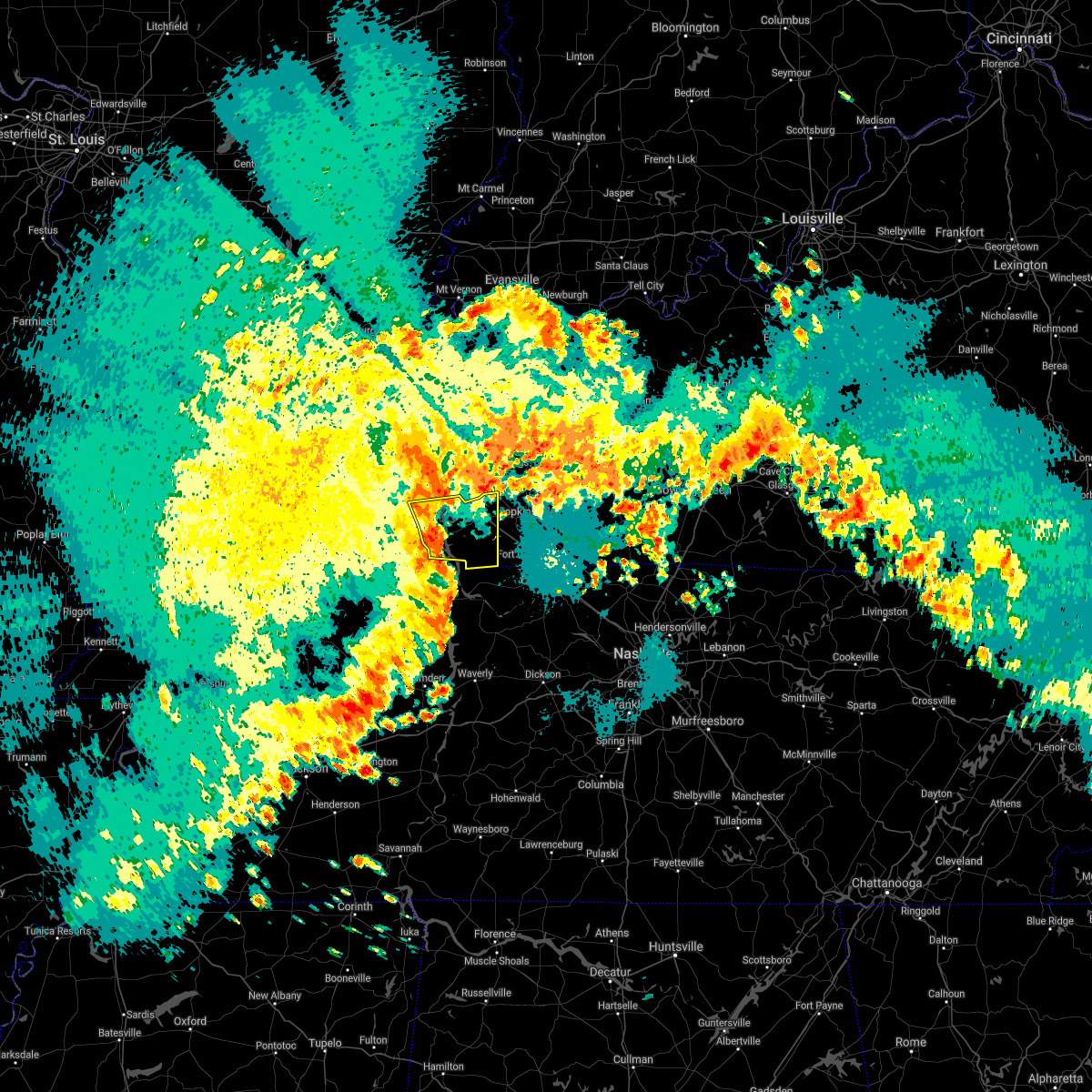 At 438 am cdt, severe thunderstorms were located along a line extending from 8 miles southeast of eddyville to 8 miles northeast of paris landing state park, moving east at 45 mph (trained weather spotters. at 414 am, several trees were reported down in calloway county near hazel). Hazards include 60 mph wind gusts and nickel size hail. Expect damage to roofs, siding, and trees. Locations impacted include, cadiz, land between the lakes area, canton, rockcastle and linton. At 438 am cdt, severe thunderstorms were located along a line extending from 8 miles southeast of eddyville to 8 miles northeast of paris landing state park, moving east at 45 mph (trained weather spotters. at 414 am, several trees were reported down in calloway county near hazel). Hazards include 60 mph wind gusts and nickel size hail. Expect damage to roofs, siding, and trees. Locations impacted include, cadiz, land between the lakes area, canton, rockcastle and linton.
|
| 5/4/2021 4:08 AM CDT |
 At 408 am cdt, severe thunderstorms were located along a line extending from near reidland to 6 miles southeast of lynnville, moving east at 50 mph (radar indicated). Hazards include 60 mph wind gusts and nickel size hail. expect damage to roofs, siding, and trees At 408 am cdt, severe thunderstorms were located along a line extending from near reidland to 6 miles southeast of lynnville, moving east at 50 mph (radar indicated). Hazards include 60 mph wind gusts and nickel size hail. expect damage to roofs, siding, and trees
|
| 2/28/2021 6:45 AM CST |
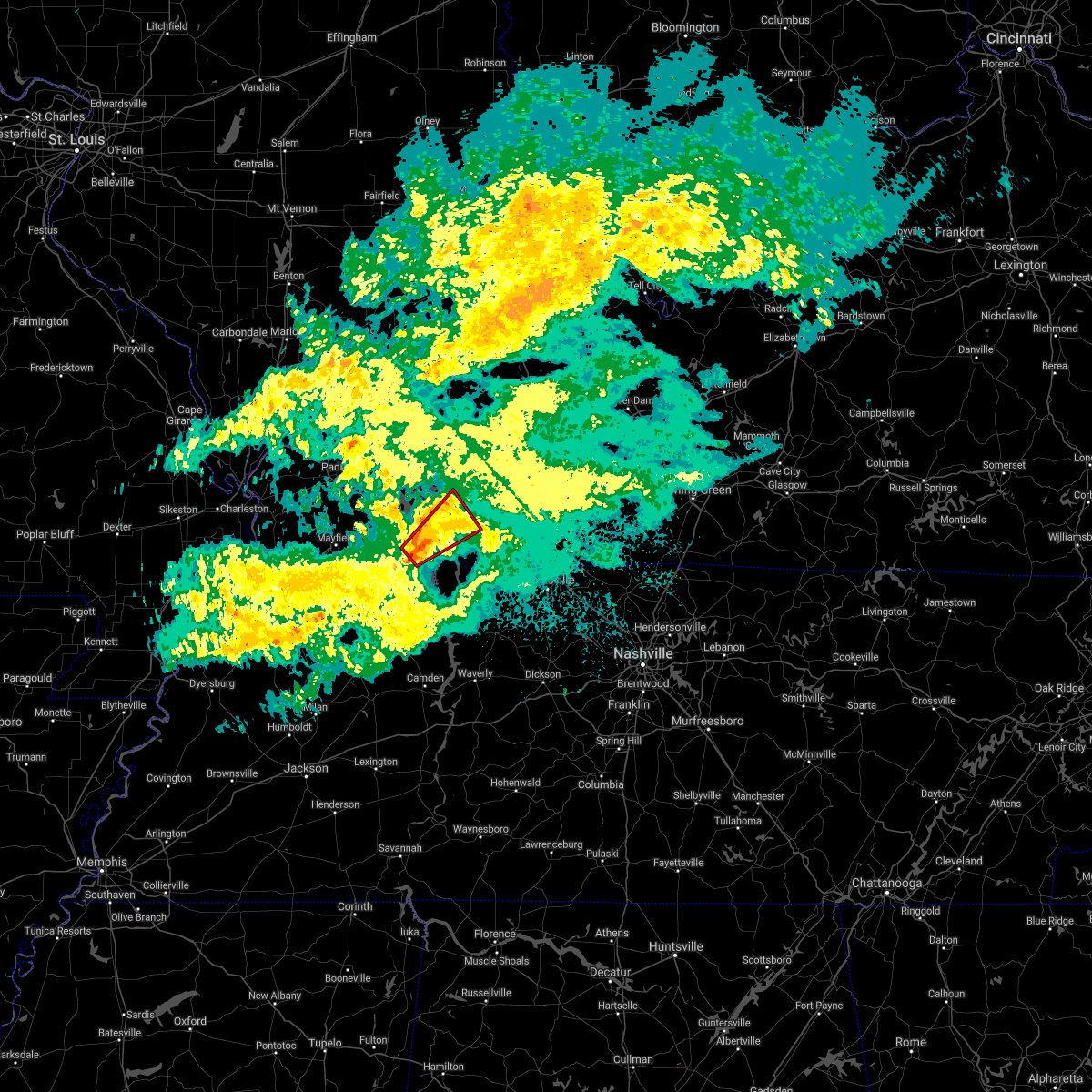 At 644 am cst, a severe thunderstorm capable of producing a tornado was located near land between the lakes area, moving northeast at 35 mph (radar indicated rotation). Hazards include tornado. Flying debris will be dangerous to those caught without shelter. mobile homes will be damaged or destroyed. damage to roofs, windows, and vehicles will occur. tree damage is likely. this dangerous storm will be near, land between the lakes area around 650 am cst. canton around 700 am cst. cadiz around 715 am cst. other locations impacted by this tornadic thunderstorm include aurora and rockcastle. This includes interstate 24 in kentucky between mile markers 52 and 54. At 644 am cst, a severe thunderstorm capable of producing a tornado was located near land between the lakes area, moving northeast at 35 mph (radar indicated rotation). Hazards include tornado. Flying debris will be dangerous to those caught without shelter. mobile homes will be damaged or destroyed. damage to roofs, windows, and vehicles will occur. tree damage is likely. this dangerous storm will be near, land between the lakes area around 650 am cst. canton around 700 am cst. cadiz around 715 am cst. other locations impacted by this tornadic thunderstorm include aurora and rockcastle. This includes interstate 24 in kentucky between mile markers 52 and 54.
|
| 4/8/2020 8:31 PM CDT |
 At 831 pm cdt, severe thunderstorms were located along a line extending from near cobb to near paris landing state park, moving east at 45 mph (radar indicated). Hazards include 60 mph wind gusts and quarter size hail. Hail damage to vehicles is expected. expect wind damage to roofs, siding, and trees. Locations impacted include, murray, cadiz, land between the lakes area, canton, cobb, hazel, new concord and linton. At 831 pm cdt, severe thunderstorms were located along a line extending from near cobb to near paris landing state park, moving east at 45 mph (radar indicated). Hazards include 60 mph wind gusts and quarter size hail. Hail damage to vehicles is expected. expect wind damage to roofs, siding, and trees. Locations impacted include, murray, cadiz, land between the lakes area, canton, cobb, hazel, new concord and linton.
|
| 4/8/2020 8:24 PM CDT |
 At 824 pm cdt, severe thunderstorms were located along a line extending from near cobb to near paris landing state park, moving east at 50 mph (radar indicated). Hazards include 60 mph wind gusts and half dollar size hail. Hail damage to vehicles is expected. Expect wind damage to roofs, siding, and trees. At 824 pm cdt, severe thunderstorms were located along a line extending from near cobb to near paris landing state park, moving east at 50 mph (radar indicated). Hazards include 60 mph wind gusts and half dollar size hail. Hail damage to vehicles is expected. Expect wind damage to roofs, siding, and trees.
|
| 4/8/2020 8:10 PM CDT |
 At 809 pm cdt, severe thunderstorms were located along a line extending from near eddyville to near murray, moving east at 45 mph (radar indicated). Hazards include 60 mph wind gusts and half dollar size hail. Hail damage to vehicles is expected. expect wind damage to roofs, siding, and trees. Locations impacted include, murray, princeton, cadiz, eddyville, land between the lakes area, cobb, canton, rockcastle, kuttawa, hardin, hazel, new concord, linton, aurora, harris grove and kirksey. At 809 pm cdt, severe thunderstorms were located along a line extending from near eddyville to near murray, moving east at 45 mph (radar indicated). Hazards include 60 mph wind gusts and half dollar size hail. Hail damage to vehicles is expected. expect wind damage to roofs, siding, and trees. Locations impacted include, murray, princeton, cadiz, eddyville, land between the lakes area, cobb, canton, rockcastle, kuttawa, hardin, hazel, new concord, linton, aurora, harris grove and kirksey.
|
| 4/8/2020 7:53 PM CDT |
 At 753 pm cdt, severe thunderstorms were located along a line extending from 7 miles northwest of eddyville to near lynnville, moving east at 40 mph (radar indicated). Hazards include 60 mph wind gusts and quarter size hail. Hail damage to vehicles is expected. Expect wind damage to roofs, siding, and trees. At 753 pm cdt, severe thunderstorms were located along a line extending from 7 miles northwest of eddyville to near lynnville, moving east at 40 mph (radar indicated). Hazards include 60 mph wind gusts and quarter size hail. Hail damage to vehicles is expected. Expect wind damage to roofs, siding, and trees.
|
| 1/11/2020 8:15 AM CST | Large trees at least 3.5 feet in diameter down along malone road southwest of cadiz. also report of a tree that came down on a truck on hwy 68 near cadi in trigg county KY, 5.4 miles ENE of Cadiz, KY |
| 1/11/2020 7:24 AM CST |
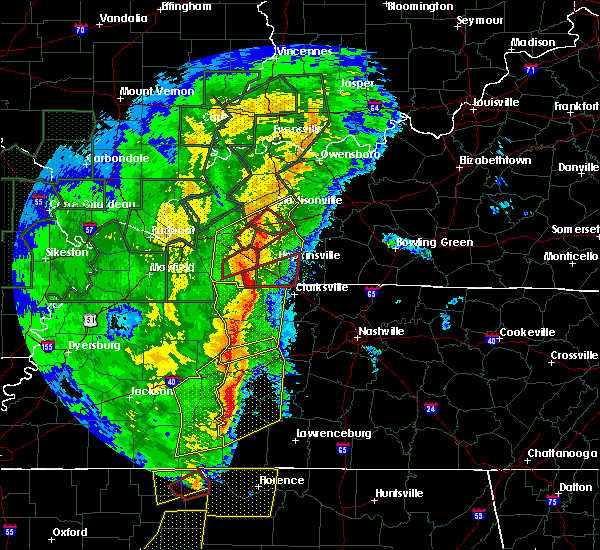 The tornado warning for eastern trigg county will expire at 730 am cst, the storm which prompted the warning has moved out of the area. therefore, the warning will be allowed to expire. a tornado watch remains in effect until 100 pm cst for western and south central kentucky. remember, a new tornado warning has been issued for the southeast part of trigg county!. The tornado warning for eastern trigg county will expire at 730 am cst, the storm which prompted the warning has moved out of the area. therefore, the warning will be allowed to expire. a tornado watch remains in effect until 100 pm cst for western and south central kentucky. remember, a new tornado warning has been issued for the southeast part of trigg county!.
|
| 1/11/2020 7:10 AM CST | Corrects previous tstm wnd dmg report from 4 sw cadiz. large trees at least 3.5 feet in diameter down along malone road southwest of cadiz. also report of a tree that c in trigg county KY, 5.4 miles ENE of Cadiz, KY |
| 1/11/2020 7:05 AM CST | Numerous trees down and some buildings damaged on rainbow hill. possible tornad in trigg county KY, 3.9 miles E of Cadiz, KY |
| 1/11/2020 7:01 AM CST |
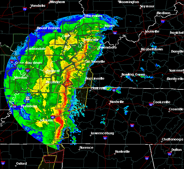 At 700 am cst, a severe thunderstorm capable of producing a tornado was located over canton, or 7 miles east of land between the lakes area, moving northeast at 45 mph. another possible tornado was north of canton (radar indicated rotation). Hazards include tornado. Flying debris will be dangerous to those caught without shelter. mobile homes will be damaged or destroyed. damage to roofs, windows, and vehicles will occur. tree damage is likely. this dangerous storm will be near, cadiz around 710 am cst. This includes interstate 24 in kentucky between mile markers 58 and 69. At 700 am cst, a severe thunderstorm capable of producing a tornado was located over canton, or 7 miles east of land between the lakes area, moving northeast at 45 mph. another possible tornado was north of canton (radar indicated rotation). Hazards include tornado. Flying debris will be dangerous to those caught without shelter. mobile homes will be damaged or destroyed. damage to roofs, windows, and vehicles will occur. tree damage is likely. this dangerous storm will be near, cadiz around 710 am cst. This includes interstate 24 in kentucky between mile markers 58 and 69.
|
| 1/11/2020 6:56 AM CST | Trees down and roof damage between canton and cadiz. time estimate in trigg county KY, 10.6 miles ENE of Cadiz, KY |
| 1/11/2020 6:54 AM CST |
 At 654 am cst, severe thunderstorms were located along a line extending from near land between the lakes area to 6 miles north of paris landing state park, moving northeast at 70 mph (radar indicated). Hazards include 60 mph wind gusts. expect damage to roofs, siding, and trees At 654 am cst, severe thunderstorms were located along a line extending from near land between the lakes area to 6 miles north of paris landing state park, moving northeast at 70 mph (radar indicated). Hazards include 60 mph wind gusts. expect damage to roofs, siding, and trees
|
| 10/26/2019 2:49 PM CDT | Home damaged by winds and is not livable. time estimate in trigg county KY, 2.3 miles ESE of Cadiz, KY |
| 6/23/2019 6:03 PM CDT |
 At 602 pm cdt, severe thunderstorms were located along a line extending from near breckinridge center to near sebree to 10 miles southwest of calhoun to near madisonville to near mortons gap to near dawson springs to 6 miles west of crofton to 8 miles southeast of cobb to cadiz to 6 miles south of canton, moving east at 60 mph (radar indicated). Hazards include 70 mph wind gusts and quarter size hail. Hail damage to vehicles is expected. expect considerable tree damage. wind damage is also likely to mobile homes, roofs, and outbuildings. locations impacted include, hopkinsville, madisonville, oak grove, providence, sturgis, clarksville, sebree, earlington, nortonville, clay, pembroke, mortons gap, dixon, crofton, white plains, hanson, st. Charles, nebo, slaughters and wheatcroft. At 602 pm cdt, severe thunderstorms were located along a line extending from near breckinridge center to near sebree to 10 miles southwest of calhoun to near madisonville to near mortons gap to near dawson springs to 6 miles west of crofton to 8 miles southeast of cobb to cadiz to 6 miles south of canton, moving east at 60 mph (radar indicated). Hazards include 70 mph wind gusts and quarter size hail. Hail damage to vehicles is expected. expect considerable tree damage. wind damage is also likely to mobile homes, roofs, and outbuildings. locations impacted include, hopkinsville, madisonville, oak grove, providence, sturgis, clarksville, sebree, earlington, nortonville, clay, pembroke, mortons gap, dixon, crofton, white plains, hanson, st. Charles, nebo, slaughters and wheatcroft.
|
| 6/23/2019 5:14 PM CDT |
 At 513 pm cdt, severe thunderstorms were located along a line extending from 10 miles northeast of dixon springs to joy to burna to 8 miles southwest of salem to near calvert city to near benton to 9 miles northeast of cottage grove to near dresden, moving east at 60 mph (radar indicated). Hazards include 70 mph wind gusts and quarter size hail. Hail damage to vehicles is expected. expect considerable tree damage. Wind damage is also likely to mobile homes, roofs, and outbuildings. At 513 pm cdt, severe thunderstorms were located along a line extending from 10 miles northeast of dixon springs to joy to burna to 8 miles southwest of salem to near calvert city to near benton to 9 miles northeast of cottage grove to near dresden, moving east at 60 mph (radar indicated). Hazards include 70 mph wind gusts and quarter size hail. Hail damage to vehicles is expected. expect considerable tree damage. Wind damage is also likely to mobile homes, roofs, and outbuildings.
|
| 6/21/2019 6:30 PM CDT | Measured at wkdz radio. time estimate in trigg county KY, 2.8 miles WSW of Cadiz, KY |
| 6/21/2019 6:22 PM CDT |
 At 621 pm cdt, a severe thunderstorm capable of producing a tornado was located over cadiz, moving east at 50 mph (emergency manager reported funnel cloud over cadiz). Hazards include tornado and half dollar size hail. Flying debris will be dangerous to those caught without shelter. mobile homes will be damaged or destroyed. damage to roofs, windows, and vehicles will occur. tree damage is likely. This tornadic thunderstorm will remain over mainly rural areas of northeastern trigg county. At 621 pm cdt, a severe thunderstorm capable of producing a tornado was located over cadiz, moving east at 50 mph (emergency manager reported funnel cloud over cadiz). Hazards include tornado and half dollar size hail. Flying debris will be dangerous to those caught without shelter. mobile homes will be damaged or destroyed. damage to roofs, windows, and vehicles will occur. tree damage is likely. This tornadic thunderstorm will remain over mainly rural areas of northeastern trigg county.
|
| 6/21/2019 6:20 PM CDT | Multiple large trees snapped. time estimate in trigg county KY, 1.3 miles WNW of Cadiz, KY |
| 6/21/2019 6:15 PM CDT | Trees down around trigg county. time estimate in trigg county KY, 2.4 miles ENE of Cadiz, KY |
| 6/21/2019 6:15 PM CDT | Power line down on depot street with 4 or 5 knocked down on top of it. time estimate in trigg county KY, 2.9 miles ENE of Cadiz, KY |
| 6/21/2019 5:43 PM CDT |
 At 541 pm cdt, severe thunderstorms were located along a line extending from near marion to near mayfield to near troy, moving east at 55 mph (law enforcement, emergency managers, and spotters have reported 60 to 70 mph winds, extensive tree damage, torrential rainfall, and power outages over southeast missouri, southern illinois, and parts of west kentucky). Hazards include 70 mph wind gusts and nickel size hail. Expect considerable tree damage. Damage is likely to mobile homes, roofs, and outbuildings. At 541 pm cdt, severe thunderstorms were located along a line extending from near marion to near mayfield to near troy, moving east at 55 mph (law enforcement, emergency managers, and spotters have reported 60 to 70 mph winds, extensive tree damage, torrential rainfall, and power outages over southeast missouri, southern illinois, and parts of west kentucky). Hazards include 70 mph wind gusts and nickel size hail. Expect considerable tree damage. Damage is likely to mobile homes, roofs, and outbuildings.
|
| 6/19/2019 4:53 PM CDT |
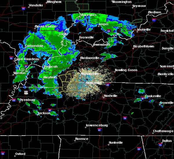 At 453 pm cdt, a severe thunderstorm was located near canton, or near cadiz, moving east at 50 mph (radar indicated). Hazards include 60 mph wind gusts. expect damage to roofs, siding, and trees At 453 pm cdt, a severe thunderstorm was located near canton, or near cadiz, moving east at 50 mph (radar indicated). Hazards include 60 mph wind gusts. expect damage to roofs, siding, and trees
|
| 6/19/2019 4:49 PM CDT | Trees dow in trigg county KY, 10.6 miles ENE of Cadiz, KY |
| 6/19/2019 4:48 PM CDT |
 At 448 pm cdt, a severe thunderstorm was located near canton, or 8 miles southwest of cadiz, moving east at 55 mph (radar indicated). Hazards include 70 mph wind gusts. Expect considerable tree damage. damage is likely to mobile homes, roofs, and outbuildings. Locations impacted include, cadiz, land between the lakes area, energy, canton and linton. At 448 pm cdt, a severe thunderstorm was located near canton, or 8 miles southwest of cadiz, moving east at 55 mph (radar indicated). Hazards include 70 mph wind gusts. Expect considerable tree damage. damage is likely to mobile homes, roofs, and outbuildings. Locations impacted include, cadiz, land between the lakes area, energy, canton and linton.
|
| 6/19/2019 4:30 PM CDT |
 At 430 pm cdt, a severe thunderstorm was located 10 miles northeast of murray, moving east at 55 mph (radar indicated). Hazards include 70 mph wind gusts. Expect considerable tree damage. Damage is likely to mobile homes, roofs, and outbuildings. At 430 pm cdt, a severe thunderstorm was located 10 miles northeast of murray, moving east at 55 mph (radar indicated). Hazards include 70 mph wind gusts. Expect considerable tree damage. Damage is likely to mobile homes, roofs, and outbuildings.
|
| 12/31/2018 12:44 PM CST |
 At 1244 pm cst, a severe thunderstorm was located 7 miles southeast of cadiz, moving east at 60 mph (radar indicated). Hazards include 60 mph wind gusts. Expect damage to roofs, siding, and trees. Locations impacted include, cadiz, lafayette, linton and herndon. At 1244 pm cst, a severe thunderstorm was located 7 miles southeast of cadiz, moving east at 60 mph (radar indicated). Hazards include 60 mph wind gusts. Expect damage to roofs, siding, and trees. Locations impacted include, cadiz, lafayette, linton and herndon.
|
| 12/31/2018 12:38 PM CST | Numerous downed trees and tree damage reported across the count in trigg county KY, 1.7 miles E of Cadiz, KY |
| 12/31/2018 12:38 PM CST | Numerous downed trees and tree damage reported across the count in trigg county KY, 1.7 miles E of Cadiz, KY |
| 12/31/2018 12:28 PM CST |
 At 1226 pm cst, a severe thunderstorm was located 7 miles south of land between the lakes area, moving east at 60 mph (radar indicated. winds near 60 mph were reported in calloway county with this line of showers with basically no lightning). Hazards include 60 mph wind gusts. expect damage to roofs, siding, and trees At 1226 pm cst, a severe thunderstorm was located 7 miles south of land between the lakes area, moving east at 60 mph (radar indicated. winds near 60 mph were reported in calloway county with this line of showers with basically no lightning). Hazards include 60 mph wind gusts. expect damage to roofs, siding, and trees
|
| 7/15/2018 1:56 PM CDT |
 The severe thunderstorm warning for trigg county will expire at 200 pm cdt, the storm which prompted the warning has weakened below severe limits, and no longer poses an immediate threat to life or property. therefore, the warning will be allowed to expire. The severe thunderstorm warning for trigg county will expire at 200 pm cdt, the storm which prompted the warning has weakened below severe limits, and no longer poses an immediate threat to life or property. therefore, the warning will be allowed to expire.
|
| 7/15/2018 1:43 PM CDT |
 At 143 pm cdt, a severe thunderstorm was located near canton, or near cadiz, moving east at 35 mph (radar indicated). Hazards include 60 mph wind gusts and quarter size hail. Hail damage to vehicles is expected. Expect wind damage to roofs, siding, and trees. At 143 pm cdt, a severe thunderstorm was located near canton, or near cadiz, moving east at 35 mph (radar indicated). Hazards include 60 mph wind gusts and quarter size hail. Hail damage to vehicles is expected. Expect wind damage to roofs, siding, and trees.
|
| 6/28/2018 8:52 PM CDT | Widespread power outages reported in trigg count in trigg county KY, 1.7 miles E of Cadiz, KY |
| 6/28/2018 8:49 PM CDT | Multiple trees down on the north side of cadi in trigg county KY, 1.7 miles E of Cadiz, KY |
| 6/28/2018 8:35 PM CDT |
 At 835 pm cdt, severe thunderstorms were located along a line extending from near providence to near cadiz to 9 miles northeast of murray to near fulgham, moving south to southeast at 60 mph (radar indicated). Hazards include 60 mph wind gusts. Expect damage to roofs, siding, and trees. Locations impacted include, madisonville, murray, mayfield, princeton, benton, providence, dawson springs, calvert city, cadiz, eddyville, land between the lakes area, sebree, earlington, nortonville, mortons gap, dixon, olney, creswell, sedalia and lynnville. At 835 pm cdt, severe thunderstorms were located along a line extending from near providence to near cadiz to 9 miles northeast of murray to near fulgham, moving south to southeast at 60 mph (radar indicated). Hazards include 60 mph wind gusts. Expect damage to roofs, siding, and trees. Locations impacted include, madisonville, murray, mayfield, princeton, benton, providence, dawson springs, calvert city, cadiz, eddyville, land between the lakes area, sebree, earlington, nortonville, mortons gap, dixon, olney, creswell, sedalia and lynnville.
|
| 6/28/2018 8:05 PM CDT |
 At 805 pm cdt, severe thunderstorms were located along a line extending from near uniontown to near salem to brookport, moving south at 60 mph (radar indicated). Hazards include 70 mph wind gusts and nickel size hail. Expect considerable tree damage. Damage is likely to mobile homes, roofs, and outbuildings. At 805 pm cdt, severe thunderstorms were located along a line extending from near uniontown to near salem to brookport, moving south at 60 mph (radar indicated). Hazards include 70 mph wind gusts and nickel size hail. Expect considerable tree damage. Damage is likely to mobile homes, roofs, and outbuildings.
|
| 6/26/2018 7:34 PM CDT |
 At 733 pm cdt, severe thunderstorms were located along a line extending from 8 miles south of hartford to near weir to near cadiz, moving east at 40 mph (radar indicated). Hazards include 60 mph wind gusts and nickel size hail. expect damage to roofs, siding, and trees At 733 pm cdt, severe thunderstorms were located along a line extending from 8 miles south of hartford to near weir to near cadiz, moving east at 40 mph (radar indicated). Hazards include 60 mph wind gusts and nickel size hail. expect damage to roofs, siding, and trees
|
| 6/26/2018 11:04 AM CDT | Numerous trees damaged with wind gusts estimated 40 to 50 mp in trigg county KY, 3.6 miles ENE of Cadiz, KY |
| 6/21/2018 6:07 PM CDT | Wind gust estimated. billboard blown ove in trigg county KY, 0 miles NE of Cadiz, KY |
| 6/21/2018 5:50 PM CDT |
 At 550 pm cdt, a severe thunderstorm was located near cobb, or near cadiz, moving east at 40 mph (radar indicated). Hazards include 60 mph wind gusts and quarter size hail. Hail damage to vehicles is expected. expect wind damage to roofs, siding, and trees. Locations impacted include, cadiz and cobb. At 550 pm cdt, a severe thunderstorm was located near cobb, or near cadiz, moving east at 40 mph (radar indicated). Hazards include 60 mph wind gusts and quarter size hail. Hail damage to vehicles is expected. expect wind damage to roofs, siding, and trees. Locations impacted include, cadiz and cobb.
|
| 6/21/2018 5:30 PM CDT |
 At 529 pm cdt, a severe thunderstorm was located 8 miles north of energy, or 8 miles south of eddyville, moving east at 40 mph (radar indicated). Hazards include 60 mph wind gusts and quarter size hail. Hail damage to vehicles is expected. Expect wind damage to roofs, siding, and trees. At 529 pm cdt, a severe thunderstorm was located 8 miles north of energy, or 8 miles south of eddyville, moving east at 40 mph (radar indicated). Hazards include 60 mph wind gusts and quarter size hail. Hail damage to vehicles is expected. Expect wind damage to roofs, siding, and trees.
|
| 5/31/2018 4:30 PM CDT |
 At 430 pm cdt, a severe thunderstorm was located 8 miles southeast of cobb, or 10 miles northwest of hopkinsville, moving east at 30 mph (radar indicated). Hazards include 60 mph wind gusts and quarter size hail. Hail damage to vehicles is expected. Expect wind damage to roofs, siding, and trees. At 430 pm cdt, a severe thunderstorm was located 8 miles southeast of cobb, or 10 miles northwest of hopkinsville, moving east at 30 mph (radar indicated). Hazards include 60 mph wind gusts and quarter size hail. Hail damage to vehicles is expected. Expect wind damage to roofs, siding, and trees.
|
| 4/3/2018 8:21 PM CDT |
 At 821 pm cdt, a severe thunderstorm was located near energy, or near land between the lakes area, moving east at 45 mph (radar indicated). Hazards include 60 mph wind gusts and nickel size hail. Expect damage to roofs, siding, and trees. locations impacted include, cadiz, land between the lakes area, cobb, energy and rockcastle. a tornado watch remains in effect until 900 pm cdt for western kentucky. A tornado watch also remains in effect until midnight cdt for south central kentucky. At 821 pm cdt, a severe thunderstorm was located near energy, or near land between the lakes area, moving east at 45 mph (radar indicated). Hazards include 60 mph wind gusts and nickel size hail. Expect damage to roofs, siding, and trees. locations impacted include, cadiz, land between the lakes area, cobb, energy and rockcastle. a tornado watch remains in effect until 900 pm cdt for western kentucky. A tornado watch also remains in effect until midnight cdt for south central kentucky.
|
| 4/3/2018 8:13 PM CDT |
 At 812 pm cdt, a severe thunderstorm was located near energy, or near land between the lakes area, moving east at 45 mph (radar indicated). Hazards include 60 mph wind gusts and nickel size hail. expect damage to roofs, siding, and trees At 812 pm cdt, a severe thunderstorm was located near energy, or near land between the lakes area, moving east at 45 mph (radar indicated). Hazards include 60 mph wind gusts and nickel size hail. expect damage to roofs, siding, and trees
|
| 2/24/2018 8:23 PM CST |
 At 822 pm cst, severe thunderstorms were located along a line extending from 7 miles southwest of cobb to near cadiz to 8 miles northwest of big rock, moving northeast at 60 mph (radar indicated). Hazards include 60 mph wind gusts. Expect damage to roofs, siding, and trees. locations impacted include, cadiz. A tornado watch remains in effect until 900 pm cst for south central and western kentucky. At 822 pm cst, severe thunderstorms were located along a line extending from 7 miles southwest of cobb to near cadiz to 8 miles northwest of big rock, moving northeast at 60 mph (radar indicated). Hazards include 60 mph wind gusts. Expect damage to roofs, siding, and trees. locations impacted include, cadiz. A tornado watch remains in effect until 900 pm cst for south central and western kentucky.
|
| 2/24/2018 8:08 PM CST |
 At 808 pm cst, a severe thunderstorm was located over energy, or over land between the lakes area, moving northeast at 65 mph (radar indicated). Hazards include 60 mph wind gusts. expect damage to roofs, siding, and trees At 808 pm cst, a severe thunderstorm was located over energy, or over land between the lakes area, moving northeast at 65 mph (radar indicated). Hazards include 60 mph wind gusts. expect damage to roofs, siding, and trees
|
| 11/18/2017 3:15 PM CST | Trees down along cerulean road. shed blown from front yard to back yard. power outages reported. time estimate in trigg county KY, 1.7 miles E of Cadiz, KY |
| 5/27/2017 7:17 PM CDT |
 At 717 pm cdt, severe thunderstorms were located along a line extending from near providence to near earlington to 8 miles southwest of crofton to 6 miles southeast of canton, moving east at 70 mph (radar indicated). Hazards include 60 mph wind gusts. Expect damage to roofs, siding, and trees. Locations impacted include, hopkinsville, oak grove, cadiz, elkton, fort campbell north, guthrie, pembroke, crofton, canton, trenton, lafayette, linton, allensville, allegre, clifty and herndon. At 717 pm cdt, severe thunderstorms were located along a line extending from near providence to near earlington to 8 miles southwest of crofton to 6 miles southeast of canton, moving east at 70 mph (radar indicated). Hazards include 60 mph wind gusts. Expect damage to roofs, siding, and trees. Locations impacted include, hopkinsville, oak grove, cadiz, elkton, fort campbell north, guthrie, pembroke, crofton, canton, trenton, lafayette, linton, allensville, allegre, clifty and herndon.
|
| 5/27/2017 7:09 PM CDT |
 At 709 pm cdt, severe thunderstorms were located along a line extending from near clay to 6 miles southeast of providence to near cobb to near canton, moving east at 70 mph (radar indicated). Hazards include 70 mph wind gusts. Expect considerable tree damage. damage is likely to mobile homes, roofs, and outbuildings. Locations impacted include, hopkinsville, madisonville, oak grove, princeton, central city, greenville, dawson springs, cadiz, elkton, fort campbell north, land between the lakes area, guthrie, earlington, nortonville, pembroke, mortons gap, crofton, powderly, graham and olney. At 709 pm cdt, severe thunderstorms were located along a line extending from near clay to 6 miles southeast of providence to near cobb to near canton, moving east at 70 mph (radar indicated). Hazards include 70 mph wind gusts. Expect considerable tree damage. damage is likely to mobile homes, roofs, and outbuildings. Locations impacted include, hopkinsville, madisonville, oak grove, princeton, central city, greenville, dawson springs, cadiz, elkton, fort campbell north, land between the lakes area, guthrie, earlington, nortonville, pembroke, mortons gap, crofton, powderly, graham and olney.
|
| 5/27/2017 7:02 PM CDT |
 At 701 pm cdt, severe thunderstorms were located along a line extending from near sturgis to near providence to near cobb to near land between the lakes area, moving east at 75 mph (radar indicated). Hazards include 70 mph wind gusts. Expect considerable tree damage. damage is likely to mobile homes, roofs, and outbuildings. Locations impacted include, hopkinsville, madisonville, oak grove, princeton, central city, greenville, marion, dawson springs, cadiz, eddyville, elkton, fort campbell north, land between the lakes area, guthrie, earlington, nortonville, pembroke, mortons gap, salem and crofton. At 701 pm cdt, severe thunderstorms were located along a line extending from near sturgis to near providence to near cobb to near land between the lakes area, moving east at 75 mph (radar indicated). Hazards include 70 mph wind gusts. Expect considerable tree damage. damage is likely to mobile homes, roofs, and outbuildings. Locations impacted include, hopkinsville, madisonville, oak grove, princeton, central city, greenville, marion, dawson springs, cadiz, eddyville, elkton, fort campbell north, land between the lakes area, guthrie, earlington, nortonville, pembroke, mortons gap, salem and crofton.
|
| 5/27/2017 6:40 PM CDT |
 At 638 pm cdt, severe thunderstorms were located along a line extending from 9 miles north of golconda to joy to near calvert city to near mayfield, moving east at 70 mph (radar indicated. these storms downed trees in mccracken county). Hazards include 70 mph wind gusts. Expect considerable tree damage. Damage is likely to mobile homes, roofs, and outbuildings. At 638 pm cdt, severe thunderstorms were located along a line extending from 9 miles north of golconda to joy to near calvert city to near mayfield, moving east at 70 mph (radar indicated. these storms downed trees in mccracken county). Hazards include 70 mph wind gusts. Expect considerable tree damage. Damage is likely to mobile homes, roofs, and outbuildings.
|
| 5/27/2017 5:21 PM CDT |
 At 521 pm cdt, severe thunderstorms were located along a line extending from near providence to 7 miles northwest of cadiz, moving east at 50 mph (radar indicated). Hazards include 60 mph wind gusts. expect damage to roofs, siding, and trees At 521 pm cdt, severe thunderstorms were located along a line extending from near providence to 7 miles northwest of cadiz, moving east at 50 mph (radar indicated). Hazards include 60 mph wind gusts. expect damage to roofs, siding, and trees
|
| 5/27/2017 4:32 PM CDT |
 At 432 pm cdt, a severe thunderstorm was located 7 miles southeast of cobb, or 9 miles northeast of cadiz, moving northeast at 25 mph (radar indicated). Hazards include half dollar size hail. Damage to vehicles is expected. Locations impacted include, hopkinsville and cadiz. At 432 pm cdt, a severe thunderstorm was located 7 miles southeast of cobb, or 9 miles northeast of cadiz, moving northeast at 25 mph (radar indicated). Hazards include half dollar size hail. Damage to vehicles is expected. Locations impacted include, hopkinsville and cadiz.
|
| 5/27/2017 4:20 PM CDT | Quarter sized hail reported 5 miles W of Cadiz, KY, near exit 65 on i-24. |
| 5/27/2017 4:16 PM CDT |
 At 416 pm cdt, a severe thunderstorm was located over cadiz, moving northeast at 25 mph (radar indicated). Hazards include half dollar size hail. damage to vehicles is expected At 416 pm cdt, a severe thunderstorm was located over cadiz, moving northeast at 25 mph (radar indicated). Hazards include half dollar size hail. damage to vehicles is expected
|
| 5/27/2017 3:57 PM CDT |
 At 357 pm cdt, a severe thunderstorm was located over canton, or 8 miles southwest of cadiz, moving east at 25 mph (radar indicated). Hazards include quarter size hail. Damage to vehicles is expected. Locations impacted include, cadiz and canton. At 357 pm cdt, a severe thunderstorm was located over canton, or 8 miles southwest of cadiz, moving east at 25 mph (radar indicated). Hazards include quarter size hail. Damage to vehicles is expected. Locations impacted include, cadiz and canton.
|
| 5/27/2017 3:41 PM CDT |
 At 341 pm cdt, a severe thunderstorm was located near canton, or near land between the lakes area, moving east at 25 mph (radar indicated). Hazards include ping pong ball size hail. People and animals outdoors will be injured. Expect damage to roofs, siding, windows, and vehicles. At 341 pm cdt, a severe thunderstorm was located near canton, or near land between the lakes area, moving east at 25 mph (radar indicated). Hazards include ping pong ball size hail. People and animals outdoors will be injured. Expect damage to roofs, siding, windows, and vehicles.
|
| 3/27/2017 2:42 PM CDT |
 The severe thunderstorm warning for trigg county will expire at 245 pm cdt, the storms which prompted the warning have moved out of the area. therefore the warning will be allowed to expire. a severe thunderstorm watch remains in effect until 800 pm cdt for south central and western kentucky. The severe thunderstorm warning for trigg county will expire at 245 pm cdt, the storms which prompted the warning have moved out of the area. therefore the warning will be allowed to expire. a severe thunderstorm watch remains in effect until 800 pm cdt for south central and western kentucky.
|
| 3/27/2017 2:29 PM CDT |
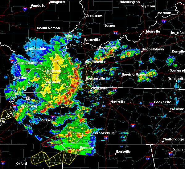 At 228 pm cdt, severe thunderstorms were located along a line extending from near cadiz to 11 miles north of big rock, moving northeast at 40 mph (radar indicated. winds have gusted to 49 mph near lake barkely state park as the storms moved through). Hazards include 60 mph wind gusts and quarter size hail. Hail damage to vehicles is expected. expect wind damage to roofs, siding, and trees. Locations impacted include, cadiz, canton, rockcastle and linton. At 228 pm cdt, severe thunderstorms were located along a line extending from near cadiz to 11 miles north of big rock, moving northeast at 40 mph (radar indicated. winds have gusted to 49 mph near lake barkely state park as the storms moved through). Hazards include 60 mph wind gusts and quarter size hail. Hail damage to vehicles is expected. expect wind damage to roofs, siding, and trees. Locations impacted include, cadiz, canton, rockcastle and linton.
|
| 3/27/2017 1:55 PM CDT |
 At 154 pm cdt, severe thunderstorms were located along a line extending from near land between the lakes area to 12 miles north of paris landing state park, moving northeast at 35 mph (trained weather spotters. hail to the size of golfballs have been reported with these storms). Hazards include 60 mph wind gusts and half dollar size hail. Hail damage to vehicles is expected. Expect wind damage to roofs, siding, and trees. At 154 pm cdt, severe thunderstorms were located along a line extending from near land between the lakes area to 12 miles north of paris landing state park, moving northeast at 35 mph (trained weather spotters. hail to the size of golfballs have been reported with these storms). Hazards include 60 mph wind gusts and half dollar size hail. Hail damage to vehicles is expected. Expect wind damage to roofs, siding, and trees.
|
| 3/9/2017 8:45 PM CST |
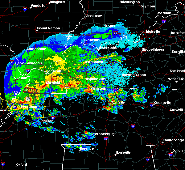 At 845 pm cst, a severe thunderstorm was located near canton, or 7 miles southeast of land between the lakes area, moving east at 50 mph (radar indicated). Hazards include 60 mph wind gusts and quarter size hail. Hail damage to vehicles is expected. Expect wind damage to roofs, siding, and trees. At 845 pm cst, a severe thunderstorm was located near canton, or 7 miles southeast of land between the lakes area, moving east at 50 mph (radar indicated). Hazards include 60 mph wind gusts and quarter size hail. Hail damage to vehicles is expected. Expect wind damage to roofs, siding, and trees.
|
| 3/9/2017 8:10 PM CST | Quarter sized hail reported 12.1 miles NE of Cadiz, KY |
| 3/9/2017 8:07 PM CST |
 At 806 pm cst, a severe thunderstorm was located over canton, or near land between the lakes area, moving northeast at 55 mph (radar indicated). Hazards include 60 mph wind gusts and quarter size hail. Hail damage to vehicles is expected. Expect wind damage to roofs, siding, and trees. At 806 pm cst, a severe thunderstorm was located over canton, or near land between the lakes area, moving northeast at 55 mph (radar indicated). Hazards include 60 mph wind gusts and quarter size hail. Hail damage to vehicles is expected. Expect wind damage to roofs, siding, and trees.
|
| 3/1/2017 6:00 AM CST | 69.9 mph measured on allen circle in trigg county KY, 3.9 miles E of Cadiz, KY |
| 3/1/2017 5:44 AM CST |
 At 543 am cst, severe thunderstorms were located along a line extending from near marion to 7 miles south of murray, moving east at 75 mph (radar indicated). Hazards include 70 mph wind gusts and penny size hail. Expect considerable tree damage. Damage is likely to mobile homes, roofs, and outbuildings. At 543 am cst, severe thunderstorms were located along a line extending from near marion to 7 miles south of murray, moving east at 75 mph (radar indicated). Hazards include 70 mph wind gusts and penny size hail. Expect considerable tree damage. Damage is likely to mobile homes, roofs, and outbuildings.
|
| 2/28/2017 11:40 PM CST | Some damage on old rocky point rd including roof damage... trees down... and fencing down. trees down on hwy 1253 and 158 in trigg county KY, 5.9 miles NW of Cadiz, KY |
| 2/28/2017 11:35 PM CST | Power lines down on south road and hwy 139 south of cadiz in trigg county KY, 6.5 miles NNE of Cadiz, KY |
| 2/28/2017 11:30 PM CST | Swath of tree damage roughly 1/2 mile path along donaldson creek road. some damage to houses as wel in trigg county KY, 8.8 miles NNE of Cadiz, KY |
| 2/28/2017 11:12 PM CST |
 At 1112 pm cst, severe thunderstorms were located along a line extending from cobb to 7 miles east of cadiz, moving northeast at 70 mph (radar indicated). Hazards include 60 mph wind gusts and quarter size hail. Hail damage to vehicles is expected. Expect wind damage to roofs, siding, and trees. At 1112 pm cst, severe thunderstorms were located along a line extending from cobb to 7 miles east of cadiz, moving northeast at 70 mph (radar indicated). Hazards include 60 mph wind gusts and quarter size hail. Hail damage to vehicles is expected. Expect wind damage to roofs, siding, and trees.
|
| 2/28/2017 10:49 PM CST |
 At 1048 pm cst, severe thunderstorms were located along a line extending from near land between the lakes area to 12 miles southwest of canton, moving northeast at 60 mph (radar indicated). Hazards include 60 mph wind gusts and quarter size hail. Hail damage to vehicles is expected. Expect wind damage to roofs, siding, and trees. At 1048 pm cst, severe thunderstorms were located along a line extending from near land between the lakes area to 12 miles southwest of canton, moving northeast at 60 mph (radar indicated). Hazards include 60 mph wind gusts and quarter size hail. Hail damage to vehicles is expected. Expect wind damage to roofs, siding, and trees.
|
| 2/7/2017 7:58 PM CST |
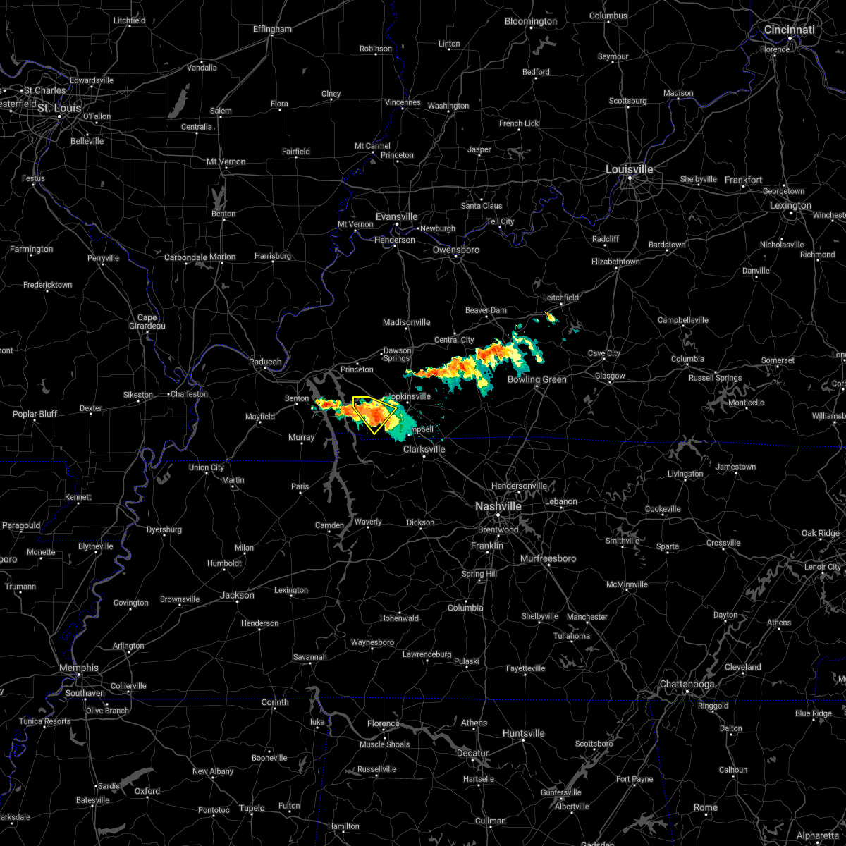 The severe thunderstorm warning for west central christian and southeastern trigg counties will expire at 800 pm cst, the storm which prompted the warning has weakened below severe limits, and no longer poses an immediate threat to life or property. therefore the warning will be allowed to expire. The severe thunderstorm warning for west central christian and southeastern trigg counties will expire at 800 pm cst, the storm which prompted the warning has weakened below severe limits, and no longer poses an immediate threat to life or property. therefore the warning will be allowed to expire.
|
| 2/7/2017 7:44 PM CST |
 At 743 pm cst, a severe thunderstorm was located over cadiz, moving southeast at 25 mph (trained weather spotters). Hazards include 60 mph wind gusts and quarter size hail. Hail damage to vehicles is expected. expect wind damage to roofs, siding, and trees. Locations impacted include, cadiz. At 743 pm cst, a severe thunderstorm was located over cadiz, moving southeast at 25 mph (trained weather spotters). Hazards include 60 mph wind gusts and quarter size hail. Hail damage to vehicles is expected. expect wind damage to roofs, siding, and trees. Locations impacted include, cadiz.
|
| 2/7/2017 7:40 PM CST | Quarter sized hail reported 6.6 miles ENE of Cadiz, KY |
| 2/7/2017 7:35 PM CST |
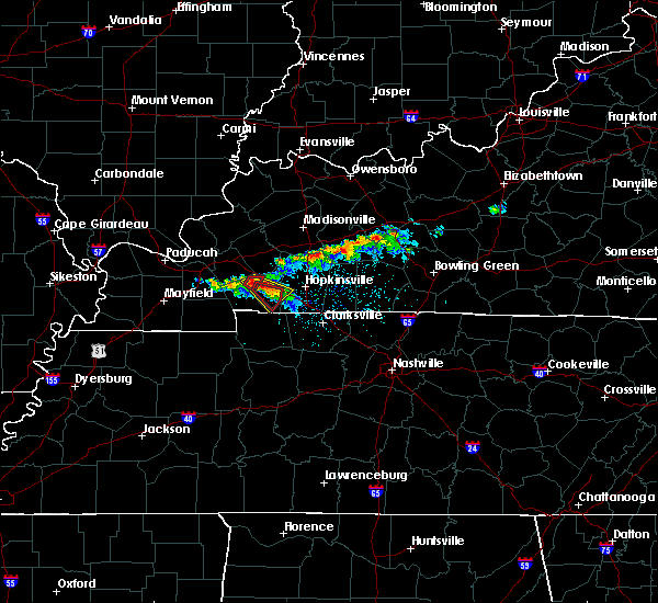 At 735 pm cst, a severe thunderstorm capable of producing a tornado was located just west of cadiz, moving southeast at 25 mph (radar indicated rotation). Hazards include tornado and quarter size hail. Flying debris will be dangerous to those caught without shelter. mobile homes will be damaged or destroyed. damage to roofs, windows, and vehicles will occur. tree damage is likely. This tornadic thunderstorm will remain over mainly rural areas of southeastern trigg county. At 735 pm cst, a severe thunderstorm capable of producing a tornado was located just west of cadiz, moving southeast at 25 mph (radar indicated rotation). Hazards include tornado and quarter size hail. Flying debris will be dangerous to those caught without shelter. mobile homes will be damaged or destroyed. damage to roofs, windows, and vehicles will occur. tree damage is likely. This tornadic thunderstorm will remain over mainly rural areas of southeastern trigg county.
|
| 2/7/2017 7:30 PM CST | Report of trees down across ky hwy 274 near 5 mile marker between cadiz and rockcastl in trigg county KY, 5.7 miles ESE of Cadiz, KY |
| 2/7/2017 7:30 PM CST | Quarter sized hail reported 3.2 miles SSE of Cadiz, KY, quarter sized hail reported on hwy 139 near trigg county recreation complex |
| 2/7/2017 7:30 PM CST | Golf Ball sized hail reported 5 miles E of Cadiz, KY, golf ball sized hail estimated on robert mitchell road west of cadiz. |
| 2/7/2017 7:28 PM CST |
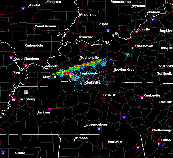 At 728 pm cst, a severe thunderstorm was located near cadiz, moving southeast at 25 mph (trained weather spotters). Hazards include 60 mph wind gusts and quarter size hail. Hail damage to vehicles is expected. Expect wind damage to roofs, siding, and trees. At 728 pm cst, a severe thunderstorm was located near cadiz, moving southeast at 25 mph (trained weather spotters). Hazards include 60 mph wind gusts and quarter size hail. Hail damage to vehicles is expected. Expect wind damage to roofs, siding, and trees.
|
| 2/7/2017 7:25 PM CST | Quarter sized hail reported 10.6 miles E of Cadiz, KY, near lakeshore drive area by lake barkley |
| 2/7/2017 7:20 PM CST | Quarter sized hail reported 1.7 miles E of Cadiz, KY, quarter sized hail in downtown cadiz via kentucky state police |
| 12/17/2016 6:38 PM CST |
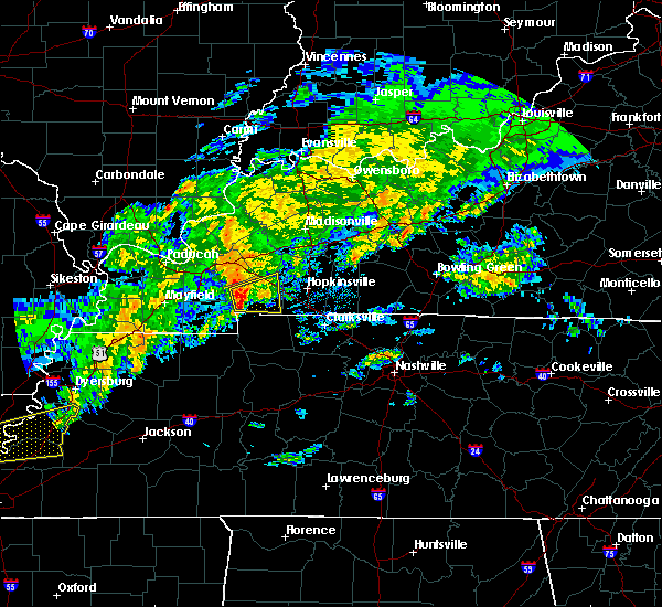 At 637 pm cst, a severe thunderstorm was located near land between the lakes area, moving northeast at 55 mph (radar indicated. spotter reported an estimated 50 mph wind near dexter in calloway county). Hazards include 60 mph wind gusts and quarter size hail. Hail damage to vehicles is expected. Expect wind damage to roofs, siding, and trees. At 637 pm cst, a severe thunderstorm was located near land between the lakes area, moving northeast at 55 mph (radar indicated. spotter reported an estimated 50 mph wind near dexter in calloway county). Hazards include 60 mph wind gusts and quarter size hail. Hail damage to vehicles is expected. Expect wind damage to roofs, siding, and trees.
|
| 8/1/2016 3:15 PM CDT |
 At 314 pm cdt, a cluster of severe thunderstorms was located 7 miles southwest of eddyville, moving east southeast at 30 mph (radar indicated). Hazards include 70 mph wind gusts. Expect considerable tree damage. Damage is likely to mobile homes, roofs, and outbuildings. At 314 pm cdt, a cluster of severe thunderstorms was located 7 miles southwest of eddyville, moving east southeast at 30 mph (radar indicated). Hazards include 70 mph wind gusts. Expect considerable tree damage. Damage is likely to mobile homes, roofs, and outbuildings.
|
| 7/8/2016 7:17 PM CDT |
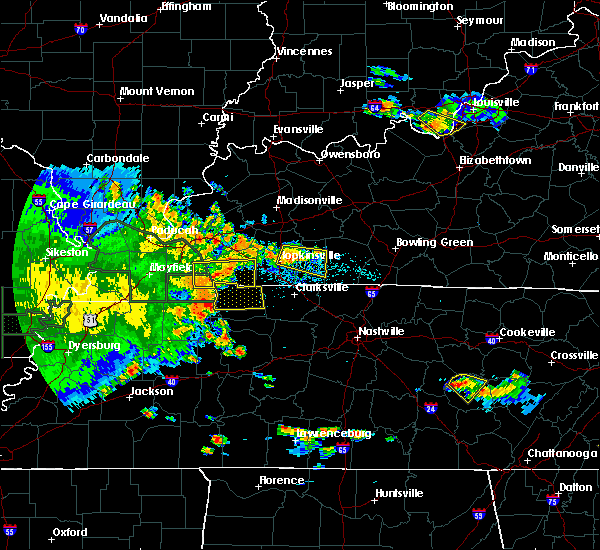 At 717 pm cdt, severe thunderstorms were located along a line extending from near canton to 9 miles west of big rock, moving east at 50 mph. the storm produced damage in almo, ky (radar indicated). Hazards include 60 mph wind gusts. Expect damage to roofs. siding. and trees. Locations impacted include, cadiz, land between the lakes area, canton, energy and linton. At 717 pm cdt, severe thunderstorms were located along a line extending from near canton to 9 miles west of big rock, moving east at 50 mph. the storm produced damage in almo, ky (radar indicated). Hazards include 60 mph wind gusts. Expect damage to roofs. siding. and trees. Locations impacted include, cadiz, land between the lakes area, canton, energy and linton.
|
| 7/8/2016 7:15 PM CDT | Multiple trees down on linton roa in trigg county KY, 14.4 miles NNE of Cadiz, KY |
| 7/8/2016 6:54 PM CDT |
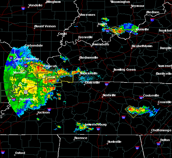 At 654 pm cdt, severe thunderstorms were located along a line extending from 7 miles east of benton to near murray, moving east at 50 mph (radar indicated). Hazards include 60 mph wind gusts. Expect damage to roofs. siding. And trees. At 654 pm cdt, severe thunderstorms were located along a line extending from 7 miles east of benton to near murray, moving east at 50 mph (radar indicated). Hazards include 60 mph wind gusts. Expect damage to roofs. siding. And trees.
|
| 7/6/2016 2:53 PM CDT | . in trigg county KY, 6.7 miles E of Cadiz, KY |
| 7/6/2016 2:30 PM CDT | Trees and power lines down across the cit in trigg county KY, 2.9 miles ENE of Cadiz, KY |
| 7/6/2016 2:28 PM CDT | From davis weather instrument in trigg county KY, 12.1 miles ENE of Cadiz, KY |
| 7/6/2016 2:25 PM CDT | Trees down. other trees down across count in trigg county KY, 8.6 miles ESE of Cadiz, KY |
| 7/6/2016 2:18 PM CDT |
 At 217 pm cdt, severe thunderstorms were located along a line extending from marion to near energy to 8 miles southeast of murray, moving east at 60 mph (radar indicated). Hazards include 70 mph wind gusts and penny size hail. Expect considerable tree damage. Damage is likely to mobile homes, roofs, and outbuildings. At 217 pm cdt, severe thunderstorms were located along a line extending from marion to near energy to 8 miles southeast of murray, moving east at 60 mph (radar indicated). Hazards include 70 mph wind gusts and penny size hail. Expect considerable tree damage. Damage is likely to mobile homes, roofs, and outbuildings.
|
| 7/6/2016 1:20 PM CDT |
 At 119 pm cdt, a severe thunderstorm was located 7 miles west of crofton, or 8 miles southeast of dawson springs, moving northeast at 55 mph (radar indicated). Hazards include 60 mph wind gusts. Expect damage to roofs. siding. and trees. Locations impacted include, cadiz. At 119 pm cdt, a severe thunderstorm was located 7 miles west of crofton, or 8 miles southeast of dawson springs, moving northeast at 55 mph (radar indicated). Hazards include 60 mph wind gusts. Expect damage to roofs. siding. and trees. Locations impacted include, cadiz.
|
| 7/6/2016 1:16 PM CDT |
 At 116 pm cdt, a severe thunderstorm was located near cobb, or near cadiz, moving east at 25 mph (radar indicated). Hazards include 60 mph wind gusts. Expect damage to roofs. siding. And trees. At 116 pm cdt, a severe thunderstorm was located near cobb, or near cadiz, moving east at 25 mph (radar indicated). Hazards include 60 mph wind gusts. Expect damage to roofs. siding. And trees.
|
| 7/6/2016 1:12 PM CDT |
 At 111 pm cdt, a severe thunderstorm was located over cobb, or 9 miles southeast of princeton, moving northeast at 35 mph (radar indicated). Hazards include 60 mph wind gusts. Expect damage to roofs. siding. and trees. Locations impacted include, cadiz, canton and rockcastle. At 111 pm cdt, a severe thunderstorm was located over cobb, or 9 miles southeast of princeton, moving northeast at 35 mph (radar indicated). Hazards include 60 mph wind gusts. Expect damage to roofs. siding. and trees. Locations impacted include, cadiz, canton and rockcastle.
|
| 7/6/2016 1:00 PM CDT |
 At 100 pm cdt, a severe thunderstorm was located 8 miles northwest of cadiz, moving northeast at 35 mph (radar indicated). Hazards include 60 mph wind gusts. Expect damage to roofs. siding. And trees. At 100 pm cdt, a severe thunderstorm was located 8 miles northwest of cadiz, moving northeast at 35 mph (radar indicated). Hazards include 60 mph wind gusts. Expect damage to roofs. siding. And trees.
|
| 6/15/2016 2:45 PM CDT | Tree down along south roa in trigg county KY, 2.7 miles NE of Cadiz, KY |
| 6/15/2016 2:35 PM CDT | Tree down along linton road. lost all of the traffic barrels on the new barkley bridge projec in trigg county KY, 10.6 miles ENE of Cadiz, KY |
| 6/15/2016 2:09 PM CDT |
 At 208 pm cdt, a severe thunderstorm was located over canton, or over the land between the lakes area, moving southeast at 45 mph (radar indicated). Hazards include 60 mph wind gusts. Expect damage to roofs. siding. And trees. At 208 pm cdt, a severe thunderstorm was located over canton, or over the land between the lakes area, moving southeast at 45 mph (radar indicated). Hazards include 60 mph wind gusts. Expect damage to roofs. siding. And trees.
|
| 5/26/2016 2:45 PM CDT | Quarter sized hail reported 7.4 miles NE of Cadiz, KY, quarter size hail 6 mi sw of cadiz. |
| 5/10/2016 7:01 PM CDT |
 At 659 pm cdt, a severe thunderstorm capable of producing a tornado was located near cadiz, moving east at 35 mph (radar indicated rotation). Hazards include tornado and quarter size hail. Flying debris will be dangerous to those caught without shelter. mobile homes will be damaged or destroyed. damage to roofs, windows, and vehicles will occur. tree damage is likely. This tornadic thunderstorm will remain over mainly rural areas of northeastern trigg and west central christian counties. At 659 pm cdt, a severe thunderstorm capable of producing a tornado was located near cadiz, moving east at 35 mph (radar indicated rotation). Hazards include tornado and quarter size hail. Flying debris will be dangerous to those caught without shelter. mobile homes will be damaged or destroyed. damage to roofs, windows, and vehicles will occur. tree damage is likely. This tornadic thunderstorm will remain over mainly rural areas of northeastern trigg and west central christian counties.
|
| 5/10/2016 4:11 PM CDT |
 At 411 pm cdt, a severe thunderstorm capable of producing a tornado was located 8 miles northwest of cadiz, moving east at 40 mph (radar indicated rotation). Hazards include tornado. Flying debris will be dangerous to those caught without shelter. mobile homes will be damaged or destroyed. damage to roofs, windows, and vehicles will occur. tree damage is likely. This dangerous storm will be near, cobb around 425 pm cdt. At 411 pm cdt, a severe thunderstorm capable of producing a tornado was located 8 miles northwest of cadiz, moving east at 40 mph (radar indicated rotation). Hazards include tornado. Flying debris will be dangerous to those caught without shelter. mobile homes will be damaged or destroyed. damage to roofs, windows, and vehicles will occur. tree damage is likely. This dangerous storm will be near, cobb around 425 pm cdt.
|
| 12/23/2015 5:30 PM CST | A severe thunderstorm warning remains in effect until 545 pm cst for trigg county. at 529 pm cst. a severe thunderstorm was located near big rock. or 11 miles north of dover. moving northeast at 65 mph. hazard. 60 mph wind gusts and penny size hail. source. Radar indicated. |
| 12/23/2015 5:15 PM CST | The national weather service in paducah has issued a * severe thunderstorm warning for. southeastern calloway county in western kentucky. trigg county in western kentucky. until 545 pm cst * at 515 pm cst. A severe thunderstorm was located near paris. |
| 12/23/2015 5:05 PM CST | A tree fell on a house in trigg county KY, 1.7 miles E of Cadiz, KY |
| 12/23/2015 4:47 PM CST | At 446 pm cst, a severe thunderstorm was located over cadiz, moving northeast at 60 mph (radar indicated). Hazards include 60 mph wind gusts and nickel size hail. Expect damage to roofs. Siding and trees. |
| 9/6/2015 5:45 PM CDT | Tin roof peeled off barn. crops flattene in trigg county KY, 8.5 miles NW of Cadiz, KY |
| 7/7/2015 6:10 PM CDT |
 The severe thunderstorm warning for central christian and northeastern trigg counties will expire at 615 pm cdt, the storm which prompted the warning has weakened below severe limits, and no longer pose an immediate threat to life or property. therefore the warning will be allowed to expire. The severe thunderstorm warning for central christian and northeastern trigg counties will expire at 615 pm cdt, the storm which prompted the warning has weakened below severe limits, and no longer pose an immediate threat to life or property. therefore the warning will be allowed to expire.
|
| 7/7/2015 5:32 PM CDT |
 At 532 pm cdt, a severe thunderstorm was located near cadiz, moving east at 40 mph (radar indicated). Hazards include 60 mph wind gusts. Expect damage to roofs. Siding and trees. At 532 pm cdt, a severe thunderstorm was located near cadiz, moving east at 40 mph (radar indicated). Hazards include 60 mph wind gusts. Expect damage to roofs. Siding and trees.
|
| 6/26/2015 1:51 PM CDT |
 At 151 pm cdt, severe thunderstorms were located along a line extending from eddyville to near energy, moving east at 35 mph (radar indicated). Hazards include 60 mph wind gusts and penny size hail. Expect damage to roofs. Siding and trees. At 151 pm cdt, severe thunderstorms were located along a line extending from eddyville to near energy, moving east at 35 mph (radar indicated). Hazards include 60 mph wind gusts and penny size hail. Expect damage to roofs. Siding and trees.
|
| 6/8/2015 1:56 PM CDT |
 At 156 pm cdt, a severe thunderstorm was located 9 miles northwest of cadiz, moving east at 35 mph (radar indicated). Hazards include 60 mph wind gusts and quarter size hail. Hail damage to vehicles is expected. Expect wind damage to roofs, siding and trees. At 156 pm cdt, a severe thunderstorm was located 9 miles northwest of cadiz, moving east at 35 mph (radar indicated). Hazards include 60 mph wind gusts and quarter size hail. Hail damage to vehicles is expected. Expect wind damage to roofs, siding and trees.
|
| 6/8/2015 12:42 PM CDT |
 At 1242 pm cdt, a severe thunderstorm was located 10 miles southwest of land between the lakes area, moving east at 25 mph (radar indicated). Hazards include 60 mph wind gusts and quarter size hail. Hail damage to vehicles is expected. Expect wind damage to roofs, siding and trees. At 1242 pm cdt, a severe thunderstorm was located 10 miles southwest of land between the lakes area, moving east at 25 mph (radar indicated). Hazards include 60 mph wind gusts and quarter size hail. Hail damage to vehicles is expected. Expect wind damage to roofs, siding and trees.
|
| 10/3/2014 12:55 AM CDT | Trees down. construction barrels blown around i-24 some into nearby field east of cadiz as wel in trigg county KY, 1.7 miles E of Cadiz, KY |
| 7/1/2014 7:21 PM CDT | One large tree down on west bound lane of highway 68. relayed from spotte in trigg county KY, 3.9 miles E of Cadiz, KY |
| 6/4/2014 10:27 PM CDT | Power outages reported in the communit in trigg county KY, 10.6 miles ENE of Cadiz, KY |
| 12/21/2013 6:57 PM CST | Approx. 1000 households without electricity in the c in trigg county KY, 10.6 miles ENE of Cadiz, KY |
| 12/21/2013 6:08 PM CST | Reported near montgomery at interstate 24 by trigg county spotter chie in trigg county KY, 2.8 miles WSW of Cadiz, KY |
| 11/17/2013 5:00 PM CST | Late report. large tree blocking hwy 68 near hwy 274 west of cadi in trigg county KY, 1.7 miles E of Cadiz, KY |
| 10/31/2013 10:51 PM CDT | Numerous trees dow in trigg county KY, 1.7 miles E of Cadiz, KY |
| 10/31/2013 9:51 PM CDT | Numerous trees dow in trigg county KY, 1.7 miles E of Cadiz, KY |
| 9/11/2013 4:45 PM CDT | Several trees down and a healthy one foot diameter tree limb down along route 139 north and south of cadiz. minor street flooding reported as wel in trigg county KY, 1.7 miles E of Cadiz, KY |
| 9/11/2013 4:45 PM CDT | Two trees down across will jackson road. a trampoline was also blown on a house roo in trigg county KY, 1.7 miles E of Cadiz, KY |
| 6/26/2013 9:45 PM CDT | Trees dow in trigg county KY, 11.3 miles E of Cadiz, KY |
| 9/7/2012 10:32 PM CDT | Powerlines down in trigg county KY, 1.7 miles E of Cadiz, KY |
| 8/16/2012 8:45 PM CDT | Tree down on powerline across state route 139 south of cadiz. in addition...lightning started some trees on fire in the roaring springs area of the count in trigg county KY, 2.7 miles NE of Cadiz, KY |
| 8/16/2012 8:45 PM CDT | Tree down on powerline across state route 139 south of cadi in trigg county KY, 2.7 miles NE of Cadiz, KY |
| 8/16/2012 8:45 PM CDT | Tree down on car on adams mill road off of state route 139 north of cadiz. one person trapped...condition unknown. emergency vehicles enroute. report received 908 pm cd in trigg county KY, 4.4 miles SSE of Cadiz, KY |
| 7/2/2012 7:30 PM CDT | Two 40 inch trees snapped off at the ground. wood garage leveled. several awnings and carports with damage in trigg county KY, 1.7 miles E of Cadiz, KY |
| 3/2/2012 2:57 PM CST | Barn and silo damage...structural damage to outbuilding and several power lines down on highway 27 in trigg county KY, 3.3 miles W of Cadiz, KY |
| 3/2/2012 2:55 PM CST | Pea size hail reported with this stor in trigg county KY, 11.6 miles ENE of Cadiz, KY |
| 1/1/0001 12:00 AM | Golf Ball sized hail reported 1.7 miles E of Cadiz, KY, golf ball size hail damaged roof of homes along princeton road and stone road. late report. |
| 1/1/0001 12:00 AM | Quarter sized hail reported 1.7 miles E of Cadiz, KY |
| 1/1/0001 12:00 AM | Storm damage reported in trigg county KY, 1.7 miles E of Cadiz, KY |
| 1/1/0001 12:00 AM | Quarter sized hail reported 1.7 miles E of Cadiz, KY, quarter size hail in cadiz. |
| 1/1/0001 12:00 AM | Quarter sized hail reported 1.7 miles E of Cadiz, KY, quarter size hail at the airport. |
| 1/1/0001 12:00 AM | Quarter sized hail reported 14.7 miles E of Cadiz, KY, quarter size hail in the lbl area. |
| 1/1/0001 12:00 AM | Quarter sized hail reported 12.5 miles N of Cadiz, KY, quarter size hail reported at the intersection of hwys 139 and 164. |
| 1/1/0001 12:00 AM | Reports of several large tree limbs dow in trigg county KY, 1.7 miles E of Cadiz, KY |
| 1/1/0001 12:00 AM | Storm damage reported in trigg county KY, 4.4 miles SSE of Cadiz, KY |
| 1/1/0001 12:00 AM | Late report...part of roof off of linton methodist church and numerous trees dow in trigg county KY, 14.4 miles NNE of Cadiz, KY |
| 1/1/0001 12:00 AM | Storm damage reported in trigg county KY, 5.3 miles ENE of Cadiz, KY |
| 1/1/0001 12:00 AM | Late report...time estimated...at least dozens of large trees down along the south side of main street with damage to dozens of home in trigg county KY, 1.7 miles E of Cadiz, KY |
| 1/1/0001 12:00 AM | Microburst occurred with wind speeds estimated at around 100 mph. there was light to moderate damage to about 30 homes...mainly due to fallen trees. one home destroyed in trigg county KY, 1.7 miles E of Cadiz, KY |
| 1/1/0001 12:00 AM | Measured along interstate 64 near mile marker 5 in trigg county KY, 1.7 miles E of Cadiz, KY |
| 1/1/0001 12:00 AM | Quarter sized hail reported 14.4 miles NNE of Cadiz, KY |
| 1/1/0001 12:00 AM | Quarter sized hail reported 1.7 miles E of Cadiz, KY, nickel to quarter size hail on canton road at eoc building |
| 1/1/0001 12:00 AM | Trees down on line street and cerulean road in trigg county KY, 1.7 miles E of Cadiz, KY |
| 1/1/0001 12:00 AM | Several trees and tree limbs down or broken. some shingles off several homes on highway 13 in trigg county KY, 4.7 miles ESE of Cadiz, KY |
Hail Maps for Cadiz, KY


Connect with Interactive Hail Maps