

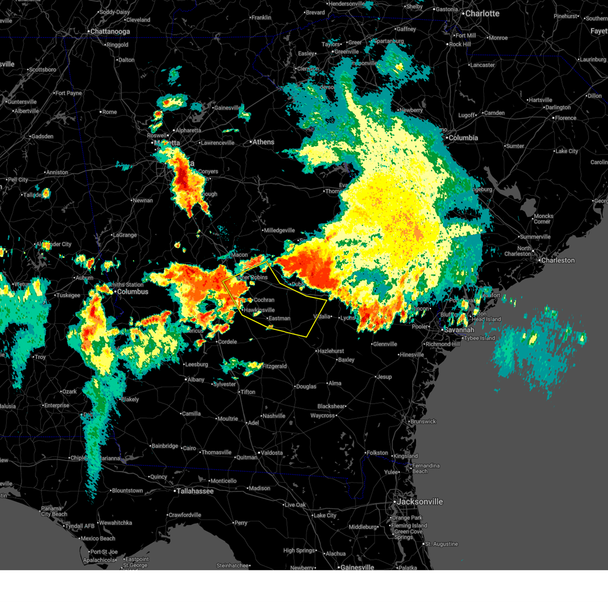
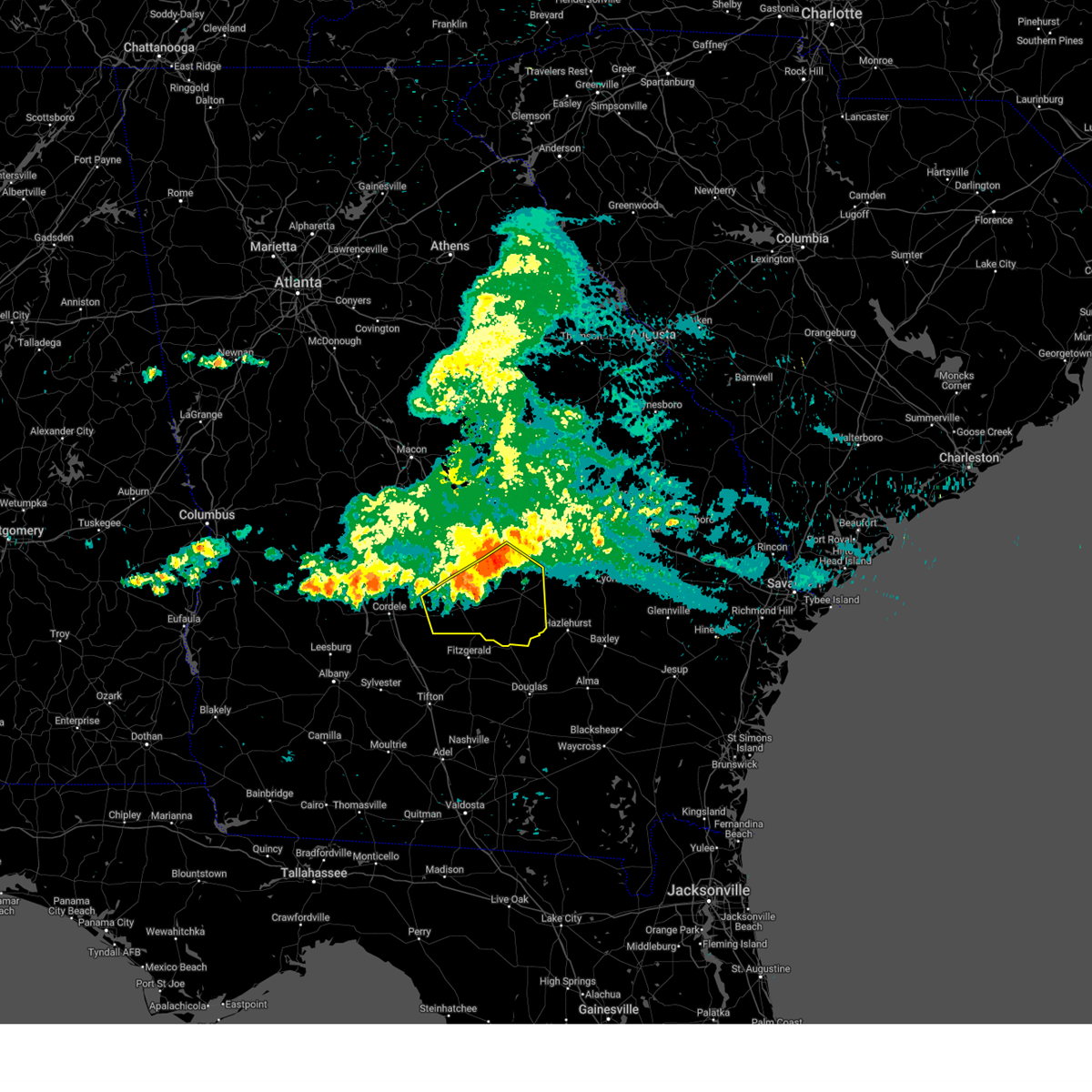
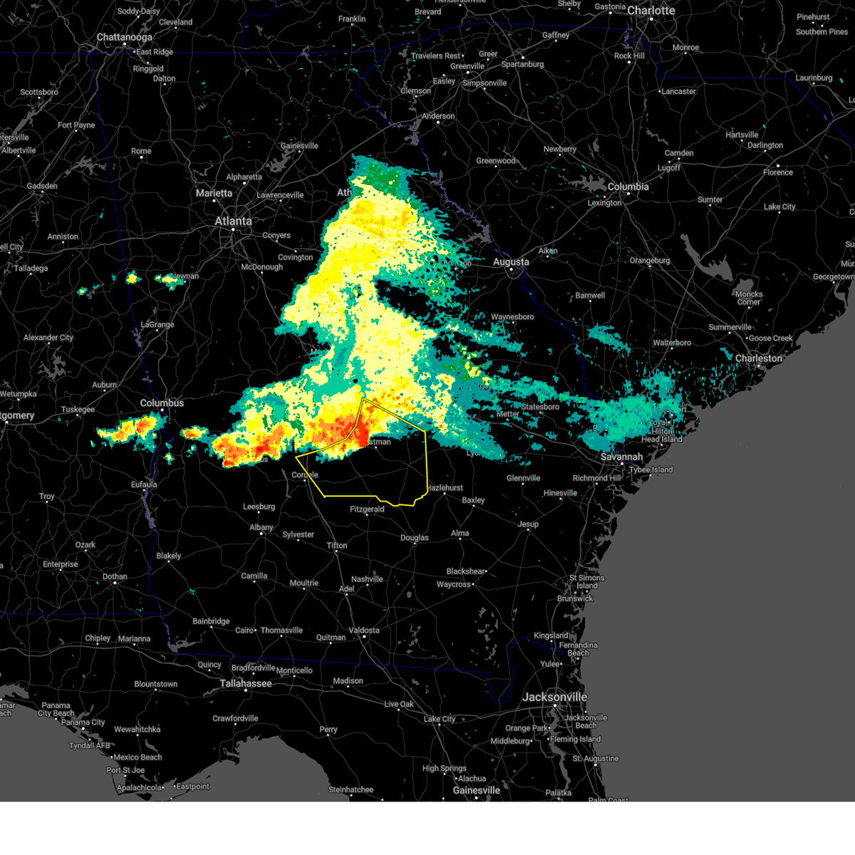
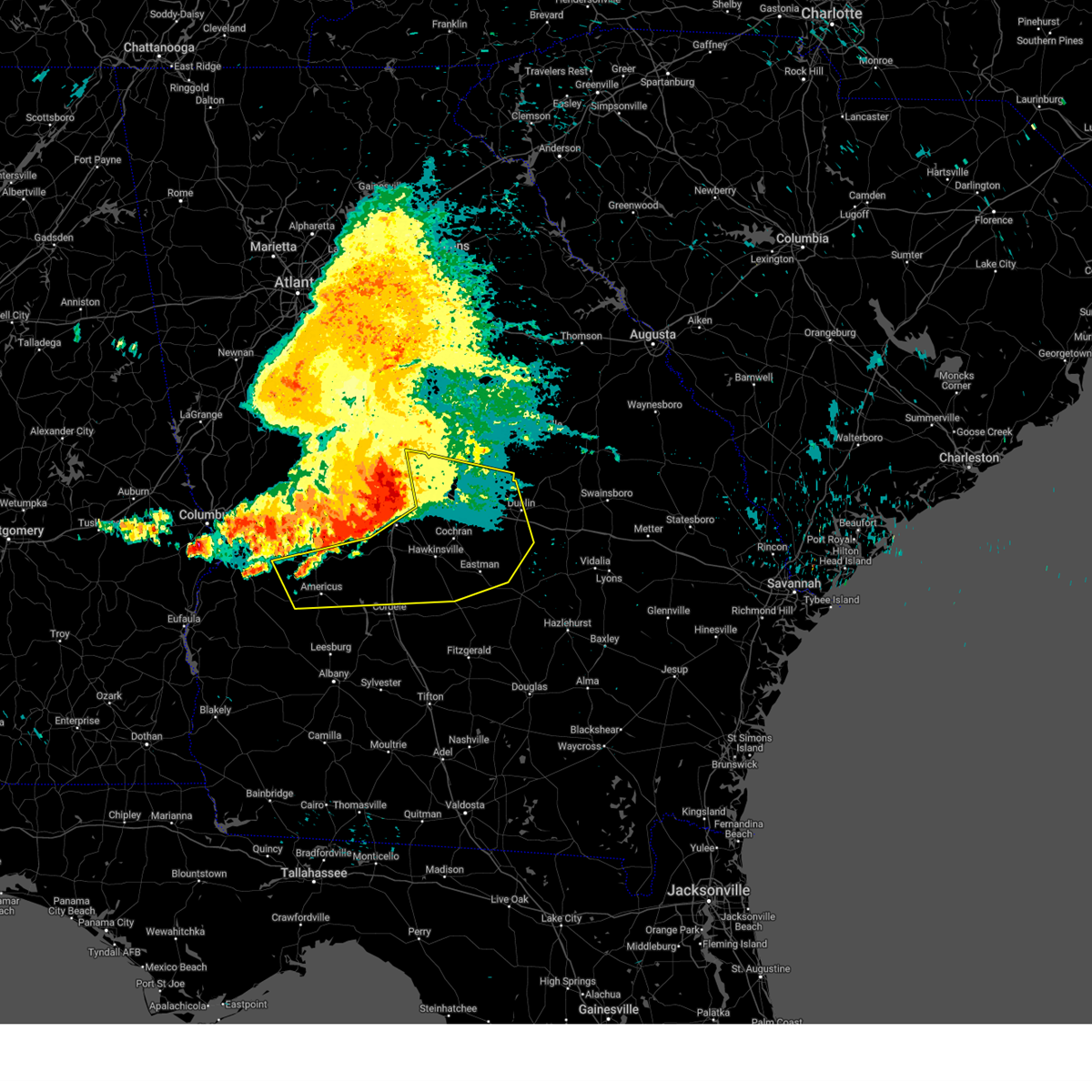
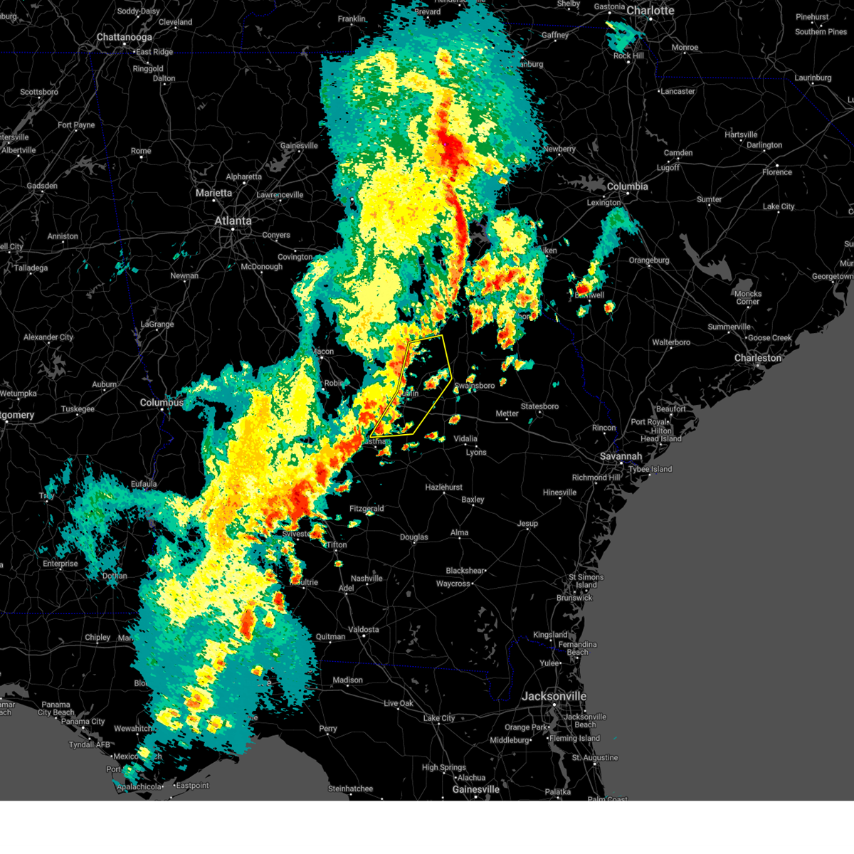
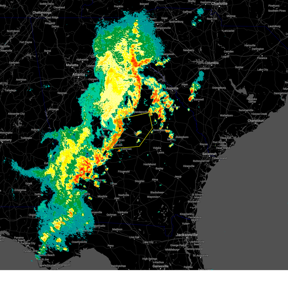
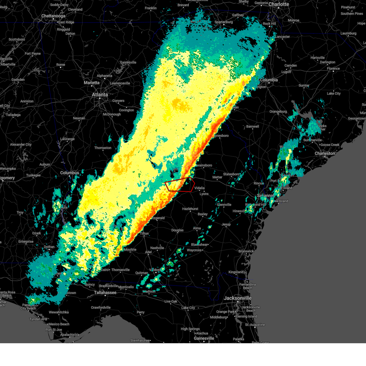
Hail Map for Cadwell, GA
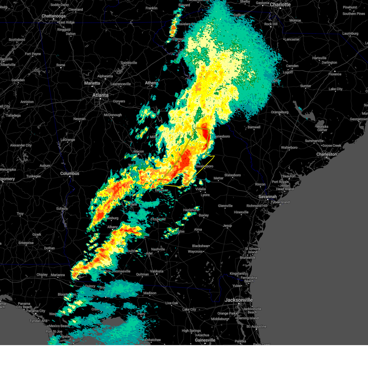
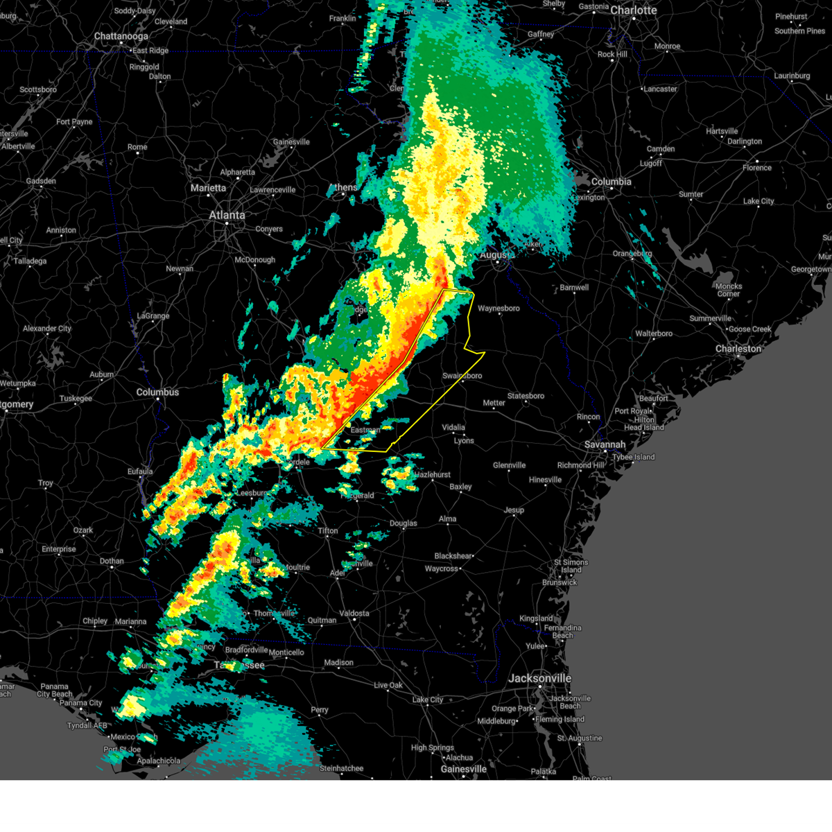
The Cadwell, GA area has had 0 reports of on-the-ground hail by trained spotters, and has been under severe weather warnings 33 times during the past 12 months. Doppler radar has detected hail at or near Cadwell, GA on 38 occasions, including 2 occasions during the past year.
| Name: | Cadwell, GA |
| Where Located: | 58.6 miles N of Douglas, GA |
| Map: | Google Map for Cadwell, GA |
| Population: | 528 |
| Housing Units: | 174 |
| More Info: | Search Google for Cadwell, GA |
3
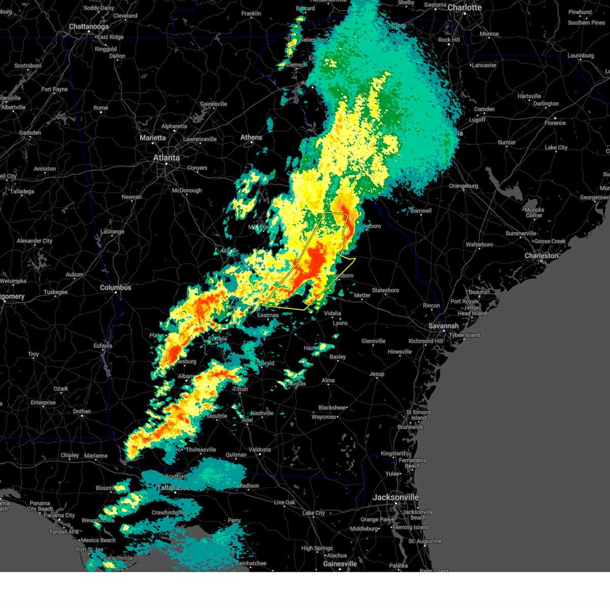
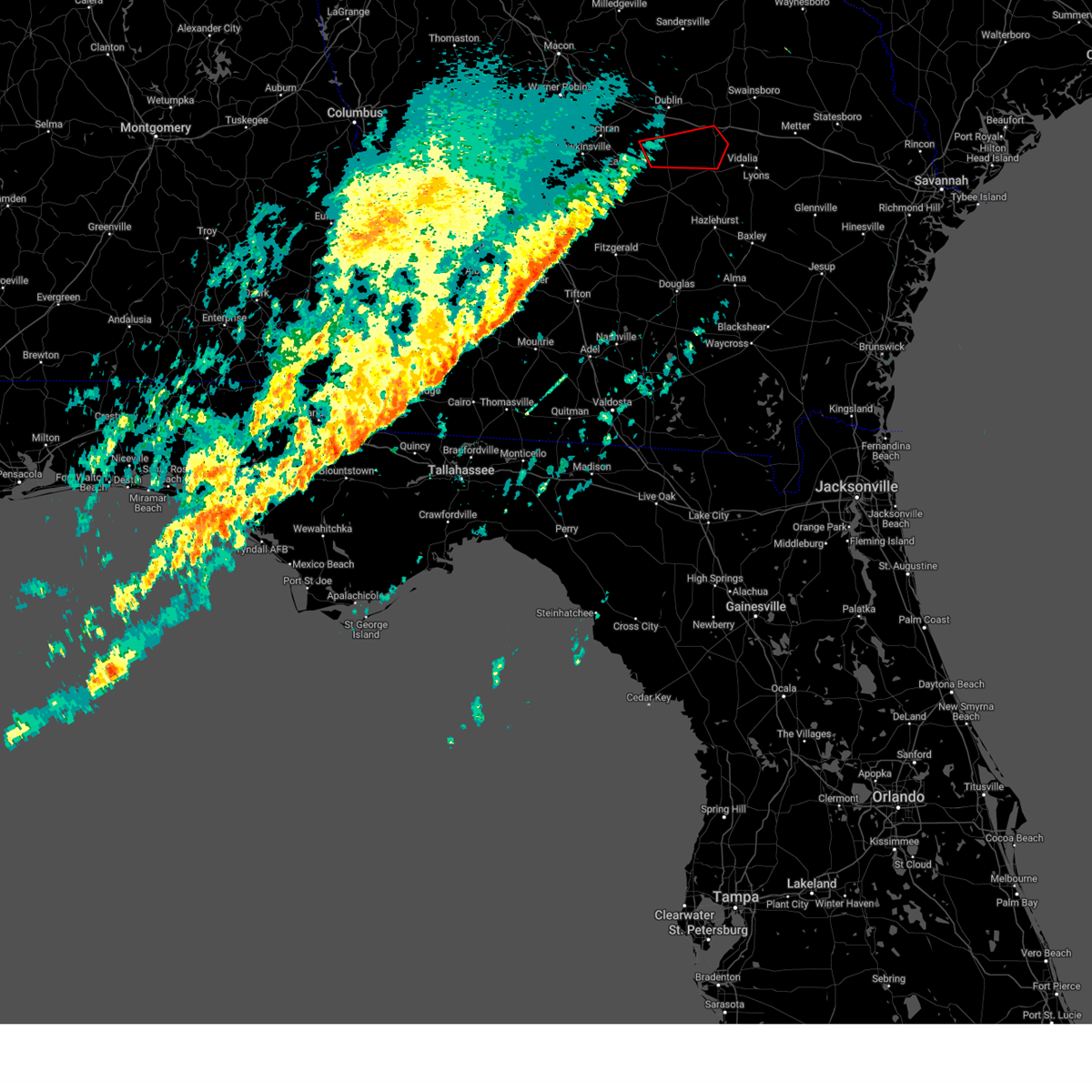
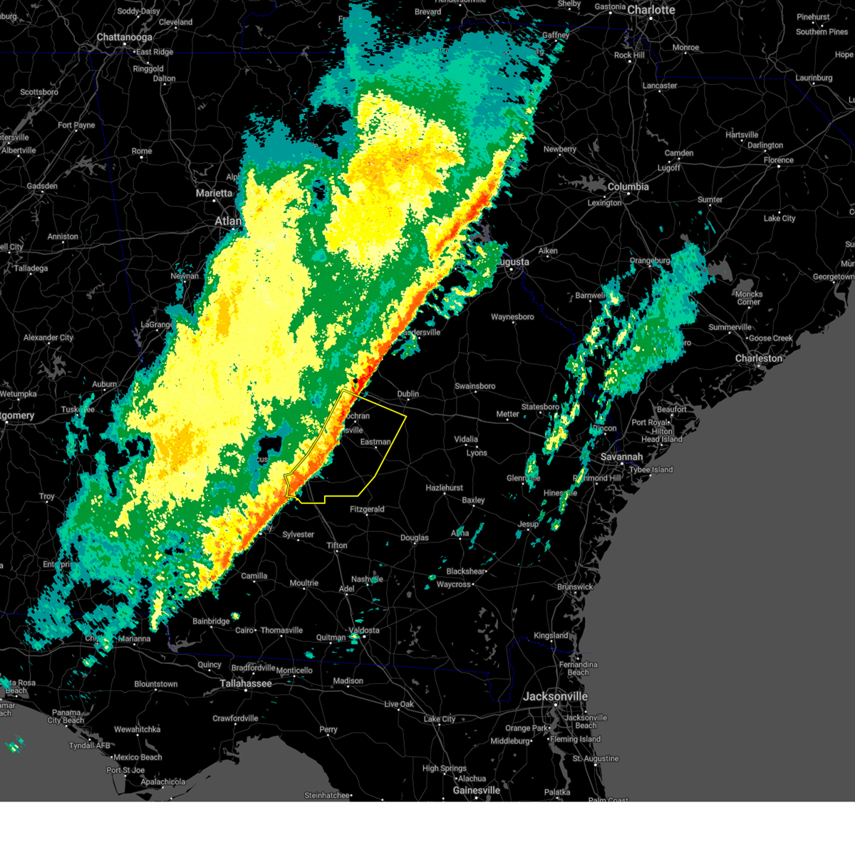
The Top Recent Hail Date for Cadwell, GA is Monday, March 31, 2025 (12th out of 38)

Hail and Wind Damage Spotted near Cadwell, GA
| Date / Time | Report Details |
|---|---|
| 6/26/2025 12:32 AM EDT |
 Svrffc the national weather service in peachtree city has issued a * severe thunderstorm warning for, southwestern wilkinson county in central georgia, laurens county in central georgia, dodge county in central georgia, central pulaski county in central georgia, southern twiggs county in central georgia, north central telfair county in central georgia, southwestern treutlen county in east central georgia, bleckley county in central georgia, eastern houston county in central georgia, wheeler county in central georgia, northwestern montgomery county in central georgia, * until 130 am edt. * at 1232 am edt, severe thunderstorms were located along a line extending from near danville to near dudley to near lowery to near zaidee, moving southwest at 30 mph (radar indicated). Hazards include 60 mph wind gusts and quarter size hail. Hail damage to vehicles is expected. Expect wind damage to roofs, siding, and trees. Svrffc the national weather service in peachtree city has issued a * severe thunderstorm warning for, southwestern wilkinson county in central georgia, laurens county in central georgia, dodge county in central georgia, central pulaski county in central georgia, southern twiggs county in central georgia, north central telfair county in central georgia, southwestern treutlen county in east central georgia, bleckley county in central georgia, eastern houston county in central georgia, wheeler county in central georgia, northwestern montgomery county in central georgia, * until 130 am edt. * at 1232 am edt, severe thunderstorms were located along a line extending from near danville to near dudley to near lowery to near zaidee, moving southwest at 30 mph (radar indicated). Hazards include 60 mph wind gusts and quarter size hail. Hail damage to vehicles is expected. Expect wind damage to roofs, siding, and trees.
|
| 5/27/2025 7:10 PM EDT |
 The storms which prompted the warning have weakened below severe limits, and have exited the warned area. therefore, the warning will be allowed to expire. however, gusty winds are still possible with these thunderstorms. a severe thunderstorm watch remains in effect until 900 pm edt for central georgia. The storms which prompted the warning have weakened below severe limits, and have exited the warned area. therefore, the warning will be allowed to expire. however, gusty winds are still possible with these thunderstorms. a severe thunderstorm watch remains in effect until 900 pm edt for central georgia.
|
| 5/27/2025 6:49 PM EDT |
 Svrffc the national weather service in peachtree city has issued a * severe thunderstorm warning for, west central laurens county in central georgia, northwestern dodge county in central georgia, southeastern bleckley county in central georgia, * until 715 pm edt. * at 649 pm edt, severe thunderstorms were located along a line extending from near goldsboro to near gresston, moving east at 25 mph (radar indicated). Hazards include 60 mph wind gusts and penny size hail. expect damage to roofs, siding, and trees Svrffc the national weather service in peachtree city has issued a * severe thunderstorm warning for, west central laurens county in central georgia, northwestern dodge county in central georgia, southeastern bleckley county in central georgia, * until 715 pm edt. * at 649 pm edt, severe thunderstorms were located along a line extending from near goldsboro to near gresston, moving east at 25 mph (radar indicated). Hazards include 60 mph wind gusts and penny size hail. expect damage to roofs, siding, and trees
|
| 5/18/2025 11:59 AM EDT |
 the severe thunderstorm warning has been cancelled and is no longer in effect the severe thunderstorm warning has been cancelled and is no longer in effect
|
| 5/18/2025 11:49 AM EDT |
 the severe thunderstorm warning has been cancelled and is no longer in effect the severe thunderstorm warning has been cancelled and is no longer in effect
|
| 5/18/2025 11:49 AM EDT |
 At 1149 am edt, severe thunderstorms were located along a line extending from near plainfield to chauncey to near milan to abbeville to near rochelle, moving southeast at 45 mph (radar indicated). Hazards include 60 mph wind gusts. Expect damage to roofs, siding, and trees. Locations impacted include, mcrae, eastman, abbeville, alamo, helena, rochelle, milan, cadwell, pineview, rhine, scotland, chauncey, jacksonville, union, towns, horse creek wma, plainfield, cedar grove, ocmulgee banks, and jay bird springs. At 1149 am edt, severe thunderstorms were located along a line extending from near plainfield to chauncey to near milan to abbeville to near rochelle, moving southeast at 45 mph (radar indicated). Hazards include 60 mph wind gusts. Expect damage to roofs, siding, and trees. Locations impacted include, mcrae, eastman, abbeville, alamo, helena, rochelle, milan, cadwell, pineview, rhine, scotland, chauncey, jacksonville, union, towns, horse creek wma, plainfield, cedar grove, ocmulgee banks, and jay bird springs.
|
| 5/18/2025 11:27 AM EDT |
 Svrffc the national weather service in peachtree city has issued a * severe thunderstorm warning for, southern laurens county in central georgia, dodge county in central georgia, southern pulaski county in central georgia, telfair county in central georgia, wilcox county in central georgia, southeastern dooly county in central georgia, central bleckley county in central georgia, western wheeler county in central georgia, northeastern crisp county in central georgia, * until 1215 pm edt. * at 1124 am edt, severe thunderstorms were located along a line extending from near cochran to dubois to near ocmulgee banks to near finleyson to near vienna, moving southeast at 45 mph (radar indicated). Hazards include 60 mph wind gusts. expect damage to roofs, siding, and trees Svrffc the national weather service in peachtree city has issued a * severe thunderstorm warning for, southern laurens county in central georgia, dodge county in central georgia, southern pulaski county in central georgia, telfair county in central georgia, wilcox county in central georgia, southeastern dooly county in central georgia, central bleckley county in central georgia, western wheeler county in central georgia, northeastern crisp county in central georgia, * until 1215 pm edt. * at 1124 am edt, severe thunderstorms were located along a line extending from near cochran to dubois to near ocmulgee banks to near finleyson to near vienna, moving southeast at 45 mph (radar indicated). Hazards include 60 mph wind gusts. expect damage to roofs, siding, and trees
|
| 5/18/2025 10:46 AM EDT |
 Svrffc the national weather service in peachtree city has issued a * severe thunderstorm warning for, central laurens county in central georgia, dodge county in central georgia, southeastern marion county in west central georgia, southeastern bibb county in central georgia, houston county in central georgia, sumter county in west central georgia, northern crisp county in central georgia, southern wilkinson county in central georgia, southern macon county in west central georgia, pulaski county in central georgia, twiggs county in central georgia, northwestern wilcox county in central georgia, dooly county in central georgia, bleckley county in central georgia, east central webster county in west central georgia, schley county in west central georgia, * until 1130 am edt. * at 1045 am edt, severe thunderstorms were located along a line extending from near skipperton to centerville to near meadowdale to near whitewater state park to near buena vista, moving east at 55 mph (radar indicated). Hazards include 60 mph wind gusts. expect damage to roofs, siding, and trees Svrffc the national weather service in peachtree city has issued a * severe thunderstorm warning for, central laurens county in central georgia, dodge county in central georgia, southeastern marion county in west central georgia, southeastern bibb county in central georgia, houston county in central georgia, sumter county in west central georgia, northern crisp county in central georgia, southern wilkinson county in central georgia, southern macon county in west central georgia, pulaski county in central georgia, twiggs county in central georgia, northwestern wilcox county in central georgia, dooly county in central georgia, bleckley county in central georgia, east central webster county in west central georgia, schley county in west central georgia, * until 1130 am edt. * at 1045 am edt, severe thunderstorms were located along a line extending from near skipperton to centerville to near meadowdale to near whitewater state park to near buena vista, moving east at 55 mph (radar indicated). Hazards include 60 mph wind gusts. expect damage to roofs, siding, and trees
|
| 3/31/2025 3:16 PM EDT |
 the severe thunderstorm warning has been cancelled and is no longer in effect the severe thunderstorm warning has been cancelled and is no longer in effect
|
| 3/31/2025 3:16 PM EDT |
 At 316 pm edt, severe thunderstorms were located along a line extending from 6 miles east of oconee to near brewton to plainfield, moving east at 45 mph (radar indicated). Hazards include 60 mph wind gusts and penny size hail. Expect damage to roofs, siding, and trees. Locations impacted include, tennille, spann, donovan, plainfield, dublin, tuckers crossroad, east dublin, minter, pringle, lovett, rentz, harlow, harrison, cadwell, new home, dexter, brewton, wrightsville, riddleville, and scott. At 316 pm edt, severe thunderstorms were located along a line extending from 6 miles east of oconee to near brewton to plainfield, moving east at 45 mph (radar indicated). Hazards include 60 mph wind gusts and penny size hail. Expect damage to roofs, siding, and trees. Locations impacted include, tennille, spann, donovan, plainfield, dublin, tuckers crossroad, east dublin, minter, pringle, lovett, rentz, harlow, harrison, cadwell, new home, dexter, brewton, wrightsville, riddleville, and scott.
|
| 3/31/2025 3:14 PM EDT |
 the severe thunderstorm warning has been cancelled and is no longer in effect the severe thunderstorm warning has been cancelled and is no longer in effect
|
| 3/31/2025 3:14 PM EDT |
 At 314 pm edt, severe thunderstorms were located along a line extending from near oconee to near tuckers crossroad to near plainfield, moving east at 50 mph (radar indicated). Hazards include 60 mph wind gusts and penny size hail. Expect damage to roofs, siding, and trees. Locations impacted include, dubois, tennille, cochran, spann, dudley, oconee, plainfield, empire, dublin, toomsboro, mobley crossing, roddy, nicklesville, montrose, baileys park, rowland, minter, pringle, lovett, and harlow. At 314 pm edt, severe thunderstorms were located along a line extending from near oconee to near tuckers crossroad to near plainfield, moving east at 50 mph (radar indicated). Hazards include 60 mph wind gusts and penny size hail. Expect damage to roofs, siding, and trees. Locations impacted include, dubois, tennille, cochran, spann, dudley, oconee, plainfield, empire, dublin, toomsboro, mobley crossing, roddy, nicklesville, montrose, baileys park, rowland, minter, pringle, lovett, and harlow.
|
| 3/31/2025 2:46 PM EDT |
 Svrffc the national weather service in peachtree city has issued a * severe thunderstorm warning for, wilkinson county in central georgia, laurens county in central georgia, northwestern dodge county in central georgia, northern pulaski county in central georgia, eastern twiggs county in central georgia, bleckley county in central georgia, southern washington county in east central georgia, johnson county in east central georgia, * until 330 pm edt. * at 246 pm edt, severe thunderstorms were located along a line extending from near gordon to danville to hawkinsville, moving east at 50 mph (radar indicated). Hazards include 60 mph wind gusts and penny size hail. expect damage to roofs, siding, and trees Svrffc the national weather service in peachtree city has issued a * severe thunderstorm warning for, wilkinson county in central georgia, laurens county in central georgia, northwestern dodge county in central georgia, northern pulaski county in central georgia, eastern twiggs county in central georgia, bleckley county in central georgia, southern washington county in east central georgia, johnson county in east central georgia, * until 330 pm edt. * at 246 pm edt, severe thunderstorms were located along a line extending from near gordon to danville to hawkinsville, moving east at 50 mph (radar indicated). Hazards include 60 mph wind gusts and penny size hail. expect damage to roofs, siding, and trees
|
| 3/16/2025 7:47 AM EDT |
 The storm which prompted the warning has moved out of the area. therefore, the warning has been allowed to expire. a tornado watch remains in effect until 1000 am edt for central and east central georgia. The storm which prompted the warning has moved out of the area. therefore, the warning has been allowed to expire. a tornado watch remains in effect until 1000 am edt for central and east central georgia.
|
| 3/16/2025 7:24 AM EDT |
 At 724 am edt, a severe thunderstorm was located near rentz, or 9 miles south of dublin, moving east at 60 mph (radar indicated). Hazards include 60 mph wind gusts. Expect damage to roofs, siding, and trees. Locations impacted include, eastman, lothair, plainfield, adrian, cedar grove, dublin, rockledge, barnhill, union, minter, lovett, harlow, dexter, godwinsville, brewton, zaidee, orland, tarrytown, soperton, and orianna. At 724 am edt, a severe thunderstorm was located near rentz, or 9 miles south of dublin, moving east at 60 mph (radar indicated). Hazards include 60 mph wind gusts. Expect damage to roofs, siding, and trees. Locations impacted include, eastman, lothair, plainfield, adrian, cedar grove, dublin, rockledge, barnhill, union, minter, lovett, harlow, dexter, godwinsville, brewton, zaidee, orland, tarrytown, soperton, and orianna.
|
| 3/16/2025 7:24 AM EDT |
 the severe thunderstorm warning has been cancelled and is no longer in effect the severe thunderstorm warning has been cancelled and is no longer in effect
|
| 3/16/2025 7:04 AM EDT |
 Svrffc the national weather service in peachtree city has issued a * severe thunderstorm warning for, laurens county in central georgia, dodge county in central georgia, west central emanuel county in east central georgia, treutlen county in east central georgia, southeastern bleckley county in central georgia, southeastern johnson county in east central georgia, northwestern wheeler county in central georgia, northwestern montgomery county in central georgia, * until 745 am edt. * at 704 am edt, a severe thunderstorm was located over gresston, or near eastman, moving northeast at 60 mph (radar indicated). Hazards include 60 mph wind gusts and penny size hail. expect damage to roofs, siding, and trees Svrffc the national weather service in peachtree city has issued a * severe thunderstorm warning for, laurens county in central georgia, dodge county in central georgia, west central emanuel county in east central georgia, treutlen county in east central georgia, southeastern bleckley county in central georgia, southeastern johnson county in east central georgia, northwestern wheeler county in central georgia, northwestern montgomery county in central georgia, * until 745 am edt. * at 704 am edt, a severe thunderstorm was located over gresston, or near eastman, moving northeast at 60 mph (radar indicated). Hazards include 60 mph wind gusts and penny size hail. expect damage to roofs, siding, and trees
|
| 3/16/2025 5:57 AM EDT |
 The storms which prompted the warning have moved out of the area. therefore, the warning will be allowed to expire. a tornado watch remains in effect until 1000 am edt for central and east central georgia. remember, a severe thunderstorm warning still remains in effect for laurens, emanuel, johnson, east washington, and south jefferson counties. The storms which prompted the warning have moved out of the area. therefore, the warning will be allowed to expire. a tornado watch remains in effect until 1000 am edt for central and east central georgia. remember, a severe thunderstorm warning still remains in effect for laurens, emanuel, johnson, east washington, and south jefferson counties.
|
| 3/16/2025 5:43 AM EDT |
 the severe thunderstorm warning has been cancelled and is no longer in effect the severe thunderstorm warning has been cancelled and is no longer in effect
|
| 3/16/2025 5:43 AM EDT |
 At 543 am edt, severe thunderstorms were located along a line extending from near mcbean to near blundale to near jay bird springs, moving east at 40 mph (radar indicated). Hazards include 60 mph wind gusts. Expect damage to roofs, siding, and trees. Locations impacted include, spann, dublin, rockledge, stapletons crossroads, pringle, lovett, avera, dellwood, dexter, donovan, bartow, yonkers, orland, tuckers crossroad, blundale, east dublin, chester, matthews, harrison, and three points. At 543 am edt, severe thunderstorms were located along a line extending from near mcbean to near blundale to near jay bird springs, moving east at 40 mph (radar indicated). Hazards include 60 mph wind gusts. Expect damage to roofs, siding, and trees. Locations impacted include, spann, dublin, rockledge, stapletons crossroads, pringle, lovett, avera, dellwood, dexter, donovan, bartow, yonkers, orland, tuckers crossroad, blundale, east dublin, chester, matthews, harrison, and three points.
|
| 3/16/2025 5:09 AM EDT |
 The storms which prompted the warning have moved out of the area. therefore, the warning will be allowed to expire. a tornado watch remains in effect until 1000 am edt for central and east central georgia. remember, a severe thunderstorm warning still remains in effect for jefferson, johnson, laurens, and dodge counties!. The storms which prompted the warning have moved out of the area. therefore, the warning will be allowed to expire. a tornado watch remains in effect until 1000 am edt for central and east central georgia. remember, a severe thunderstorm warning still remains in effect for jefferson, johnson, laurens, and dodge counties!.
|
| 3/16/2025 5:08 AM EDT |
 Svrffc the national weather service in peachtree city has issued a * severe thunderstorm warning for, laurens county in central georgia, dodge county in central georgia, northwestern emanuel county in east central georgia, southeastern pulaski county in central georgia, northwestern treutlen county in east central georgia, north central wilcox county in central georgia, southeastern bleckley county in central georgia, southeastern glascock county in east central georgia, southeastern washington county in east central georgia, johnson county in east central georgia, jefferson county in east central georgia, * until 600 am edt. * at 508 am edt, severe thunderstorms were located along a line extending from near stapleton to near wrightsville to near finleyson, moving east at 40 mph (radar indicated). Hazards include 60 mph wind gusts. expect damage to roofs, siding, and trees Svrffc the national weather service in peachtree city has issued a * severe thunderstorm warning for, laurens county in central georgia, dodge county in central georgia, northwestern emanuel county in east central georgia, southeastern pulaski county in central georgia, northwestern treutlen county in east central georgia, north central wilcox county in central georgia, southeastern bleckley county in central georgia, southeastern glascock county in east central georgia, southeastern washington county in east central georgia, johnson county in east central georgia, jefferson county in east central georgia, * until 600 am edt. * at 508 am edt, severe thunderstorms were located along a line extending from near stapleton to near wrightsville to near finleyson, moving east at 40 mph (radar indicated). Hazards include 60 mph wind gusts. expect damage to roofs, siding, and trees
|
| 3/16/2025 4:31 AM EDT |
 Svrffc the national weather service in peachtree city has issued a * severe thunderstorm warning for, laurens county in central georgia, northern dodge county in central georgia, southeastern hancock county in east central georgia, glascock county in east central georgia, western jefferson county in east central georgia, wilkinson county in central georgia, east central baldwin county in central georgia, south central warren county in east central georgia, northern pulaski county in central georgia, southeastern twiggs county in central georgia, bleckley county in central georgia, washington county in east central georgia, johnson county in east central georgia, * until 515 am edt. * at 430 am edt, severe thunderstorms were located along a line extending from 6 miles southeast of sparta to hebron to near nicklesville to near cary to near hawkinsville, moving southeast at 40 mph (radar indicated). Hazards include 60 mph wind gusts. expect damage to roofs, siding, and trees Svrffc the national weather service in peachtree city has issued a * severe thunderstorm warning for, laurens county in central georgia, northern dodge county in central georgia, southeastern hancock county in east central georgia, glascock county in east central georgia, western jefferson county in east central georgia, wilkinson county in central georgia, east central baldwin county in central georgia, south central warren county in east central georgia, northern pulaski county in central georgia, southeastern twiggs county in central georgia, bleckley county in central georgia, washington county in east central georgia, johnson county in east central georgia, * until 515 am edt. * at 430 am edt, severe thunderstorms were located along a line extending from 6 miles southeast of sparta to hebron to near nicklesville to near cary to near hawkinsville, moving southeast at 40 mph (radar indicated). Hazards include 60 mph wind gusts. expect damage to roofs, siding, and trees
|
| 2/16/2025 7:24 AM EST |
 The tornado threat has diminished and the tornado warning has been cancelled. however, damaging winds remain likely and a severe thunderstorm warning remains in effect for the area. a tornado watch remains in effect until 900 am est for central and east central georgia. The tornado threat has diminished and the tornado warning has been cancelled. however, damaging winds remain likely and a severe thunderstorm warning remains in effect for the area. a tornado watch remains in effect until 900 am est for central and east central georgia.
|
| 2/16/2025 7:06 AM EST |
 the tornado warning has been cancelled and is no longer in effect the tornado warning has been cancelled and is no longer in effect
|
| 2/16/2025 7:06 AM EST |
 At 706 am est, a severe thunderstorm capable of producing a tornado was located near cedar grove, or 14 miles northwest of alamo, moving east at 65 mph (radar indicated rotation). Hazards include tornado. Flying debris will be dangerous to those caught without shelter. mobile homes will be damaged or destroyed. damage to roofs, windows, and vehicles will occur. tree damage is likely. Locations impacted include, soperton, mount vernon, cadwell, tarrytown, lothair, landsburg, cedar grove, lowery, and barnhill. At 706 am est, a severe thunderstorm capable of producing a tornado was located near cedar grove, or 14 miles northwest of alamo, moving east at 65 mph (radar indicated rotation). Hazards include tornado. Flying debris will be dangerous to those caught without shelter. mobile homes will be damaged or destroyed. damage to roofs, windows, and vehicles will occur. tree damage is likely. Locations impacted include, soperton, mount vernon, cadwell, tarrytown, lothair, landsburg, cedar grove, lowery, and barnhill.
|
| 2/16/2025 6:57 AM EST |
 Svrffc the national weather service in peachtree city has issued a * severe thunderstorm warning for, southern laurens county in central georgia, northwestern toombs county in southeastern georgia, dodge county in central georgia, telfair county in central georgia, southwestern treutlen county in east central georgia, wilcox county in central georgia, wheeler county in central georgia, southeastern crisp county in central georgia, montgomery county in central georgia, * until 800 am est. * at 657 am est, severe thunderstorms were located along a line extending from dexter to near eastman to dakota, moving southeast at 45 mph (radar indicated). Hazards include 60 mph wind gusts. expect damage to roofs, siding, and trees Svrffc the national weather service in peachtree city has issued a * severe thunderstorm warning for, southern laurens county in central georgia, northwestern toombs county in southeastern georgia, dodge county in central georgia, telfair county in central georgia, southwestern treutlen county in east central georgia, wilcox county in central georgia, wheeler county in central georgia, southeastern crisp county in central georgia, montgomery county in central georgia, * until 800 am est. * at 657 am est, severe thunderstorms were located along a line extending from dexter to near eastman to dakota, moving southeast at 45 mph (radar indicated). Hazards include 60 mph wind gusts. expect damage to roofs, siding, and trees
|
| 2/16/2025 6:47 AM EST |
 Torffc the national weather service in peachtree city has issued a * tornado warning for, southern laurens county in central georgia, northwestern dodge county in central georgia, southwestern treutlen county in east central georgia, northeastern wheeler county in central georgia, northwestern montgomery county in central georgia, * until 730 am est. * at 647 am est, a severe thunderstorm capable of producing a tornado was located over gresston, or near eastman, moving east at 65 mph (radar indicated rotation). Hazards include tornado. Flying debris will be dangerous to those caught without shelter. mobile homes will be damaged or destroyed. damage to roofs, windows, and vehicles will occur. Tree damage is likely. Torffc the national weather service in peachtree city has issued a * tornado warning for, southern laurens county in central georgia, northwestern dodge county in central georgia, southwestern treutlen county in east central georgia, northeastern wheeler county in central georgia, northwestern montgomery county in central georgia, * until 730 am est. * at 647 am est, a severe thunderstorm capable of producing a tornado was located over gresston, or near eastman, moving east at 65 mph (radar indicated rotation). Hazards include tornado. Flying debris will be dangerous to those caught without shelter. mobile homes will be damaged or destroyed. damage to roofs, windows, and vehicles will occur. Tree damage is likely.
|
| 2/16/2025 6:36 AM EST |
 At 636 am est, severe thunderstorms were located along a line extending from near cary to finleyson to near doles, moving southeast at 50 mph (radar indicated). Hazards include 60 mph wind gusts. Expect damage to roofs, siding, and trees. Locations impacted include, cordele, cochran, eastman, hawkinsville, vienna, abbeville, chester, rochelle, arabi, dexter, cadwell, pineview, rhine, pitts, rentz, union, plainfield, mobley crossing, mock springs, and seville. At 636 am est, severe thunderstorms were located along a line extending from near cary to finleyson to near doles, moving southeast at 50 mph (radar indicated). Hazards include 60 mph wind gusts. Expect damage to roofs, siding, and trees. Locations impacted include, cordele, cochran, eastman, hawkinsville, vienna, abbeville, chester, rochelle, arabi, dexter, cadwell, pineview, rhine, pitts, rentz, union, plainfield, mobley crossing, mock springs, and seville.
|
| 2/16/2025 6:36 AM EST |
 the severe thunderstorm warning has been cancelled and is no longer in effect the severe thunderstorm warning has been cancelled and is no longer in effect
|
| 2/16/2025 5:55 AM EST |
 Svrffc the national weather service in peachtree city has issued a * severe thunderstorm warning for, southwestern laurens county in central georgia, dodge county in central georgia, houston county in central georgia, sumter county in west central georgia, crisp county in central georgia, macon county in west central georgia, pulaski county in central georgia, southern twiggs county in central georgia, wilcox county in central georgia, dooly county in central georgia, bleckley county in central georgia, southeastern webster county in west central georgia, peach county in central georgia, southeastern crawford county in central georgia, southeastern schley county in west central georgia, * until 700 am est. * at 555 am est, severe thunderstorms were located along a line extending from near jack brown estates to near montezuma to near croxton crossroads, moving southeast at 50 mph (radar indicated). Hazards include 60 mph wind gusts. expect damage to roofs, siding, and trees Svrffc the national weather service in peachtree city has issued a * severe thunderstorm warning for, southwestern laurens county in central georgia, dodge county in central georgia, houston county in central georgia, sumter county in west central georgia, crisp county in central georgia, macon county in west central georgia, pulaski county in central georgia, southern twiggs county in central georgia, wilcox county in central georgia, dooly county in central georgia, bleckley county in central georgia, southeastern webster county in west central georgia, peach county in central georgia, southeastern crawford county in central georgia, southeastern schley county in west central georgia, * until 700 am est. * at 555 am est, severe thunderstorms were located along a line extending from near jack brown estates to near montezuma to near croxton crossroads, moving southeast at 50 mph (radar indicated). Hazards include 60 mph wind gusts. expect damage to roofs, siding, and trees
|
| 12/29/2024 6:44 AM EST |
 The storms which prompted the warning have weakened below severe limits, and no longer pose an immediate threat to life or property. therefore, the warning will be allowed to expire. however, gusty winds are still possible with these thunderstorms. a tornado watch remains in effect until 900 am est for central and east central georgia. The storms which prompted the warning have weakened below severe limits, and no longer pose an immediate threat to life or property. therefore, the warning will be allowed to expire. however, gusty winds are still possible with these thunderstorms. a tornado watch remains in effect until 900 am est for central and east central georgia.
|
| 12/29/2024 5:51 AM EST |
 Svrffc the national weather service in peachtree city has issued a * severe thunderstorm warning for, western laurens county in central georgia, northwestern dodge county in central georgia, hancock county in east central georgia, west central glascock county in east central georgia, east central houston county in central georgia, taliaferro county in east central georgia, wilkinson county in central georgia, baldwin county in central georgia, western warren county in east central georgia, southeastern morgan county in north central georgia, twiggs county in central georgia, central putnam county in central georgia, bleckley county in central georgia, southern greene county in east central georgia, washington county in east central georgia, northwestern johnson county in east central georgia, * until 645 am est. * at 550 am est, severe thunderstorms were located along a line extending from swords to near gordon to bonaire, moving east at 35 mph (radar indicated). Hazards include 60 mph wind gusts. expect damage to roofs, siding, and trees Svrffc the national weather service in peachtree city has issued a * severe thunderstorm warning for, western laurens county in central georgia, northwestern dodge county in central georgia, hancock county in east central georgia, west central glascock county in east central georgia, east central houston county in central georgia, taliaferro county in east central georgia, wilkinson county in central georgia, baldwin county in central georgia, western warren county in east central georgia, southeastern morgan county in north central georgia, twiggs county in central georgia, central putnam county in central georgia, bleckley county in central georgia, southern greene county in east central georgia, washington county in east central georgia, northwestern johnson county in east central georgia, * until 645 am est. * at 550 am est, severe thunderstorms were located along a line extending from swords to near gordon to bonaire, moving east at 35 mph (radar indicated). Hazards include 60 mph wind gusts. expect damage to roofs, siding, and trees
|
| 5/25/2024 1:38 PM EDT |
 Svrffc the national weather service in peachtree city has issued a * severe thunderstorm warning for, southwestern laurens county in central georgia, northeastern bleckley county in central georgia, * until 230 pm edt. * at 138 pm edt, a severe thunderstorm was located near montrose, or 13 miles northeast of cochran, moving southeast at 20 mph (radar indicated). Hazards include 60 mph wind gusts and quarter size hail. Hail damage to vehicles is expected. Expect wind damage to roofs, siding, and trees. Svrffc the national weather service in peachtree city has issued a * severe thunderstorm warning for, southwestern laurens county in central georgia, northeastern bleckley county in central georgia, * until 230 pm edt. * at 138 pm edt, a severe thunderstorm was located near montrose, or 13 miles northeast of cochran, moving southeast at 20 mph (radar indicated). Hazards include 60 mph wind gusts and quarter size hail. Hail damage to vehicles is expected. Expect wind damage to roofs, siding, and trees.
|
| 5/9/2024 1:09 PM EDT |
 Torffc the national weather service in peachtree city has issued a * tornado warning for, southeastern laurens county in central georgia, east central dodge county in central georgia, southwestern treutlen county in east central georgia, wheeler county in central georgia, northwestern montgomery county in central georgia, * until 200 pm edt. * at 109 pm edt, a severe thunderstorm capable of producing a tornado was located near cedar grove, or 11 miles east of eastman, moving east at 35 mph (radar indicated rotation). Hazards include tornado and quarter size hail. Flying debris will be dangerous to those caught without shelter. mobile homes will be damaged or destroyed. damage to roofs, windows, and vehicles will occur. Tree damage is likely. Torffc the national weather service in peachtree city has issued a * tornado warning for, southeastern laurens county in central georgia, east central dodge county in central georgia, southwestern treutlen county in east central georgia, wheeler county in central georgia, northwestern montgomery county in central georgia, * until 200 pm edt. * at 109 pm edt, a severe thunderstorm capable of producing a tornado was located near cedar grove, or 11 miles east of eastman, moving east at 35 mph (radar indicated rotation). Hazards include tornado and quarter size hail. Flying debris will be dangerous to those caught without shelter. mobile homes will be damaged or destroyed. damage to roofs, windows, and vehicles will occur. Tree damage is likely.
|
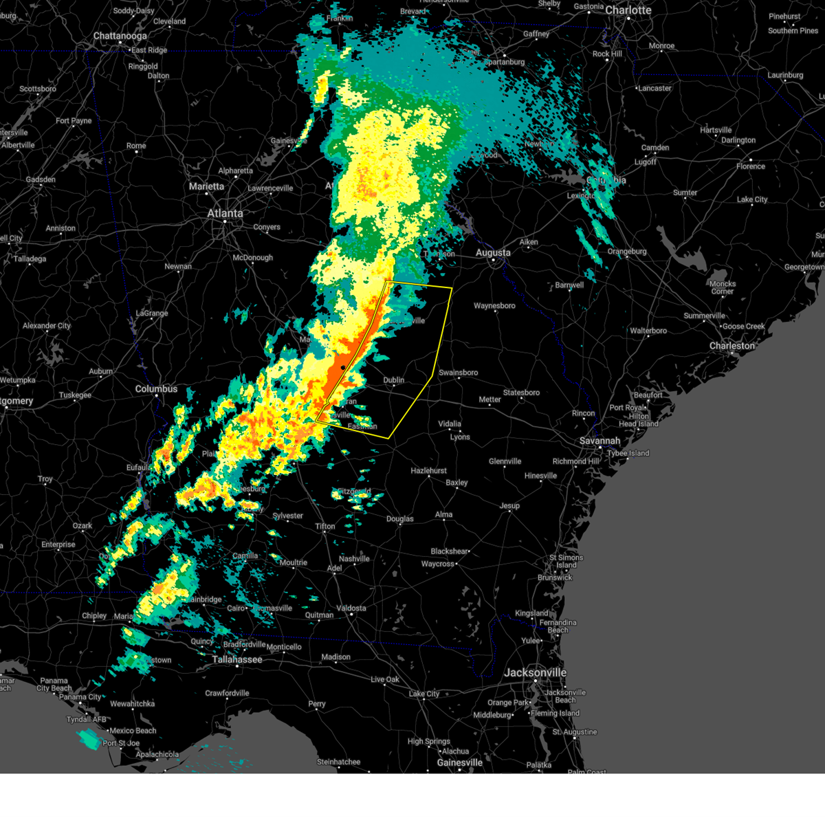
| 5/9/2024 1:03 PM EDT | Em reports 15 plus trees and powerlines down across an area stretching from cadwell to rentz between ga 117 and ga518 and from ga 126 and ga525. specific points also in in laurens county GA, 2.1 miles S of Cadwell, GA |
| 5/9/2024 12:56 PM EDT |
 Torffc the national weather service in peachtree city has issued a * tornado warning for, southwestern laurens county in central georgia, northern dodge county in central georgia, * until 130 pm edt. * at 1256 pm edt, a severe thunderstorm capable of producing a tornado was located near plainfield, or near eastman, moving southeast at 45 mph (radar indicated rotation). Hazards include tornado and quarter size hail. Flying debris will be dangerous to those caught without shelter. mobile homes will be damaged or destroyed. damage to roofs, windows, and vehicles will occur. Tree damage is likely. Torffc the national weather service in peachtree city has issued a * tornado warning for, southwestern laurens county in central georgia, northern dodge county in central georgia, * until 130 pm edt. * at 1256 pm edt, a severe thunderstorm capable of producing a tornado was located near plainfield, or near eastman, moving southeast at 45 mph (radar indicated rotation). Hazards include tornado and quarter size hail. Flying debris will be dangerous to those caught without shelter. mobile homes will be damaged or destroyed. damage to roofs, windows, and vehicles will occur. Tree damage is likely.
|
| 5/9/2024 12:32 PM EDT |
 Svrffc the national weather service in peachtree city has issued a * severe thunderstorm warning for, western laurens county in central georgia, northwestern dodge county in central georgia, northern pulaski county in central georgia, southern twiggs county in central georgia, bleckley county in central georgia, southeastern houston county in central georgia, * until 115 pm edt. * at 1232 pm edt, a severe thunderstorm was located near goldsboro, or near cochran, moving east at 60 mph (radar indicated). Hazards include 60 mph wind gusts and quarter size hail. Hail damage to vehicles is expected. Expect wind damage to roofs, siding, and trees. Svrffc the national weather service in peachtree city has issued a * severe thunderstorm warning for, western laurens county in central georgia, northwestern dodge county in central georgia, northern pulaski county in central georgia, southern twiggs county in central georgia, bleckley county in central georgia, southeastern houston county in central georgia, * until 115 pm edt. * at 1232 pm edt, a severe thunderstorm was located near goldsboro, or near cochran, moving east at 60 mph (radar indicated). Hazards include 60 mph wind gusts and quarter size hail. Hail damage to vehicles is expected. Expect wind damage to roofs, siding, and trees.
|
| 1/9/2024 11:53 AM EST |
 At 1153 am est, severe thunderstorms were located along a line extending from near montrose to near godwinsville, moving east at 30 mph (radar indicated). Hazards include 60 mph wind gusts. expect damage to roofs, siding, and trees At 1153 am est, severe thunderstorms were located along a line extending from near montrose to near godwinsville, moving east at 30 mph (radar indicated). Hazards include 60 mph wind gusts. expect damage to roofs, siding, and trees
|
| 1/9/2024 11:19 AM EST |
 At 1119 am est, severe thunderstorms were located along a line extending from robins afb to near magnolia to tippettville, moving northeast at 70 mph (radar indicated). Hazards include 60 mph wind gusts. expect damage to roofs, siding, and trees At 1119 am est, severe thunderstorms were located along a line extending from robins afb to near magnolia to tippettville, moving northeast at 70 mph (radar indicated). Hazards include 60 mph wind gusts. expect damage to roofs, siding, and trees
|
| 9/7/2023 8:20 PM EDT |
 The severe thunderstorm warning for southwestern laurens, east central macon, northern dodge, pulaski, northeastern dooly, bleckley and southern houston counties will expire at 830 pm edt, the storms which prompted the warning have weakened below severe limits, and no longer pose an immediate threat to life or property. therefore, the warning will be allowed to expire. The severe thunderstorm warning for southwestern laurens, east central macon, northern dodge, pulaski, northeastern dooly, bleckley and southern houston counties will expire at 830 pm edt, the storms which prompted the warning have weakened below severe limits, and no longer pose an immediate threat to life or property. therefore, the warning will be allowed to expire.
|
| 9/7/2023 7:57 PM EDT |
 At 756 pm edt, severe thunderstorms were located along a line extending from near henderson to near cedar grove, moving east at 25 mph (radar indicated). Hazards include 60 mph wind gusts and quarter size hail. Hail damage to vehicles is expected. Expect wind damage to roofs, siding, and trees. At 756 pm edt, severe thunderstorms were located along a line extending from near henderson to near cedar grove, moving east at 25 mph (radar indicated). Hazards include 60 mph wind gusts and quarter size hail. Hail damage to vehicles is expected. Expect wind damage to roofs, siding, and trees.
|
| 9/7/2023 4:35 PM EDT |
 At 435 pm edt, a severe thunderstorm was located over godwinsville, or near eastman, moving east at 15 mph (radar indicated). Hazards include 60 mph wind gusts and quarter size hail. Hail damage to vehicles is expected. Expect wind damage to roofs, siding, and trees. At 435 pm edt, a severe thunderstorm was located over godwinsville, or near eastman, moving east at 15 mph (radar indicated). Hazards include 60 mph wind gusts and quarter size hail. Hail damage to vehicles is expected. Expect wind damage to roofs, siding, and trees.
|
| 8/12/2023 9:06 PM EDT |
 The severe thunderstorm warning for central laurens, northwestern dodge and eastern bleckley counties will expire at 915 pm edt, the storms which prompted the warning have weakened below severe limits, and no longer pose an immediate threat to life or property. therefore, the warning will be allowed to expire. however, gusty winds and heavy rain are still possible with these thunderstorms. The severe thunderstorm warning for central laurens, northwestern dodge and eastern bleckley counties will expire at 915 pm edt, the storms which prompted the warning have weakened below severe limits, and no longer pose an immediate threat to life or property. therefore, the warning will be allowed to expire. however, gusty winds and heavy rain are still possible with these thunderstorms.
|
| 8/12/2023 9:00 PM EDT |
 At 859 pm edt, severe thunderstorms were located along a line extending from near harlow to yonkers, moving southeast at 25 mph (radar indicated). Hazards include 60 mph wind gusts. Expect damage to roofs, siding, and trees. locations impacted include, dublin, east dublin, chester, dexter, dudley, cadwell, rentz, montrose, dubois, gresston, yonkers, roddy, rowland, harlow, goldsboro, and rebie. hail threat, radar indicated max hail size, <. 75 in wind threat, radar indicated max wind gust, 60 mph. At 859 pm edt, severe thunderstorms were located along a line extending from near harlow to yonkers, moving southeast at 25 mph (radar indicated). Hazards include 60 mph wind gusts. Expect damage to roofs, siding, and trees. locations impacted include, dublin, east dublin, chester, dexter, dudley, cadwell, rentz, montrose, dubois, gresston, yonkers, roddy, rowland, harlow, goldsboro, and rebie. hail threat, radar indicated max hail size, <. 75 in wind threat, radar indicated max wind gust, 60 mph.
|
| 8/12/2023 8:26 PM EDT |
 At 825 pm edt, severe thunderstorms were located along a line extending from near montrose to near royal, moving southeast at 25 mph (radar indicated). Hazards include 60 mph wind gusts. expect damage to roofs, siding, and trees At 825 pm edt, severe thunderstorms were located along a line extending from near montrose to near royal, moving southeast at 25 mph (radar indicated). Hazards include 60 mph wind gusts. expect damage to roofs, siding, and trees
|
| 8/8/2023 6:27 PM EDT |
 At 627 pm edt, severe thunderstorms were located along a line extending from near east dublin to near dublin to near cadwell, moving east at 55 mph (radar indicated). Hazards include 60 mph wind gusts and quarter size hail. Hail damage to vehicles is expected. expect wind damage to roofs, siding, and trees. locations impacted include, dublin, soperton, east dublin, adrian, cadwell, rentz, lothair, cedar grove, orland, rockledge, orianna, norristown, barnhill, minter, lovett, harlow, norristown junction, meeks, brewton, and lowery. hail threat, radar indicated max hail size, 1. 00 in wind threat, radar indicated max wind gust, 60 mph. At 627 pm edt, severe thunderstorms were located along a line extending from near east dublin to near dublin to near cadwell, moving east at 55 mph (radar indicated). Hazards include 60 mph wind gusts and quarter size hail. Hail damage to vehicles is expected. expect wind damage to roofs, siding, and trees. locations impacted include, dublin, soperton, east dublin, adrian, cadwell, rentz, lothair, cedar grove, orland, rockledge, orianna, norristown, barnhill, minter, lovett, harlow, norristown junction, meeks, brewton, and lowery. hail threat, radar indicated max hail size, 1. 00 in wind threat, radar indicated max wind gust, 60 mph.
|
| 8/8/2023 6:08 PM EDT |
 At 608 pm edt, severe thunderstorms were located along a line extending from near chappells mill to near montrose to near roddy, moving east at 50 mph (radar indicated). Hazards include ping pong ball size hail and 60 mph wind gusts. People and animals outdoors will be injured. expect hail damage to roofs, siding, windows, and vehicles. Expect wind damage to roofs, siding, and trees. At 608 pm edt, severe thunderstorms were located along a line extending from near chappells mill to near montrose to near roddy, moving east at 50 mph (radar indicated). Hazards include ping pong ball size hail and 60 mph wind gusts. People and animals outdoors will be injured. expect hail damage to roofs, siding, windows, and vehicles. Expect wind damage to roofs, siding, and trees.
|
| 8/3/2023 8:25 PM EDT |
 At 825 pm edt, severe thunderstorms were located along a line extending from near spann to orianna to near lowery to near eastman, moving southeast at 40 mph (radar indicated). Hazards include 60 mph wind gusts. expect damage to roofs, siding, and trees At 825 pm edt, severe thunderstorms were located along a line extending from near spann to orianna to near lowery to near eastman, moving southeast at 40 mph (radar indicated). Hazards include 60 mph wind gusts. expect damage to roofs, siding, and trees
|
| 8/3/2023 8:15 PM EDT |
 At 815 pm edt, severe thunderstorms were located along a line extending from lovett to near minter to gresston to near clearview, moving southeast at 40 mph (radar indicated). Hazards include 60 mph wind gusts. Expect damage to roofs, siding, and trees. locations impacted include, dublin, cochran, hawkinsville, oglethorpe, unadilla, montezuma, east dublin, chester, dexter, dudley, byromville, cadwell, pinehurst, rentz, montrose, lilly, dooling, hayneville, plainfield, and mobley crossing. hail threat, radar indicated max hail size, <. 75 in wind threat, radar indicated max wind gust, 60 mph. At 815 pm edt, severe thunderstorms were located along a line extending from lovett to near minter to gresston to near clearview, moving southeast at 40 mph (radar indicated). Hazards include 60 mph wind gusts. Expect damage to roofs, siding, and trees. locations impacted include, dublin, cochran, hawkinsville, oglethorpe, unadilla, montezuma, east dublin, chester, dexter, dudley, byromville, cadwell, pinehurst, rentz, montrose, lilly, dooling, hayneville, plainfield, and mobley crossing. hail threat, radar indicated max hail size, <. 75 in wind threat, radar indicated max wind gust, 60 mph.
|
| 8/3/2023 7:45 PM EDT |
 At 744 pm edt, severe thunderstorms were located along a line extending from 6 miles west of hebron to near potterville, moving southeast at 45 mph (radar indicated). Hazards include 60 mph wind gusts. expect damage to roofs, siding, and trees At 744 pm edt, severe thunderstorms were located along a line extending from 6 miles west of hebron to near potterville, moving southeast at 45 mph (radar indicated). Hazards include 60 mph wind gusts. expect damage to roofs, siding, and trees
|
| 6/25/2023 9:22 PM EDT |
 At 921 pm edt, severe thunderstorms were located along a line extending from near lowery to near gresston to near pinehurst, moving south at 30 mph (radar indicated). Hazards include 60 mph wind gusts. Expect damage to roofs, siding, and trees. locations impacted include, cordele, eastman, hawkinsville, vienna, unadilla, chester, dexter, byromville, cadwell, pineview, pinehurst, chauncey, rentz, lilly, dooling, union, dubois, browndale, plainfield and richwood. hail threat, radar indicated max hail size, <. 75 in wind threat, radar indicated max wind gust, 60 mph. At 921 pm edt, severe thunderstorms were located along a line extending from near lowery to near gresston to near pinehurst, moving south at 30 mph (radar indicated). Hazards include 60 mph wind gusts. Expect damage to roofs, siding, and trees. locations impacted include, cordele, eastman, hawkinsville, vienna, unadilla, chester, dexter, byromville, cadwell, pineview, pinehurst, chauncey, rentz, lilly, dooling, union, dubois, browndale, plainfield and richwood. hail threat, radar indicated max hail size, <. 75 in wind threat, radar indicated max wind gust, 60 mph.
|
| 6/25/2023 8:58 PM EDT |
 At 858 pm edt, severe thunderstorms were located along a line extending from near dublin to paulk to near henderson, moving south at 30 mph (radar indicated). Hazards include 60 mph wind gusts. expect damage to roofs, siding, and trees At 858 pm edt, severe thunderstorms were located along a line extending from near dublin to paulk to near henderson, moving south at 30 mph (radar indicated). Hazards include 60 mph wind gusts. expect damage to roofs, siding, and trees
|
| 6/14/2023 9:01 AM EDT |
 At 901 am edt, severe thunderstorms were located along a line extending from near rentz to chauncey to near rhine, moving east at 45 mph (radar indicated). Hazards include 60 mph wind gusts. Expect damage to roofs, siding, and trees. locations impacted include, mcrae, eastman, helena, milan, cadwell, rhine, chauncey, rentz, plainfield, cedar grove, jay bird springs, five points, achord, little ocmulgee state park and godwinsville. hail threat, radar indicated max hail size, <. 75 in wind threat, radar indicated max wind gust, 60 mph. At 901 am edt, severe thunderstorms were located along a line extending from near rentz to chauncey to near rhine, moving east at 45 mph (radar indicated). Hazards include 60 mph wind gusts. Expect damage to roofs, siding, and trees. locations impacted include, mcrae, eastman, helena, milan, cadwell, rhine, chauncey, rentz, plainfield, cedar grove, jay bird springs, five points, achord, little ocmulgee state park and godwinsville. hail threat, radar indicated max hail size, <. 75 in wind threat, radar indicated max wind gust, 60 mph.
|
| 6/14/2023 8:44 AM EDT |
 At 844 am edt, severe thunderstorms were located along a line extending from near chester to near eastman to near cedar creek, moving east at 40 mph (radar indicated). Hazards include 60 mph wind gusts. expect damage to roofs, siding, and trees At 844 am edt, severe thunderstorms were located along a line extending from near chester to near eastman to near cedar creek, moving east at 40 mph (radar indicated). Hazards include 60 mph wind gusts. expect damage to roofs, siding, and trees
|
| 3/25/2023 5:10 PM EDT | Trees down at the intersection of hwy 117 and cj bedingfield r in laurens county GA, 2.6 miles NE of Cadwell, GA |
| 3/25/2023 5:07 PM EDT |
 At 507 pm edt, a severe thunderstorm was located near plainfield, or 7 miles northeast of eastman, moving east at 35 mph (radar indicated). Hazards include two inch hail and 60 mph wind gusts. People and animals outdoors will be injured. expect hail damage to roofs, siding, windows, and vehicles. expect wind damage to roofs, siding, and trees. locations impacted include, cadwell, rentz, lowery, plainfield and cedar grove. thunderstorm damage threat, considerable hail threat, radar indicated max hail size, 2. 00 in wind threat, radar indicated max wind gust, 60 mph. At 507 pm edt, a severe thunderstorm was located near plainfield, or 7 miles northeast of eastman, moving east at 35 mph (radar indicated). Hazards include two inch hail and 60 mph wind gusts. People and animals outdoors will be injured. expect hail damage to roofs, siding, windows, and vehicles. expect wind damage to roofs, siding, and trees. locations impacted include, cadwell, rentz, lowery, plainfield and cedar grove. thunderstorm damage threat, considerable hail threat, radar indicated max hail size, 2. 00 in wind threat, radar indicated max wind gust, 60 mph.
|
| 3/25/2023 5:03 PM EDT |
 At 503 pm edt, a severe thunderstorm was located near plainfield, or 7 miles north of eastman, moving east at 35 mph (radar indicated). Hazards include golf ball size hail and 60 mph wind gusts. People and animals outdoors will be injured. expect hail damage to roofs, siding, windows, and vehicles. Expect wind damage to roofs, siding, and trees. At 503 pm edt, a severe thunderstorm was located near plainfield, or 7 miles north of eastman, moving east at 35 mph (radar indicated). Hazards include golf ball size hail and 60 mph wind gusts. People and animals outdoors will be injured. expect hail damage to roofs, siding, windows, and vehicles. Expect wind damage to roofs, siding, and trees.
|
| 3/25/2023 4:44 PM EDT | Trees down at intersection of hwy 199s and thairdale r in laurens county GA, 2.6 miles NE of Cadwell, GA |
| 3/25/2023 4:15 PM EDT |
 At 415 pm edt, a severe thunderstorm capable of producing a tornado was located over cadwell, or 12 miles northeast of eastman, moving east at 30 mph (radar indicated rotation). Hazards include tornado and golf ball size hail. Flying debris will be dangerous to those caught without shelter. mobile homes will be damaged or destroyed. damage to roofs, windows, and vehicles will occur. Tree damage is likely. At 415 pm edt, a severe thunderstorm capable of producing a tornado was located over cadwell, or 12 miles northeast of eastman, moving east at 30 mph (radar indicated rotation). Hazards include tornado and golf ball size hail. Flying debris will be dangerous to those caught without shelter. mobile homes will be damaged or destroyed. damage to roofs, windows, and vehicles will occur. Tree damage is likely.
|
| 3/25/2023 4:12 PM EDT |
 At 412 pm edt, a severe thunderstorm was located near cadwell, or 13 miles northeast of eastman, moving east at 35 mph (radar indicated). Hazards include two inch hail and 60 mph wind gusts. People and animals outdoors will be injured. expect hail damage to roofs, siding, windows, and vehicles. expect wind damage to roofs, siding, and trees. Locations impacted include, dexter, cadwell, rentz, lowery and minter. At 412 pm edt, a severe thunderstorm was located near cadwell, or 13 miles northeast of eastman, moving east at 35 mph (radar indicated). Hazards include two inch hail and 60 mph wind gusts. People and animals outdoors will be injured. expect hail damage to roofs, siding, windows, and vehicles. expect wind damage to roofs, siding, and trees. Locations impacted include, dexter, cadwell, rentz, lowery and minter.
|
| 3/25/2023 4:06 PM EDT |
 At 406 pm edt, a severe thunderstorm was located near chester, or 11 miles north of eastman, moving east at 30 mph (radar indicated). Hazards include ping pong ball size hail and 60 mph wind gusts. People and animals outdoors will be injured. expect hail damage to roofs, siding, windows, and vehicles. expect wind damage to roofs, siding, and trees. Locations impacted include, dublin, chester, dexter, cadwell, rentz, harlow, lowery and minter. At 406 pm edt, a severe thunderstorm was located near chester, or 11 miles north of eastman, moving east at 30 mph (radar indicated). Hazards include ping pong ball size hail and 60 mph wind gusts. People and animals outdoors will be injured. expect hail damage to roofs, siding, windows, and vehicles. expect wind damage to roofs, siding, and trees. Locations impacted include, dublin, chester, dexter, cadwell, rentz, harlow, lowery and minter.
|
| 3/25/2023 4:03 PM EDT |
 At 402 pm edt, a severe thunderstorm was located near chester, or 13 miles east of cochran, moving east at 35 mph (radar indicated). Hazards include 60 mph wind gusts and quarter size hail. Hail damage to vehicles is expected. Expect wind damage to roofs, siding, and trees. At 402 pm edt, a severe thunderstorm was located near chester, or 13 miles east of cochran, moving east at 35 mph (radar indicated). Hazards include 60 mph wind gusts and quarter size hail. Hail damage to vehicles is expected. Expect wind damage to roofs, siding, and trees.
|
| 1/12/2023 7:17 PM EST |
 At 716 pm est, severe thunderstorms were located along a line extending from eastman to godwinsville to rhine to near antioch church, moving east at 55 mph (radar indicated). Hazards include golf ball size hail and 60 mph wind gusts. People and animals outdoors will be injured. expect hail damage to roofs, siding, windows, and vehicles. expect wind damage to roofs, siding, and trees. Locations impacted include, mcrae, eastman, abbeville, alamo, mount vernon, helena, lumber city, glenwood, milan, cadwell, ailey, rhine, scotland, chauncey, higgston, jacksonville, union, towns, lothair and spring hill. At 716 pm est, severe thunderstorms were located along a line extending from eastman to godwinsville to rhine to near antioch church, moving east at 55 mph (radar indicated). Hazards include golf ball size hail and 60 mph wind gusts. People and animals outdoors will be injured. expect hail damage to roofs, siding, windows, and vehicles. expect wind damage to roofs, siding, and trees. Locations impacted include, mcrae, eastman, abbeville, alamo, mount vernon, helena, lumber city, glenwood, milan, cadwell, ailey, rhine, scotland, chauncey, higgston, jacksonville, union, towns, lothair and spring hill.
|
| 1/12/2023 7:14 PM EST |
 At 713 pm est, severe thunderstorms were located along a line extending from near eastman to near godwinsville to rhine to near antioch church, moving east at 55 mph (radar indicated). Hazards include 60 mph wind gusts. expect damage to roofs, siding, and trees At 713 pm est, severe thunderstorms were located along a line extending from near eastman to near godwinsville to rhine to near antioch church, moving east at 55 mph (radar indicated). Hazards include 60 mph wind gusts. expect damage to roofs, siding, and trees
|
| 8/10/2022 6:05 PM EDT |
 The severe thunderstorm warning for southwestern laurens and central dodge counties will expire at 615 pm edt, the storm which prompted the warning has moved out of the area. therefore, the warning will be allowed to expire. however gusty winds and heavy rain are still possible with this thunderstorm. The severe thunderstorm warning for southwestern laurens and central dodge counties will expire at 615 pm edt, the storm which prompted the warning has moved out of the area. therefore, the warning will be allowed to expire. however gusty winds and heavy rain are still possible with this thunderstorm.
|
| 8/10/2022 5:44 PM EDT |
 At 544 pm edt, a severe thunderstorm was located over chauncey, or 9 miles southeast of eastman, moving northeast at 25 mph (radar indicated). Hazards include 60 mph wind gusts and quarter size hail. Hail damage to vehicles is expected. Expect wind damage to roofs, siding, and trees. At 544 pm edt, a severe thunderstorm was located over chauncey, or 9 miles southeast of eastman, moving northeast at 25 mph (radar indicated). Hazards include 60 mph wind gusts and quarter size hail. Hail damage to vehicles is expected. Expect wind damage to roofs, siding, and trees.
|
| 6/14/2022 2:06 PM EDT |
 At 206 pm edt, a severe thunderstorm was located near lowery, or 10 miles south of dublin, moving southwest at 10 mph (radar indicated). Hazards include 60 mph wind gusts and nickel size hail. expect damage to roofs, siding, and trees At 206 pm edt, a severe thunderstorm was located near lowery, or 10 miles south of dublin, moving southwest at 10 mph (radar indicated). Hazards include 60 mph wind gusts and nickel size hail. expect damage to roofs, siding, and trees
|
| 5/30/2022 2:39 PM EDT |
 The severe thunderstorm warning for southwestern laurens and central dodge counties will expire at 245 pm edt, the storm which prompted the warning has weakened below severe limits, and no longer poses an immediate threat to life or property. therefore, the warning will be allowed to expire. The severe thunderstorm warning for southwestern laurens and central dodge counties will expire at 245 pm edt, the storm which prompted the warning has weakened below severe limits, and no longer poses an immediate threat to life or property. therefore, the warning will be allowed to expire.
|
| 5/30/2022 2:08 PM EDT |
 At 208 pm edt, a severe thunderstorm was located over cedar grove, or 10 miles northwest of alamo, moving northwest at 20 mph (radar indicated). Hazards include 60 mph wind gusts and quarter size hail. Hail damage to vehicles is expected. Expect wind damage to roofs, siding, and trees. At 208 pm edt, a severe thunderstorm was located over cedar grove, or 10 miles northwest of alamo, moving northwest at 20 mph (radar indicated). Hazards include 60 mph wind gusts and quarter size hail. Hail damage to vehicles is expected. Expect wind damage to roofs, siding, and trees.
|
| 5/6/2022 3:09 PM EDT |
 At 309 pm edt, a severe thunderstorm was located over cadwell, or 14 miles northeast of eastman, moving northeast at 60 mph (radar indicated). Hazards include 60 mph wind gusts and quarter size hail. Hail damage to vehicles is expected. Expect wind damage to roofs, siding, and trees. At 309 pm edt, a severe thunderstorm was located over cadwell, or 14 miles northeast of eastman, moving northeast at 60 mph (radar indicated). Hazards include 60 mph wind gusts and quarter size hail. Hail damage to vehicles is expected. Expect wind damage to roofs, siding, and trees.
|
| 4/6/2022 7:55 PM EDT |
 At 755 pm edt, areas of rotation capable of producing a tornado were located near dudley and near chester, moving east at 60 mph (radar indicated rotation). Hazards include tornado. Flying debris will be dangerous to those caught without shelter. mobile homes will be damaged or destroyed. damage to roofs, windows, and vehicles will occur. Tree damage is likely. At 755 pm edt, areas of rotation capable of producing a tornado were located near dudley and near chester, moving east at 60 mph (radar indicated rotation). Hazards include tornado. Flying debris will be dangerous to those caught without shelter. mobile homes will be damaged or destroyed. damage to roofs, windows, and vehicles will occur. Tree damage is likely.
|
| 4/5/2022 4:36 PM EDT |
 At 436 pm edt, severe thunderstorms were located along a line extending from 6 miles northeast of chappells mill to near milan, moving northeast at 55 mph (radar indicated). Hazards include 60 mph wind gusts and penny size hail. Expect damage to roofs, siding, and trees. locations impacted include, dublin, mcrae, eastman, abbeville, wrightsville, helena, east dublin, chester, milan, dexter, dudley, cadwell, rhine, scotland, chauncey, rentz, union, towns, spann and plainfield. hail threat, radar indicated max hail size, 0. 75 in wind threat, radar indicated max wind gust, 60 mph. At 436 pm edt, severe thunderstorms were located along a line extending from 6 miles northeast of chappells mill to near milan, moving northeast at 55 mph (radar indicated). Hazards include 60 mph wind gusts and penny size hail. Expect damage to roofs, siding, and trees. locations impacted include, dublin, mcrae, eastman, abbeville, wrightsville, helena, east dublin, chester, milan, dexter, dudley, cadwell, rhine, scotland, chauncey, rentz, union, towns, spann and plainfield. hail threat, radar indicated max hail size, 0. 75 in wind threat, radar indicated max wind gust, 60 mph.
|
| 4/5/2022 4:32 PM EDT |
 At 432 pm edt, a severe thunderstorm capable of producing a tornado was located just southwest of cadwell, or 10 miles northeast of eastman, moving northeast at 45 mph (radar indicated rotation). Hazards include tornado. Flying debris will be dangerous to those caught without shelter. mobile homes will be damaged or destroyed. damage to roofs, windows, and vehicles will occur. Tree damage is likely. At 432 pm edt, a severe thunderstorm capable of producing a tornado was located just southwest of cadwell, or 10 miles northeast of eastman, moving northeast at 45 mph (radar indicated rotation). Hazards include tornado. Flying debris will be dangerous to those caught without shelter. mobile homes will be damaged or destroyed. damage to roofs, windows, and vehicles will occur. Tree damage is likely.
|
| 4/5/2022 4:27 PM EDT |
 At 427 pm edt, severe thunderstorms were located along a line extending from nicklesville to near milan, moving northeast at 55 mph (radar indicated). Hazards include 60 mph wind gusts and penny size hail. Expect damage to roofs, siding, and trees. locations impacted include, dublin, mcrae, cochran, eastman, abbeville, wrightsville, helena, east dublin, chester, milan, dexter, dudley, cadwell, rhine, scotland, chauncey, rentz, danville, montrose and allentown. hail threat, radar indicated max hail size, 0. 75 in wind threat, radar indicated max wind gust, 60 mph. At 427 pm edt, severe thunderstorms were located along a line extending from nicklesville to near milan, moving northeast at 55 mph (radar indicated). Hazards include 60 mph wind gusts and penny size hail. Expect damage to roofs, siding, and trees. locations impacted include, dublin, mcrae, cochran, eastman, abbeville, wrightsville, helena, east dublin, chester, milan, dexter, dudley, cadwell, rhine, scotland, chauncey, rentz, danville, montrose and allentown. hail threat, radar indicated max hail size, 0. 75 in wind threat, radar indicated max wind gust, 60 mph.
|
| 4/5/2022 4:06 PM EDT |
 At 405 pm edt, severe thunderstorms were located along a line extending from district path to near antioch church, moving northeast at 55 mph (radar indicated). Hazards include 60 mph wind gusts and penny size hail. expect damage to roofs, siding, and trees At 405 pm edt, severe thunderstorms were located along a line extending from district path to near antioch church, moving northeast at 55 mph (radar indicated). Hazards include 60 mph wind gusts and penny size hail. expect damage to roofs, siding, and trees
|
| 3/19/2022 8:51 AM EDT |
 The severe thunderstorm warning for south central laurens and central dodge counties will expire at 900 am edt, the storm which prompted the warning has weakened below severe limits, and no longer poses an immediate threat to life or property. therefore, the warning will be allowed to expire. The severe thunderstorm warning for south central laurens and central dodge counties will expire at 900 am edt, the storm which prompted the warning has weakened below severe limits, and no longer poses an immediate threat to life or property. therefore, the warning will be allowed to expire.
|
| 3/19/2022 8:33 AM EDT |
 At 833 am edt, a severe thunderstorm was located over godwinsville, or near eastman, moving northeast at 55 mph (radar indicated). Hazards include 60 mph wind gusts and quarter size hail. Hail damage to vehicles is expected. expect wind damage to roofs, siding, and trees. locations impacted include, eastman, cadwell, chauncey, union, jay bird springs, five points, achord, plainfield, cedar grove and godwinsville. hail threat, radar indicated max hail size, 1. 00 in wind threat, radar indicated max wind gust, 60 mph. At 833 am edt, a severe thunderstorm was located over godwinsville, or near eastman, moving northeast at 55 mph (radar indicated). Hazards include 60 mph wind gusts and quarter size hail. Hail damage to vehicles is expected. expect wind damage to roofs, siding, and trees. locations impacted include, eastman, cadwell, chauncey, union, jay bird springs, five points, achord, plainfield, cedar grove and godwinsville. hail threat, radar indicated max hail size, 1. 00 in wind threat, radar indicated max wind gust, 60 mph.
|
| 3/19/2022 8:17 AM EDT |
 At 817 am edt, a severe thunderstorm was located near abbeville, moving northeast at 55 mph (radar indicated). Hazards include 60 mph wind gusts and quarter size hail. Hail damage to vehicles is expected. Expect wind damage to roofs, siding, and trees. At 817 am edt, a severe thunderstorm was located near abbeville, moving northeast at 55 mph (radar indicated). Hazards include 60 mph wind gusts and quarter size hail. Hail damage to vehicles is expected. Expect wind damage to roofs, siding, and trees.
|
| 12/30/2021 5:15 PM EST |
 At 514 pm est, a severe thunderstorm was located over yonkers, or 8 miles east of cochran, moving east at 35 mph (radar indicated). Hazards include 60 mph wind gusts and nickel size hail. Expect damage to roofs, siding, and trees. Locations impacted include, dublin, chester, dexter, dudley, cadwell, rentz, montrose, yonkers, roddy, rowland, harlow, goldsboro and rebie. At 514 pm est, a severe thunderstorm was located over yonkers, or 8 miles east of cochran, moving east at 35 mph (radar indicated). Hazards include 60 mph wind gusts and nickel size hail. Expect damage to roofs, siding, and trees. Locations impacted include, dublin, chester, dexter, dudley, cadwell, rentz, montrose, yonkers, roddy, rowland, harlow, goldsboro and rebie.
|
| 12/30/2021 5:03 PM EST |
 At 503 pm est, a severe thunderstorm was located over cochran, moving east at 35 mph (radar indicated). Hazards include 60 mph wind gusts and nickel size hail. expect damage to roofs, siding, and trees At 503 pm est, a severe thunderstorm was located over cochran, moving east at 35 mph (radar indicated). Hazards include 60 mph wind gusts and nickel size hail. expect damage to roofs, siding, and trees
|
| 10/8/2021 2:35 AM EDT |
 At 234 am edt, a severe thunderstorm was located over cedar grove, or 11 miles northwest of alamo, moving east at 15 mph (radar indicated). Hazards include 60 mph wind gusts. Expect damage to roofs, siding, and trees. locations impacted include, cadwell and cedar grove. hail threat, radar indicated max hail size, <. 75 in wind threat, radar indicated max wind gust, 60 mph. At 234 am edt, a severe thunderstorm was located over cedar grove, or 11 miles northwest of alamo, moving east at 15 mph (radar indicated). Hazards include 60 mph wind gusts. Expect damage to roofs, siding, and trees. locations impacted include, cadwell and cedar grove. hail threat, radar indicated max hail size, <. 75 in wind threat, radar indicated max wind gust, 60 mph.
|
| 10/8/2021 2:15 AM EDT |
 At 215 am edt, a severe thunderstorm was located near cadwell, or 13 miles northeast of eastman, moving east at 15 mph (radar indicated). Hazards include 60 mph wind gusts. expect damage to roofs, siding, and trees At 215 am edt, a severe thunderstorm was located near cadwell, or 13 miles northeast of eastman, moving east at 15 mph (radar indicated). Hazards include 60 mph wind gusts. expect damage to roofs, siding, and trees
|
| 10/8/2021 1:43 AM EDT |
 At 142 am edt, a severe thunderstorm was located over cadwell, or 11 miles northeast of eastman, moving east at 10 mph (radar indicated). Hazards include 60 mph wind gusts. expect damage to roofs, siding, and trees At 142 am edt, a severe thunderstorm was located over cadwell, or 11 miles northeast of eastman, moving east at 10 mph (radar indicated). Hazards include 60 mph wind gusts. expect damage to roofs, siding, and trees
|
| 10/8/2021 1:22 AM EDT |
 At 122 am edt, a severe thunderstorm was located over plainfield, or 9 miles northeast of eastman, moving east at 10 mph (radar indicated). Hazards include 60 mph wind gusts. Expect damage to roofs, siding, and trees. Locations impacted include, chester, dexter, cadwell, rentz and plainfield. At 122 am edt, a severe thunderstorm was located over plainfield, or 9 miles northeast of eastman, moving east at 10 mph (radar indicated). Hazards include 60 mph wind gusts. Expect damage to roofs, siding, and trees. Locations impacted include, chester, dexter, cadwell, rentz and plainfield.
|
| 10/8/2021 1:05 AM EDT |
 At 105 am edt, a severe thunderstorm was located near yonkers, or 8 miles north of eastman, moving east at 10 mph (radar indicated). Hazards include 60 mph wind gusts. expect damage to roofs, siding, and trees At 105 am edt, a severe thunderstorm was located near yonkers, or 8 miles north of eastman, moving east at 10 mph (radar indicated). Hazards include 60 mph wind gusts. expect damage to roofs, siding, and trees
|
| 3/31/2021 5:51 PM EDT | Tree reported down at the intersection of hwy 338 and whittle r in laurens county GA, 2.1 miles S of Cadwell, GA |
| 3/31/2021 5:44 PM EDT |
 At 544 pm edt, a severe thunderstorm was located near dudley moving east at 45 mph (radar indicated). Hazards include 60 mph wind gusts. expect damage to roofs, siding, and trees At 544 pm edt, a severe thunderstorm was located near dudley moving east at 45 mph (radar indicated). Hazards include 60 mph wind gusts. expect damage to roofs, siding, and trees
|
| 8/9/2020 6:54 PM EDT |
 At 653 pm edt, a severe thunderstorm was located over cadwell, and is nearly stationary (radar indicated). Hazards include 60 mph wind gusts and quarter size hail. Hail damage to vehicles is expected. Expect wind damage to roofs, siding, and trees. At 653 pm edt, a severe thunderstorm was located over cadwell, and is nearly stationary (radar indicated). Hazards include 60 mph wind gusts and quarter size hail. Hail damage to vehicles is expected. Expect wind damage to roofs, siding, and trees.
|
| 7/15/2020 4:55 PM EDT |
 At 455 pm edt, a severe thunderstorm was located over dexter, or 10 miles southwest of dublin, moving northwest at 10 mph (radar indicated). Hazards include 60 mph wind gusts and quarter size hail. Hail damage to vehicles is expected. Expect wind damage to roofs, siding, and trees. At 455 pm edt, a severe thunderstorm was located over dexter, or 10 miles southwest of dublin, moving northwest at 10 mph (radar indicated). Hazards include 60 mph wind gusts and quarter size hail. Hail damage to vehicles is expected. Expect wind damage to roofs, siding, and trees.
|
| 6/27/2020 5:52 PM EDT |
 At 552 pm edt, a severe thunderstorm was located near eastman, moving east at 25 mph (radar indicated). Hazards include 60 mph wind gusts. expect damage to roofs, siding, and trees At 552 pm edt, a severe thunderstorm was located near eastman, moving east at 25 mph (radar indicated). Hazards include 60 mph wind gusts. expect damage to roofs, siding, and trees
|
| 4/23/2020 11:18 AM EDT |
 At 1117 am edt, severe thunderstorms were located along a line extending from plainfield to near pitts, moving east at 55 mph (radar indicated). Hazards include 60 mph wind gusts and penny size hail. expect damage to roofs, siding, and trees At 1117 am edt, severe thunderstorms were located along a line extending from plainfield to near pitts, moving east at 55 mph (radar indicated). Hazards include 60 mph wind gusts and penny size hail. expect damage to roofs, siding, and trees
|
| 4/19/2020 12:06 PM EDT |
 At 1206 pm edt, a severe thunderstorm was located near plainfield, or 9 miles northeast of eastman, moving east at 55 mph (radar indicated). Hazards include 60 mph wind gusts and quarter size hail. Hail damage to vehicles is expected. Expect wind damage to roofs, siding, and trees. At 1206 pm edt, a severe thunderstorm was located near plainfield, or 9 miles northeast of eastman, moving east at 55 mph (radar indicated). Hazards include 60 mph wind gusts and quarter size hail. Hail damage to vehicles is expected. Expect wind damage to roofs, siding, and trees.
|
| 4/19/2020 11:55 AM EDT |
 At 1154 am edt, a severe thunderstorm was located over dubois, or 7 miles southeast of cochran, moving east at 55 mph (radar indicated). Hazards include 60 mph wind gusts and quarter size hail. Hail damage to vehicles is expected. expect wind damage to roofs, siding, and trees. Locations impacted include, eastman, chester, cadwell, dubois, gresston, plainfield, empire, yonkers, roddy and rowland. At 1154 am edt, a severe thunderstorm was located over dubois, or 7 miles southeast of cochran, moving east at 55 mph (radar indicated). Hazards include 60 mph wind gusts and quarter size hail. Hail damage to vehicles is expected. expect wind damage to roofs, siding, and trees. Locations impacted include, eastman, chester, cadwell, dubois, gresston, plainfield, empire, yonkers, roddy and rowland.
|
| 4/19/2020 11:41 AM EDT |
 At 1141 am edt, a severe thunderstorm was located over pulaski state prison, or over hawkinsville, moving east at 50 mph (radar indicated). Hazards include 60 mph wind gusts and quarter size hail. Hail damage to vehicles is expected. Expect wind damage to roofs, siding, and trees. At 1141 am edt, a severe thunderstorm was located over pulaski state prison, or over hawkinsville, moving east at 50 mph (radar indicated). Hazards include 60 mph wind gusts and quarter size hail. Hail damage to vehicles is expected. Expect wind damage to roofs, siding, and trees.
|
| 4/13/2020 4:38 AM EDT |
 At 438 am edt, severe thunderstorms were located along a line extending from orianna to near bowens mill, moving east at 45 mph (radar indicated). Hazards include 60 mph wind gusts. Expect damage to roofs, siding, and trees. Locations impacted include, dublin, cordele, mcrae, eastman, soperton, abbeville, alamo, mount vernon, helena, rochelle, glenwood, milan, arabi, cadwell, ailey, rhine, scotland, chauncey, pitts and rentz. At 438 am edt, severe thunderstorms were located along a line extending from orianna to near bowens mill, moving east at 45 mph (radar indicated). Hazards include 60 mph wind gusts. Expect damage to roofs, siding, and trees. Locations impacted include, dublin, cordele, mcrae, eastman, soperton, abbeville, alamo, mount vernon, helena, rochelle, glenwood, milan, arabi, cadwell, ailey, rhine, scotland, chauncey, pitts and rentz.
|
| 4/13/2020 4:22 AM EDT |
 At 422 am edt, severe thunderstorms were located along a line extending from near minter to owensboro, moving east at 45 mph (radar indicated). Hazards include 60 mph wind gusts. Expect damage to roofs, siding, and trees. Locations impacted include, dublin, cordele, eastman, abbeville, chester, rochelle, arabi, dexter, dudley, cadwell, pineview, rhine, chauncey, pitts, rentz, union, dubois, plainfield, cedar grove and rockledge. At 422 am edt, severe thunderstorms were located along a line extending from near minter to owensboro, moving east at 45 mph (radar indicated). Hazards include 60 mph wind gusts. Expect damage to roofs, siding, and trees. Locations impacted include, dublin, cordele, eastman, abbeville, chester, rochelle, arabi, dexter, dudley, cadwell, pineview, rhine, chauncey, pitts, rentz, union, dubois, plainfield, cedar grove and rockledge.
|
| 4/13/2020 4:17 AM EDT |
 At 416 am edt, severe thunderstorms were located along a line extending from near dublin to near owensboro, moving east at 45 mph (radar indicated). Hazards include 60 mph wind gusts. expect damage to roofs, siding, and trees At 416 am edt, severe thunderstorms were located along a line extending from near dublin to near owensboro, moving east at 45 mph (radar indicated). Hazards include 60 mph wind gusts. expect damage to roofs, siding, and trees
|
| 4/13/2020 3:37 AM EDT |
 At 337 am edt, severe thunderstorms were located along a line extending from tarversville to near cobb, moving east at 45 mph (radar indicated). Hazards include 60 mph wind gusts. expect damage to roofs, siding, and trees At 337 am edt, severe thunderstorms were located along a line extending from tarversville to near cobb, moving east at 45 mph (radar indicated). Hazards include 60 mph wind gusts. expect damage to roofs, siding, and trees
|
| 1/11/2020 7:54 PM EST |
 At 754 pm est, a severe thunderstorm was located over klondike, or 8 miles northwest of hawkinsville, moving east at 45 mph (radar indicated). Hazards include 60 mph wind gusts. expect damage to roofs, siding, and trees At 754 pm est, a severe thunderstorm was located over klondike, or 8 miles northwest of hawkinsville, moving east at 45 mph (radar indicated). Hazards include 60 mph wind gusts. expect damage to roofs, siding, and trees
|
| 10/19/2019 9:10 PM EDT |
 At 910 pm edt, a severe thunderstorm was located over chauncey, or 8 miles southeast of eastman, moving northeast at 20 mph (radar indicated). Hazards include 60 mph wind gusts. expect damage to roofs, siding, and trees At 910 pm edt, a severe thunderstorm was located over chauncey, or 8 miles southeast of eastman, moving northeast at 20 mph (radar indicated). Hazards include 60 mph wind gusts. expect damage to roofs, siding, and trees
|
| 6/22/2019 9:38 PM EDT |
 At 938 pm edt, severe thunderstorms were located along a line extending from near brewton to near cadwell, moving east at 25 mph (radar indicated). Hazards include 60 mph wind gusts. expect damage to roofs, siding, and trees At 938 pm edt, severe thunderstorms were located along a line extending from near brewton to near cadwell, moving east at 25 mph (radar indicated). Hazards include 60 mph wind gusts. expect damage to roofs, siding, and trees
|
| 6/20/2019 5:53 PM EDT |
 At 553 pm edt, a severe thunderstorm was located over yonkers, or 10 miles east of cochran, moving east at 45 mph (radar indicated). Hazards include 60 mph wind gusts and quarter size hail. Hail damage to vehicles is expected. expect wind damage to roofs, siding, and trees. Locations impacted include, dublin, cochran, eastman, chester, dexter, dudley, cadwell, rentz, dubois, gresston, plainfield, empire, yonkers, cedar grove, roddy, baileys park, rowland, harlow, rebie and goldsboro. At 553 pm edt, a severe thunderstorm was located over yonkers, or 10 miles east of cochran, moving east at 45 mph (radar indicated). Hazards include 60 mph wind gusts and quarter size hail. Hail damage to vehicles is expected. expect wind damage to roofs, siding, and trees. Locations impacted include, dublin, cochran, eastman, chester, dexter, dudley, cadwell, rentz, dubois, gresston, plainfield, empire, yonkers, cedar grove, roddy, baileys park, rowland, harlow, rebie and goldsboro.
|
| 6/20/2019 5:30 PM EDT |
 At 530 pm edt, a severe thunderstorm was located over hartford, or over hawkinsville, moving east at 45 mph (radar indicated). Hazards include 60 mph wind gusts and quarter size hail. Hail damage to vehicles is expected. Expect wind damage to roofs, siding, and trees. At 530 pm edt, a severe thunderstorm was located over hartford, or over hawkinsville, moving east at 45 mph (radar indicated). Hazards include 60 mph wind gusts and quarter size hail. Hail damage to vehicles is expected. Expect wind damage to roofs, siding, and trees.
|
| 4/19/2019 11:12 AM EDT |
 At 1112 am edt, severe thunderstorms were located along a line extending from near cadwell to near jay bird springs to near milan, moving northeast at 55 mph (radar indicated). Hazards include 60 mph wind gusts and penny size hail. expect damage to roofs, siding, and trees At 1112 am edt, severe thunderstorms were located along a line extending from near cadwell to near jay bird springs to near milan, moving northeast at 55 mph (radar indicated). Hazards include 60 mph wind gusts and penny size hail. expect damage to roofs, siding, and trees
|
| 4/19/2019 10:32 AM EDT |
 At 1032 am edt, a severe thunderstorm was located over chester, or 14 miles east of cochran, moving northeast at 45 mph (radar indicated). Hazards include 60 mph wind gusts and penny size hail. expect damage to roofs, siding, and trees At 1032 am edt, a severe thunderstorm was located over chester, or 14 miles east of cochran, moving northeast at 45 mph (radar indicated). Hazards include 60 mph wind gusts and penny size hail. expect damage to roofs, siding, and trees
|
| 4/14/2019 2:39 PM EDT |
 At 238 pm edt, a severe thunderstorm capable of producing a tornado was located over ocmulgee banks, or 9 miles southeast of hawkinsville, moving northeast at 45 mph (radar indicated rotation). Hazards include tornado. Flying debris will be dangerous to those caught without shelter. mobile homes will be damaged or destroyed. damage to roofs, windows, and vehicles will occur. tree damage is likely. Locations impacted include, chester, dexter, cadwell, rentz, dubois, gresston, empire, yonkers, roddy, rowland, ocmulgee banks, goldsboro and rebie. At 238 pm edt, a severe thunderstorm capable of producing a tornado was located over ocmulgee banks, or 9 miles southeast of hawkinsville, moving northeast at 45 mph (radar indicated rotation). Hazards include tornado. Flying debris will be dangerous to those caught without shelter. mobile homes will be damaged or destroyed. damage to roofs, windows, and vehicles will occur. tree damage is likely. Locations impacted include, chester, dexter, cadwell, rentz, dubois, gresston, empire, yonkers, roddy, rowland, ocmulgee banks, goldsboro and rebie.
|
| 4/14/2019 2:29 PM EDT |
 At 227 pm edt, two severe thunderstorms capable of producing a tornado were located over dubois, or 8 miles south of cochran, and near ceder creek, moving northeast at 40 mph (radar indicated rotation). Hazards include tornado. Flying debris will be dangerous to those caught without shelter. mobile homes will be damaged or destroyed. damage to roofs, windows, and vehicles will occur. Tree damage is likely. At 227 pm edt, two severe thunderstorms capable of producing a tornado were located over dubois, or 8 miles south of cochran, and near ceder creek, moving northeast at 40 mph (radar indicated rotation). Hazards include tornado. Flying debris will be dangerous to those caught without shelter. mobile homes will be damaged or destroyed. damage to roofs, windows, and vehicles will occur. Tree damage is likely.
|
| 3/3/2019 3:52 PM EST |
 At 352 pm est, a severe thunderstorm was located over ocmulgee banks, or 9 miles southeast of hawkinsville, moving east at 50 mph (radar indicated). Hazards include 60 mph wind gusts and quarter size hail. Hail damage to vehicles is expected. Expect wind damage to roofs, siding, and trees. At 352 pm est, a severe thunderstorm was located over ocmulgee banks, or 9 miles southeast of hawkinsville, moving east at 50 mph (radar indicated). Hazards include 60 mph wind gusts and quarter size hail. Hail damage to vehicles is expected. Expect wind damage to roofs, siding, and trees.
|
| 7/22/2018 5:01 PM EDT |
 At 501 pm edt, a severe thunderstorm was located near cadwell, or 10 miles northeast of eastman, moving southeast at 20 mph (radar indicated). Hazards include 60 mph wind gusts and quarter size hail. Hail damage to vehicles is expected. Expect wind damage to roofs, siding, and trees. At 501 pm edt, a severe thunderstorm was located near cadwell, or 10 miles northeast of eastman, moving southeast at 20 mph (radar indicated). Hazards include 60 mph wind gusts and quarter size hail. Hail damage to vehicles is expected. Expect wind damage to roofs, siding, and trees.
|
| 7/18/2018 7:22 PM EDT |
 At 722 pm edt, a severe thunderstorm was located over dexter, or 11 miles southwest of dublin, and is nearly stationary (radar indicated). Hazards include 60 mph wind gusts. expect damage to roofs, siding, and trees At 722 pm edt, a severe thunderstorm was located over dexter, or 11 miles southwest of dublin, and is nearly stationary (radar indicated). Hazards include 60 mph wind gusts. expect damage to roofs, siding, and trees
|
| 6/19/2018 3:20 PM EDT |
 At 320 pm edt, a severe thunderstorm was located over yonkers, or 9 miles east of cochran, and is nearly stationary (radar indicated). Hazards include 60 mph wind gusts and quarter size hail. Hail damage to vehicles is expected. Expect wind damage to roofs, siding, and trees. At 320 pm edt, a severe thunderstorm was located over yonkers, or 9 miles east of cochran, and is nearly stationary (radar indicated). Hazards include 60 mph wind gusts and quarter size hail. Hail damage to vehicles is expected. Expect wind damage to roofs, siding, and trees.
|
| 6/2/2018 6:45 PM EDT |
 At 644 pm edt, a severe thunderstorm was located over cadwell, or 12 miles northeast of eastman, moving southwest at 10 mph (radar indicated). Hazards include 60 mph wind gusts and quarter size hail. Hail damage to vehicles is expected. Expect wind damage to roofs, siding, and trees. At 644 pm edt, a severe thunderstorm was located over cadwell, or 12 miles northeast of eastman, moving southwest at 10 mph (radar indicated). Hazards include 60 mph wind gusts and quarter size hail. Hail damage to vehicles is expected. Expect wind damage to roofs, siding, and trees.
|
| 6/2/2018 5:55 PM EDT |
 At 555 pm edt, a severe thunderstorm was located over dexter, or 9 miles southwest of dublin, moving southeast at 10 mph (radar indicated). Hazards include 60 mph wind gusts and quarter size hail. Hail damage to vehicles is expected. Expect wind damage to roofs, siding, and trees. At 555 pm edt, a severe thunderstorm was located over dexter, or 9 miles southwest of dublin, moving southeast at 10 mph (radar indicated). Hazards include 60 mph wind gusts and quarter size hail. Hail damage to vehicles is expected. Expect wind damage to roofs, siding, and trees.
|
| 6/17/2017 4:40 PM EDT |
 The severe thunderstorm warning for central laurens county will expire at 445 pm edt, the storm which prompted the warning has weakened below severe limits, and no longer poses an immediate threat to life or property. therefore the warning will be allowed to expire. The severe thunderstorm warning for central laurens county will expire at 445 pm edt, the storm which prompted the warning has weakened below severe limits, and no longer poses an immediate threat to life or property. therefore the warning will be allowed to expire.
|
| 6/17/2017 4:31 PM EDT |
 At 431 pm edt, a severe thunderstorm was located over harlow, or near dublin, moving northeast at 15 mph (radar indicated). Hazards include 60 mph wind gusts and quarter size hail. Hail damage to vehicles is expected. expect wind damage to roofs, siding, and trees. Locations impacted include, dublin, east dublin, dexter, dudley, cadwell, rentz and harlow. At 431 pm edt, a severe thunderstorm was located over harlow, or near dublin, moving northeast at 15 mph (radar indicated). Hazards include 60 mph wind gusts and quarter size hail. Hail damage to vehicles is expected. expect wind damage to roofs, siding, and trees. Locations impacted include, dublin, east dublin, dexter, dudley, cadwell, rentz and harlow.
|
| 6/17/2017 4:07 PM EDT |
 At 407 pm edt, a severe thunderstorm was located over dexter, or 10 miles southwest of dublin, moving northeast at 15 mph (radar indicated). Hazards include 60 mph wind gusts and quarter size hail. Hail damage to vehicles is expected. expect wind damage to roofs, siding, and trees. Locations impacted include, dublin, east dublin, dexter, dudley, cadwell, rentz, montrose and harlow. At 407 pm edt, a severe thunderstorm was located over dexter, or 10 miles southwest of dublin, moving northeast at 15 mph (radar indicated). Hazards include 60 mph wind gusts and quarter size hail. Hail damage to vehicles is expected. expect wind damage to roofs, siding, and trees. Locations impacted include, dublin, east dublin, dexter, dudley, cadwell, rentz, montrose and harlow.
|
| 6/17/2017 4:00 PM EDT |
 At 359 pm edt, a severe thunderstorm was located over dexter, or 12 miles southwest of dublin, moving northeast at 10 mph (radar indicated). Hazards include 60 mph wind gusts and quarter size hail. Hail damage to vehicles is expected. Expect wind damage to roofs, siding, and trees. At 359 pm edt, a severe thunderstorm was located over dexter, or 12 miles southwest of dublin, moving northeast at 10 mph (radar indicated). Hazards include 60 mph wind gusts and quarter size hail. Hail damage to vehicles is expected. Expect wind damage to roofs, siding, and trees.
|
| 5/24/2017 3:09 PM EDT |
 At 309 pm edt, a severe thunderstorm was located over cadwell, or 13 miles southwest of dublin, moving northeast at 45 mph (radar indicated). Hazards include 60 mph wind gusts and nickel size hail. expect damage to roofs, siding, and trees At 309 pm edt, a severe thunderstorm was located over cadwell, or 13 miles southwest of dublin, moving northeast at 45 mph (radar indicated). Hazards include 60 mph wind gusts and nickel size hail. expect damage to roofs, siding, and trees
|
| 4/5/2017 3:25 PM EDT |
 At 325 pm edt, a severe thunderstorm was located near plainfield, or 9 miles north of eastman, moving northeast at 40 mph (radar indicated). Hazards include 60 mph wind gusts and quarter size hail. Hail damage to vehicles is expected. Expect wind damage to roofs, siding, and trees. At 325 pm edt, a severe thunderstorm was located near plainfield, or 9 miles north of eastman, moving northeast at 40 mph (radar indicated). Hazards include 60 mph wind gusts and quarter size hail. Hail damage to vehicles is expected. Expect wind damage to roofs, siding, and trees.
|
| 4/3/2017 2:32 PM EDT |
 At 231 pm edt, severe thunderstorms were located along a line extending from montrose to near gresston to amboy, moving east at 45 mph (radar indicated). Hazards include 60 mph wind gusts and penny size hail. expect damage to roofs, siding, and trees At 231 pm edt, severe thunderstorms were located along a line extending from montrose to near gresston to amboy, moving east at 45 mph (radar indicated). Hazards include 60 mph wind gusts and penny size hail. expect damage to roofs, siding, and trees
|
| 1/22/2017 4:59 PM EST |
 At 458 pm est, a severe thunderstorm was located near plainfield, or 9 miles northeast of eastman, moving northeast at 50 mph (radar indicated). Hazards include 70 mph wind gusts and penny size hail. Expect considerable tree damage. Damage is likely to mobile homes, roofs, and outbuildings. At 458 pm est, a severe thunderstorm was located near plainfield, or 9 miles northeast of eastman, moving northeast at 50 mph (radar indicated). Hazards include 70 mph wind gusts and penny size hail. Expect considerable tree damage. Damage is likely to mobile homes, roofs, and outbuildings.
|
| 1/22/2017 4:25 PM EST |
 At 424 pm est, a confirmed large and extremely dangerous tornado was located over abbeville, moving northeast at 60 mph. this is a particularly dangerous situation. take cover now! (public confirmed tornado). Hazards include damaging tornado. You are in a life-threatening situation. flying debris may be deadly to those caught without shelter. mobile homes will be destroyed. considerable damage to homes, businesses, and vehicles is likely and complete destruction is possible. Locations impacted include, mcrae, eastman, abbeville, alamo, helena, milan, cadwell, rhine, scotland, chauncey, union, cedar grove, antioch church, jay bird springs, browning, five points, achord, little ocmulgee state park and godwinsville. At 424 pm est, a confirmed large and extremely dangerous tornado was located over abbeville, moving northeast at 60 mph. this is a particularly dangerous situation. take cover now! (public confirmed tornado). Hazards include damaging tornado. You are in a life-threatening situation. flying debris may be deadly to those caught without shelter. mobile homes will be destroyed. considerable damage to homes, businesses, and vehicles is likely and complete destruction is possible. Locations impacted include, mcrae, eastman, abbeville, alamo, helena, milan, cadwell, rhine, scotland, chauncey, union, cedar grove, antioch church, jay bird springs, browning, five points, achord, little ocmulgee state park and godwinsville.
|
| 1/22/2017 4:13 PM EST |
 At 412 pm est, a confirmed large and extremely dangerous tornado was located over owensboro, or 11 miles southwest of abbeville, moving northeast at 60 mph. this is a particularly dangerous situation. take cover now! (public confirmed tornado). Hazards include damaging tornado. You are in a life-threatening situation. flying debris may be deadly to those caught without shelter. mobile homes will be destroyed. Considerable damage to homes, businesses, and vehicles is likely and complete destruction is possible. At 412 pm est, a confirmed large and extremely dangerous tornado was located over owensboro, or 11 miles southwest of abbeville, moving northeast at 60 mph. this is a particularly dangerous situation. take cover now! (public confirmed tornado). Hazards include damaging tornado. You are in a life-threatening situation. flying debris may be deadly to those caught without shelter. mobile homes will be destroyed. Considerable damage to homes, businesses, and vehicles is likely and complete destruction is possible.
|
| 1/21/2017 12:53 PM EST |
 At 1253 pm est, severe thunderstorms were located extending from pulaski state prison to near tippettville to near arabi, moving east at 50 mph (radar indicated). Hazards include 60 mph wind gusts. expect damage to roofs, siding, and trees At 1253 pm est, severe thunderstorms were located extending from pulaski state prison to near tippettville to near arabi, moving east at 50 mph (radar indicated). Hazards include 60 mph wind gusts. expect damage to roofs, siding, and trees
|
| 8/18/2016 3:36 PM EDT |
 At 336 pm edt, a severe thunderstorm was located over plainfield, or 8 miles north of eastman, moving southeast at 15 mph (radar indicated). Hazards include 60 mph wind gusts and quarter size hail. Hail damage to vehicles is expected. expect wind damage to roofs, siding, and trees. Other locations in the warning include but are not limited to eastman, chester, cadwell, chauncey, cedar grove, jay bird springs and plainfield. At 336 pm edt, a severe thunderstorm was located over plainfield, or 8 miles north of eastman, moving southeast at 15 mph (radar indicated). Hazards include 60 mph wind gusts and quarter size hail. Hail damage to vehicles is expected. expect wind damage to roofs, siding, and trees. Other locations in the warning include but are not limited to eastman, chester, cadwell, chauncey, cedar grove, jay bird springs and plainfield.
|
| 7/19/2016 4:15 PM EDT |
 At 415 pm edt, a severe thunderstorm was located 8 miles southeast of cadwell, or 11 miles northwest of alamo, moving northwest at 10 mph (radar indicated). Hazards include 60 mph wind gusts and quarter size hail. Hail damage to vehicles is expected. expect wind damage to roofs, siding, and trees. Other locations in the warning include but are not limited to cadwell, cedar grove and plainfield. At 415 pm edt, a severe thunderstorm was located 8 miles southeast of cadwell, or 11 miles northwest of alamo, moving northwest at 10 mph (radar indicated). Hazards include 60 mph wind gusts and quarter size hail. Hail damage to vehicles is expected. expect wind damage to roofs, siding, and trees. Other locations in the warning include but are not limited to cadwell, cedar grove and plainfield.
|
| 6/17/2016 6:07 PM EDT |
 At 607 pm edt, severe thunderstorms were located along a line extending from 9 miles northwest of alamo to eastman, moving southeast at 35 mph (radar indicated). Hazards include 60 mph wind gusts and quarter size hail. Hail damage to vehicles is expected. expect wind damage to roofs, siding, and trees. Other locations in the warning include but are not limited to mcrae, eastman, alamo, helena, glenwood, milan, cadwell, scotland, chauncey, union, little ocmulgee state park, godwinsville, achord, five points, cedar grove, jay bird springs, gresston and plainfield. At 607 pm edt, severe thunderstorms were located along a line extending from 9 miles northwest of alamo to eastman, moving southeast at 35 mph (radar indicated). Hazards include 60 mph wind gusts and quarter size hail. Hail damage to vehicles is expected. expect wind damage to roofs, siding, and trees. Other locations in the warning include but are not limited to mcrae, eastman, alamo, helena, glenwood, milan, cadwell, scotland, chauncey, union, little ocmulgee state park, godwinsville, achord, five points, cedar grove, jay bird springs, gresston and plainfield.
|
| 6/17/2016 5:49 PM EDT |
 At 549 pm edt, severe thunderstorms were located along a line extending from near chester to near cochran, moving southeast at 45 mph (radar indicated). Hazards include 60 mph wind gusts and quarter size hail. Hail damage to vehicles is expected. expect wind damage to roofs, siding, and trees. Other locations in the warning include but are not limited to mcrae, cochran, eastman, alamo, helena, chester, glenwood, milan, cadwell, scotland, chauncey, rentz, union, yonkers, gresston, dubois, little ocmulgee state park, roddy, godwinsville and achord. At 549 pm edt, severe thunderstorms were located along a line extending from near chester to near cochran, moving southeast at 45 mph (radar indicated). Hazards include 60 mph wind gusts and quarter size hail. Hail damage to vehicles is expected. expect wind damage to roofs, siding, and trees. Other locations in the warning include but are not limited to mcrae, cochran, eastman, alamo, helena, chester, glenwood, milan, cadwell, scotland, chauncey, rentz, union, yonkers, gresston, dubois, little ocmulgee state park, roddy, godwinsville and achord.
|
| 6/17/2016 5:16 PM EDT |
 At 516 pm edt, a severe thunderstorm was located near rentz, or 8 miles south of dublin, moving east at 40 mph (radar indicated). Hazards include 60 mph wind gusts and quarter size hail. Hail damage to vehicles is expected. expect wind damage to roofs, siding, and trees. Other locations in the warning include but are not limited to dublin, east dublin, dexter, dudley, cadwell, rentz, rockledge, minter, cedar grove, harlow and lowery. At 516 pm edt, a severe thunderstorm was located near rentz, or 8 miles south of dublin, moving east at 40 mph (radar indicated). Hazards include 60 mph wind gusts and quarter size hail. Hail damage to vehicles is expected. expect wind damage to roofs, siding, and trees. Other locations in the warning include but are not limited to dublin, east dublin, dexter, dudley, cadwell, rentz, rockledge, minter, cedar grove, harlow and lowery.
|
| 6/17/2016 4:59 PM EDT |
 At 459 pm edt, a severe thunderstorm was located near chester, or 13 miles east of cochran, moving east at 35 mph (radar indicated). Hazards include 60 mph wind gusts and quarter size hail. Hail damage to vehicles is expected. expect wind damage to roofs, siding, and trees. Other locations in the warning include but are not limited to dublin, chester, dexter, dudley, cadwell, rentz, montrose, rockledge, rebie, harlow, rowland, yonkers, minter, cedar grove, goldsboro, plainfield and lowery. At 459 pm edt, a severe thunderstorm was located near chester, or 13 miles east of cochran, moving east at 35 mph (radar indicated). Hazards include 60 mph wind gusts and quarter size hail. Hail damage to vehicles is expected. expect wind damage to roofs, siding, and trees. Other locations in the warning include but are not limited to dublin, chester, dexter, dudley, cadwell, rentz, montrose, rockledge, rebie, harlow, rowland, yonkers, minter, cedar grove, goldsboro, plainfield and lowery.
|
| 7/21/2015 1:09 PM EDT |
 The national weather service in peachtree city has issued a * severe thunderstorm warning for. northeastern bleckley county in central georgia. laurens county in central georgia. north central dodge county in central georgia. Until 200 pm edt. The national weather service in peachtree city has issued a * severe thunderstorm warning for. northeastern bleckley county in central georgia. laurens county in central georgia. north central dodge county in central georgia. Until 200 pm edt.
|
| 7/19/2015 5:36 PM EDT |
 At 535 pm edt, a severe thunderstorm was located near chester, or 13 miles northeast of cochran, moving southeast at 35 mph (radar indicated). Hazards include 60 mph wind gusts and quarter size hail. Hail damage to vehicles is expected. expect wind damage to roofs, siding and trees. Other locations in the warning include but are not limited to chester, dexter, dudley, cadwell, rentz, montrose, rebie, harlow, rowland, goldsboro and plainfield. At 535 pm edt, a severe thunderstorm was located near chester, or 13 miles northeast of cochran, moving southeast at 35 mph (radar indicated). Hazards include 60 mph wind gusts and quarter size hail. Hail damage to vehicles is expected. expect wind damage to roofs, siding and trees. Other locations in the warning include but are not limited to chester, dexter, dudley, cadwell, rentz, montrose, rebie, harlow, rowland, goldsboro and plainfield.
|
| 6/30/2015 2:21 PM EDT |
 At 221 pm edt, a severe thunderstorm was located over cochran, moving east at 25 mph (radar indicated). Hazards include 60 mph wind gusts and nickel size hail. Expect damage to roofs. siding and trees. Other locations in the warning include but are not limited to dublin, cochran, chester, dexter, dudley, cadwell, rentz, paulk, royal, rebie, harlow, rowland, roddy, yonkers, empire, coley station, porter and goldsboro. At 221 pm edt, a severe thunderstorm was located over cochran, moving east at 25 mph (radar indicated). Hazards include 60 mph wind gusts and nickel size hail. Expect damage to roofs. siding and trees. Other locations in the warning include but are not limited to dublin, cochran, chester, dexter, dudley, cadwell, rentz, paulk, royal, rebie, harlow, rowland, roddy, yonkers, empire, coley station, porter and goldsboro.
|
| 6/17/2015 5:26 PM EDT |
 The severe thunderstorm warning for northwestern wheeler, northern telfair, south central laurens and central dodge counties will expire at 530 pm edt, the storm which prompted the warning has weakened below severe limits, and no longer pose an immediate threat to life or property. therefore the warning will be allowed to expire. The severe thunderstorm warning for northwestern wheeler, northern telfair, south central laurens and central dodge counties will expire at 530 pm edt, the storm which prompted the warning has weakened below severe limits, and no longer pose an immediate threat to life or property. therefore the warning will be allowed to expire.
|
| 6/17/2015 4:39 PM EDT |
 At 438 pm edt, a severe thunderstorm was located near helena, or 7 miles northwest of mcrae, moving northwest at 5 mph (radar indicated). Hazards include 60 mph wind gusts and nickel size hail. Expect damage to roofs. siding and trees. Other locations in the warning include but are not limited to eastman and jay bird springs. At 438 pm edt, a severe thunderstorm was located near helena, or 7 miles northwest of mcrae, moving northwest at 5 mph (radar indicated). Hazards include 60 mph wind gusts and nickel size hail. Expect damage to roofs. siding and trees. Other locations in the warning include but are not limited to eastman and jay bird springs.
|
| 4/25/2015 7:10 PM EDT | At 709 pm edt, a severe thunderstorm was located over dexter, or 12 miles southwest of dublin, moving east at 50 mph (radar indicated). Hazards include 70 mph wind gusts and quarter size hail. Hail damage to vehicles is expected. expect considerable tree damage. wind damage is also likely to mobile homes, roofs and outbuildings. other locations in the warning include but are not limited to dublin, east dublin, chester, dexter, dudley, cadwell, rentz, montrose, rockledge, brewton, rebie, harlow, rowland, roddy, yonkers, minter, goldsboro and lowery. 1. 00in. |
| 4/25/2015 6:38 PM EDT | At 638 pm edt, a severe thunderstorm was located near dublin, moving east at 60 mph (trained weather spotters). Hazards include golf ball size hail and 75 mph wind gusts. People and animals outdoors will be injured. expect hail damage to roofs, siding, windows and vehicles. expect considerable tree damage. wind damage is also likely to mobile homes, roofs and outbuildings. other locations in the warning include but are not limited to dublin, soperton, wrightsville, east dublin, adrian, dexter, dudley, cadwell, rentz, montrose, tuckers crossroad, meeks, rockledge, barnhill, chappells mill, spann, orland, blackville, nicklesville and scott. 1. 75in. |
| 4/25/2015 6:33 PM EDT | At 632 pm edt, a severe thunderstorm was located near dublin, moving east at 60 mph (radar indicated). Hazards include 60 mph wind gusts and half dollar size hail. Hail damage to vehicles is expected. expect wind damage to roofs, siding and trees. other locations in the warning include but are not limited to dublin, soperton, wrightsville, east dublin, adrian, dexter, dudley, cadwell, rentz, montrose, tuckers crossroad, meeks, rockledge, barnhill, chappells mill, spann, orland, blackville, nicklesville and scott. 1. 25in. |
| 3/31/2015 8:41 PM EDT | The national weather service in peachtree city has issued a * severe thunderstorm warning for. southeastern bleckley county in central georgia. southwestern laurens county in central georgia. northern dodge county in central georgia. Until 930 pm edt. |
Hail Maps for Cadwell, GA


Connect with Interactive Hail Maps