

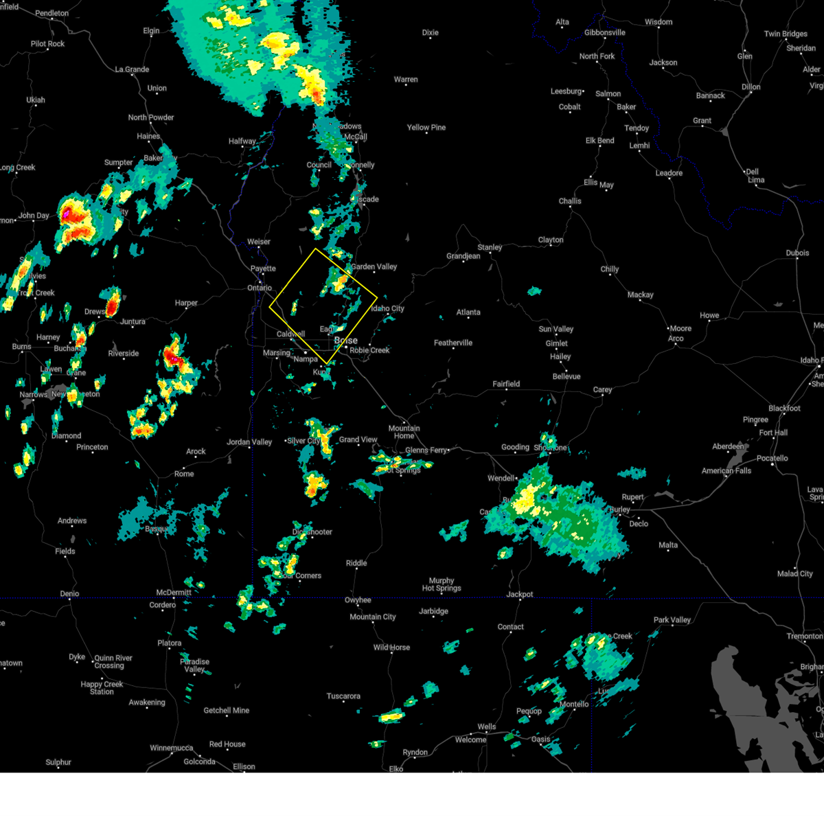
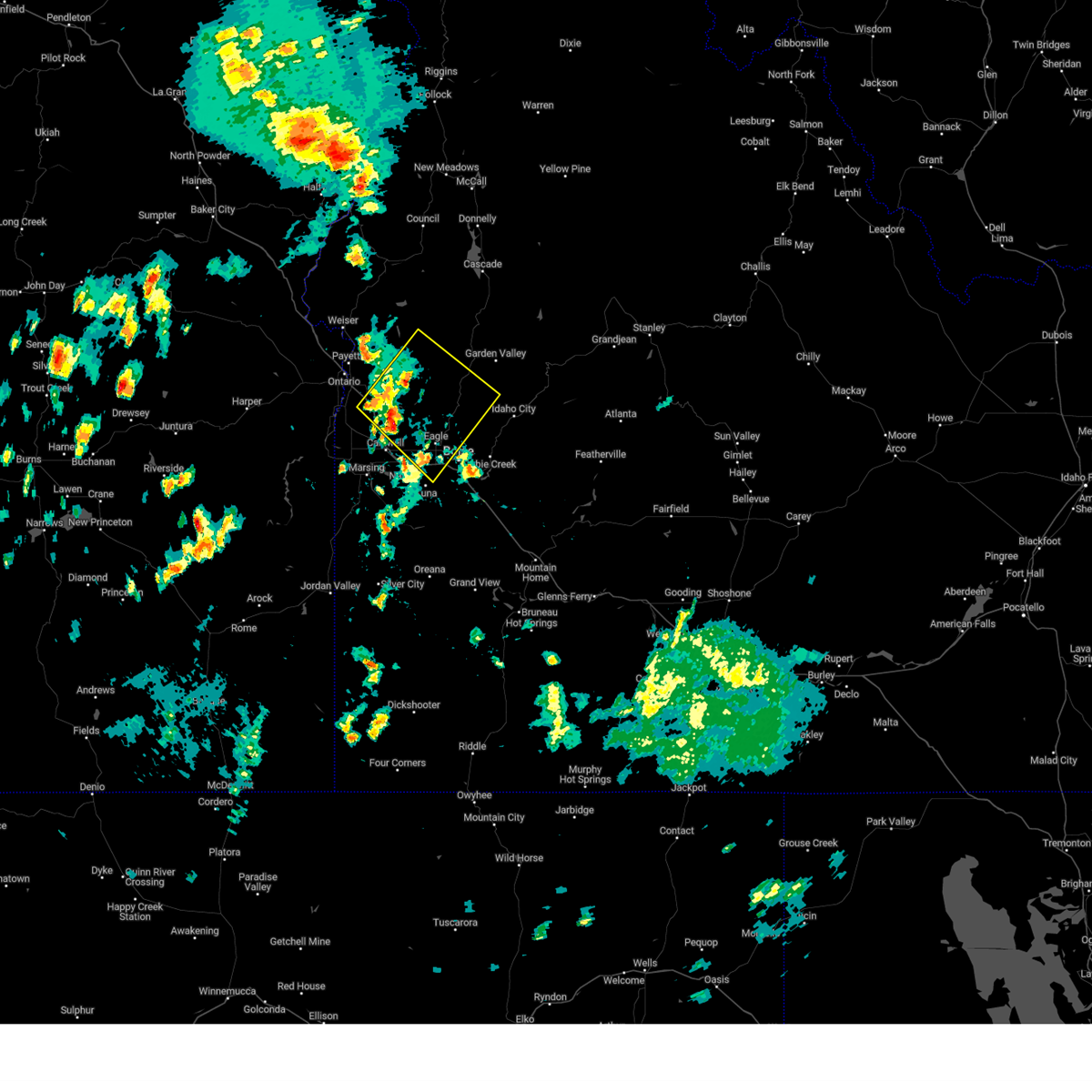
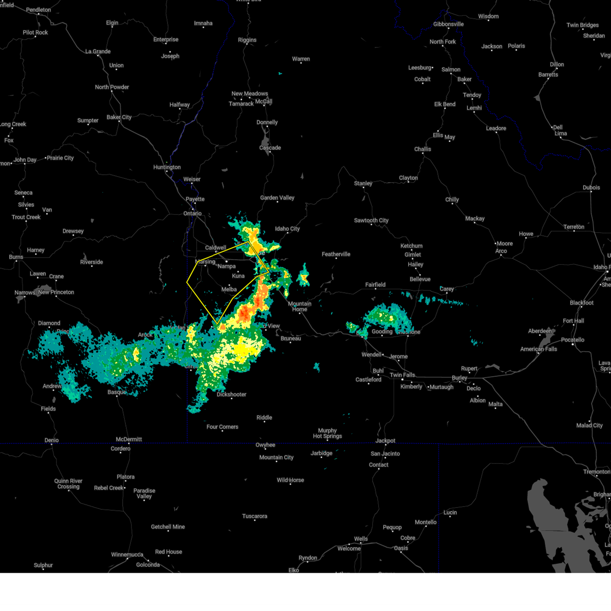
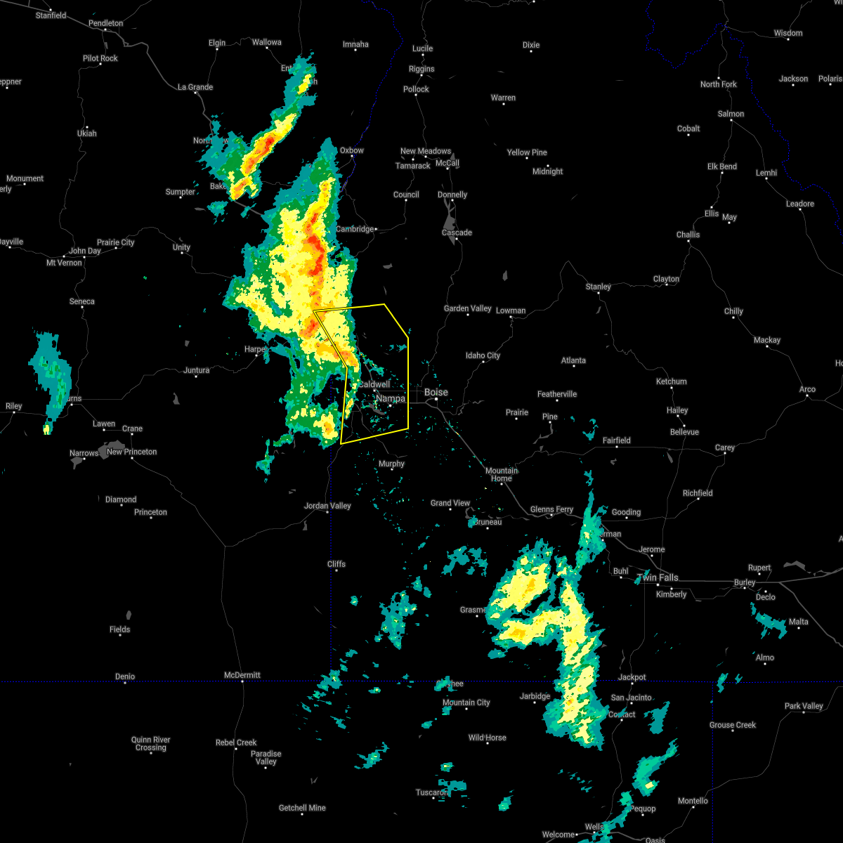
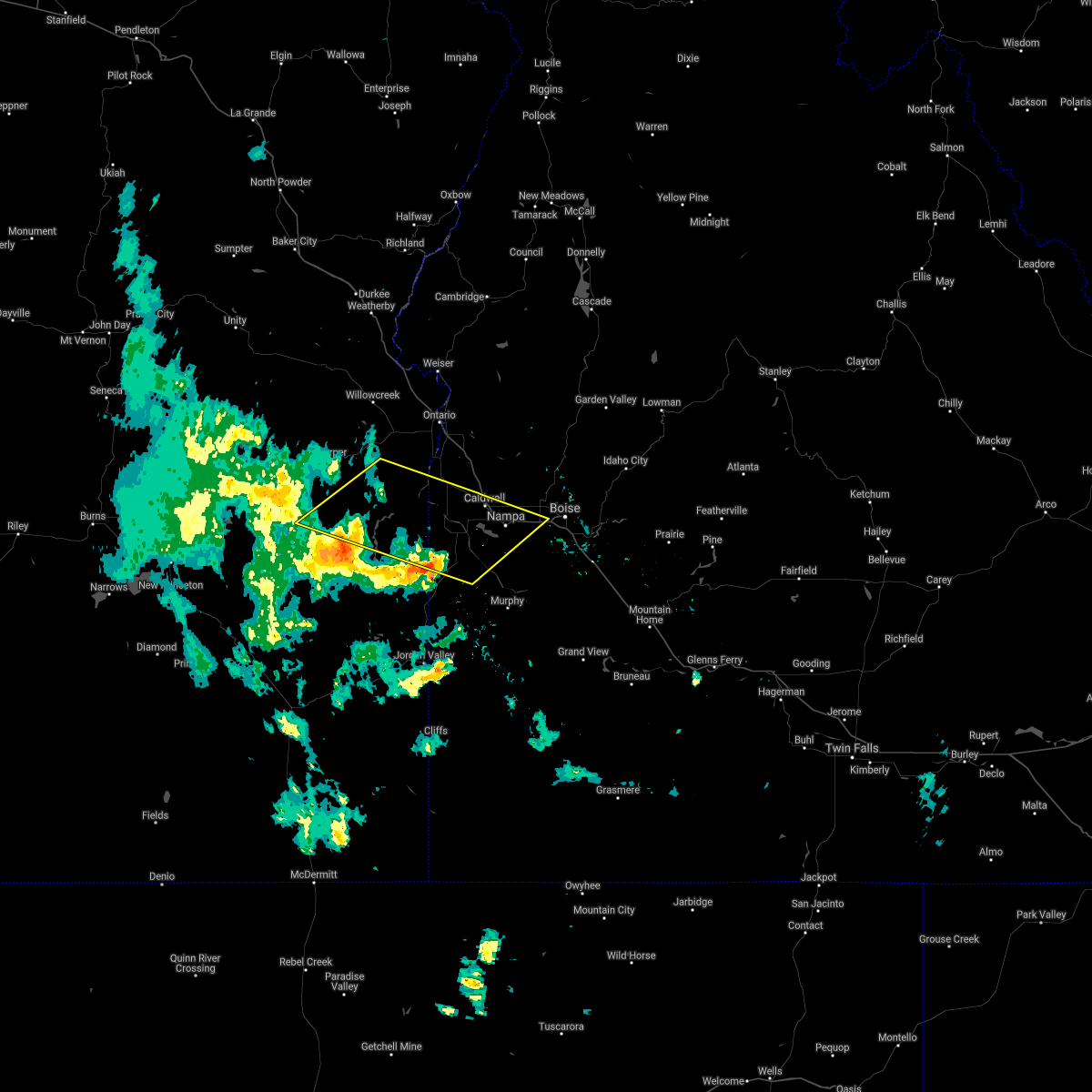
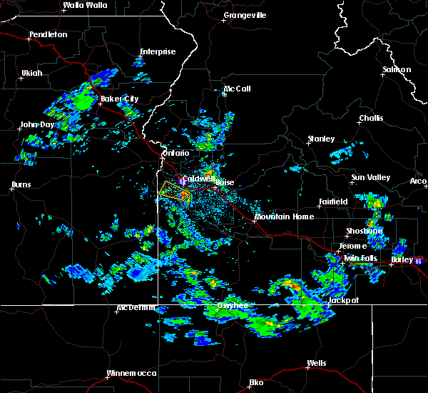
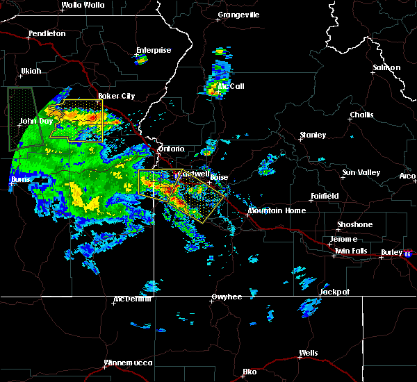
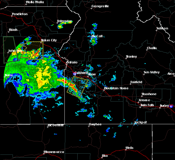
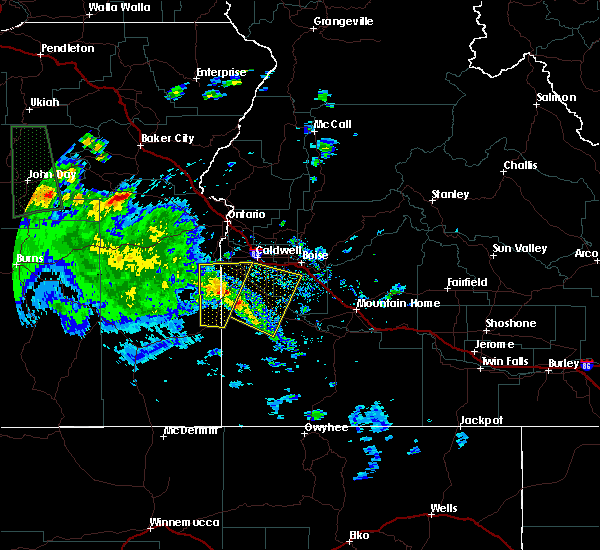
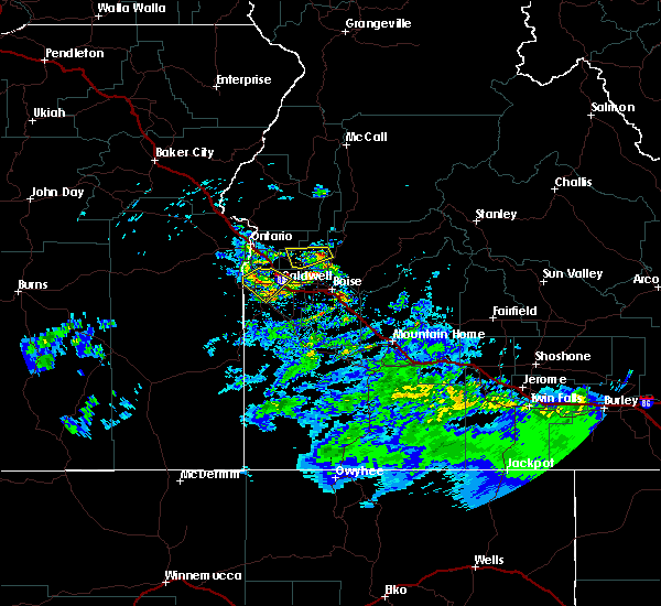
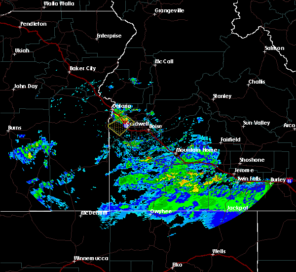
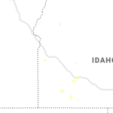
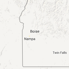
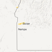
Hail Map for Caldwell, ID
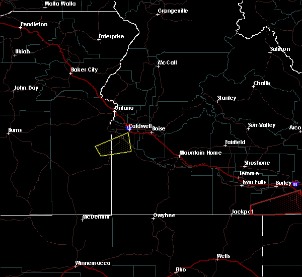
The Caldwell, ID area has had 3 reports of on-the-ground hail by trained spotters, and has been under severe weather warnings 2 times during the past 12 months. Doppler radar has detected hail at or near Caldwell, ID on 8 occasions.
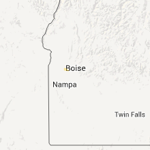
| Name: | Caldwell, ID |
| Where Located: | 23.3 miles W of Boise, ID |
| Map: | Google Map for Caldwell, ID |
| Population: | 46237 |
| Housing Units: | 16323 |
| More Info: | Search Google for Caldwell, ID |
0
The Top Recent Hail Date for Caldwell, ID is Wednesday, April 3, 2024 (7th out of 8)

Hail and Wind Damage Spotted near Caldwell, ID
| Date / Time | Report Details |
|---|---|
| 7/24/2024 6:01 PM MDT |
 the severe thunderstorm warning has been cancelled and is no longer in effect the severe thunderstorm warning has been cancelled and is no longer in effect
|
| 7/24/2024 5:23 PM MDT |
 Svrboi the national weather service in boise has issued a * severe thunderstorm warning for, northwestern ada county in southwestern idaho, west central boise county in southwestern idaho, central payette county in southwestern idaho, northeastern canyon county in southwestern idaho, gem county in southwestern idaho, southern washington county in southwestern idaho, * until 615 pm mdt.. * at 522 pm mdt, severe thunderstorms were located along a line extending from near letha to near meridian, moving northeast at 35 mph. damaging winds associated with numerous gusts fronts were moving through canyon and ada counties (radar indicated). Hazards include 60 mph wind gusts. Expect damage to roofs, siding, and trees. severe thunderstorms will be near, northwestern boise, emmett, meridian, and eagle around 530 pm mdt. montour and french corner around 540 pm mdt. horseshoe bend, sweet, and bogus basin ski area around 550 pm mdt. Gardena and harris creek summit around 600 pm mdt. Svrboi the national weather service in boise has issued a * severe thunderstorm warning for, northwestern ada county in southwestern idaho, west central boise county in southwestern idaho, central payette county in southwestern idaho, northeastern canyon county in southwestern idaho, gem county in southwestern idaho, southern washington county in southwestern idaho, * until 615 pm mdt.. * at 522 pm mdt, severe thunderstorms were located along a line extending from near letha to near meridian, moving northeast at 35 mph. damaging winds associated with numerous gusts fronts were moving through canyon and ada counties (radar indicated). Hazards include 60 mph wind gusts. Expect damage to roofs, siding, and trees. severe thunderstorms will be near, northwestern boise, emmett, meridian, and eagle around 530 pm mdt. montour and french corner around 540 pm mdt. horseshoe bend, sweet, and bogus basin ski area around 550 pm mdt. Gardena and harris creek summit around 600 pm mdt.
|
| 6/6/2023 8:54 PM MDT |
 At 853 pm mdt, severe thunderstorms were located along a line extending from near blacks creek reservoir to near murphy to near reynolds, moving northwest at 30 mph (radar indicated). Hazards include 60 mph wind gusts and penny size hail. Expect damage to roofs, siding, and trees. severe thunderstorms will be near, reynolds and guffey around 900 pm mdt. boise, kuna, melba and walters ferry around 910 pm mdt. garden city and squaw butte around 920 pm mdt. givens hot springs around 930 pm mdt. nampa, caldwell, meridian and marsing around 940 pm mdt. hail threat, radar indicated max hail size, 0. 75 in wind threat, observed max wind gust, 60 mph. At 853 pm mdt, severe thunderstorms were located along a line extending from near blacks creek reservoir to near murphy to near reynolds, moving northwest at 30 mph (radar indicated). Hazards include 60 mph wind gusts and penny size hail. Expect damage to roofs, siding, and trees. severe thunderstorms will be near, reynolds and guffey around 900 pm mdt. boise, kuna, melba and walters ferry around 910 pm mdt. garden city and squaw butte around 920 pm mdt. givens hot springs around 930 pm mdt. nampa, caldwell, meridian and marsing around 940 pm mdt. hail threat, radar indicated max hail size, 0. 75 in wind threat, observed max wind gust, 60 mph.
|
| 9/7/2022 6:41 PM MDT |
 At 640 pm mdt/540 pm pdt/, severe thunderstorms were located along a line extending from richland to near homedale, moving east-northeast at 55 mph (radar indicated). Hazards include 70 mph wind gusts. Expect considerable tree damage. damage is likely to mobile homes, roofs, and outbuildings. severe thunderstorms will be near, halfway, richland and carson around 550 pm pdt. cambridge around 650 pm mdt. oxbow dam and brownlee dam around 600 pm pdt. goodrich and brownlee reservoir around 700 pm mdt. emmett, eagle, council and bear around 710 pm mdt. sweet, horseshoe bend, montour and lost valley reservoir around 720 pm mdt. mccall, gardena, ola and new meadows around 730 pm mdt. thunderstorm damage threat, considerable hail threat, radar indicated max hail size, <. 75 in wind threat, radar indicated max wind gust, 70 mph. At 640 pm mdt/540 pm pdt/, severe thunderstorms were located along a line extending from richland to near homedale, moving east-northeast at 55 mph (radar indicated). Hazards include 70 mph wind gusts. Expect considerable tree damage. damage is likely to mobile homes, roofs, and outbuildings. severe thunderstorms will be near, halfway, richland and carson around 550 pm pdt. cambridge around 650 pm mdt. oxbow dam and brownlee dam around 600 pm pdt. goodrich and brownlee reservoir around 700 pm mdt. emmett, eagle, council and bear around 710 pm mdt. sweet, horseshoe bend, montour and lost valley reservoir around 720 pm mdt. mccall, gardena, ola and new meadows around 730 pm mdt. thunderstorm damage threat, considerable hail threat, radar indicated max hail size, <. 75 in wind threat, radar indicated max wind gust, 70 mph.
|
| 9/7/2022 6:08 PM MDT |
 At 606 pm mdt/506 pm pdt/, severe thunderstorms were located along a line extending from near brogan to castro ridge, moving east at 60 mph (radar indicated). Hazards include 70 mph wind gusts. Expect considerable tree damage. damage is likely to mobile homes, roofs, and outbuildings. severe thunderstorms will be near, castro ridge, parsnip peak, little grassy reservoir and antelope reservoir around 610 pm mdt. reynolds, south mountain, henley basin and black warrior mountain around 620 pm mdt. weiser, silver city, murphy and melba around 630 pm mdt. payette, ontario, parma and emmett around 640 pm mdt. thunderstorm damage threat, considerable hail threat, radar indicated max hail size, <. 75 in wind threat, radar indicated max wind gust, 70 mph. At 606 pm mdt/506 pm pdt/, severe thunderstorms were located along a line extending from near brogan to castro ridge, moving east at 60 mph (radar indicated). Hazards include 70 mph wind gusts. Expect considerable tree damage. damage is likely to mobile homes, roofs, and outbuildings. severe thunderstorms will be near, castro ridge, parsnip peak, little grassy reservoir and antelope reservoir around 610 pm mdt. reynolds, south mountain, henley basin and black warrior mountain around 620 pm mdt. weiser, silver city, murphy and melba around 630 pm mdt. payette, ontario, parma and emmett around 640 pm mdt. thunderstorm damage threat, considerable hail threat, radar indicated max hail size, <. 75 in wind threat, radar indicated max wind gust, 70 mph.
|
| 8/11/2022 4:27 PM MDT |
 At 427 pm mdt, a severe thunderstorm was located near marsing, or 13 miles southwest of caldwell, moving north at 20 mph (radar indicated). Hazards include 60 mph wind gusts and quarter size hail. Hail damage to vehicles is expected. expect wind damage to roofs, siding, and trees. this severe thunderstorm will be near, marsing around 430 pm mdt. homedale around 440 pm mdt. wilder and huston around 450 pm mdt. caldwell, greenleaf and sand hollow around 500 pm mdt. notus around 510 pm mdt. hail threat, radar indicated max hail size, 1. 00 in wind threat, radar indicated max wind gust, 60 mph. At 427 pm mdt, a severe thunderstorm was located near marsing, or 13 miles southwest of caldwell, moving north at 20 mph (radar indicated). Hazards include 60 mph wind gusts and quarter size hail. Hail damage to vehicles is expected. expect wind damage to roofs, siding, and trees. this severe thunderstorm will be near, marsing around 430 pm mdt. homedale around 440 pm mdt. wilder and huston around 450 pm mdt. caldwell, greenleaf and sand hollow around 500 pm mdt. notus around 510 pm mdt. hail threat, radar indicated max hail size, 1. 00 in wind threat, radar indicated max wind gust, 60 mph.
|
| 9/10/2021 7:31 PM MDT |
 At 730 pm mdt, severe thunderstorms were located along a line extending from near payette to 7 miles northeast of parma to elephant butte, moving northeast at 40 mph (radar indicated). Hazards include 60 mph wind gusts. Expect damage to roofs, siding, and trees. severe thunderstorms will be near, new plymouth and middleton around 740 pm mdt. emmett, caldwell, letha and firebird speedway around 750 pm mdt. nampa, meridian, kuna and star around 800 pm mdt. hail threat, radar indicated max hail size, <. 75 in wind threat, radar indicated max wind gust, 60 mph. At 730 pm mdt, severe thunderstorms were located along a line extending from near payette to 7 miles northeast of parma to elephant butte, moving northeast at 40 mph (radar indicated). Hazards include 60 mph wind gusts. Expect damage to roofs, siding, and trees. severe thunderstorms will be near, new plymouth and middleton around 740 pm mdt. emmett, caldwell, letha and firebird speedway around 750 pm mdt. nampa, meridian, kuna and star around 800 pm mdt. hail threat, radar indicated max hail size, <. 75 in wind threat, radar indicated max wind gust, 60 mph.
|
| 6/22/2021 7:30 PM MDT | Blue spruce tree 50 ft tall uprooted in thunderstorm outflo in canyon county ID, 7.5 miles ESE of Caldwell, ID |
| 6/22/2021 6:40 PM MDT |
 At 639 pm mdt, severe thunderstorms were located along a line extending from near freezeout mountain to near elephant butte, moving northeast at 30 mph (radar indicated). Hazards include 60 mph wind gusts and penny size hail. Expect damage to roofs, siding, and trees. severe thunderstorms will be near, homedale, elephant butte and succor creek campground around 640 pm mdt. marsing, wilder and givens hot springs around 650 pm mdt. greenleaf, notus, lake lowell and huston around 700 pm mdt. caldwell, sand hollow and board corral mountain around 710 pm mdt. Nampa, kuna, double mountain and owyhee dam around 720 pm mdt. At 639 pm mdt, severe thunderstorms were located along a line extending from near freezeout mountain to near elephant butte, moving northeast at 30 mph (radar indicated). Hazards include 60 mph wind gusts and penny size hail. Expect damage to roofs, siding, and trees. severe thunderstorms will be near, homedale, elephant butte and succor creek campground around 640 pm mdt. marsing, wilder and givens hot springs around 650 pm mdt. greenleaf, notus, lake lowell and huston around 700 pm mdt. caldwell, sand hollow and board corral mountain around 710 pm mdt. Nampa, kuna, double mountain and owyhee dam around 720 pm mdt.
|
| 4/30/2020 3:08 PM MDT |
 The severe thunderstorm warning for northern ada, southwestern boise, northwestern elmore, northeastern canyon and south central gem counties will expire at 315 pm mdt, the storm which prompted the warning has weakened below severe limits, and has exited the warned area. therefore, the warning will be allowed to expire. when safe to do so, please relay storm reports to the national weather service in boise via local law enforcement, or national weather service boise facebook and twitter accounts. The severe thunderstorm warning for northern ada, southwestern boise, northwestern elmore, northeastern canyon and south central gem counties will expire at 315 pm mdt, the storm which prompted the warning has weakened below severe limits, and has exited the warned area. therefore, the warning will be allowed to expire. when safe to do so, please relay storm reports to the national weather service in boise via local law enforcement, or national weather service boise facebook and twitter accounts.
|
| 4/30/2020 2:28 PM MDT |
 At 228 pm mdt, a severe thunderstorm was located over western boise, moving east at 40 mph (radar indicated). Hazards include 60 mph wind gusts. Expect damage to roofs, siding, and trees. this severe thunderstorm will be near, boise and hidden springs around 230 pm mdt. bogus basin ski area around 240 pm mdt. lucky peak reservoir, lucky peak spring shores marina, aldape summit and harris creek summit around 250 pm mdt. arrowrock dam and placerville around 300 pm mdt. Arrowrock reservoir around 310 pm mdt. At 228 pm mdt, a severe thunderstorm was located over western boise, moving east at 40 mph (radar indicated). Hazards include 60 mph wind gusts. Expect damage to roofs, siding, and trees. this severe thunderstorm will be near, boise and hidden springs around 230 pm mdt. bogus basin ski area around 240 pm mdt. lucky peak reservoir, lucky peak spring shores marina, aldape summit and harris creek summit around 250 pm mdt. arrowrock dam and placerville around 300 pm mdt. Arrowrock reservoir around 310 pm mdt.
|
| 4/30/2020 2:02 PM MDT |
 At 201 pm mdt, a severe thunderstorm was located near givens hot springs, or 16 miles southwest of nampa, moving east at 45 mph (radar indicated). Hazards include ping pong ball size hail and 60 mph wind gusts. People and animals outdoors will be injured. expect hail damage to roofs, siding, windows, and vehicles. expect wind damage to roofs, siding, and trees. This severe storm will be near, lake lowell around 210 pm mdt. At 201 pm mdt, a severe thunderstorm was located near givens hot springs, or 16 miles southwest of nampa, moving east at 45 mph (radar indicated). Hazards include ping pong ball size hail and 60 mph wind gusts. People and animals outdoors will be injured. expect hail damage to roofs, siding, windows, and vehicles. expect wind damage to roofs, siding, and trees. This severe storm will be near, lake lowell around 210 pm mdt.
|
| 4/30/2020 1:39 PM MDT |
 At 139 pm mdt, a severe thunderstorm was located near rockville school, or 35 miles southwest of caldwell, moving northeast at 35 mph (radar indicated). Hazards include ping pong ball size hail and 60 mph wind gusts. People and animals outdoors will be injured. expect hail damage to roofs, siding, windows, and vehicles. expect wind damage to roofs, siding, and trees. this severe thunderstorm will be near, rockville school and malloy ranch around 150 pm mdt. rockville and squaw butte around 200 pm mdt. elephant butte around 210 pm mdt. marsing and givens hot springs around 220 pm mdt. Lake lowell around 230 pm mdt. At 139 pm mdt, a severe thunderstorm was located near rockville school, or 35 miles southwest of caldwell, moving northeast at 35 mph (radar indicated). Hazards include ping pong ball size hail and 60 mph wind gusts. People and animals outdoors will be injured. expect hail damage to roofs, siding, windows, and vehicles. expect wind damage to roofs, siding, and trees. this severe thunderstorm will be near, rockville school and malloy ranch around 150 pm mdt. rockville and squaw butte around 200 pm mdt. elephant butte around 210 pm mdt. marsing and givens hot springs around 220 pm mdt. Lake lowell around 230 pm mdt.
|
| 4/30/2020 1:39 PM MDT |
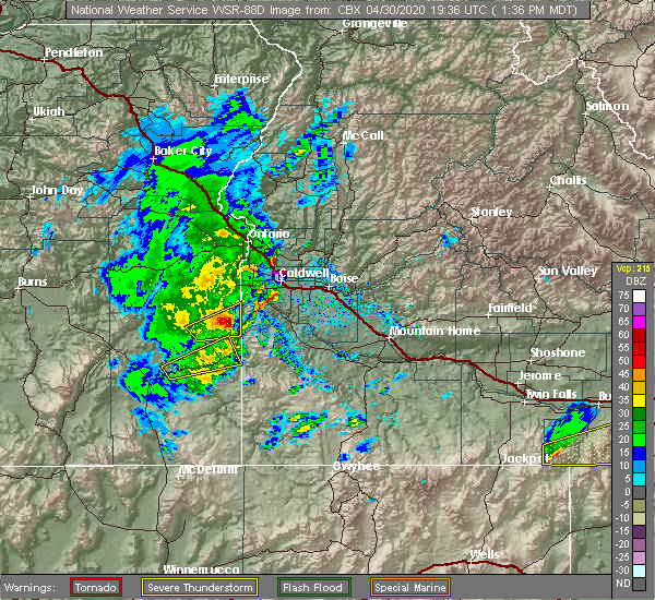 At 139 pm mdt, a severe thunderstorm was located near rockville school, or 35 miles southwest of caldwell, moving northeast at 35 mph (radar indicated). Hazards include ping pong ball size hail and 60 mph wind gusts. People and animals outdoors will be injured. expect hail damage to roofs, siding, windows, and vehicles. expect wind damage to roofs, siding, and trees. this severe thunderstorm will be near, rockville school and malloy ranch around 150 pm mdt. rockville and squaw butte around 200 pm mdt. elephant butte around 210 pm mdt. marsing and givens hot springs around 220 pm mdt. Lake lowell around 230 pm mdt. At 139 pm mdt, a severe thunderstorm was located near rockville school, or 35 miles southwest of caldwell, moving northeast at 35 mph (radar indicated). Hazards include ping pong ball size hail and 60 mph wind gusts. People and animals outdoors will be injured. expect hail damage to roofs, siding, windows, and vehicles. expect wind damage to roofs, siding, and trees. this severe thunderstorm will be near, rockville school and malloy ranch around 150 pm mdt. rockville and squaw butte around 200 pm mdt. elephant butte around 210 pm mdt. marsing and givens hot springs around 220 pm mdt. Lake lowell around 230 pm mdt.
|
| 10/19/2019 11:56 AM MDT | Several trees and powerlines down. peak wind measured 45mp in canyon county ID, 1.7 miles SE of Caldwell, ID |
| 7/12/2019 9:45 PM MDT |
 At 945 pm mdt, a severe thunderstorm was located over nampa, moving northeast at 20 mph (radar indicated). Hazards include 60 mph wind gusts. expect damage to roofs, siding, and trees At 945 pm mdt, a severe thunderstorm was located over nampa, moving northeast at 20 mph (radar indicated). Hazards include 60 mph wind gusts. expect damage to roofs, siding, and trees
|
| 7/12/2019 9:20 PM MDT |
 At 919 pm mdt, a severe thunderstorm was located near lake lowell, or 9 miles southwest of nampa, moving east at 20 mph (radar indicated). Hazards include ping pong ball size hail and 60 mph wind gusts. People and animals outdoors will be injured. expect hail damage to roofs, siding, windows, and vehicles. expect wind damage to roofs, siding, and trees. this severe thunderstorm will be near, lake lowell around 930 pm mdt. caldwell around 940 pm mdt. Nampa and star around 1000 pm mdt. At 919 pm mdt, a severe thunderstorm was located near lake lowell, or 9 miles southwest of nampa, moving east at 20 mph (radar indicated). Hazards include ping pong ball size hail and 60 mph wind gusts. People and animals outdoors will be injured. expect hail damage to roofs, siding, windows, and vehicles. expect wind damage to roofs, siding, and trees. this severe thunderstorm will be near, lake lowell around 930 pm mdt. caldwell around 940 pm mdt. Nampa and star around 1000 pm mdt.
|
| 5/26/2019 1:36 PM MDT |
 At 136 pm mdt, a severe thunderstorm was located over lake lowell, or 7 miles southwest of nampa, moving northwest at 15 mph (radar indicated). Hazards include quarter size hail. Damage to vehicles is expected. this severe thunderstorm will be near, marsing and huston around 200 pm mdt. Homedale and wilder around 210 pm mdt. At 136 pm mdt, a severe thunderstorm was located over lake lowell, or 7 miles southwest of nampa, moving northwest at 15 mph (radar indicated). Hazards include quarter size hail. Damage to vehicles is expected. this severe thunderstorm will be near, marsing and huston around 200 pm mdt. Homedale and wilder around 210 pm mdt.
|
| 5/25/2018 8:00 PM MDT |
 At 759 pm mdt, a severe thunderstorm was located over notus, or 7 miles southeast of parma, moving north at 25 mph (trained weather spotters and doppler radar). Hazards include 60 mph wind gusts and half dollar size hail. Hail damage to vehicles is expected. expect wind damage to roofs, siding, and trees. this severe thunderstorm will be near, sand hollow around 800 pm mdt. parma and emmett around 810 pm mdt. owyhee and letha around 820 pm mdt. Nyssa around 830 pm mdt. At 759 pm mdt, a severe thunderstorm was located over notus, or 7 miles southeast of parma, moving north at 25 mph (trained weather spotters and doppler radar). Hazards include 60 mph wind gusts and half dollar size hail. Hail damage to vehicles is expected. expect wind damage to roofs, siding, and trees. this severe thunderstorm will be near, sand hollow around 800 pm mdt. parma and emmett around 810 pm mdt. owyhee and letha around 820 pm mdt. Nyssa around 830 pm mdt.
|
| 5/25/2018 7:42 PM MDT | Hen Egg sized hail reported 1.5 miles NE of Caldwell, ID, measured 2 inch hail. |
| 5/25/2018 7:35 PM MDT | Half Dollar sized hail reported 1.2 miles E of Caldwell, ID, half dollar size hail just north of lake lowell |
| 5/25/2018 7:31 PM MDT |
 At 731 pm mdt, severe thunderstorms were located along a line extending from near owyhee dam to near huston, moving north at 25 mph (radar indicated). Hazards include 70 mph wind gusts and quarter size hail. Hail damage to vehicles is expected. expect considerable tree damage. wind damage is also likely to mobile homes, roofs, and outbuildings. these severe storms will be near, greenleaf and adrian around 740 pm mdt. notus and sand hollow around 750 pm mdt. Parma and middleton around 800 pm mdt. At 731 pm mdt, severe thunderstorms were located along a line extending from near owyhee dam to near huston, moving north at 25 mph (radar indicated). Hazards include 70 mph wind gusts and quarter size hail. Hail damage to vehicles is expected. expect considerable tree damage. wind damage is also likely to mobile homes, roofs, and outbuildings. these severe storms will be near, greenleaf and adrian around 740 pm mdt. notus and sand hollow around 750 pm mdt. Parma and middleton around 800 pm mdt.
|
| 5/25/2018 7:29 PM MDT |
 At 729 pm mdt, severe thunderstorms were located along a line extending from near givens hot springs to swan falls, moving northeast at 25 mph (radar indicated). Hazards include 60 mph wind gusts and quarter size hail. Hail damage to vehicles is expected. expect wind damage to roofs, siding, and trees. severe thunderstorms will be near, melba, givens hot springs and big foot butte around 730 pm mdt. lake lowell and initial point around 750 pm mdt. Caldwell, nampa, southwestern boise and middleton around 800 pm mdt. At 729 pm mdt, severe thunderstorms were located along a line extending from near givens hot springs to swan falls, moving northeast at 25 mph (radar indicated). Hazards include 60 mph wind gusts and quarter size hail. Hail damage to vehicles is expected. expect wind damage to roofs, siding, and trees. severe thunderstorms will be near, melba, givens hot springs and big foot butte around 730 pm mdt. lake lowell and initial point around 750 pm mdt. Caldwell, nampa, southwestern boise and middleton around 800 pm mdt.
|
| 5/25/2018 7:06 PM MDT |
 At 706 pm mdt, a severe thunderstorm was located near walters ferry, or 13 miles south of nampa, moving north at 30 mph (radar indicated). Hazards include 60 mph wind gusts and quarter size hail. Hail damage to vehicles is expected. expect wind damage to roofs, siding, and trees. this severe storm will be near, initial point around 710 pm mdt. Nampa, caldwell, kuna and lake lowell around 730 pm mdt. At 706 pm mdt, a severe thunderstorm was located near walters ferry, or 13 miles south of nampa, moving north at 30 mph (radar indicated). Hazards include 60 mph wind gusts and quarter size hail. Hail damage to vehicles is expected. expect wind damage to roofs, siding, and trees. this severe storm will be near, initial point around 710 pm mdt. Nampa, caldwell, kuna and lake lowell around 730 pm mdt.
|
| 5/25/2018 7:00 PM MDT |
 At 700 pm mdt, a severe thunderstorm was located near elephant butte, or 16 miles southwest of caldwell, moving north at 20 mph (radar indicated). Hazards include 70 mph wind gusts and quarter size hail. Hail damage to vehicles is expected. expect considerable tree damage. wind damage is also likely to mobile homes, roofs, and outbuildings. this severe thunderstorm will be near, marsing around 710 pm mdt. homedale and lake lowell around 720 pm mdt. huston around 730 pm mdt. greenleaf and wilder around 740 pm mdt. Caldwell, notus, sand hollow and adrian around 750 pm mdt. At 700 pm mdt, a severe thunderstorm was located near elephant butte, or 16 miles southwest of caldwell, moving north at 20 mph (radar indicated). Hazards include 70 mph wind gusts and quarter size hail. Hail damage to vehicles is expected. expect considerable tree damage. wind damage is also likely to mobile homes, roofs, and outbuildings. this severe thunderstorm will be near, marsing around 710 pm mdt. homedale and lake lowell around 720 pm mdt. huston around 730 pm mdt. greenleaf and wilder around 740 pm mdt. Caldwell, notus, sand hollow and adrian around 750 pm mdt.
|
| 5/25/2018 6:34 PM MDT |
 At 633 pm mdt, a severe thunderstorm was located over reynolds, or 28 miles south of nampa, moving north at 30 mph. this storm is just east of another warned storm, and further development to the east of this storm is likely. therefore, the warning area was expanded eastward to account for this scenario (radar indicated). Hazards include 60 mph wind gusts and quarter size hail. Hail damage to vehicles is expected. expect wind damage to roofs, siding, and trees. this severe thunderstorm will be near, murphy around 650 pm mdt. swan falls, walters ferry and guffey around 700 pm mdt. melba, givens hot springs and initial point around 710 pm mdt. Nampa, caldwell, kuna and lake lowell around 730 pm mdt. At 633 pm mdt, a severe thunderstorm was located over reynolds, or 28 miles south of nampa, moving north at 30 mph. this storm is just east of another warned storm, and further development to the east of this storm is likely. therefore, the warning area was expanded eastward to account for this scenario (radar indicated). Hazards include 60 mph wind gusts and quarter size hail. Hail damage to vehicles is expected. expect wind damage to roofs, siding, and trees. this severe thunderstorm will be near, murphy around 650 pm mdt. swan falls, walters ferry and guffey around 700 pm mdt. melba, givens hot springs and initial point around 710 pm mdt. Nampa, caldwell, kuna and lake lowell around 730 pm mdt.
|
| 6/4/2017 5:30 PM MDT | A former nws senior forecaster reported very strong wind gusts associated with a fast moving outflow boundary from nearby storms. locally lots of tree branches down...s in canyon county ID, 6.5 miles SSE of Caldwell, ID |
| 5/6/2016 7:24 PM MDT |
 The severe thunderstorm warning for northern canyon and northwestern owyhee counties will expire at 730 pm mdt, the storm which prompted the warning has weakened below severe limits, and no longer poses an immediate threat to life or property. therefore the warning will be allowed to expire. when safe to do so, please relay storm reports to the national weather service in boise idaho via local law enforcement, or national weather service boise facebook and twitter accounts. The severe thunderstorm warning for northern canyon and northwestern owyhee counties will expire at 730 pm mdt, the storm which prompted the warning has weakened below severe limits, and no longer poses an immediate threat to life or property. therefore the warning will be allowed to expire. when safe to do so, please relay storm reports to the national weather service in boise idaho via local law enforcement, or national weather service boise facebook and twitter accounts.
|
| 5/6/2016 7:12 PM MDT |
 At 712 pm mdt, doppler radar indicated a severe thunderstorm capable of producing quarter size hail. this storm was located over notus, or 7 miles northwest of caldwell, moving southwest at 25 mph. this severe storm will be near, greenleaf and huston around 720 pm mdt. wilder, homedale and marsing around 730 pm mdt. At 712 pm mdt, doppler radar indicated a severe thunderstorm capable of producing quarter size hail. this storm was located over notus, or 7 miles northwest of caldwell, moving southwest at 25 mph. this severe storm will be near, greenleaf and huston around 720 pm mdt. wilder, homedale and marsing around 730 pm mdt.
|
| 5/6/2016 6:53 PM MDT |
 At 653 pm mdt, doppler radar indicated a severe thunderstorm capable of producing quarter size hail. this storm was located near sand hollow, or 9 miles north of caldwell, and moving southwest at 25 mph. * this severe thunderstorm will be near, notus around 710 pm mdt. caldwell, greenleaf and lake lowell around 720 pm mdt. wilder, homedale, marsing and huston around 730 pm mdt. At 653 pm mdt, doppler radar indicated a severe thunderstorm capable of producing quarter size hail. this storm was located near sand hollow, or 9 miles north of caldwell, and moving southwest at 25 mph. * this severe thunderstorm will be near, notus around 710 pm mdt. caldwell, greenleaf and lake lowell around 720 pm mdt. wilder, homedale, marsing and huston around 730 pm mdt.
|
| 5/26/2015 9:46 PM MDT | At 946 pm mdt, doppler radar indicated a severe thunderstorm capable of producing quarter size hail. this storm was located over star, or 9 miles northeast of caldwell, and moving southeast at 20 mph. * this severe thunderstorm will be near, nampa, star and firebird speedway around 950 pm mdt. meridian around 1000 pm mdt. eagle around 1010 pm mdt. garden city and hidden springs around 1020 pm mdt. northwestern boise around 1030 pm mdt. |
| 5/21/2015 4:21 PM MDT | The severe thunderstorm warning for northwestern owyhee and central canyon counties will expire at 430 pm mdt, the storm which prompted the warning has weakened below severe limits, and no longer poses an immediate threat to life or property. therefore the warning will be allowed to expire. when safe to do so, please relay storm reports to the national weather service in boise idaho via local law enforcement, or national weather service boise facebook and twitter accounts. |
| 5/21/2015 4:07 PM MDT | At 406 pm mdt, doppler radar indicated a severe thunderstorm capable of producing quarter size hail and damaging winds in excess of 60 mph. this storm was located over lake lowell, or near caldwell, moving west at 15 mph. this severe storm will be near, marsing, greenleaf and huston around 430 pm mdt. |
| 5/21/2015 3:43 PM MDT | At 343 pm mdt, doppler radar indicated a severe thunderstorm capable of producing quarter size hail and damaging winds in excess of 60 mph. this storm was located near lake lowell, or near nampa, and moving northwest at 15 mph. * this severe thunderstorm will be near, caldwell and lake lowell around 410 pm mdt. marsing around 420 pm mdt. greenleaf, homedale, notus and huston around 430 pm mdt. |
| 4/24/2012 3:30 PM MDT | Quarter sized hail reported 7.6 miles S of Caldwell, ID |
Hail Maps for Caldwell, ID


Connect with Interactive Hail Maps