

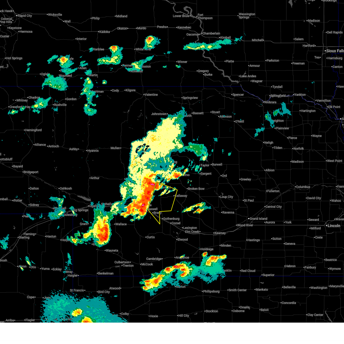
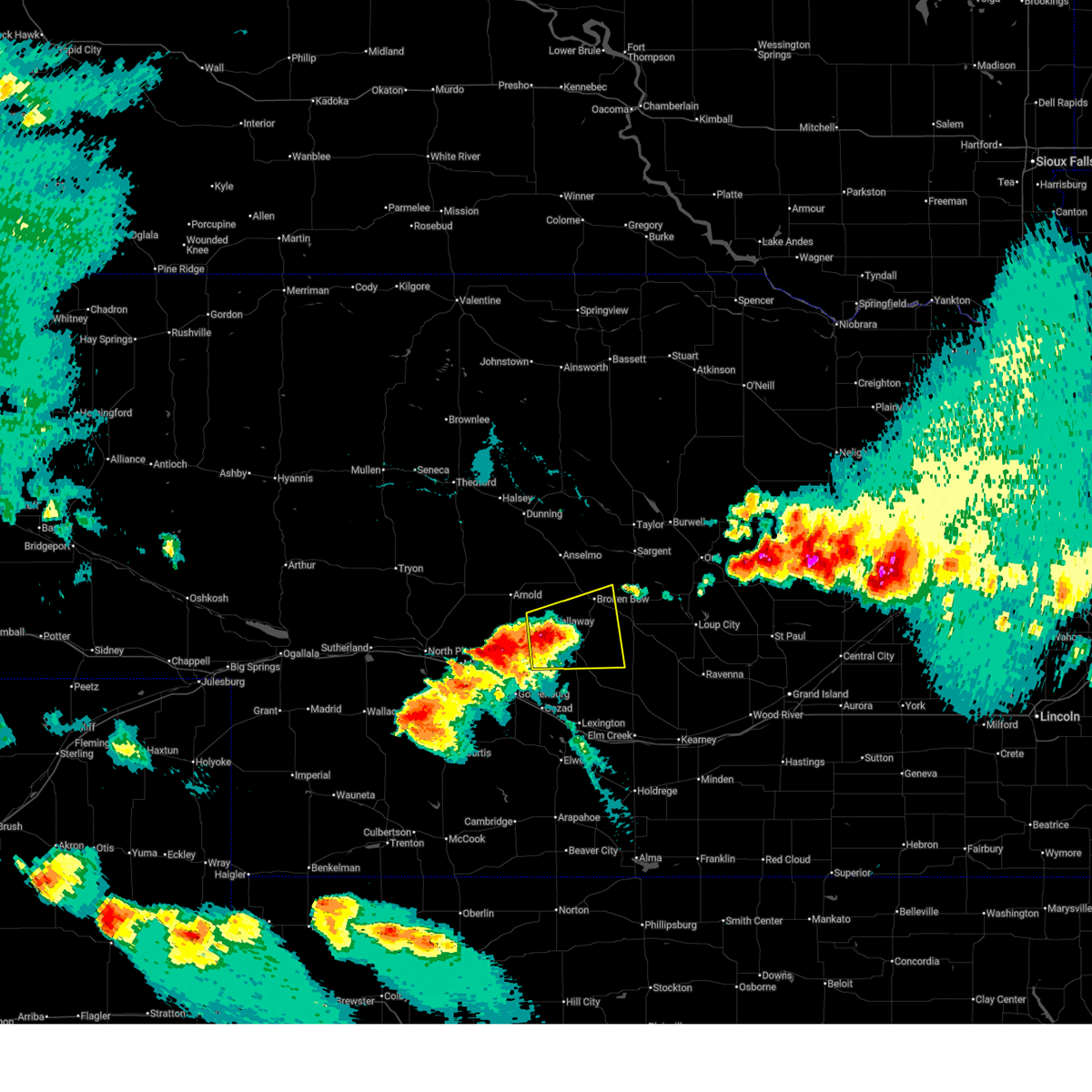
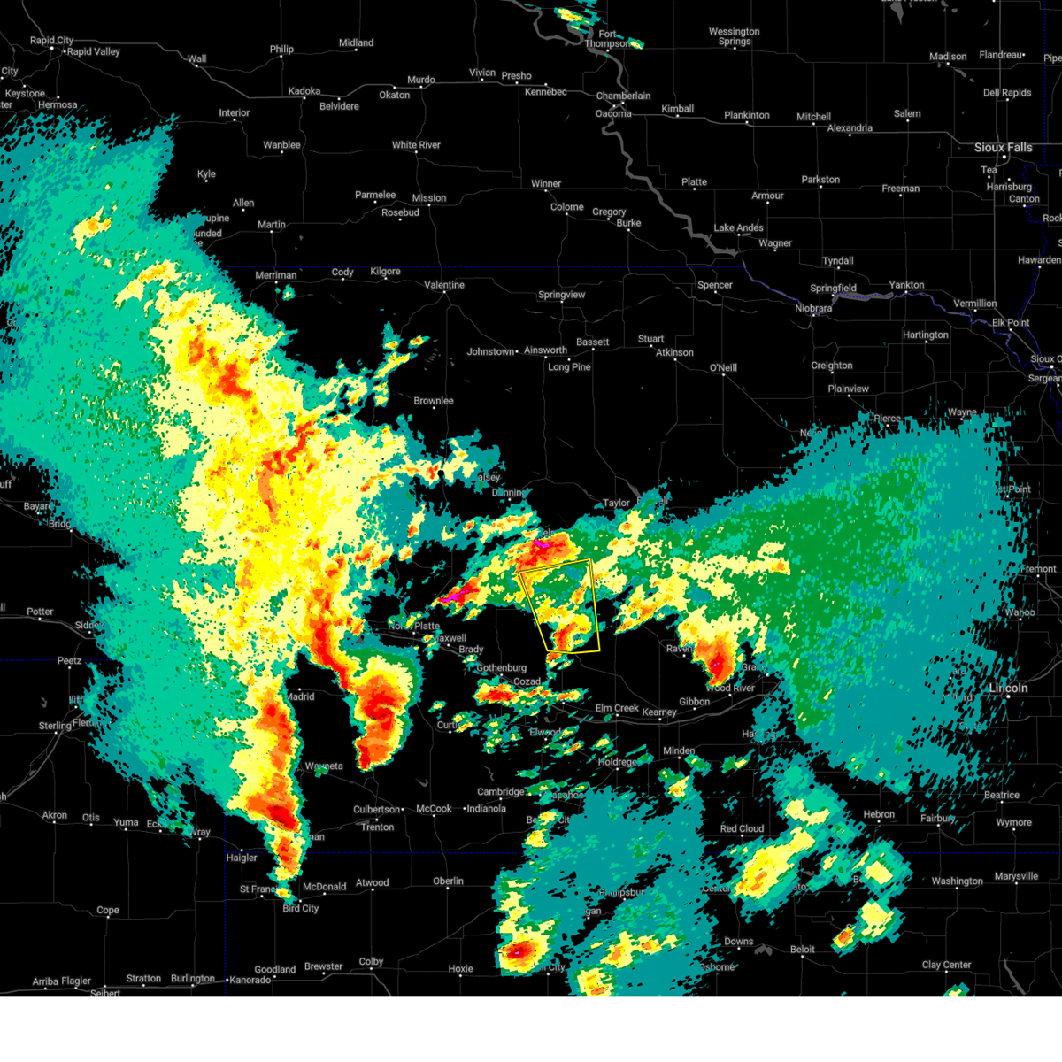
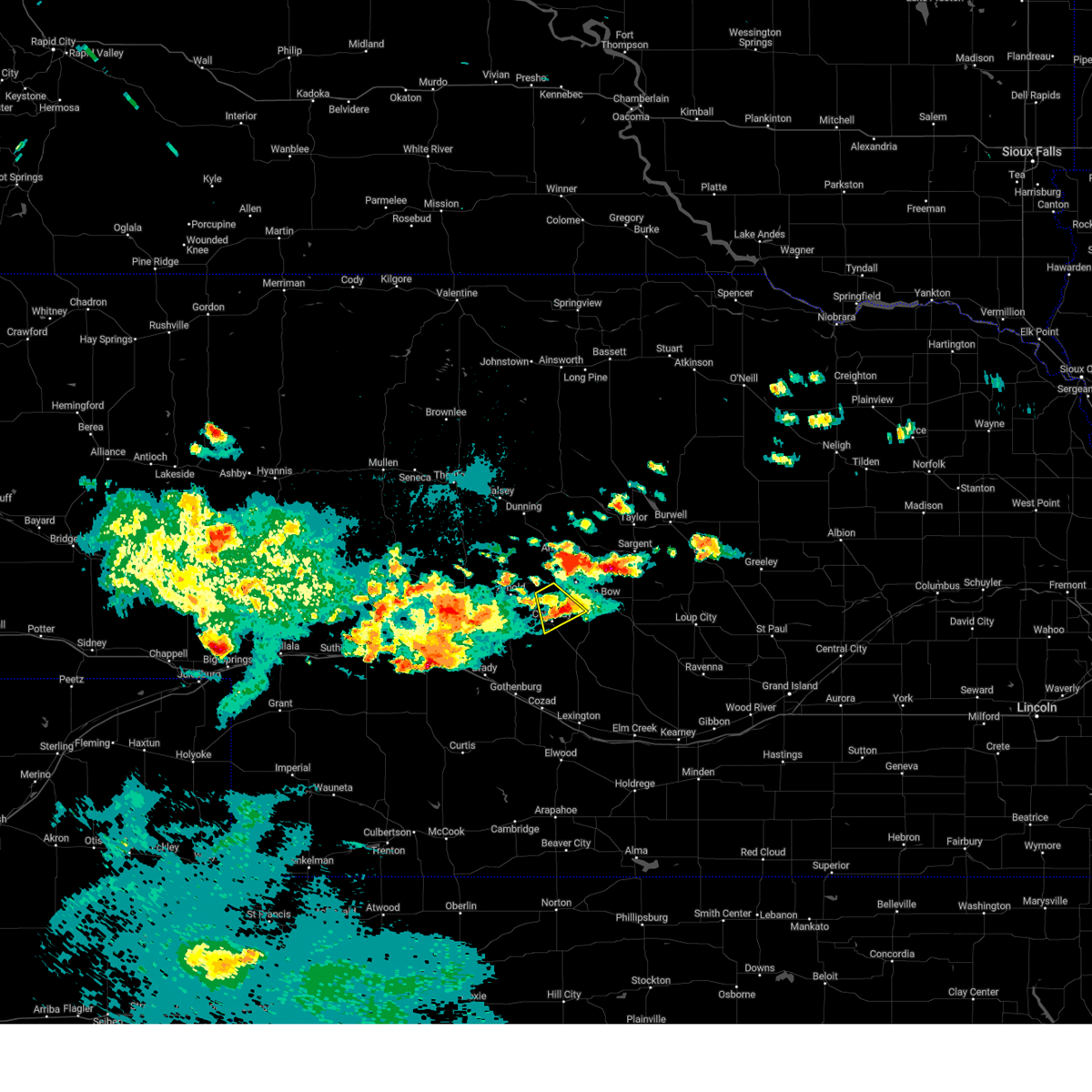
Hail Map for Callaway, NE
The Callaway, NE area has had 38 reports of on-the-ground hail by trained spotters, and has been under severe weather warnings 17 times during the past 12 months. Doppler radar has detected hail at or near Callaway, NE on 98 occasions, including 8 occasions during the past year.
| Name: | Callaway, NE |
| Where Located: | 45.2 miles ENE of North Platte, NE |
| Map: | Google Map for Callaway, NE |
| Population: | 539 |
| Housing Units: | 295 |
| More Info: | Search Google for Callaway, NE |
2
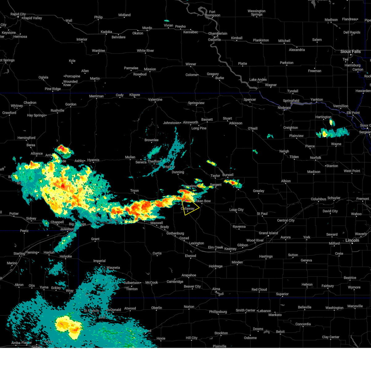
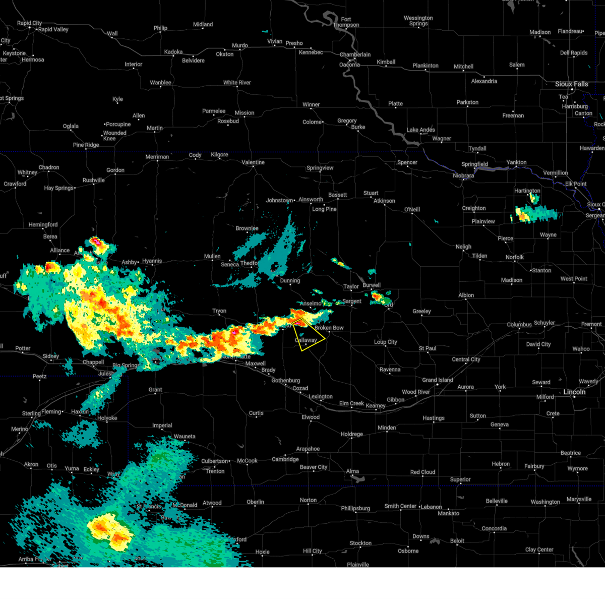
The Top Recent Hail Date for Callaway, NE is Saturday, July 6, 2024 (7th out of 98)

Hail and Wind Damage Spotted near Callaway, NE
| Date / Time | Report Details |
|---|---|
| 6/30/2025 1:30 AM CDT | Storm damage reported in custer county NE, 8 miles NE of Callaway, NE |
| 6/30/2025 12:59 AM CDT |
 Svrlbf the national weather service in north platte has issued a * severe thunderstorm warning for, northeastern lincoln county in southwestern nebraska, southeastern logan county in west central nebraska, southwestern custer county in central nebraska, * until 145 am cdt. * at 1258 am cdt, severe thunderstorms were located along a line extending from near arnold to near maxwell, moving southeast at 25 mph (radar indicated). Hazards include 60 mph wind gusts and quarter size hail. Hail damage to vehicles is expected. expect wind damage to roofs, siding, and trees. severe thunderstorms will be near, arnold around 105 am cdt. brady around 110 am cdt. other locations impacted by these severe thunderstorms include finchville, etna, vroman, and milldale. this includes the following highways, highway 92 between mile markers 243 and 254. Interstate 80 in nebraska between mile markers 197 and 208. Svrlbf the national weather service in north platte has issued a * severe thunderstorm warning for, northeastern lincoln county in southwestern nebraska, southeastern logan county in west central nebraska, southwestern custer county in central nebraska, * until 145 am cdt. * at 1258 am cdt, severe thunderstorms were located along a line extending from near arnold to near maxwell, moving southeast at 25 mph (radar indicated). Hazards include 60 mph wind gusts and quarter size hail. Hail damage to vehicles is expected. expect wind damage to roofs, siding, and trees. severe thunderstorms will be near, arnold around 105 am cdt. brady around 110 am cdt. other locations impacted by these severe thunderstorms include finchville, etna, vroman, and milldale. this includes the following highways, highway 92 between mile markers 243 and 254. Interstate 80 in nebraska between mile markers 197 and 208.
|
| 6/16/2025 8:46 PM CDT | The storm which prompted the warning has weakened below severe limits, and no longer poses an immediate threat to life or property. therefore, the warning has been allowed to expire. however, heavy rain is still possible with this thunderstorm. a severe thunderstorm watch remains in effect until midnight cdt for central nebraska. |
| 6/16/2025 8:29 PM CDT | Quarter sized hail reported 2.9 miles N of Callaway, NE, quarter size hail. |
| 6/16/2025 8:25 PM CDT | At 824 pm cdt, a severe thunderstorm was located 7 miles north of oconto, or 12 miles southwest of broken bow, moving east at 35 mph (radar indicated). Hazards include ping pong ball size hail and 60 mph wind gusts. People and animals outdoors will be injured. expect hail damage to roofs, siding, windows, and vehicles. expect wind damage to roofs, siding, and trees. locations impacted include, broken bow, callaway, oconto, berwyn, buckeye, pressey state wildlife management area, burr oak, lodi, and cumro. This includes highway 2 between mile markers 275 and 287. |
| 6/16/2025 8:04 PM CDT |
 Svrlbf the national weather service in north platte has issued a * severe thunderstorm warning for, southwestern custer county in central nebraska, * until 845 pm cdt. * at 803 pm cdt, a severe thunderstorm was located near callaway, or 20 miles southwest of broken bow, moving east at 50 mph (radar indicated). Hazards include ping pong ball size hail and 60 mph wind gusts. People and animals outdoors will be injured. expect hail damage to roofs, siding, windows, and vehicles. Expect wind damage to roofs, siding, and trees. Svrlbf the national weather service in north platte has issued a * severe thunderstorm warning for, southwestern custer county in central nebraska, * until 845 pm cdt. * at 803 pm cdt, a severe thunderstorm was located near callaway, or 20 miles southwest of broken bow, moving east at 50 mph (radar indicated). Hazards include ping pong ball size hail and 60 mph wind gusts. People and animals outdoors will be injured. expect hail damage to roofs, siding, windows, and vehicles. Expect wind damage to roofs, siding, and trees.
|
| 6/2/2025 6:51 PM CDT | Svrlbf the national weather service in north platte has issued a * severe thunderstorm warning for, northeastern lincoln county in southwestern nebraska, southeastern logan county in west central nebraska, southwestern custer county in central nebraska, * until 730 pm cdt. * at 651 pm cdt, a severe thunderstorm was located 10 miles northeast of maxwell, or 17 miles east of north platte, moving northeast at 15 mph (radar indicated). Hazards include ping pong ball size hail and 60 mph wind gusts. People and animals outdoors will be injured. expect hail damage to roofs, siding, windows, and vehicles. Expect wind damage to roofs, siding, and trees. |
| 5/18/2025 8:11 PM CDT |
 The storms which prompted the warning have weakened below severe limits, and have exited the warned area. therefore, the warning will be allowed to expire. to report severe weather, contact your nearest law enforcement agency. they will relay your report to the national weather service north platte. The storms which prompted the warning have weakened below severe limits, and have exited the warned area. therefore, the warning will be allowed to expire. to report severe weather, contact your nearest law enforcement agency. they will relay your report to the national weather service north platte.
|
| 5/18/2025 7:51 PM CDT | At 750 pm cdt, severe thunderstorms were located along a line extending from near callaway to near broken bow, moving north at 60 mph (radar indicated). Hazards include 60 mph wind gusts and quarter size hail. Hail damage to vehicles is expected. expect wind damage to roofs, siding, and trees. locations impacted include, broken bow, callaway, merna, oconto, buckeye, pressey state wildlife management area, burr oak, and lodi. this includes the following highways, highway 2 between mile markers 269 and 285. Highway 92 between mile markers 271 and 273. |
| 5/18/2025 7:29 PM CDT | Svrlbf the national weather service in north platte has issued a * severe thunderstorm warning for, southwestern custer county in central nebraska, * until 815 pm cdt. * at 729 pm cdt, a severe thunderstorm was located near eddyville, or 16 miles north of lexington, moving north at 50 mph (radar indicated). Hazards include 60 mph wind gusts and half dollar size hail. Hail damage to vehicles is expected. Expect wind damage to roofs, siding, and trees. |
| 8/7/2024 9:25 PM CDT |
 The storm which prompted the warning has weakened below severe limits, and no longer poses an immediate threat to life or property. therefore, the warning will be allowed to expire. The storm which prompted the warning has weakened below severe limits, and no longer poses an immediate threat to life or property. therefore, the warning will be allowed to expire.
|
| 8/7/2024 9:03 PM CDT |
 At 902 pm cdt, a severe thunderstorm was located 8 miles north of callaway, or 15 miles west of broken bow, moving southeast at 20 mph (radar indicated). Hazards include 60 mph wind gusts and quarter size hail. Hail damage to vehicles is expected. expect wind damage to roofs, siding, and trees. Locations impacted include, callaway. At 902 pm cdt, a severe thunderstorm was located 8 miles north of callaway, or 15 miles west of broken bow, moving southeast at 20 mph (radar indicated). Hazards include 60 mph wind gusts and quarter size hail. Hail damage to vehicles is expected. expect wind damage to roofs, siding, and trees. Locations impacted include, callaway.
|
| 8/7/2024 8:59 PM CDT | Quarter sized hail reported 9.1 miles SSE of Callaway, NE |
| 8/7/2024 8:50 PM CDT |
 Svrlbf the national weather service in north platte has issued a * severe thunderstorm warning for, west central custer county in central nebraska, * until 930 pm cdt. * at 850 pm cdt, a severe thunderstorm was located 10 miles east of arnold, or 18 miles west of broken bow, moving southeast at 20 mph (radar indicated). Hazards include 60 mph wind gusts and half dollar size hail. Hail damage to vehicles is expected. Expect wind damage to roofs, siding, and trees. Svrlbf the national weather service in north platte has issued a * severe thunderstorm warning for, west central custer county in central nebraska, * until 930 pm cdt. * at 850 pm cdt, a severe thunderstorm was located 10 miles east of arnold, or 18 miles west of broken bow, moving southeast at 20 mph (radar indicated). Hazards include 60 mph wind gusts and half dollar size hail. Hail damage to vehicles is expected. Expect wind damage to roofs, siding, and trees.
|
| 7/6/2024 2:41 PM CDT |
 Svrlbf the national weather service in north platte has issued a * severe thunderstorm warning for, southern custer county in central nebraska, * until 330 pm cdt. * at 241 pm cdt, severe thunderstorms were located along a line extending from near callaway to near oconto, moving east at 35 mph (radar indicated). Hazards include 60 mph wind gusts and quarter size hail. Hail damage to vehicles is expected. Expect wind damage to roofs, siding, and trees. Svrlbf the national weather service in north platte has issued a * severe thunderstorm warning for, southern custer county in central nebraska, * until 330 pm cdt. * at 241 pm cdt, severe thunderstorms were located along a line extending from near callaway to near oconto, moving east at 35 mph (radar indicated). Hazards include 60 mph wind gusts and quarter size hail. Hail damage to vehicles is expected. Expect wind damage to roofs, siding, and trees.
|
| 7/6/2024 1:45 PM CDT | Storm damage reported in custer county NE, 5.7 miles W of Callaway, NE |
| 7/6/2024 1:37 PM CDT | Quarter sized hail reported 0.1 miles N of Callaway, NE, time estimate based on radar... report via social media. |
| 7/6/2024 1:34 PM CDT |
 Svrlbf the national weather service in north platte has issued a * severe thunderstorm warning for, southwestern custer county in central nebraska, * until 200 pm cdt. * at 134 pm cdt, a severe thunderstorm was located over callaway, or 15 miles southwest of broken bow, moving east at 35 mph (radar indicated). Hazards include 60 mph wind gusts and half dollar size hail. Hail damage to vehicles is expected. Expect wind damage to roofs, siding, and trees. Svrlbf the national weather service in north platte has issued a * severe thunderstorm warning for, southwestern custer county in central nebraska, * until 200 pm cdt. * at 134 pm cdt, a severe thunderstorm was located over callaway, or 15 miles southwest of broken bow, moving east at 35 mph (radar indicated). Hazards include 60 mph wind gusts and half dollar size hail. Hail damage to vehicles is expected. Expect wind damage to roofs, siding, and trees.
|
| 7/3/2024 7:09 PM CDT |
 The tornadic thunderstorm which prompted the warning has weakened. therefore, the warning will be allowed to expire. a severe thunderstorm watch remains in effect until 800 pm cdt for central and southwestern nebraska. The tornadic thunderstorm which prompted the warning has weakened. therefore, the warning will be allowed to expire. a severe thunderstorm watch remains in effect until 800 pm cdt for central and southwestern nebraska.
|
| 7/3/2024 6:47 PM CDT |
 At 647 pm cdt, a severe thunderstorm capable of producing a tornado was located over callaway, or 17 miles southwest of broken bow, moving east at 40 mph (radar indicated rotation). Hazards include tornado and quarter size hail. Flying debris will be dangerous to those caught without shelter. mobile homes will be damaged or destroyed. damage to roofs, windows, and vehicles will occur. tree damage is likely. This tornadic thunderstorm will remain over mainly rural areas of southwestern custer county, including the following locations, lodi and etna. At 647 pm cdt, a severe thunderstorm capable of producing a tornado was located over callaway, or 17 miles southwest of broken bow, moving east at 40 mph (radar indicated rotation). Hazards include tornado and quarter size hail. Flying debris will be dangerous to those caught without shelter. mobile homes will be damaged or destroyed. damage to roofs, windows, and vehicles will occur. tree damage is likely. This tornadic thunderstorm will remain over mainly rural areas of southwestern custer county, including the following locations, lodi and etna.
|
| 7/3/2024 6:39 PM CDT |
 Torlbf the national weather service in north platte has issued a * tornado warning for, southwestern custer county in central nebraska, * until 715 pm cdt. * at 638 pm cdt, a confirmed tornado was located 8 miles west of callaway, or 24 miles southwest of broken bow, moving east at 35 mph (emergency management confirmed tornado). Hazards include damaging tornado and half dollar size hail. Flying debris will be dangerous to those caught without shelter. mobile homes will be damaged or destroyed. damage to roofs, windows, and vehicles will occur. tree damage is likely. the tornado will be near, callaway around 645 pm cdt. Other locations impacted by this tornadic thunderstorm include lodi and etna. Torlbf the national weather service in north platte has issued a * tornado warning for, southwestern custer county in central nebraska, * until 715 pm cdt. * at 638 pm cdt, a confirmed tornado was located 8 miles west of callaway, or 24 miles southwest of broken bow, moving east at 35 mph (emergency management confirmed tornado). Hazards include damaging tornado and half dollar size hail. Flying debris will be dangerous to those caught without shelter. mobile homes will be damaged or destroyed. damage to roofs, windows, and vehicles will occur. tree damage is likely. the tornado will be near, callaway around 645 pm cdt. Other locations impacted by this tornadic thunderstorm include lodi and etna.
|
| 7/3/2024 6:34 PM CDT |
 Svrlbf the national weather service in north platte has issued a * severe thunderstorm warning for, east central lincoln county in southwestern nebraska, southwestern custer county in central nebraska, * until 715 pm cdt. * at 634 pm cdt, a severe thunderstorm was located 13 miles south of arnold, or 24 miles southeast of stapleton, moving east at 25 mph (radar indicated). Hazards include 60 mph wind gusts and half dollar size hail. Hail damage to vehicles is expected. Expect wind damage to roofs, siding, and trees. Svrlbf the national weather service in north platte has issued a * severe thunderstorm warning for, east central lincoln county in southwestern nebraska, southwestern custer county in central nebraska, * until 715 pm cdt. * at 634 pm cdt, a severe thunderstorm was located 13 miles south of arnold, or 24 miles southeast of stapleton, moving east at 25 mph (radar indicated). Hazards include 60 mph wind gusts and half dollar size hail. Hail damage to vehicles is expected. Expect wind damage to roofs, siding, and trees.
|
| 6/29/2024 1:41 AM CDT |
 The storm which prompted the warning has moved out of the area. therefore, the warning will be allowed to expire. The storm which prompted the warning has moved out of the area. therefore, the warning will be allowed to expire.
|
| 6/29/2024 1:21 AM CDT |
 At 121 am cdt, a severe thunderstorm was located 9 miles northeast of brady, or 29 miles east of north platte, moving east at 20 mph (radar indicated). Hazards include two inch hail and 60 mph wind gusts. People and animals outdoors will be injured. expect hail damage to roofs, siding, windows, and vehicles. expect wind damage to roofs, siding, and trees. locations impacted include, callaway, brady, maxwell, etna, and vroman. This includes interstate 80 in nebraska between mile markers 189 and 207. At 121 am cdt, a severe thunderstorm was located 9 miles northeast of brady, or 29 miles east of north platte, moving east at 20 mph (radar indicated). Hazards include two inch hail and 60 mph wind gusts. People and animals outdoors will be injured. expect hail damage to roofs, siding, windows, and vehicles. expect wind damage to roofs, siding, and trees. locations impacted include, callaway, brady, maxwell, etna, and vroman. This includes interstate 80 in nebraska between mile markers 189 and 207.
|
| 6/29/2024 1:06 AM CDT |
 At 105 am cdt, a severe thunderstorm was located near brady, or 23 miles east of north platte, moving east at 20 mph (radar indicated). Hazards include golf ball size hail and 60 mph wind gusts. People and animals outdoors will be injured. expect hail damage to roofs, siding, windows, and vehicles. expect wind damage to roofs, siding, and trees. locations impacted include, callaway, brady, maxwell, etna, and vroman. This includes interstate 80 in nebraska between mile markers 189 and 207. At 105 am cdt, a severe thunderstorm was located near brady, or 23 miles east of north platte, moving east at 20 mph (radar indicated). Hazards include golf ball size hail and 60 mph wind gusts. People and animals outdoors will be injured. expect hail damage to roofs, siding, windows, and vehicles. expect wind damage to roofs, siding, and trees. locations impacted include, callaway, brady, maxwell, etna, and vroman. This includes interstate 80 in nebraska between mile markers 189 and 207.
|
| 6/29/2024 12:54 AM CDT |
 Svrlbf the national weather service in north platte has issued a * severe thunderstorm warning for, east central lincoln county in southwestern nebraska, southwestern custer county in central nebraska, * until 145 am cdt. * at 1254 am cdt, a severe thunderstorm was located 7 miles northeast of maxwell, or 19 miles east of north platte, moving east at 25 mph (radar indicated). Hazards include 60 mph wind gusts and quarter size hail. Hail damage to vehicles is expected. Expect wind damage to roofs, siding, and trees. Svrlbf the national weather service in north platte has issued a * severe thunderstorm warning for, east central lincoln county in southwestern nebraska, southwestern custer county in central nebraska, * until 145 am cdt. * at 1254 am cdt, a severe thunderstorm was located 7 miles northeast of maxwell, or 19 miles east of north platte, moving east at 25 mph (radar indicated). Hazards include 60 mph wind gusts and quarter size hail. Hail damage to vehicles is expected. Expect wind damage to roofs, siding, and trees.
|
| 6/22/2024 4:04 AM CDT |
 At 404 am cdt, a severe thunderstorm was located near callaway, or 18 miles southwest of broken bow, moving east at 45 mph (radar indicated). Hazards include 70 mph wind gusts and quarter size hail. Hail damage to vehicles is expected. expect considerable tree damage. wind damage is also likely to mobile homes, roofs, and outbuildings. Locations impacted include, callaway, oconto, and lodi. At 404 am cdt, a severe thunderstorm was located near callaway, or 18 miles southwest of broken bow, moving east at 45 mph (radar indicated). Hazards include 70 mph wind gusts and quarter size hail. Hail damage to vehicles is expected. expect considerable tree damage. wind damage is also likely to mobile homes, roofs, and outbuildings. Locations impacted include, callaway, oconto, and lodi.
|
| 6/22/2024 3:56 AM CDT | Pea size hail als in custer county NE, 9 miles ENE of Callaway, NE |
| 6/22/2024 3:45 AM CDT |
 Svrlbf the national weather service in north platte has issued a * severe thunderstorm warning for, southwestern custer county in central nebraska, * until 430 am cdt. * at 344 am cdt, a severe thunderstorm was located 13 miles southwest of callaway, or 26 miles southeast of stapleton, moving east at 40 mph (radar indicated). Hazards include 70 mph wind gusts and half dollar size hail. Hail damage to vehicles is expected. expect considerable tree damage. Wind damage is also likely to mobile homes, roofs, and outbuildings. Svrlbf the national weather service in north platte has issued a * severe thunderstorm warning for, southwestern custer county in central nebraska, * until 430 am cdt. * at 344 am cdt, a severe thunderstorm was located 13 miles southwest of callaway, or 26 miles southeast of stapleton, moving east at 40 mph (radar indicated). Hazards include 70 mph wind gusts and half dollar size hail. Hail damage to vehicles is expected. expect considerable tree damage. Wind damage is also likely to mobile homes, roofs, and outbuildings.
|
| 6/21/2024 5:54 PM CDT |
 The storm which prompted the warning has moved out of the area. therefore, the warning will be allowed to expire. a severe thunderstorm watch remains in effect until 1100 pm cdt for central nebraska. The storm which prompted the warning has moved out of the area. therefore, the warning will be allowed to expire. a severe thunderstorm watch remains in effect until 1100 pm cdt for central nebraska.
|
| 6/21/2024 5:49 PM CDT |
 At 549 pm cdt, a severe thunderstorm was located over broken bow, moving east at 35 mph (radar indicated). Hazards include 60 mph wind gusts and quarter size hail. Hail damage to vehicles is expected. expect wind damage to roofs, siding, and trees. locations impacted include, broken bow, callaway, merna, and lodi. this includes the following highways, highway 2 between mile markers 264 and 278. Highway 92 between mile markers 264 and 273. At 549 pm cdt, a severe thunderstorm was located over broken bow, moving east at 35 mph (radar indicated). Hazards include 60 mph wind gusts and quarter size hail. Hail damage to vehicles is expected. expect wind damage to roofs, siding, and trees. locations impacted include, broken bow, callaway, merna, and lodi. this includes the following highways, highway 2 between mile markers 264 and 278. Highway 92 between mile markers 264 and 273.
|
| 6/21/2024 5:39 PM CDT |
 At 539 pm cdt, a severe thunderstorm was located near broken bow, moving northeast at 35 mph (radar indicated). Hazards include 60 mph wind gusts and quarter size hail. Hail damage to vehicles is expected. expect wind damage to roofs, siding, and trees. locations impacted include, broken bow, callaway, merna, lodi, and milldale. this includes the following highways, highway 2 between mile markers 264 and 278. Highway 92 between mile markers 264 and 273. At 539 pm cdt, a severe thunderstorm was located near broken bow, moving northeast at 35 mph (radar indicated). Hazards include 60 mph wind gusts and quarter size hail. Hail damage to vehicles is expected. expect wind damage to roofs, siding, and trees. locations impacted include, broken bow, callaway, merna, lodi, and milldale. this includes the following highways, highway 2 between mile markers 264 and 278. Highway 92 between mile markers 264 and 273.
|
| 6/21/2024 5:08 PM CDT |
 Svrlbf the national weather service in north platte has issued a * severe thunderstorm warning for, southwestern custer county in central nebraska, * until 600 pm cdt. * at 508 pm cdt, a severe thunderstorm was located 8 miles west of callaway, or 24 miles southwest of broken bow, moving northeast at 35 mph (radar indicated). Hazards include 60 mph wind gusts and quarter size hail. Hail damage to vehicles is expected. Expect wind damage to roofs, siding, and trees. Svrlbf the national weather service in north platte has issued a * severe thunderstorm warning for, southwestern custer county in central nebraska, * until 600 pm cdt. * at 508 pm cdt, a severe thunderstorm was located 8 miles west of callaway, or 24 miles southwest of broken bow, moving northeast at 35 mph (radar indicated). Hazards include 60 mph wind gusts and quarter size hail. Hail damage to vehicles is expected. Expect wind damage to roofs, siding, and trees.
|
| 6/14/2024 11:58 PM CDT |
 The storms which prompted the warning have weakened below severe limits, and no longer pose an immediate threat to life or property. therefore, the warning will be allowed to expire. however, gusty winds are still possible with these thunderstorms. a severe thunderstorm watch remains in effect until 200 am cdt for central nebraska. The storms which prompted the warning have weakened below severe limits, and no longer pose an immediate threat to life or property. therefore, the warning will be allowed to expire. however, gusty winds are still possible with these thunderstorms. a severe thunderstorm watch remains in effect until 200 am cdt for central nebraska.
|
| 6/14/2024 11:41 PM CDT |
 At 1140 pm cdt, severe thunderstorms were located along a line extending from near merna to near berwyn to 7 miles southwest of mason city, moving east at 45 mph (radar indicated). Hazards include 60 mph wind gusts. Expect damage to roofs, siding, and trees. locations impacted include, broken bow, callaway, ansley, merna, mason city, oconto, berwyn, weissert, westerville, burr oak, gavin siding, lodi, intersection of highway 183 and cumro road, buckeye, block hill basin, pressey state wildlife management area, and cumro. this includes the following highways, highway 183 between mile markers 73 and 104. highway 2 between mile markers 267 and 306. Highway 92 between mile markers 268 and 308. At 1140 pm cdt, severe thunderstorms were located along a line extending from near merna to near berwyn to 7 miles southwest of mason city, moving east at 45 mph (radar indicated). Hazards include 60 mph wind gusts. Expect damage to roofs, siding, and trees. locations impacted include, broken bow, callaway, ansley, merna, mason city, oconto, berwyn, weissert, westerville, burr oak, gavin siding, lodi, intersection of highway 183 and cumro road, buckeye, block hill basin, pressey state wildlife management area, and cumro. this includes the following highways, highway 183 between mile markers 73 and 104. highway 2 between mile markers 267 and 306. Highway 92 between mile markers 268 and 308.
|
| 6/14/2024 11:12 PM CDT |
 Svrlbf the national weather service in north platte has issued a * severe thunderstorm warning for, southern custer county in central nebraska, * until midnight cdt. * at 1112 pm cdt, severe thunderstorms were located along a line extending from near arnold to near callaway to 9 miles north of cozad, moving east at 35 mph (radar indicated). Hazards include 60 mph wind gusts. expect damage to roofs, siding, and trees Svrlbf the national weather service in north platte has issued a * severe thunderstorm warning for, southern custer county in central nebraska, * until midnight cdt. * at 1112 pm cdt, severe thunderstorms were located along a line extending from near arnold to near callaway to 9 miles north of cozad, moving east at 35 mph (radar indicated). Hazards include 60 mph wind gusts. expect damage to roofs, siding, and trees
|
| 6/7/2024 5:21 PM CDT |
 Svrlbf the national weather service in north platte has issued a * severe thunderstorm warning for, western custer county in central nebraska, * until 600 pm cdt. * at 521 pm cdt, a severe thunderstorm was located 9 miles southwest of anselmo, or 20 miles northwest of broken bow, moving southeast at 30 mph (radar indicated). Hazards include 70 mph wind gusts and quarter size hail. Hail damage to vehicles is expected. expect considerable tree damage. Wind damage is also likely to mobile homes, roofs, and outbuildings. Svrlbf the national weather service in north platte has issued a * severe thunderstorm warning for, western custer county in central nebraska, * until 600 pm cdt. * at 521 pm cdt, a severe thunderstorm was located 9 miles southwest of anselmo, or 20 miles northwest of broken bow, moving southeast at 30 mph (radar indicated). Hazards include 70 mph wind gusts and quarter size hail. Hail damage to vehicles is expected. expect considerable tree damage. Wind damage is also likely to mobile homes, roofs, and outbuildings.
|
| 6/7/2024 5:03 PM CDT |
 At 503 pm cdt, a severe thunderstorm was located over victoria springs state recreation area, or 16 miles northwest of broken bow, moving southeast at 30 mph (public). Hazards include golf ball size hail. People and animals outdoors will be injured. expect damage to roofs, siding, windows, and vehicles. locations impacted include, callaway, merna, anselmo, victoria springs state recreation area, lillian, round valley, linscott, and pleasant hill. this includes the following highways, highway 2 between mile markers 241 and 275. Highway 92 between mile markers 255 and 273. At 503 pm cdt, a severe thunderstorm was located over victoria springs state recreation area, or 16 miles northwest of broken bow, moving southeast at 30 mph (public). Hazards include golf ball size hail. People and animals outdoors will be injured. expect damage to roofs, siding, windows, and vehicles. locations impacted include, callaway, merna, anselmo, victoria springs state recreation area, lillian, round valley, linscott, and pleasant hill. this includes the following highways, highway 2 between mile markers 241 and 275. Highway 92 between mile markers 255 and 273.
|
| 6/7/2024 4:57 PM CDT |
 At 456 pm cdt, a severe thunderstorm was located over anselmo, or 17 miles northwest of broken bow, moving southeast at 20 mph (trained weather spotters). Hazards include golf ball size hail. People and animals outdoors will be injured. expect damage to roofs, siding, windows, and vehicles. locations impacted include, callaway, merna, anselmo, victoria springs state recreation area, lillian, round valley, linscott, and pleasant hill. this includes the following highways, highway 2 between mile markers 241 and 275. Highway 92 between mile markers 255 and 273. At 456 pm cdt, a severe thunderstorm was located over anselmo, or 17 miles northwest of broken bow, moving southeast at 20 mph (trained weather spotters). Hazards include golf ball size hail. People and animals outdoors will be injured. expect damage to roofs, siding, windows, and vehicles. locations impacted include, callaway, merna, anselmo, victoria springs state recreation area, lillian, round valley, linscott, and pleasant hill. this includes the following highways, highway 2 between mile markers 241 and 275. Highway 92 between mile markers 255 and 273.
|
| 6/7/2024 4:43 PM CDT |
 At 442 pm cdt, a severe thunderstorm was located near anselmo, or 21 miles south of brewster, moving southeast at 30 mph (radar indicated). Hazards include ping pong ball size hail. People and animals outdoors will be injured. expect damage to roofs, siding, windows, and vehicles. locations impacted include, callaway, merna, anselmo, victoria springs state recreation area, lillian, round valley, linscott, and pleasant hill. this includes the following highways, highway 2 between mile markers 241 and 275. Highway 92 between mile markers 255 and 273. At 442 pm cdt, a severe thunderstorm was located near anselmo, or 21 miles south of brewster, moving southeast at 30 mph (radar indicated). Hazards include ping pong ball size hail. People and animals outdoors will be injured. expect damage to roofs, siding, windows, and vehicles. locations impacted include, callaway, merna, anselmo, victoria springs state recreation area, lillian, round valley, linscott, and pleasant hill. this includes the following highways, highway 2 between mile markers 241 and 275. Highway 92 between mile markers 255 and 273.
|
| 6/7/2024 4:31 PM CDT |
 Svrlbf the national weather service in north platte has issued a * severe thunderstorm warning for, northwestern custer county in central nebraska, south central blaine county in north central nebraska, * until 515 pm cdt. * at 430 pm cdt, a severe thunderstorm was located 11 miles south of dunning, or 21 miles southwest of brewster, moving southeast at 30 mph (radar indicated). Hazards include tennis ball size hail. People and animals outdoors will be injured. Expect damage to roofs, siding, windows, and vehicles. Svrlbf the national weather service in north platte has issued a * severe thunderstorm warning for, northwestern custer county in central nebraska, south central blaine county in north central nebraska, * until 515 pm cdt. * at 430 pm cdt, a severe thunderstorm was located 11 miles south of dunning, or 21 miles southwest of brewster, moving southeast at 30 mph (radar indicated). Hazards include tennis ball size hail. People and animals outdoors will be injured. Expect damage to roofs, siding, windows, and vehicles.
|
| 6/2/2024 8:26 PM CDT |
 the severe thunderstorm warning has been cancelled and is no longer in effect the severe thunderstorm warning has been cancelled and is no longer in effect
|
| 6/2/2024 8:26 PM CDT |
 The storm which prompted the warning has weakened below severe limits, and no longer appears capable of producing a tornado. therefore, the warning will be allowed to expire. a severe thunderstorm watch remains in effect until 1100 pm cdt for central nebraska. remember, a severe thunderstorm warning still remains in effect for custer county. The storm which prompted the warning has weakened below severe limits, and no longer appears capable of producing a tornado. therefore, the warning will be allowed to expire. a severe thunderstorm watch remains in effect until 1100 pm cdt for central nebraska. remember, a severe thunderstorm warning still remains in effect for custer county.
|
| 6/2/2024 8:26 PM CDT |
 At 826 pm cdt, severe thunderstorms were located along a line extending from 6 miles east of victoria springs state recreation area to near callaway, moving east at 50 mph (radar indicated). Hazards include 60 mph wind gusts and penny size hail. Expect damage to roofs, siding, and trees. locations impacted include, broken bow, arnold, callaway, merna, oconto, anselmo, victoria springs state recreation area, lillian, round valley, etna, walworth, milldale, lodi, pleasant hill, pressey state wildlife management area, finchville, and gates. this includes the following highways, highway 2 between mile markers 250 and 285. Highway 92 between mile markers 249 and 273. At 826 pm cdt, severe thunderstorms were located along a line extending from 6 miles east of victoria springs state recreation area to near callaway, moving east at 50 mph (radar indicated). Hazards include 60 mph wind gusts and penny size hail. Expect damage to roofs, siding, and trees. locations impacted include, broken bow, arnold, callaway, merna, oconto, anselmo, victoria springs state recreation area, lillian, round valley, etna, walworth, milldale, lodi, pleasant hill, pressey state wildlife management area, finchville, and gates. this includes the following highways, highway 2 between mile markers 250 and 285. Highway 92 between mile markers 249 and 273.
|
| 6/2/2024 8:16 PM CDT |
 the tornado warning has been cancelled and is no longer in effect the tornado warning has been cancelled and is no longer in effect
|
| 6/2/2024 8:16 PM CDT |
 At 815 pm cdt, a severe thunderstorm capable of producing a tornado was located near callaway, or 20 miles west of broken bow, moving east at 50 mph (radar indicated rotation). Hazards include tornado. Flying debris will be dangerous to those caught without shelter. mobile homes will be damaged or destroyed. damage to roofs, windows, and vehicles will occur. tree damage is likely. this dangerous storm will be near, callaway around 820 pm cdt. other locations impacted by this tornadic thunderstorm include finchville and milldale. This includes highway 92 between mile markers 248 and 252. At 815 pm cdt, a severe thunderstorm capable of producing a tornado was located near callaway, or 20 miles west of broken bow, moving east at 50 mph (radar indicated rotation). Hazards include tornado. Flying debris will be dangerous to those caught without shelter. mobile homes will be damaged or destroyed. damage to roofs, windows, and vehicles will occur. tree damage is likely. this dangerous storm will be near, callaway around 820 pm cdt. other locations impacted by this tornadic thunderstorm include finchville and milldale. This includes highway 92 between mile markers 248 and 252.
|
| 6/2/2024 8:12 PM CDT | Storm damage reported in custer county NE, 7.8 miles E of Callaway, NE |
| 6/2/2024 8:10 PM CDT |
 Svrlbf the national weather service in north platte has issued a * severe thunderstorm warning for, northeastern lincoln county in southwestern nebraska, southeastern logan county in west central nebraska, custer county in central nebraska, southwestern blaine county in north central nebraska, * until 900 pm cdt. * at 810 pm cdt, severe thunderstorms were located along a line extending from anselmo to 13 miles northeast of brady, moving southeast at 50 mph (radar indicated). Hazards include 60 mph wind gusts and penny size hail. expect damage to roofs, siding, and trees Svrlbf the national weather service in north platte has issued a * severe thunderstorm warning for, northeastern lincoln county in southwestern nebraska, southeastern logan county in west central nebraska, custer county in central nebraska, southwestern blaine county in north central nebraska, * until 900 pm cdt. * at 810 pm cdt, severe thunderstorms were located along a line extending from anselmo to 13 miles northeast of brady, moving southeast at 50 mph (radar indicated). Hazards include 60 mph wind gusts and penny size hail. expect damage to roofs, siding, and trees
|
| 6/2/2024 8:02 PM CDT |
 Torlbf the national weather service in north platte has issued a * tornado warning for, northeastern lincoln county in southwestern nebraska, southeastern logan county in west central nebraska, southwestern custer county in central nebraska, * until 830 pm cdt. * at 802 pm cdt, a severe thunderstorm capable of producing a tornado was located near arnold, or 14 miles southeast of stapleton, moving east at 30 mph (radar indicated rotation). Hazards include tornado. Flying debris will be dangerous to those caught without shelter. mobile homes will be damaged or destroyed. damage to roofs, windows, and vehicles will occur. tree damage is likely. this dangerous storm will be near, arnold around 810 pm cdt. other locations impacted by this tornadic thunderstorm include finchville and milldale. This includes highway 92 between mile markers 243 and 252. Torlbf the national weather service in north platte has issued a * tornado warning for, northeastern lincoln county in southwestern nebraska, southeastern logan county in west central nebraska, southwestern custer county in central nebraska, * until 830 pm cdt. * at 802 pm cdt, a severe thunderstorm capable of producing a tornado was located near arnold, or 14 miles southeast of stapleton, moving east at 30 mph (radar indicated rotation). Hazards include tornado. Flying debris will be dangerous to those caught without shelter. mobile homes will be damaged or destroyed. damage to roofs, windows, and vehicles will occur. tree damage is likely. this dangerous storm will be near, arnold around 810 pm cdt. other locations impacted by this tornadic thunderstorm include finchville and milldale. This includes highway 92 between mile markers 243 and 252.
|
| 4/6/2024 4:31 PM CDT | Wl-callaway12.32s in custer county NE, 12.2 miles NE of Callaway, NE |
| 4/6/2024 3:48 PM CDT |
 the severe thunderstorm warning has been cancelled and is no longer in effect the severe thunderstorm warning has been cancelled and is no longer in effect
|
| 4/6/2024 3:48 PM CDT |
 At 347 pm cdt/247 pm mdt/, severe thunderstorms were located along a line extending from 15 miles southwest of thedford to 11 miles north of stapleton to callaway, moving north at 45 mph (radar indicated). Hazards include 70 mph wind gusts. Expect considerable tree damage. damage is likely to mobile homes, roofs, and outbuildings. locations impacted include, stapleton, thedford, arnold, callaway, oconto, anselmo, dunning, halsey, seneca, gandy, logan, highway 83 crossing the dismal river, milldale, lodi, linscott, tarboz lake, shanklin bluff, pleasant hill, hoagland, and brown lake. this includes the following highways, highway 2 between mile markers 188 and 258. highway 92 between mile markers 223 and 270. Highway 83 between mile markers 108 and 156. At 347 pm cdt/247 pm mdt/, severe thunderstorms were located along a line extending from 15 miles southwest of thedford to 11 miles north of stapleton to callaway, moving north at 45 mph (radar indicated). Hazards include 70 mph wind gusts. Expect considerable tree damage. damage is likely to mobile homes, roofs, and outbuildings. locations impacted include, stapleton, thedford, arnold, callaway, oconto, anselmo, dunning, halsey, seneca, gandy, logan, highway 83 crossing the dismal river, milldale, lodi, linscott, tarboz lake, shanklin bluff, pleasant hill, hoagland, and brown lake. this includes the following highways, highway 2 between mile markers 188 and 258. highway 92 between mile markers 223 and 270. Highway 83 between mile markers 108 and 156.
|
| 4/6/2024 3:40 PM CDT | Storm damage reported in custer county NE, 8 miles NE of Callaway, NE |
| 4/6/2024 3:31 PM CDT | Storm damage reported in custer county NE, 8 miles NE of Callaway, NE |
| 4/6/2024 3:27 PM CDT |
 Svrlbf the national weather service in north platte has issued a * severe thunderstorm warning for, eastern hooker county in west central nebraska, northeastern lincoln county in southwestern nebraska, logan county in west central nebraska, eastern mcpherson county in west central nebraska, western custer county in central nebraska, southwestern blaine county in north central nebraska, thomas county in north central nebraska, * until 415 pm cdt/315 pm mdt/. * at 326 pm cdt/226 pm mdt/, severe thunderstorms were located along a line extending from near ringgold to near gandy to 8 miles southwest of oconto, moving north at 50 mph (radar indicated). Hazards include 70 mph wind gusts. Expect considerable tree damage. Damage is likely to mobile homes, roofs, and outbuildings. Svrlbf the national weather service in north platte has issued a * severe thunderstorm warning for, eastern hooker county in west central nebraska, northeastern lincoln county in southwestern nebraska, logan county in west central nebraska, eastern mcpherson county in west central nebraska, western custer county in central nebraska, southwestern blaine county in north central nebraska, thomas county in north central nebraska, * until 415 pm cdt/315 pm mdt/. * at 326 pm cdt/226 pm mdt/, severe thunderstorms were located along a line extending from near ringgold to near gandy to 8 miles southwest of oconto, moving north at 50 mph (radar indicated). Hazards include 70 mph wind gusts. Expect considerable tree damage. Damage is likely to mobile homes, roofs, and outbuildings.
|
| 9/9/2023 4:07 PM CDT |
 At 407 pm cdt, a severe thunderstorm was located near oconto, or 14 miles southwest of broken bow, moving southeast at 25 mph (radar indicated). Hazards include two inch hail and 70 mph wind gusts. People and animals outdoors will be injured. expect hail damage to roofs, siding, windows, and vehicles. expect considerable tree damage. wind damage is also likely to mobile homes, roofs, and outbuildings. locations impacted include, callaway, oconto, lodi, and pressey state wildlife management area. thunderstorm damage threat, considerable hail threat, radar indicated max hail size, 2. 00 in wind threat, observed max wind gust, 70 mph. At 407 pm cdt, a severe thunderstorm was located near oconto, or 14 miles southwest of broken bow, moving southeast at 25 mph (radar indicated). Hazards include two inch hail and 70 mph wind gusts. People and animals outdoors will be injured. expect hail damage to roofs, siding, windows, and vehicles. expect considerable tree damage. wind damage is also likely to mobile homes, roofs, and outbuildings. locations impacted include, callaway, oconto, lodi, and pressey state wildlife management area. thunderstorm damage threat, considerable hail threat, radar indicated max hail size, 2. 00 in wind threat, observed max wind gust, 70 mph.
|
| 9/9/2023 3:47 PM CDT |
 At 347 pm cdt, a severe thunderstorm was located near callaway, or 11 miles west of broken bow, moving southeast at 20 mph (radar indicated). Hazards include two inch hail and 60 mph wind gusts. People and animals outdoors will be injured. expect hail damage to roofs, siding, windows, and vehicles. Expect wind damage to roofs, siding, and trees. At 347 pm cdt, a severe thunderstorm was located near callaway, or 11 miles west of broken bow, moving southeast at 20 mph (radar indicated). Hazards include two inch hail and 60 mph wind gusts. People and animals outdoors will be injured. expect hail damage to roofs, siding, windows, and vehicles. Expect wind damage to roofs, siding, and trees.
|
| 9/9/2023 3:41 PM CDT |
 At 341 pm cdt, a severe thunderstorm was located near callaway, or 11 miles west of broken bow, moving southeast at 20 mph (radar indicated). Hazards include two inch hail and 60 mph wind gusts. People and animals outdoors will be injured. expect hail damage to roofs, siding, windows, and vehicles. expect wind damage to roofs, siding, and trees. locations impacted include, broken bow, callaway, merna, and milldale. this includes the following highways, highway 2 between mile markers 269 and 280. highway 92 between mile markers 262 and 273. thunderstorm damage threat, considerable hail threat, radar indicated max hail size, 2. 00 in wind threat, radar indicated max wind gust, 60 mph. At 341 pm cdt, a severe thunderstorm was located near callaway, or 11 miles west of broken bow, moving southeast at 20 mph (radar indicated). Hazards include two inch hail and 60 mph wind gusts. People and animals outdoors will be injured. expect hail damage to roofs, siding, windows, and vehicles. expect wind damage to roofs, siding, and trees. locations impacted include, broken bow, callaway, merna, and milldale. this includes the following highways, highway 2 between mile markers 269 and 280. highway 92 between mile markers 262 and 273. thunderstorm damage threat, considerable hail threat, radar indicated max hail size, 2. 00 in wind threat, radar indicated max wind gust, 60 mph.
|
| 9/9/2023 3:40 PM CDT | Time estimated by rada in custer county NE, 4.7 miles S of Callaway, NE |
| 9/9/2023 3:11 PM CDT |
 At 310 pm cdt, a severe thunderstorm was located 9 miles east of arnold, or 19 miles west of broken bow, moving southeast at 15 mph (radar indicated). Hazards include two inch hail and 60 mph wind gusts. People and animals outdoors will be injured. expect hail damage to roofs, siding, windows, and vehicles. Expect wind damage to roofs, siding, and trees. At 310 pm cdt, a severe thunderstorm was located 9 miles east of arnold, or 19 miles west of broken bow, moving southeast at 15 mph (radar indicated). Hazards include two inch hail and 60 mph wind gusts. People and animals outdoors will be injured. expect hail damage to roofs, siding, windows, and vehicles. Expect wind damage to roofs, siding, and trees.
|
| 9/4/2023 9:40 PM CDT |
 The severe thunderstorm warning for eastern lincoln, southeastern logan and southwestern custer counties will expire at 945 pm cdt, the storms which prompted the warning have weakened below severe limits, and have exited the warned area. therefore, the warning will be allowed to expire. however, gusty winds are still possible with these thunderstorms. to report severe weather, contact your nearest law enforcement agency. they will relay your report to the national weather service north platte. The severe thunderstorm warning for eastern lincoln, southeastern logan and southwestern custer counties will expire at 945 pm cdt, the storms which prompted the warning have weakened below severe limits, and have exited the warned area. therefore, the warning will be allowed to expire. however, gusty winds are still possible with these thunderstorms. to report severe weather, contact your nearest law enforcement agency. they will relay your report to the national weather service north platte.
|
| 9/4/2023 9:27 PM CDT |
 At 927 pm cdt, severe thunderstorms were located along a line extending from 7 miles southwest of arnold to brady to 10 miles northeast of wellfleet, moving east-southeast at 30 mph (radar indicated). Hazards include 60 mph wind gusts. Expect damage to roofs, siding, and trees. these severe storms will be near, brady around 930 pm cdt. other locations impacted by these severe thunderstorms include cottonwood canyon state wildlife management area, keith, etna, milldale, jeffrey canyon state wildlife management area, finchville and vroman. this includes the following highways, highway 92 between mile markers 233 and 237. interstate 80 in nebraska between mile markers 184 and 207. highway 83 between mile markers 104 and 109. hail threat, radar indicated max hail size, <. 75 in wind threat, radar indicated max wind gust, 60 mph. At 927 pm cdt, severe thunderstorms were located along a line extending from 7 miles southwest of arnold to brady to 10 miles northeast of wellfleet, moving east-southeast at 30 mph (radar indicated). Hazards include 60 mph wind gusts. Expect damage to roofs, siding, and trees. these severe storms will be near, brady around 930 pm cdt. other locations impacted by these severe thunderstorms include cottonwood canyon state wildlife management area, keith, etna, milldale, jeffrey canyon state wildlife management area, finchville and vroman. this includes the following highways, highway 92 between mile markers 233 and 237. interstate 80 in nebraska between mile markers 184 and 207. highway 83 between mile markers 104 and 109. hail threat, radar indicated max hail size, <. 75 in wind threat, radar indicated max wind gust, 60 mph.
|
| 9/4/2023 9:06 PM CDT |
 At 906 pm cdt, severe thunderstorms were located along a line extending from near stapleton to near north platte airport to 8 miles north of wellfleet, moving east at 35 mph (radar indicated). Hazards include 70 mph wind gusts. Expect considerable tree damage. damage is likely to mobile homes, roofs, and outbuildings. severe thunderstorms will be near, maxwell around 910 pm cdt. brady around 925 pm cdt. other locations impacted by these severe thunderstorms include cottonwood canyon state wildlife management area, keith, etna, milldale, jeffrey canyon state wildlife management area, finchville and vroman. this includes the following highways, highway 92 between mile markers 233 and 237. interstate 80 in nebraska between mile markers 184 and 207. highway 83 between mile markers 104 and 109. thunderstorm damage threat, considerable hail threat, radar indicated max hail size, <. 75 in wind threat, radar indicated max wind gust, 70 mph. At 906 pm cdt, severe thunderstorms were located along a line extending from near stapleton to near north platte airport to 8 miles north of wellfleet, moving east at 35 mph (radar indicated). Hazards include 70 mph wind gusts. Expect considerable tree damage. damage is likely to mobile homes, roofs, and outbuildings. severe thunderstorms will be near, maxwell around 910 pm cdt. brady around 925 pm cdt. other locations impacted by these severe thunderstorms include cottonwood canyon state wildlife management area, keith, etna, milldale, jeffrey canyon state wildlife management area, finchville and vroman. this includes the following highways, highway 92 between mile markers 233 and 237. interstate 80 in nebraska between mile markers 184 and 207. highway 83 between mile markers 104 and 109. thunderstorm damage threat, considerable hail threat, radar indicated max hail size, <. 75 in wind threat, radar indicated max wind gust, 70 mph.
|
| 7/29/2023 5:26 AM CDT |
 The severe thunderstorm warning for east central lincoln and custer counties will expire at 530 am cdt, the storms which prompted the warning have weakened below severe limits, and have exited the warned area. therefore, the warning will be allowed to expire. however gusty winds are still possible with these thunderstorms. a severe thunderstorm watch remains in effect until 1100 am cdt for central and southwestern nebraska. The severe thunderstorm warning for east central lincoln and custer counties will expire at 530 am cdt, the storms which prompted the warning have weakened below severe limits, and have exited the warned area. therefore, the warning will be allowed to expire. however gusty winds are still possible with these thunderstorms. a severe thunderstorm watch remains in effect until 1100 am cdt for central and southwestern nebraska.
|
| 7/29/2023 4:43 AM CDT |
 At 443 am cdt, severe thunderstorms were located along a line extending from berwyn to 9 miles northeast of gothenburg, moving southeast at 45 mph (radar indicated). Hazards include 70 mph wind gusts and quarter size hail. Hail damage to vehicles is expected. expect considerable tree damage. Wind damage is also likely to mobile homes, roofs, and outbuildings. At 443 am cdt, severe thunderstorms were located along a line extending from berwyn to 9 miles northeast of gothenburg, moving southeast at 45 mph (radar indicated). Hazards include 70 mph wind gusts and quarter size hail. Hail damage to vehicles is expected. expect considerable tree damage. Wind damage is also likely to mobile homes, roofs, and outbuildings.
|
| 7/29/2023 4:36 AM CDT |
 At 435 am cdt, severe thunderstorms were located along a line extending from near berwyn to near gothenburg, moving southeast at 55 mph (radar indicated). Hazards include 70 mph wind gusts and quarter size hail. Hail damage to vehicles is expected. expect considerable tree damage. wind damage is also likely to mobile homes, roofs, and outbuildings. locations impacted include, broken bow, arnold, callaway, sargent, ansley, merna, mason city, oconto, anselmo, comstock, berwyn, victoria springs state recreation area, weissert, westerville, lillian, walworth, lodi, buckeye, finchville and round valley. this includes the following highways, highway 183 between mile markers 73 and 114. highway 2 between mile markers 257 and 307. highway 92 between mile markers 244 and 308. thunderstorm damage threat, considerable hail threat, radar indicated max hail size, 1. 00 in wind threat, observed max wind gust, 70 mph. At 435 am cdt, severe thunderstorms were located along a line extending from near berwyn to near gothenburg, moving southeast at 55 mph (radar indicated). Hazards include 70 mph wind gusts and quarter size hail. Hail damage to vehicles is expected. expect considerable tree damage. wind damage is also likely to mobile homes, roofs, and outbuildings. locations impacted include, broken bow, arnold, callaway, sargent, ansley, merna, mason city, oconto, anselmo, comstock, berwyn, victoria springs state recreation area, weissert, westerville, lillian, walworth, lodi, buckeye, finchville and round valley. this includes the following highways, highway 183 between mile markers 73 and 114. highway 2 between mile markers 257 and 307. highway 92 between mile markers 244 and 308. thunderstorm damage threat, considerable hail threat, radar indicated max hail size, 1. 00 in wind threat, observed max wind gust, 70 mph.
|
| 7/29/2023 4:06 AM CDT |
 At 406 am cdt, severe thunderstorms were located along a line extending from near victoria springs state recreation area to 11 miles south of gandy, moving southeast at 55 mph (radar indicated). Hazards include 70 mph wind gusts and quarter size hail. Hail damage to vehicles is expected. expect considerable tree damage. Wind damage is also likely to mobile homes, roofs, and outbuildings. At 406 am cdt, severe thunderstorms were located along a line extending from near victoria springs state recreation area to 11 miles south of gandy, moving southeast at 55 mph (radar indicated). Hazards include 70 mph wind gusts and quarter size hail. Hail damage to vehicles is expected. expect considerable tree damage. Wind damage is also likely to mobile homes, roofs, and outbuildings.
|
| 7/22/2023 7:53 PM CDT |
 At 752 pm cdt, severe thunderstorms were located along a line extending from 8 miles north of callaway to 17 miles west of oconto, moving southeast at 35 mph (radar indicated). Hazards include 60 mph wind gusts and penny size hail. expect damage to roofs, siding, and trees At 752 pm cdt, severe thunderstorms were located along a line extending from 8 miles north of callaway to 17 miles west of oconto, moving southeast at 35 mph (radar indicated). Hazards include 60 mph wind gusts and penny size hail. expect damage to roofs, siding, and trees
|
| 7/10/2023 6:41 PM CDT |
 At 640 pm cdt, a severe thunderstorm was located 9 miles northeast of arnold, or 21 miles east of stapleton, moving south at 25 mph (radar indicated). Hazards include golf ball size hail and 60 mph wind gusts. People and animals outdoors will be injured. expect hail damage to roofs, siding, windows, and vehicles. Expect wind damage to roofs, siding, and trees. At 640 pm cdt, a severe thunderstorm was located 9 miles northeast of arnold, or 21 miles east of stapleton, moving south at 25 mph (radar indicated). Hazards include golf ball size hail and 60 mph wind gusts. People and animals outdoors will be injured. expect hail damage to roofs, siding, windows, and vehicles. Expect wind damage to roofs, siding, and trees.
|
| 5/31/2023 12:30 AM CDT |
 At 1228 am cdt, severe thunderstorms were located along a line extending from near victoria springs state recreation area to callaway, moving southeast at 40 mph (radar indicated. at 1223 am cdt, a wind gust to 58 mph was recorded at broken bow airport). Hazards include 60 mph wind gusts and penny size hail. expect damage to roofs, siding, and trees At 1228 am cdt, severe thunderstorms were located along a line extending from near victoria springs state recreation area to callaway, moving southeast at 40 mph (radar indicated. at 1223 am cdt, a wind gust to 58 mph was recorded at broken bow airport). Hazards include 60 mph wind gusts and penny size hail. expect damage to roofs, siding, and trees
|
| 5/10/2023 7:03 AM CDT |
 At 702 am cdt, severe thunderstorms were located along a line extending from near merna to near oconto, moving northeast at 40 mph (radar indicated). Hazards include 60 mph wind gusts and quarter size hail. Hail damage to vehicles is expected. expect wind damage to roofs, siding, and trees. locations impacted include, broken bow, callaway, ansley, merna, oconto, berwyn, weissert, westerville, round valley, burr oak, lodi, intersection of highway 183 and cumro road, buckeye, pressey state wildlife management area and cumro. this includes the following highways, highway 183 between mile markers 73 and 102. highway 2 between mile markers 269 and 299. highway 92 between mile markers 272 and 301. hail threat, radar indicated max hail size, 1. 00 in wind threat, radar indicated max wind gust, 60 mph. At 702 am cdt, severe thunderstorms were located along a line extending from near merna to near oconto, moving northeast at 40 mph (radar indicated). Hazards include 60 mph wind gusts and quarter size hail. Hail damage to vehicles is expected. expect wind damage to roofs, siding, and trees. locations impacted include, broken bow, callaway, ansley, merna, oconto, berwyn, weissert, westerville, round valley, burr oak, lodi, intersection of highway 183 and cumro road, buckeye, pressey state wildlife management area and cumro. this includes the following highways, highway 183 between mile markers 73 and 102. highway 2 between mile markers 269 and 299. highway 92 between mile markers 272 and 301. hail threat, radar indicated max hail size, 1. 00 in wind threat, radar indicated max wind gust, 60 mph.
|
| 5/10/2023 6:43 AM CDT |
 At 643 am cdt, severe thunderstorms were located along a line extending from near callaway to 8 miles west of oconto, moving northeast at 35 mph (radar indicated). Hazards include 60 mph wind gusts and quarter size hail. Hail damage to vehicles is expected. Expect wind damage to roofs, siding, and trees. At 643 am cdt, severe thunderstorms were located along a line extending from near callaway to 8 miles west of oconto, moving northeast at 35 mph (radar indicated). Hazards include 60 mph wind gusts and quarter size hail. Hail damage to vehicles is expected. Expect wind damage to roofs, siding, and trees.
|
| 9/17/2022 12:42 AM CDT |
 At 1240 am cdt, a severe thunderstorm was located 12 miles southwest of callaway, or 28 miles southeast of stapleton, moving east at 20 mph. a second severe thunderstorm was located along the custer and lincoln county line (radar indicated). Hazards include ping pong ball size hail and 60 mph wind gusts. People and animals outdoors will be injured. expect hail damage to roofs, siding, windows, and vehicles. expect wind damage to roofs, siding, and trees. locations impacted include, callaway, lodi and etna. hail threat, radar indicated max hail size, 1. 50 in wind threat, radar indicated max wind gust, 60 mph. At 1240 am cdt, a severe thunderstorm was located 12 miles southwest of callaway, or 28 miles southeast of stapleton, moving east at 20 mph. a second severe thunderstorm was located along the custer and lincoln county line (radar indicated). Hazards include ping pong ball size hail and 60 mph wind gusts. People and animals outdoors will be injured. expect hail damage to roofs, siding, windows, and vehicles. expect wind damage to roofs, siding, and trees. locations impacted include, callaway, lodi and etna. hail threat, radar indicated max hail size, 1. 50 in wind threat, radar indicated max wind gust, 60 mph.
|
| 9/17/2022 12:22 AM CDT |
 At 1221 am cdt, a severe thunderstorm was located 14 miles southwest of callaway, or 26 miles southeast of stapleton, moving east at 30 mph (radar indicated). Hazards include golf ball size hail and 60 mph wind gusts. People and animals outdoors will be injured. expect hail damage to roofs, siding, windows, and vehicles. Expect wind damage to roofs, siding, and trees. At 1221 am cdt, a severe thunderstorm was located 14 miles southwest of callaway, or 26 miles southeast of stapleton, moving east at 30 mph (radar indicated). Hazards include golf ball size hail and 60 mph wind gusts. People and animals outdoors will be injured. expect hail damage to roofs, siding, windows, and vehicles. Expect wind damage to roofs, siding, and trees.
|
| 7/16/2022 7:37 PM CDT |
 At 737 pm cdt, a severe thunderstorm was located 10 miles southwest of callaway, or 26 miles southwest of broken bow, moving southeast at 20 mph (radar indicated). Hazards include 70 mph wind gusts and penny size hail. Expect considerable tree damage. damage is likely to mobile homes, roofs, and outbuildings. locations impacted include, callaway, oconto, lodi and pressey state wildlife management area. thunderstorm damage threat, considerable hail threat, radar indicated max hail size, 0. 75 in wind threat, radar indicated max wind gust, 70 mph. At 737 pm cdt, a severe thunderstorm was located 10 miles southwest of callaway, or 26 miles southwest of broken bow, moving southeast at 20 mph (radar indicated). Hazards include 70 mph wind gusts and penny size hail. Expect considerable tree damage. damage is likely to mobile homes, roofs, and outbuildings. locations impacted include, callaway, oconto, lodi and pressey state wildlife management area. thunderstorm damage threat, considerable hail threat, radar indicated max hail size, 0. 75 in wind threat, radar indicated max wind gust, 70 mph.
|
| 7/16/2022 7:15 PM CDT |
 At 715 pm cdt, a severe thunderstorm was located near callaway, or 23 miles southwest of broken bow, moving east at 25 mph (radar indicated). Hazards include 60 mph wind gusts and penny size hail. expect damage to roofs, siding, and trees At 715 pm cdt, a severe thunderstorm was located near callaway, or 23 miles southwest of broken bow, moving east at 25 mph (radar indicated). Hazards include 60 mph wind gusts and penny size hail. expect damage to roofs, siding, and trees
|
| 7/10/2022 10:44 PM CDT |
 At 1043 pm cdt, severe thunderstorms were located along a line extending from 7 miles southwest of merna to near callaway to 11 miles west of oconto, moving east at 35 mph (radar indicated). Hazards include 60 mph wind gusts. expect damage to roofs, siding, and trees At 1043 pm cdt, severe thunderstorms were located along a line extending from 7 miles southwest of merna to near callaway to 11 miles west of oconto, moving east at 35 mph (radar indicated). Hazards include 60 mph wind gusts. expect damage to roofs, siding, and trees
|
| 7/10/2022 10:32 PM CDT |
 At 1031 pm cdt, severe thunderstorms were located along a line extending from 11 miles southwest of merna to near callaway to 16 miles west of oconto, moving east at 35 mph (radar indicated). Hazards include 60 mph wind gusts. Expect damage to roofs, siding, and trees. locations impacted include, arnold, callaway, finchville, lodi and milldale. this includes highway 92 between mile markers 248 and 255. hail threat, radar indicated max hail size, <. 75 in wind threat, radar indicated max wind gust, 60 mph. At 1031 pm cdt, severe thunderstorms were located along a line extending from 11 miles southwest of merna to near callaway to 16 miles west of oconto, moving east at 35 mph (radar indicated). Hazards include 60 mph wind gusts. Expect damage to roofs, siding, and trees. locations impacted include, arnold, callaway, finchville, lodi and milldale. this includes highway 92 between mile markers 248 and 255. hail threat, radar indicated max hail size, <. 75 in wind threat, radar indicated max wind gust, 60 mph.
|
| 7/10/2022 10:13 PM CDT |
 At 1013 pm cdt, severe thunderstorms were located along a line extending from near arnold to 14 miles west of callaway to 14 miles north of brady, moving east at 25 mph (radar indicated). Hazards include 60 mph wind gusts. expect damage to roofs, siding, and trees At 1013 pm cdt, severe thunderstorms were located along a line extending from near arnold to 14 miles west of callaway to 14 miles north of brady, moving east at 25 mph (radar indicated). Hazards include 60 mph wind gusts. expect damage to roofs, siding, and trees
|
| 6/13/2022 7:55 PM CDT |
 A severe thunderstorm warning remains in effect until 900 pm cdt for eastern custer county. at 755 pm cdt, a severe thunderstorm was located 12 miles southwest of oconto, or 21 miles northwest of lexington, moving northeast at 35 mph. hazard. 60 mph wind gusts and quarter size hail. A severe thunderstorm warning remains in effect until 900 pm cdt for eastern custer county. at 755 pm cdt, a severe thunderstorm was located 12 miles southwest of oconto, or 21 miles northwest of lexington, moving northeast at 35 mph. hazard. 60 mph wind gusts and quarter size hail.
|
| 6/9/2022 8:56 PM CDT |
 The severe thunderstorm warning for western custer county will expire at 900 pm cdt, the storm which prompted the warning has weakened below severe limits, and no longer poses an immediate threat to life or property. therefore, the warning will be allowed to expire. however small hail and gusty winds are still possible with this thunderstorm. a severe thunderstorm watch remains in effect until midnight cdt for central nebraska. The severe thunderstorm warning for western custer county will expire at 900 pm cdt, the storm which prompted the warning has weakened below severe limits, and no longer poses an immediate threat to life or property. therefore, the warning will be allowed to expire. however small hail and gusty winds are still possible with this thunderstorm. a severe thunderstorm watch remains in effect until midnight cdt for central nebraska.
|
| 6/9/2022 8:45 PM CDT |
 At 845 pm cdt, a severe thunderstorm was located 7 miles northwest of callaway, or 20 miles west of broken bow, moving southeast at 30 mph (radar indicated). Hazards include 60 mph wind gusts and quarter size hail. Hail damage to vehicles is expected. expect wind damage to roofs, siding, and trees. locations impacted include, arnold, callaway, merna, finchville, pleasant hill and milldale. this includes the following highways, highway 2 between mile markers 269 and 276. highway 92 between mile markers 249 and 273. hail threat, radar indicated max hail size, 1. 00 in wind threat, radar indicated max wind gust, 60 mph. At 845 pm cdt, a severe thunderstorm was located 7 miles northwest of callaway, or 20 miles west of broken bow, moving southeast at 30 mph (radar indicated). Hazards include 60 mph wind gusts and quarter size hail. Hail damage to vehicles is expected. expect wind damage to roofs, siding, and trees. locations impacted include, arnold, callaway, merna, finchville, pleasant hill and milldale. this includes the following highways, highway 2 between mile markers 269 and 276. highway 92 between mile markers 249 and 273. hail threat, radar indicated max hail size, 1. 00 in wind threat, radar indicated max wind gust, 60 mph.
|
| 6/9/2022 8:38 PM CDT | Quarter sized hail reported 6.3 miles W of Callaway, NE |
| 6/9/2022 8:31 PM CDT |
 At 831 pm cdt, a severe thunderstorm was located near callaway, or 11 miles southwest of broken bow, moving east at 40 mph (radar indicated). Hazards include half dollar size hail. damage to vehicles is expected At 831 pm cdt, a severe thunderstorm was located near callaway, or 11 miles southwest of broken bow, moving east at 40 mph (radar indicated). Hazards include half dollar size hail. damage to vehicles is expected
|
| 6/9/2022 8:17 PM CDT | Half Dollar sized hail reported 7.8 miles ENE of Callaway, NE |
| 6/9/2022 8:16 PM CDT |
 At 815 pm cdt, a severe thunderstorm was located 8 miles north of arnold, or 16 miles east of stapleton, moving southeast at 25 mph (radar indicated). Hazards include 60 mph wind gusts and quarter size hail. Hail damage to vehicles is expected. Expect wind damage to roofs, siding, and trees. At 815 pm cdt, a severe thunderstorm was located 8 miles north of arnold, or 16 miles east of stapleton, moving southeast at 25 mph (radar indicated). Hazards include 60 mph wind gusts and quarter size hail. Hail damage to vehicles is expected. Expect wind damage to roofs, siding, and trees.
|
| 6/9/2022 7:55 PM CDT |
 At 754 pm cdt, a severe thunderstorm was located 13 miles southwest of arnold, or 16 miles southeast of stapleton, moving east at 40 mph (radar indicated. at 745 pm cdt, a trained spotter reported golf ball size hail 12 miles south of gandy). Hazards include golf ball size hail and 60 mph wind gusts. People and animals outdoors will be injured. expect hail damage to roofs, siding, windows, and vehicles. expect wind damage to roofs, siding, and trees. locations impacted include, callaway, finchville and milldale. thunderstorm damage threat, considerable hail threat, observed max hail size, 1. 75 in wind threat, radar indicated max wind gust, 60 mph. At 754 pm cdt, a severe thunderstorm was located 13 miles southwest of arnold, or 16 miles southeast of stapleton, moving east at 40 mph (radar indicated. at 745 pm cdt, a trained spotter reported golf ball size hail 12 miles south of gandy). Hazards include golf ball size hail and 60 mph wind gusts. People and animals outdoors will be injured. expect hail damage to roofs, siding, windows, and vehicles. expect wind damage to roofs, siding, and trees. locations impacted include, callaway, finchville and milldale. thunderstorm damage threat, considerable hail threat, observed max hail size, 1. 75 in wind threat, radar indicated max wind gust, 60 mph.
|
| 6/9/2022 7:48 PM CDT |
 At 748 pm cdt, a severe thunderstorm was located 13 miles south of gandy, or 14 miles south of stapleton, moving east at 45 mph (radar indicated). Hazards include 60 mph wind gusts and half dollar size hail. Hail damage to vehicles is expected. expect wind damage to roofs, siding, and trees. locations impacted include, callaway, finchville and milldale. this includes highway 83 between mile markers 94 and 103. hail threat, radar indicated max hail size, 1. 25 in wind threat, radar indicated max wind gust, 60 mph. At 748 pm cdt, a severe thunderstorm was located 13 miles south of gandy, or 14 miles south of stapleton, moving east at 45 mph (radar indicated). Hazards include 60 mph wind gusts and half dollar size hail. Hail damage to vehicles is expected. expect wind damage to roofs, siding, and trees. locations impacted include, callaway, finchville and milldale. this includes highway 83 between mile markers 94 and 103. hail threat, radar indicated max hail size, 1. 25 in wind threat, radar indicated max wind gust, 60 mph.
|
| 6/9/2022 7:37 PM CDT |
 At 736 pm cdt, a severe thunderstorm was located 11 miles north of north platte airport, or 13 miles northeast of north platte, moving east at 30 mph (radar indicated). Hazards include 60 mph wind gusts and half dollar size hail. Hail damage to vehicles is expected. Expect wind damage to roofs, siding, and trees. At 736 pm cdt, a severe thunderstorm was located 11 miles north of north platte airport, or 13 miles northeast of north platte, moving east at 30 mph (radar indicated). Hazards include 60 mph wind gusts and half dollar size hail. Hail damage to vehicles is expected. Expect wind damage to roofs, siding, and trees.
|
| 6/7/2022 6:23 PM CDT |
 At 622 pm cdt, a severe thunderstorm was located 12 miles north of arnold, or 20 miles northeast of stapleton, moving southeast at 35 mph (public). Hazards include ping pong ball size hail and 60 mph wind gusts. People and animals outdoors will be injured. expect hail damage to roofs, siding, windows, and vehicles. expect wind damage to roofs, siding, and trees. locations impacted include, arnold, callaway, merna, finchville, pleasant hill and milldale. this includes the following highways, highway 2 between mile markers 267 and 273. highway 92 between mile markers 247 and 273. hail threat, radar indicated max hail size, 1. 50 in wind threat, radar indicated max wind gust, 60 mph. At 622 pm cdt, a severe thunderstorm was located 12 miles north of arnold, or 20 miles northeast of stapleton, moving southeast at 35 mph (public). Hazards include ping pong ball size hail and 60 mph wind gusts. People and animals outdoors will be injured. expect hail damage to roofs, siding, windows, and vehicles. expect wind damage to roofs, siding, and trees. locations impacted include, arnold, callaway, merna, finchville, pleasant hill and milldale. this includes the following highways, highway 2 between mile markers 267 and 273. highway 92 between mile markers 247 and 273. hail threat, radar indicated max hail size, 1. 50 in wind threat, radar indicated max wind gust, 60 mph.
|
| 6/7/2022 5:56 PM CDT |
 At 555 pm cdt, a severe thunderstorm was located 15 miles north of stapleton, moving southeast at 35 mph (public). Hazards include ping pong ball size hail and 60 mph wind gusts. People and animals outdoors will be injured. expect hail damage to roofs, siding, windows, and vehicles. expect wind damage to roofs, siding, and trees. locations impacted include, arnold, callaway, merna, logan, shanklin bluff, tarboz lake, pleasant hill, hoagland, brown lake, milldale and finchville. this includes the following highways, highway 2 between mile markers 267 and 273. highway 92 between mile markers 243 and 273. highway 83 between mile markers 119 and 130. hail threat, radar indicated max hail size, 1. 50 in wind threat, radar indicated max wind gust, 60 mph. At 555 pm cdt, a severe thunderstorm was located 15 miles north of stapleton, moving southeast at 35 mph (public). Hazards include ping pong ball size hail and 60 mph wind gusts. People and animals outdoors will be injured. expect hail damage to roofs, siding, windows, and vehicles. expect wind damage to roofs, siding, and trees. locations impacted include, arnold, callaway, merna, logan, shanklin bluff, tarboz lake, pleasant hill, hoagland, brown lake, milldale and finchville. this includes the following highways, highway 2 between mile markers 267 and 273. highway 92 between mile markers 243 and 273. highway 83 between mile markers 119 and 130. hail threat, radar indicated max hail size, 1. 50 in wind threat, radar indicated max wind gust, 60 mph.
|
| 6/7/2022 5:33 PM CDT |
 At 533 pm cdt, a severe thunderstorm was located 12 miles southwest of thedford, moving southeast at 35 mph (radar indicated). Hazards include 60 mph wind gusts and half dollar size hail. Hail damage to vehicles is expected. Expect wind damage to roofs, siding, and trees. At 533 pm cdt, a severe thunderstorm was located 12 miles southwest of thedford, moving southeast at 35 mph (radar indicated). Hazards include 60 mph wind gusts and half dollar size hail. Hail damage to vehicles is expected. Expect wind damage to roofs, siding, and trees.
|
| 6/6/2022 10:08 PM CDT | Ping Pong Ball sized hail reported 10.8 miles NNE of Callaway, NE, report via twitter. |
| 6/6/2022 9:59 PM CDT |
 At 958 pm cdt, a severe thunderstorm was located near callaway, or 21 miles southwest of broken bow, moving southeast at 45 mph (trained weather spotters). Hazards include 70 mph wind gusts and ping pong ball size hail. People and animals outdoors will be injured. expect hail damage to roofs, siding, windows, and vehicles. expect considerable tree damage. wind damage is also likely to mobile homes, roofs, and outbuildings. locations impacted include, callaway, oconto, buckeye, etna, pressey state wildlife management area, burr oak, lodi, intersection of highway 183 and cumro road and cumro. this includes highway 183 between mile markers 73 and 79. thunderstorm damage threat, considerable hail threat, radar indicated max hail size, 1. 50 in wind threat, radar indicated max wind gust, 70 mph. At 958 pm cdt, a severe thunderstorm was located near callaway, or 21 miles southwest of broken bow, moving southeast at 45 mph (trained weather spotters). Hazards include 70 mph wind gusts and ping pong ball size hail. People and animals outdoors will be injured. expect hail damage to roofs, siding, windows, and vehicles. expect considerable tree damage. wind damage is also likely to mobile homes, roofs, and outbuildings. locations impacted include, callaway, oconto, buckeye, etna, pressey state wildlife management area, burr oak, lodi, intersection of highway 183 and cumro road and cumro. this includes highway 183 between mile markers 73 and 79. thunderstorm damage threat, considerable hail threat, radar indicated max hail size, 1. 50 in wind threat, radar indicated max wind gust, 70 mph.
|
| 6/6/2022 9:51 PM CDT | Ping Pong Ball sized hail reported 7.8 miles ENE of Callaway, NE |
| 6/6/2022 9:45 PM CDT |
 At 945 pm cdt, a severe thunderstorm was located 7 miles southeast of arnold, or 22 miles southeast of stapleton, moving southeast at 45 mph (radar indicated). Hazards include 70 mph wind gusts and ping pong ball size hail. People and animals outdoors will be injured. expect hail damage to roofs, siding, windows, and vehicles. expect considerable tree damage. wind damage is also likely to mobile homes, roofs, and outbuildings. locations impacted include, arnold, callaway, oconto, etna, milldale, burr oak, lodi, intersection of highway 183 and cumro road, buckeye, pleasant hill, pressey state wildlife management area, finchville and cumro. this includes the following highways, highway 183 between mile markers 73 and 79. highway 92 between mile markers 247 and 263. thunderstorm damage threat, considerable hail threat, radar indicated max hail size, 1. 50 in wind threat, radar indicated max wind gust, 70 mph. At 945 pm cdt, a severe thunderstorm was located 7 miles southeast of arnold, or 22 miles southeast of stapleton, moving southeast at 45 mph (radar indicated). Hazards include 70 mph wind gusts and ping pong ball size hail. People and animals outdoors will be injured. expect hail damage to roofs, siding, windows, and vehicles. expect considerable tree damage. wind damage is also likely to mobile homes, roofs, and outbuildings. locations impacted include, arnold, callaway, oconto, etna, milldale, burr oak, lodi, intersection of highway 183 and cumro road, buckeye, pleasant hill, pressey state wildlife management area, finchville and cumro. this includes the following highways, highway 183 between mile markers 73 and 79. highway 92 between mile markers 247 and 263. thunderstorm damage threat, considerable hail threat, radar indicated max hail size, 1. 50 in wind threat, radar indicated max wind gust, 70 mph.
|
| 6/6/2022 9:12 PM CDT |
 At 912 pm cdt, a severe thunderstorm was located near stapleton, moving southeast at 45 mph (radar indicated). Hazards include 70 mph wind gusts and ping pong ball size hail. People and animals outdoors will be injured. expect hail damage to roofs, siding, windows, and vehicles. expect considerable tree damage. Wind damage is also likely to mobile homes, roofs, and outbuildings. At 912 pm cdt, a severe thunderstorm was located near stapleton, moving southeast at 45 mph (radar indicated). Hazards include 70 mph wind gusts and ping pong ball size hail. People and animals outdoors will be injured. expect hail damage to roofs, siding, windows, and vehicles. expect considerable tree damage. Wind damage is also likely to mobile homes, roofs, and outbuildings.
|
| 6/6/2022 6:26 PM CDT |
 At 625 pm cdt, severe thunderstorms were located along a line extending from near ansley to near callaway, moving southeast at 30 mph (radar indicated). Hazards include 60 mph wind gusts and quarter size hail. Hail damage to vehicles is expected. Expect wind damage to roofs, siding, and trees. At 625 pm cdt, severe thunderstorms were located along a line extending from near ansley to near callaway, moving southeast at 30 mph (radar indicated). Hazards include 60 mph wind gusts and quarter size hail. Hail damage to vehicles is expected. Expect wind damage to roofs, siding, and trees.
|
| 6/5/2022 7:43 PM CDT |
 The severe thunderstorm warning for southern custer county will expire at 745 pm cdt, the storms which prompted the warning have weakened below severe limits, and no longer pose an immediate threat to life or property. therefore, the warning will be allowed to expire. however gusty winds and heavy rain are still possible with these thunderstorms. a severe thunderstorm watch remains in effect until 1000 pm cdt for central nebraska. The severe thunderstorm warning for southern custer county will expire at 745 pm cdt, the storms which prompted the warning have weakened below severe limits, and no longer pose an immediate threat to life or property. therefore, the warning will be allowed to expire. however gusty winds and heavy rain are still possible with these thunderstorms. a severe thunderstorm watch remains in effect until 1000 pm cdt for central nebraska.
|
| 6/5/2022 7:32 PM CDT |
 At 732 pm cdt, a severe thunderstorm was located 10 miles south of arnold, or 23 miles southeast of stapleton, moving southeast at 40 mph (radar indicated). Hazards include 60 mph wind gusts and quarter size hail. Hail damage to vehicles is expected. expect wind damage to roofs, siding, and trees. locations impacted include, callaway, finchville and milldale. hail threat, radar indicated max hail size, 1. 00 in wind threat, radar indicated max wind gust, 60 mph. At 732 pm cdt, a severe thunderstorm was located 10 miles south of arnold, or 23 miles southeast of stapleton, moving southeast at 40 mph (radar indicated). Hazards include 60 mph wind gusts and quarter size hail. Hail damage to vehicles is expected. expect wind damage to roofs, siding, and trees. locations impacted include, callaway, finchville and milldale. hail threat, radar indicated max hail size, 1. 00 in wind threat, radar indicated max wind gust, 60 mph.
|
| 6/5/2022 7:27 PM CDT | Half Dollar sized hail reported 8 miles NE of Callaway, NE |
| 6/5/2022 7:12 PM CDT |
 At 712 pm cdt, severe thunderstorms were located along a line extending from 9 miles east of oconto to 14 miles south of callaway, moving southeast at 20 mph (radar indicated). Hazards include 60 mph wind gusts and half dollar size hail. Hail damage to vehicles is expected. expect wind damage to roofs, siding, and trees. locations impacted include, callaway, oconto, buckeye, block hill basin, pressey state wildlife management area, milldale, burr oak, finchville, lodi, intersection of highway 183 and cumro road and cumro. this includes highway 183 between mile markers 73 and 84. hail threat, radar indicated max hail size, 1. 25 in wind threat, radar indicated max wind gust, 60 mph. At 712 pm cdt, severe thunderstorms were located along a line extending from 9 miles east of oconto to 14 miles south of callaway, moving southeast at 20 mph (radar indicated). Hazards include 60 mph wind gusts and half dollar size hail. Hail damage to vehicles is expected. expect wind damage to roofs, siding, and trees. locations impacted include, callaway, oconto, buckeye, block hill basin, pressey state wildlife management area, milldale, burr oak, finchville, lodi, intersection of highway 183 and cumro road and cumro. this includes highway 183 between mile markers 73 and 84. hail threat, radar indicated max hail size, 1. 25 in wind threat, radar indicated max wind gust, 60 mph.
|
| 6/5/2022 6:58 PM CDT |
 At 658 pm cdt, a severe thunderstorm was located 8 miles northeast of gandy, or 11 miles east of stapleton, moving southeast at 40 mph (radar indicated). Hazards include ping pong ball size hail and 60 mph wind gusts. People and animals outdoors will be injured. expect hail damage to roofs, siding, windows, and vehicles. Expect wind damage to roofs, siding, and trees. At 658 pm cdt, a severe thunderstorm was located 8 miles northeast of gandy, or 11 miles east of stapleton, moving southeast at 40 mph (radar indicated). Hazards include ping pong ball size hail and 60 mph wind gusts. People and animals outdoors will be injured. expect hail damage to roofs, siding, windows, and vehicles. Expect wind damage to roofs, siding, and trees.
|
| 6/5/2022 6:45 PM CDT |
 At 644 pm cdt, a severe thunderstorm was located near callaway, or 16 miles southwest of broken bow, moving southeast at 25 mph (radar indicated). Hazards include golf ball size hail and 60 mph wind gusts. People and animals outdoors will be injured. expect hail damage to roofs, siding, windows, and vehicles. Expect wind damage to roofs, siding, and trees. At 644 pm cdt, a severe thunderstorm was located near callaway, or 16 miles southwest of broken bow, moving southeast at 25 mph (radar indicated). Hazards include golf ball size hail and 60 mph wind gusts. People and animals outdoors will be injured. expect hail damage to roofs, siding, windows, and vehicles. Expect wind damage to roofs, siding, and trees.
|
| 6/5/2022 6:40 PM CDT | Hen Egg sized hail reported 0.1 miles N of Callaway, NE, report via social media about 20 minutes after hail fell. |
| 6/5/2022 6:29 PM CDT | Golf Ball sized hail reported 3.7 miles SE of Callaway, NE |
| 6/5/2022 6:28 PM CDT | Half Dollar sized hail reported 0.1 miles N of Callaway, NE, hail to half dollar size fell for 15 minutes that broke numerous windshields and windows of homes in callaway. siding on homes sustained damage as well. |
| 6/5/2022 6:28 PM CDT | Baseball sized hail reported 0.1 miles N of Callaway, NE, homes in callaway sustained hail damage to windows on the north and northeast sides of homes. largest hail stones the size of baseballs. the hail fell for 15 minutes. |
| 6/5/2022 6:20 PM CDT |
 At 620 pm cdt, a severe thunderstorm was located over callaway, or 16 miles west of broken bow, moving southeast at 25 mph (radar indicated). Hazards include golf ball size hail and 60 mph wind gusts. People and animals outdoors will be injured. expect hail damage to roofs, siding, windows, and vehicles. expect wind damage to roofs, siding, and trees. locations impacted include, callaway, oconto, buckeye, pressey state wildlife management area, milldale, finchville and lodi. thunderstorm damage threat, considerable hail threat, radar indicated max hail size, 1. 75 in wind threat, radar indicated max wind gust, 60 mph. At 620 pm cdt, a severe thunderstorm was located over callaway, or 16 miles west of broken bow, moving southeast at 25 mph (radar indicated). Hazards include golf ball size hail and 60 mph wind gusts. People and animals outdoors will be injured. expect hail damage to roofs, siding, windows, and vehicles. expect wind damage to roofs, siding, and trees. locations impacted include, callaway, oconto, buckeye, pressey state wildlife management area, milldale, finchville and lodi. thunderstorm damage threat, considerable hail threat, radar indicated max hail size, 1. 75 in wind threat, radar indicated max wind gust, 60 mph.
|
| 6/5/2022 5:46 PM CDT |
 At 546 pm cdt, a severe thunderstorm was located over callaway, or 15 miles southwest of broken bow, moving southeast at 20 mph (radar indicated). Hazards include golf ball size hail and 60 mph wind gusts. People and animals outdoors will be injured. expect hail damage to roofs, siding, windows, and vehicles. Expect wind damage to roofs, siding, and trees. At 546 pm cdt, a severe thunderstorm was located over callaway, or 15 miles southwest of broken bow, moving southeast at 20 mph (radar indicated). Hazards include golf ball size hail and 60 mph wind gusts. People and animals outdoors will be injured. expect hail damage to roofs, siding, windows, and vehicles. Expect wind damage to roofs, siding, and trees.
|
| 6/4/2022 5:57 PM CDT |
 The severe thunderstorm warning for southwestern custer county will expire at 600 pm cdt, the storm which prompted the warning remains severe but has moved out of the area. therefore, the warning will be allowed to expire and a new warning has been issued. a severe thunderstorm watch remains in effect until midnight cdt for central nebraska. The severe thunderstorm warning for southwestern custer county will expire at 600 pm cdt, the storm which prompted the warning remains severe but has moved out of the area. therefore, the warning will be allowed to expire and a new warning has been issued. a severe thunderstorm watch remains in effect until midnight cdt for central nebraska.
|
| 6/4/2022 5:56 PM CDT |
 At 555 pm cdt, a severe thunderstorm was located 7 miles south of callaway, or 20 miles southwest of broken bow, moving southeast at 10 mph (radar indicated). Hazards include 60 mph wind gusts and half dollar size hail. Hail damage to vehicles is expected. Expect wind damage to roofs, siding, and trees. At 555 pm cdt, a severe thunderstorm was located 7 miles south of callaway, or 20 miles southwest of broken bow, moving southeast at 10 mph (radar indicated). Hazards include 60 mph wind gusts and half dollar size hail. Hail damage to vehicles is expected. Expect wind damage to roofs, siding, and trees.
|
| 6/4/2022 5:41 PM CDT |
 At 541 pm cdt, a severe thunderstorm was located near callaway, or 19 miles southwest of broken bow, moving southeast at 5 mph (radar indicated). Hazards include ping pong ball size hail and 60 mph wind gusts. People and animals outdoors will be injured. expect hail damage to roofs, siding, windows, and vehicles. expect wind damage to roofs, siding, and trees. locations impacted include, callaway and lodi. hail threat, radar indicated max hail size, 1. 50 in wind threat, radar indicated max wind gust, 60 mph. At 541 pm cdt, a severe thunderstorm was located near callaway, or 19 miles southwest of broken bow, moving southeast at 5 mph (radar indicated). Hazards include ping pong ball size hail and 60 mph wind gusts. People and animals outdoors will be injured. expect hail damage to roofs, siding, windows, and vehicles. expect wind damage to roofs, siding, and trees. locations impacted include, callaway and lodi. hail threat, radar indicated max hail size, 1. 50 in wind threat, radar indicated max wind gust, 60 mph.
|
| 6/4/2022 5:21 PM CDT |
 At 521 pm cdt, a severe thunderstorm was located near callaway, or 20 miles southwest of broken bow, moving southeast at 5 mph (radar indicated). Hazards include golf ball size hail and 60 mph wind gusts. People and animals outdoors will be injured. expect hail damage to roofs, siding, windows, and vehicles. Expect wind damage to roofs, siding, and trees. At 521 pm cdt, a severe thunderstorm was located near callaway, or 20 miles southwest of broken bow, moving southeast at 5 mph (radar indicated). Hazards include golf ball size hail and 60 mph wind gusts. People and animals outdoors will be injured. expect hail damage to roofs, siding, windows, and vehicles. Expect wind damage to roofs, siding, and trees.
|
| 5/30/2022 8:17 AM CDT | Quarter sized hail reported 8.9 miles ESE of Callaway, NE |
| 5/7/2022 10:39 PM CDT |
 The severe thunderstorm warning for northeastern lincoln and southwestern custer counties will expire at 1045 pm cdt, the storms which prompted the warning have weakened below severe limits, and no longer pose an immediate threat to life or property. therefore, the warning will be allowed to expire. however gusty winds are still possible with these thunderstorms. a severe thunderstorm watch remains in effect until 1100 pm cdt for southwestern nebraska. The severe thunderstorm warning for northeastern lincoln and southwestern custer counties will expire at 1045 pm cdt, the storms which prompted the warning have weakened below severe limits, and no longer pose an immediate threat to life or property. therefore, the warning will be allowed to expire. however gusty winds are still possible with these thunderstorms. a severe thunderstorm watch remains in effect until 1100 pm cdt for southwestern nebraska.
|
| 5/7/2022 10:23 PM CDT |
 At 1022 pm cdt, severe thunderstorms were located along a line extending from 7 miles west of callaway to 11 miles north of gothenburg to 6 miles south of brady, moving east at 45 mph (radar indicated). Hazards include 60 mph wind gusts and nickel size hail. Expect damage to roofs, siding, and trees. locations impacted include, callaway, brady, maxwell, oconto, cottonwood canyon state wildlife management area, etna, pressey state wildlife management area, jeffrey canyon state wildlife management area, lodi and vroman. this includes interstate 80 in nebraska between mile markers 190 and 208. hail threat, radar indicated max hail size, 0. 88 in wind threat, radar indicated max wind gust, 60 mph. At 1022 pm cdt, severe thunderstorms were located along a line extending from 7 miles west of callaway to 11 miles north of gothenburg to 6 miles south of brady, moving east at 45 mph (radar indicated). Hazards include 60 mph wind gusts and nickel size hail. Expect damage to roofs, siding, and trees. locations impacted include, callaway, brady, maxwell, oconto, cottonwood canyon state wildlife management area, etna, pressey state wildlife management area, jeffrey canyon state wildlife management area, lodi and vroman. this includes interstate 80 in nebraska between mile markers 190 and 208. hail threat, radar indicated max hail size, 0. 88 in wind threat, radar indicated max wind gust, 60 mph.
|
| 5/7/2022 9:59 PM CDT |
 At 959 pm cdt, severe thunderstorms were located along a line extending from 14 miles northeast of north platte airport to near maxwell to 10 miles southeast of lake maloney state recreation area, moving east at 40 mph (radar indicated). Hazards include 60 mph wind gusts and nickel size hail. expect damage to roofs, siding, and trees At 959 pm cdt, severe thunderstorms were located along a line extending from 14 miles northeast of north platte airport to near maxwell to 10 miles southeast of lake maloney state recreation area, moving east at 40 mph (radar indicated). Hazards include 60 mph wind gusts and nickel size hail. expect damage to roofs, siding, and trees
|
| 8/28/2021 5:29 PM CDT |
 At 528 pm cdt, a severe thunderstorm was located near callaway, or 18 miles southwest of broken bow, moving northeast at 10 mph (radar indicated). Hazards include 60 mph wind gusts and quarter size hail. Hail damage to vehicles is expected. Expect wind damage to roofs, siding, and trees. At 528 pm cdt, a severe thunderstorm was located near callaway, or 18 miles southwest of broken bow, moving northeast at 10 mph (radar indicated). Hazards include 60 mph wind gusts and quarter size hail. Hail damage to vehicles is expected. Expect wind damage to roofs, siding, and trees.
|
| 8/28/2021 4:47 PM CDT |
 At 447 pm cdt, a severe thunderstorm was located near callaway, or 13 miles west of broken bow, moving northeast at 35 mph (radar indicated). Hazards include 60 mph wind gusts and quarter size hail. Hail damage to vehicles is expected. expect wind damage to roofs, siding, and trees. locations impacted include, callaway and lodi. hail threat, radar indicated max hail size, 1. 00 in wind threat, radar indicated max wind gust, 60 mph. At 447 pm cdt, a severe thunderstorm was located near callaway, or 13 miles west of broken bow, moving northeast at 35 mph (radar indicated). Hazards include 60 mph wind gusts and quarter size hail. Hail damage to vehicles is expected. expect wind damage to roofs, siding, and trees. locations impacted include, callaway and lodi. hail threat, radar indicated max hail size, 1. 00 in wind threat, radar indicated max wind gust, 60 mph.
|
| 8/28/2021 4:17 PM CDT |
 At 417 pm cdt, a severe thunderstorm was located 11 miles southwest of callaway, or 27 miles southwest of broken bow, moving northeast at 35 mph (radar indicated). Hazards include 60 mph wind gusts and quarter size hail. Hail damage to vehicles is expected. Expect wind damage to roofs, siding, and trees. At 417 pm cdt, a severe thunderstorm was located 11 miles southwest of callaway, or 27 miles southwest of broken bow, moving northeast at 35 mph (radar indicated). Hazards include 60 mph wind gusts and quarter size hail. Hail damage to vehicles is expected. Expect wind damage to roofs, siding, and trees.
|
| 5/13/2021 6:56 PM CDT |
 At 655 pm cdt, severe thunderstorms were located along a line extending from 9 miles west of anselmo to 14 miles northwest of callaway to 6 miles west of arnold, moving east at 35 mph (radar indicated). Hazards include 60 mph wind gusts and nickel size hail. Expect damage to roofs, siding, and trees. locations impacted include, arnold, callaway, merna, anselmo, gandy, victoria springs state recreation area, lillian, logan, etna, milldale, tarboz lake, pleasant hill, hoagland and finchville. this includes the following highways, highway 2 between mile markers 253 and 274. highway 92 between mile markers 233 and 273. Highway 83 between mile markers 104 and 110. At 655 pm cdt, severe thunderstorms were located along a line extending from 9 miles west of anselmo to 14 miles northwest of callaway to 6 miles west of arnold, moving east at 35 mph (radar indicated). Hazards include 60 mph wind gusts and nickel size hail. Expect damage to roofs, siding, and trees. locations impacted include, arnold, callaway, merna, anselmo, gandy, victoria springs state recreation area, lillian, logan, etna, milldale, tarboz lake, pleasant hill, hoagland and finchville. this includes the following highways, highway 2 between mile markers 253 and 274. highway 92 between mile markers 233 and 273. Highway 83 between mile markers 104 and 110.
|
| 5/13/2021 6:36 PM CDT |
 At 636 pm cdt, severe thunderstorms were located along a line extending from 15 miles northeast of gandy to 7 miles northwest of arnold to near stapleton, moving southeast at 35 mph (radar indicated). Hazards include 60 mph wind gusts and nickel size hail. expect damage to roofs, siding, and trees At 636 pm cdt, severe thunderstorms were located along a line extending from 15 miles northeast of gandy to 7 miles northwest of arnold to near stapleton, moving southeast at 35 mph (radar indicated). Hazards include 60 mph wind gusts and nickel size hail. expect damage to roofs, siding, and trees
|
| 7/29/2020 9:30 PM CDT | Measured 58 mph wind gus in custer county NE, 7.8 miles ENE of Callaway, NE |
| 6/20/2020 7:30 PM CDT | Quarter sized hail reported 9.7 miles WNW of Callaway, NE |
| 6/20/2020 6:53 PM CDT |
 At 652 pm cdt, a severe thunderstorm was located near callaway, or 16 miles southwest of broken bow, moving southeast at 30 mph (trained weather spotters). Hazards include golf ball size hail and 70 mph wind gusts. People and animals outdoors will be injured. expect hail damage to roofs, siding, windows, and vehicles. expect considerable tree damage. wind damage is also likely to mobile homes, roofs, and outbuildings. Locations impacted include, callaway, oconto, lodi, pressey state wildlife management area and milldale. At 652 pm cdt, a severe thunderstorm was located near callaway, or 16 miles southwest of broken bow, moving southeast at 30 mph (trained weather spotters). Hazards include golf ball size hail and 70 mph wind gusts. People and animals outdoors will be injured. expect hail damage to roofs, siding, windows, and vehicles. expect considerable tree damage. wind damage is also likely to mobile homes, roofs, and outbuildings. Locations impacted include, callaway, oconto, lodi, pressey state wildlife management area and milldale.
|
| 6/20/2020 6:45 PM CDT | Golf Ball sized hail reported 6.7 miles E of Callaway, NE |
| 6/20/2020 6:41 PM CDT |
 At 641 pm cdt, a severe thunderstorm was located over callaway, or 18 miles west of broken bow, moving southeast at 30 mph (radar indicated). Hazards include ping pong ball size hail. People and animals outdoors will be injured. Expect damage to roofs, siding, windows, and vehicles. At 641 pm cdt, a severe thunderstorm was located over callaway, or 18 miles west of broken bow, moving southeast at 30 mph (radar indicated). Hazards include ping pong ball size hail. People and animals outdoors will be injured. Expect damage to roofs, siding, windows, and vehicles.
|
| 6/7/2020 8:11 PM CDT | Tennis Ball sized hail reported 1.9 miles S of Callaway, NE, report via social media... time estimated by radar. |
| 5/24/2020 12:08 AM CDT |
 At 1208 am cdt, severe thunderstorms were located along a line extending from near arnold to near merna to 11 miles southwest of swan lake, moving northeast at 30 mph (radar indicated). Hazards include two inch hail and 70 mph wind gusts. People and animals outdoors will be injured. expect hail damage to roofs, siding, windows, and vehicles. expect considerable tree damage. wind damage is also likely to mobile homes, roofs, and outbuildings. locations impacted include, burwell, taylor, arnold, callaway, sargent, merna, anselmo, victoria springs, calamus reservoir, lillian, logan, fox bayou, walworth, virginia smith dam, kent diversion dam, shanklin bluff, tarboz lake, homestead knolls campground, nunda shoal campground and finchville. this includes the following highways, highway 183 between mile markers 108 and 146. highway 2 between mile markers 248 and 276. Highway 92 between mile markers 244 and 273. At 1208 am cdt, severe thunderstorms were located along a line extending from near arnold to near merna to 11 miles southwest of swan lake, moving northeast at 30 mph (radar indicated). Hazards include two inch hail and 70 mph wind gusts. People and animals outdoors will be injured. expect hail damage to roofs, siding, windows, and vehicles. expect considerable tree damage. wind damage is also likely to mobile homes, roofs, and outbuildings. locations impacted include, burwell, taylor, arnold, callaway, sargent, merna, anselmo, victoria springs, calamus reservoir, lillian, logan, fox bayou, walworth, virginia smith dam, kent diversion dam, shanklin bluff, tarboz lake, homestead knolls campground, nunda shoal campground and finchville. this includes the following highways, highway 183 between mile markers 108 and 146. highway 2 between mile markers 248 and 276. Highway 92 between mile markers 244 and 273.
|
| 5/23/2020 11:37 PM CDT |
 At 1136 pm cdt, severe thunderstorms were located along a line extending from 10 miles northeast of gandy to near callaway to 7 miles southwest of burwell, moving northeast at 20 mph. these are very dangerous storms (radar indicated. at 1130 pm a wind gust to 86 mph was recorded at broken bow airport). Hazards include 80 mph wind gusts and two inch hail. Flying debris will be dangerous to those caught without shelter. mobile homes will be heavily damaged. expect considerable damage to roofs, windows, and vehicles. extensive tree damage and power outages are likely. locations impacted include, burwell, taylor, arnold, callaway, sargent, merna, anselmo, victoria springs, calamus reservoir, lillian, logan, fox bayou, walworth, virginia smith dam, tarboz lake, homestead knolls campground, an finchville. this includes the following highways, highway 183 between mile markers 108 and 146. highway 2 between mile markers 248 and 276. Highway 92 between mile markers 244 and 273. At 1136 pm cdt, severe thunderstorms were located along a line extending from 10 miles northeast of gandy to near callaway to 7 miles southwest of burwell, moving northeast at 20 mph. these are very dangerous storms (radar indicated. at 1130 pm a wind gust to 86 mph was recorded at broken bow airport). Hazards include 80 mph wind gusts and two inch hail. Flying debris will be dangerous to those caught without shelter. mobile homes will be heavily damaged. expect considerable damage to roofs, windows, and vehicles. extensive tree damage and power outages are likely. locations impacted include, burwell, taylor, arnold, callaway, sargent, merna, anselmo, victoria springs, calamus reservoir, lillian, logan, fox bayou, walworth, virginia smith dam, tarboz lake, homestead knolls campground, an finchville. this includes the following highways, highway 183 between mile markers 108 and 146. highway 2 between mile markers 248 and 276. Highway 92 between mile markers 244 and 273.
|
| 5/23/2020 11:34 PM CDT |
 At 1134 pm cdt, a severe thunderstorm capable of producing a tornado was located over callaway, or 14 miles southwest of broken bow, moving northeast at 15 mph (radar indicated rotation). Hazards include tornado and ping pong ball size hail. Flying debris will be dangerous to those caught without shelter. mobile homes will be damaged or destroyed. damage to roofs, windows, and vehicles will occur. tree damage is likely. this tornadic thunderstorm will remain over mainly rural areas of central custer county. this includes the following highways, highway 2 between mile markers 274 and 275. Highway 92 between mile markers 266 and 270. At 1134 pm cdt, a severe thunderstorm capable of producing a tornado was located over callaway, or 14 miles southwest of broken bow, moving northeast at 15 mph (radar indicated rotation). Hazards include tornado and ping pong ball size hail. Flying debris will be dangerous to those caught without shelter. mobile homes will be damaged or destroyed. damage to roofs, windows, and vehicles will occur. tree damage is likely. this tornadic thunderstorm will remain over mainly rural areas of central custer county. this includes the following highways, highway 2 between mile markers 274 and 275. Highway 92 between mile markers 266 and 270.
|
| 5/23/2020 11:30 PM CDT |
 At 1130 pm cdt, severe thunderstorms were located along a line extending from 8 miles northeast of gandy to near callaway to 6 miles east of sargent, moving northeast at 20 mph (radar indicated). Hazards include two inch hail and 70 mph wind gusts. People and animals outdoors will be injured. expect hail damage to roofs, siding, windows, and vehicles. expect considerable tree damage. Wind damage is also likely to mobile homes, roofs, and outbuildings. At 1130 pm cdt, severe thunderstorms were located along a line extending from 8 miles northeast of gandy to near callaway to 6 miles east of sargent, moving northeast at 20 mph (radar indicated). Hazards include two inch hail and 70 mph wind gusts. People and animals outdoors will be injured. expect hail damage to roofs, siding, windows, and vehicles. expect considerable tree damage. Wind damage is also likely to mobile homes, roofs, and outbuildings.
|
| 5/23/2020 11:17 PM CDT |
 At 1117 pm cdt, a severe thunderstorm capable of producing a tornado was located near callaway, or 19 miles southwest of broken bow, moving northeast at 10 mph (radar indicated rotation). Hazards include tornado and ping pong ball size hail. Flying debris will be dangerous to those caught without shelter. mobile homes will be damaged or destroyed. damage to roofs, windows, and vehicles will occur. tree damage is likely. this dangerous storm will be near, callaway around 1125 pm cdt. other locations impacted by this tornadic thunderstorm include milldale. this includes the following highways, highway 2 between mile markers 273 and 275. Highway 92 between mile markers 261 and 270. At 1117 pm cdt, a severe thunderstorm capable of producing a tornado was located near callaway, or 19 miles southwest of broken bow, moving northeast at 10 mph (radar indicated rotation). Hazards include tornado and ping pong ball size hail. Flying debris will be dangerous to those caught without shelter. mobile homes will be damaged or destroyed. damage to roofs, windows, and vehicles will occur. tree damage is likely. this dangerous storm will be near, callaway around 1125 pm cdt. other locations impacted by this tornadic thunderstorm include milldale. this includes the following highways, highway 2 between mile markers 273 and 275. Highway 92 between mile markers 261 and 270.
|
| 5/23/2020 10:59 PM CDT |
 At 1059 pm cdt, severe thunderstorms were located along a line extending from near weissert to 7 miles west of callaway to 8 miles south of stapleton, moving northeast at 15 mph (radar indicated). Hazards include ping pong ball size hail and 60 mph wind gusts. People and animals outdoors will be injured. expect hail damage to roofs, siding, windows, and vehicles. expect wind damage to roofs, siding, and trees. locations impacted include, broken bow, stapleton, arnold, callaway, sargent, merna, anselmo, berwyn, gandy, victoria springs state recreation area, weissert, westerville, lillian, logan, walworth, shanklin bluff, tarboz lake, brown lake, finchville and round valley. this includes the following highways, highway 183 between mile markers 93 and 120. highway 2 between mile markers 249 and 291. highway 92 between mile markers 219 and 273. Highway 83 between mile markers 91 and 129. At 1059 pm cdt, severe thunderstorms were located along a line extending from near weissert to 7 miles west of callaway to 8 miles south of stapleton, moving northeast at 15 mph (radar indicated). Hazards include ping pong ball size hail and 60 mph wind gusts. People and animals outdoors will be injured. expect hail damage to roofs, siding, windows, and vehicles. expect wind damage to roofs, siding, and trees. locations impacted include, broken bow, stapleton, arnold, callaway, sargent, merna, anselmo, berwyn, gandy, victoria springs state recreation area, weissert, westerville, lillian, logan, walworth, shanklin bluff, tarboz lake, brown lake, finchville and round valley. this includes the following highways, highway 183 between mile markers 93 and 120. highway 2 between mile markers 249 and 291. highway 92 between mile markers 219 and 273. Highway 83 between mile markers 91 and 129.
|
| 5/23/2020 10:37 PM CDT |
 At 1037 pm cdt, severe thunderstorms were located along a line extending from berwyn to 8 miles southeast of arnold to 9 miles north of north platte airport, moving north at 25 mph (radar indicated). Hazards include two inch hail and 60 mph wind gusts. People and animals outdoors will be injured. expect hail damage to roofs, siding, windows, and vehicles. Expect wind damage to roofs, siding, and trees. At 1037 pm cdt, severe thunderstorms were located along a line extending from berwyn to 8 miles southeast of arnold to 9 miles north of north platte airport, moving north at 25 mph (radar indicated). Hazards include two inch hail and 60 mph wind gusts. People and animals outdoors will be injured. expect hail damage to roofs, siding, windows, and vehicles. Expect wind damage to roofs, siding, and trees.
|
| 9/11/2019 11:05 PM CDT |
 At 1105 pm cdt, severe thunderstorms were located along a line extending from near dunning to 11 miles southwest of callaway, moving east at 45 mph (radar indicated). Hazards include 60 mph wind gusts and quarter size hail. Hail damage to vehicles is expected. Expect wind damage to roofs, siding, and trees. At 1105 pm cdt, severe thunderstorms were located along a line extending from near dunning to 11 miles southwest of callaway, moving east at 45 mph (radar indicated). Hazards include 60 mph wind gusts and quarter size hail. Hail damage to vehicles is expected. Expect wind damage to roofs, siding, and trees.
|
| 8/21/2019 2:08 AM CDT |
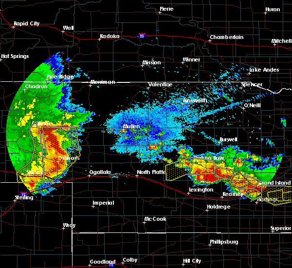 The severe thunderstorm warning for southern custer county will expire at 215 am cdt, the storms which prompted the warning have weakened below severe limits, and no longer pose an immediate threat to life or property. therefore, the warning will be allowed to expire. however heavy rain is still possible with these thunderstorms, especially over southeastern custer county where a flash flood warning is in effect until 8 am cdt wednesday morning. a severe thunderstorm watch remains in effect until 600 am cdt for central nebraska. to report severe weather, contact your nearest law enforcement agency. they will relay your report to the national weather service north platte. The severe thunderstorm warning for southern custer county will expire at 215 am cdt, the storms which prompted the warning have weakened below severe limits, and no longer pose an immediate threat to life or property. therefore, the warning will be allowed to expire. however heavy rain is still possible with these thunderstorms, especially over southeastern custer county where a flash flood warning is in effect until 8 am cdt wednesday morning. a severe thunderstorm watch remains in effect until 600 am cdt for central nebraska. to report severe weather, contact your nearest law enforcement agency. they will relay your report to the national weather service north platte.
|
| 8/21/2019 1:44 AM CDT |
 A severe thunderstorm warning remains in effect until 215 am cdt for southern custer county. at 143 am cdt, severe thunderstorms were located along a line extending from mason city to 12 miles southwest of berwyn to near oconto, moving southeast at 5 mph. hazard. Quarter size hail. A severe thunderstorm warning remains in effect until 215 am cdt for southern custer county. at 143 am cdt, severe thunderstorms were located along a line extending from mason city to 12 miles southwest of berwyn to near oconto, moving southeast at 5 mph. hazard. Quarter size hail.
|
| 8/21/2019 1:10 AM CDT |
 At 110 am cdt, severe thunderstorms were located along a line extending from near mason city to 7 miles north of oconto to 13 miles north of gothenburg, moving north at 20 mph (radar indicated). Hazards include ping pong ball size hail. People and animals outdoors will be injured. Expect damage to roofs, siding, windows, and vehicles. At 110 am cdt, severe thunderstorms were located along a line extending from near mason city to 7 miles north of oconto to 13 miles north of gothenburg, moving north at 20 mph (radar indicated). Hazards include ping pong ball size hail. People and animals outdoors will be injured. Expect damage to roofs, siding, windows, and vehicles.
|
| 7/13/2019 12:14 AM CDT |
 At 1214 am cdt, severe thunderstorms were located along a line extending from 10 miles southwest of merna to 6 miles southeast of callaway to 7 miles southwest of oconto, moving east at 30 mph (radar indicated). Hazards include 60 mph wind gusts and quarter size hail. Hail damage to vehicles is expected. expect wind damage to roofs, siding, and trees. locations impacted include, callaway, ansley, mason city, oconto, berwyn, milldale, burr oak, gavin siding, lodi, intersection of highway 183 and cumro road, buckeye, block hill basin, pressey state wildlife management area and cumro. this includes the following highways, highway 183 between mile markers 73 and 97. highway 2 between mile markers 281 and 307. Highway 92 between mile markers 300 and 308. At 1214 am cdt, severe thunderstorms were located along a line extending from 10 miles southwest of merna to 6 miles southeast of callaway to 7 miles southwest of oconto, moving east at 30 mph (radar indicated). Hazards include 60 mph wind gusts and quarter size hail. Hail damage to vehicles is expected. expect wind damage to roofs, siding, and trees. locations impacted include, callaway, ansley, mason city, oconto, berwyn, milldale, burr oak, gavin siding, lodi, intersection of highway 183 and cumro road, buckeye, block hill basin, pressey state wildlife management area and cumro. this includes the following highways, highway 183 between mile markers 73 and 97. highway 2 between mile markers 281 and 307. Highway 92 between mile markers 300 and 308.
|
| 7/13/2019 12:01 AM CDT |
 At 1201 am cdt, severe thunderstorms were located along a line extending from 9 miles east of arnold to near callaway to 12 miles northeast of gothenburg, moving east at 45 mph (radar indicated). Hazards include 60 mph wind gusts and quarter size hail. Hail damage to vehicles is expected. Expect wind damage to roofs, siding, and trees. At 1201 am cdt, severe thunderstorms were located along a line extending from 9 miles east of arnold to near callaway to 12 miles northeast of gothenburg, moving east at 45 mph (radar indicated). Hazards include 60 mph wind gusts and quarter size hail. Hail damage to vehicles is expected. Expect wind damage to roofs, siding, and trees.
|
| 7/12/2019 11:57 PM CDT |
 The severe thunderstorm warning for south central cherry, eastern hooker, northeastern lincoln, logan, northeastern mcpherson, western custer, southwestern blaine and thomas counties will expire at midnight cdt/1100 pm mdt/, the storms which prompted the warning have weakened below severe limits, and no longer pose an immediate threat to life or property. therefore, the warning will be allowed to expire. however gusty winds are still possible with these thunderstorms. a severe thunderstorm watch remains in effect until 200 am cdt/100 am mdt/ for central, southwestern, north central and west central nebraska. to report severe weather, contact your nearest law enforcement agency. they will relay your report to the national weather service north platte. The severe thunderstorm warning for south central cherry, eastern hooker, northeastern lincoln, logan, northeastern mcpherson, western custer, southwestern blaine and thomas counties will expire at midnight cdt/1100 pm mdt/, the storms which prompted the warning have weakened below severe limits, and no longer pose an immediate threat to life or property. therefore, the warning will be allowed to expire. however gusty winds are still possible with these thunderstorms. a severe thunderstorm watch remains in effect until 200 am cdt/100 am mdt/ for central, southwestern, north central and west central nebraska. to report severe weather, contact your nearest law enforcement agency. they will relay your report to the national weather service north platte.
|
| 7/12/2019 11:35 PM CDT |
 At 1106 pm cdt/1006 pm mdt/, severe thunderstorms were located along a line extending from 14 miles northwest of mullen to 15 miles northeast of tryon to near gandy to 8 miles east of brady, moving east at 30 mph (radar indicated). Hazards include 70 mph wind gusts and penny size hail. Expect considerable tree damage. Damage is likely to mobile homes, roofs, and outbuildings. At 1106 pm cdt/1006 pm mdt/, severe thunderstorms were located along a line extending from 14 miles northwest of mullen to 15 miles northeast of tryon to near gandy to 8 miles east of brady, moving east at 30 mph (radar indicated). Hazards include 70 mph wind gusts and penny size hail. Expect considerable tree damage. Damage is likely to mobile homes, roofs, and outbuildings.
|
| 7/12/2019 11:06 PM CDT |
 At 1106 pm cdt/1006 pm mdt/, severe thunderstorms were located along a line extending from 14 miles northwest of mullen to 15 miles northeast of tryon to near gandy to 8 miles east of brady, moving east at 30 mph (radar indicated). Hazards include 70 mph wind gusts and penny size hail. Expect considerable tree damage. Damage is likely to mobile homes, roofs, and outbuildings. At 1106 pm cdt/1006 pm mdt/, severe thunderstorms were located along a line extending from 14 miles northwest of mullen to 15 miles northeast of tryon to near gandy to 8 miles east of brady, moving east at 30 mph (radar indicated). Hazards include 70 mph wind gusts and penny size hail. Expect considerable tree damage. Damage is likely to mobile homes, roofs, and outbuildings.
|
| 7/10/2019 1:37 AM CDT |
 At 137 am cdt, severe thunderstorms were located along a line extending from near callaway to 12 miles northeast of gothenburg, moving east at 40 mph (radar indicated). Hazards include ping pong ball size hail and 60 mph wind gusts. People and animals outdoors will be injured. expect hail damage to roofs, siding, windows, and vehicles. Expect wind damage to roofs, siding, and trees. At 137 am cdt, severe thunderstorms were located along a line extending from near callaway to 12 miles northeast of gothenburg, moving east at 40 mph (radar indicated). Hazards include ping pong ball size hail and 60 mph wind gusts. People and animals outdoors will be injured. expect hail damage to roofs, siding, windows, and vehicles. Expect wind damage to roofs, siding, and trees.
|
| 7/5/2019 3:20 AM CDT |
 At 319 am cdt, severe thunderstorms were located along a line extending from near sargent to near curtis, moving northeast at 30 mph (radar indicated). Hazards include 60 mph wind gusts and quarter size hail. Hail damage to vehicles is expected. expect wind damage to roofs, siding, and trees. locations impacted include, broken bow, curtis, callaway, sargent, ansley, brady, merna, oconto, comstock, stockville, weissert, maywood, westerville, lillian, lodi. this includes the following highways, highway 183 between mile markers 89 and 120. highway 2 between mile markers 265 and 295. highway 92 between mile markers 268 and 273. interstate 80 in nebraska between mile markers 198 and 207. Highway 83 between mile markers 40 and 54. At 319 am cdt, severe thunderstorms were located along a line extending from near sargent to near curtis, moving northeast at 30 mph (radar indicated). Hazards include 60 mph wind gusts and quarter size hail. Hail damage to vehicles is expected. expect wind damage to roofs, siding, and trees. locations impacted include, broken bow, curtis, callaway, sargent, ansley, brady, merna, oconto, comstock, stockville, weissert, maywood, westerville, lillian, lodi. this includes the following highways, highway 183 between mile markers 89 and 120. highway 2 between mile markers 265 and 295. highway 92 between mile markers 268 and 273. interstate 80 in nebraska between mile markers 198 and 207. Highway 83 between mile markers 40 and 54.
|
| 7/5/2019 2:44 AM CDT |
 At 243 am cdt, severe thunderstorms were located along a line extending from merna to 8 miles east of hayes center, moving east at 35 mph (radar indicated). Hazards include 60 mph wind gusts and quarter size hail. Hail damage to vehicles is expected. Expect wind damage to roofs, siding, and trees. At 243 am cdt, severe thunderstorms were located along a line extending from merna to 8 miles east of hayes center, moving east at 35 mph (radar indicated). Hazards include 60 mph wind gusts and quarter size hail. Hail damage to vehicles is expected. Expect wind damage to roofs, siding, and trees.
|
| 7/5/2019 2:25 AM CDT | Storm damage reported in custer county NE, 8 miles NE of Callaway, NE |
| 5/27/2019 10:45 PM CDT |
 At 1044 pm cdt, severe thunderstorms were located along a line extending from 6 miles north of arnold to 15 miles west of merna to near callaway, moving northeast at 40 mph (radar indicated). Hazards include 60 mph wind gusts and half dollar size hail. Hail damage to vehicles is expected. expect wind damage to roofs, siding, and trees. locations impacted include, arnold, callaway, merna, anselmo, pleasant hill, milldale and finchville. this includes the following highways, highway 2 between mile markers 257 and 266, and between mile markers 268 and 269. Highway 92 between mile markers 248 and 273. At 1044 pm cdt, severe thunderstorms were located along a line extending from 6 miles north of arnold to 15 miles west of merna to near callaway, moving northeast at 40 mph (radar indicated). Hazards include 60 mph wind gusts and half dollar size hail. Hail damage to vehicles is expected. expect wind damage to roofs, siding, and trees. locations impacted include, arnold, callaway, merna, anselmo, pleasant hill, milldale and finchville. this includes the following highways, highway 2 between mile markers 257 and 266, and between mile markers 268 and 269. Highway 92 between mile markers 248 and 273.
|
| 5/27/2019 10:20 PM CDT |
 At 1020 pm cdt, severe thunderstorms were located along a line extending from near gandy to near arnold to 16 miles north of brady, moving east at 35 mph (radar indicated). Hazards include 60 mph wind gusts and half dollar size hail. Hail damage to vehicles is expected. Expect wind damage to roofs, siding, and trees. At 1020 pm cdt, severe thunderstorms were located along a line extending from near gandy to near arnold to 16 miles north of brady, moving east at 35 mph (radar indicated). Hazards include 60 mph wind gusts and half dollar size hail. Hail damage to vehicles is expected. Expect wind damage to roofs, siding, and trees.
|
| 5/17/2019 10:58 PM CDT |
 At 1057 pm cdt, a severe thunderstorm was located from near oconto to near broken bow, moving northeast at 40 mph (radar indicated). Hazards include 60 mph wind gusts and nickel size hail. expect damage to roofs, siding, and trees At 1057 pm cdt, a severe thunderstorm was located from near oconto to near broken bow, moving northeast at 40 mph (radar indicated). Hazards include 60 mph wind gusts and nickel size hail. expect damage to roofs, siding, and trees
|
| 5/17/2019 10:49 PM CDT |
 A severe thunderstorm warning remains in effect until 1100 pm cdt for southwestern loup and central custer counties. at 1048 pm cdt, severe thunderstorms were located along a line extending from 11 miles west of taylor to near oconto, moving northeast at 30 mph. hazard. 60 mph wind gusts and penny size hail. A severe thunderstorm warning remains in effect until 1100 pm cdt for southwestern loup and central custer counties. at 1048 pm cdt, severe thunderstorms were located along a line extending from 11 miles west of taylor to near oconto, moving northeast at 30 mph. hazard. 60 mph wind gusts and penny size hail.
|
| 5/17/2019 10:32 PM CDT |
 At 1007 pm cdt, severe thunderstorms were located along a line extending from 6 miles west of anselmo to 11 miles northeast of gothenburg, moving northeast at 40 mph (radar indicated). Hazards include 70 mph wind gusts and nickel size hail. Expect considerable tree damage. Damage is likely to mobile homes, roofs, and outbuildings. At 1007 pm cdt, severe thunderstorms were located along a line extending from 6 miles west of anselmo to 11 miles northeast of gothenburg, moving northeast at 40 mph (radar indicated). Hazards include 70 mph wind gusts and nickel size hail. Expect considerable tree damage. Damage is likely to mobile homes, roofs, and outbuildings.
|
| 5/17/2019 10:08 PM CDT |
 At 1007 pm cdt, severe thunderstorms were located along a line extending from 6 miles west of anselmo to 11 miles northeast of gothenburg, moving northeast at 40 mph (radar indicated). Hazards include 70 mph wind gusts and nickel size hail. Expect considerable tree damage. Damage is likely to mobile homes, roofs, and outbuildings. At 1007 pm cdt, severe thunderstorms were located along a line extending from 6 miles west of anselmo to 11 miles northeast of gothenburg, moving northeast at 40 mph (radar indicated). Hazards include 70 mph wind gusts and nickel size hail. Expect considerable tree damage. Damage is likely to mobile homes, roofs, and outbuildings.
|
| 7/29/2018 8:32 PM CDT | Quarter sized hail reported 15.5 miles N of Callaway, NE |
| 6/9/2018 1:01 AM CDT |
 At 100 am cdt, severe thunderstorms were located along a line extending from 8 miles southeast of arnold to near comstock, moving southeast at 30 mph (radar indicated). Hazards include 60 mph wind gusts. Expect damage to roofs, siding, and trees. locations impacted include, broken bow, arnold, callaway, sargent, ansley, merna, mason city, oconto, anselmo, comstock, berwyn, victoria springs state recreation area, weissert, westerville, lillian, walworth, lodi, buckeye, finchville and round valley. this includes the following highways, highway 183 between mile markers 73 and 121. highway 2 between mile markers 253 and 307. Highway 92 between mile markers 248 and 308. At 100 am cdt, severe thunderstorms were located along a line extending from 8 miles southeast of arnold to near comstock, moving southeast at 30 mph (radar indicated). Hazards include 60 mph wind gusts. Expect damage to roofs, siding, and trees. locations impacted include, broken bow, arnold, callaway, sargent, ansley, merna, mason city, oconto, anselmo, comstock, berwyn, victoria springs state recreation area, weissert, westerville, lillian, walworth, lodi, buckeye, finchville and round valley. this includes the following highways, highway 183 between mile markers 73 and 121. highway 2 between mile markers 253 and 307. Highway 92 between mile markers 248 and 308.
|
| 6/9/2018 12:39 AM CDT |
 At 1237 am cdt, severe thunderstorms were located along a line extending from near arnold to near sargent, moving south at 45 mph (radar indicated). Hazards include 60 mph wind gusts. expect damage to roofs, siding, and trees At 1237 am cdt, severe thunderstorms were located along a line extending from near arnold to near sargent, moving south at 45 mph (radar indicated). Hazards include 60 mph wind gusts. expect damage to roofs, siding, and trees
|
| 5/10/2018 11:23 PM CDT |
 At 1057 pm cdt, severe thunderstorms were located along a line extending from near taylor to near berwyn to near oconto, moving east at 25 mph (radar indicated). Hazards include 70 mph wind gusts and penny size hail. Expect considerable tree damage. Damage is likely to mobile homes, roofs, and outbuildings. At 1057 pm cdt, severe thunderstorms were located along a line extending from near taylor to near berwyn to near oconto, moving east at 25 mph (radar indicated). Hazards include 70 mph wind gusts and penny size hail. Expect considerable tree damage. Damage is likely to mobile homes, roofs, and outbuildings.
|
| 5/10/2018 10:58 PM CDT |
 At 1057 pm cdt, severe thunderstorms were located along a line extending from near taylor to near berwyn to near oconto, moving east at 25 mph (radar indicated). Hazards include 70 mph wind gusts and penny size hail. Expect considerable tree damage. Damage is likely to mobile homes, roofs, and outbuildings. At 1057 pm cdt, severe thunderstorms were located along a line extending from near taylor to near berwyn to near oconto, moving east at 25 mph (radar indicated). Hazards include 70 mph wind gusts and penny size hail. Expect considerable tree damage. Damage is likely to mobile homes, roofs, and outbuildings.
|
| 5/10/2018 10:35 PM CDT | Storm damage reported in custer county NE, 8 miles NE of Callaway, NE |
| 5/10/2018 10:34 PM CDT |
 At 1033 pm cdt, severe thunderstorms were located along a line extending from 9 miles northeast of victoria springs state recreation area to near berwyn to 12 miles west of oconto, moving east at 35 mph (radar indicated). Hazards include 70 mph wind gusts and quarter size hail. Hail damage to vehicles is expected. expect considerable tree damage. wind damage is also likely to mobile homes, roofs, and outbuildings. locations impacted include, broken bow, callaway, sargent, ansley, merna, mason city, oconto, anselmo, comstock, berwyn, victoria springs state recreation area, weissert, westerville, lillian, milburn, walworth, lodi, buckeye, finchville and round valley. this includes the following highways, highway 183 between mile markers 73 and 121. highway 2 between mile markers 256 and 307. Highway 92 between mile markers 257 and 308. At 1033 pm cdt, severe thunderstorms were located along a line extending from 9 miles northeast of victoria springs state recreation area to near berwyn to 12 miles west of oconto, moving east at 35 mph (radar indicated). Hazards include 70 mph wind gusts and quarter size hail. Hail damage to vehicles is expected. expect considerable tree damage. wind damage is also likely to mobile homes, roofs, and outbuildings. locations impacted include, broken bow, callaway, sargent, ansley, merna, mason city, oconto, anselmo, comstock, berwyn, victoria springs state recreation area, weissert, westerville, lillian, milburn, walworth, lodi, buckeye, finchville and round valley. this includes the following highways, highway 183 between mile markers 73 and 121. highway 2 between mile markers 256 and 307. Highway 92 between mile markers 257 and 308.
|
| 5/10/2018 10:05 PM CDT |
 At 1005 pm cdt, severe thunderstorms were located along a line extending from 8 miles north of anselmo to 14 miles northeast of brady, moving east at 20 mph (radar indicated). Hazards include 60 mph wind gusts and penny size hail. expect damage to roofs, siding, and trees At 1005 pm cdt, severe thunderstorms were located along a line extending from 8 miles north of anselmo to 14 miles northeast of brady, moving east at 20 mph (radar indicated). Hazards include 60 mph wind gusts and penny size hail. expect damage to roofs, siding, and trees
|
| 4/30/2018 6:08 PM CDT | Storm damage reported in custer county NE, 7.8 miles ENE of Callaway, NE |
| 10/6/2017 5:15 PM CDT | Quarter sized hail reported 5.2 miles ENE of Callaway, NE, hail up to quarter size covered the ground. heavy rainfall also occurred. |
| 10/6/2017 5:11 PM CDT | Ping Pong Ball sized hail reported 7.8 miles ENE of Callaway, NE, report of ping pong ball size hail from co-op observer |
| 10/6/2017 5:11 PM CDT |
 At 510 pm cdt, a severe thunderstorm was located near callaway, or 22 miles southwest of broken bow, moving east at 45 mph (radar indicated. at 510 pm ping pong ball size hail was reproted 8 miles southwest of callaway). Hazards include golf ball size hail. People and animals outdoors will be injured. Expect damage to roofs, siding, windows, and vehicles. At 510 pm cdt, a severe thunderstorm was located near callaway, or 22 miles southwest of broken bow, moving east at 45 mph (radar indicated. at 510 pm ping pong ball size hail was reproted 8 miles southwest of callaway). Hazards include golf ball size hail. People and animals outdoors will be injured. Expect damage to roofs, siding, windows, and vehicles.
|
| 10/1/2017 7:26 PM CDT |
 The severe thunderstorm warning for central custer county will expire at 730 pm cdt, the storm which prompted the warning has weakened below severe limits, and no longer poses an immediate threat to life or property. therefore the warning will be allowed to expire. however gusty winds are still possible with this thunderstorm. a tornado watch remains in effect until 1100 pm cdt for central nebraska. The severe thunderstorm warning for central custer county will expire at 730 pm cdt, the storm which prompted the warning has weakened below severe limits, and no longer poses an immediate threat to life or property. therefore the warning will be allowed to expire. however gusty winds are still possible with this thunderstorm. a tornado watch remains in effect until 1100 pm cdt for central nebraska.
|
| 10/1/2017 7:19 PM CDT |
 At 718 pm cdt, a severe thunderstorm was located near merna, or 10 miles west of broken bow, moving northeast at 10 mph (radar indicated). Hazards include golf ball size hail and 60 mph wind gusts. People and animals outdoors will be injured. expect hail damage to roofs, siding, windows, and vehicles. expect wind damage to roofs, siding, and trees. locations impacted include, broken bow and callaway. this includes the following highways, highway 2 between mile markers 276 and 278. highway 92 between mile markers 263 and 270. A tornado watch remains in effect until 1100 pm cdt for central nebraska. At 718 pm cdt, a severe thunderstorm was located near merna, or 10 miles west of broken bow, moving northeast at 10 mph (radar indicated). Hazards include golf ball size hail and 60 mph wind gusts. People and animals outdoors will be injured. expect hail damage to roofs, siding, windows, and vehicles. expect wind damage to roofs, siding, and trees. locations impacted include, broken bow and callaway. this includes the following highways, highway 2 between mile markers 276 and 278. highway 92 between mile markers 263 and 270. A tornado watch remains in effect until 1100 pm cdt for central nebraska.
|
| 10/1/2017 6:38 PM CDT |
 At 638 pm cdt, a severe thunderstorm was located 7 miles northwest of callaway, or 19 miles west of broken bow, moving northeast at 25 mph (radar indicated). Hazards include ping pong ball size hail and 60 mph wind gusts. People and animals outdoors will be injured. expect hail damage to roofs, siding, windows, and vehicles. Expect wind damage to roofs, siding, and trees. At 638 pm cdt, a severe thunderstorm was located 7 miles northwest of callaway, or 19 miles west of broken bow, moving northeast at 25 mph (radar indicated). Hazards include ping pong ball size hail and 60 mph wind gusts. People and animals outdoors will be injured. expect hail damage to roofs, siding, windows, and vehicles. Expect wind damage to roofs, siding, and trees.
|
| 10/1/2017 6:11 PM CDT |
 The severe thunderstorm warning for central custer county will expire at 615 pm cdt. the storm which prompted the warning has weakened below severe limits, and no longer poses an immediate threat to life or property. therefore the warning will be allowed to expire. However small hail is still possible with this thunderstorm. The severe thunderstorm warning for central custer county will expire at 615 pm cdt. the storm which prompted the warning has weakened below severe limits, and no longer poses an immediate threat to life or property. therefore the warning will be allowed to expire. However small hail is still possible with this thunderstorm.
|
| 10/1/2017 5:49 PM CDT |
 At 549 pm cdt, a severe thunderstorm was located 8 miles north of callaway, or 15 miles west of broken bow, moving north at 25 mph (radar indicated). Hazards include 60 mph wind gusts and quarter size hail. Hail damage to vehicles is expected. expect wind damage to roofs, siding, and trees. locations impacted include, callaway, merna, lillian, finchville and milldale. this includes the following highways, highway 2 between mile markers 264 and 274. highway 92 between mile markers 259 and 273. A tornado watch remains in effect until 1100 pm cdt for central nebraska. At 549 pm cdt, a severe thunderstorm was located 8 miles north of callaway, or 15 miles west of broken bow, moving north at 25 mph (radar indicated). Hazards include 60 mph wind gusts and quarter size hail. Hail damage to vehicles is expected. expect wind damage to roofs, siding, and trees. locations impacted include, callaway, merna, lillian, finchville and milldale. this includes the following highways, highway 2 between mile markers 264 and 274. highway 92 between mile markers 259 and 273. A tornado watch remains in effect until 1100 pm cdt for central nebraska.
|
| 10/1/2017 5:31 PM CDT |
 At 531 pm cdt, a severe thunderstorm was located over callaway, or 18 miles west of broken bow, moving north at 25 mph (radar indicated). Hazards include golf ball size hail and 60 mph wind gusts. People and animals outdoors will be injured. expect hail damage to roofs, siding, windows, and vehicles. Expect wind damage to roofs, siding, and trees. At 531 pm cdt, a severe thunderstorm was located over callaway, or 18 miles west of broken bow, moving north at 25 mph (radar indicated). Hazards include golf ball size hail and 60 mph wind gusts. People and animals outdoors will be injured. expect hail damage to roofs, siding, windows, and vehicles. Expect wind damage to roofs, siding, and trees.
|
| 8/13/2017 7:48 PM CDT |
 At 748 pm cdt, a severe thunderstorm was located near callaway, or 11 miles southwest of broken bow, moving south at 25 mph (radar indicated). Hazards include golf ball size hail and 70 mph wind gusts. People and animals outdoors will be injured. expect hail damage to roofs, siding, windows, and vehicles. expect considerable tree damage. Wind damage is also likely to mobile homes, roofs, and outbuildings. At 748 pm cdt, a severe thunderstorm was located near callaway, or 11 miles southwest of broken bow, moving south at 25 mph (radar indicated). Hazards include golf ball size hail and 70 mph wind gusts. People and animals outdoors will be injured. expect hail damage to roofs, siding, windows, and vehicles. expect considerable tree damage. Wind damage is also likely to mobile homes, roofs, and outbuildings.
|
| 7/2/2017 7:26 PM CDT |
 At 726 pm cdt, severe thunderstorms were located along a line extending from 6 miles southwest of callaway to 7 miles northeast of oconto, moving southwest at 20 mph (radar indicated). Hazards include 60 mph wind gusts and quarter size hail. Hail damage to vehicles is expected. Expect wind damage to roofs, siding, and trees. At 726 pm cdt, severe thunderstorms were located along a line extending from 6 miles southwest of callaway to 7 miles northeast of oconto, moving southwest at 20 mph (radar indicated). Hazards include 60 mph wind gusts and quarter size hail. Hail damage to vehicles is expected. Expect wind damage to roofs, siding, and trees.
|
| 7/2/2017 6:57 PM CDT |
 At 656 pm cdt, severe thunderstorms were located along a line extending from 6 miles southeast of arnold to 7 miles north of callaway to 7 miles southwest of berwyn, moving southwest at 20 mph (radar indicated). Hazards include golf ball size hail and 60 mph wind gusts. People and animals outdoors will be injured. expect hail damage to roofs, siding, windows, and vehicles. expect wind damage to roofs, siding, and trees. locations impacted include, callaway, ansley, mason city, oconto, etna, milldale, burr oak, lodi, intersection of highway 183 and cumro road, buckeye, pressey state wildlife management area, finchville and cumro. this includes the following highways, highway 183 between mile markers 74 and 89. highway 2 between mile markers 295 and 302. Highway 92 between mile markers 300 and 301. At 656 pm cdt, severe thunderstorms were located along a line extending from 6 miles southeast of arnold to 7 miles north of callaway to 7 miles southwest of berwyn, moving southwest at 20 mph (radar indicated). Hazards include golf ball size hail and 60 mph wind gusts. People and animals outdoors will be injured. expect hail damage to roofs, siding, windows, and vehicles. expect wind damage to roofs, siding, and trees. locations impacted include, callaway, ansley, mason city, oconto, etna, milldale, burr oak, lodi, intersection of highway 183 and cumro road, buckeye, pressey state wildlife management area, finchville and cumro. this includes the following highways, highway 183 between mile markers 74 and 89. highway 2 between mile markers 295 and 302. Highway 92 between mile markers 300 and 301.
|
| 7/2/2017 6:45 PM CDT |
 At 645 pm cdt, severe thunderstorms were located along a line extending from 6 miles east of arnold to 6 miles southwest of merna to near berwyn, moving southwest at 20 mph (radar indicated). Hazards include golf ball size hail and 60 mph wind gusts. People and animals outdoors will be injured. expect hail damage to roofs, siding, windows, and vehicles. expect wind damage to roofs, siding, and trees. locations impacted include, broken bow, callaway, ansley, mason city, oconto, berwyn, etna, milldale, burr oak, lodi, intersection of highway 183 and cumro road, buckeye, pressey state wildlife management area, finchville and cumro. this includes the following highways, highway 183 between mile markers 74 and 93. highway 2 between mile markers 273 and 302. Highway 92 between mile markers 259 and 269, and between mile markers 300 and 305. At 645 pm cdt, severe thunderstorms were located along a line extending from 6 miles east of arnold to 6 miles southwest of merna to near berwyn, moving southwest at 20 mph (radar indicated). Hazards include golf ball size hail and 60 mph wind gusts. People and animals outdoors will be injured. expect hail damage to roofs, siding, windows, and vehicles. expect wind damage to roofs, siding, and trees. locations impacted include, broken bow, callaway, ansley, mason city, oconto, berwyn, etna, milldale, burr oak, lodi, intersection of highway 183 and cumro road, buckeye, pressey state wildlife management area, finchville and cumro. this includes the following highways, highway 183 between mile markers 74 and 93. highway 2 between mile markers 273 and 302. Highway 92 between mile markers 259 and 269, and between mile markers 300 and 305.
|
| 7/2/2017 6:28 PM CDT |
 At 627 pm cdt, severe thunderstorms were located along a line extending from 10 miles southwest of anselmo to near ansley, moving southwest at 20 mph (radar indicated). Hazards include quarter size hail. damage to vehicles is expected At 627 pm cdt, severe thunderstorms were located along a line extending from 10 miles southwest of anselmo to near ansley, moving southwest at 20 mph (radar indicated). Hazards include quarter size hail. damage to vehicles is expected
|
| 6/27/2017 9:00 PM CDT | Storm damage reported in custer county NE, 7.8 miles ENE of Callaway, NE |
| 6/27/2017 4:21 PM CDT |
 At 921 pm cdt, severe thunderstorms were located along a line extending from near broken bow to 8 miles west of berwyn to near oconto to 7 miles south of willow island, moving east at 50 mph. these are very dangerous storms (radar indicated). Hazards include 80 mph wind gusts. Flying debris will be dangerous to those caught without shelter. mobile homes will be heavily damaged. expect considerable damage to roofs, windows, and vehicles. extensive tree damage and power outages are likely. these severe storms will be near, broken bow and oconto around 925 pm cdt. berwyn around 930 pm cdt. weissert around 935 pm cdt. ansley around 940 pm cdt. other locations impacted by these severe thunderstorms include westerville, buckeye, etna, pressey state wildlife management area, milldale, burr oak, finchville, wescott, lodi and cumro. this includes the following highways, highway 183 between mile markers 87 and 108. highway 2 between mile markers 263 and 296. Highway 92 between mile markers 259 and 300. At 921 pm cdt, severe thunderstorms were located along a line extending from near broken bow to 8 miles west of berwyn to near oconto to 7 miles south of willow island, moving east at 50 mph. these are very dangerous storms (radar indicated). Hazards include 80 mph wind gusts. Flying debris will be dangerous to those caught without shelter. mobile homes will be heavily damaged. expect considerable damage to roofs, windows, and vehicles. extensive tree damage and power outages are likely. these severe storms will be near, broken bow and oconto around 925 pm cdt. berwyn around 930 pm cdt. weissert around 935 pm cdt. ansley around 940 pm cdt. other locations impacted by these severe thunderstorms include westerville, buckeye, etna, pressey state wildlife management area, milldale, burr oak, finchville, wescott, lodi and cumro. this includes the following highways, highway 183 between mile markers 87 and 108. highway 2 between mile markers 263 and 296. Highway 92 between mile markers 259 and 300.
|
| 6/27/2017 4:01 PM CDT |
 At 901 pm cdt, severe thunderstorms were located along a line extending from 6 miles southwest of anselmo to 6 miles north of callaway to 15 miles north of gothenburg to 9 miles north of moorefield, moving east at 50 mph. these are very dangerous storms (radar indicated). Hazards include 80 mph wind gusts. Flying debris will be dangerous to those caught without shelter. mobile homes will be heavily damaged. expect considerable damage to roofs, windows, and vehicles. extensive tree damage and power outages are likely. severe thunderstorms will be near, callaway around 905 pm cdt. merna around 910 pm cdt. broken bow and oconto around 920 pm cdt. berwyn and weissert around 930 pm cdt. ansley around 940 pm cdt. other locations impacted by these severe thunderstorms include westerville, buckeye, etna, pressey state wildlife management area, milldale, burr oak, finchville, wescott, lodi and cumro. this includes the following highways, highway 183 between mile markers 87 and 108. highway 2 between mile markers 263 and 296. Highway 92 between mile markers 259 and 300. At 901 pm cdt, severe thunderstorms were located along a line extending from 6 miles southwest of anselmo to 6 miles north of callaway to 15 miles north of gothenburg to 9 miles north of moorefield, moving east at 50 mph. these are very dangerous storms (radar indicated). Hazards include 80 mph wind gusts. Flying debris will be dangerous to those caught without shelter. mobile homes will be heavily damaged. expect considerable damage to roofs, windows, and vehicles. extensive tree damage and power outages are likely. severe thunderstorms will be near, callaway around 905 pm cdt. merna around 910 pm cdt. broken bow and oconto around 920 pm cdt. berwyn and weissert around 930 pm cdt. ansley around 940 pm cdt. other locations impacted by these severe thunderstorms include westerville, buckeye, etna, pressey state wildlife management area, milldale, burr oak, finchville, wescott, lodi and cumro. this includes the following highways, highway 183 between mile markers 87 and 108. highway 2 between mile markers 263 and 296. Highway 92 between mile markers 259 and 300.
|
| 4/15/2017 1:39 AM CDT |
 The severe thunderstorm warning for west central custer county will expire at 145 am cdt, the storm which prompted the warning has weakened below severe limits, and no longer pose an immediate threat to life or property. therefore the warning will be allowed to expire. however heavy rain is still possible with this thunderstorm. The severe thunderstorm warning for west central custer county will expire at 145 am cdt, the storm which prompted the warning has weakened below severe limits, and no longer pose an immediate threat to life or property. therefore the warning will be allowed to expire. however heavy rain is still possible with this thunderstorm.
|
| 4/15/2017 1:32 AM CDT |
 At 132 am cdt, a severe thunderstorm was located near arnold, or 19 miles southeast of stapleton, moving east at 25 mph (radar indicated). Hazards include half dollar size hail. Damage to vehicles is expected. Locations impacted include, arnold, callaway, finchville, pleasant hill and milldale. At 132 am cdt, a severe thunderstorm was located near arnold, or 19 miles southeast of stapleton, moving east at 25 mph (radar indicated). Hazards include half dollar size hail. Damage to vehicles is expected. Locations impacted include, arnold, callaway, finchville, pleasant hill and milldale.
|
| 4/15/2017 1:25 AM CDT |
 At 124 am cdt, a severe thunderstorm was located near arnold, or 17 miles southeast of stapleton, moving east at 25 mph (radar indicated). Hazards include half dollar size hail. Damage to vehicles is expected. Locations impacted include, arnold, callaway, finchville, pleasant hill and milldale. At 124 am cdt, a severe thunderstorm was located near arnold, or 17 miles southeast of stapleton, moving east at 25 mph (radar indicated). Hazards include half dollar size hail. Damage to vehicles is expected. Locations impacted include, arnold, callaway, finchville, pleasant hill and milldale.
|
| 4/15/2017 1:05 AM CDT |
 At 105 am cdt, a severe thunderstorm was located 12 miles south of gandy, or 14 miles southeast of stapleton, moving east northeast at 40 mph (radar indicated). Hazards include half dollar size hail. damage to vehicles is expected At 105 am cdt, a severe thunderstorm was located 12 miles south of gandy, or 14 miles southeast of stapleton, moving east northeast at 40 mph (radar indicated). Hazards include half dollar size hail. damage to vehicles is expected
|
| 4/9/2017 5:49 PM CDT |
 At 548 pm cdt, a severe thunderstorm was located over callaway, or 17 miles west of broken bow, moving east at 35 mph (trained weather spotters). Hazards include 60 mph wind gusts. Expect damage to roofs, siding, and trees. Locations impacted include, broken bow, callaway, buckeye, pressey state wildlife management area, milldale, burr oak, finchville and lodi. At 548 pm cdt, a severe thunderstorm was located over callaway, or 17 miles west of broken bow, moving east at 35 mph (trained weather spotters). Hazards include 60 mph wind gusts. Expect damage to roofs, siding, and trees. Locations impacted include, broken bow, callaway, buckeye, pressey state wildlife management area, milldale, burr oak, finchville and lodi.
|
| 4/9/2017 5:35 PM CDT |
 At 534 pm cdt, a severe thunderstorm was located 10 miles west of callaway, or 24 miles southeast of stapleton, moving east at 35 mph (trained weather spotters). Hazards include 60 mph wind gusts. expect damage to roofs, siding, and trees At 534 pm cdt, a severe thunderstorm was located 10 miles west of callaway, or 24 miles southeast of stapleton, moving east at 35 mph (trained weather spotters). Hazards include 60 mph wind gusts. expect damage to roofs, siding, and trees
|
| 4/9/2017 5:24 PM CDT | Cooperative observer had measured 62 mph wind gus in custer county NE, 7.8 miles ENE of Callaway, NE |
| 3/23/2017 8:37 PM CDT |
 At 837 pm cdt, a severe thunderstorm was located near merna, or 7 miles west of broken bow, moving northeast at 45 mph (radar indicated). Hazards include quarter size hail. Damage to vehicles is expected. Locations impacted include, broken bow, callaway, merna and lodi. At 837 pm cdt, a severe thunderstorm was located near merna, or 7 miles west of broken bow, moving northeast at 45 mph (radar indicated). Hazards include quarter size hail. Damage to vehicles is expected. Locations impacted include, broken bow, callaway, merna and lodi.
|
| 3/23/2017 8:27 PM CDT |
 At 826 pm cdt, a severe thunderstorm was located near broken bow, moving northeast at 55 mph (radar indicated). Hazards include half dollar size hail. Damage to vehicles is expected. Locations impacted include, broken bow, callaway, merna and lodi. At 826 pm cdt, a severe thunderstorm was located near broken bow, moving northeast at 55 mph (radar indicated). Hazards include half dollar size hail. Damage to vehicles is expected. Locations impacted include, broken bow, callaway, merna and lodi.
|
| 3/23/2017 8:17 PM CDT |
 At 816 pm cdt, a severe thunderstorm was located near callaway, or 13 miles southwest of broken bow, moving northeast at 35 mph (radar indicated). Hazards include half dollar size hail. damage to vehicles is expected At 816 pm cdt, a severe thunderstorm was located near callaway, or 13 miles southwest of broken bow, moving northeast at 35 mph (radar indicated). Hazards include half dollar size hail. damage to vehicles is expected
|
| 3/23/2017 7:34 PM CDT |
 At 733 pm cdt, a severe thunderstorm was located over merna, or near broken bow, moving north at 50 mph (radar indicated). Hazards include half dollar size hail. Damage to vehicles is expected. Locations impacted include, broken bow, callaway, merna and lodi. At 733 pm cdt, a severe thunderstorm was located over merna, or near broken bow, moving north at 50 mph (radar indicated). Hazards include half dollar size hail. Damage to vehicles is expected. Locations impacted include, broken bow, callaway, merna and lodi.
|
| 3/23/2017 7:27 PM CDT |
 At 726 pm cdt, a severe thunderstorm was located near merna, or near broken bow, moving north at 55 mph (public). Hazards include half dollar size hail. Damage to vehicles is expected. Locations impacted include, broken bow, callaway, merna and lodi. At 726 pm cdt, a severe thunderstorm was located near merna, or near broken bow, moving north at 55 mph (public). Hazards include half dollar size hail. Damage to vehicles is expected. Locations impacted include, broken bow, callaway, merna and lodi.
|
| 3/23/2017 7:19 PM CDT |
 At 718 pm cdt, a severe thunderstorm was located near callaway, or 11 miles southwest of broken bow, moving north at 60 mph (radar indicated). Hazards include half dollar size hail. damage to vehicles is expected At 718 pm cdt, a severe thunderstorm was located near callaway, or 11 miles southwest of broken bow, moving north at 60 mph (radar indicated). Hazards include half dollar size hail. damage to vehicles is expected
|
| 3/6/2017 5:04 PM CST | Storm damage reported in custer county NE, 7.8 miles ENE of Callaway, NE |
| 7/27/2016 12:09 AM CDT |
 At 1208 am cdt, severe thunderstorms were located along a line extending from near north platte airport to near brady to 8 miles east of callaway to near sargent, moving southeast at 60 mph (radar indicated). Hazards include 70 mph wind gusts. Expect considerable tree damage. damage is likely to mobile homes, roofs, and outbuildings. locations impacted include, north platte, broken bow, stapleton, taylor, arnold, callaway, sargent, ansley, brady, merna, maxwell, mason city, oconto, anselmo, comstock, berwyn, gandy, calamus reservoir state recreation area, ringgold and north platte airport. this includes the following highways, highway 183 between mile markers 81 and 130. highway 2 between mile markers 254 and 302. highway 92 between mile markers 208 and 308. highway 97 between mile markers 1 and 26. interstate 80 in nebraska between mile markers 177 and 208. Highway 83 between mile markers 78 and 113. At 1208 am cdt, severe thunderstorms were located along a line extending from near north platte airport to near brady to 8 miles east of callaway to near sargent, moving southeast at 60 mph (radar indicated). Hazards include 70 mph wind gusts. Expect considerable tree damage. damage is likely to mobile homes, roofs, and outbuildings. locations impacted include, north platte, broken bow, stapleton, taylor, arnold, callaway, sargent, ansley, brady, merna, maxwell, mason city, oconto, anselmo, comstock, berwyn, gandy, calamus reservoir state recreation area, ringgold and north platte airport. this includes the following highways, highway 183 between mile markers 81 and 130. highway 2 between mile markers 254 and 302. highway 92 between mile markers 208 and 308. highway 97 between mile markers 1 and 26. interstate 80 in nebraska between mile markers 177 and 208. Highway 83 between mile markers 78 and 113.
|
| 7/26/2016 11:58 PM CDT |
 At 1157 pm cdt, severe thunderstorms were located along a line extending from near north platte to 7 miles north of brady to near taylor, moving southeast at 50 mph (radar indicated). Hazards include 70 mph wind gusts. Expect considerable tree damage. damage is likely to mobile homes, roofs, and outbuildings. locations impacted include, north platte, broken bow, stapleton, taylor, arnold, callaway, sargent, ansley, brady, merna, maxwell, mason city, oconto, anselmo, comstock, berwyn, gandy, calamus reservoir state recreation area, ringgold and north platte airport. this includes the following highways, highway 183 between mile markers 81 and 130. highway 2 between mile markers 254 and 302. highway 92 between mile markers 208 and 308. highway 97 between mile markers 1 and 26. interstate 80 in nebraska between mile markers 177 and 208. Highway 83 between mile markers 78 and 113. At 1157 pm cdt, severe thunderstorms were located along a line extending from near north platte to 7 miles north of brady to near taylor, moving southeast at 50 mph (radar indicated). Hazards include 70 mph wind gusts. Expect considerable tree damage. damage is likely to mobile homes, roofs, and outbuildings. locations impacted include, north platte, broken bow, stapleton, taylor, arnold, callaway, sargent, ansley, brady, merna, maxwell, mason city, oconto, anselmo, comstock, berwyn, gandy, calamus reservoir state recreation area, ringgold and north platte airport. this includes the following highways, highway 183 between mile markers 81 and 130. highway 2 between mile markers 254 and 302. highway 92 between mile markers 208 and 308. highway 97 between mile markers 1 and 26. interstate 80 in nebraska between mile markers 177 and 208. Highway 83 between mile markers 78 and 113.
|
| 7/26/2016 11:36 PM CDT |
 At 1136 pm cdt, severe thunderstorms were located along a line extending from 8 miles southwest of ringgold to near gandy to 7 miles northwest of calamus reservoir state recreation area, moving southeast at 45 mph (radar indicated). Hazards include 60 mph wind gusts. Expect damage to roofs. siding. And trees. At 1136 pm cdt, severe thunderstorms were located along a line extending from 8 miles southwest of ringgold to near gandy to 7 miles northwest of calamus reservoir state recreation area, moving southeast at 45 mph (radar indicated). Hazards include 60 mph wind gusts. Expect damage to roofs. siding. And trees.
|
| 7/19/2016 12:18 AM CDT |
 At 1217 am cdt, severe thunderstorms were located along a line extending from 10 miles east of arnold to near oconto to 6 miles west of eddyville, moving northeast at 20 mph (trained weather spotters). Hazards include 70 mph wind gusts. Expect considerable tree damage. Damage is likely to mobile homes, roofs, and outbuildings. At 1217 am cdt, severe thunderstorms were located along a line extending from 10 miles east of arnold to near oconto to 6 miles west of eddyville, moving northeast at 20 mph (trained weather spotters). Hazards include 70 mph wind gusts. Expect considerable tree damage. Damage is likely to mobile homes, roofs, and outbuildings.
|
| 7/19/2016 12:14 AM CDT | Home weather station reported wind gust to 72 mph. wind blew several tree branches dow in custer county NE, 8 miles NE of Callaway, NE |
| 7/6/2016 10:01 PM CDT |
 At 1001 pm cdt, a severe thunderstorm was located near callaway, or 13 miles southwest of broken bow, moving east at 45 mph (radar indicated). Hazards include 60 mph wind gusts and quarter size hail. Hail damage to vehicles is expected. expect wind damage to roofs, siding, and trees. locations impacted include, arnold, callaway, milldale and finchville. This includes highway 92 between mile markers 247 and 252. At 1001 pm cdt, a severe thunderstorm was located near callaway, or 13 miles southwest of broken bow, moving east at 45 mph (radar indicated). Hazards include 60 mph wind gusts and quarter size hail. Hail damage to vehicles is expected. expect wind damage to roofs, siding, and trees. locations impacted include, arnold, callaway, milldale and finchville. This includes highway 92 between mile markers 247 and 252.
|
| 7/6/2016 9:39 PM CDT |
 At 939 pm cdt, a severe thunderstorm was located 9 miles south of arnold, or 20 miles southeast of stapleton, moving east at 35 mph (radar indicated). Hazards include 60 mph wind gusts and quarter size hail. Hail damage to vehicles is expected. Expect wind damage to roofs, siding, and trees. At 939 pm cdt, a severe thunderstorm was located 9 miles south of arnold, or 20 miles southeast of stapleton, moving east at 35 mph (radar indicated). Hazards include 60 mph wind gusts and quarter size hail. Hail damage to vehicles is expected. Expect wind damage to roofs, siding, and trees.
|
| 6/30/2016 12:11 AM CDT |
 The severe thunderstorm warning for southwestern custer and northeastern lincoln counties will expire at 1215 am cdt, the storm which prompted the warning has moved out of the area. therefore the warning will be allowed to expire. a severe thunderstorm watch remains in effect until 300 am cdt for southwestern and central nebraska. The severe thunderstorm warning for southwestern custer and northeastern lincoln counties will expire at 1215 am cdt, the storm which prompted the warning has moved out of the area. therefore the warning will be allowed to expire. a severe thunderstorm watch remains in effect until 300 am cdt for southwestern and central nebraska.
|
| 6/29/2016 11:53 PM CDT |
 At 1153 pm cdt, a severe thunderstorm was located 10 miles northeast of gothenburg, or 26 miles northwest of lexington, moving southeast at 45 mph (radar indicated). Hazards include 60 mph wind gusts and penny size hail. Expect damage to roofs. siding. and trees. Locations impacted include, callaway, oconto, milldale, etna, lodi and finchville. At 1153 pm cdt, a severe thunderstorm was located 10 miles northeast of gothenburg, or 26 miles northwest of lexington, moving southeast at 45 mph (radar indicated). Hazards include 60 mph wind gusts and penny size hail. Expect damage to roofs. siding. and trees. Locations impacted include, callaway, oconto, milldale, etna, lodi and finchville.
|
| 6/29/2016 11:39 PM CDT |
 At 1139 pm cdt, a severe thunderstorm was located 15 miles northeast of brady, or 25 miles southeast of stapleton, moving southeast at 45 mph (radar indicated). Hazards include 70 mph wind gusts and penny size hail. Expect considerable tree damage. Damage is likely to mobile homes, roofs, and outbuildings. At 1139 pm cdt, a severe thunderstorm was located 15 miles northeast of brady, or 25 miles southeast of stapleton, moving southeast at 45 mph (radar indicated). Hazards include 70 mph wind gusts and penny size hail. Expect considerable tree damage. Damage is likely to mobile homes, roofs, and outbuildings.
|
| 6/28/2016 11:07 PM CDT |
 At 1107 pm cdt, severe thunderstorms were located along a line extending from near broken bow to near gothenburg, moving east at 30 mph (radar indicated). Hazards include 60 mph wind gusts. Expect damage to roofs. siding. and trees. locations impacted include, callaway, milldale, etna and finchville. This includes highway 92 between mile markers 259 and 268. At 1107 pm cdt, severe thunderstorms were located along a line extending from near broken bow to near gothenburg, moving east at 30 mph (radar indicated). Hazards include 60 mph wind gusts. Expect damage to roofs. siding. and trees. locations impacted include, callaway, milldale, etna and finchville. This includes highway 92 between mile markers 259 and 268.
|
| 6/28/2016 10:43 PM CDT |
 At 1043 pm cdt, severe thunderstorms were located along a line extending from near merna to near brady, moving east at 30 mph (radar indicated). Hazards include 60 mph wind gusts. Expect damage to roofs. siding. And trees. At 1043 pm cdt, severe thunderstorms were located along a line extending from near merna to near brady, moving east at 30 mph (radar indicated). Hazards include 60 mph wind gusts. Expect damage to roofs. siding. And trees.
|
| 6/28/2016 10:32 PM CDT |
 At 1031 pm cdt, severe thunderstorms were located along a line extending from 7 miles northeast of arnold to 11 miles south of maxwell, moving east at 45 mph (radar indicated). Hazards include 70 mph wind gusts. Expect considerable tree damage. damage is likely to mobile homes, roofs, and outbuildings. locations impacted include, north platte, arnold, callaway, brady, maxwell, lake maloney state recreation area, north platte airport, keith, logan, etna, pleasant hill, cottonwood canyon state wildlife management area, milldale and finchville. this includes the following highways, highway 92 between mile markers 236 and 268. interstate 80 in nebraska between mile markers 176 and 202. Highway 83 between mile markers 73 and 83. At 1031 pm cdt, severe thunderstorms were located along a line extending from 7 miles northeast of arnold to 11 miles south of maxwell, moving east at 45 mph (radar indicated). Hazards include 70 mph wind gusts. Expect considerable tree damage. damage is likely to mobile homes, roofs, and outbuildings. locations impacted include, north platte, arnold, callaway, brady, maxwell, lake maloney state recreation area, north platte airport, keith, logan, etna, pleasant hill, cottonwood canyon state wildlife management area, milldale and finchville. this includes the following highways, highway 92 between mile markers 236 and 268. interstate 80 in nebraska between mile markers 176 and 202. Highway 83 between mile markers 73 and 83.
|
| 6/28/2016 10:04 PM CDT |
 At 1003 pm cdt, severe thunderstorms were located along a line extending from 6 miles north of stapleton to 10 miles west of lake maloney state recreation area, moving east at 45 mph (trained weather spotters). Hazards include 70 mph wind gusts. Expect considerable tree damage. damage is likely to mobile homes, roofs, and outbuildings. locations impacted include, north platte, stapleton, hershey, arnold, callaway, brady, maxwell, gandy, lake maloney state recreation area, north platte airport, keith, logan, etna, pleasant hill, cottonwood canyon state wildlife management area, shanklin bluff, milldale, hoagland, tarboz lake and birdwood. this includes the following highways, highway 92 between mile markers 219 and 268. highway 97 between mile markers 1 and 11. interstate 80 in nebraska between mile markers 162 and 202. Highway 83 between mile markers 73 and 122. At 1003 pm cdt, severe thunderstorms were located along a line extending from 6 miles north of stapleton to 10 miles west of lake maloney state recreation area, moving east at 45 mph (trained weather spotters). Hazards include 70 mph wind gusts. Expect considerable tree damage. damage is likely to mobile homes, roofs, and outbuildings. locations impacted include, north platte, stapleton, hershey, arnold, callaway, brady, maxwell, gandy, lake maloney state recreation area, north platte airport, keith, logan, etna, pleasant hill, cottonwood canyon state wildlife management area, shanklin bluff, milldale, hoagland, tarboz lake and birdwood. this includes the following highways, highway 92 between mile markers 219 and 268. highway 97 between mile markers 1 and 11. interstate 80 in nebraska between mile markers 162 and 202. Highway 83 between mile markers 73 and 122.
|
| 6/28/2016 9:59 PM CDT |
 At 959 pm cdt, severe thunderstorms were located along a line extending from 7 miles north of stapleton to 9 miles southeast of sutherland reservoir state recreation area, moving east at 45 mph (radar indicated). Hazards include 60 mph wind gusts. Expect damage to roofs. siding. And trees. At 959 pm cdt, severe thunderstorms were located along a line extending from 7 miles north of stapleton to 9 miles southeast of sutherland reservoir state recreation area, moving east at 45 mph (radar indicated). Hazards include 60 mph wind gusts. Expect damage to roofs. siding. And trees.
|
| 6/17/2016 8:40 PM CDT | Quarter sized hail reported 6.7 miles E of Callaway, NE |
| 5/30/2016 8:17 PM CDT |
 At 817 pm cdt, severe thunderstorms were located along a line extending from 9 miles northwest of anselmo to 8 miles southwest of oconto, moving east at 45 mph (radar indicated). Hazards include 60 mph wind gusts. Expect damage to roofs. siding. and trees. locations impacted include, arnold, callaway, merna, oconto, anselmo, logan, etna, pleasant hill, lodi, brown lake, pressey state wildlife management area, shanklin bluff, milldale, hoagland, tarboz lake and finchville. this includes the following highways, highway 2 between mile markers 247 and 272. Highway 92 between mile markers 237 and 273. At 817 pm cdt, severe thunderstorms were located along a line extending from 9 miles northwest of anselmo to 8 miles southwest of oconto, moving east at 45 mph (radar indicated). Hazards include 60 mph wind gusts. Expect damage to roofs. siding. and trees. locations impacted include, arnold, callaway, merna, oconto, anselmo, logan, etna, pleasant hill, lodi, brown lake, pressey state wildlife management area, shanklin bluff, milldale, hoagland, tarboz lake and finchville. this includes the following highways, highway 2 between mile markers 247 and 272. Highway 92 between mile markers 237 and 273.
|
| 5/30/2016 7:49 PM CDT |
 At 749 pm cdt, severe thunderstorms were located along a line extending from 15 miles south of halsey to 8 miles east of brady, moving east at 45 mph (radar indicated). Hazards include 60 mph wind gusts. Expect damage to roofs. siding. And trees. At 749 pm cdt, severe thunderstorms were located along a line extending from 15 miles south of halsey to 8 miles east of brady, moving east at 45 mph (radar indicated). Hazards include 60 mph wind gusts. Expect damage to roofs. siding. And trees.
|
| 5/29/2016 8:21 PM CDT |
 At 820 pm cdt, severe thunderstorms were located along a line extending from near callaway to near oconto, moving northeast at 25 mph (radar indicated). Hazards include quarter size hail. Damage to vehicles is expected. locations impacted include, callaway, merna, oconto, buckeye, pressey state wildlife management area, burr oak and lodi. this includes the following highways, highway 2 between mile markers 269 and 273. Highway 92 near mile marker 273. At 820 pm cdt, severe thunderstorms were located along a line extending from near callaway to near oconto, moving northeast at 25 mph (radar indicated). Hazards include quarter size hail. Damage to vehicles is expected. locations impacted include, callaway, merna, oconto, buckeye, pressey state wildlife management area, burr oak and lodi. this includes the following highways, highway 2 between mile markers 269 and 273. Highway 92 near mile marker 273.
|
| 5/29/2016 7:57 PM CDT |
 At 756 pm cdt, severe thunderstorms were located along a line extending from 7 miles southwest of callaway to 11 miles southwest of oconto, moving northeast at 25 mph (radar indicated). Hazards include quarter size hail. damage to vehicles is expected At 756 pm cdt, severe thunderstorms were located along a line extending from 7 miles southwest of callaway to 11 miles southwest of oconto, moving northeast at 25 mph (radar indicated). Hazards include quarter size hail. damage to vehicles is expected
|
| 5/29/2016 7:43 PM CDT | Quarter sized hail reported 11 miles NE of Callaway, NE |
| 5/25/2016 8:18 PM CDT |
 At 817 pm cdt, severe thunderstorms were located along a line extending from 12 miles north of brady to near moorefield, moving east at 50 mph (trained weather spotters). Hazards include 60 mph wind gusts and quarter size hail. Hail damage to vehicles is expected. expect wind damage to roofs, siding, and trees. locations impacted include, north platte, callaway, brady, maxwell, wellfleet, lake maloney state recreation area, north platte airport, keith, hansen memorial reserve state wildlife management area, etna, jeffrey canyon state wildlife management area, lodi, vroman and cottonwood canyon state wildlife management area. this includes the following highways, highway 97 between mile markers 1 and 3. interstate 80 in nebraska between mile markers 176 and 208. Highway 83 between mile markers 53 and 92. At 817 pm cdt, severe thunderstorms were located along a line extending from 12 miles north of brady to near moorefield, moving east at 50 mph (trained weather spotters). Hazards include 60 mph wind gusts and quarter size hail. Hail damage to vehicles is expected. expect wind damage to roofs, siding, and trees. locations impacted include, north platte, callaway, brady, maxwell, wellfleet, lake maloney state recreation area, north platte airport, keith, hansen memorial reserve state wildlife management area, etna, jeffrey canyon state wildlife management area, lodi, vroman and cottonwood canyon state wildlife management area. this includes the following highways, highway 97 between mile markers 1 and 3. interstate 80 in nebraska between mile markers 176 and 208. Highway 83 between mile markers 53 and 92.
|
| 5/25/2016 7:51 PM CDT |
 At 751 pm cdt, severe thunderstorms were located along a line extending from near north platte airport to wellfleet, moving east at 50 mph (radar indicated). Hazards include 60 mph wind gusts and quarter size hail. Hail damage to vehicles is expected. Expect wind damage to roofs, siding, and trees. At 751 pm cdt, severe thunderstorms were located along a line extending from near north platte airport to wellfleet, moving east at 50 mph (radar indicated). Hazards include 60 mph wind gusts and quarter size hail. Hail damage to vehicles is expected. Expect wind damage to roofs, siding, and trees.
|
| 5/25/2016 12:15 AM CDT | A severe thunderstorm warning remains in effect until 1245 am cdt for custer county. at 1215 am cdt. severe thunderstorms were located along a line extending from 12 miles northeast of anselmo to near victoria springs state recreation area to near broken bow to 10 miles south of merna to 12 miles southwest of berwyn to near oconto. Moving east at 35. |
| 5/24/2016 11:49 PM CDT |
 At 1148 pm cdt, severe thunderstorms were located along a line extending from 7 miles west of anselmo to 7 miles east of arnold to near callaway to 9 miles southwest of oconto, moving east at 35 mph (radar indicated). Hazards include 60 mph wind gusts and penny size hail. Expect damage to roofs. siding. And trees. At 1148 pm cdt, severe thunderstorms were located along a line extending from 7 miles west of anselmo to 7 miles east of arnold to near callaway to 9 miles southwest of oconto, moving east at 35 mph (radar indicated). Hazards include 60 mph wind gusts and penny size hail. Expect damage to roofs. siding. And trees.
|
| 5/24/2016 11:45 PM CDT | Sustained winds of 45 to 50 mp in custer county NE, 9 miles ENE of Callaway, NE |
| 5/8/2016 6:56 PM CDT |
 The severe thunderstorm warning for central custer county will expire at 700 pm cdt, the storm which prompted the warning has weakened below severe limits, and no longer pose an immediate threat to life or property. therefore the warning will be allowed to expire. however small hail and heavy rain are still possible with this thunderstorm. a severe thunderstorm watch remains in effect until midnight cdt for central nebraska. The severe thunderstorm warning for central custer county will expire at 700 pm cdt, the storm which prompted the warning has weakened below severe limits, and no longer pose an immediate threat to life or property. therefore the warning will be allowed to expire. however small hail and heavy rain are still possible with this thunderstorm. a severe thunderstorm watch remains in effect until midnight cdt for central nebraska.
|
| 5/8/2016 6:45 PM CDT |
 At 645 pm cdt, a severe thunderstorm was located near merna, or 11 miles west of broken bow, moving north at 30 mph (radar indicated). Hazards include 60 mph wind gusts and quarter size hail. Hail damage to vehicles is expected. expect wind damage to roofs, siding, and trees. locations impacted include, callaway, merna, anselmo and victoria springs state recreation area. this includes the following highways, highway 2 between mile markers 256 and 277. Highway 92 between mile markers 260 and 273. At 645 pm cdt, a severe thunderstorm was located near merna, or 11 miles west of broken bow, moving north at 30 mph (radar indicated). Hazards include 60 mph wind gusts and quarter size hail. Hail damage to vehicles is expected. expect wind damage to roofs, siding, and trees. locations impacted include, callaway, merna, anselmo and victoria springs state recreation area. this includes the following highways, highway 2 between mile markers 256 and 277. Highway 92 between mile markers 260 and 273.
|
| 5/8/2016 6:37 PM CDT |
 At 637 pm cdt, a severe thunderstorm was located 7 miles southwest of merna, or 10 miles west of broken bow, moving north at 25 mph (radar indicated). Hazards include 60 mph wind gusts and quarter size hail. Hail damage to vehicles is expected. Expect wind damage to roofs, siding, and trees. At 637 pm cdt, a severe thunderstorm was located 7 miles southwest of merna, or 10 miles west of broken bow, moving north at 25 mph (radar indicated). Hazards include 60 mph wind gusts and quarter size hail. Hail damage to vehicles is expected. Expect wind damage to roofs, siding, and trees.
|
| 8/27/2015 6:11 PM CDT |
 At 608 pm cdt, a severe thunderstorm was located near callaway, or 14 miles southwest of broken bow, moving southeast at 15 mph (emergency management. at 602 pm...golf ball size hail was reported in callaway). Hazards include golf ball size hail. People and animals outdoors will be injured. expect damage to roofs, siding, windows and vehicles. this includes highway 2 between mile markers 272 and 282. Locations impacted include, milldale, callaway, broken bow, lodi and finchville. At 608 pm cdt, a severe thunderstorm was located near callaway, or 14 miles southwest of broken bow, moving southeast at 15 mph (emergency management. at 602 pm...golf ball size hail was reported in callaway). Hazards include golf ball size hail. People and animals outdoors will be injured. expect damage to roofs, siding, windows and vehicles. this includes highway 2 between mile markers 272 and 282. Locations impacted include, milldale, callaway, broken bow, lodi and finchville.
|
| 8/27/2015 6:02 PM CDT | Golf Ball sized hail reported 0.1 miles N of Callaway, NE, golfball hail reported in callaway along with heavy rain. |
| 8/27/2015 6:01 PM CDT |
 At 559 pm cdt, a severe thunderstorm was located 5 miles southeast of callaway, or 14 miles southwest of broken bow, moving southeast at 20 mph (radar indicated). Hazards include half dollar size hail. Damage to vehicles is expected. this includes highway 2 between mile markers 272 and 282. Locations impacted include, milldale, callaway, broken bow, lodi and finchville. At 559 pm cdt, a severe thunderstorm was located 5 miles southeast of callaway, or 14 miles southwest of broken bow, moving southeast at 20 mph (radar indicated). Hazards include half dollar size hail. Damage to vehicles is expected. this includes highway 2 between mile markers 272 and 282. Locations impacted include, milldale, callaway, broken bow, lodi and finchville.
|
| 8/27/2015 5:39 PM CDT |
 At 539 pm cdt, a severe thunderstorm was located over callaway, or 15 miles west of broken bow, moving east at 10 mph (radar indicated). Hazards include half dollar size hail. damage to vehicles is expected At 539 pm cdt, a severe thunderstorm was located over callaway, or 15 miles west of broken bow, moving east at 10 mph (radar indicated). Hazards include half dollar size hail. damage to vehicles is expected
|
| 8/13/2015 8:54 PM CDT |
 At 854 pm cdt, severe thunderstorms were located along a line extending from near callaway to 10 miles northeast of gothenburg to near brady to 8 miles northeast of dickens, moving southeast at 30 mph (radar indicated). Hazards include 60 mph wind gusts and quarter size hail. Hail damage to vehicles is expected. expect wind damage to roofs, siding and trees. this includes the following highways, highway 97 between mile markers 1 and 10. interstate 80 in nebraska between mile markers 167 and 208. highway 83 between mile markers 55 and 95. Locations impacted include, somerset, hansen memorial reserve state wildlife management area, etna, jeffrey canyon state wildlife management area, lodi, vroman, brady, lake maloney state recreation area, callaway, cottonwood canyon state wildlife management area, maxwell, north platte, milldale, north platte airport, keith, wellfleet, birdwood and finchville. At 854 pm cdt, severe thunderstorms were located along a line extending from near callaway to 10 miles northeast of gothenburg to near brady to 8 miles northeast of dickens, moving southeast at 30 mph (radar indicated). Hazards include 60 mph wind gusts and quarter size hail. Hail damage to vehicles is expected. expect wind damage to roofs, siding and trees. this includes the following highways, highway 97 between mile markers 1 and 10. interstate 80 in nebraska between mile markers 167 and 208. highway 83 between mile markers 55 and 95. Locations impacted include, somerset, hansen memorial reserve state wildlife management area, etna, jeffrey canyon state wildlife management area, lodi, vroman, brady, lake maloney state recreation area, callaway, cottonwood canyon state wildlife management area, maxwell, north platte, milldale, north platte airport, keith, wellfleet, birdwood and finchville.
|
| 8/13/2015 8:47 PM CDT |
 At 847 pm cdt, severe thunderstorms were located along a line extending from 6 miles south of callaway to 10 miles north of gothenburg to near brady to near lake maloney state recreation area, moving southeast at 35 mph (radar indicated). Hazards include 60 mph wind gusts and quarter size hail. Hail damage to vehicles is expected. expect wind damage to roofs, siding and trees. this includes the following highways, highway 97 between mile markers 1 and 10. interstate 80 in nebraska between mile markers 167 and 208. highway 83 between mile markers 55 and 95. Locations impacted include, somerset, hansen memorial reserve state wildlife management area, etna, jeffrey canyon state wildlife management area, lodi, vroman, brady, lake maloney state recreation area, callaway, cottonwood canyon state wildlife management area, maxwell, north platte, milldale, north platte airport, keith, wellfleet, birdwood and finchville. At 847 pm cdt, severe thunderstorms were located along a line extending from 6 miles south of callaway to 10 miles north of gothenburg to near brady to near lake maloney state recreation area, moving southeast at 35 mph (radar indicated). Hazards include 60 mph wind gusts and quarter size hail. Hail damage to vehicles is expected. expect wind damage to roofs, siding and trees. this includes the following highways, highway 97 between mile markers 1 and 10. interstate 80 in nebraska between mile markers 167 and 208. highway 83 between mile markers 55 and 95. Locations impacted include, somerset, hansen memorial reserve state wildlife management area, etna, jeffrey canyon state wildlife management area, lodi, vroman, brady, lake maloney state recreation area, callaway, cottonwood canyon state wildlife management area, maxwell, north platte, milldale, north platte airport, keith, wellfleet, birdwood and finchville.
|
| 8/13/2015 8:33 PM CDT |
 At 832 pm cdt, severe thunderstorms were located along a line extending from near callaway to 10 miles northeast of gothenburg to near brady to near north platte, moving southeast at 40 mph (radar indicated). Hazards include golf ball size hail and 70 mph wind gusts. People and animals outdoors will be injured. expect hail damage to roofs, siding, windows and vehicles. expect considerable tree damage. wind damage is also likely to mobile homes, roofs and outbuildings. this includes the following highways, highway 97 between mile markers 1 and 10. interstate 80 in nebraska between mile markers 167 and 208. highway 83 between mile markers 55 and 95. Locations impacted include, somerset, hansen memorial reserve state wildlife management area, etna, jeffrey canyon state wildlife management area, lodi, vroman, brady, lake maloney state recreation area, callaway, cottonwood canyon state wildlife management area, maxwell, north platte, milldale, north platte airport, keith, wellfleet, birdwood and finchville. At 832 pm cdt, severe thunderstorms were located along a line extending from near callaway to 10 miles northeast of gothenburg to near brady to near north platte, moving southeast at 40 mph (radar indicated). Hazards include golf ball size hail and 70 mph wind gusts. People and animals outdoors will be injured. expect hail damage to roofs, siding, windows and vehicles. expect considerable tree damage. wind damage is also likely to mobile homes, roofs and outbuildings. this includes the following highways, highway 97 between mile markers 1 and 10. interstate 80 in nebraska between mile markers 167 and 208. highway 83 between mile markers 55 and 95. Locations impacted include, somerset, hansen memorial reserve state wildlife management area, etna, jeffrey canyon state wildlife management area, lodi, vroman, brady, lake maloney state recreation area, callaway, cottonwood canyon state wildlife management area, maxwell, north platte, milldale, north platte airport, keith, wellfleet, birdwood and finchville.
|
| 8/13/2015 8:27 PM CDT |
 At 826 pm cdt, severe thunderstorms were located along a line extending from near callaway to 15 miles north of gothenburg to near maxwell to 6 miles west of north platte, moving southeast at 35 mph (radar indicated). Hazards include golf ball size hail and 60 mph wind gusts. People and animals outdoors will be injured. expect hail damage to roofs, siding, windows and vehicles. Expect wind damage to roofs, siding and trees. At 826 pm cdt, severe thunderstorms were located along a line extending from near callaway to 15 miles north of gothenburg to near maxwell to 6 miles west of north platte, moving southeast at 35 mph (radar indicated). Hazards include golf ball size hail and 60 mph wind gusts. People and animals outdoors will be injured. expect hail damage to roofs, siding, windows and vehicles. Expect wind damage to roofs, siding and trees.
|
| 7/17/2015 6:27 PM CDT |
 At 626 pm cdt, a severe thunderstorm was located 5 miles southwest of callaway, and moving northeast at 30 mph (radar indicated). Hazards include 60 mph wind gusts and half dollar size hail. Hail damage to vehicles is expected. expect wind damage to roofs, siding and trees. Locations impacted include, oconto, callaway and lodi. At 626 pm cdt, a severe thunderstorm was located 5 miles southwest of callaway, and moving northeast at 30 mph (radar indicated). Hazards include 60 mph wind gusts and half dollar size hail. Hail damage to vehicles is expected. expect wind damage to roofs, siding and trees. Locations impacted include, oconto, callaway and lodi.
|
| 7/17/2015 6:12 PM CDT |
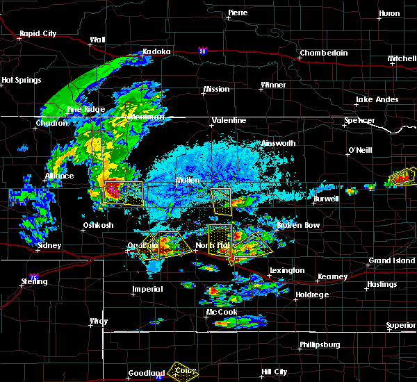 At 610 pm cdt, a severe thunderstorm was located 8 miles east of brady, and moving northeast at 25 mph (radar indicated). Hazards include ping pong ball size hail. People and animals outdoors will be injured. Expect damage to roofs, siding, windows and vehicles. At 610 pm cdt, a severe thunderstorm was located 8 miles east of brady, and moving northeast at 25 mph (radar indicated). Hazards include ping pong ball size hail. People and animals outdoors will be injured. Expect damage to roofs, siding, windows and vehicles.
|
| 6/4/2015 1:26 PM CDT | At 120 pm cdt, a severe thunderstorm was located near ansley, and moving northeast at 35 mph. a second thunderstorm, capable of also producing large hail up to the size of quarters, was located about 8 miles southeast of callaway and also moving northeast at 35 mph (radar indicated). Hazards include quarter size hail. Damage to vehicles is expected. locations impacted include, wescott. this includes highway 2 between mile markers 276 and 298. this includes highway 92 between mile markers 300 and 307. This includes highway 183 between mile markers 86 and 109. |
| 6/4/2015 1:11 PM CDT | At 109 pm cdt, a severe thunderstorm was located 5 miles south of broken bow, and moving northeast at 35 mph (radar indicated). Hazards include quarter size hail. Damage to vehicles is expected. locations impacted include, broken bow, berwyn, ansley, westerville, weissert and wescott. this includes highway 2 between mile markers 276 and 298. this includes highway 92 between mile markers 300 and 307. This includes highway 183 between mile markers 86 and 109. |
| 6/4/2015 12:53 PM CDT | Quarter sized hail reported 2.2 miles NW of Callaway, NE |
| 6/4/2015 12:53 PM CDT | At 1251 pm cdt, a severe thunderstorm was located 6 miles southeast of callaway, and moving northeast at 35 mph (radar indicated). Hazards include quarter size hail. damage to vehicles is expected |
| 6/4/2015 12:48 PM CDT | At 1246 pm cdt, a severe thunderstorm was located near callaway, and moving northeast at 35 mph (radar indicated). Hazards include quarter size hail. Damage to vehicles is expected. Locations impacted include, mainly rural areas of central custer county. |
| 6/4/2015 12:38 PM CDT | At 1234 pm cdt, a severe thunderstorm was located 8 miles southwest of callaway, and moving northeast at 35 mph (radar indicated). Hazards include quarter size hail. Damage to vehicles is expected. Locations impacted include, callaway, oconto and lodi. |
| 6/4/2015 12:28 PM CDT | At 1225 pm cdt, a severe thunderstorm was located 13 miles southwest of callaway, and moving northeast at 35 mph (radar indicated). Hazards include quarter size hail. Damage to vehicles is expected. Locations impacted include, callaway, oconto and lodi. |
| 6/4/2015 12:14 PM CDT | At 1212 pm cdt, a severe thunderstorm was located 10 miles northeast of brady, and moving northeast at 30 mph (radar indicated). Hazards include half dollar size hail. damage to vehicles is expected |
| 6/3/2015 12:52 AM CDT | At 1249 am cdt, severe thunderstorms were located along a line extending from 7 miles south of ord to 7 miles west of loup city to sumner, and moving southeast at 45 mph (radar indicated). Hazards include 70 mph wind gusts and penny size hail. Expect considerable tree damage. damage is likely to mobile homes, roofs and outbuildings. severe thunderstorms will affect mainly rural areas of custer county. this includes highway 2 between mile markers 265 and 307. this includes highway 92 between mile markers 269 and 308. This includes highway 183 between mile markers 73 and 121. |
| 6/3/2015 12:30 AM CDT | At 1228 am cdt, severe thunderstorms were located along a line extending from comstock to westerville to 7 miles south of oconto, and moving southeast at 45 mph (radar indicated). Hazards include 70 mph wind gusts and penny size hail. Expect considerable tree damage. damage is likely to mobile homes, roofs and outbuildings. severe thunderstorms will be near, mason city around 1240 am cdt. other locations in the warning include burr oak, cumro, gavin siding, intersection of highway 183 and cumro road and block hill basin. this includes highway 2 between mile markers 265 and 307. this includes highway 92 between mile markers 269 and 308. This includes highway 183 between mile markers 73 and 122. |
| 6/2/2015 11:59 PM CDT | At 1157 pm cdt, severe thunderstorms were located along a line extending from merna to 6 miles west of callaway, and moving southeast at 35 mph (radar indicated). Hazards include 70 mph wind gusts and penny size hail. Expect considerable tree damage. damage is likely to mobile homes, roofs and outbuildings. severe thunderstorms will be near, callaway around 1205 am cdt. broken bow around 1215 am cdt. berwyn and oconto around 1225 am cdt. ansley around 1230 am cdt. other locations in the warning include lodi, pressey state wildlife management area and buckeye. this includes highway 2 between mile markers 248 and 296. this includes highway 92 between mile markers 247 and 300. This includes highway 183 between mile markers 89 and 97. |
| 6/2/2015 11:42 PM CDT | At 1140 pm cdt, severe thunderstorms were located along a line extending from 8 miles southwest of anselmo to 7 miles south of arnold, and moving southeast at 35 mph (radar indicated). Hazards include 70 mph wind gusts and penny size hail. Expect considerable tree damage. damage is likely to mobile homes, roofs and outbuildings. severe thunderstorms will be near, merna around midnight cdt. callaway around 1205 am cdt. broken bow around 1215 am cdt. berwyn and oconto around 1225 am cdt. ansley around 1230 am cdt. other locations in the warning include milldale, etna, lodi, pressey state wildlife management area and buckeye. this includes highway 2 between mile markers 241 and 296. this includes highway 92 between mile markers 239 and 300. This includes highway 183 between mile markers 89 and 97. |
| 9/23/2014 7:10 PM CDT | Quarter sized hail reported 7.9 miles SE of Callaway, NE |
| 9/23/2014 7:10 PM CDT | Ping Pong Ball sized hail reported 7.9 miles SE of Callaway, NE |
| 8/9/2014 7:25 PM CDT | Ping Pong Ball sized hail reported 0.1 miles N of Callaway, NE |
| 8/9/2014 6:47 PM CDT | Half Dollar sized hail reported 7.5 miles ESE of Callaway, NE, very heavy rain at time of report along with the hail. |
| 8/9/2014 6:45 PM CDT | Hen Egg sized hail reported 7.9 miles SE of Callaway, NE, relayed via social media |
| 7/9/2014 8:50 PM CDT | Quarter sized hail reported 11.2 miles ENE of Callaway, NE, hail lasted about 15 min. |
| 6/27/2014 8:30 PM CDT | 4-6 inch tree branches down in custer county NE, 0.1 miles N of Callaway, NE |
| 6/20/2014 8:01 PM CDT | Golf Ball sized hail reported 16.7 miles NNE of Callaway, NE, quarter to golf ball size hail for the last half hour at location. ditches full of water due to heavy rain. |
| 6/3/2014 7:00 PM CDT | Hen Egg sized hail reported 11.8 miles NE of Callaway, NE |
| 6/3/2014 6:00 PM CDT | Large limbs blown dow in custer county NE, 1 miles NNW of Callaway, NE |
| 6/1/2014 9:00 PM CDT | Storm damage reported in custer county NE, 7.8 miles ENE of Callaway, NE |
| 5/7/2014 8:15 PM CDT | Storm damage reported in custer county NE, 6.3 miles N of Callaway, NE |
| 5/7/2014 8:05 PM CDT | Small brances down from strong wind in custer county NE, 8 miles NE of Callaway, NE |
| 6/22/2013 11:35 PM CDT | Thunderstorm wind gust measured at 58 mp in custer county NE, 8 miles NE of Callaway, NE |
| 6/22/2013 11:30 PM CDT | An apparent micro-burst overturned a pivot irrigator and left nearby pivots unaffecte in custer county NE, 3 miles NE of Callaway, NE |
| 6/21/2013 9:51 PM CDT | Measured outflow in advance of the stor in custer county NE, 8 miles NE of Callaway, NE |
| 5/29/2013 4:07 PM CDT | Half Dollar sized hail reported 5.8 miles SSE of Callaway, NE |
| 5/29/2013 3:41 PM CDT | Ping Pong Ball sized hail reported 8 miles NE of Callaway, NE |
| 5/25/2013 8:15 PM CDT | Hen Egg sized hail reported 12.1 miles NNE of Callaway, NE, golf ball size hail with a few slightly larger stones fell. |
| 7/12/2012 6:15 PM CDT | Strong straightline winds overturned pivots and felled large trees about 18 miles southwest of callaway. 9 to 10 miles west of callaway an inch and a half of rain was w in custer county NE, 7.8 miles ENE of Callaway, NE |
| 7/12/2012 6:15 PM CDT | Strong straightline winds overturned pivots and felled large trees about 8 miles westsouthwest of callaway. 9 to 10 miles west of callaway an inch and a half of rain wa in custer county NE, 7.8 miles ENE of Callaway, NE |
| 4/14/2012 8:15 PM CDT | Ping Pong Ball sized hail reported 8 miles NE of Callaway, NE |
| 1/1/0001 12:00 AM | Half Dollar sized hail reported 14.2 miles E of Callaway, NE, hail was spiked. delayed report from the late evening of july 13th. |
| 1/1/0001 12:00 AM | Farmer reported some green snap damage to his corn crop and basketball hoop blown over as thunderstorms passed over his location. report delayed from evening of july 10 in custer county NE, 0.1 miles N of Callaway, NE |
| 1/1/0001 12:00 AM | Ping Pong Ball sized hail reported 14.8 miles NE of Callaway, NE, sparce hail a few ping pong size. |
| 1/1/0001 12:00 AM | Quarter sized hail reported 13.7 miles NE of Callaway, NE |
Hail Maps for Callaway, NE
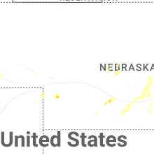
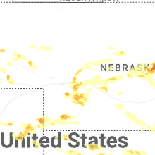


Connect with Interactive Hail Maps