

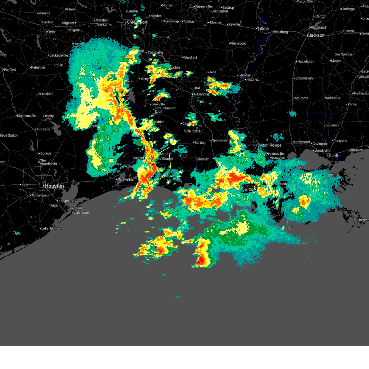
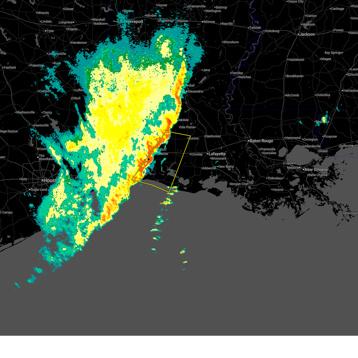
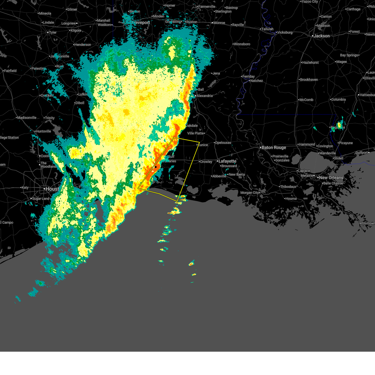
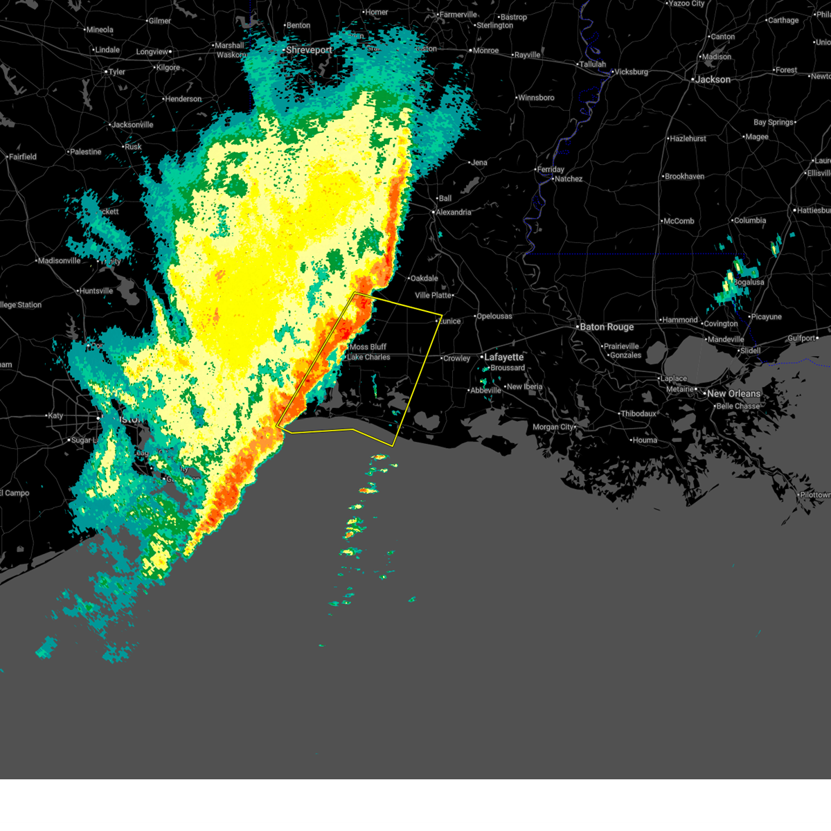
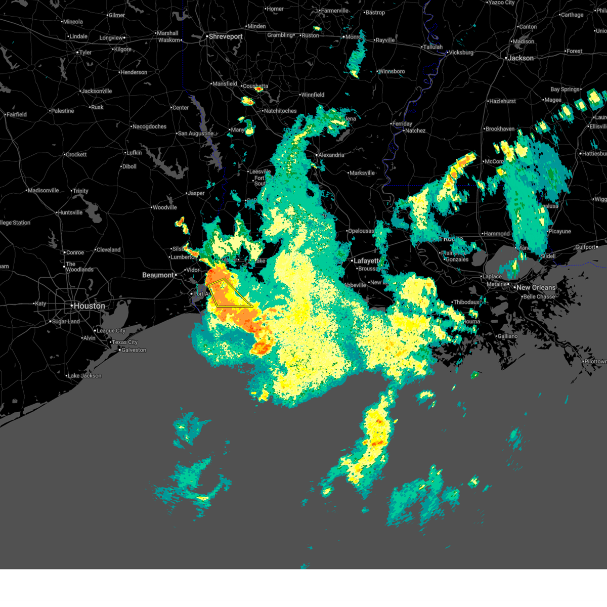
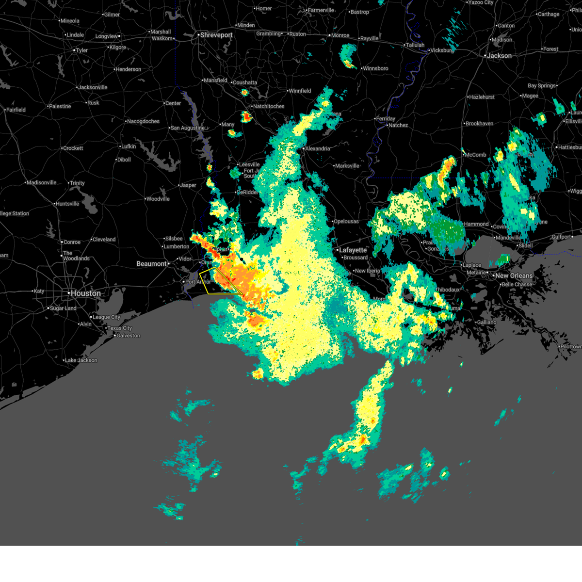
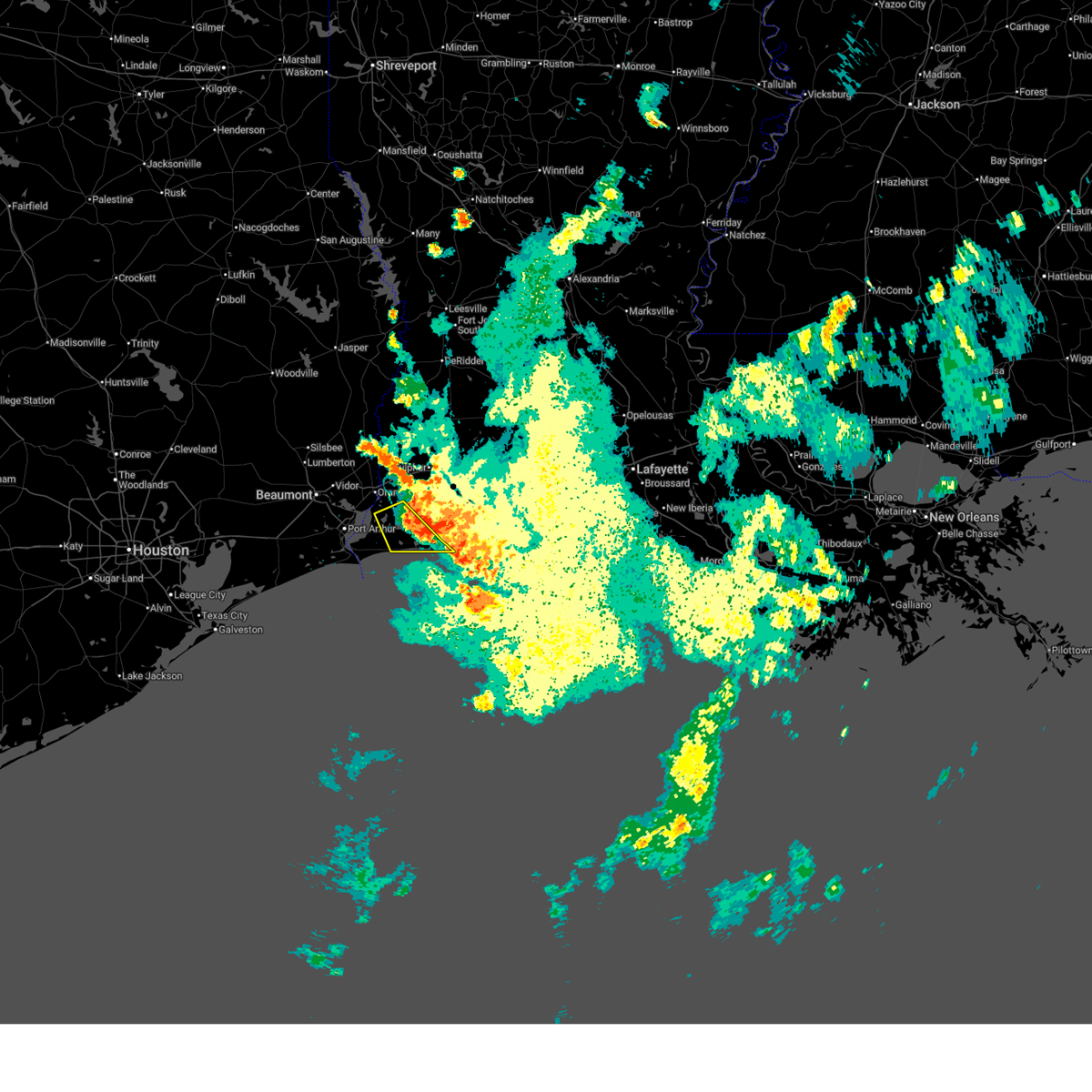
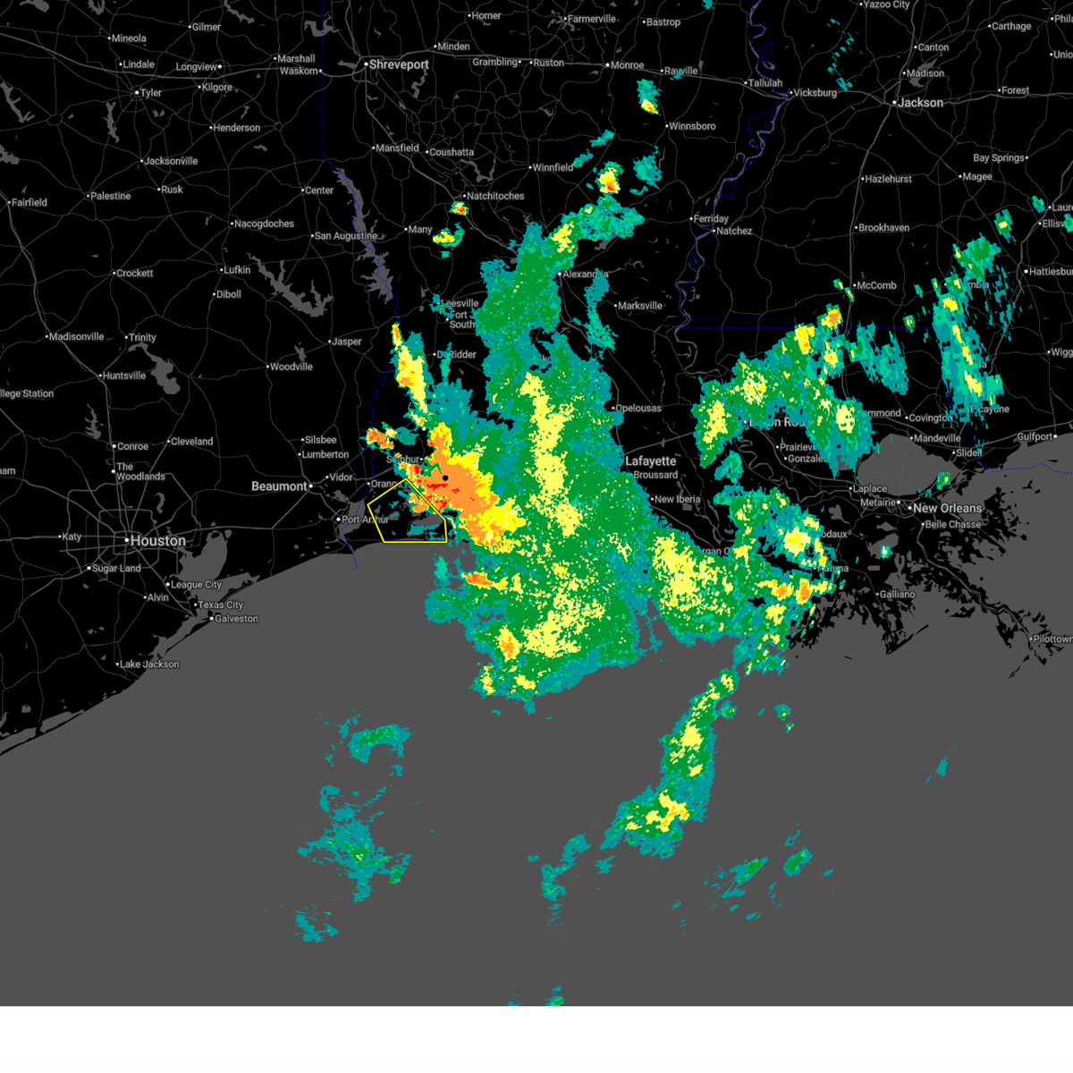
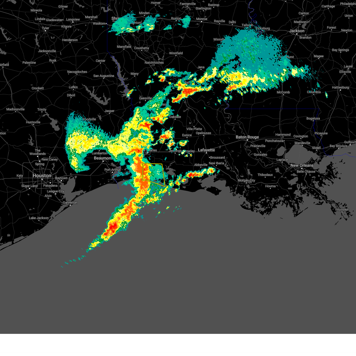
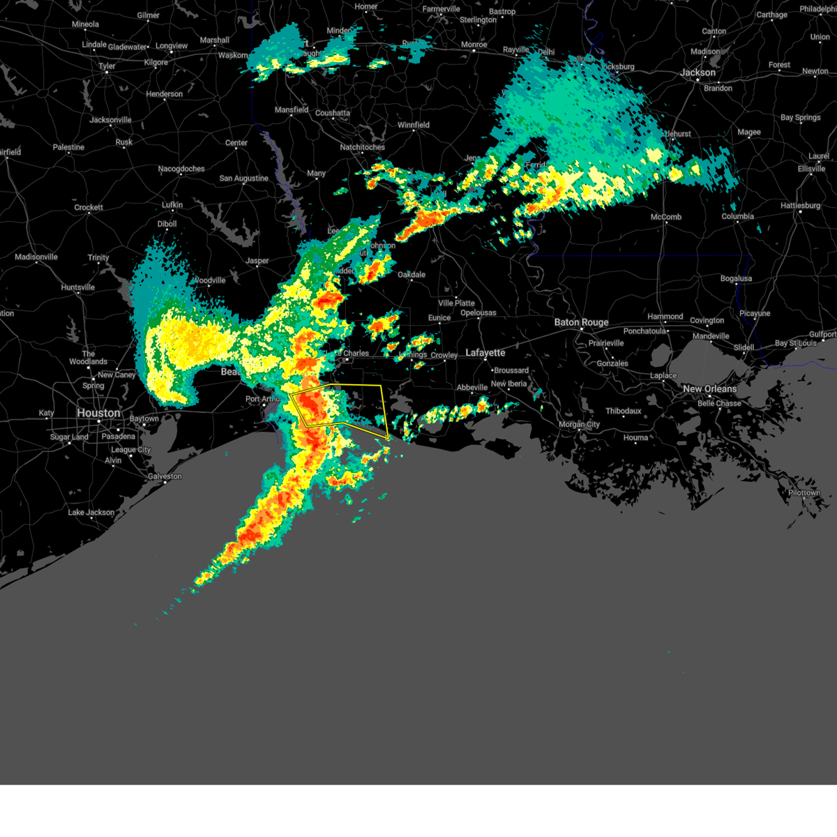
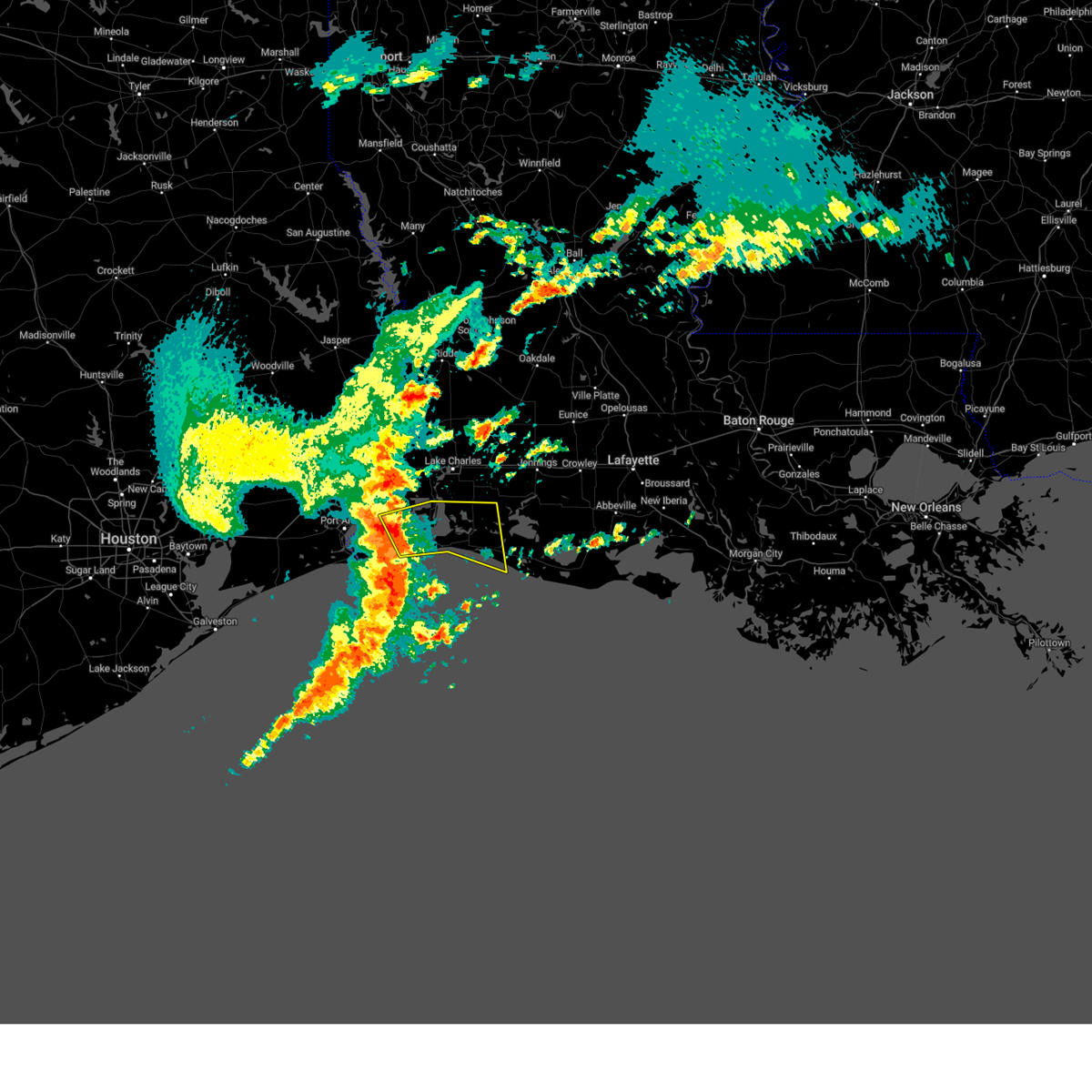
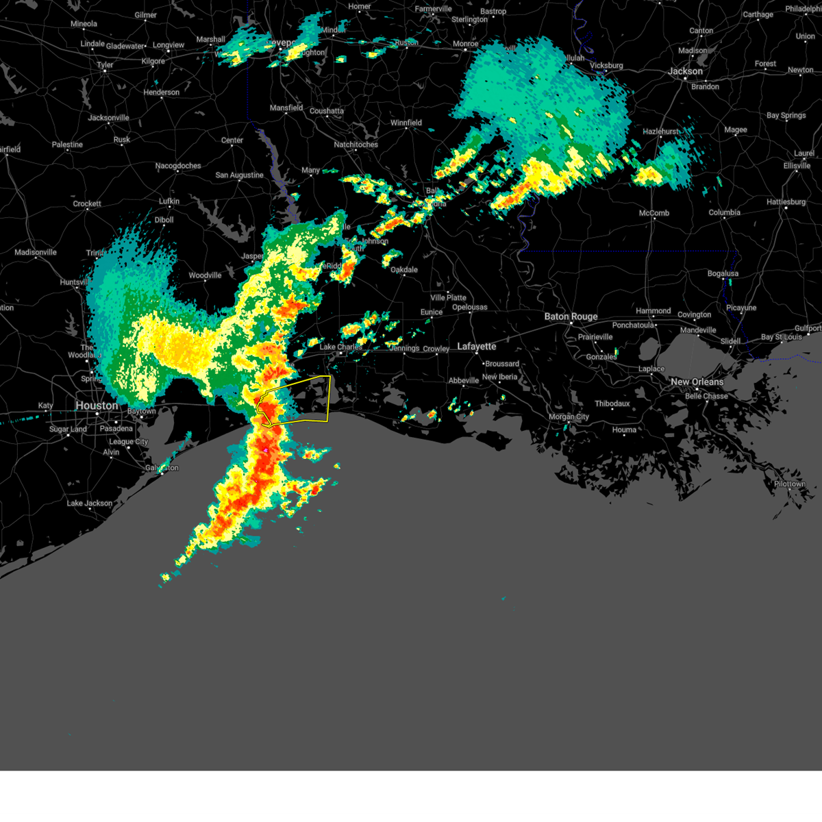
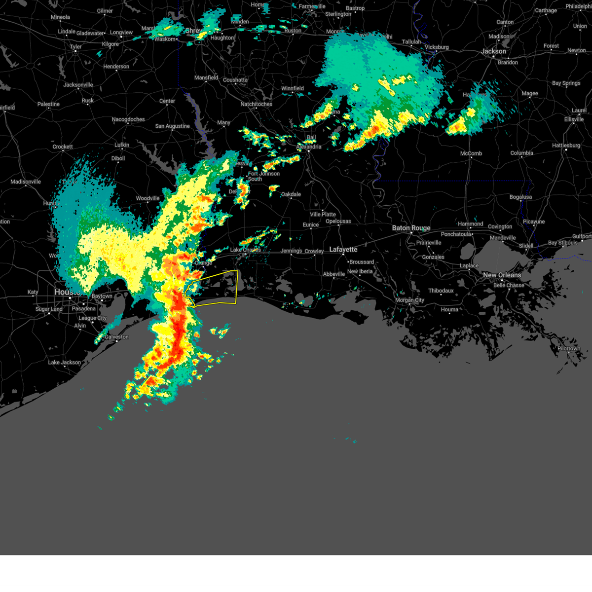
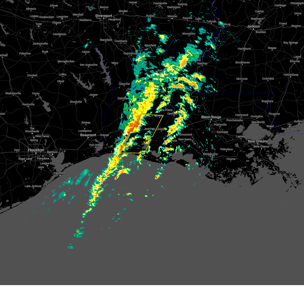
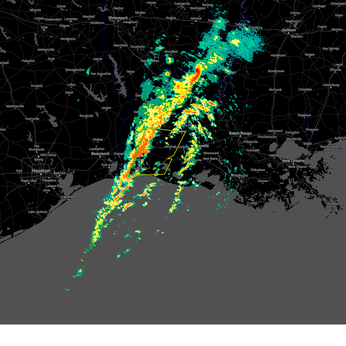
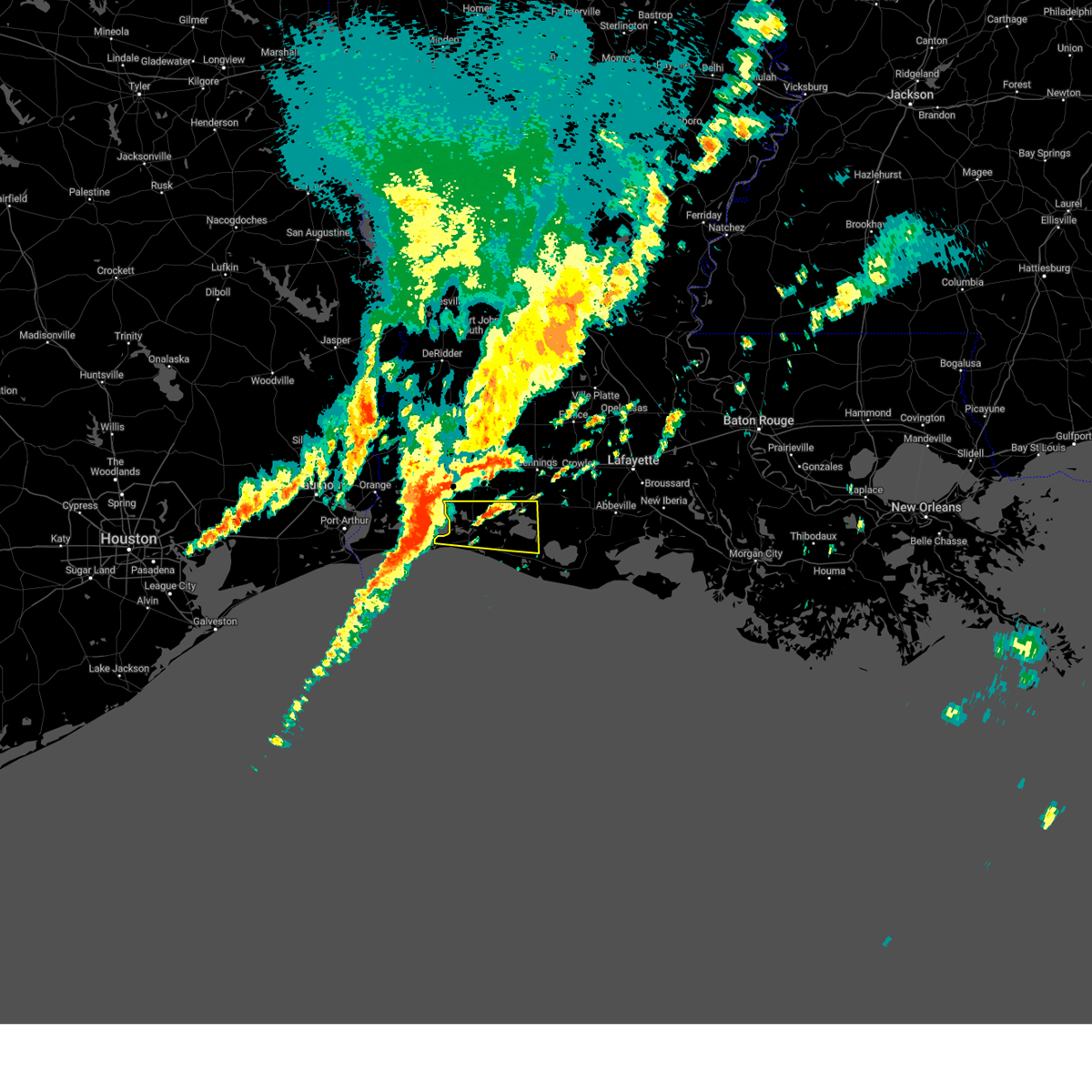
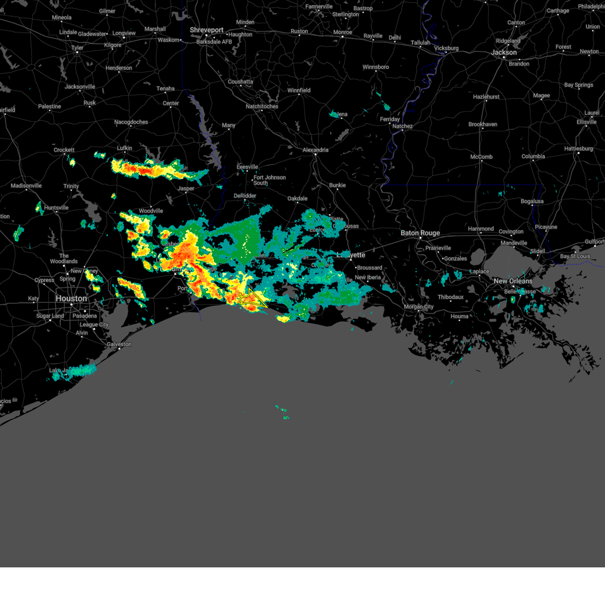
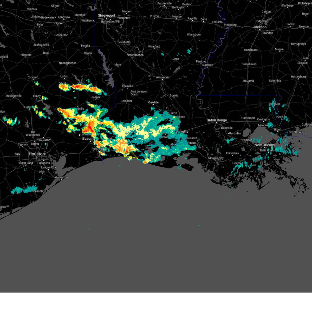
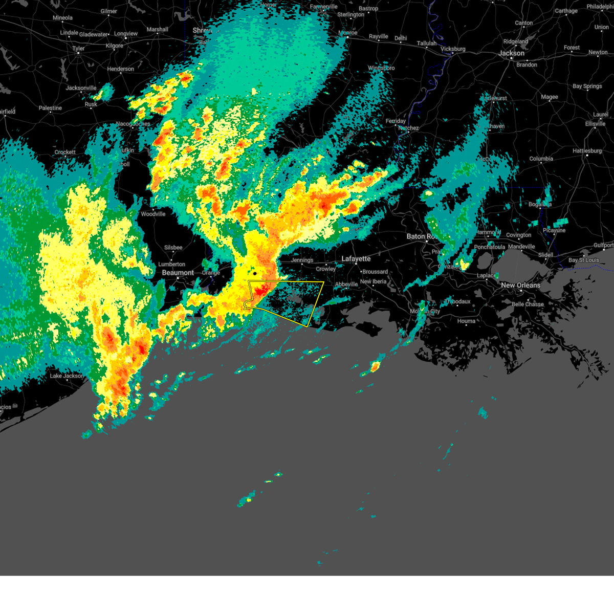
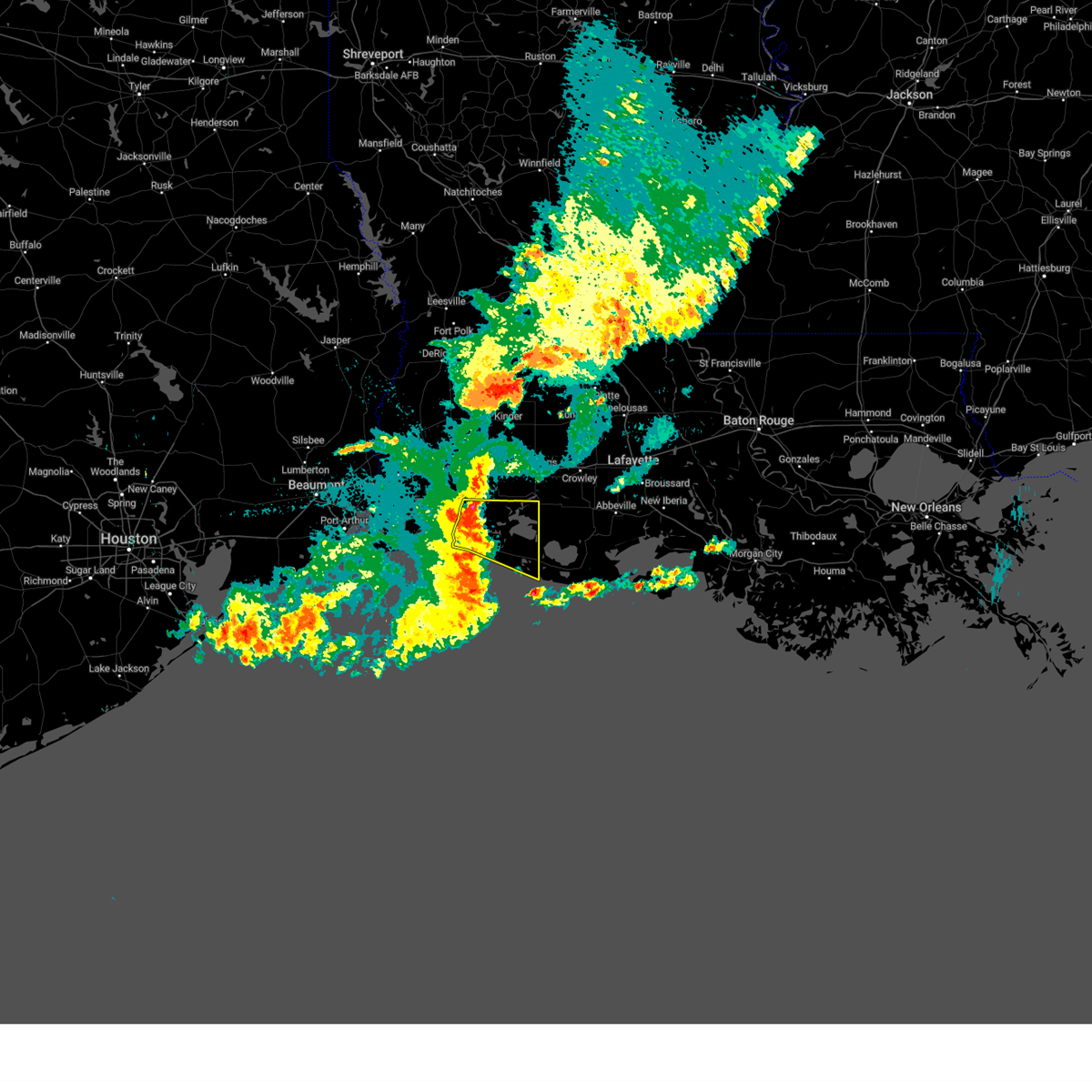
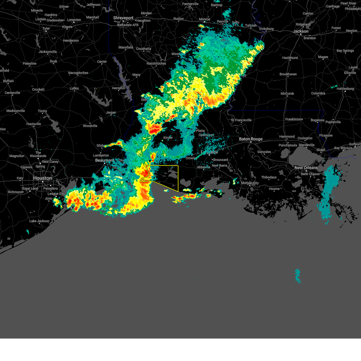
Hail Map for Cameron, LA
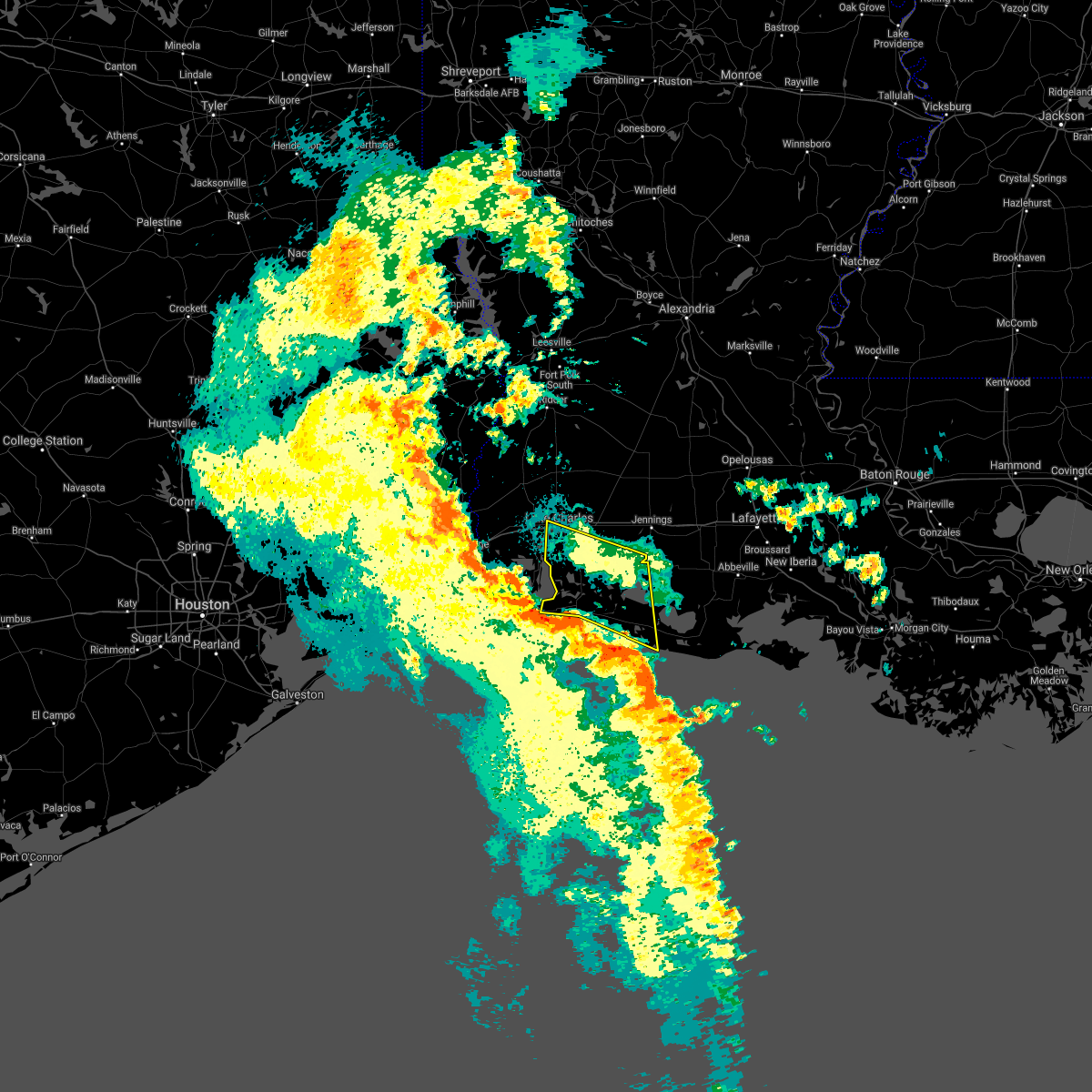
The Cameron, LA area has had 7 reports of on-the-ground hail by trained spotters, and has been under severe weather warnings 14 times during the past 12 months. Doppler radar has detected hail at or near Cameron, LA on 50 occasions.
| Name: | Cameron, LA |
| Where Located: | 35 miles SE of Beaumont, TX |
| Map: | Google Map for Cameron, LA |
| Population: | 406 |
| Housing Units: | 205 |
| More Info: | Search Google for Cameron, LA |
5
The Top Recent Hail Date for Cameron, LA is Wednesday, May 3, 2017 (1st out of 50)

Hail and Wind Damage Spotted near Cameron, LA
| Date / Time | Report Details |
|---|---|
| 5/23/2026 9:12 AM CDT |
 Svrlch the national weather service in lake charles has issued a * severe thunderstorm warning for, north central cameron parish in southwestern louisiana, western jefferson davis parish in southwestern louisiana, southeastern calcasieu parish in southwestern louisiana, * until 1000 am cdt. * at 912 am cdt, a severe thunderstorm was located near lake charles regional airport, moving northeast at 25 mph (radar indicated). Hazards include 60 mph wind gusts. expect damage to roofs, siding, and trees Svrlch the national weather service in lake charles has issued a * severe thunderstorm warning for, north central cameron parish in southwestern louisiana, western jefferson davis parish in southwestern louisiana, southeastern calcasieu parish in southwestern louisiana, * until 1000 am cdt. * at 912 am cdt, a severe thunderstorm was located near lake charles regional airport, moving northeast at 25 mph (radar indicated). Hazards include 60 mph wind gusts. expect damage to roofs, siding, and trees
|
| 2/14/2026 9:05 PM CST |
 At 905 pm cst, severe thunderstorms were located along a line extending from near elton to 10 miles southeast of holly beach, moving east at 50 mph (radar indicated). Hazards include 70 mph wind gusts. Expect considerable tree damage. damage is likely to mobile homes, roofs, and outbuildings. Locations impacted include, lake charles, eunice, jennings, cameron, welsh, iowa, lake arthur, kinder, basile, oberlin, iota, elton, mermentau, fenton, grand lake, rockefeller wildlife range, hayes, lacassine national wildlife refuge, lake charles regional airport, and grand chenier. At 905 pm cst, severe thunderstorms were located along a line extending from near elton to 10 miles southeast of holly beach, moving east at 50 mph (radar indicated). Hazards include 70 mph wind gusts. Expect considerable tree damage. damage is likely to mobile homes, roofs, and outbuildings. Locations impacted include, lake charles, eunice, jennings, cameron, welsh, iowa, lake arthur, kinder, basile, oberlin, iota, elton, mermentau, fenton, grand lake, rockefeller wildlife range, hayes, lacassine national wildlife refuge, lake charles regional airport, and grand chenier.
|
| 2/14/2026 9:05 PM CST |
 the severe thunderstorm warning has been cancelled and is no longer in effect the severe thunderstorm warning has been cancelled and is no longer in effect
|
| 2/14/2026 8:40 PM CST |
 Svrlch the national weather service in lake charles has issued a * severe thunderstorm warning for, cameron parish in southwestern louisiana, jefferson davis parish in southwestern louisiana, southwestern evangeline parish in central louisiana, southeastern beauregard parish in southwestern louisiana, western acadia parish in southwestern louisiana, calcasieu parish in southwestern louisiana, northwestern vermilion parish in southwestern louisiana, west central st. landry parish in central louisiana, southern allen parish in southwestern louisiana, * until 945 pm cst. * at 839 pm cst, severe thunderstorms were located along a line extending from near dry creek to near johnsons bayou, moving east at 50 mph (radar indicated). Hazards include 70 mph wind gusts. Expect considerable tree damage. Damage is likely to mobile homes, roofs, and outbuildings. Svrlch the national weather service in lake charles has issued a * severe thunderstorm warning for, cameron parish in southwestern louisiana, jefferson davis parish in southwestern louisiana, southwestern evangeline parish in central louisiana, southeastern beauregard parish in southwestern louisiana, western acadia parish in southwestern louisiana, calcasieu parish in southwestern louisiana, northwestern vermilion parish in southwestern louisiana, west central st. landry parish in central louisiana, southern allen parish in southwestern louisiana, * until 945 pm cst. * at 839 pm cst, severe thunderstorms were located along a line extending from near dry creek to near johnsons bayou, moving east at 50 mph (radar indicated). Hazards include 70 mph wind gusts. Expect considerable tree damage. Damage is likely to mobile homes, roofs, and outbuildings.
|
| 10/25/2025 7:42 AM CDT | The storms which prompted the warning have weakened below severe limits, and no longer pose an immediate threat to life or property. therefore, the warning will be allowed to expire. however gusty winds are still possible with these thunderstorms. a severe thunderstorm watch remains in effect until 800 am cdt for southwestern louisiana. |
| 10/25/2025 7:11 AM CDT | At 711 am cdt, severe thunderstorms were located along a line extending from near edgerly to near sweet lake to near creole, moving east at 35 mph (radar indicated). Hazards include 60 mph wind gusts. Expect damage to roofs, siding, and trees. Locations impacted include, lake charles, sulphur, cameron, westlake, vinton, grand lake, lake charles regional airport, lacassine national wildlife refuge, grand chenier, moss bluff, carlyss, hacketts corner, heberts marina, creole, sweet lake, gibbstown, holmwood, toomey, hackberry, and rutherford beach. |
| 10/25/2025 6:42 AM CDT | Svrlch the national weather service in lake charles has issued a * severe thunderstorm warning for, northeastern cameron parish in southwestern louisiana, southern calcasieu parish in southwestern louisiana, * until 745 am cdt. * at 642 am cdt, severe thunderstorms were located along a line extending from toomey to near hackberry to 6 miles south of holly beach, moving northeast at 30 mph (radar indicated). Hazards include 60 mph wind gusts. expect damage to roofs, siding, and trees |
| 10/25/2025 6:16 AM CDT | At 616 am cdt, severe thunderstorms were located along a line extending from near forest heights to 6 miles southwest of johnsons bayou, moving east at 30 mph (radar indicated). Hazards include 60 mph wind gusts. Expect damage to roofs, siding, and trees. Locations impacted include, port arthur, sulphur, orange, bridge city, cameron, west orange, vinton, sabine national wildlife, johnsons bayou, mauriceville, carlyss, pinehurst, toomey, orangefield, edgerly, hackberry, holly beach, and constance beach. |
| 10/25/2025 6:16 AM CDT | the severe thunderstorm warning has been cancelled and is no longer in effect |
| 10/25/2025 5:39 AM CDT | Svrlch the national weather service in lake charles has issued a * severe thunderstorm warning for, northwestern cameron parish in southwestern louisiana, southwestern calcasieu parish in southwestern louisiana, eastern jefferson county in southeastern texas, orange county in southeastern texas, * until 645 am cdt. * at 539 am cdt, severe thunderstorms were located along a line extending from pine forest to 10 miles west of sabine pass, moving northeast at 35 mph (radar indicated). Hazards include 60 mph wind gusts. expect damage to roofs, siding, and trees |
| 7/24/2025 7:12 PM CDT |
 The storm which prompted the warning has weakened below severe limits, and no longer poses an immediate threat to life or property. therefore, the warning will be allowed to expire. The storm which prompted the warning has weakened below severe limits, and no longer poses an immediate threat to life or property. therefore, the warning will be allowed to expire.
|
| 7/24/2025 6:46 PM CDT |
 the severe thunderstorm warning has been cancelled and is no longer in effect the severe thunderstorm warning has been cancelled and is no longer in effect
|
| 7/24/2025 6:46 PM CDT |
 At 645 pm cdt, a severe thunderstorm was located near sabine national wildlife, moving southwest at 45 mph (radar indicated). Hazards include 60 mph wind gusts. Expect damage to roofs, siding, and trees. Locations impacted include, cameron, sabine national wildlife, holly beach, hackberry, and constance beach. At 645 pm cdt, a severe thunderstorm was located near sabine national wildlife, moving southwest at 45 mph (radar indicated). Hazards include 60 mph wind gusts. Expect damage to roofs, siding, and trees. Locations impacted include, cameron, sabine national wildlife, holly beach, hackberry, and constance beach.
|
| 7/24/2025 6:29 PM CDT |
 Svrlch the national weather service in lake charles has issued a * severe thunderstorm warning for, northwestern cameron parish in southwestern louisiana, south central calcasieu parish in southwestern louisiana, * until 715 pm cdt. * at 628 pm cdt, a severe thunderstorm was located over hackberry, or 10 miles east of sabine national wildlife, moving southwest at 45 mph (radar indicated). Hazards include 60 mph wind gusts. expect damage to roofs, siding, and trees Svrlch the national weather service in lake charles has issued a * severe thunderstorm warning for, northwestern cameron parish in southwestern louisiana, south central calcasieu parish in southwestern louisiana, * until 715 pm cdt. * at 628 pm cdt, a severe thunderstorm was located over hackberry, or 10 miles east of sabine national wildlife, moving southwest at 45 mph (radar indicated). Hazards include 60 mph wind gusts. expect damage to roofs, siding, and trees
|
| 3/24/2025 5:20 AM CDT |
 At 520 am cdt, severe thunderstorms were located along a line extending from near sweet lake to near creole, moving east at 55 mph (radar indicated). Hazards include 60 mph wind gusts and penny size hail. Expect damage to roofs, siding, and trees. Locations impacted include, grand lake, grand chenier, lacassine national wildlife refuge, hacketts corner, creole, heberts marina, sweet lake, rutherford beach, cameron, and gibbstown. At 520 am cdt, severe thunderstorms were located along a line extending from near sweet lake to near creole, moving east at 55 mph (radar indicated). Hazards include 60 mph wind gusts and penny size hail. Expect damage to roofs, siding, and trees. Locations impacted include, grand lake, grand chenier, lacassine national wildlife refuge, hacketts corner, creole, heberts marina, sweet lake, rutherford beach, cameron, and gibbstown.
|
| 3/24/2025 5:03 AM CDT |
 At 503 am cdt, severe thunderstorms were located along a line extending from near hackberry to 6 miles south of holly beach, moving east at 45 mph (radar indicated). Hazards include 70 mph wind gusts and penny size hail. Expect considerable tree damage. damage is likely to mobile homes, roofs, and outbuildings. Locations impacted include, grand lake, lacassine national wildlife refuge, hacketts corner, heberts marina, cameron, sabine national wildlife, hackberry, constance beach, grand chenier, holly beach, creole, sweet lake, rutherford beach, and gibbstown. At 503 am cdt, severe thunderstorms were located along a line extending from near hackberry to 6 miles south of holly beach, moving east at 45 mph (radar indicated). Hazards include 70 mph wind gusts and penny size hail. Expect considerable tree damage. damage is likely to mobile homes, roofs, and outbuildings. Locations impacted include, grand lake, lacassine national wildlife refuge, hacketts corner, heberts marina, cameron, sabine national wildlife, hackberry, constance beach, grand chenier, holly beach, creole, sweet lake, rutherford beach, and gibbstown.
|
| 3/24/2025 4:53 AM CDT |
 Svrlch the national weather service in lake charles has issued a * severe thunderstorm warning for, central cameron parish in southwestern louisiana, * until 545 am cdt. * at 452 am cdt, severe thunderstorms were located along a line extending from sabine national wildlife to 9 miles southwest of holly beach, moving east at 45 mph (radar indicated). Hazards include 60 mph wind gusts and penny size hail. expect damage to roofs, siding, and trees Svrlch the national weather service in lake charles has issued a * severe thunderstorm warning for, central cameron parish in southwestern louisiana, * until 545 am cdt. * at 452 am cdt, severe thunderstorms were located along a line extending from sabine national wildlife to 9 miles southwest of holly beach, moving east at 45 mph (radar indicated). Hazards include 60 mph wind gusts and penny size hail. expect damage to roofs, siding, and trees
|
| 3/24/2025 4:37 AM CDT |
 At 437 am cdt, severe thunderstorms were located along a line extending from 8 miles east of port arthur to 13 miles southeast of sabine pass, moving east at 50 mph (radar indicated). Hazards include 70 mph wind gusts and penny size hail. Expect considerable tree damage. damage is likely to mobile homes, roofs, and outbuildings. Locations impacted include, hackberry, port arthur, constance beach, johnsons bayou, holly beach, sabine national wildlife, and cameron. At 437 am cdt, severe thunderstorms were located along a line extending from 8 miles east of port arthur to 13 miles southeast of sabine pass, moving east at 50 mph (radar indicated). Hazards include 70 mph wind gusts and penny size hail. Expect considerable tree damage. damage is likely to mobile homes, roofs, and outbuildings. Locations impacted include, hackberry, port arthur, constance beach, johnsons bayou, holly beach, sabine national wildlife, and cameron.
|
| 3/24/2025 4:22 AM CDT |
 Svrlch the national weather service in lake charles has issued a * severe thunderstorm warning for, northwestern cameron parish in southwestern louisiana, * until 500 am cdt. * at 422 am cdt, severe thunderstorms were located along a line extending from near port arthur to 15 miles south of sabine pass, moving northeast at 50 mph (radar indicated). Hazards include 60 mph wind gusts and penny size hail. expect damage to roofs, siding, and trees Svrlch the national weather service in lake charles has issued a * severe thunderstorm warning for, northwestern cameron parish in southwestern louisiana, * until 500 am cdt. * at 422 am cdt, severe thunderstorms were located along a line extending from near port arthur to 15 miles south of sabine pass, moving northeast at 50 mph (radar indicated). Hazards include 60 mph wind gusts and penny size hail. expect damage to roofs, siding, and trees
|
| 3/4/2025 1:03 PM CST |
 the severe thunderstorm warning has been cancelled and is no longer in effect the severe thunderstorm warning has been cancelled and is no longer in effect
|
| 3/4/2025 1:03 PM CST |
 At 102 pm cst, severe thunderstorms were located along a line extending from near bond to near cameron, moving east at 35 mph (radar indicated). Hazards include 60 mph wind gusts. Expect damage to roofs, siding, and trees. Locations impacted include, basile, hacketts corner, hayes, evangeline, cameron, jennings, roanoke, eunice, iota, lacassine, hathaway, elton, kinder, lowry, sweet lake, rutherford beach, bell city, lacassine national wildlife refuge, welsh, and lake arthur. At 102 pm cst, severe thunderstorms were located along a line extending from near bond to near cameron, moving east at 35 mph (radar indicated). Hazards include 60 mph wind gusts. Expect damage to roofs, siding, and trees. Locations impacted include, basile, hacketts corner, hayes, evangeline, cameron, jennings, roanoke, eunice, iota, lacassine, hathaway, elton, kinder, lowry, sweet lake, rutherford beach, bell city, lacassine national wildlife refuge, welsh, and lake arthur.
|
| 3/4/2025 12:47 PM CST |
 Svrlch the national weather service in lake charles has issued a * severe thunderstorm warning for, northeastern cameron parish in southwestern louisiana, jefferson davis parish in southwestern louisiana, southwestern evangeline parish in central louisiana, southeastern beauregard parish in southwestern louisiana, northwestern acadia parish in southwestern louisiana, eastern calcasieu parish in southwestern louisiana, west central st. landry parish in central louisiana, southern allen parish in southwestern louisiana, * until 130 pm cst. * at 1247 pm cst, severe thunderstorms were located along a line extending from near oberlin to near holly beach, moving southeast at 35 mph (radar indicated). Hazards include 60 mph wind gusts. expect damage to roofs, siding, and trees Svrlch the national weather service in lake charles has issued a * severe thunderstorm warning for, northeastern cameron parish in southwestern louisiana, jefferson davis parish in southwestern louisiana, southwestern evangeline parish in central louisiana, southeastern beauregard parish in southwestern louisiana, northwestern acadia parish in southwestern louisiana, eastern calcasieu parish in southwestern louisiana, west central st. landry parish in central louisiana, southern allen parish in southwestern louisiana, * until 130 pm cst. * at 1247 pm cst, severe thunderstorms were located along a line extending from near oberlin to near holly beach, moving southeast at 35 mph (radar indicated). Hazards include 60 mph wind gusts. expect damage to roofs, siding, and trees
|
| 12/28/2024 5:05 PM CST |
 Svrlch the national weather service in lake charles has issued a * severe thunderstorm warning for, northeastern cameron parish in southwestern louisiana, * until 600 pm cst. * at 505 pm cst, a severe thunderstorm was located near heberts marina, or near grand lake, moving east at 35 mph (radar indicated). Hazards include 60 mph wind gusts and quarter size hail. Hail damage to vehicles is expected. Expect wind damage to roofs, siding, and trees. Svrlch the national weather service in lake charles has issued a * severe thunderstorm warning for, northeastern cameron parish in southwestern louisiana, * until 600 pm cst. * at 505 pm cst, a severe thunderstorm was located near heberts marina, or near grand lake, moving east at 35 mph (radar indicated). Hazards include 60 mph wind gusts and quarter size hail. Hail damage to vehicles is expected. Expect wind damage to roofs, siding, and trees.
|
| 5/29/2024 9:17 PM CDT |
 the severe thunderstorm warning has been cancelled and is no longer in effect the severe thunderstorm warning has been cancelled and is no longer in effect
|
| 5/29/2024 8:51 PM CDT |
 Svrlch the national weather service in lake charles has issued a * severe thunderstorm warning for, central cameron parish in southwestern louisiana, * until 930 pm cdt. * at 851 pm cdt, a severe thunderstorm was located near cameron, moving southeast at 15 mph (radar indicated). Hazards include quarter size hail. damage to vehicles is expected Svrlch the national weather service in lake charles has issued a * severe thunderstorm warning for, central cameron parish in southwestern louisiana, * until 930 pm cdt. * at 851 pm cdt, a severe thunderstorm was located near cameron, moving southeast at 15 mph (radar indicated). Hazards include quarter size hail. damage to vehicles is expected
|
| 5/13/2024 5:05 PM CDT |
 At 504 pm cdt, severe thunderstorms were located along a line extending from near holmwood to near cameron, moving east at 55 mph (radar indicated). Hazards include 60 mph wind gusts. Expect damage to roofs, siding, and trees. Locations impacted include, cameron, gueydan, grand lake, lacassine national wildlife refuge, rockefeller wildlife range, grand chenier, klondike, hacketts corner, wright, heberts marina, lowry, creole, sweet lake, gibbstown, florence landing, and rutherford beach. At 504 pm cdt, severe thunderstorms were located along a line extending from near holmwood to near cameron, moving east at 55 mph (radar indicated). Hazards include 60 mph wind gusts. Expect damage to roofs, siding, and trees. Locations impacted include, cameron, gueydan, grand lake, lacassine national wildlife refuge, rockefeller wildlife range, grand chenier, klondike, hacketts corner, wright, heberts marina, lowry, creole, sweet lake, gibbstown, florence landing, and rutherford beach.
|
| 5/13/2024 4:41 PM CDT |
 At 441 pm cdt, severe thunderstorms were located along a line extending from near grand lake to 6 miles southeast of johnsons bayou, moving east at 55 mph (radar indicated). Hazards include 60 mph wind gusts. Expect damage to roofs, siding, and trees. Locations impacted include, cameron, gueydan, grand lake, lacassine national wildlife refuge, rockefeller wildlife range, sabine national wildlife, grand chenier, johnsons bayou, klondike, hacketts corner, wright, heberts marina, hackberry, holly beach, lowry, creole, sweet lake, gibbstown, florence landing, and constance beach. At 441 pm cdt, severe thunderstorms were located along a line extending from near grand lake to 6 miles southeast of johnsons bayou, moving east at 55 mph (radar indicated). Hazards include 60 mph wind gusts. Expect damage to roofs, siding, and trees. Locations impacted include, cameron, gueydan, grand lake, lacassine national wildlife refuge, rockefeller wildlife range, sabine national wildlife, grand chenier, johnsons bayou, klondike, hacketts corner, wright, heberts marina, hackberry, holly beach, lowry, creole, sweet lake, gibbstown, florence landing, and constance beach.
|
| 5/13/2024 4:36 PM CDT |
 Svrlch the national weather service in lake charles has issued a * severe thunderstorm warning for, cameron parish in southwestern louisiana, western vermilion parish in southwestern louisiana, * until 530 pm cdt. * at 435 pm cdt, severe thunderstorms were located along a line extending from 7 miles north of hackberry to 6 miles south of johnsons bayou, moving east at 55 mph (radar indicated). Hazards include 60 mph wind gusts. expect damage to roofs, siding, and trees Svrlch the national weather service in lake charles has issued a * severe thunderstorm warning for, cameron parish in southwestern louisiana, western vermilion parish in southwestern louisiana, * until 530 pm cdt. * at 435 pm cdt, severe thunderstorms were located along a line extending from 7 miles north of hackberry to 6 miles south of johnsons bayou, moving east at 55 mph (radar indicated). Hazards include 60 mph wind gusts. expect damage to roofs, siding, and trees
|
| 5/12/2024 1:53 PM CDT |
 At 153 pm cdt, a severe thunderstorm was located near sabine national wildlife, moving east at 45 mph (radar indicated). Hazards include 60 mph wind gusts and quarter size hail. Hail damage to vehicles is expected. expect wind damage to roofs, siding, and trees. Locations impacted include, lake charles, orange, cameron, west orange, grand lake, lake charles regional airport, sabine national wildlife, heberts marina, hackberry, creole, sweet lake, toomey, carlyss, pinehurst, and rutherford beach. At 153 pm cdt, a severe thunderstorm was located near sabine national wildlife, moving east at 45 mph (radar indicated). Hazards include 60 mph wind gusts and quarter size hail. Hail damage to vehicles is expected. expect wind damage to roofs, siding, and trees. Locations impacted include, lake charles, orange, cameron, west orange, grand lake, lake charles regional airport, sabine national wildlife, heberts marina, hackberry, creole, sweet lake, toomey, carlyss, pinehurst, and rutherford beach.
|
| 5/12/2024 1:53 PM CDT |
 the severe thunderstorm warning has been cancelled and is no longer in effect the severe thunderstorm warning has been cancelled and is no longer in effect
|
| 5/12/2024 1:28 PM CDT |
 Svrlch the national weather service in lake charles has issued a * severe thunderstorm warning for, northwestern cameron parish in southwestern louisiana, southwestern calcasieu parish in southwestern louisiana, east central jefferson county in southeastern texas, southeastern orange county in southeastern texas, * until 230 pm cdt. * at 128 pm cdt, a severe thunderstorm was located 7 miles southeast of groves, moving east at 45 mph (radar indicated). Hazards include two inch hail and 60 mph wind gusts. People and animals outdoors will be injured. expect hail damage to roofs, siding, windows, and vehicles. Expect wind damage to roofs, siding, and trees. Svrlch the national weather service in lake charles has issued a * severe thunderstorm warning for, northwestern cameron parish in southwestern louisiana, southwestern calcasieu parish in southwestern louisiana, east central jefferson county in southeastern texas, southeastern orange county in southeastern texas, * until 230 pm cdt. * at 128 pm cdt, a severe thunderstorm was located 7 miles southeast of groves, moving east at 45 mph (radar indicated). Hazards include two inch hail and 60 mph wind gusts. People and animals outdoors will be injured. expect hail damage to roofs, siding, windows, and vehicles. Expect wind damage to roofs, siding, and trees.
|
| 4/10/2024 6:51 AM CDT |
 The storms which prompted the warning have moved out of the area. therefore, the warning has been allowed to expire. a tornado watch remains in effect until 900 am cdt for southwestern louisiana, and southeastern texas. The storms which prompted the warning have moved out of the area. therefore, the warning has been allowed to expire. a tornado watch remains in effect until 900 am cdt for southwestern louisiana, and southeastern texas.
|
| 4/10/2024 6:28 AM CDT |
 Svrlch the national weather service in lake charles has issued a * severe thunderstorm warning for, eastern cameron parish in southwestern louisiana, jefferson davis parish in southwestern louisiana, southwestern acadia parish in southwestern louisiana, southeastern calcasieu parish in southwestern louisiana, northwestern vermilion parish in southwestern louisiana, * until 715 am cdt. * at 628 am cdt, severe thunderstorms were located along a line extending from near carlyss to near grand lake to cameron, moving east at 65 mph. these are destructive storms for west lake and lake charles (radar indicated). Hazards include 80 mph wind gusts. Flying debris will be dangerous to those caught without shelter. mobile homes will be heavily damaged. expect considerable damage to roofs, windows, and vehicles. Extensive tree damage and power outages are likely. Svrlch the national weather service in lake charles has issued a * severe thunderstorm warning for, eastern cameron parish in southwestern louisiana, jefferson davis parish in southwestern louisiana, southwestern acadia parish in southwestern louisiana, southeastern calcasieu parish in southwestern louisiana, northwestern vermilion parish in southwestern louisiana, * until 715 am cdt. * at 628 am cdt, severe thunderstorms were located along a line extending from near carlyss to near grand lake to cameron, moving east at 65 mph. these are destructive storms for west lake and lake charles (radar indicated). Hazards include 80 mph wind gusts. Flying debris will be dangerous to those caught without shelter. mobile homes will be heavily damaged. expect considerable damage to roofs, windows, and vehicles. Extensive tree damage and power outages are likely.
|
| 4/10/2024 6:11 AM CDT |
 At 610 am cdt, severe thunderstorms were located along a line extending from near pinehurst to 8 miles west of sabine national wildlife to 6 miles south of johnsons bayou, moving east at 45 mph. these are destructive storms for northern cameron parish (radar indicated). Hazards include 80 mph wind gusts and nickel size hail. Flying debris will be dangerous to those caught without shelter. mobile homes will be heavily damaged. expect considerable damage to roofs, windows, and vehicles. extensive tree damage and power outages are likely. Locations impacted include, port arthur, orange, nederland, groves, port neches, vidor, bridge city, cameron, west orange, vinton, central gardens, sabine national wildlife, sabine pass, johnsons bayou, pinehurst, toomey, orangefield, edgerly, hackberry, and holly beach. At 610 am cdt, severe thunderstorms were located along a line extending from near pinehurst to 8 miles west of sabine national wildlife to 6 miles south of johnsons bayou, moving east at 45 mph. these are destructive storms for northern cameron parish (radar indicated). Hazards include 80 mph wind gusts and nickel size hail. Flying debris will be dangerous to those caught without shelter. mobile homes will be heavily damaged. expect considerable damage to roofs, windows, and vehicles. extensive tree damage and power outages are likely. Locations impacted include, port arthur, orange, nederland, groves, port neches, vidor, bridge city, cameron, west orange, vinton, central gardens, sabine national wildlife, sabine pass, johnsons bayou, pinehurst, toomey, orangefield, edgerly, hackberry, and holly beach.
|
| 4/10/2024 5:53 AM CDT |
 Svrlch the national weather service in lake charles has issued a * severe thunderstorm warning for, northwestern cameron parish in southwestern louisiana, southwestern calcasieu parish in southwestern louisiana, northeastern jefferson county in southeastern texas, central orange county in southeastern texas, * until 645 am cdt. * at 552 am cdt, severe thunderstorms were located along a line extending from near vidor to near groves to 7 miles south of sabine pass, moving east at 45 mph (radar indicated). Hazards include 60 mph wind gusts and nickel size hail. expect damage to roofs, siding, and trees Svrlch the national weather service in lake charles has issued a * severe thunderstorm warning for, northwestern cameron parish in southwestern louisiana, southwestern calcasieu parish in southwestern louisiana, northeastern jefferson county in southeastern texas, central orange county in southeastern texas, * until 645 am cdt. * at 552 am cdt, severe thunderstorms were located along a line extending from near vidor to near groves to 7 miles south of sabine pass, moving east at 45 mph (radar indicated). Hazards include 60 mph wind gusts and nickel size hail. expect damage to roofs, siding, and trees
|
| 11/30/2023 8:03 PM CST |
 At 802 pm cst, a severe thunderstorm was located 7 miles west of sabine national wildlife, moving east at 25 mph (radar indicated). Hazards include 60 mph wind gusts. expect damage to roofs, siding, and trees At 802 pm cst, a severe thunderstorm was located 7 miles west of sabine national wildlife, moving east at 25 mph (radar indicated). Hazards include 60 mph wind gusts. expect damage to roofs, siding, and trees
|
| 9/8/2023 1:54 PM CDT |
 At 153 pm cdt, severe thunderstorms were located along a line extending from lunita to near westlake to near welsh to near maurice, moving south at 35 mph (radar indicated). Hazards include 60 mph wind gusts and penny size hail. expect damage to roofs, siding, and trees At 153 pm cdt, severe thunderstorms were located along a line extending from lunita to near westlake to near welsh to near maurice, moving south at 35 mph (radar indicated). Hazards include 60 mph wind gusts and penny size hail. expect damage to roofs, siding, and trees
|
| 4/15/2023 11:16 PM CDT |
 At 1116 pm cdt, a severe thunderstorm was located near gibbstown, or 7 miles southwest of lacassine national wildlife refuge, moving east at 35 mph (radar indicated). Hazards include 70 mph wind gusts and penny size hail. Expect considerable tree damage. damage is likely to mobile homes, roofs, and outbuildings. locations impacted include, grand chenier, lacassine national wildlife refuge, rockefeller wildlife range, hacketts corner, lowry, creole, sweet lake, gibbstown and rutherford beach. thunderstorm damage threat, considerable hail threat, radar indicated max hail size, 0. 75 in wind threat, radar indicated max wind gust, 70 mph. At 1116 pm cdt, a severe thunderstorm was located near gibbstown, or 7 miles southwest of lacassine national wildlife refuge, moving east at 35 mph (radar indicated). Hazards include 70 mph wind gusts and penny size hail. Expect considerable tree damage. damage is likely to mobile homes, roofs, and outbuildings. locations impacted include, grand chenier, lacassine national wildlife refuge, rockefeller wildlife range, hacketts corner, lowry, creole, sweet lake, gibbstown and rutherford beach. thunderstorm damage threat, considerable hail threat, radar indicated max hail size, 0. 75 in wind threat, radar indicated max wind gust, 70 mph.
|
| 4/15/2023 11:01 PM CDT |
 At 1101 pm cdt, a severe thunderstorm was located near gibbstown, or 10 miles southeast of grand lake, moving east at 35 mph (radar indicated). Hazards include 60 mph wind gusts and penny size hail. expect damage to roofs, siding, and trees At 1101 pm cdt, a severe thunderstorm was located near gibbstown, or 10 miles southeast of grand lake, moving east at 35 mph (radar indicated). Hazards include 60 mph wind gusts and penny size hail. expect damage to roofs, siding, and trees
|
| 1/24/2023 5:43 PM CST |
 The severe thunderstorm warning for north central cameron, western jefferson davis, east central beauregard, southeastern calcasieu and southwestern allen parishes will expire at 545 pm cst, the storms which prompted the warning have moved out of the area. therefore, the warning will be allowed to expire. however heavy rain is still possible with these thunderstorms. a tornado watch remains in effect until 600 pm cst for southwestern louisiana. The severe thunderstorm warning for north central cameron, western jefferson davis, east central beauregard, southeastern calcasieu and southwestern allen parishes will expire at 545 pm cst, the storms which prompted the warning have moved out of the area. therefore, the warning will be allowed to expire. however heavy rain is still possible with these thunderstorms. a tornado watch remains in effect until 600 pm cst for southwestern louisiana.
|
| 1/24/2023 5:32 PM CST |
 At 532 pm cst, severe thunderstorms were located along a line extending from near dry creek to holmwood to 6 miles southeast of holly beach, moving east at 40 mph (radar indicated). Hazards include 60 mph wind gusts and nickel size hail. Expect damage to roofs, siding, and trees. Locations impacted include, lake charles, cameron, iowa, kinder, fenton, reeves, dry creek, hayes, mittie, buller, hacketts corner, harmony, lebleu settlement, leblanc, sweet lake, gibbstown, holmwood, bell city and lacassine. At 532 pm cst, severe thunderstorms were located along a line extending from near dry creek to holmwood to 6 miles southeast of holly beach, moving east at 40 mph (radar indicated). Hazards include 60 mph wind gusts and nickel size hail. Expect damage to roofs, siding, and trees. Locations impacted include, lake charles, cameron, iowa, kinder, fenton, reeves, dry creek, hayes, mittie, buller, hacketts corner, harmony, lebleu settlement, leblanc, sweet lake, gibbstown, holmwood, bell city and lacassine.
|
| 1/24/2023 4:55 PM CST |
 At 454 pm cst, a severe thunderstorm capable of producing a tornado was located 6 miles southwest of creole, moving northeast at 65 mph (radar indicated rotation). Hazards include tornado. Flying debris will be dangerous to those caught without shelter. mobile homes will be damaged or destroyed. damage to roofs, windows, and vehicles will occur. Tree damage is likely. At 454 pm cst, a severe thunderstorm capable of producing a tornado was located 6 miles southwest of creole, moving northeast at 65 mph (radar indicated rotation). Hazards include tornado. Flying debris will be dangerous to those caught without shelter. mobile homes will be damaged or destroyed. damage to roofs, windows, and vehicles will occur. Tree damage is likely.
|
| 1/24/2023 4:38 PM CST |
 At 438 pm cst, severe thunderstorms were located along a line extending from near bancroft to near toomey to 8 miles southwest of sabine pass, moving east at 40 mph (radar indicated). Hazards include 60 mph wind gusts and nickel size hail. expect damage to roofs, siding, and trees At 438 pm cst, severe thunderstorms were located along a line extending from near bancroft to near toomey to 8 miles southwest of sabine pass, moving east at 40 mph (radar indicated). Hazards include 60 mph wind gusts and nickel size hail. expect damage to roofs, siding, and trees
|
| 9/7/2022 5:37 PM CDT |
 At 536 pm cdt, severe thunderstorms were located near hackberry to south of grand lake eastward over mainly rural areas of cameron parish, moving south at 15 mph (radar indicated). Hazards include 60 mph wind gusts and quarter size hail. Hail damage to vehicles is expected. expect wind damage to roofs, siding, and trees. locations impacted include, cameron, grand lake, grand chenier, hackberry, holly beach, hacketts corner, creole, sweet lake, gibbstown and rutherford beach. hail threat, radar indicated max hail size, 1. 00 in wind threat, radar indicated max wind gust, 60 mph. At 536 pm cdt, severe thunderstorms were located near hackberry to south of grand lake eastward over mainly rural areas of cameron parish, moving south at 15 mph (radar indicated). Hazards include 60 mph wind gusts and quarter size hail. Hail damage to vehicles is expected. expect wind damage to roofs, siding, and trees. locations impacted include, cameron, grand lake, grand chenier, hackberry, holly beach, hacketts corner, creole, sweet lake, gibbstown and rutherford beach. hail threat, radar indicated max hail size, 1. 00 in wind threat, radar indicated max wind gust, 60 mph.
|
| 9/7/2022 5:12 PM CDT |
 At 512 pm cdt, severe thunderstorms were located near grand lake, moving south at 15 mph (radar indicated). Hazards include 60 mph wind gusts and quarter size hail. Hail damage to vehicles is expected. Expect wind damage to roofs, siding, and trees. At 512 pm cdt, severe thunderstorms were located near grand lake, moving south at 15 mph (radar indicated). Hazards include 60 mph wind gusts and quarter size hail. Hail damage to vehicles is expected. Expect wind damage to roofs, siding, and trees.
|
| 5/24/2022 5:55 PM CDT |
 At 553 pm cdt, severe thunderstorms were located along a line extending from near hayes to heberts marina to near sabine national wildlife, moving north at 55 mph. a wind gust to 66 mph was recently reported at calcasieu pass as this line passed (radar indicated). Hazards include 70 mph wind gusts and quarter size hail. Hail damage to vehicles is expected. expect considerable tree damage. Wind damage is also likely to mobile homes, roofs, and outbuildings. At 553 pm cdt, severe thunderstorms were located along a line extending from near hayes to heberts marina to near sabine national wildlife, moving north at 55 mph. a wind gust to 66 mph was recently reported at calcasieu pass as this line passed (radar indicated). Hazards include 70 mph wind gusts and quarter size hail. Hail damage to vehicles is expected. expect considerable tree damage. Wind damage is also likely to mobile homes, roofs, and outbuildings.
|
| 5/24/2022 5:42 PM CDT | Peak gust of 58 knots observed at calcasieu pass (capl1 in gmz432 county LA, 4.3 miles ENE of Cameron, LA |
| 12/18/2021 2:24 PM CST |
 At 223 pm cst, severe thunderstorms were located along a line extending from near holmwood to near holly beach, moving east at 45 mph (radar indicated). Hazards include 60 mph wind gusts and penny size hail. Expect damage to roofs, siding, and trees. Locations impacted include, cameron, grand lake, and holly beach. At 223 pm cst, severe thunderstorms were located along a line extending from near holmwood to near holly beach, moving east at 45 mph (radar indicated). Hazards include 60 mph wind gusts and penny size hail. Expect damage to roofs, siding, and trees. Locations impacted include, cameron, grand lake, and holly beach.
|
| 12/18/2021 2:00 PM CST |
 At 159 pm cst, severe thunderstorms were located along a line extending from near grand lake to 7 miles southwest of johnsons bayou, moving southeast at 30 mph (radar indicated). Hazards include 60 mph wind gusts and penny size hail. Expect damage to roofs, siding, and trees. Locations impacted include, cameron, vinton, grand lake, johnsons bayou, sabine national wildlife, hackberry, holly beach, toomey, carlyss and constance beach. At 159 pm cst, severe thunderstorms were located along a line extending from near grand lake to 7 miles southwest of johnsons bayou, moving southeast at 30 mph (radar indicated). Hazards include 60 mph wind gusts and penny size hail. Expect damage to roofs, siding, and trees. Locations impacted include, cameron, vinton, grand lake, johnsons bayou, sabine national wildlife, hackberry, holly beach, toomey, carlyss and constance beach.
|
| 12/18/2021 1:32 PM CST |
 At 131 pm cst, severe thunderstorms were located along a line extending from near edgerly to near port arthur, moving east at 30 mph (radar indicated). Hazards include 60 mph wind gusts and penny size hail. expect damage to roofs, siding, and trees At 131 pm cst, severe thunderstorms were located along a line extending from near edgerly to near port arthur, moving east at 30 mph (radar indicated). Hazards include 60 mph wind gusts and penny size hail. expect damage to roofs, siding, and trees
|
| 10/27/2021 12:27 PM CDT |
 At 1227 pm cdt, severe thunderstorms were located along a line extending from near cravens to near creole, moving east at 60 mph (radar indicated). Hazards include 70 mph wind gusts. Expect considerable tree damage. Damage is likely to mobile homes, roofs, and outbuildings. At 1227 pm cdt, severe thunderstorms were located along a line extending from near cravens to near creole, moving east at 60 mph (radar indicated). Hazards include 70 mph wind gusts. Expect considerable tree damage. Damage is likely to mobile homes, roofs, and outbuildings.
|
| 10/27/2021 12:12 PM CDT |
 At 1212 pm cdt, severe thunderstorms were located along a line extending from 6 miles southeast of rosepine to near cameron, moving east at 45 mph (radar indicated). Hazards include 60 mph wind gusts. Expect damage to roofs, siding, and trees. Locations impacted include, lake charles, sulphur, crowley, eunice, jennings, ville platte, cameron, westlake, mamou, welsh, iowa, lake arthur, kinder, basile, oberlin, iota, gueydan, elton, mermentau and fenton. At 1212 pm cdt, severe thunderstorms were located along a line extending from 6 miles southeast of rosepine to near cameron, moving east at 45 mph (radar indicated). Hazards include 60 mph wind gusts. Expect damage to roofs, siding, and trees. Locations impacted include, lake charles, sulphur, crowley, eunice, jennings, ville platte, cameron, westlake, mamou, welsh, iowa, lake arthur, kinder, basile, oberlin, iota, gueydan, elton, mermentau and fenton.
|
| 10/27/2021 12:00 PM CDT |
 At 1200 pm cdt, severe thunderstorms were located along a line extending from near de ridder to 6 miles southeast of holly beach, moving east at 65 mph (radar indicated). Hazards include 60 mph wind gusts. Expect damage to roofs, siding, and trees. Locations impacted include, lake charles, sulphur, crowley, eunice, jennings, ville platte, cameron, westlake, mamou, welsh, iowa, lake arthur, kinder, basile, oberlin, iota, gueydan, elton, mermentau and fenton. At 1200 pm cdt, severe thunderstorms were located along a line extending from near de ridder to 6 miles southeast of holly beach, moving east at 65 mph (radar indicated). Hazards include 60 mph wind gusts. Expect damage to roofs, siding, and trees. Locations impacted include, lake charles, sulphur, crowley, eunice, jennings, ville platte, cameron, westlake, mamou, welsh, iowa, lake arthur, kinder, basile, oberlin, iota, gueydan, elton, mermentau and fenton.
|
| 10/27/2021 11:51 AM CDT |
 At 1150 am cdt, severe thunderstorms were located along a line extending from 7 miles southeast of junction to 9 miles southeast of johnsons bayou, moving northeast at 45 mph (radar indicated). Hazards include 60 mph wind gusts. Expect damage to roofs, siding, and trees. locations impacted include, lake charles, sulphur, crowley, eunice, jennings, ville platte, cameron, westlake, mamou, welsh, vinton, iowa, lake arthur, kinder, basile, oberlin, iota, gueydan, elton and mermentau. hail threat, radar indicated max hail size, <. 75 in wind threat, radar indicated max wind gust, 60 mph. At 1150 am cdt, severe thunderstorms were located along a line extending from 7 miles southeast of junction to 9 miles southeast of johnsons bayou, moving northeast at 45 mph (radar indicated). Hazards include 60 mph wind gusts. Expect damage to roofs, siding, and trees. locations impacted include, lake charles, sulphur, crowley, eunice, jennings, ville platte, cameron, westlake, mamou, welsh, vinton, iowa, lake arthur, kinder, basile, oberlin, iota, gueydan, elton and mermentau. hail threat, radar indicated max hail size, <. 75 in wind threat, radar indicated max wind gust, 60 mph.
|
| 10/27/2021 11:39 AM CDT |
 At 1138 am cdt, severe thunderstorms were located along a line extending from merryville to 11 miles south of johnsons bayou, moving northeast at 50 mph (radar indicated). Hazards include 70 mph wind gusts. Expect considerable tree damage. damage is likely to mobile homes, roofs, and outbuildings. locations impacted include, lake charles, sulphur, orange, crowley, eunice, jennings, ville platte, cameron, westlake, west orange, mamou, welsh, vinton, iowa, lake arthur, kinder, basile, oberlin, iota and gueydan. thunderstorm damage threat, considerable hail threat, radar indicated max hail size, <. 75 in wind threat, radar indicated max wind gust, 70 mph. At 1138 am cdt, severe thunderstorms were located along a line extending from merryville to 11 miles south of johnsons bayou, moving northeast at 50 mph (radar indicated). Hazards include 70 mph wind gusts. Expect considerable tree damage. damage is likely to mobile homes, roofs, and outbuildings. locations impacted include, lake charles, sulphur, orange, crowley, eunice, jennings, ville platte, cameron, westlake, west orange, mamou, welsh, vinton, iowa, lake arthur, kinder, basile, oberlin, iota and gueydan. thunderstorm damage threat, considerable hail threat, radar indicated max hail size, <. 75 in wind threat, radar indicated max wind gust, 70 mph.
|
| 10/27/2021 11:30 AM CDT |
 At 1129 am cdt, severe thunderstorms were located along a line extending from near bivens to 15 miles south of johnsons bayou, moving east at 75 mph (radar indicated). Hazards include 70 mph wind gusts. Expect considerable tree damage. Damage is likely to mobile homes, roofs, and outbuildings. At 1129 am cdt, severe thunderstorms were located along a line extending from near bivens to 15 miles south of johnsons bayou, moving east at 75 mph (radar indicated). Hazards include 70 mph wind gusts. Expect considerable tree damage. Damage is likely to mobile homes, roofs, and outbuildings.
|
| 6/15/2021 4:48 PM CDT |
 At 448 pm cdt, a severe thunderstorm was located near sabine national wildlife, moving southwest at 20 mph (radar indicated). Hazards include 60 mph wind gusts and penny size hail. expect damage to roofs, siding, and trees At 448 pm cdt, a severe thunderstorm was located near sabine national wildlife, moving southwest at 20 mph (radar indicated). Hazards include 60 mph wind gusts and penny size hail. expect damage to roofs, siding, and trees
|
| 5/19/2021 10:54 PM CDT |
 At 1053 pm cdt, severe thunderstorms were located along a line extending from near creole to 10 miles southeast of rockefeller wildlife range, moving north at 60 mph (radar indicated). Hazards include 60 mph wind gusts. expect damage to roofs, siding, and trees At 1053 pm cdt, severe thunderstorms were located along a line extending from near creole to 10 miles southeast of rockefeller wildlife range, moving north at 60 mph (radar indicated). Hazards include 60 mph wind gusts. expect damage to roofs, siding, and trees
|
| 4/24/2021 1:30 AM CDT | The nos tide gage at calcasieu pass reported a wind gust to 61 knots or 70 mph. sustained wind was 50 knots or 58 mp in cameron county LA, 4.3 miles ENE of Cameron, LA |
| 3/23/2021 7:43 AM CDT |
 At 743 am cdt, severe thunderstorms were located along a line extending from near heberts marina to 7 miles southwest of gibbstown to near creole, moving east at 10 mph (radar indicated). Hazards include 60 mph wind gusts. expect damage to roofs, siding, and trees At 743 am cdt, severe thunderstorms were located along a line extending from near heberts marina to 7 miles southwest of gibbstown to near creole, moving east at 10 mph (radar indicated). Hazards include 60 mph wind gusts. expect damage to roofs, siding, and trees
|
| 3/23/2021 7:19 AM CDT |
 At 719 am cdt, a severe thunderstorm was located over holly beach, or 7 miles west of cameron, moving east at 50 mph (radar indicated). Hazards include 60 mph wind gusts and penny size hail. expect damage to roofs, siding, and trees At 719 am cdt, a severe thunderstorm was located over holly beach, or 7 miles west of cameron, moving east at 50 mph (radar indicated). Hazards include 60 mph wind gusts and penny size hail. expect damage to roofs, siding, and trees
|
| 8/26/2020 10:39 PM CDT |
 At 1038 pm cdt, a band of severe thunderstorms capable of producing tornadoes was located 8 miles south of creole, or 9 miles southwest of grand chenier, moving northwest at 65 mph (radar indicated rotation). Hazards include tornado. Flying debris will be dangerous to those caught without shelter. mobile homes will be damaged or destroyed. damage to roofs, windows, and vehicles will occur. tree damage is likely. this dangerous storm will be near, holly beach around 1100 pm cdt. sabine national wildlife around 1110 pm cdt. Other locations impacted by these tornadic thunderstorms include constance beach and rutherford beach. At 1038 pm cdt, a band of severe thunderstorms capable of producing tornadoes was located 8 miles south of creole, or 9 miles southwest of grand chenier, moving northwest at 65 mph (radar indicated rotation). Hazards include tornado. Flying debris will be dangerous to those caught without shelter. mobile homes will be damaged or destroyed. damage to roofs, windows, and vehicles will occur. tree damage is likely. this dangerous storm will be near, holly beach around 1100 pm cdt. sabine national wildlife around 1110 pm cdt. Other locations impacted by these tornadic thunderstorms include constance beach and rutherford beach.
|
| 8/26/2020 10:31 PM CDT |
 At 1028 pm cdt, a severe thunderstorm capable of producing a tornado was located near grand chenier, moving northwest at 55 mph (radar indicated rotation). Hazards include tornado. Flying debris will be dangerous to those caught without shelter. mobile homes will be damaged or destroyed. damage to roofs, windows, and vehicles will occur. tree damage is likely. this dangerous storm will be near, creole around 1045 pm cdt. cameron around 1050 pm cdt. heberts marina around 1100 pm cdt. Other locations impacted by this tornadic thunderstorm include rutherford beach. At 1028 pm cdt, a severe thunderstorm capable of producing a tornado was located near grand chenier, moving northwest at 55 mph (radar indicated rotation). Hazards include tornado. Flying debris will be dangerous to those caught without shelter. mobile homes will be damaged or destroyed. damage to roofs, windows, and vehicles will occur. tree damage is likely. this dangerous storm will be near, creole around 1045 pm cdt. cameron around 1050 pm cdt. heberts marina around 1100 pm cdt. Other locations impacted by this tornadic thunderstorm include rutherford beach.
|
| 8/26/2020 10:07 PM CDT |
 At 1005 pm cdt, a severe thunderstorm capable of producing a tornado was located 12 miles southeast of rockefeller wildlife range, moving northwest at 85 mph (radar indicated rotation). Hazards include tornado. Flying debris will be dangerous to those caught without shelter. mobile homes will be damaged or destroyed. damage to roofs, windows, and vehicles will occur. tree damage is likely. this dangerous storm will be near, rockefeller wildlife range around 1015 pm cdt. grand chenier around 1025 pm cdt. creole around 1030 pm cdt. cameron around 1035 pm cdt. heberts marina around 1040 pm cdt. Other locations impacted by this tornadic thunderstorm include rutherford beach. At 1005 pm cdt, a severe thunderstorm capable of producing a tornado was located 12 miles southeast of rockefeller wildlife range, moving northwest at 85 mph (radar indicated rotation). Hazards include tornado. Flying debris will be dangerous to those caught without shelter. mobile homes will be damaged or destroyed. damage to roofs, windows, and vehicles will occur. tree damage is likely. this dangerous storm will be near, rockefeller wildlife range around 1015 pm cdt. grand chenier around 1025 pm cdt. creole around 1030 pm cdt. cameron around 1035 pm cdt. heberts marina around 1040 pm cdt. Other locations impacted by this tornadic thunderstorm include rutherford beach.
|
| 8/26/2020 9:33 PM CDT |
 At 932 pm cdt, a band of thunderstorms capable of producing tornadoes was located near creole, or near grand chenier, moving northwest at 60 mph (radar indicated rotation). Hazards include tornado. Flying debris will be dangerous to those caught without shelter. mobile homes will be damaged or destroyed. damage to roofs, windows, and vehicles will occur. tree damage is likely. this dangerous storm will be near, cameron and sweet lake around 945 pm cdt. heberts marina around 950 pm cdt. grand lake around 955 pm cdt. Other locations impacted by this tornadic thunderstorm include rutherford beach. At 932 pm cdt, a band of thunderstorms capable of producing tornadoes was located near creole, or near grand chenier, moving northwest at 60 mph (radar indicated rotation). Hazards include tornado. Flying debris will be dangerous to those caught without shelter. mobile homes will be damaged or destroyed. damage to roofs, windows, and vehicles will occur. tree damage is likely. this dangerous storm will be near, cameron and sweet lake around 945 pm cdt. heberts marina around 950 pm cdt. grand lake around 955 pm cdt. Other locations impacted by this tornadic thunderstorm include rutherford beach.
|
| 8/26/2020 9:10 PM CDT |
 At 909 pm cdt, a band of thunderstorms capable of producing tornadoes was located over rockefeller wildlife range, moving northwest at 60 mph (radar indicated rotation). Hazards include tornado. Flying debris will be dangerous to those caught without shelter. mobile homes will be damaged or destroyed. damage to roofs, windows, and vehicles will occur. tree damage is likely. this dangerous storm will be near, grand chenier around 925 pm cdt. creole around 935 pm cdt. gibbstown around 940 pm cdt. cameron, sweet lake and heberts marina around 945 pm cdt. Other locations impacted by this tornadic thunderstorm include rutherford beach. At 909 pm cdt, a band of thunderstorms capable of producing tornadoes was located over rockefeller wildlife range, moving northwest at 60 mph (radar indicated rotation). Hazards include tornado. Flying debris will be dangerous to those caught without shelter. mobile homes will be damaged or destroyed. damage to roofs, windows, and vehicles will occur. tree damage is likely. this dangerous storm will be near, grand chenier around 925 pm cdt. creole around 935 pm cdt. gibbstown around 940 pm cdt. cameron, sweet lake and heberts marina around 945 pm cdt. Other locations impacted by this tornadic thunderstorm include rutherford beach.
|
| 5/17/2020 5:58 PM CDT |
 At 557 pm cdt, a severe thunderstorm capable of producing a tornado was located near holly beach, or near sabine national wildlife, moving southeast at 20 mph (radar indicated rotation). Hazards include tornado. Flying debris will be dangerous to those caught without shelter. mobile homes will be damaged or destroyed. damage to roofs, windows, and vehicles will occur. tree damage is likely. This dangerous storm will be near, holly beach around 615 pm cdt. At 557 pm cdt, a severe thunderstorm capable of producing a tornado was located near holly beach, or near sabine national wildlife, moving southeast at 20 mph (radar indicated rotation). Hazards include tornado. Flying debris will be dangerous to those caught without shelter. mobile homes will be damaged or destroyed. damage to roofs, windows, and vehicles will occur. tree damage is likely. This dangerous storm will be near, holly beach around 615 pm cdt.
|
| 5/8/2020 4:36 PM CDT |
 At 435 pm cdt, a severe thunderstorm capable of producing a tornado was located near creole, or near grand chenier, moving southeast at 55 mph (radar indicated rotation). Hazards include tornado. Flying debris will be dangerous to those caught without shelter. mobile homes will be damaged or destroyed. damage to roofs, windows, and vehicles will occur. tree damage is likely. this dangerous storm will be near, grand chenier around 445 pm cdt. rockefeller wildlife range around 455 pm cdt. Other locations impacted by this tornadic thunderstorm include rutherford beach. At 435 pm cdt, a severe thunderstorm capable of producing a tornado was located near creole, or near grand chenier, moving southeast at 55 mph (radar indicated rotation). Hazards include tornado. Flying debris will be dangerous to those caught without shelter. mobile homes will be damaged or destroyed. damage to roofs, windows, and vehicles will occur. tree damage is likely. this dangerous storm will be near, grand chenier around 445 pm cdt. rockefeller wildlife range around 455 pm cdt. Other locations impacted by this tornadic thunderstorm include rutherford beach.
|
| 5/8/2020 4:25 PM CDT |
 At 424 pm cdt, severe thunderstorms were located along a line extending from near thornwell to near lacassine national wildlife refuge to near gibbstown to near cameron, moving southeast at 25 mph (radar indicated). Hazards include 60 mph wind gusts. Expect damage to roofs, siding, and trees. Locations impacted include, cameron, grand lake, grand chenier, lacassine national wildlife refuge, hacketts corner, lowry, creole, sweet lake, gibbstown and rutherford beach. At 424 pm cdt, severe thunderstorms were located along a line extending from near thornwell to near lacassine national wildlife refuge to near gibbstown to near cameron, moving southeast at 25 mph (radar indicated). Hazards include 60 mph wind gusts. Expect damage to roofs, siding, and trees. Locations impacted include, cameron, grand lake, grand chenier, lacassine national wildlife refuge, hacketts corner, lowry, creole, sweet lake, gibbstown and rutherford beach.
|
| 5/8/2020 4:16 PM CDT |
 At 416 pm cdt, severe thunderstorms were located along a line extending from near hayes to near hacketts corner to near sweet lake to 7 miles north of cameron, moving southeast at 30 mph (radar indicated). Hazards include 70 mph wind gusts. Expect considerable tree damage. damage is likely to mobile homes, roofs, and outbuildings. Locations impacted include, cameron, grand lake, lacassine national wildlife refuge, hayes, grand chenier, hacketts corner, thornwell, lowry, creole, sweet lake, gibbstown, hackberry, bell city and rutherford beach. At 416 pm cdt, severe thunderstorms were located along a line extending from near hayes to near hacketts corner to near sweet lake to 7 miles north of cameron, moving southeast at 30 mph (radar indicated). Hazards include 70 mph wind gusts. Expect considerable tree damage. damage is likely to mobile homes, roofs, and outbuildings. Locations impacted include, cameron, grand lake, lacassine national wildlife refuge, hayes, grand chenier, hacketts corner, thornwell, lowry, creole, sweet lake, gibbstown, hackberry, bell city and rutherford beach.
|
| 5/8/2020 3:58 PM CDT |
 At 358 pm cdt, severe thunderstorms were located along a line extending from near iowa to near lake charles regional airport to near hackberry, moving southeast at 20 mph (radar indicated). Hazards include 70 mph wind gusts. Expect considerable tree damage. damage is likely to mobile homes, roofs, and outbuildings. locations impacted include, cameron, iowa, grand lake, lake charles regional airport, lacassine national wildlife refuge, hayes, grand chenier, hacketts corner, hackberry, thornwell, lowry, creole, sweet lake, gibbstown, holmwood, bell city, lacassine and rutherford beach. This includes interstate 10 in louisiana between mile markers 47 and 50. At 358 pm cdt, severe thunderstorms were located along a line extending from near iowa to near lake charles regional airport to near hackberry, moving southeast at 20 mph (radar indicated). Hazards include 70 mph wind gusts. Expect considerable tree damage. damage is likely to mobile homes, roofs, and outbuildings. locations impacted include, cameron, iowa, grand lake, lake charles regional airport, lacassine national wildlife refuge, hayes, grand chenier, hacketts corner, hackberry, thornwell, lowry, creole, sweet lake, gibbstown, holmwood, bell city, lacassine and rutherford beach. This includes interstate 10 in louisiana between mile markers 47 and 50.
|
| 5/8/2020 3:49 PM CDT |
 At 349 pm cdt, severe thunderstorms were located along a line extending from iowa to near lake charles regional airport to near hackberry, moving southeast at 25 mph (radar indicated). Hazards include 70 mph wind gusts. Expect considerable tree damage. Damage is likely to mobile homes, roofs, and outbuildings. At 349 pm cdt, severe thunderstorms were located along a line extending from iowa to near lake charles regional airport to near hackberry, moving southeast at 25 mph (radar indicated). Hazards include 70 mph wind gusts. Expect considerable tree damage. Damage is likely to mobile homes, roofs, and outbuildings.
|
| 4/29/2020 4:38 AM CDT |
 At 437 am cdt, severe thunderstorms were located along a line extending from near hayes to 6 miles southeast of west orange, moving southeast at 50 mph (radar indicated). Hazards include 60 mph wind gusts and quarter size hail. Hail damage to vehicles is expected. Expect wind damage to roofs, siding, and trees. At 437 am cdt, severe thunderstorms were located along a line extending from near hayes to 6 miles southeast of west orange, moving southeast at 50 mph (radar indicated). Hazards include 60 mph wind gusts and quarter size hail. Hail damage to vehicles is expected. Expect wind damage to roofs, siding, and trees.
|
| 4/18/2020 8:28 PM CDT |
 At 827 pm cdt, a severe thunderstorm was located near cameron, moving east at 35 mph (radar indicated). Hazards include quarter size hail. Damage to vehicles is expected. Locations impacted include, cameron, creole and rutherford beach. At 827 pm cdt, a severe thunderstorm was located near cameron, moving east at 35 mph (radar indicated). Hazards include quarter size hail. Damage to vehicles is expected. Locations impacted include, cameron, creole and rutherford beach.
|
| 4/18/2020 8:13 PM CDT |
 At 813 pm cdt, a severe thunderstorm was located near cameron, moving east at 35 mph (radar indicated). Hazards include quarter size hail. Damage to vehicles is expected. Locations impacted include, cameron, creole, holly beach, hackberry and rutherford beach. At 813 pm cdt, a severe thunderstorm was located near cameron, moving east at 35 mph (radar indicated). Hazards include quarter size hail. Damage to vehicles is expected. Locations impacted include, cameron, creole, holly beach, hackberry and rutherford beach.
|
| 4/18/2020 8:02 PM CDT | Golf Ball sized hail reported 12.3 miles ESE of Cameron, LA, cameron sheriffs office reported quarter to golf ball size hail. |
| 4/18/2020 7:57 PM CDT |
 At 756 pm cdt, a severe thunderstorm was located near holly beach, or 7 miles east of johnsons bayou, moving east at 30 mph (radar indicated). Hazards include quarter size hail. damage to vehicles is expected At 756 pm cdt, a severe thunderstorm was located near holly beach, or 7 miles east of johnsons bayou, moving east at 30 mph (radar indicated). Hazards include quarter size hail. damage to vehicles is expected
|
| 1/11/2020 3:14 AM CST |
 At 313 am cst, severe thunderstorms were located along a line extending from near kurthwood to near johnsons bayou, moving east at 30 mph (radar indicated). Hazards include 60 mph wind gusts. expect damage to roofs, siding, and trees At 313 am cst, severe thunderstorms were located along a line extending from near kurthwood to near johnsons bayou, moving east at 30 mph (radar indicated). Hazards include 60 mph wind gusts. expect damage to roofs, siding, and trees
|
| 10/7/2019 2:12 PM CDT |
 At 212 pm cdt, a severe thunderstorm was located over thornwell, or 7 miles south of welsh, moving southeast at 30 mph (radar indicated). Hazards include 60 mph wind gusts and quarter size hail. Hail damage to vehicles is expected. expect wind damage to roofs, siding, and trees. Locations impacted include, lake charles, welsh, iowa, lake arthur, grand lake, lacassine national wildlife refuge, lake charles regional airport, hayes, grand chenier, klondike, hacketts corner, heberts marina, thornwell, lowry, creole, sweet lake, gibbstown, holmwood, bell city and roanoke. At 212 pm cdt, a severe thunderstorm was located over thornwell, or 7 miles south of welsh, moving southeast at 30 mph (radar indicated). Hazards include 60 mph wind gusts and quarter size hail. Hail damage to vehicles is expected. expect wind damage to roofs, siding, and trees. Locations impacted include, lake charles, welsh, iowa, lake arthur, grand lake, lacassine national wildlife refuge, lake charles regional airport, hayes, grand chenier, klondike, hacketts corner, heberts marina, thornwell, lowry, creole, sweet lake, gibbstown, holmwood, bell city and roanoke.
|
| 10/7/2019 1:51 PM CDT |
 At 150 pm cdt, a severe thunderstorm was located near hayes, moving south at 30 mph (radar indicated). Hazards include 60 mph wind gusts and quarter size hail. Hail damage to vehicles is expected. Expect wind damage to roofs, siding, and trees. At 150 pm cdt, a severe thunderstorm was located near hayes, moving south at 30 mph (radar indicated). Hazards include 60 mph wind gusts and quarter size hail. Hail damage to vehicles is expected. Expect wind damage to roofs, siding, and trees.
|
| 6/5/2019 9:04 PM CDT |
 At 903 pm cdt, a severe thunderstorm was located near holly beach, or 9 miles southeast of sabine national wildlife, moving northeast at 20 mph (radar indicated). Hazards include 60 mph wind gusts. expect damage to roofs, siding, and trees At 903 pm cdt, a severe thunderstorm was located near holly beach, or 9 miles southeast of sabine national wildlife, moving northeast at 20 mph (radar indicated). Hazards include 60 mph wind gusts. expect damage to roofs, siding, and trees
|
| 5/10/2019 2:01 AM CDT |
 At 201 am cdt, severe thunderstorms were located along a line extending from near de quincy to near lake charles to heberts marina to near cameron to 14 miles south of holly beach, moving east at 35 mph (radar indicated). Hazards include 60 mph wind gusts. expect damage to roofs, siding, and trees At 201 am cdt, severe thunderstorms were located along a line extending from near de quincy to near lake charles to heberts marina to near cameron to 14 miles south of holly beach, moving east at 35 mph (radar indicated). Hazards include 60 mph wind gusts. expect damage to roofs, siding, and trees
|
| 5/10/2019 12:54 AM CDT |
 At 1254 am cdt, severe thunderstorms were located along a line extending from near orange to near port arthur to near sabine pass, moving east at 30 mph (radar indicated). Hazards include 60 mph wind gusts and quarter size hail. Hail damage to vehicles is expected. Expect wind damage to roofs, siding, and trees. At 1254 am cdt, severe thunderstorms were located along a line extending from near orange to near port arthur to near sabine pass, moving east at 30 mph (radar indicated). Hazards include 60 mph wind gusts and quarter size hail. Hail damage to vehicles is expected. Expect wind damage to roofs, siding, and trees.
|
| 4/7/2019 2:53 PM CDT |
 At 253 pm cdt, severe thunderstorms were located along a line extending from near jasper to near bancroft to 6 miles south of holly beach, moving northeast at 50 mph (radar indicated). Hazards include 60 mph wind gusts and quarter size hail. Hail damage to vehicles is expected. expect wind damage to roofs, siding, and trees. Locations impacted include, lake charles, sulphur, cameron, westlake, vinton, kirbyville, colmesneil, grand lake, singer, johnsons bayou, town bluff, de quincy, call, lake charles regional airport, starks, sabine national wildlife, fields, bon weir, dequincy and trout creek. At 253 pm cdt, severe thunderstorms were located along a line extending from near jasper to near bancroft to 6 miles south of holly beach, moving northeast at 50 mph (radar indicated). Hazards include 60 mph wind gusts and quarter size hail. Hail damage to vehicles is expected. expect wind damage to roofs, siding, and trees. Locations impacted include, lake charles, sulphur, cameron, westlake, vinton, kirbyville, colmesneil, grand lake, singer, johnsons bayou, town bluff, de quincy, call, lake charles regional airport, starks, sabine national wildlife, fields, bon weir, dequincy and trout creek.
|
| 4/7/2019 2:36 PM CDT |
 At 236 pm cdt, severe thunderstorms were located along a line extending from near town bluff to wrights settlement to 11 miles south of johnsons bayou, moving northeast at 50 mph (radar indicated). Hazards include 60 mph wind gusts and quarter size hail. Hail damage to vehicles is expected. expect wind damage to roofs, siding, and trees. Locations impacted include, beaumont, lake charles, port arthur, sulphur, orange, nederland, groves, port neches, vidor, bridge city, cameron, westlake, west orange, vinton, woodville, kirbyville, colmesneil, chester, singer and johnsons bayou. At 236 pm cdt, severe thunderstorms were located along a line extending from near town bluff to wrights settlement to 11 miles south of johnsons bayou, moving northeast at 50 mph (radar indicated). Hazards include 60 mph wind gusts and quarter size hail. Hail damage to vehicles is expected. expect wind damage to roofs, siding, and trees. Locations impacted include, beaumont, lake charles, port arthur, sulphur, orange, nederland, groves, port neches, vidor, bridge city, cameron, westlake, west orange, vinton, woodville, kirbyville, colmesneil, chester, singer and johnsons bayou.
|
| 4/7/2019 2:10 PM CDT |
 At 210 pm cdt, severe thunderstorms were located along a line extending from near wildwood to near lumberton to 19 miles south of sabine pass, moving northeast at 50 mph (radar indicated). Hazards include 60 mph wind gusts and quarter size hail. Hail damage to vehicles is expected. Expect wind damage to roofs, siding, and trees. At 210 pm cdt, severe thunderstorms were located along a line extending from near wildwood to near lumberton to 19 miles south of sabine pass, moving northeast at 50 mph (radar indicated). Hazards include 60 mph wind gusts and quarter size hail. Hail damage to vehicles is expected. Expect wind damage to roofs, siding, and trees.
|
| 4/4/2019 5:09 AM CDT |
 At 509 am cdt, a severe thunderstorm was located near creole, or 9 miles northeast of cameron, moving northeast at 25 mph (radar indicated). Hazards include 60 mph wind gusts and quarter size hail. Hail damage to vehicles is expected. Expect wind damage to roofs, siding, and trees. At 509 am cdt, a severe thunderstorm was located near creole, or 9 miles northeast of cameron, moving northeast at 25 mph (radar indicated). Hazards include 60 mph wind gusts and quarter size hail. Hail damage to vehicles is expected. Expect wind damage to roofs, siding, and trees.
|
| 3/25/2019 4:28 PM CDT |
 At 427 pm cdt, a severe thunderstorm was located near heberts marina, or near grand lake, moving southeast at 30 mph (radar indicated). Hazards include 60 mph wind gusts and quarter size hail. Hail damage to vehicles is expected. expect wind damage to roofs, siding, and trees. Locations impacted include, cameron and creole. At 427 pm cdt, a severe thunderstorm was located near heberts marina, or near grand lake, moving southeast at 30 mph (radar indicated). Hazards include 60 mph wind gusts and quarter size hail. Hail damage to vehicles is expected. expect wind damage to roofs, siding, and trees. Locations impacted include, cameron and creole.
|
| 3/25/2019 3:59 PM CDT |
 At 359 pm cdt, a severe thunderstorm was located near hackberry, or 7 miles west of grand lake, moving southeast at 35 mph (radar indicated). Hazards include 60 mph wind gusts and half dollar size hail. Hail damage to vehicles is expected. Expect wind damage to roofs, siding, and trees. At 359 pm cdt, a severe thunderstorm was located near hackberry, or 7 miles west of grand lake, moving southeast at 35 mph (radar indicated). Hazards include 60 mph wind gusts and half dollar size hail. Hail damage to vehicles is expected. Expect wind damage to roofs, siding, and trees.
|
| 11/1/2018 12:31 AM CDT |
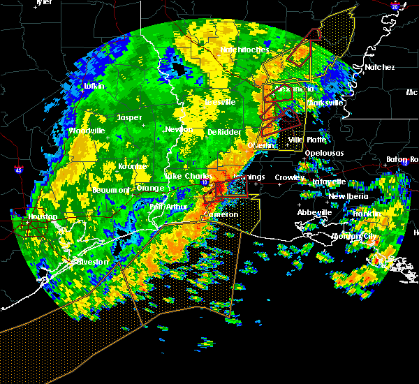 At 1231 am cdt, severe thunderstorms were located along a line extending from near hacketts corner to near cameron, moving east at 35 mph (radar indicated). Hazards include 60 mph wind gusts. expect damage to roofs, siding, and trees At 1231 am cdt, severe thunderstorms were located along a line extending from near hacketts corner to near cameron, moving east at 35 mph (radar indicated). Hazards include 60 mph wind gusts. expect damage to roofs, siding, and trees
|
| 7/3/2018 5:25 PM CDT | Cameron parish oep reports a travel trailer flipped on louisiana hwy 27. no injuries. report relayed by local tv statio in cameron county LA, 17.8 miles WSW of Cameron, LA |
| 10/22/2017 9:35 AM CDT |
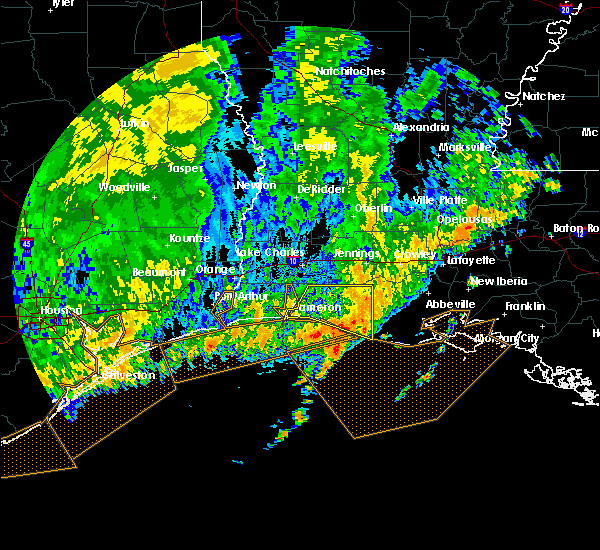 At 935 am cdt, severe thunderstorms were located along a line extending from near pecan island to 9 miles southwest of rockefeller wildlife range to 23 miles south of creole, moving southeast at 40 mph (radar indicated). Hazards include 60 mph wind gusts. Expect damage to roofs, siding, and trees. Locations impacted include, cameron, grand chenier, rockefeller wildlife range, creole and rutherford beach. At 935 am cdt, severe thunderstorms were located along a line extending from near pecan island to 9 miles southwest of rockefeller wildlife range to 23 miles south of creole, moving southeast at 40 mph (radar indicated). Hazards include 60 mph wind gusts. Expect damage to roofs, siding, and trees. Locations impacted include, cameron, grand chenier, rockefeller wildlife range, creole and rutherford beach.
|
| 10/22/2017 9:17 AM CDT | Weather station at wc-110 measured 74 mph wind gust. anemometer is located approx 80 feet above sf in gmz452 county LA, 19.2 miles N of Cameron, LA |
| 10/22/2017 9:13 AM CDT |
 At 913 am cdt, severe thunderstorms were located along a line extending from 12 miles south of klondike to near grand chenier to 14 miles south of cameron, moving southeast at 40 mph (radar indicated). Hazards include 60 mph wind gusts. expect damage to roofs, siding, and trees At 913 am cdt, severe thunderstorms were located along a line extending from 12 miles south of klondike to near grand chenier to 14 miles south of cameron, moving southeast at 40 mph (radar indicated). Hazards include 60 mph wind gusts. expect damage to roofs, siding, and trees
|
| 10/22/2017 8:50 AM CDT | Downed power lines block hwy 82 near holly beac in cameron county LA, 11.4 miles E of Cameron, LA |
| 10/22/2017 8:48 AM CDT |
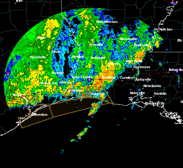 At 848 am cdt, severe thunderstorms were located along a line extending from lacassine national wildlife refuge to 6 miles southwest of gibbstown to near holly beach, moving southeast at 40 mph (radar indicated). Hazards include 60 mph wind gusts. expect damage to roofs, siding, and trees At 848 am cdt, severe thunderstorms were located along a line extending from lacassine national wildlife refuge to 6 miles southwest of gibbstown to near holly beach, moving southeast at 40 mph (radar indicated). Hazards include 60 mph wind gusts. expect damage to roofs, siding, and trees
|
| 8/28/2017 1:02 PM CDT |
 At 102 pm cdt, a severe thunderstorm capable of producing a tornado was located near holly beach, or near cameron, moving north at 20 mph (radar indicated rotation). Hazards include tornado. Flying debris will be dangerous to those caught without shelter. mobile homes will be damaged or destroyed. damage to roofs, windows, and vehicles will occur. tree damage is likely. This tornadic thunderstorm will remain over mainly rural areas of central cameron parish. At 102 pm cdt, a severe thunderstorm capable of producing a tornado was located near holly beach, or near cameron, moving north at 20 mph (radar indicated rotation). Hazards include tornado. Flying debris will be dangerous to those caught without shelter. mobile homes will be damaged or destroyed. damage to roofs, windows, and vehicles will occur. tree damage is likely. This tornadic thunderstorm will remain over mainly rural areas of central cameron parish.
|
| 5/3/2017 7:46 AM CDT |
 At 746 am cdt, severe thunderstorms were located along a line extending from near sabine national wildlife to near holly beach to 10 miles southwest of cameron, moving northeast at 35 mph (radar indicated). Hazards include golf ball size hail and 60 mph wind gusts. People and animals outdoors will be injured. expect hail damage to roofs, siding, windows, and vehicles. expect wind damage to roofs, siding, and trees. locations impacted include, cameron, johnsons bayou, sabine national wildlife, hackberry, holly beach and constance beach. A tornado watch remains in effect until 500 pm cdt for southwestern louisiana. At 746 am cdt, severe thunderstorms were located along a line extending from near sabine national wildlife to near holly beach to 10 miles southwest of cameron, moving northeast at 35 mph (radar indicated). Hazards include golf ball size hail and 60 mph wind gusts. People and animals outdoors will be injured. expect hail damage to roofs, siding, windows, and vehicles. expect wind damage to roofs, siding, and trees. locations impacted include, cameron, johnsons bayou, sabine national wildlife, hackberry, holly beach and constance beach. A tornado watch remains in effect until 500 pm cdt for southwestern louisiana.
|
| 5/3/2017 7:25 AM CDT |
 At 725 am cdt, severe thunderstorms were located along a line extending from near johnsons bayou to 16 miles southeast of sabine pass to 17 miles south of holly beach, moving northeast at 30 mph (radar indicated). Hazards include golf ball size hail and 60 mph wind gusts. People and animals outdoors will be injured. expect hail damage to roofs, siding, windows, and vehicles. Expect wind damage to roofs, siding, and trees. At 725 am cdt, severe thunderstorms were located along a line extending from near johnsons bayou to 16 miles southeast of sabine pass to 17 miles south of holly beach, moving northeast at 30 mph (radar indicated). Hazards include golf ball size hail and 60 mph wind gusts. People and animals outdoors will be injured. expect hail damage to roofs, siding, windows, and vehicles. Expect wind damage to roofs, siding, and trees.
|
| 5/3/2017 7:23 AM CDT | Sheriffs office relayed report of flipped rv with small shed damaged nearby in cameron county LA, 23.4 miles E of Cameron, LA |
| 3/29/2017 6:48 PM CDT |
 At 648 pm cdt, a severe thunderstorm was located near heberts marina, or near grand lake, moving north at 30 mph (radar indicated). Hazards include golf ball size hail and 60 mph wind gusts. People and animals outdoors will be injured. expect hail damage to roofs, siding, windows, and vehicles. expect wind damage to roofs, siding, and trees. locations impacted include, cameron, grand lake, sweet lake and hacketts corner. A tornado watch remains in effect until 900 pm cdt for southwestern louisiana. At 648 pm cdt, a severe thunderstorm was located near heberts marina, or near grand lake, moving north at 30 mph (radar indicated). Hazards include golf ball size hail and 60 mph wind gusts. People and animals outdoors will be injured. expect hail damage to roofs, siding, windows, and vehicles. expect wind damage to roofs, siding, and trees. locations impacted include, cameron, grand lake, sweet lake and hacketts corner. A tornado watch remains in effect until 900 pm cdt for southwestern louisiana.
|
| 3/29/2017 6:45 PM CDT |
 At 645 pm cdt, a severe thunderstorm was located near lacassine national wildlife refuge, moving northeast at 30 mph (radar indicated). Hazards include 60 mph wind gusts. Expect damage to roofs, siding, and trees. locations impacted include, grand chenier, lacassine national wildlife refuge, lowry, creole, gibbstown and rutherford beach. A tornado watch remains in effect until 900 pm cdt for southwestern louisiana. At 645 pm cdt, a severe thunderstorm was located near lacassine national wildlife refuge, moving northeast at 30 mph (radar indicated). Hazards include 60 mph wind gusts. Expect damage to roofs, siding, and trees. locations impacted include, grand chenier, lacassine national wildlife refuge, lowry, creole, gibbstown and rutherford beach. A tornado watch remains in effect until 900 pm cdt for southwestern louisiana.
|
| 3/29/2017 6:37 PM CDT |
 At 636 pm cdt, a severe thunderstorm was located near cameron, moving north at 30 mph (radar indicated). Hazards include golf ball size hail and 60 mph wind gusts. People and animals outdoors will be injured. expect hail damage to roofs, siding, windows, and vehicles. Expect wind damage to roofs, siding, and trees. At 636 pm cdt, a severe thunderstorm was located near cameron, moving north at 30 mph (radar indicated). Hazards include golf ball size hail and 60 mph wind gusts. People and animals outdoors will be injured. expect hail damage to roofs, siding, windows, and vehicles. Expect wind damage to roofs, siding, and trees.
|
| 3/29/2017 6:35 PM CDT | Golf Ball sized hail reported 2.5 miles W of Cameron, LA |
| 3/29/2017 6:07 PM CDT |
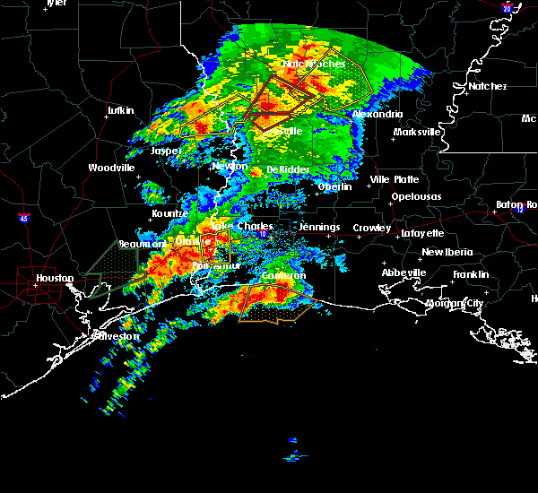 At 607 pm cdt, a severe thunderstorm was located near creole, or 10 miles southwest of grand chenier, moving northeast at 30 mph (radar indicated). Hazards include 60 mph wind gusts. expect damage to roofs, siding, and trees At 607 pm cdt, a severe thunderstorm was located near creole, or 10 miles southwest of grand chenier, moving northeast at 30 mph (radar indicated). Hazards include 60 mph wind gusts. expect damage to roofs, siding, and trees
|
| 4/27/2016 8:21 AM CDT |
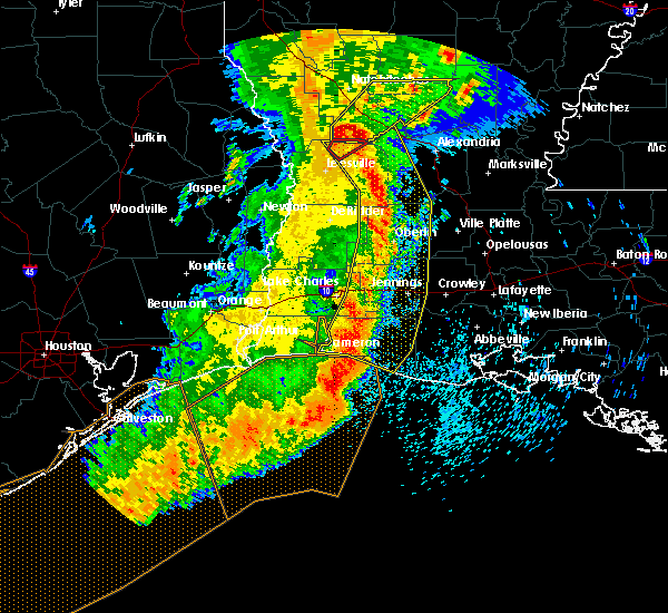 At 819 am cdt, severe thunderstorms were located along a line extending from near hutton to near elizabeth to near oberlin to near welsh to 6 miles north of grand chenier to 27 miles south of cameron, moving east at 45 mph (radar indicated). Hazards include 60 mph wind gusts and penny size hail. Expect damage to roofs. siding. and trees. trees have been reported down in vernon and calcasieu parishes. a wind gust of 70 mph was recorded at cameron. Locations impacted include, lake charles, jennings, oakdale, cameron, welsh, iowa, lake arthur, kinder, basile, oberlin, glenmora, elton, mermentau, elizabeth, fenton, reeves, lena, rockefeller wildlife range, sugartown and klondike. At 819 am cdt, severe thunderstorms were located along a line extending from near hutton to near elizabeth to near oberlin to near welsh to 6 miles north of grand chenier to 27 miles south of cameron, moving east at 45 mph (radar indicated). Hazards include 60 mph wind gusts and penny size hail. Expect damage to roofs. siding. and trees. trees have been reported down in vernon and calcasieu parishes. a wind gust of 70 mph was recorded at cameron. Locations impacted include, lake charles, jennings, oakdale, cameron, welsh, iowa, lake arthur, kinder, basile, oberlin, glenmora, elton, mermentau, elizabeth, fenton, reeves, lena, rockefeller wildlife range, sugartown and klondike.
|
| 4/27/2016 7:55 AM CDT | Cameron awos reported 61 knot wind gus in cameron county LA, 1.8 miles ENE of Cameron, LA |
| 4/27/2016 7:46 AM CDT |
 At 746 am cdt, severe thunderstorms were located along a line extending from near hornbeck to near rosepine to near longville to near moss bluff to 6 miles northeast of holly beach to 25 miles south of johnsons bayou, moving east at 45 mph (radar indicated). Hazards include 60 mph wind gusts and penny size hail. Expect damage to roofs. siding. And trees. At 746 am cdt, severe thunderstorms were located along a line extending from near hornbeck to near rosepine to near longville to near moss bluff to 6 miles northeast of holly beach to 25 miles south of johnsons bayou, moving east at 45 mph (radar indicated). Hazards include 60 mph wind gusts and penny size hail. Expect damage to roofs. siding. And trees.
|
| 4/27/2016 7:27 AM CDT |
 At 726 am cdt, severe thunderstorms were located along a line extending from near anacoco to near de ridder to longville to sulphur to 16 miles south of johnsons bayou, moving east at 45 mph (radar indicated). Hazards include 60 mph wind gusts and penny size hail. Expect damage to roofs. siding. and trees. Locations impacted include, lake charles, sulphur, cameron, leesville, westlake, iowa, rosepine, anacoco, reeves, moss bluff, lake charles regional airport, mittie, dry creek, pitkin, ragley, fort polk, sabine national wildlife, sugartown, slagle and grand lake. At 726 am cdt, severe thunderstorms were located along a line extending from near anacoco to near de ridder to longville to sulphur to 16 miles south of johnsons bayou, moving east at 45 mph (radar indicated). Hazards include 60 mph wind gusts and penny size hail. Expect damage to roofs. siding. and trees. Locations impacted include, lake charles, sulphur, cameron, leesville, westlake, iowa, rosepine, anacoco, reeves, moss bluff, lake charles regional airport, mittie, dry creek, pitkin, ragley, fort polk, sabine national wildlife, sugartown, slagle and grand lake.
|
| 4/27/2016 6:47 AM CDT |
 At 646 am cdt, severe thunderstorms were located along a line extending from 8 miles southeast of pineland to newton to near bancroft to mauriceville to 12 miles east of high island, moving east at 45 mph (radar indicated). Hazards include 60 mph wind gusts and quarter size hail. Hail damage to vehicles is expected. Expect wind damage to roofs, siding, and trees. At 646 am cdt, severe thunderstorms were located along a line extending from 8 miles southeast of pineland to newton to near bancroft to mauriceville to 12 miles east of high island, moving east at 45 mph (radar indicated). Hazards include 60 mph wind gusts and quarter size hail. Hail damage to vehicles is expected. Expect wind damage to roofs, siding, and trees.
|
| 12/13/2015 1:02 PM CST |
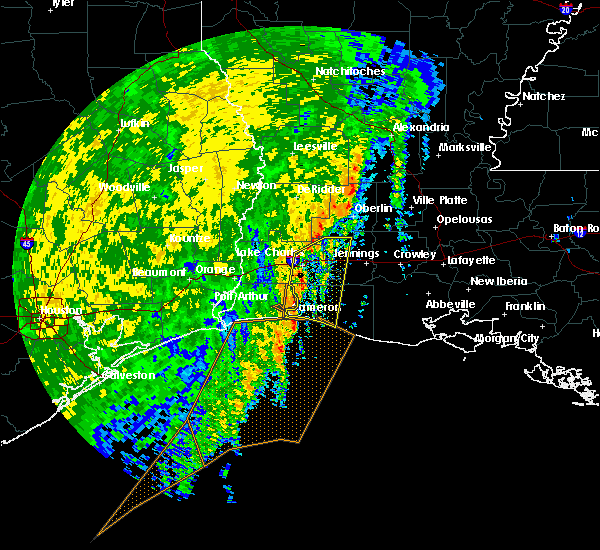 The national weather service in lake charles has issued a * severe thunderstorm warning for. northeastern cameron parish in southwestern louisiana. central jefferson davis parish in southwestern louisiana. southeastern calcasieu parish in southwestern louisiana. Until 130 pm cst. The national weather service in lake charles has issued a * severe thunderstorm warning for. northeastern cameron parish in southwestern louisiana. central jefferson davis parish in southwestern louisiana. southeastern calcasieu parish in southwestern louisiana. Until 130 pm cst.
|
| 8/12/2015 5:38 PM CDT |
 At 537 pm cdt, doppler radar indicated a line of severe thunderstorms capable of producing damaging winds in excess of 60 mph. these storms were located along a line extending from near hackberry to 6 miles east of cameron to near creole to near grand chenier, moving south at 20 mph. locations impacted include, cameron, grand chenier, creole, holly beach and rutherford beach. At 537 pm cdt, doppler radar indicated a line of severe thunderstorms capable of producing damaging winds in excess of 60 mph. these storms were located along a line extending from near hackberry to 6 miles east of cameron to near creole to near grand chenier, moving south at 20 mph. locations impacted include, cameron, grand chenier, creole, holly beach and rutherford beach.
|
| 8/12/2015 5:07 PM CDT |
 At 507 pm cdt, doppler radar indicated a line of severe thunderstorms capable of producing damaging winds in excess of 60 mph. these storms were located along a line extending from near hackberry to near gibbstown to 7 miles north of grand chenier to 6 miles southeast of lacassine national wildlife refuge, and moving south at 20 mph. At 507 pm cdt, doppler radar indicated a line of severe thunderstorms capable of producing damaging winds in excess of 60 mph. these storms were located along a line extending from near hackberry to near gibbstown to 7 miles north of grand chenier to 6 miles southeast of lacassine national wildlife refuge, and moving south at 20 mph.
|
| 8/12/2015 4:58 PM CDT |
 At 458 pm cdt, doppler radar indicated a line of severe thunderstorms capable of producing damaging winds in excess of 60 mph. these storms were located along a line extending from near carlyss to near heberts marina to near sweet lake, moving southwest at 20 mph. locations impacted include, lake charles, sabine national wildlife, grand lake, holly beach, hackberry and sweet lake. At 458 pm cdt, doppler radar indicated a line of severe thunderstorms capable of producing damaging winds in excess of 60 mph. these storms were located along a line extending from near carlyss to near heberts marina to near sweet lake, moving southwest at 20 mph. locations impacted include, lake charles, sabine national wildlife, grand lake, holly beach, hackberry and sweet lake.
|
| 8/12/2015 4:41 PM CDT |
 At 440 pm cdt, doppler radar indicated a line of severe thunderstorms capable of producing damaging winds in excess of 60 mph. these storms were located along a line extending from near carlyss to near grand lake, and moving southwest at 25 mph. At 440 pm cdt, doppler radar indicated a line of severe thunderstorms capable of producing damaging winds in excess of 60 mph. these storms were located along a line extending from near carlyss to near grand lake, and moving southwest at 25 mph.
|
| 6/9/2015 6:33 PM CDT |
 At 632 pm cdt, doppler radar indicated a line of severe thunderstorms capable of producing damaging winds in excess of 60 mph. these storms were located along a line extending from near hackberry to 8 miles northeast of holly beach to near cameron, moving west at 20 mph. locations impacted include, cameron, sabine national wildlife, holly beach, creole, hackberry and rutherford beach. At 632 pm cdt, doppler radar indicated a line of severe thunderstorms capable of producing damaging winds in excess of 60 mph. these storms were located along a line extending from near hackberry to 8 miles northeast of holly beach to near cameron, moving west at 20 mph. locations impacted include, cameron, sabine national wildlife, holly beach, creole, hackberry and rutherford beach.
|
| 6/9/2015 5:55 PM CDT |
 At 554 pm cdt, doppler radar indicated a line of severe thunderstorms capable of producing damaging winds in excess of 60 mph. these storms were located along a line extending from near carlyss to near creole to 10 miles south of grand chenier, and moving west at 20 mph. At 554 pm cdt, doppler radar indicated a line of severe thunderstorms capable of producing damaging winds in excess of 60 mph. these storms were located along a line extending from near carlyss to near creole to 10 miles south of grand chenier, and moving west at 20 mph.
|
| 5/27/2015 7:27 AM CDT | At 726 am cdt, doppler radar indicated a line of severe thunderstorms capable of producing quarter size hail and damaging winds in excess of 60 mph. these storms were located along a line extending from near poland to cameron, and moving southeast at 25 mph. |
| 5/27/2015 7:11 AM CDT | At 710 am cdt, doppler radar indicated a line of severe thunderstorms capable of producing quarter size hail and damaging winds in excess of 60 mph. these storms were located along a line extending from near buller to near lake charles regional airport to 8 miles southeast of high island, moving southeast at 25 mph. locations impacted include, lake charles, sulphur, cameron, westlake, welsh, vinton, iowa, fenton, moss bluff, lake charles regional airport, sabine national wildlife, johnsons bayou, lacassine national wildlife refuge, hayes, grand lake, gillis, buller, gibbstown, pine island and holmwood. |
| 5/27/2015 6:38 AM CDT | At 637 am cdt, doppler radar indicated a line of severe thunderstorms capable of producing quarter size hail and damaging winds in excess of 60 mph. these storms were located along a line extending from near buhler to carlyss to near high island, and moving southeast at 20 mph. |
| 5/27/2015 6:38 AM CDT | At 637 am cdt, doppler radar indicated a line of severe thunderstorms capable of producing quarter size hail and damaging winds in excess of 60 mph. these storms were located along a line extending from near buhler to carlyss to near high island, and moving southeast at 20 mph. |
| 5/26/2015 12:52 AM CDT | The severe thunderstorm warning for calcasieu, northwestern cameron, jefferson davis, southeastern beauregard, eastern rapides, central st. landry, evangeline, avoyelles, acadia and southeastern allen parishes, southeastern orange and southeastern jefferson counties will expire at 100 am cdt, the storms which prompted the warning have weakened below severe limits and exited the warned area. therefore the warning will be allowed to expire. however gusty winds are still possible with these thunderstorms. |
| 5/26/2015 12:52 AM CDT | The severe thunderstorm warning for calcasieu, northwestern cameron, jefferson davis, southeastern beauregard, eastern rapides, central st. landry, evangeline, avoyelles, acadia and southeastern allen parishes, southeastern orange and southeastern jefferson counties will expire at 100 am cdt, the storms which prompted the warning have weakened below severe limits and exited the warned area. therefore the warning will be allowed to expire. however gusty winds are still possible with these thunderstorms. |
| 5/25/2015 11:29 PM CDT | At 1128 pm cdt, doppler radar indicated a line of severe thunderstorms capable of producing quarter size hail and damaging winds in excess of 60 mph. these storms were located along a line extending from esler regional airport to near elton to near port arthur, and moving southeast at 15 mph. |
| 5/25/2015 11:29 PM CDT | At 1128 pm cdt, doppler radar indicated a line of severe thunderstorms capable of producing quarter size hail and damaging winds in excess of 60 mph. these storms were located along a line extending from esler regional airport to near elton to near port arthur, and moving southeast at 15 mph. |
| 4/25/2015 10:10 AM CDT | Report from platform in west cameron block 110 in gmz452 county LA, 18.5 miles N of Cameron, LA |
| 7/18/2014 2:48 AM CDT | Wind gust of 51 kt recorded at capl in cameron county LA, 4.3 miles ENE of Cameron, LA |
| 7/20/2012 10:00 PM CDT | Sheriffs dept reports large tree down on roa in cameron county LA, 18.1 miles W of Cameron, LA |
| 5/22/2012 5:15 PM CDT | Wind damage reported to a house in creol in cameron county LA, 9.7 miles W of Cameron, LA |
| 5/22/2012 5:10 PM CDT | Wind damage reported to a barn near creol in cameron county LA, 9.7 miles W of Cameron, LA |
| 5/22/2012 5:01 PM CDT | Quarter sized hail reported 10.1 miles WSW of Cameron, LA, nickel to quarter size hail reported by sheriffs deputy on highway 27 north of creole. |
| 5/22/2012 4:58 PM CDT | Quarter sized hail reported 18.1 miles W of Cameron, LA, nickel to quarter size hail reported near grand chenier |
| 1/1/0001 12:00 AM | Quarter sized hail reported 18.1 miles S of Cameron, LA |
| 1/1/0001 12:00 AM | Golf Ball sized hail reported 16.7 miles S of Cameron, LA, reported near calcam line road. |
| 1/1/0001 12:00 AM | Quarter sized hail reported 18.1 miles S of Cameron, LA |
Hail Maps for Cameron, LA


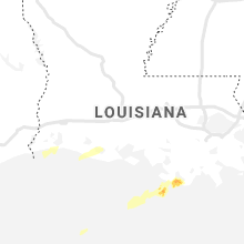


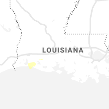


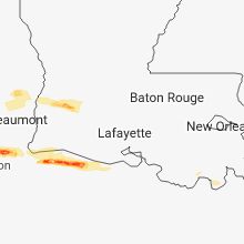


Connect with Interactive Hail Maps