

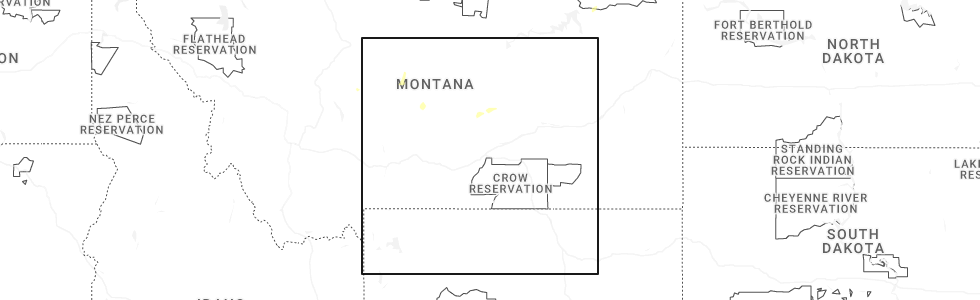
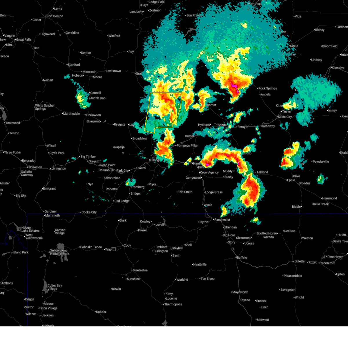
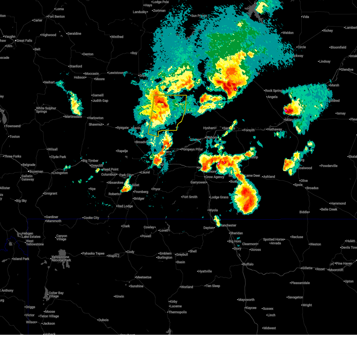
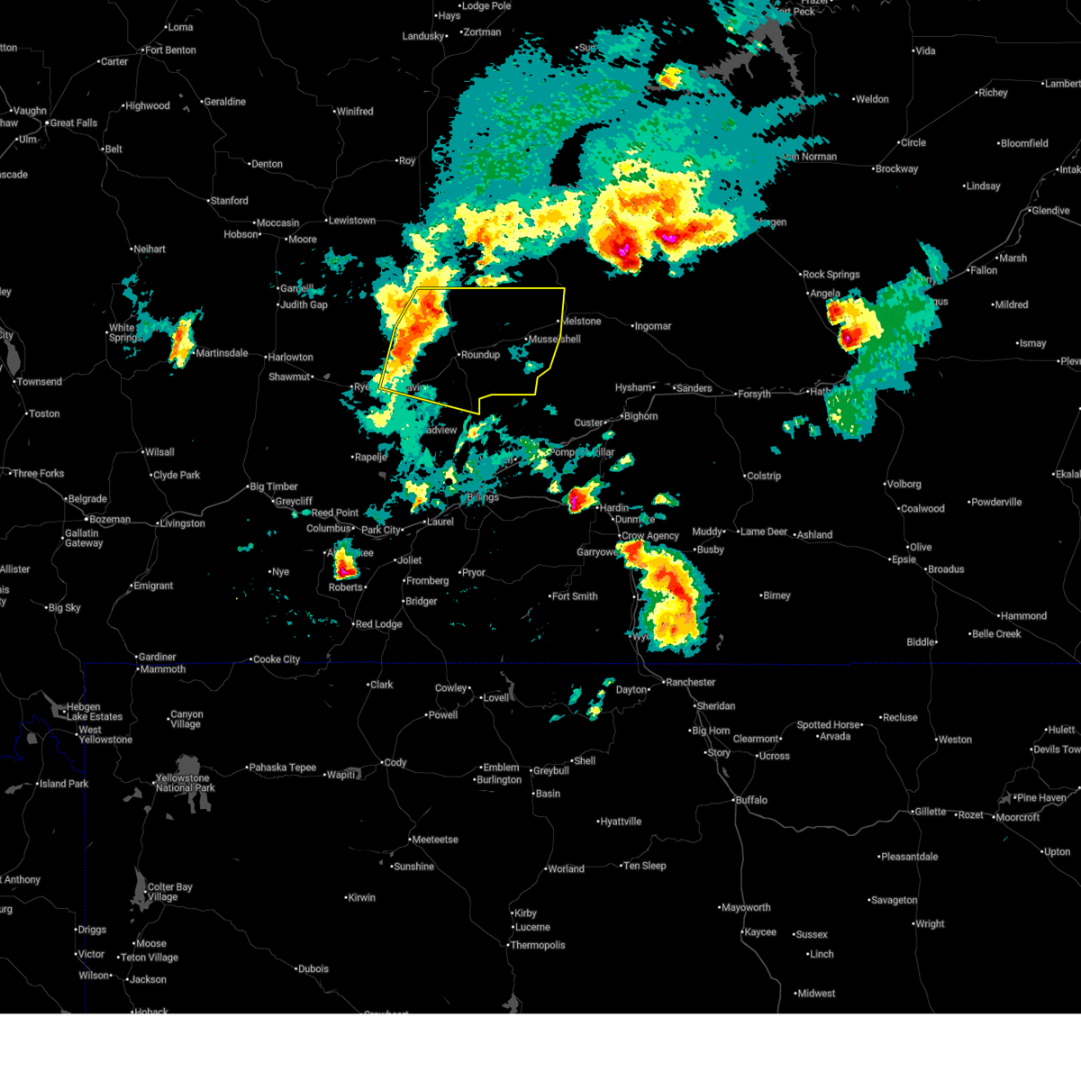
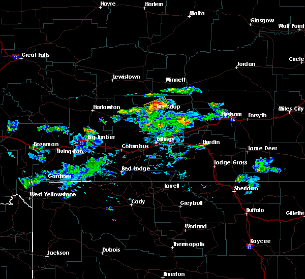
Hail Map for Camp Three, MT
The Camp Three, MT area has had 0 reports of on-the-ground hail by trained spotters, and has been under severe weather warnings 4 times during the past 12 months. Doppler radar has detected hail at or near Camp Three, MT on 44 occasions, including 2 occasions during the past year.
| Name: | Camp Three, MT |
| Where Located: | 45.7 miles N of Billings, MT |
| Map: | Google Map for Camp Three, MT |
| Population: | 173 |
| Housing Units: | 115 |
| More Info: | Search Google for Camp Three, MT |
1
The Top Recent Hail Date for Camp Three, MT is Thursday, June 26, 2025 (17th out of 44)
Hail and Wind Damage Spotted near Camp Three, MT
| Date / Time | Report Details |
|---|---|
| 6/15/2025 9:04 PM MDT |
 the severe thunderstorm warning has been cancelled and is no longer in effect the severe thunderstorm warning has been cancelled and is no longer in effect
|
| 6/15/2025 8:42 PM MDT |
 the severe thunderstorm warning has been cancelled and is no longer in effect the severe thunderstorm warning has been cancelled and is no longer in effect
|
| 6/15/2025 8:42 PM MDT |
 At 842 pm mdt, severe thunderstorms were located along a line from 19 miles northeast of roundup to 15 miles south of roundup, moving east at 40 mph (radar indicated). Hazards include 60 mph wind gusts and quarter size hail. Hail damage to vehicles is expected. expect wind damage to roofs, siding, and trees. Locations impacted include, roundup, melstone, musselshell and klein. At 842 pm mdt, severe thunderstorms were located along a line from 19 miles northeast of roundup to 15 miles south of roundup, moving east at 40 mph (radar indicated). Hazards include 60 mph wind gusts and quarter size hail. Hail damage to vehicles is expected. expect wind damage to roofs, siding, and trees. Locations impacted include, roundup, melstone, musselshell and klein.
|
| 6/15/2025 8:10 PM MDT |
 Svrbyz the national weather service in billings has issued a * severe thunderstorm warning for, east central golden valley county in central montana, musselshell county in central montana, * until 915 pm mdt. * at 810 pm mdt, severe thunderstorms were located along a line from 22 miles north of roundup to 18 miles southwest of roundup, moving east at 40 mph (radar indicated). Hazards include 60 mph wind gusts and half dollar size hail. Hail damage to vehicles is expected. Expect wind damage to roofs, siding, and trees. Svrbyz the national weather service in billings has issued a * severe thunderstorm warning for, east central golden valley county in central montana, musselshell county in central montana, * until 915 pm mdt. * at 810 pm mdt, severe thunderstorms were located along a line from 22 miles north of roundup to 18 miles southwest of roundup, moving east at 40 mph (radar indicated). Hazards include 60 mph wind gusts and half dollar size hail. Hail damage to vehicles is expected. Expect wind damage to roofs, siding, and trees.
|
| 6/1/2023 8:00 PM MDT |
 At 758 pm mdt, a severe thunderstorm was located near roundup, and is nearly stationary (radar indicated). Hazards include 60 mph wind gusts and quarter size hail. Hail damage to vehicles is expected. expect wind damage to roofs, siding, and trees. locations impacted include, roundup and klein. hail threat, radar indicated max hail size, 1. 00 in wind threat, radar indicated max wind gust, 60 mph. At 758 pm mdt, a severe thunderstorm was located near roundup, and is nearly stationary (radar indicated). Hazards include 60 mph wind gusts and quarter size hail. Hail damage to vehicles is expected. expect wind damage to roofs, siding, and trees. locations impacted include, roundup and klein. hail threat, radar indicated max hail size, 1. 00 in wind threat, radar indicated max wind gust, 60 mph.
|
| 6/1/2023 7:42 PM MDT |
 At 742 pm mdt, a severe thunderstorm was located near roundup, and is nearly stationary (radar indicated). Hazards include 60 mph wind gusts and quarter size hail. Hail damage to vehicles is expected. Expect wind damage to roofs, siding, and trees. At 742 pm mdt, a severe thunderstorm was located near roundup, and is nearly stationary (radar indicated). Hazards include 60 mph wind gusts and quarter size hail. Hail damage to vehicles is expected. Expect wind damage to roofs, siding, and trees.
|
| 5/25/2023 6:12 PM MDT |
 At 611 pm mdt, severe thunderstorms were located along a line extending from 7 miles west of roundup to 28 miles north of shepherd, moving north at 15 mph (radar indicated). Hazards include 60 mph wind gusts and quarter size hail along with torrential rainfall. Hail damage to vehicles is expected. expect wind damage to roofs, siding, and trees. Heavy rain will cause ponding of water on roadways and in low-lying areas. At 611 pm mdt, severe thunderstorms were located along a line extending from 7 miles west of roundup to 28 miles north of shepherd, moving north at 15 mph (radar indicated). Hazards include 60 mph wind gusts and quarter size hail along with torrential rainfall. Hail damage to vehicles is expected. expect wind damage to roofs, siding, and trees. Heavy rain will cause ponding of water on roadways and in low-lying areas.
|
| 9/7/2022 5:00 PM MDT |
 At 458 pm mdt, thunderstorms producing severe wind gusts were located along a line extending from near roundup to 17 miles northeast of pryor, moving east at 35 mph (radar indicated). Hazards include 60 mph wind gusts. gusts to 58 mph have been reported in the billings area with this activity. Expect damage to roofs, siding, and trees. areas of blowing dust will reduce visibility to under a mile at times. these severe thunderstorms will remain over mainly rural areas of north central big horn, musselshell and yellowstone counties, including the following locations, pompeys pillar, klein and musselshell. hail threat, radar indicated max hail size, <. 75 in wind threat, radar indicated max wind gust, 60 mph. At 458 pm mdt, thunderstorms producing severe wind gusts were located along a line extending from near roundup to 17 miles northeast of pryor, moving east at 35 mph (radar indicated). Hazards include 60 mph wind gusts. gusts to 58 mph have been reported in the billings area with this activity. Expect damage to roofs, siding, and trees. areas of blowing dust will reduce visibility to under a mile at times. these severe thunderstorms will remain over mainly rural areas of north central big horn, musselshell and yellowstone counties, including the following locations, pompeys pillar, klein and musselshell. hail threat, radar indicated max hail size, <. 75 in wind threat, radar indicated max wind gust, 60 mph.
|
| 9/7/2022 4:28 PM MDT |
 At 427 pm mdt, severe thunderstorms were located along a line extending from 10 miles northeast of ryegate to 9 miles northwest of pryor, moving northeast at 35 mph (radar indicated. gusts to 58 mph have been reported along this line). Hazards include 60 mph wind gusts. Expect damage to roofs, siding, and trees. severe thunderstorms will be near, billings around 435 pm mdt roundup around 510 pm mdt. other locations impacted by these severe thunderstorms include laurel, pompeys pillar, acton, musselshell, lavina, klein, broadview and comanche. this replaces the warning previously in effect for this area. hail threat, radar indicated max hail size, <. 75 in wind threat, radar indicated max wind gust, 60 mph. At 427 pm mdt, severe thunderstorms were located along a line extending from 10 miles northeast of ryegate to 9 miles northwest of pryor, moving northeast at 35 mph (radar indicated. gusts to 58 mph have been reported along this line). Hazards include 60 mph wind gusts. Expect damage to roofs, siding, and trees. severe thunderstorms will be near, billings around 435 pm mdt roundup around 510 pm mdt. other locations impacted by these severe thunderstorms include laurel, pompeys pillar, acton, musselshell, lavina, klein, broadview and comanche. this replaces the warning previously in effect for this area. hail threat, radar indicated max hail size, <. 75 in wind threat, radar indicated max wind gust, 60 mph.
|
| 7/9/2022 9:17 PM MDT |
 At 916 pm mdt, a severe thunderstorm was located 9 miles northeast of roundup, moving east at 45 mph (radar indicated). Hazards include 60 mph wind gusts and quarter size hail. hail damage to vehicles, wind damage to roofs, siding, and trees At 916 pm mdt, a severe thunderstorm was located 9 miles northeast of roundup, moving east at 45 mph (radar indicated). Hazards include 60 mph wind gusts and quarter size hail. hail damage to vehicles, wind damage to roofs, siding, and trees
|
| 7/9/2022 8:45 PM MDT | Storm damage reported in musselshell county MT, 12.3 miles SE of Camp Three, MT |
| 7/7/2021 7:24 PM MDT |
 At 723 pm mdt, severe thunderstorms were located along a line extending from 12 miles southwest of flatwillow to near worden to 8 miles southeast of lockwood to 8 miles south of pryor, moving east at 40 mph (radar indicated. at 710 pm a gust of 73 mph was reported at the billings airport). Hazards include 75 mph wind gusts. Expect considerable tree damage. Damage is likely to mobile homes, roofs, and outbuildings. At 723 pm mdt, severe thunderstorms were located along a line extending from 12 miles southwest of flatwillow to near worden to 8 miles southeast of lockwood to 8 miles south of pryor, moving east at 40 mph (radar indicated. at 710 pm a gust of 73 mph was reported at the billings airport). Hazards include 75 mph wind gusts. Expect considerable tree damage. Damage is likely to mobile homes, roofs, and outbuildings.
|
| 7/7/2021 7:17 PM MDT |
 At 715 pm mdt, severe thunderstorms were located along a line extending from 15 miles southwest of flatwillow to 17 miles south of roundup to near lockwood to 6 miles southwest of pryor, moving east at 45 mph (radar indicated. at 710 pm a gust of 73 mph was reported at the billings airport). Hazards include 75 mph wind gusts. Expect considerable tree damage. damage is likely to mobile homes, roofs, and outbuildings. Locations impacted include, billings, roundup, laurel, fromberg, lockwood, huntley, pryor, shepherd, billings heights, worden, billings west end, ballantine, broadview, edgar, silesia, acton, rockvale, klein and comanche. At 715 pm mdt, severe thunderstorms were located along a line extending from 15 miles southwest of flatwillow to 17 miles south of roundup to near lockwood to 6 miles southwest of pryor, moving east at 45 mph (radar indicated. at 710 pm a gust of 73 mph was reported at the billings airport). Hazards include 75 mph wind gusts. Expect considerable tree damage. damage is likely to mobile homes, roofs, and outbuildings. Locations impacted include, billings, roundup, laurel, fromberg, lockwood, huntley, pryor, shepherd, billings heights, worden, billings west end, ballantine, broadview, edgar, silesia, acton, rockvale, klein and comanche.
|
| 7/7/2021 7:01 PM MDT |
 At 700 pm mdt, severe thunderstorms were located along a line extending from 23 miles south of grass range to 19 miles southwest of roundup to near billings west end to fromberg, moving east at 50 mph (radar indicated. 68 mph wind gust reported in molt with this line of severe storms). Hazards include 70 mph wind gusts and penny size hail. Expect considerable tree damage. damage is likely to mobile homes, roofs, and outbuildings. Locations impacted include, billings, roundup, laurel, bridger, joliet, fromberg, lockwood, huntley, pryor, shepherd, billings heights, worden, billings west end, ballantine, broadview, lavina, edgar, molt, silesia and acton. At 700 pm mdt, severe thunderstorms were located along a line extending from 23 miles south of grass range to 19 miles southwest of roundup to near billings west end to fromberg, moving east at 50 mph (radar indicated. 68 mph wind gust reported in molt with this line of severe storms). Hazards include 70 mph wind gusts and penny size hail. Expect considerable tree damage. damage is likely to mobile homes, roofs, and outbuildings. Locations impacted include, billings, roundup, laurel, bridger, joliet, fromberg, lockwood, huntley, pryor, shepherd, billings heights, worden, billings west end, ballantine, broadview, lavina, edgar, molt, silesia and acton.
|
| 7/7/2021 6:35 PM MDT |
 At 634 pm mdt, severe thunderstorms were located along a line extending from 24 miles north of deadmans basin reservoir to 9 miles southeast of ryegate to 10 miles east of columbus to 12 miles north of red lodge, moving east at 50 mph (radar indicated). Hazards include 60 mph wind gusts. penny size hail is possible with the strongest storms along this line. expect damage to roofs, siding, and trees At 634 pm mdt, severe thunderstorms were located along a line extending from 24 miles north of deadmans basin reservoir to 9 miles southeast of ryegate to 10 miles east of columbus to 12 miles north of red lodge, moving east at 50 mph (radar indicated). Hazards include 60 mph wind gusts. penny size hail is possible with the strongest storms along this line. expect damage to roofs, siding, and trees
|
| 6/10/2021 4:29 PM MDT |
 At 428 pm mdt, severe thunderstorms were located along a line extending from 14 miles southwest of flatwillow to 20 miles southeast of roundup, moving northeast at 30 mph (radar indicated). Hazards include ping pong ball size hail and 60 mph wind gusts. People and animals outdoors will be injured. expect hail damage to roofs, siding, windows, and vehicles. Expect wind damage to roofs, siding, and trees. At 428 pm mdt, severe thunderstorms were located along a line extending from 14 miles southwest of flatwillow to 20 miles southeast of roundup, moving northeast at 30 mph (radar indicated). Hazards include ping pong ball size hail and 60 mph wind gusts. People and animals outdoors will be injured. expect hail damage to roofs, siding, windows, and vehicles. Expect wind damage to roofs, siding, and trees.
|
| 6/10/2021 4:20 PM MDT |
 At 418 pm mdt, severe thunderstorms were located along a line extending from 9 miles southwest of flatwillow to near roundup to 20 miles north of worden, moving northeast at 15 mph (trained weather spotters. spotter 17 miles southeast of roundup reported quarter size hail at 349 pm). Hazards include 60 mph wind gusts and quarter size hail. Hail damage to vehicles is expected. expect wind damage to roofs, siding, and trees. Locations impacted include, roundup, musselshell and klein. At 418 pm mdt, severe thunderstorms were located along a line extending from 9 miles southwest of flatwillow to near roundup to 20 miles north of worden, moving northeast at 15 mph (trained weather spotters. spotter 17 miles southeast of roundup reported quarter size hail at 349 pm). Hazards include 60 mph wind gusts and quarter size hail. Hail damage to vehicles is expected. expect wind damage to roofs, siding, and trees. Locations impacted include, roundup, musselshell and klein.
|
| 6/10/2021 3:58 PM MDT |
 At 357 pm mdt, a line of severe thunderstorms were located in northern yellowstone county through western musselshell county, moving northeast at 35 mph (trained weather spotters. spotter 17 miles southeast of roundup reported quarter size hail at 349 pm). Hazards include 60 mph wind gusts and quarter size hail. Hail damage to vehicles is expected. expect wind damage to roofs, siding, and trees. Locations impacted include, roundup, musselshell and klein. At 357 pm mdt, a line of severe thunderstorms were located in northern yellowstone county through western musselshell county, moving northeast at 35 mph (trained weather spotters. spotter 17 miles southeast of roundup reported quarter size hail at 349 pm). Hazards include 60 mph wind gusts and quarter size hail. Hail damage to vehicles is expected. expect wind damage to roofs, siding, and trees. Locations impacted include, roundup, musselshell and klein.
|
| 6/10/2021 3:47 PM MDT |
 At 345 pm mdt, a line of severe thunderstorms were located in northern yellowstone county through western musselshell county, moving northeast at 35 mph (radar indicated). Hazards include 60 mph wind gusts and quarter size hail. Hail damage to vehicles is expected. Expect wind damage to roofs, siding, and trees. At 345 pm mdt, a line of severe thunderstorms were located in northern yellowstone county through western musselshell county, moving northeast at 35 mph (radar indicated). Hazards include 60 mph wind gusts and quarter size hail. Hail damage to vehicles is expected. Expect wind damage to roofs, siding, and trees.
|
| 7/7/2020 4:34 PM MDT |
 At 433 pm mdt, a severe thunderstorm was located near roundup, moving northeast at 35 mph (radar indicated). Hazards include 60 mph wind gusts and quarter size hail. Hail damage to vehicles is expected. expect wind damage to roofs, siding, and trees. Locations impacted include, roundup, musselshell and klein. At 433 pm mdt, a severe thunderstorm was located near roundup, moving northeast at 35 mph (radar indicated). Hazards include 60 mph wind gusts and quarter size hail. Hail damage to vehicles is expected. expect wind damage to roofs, siding, and trees. Locations impacted include, roundup, musselshell and klein.
|
| 7/7/2020 4:14 PM MDT |
 At 414 pm mdt, a severe thunderstorm was located 13 miles southwest of roundup, moving northeast at 60 mph (radar indicated). Hazards include two inch hail and 60 mph wind gusts. People and animals outdoors will be injured. expect hail damage to roofs, siding, windows, and vehicles. expect wind damage to roofs, siding, and trees. Locations impacted include, roundup, musselshell, lavina and klein. At 414 pm mdt, a severe thunderstorm was located 13 miles southwest of roundup, moving northeast at 60 mph (radar indicated). Hazards include two inch hail and 60 mph wind gusts. People and animals outdoors will be injured. expect hail damage to roofs, siding, windows, and vehicles. expect wind damage to roofs, siding, and trees. Locations impacted include, roundup, musselshell, lavina and klein.
|
| 7/7/2020 3:42 PM MDT |
 At 340 pm mdt, a severe thunderstorm was located near ryegate, or 33 miles southeast of harlowton, moving northeast at 35 mph (trained spotters). Hazards include two inch hail and 60 mph wind gusts. People and animals outdoors will be injured. expect hail damage to roofs, siding, windows, and vehicles. Expect wind damage to roofs, siding, and trees. At 340 pm mdt, a severe thunderstorm was located near ryegate, or 33 miles southeast of harlowton, moving northeast at 35 mph (trained spotters). Hazards include two inch hail and 60 mph wind gusts. People and animals outdoors will be injured. expect hail damage to roofs, siding, windows, and vehicles. Expect wind damage to roofs, siding, and trees.
|
| 5/20/2020 1:43 AM MDT |
 The severe thunderstorm warning for west central musselshell and northeastern golden valley counties will expire at 145 am mdt, the storm which prompted the warning has weakened below severe limits, and no longer poses an immediate threat to life or property. therefore, the warning will be allowed to expire. however penny sized hail and heavy rain are still possible with this thunderstorm. The severe thunderstorm warning for west central musselshell and northeastern golden valley counties will expire at 145 am mdt, the storm which prompted the warning has weakened below severe limits, and no longer poses an immediate threat to life or property. therefore, the warning will be allowed to expire. however penny sized hail and heavy rain are still possible with this thunderstorm.
|
| 5/20/2020 1:21 AM MDT |
 At 121 am mdt, a severe thunderstorm was located 14 miles northeast of ryegate, or 21 miles west of roundup, moving northeast at 45 mph (trained weather spotters). Hazards include 60 mph wind gusts and quarter size hail. Hail damage to vehicles is expected. expect wind damage to roofs, siding, and trees. Locations impacted include, lavina. At 121 am mdt, a severe thunderstorm was located 14 miles northeast of ryegate, or 21 miles west of roundup, moving northeast at 45 mph (trained weather spotters). Hazards include 60 mph wind gusts and quarter size hail. Hail damage to vehicles is expected. expect wind damage to roofs, siding, and trees. Locations impacted include, lavina.
|
| 5/20/2020 12:55 AM MDT |
 At 1254 am mdt, a severe thunderstorm was located 10 miles south of ryegate, or 36 miles north of columbus, moving northeast at 40 mph (trained weather spotters). Hazards include 60 mph wind gusts and half dollar size hail. Hail damage to vehicles is expected. Expect wind damage to roofs, siding, and trees. At 1254 am mdt, a severe thunderstorm was located 10 miles south of ryegate, or 36 miles north of columbus, moving northeast at 40 mph (trained weather spotters). Hazards include 60 mph wind gusts and half dollar size hail. Hail damage to vehicles is expected. Expect wind damage to roofs, siding, and trees.
|
| 8/11/2019 6:49 PM MDT |
 At 634 pm mdt, a severe thunderstorm was located 11 miles east of ryegate, or 25 miles southwest of roundup, moving east at 40 mph (radar indicated). Hazards include 60 mph wind gusts and half dollar size hail. Hail damage to vehicles is expected. Expect wind damage to roofs, siding, and trees. At 634 pm mdt, a severe thunderstorm was located 11 miles east of ryegate, or 25 miles southwest of roundup, moving east at 40 mph (radar indicated). Hazards include 60 mph wind gusts and half dollar size hail. Hail damage to vehicles is expected. Expect wind damage to roofs, siding, and trees.
|
| 8/11/2019 6:35 PM MDT |
 At 634 pm mdt, a severe thunderstorm was located 11 miles east of ryegate, or 25 miles southwest of roundup, moving east at 40 mph (radar indicated). Hazards include 60 mph wind gusts and half dollar size hail. Hail damage to vehicles is expected. Expect wind damage to roofs, siding, and trees. At 634 pm mdt, a severe thunderstorm was located 11 miles east of ryegate, or 25 miles southwest of roundup, moving east at 40 mph (radar indicated). Hazards include 60 mph wind gusts and half dollar size hail. Hail damage to vehicles is expected. Expect wind damage to roofs, siding, and trees.
|
| 7/11/2019 6:49 PM MDT |
 At 649 pm mdt, a severe thunderstorm was located 9 miles north of roundup, moving northeast at 40 mph (radar indicated). Hazards include 60 mph wind gusts and half dollar size hail. Hail damage to vehicles is expected. expect wind damage to roofs, siding, and trees. This severe thunderstorm will remain over mainly rural areas of northwestern musselshell county. At 649 pm mdt, a severe thunderstorm was located 9 miles north of roundup, moving northeast at 40 mph (radar indicated). Hazards include 60 mph wind gusts and half dollar size hail. Hail damage to vehicles is expected. expect wind damage to roofs, siding, and trees. This severe thunderstorm will remain over mainly rural areas of northwestern musselshell county.
|
| 7/11/2019 6:23 PM MDT |
 At 622 pm mdt, a severe thunderstorm was located 13 miles west of roundup, moving east at 50 mph (radar indicated). Hazards include 60 mph wind gusts and half dollar size hail. Hail damage to vehicles is expected. Expect wind damage to roofs, siding, and trees. At 622 pm mdt, a severe thunderstorm was located 13 miles west of roundup, moving east at 50 mph (radar indicated). Hazards include 60 mph wind gusts and half dollar size hail. Hail damage to vehicles is expected. Expect wind damage to roofs, siding, and trees.
|
| 6/14/2019 2:04 PM MDT |
 At 204 pm mdt, a severe thunderstorm was located near roundup, moving south at 15 mph (radar indicated). Hazards include 60 mph wind gusts and half dollar size hail. Hail damage to vehicles is expected. Expect wind damage to roofs, siding, and trees. At 204 pm mdt, a severe thunderstorm was located near roundup, moving south at 15 mph (radar indicated). Hazards include 60 mph wind gusts and half dollar size hail. Hail damage to vehicles is expected. Expect wind damage to roofs, siding, and trees.
|
| 6/21/2018 5:42 PM MDT |
 The national weather service in billings has issued a * severe thunderstorm warning for. central musselshell county in central montana. until 645 pm mdt. At 541 pm mdt, a severe thunderstorm was located near roundup, moving northeast at 30 mph. The national weather service in billings has issued a * severe thunderstorm warning for. central musselshell county in central montana. until 645 pm mdt. At 541 pm mdt, a severe thunderstorm was located near roundup, moving northeast at 30 mph.
|
| 6/4/2018 5:57 PM MDT |
 At 557 pm mdt, a severe thunderstorm was located over roundup, moving east at 30 mph (radar indicated). Hazards include 60 mph wind gusts and quarter size hail. Hail damage to vehicles is expected. Expect wind damage to roofs, siding, and trees. At 557 pm mdt, a severe thunderstorm was located over roundup, moving east at 30 mph (radar indicated). Hazards include 60 mph wind gusts and quarter size hail. Hail damage to vehicles is expected. Expect wind damage to roofs, siding, and trees.
|
| 6/4/2018 5:43 PM MDT |
 At 543 pm mdt, a severe thunderstorm was located near roundup, moving east at 30 mph (radar indicated). Hazards include 60 mph wind gusts and quarter size hail. Hail damage to vehicles is expected. expect wind damage to roofs, siding, and trees. Locations impacted include, roundup and klein. At 543 pm mdt, a severe thunderstorm was located near roundup, moving east at 30 mph (radar indicated). Hazards include 60 mph wind gusts and quarter size hail. Hail damage to vehicles is expected. expect wind damage to roofs, siding, and trees. Locations impacted include, roundup and klein.
|
| 6/4/2018 5:28 PM MDT |
 At 528 pm mdt, a severe thunderstorm was located 12 miles west of roundup, moving east at 30 mph (radar indicated). Hazards include 60 mph wind gusts and quarter size hail. Hail damage to vehicles is expected. Expect wind damage to roofs, siding, and trees. At 528 pm mdt, a severe thunderstorm was located 12 miles west of roundup, moving east at 30 mph (radar indicated). Hazards include 60 mph wind gusts and quarter size hail. Hail damage to vehicles is expected. Expect wind damage to roofs, siding, and trees.
|
| 5/31/2018 7:27 PM MDT |
 At 725 pm mdt, a severe thunderstorm was located 10 miles southwest of roundup, moving northeast at 25 mph (radar indicated). Hazards include 60 mph wind gusts and quarter size hail, along with very heavy rainfall. localized flash flooding is possible. Hail damage to crops and vehicles is possible. Wind damage to roofs, siding, and trees is also possible. At 725 pm mdt, a severe thunderstorm was located 10 miles southwest of roundup, moving northeast at 25 mph (radar indicated). Hazards include 60 mph wind gusts and quarter size hail, along with very heavy rainfall. localized flash flooding is possible. Hail damage to crops and vehicles is possible. Wind damage to roofs, siding, and trees is also possible.
|
| 5/31/2018 5:52 PM MDT |
 At 549 pm mdt, a severe thunderstorm was located over roundup, moving east at 20 mph (storm spotters and public reports). Hazards include golf ball to tennis ball size hail and 60 mph wind gusts, along with very heavy rainfall. People and animals outdoors could be injured. expect hail damage to crops, roofs, siding, windows, and vehicles. travel on highways 12 and 87 will be affected by some hail accumulation. the storm will move east of roundup around 6 pm. Locations impacted include, roundup and klein. At 549 pm mdt, a severe thunderstorm was located over roundup, moving east at 20 mph (storm spotters and public reports). Hazards include golf ball to tennis ball size hail and 60 mph wind gusts, along with very heavy rainfall. People and animals outdoors could be injured. expect hail damage to crops, roofs, siding, windows, and vehicles. travel on highways 12 and 87 will be affected by some hail accumulation. the storm will move east of roundup around 6 pm. Locations impacted include, roundup and klein.
|
| 5/31/2018 5:38 PM MDT |
 At 535 pm mdt, a severe thunderstorm was located just west of roundup, moving east at 20 mph (radar indicated). Hazards include up to golf ball size hail and 60 mph wind gusts, along with very heavy rain. localized flash flooding is possible due to the heavy rainfall. Expect hail damage to crops, roofs, siding, windows, and vehicles. wind gusts may cause tree damage. accumulation of small hail may impact travel on highways 12 and 87. Locations impacted include, roundup and klein. At 535 pm mdt, a severe thunderstorm was located just west of roundup, moving east at 20 mph (radar indicated). Hazards include up to golf ball size hail and 60 mph wind gusts, along with very heavy rain. localized flash flooding is possible due to the heavy rainfall. Expect hail damage to crops, roofs, siding, windows, and vehicles. wind gusts may cause tree damage. accumulation of small hail may impact travel on highways 12 and 87. Locations impacted include, roundup and klein.
|
| 5/31/2018 5:20 PM MDT |
 At 516 pm mdt, a severe thunderstorm was located 10 miles west of roundup, moving east at 20 mph (radar indicated). Hazards include 60 mph wind gusts and quarter size hail, along with very heavy rainfall. localized flash flooding is possible. Hail damage to crops and vehicles is possible. Expect wind damage to roofs, siding, and trees. At 516 pm mdt, a severe thunderstorm was located 10 miles west of roundup, moving east at 20 mph (radar indicated). Hazards include 60 mph wind gusts and quarter size hail, along with very heavy rainfall. localized flash flooding is possible. Hail damage to crops and vehicles is possible. Expect wind damage to roofs, siding, and trees.
|
| 7/27/2016 2:19 PM MDT |
 At 218 pm mdt, a severe thunderstorm was located 8 miles southeast of roundup, moving southeast at 35 mph (radar indicated). Hazards include 60 mph wind gusts and quarter size hail. Hail damage to vehicles is expected. Expect wind damage to roofs, siding, and trees. At 218 pm mdt, a severe thunderstorm was located 8 miles southeast of roundup, moving southeast at 35 mph (radar indicated). Hazards include 60 mph wind gusts and quarter size hail. Hail damage to vehicles is expected. Expect wind damage to roofs, siding, and trees.
|
| 7/16/2016 6:38 PM MDT |
 At 638 pm mdt, a severe thunderstorm was located 11 miles west of roundup, moving east at 30 mph (radar indicated). Hazards include 60 mph wind gusts and quarter size hail. Hail damage to vehicles is expected. expect wind damage to roofs, siding, and trees. Locations impacted include, roundup, ryegate, lavina, klein and franklin. At 638 pm mdt, a severe thunderstorm was located 11 miles west of roundup, moving east at 30 mph (radar indicated). Hazards include 60 mph wind gusts and quarter size hail. Hail damage to vehicles is expected. expect wind damage to roofs, siding, and trees. Locations impacted include, roundup, ryegate, lavina, klein and franklin.
|
| 7/16/2016 6:12 PM MDT |
 At 611 pm mdt, a severe thunderstorm was located 9 miles east of ryegate, or 25 miles west of roundup, moving east at 30 mph (radar indicated). Hazards include 60 mph wind gusts and quarter size hail. Hail damage to vehicles is expected. Expect wind damage to roofs, siding, and trees. At 611 pm mdt, a severe thunderstorm was located 9 miles east of ryegate, or 25 miles west of roundup, moving east at 30 mph (radar indicated). Hazards include 60 mph wind gusts and quarter size hail. Hail damage to vehicles is expected. Expect wind damage to roofs, siding, and trees.
|
| 6/9/2016 5:55 PM MDT |
 At 554 pm mdt, a severe thunderstorm was located near roundup, moving east at 60 mph (radar indicated). Hazards include 60 mph wind gusts and quarter size hail. Hail damage to vehicles is expected. Expect wind damage to roofs, siding, and trees. At 554 pm mdt, a severe thunderstorm was located near roundup, moving east at 60 mph (radar indicated). Hazards include 60 mph wind gusts and quarter size hail. Hail damage to vehicles is expected. Expect wind damage to roofs, siding, and trees.
|
| 6/7/2016 8:34 PM MDT |
 At 833 pm mdt, severe thunderstorms were located along a line extending from near roundup to 14 miles north of worden, moving northeast at 30 mph (trained weather spotters). Hazards include 60 mph wind gusts and quarter size hail. Hail damage to vehicles is expected. expect wind damage to roofs, siding, and trees. locations impacted include, roundup and klein. This warning does not include the city of billings. At 833 pm mdt, severe thunderstorms were located along a line extending from near roundup to 14 miles north of worden, moving northeast at 30 mph (trained weather spotters). Hazards include 60 mph wind gusts and quarter size hail. Hail damage to vehicles is expected. expect wind damage to roofs, siding, and trees. locations impacted include, roundup and klein. This warning does not include the city of billings.
|
| 6/7/2016 8:02 PM MDT |
 The national weather service in billings has issued a * severe thunderstorm warning for. central musselshell county in central montana. northern yellowstone county in south central montana. until 845 pm mdt * at 801 pm mdt. Severe thunderstorms were located along a line. The national weather service in billings has issued a * severe thunderstorm warning for. central musselshell county in central montana. northern yellowstone county in south central montana. until 845 pm mdt * at 801 pm mdt. Severe thunderstorms were located along a line.
|
| 5/21/2016 3:11 PM MDT | A severe thunderstorm warning remains in effect until 345 pm mdt for western musselshell. northeastern stillwater. golden valley. west central big horn. southwestern yellowstone. north central carbon and northeastern wheatland counties. at 306 pm mdt. Severe thunderstorms were located along a line extending from 18 miles southeast of ryegate to near billings west. |
| 7/8/2013 4:15 PM MDT | Storm damage reported in musselshell county MT, 20.2 miles SSW of Camp Three, MT |
| 7/4/2013 3:50 PM MDT | Thunderstorm wind gusts brought down large tree branche in musselshell county MT, 0.7 miles WNW of Camp Three, MT |
Hail Maps for Camp Three, MT
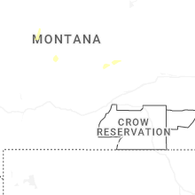
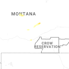


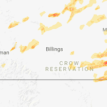


Connect with Interactive Hail Maps