

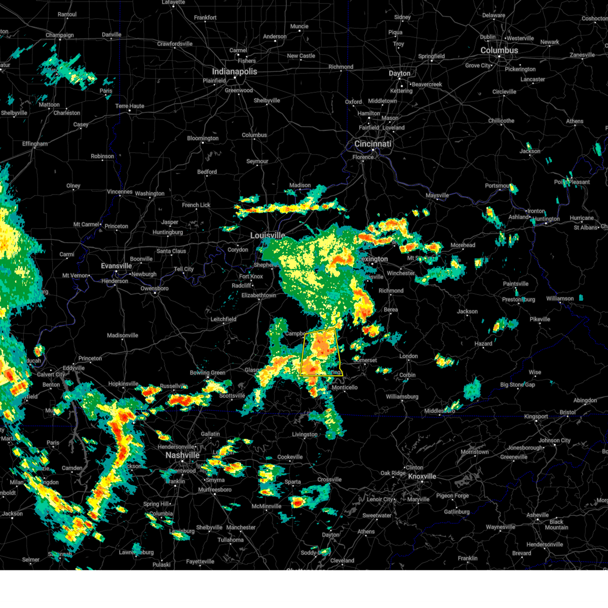
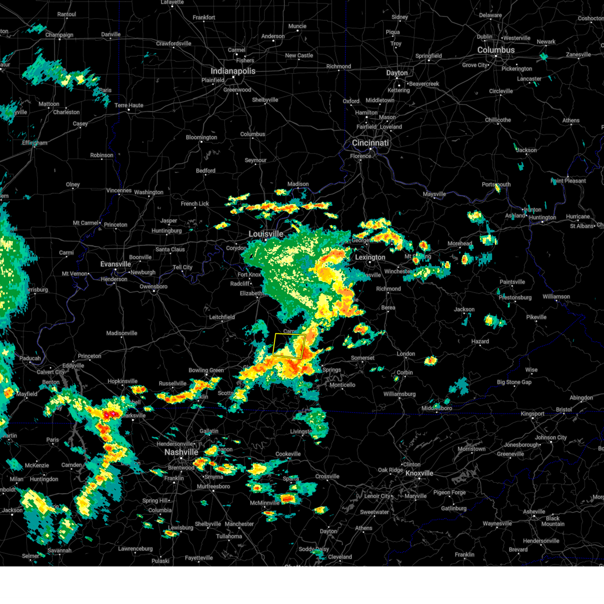
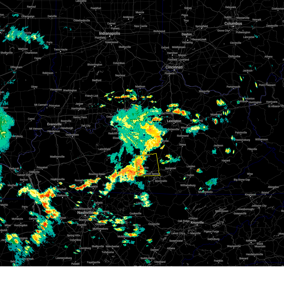
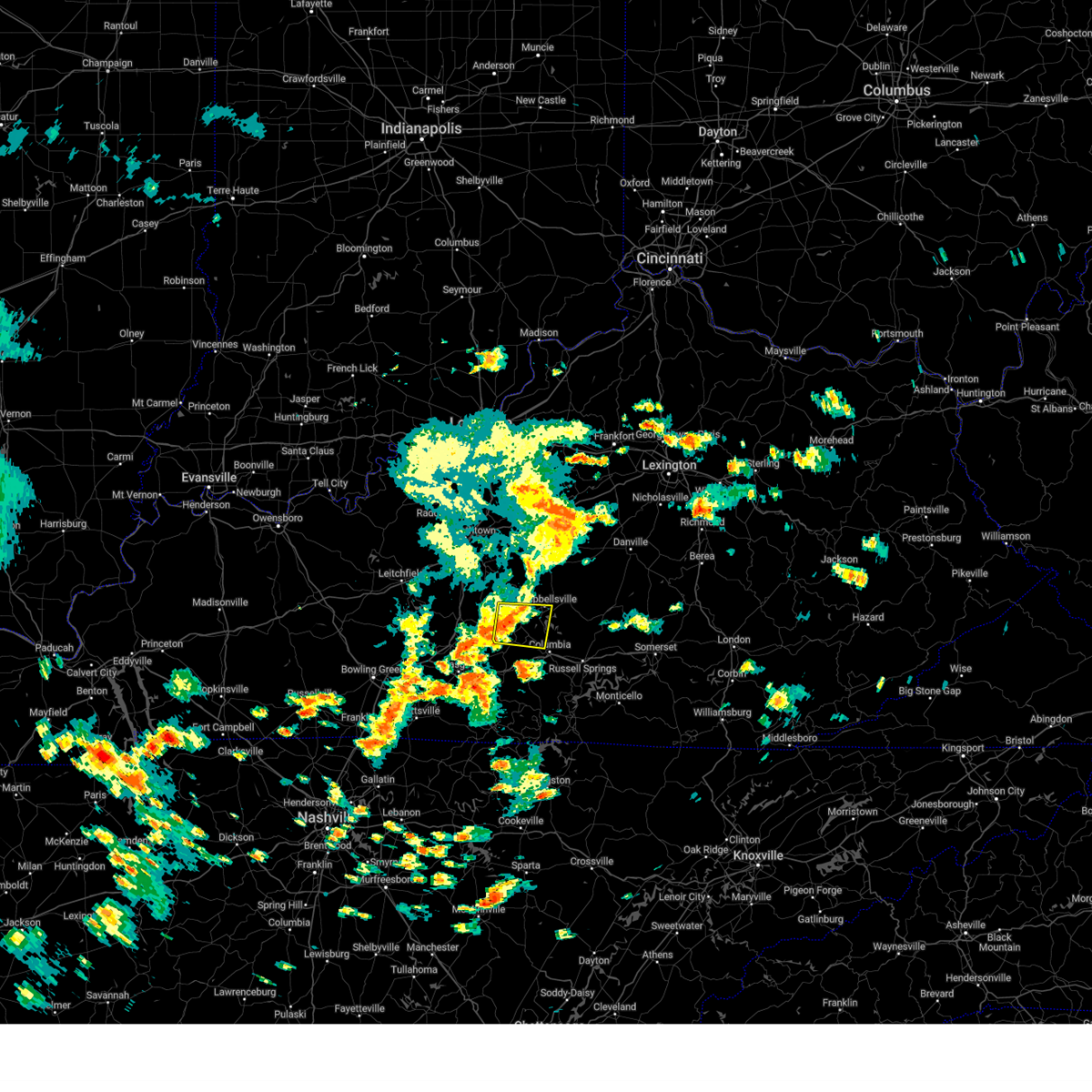
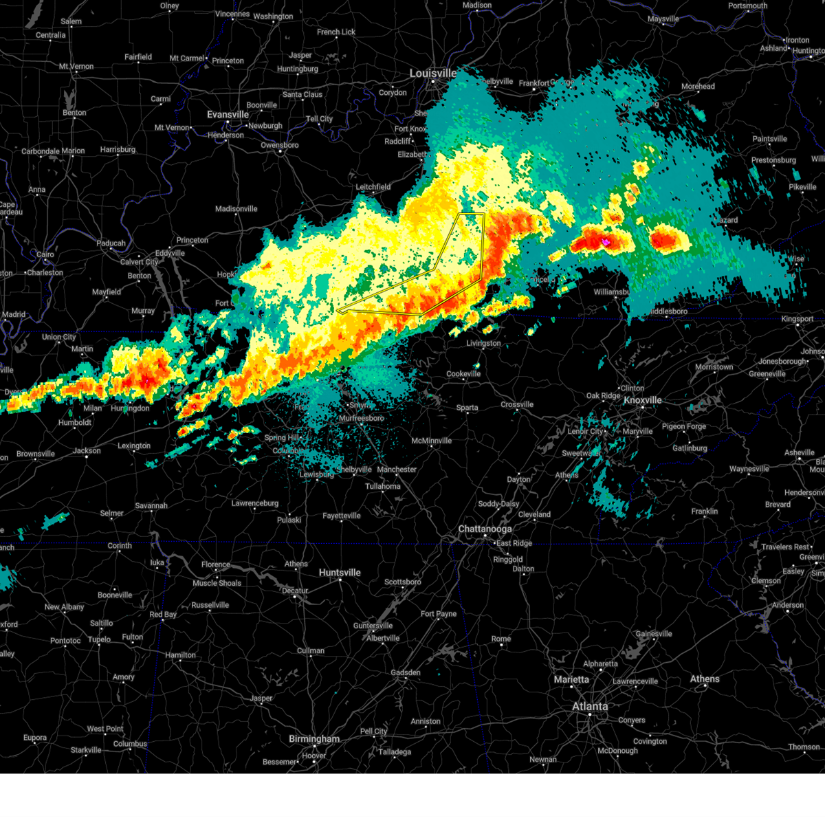
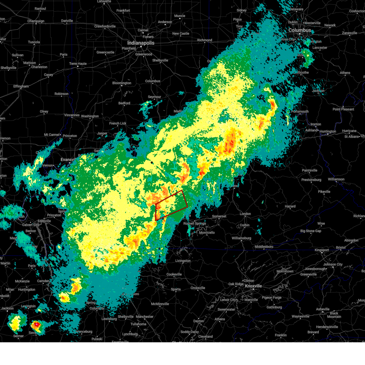
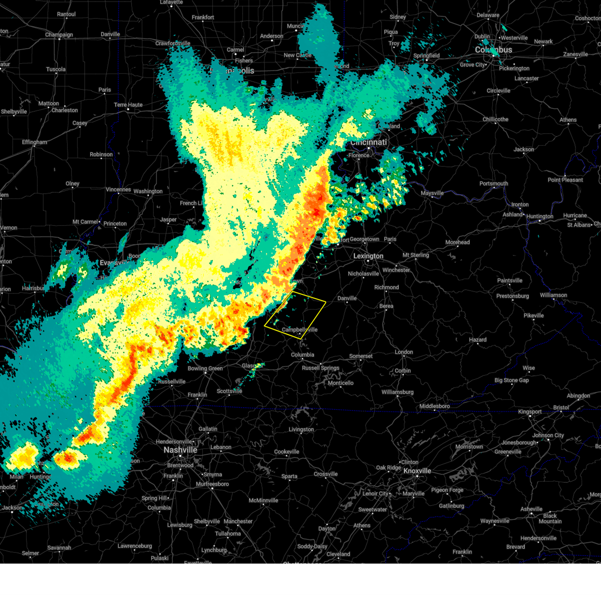
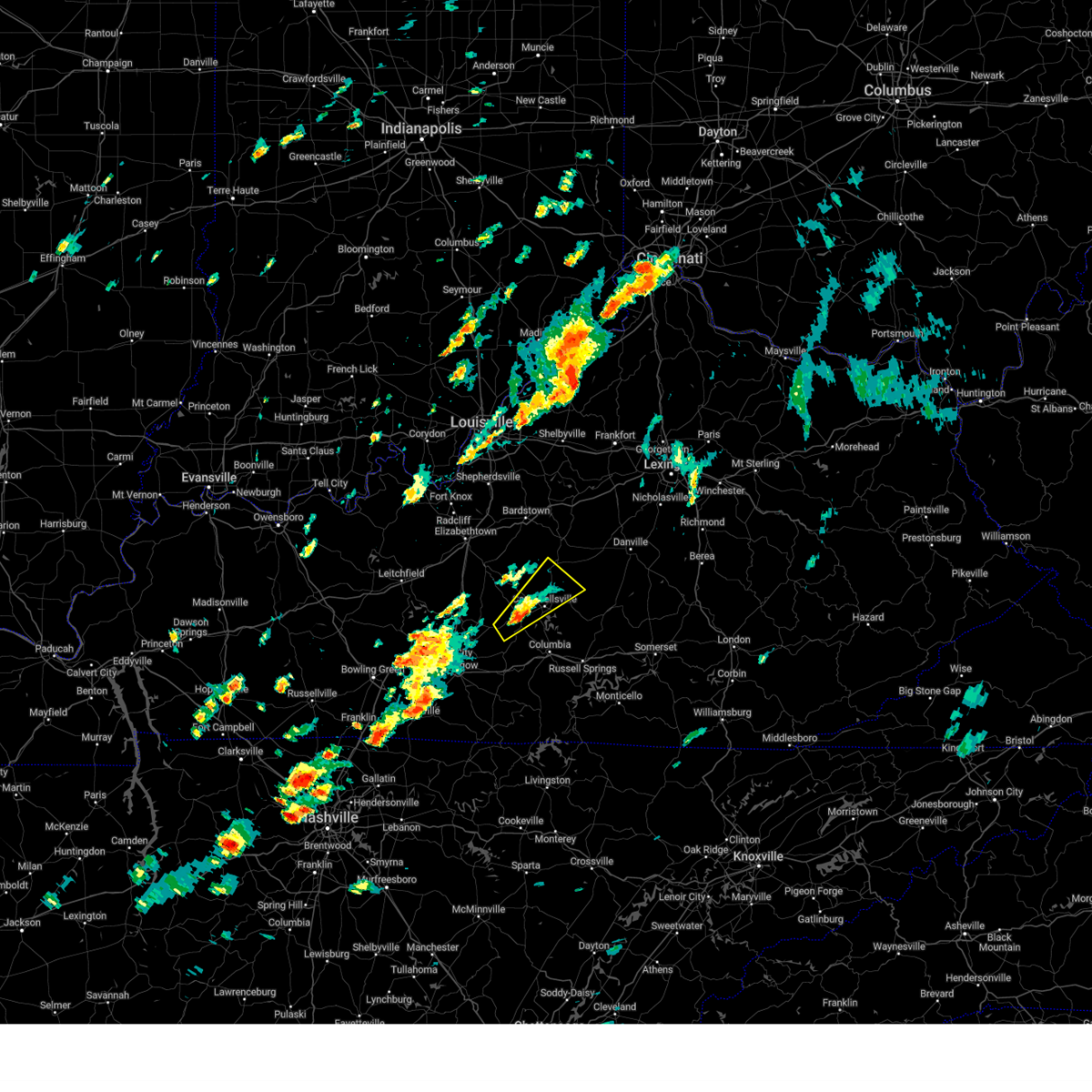
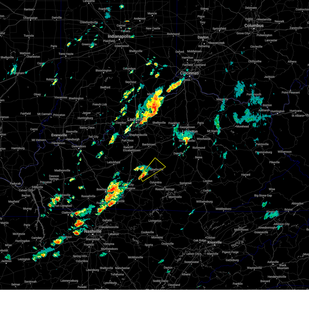
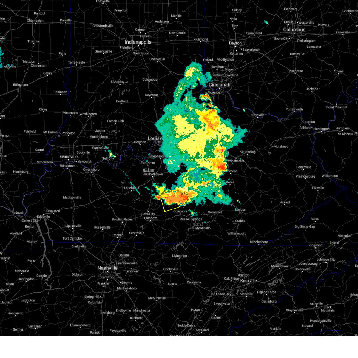
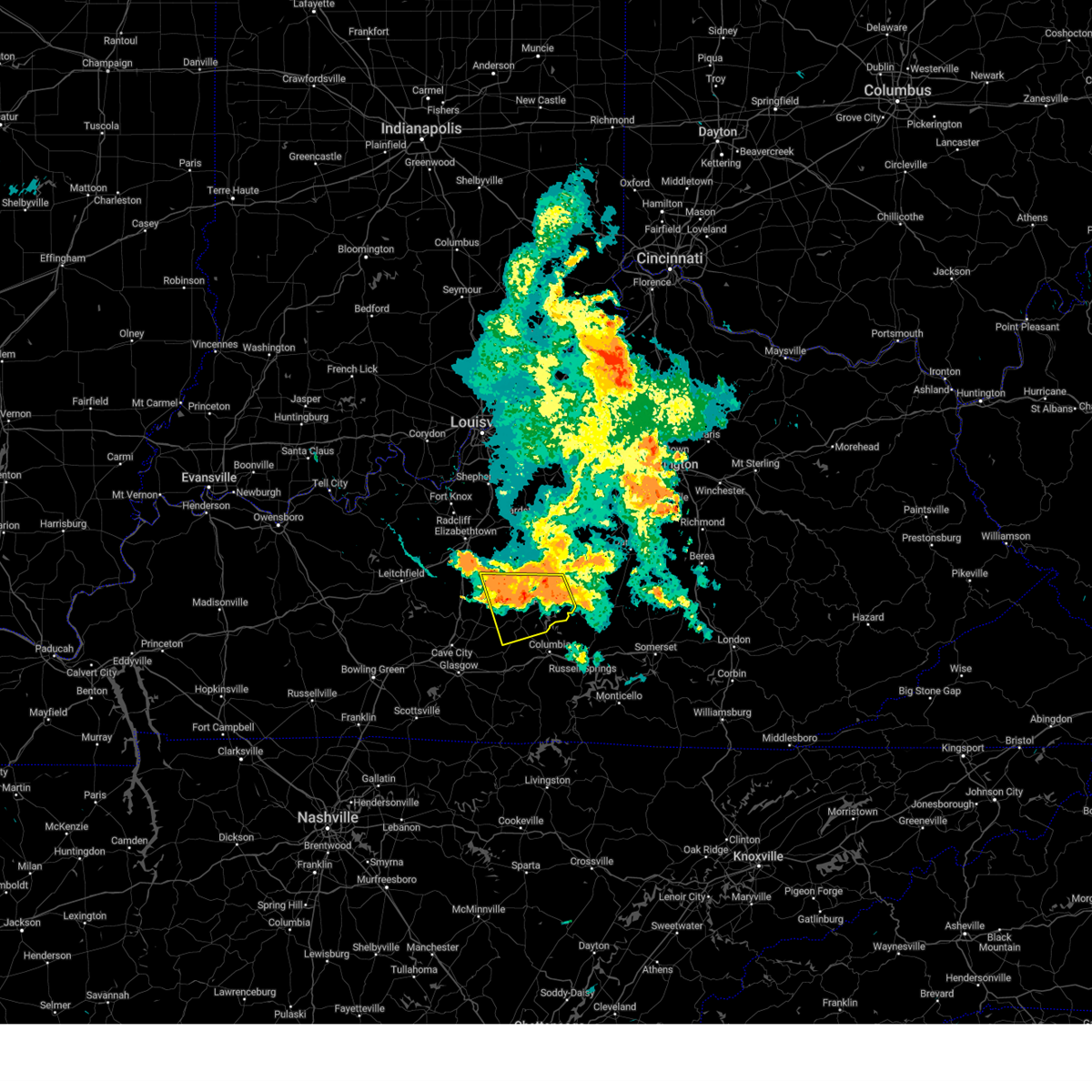
Hail Map for Campbellsville, KY
The Campbellsville, KY area has had 19 reports of on-the-ground hail by trained spotters, and has been under severe weather warnings 44 times during the past 12 months. Doppler radar has detected hail at or near Campbellsville, KY on 59 occasions, including 5 occasions during the past year.
| Name: | Campbellsville, KY |
| Where Located: | 48.8 miles SSE of Louisville, KY |
| Map: | Google Map for Campbellsville, KY |
| Population: | 9108 |
| Housing Units: | 4114 |
| More Info: | Search Google for Campbellsville, KY |
1
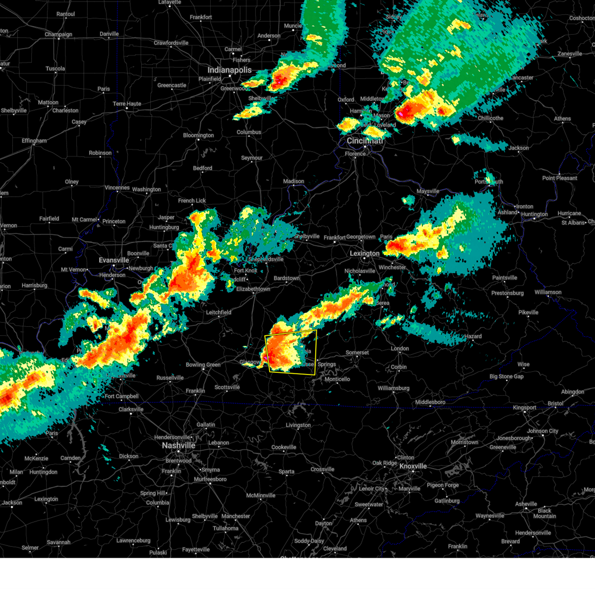
The Top Recent Hail Date for Campbellsville, KY is Friday, May 16, 2025 (12th out of 59)

Hail and Wind Damage Spotted near Campbellsville, KY
| Date / Time | Report Details |
|---|---|
| 6/6/2025 2:46 PM EDT |
 The storms which prompted the warning have moved out of the area. therefore, the warning has been allowed to expire. remember, a severe thunderstorm warning still remains in effect for portions of russell, casey, and adair county until 315 pm edt/215 pm cdt. The storms which prompted the warning have moved out of the area. therefore, the warning has been allowed to expire. remember, a severe thunderstorm warning still remains in effect for portions of russell, casey, and adair county until 315 pm edt/215 pm cdt.
|
| 6/6/2025 2:33 PM EDT | At 233 pm edt/133 pm cdt/, severe thunderstorms were located along a line extending from near campbellsville to 6 miles southeast of columbia, moving east at 45 mph (radar indicated). Hazards include 60 mph wind gusts and penny size hail. Expect damage to roofs, siding, and trees. Locations impacted include, liberty, campbellsville, columbia, jamestown, russell springs, eli, absher, teddy, royville, and sano. |
| 6/6/2025 2:33 PM EDT | the severe thunderstorm warning has been cancelled and is no longer in effect |
| 6/6/2025 1:27 PM CDT |
 The storm which prompted the initial warning has moved out of the area. therefore, the warning will be allowed to expire. however, a new severe thunderstorm warning still remains in effect for portions of green, taylor, and adair county until 245 pm edt/145 pm cdt. The storm which prompted the initial warning has moved out of the area. therefore, the warning will be allowed to expire. however, a new severe thunderstorm warning still remains in effect for portions of green, taylor, and adair county until 245 pm edt/145 pm cdt.
|
| 6/6/2025 2:18 PM EDT | Reports of trees dow in taylor county KY, 9.1 miles N of Campbellsville, KY |
| 6/6/2025 1:18 PM CDT |
 Svrlmk the national weather service in louisville has issued a * severe thunderstorm warning for, southeastern green county in central kentucky, central russell county in south central kentucky, taylor county in central kentucky, southwestern casey county in central kentucky, adair county in south central kentucky, * until 245 pm edt/145 pm cdt/. * at 217 pm edt/117 pm cdt/, severe thunderstorms were located along a line extending from near campbellsville to 6 miles south of columbia, moving east at 50 mph (radar indicated). Hazards include 60 mph wind gusts and quarter size hail. Hail damage to vehicles is expected. Expect wind damage to roofs, siding, and trees. Svrlmk the national weather service in louisville has issued a * severe thunderstorm warning for, southeastern green county in central kentucky, central russell county in south central kentucky, taylor county in central kentucky, southwestern casey county in central kentucky, adair county in south central kentucky, * until 245 pm edt/145 pm cdt/. * at 217 pm edt/117 pm cdt/, severe thunderstorms were located along a line extending from near campbellsville to 6 miles south of columbia, moving east at 50 mph (radar indicated). Hazards include 60 mph wind gusts and quarter size hail. Hail damage to vehicles is expected. Expect wind damage to roofs, siding, and trees.
|
| 6/6/2025 12:56 PM CDT |
 Svrlmk the national weather service in louisville has issued a * severe thunderstorm warning for, green county in central kentucky, southwestern taylor county in central kentucky, northwestern adair county in south central kentucky, * until 230 pm edt/130 pm cdt/. * at 155 pm edt/1255 pm cdt/, a severe thunderstorm was located near greensburg, moving east at 30 mph (radar indicated). Hazards include 60 mph wind gusts and quarter size hail. Hail damage to vehicles is expected. Expect wind damage to roofs, siding, and trees. Svrlmk the national weather service in louisville has issued a * severe thunderstorm warning for, green county in central kentucky, southwestern taylor county in central kentucky, northwestern adair county in south central kentucky, * until 230 pm edt/130 pm cdt/. * at 155 pm edt/1255 pm cdt/, a severe thunderstorm was located near greensburg, moving east at 30 mph (radar indicated). Hazards include 60 mph wind gusts and quarter size hail. Hail damage to vehicles is expected. Expect wind damage to roofs, siding, and trees.
|
| 5/16/2025 11:14 PM CDT |
 The storms which prompted the warning have moved out of the area. therefore, the warning will be allowed to expire. however, gusty winds are still possible with these thunderstorms. a tornado watch remains in effect until 300 am edt/200 am cdt/ for south central and central kentucky. to report severe weather, contact your nearest law enforcement agency. they will relay your report to the national weather service louisville. The storms which prompted the warning have moved out of the area. therefore, the warning will be allowed to expire. however, gusty winds are still possible with these thunderstorms. a tornado watch remains in effect until 300 am edt/200 am cdt/ for south central and central kentucky. to report severe weather, contact your nearest law enforcement agency. they will relay your report to the national weather service louisville.
|
| 5/16/2025 10:56 PM CDT | the severe thunderstorm warning has been cancelled and is no longer in effect |
| 5/16/2025 10:56 PM CDT | At 1156 pm edt/1056 pm cdt/, severe thunderstorms were located along a line extending from 7 miles northeast of three springs to 8 miles south of edmonton to 9 miles north of lafayette, moving east at 60 mph (radar indicated). Hazards include 70 mph wind gusts. Expect considerable tree damage. damage is likely to mobile homes, roofs, and outbuildings. Locations impacted include, campbellsville, scottsville, tompkinsville, greensburg, edmonton, fountain run, pickett, black jack, node, and bliss. |
| 5/16/2025 11:33 PM EDT | The storms which prompted the warning have moved out of the area. therefore, the warning has been allowed to expire. however, gusty winds and heavy rain are still possible with these thunderstorms. a tornado watch remains in effect until 100 am edt/midnight cdt/ for south central kentucky. a tornado watch also remains in effect until 300 am edt/200 am cdt/ for south central and central kentucky. |
| 5/16/2025 10:26 PM CDT | Svrlmk the national weather service in louisville has issued a * severe thunderstorm warning for, green county in central kentucky, northwestern monroe county in south central kentucky, southeastern simpson county in south central kentucky, hart county in central kentucky, south central taylor county in central kentucky, allen county in south central kentucky, east central warren county in south central kentucky, northwestern cumberland county in south central kentucky, barren county in south central kentucky, southwestern adair county in south central kentucky, metcalfe county in south central kentucky, eastern edmonson county in south central kentucky, * until 1215 am edt/1115 pm cdt/. * at 1125 pm edt/1025 pm cdt/, severe thunderstorms were located along a line extending from near brownsville to 7 miles north of scottsville to near portland, moving east at 60 mph (radar indicated). Hazards include 70 mph wind gusts. Expect considerable tree damage. Damage is likely to mobile homes, roofs, and outbuildings. |
| 5/16/2025 10:40 PM EDT | Svrlmk the national weather service in louisville has issued a * severe thunderstorm warning for, central nelson county in central kentucky, eastern larue county in central kentucky, marion county in central kentucky, eastern hart county in central kentucky, taylor county in central kentucky, west central jessamine county in central kentucky, northwestern casey county in central kentucky, central adair county in south central kentucky, southeastern edmonson county in south central kentucky, mercer county in central kentucky, green county in central kentucky, central warren county in south central kentucky, washington county in central kentucky, boyle county in central kentucky, barren county in south central kentucky, metcalfe county in south central kentucky, * until 1130 pm edt/1030 pm cdt/. * at 1040 pm edt/940 pm cdt/, severe thunderstorms were located along a line extending from 9 miles west of bardstown to 9 miles west of munfordville to near memphis junction, moving east at 65 mph (radar indicated). Hazards include 70 mph wind gusts and penny size hail. Expect considerable tree damage. Damage is likely to mobile homes, roofs, and outbuildings. |
| 5/16/2025 8:31 PM CDT |
 Svrlmk the national weather service in louisville has issued a * severe thunderstorm warning for, green county in central kentucky, west central russell county in south central kentucky, southeastern hart county in central kentucky, southeastern taylor county in central kentucky, north central cumberland county in south central kentucky, west central casey county in central kentucky, adair county in south central kentucky, central metcalfe county in south central kentucky, * until 1015 pm edt/915 pm cdt/. * at 930 pm edt/830 pm cdt/, a severe thunderstorm was located near three springs, moving east at 40 mph (radar indicated). Hazards include golf ball size hail and 70 mph wind gusts. People and animals outdoors will be injured. expect hail damage to roofs, siding, windows, and vehicles. expect considerable tree damage. Wind damage is also likely to mobile homes, roofs, and outbuildings. Svrlmk the national weather service in louisville has issued a * severe thunderstorm warning for, green county in central kentucky, west central russell county in south central kentucky, southeastern hart county in central kentucky, southeastern taylor county in central kentucky, north central cumberland county in south central kentucky, west central casey county in central kentucky, adair county in south central kentucky, central metcalfe county in south central kentucky, * until 1015 pm edt/915 pm cdt/. * at 930 pm edt/830 pm cdt/, a severe thunderstorm was located near three springs, moving east at 40 mph (radar indicated). Hazards include golf ball size hail and 70 mph wind gusts. People and animals outdoors will be injured. expect hail damage to roofs, siding, windows, and vehicles. expect considerable tree damage. Wind damage is also likely to mobile homes, roofs, and outbuildings.
|
| 5/16/2025 10:23 AM EDT |
 Svrlmk the national weather service in louisville has issued a * severe thunderstorm warning for, lincoln county in central kentucky, southwestern garrard county in central kentucky, southeastern marion county in central kentucky, northeastern taylor county in central kentucky, southern boyle county in central kentucky, northern casey county in central kentucky, * until 1100 am edt. * at 1023 am edt, a severe thunderstorm was located 9 miles east of campbellsville, moving east at 65 mph (radar indicated). Hazards include 60 mph wind gusts and quarter size hail. Hail damage to vehicles is expected. Expect wind damage to roofs, siding, and trees. Svrlmk the national weather service in louisville has issued a * severe thunderstorm warning for, lincoln county in central kentucky, southwestern garrard county in central kentucky, southeastern marion county in central kentucky, northeastern taylor county in central kentucky, southern boyle county in central kentucky, northern casey county in central kentucky, * until 1100 am edt. * at 1023 am edt, a severe thunderstorm was located 9 miles east of campbellsville, moving east at 65 mph (radar indicated). Hazards include 60 mph wind gusts and quarter size hail. Hail damage to vehicles is expected. Expect wind damage to roofs, siding, and trees.
|
| 5/16/2025 10:20 AM EDT | Powerlines down on forecast av in taylor county KY, 1.4 miles SSW of Campbellsville, KY |
| 5/16/2025 10:20 AM EDT | Tree... power pole and power lines down just north of north bypass and old lebanon r in taylor county KY, 2 miles SSW of Campbellsville, KY |
| 5/8/2025 3:29 PM CDT | The storm which prompted the warning has weakened below severe limits, and no longer poses an immediate threat to life or property. therefore, the warning will be allowed to expire. however, small hail and gusty winds are still possible with this thunderstorm. a severe thunderstorm watch remains in effect until 900 pm edt/800 pm cdt/ for south central and central kentucky. |
| 5/8/2025 3:08 PM CDT | Svrlmk the national weather service in louisville has issued a * severe thunderstorm warning for, east central green county in central kentucky, south central taylor county in central kentucky, * until 430 pm edt/330 pm cdt/. * at 408 pm edt/308 pm cdt/, a severe thunderstorm was located over greensburg, moving east at 20 mph (radar indicated). Hazards include 60 mph wind gusts and half dollar size hail. Hail damage to vehicles is expected. Expect wind damage to roofs, siding, and trees. |
| 5/2/2025 4:08 PM EDT | Quarter sized hail reported 4.1 miles WNW of Campbellsville, KY, quarter sized hail reported near the 300 block of capps road. |
| 5/2/2025 3:02 PM CDT | The storm which prompted the warning has moved out of the area. therefore, the warning has been allowed to expire. a severe thunderstorm watch remains in effect until 600 pm edt/500 pm cdt/ for south central and central kentucky. to report severe weather, contact your nearest law enforcement agency. they will relay your report to the national weather service louisville. |
| 5/2/2025 4:00 PM EDT | Svrlmk the national weather service in louisville has issued a * severe thunderstorm warning for, southeastern green county in central kentucky, southeastern marion county in central kentucky, taylor county in central kentucky, western casey county in central kentucky, northern adair county in south central kentucky, * until 430 pm edt/330 pm cdt/. * at 400 pm edt/300 pm cdt/, a severe thunderstorm was located near campbellsville, moving east at 30 mph (radar indicated). Hazards include 60 mph wind gusts and quarter size hail. Hail damage to vehicles is expected. Expect wind damage to roofs, siding, and trees. |
| 5/2/2025 2:36 PM CDT | At 336 pm edt/236 pm cdt/, a severe thunderstorm was located near greensburg, moving east at 30 mph (radar indicated). Hazards include 70 mph wind gusts and ping pong ball size hail. People and animals outdoors will be injured. expect hail damage to roofs, siding, windows, and vehicles. expect considerable tree damage. wind damage is also likely to mobile homes, roofs, and outbuildings. Locations impacted include, campbellsville, greensburg, pickett, portland, little barren, node, donansburg, bliss, fry, and romine. |
| 5/2/2025 2:36 PM CDT | the severe thunderstorm warning has been cancelled and is no longer in effect |
| 5/2/2025 2:25 PM CDT | Svrlmk the national weather service in louisville has issued a * severe thunderstorm warning for, green county in central kentucky, southeastern hart county in central kentucky, south central taylor county in central kentucky, northeastern barren county in south central kentucky, west central adair county in south central kentucky, northern metcalfe county in south central kentucky, * until 400 pm edt/300 pm cdt/. * at 325 pm edt/225 pm cdt/, a severe thunderstorm was located near three springs, moving east at 30 mph (radar indicated). Hazards include 60 mph wind gusts and quarter size hail. Hail damage to vehicles is expected. Expect wind damage to roofs, siding, and trees. |
| 4/3/2025 1:39 AM CDT | The storm which prompted the warning has moved out of the area. therefore, the warning has been allowed to expire. however, gusty winds and heavy rain are still possible with this thunderstorm. a tornado watch remains in effect until 700 am edt/600 am cdt/ for south central and central kentucky. to report severe weather, contact your nearest law enforcement agency. they will relay your report to the national weather service louisville. |
| 4/3/2025 2:33 AM EDT | The tornado threat has diminished and the tornado warning has been cancelled. however, large hail and damaging winds remain likely and a severe thunderstorm warning remains in effect for the area. however, gusty winds and heavy rain are still possible with this thunderstorm. a tornado watch remains in effect until 700 am edt/600 am cdt/ for central and south central kentucky. to report severe weather, contact your nearest law enforcement agency. they will relay your report to the national weather service louisville. |
| 4/3/2025 2:31 AM EDT | Several camping trailers blown over and roof blown off a business on lone valley roa in taylor county KY, 4.3 miles N of Campbellsville, KY |
| 4/3/2025 2:31 AM EDT | Svrlmk the national weather service in louisville has issued a * severe thunderstorm warning for, lincoln county in central kentucky, garrard county in central kentucky, southeastern green county in central kentucky, marion county in central kentucky, taylor county in central kentucky, southeastern washington county in central kentucky, boyle county in central kentucky, west central madison county in central kentucky, casey county in central kentucky, northeastern adair county in south central kentucky, * until 315 am edt/215 am cdt/. * at 230 am edt/130 am cdt/, severe thunderstorms were located along a line extending from near lebanon to near greensburg, moving east at 60 mph (radar indicated). Hazards include 70 mph wind gusts. Expect considerable tree damage. Damage is likely to mobile homes, roofs, and outbuildings. |
| 4/3/2025 2:25 AM EDT |
 the tornado warning has been cancelled and is no longer in effect the tornado warning has been cancelled and is no longer in effect
|
| 4/3/2025 2:25 AM EDT |
 At 224 am edt/124 am cdt/, a severe thunderstorm capable of producing a tornado was located near campbellsville, moving northeast at 60 mph (radar indicated rotation). Hazards include tornado. Flying debris will be dangerous to those caught without shelter. mobile homes will be damaged or destroyed. damage to roofs, windows, and vehicles will occur. tree damage is likely. This tornadic thunderstorm will remain over mainly rural areas of green, southwestern marion, east central hart, taylor and northwestern metcalfe counties, including the following locations, saint joseph, bloyd, lobb, donansburg, arista, south campbellsville, whickerville, grab, wrights, and newt. At 224 am edt/124 am cdt/, a severe thunderstorm capable of producing a tornado was located near campbellsville, moving northeast at 60 mph (radar indicated rotation). Hazards include tornado. Flying debris will be dangerous to those caught without shelter. mobile homes will be damaged or destroyed. damage to roofs, windows, and vehicles will occur. tree damage is likely. This tornadic thunderstorm will remain over mainly rural areas of green, southwestern marion, east central hart, taylor and northwestern metcalfe counties, including the following locations, saint joseph, bloyd, lobb, donansburg, arista, south campbellsville, whickerville, grab, wrights, and newt.
|
| 4/3/2025 1:22 AM CDT | the severe thunderstorm warning has been cancelled and is no longer in effect |
| 4/3/2025 1:22 AM CDT | At 221 am edt/121 am cdt/, a severe thunderstorm was located over greensburg, moving northeast at 80 mph (radar indicated). Hazards include 70 mph wind gusts. Expect considerable tree damage. damage is likely to mobile homes, roofs, and outbuildings. Locations impacted include, campbellsville, columbia, greensburg, three springs, monroe, pickett, absher, lobb, node, and fry. |
| 4/3/2025 2:14 AM EDT |
 the tornado warning has been cancelled and is no longer in effect the tornado warning has been cancelled and is no longer in effect
|
| 4/3/2025 2:14 AM EDT |
 At 213 am edt/113 am cdt/, a severe thunderstorm capable of producing a tornado was located 8 miles northeast of three springs, moving northeast at 60 mph (radar indicated rotation). Hazards include tornado. Flying debris will be dangerous to those caught without shelter. mobile homes will be damaged or destroyed. damage to roofs, windows, and vehicles will occur. tree damage is likely. this dangerous storm will be near, campbellsville around 225 am edt. Other locations impacted by this tornadic thunderstorm include lobb, arista, south campbellsville, savoyard, pierce, white rose, hatcher, gabe, pascal, and coakley. At 213 am edt/113 am cdt/, a severe thunderstorm capable of producing a tornado was located 8 miles northeast of three springs, moving northeast at 60 mph (radar indicated rotation). Hazards include tornado. Flying debris will be dangerous to those caught without shelter. mobile homes will be damaged or destroyed. damage to roofs, windows, and vehicles will occur. tree damage is likely. this dangerous storm will be near, campbellsville around 225 am edt. Other locations impacted by this tornadic thunderstorm include lobb, arista, south campbellsville, savoyard, pierce, white rose, hatcher, gabe, pascal, and coakley.
|
| 4/3/2025 1:10 AM CDT |
 the severe thunderstorm warning has been cancelled and is no longer in effect the severe thunderstorm warning has been cancelled and is no longer in effect
|
| 4/3/2025 1:10 AM CDT |
 At 210 am edt/110 am cdt/, a severe thunderstorm was located over three springs, moving northeast at 80 mph (radar indicated). Hazards include 70 mph wind gusts. Expect considerable tree damage. damage is likely to mobile homes, roofs, and outbuildings. Locations impacted include, glasgow, campbellsville, columbia, greensburg, munfordville, three springs, monroe, horse cave, cave city, and park city. At 210 am edt/110 am cdt/, a severe thunderstorm was located over three springs, moving northeast at 80 mph (radar indicated). Hazards include 70 mph wind gusts. Expect considerable tree damage. damage is likely to mobile homes, roofs, and outbuildings. Locations impacted include, glasgow, campbellsville, columbia, greensburg, munfordville, three springs, monroe, horse cave, cave city, and park city.
|
| 4/3/2025 1:02 AM CDT | Torlmk the national weather service in louisville has issued a * tornado warning for, green county in central kentucky, southwestern marion county in central kentucky, southern hart county in central kentucky, taylor county in central kentucky, northeastern barren county in south central kentucky, northwestern metcalfe county in south central kentucky, east central edmonson county in south central kentucky, * until 230 am edt/130 am cdt/. * at 202 am edt/102 am cdt/, a severe thunderstorm capable of producing a tornado was located 8 miles south of munfordville, moving northeast at 80 mph (radar indicated rotation). Hazards include tornado. Flying debris will be dangerous to those caught without shelter. mobile homes will be damaged or destroyed. damage to roofs, windows, and vehicles will occur. tree damage is likely. this dangerous storm will be near, three springs around 110 am cdt. greensburg around 120 am cdt. campbellsville around 225 am edt. Other locations impacted by this tornadic thunderstorm include logsdon valley, lobb, cave city, arista, south campbellsville, savoyard, goodnight, mammoth cave, pierce, and white rose. |
| 4/3/2025 12:51 AM CDT |
 Svrlmk the national weather service in louisville has issued a * severe thunderstorm warning for, green county in central kentucky, southeastern larue county in central kentucky, southwestern marion county in central kentucky, hart county in central kentucky, taylor county in central kentucky, north central allen county in south central kentucky, northeastern warren county in south central kentucky, barren county in south central kentucky, central adair county in south central kentucky, northern metcalfe county in south central kentucky, southern edmonson county in south central kentucky, * until 230 am edt/130 am cdt/. * at 150 am edt/1250 am cdt/, a severe thunderstorm was located 10 miles east of plum springs, moving northeast at 80 mph (radar indicated). Hazards include 60 mph wind gusts. expect damage to roofs, siding, and trees Svrlmk the national weather service in louisville has issued a * severe thunderstorm warning for, green county in central kentucky, southeastern larue county in central kentucky, southwestern marion county in central kentucky, hart county in central kentucky, taylor county in central kentucky, north central allen county in south central kentucky, northeastern warren county in south central kentucky, barren county in south central kentucky, central adair county in south central kentucky, northern metcalfe county in south central kentucky, southern edmonson county in south central kentucky, * until 230 am edt/130 am cdt/. * at 150 am edt/1250 am cdt/, a severe thunderstorm was located 10 miles east of plum springs, moving northeast at 80 mph (radar indicated). Hazards include 60 mph wind gusts. expect damage to roofs, siding, and trees
|
| 3/30/2025 10:38 PM CDT | Svrlmk the national weather service in louisville has issued a * severe thunderstorm warning for, green county in central kentucky, eastern hart county in central kentucky, taylor county in central kentucky, barren county in south central kentucky, central adair county in south central kentucky, metcalfe county in south central kentucky, * until 1215 am edt/1115 pm cdt/. * at 1138 pm edt/1038 pm cdt/, severe thunderstorms were located along a line extending from 8 miles south of hodgenville to 10 miles northwest of greensburg to 7 miles southwest of three springs to 10 miles southwest of glasgow, moving east at 65 mph (radar indicated). Hazards include 60 mph wind gusts. expect damage to roofs, siding, and trees |
| 3/30/2025 10:48 PM EDT |
 The storms which prompted the warning have weakened below severe limits, and no longer pose an immediate threat to life or property. therefore, the warning has been allowed to expire. however, gusty winds are still possible with these thunderstorms, and a severe thunderstorm warning remains in effect for portions of washington county until 1115 pm edt. a tornado watch remains in effect until 100 am edt/midnight cdt/ for central kentucky. a tornado watch also remains in effect until 400 am edt/300 am cdt/ for central kentucky. The storms which prompted the warning have weakened below severe limits, and no longer pose an immediate threat to life or property. therefore, the warning has been allowed to expire. however, gusty winds are still possible with these thunderstorms, and a severe thunderstorm warning remains in effect for portions of washington county until 1115 pm edt. a tornado watch remains in effect until 100 am edt/midnight cdt/ for central kentucky. a tornado watch also remains in effect until 400 am edt/300 am cdt/ for central kentucky.
|
| 3/30/2025 10:22 PM EDT |
 Svrlmk the national weather service in louisville has issued a * severe thunderstorm warning for, south central nelson county in central kentucky, northwestern green county in central kentucky, southeastern larue county in central kentucky, marion county in central kentucky, northeastern hart county in central kentucky, northwestern taylor county in central kentucky, southwestern washington county in central kentucky, * until 1045 pm edt/945 pm cdt/. * at 1022 pm edt/922 pm cdt/, severe thunderstorms were located along a line extending from 6 miles south of bardstown to 6 miles southeast of hodgenville, moving east at 45 mph (radar indicated). Hazards include 60 mph wind gusts and nickel size hail. expect damage to roofs, siding, and trees Svrlmk the national weather service in louisville has issued a * severe thunderstorm warning for, south central nelson county in central kentucky, northwestern green county in central kentucky, southeastern larue county in central kentucky, marion county in central kentucky, northeastern hart county in central kentucky, northwestern taylor county in central kentucky, southwestern washington county in central kentucky, * until 1045 pm edt/945 pm cdt/. * at 1022 pm edt/922 pm cdt/, severe thunderstorms were located along a line extending from 6 miles south of bardstown to 6 miles southeast of hodgenville, moving east at 45 mph (radar indicated). Hazards include 60 mph wind gusts and nickel size hail. expect damage to roofs, siding, and trees
|
| 9/24/2024 2:52 PM EDT | Few trees down within the city limits of campbellsvill in taylor county KY, 0.6 miles SSW of Campbellsville, KY |
| 9/24/2024 2:38 PM EDT |
 The storm which prompted the warning has weakened below severe limits, and no longer poses an immediate threat to life or property. therefore, the warning will be allowed to expire. however, gusty winds and heavy rain are still possible with this thunderstorm. a severe thunderstorm watch remains in effect until 800 pm edt/700 pm cdt/ for central kentucky. to report severe weather, contact your nearest law enforcement agency. they will relay your report to the national weather service louisville. The storm which prompted the warning has weakened below severe limits, and no longer poses an immediate threat to life or property. therefore, the warning will be allowed to expire. however, gusty winds and heavy rain are still possible with this thunderstorm. a severe thunderstorm watch remains in effect until 800 pm edt/700 pm cdt/ for central kentucky. to report severe weather, contact your nearest law enforcement agency. they will relay your report to the national weather service louisville.
|
| 9/24/2024 2:19 PM EDT |
 Svrlmk the national weather service in louisville has issued a * severe thunderstorm warning for, central green county in central kentucky, southwestern marion county in central kentucky, taylor county in central kentucky, * until 245 pm edt/145 pm cdt/. * at 219 pm edt/119 pm cdt/, a severe thunderstorm was located near greensburg, moving northeast at 55 mph (radar indicated). Hazards include 60 mph wind gusts and penny size hail. expect damage to roofs, siding, and trees Svrlmk the national weather service in louisville has issued a * severe thunderstorm warning for, central green county in central kentucky, southwestern marion county in central kentucky, taylor county in central kentucky, * until 245 pm edt/145 pm cdt/. * at 219 pm edt/119 pm cdt/, a severe thunderstorm was located near greensburg, moving northeast at 55 mph (radar indicated). Hazards include 60 mph wind gusts and penny size hail. expect damage to roofs, siding, and trees
|
| 8/1/2024 6:18 PM EDT | Trees and power lines down on spurlington road in northeastern taylor count in taylor county KY, 8.2 miles SW of Campbellsville, KY |
| 7/31/2024 5:28 PM EDT | The storms which prompted the warning have weakened below severe limits, and no longer pose an immediate threat to life or property. therefore, the warning will be allowed to expire. however, heavy rain is still possible with these storms. a severe thunderstorm watch remains in effect until 800 pm edt/700 pm cdt/ for south central and central kentucky. to report severe weather, contact your nearest law enforcement agency. they will relay your report to the national weather service louisville. |
| 7/31/2024 5:21 PM EDT |
 At 520 pm edt/420 pm cdt/, a severe thunderstorm was located near greensburg, moving southeast at 35 mph (radar indicated). Hazards include 60 mph wind gusts and quarter size hail. Hail damage to vehicles is expected. expect wind damage to roofs, siding, and trees. Locations impacted include, campbellsville, greensburg, lobb, arista, south campbellsville, romine, pierce, mannsville, white rose, and wooleyville. At 520 pm edt/420 pm cdt/, a severe thunderstorm was located near greensburg, moving southeast at 35 mph (radar indicated). Hazards include 60 mph wind gusts and quarter size hail. Hail damage to vehicles is expected. expect wind damage to roofs, siding, and trees. Locations impacted include, campbellsville, greensburg, lobb, arista, south campbellsville, romine, pierce, mannsville, white rose, and wooleyville.
|
| 7/31/2024 5:21 PM EDT |
 the severe thunderstorm warning has been cancelled and is no longer in effect the severe thunderstorm warning has been cancelled and is no longer in effect
|
| 7/31/2024 5:19 PM EDT | Trees are down around the county with several down in campbellsville. the dispatch center has lost powe in taylor county KY, 0.2 miles NW of Campbellsville, KY |
| 7/31/2024 5:03 PM EDT |
 Svrlmk the national weather service in louisville has issued a * severe thunderstorm warning for, green county in central kentucky, southeastern larue county in central kentucky, southwestern marion county in central kentucky, northeastern hart county in central kentucky, taylor county in central kentucky, * until 530 pm edt/430 pm cdt/. * at 503 pm edt/403 pm cdt/, a severe thunderstorm was located 11 miles north of greensburg, moving southeast at 35 mph (radar indicated). Hazards include 60 mph wind gusts and quarter size hail. Hail damage to vehicles is expected. Expect wind damage to roofs, siding, and trees. Svrlmk the national weather service in louisville has issued a * severe thunderstorm warning for, green county in central kentucky, southeastern larue county in central kentucky, southwestern marion county in central kentucky, northeastern hart county in central kentucky, taylor county in central kentucky, * until 530 pm edt/430 pm cdt/. * at 503 pm edt/403 pm cdt/, a severe thunderstorm was located 11 miles north of greensburg, moving southeast at 35 mph (radar indicated). Hazards include 60 mph wind gusts and quarter size hail. Hail damage to vehicles is expected. Expect wind damage to roofs, siding, and trees.
|
| 7/30/2024 2:43 PM EDT | Trees down throughout the county especially along ky 55 south of campbellsvill in taylor county KY, 5.2 miles NNE of Campbellsville, KY |
| 7/30/2024 1:33 PM CDT |
 Svrlmk the national weather service in louisville has issued a * severe thunderstorm warning for, southeastern marion county in central kentucky, russell county in south central kentucky, taylor county in central kentucky, casey county in central kentucky, adair county in south central kentucky, western lincoln county in central kentucky, southwestern mercer county in central kentucky, central clinton county in south central kentucky, southern green county in central kentucky, central monroe county in south central kentucky, southeastern washington county in central kentucky, boyle county in central kentucky, cumberland county in south central kentucky, eastern barren county in south central kentucky, metcalfe county in south central kentucky, * until 330 pm edt/230 pm cdt/. * at 231 pm edt/131 pm cdt/, severe thunderstorms were located along a line extending from near bardstown to 11 miles northwest of campbellsville to 7 miles west of greensburg to 10 miles east of brownsville, moving southeast at 50 mph (radar indicated). Hazards include 60 mph wind gusts and penny size hail. expect damage to roofs, siding, and trees Svrlmk the national weather service in louisville has issued a * severe thunderstorm warning for, southeastern marion county in central kentucky, russell county in south central kentucky, taylor county in central kentucky, casey county in central kentucky, adair county in south central kentucky, western lincoln county in central kentucky, southwestern mercer county in central kentucky, central clinton county in south central kentucky, southern green county in central kentucky, central monroe county in south central kentucky, southeastern washington county in central kentucky, boyle county in central kentucky, cumberland county in south central kentucky, eastern barren county in south central kentucky, metcalfe county in south central kentucky, * until 330 pm edt/230 pm cdt/. * at 231 pm edt/131 pm cdt/, severe thunderstorms were located along a line extending from near bardstown to 11 miles northwest of campbellsville to 7 miles west of greensburg to 10 miles east of brownsville, moving southeast at 50 mph (radar indicated). Hazards include 60 mph wind gusts and penny size hail. expect damage to roofs, siding, and trees
|
| 7/30/2024 2:30 PM EDT | Trees down throughout the county especially from old mac road to salom in taylor county KY, 8.9 miles ESE of Campbellsville, KY |
| 6/30/2024 1:41 PM EDT |
 the severe thunderstorm warning has been cancelled and is no longer in effect the severe thunderstorm warning has been cancelled and is no longer in effect
|
| 6/30/2024 1:41 PM EDT |
 At 141 pm edt, a severe thunderstorm was located 8 miles southwest of lebanon, moving east at 35 mph (radar indicated). Hazards include 60 mph wind gusts and penny size hail. Expect damage to roofs, siding, and trees. Locations impacted include, campbellsville, lebanon, springfield, new haven, loretto, raywick, burkes spring, dant, arista, and south campbellsville. At 141 pm edt, a severe thunderstorm was located 8 miles southwest of lebanon, moving east at 35 mph (radar indicated). Hazards include 60 mph wind gusts and penny size hail. Expect damage to roofs, siding, and trees. Locations impacted include, campbellsville, lebanon, springfield, new haven, loretto, raywick, burkes spring, dant, arista, and south campbellsville.
|
| 6/30/2024 1:24 PM EDT |
 Svrlmk the national weather service in louisville has issued a * severe thunderstorm warning for, southwestern nelson county in central kentucky, northern green county in central kentucky, larue county in central kentucky, marion county in central kentucky, taylor county in central kentucky, southwestern washington county in central kentucky, southeastern hardin county in central kentucky, * until 200 pm edt/100 pm cdt/. * at 123 pm edt/1223 pm cdt/, a severe thunderstorm was located 9 miles east of hodgenville, moving southeast at 40 mph (radar indicated). Hazards include 60 mph wind gusts and penny size hail. expect damage to roofs, siding, and trees Svrlmk the national weather service in louisville has issued a * severe thunderstorm warning for, southwestern nelson county in central kentucky, northern green county in central kentucky, larue county in central kentucky, marion county in central kentucky, taylor county in central kentucky, southwestern washington county in central kentucky, southeastern hardin county in central kentucky, * until 200 pm edt/100 pm cdt/. * at 123 pm edt/1223 pm cdt/, a severe thunderstorm was located 9 miles east of hodgenville, moving southeast at 40 mph (radar indicated). Hazards include 60 mph wind gusts and penny size hail. expect damage to roofs, siding, and trees
|
| 5/26/2024 11:42 PM CDT |
 Svrlmk the national weather service in louisville has issued a * severe thunderstorm warning for, clinton county in south central kentucky, southeastern green county in central kentucky, eastern monroe county in south central kentucky, russell county in south central kentucky, south central taylor county in central kentucky, cumberland county in south central kentucky, adair county in south central kentucky, southeastern metcalfe county in south central kentucky, * until 130 am edt/1230 am cdt/. * at 1242 am edt/1142 pm cdt/, severe thunderstorms were located along a line extending from 11 miles southwest of liberty to 6 miles southeast of tompkinsville, moving east at 50 mph (radar indicated). Hazards include 60 mph wind gusts and quarter size hail. Hail damage to vehicles is expected. Expect wind damage to roofs, siding, and trees. Svrlmk the national weather service in louisville has issued a * severe thunderstorm warning for, clinton county in south central kentucky, southeastern green county in central kentucky, eastern monroe county in south central kentucky, russell county in south central kentucky, south central taylor county in central kentucky, cumberland county in south central kentucky, adair county in south central kentucky, southeastern metcalfe county in south central kentucky, * until 130 am edt/1230 am cdt/. * at 1242 am edt/1142 pm cdt/, severe thunderstorms were located along a line extending from 11 miles southwest of liberty to 6 miles southeast of tompkinsville, moving east at 50 mph (radar indicated). Hazards include 60 mph wind gusts and quarter size hail. Hail damage to vehicles is expected. Expect wind damage to roofs, siding, and trees.
|
| 5/27/2024 12:38 AM EDT |
 The storms which prompted the warning have weakened below severe limits, and no longer pose an immediate threat to life or property. therefore, the warning will be allowed to expire. however, gusty winds are still possible with these thunderstorms. a tornado watch remains in effect until 200 am edt for south central and central kentucky. a tornado watch also remains in effect until 600 am edt for central kentucky. The storms which prompted the warning have weakened below severe limits, and no longer pose an immediate threat to life or property. therefore, the warning will be allowed to expire. however, gusty winds are still possible with these thunderstorms. a tornado watch remains in effect until 200 am edt for south central and central kentucky. a tornado watch also remains in effect until 600 am edt for central kentucky.
|
| 5/27/2024 12:30 AM EDT |
 the severe thunderstorm warning has been cancelled and is no longer in effect the severe thunderstorm warning has been cancelled and is no longer in effect
|
| 5/27/2024 12:30 AM EDT |
 At 1229 am edt, severe thunderstorms were located along a line extending from 10 miles west of harrodsburg to near campbellsville, moving east at 45 mph (radar indicated). Hazards include 60 mph wind gusts. Expect damage to roofs, siding, and trees. Locations impacted include, campbellsville, lebanon, springfield, bradfordsville, willisburg, mackville, rineltown, arista, south campbellsville, and jenkinsville. At 1229 am edt, severe thunderstorms were located along a line extending from 10 miles west of harrodsburg to near campbellsville, moving east at 45 mph (radar indicated). Hazards include 60 mph wind gusts. Expect damage to roofs, siding, and trees. Locations impacted include, campbellsville, lebanon, springfield, bradfordsville, willisburg, mackville, rineltown, arista, south campbellsville, and jenkinsville.
|
| 5/26/2024 11:07 PM CDT |
 Svrlmk the national weather service in louisville has issued a * severe thunderstorm warning for, green county in central kentucky, monroe county in south central kentucky, southeastern hart county in central kentucky, south central taylor county in central kentucky, southeastern allen county in south central kentucky, cumberland county in south central kentucky, eastern barren county in south central kentucky, adair county in south central kentucky, metcalfe county in south central kentucky, * until 1245 am edt/1145 pm cdt/. * at 1207 am edt/1107 pm cdt/, severe thunderstorms were located along a line extending from 12 miles northwest of greensburg to 7 miles north of lafayette, moving east at 55 mph (radar indicated). Hazards include 60 mph wind gusts and quarter size hail. Hail damage to vehicles is expected. Expect wind damage to roofs, siding, and trees. Svrlmk the national weather service in louisville has issued a * severe thunderstorm warning for, green county in central kentucky, monroe county in south central kentucky, southeastern hart county in central kentucky, south central taylor county in central kentucky, southeastern allen county in south central kentucky, cumberland county in south central kentucky, eastern barren county in south central kentucky, adair county in south central kentucky, metcalfe county in south central kentucky, * until 1245 am edt/1145 pm cdt/. * at 1207 am edt/1107 pm cdt/, severe thunderstorms were located along a line extending from 12 miles northwest of greensburg to 7 miles north of lafayette, moving east at 55 mph (radar indicated). Hazards include 60 mph wind gusts and quarter size hail. Hail damage to vehicles is expected. Expect wind damage to roofs, siding, and trees.
|
| 5/27/2024 12:04 AM EDT |
 Svrlmk the national weather service in louisville has issued a * severe thunderstorm warning for, central nelson county in central kentucky, northwestern green county in central kentucky, southeastern larue county in central kentucky, marion county in central kentucky, taylor county in central kentucky, washington county in central kentucky, * until 1245 am edt/1145 pm cdt/. * at 1204 am edt/1104 pm cdt/, severe thunderstorms were located along a line extending from near bardstown to 9 miles northeast of munfordville, moving east at 45 mph (radar indicated). Hazards include 60 mph wind gusts. expect damage to roofs, siding, and trees Svrlmk the national weather service in louisville has issued a * severe thunderstorm warning for, central nelson county in central kentucky, northwestern green county in central kentucky, southeastern larue county in central kentucky, marion county in central kentucky, taylor county in central kentucky, washington county in central kentucky, * until 1245 am edt/1145 pm cdt/. * at 1204 am edt/1104 pm cdt/, severe thunderstorms were located along a line extending from near bardstown to 9 miles northeast of munfordville, moving east at 45 mph (radar indicated). Hazards include 60 mph wind gusts. expect damage to roofs, siding, and trees
|
| 5/26/2024 12:15 PM EDT | Trees and powerlines down across the city of campbellsvill in taylor county KY, 0.6 miles SSW of Campbellsville, KY |
| 5/26/2024 12:14 PM EDT | Significant damage to home on saloma roa in taylor county KY, 7.5 miles SSE of Campbellsville, KY |
| 5/8/2024 7:54 PM EDT |
 The storms which prompted the warning have moved out of the area. therefore, the warning will be allowed to expire. a tornado watch remains in effect until 1000 pm edt/900 pm cdt/ for south central and central kentucky. The storms which prompted the warning have moved out of the area. therefore, the warning will be allowed to expire. a tornado watch remains in effect until 1000 pm edt/900 pm cdt/ for south central and central kentucky.
|
| 5/8/2024 7:40 PM EDT | Trees down on a house in campbellsvill in taylor county KY, 2.3 miles SSW of Campbellsville, KY |
| 5/8/2024 7:23 PM EDT |
 Svrlmk the national weather service in louisville has issued a * severe thunderstorm warning for, green county in central kentucky, southern marion county in central kentucky, taylor county in central kentucky, central adair county in south central kentucky, * until 800 pm edt/700 pm cdt/. * at 723 pm edt/623 pm cdt/, severe thunderstorms were located along a line extending from 11 miles northwest of campbellsville to 6 miles southwest of greensburg, moving east at 40 mph (radar indicated). Hazards include 60 mph wind gusts and quarter size hail. Hail damage to vehicles is expected. Expect wind damage to roofs, siding, and trees. Svrlmk the national weather service in louisville has issued a * severe thunderstorm warning for, green county in central kentucky, southern marion county in central kentucky, taylor county in central kentucky, central adair county in south central kentucky, * until 800 pm edt/700 pm cdt/. * at 723 pm edt/623 pm cdt/, severe thunderstorms were located along a line extending from 11 miles northwest of campbellsville to 6 miles southwest of greensburg, moving east at 40 mph (radar indicated). Hazards include 60 mph wind gusts and quarter size hail. Hail damage to vehicles is expected. Expect wind damage to roofs, siding, and trees.
|
| 5/8/2024 6:53 PM EDT |
 The storm which prompted the warning has moved into casey county. therefore, the warning will be allowed to expire. a tornado watch remains in effect until 1000 pm edt for central kentucky. to report severe weather, contact your nearest law enforcement agency. they will relay your report to the national weather service louisville. The storm which prompted the warning has moved into casey county. therefore, the warning will be allowed to expire. a tornado watch remains in effect until 1000 pm edt for central kentucky. to report severe weather, contact your nearest law enforcement agency. they will relay your report to the national weather service louisville.
|
| 5/8/2024 6:20 PM EDT | Tree and powerline down across ky highway 21 in taylor county KY, 8.1 miles ESE of Campbellsville, KY |
| 5/8/2024 6:14 PM EDT |
 Svrlmk the national weather service in louisville has issued a * severe thunderstorm warning for, southern marion county in central kentucky, taylor county in central kentucky, * until 700 pm edt. * at 614 pm edt, a severe thunderstorm was located near campbellsville, moving east at 35 mph (radar indicated). Hazards include 60 mph wind gusts and half dollar size hail. Hail damage to vehicles is expected. Expect wind damage to roofs, siding, and trees. Svrlmk the national weather service in louisville has issued a * severe thunderstorm warning for, southern marion county in central kentucky, taylor county in central kentucky, * until 700 pm edt. * at 614 pm edt, a severe thunderstorm was located near campbellsville, moving east at 35 mph (radar indicated). Hazards include 60 mph wind gusts and half dollar size hail. Hail damage to vehicles is expected. Expect wind damage to roofs, siding, and trees.
|
| 5/8/2024 3:51 PM CDT |
 The storm which prompted the warning has moved out of the area. therefore, the warning will be allowed to expire. however, small hail is still possible with this thunderstorm. a tornado watch remains in effect until 1000 pm edt/900 pm cdt/ for south central and central kentucky. to report severe weather, contact your nearest law enforcement agency. they will relay your report to the national weather service louisville. remember, a severe thunderstorm warning still remains in effect for portions of green, taylor, and adair counties. The storm which prompted the warning has moved out of the area. therefore, the warning will be allowed to expire. however, small hail is still possible with this thunderstorm. a tornado watch remains in effect until 1000 pm edt/900 pm cdt/ for south central and central kentucky. to report severe weather, contact your nearest law enforcement agency. they will relay your report to the national weather service louisville. remember, a severe thunderstorm warning still remains in effect for portions of green, taylor, and adair counties.
|
| 5/8/2024 3:34 PM CDT |
 At 433 pm edt/333 pm cdt/, a severe thunderstorm was located near greensburg, moving east at 35 mph (radar indicated). Hazards include two inch hail and 60 mph wind gusts. People and animals outdoors will be injured. expect hail damage to roofs, siding, windows, and vehicles. expect wind damage to roofs, siding, and trees. Locations impacted include, campbellsville, columbia, greensburg, pickett, portland, little barren, donansburg, coburg, fry, and south campbellsville. At 433 pm edt/333 pm cdt/, a severe thunderstorm was located near greensburg, moving east at 35 mph (radar indicated). Hazards include two inch hail and 60 mph wind gusts. People and animals outdoors will be injured. expect hail damage to roofs, siding, windows, and vehicles. expect wind damage to roofs, siding, and trees. Locations impacted include, campbellsville, columbia, greensburg, pickett, portland, little barren, donansburg, coburg, fry, and south campbellsville.
|
| 5/8/2024 3:34 PM CDT |
 the severe thunderstorm warning has been cancelled and is no longer in effect the severe thunderstorm warning has been cancelled and is no longer in effect
|
| 5/8/2024 3:23 PM CDT |
 the severe thunderstorm warning has been cancelled and is no longer in effect the severe thunderstorm warning has been cancelled and is no longer in effect
|
| 5/8/2024 3:23 PM CDT |
 At 423 pm edt/323 pm cdt/, a severe thunderstorm was located near three springs, moving east at 35 mph (radar indicated). Hazards include two inch hail and 60 mph wind gusts. People and animals outdoors will be injured. expect hail damage to roofs, siding, windows, and vehicles. expect wind damage to roofs, siding, and trees. Locations impacted include, campbellsville, columbia, greensburg, pickett, portland, little barren, node, donansburg, bliss, and coburg. At 423 pm edt/323 pm cdt/, a severe thunderstorm was located near three springs, moving east at 35 mph (radar indicated). Hazards include two inch hail and 60 mph wind gusts. People and animals outdoors will be injured. expect hail damage to roofs, siding, windows, and vehicles. expect wind damage to roofs, siding, and trees. Locations impacted include, campbellsville, columbia, greensburg, pickett, portland, little barren, node, donansburg, bliss, and coburg.
|
| 5/8/2024 3:14 PM CDT |
 Svrlmk the national weather service in louisville has issued a * severe thunderstorm warning for, green county in central kentucky, southeastern hart county in central kentucky, south central taylor county in central kentucky, northwestern adair county in south central kentucky, northwestern metcalfe county in south central kentucky, * until 500 pm edt/400 pm cdt/. * at 414 pm edt/314 pm cdt/, a severe thunderstorm was located over three springs, moving east at 35 mph (radar indicated). Hazards include 60 mph wind gusts and quarter size hail. Hail damage to vehicles is expected. Expect wind damage to roofs, siding, and trees. Svrlmk the national weather service in louisville has issued a * severe thunderstorm warning for, green county in central kentucky, southeastern hart county in central kentucky, south central taylor county in central kentucky, northwestern adair county in south central kentucky, northwestern metcalfe county in south central kentucky, * until 500 pm edt/400 pm cdt/. * at 414 pm edt/314 pm cdt/, a severe thunderstorm was located over three springs, moving east at 35 mph (radar indicated). Hazards include 60 mph wind gusts and quarter size hail. Hail damage to vehicles is expected. Expect wind damage to roofs, siding, and trees.
|
| 5/8/2024 4:22 AM CDT |
 The storm which prompted the warning has weakened below severe limits, and no longer poses an immediate threat to life or property. therefore, the warning will be allowed to expire. however, small hail and gusty winds are still possible with this thunderstorm. The storm which prompted the warning has weakened below severe limits, and no longer poses an immediate threat to life or property. therefore, the warning will be allowed to expire. however, small hail and gusty winds are still possible with this thunderstorm.
|
| 5/8/2024 4:17 AM CDT |
 At 517 am edt/417 am cdt/, a severe thunderstorm was located 7 miles northwest of greensburg, moving east at 45 mph (radar indicated). Hazards include 60 mph wind gusts and penny size hail. Expect damage to roofs, siding, and trees. Locations impacted include, campbellsville, greensburg, lobb, wrights, linwood, whitewood, defries, gabe, coakley, and summersville. At 517 am edt/417 am cdt/, a severe thunderstorm was located 7 miles northwest of greensburg, moving east at 45 mph (radar indicated). Hazards include 60 mph wind gusts and penny size hail. Expect damage to roofs, siding, and trees. Locations impacted include, campbellsville, greensburg, lobb, wrights, linwood, whitewood, defries, gabe, coakley, and summersville.
|
| 5/8/2024 4:02 AM CDT |
 Svrlmk the national weather service in louisville has issued a * severe thunderstorm warning for, green county in central kentucky, northeastern hart county in central kentucky, southwestern taylor county in central kentucky, * until 530 am edt/430 am cdt/. * at 501 am edt/401 am cdt/, a severe thunderstorm was located near munfordville, moving east at 50 mph (radar indicated). Hazards include 60 mph wind gusts and quarter size hail. Hail damage to vehicles is expected. Expect wind damage to roofs, siding, and trees. Svrlmk the national weather service in louisville has issued a * severe thunderstorm warning for, green county in central kentucky, northeastern hart county in central kentucky, southwestern taylor county in central kentucky, * until 530 am edt/430 am cdt/. * at 501 am edt/401 am cdt/, a severe thunderstorm was located near munfordville, moving east at 50 mph (radar indicated). Hazards include 60 mph wind gusts and quarter size hail. Hail damage to vehicles is expected. Expect wind damage to roofs, siding, and trees.
|
| 3/6/2024 10:06 AM EST |
 Torlmk the national weather service in louisville has issued a * this is a test message. tornado warning for, meade county in central kentucky, larue county in central kentucky, jessamine county in central kentucky, nicholas county in central kentucky, adair county in south central kentucky, bourbon county in central kentucky, warren county in south central kentucky, cumberland county in south central kentucky, henry county in central kentucky, russell county in south central kentucky, taylor county in central kentucky, jefferson county in central kentucky, hardin county in central kentucky, spencer county in central kentucky, scott county in central kentucky, hancock county in central kentucky, trimble county in central kentucky, monroe county in south central kentucky, metcalfe county in south central kentucky, shelby county in central kentucky, logan county in south central kentucky, nelson county in central kentucky, anderson county in central kentucky, clark county in central kentucky, marion county in central kentucky, simpson county in south central kentucky, grayson county in central kentucky, casey county in central kentucky, franklin county in central kentucky, edmonson county in south central kentucky, lincoln county in central kentucky, woodford county in central kentucky, butler county in south central kentucky, madison county in central kentucky, barren county in south central kentucky, ohio county in central kentucky, oldham county in central kentucky, garrard county in central kentucky, hart county in central kentucky, bullitt county in central kentucky, harrison county in central kentucky, mercer county in central kentucky, clinton county in south central kentucky, green county in central kentucky, allen county in south central kentucky, washington county in central kentucky, boyle county in central kentucky, breckinridge county in central kentucky, fayette county in central kentucky, * this is a test message. until 1030 am est/930 am cst/. * this is a test message. Torlmk the national weather service in louisville has issued a * this is a test message. tornado warning for, meade county in central kentucky, larue county in central kentucky, jessamine county in central kentucky, nicholas county in central kentucky, adair county in south central kentucky, bourbon county in central kentucky, warren county in south central kentucky, cumberland county in south central kentucky, henry county in central kentucky, russell county in south central kentucky, taylor county in central kentucky, jefferson county in central kentucky, hardin county in central kentucky, spencer county in central kentucky, scott county in central kentucky, hancock county in central kentucky, trimble county in central kentucky, monroe county in south central kentucky, metcalfe county in south central kentucky, shelby county in central kentucky, logan county in south central kentucky, nelson county in central kentucky, anderson county in central kentucky, clark county in central kentucky, marion county in central kentucky, simpson county in south central kentucky, grayson county in central kentucky, casey county in central kentucky, franklin county in central kentucky, edmonson county in south central kentucky, lincoln county in central kentucky, woodford county in central kentucky, butler county in south central kentucky, madison county in central kentucky, barren county in south central kentucky, ohio county in central kentucky, oldham county in central kentucky, garrard county in central kentucky, hart county in central kentucky, bullitt county in central kentucky, harrison county in central kentucky, mercer county in central kentucky, clinton county in south central kentucky, green county in central kentucky, allen county in south central kentucky, washington county in central kentucky, boyle county in central kentucky, breckinridge county in central kentucky, fayette county in central kentucky, * this is a test message. until 1030 am est/930 am cst/. * this is a test message.
|
| 8/25/2023 8:12 PM EDT | Multiple trees and power lines down in the count in taylor county KY, 0.6 miles SSW of Campbellsville, KY |
| 7/18/2023 6:39 PM EDT | Multiple reports of trees down in campbellsville and across the county on roads and powerlines. a few structures were also damaged by falling tree in taylor county KY, 0.6 miles SSW of Campbellsville, KY |
| 7/18/2023 4:13 PM EDT |
 At 413 pm edt, a severe thunderstorm was located 12 miles southeast of hodgenville, moving east at 20 mph (radar indicated). Hazards include 60 mph wind gusts and quarter size hail. Hail damage to vehicles is expected. Expect wind damage to roofs, siding, and trees. At 413 pm edt, a severe thunderstorm was located 12 miles southeast of hodgenville, moving east at 20 mph (radar indicated). Hazards include 60 mph wind gusts and quarter size hail. Hail damage to vehicles is expected. Expect wind damage to roofs, siding, and trees.
|
| 7/2/2023 8:52 PM EDT |
 The severe thunderstorm warning for green, southeastern hart, southeastern taylor, northeastern barren, central adair and northwestern metcalfe counties will expire at 900 pm edt/800 pm cdt/, the storm which prompted the warning has weakened below severe limits, and no longer poses an immediate threat to life or property. therefore, the warning will be allowed to expire. a severe thunderstorm watch remains in effect until 1000 pm edt/900 pm cdt/ for south central and central kentucky. The severe thunderstorm warning for green, southeastern hart, southeastern taylor, northeastern barren, central adair and northwestern metcalfe counties will expire at 900 pm edt/800 pm cdt/, the storm which prompted the warning has weakened below severe limits, and no longer poses an immediate threat to life or property. therefore, the warning will be allowed to expire. a severe thunderstorm watch remains in effect until 1000 pm edt/900 pm cdt/ for south central and central kentucky.
|
| 7/2/2023 8:14 PM EDT |
 At 814 pm edt/714 pm cdt/, a severe thunderstorm was located 8 miles southwest of greensburg, moving east at 45 mph (radar indicated). Hazards include 60 mph wind gusts. expect damage to roofs, siding, and trees At 814 pm edt/714 pm cdt/, a severe thunderstorm was located 8 miles southwest of greensburg, moving east at 45 mph (radar indicated). Hazards include 60 mph wind gusts. expect damage to roofs, siding, and trees
|
| 6/11/2023 3:55 PM EDT | Multiple trees down at green river lake state park. one tree fell on campe in taylor county KY, 4.6 miles NNW of Campbellsville, KY |
| 6/11/2023 3:50 PM EDT |
 At 350 pm edt/250 pm cdt/, a severe thunderstorm was located 7 miles southeast of greensburg, moving east at 35 mph (radar indicated). Hazards include 60 mph wind gusts and half dollar size hail. Hail damage to vehicles is expected. expect wind damage to roofs, siding, and trees. Locations impacted include, greensburg, knifley, bass, feathersburg, absher, pellyton, mount gilead, haskingsville, coburg and romine. At 350 pm edt/250 pm cdt/, a severe thunderstorm was located 7 miles southeast of greensburg, moving east at 35 mph (radar indicated). Hazards include 60 mph wind gusts and half dollar size hail. Hail damage to vehicles is expected. expect wind damage to roofs, siding, and trees. Locations impacted include, greensburg, knifley, bass, feathersburg, absher, pellyton, mount gilead, haskingsville, coburg and romine.
|
| 6/11/2023 3:42 PM EDT |
 At 342 pm edt/242 pm cdt/, a severe thunderstorm was located near greensburg, moving east at 35 mph (radar indicated). Hazards include 60 mph wind gusts and half dollar size hail. Hail damage to vehicles is expected. Expect wind damage to roofs, siding, and trees. At 342 pm edt/242 pm cdt/, a severe thunderstorm was located near greensburg, moving east at 35 mph (radar indicated). Hazards include 60 mph wind gusts and half dollar size hail. Hail damage to vehicles is expected. Expect wind damage to roofs, siding, and trees.
|
| 4/5/2023 6:01 PM EDT |
 At 601 pm edt/501 pm cdt/, severe thunderstorms were located along a line extending from near lawrenceburg to 12 miles north of red boiling springs, moving east at 40 mph (radar indicated). Hazards include 60 mph wind gusts. Expect damage to roofs, siding, and trees. locations impacted include, lawrenceburg, tompkinsville, versailles and burkesville. hail threat, radar indicated max hail size, <. 75 in wind threat, radar indicated max wind gust, 60 mph. At 601 pm edt/501 pm cdt/, severe thunderstorms were located along a line extending from near lawrenceburg to 12 miles north of red boiling springs, moving east at 40 mph (radar indicated). Hazards include 60 mph wind gusts. Expect damage to roofs, siding, and trees. locations impacted include, lawrenceburg, tompkinsville, versailles and burkesville. hail threat, radar indicated max hail size, <. 75 in wind threat, radar indicated max wind gust, 60 mph.
|
| 4/5/2023 5:38 PM EDT |
 At 538 pm edt/438 pm cdt/, severe thunderstorms were located along a line extending from 8 miles southeast of taylorsville to 9 miles north of lafayette, moving east at 60 mph (radar indicated). Hazards include 60 mph wind gusts. Expect damage to roofs, siding, and trees. severe thunderstorms will be near, tompkinsville around 455 pm cdt. lawrenceburg around 555 pm edt. other locations in the path of these severe thunderstorms include versailles and burkesville. hail threat, radar indicated max hail size, <. 75 in wind threat, radar indicated max wind gust, 60 mph. At 538 pm edt/438 pm cdt/, severe thunderstorms were located along a line extending from 8 miles southeast of taylorsville to 9 miles north of lafayette, moving east at 60 mph (radar indicated). Hazards include 60 mph wind gusts. Expect damage to roofs, siding, and trees. severe thunderstorms will be near, tompkinsville around 455 pm cdt. lawrenceburg around 555 pm edt. other locations in the path of these severe thunderstorms include versailles and burkesville. hail threat, radar indicated max hail size, <. 75 in wind threat, radar indicated max wind gust, 60 mph.
|
| 1/12/2023 8:07 AM CST |
 At 906 am est/806 am cst/, severe thunderstorms were located along a line extending from near lebanon to 6 miles south of campbellsville, moving east at 60 mph (radar indicated). Hazards include 60 mph wind gusts and quarter size hail. Hail damage to vehicles is expected. expect wind damage to roofs, siding, and trees. locations impacted include, campbellsville, bradfordsville, peytons store, absher, arista, south campbellsville, romine, calvary, mannsville and wooleyville. hail threat, radar indicated max hail size, 1. 00 in wind threat, radar indicated max wind gust, 60 mph. At 906 am est/806 am cst/, severe thunderstorms were located along a line extending from near lebanon to 6 miles south of campbellsville, moving east at 60 mph (radar indicated). Hazards include 60 mph wind gusts and quarter size hail. Hail damage to vehicles is expected. expect wind damage to roofs, siding, and trees. locations impacted include, campbellsville, bradfordsville, peytons store, absher, arista, south campbellsville, romine, calvary, mannsville and wooleyville. hail threat, radar indicated max hail size, 1. 00 in wind threat, radar indicated max wind gust, 60 mph.
|
| 1/12/2023 8:56 AM EST |
 At 856 am est/756 am cst/, severe thunderstorms were located along a line extending from near lebanon to near greensburg, moving east at 60 mph (radar indicated). Hazards include 60 mph wind gusts and quarter size hail. Hail damage to vehicles is expected. expect wind damage to roofs, siding, and trees. locations impacted include, campbellsville, greensburg, bradfordsville, peytons store, absher, arista, fry, south campbellsville, romine and exie. hail threat, radar indicated max hail size, 1. 00 in wind threat, radar indicated max wind gust, 60 mph. At 856 am est/756 am cst/, severe thunderstorms were located along a line extending from near lebanon to near greensburg, moving east at 60 mph (radar indicated). Hazards include 60 mph wind gusts and quarter size hail. Hail damage to vehicles is expected. expect wind damage to roofs, siding, and trees. locations impacted include, campbellsville, greensburg, bradfordsville, peytons store, absher, arista, fry, south campbellsville, romine and exie. hail threat, radar indicated max hail size, 1. 00 in wind threat, radar indicated max wind gust, 60 mph.
|
| 1/12/2023 8:42 AM EST |
 At 842 am est/742 am cst/, severe thunderstorms were located along a line extending from 12 miles southeast of hodgenville to 11 miles southwest of greensburg, moving east at 60 mph (radar indicated). Hazards include 60 mph wind gusts and quarter size hail. Hail damage to vehicles is expected. expect wind damage to roofs, siding, and trees. these severe thunderstorms will remain over mainly rural areas of green, southeastern larue, southern marion, southeastern hart, taylor, southwestern boyle, western casey, northern adair and northwestern metcalfe counties, including the following locations, peytons store, absher, lobb, node, arista, fry, south campbellsville, romine, exie and savoyard. hail threat, radar indicated max hail size, 1. 00 in wind threat, radar indicated max wind gust, 60 mph. At 842 am est/742 am cst/, severe thunderstorms were located along a line extending from 12 miles southeast of hodgenville to 11 miles southwest of greensburg, moving east at 60 mph (radar indicated). Hazards include 60 mph wind gusts and quarter size hail. Hail damage to vehicles is expected. expect wind damage to roofs, siding, and trees. these severe thunderstorms will remain over mainly rural areas of green, southeastern larue, southern marion, southeastern hart, taylor, southwestern boyle, western casey, northern adair and northwestern metcalfe counties, including the following locations, peytons store, absher, lobb, node, arista, fry, south campbellsville, romine, exie and savoyard. hail threat, radar indicated max hail size, 1. 00 in wind threat, radar indicated max wind gust, 60 mph.
|
| 7/12/2022 2:48 PM CDT |
 At 347 pm edt/247 pm cdt/, a severe thunderstorm was located 7 miles south of campbellsville, moving east at 30 mph (radar indicated). Hazards include 60 mph wind gusts and nickel size hail. Expect damage to roofs, siding, and trees. this severe thunderstorm will remain over mainly rural areas of south central taylor and northeastern adair counties, including the following locations, casey creek, knifley, yuma, burdick, atchison, neatsville, romine, purdy, ella and holmes. hail threat, radar indicated max hail size, 0. 88 in wind threat, radar indicated max wind gust, 60 mph. At 347 pm edt/247 pm cdt/, a severe thunderstorm was located 7 miles south of campbellsville, moving east at 30 mph (radar indicated). Hazards include 60 mph wind gusts and nickel size hail. Expect damage to roofs, siding, and trees. this severe thunderstorm will remain over mainly rural areas of south central taylor and northeastern adair counties, including the following locations, casey creek, knifley, yuma, burdick, atchison, neatsville, romine, purdy, ella and holmes. hail threat, radar indicated max hail size, 0. 88 in wind threat, radar indicated max wind gust, 60 mph.
|
| 6/17/2022 10:43 AM CDT |
 At 1143 am edt/1043 am cdt/, a severe thunderstorm was located over columbia, moving east at 40 mph (radar indicated). Hazards include 60 mph wind gusts and penny size hail. expect damage to roofs, siding, and trees At 1143 am edt/1043 am cdt/, a severe thunderstorm was located over columbia, moving east at 40 mph (radar indicated). Hazards include 60 mph wind gusts and penny size hail. expect damage to roofs, siding, and trees
|
| 6/17/2022 11:38 AM EDT |
 At 1137 am edt/1037 am cdt/, a severe thunderstorm was located near greensburg, moving east at 40 mph (radar indicated). Hazards include 60 mph wind gusts and quarter size hail. Hail damage to vehicles is expected. expect wind damage to roofs, siding, and trees. locations impacted include, campbellsville, columbia, greensburg, christine, absher, coburg, fry, south campbellsville, romine and grab. hail threat, radar indicated max hail size, 1. 00 in wind threat, radar indicated max wind gust, 60 mph. At 1137 am edt/1037 am cdt/, a severe thunderstorm was located near greensburg, moving east at 40 mph (radar indicated). Hazards include 60 mph wind gusts and quarter size hail. Hail damage to vehicles is expected. expect wind damage to roofs, siding, and trees. locations impacted include, campbellsville, columbia, greensburg, christine, absher, coburg, fry, south campbellsville, romine and grab. hail threat, radar indicated max hail size, 1. 00 in wind threat, radar indicated max wind gust, 60 mph.
|
| 6/17/2022 10:22 AM CDT |
 At 1121 am edt/1021 am cdt/, a severe thunderstorm was located near greensburg, and is moving eat at 35 mph (radar indicated). Hazards include 60 mph wind gusts and quarter size hail. Hail damage to vehicles is expected. Expect wind damage to roofs, siding, and trees. At 1121 am edt/1021 am cdt/, a severe thunderstorm was located near greensburg, and is moving eat at 35 mph (radar indicated). Hazards include 60 mph wind gusts and quarter size hail. Hail damage to vehicles is expected. Expect wind damage to roofs, siding, and trees.
|
| 5/18/2022 5:37 PM EDT | Reports of property damage... hail damage... and trees down along hwy 412 e calvary rd near campbellsville hw in marion county KY, 11.4 miles SSW of Campbellsville, KY |
| 1/1/0001 12:00 AM | Emergency manager reports large tree down in the forest hills subdivision in campbellsville. time estimated from rada in taylor county KY, 1.3 miles SSE of Campbellsville, KY |
| 4/13/2022 8:42 PM EDT |
 At 842 pm edt/742 pm cdt/, severe thunderstorms were located along a line extending from 12 miles northwest of campbellsville to 8 miles south of edmonton, moving east at 60 mph (radar indicated). Hazards include 70 mph wind gusts and quarter size hail. Hail damage to vehicles is expected. expect considerable tree damage. wind damage is also likely to mobile homes, roofs, and outbuildings. Severe thunderstorms will be near, lebanon around 855 pm edt. At 842 pm edt/742 pm cdt/, severe thunderstorms were located along a line extending from 12 miles northwest of campbellsville to 8 miles south of edmonton, moving east at 60 mph (radar indicated). Hazards include 70 mph wind gusts and quarter size hail. Hail damage to vehicles is expected. expect considerable tree damage. wind damage is also likely to mobile homes, roofs, and outbuildings. Severe thunderstorms will be near, lebanon around 855 pm edt.
|
| 4/13/2022 8:40 PM EDT | Taylor county ky mesonet site observed 62 mph wind gus in taylor county KY, 6.1 miles ESE of Campbellsville, KY |
| 2/17/2022 6:11 PM EST |
 At 611 pm est/511 pm cst/, severe thunderstorms were located along a line extending from 7 miles north of campbellsville to 11 miles southeast of munfordville, moving east at 45 mph (radar indicated). Hazards include 60 mph wind gusts. Expect damage to roofs, siding, and trees. Locations impacted include, greensburg and campbellsville. At 611 pm est/511 pm cst/, severe thunderstorms were located along a line extending from 7 miles north of campbellsville to 11 miles southeast of munfordville, moving east at 45 mph (radar indicated). Hazards include 60 mph wind gusts. Expect damage to roofs, siding, and trees. Locations impacted include, greensburg and campbellsville.
|
| 2/17/2022 4:58 PM CST |
 At 558 pm est/458 pm cst/, severe thunderstorms were located along a line extending from 9 miles northwest of campbellsville to 6 miles south of munfordville, moving east at 45 mph (radar indicated). Hazards include 60 mph wind gusts. Expect damage to roofs, siding, and trees. severe thunderstorms will be near, campbellsville around 610 pm est. Other locations in the path of these severe thunderstorms include greensburg. At 558 pm est/458 pm cst/, severe thunderstorms were located along a line extending from 9 miles northwest of campbellsville to 6 miles south of munfordville, moving east at 45 mph (radar indicated). Hazards include 60 mph wind gusts. Expect damage to roofs, siding, and trees. severe thunderstorms will be near, campbellsville around 610 pm est. Other locations in the path of these severe thunderstorms include greensburg.
|
| 2/17/2022 5:57 PM EST |
 At 557 pm est, a severe thunderstorm was located 9 miles northwest of campbellsville, moving east at 50 mph (radar indicated). Hazards include 60 mph wind gusts. Expect damage to roofs, siding, and trees. this severe thunderstorm will be near, campbellsville around 605 pm est. Lebanon around 615 pm est. At 557 pm est, a severe thunderstorm was located 9 miles northwest of campbellsville, moving east at 50 mph (radar indicated). Hazards include 60 mph wind gusts. Expect damage to roofs, siding, and trees. this severe thunderstorm will be near, campbellsville around 605 pm est. Lebanon around 615 pm est.
|
| 1/1/2022 2:11 PM EST |
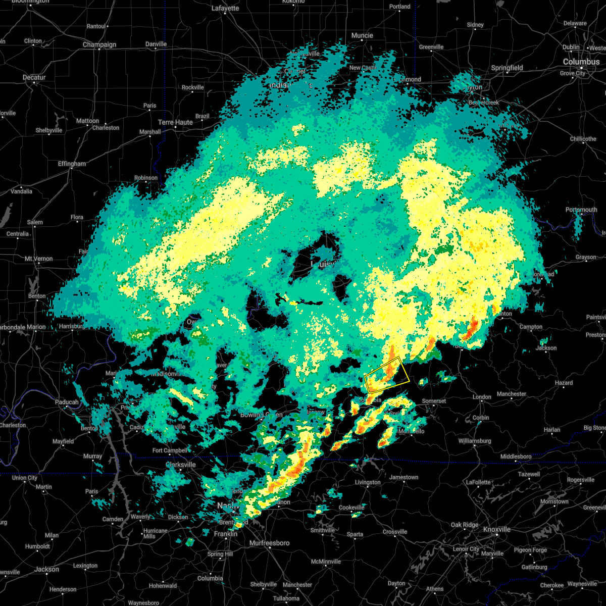 The severe thunderstorm warning for southeastern marion, eastern taylor, northwestern casey and northeastern adair counties will expire at 215 pm est/115 pm cst/, the storm which prompted the warning has weakened below severe limits, and no longer poses an immediate threat to life or property. therefore, the warning will be allowed to expire. however heavy rain is still possible with this thunderstorm. a tornado watch remains in effect until 700 pm est/600 pm cst/ for south central and central kentucky. The severe thunderstorm warning for southeastern marion, eastern taylor, northwestern casey and northeastern adair counties will expire at 215 pm est/115 pm cst/, the storm which prompted the warning has weakened below severe limits, and no longer poses an immediate threat to life or property. therefore, the warning will be allowed to expire. however heavy rain is still possible with this thunderstorm. a tornado watch remains in effect until 700 pm est/600 pm cst/ for south central and central kentucky.
|
| 1/1/2022 1:59 PM EST |
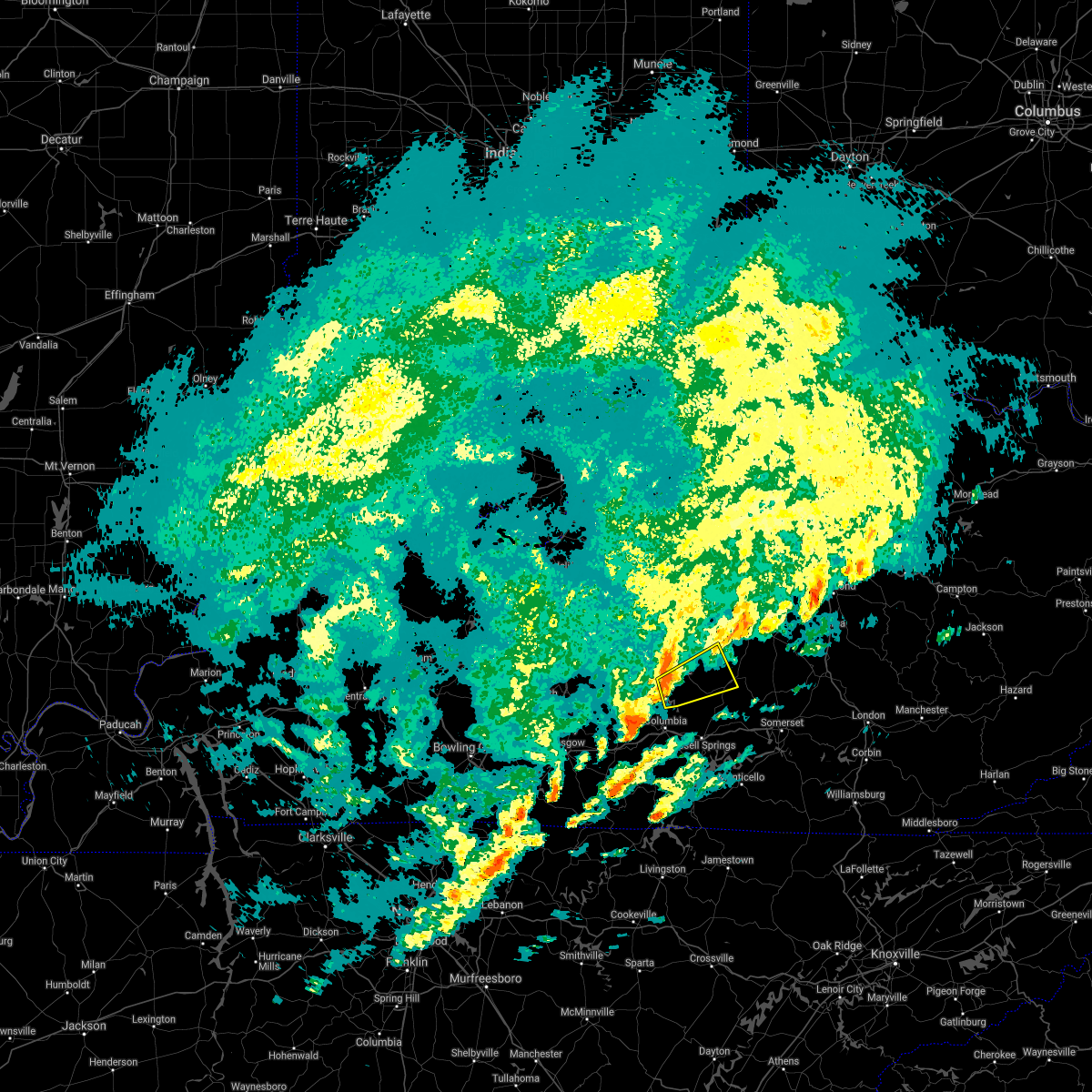 At 159 pm est/1259 pm cst/, a severe thunderstorm was located near campbellsville, moving east at 65 mph (radar indicated). Hazards include 70 mph wind gusts. Expect considerable tree damage. damage is likely to mobile homes, roofs, and outbuildings. Locations impacted include, liberty. At 159 pm est/1259 pm cst/, a severe thunderstorm was located near campbellsville, moving east at 65 mph (radar indicated). Hazards include 70 mph wind gusts. Expect considerable tree damage. damage is likely to mobile homes, roofs, and outbuildings. Locations impacted include, liberty.
|
| 1/1/2022 1:46 PM EST |
 At 145 pm est/1245 pm cst/, a severe thunderstorm was located over greensburg, moving east at 65 mph (radar indicated). Hazards include 70 mph wind gusts. Expect considerable tree damage. damage is likely to mobile homes, roofs, and outbuildings. this severe thunderstorm will be near, campbellsville around 155 pm est. Other locations in the path of this severe thunderstorm include liberty. At 145 pm est/1245 pm cst/, a severe thunderstorm was located over greensburg, moving east at 65 mph (radar indicated). Hazards include 70 mph wind gusts. Expect considerable tree damage. damage is likely to mobile homes, roofs, and outbuildings. this severe thunderstorm will be near, campbellsville around 155 pm est. Other locations in the path of this severe thunderstorm include liberty.
|
| 1/1/2022 1:23 PM EST |
 At 123 pm est, a severe thunderstorm was located near campbellsville, moving east at 60 mph (radar indicated). Hazards include 70 mph wind gusts. Expect considerable tree damage. damage is likely to mobile homes, roofs, and outbuildings. This severe thunderstorm will remain over mainly rural areas of northwestern taylor county, including the following locations, hobson, taylor county airport, wooleyville, spurlington, acton, bengal, durhamtown, sweeneyville, arista and finley. At 123 pm est, a severe thunderstorm was located near campbellsville, moving east at 60 mph (radar indicated). Hazards include 70 mph wind gusts. Expect considerable tree damage. damage is likely to mobile homes, roofs, and outbuildings. This severe thunderstorm will remain over mainly rural areas of northwestern taylor county, including the following locations, hobson, taylor county airport, wooleyville, spurlington, acton, bengal, durhamtown, sweeneyville, arista and finley.
|
| 1/1/2022 1:14 PM EST |
 At 114 pm est/1214 pm cst/, a severe thunderstorm was located near greensburg, moving east at 60 mph (radar indicated). Hazards include 70 mph wind gusts. Expect considerable tree damage. damage is likely to mobile homes, roofs, and outbuildings. This severe thunderstorm will be near, campbellsville around 125 pm est. At 114 pm est/1214 pm cst/, a severe thunderstorm was located near greensburg, moving east at 60 mph (radar indicated). Hazards include 70 mph wind gusts. Expect considerable tree damage. damage is likely to mobile homes, roofs, and outbuildings. This severe thunderstorm will be near, campbellsville around 125 pm est.
|
| 1/1/2022 1:04 PM EST | Several structures... power poles... and trees damaged. mutual aid is respondin in taylor county KY, 3.4 miles SSW of Campbellsville, KY |
| 7/16/2021 5:25 PM EDT | Trees down that took down main power line in taylor county KY, 1 miles E of Campbellsville, KY |
| 7/12/2020 6:42 PM EDT | Delayed report. dispatch reported trees down along old greensburg road. time estimated from rada in taylor county KY, 1 miles E of Campbellsville, KY |
| 7/12/2020 6:35 PM EDT | Delayed report. dispatch reported trees down near bear track road and palestine road. time estimated from rada in taylor county KY, 3.5 miles SW of Campbellsville, KY |
| 7/5/2020 4:27 PM EDT | Emergency management/ dispatch reported numerous trees and power lines down on pitman valley rd near hwy 744. also reports of a person trapped in the vehicl in taylor county KY, 6.1 miles SSW of Campbellsville, KY |
| 7/5/2020 4:27 PM EDT | Metal roof blow off at the intersection of pitman valley rd/ finley ridge r in taylor county KY, 7.6 miles SSW of Campbellsville, KY |
| 6/29/2020 7:56 PM EDT |
 At 756 pm edt, severe thunderstorms were located along a line extending from near lebanon to 12 miles northwest of liberty, moving south at 5 mph (radar indicated). Hazards include 60 mph wind gusts and nickel size hail. expect damage to roofs, siding, and trees At 756 pm edt, severe thunderstorms were located along a line extending from near lebanon to 12 miles northwest of liberty, moving south at 5 mph (radar indicated). Hazards include 60 mph wind gusts and nickel size hail. expect damage to roofs, siding, and trees
|
| 6/18/2020 6:40 PM EDT | Reported damage to 3 trees north of campbellsvill in taylor county KY, 1.2 miles S of Campbellsville, KY |
| 3/12/2020 7:47 PM EDT |
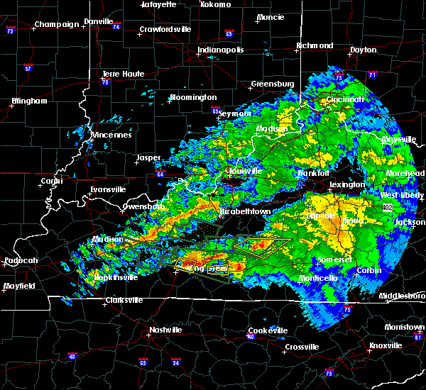 At 746 pm edt/646 pm cdt/, a severe thunderstorm was located 10 miles east of campbellsville, moving east at 45 mph (radar indicated. wind damage and quarter size hail was reported in northern green county). Hazards include 60 mph wind gusts and penny size hail. Expect damage to roofs, siding, and trees. Locations impacted include, campbellsville, arista, coburg, south campbellsville, romine, wrights, mannsville, wooleyville, atterson and acton. At 746 pm edt/646 pm cdt/, a severe thunderstorm was located 10 miles east of campbellsville, moving east at 45 mph (radar indicated. wind damage and quarter size hail was reported in northern green county). Hazards include 60 mph wind gusts and penny size hail. Expect damage to roofs, siding, and trees. Locations impacted include, campbellsville, arista, coburg, south campbellsville, romine, wrights, mannsville, wooleyville, atterson and acton.
|
| 3/12/2020 7:27 PM EDT |
 At 726 pm edt/626 pm cdt/, a severe thunderstorm was located near campbellsville, moving east at 45 mph (radar indicated). Hazards include 60 mph wind gusts and penny size hail. expect damage to roofs, siding, and trees At 726 pm edt/626 pm cdt/, a severe thunderstorm was located near campbellsville, moving east at 45 mph (radar indicated). Hazards include 60 mph wind gusts and penny size hail. expect damage to roofs, siding, and trees
|
| 1/11/2020 12:00 PM EST | Report from dispatcher of numerous trees & limbs down across the count in taylor county KY, 0.6 miles SSW of Campbellsville, KY |
| 8/20/2019 6:25 PM EDT | Tree reported down on old hodgenville rd and power line reported down on smith ridge r in taylor county KY, 1.6 miles ESE of Campbellsville, KY |
| 8/20/2019 5:06 PM CDT |
 At 606 pm edt/506 pm cdt/, a severe thunderstorm was located 12 miles southeast of hodgenville, moving southeast at 15 mph (radar indicated). Hazards include 60 mph wind gusts. expect damage to roofs, siding, and trees At 606 pm edt/506 pm cdt/, a severe thunderstorm was located 12 miles southeast of hodgenville, moving southeast at 15 mph (radar indicated). Hazards include 60 mph wind gusts. expect damage to roofs, siding, and trees
|
| 6/19/2019 9:10 PM EDT | Siding from a barn was blown across a road at airport road and new lebanon roa in taylor county KY, 2.2 miles SW of Campbellsville, KY |
| 6/19/2019 9:08 PM EDT | Metal roofing blown off a canop in taylor county KY, 2.2 miles SW of Campbellsville, KY |
| 6/19/2019 9:07 PM EDT |
 At 907 pm edt, a severe thunderstorm was located near campbellsville, moving northeast at 40 mph (radar indicated). Hazards include 60 mph wind gusts. Expect damage to roofs, siding, and trees. Locations impacted include, campbellsville, hobson, taylor county airport, wooleyville, spurlington, durhamtown, sweeneyville, arista, finley and saloma. At 907 pm edt, a severe thunderstorm was located near campbellsville, moving northeast at 40 mph (radar indicated). Hazards include 60 mph wind gusts. Expect damage to roofs, siding, and trees. Locations impacted include, campbellsville, hobson, taylor county airport, wooleyville, spurlington, durhamtown, sweeneyville, arista, finley and saloma.
|
| 6/19/2019 8:59 PM EDT |
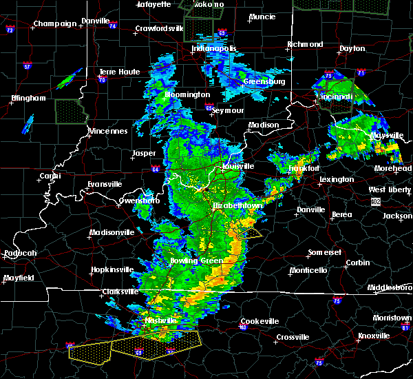 At 859 pm edt/759 pm cdt/, a severe thunderstorm was located near greensburg, moving northeast at 40 mph (radar indicated). Hazards include 60 mph wind gusts. Expect damage to roofs, siding, and trees. Locations impacted include, campbellsville, hobson, taylor county airport, wooleyville, spurlington, bengal, durhamtown, sweeneyville, arista and finley. At 859 pm edt/759 pm cdt/, a severe thunderstorm was located near greensburg, moving northeast at 40 mph (radar indicated). Hazards include 60 mph wind gusts. Expect damage to roofs, siding, and trees. Locations impacted include, campbellsville, hobson, taylor county airport, wooleyville, spurlington, bengal, durhamtown, sweeneyville, arista and finley.
|
| 6/19/2019 8:52 PM EDT |
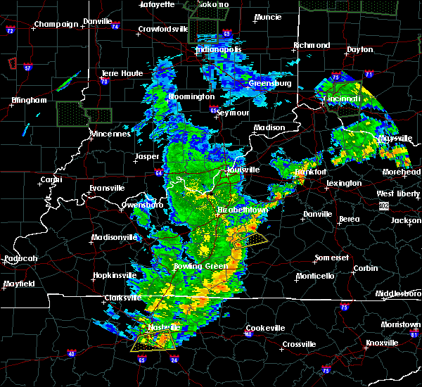 At 852 pm edt/752 pm cdt/, a severe thunderstorm was located near greensburg, moving east at 40 mph (radar indicated). Hazards include 60 mph wind gusts. expect damage to roofs, siding, and trees At 852 pm edt/752 pm cdt/, a severe thunderstorm was located near greensburg, moving east at 40 mph (radar indicated). Hazards include 60 mph wind gusts. expect damage to roofs, siding, and trees
|
| 11/5/2018 11:39 PM EST |
 At 1139 pm est/1039 pm cst/, a severe thunderstorm capable of producing a tornado was located near greensburg, moving east at 50 mph (radar indicated rotation). Hazards include tornado. Flying debris will be dangerous to those caught without shelter. mobile homes will be damaged or destroyed. damage to roofs, windows, and vehicles will occur. Tree damage is likely. At 1139 pm est/1039 pm cst/, a severe thunderstorm capable of producing a tornado was located near greensburg, moving east at 50 mph (radar indicated rotation). Hazards include tornado. Flying debris will be dangerous to those caught without shelter. mobile homes will be damaged or destroyed. damage to roofs, windows, and vehicles will occur. Tree damage is likely.
|
| 7/20/2018 10:54 PM CDT |
 At 1153 pm edt/1053 pm cdt/, severe thunderstorms were located along a line extending from 12 miles west of lebanon to 7 miles northwest of greensburg, moving southeast at 40 mph (radar indicated). Hazards include 70 mph wind gusts and nickel size hail. Expect considerable tree damage. Damage is likely to mobile homes, roofs, and outbuildings. At 1153 pm edt/1053 pm cdt/, severe thunderstorms were located along a line extending from 12 miles west of lebanon to 7 miles northwest of greensburg, moving southeast at 40 mph (radar indicated). Hazards include 70 mph wind gusts and nickel size hail. Expect considerable tree damage. Damage is likely to mobile homes, roofs, and outbuildings.
|
| 7/20/2018 7:25 PM EDT |
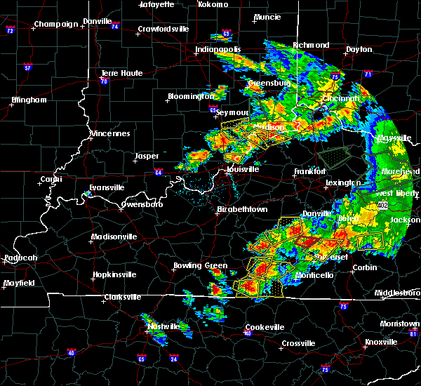 At 725 pm edt/625 pm cdt/, a severe thunderstorm was located near campbellsville, moving east at 25 mph (radar indicated). Hazards include 60 mph wind gusts and half dollar size hail. Hail damage to vehicles is expected. expect wind damage to roofs, siding, and trees. locations impacted include, campbellsville, taylor county airport, feathersburg, arista, south campbellsville, romine, elk horn, acton, speck and hatcher. a tornado watch remains in effect until 900 pm edt/800 pm cdt/ for south central and central kentucky. A tornado watch also remains in effect until 300 am edt/200 am cdt/ for south central and central kentucky. At 725 pm edt/625 pm cdt/, a severe thunderstorm was located near campbellsville, moving east at 25 mph (radar indicated). Hazards include 60 mph wind gusts and half dollar size hail. Hail damage to vehicles is expected. expect wind damage to roofs, siding, and trees. locations impacted include, campbellsville, taylor county airport, feathersburg, arista, south campbellsville, romine, elk horn, acton, speck and hatcher. a tornado watch remains in effect until 900 pm edt/800 pm cdt/ for south central and central kentucky. A tornado watch also remains in effect until 300 am edt/200 am cdt/ for south central and central kentucky.
|
| 7/20/2018 7:19 PM EDT | Quarter sized hail reported 2.3 miles NNW of Campbellsville, KY |
| 7/20/2018 7:15 PM EDT |
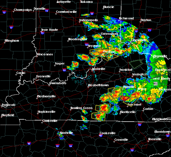 At 715 pm edt/615 pm cdt/, a severe thunderstorm was located near campbellsville, moving east at 25 mph (radar indicated). Hazards include 60 mph wind gusts and quarter size hail. Hail damage to vehicles is expected. Expect wind damage to roofs, siding, and trees. At 715 pm edt/615 pm cdt/, a severe thunderstorm was located near campbellsville, moving east at 25 mph (radar indicated). Hazards include 60 mph wind gusts and quarter size hail. Hail damage to vehicles is expected. Expect wind damage to roofs, siding, and trees.
|
| 7/20/2018 7:00 PM EDT | Golf Ball sized hail reported 6.7 miles SW of Campbellsville, KY |
| 7/20/2018 6:49 PM EDT | Storm damage reported in taylor county KY, 0.7 miles WNW of Campbellsville, KY |
| 7/20/2018 6:47 PM EDT | Quarter sized hail reported 4.8 miles WNW of Campbellsville, KY |
| 7/20/2018 6:43 PM EDT | Ping Pong Ball sized hail reported 9.4 miles ESE of Campbellsville, KY, in the mac community. |
| 7/20/2018 6:43 PM EDT |
 At 642 pm edt/542 pm cdt/, a severe thunderstorm was located over campbellsville, moving northeast at 40 mph (radar indicated). Hazards include 60 mph wind gusts and half dollar size hail. Hail damage to vehicles is expected. Expect wind damage to roofs, siding, and trees. At 642 pm edt/542 pm cdt/, a severe thunderstorm was located over campbellsville, moving northeast at 40 mph (radar indicated). Hazards include 60 mph wind gusts and half dollar size hail. Hail damage to vehicles is expected. Expect wind damage to roofs, siding, and trees.
|
| 7/20/2018 5:21 PM EDT |
 The national weather service in louisville has issued a * severe thunderstorm warning for. southeastern larue county in central kentucky. southern marion county in central kentucky. northern taylor county in central kentucky. Until 615 pm edt. The national weather service in louisville has issued a * severe thunderstorm warning for. southeastern larue county in central kentucky. southern marion county in central kentucky. northern taylor county in central kentucky. Until 615 pm edt.
|
| 7/5/2018 7:36 PM EDT |
 At 736 pm edt, a severe thunderstorm was located near campbellsville, moving southeast at 20 mph (radar indicated). Hazards include 60 mph wind gusts. Expect damage to roofs, siding, and trees. Locations impacted include, campbellsville, wrights, taylor county airport, elk horn, bengal, sweeneyville, hatcher, burdick, atchison and south campbellsville. At 736 pm edt, a severe thunderstorm was located near campbellsville, moving southeast at 20 mph (radar indicated). Hazards include 60 mph wind gusts. Expect damage to roofs, siding, and trees. Locations impacted include, campbellsville, wrights, taylor county airport, elk horn, bengal, sweeneyville, hatcher, burdick, atchison and south campbellsville.
|
| 7/5/2018 7:30 PM EDT | Main propane tank damaged at ferrellgas on south columbia ave. em reported they are evacuating the area around that facility. time approximated based on rada in taylor county KY, 1.5 miles N of Campbellsville, KY |
| 7/5/2018 7:27 PM EDT |
 At 726 pm edt/626 pm cdt/, a severe thunderstorm was located over campbellsville, moving southeast at 20 mph (radar indicated). Hazards include 60 mph wind gusts and quarter size hail. Hail damage to vehicles is expected. expect wind damage to roofs, siding, and trees. Locations impacted include, campbellsville, taylor county airport, bengal, arista, south campbellsville, romine, saloma, hobson, wrights and elk horn. At 726 pm edt/626 pm cdt/, a severe thunderstorm was located over campbellsville, moving southeast at 20 mph (radar indicated). Hazards include 60 mph wind gusts and quarter size hail. Hail damage to vehicles is expected. expect wind damage to roofs, siding, and trees. Locations impacted include, campbellsville, taylor county airport, bengal, arista, south campbellsville, romine, saloma, hobson, wrights and elk horn.
|
| 7/5/2018 7:20 PM EDT | Multiple trees down on houses and vehicles in the forest hills subdivision. also report of roofs gone. time estimated based on radar. also report of multiple trees down in taylor county KY, 1.6 miles SE of Campbellsville, KY |
| 7/5/2018 7:12 PM EDT |
 At 711 pm edt/611 pm cdt/, a severe thunderstorm was located near campbellsville, moving southeast at 20 mph (radar indicated). Hazards include 60 mph wind gusts and quarter size hail. Hail damage to vehicles is expected. Expect wind damage to roofs, siding, and trees. At 711 pm edt/611 pm cdt/, a severe thunderstorm was located near campbellsville, moving southeast at 20 mph (radar indicated). Hazards include 60 mph wind gusts and quarter size hail. Hail damage to vehicles is expected. Expect wind damage to roofs, siding, and trees.
|
| 6/26/2018 1:16 PM CDT |
 At 216 pm edt/116 pm cdt/, severe thunderstorms were located along a line extending from 11 miles southwest of greensburg to 6 miles northeast of columbia, moving east at 20 mph (radar indicated). Hazards include 60 mph wind gusts. Expect damage to roofs, siding, and trees. Locations impacted include, campbellsville, greensburg, absher, arista, fry, south campbellsville, romine, exie, pierce and mannsville. At 216 pm edt/116 pm cdt/, severe thunderstorms were located along a line extending from 11 miles southwest of greensburg to 6 miles northeast of columbia, moving east at 20 mph (radar indicated). Hazards include 60 mph wind gusts. Expect damage to roofs, siding, and trees. Locations impacted include, campbellsville, greensburg, absher, arista, fry, south campbellsville, romine, exie, pierce and mannsville.
|
| 6/26/2018 1:00 PM CDT |
 At 159 pm edt/1259 pm cdt/, severe thunderstorms were located along a line extending from 12 miles southeast of munfordville to 7 miles northwest of columbia, moving east at 20 mph (radar indicated). Hazards include 60 mph wind gusts. expect damage to roofs, siding, and trees At 159 pm edt/1259 pm cdt/, severe thunderstorms were located along a line extending from 12 miles southeast of munfordville to 7 miles northwest of columbia, moving east at 20 mph (radar indicated). Hazards include 60 mph wind gusts. expect damage to roofs, siding, and trees
|
| 6/26/2018 12:30 PM CDT |
 At 130 pm edt/1230 pm cdt/, severe thunderstorms were located along a line extending from 11 miles southeast of munfordville to 11 miles southwest of liberty, moving east at 40 mph (radar indicated). Hazards include 60 mph wind gusts. expect damage to roofs, siding, and trees At 130 pm edt/1230 pm cdt/, severe thunderstorms were located along a line extending from 11 miles southeast of munfordville to 11 miles southwest of liberty, moving east at 40 mph (radar indicated). Hazards include 60 mph wind gusts. expect damage to roofs, siding, and trees
|
| 6/26/2018 1:07 PM EDT |
 At 107 pm edt/1207 pm cdt/, a severe thunderstorm was located near campbellsville, moving east at 20 mph (radar indicated). Hazards include 60 mph wind gusts. expect damage to roofs, siding, and trees At 107 pm edt/1207 pm cdt/, a severe thunderstorm was located near campbellsville, moving east at 20 mph (radar indicated). Hazards include 60 mph wind gusts. expect damage to roofs, siding, and trees
|
| 6/26/2018 10:46 AM EDT |
 At 1046 am edt, a severe thunderstorm was located near campbellsville, moving northeast at 20 mph (radar indicated). Hazards include 60 mph wind gusts and quarter size hail. Hail damage to vehicles is expected. expect wind damage to roofs, siding, and trees. Locations impacted include, campbellsville, taylor county airport, elk horn, wooleyville, spurlington, acton, arista, atchison, south campbellsville and speck. At 1046 am edt, a severe thunderstorm was located near campbellsville, moving northeast at 20 mph (radar indicated). Hazards include 60 mph wind gusts and quarter size hail. Hail damage to vehicles is expected. expect wind damage to roofs, siding, and trees. Locations impacted include, campbellsville, taylor county airport, elk horn, wooleyville, spurlington, acton, arista, atchison, south campbellsville and speck.
|
| 6/26/2018 10:42 AM EDT | Storm damage reported in taylor county KY, 0.6 miles SSW of Campbellsville, KY |
| 6/26/2018 10:30 AM EDT |
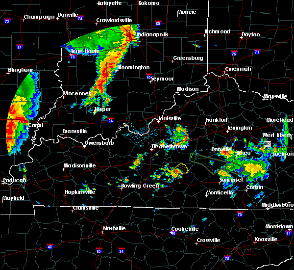 At 1030 am edt, a severe thunderstorm was located over campbellsville, moving northeast at 20 mph (radar indicated). Hazards include 60 mph wind gusts and quarter size hail. Hail damage to vehicles is expected. Expect wind damage to roofs, siding, and trees. At 1030 am edt, a severe thunderstorm was located over campbellsville, moving northeast at 20 mph (radar indicated). Hazards include 60 mph wind gusts and quarter size hail. Hail damage to vehicles is expected. Expect wind damage to roofs, siding, and trees.
|
| 5/31/2018 4:16 PM EDT |
 At 415 pm edt, a severe thunderstorm was located over campbellsville, moving east at 30 mph (radar indicated). Hazards include 60 mph wind gusts and quarter size hail. Hail damage to vehicles is expected. expect wind damage to roofs, siding, and trees. Locations impacted include, campbellsville, taylor county airport, bengal, arista, south campbellsville, saloma, hobson, wrights, elk horn and durhamtown. At 415 pm edt, a severe thunderstorm was located over campbellsville, moving east at 30 mph (radar indicated). Hazards include 60 mph wind gusts and quarter size hail. Hail damage to vehicles is expected. expect wind damage to roofs, siding, and trees. Locations impacted include, campbellsville, taylor county airport, bengal, arista, south campbellsville, saloma, hobson, wrights, elk horn and durhamtown.
|
| 5/31/2018 3:58 PM EDT |
 At 357 pm edt/257 pm cdt/, a severe thunderstorm was located over greensburg, moving east at 25 mph (radar indicated). Hazards include 60 mph wind gusts and quarter size hail. Hail damage to vehicles is expected. Expect wind damage to roofs, siding, and trees. At 357 pm edt/257 pm cdt/, a severe thunderstorm was located over greensburg, moving east at 25 mph (radar indicated). Hazards include 60 mph wind gusts and quarter size hail. Hail damage to vehicles is expected. Expect wind damage to roofs, siding, and trees.
|
| 4/3/2018 8:33 PM CDT |
 At 932 pm edt/832 pm cdt/, severe thunderstorms were located along a line extending from 10 miles north of liberty to near greensburg, moving east at 45 mph. the most severe storm is moving through southern marion and into northwest casey county. additional severe storms were also noted in southeast hart county and into central green county (radar indicated). Hazards include 60 mph wind gusts and quarter size hail. Hail damage to vehicles is expected. expect wind damage to roofs, siding, and trees. locations impacted include, liberty, campbellsville, greensburg, munfordville, monroe, hustonville, absher, teddy, fry and romine. A tornado watch remains in effect until 100 am edt/midnight cdt/ for south central and central kentucky. At 932 pm edt/832 pm cdt/, severe thunderstorms were located along a line extending from 10 miles north of liberty to near greensburg, moving east at 45 mph. the most severe storm is moving through southern marion and into northwest casey county. additional severe storms were also noted in southeast hart county and into central green county (radar indicated). Hazards include 60 mph wind gusts and quarter size hail. Hail damage to vehicles is expected. expect wind damage to roofs, siding, and trees. locations impacted include, liberty, campbellsville, greensburg, munfordville, monroe, hustonville, absher, teddy, fry and romine. A tornado watch remains in effect until 100 am edt/midnight cdt/ for south central and central kentucky.
|
| 4/3/2018 8:22 PM CDT |
 At 920 pm edt/820 pm cdt/, severe thunderstorms were located along a line extending from 10 miles southeast of lebanon to 10 miles west of greensburg, moving east at 45 mph. the most severe storms remain over northeastern taylor county. another very intense storm is moving east over southern hart county (radar indicated). Hazards include 60 mph wind gusts and half dollar size hail. Hail damage to vehicles is expected. expect wind damage to roofs, siding, and trees. locations impacted include, liberty, campbellsville, greensburg, munfordville, monroe, horse cave, hustonville, absher, teddy and logsdon valley. A tornado watch remains in effect until 100 am edt/midnight cdt/ for south central and central kentucky. At 920 pm edt/820 pm cdt/, severe thunderstorms were located along a line extending from 10 miles southeast of lebanon to 10 miles west of greensburg, moving east at 45 mph. the most severe storms remain over northeastern taylor county. another very intense storm is moving east over southern hart county (radar indicated). Hazards include 60 mph wind gusts and half dollar size hail. Hail damage to vehicles is expected. expect wind damage to roofs, siding, and trees. locations impacted include, liberty, campbellsville, greensburg, munfordville, monroe, horse cave, hustonville, absher, teddy and logsdon valley. A tornado watch remains in effect until 100 am edt/midnight cdt/ for south central and central kentucky.
|
| 4/3/2018 9:15 PM EDT | Golf Ball sized hail reported 4.7 miles S of Campbellsville, KY, spotter report relayed via em. |
| 4/3/2018 9:14 PM EDT |
 At 914 pm edt, a severe squall line capable of producing both tornadoes and extensive straight line wind damage was located near campbellsville, moving east at 45 mph (radar indicated rotation). Hazards include tornado. Flying debris will be dangerous to those caught without shelter. mobile homes will be damaged or destroyed. damage to roofs, windows, and vehicles will occur. tree damage is likely. Locations impacted include, campbellsville, hobson, taylor county airport, mannsville, wooleyville, spurlington, phillipsburg, arista and salleetown. At 914 pm edt, a severe squall line capable of producing both tornadoes and extensive straight line wind damage was located near campbellsville, moving east at 45 mph (radar indicated rotation). Hazards include tornado. Flying debris will be dangerous to those caught without shelter. mobile homes will be damaged or destroyed. damage to roofs, windows, and vehicles will occur. tree damage is likely. Locations impacted include, campbellsville, hobson, taylor county airport, mannsville, wooleyville, spurlington, phillipsburg, arista and salleetown.
|
| 4/3/2018 8:13 PM CDT |
 At 913 pm edt/813 pm cdt/, severe thunderstorms were located along a line extending from 8 miles south of lebanon to 7 miles southeast of munfordville, moving east at 45 mph. the strongest part of this line of storms is over northern green and central taylor counties (radar indicated). Hazards include 60 mph wind gusts and quarter size hail. Hail damage to vehicles is expected. expect wind damage to roofs, siding, and trees. locations impacted include, liberty, campbellsville, greensburg, munfordville, monroe, horse cave, hustonville, absher, teddy and logsdon valley. A tornado watch remains in effect until 100 am edt/midnight cdt/ for south central and central kentucky. At 913 pm edt/813 pm cdt/, severe thunderstorms were located along a line extending from 8 miles south of lebanon to 7 miles southeast of munfordville, moving east at 45 mph. the strongest part of this line of storms is over northern green and central taylor counties (radar indicated). Hazards include 60 mph wind gusts and quarter size hail. Hail damage to vehicles is expected. expect wind damage to roofs, siding, and trees. locations impacted include, liberty, campbellsville, greensburg, munfordville, monroe, horse cave, hustonville, absher, teddy and logsdon valley. A tornado watch remains in effect until 100 am edt/midnight cdt/ for south central and central kentucky.
|
| 4/3/2018 9:11 PM EDT |
 At 910 pm edt, severe thunderstorms capable of producing both tornadoes and extensive straight line wind damage were located near campbellsville, moving east at 45 mph (radar indicated rotation). Hazards include tornado. Flying debris will be dangerous to those caught without shelter. mobile homes will be damaged or destroyed. damage to roofs, windows, and vehicles will occur. Tree damage is likely. At 910 pm edt, severe thunderstorms capable of producing both tornadoes and extensive straight line wind damage were located near campbellsville, moving east at 45 mph (radar indicated rotation). Hazards include tornado. Flying debris will be dangerous to those caught without shelter. mobile homes will be damaged or destroyed. damage to roofs, windows, and vehicles will occur. Tree damage is likely.
|
| 4/3/2018 9:07 PM EDT | Quarter sized hail reported 6.1 miles ESE of Campbellsville, KY |
| 4/3/2018 7:59 PM CDT |
 At 859 pm edt/759 pm cdt/, severe thunderstorms were located along a line extending from 7 miles north of campbellsville to near munfordville, moving east at 45 mph (radar indicated). Hazards include 60 mph wind gusts and quarter size hail. Hail damage to vehicles is expected. Expect wind damage to roofs, siding, and trees. At 859 pm edt/759 pm cdt/, severe thunderstorms were located along a line extending from 7 miles north of campbellsville to near munfordville, moving east at 45 mph (radar indicated). Hazards include 60 mph wind gusts and quarter size hail. Hail damage to vehicles is expected. Expect wind damage to roofs, siding, and trees.
|
| 2/24/2018 11:53 PM EST |
 At 1153 pm est/1053 pm cst/, a severe thunderstorm was located near campbellsville, moving east at 55 mph (radar indicated). Hazards include 60 mph wind gusts. Expect damage to roofs, siding, and trees. locations impacted include, campbellsville, absher, coburg, south campbellsville, romine, wrights, mannsville, wooleyville, acton and hatcher. A tornado watch remains in effect until 300 am est/200 am cst/ for south central and central kentucky. At 1153 pm est/1053 pm cst/, a severe thunderstorm was located near campbellsville, moving east at 55 mph (radar indicated). Hazards include 60 mph wind gusts. Expect damage to roofs, siding, and trees. locations impacted include, campbellsville, absher, coburg, south campbellsville, romine, wrights, mannsville, wooleyville, acton and hatcher. A tornado watch remains in effect until 300 am est/200 am cst/ for south central and central kentucky.
|
| 2/24/2018 10:41 PM CST |
 At 1141 pm est/1041 pm cst/, a severe thunderstorm was located near greensburg, moving east at 55 mph (radar indicated). Hazards include 60 mph wind gusts. Expect damage to roofs, siding, and trees. locations impacted include, campbellsville, greensburg, pickett, portland, absher, arista, coburg, fry, south campbellsville and romine. A tornado watch remains in effect until 300 am est/200 am cst/ for south central and central kentucky. At 1141 pm est/1041 pm cst/, a severe thunderstorm was located near greensburg, moving east at 55 mph (radar indicated). Hazards include 60 mph wind gusts. Expect damage to roofs, siding, and trees. locations impacted include, campbellsville, greensburg, pickett, portland, absher, arista, coburg, fry, south campbellsville and romine. A tornado watch remains in effect until 300 am est/200 am cst/ for south central and central kentucky.
|
| 2/24/2018 10:27 PM CST |
 At 1127 pm est/1027 pm cst/, a severe thunderstorm was located 12 miles northwest of edmonton, moving east at 55 mph (radar indicated). Hazards include 60 mph wind gusts. expect damage to roofs, siding, and trees At 1127 pm est/1027 pm cst/, a severe thunderstorm was located 12 miles northwest of edmonton, moving east at 55 mph (radar indicated). Hazards include 60 mph wind gusts. expect damage to roofs, siding, and trees
|
| 11/18/2017 6:05 PM EST | Few power lines reported dow in taylor county KY, 0.6 miles SSW of Campbellsville, KY |
| 7/7/2017 11:30 PM CDT |
 At 1230 am edt/1130 pm cdt/, a severe thunderstorm was located near campbellsville, moving southeast at 30 mph (radar indicated). Hazards include 60 mph wind gusts. Expect damage to roofs, siding, and trees. Locations impacted include, campbellsville, christine, south campbellsville, evans ford, mannsville, wooleyville, acton, hatcher, atchison and purdy. At 1230 am edt/1130 pm cdt/, a severe thunderstorm was located near campbellsville, moving southeast at 30 mph (radar indicated). Hazards include 60 mph wind gusts. Expect damage to roofs, siding, and trees. Locations impacted include, campbellsville, christine, south campbellsville, evans ford, mannsville, wooleyville, acton, hatcher, atchison and purdy.
|
| 7/8/2017 12:16 AM EDT |
 At 1215 am edt/1115 pm cdt/, a severe thunderstorm was located over campbellsville, moving southeast at 30 mph (radar indicated). Hazards include 60 mph wind gusts. expect damage to roofs, siding, and trees At 1215 am edt/1115 pm cdt/, a severe thunderstorm was located over campbellsville, moving southeast at 30 mph (radar indicated). Hazards include 60 mph wind gusts. expect damage to roofs, siding, and trees
|
| 7/8/2017 12:10 AM EDT |
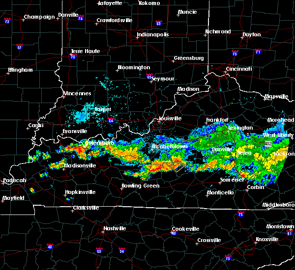 At 1210 am edt, a severe thunderstorm was located near campbellsville, moving southeast at 35 mph (radar indicated). Hazards include 60 mph wind gusts. Expect damage to roofs, siding, and trees. Locations impacted include, campbellsville, spurlington, bengal, arista, saloma, mac, hobson, wrights, white rose and durhamtown. At 1210 am edt, a severe thunderstorm was located near campbellsville, moving southeast at 35 mph (radar indicated). Hazards include 60 mph wind gusts. Expect damage to roofs, siding, and trees. Locations impacted include, campbellsville, spurlington, bengal, arista, saloma, mac, hobson, wrights, white rose and durhamtown.
|
| 7/7/2017 11:55 PM EDT |
 At 1155 pm edt/1055 pm cdt/, a severe thunderstorm was located 13 miles east of hodgenville, moving southeast at 30 mph (radar indicated). Hazards include 60 mph wind gusts. expect damage to roofs, siding, and trees At 1155 pm edt/1055 pm cdt/, a severe thunderstorm was located 13 miles east of hodgenville, moving southeast at 30 mph (radar indicated). Hazards include 60 mph wind gusts. expect damage to roofs, siding, and trees
|
| 6/23/2017 3:36 PM EDT |
 At 336 pm edt, a severe thunderstorm capable of producing a tornado was located over campbellsville, moving northeast at 35 mph (radar indicated rotation). Hazards include tornado. Flying debris will be dangerous to those caught without shelter. mobile homes will be damaged or destroyed. damage to roofs, windows, and vehicles will occur. tree damage is likely. Locations impacted include, campbellsville, taylor county airport, wooleyville, arista, spurlington and south campbellsville. At 336 pm edt, a severe thunderstorm capable of producing a tornado was located over campbellsville, moving northeast at 35 mph (radar indicated rotation). Hazards include tornado. Flying debris will be dangerous to those caught without shelter. mobile homes will be damaged or destroyed. damage to roofs, windows, and vehicles will occur. tree damage is likely. Locations impacted include, campbellsville, taylor county airport, wooleyville, arista, spurlington and south campbellsville.
|
| 6/23/2017 3:35 PM EDT |
 At 334 pm edt, a severe thunderstorm was located over campbellsville, moving northeast at 35 mph (radar indicated). Hazards include 60 mph wind gusts. Expect damage to roofs, siding, and trees. locations impacted include, campbellsville, taylor county airport, spurlington, arista, south campbellsville, wrights, elk horn, mannsville, wooleyville and acton. A tornado watch remains in effect until 1000 pm edt for central kentucky. At 334 pm edt, a severe thunderstorm was located over campbellsville, moving northeast at 35 mph (radar indicated). Hazards include 60 mph wind gusts. Expect damage to roofs, siding, and trees. locations impacted include, campbellsville, taylor county airport, spurlington, arista, south campbellsville, wrights, elk horn, mannsville, wooleyville and acton. A tornado watch remains in effect until 1000 pm edt for central kentucky.
|
| 6/23/2017 3:28 PM EDT |
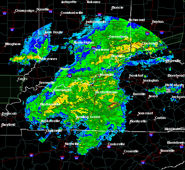 At 328 pm edt, a severe thunderstorm capable of producing a tornado was located near campbellsville, moving northeast at 30 mph (radar indicated rotation). Hazards include tornado. Flying debris will be dangerous to those caught without shelter. mobile homes will be damaged or destroyed. damage to roofs, windows, and vehicles will occur. Tree damage is likely. At 328 pm edt, a severe thunderstorm capable of producing a tornado was located near campbellsville, moving northeast at 30 mph (radar indicated rotation). Hazards include tornado. Flying debris will be dangerous to those caught without shelter. mobile homes will be damaged or destroyed. damage to roofs, windows, and vehicles will occur. Tree damage is likely.
|
| 6/23/2017 3:21 PM EDT |
 At 321 pm edt/221 pm cdt/, a severe thunderstorm was located near greensburg, moving northeast at 35 mph (radar indicated). Hazards include 60 mph wind gusts. expect damage to roofs, siding, and trees At 321 pm edt/221 pm cdt/, a severe thunderstorm was located near greensburg, moving northeast at 35 mph (radar indicated). Hazards include 60 mph wind gusts. expect damage to roofs, siding, and trees
|
| 5/27/2017 7:33 PM EDT | Trees down and roof blown off 2 miles northwest in taylor county KY, 0.6 miles SSW of Campbellsville, KY |
| 5/27/2017 7:19 PM EDT | Tree reported dow in taylor county KY, 2.8 miles WNW of Campbellsville, KY |
| 5/27/2017 7:19 PM EDT | Quarter sized hail reported 4.3 miles WNW of Campbellsville, KY |
| 5/27/2017 6:16 PM CDT |
 At 716 pm edt/616 pm cdt/, a severe thunderstorm was located over greensburg, moving northeast at 20 mph (radar indicated). Hazards include 60 mph wind gusts and quarter size hail. Hail damage to vehicles is expected. Expect wind damage to roofs, siding, and trees. At 716 pm edt/616 pm cdt/, a severe thunderstorm was located over greensburg, moving northeast at 20 mph (radar indicated). Hazards include 60 mph wind gusts and quarter size hail. Hail damage to vehicles is expected. Expect wind damage to roofs, siding, and trees.
|
| 5/27/2017 7:10 PM EDT |
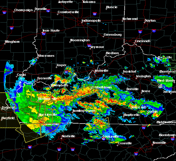 At 710 pm edt/610 pm cdt/, severe thunderstorms were located along a line extending from campbellsville to 14 miles west of liberty, moving east at 15 mph (radar indicated). Hazards include 60 mph wind gusts and quarter size hail. Hail damage to vehicles is expected. Expect wind damage to roofs, siding, and trees. At 710 pm edt/610 pm cdt/, severe thunderstorms were located along a line extending from campbellsville to 14 miles west of liberty, moving east at 15 mph (radar indicated). Hazards include 60 mph wind gusts and quarter size hail. Hail damage to vehicles is expected. Expect wind damage to roofs, siding, and trees.
|
| 5/27/2017 6:49 PM EDT |
 At 649 pm edt, a severe thunderstorm was located 9 miles east of campbellsville, moving east at 45 mph (radar indicated). Hazards include quarter size hail. Damage to vehicles is expected. Locations impacted include, campbellsville, bradfordsville, arista, south campbellsville, wrights, mannsville, wooleyville, atterson, acton and hatcher. At 649 pm edt, a severe thunderstorm was located 9 miles east of campbellsville, moving east at 45 mph (radar indicated). Hazards include quarter size hail. Damage to vehicles is expected. Locations impacted include, campbellsville, bradfordsville, arista, south campbellsville, wrights, mannsville, wooleyville, atterson, acton and hatcher.
|
| 5/27/2017 6:42 PM EDT | Quarter sized hail reported 0.6 miles SSW of Campbellsville, KY |
| 5/27/2017 6:36 PM EDT |
 At 635 pm edt/535 pm cdt/, a severe thunderstorm was located near campbellsville, moving east at 30 mph (radar indicated). Hazards include quarter size hail. damage to vehicles is expected At 635 pm edt/535 pm cdt/, a severe thunderstorm was located near campbellsville, moving east at 30 mph (radar indicated). Hazards include quarter size hail. damage to vehicles is expected
|
| 5/27/2017 6:10 PM EDT | Quarter sized hail reported 1.3 miles SSE of Campbellsville, KY |
| 5/27/2017 6:10 PM EDT |
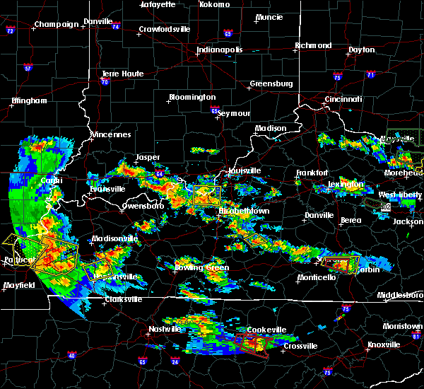 The severe thunderstorm warning for northwestern taylor county will expire at 615 pm edt, the storm which prompted the warning has weakened below severe limits, and no longer poses an immediate threat to life or property. therefore the warning will be allowed to expire. however small hail is still possible with this thunderstorm. a severe thunderstorm watch remains in effect until 1000 pm edt for central kentucky. report severe weather to local law enforcement, post your report to the national weather service louisville facebook page, or tweet your report using hashtag l, m, k, spotter. The severe thunderstorm warning for northwestern taylor county will expire at 615 pm edt, the storm which prompted the warning has weakened below severe limits, and no longer poses an immediate threat to life or property. therefore the warning will be allowed to expire. however small hail is still possible with this thunderstorm. a severe thunderstorm watch remains in effect until 1000 pm edt for central kentucky. report severe weather to local law enforcement, post your report to the national weather service louisville facebook page, or tweet your report using hashtag l, m, k, spotter.
|
| 5/27/2017 5:59 PM EDT |
 At 559 pm edt, a severe thunderstorm was located near campbellsville, moving northeast at 20 mph (radar indicated). Hazards include quarter size hail. Damage to vehicles is expected. Locations impacted include, campbellsville, hobson, wrights, taylor county airport, white rose, bengal, durhamtown, sweeneyville, arista and saloma. At 559 pm edt, a severe thunderstorm was located near campbellsville, moving northeast at 20 mph (radar indicated). Hazards include quarter size hail. Damage to vehicles is expected. Locations impacted include, campbellsville, hobson, wrights, taylor county airport, white rose, bengal, durhamtown, sweeneyville, arista and saloma.
|
| 5/27/2017 5:49 PM EDT |
 At 548 pm edt/448 pm cdt/, a severe thunderstorm was located 7 miles west of campbellsville, moving northeast at 20 mph (radar indicated). Hazards include quarter size hail. damage to vehicles is expected At 548 pm edt/448 pm cdt/, a severe thunderstorm was located 7 miles west of campbellsville, moving northeast at 20 mph (radar indicated). Hazards include quarter size hail. damage to vehicles is expected
|
| 5/27/2017 1:47 PM CDT |
 At 246 pm edt/146 pm cdt/, a severe thunderstorm was located near greensburg, moving northeast at 25 mph (radar indicated). Hazards include 60 mph wind gusts and quarter size hail. Hail damage to vehicles is expected. Expect wind damage to roofs, siding, and trees. At 246 pm edt/146 pm cdt/, a severe thunderstorm was located near greensburg, moving northeast at 25 mph (radar indicated). Hazards include 60 mph wind gusts and quarter size hail. Hail damage to vehicles is expected. Expect wind damage to roofs, siding, and trees.
|
| 5/4/2017 6:37 PM CDT |
 At 735 pm edt/635 pm cdt/, severe thunderstorms were located along a line extending from near greensburg to near columbia to near albany, moving northeast at 35 mph (radar indicated. kentucky mesonet in cumberland county gusted to 59 mph). Hazards include 60 mph wind gusts. Expect damage to roofs, siding, and trees. Locations impacted include, campbellsville, columbia, greensburg, albany, jamestown, russell springs, desda, cartwright, snow and cundiff. At 735 pm edt/635 pm cdt/, severe thunderstorms were located along a line extending from near greensburg to near columbia to near albany, moving northeast at 35 mph (radar indicated. kentucky mesonet in cumberland county gusted to 59 mph). Hazards include 60 mph wind gusts. Expect damage to roofs, siding, and trees. Locations impacted include, campbellsville, columbia, greensburg, albany, jamestown, russell springs, desda, cartwright, snow and cundiff.
|
| 5/4/2017 6:20 PM CDT |
 At 719 pm edt/619 pm cdt/, severe thunderstorms were located along a line extending from near greensburg to 7 miles southwest of columbia to 7 miles west of albany, moving northeast at 35 mph (radar indicated. kentucky mesonet gust of 59 mph in cumberland county). Hazards include 60 mph wind gusts. expect damage to roofs, siding, and trees At 719 pm edt/619 pm cdt/, severe thunderstorms were located along a line extending from near greensburg to 7 miles southwest of columbia to 7 miles west of albany, moving northeast at 35 mph (radar indicated. kentucky mesonet gust of 59 mph in cumberland county). Hazards include 60 mph wind gusts. expect damage to roofs, siding, and trees
|
| 4/30/2017 5:47 PM CDT |
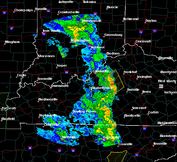 At 646 pm edt/546 pm cdt/, severe thunderstorms were located along a line extending from 7 miles southeast of greensburg to 9 miles northeast of burkesville to near albany, moving northeast at 55 mph (radar indicated). Hazards include 60 mph wind gusts. expect damage to roofs, siding, and trees At 646 pm edt/546 pm cdt/, severe thunderstorms were located along a line extending from 7 miles southeast of greensburg to 9 miles northeast of burkesville to near albany, moving northeast at 55 mph (radar indicated). Hazards include 60 mph wind gusts. expect damage to roofs, siding, and trees
|
| 4/30/2017 6:14 PM EDT |
 At 613 pm edt, severe thunderstorms were located along a line extending from 10 miles north of hodgenville to 12 miles west of lebanon to near campbellsville, moving northeast at 50 mph (law enforcement. at 556 pm a tree was reported blown down in central larue county). Hazards include 60 mph wind gusts. expect damage to roofs, siding, and trees At 613 pm edt, severe thunderstorms were located along a line extending from 10 miles north of hodgenville to 12 miles west of lebanon to near campbellsville, moving northeast at 50 mph (law enforcement. at 556 pm a tree was reported blown down in central larue county). Hazards include 60 mph wind gusts. expect damage to roofs, siding, and trees
|
| 4/18/2017 6:55 PM EDT | Roof damage to a mote in taylor county KY, 1.3 miles WSW of Campbellsville, KY |
| 4/5/2017 6:43 PM EDT | Half Dollar sized hail reported 0.8 miles N of Campbellsville, KY |
| 4/5/2017 6:36 PM EDT |
 At 636 pm edt/536 pm cdt/, a severe thunderstorm capable of producing a tornado was located near campbellsville, moving northeast at 65 mph (radar indicated rotation). Hazards include tornado and quarter size hail. Flying debris will be dangerous to those caught without shelter. mobile homes will be damaged or destroyed. damage to roofs, windows, and vehicles will occur. Tree damage is likely. At 636 pm edt/536 pm cdt/, a severe thunderstorm capable of producing a tornado was located near campbellsville, moving northeast at 65 mph (radar indicated rotation). Hazards include tornado and quarter size hail. Flying debris will be dangerous to those caught without shelter. mobile homes will be damaged or destroyed. damage to roofs, windows, and vehicles will occur. Tree damage is likely.
|
| 4/5/2017 5:29 PM CDT |
 At 629 pm edt/529 pm cdt/, a severe thunderstorm was located near greensburg, moving northeast at 60 mph (radar indicated). Hazards include two inch hail and 70 mph wind gusts. People and animals outdoors will be injured. expect hail damage to roofs, siding, windows, and vehicles. expect considerable tree damage. wind damage is also likely to mobile homes, roofs, and outbuildings. locations impacted include, campbellsville, greensburg, arista, coburg, south campbellsville, romine, grab, exie, wrights and newt. A tornado watch remains in effect until 1000 pm edt/900 pm cdt/ for south central and central kentucky. At 629 pm edt/529 pm cdt/, a severe thunderstorm was located near greensburg, moving northeast at 60 mph (radar indicated). Hazards include two inch hail and 70 mph wind gusts. People and animals outdoors will be injured. expect hail damage to roofs, siding, windows, and vehicles. expect considerable tree damage. wind damage is also likely to mobile homes, roofs, and outbuildings. locations impacted include, campbellsville, greensburg, arista, coburg, south campbellsville, romine, grab, exie, wrights and newt. A tornado watch remains in effect until 1000 pm edt/900 pm cdt/ for south central and central kentucky.
|
| 4/5/2017 5:21 PM CDT |
 At 621 pm edt/521 pm cdt/, a severe thunderstorm was located near greensburg, moving northeast at 55 mph (radar indicated). Hazards include golf ball size hail and 60 mph wind gusts. People and animals outdoors will be injured. expect hail damage to roofs, siding, windows, and vehicles. expect wind damage to roofs, siding, and trees. locations impacted include, campbellsville, greensburg, donansburg, arista, fry, south campbellsville, romine, grab, exie and wrights. A tornado watch remains in effect until 1000 pm edt/900 pm cdt/ for south central and central kentucky. At 621 pm edt/521 pm cdt/, a severe thunderstorm was located near greensburg, moving northeast at 55 mph (radar indicated). Hazards include golf ball size hail and 60 mph wind gusts. People and animals outdoors will be injured. expect hail damage to roofs, siding, windows, and vehicles. expect wind damage to roofs, siding, and trees. locations impacted include, campbellsville, greensburg, donansburg, arista, fry, south campbellsville, romine, grab, exie and wrights. A tornado watch remains in effect until 1000 pm edt/900 pm cdt/ for south central and central kentucky.
|
| 4/5/2017 5:14 PM CDT |
 At 613 pm edt/513 pm cdt/, a severe thunderstorm was located 10 miles southwest of greensburg, moving northeast at 60 mph (radar indicated). Hazards include ping pong ball size hail and 60 mph wind gusts. People and animals outdoors will be injured. expect hail damage to roofs, siding, windows, and vehicles. Expect wind damage to roofs, siding, and trees. At 613 pm edt/513 pm cdt/, a severe thunderstorm was located 10 miles southwest of greensburg, moving northeast at 60 mph (radar indicated). Hazards include ping pong ball size hail and 60 mph wind gusts. People and animals outdoors will be injured. expect hail damage to roofs, siding, windows, and vehicles. Expect wind damage to roofs, siding, and trees.
|
| 3/30/2017 10:29 PM EDT | Roof partially blown off of a home near the intersection of feather creek road and hwy 28 in taylor county KY, 7.5 miles S of Campbellsville, KY |
| 3/30/2017 10:25 PM EDT | . in taylor county KY, 6 miles E of Campbellsville, KY |
| 3/27/2017 6:32 PM EDT |
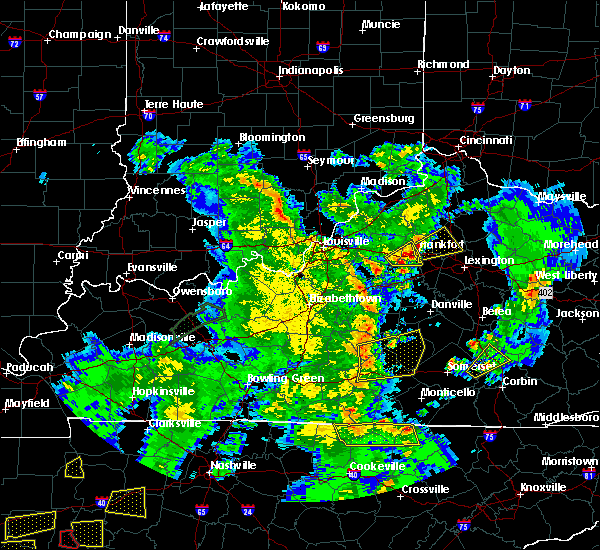 At 631 pm edt/531 pm cdt/, severe thunderstorms were located along a line extending from near campbellsville to near columbia to 10 miles east of edmonton, moving east at 60 mph (radar indicated). Hazards include 60 mph wind gusts. expect damage to roofs, siding, and trees At 631 pm edt/531 pm cdt/, severe thunderstorms were located along a line extending from near campbellsville to near columbia to 10 miles east of edmonton, moving east at 60 mph (radar indicated). Hazards include 60 mph wind gusts. expect damage to roofs, siding, and trees
|
| 3/1/2017 7:33 AM CST |
 At 833 am est/733 am cst/, severe thunderstorms were located along a line extending from 7 miles east of campbellsville to 7 miles northwest of glasgow to near westmoreland, moving east at 50 mph (radar indicated). Hazards include 60 mph wind gusts. Expect damage to roofs, siding, and trees. locations impacted include, glasgow, campbellsville, columbia, scottsville, tompkinsville, greensburg, edmonton, leslie, gamaliel and fountain run. a tornado watch remains in effect until 900 am est/800 am cst/ for central kentucky. A tornado watch also remains in effect until 1100 am est/1000 am cst/ for south central and central kentucky. At 833 am est/733 am cst/, severe thunderstorms were located along a line extending from 7 miles east of campbellsville to 7 miles northwest of glasgow to near westmoreland, moving east at 50 mph (radar indicated). Hazards include 60 mph wind gusts. Expect damage to roofs, siding, and trees. locations impacted include, glasgow, campbellsville, columbia, scottsville, tompkinsville, greensburg, edmonton, leslie, gamaliel and fountain run. a tornado watch remains in effect until 900 am est/800 am cst/ for central kentucky. A tornado watch also remains in effect until 1100 am est/1000 am cst/ for south central and central kentucky.
|
| 3/1/2017 7:09 AM CST |
 At 808 am est/708 am cst/, severe thunderstorms were located along a line extending from near campbellsville to near plum springs to 6 miles north of cross plains, moving east at 50 mph (radar indicated). Hazards include 60 mph wind gusts. expect damage to roofs, siding, and trees At 808 am est/708 am cst/, severe thunderstorms were located along a line extending from near campbellsville to near plum springs to 6 miles north of cross plains, moving east at 50 mph (radar indicated). Hazards include 60 mph wind gusts. expect damage to roofs, siding, and trees
|
| 3/1/2017 8:04 AM EST | Power lines downed on a house in north central taylor count in taylor county KY, 3.5 miles SW of Campbellsville, KY |
| 3/1/2017 7:00 AM CST |
 At 759 am est/659 am cst/, severe thunderstorms were located along a line extending from 10 miles east of morgantown to 7 miles north of campbellsville, moving southeast at 50 mph (radar indicated). Hazards include 60 mph wind gusts. Expect damage to roofs, siding, and trees. locations impacted include, campbellsville, morgantown, greensburg, munfordville, brownsville, monroe, horse cave, cave city, park city and bonnieville. a tornado watch remains in effect until 900 am est/800 am cst/ for south central and central kentucky. A tornado watch also remains in effect until 1100 am est/1000 am cst/ for south central and central kentucky. At 759 am est/659 am cst/, severe thunderstorms were located along a line extending from 10 miles east of morgantown to 7 miles north of campbellsville, moving southeast at 50 mph (radar indicated). Hazards include 60 mph wind gusts. Expect damage to roofs, siding, and trees. locations impacted include, campbellsville, morgantown, greensburg, munfordville, brownsville, monroe, horse cave, cave city, park city and bonnieville. a tornado watch remains in effect until 900 am est/800 am cst/ for south central and central kentucky. A tornado watch also remains in effect until 1100 am est/1000 am cst/ for south central and central kentucky.
|
| 3/1/2017 6:43 AM CST |
 At 743 am est/643 am cst/, severe thunderstorms were located along a line extending from 11 miles northeast of morgantown to near campbellsville, moving southeast at 50 mph (radar indicated). Hazards include 60 mph wind gusts. Expect damage to roofs, siding, and trees. locations impacted include, campbellsville, hodgenville, morgantown, greensburg, munfordville, brownsville, casey, monroe, lee and horse cave. a tornado watch remains in effect until 900 am est/800 am cst/ for south central and central kentucky. A tornado watch also remains in effect until 1100 am est/1000 am cst/ for south central and central kentucky. At 743 am est/643 am cst/, severe thunderstorms were located along a line extending from 11 miles northeast of morgantown to near campbellsville, moving southeast at 50 mph (radar indicated). Hazards include 60 mph wind gusts. Expect damage to roofs, siding, and trees. locations impacted include, campbellsville, hodgenville, morgantown, greensburg, munfordville, brownsville, casey, monroe, lee and horse cave. a tornado watch remains in effect until 900 am est/800 am cst/ for south central and central kentucky. A tornado watch also remains in effect until 1100 am est/1000 am cst/ for south central and central kentucky.
|
| 3/1/2017 6:41 AM CST |
 At 740 am est/640 am cst/, severe thunderstorms were located along a line extending from 11 miles northeast of morgantown to near campbellsville, moving southeast at 100 mph (radar indicated). Hazards include 60 mph wind gusts. expect damage to roofs, siding, and trees At 740 am est/640 am cst/, severe thunderstorms were located along a line extending from 11 miles northeast of morgantown to near campbellsville, moving southeast at 100 mph (radar indicated). Hazards include 60 mph wind gusts. expect damage to roofs, siding, and trees
|
| 9/16/2016 7:17 PM EDT | Estimated 20 inch diameter tree blown down. in taylor county KY, 6.9 miles SSE of Campbellsville, KY |
| 7/7/2016 5:10 PM EDT | Large tree limbs fell and damaged a swing set on blue hole roa in taylor county KY, 2.9 miles N of Campbellsville, KY |
| 7/7/2016 5:10 PM EDT | Numerous trees down around the county. many roads blocked by downed trees. roof damage to a building near the adair county lin in taylor county KY, 0.6 miles SSW of Campbellsville, KY |
| 7/7/2016 4:02 PM CDT |
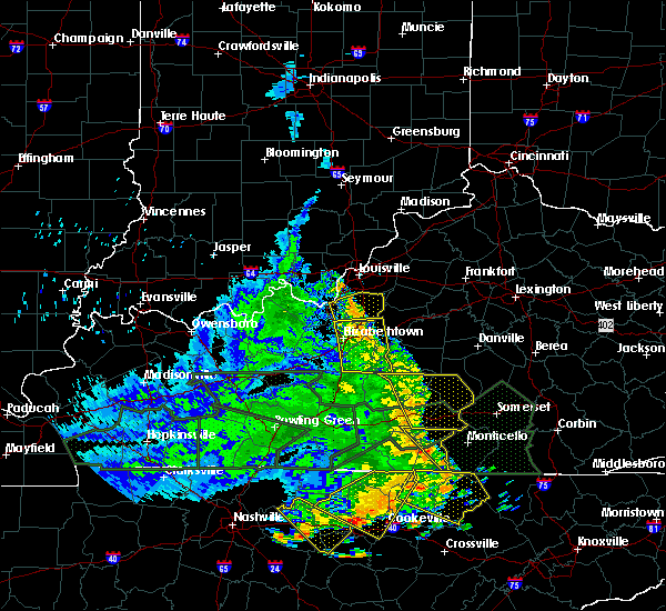 At 502 pm edt/402 pm cdt/, severe thunderstorms were located along and behind a line extending from near campbellsville to 13 miles east of greensburg to 8 miles southeast of columbia, moving east at 50 mph (radar indicated). Hazards include 60 mph wind gusts. Expect damage to roofs. siding. and trees. Locations impacted include, liberty, campbellsville, columbia, jamestown, russell springs, montpelier, royville, creston, garlin and rheber. At 502 pm edt/402 pm cdt/, severe thunderstorms were located along and behind a line extending from near campbellsville to 13 miles east of greensburg to 8 miles southeast of columbia, moving east at 50 mph (radar indicated). Hazards include 60 mph wind gusts. Expect damage to roofs. siding. and trees. Locations impacted include, liberty, campbellsville, columbia, jamestown, russell springs, montpelier, royville, creston, garlin and rheber.
|
| 7/7/2016 4:57 PM EDT | Power lines down near the amazon fulfillment cente in taylor county KY, 0.7 miles WNW of Campbellsville, KY |
| 7/7/2016 3:49 PM CDT |
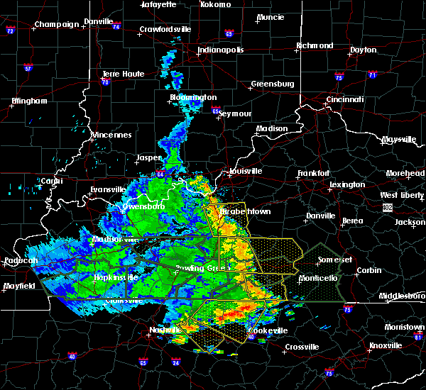 At 449 pm edt/349 pm cdt/, severe thunderstorms were located along and behind a line extending from 11 miles northwest of campbellsville to near greensburg to 9 miles southwest of columbia, moving east at 50 mph (radar indicated). Hazards include 70 mph wind gusts. Expect considerable tree damage. Damage is likely to mobile homes, roofs, and outbuildings. At 449 pm edt/349 pm cdt/, severe thunderstorms were located along and behind a line extending from 11 miles northwest of campbellsville to near greensburg to 9 miles southwest of columbia, moving east at 50 mph (radar indicated). Hazards include 70 mph wind gusts. Expect considerable tree damage. Damage is likely to mobile homes, roofs, and outbuildings.
|
| 7/4/2016 3:33 PM EDT |
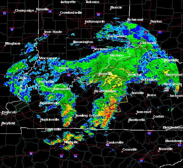 At 333 pm edt/233 pm cdt/, a severe thunderstorm was located near campbellsville, moving east at 40 mph (radar indicated). Hazards include 60 mph wind gusts. Expect damage to roofs. siding. and trees. Locations impacted include, campbellsville, neatsville, arista, ella, romine, acton, absher, hatcher, feathersburg and elk horn. At 333 pm edt/233 pm cdt/, a severe thunderstorm was located near campbellsville, moving east at 40 mph (radar indicated). Hazards include 60 mph wind gusts. Expect damage to roofs. siding. and trees. Locations impacted include, campbellsville, neatsville, arista, ella, romine, acton, absher, hatcher, feathersburg and elk horn.
|
| 7/4/2016 3:28 PM EDT | Several downed trees blocking e lemon bend r in taylor county KY, 6.7 miles NNE of Campbellsville, KY |
| 7/4/2016 3:27 PM EDT |
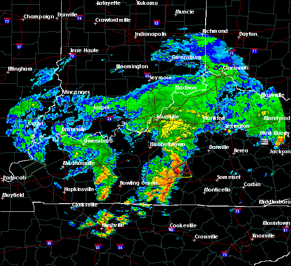 At 326 pm edt/226 pm cdt/, a severe thunderstorm capable of producing a tornado was located near campbellsville, moving east at 40 mph (radar indicated rotation). Hazards include tornado. Flying debris will be dangerous to those caught without shelter. mobile homes will be damaged or destroyed. damage to roofs, windows, and vehicles will occur. Tree damage is likely. At 326 pm edt/226 pm cdt/, a severe thunderstorm capable of producing a tornado was located near campbellsville, moving east at 40 mph (radar indicated rotation). Hazards include tornado. Flying debris will be dangerous to those caught without shelter. mobile homes will be damaged or destroyed. damage to roofs, windows, and vehicles will occur. Tree damage is likely.
|
| 7/4/2016 2:23 PM CDT | Trees dow in green county KY, 7.1 miles NNE of Campbellsville, KY |
| 7/4/2016 3:18 PM EDT |
 At 318 pm edt/218 pm cdt/, a severe thunderstorm was located near greensburg, moving east at 40 mph (radar indicated). Hazards include 60 mph wind gusts. Expect damage to roofs. siding. and trees. Locations impacted include, campbellsville, greensburg, neatsville, arista, ella, black gnat, romine, acton, absher and hatcher. At 318 pm edt/218 pm cdt/, a severe thunderstorm was located near greensburg, moving east at 40 mph (radar indicated). Hazards include 60 mph wind gusts. Expect damage to roofs. siding. and trees. Locations impacted include, campbellsville, greensburg, neatsville, arista, ella, black gnat, romine, acton, absher and hatcher.
|
| 7/4/2016 3:16 PM EDT |
 At 316 pm edt/216 pm cdt/, a severe thunderstorm was located near greensburg, moving east at 40 mph (radar indicated). Hazards include 60 mph wind gusts. Expect damage to roofs. siding. And trees. At 316 pm edt/216 pm cdt/, a severe thunderstorm was located near greensburg, moving east at 40 mph (radar indicated). Hazards include 60 mph wind gusts. Expect damage to roofs. siding. And trees.
|
| 6/23/2016 7:28 PM EDT |
 At 727 pm edt, a severe thunderstorm was located 13 miles west of lebanon, moving southeast at 25 mph (radar indicated). Hazards include 60 mph wind gusts and quarter size hail. Hail damage to vehicles is expected. expect wind damage to roofs, siding, and trees. Locations impacted include, campbellsville, lebanon, bradfordsville, jessietown, white rose, phillipsburg, spurlington, belltown, new market and saint joseph. At 727 pm edt, a severe thunderstorm was located 13 miles west of lebanon, moving southeast at 25 mph (radar indicated). Hazards include 60 mph wind gusts and quarter size hail. Hail damage to vehicles is expected. expect wind damage to roofs, siding, and trees. Locations impacted include, campbellsville, lebanon, bradfordsville, jessietown, white rose, phillipsburg, spurlington, belltown, new market and saint joseph.
|
| 6/23/2016 7:16 PM EDT |
 At 716 pm edt, a severe thunderstorm was located 9 miles east of hodgenville, moving southeast at 25 mph (radar indicated). Hazards include 60 mph wind gusts and penny size hail. Expect damage to roofs. siding. And trees. At 716 pm edt, a severe thunderstorm was located 9 miles east of hodgenville, moving southeast at 25 mph (radar indicated). Hazards include 60 mph wind gusts and penny size hail. Expect damage to roofs. siding. And trees.
|
| 6/16/2016 5:06 PM CDT |
 At 605 pm edt/505 pm cdt/, severe thunderstorms were located along a line extending from 13 miles south of lebanon to 13 miles east of greensburg to near campbellsville, moving southeast at 45 mph (radar indicated). Hazards include 60 mph wind gusts and penny size hail. Expect damage to roofs. siding. And trees. At 605 pm edt/505 pm cdt/, severe thunderstorms were located along a line extending from 13 miles south of lebanon to 13 miles east of greensburg to near campbellsville, moving southeast at 45 mph (radar indicated). Hazards include 60 mph wind gusts and penny size hail. Expect damage to roofs. siding. And trees.
|
| 5/26/2016 6:40 PM EDT | Large tree uprooted in campbellsvill in taylor county KY, 1.2 miles S of Campbellsville, KY |
| 5/10/2016 8:15 PM EDT |
 At 815 pm edt/715 pm cdt/, a severe thunderstorm was located near campbellsville, moving east at 35 mph (radar indicated). Hazards include ping pong ball size hail and 60 mph wind gusts. People and animals outdoors will be injured. expect hail damage to roofs, siding, windows, and vehicles. expect wind damage to roofs, siding, and trees. locations impacted include, campbellsville, yuma, romine, hatcher, elk horn, south campbellsville, coburg, atchison, haskingsville and burdick. A tornado watch remains in effect until midnight edt/1100 pm cdt/ for south central kentucky. At 815 pm edt/715 pm cdt/, a severe thunderstorm was located near campbellsville, moving east at 35 mph (radar indicated). Hazards include ping pong ball size hail and 60 mph wind gusts. People and animals outdoors will be injured. expect hail damage to roofs, siding, windows, and vehicles. expect wind damage to roofs, siding, and trees. locations impacted include, campbellsville, yuma, romine, hatcher, elk horn, south campbellsville, coburg, atchison, haskingsville and burdick. A tornado watch remains in effect until midnight edt/1100 pm cdt/ for south central kentucky.
|
| 5/10/2016 7:06 PM CDT |
 At 806 pm edt/706 pm cdt/, a severe thunderstorm was located near greensburg, moving east at 35 mph (radar indicated). Hazards include ping pong ball size hail and 60 mph wind gusts. People and animals outdoors will be injured. expect hail damage to roofs, siding, windows, and vehicles. expect wind damage to roofs, siding, and trees. locations impacted include, campbellsville, greensburg, bramlett, gresham, whitewood, haskingsville, roachville, black gnat, yuma and romine. A tornado watch remains in effect until midnight edt/1100 pm cdt/ for south central kentucky. At 806 pm edt/706 pm cdt/, a severe thunderstorm was located near greensburg, moving east at 35 mph (radar indicated). Hazards include ping pong ball size hail and 60 mph wind gusts. People and animals outdoors will be injured. expect hail damage to roofs, siding, windows, and vehicles. expect wind damage to roofs, siding, and trees. locations impacted include, campbellsville, greensburg, bramlett, gresham, whitewood, haskingsville, roachville, black gnat, yuma and romine. A tornado watch remains in effect until midnight edt/1100 pm cdt/ for south central kentucky.
|
| 5/10/2016 6:59 PM CDT |
 At 759 pm edt/659 pm cdt/, a severe thunderstorm was located over greensburg, moving east at 35 mph (radar indicated). Hazards include 60 mph wind gusts and quarter size hail. Hail damage to vehicles is expected. Expect wind damage to roofs, siding, and trees. At 759 pm edt/659 pm cdt/, a severe thunderstorm was located over greensburg, moving east at 35 mph (radar indicated). Hazards include 60 mph wind gusts and quarter size hail. Hail damage to vehicles is expected. Expect wind damage to roofs, siding, and trees.
|
| 5/10/2016 7:00 PM EDT | Golf Ball sized hail reported 6.2 miles W of Campbellsville, KY |
| 5/10/2016 7:00 PM EDT |
 At 700 pm edt, a severe thunderstorm capable of producing a tornado was located near campbellsville, moving east at 30 mph (radar indicated rotation). Hazards include tornado and half dollar size hail. Flying debris will be dangerous to those caught without shelter. mobile homes will be damaged or destroyed. damage to roofs, windows, and vehicles will occur. Tree damage is likely. At 700 pm edt, a severe thunderstorm capable of producing a tornado was located near campbellsville, moving east at 30 mph (radar indicated rotation). Hazards include tornado and half dollar size hail. Flying debris will be dangerous to those caught without shelter. mobile homes will be damaged or destroyed. damage to roofs, windows, and vehicles will occur. Tree damage is likely.
|
| 5/10/2016 6:56 PM EDT | Quarter sized hail reported 0.6 miles SSW of Campbellsville, KY |
| 5/10/2016 6:46 PM EDT |
 At 646 pm edt, a severe thunderstorm was located over campbellsville, moving east at 35 mph (radar indicated). Hazards include 60 mph wind gusts and quarter size hail. Hail damage to vehicles is expected. Expect wind damage to roofs, siding, and trees. At 646 pm edt, a severe thunderstorm was located over campbellsville, moving east at 35 mph (radar indicated). Hazards include 60 mph wind gusts and quarter size hail. Hail damage to vehicles is expected. Expect wind damage to roofs, siding, and trees.
|
| 5/10/2016 5:25 PM CDT |
 At 625 pm edt/525 pm cdt/, a severe thunderstorm was located near greensburg, moving east at 35 mph (radar indicated). Hazards include 60 mph wind gusts and half dollar size hail. Hail damage to vehicles is expected. expect wind damage to roofs, siding, and trees. locations impacted include, campbellsville, greensburg, allendale, lobb, summersville, white rose, bengal, whitewood, saloma and roachville. A tornado watch remains in effect until midnight edt/1100 pm cdt/ for south central kentucky. At 625 pm edt/525 pm cdt/, a severe thunderstorm was located near greensburg, moving east at 35 mph (radar indicated). Hazards include 60 mph wind gusts and half dollar size hail. Hail damage to vehicles is expected. expect wind damage to roofs, siding, and trees. locations impacted include, campbellsville, greensburg, allendale, lobb, summersville, white rose, bengal, whitewood, saloma and roachville. A tornado watch remains in effect until midnight edt/1100 pm cdt/ for south central kentucky.
|
| 5/10/2016 5:15 PM CDT |
 At 615 pm edt/515 pm cdt/, a severe thunderstorm was located 10 miles west of greensburg, moving east at 35 mph (radar indicated). Hazards include 60 mph wind gusts and half dollar size hail. Hail damage to vehicles is expected. Expect wind damage to roofs, siding, and trees. At 615 pm edt/515 pm cdt/, a severe thunderstorm was located 10 miles west of greensburg, moving east at 35 mph (radar indicated). Hazards include 60 mph wind gusts and half dollar size hail. Hail damage to vehicles is expected. Expect wind damage to roofs, siding, and trees.
|
| 5/10/2016 5:25 PM EDT | Quarter sized hail reported 15.9 miles SE of Campbellsville, KY |
| 12/23/2015 10:21 PM EST | The severe thunderstorm warning for central taylor county will expire at 1030 pm est, the storm which prompted the warning has moved out of the area. therefore the warning will be allowed to expire. a severe thunderstorm watch remains in effect until 300 am est for south central kentucky. |
| 12/23/2015 10:07 PM EST | Roof damage... camper blown over... trees and power lines down. barns damaged. near hwy 55 and old columbia road... and mclean road near green county lin in taylor county KY, 4.6 miles NNE of Campbellsville, KY |
| 12/23/2015 10:07 PM EST | At 1007 pm est, a severe thunderstorm was located near campbellsville, moving northeast at 55 mph (radar indicated). Hazards include 60 mph wind gusts. Expect damage to roofs. siding and trees. Locations impacted include, campbellsville, spurlington, arista, taylor county airport, yuma, acton, hatcher, elk horn, south campbellsville, wooleyville, atchison, wrights, sweeneyville and burdick. |
| 12/23/2015 10:01 PM EST | At 1001 pm est /901 pm cst/, a severe thunderstorm was located near greensburg, moving northeast at 50 mph (radar indicated). Hazards include 60 mph wind gusts. Expect damage to roofs. Siding and trees. |
| 7/14/2015 8:00 PM EDT |
 At 757 pm edt, a severe thunderstorm was located 9 miles northeast of campbellsville, and moving southeast at 35 mph (radar indicated). Hazards include 60 mph wind gusts. Expect damage to roofs. Siding and trees. At 757 pm edt, a severe thunderstorm was located 9 miles northeast of campbellsville, and moving southeast at 35 mph (radar indicated). Hazards include 60 mph wind gusts. Expect damage to roofs. Siding and trees.
|
| 7/14/2015 7:57 PM EDT |
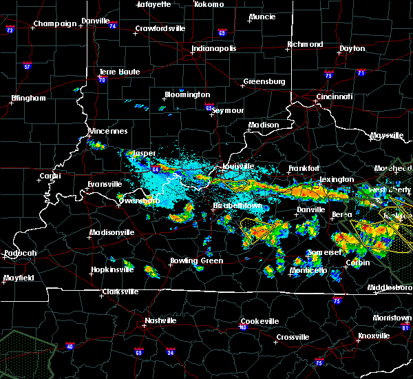 At 755 pm edt, a severe thunderstorm was located 6 miles northeast of campbellsville, and moving southeast at 35 mph (radar indicated). Hazards include 60 mph wind gusts. Expect damage to roofs. siding and trees. The severe thunderstorm will affect mainly rural areas of southeastern marion and taylor counties, including the following locations, elk horn, acton and mannsville. At 755 pm edt, a severe thunderstorm was located 6 miles northeast of campbellsville, and moving southeast at 35 mph (radar indicated). Hazards include 60 mph wind gusts. Expect damage to roofs. siding and trees. The severe thunderstorm will affect mainly rural areas of southeastern marion and taylor counties, including the following locations, elk horn, acton and mannsville.
|
| 7/14/2015 7:43 PM EDT |
 At 739 pm edt, a severe thunderstorm was located 10 miles southwest of lebanon, moving southeast at 35 mph (radar indicated). Hazards include 60 mph wind gusts. Expect damage to roofs. siding and trees. the severe thunderstorm will be near, campbellsville around 755 pm edt. other locations in the warning include saloma, hobson, calvary, greenbriar, phillipsburg, spurlington. Arista, and salleetown. At 739 pm edt, a severe thunderstorm was located 10 miles southwest of lebanon, moving southeast at 35 mph (radar indicated). Hazards include 60 mph wind gusts. Expect damage to roofs. siding and trees. the severe thunderstorm will be near, campbellsville around 755 pm edt. other locations in the warning include saloma, hobson, calvary, greenbriar, phillipsburg, spurlington. Arista, and salleetown.
|
| 7/14/2015 7:35 PM EDT |
 At 734 pm edt, a severe thunderstorm was located 11 miles west of lebanon, and moving southeast at 35 mph (radar indicated). Hazards include 60 mph wind gusts. Expect damage to roofs. Siding and trees. At 734 pm edt, a severe thunderstorm was located 11 miles west of lebanon, and moving southeast at 35 mph (radar indicated). Hazards include 60 mph wind gusts. Expect damage to roofs. Siding and trees.
|
| 7/14/2015 5:10 AM CDT |
 At 608 am edt, severe thunderstorms were located along a line extending from 10 miles north of science hill to 6 miles east of campbellsville, and moving southeast at 65 mph (radar indicated). Hazards include 60 mph wind gusts. Expect damage to roofs. Siding and trees. At 608 am edt, severe thunderstorms were located along a line extending from 10 miles north of science hill to 6 miles east of campbellsville, and moving southeast at 65 mph (radar indicated). Hazards include 60 mph wind gusts. Expect damage to roofs. Siding and trees.
|
| 7/13/2015 6:35 PM EDT | Half Dollar sized hail reported 3.4 miles NE of Campbellsville, KY |
| 7/13/2015 5:08 PM CDT |
 At 504 pm cdt, a severe thunderstorm capable of producing a tornado was located just northeast of greensburg, moving southeast at 25 mph (radar indicated rotation). Hazards include tornado and ping pong ball size hail. Flying debris will be dangerous to those caught without shelter. mobile homes will be damaged or destroyed. damage to roofs, windows and vehicles will occur. this dangerous storm will affect the following locations, roachville, gresham, romine, haskingsville, bramlett and fry. Large hail and damaging winds are also possible with this storm away from the possible tornado. At 504 pm cdt, a severe thunderstorm capable of producing a tornado was located just northeast of greensburg, moving southeast at 25 mph (radar indicated rotation). Hazards include tornado and ping pong ball size hail. Flying debris will be dangerous to those caught without shelter. mobile homes will be damaged or destroyed. damage to roofs, windows and vehicles will occur. this dangerous storm will affect the following locations, roachville, gresham, romine, haskingsville, bramlett and fry. Large hail and damaging winds are also possible with this storm away from the possible tornado.
|
| 7/13/2015 4:55 PM CDT |
 At 451 pm cdt, a severe thunderstorm capable of producing a tornado was located 8 miles north of greensburg, moving south at 30 mph (radar indicated rotation). Hazards include tornado and quarter size hail. Flying debris will be dangerous to those caught without shelter. mobile homes will be damaged or destroyed. damage to roofs, windows and vehicles will occur. this dangerous storm will be near, greensburg around 505 pm cdt. Other locations in the warning include wrights, bluff boom, whitewood, black gnat, hatcher, burdick, roachville, thurlow, romine and gresham. At 451 pm cdt, a severe thunderstorm capable of producing a tornado was located 8 miles north of greensburg, moving south at 30 mph (radar indicated rotation). Hazards include tornado and quarter size hail. Flying debris will be dangerous to those caught without shelter. mobile homes will be damaged or destroyed. damage to roofs, windows and vehicles will occur. this dangerous storm will be near, greensburg around 505 pm cdt. Other locations in the warning include wrights, bluff boom, whitewood, black gnat, hatcher, burdick, roachville, thurlow, romine and gresham.
|
| 7/13/2015 5:49 PM EDT | Roof blown off a barn and trees dow in taylor county KY, 6.3 miles SE of Campbellsville, KY |
| 7/13/2015 5:46 PM EDT |
 At 543 pm edt, a severe thunderstorm was located 11 miles northwest of campbellsville, moving southeast at 30 mph. Hazards include 60 mph wind gusts and half dollar size hail. Hail damage to vehicles is expected. expect wind damage to roofs, siding and trees. Locations impacted include, willowtown, white rose, pitman, durhamtown, saloma, bengal, hobson, sweeneyville and wrights. At 543 pm edt, a severe thunderstorm was located 11 miles northwest of campbellsville, moving southeast at 30 mph. Hazards include 60 mph wind gusts and half dollar size hail. Hail damage to vehicles is expected. expect wind damage to roofs, siding and trees. Locations impacted include, willowtown, white rose, pitman, durhamtown, saloma, bengal, hobson, sweeneyville and wrights.
|
| 7/13/2015 5:31 PM EDT |
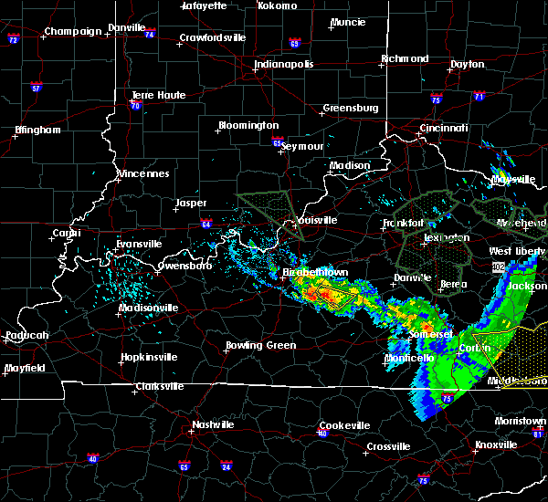 At 529 pm edt, a severe thunderstorm was located 11 miles east of hodgenville, moving southeast at 30 mph (radar indicated). Hazards include 60 mph wind gusts and quarter size hail. Hail damage to vehicles is expected. Expect wind damage to roofs, siding and trees. At 529 pm edt, a severe thunderstorm was located 11 miles east of hodgenville, moving southeast at 30 mph (radar indicated). Hazards include 60 mph wind gusts and quarter size hail. Hail damage to vehicles is expected. Expect wind damage to roofs, siding and trees.
|
| 7/12/2015 2:00 PM CDT |
 At 259 pm edt, a severe thunderstorm was located near campbellsville, and moving east at 15 mph (radar indicated). Hazards include 60 mph wind gusts. Expect damage to roofs. Siding and trees. At 259 pm edt, a severe thunderstorm was located near campbellsville, and moving east at 15 mph (radar indicated). Hazards include 60 mph wind gusts. Expect damage to roofs. Siding and trees.
|
| 7/12/2015 2:58 PM EDT | Downed tree blocking sportsman lake road in taylor county KY, 4.3 miles SW of Campbellsville, KY |
| 7/10/2015 2:40 PM EDT | A six inch diameter tree limb down near highway 55... not blocking the roadwa in taylor county KY, 2.9 miles N of Campbellsville, KY |
| 7/10/2015 2:32 PM EDT |
 At 230 pm edt, a severe thunderstorm was located 10 miles east of campbellsville, and moving east at 35 mph (radar indicated). Hazards include 60 mph wind gusts. Expect damage to roofs. siding and trees. Locations impacted include, clementsville, atterson and creston. At 230 pm edt, a severe thunderstorm was located 10 miles east of campbellsville, and moving east at 35 mph (radar indicated). Hazards include 60 mph wind gusts. Expect damage to roofs. siding and trees. Locations impacted include, clementsville, atterson and creston.
|
| 7/10/2015 2:13 PM EDT | Several trees down in the cit in taylor county KY, 0.6 miles SSW of Campbellsville, KY |
| 7/10/2015 2:12 PM EDT |
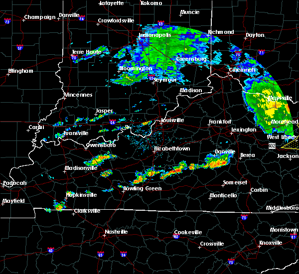 At 210 pm edt, a severe thunderstorm was located near campbellsville, and moving east at 35 mph (radar indicated). Hazards include 60 mph wind gusts. Expect damage to roofs. Siding and trees. At 210 pm edt, a severe thunderstorm was located near campbellsville, and moving east at 35 mph (radar indicated). Hazards include 60 mph wind gusts. Expect damage to roofs. Siding and trees.
|
| 7/9/2015 1:20 PM EDT | Tree downe in taylor county KY, 6.5 miles SW of Campbellsville, KY |
| 7/9/2015 1:15 PM EDT | Trees down in campbellsvill in taylor county KY, 0.5 miles ENE of Campbellsville, KY |
| 7/9/2015 1:13 PM EDT |
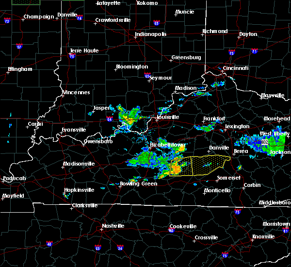 At 111 pm edt, a severe thunderstorm was located near campbellsville, and moving east at 45 mph (radar indicated). Hazards include 60 mph wind gusts. Expect damage to roofs. siding and trees. Locations impacted include, jessietown, taylor county airport, atchison, arista, elk horn, holmes, spurlington, yuma, acton, phillipsburg, wooleyville, greenbriar, knifley, salleetown, mannsville, speck, dunbar hill, feathersburg, casey creek and bass. At 111 pm edt, a severe thunderstorm was located near campbellsville, and moving east at 45 mph (radar indicated). Hazards include 60 mph wind gusts. Expect damage to roofs. siding and trees. Locations impacted include, jessietown, taylor county airport, atchison, arista, elk horn, holmes, spurlington, yuma, acton, phillipsburg, wooleyville, greenbriar, knifley, salleetown, mannsville, speck, dunbar hill, feathersburg, casey creek and bass.
|
| 7/9/2015 1:12 PM EDT | Tree downed on highway 70 about 3 miles southeast of campbellsvill in taylor county KY, 4.3 miles WNW of Campbellsville, KY |
| 7/9/2015 1:09 PM EDT | Multiple trees and power lines down. power line down on a ca in taylor county KY, 0.7 miles WNW of Campbellsville, KY |
| 7/9/2015 12:04 PM CDT |
 At noon cdt, a severe thunderstorm was located near greensburg, and moving east at 35 mph. several large trees blocking highway 61 in summersville at 1158 am cdt (radar indicated). Hazards include 60 mph wind gusts. Expect damage to roofs. siding and trees. locations impacted include, campbellsville, hobson, coburg, cane valley, south campbellsville, finley, taylor county airport, jessietown, atchison, arista, elk horn, holmes, spurlington, yuma, acton, phillipsburg, wooleyville, greenbriar, knifley and salleetown. Time, mot, loc 1702z 264deg 152kt 3734 8541. At noon cdt, a severe thunderstorm was located near greensburg, and moving east at 35 mph. several large trees blocking highway 61 in summersville at 1158 am cdt (radar indicated). Hazards include 60 mph wind gusts. Expect damage to roofs. siding and trees. locations impacted include, campbellsville, hobson, coburg, cane valley, south campbellsville, finley, taylor county airport, jessietown, atchison, arista, elk horn, holmes, spurlington, yuma, acton, phillipsburg, wooleyville, greenbriar, knifley and salleetown. Time, mot, loc 1702z 264deg 152kt 3734 8541.
|
| 7/9/2015 11:54 AM CDT |
 At 1153 am cdt, a severe thunderstorm was located 10 miles west of greensburg, and moving east at 30 mph (radar indicated). Hazards include 60 mph wind gusts. Expect damage to roofs. Siding and trees. At 1153 am cdt, a severe thunderstorm was located 10 miles west of greensburg, and moving east at 30 mph (radar indicated). Hazards include 60 mph wind gusts. Expect damage to roofs. Siding and trees.
|
| 6/26/2015 2:35 AM EDT |
 At 230 am edt/130 am cdt/, severe thunderstorms were located along a line extending from 11 miles southwest of lebanon to 9 miles northeast of munfordville, and moving southeast at 50 mph (radar indicated). Hazards include 60 mph wind gusts. Expect damage to roofs. Siding and trees. At 230 am edt/130 am cdt/, severe thunderstorms were located along a line extending from 11 miles southwest of lebanon to 9 miles northeast of munfordville, and moving southeast at 50 mph (radar indicated). Hazards include 60 mph wind gusts. Expect damage to roofs. Siding and trees.
|
| 6/21/2015 3:23 PM CDT |
 At 321 pm cdt, severe thunderstorms were located along a line extending from munfordville to 9 miles west of greensburg to 9 miles southeast of campbellsville, and moving southeast at 10 mph (radar indicated). Hazards include 60 mph wind gusts and nickel size hail. Expect damage to roofs. siding and trees. Locations impacted include, knifley, whickerville, holmes, coburg, gresham, pierce, newt, haskingsville, legrande, three springs, cane valley, mount gilead, crailhope, exie, dunbar hill, bramlett, liletown, fry, center and node. At 321 pm cdt, severe thunderstorms were located along a line extending from munfordville to 9 miles west of greensburg to 9 miles southeast of campbellsville, and moving southeast at 10 mph (radar indicated). Hazards include 60 mph wind gusts and nickel size hail. Expect damage to roofs. siding and trees. Locations impacted include, knifley, whickerville, holmes, coburg, gresham, pierce, newt, haskingsville, legrande, three springs, cane valley, mount gilead, crailhope, exie, dunbar hill, bramlett, liletown, fry, center and node.
|
| 6/21/2015 3:05 PM CDT |
 At 302 pm cdt/402 pm edt/, severe thunderstorms were located along a line extending from munfordville to 11 miles east of munfordville to 7 miles southeast of campbellsville, and moving southeast at 10 mph (kentucky mesonet in hart county). Hazards include 60 mph wind gusts and quarter size hail. Hail damage to vehicles is expected. Expect wind damage to roofs, siding and trees. At 302 pm cdt/402 pm edt/, severe thunderstorms were located along a line extending from munfordville to 11 miles east of munfordville to 7 miles southeast of campbellsville, and moving southeast at 10 mph (kentucky mesonet in hart county). Hazards include 60 mph wind gusts and quarter size hail. Hail damage to vehicles is expected. Expect wind damage to roofs, siding and trees.
|
| 5/11/2015 2:30 PM EDT | Tree down on meader street in taylor county KY, 0.2 miles NW of Campbellsville, KY |
| 5/11/2015 2:25 PM EDT | Power lines down in the northern part of tow in taylor county KY, 1.2 miles S of Campbellsville, KY |
| 5/11/2015 2:20 PM EDT | Storm damage reported in taylor county KY, 0.6 miles SSW of Campbellsville, KY |
| 5/11/2015 2:18 PM EDT | At 216 pm edt, a severe thunderstorm was located near campbellsville, and moving northeast at 40 mph (radar indicated). Hazards include 60 mph wind gusts and nickel size hail. Expect damage to roofs. Siding and trees. |
| 4/10/2015 4:11 AM EDT | A tornado warning remains in effect for northwestern casey. southwestern boyle. northeastern taylor and southern marion counties until 425 am edt. at 407 am edt. a severe thunderstorm capable of producing a tornado was located 8 miles north of campbellsville. and moving northeast at 55 mph. A second severe thunderstorms capable of producing a tornado. |
| 4/10/2015 4:05 AM EDT | The national weather service in louisville has issued a * tornado warning for. southwestern boyle county in east central kentucky. northwestern casey county in south central kentucky. southern marion county in south central kentucky. Northern taylor county in south central kentucky. |
| 4/10/2015 3:56 AM EDT | The national weather service in louisville has issued a * severe thunderstorm warning for. northern casey county in south central kentucky. southern marion county in south central kentucky. taylor county in south central kentucky. Until 425 am edt. |
| 4/7/2015 6:31 PM EDT | The severe thunderstorm warning for northern taylor and larue counties will expire at 640 pm edt/540 pm cdt/. the storm which prompted the warning has weakened below severe limits. and no longer poses an immediate threat to life or property. however. heavy rain is still possible with this thunderstorm. in addition. strong thunderstorms may redevelop. And a severe. |
| 4/7/2015 6:13 PM EDT | A severe thunderstorm warning remains in effect for northern taylor and south central larue counties until 640 pm edt. at 611 pm edt. a severe thunderstorm was located 9 miles southwest of lebanon. and moving east at 130 mph. hazard. 60 mph wind gusts and quarter size hail. source. Radar indicated. |
| 4/7/2015 6:08 PM EDT | The national weather service in louisville has issued a * severe thunderstorm warning for. northern green county in south central kentucky. northeastern hart county in south central kentucky. south central larue county in north central kentucky. Northern taylor county in south central kentucky. |
| 7/26/2014 11:20 PM EDT | Trees dow in taylor county KY, 0.6 miles SSW of Campbellsville, KY |
| 7/23/2014 6:45 PM EDT | Downed tree blocking the road in taylor county KY, 0.6 miles SSW of Campbellsville, KY |
| 6/10/2014 4:55 PM EDT | Tree dow in taylor county KY, 8.8 miles NW of Campbellsville, KY |
| 5/22/2014 6:15 AM EDT | Structural damage to homes on maple avenue. partial roof collapses...siding ripped off homes...and widespread tree damage. damage also along w. maple... e. broadway. ro in taylor county KY, 0.6 miles SSW of Campbellsville, KY |
| 12/21/2013 11:05 PM EST | Em reported damage to taylor county bank and a long john silvers in campbellsville in taylor county KY, 0.6 miles SSW of Campbellsville, KY |
| 12/21/2013 11:05 PM EST | Multiple trees down across county and report of damage to a bank in campbellsville in taylor county KY, 0.6 miles SSW of Campbellsville, KY |
| 12/21/2013 11:05 PM EST | Report of trees down at the campbellsville country club... possibly with tops twisted of in taylor county KY, 0.6 miles SSW of Campbellsville, KY |
| 8/31/2013 5:04 PM EDT | Tree dow in taylor county KY, 0.6 miles SSW of Campbellsville, KY |
| 7/13/2013 2:45 PM EDT | Quarter sized hail reported 11.8 miles W of Campbellsville, KY |
| 7/10/2013 3:00 PM EDT | Power pole broken and power lines down on robinson avenue in taylor county KY, 0.6 miles SSW of Campbellsville, KY |
| 7/10/2013 2:58 PM EDT | Many trees... power lines down in the city. a power pole broken. three structures have been damaged by downed tree in taylor county KY, 0.6 miles SSW of Campbellsville, KY |
| 7/1/2013 5:30 PM EDT | Several trees down along speck ridge road in taylor county KY, 9.1 miles WNW of Campbellsville, KY |
| 6/26/2013 11:10 PM EDT | Trees dow in taylor county KY, 0.6 miles SSW of Campbellsville, KY |
| 1/30/2013 5:49 AM EST | Several trees down across the count in taylor county KY, 0.6 miles SSW of Campbellsville, KY |
| 7/27/2012 11:26 PM EDT | Trees down across power line in taylor county KY, 1.2 miles S of Campbellsville, KY |
| 7/27/2012 11:15 PM EDT | Power lines down on hord street in taylor county KY, 0.6 miles SSW of Campbellsville, KY |
| 7/27/2012 11:13 PM EDT | Dispatch reports trees down in taylor county KY, 0.6 miles SSW of Campbellsville, KY |
| 3/23/2012 10:40 PM EDT | Dispatch relayed report of large tree down on phillips rd. near hwy 210 just northwest of campbellsville in taylor county KY, 4.1 miles SE of Campbellsville, KY |
| 3/2/2012 5:12 PM EST | Golf Ball sized hail reported 8.9 miles SE of Campbellsville, KY |
| 1/1/0001 12:00 AM | Quarter sized hail reported 0.6 miles SSW of Campbellsville, KY |
| 1/1/0001 12:00 AM | Two trees down along kentucky highway 7 in taylor county KY, 8.6 miles WSW of Campbellsville, KY |
| 1/1/0001 12:00 AM | Tree down in taylor county KY, 0.6 miles SSW of Campbellsville, KY |
| 1/1/0001 12:00 AM | Trees down across highway 7 in taylor county KY, 4 miles W of Campbellsville, KY |
| 1/1/0001 12:00 AM | Quarter sized hail reported 3.8 miles E of Campbellsville, KY |
| 1/1/0001 12:00 AM | Barn damage and trees dow in taylor county KY, 6 miles SSE of Campbellsville, KY |
| 1/1/0001 12:00 AM | Tree down blocking state highway 2784 near ky 70 in taylor county KY, 5.7 miles W of Campbellsville, KY |
Hail Maps for Campbellsville, KY


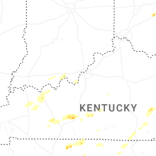
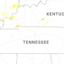


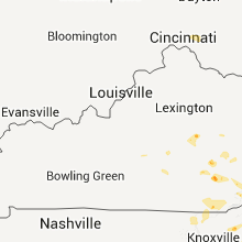


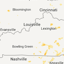


Connect with Interactive Hail Maps