

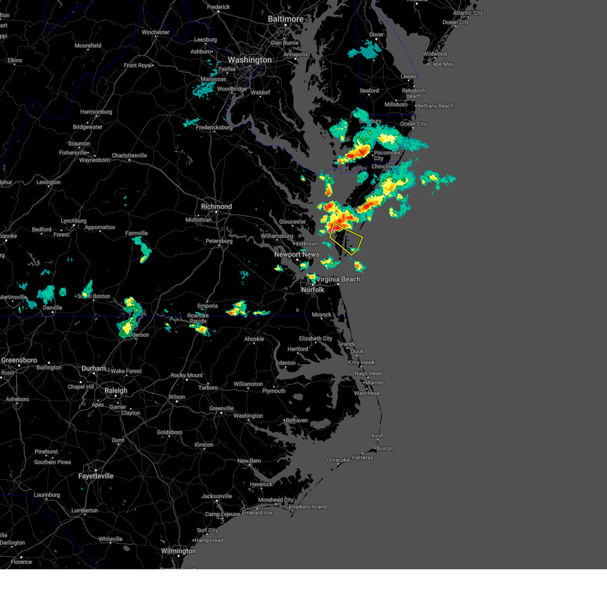
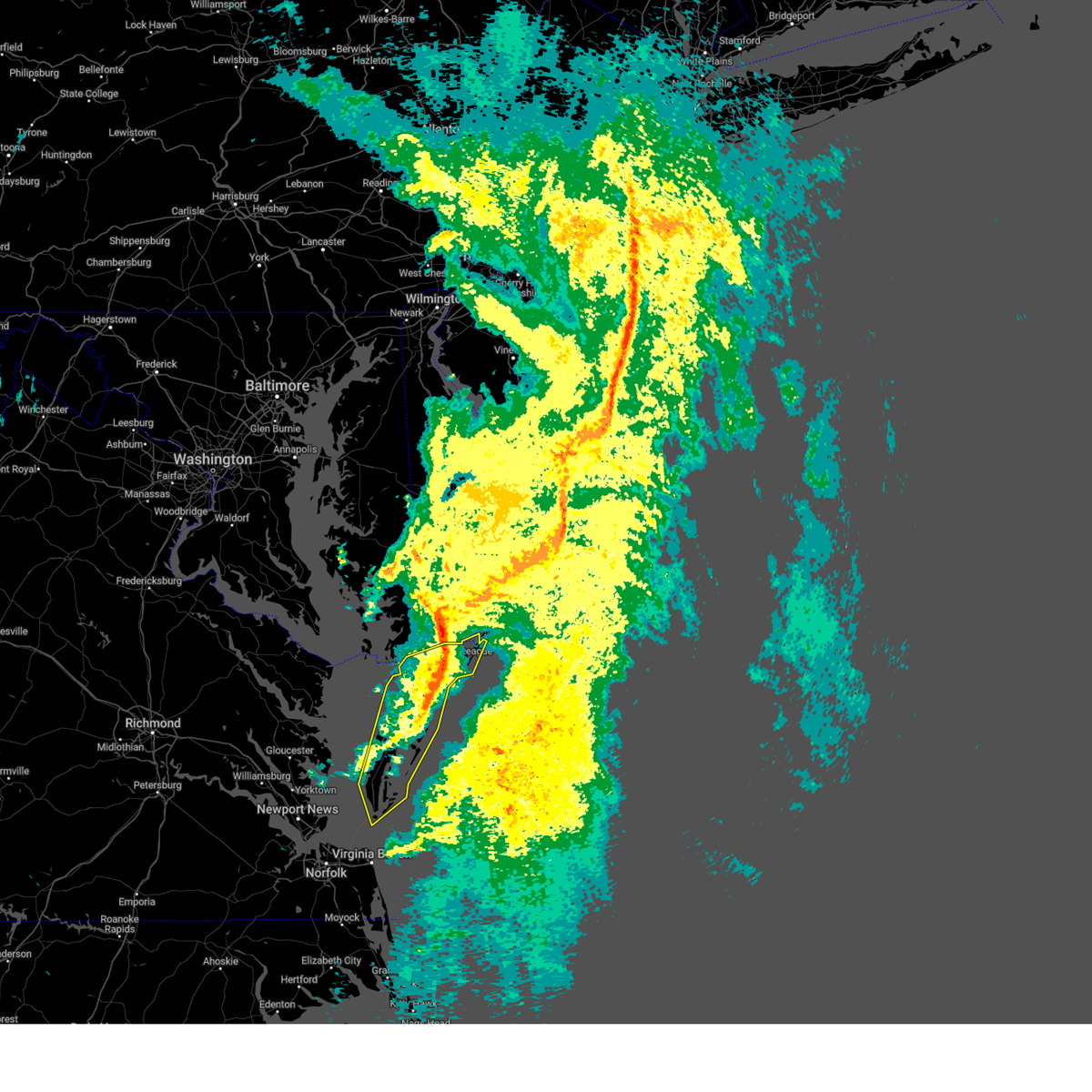
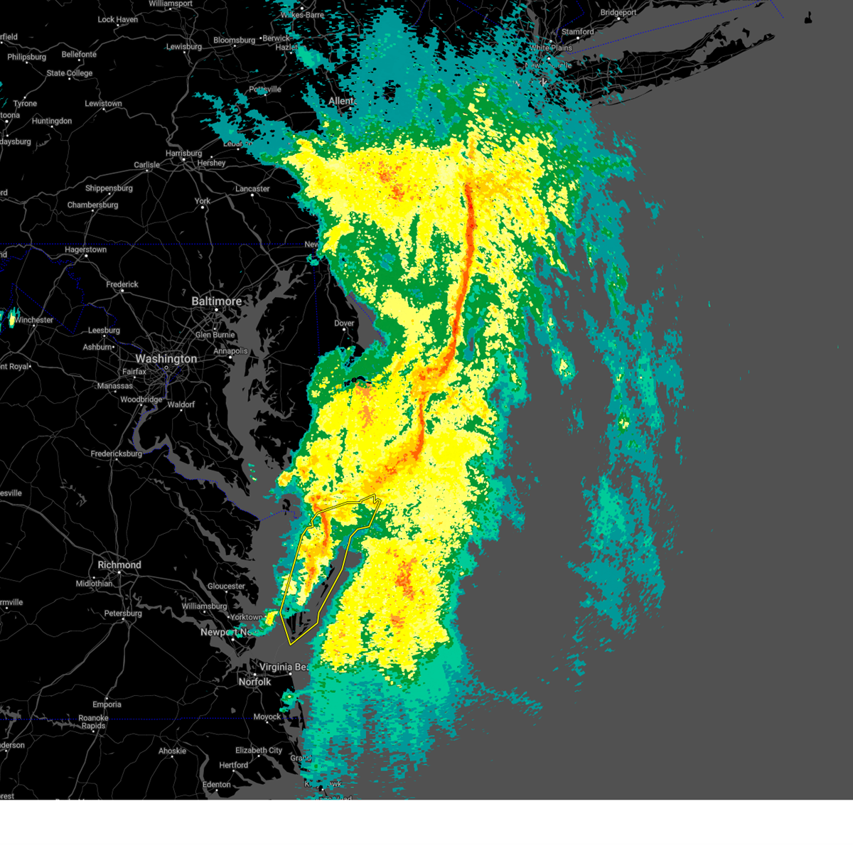
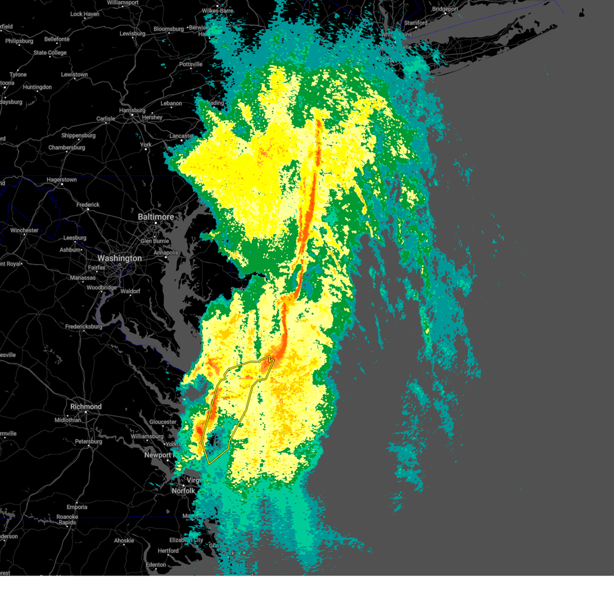
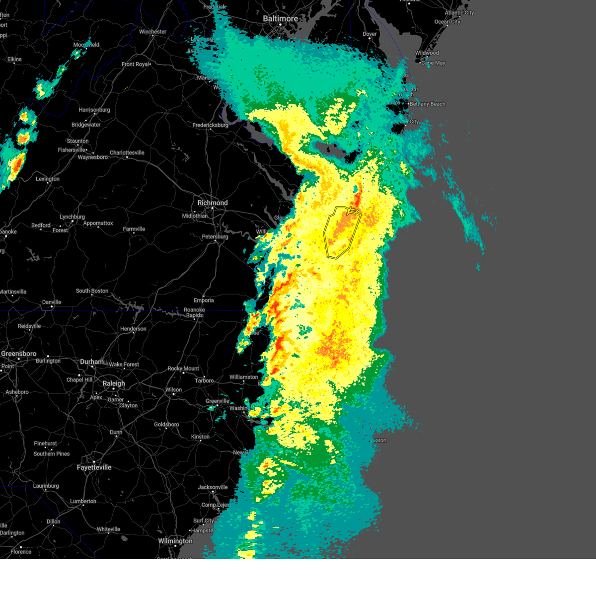
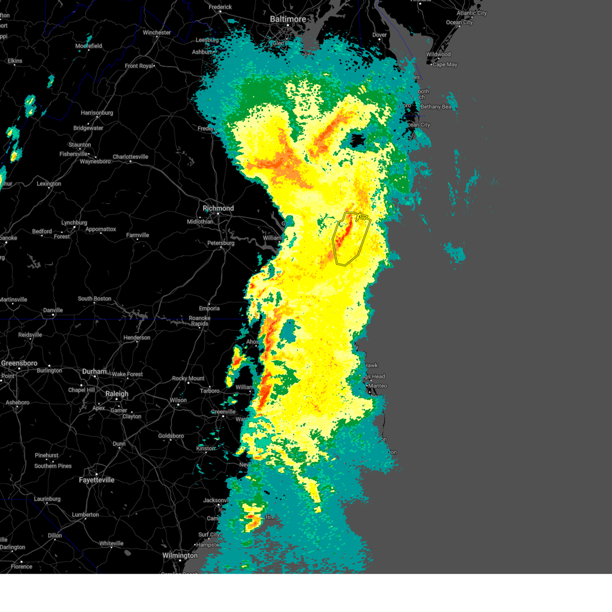
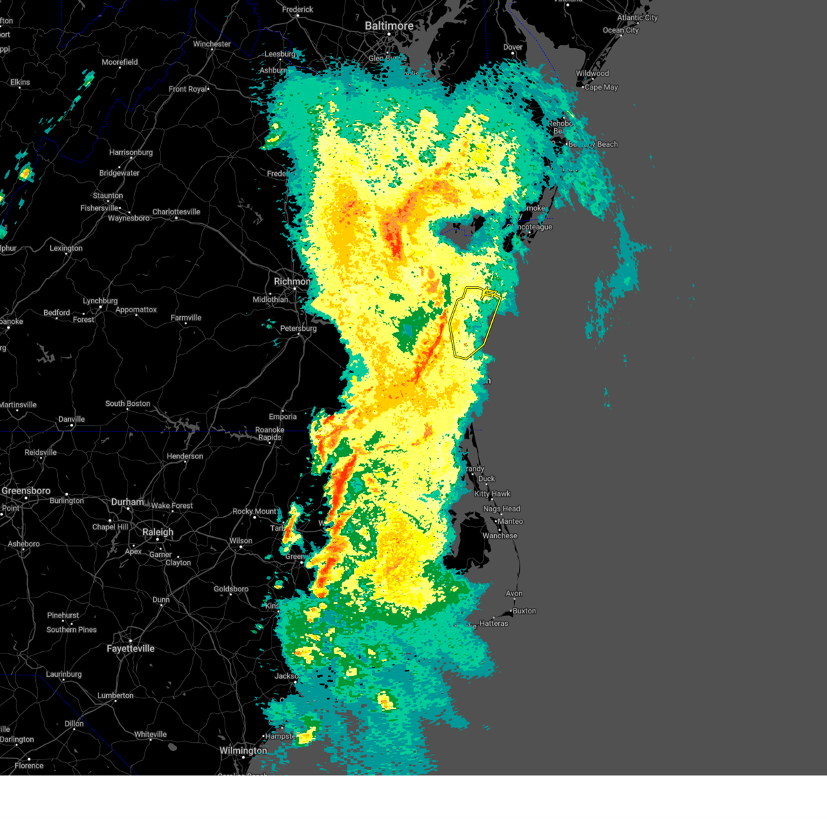
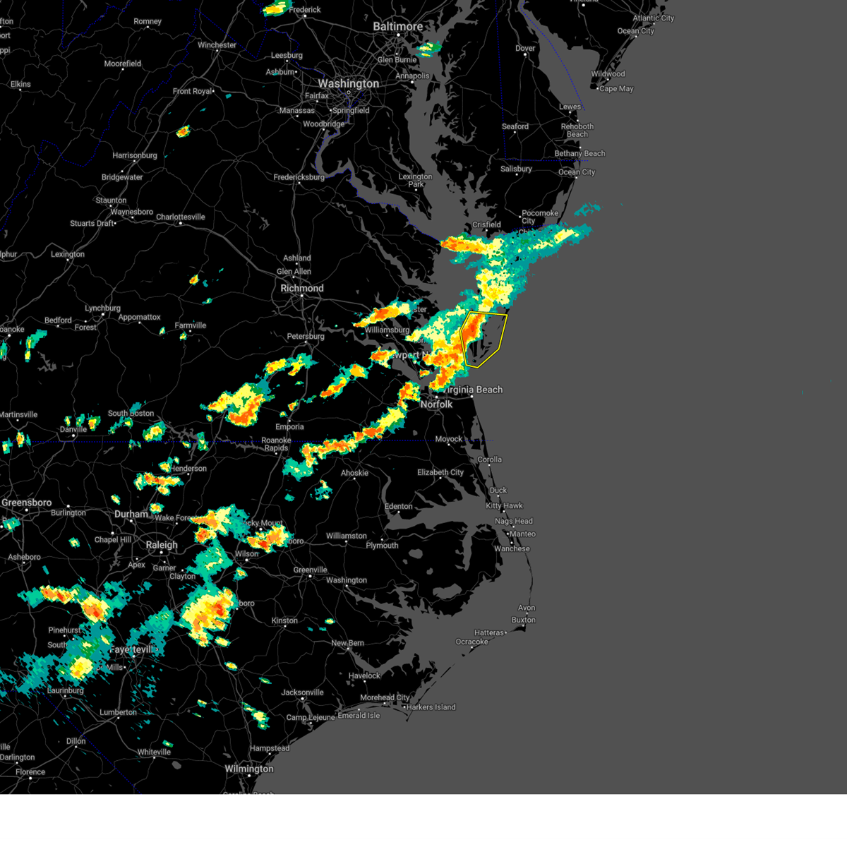
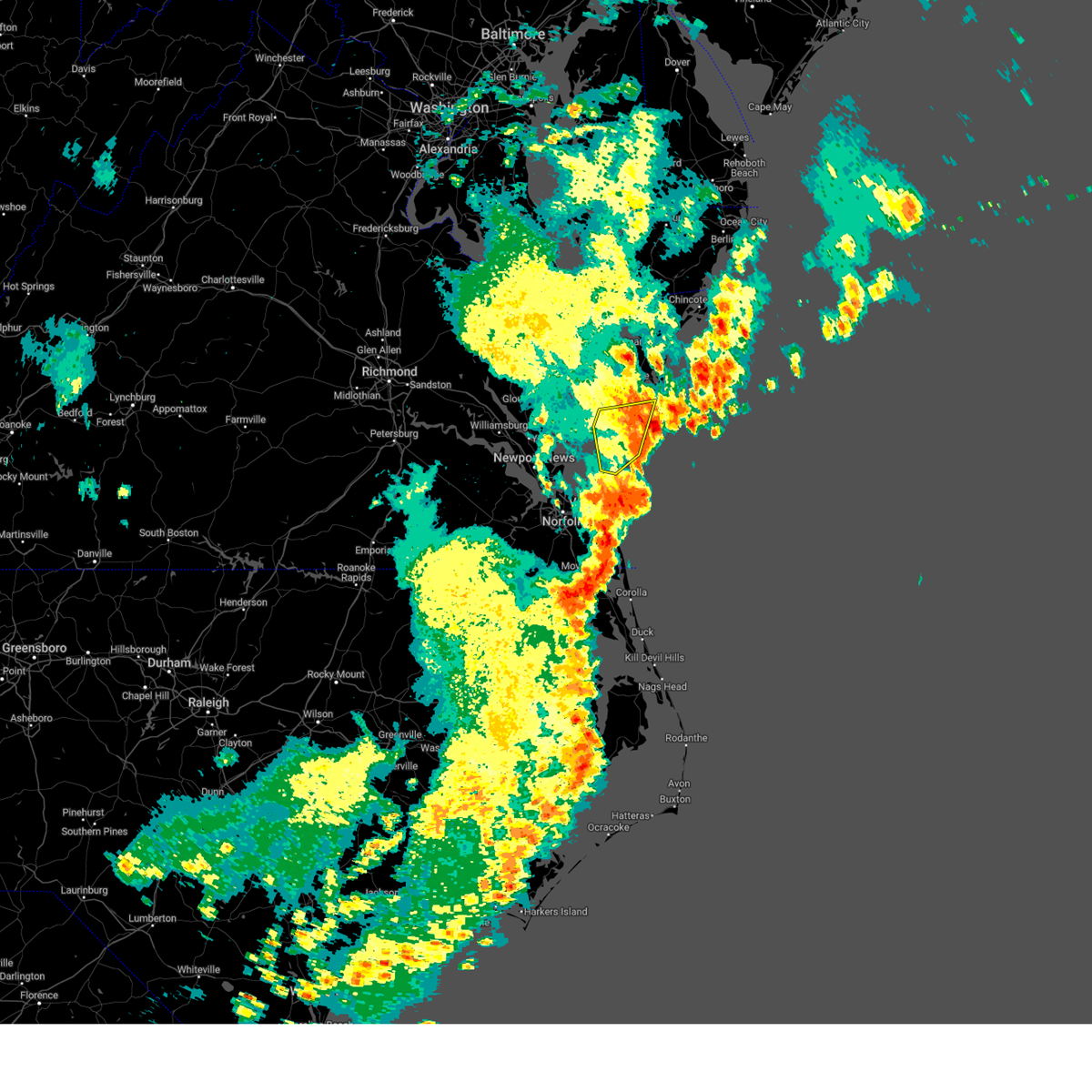
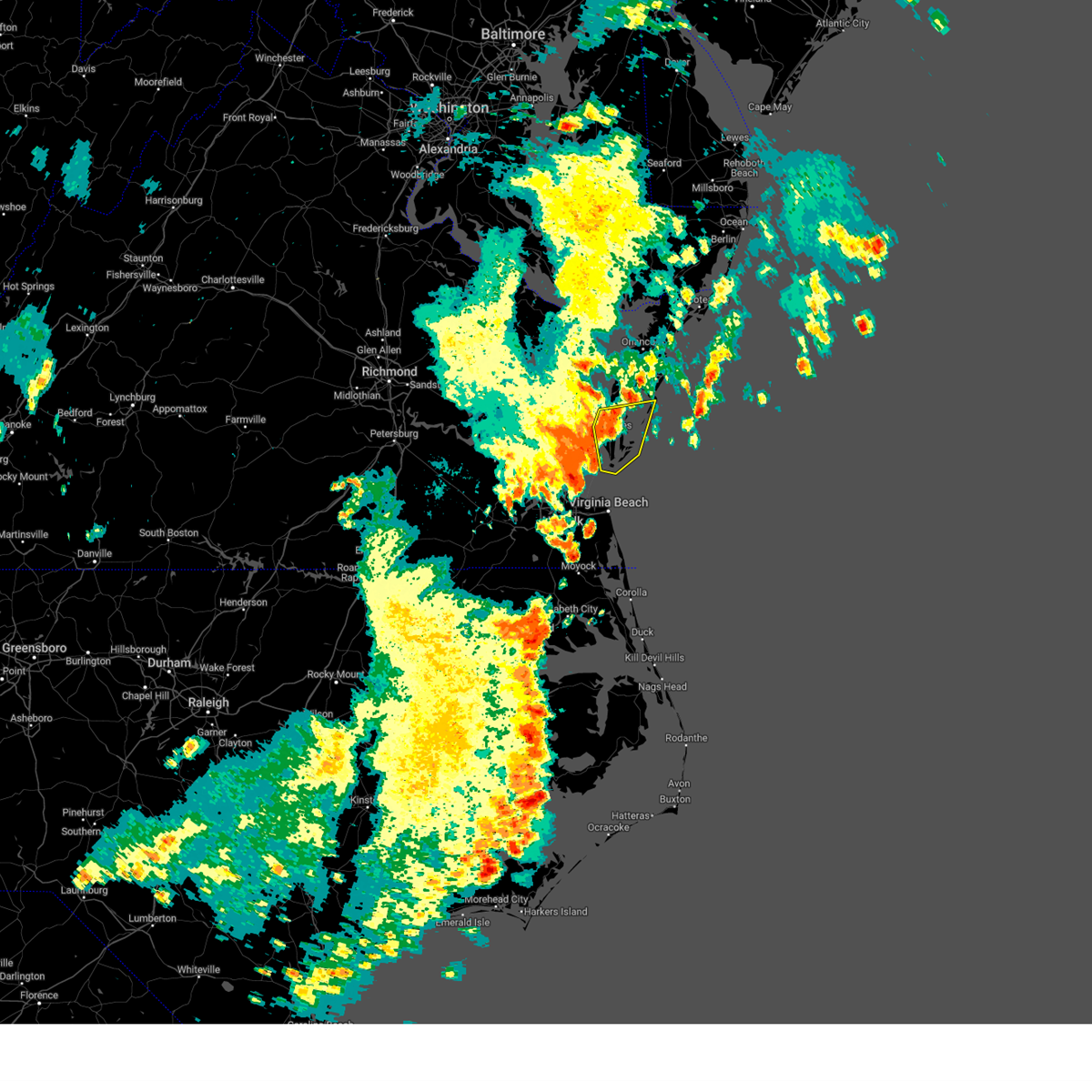
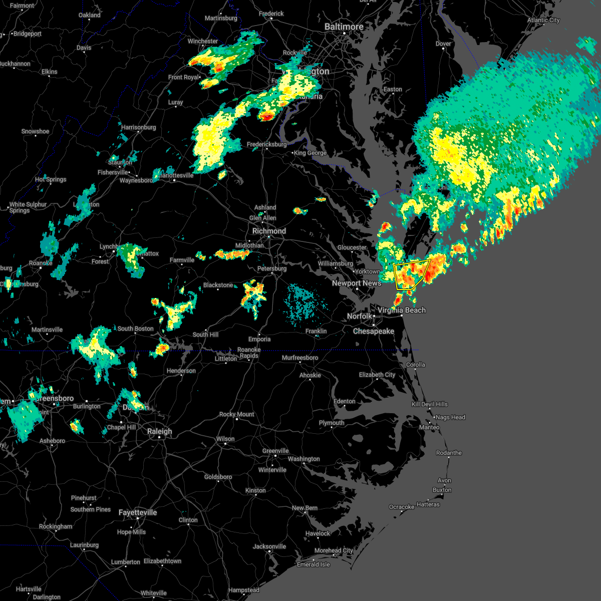
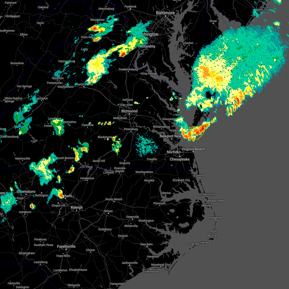
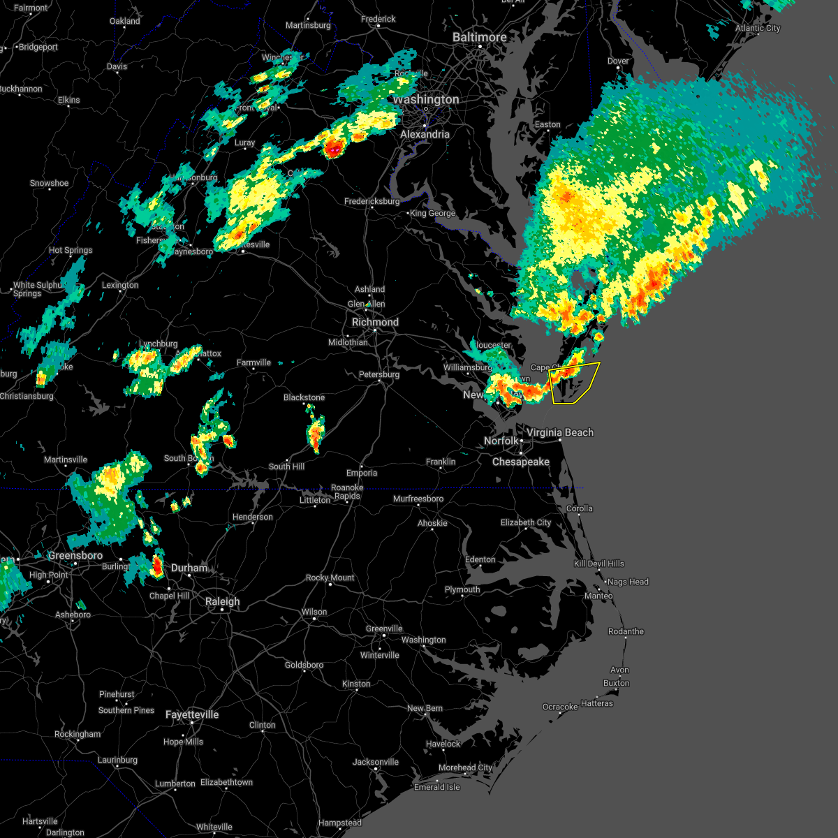
Hail Map for Cape Charles, VA
The Cape Charles, VA area has had 3 reports of on-the-ground hail by trained spotters, and has been under severe weather warnings 7 times during the past 12 months. Doppler radar has detected hail at or near Cape Charles, VA on 22 occasions, including 1 occasion during the past year.
| Name: | Cape Charles, VA |
| Where Located: | 34.8 miles N of Virginia Beach, VA |
| Map: | Google Map for Cape Charles, VA |
| Population: | 1009 |
| Housing Units: | 958 |
| More Info: | Search Google for Cape Charles, VA |
0
The Top Recent Hail Date for Cape Charles, VA is Thursday, May 22, 2025 (12th out of 22)

Hail and Wind Damage Spotted near Cape Charles, VA
| Date / Time | Report Details |
|---|---|
| 6/19/2025 7:45 PM EDT | A couple of trees down in eastville... va. time estimate in northampton county VA, 7.1 miles SSW of Cape Charles, VA |
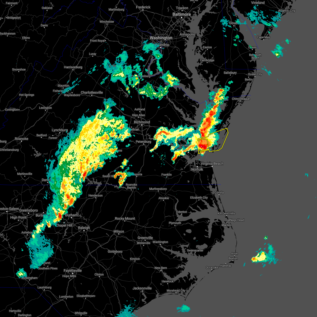
| 5/22/2025 7:45 PM EDT | Quarter sized hail reported 3.3 miles SSW of Cape Charles, VA, public reported quarter sized hail and crop damage just north of cape charles on facebook. time estimated based on radar. |
| 5/22/2025 7:39 PM EDT |
 Svrakq the national weather service in wakefield has issued a * severe thunderstorm warning for, southern northampton county in eastern virginia, * until 815 pm edt. * at 739 pm edt, a severe thunderstorm was located near cheriton, or near cape charles, moving southeast at 35 mph (radar indicated). Hazards include 60 mph wind gusts and quarter size hail. Minor damage to vehicles is possible. expect wind damage to trees and powerlines. this severe thunderstorm will be near, cape charles, cheriton, and bay view around 745 pm edt. Other locations impacted by this severe thunderstorm include simpkins, plantation, oyster, dalbys, smith beach, and eastville. Svrakq the national weather service in wakefield has issued a * severe thunderstorm warning for, southern northampton county in eastern virginia, * until 815 pm edt. * at 739 pm edt, a severe thunderstorm was located near cheriton, or near cape charles, moving southeast at 35 mph (radar indicated). Hazards include 60 mph wind gusts and quarter size hail. Minor damage to vehicles is possible. expect wind damage to trees and powerlines. this severe thunderstorm will be near, cape charles, cheriton, and bay view around 745 pm edt. Other locations impacted by this severe thunderstorm include simpkins, plantation, oyster, dalbys, smith beach, and eastville.
|
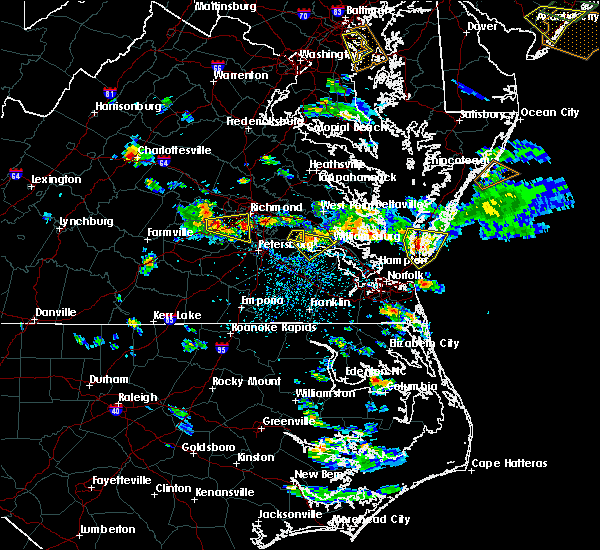
| 3/5/2025 6:09 PM EST |
 The storms which prompted the warning have moved out of the area. therefore, the warning will be allowed to expire. a severe thunderstorm watch remains in effect until 700 pm est for southeastern maryland, and eastern and southeastern virginia. remember, a severe thunderstorm warning still remains in effect for northern accomack county including wallops island and chincoteague. The storms which prompted the warning have moved out of the area. therefore, the warning will be allowed to expire. a severe thunderstorm watch remains in effect until 700 pm est for southeastern maryland, and eastern and southeastern virginia. remember, a severe thunderstorm warning still remains in effect for northern accomack county including wallops island and chincoteague.
|
| 3/5/2025 5:54 PM EST |
 At 553 pm est, severe thunderstorms were located along a line extending from near parksley to near bay view, moving northeast at 60 mph (radar indicated). Hazards include 60 mph wind gusts. Expect damage to trees and powerlines. these severe storms will be near, onley and parksley around 600 pm est. Other locations impacted by these severe thunderstorms include horntown, hallwood, capeville, kiptopeke state park, harborton, melfa, mappsville, eastville, greenbackville, and saxis. At 553 pm est, severe thunderstorms were located along a line extending from near parksley to near bay view, moving northeast at 60 mph (radar indicated). Hazards include 60 mph wind gusts. Expect damage to trees and powerlines. these severe storms will be near, onley and parksley around 600 pm est. Other locations impacted by these severe thunderstorms include horntown, hallwood, capeville, kiptopeke state park, harborton, melfa, mappsville, eastville, greenbackville, and saxis.
|
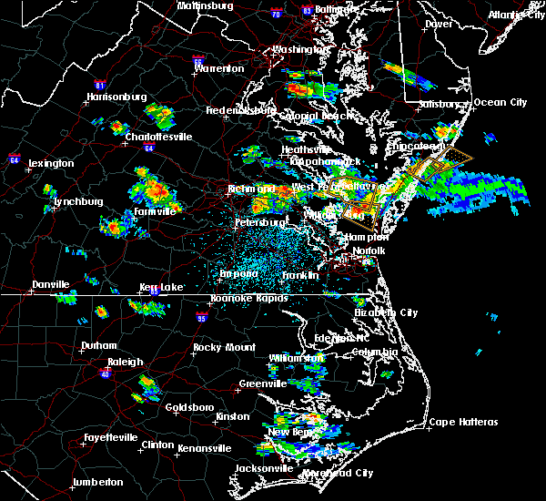
| 3/5/2025 5:42 PM EST | Buoy station kptv2 kiptopeke... v in northampton county VA, 6.1 miles N of Cape Charles, VA |
| 3/5/2025 5:35 PM EST |
 Svrakq the national weather service in wakefield has issued a * severe thunderstorm warning for, accomack county in southeastern virginia, northampton county in eastern virginia, * until 615 pm est. * at 535 pm est, severe thunderstorms were located along a line extending from near cheriton to 9 miles east of grand view, moving northeast at 55 mph (radar indicated). Hazards include 60 mph wind gusts. Expect damage to trees and powerlines. severe thunderstorms will be near, cape charles, bay view, and cheriton around 540 pm est. nassawadox around 545 pm est. willis wharf and exmore around 550 pm est. Other locations impacted by these severe thunderstorms include horntown, hallwood, capeville, kiptopeke state park, harborton, melfa, mappsville, eastville, greenbackville, and saxis. Svrakq the national weather service in wakefield has issued a * severe thunderstorm warning for, accomack county in southeastern virginia, northampton county in eastern virginia, * until 615 pm est. * at 535 pm est, severe thunderstorms were located along a line extending from near cheriton to 9 miles east of grand view, moving northeast at 55 mph (radar indicated). Hazards include 60 mph wind gusts. Expect damage to trees and powerlines. severe thunderstorms will be near, cape charles, bay view, and cheriton around 540 pm est. nassawadox around 545 pm est. willis wharf and exmore around 550 pm est. Other locations impacted by these severe thunderstorms include horntown, hallwood, capeville, kiptopeke state park, harborton, melfa, mappsville, eastville, greenbackville, and saxis.
|
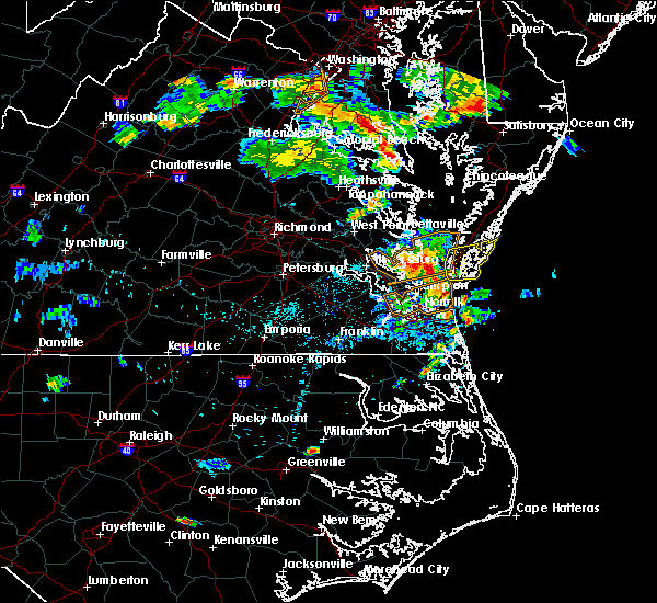
| 3/5/2025 4:40 PM EST |
 The storms which prompted the warning have weakened below severe limits, and no longer pose an immediate threat to life or property. therefore, the warning will be allowed to expire. however, gusty winds and heavy rain are still possible with these thunderstorms. a severe thunderstorm watch remains in effect until 600 pm est for eastern and southeastern virginia. The storms which prompted the warning have weakened below severe limits, and no longer pose an immediate threat to life or property. therefore, the warning will be allowed to expire. however, gusty winds and heavy rain are still possible with these thunderstorms. a severe thunderstorm watch remains in effect until 600 pm est for eastern and southeastern virginia.
|
| 3/5/2025 4:23 PM EST |
 At 423 pm est, severe thunderstorms were located along a line extending from willis wharf to 9 miles south of cape charles, moving northeast at 60 mph (radar indicated). Hazards include 60 mph wind gusts. Expect damage to trees and powerlines. These severe thunderstorms will remain over mainly rural areas of northampton county, including the following locations, capeville, birdsnest, kiptopeke state park, jamesville, eastville, machipongo, wardtown, franktown, simpkins, and townsend. At 423 pm est, severe thunderstorms were located along a line extending from willis wharf to 9 miles south of cape charles, moving northeast at 60 mph (radar indicated). Hazards include 60 mph wind gusts. Expect damage to trees and powerlines. These severe thunderstorms will remain over mainly rural areas of northampton county, including the following locations, capeville, birdsnest, kiptopeke state park, jamesville, eastville, machipongo, wardtown, franktown, simpkins, and townsend.
|
| 3/5/2025 4:01 PM EST |
 Svrakq the national weather service in wakefield has issued a * severe thunderstorm warning for, northampton county in eastern virginia, * until 445 pm est. * at 400 pm est, severe thunderstorms were located along a line extending from near cape charles to norfolk nas, moving northeast at 50 mph (radar indicated). Hazards include 60 mph wind gusts. Expect damage to trees and powerlines. severe thunderstorms will be near, cape charles, bay view, and cheriton around 405 pm est. Other locations impacted by these severe thunderstorms include capeville, birdsnest, kiptopeke state park, jamesville, eastville, machipongo, wardtown, franktown, simpkins, and townsend. Svrakq the national weather service in wakefield has issued a * severe thunderstorm warning for, northampton county in eastern virginia, * until 445 pm est. * at 400 pm est, severe thunderstorms were located along a line extending from near cape charles to norfolk nas, moving northeast at 50 mph (radar indicated). Hazards include 60 mph wind gusts. Expect damage to trees and powerlines. severe thunderstorms will be near, cape charles, bay view, and cheriton around 405 pm est. Other locations impacted by these severe thunderstorms include capeville, birdsnest, kiptopeke state park, jamesville, eastville, machipongo, wardtown, franktown, simpkins, and townsend.
|
| 8/2/2024 9:29 PM EDT | *** 1 inj *** strong outflow winds resulted in an awning breaking free from a camper and striking a woman in the hea in northampton county VA, 2.2 miles S of Cape Charles, VA |
| 6/30/2024 3:40 PM EDT | Numerous trees down throughout northampton count in northampton county VA, 3.3 miles NW of Cape Charles, VA |
| 6/30/2024 3:29 PM EDT |
 Svrakq the national weather service in wakefield has issued a * severe thunderstorm warning for, northampton county in eastern virginia, * until 415 pm edt. * at 328 pm edt, severe thunderstorms were located along a line extending from 7 miles north of cheriton to cape charles to 10 miles east of grand view, moving east at 20 mph (radar indicated). Hazards include 60 mph wind gusts. Expect damage to trees and powerlines. severe thunderstorms will be near, cape charles, cheriton, and bay view around 335 pm edt. Other locations impacted by these severe thunderstorms include simpkins, capeville, townsend, kiptopeke state park, oyster, eastville, cheapside, kiptopeke, plantation, and machipongo. Svrakq the national weather service in wakefield has issued a * severe thunderstorm warning for, northampton county in eastern virginia, * until 415 pm edt. * at 328 pm edt, severe thunderstorms were located along a line extending from 7 miles north of cheriton to cape charles to 10 miles east of grand view, moving east at 20 mph (radar indicated). Hazards include 60 mph wind gusts. Expect damage to trees and powerlines. severe thunderstorms will be near, cape charles, cheriton, and bay view around 335 pm edt. Other locations impacted by these severe thunderstorms include simpkins, capeville, townsend, kiptopeke state park, oyster, eastville, cheapside, kiptopeke, plantation, and machipongo.
|
| 8/15/2023 5:42 PM EDT | Buoy station kptv2 kiptopeke... v in northampton county VA, 6.1 miles N of Cape Charles, VA |
| 6/27/2023 2:22 AM EDT |
 The severe thunderstorm warning for northampton county will expire at 230 am edt, the storms which prompted the warning have moved out of the area. therefore, the warning will be allowed to expire. a severe thunderstorm watch remains in effect until 300 am edt for eastern virginia. The severe thunderstorm warning for northampton county will expire at 230 am edt, the storms which prompted the warning have moved out of the area. therefore, the warning will be allowed to expire. a severe thunderstorm watch remains in effect until 300 am edt for eastern virginia.
|
| 6/27/2023 1:51 AM EDT |
 At 151 am edt, severe thunderstorms were located along a line extending from near cheriton to 11 miles south of cape charles to near ocean view, moving east at 40 mph (radar indicated). Hazards include 60 mph wind gusts and penny size hail. expect damage to trees and powerlines At 151 am edt, severe thunderstorms were located along a line extending from near cheriton to 11 miles south of cape charles to near ocean view, moving east at 40 mph (radar indicated). Hazards include 60 mph wind gusts and penny size hail. expect damage to trees and powerlines
|
| 9/25/2022 6:17 PM EDT | Weatherflow site at plantation flats reported a wind gust to 51 k in northampton county VA, 0.9 miles NE of Cape Charles, VA |
| 9/25/2022 6:07 PM EDT |
 At 607 pm edt, severe thunderstorms were located along a line extending from 11 miles northwest of nassawadox to near cape charles to 9 miles northeast of grand view, moving east at 55 mph (radar indicated). Hazards include 60 mph wind gusts. Expect damage to trees and powerlines. severe thunderstorms will be near, cape charles, cheriton and bay view around 610 pm edt. exmore, nassawadox and willis wharf around 620 pm edt. other locations impacted by these severe thunderstorms include capeville, birdsnest, kiptopeke state park, melfa, jamesville, silver beach, eastville, wachapreague, machipongo and wardtown. hail threat, radar indicated max hail size, <. 75 in wind threat, observed max wind gust, 60 mph. At 607 pm edt, severe thunderstorms were located along a line extending from 11 miles northwest of nassawadox to near cape charles to 9 miles northeast of grand view, moving east at 55 mph (radar indicated). Hazards include 60 mph wind gusts. Expect damage to trees and powerlines. severe thunderstorms will be near, cape charles, cheriton and bay view around 610 pm edt. exmore, nassawadox and willis wharf around 620 pm edt. other locations impacted by these severe thunderstorms include capeville, birdsnest, kiptopeke state park, melfa, jamesville, silver beach, eastville, wachapreague, machipongo and wardtown. hail threat, radar indicated max hail size, <. 75 in wind threat, observed max wind gust, 60 mph.
|
| 7/16/2022 8:18 PM EDT |
 At 818 pm edt, severe thunderstorms were located along a line extending from 9 miles southeast of gwynn to 6 miles northwest of cheriton to near cape charles, moving northeast at 20 mph (radar indicated). Hazards include 60 mph wind gusts. Expect damage to trees and powerlines. severe thunderstorms will be near, bay view around 835 pm edt. cheriton around 840 pm edt. exmore, nassawadox and willis wharf around 900 pm edt. Other locations impacted by these severe thunderstorms include simpkins, birdsnest, oyster, jamesville, silver beach, eastville, plantation, machipongo, wardtown and franktown. At 818 pm edt, severe thunderstorms were located along a line extending from 9 miles southeast of gwynn to 6 miles northwest of cheriton to near cape charles, moving northeast at 20 mph (radar indicated). Hazards include 60 mph wind gusts. Expect damage to trees and powerlines. severe thunderstorms will be near, bay view around 835 pm edt. cheriton around 840 pm edt. exmore, nassawadox and willis wharf around 900 pm edt. Other locations impacted by these severe thunderstorms include simpkins, birdsnest, oyster, jamesville, silver beach, eastville, plantation, machipongo, wardtown and franktown.
|
| 6/17/2022 8:21 PM EDT |
 The severe thunderstorm warning for southern accomack and northampton counties will expire at 830 pm edt, the storms which prompted the warning have moved out of the area. therefore, the warning will be allowed to expire. The severe thunderstorm warning for southern accomack and northampton counties will expire at 830 pm edt, the storms which prompted the warning have moved out of the area. therefore, the warning will be allowed to expire.
|
| 6/17/2022 7:50 PM EDT |
 At 750 pm edt, severe thunderstorms were located along a line extending from 8 miles west of parksley to exmore to 6 miles southeast of cape charles, moving east at 45 mph (radar indicated). Hazards include 60 mph wind gusts. Expect damage to trees and powerlines. these severe storms will be near, onancock around 755 pm edt. parksley around 800 pm edt. other locations impacted by these severe thunderstorms include capeville, kiptopeke state park, harborton, melfa, eastville, franktown, cheapside, kiptopeke, painter and keller. hail threat, radar indicated max hail size, <. 75 in wind threat, radar indicated max wind gust, 60 mph. At 750 pm edt, severe thunderstorms were located along a line extending from 8 miles west of parksley to exmore to 6 miles southeast of cape charles, moving east at 45 mph (radar indicated). Hazards include 60 mph wind gusts. Expect damage to trees and powerlines. these severe storms will be near, onancock around 755 pm edt. parksley around 800 pm edt. other locations impacted by these severe thunderstorms include capeville, kiptopeke state park, harborton, melfa, eastville, franktown, cheapside, kiptopeke, painter and keller. hail threat, radar indicated max hail size, <. 75 in wind threat, radar indicated max wind gust, 60 mph.
|
| 6/17/2022 7:33 PM EDT |
 At 732 pm edt, severe thunderstorms were located along a line extending from near tangier to 11 miles northwest of nassawadox to near bavon, moving east at 45 mph (radar indicated). Hazards include 60 mph wind gusts. Expect damage to trees and powerlines. severe thunderstorms will be near, nassawadox around 745 pm edt. exmore, cape charles and willis wharf around 750 pm edt. onancock, cheriton and bay view around 755 pm edt. parksley around 800 pm edt. other locations impacted by these severe thunderstorms include capeville, kiptopeke state park, harborton, melfa, eastville, franktown, cheapside, kiptopeke, painter and keller. hail threat, radar indicated max hail size, <. 75 in wind threat, radar indicated max wind gust, 60 mph. At 732 pm edt, severe thunderstorms were located along a line extending from near tangier to 11 miles northwest of nassawadox to near bavon, moving east at 45 mph (radar indicated). Hazards include 60 mph wind gusts. Expect damage to trees and powerlines. severe thunderstorms will be near, nassawadox around 745 pm edt. exmore, cape charles and willis wharf around 750 pm edt. onancock, cheriton and bay view around 755 pm edt. parksley around 800 pm edt. other locations impacted by these severe thunderstorms include capeville, kiptopeke state park, harborton, melfa, eastville, franktown, cheapside, kiptopeke, painter and keller. hail threat, radar indicated max hail size, <. 75 in wind threat, radar indicated max wind gust, 60 mph.
|
| 6/2/2022 9:10 PM EDT |
 The severe thunderstorm warning for southern northampton county will expire at 915 pm edt, the storm which prompted the warning has weakened below severe limits, and has exited the warned area. therefore, the warning will be allowed to expire. however heavy rain is still possible with this thunderstorm. The severe thunderstorm warning for southern northampton county will expire at 915 pm edt, the storm which prompted the warning has weakened below severe limits, and has exited the warned area. therefore, the warning will be allowed to expire. however heavy rain is still possible with this thunderstorm.
|
| 6/2/2022 8:52 PM EDT |
 At 852 pm edt, a severe thunderstorm was located near bay view, or near cape charles, moving east at 20 mph (radar indicated). Hazards include 60 mph wind gusts and penny size hail. Expect damage to trees and powerlines. this severe thunderstorm will remain over mainly rural areas of southern northampton county, including the following locations, capeville, townsend, kiptopeke state park, oyster, cheapside, kiptopeke, plantation and dalbys. hail threat, radar indicated max hail size, 0. 75 in wind threat, radar indicated max wind gust, 60 mph. At 852 pm edt, a severe thunderstorm was located near bay view, or near cape charles, moving east at 20 mph (radar indicated). Hazards include 60 mph wind gusts and penny size hail. Expect damage to trees and powerlines. this severe thunderstorm will remain over mainly rural areas of southern northampton county, including the following locations, capeville, townsend, kiptopeke state park, oyster, cheapside, kiptopeke, plantation and dalbys. hail threat, radar indicated max hail size, 0. 75 in wind threat, radar indicated max wind gust, 60 mph.
|
| 6/2/2022 8:35 PM EDT |
 At 835 pm edt, a severe thunderstorm was located near cape charles, moving east at 20 mph (radar indicated). Hazards include 60 mph wind gusts and quarter size hail. Minor damage to vehicles is possible. expect wind damage to trees and powerlines. this severe thunderstorm will be near, cheriton and bay view around 845 pm edt. other locations impacted by this severe thunderstorm include capeville, townsend, kiptopeke state park, oyster, cheapside, kiptopeke, plantation and dalbys. hail threat, radar indicated max hail size, 1. 00 in wind threat, radar indicated max wind gust, 60 mph. At 835 pm edt, a severe thunderstorm was located near cape charles, moving east at 20 mph (radar indicated). Hazards include 60 mph wind gusts and quarter size hail. Minor damage to vehicles is possible. expect wind damage to trees and powerlines. this severe thunderstorm will be near, cheriton and bay view around 845 pm edt. other locations impacted by this severe thunderstorm include capeville, townsend, kiptopeke state park, oyster, cheapside, kiptopeke, plantation and dalbys. hail threat, radar indicated max hail size, 1. 00 in wind threat, radar indicated max wind gust, 60 mph.
|
| 5/27/2022 1:24 PM EDT | Buoy station kptv2 kiptopeke... v in northampton county VA, 6.1 miles N of Cape Charles, VA |
| 6/22/2021 2:51 PM EDT | Mesonet station xplt plantation flat in anz632 county VA, 1.2 miles E of Cape Charles, VA |
| 6/22/2021 2:37 PM EDT |
 At 236 pm edt, severe thunderstorms were located along a line extending from near cheriton to 12 miles east of grand view to near norfolk nas, moving east at 45 mph (radar indicated). Hazards include 60 mph wind gusts. Expect damage to trees and powerlines. these severe storms will be near, cheriton and bay view around 240 pm edt. kempsville and regent university around 245 pm edt. virginia beach and princess anne around 255 pm edt. Other locations impacted by these severe thunderstorms include capeville, south norfolk, kiptopeke state park, rudee heights, portlock, princess anne plaza, sigma, eastville, pungo and greenbrier. At 236 pm edt, severe thunderstorms were located along a line extending from near cheriton to 12 miles east of grand view to near norfolk nas, moving east at 45 mph (radar indicated). Hazards include 60 mph wind gusts. Expect damage to trees and powerlines. these severe storms will be near, cheriton and bay view around 240 pm edt. kempsville and regent university around 245 pm edt. virginia beach and princess anne around 255 pm edt. Other locations impacted by these severe thunderstorms include capeville, south norfolk, kiptopeke state park, rudee heights, portlock, princess anne plaza, sigma, eastville, pungo and greenbrier.
|
| 6/22/2021 2:23 PM EDT |
 At 222 pm edt, severe thunderstorms were located along a line extending from 6 miles northeast of bavon to near grand view to near christopher newport university, moving east at 40 mph (radar indicated). Hazards include 60 mph wind gusts. Expect damage to trees and powerlines. severe thunderstorms will be near, grand view around 235 pm edt. cape charles, ocean view, old dominion university, cheriton, bay view and ghent around 240 pm edt. norfolk international and norview around 245 pm edt. virginia wesleyan university and norfolk around 250 pm edt. virginia beach around 300 pm edt. Other locations impacted by these severe thunderstorms include capeville, south norfolk, kiptopeke state park, rudee heights, carrollton, portlock, princess anne plaza, sigma, eastville and hilton village. At 222 pm edt, severe thunderstorms were located along a line extending from 6 miles northeast of bavon to near grand view to near christopher newport university, moving east at 40 mph (radar indicated). Hazards include 60 mph wind gusts. Expect damage to trees and powerlines. severe thunderstorms will be near, grand view around 235 pm edt. cape charles, ocean view, old dominion university, cheriton, bay view and ghent around 240 pm edt. norfolk international and norview around 245 pm edt. virginia wesleyan university and norfolk around 250 pm edt. virginia beach around 300 pm edt. Other locations impacted by these severe thunderstorms include capeville, south norfolk, kiptopeke state park, rudee heights, carrollton, portlock, princess anne plaza, sigma, eastville and hilton village.
|
| 3/18/2021 10:42 PM EDT |
 The severe thunderstorm warning for southern northampton county will expire at 1045 pm edt, the storm which prompted the warning has moved out of the area. therefore, the warning will be allowed to expire. however, heavy rain is still possible with this thunderstorm. to report severe weather, contact your nearest law enforcement agency. they will relay your report to the national weather service wakefield. The severe thunderstorm warning for southern northampton county will expire at 1045 pm edt, the storm which prompted the warning has moved out of the area. therefore, the warning will be allowed to expire. however, heavy rain is still possible with this thunderstorm. to report severe weather, contact your nearest law enforcement agency. they will relay your report to the national weather service wakefield.
|
| 3/18/2021 10:13 PM EDT |
 At 1012 pm edt, a severe thunderstorm was located 8 miles east of grand view, or 8 miles northeast of ocean view, moving east at 60 mph (radar indicated). Hazards include 60 mph wind gusts and quarter size hail. Minor damage to vehicles is possible. expect wind damage to trees and powerlines. This severe thunderstorm will remain over mainly rural areas of southern northampton county, including the following locations, cheapside, kiptopeke, capeville, townsend, kiptopeke state park and dalbys. At 1012 pm edt, a severe thunderstorm was located 8 miles east of grand view, or 8 miles northeast of ocean view, moving east at 60 mph (radar indicated). Hazards include 60 mph wind gusts and quarter size hail. Minor damage to vehicles is possible. expect wind damage to trees and powerlines. This severe thunderstorm will remain over mainly rural areas of southern northampton county, including the following locations, cheapside, kiptopeke, capeville, townsend, kiptopeke state park and dalbys.
|
| 3/18/2021 7:01 PM EDT |
 At 700 pm edt, a severe thunderstorm was located 8 miles southeast of bay view, or 10 miles east of cape charles, moving east at 45 mph (radar indicated). Hazards include 60 mph wind gusts and quarter size hail. Minor damage to vehicles is possible. expect wind damage to trees and powerlines. This severe thunderstorm will remain over mainly rural areas of northampton county, including the following locations, simpkins, capeville, townsend, kiptopeke state park, oyster, eastville, cheapside, kiptopeke, plantation and machipongo. At 700 pm edt, a severe thunderstorm was located 8 miles southeast of bay view, or 10 miles east of cape charles, moving east at 45 mph (radar indicated). Hazards include 60 mph wind gusts and quarter size hail. Minor damage to vehicles is possible. expect wind damage to trees and powerlines. This severe thunderstorm will remain over mainly rural areas of northampton county, including the following locations, simpkins, capeville, townsend, kiptopeke state park, oyster, eastville, cheapside, kiptopeke, plantation and machipongo.
|
| 3/18/2021 6:34 PM EDT |
 At 633 pm edt, a severe thunderstorm was located 8 miles northeast of grand view, or 11 miles southwest of cape charles, moving east at 40 mph (radar indicated). Hazards include 60 mph wind gusts and quarter size hail. Minor damage to vehicles is possible. expect wind damage to trees and powerlines. this severe thunderstorm will be near, cape charles, cheriton and bay view around 650 pm edt. Other locations impacted by this severe thunderstorm include simpkins, capeville, townsend, kiptopeke state park, oyster, eastville, cheapside, kiptopeke, plantation and machipongo. At 633 pm edt, a severe thunderstorm was located 8 miles northeast of grand view, or 11 miles southwest of cape charles, moving east at 40 mph (radar indicated). Hazards include 60 mph wind gusts and quarter size hail. Minor damage to vehicles is possible. expect wind damage to trees and powerlines. this severe thunderstorm will be near, cape charles, cheriton and bay view around 650 pm edt. Other locations impacted by this severe thunderstorm include simpkins, capeville, townsend, kiptopeke state park, oyster, eastville, cheapside, kiptopeke, plantation and machipongo.
|
| 2/22/2021 2:19 PM EST |
 At 219 pm est, severe thunderstorms were located along a line extending from near marion station to near tabb, moving east at 45 mph (radar indicated). Hazards include 60 mph wind gusts and quarter size hail. a 70 mph wind gust was reported at tangier island. Minor damage to vehicles is possible. expect wind damage to trees and powerlines. These severe thunderstorms will remain over mainly rural areas of accomack and northampton counties, including the following locations, horntown, hallwood, capeville, kiptopeke state park, harborton, melfa, mappsville, eastville, saxis and franktown. At 219 pm est, severe thunderstorms were located along a line extending from near marion station to near tabb, moving east at 45 mph (radar indicated). Hazards include 60 mph wind gusts and quarter size hail. a 70 mph wind gust was reported at tangier island. Minor damage to vehicles is possible. expect wind damage to trees and powerlines. These severe thunderstorms will remain over mainly rural areas of accomack and northampton counties, including the following locations, horntown, hallwood, capeville, kiptopeke state park, harborton, melfa, mappsville, eastville, saxis and franktown.
|
| 12/25/2020 12:54 AM EST |
 The severe thunderstorm warning for southern accomack and northampton counties will expire at 100 am est, the storms which prompted the warning have moved out of the area. therefore, the warning will be allowed to expire. The severe thunderstorm warning for southern accomack and northampton counties will expire at 100 am est, the storms which prompted the warning have moved out of the area. therefore, the warning will be allowed to expire.
|
| 12/25/2020 12:25 AM EST |
 At 1225 am est, severe thunderstorms were located along a line extending from 8 miles southwest of tangier to near cape charles, moving northeast at 55 mph (radar indicated). Hazards include 60 mph wind gusts. Expect damage to trees and powerlines. severe thunderstorms will be near, nassawadox around 1245 am est. willis wharf around 1250 am est. Other locations impacted by these severe thunderstorms include capeville, kiptopeke state park, harborton, melfa, eastville, franktown, cheapside, kiptopeke, painter and keller. At 1225 am est, severe thunderstorms were located along a line extending from 8 miles southwest of tangier to near cape charles, moving northeast at 55 mph (radar indicated). Hazards include 60 mph wind gusts. Expect damage to trees and powerlines. severe thunderstorms will be near, nassawadox around 1245 am est. willis wharf around 1250 am est. Other locations impacted by these severe thunderstorms include capeville, kiptopeke state park, harborton, melfa, eastville, franktown, cheapside, kiptopeke, painter and keller.
|
| 8/27/2020 10:20 PM EDT |
 At 1018 pm edt, severe thunderstorms were located along a line extending from near bavon to near tabb to near elberon, moving southeast at 30 mph (radar indicated). Hazards include 60 mph wind gusts and nickel size hail. Expect damage to trees and powerlines. these severe storms will be near, hampton, seaford, patrick henry field, tabb, beaconsdale and denbigh around 1025 pm edt. langley afb and northampton around 1030 pm edt. hampton university, grand view, buckroe beach and fort monroe around 1040 pm edt. smithfield around 1050 pm edt. rescue around 1100 pm edt. Other locations impacted by these severe thunderstorms include rushmere, capeville, kiptopeke state park, carsley, pons, carrollton, chippokes state park, benns church, oriana and bethel church. At 1018 pm edt, severe thunderstorms were located along a line extending from near bavon to near tabb to near elberon, moving southeast at 30 mph (radar indicated). Hazards include 60 mph wind gusts and nickel size hail. Expect damage to trees and powerlines. these severe storms will be near, hampton, seaford, patrick henry field, tabb, beaconsdale and denbigh around 1025 pm edt. langley afb and northampton around 1030 pm edt. hampton university, grand view, buckroe beach and fort monroe around 1040 pm edt. smithfield around 1050 pm edt. rescue around 1100 pm edt. Other locations impacted by these severe thunderstorms include rushmere, capeville, kiptopeke state park, carsley, pons, carrollton, chippokes state park, benns church, oriana and bethel church.
|
| 8/27/2020 9:50 PM EDT |
 At 949 pm edt, severe thunderstorms were located along a line extending from hayes to york terrace to near burrowsville, moving southeast at 30 mph (radar indicated). Hazards include 60 mph wind gusts and nickel size hail. Expect damage to trees and powerlines. severe thunderstorms will be near, williamsburg, gloucester courthouse, queens lake, gloucester point, college of william and mary, grove, busch gardens, hayes, carver gardens and york terrace around 955 pm edt. wicomico around 1000 pm edt. newport news, virginia institute for marine sciences, lee hall, achilles, mobjack and fort eustis around 1005 pm edt. denbigh around 1010 pm edt. seaford, patrick henry field and bavon around 1015 pm edt. christopher newport university, dendron, elberon, tabb and beaconsdale around 1020 pm edt. hampton, surry, northampton and scotland around 1025 pm edt. langley afb, hampton university, grand view, buckroe beach and fort monroe around 1030 pm edt. Other locations impacted by these severe thunderstorms include pons, carrollton, chippokes state park, lackey, beulah, camp peary, naxera, oriana, ewell and poolesville. At 949 pm edt, severe thunderstorms were located along a line extending from hayes to york terrace to near burrowsville, moving southeast at 30 mph (radar indicated). Hazards include 60 mph wind gusts and nickel size hail. Expect damage to trees and powerlines. severe thunderstorms will be near, williamsburg, gloucester courthouse, queens lake, gloucester point, college of william and mary, grove, busch gardens, hayes, carver gardens and york terrace around 955 pm edt. wicomico around 1000 pm edt. newport news, virginia institute for marine sciences, lee hall, achilles, mobjack and fort eustis around 1005 pm edt. denbigh around 1010 pm edt. seaford, patrick henry field and bavon around 1015 pm edt. christopher newport university, dendron, elberon, tabb and beaconsdale around 1020 pm edt. hampton, surry, northampton and scotland around 1025 pm edt. langley afb, hampton university, grand view, buckroe beach and fort monroe around 1030 pm edt. Other locations impacted by these severe thunderstorms include pons, carrollton, chippokes state park, lackey, beulah, camp peary, naxera, oriana, ewell and poolesville.
|
| 7/1/2020 3:54 PM EDT | Kiptopeke... v in northampton county VA, 6.1 miles N of Cape Charles, VA |
| 7/1/2020 3:48 PM EDT |
 At 348 pm edt, a severe thunderstorm was located near bay view, or near cape charles, moving southeast at 15 mph (radar indicated). Hazards include 60 mph wind gusts and quarter size hail. Minor damage to vehicles is possible. expect wind damage to trees and powerlines. This severe thunderstorm will remain over mainly rural areas of southern northampton county, including the following locations, capeville, townsend, kiptopeke state park, oyster, kiptopeke, cheapside, plantation and dalbys. At 348 pm edt, a severe thunderstorm was located near bay view, or near cape charles, moving southeast at 15 mph (radar indicated). Hazards include 60 mph wind gusts and quarter size hail. Minor damage to vehicles is possible. expect wind damage to trees and powerlines. This severe thunderstorm will remain over mainly rural areas of southern northampton county, including the following locations, capeville, townsend, kiptopeke state park, oyster, kiptopeke, cheapside, plantation and dalbys.
|
| 7/1/2020 2:57 PM EDT |
 At 257 pm edt, a severe thunderstorm was located 8 miles east of bavon, or 10 miles northwest of cape charles, moving southeast at 20 mph (radar indicated). Hazards include 60 mph wind gusts and penny size hail. Expect damage to trees and powerlines. this severe thunderstorm will be near, cape charles and cheriton around 330 pm edt. bay view around 335 pm edt. Other locations impacted by this severe thunderstorm include simpkins, capeville, townsend, kiptopeke state park, oyster, eastville, kiptopeke, cheapside, plantation and dalbys. At 257 pm edt, a severe thunderstorm was located 8 miles east of bavon, or 10 miles northwest of cape charles, moving southeast at 20 mph (radar indicated). Hazards include 60 mph wind gusts and penny size hail. Expect damage to trees and powerlines. this severe thunderstorm will be near, cape charles and cheriton around 330 pm edt. bay view around 335 pm edt. Other locations impacted by this severe thunderstorm include simpkins, capeville, townsend, kiptopeke state park, oyster, eastville, kiptopeke, cheapside, plantation and dalbys.
|
| 4/7/2020 6:23 PM EDT |
 The severe thunderstorm warning for accomack and northampton counties will expire at 630 pm edt, the storms which prompted the warning are weakening and will shortly move off the coast. therefore, the warning will be allowed to expire. however gusty winds are still possible with these thunderstorms over the next half hour. The severe thunderstorm warning for accomack and northampton counties will expire at 630 pm edt, the storms which prompted the warning are weakening and will shortly move off the coast. therefore, the warning will be allowed to expire. however gusty winds are still possible with these thunderstorms over the next half hour.
|
| 4/7/2020 5:55 PM EDT |
 At 554 pm edt, severe thunderstorms were located along a line extending from near lawsonia to near nassawadox, moving east at 35 mph (radar indicated). Hazards include 60 mph wind gusts and quarter size hail. wind gusts up to 70 mph are possible over northampton county. Minor damage to vehicles is possible. expect wind damage to trees and powerlines. these severe storms will be near, exmore and nassawadox around 605 pm edt. willis wharf around 610 pm edt. parksley around 615 pm edt. Other locations impacted by these severe thunderstorms include capeville, kiptopeke state park, harborton, melfa, mappsville, eastville, saxis, franktown, wallops island and temperanceville. At 554 pm edt, severe thunderstorms were located along a line extending from near lawsonia to near nassawadox, moving east at 35 mph (radar indicated). Hazards include 60 mph wind gusts and quarter size hail. wind gusts up to 70 mph are possible over northampton county. Minor damage to vehicles is possible. expect wind damage to trees and powerlines. these severe storms will be near, exmore and nassawadox around 605 pm edt. willis wharf around 610 pm edt. parksley around 615 pm edt. Other locations impacted by these severe thunderstorms include capeville, kiptopeke state park, harborton, melfa, mappsville, eastville, saxis, franktown, wallops island and temperanceville.
|
| 4/7/2020 5:35 PM EDT |
 At 535 pm edt, severe thunderstorms were located along a line extending from near tangier to 7 miles east of gwynn, moving east at 35 mph (radar indicated). Hazards include 60 mph wind gusts and quarter size hail. Minor damage to vehicles is possible. expect wind damage to trees and powerlines. severe thunderstorms will be near, tangier around 540 pm edt. exmore, nassawadox and willis wharf around 605 pm edt. parksley around 615 pm edt. Other locations impacted by these severe thunderstorms include capeville, kiptopeke state park, harborton, melfa, mappsville, eastville, saxis, franktown, wallops island and temperanceville. At 535 pm edt, severe thunderstorms were located along a line extending from near tangier to 7 miles east of gwynn, moving east at 35 mph (radar indicated). Hazards include 60 mph wind gusts and quarter size hail. Minor damage to vehicles is possible. expect wind damage to trees and powerlines. severe thunderstorms will be near, tangier around 540 pm edt. exmore, nassawadox and willis wharf around 605 pm edt. parksley around 615 pm edt. Other locations impacted by these severe thunderstorms include capeville, kiptopeke state park, harborton, melfa, mappsville, eastville, saxis, franktown, wallops island and temperanceville.
|
| 2/7/2020 9:27 AM EST |
 At 927 am est, severe thunderstorms were located along a line extending from 13 miles northwest of exmore to 10 miles north of virginia beach, moving northeast at 50 mph (radar indicated). Hazards include 60 mph wind gusts. Expect damage to trees and powerlines. severe thunderstorms will be near, onancock around 945 am est. onley around 950 am est. parksley around 955 am est. Other locations impacted by these severe thunderstorms include horntown, capeville, kiptopeke state park, harborton, melfa, mappsville, greenbackville, eastville, saxis and franktown. At 927 am est, severe thunderstorms were located along a line extending from 13 miles northwest of exmore to 10 miles north of virginia beach, moving northeast at 50 mph (radar indicated). Hazards include 60 mph wind gusts. Expect damage to trees and powerlines. severe thunderstorms will be near, onancock around 945 am est. onley around 950 am est. parksley around 955 am est. Other locations impacted by these severe thunderstorms include horntown, capeville, kiptopeke state park, harborton, melfa, mappsville, greenbackville, eastville, saxis and franktown.
|
| 11/1/2019 1:00 AM EDT |
 At 1259 am edt, severe thunderstorms were located along a line extending from near onancock to 14 miles north of virginia beach, moving east at 55 mph (radar indicated). Hazards include 60 mph wind gusts and penny size hail. Expect damage to trees and powerlines. severe thunderstorms will be near, onancock, parksley and onley around 105 am edt. Other locations impacted by these severe thunderstorms include capeville, kiptopeke state park, harborton, melfa, eastville, franktown, nelsonia, modest town, clam and guilford. At 1259 am edt, severe thunderstorms were located along a line extending from near onancock to 14 miles north of virginia beach, moving east at 55 mph (radar indicated). Hazards include 60 mph wind gusts and penny size hail. Expect damage to trees and powerlines. severe thunderstorms will be near, onancock, parksley and onley around 105 am edt. Other locations impacted by these severe thunderstorms include capeville, kiptopeke state park, harborton, melfa, eastville, franktown, nelsonia, modest town, clam and guilford.
|
| 8/7/2019 4:15 PM EDT |
 At 415 pm edt, severe thunderstorms were located along a line extending from 10 miles west of nassawadox to cheriton to 9 miles east of grand view, moving east at 35 mph (radar indicated). Hazards include 60 mph wind gusts and quarter size hail. Minor damage to vehicles is possible. expect wind damage to trees and powerlines. these severe storms will be near, cheriton and bay view around 420 pm edt. nassawadox around 435 pm edt. exmore and willis wharf around 440 pm edt. Other locations impacted by these severe thunderstorms include birdsnest, capeville, kiptopeke state park, harborton, melfa, jamesville, silver beach, eastville, wachapreague and machipongo. At 415 pm edt, severe thunderstorms were located along a line extending from 10 miles west of nassawadox to cheriton to 9 miles east of grand view, moving east at 35 mph (radar indicated). Hazards include 60 mph wind gusts and quarter size hail. Minor damage to vehicles is possible. expect wind damage to trees and powerlines. these severe storms will be near, cheriton and bay view around 420 pm edt. nassawadox around 435 pm edt. exmore and willis wharf around 440 pm edt. Other locations impacted by these severe thunderstorms include birdsnest, capeville, kiptopeke state park, harborton, melfa, jamesville, silver beach, eastville, wachapreague and machipongo.
|
| 8/7/2019 3:56 PM EDT |
 At 355 pm edt, severe thunderstorms were located along a line extending from near gwynn to 7 miles east of bavon to near grand view, moving east at 30 mph (radar indicated). Hazards include 60 mph wind gusts and quarter size hail. Minor damage to vehicles is possible. expect wind damage to trees and powerlines. severe thunderstorms will be near, cape charles around 430 pm edt. nassawadox, cheriton and bay view around 435 pm edt. exmore and willis wharf around 440 pm edt. Other locations impacted by these severe thunderstorms include birdsnest, capeville, kiptopeke state park, harborton, melfa, jamesville, silver beach, eastville, wachapreague and machipongo. At 355 pm edt, severe thunderstorms were located along a line extending from near gwynn to 7 miles east of bavon to near grand view, moving east at 30 mph (radar indicated). Hazards include 60 mph wind gusts and quarter size hail. Minor damage to vehicles is possible. expect wind damage to trees and powerlines. severe thunderstorms will be near, cape charles around 430 pm edt. nassawadox, cheriton and bay view around 435 pm edt. exmore and willis wharf around 440 pm edt. Other locations impacted by these severe thunderstorms include birdsnest, capeville, kiptopeke state park, harborton, melfa, jamesville, silver beach, eastville, wachapreague and machipongo.
|
| 7/18/2019 12:12 AM EDT |
 The severe thunderstorm warning for southern accomack and northampton counties will expire at 1215 am edt, the storm which prompted the warning has moved out of the area. therefore, the warning will be allowed to expire. however heavy rain is still possible with this thunderstorm. to report severe weather, contact your nearest law enforcement agency. they will relay your report to the national weather service wakefield. The severe thunderstorm warning for southern accomack and northampton counties will expire at 1215 am edt, the storm which prompted the warning has moved out of the area. therefore, the warning will be allowed to expire. however heavy rain is still possible with this thunderstorm. to report severe weather, contact your nearest law enforcement agency. they will relay your report to the national weather service wakefield.
|
| 7/17/2019 11:44 PM EDT |
 At 1128 pm edt, a severe thunderstorm was located 7 miles southwest of nassawadox, or 9 miles northeast of cape charles, moving east at 30 mph (radar indicated). Hazards include 60 mph wind gusts. Expect damage to trees and powerlines. this severe thunderstorm will be near, nassawadox around 1140 pm edt. willis wharf around 1145 pm edt. Other locations impacted by this severe thunderstorm include birdsnest, jamesville, silver beach, eastville, wachapreague, machipongo, wardtown, franktown, simpkins and locustville. At 1128 pm edt, a severe thunderstorm was located 7 miles southwest of nassawadox, or 9 miles northeast of cape charles, moving east at 30 mph (radar indicated). Hazards include 60 mph wind gusts. Expect damage to trees and powerlines. this severe thunderstorm will be near, nassawadox around 1140 pm edt. willis wharf around 1145 pm edt. Other locations impacted by this severe thunderstorm include birdsnest, jamesville, silver beach, eastville, wachapreague, machipongo, wardtown, franktown, simpkins and locustville.
|
| 7/17/2019 11:29 PM EDT |
 At 1128 pm edt, a severe thunderstorm was located 7 miles southwest of nassawadox, or 9 miles northeast of cape charles, moving east at 30 mph (radar indicated). Hazards include 60 mph wind gusts. Expect damage to trees and powerlines. this severe thunderstorm will be near, nassawadox around 1140 pm edt. willis wharf around 1145 pm edt. Other locations impacted by this severe thunderstorm include birdsnest, jamesville, silver beach, eastville, wachapreague, machipongo, wardtown, franktown, simpkins and locustville. At 1128 pm edt, a severe thunderstorm was located 7 miles southwest of nassawadox, or 9 miles northeast of cape charles, moving east at 30 mph (radar indicated). Hazards include 60 mph wind gusts. Expect damage to trees and powerlines. this severe thunderstorm will be near, nassawadox around 1140 pm edt. willis wharf around 1145 pm edt. Other locations impacted by this severe thunderstorm include birdsnest, jamesville, silver beach, eastville, wachapreague, machipongo, wardtown, franktown, simpkins and locustville.
|
| 7/17/2019 10:20 PM EDT |
 At 1020 pm edt, severe thunderstorms were located along a line extending from near cheriton to near bay view to 10 miles south of cape charles, moving east at 25 mph (radar indicated). Hazards include 60 mph wind gusts. Expect damage to trees and powerlines. Locations impacted include, cape charles, cheriton, bay view, eastville, capeville, kiptopeke state park, simpkins, townsend, oyster, cheapside, kiptopeke, plantation and dalbys. At 1020 pm edt, severe thunderstorms were located along a line extending from near cheriton to near bay view to 10 miles south of cape charles, moving east at 25 mph (radar indicated). Hazards include 60 mph wind gusts. Expect damage to trees and powerlines. Locations impacted include, cape charles, cheriton, bay view, eastville, capeville, kiptopeke state park, simpkins, townsend, oyster, cheapside, kiptopeke, plantation and dalbys.
|
| 7/17/2019 9:59 PM EDT |
 The national weather service in wakefield has issued a * severe thunderstorm warning for. southern northampton county in eastern virginia. until 1045 pm edt. At 958 pm edt, severe thunderstorms were located along a line extending from 7 miles southeast of bavon to 9 miles southwest of. The national weather service in wakefield has issued a * severe thunderstorm warning for. southern northampton county in eastern virginia. until 1045 pm edt. At 958 pm edt, severe thunderstorms were located along a line extending from 7 miles southeast of bavon to 9 miles southwest of.
|
| 7/17/2019 9:36 PM EDT |
 At 936 pm edt, severe thunderstorms were located along a line extending from near exmore to near nassawadox to 7 miles northeast of cheriton, moving east at 35 mph (radar indicated). Hazards include 60 mph wind gusts. Expect damage to trees and powerlines. these severe storms will be near, willis wharf around 940 pm edt. Other locations impacted by these severe thunderstorms include birdsnest, melfa, jamesville, silver beach, eastville, wachapreague, machipongo, wardtown, franktown and simpkins. At 936 pm edt, severe thunderstorms were located along a line extending from near exmore to near nassawadox to 7 miles northeast of cheriton, moving east at 35 mph (radar indicated). Hazards include 60 mph wind gusts. Expect damage to trees and powerlines. these severe storms will be near, willis wharf around 940 pm edt. Other locations impacted by these severe thunderstorms include birdsnest, melfa, jamesville, silver beach, eastville, wachapreague, machipongo, wardtown, franktown and simpkins.
|
| 7/17/2019 9:20 PM EDT |
 At 919 pm edt, severe thunderstorms were located along a line extending from 10 miles west of nassawadox to 8 miles northwest of cheriton to near cape charles, moving northeast at 30 mph (radar indicated). Hazards include 60 mph wind gusts. Expect damage to trees and powerlines. severe thunderstorms will be near, nassawadox around 940 pm edt. exmore and willis wharf around 950 pm edt. Other locations impacted by these severe thunderstorms include birdsnest, melfa, jamesville, silver beach, eastville, wachapreague, machipongo, wardtown, franktown and simpkins. At 919 pm edt, severe thunderstorms were located along a line extending from 10 miles west of nassawadox to 8 miles northwest of cheriton to near cape charles, moving northeast at 30 mph (radar indicated). Hazards include 60 mph wind gusts. Expect damage to trees and powerlines. severe thunderstorms will be near, nassawadox around 940 pm edt. exmore and willis wharf around 950 pm edt. Other locations impacted by these severe thunderstorms include birdsnest, melfa, jamesville, silver beach, eastville, wachapreague, machipongo, wardtown, franktown and simpkins.
|
| 6/17/2019 8:20 PM EDT | Large limbs down. large outdoor event tent blown apart in the park. scattered power outage in northampton county VA, 1.1 miles SE of Cape Charles, VA |
| 6/17/2019 8:07 PM EDT |
 At 807 pm edt, a severe thunderstorm was located near cape charles, moving east at 30 mph (radar indicated). Hazards include 70 mph wind gusts and quarter size hail. Minor damage to vehicles is possible. expect considerable tree damage. wind damage is also likely to mobile homes, roofs, and outbuildings. this severe thunderstorm will be near, cape charles, cheriton and bay view around 820 pm edt. Other locations impacted by this severe thunderstorm include simpkins, capeville, townsend, kiptopeke state park, oyster, eastville, cheapside, plantation, machipongo and dalbys. At 807 pm edt, a severe thunderstorm was located near cape charles, moving east at 30 mph (radar indicated). Hazards include 70 mph wind gusts and quarter size hail. Minor damage to vehicles is possible. expect considerable tree damage. wind damage is also likely to mobile homes, roofs, and outbuildings. this severe thunderstorm will be near, cape charles, cheriton and bay view around 820 pm edt. Other locations impacted by this severe thunderstorm include simpkins, capeville, townsend, kiptopeke state park, oyster, eastville, cheapside, plantation, machipongo and dalbys.
|
| 6/5/2019 6:55 PM EDT |
 The severe thunderstorm warning for southern accomack and northampton counties will expire at 700 pm edt, the storms which prompted the warning have weakened below severe limits, and have exited the warned area. therefore, the warning will be allowed to expire. a severe thunderstorm watch remains in effect until 1000 pm edt for eastern and southeastern virginia. The severe thunderstorm warning for southern accomack and northampton counties will expire at 700 pm edt, the storms which prompted the warning have weakened below severe limits, and have exited the warned area. therefore, the warning will be allowed to expire. a severe thunderstorm watch remains in effect until 1000 pm edt for eastern and southeastern virginia.
|
| 6/5/2019 6:43 PM EDT |
 At 642 pm edt, severe thunderstorms were located along a line extending from 11 miles northwest of nassawadox to 8 miles north of cheriton to 6 miles southwest of cape charles, moving east at 45 mph (radar indicated). Hazards include 60 mph wind gusts. Expect damage to trees and powerlines. these severe storms will be near, nassawadox around 655 pm edt. exmore and willis wharf around 700 pm edt. Other locations impacted by these severe thunderstorms include birdsnest, melfa, jamesville, silver beach, eastville, machipongo, wardtown, franktown, simpkins and pungoteague. At 642 pm edt, severe thunderstorms were located along a line extending from 11 miles northwest of nassawadox to 8 miles north of cheriton to 6 miles southwest of cape charles, moving east at 45 mph (radar indicated). Hazards include 60 mph wind gusts. Expect damage to trees and powerlines. these severe storms will be near, nassawadox around 655 pm edt. exmore and willis wharf around 700 pm edt. Other locations impacted by these severe thunderstorms include birdsnest, melfa, jamesville, silver beach, eastville, machipongo, wardtown, franktown, simpkins and pungoteague.
|
| 6/5/2019 6:38 PM EDT |
 At 638 pm edt, severe thunderstorms were located along a line extending from near northampton to near bowers hill to near corapeake, moving east at 35 mph (radar indicated). Hazards include 60 mph wind gusts. Expect damage to trees and powerlines. these severe storms will be near, deep creek, churchland, chesapeake, portsmouth and cradock around 645 pm edt. downtown portsmouth, downtown norfolk, norfolk nas and ghent around 650 pm edt. great bridge, norfolk state university, ocean view and norview around 655 pm edt. regent university, virginia wesleyan university, norfolk and norfolk international around 700 pm edt. kempsville around 705 pm edt. princess anne and northwest around 710 pm edt. virginia beach and fentress around 715 pm edt. Other locations impacted by these severe thunderstorms include capeville, south norfolk, kiptopeke state park, rudee heights, portlock, princess anne plaza, sigma, huntersville, suffolk airport and pungo. At 638 pm edt, severe thunderstorms were located along a line extending from near northampton to near bowers hill to near corapeake, moving east at 35 mph (radar indicated). Hazards include 60 mph wind gusts. Expect damage to trees and powerlines. these severe storms will be near, deep creek, churchland, chesapeake, portsmouth and cradock around 645 pm edt. downtown portsmouth, downtown norfolk, norfolk nas and ghent around 650 pm edt. great bridge, norfolk state university, ocean view and norview around 655 pm edt. regent university, virginia wesleyan university, norfolk and norfolk international around 700 pm edt. kempsville around 705 pm edt. princess anne and northwest around 710 pm edt. virginia beach and fentress around 715 pm edt. Other locations impacted by these severe thunderstorms include capeville, south norfolk, kiptopeke state park, rudee heights, portlock, princess anne plaza, sigma, huntersville, suffolk airport and pungo.
|
| 6/5/2019 6:33 PM EDT |
 At 633 pm edt, severe thunderstorms were located along a line extending from 7 miles east of gwynn to 8 miles northwest of cape charles to 8 miles northeast of grand view, moving east at 45 mph (radar indicated). Hazards include 60 mph wind gusts. Expect damage to trees and powerlines. these severe storms will be near, cheriton and bay view around 650 pm edt. exmore, nassawadox and willis wharf around 655 pm edt. Other locations impacted by these severe thunderstorms include melfa, lackey, ruff, moon, laban, eastville, oriana, franktown, oyster point and painter. At 633 pm edt, severe thunderstorms were located along a line extending from 7 miles east of gwynn to 8 miles northwest of cape charles to 8 miles northeast of grand view, moving east at 45 mph (radar indicated). Hazards include 60 mph wind gusts. Expect damage to trees and powerlines. these severe storms will be near, cheriton and bay view around 650 pm edt. exmore, nassawadox and willis wharf around 655 pm edt. Other locations impacted by these severe thunderstorms include melfa, lackey, ruff, moon, laban, eastville, oriana, franktown, oyster point and painter.
|
| 6/5/2019 6:26 PM EDT |
 At 626 pm edt, severe thunderstorms were located along a line extending from rescue to near downtown suffolk to near whaleyville, moving east at 35 mph (radar indicated). Hazards include 60 mph wind gusts. Expect damage to trees and powerlines. these severe storms will be near, christopher newport university, crittenden and driver around 630 pm edt. bowers hill and beaconsdale around 635 pm edt. chesapeake, northampton and western branch around 640 pm edt. deep creek, langley afb, portsmouth and cradock around 645 pm edt. hampton university, downtown portsmouth, old dominion university, downtown norfolk, fort monroe, buckroe beach and norfolk nas around 650 pm edt. great bridge, ocean view, norfolk state university, grand view and norview around 655 pm edt. regent university, virginia wesleyan university, fentress and norfolk international around 700 pm edt. kempsville and norfolk around 705 pm edt. Other locations impacted by these severe thunderstorms include south norfolk, rudee heights, portlock, carrollton, longview, huntersville, chuckatuck, pungo, bayside and wilroy. At 626 pm edt, severe thunderstorms were located along a line extending from rescue to near downtown suffolk to near whaleyville, moving east at 35 mph (radar indicated). Hazards include 60 mph wind gusts. Expect damage to trees and powerlines. these severe storms will be near, christopher newport university, crittenden and driver around 630 pm edt. bowers hill and beaconsdale around 635 pm edt. chesapeake, northampton and western branch around 640 pm edt. deep creek, langley afb, portsmouth and cradock around 645 pm edt. hampton university, downtown portsmouth, old dominion university, downtown norfolk, fort monroe, buckroe beach and norfolk nas around 650 pm edt. great bridge, ocean view, norfolk state university, grand view and norview around 655 pm edt. regent university, virginia wesleyan university, fentress and norfolk international around 700 pm edt. kempsville and norfolk around 705 pm edt. Other locations impacted by these severe thunderstorms include south norfolk, rudee heights, portlock, carrollton, longview, huntersville, chuckatuck, pungo, bayside and wilroy.
|
| 6/5/2019 6:19 PM EDT |
 At 618 pm edt, severe thunderstorms were located along a line extending from near mathews to bavon to langley afb, moving east at 45 mph (radar indicated). Hazards include 60 mph wind gusts. Expect damage to trees and powerlines. these severe storms will be near, gwynn around 625 pm edt. cape charles, cheriton and bay view around 650 pm edt. nassawadox and willis wharf around 655 pm edt. exmore around 700 pm edt. Other locations impacted by these severe thunderstorms include melfa, lackey, beulah, moon, laban, eastville, naxera, oriana, franktown and painter. At 618 pm edt, severe thunderstorms were located along a line extending from near mathews to bavon to langley afb, moving east at 45 mph (radar indicated). Hazards include 60 mph wind gusts. Expect damage to trees and powerlines. these severe storms will be near, gwynn around 625 pm edt. cape charles, cheriton and bay view around 650 pm edt. nassawadox and willis wharf around 655 pm edt. exmore around 700 pm edt. Other locations impacted by these severe thunderstorms include melfa, lackey, beulah, moon, laban, eastville, naxera, oriana, franktown and painter.
|
| 6/5/2019 6:09 PM EDT |
 At 609 pm edt, severe thunderstorms were located along a line extending from near smithfield to suffolk to near gates, moving east at 35 mph (radar indicated). Hazards include 60 mph wind gusts. Expect damage to trees and powerlines. severe thunderstorms will be near, smithfield, downtown suffolk and kings fork around 615 pm edt. rescue, driver and crittenden around 625 pm edt. christopher newport university, suffolk and beaconsdale around 630 pm edt. chesapeake, northampton, bowers hill and western branch around 635 pm edt. hampton, deep creek, churchland and portsmouth around 640 pm edt. hampton university, downtown portsmouth, langley afb, old dominion university, cradock, fort monroe, ghent and norfolk nas around 645 pm edt. norfolk state university, downtown norfolk, ocean view, buckroe beach, grand view and norview around 650 pm edt. regent university, virginia wesleyan university and norfolk international around 655 pm edt. Other locations impacted by these severe thunderstorms include south norfolk, rudee heights, portlock, carrollton, longview, huntersville, chuckatuck, pungo, bayside and wilroy. At 609 pm edt, severe thunderstorms were located along a line extending from near smithfield to suffolk to near gates, moving east at 35 mph (radar indicated). Hazards include 60 mph wind gusts. Expect damage to trees and powerlines. severe thunderstorms will be near, smithfield, downtown suffolk and kings fork around 615 pm edt. rescue, driver and crittenden around 625 pm edt. christopher newport university, suffolk and beaconsdale around 630 pm edt. chesapeake, northampton, bowers hill and western branch around 635 pm edt. hampton, deep creek, churchland and portsmouth around 640 pm edt. hampton university, downtown portsmouth, langley afb, old dominion university, cradock, fort monroe, ghent and norfolk nas around 645 pm edt. norfolk state university, downtown norfolk, ocean view, buckroe beach, grand view and norview around 650 pm edt. regent university, virginia wesleyan university and norfolk international around 655 pm edt. Other locations impacted by these severe thunderstorms include south norfolk, rudee heights, portlock, carrollton, longview, huntersville, chuckatuck, pungo, bayside and wilroy.
|
| 6/5/2019 5:58 PM EDT |
 The national weather service in wakefield has issued a * severe thunderstorm warning for. the city of poquoson in southeastern virginia. southern accomack county in southeastern virginia. gloucester county in eastern virginia. Southeastern middlesex county in eastern virginia. The national weather service in wakefield has issued a * severe thunderstorm warning for. the city of poquoson in southeastern virginia. southern accomack county in southeastern virginia. gloucester county in eastern virginia. Southeastern middlesex county in eastern virginia.
|
| 5/31/2019 12:20 AM EDT |
 At 1203 am edt, severe thunderstorms were located along a line extending from 8 miles southwest of cape charles to churchland to downtown suffolk, moving east at 40 mph (radar indicated). Hazards include 60 mph wind gusts. Expect damage to trees and powerlines. these severe storms will be near, ocean view and norview around 1215 am edt. virginia wesleyan university, kempsville, regent university and norfolk international around 1220 am edt. deep creek, virginia beach, and fentress around 1225 am edt. Other locations impacted by these severe thunderstorms include capeville, south norfolk, kiptopeke state park, rudee heights, portlock, princess anne plaza, sigma, huntersville, pungo and greenbrier. At 1203 am edt, severe thunderstorms were located along a line extending from 8 miles southwest of cape charles to churchland to downtown suffolk, moving east at 40 mph (radar indicated). Hazards include 60 mph wind gusts. Expect damage to trees and powerlines. these severe storms will be near, ocean view and norview around 1215 am edt. virginia wesleyan university, kempsville, regent university and norfolk international around 1220 am edt. deep creek, virginia beach, and fentress around 1225 am edt. Other locations impacted by these severe thunderstorms include capeville, south norfolk, kiptopeke state park, rudee heights, portlock, princess anne plaza, sigma, huntersville, pungo and greenbrier.
|
| 5/31/2019 12:05 AM EDT |
 At 1203 am edt, severe thunderstorms were located along a line extending from 8 miles southwest of cape charles to churchland to downtown suffolk, moving east at 40 mph (radar indicated). Hazards include 60 mph wind gusts. Expect damage to trees and powerlines. these severe storms will be near, ocean view and norview around 1215 am edt. virginia wesleyan university, kempsville, regent university and norfolk international around 1220 am edt. deep creek, virginia beach, and fentress around 1225 am edt. Other locations impacted by these severe thunderstorms include capeville, south norfolk, kiptopeke state park, rudee heights, portlock, princess anne plaza, sigma, huntersville, pungo and greenbrier. At 1203 am edt, severe thunderstorms were located along a line extending from 8 miles southwest of cape charles to churchland to downtown suffolk, moving east at 40 mph (radar indicated). Hazards include 60 mph wind gusts. Expect damage to trees and powerlines. these severe storms will be near, ocean view and norview around 1215 am edt. virginia wesleyan university, kempsville, regent university and norfolk international around 1220 am edt. deep creek, virginia beach, and fentress around 1225 am edt. Other locations impacted by these severe thunderstorms include capeville, south norfolk, kiptopeke state park, rudee heights, portlock, princess anne plaza, sigma, huntersville, pungo and greenbrier.
|
| 5/30/2019 11:41 PM EDT |
 At 1140 pm edt, severe thunderstorms were located along a line extending from near seaford to near isle of wight to near carrsville, moving east at 40 mph (radar indicated). Hazards include 60 mph wind gusts. Expect damage to trees and powerlines. severe thunderstorms will be near, hampton, langley afb, seaford and tabb around 1145 pm edt. grand view around 1150 pm edt. suffolk, crittenden and driver around 1155 pm edt. downtown suffolk, churchland, portsmouth and western branch around 1205 am edt. old dominion university, downtown norfolk, downtown portsmouth, ghent and norfolk nas around 1210 am edt. norfolk state university, ocean view, norview and bowers hill around 1215 am edt. virginia wesleyan university, kempsville, regent university, norfolk, chesapeake and norfolk international around 1220 am edt. deep creek and cradock around 1225 am edt. Other locations impacted by these severe thunderstorms include south norfolk, rudee heights, portlock, longview, huntersville, oriana, chuckatuck, pungo, bayside and wilroy. At 1140 pm edt, severe thunderstorms were located along a line extending from near seaford to near isle of wight to near carrsville, moving east at 40 mph (radar indicated). Hazards include 60 mph wind gusts. Expect damage to trees and powerlines. severe thunderstorms will be near, hampton, langley afb, seaford and tabb around 1145 pm edt. grand view around 1150 pm edt. suffolk, crittenden and driver around 1155 pm edt. downtown suffolk, churchland, portsmouth and western branch around 1205 am edt. old dominion university, downtown norfolk, downtown portsmouth, ghent and norfolk nas around 1210 am edt. norfolk state university, ocean view, norview and bowers hill around 1215 am edt. virginia wesleyan university, kempsville, regent university, norfolk, chesapeake and norfolk international around 1220 am edt. deep creek and cradock around 1225 am edt. Other locations impacted by these severe thunderstorms include south norfolk, rudee heights, portlock, longview, huntersville, oriana, chuckatuck, pungo, bayside and wilroy.
|
| 4/26/2019 4:21 PM EDT |
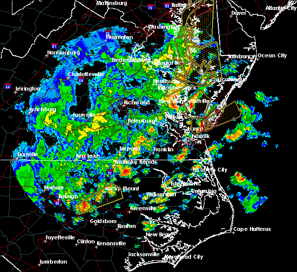 At 421 pm edt, a severe thunderstorm capable of producing a tornado was located 12 miles east of grand view, or 12 miles south of cape charles, moving northeast at 50 mph (radar indicated rotation). Hazards include tornado and quarter size hail. Flying debris will be dangerous to those caught without shelter. mobile homes will be damaged or destroyed. damage to roofs, windows, and vehicles will occur. tree damage is likely. This tornadic thunderstorm will remain over mainly rural areas of northampton county, including the following locations, simpkins, capeville, townsend, kiptopeke state park, oyster, cheapside, kiptopeke, plantation, dalbys and eastville. At 421 pm edt, a severe thunderstorm capable of producing a tornado was located 12 miles east of grand view, or 12 miles south of cape charles, moving northeast at 50 mph (radar indicated rotation). Hazards include tornado and quarter size hail. Flying debris will be dangerous to those caught without shelter. mobile homes will be damaged or destroyed. damage to roofs, windows, and vehicles will occur. tree damage is likely. This tornadic thunderstorm will remain over mainly rural areas of northampton county, including the following locations, simpkins, capeville, townsend, kiptopeke state park, oyster, cheapside, kiptopeke, plantation, dalbys and eastville.
|
| 4/26/2019 4:09 PM EDT |
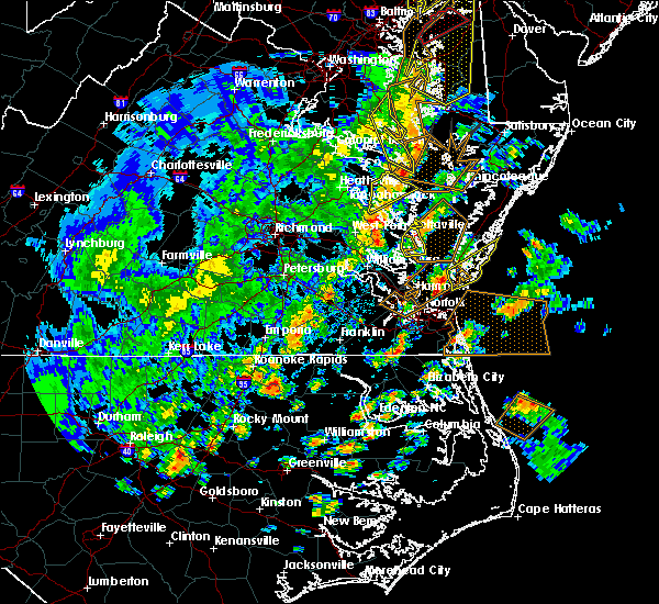 At 409 pm edt, a severe thunderstorm was located 7 miles east of grand view, or 8 miles east of hampton, moving northeast at 50 mph (radar indicated). Hazards include 60 mph wind gusts and quarter size hail. Minor damage to vehicles is possible. expect wind damage to trees and powerlines. this severe thunderstorm will be near, cape charles around 425 pm edt. cheriton and bay view around 430 pm edt. other locations impacted by this severe thunderstorm include capeville, townsend, kiptopeke state park, oyster, cheapside, kiptopeke, plantation and dalbys. A tornado watch remains in effect until 900 pm edt for eastern and southeastern virginia. At 409 pm edt, a severe thunderstorm was located 7 miles east of grand view, or 8 miles east of hampton, moving northeast at 50 mph (radar indicated). Hazards include 60 mph wind gusts and quarter size hail. Minor damage to vehicles is possible. expect wind damage to trees and powerlines. this severe thunderstorm will be near, cape charles around 425 pm edt. cheriton and bay view around 430 pm edt. other locations impacted by this severe thunderstorm include capeville, townsend, kiptopeke state park, oyster, cheapside, kiptopeke, plantation and dalbys. A tornado watch remains in effect until 900 pm edt for eastern and southeastern virginia.
|
| 4/26/2019 12:45 PM EDT |
 At 1244 pm edt, a severe thunderstorm was located 7 miles east of grand view, or 8 miles east of hampton, moving northeast at 40 mph (radar indicated). Hazards include 60 mph wind gusts and penny size hail. Expect damage to trees and powerlines. this severe thunderstorm will be near, cape charles and bay view around 100 pm edt. cheriton around 105 pm edt. Other locations impacted by this severe thunderstorm include birdsnest, capeville, kiptopeke state park, jamesville, silver beach, eastville, machipongo, wardtown, franktown and simpkins. At 1244 pm edt, a severe thunderstorm was located 7 miles east of grand view, or 8 miles east of hampton, moving northeast at 40 mph (radar indicated). Hazards include 60 mph wind gusts and penny size hail. Expect damage to trees and powerlines. this severe thunderstorm will be near, cape charles and bay view around 100 pm edt. cheriton around 105 pm edt. Other locations impacted by this severe thunderstorm include birdsnest, capeville, kiptopeke state park, jamesville, silver beach, eastville, machipongo, wardtown, franktown and simpkins.
|
| 4/15/2019 3:51 AM EDT |
 At 350 am edt, severe thunderstorms were located along a line extending from near lawsonia to 6 miles northwest of onancock to 7 miles west of cape charles, moving northeast at 65 mph (radar indicated). Hazards include 60 mph wind gusts and penny size hail. Expect damage to trees and powerlines. severe thunderstorms will be near, onancock and onley around 355 am edt. parksley around 400 am edt. nassawadox around 410 am edt. exmore and willis wharf around 415 am edt. other locations impacted by these severe thunderstorms include horntown, capeville, kiptopeke state park, melfa, harborton, mappsville, eastville, saxis, franktown and wallops island. A tornado watch remains in effect until 700 am edt for southeastern maryland, and eastern and southeastern virginia. At 350 am edt, severe thunderstorms were located along a line extending from near lawsonia to 6 miles northwest of onancock to 7 miles west of cape charles, moving northeast at 65 mph (radar indicated). Hazards include 60 mph wind gusts and penny size hail. Expect damage to trees and powerlines. severe thunderstorms will be near, onancock and onley around 355 am edt. parksley around 400 am edt. nassawadox around 410 am edt. exmore and willis wharf around 415 am edt. other locations impacted by these severe thunderstorms include horntown, capeville, kiptopeke state park, melfa, harborton, mappsville, eastville, saxis, franktown and wallops island. A tornado watch remains in effect until 700 am edt for southeastern maryland, and eastern and southeastern virginia.
|
| 8/30/2018 11:10 PM EDT |
 The severe thunderstorm warning for southern accomack and northampton counties will expire at 1115 pm edt, the storm which prompted the warning has weakened below severe limits, and no longer pose an immediate threat to life or property. therefore, the warning will be allowed to expire. however gusty winds and heavy rain are still possible with these thunderstorms. The severe thunderstorm warning for southern accomack and northampton counties will expire at 1115 pm edt, the storm which prompted the warning has weakened below severe limits, and no longer pose an immediate threat to life or property. therefore, the warning will be allowed to expire. however gusty winds and heavy rain are still possible with these thunderstorms.
|
| 8/30/2018 11:02 PM EDT |
 At 1047 pm edt, severe thunderstorms were located along a line extending from 8 miles east of gwynn to 6 miles north of cheriton to near bay view, moving northeast at 25 mph (radar indicated). Hazards include 60 mph wind gusts. Expect damage to trees and powerlines. severe thunderstorms will be near, nassawadox around 1110 pm edt. exmore and willis wharf around 1115 pm edt. Other locations impacted by these severe thunderstorms include birdsnest, harborton, jamesville, silver beach, eastville, machipongo, wardtown, franktown, simpkins and pungoteague. At 1047 pm edt, severe thunderstorms were located along a line extending from 8 miles east of gwynn to 6 miles north of cheriton to near bay view, moving northeast at 25 mph (radar indicated). Hazards include 60 mph wind gusts. Expect damage to trees and powerlines. severe thunderstorms will be near, nassawadox around 1110 pm edt. exmore and willis wharf around 1115 pm edt. Other locations impacted by these severe thunderstorms include birdsnest, harborton, jamesville, silver beach, eastville, machipongo, wardtown, franktown, simpkins and pungoteague.
|
| 8/30/2018 10:47 PM EDT |
 At 1047 pm edt, severe thunderstorms were located along a line extending from 8 miles east of gwynn to 6 miles north of cheriton to near bay view, moving northeast at 25 mph (radar indicated). Hazards include 60 mph wind gusts. Expect damage to trees and powerlines. severe thunderstorms will be near, nassawadox around 1110 pm edt. exmore and willis wharf around 1115 pm edt. Other locations impacted by these severe thunderstorms include birdsnest, harborton, jamesville, silver beach, eastville, machipongo, wardtown, franktown, simpkins and pungoteague. At 1047 pm edt, severe thunderstorms were located along a line extending from 8 miles east of gwynn to 6 miles north of cheriton to near bay view, moving northeast at 25 mph (radar indicated). Hazards include 60 mph wind gusts. Expect damage to trees and powerlines. severe thunderstorms will be near, nassawadox around 1110 pm edt. exmore and willis wharf around 1115 pm edt. Other locations impacted by these severe thunderstorms include birdsnest, harborton, jamesville, silver beach, eastville, machipongo, wardtown, franktown, simpkins and pungoteague.
|
| 6/24/2018 7:00 PM EDT |
 At 659 pm edt, severe thunderstorms were located along a line extending from 9 miles west of nassawadox to 9 miles northwest of cheriton to 7 miles east of bavon, moving east at 40 mph (radar indicated). Hazards include 60 mph wind gusts. Expect damage to trees and powerlines. Locations impacted include, cape charles, nassawadox, cheriton, bay view, eastville, capeville, birdsnest, jamesville, machipongo, wardtown, franktown, simpkins, townsend, oyster, kiptopeke, plantation, dalbys and smith beach. At 659 pm edt, severe thunderstorms were located along a line extending from 9 miles west of nassawadox to 9 miles northwest of cheriton to 7 miles east of bavon, moving east at 40 mph (radar indicated). Hazards include 60 mph wind gusts. Expect damage to trees and powerlines. Locations impacted include, cape charles, nassawadox, cheriton, bay view, eastville, capeville, birdsnest, jamesville, machipongo, wardtown, franktown, simpkins, townsend, oyster, kiptopeke, plantation, dalbys and smith beach.
|
| 6/24/2018 6:29 PM EDT |
 At 629 pm edt, severe thunderstorms were located along a line extending from deltaville to blakes to near gloucester courthouse, moving southeast at 40 mph (radar indicated). Hazards include 60 mph wind gusts. expect damage to trees and powerlines At 629 pm edt, severe thunderstorms were located along a line extending from deltaville to blakes to near gloucester courthouse, moving southeast at 40 mph (radar indicated). Hazards include 60 mph wind gusts. expect damage to trees and powerlines
|
| 2/25/2017 6:19 PM EST |
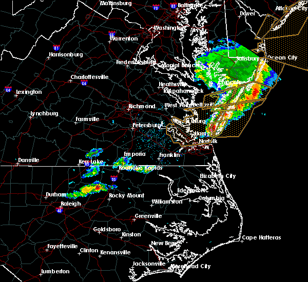 At 618 pm est, a severe thunderstorm was located 8 miles south of bay view, or 9 miles southeast of cape charles, moving east at 75 mph (radar indicated). Hazards include 60 mph wind gusts and quarter to golf ball size hail. Hail damage to vehicles is expected. expect wind damage to roofs, siding, and trees. locations impacted include, cape charles, cheriton, bay view, capeville, townsend, kiptopeke state park, oyster, cheapside, kiptopeke, plantation and dalbys. precautionary/preparedness actions, for your protection move to an interior room on the lowest floor of a building. please send your reports of hail and or wind damage, including trees or large limbs downed, by calling noaa`s national weather service in wakefield at , 7 5 7, 8 9 9, 2 4 1 5. At 618 pm est, a severe thunderstorm was located 8 miles south of bay view, or 9 miles southeast of cape charles, moving east at 75 mph (radar indicated). Hazards include 60 mph wind gusts and quarter to golf ball size hail. Hail damage to vehicles is expected. expect wind damage to roofs, siding, and trees. locations impacted include, cape charles, cheriton, bay view, capeville, townsend, kiptopeke state park, oyster, cheapside, kiptopeke, plantation and dalbys. precautionary/preparedness actions, for your protection move to an interior room on the lowest floor of a building. please send your reports of hail and or wind damage, including trees or large limbs downed, by calling noaa`s national weather service in wakefield at , 7 5 7, 8 9 9, 2 4 1 5.
|
| 2/25/2017 6:11 PM EST |
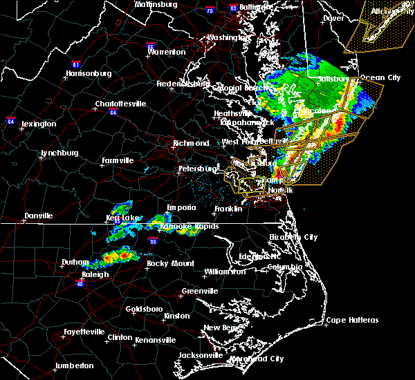 At 611 pm est, a severe thunderstorm was located 9 miles southwest of cape charles, moving east at 55 mph (radar indicated). Hazards include 60 mph wind gusts and quarter size hail. Hail damage to vehicles is expected. expect wind damage to roofs, siding, and trees. This severe thunderstorm will remain over mainly rural areas of southern northampton county, including the following locations: capeville, townsend, kiptopeke state park, oyster, cheapside, kiptopeke, plantation and dalbys. At 611 pm est, a severe thunderstorm was located 9 miles southwest of cape charles, moving east at 55 mph (radar indicated). Hazards include 60 mph wind gusts and quarter size hail. Hail damage to vehicles is expected. expect wind damage to roofs, siding, and trees. This severe thunderstorm will remain over mainly rural areas of southern northampton county, including the following locations: capeville, townsend, kiptopeke state park, oyster, cheapside, kiptopeke, plantation and dalbys.
|
| 5/3/2016 8:30 PM EDT |
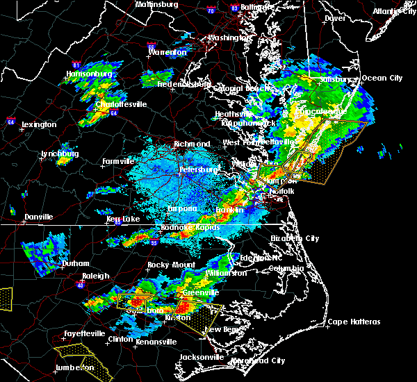 At 829 pm edt, severe thunderstorms were located along a line extending from 7 miles east of onley to 9 miles east of willis wharf to 10 miles east of cheriton, moving east at 30 mph (radar indicated). Hazards include 60 mph wind gusts and quarter size hail. Hail damage to vehicles is expected. expect wind damage to roofs, siding, and trees. these severe thunderstorms will remain over mainly rural areas of northern northampton county, including the following locations: simpkins, franktown, oyster, birdsnest, plantation, machipongo and eastville. precautionary/preparedness actions, for your protection move to an interior room on the lowest floor of a building. please send your reports of hail and or wind damage, including trees or large limbs downed, by calling noaa`s national weather service in wakefield at , 7 5 7, 8 9 9, 2 4 1 5. At 829 pm edt, severe thunderstorms were located along a line extending from 7 miles east of onley to 9 miles east of willis wharf to 10 miles east of cheriton, moving east at 30 mph (radar indicated). Hazards include 60 mph wind gusts and quarter size hail. Hail damage to vehicles is expected. expect wind damage to roofs, siding, and trees. these severe thunderstorms will remain over mainly rural areas of northern northampton county, including the following locations: simpkins, franktown, oyster, birdsnest, plantation, machipongo and eastville. precautionary/preparedness actions, for your protection move to an interior room on the lowest floor of a building. please send your reports of hail and or wind damage, including trees or large limbs downed, by calling noaa`s national weather service in wakefield at , 7 5 7, 8 9 9, 2 4 1 5.
|
| 5/3/2016 7:59 PM EDT |
 At 758 pm edt, severe thunderstorms were located along a line extending from 6 miles west of onancock to near nassawadox to near cape charles, moving east at 30 mph (radar indicated). Hazards include 60 mph wind gusts and quarter size hail. Hail damage to vehicles is expected. expect wind damage to roofs, siding, and trees. severe thunderstorms will be near, exmore and nassawadox around 805 pm edt. onancock, onley and willis wharf around 810 pm edt. Other locations impacted by these severe thunderstorms include simpkins, accomac, wardtown, franktown, harborton, painter, smith beach, pungoteague, melfa and locustville. At 758 pm edt, severe thunderstorms were located along a line extending from 6 miles west of onancock to near nassawadox to near cape charles, moving east at 30 mph (radar indicated). Hazards include 60 mph wind gusts and quarter size hail. Hail damage to vehicles is expected. expect wind damage to roofs, siding, and trees. severe thunderstorms will be near, exmore and nassawadox around 805 pm edt. onancock, onley and willis wharf around 810 pm edt. Other locations impacted by these severe thunderstorms include simpkins, accomac, wardtown, franktown, harborton, painter, smith beach, pungoteague, melfa and locustville.
|
| 2/24/2016 10:27 PM EST | The severe thunderstorm warning for accomack and northampton counties will expire at 1030 pm est, the storms which prompted the warning have weakened below severe limits, and no longer pose an immediate threat to life or property. therefore, the warning will be allowed to expire. however, gusty winds and heavy rain are still possible with these thunderstorms. to report severe weather, contact your nearest law enforcement agency. they will relay your report to the national weather service wakefield. |
| 2/24/2016 10:07 PM EST |
 At 1006 pm est, doppler radar indicated a line of severe thunderstorms capable of producing damaging winds in excess of 60 mph. these storms were located along a line extending from near tangier to 7 miles northwest of exmore to cape charles, and moving northeast at 65 mph. * severe thunderstorms will be near, nassawadox around 1025 pm est. exmore and willis wharf around 1030 pm est. other locations impacted by these severe thunderstorms include simpkins, wardtown, sanford, franktown, smith beach, machipongo, jamesville, dalbys, oyster and silver beach. a tornado watch remains in effect until 1100 pm est for southeastern maryland, and southeastern virginia. At 1006 pm est, doppler radar indicated a line of severe thunderstorms capable of producing damaging winds in excess of 60 mph. these storms were located along a line extending from near tangier to 7 miles northwest of exmore to cape charles, and moving northeast at 65 mph. * severe thunderstorms will be near, nassawadox around 1025 pm est. exmore and willis wharf around 1030 pm est. other locations impacted by these severe thunderstorms include simpkins, wardtown, sanford, franktown, smith beach, machipongo, jamesville, dalbys, oyster and silver beach. a tornado watch remains in effect until 1100 pm est for southeastern maryland, and southeastern virginia.
|
| 8/11/2015 7:40 PM EDT |
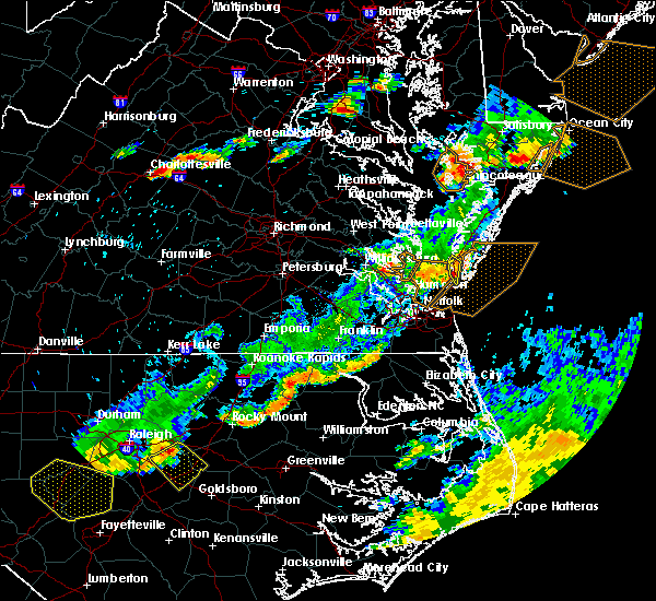 The severe thunderstorm warning for southwestern northampton county will expire at 745 pm edt, the storm which prompted the warning has weakened below severe limits and exited the warned area. therefore the warning will be allowed to expire. The severe thunderstorm warning for southwestern northampton county will expire at 745 pm edt, the storm which prompted the warning has weakened below severe limits and exited the warned area. therefore the warning will be allowed to expire.
|
| 8/11/2015 7:13 PM EDT |
 At 713 pm edt, doppler radar indicated a severe thunderstorm capable of producing damaging winds in excess of 60 mph. this storm was located over cape charles, and moving southeast at 20 mph. * this severe thunderstorm will be near, cheriton around 720 pm edt. bay view around 725 pm edt. other locations impacted by this severe thunderstorm include simpkins, kiptopeke, capeville, dalbys, townsend, cheapside, kiptopeke state park and plantation. At 713 pm edt, doppler radar indicated a severe thunderstorm capable of producing damaging winds in excess of 60 mph. this storm was located over cape charles, and moving southeast at 20 mph. * this severe thunderstorm will be near, cheriton around 720 pm edt. bay view around 725 pm edt. other locations impacted by this severe thunderstorm include simpkins, kiptopeke, capeville, dalbys, townsend, cheapside, kiptopeke state park and plantation.
|
| 4/10/2015 8:37 PM EDT | The national weather service in wakefield has issued a * severe thunderstorm warning for. northern northampton county in eastern virginia. south central accomack county in southeastern virginia. until 915 pm edt * at 836 pm edt. Doppler radar indicated a severe thunderstorm. |
| 7/24/2014 8:45 AM EDT | Quarter sized hail reported 3 miles SW of Cape Charles, VA |
| 7/24/2014 8:40 AM EDT | Overturned rv campers at cherrystone campground. injuries reported. possible tornad in northampton county VA, 3.6 miles S of Cape Charles, VA |
| 7/24/2014 8:35 AM EDT | Golf Ball sized hail reported 3 miles SW of Cape Charles, VA, golfball size hail produced damage to homes...cars...crops and trees. |
| 5/22/2014 7:38 PM EDT | Storm damage reported in anz632 county VA, 1.2 miles E of Cape Charles, VA |
| 6/13/2013 5:36 PM EDT | Reported at plantation flats weatherflow statio in anz632 county VA, 2.3 miles E of Cape Charles, VA |
| 6/13/2013 5:30 PM EDT | 54 knot wind gus in northampton county VA, 6.1 miles N of Cape Charles, VA |
| 6/30/2012 12:30 AM EDT | Storm damage reported in northampton county VA, 8.5 miles NNW of Cape Charles, VA |
Hail Maps for Cape Charles, VA


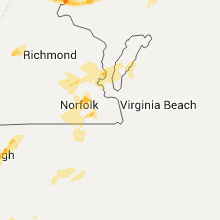


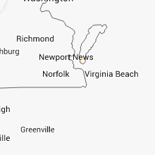


Connect with Interactive Hail Maps