

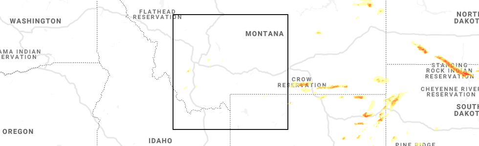
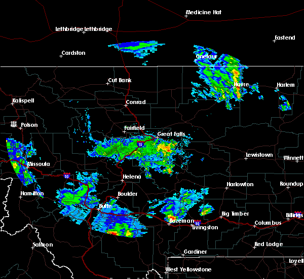
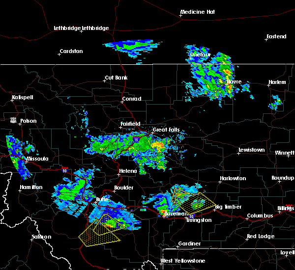
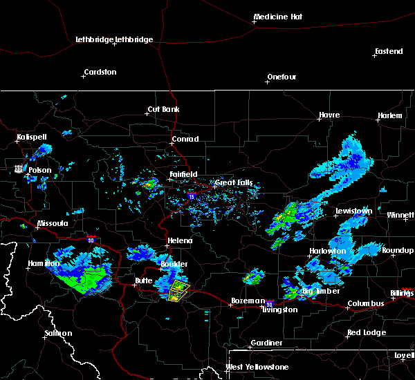
Hail Map for Cardwell, MT
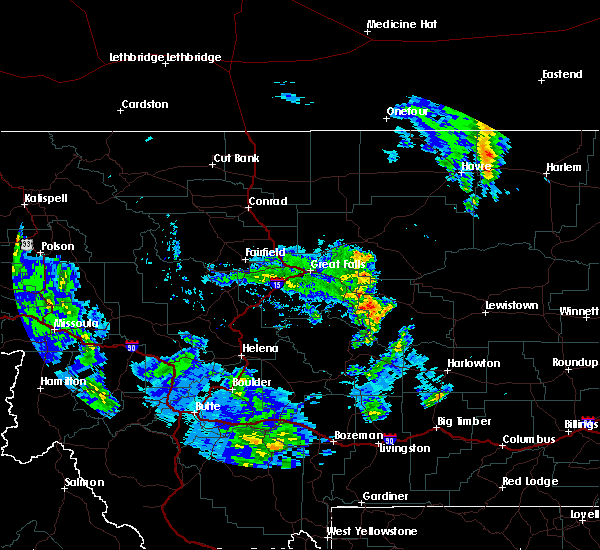
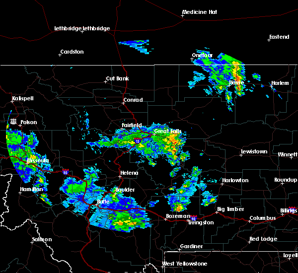
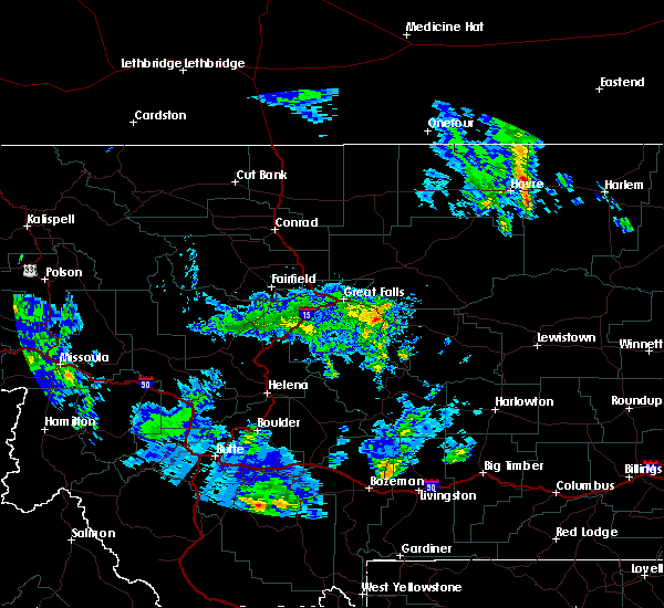
The Cardwell, MT area has had 4 reports of on-the-ground hail by trained spotters, and has been under severe weather warnings 0 times during the past 12 months. Doppler radar has detected hail at or near Cardwell, MT on 7 occasions.
| Name: | Cardwell, MT |
| Where Located: | 46.4 miles WNW of Bozeman, MT |
| Map: | Google Map for Cardwell, MT |
| Population: | 50 |
| Housing Units: | 23 |
| More Info: | Search Google for Cardwell, MT |
5
The Top Recent Hail Date for Cardwell, MT is Tuesday, July 16, 2019 (1st out of 7)
Hail and Wind Damage Spotted near Cardwell, MT
| Date / Time | Report Details |
|---|---|
| 8/11/2019 3:06 PM MDT |
 The severe thunderstorm warning for northeastern madison county will expire at 315 pm mdt, the storm which prompted the warning has weakened below severe limits, and has exited the warned area. therefore, the warning will be allowed to expire. a severe thunderstorm watch remains in effect until 700 pm mdt for southwestern montana. The severe thunderstorm warning for northeastern madison county will expire at 315 pm mdt, the storm which prompted the warning has weakened below severe limits, and has exited the warned area. therefore, the warning will be allowed to expire. a severe thunderstorm watch remains in effect until 700 pm mdt for southwestern montana.
|
| 8/11/2019 2:49 PM MDT |
 At 248 pm mdt, a severe thunderstorm was located near pony, or 15 miles northeast of sheridan, moving east at 35 mph (radar indicated). Hazards include 60 mph wind gusts and nickel size hail. Expect damage to roofs, siding, and trees. Locations impacted include, harrison, pony, norris and cardwell. At 248 pm mdt, a severe thunderstorm was located near pony, or 15 miles northeast of sheridan, moving east at 35 mph (radar indicated). Hazards include 60 mph wind gusts and nickel size hail. Expect damage to roofs, siding, and trees. Locations impacted include, harrison, pony, norris and cardwell.
|
| 8/11/2019 2:41 PM MDT |
 At 240 pm mdt, a severe thunderstorm was located 9 miles southwest of pony, or 10 miles northeast of sheridan, moving northeast at 35 mph (trained weather spotters). Hazards include 60 mph wind gusts and half dollar size hail. Hail damage to vehicles is expected. expect wind damage to roofs, siding, and trees. Locations impacted include, sheridan, harrison, pony, norris and cardwell. At 240 pm mdt, a severe thunderstorm was located 9 miles southwest of pony, or 10 miles northeast of sheridan, moving northeast at 35 mph (trained weather spotters). Hazards include 60 mph wind gusts and half dollar size hail. Hail damage to vehicles is expected. expect wind damage to roofs, siding, and trees. Locations impacted include, sheridan, harrison, pony, norris and cardwell.
|
| 8/11/2019 2:28 PM MDT |
 At 228 pm mdt, a severe thunderstorm was located over sheridan, moving northeast at 35 mph (radar indicated). Hazards include ping pong ball size hail and 60 mph wind gusts. People and animals outdoors will be injured. expect hail damage to roofs, siding, windows, and vehicles. expect wind damage to roofs, siding, and trees. Locations impacted include, sheridan, twin bridges, harrison, pony, norris and cardwell. At 228 pm mdt, a severe thunderstorm was located over sheridan, moving northeast at 35 mph (radar indicated). Hazards include ping pong ball size hail and 60 mph wind gusts. People and animals outdoors will be injured. expect hail damage to roofs, siding, windows, and vehicles. expect wind damage to roofs, siding, and trees. Locations impacted include, sheridan, twin bridges, harrison, pony, norris and cardwell.
|
| 8/11/2019 2:23 PM MDT |
 At 223 pm mdt, a severe thunderstorm was located over sheridan, moving northeast at 35 mph (radar indicated). Hazards include 60 mph wind gusts and quarter size hail. Hail damage to vehicles is expected. Expect wind damage to roofs, siding, and trees. At 223 pm mdt, a severe thunderstorm was located over sheridan, moving northeast at 35 mph (radar indicated). Hazards include 60 mph wind gusts and quarter size hail. Hail damage to vehicles is expected. Expect wind damage to roofs, siding, and trees.
|
| 7/16/2019 6:16 PM MDT | Quarter sized hail reported 1.7 miles E of Cardwell, MT, quarter size hail still falling. ground is being covered by hail. |
| 7/16/2019 6:16 PM MDT |
 At 616 pm mdt, a severe thunderstorm was located 7 miles east of whitehall, moving northeast at 20 mph (trained weather spotters). Hazards include quarter size hail. damage to vehicles is expected At 616 pm mdt, a severe thunderstorm was located 7 miles east of whitehall, moving northeast at 20 mph (trained weather spotters). Hazards include quarter size hail. damage to vehicles is expected
|
| 7/16/2019 6:15 PM MDT | Quarter sized hail reported 1.7 miles E of Cardwell, MT, quarter size hail falling. |
| 7/12/2019 6:13 PM MDT |
 At 612 pm mdt, a severe thunderstorm was located over whitehall, or 23 miles south of boulder, moving northeast at 30 mph (radar indicated). Hazards include 60 mph wind gusts and quarter size hail. Hail damage to vehicles is expected. Expect wind damage to roofs, siding, and trees. At 612 pm mdt, a severe thunderstorm was located over whitehall, or 23 miles south of boulder, moving northeast at 30 mph (radar indicated). Hazards include 60 mph wind gusts and quarter size hail. Hail damage to vehicles is expected. Expect wind damage to roofs, siding, and trees.
|
| 5/26/2018 6:32 PM MDT | Quarter sized hail reported 5.2 miles WNW of Cardwell, MT |
| 5/26/2018 6:17 PM MDT |
 At 617 pm mdt, a severe thunderstorm was located near pony, or 22 miles northeast of sheridan, moving northeast at 25 mph (radar indicated). Hazards include 60 mph wind gusts and quarter size hail. Hail damage to vehicles is expected. Expect wind damage to roofs, siding, and trees. At 617 pm mdt, a severe thunderstorm was located near pony, or 22 miles northeast of sheridan, moving northeast at 25 mph (radar indicated). Hazards include 60 mph wind gusts and quarter size hail. Hail damage to vehicles is expected. Expect wind damage to roofs, siding, and trees.
|
| 5/26/2018 5:54 PM MDT | Quarter sized hail reported 2.4 miles WNW of Cardwell, MT, this is a follow up to the previous report of nickel size hail at this same location. spotter reports the hail has increased in size and is now up to the size of quarte |
| 5/26/2018 5:54 PM MDT |
 At 554 pm mdt, a severe thunderstorm was located 9 miles east of whitehall, or 28 miles southeast of boulder, moving northeast at 20 mph (radar indicated). Hazards include 60 mph wind gusts and quarter size hail. Hail damage to vehicles is expected. Expect wind damage to roofs, siding, and trees. At 554 pm mdt, a severe thunderstorm was located 9 miles east of whitehall, or 28 miles southeast of boulder, moving northeast at 20 mph (radar indicated). Hazards include 60 mph wind gusts and quarter size hail. Hail damage to vehicles is expected. Expect wind damage to roofs, siding, and trees.
|
Hail Maps for Cardwell, MT


Connect with Interactive Hail Maps