

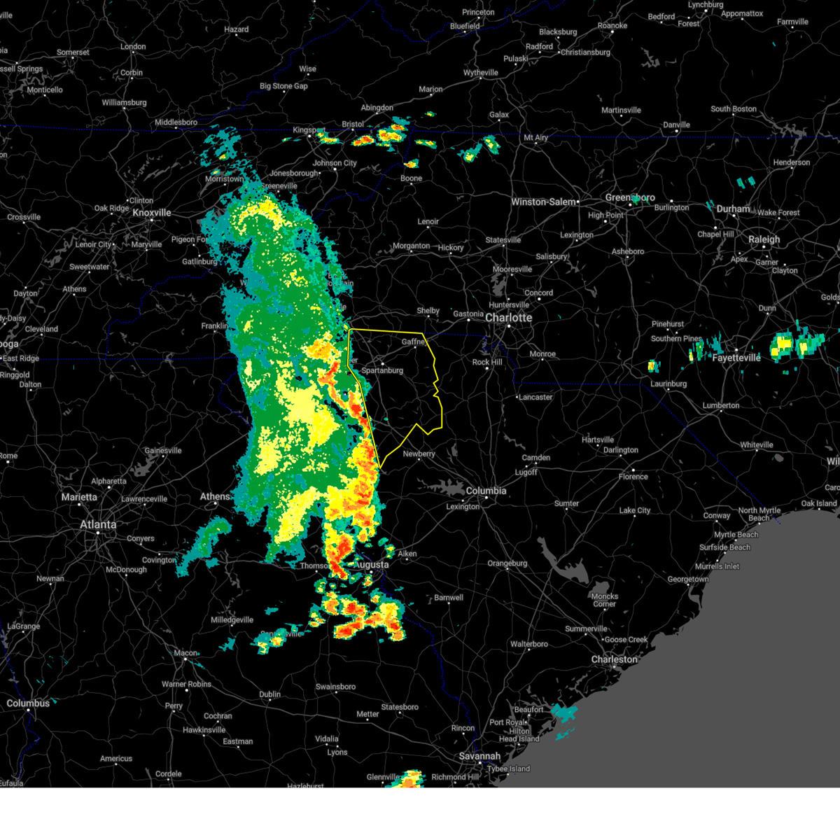
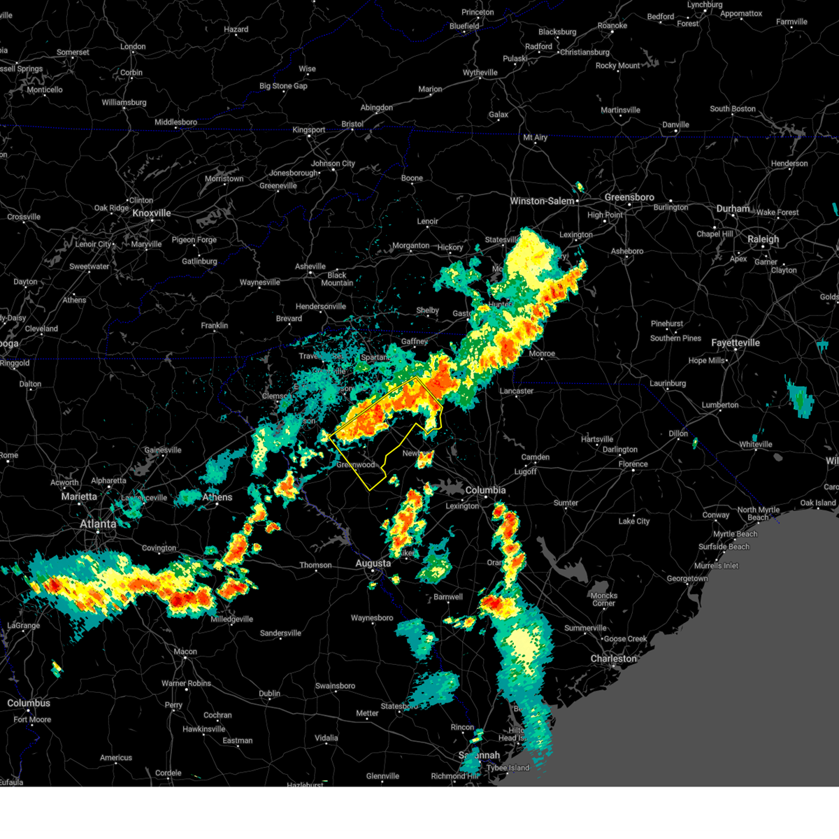
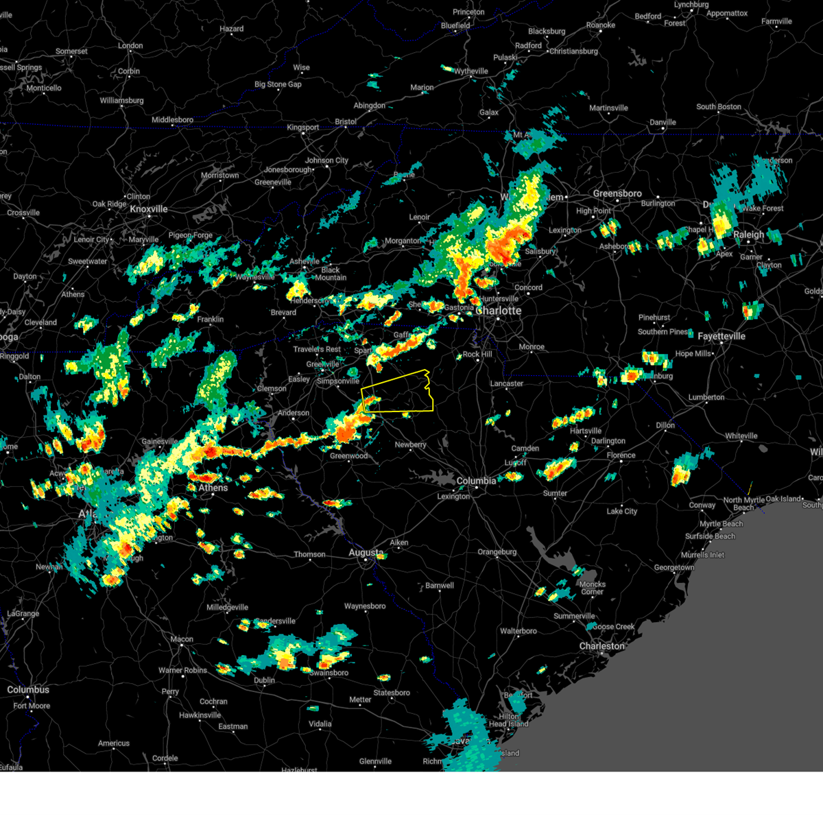
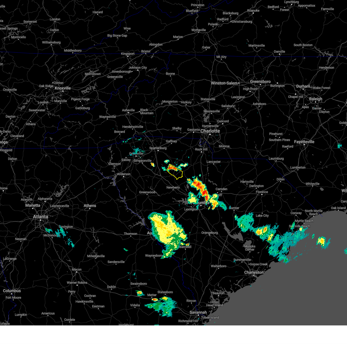
Hail Map for Carlisle, SC
The Carlisle, SC area has had 4 reports of on-the-ground hail by trained spotters, and has been under severe weather warnings 55 times during the past 12 months. Doppler radar has detected hail at or near Carlisle, SC on 38 occasions, including 5 occasions during the past year.
| Name: | Carlisle, SC |
| Where Located: | 56.3 miles SW of Charlotte, NC |
| Map: | Google Map for Carlisle, SC |
| Population: | 436 |
| Housing Units: | 241 |
| More Info: | Search Google for Carlisle, SC |
2
The Top Recent Hail Date for Carlisle, SC is Thursday, May 8, 2025 (5th out of 38)

Hail and Wind Damage Spotted near Carlisle, SC
| Date / Time | Report Details |
|---|---|
| 6/28/2025 7:56 PM EDT |
 At 755 pm edt, a severe thunderstorm was located 8 miles east of union, or 5 miles southeast of monarch mill, and is nearly stationary (radar indicated). Hazards include 60 mph wind gusts and quarter size hail. Minor hail damage to vehicles is expected. expect wind damage to trees and power lines. Locations impacted include, union, monarch mill, lockhart, carlisle, adamsburg, and santuc. At 755 pm edt, a severe thunderstorm was located 8 miles east of union, or 5 miles southeast of monarch mill, and is nearly stationary (radar indicated). Hazards include 60 mph wind gusts and quarter size hail. Minor hail damage to vehicles is expected. expect wind damage to trees and power lines. Locations impacted include, union, monarch mill, lockhart, carlisle, adamsburg, and santuc.
|
| 6/28/2025 7:56 PM EDT |
 the severe thunderstorm warning has been cancelled and is no longer in effect the severe thunderstorm warning has been cancelled and is no longer in effect
|
| 6/28/2025 7:43 PM EDT |
 Svrgsp the national weather service in greenville-spartanburg has issued a * severe thunderstorm warning for, western chester county in upstate south carolina, east central union county in upstate south carolina, * until 815 pm edt. * at 743 pm edt, a severe thunderstorm was located 8 miles east of union, or 5 miles southeast of monarch mill, and is nearly stationary (radar indicated). Hazards include 60 mph wind gusts and quarter size hail. Minor hail damage to vehicles is expected. Expect wind damage to trees and power lines. Svrgsp the national weather service in greenville-spartanburg has issued a * severe thunderstorm warning for, western chester county in upstate south carolina, east central union county in upstate south carolina, * until 815 pm edt. * at 743 pm edt, a severe thunderstorm was located 8 miles east of union, or 5 miles southeast of monarch mill, and is nearly stationary (radar indicated). Hazards include 60 mph wind gusts and quarter size hail. Minor hail damage to vehicles is expected. Expect wind damage to trees and power lines.
|
| 6/25/2025 7:30 PM EDT | Fairfield county dispatch reports tree down on dave jenkins rd near blair. time estimated by rada in fairfield county SC, 8.2 miles WNW of Carlisle, SC |
| 6/17/2025 10:18 PM EDT |
 At 1018 pm edt, severe thunderstorms were located along a line extending from 4 miles southeast of morganton to 9 miles northwest of lincolnton to 9 miles northwest of york to 5 miles west of chester, moving east at 50 mph (radar indicated). Hazards include 60 mph wind gusts. Expect damage to trees and power lines. Locations impacted include, gastonia, rock hill, hickory, shelby, morganton, newton, gaffney, lincolnton, union, and york. At 1018 pm edt, severe thunderstorms were located along a line extending from 4 miles southeast of morganton to 9 miles northwest of lincolnton to 9 miles northwest of york to 5 miles west of chester, moving east at 50 mph (radar indicated). Hazards include 60 mph wind gusts. Expect damage to trees and power lines. Locations impacted include, gastonia, rock hill, hickory, shelby, morganton, newton, gaffney, lincolnton, union, and york.
|
| 6/17/2025 10:02 PM EDT | the severe thunderstorm warning has been cancelled and is no longer in effect |
| 6/17/2025 10:02 PM EDT | At 1002 pm edt, severe thunderstorms were located along a line extending from 9 miles southwest of morganton to 14 miles north of shelby to 11 miles east of gaffney to 11 miles southeast of union, moving east at 50 mph (radar indicated). Hazards include 60 mph wind gusts. Expect damage to trees and power lines. Locations impacted include, gastonia, rock hill, hickory, shelby, morganton, newton, gaffney, lincolnton, union, and york. |
| 6/17/2025 9:43 PM EDT |
 Svrgsp the national weather service in greenville-spartanburg has issued a * severe thunderstorm warning for, catawba county in the piedmont of north carolina, rutherford county in western north carolina, lincoln county in the piedmont of north carolina, gaston county in the piedmont of north carolina, southeastern mcdowell county in western north carolina, cleveland county in the piedmont of north carolina, southern burke county in western north carolina, southeastern laurens county in upstate south carolina, union county in upstate south carolina, chester county in upstate south carolina, york county in upstate south carolina, eastern spartanburg county in upstate south carolina, cherokee county in upstate south carolina, * until 1045 pm edt. * at 943 pm edt, severe thunderstorms were located along a line extending from 10 miles north of rutherfordton to 10 miles east of forest city to 9 miles south of gaffney to 13 miles south of union, moving northeast at 50 mph (radar indicated). Hazards include 60 mph wind gusts. expect damage to trees and power lines Svrgsp the national weather service in greenville-spartanburg has issued a * severe thunderstorm warning for, catawba county in the piedmont of north carolina, rutherford county in western north carolina, lincoln county in the piedmont of north carolina, gaston county in the piedmont of north carolina, southeastern mcdowell county in western north carolina, cleveland county in the piedmont of north carolina, southern burke county in western north carolina, southeastern laurens county in upstate south carolina, union county in upstate south carolina, chester county in upstate south carolina, york county in upstate south carolina, eastern spartanburg county in upstate south carolina, cherokee county in upstate south carolina, * until 1045 pm edt. * at 943 pm edt, severe thunderstorms were located along a line extending from 10 miles north of rutherfordton to 10 miles east of forest city to 9 miles south of gaffney to 13 miles south of union, moving northeast at 50 mph (radar indicated). Hazards include 60 mph wind gusts. expect damage to trees and power lines
|
| 6/17/2025 9:34 PM EDT |
 the severe thunderstorm warning has been cancelled and is no longer in effect the severe thunderstorm warning has been cancelled and is no longer in effect
|
| 6/17/2025 9:34 PM EDT |
 At 933 pm edt, severe thunderstorms were located along a line extending from 3 miles northwest of rutherfordton to 4 miles south of forest city to 5 miles northeast of spartanburg to 13 miles east of laurens, moving east at 50 mph (radar indicated). Hazards include 60 mph wind gusts. Expect damage to trees and power lines. Locations impacted include, spartanburg, shelby, gaffney, union, forest city, rutherfordton, clinton, boiling springs sc, woodruff, and spindale. At 933 pm edt, severe thunderstorms were located along a line extending from 3 miles northwest of rutherfordton to 4 miles south of forest city to 5 miles northeast of spartanburg to 13 miles east of laurens, moving east at 50 mph (radar indicated). Hazards include 60 mph wind gusts. Expect damage to trees and power lines. Locations impacted include, spartanburg, shelby, gaffney, union, forest city, rutherfordton, clinton, boiling springs sc, woodruff, and spindale.
|
| 6/17/2025 9:19 PM EDT | the severe thunderstorm warning has been cancelled and is no longer in effect |
| 6/17/2025 9:19 PM EDT | At 918 pm edt, severe thunderstorms were located along a line extending from 4 miles north of columbus to 13 miles south of rutherfordton to 5 miles southwest of spartanburg to near laurens, moving east at 50 mph (radar indicated). Hazards include 60 mph wind gusts. Expect damage to trees and power lines. Locations impacted include, spartanburg, shelby, gaffney, laurens, union, forest city, rutherfordton, columbus, greer, and clinton. |
| 6/17/2025 8:50 PM EDT |
 Svrgsp the national weather service in greenville-spartanburg has issued a * severe thunderstorm warning for, rutherford county in western north carolina, southeastern henderson county in western north carolina, polk county in western north carolina, cleveland county in the piedmont of north carolina, laurens county in upstate south carolina, northeastern pickens county in upstate south carolina, union county in upstate south carolina, greenville county in upstate south carolina, spartanburg county in upstate south carolina, eastern anderson county in upstate south carolina, cherokee county in upstate south carolina, northeastern abbeville county in upstate south carolina, northwestern greenwood county in upstate south carolina, * until 945 pm edt. * at 849 pm edt, severe thunderstorms were located along a line extending from 12 miles south of hendersonville to 18 miles southwest of columbus to 7 miles south of greenville downtown to 11 miles north of abbeville, moving northeast at 50 mph (radar indicated). Hazards include 60 mph wind gusts. expect damage to trees and power lines Svrgsp the national weather service in greenville-spartanburg has issued a * severe thunderstorm warning for, rutherford county in western north carolina, southeastern henderson county in western north carolina, polk county in western north carolina, cleveland county in the piedmont of north carolina, laurens county in upstate south carolina, northeastern pickens county in upstate south carolina, union county in upstate south carolina, greenville county in upstate south carolina, spartanburg county in upstate south carolina, eastern anderson county in upstate south carolina, cherokee county in upstate south carolina, northeastern abbeville county in upstate south carolina, northwestern greenwood county in upstate south carolina, * until 945 pm edt. * at 849 pm edt, severe thunderstorms were located along a line extending from 12 miles south of hendersonville to 18 miles southwest of columbus to 7 miles south of greenville downtown to 11 miles north of abbeville, moving northeast at 50 mph (radar indicated). Hazards include 60 mph wind gusts. expect damage to trees and power lines
|
| 6/7/2025 8:52 PM EDT |
 The storms which prompted the warning have weakened below severe limits, and no longer pose an immediate threat to life or property. therefore, the warning will be allowed to expire. however, gusty winds are still possible with these thunderstorms. a severe thunderstorm watch remains in effect until 1100 pm edt for upstate south carolina. to report severe weather to the national weather service greenville-spartanburg, call toll free, 1, 800, 2 6 7, 8 1 0 1, or post on our facebook page, or tweet it using hashtag nwsgsp. your message should describe the event and the specific location where it occurred. The storms which prompted the warning have weakened below severe limits, and no longer pose an immediate threat to life or property. therefore, the warning will be allowed to expire. however, gusty winds are still possible with these thunderstorms. a severe thunderstorm watch remains in effect until 1100 pm edt for upstate south carolina. to report severe weather to the national weather service greenville-spartanburg, call toll free, 1, 800, 2 6 7, 8 1 0 1, or post on our facebook page, or tweet it using hashtag nwsgsp. your message should describe the event and the specific location where it occurred.
|
| 6/7/2025 8:44 PM EDT |
 At 844 pm edt, severe thunderstorms were located along a line extending from 9 miles east of columbus to 6 miles east of spartanburg to 8 miles north of newberry, moving northeast at 40 mph (radar indicated). Hazards include 60 mph wind gusts. Expect damage to trees and power lines. Locations impacted include, spartanburg, gaffney, union, boiling springs sc, pacolet, cowpens, monarch mill, mayo, buffalo, and chesnee. At 844 pm edt, severe thunderstorms were located along a line extending from 9 miles east of columbus to 6 miles east of spartanburg to 8 miles north of newberry, moving northeast at 40 mph (radar indicated). Hazards include 60 mph wind gusts. Expect damage to trees and power lines. Locations impacted include, spartanburg, gaffney, union, boiling springs sc, pacolet, cowpens, monarch mill, mayo, buffalo, and chesnee.
|
| 6/7/2025 8:18 PM EDT |
 Svrgsp the national weather service in greenville-spartanburg has issued a * severe thunderstorm warning for, central laurens county in upstate south carolina, spartanburg county in upstate south carolina, cherokee county in upstate south carolina, union county in upstate south carolina, * until 900 pm edt. * at 818 pm edt, severe thunderstorms were located along a line extending from 11 miles southwest of columbus to 11 miles southwest of spartanburg to 15 miles southeast of laurens, moving northeast at 40 mph (radar indicated). Hazards include 60 mph wind gusts. expect damage to trees and power lines Svrgsp the national weather service in greenville-spartanburg has issued a * severe thunderstorm warning for, central laurens county in upstate south carolina, spartanburg county in upstate south carolina, cherokee county in upstate south carolina, union county in upstate south carolina, * until 900 pm edt. * at 818 pm edt, severe thunderstorms were located along a line extending from 11 miles southwest of columbus to 11 miles southwest of spartanburg to 15 miles southeast of laurens, moving northeast at 40 mph (radar indicated). Hazards include 60 mph wind gusts. expect damage to trees and power lines
|
| 5/17/2025 9:21 AM EDT |
 The storm which prompted the warning has weakened below severe limits, and has exited the warned area. therefore, the warning will be allowed to expire. The storm which prompted the warning has weakened below severe limits, and has exited the warned area. therefore, the warning will be allowed to expire.
|
| 5/17/2025 9:16 AM EDT |
 the severe thunderstorm warning has been cancelled and is no longer in effect the severe thunderstorm warning has been cancelled and is no longer in effect
|
| 5/17/2025 9:16 AM EDT |
 At 916 am edt, a severe thunderstorm was located 14 miles north of newberry, or near whitmire, moving east at 40 mph (radar indicated). Hazards include 60 mph wind gusts and quarter size hail. Minor hail damage to vehicles is expected. expect wind damage to trees and power lines. Locations impacted include, carlisle and tuckertown. At 916 am edt, a severe thunderstorm was located 14 miles north of newberry, or near whitmire, moving east at 40 mph (radar indicated). Hazards include 60 mph wind gusts and quarter size hail. Minor hail damage to vehicles is expected. expect wind damage to trees and power lines. Locations impacted include, carlisle and tuckertown.
|
| 5/17/2025 9:04 AM EDT |
 At 904 am edt, a severe thunderstorm was located 14 miles east of laurens, or 5 miles east of clinton, moving east at 40 mph (radar indicated). Hazards include 60 mph wind gusts and quarter size hail. Minor hail damage to vehicles is expected. expect wind damage to trees and power lines. Locations impacted include, rose hill state park, joanna, sedalia, kinards, carlisle, tuckertown, and clinton. At 904 am edt, a severe thunderstorm was located 14 miles east of laurens, or 5 miles east of clinton, moving east at 40 mph (radar indicated). Hazards include 60 mph wind gusts and quarter size hail. Minor hail damage to vehicles is expected. expect wind damage to trees and power lines. Locations impacted include, rose hill state park, joanna, sedalia, kinards, carlisle, tuckertown, and clinton.
|
| 5/17/2025 8:46 AM EDT |
 Svrgsp the national weather service in greenville-spartanburg has issued a * severe thunderstorm warning for, central laurens county in upstate south carolina, southern union county in upstate south carolina, * until 930 am edt. * at 846 am edt, a severe thunderstorm was located near laurens, moving east at 40 mph (radar indicated). Hazards include 60 mph wind gusts and quarter size hail. Minor hail damage to vehicles is expected. Expect wind damage to trees and power lines. Svrgsp the national weather service in greenville-spartanburg has issued a * severe thunderstorm warning for, central laurens county in upstate south carolina, southern union county in upstate south carolina, * until 930 am edt. * at 846 am edt, a severe thunderstorm was located near laurens, moving east at 40 mph (radar indicated). Hazards include 60 mph wind gusts and quarter size hail. Minor hail damage to vehicles is expected. Expect wind damage to trees and power lines.
|
| 5/9/2025 12:16 AM EDT |
 At 1216 am edt, a severe thunderstorm was located 12 miles southwest of chester, or near carlisle, moving east at 20 mph (radar indicated). Hazards include 60 mph wind gusts and quarter size hail. Minor hail damage to vehicles is expected. expect wind damage to trees and power lines. Locations impacted include, chester state park, carlisle, leeds, santuc, cornwell, and chester. At 1216 am edt, a severe thunderstorm was located 12 miles southwest of chester, or near carlisle, moving east at 20 mph (radar indicated). Hazards include 60 mph wind gusts and quarter size hail. Minor hail damage to vehicles is expected. expect wind damage to trees and power lines. Locations impacted include, chester state park, carlisle, leeds, santuc, cornwell, and chester.
|
| 5/9/2025 12:05 AM EDT |
 At 1204 am edt, a severe thunderstorm was located 12 miles southeast of union, or near carlisle, moving east at 20 mph (radar indicated). Hazards include two inch hail and 60 mph wind gusts. People and animals outdoors will be injured. expect hail damage to roofs, siding, windows, and vehicles. expect wind damage to trees and power lines. Locations impacted include, chester state park, leeds, monarch mill, carlisle, santuc, cornwell, union, and chester. At 1204 am edt, a severe thunderstorm was located 12 miles southeast of union, or near carlisle, moving east at 20 mph (radar indicated). Hazards include two inch hail and 60 mph wind gusts. People and animals outdoors will be injured. expect hail damage to roofs, siding, windows, and vehicles. expect wind damage to trees and power lines. Locations impacted include, chester state park, leeds, monarch mill, carlisle, santuc, cornwell, union, and chester.
|
| 5/8/2025 11:51 PM EDT |
 Svrgsp the national weather service in greenville-spartanburg has issued a * severe thunderstorm warning for, western chester county in upstate south carolina, southeastern union county in upstate south carolina, * until 1245 am edt. * at 1150 pm edt, a severe thunderstorm was located 9 miles southeast of union, or 4 miles west of carlisle, moving east at 20 mph (radar indicated). Hazards include 60 mph wind gusts and half dollar size hail. Minor hail damage to vehicles is expected. Expect wind damage to trees and power lines. Svrgsp the national weather service in greenville-spartanburg has issued a * severe thunderstorm warning for, western chester county in upstate south carolina, southeastern union county in upstate south carolina, * until 1245 am edt. * at 1150 pm edt, a severe thunderstorm was located 9 miles southeast of union, or 4 miles west of carlisle, moving east at 20 mph (radar indicated). Hazards include 60 mph wind gusts and half dollar size hail. Minor hail damage to vehicles is expected. Expect wind damage to trees and power lines.
|
| 4/22/2025 4:46 PM EDT |
 Svrgsp the national weather service in greenville-spartanburg has issued a * severe thunderstorm warning for, chester county in upstate south carolina, east central union county in upstate south carolina, * until 545 pm edt. * at 445 pm edt, a severe thunderstorm was located 10 miles southwest of chester, or 5 miles northeast of carlisle, moving east at 20 mph (radar indicated). Hazards include ping pong ball size hail and 60 mph wind gusts. People and animals outdoors will be injured. expect hail damage to roofs, siding, windows, and vehicles. Expect wind damage to trees and power lines. Svrgsp the national weather service in greenville-spartanburg has issued a * severe thunderstorm warning for, chester county in upstate south carolina, east central union county in upstate south carolina, * until 545 pm edt. * at 445 pm edt, a severe thunderstorm was located 10 miles southwest of chester, or 5 miles northeast of carlisle, moving east at 20 mph (radar indicated). Hazards include ping pong ball size hail and 60 mph wind gusts. People and animals outdoors will be injured. expect hail damage to roofs, siding, windows, and vehicles. Expect wind damage to trees and power lines.
|
| 4/22/2025 4:15 PM EDT |
 Svrgsp the national weather service in greenville-spartanburg has issued a * severe thunderstorm warning for, northwestern chester county in upstate south carolina, southwestern york county in upstate south carolina, central union county in upstate south carolina, * until 515 pm edt. * at 415 pm edt, a severe thunderstorm was located 5 miles southeast of union, or near monarch mill, moving northeast at 35 mph (radar indicated). Hazards include 60 mph wind gusts and quarter size hail. Minor hail damage to vehicles is expected. Expect wind damage to trees and power lines. Svrgsp the national weather service in greenville-spartanburg has issued a * severe thunderstorm warning for, northwestern chester county in upstate south carolina, southwestern york county in upstate south carolina, central union county in upstate south carolina, * until 515 pm edt. * at 415 pm edt, a severe thunderstorm was located 5 miles southeast of union, or near monarch mill, moving northeast at 35 mph (radar indicated). Hazards include 60 mph wind gusts and quarter size hail. Minor hail damage to vehicles is expected. Expect wind damage to trees and power lines.
|
| 3/31/2025 4:39 PM EDT |
 the severe thunderstorm warning has been cancelled and is no longer in effect the severe thunderstorm warning has been cancelled and is no longer in effect
|
| 3/31/2025 4:27 PM EDT |
 At 427 pm edt, severe thunderstorms were located along a line extending from 5 miles northeast of gaffney to 19 miles west of york to 13 miles northeast of union to 14 miles southwest of chester, moving northeast at 50 mph (radar indicated). Hazards include 60 mph wind gusts. Expect damage to trees and power lines. Locations impacted include, cherokee falls, draytonville, saratt, kings creek, gaffney, adamsburg, carlisle, tuckertown, santuc, and blacksburg. At 427 pm edt, severe thunderstorms were located along a line extending from 5 miles northeast of gaffney to 19 miles west of york to 13 miles northeast of union to 14 miles southwest of chester, moving northeast at 50 mph (radar indicated). Hazards include 60 mph wind gusts. Expect damage to trees and power lines. Locations impacted include, cherokee falls, draytonville, saratt, kings creek, gaffney, adamsburg, carlisle, tuckertown, santuc, and blacksburg.
|
| 3/31/2025 4:19 PM EDT | At 418 pm edt, severe thunderstorms were located along a line extending from 11 miles southeast of forest city to 3 miles west of gaffney to 13 miles east of spartanburg to 5 miles northeast of union to 15 miles north of newberry, moving northeast at 45 mph (radar indicated). Hazards include 60 mph wind gusts. Expect damage to trees and power lines. Locations impacted include, gaffney, carlisle, tuckertown, santuc, union, cherokee falls, draytonville, thicketty, jonesville, and saratt. |
| 3/31/2025 4:19 PM EDT | the severe thunderstorm warning has been cancelled and is no longer in effect |
| 3/31/2025 4:03 PM EDT |
 At 403 pm edt, severe thunderstorms were located along a line extending from 8 miles south of forest city to 10 miles west of gaffney to 8 miles south of spartanburg to 10 miles west of union to 12 miles northwest of newberry, moving northeast at 50 mph (radar indicated). Hazards include 60 mph wind gusts. Expect damage to trees and power lines. Locations impacted include, cowpens national battlefield, roebuck, chesnee, gaffney, cowpens, pacolet mills, carlisle, tuckertown, union, and thicketty. At 403 pm edt, severe thunderstorms were located along a line extending from 8 miles south of forest city to 10 miles west of gaffney to 8 miles south of spartanburg to 10 miles west of union to 12 miles northwest of newberry, moving northeast at 50 mph (radar indicated). Hazards include 60 mph wind gusts. Expect damage to trees and power lines. Locations impacted include, cowpens national battlefield, roebuck, chesnee, gaffney, cowpens, pacolet mills, carlisle, tuckertown, union, and thicketty.
|
| 3/31/2025 3:41 PM EDT |
 Svrgsp the national weather service in greenville-spartanburg has issued a * severe thunderstorm warning for, northeastern laurens county in upstate south carolina, spartanburg county in upstate south carolina, cherokee county in upstate south carolina, union county in upstate south carolina, * until 515 pm edt. * at 341 pm edt, severe thunderstorms were located along a line extending from 11 miles south of columbus to 12 miles west of spartanburg to 14 miles southeast of greenville downtown to 7 miles northwest of laurens to 9 miles northeast of greenwood, moving northeast at 45 mph (radar indicated). Hazards include 60 mph wind gusts. expect damage to trees and power lines Svrgsp the national weather service in greenville-spartanburg has issued a * severe thunderstorm warning for, northeastern laurens county in upstate south carolina, spartanburg county in upstate south carolina, cherokee county in upstate south carolina, union county in upstate south carolina, * until 515 pm edt. * at 341 pm edt, severe thunderstorms were located along a line extending from 11 miles south of columbus to 12 miles west of spartanburg to 14 miles southeast of greenville downtown to 7 miles northwest of laurens to 9 miles northeast of greenwood, moving northeast at 45 mph (radar indicated). Hazards include 60 mph wind gusts. expect damage to trees and power lines
|
| 2/16/2025 6:56 AM EST |
 The storms which prompted the warning have weakened below severe limits, and no longer pose an immediate threat to life or property. therefore, the warning will be allowed to expire. The storms which prompted the warning have weakened below severe limits, and no longer pose an immediate threat to life or property. therefore, the warning will be allowed to expire.
|
| 2/16/2025 6:46 AM EST |
 At 646 am est, severe thunderstorms were located along a line extending from 11 miles northwest of york to 9 miles south of union to 16 miles south of greenwood, moving east at 65 mph (radar indicated). Hazards include 60 mph wind gusts. Expect damage to trees and power lines. Locations impacted include, rock hill, union, york, chester, fort mill, clinton, tega cay, clover, newport, and monarch mill. At 646 am est, severe thunderstorms were located along a line extending from 11 miles northwest of york to 9 miles south of union to 16 miles south of greenwood, moving east at 65 mph (radar indicated). Hazards include 60 mph wind gusts. Expect damage to trees and power lines. Locations impacted include, rock hill, union, york, chester, fort mill, clinton, tega cay, clover, newport, and monarch mill.
|
| 2/16/2025 6:46 AM EST |
 the severe thunderstorm warning has been cancelled and is no longer in effect the severe thunderstorm warning has been cancelled and is no longer in effect
|
| 2/16/2025 6:28 AM EST |
 Svrgsp the national weather service in greenville-spartanburg has issued a * severe thunderstorm warning for, laurens county in upstate south carolina, western chester county in upstate south carolina, york county in upstate south carolina, southeastern spartanburg county in upstate south carolina, cherokee county in upstate south carolina, southeastern abbeville county in upstate south carolina, union county in upstate south carolina, greenwood county in upstate south carolina, * until 700 am est. * at 628 am est, severe thunderstorms were located along a line extending from near gaffney to 14 miles southeast of abbeville, moving east at 80 mph (radar indicated). Hazards include 60 mph wind gusts. expect damage to trees and power lines Svrgsp the national weather service in greenville-spartanburg has issued a * severe thunderstorm warning for, laurens county in upstate south carolina, western chester county in upstate south carolina, york county in upstate south carolina, southeastern spartanburg county in upstate south carolina, cherokee county in upstate south carolina, southeastern abbeville county in upstate south carolina, union county in upstate south carolina, greenwood county in upstate south carolina, * until 700 am est. * at 628 am est, severe thunderstorms were located along a line extending from near gaffney to 14 miles southeast of abbeville, moving east at 80 mph (radar indicated). Hazards include 60 mph wind gusts. expect damage to trees and power lines
|
| 2/16/2025 6:15 AM EST |
 the severe thunderstorm warning has been cancelled and is no longer in effect the severe thunderstorm warning has been cancelled and is no longer in effect
|
| 2/16/2025 6:15 AM EST |
 At 615 am est, severe thunderstorms were located along a line extending from 7 miles southwest of spartanburg to 9 miles northwest of laurens to 10 miles southwest of abbeville, moving east at 75 mph (radar indicated). Hazards include 60 mph wind gusts. Expect damage to trees and power lines. Locations impacted include, greenwood, laurens, union, abbeville, clinton, woodruff, ware shoals, calhoun falls, monarch mill, and ninety six. At 615 am est, severe thunderstorms were located along a line extending from 7 miles southwest of spartanburg to 9 miles northwest of laurens to 10 miles southwest of abbeville, moving east at 75 mph (radar indicated). Hazards include 60 mph wind gusts. Expect damage to trees and power lines. Locations impacted include, greenwood, laurens, union, abbeville, clinton, woodruff, ware shoals, calhoun falls, monarch mill, and ninety six.
|
| 2/16/2025 5:58 AM EST |
 Svrgsp the national weather service in greenville-spartanburg has issued a * severe thunderstorm warning for, eastern elbert county in northeastern georgia, laurens county in upstate south carolina, southeastern greenville county in upstate south carolina, southern spartanburg county in upstate south carolina, eastern anderson county in upstate south carolina, abbeville county in upstate south carolina, union county in upstate south carolina, greenwood county in upstate south carolina, * until 630 am est. * at 558 am est, severe thunderstorms were located along a line extending from near greenville downtown to 11 miles east of anderson to 7 miles east of elberton, moving east at 105 mph (radar indicated). Hazards include 60 mph wind gusts. expect damage to trees and power lines Svrgsp the national weather service in greenville-spartanburg has issued a * severe thunderstorm warning for, eastern elbert county in northeastern georgia, laurens county in upstate south carolina, southeastern greenville county in upstate south carolina, southern spartanburg county in upstate south carolina, eastern anderson county in upstate south carolina, abbeville county in upstate south carolina, union county in upstate south carolina, greenwood county in upstate south carolina, * until 630 am est. * at 558 am est, severe thunderstorms were located along a line extending from near greenville downtown to 11 miles east of anderson to 7 miles east of elberton, moving east at 105 mph (radar indicated). Hazards include 60 mph wind gusts. expect damage to trees and power lines
|
| 12/29/2024 8:17 AM EST |
 Svrgsp the national weather service in greenville-spartanburg has issued a * severe thunderstorm warning for, chester county in upstate south carolina, york county in upstate south carolina, southeastern cherokee county in upstate south carolina, union county in upstate south carolina, * until 930 am est. * at 817 am est, severe thunderstorms were located along a line extending from 16 miles southeast of spartanburg to 6 miles south of union to near newberry, moving northeast at 60 mph (radar indicated). Hazards include 60 mph wind gusts. expect damage to trees and power lines Svrgsp the national weather service in greenville-spartanburg has issued a * severe thunderstorm warning for, chester county in upstate south carolina, york county in upstate south carolina, southeastern cherokee county in upstate south carolina, union county in upstate south carolina, * until 930 am est. * at 817 am est, severe thunderstorms were located along a line extending from 16 miles southeast of spartanburg to 6 miles south of union to near newberry, moving northeast at 60 mph (radar indicated). Hazards include 60 mph wind gusts. expect damage to trees and power lines
|
| 9/24/2024 4:09 PM EDT |
 At 409 pm edt, a severe thunderstorm was located 13 miles southeast of union, or near carlisle, moving east at 20 mph (radar indicated). Hazards include 60 mph wind gusts. Expect damage to trees and power lines. Locations impacted include, carlisle and leeds. At 409 pm edt, a severe thunderstorm was located 13 miles southeast of union, or near carlisle, moving east at 20 mph (radar indicated). Hazards include 60 mph wind gusts. Expect damage to trees and power lines. Locations impacted include, carlisle and leeds.
|
| 9/24/2024 4:04 PM EDT | Tree down on power lines in the carlisle are in union county SC, 0.3 miles W of Carlisle, SC |
| 9/24/2024 3:46 PM EDT |
 Svrgsp the national weather service in greenville-spartanburg has issued a * severe thunderstorm warning for, southwestern chester county in upstate south carolina, southeastern union county in upstate south carolina, * until 445 pm edt. * at 346 pm edt, a severe thunderstorm was located 9 miles south of union, or 4 miles east of rose hill state park, moving east at 20 mph (radar indicated). Hazards include 60 mph wind gusts and nickel size hail. expect damage to trees and power lines Svrgsp the national weather service in greenville-spartanburg has issued a * severe thunderstorm warning for, southwestern chester county in upstate south carolina, southeastern union county in upstate south carolina, * until 445 pm edt. * at 346 pm edt, a severe thunderstorm was located 9 miles south of union, or 4 miles east of rose hill state park, moving east at 20 mph (radar indicated). Hazards include 60 mph wind gusts and nickel size hail. expect damage to trees and power lines
|
| 8/17/2024 7:59 PM EDT |
 At 757 pm edt, severe thunderstorms were located along a line extending from 7 miles southwest of chester to 14 miles southeast of union, moving southeast at 30 mph (radar indicated). Hazards include 60 mph wind gusts and nickel size hail. Expect damage to trees and power lines. Locations impacted include, carlisle, chester state park, tuckertown, leeds, and santuc. At 757 pm edt, severe thunderstorms were located along a line extending from 7 miles southwest of chester to 14 miles southeast of union, moving southeast at 30 mph (radar indicated). Hazards include 60 mph wind gusts and nickel size hail. Expect damage to trees and power lines. Locations impacted include, carlisle, chester state park, tuckertown, leeds, and santuc.
|
| 8/17/2024 7:30 PM EDT |
 At 729 pm edt, severe thunderstorms were located along a line extending from 18 miles west of chester to 6 miles southwest of union, moving southeast at 25 mph (radar indicated). Hazards include 60 mph wind gusts and quarter size hail. Minor hail damage to vehicles is expected. expect wind damage to trees and power lines. Locations impacted include, union, chester, monarch mill, buffalo, lockhart, carlisle, rose hill state park, chester state park, leeds, and adamsburg. At 729 pm edt, severe thunderstorms were located along a line extending from 18 miles west of chester to 6 miles southwest of union, moving southeast at 25 mph (radar indicated). Hazards include 60 mph wind gusts and quarter size hail. Minor hail damage to vehicles is expected. expect wind damage to trees and power lines. Locations impacted include, union, chester, monarch mill, buffalo, lockhart, carlisle, rose hill state park, chester state park, leeds, and adamsburg.
|
| 8/17/2024 7:10 PM EDT |
 Svrgsp the national weather service in greenville-spartanburg has issued a * severe thunderstorm warning for, western chester county in upstate south carolina, union county in upstate south carolina, * until 815 pm edt. * at 710 pm edt, a severe thunderstorm was located 7 miles northwest of union, or near jonesville, moving southeast at 25 mph (radar indicated. this storm has a history of producing wind damage in spartanburg county). Hazards include 60 mph wind gusts and penny size hail. expect damage to trees and power lines Svrgsp the national weather service in greenville-spartanburg has issued a * severe thunderstorm warning for, western chester county in upstate south carolina, union county in upstate south carolina, * until 815 pm edt. * at 710 pm edt, a severe thunderstorm was located 7 miles northwest of union, or near jonesville, moving southeast at 25 mph (radar indicated. this storm has a history of producing wind damage in spartanburg county). Hazards include 60 mph wind gusts and penny size hail. expect damage to trees and power lines
|
| 8/3/2024 2:34 PM EDT |
 Svrgsp the national weather service in greenville-spartanburg has issued a * severe thunderstorm warning for, southwestern chester county in upstate south carolina, southeastern union county in upstate south carolina, * until 315 pm edt. * at 234 pm edt, a severe thunderstorm was located 14 miles southeast of union, or near carlisle, moving north at 15 mph (radar indicated). Hazards include 60 mph wind gusts. expect damage to trees and power lines Svrgsp the national weather service in greenville-spartanburg has issued a * severe thunderstorm warning for, southwestern chester county in upstate south carolina, southeastern union county in upstate south carolina, * until 315 pm edt. * at 234 pm edt, a severe thunderstorm was located 14 miles southeast of union, or near carlisle, moving north at 15 mph (radar indicated). Hazards include 60 mph wind gusts. expect damage to trees and power lines
|
| 7/30/2024 10:15 PM EDT |
 The storms which prompted the warning have moved out of the area. therefore, the warning has been allowed to expire. however, heavy rain is still possible with these thunderstorms. The storms which prompted the warning have moved out of the area. therefore, the warning has been allowed to expire. however, heavy rain is still possible with these thunderstorms.
|
| 7/30/2024 9:54 PM EDT |
 At 953 pm edt, severe thunderstorms were located along a line extending from 12 miles west of chester to 4 miles north of greenwood, moving southeast at 30 mph (radar indicated). Hazards include 60 mph wind gusts and penny size hail. Expect damage to trees and power lines. Locations impacted include, greenwood, laurens, union, clinton, monarch mill, ninety six, joanna, cross hill, carlisle, and cokesbury. At 953 pm edt, severe thunderstorms were located along a line extending from 12 miles west of chester to 4 miles north of greenwood, moving southeast at 30 mph (radar indicated). Hazards include 60 mph wind gusts and penny size hail. Expect damage to trees and power lines. Locations impacted include, greenwood, laurens, union, clinton, monarch mill, ninety six, joanna, cross hill, carlisle, and cokesbury.
|
| 7/30/2024 9:54 PM EDT |
 the severe thunderstorm warning has been cancelled and is no longer in effect the severe thunderstorm warning has been cancelled and is no longer in effect
|
| 7/30/2024 9:42 PM EDT |
 At 941 pm edt, severe thunderstorms were located along a line extending from 7 miles east of union to 9 miles north of greenwood, moving southeast at 30 mph (radar indicated). Hazards include 60 mph wind gusts and penny size hail. Expect damage to trees and power lines. Locations impacted include, greenwood, laurens, union, clinton, ware shoals, monarch mill, ninety six, joanna, buffalo, and jonesville. At 941 pm edt, severe thunderstorms were located along a line extending from 7 miles east of union to 9 miles north of greenwood, moving southeast at 30 mph (radar indicated). Hazards include 60 mph wind gusts and penny size hail. Expect damage to trees and power lines. Locations impacted include, greenwood, laurens, union, clinton, ware shoals, monarch mill, ninety six, joanna, buffalo, and jonesville.
|
| 7/30/2024 9:42 PM EDT |
 the severe thunderstorm warning has been cancelled and is no longer in effect the severe thunderstorm warning has been cancelled and is no longer in effect
|
| 7/30/2024 9:14 PM EDT |
 Svrgsp the national weather service in greenville-spartanburg has issued a * severe thunderstorm warning for, laurens county in upstate south carolina, southeastern greenville county in upstate south carolina, southern spartanburg county in upstate south carolina, east central anderson county in upstate south carolina, northeastern abbeville county in upstate south carolina, union county in upstate south carolina, central greenwood county in upstate south carolina, * until 1015 pm edt. * at 914 pm edt, severe thunderstorms were located along a line extending from 9 miles north of union to 17 miles east of anderson, moving southeast at 30 mph (radar indicated). Hazards include 60 mph wind gusts. expect damage to trees and power lines Svrgsp the national weather service in greenville-spartanburg has issued a * severe thunderstorm warning for, laurens county in upstate south carolina, southeastern greenville county in upstate south carolina, southern spartanburg county in upstate south carolina, east central anderson county in upstate south carolina, northeastern abbeville county in upstate south carolina, union county in upstate south carolina, central greenwood county in upstate south carolina, * until 1015 pm edt. * at 914 pm edt, severe thunderstorms were located along a line extending from 9 miles north of union to 17 miles east of anderson, moving southeast at 30 mph (radar indicated). Hazards include 60 mph wind gusts. expect damage to trees and power lines
|
| 7/18/2024 5:24 PM EDT |
 The storm which prompted the warning has moved out of the area. therefore, the warning will be allowed to expire. however, gusty winds are still possible with this thunderstorm. The storm which prompted the warning has moved out of the area. therefore, the warning will be allowed to expire. however, gusty winds are still possible with this thunderstorm.
|
| 7/18/2024 5:04 PM EDT |
 the severe thunderstorm warning has been cancelled and is no longer in effect the severe thunderstorm warning has been cancelled and is no longer in effect
|
| 7/18/2024 5:04 PM EDT |
 At 503 pm edt, a severe thunderstorm was located near union, or over monarch mill, moving east at 30 mph (radar indicated). Hazards include 60 mph wind gusts and nickel size hail. Expect damage to trees and power lines. Locations impacted include, union, monarch mill, buffalo, carlisle, rose hill state park, cross keys, sedalia, adamsburg, santuc, and lockhart. At 503 pm edt, a severe thunderstorm was located near union, or over monarch mill, moving east at 30 mph (radar indicated). Hazards include 60 mph wind gusts and nickel size hail. Expect damage to trees and power lines. Locations impacted include, union, monarch mill, buffalo, carlisle, rose hill state park, cross keys, sedalia, adamsburg, santuc, and lockhart.
|
| 7/18/2024 4:26 PM EDT |
 Svrgsp the national weather service in greenville-spartanburg has issued a * severe thunderstorm warning for, northeastern laurens county in upstate south carolina, southeastern spartanburg county in upstate south carolina, union county in upstate south carolina, * until 530 pm edt. * at 426 pm edt, a severe thunderstorm was located 12 miles northeast of laurens, or 10 miles southeast of woodruff, moving east at 30 mph (radar indicated). Hazards include 60 mph wind gusts and nickel size hail. expect damage to trees and power lines Svrgsp the national weather service in greenville-spartanburg has issued a * severe thunderstorm warning for, northeastern laurens county in upstate south carolina, southeastern spartanburg county in upstate south carolina, union county in upstate south carolina, * until 530 pm edt. * at 426 pm edt, a severe thunderstorm was located 12 miles northeast of laurens, or 10 miles southeast of woodruff, moving east at 30 mph (radar indicated). Hazards include 60 mph wind gusts and nickel size hail. expect damage to trees and power lines
|
| 5/24/2024 9:24 PM EDT |
 the severe thunderstorm warning has been cancelled and is no longer in effect the severe thunderstorm warning has been cancelled and is no longer in effect
|
| 5/24/2024 9:06 PM EDT |
 At 906 pm edt, a severe thunderstorm was located 14 miles southeast of union, or 4 miles southwest of carlisle, moving southeast at 20 mph (radar indicated). Hazards include 60 mph wind gusts and nickel size hail. Expect damage to trees and power lines. Locations impacted include, carlisle, tuckertown, and santuc. At 906 pm edt, a severe thunderstorm was located 14 miles southeast of union, or 4 miles southwest of carlisle, moving southeast at 20 mph (radar indicated). Hazards include 60 mph wind gusts and nickel size hail. Expect damage to trees and power lines. Locations impacted include, carlisle, tuckertown, and santuc.
|
| 5/24/2024 8:50 PM EDT |
 At 850 pm edt, a severe thunderstorm was located 8 miles south of union, or near rose hill state park, moving southeast at 15 mph (radar indicated). Hazards include 60 mph wind gusts and penny size hail. Expect damage to trees and power lines. Locations impacted include, carlisle, rose hill state park, tuckertown, and santuc. At 850 pm edt, a severe thunderstorm was located 8 miles south of union, or near rose hill state park, moving southeast at 15 mph (radar indicated). Hazards include 60 mph wind gusts and penny size hail. Expect damage to trees and power lines. Locations impacted include, carlisle, rose hill state park, tuckertown, and santuc.
|
| 5/24/2024 8:38 PM EDT |
 Svrgsp the national weather service in greenville-spartanburg has issued a * severe thunderstorm warning for, southeastern union county in upstate south carolina, * until 1000 pm edt. * at 838 pm edt, a severe thunderstorm was located 7 miles south of union, or near rose hill state park, moving southeast at 15 mph (radar indicated). Hazards include 60 mph wind gusts and quarter size hail. Minor hail damage to vehicles is expected. Expect wind damage to trees and power lines. Svrgsp the national weather service in greenville-spartanburg has issued a * severe thunderstorm warning for, southeastern union county in upstate south carolina, * until 1000 pm edt. * at 838 pm edt, a severe thunderstorm was located 7 miles south of union, or near rose hill state park, moving southeast at 15 mph (radar indicated). Hazards include 60 mph wind gusts and quarter size hail. Minor hail damage to vehicles is expected. Expect wind damage to trees and power lines.
|
| 5/9/2024 3:03 AM EDT |
 the severe thunderstorm warning has been cancelled and is no longer in effect the severe thunderstorm warning has been cancelled and is no longer in effect
|
| 5/9/2024 2:52 AM EDT |
 At 251 am edt, severe thunderstorms were located along a line extending from 10 miles southeast of union to 12 miles east of greenwood to 15 miles southeast of abbeville, moving southeast at 40 mph (radar indicated). Hazards include 60 mph wind gusts and penny size hail. Expect damage to trees and power lines. Locations impacted include, ninety six, joanna, cross hill, carlisle, lake greenwood state park, lake greenwood, greenwood state park, ninety six historic site, rose hill state park, and bradley. At 251 am edt, severe thunderstorms were located along a line extending from 10 miles southeast of union to 12 miles east of greenwood to 15 miles southeast of abbeville, moving southeast at 40 mph (radar indicated). Hazards include 60 mph wind gusts and penny size hail. Expect damage to trees and power lines. Locations impacted include, ninety six, joanna, cross hill, carlisle, lake greenwood state park, lake greenwood, greenwood state park, ninety six historic site, rose hill state park, and bradley.
|
| 5/9/2024 2:52 AM EDT |
 the severe thunderstorm warning has been cancelled and is no longer in effect the severe thunderstorm warning has been cancelled and is no longer in effect
|
| 5/9/2024 2:39 AM EDT |
 At 239 am edt, severe thunderstorms were located along a line extending from 7 miles southwest of union to 18 miles south of laurens to 10 miles southwest of greenwood, moving east at 45 mph (radar indicated). Hazards include 70 mph wind gusts and penny size hail. Expect considerable tree damage. damage is likely to mobile homes, roofs, and outbuildings. Locations impacted include, greenwood, abbeville, clinton, ninety six, joanna, cross hill, carlisle, waterloo, lake greenwood state park, and lake greenwood. At 239 am edt, severe thunderstorms were located along a line extending from 7 miles southwest of union to 18 miles south of laurens to 10 miles southwest of greenwood, moving east at 45 mph (radar indicated). Hazards include 70 mph wind gusts and penny size hail. Expect considerable tree damage. damage is likely to mobile homes, roofs, and outbuildings. Locations impacted include, greenwood, abbeville, clinton, ninety six, joanna, cross hill, carlisle, waterloo, lake greenwood state park, and lake greenwood.
|
| 5/9/2024 2:39 AM EDT |
 the severe thunderstorm warning has been cancelled and is no longer in effect the severe thunderstorm warning has been cancelled and is no longer in effect
|
| 5/9/2024 2:23 AM EDT |
 Svrgsp the national weather service in greenville-spartanburg has issued a * severe thunderstorm warning for, laurens county in upstate south carolina, southeastern spartanburg county in upstate south carolina, southeastern abbeville county in upstate south carolina, southern union county in upstate south carolina, greenwood county in upstate south carolina, * until 315 am edt. * at 223 am edt, severe thunderstorms were located along a line extending from 13 miles west of union to 7 miles north of greenwood to 5 miles southwest of abbeville, moving east at 45 mph (radar indicated). Hazards include 70 mph wind gusts and penny size hail. Expect considerable tree damage. Damage is likely to mobile homes, roofs, and outbuildings. Svrgsp the national weather service in greenville-spartanburg has issued a * severe thunderstorm warning for, laurens county in upstate south carolina, southeastern spartanburg county in upstate south carolina, southeastern abbeville county in upstate south carolina, southern union county in upstate south carolina, greenwood county in upstate south carolina, * until 315 am edt. * at 223 am edt, severe thunderstorms were located along a line extending from 13 miles west of union to 7 miles north of greenwood to 5 miles southwest of abbeville, moving east at 45 mph (radar indicated). Hazards include 70 mph wind gusts and penny size hail. Expect considerable tree damage. Damage is likely to mobile homes, roofs, and outbuildings.
|
| 5/8/2024 5:11 PM EDT |
 The severe thunderstorm which prompted the warning has moved out of the warned area. therefore, the warning will be allowed to expire. however, small hail, gusty winds and heavy rain are still possible with this thunderstorm. a severe thunderstorm watch remains in effect until 1000 pm edt for upstate south carolina. The severe thunderstorm which prompted the warning has moved out of the warned area. therefore, the warning will be allowed to expire. however, small hail, gusty winds and heavy rain are still possible with this thunderstorm. a severe thunderstorm watch remains in effect until 1000 pm edt for upstate south carolina.
|
| 5/8/2024 4:45 PM EDT |
 Svrgsp the national weather service in greenville-spartanburg has issued a * severe thunderstorm warning for, west central chester county in upstate south carolina, east central union county in upstate south carolina, * until 515 pm edt. * at 445 pm edt, a severe thunderstorm was located 11 miles southeast of union, or near carlisle, moving east at 30 mph (radar indicated). Hazards include 60 mph wind gusts and half dollar size hail. Minor hail damage to vehicles is expected. Expect wind damage to trees and power lines. Svrgsp the national weather service in greenville-spartanburg has issued a * severe thunderstorm warning for, west central chester county in upstate south carolina, east central union county in upstate south carolina, * until 515 pm edt. * at 445 pm edt, a severe thunderstorm was located 11 miles southeast of union, or near carlisle, moving east at 30 mph (radar indicated). Hazards include 60 mph wind gusts and half dollar size hail. Minor hail damage to vehicles is expected. Expect wind damage to trees and power lines.
|
| 5/8/2024 4:35 PM EDT | 8-9 trees blown down near carlisl in union county SC, 0.3 miles E of Carlisle, SC |
| 5/8/2024 4:34 PM EDT |
 the severe thunderstorm warning has been cancelled and is no longer in effect the severe thunderstorm warning has been cancelled and is no longer in effect
|
| 5/8/2024 4:34 PM EDT |
 At 434 pm edt, a severe thunderstorm was located 5 miles southeast of union, or 4 miles southeast of monarch mill, moving east at 30 mph (radar indicated). Hazards include two inch hail and 60 mph wind gusts. People and animals outdoors will be injured. expect hail damage to roofs, siding, windows, and vehicles. expect wind damage to trees and power lines. Locations impacted include, monarch mill, carlisle, leeds, santuc, and union. At 434 pm edt, a severe thunderstorm was located 5 miles southeast of union, or 4 miles southeast of monarch mill, moving east at 30 mph (radar indicated). Hazards include two inch hail and 60 mph wind gusts. People and animals outdoors will be injured. expect hail damage to roofs, siding, windows, and vehicles. expect wind damage to trees and power lines. Locations impacted include, monarch mill, carlisle, leeds, santuc, and union.
|
| 5/8/2024 4:34 PM EDT |
 Svrgsp the national weather service in greenville-spartanburg has issued a * severe thunderstorm warning for, southeastern chester county in upstate south carolina, southeastern york county in upstate south carolina, eastern union county in upstate south carolina, * until 530 pm edt. * at 433 pm edt, severe thunderstorms were located along a line extending from 5 miles west of rock hill to 5 miles southeast of chester to 10 miles southeast of union, moving southeast at 45 mph (radar indicated). Hazards include golf ball size hail and 60 mph wind gusts. People and animals outdoors will be injured. expect hail damage to roofs, siding, windows, and vehicles. Expect wind damage to trees and power lines. Svrgsp the national weather service in greenville-spartanburg has issued a * severe thunderstorm warning for, southeastern chester county in upstate south carolina, southeastern york county in upstate south carolina, eastern union county in upstate south carolina, * until 530 pm edt. * at 433 pm edt, severe thunderstorms were located along a line extending from 5 miles west of rock hill to 5 miles southeast of chester to 10 miles southeast of union, moving southeast at 45 mph (radar indicated). Hazards include golf ball size hail and 60 mph wind gusts. People and animals outdoors will be injured. expect hail damage to roofs, siding, windows, and vehicles. Expect wind damage to trees and power lines.
|
| 5/8/2024 4:05 PM EDT |
 At 405 pm edt, a severe thunderstorm was located 8 miles west of union, or 5 miles west of buffalo, moving east at 30 mph (radar indicated). Hazards include two inch hail and 60 mph wind gusts. People and animals outdoors will be injured. expect hail damage to roofs, siding, windows, and vehicles. expect wind damage to trees and power lines. Locations impacted include, union, monarch mill, buffalo, carlisle, rose hill state park, cross keys, leeds, cross anchor, santuc, and sedalia. At 405 pm edt, a severe thunderstorm was located 8 miles west of union, or 5 miles west of buffalo, moving east at 30 mph (radar indicated). Hazards include two inch hail and 60 mph wind gusts. People and animals outdoors will be injured. expect hail damage to roofs, siding, windows, and vehicles. expect wind damage to trees and power lines. Locations impacted include, union, monarch mill, buffalo, carlisle, rose hill state park, cross keys, leeds, cross anchor, santuc, and sedalia.
|
| 5/8/2024 3:58 PM EDT |
 Svrgsp the national weather service in greenville-spartanburg has issued a * severe thunderstorm warning for, west central chester county in upstate south carolina, southeastern spartanburg county in upstate south carolina, central union county in upstate south carolina, * until 445 pm edt. * at 358 pm edt, a severe thunderstorm was located 12 miles west of union, or 8 miles west of buffalo, moving east at 30 mph (radar indicated). Hazards include ping pong ball size hail and 60 mph wind gusts. People and animals outdoors will be injured. expect hail damage to roofs, siding, windows, and vehicles. Expect wind damage to trees and power lines. Svrgsp the national weather service in greenville-spartanburg has issued a * severe thunderstorm warning for, west central chester county in upstate south carolina, southeastern spartanburg county in upstate south carolina, central union county in upstate south carolina, * until 445 pm edt. * at 358 pm edt, a severe thunderstorm was located 12 miles west of union, or 8 miles west of buffalo, moving east at 30 mph (radar indicated). Hazards include ping pong ball size hail and 60 mph wind gusts. People and animals outdoors will be injured. expect hail damage to roofs, siding, windows, and vehicles. Expect wind damage to trees and power lines.
|
| 5/6/2024 7:10 PM EDT |
 The storm which prompted the warning has weakened below severe limits, and no longer poses an immediate threat to life or property. therefore, the warning will be allowed to expire. to report severe weather to the national weather service greenville-spartanburg, call toll free, 1, 800, 2 6 7, 8 1 0 1, or post on our facebook page, or tweet it using hashtag nwsgsp. your message should describe the event and the specific location where it occurred. The storm which prompted the warning has weakened below severe limits, and no longer poses an immediate threat to life or property. therefore, the warning will be allowed to expire. to report severe weather to the national weather service greenville-spartanburg, call toll free, 1, 800, 2 6 7, 8 1 0 1, or post on our facebook page, or tweet it using hashtag nwsgsp. your message should describe the event and the specific location where it occurred.
|
| 5/6/2024 6:50 PM EDT |
 the severe thunderstorm warning has been cancelled and is no longer in effect the severe thunderstorm warning has been cancelled and is no longer in effect
|
| 5/6/2024 6:50 PM EDT |
 At 650 pm edt, a severe thunderstorm was located 9 miles south of union, or near rose hill state park, moving east at 30 mph (radar indicated). Hazards include 60 mph wind gusts and quarter size hail. Minor hail damage to vehicles is expected. expect wind damage to trees and power lines. Locations impacted include, carlisle, rose hill state park, cross keys, sedalia, tuckertown, santuc, buffalo, clinton, union, and monarch mill. At 650 pm edt, a severe thunderstorm was located 9 miles south of union, or near rose hill state park, moving east at 30 mph (radar indicated). Hazards include 60 mph wind gusts and quarter size hail. Minor hail damage to vehicles is expected. expect wind damage to trees and power lines. Locations impacted include, carlisle, rose hill state park, cross keys, sedalia, tuckertown, santuc, buffalo, clinton, union, and monarch mill.
|
| 5/6/2024 6:13 PM EDT |
 Svrgsp the national weather service in greenville-spartanburg has issued a * severe thunderstorm warning for, northeastern laurens county in upstate south carolina, southeastern spartanburg county in upstate south carolina, union county in upstate south carolina, * until 715 pm edt. * at 612 pm edt, a severe thunderstorm was located 11 miles north of laurens, or 6 miles southeast of woodruff, moving east at 30 mph (radar indicated). Hazards include quarter size hail. minor damage to vehicles is expected Svrgsp the national weather service in greenville-spartanburg has issued a * severe thunderstorm warning for, northeastern laurens county in upstate south carolina, southeastern spartanburg county in upstate south carolina, union county in upstate south carolina, * until 715 pm edt. * at 612 pm edt, a severe thunderstorm was located 11 miles north of laurens, or 6 miles southeast of woodruff, moving east at 30 mph (radar indicated). Hazards include quarter size hail. minor damage to vehicles is expected
|
| 4/19/2024 6:28 PM EDT |
 the severe thunderstorm warning has been cancelled and is no longer in effect the severe thunderstorm warning has been cancelled and is no longer in effect
|
| 4/19/2024 6:09 PM EDT |
 Svrgsp the national weather service in greenville-spartanburg has issued a * severe thunderstorm warning for, central union county in upstate south carolina, * until 700 pm edt. * at 608 pm edt, a severe thunderstorm was located 4 miles southwest of union, or near buffalo, moving southeast at 25 mph (radar indicated). Hazards include 60 mph wind gusts and quarter size hail. Minor hail damage to vehicles is expected. Expect wind damage to trees and power lines. Svrgsp the national weather service in greenville-spartanburg has issued a * severe thunderstorm warning for, central union county in upstate south carolina, * until 700 pm edt. * at 608 pm edt, a severe thunderstorm was located 4 miles southwest of union, or near buffalo, moving southeast at 25 mph (radar indicated). Hazards include 60 mph wind gusts and quarter size hail. Minor hail damage to vehicles is expected. Expect wind damage to trees and power lines.
|
| 2/28/2024 4:54 PM EST | The storms which prompted the warning have moved out of the area. therefore, the warning will be allowed to expire. however, gusty winds are still possible with these thunderstorms. to report severe weather to the national weather service greenville-spartanburg, call toll free, 1, 800, 2 6 7, 8 1 0 1, or post on our facebook page, or tweet it using hashtag nwsgsp. your message should describe the event and the specific location where it occurred. remember, a severe thunderstorm warning still remains in effect for for extreme southeastern union, most of chester, and eastern york counties in south carolina until 530 pm est. |
| 2/28/2024 4:52 PM EST | Svrgsp the national weather service in greenville-spartanburg has issued a * severe thunderstorm warning for, south central mecklenburg county in the piedmont of north carolina, union county in the piedmont of north carolina, chester county in upstate south carolina, southeastern york county in upstate south carolina, southeastern union county in upstate south carolina, * until 530 pm est. * at 452 pm est, severe thunderstorms were located along a line extending from 5 miles west of indian land to 15 miles north of newberry, moving east at 45 mph (radar indicated). Hazards include 60 mph wind gusts. expect damage to trees and power lines |
| 2/28/2024 4:32 PM EST |
 At 431 pm est, severe thunderstorms were located along a line extending from 3 miles southeast of union to 5 miles southeast of laurens, moving east at 50 mph (radar indicated). Hazards include 60 mph wind gusts. Expect damage to trees and power lines. Locations impacted include, union, clinton, monarch mill, joanna, carlisle, rose hill state park, leeds, santuc, cross keys, and sedalia. At 431 pm est, severe thunderstorms were located along a line extending from 3 miles southeast of union to 5 miles southeast of laurens, moving east at 50 mph (radar indicated). Hazards include 60 mph wind gusts. Expect damage to trees and power lines. Locations impacted include, union, clinton, monarch mill, joanna, carlisle, rose hill state park, leeds, santuc, cross keys, and sedalia.
|
| 2/28/2024 4:28 PM EST | Svrgsp the national weather service in greenville-spartanburg has issued a * severe thunderstorm warning for, east central laurens county in upstate south carolina, chester county in upstate south carolina, southern york county in upstate south carolina, southeastern union county in upstate south carolina, * until 500 pm est. * at 428 pm est, severe thunderstorms were located along a line extending from 7 miles southwest of york to 5 miles southeast of laurens, moving east at 60 mph (radar indicated). Hazards include 60 mph wind gusts. expect damage to trees and power lines |
| 2/28/2024 3:59 PM EST |
 Svrgsp the national weather service in greenville-spartanburg has issued a * severe thunderstorm warning for, laurens county in upstate south carolina, west central chester county in upstate south carolina, southeastern greenville county in upstate south carolina, southeastern spartanburg county in upstate south carolina, east central anderson county in upstate south carolina, northeastern abbeville county in upstate south carolina, union county in upstate south carolina, * until 445 pm est. * at 359 pm est, severe thunderstorms were located along a line extending from 12 miles northwest of laurens to 10 miles southeast of anderson, moving east at 65 mph (radar indicated). Hazards include 60 mph wind gusts. expect damage to trees and power lines Svrgsp the national weather service in greenville-spartanburg has issued a * severe thunderstorm warning for, laurens county in upstate south carolina, west central chester county in upstate south carolina, southeastern greenville county in upstate south carolina, southeastern spartanburg county in upstate south carolina, east central anderson county in upstate south carolina, northeastern abbeville county in upstate south carolina, union county in upstate south carolina, * until 445 pm est. * at 359 pm est, severe thunderstorms were located along a line extending from 12 miles northwest of laurens to 10 miles southeast of anderson, moving east at 65 mph (radar indicated). Hazards include 60 mph wind gusts. expect damage to trees and power lines
|
| 1/9/2024 12:44 PM EST |
 At 1243 pm est, severe thunderstorms were located along a line extending from 11 miles east of union to 15 miles southwest of chester to 10 miles north of newberry, moving northeast at 60 mph (radar indicated). Hazards include 60 mph wind gusts. Expect damage to trees and power lines. locations impacted include, carlisle, tuckertown, leeds, and santuc. hail threat, radar indicated max hail size, <. 75 in wind threat, radar indicated max wind gust, 60 mph. At 1243 pm est, severe thunderstorms were located along a line extending from 11 miles east of union to 15 miles southwest of chester to 10 miles north of newberry, moving northeast at 60 mph (radar indicated). Hazards include 60 mph wind gusts. Expect damage to trees and power lines. locations impacted include, carlisle, tuckertown, leeds, and santuc. hail threat, radar indicated max hail size, <. 75 in wind threat, radar indicated max wind gust, 60 mph.
|
| 1/9/2024 12:00 PM EST |
 At 1200 pm est, severe thunderstorms were located along a line extending from 13 miles west of union to 14 miles south of greenwood, moving northeast at 50 mph (radar indicated). Hazards include 60 mph wind gusts. expect damage to trees and power lines At 1200 pm est, severe thunderstorms were located along a line extending from 13 miles west of union to 14 miles south of greenwood, moving northeast at 50 mph (radar indicated). Hazards include 60 mph wind gusts. expect damage to trees and power lines
|
| 8/10/2023 8:39 AM EDT |
 At 838 am edt, severe thunderstorms were located along a line extending from 10 miles south of gaffney to 13 miles southwest of union, moving east at 60 mph (radar indicated). Hazards include 60 mph wind gusts. Expect damage to trees and power lines. locations impacted include, union, monarch mill, buffalo, jonesville, carlisle, rose hill state park, cross keys, saratt, sedalia and adamsburg. hail threat, radar indicated max hail size, <. 75 in wind threat, radar indicated max wind gust, 60 mph. At 838 am edt, severe thunderstorms were located along a line extending from 10 miles south of gaffney to 13 miles southwest of union, moving east at 60 mph (radar indicated). Hazards include 60 mph wind gusts. Expect damage to trees and power lines. locations impacted include, union, monarch mill, buffalo, jonesville, carlisle, rose hill state park, cross keys, saratt, sedalia and adamsburg. hail threat, radar indicated max hail size, <. 75 in wind threat, radar indicated max wind gust, 60 mph.
|
| 8/10/2023 8:21 AM EDT |
 At 819 am edt, severe thunderstorms were located along a line extending from 8 miles southwest of spartanburg to 7 miles west of laurens, moving east at 55 mph (radar indicated). Hazards include 60 mph wind gusts. Expect damage to trees and power lines. Locations impacted include, spartanburg, union, woodruff, pacolet, monarch mill, roebuck, buffalo, gray court, jonesville and pacolet mills. At 819 am edt, severe thunderstorms were located along a line extending from 8 miles southwest of spartanburg to 7 miles west of laurens, moving east at 55 mph (radar indicated). Hazards include 60 mph wind gusts. Expect damage to trees and power lines. Locations impacted include, spartanburg, union, woodruff, pacolet, monarch mill, roebuck, buffalo, gray court, jonesville and pacolet mills.
|
| 8/10/2023 8:12 AM EDT |
 At 811 am edt, severe thunderstorms were located along a line extending from 13 miles east of greenville downtown to 14 miles west of laurens, moving east at 55 mph (radar indicated). Hazards include 60 mph wind gusts and penny size hail. expect damage to trees and power lines At 811 am edt, severe thunderstorms were located along a line extending from 13 miles east of greenville downtown to 14 miles west of laurens, moving east at 55 mph (radar indicated). Hazards include 60 mph wind gusts and penny size hail. expect damage to trees and power lines
|
| 8/7/2023 5:37 PM EDT |
 At 537 pm edt, severe thunderstorms were located along a line extending from 10 miles west of york to 11 miles east of union to 16 miles east of laurens, moving east at 45 mph (radar indicated). Hazards include 60 mph wind gusts and quarter size hail. Minor hail damage to vehicles is expected. Expect wind damage to trees and power lines. At 537 pm edt, severe thunderstorms were located along a line extending from 10 miles west of york to 11 miles east of union to 16 miles east of laurens, moving east at 45 mph (radar indicated). Hazards include 60 mph wind gusts and quarter size hail. Minor hail damage to vehicles is expected. Expect wind damage to trees and power lines.
|
| 3/3/2023 8:23 PM EST |
 At 822 pm est, severe thunderstorms were located along a line extending from 5 miles east of york to 3 miles north of chester to 11 miles southeast of union, moving east at 55 mph (radar indicated). Hazards include 60 mph wind gusts. Expect damage to trees and power lines. Locations impacted include, rock hill, chester, fort mill, tega cay, newport, lesslie, fort lawn, carlisle, mcconnells and richburg. At 822 pm est, severe thunderstorms were located along a line extending from 5 miles east of york to 3 miles north of chester to 11 miles southeast of union, moving east at 55 mph (radar indicated). Hazards include 60 mph wind gusts. Expect damage to trees and power lines. Locations impacted include, rock hill, chester, fort mill, tega cay, newport, lesslie, fort lawn, carlisle, mcconnells and richburg.
|
| 3/3/2023 8:16 PM EST |
 At 816 pm est, severe thunderstorms were located along a line extending from 5 miles southeast of york to 3 miles northwest of chester to 11 miles southeast of union, moving east at 55 mph (radar indicated). Hazards include 60 mph wind gusts. Expect damage to trees and power lines. Locations impacted include, rock hill, york, chester, fort mill, tega cay, newport, lesslie, great falls, joanna and fort lawn. At 816 pm est, severe thunderstorms were located along a line extending from 5 miles southeast of york to 3 miles northwest of chester to 11 miles southeast of union, moving east at 55 mph (radar indicated). Hazards include 60 mph wind gusts. Expect damage to trees and power lines. Locations impacted include, rock hill, york, chester, fort mill, tega cay, newport, lesslie, great falls, joanna and fort lawn.
|
| 3/3/2023 7:51 PM EST |
 At 751 pm est, severe thunderstorms were located along a line extending from 12 miles south of gaffney to 5 miles southwest of union to 6 miles east of laurens, moving east at 55 mph (radar indicated). Hazards include 60 mph wind gusts. Expect damage to trees and power lines. Locations impacted include, rock hill, union, york, chester, fort mill, clinton, tega cay, newport, lesslie and great falls. At 751 pm est, severe thunderstorms were located along a line extending from 12 miles south of gaffney to 5 miles southwest of union to 6 miles east of laurens, moving east at 55 mph (radar indicated). Hazards include 60 mph wind gusts. Expect damage to trees and power lines. Locations impacted include, rock hill, union, york, chester, fort mill, clinton, tega cay, newport, lesslie and great falls.
|
| 3/3/2023 7:44 PM EST |
 At 744 pm est, severe thunderstorms were located along a line extending from 8 miles southeast of spartanburg to 16 miles west of union to 3 miles west of laurens, moving east at 55 mph (radar indicated). Hazards include 60 mph wind gusts. expect damage to trees and power lines At 744 pm est, severe thunderstorms were located along a line extending from 8 miles southeast of spartanburg to 16 miles west of union to 3 miles west of laurens, moving east at 55 mph (radar indicated). Hazards include 60 mph wind gusts. expect damage to trees and power lines
|
| 1/12/2023 6:57 PM EST |
 The severe thunderstorm warning for southeastern laurens, southwestern chester, southern union and greenwood counties will expire at 700 pm est, the storms which prompted the warning have weakened below severe limits, and have exited the warned area. therefore, the warning will be allowed to expire. a tornado watch remains in effect until 1000 pm est for upstate south carolina. The severe thunderstorm warning for southeastern laurens, southwestern chester, southern union and greenwood counties will expire at 700 pm est, the storms which prompted the warning have weakened below severe limits, and have exited the warned area. therefore, the warning will be allowed to expire. a tornado watch remains in effect until 1000 pm est for upstate south carolina.
|
| 1/12/2023 6:32 PM EST |
 At 632 pm est, severe thunderstorms were located along a line extending from 9 miles east of laurens to 10 miles south of greenwood, moving east at 45 mph (radar indicated). Hazards include 60 mph wind gusts and nickel size hail. expect damage to trees and power lines At 632 pm est, severe thunderstorms were located along a line extending from 9 miles east of laurens to 10 miles south of greenwood, moving east at 45 mph (radar indicated). Hazards include 60 mph wind gusts and nickel size hail. expect damage to trees and power lines
|
| 7/6/2022 7:28 PM EDT |
 The severe thunderstorm warning for chester, southeastern york and east central union counties will expire at 730 pm edt, the storms which prompted the warning have weakened below severe limits, and no longer pose an immediate threat to life or property. therefore, the warning will be allowed to expire. a severe thunderstorm watch remains in effect until 1100 pm edt for upstate south carolina. to report severe weather to the national weather service greenville-spartanburg, call toll free, 1, 800, 2 6 7, 8 1 0 1, or post on our facebook page, or tweet it using hashtag nwsgsp. your message should describe the event and the specific location where it occurred. The severe thunderstorm warning for chester, southeastern york and east central union counties will expire at 730 pm edt, the storms which prompted the warning have weakened below severe limits, and no longer pose an immediate threat to life or property. therefore, the warning will be allowed to expire. a severe thunderstorm watch remains in effect until 1100 pm edt for upstate south carolina. to report severe weather to the national weather service greenville-spartanburg, call toll free, 1, 800, 2 6 7, 8 1 0 1, or post on our facebook page, or tweet it using hashtag nwsgsp. your message should describe the event and the specific location where it occurred.
|
| 7/6/2022 6:52 PM EDT |
 At 652 pm edt, severe thunderstorms were located along a line extending from 6 miles west of rock hill to 8 miles northwest of chester to 6 miles east of union, moving southeast at 15 mph (radar indicated). Hazards include 60 mph wind gusts. expect damage to trees and power lines At 652 pm edt, severe thunderstorms were located along a line extending from 6 miles west of rock hill to 8 miles northwest of chester to 6 miles east of union, moving southeast at 15 mph (radar indicated). Hazards include 60 mph wind gusts. expect damage to trees and power lines
|
| 7/5/2022 9:52 PM EDT |
 The severe thunderstorm warning for northwestern chester and union counties will expire at 1000 pm edt, the storms which prompted the warning have weakened below severe limits, and no longer pose an immediate threat to life or property. therefore, the warning will be allowed to expire. however heavy rain and frequent lightning are still possible with these thunderstorms. to report severe weather to the national weather service greenville-spartanburg, call toll free, 1, 800, 2 6 7, 8 1 0 1, or post on our facebook page, or tweet it using hashtag nwsgsp. your message should describe the event and the specific location where it occurred. The severe thunderstorm warning for northwestern chester and union counties will expire at 1000 pm edt, the storms which prompted the warning have weakened below severe limits, and no longer pose an immediate threat to life or property. therefore, the warning will be allowed to expire. however heavy rain and frequent lightning are still possible with these thunderstorms. to report severe weather to the national weather service greenville-spartanburg, call toll free, 1, 800, 2 6 7, 8 1 0 1, or post on our facebook page, or tweet it using hashtag nwsgsp. your message should describe the event and the specific location where it occurred.
|
| 7/5/2022 9:10 PM EDT |
 At 909 pm edt, severe thunderstorms were located along a line extending from 16 miles south of gaffney to 8 miles west of union, moving southeast at 15 mph (radar indicated). Hazards include 60 mph wind gusts and quarter size hail. Minor hail damage to vehicles is expected. Expect wind damage to trees and power lines. At 909 pm edt, severe thunderstorms were located along a line extending from 16 miles south of gaffney to 8 miles west of union, moving southeast at 15 mph (radar indicated). Hazards include 60 mph wind gusts and quarter size hail. Minor hail damage to vehicles is expected. Expect wind damage to trees and power lines.
|
| 6/17/2022 5:50 PM EDT | Trees dow in union county SC, 0.7 miles SSE of Carlisle, SC |
| 6/17/2022 5:32 PM EDT |
 At 532 pm edt, severe thunderstorms were located along a line extending from 8 miles northwest of union to 16 miles north of newberry, moving southeast at 20 mph (radar indicated). Hazards include 60 mph wind gusts and penny size hail. expect damage to trees and power lines At 532 pm edt, severe thunderstorms were located along a line extending from 8 miles northwest of union to 16 miles north of newberry, moving southeast at 20 mph (radar indicated). Hazards include 60 mph wind gusts and penny size hail. expect damage to trees and power lines
|
| 6/17/2022 4:50 PM EDT |
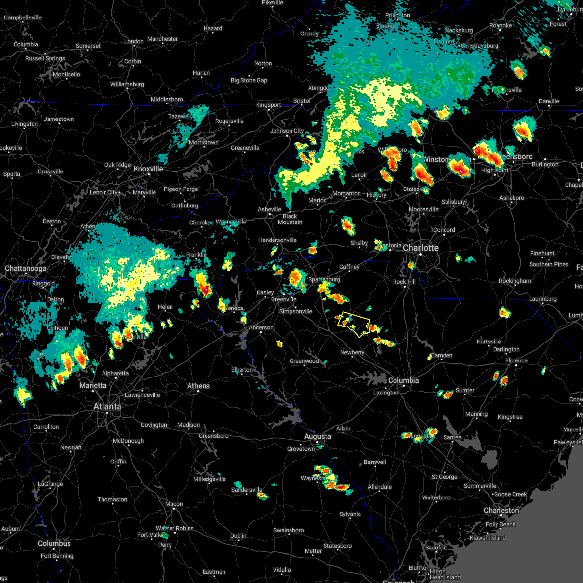 At 450 pm edt, a severe thunderstorm was located 10 miles south of union, or near rose hill state park, moving southeast at 15 mph (radar indicated). Hazards include 60 mph wind gusts and quarter size hail. Minor hail damage to vehicles is expected. Expect wind damage to trees and power lines. At 450 pm edt, a severe thunderstorm was located 10 miles south of union, or near rose hill state park, moving southeast at 15 mph (radar indicated). Hazards include 60 mph wind gusts and quarter size hail. Minor hail damage to vehicles is expected. Expect wind damage to trees and power lines.
|
| 6/16/2022 4:26 PM EDT |
 At 426 pm edt, a severe thunderstorm was located 8 miles southeast of union, or 5 miles northwest of carlisle, moving southeast at 10 mph (radar indicated). Hazards include 60 mph wind gusts and quarter size hail. Minor hail damage to vehicles is expected. Expect wind damage to trees and power lines. At 426 pm edt, a severe thunderstorm was located 8 miles southeast of union, or 5 miles northwest of carlisle, moving southeast at 10 mph (radar indicated). Hazards include 60 mph wind gusts and quarter size hail. Minor hail damage to vehicles is expected. Expect wind damage to trees and power lines.
|
| 5/23/2022 11:52 AM EDT | 1 tree reported down as the storm came throug in union county SC, 0.7 miles SSE of Carlisle, SC |
| 8/21/2021 8:37 PM EDT |
 At 836 pm edt, a severe thunderstorm was located 7 miles east of union, or near lockhart, moving southeast at 15 mph (radar indicated). Hazards include 60 mph wind gusts and up to quarter size hail. Minor hail damage to vehicles is expected. expect wind damage to trees and power lines. locations impacted include, monarch mill, lockhart, adamsburg and santuc. hail threat, radar indicated max hail size, 1. 00 in wind threat, radar indicated max wind gust, 60 mph. At 836 pm edt, a severe thunderstorm was located 7 miles east of union, or near lockhart, moving southeast at 15 mph (radar indicated). Hazards include 60 mph wind gusts and up to quarter size hail. Minor hail damage to vehicles is expected. expect wind damage to trees and power lines. locations impacted include, monarch mill, lockhart, adamsburg and santuc. hail threat, radar indicated max hail size, 1. 00 in wind threat, radar indicated max wind gust, 60 mph.
|
| 8/21/2021 8:09 PM EDT |
 At 808 pm edt, a severe thunderstorm was located 7 miles north of union, or 4 miles east of jonesville, moving southeast at 15 mph (radar indicated). Hazards include 60 mph wind gusts and quarter size hail. Minor hail damage to vehicles is expected. Expect wind damage to trees and power lines. At 808 pm edt, a severe thunderstorm was located 7 miles north of union, or 4 miles east of jonesville, moving southeast at 15 mph (radar indicated). Hazards include 60 mph wind gusts and quarter size hail. Minor hail damage to vehicles is expected. Expect wind damage to trees and power lines.
|
| 8/19/2021 6:05 PM EDT |
 The severe thunderstorm warning for east central laurens and southern union counties will expire at 615 pm edt, the storm which prompted the warning has weakened below severe limits, and no longer poses an immediate threat to life or property. therefore, the warning will be allowed to expire. however gusty winds and heavy rain are still possible with this thunderstorm. The severe thunderstorm warning for east central laurens and southern union counties will expire at 615 pm edt, the storm which prompted the warning has weakened below severe limits, and no longer poses an immediate threat to life or property. therefore, the warning will be allowed to expire. however gusty winds and heavy rain are still possible with this thunderstorm.
|
| 8/19/2021 5:58 PM EDT |
 At 558 pm edt, a severe thunderstorm was located 11 miles south of union, or near rose hill state park, moving east at 10 mph (radar indicated). Hazards include 60 mph wind gusts and penny size hail. Expect damage to trees and power lines. locations impacted include, carlisle, rose hill state park, sedalia, tuckertown, santuc, cross keys and monarch mill. hail threat, radar indicated max hail size, 0. 75 in wind threat, radar indicated max wind gust, 60 mph. At 558 pm edt, a severe thunderstorm was located 11 miles south of union, or near rose hill state park, moving east at 10 mph (radar indicated). Hazards include 60 mph wind gusts and penny size hail. Expect damage to trees and power lines. locations impacted include, carlisle, rose hill state park, sedalia, tuckertown, santuc, cross keys and monarch mill. hail threat, radar indicated max hail size, 0. 75 in wind threat, radar indicated max wind gust, 60 mph.
|
| 8/19/2021 5:36 PM EDT |
 At 535 pm edt, a severe thunderstorm was located 11 miles south of union, or near rose hill state park, moving east at 10 mph (radar indicated). Hazards include 60 mph wind gusts and penny size hail. expect damage to trees and power lines At 535 pm edt, a severe thunderstorm was located 11 miles south of union, or near rose hill state park, moving east at 10 mph (radar indicated). Hazards include 60 mph wind gusts and penny size hail. expect damage to trees and power lines
|
| 7/16/2021 1:23 PM EDT |
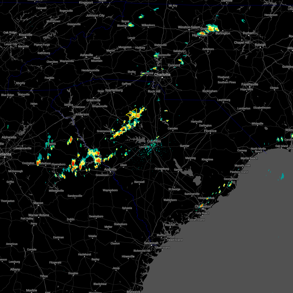 The severe thunderstorm warning for southeastern union county will expire at 130 pm edt, the storm which prompted the warning has weakened below severe limits, and no longer poses an immediate threat to life or property. therefore the warning will be allowed to expire. however heavy rain is still possible with this thunderstorm. The severe thunderstorm warning for southeastern union county will expire at 130 pm edt, the storm which prompted the warning has weakened below severe limits, and no longer poses an immediate threat to life or property. therefore the warning will be allowed to expire. however heavy rain is still possible with this thunderstorm.
|
| 7/16/2021 1:15 PM EDT |
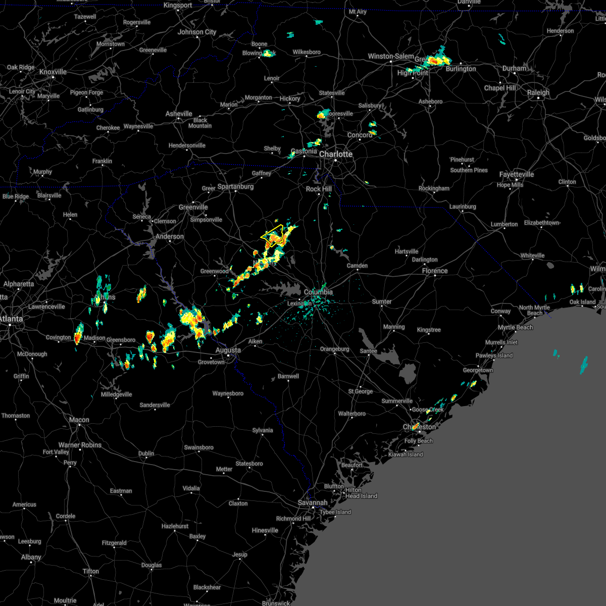 At 114 pm edt, a severe thunderstorm was located 9 miles west of chester, or 7 miles northeast of carlisle, moving northeast at 15 mph (radar indicated). Hazards include 60 mph wind gusts and quarter size hail. Minor hail damage to vehicles is expected. expect wind damage to trees and power lines. Locations impacted include, carlisle and tuckertown. At 114 pm edt, a severe thunderstorm was located 9 miles west of chester, or 7 miles northeast of carlisle, moving northeast at 15 mph (radar indicated). Hazards include 60 mph wind gusts and quarter size hail. Minor hail damage to vehicles is expected. expect wind damage to trees and power lines. Locations impacted include, carlisle and tuckertown.
|
| 7/16/2021 12:58 PM EDT |
 At 1258 pm edt, a severe thunderstorm was located 12 miles southeast of union, or near carlisle, moving northeast at 15 mph (radar indicated). Hazards include 60 mph wind gusts and quarter size hail. Minor hail damage to vehicles is expected. Expect wind damage to trees and power lines. At 1258 pm edt, a severe thunderstorm was located 12 miles southeast of union, or near carlisle, moving northeast at 15 mph (radar indicated). Hazards include 60 mph wind gusts and quarter size hail. Minor hail damage to vehicles is expected. Expect wind damage to trees and power lines.
|
| 3/25/2021 5:09 PM EDT |
 At 508 pm edt, a severe thunderstorm capable of producing a tornado was located 11 miles south of union, or 4 miles northeast of whitmire, moving east at 50 mph (radar indicated rotation). Hazards include tornado and golf ball size hail. Flying debris will be dangerous to those caught without shelter. mobile homes will be damaged or destroyed. damage to roofs, windows, and vehicles will occur. tree damage is likely. this dangerous storm will be near, carlisle around 520 pm edt. chester state park around 530 pm edt. chester and blackstock around 540 pm edt. Other locations impacted by this dangerous storm include sedalia, blackstock, leeds and cornwell. At 508 pm edt, a severe thunderstorm capable of producing a tornado was located 11 miles south of union, or 4 miles northeast of whitmire, moving east at 50 mph (radar indicated rotation). Hazards include tornado and golf ball size hail. Flying debris will be dangerous to those caught without shelter. mobile homes will be damaged or destroyed. damage to roofs, windows, and vehicles will occur. tree damage is likely. this dangerous storm will be near, carlisle around 520 pm edt. chester state park around 530 pm edt. chester and blackstock around 540 pm edt. Other locations impacted by this dangerous storm include sedalia, blackstock, leeds and cornwell.
|
| 3/25/2021 5:05 PM EDT | Quarter sized hail reported 2.4 miles SE of Carlisle, SC, also trees and power lines down... location approximate. |
| 3/25/2021 4:54 PM EDT |
 At 454 pm edt, a severe thunderstorm capable of producing a tornado was located 15 miles east of laurens, or 6 miles east of clinton, moving east at 50 mph (radar indicated rotation). Hazards include tornado and quarter size hail. Flying debris will be dangerous to those caught without shelter. mobile homes will be damaged or destroyed. damage to roofs, windows, and vehicles will occur. tree damage is likely. this dangerous storm will be near, rose hill state park around 500 pm edt. carlisle around 520 pm edt. chester state park around 530 pm edt. chester and blackstock around 540 pm edt. Other locations impacted by this dangerous thunderstorm include cross keys, leeds, cornwell, sedalia and tuckertown. At 454 pm edt, a severe thunderstorm capable of producing a tornado was located 15 miles east of laurens, or 6 miles east of clinton, moving east at 50 mph (radar indicated rotation). Hazards include tornado and quarter size hail. Flying debris will be dangerous to those caught without shelter. mobile homes will be damaged or destroyed. damage to roofs, windows, and vehicles will occur. tree damage is likely. this dangerous storm will be near, rose hill state park around 500 pm edt. carlisle around 520 pm edt. chester state park around 530 pm edt. chester and blackstock around 540 pm edt. Other locations impacted by this dangerous thunderstorm include cross keys, leeds, cornwell, sedalia and tuckertown.
|
| 8/9/2020 7:23 PM EDT |
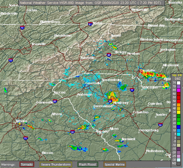 The severe thunderstorm warning for east central laurens and southeastern union counties will expire at 730 pm edt, the storms which prompted the warning have weakened below severe limits, and have exited the warned area. therefore the warning will be allowed to expire. however heavy rain is still possible with these thunderstorms. if you observed large hail or wind damage, please report it to the national weather service greenville-spartanburg by calling toll free, 1, 800, 2 6 7, 8 1 0 1, or by posting on our facebook page, or tweet it using hashtag nwsgsp. your message should describe the event and the specific location where it occurred. The severe thunderstorm warning for east central laurens and southeastern union counties will expire at 730 pm edt, the storms which prompted the warning have weakened below severe limits, and have exited the warned area. therefore the warning will be allowed to expire. however heavy rain is still possible with these thunderstorms. if you observed large hail or wind damage, please report it to the national weather service greenville-spartanburg by calling toll free, 1, 800, 2 6 7, 8 1 0 1, or by posting on our facebook page, or tweet it using hashtag nwsgsp. your message should describe the event and the specific location where it occurred.
|
| 8/9/2020 7:08 PM EDT |
 At 707 pm edt, severe thunderstorms were located along a line extending from 5 miles southwest of union to 11 miles northwest of newberry, moving east at 10 mph (radar indicated). Hazards include 60 mph wind gusts. Expect damage to trees and power lines. Locations impacted include, carlisle, rose hill state park, sedalia, tuckertown, santuc and kinards. At 707 pm edt, severe thunderstorms were located along a line extending from 5 miles southwest of union to 11 miles northwest of newberry, moving east at 10 mph (radar indicated). Hazards include 60 mph wind gusts. Expect damage to trees and power lines. Locations impacted include, carlisle, rose hill state park, sedalia, tuckertown, santuc and kinards.
|
| 8/9/2020 6:42 PM EDT |
 At 642 pm edt, a severe thunderstorm was located 14 miles southwest of union, or 7 miles southwest of rose hill state park, moving east at 20 mph (radar indicated). Hazards include 60 mph wind gusts and penny size hail. expect damage to trees and power lines At 642 pm edt, a severe thunderstorm was located 14 miles southwest of union, or 7 miles southwest of rose hill state park, moving east at 20 mph (radar indicated). Hazards include 60 mph wind gusts and penny size hail. expect damage to trees and power lines
|
| 8/9/2020 3:45 PM EDT | Chester county 911 call center reported two trees down on minnow bridge rd. time estimated by rada in chester county SC, 3.8 miles W of Carlisle, SC |
| 8/5/2020 4:29 PM EDT |
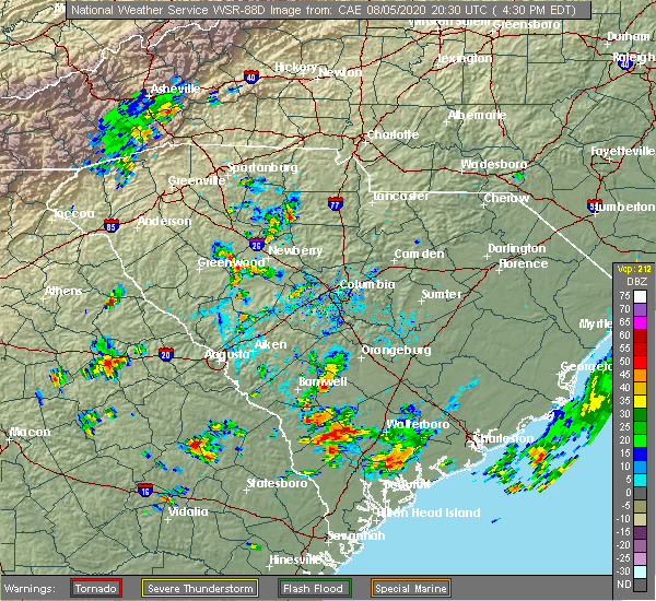 At 429 pm edt, a severe thunderstorm was located 13 miles southwest of chester, or near carlisle, moving northeast at 10 mph (radar indicated). Hazards include 60 mph wind gusts and quarter size hail. Minor hail damage to vehicles is expected. Expect wind damage to trees and power lines. At 429 pm edt, a severe thunderstorm was located 13 miles southwest of chester, or near carlisle, moving northeast at 10 mph (radar indicated). Hazards include 60 mph wind gusts and quarter size hail. Minor hail damage to vehicles is expected. Expect wind damage to trees and power lines.
|
| 6/28/2020 7:09 PM EDT |
 The severe thunderstorm warning for northwestern chester and eastern union counties will expire at 715 pm edt, the storms which prompted the warning have weakened below severe limits, and no longer pose an immediate threat to life or property. therefore the warning will be allowed to expire. however gusty winds and heavy rain are still possible with these thunderstorms. if you observed large hail or wind damage, please report it to the national weather service greenville-spartanburg by calling toll free, 1, 800, 2 6 7, 8 1 0 1, or by posting on our facebook page, or tweet it using hashtag nwsgsp. your message should describe the event and the specific location where it occurred. The severe thunderstorm warning for northwestern chester and eastern union counties will expire at 715 pm edt, the storms which prompted the warning have weakened below severe limits, and no longer pose an immediate threat to life or property. therefore the warning will be allowed to expire. however gusty winds and heavy rain are still possible with these thunderstorms. if you observed large hail or wind damage, please report it to the national weather service greenville-spartanburg by calling toll free, 1, 800, 2 6 7, 8 1 0 1, or by posting on our facebook page, or tweet it using hashtag nwsgsp. your message should describe the event and the specific location where it occurred.
|
| 6/28/2020 7:04 PM EDT |
 At 704 pm edt, severe thunderstorms were located along a line extending from 7 miles northeast of union to 16 miles north of newberry, moving east at 40 mph (radar indicated). Hazards include 60 mph wind gusts and penny size hail. Expect damage to trees and power lines. Locations impacted include, union, monarch mill, lockhart, carlisle, rose hill state park, adamsburg, tuckertown and santuc. At 704 pm edt, severe thunderstorms were located along a line extending from 7 miles northeast of union to 16 miles north of newberry, moving east at 40 mph (radar indicated). Hazards include 60 mph wind gusts and penny size hail. Expect damage to trees and power lines. Locations impacted include, union, monarch mill, lockhart, carlisle, rose hill state park, adamsburg, tuckertown and santuc.
|
| 6/28/2020 6:39 PM EDT |
 At 638 pm edt, severe thunderstorms were located along a line extending from 8 miles southeast of spartanburg to 11 miles northeast of laurens, moving east at 30 mph (radar indicated). Hazards include 60 mph wind gusts and quarter size hail. Minor hail damage to vehicles is expected. Expect wind damage to trees and power lines. At 638 pm edt, severe thunderstorms were located along a line extending from 8 miles southeast of spartanburg to 11 miles northeast of laurens, moving east at 30 mph (radar indicated). Hazards include 60 mph wind gusts and quarter size hail. Minor hail damage to vehicles is expected. Expect wind damage to trees and power lines.
|
| 5/22/2020 4:02 PM EDT |
 At 402 pm edt, severe thunderstorms were located along a line extending from 8 miles southwest of chester to 8 miles northeast of newberry, moving southeast at 45 mph (radar indicated). Hazards include 60 mph wind gusts and quarter size hail. Minor hail damage to vehicles is expected. expect wind damage to trees and power lines. Locations impacted include, chester, great falls, fort lawn, carlisle, mcconnells, richburg, lowrys, chester state park, blackstock and leeds. At 402 pm edt, severe thunderstorms were located along a line extending from 8 miles southwest of chester to 8 miles northeast of newberry, moving southeast at 45 mph (radar indicated). Hazards include 60 mph wind gusts and quarter size hail. Minor hail damage to vehicles is expected. expect wind damage to trees and power lines. Locations impacted include, chester, great falls, fort lawn, carlisle, mcconnells, richburg, lowrys, chester state park, blackstock and leeds.
|
| 5/22/2020 3:37 PM EDT |
 At 337 pm edt, severe thunderstorms were located along a line extending from 10 miles northeast of union to 18 miles east of laurens, moving east at 45 mph (radar indicated). Hazards include 60 mph wind gusts and penny size hail. expect damage to trees and power lines At 337 pm edt, severe thunderstorms were located along a line extending from 10 miles northeast of union to 18 miles east of laurens, moving east at 45 mph (radar indicated). Hazards include 60 mph wind gusts and penny size hail. expect damage to trees and power lines
|
| 5/5/2020 7:50 PM EDT |
 At 749 pm edt, severe thunderstorms were located along a line extending from 10 miles southeast of gaffney to 5 miles northwest of union to 10 miles northeast of laurens, moving east at 45 mph (radar indicated). Hazards include 60 mph wind gusts and penny size hail. expect damage to trees and power lines At 749 pm edt, severe thunderstorms were located along a line extending from 10 miles southeast of gaffney to 5 miles northwest of union to 10 miles northeast of laurens, moving east at 45 mph (radar indicated). Hazards include 60 mph wind gusts and penny size hail. expect damage to trees and power lines
|
| 5/5/2020 3:57 AM EDT |
 At 356 am edt, severe thunderstorms were located along a line extending from 6 miles north of york to 9 miles southwest of rock hill to 8 miles southwest of chester, moving east at 55 mph (radar indicated). Hazards include 60 mph wind gusts and quarter size hail. Minor hail damage to vehicles is expected. Expect wind damage to trees and power lines. At 356 am edt, severe thunderstorms were located along a line extending from 6 miles north of york to 9 miles southwest of rock hill to 8 miles southwest of chester, moving east at 55 mph (radar indicated). Hazards include 60 mph wind gusts and quarter size hail. Minor hail damage to vehicles is expected. Expect wind damage to trees and power lines.
|
| 5/5/2020 3:49 AM EDT |
 At 348 am edt, severe thunderstorms were located along a line extending from 11 miles northwest of york to 9 miles northwest of chester to 16 miles northwest of vc summer nuclear station, moving east at 55 mph (radar indicated). Hazards include 60 mph wind gusts and quarter size hail. Minor hail damage to vehicles is expected. expect wind damage to trees and power lines. Locations impacted include, spartanburg, gaffney, union, york, chester, clinton, clover, boiling springs sc, pacolet and cowpens. At 348 am edt, severe thunderstorms were located along a line extending from 11 miles northwest of york to 9 miles northwest of chester to 16 miles northwest of vc summer nuclear station, moving east at 55 mph (radar indicated). Hazards include 60 mph wind gusts and quarter size hail. Minor hail damage to vehicles is expected. expect wind damage to trees and power lines. Locations impacted include, spartanburg, gaffney, union, york, chester, clinton, clover, boiling springs sc, pacolet and cowpens.
|
| 5/5/2020 3:22 AM EDT |
 At 321 am edt, severe thunderstorms were located along a line extending from 7 miles northeast of spartanburg to 5 miles west of union to 10 miles southeast of laurens, moving east at 55 mph (radar indicated). Hazards include 60 mph wind gusts and quarter size hail. Minor hail damage to vehicles is expected. Expect wind damage to trees and power lines. At 321 am edt, severe thunderstorms were located along a line extending from 7 miles northeast of spartanburg to 5 miles west of union to 10 miles southeast of laurens, moving east at 55 mph (radar indicated). Hazards include 60 mph wind gusts and quarter size hail. Minor hail damage to vehicles is expected. Expect wind damage to trees and power lines.
|
| 5/4/2020 9:26 PM EDT |
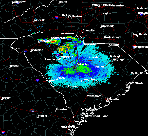 At 925 pm edt, a severe thunderstorm was located 10 miles south of union, or 5 miles west of carlisle, moving east at 25 mph. the storm was weakening rapidly. if this trend continues, the warning may be cancelled early (radar indicated). Hazards include 60 mph wind gusts. Expect damage to trees and power lines. Locations impacted include, carlisle, tuckertown, leeds and santuc. At 925 pm edt, a severe thunderstorm was located 10 miles south of union, or 5 miles west of carlisle, moving east at 25 mph. the storm was weakening rapidly. if this trend continues, the warning may be cancelled early (radar indicated). Hazards include 60 mph wind gusts. Expect damage to trees and power lines. Locations impacted include, carlisle, tuckertown, leeds and santuc.
|
| 5/4/2020 9:14 PM EDT |
 At 914 pm edt, a severe thunderstorm was located 8 miles south of union, or near rose hill state park, moving southeast at 25 mph (radar indicated). Hazards include 60 mph wind gusts and quarter size hail. Minor hail damage to vehicles is expected. Expect wind damage to trees and power lines. At 914 pm edt, a severe thunderstorm was located 8 miles south of union, or near rose hill state park, moving southeast at 25 mph (radar indicated). Hazards include 60 mph wind gusts and quarter size hail. Minor hail damage to vehicles is expected. Expect wind damage to trees and power lines.
|
| 4/13/2020 4:13 AM EDT |
 At 413 am edt, severe thunderstorms were located along a line extending from 10 miles southeast of shelby to 13 miles west of newberry, moving northeast at 30 mph (radar indicated). Hazards include 60 mph wind gusts. expect damage to trees and power lines At 413 am edt, severe thunderstorms were located along a line extending from 10 miles southeast of shelby to 13 miles west of newberry, moving northeast at 30 mph (radar indicated). Hazards include 60 mph wind gusts. expect damage to trees and power lines
|
| 1/11/2020 9:36 PM EST |
 At 935 pm est, a severe thunderstorm capable of producing a tornado was located 14 miles southwest of chester, or near carlisle, moving northeast at 65 mph (radar indicated rotation). Hazards include tornado. Flying debris will be dangerous to those caught without shelter. mobile homes will be damaged or destroyed. damage to roofs, windows, and vehicles will occur. tree damage is likely. this dangerous storm will be near, chester, chester state park and lowrys around 950 pm est. richburg around 1000 pm est. Other locations impacted by this dangerous thunderstorm include leeds, cornwell and edgemoor. At 935 pm est, a severe thunderstorm capable of producing a tornado was located 14 miles southwest of chester, or near carlisle, moving northeast at 65 mph (radar indicated rotation). Hazards include tornado. Flying debris will be dangerous to those caught without shelter. mobile homes will be damaged or destroyed. damage to roofs, windows, and vehicles will occur. tree damage is likely. this dangerous storm will be near, chester, chester state park and lowrys around 950 pm est. richburg around 1000 pm est. Other locations impacted by this dangerous thunderstorm include leeds, cornwell and edgemoor.
|
| 1/11/2020 9:21 PM EST |
 At 920 pm est, severe thunderstorms were located along a line extending from 7 miles north of gaffney to 14 miles south of union, moving east at 45 mph (radar indicated). Hazards include 60 mph wind gusts. expect damage to trees and power lines At 920 pm est, severe thunderstorms were located along a line extending from 7 miles north of gaffney to 14 miles south of union, moving east at 45 mph (radar indicated). Hazards include 60 mph wind gusts. expect damage to trees and power lines
|
| 8/13/2019 5:14 PM EDT |
 At 514 pm edt, a severe thunderstorm was located 4 miles south of union, or near rose hill state park, moving southeast at 10 mph (radar indicated). Hazards include 60 mph wind gusts and quarter size hail. Minor hail damage to vehicles is expected. expect wind damage to trees and power lines. Locations impacted include, union, monarch mill, buffalo, carlisle, tuckertown and santuc. At 514 pm edt, a severe thunderstorm was located 4 miles south of union, or near rose hill state park, moving southeast at 10 mph (radar indicated). Hazards include 60 mph wind gusts and quarter size hail. Minor hail damage to vehicles is expected. expect wind damage to trees and power lines. Locations impacted include, union, monarch mill, buffalo, carlisle, tuckertown and santuc.
|
| 8/13/2019 4:50 PM EDT |
 At 450 pm edt, a severe thunderstorm was located near union, or near buffalo, moving southeast at 20 mph (radar indicated). Hazards include 60 mph wind gusts and nickel size hail. expect damage to trees and power lines At 450 pm edt, a severe thunderstorm was located near union, or near buffalo, moving southeast at 20 mph (radar indicated). Hazards include 60 mph wind gusts and nickel size hail. expect damage to trees and power lines
|
| 7/13/2019 4:53 PM EDT | Fairfield dispatch reported powerlines down blocking the road on hwy 215 at cool branch rd. time estimated by rada in fairfield county SC, 5.6 miles WNW of Carlisle, SC |
| 7/13/2019 4:53 PM EDT | Fairfield dispatch reported trees down on dave jenkins rd at hwy 215. time estimated by rada in fairfield county SC, 7.7 miles NW of Carlisle, SC |
| 7/13/2019 4:31 PM EDT |
 At 430 pm edt, a severe thunderstorm was located 10 miles east of union, or near lockhart, moving east at 15 mph (radar indicated). Hazards include 60 mph wind gusts and quarter size hail. Minor hail damage to vehicles is expected. expect wind damage to trees and power lines. Locations impacted include, monarch mill, lockhart, carlisle, lowrys, leeds, adamsburg, bullock creek, santuc, mcconnells and union. At 430 pm edt, a severe thunderstorm was located 10 miles east of union, or near lockhart, moving east at 15 mph (radar indicated). Hazards include 60 mph wind gusts and quarter size hail. Minor hail damage to vehicles is expected. expect wind damage to trees and power lines. Locations impacted include, monarch mill, lockhart, carlisle, lowrys, leeds, adamsburg, bullock creek, santuc, mcconnells and union.
|
| 7/13/2019 4:11 PM EDT |
 At 411 pm edt, a severe thunderstorm was located 6 miles northeast of union, or 5 miles west of lockhart, moving east at 15 mph (radar indicated). Hazards include 60 mph wind gusts and quarter size hail. Minor hail damage to vehicles is expected. Expect wind damage to trees and power lines. At 411 pm edt, a severe thunderstorm was located 6 miles northeast of union, or 5 miles west of lockhart, moving east at 15 mph (radar indicated). Hazards include 60 mph wind gusts and quarter size hail. Minor hail damage to vehicles is expected. Expect wind damage to trees and power lines.
|
| 6/24/2019 9:16 PM EDT |
 At 916 pm edt, severe thunderstorms were located along a line extending from 15 miles east of taylorsville to 7 miles northwest of statesville to 14 miles northwest of kannapolis to 5 miles west of huntersville to 6 miles southwest of uptown charlotte to 7 miles south of york to 6 miles south of chester, moving northeast at 70 mph (radar indicated). Hazards include 70 mph wind gusts. Expect considerable tree damage. damage is likely to mobile homes, roofs, and outbuildings. Locations impacted include, gastonia, rock hill, uptown charlotte, huntersville, statesville, lincolnton, york, chester, mocksville and central charlotte. At 916 pm edt, severe thunderstorms were located along a line extending from 15 miles east of taylorsville to 7 miles northwest of statesville to 14 miles northwest of kannapolis to 5 miles west of huntersville to 6 miles southwest of uptown charlotte to 7 miles south of york to 6 miles south of chester, moving northeast at 70 mph (radar indicated). Hazards include 70 mph wind gusts. Expect considerable tree damage. damage is likely to mobile homes, roofs, and outbuildings. Locations impacted include, gastonia, rock hill, uptown charlotte, huntersville, statesville, lincolnton, york, chester, mocksville and central charlotte.
|
| 6/24/2019 9:05 PM EDT |
 At 904 pm edt, severe thunderstorms were located along a line extending from 8 miles southeast of taylorsville to 11 miles east of newton to 9 miles southeast of lincolnton to 7 miles southeast of gastonia to 5 miles west of york to 13 miles southeast of union, moving east at 35 mph (radar indicated). Hazards include 60 mph wind gusts. Expect damage to trees and power lines. locations impacted include, gastonia, hickory, newton, lincolnton, union, york, mt holly, st. Stephens, belmont and clinton. At 904 pm edt, severe thunderstorms were located along a line extending from 8 miles southeast of taylorsville to 11 miles east of newton to 9 miles southeast of lincolnton to 7 miles southeast of gastonia to 5 miles west of york to 13 miles southeast of union, moving east at 35 mph (radar indicated). Hazards include 60 mph wind gusts. Expect damage to trees and power lines. locations impacted include, gastonia, hickory, newton, lincolnton, union, york, mt holly, st. Stephens, belmont and clinton.
|
| 6/24/2019 9:00 PM EDT |
 At 859 pm edt, severe thunderstorms were located along a line extending from 4 miles southeast of taylorsville to 10 miles southwest of statesville to 7 miles southeast of lincolnton to 8 miles southeast of gastonia to 7 miles southwest of york to 16 miles southeast of union, moving northeast at 50 mph (radar indicated). Hazards include 70 mph wind gusts. Expect considerable tree damage. Damage is likely to mobile homes, roofs, and outbuildings. At 859 pm edt, severe thunderstorms were located along a line extending from 4 miles southeast of taylorsville to 10 miles southwest of statesville to 7 miles southeast of lincolnton to 8 miles southeast of gastonia to 7 miles southwest of york to 16 miles southeast of union, moving northeast at 50 mph (radar indicated). Hazards include 70 mph wind gusts. Expect considerable tree damage. Damage is likely to mobile homes, roofs, and outbuildings.
|
| 6/24/2019 8:45 PM EDT |
 At 845 pm edt, severe thunderstorms were located along a line extending from 5 miles northeast of hickory to 5 miles northeast of lincolnton to 8 miles west of gastonia to 7 miles north of york to 13 miles northeast of union to 16 miles north of newberry, moving east at 60 mph (radar indicated). Hazards include 60 mph wind gusts. Expect damage to trees and power lines. Locations impacted include, gastonia, hickory, shelby, newton, gaffney, lincolnton, union, york, kings mountain and mt holly. At 845 pm edt, severe thunderstorms were located along a line extending from 5 miles northeast of hickory to 5 miles northeast of lincolnton to 8 miles west of gastonia to 7 miles north of york to 13 miles northeast of union to 16 miles north of newberry, moving east at 60 mph (radar indicated). Hazards include 60 mph wind gusts. Expect damage to trees and power lines. Locations impacted include, gastonia, hickory, shelby, newton, gaffney, lincolnton, union, york, kings mountain and mt holly.
|
| 6/24/2019 8:26 PM EDT |
 At 826 pm edt, severe thunderstorms were located along a line extending from 8 miles southwest of hickory to 7 miles southeast of shelby to 11 miles north of union to 7 miles southeast of laurens, moving northeast at 35 mph (radar indicated). Hazards include 60 mph wind gusts. expect damage to trees and power lines At 826 pm edt, severe thunderstorms were located along a line extending from 8 miles southwest of hickory to 7 miles southeast of shelby to 11 miles north of union to 7 miles southeast of laurens, moving northeast at 35 mph (radar indicated). Hazards include 60 mph wind gusts. expect damage to trees and power lines
|
| 6/24/2019 8:20 PM EDT |
 At 819 pm edt, severe thunderstorms were located along a line extending from 6 miles north of shelby to 7 miles south of gaffney to 8 miles southeast of laurens, moving east at 40 mph (radar indicated). Hazards include 70 mph wind gusts. Expect considerable tree damage. damage is likely to mobile homes, roofs, and outbuildings. Locations impacted include, spartanburg, shelby, gaffney, laurens, union, kings mountain, clinton, woodruff, boiling springs nc and pacolet. At 819 pm edt, severe thunderstorms were located along a line extending from 6 miles north of shelby to 7 miles south of gaffney to 8 miles southeast of laurens, moving east at 40 mph (radar indicated). Hazards include 70 mph wind gusts. Expect considerable tree damage. damage is likely to mobile homes, roofs, and outbuildings. Locations impacted include, spartanburg, shelby, gaffney, laurens, union, kings mountain, clinton, woodruff, boiling springs nc and pacolet.
|
| 6/24/2019 8:06 PM EDT |
 At 805 pm edt, severe thunderstorms were located along a line extending from 8 miles northwest of shelby to 9 miles southwest of gaffney to 8 miles southwest of laurens, moving east at 40 mph (radar indicated). Hazards include 70 mph wind gusts. Expect considerable tree damage. damage is likely to mobile homes, roofs, and outbuildings. Locations impacted include, spartanburg, shelby, gaffney, laurens, union, forest city, kings mountain, clinton, boiling springs sc and woodruff. At 805 pm edt, severe thunderstorms were located along a line extending from 8 miles northwest of shelby to 9 miles southwest of gaffney to 8 miles southwest of laurens, moving east at 40 mph (radar indicated). Hazards include 70 mph wind gusts. Expect considerable tree damage. damage is likely to mobile homes, roofs, and outbuildings. Locations impacted include, spartanburg, shelby, gaffney, laurens, union, forest city, kings mountain, clinton, boiling springs sc and woodruff.
|
| 6/24/2019 7:53 PM EDT |
 At 753 pm edt, severe thunderstorms were located along a line extending from 5 miles northeast of forest city to near spartanburg to 14 miles southwest of laurens, moving east at 40 mph (radar indicated). Hazards include 70 mph wind gusts. Expect considerable tree damage. Damage is likely to mobile homes, roofs, and outbuildings. At 753 pm edt, severe thunderstorms were located along a line extending from 5 miles northeast of forest city to near spartanburg to 14 miles southwest of laurens, moving east at 40 mph (radar indicated). Hazards include 70 mph wind gusts. Expect considerable tree damage. Damage is likely to mobile homes, roofs, and outbuildings.
|
| 4/19/2019 2:40 PM EDT |
 The tornado warning for southwestern chester and southeastern union counties will expire at 245 pm edt, the storm which prompted the warning has weakened below severe limits, and has exited the warned area. therefore the warning will be allowed to expire. a tornado watch remains in effect until 500 pm edt for upstate south carolina. if you observed large hail or wind damage, please report it to the national weather service greenville-spartanburg by calling toll free, 1, 800, 2 6 7, 8 1 0 1, or by posting on our facebook page, or tweet it using hashtag nwsgsp. your message should describe the event and the specific location where it occurred. The tornado warning for southwestern chester and southeastern union counties will expire at 245 pm edt, the storm which prompted the warning has weakened below severe limits, and has exited the warned area. therefore the warning will be allowed to expire. a tornado watch remains in effect until 500 pm edt for upstate south carolina. if you observed large hail or wind damage, please report it to the national weather service greenville-spartanburg by calling toll free, 1, 800, 2 6 7, 8 1 0 1, or by posting on our facebook page, or tweet it using hashtag nwsgsp. your message should describe the event and the specific location where it occurred.
|
| 4/19/2019 2:23 PM EDT | Trees down along foster howell road. possible tornad in union county SC, 3.7 miles E of Carlisle, SC |
| 4/19/2019 2:20 PM EDT | Trees down across foster-howell roa in union county SC, 3.7 miles E of Carlisle, SC |
| 4/19/2019 2:06 PM EDT |
 At 206 pm edt, a severe thunderstorm capable of producing a tornado was located 8 miles north of newberry, or 6 miles south of whitmire, moving northeast at 35 mph (radar indicated rotation). Hazards include tornado. Flying debris will be dangerous to those caught without shelter. mobile homes will be damaged or destroyed. damage to roofs, windows, and vehicles will occur. Tree damage is likely. At 206 pm edt, a severe thunderstorm capable of producing a tornado was located 8 miles north of newberry, or 6 miles south of whitmire, moving northeast at 35 mph (radar indicated rotation). Hazards include tornado. Flying debris will be dangerous to those caught without shelter. mobile homes will be damaged or destroyed. damage to roofs, windows, and vehicles will occur. Tree damage is likely.
|
| 4/8/2019 4:44 PM EDT |
 At 443 pm edt, a severe thunderstorm was located 4 miles northwest of union, or near buffalo, moving northeast at 45 mph (radar indicated). Hazards include 60 mph wind gusts and penny size hail. Expect damage to trees and power lines. Locations impacted include, union, monarch mill, buffalo, jonesville, carlisle, rose hill state park, cross keys, sedalia, adamsburg and tuckertown. At 443 pm edt, a severe thunderstorm was located 4 miles northwest of union, or near buffalo, moving northeast at 45 mph (radar indicated). Hazards include 60 mph wind gusts and penny size hail. Expect damage to trees and power lines. Locations impacted include, union, monarch mill, buffalo, jonesville, carlisle, rose hill state park, cross keys, sedalia, adamsburg and tuckertown.
|
| 4/8/2019 4:17 PM EDT |
 At 417 pm edt, a severe thunderstorm was located 8 miles north of laurens, or 6 miles east of gray court, moving northeast at 40 mph (radar indicated). Hazards include 60 mph wind gusts and penny size hail. expect damage to trees and power lines At 417 pm edt, a severe thunderstorm was located 8 miles north of laurens, or 6 miles east of gray court, moving northeast at 40 mph (radar indicated). Hazards include 60 mph wind gusts and penny size hail. expect damage to trees and power lines
|
| 8/6/2018 7:31 PM EDT |
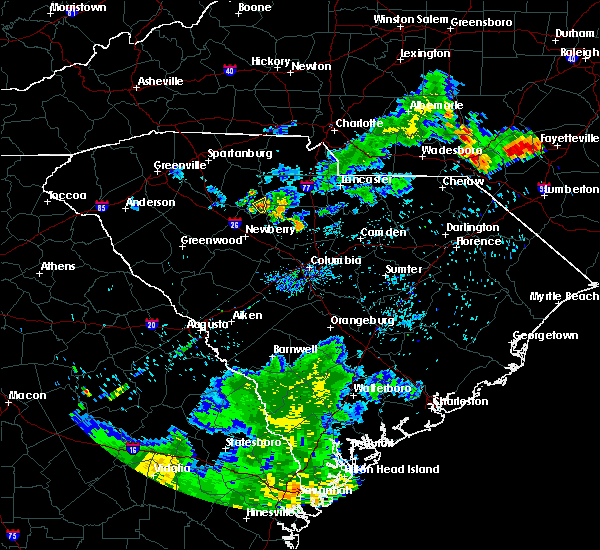 At 731 pm edt, a severe thunderstorm was located 14 miles southeast of union, or near carlisle, moving south at 10 mph (radar indicated). Hazards include 60 mph wind gusts and quarter size hail. Minor hail damage to vehicles is expected. expect wind damage to trees and power lines. Locations impacted include, carlisle. At 731 pm edt, a severe thunderstorm was located 14 miles southeast of union, or near carlisle, moving south at 10 mph (radar indicated). Hazards include 60 mph wind gusts and quarter size hail. Minor hail damage to vehicles is expected. expect wind damage to trees and power lines. Locations impacted include, carlisle.
|
| 8/6/2018 7:14 PM EDT |
 At 714 pm edt, a severe thunderstorm was located 14 miles southeast of union, or near carlisle, moving south at 10 mph (radar indicated). Hazards include 60 mph wind gusts and quarter size hail. Minor hail damage to vehicles is expected. expect wind damage to trees and power lines. Locations impacted include, chester, carlisle, chester state park, leeds, cornwell, santuc and blackstock. At 714 pm edt, a severe thunderstorm was located 14 miles southeast of union, or near carlisle, moving south at 10 mph (radar indicated). Hazards include 60 mph wind gusts and quarter size hail. Minor hail damage to vehicles is expected. expect wind damage to trees and power lines. Locations impacted include, chester, carlisle, chester state park, leeds, cornwell, santuc and blackstock.
|
| 8/6/2018 6:53 PM EDT |
 At 653 pm edt, a severe thunderstorm was located 9 miles southwest of chester, or 6 miles northeast of carlisle, moving southeast at 15 mph (radar indicated). Hazards include 60 mph wind gusts and quarter size hail. Minor hail damage to vehicles is expected. Expect wind damage to trees and power lines. At 653 pm edt, a severe thunderstorm was located 9 miles southwest of chester, or 6 miles northeast of carlisle, moving southeast at 15 mph (radar indicated). Hazards include 60 mph wind gusts and quarter size hail. Minor hail damage to vehicles is expected. Expect wind damage to trees and power lines.
|
| 6/27/2018 5:47 PM EDT |
 At 547 pm edt, severe thunderstorms were located along a line extending from 8 miles south of rock hill to 7 miles west of chester to 16 miles southeast of union to 13 miles north of newberry, moving southeast at 35 mph (radar indicated). Hazards include golf ball size hail and 60 mph wind gusts. People and animals outdoors will be injured. expect hail damage to roofs, siding, windows, and vehicles. Expect wind damage to trees and power lines. At 547 pm edt, severe thunderstorms were located along a line extending from 8 miles south of rock hill to 7 miles west of chester to 16 miles southeast of union to 13 miles north of newberry, moving southeast at 35 mph (radar indicated). Hazards include golf ball size hail and 60 mph wind gusts. People and animals outdoors will be injured. expect hail damage to roofs, siding, windows, and vehicles. Expect wind damage to trees and power lines.
|
| 6/27/2018 5:38 PM EDT |
 At 538 pm edt, severe thunderstorms were located along a line extending from 14 miles southwest of york to 13 miles west of chester to 8 miles south of union, moving east at 40 mph (radar indicated). Hazards include 60 mph wind gusts and quarter size hail. Minor hail damage to vehicles is expected. expect wind damage to trees and power lines. Locations impacted include, laurens, union, clinton, pacolet, monarch mill, buffalo, jonesville, pacolet mills, lockhart and carlisle. At 538 pm edt, severe thunderstorms were located along a line extending from 14 miles southwest of york to 13 miles west of chester to 8 miles south of union, moving east at 40 mph (radar indicated). Hazards include 60 mph wind gusts and quarter size hail. Minor hail damage to vehicles is expected. expect wind damage to trees and power lines. Locations impacted include, laurens, union, clinton, pacolet, monarch mill, buffalo, jonesville, pacolet mills, lockhart and carlisle.
|
| 6/27/2018 5:18 PM EDT |
 At 518 pm edt, severe thunderstorms were located along a line extending from 7 miles south of gaffney to 9 miles west of union, moving east at 35 mph (radar indicated). Hazards include 60 mph wind gusts and quarter size hail. Minor hail damage to vehicles is expected. Expect wind damage to trees and power lines. At 518 pm edt, severe thunderstorms were located along a line extending from 7 miles south of gaffney to 9 miles west of union, moving east at 35 mph (radar indicated). Hazards include 60 mph wind gusts and quarter size hail. Minor hail damage to vehicles is expected. Expect wind damage to trees and power lines.
|
| 6/25/2018 7:48 PM EDT |
 At 747 pm edt, severe thunderstorms were located along a line extending from 3 miles northeast of rock hill to 15 miles northwest of batesburg, moving east at 45 mph (radar indicated). Hazards include 60 mph wind gusts and quarter size hail. Minor hail damage to vehicles is expected. expect wind damage to trees and power lines. Locations impacted include, rock hill, chester, lesslie, great falls, monarch mill, fort lawn, lockhart, sharon, carlisle and mcconnells. At 747 pm edt, severe thunderstorms were located along a line extending from 3 miles northeast of rock hill to 15 miles northwest of batesburg, moving east at 45 mph (radar indicated). Hazards include 60 mph wind gusts and quarter size hail. Minor hail damage to vehicles is expected. expect wind damage to trees and power lines. Locations impacted include, rock hill, chester, lesslie, great falls, monarch mill, fort lawn, lockhart, sharon, carlisle and mcconnells.
|
| 6/25/2018 7:35 PM EDT |
 At 734 pm edt, severe thunderstorms were located along a line extending from 4 miles northwest of rock hill to 19 miles southeast of greenwood, moving east at 45 mph (radar indicated). Hazards include 60 mph wind gusts and quarter size hail. Minor hail damage to vehicles is expected. expect wind damage to trees and power lines. Locations impacted include, rock hill, greenwood, union, chester, clinton, lesslie, great falls, monarch mill, ninety six and joanna. At 734 pm edt, severe thunderstorms were located along a line extending from 4 miles northwest of rock hill to 19 miles southeast of greenwood, moving east at 45 mph (radar indicated). Hazards include 60 mph wind gusts and quarter size hail. Minor hail damage to vehicles is expected. expect wind damage to trees and power lines. Locations impacted include, rock hill, greenwood, union, chester, clinton, lesslie, great falls, monarch mill, ninety six and joanna.
|
| 6/25/2018 7:24 PM EDT |
 At 723 pm edt, severe thunderstorms were located along a line extending from near york to 12 miles southeast of greenwood, moving east at 45 mph (radar indicated). Hazards include 60 mph wind gusts and quarter size hail. Minor hail damage to vehicles is expected. expect wind damage to trees and power lines. Locations impacted include, rock hill, greenwood, laurens, union, york, chester, abbeville, clinton, newport and pacolet. At 723 pm edt, severe thunderstorms were located along a line extending from near york to 12 miles southeast of greenwood, moving east at 45 mph (radar indicated). Hazards include 60 mph wind gusts and quarter size hail. Minor hail damage to vehicles is expected. expect wind damage to trees and power lines. Locations impacted include, rock hill, greenwood, laurens, union, york, chester, abbeville, clinton, newport and pacolet.
|
| 6/25/2018 6:58 PM EDT |
 The national weather service in greenville-spartanburg has issued a * severe thunderstorm warning for. southeastern elbert county in northeastern georgia. laurens county in upstate south carolina. chester county in upstate south carolina. Southern york county in upstate south carolina. The national weather service in greenville-spartanburg has issued a * severe thunderstorm warning for. southeastern elbert county in northeastern georgia. laurens county in upstate south carolina. chester county in upstate south carolina. Southern york county in upstate south carolina.
|
| 6/25/2018 6:58 PM EDT |
 At 658 pm edt, severe thunderstorms were located along a line extending from 10 miles southeast of gaffney to 10 miles southeast of abbeville, moving east at 45 mph (radar indicated). Hazards include 60 mph wind gusts and quarter size hail. Minor hail damage to vehicles is expected. Expect wind damage to trees and power lines. At 658 pm edt, severe thunderstorms were located along a line extending from 10 miles southeast of gaffney to 10 miles southeast of abbeville, moving east at 45 mph (radar indicated). Hazards include 60 mph wind gusts and quarter size hail. Minor hail damage to vehicles is expected. Expect wind damage to trees and power lines.
|
| 6/24/2018 6:52 PM EDT |
 At 652 pm edt, severe thunderstorms were located along a line extending from 12 miles northwest of chester to 9 miles southeast of union to 20 miles north of newberry, moving southeast at 30 mph (radar indicated). Hazards include 60 mph wind gusts and penny size hail. expect damage to trees and power lines At 652 pm edt, severe thunderstorms were located along a line extending from 12 miles northwest of chester to 9 miles southeast of union to 20 miles north of newberry, moving southeast at 30 mph (radar indicated). Hazards include 60 mph wind gusts and penny size hail. expect damage to trees and power lines
|
| 6/22/2018 9:37 PM EDT |
 The severe thunderstorm warning for western chester, southwestern york, southeastern cherokee and eastern union counties will expire at 945 pm edt, the storms which prompted the warning have weakened below severe limits, and no longer pose an immediate threat to life or property. therefore the warning will be allowed to expire. however, gusty winds to 35 mph are still possible with these thunderstorms. The severe thunderstorm warning for western chester, southwestern york, southeastern cherokee and eastern union counties will expire at 945 pm edt, the storms which prompted the warning have weakened below severe limits, and no longer pose an immediate threat to life or property. therefore the warning will be allowed to expire. however, gusty winds to 35 mph are still possible with these thunderstorms.
|
| 6/22/2018 9:13 PM EDT |
 At 912 pm edt, severe thunderstorms were located along a line extending from 11 miles south of gaffney to 7 miles northeast of union to 15 miles west of chester, moving east at 45 mph (radar indicated). Hazards include 60 mph wind gusts. Expect damage to trees and power lines. Locations impacted include, chester, lockhart, sharon, carlisle, hickory grove, mcconnells, lowrys, smyrna, chester state park and leeds. At 912 pm edt, severe thunderstorms were located along a line extending from 11 miles south of gaffney to 7 miles northeast of union to 15 miles west of chester, moving east at 45 mph (radar indicated). Hazards include 60 mph wind gusts. Expect damage to trees and power lines. Locations impacted include, chester, lockhart, sharon, carlisle, hickory grove, mcconnells, lowrys, smyrna, chester state park and leeds.
|
| 6/22/2018 9:02 PM EDT |
 At 901 pm edt, severe thunderstorms were located along a line extending from 9 miles southeast of spartanburg to 3 miles northwest of union to 22 miles north of newberry, moving east at 45 mph (radar indicated). Hazards include 60 mph wind gusts. expect damage to trees and power lines At 901 pm edt, severe thunderstorms were located along a line extending from 9 miles southeast of spartanburg to 3 miles northwest of union to 22 miles north of newberry, moving east at 45 mph (radar indicated). Hazards include 60 mph wind gusts. expect damage to trees and power lines
|
| 6/1/2018 7:30 PM EDT | Tree down at 99 road and auburn drive. reported by fairfield county sheriff. time estimated by rada in fairfield county SC, 6.6 miles NNW of Carlisle, SC |
| 6/1/2018 7:15 PM EDT |
 At 714 pm edt, a severe thunderstorm was located 13 miles south of union, or 5 miles southwest of carlisle, moving northeast at 55 mph (radar indicated). Hazards include 60 mph wind gusts. expect damage to trees and power lines At 714 pm edt, a severe thunderstorm was located 13 miles south of union, or 5 miles southwest of carlisle, moving northeast at 55 mph (radar indicated). Hazards include 60 mph wind gusts. expect damage to trees and power lines
|
| 5/10/2018 7:35 PM EDT |
 The severe thunderstorm warning for east central laurens and southern union counties will expire at 745 pm edt, the storm which prompted the warning has weakened below severe limits, and has exited the warned area. therefore the warning will be allowed to expire. however heavy rain is still possible with this thunderstorm. a severe thunderstorm watch remains in effect until 1000 pm edt for upstate south carolina. The severe thunderstorm warning for east central laurens and southern union counties will expire at 745 pm edt, the storm which prompted the warning has weakened below severe limits, and has exited the warned area. therefore the warning will be allowed to expire. however heavy rain is still possible with this thunderstorm. a severe thunderstorm watch remains in effect until 1000 pm edt for upstate south carolina.
|
| 5/10/2018 7:10 PM EDT |
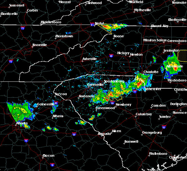 At 709 pm edt, a severe thunderstorm was located 10 miles south of union, or near rose hill state park, moving east at 35 mph (radar indicated). Hazards include 60 mph wind gusts and quarter size hail. Minor hail damage to vehicles is expected. expect wind damage to trees and power lines. Locations impacted include, rose hill state park, cross keys and sedalia. At 709 pm edt, a severe thunderstorm was located 10 miles south of union, or near rose hill state park, moving east at 35 mph (radar indicated). Hazards include 60 mph wind gusts and quarter size hail. Minor hail damage to vehicles is expected. expect wind damage to trees and power lines. Locations impacted include, rose hill state park, cross keys and sedalia.
|
| 5/10/2018 7:01 PM EDT |
 At 701 pm edt, a severe thunderstorm was located 10 miles southwest of union, or 4 miles west of rose hill state park, moving east at 35 mph (radar indicated). Hazards include 60 mph wind gusts and quarter size hail. Minor hail damage to vehicles is expected. Expect wind damage to trees and power lines. At 701 pm edt, a severe thunderstorm was located 10 miles southwest of union, or 4 miles west of rose hill state park, moving east at 35 mph (radar indicated). Hazards include 60 mph wind gusts and quarter size hail. Minor hail damage to vehicles is expected. Expect wind damage to trees and power lines.
|
| 4/15/2018 2:29 PM EDT |
 At 228 pm edt, a severe thunderstorm was located 6 miles northeast of union, or 5 miles north of monarch mill, moving north at 35 mph (radar indicated). Hazards include 60 mph wind gusts and quarter size hail. Minor hail damage to vehicles is expected. Expect wind damage to trees and power lines. At 228 pm edt, a severe thunderstorm was located 6 miles northeast of union, or 5 miles north of monarch mill, moving north at 35 mph (radar indicated). Hazards include 60 mph wind gusts and quarter size hail. Minor hail damage to vehicles is expected. Expect wind damage to trees and power lines.
|
| 7/28/2017 4:04 PM EDT |
 At 404 pm edt, severe thunderstorms were located along a line extending from 4 miles north of lincolnton to 10 miles west of gastonia to 9 miles east of chester, moving east at 15 mph (radar indicated). Hazards include 60 mph wind gusts. Expect damage to trees and power lines. Locations impacted include, gastonia, rock hill, shelby, gaffney, lincolnton, york, chester, kings mountain, mt holly and fort mill. At 404 pm edt, severe thunderstorms were located along a line extending from 4 miles north of lincolnton to 10 miles west of gastonia to 9 miles east of chester, moving east at 15 mph (radar indicated). Hazards include 60 mph wind gusts. Expect damage to trees and power lines. Locations impacted include, gastonia, rock hill, shelby, gaffney, lincolnton, york, chester, kings mountain, mt holly and fort mill.
|
| 7/28/2017 3:55 PM EDT |
 At 355 pm edt, severe thunderstorms were located along a line extending from 3 miles north of lincolnton to 9 miles southeast of shelby to 8 miles southeast of chester, moving northeast at 15 mph (radar indicated). Hazards include 60 mph wind gusts. expect damage to trees and power lines At 355 pm edt, severe thunderstorms were located along a line extending from 3 miles north of lincolnton to 9 miles southeast of shelby to 8 miles southeast of chester, moving northeast at 15 mph (radar indicated). Hazards include 60 mph wind gusts. expect damage to trees and power lines
|
| 7/28/2017 3:41 PM EDT |
 At 341 pm edt, severe thunderstorms were located along a line extending from 12 miles southeast of columbus to 7 miles east of spartanburg to 14 miles north of newberry, moving northeast at 25 mph (radar indicated). Hazards include 60 mph wind gusts. Expect damage to trees and power lines. Locations impacted include, spartanburg, gaffney, union, boiling springs sc, pacolet, cowpens, wellford, inman, monarch mill and blacksburg. At 341 pm edt, severe thunderstorms were located along a line extending from 12 miles southeast of columbus to 7 miles east of spartanburg to 14 miles north of newberry, moving northeast at 25 mph (radar indicated). Hazards include 60 mph wind gusts. Expect damage to trees and power lines. Locations impacted include, spartanburg, gaffney, union, boiling springs sc, pacolet, cowpens, wellford, inman, monarch mill and blacksburg.
|
| 7/28/2017 3:20 PM EDT |
 At 320 pm edt, severe thunderstorms were located along a line extending from 8 miles south of columbus to 10 miles west of union to 12 miles southwest of newberry, moving northeast at 30 mph (radar indicated). Hazards include 60 mph wind gusts. expect damage to trees and power lines At 320 pm edt, severe thunderstorms were located along a line extending from 8 miles south of columbus to 10 miles west of union to 12 miles southwest of newberry, moving northeast at 30 mph (radar indicated). Hazards include 60 mph wind gusts. expect damage to trees and power lines
|
| 7/23/2017 4:51 PM EDT |
 At 450 pm edt, severe thunderstorms were located along a line extending from 13 miles west of monroe to 12 miles southeast of union, moving east at 15 mph (radar indicated). Hazards include 60 mph wind gusts and quarter size hail. Minor hail damage to vehicles is expected. expect wind damage to trees and power lines. Locations impacted include, rock hill, chester, fort mill, waxhaw, mineral springs, lesslie, great falls, marvin, fort lawn and carlisle. At 450 pm edt, severe thunderstorms were located along a line extending from 13 miles west of monroe to 12 miles southeast of union, moving east at 15 mph (radar indicated). Hazards include 60 mph wind gusts and quarter size hail. Minor hail damage to vehicles is expected. expect wind damage to trees and power lines. Locations impacted include, rock hill, chester, fort mill, waxhaw, mineral springs, lesslie, great falls, marvin, fort lawn and carlisle.
|
| 7/23/2017 4:20 PM EDT |
 At 419 pm edt, severe thunderstorms were located along a line extending from 11 miles south of uptown charlotte to 6 miles south of union, moving east at 15 mph (radar indicated). Hazards include 60 mph wind gusts and quarter size hail. Minor hail damage to vehicles is expected. Expect wind damage to trees and power lines. At 419 pm edt, severe thunderstorms were located along a line extending from 11 miles south of uptown charlotte to 6 miles south of union, moving east at 15 mph (radar indicated). Hazards include 60 mph wind gusts and quarter size hail. Minor hail damage to vehicles is expected. Expect wind damage to trees and power lines.
|
| 6/15/2017 6:38 PM EDT | One tree blown down in leed in chester county SC, 4.6 miles SW of Carlisle, SC |
| 4/6/2017 1:20 AM EDT |
 At 119 am edt, severe thunderstorms were located along a line extending from 10 miles east of gaffney to 9 miles northeast of union to 17 miles north of newberry, moving east at 65 mph (radar indicated). Hazards include 60 mph wind gusts and quarter size hail. Hail damage to vehicles is expected. expect wind damage to roofs, siding, and trees. Locations impacted include, gaffney, union, york, chester, clover, monarch mill, blacksburg, buffalo, jonesville and lockhart. At 119 am edt, severe thunderstorms were located along a line extending from 10 miles east of gaffney to 9 miles northeast of union to 17 miles north of newberry, moving east at 65 mph (radar indicated). Hazards include 60 mph wind gusts and quarter size hail. Hail damage to vehicles is expected. expect wind damage to roofs, siding, and trees. Locations impacted include, gaffney, union, york, chester, clover, monarch mill, blacksburg, buffalo, jonesville and lockhart.
|
| 4/6/2017 1:00 AM EDT |
 At 1259 am edt, severe thunderstorms were located along a line extending from 11 miles south of columbus to 15 miles southeast of greenville downtown to 14 miles west of laurens, moving east at 55 mph (radar indicated). Hazards include 60 mph wind gusts and quarter size hail. Hail damage to vehicles is expected. Expect wind damage to roofs, siding, and trees. At 1259 am edt, severe thunderstorms were located along a line extending from 11 miles south of columbus to 15 miles southeast of greenville downtown to 14 miles west of laurens, moving east at 55 mph (radar indicated). Hazards include 60 mph wind gusts and quarter size hail. Hail damage to vehicles is expected. Expect wind damage to roofs, siding, and trees.
|
| 4/3/2017 3:27 PM EDT | At 326 pm edt, a severe thunderstorm capable of producing a tornado was located 9 miles southeast of union, or 4 miles west of carlisle, moving east at 50 mph (radar indicated rotation). Hazards include tornado. Flying debris will be dangerous to those caught without shelter. mobile homes will be damaged or destroyed. damage to roofs, windows, and vehicles will occur. tree damage is likely. this dangerous storm will be near, carlisle around 330 pm edt. Other locations impacted by this dangerous thunderstorm include leeds and santuc. |
| 3/1/2017 7:45 PM EST |
 At 745 pm est, severe thunderstorms were located along a line extending from 11 miles northwest of york to 10 miles northeast of union to 18 miles northeast of newberry, moving east at 55 mph (radar indicated). Hazards include 60 mph wind gusts and quarter size hail. Hail damage to vehicles is expected. Expect wind damage to roofs, siding and trees. At 745 pm est, severe thunderstorms were located along a line extending from 11 miles northwest of york to 10 miles northeast of union to 18 miles northeast of newberry, moving east at 55 mph (radar indicated). Hazards include 60 mph wind gusts and quarter size hail. Hail damage to vehicles is expected. Expect wind damage to roofs, siding and trees.
|
| 3/1/2017 7:41 PM EST |
 At 741 pm est, severe thunderstorms were located along a line extending from 10 miles east of gaffney to 8 miles northeast of union to 18 miles southwest of chester, moving east at 65 mph (radar indicated). Hazards include golf ball size hail and 70 mph wind gusts. People and animals outdoors will be injured. expect hail damage to roofs, siding, windows and vehicles. expect considerable tree damage. wind damage is also likely to mobile homes, roofs and outbuildings. Locations impacted include, union, monarch mill, buffalo, jonesville, carlisle, cherokee falls, draytonville, saratt, kings creek and adamsburg. At 741 pm est, severe thunderstorms were located along a line extending from 10 miles east of gaffney to 8 miles northeast of union to 18 miles southwest of chester, moving east at 65 mph (radar indicated). Hazards include golf ball size hail and 70 mph wind gusts. People and animals outdoors will be injured. expect hail damage to roofs, siding, windows and vehicles. expect considerable tree damage. wind damage is also likely to mobile homes, roofs and outbuildings. Locations impacted include, union, monarch mill, buffalo, jonesville, carlisle, cherokee falls, draytonville, saratt, kings creek and adamsburg.
|
| 3/1/2017 7:26 PM EST |
 At 726 pm est, severe thunderstorms were located along a line extending from 6 miles northeast of gaffney to 10 miles southeast of spartanburg to 15 miles northwest of newberry, moving east at 60 mph (radar indicated). Hazards include golf ball size hail and 70 mph wind gusts. People and animals outdoors will be injured. expect hail damage to roofs, siding, windows and vehicles. expect considerable tree damage. wind damage is also likely to mobile homes, roofs and outbuildings. Locations impacted include, spartanburg, gaffney, union, woodruff, pacolet, cowpens, monarch mill, blacksburg, mayo and roebuck. At 726 pm est, severe thunderstorms were located along a line extending from 6 miles northeast of gaffney to 10 miles southeast of spartanburg to 15 miles northwest of newberry, moving east at 60 mph (radar indicated). Hazards include golf ball size hail and 70 mph wind gusts. People and animals outdoors will be injured. expect hail damage to roofs, siding, windows and vehicles. expect considerable tree damage. wind damage is also likely to mobile homes, roofs and outbuildings. Locations impacted include, spartanburg, gaffney, union, woodruff, pacolet, cowpens, monarch mill, blacksburg, mayo and roebuck.
|
| 3/1/2017 7:10 PM EST |
 At 709 pm est, severe thunderstorms were located along a line extending from 7 miles northeast of spartanburg to 16 miles east of greenville downtown to 4 miles southeast of laurens, moving east at 55 mph (radar indicated). Hazards include golf ball size hail and 70 mph wind gusts. People and animals outdoors will be injured. expect hail damage to roofs, siding, windows and vehicles. expect considerable tree damage. Wind damage is also likely to mobile homes, roofs and outbuildings. At 709 pm est, severe thunderstorms were located along a line extending from 7 miles northeast of spartanburg to 16 miles east of greenville downtown to 4 miles southeast of laurens, moving east at 55 mph (radar indicated). Hazards include golf ball size hail and 70 mph wind gusts. People and animals outdoors will be injured. expect hail damage to roofs, siding, windows and vehicles. expect considerable tree damage. Wind damage is also likely to mobile homes, roofs and outbuildings.
|
| 11/30/2016 5:50 PM EST |
 At 550 pm est, a severe thunderstorm capable of producing a tornado was located 15 miles southeast of union, or near carlisle, moving east at 55 mph (radar indicated rotation). Hazards include tornado. Flying debris will be dangerous to those caught without shelter. mobile homes will be damaged or destroyed. damage to roofs, windows and vehicles will occur. tree damage is likely. this dangerous storm will be near, chester state park around 600 pm est. chester and blackstock around 610 pm est. richburg and fort lawn around 620 pm est. Other locations impacted by this dangerous thunderstorm include leeds, edgemoor, cornwell and blackstock. At 550 pm est, a severe thunderstorm capable of producing a tornado was located 15 miles southeast of union, or near carlisle, moving east at 55 mph (radar indicated rotation). Hazards include tornado. Flying debris will be dangerous to those caught without shelter. mobile homes will be damaged or destroyed. damage to roofs, windows and vehicles will occur. tree damage is likely. this dangerous storm will be near, chester state park around 600 pm est. chester and blackstock around 610 pm est. richburg and fort lawn around 620 pm est. Other locations impacted by this dangerous thunderstorm include leeds, edgemoor, cornwell and blackstock.
|
| 11/30/2016 5:42 PM EST |
 At 542 pm est, severe thunderstorms were located along a line extending from 11 miles southwest of yadkinville to 8 miles southwest of newton to 3 miles northwest of shelby to 10 miles east of union to 6 miles north of newberry, moving northeast at 55 mph (radar indicated). Hazards include 60 mph wind gusts. Expect damage to roofs. siding and trees. Locations impacted include, gastonia, rock hill, hickory, statesville, shelby, newton, gaffney, lincolnton, union and york. At 542 pm est, severe thunderstorms were located along a line extending from 11 miles southwest of yadkinville to 8 miles southwest of newton to 3 miles northwest of shelby to 10 miles east of union to 6 miles north of newberry, moving northeast at 55 mph (radar indicated). Hazards include 60 mph wind gusts. Expect damage to roofs. siding and trees. Locations impacted include, gastonia, rock hill, hickory, statesville, shelby, newton, gaffney, lincolnton, union and york.
|
| 11/30/2016 5:26 PM EST |
 At 526 pm est, severe thunderstorms were located along a line extending from 8 miles east of taylorsville to 14 miles north of shelby to 8 miles southeast of forest city to 5 miles south of union to 8 miles west of newberry, moving northeast at 55 mph (radar indicated). Hazards include 60 mph wind gusts. Expect damage to roofs. Siding and trees. At 526 pm est, severe thunderstorms were located along a line extending from 8 miles east of taylorsville to 14 miles north of shelby to 8 miles southeast of forest city to 5 miles south of union to 8 miles west of newberry, moving northeast at 55 mph (radar indicated). Hazards include 60 mph wind gusts. Expect damage to roofs. Siding and trees.
|
| 7/7/2016 8:59 PM EDT |
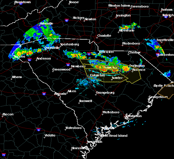 At 859 pm edt, a severe thunderstorm was located 11 miles southwest of chester, or 4 miles northeast of carlisle, moving southeast at 55 mph (radar indicated). Hazards include 60 mph wind gusts and penny size hail. Expect damage to roofs. Siding and trees. At 859 pm edt, a severe thunderstorm was located 11 miles southwest of chester, or 4 miles northeast of carlisle, moving southeast at 55 mph (radar indicated). Hazards include 60 mph wind gusts and penny size hail. Expect damage to roofs. Siding and trees.
|
| 7/7/2016 6:43 PM EDT |
 At 640 pm edt, a severe thunderstorm was located 10 miles north of union, or 4 miles northeast of jonesville, moving southeast at 15 mph (radar indicated). Hazards include tennis ball size hail and 60 mph wind gusts. People and animals outdoors will be injured. expect hail damage to roofs, siding, windows and vehicles. Expect wind damage to roofs, siding and trees. At 640 pm edt, a severe thunderstorm was located 10 miles north of union, or 4 miles northeast of jonesville, moving southeast at 15 mph (radar indicated). Hazards include tennis ball size hail and 60 mph wind gusts. People and animals outdoors will be injured. expect hail damage to roofs, siding, windows and vehicles. Expect wind damage to roofs, siding and trees.
|
| 6/17/2016 1:30 PM EDT | Trees down on lee brice roa in fairfield county SC, 9.7 miles NW of Carlisle, SC |
| 6/17/2016 1:08 PM EDT |
 The severe thunderstorm warning for southeastern union and southwestern chester counties will expire at 115 pm edt, the storm which prompted the warning has moved out of the area. therefore the warning will be allowed to expire. if you observed large hail or wind damage, please report it to the national weather service greenville-spartanburg by calling toll free, 1, 800, 2 6 7, 8 1 0 1, or by posting on our facebook page, or tweet it using hashtag nwsgsp. your message should describe the event and the specific location where it occurred. The severe thunderstorm warning for southeastern union and southwestern chester counties will expire at 115 pm edt, the storm which prompted the warning has moved out of the area. therefore the warning will be allowed to expire. if you observed large hail or wind damage, please report it to the national weather service greenville-spartanburg by calling toll free, 1, 800, 2 6 7, 8 1 0 1, or by posting on our facebook page, or tweet it using hashtag nwsgsp. your message should describe the event and the specific location where it occurred.
|
| 6/17/2016 12:53 PM EDT | Quarter sized hail reported 0.3 miles W of Carlisle, SC |
| 6/17/2016 12:44 PM EDT |
 At 1244 pm edt, a severe thunderstorm was located 8 miles southeast of union, or near carlisle, moving southeast at 20 mph (radar indicated). Hazards include 60 mph wind gusts and quarter size hail. Hail damage to vehicles is expected. Expect wind damage to roofs, siding and trees. At 1244 pm edt, a severe thunderstorm was located 8 miles southeast of union, or near carlisle, moving southeast at 20 mph (radar indicated). Hazards include 60 mph wind gusts and quarter size hail. Hail damage to vehicles is expected. Expect wind damage to roofs, siding and trees.
|
| 6/14/2016 6:16 PM EDT |
 At 616 pm edt, severe thunderstorms were located along a line extending from 7 miles east of union to near chester to 9 miles southwest of lancaster, moving northeast at 15 mph (radar indicated). Hazards include 60 mph wind gusts and quarter size hail. Hail damage to vehicles is expected. Expect wind damage to roofs, siding and trees. At 616 pm edt, severe thunderstorms were located along a line extending from 7 miles east of union to near chester to 9 miles southwest of lancaster, moving northeast at 15 mph (radar indicated). Hazards include 60 mph wind gusts and quarter size hail. Hail damage to vehicles is expected. Expect wind damage to roofs, siding and trees.
|
| 3/14/2016 9:41 PM EDT |
 The severe thunderstorm warning for southern union, southeastern york and chester counties will expire at 945 pm edt, the line of storms which prompted the warning have moved out of the area. therefore the warning will be allowed to expire. however gusty winds are still possible with these thunderstorms. The severe thunderstorm warning for southern union, southeastern york and chester counties will expire at 945 pm edt, the line of storms which prompted the warning have moved out of the area. therefore the warning will be allowed to expire. however gusty winds are still possible with these thunderstorms.
|
| 3/14/2016 9:11 PM EDT |
 At 911 pm edt, doppler radar indicated a line of severe thunderstorms capable of producing quarter size hail and damaging winds in excess of 60 mph. these storms were located along a line extending from 8 miles east of rock hill to 13 miles southwest of union, moving east at 25 mph. locations impacted include, chester, lesslie, great falls, monarch mill, fort lawn, lockhart, carlisle, richburg, lowrys and chester state park. At 911 pm edt, doppler radar indicated a line of severe thunderstorms capable of producing quarter size hail and damaging winds in excess of 60 mph. these storms were located along a line extending from 8 miles east of rock hill to 13 miles southwest of union, moving east at 25 mph. locations impacted include, chester, lesslie, great falls, monarch mill, fort lawn, lockhart, carlisle, richburg, lowrys and chester state park.
|
| 3/14/2016 8:40 PM EDT |
 At 839 pm edt, doppler radar indicated a line of severe thunderstorms capable of producing quarter size hail and damaging winds in excess of 60 mph. these storms were located along a line extending from 9 miles south of york to 8 miles south of union, and moving east at 30 mph. * locations in the warning include, rock hill, chester, lesslie, great falls, monarch mill, fort lawn, lockhart, carlisle, mcconnells and richburg. At 839 pm edt, doppler radar indicated a line of severe thunderstorms capable of producing quarter size hail and damaging winds in excess of 60 mph. these storms were located along a line extending from 9 miles south of york to 8 miles south of union, and moving east at 30 mph. * locations in the warning include, rock hill, chester, lesslie, great falls, monarch mill, fort lawn, lockhart, carlisle, mcconnells and richburg.
|
| 9/4/2015 8:37 PM EDT |
 At 837 pm edt, doppler radar indicated a severe thunderstorm capable of producing quarter size hail and damaging winds in excess of 60 mph. this storm was located 7 miles southeast of union, or 5 miles southeast of monarch mill, moving south at 15 mph. locations impacted include, monarch mill, carlisle, santuc, adamsburg, union and leeds. At 837 pm edt, doppler radar indicated a severe thunderstorm capable of producing quarter size hail and damaging winds in excess of 60 mph. this storm was located 7 miles southeast of union, or 5 miles southeast of monarch mill, moving south at 15 mph. locations impacted include, monarch mill, carlisle, santuc, adamsburg, union and leeds.
|
| 9/4/2015 8:17 PM EDT |
 At 817 pm edt, doppler radar indicated a severe thunderstorm capable of producing quarter size hail and damaging winds in excess of 60 mph. this storm was located 6 miles east of union, or 4 miles east of monarch mill, and moving south at 15 mph. * locations in the warning include, monarch mill, carlisle, santuc, adamsburg, union and leeds. At 817 pm edt, doppler radar indicated a severe thunderstorm capable of producing quarter size hail and damaging winds in excess of 60 mph. this storm was located 6 miles east of union, or 4 miles east of monarch mill, and moving south at 15 mph. * locations in the warning include, monarch mill, carlisle, santuc, adamsburg, union and leeds.
|
| 8/6/2015 5:36 PM EDT |
 The severe thunderstorm warning for southeastern union and southern chester counties will expire at 545 pm edt, the storm which prompted the warning has moved out of the area. therefore the warning will be allowed to expire. The severe thunderstorm warning for southeastern union and southern chester counties will expire at 545 pm edt, the storm which prompted the warning has moved out of the area. therefore the warning will be allowed to expire.
|
| 8/6/2015 5:24 PM EDT |
 At 523 pm edt, doppler radar indicated a severe thunderstorm with a history of producing damaging winds in excess of 60 mph. this storm was located 14 miles southeast of union, or near carlisle, moving east at 35 mph. locations impacted include, chester, great falls, carlisle, chester state park, blackstock, blackstock, santuc, cornwell, leeds and fishing creek reservoir. At 523 pm edt, doppler radar indicated a severe thunderstorm with a history of producing damaging winds in excess of 60 mph. this storm was located 14 miles southeast of union, or near carlisle, moving east at 35 mph. locations impacted include, chester, great falls, carlisle, chester state park, blackstock, blackstock, santuc, cornwell, leeds and fishing creek reservoir.
|
| 8/6/2015 5:02 PM EDT |
 At 501 pm edt, doppler radar indicated a line of severe thunderstorms with a history of producing damaging winds in excess of 60 mph. these storms were located along a line extending from 8 miles northwest of york to 11 miles north of chester to 14 miles southeast of union, moving east at 35 mph. penny size hail may also accompany the damaging winds. locations impacted include, rock hill, york, chester, fort mill, tega cay, clover, newport, town of lake wylie, lesslie and great falls. At 501 pm edt, doppler radar indicated a line of severe thunderstorms with a history of producing damaging winds in excess of 60 mph. these storms were located along a line extending from 8 miles northwest of york to 11 miles north of chester to 14 miles southeast of union, moving east at 35 mph. penny size hail may also accompany the damaging winds. locations impacted include, rock hill, york, chester, fort mill, tega cay, clover, newport, town of lake wylie, lesslie and great falls.
|
| 8/6/2015 4:34 PM EDT |
 At 434 pm edt, doppler radar indicated a line of severe thunderstorms with a history of producing quarter size hail and damaging winds in excess of 60 mph. these storms were located along a line extending from 5 miles northeast of gaffney to 9 miles southwest of union, and moving east at 35 mph. * locations in the warning include, rock hill, york, chester, fort mill, tega cay, clover, newport, town of lake wylie, lesslie and great falls. At 434 pm edt, doppler radar indicated a line of severe thunderstorms with a history of producing quarter size hail and damaging winds in excess of 60 mph. these storms were located along a line extending from 5 miles northeast of gaffney to 9 miles southwest of union, and moving east at 35 mph. * locations in the warning include, rock hill, york, chester, fort mill, tega cay, clover, newport, town of lake wylie, lesslie and great falls.
|
| 8/5/2015 10:01 PM EDT |
 At 1001 pm edt, doppler radar indicated a line of severe thunderstorms capable of producing damaging winds in excess of 60 mph. these storms were located along a line extending from 16 miles south of gaffney to 9 miles south of union, moving east at 20 mph. locations impacted include, union, monarch mill, buffalo, jonesville, lockhart, carlisle, rose hill state park, santuc, adamsburg and cross keys. At 1001 pm edt, doppler radar indicated a line of severe thunderstorms capable of producing damaging winds in excess of 60 mph. these storms were located along a line extending from 16 miles south of gaffney to 9 miles south of union, moving east at 20 mph. locations impacted include, union, monarch mill, buffalo, jonesville, lockhart, carlisle, rose hill state park, santuc, adamsburg and cross keys.
|
| 8/5/2015 9:24 PM EDT |
 At 924 pm edt, doppler radar indicated a severe thunderstorm capable of producing damaging winds in excess of 60 mph. this storm was located 11 miles west of union, or 8 miles west of buffalo, and moving east at 25 mph. * locations in the warning include, union, monarch mill, buffalo, jonesville, lockhart, carlisle, rose hill state park, santuc, adamsburg and cross keys. At 924 pm edt, doppler radar indicated a severe thunderstorm capable of producing damaging winds in excess of 60 mph. this storm was located 11 miles west of union, or 8 miles west of buffalo, and moving east at 25 mph. * locations in the warning include, union, monarch mill, buffalo, jonesville, lockhart, carlisle, rose hill state park, santuc, adamsburg and cross keys.
|
| 7/13/2015 9:54 PM EDT |
 At 952 pm edt, doppler radar indicated a line of severe thunderstorms capable of producing damaging winds in excess of 60 mph. the leading edge of these storms were located along a line extending from 5 miles south of monroe to 8 miles west of lancaster to 13 miles southwest of union to 14 miles northeast of laurens, moving southeast at 40 mph. penny size hail may also accompany the damaging winds. locations impacted include, rock hill, union, weddington, waxhaw, mineral springs, lesslie, great falls, monarch mill, marvin and buffalo. At 952 pm edt, doppler radar indicated a line of severe thunderstorms capable of producing damaging winds in excess of 60 mph. the leading edge of these storms were located along a line extending from 5 miles south of monroe to 8 miles west of lancaster to 13 miles southwest of union to 14 miles northeast of laurens, moving southeast at 40 mph. penny size hail may also accompany the damaging winds. locations impacted include, rock hill, union, weddington, waxhaw, mineral springs, lesslie, great falls, monarch mill, marvin and buffalo.
|
| 7/13/2015 9:44 PM EDT |
 At 943 pm edt, doppler radar indicated a line of severe thunderstorms capable of producing damaging winds in excess of 60 mph. these storms were located along a line extending from 4 miles southwest of monroe to 7 miles northeast of chester to 13 miles southwest of union to 15 miles north of laurens, moving southeast at 20 mph. penny size hail may also accompany the damaging winds. locations impacted include, rock hill, union, chester, weddington, waxhaw, mineral springs, lesslie, great falls, monarch mill and marvin. At 943 pm edt, doppler radar indicated a line of severe thunderstorms capable of producing damaging winds in excess of 60 mph. these storms were located along a line extending from 4 miles southwest of monroe to 7 miles northeast of chester to 13 miles southwest of union to 15 miles north of laurens, moving southeast at 20 mph. penny size hail may also accompany the damaging winds. locations impacted include, rock hill, union, chester, weddington, waxhaw, mineral springs, lesslie, great falls, monarch mill and marvin.
|
| 7/13/2015 9:24 PM EDT |
 At 923 pm edt, doppler radar indicated a line of severe thunderstorms capable of producing quarter size hail and damaging winds in excess of 60 mph. these storms were located along a line extending from 13 miles west of monroe to 6 miles southwest of york to 4 miles southwest of union to 15 miles south of spartanburg, and moving southeast at 25 mph. At 923 pm edt, doppler radar indicated a line of severe thunderstorms capable of producing quarter size hail and damaging winds in excess of 60 mph. these storms were located along a line extending from 13 miles west of monroe to 6 miles southwest of york to 4 miles southwest of union to 15 miles south of spartanburg, and moving southeast at 25 mph.
|
| 7/2/2015 4:04 PM EDT | Trees down along highway 121/72 in chester county SC, 6.3 miles WSW of Carlisle, SC |
| 7/2/2015 3:59 PM EDT |
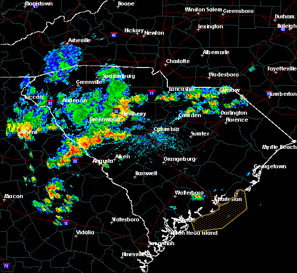 At 359 pm edt, doppler radar indicated a severe thunderstorm capable of producing damaging winds in excess of 60 mph. this storm was located 10 miles southwest of chester, or 7 miles east of carlisle, and moving east at 30 mph. At 359 pm edt, doppler radar indicated a severe thunderstorm capable of producing damaging winds in excess of 60 mph. this storm was located 10 miles southwest of chester, or 7 miles east of carlisle, and moving east at 30 mph.
|
| 7/2/2015 3:53 PM EDT |
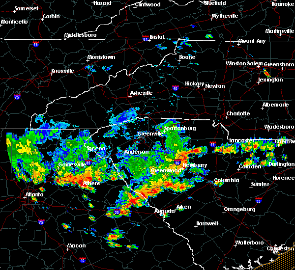 At 352 pm edt, doppler radar indicated a severe thunderstorm capable of producing damaging winds in excess of 60 mph. this storm was located 15 miles southeast of union, or 5 miles southwest of carlisle, moving east at 40 mph. the warning may have to be extended for the southeastern corner of union county. locations impacted include, carlisle and santuc. At 352 pm edt, doppler radar indicated a severe thunderstorm capable of producing damaging winds in excess of 60 mph. this storm was located 15 miles southeast of union, or 5 miles southwest of carlisle, moving east at 40 mph. the warning may have to be extended for the southeastern corner of union county. locations impacted include, carlisle and santuc.
|
| 7/2/2015 3:36 PM EDT |
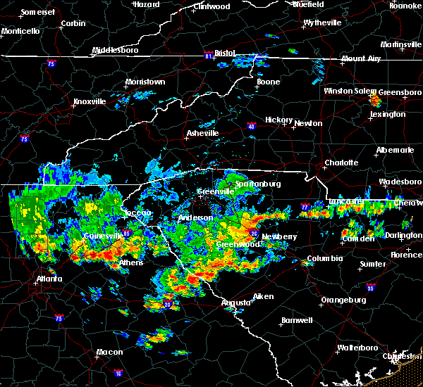 At 336 pm edt, doppler radar indicated a severe thunderstorm capable of producing damaging winds in excess of 60 mph. this storm was located 11 miles south of union, or near rose hill state park, and moving east at 40 mph. At 336 pm edt, doppler radar indicated a severe thunderstorm capable of producing damaging winds in excess of 60 mph. this storm was located 11 miles south of union, or near rose hill state park, and moving east at 40 mph.
|
| 4/20/2015 5:01 PM EDT | At 500 pm edt, national weather service doppler radar indicated a severe thunderstorm capable of producing golf ball size hail, and destructive winds in excess of 70 mph. this storm was located 8 miles northwest of cross keys, or 15 miles northeast of laurens, and moving east at 55 mph. * the severe thunderstorm will be near, buffalo and 8 miles south of jonesville by 510 pm edt, union by 515 pm edt, lockhart by 525 pm edt, lowrys and chester by 540 pm edt,. |
| 4/7/2015 8:43 PM EDT | The severe thunderstorm warning for east central laurens and southern union counties will expire at 845 pm edt. at 841 pm edt. doppler radar indicated the line of severe thunderstorms gradually weakening as they moved east along the southern borders of union and laurens county. these thunderstorms will move southeast out of the warned area around 845 pm edt. And. |
| 4/7/2015 8:20 PM EDT | A severe thunderstorm warning remains in effect until 845 pm edt for east central laurens and southern union counties. at 820 pm edt. doppler radar indicated a line of severe thunderstorms capable of producing quarter size hail and damaging winds in excess of 60 mph. These storms were located along a line extending from 14 miles southwest of chester to 4 miles east of. |
| 4/7/2015 8:04 PM EDT | The national weather service in greenville-spartanburg has issued a * severe thunderstorm warning for. east central laurens county in upstate south carolina. southern union county in upstate south carolina. until 845 pm edt * at 803 pm edt. Doppler radar indicated a severe thunderstorm. |
| 5/23/2014 4:54 PM EDT | Golf Ball sized hail reported 8.6 miles SW of Carlisle, SC, up to golf ball sized hail reported north of leeds...sc via social media. |
| 4/11/2013 8:25 PM EDT | Quarter sized hail reported 5.3 miles WNW of Carlisle, SC, public reported quarter size hail along stevenson road. also power out in the area. |
| 1/30/2013 7:48 PM EST | 2 trees down around carlisle. other trees and limbs fell in union county during the day due to gradient win in union county SC, 0.3 miles W of Carlisle, SC |
| 8/8/2012 6:14 PM EDT | One tree down on river road. time based on when the outflow came across the are in union county SC, 1.1 miles SW of Carlisle, SC |
| 7/18/2012 5:35 PM EDT | Trees and large branches down along beattys bridge r in union county SC, 5.5 miles E of Carlisle, SC |
| 1/1/0001 12:00 AM | Many trees reported down in the w/sw part of the count in chester county SC, 4.6 miles SW of Carlisle, SC |
| 1/1/0001 12:00 AM | Local grocery store employee saw many large tree limbs down across the area from the stor in chester county SC, 4.6 miles SW of Carlisle, SC |
| 1/1/0001 12:00 AM | Trees and limbs down in santuc in union county SC, 4.2 miles SE of Carlisle, SC |
Hail Maps for Carlisle, SC


Connect with Interactive Hail Maps