

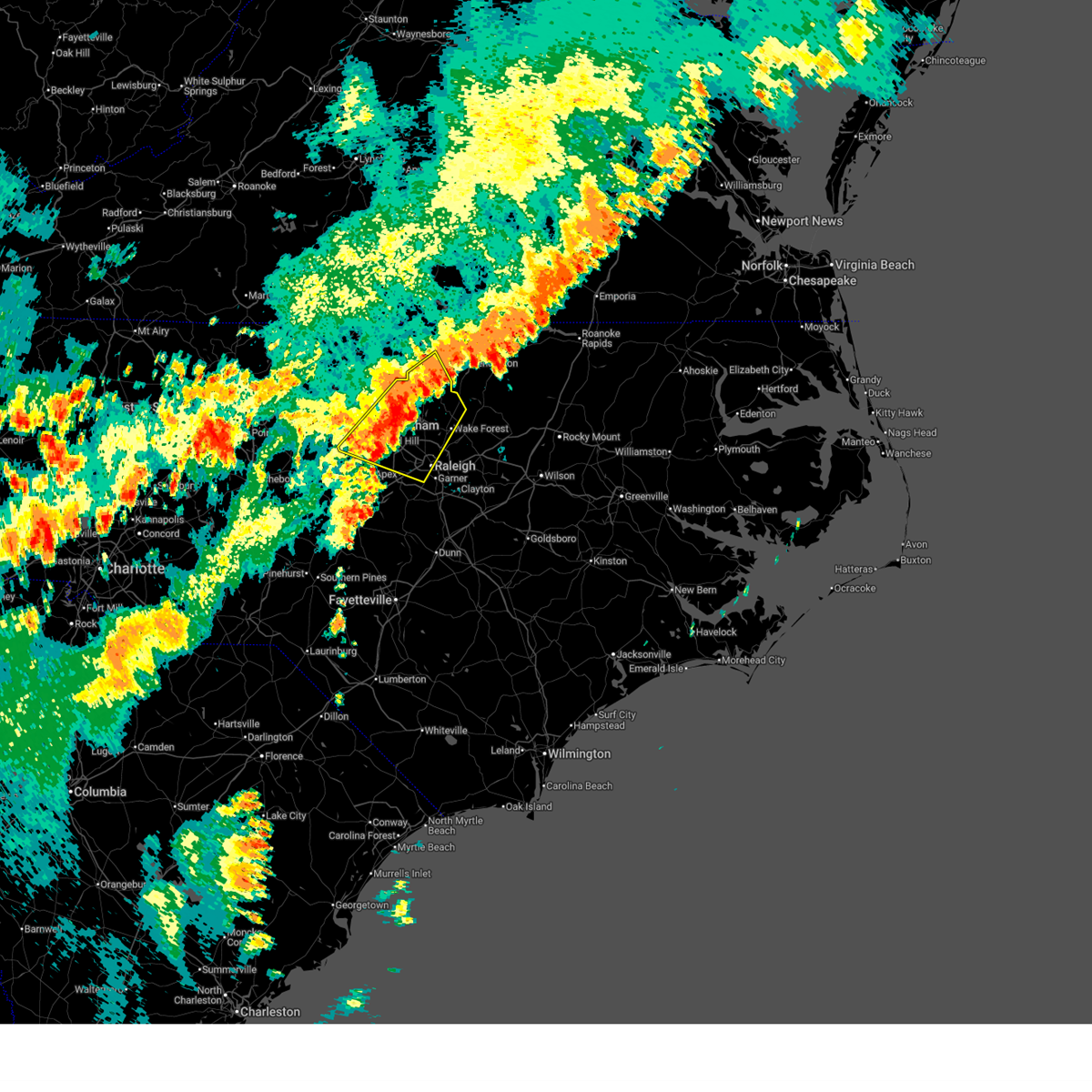
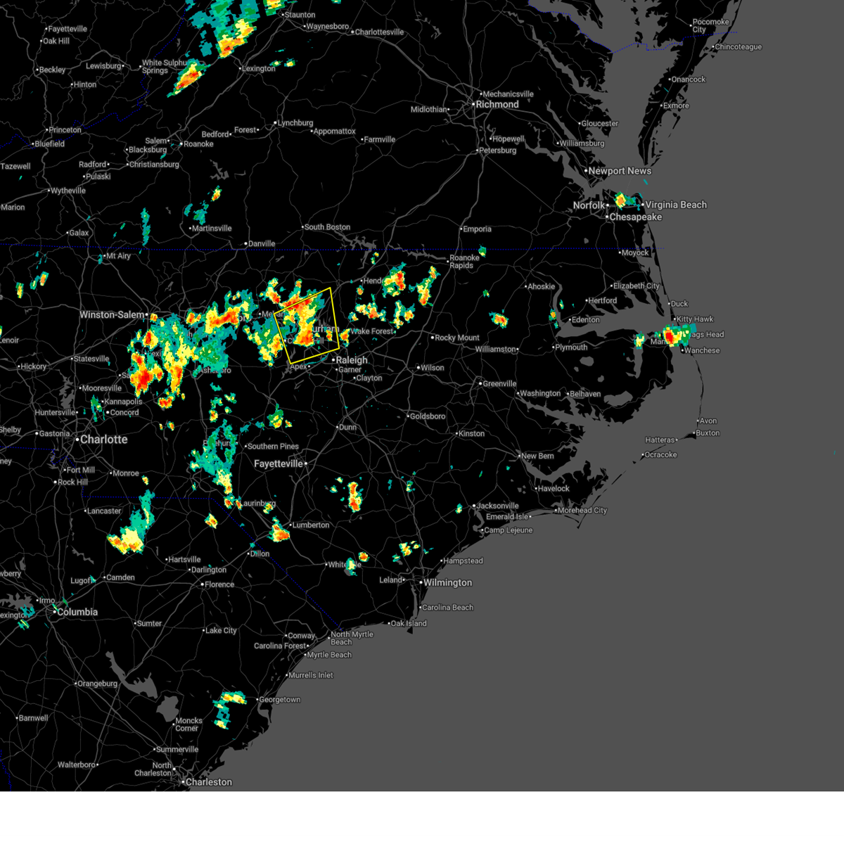
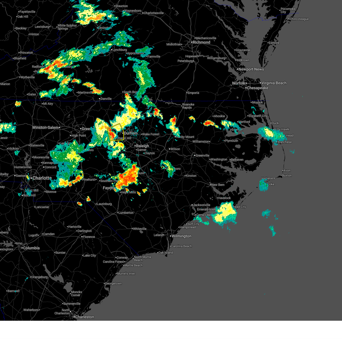
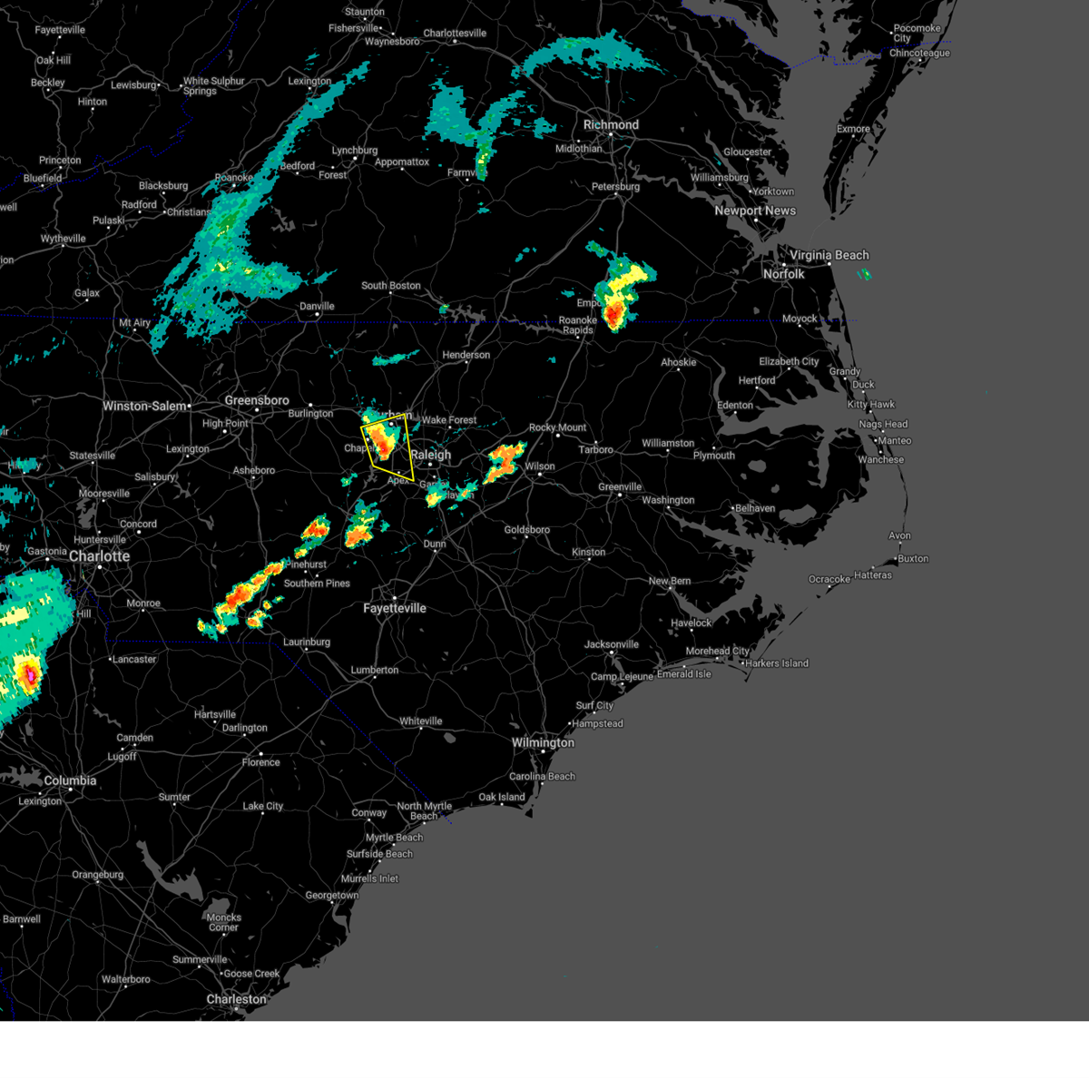
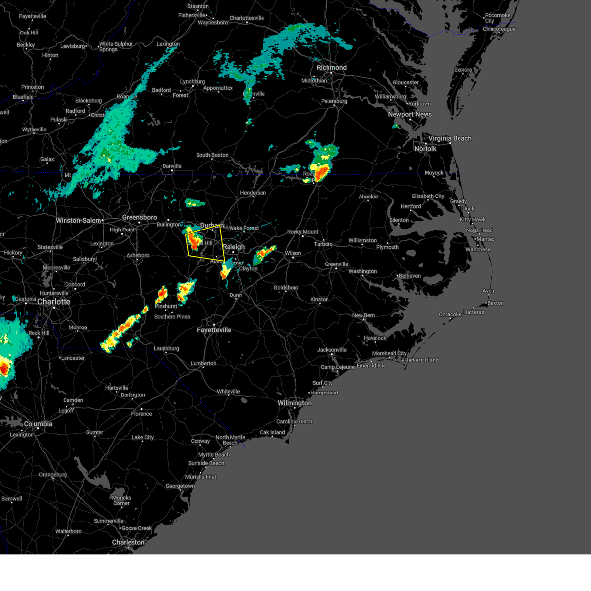
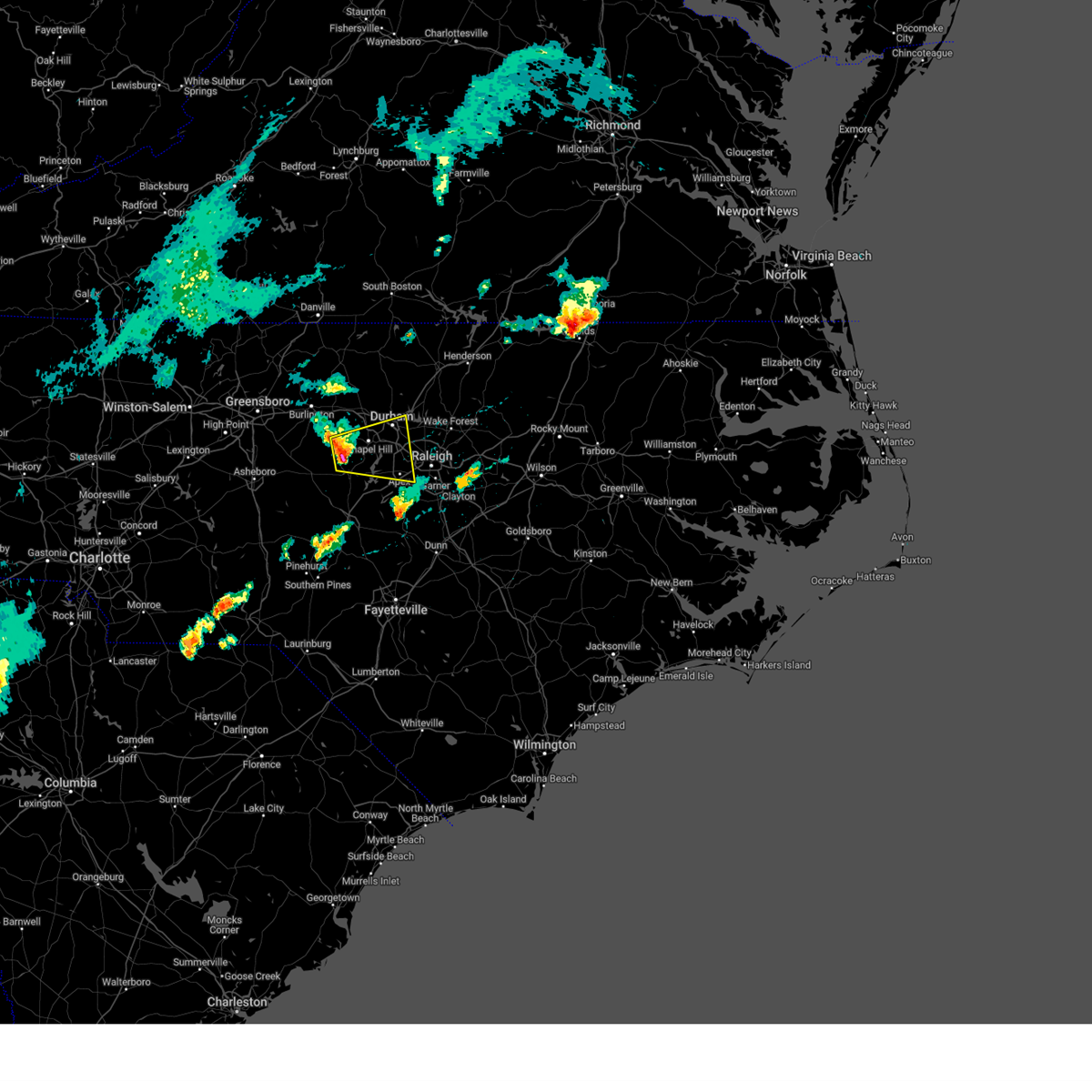
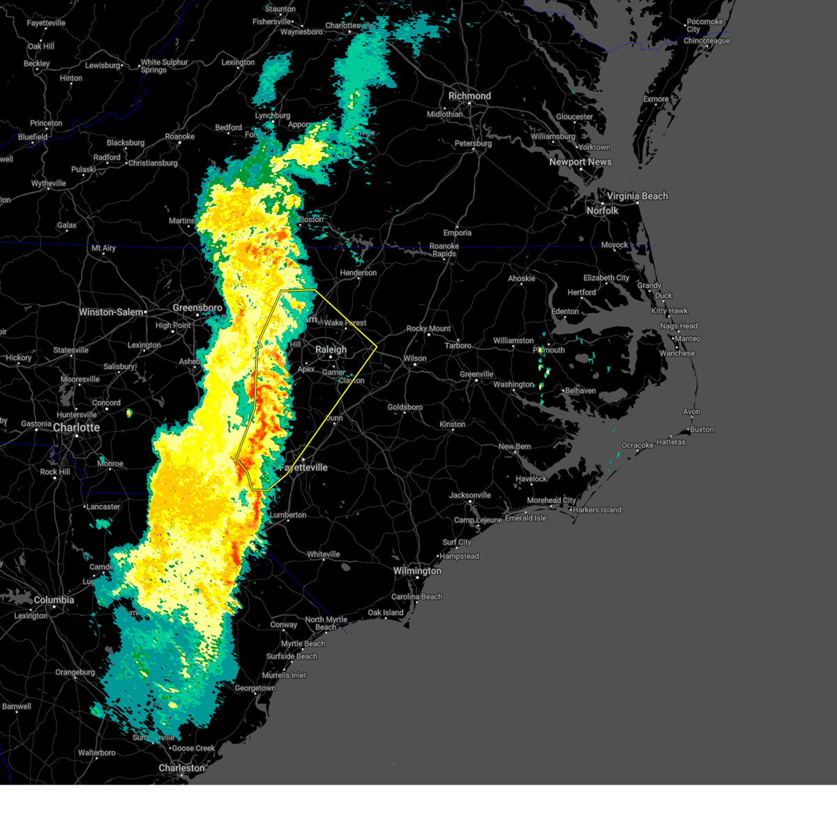
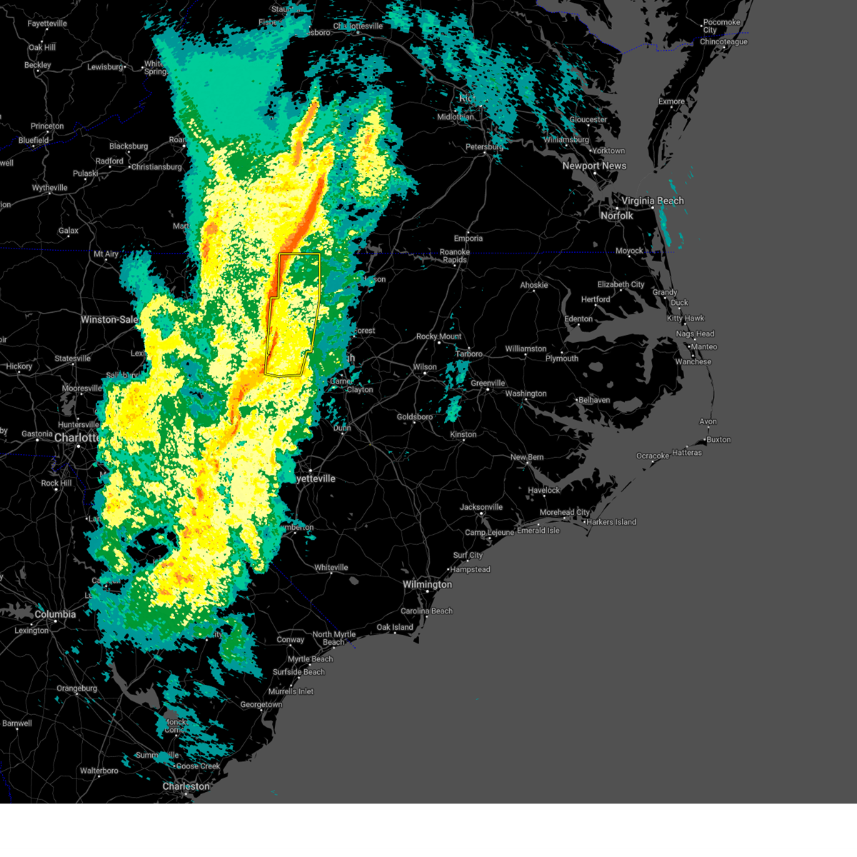
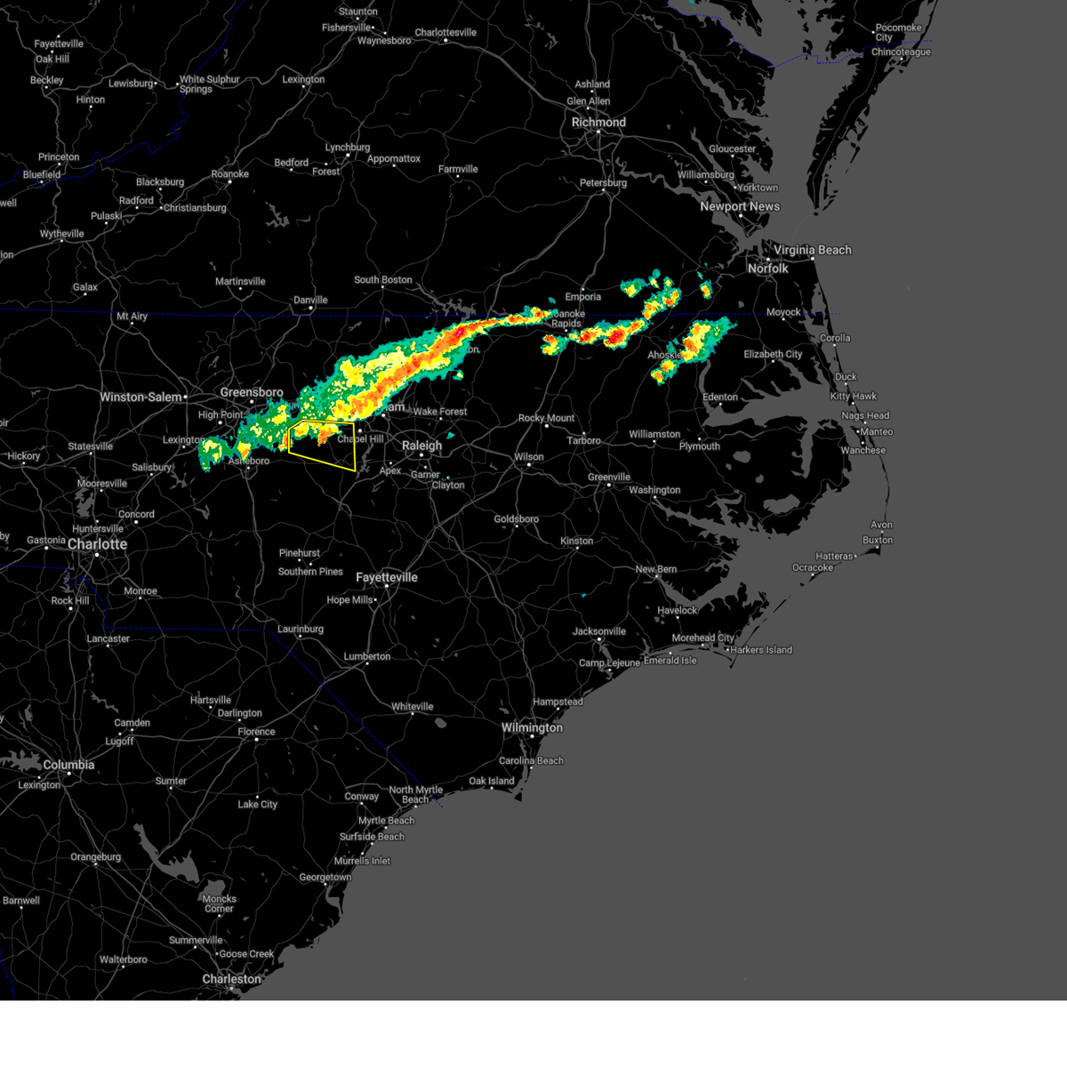
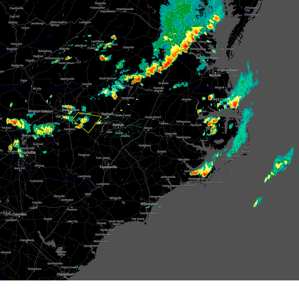
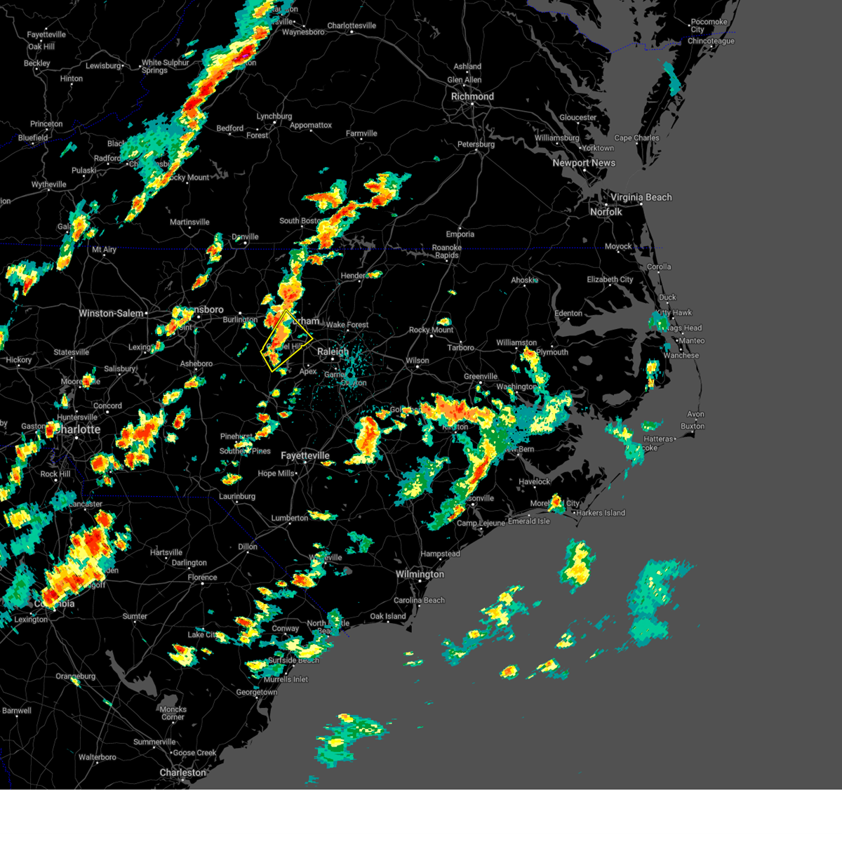
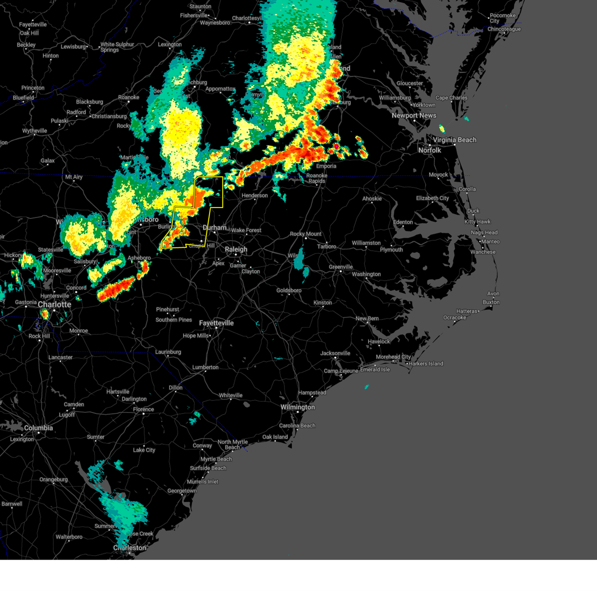
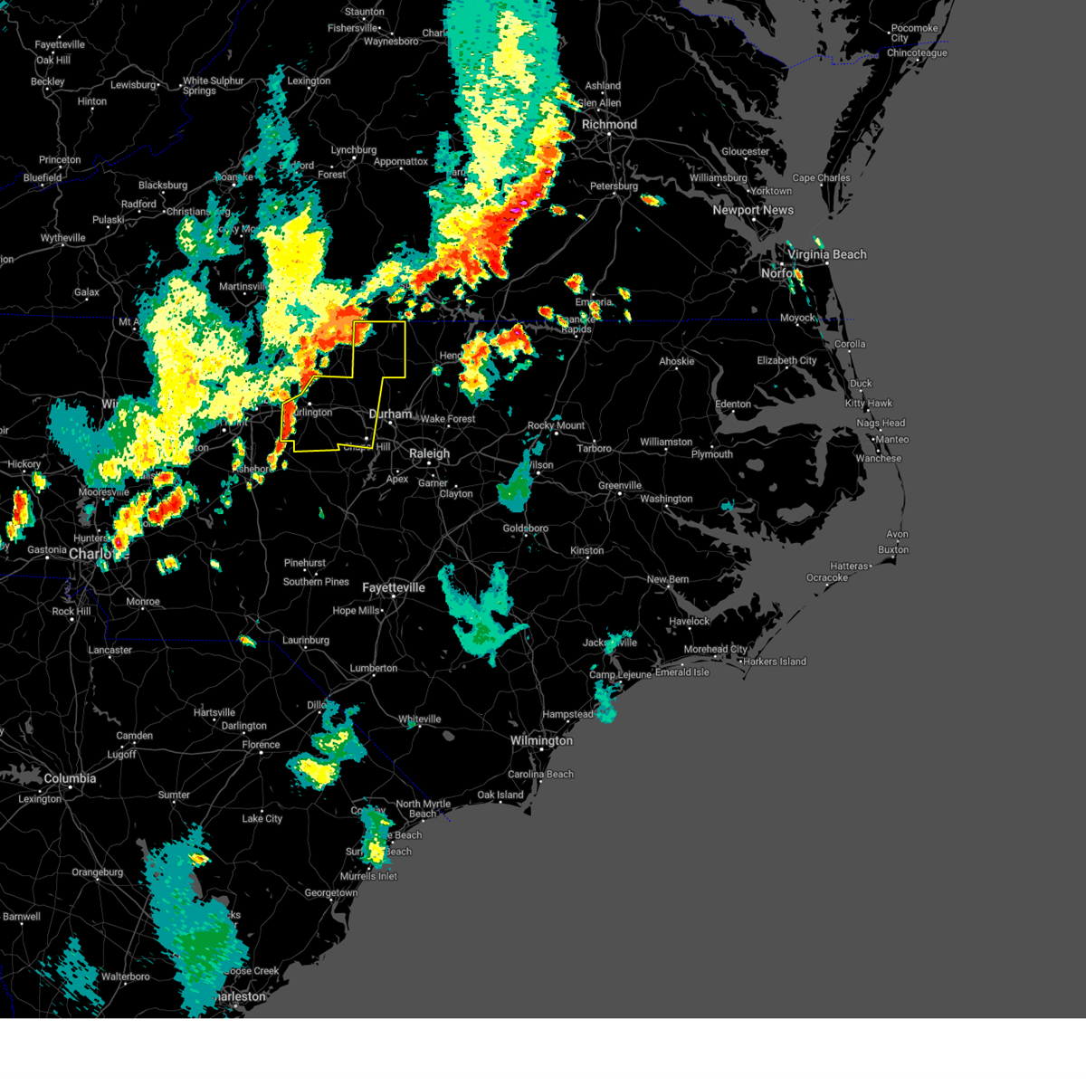
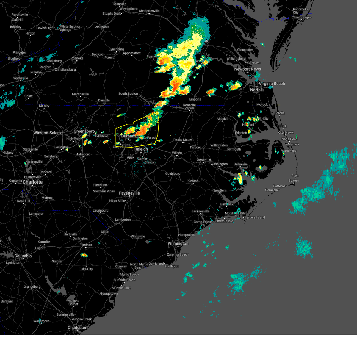
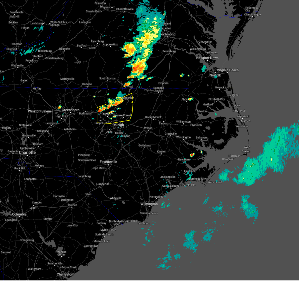
Hail Map for Carrboro, NC
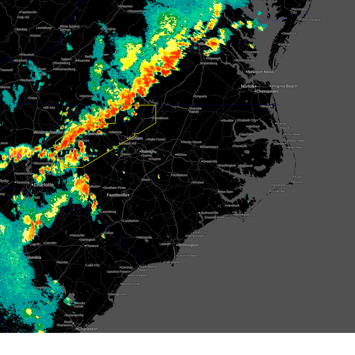
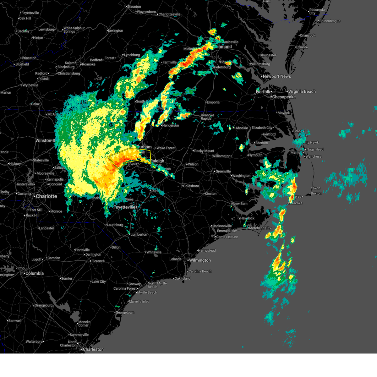
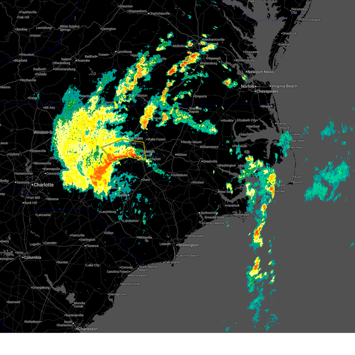
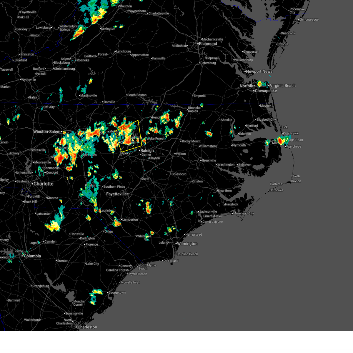
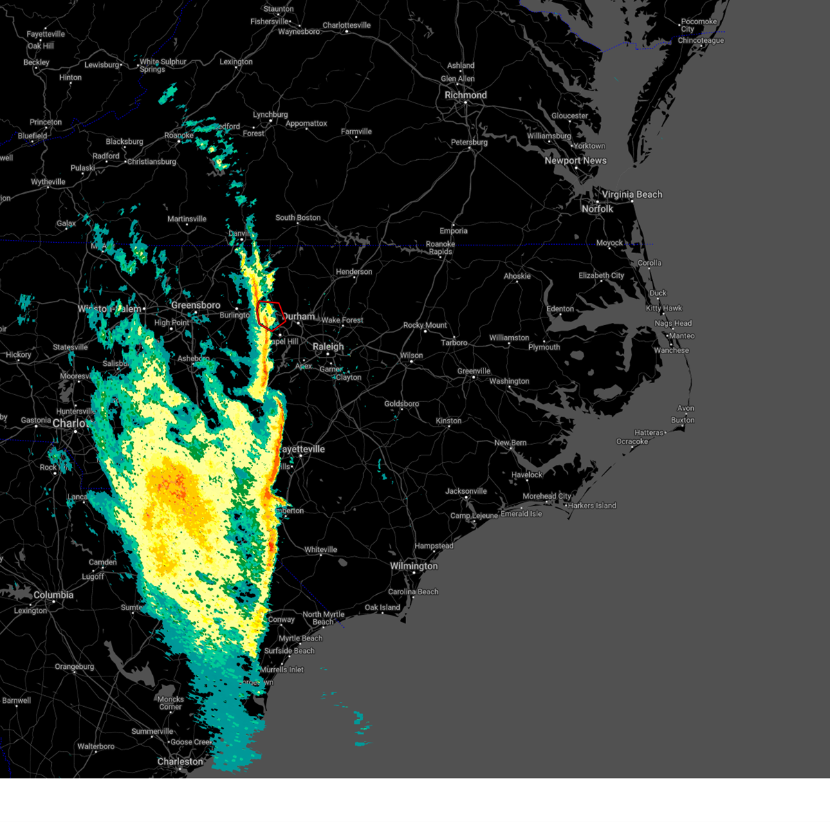
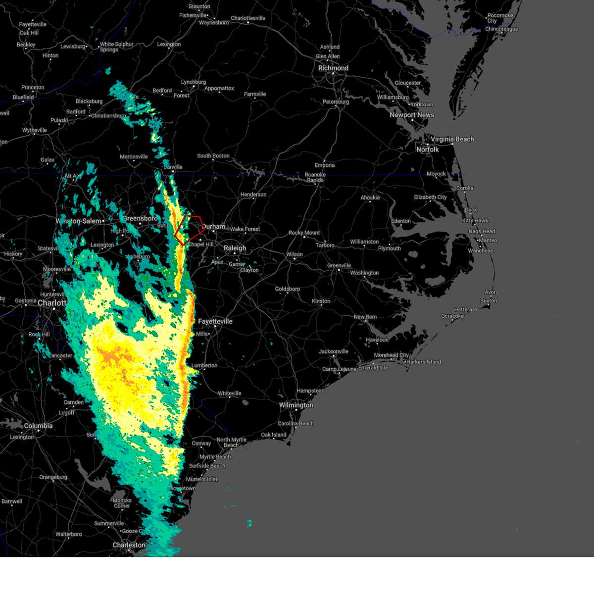
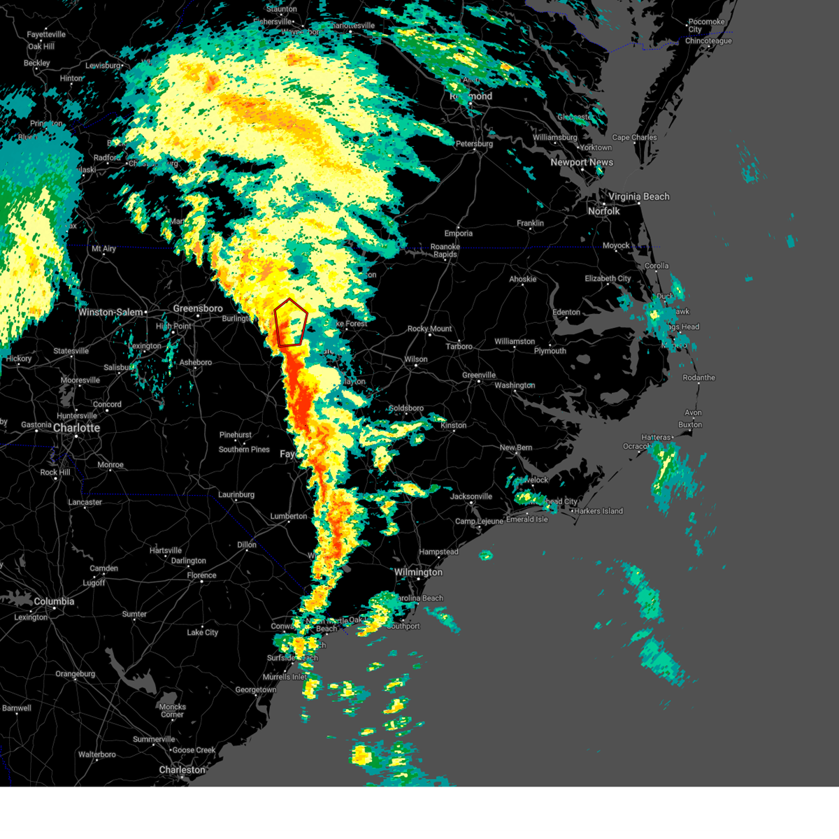
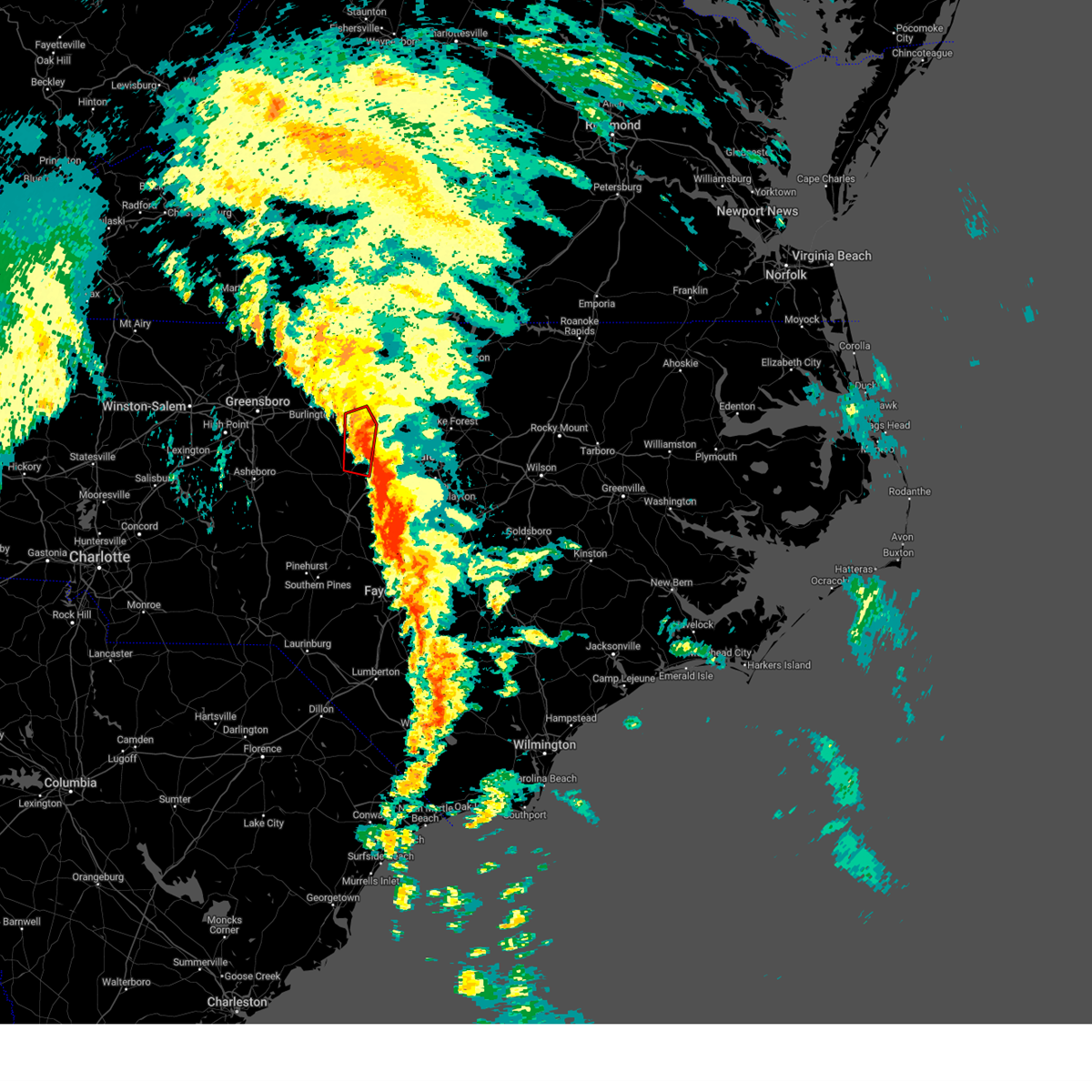
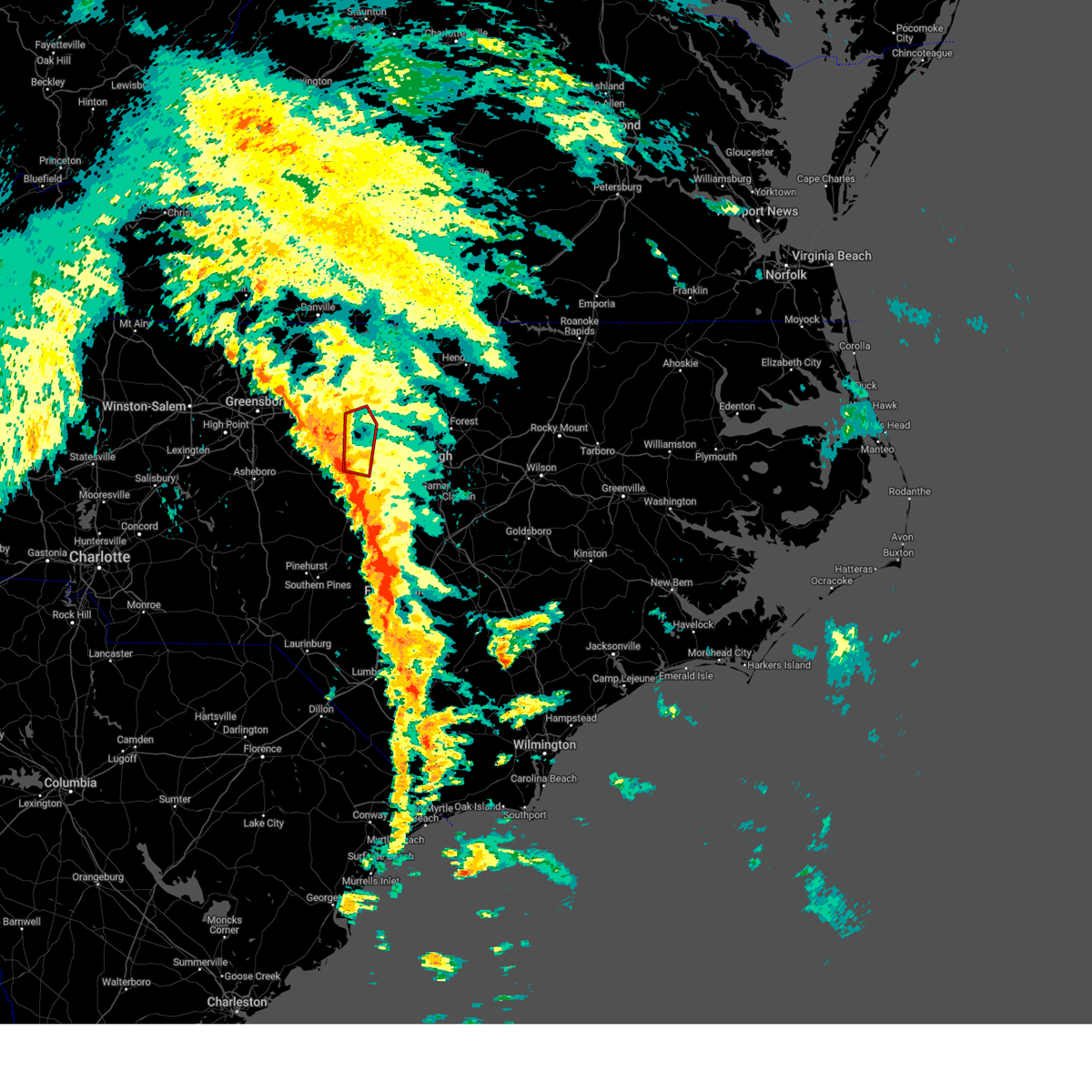
The Carrboro, NC area has had 0 reports of on-the-ground hail by trained spotters, and has been under severe weather warnings 67 times during the past 12 months. Doppler radar has detected hail at or near Carrboro, NC on 63 occasions, including 5 occasions during the past year.
| Name: | Carrboro, NC |
| Where Located: | 26.9 miles WNW of Raleigh, NC |
| Map: | Google Map for Carrboro, NC |
| Population: | 19582 |
| Housing Units: | 9258 |
| More Info: | Search Google for Carrboro, NC |
1
The Top Recent Hail Date for Carrboro, NC is Thursday, June 19, 2025 (23rd out of 63)

Hail and Wind Damage Spotted near Carrboro, NC
| Date / Time | Report Details |
|---|---|
| 7/9/2025 8:34 PM EDT |
 the severe thunderstorm warning has been cancelled and is no longer in effect the severe thunderstorm warning has been cancelled and is no longer in effect
|
| 7/9/2025 8:34 PM EDT |
 At 833 pm edt, a severe thunderstorm was located over rdu international, or 7 miles north of cary, moving east at 35 mph (radar indicated). Hazards include 60 mph wind gusts. Expect damage to roofs, siding, and trees. Locations impacted include, raleigh, durham, cary, chapel hill, oxford, creedmoor, wake forest, carrboro, butner, and franklinton. At 833 pm edt, a severe thunderstorm was located over rdu international, or 7 miles north of cary, moving east at 35 mph (radar indicated). Hazards include 60 mph wind gusts. Expect damage to roofs, siding, and trees. Locations impacted include, raleigh, durham, cary, chapel hill, oxford, creedmoor, wake forest, carrboro, butner, and franklinton.
|
| 7/9/2025 8:12 PM EDT |
 Svrrah the national weather service in raleigh has issued a * severe thunderstorm warning for, southeastern alamance county in central north carolina, southern orange county in central north carolina, southern granville county in central north carolina, central wake county in central north carolina, durham county in central north carolina, northeastern chatham county in central north carolina, west central franklin county in central north carolina, * until 845 pm edt. * at 812 pm edt, a severe thunderstorm was located over chapel hill, moving east at 35 mph (radar indicated). Hazards include 60 mph wind gusts. expect damage to roofs, siding, and trees Svrrah the national weather service in raleigh has issued a * severe thunderstorm warning for, southeastern alamance county in central north carolina, southern orange county in central north carolina, southern granville county in central north carolina, central wake county in central north carolina, durham county in central north carolina, northeastern chatham county in central north carolina, west central franklin county in central north carolina, * until 845 pm edt. * at 812 pm edt, a severe thunderstorm was located over chapel hill, moving east at 35 mph (radar indicated). Hazards include 60 mph wind gusts. expect damage to roofs, siding, and trees
|
| 7/9/2025 7:58 PM EDT |
 The storms which prompted the warning have weakened below severe limits, and no longer pose an immediate threat to life or property. therefore, the warning will be allowed to expire. however, strong gusty winds are still possible with these thunderstorms, and they will continue to be monitored for restrengthening. The storms which prompted the warning have weakened below severe limits, and no longer pose an immediate threat to life or property. therefore, the warning will be allowed to expire. however, strong gusty winds are still possible with these thunderstorms, and they will continue to be monitored for restrengthening.
|
| 7/9/2025 7:39 PM EDT |
 the severe thunderstorm warning has been cancelled and is no longer in effect the severe thunderstorm warning has been cancelled and is no longer in effect
|
| 7/9/2025 7:39 PM EDT |
 At 739 pm edt, severe thunderstorms were located along a line extending from 11 miles north of henderson to 9 miles northeast of randleman, moving east at 55 mph (radar indicated). Hazards include 60 mph wind gusts and penny size hail. Expect damage to roofs, siding, and trees. Locations impacted include, durham, chapel hill, burlington, henderson, graham, oxford, roxboro, hillsborough, creedmoor, and siler city. At 739 pm edt, severe thunderstorms were located along a line extending from 11 miles north of henderson to 9 miles northeast of randleman, moving east at 55 mph (radar indicated). Hazards include 60 mph wind gusts and penny size hail. Expect damage to roofs, siding, and trees. Locations impacted include, durham, chapel hill, burlington, henderson, graham, oxford, roxboro, hillsborough, creedmoor, and siler city.
|
| 7/9/2025 6:58 PM EDT |
 Svrrah the national weather service in raleigh has issued a * severe thunderstorm warning for, alamance county in central north carolina, southeastern forsyth county in central north carolina, person county in central north carolina, vance county in central north carolina, orange county in central north carolina, davidson county in central north carolina, granville county in central north carolina, randolph county in central north carolina, guilford county in central north carolina, durham county in central north carolina, northwestern chatham county in central north carolina, * until 800 pm edt. * at 658 pm edt, severe thunderstorms were located along a line extending from near virgilina to near linwood, moving southeast at 15 mph (radar indicated). Hazards include 60 mph wind gusts and penny size hail. expect damage to roofs, siding, and trees Svrrah the national weather service in raleigh has issued a * severe thunderstorm warning for, alamance county in central north carolina, southeastern forsyth county in central north carolina, person county in central north carolina, vance county in central north carolina, orange county in central north carolina, davidson county in central north carolina, granville county in central north carolina, randolph county in central north carolina, guilford county in central north carolina, durham county in central north carolina, northwestern chatham county in central north carolina, * until 800 pm edt. * at 658 pm edt, severe thunderstorms were located along a line extending from near virgilina to near linwood, moving southeast at 15 mph (radar indicated). Hazards include 60 mph wind gusts and penny size hail. expect damage to roofs, siding, and trees
|
| 7/6/2025 3:58 PM EDT |
 At 357 pm edt, severe thunderstorms were located along a line extending from near garner to 7 miles northwest of cary to 9 miles south of carrboro to near pittsboro, moving northwest at 15 mph. embedded tornadoes are still possible with one tornado warning currently in effect (radar indicated). Hazards include 60 mph wind gusts. Expect damage to roofs, siding, and trees. Locations impacted include, raleigh, durham, cary, chapel hill, pittsboro, carrboro, rdu international, morrisville, william b umstead state park, and parkwood. At 357 pm edt, severe thunderstorms were located along a line extending from near garner to 7 miles northwest of cary to 9 miles south of carrboro to near pittsboro, moving northwest at 15 mph. embedded tornadoes are still possible with one tornado warning currently in effect (radar indicated). Hazards include 60 mph wind gusts. Expect damage to roofs, siding, and trees. Locations impacted include, raleigh, durham, cary, chapel hill, pittsboro, carrboro, rdu international, morrisville, william b umstead state park, and parkwood.
|
| 7/6/2025 3:28 PM EDT |
 Svrrah the national weather service in raleigh has issued a * severe thunderstorm warning for, southeastern alamance county in central north carolina, southern orange county in central north carolina, southwestern wake county in central north carolina, southern durham county in central north carolina, northeastern chatham county in central north carolina, * until 415 pm edt. * at 328 pm edt, severe thunderstorms were located along a line extending from garner to near cary to near pittsboro, moving north at 20 mph. a quick tornado could spin up along this line of storms (radar indicated). Hazards include 60 mph wind gusts. expect damage to roofs, siding, and trees Svrrah the national weather service in raleigh has issued a * severe thunderstorm warning for, southeastern alamance county in central north carolina, southern orange county in central north carolina, southwestern wake county in central north carolina, southern durham county in central north carolina, northeastern chatham county in central north carolina, * until 415 pm edt. * at 328 pm edt, severe thunderstorms were located along a line extending from garner to near cary to near pittsboro, moving north at 20 mph. a quick tornado could spin up along this line of storms (radar indicated). Hazards include 60 mph wind gusts. expect damage to roofs, siding, and trees
|
| 6/28/2025 3:20 PM EDT |
 At 320 pm edt, severe thunderstorms were located along a line extending from near rougemont to near durham, moving north at 10 mph (radar indicated). Hazards include 60 mph wind gusts. Expect damage to roofs, siding, and trees. Locations impacted include, raleigh, durham, cary, chapel hill, hillsborough, creedmoor, carrboro, butner, rdu international, and morrisville. At 320 pm edt, severe thunderstorms were located along a line extending from near rougemont to near durham, moving north at 10 mph (radar indicated). Hazards include 60 mph wind gusts. Expect damage to roofs, siding, and trees. Locations impacted include, raleigh, durham, cary, chapel hill, hillsborough, creedmoor, carrboro, butner, rdu international, and morrisville.
|
| 6/28/2025 3:20 PM EDT |
 the severe thunderstorm warning has been cancelled and is no longer in effect the severe thunderstorm warning has been cancelled and is no longer in effect
|
| 6/28/2025 2:43 PM EDT |
 Svrrah the national weather service in raleigh has issued a * severe thunderstorm warning for, southeastern alamance county in central north carolina, orange county in central north carolina, southwestern granville county in central north carolina, northwestern wake county in central north carolina, durham county in central north carolina, northern chatham county in central north carolina, * until 330 pm edt. * at 243 pm edt, severe thunderstorms were located along a line extending from 7 miles south of butner to 6 miles northeast of siler city, moving northeast at 10 mph (radar indicated). Hazards include 60 mph wind gusts. expect damage to roofs, siding, and trees Svrrah the national weather service in raleigh has issued a * severe thunderstorm warning for, southeastern alamance county in central north carolina, orange county in central north carolina, southwestern granville county in central north carolina, northwestern wake county in central north carolina, durham county in central north carolina, northern chatham county in central north carolina, * until 330 pm edt. * at 243 pm edt, severe thunderstorms were located along a line extending from 7 miles south of butner to 6 miles northeast of siler city, moving northeast at 10 mph (radar indicated). Hazards include 60 mph wind gusts. expect damage to roofs, siding, and trees
|
| 6/19/2025 8:11 PM EDT | the severe thunderstorm warning has been cancelled and is no longer in effect |
| 6/19/2025 8:11 PM EDT | At 810 pm edt, a severe thunderstorm was located near cary, moving east at 55 mph. another severe thunderstorms was lcoated near pittsboro, moving east at 50 mph (radar indicated). Hazards include 60 mph wind gusts. Expect damage to roofs, siding, and trees. Locations impacted include, raleigh, durham, cary, chapel hill, pittsboro, wake forest, garner, carrboro, zebulon, and bunn. |
| 6/19/2025 7:51 PM EDT | Svrrah the national weather service in raleigh has issued a * severe thunderstorm warning for, southeastern alamance county in central north carolina, southern orange county in central north carolina, wake county in central north carolina, durham county in central north carolina, chatham county in central north carolina, central franklin county in central north carolina, * until 845 pm edt. * at 750 pm edt, a severe thunderstorm was located from near pittsboro to near durham, moving east at 45 mph (radar indicated). Hazards include 60 mph wind gusts. expect damage to roofs, siding, and trees |
| 6/19/2025 6:52 PM EDT | The storm which prompted the warning has weakened below severe limits, and no longer poses an immediate threat to life or property. therefore, the warning will be allowed to expire. however, gusty winds are still possible with this thunderstorm. |
| 6/19/2025 6:41 PM EDT |
 the severe thunderstorm warning has been cancelled and is no longer in effect the severe thunderstorm warning has been cancelled and is no longer in effect
|
| 6/19/2025 6:41 PM EDT |
 At 641 pm edt, a severe thunderstorm was located near mebane, or 8 miles southeast of graham, moving east at 40 mph (radar indicated). Hazards include 60 mph wind gusts. Expect damage to roofs, siding, and trees. Locations impacted include, chapel hill, carrboro, swepsonville, snow camp, sutphin, cane creek reservoir and saxapahaw. At 641 pm edt, a severe thunderstorm was located near mebane, or 8 miles southeast of graham, moving east at 40 mph (radar indicated). Hazards include 60 mph wind gusts. Expect damage to roofs, siding, and trees. Locations impacted include, chapel hill, carrboro, swepsonville, snow camp, sutphin, cane creek reservoir and saxapahaw.
|
| 6/19/2025 6:13 PM EDT |
 Svrrah the national weather service in raleigh has issued a * severe thunderstorm warning for, southern alamance county in central north carolina, southern orange county in central north carolina, northeastern randolph county in central north carolina, southeastern guilford county in central north carolina, * until 700 pm edt. * at 613 pm edt, a severe thunderstorm was located 8 miles south of mcleansville, or 11 miles southwest of burlington, moving east at 40 mph (radar indicated). Hazards include 60 mph wind gusts. expect damage to roofs, siding, and trees Svrrah the national weather service in raleigh has issued a * severe thunderstorm warning for, southern alamance county in central north carolina, southern orange county in central north carolina, northeastern randolph county in central north carolina, southeastern guilford county in central north carolina, * until 700 pm edt. * at 613 pm edt, a severe thunderstorm was located 8 miles south of mcleansville, or 11 miles southwest of burlington, moving east at 40 mph (radar indicated). Hazards include 60 mph wind gusts. expect damage to roofs, siding, and trees
|
| 6/16/2025 8:32 PM EDT | At 832 pm edt, a severe thunderstorm was located near chapel hill, moving east at 20 mph (radar indicated). Hazards include 60 mph wind gusts. Expect damage to roofs, siding, and trees. Locations impacted include, durham, chapel hill, hillsborough, carrboro, eno river state park, parkwood, and jordan lake. |
| 6/16/2025 8:22 PM EDT |
 Svrrah the national weather service in raleigh has issued a * severe thunderstorm warning for, southern orange county in central north carolina, southwestern durham county in central north carolina, * until 900 pm edt. * at 821 pm edt, a severe thunderstorm was located near carrboro, or near chapel hill, moving east at 20 mph (radar indicated). Hazards include 60 mph wind gusts. expect damage to roofs, siding, and trees Svrrah the national weather service in raleigh has issued a * severe thunderstorm warning for, southern orange county in central north carolina, southwestern durham county in central north carolina, * until 900 pm edt. * at 821 pm edt, a severe thunderstorm was located near carrboro, or near chapel hill, moving east at 20 mph (radar indicated). Hazards include 60 mph wind gusts. expect damage to roofs, siding, and trees
|
| 4/22/2025 4:57 PM EDT |
 At 457 pm edt, a severe thunderstorm was located near chapel hill, moving east at 25 mph (radar indicated). Hazards include 60 mph wind gusts and quarter size hail. Hail damage to vehicles is expected. expect wind damage to roofs, siding, and trees. Locations impacted include, gorman, parkwood, chapel hill, research triangle, jordan lake, cary, morrisville, bethesda, durham, and rdu international. At 457 pm edt, a severe thunderstorm was located near chapel hill, moving east at 25 mph (radar indicated). Hazards include 60 mph wind gusts and quarter size hail. Hail damage to vehicles is expected. expect wind damage to roofs, siding, and trees. Locations impacted include, gorman, parkwood, chapel hill, research triangle, jordan lake, cary, morrisville, bethesda, durham, and rdu international.
|
| 4/22/2025 4:40 PM EDT |
 the severe thunderstorm warning has been cancelled and is no longer in effect the severe thunderstorm warning has been cancelled and is no longer in effect
|
| 4/22/2025 4:40 PM EDT |
 At 440 pm edt, a severe thunderstorm was located near carrboro, or 8 miles southwest of chapel hill, moving east at 25 mph (radar indicated). Hazards include 60 mph wind gusts and quarter size hail. Hail damage to vehicles is expected. expect wind damage to roofs, siding, and trees. Locations impacted include, carrboro, crosswinds boating center, crosswinds campground, gorman, parkwood, chapel hill, research triangle, jordan lake, jordan lake state rec area, and seaforth boat dock. At 440 pm edt, a severe thunderstorm was located near carrboro, or 8 miles southwest of chapel hill, moving east at 25 mph (radar indicated). Hazards include 60 mph wind gusts and quarter size hail. Hail damage to vehicles is expected. expect wind damage to roofs, siding, and trees. Locations impacted include, carrboro, crosswinds boating center, crosswinds campground, gorman, parkwood, chapel hill, research triangle, jordan lake, jordan lake state rec area, and seaforth boat dock.
|
| 4/22/2025 4:28 PM EDT |
 Svrrah the national weather service in raleigh has issued a * severe thunderstorm warning for, southeastern alamance county in central north carolina, southern orange county in central north carolina, west central wake county in central north carolina, northeastern chatham county in central north carolina, southwestern durham county in central north carolina, * until 515 pm edt. * at 428 pm edt, a severe thunderstorm was located 8 miles north of pittsboro, moving east at 25 mph (radar indicated). Hazards include 60 mph wind gusts and quarter size hail. Hail damage to vehicles is expected. Expect wind damage to roofs, siding, and trees. Svrrah the national weather service in raleigh has issued a * severe thunderstorm warning for, southeastern alamance county in central north carolina, southern orange county in central north carolina, west central wake county in central north carolina, northeastern chatham county in central north carolina, southwestern durham county in central north carolina, * until 515 pm edt. * at 428 pm edt, a severe thunderstorm was located 8 miles north of pittsboro, moving east at 25 mph (radar indicated). Hazards include 60 mph wind gusts and quarter size hail. Hail damage to vehicles is expected. Expect wind damage to roofs, siding, and trees.
|
| 3/16/2025 11:03 AM EDT |
 Svrrah the national weather service in raleigh has issued a * severe thunderstorm warning for, southeastern moore county in central north carolina, orange county in central north carolina, harnett county in central north carolina, southwestern granville county in central north carolina, northwestern cumberland county in central north carolina, lee county in central north carolina, wake county in central north carolina, northwestern johnston county in central north carolina, hoke county in central north carolina, durham county in central north carolina, eastern chatham county in central north carolina, southwestern franklin county in central north carolina, * until noon edt. * at 1103 am edt, severe thunderstorms were located along a line extending from near pittsboro to 7 miles east of sanford to antioch, moving northeast at 65 mph (radar indicated). Hazards include 60 mph wind gusts. expect damage to roofs, siding, and trees Svrrah the national weather service in raleigh has issued a * severe thunderstorm warning for, southeastern moore county in central north carolina, orange county in central north carolina, harnett county in central north carolina, southwestern granville county in central north carolina, northwestern cumberland county in central north carolina, lee county in central north carolina, wake county in central north carolina, northwestern johnston county in central north carolina, hoke county in central north carolina, durham county in central north carolina, eastern chatham county in central north carolina, southwestern franklin county in central north carolina, * until noon edt. * at 1103 am edt, severe thunderstorms were located along a line extending from near pittsboro to 7 miles east of sanford to antioch, moving northeast at 65 mph (radar indicated). Hazards include 60 mph wind gusts. expect damage to roofs, siding, and trees
|
| 3/5/2025 11:14 AM EST |
 The storms which prompted the warning are slow moving and still affecting the area. new severe thunderstorm warnings have been issued. a tornado watch remains in effect until 100 pm est for central north carolina. The storms which prompted the warning are slow moving and still affecting the area. new severe thunderstorm warnings have been issued. a tornado watch remains in effect until 100 pm est for central north carolina.
|
| 3/5/2025 11:03 AM EST |
 At 1102 am est, severe thunderstorms were located along a line extending from wylliesburg to 8 miles east of roxboro to near durham, moving northeast at 45 mph (radar indicated). Hazards include 60 mph wind gusts. Expect damage to roofs, siding, and trees. Locations impacted include, carrboro, crosswinds boating center, pittsboro, lake michie, crosswinds campground, eno river state park, parkwood, mayo reservoir, bahama, and chapel hill. At 1102 am est, severe thunderstorms were located along a line extending from wylliesburg to 8 miles east of roxboro to near durham, moving northeast at 45 mph (radar indicated). Hazards include 60 mph wind gusts. Expect damage to roofs, siding, and trees. Locations impacted include, carrboro, crosswinds boating center, pittsboro, lake michie, crosswinds campground, eno river state park, parkwood, mayo reservoir, bahama, and chapel hill.
|
| 3/5/2025 10:38 AM EST |
 At 1037 am est, severe thunderstorms were located along a line extending from near south boston to near prospect hill to near pittsboro, moving northeast at 40 mph (radar indicated). Hazards include 60 mph wind gusts. Expect damage to roofs, siding, and trees. Locations impacted include, pittsboro, lake michie, eno river state park, parkwood, mayo reservoir, bahama, seaforth boat dock, hyco lake, hillsborough, and moriah. At 1037 am est, severe thunderstorms were located along a line extending from near south boston to near prospect hill to near pittsboro, moving northeast at 40 mph (radar indicated). Hazards include 60 mph wind gusts. Expect damage to roofs, siding, and trees. Locations impacted include, pittsboro, lake michie, eno river state park, parkwood, mayo reservoir, bahama, seaforth boat dock, hyco lake, hillsborough, and moriah.
|
| 3/5/2025 10:38 AM EST |
 the severe thunderstorm warning has been cancelled and is no longer in effect the severe thunderstorm warning has been cancelled and is no longer in effect
|
| 3/5/2025 10:22 AM EST |
 Svrrah the national weather service in raleigh has issued a * severe thunderstorm warning for, eastern alamance county in central north carolina, person county in central north carolina, orange county in central north carolina, durham county in central north carolina, northeastern chatham county in central north carolina, * until 1115 am est. * at 1022 am est, severe thunderstorms were located along a line extending from near turbeville to near prospect hill to 7 miles north of goldston, moving northeast at 45 mph (radar indicated). Hazards include 60 mph wind gusts. expect damage to roofs, siding, and trees Svrrah the national weather service in raleigh has issued a * severe thunderstorm warning for, eastern alamance county in central north carolina, person county in central north carolina, orange county in central north carolina, durham county in central north carolina, northeastern chatham county in central north carolina, * until 1115 am est. * at 1022 am est, severe thunderstorms were located along a line extending from near turbeville to near prospect hill to 7 miles north of goldston, moving northeast at 45 mph (radar indicated). Hazards include 60 mph wind gusts. expect damage to roofs, siding, and trees
|
| 2/16/2025 8:34 AM EST |
 At 834 am est, severe thunderstorms were located along a line extending from near roxboro to chapel hill to near pittsboro, moving east at 75 mph (radar indicated). Hazards include 60 mph wind gusts. Expect damage to roofs, siding, and trees. Locations impacted include, pittsboro, graham, steeds, alamance, siler city, harpers crossroads, parkwood, bahama, altamahaw-ossipee, and staley. At 834 am est, severe thunderstorms were located along a line extending from near roxboro to chapel hill to near pittsboro, moving east at 75 mph (radar indicated). Hazards include 60 mph wind gusts. Expect damage to roofs, siding, and trees. Locations impacted include, pittsboro, graham, steeds, alamance, siler city, harpers crossroads, parkwood, bahama, altamahaw-ossipee, and staley.
|
| 2/16/2025 8:08 AM EST |
 Svrrah the national weather service in raleigh has issued a * severe thunderstorm warning for, alamance county in central north carolina, northwestern moore county in central north carolina, person county in central north carolina, orange county in central north carolina, granville county in central north carolina, northeastern montgomery county in central north carolina, eastern randolph county in central north carolina, eastern guilford county in central north carolina, northwestern lee county in central north carolina, northwestern wake county in central north carolina, durham county in central north carolina, chatham county in central north carolina, * until 900 am est. * at 808 am est, severe thunderstorms were located along a line extending from near camp springs to 10 miles east of randleman to near seagrove, moving northeast at 55 mph (radar indicated). Hazards include 60 mph wind gusts. expect damage to roofs, siding, and trees Svrrah the national weather service in raleigh has issued a * severe thunderstorm warning for, alamance county in central north carolina, northwestern moore county in central north carolina, person county in central north carolina, orange county in central north carolina, granville county in central north carolina, northeastern montgomery county in central north carolina, eastern randolph county in central north carolina, eastern guilford county in central north carolina, northwestern lee county in central north carolina, northwestern wake county in central north carolina, durham county in central north carolina, chatham county in central north carolina, * until 900 am est. * at 808 am est, severe thunderstorms were located along a line extending from near camp springs to 10 miles east of randleman to near seagrove, moving northeast at 55 mph (radar indicated). Hazards include 60 mph wind gusts. expect damage to roofs, siding, and trees
|
| 12/31/2024 8:37 PM EST |
 the severe thunderstorm warning has been cancelled and is no longer in effect the severe thunderstorm warning has been cancelled and is no longer in effect
|
| 12/31/2024 8:22 PM EST |
 At 821 pm est, a severe thunderstorm was located 9 miles north of siler city, moving east at 40 mph (radar indicated). Hazards include 60 mph wind gusts and quarter size hail. Hail damage to vehicles is expected. expect wind damage to roofs, siding, and trees. Locations impacted include, pittsboro, carrboro, bynum, snow camp, sutphin, cane creek reservoir, saxapahaw, fearrington, and jordan lake. At 821 pm est, a severe thunderstorm was located 9 miles north of siler city, moving east at 40 mph (radar indicated). Hazards include 60 mph wind gusts and quarter size hail. Hail damage to vehicles is expected. expect wind damage to roofs, siding, and trees. Locations impacted include, pittsboro, carrboro, bynum, snow camp, sutphin, cane creek reservoir, saxapahaw, fearrington, and jordan lake.
|
| 12/31/2024 8:22 PM EST |
 the severe thunderstorm warning has been cancelled and is no longer in effect the severe thunderstorm warning has been cancelled and is no longer in effect
|
| 12/31/2024 8:09 PM EST |
 Svrrah the national weather service in raleigh has issued a * severe thunderstorm warning for, southern alamance county in central north carolina, southwestern orange county in central north carolina, northeastern randolph county in central north carolina, southeastern guilford county in central north carolina, northwestern chatham county in central north carolina, * until 900 pm est. * at 808 pm est, a severe thunderstorm was located 12 miles east of randleman, moving east at 40 mph (radar indicated). Hazards include 60 mph wind gusts and quarter size hail. Hail damage to vehicles is expected. Expect wind damage to roofs, siding, and trees. Svrrah the national weather service in raleigh has issued a * severe thunderstorm warning for, southern alamance county in central north carolina, southwestern orange county in central north carolina, northeastern randolph county in central north carolina, southeastern guilford county in central north carolina, northwestern chatham county in central north carolina, * until 900 pm est. * at 808 pm est, a severe thunderstorm was located 12 miles east of randleman, moving east at 40 mph (radar indicated). Hazards include 60 mph wind gusts and quarter size hail. Hail damage to vehicles is expected. Expect wind damage to roofs, siding, and trees.
|
| 12/29/2024 12:08 PM EST |
 The storm which prompted the warning has weakened below severe limits, and no longer appears capable of producing a tornado. therefore, the warning will be allowed to expire. a severe thunderstorm watch remains in effect until 500 pm est for central north carolina. The storm which prompted the warning has weakened below severe limits, and no longer appears capable of producing a tornado. therefore, the warning will be allowed to expire. a severe thunderstorm watch remains in effect until 500 pm est for central north carolina.
|
| 12/29/2024 11:57 AM EST |
 At 1157 am est, a severe thunderstorm capable of producing a tornado was located near hillsborough, moving northeast at 40 mph (radar indicated rotation). Hazards include tornado. Flying debris will be dangerous to those caught without shelter. mobile homes will be damaged or destroyed. damage to roofs, windows, and vehicles will occur. tree damage is likely. this dangerous storm will be near, hillsborough around 1200 pm est. Other locations impacted by this tornadic thunderstorm include efland and eno river state park. At 1157 am est, a severe thunderstorm capable of producing a tornado was located near hillsborough, moving northeast at 40 mph (radar indicated rotation). Hazards include tornado. Flying debris will be dangerous to those caught without shelter. mobile homes will be damaged or destroyed. damage to roofs, windows, and vehicles will occur. tree damage is likely. this dangerous storm will be near, hillsborough around 1200 pm est. Other locations impacted by this tornadic thunderstorm include efland and eno river state park.
|
| 12/29/2024 11:52 AM EST |
 At 1151 am est, a severe thunderstorm capable of producing a tornado was located 7 miles southeast of mebane, or 8 miles southwest of hillsborough, moving northeast at 45 mph (radar indicated rotation). Hazards include tornado. Flying debris will be dangerous to those caught without shelter. mobile homes will be damaged or destroyed. damage to roofs, windows, and vehicles will occur. tree damage is likely. this dangerous storm will be near, hillsborough and mebane around 1155 am est. Other locations impacted by this tornadic thunderstorm include cane creek reservoir, efland, and eno river state park. At 1151 am est, a severe thunderstorm capable of producing a tornado was located 7 miles southeast of mebane, or 8 miles southwest of hillsborough, moving northeast at 45 mph (radar indicated rotation). Hazards include tornado. Flying debris will be dangerous to those caught without shelter. mobile homes will be damaged or destroyed. damage to roofs, windows, and vehicles will occur. tree damage is likely. this dangerous storm will be near, hillsborough and mebane around 1155 am est. Other locations impacted by this tornadic thunderstorm include cane creek reservoir, efland, and eno river state park.
|
| 12/29/2024 11:52 AM EST |
 the tornado warning has been cancelled and is no longer in effect the tornado warning has been cancelled and is no longer in effect
|
| 12/29/2024 11:46 AM EST |
 Torrah the national weather service in raleigh has issued a * tornado warning for, southeastern alamance county in central north carolina, southern orange county in central north carolina, * until 1215 pm est. * at 1146 am est, a severe thunderstorm capable of producing a tornado was located 9 miles south of mebane, or 10 miles southeast of graham, moving northeast at 45 mph (radar indicated rotation). Hazards include tornado. Flying debris will be dangerous to those caught without shelter. mobile homes will be damaged or destroyed. damage to roofs, windows, and vehicles will occur. tree damage is likely. this dangerous storm will be near, hillsborough and mebane around 1150 am est. Other locations impacted by this tornadic thunderstorm include efland, cane creek reservoir, saxapahaw, and eno river state park. Torrah the national weather service in raleigh has issued a * tornado warning for, southeastern alamance county in central north carolina, southern orange county in central north carolina, * until 1215 pm est. * at 1146 am est, a severe thunderstorm capable of producing a tornado was located 9 miles south of mebane, or 10 miles southeast of graham, moving northeast at 45 mph (radar indicated rotation). Hazards include tornado. Flying debris will be dangerous to those caught without shelter. mobile homes will be damaged or destroyed. damage to roofs, windows, and vehicles will occur. tree damage is likely. this dangerous storm will be near, hillsborough and mebane around 1150 am est. Other locations impacted by this tornadic thunderstorm include efland, cane creek reservoir, saxapahaw, and eno river state park.
|
| 9/27/2024 11:04 AM EDT |
 Torrah the national weather service in raleigh has issued a * tornado warning for, eastern orange county in central north carolina, southwestern durham county in central north carolina, * until 1130 am edt. * at 1103 am edt, a severe thunderstorm capable of producing a tornado was located over chapel hill, moving north at 45 mph (radar indicated rotation). Hazards include tornado. Flying debris will be dangerous to those caught without shelter. mobile homes will be damaged or destroyed. damage to roofs, windows, and vehicles will occur. tree damage is likely. this dangerous storm will be near, durham and hillsborough around 1110 am edt. Other locations impacted by this tornadic thunderstorm include parkwood, eno river state park, and jordan lake. Torrah the national weather service in raleigh has issued a * tornado warning for, eastern orange county in central north carolina, southwestern durham county in central north carolina, * until 1130 am edt. * at 1103 am edt, a severe thunderstorm capable of producing a tornado was located over chapel hill, moving north at 45 mph (radar indicated rotation). Hazards include tornado. Flying debris will be dangerous to those caught without shelter. mobile homes will be damaged or destroyed. damage to roofs, windows, and vehicles will occur. tree damage is likely. this dangerous storm will be near, durham and hillsborough around 1110 am edt. Other locations impacted by this tornadic thunderstorm include parkwood, eno river state park, and jordan lake.
|
| 9/27/2024 10:54 AM EDT |
 The storm which prompted the warning has weakened below severe limits, and no longer appears capable of producing a tornado. therefore, the warning will be allowed to expire. a tornado watch remains in effect until 600 pm edt for central north carolina. to report severe weather, contact your nearest law enforcement agency. they will relay your report to the national weather service raleigh. The storm which prompted the warning has weakened below severe limits, and no longer appears capable of producing a tornado. therefore, the warning will be allowed to expire. a tornado watch remains in effect until 600 pm edt for central north carolina. to report severe weather, contact your nearest law enforcement agency. they will relay your report to the national weather service raleigh.
|
| 9/27/2024 10:34 AM EDT |
 Torrah the national weather service in raleigh has issued a * tornado warning for, southern orange county in central north carolina, northeastern chatham county in central north carolina, * until 1100 am edt. * at 1034 am edt, a severe thunderstorm capable of producing a tornado was located near pittsboro, moving north at 45 mph (radar indicated rotation). Hazards include tornado. Flying debris will be dangerous to those caught without shelter. mobile homes will be damaged or destroyed. damage to roofs, windows, and vehicles will occur. tree damage is likely. this dangerous storm will be near, chapel hill and carrboro around 1040 am edt. Other locations impacted by this tornadic thunderstorm include efland, fearrington, bynum, and jordan lake. Torrah the national weather service in raleigh has issued a * tornado warning for, southern orange county in central north carolina, northeastern chatham county in central north carolina, * until 1100 am edt. * at 1034 am edt, a severe thunderstorm capable of producing a tornado was located near pittsboro, moving north at 45 mph (radar indicated rotation). Hazards include tornado. Flying debris will be dangerous to those caught without shelter. mobile homes will be damaged or destroyed. damage to roofs, windows, and vehicles will occur. tree damage is likely. this dangerous storm will be near, chapel hill and carrboro around 1040 am edt. Other locations impacted by this tornadic thunderstorm include efland, fearrington, bynum, and jordan lake.
|
| 8/30/2024 3:48 PM EDT |
 At 348 pm edt, a severe thunderstorm was located near pittsboro, moving southwest at 20 mph (radar indicated). Hazards include 60 mph wind gusts and quarter size hail. Hail damage to vehicles is expected. expect wind damage to roofs, siding, and trees. Locations impacted include, chapel hill, pittsboro, siler city, carrboro, crosswinds boating center, snow camp, crosswinds campground, sutphin, jordan lake, and jordan lake state rec area. At 348 pm edt, a severe thunderstorm was located near pittsboro, moving southwest at 20 mph (radar indicated). Hazards include 60 mph wind gusts and quarter size hail. Hail damage to vehicles is expected. expect wind damage to roofs, siding, and trees. Locations impacted include, chapel hill, pittsboro, siler city, carrboro, crosswinds boating center, snow camp, crosswinds campground, sutphin, jordan lake, and jordan lake state rec area.
|
| 8/30/2024 3:48 PM EDT |
 the severe thunderstorm warning has been cancelled and is no longer in effect the severe thunderstorm warning has been cancelled and is no longer in effect
|
| 8/30/2024 3:33 PM EDT |
 Svrrah the national weather service in raleigh has issued a * severe thunderstorm warning for, southeastern alamance county in central north carolina, southern orange county in central north carolina, southwestern durham county in central north carolina, chatham county in central north carolina, * until 415 pm edt. * at 333 pm edt, severe thunderstorms were located along a line extending from 9 miles northwest of pittsboro to 6 miles southeast of carrboro, moving southwest at 20 mph (radar indicated). Hazards include 60 mph wind gusts and quarter size hail. Hail damage to vehicles is expected. Expect wind damage to roofs, siding, and trees. Svrrah the national weather service in raleigh has issued a * severe thunderstorm warning for, southeastern alamance county in central north carolina, southern orange county in central north carolina, southwestern durham county in central north carolina, chatham county in central north carolina, * until 415 pm edt. * at 333 pm edt, severe thunderstorms were located along a line extending from 9 miles northwest of pittsboro to 6 miles southeast of carrboro, moving southwest at 20 mph (radar indicated). Hazards include 60 mph wind gusts and quarter size hail. Hail damage to vehicles is expected. Expect wind damage to roofs, siding, and trees.
|
| 8/30/2024 3:11 PM EDT |
 Svrrah the national weather service in raleigh has issued a * severe thunderstorm warning for, southeastern alamance county in central north carolina, southern orange county in central north carolina, west central wake county in central north carolina, southwestern durham county in central north carolina, northeastern chatham county in central north carolina, * until 330 pm edt. * at 311 pm edt, severe thunderstorms were located along a line extending from 9 miles west of chapel hill to carrboro to near durham, moving south at 10 mph (radar indicated). Hazards include 60 mph wind gusts and half dollar size hail. Hail damage to vehicles is expected. Expect wind damage to roofs, siding, and trees. Svrrah the national weather service in raleigh has issued a * severe thunderstorm warning for, southeastern alamance county in central north carolina, southern orange county in central north carolina, west central wake county in central north carolina, southwestern durham county in central north carolina, northeastern chatham county in central north carolina, * until 330 pm edt. * at 311 pm edt, severe thunderstorms were located along a line extending from 9 miles west of chapel hill to carrboro to near durham, moving south at 10 mph (radar indicated). Hazards include 60 mph wind gusts and half dollar size hail. Hail damage to vehicles is expected. Expect wind damage to roofs, siding, and trees.
|
| 8/19/2024 5:05 PM EDT |
 the severe thunderstorm warning has been cancelled and is no longer in effect the severe thunderstorm warning has been cancelled and is no longer in effect
|
| 8/19/2024 4:43 PM EDT |
 At 443 pm edt, a severe thunderstorm was located 10 miles southwest of elon, or 12 miles southwest of burlington, moving southeast at 20 mph (radar indicated). Hazards include 60 mph wind gusts and quarter size hail. Hail damage to vehicles is expected. expect wind damage to roofs, siding, and trees. Locations impacted include, graham, siler city, carrboro, liberty, swepsonville, alamance, staley, lake guilford mackintosh marina, snow camp, and sutphin. At 443 pm edt, a severe thunderstorm was located 10 miles southwest of elon, or 12 miles southwest of burlington, moving southeast at 20 mph (radar indicated). Hazards include 60 mph wind gusts and quarter size hail. Hail damage to vehicles is expected. expect wind damage to roofs, siding, and trees. Locations impacted include, graham, siler city, carrboro, liberty, swepsonville, alamance, staley, lake guilford mackintosh marina, snow camp, and sutphin.
|
| 8/19/2024 4:24 PM EDT |
 Svrrah the national weather service in raleigh has issued a * severe thunderstorm warning for, southern alamance county in central north carolina, southwestern orange county in central north carolina, northeastern randolph county in central north carolina, southeastern guilford county in central north carolina, northwestern chatham county in central north carolina, * until 515 pm edt. * at 424 pm edt, a severe thunderstorm was located 7 miles south of mcleansville, or 10 miles southwest of burlington, moving east at 35 mph (radar indicated). Hazards include 60 mph wind gusts and quarter size hail. Hail damage to vehicles is expected. Expect wind damage to roofs, siding, and trees. Svrrah the national weather service in raleigh has issued a * severe thunderstorm warning for, southern alamance county in central north carolina, southwestern orange county in central north carolina, northeastern randolph county in central north carolina, southeastern guilford county in central north carolina, northwestern chatham county in central north carolina, * until 515 pm edt. * at 424 pm edt, a severe thunderstorm was located 7 miles south of mcleansville, or 10 miles southwest of burlington, moving east at 35 mph (radar indicated). Hazards include 60 mph wind gusts and quarter size hail. Hail damage to vehicles is expected. Expect wind damage to roofs, siding, and trees.
|
| 8/18/2024 9:07 PM EDT | The storms which prompted the warning have moved out of the area. therefore, the warning will be allowed to expire. however, heavy rain is still possible with these thunderstorms. a severe thunderstorm watch remains in effect until 1000 pm edt for central north carolina. to report severe weather, contact your nearest law enforcement agency. they will relay your report to the national weather service raleigh. |
| 8/18/2024 8:42 PM EDT |
 At 842 pm edt, severe thunderstorms were located along a line extending from 6 miles northwest of carrboro to near sanford, moving east at 30 mph (radar indicated). Hazards include 60 mph wind gusts and quarter size hail. Hail damage to vehicles is expected. expect wind damage to roofs, siding, and trees. Locations impacted include, chapel hill, sanford, pittsboro, carrboro, goldston, gum springs, sutphin, bynum, cumnock, and fearrington. At 842 pm edt, severe thunderstorms were located along a line extending from 6 miles northwest of carrboro to near sanford, moving east at 30 mph (radar indicated). Hazards include 60 mph wind gusts and quarter size hail. Hail damage to vehicles is expected. expect wind damage to roofs, siding, and trees. Locations impacted include, chapel hill, sanford, pittsboro, carrboro, goldston, gum springs, sutphin, bynum, cumnock, and fearrington.
|
| 8/18/2024 8:42 PM EDT |
 the severe thunderstorm warning has been cancelled and is no longer in effect the severe thunderstorm warning has been cancelled and is no longer in effect
|
| 8/18/2024 8:17 PM EDT | Svrrah the national weather service in raleigh has issued a * severe thunderstorm warning for, southern alamance county in central north carolina, north central moore county in central north carolina, southern orange county in central north carolina, southeastern randolph county in central north carolina, central lee county in central north carolina, chatham county in central north carolina, * until 915 pm edt. * at 817 pm edt, severe thunderstorms were located along a line extending from 9 miles south of graham to 11 miles northwest of carthage, moving east at 20 mph (radar indicated). Hazards include 60 mph wind gusts and quarter size hail. Hail damage to vehicles is expected. Expect wind damage to roofs, siding, and trees. |
| 8/3/2024 3:39 PM EDT | The storm which prompted the warning has moved out of the area. therefore, the warning will be allowed to expire. a severe thunderstorm watch remains in effect until 900 pm edt for central north carolina. remember, a severe thunderstorm warning still remains in effect for durham county until 415 pm. |
| 8/3/2024 2:54 PM EDT |
 Svrrah the national weather service in raleigh has issued a * severe thunderstorm warning for, southeastern orange county in central north carolina, southwestern durham county in central north carolina, northeastern chatham county in central north carolina, * until 345 pm edt. * at 253 pm edt, a severe thunderstorm was located near carrboro, or 8 miles southwest of chapel hill, moving northeast at 20 mph (radar indicated). Hazards include 60 mph wind gusts and quarter size hail. Hail damage to vehicles is expected. Expect wind damage to roofs, siding, and trees. Svrrah the national weather service in raleigh has issued a * severe thunderstorm warning for, southeastern orange county in central north carolina, southwestern durham county in central north carolina, northeastern chatham county in central north carolina, * until 345 pm edt. * at 253 pm edt, a severe thunderstorm was located near carrboro, or 8 miles southwest of chapel hill, moving northeast at 20 mph (radar indicated). Hazards include 60 mph wind gusts and quarter size hail. Hail damage to vehicles is expected. Expect wind damage to roofs, siding, and trees.
|
| 8/2/2024 7:01 PM EDT |
 The storm which prompted the warning has weakened below severe limits, and no longer poses an immediate threat to life or property. therefore, the warning has been allowed to expire. however, gusty winds and heavy rain are still possible with this thunderstorm. The storm which prompted the warning has weakened below severe limits, and no longer poses an immediate threat to life or property. therefore, the warning has been allowed to expire. however, gusty winds and heavy rain are still possible with this thunderstorm.
|
| 8/2/2024 6:45 PM EDT |
 At 643 pm edt, a line of severe thunderstorms extended from near burlington to near roxboro, moving northeast at 30 mph (radar indicated). Hazards include 60 mph wind gusts. Expect damage to roofs, siding, and trees. Locations impacted include, chapel hill, burlington, graham, roxboro, hillsborough, carrboro, mebane, concord, haw river, and swepsonville. At 643 pm edt, a line of severe thunderstorms extended from near burlington to near roxboro, moving northeast at 30 mph (radar indicated). Hazards include 60 mph wind gusts. Expect damage to roofs, siding, and trees. Locations impacted include, chapel hill, burlington, graham, roxboro, hillsborough, carrboro, mebane, concord, haw river, and swepsonville.
|
| 8/2/2024 6:45 PM EDT |
 the severe thunderstorm warning has been cancelled and is no longer in effect the severe thunderstorm warning has been cancelled and is no longer in effect
|
| 8/2/2024 6:20 PM EDT |
 Svrrah the national weather service in raleigh has issued a * severe thunderstorm warning for, alamance county in central north carolina, person county in central north carolina, orange county in central north carolina, southeastern guilford county in central north carolina, * until 700 pm edt. * at 618 pm edt, a line of severe thunderstorms across eastern guilford to person county around roxboro, moving east at 45 mph (radar indicated). Hazards include 60 mph wind gusts. expect damage to roofs, siding, and trees Svrrah the national weather service in raleigh has issued a * severe thunderstorm warning for, alamance county in central north carolina, person county in central north carolina, orange county in central north carolina, southeastern guilford county in central north carolina, * until 700 pm edt. * at 618 pm edt, a line of severe thunderstorms across eastern guilford to person county around roxboro, moving east at 45 mph (radar indicated). Hazards include 60 mph wind gusts. expect damage to roofs, siding, and trees
|
| 7/23/2024 11:20 PM EDT |
 Svrrah the national weather service in raleigh has issued a * severe thunderstorm warning for, southeastern orange county in central north carolina, southern granville county in central north carolina, northwestern wake county in central north carolina, durham county in central north carolina, eastern chatham county in central north carolina, west central franklin county in central north carolina, * until 1215 am edt. * at 1120 pm edt, severe thunderstorms were located along a line extending from near chapel hill to 9 miles south of carrboro to 7 miles southeast of pittsboro, moving northeast at 35 mph (radar indicated). Hazards include 60 mph wind gusts. expect damage to roofs, siding, and trees Svrrah the national weather service in raleigh has issued a * severe thunderstorm warning for, southeastern orange county in central north carolina, southern granville county in central north carolina, northwestern wake county in central north carolina, durham county in central north carolina, eastern chatham county in central north carolina, west central franklin county in central north carolina, * until 1215 am edt. * at 1120 pm edt, severe thunderstorms were located along a line extending from near chapel hill to 9 miles south of carrboro to 7 miles southeast of pittsboro, moving northeast at 35 mph (radar indicated). Hazards include 60 mph wind gusts. expect damage to roofs, siding, and trees
|
| 7/18/2024 4:13 PM EDT |
 At 413 pm edt, a severe thunderstorm was located 7 miles southeast of chapel hill, moving east at 30 mph (radar indicated). Hazards include 60 mph wind gusts. Expect damage to roofs, siding, and trees. Locations impacted include, raleigh, durham, cary, chapel hill, carrboro, rdu international, apex, morrisville, parkwood, and william b umstead state park. At 413 pm edt, a severe thunderstorm was located 7 miles southeast of chapel hill, moving east at 30 mph (radar indicated). Hazards include 60 mph wind gusts. Expect damage to roofs, siding, and trees. Locations impacted include, raleigh, durham, cary, chapel hill, carrboro, rdu international, apex, morrisville, parkwood, and william b umstead state park.
|
| 7/18/2024 3:55 PM EDT |
 Svrrah the national weather service in raleigh has issued a * severe thunderstorm warning for, southern orange county in central north carolina, west central wake county in central north carolina, southern durham county in central north carolina, northeastern chatham county in central north carolina, * until 445 pm edt. * at 355 pm edt, a severe thunderstorm was located near carrboro, or near chapel hill, moving east at 25 mph (radar indicated). Hazards include 60 mph wind gusts. expect damage to roofs, siding, and trees Svrrah the national weather service in raleigh has issued a * severe thunderstorm warning for, southern orange county in central north carolina, west central wake county in central north carolina, southern durham county in central north carolina, northeastern chatham county in central north carolina, * until 445 pm edt. * at 355 pm edt, a severe thunderstorm was located near carrboro, or near chapel hill, moving east at 25 mph (radar indicated). Hazards include 60 mph wind gusts. expect damage to roofs, siding, and trees
|
| 7/18/2024 2:32 PM EDT |
 the severe thunderstorm warning has been cancelled and is no longer in effect the severe thunderstorm warning has been cancelled and is no longer in effect
|
| 7/18/2024 1:58 PM EDT |
 Svrrah the national weather service in raleigh has issued a * severe thunderstorm warning for, vance county in central north carolina, eastern orange county in central north carolina, southern granville county in central north carolina, northern wake county in central north carolina, durham county in central north carolina, northwestern franklin county in central north carolina, * until 245 pm edt. * at 158 pm edt, a severe thunderstorm was located over butner, or 7 miles west of creedmoor, moving east at 25 mph (radar indicated). Hazards include 60 mph wind gusts and nickel size hail. expect damage to roofs, siding, and trees Svrrah the national weather service in raleigh has issued a * severe thunderstorm warning for, vance county in central north carolina, eastern orange county in central north carolina, southern granville county in central north carolina, northern wake county in central north carolina, durham county in central north carolina, northwestern franklin county in central north carolina, * until 245 pm edt. * at 158 pm edt, a severe thunderstorm was located over butner, or 7 miles west of creedmoor, moving east at 25 mph (radar indicated). Hazards include 60 mph wind gusts and nickel size hail. expect damage to roofs, siding, and trees
|
| 5/26/2024 10:48 PM EDT |
 At 1048 pm edt, severe thunderstorms were located along a line extending from near mebane to 8 miles east of pittsboro to near sanford, moving east at 45 mph (law enforcement). Hazards include 60 mph wind gusts. Expect damage to roofs, siding, and trees. Locations impacted include, raleigh, durham, cary, chapel hill, burlington, sanford, graham, hillsborough, pittsboro, and lillington. At 1048 pm edt, severe thunderstorms were located along a line extending from near mebane to 8 miles east of pittsboro to near sanford, moving east at 45 mph (law enforcement). Hazards include 60 mph wind gusts. Expect damage to roofs, siding, and trees. Locations impacted include, raleigh, durham, cary, chapel hill, burlington, sanford, graham, hillsborough, pittsboro, and lillington.
|
| 5/26/2024 10:32 PM EDT |
 Svrrah the national weather service in raleigh has issued a * severe thunderstorm warning for, southern alamance county in central north carolina, orange county in central north carolina, harnett county in central north carolina, lee county in central north carolina, wake county in central north carolina, western johnston county in central north carolina, durham county in central north carolina, chatham county in central north carolina, * until 1115 pm edt. * at 1032 pm edt, severe thunderstorms were located along a line extending from near elon to near pittsboro to 8 miles northeast of carthage, moving east at 45 mph (law enforcement. trees have been reported down in several locations in randolph county). Hazards include 60 mph wind gusts. expect damage to roofs, siding, and trees Svrrah the national weather service in raleigh has issued a * severe thunderstorm warning for, southern alamance county in central north carolina, orange county in central north carolina, harnett county in central north carolina, lee county in central north carolina, wake county in central north carolina, western johnston county in central north carolina, durham county in central north carolina, chatham county in central north carolina, * until 1115 pm edt. * at 1032 pm edt, severe thunderstorms were located along a line extending from near elon to near pittsboro to 8 miles northeast of carthage, moving east at 45 mph (law enforcement. trees have been reported down in several locations in randolph county). Hazards include 60 mph wind gusts. expect damage to roofs, siding, and trees
|
| 5/26/2024 10:29 PM EDT |
 At 1029 pm edt, severe thunderstorms were located along a line extending from near elon to near pittsboro to 7 miles north of carthage, moving east at 45 mph (radar indicated). Hazards include 60 mph wind gusts. Expect damage to roofs, siding, and trees. Locations impacted include, burlington, sanford, graham, pittsboro, siler city, carrboro, mebane, goldston, elon, and mcleansville. At 1029 pm edt, severe thunderstorms were located along a line extending from near elon to near pittsboro to 7 miles north of carthage, moving east at 45 mph (radar indicated). Hazards include 60 mph wind gusts. Expect damage to roofs, siding, and trees. Locations impacted include, burlington, sanford, graham, pittsboro, siler city, carrboro, mebane, goldston, elon, and mcleansville.
|
| 5/26/2024 10:16 PM EDT |
 At 1016 pm edt, severe thunderstorms were located along a line extending from near mcleansville to near siler city to 8 miles east of seagrove, moving east at 45 mph (radar indicated). Hazards include 60 mph wind gusts. Expect damage to roofs, siding, and trees. Locations impacted include, greensboro, burlington, sanford, asheboro, graham, pittsboro, siler city, north carolina zoo, carrboro, and mebane. At 1016 pm edt, severe thunderstorms were located along a line extending from near mcleansville to near siler city to 8 miles east of seagrove, moving east at 45 mph (radar indicated). Hazards include 60 mph wind gusts. Expect damage to roofs, siding, and trees. Locations impacted include, greensboro, burlington, sanford, asheboro, graham, pittsboro, siler city, north carolina zoo, carrboro, and mebane.
|
| 5/26/2024 10:13 PM EDT |
 The storm which prompted the warning has weakened below severe limits, and no longer poses an immediate threat to life or property. therefore, the warning will be allowed to expire. however, gusty winds are still possible with this thunderstorm. a severe thunderstorm watch remains in effect until 1100 pm edt for portions of central north carolina. remember, a severe thunderstorm warning still remains in effect for southern alamance and southwestern orange counties until 1045 pm edt. The storm which prompted the warning has weakened below severe limits, and no longer poses an immediate threat to life or property. therefore, the warning will be allowed to expire. however, gusty winds are still possible with this thunderstorm. a severe thunderstorm watch remains in effect until 1100 pm edt for portions of central north carolina. remember, a severe thunderstorm warning still remains in effect for southern alamance and southwestern orange counties until 1045 pm edt.
|
| 5/26/2024 9:57 PM EDT |
 Svrrah the national weather service in raleigh has issued a * severe thunderstorm warning for, alamance county in central north carolina, northwestern moore county in central north carolina, southwestern orange county in central north carolina, eastern randolph county in central north carolina, central guilford county in central north carolina, lee county in central north carolina, chatham county in central north carolina, * until 1045 pm edt. * at 956 pm edt, severe thunderstorms were located along a line extending from 6 miles east of kernersville to 6 miles east of randleman to 6 miles west of seagrove, moving east at 45 mph (radar indicated). Hazards include 60 mph wind gusts. expect damage to roofs, siding, and trees Svrrah the national weather service in raleigh has issued a * severe thunderstorm warning for, alamance county in central north carolina, northwestern moore county in central north carolina, southwestern orange county in central north carolina, eastern randolph county in central north carolina, central guilford county in central north carolina, lee county in central north carolina, chatham county in central north carolina, * until 1045 pm edt. * at 956 pm edt, severe thunderstorms were located along a line extending from 6 miles east of kernersville to 6 miles east of randleman to 6 miles west of seagrove, moving east at 45 mph (radar indicated). Hazards include 60 mph wind gusts. expect damage to roofs, siding, and trees
|
| 5/26/2024 9:49 PM EDT |
 the severe thunderstorm warning has been cancelled and is no longer in effect the severe thunderstorm warning has been cancelled and is no longer in effect
|
| 5/26/2024 9:49 PM EDT |
 At 948 pm edt, a severe thunderstorm was located over graham, moving east at 35 mph (radar indicated). Hazards include 60 mph wind gusts. Expect damage to roofs, siding, and trees. Locations impacted include, burlington, graham, hillsborough, mebane, elon, gibsonville, haw river, swepsonville, alamance, and carr. At 948 pm edt, a severe thunderstorm was located over graham, moving east at 35 mph (radar indicated). Hazards include 60 mph wind gusts. Expect damage to roofs, siding, and trees. Locations impacted include, burlington, graham, hillsborough, mebane, elon, gibsonville, haw river, swepsonville, alamance, and carr.
|
| 5/26/2024 9:23 PM EDT |
 Svrrah the national weather service in raleigh has issued a * severe thunderstorm warning for, alamance county in central north carolina, western orange county in central north carolina, eastern guilford county in central north carolina, * until 1015 pm edt. * at 923 pm edt, a severe thunderstorm was located over mcleansville, or 10 miles west of burlington, moving east at 30 mph (radar indicated). Hazards include 60 mph wind gusts and penny size hail. expect damage to roofs, siding, and trees Svrrah the national weather service in raleigh has issued a * severe thunderstorm warning for, alamance county in central north carolina, western orange county in central north carolina, eastern guilford county in central north carolina, * until 1015 pm edt. * at 923 pm edt, a severe thunderstorm was located over mcleansville, or 10 miles west of burlington, moving east at 30 mph (radar indicated). Hazards include 60 mph wind gusts and penny size hail. expect damage to roofs, siding, and trees
|
| 4/11/2024 10:08 PM EDT |
 At 1007 pm edt, a severe thunderstorm was located near hillsborough, moving northeast at 45 mph (radar indicated). Hazards include 60 mph wind gusts. Expect damage to roofs, siding, and trees. Locations impacted include, durham, chapel hill, graham, hillsborough, pittsboro, carrboro, mebane, haw river, swepsonville, and carr. At 1007 pm edt, a severe thunderstorm was located near hillsborough, moving northeast at 45 mph (radar indicated). Hazards include 60 mph wind gusts. Expect damage to roofs, siding, and trees. Locations impacted include, durham, chapel hill, graham, hillsborough, pittsboro, carrboro, mebane, haw river, swepsonville, and carr.
|
| 4/11/2024 10:03 PM EDT |
 At 1003 pm edt, a severe thunderstorm was located over hillsborough, moving northeast at 45 mph (radar indicated). Hazards include 60 mph wind gusts. Expect damage to roofs, siding, and trees. Locations impacted include, durham, chapel hill, graham, hillsborough, pittsboro, carrboro, mebane, haw river, swepsonville, and carr. At 1003 pm edt, a severe thunderstorm was located over hillsborough, moving northeast at 45 mph (radar indicated). Hazards include 60 mph wind gusts. Expect damage to roofs, siding, and trees. Locations impacted include, durham, chapel hill, graham, hillsborough, pittsboro, carrboro, mebane, haw river, swepsonville, and carr.
|
| 4/11/2024 9:51 PM EDT |
 At 951 pm edt, a severe thunderstorm was located near hillsborough, moving northeast at 45 mph (radar indicated). Hazards include 60 mph wind gusts. Expect damage to roofs, siding, and trees. Locations impacted include, durham, chapel hill, graham, hillsborough, pittsboro, siler city, carrboro, mebane, goldston, and haw river. At 951 pm edt, a severe thunderstorm was located near hillsborough, moving northeast at 45 mph (radar indicated). Hazards include 60 mph wind gusts. Expect damage to roofs, siding, and trees. Locations impacted include, durham, chapel hill, graham, hillsborough, pittsboro, siler city, carrboro, mebane, goldston, and haw river.
|
| 4/11/2024 9:42 PM EDT |
 Svrrah the national weather service in raleigh has issued a * severe thunderstorm warning for, eastern alamance county in central north carolina, orange county in central north carolina, southwestern durham county in central north carolina, chatham county in central north carolina, * until 1030 pm edt. * at 941 pm edt, a severe thunderstorm was located 9 miles west of carrboro, or 12 miles west of chapel hill, moving northeast at 45 mph (radar indicated). Hazards include 60 mph wind gusts. expect damage to roofs, siding, and trees Svrrah the national weather service in raleigh has issued a * severe thunderstorm warning for, eastern alamance county in central north carolina, orange county in central north carolina, southwestern durham county in central north carolina, chatham county in central north carolina, * until 1030 pm edt. * at 941 pm edt, a severe thunderstorm was located 9 miles west of carrboro, or 12 miles west of chapel hill, moving northeast at 45 mph (radar indicated). Hazards include 60 mph wind gusts. expect damage to roofs, siding, and trees
|
| 1/9/2024 5:18 PM EST |
 At 517 pm est, severe thunderstorms were located along a line extending from 8 miles north of pittsboro to 7 miles east of goldston to 8 miles south of sanford, moving northeast at 60 mph (radar indicated). Hazards include 60 mph wind gusts. expect damage to roofs, siding, and trees At 517 pm est, severe thunderstorms were located along a line extending from 8 miles north of pittsboro to 7 miles east of goldston to 8 miles south of sanford, moving northeast at 60 mph (radar indicated). Hazards include 60 mph wind gusts. expect damage to roofs, siding, and trees
|
| 1/9/2024 4:51 PM EST |
 At 451 pm est, severe thunderstorms were located along a line extending from 9 miles northwest of pittsboro to near goldston to 8 miles west of sanford, moving northeast at 65 mph (radar indicated). Hazards include 60 mph wind gusts. expect damage to roofs, siding, and trees At 451 pm est, severe thunderstorms were located along a line extending from 9 miles northwest of pittsboro to near goldston to 8 miles west of sanford, moving northeast at 65 mph (radar indicated). Hazards include 60 mph wind gusts. expect damage to roofs, siding, and trees
|
| 1/9/2024 4:43 PM EST |
 At 443 pm est, severe thunderstorms were located along a line extending from mebane to 7 miles north of goldston to near carthage, moving northeast at 60 mph (radar indicated). Hazards include 60 mph wind gusts. Expect damage to roofs, siding, and trees. Locations impacted include, durham, chapel hill, sanford, hillsborough, pittsboro, carthage, siler city, carrboro, pinehurst, and goldston. At 443 pm est, severe thunderstorms were located along a line extending from mebane to 7 miles north of goldston to near carthage, moving northeast at 60 mph (radar indicated). Hazards include 60 mph wind gusts. Expect damage to roofs, siding, and trees. Locations impacted include, durham, chapel hill, sanford, hillsborough, pittsboro, carthage, siler city, carrboro, pinehurst, and goldston.
|
| 1/9/2024 4:19 PM EST |
 At 419 pm est, severe thunderstorms were located along a line extending from 12 miles south of mcleansville to 8 miles east of seagrove to 11 miles south of biscoe, moving northeast at 65 mph (radar indicated). Hazards include 60 mph wind gusts. expect damage to roofs, siding, and trees At 419 pm est, severe thunderstorms were located along a line extending from 12 miles south of mcleansville to 8 miles east of seagrove to 11 miles south of biscoe, moving northeast at 65 mph (radar indicated). Hazards include 60 mph wind gusts. expect damage to roofs, siding, and trees
|
| 9/8/2023 4:42 PM EDT |
 At 441 pm edt, a severe thunderstorm was located near butner, or near creedmoor, moving north at 40 mph (radar indicated. rdu international airport reported a wind gust to 76 mph at 421 pm). Hazards include 60 mph wind gusts and nickel size hail. Expect damage to roofs, siding, and trees. locations impacted include, durham, chapel hill, roxboro, hillsborough, creedmoor, carrboro, butner, rougemont, concord and stem. hail threat, radar indicated max hail size, 0. 88 in wind threat, radar indicated max wind gust, 60 mph. At 441 pm edt, a severe thunderstorm was located near butner, or near creedmoor, moving north at 40 mph (radar indicated. rdu international airport reported a wind gust to 76 mph at 421 pm). Hazards include 60 mph wind gusts and nickel size hail. Expect damage to roofs, siding, and trees. locations impacted include, durham, chapel hill, roxboro, hillsborough, creedmoor, carrboro, butner, rougemont, concord and stem. hail threat, radar indicated max hail size, 0. 88 in wind threat, radar indicated max wind gust, 60 mph.
|
| 9/8/2023 4:30 PM EDT |
 At 429 pm edt, a severe thunderstorm was located 5 miles east of durham, moving north at 40 mph (radar indicated). Hazards include 60 mph wind gusts and quarter size hail. Hail damage to vehicles is expected. Expect wind damage to roofs, siding, and trees. At 429 pm edt, a severe thunderstorm was located 5 miles east of durham, moving north at 40 mph (radar indicated). Hazards include 60 mph wind gusts and quarter size hail. Hail damage to vehicles is expected. Expect wind damage to roofs, siding, and trees.
|
| 8/15/2023 4:06 PM EDT |
 At 405 pm edt, a severe thunderstorm was located over chapel hill, moving east at 45 mph (emergency management). Hazards include 70 mph wind gusts and half dollar size hail. Hail damage to vehicles is expected. expect considerable tree damage. wind damage is also likely to mobile homes, roofs, and outbuildings. locations impacted include, durham, chapel hill, hillsborough, carrboro, mebane, rougemont, efland, lake michie, eno river state park and parkwood. thunderstorm damage threat, considerable hail threat, radar indicated max hail size, 1. 25 in wind threat, radar indicated max wind gust, 70 mph. At 405 pm edt, a severe thunderstorm was located over chapel hill, moving east at 45 mph (emergency management). Hazards include 70 mph wind gusts and half dollar size hail. Hail damage to vehicles is expected. expect considerable tree damage. wind damage is also likely to mobile homes, roofs, and outbuildings. locations impacted include, durham, chapel hill, hillsborough, carrboro, mebane, rougemont, efland, lake michie, eno river state park and parkwood. thunderstorm damage threat, considerable hail threat, radar indicated max hail size, 1. 25 in wind threat, radar indicated max wind gust, 70 mph.
|
| 8/15/2023 4:00 PM EDT | Corrects previous flash flood report from 4 ene teer to thunderstorm wind damage. spotter reported large tree blown dow in orange county NC, 4.6 miles ESE of Carrboro, NC |
| 8/15/2023 3:51 PM EDT |
 At 350 pm edt, a severe thunderstorm was located 10 miles west of carrboro, or 11 miles southeast of graham, moving east at 45 mph (emergency management). Hazards include 70 mph wind gusts and half dollar size hail. Hail damage to vehicles is expected. expect considerable tree damage. Wind damage is also likely to mobile homes, roofs, and outbuildings. At 350 pm edt, a severe thunderstorm was located 10 miles west of carrboro, or 11 miles southeast of graham, moving east at 45 mph (emergency management). Hazards include 70 mph wind gusts and half dollar size hail. Hail damage to vehicles is expected. expect considerable tree damage. Wind damage is also likely to mobile homes, roofs, and outbuildings.
|
| 8/7/2023 7:04 PM EDT |
 At 704 pm edt, severe thunderstorms were located along a line extending from near mebane to 7 miles southwest of carrboro to near sanford, moving east at 55 mph (radar indicated). Hazards include 70 mph wind gusts. Expect considerable tree damage. Damage is likely to mobile homes, roofs, and outbuildings. At 704 pm edt, severe thunderstorms were located along a line extending from near mebane to 7 miles southwest of carrboro to near sanford, moving east at 55 mph (radar indicated). Hazards include 70 mph wind gusts. Expect considerable tree damage. Damage is likely to mobile homes, roofs, and outbuildings.
|
| 8/7/2023 6:48 PM EDT |
 At 648 pm edt, severe thunderstorms were located along a line extending from near mebane to near goldston, moving east at 50 mph (radar indicated). Hazards include 70 mph wind gusts. Expect considerable tree damage. damage is likely to mobile homes, roofs, and outbuildings. Locations impacted include, chapel hill, burlington, sanford, graham, hillsborough, pittsboro, siler city, carrboro, mebane and goldston. At 648 pm edt, severe thunderstorms were located along a line extending from near mebane to near goldston, moving east at 50 mph (radar indicated). Hazards include 70 mph wind gusts. Expect considerable tree damage. damage is likely to mobile homes, roofs, and outbuildings. Locations impacted include, chapel hill, burlington, sanford, graham, hillsborough, pittsboro, siler city, carrboro, mebane and goldston.
|
| 8/7/2023 6:34 PM EDT |
 At 634 pm edt, severe thunderstorms were located along a line extending from graham to 12 miles southwest of goldston, moving east at 50 mph (radar indicated). Hazards include 70 mph wind gusts. Expect considerable tree damage. damage is likely to mobile homes, roofs, and outbuildings. Locations impacted include, chapel hill, burlington, sanford, graham, hillsborough, pittsboro, siler city, north carolina zoo, carrboro and mebane. At 634 pm edt, severe thunderstorms were located along a line extending from graham to 12 miles southwest of goldston, moving east at 50 mph (radar indicated). Hazards include 70 mph wind gusts. Expect considerable tree damage. damage is likely to mobile homes, roofs, and outbuildings. Locations impacted include, chapel hill, burlington, sanford, graham, hillsborough, pittsboro, siler city, north carolina zoo, carrboro and mebane.
|
| 8/7/2023 6:24 PM EDT |
 At 623 pm edt, severe thunderstorms were located along a line extending from near greensboro to 7 miles west of seagrove, moving east at 50 mph (radar indicated). Hazards include 70 mph wind gusts. Expect considerable tree damage. Damage is likely to mobile homes, roofs, and outbuildings. At 623 pm edt, severe thunderstorms were located along a line extending from near greensboro to 7 miles west of seagrove, moving east at 50 mph (radar indicated). Hazards include 70 mph wind gusts. Expect considerable tree damage. Damage is likely to mobile homes, roofs, and outbuildings.
|
| 7/9/2023 1:12 PM EDT |
 At 112 pm edt, severe thunderstorms were located along a line extending from near virgilina to near durham to 7 miles south of goldston in chatham county, moving east at 30 mph (radar indicated). Hazards include 60 mph wind gusts and quarter size hail, heavy rainfall. Hail damage to vehicles is expected. Expect wind damage to roofs, siding, and trees. At 112 pm edt, severe thunderstorms were located along a line extending from near virgilina to near durham to 7 miles south of goldston in chatham county, moving east at 30 mph (radar indicated). Hazards include 60 mph wind gusts and quarter size hail, heavy rainfall. Hail damage to vehicles is expected. Expect wind damage to roofs, siding, and trees.
|
| 7/9/2023 1:01 PM EDT |
 At 100 pm edt, severe thunderstorms were located along a line extending from 7 miles southwest of virgilina to near carrboro to near goldston to 11 miles west of sanford, moving east at 40 mph (law enforcement). Hazards include 60 mph wind gusts and quarter size hail. Hail damage to vehicles is expected. expect wind damage to roofs, siding, and trees. locations impacted include, raleigh, durham, cary, chapel hill, oxford, roxboro, hillsborough, creedmoor, pittsboro and siler city. hail threat, radar indicated max hail size, 1. 00 in wind threat, radar indicated max wind gust, 60 mph. At 100 pm edt, severe thunderstorms were located along a line extending from 7 miles southwest of virgilina to near carrboro to near goldston to 11 miles west of sanford, moving east at 40 mph (law enforcement). Hazards include 60 mph wind gusts and quarter size hail. Hail damage to vehicles is expected. expect wind damage to roofs, siding, and trees. locations impacted include, raleigh, durham, cary, chapel hill, oxford, roxboro, hillsborough, creedmoor, pittsboro and siler city. hail threat, radar indicated max hail size, 1. 00 in wind threat, radar indicated max wind gust, 60 mph.
|
| 7/9/2023 12:47 PM EDT |
 At 1246 pm edt, severe thunderstorms were located along a line extending from near virgilina to near carrboro to near siler city to near north carolina zoo, moving east at 45 mph (radar indicated). Hazards include 60 mph wind gusts and quarter size hail. Hail damage to vehicles is expected. expect wind damage to roofs, siding, and trees. locations impacted include, raleigh, durham, cary, chapel hill, burlington, asheboro, graham, oxford, roxboro and hillsborough. hail threat, radar indicated max hail size, 1. 00 in wind threat, radar indicated max wind gust, 60 mph. At 1246 pm edt, severe thunderstorms were located along a line extending from near virgilina to near carrboro to near siler city to near north carolina zoo, moving east at 45 mph (radar indicated). Hazards include 60 mph wind gusts and quarter size hail. Hail damage to vehicles is expected. expect wind damage to roofs, siding, and trees. locations impacted include, raleigh, durham, cary, chapel hill, burlington, asheboro, graham, oxford, roxboro and hillsborough. hail threat, radar indicated max hail size, 1. 00 in wind threat, radar indicated max wind gust, 60 mph.
|
| 7/9/2023 12:31 PM EDT |
 At 1229 pm edt, a cluster of severe thunderstorms were located along a line extending from person county to randolph county moving east at 40 mph (radar indicated). Hazards include 60 mph wind gusts and quarter size hail heavy rainf and minor flooding. Hail damage to vehicles is expected. Expect wind damage to roofs, siding, and trees. At 1229 pm edt, a cluster of severe thunderstorms were located along a line extending from person county to randolph county moving east at 40 mph (radar indicated). Hazards include 60 mph wind gusts and quarter size hail heavy rainf and minor flooding. Hail damage to vehicles is expected. Expect wind damage to roofs, siding, and trees.
|
| 7/1/2023 5:21 PM EDT |
 At 520 pm edt, severe thunderstorms were located along a line extending from hillsborough to near carrboro to near siler city, moving southeast at 30 mph (law enforcement). Hazards include 60 mph wind gusts and quarter size hail. Hail damage to vehicles is expected. expect wind damage to roofs, siding, and trees. locations impacted include, durham, chapel hill, hillsborough, pittsboro, siler city, carrboro, liberty, staley, efland and snow camp. hail threat, radar indicated max hail size, 1. 00 in wind threat, observed max wind gust, 60 mph. At 520 pm edt, severe thunderstorms were located along a line extending from hillsborough to near carrboro to near siler city, moving southeast at 30 mph (law enforcement). Hazards include 60 mph wind gusts and quarter size hail. Hail damage to vehicles is expected. expect wind damage to roofs, siding, and trees. locations impacted include, durham, chapel hill, hillsborough, pittsboro, siler city, carrboro, liberty, staley, efland and snow camp. hail threat, radar indicated max hail size, 1. 00 in wind threat, observed max wind gust, 60 mph.
|
| 7/1/2023 5:05 PM EDT |
 At 504 pm edt, severe thunderstorms were located along a line extending from 6 miles north of hillsborough to 7 miles west of carrboro to 8 miles northwest of siler city, moving southeast at 25 mph (911 call center. numerous trees down across portions of alamance county). Hazards include 70 mph wind gusts and quarter size hail. Hail damage to vehicles is expected. expect considerable tree damage. wind damage is also likely to mobile homes, roofs, and outbuildings. locations impacted include, durham, chapel hill, hillsborough, pittsboro, siler city, carrboro, mebane, liberty, swepsonville and staley. thunderstorm damage threat, considerable hail threat, radar indicated max hail size, 1. 00 in wind threat, observed max wind gust, 70 mph. At 504 pm edt, severe thunderstorms were located along a line extending from 6 miles north of hillsborough to 7 miles west of carrboro to 8 miles northwest of siler city, moving southeast at 25 mph (911 call center. numerous trees down across portions of alamance county). Hazards include 70 mph wind gusts and quarter size hail. Hail damage to vehicles is expected. expect considerable tree damage. wind damage is also likely to mobile homes, roofs, and outbuildings. locations impacted include, durham, chapel hill, hillsborough, pittsboro, siler city, carrboro, mebane, liberty, swepsonville and staley. thunderstorm damage threat, considerable hail threat, radar indicated max hail size, 1. 00 in wind threat, observed max wind gust, 70 mph.
|
| 7/1/2023 4:54 PM EDT |
 At 454 pm edt, severe thunderstorms were located along a line extending from near prospect hill to near mebane to 13 miles northeast of randleman, moving southeast at 20 mph (radar indicated). Hazards include 70 mph wind gusts and quarter size hail. Hail damage to vehicles is expected. expect considerable tree damage. Wind damage is also likely to mobile homes, roofs, and outbuildings. At 454 pm edt, severe thunderstorms were located along a line extending from near prospect hill to near mebane to 13 miles northeast of randleman, moving southeast at 20 mph (radar indicated). Hazards include 70 mph wind gusts and quarter size hail. Hail damage to vehicles is expected. expect considerable tree damage. Wind damage is also likely to mobile homes, roofs, and outbuildings.
|
| 7/1/2023 4:39 PM EDT |
 At 439 pm edt, severe thunderstorms were located along a line extending from near hightowers to near mebane to 7 miles southwest of elon, moving southeast at 25 mph (radar indicated). Hazards include 60 mph wind gusts and nickel size hail. Expect damage to roofs, siding, and trees. locations impacted include, burlington, graham, hillsborough, carrboro, mebane, mcleansville, elon, gibsonville, haw river and swepsonville. hail threat, radar indicated max hail size, 0. 88 in wind threat, radar indicated max wind gust, 60 mph. At 439 pm edt, severe thunderstorms were located along a line extending from near hightowers to near mebane to 7 miles southwest of elon, moving southeast at 25 mph (radar indicated). Hazards include 60 mph wind gusts and nickel size hail. Expect damage to roofs, siding, and trees. locations impacted include, burlington, graham, hillsborough, carrboro, mebane, mcleansville, elon, gibsonville, haw river and swepsonville. hail threat, radar indicated max hail size, 0. 88 in wind threat, radar indicated max wind gust, 60 mph.
|
| 7/1/2023 4:15 PM EDT |
 At 415 pm edt, severe thunderstorms were located along a line extending from yanceyville to 6 miles north of burlington to near mcleansville, moving southeast at 25 mph (radar indicated). Hazards include 60 mph wind gusts and nickel size hail. expect damage to roofs, siding, and trees At 415 pm edt, severe thunderstorms were located along a line extending from yanceyville to 6 miles north of burlington to near mcleansville, moving southeast at 25 mph (radar indicated). Hazards include 60 mph wind gusts and nickel size hail. expect damage to roofs, siding, and trees
|
| 6/23/2023 6:07 PM EDT |
 At 606 pm edt, a severe thunderstorm was located over durham, moving northeast at 20 mph (radar indicated). Hazards include 60 mph wind gusts. Expect damage to roofs, siding, and trees. locations impacted include, durham, chapel hill, carrboro, gorman, bethesda, rollingview marina, falls lake, eno river state park and jordan lake. hail threat, radar indicated max hail size, <. 75 in wind threat, radar indicated max wind gust, 60 mph. At 606 pm edt, a severe thunderstorm was located over durham, moving northeast at 20 mph (radar indicated). Hazards include 60 mph wind gusts. Expect damage to roofs, siding, and trees. locations impacted include, durham, chapel hill, carrboro, gorman, bethesda, rollingview marina, falls lake, eno river state park and jordan lake. hail threat, radar indicated max hail size, <. 75 in wind threat, radar indicated max wind gust, 60 mph.
|
| 6/23/2023 5:54 PM EDT |
 At 553 pm edt, a severe thunderstorm was located over chapel hill, moving northeast at 20 mph (radar indicated). Hazards include 60 mph wind gusts. expect damage to roofs, siding, and trees At 553 pm edt, a severe thunderstorm was located over chapel hill, moving northeast at 20 mph (radar indicated). Hazards include 60 mph wind gusts. expect damage to roofs, siding, and trees
|
| 5/16/2023 9:52 PM EDT |
 At 952 pm edt, a severe thunderstorm was located 7 miles southeast of graham, moving east at 40 mph (radar indicated). Hazards include 60 mph wind gusts. Expect damage to roofs, siding, and trees. locations impacted include, chapel hill, burlington, graham, hillsborough, carrboro, mebane, elon, gibsonville, haw river and swepsonville. hail threat, radar indicated max hail size, <. 75 in wind threat, radar indicated max wind gust, 60 mph. At 952 pm edt, a severe thunderstorm was located 7 miles southeast of graham, moving east at 40 mph (radar indicated). Hazards include 60 mph wind gusts. Expect damage to roofs, siding, and trees. locations impacted include, chapel hill, burlington, graham, hillsborough, carrboro, mebane, elon, gibsonville, haw river and swepsonville. hail threat, radar indicated max hail size, <. 75 in wind threat, radar indicated max wind gust, 60 mph.
|
| 5/16/2023 9:29 PM EDT |
 At 928 pm edt, a severe thunderstorm was located 8 miles southwest of elon, or 10 miles southwest of burlington, moving east at 45 mph (radar indicated). Hazards include 60 mph wind gusts. expect damage to roofs, siding, and trees At 928 pm edt, a severe thunderstorm was located 8 miles southwest of elon, or 10 miles southwest of burlington, moving east at 45 mph (radar indicated). Hazards include 60 mph wind gusts. expect damage to roofs, siding, and trees
|
| 4/22/2023 10:55 AM EDT |
 The severe thunderstorm warning for person, orange and durham counties will expire at 1100 am edt, the storms which prompted the warning have weakened below severe limits, and no longer pose an immediate threat to life or property. therefore, the warning will be allowed to expire. however gusty winds and heavy rain are still possible with these thunderstorms. a severe thunderstorm watch remains in effect until 600 pm edt for central north carolina. The severe thunderstorm warning for person, orange and durham counties will expire at 1100 am edt, the storms which prompted the warning have weakened below severe limits, and no longer pose an immediate threat to life or property. therefore, the warning will be allowed to expire. however gusty winds and heavy rain are still possible with these thunderstorms. a severe thunderstorm watch remains in effect until 600 pm edt for central north carolina.
|
| 4/22/2023 10:43 AM EDT |
 At 1042 am edt, severe thunderstorms were located along a line extending from near roxboro to 6 miles west of rougemont to near carrboro, moving northeast at 40 mph (radar indicated). Hazards include 60 mph wind gusts. Expect damage to roofs, siding, and trees. locations impacted include, durham, chapel hill, roxboro, hillsborough, carrboro, rougemont, concord, efland, lake michie and eno river state park. hail threat, radar indicated max hail size, <. 75 in wind threat, radar indicated max wind gust, 60 mph. At 1042 am edt, severe thunderstorms were located along a line extending from near roxboro to 6 miles west of rougemont to near carrboro, moving northeast at 40 mph (radar indicated). Hazards include 60 mph wind gusts. Expect damage to roofs, siding, and trees. locations impacted include, durham, chapel hill, roxboro, hillsborough, carrboro, rougemont, concord, efland, lake michie and eno river state park. hail threat, radar indicated max hail size, <. 75 in wind threat, radar indicated max wind gust, 60 mph.
|
| 4/22/2023 10:15 AM EDT |
 At 1014 am edt, severe thunderstorms were located along a line extending from near hightowers to near mebane to 7 miles northeast of siler city, moving northeast at 40 mph (radar indicated). Hazards include 60 mph wind gusts and quarter size hail. there have been reports from spotters of penny sized hail and tree damage from the line. Hail damage to vehicles is expected. Expect wind damage to roofs, siding, and trees. At 1014 am edt, severe thunderstorms were located along a line extending from near hightowers to near mebane to 7 miles northeast of siler city, moving northeast at 40 mph (radar indicated). Hazards include 60 mph wind gusts and quarter size hail. there have been reports from spotters of penny sized hail and tree damage from the line. Hail damage to vehicles is expected. Expect wind damage to roofs, siding, and trees.
|
| 4/22/2023 10:04 AM EDT |
 At 1004 am edt, severe thunderstorms were located along a line extending from near jericho to near graham to 7 miles west of siler city, moving northeast at 50 mph (radar indicated). Hazards include 60 mph wind gusts and quarter size hail. Hail damage to vehicles is expected. expect wind damage to roofs, siding, and trees. locations impacted include, burlington, graham, siler city, mebane, elon, gibsonville, liberty, haw river, ramseur and swepsonville. hail threat, radar indicated max hail size, 1. 00 in wind threat, radar indicated max wind gust, 60 mph. At 1004 am edt, severe thunderstorms were located along a line extending from near jericho to near graham to 7 miles west of siler city, moving northeast at 50 mph (radar indicated). Hazards include 60 mph wind gusts and quarter size hail. Hail damage to vehicles is expected. expect wind damage to roofs, siding, and trees. locations impacted include, burlington, graham, siler city, mebane, elon, gibsonville, liberty, haw river, ramseur and swepsonville. hail threat, radar indicated max hail size, 1. 00 in wind threat, radar indicated max wind gust, 60 mph.
|
| 4/22/2023 9:29 AM EDT |
 At 928 am edt, severe thunderstorms were located along a line extending from near monroeton to randleman to near biscoe, moving northeast at 60 mph (radar indicated). Hazards include 60 mph wind gusts and quarter size hail. Hail damage to vehicles is expected. Expect wind damage to roofs, siding, and trees. At 928 am edt, severe thunderstorms were located along a line extending from near monroeton to randleman to near biscoe, moving northeast at 60 mph (radar indicated). Hazards include 60 mph wind gusts and quarter size hail. Hail damage to vehicles is expected. Expect wind damage to roofs, siding, and trees.
|
| 1/12/2023 8:45 PM EST |
 At 844 pm est, severe thunderstorms were located along a line extending from near butner to near pinehurst, moving east at 55 mph (radar indicated). Hazards include 60 mph wind gusts. expect damage to roofs, siding, and trees At 844 pm est, severe thunderstorms were located along a line extending from near butner to near pinehurst, moving east at 55 mph (radar indicated). Hazards include 60 mph wind gusts. expect damage to roofs, siding, and trees
|
| 1/12/2023 8:35 PM EST | Trees down county wid in orange county NC, 1.3 miles NNW of Carrboro, NC |
| 1/12/2023 8:21 PM EST |
 At 821 pm est, severe thunderstorms were located along a line extending from 9 miles south of mebane to 7 miles northwest of rockingham, moving east at 35 mph (radar indicated). Hazards include 60 mph wind gusts. Expect damage to roofs, siding, and trees. locations impacted include, chapel hill, sanford, rockingham, hillsborough, wadesboro, pittsboro, carthage, siler city, carrboro and pinehurst. hail threat, radar indicated max hail size, <. 75 in wind threat, radar indicated max wind gust, 60 mph. At 821 pm est, severe thunderstorms were located along a line extending from 9 miles south of mebane to 7 miles northwest of rockingham, moving east at 35 mph (radar indicated). Hazards include 60 mph wind gusts. Expect damage to roofs, siding, and trees. locations impacted include, chapel hill, sanford, rockingham, hillsborough, wadesboro, pittsboro, carthage, siler city, carrboro and pinehurst. hail threat, radar indicated max hail size, <. 75 in wind threat, radar indicated max wind gust, 60 mph.
|
| 1/12/2023 7:48 PM EST |
 At 748 pm est, severe thunderstorms were located along a line extending from 10 miles east of randleman to sturdivants, moving east at 60 mph (radar indicated). Hazards include 60 mph wind gusts. expect damage to roofs, siding, and trees At 748 pm est, severe thunderstorms were located along a line extending from 10 miles east of randleman to sturdivants, moving east at 60 mph (radar indicated). Hazards include 60 mph wind gusts. expect damage to roofs, siding, and trees
|
| 10/17/2022 6:35 PM EDT |
 The severe thunderstorm warning for south central orange county will expire at 645 pm edt, the storm which prompted the warning has moved out of the area. therefore, the warning will be allowed to expire. however, a severe thunderstorm warning remains in effect for eastern orange and durham counties. The severe thunderstorm warning for south central orange county will expire at 645 pm edt, the storm which prompted the warning has moved out of the area. therefore, the warning will be allowed to expire. however, a severe thunderstorm warning remains in effect for eastern orange and durham counties.
|
| 10/17/2022 6:31 PM EDT |
 At 631 pm edt, a severe thunderstorm was located near chapel hill, moving east at 40 mph (radar indicated). Hazards include ping pong ball size hail and 60 mph wind gusts. People and animals outdoors will be injured. expect hail damage to roofs, siding, windows, and vehicles. expect wind damage to roofs, siding, and trees. locations impacted include, chapel hill and carrboro. hail threat, radar indicated max hail size, 1. 50 in wind threat, radar indicated max wind gust, 60 mph. At 631 pm edt, a severe thunderstorm was located near chapel hill, moving east at 40 mph (radar indicated). Hazards include ping pong ball size hail and 60 mph wind gusts. People and animals outdoors will be injured. expect hail damage to roofs, siding, windows, and vehicles. expect wind damage to roofs, siding, and trees. locations impacted include, chapel hill and carrboro. hail threat, radar indicated max hail size, 1. 50 in wind threat, radar indicated max wind gust, 60 mph.
|
| 10/17/2022 6:24 PM EDT |
 At 624 pm edt, a severe thunderstorm was located near carrboro, or near chapel hill, moving east at 30 mph (radar indicated). Hazards include ping pong ball size hail and 60 mph wind gusts. People and animals outdoors will be injured. expect hail damage to roofs, siding, windows, and vehicles. expect wind damage to roofs, siding, and trees. locations impacted include, chapel hill and carrboro. hail threat, radar indicated max hail size, 1. 50 in wind threat, radar indicated max wind gust, 60 mph. At 624 pm edt, a severe thunderstorm was located near carrboro, or near chapel hill, moving east at 30 mph (radar indicated). Hazards include ping pong ball size hail and 60 mph wind gusts. People and animals outdoors will be injured. expect hail damage to roofs, siding, windows, and vehicles. expect wind damage to roofs, siding, and trees. locations impacted include, chapel hill and carrboro. hail threat, radar indicated max hail size, 1. 50 in wind threat, radar indicated max wind gust, 60 mph.
|
| 10/17/2022 6:22 PM EDT |
 At 622 pm edt, a severe thunderstorm was located near carrboro, or near chapel hill, moving east at 40 mph (radar indicated). Hazards include ping pong ball size hail and 60 mph wind gusts. People and animals outdoors will be injured. expect hail damage to roofs, siding, windows, and vehicles. Expect wind damage to roofs, siding, and trees. At 622 pm edt, a severe thunderstorm was located near carrboro, or near chapel hill, moving east at 40 mph (radar indicated). Hazards include ping pong ball size hail and 60 mph wind gusts. People and animals outdoors will be injured. expect hail damage to roofs, siding, windows, and vehicles. Expect wind damage to roofs, siding, and trees.
|
| 10/17/2022 6:16 PM EDT |
 At 615 pm edt, a severe thunderstorm was located 8 miles northwest of carrboro, or 9 miles southwest of hillsborough, moving east at 30 mph (radar indicated). Hazards include ping pong ball size hail and 60 mph wind gusts. People and animals outdoors will be injured. expect hail damage to roofs, siding, windows, and vehicles. expect wind damage to roofs, siding, and trees. locations impacted include, chapel hill, carrboro and cane creek reservoir. hail threat, radar indicated max hail size, 1. 50 in wind threat, radar indicated max wind gust, 60 mph. At 615 pm edt, a severe thunderstorm was located 8 miles northwest of carrboro, or 9 miles southwest of hillsborough, moving east at 30 mph (radar indicated). Hazards include ping pong ball size hail and 60 mph wind gusts. People and animals outdoors will be injured. expect hail damage to roofs, siding, windows, and vehicles. expect wind damage to roofs, siding, and trees. locations impacted include, chapel hill, carrboro and cane creek reservoir. hail threat, radar indicated max hail size, 1. 50 in wind threat, radar indicated max wind gust, 60 mph.
|
| 10/17/2022 6:13 PM EDT |
 At 613 pm edt, a severe thunderstorm was located 8 miles south of mebane, or 10 miles southwest of hillsborough, moving east at 30 mph (radar indicated). Hazards include ping pong ball size hail and 60 mph wind gusts. People and animals outdoors will be injured. expect hail damage to roofs, siding, windows, and vehicles. expect wind damage to roofs, siding, and trees. locations impacted include, chapel hill, carrboro, cane creek reservoir and saxapahaw. hail threat, radar indicated max hail size, 1. 50 in wind threat, radar indicated max wind gust, 60 mph. At 613 pm edt, a severe thunderstorm was located 8 miles south of mebane, or 10 miles southwest of hillsborough, moving east at 30 mph (radar indicated). Hazards include ping pong ball size hail and 60 mph wind gusts. People and animals outdoors will be injured. expect hail damage to roofs, siding, windows, and vehicles. expect wind damage to roofs, siding, and trees. locations impacted include, chapel hill, carrboro, cane creek reservoir and saxapahaw. hail threat, radar indicated max hail size, 1. 50 in wind threat, radar indicated max wind gust, 60 mph.
|
| 10/17/2022 6:12 PM EDT |
 At 612 pm edt, a severe thunderstorm was located 8 miles south of mebane, or 9 miles southeast of graham, moving east at 30 mph (radar indicated). Hazards include 60 mph wind gusts and quarter size hail. Hail damage to vehicles is expected. expect wind damage to roofs, siding, and trees. locations impacted include, chapel hill, carrboro, cane creek reservoir and saxapahaw. hail threat, radar indicated max hail size, 1. 00 in wind threat, radar indicated max wind gust, 60 mph. At 612 pm edt, a severe thunderstorm was located 8 miles south of mebane, or 9 miles southeast of graham, moving east at 30 mph (radar indicated). Hazards include 60 mph wind gusts and quarter size hail. Hail damage to vehicles is expected. expect wind damage to roofs, siding, and trees. locations impacted include, chapel hill, carrboro, cane creek reservoir and saxapahaw. hail threat, radar indicated max hail size, 1. 00 in wind threat, radar indicated max wind gust, 60 mph.
|
| 10/17/2022 6:05 PM EDT |
 At 605 pm edt, a severe thunderstorm was located 8 miles south of graham, moving east at 40 mph (radar indicated). Hazards include 60 mph wind gusts and quarter size hail. Hail damage to vehicles is expected. expect wind damage to roofs, siding, and trees. locations impacted include, chapel hill, carrboro, sutphin, cane creek reservoir and saxapahaw. hail threat, radar indicated max hail size, 1. 00 in wind threat, radar indicated max wind gust, 60 mph. At 605 pm edt, a severe thunderstorm was located 8 miles south of graham, moving east at 40 mph (radar indicated). Hazards include 60 mph wind gusts and quarter size hail. Hail damage to vehicles is expected. expect wind damage to roofs, siding, and trees. locations impacted include, chapel hill, carrboro, sutphin, cane creek reservoir and saxapahaw. hail threat, radar indicated max hail size, 1. 00 in wind threat, radar indicated max wind gust, 60 mph.
|
| 10/17/2022 6:02 PM EDT |
 At 602 pm edt, a severe thunderstorm was located 8 miles south of graham, moving east at 30 mph (radar indicated). Hazards include 60 mph wind gusts and quarter size hail. Hail damage to vehicles is expected. Expect wind damage to roofs, siding, and trees. At 602 pm edt, a severe thunderstorm was located 8 miles south of graham, moving east at 30 mph (radar indicated). Hazards include 60 mph wind gusts and quarter size hail. Hail damage to vehicles is expected. Expect wind damage to roofs, siding, and trees.
|
| 8/4/2022 9:44 PM EDT |
 At 943 pm edt, severe thunderstorms were located along a line extending from 6 miles southwest of hillsborough to 9 miles west of carrboro, moving north at 15 mph (radar indicated). Hazards include 60 mph wind gusts and quarter size hail. Hail damage to vehicles is expected. expect wind damage to roofs, siding, and trees. locations impacted include, chapel hill, hillsborough, carrboro, mebane, efland, eno river state park, cane creek reservoir and saxapahaw. hail threat, radar indicated max hail size, 1. 00 in wind threat, radar indicated max wind gust, 60 mph. At 943 pm edt, severe thunderstorms were located along a line extending from 6 miles southwest of hillsborough to 9 miles west of carrboro, moving north at 15 mph (radar indicated). Hazards include 60 mph wind gusts and quarter size hail. Hail damage to vehicles is expected. expect wind damage to roofs, siding, and trees. locations impacted include, chapel hill, hillsborough, carrboro, mebane, efland, eno river state park, cane creek reservoir and saxapahaw. hail threat, radar indicated max hail size, 1. 00 in wind threat, radar indicated max wind gust, 60 mph.
|
| 8/4/2022 9:39 PM EDT |
 At 938 pm edt, severe thunderstorms were located along a line extending from near hillsborough to 7 miles west of carrboro to 9 miles northeast of siler city, moving north at 5 mph (radar indicated). Hazards include 60 mph wind gusts and quarter size hail. Hail damage to vehicles is expected. expect wind damage to roofs, siding, and trees. locations impacted include, chapel hill, hillsborough, carrboro, mebane, efland, eno river state park, sutphin, cane creek reservoir and saxapahaw. hail threat, radar indicated max hail size, 1. 00 in wind threat, radar indicated max wind gust, 60 mph. At 938 pm edt, severe thunderstorms were located along a line extending from near hillsborough to 7 miles west of carrboro to 9 miles northeast of siler city, moving north at 5 mph (radar indicated). Hazards include 60 mph wind gusts and quarter size hail. Hail damage to vehicles is expected. expect wind damage to roofs, siding, and trees. locations impacted include, chapel hill, hillsborough, carrboro, mebane, efland, eno river state park, sutphin, cane creek reservoir and saxapahaw. hail threat, radar indicated max hail size, 1. 00 in wind threat, radar indicated max wind gust, 60 mph.
|
| 8/4/2022 9:16 PM EDT |
 At 916 pm edt, severe thunderstorms were located along a line extending from near hillsborough to 7 miles west of carrboro to 8 miles northeast of siler city, moving north at 5 mph (radar indicated). Hazards include 60 mph wind gusts and quarter size hail. Hail damage to vehicles is expected. Expect wind damage to roofs, siding, and trees. At 916 pm edt, severe thunderstorms were located along a line extending from near hillsborough to 7 miles west of carrboro to 8 miles northeast of siler city, moving north at 5 mph (radar indicated). Hazards include 60 mph wind gusts and quarter size hail. Hail damage to vehicles is expected. Expect wind damage to roofs, siding, and trees.
|
| 7/26/2022 2:54 PM EDT |
 The severe thunderstorm warning for southern orange, southwestern granville, wake, west central johnston, eastern chatham and durham counties will expire at 300 pm edt, the storms which prompted the warning have weakened and are beginning to exit the warned area. therefore, the warning will be allowed to expire. however gusty winds and heavy rain are still possible with these thunderstorms. new or additional warnings may be needed. The severe thunderstorm warning for southern orange, southwestern granville, wake, west central johnston, eastern chatham and durham counties will expire at 300 pm edt, the storms which prompted the warning have weakened and are beginning to exit the warned area. therefore, the warning will be allowed to expire. however gusty winds and heavy rain are still possible with these thunderstorms. new or additional warnings may be needed.
|
| 7/26/2022 2:37 PM EDT |
 At 236 pm edt, severe thunderstorms were located along a line extending from near hillsborough to near rdu international to 11 miles west of fuquay-varina, moving east at 45 mph (radar indicated). Hazards include 60 mph wind gusts. Expect damage to roofs, siding, and trees. locations impacted include, raleigh, durham, cary, chapel hill, hillsborough, creedmoor, wake forest, garner, carrboro and fuquay-varina. hail threat, radar indicated max hail size, <. 75 in wind threat, radar indicated max wind gust, 60 mph. At 236 pm edt, severe thunderstorms were located along a line extending from near hillsborough to near rdu international to 11 miles west of fuquay-varina, moving east at 45 mph (radar indicated). Hazards include 60 mph wind gusts. Expect damage to roofs, siding, and trees. locations impacted include, raleigh, durham, cary, chapel hill, hillsborough, creedmoor, wake forest, garner, carrboro and fuquay-varina. hail threat, radar indicated max hail size, <. 75 in wind threat, radar indicated max wind gust, 60 mph.
|
| 7/26/2022 2:21 PM EDT |
 At 221 pm edt, severe thunderstorms were located along a line extending from 6 miles south of mebane to near cary to near sanford, moving east at 45 mph (radar indicated). Hazards include 60 mph wind gusts. expect damage to roofs, siding, and trees At 221 pm edt, severe thunderstorms were located along a line extending from 6 miles south of mebane to near cary to near sanford, moving east at 45 mph (radar indicated). Hazards include 60 mph wind gusts. expect damage to roofs, siding, and trees
|
| 7/25/2022 6:36 PM EDT |
 The severe thunderstorm warning for central alamance and orange counties will expire at 645 pm edt, the storm which prompted the warning has weakened below severe limits, and no longer poses an immediate threat to life or property. therefore, the warning will be allowed to expire. however heavy rain is still possible with this thunderstorm. The severe thunderstorm warning for central alamance and orange counties will expire at 645 pm edt, the storm which prompted the warning has weakened below severe limits, and no longer poses an immediate threat to life or property. therefore, the warning will be allowed to expire. however heavy rain is still possible with this thunderstorm.
|
| 7/25/2022 6:25 PM EDT |
 At 624 pm edt, a severe thunderstorm was located over mebane, or 8 miles northeast of graham, moving east at 45 mph (radar indicated). Hazards include 60 mph wind gusts. Expect damage to roofs, siding, and trees. locations impacted include, chapel hill, burlington, graham, hillsborough, carrboro, mebane, haw river, swepsonville, alamance and carr. hail threat, radar indicated max hail size, <. 75 in wind threat, radar indicated max wind gust, 60 mph. At 624 pm edt, a severe thunderstorm was located over mebane, or 8 miles northeast of graham, moving east at 45 mph (radar indicated). Hazards include 60 mph wind gusts. Expect damage to roofs, siding, and trees. locations impacted include, chapel hill, burlington, graham, hillsborough, carrboro, mebane, haw river, swepsonville, alamance and carr. hail threat, radar indicated max hail size, <. 75 in wind threat, radar indicated max wind gust, 60 mph.
|
| 7/25/2022 6:09 PM EDT |
 At 608 pm edt, a severe thunderstorm was located over burlington, moving east at 35 mph (radar indicated). Hazards include 60 mph wind gusts. Expect damage to roofs, siding, and trees. locations impacted include, chapel hill, burlington, graham, hillsborough, carrboro, mebane, elon, mcleansville, gibsonville and pleasant garden. hail threat, radar indicated max hail size, <. 75 in wind threat, radar indicated max wind gust, 60 mph. At 608 pm edt, a severe thunderstorm was located over burlington, moving east at 35 mph (radar indicated). Hazards include 60 mph wind gusts. Expect damage to roofs, siding, and trees. locations impacted include, chapel hill, burlington, graham, hillsborough, carrboro, mebane, elon, mcleansville, gibsonville and pleasant garden. hail threat, radar indicated max hail size, <. 75 in wind threat, radar indicated max wind gust, 60 mph.
|
| 7/25/2022 5:48 PM EDT |
 At 548 pm edt, a severe thunderstorm was located near mcleansville, or 8 miles southeast of greensboro, moving east at 45 mph (radar indicated). Hazards include 60 mph wind gusts. expect damage to roofs, siding, and trees At 548 pm edt, a severe thunderstorm was located near mcleansville, or 8 miles southeast of greensboro, moving east at 45 mph (radar indicated). Hazards include 60 mph wind gusts. expect damage to roofs, siding, and trees
|
| 7/16/2022 4:09 PM EDT |
 The severe thunderstorm warning for southern alamance and orange counties will expire at 415 pm edt, the storm which prompted the warning has weakened below severe limits, and no longer poses an immediate threat to life or property. therefore, the warning will be allowed to expire. however heavy rain is still possible with this thunderstorm. The severe thunderstorm warning for southern alamance and orange counties will expire at 415 pm edt, the storm which prompted the warning has weakened below severe limits, and no longer poses an immediate threat to life or property. therefore, the warning will be allowed to expire. however heavy rain is still possible with this thunderstorm.
|
| 7/16/2022 3:40 PM EDT |
 At 339 pm edt, a severe thunderstorm was located near graham, moving northeast at 25 mph (radar indicated). Hazards include 60 mph wind gusts and quarter size hail. Hail damage to vehicles is expected. expect wind damage to roofs, siding, and trees. locations impacted include, chapel hill, burlington, graham, hillsborough, carrboro, mebane, haw river, swepsonville, alamance and efland. hail threat, radar indicated max hail size, 1. 00 in wind threat, radar indicated max wind gust, 60 mph. At 339 pm edt, a severe thunderstorm was located near graham, moving northeast at 25 mph (radar indicated). Hazards include 60 mph wind gusts and quarter size hail. Hail damage to vehicles is expected. expect wind damage to roofs, siding, and trees. locations impacted include, chapel hill, burlington, graham, hillsborough, carrboro, mebane, haw river, swepsonville, alamance and efland. hail threat, radar indicated max hail size, 1. 00 in wind threat, radar indicated max wind gust, 60 mph.
|
| 7/16/2022 3:26 PM EDT |
 At 325 pm edt, a severe thunderstorm was located near graham, moving northeast at 25 mph (radar indicated). Hazards include 60 mph wind gusts and quarter size hail. Hail damage to vehicles is expected. Expect wind damage to roofs, siding, and trees. At 325 pm edt, a severe thunderstorm was located near graham, moving northeast at 25 mph (radar indicated). Hazards include 60 mph wind gusts and quarter size hail. Hail damage to vehicles is expected. Expect wind damage to roofs, siding, and trees.
|
| 7/5/2022 6:08 PM EDT |
 At 608 pm edt, severe thunderstorms were located along a line extending from 9 miles southeast of virgilina to 6 miles south of roxboro, moving east at 25 mph (radar indicated). Hazards include 60 mph wind gusts. expect damage to roofs, siding, and trees At 608 pm edt, severe thunderstorms were located along a line extending from 9 miles southeast of virgilina to 6 miles south of roxboro, moving east at 25 mph (radar indicated). Hazards include 60 mph wind gusts. expect damage to roofs, siding, and trees
|
| 6/17/2022 6:29 PM EDT |
 At 627 pm edt, severe thunderstorms were located along a line extending from near franklinton to near fuquay-varina to near sanford to near biscoe, moving southeast at 45 mph (emergency management. at 610 pm, a 63 mph gust was measured northwest of chapel hill). Hazards include 70 mph wind gusts. Expect considerable tree damage. damage is likely to mobile homes, roofs, and outbuildings. locations impacted include, raleigh, durham, cary, chapel hill, sanford, southern pines, creedmoor, pittsboro, lillington and troy. thunderstorm damage threat, considerable hail threat, radar indicated max hail size, <. 75 in wind threat, observed max wind gust, 70 mph. At 627 pm edt, severe thunderstorms were located along a line extending from near franklinton to near fuquay-varina to near sanford to near biscoe, moving southeast at 45 mph (emergency management. at 610 pm, a 63 mph gust was measured northwest of chapel hill). Hazards include 70 mph wind gusts. Expect considerable tree damage. damage is likely to mobile homes, roofs, and outbuildings. locations impacted include, raleigh, durham, cary, chapel hill, sanford, southern pines, creedmoor, pittsboro, lillington and troy. thunderstorm damage threat, considerable hail threat, radar indicated max hail size, <. 75 in wind threat, observed max wind gust, 70 mph.
|
| 6/17/2022 6:04 PM EDT |
 At 603 pm edt, severe thunderstorms were located along a line extending from 8 miles east of roxboro to 13 miles northeast of siler city to near rockwell, moving southeast at 30 mph (emergency management). Hazards include 70 mph wind gusts and quarter size hail. Hail damage to vehicles is expected. expect considerable tree damage. wind damage is also likely to mobile homes, roofs, and outbuildings. locations impacted include, durham, chapel hill, burlington, asheboro, albemarle, graham, oxford, roxboro, hillsborough and creedmoor. thunderstorm damage threat, considerable hail threat, radar indicated max hail size, 1. 00 in wind threat, radar indicated max wind gust, 70 mph. At 603 pm edt, severe thunderstorms were located along a line extending from 8 miles east of roxboro to 13 miles northeast of siler city to near rockwell, moving southeast at 30 mph (emergency management). Hazards include 70 mph wind gusts and quarter size hail. Hail damage to vehicles is expected. expect considerable tree damage. wind damage is also likely to mobile homes, roofs, and outbuildings. locations impacted include, durham, chapel hill, burlington, asheboro, albemarle, graham, oxford, roxboro, hillsborough and creedmoor. thunderstorm damage threat, considerable hail threat, radar indicated max hail size, 1. 00 in wind threat, radar indicated max wind gust, 70 mph.
|
| 6/17/2022 5:58 PM EDT |
 At 557 pm edt, the outflow from severe thunderstorms was located along a line extending from 8 miles north of butner to near carrboro to near siler city to 10 miles northeast of badin lake, moving southeast at 45 mph. the cores of the thunderstorms remain slightly farther to the west (emergency management). Hazards include 70 mph wind gusts. Expect considerable tree damage. Damage is likely to mobile homes, roofs, and outbuildings. At 557 pm edt, the outflow from severe thunderstorms was located along a line extending from 8 miles north of butner to near carrboro to near siler city to 10 miles northeast of badin lake, moving southeast at 45 mph. the cores of the thunderstorms remain slightly farther to the west (emergency management). Hazards include 70 mph wind gusts. Expect considerable tree damage. Damage is likely to mobile homes, roofs, and outbuildings.
|
| 6/17/2022 5:45 PM EDT |
 At 543 pm edt, severe thunderstorms were located along a line extending from near roxboro to 8 miles southwest of graham to near granite quarry, moving southeast at 30 mph (emergency management reported. at 5:40 pm, several trees were reported down near exit 157 of i-40 and i-85 in mebane). Hazards include 70 mph wind gusts and quarter size hail. Hail damage to vehicles is expected. expect considerable tree damage. wind damage is also likely to mobile homes, roofs, and outbuildings. locations impacted include, durham, high point, chapel hill, burlington, asheboro, lexington, albemarle, graham, oxford and roxboro. thunderstorm damage threat, considerable hail threat, radar indicated max hail size, 1. 00 in wind threat, radar indicated max wind gust, 70 mph. At 543 pm edt, severe thunderstorms were located along a line extending from near roxboro to 8 miles southwest of graham to near granite quarry, moving southeast at 30 mph (emergency management reported. at 5:40 pm, several trees were reported down near exit 157 of i-40 and i-85 in mebane). Hazards include 70 mph wind gusts and quarter size hail. Hail damage to vehicles is expected. expect considerable tree damage. wind damage is also likely to mobile homes, roofs, and outbuildings. locations impacted include, durham, high point, chapel hill, burlington, asheboro, lexington, albemarle, graham, oxford and roxboro. thunderstorm damage threat, considerable hail threat, radar indicated max hail size, 1. 00 in wind threat, radar indicated max wind gust, 70 mph.
|
| 6/17/2022 5:34 PM EDT |
 At 534 pm edt, severe thunderstorms were located along a line extending from near roxboro to 8 miles south of elon to near salisbury, moving southeast at 30 mph (radar indicated). Hazards include 70 mph wind gusts and quarter size hail. Hail damage to vehicles is expected. expect considerable tree damage. Wind damage is also likely to mobile homes, roofs, and outbuildings. At 534 pm edt, severe thunderstorms were located along a line extending from near roxboro to 8 miles south of elon to near salisbury, moving southeast at 30 mph (radar indicated). Hazards include 70 mph wind gusts and quarter size hail. Hail damage to vehicles is expected. expect considerable tree damage. Wind damage is also likely to mobile homes, roofs, and outbuildings.
|
| 6/16/2022 5:23 PM EDT |
 At 522 pm edt, severe thunderstorms were located along a line extending from 8 miles northwest of cary to 8 miles southeast of pittsboro to near seagrove, moving southeast at 35 mph (radar indicated). Hazards include 60 mph wind gusts and nickel size hail. Expect damage to roofs, siding, and trees. locations impacted include, raleigh, durham, cary, chapel hill, asheboro, randleman, pittsboro, siler city, north carolina zoo and carrboro. hail threat, radar indicated max hail size, 0. 88 in wind threat, radar indicated max wind gust, 60 mph. At 522 pm edt, severe thunderstorms were located along a line extending from 8 miles northwest of cary to 8 miles southeast of pittsboro to near seagrove, moving southeast at 35 mph (radar indicated). Hazards include 60 mph wind gusts and nickel size hail. Expect damage to roofs, siding, and trees. locations impacted include, raleigh, durham, cary, chapel hill, asheboro, randleman, pittsboro, siler city, north carolina zoo and carrboro. hail threat, radar indicated max hail size, 0. 88 in wind threat, radar indicated max wind gust, 60 mph.
|
| 6/16/2022 4:43 PM EDT |
 At 441 pm edt, severe thunderstorms were located along a line extending from near hillsborough to near siler city to asheboro, moving southeast at 25 mph (radar indicated). Hazards include 60 mph wind gusts and nickel size hail. expect damage to roofs, siding, and trees At 441 pm edt, severe thunderstorms were located along a line extending from near hillsborough to near siler city to asheboro, moving southeast at 25 mph (radar indicated). Hazards include 60 mph wind gusts and nickel size hail. expect damage to roofs, siding, and trees
|
| 6/8/2022 6:38 PM EDT |
 The severe thunderstorm warning for southeastern alamance and southwestern orange counties will expire at 645 pm edt, the storm which prompted the warning has weakened below severe limits, and no longer poses an immediate threat to life or property. therefore, the warning will be allowed to expire. however small hail is still possible with this thunderstorm. to report severe weather, contact your nearest law enforcement agency. they will relay your report to the national weather service raleigh. The severe thunderstorm warning for southeastern alamance and southwestern orange counties will expire at 645 pm edt, the storm which prompted the warning has weakened below severe limits, and no longer poses an immediate threat to life or property. therefore, the warning will be allowed to expire. however small hail is still possible with this thunderstorm. to report severe weather, contact your nearest law enforcement agency. they will relay your report to the national weather service raleigh.
|
| 6/8/2022 6:17 PM EDT |
 At 616 pm edt, a severe thunderstorm was located 10 miles west of carrboro, or 11 miles southeast of graham, moving east at 25 mph (radar indicated). Hazards include 60 mph wind gusts. Expect damage to roofs, siding, and trees. locations impacted include, swepsonville, sutphin, cane creek reservoir and saxapahaw. hail threat, radar indicated max hail size, <. 75 in wind threat, radar indicated max wind gust, 60 mph. At 616 pm edt, a severe thunderstorm was located 10 miles west of carrboro, or 11 miles southeast of graham, moving east at 25 mph (radar indicated). Hazards include 60 mph wind gusts. Expect damage to roofs, siding, and trees. locations impacted include, swepsonville, sutphin, cane creek reservoir and saxapahaw. hail threat, radar indicated max hail size, <. 75 in wind threat, radar indicated max wind gust, 60 mph.
|
| 6/8/2022 6:13 PM EDT |
 At 612 pm edt, a severe thunderstorm was located near carrboro, or 7 miles south of chapel hill, moving northeast at 40 mph (radar indicated). Hazards include 60 mph wind gusts. expect damage to roofs, siding, and trees At 612 pm edt, a severe thunderstorm was located near carrboro, or 7 miles south of chapel hill, moving northeast at 40 mph (radar indicated). Hazards include 60 mph wind gusts. expect damage to roofs, siding, and trees
|
| 6/8/2022 6:04 PM EDT |
 At 603 pm edt, a severe thunderstorm was located 9 miles south of graham, moving east at 25 mph (radar indicated). Hazards include 60 mph wind gusts. Expect damage to roofs, siding, and trees. locations impacted include, burlington, graham, mebane, haw river, swepsonville, alamance, snow camp, sutphin, cane creek reservoir and saxapahaw. hail threat, radar indicated max hail size, <. 75 in wind threat, radar indicated max wind gust, 60 mph. At 603 pm edt, a severe thunderstorm was located 9 miles south of graham, moving east at 25 mph (radar indicated). Hazards include 60 mph wind gusts. Expect damage to roofs, siding, and trees. locations impacted include, burlington, graham, mebane, haw river, swepsonville, alamance, snow camp, sutphin, cane creek reservoir and saxapahaw. hail threat, radar indicated max hail size, <. 75 in wind threat, radar indicated max wind gust, 60 mph.
|
| 6/8/2022 5:46 PM EDT |
 At 545 pm edt, a severe thunderstorm was located 12 miles east of randleman, moving northeast at 15 mph (radar indicated). Hazards include 60 mph wind gusts. expect damage to roofs, siding, and trees At 545 pm edt, a severe thunderstorm was located 12 miles east of randleman, moving northeast at 15 mph (radar indicated). Hazards include 60 mph wind gusts. expect damage to roofs, siding, and trees
|
| 5/27/2022 9:43 AM EDT |
 At 941 am edt, severe thunderstorms were located along a line extending from near staunton river state park to near oxford to 10 miles southwest of cary, moving northeast at 35 mph (radar indicated. several trees were reported down near pittsboro with this line of storms). Hazards include 60 mph wind gusts. Expect damage to roofs, siding, and trees. Locations impacted include, raleigh, durham, cary, chapel hill, sanford, henderson, oxford, creedmoor, pittsboro and louisburg. At 941 am edt, severe thunderstorms were located along a line extending from near staunton river state park to near oxford to 10 miles southwest of cary, moving northeast at 35 mph (radar indicated. several trees were reported down near pittsboro with this line of storms). Hazards include 60 mph wind gusts. Expect damage to roofs, siding, and trees. Locations impacted include, raleigh, durham, cary, chapel hill, sanford, henderson, oxford, creedmoor, pittsboro and louisburg.
|
| 5/27/2022 9:20 AM EDT |
 At 919 am edt, severe thunderstorms were located along a line extending from near virgilina to near butner to 7 miles northeast of sanford, moving northeast at 35 mph (radar indicated). Hazards include 60 mph wind gusts. expect damage to roofs, siding, and trees At 919 am edt, severe thunderstorms were located along a line extending from near virgilina to near butner to 7 miles northeast of sanford, moving northeast at 35 mph (radar indicated). Hazards include 60 mph wind gusts. expect damage to roofs, siding, and trees
|
| 5/27/2022 8:58 AM EDT |
 At 858 am edt, severe thunderstorms were located along a line extending from near roxboro to near rougemont to carrboro, moving northeast at 45 mph (radar indicated). Hazards include 60 mph wind gusts. Expect damage to roofs, siding, and trees. Locations impacted include, durham, chapel hill, roxboro, hillsborough, siler city, carrboro, mebane, rougemont, concord and lake michie. At 858 am edt, severe thunderstorms were located along a line extending from near roxboro to near rougemont to carrboro, moving northeast at 45 mph (radar indicated). Hazards include 60 mph wind gusts. Expect damage to roofs, siding, and trees. Locations impacted include, durham, chapel hill, roxboro, hillsborough, siler city, carrboro, mebane, rougemont, concord and lake michie.
|
| 5/27/2022 8:21 AM EDT |
 At 820 am edt, severe thunderstorms were located along a line extending from near jericho to near mebane to siler city, moving northeast at 40 mph (radar indicated). Hazards include 60 mph wind gusts. expect damage to roofs, siding, and trees At 820 am edt, severe thunderstorms were located along a line extending from near jericho to near mebane to siler city, moving northeast at 40 mph (radar indicated). Hazards include 60 mph wind gusts. expect damage to roofs, siding, and trees
|
| 5/23/2022 3:43 PM EDT |
 At 342 pm edt, severe thunderstorms were located along a line extending from 7 miles west of carrboro to 8 miles south of chapel hill to 11 miles west of fuquay-varina, moving northeast at 45 mph (radar indicated). Hazards include 60 mph wind gusts. Expect damage to roofs, siding, and trees. locations impacted include, durham, chapel hill, pittsboro, carrboro, crosswinds boating center, crosswinds campground, parkwood, jordan lake, jordan lake state rec area and bynum. hail threat, radar indicated max hail size, <. 75 in wind threat, radar indicated max wind gust, 60 mph. At 342 pm edt, severe thunderstorms were located along a line extending from 7 miles west of carrboro to 8 miles south of chapel hill to 11 miles west of fuquay-varina, moving northeast at 45 mph (radar indicated). Hazards include 60 mph wind gusts. Expect damage to roofs, siding, and trees. locations impacted include, durham, chapel hill, pittsboro, carrboro, crosswinds boating center, crosswinds campground, parkwood, jordan lake, jordan lake state rec area and bynum. hail threat, radar indicated max hail size, <. 75 in wind threat, radar indicated max wind gust, 60 mph.
|
| 5/23/2022 3:23 PM EDT |
 At 323 pm edt, severe thunderstorms were located along a line extending from near siler city to near goldston to near sanford, moving northeast at 35 mph (radar indicated). Hazards include 60 mph wind gusts. expect damage to roofs, siding, and trees At 323 pm edt, severe thunderstorms were located along a line extending from near siler city to near goldston to near sanford, moving northeast at 35 mph (radar indicated). Hazards include 60 mph wind gusts. expect damage to roofs, siding, and trees
|
| 5/19/2022 11:47 PM EDT |
 At 1147 pm edt, severe thunderstorms were located along a line extending from near rdu international to 9 miles south of carrboro to near siler city, moving east at 30 mph (radar indicated). Hazards include 60 mph wind gusts and quarter size hail. Hail damage to vehicles is expected. expect wind damage to roofs, siding, and trees. locations impacted include, raleigh, durham, cary, chapel hill, pittsboro, siler city, wake forest, carrboro, rdu international and morrisville. hail threat, radar indicated max hail size, 1. 00 in wind threat, radar indicated max wind gust, 60 mph. At 1147 pm edt, severe thunderstorms were located along a line extending from near rdu international to 9 miles south of carrboro to near siler city, moving east at 30 mph (radar indicated). Hazards include 60 mph wind gusts and quarter size hail. Hail damage to vehicles is expected. expect wind damage to roofs, siding, and trees. locations impacted include, raleigh, durham, cary, chapel hill, pittsboro, siler city, wake forest, carrboro, rdu international and morrisville. hail threat, radar indicated max hail size, 1. 00 in wind threat, radar indicated max wind gust, 60 mph.
|
| 5/19/2022 11:27 PM EDT |
 At 1127 pm edt, severe thunderstorms were located along a line extending from durham to 6 miles southwest of carrboro to 6 miles northwest of siler city, moving east at 30 mph (radar indicated). Hazards include 60 mph wind gusts and quarter size hail. Hail damage to vehicles is expected. Expect wind damage to roofs, siding, and trees. At 1127 pm edt, severe thunderstorms were located along a line extending from durham to 6 miles southwest of carrboro to 6 miles northwest of siler city, moving east at 30 mph (radar indicated). Hazards include 60 mph wind gusts and quarter size hail. Hail damage to vehicles is expected. Expect wind damage to roofs, siding, and trees.
|
| 5/19/2022 11:20 PM EDT |
 At 1119 pm edt, severe thunderstorms were located along a line extending from near chapel hill to 9 miles west of carrboro to 9 miles northwest of siler city, moving east at 25 mph (radar indicated). Hazards include 60 mph wind gusts and quarter size hail. Hail damage to vehicles is expected. expect wind damage to roofs, siding, and trees. locations impacted include, durham, chapel hill, asheboro, randleman, pittsboro, siler city, carrboro, liberty, ramseur and franklinville. hail threat, radar indicated max hail size, 1. 00 in wind threat, radar indicated max wind gust, 60 mph. At 1119 pm edt, severe thunderstorms were located along a line extending from near chapel hill to 9 miles west of carrboro to 9 miles northwest of siler city, moving east at 25 mph (radar indicated). Hazards include 60 mph wind gusts and quarter size hail. Hail damage to vehicles is expected. expect wind damage to roofs, siding, and trees. locations impacted include, durham, chapel hill, asheboro, randleman, pittsboro, siler city, carrboro, liberty, ramseur and franklinville. hail threat, radar indicated max hail size, 1. 00 in wind threat, radar indicated max wind gust, 60 mph.
|
| 5/19/2022 11:00 PM EDT |
 At 1059 pm edt, severe thunderstorms were located along a line extending from 6 miles southwest of hillsborough to 9 miles south of graham to 11 miles north of siler city to near randleman, moving east at 25 mph (radar indicated). Hazards include 60 mph wind gusts and quarter size hail. Hail damage to vehicles is expected. expect wind damage to roofs, siding, and trees. locations impacted include, durham, high point, chapel hill, asheboro, hillsborough, randleman, pittsboro, siler city, north carolina zoo and carrboro. hail threat, radar indicated max hail size, 1. 00 in wind threat, radar indicated max wind gust, 60 mph. At 1059 pm edt, severe thunderstorms were located along a line extending from 6 miles southwest of hillsborough to 9 miles south of graham to 11 miles north of siler city to near randleman, moving east at 25 mph (radar indicated). Hazards include 60 mph wind gusts and quarter size hail. Hail damage to vehicles is expected. expect wind damage to roofs, siding, and trees. locations impacted include, durham, high point, chapel hill, asheboro, hillsborough, randleman, pittsboro, siler city, north carolina zoo and carrboro. hail threat, radar indicated max hail size, 1. 00 in wind threat, radar indicated max wind gust, 60 mph.
|
| 5/19/2022 10:45 PM EDT |
 At 1045 pm edt, severe thunderstorms were located along a line extending from near mebane to 8 miles south of graham to 14 miles northwest of siler city to 7 miles west of randleman, moving southeast at 25 mph (radar indicated). Hazards include 60 mph wind gusts and quarter size hail. Hail damage to vehicles is expected. Expect wind damage to roofs, siding, and trees. At 1045 pm edt, severe thunderstorms were located along a line extending from near mebane to 8 miles south of graham to 14 miles northwest of siler city to 7 miles west of randleman, moving southeast at 25 mph (radar indicated). Hazards include 60 mph wind gusts and quarter size hail. Hail damage to vehicles is expected. Expect wind damage to roofs, siding, and trees.
|
| 5/6/2022 8:38 PM EDT |
 At 837 pm edt, a severe thunderstorm was located near raleigh, moving northeast at 65 mph (radar indicated). Hazards include 60 mph wind gusts. expect damage to roofs, siding, and trees At 837 pm edt, a severe thunderstorm was located near raleigh, moving northeast at 65 mph (radar indicated). Hazards include 60 mph wind gusts. expect damage to roofs, siding, and trees
|
| 5/6/2022 3:25 PM EDT |
 At 324 pm edt, a severe thunderstorm was located 7 miles southeast of pittsboro, moving northeast at 50 mph (radar indicated). Hazards include 60 mph wind gusts and quarter size hail. Hail damage to vehicles is expected. Expect wind damage to roofs, siding, and trees. At 324 pm edt, a severe thunderstorm was located 7 miles southeast of pittsboro, moving northeast at 50 mph (radar indicated). Hazards include 60 mph wind gusts and quarter size hail. Hail damage to vehicles is expected. Expect wind damage to roofs, siding, and trees.
|
| 5/6/2022 3:01 PM EDT |
 At 300 pm edt, a severe thunderstorm was located near pittsboro, moving northeast at 45 mph (radar indicated). Hazards include 60 mph wind gusts and quarter size hail. Hail damage to vehicles is expected. expect wind damage to roofs, siding, and trees. locations impacted include, chapel hill, pittsboro, carrboro, jordan lake, crosswinds boating center, jordan lake state rec area, bynum, seaforth boat dock, crosswinds campground and fearrington. hail threat, radar indicated max hail size, 1. 00 in wind threat, radar indicated max wind gust, 60 mph. At 300 pm edt, a severe thunderstorm was located near pittsboro, moving northeast at 45 mph (radar indicated). Hazards include 60 mph wind gusts and quarter size hail. Hail damage to vehicles is expected. expect wind damage to roofs, siding, and trees. locations impacted include, chapel hill, pittsboro, carrboro, jordan lake, crosswinds boating center, jordan lake state rec area, bynum, seaforth boat dock, crosswinds campground and fearrington. hail threat, radar indicated max hail size, 1. 00 in wind threat, radar indicated max wind gust, 60 mph.
|
| 5/6/2022 2:40 PM EDT |
 At 239 pm edt, a severe thunderstorm was located near goldston, or 7 miles southeast of siler city, moving northeast at 35 mph (radar indicated). Hazards include 60 mph wind gusts and quarter size hail. Hail damage to vehicles is expected. Expect wind damage to roofs, siding, and trees. At 239 pm edt, a severe thunderstorm was located near goldston, or 7 miles southeast of siler city, moving northeast at 35 mph (radar indicated). Hazards include 60 mph wind gusts and quarter size hail. Hail damage to vehicles is expected. Expect wind damage to roofs, siding, and trees.
|
| 4/26/2022 3:06 PM EDT |
 At 304 pm edt, severe thunderstorms were located along a line extending from 6 miles southeast of prospect hill to near goldston to near pinehurst, moving east at 35 mph (radar indicated). Hazards include 60 mph wind gusts and quarter size hail. Hail damage is expected. expect wind damage to trees and subsequent damage to homes and businesses from falling trees. severe thunderstorms will be near, sanford and hillsborough around 310 pm edt. rougemont around 325 pm edt. butner around 340 pm edt. creedmoor and fuquay-varina around 345 pm edt. angier around 350 pm edt. other locations impacted by these severe thunderstorms include lake wheeler, parkwood, bahama, lake benson and cameron. hail threat, radar indicated max hail size, 1. 00 in wind threat, radar indicated max wind gust, 60 mph. At 304 pm edt, severe thunderstorms were located along a line extending from 6 miles southeast of prospect hill to near goldston to near pinehurst, moving east at 35 mph (radar indicated). Hazards include 60 mph wind gusts and quarter size hail. Hail damage is expected. expect wind damage to trees and subsequent damage to homes and businesses from falling trees. severe thunderstorms will be near, sanford and hillsborough around 310 pm edt. rougemont around 325 pm edt. butner around 340 pm edt. creedmoor and fuquay-varina around 345 pm edt. angier around 350 pm edt. other locations impacted by these severe thunderstorms include lake wheeler, parkwood, bahama, lake benson and cameron. hail threat, radar indicated max hail size, 1. 00 in wind threat, radar indicated max wind gust, 60 mph.
|
| 3/31/2022 3:16 PM EDT |
 At 315 pm edt, severe thunderstorms were located along a line extending from near carrboro to 7 miles south of pittsboro to near sanford, moving northeast at 50 mph (radar indicated). Hazards include 60 mph wind gusts. expect damage to roofs, siding, and trees At 315 pm edt, severe thunderstorms were located along a line extending from near carrboro to 7 miles south of pittsboro to near sanford, moving northeast at 50 mph (radar indicated). Hazards include 60 mph wind gusts. expect damage to roofs, siding, and trees
|
| 12/11/2021 7:10 PM EST |
 The severe thunderstorm warning for southern alamance, orange, northeastern randolph, southeastern guilford and northwestern chatham counties will expire at 715 pm est, the storm which prompted the warning has weakened below severe limits, and has exited the warned area. therefore, the warning will be allowed to expire. to report severe weather, contact your nearest law enforcement agency. they will relay your report to the national weather service raleigh. The severe thunderstorm warning for southern alamance, orange, northeastern randolph, southeastern guilford and northwestern chatham counties will expire at 715 pm est, the storm which prompted the warning has weakened below severe limits, and has exited the warned area. therefore, the warning will be allowed to expire. to report severe weather, contact your nearest law enforcement agency. they will relay your report to the national weather service raleigh.
|
| 12/11/2021 6:30 PM EST |
 At 630 pm est, a severe thunderstorm was located 11 miles north of siler city, moving east at 40 mph (radar indicated). Hazards include 60 mph wind gusts. expect damage to roofs, siding, and trees At 630 pm est, a severe thunderstorm was located 11 miles north of siler city, moving east at 40 mph (radar indicated). Hazards include 60 mph wind gusts. expect damage to roofs, siding, and trees
|
| 10/25/2021 9:03 PM EDT |
 At 902 pm edt, severe thunderstorms were located along a line extending from creedmoor to durham to carrboro, moving east at 25 mph (radar indicated). Hazards include 60 mph wind gusts. Expect damage to roofs, siding, and trees. locations impacted include, durham, chapel hill, oxford, creedmoor, carrboro, butner, stem, lake michie, gorman and parkwood. hail threat, radar indicated max hail size, <. 75 in wind threat, radar indicated max wind gust, 60 mph. At 902 pm edt, severe thunderstorms were located along a line extending from creedmoor to durham to carrboro, moving east at 25 mph (radar indicated). Hazards include 60 mph wind gusts. Expect damage to roofs, siding, and trees. locations impacted include, durham, chapel hill, oxford, creedmoor, carrboro, butner, stem, lake michie, gorman and parkwood. hail threat, radar indicated max hail size, <. 75 in wind threat, radar indicated max wind gust, 60 mph.
|
| 10/25/2021 8:52 PM EDT |
 At 852 pm edt, severe thunderstorms were located along a line extending from near butner to near durham to near carrboro, moving southeast at 25 mph (radar indicated). Hazards include 60 mph wind gusts. Expect damage to roofs, siding, and trees. locations impacted include, durham, chapel hill, oxford, hillsborough, creedmoor, carrboro, butner, rougemont, stem and lake michie. hail threat, radar indicated max hail size, <. 75 in wind threat, radar indicated max wind gust, 60 mph. At 852 pm edt, severe thunderstorms were located along a line extending from near butner to near durham to near carrboro, moving southeast at 25 mph (radar indicated). Hazards include 60 mph wind gusts. Expect damage to roofs, siding, and trees. locations impacted include, durham, chapel hill, oxford, hillsborough, creedmoor, carrboro, butner, rougemont, stem and lake michie. hail threat, radar indicated max hail size, <. 75 in wind threat, radar indicated max wind gust, 60 mph.
|
| 10/25/2021 8:37 PM EDT |
 At 836 pm edt, severe thunderstorms were located along a line extending from rougemont to hillsborough to 11 miles south of graham, moving southeast at 25 mph (radar indicated). Hazards include 60 mph wind gusts. expect damage to roofs, siding, and trees At 836 pm edt, severe thunderstorms were located along a line extending from rougemont to hillsborough to 11 miles south of graham, moving southeast at 25 mph (radar indicated). Hazards include 60 mph wind gusts. expect damage to roofs, siding, and trees
|
| 8/20/2021 8:26 PM EDT |
 At 825 pm edt, a severe thunderstorm was located 10 miles northwest of pittsboro, moving southeast at 25 mph (radar indicated). Hazards include 60 mph wind gusts. expect damage to roofs, siding, and trees At 825 pm edt, a severe thunderstorm was located 10 miles northwest of pittsboro, moving southeast at 25 mph (radar indicated). Hazards include 60 mph wind gusts. expect damage to roofs, siding, and trees
|
| 8/1/2021 7:25 AM EDT |
 At 725 am edt, a severe thunderstorm was located near graham, moving east at 40 mph (radar indicated). Hazards include 60 mph wind gusts. Expect damage to roofs, siding, and trees. Locations impacted include, durham, chapel hill, burlington, graham, hillsborough, carrboro, mebane, haw river, swepsonville and efland. At 725 am edt, a severe thunderstorm was located near graham, moving east at 40 mph (radar indicated). Hazards include 60 mph wind gusts. Expect damage to roofs, siding, and trees. Locations impacted include, durham, chapel hill, burlington, graham, hillsborough, carrboro, mebane, haw river, swepsonville and efland.
|
| 8/1/2021 7:10 AM EDT |
 At 710 am edt, a severe thunderstorm was located near burlington, moving east at 40 mph (radar indicated). Hazards include 60 mph wind gusts. expect damage to roofs, siding, and trees At 710 am edt, a severe thunderstorm was located near burlington, moving east at 40 mph (radar indicated). Hazards include 60 mph wind gusts. expect damage to roofs, siding, and trees
|
| 7/9/2021 5:10 PM EDT |
 At 509 pm edt, severe thunderstorms were located along a line extending from durham to 11 miles west of fuquay-varina, moving east at 25 mph (radar indicated). Hazards include 60 mph wind gusts and penny size hail. Expect damage to roofs, siding, and trees. Locations impacted include, raleigh, durham, cary, chapel hill, hillsborough, pittsboro, carrboro, fuquay-varina, rdu international and apex. At 509 pm edt, severe thunderstorms were located along a line extending from durham to 11 miles west of fuquay-varina, moving east at 25 mph (radar indicated). Hazards include 60 mph wind gusts and penny size hail. Expect damage to roofs, siding, and trees. Locations impacted include, raleigh, durham, cary, chapel hill, hillsborough, pittsboro, carrboro, fuquay-varina, rdu international and apex.
|
| 7/9/2021 4:50 PM EDT | One tree down near the intersection of lorilane dr and westbrook dr in carrboro. time estimated by rada in orange county NC, 1.9 miles NNW of Carrboro, NC |
| 7/9/2021 4:45 PM EDT |
 At 445 pm edt, severe thunderstorms were located along a line extending from near chapel hill to near pittsboro, moving east at 25 mph (radar indicated). Hazards include 60 mph wind gusts and penny size hail. expect damage to roofs, siding, and trees At 445 pm edt, severe thunderstorms were located along a line extending from near chapel hill to near pittsboro, moving east at 25 mph (radar indicated). Hazards include 60 mph wind gusts and penny size hail. expect damage to roofs, siding, and trees
|
| 5/10/2021 5:14 PM EDT |
 At 514 pm edt, a severe thunderstorm was located 7 miles south of carrboro, or 8 miles northeast of pittsboro, moving southeast at 35 mph (radar indicated). Hazards include 60 mph wind gusts and quarter size hail. Hail damage to vehicles is expected. Expect wind damage to roofs, siding, and trees. At 514 pm edt, a severe thunderstorm was located 7 miles south of carrboro, or 8 miles northeast of pittsboro, moving southeast at 35 mph (radar indicated). Hazards include 60 mph wind gusts and quarter size hail. Hail damage to vehicles is expected. Expect wind damage to roofs, siding, and trees.
|
| 5/10/2021 5:02 PM EDT |
 At 501 pm edt, a severe thunderstorm was located near pittsboro, moving southeast at 30 mph (radar indicated). Hazards include 60 mph wind gusts and quarter size hail. Hail damage to vehicles is expected. expect wind damage to roofs, siding, and trees. Locations impacted include, chapel hill, pittsboro, carrboro, jordan lake, jordan lake state rec area, crosswinds boating center, bynum, seaforth boat dock, crosswinds campground and fearrington. At 501 pm edt, a severe thunderstorm was located near pittsboro, moving southeast at 30 mph (radar indicated). Hazards include 60 mph wind gusts and quarter size hail. Hail damage to vehicles is expected. expect wind damage to roofs, siding, and trees. Locations impacted include, chapel hill, pittsboro, carrboro, jordan lake, jordan lake state rec area, crosswinds boating center, bynum, seaforth boat dock, crosswinds campground and fearrington.
|
| 5/10/2021 4:45 PM EDT |
 At 445 pm edt, a severe thunderstorm capable of producing a tornado was located 10 miles south of graham, moving southeast at 35 mph (radar indicated rotation). Hazards include tornado and quarter size hail. Flying debris will be dangerous to those caught without shelter. mobile homes will be damaged or destroyed. damage to roofs, windows, and vehicles will occur. tree damage is likely. this dangerous storm will be near, carrboro around 505 pm edt. Other locations impacted by this tornadic thunderstorm include fearrington, sutphin, cane creek reservoir, bynum and saxapahaw. At 445 pm edt, a severe thunderstorm capable of producing a tornado was located 10 miles south of graham, moving southeast at 35 mph (radar indicated rotation). Hazards include tornado and quarter size hail. Flying debris will be dangerous to those caught without shelter. mobile homes will be damaged or destroyed. damage to roofs, windows, and vehicles will occur. tree damage is likely. this dangerous storm will be near, carrboro around 505 pm edt. Other locations impacted by this tornadic thunderstorm include fearrington, sutphin, cane creek reservoir, bynum and saxapahaw.
|
| 5/10/2021 4:37 PM EDT |
 At 437 pm edt, a severe thunderstorm was located 11 miles south of graham, moving southeast at 30 mph (radar indicated). Hazards include 60 mph wind gusts and quarter size hail. Hail damage to vehicles is expected. Expect wind damage to roofs, siding, and trees. At 437 pm edt, a severe thunderstorm was located 11 miles south of graham, moving southeast at 30 mph (radar indicated). Hazards include 60 mph wind gusts and quarter size hail. Hail damage to vehicles is expected. Expect wind damage to roofs, siding, and trees.
|
| 5/4/2021 3:53 PM EDT | Tree down on bpw club rd in carrbor in orange county NC, 1.9 miles NNW of Carrboro, NC |
| 5/4/2021 3:46 PM EDT |
 At 346 pm edt, a severe thunderstorm was located near hillsborough, moving northeast at 35 mph (radar indicated). Hazards include 60 mph wind gusts and penny size hail. expect damage to roofs, siding, and trees At 346 pm edt, a severe thunderstorm was located near hillsborough, moving northeast at 35 mph (radar indicated). Hazards include 60 mph wind gusts and penny size hail. expect damage to roofs, siding, and trees
|
| 3/27/2021 3:33 PM EDT |
 At 332 pm edt, a severe thunderstorm was located 7 miles south of graham, moving east at 40 mph (radar indicated). Hazards include 60 mph wind gusts and quarter size hail. Hail damage to vehicles is expected. expect wind damage to roofs, siding, and trees. Locations impacted include, burlington, graham, hillsborough, carrboro, mebane, haw river, swepsonville, alamance, efland and snow camp. At 332 pm edt, a severe thunderstorm was located 7 miles south of graham, moving east at 40 mph (radar indicated). Hazards include 60 mph wind gusts and quarter size hail. Hail damage to vehicles is expected. expect wind damage to roofs, siding, and trees. Locations impacted include, burlington, graham, hillsborough, carrboro, mebane, haw river, swepsonville, alamance, efland and snow camp.
|
| 3/27/2021 3:17 PM EDT |
 At 317 pm edt, a severe thunderstorm was located 11 miles south of elon, or 12 miles southwest of burlington, moving east at 40 mph. this storm has a history of producing quarter size hail (radar indicated). Hazards include 60 mph wind gusts and quarter size hail. Hail damage to vehicles is expected. Expect wind damage to roofs, siding, and trees. At 317 pm edt, a severe thunderstorm was located 11 miles south of elon, or 12 miles southwest of burlington, moving east at 40 mph. this storm has a history of producing quarter size hail (radar indicated). Hazards include 60 mph wind gusts and quarter size hail. Hail damage to vehicles is expected. Expect wind damage to roofs, siding, and trees.
|
| 3/18/2021 7:12 PM EDT |
 The severe thunderstorm warning for southern alamance and orange counties will expire at 715 pm edt, the storm which prompted the warning has weakened below severe limits, and no longer poses an immediate threat to life or property. therefore, the warning will be allowed to expire. however gusty winds are still possible with this thunderstorm. a tornado watch remains in effect until 900 pm edt for central north carolina. The severe thunderstorm warning for southern alamance and orange counties will expire at 715 pm edt, the storm which prompted the warning has weakened below severe limits, and no longer poses an immediate threat to life or property. therefore, the warning will be allowed to expire. however gusty winds are still possible with this thunderstorm. a tornado watch remains in effect until 900 pm edt for central north carolina.
|
| 3/18/2021 6:59 PM EDT |
 The national weather service in raleigh has issued a * severe thunderstorm warning for. southeastern alamance county in central north carolina. southwestern orange county in central north carolina. southeastern randolph county in central north carolina. Chatham county in central north carolina. The national weather service in raleigh has issued a * severe thunderstorm warning for. southeastern alamance county in central north carolina. southwestern orange county in central north carolina. southeastern randolph county in central north carolina. Chatham county in central north carolina.
|
| 3/18/2021 6:39 PM EDT |
 At 639 pm edt, a severe thunderstorm capable of producing a tornado was located over hillsborough, moving northeast at 45 mph (radar indicated rotation). Hazards include tornado. Flying debris will be dangerous to those caught without shelter. mobile homes will be damaged or destroyed. damage to roofs, windows, and vehicles will occur. tree damage is likely. this dangerous storm will be near, durham around 655 pm edt. Other locations impacted by this tornadic thunderstorm include gorman, lake michie, bahama, eno river state park and falls lake. At 639 pm edt, a severe thunderstorm capable of producing a tornado was located over hillsborough, moving northeast at 45 mph (radar indicated rotation). Hazards include tornado. Flying debris will be dangerous to those caught without shelter. mobile homes will be damaged or destroyed. damage to roofs, windows, and vehicles will occur. tree damage is likely. this dangerous storm will be near, durham around 655 pm edt. Other locations impacted by this tornadic thunderstorm include gorman, lake michie, bahama, eno river state park and falls lake.
|
| 3/18/2021 6:09 PM EDT |
 At 609 pm edt, a severe thunderstorm was located 11 miles south of graham, moving northeast at 45 mph (radar indicated). Hazards include 60 mph wind gusts. expect damage to roofs, siding, and trees At 609 pm edt, a severe thunderstorm was located 11 miles south of graham, moving northeast at 45 mph (radar indicated). Hazards include 60 mph wind gusts. expect damage to roofs, siding, and trees
|
| 8/10/2020 7:19 PM EDT |
 At 719 pm edt, a severe thunderstorm was located near hillsborough, moving northwest at 10 mph (radar indicated). Hazards include 60 mph wind gusts. Expect damage to roofs, siding, and trees. Locations impacted include, chapel hill, carrboro and cane creek reservoir. At 719 pm edt, a severe thunderstorm was located near hillsborough, moving northwest at 10 mph (radar indicated). Hazards include 60 mph wind gusts. Expect damage to roofs, siding, and trees. Locations impacted include, chapel hill, carrboro and cane creek reservoir.
|
| 8/10/2020 7:05 PM EDT |
 At 704 pm edt, a severe thunderstorm was located near carrboro, or near chapel hill, moving northwest at 10 mph (radar indicated). Hazards include 60 mph wind gusts. expect damage to roofs, siding, and trees At 704 pm edt, a severe thunderstorm was located near carrboro, or near chapel hill, moving northwest at 10 mph (radar indicated). Hazards include 60 mph wind gusts. expect damage to roofs, siding, and trees
|
| 6/11/2020 7:44 PM EDT |
 At 744 pm edt, severe thunderstorms were located along a line extending from 7 miles west of rdu international to near seagrove, moving southeast at 15 mph (radar indicated). Hazards include 60 mph wind gusts. expect damage to roofs, siding, and trees At 744 pm edt, severe thunderstorms were located along a line extending from 7 miles west of rdu international to near seagrove, moving southeast at 15 mph (radar indicated). Hazards include 60 mph wind gusts. expect damage to roofs, siding, and trees
|
| 6/11/2020 7:20 PM EDT |
 At 719 pm edt, severe thunderstorms were located along a line extending from near chapel hill to near siler city, moving southeast at 15 mph (radar indicated). Hazards include 60 mph wind gusts and penny size hail. Expect damage to roofs, siding, and trees. Locations impacted include, chapel hill, hillsborough, siler city, carrboro, snow camp, eno river state park, sutphin, cane creek reservoir, saxapahaw and jordan lake. At 719 pm edt, severe thunderstorms were located along a line extending from near chapel hill to near siler city, moving southeast at 15 mph (radar indicated). Hazards include 60 mph wind gusts and penny size hail. Expect damage to roofs, siding, and trees. Locations impacted include, chapel hill, hillsborough, siler city, carrboro, snow camp, eno river state park, sutphin, cane creek reservoir, saxapahaw and jordan lake.
|
| 6/11/2020 7:07 PM EDT |
 At 707 pm edt, severe thunderstorms were located along a line extending from near chapel hill to near siler city, moving southeast at 10 mph (radar indicated). Hazards include 60 mph wind gusts and penny size hail. expect damage to roofs, siding, and trees At 707 pm edt, severe thunderstorms were located along a line extending from near chapel hill to near siler city, moving southeast at 10 mph (radar indicated). Hazards include 60 mph wind gusts and penny size hail. expect damage to roofs, siding, and trees
|
| 4/26/2020 7:48 PM EDT |
 At 748 pm edt, a severe thunderstorm was located over carrboro, or near chapel hill, moving east at 40 mph (radar indicated). Hazards include 60 mph wind gusts. Expect damage to roofs, siding, and trees. Locations impacted include, durham, chapel hill, hillsborough, carrboro, jordan lake, eno river state park, parkwood, fearrington, bethesda and cane creek reservoir. At 748 pm edt, a severe thunderstorm was located over carrboro, or near chapel hill, moving east at 40 mph (radar indicated). Hazards include 60 mph wind gusts. Expect damage to roofs, siding, and trees. Locations impacted include, durham, chapel hill, hillsborough, carrboro, jordan lake, eno river state park, parkwood, fearrington, bethesda and cane creek reservoir.
|
| 4/26/2020 7:29 PM EDT |
 At 729 pm edt, a severe thunderstorm was located 10 miles south of graham, moving east at 40 mph (radar indicated). Hazards include 60 mph wind gusts. expect damage to roofs, siding, and trees At 729 pm edt, a severe thunderstorm was located 10 miles south of graham, moving east at 40 mph (radar indicated). Hazards include 60 mph wind gusts. expect damage to roofs, siding, and trees
|
| 4/13/2020 6:55 AM EDT |
 At 655 am edt, severe thunderstorms were located along a line extending from 7 miles southwest of virgilina to 9 miles northeast of siler city, moving northeast at 45 mph (radar indicated). Hazards include 60 mph wind gusts. Expect damage to roofs, siding, and trees. Locations impacted include, raleigh, durham, chapel hill, burlington, asheboro, graham, oxford, roxboro, hillsborough and creedmoor. At 655 am edt, severe thunderstorms were located along a line extending from 7 miles southwest of virgilina to 9 miles northeast of siler city, moving northeast at 45 mph (radar indicated). Hazards include 60 mph wind gusts. Expect damage to roofs, siding, and trees. Locations impacted include, raleigh, durham, chapel hill, burlington, asheboro, graham, oxford, roxboro, hillsborough and creedmoor.
|
| 4/13/2020 6:37 AM EDT |
 At 637 am edt, a confirmed tornado was located 10 miles south of graham, moving northeast at 60 mph (radar confirmed tornado). Hazards include damaging tornado. Flying debris will be dangerous to those caught without shelter. mobile homes will be damaged or destroyed. damage to roofs, windows, and vehicles will occur. tree damage is likely. this tornado will be near, hillsborough around 655 am edt. Other locations impacted by this tornadic thunderstorm include efland, sutphin, cane creek reservoir, saxapahaw and schley. At 637 am edt, a confirmed tornado was located 10 miles south of graham, moving northeast at 60 mph (radar confirmed tornado). Hazards include damaging tornado. Flying debris will be dangerous to those caught without shelter. mobile homes will be damaged or destroyed. damage to roofs, windows, and vehicles will occur. tree damage is likely. this tornado will be near, hillsborough around 655 am edt. Other locations impacted by this tornadic thunderstorm include efland, sutphin, cane creek reservoir, saxapahaw and schley.
|
| 4/13/2020 6:32 AM EDT |
 At 632 am edt, a severe thunderstorm capable of producing a tornado was located 11 miles north of siler city, moving northeast at 60 mph (radar indicated rotation). Hazards include tornado. Flying debris will be dangerous to those caught without shelter. mobile homes will be damaged or destroyed. damage to roofs, windows, and vehicles will occur. tree damage is likely. this dangerous storm will be near, hillsborough around 655 am edt. durham around 700 am edt. Other locations impacted by this tornadic thunderstorm include efland, snow camp, eno river state park, sutphin and cane creek reservoir. At 632 am edt, a severe thunderstorm capable of producing a tornado was located 11 miles north of siler city, moving northeast at 60 mph (radar indicated rotation). Hazards include tornado. Flying debris will be dangerous to those caught without shelter. mobile homes will be damaged or destroyed. damage to roofs, windows, and vehicles will occur. tree damage is likely. this dangerous storm will be near, hillsborough around 655 am edt. durham around 700 am edt. Other locations impacted by this tornadic thunderstorm include efland, snow camp, eno river state park, sutphin and cane creek reservoir.
|
| 4/13/2020 6:19 AM EDT |
 At 619 am edt, severe thunderstorms were located along a line extending from milton to north carolina zoo, moving northeast at 60 mph (radar indicated). Hazards include 60 mph wind gusts. expect damage to roofs, siding, and trees At 619 am edt, severe thunderstorms were located along a line extending from milton to north carolina zoo, moving northeast at 60 mph (radar indicated). Hazards include 60 mph wind gusts. expect damage to roofs, siding, and trees
|
| 4/8/2020 7:27 PM EDT |
 At 725 pm edt, severe thunderstorms were located along a line extending from oxford to near creedmoor to 6 miles northwest of pittsboro, moving east at 55 mph (radar indicated). Hazards include 60 mph wind gusts. Expect damage to roofs, siding, and trees. Locations impacted include, raleigh, durham, cary, chapel hill, henderson, oxford, creedmoor, pittsboro, siler city and wake forest. At 725 pm edt, severe thunderstorms were located along a line extending from oxford to near creedmoor to 6 miles northwest of pittsboro, moving east at 55 mph (radar indicated). Hazards include 60 mph wind gusts. Expect damage to roofs, siding, and trees. Locations impacted include, raleigh, durham, cary, chapel hill, henderson, oxford, creedmoor, pittsboro, siler city and wake forest.
|
| 4/8/2020 7:24 PM EDT |
 The severe thunderstorm warning for alamance, person, orange, northwestern granville, eastern guilford and northwestern durham counties will expire at 730 pm edt, the storms which prompted the warning have moved out of the area. therefore, the warning will be allowed to expire. The severe thunderstorm warning for alamance, person, orange, northwestern granville, eastern guilford and northwestern durham counties will expire at 730 pm edt, the storms which prompted the warning have moved out of the area. therefore, the warning will be allowed to expire.
|
| 4/8/2020 7:03 PM EDT |
 At 702 pm edt, severe thunderstorms were located along a line extending from 6 miles south of virgilina to near rougemont to near hillsborough to near elon, moving southeast at 50 mph (radar indicated). Hazards include 60 mph wind gusts and quarter size hail. Hail damage to vehicles is expected. Expect wind damage to roofs, siding, and trees. At 702 pm edt, severe thunderstorms were located along a line extending from 6 miles south of virgilina to near rougemont to near hillsborough to near elon, moving southeast at 50 mph (radar indicated). Hazards include 60 mph wind gusts and quarter size hail. Hail damage to vehicles is expected. Expect wind damage to roofs, siding, and trees.
|
| 4/8/2020 6:39 PM EDT |
 At 638 pm edt, severe thunderstorms were located along a line extending from near semora to near jericho to near mcleansville, moving southeast at 35 mph (radar indicated). Hazards include 60 mph wind gusts and quarter size hail. Hail damage to vehicles is expected. Expect wind damage to roofs, siding, and trees. At 638 pm edt, severe thunderstorms were located along a line extending from near semora to near jericho to near mcleansville, moving southeast at 35 mph (radar indicated). Hazards include 60 mph wind gusts and quarter size hail. Hail damage to vehicles is expected. Expect wind damage to roofs, siding, and trees.
|
| 2/6/2020 1:48 PM EST |
 At 147 pm est, severe thunderstorms were located along a line extending from near carrboro to near chapel hill to 7 miles southeast of pittsboro to near sanford to near carthage, moving northeast at 75 mph (radar indicated). Hazards include 60 mph wind gusts. expect damage to roofs, siding, and trees At 147 pm est, severe thunderstorms were located along a line extending from near carrboro to near chapel hill to 7 miles southeast of pittsboro to near sanford to near carthage, moving northeast at 75 mph (radar indicated). Hazards include 60 mph wind gusts. expect damage to roofs, siding, and trees
|
| 2/6/2020 1:41 PM EST |
 The severe thunderstorm warning for southern orange, granville, northwestern wake and durham counties will expire at 145 pm est, the storm which prompted the warning has weakened below severe limits, and has exited the warned area. therefore, the warning will be allowed to expire. however gusty winds are still possible with this thunderstorm. a tornado watch remains in effect for central north carolina. The severe thunderstorm warning for southern orange, granville, northwestern wake and durham counties will expire at 145 pm est, the storm which prompted the warning has weakened below severe limits, and has exited the warned area. therefore, the warning will be allowed to expire. however gusty winds are still possible with this thunderstorm. a tornado watch remains in effect for central north carolina.
|
| 2/6/2020 1:21 PM EST |
 At 120 pm est, a severe thunderstorm was located near butner, or near creedmoor, moving east at 55 mph (radar indicated). Hazards include 60 mph wind gusts. Expect damage to roofs, siding, and trees. Locations impacted include, raleigh, durham, chapel hill, oxford, hillsborough, creedmoor, carrboro, butner, stem and stovall. At 120 pm est, a severe thunderstorm was located near butner, or near creedmoor, moving east at 55 mph (radar indicated). Hazards include 60 mph wind gusts. Expect damage to roofs, siding, and trees. Locations impacted include, raleigh, durham, chapel hill, oxford, hillsborough, creedmoor, carrboro, butner, stem and stovall.
|
| 2/6/2020 1:12 PM EST |
 The severe thunderstorm warning for orange and north central chatham counties will expire at 115 pm est, the storms which prompted the warning has moved out of the warned area. therefore, the warning will be allowed to expire. a tornado watch remains in effect until 500 pm est for central north carolina. a tornado watch also remains in effect until 700 pm est for central north carolina. remember, a severe thunderstorm warning still remains in effect for eastern orange county. The severe thunderstorm warning for orange and north central chatham counties will expire at 115 pm est, the storms which prompted the warning has moved out of the warned area. therefore, the warning will be allowed to expire. a tornado watch remains in effect until 500 pm est for central north carolina. a tornado watch also remains in effect until 700 pm est for central north carolina. remember, a severe thunderstorm warning still remains in effect for eastern orange county.
|
| 2/6/2020 1:02 PM EST |
 At 102 pm est, severe thunderstorms were located along a line extending from 7 miles west of rougemont to 7 miles northwest of pittsboro to 9 miles east of siler city, moving east at 55 mph (radar indicated). Hazards include 60 mph wind gusts. Expect damage to roofs, siding, and trees. Locations impacted include, chapel hill, hillsborough, pittsboro, carrboro, mebane, carr, efland, bynum, eno river state park and fearrington. At 102 pm est, severe thunderstorms were located along a line extending from 7 miles west of rougemont to 7 miles northwest of pittsboro to 9 miles east of siler city, moving east at 55 mph (radar indicated). Hazards include 60 mph wind gusts. Expect damage to roofs, siding, and trees. Locations impacted include, chapel hill, hillsborough, pittsboro, carrboro, mebane, carr, efland, bynum, eno river state park and fearrington.
|
| 2/6/2020 12:59 PM EST |
 The national weather service in raleigh has issued a * severe thunderstorm warning for. southern person county in central north carolina. orange county in central north carolina. granville county in central north carolina. Northwestern wake county in central north carolina. The national weather service in raleigh has issued a * severe thunderstorm warning for. southern person county in central north carolina. orange county in central north carolina. granville county in central north carolina. Northwestern wake county in central north carolina.
|
| 2/6/2020 12:27 PM EST |
 At 1227 pm est, severe thunderstorms were located along a line extending from near mcleansville to near asheboro to 9 miles west of seagrove, moving east at 55 mph (radar indicated). Hazards include 60 mph wind gusts. expect damage to roofs, siding, and trees At 1227 pm est, severe thunderstorms were located along a line extending from near mcleansville to near asheboro to 9 miles west of seagrove, moving east at 55 mph (radar indicated). Hazards include 60 mph wind gusts. expect damage to roofs, siding, and trees
|
| 1/11/2020 11:40 PM EST |
 At 1140 pm est, severe thunderstorms were located along a line extending from near elmo to near hillsborough to near goldston, moving northeast at 70 mph (radar indicated). Hazards include 60 mph wind gusts. Expect damage to roofs, siding, and trees. Locations impacted include, durham, chapel hill, burlington, graham, roxboro, hillsborough, pittsboro, siler city, carrboro and mebane. At 1140 pm est, severe thunderstorms were located along a line extending from near elmo to near hillsborough to near goldston, moving northeast at 70 mph (radar indicated). Hazards include 60 mph wind gusts. Expect damage to roofs, siding, and trees. Locations impacted include, durham, chapel hill, burlington, graham, roxboro, hillsborough, pittsboro, siler city, carrboro and mebane.
|
| 1/11/2020 11:11 PM EST |
 At 1111 pm est, severe thunderstorms were located along a line extending from mayfield to 11 miles south of mcleansville to near biscoe, moving northeast at 60 mph (radar indicated). Hazards include 60 mph wind gusts. expect damage to roofs, siding, and trees At 1111 pm est, severe thunderstorms were located along a line extending from mayfield to 11 miles south of mcleansville to near biscoe, moving northeast at 60 mph (radar indicated). Hazards include 60 mph wind gusts. expect damage to roofs, siding, and trees
|
| 10/31/2019 7:40 PM EDT |
 At 739 pm edt, severe thunderstorms were located along a line extending from near prospect hill to 7 miles south of siler city, moving northeast at 55 mph (radar indicated). Hazards include 60 mph wind gusts. expect damage to roofs, siding, and trees At 739 pm edt, severe thunderstorms were located along a line extending from near prospect hill to 7 miles south of siler city, moving northeast at 55 mph (radar indicated). Hazards include 60 mph wind gusts. expect damage to roofs, siding, and trees
|
| 8/21/2019 7:05 PM EDT |
 At 705 pm edt, severe thunderstorms were located along a line extending from near butner to 10 miles northwest of pittsboro, moving east at 50 mph (radar indicated). Hazards include 60 mph wind gusts. Expect damage to roofs, siding, and trees. Locations impacted include, durham, chapel hill, asheboro, hillsborough, randleman, pittsboro, siler city, carrboro, mebane and goldston. At 705 pm edt, severe thunderstorms were located along a line extending from near butner to 10 miles northwest of pittsboro, moving east at 50 mph (radar indicated). Hazards include 60 mph wind gusts. Expect damage to roofs, siding, and trees. Locations impacted include, durham, chapel hill, asheboro, hillsborough, randleman, pittsboro, siler city, carrboro, mebane and goldston.
|
| 8/21/2019 6:29 PM EDT |
 The national weather service in raleigh has issued a * severe thunderstorm warning for. alamance county in central north carolina. orange county in central north carolina. northeastern randolph county in central north carolina. Southeastern guilford county in central north carolina. The national weather service in raleigh has issued a * severe thunderstorm warning for. alamance county in central north carolina. orange county in central north carolina. northeastern randolph county in central north carolina. Southeastern guilford county in central north carolina.
|
| 8/15/2019 9:30 PM EDT |
 At 929 pm edt, severe thunderstorms were located along a line extending from 12 miles northwest of fuquay-varina to near pittsboro, moving north at 10 mph (radar indicated). Hazards include 60 mph wind gusts. Expect damage to roofs, siding, and trees. Locations impacted include, durham, chapel hill, pittsboro, carrboro, crosswinds boating center, crosswinds campground, parkwood, sutphin, jordan lake and jordan lake state rec area. At 929 pm edt, severe thunderstorms were located along a line extending from 12 miles northwest of fuquay-varina to near pittsboro, moving north at 10 mph (radar indicated). Hazards include 60 mph wind gusts. Expect damage to roofs, siding, and trees. Locations impacted include, durham, chapel hill, pittsboro, carrboro, crosswinds boating center, crosswinds campground, parkwood, sutphin, jordan lake and jordan lake state rec area.
|
| 8/15/2019 9:27 PM EDT |
 The national weather service in raleigh has issued a * severe thunderstorm warning for. southeastern alamance county in central north carolina. southwestern orange county in central north carolina. central chatham county in central north carolina. Southwestern durham county in central north carolina. The national weather service in raleigh has issued a * severe thunderstorm warning for. southeastern alamance county in central north carolina. southwestern orange county in central north carolina. central chatham county in central north carolina. Southwestern durham county in central north carolina.
|
| 8/13/2019 5:53 PM EDT |
 The severe thunderstorm warning for southeastern alamance, southern orange and northern chatham counties will expire at 600 pm edt, the storm which prompted the warning has weakened below severe limits, and no longer poses an immediate threat to life or property. therefore the warning will be allowed to expire. however gusty winds and heavy rain are still possible with this thunderstorm. a severe thunderstorm watch remains in effect until 700 pm edt for central north carolina. a severe thunderstorm watch also remains in effect until 900 pm edt for central north carolina. to report severe weather, contact your nearest law enforcement agency. they will relay your report to the national weather service raleigh. The severe thunderstorm warning for southeastern alamance, southern orange and northern chatham counties will expire at 600 pm edt, the storm which prompted the warning has weakened below severe limits, and no longer poses an immediate threat to life or property. therefore the warning will be allowed to expire. however gusty winds and heavy rain are still possible with this thunderstorm. a severe thunderstorm watch remains in effect until 700 pm edt for central north carolina. a severe thunderstorm watch also remains in effect until 900 pm edt for central north carolina. to report severe weather, contact your nearest law enforcement agency. they will relay your report to the national weather service raleigh.
|
| 8/13/2019 5:39 PM EDT |
 At 522 pm edt, a severe thunderstorm was located 9 miles south of graham, moving east at 30 mph (radar indicated). Hazards include 60 mph wind gusts and quarter size hail. Hail damage to vehicles is expected. Expect wind damage to roofs, siding, and trees. At 522 pm edt, a severe thunderstorm was located 9 miles south of graham, moving east at 30 mph (radar indicated). Hazards include 60 mph wind gusts and quarter size hail. Hail damage to vehicles is expected. Expect wind damage to roofs, siding, and trees.
|
| 8/13/2019 5:22 PM EDT |
 The national weather service in raleigh has issued a * severe thunderstorm warning for. southern alamance county in central north carolina. southern orange county in central north carolina. northern chatham county in central north carolina. Until 600 pm edt. The national weather service in raleigh has issued a * severe thunderstorm warning for. southern alamance county in central north carolina. southern orange county in central north carolina. northern chatham county in central north carolina. Until 600 pm edt.
|
| 8/13/2019 3:35 PM EDT |
 At 334 pm edt, a severe thunderstorm was located near carrboro, or near chapel hill, moving east at 30 mph (radar indicated). Hazards include 60 mph wind gusts and quarter size hail. Hail damage to vehicles is expected. expect wind damage to roofs, siding, and trees. Locations impacted include, chapel hill and carrboro. At 334 pm edt, a severe thunderstorm was located near carrboro, or near chapel hill, moving east at 30 mph (radar indicated). Hazards include 60 mph wind gusts and quarter size hail. Hail damage to vehicles is expected. expect wind damage to roofs, siding, and trees. Locations impacted include, chapel hill and carrboro.
|
| 8/13/2019 3:25 PM EDT |
 At 324 pm edt, a severe thunderstorm was located 9 miles west of carrboro, or 11 miles southeast of graham, moving east at 15 mph (radar indicated). Hazards include 60 mph wind gusts and quarter size hail. Hail damage to vehicles is expected. expect wind damage to roofs, siding, and trees. Locations impacted include, chapel hill, carrboro, sutphin, cane creek reservoir and saxapahaw. At 324 pm edt, a severe thunderstorm was located 9 miles west of carrboro, or 11 miles southeast of graham, moving east at 15 mph (radar indicated). Hazards include 60 mph wind gusts and quarter size hail. Hail damage to vehicles is expected. expect wind damage to roofs, siding, and trees. Locations impacted include, chapel hill, carrboro, sutphin, cane creek reservoir and saxapahaw.
|
| 8/13/2019 3:25 PM EDT |
 A severe thunderstorm warning remains in effect until 400 pm edt for southeastern alamance and southwestern orange counties. at 324 pm edt, a severe thunderstorm was located 9 miles west of carrboro, or 11 miles southeast of graham, moving east at 15 mph. hazard. 60 mph wind gusts and quarter size hail. source. Radar indicated. A severe thunderstorm warning remains in effect until 400 pm edt for southeastern alamance and southwestern orange counties. at 324 pm edt, a severe thunderstorm was located 9 miles west of carrboro, or 11 miles southeast of graham, moving east at 15 mph. hazard. 60 mph wind gusts and quarter size hail. source. Radar indicated.
|
| 8/13/2019 3:10 PM EDT |
 The national weather service in raleigh has issued a * severe thunderstorm warning for. southeastern alamance county in central north carolina. southwestern orange county in central north carolina. north central chatham county in central north carolina. Until 400 pm edt. The national weather service in raleigh has issued a * severe thunderstorm warning for. southeastern alamance county in central north carolina. southwestern orange county in central north carolina. north central chatham county in central north carolina. Until 400 pm edt.
|
| 8/7/2019 1:30 PM EDT |
 At 130 pm edt, severe thunderstorms were located along a line extending from 7 miles west of rougemont to 7 miles south of mebane, moving east at 20 mph (radar indicated). Hazards include 60 mph wind gusts. Expect damage to roofs, siding, and trees. Locations impacted include, chapel hill, graham, hillsborough, pittsboro, siler city, carrboro, mebane, haw river, swepsonville and carr. At 130 pm edt, severe thunderstorms were located along a line extending from 7 miles west of rougemont to 7 miles south of mebane, moving east at 20 mph (radar indicated). Hazards include 60 mph wind gusts. Expect damage to roofs, siding, and trees. Locations impacted include, chapel hill, graham, hillsborough, pittsboro, siler city, carrboro, mebane, haw river, swepsonville and carr.
|
| 8/7/2019 1:06 PM EDT |
 At 106 pm edt, severe thunderstorms were located along a line extending from near prospect hill to near graham to near asheboro, moving east at 30 mph (radar indicated). Hazards include 60 mph wind gusts. Expect damage to roofs, siding, and trees. Locations impacted include, chapel hill, burlington, asheboro, graham, hillsborough, randleman, pittsboro, siler city, north carolina zoo and carrboro. At 106 pm edt, severe thunderstorms were located along a line extending from near prospect hill to near graham to near asheboro, moving east at 30 mph (radar indicated). Hazards include 60 mph wind gusts. Expect damage to roofs, siding, and trees. Locations impacted include, chapel hill, burlington, asheboro, graham, hillsborough, randleman, pittsboro, siler city, north carolina zoo and carrboro.
|
| 8/7/2019 12:45 PM EDT |
 At 1245 pm edt, severe thunderstorms were located along a line extending from near burlington to 11 miles southwest of asheboro, moving east at 20 mph (radar indicated). Hazards include 60 mph wind gusts. expect damage to roofs, siding, and trees At 1245 pm edt, severe thunderstorms were located along a line extending from near burlington to 11 miles southwest of asheboro, moving east at 20 mph (radar indicated). Hazards include 60 mph wind gusts. expect damage to roofs, siding, and trees
|
| 6/20/2019 3:22 PM EDT |
 At 321 pm edt, severe thunderstorms were located along a line extending from near hillsborough to 6 miles northwest of siler city to 6 miles northwest of seagrove, moving east at 50 mph (emergency management reports several powerlines and trees down within the city of burlington). Hazards include 70 mph wind gusts and quarter size hail. Hail damage to vehicles is expected. expect considerable tree damage. wind damage is also likely to mobile homes, roofs, and outbuildings. Locations impacted include, chapel hill, asheboro, hillsborough, pittsboro, siler city, north carolina zoo, carrboro, goldston, seagrove and liberty. At 321 pm edt, severe thunderstorms were located along a line extending from near hillsborough to 6 miles northwest of siler city to 6 miles northwest of seagrove, moving east at 50 mph (emergency management reports several powerlines and trees down within the city of burlington). Hazards include 70 mph wind gusts and quarter size hail. Hail damage to vehicles is expected. expect considerable tree damage. wind damage is also likely to mobile homes, roofs, and outbuildings. Locations impacted include, chapel hill, asheboro, hillsborough, pittsboro, siler city, north carolina zoo, carrboro, goldston, seagrove and liberty.
|
| 6/20/2019 3:14 PM EDT |
 At 313 pm edt, severe thunderstorms with a history of producing wind damage were located along a line extending from mebane through 8 miles east of randleman to 11 miles northeast of badin lake, moving east at 50 mph. this includes portions of jordan lake (radar indicated). Hazards include 70 mph wind gusts and quarter size hail. Hail damage to vehicles is expected. expect considerable tree damage. Wind damage is also likely to mobile homes, roofs, and outbuildings. At 313 pm edt, severe thunderstorms with a history of producing wind damage were located along a line extending from mebane through 8 miles east of randleman to 11 miles northeast of badin lake, moving east at 50 mph. this includes portions of jordan lake (radar indicated). Hazards include 70 mph wind gusts and quarter size hail. Hail damage to vehicles is expected. expect considerable tree damage. Wind damage is also likely to mobile homes, roofs, and outbuildings.
|
| 6/20/2019 3:09 PM EDT |
 At 309 pm edt, severe thunderstorms were located along a line extending from near virgilina to 11 miles northeast of rougemont to graham, moving east at 50 mph (emergency management report numerous trees and powerlines down across north central north carolina, especially portions of person county). Hazards include 70 mph wind gusts and quarter size hail. Hail damage to vehicles is expected. expect considerable tree damage. wind damage is also likely to mobile homes, roofs, and outbuildings. Locations impacted include, durham, chapel hill, burlington, graham, oxford, hillsborough, creedmoor, carrboro, mebane and butner. At 309 pm edt, severe thunderstorms were located along a line extending from near virgilina to 11 miles northeast of rougemont to graham, moving east at 50 mph (emergency management report numerous trees and powerlines down across north central north carolina, especially portions of person county). Hazards include 70 mph wind gusts and quarter size hail. Hail damage to vehicles is expected. expect considerable tree damage. wind damage is also likely to mobile homes, roofs, and outbuildings. Locations impacted include, durham, chapel hill, burlington, graham, oxford, hillsborough, creedmoor, carrboro, mebane and butner.
|
| 6/20/2019 2:33 PM EDT |
 At 232 pm edt, severe thunderstorms were located along a line extending from near elmo to yanceyville to near high point, moving east at 45 mph (law enforcement). Hazards include 60 mph wind gusts, heavy rainfall, and quarter size hail. this storm has a history of producing wind damage across the western piedmont of nc. Hail damage to vehicles is expected. Expect wind damage to roofs, siding, and trees. At 232 pm edt, severe thunderstorms were located along a line extending from near elmo to yanceyville to near high point, moving east at 45 mph (law enforcement). Hazards include 60 mph wind gusts, heavy rainfall, and quarter size hail. this storm has a history of producing wind damage across the western piedmont of nc. Hail damage to vehicles is expected. Expect wind damage to roofs, siding, and trees.
|
| 5/26/2019 1:21 AM EDT |
 The severe thunderstorm warning for southeastern alamance, southwestern orange and northwestern chatham counties will expire at 130 am edt, the storm which prompted the warning has weakened below severe limits, and no longer poses an immediate threat to life or property. therefore the warning will be allowed to expire. The severe thunderstorm warning for southeastern alamance, southwestern orange and northwestern chatham counties will expire at 130 am edt, the storm which prompted the warning has weakened below severe limits, and no longer poses an immediate threat to life or property. therefore the warning will be allowed to expire.
|
| 5/26/2019 1:17 AM EDT |
 At 117 am edt, a severe thunderstorm was located near pittsboro, moving east at 30 mph (radar indicated). Hazards include 60 mph wind gusts and penny size hail. Expect damage to roofs, siding, and trees. Locations impacted include, pittsboro, siler city, hasty, sutphin, bynum and snow camp. At 117 am edt, a severe thunderstorm was located near pittsboro, moving east at 30 mph (radar indicated). Hazards include 60 mph wind gusts and penny size hail. Expect damage to roofs, siding, and trees. Locations impacted include, pittsboro, siler city, hasty, sutphin, bynum and snow camp.
|
| 5/26/2019 1:11 AM EDT |
 At 110 am edt, a severe thunderstorm was located near carrboro, or 8 miles west of chapel hill, moving east at 25 mph (radar indicated). Hazards include 60 mph wind gusts and nickel size hail. Expect damage to roofs, siding, and trees. Locations impacted include, durham, chapel hill, carrboro, parkwood, fearrington, lake jordan, cane creek reservoir and eno river state park. At 110 am edt, a severe thunderstorm was located near carrboro, or 8 miles west of chapel hill, moving east at 25 mph (radar indicated). Hazards include 60 mph wind gusts and nickel size hail. Expect damage to roofs, siding, and trees. Locations impacted include, durham, chapel hill, carrboro, parkwood, fearrington, lake jordan, cane creek reservoir and eno river state park.
|
| 5/26/2019 1:02 AM EDT |
 At 102 am edt, a severe thunderstorm was located 8 miles west of carrboro, or 11 miles west of chapel hill, moving east at 25 mph (radar indicated). Hazards include 60 mph wind gusts and nickel size hail. Expect damage to roofs, siding, and trees. Locations impacted include, durham, chapel hill, carrboro, parkwood, fearrington, lake jordan, cane creek reservoir, saxapahaw and eno river state park. At 102 am edt, a severe thunderstorm was located 8 miles west of carrboro, or 11 miles west of chapel hill, moving east at 25 mph (radar indicated). Hazards include 60 mph wind gusts and nickel size hail. Expect damage to roofs, siding, and trees. Locations impacted include, durham, chapel hill, carrboro, parkwood, fearrington, lake jordan, cane creek reservoir, saxapahaw and eno river state park.
|
| 5/26/2019 1:01 AM EDT |
 At 100 am edt, a severe thunderstorm was located near siler city, moving east at 30 mph (radar indicated). Hazards include 60 mph wind gusts and penny size hail. Expect damage to roofs, siding, and trees. Locations impacted include, pittsboro, siler city, liberty, staley, bynum, snow camp, hasty and sutphin. At 100 am edt, a severe thunderstorm was located near siler city, moving east at 30 mph (radar indicated). Hazards include 60 mph wind gusts and penny size hail. Expect damage to roofs, siding, and trees. Locations impacted include, pittsboro, siler city, liberty, staley, bynum, snow camp, hasty and sutphin.
|
| 5/26/2019 12:55 AM EDT |
 At 1255 am edt, a severe thunderstorm was located 11 miles southeast of graham, moving east at 25 mph (radar indicated). Hazards include 60 mph wind gusts and nickel size hail. expect damage to roofs, siding, and trees At 1255 am edt, a severe thunderstorm was located 11 miles southeast of graham, moving east at 25 mph (radar indicated). Hazards include 60 mph wind gusts and nickel size hail. expect damage to roofs, siding, and trees
|
| 5/26/2019 12:44 AM EDT |
 The national weather service in raleigh has issued a * severe thunderstorm warning for. southern alamance county in central north carolina. southwestern orange county in central north carolina. northeastern randolph county in central north carolina. Northwestern chatham county in central north carolina. The national weather service in raleigh has issued a * severe thunderstorm warning for. southern alamance county in central north carolina. southwestern orange county in central north carolina. northeastern randolph county in central north carolina. Northwestern chatham county in central north carolina.
|
| 5/13/2019 10:09 AM EDT |
 A severe thunderstorm warning remains in effect until 1045 am edt for southeastern orange. northwestern wake. northeastern chatham and southern durham counties. at 1008 am edt, a severe thunderstorm was located 7 miles northeast of pittsboro, moving east at 35 mph. hazard. 60 mph wind gusts and quarter size hail. A severe thunderstorm warning remains in effect until 1045 am edt for southeastern orange. northwestern wake. northeastern chatham and southern durham counties. at 1008 am edt, a severe thunderstorm was located 7 miles northeast of pittsboro, moving east at 35 mph. hazard. 60 mph wind gusts and quarter size hail.
|
| 5/13/2019 9:57 AM EDT |
 At 956 am edt, a severe thunderstorm was located near pittsboro, moving east at 35 mph (radar indicated). Hazards include 60 mph wind gusts and quarter size hail. Hail damage to vehicles is expected. Expect wind damage to roofs, siding, and trees. At 956 am edt, a severe thunderstorm was located near pittsboro, moving east at 35 mph (radar indicated). Hazards include 60 mph wind gusts and quarter size hail. Hail damage to vehicles is expected. Expect wind damage to roofs, siding, and trees.
|
| 4/19/2019 4:45 PM EDT |
 At 445 pm edt, a severe thunderstorm was located near hillsborough, moving northeast at 45 mph (radar indicated). Hazards include 60 mph wind gusts. expect damage to roofs, siding, and trees At 445 pm edt, a severe thunderstorm was located near hillsborough, moving northeast at 45 mph (radar indicated). Hazards include 60 mph wind gusts. expect damage to roofs, siding, and trees
|
| 4/19/2019 4:26 PM EDT |
 At 426 pm edt, a severe thunderstorm capable of producing a tornado was located near hillsborough, moving northeast at 45 mph (radar indicated rotation). Hazards include tornado and quarter size hail. Flying debris will be dangerous to those caught without shelter. mobile homes will be damaged or destroyed. damage to roofs, windows, and vehicles will occur. Tree damage is likely. At 426 pm edt, a severe thunderstorm capable of producing a tornado was located near hillsborough, moving northeast at 45 mph (radar indicated rotation). Hazards include tornado and quarter size hail. Flying debris will be dangerous to those caught without shelter. mobile homes will be damaged or destroyed. damage to roofs, windows, and vehicles will occur. Tree damage is likely.
|
| 4/19/2019 4:19 PM EDT |
 At 419 pm edt, a severe thunderstorm capable of producing a tornado was located over carrboro, or near chapel hill, moving northeast at 35 mph (radar indicated rotation). Hazards include tornado. Flying debris will be dangerous to those caught without shelter. mobile homes will be damaged or destroyed. damage to roofs, windows, and vehicles will occur. tree damage is likely. Locations impacted include, chapel hill, hillsborough, carrboro and eno river state park. At 419 pm edt, a severe thunderstorm capable of producing a tornado was located over carrboro, or near chapel hill, moving northeast at 35 mph (radar indicated rotation). Hazards include tornado. Flying debris will be dangerous to those caught without shelter. mobile homes will be damaged or destroyed. damage to roofs, windows, and vehicles will occur. tree damage is likely. Locations impacted include, chapel hill, hillsborough, carrboro and eno river state park.
|
| 4/19/2019 4:13 PM EDT |
 At 412 pm edt, a severe thunderstorm capable of producing a tornado was located near carrboro, or 8 miles southwest of chapel hill, moving northeast at 35 mph (radar indicated rotation). Hazards include tornado. Flying debris will be dangerous to those caught without shelter. mobile homes will be damaged or destroyed. damage to roofs, windows, and vehicles will occur. Tree damage is likely. At 412 pm edt, a severe thunderstorm capable of producing a tornado was located near carrboro, or 8 miles southwest of chapel hill, moving northeast at 35 mph (radar indicated rotation). Hazards include tornado. Flying debris will be dangerous to those caught without shelter. mobile homes will be damaged or destroyed. damage to roofs, windows, and vehicles will occur. Tree damage is likely.
|
| 4/19/2019 4:06 PM EDT |
 At 406 pm edt, a confirmed tornado was located near hillsborough, moving northeast at 45 mph (radar confirmed tornado). Hazards include damaging tornado. Flying debris will be dangerous to those caught without shelter. mobile homes will be damaged or destroyed. damage to roofs, windows, and vehicles will occur. tree damage is likely. Locations impacted include, durham, chapel hill, hillsborough, carrboro, rougemont, efland, lake michie, eno river state park, bahama and schley. At 406 pm edt, a confirmed tornado was located near hillsborough, moving northeast at 45 mph (radar confirmed tornado). Hazards include damaging tornado. Flying debris will be dangerous to those caught without shelter. mobile homes will be damaged or destroyed. damage to roofs, windows, and vehicles will occur. tree damage is likely. Locations impacted include, durham, chapel hill, hillsborough, carrboro, rougemont, efland, lake michie, eno river state park, bahama and schley.
|
| 4/19/2019 4:00 PM EDT |
 At 400 pm edt, a severe thunderstorm capable of producing a tornado was located near carrboro, or 9 miles west of chapel hill, moving northeast at 45 mph (radar indicated rotation). Hazards include tornado. Flying debris will be dangerous to those caught without shelter. mobile homes will be damaged or destroyed. damage to roofs, windows, and vehicles will occur. Tree damage is likely. At 400 pm edt, a severe thunderstorm capable of producing a tornado was located near carrboro, or 9 miles west of chapel hill, moving northeast at 45 mph (radar indicated rotation). Hazards include tornado. Flying debris will be dangerous to those caught without shelter. mobile homes will be damaged or destroyed. damage to roofs, windows, and vehicles will occur. Tree damage is likely.
|
| 4/19/2019 3:55 PM EDT |
 At 353 pm edt, a severe thunderstorm capable of producing a tornado was located near goldston, or 7 miles west of pittsboro, moving northeast at 45 mph. another circulation exists near mandale with another possible tornado (radar indicated rotation). Hazards include tornado. Flying debris will be dangerous to those caught without shelter. mobile homes will be damaged or destroyed. damage to roofs, windows, and vehicles will occur. tree damage is likely. Locations impacted include, chapel hill, pittsboro, carrboro, goldston, bynum and fearrington. At 353 pm edt, a severe thunderstorm capable of producing a tornado was located near goldston, or 7 miles west of pittsboro, moving northeast at 45 mph. another circulation exists near mandale with another possible tornado (radar indicated rotation). Hazards include tornado. Flying debris will be dangerous to those caught without shelter. mobile homes will be damaged or destroyed. damage to roofs, windows, and vehicles will occur. tree damage is likely. Locations impacted include, chapel hill, pittsboro, carrboro, goldston, bynum and fearrington.
|
| 4/19/2019 3:51 PM EDT |
 At 350 pm edt, a severe thunderstorm capable of producing a tornado was located near goldston, or 9 miles southeast of siler city, moving northeast at 45 mph (radar indicated rotation). Hazards include tornado. Flying debris will be dangerous to those caught without shelter. mobile homes will be damaged or destroyed. damage to roofs, windows, and vehicles will occur. Tree damage is likely. At 350 pm edt, a severe thunderstorm capable of producing a tornado was located near goldston, or 9 miles southeast of siler city, moving northeast at 45 mph (radar indicated rotation). Hazards include tornado. Flying debris will be dangerous to those caught without shelter. mobile homes will be damaged or destroyed. damage to roofs, windows, and vehicles will occur. Tree damage is likely.
|
| 4/19/2019 3:47 PM EDT |
 At 347 pm edt, severe thunderstorms were located along a line extending from near hightowers to 7 miles west of carthage, moving northeast at 30 mph (radar indicated). Hazards include 60 mph wind gusts. expect damage to roofs, siding, and trees At 347 pm edt, severe thunderstorms were located along a line extending from near hightowers to 7 miles west of carthage, moving northeast at 30 mph (radar indicated). Hazards include 60 mph wind gusts. expect damage to roofs, siding, and trees
|
| 4/12/2019 5:27 PM EDT |
 The severe thunderstorm warning for orange county will expire at 530 pm edt, the storm which prompted the warning has weakened below severe limits, and no longer poses an immediate threat to life or property. therefore the warning will be allowed to expire. however gusty winds and heavy rain are still possible with this thunderstorm. The severe thunderstorm warning for orange county will expire at 530 pm edt, the storm which prompted the warning has weakened below severe limits, and no longer poses an immediate threat to life or property. therefore the warning will be allowed to expire. however gusty winds and heavy rain are still possible with this thunderstorm.
|
| 4/12/2019 5:16 PM EDT |
 At 515 pm edt, a severe thunderstorm was located 7 miles west of rougemont, or 8 miles east of prospect hill, moving northeast at 25 mph (radar indicated). Hazards include 60 mph wind gusts and nickel size hail. Expect damage to roofs, siding, and trees. Locations impacted include, chapel hill, hillsborough, carrboro, mebane, carr, efland, eno river state park, cane creek reservoir and schley. At 515 pm edt, a severe thunderstorm was located 7 miles west of rougemont, or 8 miles east of prospect hill, moving northeast at 25 mph (radar indicated). Hazards include 60 mph wind gusts and nickel size hail. Expect damage to roofs, siding, and trees. Locations impacted include, chapel hill, hillsborough, carrboro, mebane, carr, efland, eno river state park, cane creek reservoir and schley.
|
| 4/12/2019 4:49 PM EDT |
 At 448 pm edt, a severe thunderstorm was located near prospect hill, moving northeast at 25 mph (radar indicated). Hazards include 60 mph wind gusts, heavy downpours, and nickel size hail. Expect damage to roofs, siding, and trees. Locations impacted include, chapel hill, hillsborough, carrboro, mebane, swepsonville, carr, efland, eno river state park, cane creek reservoir and saxapahaw. At 448 pm edt, a severe thunderstorm was located near prospect hill, moving northeast at 25 mph (radar indicated). Hazards include 60 mph wind gusts, heavy downpours, and nickel size hail. Expect damage to roofs, siding, and trees. Locations impacted include, chapel hill, hillsborough, carrboro, mebane, swepsonville, carr, efland, eno river state park, cane creek reservoir and saxapahaw.
|
| 4/12/2019 4:25 PM EDT |
 At 424 pm edt, a severe thunderstorm showing signs of broad rotation was located near graham, moving northeast at 25 mph (radar indicated). Hazards include 60 mph wind gusts, heavy rainfall, and nickel size hail. Expect damage to roofs, siding, and trees. This line of storms have a history of producing wind damage in the form of downed trees and powerlines. At 424 pm edt, a severe thunderstorm showing signs of broad rotation was located near graham, moving northeast at 25 mph (radar indicated). Hazards include 60 mph wind gusts, heavy rainfall, and nickel size hail. Expect damage to roofs, siding, and trees. This line of storms have a history of producing wind damage in the form of downed trees and powerlines.
|
| 4/8/2019 5:51 PM EDT |
 The severe thunderstorm warning for orange and northwestern durham counties will expire at 600 pm edt, the storm which prompted the warning has weakened below severe limits, and has exited the warned area. therefore, the warning will be allowed to expire. however gusty winds and heavy rain are still possible with this thunderstorm. a severe thunderstorm watch remains in effect until 1000 pm edt for central north carolina. to report severe weather, contact your nearest law enforcement agency. they will relay your report to the national weather service raleigh. The severe thunderstorm warning for orange and northwestern durham counties will expire at 600 pm edt, the storm which prompted the warning has weakened below severe limits, and has exited the warned area. therefore, the warning will be allowed to expire. however gusty winds and heavy rain are still possible with this thunderstorm. a severe thunderstorm watch remains in effect until 1000 pm edt for central north carolina. to report severe weather, contact your nearest law enforcement agency. they will relay your report to the national weather service raleigh.
|
| 4/8/2019 5:37 PM EDT |
 At 537 pm edt, a severe thunderstorm was located near hillsborough, moving northeast at 45 mph (radar indicated). Hazards include 60 mph wind gusts and quarter size hail. Hail damage to vehicles is expected. expect wind damage to roofs, siding, and trees. Locations impacted include, durham, chapel hill, hillsborough, carrboro, efland, eno river state park, gorman, cane creek reservoir, schley and lake jordan. At 537 pm edt, a severe thunderstorm was located near hillsborough, moving northeast at 45 mph (radar indicated). Hazards include 60 mph wind gusts and quarter size hail. Hail damage to vehicles is expected. expect wind damage to roofs, siding, and trees. Locations impacted include, durham, chapel hill, hillsborough, carrboro, efland, eno river state park, gorman, cane creek reservoir, schley and lake jordan.
|
| 4/8/2019 5:17 PM EDT |
 At 517 pm edt, a severe thunderstorm was located near carrboro, or 7 miles west of chapel hill, moving northeast at 45 mph (radar indicated). Hazards include 60 mph wind gusts and quarter size hail. Hail damage to vehicles is expected. Expect wind damage to roofs, siding, and trees. At 517 pm edt, a severe thunderstorm was located near carrboro, or 7 miles west of chapel hill, moving northeast at 45 mph (radar indicated). Hazards include 60 mph wind gusts and quarter size hail. Hail damage to vehicles is expected. Expect wind damage to roofs, siding, and trees.
|
| 10/11/2018 4:58 PM EDT |
 The severe thunderstorm warning for alamance. orange and chatham counties will expire at 500 pm edt. the gusty winds which prompted the warning have moved southeast out of the area. therefore the warning will be allowed to expire. however gusty winds are still possible over the next few hours. A tornado watch remains in effect until 900 pm edt for central north. The severe thunderstorm warning for alamance. orange and chatham counties will expire at 500 pm edt. the gusty winds which prompted the warning have moved southeast out of the area. therefore the warning will be allowed to expire. however gusty winds are still possible over the next few hours. A tornado watch remains in effect until 900 pm edt for central north.
|
| 10/11/2018 4:35 PM EDT |
 At 431 pm edt, a line of damaging winds mixing south along the western side of michael were located along a line extending from 6 miles west of rougemont through hillsborough to 9 miles west of carrboro to near siler city, moving east at 20 mph. extensive wind damage has been reported, and a short lived tornado spin up can`t be ruled out (radar indicated and emergency management reported). Hazards include 60 mph wind gusts. Expect damage to roofs, siding, and trees. locations impacted include, chapel hill, burlington, graham, hillsborough, pittsboro, siler city, carrboro, mebane, goldston and elon college. A tornado watch remains in effect until 900 pm edt for central north carolina. At 431 pm edt, a line of damaging winds mixing south along the western side of michael were located along a line extending from 6 miles west of rougemont through hillsborough to 9 miles west of carrboro to near siler city, moving east at 20 mph. extensive wind damage has been reported, and a short lived tornado spin up can`t be ruled out (radar indicated and emergency management reported). Hazards include 60 mph wind gusts. Expect damage to roofs, siding, and trees. locations impacted include, chapel hill, burlington, graham, hillsborough, pittsboro, siler city, carrboro, mebane, goldston and elon college. A tornado watch remains in effect until 900 pm edt for central north carolina.
|
| 10/11/2018 4:21 PM EDT |
 At 418 pm edt,a line of damaging winds mixing south along the western side of michael were located along a line extending from 7 miles west through 9 miles east of goldston to sanford to 8 miles east of southern pines, moving southeast at 50 mph. this line of winds has a history of producing structural damage. a quick and short lived spinup also can`t be ruled out (radar indicated and em reported damage within siler city). Hazards include 60 mph wind gusts. Expect damage to roofs, siding, and trees. locations impacted include, chapel hill, burlington, asheboro, graham, hillsborough, pittsboro, siler city, north carolina zoo, carrboro and mebane. A tornado watch remains in effect until 900 pm edt for central north carolina. At 418 pm edt,a line of damaging winds mixing south along the western side of michael were located along a line extending from 7 miles west through 9 miles east of goldston to sanford to 8 miles east of southern pines, moving southeast at 50 mph. this line of winds has a history of producing structural damage. a quick and short lived spinup also can`t be ruled out (radar indicated and em reported damage within siler city). Hazards include 60 mph wind gusts. Expect damage to roofs, siding, and trees. locations impacted include, chapel hill, burlington, asheboro, graham, hillsborough, pittsboro, siler city, north carolina zoo, carrboro and mebane. A tornado watch remains in effect until 900 pm edt for central north carolina.
|
| 10/11/2018 3:56 PM EDT |
 At 353 pm edt, a line of damaging winds mixing south along the western side of michael were located along a line extending from 6 miles north of burlington through 13 miles northwest of pittsboro to near siler city to near carthage, moving southeast at 50 mph. a quick and short lived tornado spinup also can`t be ruled out (radar indicated). Hazards include 60 mph wind gusts. expect damage to roofs, siding, and trees At 353 pm edt, a line of damaging winds mixing south along the western side of michael were located along a line extending from 6 miles north of burlington through 13 miles northwest of pittsboro to near siler city to near carthage, moving southeast at 50 mph. a quick and short lived tornado spinup also can`t be ruled out (radar indicated). Hazards include 60 mph wind gusts. expect damage to roofs, siding, and trees
|
| 8/8/2018 6:09 PM EDT |
 At 539 pm edt, a line of severe thunderstorms were located from snow camp to saxapahaw to efland, moving southeast at 10 mph (radar indicated). Hazards include 60 mph wind gusts. expect damage to trees At 539 pm edt, a line of severe thunderstorms were located from snow camp to saxapahaw to efland, moving southeast at 10 mph (radar indicated). Hazards include 60 mph wind gusts. expect damage to trees
|
| 8/8/2018 5:42 PM EDT |
 At 539 pm edt, a line of severe thunderstorms were located from snow camp to saxapahaw to efland, moving southeast at 10 mph (radar indicated). Hazards include 60 mph wind gusts. expect damage to trees At 539 pm edt, a line of severe thunderstorms were located from snow camp to saxapahaw to efland, moving southeast at 10 mph (radar indicated). Hazards include 60 mph wind gusts. expect damage to trees
|
| 8/8/2018 5:17 PM EDT |
 At 516 pm edt, a severe thunderstorm was located near hillsborough, moving east at 20 mph (radar indicated). Hazards include 60 mph wind gusts. Expect damage to trees. Locations impacted include, durham, chapel hill, hillsborough, creedmoor, carrboro, butner, stem, efland, lake michie and eno river state park. At 516 pm edt, a severe thunderstorm was located near hillsborough, moving east at 20 mph (radar indicated). Hazards include 60 mph wind gusts. Expect damage to trees. Locations impacted include, durham, chapel hill, hillsborough, creedmoor, carrboro, butner, stem, efland, lake michie and eno river state park.
|
| 8/8/2018 4:38 PM EDT |
 At 437 pm edt, a severe thunderstorm was located near butner, or 7 miles southwest of creedmoor, moving east at 15 mph. another severe thunderstorm was located 5 miles northwest of durham, moving east at 15 mph (radar indicated). Hazards include 60 mph wind gusts. expect damage to trees At 437 pm edt, a severe thunderstorm was located near butner, or 7 miles southwest of creedmoor, moving east at 15 mph. another severe thunderstorm was located 5 miles northwest of durham, moving east at 15 mph (radar indicated). Hazards include 60 mph wind gusts. expect damage to trees
|
| 8/7/2018 8:23 PM EDT |
 At 822 pm edt, a severe thunderstorm was located 5 miles west of downtown durham, moving east at 15 mph (radar indicated). Hazards include 60 mph wind gusts. Expect damage to roofs, siding, and trees. Locations impacted include, durham, chapel hill, hillsborough, carrboro, rougemont, lake michie, eno river state park, gorman, bahama and schley. At 822 pm edt, a severe thunderstorm was located 5 miles west of downtown durham, moving east at 15 mph (radar indicated). Hazards include 60 mph wind gusts. Expect damage to roofs, siding, and trees. Locations impacted include, durham, chapel hill, hillsborough, carrboro, rougemont, lake michie, eno river state park, gorman, bahama and schley.
|
| 8/7/2018 7:37 PM EDT |
 At 736 pm edt, a severe thunderstorm was located near hillsborough, moving southeast at 15 mph (radar indicated). Hazards include 60 mph wind gusts. expect damage to roofs, siding, and trees At 736 pm edt, a severe thunderstorm was located near hillsborough, moving southeast at 15 mph (radar indicated). Hazards include 60 mph wind gusts. expect damage to roofs, siding, and trees
|
| 8/3/2018 3:10 PM EDT |
 At 250 pm edt, a severe thunderstorm was located 7 miles southwest of fuquay-varina, or 8 miles northwest of lillington, moving north at 35 mph (radar indicated). Hazards include 60 mph wind gusts. expect damage to roofs, siding, and trees At 250 pm edt, a severe thunderstorm was located 7 miles southwest of fuquay-varina, or 8 miles northwest of lillington, moving north at 35 mph (radar indicated). Hazards include 60 mph wind gusts. expect damage to roofs, siding, and trees
|
| 8/3/2018 2:50 PM EDT |
 At 250 pm edt, a severe thunderstorm was located 7 miles southwest of fuquay-varina, or 8 miles northwest of lillington, moving north at 35 mph (radar indicated). Hazards include 60 mph wind gusts. expect damage to roofs, siding, and trees At 250 pm edt, a severe thunderstorm was located 7 miles southwest of fuquay-varina, or 8 miles northwest of lillington, moving north at 35 mph (radar indicated). Hazards include 60 mph wind gusts. expect damage to roofs, siding, and trees
|
| 8/2/2018 3:36 PM EDT |
 The severe thunderstorm warning for southeastern orange, west central wake, northeastern chatham and southwestern durham counties will expire at 345 pm edt, the storm which prompted the warning has moved out of the area. therefore the warning will be allowed to expire. severe thunderstorm warning 154 is still in effect. The severe thunderstorm warning for southeastern orange, west central wake, northeastern chatham and southwestern durham counties will expire at 345 pm edt, the storm which prompted the warning has moved out of the area. therefore the warning will be allowed to expire. severe thunderstorm warning 154 is still in effect.
|
| 8/2/2018 3:07 PM EDT |
 The severe thunderstorm warning for southern orange, northeastern chatham and southwestern durham counties will expire at 315 pm edt, the storm which prompted the warning has moved out of the area. therefore the warning will be allowed to expire. severe thunderstorm warning 152 is still in effect. The severe thunderstorm warning for southern orange, northeastern chatham and southwestern durham counties will expire at 315 pm edt, the storm which prompted the warning has moved out of the area. therefore the warning will be allowed to expire. severe thunderstorm warning 152 is still in effect.
|
| 8/2/2018 2:58 PM EDT |
 At 257 pm edt, a severe thunderstorm was located 7 miles south of carrboro, or 7 miles northeast of pittsboro, moving northeast at 20 mph (radar indicated). Hazards include 60 mph wind gusts. expect damage to roofs, siding, and trees At 257 pm edt, a severe thunderstorm was located 7 miles south of carrboro, or 7 miles northeast of pittsboro, moving northeast at 20 mph (radar indicated). Hazards include 60 mph wind gusts. expect damage to roofs, siding, and trees
|
| 8/2/2018 2:40 PM EDT |
 At 240 pm edt, a severe thunderstorm was located near pittsboro, moving northeast at 20 mph (radar indicated). Hazards include 60 mph wind gusts. Expect damage to roofs, siding, and trees. Locations impacted include, durham, chapel hill, pittsboro, carrboro, bynum, fearrington, lake jordan and cane creek reservoir. At 240 pm edt, a severe thunderstorm was located near pittsboro, moving northeast at 20 mph (radar indicated). Hazards include 60 mph wind gusts. Expect damage to roofs, siding, and trees. Locations impacted include, durham, chapel hill, pittsboro, carrboro, bynum, fearrington, lake jordan and cane creek reservoir.
|
| 7/22/2018 9:36 PM EDT |
 At 935 pm edt, severe thunderstorms were located along a line extending from 6 miles northeast of butner to near hillsborough, moving north at 30 mph (radar indicated). Hazards include 60 mph wind gusts. Expect damage to roofs, siding, and trees. Locations impacted include, oxford, roxboro, hillsborough, creedmoor, carrboro, butner, rougemont and concord. At 935 pm edt, severe thunderstorms were located along a line extending from 6 miles northeast of butner to near hillsborough, moving north at 30 mph (radar indicated). Hazards include 60 mph wind gusts. Expect damage to roofs, siding, and trees. Locations impacted include, oxford, roxboro, hillsborough, creedmoor, carrboro, butner, rougemont and concord.
|
| 7/22/2018 9:19 PM EDT |
 At 919 pm edt, severe thunderstorms were located along a line extending from near creedmoor to butner to near hillsborough, moving north at 30 mph (radar indicated). Hazards include 60 mph wind gusts and penny size hail. Expect damage to roofs, siding, and trees. Locations impacted include, durham, chapel hill, oxford, roxboro, hillsborough, creedmoor, carrboro, butner, rougemont and concord. At 919 pm edt, severe thunderstorms were located along a line extending from near creedmoor to butner to near hillsborough, moving north at 30 mph (radar indicated). Hazards include 60 mph wind gusts and penny size hail. Expect damage to roofs, siding, and trees. Locations impacted include, durham, chapel hill, oxford, roxboro, hillsborough, creedmoor, carrboro, butner, rougemont and concord.
|
| 7/22/2018 9:02 PM EDT |
 At 902 pm edt, severe thunderstorms were located along a line extending from near creedmoor to 6 miles north of rdu international to near carrboro, moving northwest at 20 mph (radar indicated). Hazards include 60 mph wind gusts and quarter size hail. Hail damage to vehicles is expected. Expect wind damage to roofs, siding, and trees. At 902 pm edt, severe thunderstorms were located along a line extending from near creedmoor to 6 miles north of rdu international to near carrboro, moving northwest at 20 mph (radar indicated). Hazards include 60 mph wind gusts and quarter size hail. Hail damage to vehicles is expected. Expect wind damage to roofs, siding, and trees.
|
| 7/22/2018 7:38 PM EDT |
 At 737 pm edt, severe thunderstorms were located along a line extending from near carrboro to siler city to near randleman, moving northwest at 15 mph (radar indicated). Hazards include 60 mph wind gusts and penny size hail. Expect damage to roofs, siding, and trees. Locations impacted include, greensboro, high point, burlington, asheboro, graham, hillsborough, randleman, siler city, carrboro and mebane. At 737 pm edt, severe thunderstorms were located along a line extending from near carrboro to siler city to near randleman, moving northwest at 15 mph (radar indicated). Hazards include 60 mph wind gusts and penny size hail. Expect damage to roofs, siding, and trees. Locations impacted include, greensboro, high point, burlington, asheboro, graham, hillsborough, randleman, siler city, carrboro and mebane.
|
| 7/22/2018 7:18 PM EDT |
 At 717 pm edt, severe thunderstorms were located along a line extending from 6 miles northeast of pittsboro to asheboro, moving northwest at 15 mph (radar indicated). Hazards include 60 mph wind gusts and quarter size hail. Hail damage to vehicles is expected. Expect wind damage to roofs, siding, and trees. At 717 pm edt, severe thunderstorms were located along a line extending from 6 miles northeast of pittsboro to asheboro, moving northwest at 15 mph (radar indicated). Hazards include 60 mph wind gusts and quarter size hail. Hail damage to vehicles is expected. Expect wind damage to roofs, siding, and trees.
|
| 7/17/2018 6:35 PM EDT |
 The severe thunderstorm warning for central alamance and orange counties will expire at 645 pm edt, the storms which prompted the warning have weakened below severe limits, and no longer pose an immediate threat to life or property. therefore the warning will be allowed to expire. however gusty winds and heavy rain are still possible with these thunderstorms. to report severe weather, contact your nearest law enforcement agency. they will relay your report to the national weather service raleigh. The severe thunderstorm warning for central alamance and orange counties will expire at 645 pm edt, the storms which prompted the warning have weakened below severe limits, and no longer pose an immediate threat to life or property. therefore the warning will be allowed to expire. however gusty winds and heavy rain are still possible with these thunderstorms. to report severe weather, contact your nearest law enforcement agency. they will relay your report to the national weather service raleigh.
|
| 7/17/2018 6:14 PM EDT |
 At 613 pm edt, severe thunderstorms were located along a line extending from near rougemont to near hillsborough to near graham, moving southeast at 25 mph (radar indicated). Hazards include 60 mph wind gusts. Expect damage to roofs, siding, and trees. Locations impacted include, chapel hill, burlington, graham, hillsborough, carrboro, mebane, haw river, swepsonville, alamance and efland. At 613 pm edt, severe thunderstorms were located along a line extending from near rougemont to near hillsborough to near graham, moving southeast at 25 mph (radar indicated). Hazards include 60 mph wind gusts. Expect damage to roofs, siding, and trees. Locations impacted include, chapel hill, burlington, graham, hillsborough, carrboro, mebane, haw river, swepsonville, alamance and efland.
|
| 7/17/2018 6:06 PM EDT |
 At 606 pm edt, severe thunderstorms were located along a line extending from 7 miles west of rougemont to near graham, moving southeast at 20 mph (radar indicated). Hazards include 60 mph wind gusts. Expect damage to roofs, siding, and trees. Locations impacted include, chapel hill, burlington, graham, hillsborough, carrboro, mebane, elon college, gibsonville, haw river and swepsonville. At 606 pm edt, severe thunderstorms were located along a line extending from 7 miles west of rougemont to near graham, moving southeast at 20 mph (radar indicated). Hazards include 60 mph wind gusts. Expect damage to roofs, siding, and trees. Locations impacted include, chapel hill, burlington, graham, hillsborough, carrboro, mebane, elon college, gibsonville, haw river and swepsonville.
|
| 7/17/2018 5:44 PM EDT |
 The national weather service in raleigh has issued a * severe thunderstorm warning for. central alamance county in central north carolina. orange county in central north carolina. Until 645 pm edt * at 544 pm edt, a severe thunderstorm was located near mebane, or 8. The national weather service in raleigh has issued a * severe thunderstorm warning for. central alamance county in central north carolina. orange county in central north carolina. Until 645 pm edt * at 544 pm edt, a severe thunderstorm was located near mebane, or 8.
|
| 7/6/2018 4:18 PM EDT |
 At 418 pm edt, a severe thunderstorm was located near rougemont, or 10 miles northeast of hillsborough, and is nearly stationary (radar indicated). Hazards include 60 mph wind gusts and quarter size hail. Hail damage to vehicles is expected. Expect wind damage to roofs, siding, and trees. At 418 pm edt, a severe thunderstorm was located near rougemont, or 10 miles northeast of hillsborough, and is nearly stationary (radar indicated). Hazards include 60 mph wind gusts and quarter size hail. Hail damage to vehicles is expected. Expect wind damage to roofs, siding, and trees.
|
| 7/4/2018 7:40 PM EDT |
 At 740 pm edt, a severe thunderstorm was located 10 miles west of carrboro, or 12 miles southeast of graham, moving west at 25 mph (radar indicated). Hazards include 60 mph wind gusts. Expect damage to roofs, siding, and trees. Locations impacted include, cane creek reservoir and saxapahaw. At 740 pm edt, a severe thunderstorm was located 10 miles west of carrboro, or 12 miles southeast of graham, moving west at 25 mph (radar indicated). Hazards include 60 mph wind gusts. Expect damage to roofs, siding, and trees. Locations impacted include, cane creek reservoir and saxapahaw.
|
| 7/4/2018 7:31 PM EDT |
 At 730 pm edt, a severe thunderstorm was located near carrboro, or 7 miles west of chapel hill, moving west at 20 mph (radar indicated). Hazards include 60 mph wind gusts. Expect damage to roofs, siding, and trees. Locations impacted include, chapel hill, carrboro, cane creek reservoir, saxapahaw and eno river state park. At 730 pm edt, a severe thunderstorm was located near carrboro, or 7 miles west of chapel hill, moving west at 20 mph (radar indicated). Hazards include 60 mph wind gusts. Expect damage to roofs, siding, and trees. Locations impacted include, chapel hill, carrboro, cane creek reservoir, saxapahaw and eno river state park.
|
| 7/4/2018 7:17 PM EDT |
 The national weather service in raleigh has issued a * severe thunderstorm warning for. southeastern alamance county in central north carolina. southern orange county in central north carolina. Until 800 pm edt * at 716 pm edt, a severe thunderstorm was located over chapel hill,. The national weather service in raleigh has issued a * severe thunderstorm warning for. southeastern alamance county in central north carolina. southern orange county in central north carolina. Until 800 pm edt * at 716 pm edt, a severe thunderstorm was located over chapel hill,.
|
| 6/24/2018 8:21 PM EDT |
 The severe thunderstorm warning for southern orange and southwestern durham counties will expire at 830 pm edt, the storms which prompted the warning have weakened below severe limits, and no longer pose an immediate threat to life or property. therefore the warning will be allowed to expire. however gusty winds and heavy rain are still possible with these thunderstorms. to report severe weather, contact your nearest law enforcement agency. they will relay your report to the national weather service raleigh. The severe thunderstorm warning for southern orange and southwestern durham counties will expire at 830 pm edt, the storms which prompted the warning have weakened below severe limits, and no longer pose an immediate threat to life or property. therefore the warning will be allowed to expire. however gusty winds and heavy rain are still possible with these thunderstorms. to report severe weather, contact your nearest law enforcement agency. they will relay your report to the national weather service raleigh.
|
| 6/24/2018 8:10 PM EDT |
 At 810 pm edt, severe thunderstorms were located along a line extending from 6 miles northwest of durham to chapel hill, moving southeast at 20 mph (radar indicated). Hazards include 60 mph wind gusts. Expect damage to roofs, siding, and trees. Locations impacted include, durham, chapel hill, carrboro, parkwood, gorman, bethesda, cane creek reservoir, eno river state park and lake jordan. At 810 pm edt, severe thunderstorms were located along a line extending from 6 miles northwest of durham to chapel hill, moving southeast at 20 mph (radar indicated). Hazards include 60 mph wind gusts. Expect damage to roofs, siding, and trees. Locations impacted include, durham, chapel hill, carrboro, parkwood, gorman, bethesda, cane creek reservoir, eno river state park and lake jordan.
|
| 6/24/2018 7:57 PM EDT |
 At 757 pm edt, a severe thunderstorm was located over hillsborough, moving east at 20 mph (radar indicated). Hazards include 60 mph wind gusts. Expect damage to roofs, siding, and trees. Locations impacted include, durham, chapel hill, hillsborough, carrboro, efland, eno river state park, parkwood, gorman, bethesda and cane creek reservoir. At 757 pm edt, a severe thunderstorm was located over hillsborough, moving east at 20 mph (radar indicated). Hazards include 60 mph wind gusts. Expect damage to roofs, siding, and trees. Locations impacted include, durham, chapel hill, hillsborough, carrboro, efland, eno river state park, parkwood, gorman, bethesda and cane creek reservoir.
|
| 6/24/2018 7:48 PM EDT |
 At 747 pm edt, a severe thunderstorm was located over hillsborough, moving east at 15 mph (radar indicated). Hazards include 60 mph wind gusts. expect damage to roofs, siding, and trees At 747 pm edt, a severe thunderstorm was located over hillsborough, moving east at 15 mph (radar indicated). Hazards include 60 mph wind gusts. expect damage to roofs, siding, and trees
|
| 6/10/2018 11:29 PM EDT |
 At 1129 pm edt, a severe thunderstorm was located 7 miles west of carrboro, or 9 miles west of chapel hill, moving east at 30 mph (radar indicated). Hazards include 60 mph wind gusts and quarter size hail. Hail damage to vehicles is expected. Expect wind damage to roofs, siding, and trees. At 1129 pm edt, a severe thunderstorm was located 7 miles west of carrboro, or 9 miles west of chapel hill, moving east at 30 mph (radar indicated). Hazards include 60 mph wind gusts and quarter size hail. Hail damage to vehicles is expected. Expect wind damage to roofs, siding, and trees.
|
| 6/1/2018 8:16 PM EDT |
 At 816 pm edt, a severe thunderstorm was located 8 miles northeast of siler city, moving east at 25 mph (radar indicated). Hazards include 60 mph wind gusts. Expect damage to roofs, siding, and trees. Locations impacted include, chapel hill, pittsboro, siler city, carrboro, snow camp, sutphin, jordan lake state rec area, bynum, seaforth boat dock and fearrington. At 816 pm edt, a severe thunderstorm was located 8 miles northeast of siler city, moving east at 25 mph (radar indicated). Hazards include 60 mph wind gusts. Expect damage to roofs, siding, and trees. Locations impacted include, chapel hill, pittsboro, siler city, carrboro, snow camp, sutphin, jordan lake state rec area, bynum, seaforth boat dock and fearrington.
|
| 6/1/2018 8:07 PM EDT |
 At 805 pm edt, a severe thunderstorm was located north of siler city, moving east at 20 mph (radar indicated). Hazards include 60 mph wind gusts. Expect damage to roofs, siding, and trees. Locations impacted include, chapel hill, hillsborough, pittsboro, siler city, carrboro, swepsonville, snow camp, sutphin, jordan lake state rec area and bynum. At 805 pm edt, a severe thunderstorm was located north of siler city, moving east at 20 mph (radar indicated). Hazards include 60 mph wind gusts. Expect damage to roofs, siding, and trees. Locations impacted include, chapel hill, hillsborough, pittsboro, siler city, carrboro, swepsonville, snow camp, sutphin, jordan lake state rec area and bynum.
|
| 6/1/2018 7:49 PM EDT |
 At 748 pm edt, a severe thunderstorm was located 9 miles north of siler city, moving east at 25 mph (radar indicated). Hazards include 60 mph wind gusts. expect damage to roofs, siding, and trees At 748 pm edt, a severe thunderstorm was located 9 miles north of siler city, moving east at 25 mph (radar indicated). Hazards include 60 mph wind gusts. expect damage to roofs, siding, and trees
|
| 5/21/2018 3:29 PM EDT |
 At 328 pm edt, a severe thunderstorm was located over chapel hill, moving northeast at 5 mph (radar indicated). Hazards include 60 mph wind gusts and penny size hail. expect damage to roofs, siding, and trees At 328 pm edt, a severe thunderstorm was located over chapel hill, moving northeast at 5 mph (radar indicated). Hazards include 60 mph wind gusts and penny size hail. expect damage to roofs, siding, and trees
|
| 4/15/2018 6:50 PM EDT |
 The severe thunderstorm warning for orange and eastern chatham counties will expire at 700 pm edt, the storms which prompted the warning have weakened below severe limits, and no longer pose an immediate threat to life or property. therefore the warning will be allowed to expire. however gusty winds and heavy rain are still possible with these thunderstorms. a tornado watch remains in effect until 1100 pm edt for central north carolina. to report severe weather, contact your nearest law enforcement agency. they will relay your report to the national weather service raleigh. The severe thunderstorm warning for orange and eastern chatham counties will expire at 700 pm edt, the storms which prompted the warning have weakened below severe limits, and no longer pose an immediate threat to life or property. therefore the warning will be allowed to expire. however gusty winds and heavy rain are still possible with these thunderstorms. a tornado watch remains in effect until 1100 pm edt for central north carolina. to report severe weather, contact your nearest law enforcement agency. they will relay your report to the national weather service raleigh.
|
| 4/15/2018 6:25 PM EDT | Tree down in the road on on west poplar roa in orange county NC, 1.2 miles N of Carrboro, NC |
| 4/15/2018 6:23 PM EDT |
 At 623 pm edt, severe thunderstorms were located along a line extending from near prospect hill to 6 miles south of pittsboro, moving east at 15 mph (radar indicated). Hazards include 60 mph wind gusts and quarter size hail. Hail damage to vehicles is expected. Expect wind damage to roofs, siding, and trees. At 623 pm edt, severe thunderstorms were located along a line extending from near prospect hill to 6 miles south of pittsboro, moving east at 15 mph (radar indicated). Hazards include 60 mph wind gusts and quarter size hail. Hail damage to vehicles is expected. Expect wind damage to roofs, siding, and trees.
|
| 4/15/2018 6:15 PM EDT |
 At 614 pm edt, severe thunderstorms were located along a line extending from near hightowers to 6 miles southeast of pittsboro, moving east at 35 mph (radar indicated). Hazards include 60 mph wind gusts and quarter size hail. Hail damage to vehicles is expected. expect wind damage to roofs, siding, and trees. locations impacted include, chapel hill, graham, hillsborough, pittsboro, carrboro, mebane, goldston, swepsonville, crosswinds boating center and carr. A tornado watch remains in effect until 1100 pm edt for central north carolina. At 614 pm edt, severe thunderstorms were located along a line extending from near hightowers to 6 miles southeast of pittsboro, moving east at 35 mph (radar indicated). Hazards include 60 mph wind gusts and quarter size hail. Hail damage to vehicles is expected. expect wind damage to roofs, siding, and trees. locations impacted include, chapel hill, graham, hillsborough, pittsboro, carrboro, mebane, goldston, swepsonville, crosswinds boating center and carr. A tornado watch remains in effect until 1100 pm edt for central north carolina.
|
| 4/15/2018 5:52 PM EDT |
 At 551 pm edt, severe thunderstorms were located along a line extending from near jericho to near goldston, moving east at 30 mph (radar indicated). Hazards include 60 mph wind gusts and quarter size hail. Hail damage to vehicles is expected. expect wind damage to roofs, siding, and trees. locations impacted include, chapel hill, burlington, graham, hillsborough, pittsboro, siler city, carrboro, mebane, goldston and elon college. A tornado watch remains in effect until 1100 pm edt for central north carolina. At 551 pm edt, severe thunderstorms were located along a line extending from near jericho to near goldston, moving east at 30 mph (radar indicated). Hazards include 60 mph wind gusts and quarter size hail. Hail damage to vehicles is expected. expect wind damage to roofs, siding, and trees. locations impacted include, chapel hill, burlington, graham, hillsborough, pittsboro, siler city, carrboro, mebane, goldston and elon college. A tornado watch remains in effect until 1100 pm edt for central north carolina.
|
| 4/15/2018 5:25 PM EDT |
 At 524 pm edt, severe thunderstorms were located along a line extending from 7 miles southeast of monroeton to 11 miles east of seagrove, moving east at 30 mph (radar indicated). Hazards include 60 mph wind gusts and quarter size hail. Hail damage to vehicles is expected. Expect wind damage to roofs, siding, and trees. At 524 pm edt, severe thunderstorms were located along a line extending from 7 miles southeast of monroeton to 11 miles east of seagrove, moving east at 30 mph (radar indicated). Hazards include 60 mph wind gusts and quarter size hail. Hail damage to vehicles is expected. Expect wind damage to roofs, siding, and trees.
|
| 9/1/2017 5:19 PM EDT |
 At 518 pm edt, severe thunderstorms were located along a line extending from 9 miles northeast of siler city to pinehurst, moving east at 25 mph (radar indicated). Hazards include 60 mph wind gusts. expect damage to roofs, siding, and trees At 518 pm edt, severe thunderstorms were located along a line extending from 9 miles northeast of siler city to pinehurst, moving east at 25 mph (radar indicated). Hazards include 60 mph wind gusts. expect damage to roofs, siding, and trees
|
| 7/23/2017 5:45 PM EDT | Several trees down across the southern portion of the county... mostly south of interstate 4 in orange county NC, 1.3 miles NNW of Carrboro, NC |
| 7/23/2017 5:26 PM EDT |
 At 526 pm edt, severe thunderstorms were located along a line extending from near durham to near pittsboro to 10 miles north of siler city, moving southeast at 5 mph (radar indicated). Hazards include 60 mph wind gusts and quarter size hail. Hail damage to vehicles is expected. Expect wind damage to roofs, siding, and trees. At 526 pm edt, severe thunderstorms were located along a line extending from near durham to near pittsboro to 10 miles north of siler city, moving southeast at 5 mph (radar indicated). Hazards include 60 mph wind gusts and quarter size hail. Hail damage to vehicles is expected. Expect wind damage to roofs, siding, and trees.
|
| 7/13/2017 6:54 PM EDT |
 At 653 pm edt, a severe thunderstorm was located near durham, moving southeast at 10 mph (radar indicated). Hazards include 60 mph wind gusts. Expect damage to roofs, siding, and trees. Locations impacted include, chapel hill, carrboro and eno river state park. At 653 pm edt, a severe thunderstorm was located near durham, moving southeast at 10 mph (radar indicated). Hazards include 60 mph wind gusts. Expect damage to roofs, siding, and trees. Locations impacted include, chapel hill, carrboro and eno river state park.
|
| 7/13/2017 6:44 PM EDT |
 At 643 pm edt, severe thunderstorms were located along a line extending from near hillsborough to 6 miles southeast of mebane, moving east at 10 mph (radar indicated). Hazards include 60 mph wind gusts. Expect damage to roofs, siding, and trees. Locations impacted include, chapel hill, hillsborough, carrboro, mebane, efland, eno river state park, cane creek reservoir and schley. At 643 pm edt, severe thunderstorms were located along a line extending from near hillsborough to 6 miles southeast of mebane, moving east at 10 mph (radar indicated). Hazards include 60 mph wind gusts. Expect damage to roofs, siding, and trees. Locations impacted include, chapel hill, hillsborough, carrboro, mebane, efland, eno river state park, cane creek reservoir and schley.
|
| 7/13/2017 6:23 PM EDT |
 At 623 pm edt, severe thunderstorms were located along a line extending from 8 miles southeast of prospect hill to near hillsborough to near mebane, moving east at 20 mph (radar indicated). Hazards include 60 mph wind gusts. Expect damage to roofs, siding, and trees. Locations impacted include, chapel hill, burlington, graham, hillsborough, carrboro, mebane, haw river, swepsonville, alamance and carr. At 623 pm edt, severe thunderstorms were located along a line extending from 8 miles southeast of prospect hill to near hillsborough to near mebane, moving east at 20 mph (radar indicated). Hazards include 60 mph wind gusts. Expect damage to roofs, siding, and trees. Locations impacted include, chapel hill, burlington, graham, hillsborough, carrboro, mebane, haw river, swepsonville, alamance and carr.
|
| 7/13/2017 6:10 PM EDT |
 At 610 pm edt, severe thunderstorms were located along a line extending from near prospect hill to near mebane to graham, moving east at 25 mph (radar indicated). Hazards include 60 mph wind gusts. Expect damage to roofs, siding, and trees. Locations impacted include, chapel hill, burlington, graham, hillsborough, carrboro, mebane, haw river, swepsonville, alamance and carr. At 610 pm edt, severe thunderstorms were located along a line extending from near prospect hill to near mebane to graham, moving east at 25 mph (radar indicated). Hazards include 60 mph wind gusts. Expect damage to roofs, siding, and trees. Locations impacted include, chapel hill, burlington, graham, hillsborough, carrboro, mebane, haw river, swepsonville, alamance and carr.
|
| 7/13/2017 5:59 PM EDT |
 At 558 pm edt, severe thunderstorms were located along a line extending from near baynes to near mebane, moving east at 10 mph (radar indicated). Hazards include 60 mph wind gusts. expect damage to roofs, siding, and trees At 558 pm edt, severe thunderstorms were located along a line extending from near baynes to near mebane, moving east at 10 mph (radar indicated). Hazards include 60 mph wind gusts. expect damage to roofs, siding, and trees
|
| 7/5/2017 9:45 PM EDT |
 At 943 pm edt, severe thunderstorms were located along a line extending from near rougemont to near hillsborough, moving east at 25 mph (radar indicated). Hazards include 60 mph wind gusts. Expect damage to roofs, siding, and trees. Locations impacted include, chapel hill, hillsborough, carrboro, efland, schley, eno river state park and locations along i-85 in eastern orange county. At 943 pm edt, severe thunderstorms were located along a line extending from near rougemont to near hillsborough, moving east at 25 mph (radar indicated). Hazards include 60 mph wind gusts. Expect damage to roofs, siding, and trees. Locations impacted include, chapel hill, hillsborough, carrboro, efland, schley, eno river state park and locations along i-85 in eastern orange county.
|
| 7/5/2017 9:27 PM EDT |
 At 926 pm edt, severe thunderstorms were located along a line extending from 6 miles southeast of prospect hill to near hillsborough, moving east at 20 mph (radar indicated). Hazards include 60 mph wind gusts. expect damage to roofs, siding, and trees At 926 pm edt, severe thunderstorms were located along a line extending from 6 miles southeast of prospect hill to near hillsborough, moving east at 20 mph (radar indicated). Hazards include 60 mph wind gusts. expect damage to roofs, siding, and trees
|
| 6/24/2017 2:36 AM EDT |
 At 235 am edt, severe thunderstorms were located along a line extending from hillsborough to 6 miles west of pittsboro to 9 miles northeast of ansonville, moving east at 45 mph (radar indicated). Hazards include 60 mph wind gusts. Expect damage to roofs, siding, and trees. Locations impacted include, hillsborough, pittsboro, troy, carthage, siler city, carrboro, biscoe, goldston, norwood and mount gilead. At 235 am edt, severe thunderstorms were located along a line extending from hillsborough to 6 miles west of pittsboro to 9 miles northeast of ansonville, moving east at 45 mph (radar indicated). Hazards include 60 mph wind gusts. Expect damage to roofs, siding, and trees. Locations impacted include, hillsborough, pittsboro, troy, carthage, siler city, carrboro, biscoe, goldston, norwood and mount gilead.
|
| 6/24/2017 2:17 AM EDT |
 At 217 am edt, severe thunderstorms were located along a line extending from near prospect hill to 11 miles south of graham to 8 miles east of albemarle, moving northeast at 60 mph (radar indicated). Hazards include 60 mph wind gusts. Expect damage to roofs, siding, and trees. Locations impacted include, burlington, asheboro, albemarle, graham, hillsborough, pittsboro, troy, carthage, siler city and north carolina zoo. At 217 am edt, severe thunderstorms were located along a line extending from near prospect hill to 11 miles south of graham to 8 miles east of albemarle, moving northeast at 60 mph (radar indicated). Hazards include 60 mph wind gusts. Expect damage to roofs, siding, and trees. Locations impacted include, burlington, asheboro, albemarle, graham, hillsborough, pittsboro, troy, carthage, siler city and north carolina zoo.
|
| 6/24/2017 2:03 AM EDT |
 At 202 am edt, severe thunderstorms were located along a line extending from 7 miles south of jericho to 9 miles northwest of siler city to 9 miles south of plyler, moving northeast at 60 mph (radar indicated). Hazards include 60 mph wind gusts. Expect damage to roofs, siding, and trees. Locations impacted include, burlington, asheboro, albemarle, graham, hillsborough, randleman, pittsboro, troy, carthage and siler city. At 202 am edt, severe thunderstorms were located along a line extending from 7 miles south of jericho to 9 miles northwest of siler city to 9 miles south of plyler, moving northeast at 60 mph (radar indicated). Hazards include 60 mph wind gusts. Expect damage to roofs, siding, and trees. Locations impacted include, burlington, asheboro, albemarle, graham, hillsborough, randleman, pittsboro, troy, carthage and siler city.
|
| 6/24/2017 1:46 AM EDT |
 At 146 am edt, severe thunderstorms were located along a line extending from near mcleansville to near asheboro to 9 miles south of plyler, moving northeast at 60 mph (radar indicated). Hazards include 60 mph wind gusts. expect damage to roofs, siding, and trees At 146 am edt, severe thunderstorms were located along a line extending from near mcleansville to near asheboro to 9 miles south of plyler, moving northeast at 60 mph (radar indicated). Hazards include 60 mph wind gusts. expect damage to roofs, siding, and trees
|
| 6/4/2017 5:40 PM EDT |
 At 540 pm edt, a severe thunderstorm was located over durham, moving east at 25 mph (radar indicated). Hazards include 60 mph wind gusts. Expect damage to roofs, siding, and trees. Locations impacted include, durham, cary, chapel hill, carrboro, rdu international, morrisville, william b umstead state park, gorman and parkwood. At 540 pm edt, a severe thunderstorm was located over durham, moving east at 25 mph (radar indicated). Hazards include 60 mph wind gusts. Expect damage to roofs, siding, and trees. Locations impacted include, durham, cary, chapel hill, carrboro, rdu international, morrisville, william b umstead state park, gorman and parkwood.
|
| 6/4/2017 5:23 PM EDT |
 At 523 pm edt, a severe thunderstorm was located over chapel hill, moving east at 30 mph (radar indicated). Hazards include 60 mph wind gusts. expect damage to roofs, siding, and trees At 523 pm edt, a severe thunderstorm was located over chapel hill, moving east at 30 mph (radar indicated). Hazards include 60 mph wind gusts. expect damage to roofs, siding, and trees
|
| 5/25/2017 1:28 PM EDT |
 The severe thunderstorm warning for southeastern person, central orange and central durham counties will expire at 130 pm edt, the storm which prompted the warning has weakened below severe limits, and no longer poses an immediate threat to life or property. therefore the warning will be allowed to expire. however small hail is still possible with this thunderstorm. The severe thunderstorm warning for southeastern person, central orange and central durham counties will expire at 130 pm edt, the storm which prompted the warning has weakened below severe limits, and no longer poses an immediate threat to life or property. therefore the warning will be allowed to expire. however small hail is still possible with this thunderstorm.
|
| 5/25/2017 1:11 PM EDT |
 At 111 pm edt, a severe thunderstorm was located near hillsborough, moving northeast at 30 mph (radar indicated). Hazards include quarter size hail. Damage to vehicles is expected. Locations impacted include, durham, chapel hill, roxboro, hillsborough, rougemont, efland, lake michie, eno river state park, gorman and bahama. At 111 pm edt, a severe thunderstorm was located near hillsborough, moving northeast at 30 mph (radar indicated). Hazards include quarter size hail. Damage to vehicles is expected. Locations impacted include, durham, chapel hill, roxboro, hillsborough, rougemont, efland, lake michie, eno river state park, gorman and bahama.
|
| 5/25/2017 12:50 PM EDT |
 At 1250 pm edt, a severe thunderstorm was located near hillsborough, moving northeast at 30 mph (radar indicated). Hazards include quarter size hail. damage to vehicles is expected At 1250 pm edt, a severe thunderstorm was located near hillsborough, moving northeast at 30 mph (radar indicated). Hazards include quarter size hail. damage to vehicles is expected
|
| 5/19/2017 5:26 PM EDT |
 At 524 pm edt, a severe thunderstorm was located just west of hillsborough and schley, moving southeast at 10 mph. those in that area should prepare immediately for damaging wind gusts in excess of 60 mph (radar indicated). Hazards include 60 mph wind gusts. Expect damage to roofs, siding, and trees. Locations impacted include, hillsborough, mebane, carr, efland, schley and eno river state park. At 524 pm edt, a severe thunderstorm was located just west of hillsborough and schley, moving southeast at 10 mph. those in that area should prepare immediately for damaging wind gusts in excess of 60 mph (radar indicated). Hazards include 60 mph wind gusts. Expect damage to roofs, siding, and trees. Locations impacted include, hillsborough, mebane, carr, efland, schley and eno river state park.
|
| 5/19/2017 5:14 PM EDT |
 At 510 pm edt, severe thunderstorms were located along a line extending from near mebane to near graham, north of interstate 40/85, moving east at 10 mph. the most intense storm along the line was located between carr and efland. those in that area should prepare immediately for damaging wind gusts in excess of 60 mph (radar indicated). Hazards include 60 mph wind gusts and penny size hail. Expect damage to roofs, siding, and trees. Locations impacted include, burlington, graham, hillsborough, mebane, elon college, gibsonville, haw river, swepsonville, alamance and carr. At 510 pm edt, severe thunderstorms were located along a line extending from near mebane to near graham, north of interstate 40/85, moving east at 10 mph. the most intense storm along the line was located between carr and efland. those in that area should prepare immediately for damaging wind gusts in excess of 60 mph (radar indicated). Hazards include 60 mph wind gusts and penny size hail. Expect damage to roofs, siding, and trees. Locations impacted include, burlington, graham, hillsborough, mebane, elon college, gibsonville, haw river, swepsonville, alamance and carr.
|
| 5/19/2017 4:52 PM EDT |
 At 451 pm edt, severe thunderstorms were located along a line extending from baynes to near burlington to near elon college, moving east at 25 mph (radar indicated). Hazards include 60 mph wind gusts and quarter size hail. Hail damage to vehicles is possible. Expect wind damage to ees and possible damage to roofs and siding. At 451 pm edt, severe thunderstorms were located along a line extending from baynes to near burlington to near elon college, moving east at 25 mph (radar indicated). Hazards include 60 mph wind gusts and quarter size hail. Hail damage to vehicles is possible. Expect wind damage to ees and possible damage to roofs and siding.
|
| 5/11/2017 9:04 PM EDT |
 At 904 pm edt, severe thunderstorms were located along a line extending from near butner to near chapel hill, moving southeast at 35 mph (radar indicated). Hazards include 60 mph wind gusts. expect damage to roofs, siding, and trees At 904 pm edt, severe thunderstorms were located along a line extending from near butner to near chapel hill, moving southeast at 35 mph (radar indicated). Hazards include 60 mph wind gusts. expect damage to roofs, siding, and trees
|
| 5/5/2017 4:06 AM EDT |
 At 406 am edt, severe thunderstorms were located along a line extending from 6 miles southeast of graham to near pittsboro to 6 miles southeast of goldston, moving northeast at 50 mph (radar indicated). Hazards include 60 mph wind gusts. expect damage to roofs, siding, and trees At 406 am edt, severe thunderstorms were located along a line extending from 6 miles southeast of graham to near pittsboro to 6 miles southeast of goldston, moving northeast at 50 mph (radar indicated). Hazards include 60 mph wind gusts. expect damage to roofs, siding, and trees
|
| 5/1/2017 7:39 PM EDT |
 At 738 pm edt, a severe thunderstorm was located 4 miles west of carrboro, or 7 miles west of chapel hill, moving east at 45 mph (radar indicated). Hazards include 60 mph wind gusts. Expect damage to roofs, siding, and trees. Locations impacted include, chapel hill and carrboro. At 738 pm edt, a severe thunderstorm was located 4 miles west of carrboro, or 7 miles west of chapel hill, moving east at 45 mph (radar indicated). Hazards include 60 mph wind gusts. Expect damage to roofs, siding, and trees. Locations impacted include, chapel hill and carrboro.
|
| 5/1/2017 7:25 PM EDT |
 At 724 pm edt, a severe thunderstorm was located 11 miles northeast of siler city, moving east northeast at 40 mph (radar indicated). Hazards include 60 mph wind gusts. Expect damage to roofs, siding, and trees. Locations impacted include, chapel hill, carrboro, bynum, snow camp, fearrington, sutphin, cane creek reservoir, saxapahaw and lake jordan. At 724 pm edt, a severe thunderstorm was located 11 miles northeast of siler city, moving east northeast at 40 mph (radar indicated). Hazards include 60 mph wind gusts. Expect damage to roofs, siding, and trees. Locations impacted include, chapel hill, carrboro, bynum, snow camp, fearrington, sutphin, cane creek reservoir, saxapahaw and lake jordan.
|
| 5/1/2017 7:18 PM EDT |
 At 717 pm edt, a severe thunderstorm was located 9 miles northeast of siler city, moving east at 45 mph (radar indicated). Hazards include 60 mph wind gusts. Expect damage to roofs, siding, and trees. Locations impacted include, chapel hill, pittsboro, siler city, carrboro, staley, snow camp, sutphin, bynum, fearrington and hasty. At 717 pm edt, a severe thunderstorm was located 9 miles northeast of siler city, moving east at 45 mph (radar indicated). Hazards include 60 mph wind gusts. Expect damage to roofs, siding, and trees. Locations impacted include, chapel hill, pittsboro, siler city, carrboro, staley, snow camp, sutphin, bynum, fearrington and hasty.
|
| 5/1/2017 6:57 PM EDT |
 The national weather service in raleigh has issued a * severe thunderstorm warning for. southern alamance county in central north carolina. southern orange county in central north carolina. eastern randolph county in central north carolina. Chatham county in central north carolina. The national weather service in raleigh has issued a * severe thunderstorm warning for. southern alamance county in central north carolina. southern orange county in central north carolina. eastern randolph county in central north carolina. Chatham county in central north carolina.
|
| 3/1/2017 7:20 PM EST |
 At 719 pm est, a severe thunderstorm was located near carrboro, or near chapel hill, moving east at 70 mph (radar indicated). Hazards include 60 mph wind gusts and quarter size hail. Hail damage to vehicles is expected. expect wind damage to roofs, siding, and trees. Locations impacted include, chapel hill, hillsborough, carrboro, efland, fearrington and cane creek reservoir. At 719 pm est, a severe thunderstorm was located near carrboro, or near chapel hill, moving east at 70 mph (radar indicated). Hazards include 60 mph wind gusts and quarter size hail. Hail damage to vehicles is expected. expect wind damage to roofs, siding, and trees. Locations impacted include, chapel hill, hillsborough, carrboro, efland, fearrington and cane creek reservoir.
|
| 3/1/2017 7:13 PM EST |
 At 713 pm est, a severe thunderstorm was located 10 miles south of mebane, or 10 miles southeast of graham, moving east at 60 mph (radar indicated). Hazards include 60 mph wind gusts and quarter size hail. Hail damage to vehicles is expected. expect wind damage to roofs, siding, and trees. Locations impacted include, chapel hill, graham, hillsborough, carrboro, mebane, swepsonville, efland, fearrington, sutphin and cane creek reservoir. At 713 pm est, a severe thunderstorm was located 10 miles south of mebane, or 10 miles southeast of graham, moving east at 60 mph (radar indicated). Hazards include 60 mph wind gusts and quarter size hail. Hail damage to vehicles is expected. expect wind damage to roofs, siding, and trees. Locations impacted include, chapel hill, graham, hillsborough, carrboro, mebane, swepsonville, efland, fearrington, sutphin and cane creek reservoir.
|
| 3/1/2017 7:05 PM EST |
 At 704 pm est, a severe thunderstorm was located 10 miles south of graham, moving east at 60 mph (radar indicated). Hazards include 60 mph wind gusts and half dollar size hail. Hail damage to vehicles is expected. expect wind damage to roofs, siding, and trees. Locations impacted include, chapel hill, burlington, graham, hillsborough, carrboro, mebane, haw river, swepsonville, alamance and staley. At 704 pm est, a severe thunderstorm was located 10 miles south of graham, moving east at 60 mph (radar indicated). Hazards include 60 mph wind gusts and half dollar size hail. Hail damage to vehicles is expected. expect wind damage to roofs, siding, and trees. Locations impacted include, chapel hill, burlington, graham, hillsborough, carrboro, mebane, haw river, swepsonville, alamance and staley.
|
| 3/1/2017 6:47 PM EST |
 At 646 pm est, a severe thunderstorm was located near randleman, moving east at 60 mph. this storm has a history of producing hail a little larger than quarters (radar indicated). Hazards include 60 mph wind gusts and half dollar size hail. Hail damage to vehicles is expected. Expect wind damage to roofs, siding, and trees. At 646 pm est, a severe thunderstorm was located near randleman, moving east at 60 mph. this storm has a history of producing hail a little larger than quarters (radar indicated). Hazards include 60 mph wind gusts and half dollar size hail. Hail damage to vehicles is expected. Expect wind damage to roofs, siding, and trees.
|
| 9/28/2016 6:29 PM EDT |
 At 629 pm edt, a severe thunderstorm was located over mebane, or 7 miles west of hillsborough, moving east at 45 mph (radar indicated). Hazards include ping pong ball size hail. People and animals outdoors will be injured. Expect damage to roofs, siding, windows, and vehicles. At 629 pm edt, a severe thunderstorm was located over mebane, or 7 miles west of hillsborough, moving east at 45 mph (radar indicated). Hazards include ping pong ball size hail. People and animals outdoors will be injured. Expect damage to roofs, siding, windows, and vehicles.
|
| 7/31/2016 8:33 PM EDT |
 At 832 pm edt, a severe thunderstorm was located over carrboro, or over chapel hill, moving southeast at 15 mph (radar indicated). Hazards include 60 mph wind gusts. Expect damage to roofs. siding. and trees. Locations impacted include, durham, chapel hill, hillsborough, carrboro, sutphin, saxapahaw, efland, cane creek reservoir, snow camp and eno river state park. At 832 pm edt, a severe thunderstorm was located over carrboro, or over chapel hill, moving southeast at 15 mph (radar indicated). Hazards include 60 mph wind gusts. Expect damage to roofs. siding. and trees. Locations impacted include, durham, chapel hill, hillsborough, carrboro, sutphin, saxapahaw, efland, cane creek reservoir, snow camp and eno river state park.
|
| 7/31/2016 8:04 PM EDT |
 At 804 pm edt, a severe thunderstorm was located near carrboro, or 8 miles southwest of hillsborough, moving east at 35 mph (radar indicated). Hazards include 60 mph wind gusts and penny size hail. Expect damage to roofs. siding. And trees. At 804 pm edt, a severe thunderstorm was located near carrboro, or 8 miles southwest of hillsborough, moving east at 35 mph (radar indicated). Hazards include 60 mph wind gusts and penny size hail. Expect damage to roofs. siding. And trees.
|
| 7/26/2016 10:27 PM EDT |
 The severe thunderstorm warning for northeastern chatham, southeastern orange, northwestern wake and durham counties will expire at 1030 pm edt, the storms which prompted the warning have weakened below severe limits, and no longer pose an immediate threat to life or property. therefore the warning will be allowed to expire. however heavy rain is still possible with these thunderstorms. to report severe weather, contact your nearest law enforcement agency. they will relay your report to the national weather service raleigh. The severe thunderstorm warning for northeastern chatham, southeastern orange, northwestern wake and durham counties will expire at 1030 pm edt, the storms which prompted the warning have weakened below severe limits, and no longer pose an immediate threat to life or property. therefore the warning will be allowed to expire. however heavy rain is still possible with these thunderstorms. to report severe weather, contact your nearest law enforcement agency. they will relay your report to the national weather service raleigh.
|
| 7/26/2016 10:15 PM EDT |
 At 1015 pm edt, severe thunderstorms were located along a line extending from near chapel hill to near durham to 8 miles west of cary, moving east at 10 mph (radar indicated). Hazards include 60 mph wind gusts. Expect damage to roofs. siding. and trees. Locations impacted include, raleigh, durham, cary, chapel hill, hillsborough, carrboro, rdu international, morrisville, falls lake state rec area and bethesda. At 1015 pm edt, severe thunderstorms were located along a line extending from near chapel hill to near durham to 8 miles west of cary, moving east at 10 mph (radar indicated). Hazards include 60 mph wind gusts. Expect damage to roofs. siding. and trees. Locations impacted include, raleigh, durham, cary, chapel hill, hillsborough, carrboro, rdu international, morrisville, falls lake state rec area and bethesda.
|
| 7/26/2016 10:07 PM EDT |
 At 1006 pm edt, severe thunderstorms were located along a line extending from chapel hill to 8 miles south of durham to 8 miles west of cary, moving east at 10 mph (radar indicated). Hazards include 60 mph wind gusts. Expect damage to roofs. siding. and trees. Locations impacted include, raleigh, durham, cary, chapel hill, hillsborough, carrboro, rdu international, apex, morrisville and falls lake state rec area. At 1006 pm edt, severe thunderstorms were located along a line extending from chapel hill to 8 miles south of durham to 8 miles west of cary, moving east at 10 mph (radar indicated). Hazards include 60 mph wind gusts. Expect damage to roofs. siding. and trees. Locations impacted include, raleigh, durham, cary, chapel hill, hillsborough, carrboro, rdu international, apex, morrisville and falls lake state rec area.
|
| 7/26/2016 9:43 PM EDT |
 At 943 pm edt, severe thunderstorms were located along a line extending from near chapel hill to 8 miles northwest of cary to 11 miles east of pittsboro, moving east at 15 mph (radar indicated). Hazards include 60 mph wind gusts. Expect damage to roofs. siding. And trees. At 943 pm edt, severe thunderstorms were located along a line extending from near chapel hill to 8 miles northwest of cary to 11 miles east of pittsboro, moving east at 15 mph (radar indicated). Hazards include 60 mph wind gusts. Expect damage to roofs. siding. And trees.
|
| 7/15/2016 4:55 PM EDT |
 At 454 pm edt, a severe thunderstorm was located near carrboro, or near chapel hill, moving east at 20 mph (radar indicated). Hazards include 60 mph wind gusts. Expect damage to roofs. siding. and trees. Locations impacted include, raleigh, durham, cary, chapel hill, pittsboro, carrboro, rdu international, morrisville, falls lake state rec area and bethesda. At 454 pm edt, a severe thunderstorm was located near carrboro, or near chapel hill, moving east at 20 mph (radar indicated). Hazards include 60 mph wind gusts. Expect damage to roofs. siding. and trees. Locations impacted include, raleigh, durham, cary, chapel hill, pittsboro, carrboro, rdu international, morrisville, falls lake state rec area and bethesda.
|
| 7/15/2016 4:36 PM EDT |
 At 436 pm edt, a severe thunderstorm was located 7 miles north of pittsboro, moving northeast at 20 mph (radar indicated). Hazards include 60 mph wind gusts and penny size hail. Expect damage to roofs. siding. And trees. At 436 pm edt, a severe thunderstorm was located 7 miles north of pittsboro, moving northeast at 20 mph (radar indicated). Hazards include 60 mph wind gusts and penny size hail. Expect damage to roofs. siding. And trees.
|
| 7/8/2016 9:28 PM EDT |
 At 928 pm edt, a severe thunderstorm was located 10 miles southeast of graham, moving east at 45 mph (trained weather spotters). Hazards include 60 mph wind gusts. Expect damage to roofs. siding. and trees. locations impacted include, chapel hill, hillsborough, carrboro, fearrington, eno river state park, bynum, efland, cane creek reservoir and jordan lake. A severe thunderstorm watch remains in effect until midnight edt for central north carolina. At 928 pm edt, a severe thunderstorm was located 10 miles southeast of graham, moving east at 45 mph (trained weather spotters). Hazards include 60 mph wind gusts. Expect damage to roofs. siding. and trees. locations impacted include, chapel hill, hillsborough, carrboro, fearrington, eno river state park, bynum, efland, cane creek reservoir and jordan lake. A severe thunderstorm watch remains in effect until midnight edt for central north carolina.
|
| 7/8/2016 9:25 PM EDT | Tree down on juniper c in orange county NC, 1.9 miles NNW of Carrboro, NC |
| 7/8/2016 8:59 PM EDT |
 At 859 pm edt, a severe thunderstorm was located 9 miles south of mcleansville, or 12 miles southeast of greensboro, moving east at 45 mph (trained weather spotters). Hazards include 60 mph wind gusts. Expect damage to roofs. siding. And trees. At 859 pm edt, a severe thunderstorm was located 9 miles south of mcleansville, or 12 miles southeast of greensboro, moving east at 45 mph (trained weather spotters). Hazards include 60 mph wind gusts. Expect damage to roofs. siding. And trees.
|
| 7/8/2016 7:42 PM EDT |
 At 741 pm edt, severe thunderstorms were located along a line extending from near burlington to near durham, moving east at 65 mph (radar indicated). Hazards include 60 mph wind gusts and quarter size hail. Hail damage to vehicles is expected. Expect wind damage to roofs, siding, and trees. At 741 pm edt, severe thunderstorms were located along a line extending from near burlington to near durham, moving east at 65 mph (radar indicated). Hazards include 60 mph wind gusts and quarter size hail. Hail damage to vehicles is expected. Expect wind damage to roofs, siding, and trees.
|
| 7/8/2016 7:30 PM EDT |
 At 730 pm edt, severe thunderstorms were located along a line extending from near kernersville to near rougemont, moving south at 25 mph (radar indicated). Hazards include 60 mph wind gusts and quarter size hail. Hail damage to vehicles is expected. expect wind damage to roofs, siding, and trees. locations impacted include, greensboro, high point, chapel hill, burlington, graham, hillsborough, carrboro, mebane, mcleansville and elon college. A severe thunderstorm watch remains in effect until midnight edt for central north carolina. At 730 pm edt, severe thunderstorms were located along a line extending from near kernersville to near rougemont, moving south at 25 mph (radar indicated). Hazards include 60 mph wind gusts and quarter size hail. Hail damage to vehicles is expected. expect wind damage to roofs, siding, and trees. locations impacted include, greensboro, high point, chapel hill, burlington, graham, hillsborough, carrboro, mebane, mcleansville and elon college. A severe thunderstorm watch remains in effect until midnight edt for central north carolina.
|
| 7/8/2016 7:08 PM EDT |
 At 708 pm edt, severe thunderstorms were located along a line extending from near kernersville to near rougemont, moving south at 25 mph (radar indicated). Hazards include 60 mph wind gusts and quarter size hail. Hail damage to vehicles is expected. expect wind damage to roofs, siding, and trees. locations impacted include, greensboro, high point, chapel hill, burlington, graham, hillsborough, carrboro, mebane, mcleansville and elon college. A severe thunderstorm watch remains in effect until midnight edt for central north carolina. At 708 pm edt, severe thunderstorms were located along a line extending from near kernersville to near rougemont, moving south at 25 mph (radar indicated). Hazards include 60 mph wind gusts and quarter size hail. Hail damage to vehicles is expected. expect wind damage to roofs, siding, and trees. locations impacted include, greensboro, high point, chapel hill, burlington, graham, hillsborough, carrboro, mebane, mcleansville and elon college. A severe thunderstorm watch remains in effect until midnight edt for central north carolina.
|
| 7/8/2016 6:47 PM EDT |
 At 646 pm edt, severe thunderstorms were located along a line extending from walnut cove to near roxboro, moving south at 25 mph (radar indicated). Hazards include 60 mph wind gusts and quarter size hail. Hail damage to vehicles is expected. Expect wind damage to roofs, siding, and trees. At 646 pm edt, severe thunderstorms were located along a line extending from walnut cove to near roxboro, moving south at 25 mph (radar indicated). Hazards include 60 mph wind gusts and quarter size hail. Hail damage to vehicles is expected. Expect wind damage to roofs, siding, and trees.
|
| 6/23/2016 4:50 PM EDT |
 At 449 pm edt, a severe thunderstorm was located 7 miles south of graham, moving southeast at 20 mph (radar indicated). Hazards include 60 mph wind gusts and quarter size hail. Hail damage to vehicles is possible. as is damage to roofs, siding, and trees. locations impacted include, graham, hillsborough, pittsboro, carrboro, swepsonville, sutphin, bynum, saxapahaw, efland and cane creek reservoir. A severe thunderstorm watch remains in effect until 1100 pm edt for central north carolina. At 449 pm edt, a severe thunderstorm was located 7 miles south of graham, moving southeast at 20 mph (radar indicated). Hazards include 60 mph wind gusts and quarter size hail. Hail damage to vehicles is possible. as is damage to roofs, siding, and trees. locations impacted include, graham, hillsborough, pittsboro, carrboro, swepsonville, sutphin, bynum, saxapahaw, efland and cane creek reservoir. A severe thunderstorm watch remains in effect until 1100 pm edt for central north carolina.
|
| 6/23/2016 4:26 PM EDT |
 At 426 pm edt, a severe thunderstorm was located near graham, moving east at 30 mph (radar indicated). Hazards include 60 mph wind gusts and quarter size hail. hail damage to vehicles is possible as is damage to roofs, siding, and trees At 426 pm edt, a severe thunderstorm was located near graham, moving east at 30 mph (radar indicated). Hazards include 60 mph wind gusts and quarter size hail. hail damage to vehicles is possible as is damage to roofs, siding, and trees
|
| 5/3/2016 5:20 PM EDT |
 At 519 pm edt, a severe thunderstorm was located near pittsboro, moving east at 40 mph (radar indicated). Hazards include 60 mph wind gusts and quarter size hail. Hail damage to vehicles is expected. Expect wind damage to roofs, siding, and trees. At 519 pm edt, a severe thunderstorm was located near pittsboro, moving east at 40 mph (radar indicated). Hazards include 60 mph wind gusts and quarter size hail. Hail damage to vehicles is expected. Expect wind damage to roofs, siding, and trees.
|
| 5/3/2016 5:13 PM EDT |
 At 512 pm edt, a severe thunderstorm was located 9 miles northwest of pittsboro, moving east at 25 mph (radar indicated). Hazards include 60 mph wind gusts and quarter size hail. Hail damage to vehicles is expected. expect wind damage to roofs, siding, and trees. Locations impacted include, pittsboro, carrboro, cane creek reservoir and bynum. At 512 pm edt, a severe thunderstorm was located 9 miles northwest of pittsboro, moving east at 25 mph (radar indicated). Hazards include 60 mph wind gusts and quarter size hail. Hail damage to vehicles is expected. expect wind damage to roofs, siding, and trees. Locations impacted include, pittsboro, carrboro, cane creek reservoir and bynum.
|
| 5/3/2016 5:00 PM EDT |
 At 459 pm edt, a severe thunderstorm was located 9 miles northeast of siler city, moving east at 30 mph (radar indicated). Hazards include 60 mph wind gusts and quarter size hail. Hail damage to vehicles is expected. expect wind damage to roofs, siding, and trees. Locations impacted include, pittsboro, carrboro, sutphin, bynum, saxapahaw, cane creek reservoir and snow camp. At 459 pm edt, a severe thunderstorm was located 9 miles northeast of siler city, moving east at 30 mph (radar indicated). Hazards include 60 mph wind gusts and quarter size hail. Hail damage to vehicles is expected. expect wind damage to roofs, siding, and trees. Locations impacted include, pittsboro, carrboro, sutphin, bynum, saxapahaw, cane creek reservoir and snow camp.
|
| 5/3/2016 4:44 PM EDT |
 At 443 pm edt, a severe thunderstorm was located 11 miles north of siler city, moving east at 25 mph (radar indicated). Hazards include 60 mph wind gusts and quarter size hail. Hail damage to vehicles is expected. Expect wind damage to roofs, siding, and trees. At 443 pm edt, a severe thunderstorm was located 11 miles north of siler city, moving east at 25 mph (radar indicated). Hazards include 60 mph wind gusts and quarter size hail. Hail damage to vehicles is expected. Expect wind damage to roofs, siding, and trees.
|
| 4/28/2016 7:31 PM EDT |
 At 731 pm edt, a severe thunderstorm was located 7 miles northeast of pittsboro, moving southeast at 30 mph (radar indicated). Hazards include 60 mph wind gusts and quarter size hail. Hail damage to vehicles is expected. expect wind damage to roofs, siding, and trees. Locations impacted include, durham, chapel hill, carrboro, jordan lake state rec area, crosswinds boating center, lake jordan, fearrington, seaforth boat dock, bynum and parkwood. At 731 pm edt, a severe thunderstorm was located 7 miles northeast of pittsboro, moving southeast at 30 mph (radar indicated). Hazards include 60 mph wind gusts and quarter size hail. Hail damage to vehicles is expected. expect wind damage to roofs, siding, and trees. Locations impacted include, durham, chapel hill, carrboro, jordan lake state rec area, crosswinds boating center, lake jordan, fearrington, seaforth boat dock, bynum and parkwood.
|
| 4/28/2016 7:16 PM EDT |
 At 715 pm edt, a severe thunderstorm was located near carrboro, or 8 miles north of pittsboro, moving east at 25 mph (radar indicated). Hazards include 60 mph wind gusts and quarter size hail. Hail damage to vehicles is expected. expect wind damage to roofs, siding, and trees. Locations impacted include, durham, chapel hill, carrboro, jordan lake state rec area, crosswinds boating center, lake jordan, fearrington, seaforth boat dock, bynum and parkwood. At 715 pm edt, a severe thunderstorm was located near carrboro, or 8 miles north of pittsboro, moving east at 25 mph (radar indicated). Hazards include 60 mph wind gusts and quarter size hail. Hail damage to vehicles is expected. expect wind damage to roofs, siding, and trees. Locations impacted include, durham, chapel hill, carrboro, jordan lake state rec area, crosswinds boating center, lake jordan, fearrington, seaforth boat dock, bynum and parkwood.
|
| 4/28/2016 6:57 PM EDT |
 At 656 pm edt, a severe thunderstorm was located 12 miles west of carrboro, or 13 miles southeast of graham, moving east at 30 mph (radar indicated). Hazards include 60 mph wind gusts and quarter size hail. Hail damage to vehicles is expected. Expect wind damage to roofs, siding, and trees. At 656 pm edt, a severe thunderstorm was located 12 miles west of carrboro, or 13 miles southeast of graham, moving east at 30 mph (radar indicated). Hazards include 60 mph wind gusts and quarter size hail. Hail damage to vehicles is expected. Expect wind damage to roofs, siding, and trees.
|
| 4/28/2016 6:54 PM EDT |
 At 653 pm edt, a severe thunderstorm was located 12 miles west of carrboro, or 12 miles southeast of graham, moving east at 30 mph (radar indicated). Hazards include 60 mph wind gusts and quarter size hail. Hail damage to vehicles is expected. expect wind damage to roofs, siding, and trees. Locations impacted include, burlington, graham, swepsonville, alamance, sutphin, lake mackintosh marina, saxapahaw, efland, cane creek reservoir and snow camp. At 653 pm edt, a severe thunderstorm was located 12 miles west of carrboro, or 12 miles southeast of graham, moving east at 30 mph (radar indicated). Hazards include 60 mph wind gusts and quarter size hail. Hail damage to vehicles is expected. expect wind damage to roofs, siding, and trees. Locations impacted include, burlington, graham, swepsonville, alamance, sutphin, lake mackintosh marina, saxapahaw, efland, cane creek reservoir and snow camp.
|
| 4/28/2016 6:37 PM EDT |
 At 636 pm edt, a severe thunderstorm was located 7 miles southwest of graham, moving east at 25 mph (radar indicated). Hazards include 60 mph wind gusts and quarter size hail. Hail damage to vehicles is expected. expect wind damage to roofs, siding, and trees. Locations impacted include, burlington, graham, swepsonville, alamance, sutphin, lake mackintosh marina, saxapahaw, efland, cane creek reservoir and snow camp. At 636 pm edt, a severe thunderstorm was located 7 miles southwest of graham, moving east at 25 mph (radar indicated). Hazards include 60 mph wind gusts and quarter size hail. Hail damage to vehicles is expected. expect wind damage to roofs, siding, and trees. Locations impacted include, burlington, graham, swepsonville, alamance, sutphin, lake mackintosh marina, saxapahaw, efland, cane creek reservoir and snow camp.
|
| 4/28/2016 6:18 PM EDT |
 At 618 pm edt, a severe thunderstorm was located 8 miles south of elon college, or 9 miles southwest of burlington, moving east at 30 mph (radar indicated). Hazards include 60 mph wind gusts and quarter size hail. Hail damage to vehicles is expected. Expect wind damage to roofs, siding, and trees. At 618 pm edt, a severe thunderstorm was located 8 miles south of elon college, or 9 miles southwest of burlington, moving east at 30 mph (radar indicated). Hazards include 60 mph wind gusts and quarter size hail. Hail damage to vehicles is expected. Expect wind damage to roofs, siding, and trees.
|
| 4/28/2016 5:37 PM EDT |
 The severe thunderstorm warning for northeastern chatham, southern orange and southwestern durham counties will expire at 545 pm edt, the storm which prompted the warning has weakened below severe limits, and no longer poses an immediate threat to life or property. therefore the warning will be allowed to expire. a severe thunderstorm watch remains in effect until 1100 pm edt for central north carolina. The severe thunderstorm warning for northeastern chatham, southern orange and southwestern durham counties will expire at 545 pm edt, the storm which prompted the warning has weakened below severe limits, and no longer poses an immediate threat to life or property. therefore the warning will be allowed to expire. a severe thunderstorm watch remains in effect until 1100 pm edt for central north carolina.
|
| 4/28/2016 5:24 PM EDT |
 At 522 pm edt, a severe thunderstorm was located over carrboro, or near chapel hill, moving east at 25 mph. while the thunderstorm has weakened, the storm still has the potential to produce severe hail and strong wind gusts (radar indicated). Hazards include 60 mph wind gusts and quarter size hail. Hail damage to vehicles is expected. expect wind damage to roofs, siding, and trees. Locations impacted include, durham, chapel hill, carrboro, parkwood, cane creek reservoir and lake jordan. At 522 pm edt, a severe thunderstorm was located over carrboro, or near chapel hill, moving east at 25 mph. while the thunderstorm has weakened, the storm still has the potential to produce severe hail and strong wind gusts (radar indicated). Hazards include 60 mph wind gusts and quarter size hail. Hail damage to vehicles is expected. expect wind damage to roofs, siding, and trees. Locations impacted include, durham, chapel hill, carrboro, parkwood, cane creek reservoir and lake jordan.
|
| 4/28/2016 5:03 PM EDT |
 At 502 pm edt, a severe thunderstorm was located 9 miles west of carrboro, or 11 miles west of chapel hill, moving east at 30 mph (radar indicated). Hazards include golf ball size hail and 60 mph wind gusts. People and animals outdoors will be injured. expect hail damage to roofs, siding, windows, and vehicles. expect wind damage to roofs, siding, and trees. Locations impacted include, durham, chapel hill, carrboro, parkwood, cane creek reservoir and lake jordan. At 502 pm edt, a severe thunderstorm was located 9 miles west of carrboro, or 11 miles west of chapel hill, moving east at 30 mph (radar indicated). Hazards include golf ball size hail and 60 mph wind gusts. People and animals outdoors will be injured. expect hail damage to roofs, siding, windows, and vehicles. expect wind damage to roofs, siding, and trees. Locations impacted include, durham, chapel hill, carrboro, parkwood, cane creek reservoir and lake jordan.
|
| 4/28/2016 4:45 PM EDT |
 At 444 pm edt, a severe thunderstorm was located 8 miles south of graham, moving east at 25 mph (radar indicated). Hazards include 60 mph wind gusts and half dollar size hail. Hail damage to vehicles is expected. Expect wind damage to roofs, siding, and trees. At 444 pm edt, a severe thunderstorm was located 8 miles south of graham, moving east at 25 mph (radar indicated). Hazards include 60 mph wind gusts and half dollar size hail. Hail damage to vehicles is expected. Expect wind damage to roofs, siding, and trees.
|
| 3/14/2016 9:02 PM EDT |
 At 901 pm edt, doppler radar indicated a severe thunderstorm capable of producing quarter size hail and damaging winds in excess of 58 mph. this storm was located over chapel hill, and moving northeast at 40 mph. At 901 pm edt, doppler radar indicated a severe thunderstorm capable of producing quarter size hail and damaging winds in excess of 58 mph. this storm was located over chapel hill, and moving northeast at 40 mph.
|
| 2/24/2016 4:13 PM EST |
 At 413 pm est, doppler radar indicated a severe thunderstorm capable of producing a tornado. this dangerous storm was located near pittsboro, and moving northeast at 35 mph. At 413 pm est, doppler radar indicated a severe thunderstorm capable of producing a tornado. this dangerous storm was located near pittsboro, and moving northeast at 35 mph.
|
| 2/24/2016 3:56 PM EST |
 At 355 pm est, doppler radar indicated a severe thunderstorm capable of producing a tornado. this extremely dangerous storm was located near hillsborough, moving northeast at 50 mph. this storm will cross interstate 85 between mile markers 166 and 171 around 400 pm est. locations impacted include, durham, chapel hill, hillsborough, carrboro, rougemont, lake michie, schley, bethesda, eno river state park and gorman. At 355 pm est, doppler radar indicated a severe thunderstorm capable of producing a tornado. this extremely dangerous storm was located near hillsborough, moving northeast at 50 mph. this storm will cross interstate 85 between mile markers 166 and 171 around 400 pm est. locations impacted include, durham, chapel hill, hillsborough, carrboro, rougemont, lake michie, schley, bethesda, eno river state park and gorman.
|
| 2/24/2016 3:50 PM EST | Large cedar tree down on pine stree in orange county NC, 0.7 miles NW of Carrboro, NC |
| 2/24/2016 3:49 PM EST |
 At 349 pm est, doppler radar indicated a severe thunderstorm capable of producing a tornado. this dangerous storm was located near carrboro, or near chapel hill, moving northeast at 50 mph. locations impacted include, durham, chapel hill, hillsborough, carrboro, rougemont, lake michie, bethesda, gorman, cane creek reservoir and schley. At 349 pm est, doppler radar indicated a severe thunderstorm capable of producing a tornado. this dangerous storm was located near carrboro, or near chapel hill, moving northeast at 50 mph. locations impacted include, durham, chapel hill, hillsborough, carrboro, rougemont, lake michie, bethesda, gorman, cane creek reservoir and schley.
|
| 2/24/2016 3:43 PM EST |
 At 342 pm est, doppler radar indicated a line of severe thunderstorms capable of producing quarter size hail and damaging winds in excess of 58 mph. these storms were located along a line extending from near semora to 6 miles west of carrboro to 9 miles northwest of carthage, and moving northeast at 70 mph. At 342 pm est, doppler radar indicated a line of severe thunderstorms capable of producing quarter size hail and damaging winds in excess of 58 mph. these storms were located along a line extending from near semora to 6 miles west of carrboro to 9 miles northwest of carthage, and moving northeast at 70 mph.
|
| 2/24/2016 3:35 PM EST |
 At 335 pm est, doppler radar indicated a severe thunderstorm capable of producing a tornado. this dangerous storm was located 12 miles northeast of siler city, and moving northeast at 55 mph. At 335 pm est, doppler radar indicated a severe thunderstorm capable of producing a tornado. this dangerous storm was located 12 miles northeast of siler city, and moving northeast at 55 mph.
|
| 12/23/2015 5:47 PM EST | At 546 pm est, doppler radar continued to indicate a severe thunderstorm capable of producing damaging winds in excess of 58 mph. this storm was located near carrboro, or near chapel hill, moving northeast at 50 mph. locations impacted include, chapel hill, sanford, hillsborough, pittsboro, carrboro, broadway, jordan lake state rec area, crosswinds boating center, lake jordan and cumnock. |
| 12/23/2015 5:27 PM EST | At 525 pm est, doppler radar continued to indicate a severe thunderstorm line extending from near hillsborough to siler city to carthage, moving east at 45 mph. locally damaging winds are expected along this line as it moves through the warned area. locations impacted include, chapel hill, sanford, hillsborough, pittsboro, carthage, carrboro, goldston, whispering pines, broadway and cameron. |
| 12/23/2015 5:09 PM EST | The national weather service in raleigh has issued a * severe thunderstorm warning for. orange county in central north carolina. chatham county in central north carolina. northern moore county in central north carolina. Eastern alamance county in central north carolina. |
| 9/10/2015 5:44 PM EDT |
 At 543 pm edt, doppler radar continued to indicate a severe thunderstorm capable of producing damaging winds in excess of 58 mph. this storm was located near chapel hill, moving east at 35 mph. locations impacted include, durham, chapel hill, pittsboro, carrboro, jordan lake state rec area, crosswinds boating center, fearrington, lake jordan, seaforth boat dock, bynum, parkwood and crosswinds campground. At 543 pm edt, doppler radar continued to indicate a severe thunderstorm capable of producing damaging winds in excess of 58 mph. this storm was located near chapel hill, moving east at 35 mph. locations impacted include, durham, chapel hill, pittsboro, carrboro, jordan lake state rec area, crosswinds boating center, fearrington, lake jordan, seaforth boat dock, bynum, parkwood and crosswinds campground.
|
| 9/10/2015 5:32 PM EDT |
 At 530 pm edt, doppler radar continued to indicate a severe thunderstorm capable of producing damaging winds in excess of 58 mph. this storm was located near carrboro, or 8 miles southwest of chapel hill, moving east at 35 mph. the strong winds will likely occur ahead of the heaviest rainfall and lightning. locations impacted include, durham, chapel hill, pittsboro, carrboro, jordan lake state rec area, crosswinds boating center, lake jordan, parkwood, cane creek reservoir, fearrington, seaforth boat dock, bynum, moncure, and saxapahaw. At 530 pm edt, doppler radar continued to indicate a severe thunderstorm capable of producing damaging winds in excess of 58 mph. this storm was located near carrboro, or 8 miles southwest of chapel hill, moving east at 35 mph. the strong winds will likely occur ahead of the heaviest rainfall and lightning. locations impacted include, durham, chapel hill, pittsboro, carrboro, jordan lake state rec area, crosswinds boating center, lake jordan, parkwood, cane creek reservoir, fearrington, seaforth boat dock, bynum, moncure, and saxapahaw.
|
| 9/10/2015 5:11 PM EDT |
 At 510 pm edt, doppler radar indicated a severe thunderstorm capable of producing quarter size hail and damaging winds in excess of 58 mph. this storm was located 12 miles northeast of siler city, and moving east at 35 mph. At 510 pm edt, doppler radar indicated a severe thunderstorm capable of producing quarter size hail and damaging winds in excess of 58 mph. this storm was located 12 miles northeast of siler city, and moving east at 35 mph.
|
| 7/21/2015 6:48 PM EDT |
 At 648 pm edt, doppler radar indicated a severe thunderstorm capable of producing damaging winds in excess of 58 mph. this storm was located over chapel hill, and moving east at 30 mph. At 648 pm edt, doppler radar indicated a severe thunderstorm capable of producing damaging winds in excess of 58 mph. this storm was located over chapel hill, and moving east at 30 mph.
|
| 7/13/2015 10:11 PM EDT |
 At 1010 pm edt, doppler radar continued to indicate a severe thunderstorm capable of producing damaging winds in excess of 58 mph. this storm was located near hillsborough, moving east at 55 mph. locations impacted include, chapel hill, hillsborough, carrboro, sutphin, eno river state park, saxapahaw, efland, cane creek reservoir and snow camp. At 1010 pm edt, doppler radar continued to indicate a severe thunderstorm capable of producing damaging winds in excess of 58 mph. this storm was located near hillsborough, moving east at 55 mph. locations impacted include, chapel hill, hillsborough, carrboro, sutphin, eno river state park, saxapahaw, efland, cane creek reservoir and snow camp.
|
| 7/13/2015 9:48 PM EDT |
 At 948 pm edt, doppler radar continued to indicate a severe thunderstorm capable of producing damaging winds in excess of 58 mph. this storm was located near mebane, or near hillsborough, moving east at 40 mph. locations impacted include, chapel hill, burlington, graham, hillsborough, prospect hill, carrboro, mebane, haw river, swepsonville and alamance. At 948 pm edt, doppler radar continued to indicate a severe thunderstorm capable of producing damaging winds in excess of 58 mph. this storm was located near mebane, or near hillsborough, moving east at 40 mph. locations impacted include, chapel hill, burlington, graham, hillsborough, prospect hill, carrboro, mebane, haw river, swepsonville and alamance.
|
| 7/13/2015 9:18 PM EDT |
 At 914 pm edt, doppler radar indicated a line of severe thunderstorms producing widespread wind damage. the line of severe storms extended from greensboro and high point to yanceyville, moving east at 50 mph. wind gusts to 74 mph were reported earlier in greensboro. numerous trees and power lines have been downed. these storms will affect elon, burlington and snow camp before 930 pm. At 914 pm edt, doppler radar indicated a line of severe thunderstorms producing widespread wind damage. the line of severe storms extended from greensboro and high point to yanceyville, moving east at 50 mph. wind gusts to 74 mph were reported earlier in greensboro. numerous trees and power lines have been downed. these storms will affect elon, burlington and snow camp before 930 pm.
|
| 7/8/2015 8:40 PM EDT |
 The severe thunderstorm warning for southern orange, northern chatham and southeastern alamance counties will expire at 845 pm edt, the storm which prompted the warning has weakened below severe limits and is about to exit the warned area. therefore the warning will be allowed to expire. The severe thunderstorm warning for southern orange, northern chatham and southeastern alamance counties will expire at 845 pm edt, the storm which prompted the warning has weakened below severe limits and is about to exit the warned area. therefore the warning will be allowed to expire.
|
| 7/8/2015 8:23 PM EDT |
 At 822 pm edt, local law enforcement reported a severe thunderstorm producing damaging winds in excess of 58 mph, which resulted in downed power lines. this storm was located 8 miles southwest of carrboro, or 9 miles north of pittsboro, moving east at 35 mph. locations impacted include, chapel hill, pittsboro, carrboro, swepsonville, jordan lake state rec area, crosswinds boating center, lake jordan, cane creek reservoir, sutphin and fearrington. At 822 pm edt, local law enforcement reported a severe thunderstorm producing damaging winds in excess of 58 mph, which resulted in downed power lines. this storm was located 8 miles southwest of carrboro, or 9 miles north of pittsboro, moving east at 35 mph. locations impacted include, chapel hill, pittsboro, carrboro, swepsonville, jordan lake state rec area, crosswinds boating center, lake jordan, cane creek reservoir, sutphin and fearrington.
|
| 7/8/2015 8:03 PM EDT |
 At 801 pm edt, doppler radar indicated a severe thunderstorm capable of producing quarter size hail and damaging winds in excess of 58 mph. this storm was located 9 miles north of siler city, and moving east at 35 mph. At 801 pm edt, doppler radar indicated a severe thunderstorm capable of producing quarter size hail and damaging winds in excess of 58 mph. this storm was located 9 miles north of siler city, and moving east at 35 mph.
|
| 7/5/2015 8:01 PM EDT |
 At 800 pm edt, local law enforcement reported a severe thunderstorm producing damaging winds in excess of 58 mph. this storm was located near pittsboro, moving northeast at 20 mph. locations impacted include, chapel hill, pittsboro, siler city, carrboro, goldston, sutphin, lake jordan, fearrington, bynum and saxapahaw. At 800 pm edt, local law enforcement reported a severe thunderstorm producing damaging winds in excess of 58 mph. this storm was located near pittsboro, moving northeast at 20 mph. locations impacted include, chapel hill, pittsboro, siler city, carrboro, goldston, sutphin, lake jordan, fearrington, bynum and saxapahaw.
|
| 7/5/2015 7:50 PM EDT |
 At 750 pm edt, doppler radar continued to indicate a severe thunderstorm capable of producing damaging winds in excess of 58 mph. this storm was located near pittsboro, moving northeast at 20 mph. locations impacted include, chapel hill, pittsboro, siler city, carrboro, goldston, sutphin, lake jordan, fearrington, bynum and saxapahaw. At 750 pm edt, doppler radar continued to indicate a severe thunderstorm capable of producing damaging winds in excess of 58 mph. this storm was located near pittsboro, moving northeast at 20 mph. locations impacted include, chapel hill, pittsboro, siler city, carrboro, goldston, sutphin, lake jordan, fearrington, bynum and saxapahaw.
|
| 7/5/2015 7:32 PM EDT |
 At 732 pm edt, doppler radar indicated a severe thunderstorm capable of producing damaging winds in excess of 58 mph. this storm was located near goldston, or 7 miles southeast of siler city, and moving northeast at 20 mph. At 732 pm edt, doppler radar indicated a severe thunderstorm capable of producing damaging winds in excess of 58 mph. this storm was located near goldston, or 7 miles southeast of siler city, and moving northeast at 20 mph.
|
| 6/30/2015 7:07 PM EDT |
 At 706 pm edt, doppler radar continued to indicate a severe thunderstorm capable of producing damaging winds in excess of 58 mph. this storm was located near pittsboro, moving northeast at 25 mph. locations impacted include, chapel hill, burlington, graham, hillsborough, carrboro, mebane, haw river, swepsonville, union ridge and cane creek reservoir. At 706 pm edt, doppler radar continued to indicate a severe thunderstorm capable of producing damaging winds in excess of 58 mph. this storm was located near pittsboro, moving northeast at 25 mph. locations impacted include, chapel hill, burlington, graham, hillsborough, carrboro, mebane, haw river, swepsonville, union ridge and cane creek reservoir.
|
| 6/30/2015 6:33 PM EDT |
 At 632 pm edt, doppler radar indicated a severe thunderstorm capable of producing damaging winds in excess of 58 mph. this storm was located near siler city, and moving northeast at 25 mph. At 632 pm edt, doppler radar indicated a severe thunderstorm capable of producing damaging winds in excess of 58 mph. this storm was located near siler city, and moving northeast at 25 mph.
|
| 6/26/2015 11:38 PM EDT | At 1135 pm edt, doppler radar indicated a cluster of thunderstorms capable of producing damaging wind gusts up to 60 mph. these storms were located along a line extending from near chapel hill to 10 miles southwest of cary, moving northeast at 15 mph. locations impacted include, durham, chapel hill, hillsborough, carrboro, jordan lake state rec area, crosswinds boating center, lake jordan, bethesda, gorman and parkwood. |
| 6/26/2015 11:23 PM EDT | Several trees down and power outages reported in carrbor in orange county NC, 0.7 miles NW of Carrboro, NC |
| 6/26/2015 11:13 PM EDT | At 1111 pm edt, doppler radar continued to indicate a line of severe thunderstorms capable of producing damaging winds in excess of 58 mph. these storms were located along a line extending from 8 miles north of pittsboro to 12 miles northeast of sanford, moving northeast at 20 mph. locations impacted include, durham, chapel hill, hillsborough, pittsboro, carrboro, jordan lake state rec area, crosswinds boating center, lake jordan, bethesda and gorman. |
| 6/26/2015 11:00 PM EDT | The national weather service in raleigh has issued a * severe thunderstorm warning for. southern orange county in central north carolina. chatham county in central north carolina. southwestern durham county in central north carolina. Until 1200 am edt. |
| 6/25/2015 8:59 PM EDT |
 At 859 pm edt, doppler radar indicated a severe thunderstorm capable of producing quarter size hail and damaging winds in excess of 58 mph. this storm was located over carrboro, or near chapel hill, moving southeast at 15 mph. locations impacted include, raleigh, durham, cary, chapel hill, carrboro, rdu international, apex, morrisville, jordan lake state rec area and crosswinds boating center. At 859 pm edt, doppler radar indicated a severe thunderstorm capable of producing quarter size hail and damaging winds in excess of 58 mph. this storm was located over carrboro, or near chapel hill, moving southeast at 15 mph. locations impacted include, raleigh, durham, cary, chapel hill, carrboro, rdu international, apex, morrisville, jordan lake state rec area and crosswinds boating center.
|
| 6/25/2015 8:39 PM EDT |
 At 837 pm edt, doppler radar continued to indicate a severe thunderstorm capable of producing quarter size hail and damaging winds in excess of 58 mph. this storm was located over parkwood, or 7 miles south of durham, moving southeast at 25 mph. locations impacted include, raleigh, durham, cary, chapel hill, carrboro, rdu international, apex, morrisville, jordan lake state rec area and crosswinds boating center. At 837 pm edt, doppler radar continued to indicate a severe thunderstorm capable of producing quarter size hail and damaging winds in excess of 58 mph. this storm was located over parkwood, or 7 miles south of durham, moving southeast at 25 mph. locations impacted include, raleigh, durham, cary, chapel hill, carrboro, rdu international, apex, morrisville, jordan lake state rec area and crosswinds boating center.
|
| 6/25/2015 8:27 PM EDT |
 At 824 pm edt, doppler radar continued to indicate a severe thunderstorm capable of producing large damaging hail up to golf ball size and damaging winds in excess of 58 mph. this storm was located near chapel hill, moving southeast at 15 mph. orange county emergency management reported hail around the size of golfballs in chapel hill as a result of this thunderstorm. locations impacted include, raleigh, durham, cary, chapel hill, carrboro, rdu international, apex, morrisville, jordan lake state rec area and crosswinds boating center.has been reported. At 824 pm edt, doppler radar continued to indicate a severe thunderstorm capable of producing large damaging hail up to golf ball size and damaging winds in excess of 58 mph. this storm was located near chapel hill, moving southeast at 15 mph. orange county emergency management reported hail around the size of golfballs in chapel hill as a result of this thunderstorm. locations impacted include, raleigh, durham, cary, chapel hill, carrboro, rdu international, apex, morrisville, jordan lake state rec area and crosswinds boating center.has been reported.
|
| 6/25/2015 8:14 PM EDT |
 At 814 pm edt, doppler radar indicated a cluster of severe thunderstorms capable of producing quarter size hail and damaging winds in excess of 58 mph. these storms were located from near rdu international to near chapel hill, and moving southeast at 10 mph. At 814 pm edt, doppler radar indicated a cluster of severe thunderstorms capable of producing quarter size hail and damaging winds in excess of 58 mph. these storms were located from near rdu international to near chapel hill, and moving southeast at 10 mph.
|
| 6/25/2015 7:55 PM EDT |
 The severe thunderstorm warning for orange and durham counties will expire at 800 pm edt, the cluster of storms which prompted the warning have weakened below severe limits, and no longer poses an immediate threat to life or property. therefore the warning will be allowed to expire. however heavy rain is still possible with these thunderstorms, and if they were to re-intensify, additional warnings may be issued. The severe thunderstorm warning for orange and durham counties will expire at 800 pm edt, the cluster of storms which prompted the warning have weakened below severe limits, and no longer poses an immediate threat to life or property. therefore the warning will be allowed to expire. however heavy rain is still possible with these thunderstorms, and if they were to re-intensify, additional warnings may be issued.
|
| 6/25/2015 7:32 PM EDT |
 At 731 pm edt, doppler radar continued to indicate a cluster of severe thunderstorms capable of producing quarter size hail and damaging winds in excess of 58 mph. these storms were located from near hillsborough to near chapel hill, moving south at 25 mph. locations impacted include, durham, chapel hill, hillsborough, carrboro, mebane, bethesda, gorman, parkwood, cane creek reservoir and schley. At 731 pm edt, doppler radar continued to indicate a cluster of severe thunderstorms capable of producing quarter size hail and damaging winds in excess of 58 mph. these storms were located from near hillsborough to near chapel hill, moving south at 25 mph. locations impacted include, durham, chapel hill, hillsborough, carrboro, mebane, bethesda, gorman, parkwood, cane creek reservoir and schley.
|
| 6/25/2015 7:13 PM EDT |
 At 712 pm edt, doppler radar indicated a cluster of severe thunderstorms capable of producing quarter size hail and damaging winds in excess of 58 mph. these storms were located from near hillsborough to near chapel hill, and moving southeast at 25 mph. At 712 pm edt, doppler radar indicated a cluster of severe thunderstorms capable of producing quarter size hail and damaging winds in excess of 58 mph. these storms were located from near hillsborough to near chapel hill, and moving southeast at 25 mph.
|
| 6/25/2015 6:20 PM EDT |
 At 618 pm edt, doppler radar continued to indicate a severe thunderstorm capable of producing damaging winds in excess of 58 mph. this storm was located over hillsborough, continuing to redevelop overhead with little net movement. locations impacted include, chapel hill, hillsborough, carrboro, efland and eno river state park. At 618 pm edt, doppler radar continued to indicate a severe thunderstorm capable of producing damaging winds in excess of 58 mph. this storm was located over hillsborough, continuing to redevelop overhead with little net movement. locations impacted include, chapel hill, hillsborough, carrboro, efland and eno river state park.
|
| 6/25/2015 5:50 PM EDT |
 At 548 pm edt, doppler radar continued to indicate a severe thunderstorm capable of producing damaging winds in excess of 58 mph. this storm was located near chapel hill, moving southeast at 10 mph. locations impacted include, durham, chapel hill, hillsborough, carrboro, bethesda, eno river state park, research triangle, efland, parkwood and lake jordan. At 548 pm edt, doppler radar continued to indicate a severe thunderstorm capable of producing damaging winds in excess of 58 mph. this storm was located near chapel hill, moving southeast at 10 mph. locations impacted include, durham, chapel hill, hillsborough, carrboro, bethesda, eno river state park, research triangle, efland, parkwood and lake jordan.
|
| 6/25/2015 5:29 PM EDT |
 At 529 pm edt, doppler radar indicated a severe thunderstorm capable of producing damaging winds in excess of 58 mph. this storm was located near hillsborough, and moving southeast at 15 mph. At 529 pm edt, doppler radar indicated a severe thunderstorm capable of producing damaging winds in excess of 58 mph. this storm was located near hillsborough, and moving southeast at 15 mph.
|
| 6/25/2015 5:08 PM EDT |
 At 505 pm edt, doppler radar continued to indicate a severe thunderstorm capable of producing damaging winds in excess of 58 mph. this storm was located over hillsborough, moving southeast at 10 mph. locations impacted include, durham, chapel hill, hillsborough, carrboro, schley, eno river state park, efland and lake jordan. At 505 pm edt, doppler radar continued to indicate a severe thunderstorm capable of producing damaging winds in excess of 58 mph. this storm was located over hillsborough, moving southeast at 10 mph. locations impacted include, durham, chapel hill, hillsborough, carrboro, schley, eno river state park, efland and lake jordan.
|
| 6/25/2015 4:57 PM EDT |
 At 456 pm edt, doppler radar continued to indicate a severe thunderstorm capable of producing quarter size hail and damaging winds in excess of 58 mph. this storm was located over hillsborough, moving southeast at 10 mph. locations impacted include, durham, chapel hill, hillsborough, carrboro, schley, eno river state park, efland and lake jordan. At 456 pm edt, doppler radar continued to indicate a severe thunderstorm capable of producing quarter size hail and damaging winds in excess of 58 mph. this storm was located over hillsborough, moving southeast at 10 mph. locations impacted include, durham, chapel hill, hillsborough, carrboro, schley, eno river state park, efland and lake jordan.
|
| 6/25/2015 4:36 PM EDT |
 At 434 pm edt, doppler radar indicated a severe thunderstorm capable of producing quarter size hail and damaging winds in excess of 58 mph. this storm was located over hillsborough, and moving southeast at 15 mph. At 434 pm edt, doppler radar indicated a severe thunderstorm capable of producing quarter size hail and damaging winds in excess of 58 mph. this storm was located over hillsborough, and moving southeast at 15 mph.
|
| 6/18/2015 9:10 PM EDT | The severe thunderstorm warning for southeastern orange and southern durham counties will expire at 915 pm edt, the storm which prompted the warning has weakened below severe limits, and no longer poses an immediate threat to life or property. therefore the warning will be allowed to expire. |
| 6/18/2015 8:44 PM EDT | Power lines and trees down near the intersection of jones feery road and nc 54 bypas in orange county NC, 1.2 miles N of Carrboro, NC |
| 6/18/2015 8:35 PM EDT | At 834 pm edt, doppler radar indicated a severe thunderstorm capable of producing quarter size hail and damaging winds in excess of 58 mph. this storm was located over chapel hill, and moving southeast at 15 mph. |
| 4/20/2015 11:23 PM EDT | At 1122 pm edt, doppler radar indicated a line of severe thunderstorms capable of producing quarter size hail and damaging winds in excess of 58 mph. these storms were located along a line extending from near butner to 7 miles south of rougemont to 6 miles east of hillsborough, and moving east at 35 mph. |
| 4/20/2015 7:22 PM EDT | The severe thunderstorm warning for southeastern orange, eastern chatham, western wake and durham counties will expire at 730 pm edt, the storm which prompted the warning has moved out of the area. therefore the warning will be allowed to expire. remember, a severe thunderstorm warning still remains in effect for eastern chatham county unitl 745 pm. |
| 4/20/2015 6:58 PM EDT | At 657 pm edt, doppler radar indicated a severe thunderstorm capable of producing quarter size hail and damaging winds in excess of 58 mph. this storm was located 8 miles east of pittsboro, moving northeast at 40 mph. locations impacted include, raleigh, durham, cary, chapel hill, pittsboro, carrboro, rdu international, apex, holly springs and morrisville. |
| 4/20/2015 6:44 PM EDT | At 644 pm edt, doppler radar indicated a severe thunderstorm capable of producing quarter size hail and damaging winds in excess of 58 mph. this storm was located over pittsboro, and moving northeast at 40 mph. |
| 5/27/2014 3:57 PM EDT | Power-line blown down near the intersection of sertoma road and highway 5 in orange county NC, 4 miles E of Carrboro, NC |
| 7/24/2012 3:25 PM EDT | Trees and powerlines down in carrboro in orange county NC, 0.7 miles NW of Carrboro, NC |
| 7/24/2012 3:14 PM EDT | One tree on a fence at on gilmore road in chatham county NC, 5.8 miles NNE of Carrboro, NC |
| 7/24/2012 3:10 PM EDT | Large tree down on powerlines in orange county NC, 6.5 miles ENE of Carrboro, NC |
| 7/19/2012 6:20 PM EDT | 2 trees down...jones ferry rd and old fayetteville rd. both caused power outage in orange county NC, 0.7 miles NW of Carrboro, NC |
| 5/9/2012 3:47 PM EDT | One tree across the road near the intersection of orange grove road and dairyland road in orange county NC, 6.7 miles ESE of Carrboro, NC |
| 1/1/0001 12:00 AM | Tree down on white cross road in orange county NC, 4.6 miles E of Carrboro, NC |
Hail Maps for Carrboro, NC
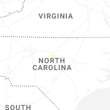
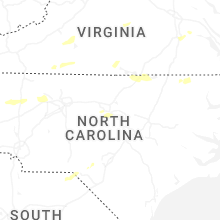
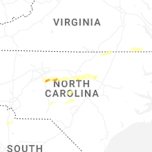


Connect with Interactive Hail Maps