

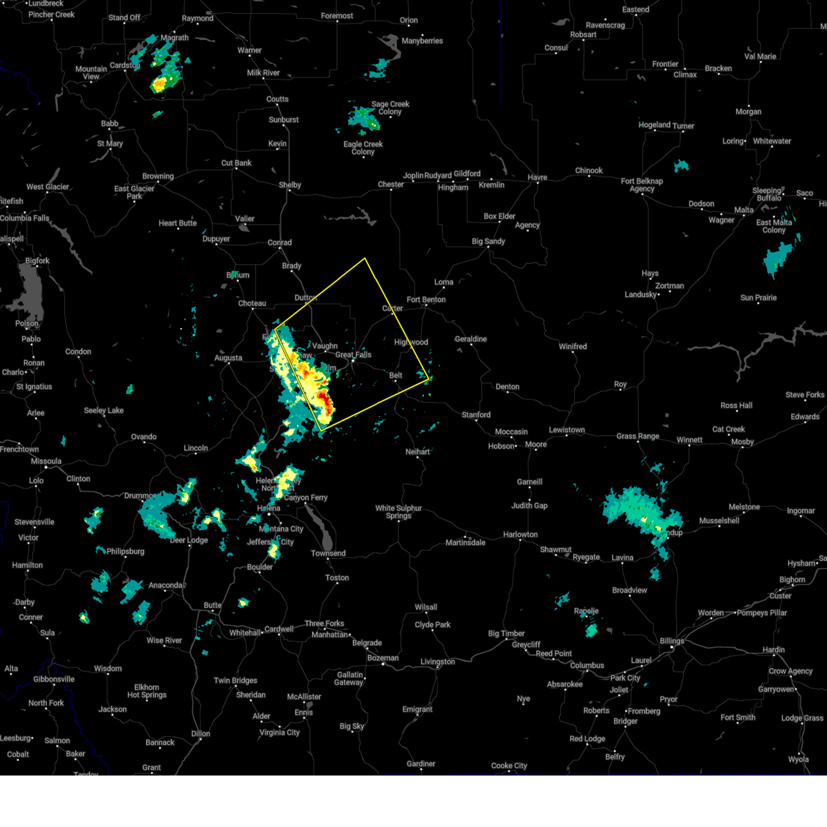
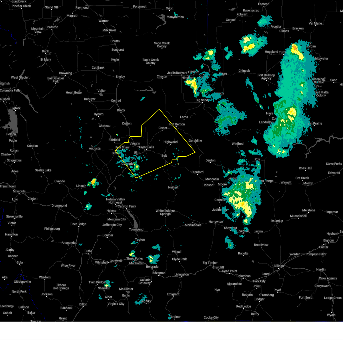
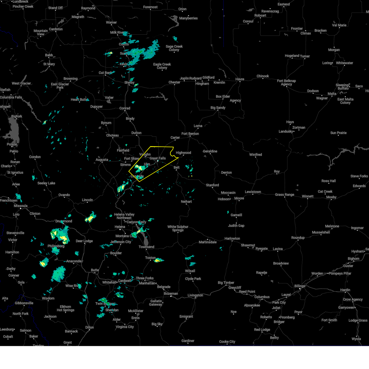
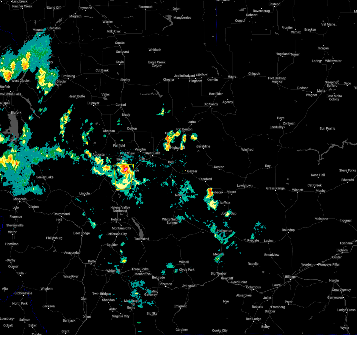
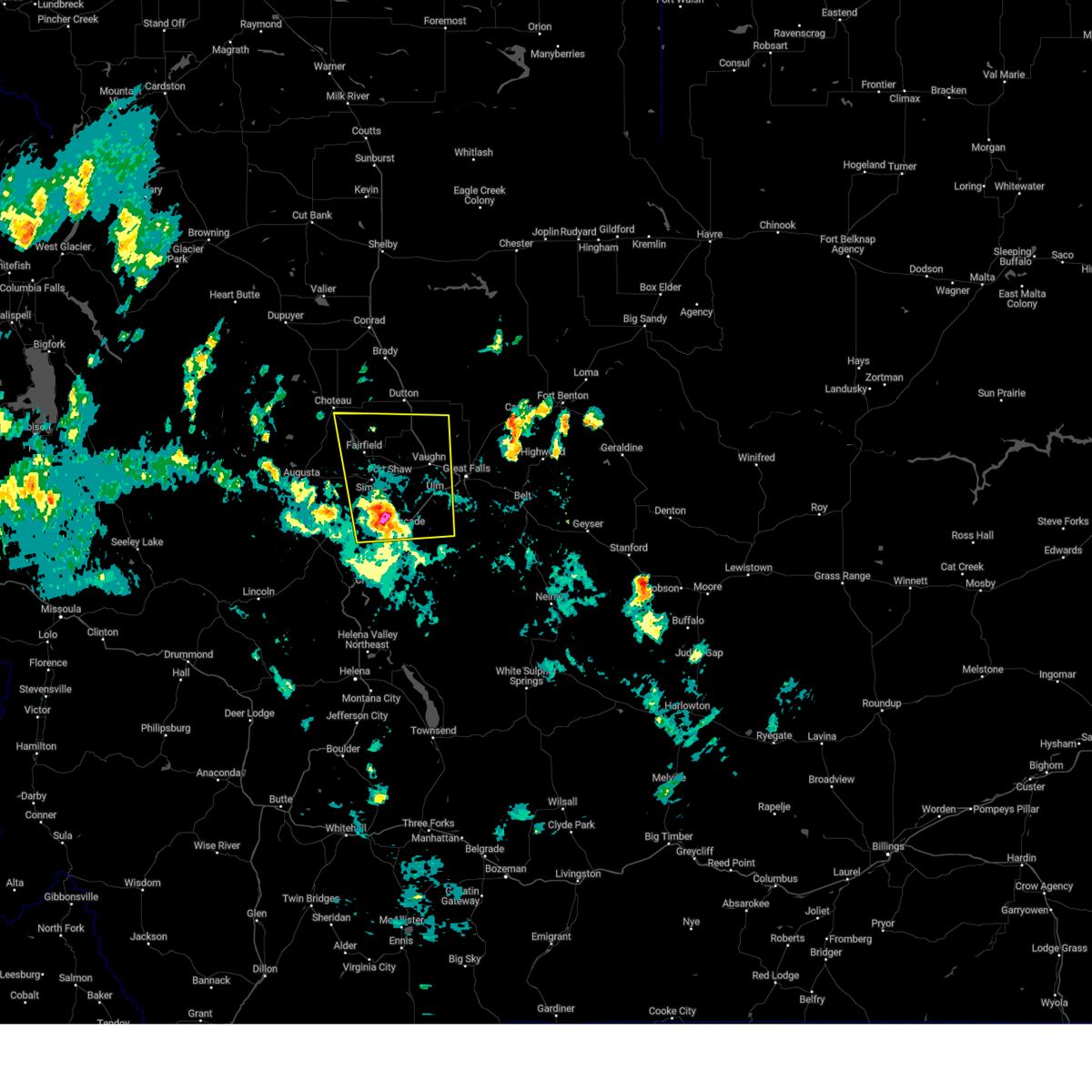
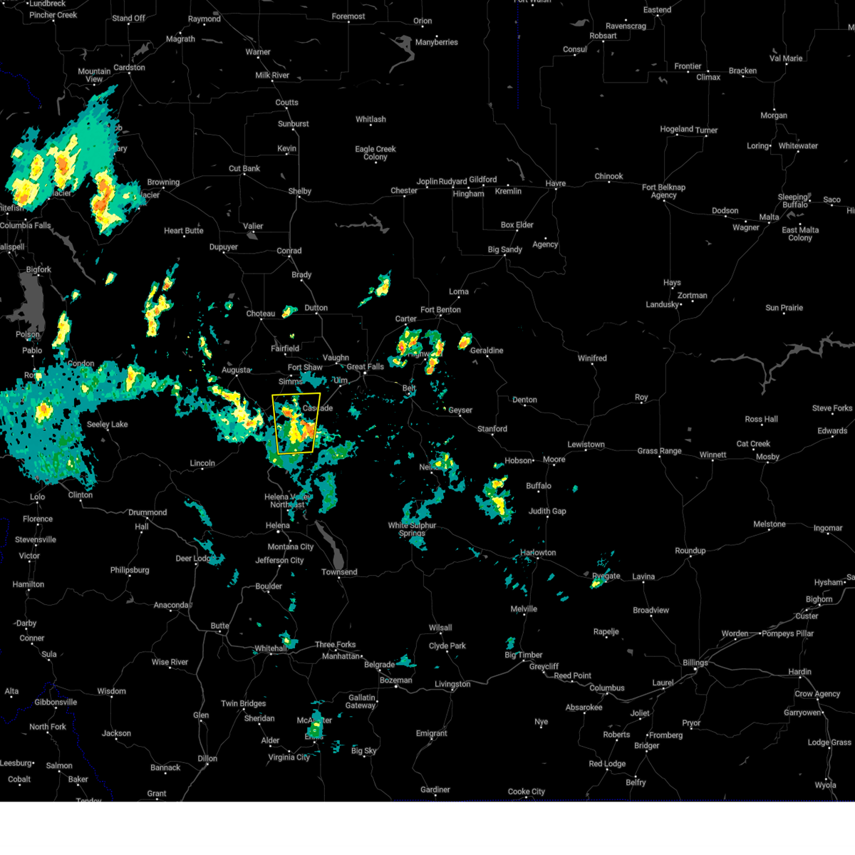
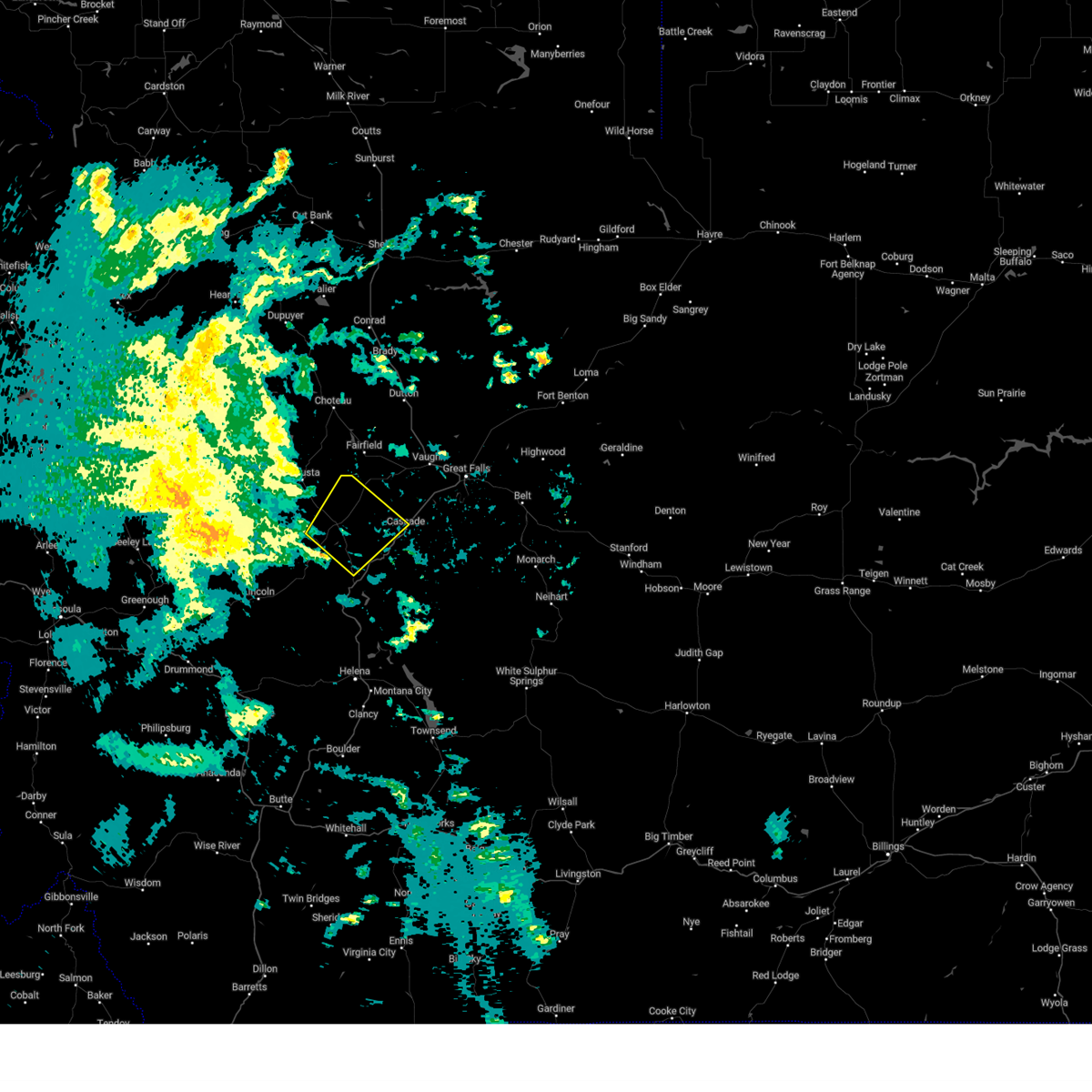
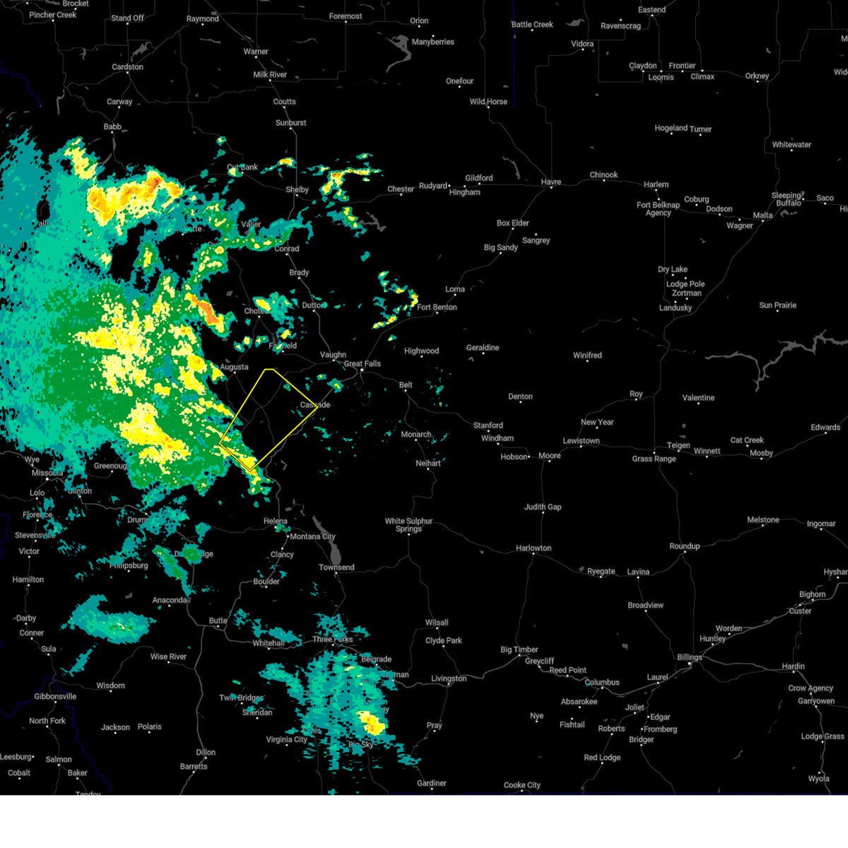
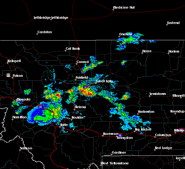
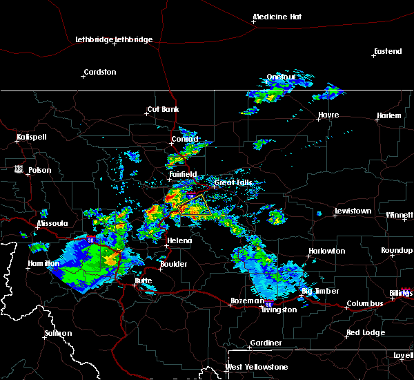
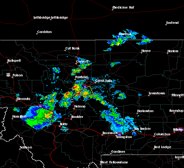
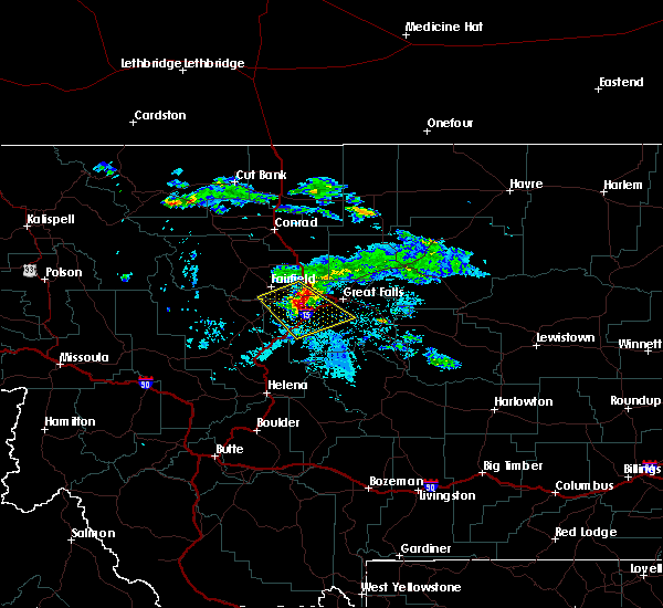
Hail Map for Cascade, MT
The Cascade, MT area has had 7 reports of on-the-ground hail by trained spotters, and has been under severe weather warnings 6 times during the past 12 months. Doppler radar has detected hail at or near Cascade, MT on 20 occasions.
| Name: | Cascade, MT |
| Where Located: | 24.7 miles SW of Great Falls, MT |
| Map: | Google Map for Cascade, MT |
| Population: | 685 |
| Housing Units: | 328 |
| More Info: | Search Google for Cascade, MT |
5
The Top Recent Hail Date for Cascade, MT is Thursday, June 7, 2012 (1st out of 20)

Hail and Wind Damage Spotted near Cascade, MT
| Date / Time | Report Details |
|---|---|
| 5/11/2025 2:44 PM MDT |
 Svrtfx the national weather service in great falls has issued a * severe thunderstorm warning for, southeastern pondera county in north central montana, southeastern teton county in north central montana, southwestern chouteau county in north central montana, northern cascade county in central montana, * until 330 pm mdt. * at 242 pm mdt, severe thunderstorms were located along a line extending from near power to 11 miles east of cascade, moving northeast at 40 mph (radar indicated). Hazards include 60 mph wind gusts. expect damage to roofs, siding, and trees Svrtfx the national weather service in great falls has issued a * severe thunderstorm warning for, southeastern pondera county in north central montana, southeastern teton county in north central montana, southwestern chouteau county in north central montana, northern cascade county in central montana, * until 330 pm mdt. * at 242 pm mdt, severe thunderstorms were located along a line extending from near power to 11 miles east of cascade, moving northeast at 40 mph (radar indicated). Hazards include 60 mph wind gusts. expect damage to roofs, siding, and trees
|
| 5/10/2025 7:05 PM MDT |
 Svrtfx the national weather service in great falls has issued a * severe thunderstorm warning for, southwestern chouteau county in north central montana, northern cascade county in central montana, * until 800 pm mdt. * at 704 pm mdt, severe thunderstorms were located along a line extending from fort shaw to 10 miles east of cascade, moving northeast at 45 mph (radar indicated). Hazards include 60 mph wind gusts. expect damage to roofs, siding, and trees Svrtfx the national weather service in great falls has issued a * severe thunderstorm warning for, southwestern chouteau county in north central montana, northern cascade county in central montana, * until 800 pm mdt. * at 704 pm mdt, severe thunderstorms were located along a line extending from fort shaw to 10 miles east of cascade, moving northeast at 45 mph (radar indicated). Hazards include 60 mph wind gusts. expect damage to roofs, siding, and trees
|
| 5/10/2025 3:05 PM MDT |
 Svrtfx the national weather service in great falls has issued a * severe thunderstorm warning for, northwestern cascade county in central montana, * until 400 pm mdt. * at 305 pm mdt, a severe thunderstorm was located 10 miles northeast of cascade, moving northeast at 40 mph (radar indicated). Hazards include 60 mph wind gusts. expect damage to roofs, siding, and trees Svrtfx the national weather service in great falls has issued a * severe thunderstorm warning for, northwestern cascade county in central montana, * until 400 pm mdt. * at 305 pm mdt, a severe thunderstorm was located 10 miles northeast of cascade, moving northeast at 40 mph (radar indicated). Hazards include 60 mph wind gusts. expect damage to roofs, siding, and trees
|
| 8/23/2024 5:15 PM MDT | Mesonet station mtm76 cascade e md in cascade county MT, 3.9 miles W of Cascade, MT |
| 8/23/2024 5:05 PM MDT |
 The storm which prompted the warning has weakened below severe limits, and has exited the warned area. therefore, the warning will be allowed to expire. a severe thunderstorm watch remains in effect until 900 pm mdt for central and west central montana. remember, a severe thunderstorm warning still remains in effect for cascade county until 530 pm. The storm which prompted the warning has weakened below severe limits, and has exited the warned area. therefore, the warning will be allowed to expire. a severe thunderstorm watch remains in effect until 900 pm mdt for central and west central montana. remember, a severe thunderstorm warning still remains in effect for cascade county until 530 pm.
|
| 8/23/2024 4:59 PM MDT |
 Svrtfx the national weather service in great falls has issued a * severe thunderstorm warning for, central lewis and clark county in west central montana, southeastern teton county in north central montana, northwestern cascade county in central montana, * until 530 pm mdt. * at 459 pm mdt, a severe thunderstorm was located 9 miles northwest of cascade, moving north at 45 mph (radar indicated). Hazards include 60 mph wind gusts. expect damage to roofs, siding, and trees Svrtfx the national weather service in great falls has issued a * severe thunderstorm warning for, central lewis and clark county in west central montana, southeastern teton county in north central montana, northwestern cascade county in central montana, * until 530 pm mdt. * at 459 pm mdt, a severe thunderstorm was located 9 miles northwest of cascade, moving north at 45 mph (radar indicated). Hazards include 60 mph wind gusts. expect damage to roofs, siding, and trees
|
| 8/23/2024 4:56 PM MDT | From personal weather statio in cascade county MT, 13.6 miles WSW of Cascade, MT |
| 8/23/2024 4:45 PM MDT |
 Svrtfx the national weather service in great falls has issued a * severe thunderstorm warning for, east central lewis and clark county in west central montana, west central cascade county in central montana, * until 515 pm mdt. * at 443 pm mdt, a severe thunderstorm was located 11 miles northeast of wolf creek, or 13 miles southwest of cascade, moving north at 30 mph (trained weather spotters. at 430 pm wolf creek mesonet station reported 61 mph). Hazards include 60 mph wind gusts. expect damage to roofs, siding, and trees Svrtfx the national weather service in great falls has issued a * severe thunderstorm warning for, east central lewis and clark county in west central montana, west central cascade county in central montana, * until 515 pm mdt. * at 443 pm mdt, a severe thunderstorm was located 11 miles northeast of wolf creek, or 13 miles southwest of cascade, moving north at 30 mph (trained weather spotters. at 430 pm wolf creek mesonet station reported 61 mph). Hazards include 60 mph wind gusts. expect damage to roofs, siding, and trees
|
| 6/15/2024 12:21 PM MDT |
 Svrtfx the national weather service in great falls has issued a * severe thunderstorm warning for, southwestern chouteau county in north central montana, northern cascade county in central montana, * until 1245 pm mdt. * at 1220 pm mdt, a severe thunderstorm was located near cascade, moving northeast at 35 mph (radar indicated). Hazards include 60 mph wind gusts. expect damage to roofs, siding, and trees Svrtfx the national weather service in great falls has issued a * severe thunderstorm warning for, southwestern chouteau county in north central montana, northern cascade county in central montana, * until 1245 pm mdt. * at 1220 pm mdt, a severe thunderstorm was located near cascade, moving northeast at 35 mph (radar indicated). Hazards include 60 mph wind gusts. expect damage to roofs, siding, and trees
|
| 6/15/2024 12:15 PM MDT | Mesonet station mtm76 cascade e md in cascade county MT, 3.9 miles W of Cascade, MT |
| 8/29/2023 9:07 PM MDT |
 At 907 pm mdt, a severe thunderstorm was located 17 miles west of cascade, moving northeast at 35 mph (radar indicated). Hazards include 60 mph wind gusts. Expect damage to roofs, siding, and trees. locations impacted include, cascade and bowmans corner. hail threat, radar indicated max hail size, <. 75 in wind threat, radar indicated max wind gust, 60 mph. At 907 pm mdt, a severe thunderstorm was located 17 miles west of cascade, moving northeast at 35 mph (radar indicated). Hazards include 60 mph wind gusts. Expect damage to roofs, siding, and trees. locations impacted include, cascade and bowmans corner. hail threat, radar indicated max hail size, <. 75 in wind threat, radar indicated max wind gust, 60 mph.
|
| 8/29/2023 8:37 PM MDT |
 At 837 pm mdt, a severe thunderstorm was located 12 miles west of wolf creek, or 32 miles southwest of cascade, moving northeast at 35 mph (radar indicated). Hazards include 60 mph wind gusts. expect damage to roofs, siding, and trees At 837 pm mdt, a severe thunderstorm was located 12 miles west of wolf creek, or 32 miles southwest of cascade, moving northeast at 35 mph (radar indicated). Hazards include 60 mph wind gusts. expect damage to roofs, siding, and trees
|
| 8/29/2023 6:52 PM MDT |
 At 651 pm mdt, an outflow boundary with strong wind gusts from severe thunderstorms were located along a line extending from 9 miles north of fairfield to near fort shaw to 6 miles north of cascade, moving east at 35 mph (radar indicated). Hazards include 70 mph wind gusts. Expect considerable tree damage. Damage is likely to mobile homes, roofs, and outbuildings. At 651 pm mdt, an outflow boundary with strong wind gusts from severe thunderstorms were located along a line extending from 9 miles north of fairfield to near fort shaw to 6 miles north of cascade, moving east at 35 mph (radar indicated). Hazards include 70 mph wind gusts. Expect considerable tree damage. Damage is likely to mobile homes, roofs, and outbuildings.
|
| 5/22/2023 1:36 PM MDT |
 The severe thunderstorm warning for central lewis and clark, south central teton and west central cascade counties will expire at 145 pm mdt, the storm which prompted the warning has weakened below severe limits, and no longer poses an immediate threat to life or property. therefore, the warning will be allowed to expire. The severe thunderstorm warning for central lewis and clark, south central teton and west central cascade counties will expire at 145 pm mdt, the storm which prompted the warning has weakened below severe limits, and no longer poses an immediate threat to life or property. therefore, the warning will be allowed to expire.
|
| 5/22/2023 1:20 PM MDT |
 At 119 pm mdt, a severe thunderstorm was located 15 miles southeast of augusta, or 21 miles west of cascade, moving northeast at 50 mph (radar indicated). Hazards include 60 mph wind gusts and penny size hail. Expect damage to roofs, siding, and trees. locations impacted include, cascade, fairfield, fort shaw, fort shaw, bowmans corner, bean lake and simms. hail threat, radar indicated max hail size, 0. 75 in wind threat, radar indicated max wind gust, 60 mph. At 119 pm mdt, a severe thunderstorm was located 15 miles southeast of augusta, or 21 miles west of cascade, moving northeast at 50 mph (radar indicated). Hazards include 60 mph wind gusts and penny size hail. Expect damage to roofs, siding, and trees. locations impacted include, cascade, fairfield, fort shaw, fort shaw, bowmans corner, bean lake and simms. hail threat, radar indicated max hail size, 0. 75 in wind threat, radar indicated max wind gust, 60 mph.
|
| 5/22/2023 12:58 PM MDT |
 At 1257 pm mdt, a severe thunderstorm was located 19 miles northeast of lincoln, or 35 miles west of cascade, moving northeast at 50 mph (radar indicated). Hazards include 60 mph wind gusts and penny size hail. expect damage to roofs, siding, and trees At 1257 pm mdt, a severe thunderstorm was located 19 miles northeast of lincoln, or 35 miles west of cascade, moving northeast at 50 mph (radar indicated). Hazards include 60 mph wind gusts and penny size hail. expect damage to roofs, siding, and trees
|
| 9/7/2022 5:57 PM MDT |
 At 556 pm mdt, severe thunderstorms were located along a line extending from near dutton to 23 miles southeast of cascade to 10 miles southwest of townsend, moving east at 50 mph (radar indicated). Hazards include 70 mph wind gusts. Expect considerable tree damage. Damage is likely to mobile homes, roofs, and outbuildings. At 556 pm mdt, severe thunderstorms were located along a line extending from near dutton to 23 miles southeast of cascade to 10 miles southwest of townsend, moving east at 50 mph (radar indicated). Hazards include 70 mph wind gusts. Expect considerable tree damage. Damage is likely to mobile homes, roofs, and outbuildings.
|
| 9/7/2022 5:42 PM MDT | Mesonet station mtyep mdt - gary cooper bridge - dearbor in cascade county MT, 11.8 miles NE of Cascade, MT |
| 8/12/2022 7:36 PM MDT |
 The severe thunderstorm warning for southeastern pondera, southeastern teton and northwestern cascade counties will expire at 745 pm mdt, the storms which prompted the warning have weakened below severe limits, and have exited the warned area. therefore, the warning will be allowed to expire. however small hail, gusty winds and heavy rain are still possible with these thunderstorms. The severe thunderstorm warning for southeastern pondera, southeastern teton and northwestern cascade counties will expire at 745 pm mdt, the storms which prompted the warning have weakened below severe limits, and have exited the warned area. therefore, the warning will be allowed to expire. however small hail, gusty winds and heavy rain are still possible with these thunderstorms.
|
| 8/12/2022 7:15 PM MDT | Mesonet station mtm76 cascade e md in cascade county MT, 3.9 miles W of Cascade, MT |
| 8/12/2022 7:13 PM MDT |
 At 713 pm mdt, severe thunderstorms were located along a line extending from 8 miles northeast of fairfield to cascade, moving northeast at 35 mph (radar indicated). Hazards include 60 mph wind gusts. expect damage to roofs, siding, and trees At 713 pm mdt, severe thunderstorms were located along a line extending from 8 miles northeast of fairfield to cascade, moving northeast at 35 mph (radar indicated). Hazards include 60 mph wind gusts. expect damage to roofs, siding, and trees
|
| 7/15/2022 12:29 PM MDT | Via ambient weathe in cascade county MT, 11 miles SW of Cascade, MT |
| 7/9/2022 6:07 PM MDT |
 At 606 pm mdt, a severe thunderstorm was located near black eagle, or near great falls, moving east at 35 mph (radar indicated). Hazards include 60 mph wind gusts. Expect damage to roofs, siding, and trees. locations impacted include, great falls, cascade, belt, black eagle, highwood, floweree, portage, eden, sluice boxes state park, malmstrom afb, stockett, tracy, vaughn, first peoples buffalo jump state park, centerville, sun river, armington, ulm and sand coulee. hail threat, radar indicated max hail size, <. 75 in wind threat, radar indicated max wind gust, 60 mph. At 606 pm mdt, a severe thunderstorm was located near black eagle, or near great falls, moving east at 35 mph (radar indicated). Hazards include 60 mph wind gusts. Expect damage to roofs, siding, and trees. locations impacted include, great falls, cascade, belt, black eagle, highwood, floweree, portage, eden, sluice boxes state park, malmstrom afb, stockett, tracy, vaughn, first peoples buffalo jump state park, centerville, sun river, armington, ulm and sand coulee. hail threat, radar indicated max hail size, <. 75 in wind threat, radar indicated max wind gust, 60 mph.
|
| 7/9/2022 5:43 PM MDT |
 At 542 pm mdt, a severe thunderstorm was located 12 miles west of great falls, moving east at 35 mph (radar indicated). Hazards include 60 mph wind gusts and penny size hail. expect damage to roofs, siding, and trees At 542 pm mdt, a severe thunderstorm was located 12 miles west of great falls, moving east at 35 mph (radar indicated). Hazards include 60 mph wind gusts and penny size hail. expect damage to roofs, siding, and trees
|
| 7/8/2022 6:13 PM MDT |
 At 613 pm mdt, severe thunderstorms were located along a line extending from near cascade to 13 miles south of belt, moving north at 45 mph (radar indicated). Hazards include 60 mph wind gusts. expect damage to roofs, siding, and trees At 613 pm mdt, severe thunderstorms were located along a line extending from near cascade to 13 miles south of belt, moving north at 45 mph (radar indicated). Hazards include 60 mph wind gusts. expect damage to roofs, siding, and trees
|
| 7/4/2022 5:38 PM MDT |
 At 538 pm mdt, a severe thunderstorm was located 8 miles northeast of cascade, moving east at 25 mph (radar indicated). Hazards include 60 mph wind gusts and penny size hail. Expect damage to roofs, siding, and trees. localized flash flooding possible. locations impacted include, cascade, first peoples buffalo jump state park and ulm. hail threat, radar indicated max hail size, 0. 75 in wind threat, radar indicated max wind gust, 60 mph. At 538 pm mdt, a severe thunderstorm was located 8 miles northeast of cascade, moving east at 25 mph (radar indicated). Hazards include 60 mph wind gusts and penny size hail. Expect damage to roofs, siding, and trees. localized flash flooding possible. locations impacted include, cascade, first peoples buffalo jump state park and ulm. hail threat, radar indicated max hail size, 0. 75 in wind threat, radar indicated max wind gust, 60 mph.
|
| 7/4/2022 5:30 PM MDT |
 At 530 pm mdt, a severe thunderstorm was located near cascade, moving east at 25 mph (radar indicated). Hazards include 60 mph wind gusts and quarter size hail. Hail damage to vehicles is expected. expect wind damage to roofs, siding, and trees. localized flash flooding possible. locations impacted include, cascade, first peoples buffalo jump state park and ulm. hail threat, radar indicated max hail size, 1. 00 in wind threat, radar indicated max wind gust, 60 mph. At 530 pm mdt, a severe thunderstorm was located near cascade, moving east at 25 mph (radar indicated). Hazards include 60 mph wind gusts and quarter size hail. Hail damage to vehicles is expected. expect wind damage to roofs, siding, and trees. localized flash flooding possible. locations impacted include, cascade, first peoples buffalo jump state park and ulm. hail threat, radar indicated max hail size, 1. 00 in wind threat, radar indicated max wind gust, 60 mph.
|
| 7/4/2022 5:20 PM MDT |
 At 519 pm mdt, a severe thunderstorm was located over cascade, moving east at 25 mph (radar indicated). Hazards include 60 mph wind gusts and half dollar size hail. Hail damage to vehicles is expected. expect wind damage to roofs, siding, and trees. localized flash flooding possible. locations impacted include, cascade, first peoples buffalo jump state park and ulm. hail threat, radar indicated max hail size, 1. 25 in wind threat, radar indicated max wind gust, 60 mph. At 519 pm mdt, a severe thunderstorm was located over cascade, moving east at 25 mph (radar indicated). Hazards include 60 mph wind gusts and half dollar size hail. Hail damage to vehicles is expected. expect wind damage to roofs, siding, and trees. localized flash flooding possible. locations impacted include, cascade, first peoples buffalo jump state park and ulm. hail threat, radar indicated max hail size, 1. 25 in wind threat, radar indicated max wind gust, 60 mph.
|
| 7/4/2022 5:14 PM MDT |
 At 514 pm mdt, a severe thunderstorm was located over cascade, moving east at 25 mph (radar indicated). Hazards include 60 mph wind gusts and half dollar size hail. Hail damage to vehicles is expected. expect wind damage to roofs, siding, and trees. localized flash flooding possible. locations impacted include, cascade, first peoples buffalo jump state park and ulm. hail threat, radar indicated max hail size, 1. 25 in wind threat, radar indicated max wind gust, 60 mph. At 514 pm mdt, a severe thunderstorm was located over cascade, moving east at 25 mph (radar indicated). Hazards include 60 mph wind gusts and half dollar size hail. Hail damage to vehicles is expected. expect wind damage to roofs, siding, and trees. localized flash flooding possible. locations impacted include, cascade, first peoples buffalo jump state park and ulm. hail threat, radar indicated max hail size, 1. 25 in wind threat, radar indicated max wind gust, 60 mph.
|
| 7/4/2022 5:09 PM MDT |
 At 509 pm mdt, a severe thunderstorm was located near cascade, moving east at 25 mph (radar indicated). Hazards include 60 mph wind gusts and quarter size hail. Hail damage to vehicles is expected. expect wind damage to roofs, siding, and trees. Localized flash flooding possible. At 509 pm mdt, a severe thunderstorm was located near cascade, moving east at 25 mph (radar indicated). Hazards include 60 mph wind gusts and quarter size hail. Hail damage to vehicles is expected. expect wind damage to roofs, siding, and trees. Localized flash flooding possible.
|
| 12/23/2021 6:11 PM MST |
 At 609 pm mst, severe thunderstorms were located along a line extending from near great falls to near cascade, moving east at 60 mph (radar indicated. at 5:56 pm, a trained spotter reported a 63 mph wind gust just south of ulm). Hazards include 60 mph wind gusts. expect damage to roofs, siding, and trees At 609 pm mst, severe thunderstorms were located along a line extending from near great falls to near cascade, moving east at 60 mph (radar indicated. at 5:56 pm, a trained spotter reported a 63 mph wind gust just south of ulm). Hazards include 60 mph wind gusts. expect damage to roofs, siding, and trees
|
| 12/23/2021 5:59 PM MST | Mesonet station mtyep mdt - gary cooper bridge - dearbor in cascade county MT, 11.8 miles NE of Cascade, MT |
| 12/23/2021 5:56 PM MST | Trained spotter reported a 63 mph gus in cascade county MT, 11.2 miles WSW of Cascade, MT |
| 7/23/2020 4:27 PM MDT |
 The severe thunderstorm warning for central cascade county will expire at 430 pm mdt, the storm which prompted the warning has weakened below severe limits, and no longer poses an immediate threat to life or property. therefore, the warning will be allowed to expire. however gusty winds and heavy rains are still possible with this thunderstorm. a severe thunderstorm watch remains in effect until 900 pm mdt for central montana. The severe thunderstorm warning for central cascade county will expire at 430 pm mdt, the storm which prompted the warning has weakened below severe limits, and no longer poses an immediate threat to life or property. therefore, the warning will be allowed to expire. however gusty winds and heavy rains are still possible with this thunderstorm. a severe thunderstorm watch remains in effect until 900 pm mdt for central montana.
|
| 7/23/2020 4:21 PM MDT |
 At 420 pm mdt, a severe thunderstorm was located 13 miles east of cascade, moving northeast at 30 mph (radar indicated). Hazards include 60 mph wind gusts and pea size hail. Expect damage to roofs, siding, and trees. Locations impacted include, western portions of great falls, cascade, eden and ulm. At 420 pm mdt, a severe thunderstorm was located 13 miles east of cascade, moving northeast at 30 mph (radar indicated). Hazards include 60 mph wind gusts and pea size hail. Expect damage to roofs, siding, and trees. Locations impacted include, western portions of great falls, cascade, eden and ulm.
|
| 7/23/2020 4:04 PM MDT |
 At 403 pm mdt, a severe thunderstorm was located 7 miles southeast of cascade, moving northeast at 30 mph (radar indicated). Hazards include 60 mph wind gusts. expect damage to roofs, siding, and trees At 403 pm mdt, a severe thunderstorm was located 7 miles southeast of cascade, moving northeast at 30 mph (radar indicated). Hazards include 60 mph wind gusts. expect damage to roofs, siding, and trees
|
| 7/3/2020 7:23 PM MDT |
 At 722 pm mdt, severe thunderstorms were located along a line extending from 10 miles southwest of belt to 7 miles northwest of cascade, moving northeast at 25 mph (radar indicated). Hazards include 60 mph wind gusts and quarter size hail. Hail damage to vehicles is expected. expect wind damage to roofs, siding, and trees. Locations impacted include, great falls, cascade, belt, black eagle, fort shaw, highwood, portage, malmstrom afb, eden, stockett, tracy, vaughn, centerville, sun river, ulm and sand coulee. At 722 pm mdt, severe thunderstorms were located along a line extending from 10 miles southwest of belt to 7 miles northwest of cascade, moving northeast at 25 mph (radar indicated). Hazards include 60 mph wind gusts and quarter size hail. Hail damage to vehicles is expected. expect wind damage to roofs, siding, and trees. Locations impacted include, great falls, cascade, belt, black eagle, fort shaw, highwood, portage, malmstrom afb, eden, stockett, tracy, vaughn, centerville, sun river, ulm and sand coulee.
|
| 7/3/2020 7:07 PM MDT |
 At 706 pm mdt, severe thunderstorms were located along a line extending from 16 miles southwest of belt to 11 miles west of cascade, moving north at 25 mph (radar indicated). Hazards include 60 mph wind gusts and quarter size hail. Hail damage to vehicles is expected. Expect wind damage to roofs, siding, and trees. At 706 pm mdt, severe thunderstorms were located along a line extending from 16 miles southwest of belt to 11 miles west of cascade, moving north at 25 mph (radar indicated). Hazards include 60 mph wind gusts and quarter size hail. Hail damage to vehicles is expected. Expect wind damage to roofs, siding, and trees.
|
| 8/11/2019 9:25 AM MDT |
 At 924 am mdt, severe thunderstorms were located along a line extending from near cascade to 25 miles south of great falls, moving northeast at 35 mph (radar indicated). Hazards include 60 mph wind gusts and penny size hail. Expect damage to roofs, siding, and trees. Locations impacted include, cascade, fort shaw, fort shaw, ulm, eden, stockett, first peoples buffalo jump state park and sun river. At 924 am mdt, severe thunderstorms were located along a line extending from near cascade to 25 miles south of great falls, moving northeast at 35 mph (radar indicated). Hazards include 60 mph wind gusts and penny size hail. Expect damage to roofs, siding, and trees. Locations impacted include, cascade, fort shaw, fort shaw, ulm, eden, stockett, first peoples buffalo jump state park and sun river.
|
| 8/11/2019 9:06 AM MDT |
 At 905 am mdt, severe thunderstorms were located along a line extending from 12 miles northeast of wolf creek to 20 miles south of cascade, moving northeast at 35 mph (radar indicated). Hazards include 60 mph wind gusts and nickel size hail. expect damage to roofs, siding, and trees At 905 am mdt, severe thunderstorms were located along a line extending from 12 miles northeast of wolf creek to 20 miles south of cascade, moving northeast at 35 mph (radar indicated). Hazards include 60 mph wind gusts and nickel size hail. expect damage to roofs, siding, and trees
|
| 7/14/2019 5:00 PM MDT | Power is out... storm bearing down from the wes in cascade county MT, 9.2 miles WSW of Cascade, MT |
| 7/13/2019 3:18 PM MDT |
 At 317 pm mdt, severe thunderstorms were located along a line extending from cascade to 24 miles south of great falls, moving northeast at 30 mph (radar indicated). Hazards include 60 mph wind gusts and quarter size hail. Hail damage to vehicles is expected. expect wind damage to roofs, siding, and trees. Locations impacted include, great falls, cascade, belt, black eagle, eden, stockett, tracy, vaughn, first peoples buffalo jump state park, centerville, armington, ulm, sand coulee and malmstrom afb. At 317 pm mdt, severe thunderstorms were located along a line extending from cascade to 24 miles south of great falls, moving northeast at 30 mph (radar indicated). Hazards include 60 mph wind gusts and quarter size hail. Hail damage to vehicles is expected. expect wind damage to roofs, siding, and trees. Locations impacted include, great falls, cascade, belt, black eagle, eden, stockett, tracy, vaughn, first peoples buffalo jump state park, centerville, armington, ulm, sand coulee and malmstrom afb.
|
| 7/13/2019 3:15 PM MDT |
 At 315 pm mdt, severe thunderstorms were located along a line extending from cascade to 24 miles south of great falls, moving northeast at 30 mph (radar indicated). Hazards include 60 mph wind gusts and quarter size hail. Hail damage to vehicles is expected. Expect wind damage to roofs, siding, and trees. At 315 pm mdt, severe thunderstorms were located along a line extending from cascade to 24 miles south of great falls, moving northeast at 30 mph (radar indicated). Hazards include 60 mph wind gusts and quarter size hail. Hail damage to vehicles is expected. Expect wind damage to roofs, siding, and trees.
|
| 7/13/2019 3:09 PM MDT |
 At 309 pm mdt, a severe thunderstorm was located 8 miles southeast of cascade, moving east at 30 mph (radar indicated). Hazards include 60 mph wind gusts and quarter size hail. Hail damage to vehicles is expected. expect wind damage to roofs, siding, and trees. Locations impacted include, cascade. At 309 pm mdt, a severe thunderstorm was located 8 miles southeast of cascade, moving east at 30 mph (radar indicated). Hazards include 60 mph wind gusts and quarter size hail. Hail damage to vehicles is expected. expect wind damage to roofs, siding, and trees. Locations impacted include, cascade.
|
| 7/13/2019 2:54 PM MDT |
 At 254 pm mdt, a severe thunderstorm was located 9 miles south of cascade, moving east at 30 mph (radar indicated). Hazards include 60 mph wind gusts and quarter size hail. Hail damage to vehicles is expected. expect wind damage to roofs, siding, and trees. Locations impacted include, cascade and tower rock state park. At 254 pm mdt, a severe thunderstorm was located 9 miles south of cascade, moving east at 30 mph (radar indicated). Hazards include 60 mph wind gusts and quarter size hail. Hail damage to vehicles is expected. expect wind damage to roofs, siding, and trees. Locations impacted include, cascade and tower rock state park.
|
| 7/13/2019 2:47 PM MDT |
 At 247 pm mdt, a severe thunderstorm was located 10 miles southwest of cascade, moving east at 30 mph (radar indicated). Hazards include 60 mph wind gusts and quarter size hail. Hail damage to vehicles is expected. Expect wind damage to roofs, siding, and trees. At 247 pm mdt, a severe thunderstorm was located 10 miles southwest of cascade, moving east at 30 mph (radar indicated). Hazards include 60 mph wind gusts and quarter size hail. Hail damage to vehicles is expected. Expect wind damage to roofs, siding, and trees.
|
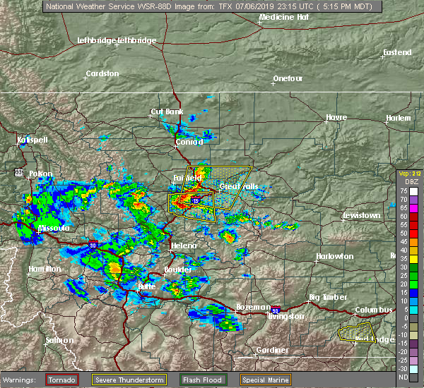
| 7/6/2019 5:51 PM MDT |
 At 551 pm mdt, severe thunderstorms were located along a line extending from 10 miles east of power to near great falls to near cascade, moving east at 40 mph (radar indicated). Hazards include 60 mph wind gusts and quarter size hail. Hail damage to vehicles is expected. expect wind damage to roofs, siding, and trees. Locations impacted include, great falls, cascade, black eagle, carter, floweree, portage, eden, malmstrom afb, stockett, tracy, vaughn, first peoples buffalo jump state park, centerville, sun river, ulm and sand coulee. At 551 pm mdt, severe thunderstorms were located along a line extending from 10 miles east of power to near great falls to near cascade, moving east at 40 mph (radar indicated). Hazards include 60 mph wind gusts and quarter size hail. Hail damage to vehicles is expected. expect wind damage to roofs, siding, and trees. Locations impacted include, great falls, cascade, black eagle, carter, floweree, portage, eden, malmstrom afb, stockett, tracy, vaughn, first peoples buffalo jump state park, centerville, sun river, ulm and sand coulee.
|
| 7/6/2019 5:27 PM MDT |
 At 526 pm mdt, severe thunderstorms were located along a line extending from 8 miles east of dutton to near cascade, moving east at 20 mph (radar indicated). Hazards include 60 mph wind gusts and quarter size hail. Hail damage to vehicles is expected. Expect wind damage to roofs, siding, and trees. At 526 pm mdt, severe thunderstorms were located along a line extending from 8 miles east of dutton to near cascade, moving east at 20 mph (radar indicated). Hazards include 60 mph wind gusts and quarter size hail. Hail damage to vehicles is expected. Expect wind damage to roofs, siding, and trees.
|
| 7/6/2019 5:17 PM MDT |
 At 517 pm mdt, a severe thunderstorm was located 8 miles west of cascade, moving east at 30 mph (radar indicated). Hazards include 60 mph wind gusts and quarter size hail. Hail damage to vehicles is expected. expect wind damage to roofs, siding, and trees. Locations impacted include, cascade and tower rock state park. At 517 pm mdt, a severe thunderstorm was located 8 miles west of cascade, moving east at 30 mph (radar indicated). Hazards include 60 mph wind gusts and quarter size hail. Hail damage to vehicles is expected. expect wind damage to roofs, siding, and trees. Locations impacted include, cascade and tower rock state park.
|
| 7/6/2019 5:00 PM MDT |
 At 459 pm mdt, a severe thunderstorm was located 8 miles west of cascade, moving east at 30 mph (radar indicated). Hazards include 60 mph wind gusts and quarter size hail. Hail damage to vehicles is expected. Expect wind damage to roofs, siding, and trees. At 459 pm mdt, a severe thunderstorm was located 8 miles west of cascade, moving east at 30 mph (radar indicated). Hazards include 60 mph wind gusts and quarter size hail. Hail damage to vehicles is expected. Expect wind damage to roofs, siding, and trees.
|
| 7/26/2018 4:34 PM MDT |
 At 434 pm mdt, a severe thunderstorm was located 15 miles west of cascade, moving east at 25 mph (radar indicated). Hazards include 60 mph wind gusts and quarter size hail. Hail damage to vehicles is expected. Expect wind damage to roofs, siding, and trees. At 434 pm mdt, a severe thunderstorm was located 15 miles west of cascade, moving east at 25 mph (radar indicated). Hazards include 60 mph wind gusts and quarter size hail. Hail damage to vehicles is expected. Expect wind damage to roofs, siding, and trees.
|
| 7/25/2018 10:40 PM MDT |
 The severe thunderstorm warning for southeastern teton and northwestern cascade counties will expire at 1045 pm mdt, the storm which prompted the warning has weakened below severe limits, and no longer poses an immediate threat to life or property. therefore, the warning will be allowed to expire. however gusty winds up to 50 mph, heavy rain, and frequent lightning are still expected with this thunderstorm. The severe thunderstorm warning for southeastern teton and northwestern cascade counties will expire at 1045 pm mdt, the storm which prompted the warning has weakened below severe limits, and no longer poses an immediate threat to life or property. therefore, the warning will be allowed to expire. however gusty winds up to 50 mph, heavy rain, and frequent lightning are still expected with this thunderstorm.
|
| 7/25/2018 10:21 PM MDT |
 At 1021 pm mdt, a severe thunderstorm was located 8 miles northeast of cascade, moving southeast at 35 mph (radar indicated). Hazards include 60 mph wind gusts. Expect damage to roofs, siding, and trees. Locations impacted include, great falls, cascade, fort shaw, fort shaw, ulm, vaughn, first peoples buffalo jump state park, simms and sun river. At 1021 pm mdt, a severe thunderstorm was located 8 miles northeast of cascade, moving southeast at 35 mph (radar indicated). Hazards include 60 mph wind gusts. Expect damage to roofs, siding, and trees. Locations impacted include, great falls, cascade, fort shaw, fort shaw, ulm, vaughn, first peoples buffalo jump state park, simms and sun river.
|
| 7/25/2018 9:45 PM MDT |
 At 939 pm mdt, a severe thunderstorm was located near fairfield, or 16 miles southeast of choteau, moving southeast at 35 mph (radar indicated). Hazards include 60 mph wind gusts and quarter size hail. Hail damage to vehicles is expected. Expect wind damage to roofs, siding, and trees. At 939 pm mdt, a severe thunderstorm was located near fairfield, or 16 miles southeast of choteau, moving southeast at 35 mph (radar indicated). Hazards include 60 mph wind gusts and quarter size hail. Hail damage to vehicles is expected. Expect wind damage to roofs, siding, and trees.
|
| 6/4/2017 3:45 PM MDT |
 At 344 pm mdt, a severe thunderstorm was located over cascade, moving northeast at 25 mph (radar indicated). Hazards include 60 mph wind gusts and quarter size hail. Hail damage to vehicles is expected. expect wind damage to roofs, siding, and trees. Locations impacted include, cascade, sun river and ulm. At 344 pm mdt, a severe thunderstorm was located over cascade, moving northeast at 25 mph (radar indicated). Hazards include 60 mph wind gusts and quarter size hail. Hail damage to vehicles is expected. expect wind damage to roofs, siding, and trees. Locations impacted include, cascade, sun river and ulm.
|
| 6/4/2017 3:25 PM MDT |
 At 325 pm mdt, a severe thunderstorm was located 8 miles southwest of cascade, moving northeast at 25 mph (radar indicated). Hazards include 60 mph wind gusts and half dollar size hail. Hail damage to vehicles is expected. Expect wind damage to roofs, siding, and trees. At 325 pm mdt, a severe thunderstorm was located 8 miles southwest of cascade, moving northeast at 25 mph (radar indicated). Hazards include 60 mph wind gusts and half dollar size hail. Hail damage to vehicles is expected. Expect wind damage to roofs, siding, and trees.
|
| 6/1/2017 5:17 PM MDT |
 At 516 pm mdt, a severe thunderstorm was located near great falls, moving northeast at 35 mph (trained weather spotters have observed winds of 60 to 70 mph). Hazards include 60 mph wind gusts and quarter size hail. Hail damage to vehicles is expected. expect wind damage to roofs, siding, and trees. this severe storm will be near, great falls and black eagle around 525 pm mdt. Other locations impacted by this severe thunderstorm include portage, ulm, malmstrom afb, eden, sand coulee, stockett, tracy, vaughn, first peoples buffalo jump state park and centerville. At 516 pm mdt, a severe thunderstorm was located near great falls, moving northeast at 35 mph (trained weather spotters have observed winds of 60 to 70 mph). Hazards include 60 mph wind gusts and quarter size hail. Hail damage to vehicles is expected. expect wind damage to roofs, siding, and trees. this severe storm will be near, great falls and black eagle around 525 pm mdt. Other locations impacted by this severe thunderstorm include portage, ulm, malmstrom afb, eden, sand coulee, stockett, tracy, vaughn, first peoples buffalo jump state park and centerville.
|
| 6/1/2017 4:58 PM MDT | Thunderstorm gust of 60 to 70 mph...some trees down. very heavy rain caused localized street flooding. less than pea sized hail. lots of lightnin in cascade county MT, 0.2 miles NNW of Cascade, MT |
| 6/1/2017 4:57 PM MDT |
 At 457 pm mdt, a severe thunderstorm was located 8 miles northeast of cascade, moving northeast at 35 mph (trained weather spotters have reported winds in excess of 60 mph near cascade). Hazards include 60 mph wind gusts and quarter size hail. Hail damage to vehicles is expected. expect wind damage to roofs, siding, and trees. this severe thunderstorm will be near, great falls and black eagle around 525 pm mdt. Other locations impacted by this severe thunderstorm include portage, ulm, malmstrom afb, eden, sand coulee, stockett, tracy, vaughn, first peoples buffalo jump state park and centerville. At 457 pm mdt, a severe thunderstorm was located 8 miles northeast of cascade, moving northeast at 35 mph (trained weather spotters have reported winds in excess of 60 mph near cascade). Hazards include 60 mph wind gusts and quarter size hail. Hail damage to vehicles is expected. expect wind damage to roofs, siding, and trees. this severe thunderstorm will be near, great falls and black eagle around 525 pm mdt. Other locations impacted by this severe thunderstorm include portage, ulm, malmstrom afb, eden, sand coulee, stockett, tracy, vaughn, first peoples buffalo jump state park and centerville.
|
| 6/1/2017 4:44 PM MDT | 60 mph thunderstorm wind gust in cascade at 444 pm. lots of rain. no hail. gusts of 35 to 40 mph no in cascade county MT, 0.2 miles NNW of Cascade, MT |
| 5/6/2017 5:44 PM MDT |
 At 544 pm mdt, severe thunderstorms were located along a line extending from 6 miles south of fort shaw to 7 miles south of belt, moving northeast at 55 mph (radar indicated). Hazards include 70 mph wind gusts and half dollar size hail. Hail damage to vehicles is expected. expect considerable tree damage. Wind damage is also likely to mobile homes, roofs, and outbuildings. At 544 pm mdt, severe thunderstorms were located along a line extending from 6 miles south of fort shaw to 7 miles south of belt, moving northeast at 55 mph (radar indicated). Hazards include 70 mph wind gusts and half dollar size hail. Hail damage to vehicles is expected. expect considerable tree damage. Wind damage is also likely to mobile homes, roofs, and outbuildings.
|
| 5/6/2017 5:24 PM MDT |
 At 524 pm mdt, a severe thunderstorm was located 11 miles southwest of great falls, moving northeast at 40 mph (radar indicated). Hazards include 60 mph wind gusts and half dollar size hail. Hail damage to vehicles is expected. expect wind damage to roofs, siding, and trees. Locations impacted include, great falls, cascade, black eagle, fort shaw, fort shaw, portage, malmstrom afb, eden, stockett, tracy, vaughn, first peoples buffalo jump state park, centerville, sun river, tower rock state park, craig, ulm and sand coulee. At 524 pm mdt, a severe thunderstorm was located 11 miles southwest of great falls, moving northeast at 40 mph (radar indicated). Hazards include 60 mph wind gusts and half dollar size hail. Hail damage to vehicles is expected. expect wind damage to roofs, siding, and trees. Locations impacted include, great falls, cascade, black eagle, fort shaw, fort shaw, portage, malmstrom afb, eden, stockett, tracy, vaughn, first peoples buffalo jump state park, centerville, sun river, tower rock state park, craig, ulm and sand coulee.
|
| 5/6/2017 5:14 PM MDT |
 At 513 pm mdt, a severe thunderstorm was located near cascade, moving northeast at 60 mph (radar indicated). Hazards include 60 mph wind gusts and half dollar size hail. Hail damage to vehicles is expected. expect wind damage to roofs, siding, and trees. Locations impacted include, great falls, cascade, black eagle, fort shaw, fort shaw, portage, malmstrom afb, eden, stockett, tracy, vaughn, first peoples buffalo jump state park, centerville, sun river, tower rock state park, craig, ulm and sand coulee. At 513 pm mdt, a severe thunderstorm was located near cascade, moving northeast at 60 mph (radar indicated). Hazards include 60 mph wind gusts and half dollar size hail. Hail damage to vehicles is expected. expect wind damage to roofs, siding, and trees. Locations impacted include, great falls, cascade, black eagle, fort shaw, fort shaw, portage, malmstrom afb, eden, stockett, tracy, vaughn, first peoples buffalo jump state park, centerville, sun river, tower rock state park, craig, ulm and sand coulee.
|
| 5/6/2017 4:59 PM MDT |
 At 458 pm mdt, a severe thunderstorm was located 13 miles east of wolf creek, or 14 miles south of cascade, moving northeast at 60 mph (radar indicated along). Hazards include 60 mph wind gusts and penny size hail. expect damage to roofs, siding, and trees At 458 pm mdt, a severe thunderstorm was located 13 miles east of wolf creek, or 14 miles south of cascade, moving northeast at 60 mph (radar indicated along). Hazards include 60 mph wind gusts and penny size hail. expect damage to roofs, siding, and trees
|
| 5/6/2017 4:53 PM MDT |
 At 452 pm mdt, a severe thunderstorm was located over wolf creek, or 23 miles southwest of cascade, moving northeast at 65 mph (radar indicated). Hazards include 60 mph wind gusts and penny size hail. Expect damage to roofs, siding, and trees. Locations impacted include, cascade, wolf creek, tower rock state park and craig. At 452 pm mdt, a severe thunderstorm was located over wolf creek, or 23 miles southwest of cascade, moving northeast at 65 mph (radar indicated). Hazards include 60 mph wind gusts and penny size hail. Expect damage to roofs, siding, and trees. Locations impacted include, cascade, wolf creek, tower rock state park and craig.
|
| 5/6/2017 4:45 PM MDT |
 At 445 pm mdt, a severe thunderstorm was located 7 miles southwest of wolf creek, or 22 miles north of helena, moving northeast at 65 mph (radar indicated). Hazards include 60 mph wind gusts and penny size hail. expect damage to roofs, siding, and trees At 445 pm mdt, a severe thunderstorm was located 7 miles southwest of wolf creek, or 22 miles north of helena, moving northeast at 65 mph (radar indicated). Hazards include 60 mph wind gusts and penny size hail. expect damage to roofs, siding, and trees
|
| 6/8/2016 7:21 PM MDT |
 The severe thunderstorm warning for central cascade county will expire at 730 pm mdt, the storm which prompted the warning has weakened below severe limits, and no longer pose an immediate threat to life or property. therefore the warning will be allowed to expire. however gusty winds around 40 mph are still possible with this thunderstorm. The severe thunderstorm warning for central cascade county will expire at 730 pm mdt, the storm which prompted the warning has weakened below severe limits, and no longer pose an immediate threat to life or property. therefore the warning will be allowed to expire. however gusty winds around 40 mph are still possible with this thunderstorm.
|
| 6/8/2016 6:53 PM MDT |
 At 653 pm mdt, a severe thunderstorm was located 10 miles southwest of great falls, moving east at 35 mph (radar indicated). Hazards include 70 mph wind gusts. Expect considerable tree damage. damage is likely to mobile homes, roofs, and outbuildings. Locations impacted include, great falls, cascade, fort shaw, fort shaw, black eagle, sand coulee, first peoples buffalo jump state park, tracy, sluice boxes state park, vaughn, stockett, centerville, sun river, ulm, eden and malmstrom afb. At 653 pm mdt, a severe thunderstorm was located 10 miles southwest of great falls, moving east at 35 mph (radar indicated). Hazards include 70 mph wind gusts. Expect considerable tree damage. damage is likely to mobile homes, roofs, and outbuildings. Locations impacted include, great falls, cascade, fort shaw, fort shaw, black eagle, sand coulee, first peoples buffalo jump state park, tracy, sluice boxes state park, vaughn, stockett, centerville, sun river, ulm, eden and malmstrom afb.
|
| 6/8/2016 6:43 PM MDT |
 At 642 pm mdt, a severe thunderstorm was located 8 miles southeast of fort shaw, or 8 miles north of cascade, moving northeast at 15 mph (radar indicated). Hazards include 60 mph wind gusts. Expect damage to roofs. siding. And trees. At 642 pm mdt, a severe thunderstorm was located 8 miles southeast of fort shaw, or 8 miles north of cascade, moving northeast at 15 mph (radar indicated). Hazards include 60 mph wind gusts. Expect damage to roofs. siding. And trees.
|
| 5/28/2014 4:37 PM MDT | Ping Pong Ball sized hail reported 2.2 miles N of Cascade, MT |
| 5/15/2014 7:57 PM MDT | Golf Ball sized hail reported 9.4 miles WSW of Cascade, MT, hail up to the size of golf balls. |
| 9/8/2013 1:10 PM MDT | Quarter sized hail reported 12.4 miles WSW of Cascade, MT, mainly pea sized hail but a few the size of quarters. |
| 9/6/2013 4:10 PM MDT | Golf Ball sized hail reported 18.2 miles N of Cascade, MT, spotter at sieben livestock reports golfball size hail and 0.45 inch of rainfall. damage to siding on residential building. |
| 9/6/2013 4:00 PM MDT | Quarter sized hail reported 12.7 miles NE of Cascade, MT, quarter size hail...along with brief heavy rainfall. |
| 9/6/2013 3:55 PM MDT | Quarter sized hail reported 12.7 miles NE of Cascade, MT, 1 inch hail falling in the dearborn area. |
| 6/13/2013 1:57 AM MDT | Quarter sized hail reported 0.2 miles NNW of Cascade, MT, estimated quater size hail. |
| 8/14/2012 8:35 PM MDT | 60 mph wind gust with cold front passag in cascade county MT, 3.6 miles N of Cascade, MT |
| 8/14/2012 8:20 PM MDT | 70 mph wind gus in cascade county MT, 0.2 miles NNW of Cascade, MT |
| 8/14/2012 8:20 PM MDT | 70 mph wind gus in cascade county MT, 1 miles NW of Cascade, MT |
| 7/31/2012 9:30 AM MDT | Storm damage reported in cascade county MT, 20 miles NW of Cascade, MT |
| 7/30/2012 8:40 PM MDT | 67 mph wind gust at the millegan weather underground statio in cascade county MT, 20 miles NW of Cascade, MT |
| 7/30/2012 8:20 PM MDT | 72 mph wind gust measured near cascad in cascade county MT, 1 miles ESE of Cascade, MT |
| 1/1/0001 12:00 AM | Measured wind gust of 60 mph in cascade county MT, 1 miles ESE of Cascade, MT |
| 1/1/0001 12:00 AM | Measured wind gust of 68 mph in cascade county MT, 5 miles N of Cascade, MT |
Hail Maps for Cascade, MT


Connect with Interactive Hail Maps