

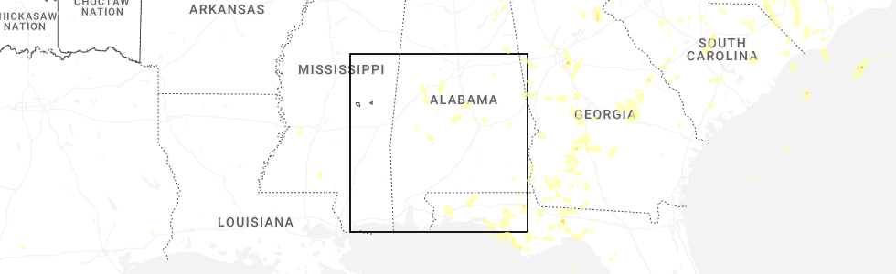
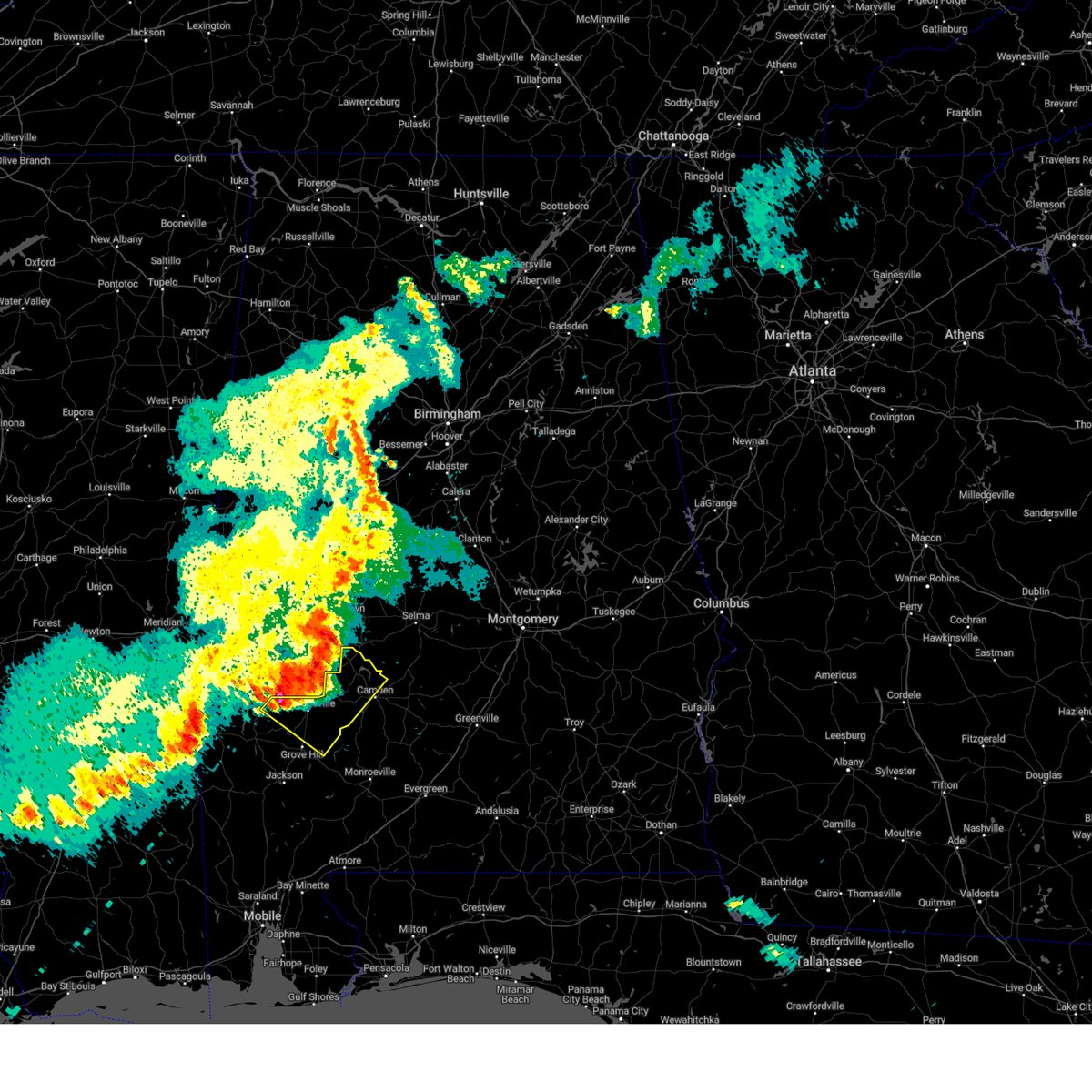
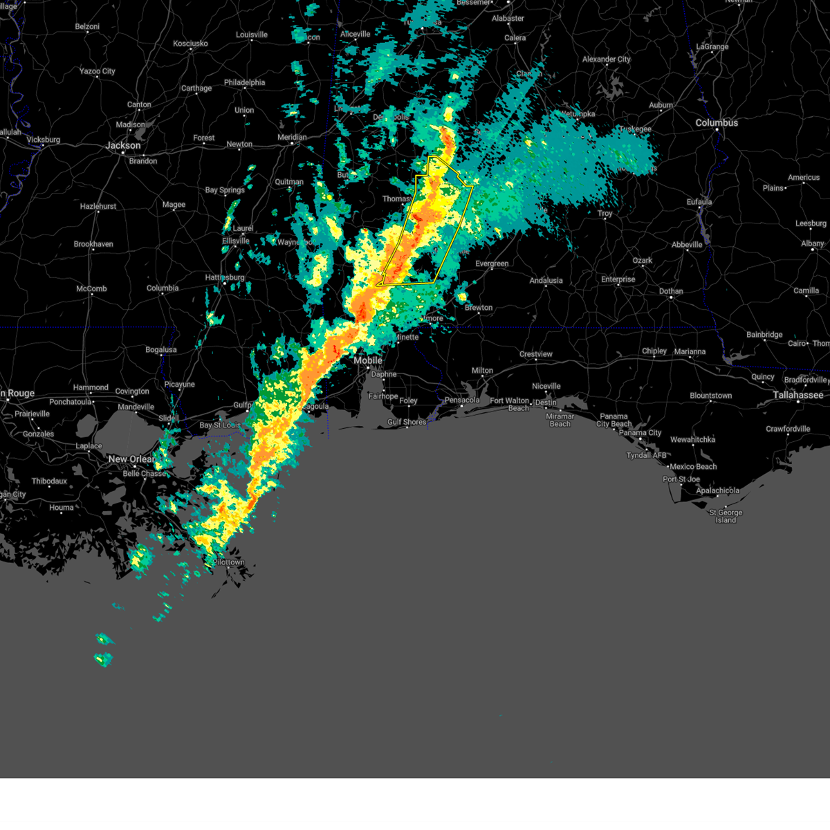
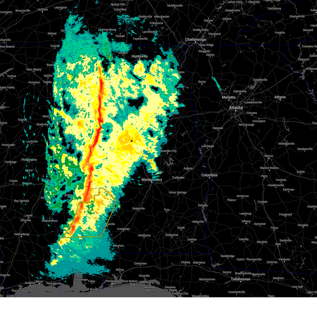
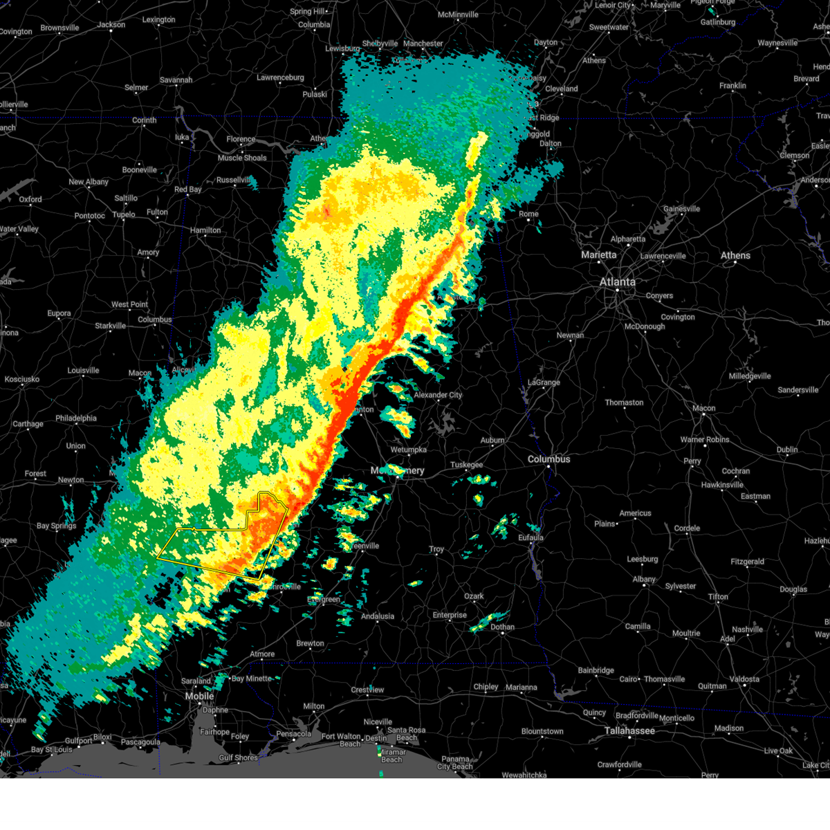
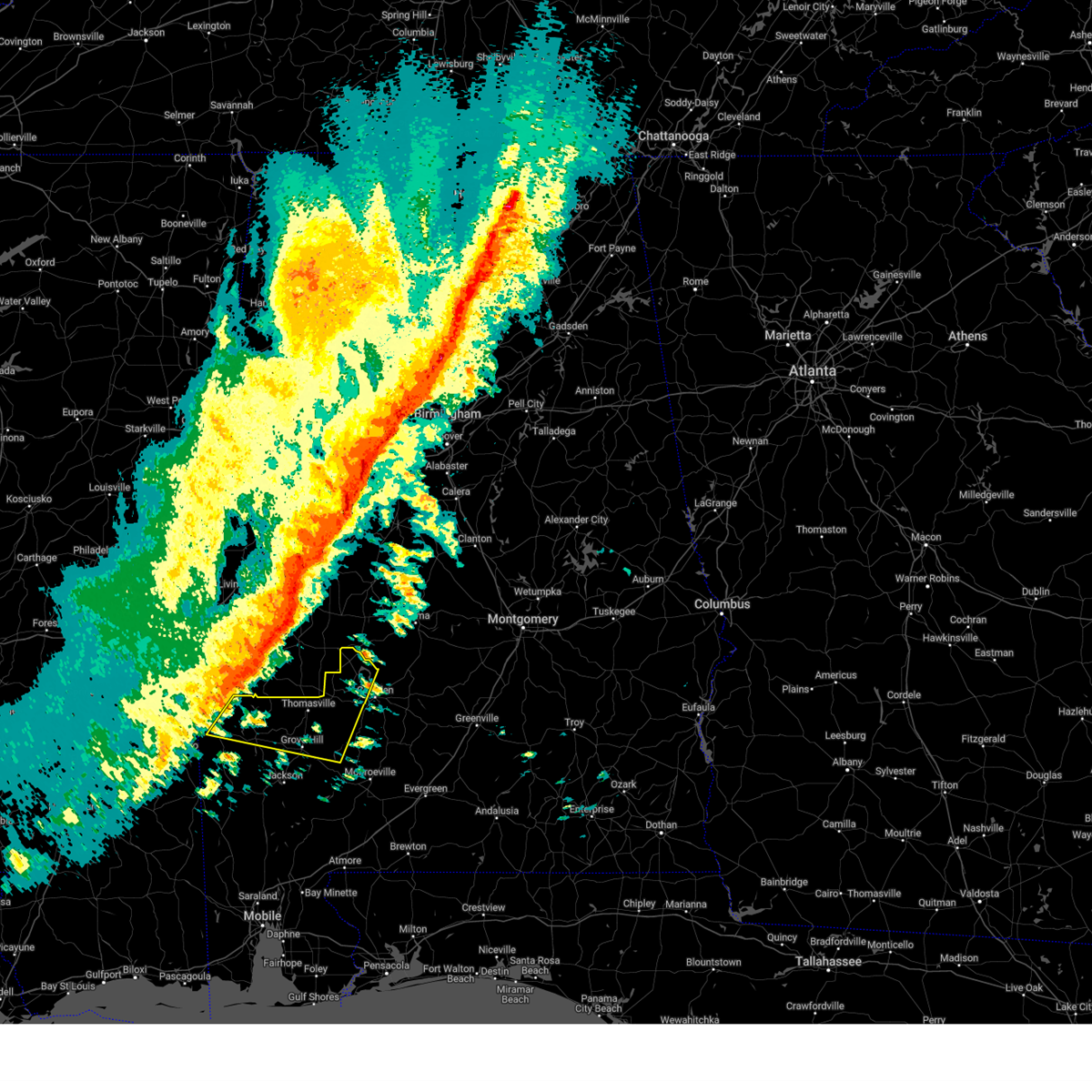
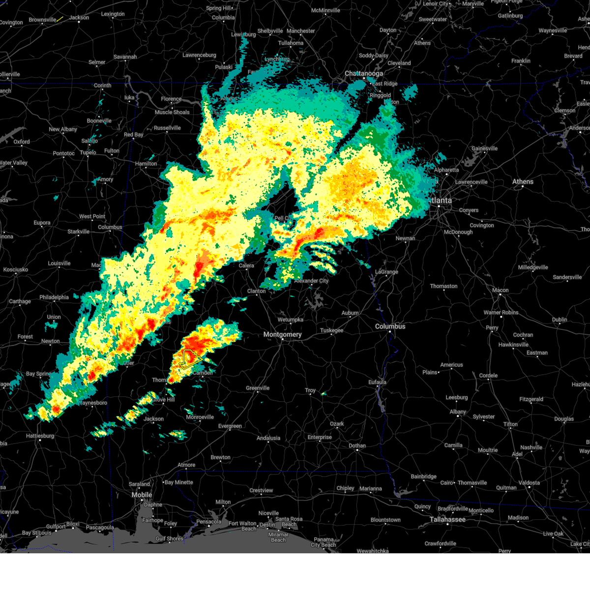
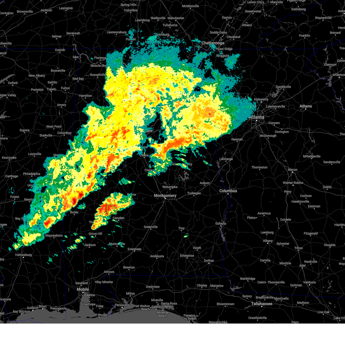
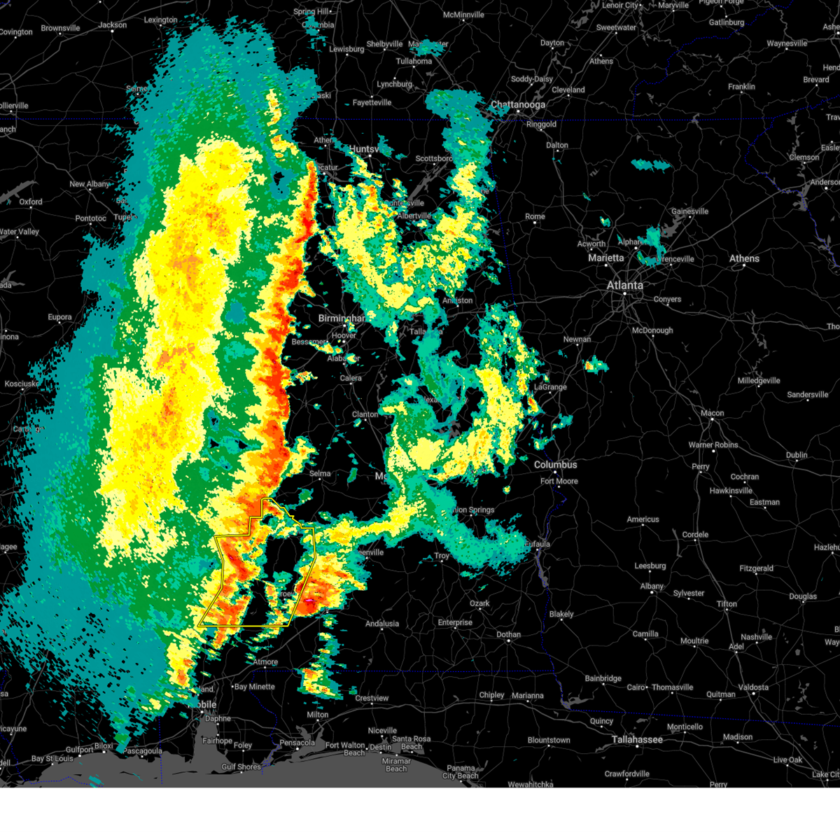
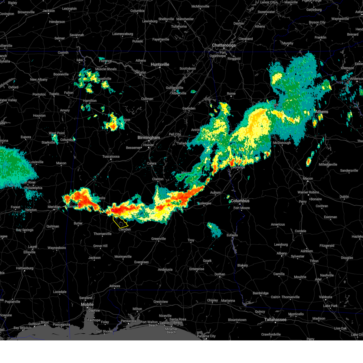
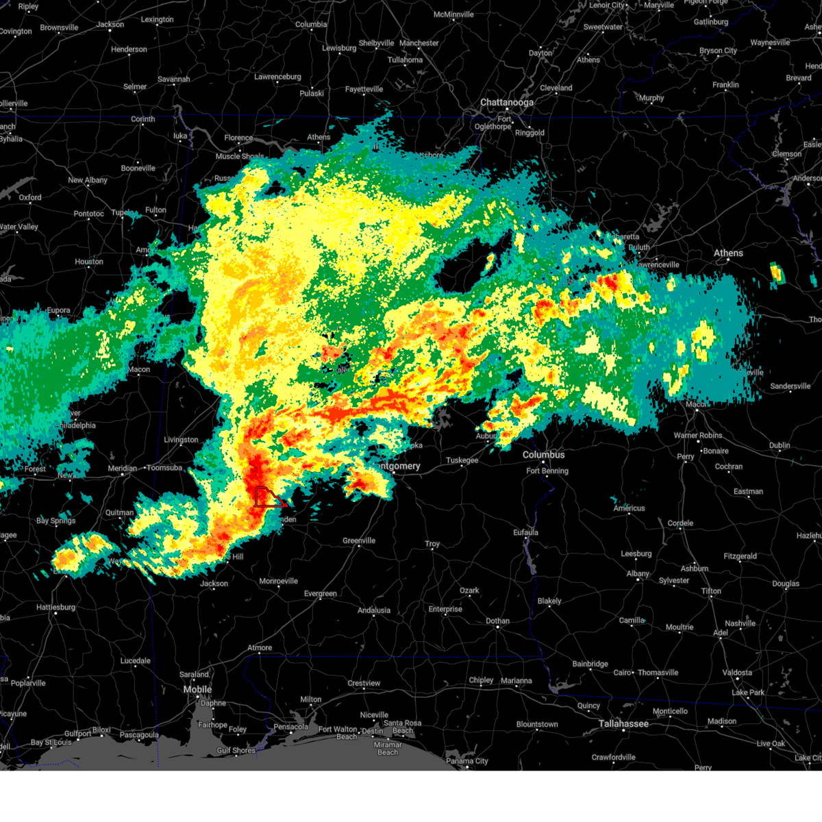
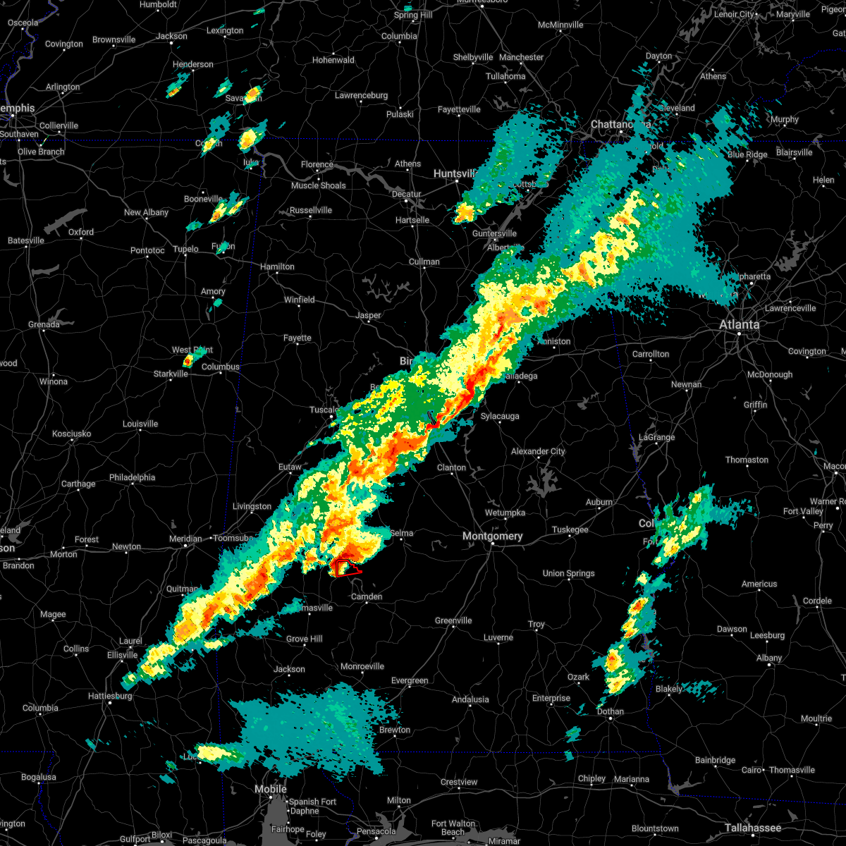
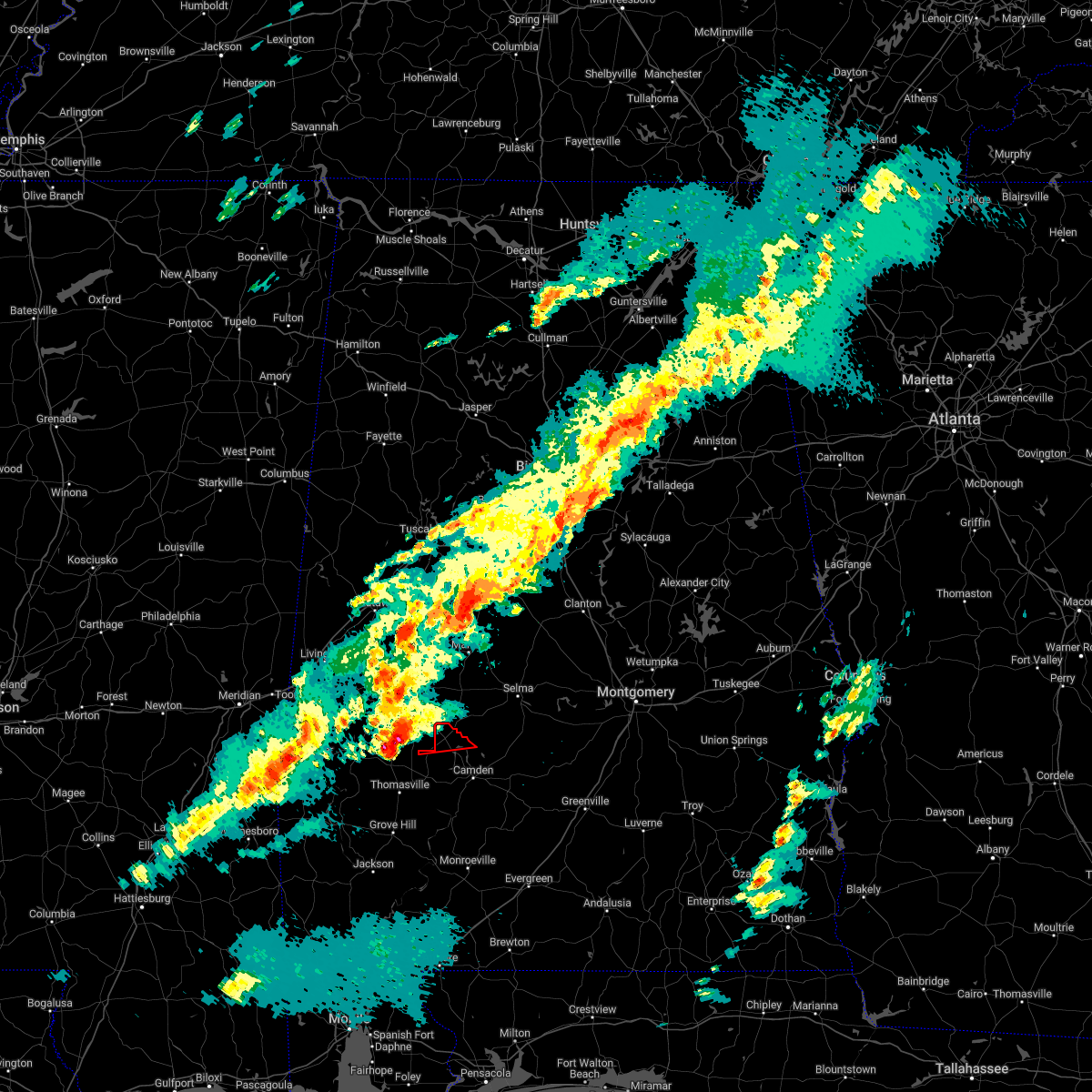
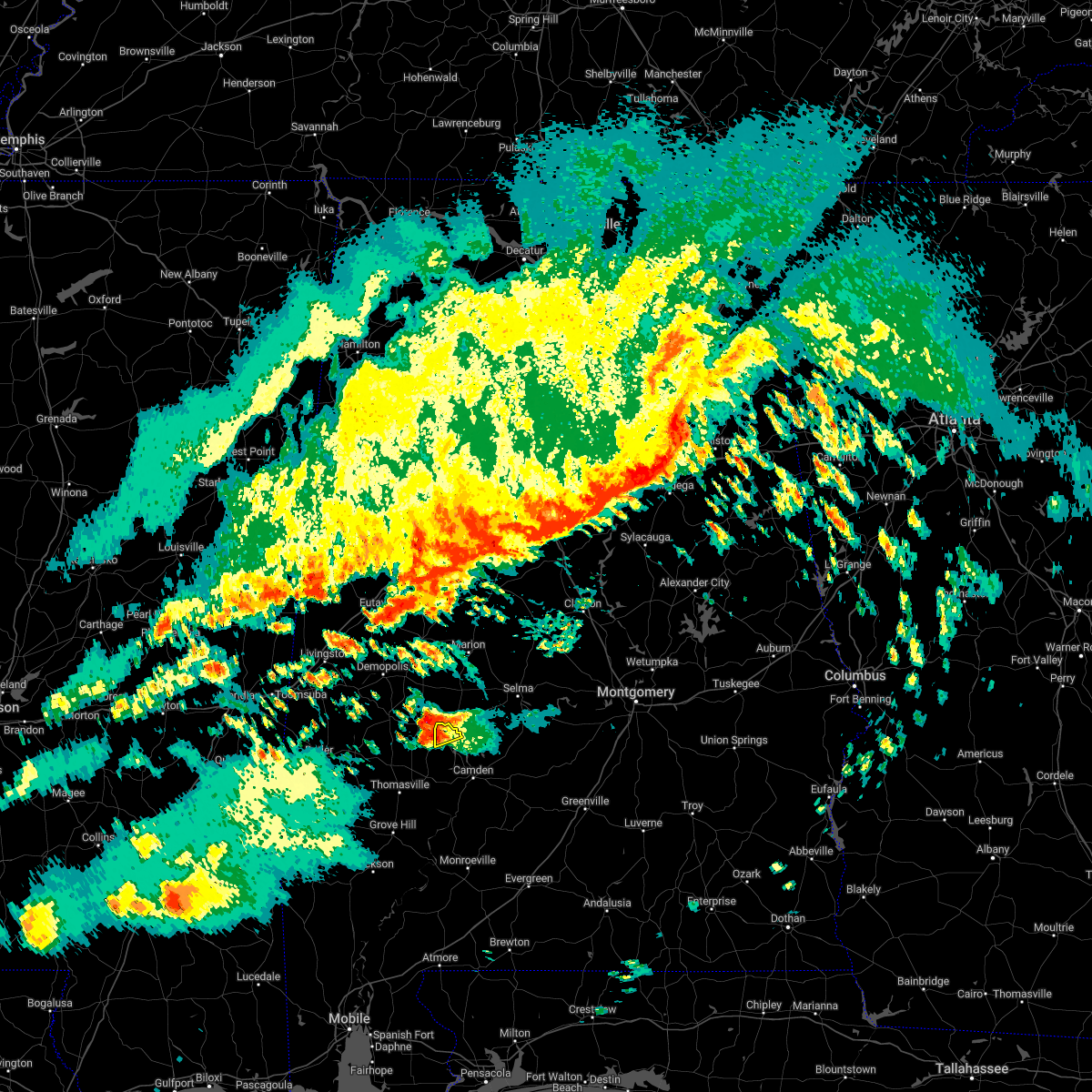
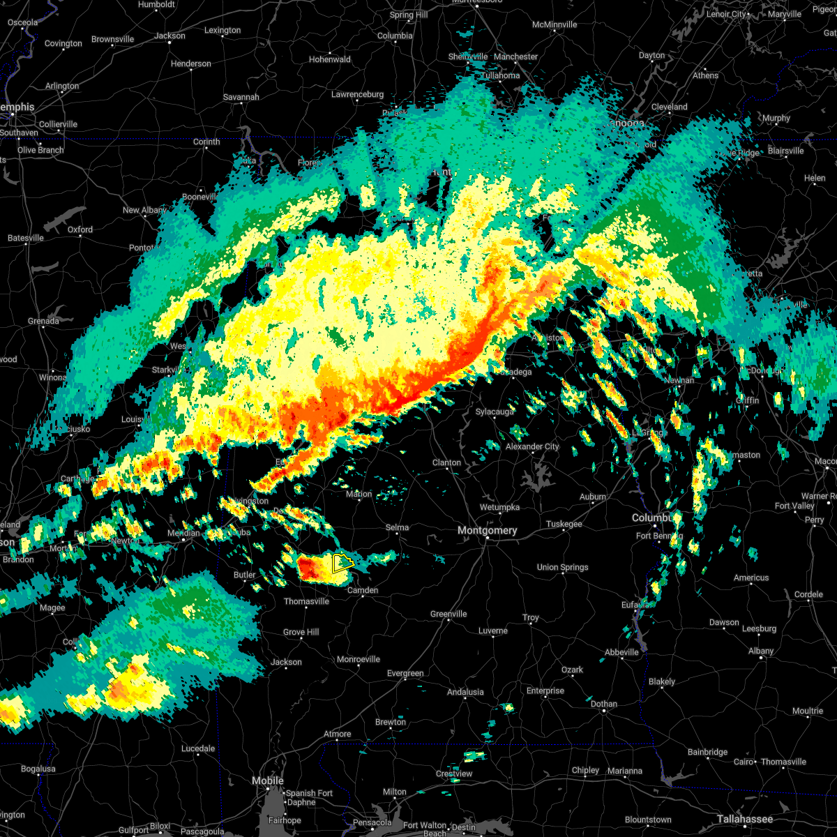
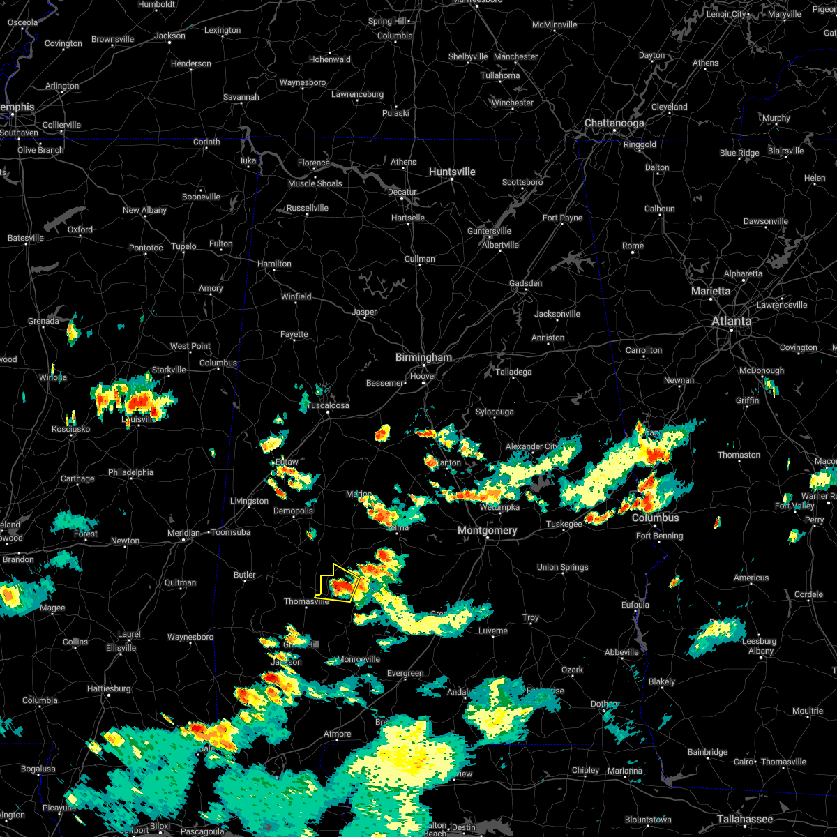
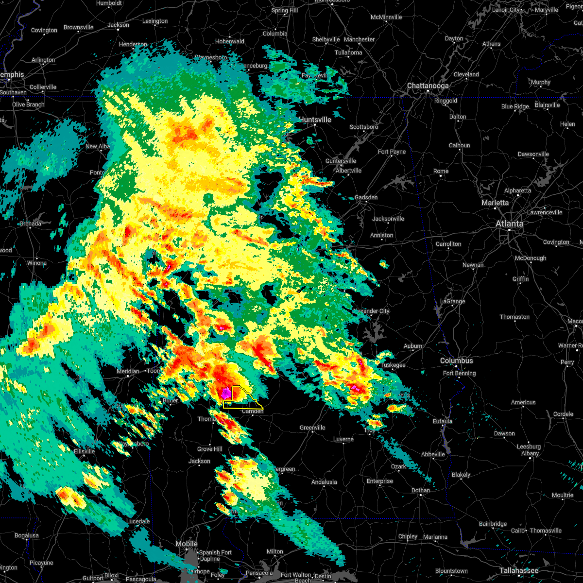
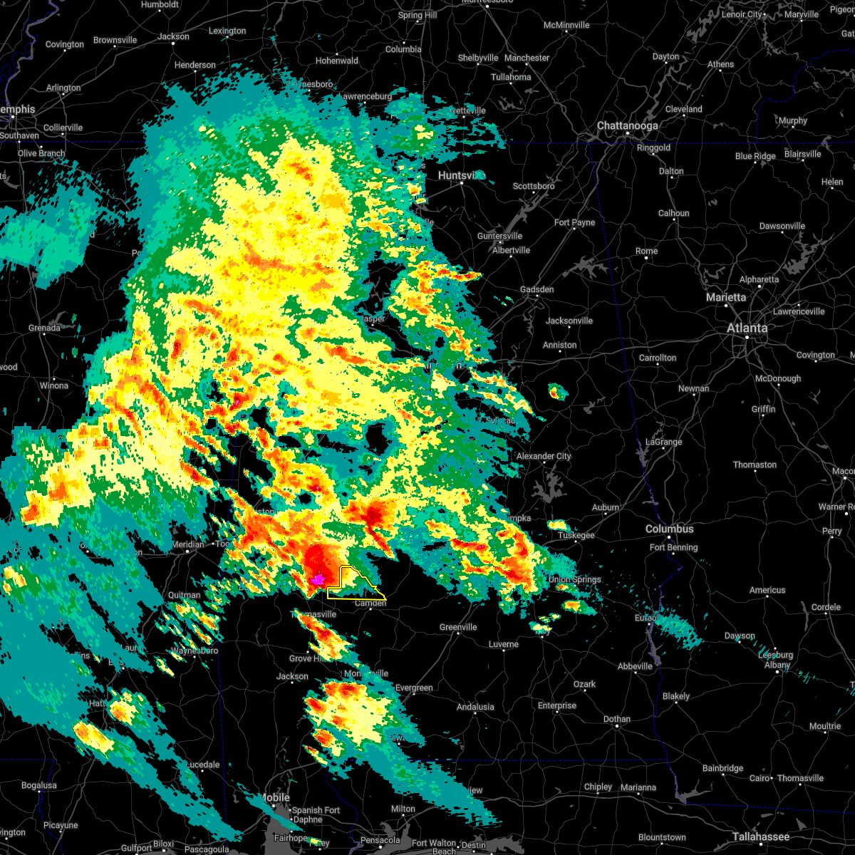
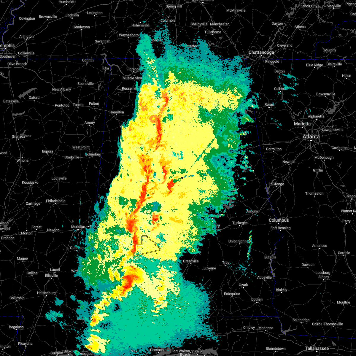
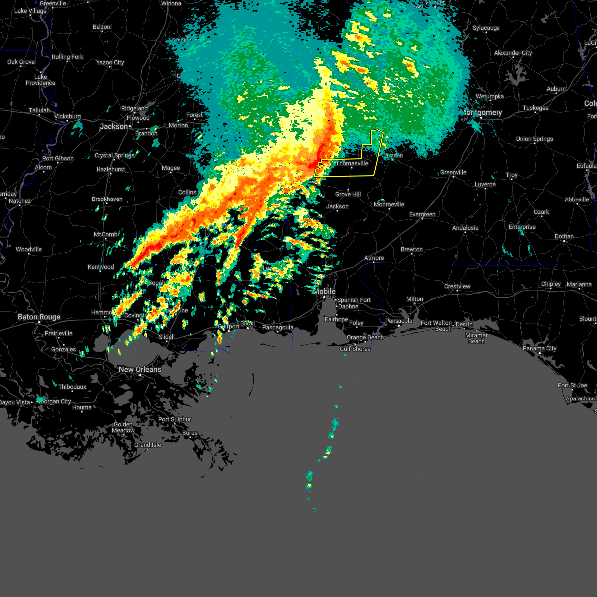
Hail Map for Catherine, AL
The Catherine, AL area has had 1 report of on-the-ground hail by trained spotters, and has been under severe weather warnings 15 times during the past 12 months. Doppler radar has detected hail at or near Catherine, AL on 58 occasions, including 5 occasions during the past year.
| Name: | Catherine, AL |
| Where Located: | 16.8 miles NW of Camden, AL |
| Map: | Google Map for Catherine, AL |
| Population: | 22 |
| Housing Units: | 14 |
| More Info: | Search Google for Catherine, AL |
0
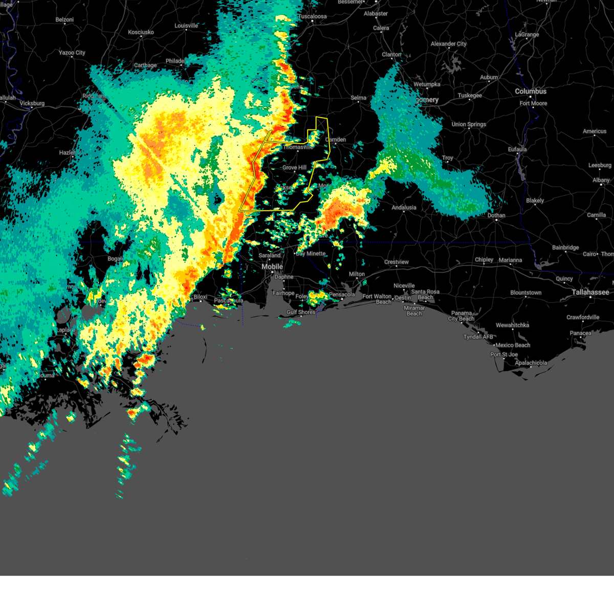
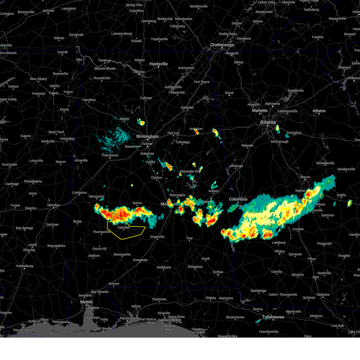
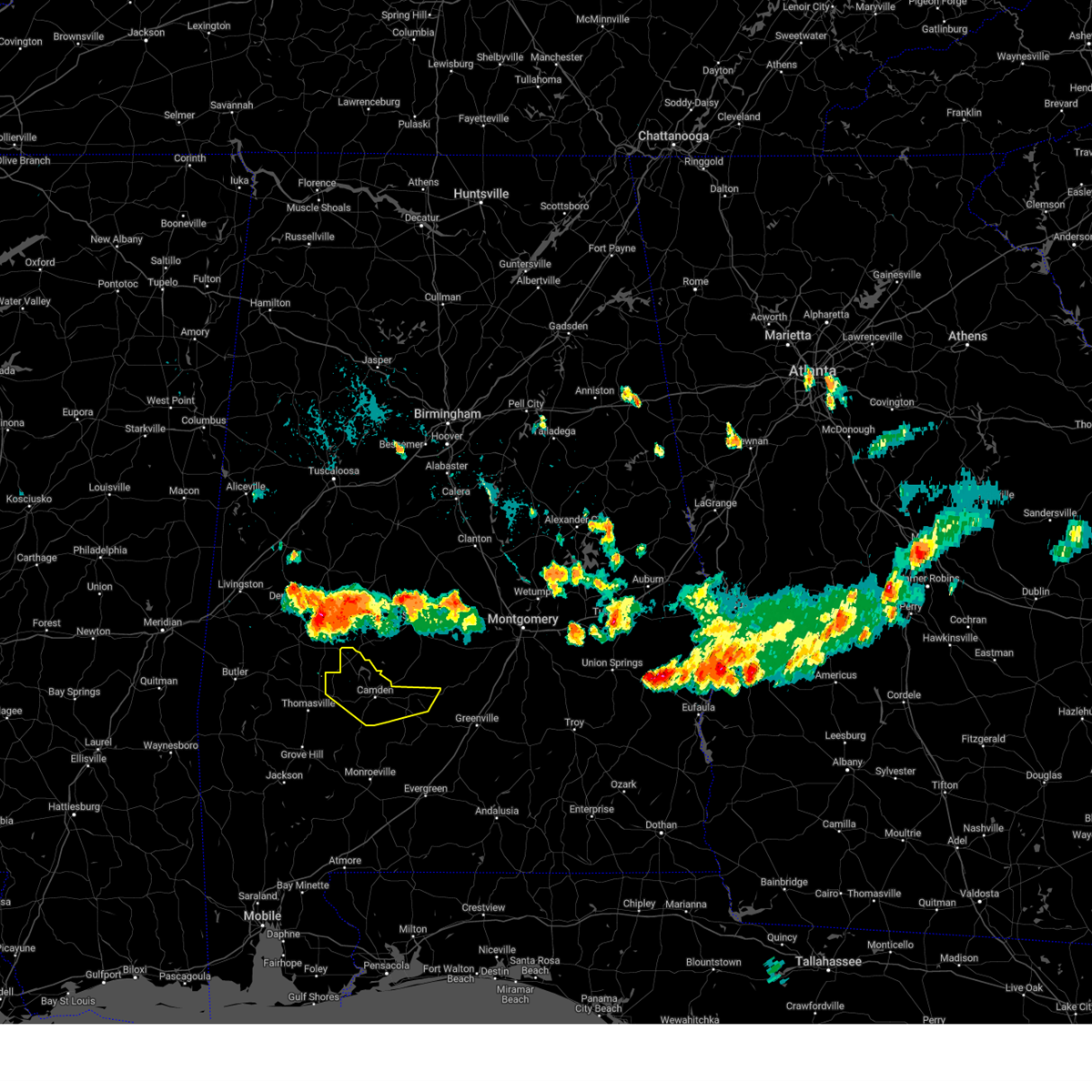
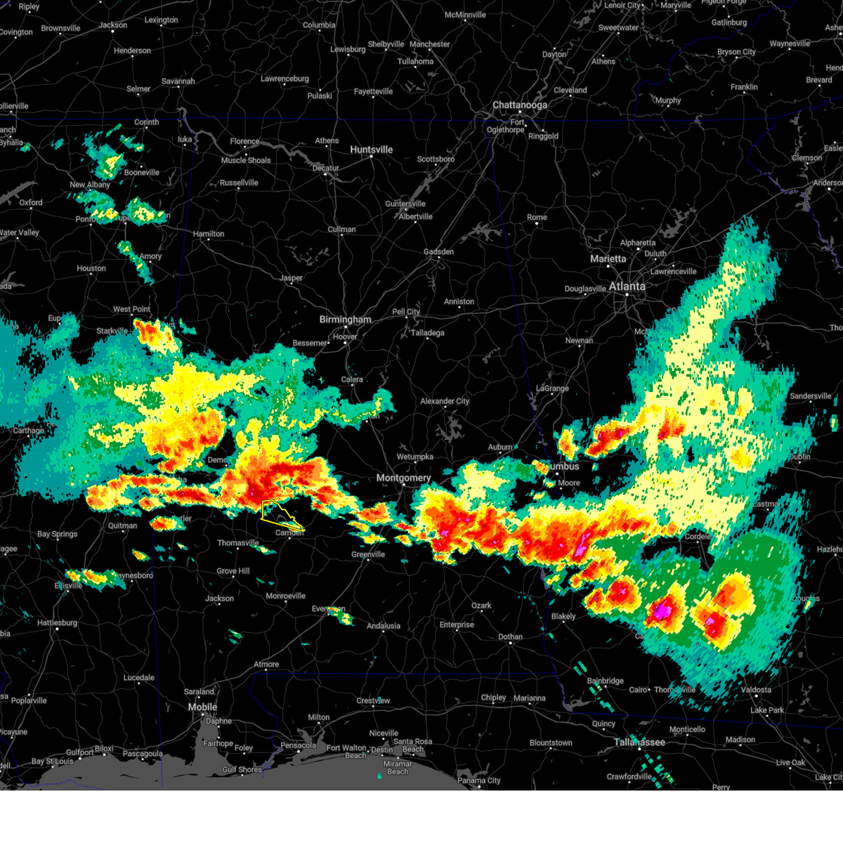
The Top Recent Hail Date for Catherine, AL is Wednesday, June 25, 2025 (58th out of 58)
Hail and Wind Damage Spotted near Catherine, AL
| Date / Time | Report Details |
|---|---|
| 6/8/2025 12:12 PM CDT |
 Svrmob the national weather service in mobile has issued a * severe thunderstorm warning for, western wilcox county in south central alabama, * until 100 pm cdt. * at 1212 pm cdt, a severe thunderstorm was located over surginer, or 12 miles north of thomasville, moving southeast at 30 mph (radar indicated). Hazards include ping pong ball size hail and 60 mph wind gusts. People and animals outdoors will be injured. expect hail damage to roofs, siding, windows, and vehicles. Expect wind damage to roofs, siding, and trees. Svrmob the national weather service in mobile has issued a * severe thunderstorm warning for, western wilcox county in south central alabama, * until 100 pm cdt. * at 1212 pm cdt, a severe thunderstorm was located over surginer, or 12 miles north of thomasville, moving southeast at 30 mph (radar indicated). Hazards include ping pong ball size hail and 60 mph wind gusts. People and animals outdoors will be injured. expect hail damage to roofs, siding, windows, and vehicles. Expect wind damage to roofs, siding, and trees.
|
| 5/26/2025 4:41 PM CDT |
 Svrmob the national weather service in mobile has issued a * severe thunderstorm warning for, western wilcox county in south central alabama, * until 530 pm cdt. * at 441 pm cdt, a severe thunderstorm was located over pine hill, or 10 miles northeast of thomasville, moving northeast at 45 mph (radar indicated). Hazards include 60 mph wind gusts. expect damage to roofs, siding, and trees Svrmob the national weather service in mobile has issued a * severe thunderstorm warning for, western wilcox county in south central alabama, * until 530 pm cdt. * at 441 pm cdt, a severe thunderstorm was located over pine hill, or 10 miles northeast of thomasville, moving northeast at 45 mph (radar indicated). Hazards include 60 mph wind gusts. expect damage to roofs, siding, and trees
|
| 5/24/2025 8:00 PM CDT |
 the severe thunderstorm warning has been cancelled and is no longer in effect the severe thunderstorm warning has been cancelled and is no longer in effect
|
| 5/24/2025 7:25 PM CDT |
 Svrmob the national weather service in mobile has issued a * severe thunderstorm warning for, northeastern clarke county in southwestern alabama, western wilcox county in south central alabama, * until 830 pm cdt. * at 725 pm cdt, severe thunderstorms were located along a line extending from near thomaston to 7 miles southeast of putnam, moving southeast at 15 mph (radar indicated). Hazards include 60 mph wind gusts and quarter size hail. Hail damage to vehicles is expected. Expect wind damage to roofs, siding, and trees. Svrmob the national weather service in mobile has issued a * severe thunderstorm warning for, northeastern clarke county in southwestern alabama, western wilcox county in south central alabama, * until 830 pm cdt. * at 725 pm cdt, severe thunderstorms were located along a line extending from near thomaston to 7 miles southeast of putnam, moving southeast at 15 mph (radar indicated). Hazards include 60 mph wind gusts and quarter size hail. Hail damage to vehicles is expected. Expect wind damage to roofs, siding, and trees.
|
| 3/4/2025 8:27 PM CST |
 At 826 pm cst, severe thunderstorms were located along a line extending from near central mills to 4 miles northeast of whatley to 11 miles east of mcintosh, moving east at 40 mph (radar indicated). Hazards include 60 mph wind gusts. Expect damage to roofs, siding, and trees. Locations impacted include, camden, yellow bluff, vredenburgh, pine hill, and whatley. At 826 pm cst, severe thunderstorms were located along a line extending from near central mills to 4 miles northeast of whatley to 11 miles east of mcintosh, moving east at 40 mph (radar indicated). Hazards include 60 mph wind gusts. Expect damage to roofs, siding, and trees. Locations impacted include, camden, yellow bluff, vredenburgh, pine hill, and whatley.
|
| 3/4/2025 8:27 PM CST |
 the severe thunderstorm warning has been cancelled and is no longer in effect the severe thunderstorm warning has been cancelled and is no longer in effect
|
| 3/4/2025 7:52 PM CST |
 Svrmob the national weather service in mobile has issued a * severe thunderstorm warning for, western monroe county in south central alabama, northern washington county in southwestern alabama, clarke county in southwestern alabama, wilcox county in south central alabama, * until 845 pm cst. * at 752 pm cst, severe thunderstorms were located along a line extending from 3 miles west of freddie jones field to 8 miles northeast of saint stephens to 5 miles southeast of tibbie, moving east at 45 mph (radar indicated). Hazards include 60 mph wind gusts. expect damage to roofs, siding, and trees Svrmob the national weather service in mobile has issued a * severe thunderstorm warning for, western monroe county in south central alabama, northern washington county in southwestern alabama, clarke county in southwestern alabama, wilcox county in south central alabama, * until 845 pm cst. * at 752 pm cst, severe thunderstorms were located along a line extending from 3 miles west of freddie jones field to 8 miles northeast of saint stephens to 5 miles southeast of tibbie, moving east at 45 mph (radar indicated). Hazards include 60 mph wind gusts. expect damage to roofs, siding, and trees
|
| 2/16/2025 1:45 AM CST |
 The storms which prompted the warning have moved out of the area. therefore, the warning has been allowed to expire. a tornado watch remains in effect until 600 am cst for south central and southwestern alabama. The storms which prompted the warning have moved out of the area. therefore, the warning has been allowed to expire. a tornado watch remains in effect until 600 am cst for south central and southwestern alabama.
|
| 2/16/2025 12:49 AM CST |
 Svrmob the national weather service in mobile has issued a * severe thunderstorm warning for, north central monroe county in south central alabama, southwestern choctaw county in southwestern alabama, northern clarke county in southwestern alabama, western wilcox county in south central alabama, * until 145 am cst. * at 1249 am cst, severe thunderstorms were located along a line extending from 4 miles south of demopolis to 5 miles west of gilbertown to 4 miles northeast of waynesboro, moving east at 45 mph (radar indicated). Hazards include 60 mph wind gusts. expect damage to roofs, siding, and trees Svrmob the national weather service in mobile has issued a * severe thunderstorm warning for, north central monroe county in south central alabama, southwestern choctaw county in southwestern alabama, northern clarke county in southwestern alabama, western wilcox county in south central alabama, * until 145 am cst. * at 1249 am cst, severe thunderstorms were located along a line extending from 4 miles south of demopolis to 5 miles west of gilbertown to 4 miles northeast of waynesboro, moving east at 45 mph (radar indicated). Hazards include 60 mph wind gusts. expect damage to roofs, siding, and trees
|
| 2/12/2025 7:32 PM CST |
 the severe thunderstorm warning has been cancelled and is no longer in effect the severe thunderstorm warning has been cancelled and is no longer in effect
|
| 2/12/2025 7:21 PM CST |
 Svrmob the national weather service in mobile has issued a * severe thunderstorm warning for, northwestern wilcox county in south central alabama, * until 745 pm cst. * at 721 pm cst, a severe thunderstorm was located 7 miles south of consul, or 16 miles northwest of camden, moving northeast at 45 mph (radar indicated). Hazards include 60 mph wind gusts. Expect damage to roofs, siding, and trees. This severe thunderstorm will remain over mainly rural areas of northwestern wilcox county. Svrmob the national weather service in mobile has issued a * severe thunderstorm warning for, northwestern wilcox county in south central alabama, * until 745 pm cst. * at 721 pm cst, a severe thunderstorm was located 7 miles south of consul, or 16 miles northwest of camden, moving northeast at 45 mph (radar indicated). Hazards include 60 mph wind gusts. Expect damage to roofs, siding, and trees. This severe thunderstorm will remain over mainly rural areas of northwestern wilcox county.
|
| 12/28/2024 10:57 PM CST |
 Svrmob the national weather service in mobile has issued a * severe thunderstorm warning for, monroe county in south central alabama, east central washington county in southwestern alabama, clarke county in southwestern alabama, wilcox county in south central alabama, west central conecuh county in south central alabama, * until midnight cst. * at 1057 pm cst, severe thunderstorms were located along a line extending from 6 miles southwest of dixons mill to 5 miles northwest of fulton to 5 miles southwest of grove hill to 3 miles east of wagarville, moving northeast at 40 mph (radar indicated). Hazards include 60 mph wind gusts. expect damage to roofs, siding, and trees Svrmob the national weather service in mobile has issued a * severe thunderstorm warning for, monroe county in south central alabama, east central washington county in southwestern alabama, clarke county in southwestern alabama, wilcox county in south central alabama, west central conecuh county in south central alabama, * until midnight cst. * at 1057 pm cst, severe thunderstorms were located along a line extending from 6 miles southwest of dixons mill to 5 miles northwest of fulton to 5 miles southwest of grove hill to 3 miles east of wagarville, moving northeast at 40 mph (radar indicated). Hazards include 60 mph wind gusts. expect damage to roofs, siding, and trees
|
| 12/28/2024 10:19 PM CST |
 Svrmob the national weather service in mobile has issued a * severe thunderstorm warning for, northwestern monroe county in south central alabama, south central choctaw county in southwestern alabama, central washington county in southwestern alabama, clarke county in southwestern alabama, western wilcox county in south central alabama, * until 1100 pm cst. * at 1019 pm cst, severe thunderstorms were located along a line extending from 3 miles south of butler to near silas to 7 miles southwest of millry to 9 miles southwest of state line, moving east at 50 mph (radar indicated). Hazards include 60 mph wind gusts. expect damage to roofs, siding, and trees Svrmob the national weather service in mobile has issued a * severe thunderstorm warning for, northwestern monroe county in south central alabama, south central choctaw county in southwestern alabama, central washington county in southwestern alabama, clarke county in southwestern alabama, western wilcox county in south central alabama, * until 1100 pm cst. * at 1019 pm cst, severe thunderstorms were located along a line extending from 3 miles south of butler to near silas to 7 miles southwest of millry to 9 miles southwest of state line, moving east at 50 mph (radar indicated). Hazards include 60 mph wind gusts. expect damage to roofs, siding, and trees
|
| 8/18/2024 6:42 PM CDT |
 At 639 pm cdt, severe thunderstorms were located along a line extending from 5 miles northeast of millers ferry to near catherine to 13 miles northwest of catherine, moving southeast at 35 mph (radar indicated). Hazards include 60 mph wind gusts and penny size hail. Expect damage to roofs, siding, and trees. Locations impacted include, camden and yellow bluff. At 639 pm cdt, severe thunderstorms were located along a line extending from 5 miles northeast of millers ferry to near catherine to 13 miles northwest of catherine, moving southeast at 35 mph (radar indicated). Hazards include 60 mph wind gusts and penny size hail. Expect damage to roofs, siding, and trees. Locations impacted include, camden and yellow bluff.
|
| 8/18/2024 6:16 PM CDT |
 Svrmob the national weather service in mobile has issued a * severe thunderstorm warning for, wilcox county in south central alabama, * until 715 pm cdt. * at 615 pm cdt, severe thunderstorms were located along a line extending from bogue chitto to near dayton, moving southeast at 40 mph (radar indicated). Hazards include 60 mph wind gusts and penny size hail. expect damage to roofs, siding, and trees Svrmob the national weather service in mobile has issued a * severe thunderstorm warning for, wilcox county in south central alabama, * until 715 pm cdt. * at 615 pm cdt, severe thunderstorms were located along a line extending from bogue chitto to near dayton, moving southeast at 40 mph (radar indicated). Hazards include 60 mph wind gusts and penny size hail. expect damage to roofs, siding, and trees
|
| 6/19/2023 3:47 AM CDT |
 At 347 am cdt, severe thunderstorms were located along a line extending from near consul to 7 miles south of central mills to 4 miles north of pine hill, moving east at 50 mph (radar indicated). Hazards include 60 mph wind gusts. expect damage to roofs, siding, and trees At 347 am cdt, severe thunderstorms were located along a line extending from near consul to 7 miles south of central mills to 4 miles north of pine hill, moving east at 50 mph (radar indicated). Hazards include 60 mph wind gusts. expect damage to roofs, siding, and trees
|
| 6/18/2023 11:36 AM CDT |
 At 1135 am cdt, severe thunderstorms were located along a line extending from near nanafalia to chatom, moving east at 55 mph (radar indicated). Hazards include 70 mph wind gusts and quarter size hail. Hail damage to vehicles is expected. expect considerable tree damage. Wind damage is also likely to mobile homes, roofs, and outbuildings. At 1135 am cdt, severe thunderstorms were located along a line extending from near nanafalia to chatom, moving east at 55 mph (radar indicated). Hazards include 70 mph wind gusts and quarter size hail. Hail damage to vehicles is expected. expect considerable tree damage. Wind damage is also likely to mobile homes, roofs, and outbuildings.
|
| 6/16/2023 8:52 PM CDT |
 At 851 pm cdt, severe thunderstorms were located along a line extending from 7 miles southwest of lisman to 4 miles northwest of thomasville to 5 miles southwest of old cahaba park, moving south at 35 mph (radar indicated). Hazards include 60 mph wind gusts and half dollar size hail. Hail damage to vehicles is expected. Expect wind damage to roofs, siding, and trees. At 851 pm cdt, severe thunderstorms were located along a line extending from 7 miles southwest of lisman to 4 miles northwest of thomasville to 5 miles southwest of old cahaba park, moving south at 35 mph (radar indicated). Hazards include 60 mph wind gusts and half dollar size hail. Hail damage to vehicles is expected. Expect wind damage to roofs, siding, and trees.
|
| 6/16/2023 8:35 PM CDT |
 At 835 pm cdt, severe thunderstorms were located along a line extending from 6 miles east of snell to sweet water to 3 miles southwest of bogue chitto, moving south at 35 mph (radar indicated). Hazards include 60 mph wind gusts and quarter size hail. Hail damage to vehicles is expected. expect wind damage to roofs, siding, and trees. locations impacted include, thomasville, camden, butler, pine hill, lisman, pennington, gilbertown, yellow bluff and toxey. hail threat, radar indicated max hail size, 1. 00 in wind threat, radar indicated max wind gust, 60 mph. At 835 pm cdt, severe thunderstorms were located along a line extending from 6 miles east of snell to sweet water to 3 miles southwest of bogue chitto, moving south at 35 mph (radar indicated). Hazards include 60 mph wind gusts and quarter size hail. Hail damage to vehicles is expected. expect wind damage to roofs, siding, and trees. locations impacted include, thomasville, camden, butler, pine hill, lisman, pennington, gilbertown, yellow bluff and toxey. hail threat, radar indicated max hail size, 1. 00 in wind threat, radar indicated max wind gust, 60 mph.
|
| 6/16/2023 8:00 PM CDT |
 At 759 pm cdt, severe thunderstorms were located along a line extending from 3 miles southeast of lauderdale to 4 miles west of jefferson to 5 miles east of newbern, moving south at 25 mph (radar indicated). Hazards include 60 mph wind gusts and quarter size hail. Hail damage to vehicles is expected. Expect wind damage to roofs, siding, and trees. At 759 pm cdt, severe thunderstorms were located along a line extending from 3 miles southeast of lauderdale to 4 miles west of jefferson to 5 miles east of newbern, moving south at 25 mph (radar indicated). Hazards include 60 mph wind gusts and quarter size hail. Hail damage to vehicles is expected. Expect wind damage to roofs, siding, and trees.
|
| 6/16/2023 7:56 AM CDT |
 At 756 am cdt, severe thunderstorms were located along a line extending from 5 miles northeast of magnolia to 4 miles east of fulton to 10 miles south of jackson, moving east at 55 mph (radar indicated). Hazards include 70 mph wind gusts. Expect considerable tree damage. damage is likely to mobile homes, roofs, and outbuildings. locations impacted include, jackson, waynesboro, thomasville, camden, butler, grove hill, chatom, wagarville, saint stephens, leroy, clara, whatley, pine hill, lisman, millry, state line, buckatunna, silas, coffeeville and pennington. thunderstorm damage threat, considerable hail threat, radar indicated max hail size, <. 75 in wind threat, radar indicated max wind gust, 70 mph. At 756 am cdt, severe thunderstorms were located along a line extending from 5 miles northeast of magnolia to 4 miles east of fulton to 10 miles south of jackson, moving east at 55 mph (radar indicated). Hazards include 70 mph wind gusts. Expect considerable tree damage. damage is likely to mobile homes, roofs, and outbuildings. locations impacted include, jackson, waynesboro, thomasville, camden, butler, grove hill, chatom, wagarville, saint stephens, leroy, clara, whatley, pine hill, lisman, millry, state line, buckatunna, silas, coffeeville and pennington. thunderstorm damage threat, considerable hail threat, radar indicated max hail size, <. 75 in wind threat, radar indicated max wind gust, 70 mph.
|
| 6/16/2023 7:16 AM CDT |
 At 715 am cdt, severe thunderstorms were located along a line extending from 7 miles west of pennington to 5 miles southeast of gilbertown to 3 miles east of state line, moving east at 55 mph (radar indicated). Hazards include 60 mph wind gusts and quarter size hail. Hail damage to vehicles is expected. Expect wind damage to roofs, siding, and trees. At 715 am cdt, severe thunderstorms were located along a line extending from 7 miles west of pennington to 5 miles southeast of gilbertown to 3 miles east of state line, moving east at 55 mph (radar indicated). Hazards include 60 mph wind gusts and quarter size hail. Hail damage to vehicles is expected. Expect wind damage to roofs, siding, and trees.
|
| 6/15/2023 11:32 AM CDT |
 At 1131 am cdt, severe thunderstorms were located along a line extending from thomaston to 4 miles southeast of magnolia to near surginer, moving east at 35 mph (radar indicated). Hazards include 70 mph wind gusts. Expect considerable tree damage. damage is likely to mobile homes, roofs, and outbuildings. locations impacted include, camden, pine hill and yellow bluff. thunderstorm damage threat, considerable hail threat, radar indicated max hail size, <. 75 in wind threat, radar indicated max wind gust, 70 mph. At 1131 am cdt, severe thunderstorms were located along a line extending from thomaston to 4 miles southeast of magnolia to near surginer, moving east at 35 mph (radar indicated). Hazards include 70 mph wind gusts. Expect considerable tree damage. damage is likely to mobile homes, roofs, and outbuildings. locations impacted include, camden, pine hill and yellow bluff. thunderstorm damage threat, considerable hail threat, radar indicated max hail size, <. 75 in wind threat, radar indicated max wind gust, 70 mph.
|
| 6/15/2023 11:15 AM CDT |
 At 1115 am cdt, severe thunderstorms were located along a line extending from chickasaw state park to near miller to near sweet water, moving east at 55 mph (radar indicated). Hazards include 70 mph wind gusts. Expect considerable tree damage. Damage is likely to mobile homes, roofs, and outbuildings. At 1115 am cdt, severe thunderstorms were located along a line extending from chickasaw state park to near miller to near sweet water, moving east at 55 mph (radar indicated). Hazards include 70 mph wind gusts. Expect considerable tree damage. Damage is likely to mobile homes, roofs, and outbuildings.
|
| 6/15/2023 1:28 AM CDT |
 At 127 am cdt, a severe thunderstorm was located over dixons mill, or 9 miles northwest of thomasville, moving east at 40 mph (radar indicated). Hazards include golf ball size hail and 60 mph wind gusts. People and animals outdoors will be injured. expect hail damage to roofs, siding, windows, and vehicles. Expect wind damage to roofs, siding, and trees. At 127 am cdt, a severe thunderstorm was located over dixons mill, or 9 miles northwest of thomasville, moving east at 40 mph (radar indicated). Hazards include golf ball size hail and 60 mph wind gusts. People and animals outdoors will be injured. expect hail damage to roofs, siding, windows, and vehicles. Expect wind damage to roofs, siding, and trees.
|
| 6/14/2023 4:37 PM CDT |
 At 435 pm cdt, a severe thunderstorm was located over thomaston, or 12 miles southwest of uniontown, moving east at 35 mph (radar indicated). Hazards include 60 mph wind gusts and quarter size hail. Hail damage to vehicles is expected. expect wind damage to roofs, siding, and trees. this severe thunderstorm will remain over mainly rural areas of northwestern wilcox county. hail threat, radar indicated max hail size, 1. 00 in wind threat, radar indicated max wind gust, 60 mph. At 435 pm cdt, a severe thunderstorm was located over thomaston, or 12 miles southwest of uniontown, moving east at 35 mph (radar indicated). Hazards include 60 mph wind gusts and quarter size hail. Hail damage to vehicles is expected. expect wind damage to roofs, siding, and trees. this severe thunderstorm will remain over mainly rural areas of northwestern wilcox county. hail threat, radar indicated max hail size, 1. 00 in wind threat, radar indicated max wind gust, 60 mph.
|
| 6/12/2023 1:17 AM CDT |
 At 115 am cdt, a severe thunderstorm was located near central mills, or 8 miles south of uniontown, moving southeast at 30 mph (radar indicated). Hazards include 60 mph wind gusts and half dollar size hail. Hail damage to vehicles is expected. expect wind damage to roofs, siding, and trees. this severe thunderstorm will remain over mainly rural areas of northwestern wilcox county. hail threat, radar indicated max hail size, 1. 25 in wind threat, radar indicated max wind gust, 60 mph. At 115 am cdt, a severe thunderstorm was located near central mills, or 8 miles south of uniontown, moving southeast at 30 mph (radar indicated). Hazards include 60 mph wind gusts and half dollar size hail. Hail damage to vehicles is expected. expect wind damage to roofs, siding, and trees. this severe thunderstorm will remain over mainly rural areas of northwestern wilcox county. hail threat, radar indicated max hail size, 1. 25 in wind threat, radar indicated max wind gust, 60 mph.
|
| 3/26/2023 8:40 PM CDT |
 At 840 pm cdt, a severe thunderstorm capable of producing a tornado was located 5 miles southeast of consul, or 17 miles south of uniontown, moving east at 40 mph (radar indicated rotation). Hazards include tornado. Flying debris will be dangerous to those caught without shelter. mobile homes will be damaged or destroyed. damage to roofs, windows, and vehicles will occur. tree damage is likely. This tornadic thunderstorm will remain over mainly rural areas of northwestern wilcox county. At 840 pm cdt, a severe thunderstorm capable of producing a tornado was located 5 miles southeast of consul, or 17 miles south of uniontown, moving east at 40 mph (radar indicated rotation). Hazards include tornado. Flying debris will be dangerous to those caught without shelter. mobile homes will be damaged or destroyed. damage to roofs, windows, and vehicles will occur. tree damage is likely. This tornadic thunderstorm will remain over mainly rural areas of northwestern wilcox county.
|
| 3/26/2023 8:35 PM CDT |
 At 834 pm cdt, severe thunderstorms were located along a line extending from 3 miles south of uniontown to 6 miles south of consul to 5 miles north of pine hill to near shawnee, moving east at 45 mph (radar indicated). Hazards include 60 mph wind gusts and quarter size hail. Hail damage to vehicles is expected. expect wind damage to roofs, siding, and trees. Locations impacted include, camden, pine hill and yellow bluff. At 834 pm cdt, severe thunderstorms were located along a line extending from 3 miles south of uniontown to 6 miles south of consul to 5 miles north of pine hill to near shawnee, moving east at 45 mph (radar indicated). Hazards include 60 mph wind gusts and quarter size hail. Hail damage to vehicles is expected. expect wind damage to roofs, siding, and trees. Locations impacted include, camden, pine hill and yellow bluff.
|
| 3/26/2023 8:25 PM CDT |
 At 824 pm cdt, severe thunderstorms were located along a line extending from near dayton to near magnolia to surginer to 4 miles northwest of thomasville, moving east at 45 mph (radar indicated). Hazards include 60 mph wind gusts and quarter size hail. Hail damage to vehicles is expected. Expect wind damage to roofs, siding, and trees. At 824 pm cdt, severe thunderstorms were located along a line extending from near dayton to near magnolia to surginer to 4 miles northwest of thomasville, moving east at 45 mph (radar indicated). Hazards include 60 mph wind gusts and quarter size hail. Hail damage to vehicles is expected. Expect wind damage to roofs, siding, and trees.
|
| 1/12/2023 12:43 PM CST |
 At 1242 pm cst, severe thunderstorms were located along a line extending from near central mills to 4 miles southeast of silas, moving east at 45 mph (radar indicated). Hazards include 60 mph wind gusts and quarter size hail. Hail damage to vehicles is expected. expect wind damage to roofs, siding, and trees. locations impacted include, thomasville, saint stephens, pine hill, millry and coffeeville. hail threat, radar indicated max hail size, 1. 00 in wind threat, radar indicated max wind gust, 60 mph. At 1242 pm cst, severe thunderstorms were located along a line extending from near central mills to 4 miles southeast of silas, moving east at 45 mph (radar indicated). Hazards include 60 mph wind gusts and quarter size hail. Hail damage to vehicles is expected. expect wind damage to roofs, siding, and trees. locations impacted include, thomasville, saint stephens, pine hill, millry and coffeeville. hail threat, radar indicated max hail size, 1. 00 in wind threat, radar indicated max wind gust, 60 mph.
|
| 1/12/2023 11:54 AM CST |
 At 1154 am cst, severe thunderstorms were located along a line extending from 4 miles south of myrtlewood to 8 miles west of clara, moving east at 45 mph (radar indicated). Hazards include 60 mph wind gusts and quarter size hail. Hail damage to vehicles is expected. Expect wind damage to roofs, siding, and trees. At 1154 am cst, severe thunderstorms were located along a line extending from 4 miles south of myrtlewood to 8 miles west of clara, moving east at 45 mph (radar indicated). Hazards include 60 mph wind gusts and quarter size hail. Hail damage to vehicles is expected. Expect wind damage to roofs, siding, and trees.
|
| 1/12/2023 11:46 AM CST |
 At 1145 am cst, a severe thunderstorm capable of producing a tornado was located near consul, or 14 miles south of uniontown, moving east at 40 mph (radar indicated rotation). Hazards include tornado and quarter size hail. Flying debris will be dangerous to those caught without shelter. mobile homes will be damaged or destroyed. damage to roofs, windows, and vehicles will occur. tree damage is likely. This tornadic thunderstorm will remain over mainly rural areas of northwestern wilcox county. At 1145 am cst, a severe thunderstorm capable of producing a tornado was located near consul, or 14 miles south of uniontown, moving east at 40 mph (radar indicated rotation). Hazards include tornado and quarter size hail. Flying debris will be dangerous to those caught without shelter. mobile homes will be damaged or destroyed. damage to roofs, windows, and vehicles will occur. tree damage is likely. This tornadic thunderstorm will remain over mainly rural areas of northwestern wilcox county.
|
| 1/12/2023 11:28 AM CST |
 At 1128 am cst, a severe thunderstorm capable of producing a tornado was located over miller, or 11 miles south of linden, moving east at 35 mph (radar indicated rotation). Hazards include tornado and ping pong ball size hail. Flying debris will be dangerous to those caught without shelter. mobile homes will be damaged or destroyed. damage to roofs, windows, and vehicles will occur. tree damage is likely. This tornadic thunderstorm will remain over mainly rural areas of northwestern wilcox county. At 1128 am cst, a severe thunderstorm capable of producing a tornado was located over miller, or 11 miles south of linden, moving east at 35 mph (radar indicated rotation). Hazards include tornado and ping pong ball size hail. Flying debris will be dangerous to those caught without shelter. mobile homes will be damaged or destroyed. damage to roofs, windows, and vehicles will occur. tree damage is likely. This tornadic thunderstorm will remain over mainly rural areas of northwestern wilcox county.
|
| 1/4/2023 1:08 AM CST |
 At 107 am cst, a severe thunderstorm was located near vineland, or 7 miles northeast of thomasville, moving northeast at 55 mph (radar indicated). Hazards include 60 mph wind gusts. expect damage to roofs, siding, and trees At 107 am cst, a severe thunderstorm was located near vineland, or 7 miles northeast of thomasville, moving northeast at 55 mph (radar indicated). Hazards include 60 mph wind gusts. expect damage to roofs, siding, and trees
|
| 11/30/2022 1:42 AM CST |
 At 142 am cst, a severe thunderstorm was located 4 miles south of consul, or 17 miles south of uniontown, moving east at 40 mph (radar indicated). Hazards include 60 mph wind gusts and quarter size hail. Hail damage to vehicles is expected. expect wind damage to roofs, siding, and trees. This severe thunderstorm will remain over mainly rural areas of northwestern wilcox county. At 142 am cst, a severe thunderstorm was located 4 miles south of consul, or 17 miles south of uniontown, moving east at 40 mph (radar indicated). Hazards include 60 mph wind gusts and quarter size hail. Hail damage to vehicles is expected. expect wind damage to roofs, siding, and trees. This severe thunderstorm will remain over mainly rural areas of northwestern wilcox county.
|
| 11/30/2022 1:25 AM CST |
 At 125 am cst, a severe thunderstorm was located 4 miles northwest of magnolia, or 9 miles southeast of linden, moving northeast at 50 mph (radar indicated). Hazards include 60 mph wind gusts. Expect damage to roofs, siding, and trees. This severe thunderstorm will remain over mainly rural areas of northwestern wilcox county. At 125 am cst, a severe thunderstorm was located 4 miles northwest of magnolia, or 9 miles southeast of linden, moving northeast at 50 mph (radar indicated). Hazards include 60 mph wind gusts. Expect damage to roofs, siding, and trees. This severe thunderstorm will remain over mainly rural areas of northwestern wilcox county.
|
| 7/21/2022 9:36 PM CDT |
 At 936 pm cdt, severe thunderstorms were located along a line extending from 3 miles south of lisman to 7 miles northwest of peterman to 5 miles north of gantt to 6 miles west of ariton, moving south at 35 mph (radar indicated). Hazards include 60 mph wind gusts and quarter size hail. Hail damage to vehicles is expected. expect wind damage to roofs, siding, and trees. locations impacted include, greenville, monroeville, thomasville, camden, butler, grove hill, peterman, georgiana, whatley, pine hill, lisman, mckenzie, red level, beatrice, coffeeville, pennington, vredenburgh, fulton, gilbertown and yellow bluff. hail threat, radar indicated max hail size, 1. 00 in wind threat, radar indicated max wind gust, 60 mph. At 936 pm cdt, severe thunderstorms were located along a line extending from 3 miles south of lisman to 7 miles northwest of peterman to 5 miles north of gantt to 6 miles west of ariton, moving south at 35 mph (radar indicated). Hazards include 60 mph wind gusts and quarter size hail. Hail damage to vehicles is expected. expect wind damage to roofs, siding, and trees. locations impacted include, greenville, monroeville, thomasville, camden, butler, grove hill, peterman, georgiana, whatley, pine hill, lisman, mckenzie, red level, beatrice, coffeeville, pennington, vredenburgh, fulton, gilbertown and yellow bluff. hail threat, radar indicated max hail size, 1. 00 in wind threat, radar indicated max wind gust, 60 mph.
|
| 7/21/2022 8:45 PM CDT |
 At 844 pm cdt, severe thunderstorms were located along a line extending from near lauderdale to 7 miles north of yellow bluff to 3 miles northwest of greenville to 6 miles north of troy municipal airport, moving south at 35 mph (public). Hazards include 60 mph wind gusts and quarter size hail. Hail damage to vehicles is expected. expect wind damage to roofs, siding, and trees. locations impacted include, greenville, monroeville, thomasville, luverne, camden, butler, grove hill, peterman, georgiana, whatley, pine hill, brantley, lisman, mckenzie, red level, rutledge, beatrice, dozier, coffeeville and pennington. hail threat, radar indicated max hail size, 1. 00 in wind threat, observed max wind gust, 60 mph. At 844 pm cdt, severe thunderstorms were located along a line extending from near lauderdale to 7 miles north of yellow bluff to 3 miles northwest of greenville to 6 miles north of troy municipal airport, moving south at 35 mph (public). Hazards include 60 mph wind gusts and quarter size hail. Hail damage to vehicles is expected. expect wind damage to roofs, siding, and trees. locations impacted include, greenville, monroeville, thomasville, luverne, camden, butler, grove hill, peterman, georgiana, whatley, pine hill, brantley, lisman, mckenzie, red level, rutledge, beatrice, dozier, coffeeville and pennington. hail threat, radar indicated max hail size, 1. 00 in wind threat, observed max wind gust, 60 mph.
|
| 7/21/2022 8:11 PM CDT |
 At 810 pm cdt, severe thunderstorms were located along a line extending from 4 miles southeast of alamucha to near thomaston to mosses to 5 miles south of pike road, moving south at 35 mph (public). Hazards include 60 mph wind gusts and quarter size hail. Hail damage to vehicles is expected. Expect wind damage to roofs, siding, and trees. At 810 pm cdt, severe thunderstorms were located along a line extending from 4 miles southeast of alamucha to near thomaston to mosses to 5 miles south of pike road, moving south at 35 mph (public). Hazards include 60 mph wind gusts and quarter size hail. Hail damage to vehicles is expected. Expect wind damage to roofs, siding, and trees.
|
| 7/14/2022 6:19 PM CDT |
 At 619 pm cdt, a severe thunderstorm was located 7 miles north of yellow bluff, or 10 miles northwest of camden, moving west at 10 mph (radar indicated). Hazards include 60 mph wind gusts. expect damage to roofs, siding, and trees At 619 pm cdt, a severe thunderstorm was located 7 miles north of yellow bluff, or 10 miles northwest of camden, moving west at 10 mph (radar indicated). Hazards include 60 mph wind gusts. expect damage to roofs, siding, and trees
|
| 5/25/2022 7:25 PM CDT |
 The severe thunderstorm warning for north central monroe, northeastern clarke and wilcox counties will expire at 730 pm cdt, the storms which prompted the warning have weakened to below severe limits; therefore, the warning will be allowed to expire at 730 pm cdt. however, gusty winds are still possible with these thunderstorms. The severe thunderstorm warning for north central monroe, northeastern clarke and wilcox counties will expire at 730 pm cdt, the storms which prompted the warning have weakened to below severe limits; therefore, the warning will be allowed to expire at 730 pm cdt. however, gusty winds are still possible with these thunderstorms.
|
| 5/25/2022 6:57 PM CDT |
 At 657 pm cdt, severe thunderstorms were located along a line extending from vineland to 10 miles south of yellow bluff, moving northeast at 30 mph (radar indicated). Hazards include 60 mph wind gusts and penny size hail. Expect damage to roofs, siding, and trees. Locations impacted include, camden, pine hill and yellow bluff. At 657 pm cdt, severe thunderstorms were located along a line extending from vineland to 10 miles south of yellow bluff, moving northeast at 30 mph (radar indicated). Hazards include 60 mph wind gusts and penny size hail. Expect damage to roofs, siding, and trees. Locations impacted include, camden, pine hill and yellow bluff.
|
| 5/25/2022 6:46 PM CDT |
 At 645 pm cdt, severe thunderstorms were located along a line extending from near shawnee to 8 miles east of fulton, moving north at 30 mph (radar indicated). Hazards include 60 mph wind gusts and penny size hail. expect damage to roofs, siding, and trees At 645 pm cdt, severe thunderstorms were located along a line extending from near shawnee to 8 miles east of fulton, moving north at 30 mph (radar indicated). Hazards include 60 mph wind gusts and penny size hail. expect damage to roofs, siding, and trees
|
| 5/25/2022 5:26 PM CDT |
 At 526 pm cdt, a severe thunderstorm was located 7 miles southwest of yellow bluff, or 12 miles east of thomasville, moving northeast at 25 mph (radar indicated). Hazards include 60 mph wind gusts and penny size hail. expect damage to roofs, siding, and trees At 526 pm cdt, a severe thunderstorm was located 7 miles southwest of yellow bluff, or 12 miles east of thomasville, moving northeast at 25 mph (radar indicated). Hazards include 60 mph wind gusts and penny size hail. expect damage to roofs, siding, and trees
|
| 4/13/2022 10:37 PM CDT |
 At 1036 pm cdt, severe thunderstorms were located along a line extending from 10 miles south of central mills to 9 miles east of whatley to 3 miles west of mcintosh, moving east at 55 mph (radar indicated). Hazards include 60 mph wind gusts. expect damage to roofs, siding, and trees At 1036 pm cdt, severe thunderstorms were located along a line extending from 10 miles south of central mills to 9 miles east of whatley to 3 miles west of mcintosh, moving east at 55 mph (radar indicated). Hazards include 60 mph wind gusts. expect damage to roofs, siding, and trees
|
| 4/13/2022 10:25 PM CDT |
 At 1024 pm cdt, severe thunderstorms were located along a line extending from central mills to 4 miles northeast of fulton to 3 miles southeast of tibbie, moving east at 60 mph (radar indicated). Hazards include 70 mph wind gusts and penny size hail. Expect considerable tree damage. damage is likely to mobile homes, roofs, and outbuildings. Locations impacted include, jackson, thomasville, camden, grove hill, chatom, saint stephens, wagarville, leroy, whatley, tibbie, pine hill, fruitdale, vredenburgh, fulton and yellow bluff. At 1024 pm cdt, severe thunderstorms were located along a line extending from central mills to 4 miles northeast of fulton to 3 miles southeast of tibbie, moving east at 60 mph (radar indicated). Hazards include 70 mph wind gusts and penny size hail. Expect considerable tree damage. damage is likely to mobile homes, roofs, and outbuildings. Locations impacted include, jackson, thomasville, camden, grove hill, chatom, saint stephens, wagarville, leroy, whatley, tibbie, pine hill, fruitdale, vredenburgh, fulton and yellow bluff.
|
| 4/13/2022 9:43 PM CDT |
 At 943 pm cdt, severe thunderstorms were located along a line extending from 7 miles northwest of pennington to 4 miles southwest of gilbertown to 3 miles southeast of richton, moving east at 55 mph (radar indicated). Hazards include 70 mph wind gusts and penny size hail. Expect considerable tree damage. Damage is likely to mobile homes, roofs, and outbuildings. At 943 pm cdt, severe thunderstorms were located along a line extending from 7 miles northwest of pennington to 4 miles southwest of gilbertown to 3 miles southeast of richton, moving east at 55 mph (radar indicated). Hazards include 70 mph wind gusts and penny size hail. Expect considerable tree damage. Damage is likely to mobile homes, roofs, and outbuildings.
|
| 4/5/2022 9:43 AM CDT |
 At 942 am cdt, severe thunderstorms were located along a line extending from 8 miles northeast of mcintosh to 9 miles east of jackson to 10 miles east of fulton to near pine hill, moving east at 55 mph (radar indicated). Hazards include 70 mph wind gusts and nickel size hail. Expect considerable tree damage. damage is likely to mobile homes, roofs, and outbuildings. Locations impacted include, monroeville, jackson, thomasville, camden, frisco city, grove hill, chatom, peterman, saint stephens, wagarville, leroy, georgiana, whatley, tibbie, pine hill, mckenzie, excel, beatrice, vredenburgh and fulton. At 942 am cdt, severe thunderstorms were located along a line extending from 8 miles northeast of mcintosh to 9 miles east of jackson to 10 miles east of fulton to near pine hill, moving east at 55 mph (radar indicated). Hazards include 70 mph wind gusts and nickel size hail. Expect considerable tree damage. damage is likely to mobile homes, roofs, and outbuildings. Locations impacted include, monroeville, jackson, thomasville, camden, frisco city, grove hill, chatom, peterman, saint stephens, wagarville, leroy, georgiana, whatley, tibbie, pine hill, mckenzie, excel, beatrice, vredenburgh and fulton.
|
| 4/5/2022 9:26 AM CDT |
 At 925 am cdt, severe thunderstorms were located along a line extending from new augusta to near wagarville to grove hill to shawnee, moving east at 70 mph (radar indicated). Hazards include 70 mph wind gusts and nickel size hail. Expect considerable tree damage. Damage is likely to mobile homes, roofs, and outbuildings. At 925 am cdt, severe thunderstorms were located along a line extending from new augusta to near wagarville to grove hill to shawnee, moving east at 70 mph (radar indicated). Hazards include 70 mph wind gusts and nickel size hail. Expect considerable tree damage. Damage is likely to mobile homes, roofs, and outbuildings.
|
| 4/5/2022 8:57 AM CDT |
 At 856 am cdt, severe thunderstorms were located along a line extending from near myrtlewood to 3 miles northeast of millry to near buckatunna, moving east at 65 mph (radar indicated). Hazards include 70 mph wind gusts and quarter size hail. Hail damage to vehicles is expected. expect considerable tree damage. wind damage is also likely to mobile homes, roofs, and outbuildings. Locations impacted include, jackson, thomasville, butler, grove hill, chatom, saint stephens, leroy, pine hill, millry, buckatunna, silas, coffeeville, pennington, fulton, gilbertown and toxey. At 856 am cdt, severe thunderstorms were located along a line extending from near myrtlewood to 3 miles northeast of millry to near buckatunna, moving east at 65 mph (radar indicated). Hazards include 70 mph wind gusts and quarter size hail. Hail damage to vehicles is expected. expect considerable tree damage. wind damage is also likely to mobile homes, roofs, and outbuildings. Locations impacted include, jackson, thomasville, butler, grove hill, chatom, saint stephens, leroy, pine hill, millry, buckatunna, silas, coffeeville, pennington, fulton, gilbertown and toxey.
|
| 4/5/2022 8:40 AM CDT |
 At 839 am cdt, severe thunderstorms were located along a line extending from 5 miles south of kinterbish to 6 miles southeast of waynesboro to 10 miles southwest of clara, moving east at 60 mph (radar indicated). Hazards include 60 mph wind gusts and quarter size hail. Hail damage to vehicles is expected. Expect wind damage to roofs, siding, and trees. At 839 am cdt, severe thunderstorms were located along a line extending from 5 miles south of kinterbish to 6 miles southeast of waynesboro to 10 miles southwest of clara, moving east at 60 mph (radar indicated). Hazards include 60 mph wind gusts and quarter size hail. Hail damage to vehicles is expected. Expect wind damage to roofs, siding, and trees.
|
| 4/5/2022 8:12 AM CDT |
 At 812 am cdt, a severe thunderstorm was located 10 miles east of coffeeville, or 10 miles northwest of grove hill, moving northeast at 60 mph (radar indicated). Hazards include 60 mph wind gusts and penny size hail. expect damage to roofs, siding, and trees At 812 am cdt, a severe thunderstorm was located 10 miles east of coffeeville, or 10 miles northwest of grove hill, moving northeast at 60 mph (radar indicated). Hazards include 60 mph wind gusts and penny size hail. expect damage to roofs, siding, and trees
|
| 4/5/2022 6:24 AM CDT |
 The severe thunderstorm warning for northwestern wilcox county will expire at 630 am cdt, the storm which prompted the warning has moved out of the area. therefore, the warning will be allowed to expire. The severe thunderstorm warning for northwestern wilcox county will expire at 630 am cdt, the storm which prompted the warning has moved out of the area. therefore, the warning will be allowed to expire.
|
| 4/5/2022 6:03 AM CDT |
 At 602 am cdt, a severe thunderstorm was located 7 miles south of central mills, or 15 miles northwest of camden, moving east at 45 mph (radar indicated). Hazards include two inch hail and 60 mph wind gusts. People and animals outdoors will be injured. expect hail damage to roofs, siding, windows, and vehicles. expect wind damage to roofs, siding, and trees. this severe thunderstorm will remain over mainly rural areas of northwestern wilcox county, including the community of catherine. thunderstorm damage threat, considerable hail threat, radar indicated max hail size, 2. 00 in wind threat, radar indicated max wind gust, 60 mph. At 602 am cdt, a severe thunderstorm was located 7 miles south of central mills, or 15 miles northwest of camden, moving east at 45 mph (radar indicated). Hazards include two inch hail and 60 mph wind gusts. People and animals outdoors will be injured. expect hail damage to roofs, siding, windows, and vehicles. expect wind damage to roofs, siding, and trees. this severe thunderstorm will remain over mainly rural areas of northwestern wilcox county, including the community of catherine. thunderstorm damage threat, considerable hail threat, radar indicated max hail size, 2. 00 in wind threat, radar indicated max wind gust, 60 mph.
|
| 4/5/2022 6:00 AM CDT | Ping Pong Ball sized hail reported 0.2 miles NW of Catherine, AL, pictures on social media of hail of quarter to ping pong ball size. |
| 4/5/2022 5:52 AM CDT |
 At 550 am cdt, a severe thunderstorm was located 4 miles east of magnolia, or 16 miles southeast of linden, moving east at 45 mph (radar indicated). Hazards include two inch hail and 60 mph wind gusts. People and animals outdoors will be injured. expect hail damage to roofs, siding, windows, and vehicles. expect wind damage to roofs, siding, and trees. this severe thunderstorm will remain over mainly rural areas of northwestern wilcox county, near the communities of lamison and catherine. thunderstorm damage threat, considerable hail threat, radar indicated max hail size, 2. 00 in wind threat, radar indicated max wind gust, 60 mph. At 550 am cdt, a severe thunderstorm was located 4 miles east of magnolia, or 16 miles southeast of linden, moving east at 45 mph (radar indicated). Hazards include two inch hail and 60 mph wind gusts. People and animals outdoors will be injured. expect hail damage to roofs, siding, windows, and vehicles. expect wind damage to roofs, siding, and trees. this severe thunderstorm will remain over mainly rural areas of northwestern wilcox county, near the communities of lamison and catherine. thunderstorm damage threat, considerable hail threat, radar indicated max hail size, 2. 00 in wind threat, radar indicated max wind gust, 60 mph.
|
| 4/5/2022 5:43 AM CDT |
 At 542 am cdt, a severe thunderstorm was located over magnolia, or 12 miles southeast of linden, moving east at 45 mph (radar indicated). Hazards include ping pong ball size hail and 60 mph wind gusts. People and animals outdoors will be injured. expect hail damage to roofs, siding, windows, and vehicles. expect wind damage to roofs, siding, and trees. this severe thunderstorm will remain over mainly rural areas of northwestern wilcox county. hail threat, radar indicated max hail size, 1. 50 in wind threat, radar indicated max wind gust, 60 mph. At 542 am cdt, a severe thunderstorm was located over magnolia, or 12 miles southeast of linden, moving east at 45 mph (radar indicated). Hazards include ping pong ball size hail and 60 mph wind gusts. People and animals outdoors will be injured. expect hail damage to roofs, siding, windows, and vehicles. expect wind damage to roofs, siding, and trees. this severe thunderstorm will remain over mainly rural areas of northwestern wilcox county. hail threat, radar indicated max hail size, 1. 50 in wind threat, radar indicated max wind gust, 60 mph.
|
| 3/30/2022 10:17 PM CDT |
 At 1017 pm cdt, severe thunderstorms were located along a line extending from consul to 5 miles northeast of magnolia to 3 miles northeast of thomasville, moving northeast at 60 mph (radar indicated). Hazards include 70 mph wind gusts. Expect considerable tree damage. Damage is likely to mobile homes, roofs, and outbuildings. At 1017 pm cdt, severe thunderstorms were located along a line extending from consul to 5 miles northeast of magnolia to 3 miles northeast of thomasville, moving northeast at 60 mph (radar indicated). Hazards include 70 mph wind gusts. Expect considerable tree damage. Damage is likely to mobile homes, roofs, and outbuildings.
|
| 3/30/2022 9:37 PM CDT |
 At 936 pm cdt, severe thunderstorms were located along a line extending from 4 miles west of putnam to 5 miles south of coffeeville, moving east at 50 mph (radar indicated). Hazards include 70 mph wind gusts. Expect considerable tree damage. Damage is likely to mobile homes, roofs, and outbuildings. At 936 pm cdt, severe thunderstorms were located along a line extending from 4 miles west of putnam to 5 miles south of coffeeville, moving east at 50 mph (radar indicated). Hazards include 70 mph wind gusts. Expect considerable tree damage. Damage is likely to mobile homes, roofs, and outbuildings.
|
| 3/18/2022 7:57 AM CDT |
 The severe thunderstorm warning for north central clarke and wilcox counties will expire at 800 am cdt, the storms which prompted the warning have weakened below severe limits. therefore, the warning will be allowed to expire. however gusty winds are still possible with these thunderstorms. a tornado watch remains in effect until 1000 am cdt for southwestern alabama. a tornado watch also remains in effect until 200 pm cdt for south central alabama. The severe thunderstorm warning for north central clarke and wilcox counties will expire at 800 am cdt, the storms which prompted the warning have weakened below severe limits. therefore, the warning will be allowed to expire. however gusty winds are still possible with these thunderstorms. a tornado watch remains in effect until 1000 am cdt for southwestern alabama. a tornado watch also remains in effect until 200 pm cdt for south central alabama.
|
| 3/18/2022 7:27 AM CDT |
 At 726 am cdt, severe thunderstorms were located along a line extending from near potter station to thomasville, moving east at 45 mph (radar indicated). Hazards include 60 mph wind gusts and penny size hail. Expect damage to roofs, siding, and trees. locations impacted include, thomasville, camden, pine hill and yellow bluff. hail threat, radar indicated max hail size, 0. 75 in wind threat, radar indicated max wind gust, 60 mph. At 726 am cdt, severe thunderstorms were located along a line extending from near potter station to thomasville, moving east at 45 mph (radar indicated). Hazards include 60 mph wind gusts and penny size hail. Expect damage to roofs, siding, and trees. locations impacted include, thomasville, camden, pine hill and yellow bluff. hail threat, radar indicated max hail size, 0. 75 in wind threat, radar indicated max wind gust, 60 mph.
|
| 3/18/2022 6:57 AM CDT |
 At 656 am cdt, severe thunderstorms were located along a line extending from near uniontown to near thomasville, moving east at 45 mph (radar indicated). Hazards include 60 mph wind gusts and penny size hail. expect damage to roofs, siding, and trees At 656 am cdt, severe thunderstorms were located along a line extending from near uniontown to near thomasville, moving east at 45 mph (radar indicated). Hazards include 60 mph wind gusts and penny size hail. expect damage to roofs, siding, and trees
|
| 3/18/2022 6:33 AM CDT |
 At 633 am cdt, severe thunderstorms were located along a line extending from myrtlewood to 6 miles northeast of coffeeville, moving east at 55 mph (radar indicated). Hazards include 70 mph wind gusts and penny size hail. Expect considerable tree damage. damage is likely to mobile homes, roofs, and outbuildings. locations impacted include, thomasville, pine hill and yellow bluff. thunderstorm damage threat, considerable hail threat, radar indicated max hail size, 0. 75 in wind threat, radar indicated max wind gust, 70 mph. At 633 am cdt, severe thunderstorms were located along a line extending from myrtlewood to 6 miles northeast of coffeeville, moving east at 55 mph (radar indicated). Hazards include 70 mph wind gusts and penny size hail. Expect considerable tree damage. damage is likely to mobile homes, roofs, and outbuildings. locations impacted include, thomasville, pine hill and yellow bluff. thunderstorm damage threat, considerable hail threat, radar indicated max hail size, 0. 75 in wind threat, radar indicated max wind gust, 70 mph.
|
| 3/18/2022 6:18 AM CDT |
 At 618 am cdt, severe thunderstorms were located along a line extending from 4 miles north of lisman to 4 miles southwest of silas, moving east at 65 mph (radar indicated). Hazards include 70 mph wind gusts and nickel size hail. Expect considerable tree damage. Damage is likely to mobile homes, roofs, and outbuildings. At 618 am cdt, severe thunderstorms were located along a line extending from 4 miles north of lisman to 4 miles southwest of silas, moving east at 65 mph (radar indicated). Hazards include 70 mph wind gusts and nickel size hail. Expect considerable tree damage. Damage is likely to mobile homes, roofs, and outbuildings.
|
| 2/3/2022 3:51 PM CST |
 At 350 pm cst, a severe thunderstorm was located near yellow bluff, or 8 miles southwest of camden, moving east at 55 mph (radar indicated). Hazards include 60 mph wind gusts. expect damage to roofs, siding, and trees At 350 pm cst, a severe thunderstorm was located near yellow bluff, or 8 miles southwest of camden, moving east at 55 mph (radar indicated). Hazards include 60 mph wind gusts. expect damage to roofs, siding, and trees
|
| 2/3/2022 2:42 PM CST |
 At 240 pm cst, a severe thunderstorm was located over pine hill, or 10 miles east of thomasville, moving northeast at 50 mph (radar indicated). Hazards include 60 mph wind gusts. expect damage to roofs, siding, and trees At 240 pm cst, a severe thunderstorm was located over pine hill, or 10 miles east of thomasville, moving northeast at 50 mph (radar indicated). Hazards include 60 mph wind gusts. expect damage to roofs, siding, and trees
|
| 5/4/2021 5:35 PM CDT |
 At 534 pm cdt, severe thunderstorms were located along a line extending from 3 miles northeast of vineland to 10 miles west of fulton to 7 miles east of millry to near buckatunna, moving east at 40 mph (radar indicated). Hazards include 60 mph wind gusts. Expect damage to roofs, siding, and trees. Locations impacted include, jackson, thomasville, grove hill, saint stephens, leroy, pine hill, millry, buckatunna, coffeeville, fulton and yellow bluff. At 534 pm cdt, severe thunderstorms were located along a line extending from 3 miles northeast of vineland to 10 miles west of fulton to 7 miles east of millry to near buckatunna, moving east at 40 mph (radar indicated). Hazards include 60 mph wind gusts. Expect damage to roofs, siding, and trees. Locations impacted include, jackson, thomasville, grove hill, saint stephens, leroy, pine hill, millry, buckatunna, coffeeville, fulton and yellow bluff.
|
| 5/4/2021 5:33 PM CDT |
 At 532 pm cdt, severe thunderstorms were located along a line extending from 3 miles southeast of consul to 3 miles southeast of thomasville to 8 miles northwest of grove hill to 4 miles southwest of coffeeville, moving east at 55 mph (radar indicated). Hazards include 60 mph wind gusts. expect damage to roofs, siding, and trees At 532 pm cdt, severe thunderstorms were located along a line extending from 3 miles southeast of consul to 3 miles southeast of thomasville to 8 miles northwest of grove hill to 4 miles southwest of coffeeville, moving east at 55 mph (radar indicated). Hazards include 60 mph wind gusts. expect damage to roofs, siding, and trees
|
| 5/4/2021 5:23 PM CDT |
 At 523 pm cdt, severe thunderstorms were located along a line extending from surginer to 7 miles northeast of coffeeville to 4 miles north of millry to 3 miles west of buckatunna, moving east at 45 mph (radar indicated). Hazards include 60 mph wind gusts. Expect damage to roofs, siding, and trees. Locations impacted include, jackson, waynesboro, thomasville, grove hill, saint stephens, leroy, clara, pine hill, millry, buckatunna, silas, coffeeville, fulton and yellow bluff. At 523 pm cdt, severe thunderstorms were located along a line extending from surginer to 7 miles northeast of coffeeville to 4 miles north of millry to 3 miles west of buckatunna, moving east at 45 mph (radar indicated). Hazards include 60 mph wind gusts. Expect damage to roofs, siding, and trees. Locations impacted include, jackson, waynesboro, thomasville, grove hill, saint stephens, leroy, clara, pine hill, millry, buckatunna, silas, coffeeville, fulton and yellow bluff.
|
| 5/4/2021 4:59 PM CDT |
 The national weather service in mobile has issued a * severe thunderstorm warning for. choctaw county in southwestern alabama. northern washington county in southwestern alabama. clarke county in southwestern alabama. Western wilcox county in south central alabama. The national weather service in mobile has issued a * severe thunderstorm warning for. choctaw county in southwestern alabama. northern washington county in southwestern alabama. clarke county in southwestern alabama. Western wilcox county in south central alabama.
|
| 4/10/2021 3:30 AM CDT |
 At 330 am cdt, severe thunderstorms were located along a line extending from 10 miles west of dannelly reservoir to 6 miles southwest of beatrice to 11 miles west of poarch creek reservation to near tanner williams, moving east at 40 mph (radar indicated). Hazards include 60 mph wind gusts. Expect damage to roofs, siding, and trees. Locations impacted include, midtown mobile, downtown mobile, prichard, saraland, bay minette, atmore, monroeville, chickasaw, satsuma, spanish fort, evergreen, camden, creola, century, flomaton, frisco city, loxley, chunchula, stockton and mccullough. At 330 am cdt, severe thunderstorms were located along a line extending from 10 miles west of dannelly reservoir to 6 miles southwest of beatrice to 11 miles west of poarch creek reservation to near tanner williams, moving east at 40 mph (radar indicated). Hazards include 60 mph wind gusts. Expect damage to roofs, siding, and trees. Locations impacted include, midtown mobile, downtown mobile, prichard, saraland, bay minette, atmore, monroeville, chickasaw, satsuma, spanish fort, evergreen, camden, creola, century, flomaton, frisco city, loxley, chunchula, stockton and mccullough.
|
| 4/10/2021 2:59 AM CDT |
 At 259 am cdt, severe thunderstorms were located along a line extending from near magnolia to 9 miles east of whatley to near mount vernon to 4 miles northwest of wade, moving east at 70 mph (radar indicated). Hazards include 60 mph wind gusts. expect damage to roofs, siding, and trees At 259 am cdt, severe thunderstorms were located along a line extending from near magnolia to 9 miles east of whatley to near mount vernon to 4 miles northwest of wade, moving east at 70 mph (radar indicated). Hazards include 60 mph wind gusts. expect damage to roofs, siding, and trees
|
| 4/10/2021 2:44 AM CDT |
 At 244 am cdt, severe thunderstorms were located along a line extending from 3 miles north of thomasville to 5 miles southeast of wagarville to 5 miles south of deer park, moving east at 65 mph (radar indicated). Hazards include 60 mph wind gusts. Expect damage to roofs, siding, and trees. Locations impacted include, jackson, thomasville, grove hill, chatom, saint stephens, wagarville, leroy, deer park, whatley, tibbie, pine hill, calvert, fulton, mcintosh and yellow bluff. At 244 am cdt, severe thunderstorms were located along a line extending from 3 miles north of thomasville to 5 miles southeast of wagarville to 5 miles south of deer park, moving east at 65 mph (radar indicated). Hazards include 60 mph wind gusts. Expect damage to roofs, siding, and trees. Locations impacted include, jackson, thomasville, grove hill, chatom, saint stephens, wagarville, leroy, deer park, whatley, tibbie, pine hill, calvert, fulton, mcintosh and yellow bluff.
|
| 4/10/2021 2:25 AM CDT |
 At 224 am cdt, severe thunderstorms were located along a line extending from 4 miles east of putnam to 4 miles east of fruitdale to 7 miles southwest of leakesville, moving east at 60 mph (radar indicated). Hazards include 60 mph wind gusts. Expect damage to roofs, siding, and trees. Locations impacted include, jackson, thomasville, grove hill, chatom, leakesville, saint stephens, wagarville, leroy, deer park, whatley, tibbie, pine hill, calvert, millry, state line, fruitdale, coffeeville, fulton, mcintosh and yellow bluff. At 224 am cdt, severe thunderstorms were located along a line extending from 4 miles east of putnam to 4 miles east of fruitdale to 7 miles southwest of leakesville, moving east at 60 mph (radar indicated). Hazards include 60 mph wind gusts. Expect damage to roofs, siding, and trees. Locations impacted include, jackson, thomasville, grove hill, chatom, leakesville, saint stephens, wagarville, leroy, deer park, whatley, tibbie, pine hill, calvert, millry, state line, fruitdale, coffeeville, fulton, mcintosh and yellow bluff.
|
| 4/10/2021 1:58 AM CDT |
 At 157 am cdt, severe thunderstorms were located along a line extending from 8 miles northwest of pennington to beaumont, moving east at 65 mph (radar indicated). Hazards include 70 mph wind gusts and quarter size hail. Hail damage to vehicles is expected. expect considerable tree damage. Wind damage is also likely to mobile homes, roofs, and outbuildings. At 157 am cdt, severe thunderstorms were located along a line extending from 8 miles northwest of pennington to beaumont, moving east at 65 mph (radar indicated). Hazards include 70 mph wind gusts and quarter size hail. Hail damage to vehicles is expected. expect considerable tree damage. Wind damage is also likely to mobile homes, roofs, and outbuildings.
|
| 3/31/2021 2:15 PM CDT |
 At 215 pm cdt, a severe thunderstorm was located 6 miles north of camden, moving east at 40 mph (radar indicated). Hazards include 60 mph wind gusts and quarter size hail. Hail damage to vehicles is expected. expect wind damage to roofs, siding, and trees. Locations impacted include, camden and pine hill. At 215 pm cdt, a severe thunderstorm was located 6 miles north of camden, moving east at 40 mph (radar indicated). Hazards include 60 mph wind gusts and quarter size hail. Hail damage to vehicles is expected. expect wind damage to roofs, siding, and trees. Locations impacted include, camden and pine hill.
|
| 3/31/2021 1:43 PM CDT |
 At 143 pm cdt, a severe thunderstorm was located 5 miles northeast of vineland, or 14 miles northeast of thomasville, moving east at 50 mph (radar indicated). Hazards include 60 mph wind gusts and quarter size hail. Hail damage to vehicles is expected. Expect wind damage to roofs, siding, and trees. At 143 pm cdt, a severe thunderstorm was located 5 miles northeast of vineland, or 14 miles northeast of thomasville, moving east at 50 mph (radar indicated). Hazards include 60 mph wind gusts and quarter size hail. Hail damage to vehicles is expected. Expect wind damage to roofs, siding, and trees.
|
| 3/17/2021 8:59 PM CDT |
 A severe thunderstorm warning remains in effect until 915 pm cdt for northwestern monroe. northeastern clarke and wilcox counties. At 858 pm cdt, severe thunderstorms were located along a line extending from near central mills to 10 miles north of yellow bluff to 12 miles southeast of fulton to 7 miles south of whatley, moving northeast at 60 mph. A severe thunderstorm warning remains in effect until 915 pm cdt for northwestern monroe. northeastern clarke and wilcox counties. At 858 pm cdt, severe thunderstorms were located along a line extending from near central mills to 10 miles north of yellow bluff to 12 miles southeast of fulton to 7 miles south of whatley, moving northeast at 60 mph.
|
| 3/17/2021 8:31 PM CDT |
 At 831 pm cdt, severe thunderstorms were located along a line extending from wayne to 5 miles west of thomasville to near leroy to 6 miles northwest of mcintosh, moving northeast at 60 mph (radar indicated). Hazards include 60 mph wind gusts. expect damage to roofs, siding, and trees At 831 pm cdt, severe thunderstorms were located along a line extending from wayne to 5 miles west of thomasville to near leroy to 6 miles northwest of mcintosh, moving northeast at 60 mph (radar indicated). Hazards include 60 mph wind gusts. expect damage to roofs, siding, and trees
|
| 3/17/2021 5:53 PM CDT |
 At 552 pm cdt, a severe thunderstorm capable of producing a tornado was located over vineland, or 11 miles northeast of thomasville, moving northeast at 40 mph (radar indicated rotation). Hazards include tornado. Flying debris will be dangerous to those caught without shelter. mobile homes will be damaged or destroyed. damage to roofs, windows, and vehicles will occur. tree damage is likely. This tornadic thunderstorm will remain over mainly rural areas of northwestern wilcox county. At 552 pm cdt, a severe thunderstorm capable of producing a tornado was located over vineland, or 11 miles northeast of thomasville, moving northeast at 40 mph (radar indicated rotation). Hazards include tornado. Flying debris will be dangerous to those caught without shelter. mobile homes will be damaged or destroyed. damage to roofs, windows, and vehicles will occur. tree damage is likely. This tornadic thunderstorm will remain over mainly rural areas of northwestern wilcox county.
|
| 3/17/2021 4:00 PM CDT |
 At 400 pm cdt, a severe thunderstorm capable of producing a tornado was located 4 miles southeast of consul, or 15 miles south of uniontown, moving northeast at 45 mph (radar indicated rotation). Hazards include tornado and quarter size hail. Flying debris will be dangerous to those caught without shelter. mobile homes will be damaged or destroyed. damage to roofs, windows, and vehicles will occur. tree damage is likely. This tornadic thunderstorm will remain over mainly rural areas of northwestern wilcox county. At 400 pm cdt, a severe thunderstorm capable of producing a tornado was located 4 miles southeast of consul, or 15 miles south of uniontown, moving northeast at 45 mph (radar indicated rotation). Hazards include tornado and quarter size hail. Flying debris will be dangerous to those caught without shelter. mobile homes will be damaged or destroyed. damage to roofs, windows, and vehicles will occur. tree damage is likely. This tornadic thunderstorm will remain over mainly rural areas of northwestern wilcox county.
|
| 3/17/2021 3:55 PM CDT |
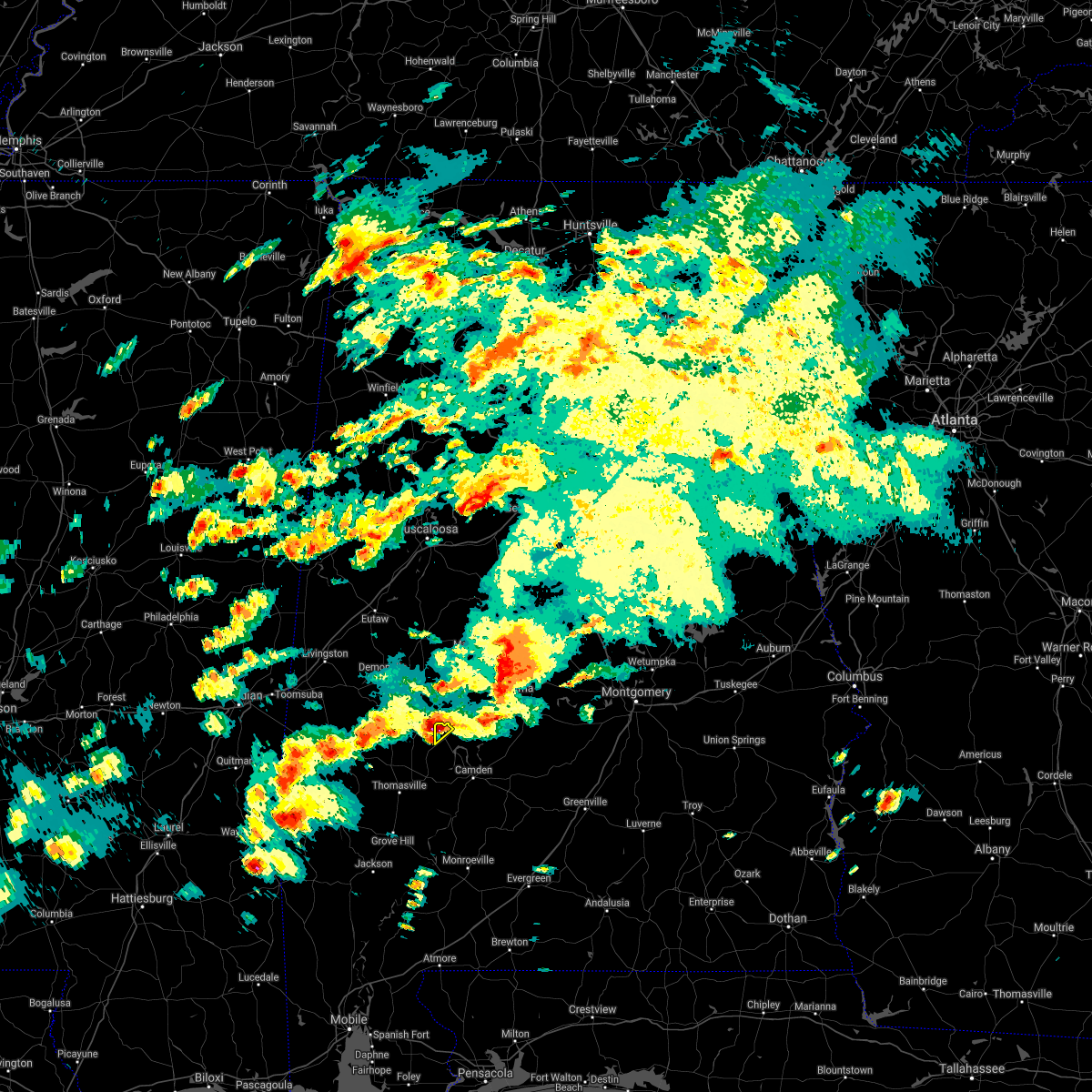 At 355 pm cdt, a severe thunderstorm was located over consul, or 14 miles south of uniontown, moving northeast at 50 mph (radar indicated). Hazards include 60 mph wind gusts and quarter size hail. Hail damage to vehicles is expected. expect wind damage to roofs, siding, and trees. This severe thunderstorm will remain over mainly rural areas of northwestern wilcox county. At 355 pm cdt, a severe thunderstorm was located over consul, or 14 miles south of uniontown, moving northeast at 50 mph (radar indicated). Hazards include 60 mph wind gusts and quarter size hail. Hail damage to vehicles is expected. expect wind damage to roofs, siding, and trees. This severe thunderstorm will remain over mainly rural areas of northwestern wilcox county.
|
| 3/16/2021 4:40 AM CDT |
 At 440 am cdt, a severe thunderstorm was located over magnolia, or 13 miles north of thomasville, moving east at 30 mph (radar indicated). Hazards include 60 mph wind gusts. Expect damage to roofs, siding, and trees. This severe thunderstorm will remain over mainly rural areas of northwestern wilcox county. At 440 am cdt, a severe thunderstorm was located over magnolia, or 13 miles north of thomasville, moving east at 30 mph (radar indicated). Hazards include 60 mph wind gusts. Expect damage to roofs, siding, and trees. This severe thunderstorm will remain over mainly rural areas of northwestern wilcox county.
|
| 6/28/2020 7:42 PM CDT |
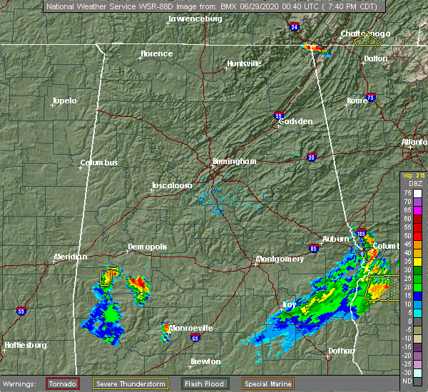 At 742 pm cdt, a severe thunderstorm was located 5 miles northeast of vineland, or 14 miles northeast of thomasville, moving northeast at 25 mph (radar indicated). Hazards include 60 mph wind gusts and penny size hail. Expect damage to roofs, siding, and trees. This severe thunderstorm will remain over mainly rural areas of northwestern wilcox county. At 742 pm cdt, a severe thunderstorm was located 5 miles northeast of vineland, or 14 miles northeast of thomasville, moving northeast at 25 mph (radar indicated). Hazards include 60 mph wind gusts and penny size hail. Expect damage to roofs, siding, and trees. This severe thunderstorm will remain over mainly rural areas of northwestern wilcox county.
|
| 6/25/2020 7:40 PM CDT |
 The national weather service in mobile has issued a * severe thunderstorm warning for. northern clarke county in southwestern alabama. western wilcox county in south central alabama. until 830 pm cdt. At 740 pm cdt, severe thunderstorms were located along a line. The national weather service in mobile has issued a * severe thunderstorm warning for. northern clarke county in southwestern alabama. western wilcox county in south central alabama. until 830 pm cdt. At 740 pm cdt, severe thunderstorms were located along a line.
|
| 6/24/2020 3:23 PM CDT |
 The severe thunderstorm warning for southwestern butler, monroe, northeastern clarke, northwestern escambia, wilcox and conecuh counties will expire at 330 pm cdt, the storms which prompted the warning have weakened below severe limits, and no longer pose an immediate threat to life or property. therefore, the warning will be allowed to expire. a severe thunderstorm watch remains in effect until 900 pm cdt for south central and southwestern alabama. The severe thunderstorm warning for southwestern butler, monroe, northeastern clarke, northwestern escambia, wilcox and conecuh counties will expire at 330 pm cdt, the storms which prompted the warning have weakened below severe limits, and no longer pose an immediate threat to life or property. therefore, the warning will be allowed to expire. a severe thunderstorm watch remains in effect until 900 pm cdt for south central and southwestern alabama.
|
| 6/24/2020 2:50 PM CDT |
 At 249 pm cdt, severe thunderstorms were located along a line extending from 7 miles west of fulton to 6 miles northeast of mccullough, moving northeast at 55 mph (radar indicated). Hazards include 60 mph wind gusts. expect damage to roofs, siding, and trees At 249 pm cdt, severe thunderstorms were located along a line extending from 7 miles west of fulton to 6 miles northeast of mccullough, moving northeast at 55 mph (radar indicated). Hazards include 60 mph wind gusts. expect damage to roofs, siding, and trees
|
| 4/23/2020 5:20 PM CDT |
 At 451 pm cdt, a severe thunderstorm was located over nanafalia, or 12 miles east of butler, moving east at 55 mph (radar indicated). Hazards include 60 mph wind gusts and quarter size hail. Hail damage to vehicles is expected. expect wind damage to roofs, siding, and trees. This severe thunderstorm will remain over mainly rural areas of northwestern wilcox county. At 451 pm cdt, a severe thunderstorm was located over nanafalia, or 12 miles east of butler, moving east at 55 mph (radar indicated). Hazards include 60 mph wind gusts and quarter size hail. Hail damage to vehicles is expected. expect wind damage to roofs, siding, and trees. This severe thunderstorm will remain over mainly rural areas of northwestern wilcox county.
|
| 4/23/2020 4:52 PM CDT |
 At 451 pm cdt, a severe thunderstorm was located over nanafalia, or 12 miles east of butler, moving east at 55 mph (radar indicated). Hazards include 60 mph wind gusts and quarter size hail. Hail damage to vehicles is expected. expect wind damage to roofs, siding, and trees. This severe thunderstorm will remain over mainly rural areas of northwestern wilcox county. At 451 pm cdt, a severe thunderstorm was located over nanafalia, or 12 miles east of butler, moving east at 55 mph (radar indicated). Hazards include 60 mph wind gusts and quarter size hail. Hail damage to vehicles is expected. expect wind damage to roofs, siding, and trees. This severe thunderstorm will remain over mainly rural areas of northwestern wilcox county.
|
| 4/19/2020 6:41 PM CDT |
 At 641 pm cdt, a severe squall line capable of producing both tornadoes and extensive straight line wind damage was located along a line extending from 5 miles west of dannelly reservoir to 8 miles east of fulton, moving east at 50 mph (radar indicated rotation). Hazards include tornado and quarter size hail. Flying debris will be dangerous to those caught without shelter. mobile homes will be damaged or destroyed. damage to roofs, windows, and vehicles will occur. tree damage is likely. These tornadic storms will remain over mainly rural areas of wilcox county. At 641 pm cdt, a severe squall line capable of producing both tornadoes and extensive straight line wind damage was located along a line extending from 5 miles west of dannelly reservoir to 8 miles east of fulton, moving east at 50 mph (radar indicated rotation). Hazards include tornado and quarter size hail. Flying debris will be dangerous to those caught without shelter. mobile homes will be damaged or destroyed. damage to roofs, windows, and vehicles will occur. tree damage is likely. These tornadic storms will remain over mainly rural areas of wilcox county.
|
| 4/19/2020 6:27 PM CDT |
 At 626 pm cdt, a severe thunderstorm capable of producing a tornado was located 4 miles southwest of pine hill, or 5 miles northeast of thomasville, moving east at 70 mph (radar indicated rotation). Hazards include tornado. Flying debris will be dangerous to those caught without shelter. mobile homes will be damaged or destroyed. damage to roofs, windows, and vehicles will occur. tree damage is likely. this dangerous storm will be near, pine hill around 630 pm cdt. yellow bluff around 635 pm cdt. camden around 645 pm cdt. Pine apple around 700 pm cdt. At 626 pm cdt, a severe thunderstorm capable of producing a tornado was located 4 miles southwest of pine hill, or 5 miles northeast of thomasville, moving east at 70 mph (radar indicated rotation). Hazards include tornado. Flying debris will be dangerous to those caught without shelter. mobile homes will be damaged or destroyed. damage to roofs, windows, and vehicles will occur. tree damage is likely. this dangerous storm will be near, pine hill around 630 pm cdt. yellow bluff around 635 pm cdt. camden around 645 pm cdt. Pine apple around 700 pm cdt.
|
| 4/12/2020 10:21 PM CDT |
 The tornado warning for central wilcox county will expire at 1030 pm cdt, the tornado threat has diminished. damaging winds remain likely and a severe thunderstorm warning remains in effect for the area. a tornado watch remains in effect until midnight cdt for south central alabama. The tornado warning for central wilcox county will expire at 1030 pm cdt, the tornado threat has diminished. damaging winds remain likely and a severe thunderstorm warning remains in effect for the area. a tornado watch remains in effect until midnight cdt for south central alabama.
|
| 4/12/2020 10:04 PM CDT |
 At 1003 pm cdt, a severe thunderstorm capable of producing a tornado was located 7 miles southwest of dannelly reservoir, or 7 miles north of camden, moving east at 45 mph (radar indicated rotation). Hazards include tornado. Flying debris will be dangerous to those caught without shelter. mobile homes will be damaged or destroyed. damage to roofs, windows, and vehicles will occur. tree damage is likely. This tornadic thunderstorm will remain over mainly rural areas of central wilcox county. At 1003 pm cdt, a severe thunderstorm capable of producing a tornado was located 7 miles southwest of dannelly reservoir, or 7 miles north of camden, moving east at 45 mph (radar indicated rotation). Hazards include tornado. Flying debris will be dangerous to those caught without shelter. mobile homes will be damaged or destroyed. damage to roofs, windows, and vehicles will occur. tree damage is likely. This tornadic thunderstorm will remain over mainly rural areas of central wilcox county.
|
| 4/12/2020 9:43 PM CDT |
 At 943 pm cdt, a severe thunderstorm capable of producing a tornado was located near magnolia, or 15 miles northeast of thomasville, moving northeast at 65 mph (radar indicated rotation). Hazards include tornado and quarter size hail. Flying debris will be dangerous to those caught without shelter. mobile homes will be damaged or destroyed. damage to roofs, windows, and vehicles will occur. tree damage is likely. This tornadic thunderstorm will remain over mainly rural areas of northwestern wilcox county. At 943 pm cdt, a severe thunderstorm capable of producing a tornado was located near magnolia, or 15 miles northeast of thomasville, moving northeast at 65 mph (radar indicated rotation). Hazards include tornado and quarter size hail. Flying debris will be dangerous to those caught without shelter. mobile homes will be damaged or destroyed. damage to roofs, windows, and vehicles will occur. tree damage is likely. This tornadic thunderstorm will remain over mainly rural areas of northwestern wilcox county.
|
| 4/12/2020 9:38 PM CDT |
 At 938 pm cdt, a severe thunderstorm capable of producing a tornado was located over shawnee, or 6 miles northeast of thomasville, moving east at 60 mph (radar indicated rotation). Hazards include tornado. Flying debris will be dangerous to those caught without shelter. mobile homes will be damaged or destroyed. damage to roofs, windows, and vehicles will occur. tree damage is likely. this dangerous storm will be near, yellow bluff around 950 pm cdt. Camden around 1000 pm cdt. At 938 pm cdt, a severe thunderstorm capable of producing a tornado was located over shawnee, or 6 miles northeast of thomasville, moving east at 60 mph (radar indicated rotation). Hazards include tornado. Flying debris will be dangerous to those caught without shelter. mobile homes will be damaged or destroyed. damage to roofs, windows, and vehicles will occur. tree damage is likely. this dangerous storm will be near, yellow bluff around 950 pm cdt. Camden around 1000 pm cdt.
|
| 4/12/2020 9:13 PM CDT |
 At 913 pm cdt, severe thunderstorms were located along a line extending from near putnam to near coffeeville to 5 miles south of millry, moving east at 70 mph (radar indicated). Hazards include 70 mph wind gusts and penny size hail. Expect considerable tree damage. Damage is likely to mobile homes, roofs, and outbuildings. At 913 pm cdt, severe thunderstorms were located along a line extending from near putnam to near coffeeville to 5 miles south of millry, moving east at 70 mph (radar indicated). Hazards include 70 mph wind gusts and penny size hail. Expect considerable tree damage. Damage is likely to mobile homes, roofs, and outbuildings.
|
| 4/8/2020 4:37 PM CDT |
 At 436 pm cdt, a severe thunderstorm was located 4 miles east of magnolia, or 16 miles southeast of linden, moving east at 45 mph (radar indicated). Hazards include 70 mph wind gusts and quarter size hail. Hail damage to vehicles is expected. expect considerable tree damage. Wind damage is also likely to mobile homes, roofs, and outbuildings. At 436 pm cdt, a severe thunderstorm was located 4 miles east of magnolia, or 16 miles southeast of linden, moving east at 45 mph (radar indicated). Hazards include 70 mph wind gusts and quarter size hail. Hail damage to vehicles is expected. expect considerable tree damage. Wind damage is also likely to mobile homes, roofs, and outbuildings.
|
| 4/8/2020 3:51 PM CDT |
 At 350 pm cdt, a severe thunderstorm was located near myrtlewood, or 9 miles west of linden, moving southeast at 40 mph (radar indicated). Hazards include 70 mph wind gusts and quarter size hail. Hail damage to vehicles is expected. expect considerable tree damage. wind damage is also likely to mobile homes, roofs, and outbuildings. This severe thunderstorm will remain over mainly rural areas of northwestern wilcox county. At 350 pm cdt, a severe thunderstorm was located near myrtlewood, or 9 miles west of linden, moving southeast at 40 mph (radar indicated). Hazards include 70 mph wind gusts and quarter size hail. Hail damage to vehicles is expected. expect considerable tree damage. wind damage is also likely to mobile homes, roofs, and outbuildings. This severe thunderstorm will remain over mainly rural areas of northwestern wilcox county.
|
| 2/6/2020 4:20 AM CST |
 At 419 am cst, a severe thunderstorm was located 8 miles south of central mills, or 14 miles northwest of camden, moving northeast at 65 mph (radar indicated). Hazards include 60 mph wind gusts. Expect damage to roofs, siding, and trees. This severe thunderstorm will remain over mainly rural areas of northwestern wilcox county. At 419 am cst, a severe thunderstorm was located 8 miles south of central mills, or 14 miles northwest of camden, moving northeast at 65 mph (radar indicated). Hazards include 60 mph wind gusts. Expect damage to roofs, siding, and trees. This severe thunderstorm will remain over mainly rural areas of northwestern wilcox county.
|
| 2/6/2020 4:19 AM CST |
 At 419 am cst, a severe thunderstorm capable of producing a tornado was located 8 miles southeast of consul, or 15 miles northwest of camden, moving northeast at 55 mph (radar indicated rotation). Hazards include tornado. Flying debris will be dangerous to those caught without shelter. mobile homes will be damaged or destroyed. damage to roofs, windows, and vehicles will occur. tree damage is likely. This tornadic thunderstorm will remain over mainly rural areas of northwestern wilcox county. At 419 am cst, a severe thunderstorm capable of producing a tornado was located 8 miles southeast of consul, or 15 miles northwest of camden, moving northeast at 55 mph (radar indicated rotation). Hazards include tornado. Flying debris will be dangerous to those caught without shelter. mobile homes will be damaged or destroyed. damage to roofs, windows, and vehicles will occur. tree damage is likely. This tornadic thunderstorm will remain over mainly rural areas of northwestern wilcox county.
|
| 2/6/2020 4:11 AM CST |
 At 411 am cst, a severe thunderstorm was located 6 miles north of pine hill, or 15 miles west of camden, moving northeast at 60 mph (radar indicated). Hazards include 60 mph wind gusts. Expect damage to roofs, siding, and trees. Locations impacted include, pine hill. At 411 am cst, a severe thunderstorm was located 6 miles north of pine hill, or 15 miles west of camden, moving northeast at 60 mph (radar indicated). Hazards include 60 mph wind gusts. Expect damage to roofs, siding, and trees. Locations impacted include, pine hill.
|
| 2/6/2020 4:08 AM CST |
 At 406 am cst, a severe thunderstorm capable of producing a tornado was located near pine hill, or 8 miles northeast of thomasville, moving northeast at 50 mph (radar indicated rotation). Hazards include tornado. Flying debris will be dangerous to those caught without shelter. mobile homes will be damaged or destroyed. damage to roofs, windows, and vehicles will occur. tree damage is likely. Locations impacted include, pine hill. At 406 am cst, a severe thunderstorm capable of producing a tornado was located near pine hill, or 8 miles northeast of thomasville, moving northeast at 50 mph (radar indicated rotation). Hazards include tornado. Flying debris will be dangerous to those caught without shelter. mobile homes will be damaged or destroyed. damage to roofs, windows, and vehicles will occur. tree damage is likely. Locations impacted include, pine hill.
|
| 2/6/2020 4:00 AM CST |
 At 358 am cst, a severe thunderstorm capable of producing a tornado was located over thomasville, moving northeast at 55 mph (radar indicated rotation). Hazards include tornado. Flying debris will be dangerous to those caught without shelter. mobile homes will be damaged or destroyed. damage to roofs, windows, and vehicles will occur. tree damage is likely. Locations impacted include, thomasville and pine hill. At 358 am cst, a severe thunderstorm capable of producing a tornado was located over thomasville, moving northeast at 55 mph (radar indicated rotation). Hazards include tornado. Flying debris will be dangerous to those caught without shelter. mobile homes will be damaged or destroyed. damage to roofs, windows, and vehicles will occur. tree damage is likely. Locations impacted include, thomasville and pine hill.
|
| 2/6/2020 3:50 AM CST |
 At 349 am cst, a severe thunderstorm capable of producing a tornado was located 6 miles southwest of thomasville, moving northeast at 50 mph (radar indicated rotation). Hazards include tornado. Flying debris will be dangerous to those caught without shelter. mobile homes will be damaged or destroyed. damage to roofs, windows, and vehicles will occur. Tree damage is likely. At 349 am cst, a severe thunderstorm capable of producing a tornado was located 6 miles southwest of thomasville, moving northeast at 50 mph (radar indicated rotation). Hazards include tornado. Flying debris will be dangerous to those caught without shelter. mobile homes will be damaged or destroyed. damage to roofs, windows, and vehicles will occur. Tree damage is likely.
|
| 2/6/2020 3:43 AM CST |
 At 342 am cst, a severe thunderstorm was located 8 miles northwest of grove hill, moving northeast at 65 mph (radar indicated). Hazards include 60 mph wind gusts. expect damage to roofs, siding, and trees At 342 am cst, a severe thunderstorm was located 8 miles northwest of grove hill, moving northeast at 65 mph (radar indicated). Hazards include 60 mph wind gusts. expect damage to roofs, siding, and trees
|
| 1/11/2020 1:07 PM CST |
 At 107 pm cst, severe thunderstorms were located along a line extending from 10 miles south of central mills to 12 miles northwest of monroeville to 3 miles northeast of uriah, moving northeast at 65 mph (radar indicated). Hazards include 60 mph wind gusts. expect damage to roofs, siding, and trees At 107 pm cst, severe thunderstorms were located along a line extending from 10 miles south of central mills to 12 miles northwest of monroeville to 3 miles northeast of uriah, moving northeast at 65 mph (radar indicated). Hazards include 60 mph wind gusts. expect damage to roofs, siding, and trees
|
| 1/11/2020 12:50 PM CST |
 At 1250 pm cst, severe thunderstorms were located along a line extending from 9 miles south of consul to 3 miles southeast of thomasville to near fulton, moving northeast at 55 mph (radar indicated). Hazards include 60 mph wind gusts. Expect damage to roofs, siding, and trees. Locations impacted include, thomasville, grove hill, pine hill, vredenburgh, fulton and yellow bluff. At 1250 pm cst, severe thunderstorms were located along a line extending from 9 miles south of consul to 3 miles southeast of thomasville to near fulton, moving northeast at 55 mph (radar indicated). Hazards include 60 mph wind gusts. Expect damage to roofs, siding, and trees. Locations impacted include, thomasville, grove hill, pine hill, vredenburgh, fulton and yellow bluff.
|
| 1/11/2020 12:28 PM CST |
 At 1227 pm cst, severe thunderstorms were located along a line extending from 5 miles west of shawnee to 5 miles east of coffeeville to 5 miles northeast of saint stephens, moving northeast at 55 mph (emergency management). Hazards include 60 mph wind gusts. expect damage to roofs, siding, and trees At 1227 pm cst, severe thunderstorms were located along a line extending from 5 miles west of shawnee to 5 miles east of coffeeville to 5 miles northeast of saint stephens, moving northeast at 55 mph (emergency management). Hazards include 60 mph wind gusts. expect damage to roofs, siding, and trees
|
| 4/18/2019 6:58 PM CDT |
 At 658 pm cdt, severe thunderstorms were located along a line extending from 8 miles southeast of consul to near leroy, moving east at 25 mph (radar indicated). Hazards include 60 mph wind gusts. Expect damage to roofs, siding, and trees. Locations impacted include, jackson, thomasville, grove hill, saint stephens, leroy, whatley, pine hill, fulton and yellow bluff. At 658 pm cdt, severe thunderstorms were located along a line extending from 8 miles southeast of consul to near leroy, moving east at 25 mph (radar indicated). Hazards include 60 mph wind gusts. Expect damage to roofs, siding, and trees. Locations impacted include, jackson, thomasville, grove hill, saint stephens, leroy, whatley, pine hill, fulton and yellow bluff.
|
| 4/18/2019 6:18 PM CDT |
 At 618 pm cdt, severe thunderstorms were located along a line extending from 7 miles south of sweet water to chatom, moving east at 35 mph (radar indicated). Hazards include 60 mph wind gusts. expect damage to roofs, siding, and trees At 618 pm cdt, severe thunderstorms were located along a line extending from 7 miles south of sweet water to chatom, moving east at 35 mph (radar indicated). Hazards include 60 mph wind gusts. expect damage to roofs, siding, and trees
|
| 1/23/2019 1:21 PM CST |
 The severe thunderstorm warning for western wilcox county will expire at 130 pm cst, the storms which prompted the warning have weakened across the warned area. therefore, the warning will be allowed to expire. The severe thunderstorm warning for western wilcox county will expire at 130 pm cst, the storms which prompted the warning have weakened across the warned area. therefore, the warning will be allowed to expire.
|
| 1/23/2019 12:56 PM CST |
 At 1255 pm cst, severe thunderstorms were located along a line extending from 5 miles southeast of magnolia to pine hill to 7 miles east of thomasville, moving northeast at 55 mph (radar indicated). Hazards include 60 mph wind gusts. Expect damage to roofs, siding, and trees. Locations impacted include, pine hill and yellow bluff. At 1255 pm cst, severe thunderstorms were located along a line extending from 5 miles southeast of magnolia to pine hill to 7 miles east of thomasville, moving northeast at 55 mph (radar indicated). Hazards include 60 mph wind gusts. Expect damage to roofs, siding, and trees. Locations impacted include, pine hill and yellow bluff.
|
| 1/23/2019 12:40 PM CST |
 At 1239 pm cst, severe thunderstorms were located along a line extending from thomasville to 3 miles northeast of fulton to 3 miles northeast of grove hill, moving northeast at 55 mph (radar indicated). Hazards include 60 mph wind gusts. Expect damage to roofs, siding, and trees. Locations impacted include, thomasville, pine hill, fulton and yellow bluff. At 1239 pm cst, severe thunderstorms were located along a line extending from thomasville to 3 miles northeast of fulton to 3 miles northeast of grove hill, moving northeast at 55 mph (radar indicated). Hazards include 60 mph wind gusts. Expect damage to roofs, siding, and trees. Locations impacted include, thomasville, pine hill, fulton and yellow bluff.
|
| 1/23/2019 12:25 PM CST |
 At 1224 pm cst, severe thunderstorms were located along a line extending from 9 miles west of fulton to 4 miles west of grove hill to 7 miles north of jackson, moving northeast at 55 mph (radar indicated). Hazards include 60 mph wind gusts. expect damage to roofs, siding, and trees At 1224 pm cst, severe thunderstorms were located along a line extending from 9 miles west of fulton to 4 miles west of grove hill to 7 miles north of jackson, moving northeast at 55 mph (radar indicated). Hazards include 60 mph wind gusts. expect damage to roofs, siding, and trees
|
| 1/19/2019 12:40 PM CST |
 At 1240 pm cst, severe thunderstorms were located along a line extending from near miller to near saint stephens, moving east at 40 mph (radar indicated). Hazards include 60 mph wind gusts. Expect damage to roofs, siding, and trees. locations impacted include, jackson, thomasville, grove hill, saint stephens, leroy, whatley, pine hill, fulton and yellow bluff. A tornado watch remains in effect until 500 pm cst for south central and southwestern alabama. At 1240 pm cst, severe thunderstorms were located along a line extending from near miller to near saint stephens, moving east at 40 mph (radar indicated). Hazards include 60 mph wind gusts. Expect damage to roofs, siding, and trees. locations impacted include, jackson, thomasville, grove hill, saint stephens, leroy, whatley, pine hill, fulton and yellow bluff. A tornado watch remains in effect until 500 pm cst for south central and southwestern alabama.
|
| 1/19/2019 12:15 PM CST |
 At 1215 pm cst, severe thunderstorms were located along a line extending from near nanafalia to chatom, moving east at 40 mph (radar indicated). Hazards include 60 mph wind gusts. expect damage to roofs, siding, and trees At 1215 pm cst, severe thunderstorms were located along a line extending from near nanafalia to chatom, moving east at 40 mph (radar indicated). Hazards include 60 mph wind gusts. expect damage to roofs, siding, and trees
|
| 6/28/2018 5:57 PM CDT |
 At 556 pm cdt, severe thunderstorms were located along a line extending from 5 miles southeast of magnolia to 5 miles northwest of vredenburgh to 5 miles east of beatrice, moving south at 15 mph (radar indicated). Hazards include 60 mph wind gusts. Expect damage to roofs, siding, and trees. Locations impacted include, camden, georgiana, pine hill, beatrice, vredenburgh, yellow bluff, pine apple and dannelly reservoir. At 556 pm cdt, severe thunderstorms were located along a line extending from 5 miles southeast of magnolia to 5 miles northwest of vredenburgh to 5 miles east of beatrice, moving south at 15 mph (radar indicated). Hazards include 60 mph wind gusts. Expect damage to roofs, siding, and trees. Locations impacted include, camden, georgiana, pine hill, beatrice, vredenburgh, yellow bluff, pine apple and dannelly reservoir.
|
| 6/28/2018 5:22 PM CDT |
 At 521 pm cdt, severe thunderstorms were located along a line extending from uniontown to dannelly reservoir to 8 miles southwest of gordonville, moving southeast at 35 mph (radar indicated). Hazards include 60 mph wind gusts. expect damage to roofs, siding, and trees At 521 pm cdt, severe thunderstorms were located along a line extending from uniontown to dannelly reservoir to 8 miles southwest of gordonville, moving southeast at 35 mph (radar indicated). Hazards include 60 mph wind gusts. expect damage to roofs, siding, and trees
|
| 6/15/2017 2:43 PM CDT |
 At 242 pm cdt, severe thunderstorms were located along a line extending from near thomasville to 7 miles west of dannelly reservoir, moving southeast at 20 mph (radar indicated). Hazards include 60 mph wind gusts and quarter size hail. Hail damage to vehicles is expected. Expect wind damage to roofs, siding, and trees. At 242 pm cdt, severe thunderstorms were located along a line extending from near thomasville to 7 miles west of dannelly reservoir, moving southeast at 20 mph (radar indicated). Hazards include 60 mph wind gusts and quarter size hail. Hail damage to vehicles is expected. Expect wind damage to roofs, siding, and trees.
|
| 5/1/2017 12:55 AM CDT |
 The severe thunderstorm warning for northern clarke and wilcox counties will expire at 100 am cdt, the storms which prompted the warning have weakened below severe limits, and no longer pose an immediate threat to life or property. therefore the warning will be allowed to expire. The severe thunderstorm warning for northern clarke and wilcox counties will expire at 100 am cdt, the storms which prompted the warning have weakened below severe limits, and no longer pose an immediate threat to life or property. therefore the warning will be allowed to expire.
|
| 5/1/2017 12:13 AM CDT |
 At 1212 am cdt, severe thunderstorms were located along a line extending from near myrtlewood to 7 miles south of sweet water to near coffeeville, moving northeast at 55 mph (radar indicated). Hazards include 60 mph wind gusts and nickel size hail. expect damage to roofs, siding, and trees At 1212 am cdt, severe thunderstorms were located along a line extending from near myrtlewood to 7 miles south of sweet water to near coffeeville, moving northeast at 55 mph (radar indicated). Hazards include 60 mph wind gusts and nickel size hail. expect damage to roofs, siding, and trees
|
| 4/27/2017 3:22 AM CDT |
 At 322 am cdt, a severe thunderstorm was located 7 miles southeast of central mills, or 15 miles northwest of camden, moving east at 40 mph (radar indicated). Hazards include 60 mph wind gusts and quarter size hail. Hail damage to vehicles is expected. expect wind damage to roofs, siding, and trees. Locations impacted include, dannelly reservoir. At 322 am cdt, a severe thunderstorm was located 7 miles southeast of central mills, or 15 miles northwest of camden, moving east at 40 mph (radar indicated). Hazards include 60 mph wind gusts and quarter size hail. Hail damage to vehicles is expected. expect wind damage to roofs, siding, and trees. Locations impacted include, dannelly reservoir.
|
| 4/27/2017 2:58 AM CDT |
 At 257 am cdt, a severe thunderstorm was located over magnolia, or 14 miles southeast of linden, moving east at 40 mph (radar indicated). Hazards include 60 mph wind gusts and half dollar size hail. Hail damage to vehicles is expected. Expect wind damage to roofs, siding, and trees. At 257 am cdt, a severe thunderstorm was located over magnolia, or 14 miles southeast of linden, moving east at 40 mph (radar indicated). Hazards include 60 mph wind gusts and half dollar size hail. Hail damage to vehicles is expected. Expect wind damage to roofs, siding, and trees.
|
| 1/21/2017 11:24 PM CST |
 At 1124 pm cst, a severe thunderstorm was located near fulton, or near thomasville, moving northeast at 50 mph (radar indicated). Hazards include 60 mph wind gusts and quarter size hail. Hail damage to vehicles is expected. Expect wind damage to roofs, siding, and trees. At 1124 pm cst, a severe thunderstorm was located near fulton, or near thomasville, moving northeast at 50 mph (radar indicated). Hazards include 60 mph wind gusts and quarter size hail. Hail damage to vehicles is expected. Expect wind damage to roofs, siding, and trees.
|
| 1/2/2017 4:32 PM CST |
 At 430 pm cst, severe thunderstorms were located along a line extending from linden to near thomasville to 6 miles southeast of wagarville to calvert to semmes, moving east at 60 mph (radar indicated). Hazards include 70 mph wind gusts and quarter size hail. Hail damage to vehicles is expected. expect considerable tree damage. wind damage is also likely to mobile homes, roofs, and outbuildings. locations impacted include, jackson, thomasville, citronelle, creola, grove hill, chunchula, stockton, saint stephens, wagarville, leroy, gulfcrest, deer park, axis, whatley, tibbie, pine hill, mount vernon, calvert, fulton and mcintosh. A tornado watch remains in effect until 800 pm cst for south central and southwestern alabama. At 430 pm cst, severe thunderstorms were located along a line extending from linden to near thomasville to 6 miles southeast of wagarville to calvert to semmes, moving east at 60 mph (radar indicated). Hazards include 70 mph wind gusts and quarter size hail. Hail damage to vehicles is expected. expect considerable tree damage. wind damage is also likely to mobile homes, roofs, and outbuildings. locations impacted include, jackson, thomasville, citronelle, creola, grove hill, chunchula, stockton, saint stephens, wagarville, leroy, gulfcrest, deer park, axis, whatley, tibbie, pine hill, mount vernon, calvert, fulton and mcintosh. A tornado watch remains in effect until 800 pm cst for south central and southwestern alabama.
|
| 1/2/2017 3:59 PM CST |
 At 358 pm cst, severe thunderstorms were located along a line extending from kinterbish to 7 miles east of toxey to near fruitdale to near leakesville to 12 miles northwest of wade, moving northeast at 55 mph. damage has been reported from this line of thunderstorms as it moved through new augusta mississippi (radar indicated). Hazards include 70 mph wind gusts and quarter size hail. Hail damage to vehicles is expected. expect considerable tree damage. Wind damage is also likely to mobile homes, roofs, and outbuildings. At 358 pm cst, severe thunderstorms were located along a line extending from kinterbish to 7 miles east of toxey to near fruitdale to near leakesville to 12 miles northwest of wade, moving northeast at 55 mph. damage has been reported from this line of thunderstorms as it moved through new augusta mississippi (radar indicated). Hazards include 70 mph wind gusts and quarter size hail. Hail damage to vehicles is expected. expect considerable tree damage. Wind damage is also likely to mobile homes, roofs, and outbuildings.
|
| 6/17/2016 4:51 PM CDT |
 At 451 pm cdt, severe thunderstorms were located along a line extending from deatsville to near white hall to near dannelly reservoir to near nanafalia, moving south at 50 mph (radar indicated). Hazards include 60 mph wind gusts and quarter size hail. Hail damage to vehicles is expected. expect wind damage to roofs, siding, and trees. Locations impacted include, thomasville, camden, pine hill, yellow bluff, pine apple, shawnee and dannelly reservoir. At 451 pm cdt, severe thunderstorms were located along a line extending from deatsville to near white hall to near dannelly reservoir to near nanafalia, moving south at 50 mph (radar indicated). Hazards include 60 mph wind gusts and quarter size hail. Hail damage to vehicles is expected. expect wind damage to roofs, siding, and trees. Locations impacted include, thomasville, camden, pine hill, yellow bluff, pine apple, shawnee and dannelly reservoir.
|
| 6/17/2016 4:33 PM CDT |
 At 433 pm cdt, severe thunderstorms were located along a line extending from higgins ferry park to near mulberry to near bogue chitto to 9 miles north of pennington, moving south at 50 mph (radar indicated). Hazards include 60 mph wind gusts and quarter size hail. Hail damage to vehicles is expected. Expect wind damage to roofs, siding, and trees. At 433 pm cdt, severe thunderstorms were located along a line extending from higgins ferry park to near mulberry to near bogue chitto to 9 miles north of pennington, moving south at 50 mph (radar indicated). Hazards include 60 mph wind gusts and quarter size hail. Hail damage to vehicles is expected. Expect wind damage to roofs, siding, and trees.
|
| 2/23/2016 8:01 PM CST |
 At 800 pm cst, severe thunderstorms were located along a line extending from near catherine to near camden to 6 miles south of yellow bluff, moving northeast at 40 mph. these are very dangerous storms (radar indicated). Hazards include 80 mph wind gusts and quarter size hail. Flying debris will be dangerous to those caught without shelter. mobile homes will be heavily damaged. expect considerable damage to roofs, windows, and vehicles. Extensive tree damage and power outages are likely. At 800 pm cst, severe thunderstorms were located along a line extending from near catherine to near camden to 6 miles south of yellow bluff, moving northeast at 40 mph. these are very dangerous storms (radar indicated). Hazards include 80 mph wind gusts and quarter size hail. Flying debris will be dangerous to those caught without shelter. mobile homes will be heavily damaged. expect considerable damage to roofs, windows, and vehicles. Extensive tree damage and power outages are likely.
|
| 2/23/2016 7:52 PM CST |
 At 752 pm cst, severe thunderstorms were located along a line extending from near marion junction to near boykin to near fulton, moving northeast at 55 mph (radar indicated). Hazards include 70 mph wind gusts and quarter size hail. Hail damage to vehicles is expected. expect considerable tree damage. wind damage is also likely to mobile homes, roofs, and outbuildings. locations impacted include, jackson, thomasville, camden, grove hill, pine hill, vredenburgh, beatrice, fulton, yellow bluff, pine apple, oak hill, whatley, wagarville, catherine, boykin, peterman and leroy. A tornado watch remains in effect until 1000 pm cst for southwestern alabama. At 752 pm cst, severe thunderstorms were located along a line extending from near marion junction to near boykin to near fulton, moving northeast at 55 mph (radar indicated). Hazards include 70 mph wind gusts and quarter size hail. Hail damage to vehicles is expected. expect considerable tree damage. wind damage is also likely to mobile homes, roofs, and outbuildings. locations impacted include, jackson, thomasville, camden, grove hill, pine hill, vredenburgh, beatrice, fulton, yellow bluff, pine apple, oak hill, whatley, wagarville, catherine, boykin, peterman and leroy. A tornado watch remains in effect until 1000 pm cst for southwestern alabama.
|
| 2/23/2016 7:35 PM CST |
 At 734 pm cst, severe thunderstorms were located along a line extending from near central mills to yellow bluff to 7 miles northeast of jackson, moving northeast at 60 mph (radar indicated). Hazards include 70 mph wind gusts and quarter size hail. Hail damage to vehicles is expected. expect considerable tree damage. wind damage is also likely to mobile homes, roofs, and outbuildings. locations impacted include, jackson, thomasville, camden, grove hill, pine hill, vredenburgh, beatrice, fulton, yellow bluff, pine apple, oak hill, whatley, wagarville, catherine, boykin, peterman and leroy. A tornado watch remains in effect until 1000 pm cst for southwestern alabama. At 734 pm cst, severe thunderstorms were located along a line extending from near central mills to yellow bluff to 7 miles northeast of jackson, moving northeast at 60 mph (radar indicated). Hazards include 70 mph wind gusts and quarter size hail. Hail damage to vehicles is expected. expect considerable tree damage. wind damage is also likely to mobile homes, roofs, and outbuildings. locations impacted include, jackson, thomasville, camden, grove hill, pine hill, vredenburgh, beatrice, fulton, yellow bluff, pine apple, oak hill, whatley, wagarville, catherine, boykin, peterman and leroy. A tornado watch remains in effect until 1000 pm cst for southwestern alabama.
|
| 2/23/2016 7:14 PM CST |
 At 713 pm cst, severe thunderstorms were located along a line extending from near pine hill to fulton to wagarville, moving east at 70 mph (radar indicated). Hazards include 70 mph wind gusts and penny size hail. Expect considerable tree damage. Damage is likely to mobile homes, roofs, and outbuildings. At 713 pm cst, severe thunderstorms were located along a line extending from near pine hill to fulton to wagarville, moving east at 70 mph (radar indicated). Hazards include 70 mph wind gusts and penny size hail. Expect considerable tree damage. Damage is likely to mobile homes, roofs, and outbuildings.
|
| 2/15/2016 3:19 PM CST |
 At 319 pm cst, severe thunderstorms were located along a line extending from near lisman to 6 miles southwest of fruitdale to 10 miles south of mclain to saucier, moving east at 50 mph (radar indicated). Hazards include 70 mph wind gusts and quarter size hail. Hail damage to vehicles is expected. expect considerable tree damage. Wind damage is also likely to mobile homes, roofs, and outbuildings. At 319 pm cst, severe thunderstorms were located along a line extending from near lisman to 6 miles southwest of fruitdale to 10 miles south of mclain to saucier, moving east at 50 mph (radar indicated). Hazards include 70 mph wind gusts and quarter size hail. Hail damage to vehicles is expected. expect considerable tree damage. Wind damage is also likely to mobile homes, roofs, and outbuildings.
|
| 2/15/2016 1:21 PM CST |
 At 121 pm cst, a severe thunderstorm capable of producing a tornado was located near pine hill, or 15 miles west of camden, moving northeast at 35 mph (radar indicated rotation). Hazards include tornado and quarter size hail. Flying debris will be dangerous to those caught without shelter. mobile homes will be damaged or destroyed. damage to roofs, windows, and vehicles will occur. tree damage is likely. This dangerous storm will be near, catherine around 135 pm cst. At 121 pm cst, a severe thunderstorm capable of producing a tornado was located near pine hill, or 15 miles west of camden, moving northeast at 35 mph (radar indicated rotation). Hazards include tornado and quarter size hail. Flying debris will be dangerous to those caught without shelter. mobile homes will be damaged or destroyed. damage to roofs, windows, and vehicles will occur. tree damage is likely. This dangerous storm will be near, catherine around 135 pm cst.
|
| 2/15/2016 1:10 PM CST |
 At 109 pm cst, a severe thunderstorm capable of producing a tornado was located over pine hill, or 7 miles northeast of thomasville, moving northeast at 35 mph (radar indicated rotation). Hazards include tornado and quarter size hail. Flying debris will be dangerous to those caught without shelter. mobile homes will be damaged or destroyed. damage to roofs, windows, and vehicles will occur. tree damage is likely. This dangerous storm will be near, catherine around 135 pm cst. At 109 pm cst, a severe thunderstorm capable of producing a tornado was located over pine hill, or 7 miles northeast of thomasville, moving northeast at 35 mph (radar indicated rotation). Hazards include tornado and quarter size hail. Flying debris will be dangerous to those caught without shelter. mobile homes will be damaged or destroyed. damage to roofs, windows, and vehicles will occur. tree damage is likely. This dangerous storm will be near, catherine around 135 pm cst.
|
| 12/23/2015 2:43 PM CST | The severe thunderstorm warning for northwestern wilcox county will expire at 245 pm cst, the storm which prompted the warning has moved out of the area. therefore the warning will be allowed to expire. a tornado watch remains in effect until 800 pm cst for south central alabama. stay tuned for further updates from your national weather service in mobile. |
| 12/23/2015 2:27 PM CST | At 226 pm cst, a severe thunderstorm was located near catherine, or 15 miles northwest of camden, moving northeast at 45 mph (radar indicated). Hazards include 70 mph wind gusts and penny size hail. Expect considerable tree damage. damage is likely to mobile homes, roofs and outbuildings. locations impacted include, catherine. A tornado watch remains in effect until 800 pm cst for south central alabama. |
| 12/23/2015 2:15 PM CST | A severe thunderstorm warning remains in effect until 245 pm cst for western wilcox county. at 214 pm cst. a severe thunderstorm was located over vineland. or 8 miles northeast of thomasville. moving northeast at 45 mph. hazard. 70 mph wind gusts and penny size hail. source. Radar indicated. |
| 12/23/2015 1:59 PM CST | At 158 pm cst, a severe thunderstorm was located near thomasville, moving northeast at 45 mph (radar indicated). Hazards include 70 mph wind gusts and nickel size hail. Expect considerable tree damage. Damage is likely to mobile homes, roofs and outbuildings. |
| 6/24/2015 11:45 PM CDT |
 At 1144 pm cdt, a line of severe thunderstorms capable of producing damaging winds over 60 mph were located along a line extending from near thomaston, to near fulton, to monroeville, moving west at 30 mph. locations impacted include, monroeville, thomasville, grove hill, frisco city, pine hill, excel, fulton, yellow bluff, catherine, whatley, megargel, peterman,. At 1144 pm cdt, a line of severe thunderstorms capable of producing damaging winds over 60 mph were located along a line extending from near thomaston, to near fulton, to monroeville, moving west at 30 mph. locations impacted include, monroeville, thomasville, grove hill, frisco city, pine hill, excel, fulton, yellow bluff, catherine, whatley, megargel, peterman,.
|
| 6/24/2015 11:28 PM CDT |
 At 1127 pm cdt, a line of severe thunderstorms capable of producing damaging winds over 60 mph were located along a line extending from near consul, to 10 miles south of yellow bluff, to near peterman, moving west at 30 mph. locations impacted include, monroeville, thomasville, camden, grove hill, frisco city, pine hill, excel, vredenburgh, beatrice, fulton, yellow bluff, whatley,. At 1127 pm cdt, a line of severe thunderstorms capable of producing damaging winds over 60 mph were located along a line extending from near consul, to 10 miles south of yellow bluff, to near peterman, moving west at 30 mph. locations impacted include, monroeville, thomasville, camden, grove hill, frisco city, pine hill, excel, vredenburgh, beatrice, fulton, yellow bluff, whatley,.
|
| 6/24/2015 11:07 PM CDT |
 At 1106 pm cdt, a line of severe thunderstorms capable of producing damaging winds over 60 mph was located along a line extending from near bogue chitto, to near vredenburgh, to 10 miles northwest of i65 and cr 29, and moving west at 30 mph. wind damage was reported in wilcox county with this line of storms. At 1106 pm cdt, a line of severe thunderstorms capable of producing damaging winds over 60 mph was located along a line extending from near bogue chitto, to near vredenburgh, to 10 miles northwest of i65 and cr 29, and moving west at 30 mph. wind damage was reported in wilcox county with this line of storms.
|
| 6/24/2015 10:54 PM CDT |
 At 1053 pm cdt, a line of severe thunderstorms capable of producing damaging winds over 60 mph were located along a line extending from near orrville, to near boykin, to vredenburgh, to 7 miles east of beatrice, to 10 miles northwest of i65 and al 106, moving west at 40 mph. locations impacted include, camden, pine hill, vredenburgh, beatrice, yellow bluff, pine apple, oak hill, catherine, boykin,. At 1053 pm cdt, a line of severe thunderstorms capable of producing damaging winds over 60 mph were located along a line extending from near orrville, to near boykin, to vredenburgh, to 7 miles east of beatrice, to 10 miles northwest of i65 and al 106, moving west at 40 mph. locations impacted include, camden, pine hill, vredenburgh, beatrice, yellow bluff, pine apple, oak hill, catherine, boykin,.
|
| 6/24/2015 10:28 PM CDT |
 At 1027 pm cdt, a line of severe thunderstorms capable of producing damaging winds of 60 to 70 mph were located along a line extending from near dallas lake, to 8 miles southwest of belknap, to 6 miles south of oak hill, to 9 miles northwest of georgiana, to 6 miles northeast of i65 and al 106, moving west at 40 mph. locations impacted include, greenville, camden, pine hill, vredenburgh, beatrice, yellow bluff, pine apple, oak hill, catherine, boykin,. At 1027 pm cdt, a line of severe thunderstorms capable of producing damaging winds of 60 to 70 mph were located along a line extending from near dallas lake, to 8 miles southwest of belknap, to 6 miles south of oak hill, to 9 miles northwest of georgiana, to 6 miles northeast of i65 and al 106, moving west at 40 mph. locations impacted include, greenville, camden, pine hill, vredenburgh, beatrice, yellow bluff, pine apple, oak hill, catherine, boykin,.
|
| 6/24/2015 10:03 PM CDT |
 At 1002 pm cdt, a line of severe thunderstorms capable of producing quarter size hail and damaging of 60 to 70 mph was located along a line extending from benton to 6 miles southeast of belknap to near pine apple to near i65 and al 10 to near greenville, and moving west at 40 mph. At 1002 pm cdt, a line of severe thunderstorms capable of producing quarter size hail and damaging of 60 to 70 mph was located along a line extending from benton to 6 miles southeast of belknap to near pine apple to near i65 and al 10 to near greenville, and moving west at 40 mph.
|
Hail Maps for Catherine, AL
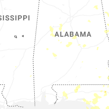
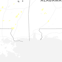


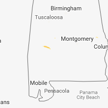


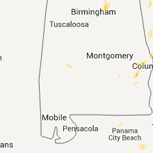


Connect with Interactive Hail Maps