

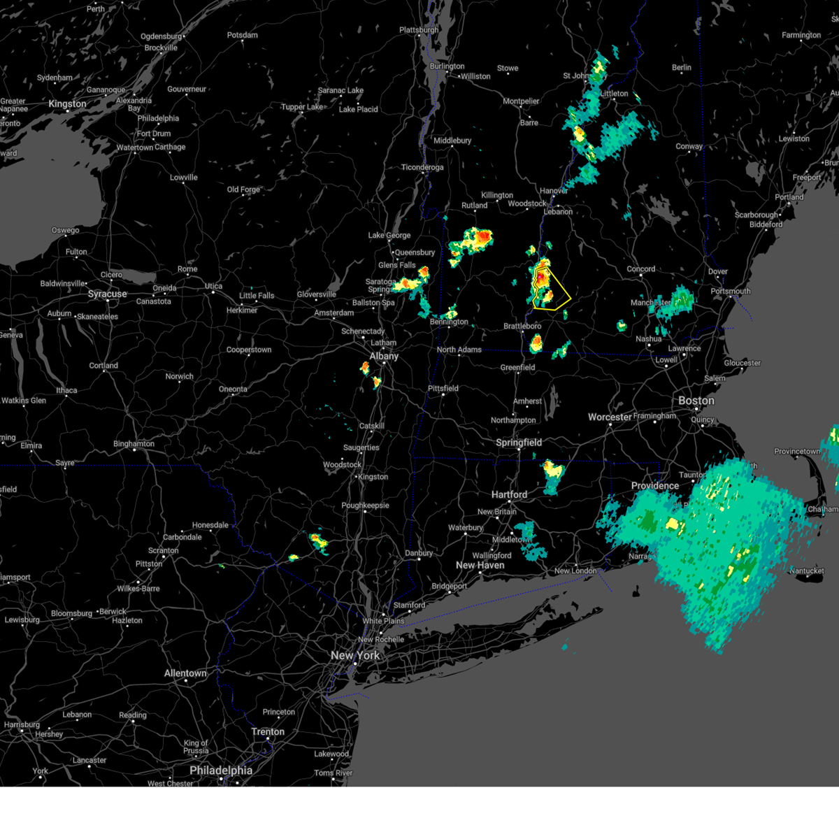
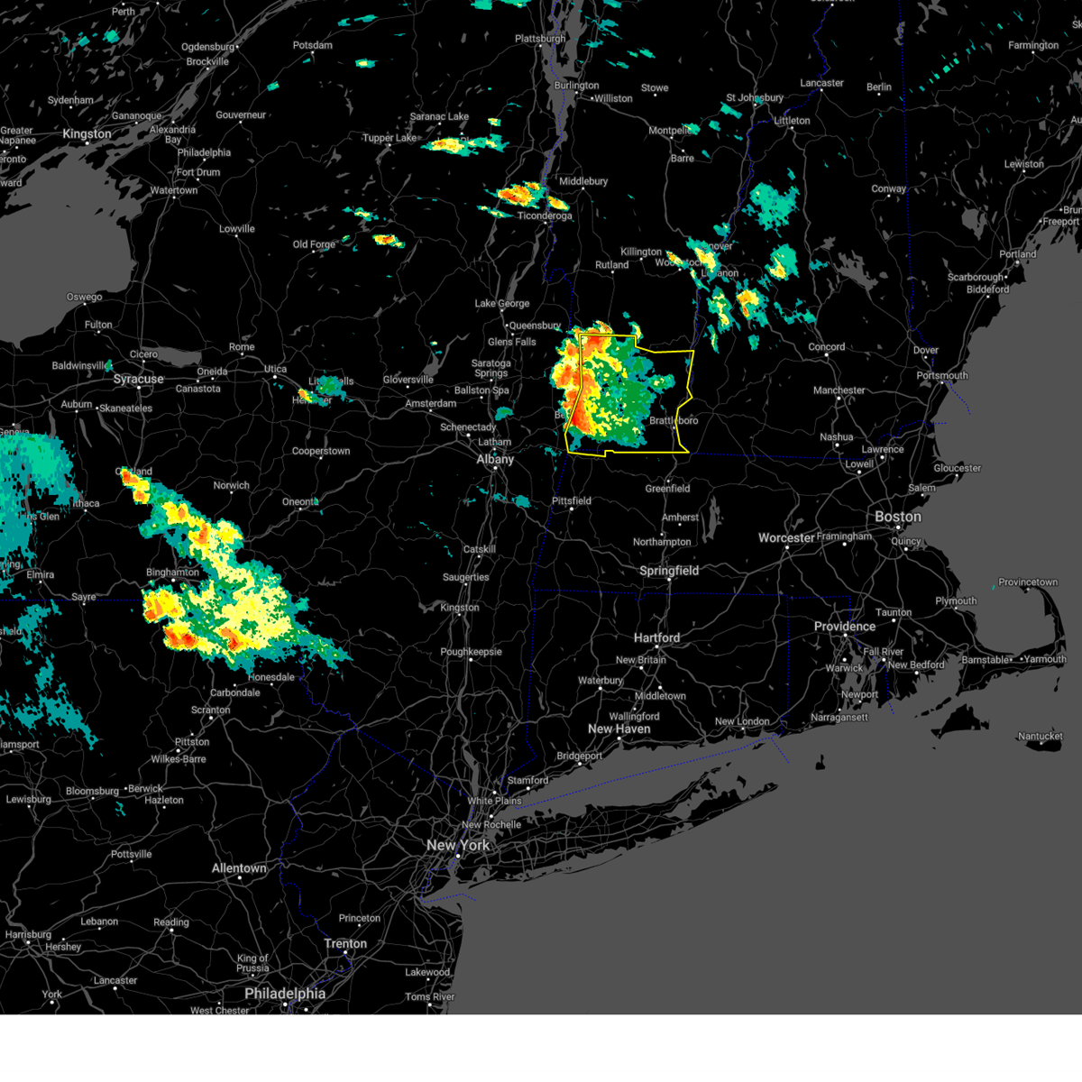
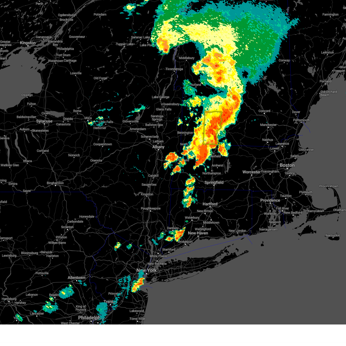
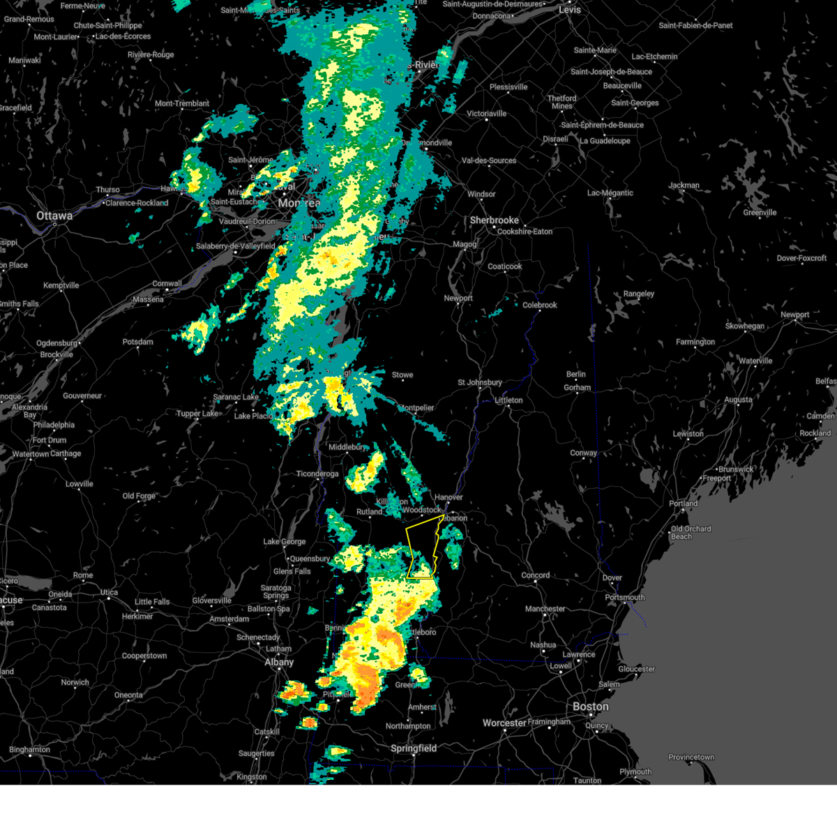
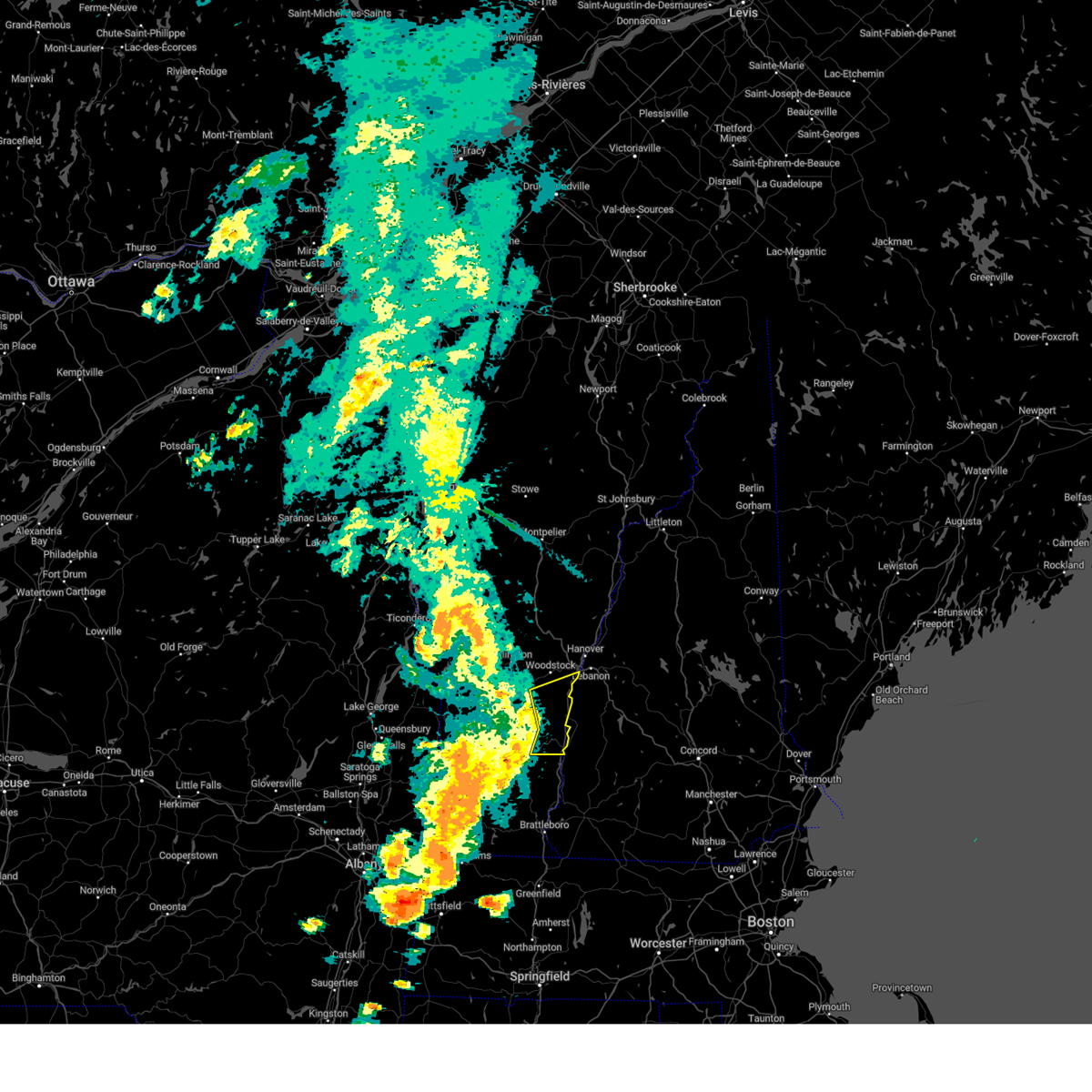
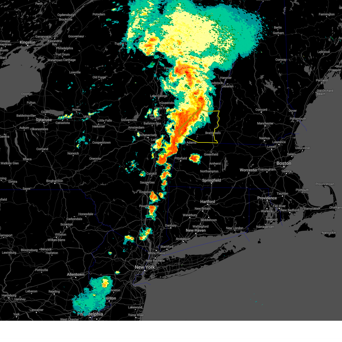
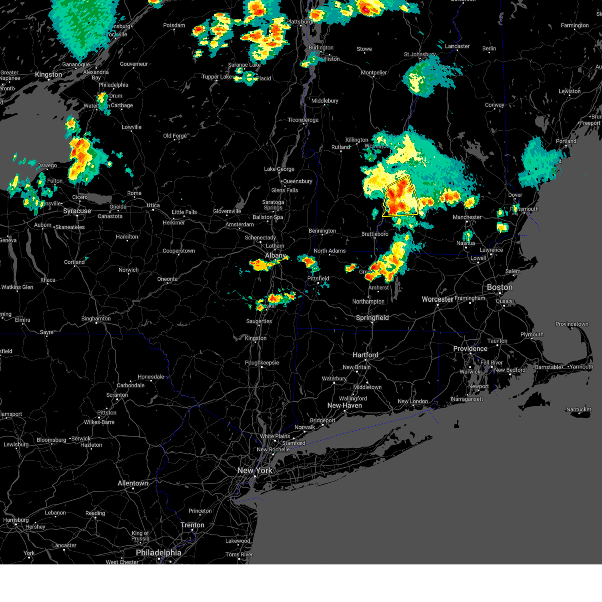
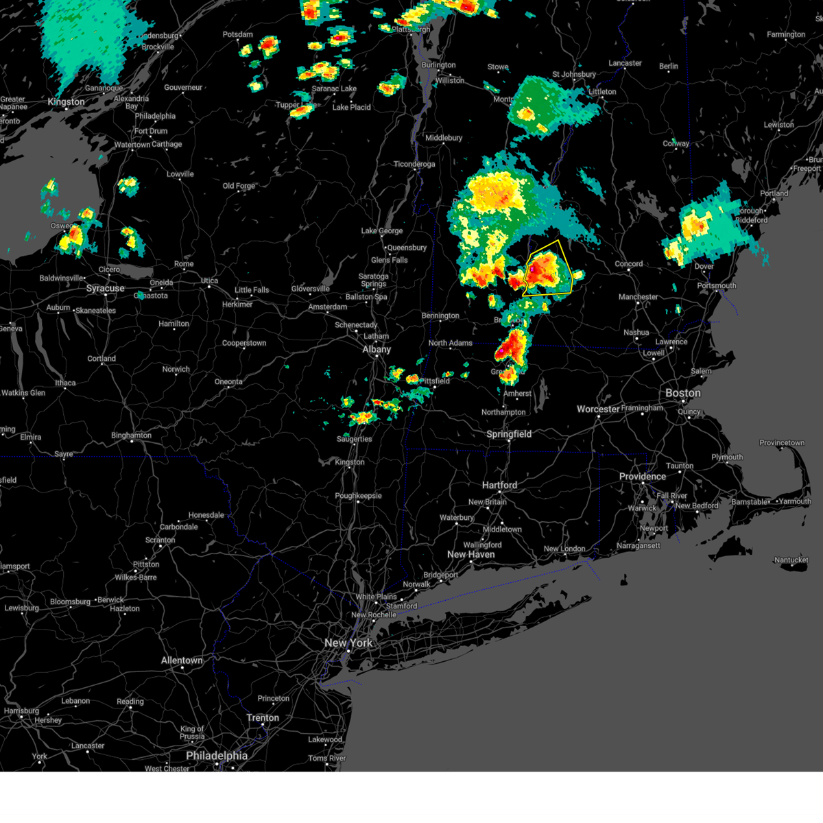
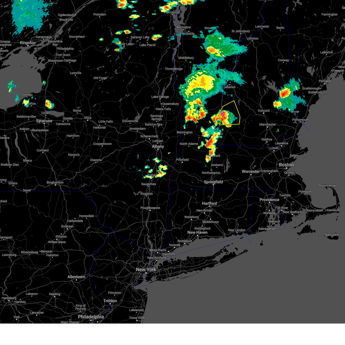
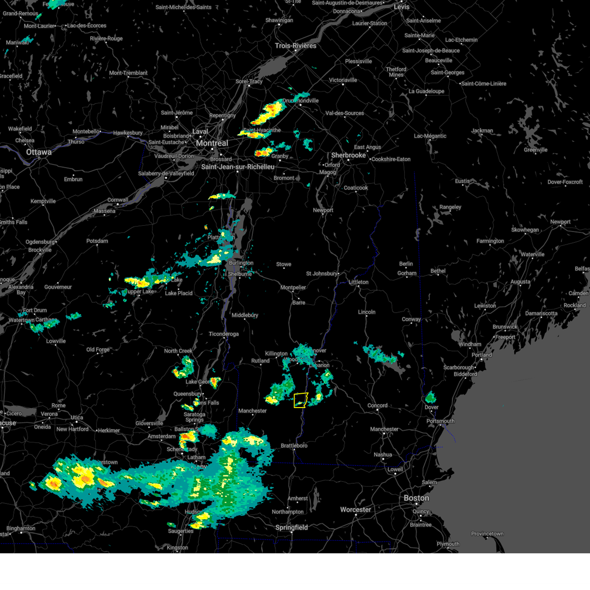
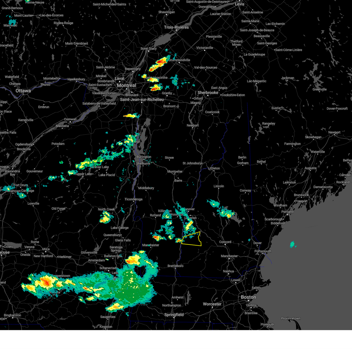
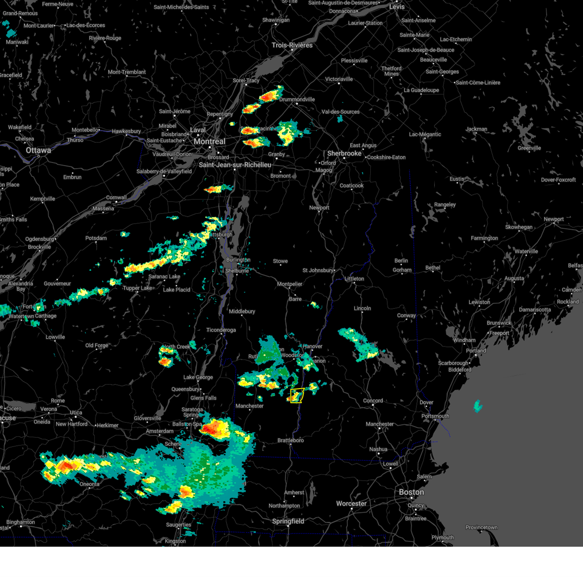
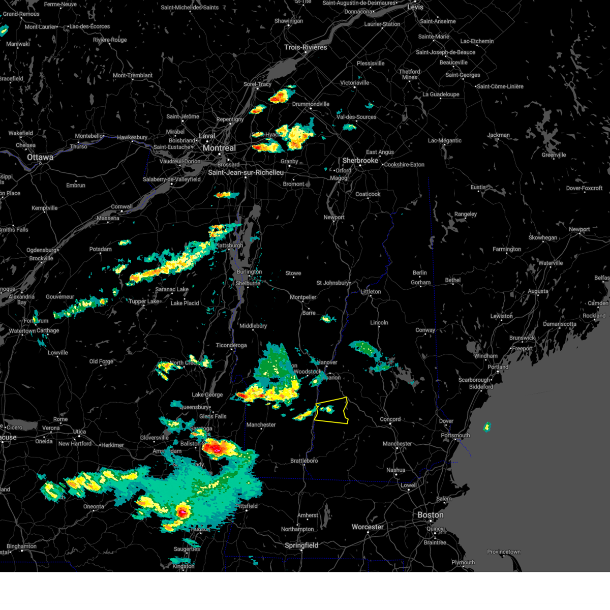
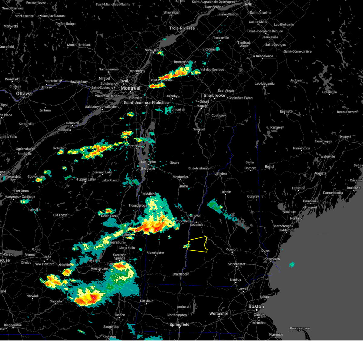
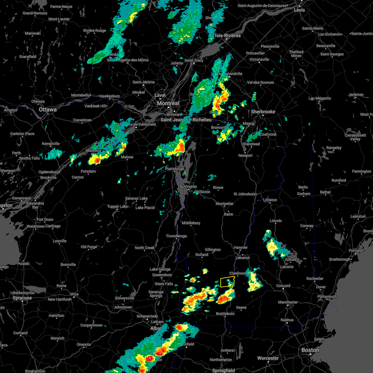
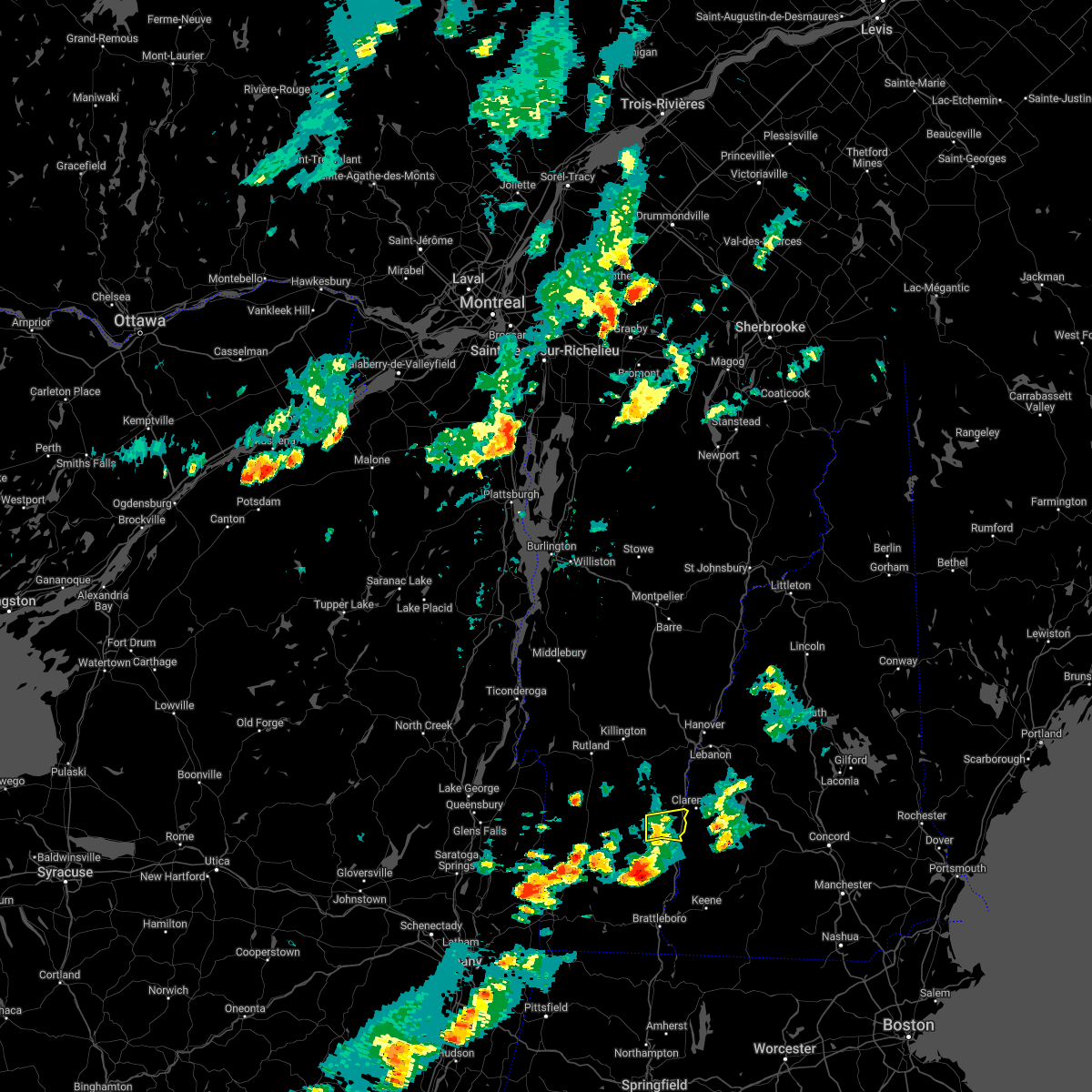
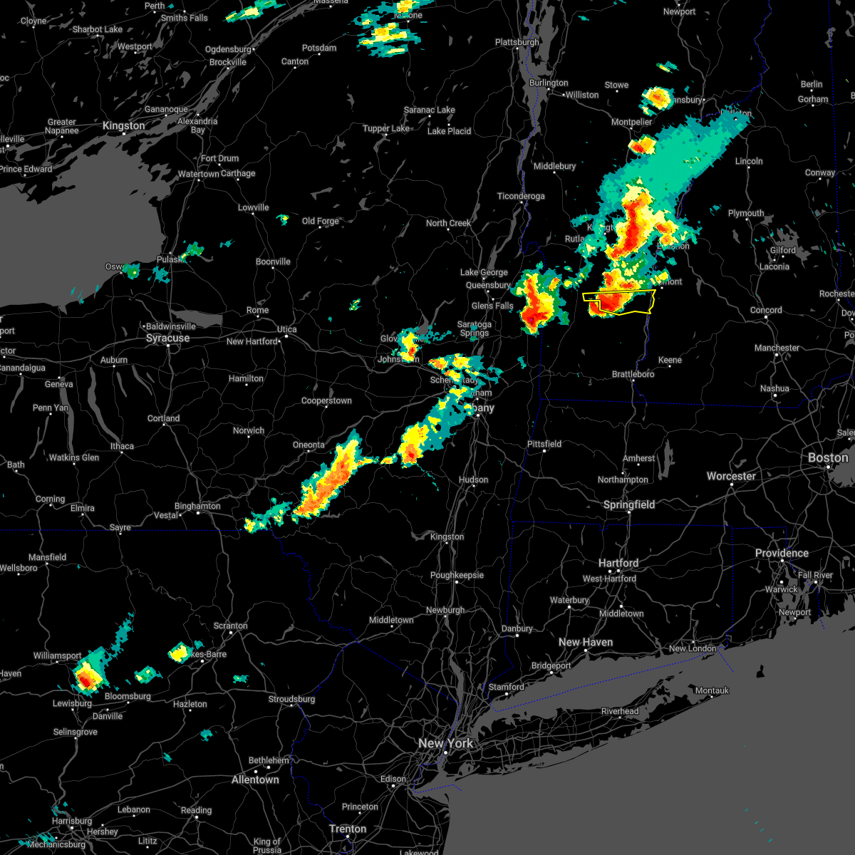
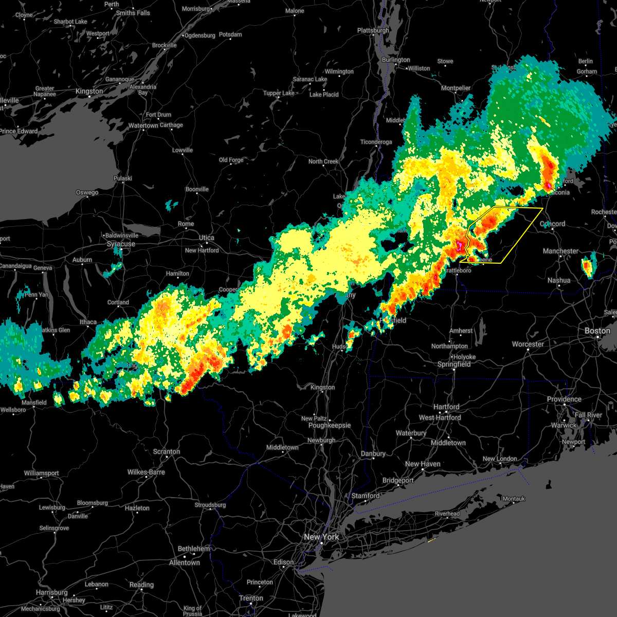
Hail Map for Charlestown, NH
The Charlestown, NH area has had 13 reports of on-the-ground hail by trained spotters, and has been under severe weather warnings 8 times during the past 12 months. Doppler radar has detected hail at or near Charlestown, NH on 14 occasions.
| Name: | Charlestown, NH |
| Where Located: | 82.2 miles ENE of Schenectady, NY |
| Map: | Google Map for Charlestown, NH |
| Population: | 1152 |
| Housing Units: | 503 |
| More Info: | Search Google for Charlestown, NH |
5
The Top Recent Hail Date for Charlestown, NH is Tuesday, May 21, 2024 (2nd out of 14)

Hail and Wind Damage Spotted near Charlestown, NH
| Date / Time | Report Details |
|---|---|
| 8/15/2024 6:35 PM EDT |
 Svrgyx the national weather service in gray maine has issued a * severe thunderstorm warning for, southwestern sullivan county in central new hampshire, northwestern cheshire county in southern new hampshire, * until 715 pm edt. * at 635 pm edt, a severe thunderstorm was located over charlestown, or 12 miles southwest of claremont, moving southeast at 20 mph (radar indicated). Hazards include 60 mph wind gusts and quarter size hail. Hail damage to vehicles is expected. Expect wind damage to roofs, siding, and trees. Svrgyx the national weather service in gray maine has issued a * severe thunderstorm warning for, southwestern sullivan county in central new hampshire, northwestern cheshire county in southern new hampshire, * until 715 pm edt. * at 635 pm edt, a severe thunderstorm was located over charlestown, or 12 miles southwest of claremont, moving southeast at 20 mph (radar indicated). Hazards include 60 mph wind gusts and quarter size hail. Hail damage to vehicles is expected. Expect wind damage to roofs, siding, and trees.
|
| 8/5/2024 6:13 PM EDT |
 Svraly the national weather service in albany has issued a * severe thunderstorm warning for, north central berkshire county in western massachusetts, bennington county in southern vermont, windham county in southern vermont, * until 715 pm edt. * at 613 pm edt, severe thunderstorms were located along a line extending from near danby to near arlington to pownal, moving east at 30 mph (radar indicated). Hazards include 60 mph wind gusts and penny size hail. expect damage to roofs, siding, and trees Svraly the national weather service in albany has issued a * severe thunderstorm warning for, north central berkshire county in western massachusetts, bennington county in southern vermont, windham county in southern vermont, * until 715 pm edt. * at 613 pm edt, severe thunderstorms were located along a line extending from near danby to near arlington to pownal, moving east at 30 mph (radar indicated). Hazards include 60 mph wind gusts and penny size hail. expect damage to roofs, siding, and trees
|
| 7/16/2024 6:58 PM EDT |
 Svraly the national weather service in albany has issued a * severe thunderstorm warning for, windham county in southern vermont, * until 715 pm edt. * at 657 pm edt, severe thunderstorms were located along a line extending from near saxtons river to near bernardston, moving east at 50 mph (radar indicated). Hazards include 70 mph wind gusts. Expect considerable tree damage. Damage is likely to mobile homes, roofs, and outbuildings. Svraly the national weather service in albany has issued a * severe thunderstorm warning for, windham county in southern vermont, * until 715 pm edt. * at 657 pm edt, severe thunderstorms were located along a line extending from near saxtons river to near bernardston, moving east at 50 mph (radar indicated). Hazards include 70 mph wind gusts. Expect considerable tree damage. Damage is likely to mobile homes, roofs, and outbuildings.
|
| 7/16/2024 6:50 PM EDT |
 The storms which prompted the warning have moved out of the area. therefore, the warning will be allowed to expire. The storms which prompted the warning have moved out of the area. therefore, the warning will be allowed to expire.
|
| 7/16/2024 6:38 PM EDT |
 At 638 pm edt, severe thunderstorms were located along a line extending from 9 miles southwest of lebanon to near claremont to charlestown to 11 miles west of westmoreland, moving east at 50 mph (radar indicated). Hazards include 70 mph wind gusts. Expect considerable tree damage. damage is likely to mobile homes, roofs, and outbuildings. locations impacted include, claremont, lebanon, henniker, new london, grafton, hanover, charlestown, enfield, canaan, bradford, danbury, groton, newport, gilsum, walpole, warner, alstead, marlow, stoddard, and surry. this also includes, mount kearsage and mount sunapee. This includes interstate 89 between mile markers 16 and 60. At 638 pm edt, severe thunderstorms were located along a line extending from 9 miles southwest of lebanon to near claremont to charlestown to 11 miles west of westmoreland, moving east at 50 mph (radar indicated). Hazards include 70 mph wind gusts. Expect considerable tree damage. damage is likely to mobile homes, roofs, and outbuildings. locations impacted include, claremont, lebanon, henniker, new london, grafton, hanover, charlestown, enfield, canaan, bradford, danbury, groton, newport, gilsum, walpole, warner, alstead, marlow, stoddard, and surry. this also includes, mount kearsage and mount sunapee. This includes interstate 89 between mile markers 16 and 60.
|
| 7/16/2024 6:25 PM EDT |
 Svrgyx the national weather service in gray maine has issued a * severe thunderstorm warning for, sullivan county in central new hampshire, southwestern grafton county in northern new hampshire, northwestern cheshire county in southern new hampshire, northwestern merrimack county in central new hampshire, * until 715 pm edt. * at 624 pm edt, severe thunderstorms were located along a line extending from 18 miles southwest of lebanon to 6 miles west of claremont to 7 miles southwest of charlestown to 20 miles west of chesterfield, moving east at 55 mph (radar indicated). Hazards include 70 mph wind gusts. Expect considerable tree damage. Damage is likely to mobile homes, roofs, and outbuildings. Svrgyx the national weather service in gray maine has issued a * severe thunderstorm warning for, sullivan county in central new hampshire, southwestern grafton county in northern new hampshire, northwestern cheshire county in southern new hampshire, northwestern merrimack county in central new hampshire, * until 715 pm edt. * at 624 pm edt, severe thunderstorms were located along a line extending from 18 miles southwest of lebanon to 6 miles west of claremont to 7 miles southwest of charlestown to 20 miles west of chesterfield, moving east at 55 mph (radar indicated). Hazards include 70 mph wind gusts. Expect considerable tree damage. Damage is likely to mobile homes, roofs, and outbuildings.
|
| 7/16/2024 6:23 PM EDT |
 Svrbtv the national weather service in burlington has issued a * severe thunderstorm warning for, southeastern windsor county in southern vermont, * until 700 pm edt. * at 622 pm edt, severe thunderstorms were located along a line extending from reading to perkinsville village to near north chester, moving east at 50 mph (radar indicated). Hazards include 60 mph wind gusts. expect damage to trees and powerlines Svrbtv the national weather service in burlington has issued a * severe thunderstorm warning for, southeastern windsor county in southern vermont, * until 700 pm edt. * at 622 pm edt, severe thunderstorms were located along a line extending from reading to perkinsville village to near north chester, moving east at 50 mph (radar indicated). Hazards include 60 mph wind gusts. expect damage to trees and powerlines
|
| 7/16/2024 6:15 PM EDT |
 Svraly the national weather service in albany has issued a * severe thunderstorm warning for, central bennington county in southern vermont, windham county in southern vermont, * until 700 pm edt. * at 615 pm edt, severe thunderstorms were located along a line extending from near londonderry to near bennington, moving east at 45 mph (radar indicated). Hazards include 70 mph wind gusts. Expect considerable tree damage. Damage is likely to mobile homes, roofs, and outbuildings. Svraly the national weather service in albany has issued a * severe thunderstorm warning for, central bennington county in southern vermont, windham county in southern vermont, * until 700 pm edt. * at 615 pm edt, severe thunderstorms were located along a line extending from near londonderry to near bennington, moving east at 45 mph (radar indicated). Hazards include 70 mph wind gusts. Expect considerable tree damage. Damage is likely to mobile homes, roofs, and outbuildings.
|
| 6/23/2024 4:10 PM EDT | Storm chaser reported a tree (large elm) blown down onto a picnic table... table split in half. time estimated by rada in sullivan county NH, 0.5 miles NNE of Charlestown, NH |
| 6/23/2024 4:05 PM EDT | Delayed report...tree down blocking nh-12 in the area of caryl ln in charlestown. time estimated via rada in sullivan county NH, 2.6 miles SSW of Charlestown, NH |
| 6/23/2024 3:45 PM EDT |
 At 345 pm edt, a severe thunderstorm was located over weston, moving east at 45 mph (law enforcement). Hazards include 60 mph wind gusts. Expect damage to trees and powerlines. locations impacted include, chester, cavendish, ludlow village, perkinsville village, wallingford, mt. holly, mt. Tabor, windsor, pawlet, mount holly, ludlow, mount tabor, andover, weston, danby, baltimore, springfield, weathersfield, west windsor, and reading. At 345 pm edt, a severe thunderstorm was located over weston, moving east at 45 mph (law enforcement). Hazards include 60 mph wind gusts. Expect damage to trees and powerlines. locations impacted include, chester, cavendish, ludlow village, perkinsville village, wallingford, mt. holly, mt. Tabor, windsor, pawlet, mount holly, ludlow, mount tabor, andover, weston, danby, baltimore, springfield, weathersfield, west windsor, and reading.
|
| 6/23/2024 3:00 PM EDT |
 Svrbtv the national weather service in burlington has issued a * severe thunderstorm warning for, southeastern rutland county in southern vermont, southwestern windsor county in southern vermont, * until 400 pm edt. * at 259 pm edt, a severe thunderstorm was located 13 miles southwest of west pawlet, moving east at 40 mph (radar indicated). Hazards include 60 mph wind gusts and penny size hail. expect damage to trees and powerlines Svrbtv the national weather service in burlington has issued a * severe thunderstorm warning for, southeastern rutland county in southern vermont, southwestern windsor county in southern vermont, * until 400 pm edt. * at 259 pm edt, a severe thunderstorm was located 13 miles southwest of west pawlet, moving east at 40 mph (radar indicated). Hazards include 60 mph wind gusts and penny size hail. expect damage to trees and powerlines
|
| 6/19/2024 3:08 PM EDT |
 Svrgyx the national weather service in gray maine has issued a * severe thunderstorm warning for, southern sullivan county in central new hampshire, northern cheshire county in southern new hampshire, northwestern hillsborough county in southern new hampshire, southwestern merrimack county in central new hampshire, * until 400 pm edt. * at 307 pm edt, a severe thunderstorm was located over alstead, or 12 miles north of keene, moving east at 25 mph (radar indicated). Hazards include 60 mph wind gusts and quarter size hail. Hail damage to vehicles is expected. Expect wind damage to roofs, siding, and trees. Svrgyx the national weather service in gray maine has issued a * severe thunderstorm warning for, southern sullivan county in central new hampshire, northern cheshire county in southern new hampshire, northwestern hillsborough county in southern new hampshire, southwestern merrimack county in central new hampshire, * until 400 pm edt. * at 307 pm edt, a severe thunderstorm was located over alstead, or 12 miles north of keene, moving east at 25 mph (radar indicated). Hazards include 60 mph wind gusts and quarter size hail. Hail damage to vehicles is expected. Expect wind damage to roofs, siding, and trees.
|
| 5/21/2024 5:29 PM EDT |
 The storm which prompted the warning has weakened below severe limits, and no longer poses an immediate threat to life or property. therefore, the warning will be allowed to expire. however, small hail, gusty winds and heavy rain are still possible with this thunderstorm. The storm which prompted the warning has weakened below severe limits, and no longer poses an immediate threat to life or property. therefore, the warning will be allowed to expire. however, small hail, gusty winds and heavy rain are still possible with this thunderstorm.
|
| 5/21/2024 4:59 PM EDT |
 At 458 pm edt, a severe thunderstorm was located near charlestown, or 11 miles south of claremont, moving northeast at 10 mph (trained weather spotters). Hazards include 60 mph wind gusts and quarter size hail. Hail damage to vehicles is expected. expect wind damage to roofs, siding, and trees. Locations impacted include, claremont, charlestown, newport, marlow, stoddard, walpole, alstead, gilsum, windsor, surry, lempster, acworth, goshen, langdon, washington, and unity. At 458 pm edt, a severe thunderstorm was located near charlestown, or 11 miles south of claremont, moving northeast at 10 mph (trained weather spotters). Hazards include 60 mph wind gusts and quarter size hail. Hail damage to vehicles is expected. expect wind damage to roofs, siding, and trees. Locations impacted include, claremont, charlestown, newport, marlow, stoddard, walpole, alstead, gilsum, windsor, surry, lempster, acworth, goshen, langdon, washington, and unity.
|
| 5/21/2024 4:42 PM EDT | Half Dollar sized hail reported 1.2 miles NNE of Charlestown, NH |
| 5/21/2024 4:35 PM EDT |
 Svrgyx the national weather service in gray maine has issued a * severe thunderstorm warning for, southwestern sullivan county in central new hampshire, northern cheshire county in southern new hampshire, * until 530 pm edt. * at 435 pm edt, a severe thunderstorm was located near charlestown, or 13 miles south of claremont, moving northeast at 10 mph (radar indicated). Hazards include 60 mph wind gusts and quarter size hail. Hail damage to vehicles is expected. Expect wind damage to roofs, siding, and trees. Svrgyx the national weather service in gray maine has issued a * severe thunderstorm warning for, southwestern sullivan county in central new hampshire, northern cheshire county in southern new hampshire, * until 530 pm edt. * at 435 pm edt, a severe thunderstorm was located near charlestown, or 13 miles south of claremont, moving northeast at 10 mph (radar indicated). Hazards include 60 mph wind gusts and quarter size hail. Hail damage to vehicles is expected. Expect wind damage to roofs, siding, and trees.
|
| 9/8/2023 5:50 PM EDT |
 The severe thunderstorm warning for sullivan county will expire at 600 pm edt, the storms which prompted the warning have moved out of the area. therefore, the warning will be allowed to expire. a severe thunderstorm watch remains in effect until 1100 pm edt for central new hampshire. The severe thunderstorm warning for sullivan county will expire at 600 pm edt, the storms which prompted the warning have moved out of the area. therefore, the warning will be allowed to expire. a severe thunderstorm watch remains in effect until 1100 pm edt for central new hampshire.
|
| 9/8/2023 5:10 PM EDT |
 At 509 pm edt, severe thunderstorms were located along a line extending from 9 miles west of charlestown to near newport, moving east at 15 mph (radar indicated). Hazards include 60 mph wind gusts and quarter size hail. Hail damage to vehicles is expected. Expect wind damage to roofs, siding, and trees. At 509 pm edt, severe thunderstorms were located along a line extending from 9 miles west of charlestown to near newport, moving east at 15 mph (radar indicated). Hazards include 60 mph wind gusts and quarter size hail. Hail damage to vehicles is expected. Expect wind damage to roofs, siding, and trees.
|
| 9/7/2023 10:18 PM EDT |
 At 1018 pm edt, severe thunderstorms were located along a line extending from 17 miles northwest of hanover to near charlestown, moving north at 85 mph (radar indicated). Hazards include 60 mph wind gusts and quarter size hail. Expect wind damage to trees and power lines. Minor hail damage to vehicles is possible. At 1018 pm edt, severe thunderstorms were located along a line extending from 17 miles northwest of hanover to near charlestown, moving north at 85 mph (radar indicated). Hazards include 60 mph wind gusts and quarter size hail. Expect wind damage to trees and power lines. Minor hail damage to vehicles is possible.
|
| 8/4/2023 5:56 PM EDT |
 The severe thunderstorm warning for southern windsor county will expire at 600 pm edt, the storm which prompted the warning has moved out of the area. therefore, the warning will be allowed to expire. a severe thunderstorm watch remains in effect until 800 pm edt for southern vermont. to report severe weather, contact your nearest law enforcement agency. they will relay your report to the national weather service burlington. The severe thunderstorm warning for southern windsor county will expire at 600 pm edt, the storm which prompted the warning has moved out of the area. therefore, the warning will be allowed to expire. a severe thunderstorm watch remains in effect until 800 pm edt for southern vermont. to report severe weather, contact your nearest law enforcement agency. they will relay your report to the national weather service burlington.
|
| 8/4/2023 5:42 PM EDT |
 At 542 pm edt, a severe thunderstorm was located over charlestown, or 7 miles south of claremont, moving east at 20 mph (radar indicated). Hazards include 60 mph wind gusts and quarter size hail. Hail damage to vehicles is expected. Expect wind damage to roofs, siding, and trees. At 542 pm edt, a severe thunderstorm was located over charlestown, or 7 miles south of claremont, moving east at 20 mph (radar indicated). Hazards include 60 mph wind gusts and quarter size hail. Hail damage to vehicles is expected. Expect wind damage to roofs, siding, and trees.
|
| 8/4/2023 5:33 PM EDT |
 At 533 pm edt, a severe thunderstorm was located over springfield, moving east at 25 mph (radar indicated). Hazards include half dollar size hail. minor damage to vehicles is possible At 533 pm edt, a severe thunderstorm was located over springfield, moving east at 25 mph (radar indicated). Hazards include half dollar size hail. minor damage to vehicles is possible
|
| 8/4/2023 5:08 PM EDT |
 The severe thunderstorm warning for central sullivan county will expire at 515 pm edt, the storm which prompted the warning has weakened below severe limits, and no longer poses an immediate threat to life or property. therefore, the warning will be allowed to expire. however, torrential downpours are still occurring with this storm and a flood advisory is currently in effect for the area. a severe thunderstorm watch remains in effect until 800 pm edt for central new hampshire. The severe thunderstorm warning for central sullivan county will expire at 515 pm edt, the storm which prompted the warning has weakened below severe limits, and no longer poses an immediate threat to life or property. therefore, the warning will be allowed to expire. however, torrential downpours are still occurring with this storm and a flood advisory is currently in effect for the area. a severe thunderstorm watch remains in effect until 800 pm edt for central new hampshire.
|
| 8/4/2023 4:42 PM EDT | Ping Pong Ball sized hail reported 5.4 miles SSW of Charlestown, NH, reported by weather spotter. time estimated by radar. |
| 8/4/2023 4:42 PM EDT | Quarter sized hail reported 3.9 miles SSW of Charlestown, NH, reported by weather spotter. time estimated by radar. |
| 8/4/2023 4:36 PM EDT | Reported by weather spotter. time estimated by rada in sullivan county NH, 5.5 miles SSW of Charlestown, NH |
| 8/4/2023 4:35 PM EDT |
 At 435 pm edt, a severe thunderstorm was located near charlestown, or near claremont, moving east at 15 mph (radar indicated). Hazards include 60 mph wind gusts and half dollar size hail. Hail damage to vehicles is expected. expect wind damage to roofs, siding, and trees. Locations impacted include, claremont, charlestown, newport, lempster, acworth, goshen, croydon, sunapee, unity, and washington. At 435 pm edt, a severe thunderstorm was located near charlestown, or near claremont, moving east at 15 mph (radar indicated). Hazards include 60 mph wind gusts and half dollar size hail. Hail damage to vehicles is expected. expect wind damage to roofs, siding, and trees. Locations impacted include, claremont, charlestown, newport, lempster, acworth, goshen, croydon, sunapee, unity, and washington.
|
| 8/4/2023 4:21 PM EDT |
 At 421 pm edt, a severe thunderstorm was located near charlestown, or 8 miles southwest of claremont, moving east at 15 mph (radar indicated). Hazards include 60 mph wind gusts and half dollar size hail. Hail damage to vehicles is expected. Expect wind damage to roofs, siding, and trees. At 421 pm edt, a severe thunderstorm was located near charlestown, or 8 miles southwest of claremont, moving east at 15 mph (radar indicated). Hazards include 60 mph wind gusts and half dollar size hail. Hail damage to vehicles is expected. Expect wind damage to roofs, siding, and trees.
|
| 7/13/2023 8:14 PM EDT |
 At 814 pm edt, severe thunderstorms were located along a line extending from near springfield to near heath, moving east at 40 mph (radar indicated). Hazards include 60 mph wind gusts. Expect damage to roofs, siding, and trees. locations impacted include, brattleboro, bellows falls, townshend, putney, vernon, wilmington, readsboro, saxtons river, westminster, newfane, guilford center, west wardsboro, windham, rockingham, guilford, whitingham, dover, marlboro, jamaica and wardsboro. hail threat, radar indicated max hail size, <. 75 in wind threat, radar indicated max wind gust, 60 mph. At 814 pm edt, severe thunderstorms were located along a line extending from near springfield to near heath, moving east at 40 mph (radar indicated). Hazards include 60 mph wind gusts. Expect damage to roofs, siding, and trees. locations impacted include, brattleboro, bellows falls, townshend, putney, vernon, wilmington, readsboro, saxtons river, westminster, newfane, guilford center, west wardsboro, windham, rockingham, guilford, whitingham, dover, marlboro, jamaica and wardsboro. hail threat, radar indicated max hail size, <. 75 in wind threat, radar indicated max wind gust, 60 mph.
|
| 7/13/2023 8:03 PM EDT |
 At 803 pm edt, a severe thunderstorm was located over cavendish, moving east at 50 mph (radar indicated). Hazards include 60 mph wind gusts and penny size hail. expect damage to trees and powerlines At 803 pm edt, a severe thunderstorm was located over cavendish, moving east at 50 mph (radar indicated). Hazards include 60 mph wind gusts and penny size hail. expect damage to trees and powerlines
|
| 7/13/2023 7:44 PM EDT |
 At 744 pm edt, severe thunderstorms were located along a line extending from weston to near pownal, moving east at 40 mph (radar indicated). Hazards include 60 mph wind gusts and penny size hail. expect damage to roofs, siding, and trees At 744 pm edt, severe thunderstorms were located along a line extending from weston to near pownal, moving east at 40 mph (radar indicated). Hazards include 60 mph wind gusts and penny size hail. expect damage to roofs, siding, and trees
|
| 8/26/2022 1:58 PM EDT | Tree down on bowen crossing r in sullivan county NH, 3.3 miles NNE of Charlestown, NH |
| 8/26/2022 1:52 PM EDT | At 152 pm edt, severe thunderstorms were located along a line extending from 12 miles northwest of charlestown to near westmoreland to 12 miles west of chesterfield, moving east at 25 mph (radar indicated). Hazards include 60 mph wind gusts and quarter size hail. Hail damage to vehicles is expected. Expect wind damage to roofs, siding, and trees. |
| 8/26/2022 1:38 PM EDT | At 135 pm edt, a severe thunderstorm was located over mainly rural areas of northern windham county, moving east at 40 mph (radar indicated). Hazards include 60 mph wind gusts and quarter size hail. Hail damage to vehicles is expected. Expect wind damage to roofs, siding, and trees. |
| 8/4/2022 6:56 PM EDT |
 At 656 pm edt, severe thunderstorms were located along a line extending from 13 miles southwest of lebanon to 10 miles northwest of newport to near claremont to 6 miles north of alstead to near walpole, moving east at 30 mph (radar indicated). Hazards include 60 mph wind gusts. Expect damage to roofs, siding, and trees. locations impacted include, claremont, henniker, new london, grafton, charlestown, enfield, bradford, danbury, newport, warner, marlow, alstead, hillsborough, grantham, andover, cornish, lempster, hill, acworth and goshen. this includes interstate 89 between mile markers 18 and 48. hail threat, radar indicated max hail size, <. 75 in wind threat, radar indicated max wind gust, 60 mph. At 656 pm edt, severe thunderstorms were located along a line extending from 13 miles southwest of lebanon to 10 miles northwest of newport to near claremont to 6 miles north of alstead to near walpole, moving east at 30 mph (radar indicated). Hazards include 60 mph wind gusts. Expect damage to roofs, siding, and trees. locations impacted include, claremont, henniker, new london, grafton, charlestown, enfield, bradford, danbury, newport, warner, marlow, alstead, hillsborough, grantham, andover, cornish, lempster, hill, acworth and goshen. this includes interstate 89 between mile markers 18 and 48. hail threat, radar indicated max hail size, <. 75 in wind threat, radar indicated max wind gust, 60 mph.
|
| 8/4/2022 6:47 PM EDT | Quarter sized hail reported 1.8 miles SSW of Charlestown, NH, observed hail for 4-5 minutes fall on lovers lane. measured hail at 1 inch. tore leaves off of trees. time estimated by radar. |
| 8/4/2022 6:35 PM EDT | Several branches and a few trees down on old acworth stage rd east of charlestown. time estimated by rada in sullivan county NH, 1.5 miles SW of Charlestown, NH |
| 8/4/2022 6:35 PM EDT | Tree down blocking hackett swamp road. time estimated by rada in sullivan county NH, 0.9 miles WNW of Charlestown, NH |
| 8/4/2022 6:29 PM EDT |
 At 629 pm edt, severe thunderstorms were located along a line extending from 26 miles west of lebanon to 13 miles west of claremont to 8 miles northwest of charlestown to 8 miles northwest of walpole to 9 miles northwest of westmoreland, moving east at 30 mph (radar indicated). Hazards include 60 mph wind gusts. expect damage to roofs, siding, and trees At 629 pm edt, severe thunderstorms were located along a line extending from 26 miles west of lebanon to 13 miles west of claremont to 8 miles northwest of charlestown to 8 miles northwest of walpole to 9 miles northwest of westmoreland, moving east at 30 mph (radar indicated). Hazards include 60 mph wind gusts. expect damage to roofs, siding, and trees
|
| 8/4/2022 6:11 PM EDT |
 At 611 pm edt, severe thunderstorms were located along a line extending from near south wallingford to 9 miles southwest of weston, moving northeast at 25 mph (radar indicated). Hazards include 60 mph wind gusts and quarter size hail. Minor hail damage to vehicles is possible. Expect wind damage to trees and powerlines. At 611 pm edt, severe thunderstorms were located along a line extending from near south wallingford to 9 miles southwest of weston, moving northeast at 25 mph (radar indicated). Hazards include 60 mph wind gusts and quarter size hail. Minor hail damage to vehicles is possible. Expect wind damage to trees and powerlines.
|
| 7/28/2022 6:20 PM EDT | Tree blown down on top of a shed. many branches scattered from storm. time estimated by rada in sullivan county NH, 1.8 miles W of Charlestown, NH |
| 7/28/2022 5:51 PM EDT |
 At 551 pm edt, a severe thunderstorm was located over baltimore, moving east at 25 mph (radar indicated). Hazards include 60 mph wind gusts and quarter size hail. Minor hail damage to vehicles is possible. Expect wind damage to trees and powerlines. At 551 pm edt, a severe thunderstorm was located over baltimore, moving east at 25 mph (radar indicated). Hazards include 60 mph wind gusts and quarter size hail. Minor hail damage to vehicles is possible. Expect wind damage to trees and powerlines.
|
| 7/12/2022 4:26 PM EDT |
 The severe thunderstorm warning for south central windsor county will expire at 430 pm edt, the storm which prompted the warning has weakened below severe limits, and has exited the warned area. therefore, the warning will be allowed to expire. a severe thunderstorm watch remains in effect until 700 pm edt for southern vermont. The severe thunderstorm warning for south central windsor county will expire at 430 pm edt, the storm which prompted the warning has weakened below severe limits, and has exited the warned area. therefore, the warning will be allowed to expire. a severe thunderstorm watch remains in effect until 700 pm edt for southern vermont.
|
| 7/12/2022 4:18 PM EDT |
 At 418 pm edt, a severe thunderstorm was located over springfield, moving east at 40 mph (radar indicated). Hazards include 60 mph wind gusts and quarter size hail. Minor hail damage to vehicles is possible. expect wind damage to trees and powerlines. Locations impacted include, chester, springfield, baltimore, weathersfield, north chester, north springfield lake recreation area, north springfield, weathersfield bow, west springfield and gassetts. At 418 pm edt, a severe thunderstorm was located over springfield, moving east at 40 mph (radar indicated). Hazards include 60 mph wind gusts and quarter size hail. Minor hail damage to vehicles is possible. expect wind damage to trees and powerlines. Locations impacted include, chester, springfield, baltimore, weathersfield, north chester, north springfield lake recreation area, north springfield, weathersfield bow, west springfield and gassetts.
|
| 7/12/2022 4:00 PM EDT | Quarter sized hail reported 2.6 miles SSW of Charlestown, NH, reported by weather spotter. |
| 7/12/2022 3:54 PM EDT | Reported by weather spotter hl590: several branches (up to 3 inches in diameter) down along wheeler rd off of hwy 1 in sullivan county NH, 4.1 miles SSW of Charlestown, NH |
| 7/12/2022 3:46 PM EDT |
 At 345 pm edt, severe thunderstorms were located along a line extending from 10 miles southwest of piermont to near charlestown, moving east at 40 mph (radar indicated). Hazards include 60 mph wind gusts and quarter size hail. Hail damage to vehicles is expected. expect wind damage to roofs, siding, and trees. locations impacted include, claremont, lebanon, henniker, new london, plymouth, grafton, hanover, charlestown, enfield, canaan, holderness, ashland, bradford, danbury, groton, newport, warner, marlow, piermont and alstead. this includes the following highways, interstate 89 between mile markers 19 and 60. interstate 93 between mile markers 78 and 93. hail threat, radar indicated max hail size, 1. 00 in wind threat, radar indicated max wind gust, 60 mph. At 345 pm edt, severe thunderstorms were located along a line extending from 10 miles southwest of piermont to near charlestown, moving east at 40 mph (radar indicated). Hazards include 60 mph wind gusts and quarter size hail. Hail damage to vehicles is expected. expect wind damage to roofs, siding, and trees. locations impacted include, claremont, lebanon, henniker, new london, plymouth, grafton, hanover, charlestown, enfield, canaan, holderness, ashland, bradford, danbury, groton, newport, warner, marlow, piermont and alstead. this includes the following highways, interstate 89 between mile markers 19 and 60. interstate 93 between mile markers 78 and 93. hail threat, radar indicated max hail size, 1. 00 in wind threat, radar indicated max wind gust, 60 mph.
|
| 7/12/2022 3:46 PM EDT |
 At 345 pm edt, a severe thunderstorm was located near manchester center, or near manchester, moving east at 50 mph (radar indicated). Hazards include 60 mph wind gusts and quarter size hail. Hail damage to vehicles is expected. Expect wind damage to roofs, siding, and trees. At 345 pm edt, a severe thunderstorm was located near manchester center, or near manchester, moving east at 50 mph (radar indicated). Hazards include 60 mph wind gusts and quarter size hail. Hail damage to vehicles is expected. Expect wind damage to roofs, siding, and trees.
|
| 7/12/2022 3:41 PM EDT |
 At 341 pm edt, a severe thunderstorm was located 8 miles south of mt. tabor, moving east at 45 mph (radar indicated). Hazards include 60 mph wind gusts and quarter size hail. Minor hail damage to vehicles is possible. expect wind damage to trees and powerlines. Locations impacted include, chester, baltimore, weston, andover, springfield, perkinsville village, weathersfield, ascutney, mount tabor, cavendish, ludlow, danby, pawlet, perkinsville, weathersfield bow, west springfield, north chester, north springfield lake recreation area, north springfield and simonsville. At 341 pm edt, a severe thunderstorm was located 8 miles south of mt. tabor, moving east at 45 mph (radar indicated). Hazards include 60 mph wind gusts and quarter size hail. Minor hail damage to vehicles is possible. expect wind damage to trees and powerlines. Locations impacted include, chester, baltimore, weston, andover, springfield, perkinsville village, weathersfield, ascutney, mount tabor, cavendish, ludlow, danby, pawlet, perkinsville, weathersfield bow, west springfield, north chester, north springfield lake recreation area, north springfield and simonsville.
|
| 7/12/2022 3:32 PM EDT |
 At 331 pm edt, severe thunderstorms were located along a line extending from 13 miles northwest of hanover to 11 miles west of charlestown, moving east at 40 mph (radar indicated). Hazards include 60 mph wind gusts and nickel size hail. expect damage to roofs, siding, and trees At 331 pm edt, severe thunderstorms were located along a line extending from 13 miles northwest of hanover to 11 miles west of charlestown, moving east at 40 mph (radar indicated). Hazards include 60 mph wind gusts and nickel size hail. expect damage to roofs, siding, and trees
|
| 7/12/2022 3:28 PM EDT |
 At 328 pm edt, a severe thunderstorm was located over simonsville, moving east at 40 mph (radar indicated). Hazards include 60 mph wind gusts and quarter size hail. Minor hail damage to vehicles is possible. Expect wind damage to trees and powerlines. At 328 pm edt, a severe thunderstorm was located over simonsville, moving east at 40 mph (radar indicated). Hazards include 60 mph wind gusts and quarter size hail. Minor hail damage to vehicles is possible. Expect wind damage to trees and powerlines.
|
| 7/12/2022 3:26 PM EDT |
 At 326 pm edt, a severe thunderstorm was located 9 miles south of west pawlet, moving east at 45 mph (radar indicated). Hazards include 60 mph wind gusts and quarter size hail. Minor hail damage to vehicles is possible. Expect wind damage to trees and powerlines. At 326 pm edt, a severe thunderstorm was located 9 miles south of west pawlet, moving east at 45 mph (radar indicated). Hazards include 60 mph wind gusts and quarter size hail. Minor hail damage to vehicles is possible. Expect wind damage to trees and powerlines.
|
| 5/16/2022 6:24 PM EDT | Emergency management received multiple reports of trees down across charlestow in sullivan county NH, 0.3 miles SW of Charlestown, NH |
| 5/16/2022 6:20 PM EDT | Pictures on social media of multiple trees down on rt 12 in north charlestown... nh. time estimated by rada in sullivan county NH, 5.4 miles SSW of Charlestown, NH |
| 5/16/2022 6:20 PM EDT |
 At 619 pm edt, severe thunderstorms were located along a line extending from 6 miles southwest of charlestown to near chesterfield to 23 miles south of hinsdale, moving east at 35 mph (radar indicated). Hazards include 60 mph wind gusts and nickel size hail. Expect damage to roofs, siding, and trees. locations impacted include, keene, claremont, jaffrey, henniker, peterborough, hopkinton, new boston, charlestown, winchester, antrim, mont vernon, greenfield, lyndeborough, bradford, dublin, francestown, bennington, richmond, harrisville and nelson. this includes interstate 89 between mile markers 18 and 30. hail threat, radar indicated max hail size, 0. 88 in wind threat, radar indicated max wind gust, 60 mph. At 619 pm edt, severe thunderstorms were located along a line extending from 6 miles southwest of charlestown to near chesterfield to 23 miles south of hinsdale, moving east at 35 mph (radar indicated). Hazards include 60 mph wind gusts and nickel size hail. Expect damage to roofs, siding, and trees. locations impacted include, keene, claremont, jaffrey, henniker, peterborough, hopkinton, new boston, charlestown, winchester, antrim, mont vernon, greenfield, lyndeborough, bradford, dublin, francestown, bennington, richmond, harrisville and nelson. this includes interstate 89 between mile markers 18 and 30. hail threat, radar indicated max hail size, 0. 88 in wind threat, radar indicated max wind gust, 60 mph.
|
| 5/16/2022 5:43 PM EDT |
 At 543 pm edt, severe thunderstorms were located along a line extending from 22 miles west of westmoreland to 14 miles west of hinsdale to 41 miles southwest of winchester, moving east at 35 mph (radar indicated). Hazards include 60 mph wind gusts and nickel size hail. expect damage to roofs, siding, and trees At 543 pm edt, severe thunderstorms were located along a line extending from 22 miles west of westmoreland to 14 miles west of hinsdale to 41 miles southwest of winchester, moving east at 35 mph (radar indicated). Hazards include 60 mph wind gusts and nickel size hail. expect damage to roofs, siding, and trees
|
| 3/7/2022 9:10 PM EST |
 The severe thunderstorm warning for eastern bennington and windham counties will expire at 915 pm est, the storm which prompted the warning has moved out of the area. therefore, the warning will be allowed to expire. however gusty winds are still expected for the next few hours. The severe thunderstorm warning for eastern bennington and windham counties will expire at 915 pm est, the storm which prompted the warning has moved out of the area. therefore, the warning will be allowed to expire. however gusty winds are still expected for the next few hours.
|
| 3/7/2022 8:43 PM EST |
 At 843 pm est, a severe thunderstorm was located over west wardsboro, or over stratton, moving east at 55 mph (radar indicated). Hazards include 60 mph wind gusts. expect damage to roofs, siding, and trees At 843 pm est, a severe thunderstorm was located over west wardsboro, or over stratton, moving east at 55 mph (radar indicated). Hazards include 60 mph wind gusts. expect damage to roofs, siding, and trees
|
| 7/27/2021 4:59 PM EDT |
 At 459 pm edt, a severe thunderstorm was located near charlestown, or 10 miles south of claremont, moving southeast at 35 mph (radar indicated). Hazards include 60 mph wind gusts and penny size hail. Expect damage to roofs, siding, and trees. Locations impacted include, claremont, charlestown, antrim, bradford, harrisville, nelson, newport, gilsum, marlow, walpole, sullivan, alstead, surry, windsor, lempster, acworth, goshen, langdon, washington and unity. At 459 pm edt, a severe thunderstorm was located near charlestown, or 10 miles south of claremont, moving southeast at 35 mph (radar indicated). Hazards include 60 mph wind gusts and penny size hail. Expect damage to roofs, siding, and trees. Locations impacted include, claremont, charlestown, antrim, bradford, harrisville, nelson, newport, gilsum, marlow, walpole, sullivan, alstead, surry, windsor, lempster, acworth, goshen, langdon, washington and unity.
|
| 7/27/2021 4:55 PM EDT | Tree down on almar st off of route 1 in sullivan county NH, 1.2 miles N of Charlestown, NH |
| 7/27/2021 4:54 PM EDT | Tree down near rt 12 near ponderosa par in sullivan county NH, 1.6 miles S of Charlestown, NH |
| 7/27/2021 4:30 PM EDT |
 At 429 pm edt, a severe thunderstorm was located 11 miles northwest of charlestown, or 11 miles west of claremont, moving southeast at 45 mph (radar indicated). Hazards include 60 mph wind gusts and penny size hail. expect damage to roofs, siding, and trees At 429 pm edt, a severe thunderstorm was located 11 miles northwest of charlestown, or 11 miles west of claremont, moving southeast at 45 mph (radar indicated). Hazards include 60 mph wind gusts and penny size hail. expect damage to roofs, siding, and trees
|
| 7/20/2021 10:43 PM EDT |
 The severe thunderstorm warning for southeastern bennington and windham counties will expire at 1045 pm edt, the storms which prompted the warning have moved out of the area. therefore, the warning will be allowed to expire. a severe thunderstorm watch remains in effect until 1100 pm edt for southern vermont. The severe thunderstorm warning for southeastern bennington and windham counties will expire at 1045 pm edt, the storms which prompted the warning have moved out of the area. therefore, the warning will be allowed to expire. a severe thunderstorm watch remains in effect until 1100 pm edt for southern vermont.
|
| 7/20/2021 10:14 PM EDT |
 At 1014 pm edt, severe thunderstorms were located along a line extending from near newport to near westmoreland, moving east at 35 mph (radar indicated). Hazards include 60 mph wind gusts and quarter size hail. Hail damage to vehicles is expected. Expect wind damage to roofs, siding, and trees. At 1014 pm edt, severe thunderstorms were located along a line extending from near newport to near westmoreland, moving east at 35 mph (radar indicated). Hazards include 60 mph wind gusts and quarter size hail. Hail damage to vehicles is expected. Expect wind damage to roofs, siding, and trees.
|
| 7/20/2021 10:00 PM EDT |
 At 1000 pm edt, severe thunderstorms were located along a line extending from near chester to near monroe, moving east at 25 mph (radar indicated). Hazards include 60 mph wind gusts. expect damage to roofs, siding, and trees At 1000 pm edt, severe thunderstorms were located along a line extending from near chester to near monroe, moving east at 25 mph (radar indicated). Hazards include 60 mph wind gusts. expect damage to roofs, siding, and trees
|
| 7/20/2021 9:31 PM EDT |
 At 929 pm edt, a line of severe thunderstorms was over portions of rutland and windsor counties in vermont generally located along a line extending from near white river junction to felchville to 6 miles south of danby, moving southeast at 30 mph (radar indicated). Hazards include 60 mph wind gusts and quarter size hail. Expect wind damage to trees and powerlines. minor hail damage to vehicles is possible. locations impacted include, woodstock, chester, hartland four corners, cavendish, ludlow village, perkinsville village, wallingford, mt. holly, mt. Tabor, pomfret, plymouth, hartland, windsor, woodstock village, pawlet, mount holly, ludlow, sharon, andover and mount tabor. At 929 pm edt, a line of severe thunderstorms was over portions of rutland and windsor counties in vermont generally located along a line extending from near white river junction to felchville to 6 miles south of danby, moving southeast at 30 mph (radar indicated). Hazards include 60 mph wind gusts and quarter size hail. Expect wind damage to trees and powerlines. minor hail damage to vehicles is possible. locations impacted include, woodstock, chester, hartland four corners, cavendish, ludlow village, perkinsville village, wallingford, mt. holly, mt. Tabor, pomfret, plymouth, hartland, windsor, woodstock village, pawlet, mount holly, ludlow, sharon, andover and mount tabor.
|
| 7/20/2021 8:54 PM EDT |
 At 852 pm edt, a line of severe thunderstorms over south central vermont was located along a line extending from near south strafford to west bridgewater to near north pawlet, moving southeast at 30 mph (radar indicated). Hazards include 60 mph wind gusts and quarter size hail. Expect wind damage to trees and powerlines. Minor hail damage to vehicles is possible. At 852 pm edt, a line of severe thunderstorms over south central vermont was located along a line extending from near south strafford to west bridgewater to near north pawlet, moving southeast at 30 mph (radar indicated). Hazards include 60 mph wind gusts and quarter size hail. Expect wind damage to trees and powerlines. Minor hail damage to vehicles is possible.
|
| 6/30/2021 4:05 PM EDT |
 At 404 pm edt, severe thunderstorms were located along a line extending from 9 miles west of walpole to 13 miles west of hinsdale, moving east at 35 mph (radar indicated). Hazards include 60 mph wind gusts and quarter size hail. Hail damage to vehicles is expected. Expect wind damage to roofs, siding, and trees. At 404 pm edt, severe thunderstorms were located along a line extending from 9 miles west of walpole to 13 miles west of hinsdale, moving east at 35 mph (radar indicated). Hazards include 60 mph wind gusts and quarter size hail. Hail damage to vehicles is expected. Expect wind damage to roofs, siding, and trees.
|
| 5/26/2021 5:14 PM EDT |
 At 514 pm edt, severe thunderstorms were located along a line extending from 11 miles west of charlestown to 12 miles west of chesterfield to 20 miles southwest of hinsdale, moving east at 45 mph (radar indicated). Hazards include 60 mph wind gusts. expect damage to roofs, siding, and trees At 514 pm edt, severe thunderstorms were located along a line extending from 11 miles west of charlestown to 12 miles west of chesterfield to 20 miles southwest of hinsdale, moving east at 45 mph (radar indicated). Hazards include 60 mph wind gusts. expect damage to roofs, siding, and trees
|
| 5/26/2021 4:57 PM EDT |
 At 457 pm edt, a line of showers and thunderstorms were located along a line extending from weston to near wilmington to adams, moving east at 45 mph (radar indicated). Hazards include 60 mph wind gusts. expect damage to roofs, siding, and trees At 457 pm edt, a line of showers and thunderstorms were located along a line extending from weston to near wilmington to adams, moving east at 45 mph (radar indicated). Hazards include 60 mph wind gusts. expect damage to roofs, siding, and trees
|
| 10/7/2020 4:09 PM EDT |
 At 408 pm edt, a severe thunderstorm was located near pownal, or near bennington, moving east at 70 mph. this is a very dangerous storm (radar indicated). Hazards include 80 mph wind gusts and nickel size hail. Flying debris will be dangerous to those caught without shelter. mobile homes will be heavily damaged. expect considerable damage to roofs, windows, and vehicles. extensive tree damage and power outages are likely. Locations impacted include, albany, troy, pittsfield, bennington, kingston, east greenbush, cohoes, north adams, brattleboro, watervliet, rensselaer, colonie, great barrington, new paltz, hudson, ellenville, catskill, saugerties, hoosick falls and bellows falls. At 408 pm edt, a severe thunderstorm was located near pownal, or near bennington, moving east at 70 mph. this is a very dangerous storm (radar indicated). Hazards include 80 mph wind gusts and nickel size hail. Flying debris will be dangerous to those caught without shelter. mobile homes will be heavily damaged. expect considerable damage to roofs, windows, and vehicles. extensive tree damage and power outages are likely. Locations impacted include, albany, troy, pittsfield, bennington, kingston, east greenbush, cohoes, north adams, brattleboro, watervliet, rensselaer, colonie, great barrington, new paltz, hudson, ellenville, catskill, saugerties, hoosick falls and bellows falls.
|
| 10/7/2020 3:56 PM EDT |
 At 356 pm edt, severe thunderstorms were located along a line extending from near pawlet to center brunswick to near davenport, moving southeast at 80 mph (radar indicated). Hazards include 70 mph wind gusts. Expect considerable tree damage. Damage is likely to mobile homes, roofs, and outbuildings. At 356 pm edt, severe thunderstorms were located along a line extending from near pawlet to center brunswick to near davenport, moving southeast at 80 mph (radar indicated). Hazards include 70 mph wind gusts. Expect considerable tree damage. Damage is likely to mobile homes, roofs, and outbuildings.
|
| 10/7/2020 3:48 PM EDT |
 At 347 pm edt, severe thunderstorms were located along a line extending from near dorset to 7 miles southwest of cambridge to middleburgh, moving east at 60 mph (radar indicated). Hazards include 70 mph wind gusts. Expect considerable tree damage. damage is likely to mobile homes, roofs, and outbuildings. Locations impacted include, albany, schenectady, troy, bennington, clifton park, rotterdam, saratoga springs, amsterdam, east greenbush, cohoes, north adams, watervliet, rensselaer, colonie, scotia, hudson falls, mechanicville, cobleskill, hoosick falls and bellows falls. At 347 pm edt, severe thunderstorms were located along a line extending from near dorset to 7 miles southwest of cambridge to middleburgh, moving east at 60 mph (radar indicated). Hazards include 70 mph wind gusts. Expect considerable tree damage. damage is likely to mobile homes, roofs, and outbuildings. Locations impacted include, albany, schenectady, troy, bennington, clifton park, rotterdam, saratoga springs, amsterdam, east greenbush, cohoes, north adams, watervliet, rensselaer, colonie, scotia, hudson falls, mechanicville, cobleskill, hoosick falls and bellows falls.
|
| 10/7/2020 3:43 PM EDT |
 At 342 pm edt, severe thunderstorms were located along a line extending from near dorset to 6 miles northeast of mechanicville to near middleburgh, moving east southeast at 60 mph (radar indicated). Hazards include 60 mph wind gusts. Expect damage to roofs, siding, and trees. Locations impacted include, albany, schenectady, troy, bennington, clifton park, rotterdam, saratoga springs, amsterdam, east greenbush, cohoes, north adams, watervliet, rensselaer, colonie, scotia, hudson falls, mechanicville, cobleskill, hoosick falls and bellows falls. At 342 pm edt, severe thunderstorms were located along a line extending from near dorset to 6 miles northeast of mechanicville to near middleburgh, moving east southeast at 60 mph (radar indicated). Hazards include 60 mph wind gusts. Expect damage to roofs, siding, and trees. Locations impacted include, albany, schenectady, troy, bennington, clifton park, rotterdam, saratoga springs, amsterdam, east greenbush, cohoes, north adams, watervliet, rensselaer, colonie, scotia, hudson falls, mechanicville, cobleskill, hoosick falls and bellows falls.
|
| 10/7/2020 3:21 PM EDT |
 At 320 pm edt, severe thunderstorms were located along a line extending from near lake george village to near broadalbin to cooperstown, moving east at 60 mph (radar indicated). Hazards include 70 mph wind gusts. Expect considerable tree damage. Damage is likely to mobile homes, roofs, and outbuildings. At 320 pm edt, severe thunderstorms were located along a line extending from near lake george village to near broadalbin to cooperstown, moving east at 60 mph (radar indicated). Hazards include 70 mph wind gusts. Expect considerable tree damage. Damage is likely to mobile homes, roofs, and outbuildings.
|
| 8/23/2020 8:55 PM EDT | Trees and wires down. reported at oxbrook road charlestown n in sullivan county NH, 5.5 miles SSW of Charlestown, NH |
| 8/23/2020 8:40 PM EDT |
 At 840 pm edt, severe thunderstorms were located along a line extending from 17 miles southwest of lebanon to 6 miles west of claremont to near charlestown, moving northeast at 25 mph (radar indicated). Hazards include 60 mph wind gusts and penny size hail. expect damage to roofs, siding, and trees At 840 pm edt, severe thunderstorms were located along a line extending from 17 miles southwest of lebanon to 6 miles west of claremont to near charlestown, moving northeast at 25 mph (radar indicated). Hazards include 60 mph wind gusts and penny size hail. expect damage to roofs, siding, and trees
|
| 8/23/2020 8:30 PM EDT |
 At 829 pm edt, severe thunderstorms were located along a line extending from bridgewater corners to near north chester, moving east at 30 mph (radar indicated). Hazards include 60 mph wind gusts and quarter size hail. Minor hail damage to vehicles is possible. Expect wind damage to trees and powerlines. At 829 pm edt, severe thunderstorms were located along a line extending from bridgewater corners to near north chester, moving east at 30 mph (radar indicated). Hazards include 60 mph wind gusts and quarter size hail. Minor hail damage to vehicles is possible. Expect wind damage to trees and powerlines.
|
| 8/21/2020 4:57 PM EDT |
 The severe thunderstorm warning for southeastern rutland and southwestern windsor counties will expire at 500 pm edt, the storm which prompted the warning has weakened below severe limits, and has exited the warned area. therefore, the warning will be allowed to expire. however gusty winds and heavy rain are still possible with this thunderstorm. The severe thunderstorm warning for southeastern rutland and southwestern windsor counties will expire at 500 pm edt, the storm which prompted the warning has weakened below severe limits, and has exited the warned area. therefore, the warning will be allowed to expire. however gusty winds and heavy rain are still possible with this thunderstorm.
|
| 8/21/2020 4:32 PM EDT |
 At 430 pm edt, a severe thunderstorm was located over andover, moving east at 45 mph (law enforcement). Hazards include 60 mph wind gusts and quarter size hail. Trees and powerlines down throughout wells and middletown springs, vermont. minor hail damage to vehicles is possible. expect wind damage to trees and powerlines. locations impacted include, chester, cavendish, ludlow village, perkinsville village, wallingford, mt. holly, mt. Tabor, rutland - southern vermont airport, clarendon, windsor, mount holly, ludlow, andover, mount tabor, weston, danby, reading, baltimore, springfield and weathersfield. At 430 pm edt, a severe thunderstorm was located over andover, moving east at 45 mph (law enforcement). Hazards include 60 mph wind gusts and quarter size hail. Trees and powerlines down throughout wells and middletown springs, vermont. minor hail damage to vehicles is possible. expect wind damage to trees and powerlines. locations impacted include, chester, cavendish, ludlow village, perkinsville village, wallingford, mt. holly, mt. Tabor, rutland - southern vermont airport, clarendon, windsor, mount holly, ludlow, andover, mount tabor, weston, danby, reading, baltimore, springfield and weathersfield.
|
| 8/21/2020 4:01 PM EDT |
 At 401 pm edt, a severe thunderstorm was located over east wells, moving east at 45 mph (radar indicated). Hazards include 60 mph wind gusts and quarter size hail. Minor hail damage to vehicles is possible. Expect wind damage to trees and powerlines. At 401 pm edt, a severe thunderstorm was located over east wells, moving east at 45 mph (radar indicated). Hazards include 60 mph wind gusts and quarter size hail. Minor hail damage to vehicles is possible. Expect wind damage to trees and powerlines.
|
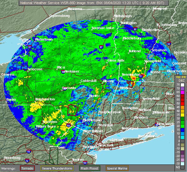
| 8/4/2020 9:35 AM EDT |
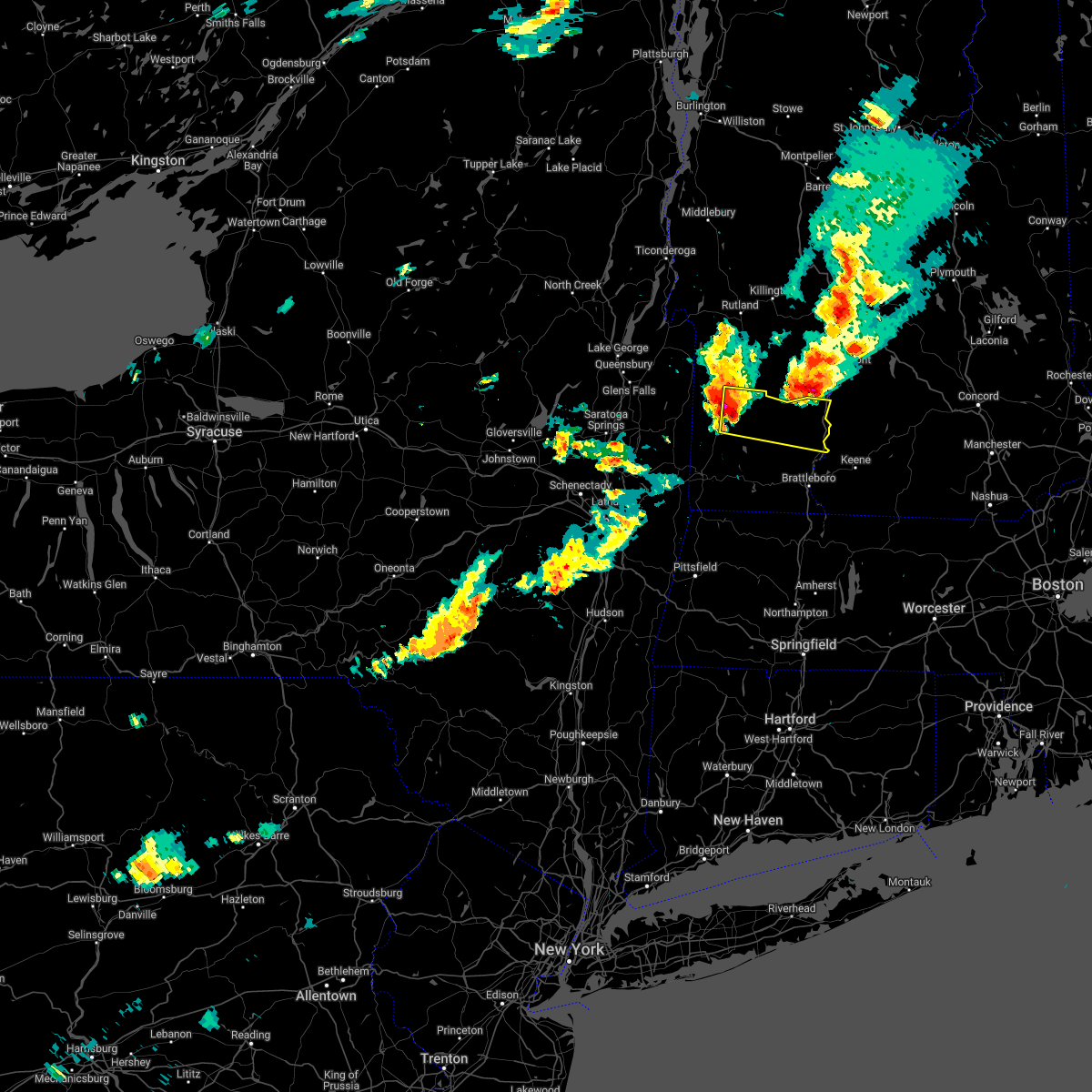
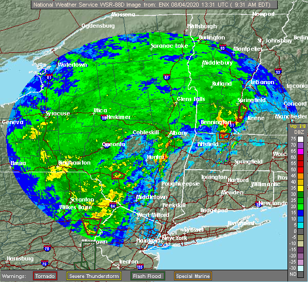 At 935 am edt, a severe thunderstorm capable of producing a tornado was located over walpole, or 12 miles northwest of keene, moving north at 50 mph (radar indicated rotation). Hazards include tornado. Flying debris will be dangerous to those caught without shelter. mobile homes will be damaged or destroyed. damage to roofs, windows, and vehicles will occur. tree damage is likely. this dangerous storm will be near, alstead around 945 am edt. charlestown around 955 am edt. Other locations impacted by this tornadic thunderstorm include langdon and acworth. At 935 am edt, a severe thunderstorm capable of producing a tornado was located over walpole, or 12 miles northwest of keene, moving north at 50 mph (radar indicated rotation). Hazards include tornado. Flying debris will be dangerous to those caught without shelter. mobile homes will be damaged or destroyed. damage to roofs, windows, and vehicles will occur. tree damage is likely. this dangerous storm will be near, alstead around 945 am edt. charlestown around 955 am edt. Other locations impacted by this tornadic thunderstorm include langdon and acworth.
|
| 8/4/2020 9:22 AM EDT |
 At 921 am edt, a severe thunderstorm capable of producing a tornado was located near westmoreland, or 10 miles west of keene, moving north at 50 mph (radar indicated rotation). Hazards include tornado. Flying debris will be dangerous to those caught without shelter. mobile homes will be damaged or destroyed. damage to roofs, windows, and vehicles will occur. tree damage is likely. this dangerous storm will be near, westmoreland around 930 am edt. walpole around 940 am edt. charlestown and alstead around 945 am edt. Other locations impacted by this tornadic thunderstorm include langdon and acworth. At 921 am edt, a severe thunderstorm capable of producing a tornado was located near westmoreland, or 10 miles west of keene, moving north at 50 mph (radar indicated rotation). Hazards include tornado. Flying debris will be dangerous to those caught without shelter. mobile homes will be damaged or destroyed. damage to roofs, windows, and vehicles will occur. tree damage is likely. this dangerous storm will be near, westmoreland around 930 am edt. walpole around 940 am edt. charlestown and alstead around 945 am edt. Other locations impacted by this tornadic thunderstorm include langdon and acworth.
|
| 7/8/2020 2:50 PM EDT | Golf Ball sized hail reported 7.7 miles WNW of Charlestown, NH, between acworth and south acworth on hill road off of rte 123a. |
| 7/8/2020 2:40 PM EDT | Golf Ball sized hail reported 2.8 miles W of Charlestown, NH, storm also damaged home anemometer. |
| 7/8/2020 2:25 PM EDT | Half Dollar sized hail reported 4.7 miles N of Charlestown, NH, measured on rt 123a... 1 hail with some 1.25 stones mixed in. |
| 7/8/2020 2:19 PM EDT |
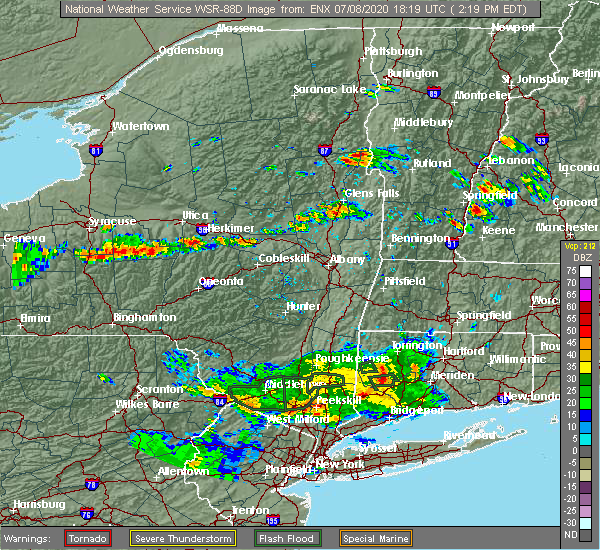 At 218 pm edt, a severe thunderstorm was located near charlestown, or 12 miles south of claremont, moving east at 15 mph (radar indicated). Hazards include 60 mph wind gusts and quarter size hail. Hail damage to vehicles is expected. Expect wind damage to roofs, siding, and trees. At 218 pm edt, a severe thunderstorm was located near charlestown, or 12 miles south of claremont, moving east at 15 mph (radar indicated). Hazards include 60 mph wind gusts and quarter size hail. Hail damage to vehicles is expected. Expect wind damage to roofs, siding, and trees.
|
| 7/5/2020 7:25 PM EDT | Multiple trees down across tow in sullivan county NH, 0.3 miles SW of Charlestown, NH |
| 7/5/2020 7:19 PM EDT |
 At 719 pm edt, a severe thunderstorm was located near charlestown, or near bellows falls, moving southeast at 30 mph (radar indicated). Hazards include 60 mph wind gusts and quarter size hail. Hail damage to vehicles is expected. Expect wind damage to roofs, siding, and trees. At 719 pm edt, a severe thunderstorm was located near charlestown, or near bellows falls, moving southeast at 30 mph (radar indicated). Hazards include 60 mph wind gusts and quarter size hail. Hail damage to vehicles is expected. Expect wind damage to roofs, siding, and trees.
|
| 7/5/2020 7:18 PM EDT |
 At 717 pm edt, a severe thunderstorm was located near charlestown, or 11 miles southwest of claremont, moving southeast at 30 mph (radar indicated). Hazards include 60 mph wind gusts and quarter size hail. Hail damage to vehicles is expected. Expect wind damage to roofs, siding, and trees. At 717 pm edt, a severe thunderstorm was located near charlestown, or 11 miles southwest of claremont, moving southeast at 30 mph (radar indicated). Hazards include 60 mph wind gusts and quarter size hail. Hail damage to vehicles is expected. Expect wind damage to roofs, siding, and trees.
|
| 5/15/2020 7:39 PM EDT |
 At 713 pm edt, severe thunderstorms were located along a line extending from near saxtons river to near newfane to near heath, moving east at 60 mph (radar indicated). Hazards include 70 mph wind gusts and penny size hail. Expect considerable tree damage. Damage is likely to mobile homes, roofs, and outbuildings. At 713 pm edt, severe thunderstorms were located along a line extending from near saxtons river to near newfane to near heath, moving east at 60 mph (radar indicated). Hazards include 70 mph wind gusts and penny size hail. Expect considerable tree damage. Damage is likely to mobile homes, roofs, and outbuildings.
|
| 5/15/2020 7:23 PM EDT |
 At 722 pm edt, severe thunderstorms were located along a line extending from near walpole to near chesterfield to near hinsdale, moving east at 50 mph (radar indicated). Hazards include 70 mph wind gusts and penny size hail. Expect considerable tree damage. damage is likely to mobile homes, roofs, and outbuildings. locations impacted include, keene, jaffrey, peterborough, charlestown, winchester, antrim, bradford, dublin, richmond, harrisville, nelson, gilsum, marlborough, rindge, walpole, alstead, westmoreland, swanzey, marlow and hinsdale. This also includes, mount monadnock. At 722 pm edt, severe thunderstorms were located along a line extending from near walpole to near chesterfield to near hinsdale, moving east at 50 mph (radar indicated). Hazards include 70 mph wind gusts and penny size hail. Expect considerable tree damage. damage is likely to mobile homes, roofs, and outbuildings. locations impacted include, keene, jaffrey, peterborough, charlestown, winchester, antrim, bradford, dublin, richmond, harrisville, nelson, gilsum, marlborough, rindge, walpole, alstead, westmoreland, swanzey, marlow and hinsdale. This also includes, mount monadnock.
|
| 5/15/2020 7:13 PM EDT |
 At 713 pm edt, severe thunderstorms were located along a line extending from near saxtons river to near newfane to near heath, moving east at 60 mph (radar indicated). Hazards include 70 mph wind gusts and penny size hail. Expect considerable tree damage. Damage is likely to mobile homes, roofs, and outbuildings. At 713 pm edt, severe thunderstorms were located along a line extending from near saxtons river to near newfane to near heath, moving east at 60 mph (radar indicated). Hazards include 70 mph wind gusts and penny size hail. Expect considerable tree damage. Damage is likely to mobile homes, roofs, and outbuildings.
|
| 5/15/2020 6:47 PM EDT |
 At 646 pm edt, severe thunderstorms were located along a line extending from 29 miles west of charlestown to 24 miles west of westmoreland to 36 miles west of hinsdale, moving east at 55 mph (radar indicated). Hazards include 70 mph wind gusts and penny size hail. Expect considerable tree damage. Damage is likely to mobile homes, roofs, and outbuildings. At 646 pm edt, severe thunderstorms were located along a line extending from 29 miles west of charlestown to 24 miles west of westmoreland to 36 miles west of hinsdale, moving east at 55 mph (radar indicated). Hazards include 70 mph wind gusts and penny size hail. Expect considerable tree damage. Damage is likely to mobile homes, roofs, and outbuildings.
|
| 5/15/2020 6:26 PM EDT |
 At 625 pm edt, severe thunderstorms were located along a line extending from 6 miles northeast of salem to near shaftsbury to near mechanicville, moving east at 65 mph (radar indicated). Hazards include 70 mph wind gusts and quarter size hail. Hail damage to vehicles is expected. expect considerable tree damage. Wind damage is also likely to mobile homes, roofs, and outbuildings. At 625 pm edt, severe thunderstorms were located along a line extending from 6 miles northeast of salem to near shaftsbury to near mechanicville, moving east at 65 mph (radar indicated). Hazards include 70 mph wind gusts and quarter size hail. Hail damage to vehicles is expected. expect considerable tree damage. Wind damage is also likely to mobile homes, roofs, and outbuildings.
|
| 8/17/2019 7:43 PM EDT |
 The severe thunderstorm warning for southeastern orange and eastern windsor counties will expire at 745 pm edt, the storms which prompted the warning have moved out of the warned area. therefore, the warning will be allowed to expire. The severe thunderstorm warning for southeastern orange and eastern windsor counties will expire at 745 pm edt, the storms which prompted the warning have moved out of the warned area. therefore, the warning will be allowed to expire.
|
| 8/17/2019 7:31 PM EDT |
 At 731 pm edt, severe thunderstorms were located along a line extending from west norwich to near springfield, moving east at 40 mph (radar indicated). Hazards include 60 mph wind gusts. Expect damage to trees and powerlines. Locations impacted include, woodstock, chester, hartland four corners, windsor, sharon, thetford hill state park, perkinsville village, thetford center, quechee, strafford, norwich, thetford, hartland, springfield, weathersfield, hartford, west windsor, pomfret, baltimore and fairlee. At 731 pm edt, severe thunderstorms were located along a line extending from west norwich to near springfield, moving east at 40 mph (radar indicated). Hazards include 60 mph wind gusts. Expect damage to trees and powerlines. Locations impacted include, woodstock, chester, hartland four corners, windsor, sharon, thetford hill state park, perkinsville village, thetford center, quechee, strafford, norwich, thetford, hartland, springfield, weathersfield, hartford, west windsor, pomfret, baltimore and fairlee.
|
| 8/17/2019 7:26 PM EDT |
 At 726 pm edt, severe thunderstorms were located along a line extending from 10 miles southwest of piermont to near hanover to 8 miles north of claremont to charlestown, moving northeast at 45 mph (radar indicated). Hazards include 60 mph wind gusts. expect damage to roofs, siding, and trees At 726 pm edt, severe thunderstorms were located along a line extending from 10 miles southwest of piermont to near hanover to 8 miles north of claremont to charlestown, moving northeast at 45 mph (radar indicated). Hazards include 60 mph wind gusts. expect damage to roofs, siding, and trees
|
| 8/17/2019 7:16 PM EDT |
 The national weather service in burlington has issued a * severe thunderstorm warning for. southeastern orange county in central vermont. eastern windsor county in southern vermont. until 745 pm edt. At 716 pm edt, severe thunderstorms were located along a line. The national weather service in burlington has issued a * severe thunderstorm warning for. southeastern orange county in central vermont. eastern windsor county in southern vermont. until 745 pm edt. At 716 pm edt, severe thunderstorms were located along a line.
|
| 7/27/2018 4:06 PM EDT |
 The severe thunderstorm warning for south central windsor county will expire at 415 pm edt, the storm which prompted the warning has weakened below severe limits, and has exited the warned area. therefore, the warning will be allowed to expire. however heavy rain is still possible with this thunderstorm. a severe thunderstorm watch remains in effect until 1000 pm edt for southern vermont. The severe thunderstorm warning for south central windsor county will expire at 415 pm edt, the storm which prompted the warning has weakened below severe limits, and has exited the warned area. therefore, the warning will be allowed to expire. however heavy rain is still possible with this thunderstorm. a severe thunderstorm watch remains in effect until 1000 pm edt for southern vermont.
|
| 7/27/2018 3:46 PM EDT |
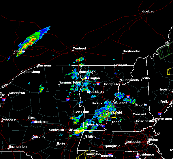 At 346 pm edt, severe thunderstorms were located along a line extending from near claremont to near charlestown to 7 miles northwest of walpole, moving east at 25 mph (radar indicated). Hazards include 60 mph wind gusts and quarter size hail. Hail damage to vehicles is expected. expect wind damage to roofs, siding, and trees. Locations impacted include, claremont, charlestown, newport, lempster, acworth, goshen, croydon, langdon and unity. At 346 pm edt, severe thunderstorms were located along a line extending from near claremont to near charlestown to 7 miles northwest of walpole, moving east at 25 mph (radar indicated). Hazards include 60 mph wind gusts and quarter size hail. Hail damage to vehicles is expected. expect wind damage to roofs, siding, and trees. Locations impacted include, claremont, charlestown, newport, lempster, acworth, goshen, croydon, langdon and unity.
|
| 7/27/2018 3:45 PM EDT | Trees and power lines down in sullivan county NH, 0.3 miles SW of Charlestown, NH |
| 7/27/2018 3:43 PM EDT |
 At 341 pm edt, a severe thunderstorm was located over weathersfield bow, moving northeast at 10 mph. this storm is also producing very heavy rainfall and could cause minor flooding (radar indicated). Hazards include 60 mph wind gusts and quarter size hail. Minor hail damage to vehicles is possible. expect wind damage to trees and powerlines. Locations impacted include, chester, springfield, weathersfield, ascutney, perkinsville village, andover, north chester, north springfield lake recreation area, north springfield, weathersfield bow, west springfield and wilgus state park. At 341 pm edt, a severe thunderstorm was located over weathersfield bow, moving northeast at 10 mph. this storm is also producing very heavy rainfall and could cause minor flooding (radar indicated). Hazards include 60 mph wind gusts and quarter size hail. Minor hail damage to vehicles is possible. expect wind damage to trees and powerlines. Locations impacted include, chester, springfield, weathersfield, ascutney, perkinsville village, andover, north chester, north springfield lake recreation area, north springfield, weathersfield bow, west springfield and wilgus state park.
|
| 7/27/2018 3:36 PM EDT |
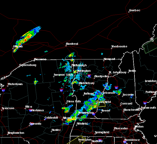 At 336 pm edt, a severe thunderstorm was located over charlestown, or 8 miles southwest of claremont, moving east at 20 mph (radar indicated). Hazards include 60 mph wind gusts and quarter size hail. Hail damage to vehicles is expected. Expect wind damage to roofs, siding, and trees. At 336 pm edt, a severe thunderstorm was located over charlestown, or 8 miles southwest of claremont, moving east at 20 mph (radar indicated). Hazards include 60 mph wind gusts and quarter size hail. Hail damage to vehicles is expected. Expect wind damage to roofs, siding, and trees.
|
| 7/27/2018 3:18 PM EDT |
 At 317 pm edt, a severe thunderstorm was located over west springfield, moving northeast at 10 mph (radar indicated). Hazards include 60 mph wind gusts and quarter size hail. Minor hail damage to vehicles is possible. Expect wind damage to trees and powerlines. At 317 pm edt, a severe thunderstorm was located over west springfield, moving northeast at 10 mph (radar indicated). Hazards include 60 mph wind gusts and quarter size hail. Minor hail damage to vehicles is possible. Expect wind damage to trees and powerlines.
|
| 6/18/2018 5:12 PM EDT |
 At 511 pm edt, severe thunderstorms were located along a line extending from charlestown to near surry to 8 miles south of hinsdale, moving east at 50 mph (radar indicated). Hazards include 60 mph wind gusts. Expect damage to roofs, siding, and trees. locations impacted include, keene, jaffrey, peterborough, charlestown, winchester, antrim, greenfield, bradford, dublin, francestown, bennington, richmond, harrisville, nelson, marlborough, gilsum, rindge, windsor, hancock and walpole. This also includes, mount monadnock. At 511 pm edt, severe thunderstorms were located along a line extending from charlestown to near surry to 8 miles south of hinsdale, moving east at 50 mph (radar indicated). Hazards include 60 mph wind gusts. Expect damage to roofs, siding, and trees. locations impacted include, keene, jaffrey, peterborough, charlestown, winchester, antrim, greenfield, bradford, dublin, francestown, bennington, richmond, harrisville, nelson, marlborough, gilsum, rindge, windsor, hancock and walpole. This also includes, mount monadnock.
|
| 6/18/2018 4:55 PM EDT |
 The national weather service in albany has issued a * severe thunderstorm warning for. eastern windham county in southern vermont. until 600 pm edt. At 454 pm edt, severe thunderstorms were located along a line extending from andover to putney to near buckland, moving east at. The national weather service in albany has issued a * severe thunderstorm warning for. eastern windham county in southern vermont. until 600 pm edt. At 454 pm edt, severe thunderstorms were located along a line extending from andover to putney to near buckland, moving east at.
|
| 6/18/2018 4:47 PM EDT |
 At 447 pm edt, severe thunderstorms were located along a line extending from 20 miles west of charlestown to 12 miles west of westmoreland to 24 miles southwest of hinsdale, moving east at 50 mph (radar indicated). Hazards include 60 mph wind gusts. expect damage to roofs, siding, and trees At 447 pm edt, severe thunderstorms were located along a line extending from 20 miles west of charlestown to 12 miles west of westmoreland to 24 miles southwest of hinsdale, moving east at 50 mph (radar indicated). Hazards include 60 mph wind gusts. expect damage to roofs, siding, and trees
|
| 5/4/2018 9:30 PM EDT | 6 to 7 trees down on nh route 12 in sullivan county NH, 5.4 miles SSW of Charlestown, NH |
| 5/4/2018 9:17 PM EDT |
 At 916 pm edt, severe thunderstorms were located along a line extending from weathersfield to putney to 6 miles northwest of colrain, moving east at 50 mph (radar indicated). Hazards include 70 mph wind gusts. Expect considerable tree damage. damage is likely to mobile homes, roofs, and outbuildings. these severe storms will be near, westminster around 920 pm edt. brattleboro and westmoreland around 925 pm edt. Vernon and hinsdale around 930 pm edt. At 916 pm edt, severe thunderstorms were located along a line extending from weathersfield to putney to 6 miles northwest of colrain, moving east at 50 mph (radar indicated). Hazards include 70 mph wind gusts. Expect considerable tree damage. damage is likely to mobile homes, roofs, and outbuildings. these severe storms will be near, westminster around 920 pm edt. brattleboro and westmoreland around 925 pm edt. Vernon and hinsdale around 930 pm edt.
|
| 5/4/2018 9:09 PM EDT |
 At 908 pm edt, severe thunderstorms were located along a line extending from 17 miles west of hanover to 8 miles northwest of charlestown to 7 miles west of westmoreland to 8 miles west of hinsdale, moving east at 55 mph (radar indicated). Hazards include 60 mph wind gusts. expect damage to roofs, siding, and trees At 908 pm edt, severe thunderstorms were located along a line extending from 17 miles west of hanover to 8 miles northwest of charlestown to 7 miles west of westmoreland to 8 miles west of hinsdale, moving east at 55 mph (radar indicated). Hazards include 60 mph wind gusts. expect damage to roofs, siding, and trees
|
| 5/4/2018 9:08 PM EDT |
 A severe thunderstorm warning remains in effect until 930 pm edt for south central windsor county. at 908 pm edt, severe thunderstorms were located along a line extending from near reading to near chester, moving east at 45 mph. hazard. 60 mph wind gusts and quarter size hail. source. Radar indicated. A severe thunderstorm warning remains in effect until 930 pm edt for south central windsor county. at 908 pm edt, severe thunderstorms were located along a line extending from near reading to near chester, moving east at 45 mph. hazard. 60 mph wind gusts and quarter size hail. source. Radar indicated.
|
| 5/4/2018 8:52 PM EDT |
 At 851 pm edt, severe thunderstorms were located along a line extending from near mount holly to stratton to near bennington, moving east at 60 mph (radar indicated). Hazards include 70 mph wind gusts. Expect considerable tree damage. damage is likely to mobile homes, roofs, and outbuildings. these severe storms will be near, west wardsboro around 855 pm edt. townshend, wilmington and newfane around 905 pm edt. putney around 910 pm edt. westminster around 915 pm edt. brattleboro, westmoreland and guilford center around 920 pm edt. Vernon and hinsdale around 925 pm edt. At 851 pm edt, severe thunderstorms were located along a line extending from near mount holly to stratton to near bennington, moving east at 60 mph (radar indicated). Hazards include 70 mph wind gusts. Expect considerable tree damage. damage is likely to mobile homes, roofs, and outbuildings. these severe storms will be near, west wardsboro around 855 pm edt. townshend, wilmington and newfane around 905 pm edt. putney around 910 pm edt. westminster around 915 pm edt. brattleboro, westmoreland and guilford center around 920 pm edt. Vernon and hinsdale around 925 pm edt.
|
| 5/4/2018 8:36 PM EDT |
 At 836 pm edt, a severe thunderstorm was located over tinmouth, moving east at 50 mph (radar indicated). Hazards include 60 mph wind gusts and quarter size hail. Minor hail damage to vehicles is possible. Expect wind damage to trees and powerlines. At 836 pm edt, a severe thunderstorm was located over tinmouth, moving east at 50 mph (radar indicated). Hazards include 60 mph wind gusts and quarter size hail. Minor hail damage to vehicles is possible. Expect wind damage to trees and powerlines.
|
| 5/4/2018 8:28 PM EDT |
 At 827 pm edt, severe thunderstorms were located along a line extending from near granville to near cambridge to near waterford, moving east at 55 mph (radar indicated). Hazards include 70 mph wind gusts. Expect considerable tree damage. damage is likely to mobile homes, roofs, and outbuildings. severe thunderstorms will be near, granville and wells around 830 pm edt. shaftsbury and pawlet around 835 pm edt. hoosick falls and arlington around 840 pm edt. bennington, stratton and pownal around 850 pm edt. west wardsboro around 855 pm edt. townshend, readsboro and newfane around 905 pm edt. wilmington around 910 pm edt. putney, saxtons river and westminster around 915 pm edt. A tornado watch remains in effect until 1000 pm edt for east central new york. At 827 pm edt, severe thunderstorms were located along a line extending from near granville to near cambridge to near waterford, moving east at 55 mph (radar indicated). Hazards include 70 mph wind gusts. Expect considerable tree damage. damage is likely to mobile homes, roofs, and outbuildings. severe thunderstorms will be near, granville and wells around 830 pm edt. shaftsbury and pawlet around 835 pm edt. hoosick falls and arlington around 840 pm edt. bennington, stratton and pownal around 850 pm edt. west wardsboro around 855 pm edt. townshend, readsboro and newfane around 905 pm edt. wilmington around 910 pm edt. putney, saxtons river and westminster around 915 pm edt. A tornado watch remains in effect until 1000 pm edt for east central new york.
|
| 9/5/2017 7:39 PM EDT |
 At 738 pm edt, severe thunderstorms were located along a line extending from wilgus state park to near newfane, moving northeast at 40 mph (radar indicated). Hazards include 60 mph wind gusts. Expect damage to trees, and power lines. these severe storms will be near, putney around 755 pm edt. bellows falls, saxtons river and westminster around 800 pm edt. Other locations impacted by these severe thunderstorms include wardsboro center, goose city, east putney, brockways mills, readsboro falls, grafton, south windham, williamsville, whitingham and east dover. At 738 pm edt, severe thunderstorms were located along a line extending from wilgus state park to near newfane, moving northeast at 40 mph (radar indicated). Hazards include 60 mph wind gusts. Expect damage to trees, and power lines. these severe storms will be near, putney around 755 pm edt. bellows falls, saxtons river and westminster around 800 pm edt. Other locations impacted by these severe thunderstorms include wardsboro center, goose city, east putney, brockways mills, readsboro falls, grafton, south windham, williamsville, whitingham and east dover.
|
| 9/5/2017 7:18 PM EDT |
 At 718 pm edt, severe thunderstorms were located along a line extending from near chester-chester depot to 6 miles west of wilmington, moving northeast at 40 mph (radar indicated). Hazards include 60 mph wind gusts and penny size hail. Expect damage to trees, and power lines. these severe storms will be near, newfane around 745 pm edt. townshend around 750 pm edt. putney around 755 pm edt. bellows falls, saxtons river and westminster around 800 pm edt. Other locations impacted by these severe thunderstorms include wardsboro center, goose city, east putney, brockways mills, readsboro falls, grafton, south windham, williamsville, whitingham and east dover. At 718 pm edt, severe thunderstorms were located along a line extending from near chester-chester depot to 6 miles west of wilmington, moving northeast at 40 mph (radar indicated). Hazards include 60 mph wind gusts and penny size hail. Expect damage to trees, and power lines. these severe storms will be near, newfane around 745 pm edt. townshend around 750 pm edt. putney around 755 pm edt. bellows falls, saxtons river and westminster around 800 pm edt. Other locations impacted by these severe thunderstorms include wardsboro center, goose city, east putney, brockways mills, readsboro falls, grafton, south windham, williamsville, whitingham and east dover.
|
| 9/5/2017 6:54 PM EDT |
 At 654 pm edt, severe thunderstorms were located along a line extending from londonderry to near pownal, moving northeast at 40 mph (radar indicated). Hazards include 60 mph wind gusts and penny size hail. Expect damage to trees, and power lines. severe thunderstorms will be near, londonderry around 700 pm edt. wilmington around 720 pm edt. stratton around 725 pm edt. west wardsboro around 730 pm edt. newfane around 740 pm edt. townshend around 745 pm edt. putney around 750 pm edt. Bellows falls, saxtons river and westminster around 800 pm edt. At 654 pm edt, severe thunderstorms were located along a line extending from londonderry to near pownal, moving northeast at 40 mph (radar indicated). Hazards include 60 mph wind gusts and penny size hail. Expect damage to trees, and power lines. severe thunderstorms will be near, londonderry around 700 pm edt. wilmington around 720 pm edt. stratton around 725 pm edt. west wardsboro around 730 pm edt. newfane around 740 pm edt. townshend around 745 pm edt. putney around 750 pm edt. Bellows falls, saxtons river and westminster around 800 pm edt.
|
| 9/5/2017 4:27 PM EDT |
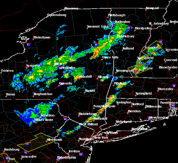 At 426 pm edt, a severe thunderstorm was located near walpole, or 14 miles northwest of keene, moving northeast at 35 mph (radar indicated). Hazards include 60 mph wind gusts and nickel size hail. expect damage to trees, and power lines At 426 pm edt, a severe thunderstorm was located near walpole, or 14 miles northwest of keene, moving northeast at 35 mph (radar indicated). Hazards include 60 mph wind gusts and nickel size hail. expect damage to trees, and power lines
|
| 8/22/2017 10:09 PM EDT |
 At 1008 pm edt, a severe thunderstorm was located near townshend, moving east at 25 mph (radar indicated). Hazards include 60 mph wind gusts and penny size hail. Expect damage to trees, and power lines. This severe thunderstorm will remain over mainly rural areas of eastern windham county, including the following locations: north vernon, south newfane, east dummerston, east putney, brockways mills, grafton, fairview village, williamsville, dummerston center and putney station. At 1008 pm edt, a severe thunderstorm was located near townshend, moving east at 25 mph (radar indicated). Hazards include 60 mph wind gusts and penny size hail. Expect damage to trees, and power lines. This severe thunderstorm will remain over mainly rural areas of eastern windham county, including the following locations: north vernon, south newfane, east dummerston, east putney, brockways mills, grafton, fairview village, williamsville, dummerston center and putney station.
|
| 8/22/2017 9:51 PM EDT |
 The severe thunderstorm warning for southeastern rutland and southwestern windsor counties will expire at 1000 pm edt, the storm which prompted the warning has moved out of the area. therefore the warning will be allowed to expire. a severe thunderstorm watch remains in effect until midnight edt for southern vermont. The severe thunderstorm warning for southeastern rutland and southwestern windsor counties will expire at 1000 pm edt, the storm which prompted the warning has moved out of the area. therefore the warning will be allowed to expire. a severe thunderstorm watch remains in effect until midnight edt for southern vermont.
|
| 8/22/2017 9:20 PM EDT |
 At 920 pm edt, severe thunderstorms were located along a line extending from 10 miles west of hanover to 6 miles west of claremont to 17 miles west of hinsdale, moving east at 45 mph (radar indicated). Hazards include 60 mph wind gusts. expect damage to trees, and power lines At 920 pm edt, severe thunderstorms were located along a line extending from 10 miles west of hanover to 6 miles west of claremont to 17 miles west of hinsdale, moving east at 45 mph (radar indicated). Hazards include 60 mph wind gusts. expect damage to trees, and power lines
|
| 8/22/2017 9:20 PM EDT |
 At 920 pm edt, a severe thunderstorm was located 7 miles northwest of wilmington, or 9 miles east of bennington, moving east at 25 mph (radar indicated). Hazards include 60 mph wind gusts and penny size hail. Expect damage to trees, and power lines. this severe thunderstorm will be near, wilmington around 930 pm edt. stratton around 935 pm edt. west wardsboro around 945 pm edt. newfane around 1000 pm edt. townshend around 1005 pm edt. putney, saxtons river and westminster around 1015 pm edt. Other locations impacted by this severe thunderstorm include wardsboro center, goose city, east putney, brockways mills, readsboro falls, grafton, south windham, williamsville, whitingham and east dover. At 920 pm edt, a severe thunderstorm was located 7 miles northwest of wilmington, or 9 miles east of bennington, moving east at 25 mph (radar indicated). Hazards include 60 mph wind gusts and penny size hail. Expect damage to trees, and power lines. this severe thunderstorm will be near, wilmington around 930 pm edt. stratton around 935 pm edt. west wardsboro around 945 pm edt. newfane around 1000 pm edt. townshend around 1005 pm edt. putney, saxtons river and westminster around 1015 pm edt. Other locations impacted by this severe thunderstorm include wardsboro center, goose city, east putney, brockways mills, readsboro falls, grafton, south windham, williamsville, whitingham and east dover.
|
| 8/22/2017 9:06 PM EDT |
 At 906 pm edt, a severe thunderstorm was located over andover, moving east at 45 mph (radar indicated). Hazards include 60 mph wind gusts. expect damage to trees and powerlines At 906 pm edt, a severe thunderstorm was located over andover, moving east at 45 mph (radar indicated). Hazards include 60 mph wind gusts. expect damage to trees and powerlines
|
| 7/1/2017 7:16 PM EDT |
 At 716 pm edt, severe thunderstorms were located along a line extending from 15 miles west of claremont to near charlestown to 9 miles west of chesterfield, moving east at 35 mph (radar indicated). Hazards include 60 mph wind gusts. expect damage to trees, and power lines At 716 pm edt, severe thunderstorms were located along a line extending from 15 miles west of claremont to near charlestown to 9 miles west of chesterfield, moving east at 35 mph (radar indicated). Hazards include 60 mph wind gusts. expect damage to trees, and power lines
|
| 7/1/2017 6:24 PM EDT |
 At 624 pm edt, severe thunderstorms were located along a line extending from near middletown springs to arlington to near hoosick falls, moving east at 40 mph (radar indicated). Hazards include 60 mph wind gusts. Expect damage to trees, and power lines. severe thunderstorms will be near, manchester and manchester center around 630 pm edt. bennington and stratton around 645 pm edt. west wardsboro around 650 pm edt. townshend around 700 pm edt. wilmington and newfane around 705 pm edt. putney and westminster around 715 pm edt. chesterfield, westmoreland and guilford center around 725 pm edt. brattleboro and vernon around 730 pm edt. Other locations impacted by these severe thunderstorms include goose city, chiselville, readsboro falls, grafton, south shaftsbury, south windham, guilford, hoosick, hidden valley and bromley village. At 624 pm edt, severe thunderstorms were located along a line extending from near middletown springs to arlington to near hoosick falls, moving east at 40 mph (radar indicated). Hazards include 60 mph wind gusts. Expect damage to trees, and power lines. severe thunderstorms will be near, manchester and manchester center around 630 pm edt. bennington and stratton around 645 pm edt. west wardsboro around 650 pm edt. townshend around 700 pm edt. wilmington and newfane around 705 pm edt. putney and westminster around 715 pm edt. chesterfield, westmoreland and guilford center around 725 pm edt. brattleboro and vernon around 730 pm edt. Other locations impacted by these severe thunderstorms include goose city, chiselville, readsboro falls, grafton, south shaftsbury, south windham, guilford, hoosick, hidden valley and bromley village.
|
| 7/1/2017 5:04 PM EDT |
 At 504 pm edt, severe thunderstorms were located along a line extending from near hanover to 7 miles northwest of charlestown, moving east at 35 mph (radar indicated). Hazards include 60 mph wind gusts and penny size hail. expect damage to trees, and power lines At 504 pm edt, severe thunderstorms were located along a line extending from near hanover to 7 miles northwest of charlestown, moving east at 35 mph (radar indicated). Hazards include 60 mph wind gusts and penny size hail. expect damage to trees, and power lines
|
| 7/1/2017 4:56 PM EDT |
 At 456 pm edt, severe thunderstorms were located along a line extending from near south woodstock to near mt. tabor, moving southeast at 20 mph (radar indicated). Hazards include 60 mph wind gusts and nickel size hail. Expect damage to trees and powerlines. locations impacted include, woodstock, chester, hartland four corners, windsor, woodstock village, mount holly, ludlow, cavendish, andover, weston, ludlow village, perkinsville village, mt. Holly, hartland, reading, baltimore, springfield, weathersfield, west windsor and plymouth. At 456 pm edt, severe thunderstorms were located along a line extending from near south woodstock to near mt. tabor, moving southeast at 20 mph (radar indicated). Hazards include 60 mph wind gusts and nickel size hail. Expect damage to trees and powerlines. locations impacted include, woodstock, chester, hartland four corners, windsor, woodstock village, mount holly, ludlow, cavendish, andover, weston, ludlow village, perkinsville village, mt. Holly, hartland, reading, baltimore, springfield, weathersfield, west windsor and plymouth.
|
| 7/1/2017 4:13 PM EDT |
 At 413 pm edt, a severe thunderstorm was located over south wallingford, moving northeast at 35 mph (radar indicated). Hazards include 60 mph wind gusts and nickel size hail. expect damage to trees and powerlines At 413 pm edt, a severe thunderstorm was located over south wallingford, moving northeast at 35 mph (radar indicated). Hazards include 60 mph wind gusts and nickel size hail. expect damage to trees and powerlines
|
| 6/19/2017 4:51 PM EDT |
 At 450 pm edt, severe thunderstorms were located along a line extending from near chester to near westminster to near colrain, moving east at 40 mph (radar indicated). Hazards include 60 mph wind gusts. Expect damage to trees, and power lines. these severe storms will be near, putney, saxtons river and westminster around 455 pm edt. brattleboro, vernon and westmoreland around 500 pm edt. Other locations impacted by these severe thunderstorms include wardsboro center, goose city, east putney, brockways mills, grafton, south windham, williamsville, whitingham, east dover and dummerston center. At 450 pm edt, severe thunderstorms were located along a line extending from near chester to near westminster to near colrain, moving east at 40 mph (radar indicated). Hazards include 60 mph wind gusts. Expect damage to trees, and power lines. these severe storms will be near, putney, saxtons river and westminster around 455 pm edt. brattleboro, vernon and westmoreland around 500 pm edt. Other locations impacted by these severe thunderstorms include wardsboro center, goose city, east putney, brockways mills, grafton, south windham, williamsville, whitingham, east dover and dummerston center.
|
| 6/19/2017 4:29 PM EDT |
 At 429 pm edt, severe thunderstorms were located along a line extending from near weston to near west wardsboro to stamford, moving east at 40 mph (radar indicated). Hazards include 60 mph wind gusts. Expect damage to trees, and power lines. these severe storms will be near, londonderry around 435 pm edt. townshend and newfane around 440 pm edt. putney and saxtons river around 450 pm edt. westminster around 455 pm edt. vernon, westmoreland and guilford center around 500 pm edt. Other locations impacted by these severe thunderstorms include wardsboro center, goose city, east putney, brockways mills, readsboro falls, grafton, south windham, williamsville, whitingham and east dover. At 429 pm edt, severe thunderstorms were located along a line extending from near weston to near west wardsboro to stamford, moving east at 40 mph (radar indicated). Hazards include 60 mph wind gusts. Expect damage to trees, and power lines. these severe storms will be near, londonderry around 435 pm edt. townshend and newfane around 440 pm edt. putney and saxtons river around 450 pm edt. westminster around 455 pm edt. vernon, westmoreland and guilford center around 500 pm edt. Other locations impacted by these severe thunderstorms include wardsboro center, goose city, east putney, brockways mills, readsboro falls, grafton, south windham, williamsville, whitingham and east dover.
|
| 6/19/2017 4:05 PM EDT |
 At 405 pm edt, severe thunderstorms were located along a line extending from near dorset to arlington to near grafton, moving east at 40 mph (radar indicated). Hazards include 60 mph wind gusts. Expect damage to trees, and power lines. severe thunderstorms will be near, manchester, dorset and manchester center around 410 pm edt. stratton around 420 pm edt. londonderry and west wardsboro around 425 pm edt. stamford around 430 pm edt. readsboro around 435 pm edt. townshend and newfane around 440 pm edt. wilmington around 445 pm edt. putney and saxtons river around 450 pm edt. Other locations impacted by these severe thunderstorms include goose city, chiselville, readsboro falls, grafton, south shaftsbury, south windham, guilford, hoosick, hidden valley and bromley village. At 405 pm edt, severe thunderstorms were located along a line extending from near dorset to arlington to near grafton, moving east at 40 mph (radar indicated). Hazards include 60 mph wind gusts. Expect damage to trees, and power lines. severe thunderstorms will be near, manchester, dorset and manchester center around 410 pm edt. stratton around 420 pm edt. londonderry and west wardsboro around 425 pm edt. stamford around 430 pm edt. readsboro around 435 pm edt. townshend and newfane around 440 pm edt. wilmington around 445 pm edt. putney and saxtons river around 450 pm edt. Other locations impacted by these severe thunderstorms include goose city, chiselville, readsboro falls, grafton, south shaftsbury, south windham, guilford, hoosick, hidden valley and bromley village.
|
| 6/19/2017 3:12 PM EDT |
 At 311 pm edt, a severe thunderstorm was located over newfane, or near townshend, moving northeast at 35 mph (radar indicated). Hazards include 60 mph wind gusts and penny size hail. Expect damage to trees, and power lines. Locations impacted include, brattleboro, bellows falls, townshend, charlestown, hinsdale, chesterfield, putney, vernon, westmoreland, leyden, saxtons river, westminster, newfane, guilford center, rockingham, guilford, dover, marlboro, brookline and athens. At 311 pm edt, a severe thunderstorm was located over newfane, or near townshend, moving northeast at 35 mph (radar indicated). Hazards include 60 mph wind gusts and penny size hail. Expect damage to trees, and power lines. Locations impacted include, brattleboro, bellows falls, townshend, charlestown, hinsdale, chesterfield, putney, vernon, westmoreland, leyden, saxtons river, westminster, newfane, guilford center, rockingham, guilford, dover, marlboro, brookline and athens.
|
| 6/19/2017 2:46 PM EDT |
 At 246 pm edt, a severe thunderstorm was located near newfane, or near brattleboro, moving northeast at 40 mph (radar indicated). Hazards include 60 mph wind gusts and penny size hail. Expect damage to trees, and power lines. this severe thunderstorm will be near, townshend and putney around 255 pm edt. westmoreland and westminster around 305 pm edt. bellows falls and saxtons river around 310 pm edt. Other locations impacted by this severe thunderstorm include north vernon, south newfane, goose city, east dummerston, east putney, brockways mills, fairview village, williamsville, east dover and dummerston center. At 246 pm edt, a severe thunderstorm was located near newfane, or near brattleboro, moving northeast at 40 mph (radar indicated). Hazards include 60 mph wind gusts and penny size hail. Expect damage to trees, and power lines. this severe thunderstorm will be near, townshend and putney around 255 pm edt. westmoreland and westminster around 305 pm edt. bellows falls and saxtons river around 310 pm edt. Other locations impacted by this severe thunderstorm include north vernon, south newfane, goose city, east dummerston, east putney, brockways mills, fairview village, williamsville, east dover and dummerston center.
|
| 5/18/2017 8:42 PM EDT |
 At 841 pm edt, severe thunderstorms were located along a line extending from 24 miles west of charlestown to 13 miles west of westmoreland to 13 miles west of hinsdale to 36 miles southwest of winchester, moving east at 50 mph (radar indicated). Hazards include 60 mph wind gusts. expect damage to trees, and power lines At 841 pm edt, severe thunderstorms were located along a line extending from 24 miles west of charlestown to 13 miles west of westmoreland to 13 miles west of hinsdale to 36 miles southwest of winchester, moving east at 50 mph (radar indicated). Hazards include 60 mph wind gusts. expect damage to trees, and power lines
|
| 9/11/2016 8:23 AM EDT |
 At 822 am edt, severe thunderstorms were located along a line extending from 6 miles southwest of enfield to 6 miles southwest of hinsdale, moving east at 35 mph. this line of storms has the history of producing wind damage (radar indicated). Hazards include 60 mph wind gusts. Expect damage to roofs. siding. And trees. At 822 am edt, severe thunderstorms were located along a line extending from 6 miles southwest of enfield to 6 miles southwest of hinsdale, moving east at 35 mph. this line of storms has the history of producing wind damage (radar indicated). Hazards include 60 mph wind gusts. Expect damage to roofs. siding. And trees.
|
| 8/13/2016 8:13 PM EDT |
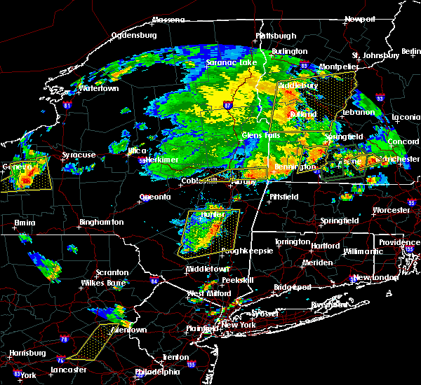 At 813 pm edt, severe thunderstorms were located along a line extending from near charlestown to near bellows falls to newfane, moving east at 30 mph (radar indicated). Hazards include 60 mph wind gusts and penny size hail. Expect damage to roofs. siding. And trees. At 813 pm edt, severe thunderstorms were located along a line extending from near charlestown to near bellows falls to newfane, moving east at 30 mph (radar indicated). Hazards include 60 mph wind gusts and penny size hail. Expect damage to roofs. siding. And trees.
|
| 8/13/2016 8:05 PM EDT |
 At 805 pm edt, a severe thunderstorm was located near townshend, moving east at 45 mph (radar indicated). Hazards include 60 mph wind gusts and quarter size hail. Hail damage to vehicles is expected. expect wind damage to roofs, siding, and trees. this severe thunderstorm will be near, bellows falls, saxtons river and westminster around 815 pm edt. Other locations impacted by this severe thunderstorm include bartonsville, south newfane, dummerston center, north westminster, windham, athens, goose city, lawrence four corners, dover and williamsville. At 805 pm edt, a severe thunderstorm was located near townshend, moving east at 45 mph (radar indicated). Hazards include 60 mph wind gusts and quarter size hail. Hail damage to vehicles is expected. expect wind damage to roofs, siding, and trees. this severe thunderstorm will be near, bellows falls, saxtons river and westminster around 815 pm edt. Other locations impacted by this severe thunderstorm include bartonsville, south newfane, dummerston center, north westminster, windham, athens, goose city, lawrence four corners, dover and williamsville.
|
| 7/23/2016 5:43 PM EDT |
 The severe thunderstorm warning for southwestern windsor and southeastern rutland counties will expire at 545 pm edt, the storms which prompted the warning have moved out of the area. therefore the warning will be allowed to expire. however small hail and gusty winds are still possible with these thunderstorms. a severe thunderstorm watch remains in effect until 800 pm edt for southern vermont. The severe thunderstorm warning for southwestern windsor and southeastern rutland counties will expire at 545 pm edt, the storms which prompted the warning have moved out of the area. therefore the warning will be allowed to expire. however small hail and gusty winds are still possible with these thunderstorms. a severe thunderstorm watch remains in effect until 800 pm edt for southern vermont.
|
| 7/23/2016 5:22 PM EDT |
 At 521 pm edt, severe thunderstorms were located along a line extending from near hartford to pawlet to mount tabor to near charlestown, moving southeast at 40 mph (radar indicated). Hazards include 60 mph wind gusts and quarter size hail. Hail damage to vehicles is expected. Expect wind damage to roofs, siding, and trees. At 521 pm edt, severe thunderstorms were located along a line extending from near hartford to pawlet to mount tabor to near charlestown, moving southeast at 40 mph (radar indicated). Hazards include 60 mph wind gusts and quarter size hail. Hail damage to vehicles is expected. Expect wind damage to roofs, siding, and trees.
|
| 7/23/2016 5:21 PM EDT |
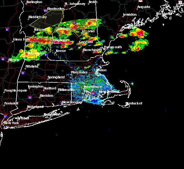 At 521 pm edt, severe thunderstorms were located along a line extending from 9 miles southwest of ascutney to warner, moving east at 45 mph (radar indicated). Hazards include 60 mph wind gusts and quarter size hail. Hail damage to vehicles is expected. Expect wind damage to roofs, siding, and trees. At 521 pm edt, severe thunderstorms were located along a line extending from 9 miles southwest of ascutney to warner, moving east at 45 mph (radar indicated). Hazards include 60 mph wind gusts and quarter size hail. Hail damage to vehicles is expected. Expect wind damage to roofs, siding, and trees.
|
| 7/23/2016 5:19 PM EDT |
 At 519 pm edt, severe thunderstorms were located along a line extending from south granville to near charlestown, moving south at 15 mph (radar indicated). Hazards include 60 mph wind gusts and quarter size hail. Hail damage to vehicles is expected. Expect wind damage to roofs, siding, and trees. At 519 pm edt, severe thunderstorms were located along a line extending from south granville to near charlestown, moving south at 15 mph (radar indicated). Hazards include 60 mph wind gusts and quarter size hail. Hail damage to vehicles is expected. Expect wind damage to roofs, siding, and trees.
|
| 7/18/2016 1:43 PM EDT |
 At 143 pm edt, a severe thunderstorm was located near stamford, or near bennington, moving east at 55 mph (radar indicated). Hazards include 60 mph wind gusts. Expect damage to roofs. siding. and trees. this severe thunderstorm will be near, wilmington around 155 pm edt. brattleboro and newfane around 210 pm edt. hinsdale and putney around 215 pm edt. chesterfield and westminster around 220 pm edt. westmoreland around 225 pm edt. Other locations impacted by this severe thunderstorm include somerset, medburyville, dummerston center, north westminster, peru town center, woodford, rawsonville, halifax, west dover and williamsville. At 143 pm edt, a severe thunderstorm was located near stamford, or near bennington, moving east at 55 mph (radar indicated). Hazards include 60 mph wind gusts. Expect damage to roofs. siding. and trees. this severe thunderstorm will be near, wilmington around 155 pm edt. brattleboro and newfane around 210 pm edt. hinsdale and putney around 215 pm edt. chesterfield and westminster around 220 pm edt. westmoreland around 225 pm edt. Other locations impacted by this severe thunderstorm include somerset, medburyville, dummerston center, north westminster, peru town center, woodford, rawsonville, halifax, west dover and williamsville.
|
| 7/1/2016 7:55 PM EDT |
 At 755 pm edt, severe thunderstorms were located along a line extending from near enfield to near newport to near westminster, moving east at 15 mph (radar indicated). Hazards include 60 mph wind gusts. Expect damage to roofs. siding. and trees. Locations impacted include, claremont, lebanon, new london, plymouth, grafton, hanover, charlestown, enfield, canaan, bradford, danbury, groton, newport, marlow, warner, bristol, grantham, andover, lyme and cornish. At 755 pm edt, severe thunderstorms were located along a line extending from near enfield to near newport to near westminster, moving east at 15 mph (radar indicated). Hazards include 60 mph wind gusts. Expect damage to roofs. siding. and trees. Locations impacted include, claremont, lebanon, new london, plymouth, grafton, hanover, charlestown, enfield, canaan, bradford, danbury, groton, newport, marlow, warner, bristol, grantham, andover, lyme and cornish.
|
| 7/1/2016 7:26 PM EDT |
 At 726 pm edt, severe thunderstorms were located along a line extending from hanover to near claremont to near townshend, moving east at 15 mph (radar indicated). Hazards include 60 mph wind gusts. Expect damage to roofs. siding. And trees. At 726 pm edt, severe thunderstorms were located along a line extending from hanover to near claremont to near townshend, moving east at 15 mph (radar indicated). Hazards include 60 mph wind gusts. Expect damage to roofs. siding. And trees.
|
| 7/1/2016 6:29 PM EDT |
 At 628 pm edt, a severe thunderstorm was located over andover, moving northeast at 40 mph (radar indicated). Hazards include 60 mph wind gusts and penny size hail. Expect damage to roofs. siding. And trees. At 628 pm edt, a severe thunderstorm was located over andover, moving northeast at 40 mph (radar indicated). Hazards include 60 mph wind gusts and penny size hail. Expect damage to roofs. siding. And trees.
|
| 8/3/2015 5:29 PM EDT |
 At 528 pm edt, doppler radar indicated a line of severe thunderstorms capable of producing damaging winds in excess of 60 mph. these storms were located along a line extending from lebanon to 8 miles north of newport to near claremont to westminster to near guilford center, moving northeast at 35 mph. locations impacted include, keene, claremont, southwestern lebanon, jaffrey, new london, swanzey, charlestown, enfield, winchester, hinsdale, chesterfield, antrim, marlborough, fitzwilliam, troy, westmoreland, bradford, dublin, danbury and richmond. At 528 pm edt, doppler radar indicated a line of severe thunderstorms capable of producing damaging winds in excess of 60 mph. these storms were located along a line extending from lebanon to 8 miles north of newport to near claremont to westminster to near guilford center, moving northeast at 35 mph. locations impacted include, keene, claremont, southwestern lebanon, jaffrey, new london, swanzey, charlestown, enfield, winchester, hinsdale, chesterfield, antrim, marlborough, fitzwilliam, troy, westmoreland, bradford, dublin, danbury and richmond.
|
| 8/3/2015 5:08 PM EDT |
 At 508 pm edt, doppler radar indicated a line of severe thunderstorms capable of producing damaging winds in excess of 60 mph. these storms were located along a line extending from near hartland to near claremont to near charlestown to near putney to near heath, and moving northeast at 35 mph. At 508 pm edt, doppler radar indicated a line of severe thunderstorms capable of producing damaging winds in excess of 60 mph. these storms were located along a line extending from near hartland to near claremont to near charlestown to near putney to near heath, and moving northeast at 35 mph.
|
| 7/19/2015 7:17 PM EDT |
 At 717 pm edt, doppler radar indicated a severe thunderstorm capable of producing quarter size hail and damaging winds in excess of 60 mph. this storm was located near springfield, and moving east at 45 mph. At 717 pm edt, doppler radar indicated a severe thunderstorm capable of producing quarter size hail and damaging winds in excess of 60 mph. this storm was located near springfield, and moving east at 45 mph.
|
| 9/11/2013 8:11 PM EDT | Tree down on house on old claremont road in sullivan county NH, 0.3 miles SW of Charlestown, NH |
| 6/2/2013 4:15 PM EDT | Trees and wires down on hill rd in sullivan county NH, 6.9 miles W of Charlestown, NH |
| 1/1/0001 12:00 AM | Tree down on house...several more trees and wires down in town in sullivan county NH, 6.9 miles W of Charlestown, NH |
| 1/1/0001 12:00 AM | Multiple trees down in charlestown reported by local police in sullivan county NH, 0.3 miles SW of Charlestown, NH |
| 1/1/0001 12:00 AM | Quarter sized hail reported 0.3 miles SW of Charlestown, NH |
| 1/1/0001 12:00 AM | Quarter sized hail reported 0.4 miles SE of Charlestown, NH |
| 1/1/0001 12:00 AM | Quarter sized hail reported 3.7 miles NW of Charlestown, NH |
| 1/1/0001 12:00 AM | Quarter sized hail reported 0.4 miles SE of Charlestown, NH |
| 1/1/0001 12:00 AM | Quarter sized hail reported 1.7 miles NW of Charlestown, NH |
Hail Maps for Charlestown, NH


Connect with Interactive Hail Maps