

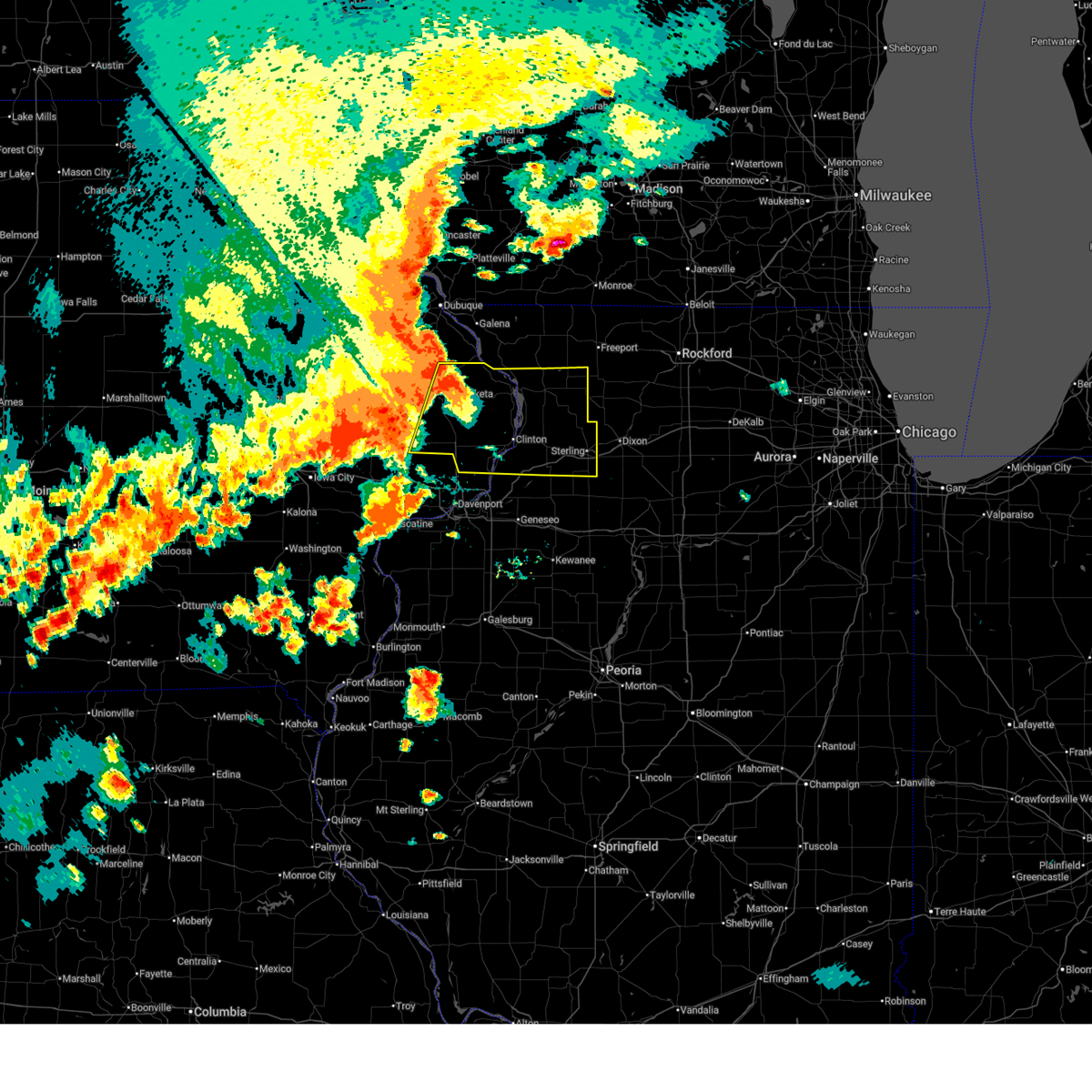
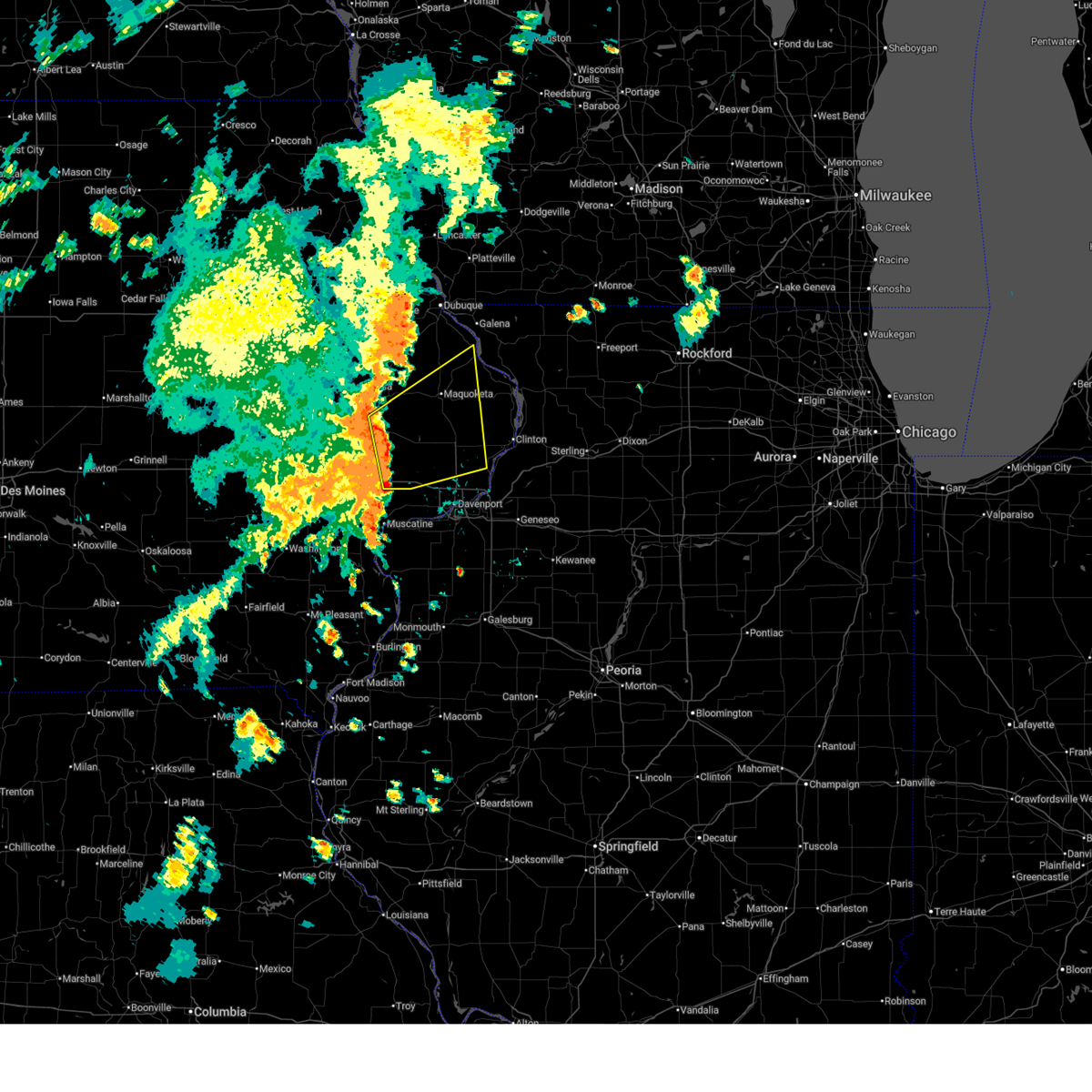
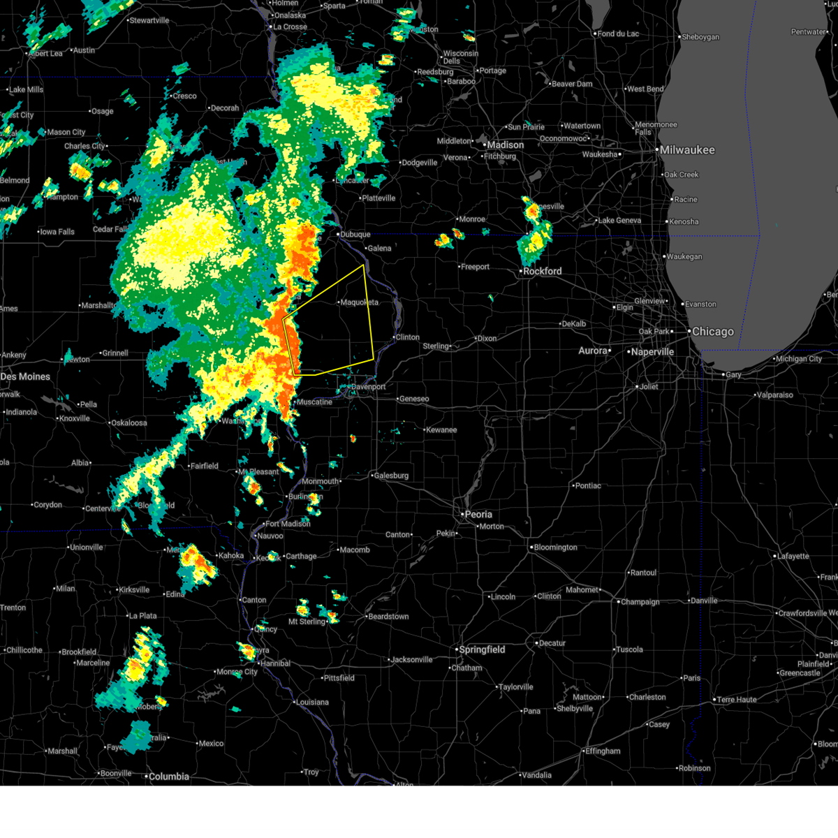
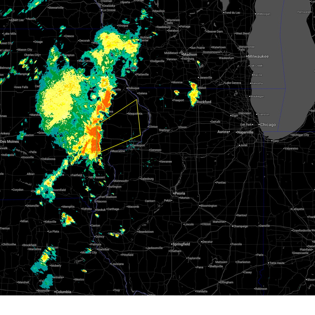
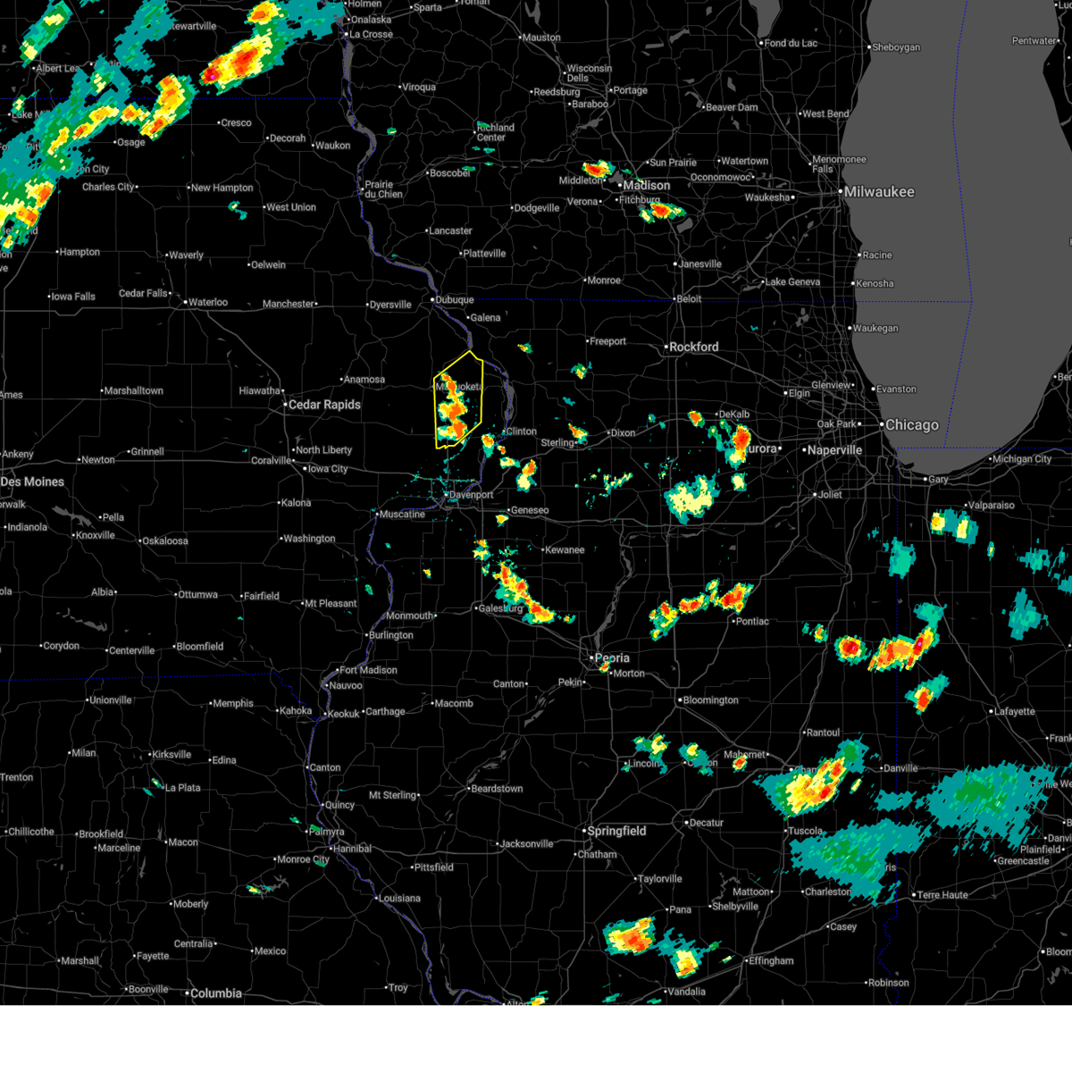
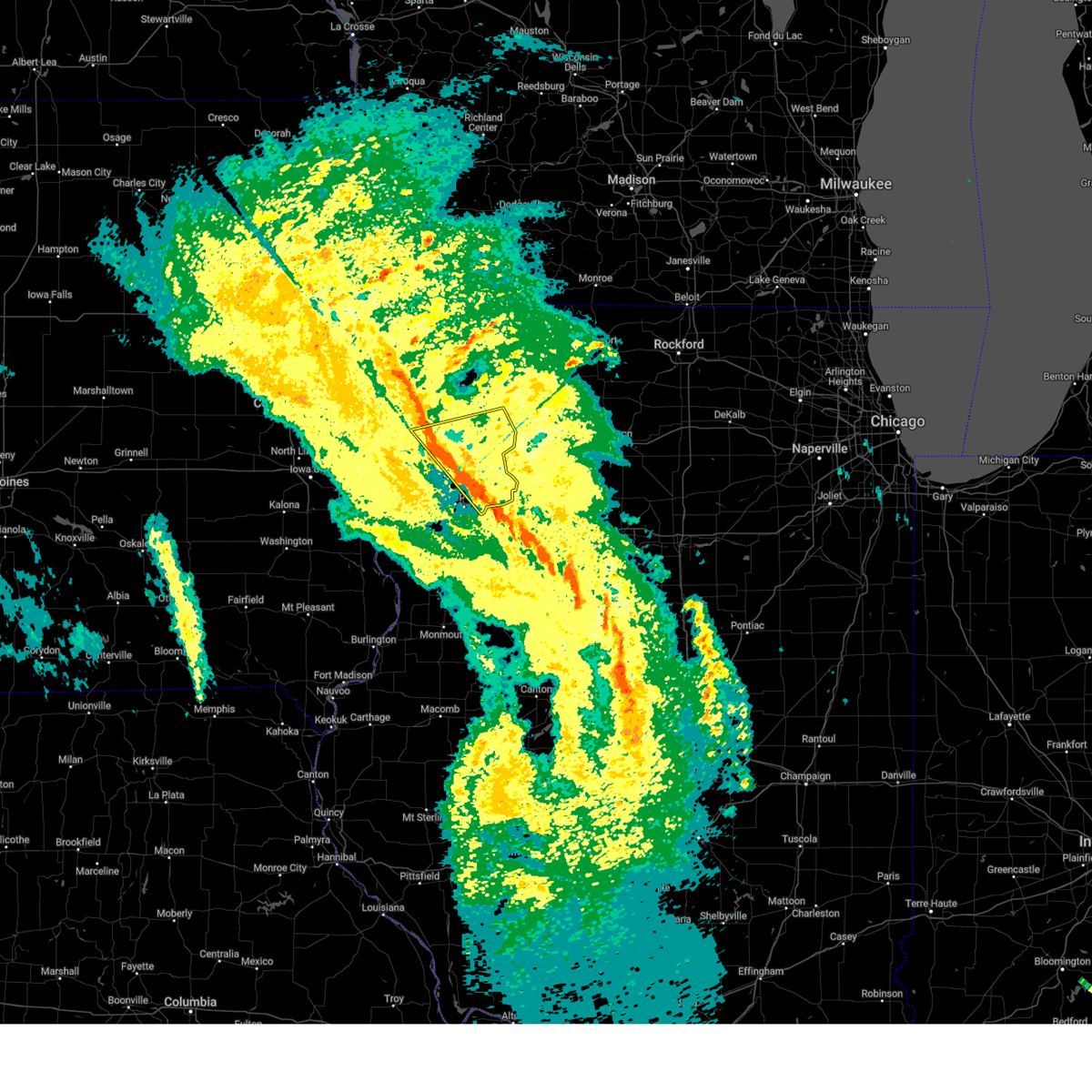
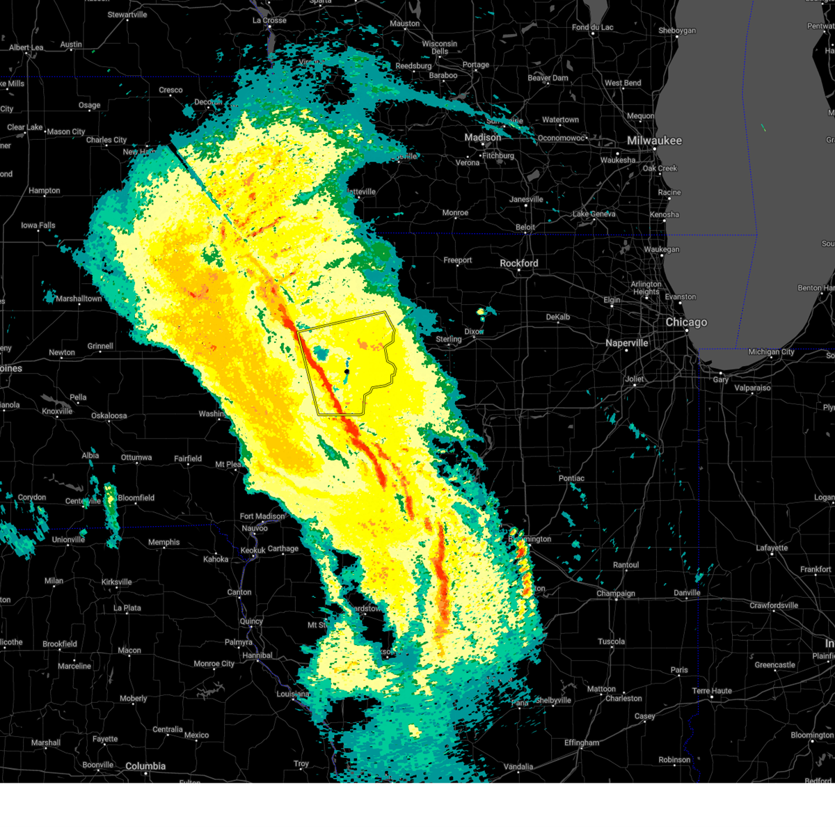
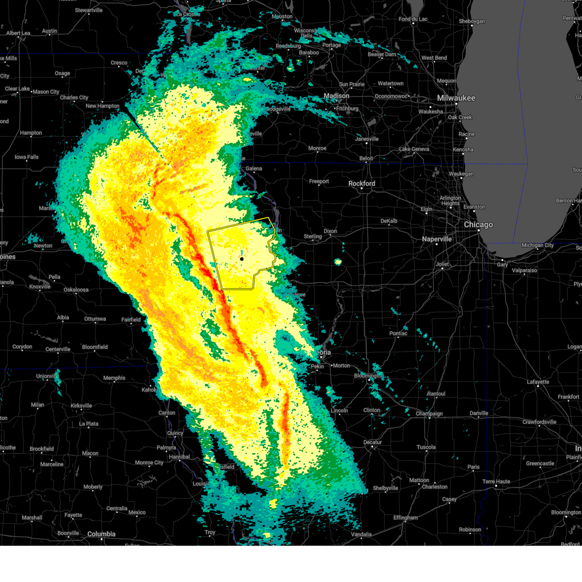
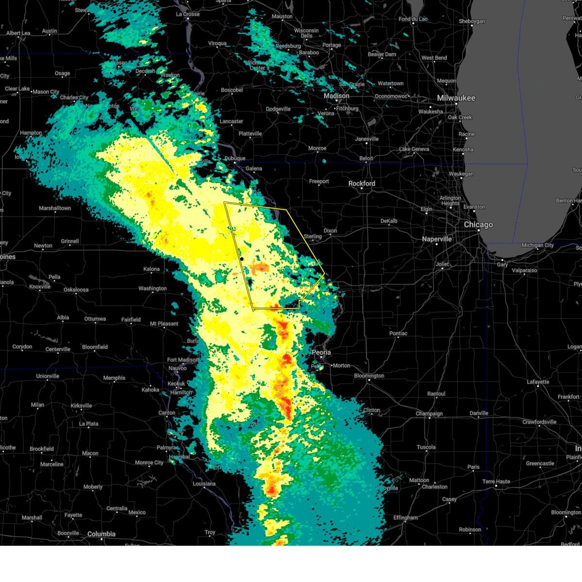
Hail Map for Charlotte, IA
The Charlotte, IA area has had 0 reports of on-the-ground hail by trained spotters, and has been under severe weather warnings 32 times during the past 12 months. Doppler radar has detected hail at or near Charlotte, IA on 49 occasions, including 2 occasions during the past year.
| Name: | Charlotte, IA |
| Where Located: | 62.1 miles E of Cedar Rapids, IA |
| Map: | Google Map for Charlotte, IA |
| Population: | 394 |
| Housing Units: | 174 |
| More Info: | Search Google for Charlotte, IA |
2
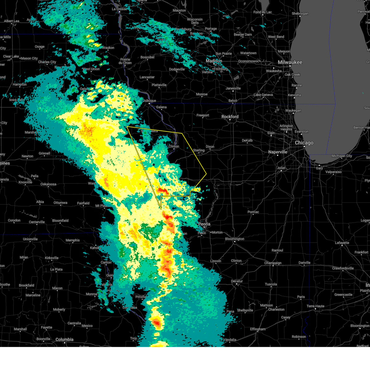
The Top Recent Hail Date for Charlotte, IA is Tuesday, July 23, 2024 (14th out of 49)

Hail and Wind Damage Spotted near Charlotte, IA
| Date / Time | Report Details |
|---|---|
| 7/11/2025 5:28 PM CDT | At 528 pm cdt, severe thunderstorms were located along a line extending from near camp far horizons to rock creek park, moving east at 40 mph (radar indicated). Hazards include 70 mph wind gusts. Expect considerable tree damage. damage is likely to mobile homes, roofs, and outbuildings. locations impacted include, clinton, sterling, rock falls, morrison, mount carroll, dewitt, camanche, fulton, savanna, prophetstown, erie, lanark, garden plain, milledgeville, preston, fairhaven, albany, princeton, shannon, and cordova. This includes interstate 88 between mile markers 16 and 44. |
| 7/11/2025 4:52 PM CDT |
 Svrdvn the national weather service in the quad cities has issued a * severe thunderstorm warning for, northeastern rock island county in northwestern illinois, whiteside county in northwestern illinois, carroll county in northwestern illinois, southeastern jackson county in east central iowa, northeastern scott county in east central iowa, clinton county in east central iowa, * until 545 pm cdt. * at 451 pm cdt, severe thunderstorms were located along a line extending from near otter creek to sherman park, moving east at 40 mph (radar indicated). Hazards include 60 mph wind gusts and penny size hail. expect damage to roofs, siding, and trees Svrdvn the national weather service in the quad cities has issued a * severe thunderstorm warning for, northeastern rock island county in northwestern illinois, whiteside county in northwestern illinois, carroll county in northwestern illinois, southeastern jackson county in east central iowa, northeastern scott county in east central iowa, clinton county in east central iowa, * until 545 pm cdt. * at 451 pm cdt, severe thunderstorms were located along a line extending from near otter creek to sherman park, moving east at 40 mph (radar indicated). Hazards include 60 mph wind gusts and penny size hail. expect damage to roofs, siding, and trees
|
| 7/5/2025 5:05 PM CDT |
 The storms which prompted the warning have weakened below severe limits, and no longer pose an immediate threat to life or property. therefore, the warning has been allowed to expire. however, gusty winds and heavy rain are still possible with these thunderstorms. The storms which prompted the warning have weakened below severe limits, and no longer pose an immediate threat to life or property. therefore, the warning has been allowed to expire. however, gusty winds and heavy rain are still possible with these thunderstorms.
|
| 7/5/2025 4:48 PM CDT |
 At 448 pm cdt, severe thunderstorms were located along a line extending from hurstville to delmar to near grand mound, moving east at 55 mph (radar indicated). Hazards include 60 mph wind gusts. Expect damage to roofs, siding, and trees. Locations impacted include, maquoketa, dewitt, bellevue, long grove, grand mound, delmar, andrew, charlotte, donahue, mccausland, welton, springbrook, spragueville, fulton, hurstville, nashville, maysville, malone, jackson county fairgrounds, and buckhorn. At 448 pm cdt, severe thunderstorms were located along a line extending from hurstville to delmar to near grand mound, moving east at 55 mph (radar indicated). Hazards include 60 mph wind gusts. Expect damage to roofs, siding, and trees. Locations impacted include, maquoketa, dewitt, bellevue, long grove, grand mound, delmar, andrew, charlotte, donahue, mccausland, welton, springbrook, spragueville, fulton, hurstville, nashville, maysville, malone, jackson county fairgrounds, and buckhorn.
|
| 7/5/2025 4:38 PM CDT |
 the severe thunderstorm warning has been cancelled and is no longer in effect the severe thunderstorm warning has been cancelled and is no longer in effect
|
| 7/5/2025 4:38 PM CDT |
 At 437 pm cdt, severe thunderstorms were located along a line extending from eden valley refuge to near lyons to near plainview, moving northeast at 55 mph (radar indicated). Hazards include 60 mph wind gusts. Expect damage to roofs, siding, and trees. locations impacted include, maquoketa, eldridge, dewitt, bellevue, long grove, wheatland, grand mound, delmar, lost nation, calamus, andrew, charlotte, donahue, mccausland, welton, springbrook, toronto, spragueville, fulton, and hurstville. This includes interstate 80 in iowa between mile markers 279 and 282. At 437 pm cdt, severe thunderstorms were located along a line extending from eden valley refuge to near lyons to near plainview, moving northeast at 55 mph (radar indicated). Hazards include 60 mph wind gusts. Expect damage to roofs, siding, and trees. locations impacted include, maquoketa, eldridge, dewitt, bellevue, long grove, wheatland, grand mound, delmar, lost nation, calamus, andrew, charlotte, donahue, mccausland, welton, springbrook, toronto, spragueville, fulton, and hurstville. This includes interstate 80 in iowa between mile markers 279 and 282.
|
| 7/5/2025 4:22 PM CDT |
 the severe thunderstorm warning has been cancelled and is no longer in effect the severe thunderstorm warning has been cancelled and is no longer in effect
|
| 7/5/2025 4:22 PM CDT |
 At 421 pm cdt, severe thunderstorms were located along a line extending from near clarence to near wilton, moving northeast at 50 mph (radar indicated). Hazards include 60 mph wind gusts. Expect damage to roofs, siding, and trees. locations impacted include, maquoketa, durant, eldridge, dewitt, bellevue, walcott, long grove, lowden, wheatland, grand mound, delmar, oxford junction, lost nation, calamus, andrew, bennett, charlotte, donahue, mccausland, and welton. This includes interstate 80 in iowa between mile markers 270 and 284. At 421 pm cdt, severe thunderstorms were located along a line extending from near clarence to near wilton, moving northeast at 50 mph (radar indicated). Hazards include 60 mph wind gusts. Expect damage to roofs, siding, and trees. locations impacted include, maquoketa, durant, eldridge, dewitt, bellevue, walcott, long grove, lowden, wheatland, grand mound, delmar, oxford junction, lost nation, calamus, andrew, bennett, charlotte, donahue, mccausland, and welton. This includes interstate 80 in iowa between mile markers 270 and 284.
|
| 7/5/2025 3:59 PM CDT |
 Svrdvn the national weather service in the quad cities has issued a * severe thunderstorm warning for, western jackson county in east central iowa, cedar county in east central iowa, northern scott county in east central iowa, southeastern jones county in east central iowa, northern muscatine county in east central iowa, clinton county in east central iowa, * until 500 pm cdt. * at 358 pm cdt, severe thunderstorms were located along a line extending from cedar bluff to near nichols, moving northeast at 55 mph (radar indicated). Hazards include 60 mph wind gusts. expect damage to roofs, siding, and trees Svrdvn the national weather service in the quad cities has issued a * severe thunderstorm warning for, western jackson county in east central iowa, cedar county in east central iowa, northern scott county in east central iowa, southeastern jones county in east central iowa, northern muscatine county in east central iowa, clinton county in east central iowa, * until 500 pm cdt. * at 358 pm cdt, severe thunderstorms were located along a line extending from cedar bluff to near nichols, moving northeast at 55 mph (radar indicated). Hazards include 60 mph wind gusts. expect damage to roofs, siding, and trees
|
| 6/25/2025 5:08 PM CDT |
 The storms which prompted the warning have weakened below severe limits, and no longer pose an immediate threat to life or property. therefore, the warning will be allowed to expire. however, gusty winds are still possible with these thunderstorms. remember, a severe thunderstorm warning still remains in effect for for eastern clinton county including the city of clinton until 530 pm cdt. The storms which prompted the warning have weakened below severe limits, and no longer pose an immediate threat to life or property. therefore, the warning will be allowed to expire. however, gusty winds are still possible with these thunderstorms. remember, a severe thunderstorm warning still remains in effect for for eastern clinton county including the city of clinton until 530 pm cdt.
|
| 6/25/2025 4:54 PM CDT | At 454 pm cdt, severe thunderstorms were located along a line extending from near jackson county fairgrounds to near clinton county fairgrounds, moving northeast at 35 mph (radar indicated). Hazards include 60 mph wind gusts. Expect damage to roofs, siding, and trees. Locations impacted include, maquoketa, dewitt, preston, grand mound, delmar, andrew, charlotte, welton, springbrook, spragueville, van buren, goose lake, jackson county fairgrounds, bellevue state park, clinton county fairgrounds, and malone. |
| 6/25/2025 4:40 PM CDT | Svrdvn the national weather service in the quad cities has issued a * severe thunderstorm warning for, south central jackson county in east central iowa, central clinton county in east central iowa, * until 515 pm cdt. * at 440 pm cdt, severe thunderstorms were located along a line extending from near delmar to grand mound, moving northeast at 35 mph (radar indicated). Hazards include 60 mph wind gusts. expect damage to roofs, siding, and trees |
| 4/20/2025 9:03 PM CDT |
 At 902 pm cdt, severe thunderstorms were located along a line extending from near springbrook to near hillsdale, moving east at 45 mph (radar indicated). Hazards include 60 mph wind gusts. Expect damage to roofs, siding, and trees. locations impacted include, malone, silvis heights, rapids city, folletts, campbells island, elvira, dewitt, andover, port byron, panorama park, riverdale, mccausland, calamus, bryant, eldridge, east moline, rock creek marina and campground, barstow, welton, and hillsdale. this includes the following highways, interstate 74 in iowa near mile marker 1. interstate 80 in iowa between mile markers 298 and 306. interstate 80 in illinois between mile markers 1 and 5. Interstate 88 between mile markers 1 and 13. At 902 pm cdt, severe thunderstorms were located along a line extending from near springbrook to near hillsdale, moving east at 45 mph (radar indicated). Hazards include 60 mph wind gusts. Expect damage to roofs, siding, and trees. locations impacted include, malone, silvis heights, rapids city, folletts, campbells island, elvira, dewitt, andover, port byron, panorama park, riverdale, mccausland, calamus, bryant, eldridge, east moline, rock creek marina and campground, barstow, welton, and hillsdale. this includes the following highways, interstate 74 in iowa near mile marker 1. interstate 80 in iowa between mile markers 298 and 306. interstate 80 in illinois between mile markers 1 and 5. Interstate 88 between mile markers 1 and 13.
|
| 4/20/2025 9:03 PM CDT |
 the severe thunderstorm warning has been cancelled and is no longer in effect the severe thunderstorm warning has been cancelled and is no longer in effect
|
| 4/20/2025 8:44 PM CDT | the severe thunderstorm warning has been cancelled and is no longer in effect |
| 4/20/2025 8:44 PM CDT | At 843 pm cdt, severe thunderstorms were located along a line extending from elwood to carbon cliff, moving northeast at 45 mph (radar indicated). Hazards include 60 mph wind gusts. Expect damage to roofs, siding, and trees. locations impacted include, silvis heights, moline, charlotte, rapids city, west lake park, campbells island, elvira, new liberty, port byron, panorama park, davenport municipal airport, riverdale, wheatland, buffalo, calamus, bryant, eldridge, blackhawk state park, east moline, and rock creek marina and campground. this includes the following highways, interstate 74 in iowa between mile markers 1 and 5. interstate 80 in iowa between mile markers 282 and 306. interstate 80 in illinois between mile markers 1 and 5. interstate 74 in illinois between mile markers 1 and 7. interstate 88 between mile markers 1 and 13. Interstate 280 between mile markers 1 and 18. |
| 4/20/2025 8:30 PM CDT |
 At 830 pm cdt, severe thunderstorms were located along a line extending from near walnut grove park to indian bluff golf course, moving east at 45 mph (radar indicated). Hazards include 60 mph wind gusts. Expect damage to roofs, siding, and trees. locations impacted include, silvis heights, moline, charlotte, clark's ferry recreation area, rapids city, west lake park, campbells island, bennett park, elvira, sunbury, new liberty, taylor ridge, port byron, panorama park, davenport municipal airport, riverdale, loud thunder scout camp, wheatland, buffalo, and calamus. this includes the following highways, interstate 74 in iowa between mile markers 1 and 5. interstate 80 in iowa between mile markers 277 and 306. interstate 80 in illinois between mile markers 1 and 5. interstate 74 in illinois between mile markers 1 and 7. interstate 88 between mile markers 1 and 13. Interstate 280 between mile markers 1 and 18. At 830 pm cdt, severe thunderstorms were located along a line extending from near walnut grove park to indian bluff golf course, moving east at 45 mph (radar indicated). Hazards include 60 mph wind gusts. Expect damage to roofs, siding, and trees. locations impacted include, silvis heights, moline, charlotte, clark's ferry recreation area, rapids city, west lake park, campbells island, bennett park, elvira, sunbury, new liberty, taylor ridge, port byron, panorama park, davenport municipal airport, riverdale, loud thunder scout camp, wheatland, buffalo, and calamus. this includes the following highways, interstate 74 in iowa between mile markers 1 and 5. interstate 80 in iowa between mile markers 277 and 306. interstate 80 in illinois between mile markers 1 and 5. interstate 74 in illinois between mile markers 1 and 7. interstate 88 between mile markers 1 and 13. Interstate 280 between mile markers 1 and 18.
|
| 4/20/2025 8:08 PM CDT |
 Svrdvn the national weather service in the quad cities has issued a * severe thunderstorm warning for, rock island county in northwestern illinois, eastern cedar county in east central iowa, scott county in east central iowa, northeastern muscatine county in east central iowa, clinton county in east central iowa, * until 915 pm cdt. * at 808 pm cdt, severe thunderstorms were located along a line extending from near tipton to marston, moving northeast at 45 mph (radar indicated). Hazards include 60 mph wind gusts. expect damage to roofs, siding, and trees Svrdvn the national weather service in the quad cities has issued a * severe thunderstorm warning for, rock island county in northwestern illinois, eastern cedar county in east central iowa, scott county in east central iowa, northeastern muscatine county in east central iowa, clinton county in east central iowa, * until 915 pm cdt. * at 808 pm cdt, severe thunderstorms were located along a line extending from near tipton to marston, moving northeast at 45 mph (radar indicated). Hazards include 60 mph wind gusts. expect damage to roofs, siding, and trees
|
| 3/14/2025 9:47 PM CDT |
 the severe thunderstorm warning has been cancelled and is no longer in effect the severe thunderstorm warning has been cancelled and is no longer in effect
|
| 3/14/2025 9:47 PM CDT |
 At 946 pm cdt, severe thunderstorms were located along a line extending from near zwingle to johnson-sauk trail state park, moving east at 50 mph (radar indicated). Hazards include 70 mph wind gusts. Expect considerable tree damage. damage is likely to mobile homes, roofs, and outbuildings. locations impacted include, moline, wacker, ideal, cambridge, maquoketa caves state park, manlius, kewanee municipal airport, jackson county fairgrounds, east clinton, port byron, panorama park, davenport municipal airport, denrock, union grove, thomson causeway, osborn, elwood, albany, bryant, and barstow. this includes the following highways, interstate 74 in iowa between mile markers 1 and 5. interstate 80 in iowa between mile markers 294 and 306. interstate 80 in illinois between mile markers 1 and 46. interstate 74 in illinois between mile markers 1 and 33. interstate 88 between mile markers 1 and 36. Interstate 280 between mile markers 15 and 18. At 946 pm cdt, severe thunderstorms were located along a line extending from near zwingle to johnson-sauk trail state park, moving east at 50 mph (radar indicated). Hazards include 70 mph wind gusts. Expect considerable tree damage. damage is likely to mobile homes, roofs, and outbuildings. locations impacted include, moline, wacker, ideal, cambridge, maquoketa caves state park, manlius, kewanee municipal airport, jackson county fairgrounds, east clinton, port byron, panorama park, davenport municipal airport, denrock, union grove, thomson causeway, osborn, elwood, albany, bryant, and barstow. this includes the following highways, interstate 74 in iowa between mile markers 1 and 5. interstate 80 in iowa between mile markers 294 and 306. interstate 80 in illinois between mile markers 1 and 46. interstate 74 in illinois between mile markers 1 and 33. interstate 88 between mile markers 1 and 36. Interstate 280 between mile markers 15 and 18.
|
| 3/14/2025 9:37 PM CDT | Time estimated by radar. report that part of a barn roof was ripped off by the thunderstorm wind in clinton county IA, 0.2 miles NE of Charlotte, IA |
| 3/14/2025 9:31 PM CDT |
 the severe thunderstorm warning has been cancelled and is no longer in effect the severe thunderstorm warning has been cancelled and is no longer in effect
|
| 3/14/2025 9:31 PM CDT |
 At 930 pm cdt, severe thunderstorms were located along a line extending from near garry owen to near ulah, moving northeast at 50 mph (radar indicated). Hazards include 70 mph wind gusts. Expect considerable tree damage. damage is likely to mobile homes, roofs, and outbuildings. locations impacted include, moline, wacker, ideal, west lake park, cambridge, maquoketa caves state park, manlius, kewanee municipal airport, jackson county fairgrounds, east clinton, port byron, panorama park, davenport municipal airport, denrock, union grove, thomson causeway, osborn, elwood, albany, and bryant. this includes the following highways, interstate 74 in iowa between mile markers 1 and 5. interstate 80 in iowa between mile markers 284 and 306. interstate 80 in illinois between mile markers 1 and 46. interstate 74 in illinois between mile markers 1 and 33. interstate 88 between mile markers 1 and 36. Interstate 280 between mile markers 1 and 18. At 930 pm cdt, severe thunderstorms were located along a line extending from near garry owen to near ulah, moving northeast at 50 mph (radar indicated). Hazards include 70 mph wind gusts. Expect considerable tree damage. damage is likely to mobile homes, roofs, and outbuildings. locations impacted include, moline, wacker, ideal, west lake park, cambridge, maquoketa caves state park, manlius, kewanee municipal airport, jackson county fairgrounds, east clinton, port byron, panorama park, davenport municipal airport, denrock, union grove, thomson causeway, osborn, elwood, albany, and bryant. this includes the following highways, interstate 74 in iowa between mile markers 1 and 5. interstate 80 in iowa between mile markers 284 and 306. interstate 80 in illinois between mile markers 1 and 46. interstate 74 in illinois between mile markers 1 and 33. interstate 88 between mile markers 1 and 36. Interstate 280 between mile markers 1 and 18.
|
| 3/14/2025 9:19 PM CDT |
 At 919 pm cdt, severe thunderstorms were located along a line extending from near temple hill to near nekoma, moving northeast at 50 mph (radar indicated). Hazards include 70 mph wind gusts. Expect considerable tree damage. damage is likely to mobile homes, roofs, and outbuildings. locations impacted include, ideal, west lake park, cambridge, manlius, kewanee municipal airport, jackson county fairgrounds, east clinton, port byron, davenport municipal airport, stone city, union grove, thomson causeway, osborn, elwood, albany, bryant, blackhawk state park, maquoketa, princeton, and fruitland. this includes the following highways, interstate 74 in iowa between mile markers 1 and 5. interstate 80 in iowa between mile markers 272 and 306. interstate 80 in illinois between mile markers 1 and 46. interstate 74 in illinois between mile markers 1 and 33. interstate 88 between mile markers 1 and 36. Interstate 280 between mile markers 1 and 18. At 919 pm cdt, severe thunderstorms were located along a line extending from near temple hill to near nekoma, moving northeast at 50 mph (radar indicated). Hazards include 70 mph wind gusts. Expect considerable tree damage. damage is likely to mobile homes, roofs, and outbuildings. locations impacted include, ideal, west lake park, cambridge, manlius, kewanee municipal airport, jackson county fairgrounds, east clinton, port byron, davenport municipal airport, stone city, union grove, thomson causeway, osborn, elwood, albany, bryant, blackhawk state park, maquoketa, princeton, and fruitland. this includes the following highways, interstate 74 in iowa between mile markers 1 and 5. interstate 80 in iowa between mile markers 272 and 306. interstate 80 in illinois between mile markers 1 and 46. interstate 74 in illinois between mile markers 1 and 33. interstate 88 between mile markers 1 and 36. Interstate 280 between mile markers 1 and 18.
|
| 3/14/2025 9:08 PM CDT |
 Svrdvn the national weather service in the quad cities has issued a * severe thunderstorm warning for, rock island county in northwestern illinois, eastern mercer county in northwestern illinois, whiteside county in northwestern illinois, south central carroll county in northwestern illinois, northeastern warren county in west central illinois, henry county in northwestern illinois, northwestern bureau county in north central illinois, southern jackson county in east central iowa, eastern cedar county in east central iowa, northeastern muscatine county in east central iowa, scott county in east central iowa, southern jones county in east central iowa, clinton county in east central iowa, * until 1000 pm cdt. * at 906 pm cdt, severe thunderstorms were located along a line extending from near central park to near alpha, moving northeast at 50 mph (radar indicated). Hazards include 70 mph wind gusts. Expect considerable tree damage. Damage is likely to mobile homes, roofs, and outbuildings. Svrdvn the national weather service in the quad cities has issued a * severe thunderstorm warning for, rock island county in northwestern illinois, eastern mercer county in northwestern illinois, whiteside county in northwestern illinois, south central carroll county in northwestern illinois, northeastern warren county in west central illinois, henry county in northwestern illinois, northwestern bureau county in north central illinois, southern jackson county in east central iowa, eastern cedar county in east central iowa, northeastern muscatine county in east central iowa, scott county in east central iowa, southern jones county in east central iowa, clinton county in east central iowa, * until 1000 pm cdt. * at 906 pm cdt, severe thunderstorms were located along a line extending from near central park to near alpha, moving northeast at 50 mph (radar indicated). Hazards include 70 mph wind gusts. Expect considerable tree damage. Damage is likely to mobile homes, roofs, and outbuildings.
|
| 7/15/2024 7:26 PM CDT |
 At 725 pm cdt, severe thunderstorms were located along a line extending from near thomson to davenport municipal airport, moving southeast at 40 mph. these are destructive storms for eldridge, clinton, sterling, rock falls (radar indicated). Hazards include 80 mph wind gusts. Flying debris will be dangerous to those caught without shelter. mobile homes will be heavily damaged. expect considerable damage to roofs, windows, and vehicles. extensive tree damage and power outages are likely. locations impacted include, clinton, sterling, rock falls, morrison, eldridge, dewitt, camanche, le claire, fulton, savanna, prophetstown, port byron, erie, garden plain, milledgeville, preston, fairhaven, albany, princeton, and long grove. This includes interstate 88 between mile markers 9 and 44. At 725 pm cdt, severe thunderstorms were located along a line extending from near thomson to davenport municipal airport, moving southeast at 40 mph. these are destructive storms for eldridge, clinton, sterling, rock falls (radar indicated). Hazards include 80 mph wind gusts. Flying debris will be dangerous to those caught without shelter. mobile homes will be heavily damaged. expect considerable damage to roofs, windows, and vehicles. extensive tree damage and power outages are likely. locations impacted include, clinton, sterling, rock falls, morrison, eldridge, dewitt, camanche, le claire, fulton, savanna, prophetstown, port byron, erie, garden plain, milledgeville, preston, fairhaven, albany, princeton, and long grove. This includes interstate 88 between mile markers 9 and 44.
|
| 7/15/2024 7:26 PM CDT |
 the severe thunderstorm warning has been cancelled and is no longer in effect the severe thunderstorm warning has been cancelled and is no longer in effect
|
| 7/15/2024 6:58 PM CDT | Tordvn the national weather service in the quad cities has issued a * tornado warning for, northeastern rock island county in northwestern illinois, western whiteside county in northwestern illinois, northeastern scott county in east central iowa, clinton county in east central iowa, * until 745 pm cdt. * at 658 pm cdt, a severe thunderstorm capable of producing a tornado was located near welton, or 12 miles southeast of maquoketa, moving east at 45 mph (radar indicated rotation). Hazards include tornado. Flying debris will be dangerous to those caught without shelter. mobile homes will be damaged or destroyed. damage to roofs, windows, and vehicles will occur. tree damage is likely. this dangerous storm will be near, clinton, camanche, low moor, goose lake, bryant, elvira, malone, and clinton municipal airport around 705 pm cdt. albany, rock creek park, folletts, and rock creek marina and campground around 710 pm cdt. fulton, garden plain, east clinton, and bulgers hollow around 715 pm cdt. other locations in the path of this tornadic thunderstorm include union grove, newton corners, morrison, fenton, unionville, whiteside county fairgrounds, erie, denrock and morrison-rockwood state park. This includes interstate 88 between mile markers 11 and 25. |
| 7/15/2024 6:47 PM CDT |
 the tornado warning has been cancelled and is no longer in effect the tornado warning has been cancelled and is no longer in effect
|
| 7/15/2024 6:47 PM CDT |
 At 646 pm cdt, a severe thunderstorm capable of producing a tornado was located over lyons, or 7 miles south of maquoketa, moving east at 45 mph (radar indicated rotation). Hazards include tornado. Flying debris will be dangerous to those caught without shelter. mobile homes will be damaged or destroyed. damage to roofs, windows, and vehicles will occur. tree damage is likely. Locations impacted include, maquoketa, delmar, charlotte, welton and jackson county fairgrounds. At 646 pm cdt, a severe thunderstorm capable of producing a tornado was located over lyons, or 7 miles south of maquoketa, moving east at 45 mph (radar indicated rotation). Hazards include tornado. Flying debris will be dangerous to those caught without shelter. mobile homes will be damaged or destroyed. damage to roofs, windows, and vehicles will occur. tree damage is likely. Locations impacted include, maquoketa, delmar, charlotte, welton and jackson county fairgrounds.
|
| 7/15/2024 6:42 PM CDT | Svrdvn the national weather service in the quad cities has issued a * severe thunderstorm warning for, northeastern rock island county in northwestern illinois, whiteside county in northwestern illinois, northeastern henry county in northwestern illinois, southeastern carroll county in northwestern illinois, northwestern bureau county in north central illinois, southern jackson county in east central iowa, northeastern cedar county in east central iowa, northern scott county in east central iowa, clinton county in east central iowa, * until 800 pm cdt. * at 641 pm cdt, severe thunderstorms were located along a line extending from near andrew to near tipton, moving southeast at 40 mph. these are destructive storms for sterling, leclaire, prophetown (radar indicated). Hazards include 80 mph wind gusts. Flying debris will be dangerous to those caught without shelter. mobile homes will be heavily damaged. expect considerable damage to roofs, windows, and vehicles. Extensive tree damage and power outages are likely. |
| 7/15/2024 6:28 PM CDT | At 628 pm cdt, a severe thunderstorm capable of producing a tornado was located over oxford junction, or 11 miles northeast of stanwood, moving east at 40 mph (radar indicated rotation). Hazards include tornado. Flying debris will be dangerous to those caught without shelter. mobile homes will be damaged or destroyed. damage to roofs, windows, and vehicles will occur. tree damage is likely. this dangerous storm will be near, lost nation, monmouth, toronto, baldwin, elwood, massillon park, eden valley refuge, and walnut grove park around 635 pm cdt. Other locations in the path of this tornadic thunderstorm include nashville, maquoketa municipal airport, lyons, delmar, welton and charlotte. |
| 7/15/2024 6:19 PM CDT |
 Tordvn the national weather service in the quad cities has issued a * tornado warning for, southwestern jackson county in east central iowa, northeastern cedar county in east central iowa, southeastern jones county in east central iowa, northwestern clinton county in east central iowa, * until 700 pm cdt. * at 619 pm cdt, a severe thunderstorm capable of producing a tornado was located over hale, or 10 miles north of stanwood, moving east at 50 mph (radar indicated rotation). Hazards include tornado. Flying debris will be dangerous to those caught without shelter. mobile homes will be damaged or destroyed. damage to roofs, windows, and vehicles will occur. tree damage is likely. this dangerous storm will be near, wyoming, oxford junction, lost nation, monmouth, baldwin, oxford mills, massillon park, and eden valley refuge around 625 pm cdt. toronto, nashville, buckhorn, maquoketa municipal airport, elwood, and walnut grove park around 630 pm cdt. maquoketa, maquoketa caves state park, and lyons around 635 pm cdt. Other locations in the path of this tornadic thunderstorm include delmar, hurstville, jackson county fairgrounds, welton, charlotte and spragueville. Tordvn the national weather service in the quad cities has issued a * tornado warning for, southwestern jackson county in east central iowa, northeastern cedar county in east central iowa, southeastern jones county in east central iowa, northwestern clinton county in east central iowa, * until 700 pm cdt. * at 619 pm cdt, a severe thunderstorm capable of producing a tornado was located over hale, or 10 miles north of stanwood, moving east at 50 mph (radar indicated rotation). Hazards include tornado. Flying debris will be dangerous to those caught without shelter. mobile homes will be damaged or destroyed. damage to roofs, windows, and vehicles will occur. tree damage is likely. this dangerous storm will be near, wyoming, oxford junction, lost nation, monmouth, baldwin, oxford mills, massillon park, and eden valley refuge around 625 pm cdt. toronto, nashville, buckhorn, maquoketa municipal airport, elwood, and walnut grove park around 630 pm cdt. maquoketa, maquoketa caves state park, and lyons around 635 pm cdt. Other locations in the path of this tornadic thunderstorm include delmar, hurstville, jackson county fairgrounds, welton, charlotte and spragueville.
|
| 7/2/2024 7:00 PM CDT |
 At 700 pm cdt, a severe squall line capable of producing both tornadoes and extensive straight line wind damage was located along a line extending from welton to eldridge to credit island, moving east at 50 mph (radar indicated rotation). Hazards include tornado. Flying debris will be dangerous to those caught without shelter. mobile homes will be damaged or destroyed. damage to roofs, windows, and vehicles will occur. tree damage is likely. locations impacted include, davenport, rock island, bettendorf, clinton, durant, eldridge, dewitt, camanche, le claire, port byron, walcott, blue grass, buffalo, princeton, long grove, wheatland, grand mound, calamus, riverdale, and charlotte. this includes the following highways, interstate 74 in iowa between mile markers 1 and 4. interstate 80 in iowa between mile markers 279 and 306. Interstate 280 between mile markers 1 and 9. At 700 pm cdt, a severe squall line capable of producing both tornadoes and extensive straight line wind damage was located along a line extending from welton to eldridge to credit island, moving east at 50 mph (radar indicated rotation). Hazards include tornado. Flying debris will be dangerous to those caught without shelter. mobile homes will be damaged or destroyed. damage to roofs, windows, and vehicles will occur. tree damage is likely. locations impacted include, davenport, rock island, bettendorf, clinton, durant, eldridge, dewitt, camanche, le claire, port byron, walcott, blue grass, buffalo, princeton, long grove, wheatland, grand mound, calamus, riverdale, and charlotte. this includes the following highways, interstate 74 in iowa between mile markers 1 and 4. interstate 80 in iowa between mile markers 279 and 306. Interstate 280 between mile markers 1 and 9.
|
| 7/2/2024 7:00 PM CDT |
 the tornado warning has been cancelled and is no longer in effect the tornado warning has been cancelled and is no longer in effect
|
| 7/2/2024 6:37 PM CDT |
 At 637 pm cdt, a severe squall line capable of producing both tornadoes and extensive straight line wind damage was located along a line extending from bennett park to stockton to new era, moving east at 55 mph (radar indicated rotation). Hazards include tornado. Flying debris will be dangerous to those caught without shelter. mobile homes will be damaged or destroyed. damage to roofs, windows, and vehicles will occur. tree damage is likely. locations impacted include, davenport, eldridge, walcott, blue grass, buffalo, calamus, donahue, montpelier, dixon, maysville, rock island, bettendorf, long grove, grand mound, park view, davenport municipal airport, dewitt, riverdale, panorama park, scott county park, clinton county fairgrounds, le claire, princeton, mccausland, pleasant valley, malone, clinton, camanche, cordova, low moor, rock creek park, folletts, rock creek marina and campground and clinton municipal airport. this includes the following highways, interstate 74 in iowa between mile markers 1 and 4. interstate 80 in iowa between mile markers 261 and 306. Interstate 280 between mile markers 1 and 9. At 637 pm cdt, a severe squall line capable of producing both tornadoes and extensive straight line wind damage was located along a line extending from bennett park to stockton to new era, moving east at 55 mph (radar indicated rotation). Hazards include tornado. Flying debris will be dangerous to those caught without shelter. mobile homes will be damaged or destroyed. damage to roofs, windows, and vehicles will occur. tree damage is likely. locations impacted include, davenport, eldridge, walcott, blue grass, buffalo, calamus, donahue, montpelier, dixon, maysville, rock island, bettendorf, long grove, grand mound, park view, davenport municipal airport, dewitt, riverdale, panorama park, scott county park, clinton county fairgrounds, le claire, princeton, mccausland, pleasant valley, malone, clinton, camanche, cordova, low moor, rock creek park, folletts, rock creek marina and campground and clinton municipal airport. this includes the following highways, interstate 74 in iowa between mile markers 1 and 4. interstate 80 in iowa between mile markers 261 and 306. Interstate 280 between mile markers 1 and 9.
|
| 7/2/2024 6:37 PM CDT |
 the tornado warning has been cancelled and is no longer in effect the tornado warning has been cancelled and is no longer in effect
|
| 7/2/2024 6:21 PM CDT |
 Tordvn the national weather service in the quad cities has issued a * tornado warning for, cedar county in east central iowa, scott county in east central iowa, southeastern johnson county in east central iowa, muscatine county in east central iowa, central clinton county in east central iowa, * until 715 pm cdt. * at 621 pm cdt, severe thunderstorms capable of producing both tornadoes and extensive straight line wind damage were located along a line extending from cedar county fairgrounds to near moscow to near saulsbury bridge campground, moving east at 55 mph (radar indicated rotation). Hazards include tornado. Flying debris will be dangerous to those caught without shelter. mobile homes will be damaged or destroyed. damage to roofs, windows, and vehicles will occur. tree damage is likely. these dangerous storms will be near, muscatine, tipton, durant, wilton, bennett, sweetland center, moscow, and tipton matthews airport around 625 pm cdt. stockton, new liberty, new era, wildcat den state park, pleasant prairie, sunbury, bennett park, and shady creek campground around 630 pm cdt. walcott, blue grass, buffalo, wheatland, montpelier, dixon, plainview, midway beach, big rock, and camp liberty around 635 pm cdt. davenport, calamus, donahue, maysville, west lake park, and sherman park around 640 pm cdt. other locations in the path of these tornadic storms include rock island, eldridge, long grove, grand mound, credit island, davenport municipal airport, mississippi valley fairgrounds, bettendorf, dewitt, riverdale, scott county park, park view, le claire, mccausland, panorama park, pleasant valley, malone, clinton county fairgrounds, clinton, princeton, cordova, low moor, rock creek park, folletts and rock creek marina and campground. this includes the following highways, interstate 74 in iowa between mile markers 1 and 4. interstate 80 in iowa between mile markers 254 and 306. Interstate 280 between mile markers 1 and 9. Tordvn the national weather service in the quad cities has issued a * tornado warning for, cedar county in east central iowa, scott county in east central iowa, southeastern johnson county in east central iowa, muscatine county in east central iowa, central clinton county in east central iowa, * until 715 pm cdt. * at 621 pm cdt, severe thunderstorms capable of producing both tornadoes and extensive straight line wind damage were located along a line extending from cedar county fairgrounds to near moscow to near saulsbury bridge campground, moving east at 55 mph (radar indicated rotation). Hazards include tornado. Flying debris will be dangerous to those caught without shelter. mobile homes will be damaged or destroyed. damage to roofs, windows, and vehicles will occur. tree damage is likely. these dangerous storms will be near, muscatine, tipton, durant, wilton, bennett, sweetland center, moscow, and tipton matthews airport around 625 pm cdt. stockton, new liberty, new era, wildcat den state park, pleasant prairie, sunbury, bennett park, and shady creek campground around 630 pm cdt. walcott, blue grass, buffalo, wheatland, montpelier, dixon, plainview, midway beach, big rock, and camp liberty around 635 pm cdt. davenport, calamus, donahue, maysville, west lake park, and sherman park around 640 pm cdt. other locations in the path of these tornadic storms include rock island, eldridge, long grove, grand mound, credit island, davenport municipal airport, mississippi valley fairgrounds, bettendorf, dewitt, riverdale, scott county park, park view, le claire, mccausland, panorama park, pleasant valley, malone, clinton county fairgrounds, clinton, princeton, cordova, low moor, rock creek park, folletts and rock creek marina and campground. this includes the following highways, interstate 74 in iowa between mile markers 1 and 4. interstate 80 in iowa between mile markers 254 and 306. Interstate 280 between mile markers 1 and 9.
|
| 6/25/2024 7:01 PM CDT |
 the severe thunderstorm warning has been cancelled and is no longer in effect the severe thunderstorm warning has been cancelled and is no longer in effect
|
| 6/25/2024 6:40 PM CDT |
 Svrdvn the national weather service in the quad cities has issued a * severe thunderstorm warning for, south central jackson county in east central iowa, north central clinton county in east central iowa, * until 730 pm cdt. * at 640 pm cdt, a severe thunderstorm was located near delmar, or near maquoketa, moving southeast at 10 mph. however, this storm also continues to slowly build northwest, resulting in a near stationary movement at times (radar indicated). Hazards include 60 mph wind gusts and quarter size hail. Hail damage to vehicles is expected. Expect wind damage to roofs, siding, and trees. Svrdvn the national weather service in the quad cities has issued a * severe thunderstorm warning for, south central jackson county in east central iowa, north central clinton county in east central iowa, * until 730 pm cdt. * at 640 pm cdt, a severe thunderstorm was located near delmar, or near maquoketa, moving southeast at 10 mph. however, this storm also continues to slowly build northwest, resulting in a near stationary movement at times (radar indicated). Hazards include 60 mph wind gusts and quarter size hail. Hail damage to vehicles is expected. Expect wind damage to roofs, siding, and trees.
|
| 6/25/2024 6:26 PM CDT |
 the severe thunderstorm warning has been cancelled and is no longer in effect the severe thunderstorm warning has been cancelled and is no longer in effect
|
| 6/25/2024 6:26 PM CDT |
 At 625 pm cdt, a severe thunderstorm was located near delmar, or near maquoketa, moving southeast at 5 mph (radar indicated). Hazards include 60 mph wind gusts and quarter size hail. Hail damage to vehicles is expected. expect wind damage to roofs, siding, and trees. Locations impacted include, andover, goose lake, and bryant. At 625 pm cdt, a severe thunderstorm was located near delmar, or near maquoketa, moving southeast at 5 mph (radar indicated). Hazards include 60 mph wind gusts and quarter size hail. Hail damage to vehicles is expected. expect wind damage to roofs, siding, and trees. Locations impacted include, andover, goose lake, and bryant.
|
| 6/25/2024 6:03 PM CDT |
 Svrdvn the national weather service in the quad cities has issued a * severe thunderstorm warning for, northwestern whiteside county in northwestern illinois, south central carroll county in northwestern illinois, southeastern jackson county in east central iowa, northeastern clinton county in east central iowa, * until 645 pm cdt. * at 603 pm cdt, a severe thunderstorm was located over bryant, or 8 miles northwest of clinton, moving southeast at 15 mph (radar indicated). Hazards include 60 mph wind gusts. expect damage to roofs, siding, and trees Svrdvn the national weather service in the quad cities has issued a * severe thunderstorm warning for, northwestern whiteside county in northwestern illinois, south central carroll county in northwestern illinois, southeastern jackson county in east central iowa, northeastern clinton county in east central iowa, * until 645 pm cdt. * at 603 pm cdt, a severe thunderstorm was located over bryant, or 8 miles northwest of clinton, moving southeast at 15 mph (radar indicated). Hazards include 60 mph wind gusts. expect damage to roofs, siding, and trees
|
| 6/16/2024 2:19 PM CDT |
 the severe thunderstorm warning has been cancelled and is no longer in effect the severe thunderstorm warning has been cancelled and is no longer in effect
|
| 6/16/2024 2:19 PM CDT |
 At 219 pm cdt, severe thunderstorms were located along a line extending from charlotte to albany to shady beach, moving northeast at 55 mph (radar indicated). Hazards include 60 mph wind gusts and penny size hail. Expect damage to roofs, siding, and trees. locations impacted include, clinton, morrison, mount carroll, dewitt, camanche, le claire, fulton, savanna, prophetstown, port byron, erie, garden plain, preston, fairhaven, albany, princeton, cordova, lyndon, grand mound, and sabula. This includes interstate 88 between mile markers 6 and 29. At 219 pm cdt, severe thunderstorms were located along a line extending from charlotte to albany to shady beach, moving northeast at 55 mph (radar indicated). Hazards include 60 mph wind gusts and penny size hail. Expect damage to roofs, siding, and trees. locations impacted include, clinton, morrison, mount carroll, dewitt, camanche, le claire, fulton, savanna, prophetstown, port byron, erie, garden plain, preston, fairhaven, albany, princeton, cordova, lyndon, grand mound, and sabula. This includes interstate 88 between mile markers 6 and 29.
|
| 6/16/2024 2:02 PM CDT |
 At 201 pm cdt, severe thunderstorms were located along a line extending from near dixon to near rock island arsenal to cable, moving northeast at 50 mph. wind gusts of 62 to 65 mph were observed at the airports in the quad cities (radar indicated). Hazards include 60 mph wind gusts and penny size hail. Expect damage to roofs, siding, and trees. locations impacted include, davenport, moline, rock island, bettendorf, clinton, east moline, morrison, mount carroll, silvis, geneseo, eldridge, dewitt, milan, colona, camanche, le claire, coal valley, fulton, savanna, and prophetstown. this includes the following highways, interstate 74 in iowa between mile markers 1 and 5. interstate 80 in iowa between mile markers 286 and 306. interstate 80 in illinois between mile markers 1 and 17. interstate 74 in illinois between mile markers 1 and 21. interstate 88 between mile markers 1 and 29. Interstate 280 between mile markers 1 and 5, and between mile markers 11 and 18. At 201 pm cdt, severe thunderstorms were located along a line extending from near dixon to near rock island arsenal to cable, moving northeast at 50 mph. wind gusts of 62 to 65 mph were observed at the airports in the quad cities (radar indicated). Hazards include 60 mph wind gusts and penny size hail. Expect damage to roofs, siding, and trees. locations impacted include, davenport, moline, rock island, bettendorf, clinton, east moline, morrison, mount carroll, silvis, geneseo, eldridge, dewitt, milan, colona, camanche, le claire, coal valley, fulton, savanna, and prophetstown. this includes the following highways, interstate 74 in iowa between mile markers 1 and 5. interstate 80 in iowa between mile markers 286 and 306. interstate 80 in illinois between mile markers 1 and 17. interstate 74 in illinois between mile markers 1 and 21. interstate 88 between mile markers 1 and 29. Interstate 280 between mile markers 1 and 5, and between mile markers 11 and 18.
|
| 6/16/2024 1:54 PM CDT |
 Svrdvn the national weather service in the quad cities has issued a * severe thunderstorm warning for, eastern rock island county in northwestern illinois, northeastern mercer county in northwestern illinois, western whiteside county in northwestern illinois, northwestern henry county in northwestern illinois, central carroll county in northwestern illinois, southeastern jackson county in east central iowa, scott county in east central iowa, clinton county in east central iowa, * until 300 pm cdt. * at 153 pm cdt, severe thunderstorms were located along a line extending from plainview to credit island to near boden, moving northeast at 50 mph (radar indicated). Hazards include 60 mph wind gusts and penny size hail. expect damage to roofs, siding, and trees Svrdvn the national weather service in the quad cities has issued a * severe thunderstorm warning for, eastern rock island county in northwestern illinois, northeastern mercer county in northwestern illinois, western whiteside county in northwestern illinois, northwestern henry county in northwestern illinois, central carroll county in northwestern illinois, southeastern jackson county in east central iowa, scott county in east central iowa, clinton county in east central iowa, * until 300 pm cdt. * at 153 pm cdt, severe thunderstorms were located along a line extending from plainview to credit island to near boden, moving northeast at 50 mph (radar indicated). Hazards include 60 mph wind gusts and penny size hail. expect damage to roofs, siding, and trees
|
| 5/27/2024 5:38 PM CDT |
 the severe thunderstorm warning has been cancelled and is no longer in effect the severe thunderstorm warning has been cancelled and is no longer in effect
|
| 5/27/2024 5:23 PM CDT |
 Svrdvn the national weather service in the quad cities has issued a * severe thunderstorm warning for, jackson county in east central iowa, eastern jones county in east central iowa, northwestern clinton county in east central iowa, * until 615 pm cdt. * at 523 pm cdt, a severe thunderstorm was located near canton, or 16 miles west of maquoketa, moving east at 50 mph (radar indicated). Hazards include 60 mph wind gusts and penny size hail. expect damage to roofs, siding, and trees Svrdvn the national weather service in the quad cities has issued a * severe thunderstorm warning for, jackson county in east central iowa, eastern jones county in east central iowa, northwestern clinton county in east central iowa, * until 615 pm cdt. * at 523 pm cdt, a severe thunderstorm was located near canton, or 16 miles west of maquoketa, moving east at 50 mph (radar indicated). Hazards include 60 mph wind gusts and penny size hail. expect damage to roofs, siding, and trees
|
| 5/24/2024 4:25 PM CDT |
 the severe thunderstorm warning has been cancelled and is no longer in effect the severe thunderstorm warning has been cancelled and is no longer in effect
|
| 5/24/2024 4:14 PM CDT |
 At 413 pm cdt, a severe thunderstorm was located near grand mound, or 16 miles north of davenport, moving northeast at 45 mph (radar indicated). Hazards include 60 mph wind gusts and quarter size hail. Hail damage to vehicles is expected. expect wind damage to roofs, siding, and trees. Locations impacted include, clinton, dewitt, camanche, long grove, wheatland, grand mound, calamus, charlotte, donahue, mccausland, low moor, welton, dixon, goose lake, malone, camp liberty, big rock, elvira, clinton municipal airport, and sherman park. At 413 pm cdt, a severe thunderstorm was located near grand mound, or 16 miles north of davenport, moving northeast at 45 mph (radar indicated). Hazards include 60 mph wind gusts and quarter size hail. Hail damage to vehicles is expected. expect wind damage to roofs, siding, and trees. Locations impacted include, clinton, dewitt, camanche, long grove, wheatland, grand mound, calamus, charlotte, donahue, mccausland, low moor, welton, dixon, goose lake, malone, camp liberty, big rock, elvira, clinton municipal airport, and sherman park.
|
| 5/24/2024 4:14 PM CDT |
 the severe thunderstorm warning has been cancelled and is no longer in effect the severe thunderstorm warning has been cancelled and is no longer in effect
|
| 5/24/2024 4:05 PM CDT |
 At 405 pm cdt, a severe thunderstorm was located over camp liberty, or 10 miles northeast of durant, moving northeast at 45 mph (public). Hazards include 60 mph wind gusts and quarter size hail. Hail damage to vehicles is expected. expect wind damage to roofs, siding, and trees. locations impacted include, clinton, durant, eldridge, dewitt, camanche, walcott, princeton, long grove, wheatland, grand mound, calamus, charlotte, donahue, mccausland, low moor, welton, dixon, goose lake, maysville, and new liberty. This includes interstate 80 in iowa between mile markers 278 and 285. At 405 pm cdt, a severe thunderstorm was located over camp liberty, or 10 miles northeast of durant, moving northeast at 45 mph (public). Hazards include 60 mph wind gusts and quarter size hail. Hail damage to vehicles is expected. expect wind damage to roofs, siding, and trees. locations impacted include, clinton, durant, eldridge, dewitt, camanche, walcott, princeton, long grove, wheatland, grand mound, calamus, charlotte, donahue, mccausland, low moor, welton, dixon, goose lake, maysville, and new liberty. This includes interstate 80 in iowa between mile markers 278 and 285.
|
| 5/24/2024 4:05 PM CDT |
 the severe thunderstorm warning has been cancelled and is no longer in effect the severe thunderstorm warning has been cancelled and is no longer in effect
|
| 5/24/2024 3:53 PM CDT |
 Svrdvn the national weather service in the quad cities has issued a * severe thunderstorm warning for, southeastern cedar county in east central iowa, northern scott county in east central iowa, northeastern muscatine county in east central iowa, central clinton county in east central iowa, * until 445 pm cdt. * at 353 pm cdt, a severe thunderstorm was located over sunbury, or near durant, moving northeast at 50 mph (radar indicated). Hazards include 60 mph wind gusts and half dollar size hail. Hail damage to vehicles is expected. Expect wind damage to roofs, siding, and trees. Svrdvn the national weather service in the quad cities has issued a * severe thunderstorm warning for, southeastern cedar county in east central iowa, northern scott county in east central iowa, northeastern muscatine county in east central iowa, central clinton county in east central iowa, * until 445 pm cdt. * at 353 pm cdt, a severe thunderstorm was located over sunbury, or near durant, moving northeast at 50 mph (radar indicated). Hazards include 60 mph wind gusts and half dollar size hail. Hail damage to vehicles is expected. Expect wind damage to roofs, siding, and trees.
|
| 5/24/2024 8:28 AM CDT |
 the severe thunderstorm warning has been cancelled and is no longer in effect the severe thunderstorm warning has been cancelled and is no longer in effect
|
| 5/24/2024 8:28 AM CDT |
 At 828 am cdt, severe thunderstorms were located along a line extending from platte mounds to near schapville to near goose lake, moving east at 50 mph (radar indicated). Hazards include 60 mph wind gusts and penny size hail. Expect damage to roofs, siding, and trees. Locations impacted include, dubuque, clinton, maquoketa, galena, savanna, bellevue, east dubuque, preston, hanover, elizabeth, woodbine, sabula, delmar, miles, andrew, charlotte, scales mound, la motte, menominee, and welton. At 828 am cdt, severe thunderstorms were located along a line extending from platte mounds to near schapville to near goose lake, moving east at 50 mph (radar indicated). Hazards include 60 mph wind gusts and penny size hail. Expect damage to roofs, siding, and trees. Locations impacted include, dubuque, clinton, maquoketa, galena, savanna, bellevue, east dubuque, preston, hanover, elizabeth, woodbine, sabula, delmar, miles, andrew, charlotte, scales mound, la motte, menominee, and welton.
|
| 5/24/2024 8:18 AM CDT |
 At 818 am cdt, a severe squall line capable of producing both tornadoes and extensive straight line wind damage was located along a line extending from lyons to near grand mound to near dewitt to park view, moving east at 35 mph (radar indicated rotation). Hazards include tornado. Flying debris will be dangerous to those caught without shelter. mobile homes will be damaged or destroyed. damage to roofs, windows, and vehicles will occur. tree damage is likely. locations impacted include, dewitt, le claire, port byron, princeton, cordova, mccausland, low moor, welton, princeton wildlife area, folletts, clinton, camanche, charlotte, rock creek park, clinton municipal airport, rock creek marina and campground, elvira, albany, hillsdale, goose lake, erie, east clinton, bryant and newton corners. This includes interstate 88 between mile markers 8 and 20. At 818 am cdt, a severe squall line capable of producing both tornadoes and extensive straight line wind damage was located along a line extending from lyons to near grand mound to near dewitt to park view, moving east at 35 mph (radar indicated rotation). Hazards include tornado. Flying debris will be dangerous to those caught without shelter. mobile homes will be damaged or destroyed. damage to roofs, windows, and vehicles will occur. tree damage is likely. locations impacted include, dewitt, le claire, port byron, princeton, cordova, mccausland, low moor, welton, princeton wildlife area, folletts, clinton, camanche, charlotte, rock creek park, clinton municipal airport, rock creek marina and campground, elvira, albany, hillsdale, goose lake, erie, east clinton, bryant and newton corners. This includes interstate 88 between mile markers 8 and 20.
|
| 5/24/2024 8:14 AM CDT |
 At 814 am cdt, severe thunderstorms were located along a line extending from rockville to aiken to near welton, moving east at 50 mph (radar indicated). Hazards include 60 mph wind gusts and penny size hail. Expect damage to roofs, siding, and trees. Locations impacted include, dubuque, clinton, maquoketa, galena, asbury, savanna, bellevue, east dubuque, peosta, preston, hanover, elizabeth, woodbine, sabula, delmar, oxford junction, lost nation, miles, andrew, and charlotte. At 814 am cdt, severe thunderstorms were located along a line extending from rockville to aiken to near welton, moving east at 50 mph (radar indicated). Hazards include 60 mph wind gusts and penny size hail. Expect damage to roofs, siding, and trees. Locations impacted include, dubuque, clinton, maquoketa, galena, asbury, savanna, bellevue, east dubuque, peosta, preston, hanover, elizabeth, woodbine, sabula, delmar, oxford junction, lost nation, miles, andrew, and charlotte.
|
| 5/24/2024 8:03 AM CDT |
 At 803 am cdt, severe thunderstorms were located along a line extending from burton to near la motte to near walnut grove park, moving east at 50 mph (radar indicated). Hazards include 60 mph wind gusts and penny size hail. Expect damage to roofs, siding, and trees. Locations impacted include, dubuque, clinton, maquoketa, galena, stanwood, asbury, dyersville, savanna, bellevue, cascade, epworth, east dubuque, farley, peosta, preston, hanover, lowden, elizabeth, olin, and woodbine. At 803 am cdt, severe thunderstorms were located along a line extending from burton to near la motte to near walnut grove park, moving east at 50 mph (radar indicated). Hazards include 60 mph wind gusts and penny size hail. Expect damage to roofs, siding, and trees. Locations impacted include, dubuque, clinton, maquoketa, galena, stanwood, asbury, dyersville, savanna, bellevue, cascade, epworth, east dubuque, farley, peosta, preston, hanover, lowden, elizabeth, olin, and woodbine.
|
| 5/24/2024 8:03 AM CDT |
 the severe thunderstorm warning has been cancelled and is no longer in effect the severe thunderstorm warning has been cancelled and is no longer in effect
|
| 5/24/2024 8:00 AM CDT |
 Tordvn the national weather service in the quad cities has issued a * tornado warning for, northeastern rock island county in northwestern illinois, western whiteside county in northwestern illinois, southwestern carroll county in northwestern illinois, southeastern jackson county in east central iowa, eastern scott county in east central iowa, clinton county in east central iowa, * until 845 am cdt. * at 800 am cdt, severe thunderstorms capable of producing both tornadoes and extensive straight line wind damage were located along a line extending from near lost nation to near grand mound to long grove, moving east at 40 mph (radar indicated rotation). Hazards include tornado. Flying debris will be dangerous to those caught without shelter. mobile homes will be damaged or destroyed. damage to roofs, windows, and vehicles will occur. tree damage is likely. these dangerous storms will be near, dewitt, grand mound, mccausland, welton, scott county park, park view, lyons, malone, elwood, and clinton county fairgrounds around 805 am cdt. maquoketa, princeton, delmar, low moor, and folletts around 810 am cdt. clinton, camanche, cordova, charlotte, elvira, princeton wildlife area, rock creek park, clinton municipal airport, and rock creek marina and campground around 815 am cdt. albany and goose lake around 820 am cdt. other locations in the path of these tornadic storms include fulton, preston, spragueville, east clinton, bryant, garden plain, miles, andover, van buren, bulgers hollow, teeds grove and camp miss-elk-ton. this includes the following highways, interstate 74 in iowa between mile markers 1 and 5. interstate 80 in iowa between mile markers 295 and 306. interstate 80 in illinois between mile markers 1 and 3. interstate 74 in illinois between mile markers 1 and 2. Interstate 88 between mile markers 8 and 20. Tordvn the national weather service in the quad cities has issued a * tornado warning for, northeastern rock island county in northwestern illinois, western whiteside county in northwestern illinois, southwestern carroll county in northwestern illinois, southeastern jackson county in east central iowa, eastern scott county in east central iowa, clinton county in east central iowa, * until 845 am cdt. * at 800 am cdt, severe thunderstorms capable of producing both tornadoes and extensive straight line wind damage were located along a line extending from near lost nation to near grand mound to long grove, moving east at 40 mph (radar indicated rotation). Hazards include tornado. Flying debris will be dangerous to those caught without shelter. mobile homes will be damaged or destroyed. damage to roofs, windows, and vehicles will occur. tree damage is likely. these dangerous storms will be near, dewitt, grand mound, mccausland, welton, scott county park, park view, lyons, malone, elwood, and clinton county fairgrounds around 805 am cdt. maquoketa, princeton, delmar, low moor, and folletts around 810 am cdt. clinton, camanche, cordova, charlotte, elvira, princeton wildlife area, rock creek park, clinton municipal airport, and rock creek marina and campground around 815 am cdt. albany and goose lake around 820 am cdt. other locations in the path of these tornadic storms include fulton, preston, spragueville, east clinton, bryant, garden plain, miles, andover, van buren, bulgers hollow, teeds grove and camp miss-elk-ton. this includes the following highways, interstate 74 in iowa between mile markers 1 and 5. interstate 80 in iowa between mile markers 295 and 306. interstate 80 in illinois between mile markers 1 and 3. interstate 74 in illinois between mile markers 1 and 2. Interstate 88 between mile markers 8 and 20.
|
| 5/24/2024 7:52 AM CDT |
 At 752 am cdt, severe thunderstorms were located along a line extending from north buena vista to washington mills to near lowden, moving east at 50 mph (radar indicated). Hazards include 60 mph wind gusts and penny size hail. Expect damage to roofs, siding, and trees. Locations impacted include, dubuque, clinton, maquoketa, anamosa, galena, mechanicsville, stanwood, asbury, dyersville, monticello, savanna, bellevue, cascade, epworth, east dubuque, farley, peosta, preston, hanover, and earlville. At 752 am cdt, severe thunderstorms were located along a line extending from north buena vista to washington mills to near lowden, moving east at 50 mph (radar indicated). Hazards include 60 mph wind gusts and penny size hail. Expect damage to roofs, siding, and trees. Locations impacted include, dubuque, clinton, maquoketa, anamosa, galena, mechanicsville, stanwood, asbury, dyersville, monticello, savanna, bellevue, cascade, epworth, east dubuque, farley, peosta, preston, hanover, and earlville.
|
| 5/24/2024 7:39 AM CDT |
 Svrdvn the national weather service in the quad cities has issued a * severe thunderstorm warning for, jo daviess county in northwestern illinois, northwestern carroll county in northwestern illinois, jackson county in east central iowa, northern cedar county in east central iowa, dubuque county in northeastern iowa, jones county in east central iowa, eastern delaware county in northeastern iowa, clinton county in east central iowa, * until 845 am cdt. * at 739 am cdt, severe thunderstorms were located along a line extending from colesburg to near cascade to near stanwood, moving east at 50 mph (radar indicated). Hazards include 60 mph wind gusts and penny size hail. expect damage to roofs, siding, and trees Svrdvn the national weather service in the quad cities has issued a * severe thunderstorm warning for, jo daviess county in northwestern illinois, northwestern carroll county in northwestern illinois, jackson county in east central iowa, northern cedar county in east central iowa, dubuque county in northeastern iowa, jones county in east central iowa, eastern delaware county in northeastern iowa, clinton county in east central iowa, * until 845 am cdt. * at 739 am cdt, severe thunderstorms were located along a line extending from colesburg to near cascade to near stanwood, moving east at 50 mph (radar indicated). Hazards include 60 mph wind gusts and penny size hail. expect damage to roofs, siding, and trees
|
| 5/21/2024 8:16 PM CDT |
 At 816 pm cdt, a severe thunderstorm was located over delmar, or near maquoketa, moving northeast at 50 mph (radar indicated). Hazards include 60 mph wind gusts and quarter size hail. Hail damage to vehicles is expected. expect wind damage to roofs, siding, and trees. Locations impacted include, maquoketa, dewitt, preston, grand mound, delmar, lost nation, miles, andrew, charlotte, welton, springbrook, spragueville, fulton, hurstville, nashville, van buren, baldwin, lyons, otter creek, and maquoketa caves state park. At 816 pm cdt, a severe thunderstorm was located over delmar, or near maquoketa, moving northeast at 50 mph (radar indicated). Hazards include 60 mph wind gusts and quarter size hail. Hail damage to vehicles is expected. expect wind damage to roofs, siding, and trees. Locations impacted include, maquoketa, dewitt, preston, grand mound, delmar, lost nation, miles, andrew, charlotte, welton, springbrook, spragueville, fulton, hurstville, nashville, van buren, baldwin, lyons, otter creek, and maquoketa caves state park.
|
| 5/21/2024 8:12 PM CDT |
 At 812 pm cdt, a severe thunderstorm was located over lyons, or 8 miles south of maquoketa, moving northeast at 50 mph (trained weather spotters). Hazards include 60 mph wind gusts and quarter size hail. Hail damage to vehicles is expected. expect wind damage to roofs, siding, and trees. Locations impacted include, maquoketa, dewitt, preston, grand mound, delmar, lost nation, miles, andrew, charlotte, welton, springbrook, spragueville, fulton, hurstville, nashville, van buren, baldwin, lyons, otter creek, and maquoketa caves state park. At 812 pm cdt, a severe thunderstorm was located over lyons, or 8 miles south of maquoketa, moving northeast at 50 mph (trained weather spotters). Hazards include 60 mph wind gusts and quarter size hail. Hail damage to vehicles is expected. expect wind damage to roofs, siding, and trees. Locations impacted include, maquoketa, dewitt, preston, grand mound, delmar, lost nation, miles, andrew, charlotte, welton, springbrook, spragueville, fulton, hurstville, nashville, van buren, baldwin, lyons, otter creek, and maquoketa caves state park.
|
| 5/21/2024 8:12 PM CDT |
 the severe thunderstorm warning has been cancelled and is no longer in effect the severe thunderstorm warning has been cancelled and is no longer in effect
|
| 5/21/2024 8:10 PM CDT |
 the severe thunderstorm warning has been cancelled and is no longer in effect the severe thunderstorm warning has been cancelled and is no longer in effect
|
| 5/21/2024 8:10 PM CDT |
 At 810 pm cdt, a severe thunderstorm was located over lyons, or 11 miles south of maquoketa, moving northeast at 50 mph (trained weather spotters). Hazards include 60 mph wind gusts and quarter size hail. Hail damage to vehicles is expected. expect wind damage to roofs, siding, and trees. Locations impacted include, maquoketa, dewitt, preston, grand mound, delmar, lost nation, miles, andrew, charlotte, welton, springbrook, spragueville, fulton, hurstville, nashville, van buren, baldwin, lyons, otter creek, and maquoketa caves state park. At 810 pm cdt, a severe thunderstorm was located over lyons, or 11 miles south of maquoketa, moving northeast at 50 mph (trained weather spotters). Hazards include 60 mph wind gusts and quarter size hail. Hail damage to vehicles is expected. expect wind damage to roofs, siding, and trees. Locations impacted include, maquoketa, dewitt, preston, grand mound, delmar, lost nation, miles, andrew, charlotte, welton, springbrook, spragueville, fulton, hurstville, nashville, van buren, baldwin, lyons, otter creek, and maquoketa caves state park.
|
| 5/21/2024 8:02 PM CDT |
 At 802 pm cdt, a severe thunderstorm was located over wheatland, or 15 miles north of durant, moving northeast at 60 mph (radar indicated). Hazards include 70 mph wind gusts and quarter size hail. Hail damage to vehicles is expected. expect considerable tree damage. wind damage is also likely to mobile homes, roofs, and outbuildings. Locations impacted include, maquoketa, dewitt, preston, lowden, wheatland, grand mound, delmar, oxford junction, lost nation, miles, calamus, andrew, charlotte, welton, monmouth, springbrook, toronto, spragueville, fulton, and hurstville. At 802 pm cdt, a severe thunderstorm was located over wheatland, or 15 miles north of durant, moving northeast at 60 mph (radar indicated). Hazards include 70 mph wind gusts and quarter size hail. Hail damage to vehicles is expected. expect considerable tree damage. wind damage is also likely to mobile homes, roofs, and outbuildings. Locations impacted include, maquoketa, dewitt, preston, lowden, wheatland, grand mound, delmar, oxford junction, lost nation, miles, calamus, andrew, charlotte, welton, monmouth, springbrook, toronto, spragueville, fulton, and hurstville.
|
| 5/21/2024 7:55 PM CDT |
 Svrdvn the national weather service in the quad cities has issued a * severe thunderstorm warning for, southern jackson county in east central iowa, northeastern cedar county in east central iowa, northwestern scott county in east central iowa, southeastern jones county in east central iowa, western clinton county in east central iowa, * until 845 pm cdt. * at 755 pm cdt, a severe thunderstorm was located over sunbury, or near durant, moving northeast at 50 mph (radar indicated). Hazards include 70 mph wind gusts and quarter size hail. Hail damage to vehicles is expected. expect considerable tree damage. Wind damage is also likely to mobile homes, roofs, and outbuildings. Svrdvn the national weather service in the quad cities has issued a * severe thunderstorm warning for, southern jackson county in east central iowa, northeastern cedar county in east central iowa, northwestern scott county in east central iowa, southeastern jones county in east central iowa, western clinton county in east central iowa, * until 845 pm cdt. * at 755 pm cdt, a severe thunderstorm was located over sunbury, or near durant, moving northeast at 50 mph (radar indicated). Hazards include 70 mph wind gusts and quarter size hail. Hail damage to vehicles is expected. expect considerable tree damage. Wind damage is also likely to mobile homes, roofs, and outbuildings.
|
| 5/21/2024 7:06 PM CDT |
 At 705 pm cdt, developing severe thunderstorms were located along a line extending from near massillon park to near donahue, moving northeast at 65 mph (radar indicated). Hazards include 70 mph wind gusts and half dollar size hail. Hail damage to vehicles is expected. expect considerable tree damage. wind damage is also likely to mobile homes, roofs, and outbuildings. Locations impacted include, clinton, maquoketa, mount carroll, dewitt, camanche, savanna, lanark, preston, lowden, wheatland, shannon, grand mound, sabula, chadwick, delmar, oxford junction, lost nation, miles, calamus, and andrew. At 705 pm cdt, developing severe thunderstorms were located along a line extending from near massillon park to near donahue, moving northeast at 65 mph (radar indicated). Hazards include 70 mph wind gusts and half dollar size hail. Hail damage to vehicles is expected. expect considerable tree damage. wind damage is also likely to mobile homes, roofs, and outbuildings. Locations impacted include, clinton, maquoketa, mount carroll, dewitt, camanche, savanna, lanark, preston, lowden, wheatland, shannon, grand mound, sabula, chadwick, delmar, oxford junction, lost nation, miles, calamus, and andrew.
|
| 5/21/2024 6:55 PM CDT |
 Svrdvn the national weather service in the quad cities has issued a * severe thunderstorm warning for, northwestern whiteside county in northwestern illinois, south central jo daviess county in northwestern illinois, carroll county in northwestern illinois, jackson county in east central iowa, northeastern cedar county in east central iowa, southeastern jones county in east central iowa, clinton county in east central iowa, * until 745 pm cdt. * at 655 pm cdt, severe thunderstorms were located along a line extending from lost nation to malone, moving northeast at 80 mph (radar indicated). Hazards include 70 mph wind gusts and half dollar size hail. Hail damage to vehicles is expected. expect considerable tree damage. Wind damage is also likely to mobile homes, roofs, and outbuildings. Svrdvn the national weather service in the quad cities has issued a * severe thunderstorm warning for, northwestern whiteside county in northwestern illinois, south central jo daviess county in northwestern illinois, carroll county in northwestern illinois, jackson county in east central iowa, northeastern cedar county in east central iowa, southeastern jones county in east central iowa, clinton county in east central iowa, * until 745 pm cdt. * at 655 pm cdt, severe thunderstorms were located along a line extending from lost nation to malone, moving northeast at 80 mph (radar indicated). Hazards include 70 mph wind gusts and half dollar size hail. Hail damage to vehicles is expected. expect considerable tree damage. Wind damage is also likely to mobile homes, roofs, and outbuildings.
|
| 4/16/2024 5:14 PM CDT |
 Svrdvn the national weather service in the quad cities has issued a * severe thunderstorm warning for, south central jo daviess county in northwestern illinois, jackson county in east central iowa, eastern cedar county in east central iowa, northwestern scott county in east central iowa, southeastern jones county in east central iowa, northeastern muscatine county in east central iowa, clinton county in east central iowa, * until 600 pm cdt. * at 513 pm cdt, severe thunderstorms were located along a line extending from near oxford junction to near bennett to near moscow, moving northeast at 65 mph (radar indicated). Hazards include 60 mph wind gusts. expect damage to roofs, siding, and trees Svrdvn the national weather service in the quad cities has issued a * severe thunderstorm warning for, south central jo daviess county in northwestern illinois, jackson county in east central iowa, eastern cedar county in east central iowa, northwestern scott county in east central iowa, southeastern jones county in east central iowa, northeastern muscatine county in east central iowa, clinton county in east central iowa, * until 600 pm cdt. * at 513 pm cdt, severe thunderstorms were located along a line extending from near oxford junction to near bennett to near moscow, moving northeast at 65 mph (radar indicated). Hazards include 60 mph wind gusts. expect damage to roofs, siding, and trees
|
| 7/28/2023 9:16 PM CDT |
 At 915 pm cdt, severe thunderstorms were located along a line extending from south sabula lake park to near princeton wildlife area to oak grove, moving east at 60 mph (trained weather spotters). Hazards include 70 mph wind gusts. Expect considerable tree damage. damage is likely to mobile homes, roofs, and outbuildings. locations impacted include, davenport, moline, rock island, bettendorf, clinton, east moline, maquoketa, morrison, durant, mount carroll, silvis, geneseo, eldridge, dewitt, milan, colona, camanche, le claire, coal valley and savanna. thunderstorm damage threat, considerable hail threat, radar indicated max hail size, <. 75 in wind threat, observed max wind gust, 70 mph. At 915 pm cdt, severe thunderstorms were located along a line extending from south sabula lake park to near princeton wildlife area to oak grove, moving east at 60 mph (trained weather spotters). Hazards include 70 mph wind gusts. Expect considerable tree damage. damage is likely to mobile homes, roofs, and outbuildings. locations impacted include, davenport, moline, rock island, bettendorf, clinton, east moline, maquoketa, morrison, durant, mount carroll, silvis, geneseo, eldridge, dewitt, milan, colona, camanche, le claire, coal valley and savanna. thunderstorm damage threat, considerable hail threat, radar indicated max hail size, <. 75 in wind threat, observed max wind gust, 70 mph.
|
| 7/28/2023 8:52 PM CDT |
 At 851 pm cdt, severe thunderstorms were located along a line extending from near springbrook to grand mound to near wilton, moving east at 65 mph. these are destructive storms for portions of eastern iowa and northwest illinois (radar indicated). Hazards include 80 mph wind gusts. Flying debris will be dangerous to those caught without shelter. mobile homes will be heavily damaged. expect considerable damage to roofs, windows, and vehicles. extensive tree damage and power outages are likely. locations impacted include, davenport, moline, rock island, bettendorf, clinton, east moline, maquoketa, morrison, durant, mount carroll, silvis, geneseo, eldridge, dewitt, milan, colona, camanche, le claire, coal valley and savanna. thunderstorm damage threat, destructive hail threat, radar indicated max hail size, <. 75 in wind threat, observed max wind gust, 80 mph. At 851 pm cdt, severe thunderstorms were located along a line extending from near springbrook to grand mound to near wilton, moving east at 65 mph. these are destructive storms for portions of eastern iowa and northwest illinois (radar indicated). Hazards include 80 mph wind gusts. Flying debris will be dangerous to those caught without shelter. mobile homes will be heavily damaged. expect considerable damage to roofs, windows, and vehicles. extensive tree damage and power outages are likely. locations impacted include, davenport, moline, rock island, bettendorf, clinton, east moline, maquoketa, morrison, durant, mount carroll, silvis, geneseo, eldridge, dewitt, milan, colona, camanche, le claire, coal valley and savanna. thunderstorm damage threat, destructive hail threat, radar indicated max hail size, <. 75 in wind threat, observed max wind gust, 80 mph.
|
| 7/28/2023 8:32 PM CDT |
 At 831 pm cdt, severe thunderstorms were located along a line extending from scioto mills to bellevue state park, moving southeast at 30 mph. these are destructive storms! (radar indicated). Hazards include 80 mph wind gusts and quarter size hail. Flying debris will be dangerous to those caught without shelter. mobile homes will be heavily damaged. expect considerable damage to roofs, windows, and vehicles. Extensive tree damage and power outages are likely. At 831 pm cdt, severe thunderstorms were located along a line extending from scioto mills to bellevue state park, moving southeast at 30 mph. these are destructive storms! (radar indicated). Hazards include 80 mph wind gusts and quarter size hail. Flying debris will be dangerous to those caught without shelter. mobile homes will be heavily damaged. expect considerable damage to roofs, windows, and vehicles. Extensive tree damage and power outages are likely.
|
| 7/28/2023 8:31 PM CDT |
 At 830 pm cdt, severe thunderstorms were located along a line extending from otter creek to lost nation to near cedar bluff, moving east at 70 mph. these are destructive storms for portions of eastern iowa and northwest illinois (radar indicated). Hazards include 80 mph wind gusts. Flying debris will be dangerous to those caught without shelter. mobile homes will be heavily damaged. expect considerable damage to roofs, windows, and vehicles. Extensive tree damage and power outages are likely. At 830 pm cdt, severe thunderstorms were located along a line extending from otter creek to lost nation to near cedar bluff, moving east at 70 mph. these are destructive storms for portions of eastern iowa and northwest illinois (radar indicated). Hazards include 80 mph wind gusts. Flying debris will be dangerous to those caught without shelter. mobile homes will be heavily damaged. expect considerable damage to roofs, windows, and vehicles. Extensive tree damage and power outages are likely.
|
| 7/14/2023 5:20 PM CDT |
 The severe thunderstorm warning for southern jackson and western clinton counties will expire at 530 pm cdt, the storms which prompted the warning have weakened below severe limits, and no longer pose an immediate threat to life or property. therefore, the warning will be allowed to expire. however gusty winds and heavy rain are still possible with these thunderstorms. a severe thunderstorm watch remains in effect until 1000 pm cdt for northeastern and east central iowa. The severe thunderstorm warning for southern jackson and western clinton counties will expire at 530 pm cdt, the storms which prompted the warning have weakened below severe limits, and no longer pose an immediate threat to life or property. therefore, the warning will be allowed to expire. however gusty winds and heavy rain are still possible with these thunderstorms. a severe thunderstorm watch remains in effect until 1000 pm cdt for northeastern and east central iowa.
|
| 7/14/2023 5:16 PM CDT |
 At 516 pm cdt, severe thunderstorms were located along a line extending from near cottonville to baldwin, moving east at 25 mph (radar indicated). Hazards include 60 mph wind gusts and penny size hail. Expect damage to roofs, siding, and trees. locations impacted include, maquoketa, dewitt, preston, delmar, lost nation, miles, andrew, charlotte, welton, springbrook, spragueville, fulton, hurstville, green island, nashville, van buren, goose lake, lyons, otter creek and maquoketa caves state park. hail threat, radar indicated max hail size, 0. 75 in wind threat, radar indicated max wind gust, 60 mph. At 516 pm cdt, severe thunderstorms were located along a line extending from near cottonville to baldwin, moving east at 25 mph (radar indicated). Hazards include 60 mph wind gusts and penny size hail. Expect damage to roofs, siding, and trees. locations impacted include, maquoketa, dewitt, preston, delmar, lost nation, miles, andrew, charlotte, welton, springbrook, spragueville, fulton, hurstville, green island, nashville, van buren, goose lake, lyons, otter creek and maquoketa caves state park. hail threat, radar indicated max hail size, 0. 75 in wind threat, radar indicated max wind gust, 60 mph.
|
| 7/14/2023 5:04 PM CDT |
 At 504 pm cdt, severe thunderstorms were located along a line extending from otter creek to monmouth, moving southeast at 25 mph (radar indicated). Hazards include 60 mph wind gusts and penny size hail. Expect damage to roofs, siding, and trees. locations impacted include, maquoketa, dewitt, preston, delmar, lost nation, miles, andrew, charlotte, welton, springbrook, zwingle, spragueville, fulton, hurstville, green island, nashville, van buren, goose lake, baldwin and lyons. hail threat, radar indicated max hail size, 0. 75 in wind threat, radar indicated max wind gust, 60 mph. At 504 pm cdt, severe thunderstorms were located along a line extending from otter creek to monmouth, moving southeast at 25 mph (radar indicated). Hazards include 60 mph wind gusts and penny size hail. Expect damage to roofs, siding, and trees. locations impacted include, maquoketa, dewitt, preston, delmar, lost nation, miles, andrew, charlotte, welton, springbrook, zwingle, spragueville, fulton, hurstville, green island, nashville, van buren, goose lake, baldwin and lyons. hail threat, radar indicated max hail size, 0. 75 in wind threat, radar indicated max wind gust, 60 mph.
|
| 7/14/2023 4:53 PM CDT |
 At 452 pm cdt, severe thunderstorms were located along a line extending from near washington mills to near onslow, and are nearly stationary (radar indicated). Hazards include 60 mph wind gusts and penny size hail. Expect damage to roofs, siding, and trees. locations impacted include, maquoketa, dewitt, preston, delmar, wyoming, oxford junction, lost nation, miles, andrew, charlotte, onslow, welton, monmouth, springbrook, zwingle, spragueville, fulton, hurstville, green island and nashville. hail threat, radar indicated max hail size, 0. 75 in wind threat, radar indicated max wind gust, 60 mph. At 452 pm cdt, severe thunderstorms were located along a line extending from near washington mills to near onslow, and are nearly stationary (radar indicated). Hazards include 60 mph wind gusts and penny size hail. Expect damage to roofs, siding, and trees. locations impacted include, maquoketa, dewitt, preston, delmar, wyoming, oxford junction, lost nation, miles, andrew, charlotte, onslow, welton, monmouth, springbrook, zwingle, spragueville, fulton, hurstville, green island and nashville. hail threat, radar indicated max hail size, 0. 75 in wind threat, radar indicated max wind gust, 60 mph.
|
| 7/14/2023 4:32 PM CDT |
 At 431 pm cdt, severe thunderstorms were located along a line extending from near washington mills to near onslow, moving southeast at 25 mph (radar indicated). Hazards include 60 mph wind gusts and penny size hail. expect damage to roofs, siding, and trees At 431 pm cdt, severe thunderstorms were located along a line extending from near washington mills to near onslow, moving southeast at 25 mph (radar indicated). Hazards include 60 mph wind gusts and penny size hail. expect damage to roofs, siding, and trees
|
| 6/24/2023 9:55 PM CDT |
 At 954 pm cdt, severe thunderstorms were located along a line extending from nora to near center hill to camp miss-elk-ton to near goose lake, moving east at 40 mph (radar indicated). Hazards include 60 mph wind gusts. expect damage to roofs, siding, and trees At 954 pm cdt, severe thunderstorms were located along a line extending from nora to near center hill to camp miss-elk-ton to near goose lake, moving east at 40 mph (radar indicated). Hazards include 60 mph wind gusts. expect damage to roofs, siding, and trees
|
| 6/24/2023 9:44 PM CDT |
 At 943 pm cdt, severe thunderstorms were located along a line extending from near apple river to near camp far horizons to near welton, moving east at 40 mph. at 930 pm cdt, law enforcement in galena reported trees down in the city of galena, as well as power outages (law enforcement). Hazards include 60 mph wind gusts. Expect damage to roofs, siding, and trees. locations impacted include, dewitt, savanna, bellevue, stockton, warren, preston, hanover, elizabeth, woodbine, sabula, delmar, miles, charlotte, scales mound, apple river, welton, springbrook, nora, andover and spragueville. hail threat, radar indicated max hail size, <. 75 in wind threat, radar indicated max wind gust, 60 mph. At 943 pm cdt, severe thunderstorms were located along a line extending from near apple river to near camp far horizons to near welton, moving east at 40 mph. at 930 pm cdt, law enforcement in galena reported trees down in the city of galena, as well as power outages (law enforcement). Hazards include 60 mph wind gusts. Expect damage to roofs, siding, and trees. locations impacted include, dewitt, savanna, bellevue, stockton, warren, preston, hanover, elizabeth, woodbine, sabula, delmar, miles, charlotte, scales mound, apple river, welton, springbrook, nora, andover and spragueville. hail threat, radar indicated max hail size, <. 75 in wind threat, radar indicated max wind gust, 60 mph.
|
| 6/24/2023 9:24 PM CDT |
 At 924 pm cdt, severe thunderstorms were located along a line extending from new diggings to near bellevue to near lost nation, moving east at 40 mph (law enforcement). Hazards include 60 mph wind gusts. Expect damage to roofs, siding, and trees. locations impacted include, maquoketa, galena, dewitt, savanna, bellevue, stockton, warren, preston, hanover, elizabeth, woodbine, sabula, delmar, lost nation, miles, andrew, charlotte, scales mound, apple river and welton. hail threat, radar indicated max hail size, <. 75 in wind threat, radar indicated max wind gust, 60 mph. At 924 pm cdt, severe thunderstorms were located along a line extending from new diggings to near bellevue to near lost nation, moving east at 40 mph (law enforcement). Hazards include 60 mph wind gusts. Expect damage to roofs, siding, and trees. locations impacted include, maquoketa, galena, dewitt, savanna, bellevue, stockton, warren, preston, hanover, elizabeth, woodbine, sabula, delmar, lost nation, miles, andrew, charlotte, scales mound, apple river and welton. hail threat, radar indicated max hail size, <. 75 in wind threat, radar indicated max wind gust, 60 mph.
|
| 6/24/2023 9:12 PM CDT |
 At 910 pm cdt, severe thunderstorms were located along a line extending from near hazel green to cottonville to near oxford junction, moving east at 40 mph. 911 dispatch has reported this storm has produced widespread downed trees and powerlines in dubuque county (law enforcement). Hazards include 60 mph wind gusts. Expect damage to roofs, siding, and trees. severe thunderstorms will be near, galena, andrew, menominee, st. donatus and cottonville around 915 pm cdt. spruce creek park, smiths, maquoketa municipal airport and buckhorn around 920 pm cdt. bellevue, springbrook, council hill, bellevue state park, blanding landing and galena territory around 925 pm cdt. scales mound, guilford, lyons and blanding around 930 pm cdt. hanover, delmar, welton, green island, schapville, van buren, whitton and north hanover around 935 pm cdt. apple river, apple canyon lake, camp far horizons, reeceville and canyon camp around 940 pm cdt. dewitt, charlotte, apple river canyon state park and clinton county fairgrounds around 945 pm cdt. savanna, warren, sabula, massbach, goose lake, mississippi palisades state park, jo daviess county fairgrounds, malone and south sabula lake park around 950 pm cdt. other locations impacted by these severe thunderstorms include lyons, malone, emeline, otter creek, whitton, north hanover, elizabeth fairgrounds, aiken, teeds grove and elvira. hail threat, radar indicated max hail size, <. 75 in wind threat, radar indicated max wind gust, 60 mph. At 910 pm cdt, severe thunderstorms were located along a line extending from near hazel green to cottonville to near oxford junction, moving east at 40 mph. 911 dispatch has reported this storm has produced widespread downed trees and powerlines in dubuque county (law enforcement). Hazards include 60 mph wind gusts. Expect damage to roofs, siding, and trees. severe thunderstorms will be near, galena, andrew, menominee, st. donatus and cottonville around 915 pm cdt. spruce creek park, smiths, maquoketa municipal airport and buckhorn around 920 pm cdt. bellevue, springbrook, council hill, bellevue state park, blanding landing and galena territory around 925 pm cdt. scales mound, guilford, lyons and blanding around 930 pm cdt. hanover, delmar, welton, green island, schapville, van buren, whitton and north hanover around 935 pm cdt. apple river, apple canyon lake, camp far horizons, reeceville and canyon camp around 940 pm cdt. dewitt, charlotte, apple river canyon state park and clinton county fairgrounds around 945 pm cdt. savanna, warren, sabula, massbach, goose lake, mississippi palisades state park, jo daviess county fairgrounds, malone and south sabula lake park around 950 pm cdt. other locations impacted by these severe thunderstorms include lyons, malone, emeline, otter creek, whitton, north hanover, elizabeth fairgrounds, aiken, teeds grove and elvira. hail threat, radar indicated max hail size, <. 75 in wind threat, radar indicated max wind gust, 60 mph.
|
| 5/7/2023 6:41 PM CDT |
 At 641 pm cdt, a severe thunderstorm was located near hooppole, or 18 miles northeast of cambridge, moving east at 40 mph (radar indicated). Hazards include ping pong ball size hail and 60 mph wind gusts. People and animals outdoors will be injured. expect hail damage to roofs, siding, windows, and vehicles. expect wind damage to roofs, siding, and trees. this severe thunderstorm will be near, annawan, hooppole and leon corners around 650 pm cdt. yorktown and thomas around 655 pm cdt. other locations in the path of this severe thunderstorm include deer grove, new bedford, manlius, normandy, walnut, princeton, ohio, kasbeer, bureau county fairgrounds, malden, arlington, dover, zearing, van orin and coal hollow. hail threat, radar indicated max hail size, 1. 50 in wind threat, radar indicated max wind gust, 60 mph. At 641 pm cdt, a severe thunderstorm was located near hooppole, or 18 miles northeast of cambridge, moving east at 40 mph (radar indicated). Hazards include ping pong ball size hail and 60 mph wind gusts. People and animals outdoors will be injured. expect hail damage to roofs, siding, windows, and vehicles. expect wind damage to roofs, siding, and trees. this severe thunderstorm will be near, annawan, hooppole and leon corners around 650 pm cdt. yorktown and thomas around 655 pm cdt. other locations in the path of this severe thunderstorm include deer grove, new bedford, manlius, normandy, walnut, princeton, ohio, kasbeer, bureau county fairgrounds, malden, arlington, dover, zearing, van orin and coal hollow. hail threat, radar indicated max hail size, 1. 50 in wind threat, radar indicated max wind gust, 60 mph.
|
| 4/20/2023 2:56 AM CDT |
 The severe thunderstorm warning for north central clinton county will expire at 300 am cdt, the storm which prompted the warning has weakened below severe limits, and no longer poses an immediate threat to life or property. therefore, the warning will be allowed to expire. however small hail is still possible with this thunderstorm. to report severe weather, contact your nearest law enforcement agency. they will relay your report to the national weather service the quad cities. The severe thunderstorm warning for north central clinton county will expire at 300 am cdt, the storm which prompted the warning has weakened below severe limits, and no longer poses an immediate threat to life or property. therefore, the warning will be allowed to expire. however small hail is still possible with this thunderstorm. to report severe weather, contact your nearest law enforcement agency. they will relay your report to the national weather service the quad cities.
|
| 4/20/2023 2:50 AM CDT |
 At 250 am cdt, a severe thunderstorm was located over clinton county fairgrounds, or 14 miles west of clinton, moving northeast at 55 mph (radar indicated). Hazards include quarter size hail. Damage to vehicles is expected. this severe storm will be near, charlotte and goose lake around 300 am cdt. hail threat, radar indicated max hail size, 1. 00 in wind threat, radar indicated max wind gust, <50 mph. At 250 am cdt, a severe thunderstorm was located over clinton county fairgrounds, or 14 miles west of clinton, moving northeast at 55 mph (radar indicated). Hazards include quarter size hail. Damage to vehicles is expected. this severe storm will be near, charlotte and goose lake around 300 am cdt. hail threat, radar indicated max hail size, 1. 00 in wind threat, radar indicated max wind gust, <50 mph.
|
| 4/20/2023 2:45 AM CDT |
 At 245 am cdt, a severe thunderstorm was located near grand mound, or 13 miles south of maquoketa, moving northeast at 50 mph (radar indicated). Hazards include quarter size hail. Damage to vehicles is expected. this severe storm will be near, delmar around 255 am cdt. charlotte around 300 am cdt. hail threat, radar indicated max hail size, 1. 00 in wind threat, radar indicated max wind gust, <50 mph. At 245 am cdt, a severe thunderstorm was located near grand mound, or 13 miles south of maquoketa, moving northeast at 50 mph (radar indicated). Hazards include quarter size hail. Damage to vehicles is expected. this severe storm will be near, delmar around 255 am cdt. charlotte around 300 am cdt. hail threat, radar indicated max hail size, 1. 00 in wind threat, radar indicated max wind gust, <50 mph.
|
| 4/20/2023 2:40 AM CDT |
 At 240 am cdt, a severe thunderstorm was located over grand mound, or 16 miles south of maquoketa, moving northeast at 50 mph (radar indicated). Hazards include quarter size hail. Damage to vehicles is expected. this severe storm will be near, dewitt, lyons and clinton county fairgrounds around 245 am cdt. welton around 250 am cdt. other locations in the path of this severe thunderstorm include delmar and charlotte. hail threat, radar indicated max hail size, 1. 00 in wind threat, radar indicated max wind gust, <50 mph. At 240 am cdt, a severe thunderstorm was located over grand mound, or 16 miles south of maquoketa, moving northeast at 50 mph (radar indicated). Hazards include quarter size hail. Damage to vehicles is expected. this severe storm will be near, dewitt, lyons and clinton county fairgrounds around 245 am cdt. welton around 250 am cdt. other locations in the path of this severe thunderstorm include delmar and charlotte. hail threat, radar indicated max hail size, 1. 00 in wind threat, radar indicated max wind gust, <50 mph.
|
| 4/20/2023 2:32 AM CDT |
 At 232 am cdt, a severe thunderstorm was located over dixon, or 11 miles northeast of durant, moving northeast at 50 mph (radar indicated). Hazards include quarter size hail. Damage to vehicles is expected. this severe thunderstorm will be near, dewitt and grand mound around 245 am cdt. welton, lyons and elwood around 250 am cdt. other locations in the path of this severe thunderstorm include delmar and charlotte. hail threat, radar indicated max hail size, 1. 00 in wind threat, radar indicated max wind gust, <50 mph. At 232 am cdt, a severe thunderstorm was located over dixon, or 11 miles northeast of durant, moving northeast at 50 mph (radar indicated). Hazards include quarter size hail. Damage to vehicles is expected. this severe thunderstorm will be near, dewitt and grand mound around 245 am cdt. welton, lyons and elwood around 250 am cdt. other locations in the path of this severe thunderstorm include delmar and charlotte. hail threat, radar indicated max hail size, 1. 00 in wind threat, radar indicated max wind gust, <50 mph.
|
| 4/4/2023 8:49 PM CDT |
 At 849 pm cdt, a severe thunderstorm was located over goose lake, or 12 miles northwest of clinton, moving northeast at 50 mph (radar indicated). Hazards include ping pong ball size hail. People and animals outdoors will be injured. expect damage to roofs, siding, windows, and vehicles. this severe thunderstorm will be near, teeds grove and camp miss-elk-ton around 855 pm cdt. green island, reeceville and south sabula lake park around 900 pm cdt. savanna, sabula and mississippi palisades state park around 905 pm cdt. other locations in the path of this severe thunderstorm include camp far horizons, massbach and elmoville. hail threat, radar indicated max hail size, 1. 50 in wind threat, radar indicated max wind gust, <50 mph. At 849 pm cdt, a severe thunderstorm was located over goose lake, or 12 miles northwest of clinton, moving northeast at 50 mph (radar indicated). Hazards include ping pong ball size hail. People and animals outdoors will be injured. expect damage to roofs, siding, windows, and vehicles. this severe thunderstorm will be near, teeds grove and camp miss-elk-ton around 855 pm cdt. green island, reeceville and south sabula lake park around 900 pm cdt. savanna, sabula and mississippi palisades state park around 905 pm cdt. other locations in the path of this severe thunderstorm include camp far horizons, massbach and elmoville. hail threat, radar indicated max hail size, 1. 50 in wind threat, radar indicated max wind gust, <50 mph.
|
| 4/4/2023 10:22 AM CDT |
 The severe thunderstorm warning for north central scott and central clinton counties will expire at 1030 am cdt, the storm which prompted the warning has weakened below severe limits, and no longer poses an immediate threat to life or property. therefore, the warning will be allowed to expire. The severe thunderstorm warning for north central scott and central clinton counties will expire at 1030 am cdt, the storm which prompted the warning has weakened below severe limits, and no longer poses an immediate threat to life or property. therefore, the warning will be allowed to expire.
|
| 4/4/2023 10:06 AM CDT |
 At 1006 am cdt, a severe thunderstorm was located near grand mound, or 16 miles northeast of durant, moving east at 30 mph (radar indicated). Hazards include 60 mph wind gusts and quarter size hail. Hail damage to vehicles is expected. expect wind damage to roofs, siding, and trees. this severe thunderstorm will be near, grand mound around 1010 am cdt. dewitt, welton and clinton county fairgrounds around 1025 am cdt. other locations in the path of this severe thunderstorm include charlotte, mccausland, malone and elvira. hail threat, radar indicated max hail size, 1. 00 in wind threat, radar indicated max wind gust, 60 mph. At 1006 am cdt, a severe thunderstorm was located near grand mound, or 16 miles northeast of durant, moving east at 30 mph (radar indicated). Hazards include 60 mph wind gusts and quarter size hail. Hail damage to vehicles is expected. expect wind damage to roofs, siding, and trees. this severe thunderstorm will be near, grand mound around 1010 am cdt. dewitt, welton and clinton county fairgrounds around 1025 am cdt. other locations in the path of this severe thunderstorm include charlotte, mccausland, malone and elvira. hail threat, radar indicated max hail size, 1. 00 in wind threat, radar indicated max wind gust, 60 mph.
|
| 8/29/2022 10:01 AM CDT | At 1001 am cdt, severe thunderstorms were located along a line extending from andover to near mccausland, moving east at 35 mph (radar indicated). Hazards include 60 mph wind gusts and quarter size hail. Hail damage to vehicles is expected. expect wind damage to roofs, siding, and trees. these severe storms will be near, andover, camp miss-elk-ton, teeds grove and bryant around 1005 am cdt. clinton, fulton, bulgers hollow and elvira around 1010 am cdt. other locations in the path of these severe thunderstorms include camanche, thomson, rock creek marina and campground, rock creek park, thomson causeway, albany, argo fay, ideal, garden plain, fairhaven, east clinton, newton corners, franklin corners, chadwick, white pigeon, coleta, union grove, ustick and fenton. hail threat, radar indicated max hail size, 1. 00 in wind threat, radar indicated max wind gust, 60 mph. |
| 8/29/2022 10:01 AM CDT | At 1001 am cdt, severe thunderstorms were located along a line extending from andover to near mccausland, moving east at 35 mph (radar indicated). Hazards include 60 mph wind gusts and quarter size hail. Hail damage to vehicles is expected. expect wind damage to roofs, siding, and trees. these severe storms will be near, andover, camp miss-elk-ton, teeds grove and bryant around 1005 am cdt. clinton, fulton, bulgers hollow and elvira around 1010 am cdt. other locations in the path of these severe thunderstorms include camanche, thomson, rock creek marina and campground, rock creek park, thomson causeway, albany, argo fay, ideal, garden plain, fairhaven, east clinton, newton corners, franklin corners, chadwick, white pigeon, coleta, union grove, ustick and fenton. hail threat, radar indicated max hail size, 1. 00 in wind threat, radar indicated max wind gust, 60 mph. |
| 8/29/2022 9:51 AM CDT | At 949 am cdt, severe thunderstorms were located along a line extending from goose lake to near scott county park, moving east at 35 mph (radar indicated). Hazards include 60 mph wind gusts and quarter size hail. Hail damage to vehicles is expected. expect wind damage to roofs, siding, and trees. severe thunderstorms will be near, goose lake and bryant around 955 am cdt. andover and teeds grove around 1000 am cdt. camp miss-elk-ton and bulgers hollow around 1005 am cdt. other locations in the path of these severe thunderstorms include clinton, fulton, low moor, thomson, folletts, rock creek marina and campground, rock creek park, clinton municipal airport, elvira, camanche, thomson causeway, albany, argo fay, ustick, east clinton, ideal, morrison, garden plain, milledgeville, fairhaven, chadwick, union grove, fenton, newton corners, franklin corners and unionville. hail threat, radar indicated max hail size, 1. 00 in wind threat, radar indicated max wind gust, 60 mph. |
| 8/29/2022 9:51 AM CDT | At 949 am cdt, severe thunderstorms were located along a line extending from goose lake to near scott county park, moving east at 35 mph (radar indicated). Hazards include 60 mph wind gusts and quarter size hail. Hail damage to vehicles is expected. expect wind damage to roofs, siding, and trees. severe thunderstorms will be near, goose lake and bryant around 955 am cdt. andover and teeds grove around 1000 am cdt. camp miss-elk-ton and bulgers hollow around 1005 am cdt. other locations in the path of these severe thunderstorms include clinton, fulton, low moor, thomson, folletts, rock creek marina and campground, rock creek park, clinton municipal airport, elvira, camanche, thomson causeway, albany, argo fay, ustick, east clinton, ideal, morrison, garden plain, milledgeville, fairhaven, chadwick, union grove, fenton, newton corners, franklin corners and unionville. hail threat, radar indicated max hail size, 1. 00 in wind threat, radar indicated max wind gust, 60 mph. |
| 7/5/2022 10:54 PM CDT |
 At 1054 pm cdt, severe thunderstorms were located along a line extending from near miles to fishermans corner to viola, moving east at 35 mph (trained weather spotters). Hazards include 60 mph wind gusts. expect damage to roofs, siding, and trees At 1054 pm cdt, severe thunderstorms were located along a line extending from near miles to fishermans corner to viola, moving east at 35 mph (trained weather spotters). Hazards include 60 mph wind gusts. expect damage to roofs, siding, and trees
|
| 7/5/2022 10:45 PM CDT |
 At 1045 pm cdt, severe thunderstorms were located along a line extending from near preston to near low moor to preemption, moving east at 40 mph (trained weather spotters). Hazards include 60 mph wind gusts. Expect damage to roofs, siding, and trees. locations impacted include, davenport, moline, rock island, bettendorf, clinton, east moline, maquoketa, silvis, eldridge, dewitt, milan, camanche, le claire, coal valley, hampton, port byron, blue grass, buffalo, andalusia and rapids city. hail threat, radar indicated max hail size, <. 75 in wind threat, observed max wind gust, 60 mph. At 1045 pm cdt, severe thunderstorms were located along a line extending from near preston to near low moor to preemption, moving east at 40 mph (trained weather spotters). Hazards include 60 mph wind gusts. Expect damage to roofs, siding, and trees. locations impacted include, davenport, moline, rock island, bettendorf, clinton, east moline, maquoketa, silvis, eldridge, dewitt, milan, camanche, le claire, coal valley, hampton, port byron, blue grass, buffalo, andalusia and rapids city. hail threat, radar indicated max hail size, <. 75 in wind threat, observed max wind gust, 60 mph.
|
| 7/5/2022 10:34 PM CDT |
 At 1033 pm cdt, severe thunderstorms were located along a line extending from delmar to near dewitt to marston, moving southeast at 45 mph (radar indicated). Hazards include 60 mph wind gusts. Expect damage to roofs, siding, and trees. locations impacted include, davenport, moline, rock island, bettendorf, clinton, east moline, maquoketa, silvis, eldridge, dewitt, milan, camanche, le claire, coal valley, hampton, port byron, blue grass, buffalo, andalusia and preston. hail threat, radar indicated max hail size, <. 75 in wind threat, observed max wind gust, 60 mph. At 1033 pm cdt, severe thunderstorms were located along a line extending from delmar to near dewitt to marston, moving southeast at 45 mph (radar indicated). Hazards include 60 mph wind gusts. Expect damage to roofs, siding, and trees. locations impacted include, davenport, moline, rock island, bettendorf, clinton, east moline, maquoketa, silvis, eldridge, dewitt, milan, camanche, le claire, coal valley, hampton, port byron, blue grass, buffalo, andalusia and preston. hail threat, radar indicated max hail size, <. 75 in wind threat, observed max wind gust, 60 mph.
|
| 7/5/2022 10:27 PM CDT |
 At 1027 pm cdt, severe thunderstorms were located along a line extending from near maquoketa to grand mound to near marston, moving southeast at 45 mph (radar indicated). Hazards include 60 mph wind gusts. Expect damage to roofs, siding, and trees. locations impacted include, davenport, moline, rock island, bettendorf, clinton, east moline, maquoketa, durant, silvis, eldridge, dewitt, milan, camanche, le claire, coal valley, hampton, port byron, walcott, blue grass and buffalo. hail threat, radar indicated max hail size, <. 75 in wind threat, observed max wind gust, 60 mph. At 1027 pm cdt, severe thunderstorms were located along a line extending from near maquoketa to grand mound to near marston, moving southeast at 45 mph (radar indicated). Hazards include 60 mph wind gusts. Expect damage to roofs, siding, and trees. locations impacted include, davenport, moline, rock island, bettendorf, clinton, east moline, maquoketa, durant, silvis, eldridge, dewitt, milan, camanche, le claire, coal valley, hampton, port byron, walcott, blue grass and buffalo. hail threat, radar indicated max hail size, <. 75 in wind threat, observed max wind gust, 60 mph.
|
| 7/5/2022 10:20 PM CDT |
 At 1019 pm cdt, severe thunderstorms were located along a line extending from maquoketa municipal airport to calamus to wapello, moving southeast at 45 mph (radar indicated). Hazards include 60 mph wind gusts. Expect damage to roofs, siding, and trees. locations impacted include, davenport, moline, rock island, bettendorf, clinton, muscatine, east moline, maquoketa, durant, silvis, eldridge, dewitt, milan, camanche, le claire, coal valley, wilton, hampton, port byron and walcott. hail threat, radar indicated max hail size, <. 75 in wind threat, observed max wind gust, 60 mph. At 1019 pm cdt, severe thunderstorms were located along a line extending from maquoketa municipal airport to calamus to wapello, moving southeast at 45 mph (radar indicated). Hazards include 60 mph wind gusts. Expect damage to roofs, siding, and trees. locations impacted include, davenport, moline, rock island, bettendorf, clinton, muscatine, east moline, maquoketa, durant, silvis, eldridge, dewitt, milan, camanche, le claire, coal valley, wilton, hampton, port byron and walcott. hail threat, radar indicated max hail size, <. 75 in wind threat, observed max wind gust, 60 mph.
|
| 7/5/2022 10:07 PM CDT |
 At 1007 pm cdt, severe thunderstorms were located along a line extending from near monmouth to lowden to near columbus city, moving southeast at 45 mph (radar indicated). Hazards include 60 mph wind gusts. expect damage to roofs, siding, and trees At 1007 pm cdt, severe thunderstorms were located along a line extending from near monmouth to lowden to near columbus city, moving southeast at 45 mph (radar indicated). Hazards include 60 mph wind gusts. expect damage to roofs, siding, and trees
|
| 6/21/2022 7:59 PM CDT | Broadcast media relayed a public report of trees down in charlotte with damage to power poles. time of the event estimated using rada in clinton county IA, 0.7 miles E of Charlotte, IA |
| 6/21/2022 7:58 PM CDT |
 At 758 pm cdt, a severe thunderstorm was located near welton, or 10 miles southeast of maquoketa, moving east at 30 mph (radar indicated). Hazards include 60 mph wind gusts. Expect damage to roofs, siding, and trees. locations impacted include, clinton, maquoketa, preston, delmar, miles, charlotte, welton, spragueville, van buren, goose lake, bryant, lyons, elvira, maquoketa municipal airport, clinton municipal airport and elwood. hail threat, radar indicated max hail size, <. 75 in wind threat, radar indicated max wind gust, 60 mph. At 758 pm cdt, a severe thunderstorm was located near welton, or 10 miles southeast of maquoketa, moving east at 30 mph (radar indicated). Hazards include 60 mph wind gusts. Expect damage to roofs, siding, and trees. locations impacted include, clinton, maquoketa, preston, delmar, miles, charlotte, welton, spragueville, van buren, goose lake, bryant, lyons, elvira, maquoketa municipal airport, clinton municipal airport and elwood. hail threat, radar indicated max hail size, <. 75 in wind threat, radar indicated max wind gust, 60 mph.
|
| 6/21/2022 7:48 PM CDT |
 At 748 pm cdt, a severe thunderstorm was located near delmar, or 7 miles south of maquoketa, moving east at 30 mph (radar indicated). Hazards include 60 mph wind gusts. Expect damage to roofs, siding, and trees. locations impacted include, clinton, maquoketa, preston, delmar, lost nation, miles, charlotte, welton, toronto, spragueville, van buren, goose lake, bryant, lyons, elvira, maquoketa municipal airport, clinton municipal airport, elwood and walnut grove park. hail threat, radar indicated max hail size, <. 75 in wind threat, radar indicated max wind gust, 60 mph. At 748 pm cdt, a severe thunderstorm was located near delmar, or 7 miles south of maquoketa, moving east at 30 mph (radar indicated). Hazards include 60 mph wind gusts. Expect damage to roofs, siding, and trees. locations impacted include, clinton, maquoketa, preston, delmar, lost nation, miles, charlotte, welton, toronto, spragueville, van buren, goose lake, bryant, lyons, elvira, maquoketa municipal airport, clinton municipal airport, elwood and walnut grove park. hail threat, radar indicated max hail size, <. 75 in wind threat, radar indicated max wind gust, 60 mph.
|
| 6/21/2022 7:41 PM CDT |
 At 741 pm cdt, a severe thunderstorm was located over elwood, or near maquoketa, moving east at 35 mph (radar indicated). Hazards include 60 mph wind gusts. Expect damage to roofs, siding, and trees. this severe thunderstorm will be near, delmar and welton around 750 pm cdt. other locations in the path of this severe thunderstorm include charlotte, spragueville, preston, van buren, goose lake, miles, bryant and elvira. hail threat, radar indicated max hail size, <. 75 in wind threat, radar indicated max wind gust, 60 mph. At 741 pm cdt, a severe thunderstorm was located over elwood, or near maquoketa, moving east at 35 mph (radar indicated). Hazards include 60 mph wind gusts. Expect damage to roofs, siding, and trees. this severe thunderstorm will be near, delmar and welton around 750 pm cdt. other locations in the path of this severe thunderstorm include charlotte, spragueville, preston, van buren, goose lake, miles, bryant and elvira. hail threat, radar indicated max hail size, <. 75 in wind threat, radar indicated max wind gust, 60 mph.
|
| 6/15/2022 7:50 PM CDT |
 At 750 pm cdt, a severe thunderstorm was located over bryant, or 7 miles northwest of clinton, moving northeast at 60 mph (radar indicated). Hazards include 60 mph wind gusts and penny size hail. Expect damage to roofs, siding, and trees. this severe storm will be near, teeds grove, camp miss-elk-ton and bulgers hollow around 755 pm cdt. hail threat, radar indicated max hail size, 0. 75 in wind threat, radar indicated max wind gust, 60 mph. At 750 pm cdt, a severe thunderstorm was located over bryant, or 7 miles northwest of clinton, moving northeast at 60 mph (radar indicated). Hazards include 60 mph wind gusts and penny size hail. Expect damage to roofs, siding, and trees. this severe storm will be near, teeds grove, camp miss-elk-ton and bulgers hollow around 755 pm cdt. hail threat, radar indicated max hail size, 0. 75 in wind threat, radar indicated max wind gust, 60 mph.
|
| 6/15/2022 7:46 PM CDT |
 At 746 pm cdt, a severe thunderstorm was located over elvira, or 7 miles northwest of clinton, moving northeast at 60 mph (radar indicated). Hazards include 60 mph wind gusts and penny size hail. Expect damage to roofs, siding, and trees. this severe storm will be near, bryant around 750 pm cdt. clinton, fulton, andover, teeds grove and bulgers hollow around 755 pm cdt. other locations in the path of this severe thunderstorm include camp miss-elk-ton. hail threat, radar indicated max hail size, 0. 75 in wind threat, radar indicated max wind gust, 60 mph. At 746 pm cdt, a severe thunderstorm was located over elvira, or 7 miles northwest of clinton, moving northeast at 60 mph (radar indicated). Hazards include 60 mph wind gusts and penny size hail. Expect damage to roofs, siding, and trees. this severe storm will be near, bryant around 750 pm cdt. clinton, fulton, andover, teeds grove and bulgers hollow around 755 pm cdt. other locations in the path of this severe thunderstorm include camp miss-elk-ton. hail threat, radar indicated max hail size, 0. 75 in wind threat, radar indicated max wind gust, 60 mph.
|
| 6/15/2022 7:38 PM CDT |
 At 738 pm cdt, a severe thunderstorm was located over malone, or 12 miles west of clinton, moving northeast at 60 mph (radar indicated). Hazards include 60 mph wind gusts and penny size hail. Expect damage to roofs, siding, and trees. this severe thunderstorm will be near, camanche, elvira and clinton municipal airport around 745 pm cdt. goose lake and bryant around 750 pm cdt. clinton, fulton, andover, teeds grove and bulgers hollow around 755 pm cdt. other locations in the path of this severe thunderstorm include camp miss-elk-ton. hail threat, radar indicated max hail size, 0. 75 in wind threat, radar indicated max wind gust, 60 mph. At 738 pm cdt, a severe thunderstorm was located over malone, or 12 miles west of clinton, moving northeast at 60 mph (radar indicated). Hazards include 60 mph wind gusts and penny size hail. Expect damage to roofs, siding, and trees. this severe thunderstorm will be near, camanche, elvira and clinton municipal airport around 745 pm cdt. goose lake and bryant around 750 pm cdt. clinton, fulton, andover, teeds grove and bulgers hollow around 755 pm cdt. other locations in the path of this severe thunderstorm include camp miss-elk-ton. hail threat, radar indicated max hail size, 0. 75 in wind threat, radar indicated max wind gust, 60 mph.
|
| 12/15/2021 10:12 PM CST |
 The severe thunderstorm warning for eastern rock island, central jo daviess, central jackson, eastern scott and clinton counties will expire at 1015 pm cst, the storms which prompted the warning have moved out of the area. therefore, the warning will be allowed to expire. very strong winds are expected to continue behind the line of showers and thunderstorms. a tornado watch remains in effect until 1100 pm cst for northwestern illinois, and northeastern and east central iowa. The severe thunderstorm warning for eastern rock island, central jo daviess, central jackson, eastern scott and clinton counties will expire at 1015 pm cst, the storms which prompted the warning have moved out of the area. therefore, the warning will be allowed to expire. very strong winds are expected to continue behind the line of showers and thunderstorms. a tornado watch remains in effect until 1100 pm cst for northwestern illinois, and northeastern and east central iowa.
|
| 12/15/2021 10:01 PM CST |
 At 1000 pm cst, severe thunderstorms were located along a line extending from near schapville to near orion, moving east at 60 mph (radar indicated). Hazards include 70 mph wind gusts. Expect considerable tree damage. damage is likely to mobile homes, roofs, and outbuildings. locations impacted include, davenport, moline, rock island, bettendorf, clinton, east moline, galena, silvis, eldridge, dewitt, milan, camanche, le claire, coal valley, savanna, bellevue, hampton, port byron, preston and rapids city. thunderstorm damage threat, considerable hail threat, radar indicated max hail size, <. 75 in wind threat, radar indicated max wind gust, 70 mph. At 1000 pm cst, severe thunderstorms were located along a line extending from near schapville to near orion, moving east at 60 mph (radar indicated). Hazards include 70 mph wind gusts. Expect considerable tree damage. damage is likely to mobile homes, roofs, and outbuildings. locations impacted include, davenport, moline, rock island, bettendorf, clinton, east moline, galena, silvis, eldridge, dewitt, milan, camanche, le claire, coal valley, savanna, bellevue, hampton, port byron, preston and rapids city. thunderstorm damage threat, considerable hail threat, radar indicated max hail size, <. 75 in wind threat, radar indicated max wind gust, 70 mph.
|
| 12/15/2021 9:37 PM CST |
 At 935 pm cst, severe thunderstorms were located along a line extending from near platteville to near hamlet, moving east at 55 mph (trained weather spotters). Hazards include 70 mph wind gusts. Expect considerable tree damage. damage is likely to mobile homes, roofs, and outbuildings. locations impacted include, davenport, dubuque, moline, rock island, bettendorf, clinton, east moline, maquoketa, galena, durant, silvis, eldridge, dewitt, milan, colona, camanche, asbury, le claire, coal valley and savanna. thunderstorm damage threat, considerable hail threat, radar indicated max hail size, <. 75 in wind threat, observed max wind gust, 70 mph. At 935 pm cst, severe thunderstorms were located along a line extending from near platteville to near hamlet, moving east at 55 mph (trained weather spotters). Hazards include 70 mph wind gusts. Expect considerable tree damage. damage is likely to mobile homes, roofs, and outbuildings. locations impacted include, davenport, dubuque, moline, rock island, bettendorf, clinton, east moline, maquoketa, galena, durant, silvis, eldridge, dewitt, milan, colona, camanche, asbury, le claire, coal valley and savanna. thunderstorm damage threat, considerable hail threat, radar indicated max hail size, <. 75 in wind threat, observed max wind gust, 70 mph.
|
| 12/15/2021 9:12 PM CST |
 At 911 pm cst, severe thunderstorms were located along a line extending from balltown to near fruitland, moving east at 55 mph (radar indicated). Hazards include 70 mph wind gusts. Expect considerable tree damage. damage is likely to mobile homes, roofs, and outbuildings. severe thunderstorms will be near, rickardsville, sherrill and balltown around 915 pm cst. fairport and illinois city around 930 pm cst. other locations in the path of these severe thunderstorms include blue grass, andalusia, taylor ridge, buffalo, rock island, milan, oak grove, moline, bettendorf, riverdale, east moline, silvis, colona, coal valley, hampton, le claire, port byron, rapids city, cleveland and osborn. thunderstorm damage threat, considerable hail threat, radar indicated max hail size, <. 75 in wind threat, radar indicated max wind gust, 70 mph. At 911 pm cst, severe thunderstorms were located along a line extending from balltown to near fruitland, moving east at 55 mph (radar indicated). Hazards include 70 mph wind gusts. Expect considerable tree damage. damage is likely to mobile homes, roofs, and outbuildings. severe thunderstorms will be near, rickardsville, sherrill and balltown around 915 pm cst. fairport and illinois city around 930 pm cst. other locations in the path of these severe thunderstorms include blue grass, andalusia, taylor ridge, buffalo, rock island, milan, oak grove, moline, bettendorf, riverdale, east moline, silvis, colona, coal valley, hampton, le claire, port byron, rapids city, cleveland and osborn. thunderstorm damage threat, considerable hail threat, radar indicated max hail size, <. 75 in wind threat, radar indicated max wind gust, 70 mph.
|
| 8/24/2021 5:31 PM CDT |
 At 531 pm cdt, severe thunderstorms were located along a line extending from near fairhaven to near erie to riverdale, moving east at 40 mph (trained weather spotters). Hazards include 60 mph wind gusts. Expect damage to roofs, siding, and trees. these severe storms will be near, morrison, erie, fairhaven and chadwick around 535 pm cdt. prophetstown, milledgeville, rapids city, lyndon and coleta around 540 pm cdt. other locations in the path of these severe thunderstorms include osborn, emerson and sterling. hail threat, radar indicated max hail size, <. 75 in wind threat, radar indicated max wind gust, 60 mph. At 531 pm cdt, severe thunderstorms were located along a line extending from near fairhaven to near erie to riverdale, moving east at 40 mph (trained weather spotters). Hazards include 60 mph wind gusts. Expect damage to roofs, siding, and trees. these severe storms will be near, morrison, erie, fairhaven and chadwick around 535 pm cdt. prophetstown, milledgeville, rapids city, lyndon and coleta around 540 pm cdt. other locations in the path of these severe thunderstorms include osborn, emerson and sterling. hail threat, radar indicated max hail size, <. 75 in wind threat, radar indicated max wind gust, 60 mph.
|
| 8/24/2021 5:23 PM CDT |
 At 522 pm cdt, severe thunderstorms were located along a line extending from near fairhaven to garden plain to davenport, moving southeast at 40 mph (trained weather spotters). Hazards include 60 mph wind gusts. Expect damage to roofs, siding, and trees. severe thunderstorms will be near, erie, fairhaven, chadwick and argo fay around 530 pm cdt. morrison, milledgeville and coleta around 535 pm cdt. prophetstown, rapids city and lyndon around 540 pm cdt. other locations in the path of these severe thunderstorms include cleveland, osborn, emerson, rock falls and sterling. hail threat, radar indicated max hail size, <. 75 in wind threat, radar indicated max wind gust, 60 mph. At 522 pm cdt, severe thunderstorms were located along a line extending from near fairhaven to garden plain to davenport, moving southeast at 40 mph (trained weather spotters). Hazards include 60 mph wind gusts. Expect damage to roofs, siding, and trees. severe thunderstorms will be near, erie, fairhaven, chadwick and argo fay around 530 pm cdt. morrison, milledgeville and coleta around 535 pm cdt. prophetstown, rapids city and lyndon around 540 pm cdt. other locations in the path of these severe thunderstorms include cleveland, osborn, emerson, rock falls and sterling. hail threat, radar indicated max hail size, <. 75 in wind threat, radar indicated max wind gust, 60 mph.
|
| 8/10/2021 5:27 PM CDT |
 At 526 pm cdt, severe thunderstorms were located along a line extending from schapville to 6 miles northwest of mount carroll to near fairhaven, moving northeast at 40 mph (radar indicated). Hazards include 60 mph wind gusts. Expect damage to roofs, siding, and trees. these severe thunderstorms will remain over mainly rural areas of north central whiteside, jo daviess, central carroll, jackson, southeastern jones and northern clinton counties, including the following locations, otter creek, whitton, north hanover, wacker, elizabeth fairgrounds, ideal, aiken, teeds grove, ustick and maquoketa caves state park. hail threat, radar indicated max hail size, <. 75 in wind threat, radar indicated max wind gust, 60 mph. At 526 pm cdt, severe thunderstorms were located along a line extending from schapville to 6 miles northwest of mount carroll to near fairhaven, moving northeast at 40 mph (radar indicated). Hazards include 60 mph wind gusts. Expect damage to roofs, siding, and trees. these severe thunderstorms will remain over mainly rural areas of north central whiteside, jo daviess, central carroll, jackson, southeastern jones and northern clinton counties, including the following locations, otter creek, whitton, north hanover, wacker, elizabeth fairgrounds, ideal, aiken, teeds grove, ustick and maquoketa caves state park. hail threat, radar indicated max hail size, <. 75 in wind threat, radar indicated max wind gust, 60 mph.
|
| 8/10/2021 5:15 PM CDT |
 At 515 pm cdt, severe thunderstorms were located along a line extending from near shullsburg to near green island to near wyoming, moving east at 30 mph (radar indicated). Hazards include 60 mph wind gusts. Expect damage to roofs, siding, and trees. these severe storms will be near, bellevue and green island around 520 pm cdt. other locations in the path of these severe thunderstorms include hanover, savanna, sabula, hurstville, massbach, fulton, maquoketa, delmar, andrew, mount carroll, preston, charlotte and spragueville. hail threat, radar indicated max hail size, <. 75 in wind threat, radar indicated max wind gust, 60 mph. At 515 pm cdt, severe thunderstorms were located along a line extending from near shullsburg to near green island to near wyoming, moving east at 30 mph (radar indicated). Hazards include 60 mph wind gusts. Expect damage to roofs, siding, and trees. these severe storms will be near, bellevue and green island around 520 pm cdt. other locations in the path of these severe thunderstorms include hanover, savanna, sabula, hurstville, massbach, fulton, maquoketa, delmar, andrew, mount carroll, preston, charlotte and spragueville. hail threat, radar indicated max hail size, <. 75 in wind threat, radar indicated max wind gust, 60 mph.
|
| 8/10/2021 5:00 PM CDT |
 At 500 pm cdt, severe thunderstorms were located along a line extending from near schapville to charlotte to 6 miles southeast of stanwood, moving southeast at 35 mph (radar indicated). Hazards include 60 mph wind gusts. Expect damage to roofs, siding, and trees. severe thunderstorms will be near, preston, hanover, charlotte, spragueville and schapville around 505 pm cdt. elizabeth, woodbine and miles around 510 pm cdt. stockton, low moor, andover and massbach around 520 pm cdt. other locations in the path of these severe thunderstorms include camanche, clinton, fulton, albany, east clinton and garden plain. hail threat, radar indicated max hail size, <. 75 in wind threat, radar indicated max wind gust, 60 mph. At 500 pm cdt, severe thunderstorms were located along a line extending from near schapville to charlotte to 6 miles southeast of stanwood, moving southeast at 35 mph (radar indicated). Hazards include 60 mph wind gusts. Expect damage to roofs, siding, and trees. severe thunderstorms will be near, preston, hanover, charlotte, spragueville and schapville around 505 pm cdt. elizabeth, woodbine and miles around 510 pm cdt. stockton, low moor, andover and massbach around 520 pm cdt. other locations in the path of these severe thunderstorms include camanche, clinton, fulton, albany, east clinton and garden plain. hail threat, radar indicated max hail size, <. 75 in wind threat, radar indicated max wind gust, 60 mph.
|
| 7/14/2021 11:10 PM CDT |
 At 1110 pm cdt, severe thunderstorms were located along a line extending from near bellevue to near springbrook to near nashville, moving east at 35 mph (radar indicated). Hazards include 60 mph wind gusts. Expect damage to roofs, siding, and trees. severe thunderstorms will be near, bellevue and spragueville around 1115 pm cdt. preston, hanover and elizabeth around 1120 pm cdt. green island around 1125 pm cdt. miles and massbach around 1130 pm cdt. Other locations in the path of these severe thunderstorms include charlotte, savanna and sabula. At 1110 pm cdt, severe thunderstorms were located along a line extending from near bellevue to near springbrook to near nashville, moving east at 35 mph (radar indicated). Hazards include 60 mph wind gusts. Expect damage to roofs, siding, and trees. severe thunderstorms will be near, bellevue and spragueville around 1115 pm cdt. preston, hanover and elizabeth around 1120 pm cdt. green island around 1125 pm cdt. miles and massbach around 1130 pm cdt. Other locations in the path of these severe thunderstorms include charlotte, savanna and sabula.
|
| 7/14/2021 10:52 PM CDT |
 At 1052 pm cdt, severe thunderstorms were located along a line extending from near oxford junction to bennett to near wilton, moving east at 45 mph (radar indicated). Hazards include 60 mph wind gusts. Expect damage to roofs, siding, and trees. severe thunderstorms will be near, wheatland, lost nation and toronto around 1100 pm cdt. calamus around 1105 pm cdt. grand mound and donahue around 1110 pm cdt. Other locations in the path of these severe thunderstorms include walcott, delmar, welton, eldridge, dewitt, long grove, charlotte, mccausland, davenport and low moor. At 1052 pm cdt, severe thunderstorms were located along a line extending from near oxford junction to bennett to near wilton, moving east at 45 mph (radar indicated). Hazards include 60 mph wind gusts. Expect damage to roofs, siding, and trees. severe thunderstorms will be near, wheatland, lost nation and toronto around 1100 pm cdt. calamus around 1105 pm cdt. grand mound and donahue around 1110 pm cdt. Other locations in the path of these severe thunderstorms include walcott, delmar, welton, eldridge, dewitt, long grove, charlotte, mccausland, davenport and low moor.
|
| 6/20/2021 8:29 PM CDT |
 At 829 pm cdt, a severe thunderstorm was located over andrew, or 8 miles northeast of maquoketa, moving east at 45 mph (radar indicated). Hazards include 70 mph wind gusts. Expect considerable tree damage. damage is likely to mobile homes, roofs, and outbuildings. this severe storm will be near, springbrook around 835 pm cdt. Other locations in the path of this severe thunderstorm include spragueville, preston, green island, miles, savanna and sabula. At 829 pm cdt, a severe thunderstorm was located over andrew, or 8 miles northeast of maquoketa, moving east at 45 mph (radar indicated). Hazards include 70 mph wind gusts. Expect considerable tree damage. damage is likely to mobile homes, roofs, and outbuildings. this severe storm will be near, springbrook around 835 pm cdt. Other locations in the path of this severe thunderstorm include spragueville, preston, green island, miles, savanna and sabula.
|
| 6/20/2021 8:19 PM CDT |
 At 818 pm cdt, a severe thunderstorm was located over fulton, or 8 miles north of maquoketa, moving east at 45 mph (radar indicated). Hazards include 70 mph wind gusts. Expect considerable tree damage. damage is likely to mobile homes, roofs, and outbuildings. this severe thunderstorm will be near, andrew around 830 pm cdt. springbrook around 835 pm cdt. Other locations in the path of this severe thunderstorm include spragueville, preston, green island, miles, savanna and sabula. At 818 pm cdt, a severe thunderstorm was located over fulton, or 8 miles north of maquoketa, moving east at 45 mph (radar indicated). Hazards include 70 mph wind gusts. Expect considerable tree damage. damage is likely to mobile homes, roofs, and outbuildings. this severe thunderstorm will be near, andrew around 830 pm cdt. springbrook around 835 pm cdt. Other locations in the path of this severe thunderstorm include spragueville, preston, green island, miles, savanna and sabula.
|
| 8/10/2020 2:07 PM CDT |
 At 206 pm cdt, severe thunderstorms were located along a line extending from near shannon to near emerson to near sheffield, moving east at 60 mph. these are very dangerous storms (trained weather spotters. this line of storms has a history of producing up to 90 mph wind gusts and significant tree damage). Hazards include 90 mph wind gusts. You are in a life-threatening situation. flying debris may be deadly to those caught without shelter. mobile homes will be heavily damaged or destroyed. homes and businesses will have substantial roof and window damage. expect extensive tree damage and power outages. locations impacted include, davenport, moline, rock island, bettendorf, clinton, east moline, sterling, rock falls, maquoketa, morrison, durant, mount carroll, silvis, geneseo, eldridge, dewitt, milan, colona, camanche and le claire. this includes the following highways, interstate 74 in iowa between mile markers 1 and 5. interstate 80 in iowa between mile markers 279 and 306. interstate 80 in illinois between mile markers 1 and 48. interstate 74 in illinois between mile markers 1 and 21. interstate 88 between mile markers 1 and 44. Interstate 280 between mile markers 1 and 18. At 206 pm cdt, severe thunderstorms were located along a line extending from near shannon to near emerson to near sheffield, moving east at 60 mph. these are very dangerous storms (trained weather spotters. this line of storms has a history of producing up to 90 mph wind gusts and significant tree damage). Hazards include 90 mph wind gusts. You are in a life-threatening situation. flying debris may be deadly to those caught without shelter. mobile homes will be heavily damaged or destroyed. homes and businesses will have substantial roof and window damage. expect extensive tree damage and power outages. locations impacted include, davenport, moline, rock island, bettendorf, clinton, east moline, sterling, rock falls, maquoketa, morrison, durant, mount carroll, silvis, geneseo, eldridge, dewitt, milan, colona, camanche and le claire. this includes the following highways, interstate 74 in iowa between mile markers 1 and 5. interstate 80 in iowa between mile markers 279 and 306. interstate 80 in illinois between mile markers 1 and 48. interstate 74 in illinois between mile markers 1 and 21. interstate 88 between mile markers 1 and 44. Interstate 280 between mile markers 1 and 18.
|
| 8/10/2020 1:33 PM CDT |
 At 132 pm cdt, severe thunderstorms were located along a line extending from fulton to near low moor to near coal valley, moving east at 70 mph. these are very dangerous storms (trained weather spotters. this line of storms has a history of producing up to 80 to 100 mph wind gusts and significant tree damage). Hazards include 90 mph wind gusts. You are in a life-threatening situation. flying debris may be deadly to those caught without shelter. mobile homes will be heavily damaged or destroyed. homes and businesses will have substantial roof and window damage. expect extensive tree damage and power outages. locations impacted include, davenport, moline, rock island, bettendorf, clinton, east moline, sterling, rock falls, maquoketa, morrison, durant, mount carroll, silvis, geneseo, eldridge, dewitt, milan, colona, camanche and le claire. this includes the following highways, interstate 74 in iowa between mile markers 1 and 5. interstate 80 in iowa between mile markers 276 and 306. interstate 80 in illinois between mile markers 1 and 48. interstate 74 in illinois between mile markers 1 and 21. interstate 88 between mile markers 1 and 44. Interstate 280 between mile markers 1 and 18. At 132 pm cdt, severe thunderstorms were located along a line extending from fulton to near low moor to near coal valley, moving east at 70 mph. these are very dangerous storms (trained weather spotters. this line of storms has a history of producing up to 80 to 100 mph wind gusts and significant tree damage). Hazards include 90 mph wind gusts. You are in a life-threatening situation. flying debris may be deadly to those caught without shelter. mobile homes will be heavily damaged or destroyed. homes and businesses will have substantial roof and window damage. expect extensive tree damage and power outages. locations impacted include, davenport, moline, rock island, bettendorf, clinton, east moline, sterling, rock falls, maquoketa, morrison, durant, mount carroll, silvis, geneseo, eldridge, dewitt, milan, colona, camanche and le claire. this includes the following highways, interstate 74 in iowa between mile markers 1 and 5. interstate 80 in iowa between mile markers 276 and 306. interstate 80 in illinois between mile markers 1 and 48. interstate 74 in illinois between mile markers 1 and 21. interstate 88 between mile markers 1 and 44. Interstate 280 between mile markers 1 and 18.
|
| 8/10/2020 1:15 PM CDT |
 At 114 pm cdt, severe thunderstorms were located along a line extending from near center junction to calamus to near montpelier, moving east at 70 mph. these are very dangerous storms! (trained weather spotters. this line of storms has a history of producing winds up to 80 to 100 mph and significant tree damage). Hazards include 90 mph wind gusts. You are in a life-threatening situation. flying debris may be deadly to those caught without shelter. mobile homes will be heavily damaged or destroyed. homes and businesses will have substantial roof and window damage. Expect extensive tree damage and power outages. At 114 pm cdt, severe thunderstorms were located along a line extending from near center junction to calamus to near montpelier, moving east at 70 mph. these are very dangerous storms! (trained weather spotters. this line of storms has a history of producing winds up to 80 to 100 mph and significant tree damage). Hazards include 90 mph wind gusts. You are in a life-threatening situation. flying debris may be deadly to those caught without shelter. mobile homes will be heavily damaged or destroyed. homes and businesses will have substantial roof and window damage. Expect extensive tree damage and power outages.
|
| 8/10/2020 12:50 PM CDT |
 At 1249 pm cdt, severe thunderstorms were located along a line extending from waubeek to mechanicsville to lone tree, moving east at 70 mph. these are very dangerous storms (trained weather spotters. this line of storms has a history of producing up to 80 to 100 mph wind gusts and significant tree damage). Hazards include 90 mph wind gusts. You are in a life-threatening situation. flying debris may be deadly to those caught without shelter. mobile homes will be heavily damaged or destroyed. homes and businesses will have substantial roof and window damage. expect extensive tree damage and power outages. locations impacted include, cedar rapids, davenport, iowa city, moline, rock island, bettendorf, clinton, muscatine, east moline, maquoketa, anamosa, tipton, west branch, durant, mechanicsville, stanwood, marion, coralville, north liberty and silvis. this includes the following highways, interstate 74 in iowa between mile markers 1 and 5. interstate 80 in iowa between mile markers 235 and 306. interstate 380 between mile markers 1 and 30. interstate 80 in illinois between mile markers 1 and 4. interstate 74 in illinois between mile markers 1 and 7. interstate 88 between mile markers 1 and 13. Interstate 280 between mile markers 1 and 18. At 1249 pm cdt, severe thunderstorms were located along a line extending from waubeek to mechanicsville to lone tree, moving east at 70 mph. these are very dangerous storms (trained weather spotters. this line of storms has a history of producing up to 80 to 100 mph wind gusts and significant tree damage). Hazards include 90 mph wind gusts. You are in a life-threatening situation. flying debris may be deadly to those caught without shelter. mobile homes will be heavily damaged or destroyed. homes and businesses will have substantial roof and window damage. expect extensive tree damage and power outages. locations impacted include, cedar rapids, davenport, iowa city, moline, rock island, bettendorf, clinton, muscatine, east moline, maquoketa, anamosa, tipton, west branch, durant, mechanicsville, stanwood, marion, coralville, north liberty and silvis. this includes the following highways, interstate 74 in iowa between mile markers 1 and 5. interstate 80 in iowa between mile markers 235 and 306. interstate 380 between mile markers 1 and 30. interstate 80 in illinois between mile markers 1 and 4. interstate 74 in illinois between mile markers 1 and 7. interstate 88 between mile markers 1 and 13. Interstate 280 between mile markers 1 and 18.
|
| 8/10/2020 12:34 PM CDT |
 At 1233 pm cdt, severe thunderstorms were located along a line extending from near center point to ely to near wellman, moving east at 70 mph. these are very dangerous storms! (trained weather spotters. this line of storms has a history of producing 70 to 90 mph winds and significant tree damage). Hazards include 80 mph wind gusts. Flying debris will be dangerous to those caught without shelter. mobile homes will be heavily damaged. expect considerable damage to roofs, windows, and vehicles. Extensive tree damage and power outages are likely. At 1233 pm cdt, severe thunderstorms were located along a line extending from near center point to ely to near wellman, moving east at 70 mph. these are very dangerous storms! (trained weather spotters. this line of storms has a history of producing 70 to 90 mph winds and significant tree damage). Hazards include 80 mph wind gusts. Flying debris will be dangerous to those caught without shelter. mobile homes will be heavily damaged. expect considerable damage to roofs, windows, and vehicles. Extensive tree damage and power outages are likely.
|
| 7/8/2020 3:41 PM CDT |
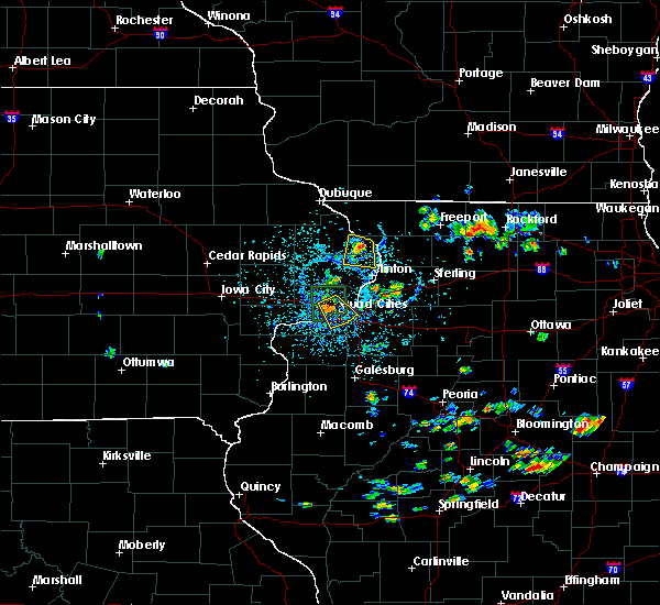 At 341 pm cdt, a severe thunderstorm was located over miles, or 15 miles north of clinton, moving south at 10 mph (radar indicated). Hazards include 60 mph wind gusts and quarter size hail. Hail damage to vehicles is expected. expect wind damage to roofs, siding, and trees. Locations impacted include, preston, miles, charlotte, andover, spragueville, green island, van buren, goose lake, bryant, reeceville, camp miss-elk-ton and teeds grove. At 341 pm cdt, a severe thunderstorm was located over miles, or 15 miles north of clinton, moving south at 10 mph (radar indicated). Hazards include 60 mph wind gusts and quarter size hail. Hail damage to vehicles is expected. expect wind damage to roofs, siding, and trees. Locations impacted include, preston, miles, charlotte, andover, spragueville, green island, van buren, goose lake, bryant, reeceville, camp miss-elk-ton and teeds grove.
|
| 7/8/2020 3:27 PM CDT |
 At 327 pm cdt, a severe thunderstorm was located near miles, or 17 miles west of mount carroll, moving south at 10 mph (radar indicated). Hazards include 60 mph wind gusts and quarter size hail. Hail damage to vehicles is expected. Expect wind damage to roofs, siding, and trees. At 327 pm cdt, a severe thunderstorm was located near miles, or 17 miles west of mount carroll, moving south at 10 mph (radar indicated). Hazards include 60 mph wind gusts and quarter size hail. Hail damage to vehicles is expected. Expect wind damage to roofs, siding, and trees.
|
| 6/21/2020 3:06 PM CDT |
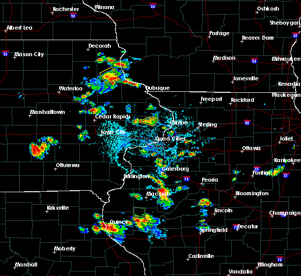 The severe thunderstorm warning for northwestern clinton county will expire at 315 pm cdt, the storm which prompted the warning has weakened below severe limits, and no longer poses an immediate threat to life or property. therefore, the warning will be allowed to expire. however small hail, gusty winds and heavy rain are still possible with this thunderstorm. The severe thunderstorm warning for northwestern clinton county will expire at 315 pm cdt, the storm which prompted the warning has weakened below severe limits, and no longer poses an immediate threat to life or property. therefore, the warning will be allowed to expire. however small hail, gusty winds and heavy rain are still possible with this thunderstorm.
|
| 6/21/2020 2:59 PM CDT |
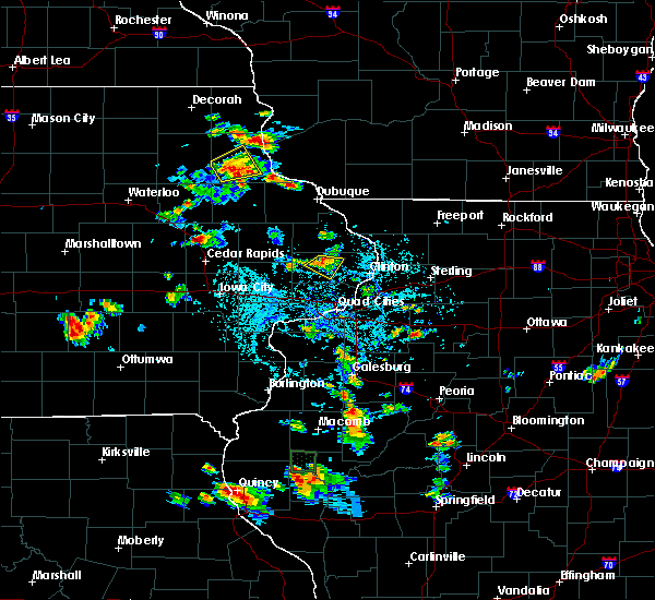 At 258 pm cdt, a severe thunderstorm was located over welton, or 8 miles southeast of maquoketa, moving east at 10 mph (radar indicated). Hazards include 60 mph wind gusts and penny size hail. Expect damage to roofs, siding, and trees. Locations impacted include, delmar, charlotte and welton. At 258 pm cdt, a severe thunderstorm was located over welton, or 8 miles southeast of maquoketa, moving east at 10 mph (radar indicated). Hazards include 60 mph wind gusts and penny size hail. Expect damage to roofs, siding, and trees. Locations impacted include, delmar, charlotte and welton.
|
| 6/21/2020 2:49 PM CDT |
 At 249 pm cdt, a severe thunderstorm was located near welton, or 7 miles south of maquoketa, moving east at 15 mph (radar indicated). Hazards include 60 mph wind gusts and quarter size hail. Hail damage to vehicles is expected. expect wind damage to roofs, siding, and trees. Locations impacted include, dewitt, delmar, charlotte and welton. At 249 pm cdt, a severe thunderstorm was located near welton, or 7 miles south of maquoketa, moving east at 15 mph (radar indicated). Hazards include 60 mph wind gusts and quarter size hail. Hail damage to vehicles is expected. expect wind damage to roofs, siding, and trees. Locations impacted include, dewitt, delmar, charlotte and welton.
|
| 6/21/2020 2:41 PM CDT |
 At 241 pm cdt, a severe thunderstorm was located near delmar, or 7 miles south of maquoketa, moving southeast at 10 mph (radar indicated). Hazards include 60 mph wind gusts and quarter size hail. Hail damage to vehicles is expected. Expect wind damage to roofs, siding, and trees. At 241 pm cdt, a severe thunderstorm was located near delmar, or 7 miles south of maquoketa, moving southeast at 10 mph (radar indicated). Hazards include 60 mph wind gusts and quarter size hail. Hail damage to vehicles is expected. Expect wind damage to roofs, siding, and trees.
|
| 4/7/2020 7:57 PM CDT |
 At 750 pm cdt, a severe thunderstorm was located over lowden, or 11 miles northeast of tipton, moving east at 35 mph (radar indicated). Hazards include golf ball size hail and 60 mph wind gusts. People and animals outdoors will be injured. expect hail damage to roofs, siding, windows, and vehicles. expect wind damage to roofs, siding, and trees. Locations impacted include, eldridge, dewitt, long grove, lowden, wheatland, grand mound, delmar, lost nation, calamus, bennett, charlotte, donahue, mccausland, welton, toronto, dixon, goose lake, maysville, new liberty and malone. At 750 pm cdt, a severe thunderstorm was located over lowden, or 11 miles northeast of tipton, moving east at 35 mph (radar indicated). Hazards include golf ball size hail and 60 mph wind gusts. People and animals outdoors will be injured. expect hail damage to roofs, siding, windows, and vehicles. expect wind damage to roofs, siding, and trees. Locations impacted include, eldridge, dewitt, long grove, lowden, wheatland, grand mound, delmar, lost nation, calamus, bennett, charlotte, donahue, mccausland, welton, toronto, dixon, goose lake, maysville, new liberty and malone.
|
| 4/7/2020 7:51 PM CDT |
 At 750 pm cdt, a severe thunderstorm was located over lowden, or 11 miles northeast of tipton, moving east at 35 mph (radar indicated). Hazards include golf ball size hail and 60 mph wind gusts. People and animals outdoors will be injured. expect hail damage to roofs, siding, windows, and vehicles. expect wind damage to roofs, siding, and trees. Locations impacted include, eldridge, dewitt, long grove, lowden, wheatland, grand mound, delmar, lost nation, calamus, bennett, charlotte, donahue, mccausland, welton, toronto, dixon, goose lake, maysville, new liberty and malone. At 750 pm cdt, a severe thunderstorm was located over lowden, or 11 miles northeast of tipton, moving east at 35 mph (radar indicated). Hazards include golf ball size hail and 60 mph wind gusts. People and animals outdoors will be injured. expect hail damage to roofs, siding, windows, and vehicles. expect wind damage to roofs, siding, and trees. Locations impacted include, eldridge, dewitt, long grove, lowden, wheatland, grand mound, delmar, lost nation, calamus, bennett, charlotte, donahue, mccausland, welton, toronto, dixon, goose lake, maysville, new liberty and malone.
|
| 4/7/2020 7:35 PM CDT |
 At 734 pm cdt, a severe thunderstorm was located near stanwood, moving east at 40 mph (radar indicated). Hazards include golf ball size hail and 60 mph wind gusts. People and animals outdoors will be injured. expect hail damage to roofs, siding, windows, and vehicles. Expect wind damage to roofs, siding, and trees. At 734 pm cdt, a severe thunderstorm was located near stanwood, moving east at 40 mph (radar indicated). Hazards include golf ball size hail and 60 mph wind gusts. People and animals outdoors will be injured. expect hail damage to roofs, siding, windows, and vehicles. Expect wind damage to roofs, siding, and trees.
|
| 3/28/2020 2:55 AM CDT |
 At 255 am cdt, a severe thunderstorm was located near charlotte, or 10 miles southeast of maquoketa, moving northeast at 45 mph (radar indicated). Hazards include quarter size hail. damage to vehicles is expected At 255 am cdt, a severe thunderstorm was located near charlotte, or 10 miles southeast of maquoketa, moving northeast at 45 mph (radar indicated). Hazards include quarter size hail. damage to vehicles is expected
|
| 9/10/2019 1:32 AM CDT |
 At 131 am cdt, severe thunderstorms were located along a line extending from near bellevue to near delmar, moving northeast at 45 mph (at 113 am a 60 mph wind gust was measured near maquoketa). Hazards include 60 mph wind gusts. Expect damage to roofs, siding, and trees. Locations impacted include, clinton, savanna, bellevue, preston, hanover, sabula, delmar, miles, charlotte, welton, springbrook, andover, spragueville, massbach, green island, van buren, thomson, goose lake, whitton and teeds grove. At 131 am cdt, severe thunderstorms were located along a line extending from near bellevue to near delmar, moving northeast at 45 mph (at 113 am a 60 mph wind gust was measured near maquoketa). Hazards include 60 mph wind gusts. Expect damage to roofs, siding, and trees. Locations impacted include, clinton, savanna, bellevue, preston, hanover, sabula, delmar, miles, charlotte, welton, springbrook, andover, spragueville, massbach, green island, van buren, thomson, goose lake, whitton and teeds grove.
|
| 9/10/2019 1:20 AM CDT |
 At 119 am cdt, severe thunderstorms were located along a line extending from springbrook to near welton, moving northeast at 40 mph (radar indicated). Hazards include 60 mph wind gusts. expect damage to roofs, siding, and trees At 119 am cdt, severe thunderstorms were located along a line extending from springbrook to near welton, moving northeast at 40 mph (radar indicated). Hazards include 60 mph wind gusts. expect damage to roofs, siding, and trees
|
| 6/30/2019 6:23 PM CDT |
 At 623 pm cdt, severe thunderstorms were located along a line extending from near sabula to near durant to near swisher, moving south at 45 mph (trained weather spotters). Hazards include 70 mph wind gusts. Expect considerable tree damage. damage is likely to mobile homes, roofs, and outbuildings. locations impacted include, cedar rapids, iowa city, clinton, maquoketa, tipton, west branch, mechanicsville, stanwood, coralville, north liberty, dewitt, mount vernon, camanche, lisbon, fairfax, solon, tiffin, ely, university heights and preston. this includes the following highways, interstate 80 in iowa between mile markers 230 and 279. Interstate 380 between mile markers 1 and 21. At 623 pm cdt, severe thunderstorms were located along a line extending from near sabula to near durant to near swisher, moving south at 45 mph (trained weather spotters). Hazards include 70 mph wind gusts. Expect considerable tree damage. damage is likely to mobile homes, roofs, and outbuildings. locations impacted include, cedar rapids, iowa city, clinton, maquoketa, tipton, west branch, mechanicsville, stanwood, coralville, north liberty, dewitt, mount vernon, camanche, lisbon, fairfax, solon, tiffin, ely, university heights and preston. this includes the following highways, interstate 80 in iowa between mile markers 230 and 279. Interstate 380 between mile markers 1 and 21.
|
| 6/30/2019 6:16 PM CDT | Delayed report from social media. time estimated from radar. considerable trees down with highway 136 closed. power ou in clinton county IA, 0.2 miles NE of Charlotte, IA |
| 6/30/2019 6:14 PM CDT |
 At 613 pm cdt, severe thunderstorms were located along a line extending from near sabula to near bennett to fairfax, moving southeast at 50 mph (trained weather spotters). Hazards include 70 mph wind gusts. Expect considerable tree damage. damage is likely to mobile homes, roofs, and outbuildings. locations impacted include, cedar rapids, iowa city, clinton, maquoketa, tipton, west branch, mechanicsville, stanwood, marion, coralville, north liberty, hiawatha, dewitt, mount vernon, camanche, bellevue, lisbon, fairfax, solon and tiffin. this includes the following highways, interstate 80 in iowa between mile markers 230 and 279. Interstate 380 between mile markers 1 and 25. At 613 pm cdt, severe thunderstorms were located along a line extending from near sabula to near bennett to fairfax, moving southeast at 50 mph (trained weather spotters). Hazards include 70 mph wind gusts. Expect considerable tree damage. damage is likely to mobile homes, roofs, and outbuildings. locations impacted include, cedar rapids, iowa city, clinton, maquoketa, tipton, west branch, mechanicsville, stanwood, marion, coralville, north liberty, hiawatha, dewitt, mount vernon, camanche, bellevue, lisbon, fairfax, solon and tiffin. this includes the following highways, interstate 80 in iowa between mile markers 230 and 279. Interstate 380 between mile markers 1 and 25.
|
| 6/30/2019 6:07 PM CDT |
 At 606 pm cdt, severe thunderstorms were located along a line extending from near springbrook to near tipton to near atkins, moving south at 50 mph (trained weather spotters). Hazards include 70 mph wind gusts. Expect considerable tree damage. damage is likely to mobile homes, roofs, and outbuildings. locations impacted include, cedar rapids, iowa city, clinton, maquoketa, tipton, west branch, mechanicsville, stanwood, marion, coralville, north liberty, hiawatha, dewitt, mount vernon, camanche, bellevue, lisbon, fairfax, solon and tiffin. this includes the following highways, interstate 80 in iowa between mile markers 230 and 279. Interstate 380 between mile markers 1 and 25. At 606 pm cdt, severe thunderstorms were located along a line extending from near springbrook to near tipton to near atkins, moving south at 50 mph (trained weather spotters). Hazards include 70 mph wind gusts. Expect considerable tree damage. damage is likely to mobile homes, roofs, and outbuildings. locations impacted include, cedar rapids, iowa city, clinton, maquoketa, tipton, west branch, mechanicsville, stanwood, marion, coralville, north liberty, hiawatha, dewitt, mount vernon, camanche, bellevue, lisbon, fairfax, solon and tiffin. this includes the following highways, interstate 80 in iowa between mile markers 230 and 279. Interstate 380 between mile markers 1 and 25.
|
| 6/30/2019 6:00 PM CDT |
 At 559 pm cdt, severe thunderstorms were located along a line extending from near bellevue to near stanwood to near newhall, moving south at 45 mph (trained weather spotters). Hazards include 70 mph wind gusts and quarter size hail. Hail damage to vehicles is expected. expect considerable tree damage. Wind damage is also likely to mobile homes, roofs, and outbuildings. At 559 pm cdt, severe thunderstorms were located along a line extending from near bellevue to near stanwood to near newhall, moving south at 45 mph (trained weather spotters). Hazards include 70 mph wind gusts and quarter size hail. Hail damage to vehicles is expected. expect considerable tree damage. Wind damage is also likely to mobile homes, roofs, and outbuildings.
|
| 6/24/2019 3:28 PM CDT |
 At 328 pm cdt, severe thunderstorms were located along a line extending from near charlotte to near walcott, moving east at 30 mph (radar indicated). Hazards include 60 mph wind gusts and quarter size hail. Hail damage to vehicles is expected. expect wind damage to roofs, siding, and trees. locations impacted include, davenport, bettendorf, clinton, eldridge, dewitt, camanche, le claire, fulton, port byron, walcott, garden plain, rapids city, albany, princeton, long grove, cordova, grand mound, charlotte, donahue and mccausland. this includes the following highways, interstate 80 in iowa between mile markers 283 and 306. interstate 88 between mile markers 9 and 15. Interstate 280 near mile marker 1. At 328 pm cdt, severe thunderstorms were located along a line extending from near charlotte to near walcott, moving east at 30 mph (radar indicated). Hazards include 60 mph wind gusts and quarter size hail. Hail damage to vehicles is expected. expect wind damage to roofs, siding, and trees. locations impacted include, davenport, bettendorf, clinton, eldridge, dewitt, camanche, le claire, fulton, port byron, walcott, garden plain, rapids city, albany, princeton, long grove, cordova, grand mound, charlotte, donahue and mccausland. this includes the following highways, interstate 80 in iowa between mile markers 283 and 306. interstate 88 between mile markers 9 and 15. Interstate 280 near mile marker 1.
|
| 6/24/2019 3:22 PM CDT |
 At 322 pm cdt, severe thunderstorms were located along a line extending from near welton to near walcott, moving east at 30 mph (radar indicated). Hazards include 60 mph wind gusts and quarter size hail. Hail damage to vehicles is expected. expect wind damage to roofs, siding, and trees. locations impacted include, davenport, bettendorf, clinton, eldridge, dewitt, camanche, le claire, fulton, port byron, walcott, garden plain, rapids city, albany, princeton, long grove, cordova, grand mound, calamus, charlotte and donahue. this includes the following highways, interstate 80 in iowa between mile markers 282 and 306. interstate 88 between mile markers 9 and 15. Interstate 280 near mile marker 1. At 322 pm cdt, severe thunderstorms were located along a line extending from near welton to near walcott, moving east at 30 mph (radar indicated). Hazards include 60 mph wind gusts and quarter size hail. Hail damage to vehicles is expected. expect wind damage to roofs, siding, and trees. locations impacted include, davenport, bettendorf, clinton, eldridge, dewitt, camanche, le claire, fulton, port byron, walcott, garden plain, rapids city, albany, princeton, long grove, cordova, grand mound, calamus, charlotte and donahue. this includes the following highways, interstate 80 in iowa between mile markers 282 and 306. interstate 88 between mile markers 9 and 15. Interstate 280 near mile marker 1.
|
| 6/24/2019 3:17 PM CDT |
 At 316 pm cdt, severe thunderstorms were located along a line extending from near welton to near walcott, moving east at 30 mph (radar indicated). Hazards include 60 mph wind gusts and quarter size hail. Hail damage to vehicles is expected. expect wind damage to roofs, siding, and trees. locations impacted include, davenport, bettendorf, clinton, eldridge, dewitt, camanche, le claire, fulton, port byron, walcott, garden plain, rapids city, albany, princeton, long grove, cordova, grand mound, calamus, charlotte and donahue. this includes the following highways, interstate 80 in iowa between mile markers 282 and 306. interstate 88 between mile markers 9 and 15. Interstate 280 near mile marker 1. At 316 pm cdt, severe thunderstorms were located along a line extending from near welton to near walcott, moving east at 30 mph (radar indicated). Hazards include 60 mph wind gusts and quarter size hail. Hail damage to vehicles is expected. expect wind damage to roofs, siding, and trees. locations impacted include, davenport, bettendorf, clinton, eldridge, dewitt, camanche, le claire, fulton, port byron, walcott, garden plain, rapids city, albany, princeton, long grove, cordova, grand mound, calamus, charlotte and donahue. this includes the following highways, interstate 80 in iowa between mile markers 282 and 306. interstate 88 between mile markers 9 and 15. Interstate 280 near mile marker 1.
|
| 6/24/2019 3:10 PM CDT |
 At 309 pm cdt, severe thunderstorms were located along a line extending from near calamus to near donahue, moving east at 35 mph (radar indicated). Hazards include 60 mph wind gusts and quarter size hail. Hail damage to vehicles is expected. Expect wind damage to roofs, siding, and trees. At 309 pm cdt, severe thunderstorms were located along a line extending from near calamus to near donahue, moving east at 35 mph (radar indicated). Hazards include 60 mph wind gusts and quarter size hail. Hail damage to vehicles is expected. Expect wind damage to roofs, siding, and trees.
|
| 5/29/2019 11:21 PM CDT |
 The severe thunderstorm warning for eastern clinton county will expire at 1130 pm cdt, the storm which prompted the warning has weakened below severe limits, and no longer poses an immediate threat to life or property. therefore, the warning will be allowed to expire. however gusty winds and heavy rain are still possible with this thunderstorm. to report severe weather, contact your nearest law enforcement agency. they will relay your report to the national weather service the quad cities. The severe thunderstorm warning for eastern clinton county will expire at 1130 pm cdt, the storm which prompted the warning has weakened below severe limits, and no longer poses an immediate threat to life or property. therefore, the warning will be allowed to expire. however gusty winds and heavy rain are still possible with this thunderstorm. to report severe weather, contact your nearest law enforcement agency. they will relay your report to the national weather service the quad cities.
|
| 5/29/2019 11:17 PM CDT |
 At 1117 pm cdt, a severe thunderstorm was located near clinton, moving east at 35 mph (radar indicated). Hazards include 60 mph wind gusts. Expect damage to roofs, siding, and trees. Locations impacted include, clinton, camanche, fulton, delmar, charlotte, low moor, welton, andover, goose lake, bryant, bulgers hollow, teeds grove, elvira, camp miss-elk-ton and clinton municipal airport. At 1117 pm cdt, a severe thunderstorm was located near clinton, moving east at 35 mph (radar indicated). Hazards include 60 mph wind gusts. Expect damage to roofs, siding, and trees. Locations impacted include, clinton, camanche, fulton, delmar, charlotte, low moor, welton, andover, goose lake, bryant, bulgers hollow, teeds grove, elvira, camp miss-elk-ton and clinton municipal airport.
|
| 5/29/2019 11:01 PM CDT |
 At 1101 pm cdt, a severe thunderstorm was located near charlotte, or 12 miles west of clinton, moving east at 20 mph (radar indicated). Hazards include 60 mph wind gusts. Expect damage to roofs, siding, and trees. Locations impacted include, clinton, dewitt, camanche, fulton, grand mound, delmar, charlotte, low moor, welton, andover, goose lake, bryant, malone, bulgers hollow, teeds grove, elvira, camp miss-elk-ton, clinton municipal airport and clinton county fairgrounds. At 1101 pm cdt, a severe thunderstorm was located near charlotte, or 12 miles west of clinton, moving east at 20 mph (radar indicated). Hazards include 60 mph wind gusts. Expect damage to roofs, siding, and trees. Locations impacted include, clinton, dewitt, camanche, fulton, grand mound, delmar, charlotte, low moor, welton, andover, goose lake, bryant, malone, bulgers hollow, teeds grove, elvira, camp miss-elk-ton, clinton municipal airport and clinton county fairgrounds.
|
| 5/29/2019 10:57 PM CDT |
 At 1057 pm cdt, a severe thunderstorm was located near dewitt, or 13 miles west of clinton, moving east at 20 mph (radar indicated). Hazards include 70 mph wind gusts. Expect considerable tree damage. damage is likely to mobile homes, roofs, and outbuildings. Locations impacted include, clinton, dewitt, camanche, fulton, grand mound, delmar, charlotte, low moor, welton, andover, goose lake, bryant, malone, bulgers hollow, teeds grove, elvira, camp miss-elk-ton, clinton municipal airport and clinton county fairgrounds. At 1057 pm cdt, a severe thunderstorm was located near dewitt, or 13 miles west of clinton, moving east at 20 mph (radar indicated). Hazards include 70 mph wind gusts. Expect considerable tree damage. damage is likely to mobile homes, roofs, and outbuildings. Locations impacted include, clinton, dewitt, camanche, fulton, grand mound, delmar, charlotte, low moor, welton, andover, goose lake, bryant, malone, bulgers hollow, teeds grove, elvira, camp miss-elk-ton, clinton municipal airport and clinton county fairgrounds.
|
| 5/29/2019 10:55 PM CDT |
 At 1055 pm cdt, a severe thunderstorm was located near low moor, or 7 miles northwest of clinton, moving east at 40 mph (radar indicated). Hazards include 70 mph wind gusts. Expect considerable tree damage. damage is likely to mobile homes, roofs, and outbuildings. Locations impacted include, clinton, dewitt, camanche, fulton, grand mound, delmar, charlotte, low moor, welton, andover, goose lake, bryant, malone, bulgers hollow, teeds grove, elvira, camp miss-elk-ton, clinton municipal airport and clinton county fairgrounds. At 1055 pm cdt, a severe thunderstorm was located near low moor, or 7 miles northwest of clinton, moving east at 40 mph (radar indicated). Hazards include 70 mph wind gusts. Expect considerable tree damage. damage is likely to mobile homes, roofs, and outbuildings. Locations impacted include, clinton, dewitt, camanche, fulton, grand mound, delmar, charlotte, low moor, welton, andover, goose lake, bryant, malone, bulgers hollow, teeds grove, elvira, camp miss-elk-ton, clinton municipal airport and clinton county fairgrounds.
|
| 5/29/2019 10:47 PM CDT |
 At 1047 pm cdt, a severe thunderstorm was located near charlotte, or 12 miles west of clinton, moving east at 40 mph (radar indicated). Hazards include 70 mph wind gusts. Expect considerable tree damage. damage is likely to mobile homes, roofs, and outbuildings. Locations impacted include, clinton, dewitt, camanche, fulton, grand mound, delmar, calamus, charlotte, low moor, welton, andover, goose lake, bryant, lyons, malone, bulgers hollow, teeds grove, elvira, camp miss-elk-ton and clinton municipal airport. At 1047 pm cdt, a severe thunderstorm was located near charlotte, or 12 miles west of clinton, moving east at 40 mph (radar indicated). Hazards include 70 mph wind gusts. Expect considerable tree damage. damage is likely to mobile homes, roofs, and outbuildings. Locations impacted include, clinton, dewitt, camanche, fulton, grand mound, delmar, calamus, charlotte, low moor, welton, andover, goose lake, bryant, lyons, malone, bulgers hollow, teeds grove, elvira, camp miss-elk-ton and clinton municipal airport.
|
| 5/29/2019 10:37 PM CDT |
 At 1037 pm cdt, a severe thunderstorm was located over welton, or 12 miles south of maquoketa, moving east at 40 mph (radar indicated). Hazards include 70 mph wind gusts. Expect considerable tree damage. Damage is likely to mobile homes, roofs, and outbuildings. At 1037 pm cdt, a severe thunderstorm was located over welton, or 12 miles south of maquoketa, moving east at 40 mph (radar indicated). Hazards include 70 mph wind gusts. Expect considerable tree damage. Damage is likely to mobile homes, roofs, and outbuildings.
|
| 5/16/2019 9:38 PM CDT |
 The severe thunderstorm warning for central clinton county will expire at 945 pm cdt, the storm which prompted the warning has moved out of the area. therefore, the warning will be allowed to expire. however small hail, gusty winds and heavy rain are still possible with this thunderstorm. a severe thunderstorm watch remains in effect until 300 am cdt for northwestern illinois, and east central iowa. to report severe weather, contact your nearest law enforcement agency. they will relay your report to the national weather service the quad cities. The severe thunderstorm warning for central clinton county will expire at 945 pm cdt, the storm which prompted the warning has moved out of the area. therefore, the warning will be allowed to expire. however small hail, gusty winds and heavy rain are still possible with this thunderstorm. a severe thunderstorm watch remains in effect until 300 am cdt for northwestern illinois, and east central iowa. to report severe weather, contact your nearest law enforcement agency. they will relay your report to the national weather service the quad cities.
|
| 5/16/2019 9:28 PM CDT |
 At 927 pm cdt, a severe thunderstorm was located over dewitt, or 13 miles west of clinton, moving east at 20 mph (radar indicated). Hazards include 60 mph wind gusts and quarter size hail. Hail damage to vehicles is expected. expect wind damage to roofs, siding, and trees. Locations impacted include, clinton, dewitt, camanche, charlotte, low moor, welton, goose lake, malone, rock creek marina and campground, folletts, elvira, rock creek park, clinton municipal airport and clinton county fairgrounds. At 927 pm cdt, a severe thunderstorm was located over dewitt, or 13 miles west of clinton, moving east at 20 mph (radar indicated). Hazards include 60 mph wind gusts and quarter size hail. Hail damage to vehicles is expected. expect wind damage to roofs, siding, and trees. Locations impacted include, clinton, dewitt, camanche, charlotte, low moor, welton, goose lake, malone, rock creek marina and campground, folletts, elvira, rock creek park, clinton municipal airport and clinton county fairgrounds.
|
| 5/16/2019 9:15 PM CDT |
 At 915 pm cdt, a severe thunderstorm was located over dewitt, or 16 miles south of maquoketa, moving east at 20 mph (radar indicated). Hazards include ping pong ball size hail and 60 mph wind gusts. People and animals outdoors will be injured. expect hail damage to roofs, siding, windows, and vehicles. expect wind damage to roofs, siding, and trees. Locations impacted include, clinton, dewitt, camanche, grand mound, charlotte, low moor, welton, toronto, goose lake, malone, rock creek marina and campground, folletts, elvira, rock creek park, clinton municipal airport, clinton county fairgrounds and walnut grove park. At 915 pm cdt, a severe thunderstorm was located over dewitt, or 16 miles south of maquoketa, moving east at 20 mph (radar indicated). Hazards include ping pong ball size hail and 60 mph wind gusts. People and animals outdoors will be injured. expect hail damage to roofs, siding, windows, and vehicles. expect wind damage to roofs, siding, and trees. Locations impacted include, clinton, dewitt, camanche, grand mound, charlotte, low moor, welton, toronto, goose lake, malone, rock creek marina and campground, folletts, elvira, rock creek park, clinton municipal airport, clinton county fairgrounds and walnut grove park.
|
| 5/16/2019 9:08 PM CDT |
 At 908 pm cdt, a severe thunderstorm was located over grand mound, or 14 miles south of maquoketa, moving east at 20 mph (radar indicated). Hazards include golf ball size hail and 60 mph wind gusts. People and animals outdoors will be injured. expect hail damage to roofs, siding, windows, and vehicles. expect wind damage to roofs, siding, and trees. Locations impacted include, clinton, dewitt, camanche, grand mound, delmar, lost nation, charlotte, low moor, welton, goose lake, bryant, malone, rock creek marina and campground, folletts, elvira, rock creek park, clinton municipal airport, elwood, clinton county fairgrounds and lyons. At 908 pm cdt, a severe thunderstorm was located over grand mound, or 14 miles south of maquoketa, moving east at 20 mph (radar indicated). Hazards include golf ball size hail and 60 mph wind gusts. People and animals outdoors will be injured. expect hail damage to roofs, siding, windows, and vehicles. expect wind damage to roofs, siding, and trees. Locations impacted include, clinton, dewitt, camanche, grand mound, delmar, lost nation, charlotte, low moor, welton, goose lake, bryant, malone, rock creek marina and campground, folletts, elvira, rock creek park, clinton municipal airport, elwood, clinton county fairgrounds and lyons.
|
| 5/16/2019 8:55 PM CDT |
 At 855 pm cdt, a severe thunderstorm was located near welton, or 11 miles south of maquoketa, moving east at 20 mph (radar indicated). Hazards include tennis ball size hail and 60 mph wind gusts. People and animals outdoors will be injured. expect hail damage to roofs, siding, windows, and vehicles. expect wind damage to roofs, siding, and trees. Locations impacted include, clinton, dewitt, camanche, grand mound, delmar, lost nation, charlotte, low moor, welton, goose lake, bryant, malone, rock creek marina and campground, folletts, elvira, rock creek park, clinton municipal airport, elwood, clinton county fairgrounds and lyons. At 855 pm cdt, a severe thunderstorm was located near welton, or 11 miles south of maquoketa, moving east at 20 mph (radar indicated). Hazards include tennis ball size hail and 60 mph wind gusts. People and animals outdoors will be injured. expect hail damage to roofs, siding, windows, and vehicles. expect wind damage to roofs, siding, and trees. Locations impacted include, clinton, dewitt, camanche, grand mound, delmar, lost nation, charlotte, low moor, welton, goose lake, bryant, malone, rock creek marina and campground, folletts, elvira, rock creek park, clinton municipal airport, elwood, clinton county fairgrounds and lyons.
|
| 5/16/2019 8:51 PM CDT |
 At 851 pm cdt, a severe thunderstorm was located near lost nation, or 9 miles south of maquoketa, moving east at 20 mph (radar indicated). Hazards include golf ball size hail and 60 mph wind gusts. People and animals outdoors will be injured. expect hail damage to roofs, siding, windows, and vehicles. expect wind damage to roofs, siding, and trees. Locations impacted include, clinton, dewitt, camanche, grand mound, delmar, lost nation, charlotte, low moor, welton, goose lake, bryant, malone, rock creek marina and campground, folletts, elvira, rock creek park, clinton municipal airport, elwood, clinton county fairgrounds and lyons. At 851 pm cdt, a severe thunderstorm was located near lost nation, or 9 miles south of maquoketa, moving east at 20 mph (radar indicated). Hazards include golf ball size hail and 60 mph wind gusts. People and animals outdoors will be injured. expect hail damage to roofs, siding, windows, and vehicles. expect wind damage to roofs, siding, and trees. Locations impacted include, clinton, dewitt, camanche, grand mound, delmar, lost nation, charlotte, low moor, welton, goose lake, bryant, malone, rock creek marina and campground, folletts, elvira, rock creek park, clinton municipal airport, elwood, clinton county fairgrounds and lyons.
|
| 5/16/2019 8:48 PM CDT |
 At 848 pm cdt, a severe thunderstorm was located near lost nation, or 9 miles southwest of maquoketa, moving east at 20 mph (radar indicated). Hazards include 60 mph wind gusts and quarter size hail. Hail damage to vehicles is expected. Expect wind damage to roofs, siding, and trees. At 848 pm cdt, a severe thunderstorm was located near lost nation, or 9 miles southwest of maquoketa, moving east at 20 mph (radar indicated). Hazards include 60 mph wind gusts and quarter size hail. Hail damage to vehicles is expected. Expect wind damage to roofs, siding, and trees.
|
| 4/22/2019 6:11 PM CDT |
 At 610 pm cdt, a severe thunderstorm was located near preston, or 11 miles east of maquoketa, moving east at 45 mph (trained weather spotters). Hazards include 60 mph wind gusts and penny size hail. Expect damage to roofs, siding, and trees. Locations impacted include, maquoketa, mount carroll, savanna, preston, fairhaven, sabula, chadwick, delmar, miles, charlotte, springbrook, andover, spragueville, hurstville, green island, argo fay, van buren, thomson, goose lake and wacker. At 610 pm cdt, a severe thunderstorm was located near preston, or 11 miles east of maquoketa, moving east at 45 mph (trained weather spotters). Hazards include 60 mph wind gusts and penny size hail. Expect damage to roofs, siding, and trees. Locations impacted include, maquoketa, mount carroll, savanna, preston, fairhaven, sabula, chadwick, delmar, miles, charlotte, springbrook, andover, spragueville, hurstville, green island, argo fay, van buren, thomson, goose lake and wacker.
|
| 4/22/2019 6:03 PM CDT |
 At 603 pm cdt, a severe thunderstorm was located near delmar, or 7 miles southeast of maquoketa, moving east at 45 mph (trained weather spotters). Hazards include 60 mph wind gusts and penny size hail. Expect damage to roofs, siding, and trees. Locations impacted include, maquoketa, mount carroll, savanna, preston, fairhaven, sabula, chadwick, delmar, miles, charlotte, springbrook, andover, spragueville, hurstville, green island, argo fay, van buren, thomson, goose lake and wacker. At 603 pm cdt, a severe thunderstorm was located near delmar, or 7 miles southeast of maquoketa, moving east at 45 mph (trained weather spotters). Hazards include 60 mph wind gusts and penny size hail. Expect damage to roofs, siding, and trees. Locations impacted include, maquoketa, mount carroll, savanna, preston, fairhaven, sabula, chadwick, delmar, miles, charlotte, springbrook, andover, spragueville, hurstville, green island, argo fay, van buren, thomson, goose lake and wacker.
|
| 4/22/2019 5:59 PM CDT |
 At 558 pm cdt, a severe thunderstorm was located over delmar, or near maquoketa, moving east at 50 mph (radar indicated). Hazards include 60 mph wind gusts and penny size hail. expect damage to roofs, siding, and trees At 558 pm cdt, a severe thunderstorm was located over delmar, or near maquoketa, moving east at 50 mph (radar indicated). Hazards include 60 mph wind gusts and penny size hail. expect damage to roofs, siding, and trees
|
| 8/28/2018 7:35 PM CDT |
 At 734 pm cdt, a severe thunderstorm was located over andover, or 10 miles north of clinton, moving east at 60 mph (radar indicated). Hazards include 70 mph wind gusts. Expect considerable tree damage. damage is likely to mobile homes, roofs, and outbuildings. Locations impacted include, clinton, maquoketa, morrison, mount carroll, dewitt, camanche, savanna, bellevue, stockton, garden plain, preston, fairhaven, albany, hanover, elizabeth, grand mound, woodbine, sabula, chadwick and delmar. At 734 pm cdt, a severe thunderstorm was located over andover, or 10 miles north of clinton, moving east at 60 mph (radar indicated). Hazards include 70 mph wind gusts. Expect considerable tree damage. damage is likely to mobile homes, roofs, and outbuildings. Locations impacted include, clinton, maquoketa, morrison, mount carroll, dewitt, camanche, savanna, bellevue, stockton, garden plain, preston, fairhaven, albany, hanover, elizabeth, grand mound, woodbine, sabula, chadwick and delmar.
|
| 8/28/2018 7:00 PM CDT |
 At 659 pm cdt, a severe thunderstorm was located near toronto, or 12 miles east of stanwood, moving east at 60 mph (radar indicated). Hazards include 70 mph wind gusts. Expect considerable tree damage. Damage is likely to mobile homes, roofs, and outbuildings. At 659 pm cdt, a severe thunderstorm was located near toronto, or 12 miles east of stanwood, moving east at 60 mph (radar indicated). Hazards include 70 mph wind gusts. Expect considerable tree damage. Damage is likely to mobile homes, roofs, and outbuildings.
|
| 6/10/2018 12:25 AM CDT |
 At 1225 am cdt, a severe thunderstorm was located over clinton, moving east at 35 mph (radar indicated). Hazards include 60 mph wind gusts. Expect damage to roofs, siding, and trees. locations impacted include, clinton, morrison, camanche, fulton, garden plain, fairhaven, albany, lyndon, chadwick, charlotte, low moor, andover, east clinton, argo fay, union grove, ustick, thomson, fenton, goose lake and malone. This includes interstate 88 between mile markers 22 and 31. At 1225 am cdt, a severe thunderstorm was located over clinton, moving east at 35 mph (radar indicated). Hazards include 60 mph wind gusts. Expect damage to roofs, siding, and trees. locations impacted include, clinton, morrison, camanche, fulton, garden plain, fairhaven, albany, lyndon, chadwick, charlotte, low moor, andover, east clinton, argo fay, union grove, ustick, thomson, fenton, goose lake and malone. This includes interstate 88 between mile markers 22 and 31.
|
| 6/10/2018 12:17 AM CDT |
 At 1217 am cdt, a severe thunderstorm was located near low moor, or 7 miles west of clinton, moving east at 35 mph (radar indicated). Hazards include 60 mph wind gusts. expect damage to roofs, siding, and trees At 1217 am cdt, a severe thunderstorm was located near low moor, or 7 miles west of clinton, moving east at 35 mph (radar indicated). Hazards include 60 mph wind gusts. expect damage to roofs, siding, and trees
|
| 5/2/2018 4:55 PM CDT |
 At 454 pm cdt, a severe thunderstorm was located over preston, or 14 miles northwest of clinton, moving east at 35 mph (radar indicated). Hazards include 60 mph wind gusts and quarter size hail. Hail damage to vehicles is expected. expect wind damage to roofs, siding, and trees. Locations impacted include, preston, miles, charlotte, andover, spragueville, green island, van buren, goose lake, reeceville, camp miss-elk-ton and teeds grove. At 454 pm cdt, a severe thunderstorm was located over preston, or 14 miles northwest of clinton, moving east at 35 mph (radar indicated). Hazards include 60 mph wind gusts and quarter size hail. Hail damage to vehicles is expected. expect wind damage to roofs, siding, and trees. Locations impacted include, preston, miles, charlotte, andover, spragueville, green island, van buren, goose lake, reeceville, camp miss-elk-ton and teeds grove.
|
| 5/2/2018 4:50 PM CDT |
 At 449 pm cdt, a severe thunderstorm was located over preston, or 12 miles east of maquoketa, moving northeast at 35 mph (radar indicated). Hazards include 60 mph wind gusts and quarter size hail. Hail damage to vehicles is expected. expect wind damage to roofs, siding, and trees. Locations impacted include, preston, miles, charlotte, andover, spragueville, green island, van buren, goose lake, reeceville, camp miss-elk-ton, teeds grove and bryant. At 449 pm cdt, a severe thunderstorm was located over preston, or 12 miles east of maquoketa, moving northeast at 35 mph (radar indicated). Hazards include 60 mph wind gusts and quarter size hail. Hail damage to vehicles is expected. expect wind damage to roofs, siding, and trees. Locations impacted include, preston, miles, charlotte, andover, spragueville, green island, van buren, goose lake, reeceville, camp miss-elk-ton, teeds grove and bryant.
|
| 5/2/2018 4:46 PM CDT |
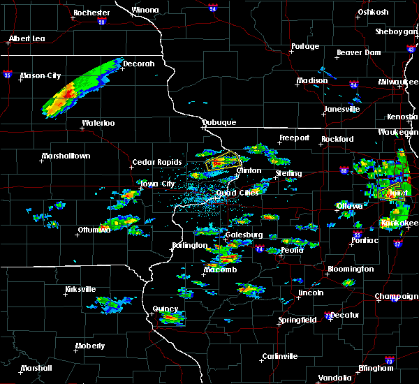 At 446 pm cdt, a severe thunderstorm was located near charlotte, or 10 miles east of maquoketa, moving northeast at 35 mph (radar indicated). Hazards include 60 mph wind gusts and quarter size hail. Hail damage to vehicles is expected. expect wind damage to roofs, siding, and trees. Locations impacted include, preston, delmar, miles, charlotte, andover, spragueville, green island, van buren, goose lake, bryant, teeds grove, reeceville and camp miss-elk-ton. At 446 pm cdt, a severe thunderstorm was located near charlotte, or 10 miles east of maquoketa, moving northeast at 35 mph (radar indicated). Hazards include 60 mph wind gusts and quarter size hail. Hail damage to vehicles is expected. expect wind damage to roofs, siding, and trees. Locations impacted include, preston, delmar, miles, charlotte, andover, spragueville, green island, van buren, goose lake, bryant, teeds grove, reeceville and camp miss-elk-ton.
|
| 5/2/2018 4:39 PM CDT |
 The national weather service in the quad cities has issued a * severe thunderstorm warning for. southeastern jackson county in east central iowa. northeastern clinton county in east central iowa. Until 530 pm cdt * at 439 pm cdt, a severe thunderstorm was located near delmar, or 8. The national weather service in the quad cities has issued a * severe thunderstorm warning for. southeastern jackson county in east central iowa. northeastern clinton county in east central iowa. Until 530 pm cdt * at 439 pm cdt, a severe thunderstorm was located near delmar, or 8.
|
| 9/20/2017 7:25 PM CDT |
 The severe thunderstorm warning for northern scott and central clinton counties will expire at 730 pm cdt, the storm which prompted the warning has weakened below severe limits, and no longer pose an immediate threat to life or property. therefore, the warning will be allowed to expire. however small hail ,heavy rain and frequent lightning are still possible with this thunderstorm. to report severe weather, contact your nearest law enforcement agency. they will relay your report to the national weather service the quad cities. The severe thunderstorm warning for northern scott and central clinton counties will expire at 730 pm cdt, the storm which prompted the warning has weakened below severe limits, and no longer pose an immediate threat to life or property. therefore, the warning will be allowed to expire. however small hail ,heavy rain and frequent lightning are still possible with this thunderstorm. to report severe weather, contact your nearest law enforcement agency. they will relay your report to the national weather service the quad cities.
|
| 9/20/2017 7:01 PM CDT |
 At 700 pm cdt, a severe thunderstorm was located near donahue, or 8 miles northeast of durant, moving east at 20 mph (radar indicated). Hazards include 60 mph wind gusts and quarter size hail. Hail damage to vehicles is expected. expect wind damage to roofs, siding, and trees. locations impacted include, eldridge, dewitt, walcott, long grove, grand mound, calamus, charlotte, donahue, mccausland, welton, dixon, maysville, malone, camp liberty, park view, sherman park, clinton county fairgrounds, scott county park and plainview. This includes interstate 80 in iowa between mile markers 280 and 284. At 700 pm cdt, a severe thunderstorm was located near donahue, or 8 miles northeast of durant, moving east at 20 mph (radar indicated). Hazards include 60 mph wind gusts and quarter size hail. Hail damage to vehicles is expected. expect wind damage to roofs, siding, and trees. locations impacted include, eldridge, dewitt, walcott, long grove, grand mound, calamus, charlotte, donahue, mccausland, welton, dixon, maysville, malone, camp liberty, park view, sherman park, clinton county fairgrounds, scott county park and plainview. This includes interstate 80 in iowa between mile markers 280 and 284.
|
| 9/20/2017 6:49 PM CDT |
 At 649 pm cdt, a severe thunderstorm was located near durant, moving northeast at 25 mph (radar indicated). Hazards include 60 mph wind gusts and quarter size hail. Hail damage to vehicles is expected. Expect wind damage to roofs, siding, and trees. At 649 pm cdt, a severe thunderstorm was located near durant, moving northeast at 25 mph (radar indicated). Hazards include 60 mph wind gusts and quarter size hail. Hail damage to vehicles is expected. Expect wind damage to roofs, siding, and trees.
|
| 8/10/2017 4:49 PM CDT |
 At 448 pm cdt, severe thunderstorms were located along a line extending from 6 miles southwest of andover to near low moor, moving southeast at 30 mph (radar indicated). Hazards include 60 mph wind gusts and quarter size hail. Hail damage to vehicles is expected. expect wind damage to roofs, siding, and trees. Locations impacted include, clinton, camanche, fulton, low moor, bulgers hollow, clinton municipal airport and elvira. At 448 pm cdt, severe thunderstorms were located along a line extending from 6 miles southwest of andover to near low moor, moving southeast at 30 mph (radar indicated). Hazards include 60 mph wind gusts and quarter size hail. Hail damage to vehicles is expected. expect wind damage to roofs, siding, and trees. Locations impacted include, clinton, camanche, fulton, low moor, bulgers hollow, clinton municipal airport and elvira.
|
| 8/10/2017 4:30 PM CDT |
 At 430 pm cdt, a severe thunderstorm was located over charlotte, or 11 miles southeast of maquoketa, moving east at 30 mph (radar indicated). Hazards include 60 mph wind gusts and quarter size hail. Hail damage to vehicles is expected. expect wind damage to roofs, siding, and trees. Locations impacted include, clinton, camanche, fulton, delmar, charlotte, low moor, welton, andover, goose lake, bryant, bulgers hollow, teeds grove, elvira, camp miss-elk-ton and clinton municipal airport. At 430 pm cdt, a severe thunderstorm was located over charlotte, or 11 miles southeast of maquoketa, moving east at 30 mph (radar indicated). Hazards include 60 mph wind gusts and quarter size hail. Hail damage to vehicles is expected. expect wind damage to roofs, siding, and trees. Locations impacted include, clinton, camanche, fulton, delmar, charlotte, low moor, welton, andover, goose lake, bryant, bulgers hollow, teeds grove, elvira, camp miss-elk-ton and clinton municipal airport.
|
| 8/10/2017 4:21 PM CDT |
 At 421 pm cdt, a severe thunderstorm was located over delmar, or 7 miles southeast of maquoketa, moving east at 35 mph (radar indicated). Hazards include 60 mph wind gusts and quarter size hail. Hail damage to vehicles is expected. Expect wind damage to roofs, siding, and trees. At 421 pm cdt, a severe thunderstorm was located over delmar, or 7 miles southeast of maquoketa, moving east at 35 mph (radar indicated). Hazards include 60 mph wind gusts and quarter size hail. Hail damage to vehicles is expected. Expect wind damage to roofs, siding, and trees.
|
| 7/22/2017 12:12 AM CDT |
 The severe thunderstorm warning for jo daviess, carroll, southwestern stephenson, jackson, northeastern buchanan, dubuque, northern jones, delaware and northern clinton counties will expire at 1215 am cdt, the storms which prompted the warning have weakened below severe limits, and no longer pose an immediate threat to life or property. therefore, the warning will be allowed to expire. however gusty winds over 40 mph and heavy rain are still possible with these thunderstorms. a severe thunderstorm watch remains in effect until 200 am cdt for northwestern illinois, and northeastern and east central iowa. The severe thunderstorm warning for jo daviess, carroll, southwestern stephenson, jackson, northeastern buchanan, dubuque, northern jones, delaware and northern clinton counties will expire at 1215 am cdt, the storms which prompted the warning have weakened below severe limits, and no longer pose an immediate threat to life or property. therefore, the warning will be allowed to expire. however gusty winds over 40 mph and heavy rain are still possible with these thunderstorms. a severe thunderstorm watch remains in effect until 200 am cdt for northwestern illinois, and northeastern and east central iowa.
|
| 7/22/2017 12:03 AM CDT |
 At 1201 am cdt, severe thunderstorms were located along a line extending from near elizabeth to near prairieburg, moving southeast at 40 mph (law enforcement in dubuque county reports trees are down and power lines also down from this storm). Hazards include 70 mph wind gusts and penny size hail. Expect considerable tree damage. damage is likely to mobile homes, roofs, and outbuildings. locations impacted include, dubuque, maquoketa, manchester, galena, mount carroll, asbury, dyersville, monticello, savanna, bellevue, cascade, stockton, epworth, east dubuque, farley, lanark, peosta, milledgeville, preston and fairhaven. If you are at monticello fairgrounds you should seek safe shelter immediately!. At 1201 am cdt, severe thunderstorms were located along a line extending from near elizabeth to near prairieburg, moving southeast at 40 mph (law enforcement in dubuque county reports trees are down and power lines also down from this storm). Hazards include 70 mph wind gusts and penny size hail. Expect considerable tree damage. damage is likely to mobile homes, roofs, and outbuildings. locations impacted include, dubuque, maquoketa, manchester, galena, mount carroll, asbury, dyersville, monticello, savanna, bellevue, cascade, stockton, epworth, east dubuque, farley, lanark, peosta, milledgeville, preston and fairhaven. If you are at monticello fairgrounds you should seek safe shelter immediately!.
|
| 7/21/2017 11:53 PM CDT |
 At 1153 pm cdt, severe thunderstorms were located roughly along a line extending from near schapville to near ryan, moving southeast at 40 mph (radar indicated). Hazards include 70 mph wind gusts and penny size hail. Expect considerable tree damage. damage is likely to mobile homes, roofs, and outbuildings. locations impacted include, dubuque, maquoketa, manchester, galena, mount carroll, asbury, dyersville, monticello, savanna, bellevue, cascade, stockton, epworth, east dubuque, farley, lanark, peosta, milledgeville, preston and fairhaven. If you are at monticello fairgrounds you should seek safe shelter immediately!. At 1153 pm cdt, severe thunderstorms were located roughly along a line extending from near schapville to near ryan, moving southeast at 40 mph (radar indicated). Hazards include 70 mph wind gusts and penny size hail. Expect considerable tree damage. damage is likely to mobile homes, roofs, and outbuildings. locations impacted include, dubuque, maquoketa, manchester, galena, mount carroll, asbury, dyersville, monticello, savanna, bellevue, cascade, stockton, epworth, east dubuque, farley, lanark, peosta, milledgeville, preston and fairhaven. If you are at monticello fairgrounds you should seek safe shelter immediately!.
|
| 7/21/2017 11:36 PM CDT |
 At 1136 pm cdt, severe thunderstorms were located along a line extending from near council hill to near masonville, moving southeast at 40 mph (radar indicated). Hazards include 70 mph wind gusts and penny size hail. Expect considerable tree damage. damage is likely to mobile homes, roofs, and outbuildings. locations impacted include, dubuque, maquoketa, manchester, galena, mount carroll, asbury, dyersville, monticello, savanna, bellevue, cascade, stockton, epworth, east dubuque, farley, lanark, peosta, milledgeville, preston and fairhaven. If you are at monticello fairgrounds you should seek safe shelter immediately!. At 1136 pm cdt, severe thunderstorms were located along a line extending from near council hill to near masonville, moving southeast at 40 mph (radar indicated). Hazards include 70 mph wind gusts and penny size hail. Expect considerable tree damage. damage is likely to mobile homes, roofs, and outbuildings. locations impacted include, dubuque, maquoketa, manchester, galena, mount carroll, asbury, dyersville, monticello, savanna, bellevue, cascade, stockton, epworth, east dubuque, farley, lanark, peosta, milledgeville, preston and fairhaven. If you are at monticello fairgrounds you should seek safe shelter immediately!.
|
| 7/21/2017 11:22 PM CDT |
 At 1121 pm cdt, severe thunderstorms were located along a line extending from near menominee to winthrop, moving southeast at 40 mph (radar indicated). Hazards include 70 mph wind gusts and penny size hail. Expect considerable tree damage. damage is likely to mobile homes, roofs, and outbuildings. locations impacted include, dubuque, maquoketa, manchester, galena, mount carroll, asbury, dyersville, monticello, savanna, bellevue, cascade, stockton, epworth, east dubuque, farley, lanark, peosta, milledgeville, preston and fairhaven. If you are at monticello fairgrounds you should seek safe shelter immediately!. At 1121 pm cdt, severe thunderstorms were located along a line extending from near menominee to winthrop, moving southeast at 40 mph (radar indicated). Hazards include 70 mph wind gusts and penny size hail. Expect considerable tree damage. damage is likely to mobile homes, roofs, and outbuildings. locations impacted include, dubuque, maquoketa, manchester, galena, mount carroll, asbury, dyersville, monticello, savanna, bellevue, cascade, stockton, epworth, east dubuque, farley, lanark, peosta, milledgeville, preston and fairhaven. If you are at monticello fairgrounds you should seek safe shelter immediately!.
|
| 7/21/2017 11:10 PM CDT |
 At 1109 pm cdt, severe thunderstorms were located along a line extending from near sageville to 6 miles south of stanley, moving southeast at 40 mph (radar indicated). Hazards include 60 mph wind gusts and penny size hail. expect damage to roofs, siding, and trees At 1109 pm cdt, severe thunderstorms were located along a line extending from near sageville to 6 miles south of stanley, moving southeast at 40 mph (radar indicated). Hazards include 60 mph wind gusts and penny size hail. expect damage to roofs, siding, and trees
|
| 7/21/2017 11:10 PM CDT |
 The national weather service in the quad cities has issued a * severe thunderstorm warning for. jo daviess county in northwestern illinois. carroll county in northwestern illinois. southwestern stephenson county in northwestern illinois. Jackson county in east central iowa. The national weather service in the quad cities has issued a * severe thunderstorm warning for. jo daviess county in northwestern illinois. carroll county in northwestern illinois. southwestern stephenson county in northwestern illinois. Jackson county in east central iowa.
|
| 7/12/2017 8:42 PM CDT |
 The severe thunderstorm warning for southeastern jackson and clinton counties will expire at 845 pm cdt, the storm which prompted the warning has weakened below severe limits, and no longer pose an immediate threat to life or property. therefore, the warning will be allowed to expire. however gusty winds and heavy rain are still possible with this thunderstorm. to report severe weather, contact your nearest law enforcement agency. they will relay your report to the national weather service the quad cities. The severe thunderstorm warning for southeastern jackson and clinton counties will expire at 845 pm cdt, the storm which prompted the warning has weakened below severe limits, and no longer pose an immediate threat to life or property. therefore, the warning will be allowed to expire. however gusty winds and heavy rain are still possible with this thunderstorm. to report severe weather, contact your nearest law enforcement agency. they will relay your report to the national weather service the quad cities.
|
| 7/12/2017 8:37 PM CDT |
 At 836 pm cdt, a severe thunderstorm was located near charlotte, or 8 miles northwest of clinton, moving east at 45 mph (radar indicated). Hazards include 60 mph wind gusts. Expect damage to roofs, siding, and trees. locations impacted include, clinton, maquoketa, dewitt, camanche, fulton, preston, grand mound, sabula, delmar, lost nation, miles, calamus, charlotte, mccausland, low moor, welton, andover, spragueville, green island and van buren. If you are at clinton county fairgrounds you should seek safe shelter immediately!. At 836 pm cdt, a severe thunderstorm was located near charlotte, or 8 miles northwest of clinton, moving east at 45 mph (radar indicated). Hazards include 60 mph wind gusts. Expect damage to roofs, siding, and trees. locations impacted include, clinton, maquoketa, dewitt, camanche, fulton, preston, grand mound, sabula, delmar, lost nation, miles, calamus, charlotte, mccausland, low moor, welton, andover, spragueville, green island and van buren. If you are at clinton county fairgrounds you should seek safe shelter immediately!.
|
| 7/12/2017 8:27 PM CDT |
 At 827 pm cdt, a severe thunderstorm was located over charlotte, or 12 miles southeast of maquoketa, moving east at 50 mph (radar indicated). Hazards include 60 mph wind gusts. Expect damage to roofs, siding, and trees. locations impacted include, clinton, maquoketa, dewitt, camanche, fulton, preston, lowden, grand mound, sabula, delmar, oxford junction, lost nation, miles, calamus, andrew, charlotte, mccausland, low moor, welton and springbrook. If you are at clinton county fairgrounds you should seek safe shelter immediately!. At 827 pm cdt, a severe thunderstorm was located over charlotte, or 12 miles southeast of maquoketa, moving east at 50 mph (radar indicated). Hazards include 60 mph wind gusts. Expect damage to roofs, siding, and trees. locations impacted include, clinton, maquoketa, dewitt, camanche, fulton, preston, lowden, grand mound, sabula, delmar, oxford junction, lost nation, miles, calamus, andrew, charlotte, mccausland, low moor, welton and springbrook. If you are at clinton county fairgrounds you should seek safe shelter immediately!.
|
| 7/12/2017 8:20 PM CDT |
 At 820 pm cdt, a severe thunderstorm was located over welton, or 12 miles south of maquoketa, moving east at 40 mph (radar indicated). Hazards include 60 mph wind gusts. Expect damage to roofs, siding, and trees. locations impacted include, clinton, maquoketa, dewitt, camanche, fulton, preston, lowden, wheatland, grand mound, sabula, delmar, oxford junction, lost nation, miles, calamus, andrew, charlotte, mccausland, low moor and welton. If you are at clinton county fairgrounds you should seek safe shelter immediately!. At 820 pm cdt, a severe thunderstorm was located over welton, or 12 miles south of maquoketa, moving east at 40 mph (radar indicated). Hazards include 60 mph wind gusts. Expect damage to roofs, siding, and trees. locations impacted include, clinton, maquoketa, dewitt, camanche, fulton, preston, lowden, wheatland, grand mound, sabula, delmar, oxford junction, lost nation, miles, calamus, andrew, charlotte, mccausland, low moor and welton. If you are at clinton county fairgrounds you should seek safe shelter immediately!.
|
| 7/12/2017 8:06 PM CDT |
 At 806 pm cdt, a severe thunderstorm was located near calamus, or 12 miles south of maquoketa, moving east at 55 mph (law enforcement). Hazards include 60 mph wind gusts. expect damage to roofs, siding, and trees At 806 pm cdt, a severe thunderstorm was located near calamus, or 12 miles south of maquoketa, moving east at 55 mph (law enforcement). Hazards include 60 mph wind gusts. expect damage to roofs, siding, and trees
|
| 5/17/2017 8:22 PM CDT |
 The tornado warning for eastern clinton county will expire at 830 pm cdt, the tornadic thunderstorm which prompted the warning has weakened. moved out of the warned area. therefore, the warning will be allowed to expire. however gusty winds and heavy rain are still possible with this thunderstorm. a tornado watch remains in effect until 1100 pm cdt for northwestern illinois, and east central iowa. remember, a severe thunderstorm warning still remains in effect for clinton county. The tornado warning for eastern clinton county will expire at 830 pm cdt, the tornadic thunderstorm which prompted the warning has weakened. moved out of the warned area. therefore, the warning will be allowed to expire. however gusty winds and heavy rain are still possible with this thunderstorm. a tornado watch remains in effect until 1100 pm cdt for northwestern illinois, and east central iowa. remember, a severe thunderstorm warning still remains in effect for clinton county.
|
| 5/17/2017 8:20 PM CDT |
 At 820 pm cdt, severe thunderstorms were located along a line extending from near darlington to warren to near massbach to near low moor, moving northeast at 75 mph (trained weather spotters). Hazards include 70 mph wind gusts. Expect considerable tree damage. damage is likely to mobile homes, roofs, and outbuildings. locations impacted include, clinton, freeport, sterling, rock falls, morrison, mount carroll, dewitt, camanche, fulton, savanna, lena, bellevue, stockton, lanark, warren, garden plain, milledgeville, preston, fairhaven and albany. A tornado watch remains in effect until 1100 pm cdt for northwestern illinois, and east central iowa. At 820 pm cdt, severe thunderstorms were located along a line extending from near darlington to warren to near massbach to near low moor, moving northeast at 75 mph (trained weather spotters). Hazards include 70 mph wind gusts. Expect considerable tree damage. damage is likely to mobile homes, roofs, and outbuildings. locations impacted include, clinton, freeport, sterling, rock falls, morrison, mount carroll, dewitt, camanche, fulton, savanna, lena, bellevue, stockton, lanark, warren, garden plain, milledgeville, preston, fairhaven and albany. A tornado watch remains in effect until 1100 pm cdt for northwestern illinois, and east central iowa.
|
| 5/17/2017 8:16 PM CDT |
 At 815 pm cdt, severe thunderstorms were located along a line extending from near belmont to near schapville to near massbach to near low moor, moving northeast at 80 mph (trained weather spotters). Hazards include 70 mph wind gusts. Expect considerable tree damage. damage is likely to mobile homes, roofs, and outbuildings. locations impacted include, clinton, freeport, sterling, rock falls, morrison, galena, mount carroll, dewitt, camanche, fulton, savanna, lena, bellevue, stockton, lanark, warren, garden plain, milledgeville, preston and fairhaven. A tornado watch remains in effect until 1100 pm cdt for northwestern illinois, and east central iowa. At 815 pm cdt, severe thunderstorms were located along a line extending from near belmont to near schapville to near massbach to near low moor, moving northeast at 80 mph (trained weather spotters). Hazards include 70 mph wind gusts. Expect considerable tree damage. damage is likely to mobile homes, roofs, and outbuildings. locations impacted include, clinton, freeport, sterling, rock falls, morrison, galena, mount carroll, dewitt, camanche, fulton, savanna, lena, bellevue, stockton, lanark, warren, garden plain, milledgeville, preston and fairhaven. A tornado watch remains in effect until 1100 pm cdt for northwestern illinois, and east central iowa.
|
| 5/17/2017 8:08 PM CDT |
 At 808 pm cdt, a severe thunderstorm capable of producing a tornado was located near charlotte, or 10 miles west of clinton, moving northeast at 50 mph (radar indicated rotation). Hazards include tornado. Flying debris will be dangerous to those caught without shelter. mobile homes will be damaged or destroyed. damage to roofs, windows, and vehicles will occur. tree damage is likely. this dangerous storm will be near, andover around 820 pm cdt. Other locations impacted by this tornadic thunderstorm include bryant, malone, bulgers hollow, camp miss-elk-ton, clinton municipal airport, teeds grove, goose lake, clinton county fairgrounds and elvira. At 808 pm cdt, a severe thunderstorm capable of producing a tornado was located near charlotte, or 10 miles west of clinton, moving northeast at 50 mph (radar indicated rotation). Hazards include tornado. Flying debris will be dangerous to those caught without shelter. mobile homes will be damaged or destroyed. damage to roofs, windows, and vehicles will occur. tree damage is likely. this dangerous storm will be near, andover around 820 pm cdt. Other locations impacted by this tornadic thunderstorm include bryant, malone, bulgers hollow, camp miss-elk-ton, clinton municipal airport, teeds grove, goose lake, clinton county fairgrounds and elvira.
|
| 5/17/2017 8:05 PM CDT |
 At 804 pm cdt, severe thunderstorms were located along a line extending from cuba city to hanover to green island to near mccausland, moving northeast at 65 mph (trained weather spotters). Hazards include 70 mph wind gusts. Expect considerable tree damage. Damage is likely to mobile homes, roofs, and outbuildings. At 804 pm cdt, severe thunderstorms were located along a line extending from cuba city to hanover to green island to near mccausland, moving northeast at 65 mph (trained weather spotters). Hazards include 70 mph wind gusts. Expect considerable tree damage. Damage is likely to mobile homes, roofs, and outbuildings.
|
| 5/17/2017 8:00 PM CDT |
 A severe thunderstorm warning remains in effect until 815 pm cdt for rock island. northwestern mercer. jo daviess. western carroll. jackson. scott. southeastern dubuque. eastern muscatine and clinton counties. At 800 pm cdt, severe thunderstorms were located along a line extending from near hazel green to near bellevue to near dewitt to. A severe thunderstorm warning remains in effect until 815 pm cdt for rock island. northwestern mercer. jo daviess. western carroll. jackson. scott. southeastern dubuque. eastern muscatine and clinton counties. At 800 pm cdt, severe thunderstorms were located along a line extending from near hazel green to near bellevue to near dewitt to.
|
| 5/17/2017 8:00 PM CDT |
 At 800 pm cdt, severe thunderstorms were located along a line extending from near hazel green to near bellevue to near dewitt to andalusia, moving northeast at 70 mph (trained weather spotters). Hazards include 70 mph wind gusts and quarter size hail. Hail damage to vehicles is expected. expect considerable tree damage. wind damage is also likely to mobile homes, roofs, and outbuildings. locations impacted include, davenport, dubuque, moline, rock island, bettendorf, clinton, muscatine, east moline, maquoketa, galena, durant, silvis, eldridge, dewitt, milan, camanche, le claire, coal valley, savanna and bellevue. this includes the following highways, interstate 74 in iowa between mile markers 1 and 5. interstate 80 in iowa between mile markers 279 and 306. interstate 80 in illinois between mile markers 1 and 4. interstate 74 in illinois between mile markers 1 and 7. interstate 88 between mile markers 1 and 4. interstate 280 between mile markers 1 and 18. A tornado watch remains in effect until 1100 pm cdt for northwestern illinois, and southeastern, northeastern and east central iowa. At 800 pm cdt, severe thunderstorms were located along a line extending from near hazel green to near bellevue to near dewitt to andalusia, moving northeast at 70 mph (trained weather spotters). Hazards include 70 mph wind gusts and quarter size hail. Hail damage to vehicles is expected. expect considerable tree damage. wind damage is also likely to mobile homes, roofs, and outbuildings. locations impacted include, davenport, dubuque, moline, rock island, bettendorf, clinton, muscatine, east moline, maquoketa, galena, durant, silvis, eldridge, dewitt, milan, camanche, le claire, coal valley, savanna and bellevue. this includes the following highways, interstate 74 in iowa between mile markers 1 and 5. interstate 80 in iowa between mile markers 279 and 306. interstate 80 in illinois between mile markers 1 and 4. interstate 74 in illinois between mile markers 1 and 7. interstate 88 between mile markers 1 and 4. interstate 280 between mile markers 1 and 18. A tornado watch remains in effect until 1100 pm cdt for northwestern illinois, and southeastern, northeastern and east central iowa.
|
| 5/17/2017 7:55 PM CDT |
 At 755 pm cdt, severe thunderstorms were located along a line extending from near east dubuque to near springbrook to near dewitt to near illinois city, moving northeast at 40 mph (trained weather spotters). Hazards include 70 mph wind gusts and quarter size hail. Hail damage to vehicles is expected. expect considerable tree damage. wind damage is also likely to mobile homes, roofs, and outbuildings. locations impacted include, davenport, dubuque, moline, rock island, bettendorf, clinton, muscatine, east moline, maquoketa, galena, durant, silvis, eldridge, dewitt, milan, camanche, asbury, le claire, coal valley and savanna. this includes the following highways, interstate 74 in iowa between mile markers 1 and 5. interstate 80 in iowa between mile markers 271 and 306. interstate 80 in illinois between mile markers 1 and 4. interstate 74 in illinois between mile markers 1 and 8. interstate 88 between mile markers 1 and 4. interstate 280 between mile markers 1 and 18. A tornado watch remains in effect until 1100 pm cdt for northwestern illinois, and southeastern, northeastern and east central iowa. At 755 pm cdt, severe thunderstorms were located along a line extending from near east dubuque to near springbrook to near dewitt to near illinois city, moving northeast at 40 mph (trained weather spotters). Hazards include 70 mph wind gusts and quarter size hail. Hail damage to vehicles is expected. expect considerable tree damage. wind damage is also likely to mobile homes, roofs, and outbuildings. locations impacted include, davenport, dubuque, moline, rock island, bettendorf, clinton, muscatine, east moline, maquoketa, galena, durant, silvis, eldridge, dewitt, milan, camanche, asbury, le claire, coal valley and savanna. this includes the following highways, interstate 74 in iowa between mile markers 1 and 5. interstate 80 in iowa between mile markers 271 and 306. interstate 80 in illinois between mile markers 1 and 4. interstate 74 in illinois between mile markers 1 and 8. interstate 88 between mile markers 1 and 4. interstate 280 between mile markers 1 and 18. A tornado watch remains in effect until 1100 pm cdt for northwestern illinois, and southeastern, northeastern and east central iowa.
|
| 5/17/2017 7:54 PM CDT |
 At 753 pm cdt, a severe thunderstorm capable of producing a tornado was located near long grove, or 13 miles north of davenport, moving northeast at 50 mph. there is another possible tornado near grand mound (radar indicated rotation). Hazards include tornado. Flying debris will be dangerous to those caught without shelter. mobile homes will be damaged or destroyed. damage to roofs, windows, and vehicles will occur. tree damage is likely. this dangerous storm will be near, mccausland around 800 pm cdt. camanche and low moor around 810 pm cdt. andover around 820 pm cdt. clinton around 825 pm cdt. Other locations impacted by this tornadic thunderstorm include bryant, malone, bulgers hollow, park view, camp miss-elk-ton, clinton municipal airport, teeds grove, goose lake, clinton county fairgrounds and scott county park. At 753 pm cdt, a severe thunderstorm capable of producing a tornado was located near long grove, or 13 miles north of davenport, moving northeast at 50 mph. there is another possible tornado near grand mound (radar indicated rotation). Hazards include tornado. Flying debris will be dangerous to those caught without shelter. mobile homes will be damaged or destroyed. damage to roofs, windows, and vehicles will occur. tree damage is likely. this dangerous storm will be near, mccausland around 800 pm cdt. camanche and low moor around 810 pm cdt. andover around 820 pm cdt. clinton around 825 pm cdt. Other locations impacted by this tornadic thunderstorm include bryant, malone, bulgers hollow, park view, camp miss-elk-ton, clinton municipal airport, teeds grove, goose lake, clinton county fairgrounds and scott county park.
|
| 5/17/2017 7:49 PM CDT |
 At 748 pm cdt, severe thunderstorms were located along a line extending from near peosta to near andrew to delmar to near illinois city, moving northeast at 45 mph (trained weather spotters). Hazards include 70 mph wind gusts and half dollar size hail. Hail damage to vehicles is expected. expect considerable tree damage. wind damage is also likely to mobile homes, roofs, and outbuildings. locations impacted include, davenport, dubuque, moline, rock island, bettendorf, clinton, muscatine, east moline, maquoketa, galena, durant, silvis, eldridge, dewitt, milan, camanche, asbury, le claire, coal valley and savanna. this includes the following highways, interstate 74 in iowa between mile markers 1 and 5. interstate 80 in iowa between mile markers 271 and 306. interstate 80 in illinois between mile markers 1 and 4. interstate 74 in illinois between mile markers 1 and 8. interstate 88 between mile markers 1 and 4. interstate 280 between mile markers 1 and 18. A tornado watch remains in effect until 1100 pm cdt for northwestern illinois, and southeastern, northeastern and east central iowa. At 748 pm cdt, severe thunderstorms were located along a line extending from near peosta to near andrew to delmar to near illinois city, moving northeast at 45 mph (trained weather spotters). Hazards include 70 mph wind gusts and half dollar size hail. Hail damage to vehicles is expected. expect considerable tree damage. wind damage is also likely to mobile homes, roofs, and outbuildings. locations impacted include, davenport, dubuque, moline, rock island, bettendorf, clinton, muscatine, east moline, maquoketa, galena, durant, silvis, eldridge, dewitt, milan, camanche, asbury, le claire, coal valley and savanna. this includes the following highways, interstate 74 in iowa between mile markers 1 and 5. interstate 80 in iowa between mile markers 271 and 306. interstate 80 in illinois between mile markers 1 and 4. interstate 74 in illinois between mile markers 1 and 8. interstate 88 between mile markers 1 and 4. interstate 280 between mile markers 1 and 18. A tornado watch remains in effect until 1100 pm cdt for northwestern illinois, and southeastern, northeastern and east central iowa.
|
| 5/17/2017 7:44 PM CDT |
 At 744 pm cdt, a severe thunderstorm capable of producing a tornado was located over donahue, or 11 miles northwest of davenport, moving northeast at 55 mph (radar indicated rotation). Hazards include tornado. Flying debris will be dangerous to those caught without shelter. mobile homes will be damaged or destroyed. damage to roofs, windows, and vehicles will occur. tree damage is likely. this dangerous storm will be near, long grove around 750 pm cdt. grand mound around 755 pm cdt. dewitt and mccausland around 800 pm cdt. camanche and low moor around 805 pm cdt. charlotte around 810 pm cdt. clinton and andover around 820 pm cdt. other locations impacted by this tornadic thunderstorm include bryant, malone, maysville, bulgers hollow, camp liberty, park view, teeds grove, goose lake, elvira and camp miss-elk-ton. This includes interstate 80 in iowa between mile markers 286 and 289. At 744 pm cdt, a severe thunderstorm capable of producing a tornado was located over donahue, or 11 miles northwest of davenport, moving northeast at 55 mph (radar indicated rotation). Hazards include tornado. Flying debris will be dangerous to those caught without shelter. mobile homes will be damaged or destroyed. damage to roofs, windows, and vehicles will occur. tree damage is likely. this dangerous storm will be near, long grove around 750 pm cdt. grand mound around 755 pm cdt. dewitt and mccausland around 800 pm cdt. camanche and low moor around 805 pm cdt. charlotte around 810 pm cdt. clinton and andover around 820 pm cdt. other locations impacted by this tornadic thunderstorm include bryant, malone, maysville, bulgers hollow, camp liberty, park view, teeds grove, goose lake, elvira and camp miss-elk-ton. This includes interstate 80 in iowa between mile markers 286 and 289.
|
| 5/17/2017 7:42 PM CDT |
 At 741 pm cdt, severe thunderstorms were located along a line extending from near epworth to near fulton to near welton to near eliza, moving east at 30 mph (trained weather spotters). Hazards include 70 mph wind gusts and quarter size hail. Hail damage to vehicles is expected. expect considerable tree damage. wind damage is also likely to mobile homes, roofs, and outbuildings. locations impacted include, davenport, dubuque, moline, rock island, bettendorf, clinton, muscatine, east moline, maquoketa, galena, durant, silvis, eldridge, dewitt, milan, camanche, asbury, le claire, coal valley and savanna. this includes the following highways, interstate 74 in iowa between mile markers 1 and 5. interstate 80 in iowa between mile markers 271 and 306. interstate 80 in illinois between mile markers 1 and 4. interstate 74 in illinois between mile markers 1 and 8. interstate 88 between mile markers 1 and 4. interstate 280 between mile markers 1 and 18. A tornado watch remains in effect until 1100 pm cdt for northwestern illinois, and southeastern, northeastern and east central iowa. At 741 pm cdt, severe thunderstorms were located along a line extending from near epworth to near fulton to near welton to near eliza, moving east at 30 mph (trained weather spotters). Hazards include 70 mph wind gusts and quarter size hail. Hail damage to vehicles is expected. expect considerable tree damage. wind damage is also likely to mobile homes, roofs, and outbuildings. locations impacted include, davenport, dubuque, moline, rock island, bettendorf, clinton, muscatine, east moline, maquoketa, galena, durant, silvis, eldridge, dewitt, milan, camanche, asbury, le claire, coal valley and savanna. this includes the following highways, interstate 74 in iowa between mile markers 1 and 5. interstate 80 in iowa between mile markers 271 and 306. interstate 80 in illinois between mile markers 1 and 4. interstate 74 in illinois between mile markers 1 and 8. interstate 88 between mile markers 1 and 4. interstate 280 between mile markers 1 and 18. A tornado watch remains in effect until 1100 pm cdt for northwestern illinois, and southeastern, northeastern and east central iowa.
|
| 5/17/2017 7:39 PM CDT |
 At 738 pm cdt, severe thunderstorms were located along a line extending from near fennimore to near galena to near calamus to eliza, moving northeast at 40 mph (trained weather spotters). Hazards include 70 mph wind gusts and quarter size hail. Hail damage to vehicles is expected. expect considerable tree damage. wind damage is also likely to mobile homes, roofs, and outbuildings. locations impacted include, davenport, dubuque, moline, rock island, bettendorf, clinton, muscatine, east moline, maquoketa, galena, durant, silvis, eldridge, dewitt, milan, camanche, asbury, le claire, coal valley and savanna. this includes the following highways, interstate 74 in iowa between mile markers 1 and 5. interstate 80 in iowa between mile markers 271 and 306. interstate 80 in illinois between mile markers 1 and 4. interstate 74 in illinois between mile markers 1 and 8. interstate 88 between mile markers 1 and 4. interstate 280 between mile markers 1 and 18. A tornado watch remains in effect until 1100 pm cdt for northwestern illinois, and southeastern, northeastern and east central iowa. At 738 pm cdt, severe thunderstorms were located along a line extending from near fennimore to near galena to near calamus to eliza, moving northeast at 40 mph (trained weather spotters). Hazards include 70 mph wind gusts and quarter size hail. Hail damage to vehicles is expected. expect considerable tree damage. wind damage is also likely to mobile homes, roofs, and outbuildings. locations impacted include, davenport, dubuque, moline, rock island, bettendorf, clinton, muscatine, east moline, maquoketa, galena, durant, silvis, eldridge, dewitt, milan, camanche, asbury, le claire, coal valley and savanna. this includes the following highways, interstate 74 in iowa between mile markers 1 and 5. interstate 80 in iowa between mile markers 271 and 306. interstate 80 in illinois between mile markers 1 and 4. interstate 74 in illinois between mile markers 1 and 8. interstate 88 between mile markers 1 and 4. interstate 280 between mile markers 1 and 18. A tornado watch remains in effect until 1100 pm cdt for northwestern illinois, and southeastern, northeastern and east central iowa.
|
| 5/17/2017 7:31 PM CDT |
 At 730 pm cdt, severe thunderstorms were located along a line extending from near fennimore to east dubuque to near nashville to near muscatine, moving east at 35 mph (trained weather spotters). Hazards include 70 mph wind gusts and quarter size hail. Hail damage to vehicles is expected. expect considerable tree damage. wind damage is also likely to mobile homes, roofs, and outbuildings. locations impacted include, davenport, dubuque, moline, rock island, bettendorf, clinton, muscatine, east moline, maquoketa, galena, durant, silvis, eldridge, dewitt, milan, camanche, asbury, le claire, coal valley and savanna. this includes the following highways, interstate 74 in iowa between mile markers 1 and 5. interstate 80 in iowa between mile markers 270 and 306. interstate 80 in illinois between mile markers 1 and 5. interstate 74 in illinois between mile markers 1 and 8. interstate 88 between mile markers 1 and 4. interstate 280 between mile markers 1 and 18. A tornado watch remains in effect until 1100 pm cdt for northwestern illinois, and southeastern, northeastern and east central iowa. At 730 pm cdt, severe thunderstorms were located along a line extending from near fennimore to east dubuque to near nashville to near muscatine, moving east at 35 mph (trained weather spotters). Hazards include 70 mph wind gusts and quarter size hail. Hail damage to vehicles is expected. expect considerable tree damage. wind damage is also likely to mobile homes, roofs, and outbuildings. locations impacted include, davenport, dubuque, moline, rock island, bettendorf, clinton, muscatine, east moline, maquoketa, galena, durant, silvis, eldridge, dewitt, milan, camanche, asbury, le claire, coal valley and savanna. this includes the following highways, interstate 74 in iowa between mile markers 1 and 5. interstate 80 in iowa between mile markers 270 and 306. interstate 80 in illinois between mile markers 1 and 5. interstate 74 in illinois between mile markers 1 and 8. interstate 88 between mile markers 1 and 4. interstate 280 between mile markers 1 and 18. A tornado watch remains in effect until 1100 pm cdt for northwestern illinois, and southeastern, northeastern and east central iowa.
|
| 5/17/2017 7:22 PM CDT |
 At 721 pm cdt, severe thunderstorms were located along a line extending from near farmersburg to 6 miles north of cassville to asbury to fruitland, moving northeast at 45 mph (radar indicated). Hazards include 70 mph wind gusts and quarter size hail. Hail damage to vehicles is expected. expect considerable tree damage. wind damage is also likely to mobile homes, roofs, and outbuildings. locations impacted include, davenport, dubuque, moline, rock island, bettendorf, clinton, muscatine, east moline, maquoketa, galena, durant, silvis, eldridge, dewitt, milan, camanche, asbury, le claire, coal valley and savanna. this includes the following highways, interstate 74 in iowa between mile markers 1 and 5. interstate 80 in iowa between mile markers 270 and 306. interstate 80 in illinois between mile markers 1 and 5. interstate 74 in illinois between mile markers 1 and 8. interstate 88 between mile markers 1 and 4. interstate 280 between mile markers 1 and 18. A tornado watch remains in effect until 1100 pm cdt for northwestern illinois, and southeastern, northeastern and east central iowa. At 721 pm cdt, severe thunderstorms were located along a line extending from near farmersburg to 6 miles north of cassville to asbury to fruitland, moving northeast at 45 mph (radar indicated). Hazards include 70 mph wind gusts and quarter size hail. Hail damage to vehicles is expected. expect considerable tree damage. wind damage is also likely to mobile homes, roofs, and outbuildings. locations impacted include, davenport, dubuque, moline, rock island, bettendorf, clinton, muscatine, east moline, maquoketa, galena, durant, silvis, eldridge, dewitt, milan, camanche, asbury, le claire, coal valley and savanna. this includes the following highways, interstate 74 in iowa between mile markers 1 and 5. interstate 80 in iowa between mile markers 270 and 306. interstate 80 in illinois between mile markers 1 and 5. interstate 74 in illinois between mile markers 1 and 8. interstate 88 between mile markers 1 and 4. interstate 280 between mile markers 1 and 18. A tornado watch remains in effect until 1100 pm cdt for northwestern illinois, and southeastern, northeastern and east central iowa.
|
| 5/17/2017 7:14 PM CDT |
 At 713 pm cdt, severe thunderstorms were located along a line extending from near elkader to near cassville to peosta to grandview, moving northeast at 45 mph (radar indicated). Hazards include 70 mph wind gusts and half dollar size hail. Hail damage to vehicles is expected. expect considerable tree damage. Wind damage is also likely to mobile homes, roofs, and outbuildings. At 713 pm cdt, severe thunderstorms were located along a line extending from near elkader to near cassville to peosta to grandview, moving northeast at 45 mph (radar indicated). Hazards include 70 mph wind gusts and half dollar size hail. Hail damage to vehicles is expected. expect considerable tree damage. Wind damage is also likely to mobile homes, roofs, and outbuildings.
|
| 4/15/2017 9:17 PM CDT |
 At 917 pm cdt, a severe thunderstorm was located over nashville, or 7 miles west of maquoketa, moving east at 60 mph (radar indicated). Hazards include 60 mph wind gusts. Expect damage to roofs, siding, and trees. Locations impacted include, maquoketa, bellevue, preston, olin, sabula, delmar, wyoming, oxford junction, lost nation, miles, andrew, charlotte, onslow, monmouth, springbrook, center junction, andover, spragueville, fulton and hurstville. At 917 pm cdt, a severe thunderstorm was located over nashville, or 7 miles west of maquoketa, moving east at 60 mph (radar indicated). Hazards include 60 mph wind gusts. Expect damage to roofs, siding, and trees. Locations impacted include, maquoketa, bellevue, preston, olin, sabula, delmar, wyoming, oxford junction, lost nation, miles, andrew, charlotte, onslow, monmouth, springbrook, center junction, andover, spragueville, fulton and hurstville.
|
| 4/15/2017 9:10 PM CDT |
 At 909 pm cdt, a severe thunderstorm was located over monmouth, or 12 miles west of maquoketa, moving east at 50 mph (radar indicated). Hazards include 70 mph wind gusts. Expect considerable tree damage. damage is likely to mobile homes, roofs, and outbuildings. Locations impacted include, maquoketa, anamosa, bellevue, preston, olin, sabula, delmar, wyoming, oxford junction, lost nation, miles, andrew, charlotte, onslow, monmouth, springbrook, morley, center junction, andover and spragueville. At 909 pm cdt, a severe thunderstorm was located over monmouth, or 12 miles west of maquoketa, moving east at 50 mph (radar indicated). Hazards include 70 mph wind gusts. Expect considerable tree damage. damage is likely to mobile homes, roofs, and outbuildings. Locations impacted include, maquoketa, anamosa, bellevue, preston, olin, sabula, delmar, wyoming, oxford junction, lost nation, miles, andrew, charlotte, onslow, monmouth, springbrook, morley, center junction, andover and spragueville.
|
| 4/15/2017 9:04 PM CDT |
 At 903 pm cdt, a severe thunderstorm was located over onslow, or 15 miles east of anamosa, moving east at 60 mph (radar indicated). Hazards include 70 mph wind gusts. Expect considerable tree damage. damage is likely to mobile homes, roofs, and outbuildings. Locations impacted include, maquoketa, anamosa, monticello, bellevue, preston, olin, sabula, delmar, wyoming, oxford junction, lost nation, miles, andrew, charlotte, martelle, onslow, monmouth, springbrook, morley and center junction. At 903 pm cdt, a severe thunderstorm was located over onslow, or 15 miles east of anamosa, moving east at 60 mph (radar indicated). Hazards include 70 mph wind gusts. Expect considerable tree damage. damage is likely to mobile homes, roofs, and outbuildings. Locations impacted include, maquoketa, anamosa, monticello, bellevue, preston, olin, sabula, delmar, wyoming, oxford junction, lost nation, miles, andrew, charlotte, martelle, onslow, monmouth, springbrook, morley and center junction.
|
| 4/15/2017 8:58 PM CDT |
 At 858 pm cdt, a severe thunderstorm was located over onslow, or 12 miles east of anamosa, moving east at 60 mph (trained weather spotters). Hazards include 60 mph wind gusts. expect damage to roofs, siding, and trees At 858 pm cdt, a severe thunderstorm was located over onslow, or 12 miles east of anamosa, moving east at 60 mph (trained weather spotters). Hazards include 60 mph wind gusts. expect damage to roofs, siding, and trees
|
| 4/15/2017 6:32 PM CDT |
 At 632 pm cdt, a severe thunderstorm was located over dewitt, or 14 miles west of clinton, moving east at 30 mph (radar indicated). Hazards include 60 mph wind gusts and quarter size hail. Hail damage to vehicles is expected. expect wind damage to roofs, siding, and trees. locations impacted include, clinton, tipton, dewitt, camanche, lowden, wheatland, grand mound, calamus, bennett, charlotte, donahue, low moor, welton, dixon, goose lake, new liberty, malone, camp liberty, bennett park and elvira. This includes interstate 80 in iowa between mile markers 270 and 278. At 632 pm cdt, a severe thunderstorm was located over dewitt, or 14 miles west of clinton, moving east at 30 mph (radar indicated). Hazards include 60 mph wind gusts and quarter size hail. Hail damage to vehicles is expected. expect wind damage to roofs, siding, and trees. locations impacted include, clinton, tipton, dewitt, camanche, lowden, wheatland, grand mound, calamus, bennett, charlotte, donahue, low moor, welton, dixon, goose lake, new liberty, malone, camp liberty, bennett park and elvira. This includes interstate 80 in iowa between mile markers 270 and 278.
|
| 4/15/2017 6:17 PM CDT |
 At 617 pm cdt, a severe thunderstorm was located over grand mound, or 17 miles north of davenport, moving east at 30 mph (radar indicated). Hazards include 60 mph wind gusts and half dollar size hail. Hail damage to vehicles is expected. expect wind damage to roofs, siding, and trees. locations impacted include, clinton, tipton, dewitt, camanche, lowden, wheatland, grand mound, calamus, bennett, charlotte, donahue, low moor, welton, toronto, clarence, dixon, goose lake, new liberty, malone and camp liberty. This includes interstate 80 in iowa between mile markers 270 and 278. At 617 pm cdt, a severe thunderstorm was located over grand mound, or 17 miles north of davenport, moving east at 30 mph (radar indicated). Hazards include 60 mph wind gusts and half dollar size hail. Hail damage to vehicles is expected. expect wind damage to roofs, siding, and trees. locations impacted include, clinton, tipton, dewitt, camanche, lowden, wheatland, grand mound, calamus, bennett, charlotte, donahue, low moor, welton, toronto, clarence, dixon, goose lake, new liberty, malone and camp liberty. This includes interstate 80 in iowa between mile markers 270 and 278.
|
| 4/15/2017 6:08 PM CDT |
 At 608 pm cdt, a severe thunderstorm was located near calamus, or 13 miles northeast of durant, moving northeast at 25 mph (radar indicated). Hazards include half dollar size hail. damage to vehicles is expected At 608 pm cdt, a severe thunderstorm was located near calamus, or 13 miles northeast of durant, moving northeast at 25 mph (radar indicated). Hazards include half dollar size hail. damage to vehicles is expected
|
| 3/6/2017 10:46 PM CST |
 At 1046 pm cst, a severe thunderstorm capable of producing a tornado was located over charlotte, or 11 miles southeast of maquoketa, moving northeast at 50 mph (radar indicated rotation). Hazards include tornado. Flying debris will be dangerous to those caught without shelter. mobile homes will be damaged or destroyed. damage to roofs, windows, and vehicles will occur. tree damage is likely. this dangerous storm will be near, preston and spragueville around 1050 pm cst. miles around 1055 pm cst. andover and green island around 1100 pm cst. savanna and sabula around 1105 pm cst. Other locations impacted by this tornadic thunderstorm include bryant, mississippi palisades state park, reeceville, south sabula lake park, wacker, camp miss-elk-ton, teeds grove, van buren, center hill and goose lake. At 1046 pm cst, a severe thunderstorm capable of producing a tornado was located over charlotte, or 11 miles southeast of maquoketa, moving northeast at 50 mph (radar indicated rotation). Hazards include tornado. Flying debris will be dangerous to those caught without shelter. mobile homes will be damaged or destroyed. damage to roofs, windows, and vehicles will occur. tree damage is likely. this dangerous storm will be near, preston and spragueville around 1050 pm cst. miles around 1055 pm cst. andover and green island around 1100 pm cst. savanna and sabula around 1105 pm cst. Other locations impacted by this tornadic thunderstorm include bryant, mississippi palisades state park, reeceville, south sabula lake park, wacker, camp miss-elk-ton, teeds grove, van buren, center hill and goose lake.
|
| 3/6/2017 9:49 PM CST |
 At 948 pm cst, severe thunderstorms were located along a line extending from near monmouth to 6 miles southeast of stanwood, moving east at 50 mph (radar indicated). Hazards include 70 mph wind gusts. Expect considerable tree damage. Damage is likely to mobile homes, roofs, and outbuildings. At 948 pm cst, severe thunderstorms were located along a line extending from near monmouth to 6 miles southeast of stanwood, moving east at 50 mph (radar indicated). Hazards include 70 mph wind gusts. Expect considerable tree damage. Damage is likely to mobile homes, roofs, and outbuildings.
|
| 8/4/2016 9:38 PM CDT |
 At 938 pm cdt, severe thunderstorms were located along a line extending from near andover to near osborn to cable, moving east at 50 mph (trained weather spotters). Hazards include 60 mph wind gusts. Expect damage to roofs. siding. and trees. Locations impacted include, davenport, moline, rock island, bettendorf, clinton, east moline, morrison, silvis, geneseo, eldridge, dewitt, milan, colona, camanche, le claire, coal valley, fulton, prophetstown, hampton and orion. At 938 pm cdt, severe thunderstorms were located along a line extending from near andover to near osborn to cable, moving east at 50 mph (trained weather spotters). Hazards include 60 mph wind gusts. Expect damage to roofs. siding. and trees. Locations impacted include, davenport, moline, rock island, bettendorf, clinton, east moline, morrison, silvis, geneseo, eldridge, dewitt, milan, colona, camanche, le claire, coal valley, fulton, prophetstown, hampton and orion.
|
| 8/4/2016 9:27 PM CDT |
 At 926 pm cdt, severe thunderstorms were located along a line extending from near andover to hampton to hamlet, moving east at 40 mph (trained weather spotters). Hazards include 60 mph wind gusts. Expect damage to roofs. siding. and trees. Locations impacted include, davenport, moline, rock island, bettendorf, clinton, east moline, morrison, silvis, geneseo, eldridge, dewitt, milan, colona, camanche, le claire, coal valley, fulton, prophetstown, hampton and orion. At 926 pm cdt, severe thunderstorms were located along a line extending from near andover to hampton to hamlet, moving east at 40 mph (trained weather spotters). Hazards include 60 mph wind gusts. Expect damage to roofs. siding. and trees. Locations impacted include, davenport, moline, rock island, bettendorf, clinton, east moline, morrison, silvis, geneseo, eldridge, dewitt, milan, colona, camanche, le claire, coal valley, fulton, prophetstown, hampton and orion.
|
| 8/4/2016 8:43 PM CDT |
 At 843 pm cdt, severe thunderstorms were located along a line extending from near delmar to 7 miles west of donahue to near west liberty, moving east at 60 mph (trained weather spotters). Hazards include 60 mph wind gusts. Expect damage to roofs. siding. And trees. At 843 pm cdt, severe thunderstorms were located along a line extending from near delmar to 7 miles west of donahue to near west liberty, moving east at 60 mph (trained weather spotters). Hazards include 60 mph wind gusts. Expect damage to roofs. siding. And trees.
|
| 7/23/2016 7:09 PM CDT |
 At 709 pm cdt, severe thunderstorms were located along a line extending from sabula to near andover to near dewitt, moving east at 35 mph (radar indicated). Hazards include 60 mph wind gusts. Expect damage to roofs. siding. and trees. Locations impacted include, dewitt, preston, sabula, miles, charlotte, welton, andover, van buren, goose lake, bryant, elvira, bulgers hollow, camp miss-elk-ton, teeds grove, south sabula lake park and lyons. At 709 pm cdt, severe thunderstorms were located along a line extending from sabula to near andover to near dewitt, moving east at 35 mph (radar indicated). Hazards include 60 mph wind gusts. Expect damage to roofs. siding. and trees. Locations impacted include, dewitt, preston, sabula, miles, charlotte, welton, andover, van buren, goose lake, bryant, elvira, bulgers hollow, camp miss-elk-ton, teeds grove, south sabula lake park and lyons.
|
| 7/23/2016 6:49 PM CDT |
 At 649 pm cdt, severe thunderstorms were located along a line extending from near green island to near charlotte to near welton, moving east at 30 mph (radar indicated). Hazards include 60 mph wind gusts. Expect damage to roofs. siding. and trees. Locations impacted include, maquoketa, dewitt, preston, sabula, delmar, miles, charlotte, welton, springbrook, andover, spragueville, green island, van buren, goose lake, bryant, elvira, bulgers hollow, elwood, camp miss-elk-ton and teeds grove. At 649 pm cdt, severe thunderstorms were located along a line extending from near green island to near charlotte to near welton, moving east at 30 mph (radar indicated). Hazards include 60 mph wind gusts. Expect damage to roofs. siding. and trees. Locations impacted include, maquoketa, dewitt, preston, sabula, delmar, miles, charlotte, welton, springbrook, andover, spragueville, green island, van buren, goose lake, bryant, elvira, bulgers hollow, elwood, camp miss-elk-ton and teeds grove.
|
| 7/23/2016 6:31 PM CDT |
 At 631 pm cdt, severe thunderstorms were located along a line extending from near springbrook to near spragueville to lost nation, moving east at 35 mph (radar indicated). Hazards include 60 mph wind gusts. Expect damage to roofs. siding. and trees. Locations impacted include, maquoketa, dewitt, preston, sabula, delmar, lost nation, miles, andrew, charlotte, welton, monmouth, springbrook, toronto, andover, spragueville, hurstville, green island, nashville, fulton and van buren. At 631 pm cdt, severe thunderstorms were located along a line extending from near springbrook to near spragueville to lost nation, moving east at 35 mph (radar indicated). Hazards include 60 mph wind gusts. Expect damage to roofs. siding. and trees. Locations impacted include, maquoketa, dewitt, preston, sabula, delmar, lost nation, miles, andrew, charlotte, welton, monmouth, springbrook, toronto, andover, spragueville, hurstville, green island, nashville, fulton and van buren.
|
| 7/23/2016 6:08 PM CDT |
 At 608 pm cdt, severe thunderstorms were located along a line extending from near fulton to nashville to lost nation, moving east at 30 mph (radar indicated). Hazards include 60 mph wind gusts. Expect damage to roofs. siding. And trees. At 608 pm cdt, severe thunderstorms were located along a line extending from near fulton to nashville to lost nation, moving east at 30 mph (radar indicated). Hazards include 60 mph wind gusts. Expect damage to roofs. siding. And trees.
|
| 7/17/2016 6:14 AM CDT |
 At 614 am cdt, severe thunderstorms were located along a line extending from near delmar to near calamus to near wilton, moving east at 60 mph (radar indicated). Hazards include 60 mph wind gusts. Expect damage to roofs. siding. And trees. At 614 am cdt, severe thunderstorms were located along a line extending from near delmar to near calamus to near wilton, moving east at 60 mph (radar indicated). Hazards include 60 mph wind gusts. Expect damage to roofs. siding. And trees.
|
| 7/17/2016 5:58 AM CDT |
 At 558 am cdt, severe thunderstorms were located along a line extending from near toronto to near rochester to near harper, moving east at 60 mph (radar indicated). Hazards include 60 mph wind gusts. Expect damage to roofs. siding. and trees. Locations impacted include, iowa city, muscatine, tipton, west branch, durant, mechanicsville, stanwood, coralville, north liberty, dewitt, west liberty, wilton, solon, tiffin, walcott, lone tree, university heights, lowden, wheatland and hills. At 558 am cdt, severe thunderstorms were located along a line extending from near toronto to near rochester to near harper, moving east at 60 mph (radar indicated). Hazards include 60 mph wind gusts. Expect damage to roofs. siding. and trees. Locations impacted include, iowa city, muscatine, tipton, west branch, durant, mechanicsville, stanwood, coralville, north liberty, dewitt, west liberty, wilton, solon, tiffin, walcott, lone tree, university heights, lowden, wheatland and hills.
|
| 7/17/2016 5:31 AM CDT |
 At 531 am cdt, severe thunderstorms were located along a line extending from martelle to lake macbride state park to near what cheer, moving east at 65 mph (radar indicated). Hazards include 60 mph wind gusts. Expect damage to roofs. siding. And trees. At 531 am cdt, severe thunderstorms were located along a line extending from martelle to lake macbride state park to near what cheer, moving east at 65 mph (radar indicated). Hazards include 60 mph wind gusts. Expect damage to roofs. siding. And trees.
|
| 7/6/2016 3:39 AM CDT |
 At 338 am cdt, a severe thunderstorm was located over mccausland, or 10 miles north of bettendorf, moving east at 50 mph (radar indicated). Hazards include 60 mph wind gusts. Expect damage to roofs. siding. and trees. locations impacted include, davenport, bettendorf, clinton, freeport, sterling, rock falls, maquoketa, morrison, galena, mount carroll, eldridge, dewitt, camanche, le claire, savanna, lena, bellevue, prophetstown, stockton and port byron. this includes the following highways, interstate 80 in iowa between mile markers 282 and 295, and between mile markers 301 and 304. Interstate 88 between mile markers 10 and 44. At 338 am cdt, a severe thunderstorm was located over mccausland, or 10 miles north of bettendorf, moving east at 50 mph (radar indicated). Hazards include 60 mph wind gusts. Expect damage to roofs. siding. and trees. locations impacted include, davenport, bettendorf, clinton, freeport, sterling, rock falls, maquoketa, morrison, galena, mount carroll, eldridge, dewitt, camanche, le claire, savanna, lena, bellevue, prophetstown, stockton and port byron. this includes the following highways, interstate 80 in iowa between mile markers 282 and 295, and between mile markers 301 and 304. Interstate 88 between mile markers 10 and 44.
|
| 7/6/2016 3:19 AM CDT |
 At 318 am cdt, severe thunderstorms were located along a line extending from near bernard to calamus, moving east at 50 mph (radar indicated). Hazards include 70 mph wind gusts. Expect considerable tree damage. damage is likely to mobile homes, roofs, and outbuildings. locations impacted include, davenport, bettendorf, clinton, freeport, sterling, rock falls, maquoketa, morrison, galena, mount carroll, eldridge, dewitt, camanche, le claire, savanna, lena, bellevue, prophetstown, stockton and port byron. this includes the following highways, interstate 80 in iowa between mile markers 282 and 295, and between mile markers 301 and 304. Interstate 88 between mile markers 10 and 44. At 318 am cdt, severe thunderstorms were located along a line extending from near bernard to calamus, moving east at 50 mph (radar indicated). Hazards include 70 mph wind gusts. Expect considerable tree damage. damage is likely to mobile homes, roofs, and outbuildings. locations impacted include, davenport, bettendorf, clinton, freeport, sterling, rock falls, maquoketa, morrison, galena, mount carroll, eldridge, dewitt, camanche, le claire, savanna, lena, bellevue, prophetstown, stockton and port byron. this includes the following highways, interstate 80 in iowa between mile markers 282 and 295, and between mile markers 301 and 304. Interstate 88 between mile markers 10 and 44.
|
| 7/6/2016 3:06 AM CDT |
 At 306 am cdt, severe thunderstorms were located along a line extending from near cascade to near lowden, moving east at 75 mph (radar indicated). Hazards include 70 mph wind gusts. Expect considerable tree damage. Damage is likely to mobile homes, roofs, and outbuildings. At 306 am cdt, severe thunderstorms were located along a line extending from near cascade to near lowden, moving east at 75 mph (radar indicated). Hazards include 70 mph wind gusts. Expect considerable tree damage. Damage is likely to mobile homes, roofs, and outbuildings.
|
| 5/28/2016 5:11 PM CDT |
 The severe thunderstorm warning for eastern clinton and northeastern scott counties will expire at 515 pm cdt, the storm which prompted the warning has weakened below severe limits and exited the warned area. therefore the warning will be allowed to expire. a severe thunderstorm watch remains in effect until 900 pm cdt for northwestern illinois, and east central iowa. The severe thunderstorm warning for eastern clinton and northeastern scott counties will expire at 515 pm cdt, the storm which prompted the warning has weakened below severe limits and exited the warned area. therefore the warning will be allowed to expire. a severe thunderstorm watch remains in effect until 900 pm cdt for northwestern illinois, and east central iowa.
|
| 5/28/2016 5:04 PM CDT |
 At 504 pm cdt, a severe thunderstorm was located over mccausland, or 12 miles north of bettendorf, moving northeast at 35 mph (radar indicated). Hazards include 60 mph wind gusts and penny size hail. Expect damage to roofs. siding. and trees. Locations impacted include, clinton, dewitt, camanche, princeton, charlotte, mccausland, low moor, elvira, malone, folletts, rock creek marina and campground, rock creek park, clinton municipal airport and clinton county fairgrounds. At 504 pm cdt, a severe thunderstorm was located over mccausland, or 12 miles north of bettendorf, moving northeast at 35 mph (radar indicated). Hazards include 60 mph wind gusts and penny size hail. Expect damage to roofs. siding. and trees. Locations impacted include, clinton, dewitt, camanche, princeton, charlotte, mccausland, low moor, elvira, malone, folletts, rock creek marina and campground, rock creek park, clinton municipal airport and clinton county fairgrounds.
|
| 5/28/2016 4:54 PM CDT |
 At 454 pm cdt, a severe thunderstorm was located near eldridge, or 7 miles north of bettendorf, moving northeast at 30 mph (radar indicated). Hazards include 60 mph wind gusts and penny size hail. Expect damage to roofs. siding. and trees. locations impacted include, davenport, bettendorf, clinton, eldridge, dewitt, camanche, princeton, long grove, charlotte, mccausland, low moor, elvira, park view, scott county park, malone, davenport municipal airport, folletts, rock creek marina and campground, rock creek park and clinton municipal airport. This includes interstate 80 in iowa between mile markers 297 and 301. At 454 pm cdt, a severe thunderstorm was located near eldridge, or 7 miles north of bettendorf, moving northeast at 30 mph (radar indicated). Hazards include 60 mph wind gusts and penny size hail. Expect damage to roofs. siding. and trees. locations impacted include, davenport, bettendorf, clinton, eldridge, dewitt, camanche, princeton, long grove, charlotte, mccausland, low moor, elvira, park view, scott county park, malone, davenport municipal airport, folletts, rock creek marina and campground, rock creek park and clinton municipal airport. This includes interstate 80 in iowa between mile markers 297 and 301.
|
| 5/28/2016 4:46 PM CDT |
 At 446 pm cdt, a severe thunderstorm was located over long grove, or 8 miles north of bettendorf, moving northeast at 35 mph (radar indicated). Hazards include 60 mph wind gusts and penny size hail. Expect damage to roofs. siding. and trees. locations impacted include, davenport, rock island, bettendorf, clinton, eldridge, dewitt, camanche, walcott, princeton, long grove, charlotte, donahue, mccausland, low moor, maysville, elvira, scott county park, davenport municipal airport, mississippi valley fairgrounds and rock creek marina and campground. this includes the following highways, interstate 74 in iowa between mile markers 1 and 4. interstate 80 in iowa between mile markers 287 and 302. Interstate 280 between mile markers 1 and 4. At 446 pm cdt, a severe thunderstorm was located over long grove, or 8 miles north of bettendorf, moving northeast at 35 mph (radar indicated). Hazards include 60 mph wind gusts and penny size hail. Expect damage to roofs. siding. and trees. locations impacted include, davenport, rock island, bettendorf, clinton, eldridge, dewitt, camanche, walcott, princeton, long grove, charlotte, donahue, mccausland, low moor, maysville, elvira, scott county park, davenport municipal airport, mississippi valley fairgrounds and rock creek marina and campground. this includes the following highways, interstate 74 in iowa between mile markers 1 and 4. interstate 80 in iowa between mile markers 287 and 302. Interstate 280 between mile markers 1 and 4.
|
| 5/28/2016 4:35 PM CDT |
 At 434 pm cdt, a severe thunderstorm was located over davenport, moving northeast at 35 mph (radar indicated). Hazards include 60 mph wind gusts and penny size hail. Expect damage to roofs. siding. and trees. locations impacted include, davenport, moline, rock island, bettendorf, clinton, eldridge, dewitt, milan, camanche, walcott, blue grass, buffalo, andalusia, princeton, long grove, charlotte, donahue, mccausland, low moor and maysville. this includes the following highways, interstate 74 in iowa between mile markers 1 and 5. interstate 80 in iowa between mile markers 287 and 302. Interstate 280 between mile markers 1 and 13. At 434 pm cdt, a severe thunderstorm was located over davenport, moving northeast at 35 mph (radar indicated). Hazards include 60 mph wind gusts and penny size hail. Expect damage to roofs. siding. and trees. locations impacted include, davenport, moline, rock island, bettendorf, clinton, eldridge, dewitt, milan, camanche, walcott, blue grass, buffalo, andalusia, princeton, long grove, charlotte, donahue, mccausland, low moor and maysville. this includes the following highways, interstate 74 in iowa between mile markers 1 and 5. interstate 80 in iowa between mile markers 287 and 302. Interstate 280 between mile markers 1 and 13.
|
| 5/28/2016 4:25 PM CDT |
 At 424 pm cdt, a severe thunderstorm was located near buffalo, or near davenport, moving northeast at 35 mph (radar indicated). Hazards include 60 mph wind gusts. Expect damage to roofs. siding. And trees. At 424 pm cdt, a severe thunderstorm was located near buffalo, or near davenport, moving northeast at 35 mph (radar indicated). Hazards include 60 mph wind gusts. Expect damage to roofs. siding. And trees.
|
| 5/11/2016 7:59 PM CDT |
 At 759 pm cdt, a severe thunderstorm was located near welton, or 14 miles south of maquoketa, moving east at 25 mph (radar indicated). Hazards include 60 mph wind gusts and quarter size hail. Hail damage to vehicles is expected. expect wind damage to roofs, siding, and trees. Locations impacted include, clinton, dewitt, camanche, grand mound, charlotte, low moor, welton, goose lake, bryant, elvira, malone, clinton municipal airport and clinton county fairgrounds. At 759 pm cdt, a severe thunderstorm was located near welton, or 14 miles south of maquoketa, moving east at 25 mph (radar indicated). Hazards include 60 mph wind gusts and quarter size hail. Hail damage to vehicles is expected. expect wind damage to roofs, siding, and trees. Locations impacted include, clinton, dewitt, camanche, grand mound, charlotte, low moor, welton, goose lake, bryant, elvira, malone, clinton municipal airport and clinton county fairgrounds.
|
| 5/11/2016 7:52 PM CDT |
 At 752 pm cdt, a severe thunderstorm was located over grand mound, or 14 miles south of maquoketa, moving east at 25 mph (radar indicated). Hazards include 60 mph wind gusts and quarter size hail. Hail damage to vehicles is expected. expect wind damage to roofs, siding, and trees. Locations impacted include, clinton, dewitt, camanche, grand mound, charlotte, low moor, welton, goose lake, bryant, elvira, malone, clinton municipal airport, clinton county fairgrounds and lyons. At 752 pm cdt, a severe thunderstorm was located over grand mound, or 14 miles south of maquoketa, moving east at 25 mph (radar indicated). Hazards include 60 mph wind gusts and quarter size hail. Hail damage to vehicles is expected. expect wind damage to roofs, siding, and trees. Locations impacted include, clinton, dewitt, camanche, grand mound, charlotte, low moor, welton, goose lake, bryant, elvira, malone, clinton municipal airport, clinton county fairgrounds and lyons.
|
| 5/11/2016 7:42 PM CDT |
 At 742 pm cdt, a severe thunderstorm was located over calamus, or 15 miles south of maquoketa, moving east at 25 mph (radar indicated). Hazards include 60 mph wind gusts and quarter size hail. Hail damage to vehicles is expected. expect wind damage to roofs, siding, and trees. Locations impacted include, clinton, dewitt, camanche, wheatland, grand mound, calamus, charlotte, low moor, welton, goose lake, sherman park, bryant, elvira, malone, clinton municipal airport, clinton county fairgrounds and lyons. At 742 pm cdt, a severe thunderstorm was located over calamus, or 15 miles south of maquoketa, moving east at 25 mph (radar indicated). Hazards include 60 mph wind gusts and quarter size hail. Hail damage to vehicles is expected. expect wind damage to roofs, siding, and trees. Locations impacted include, clinton, dewitt, camanche, wheatland, grand mound, calamus, charlotte, low moor, welton, goose lake, sherman park, bryant, elvira, malone, clinton municipal airport, clinton county fairgrounds and lyons.
|
| 5/11/2016 7:32 PM CDT |
 At 732 pm cdt, a severe thunderstorm was located over calamus, or 16 miles southwest of maquoketa, moving east at 25 mph (radar indicated). Hazards include 60 mph wind gusts and quarter size hail. Hail damage to vehicles is expected. expect wind damage to roofs, siding, and trees. Locations impacted include, clinton, dewitt, camanche, wheatland, grand mound, calamus, charlotte, low moor, welton, toronto, goose lake, sherman park, bryant, elvira, malone, walnut grove park, clinton municipal airport, clinton county fairgrounds and lyons. At 732 pm cdt, a severe thunderstorm was located over calamus, or 16 miles southwest of maquoketa, moving east at 25 mph (radar indicated). Hazards include 60 mph wind gusts and quarter size hail. Hail damage to vehicles is expected. expect wind damage to roofs, siding, and trees. Locations impacted include, clinton, dewitt, camanche, wheatland, grand mound, calamus, charlotte, low moor, welton, toronto, goose lake, sherman park, bryant, elvira, malone, walnut grove park, clinton municipal airport, clinton county fairgrounds and lyons.
|
| 5/11/2016 7:27 PM CDT |
 At 727 pm cdt, a severe thunderstorm was located over wheatland, or 16 miles east of tipton, moving east at 25 mph (radar indicated). Hazards include 60 mph wind gusts and quarter size hail. Hail damage to vehicles is expected. expect wind damage to roofs, siding, and trees. Locations impacted include, clinton, dewitt, camanche, lowden, wheatland, grand mound, calamus, charlotte, low moor, welton, toronto, goose lake, sherman park, bryant, elvira, malone, walnut grove park, big rock, massillon park and clinton municipal airport. At 727 pm cdt, a severe thunderstorm was located over wheatland, or 16 miles east of tipton, moving east at 25 mph (radar indicated). Hazards include 60 mph wind gusts and quarter size hail. Hail damage to vehicles is expected. expect wind damage to roofs, siding, and trees. Locations impacted include, clinton, dewitt, camanche, lowden, wheatland, grand mound, calamus, charlotte, low moor, welton, toronto, goose lake, sherman park, bryant, elvira, malone, walnut grove park, big rock, massillon park and clinton municipal airport.
|
| 5/11/2016 7:18 PM CDT |
 At 718 pm cdt, a severe thunderstorm was located over lowden, or 12 miles east of tipton, moving east at 25 mph (radar indicated). Hazards include 60 mph wind gusts and quarter size hail. Hail damage to vehicles is expected. expect wind damage to roofs, siding, and trees. Locations impacted include, clinton, dewitt, camanche, lowden, wheatland, grand mound, calamus, charlotte, low moor, welton, toronto, goose lake, sherman park, bryant, elvira, malone, walnut grove park, big rock, massillon park and clinton municipal airport. At 718 pm cdt, a severe thunderstorm was located over lowden, or 12 miles east of tipton, moving east at 25 mph (radar indicated). Hazards include 60 mph wind gusts and quarter size hail. Hail damage to vehicles is expected. expect wind damage to roofs, siding, and trees. Locations impacted include, clinton, dewitt, camanche, lowden, wheatland, grand mound, calamus, charlotte, low moor, welton, toronto, goose lake, sherman park, bryant, elvira, malone, walnut grove park, big rock, massillon park and clinton municipal airport.
|
| 5/11/2016 7:10 PM CDT |
 At 710 pm cdt, a severe thunderstorm was located near lowden, or 8 miles east of tipton, moving east at 25 mph (radar indicated). Hazards include 60 mph wind gusts and quarter size hail. Hail damage to vehicles is expected. Expect wind damage to roofs, siding, and trees. At 710 pm cdt, a severe thunderstorm was located near lowden, or 8 miles east of tipton, moving east at 25 mph (radar indicated). Hazards include 60 mph wind gusts and quarter size hail. Hail damage to vehicles is expected. Expect wind damage to roofs, siding, and trees.
|
| 6/22/2015 9:54 AM CDT |
 At 951 am cdt, severe thunderstorms were located along a line extending from near winslow to near lena to spragueville to toronto, moving east at 70 mph (trained weather spotters). Hazards include 70 mph wind gusts and penny size hail...especially north of highway 20. Expect considerable tree damage. damage is likely to mobile homes, roofs and outbuildings. Locations impacted include, maquoketa, galena, mount carroll, savanna, bellevue, stockton, warren, preston, hanover, elizabeth, olin, woodbine, sabula, delmar, wyoming, oxford junction, lost nation, miles, andrew and charlotte. At 951 am cdt, severe thunderstorms were located along a line extending from near winslow to near lena to spragueville to toronto, moving east at 70 mph (trained weather spotters). Hazards include 70 mph wind gusts and penny size hail...especially north of highway 20. Expect considerable tree damage. damage is likely to mobile homes, roofs and outbuildings. Locations impacted include, maquoketa, galena, mount carroll, savanna, bellevue, stockton, warren, preston, hanover, elizabeth, olin, woodbine, sabula, delmar, wyoming, oxford junction, lost nation, miles, andrew and charlotte.
|
| 6/22/2015 9:29 AM CDT |
 At 927 am cdt, severe thunderstorms were located along a line extending from near shullsburg to near council hill to near canton to morley, moving east at 70 mph. these are very dangerous storms (trained weather spotters). Hazards include 80 mph wind gusts. Flying debris will be dangerous to those caught without shelter. mobile homes will be heavily damaged. expect considerable damage to roofs, windows and vehicles. extensive tree damage and power outages are likely. Locations impacted include, dubuque, maquoketa, anamosa, galena, mount carroll, asbury, monticello, savanna, bellevue, cascade, stockton, east dubuque, warren, peosta, preston, hanover, elizabeth, olin, woodbine and sabula. At 927 am cdt, severe thunderstorms were located along a line extending from near shullsburg to near council hill to near canton to morley, moving east at 70 mph. these are very dangerous storms (trained weather spotters). Hazards include 80 mph wind gusts. Flying debris will be dangerous to those caught without shelter. mobile homes will be heavily damaged. expect considerable damage to roofs, windows and vehicles. extensive tree damage and power outages are likely. Locations impacted include, dubuque, maquoketa, anamosa, galena, mount carroll, asbury, monticello, savanna, bellevue, cascade, stockton, east dubuque, warren, peosta, preston, hanover, elizabeth, olin, woodbine and sabula.
|
| 6/22/2015 9:10 AM CDT |
 At 909 am cdt, severe thunderstorms were located along a line extending from near cuba city to langworthy to stone city, moving east at 70 mph. these are very dangerous storms (trained weather spotters). Hazards include 80 mph wind gusts. Flying debris will be dangerous to those caught without shelter. mobile homes will be heavily damaged. expect considerable damage to roofs, windows and vehicles. extensive tree damage and power outages are likely. Locations impacted include, dubuque, maquoketa, anamosa, galena, mount carroll, asbury, monticello, savanna, bellevue, cascade, stockton, east dubuque, warren, peosta, preston, hanover, elizabeth, olin, woodbine and sabula. At 909 am cdt, severe thunderstorms were located along a line extending from near cuba city to langworthy to stone city, moving east at 70 mph. these are very dangerous storms (trained weather spotters). Hazards include 80 mph wind gusts. Flying debris will be dangerous to those caught without shelter. mobile homes will be heavily damaged. expect considerable damage to roofs, windows and vehicles. extensive tree damage and power outages are likely. Locations impacted include, dubuque, maquoketa, anamosa, galena, mount carroll, asbury, monticello, savanna, bellevue, cascade, stockton, east dubuque, warren, peosta, preston, hanover, elizabeth, olin, woodbine and sabula.
|
| 6/22/2015 9:00 AM CDT |
 At 859 am cdt, severe thunderstorms were located along a line extending from near sherrill to near whittier, moving east at 70 mph. these are very dangerous storms (radar indicated). Hazards include 80 mph wind gusts. Flying debris will be dangerous to those caught without shelter. mobile homes will be heavily damaged. expect considerable damage to roofs, windows and vehicles. Extensive tree damage and power outages are likely. At 859 am cdt, severe thunderstorms were located along a line extending from near sherrill to near whittier, moving east at 70 mph. these are very dangerous storms (radar indicated). Hazards include 80 mph wind gusts. Flying debris will be dangerous to those caught without shelter. mobile homes will be heavily damaged. expect considerable damage to roofs, windows and vehicles. Extensive tree damage and power outages are likely.
|
| 5/30/2013 5:16 PM CDT | Storm damage reported in clinton county IA, 0.2 miles NE of Charlotte, IA |
| 5/30/2013 5:15 PM CDT | No power at this time with heavy rai in clinton county IA, 1.8 miles ESE of Charlotte, IA |
| 1/1/0001 12:00 AM | Storm damage reported in clinton county IA, 0.2 miles NE of Charlotte, IA |
| 1/1/0001 12:00 AM | Two large trees blown dow in clinton county IA, 0.2 miles NE of Charlotte, IA |
| 1/1/0001 12:00 AM | Tree down over highway 136 blocking the road...time estimated from rada in clinton county IA, 3 miles SE of Charlotte, IA |
Hail Maps for Charlotte, IA
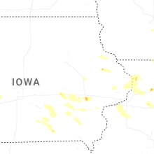


Connect with Interactive Hail Maps