

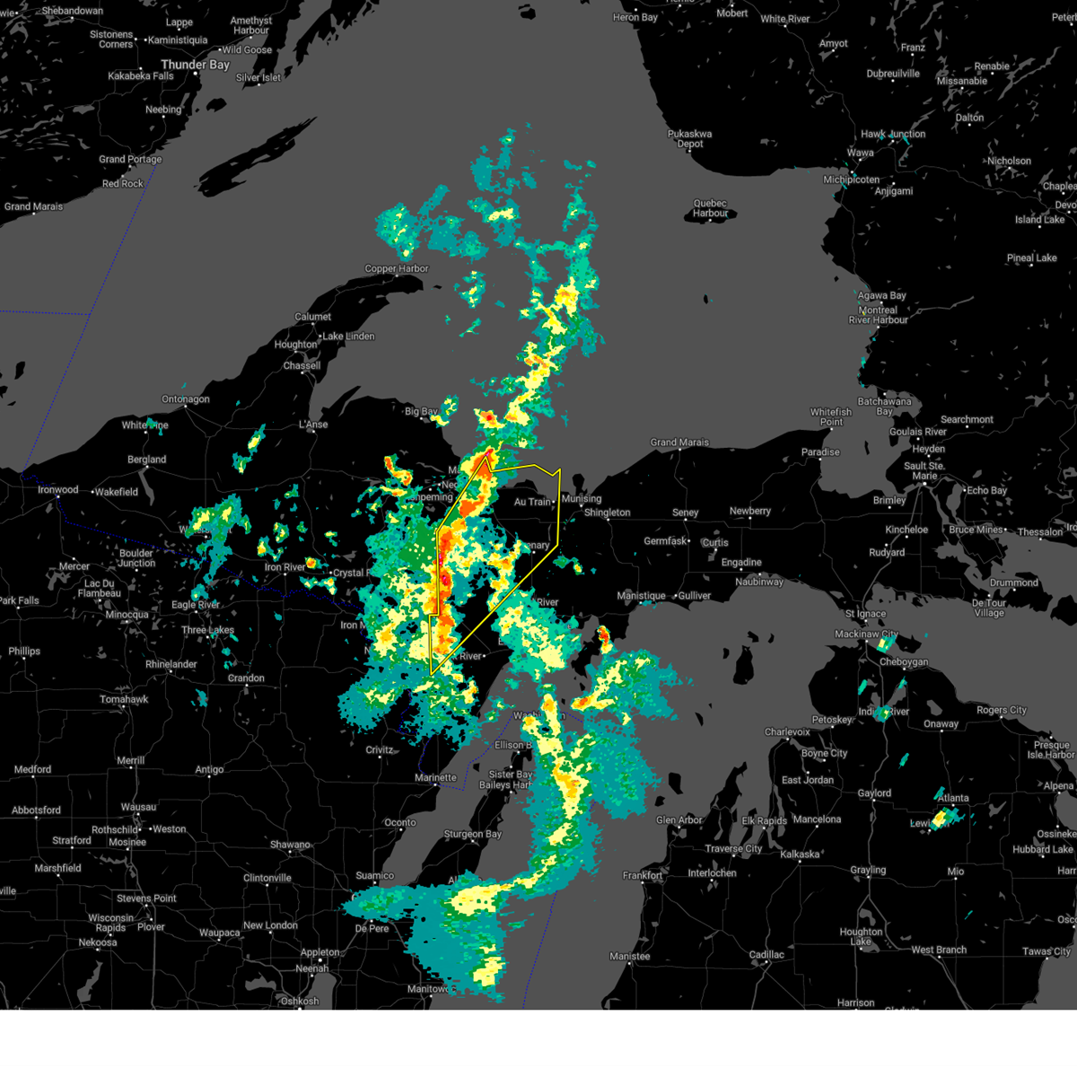
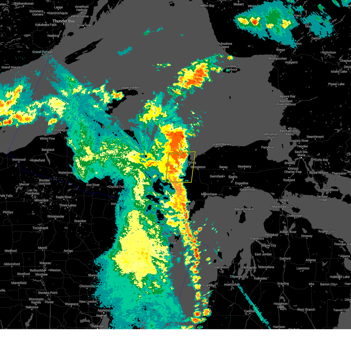
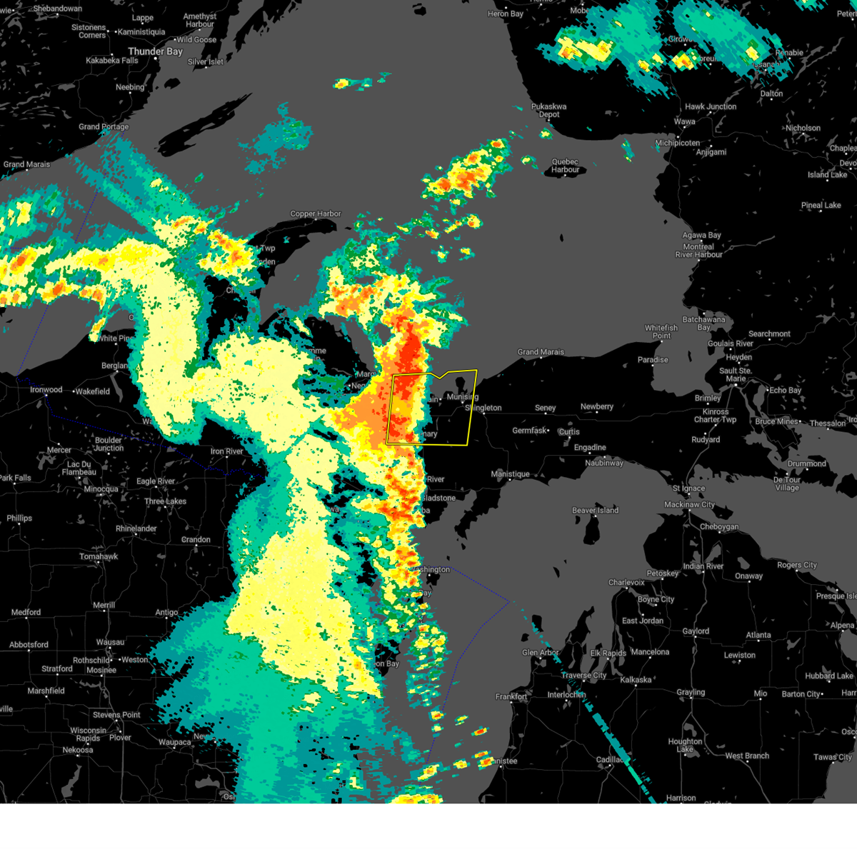
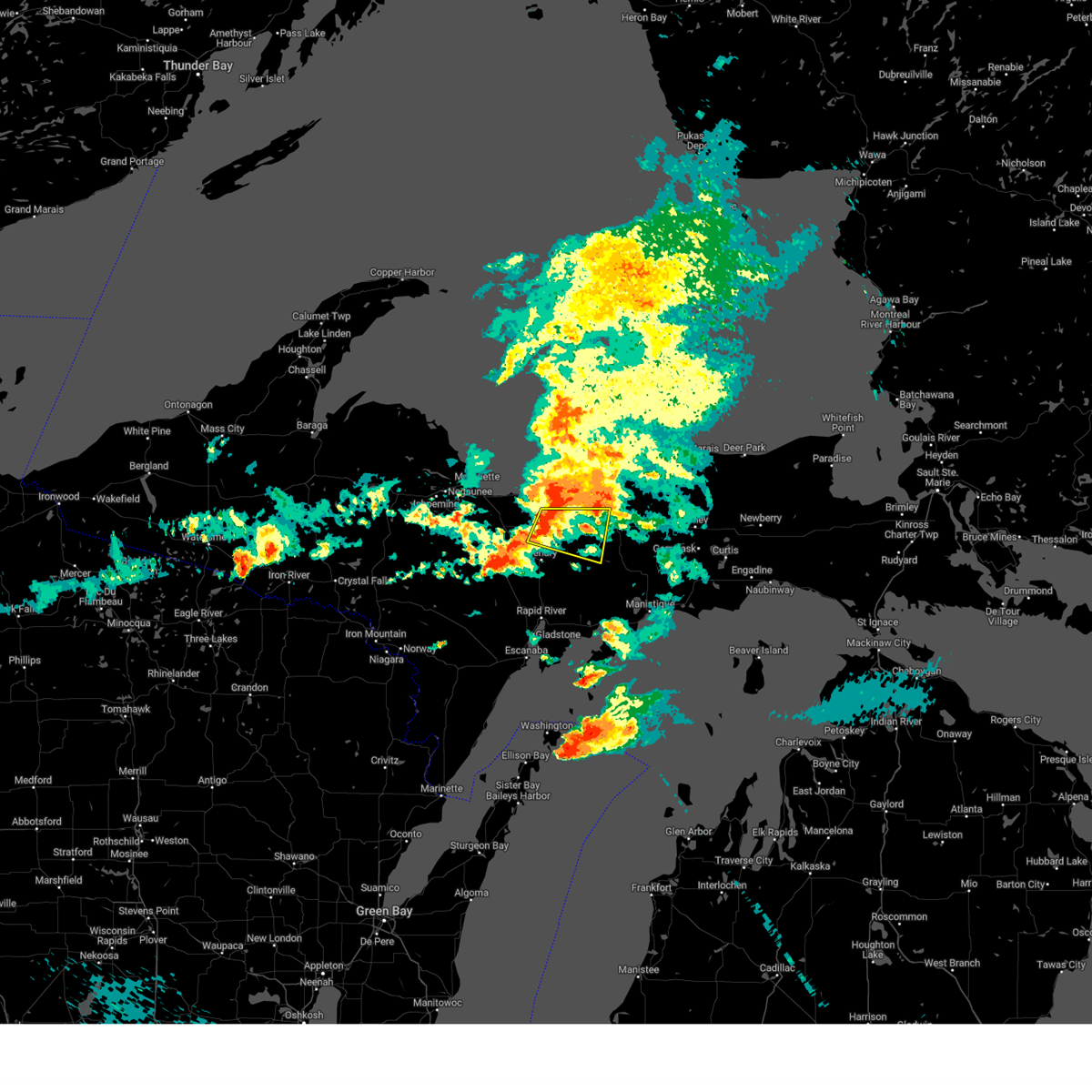
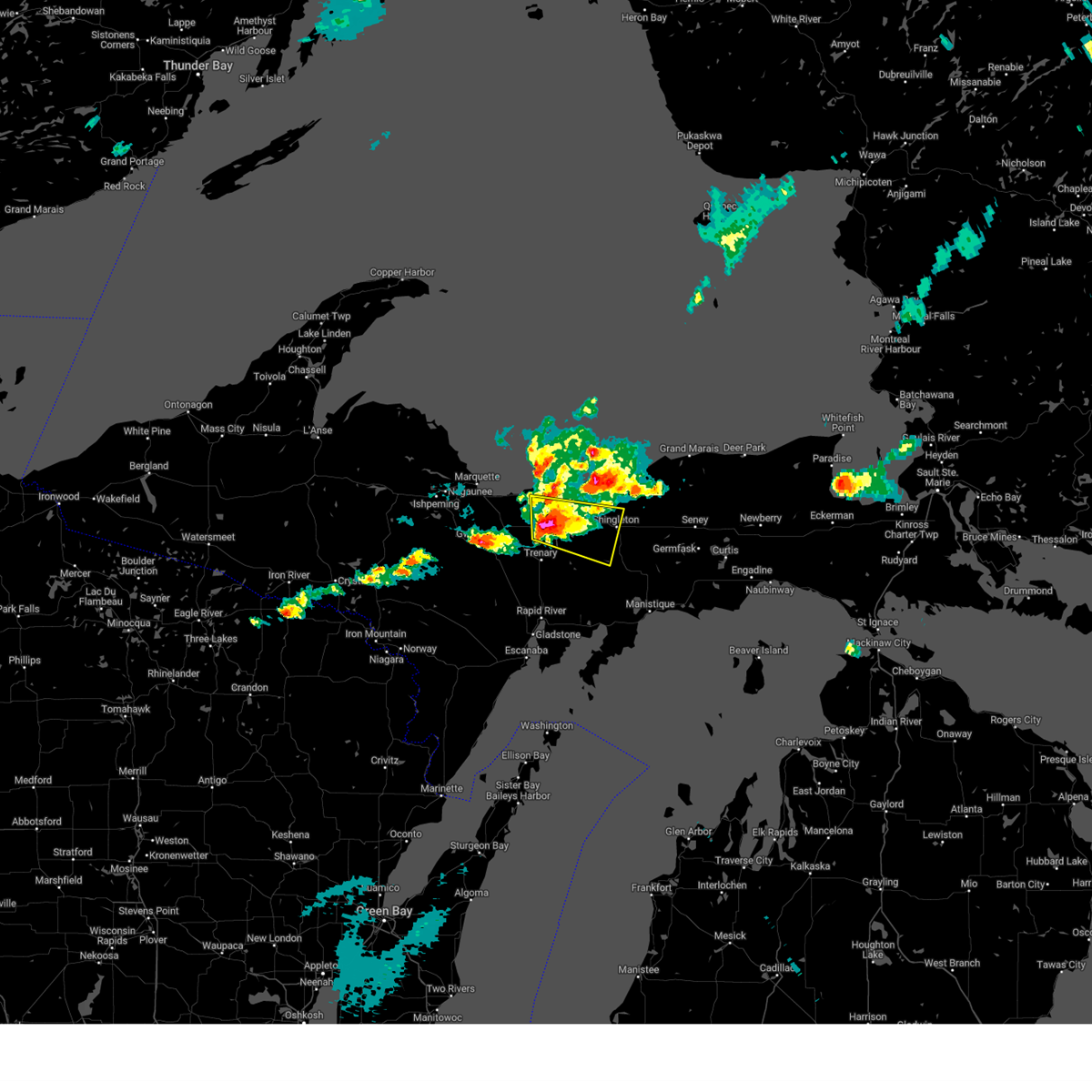
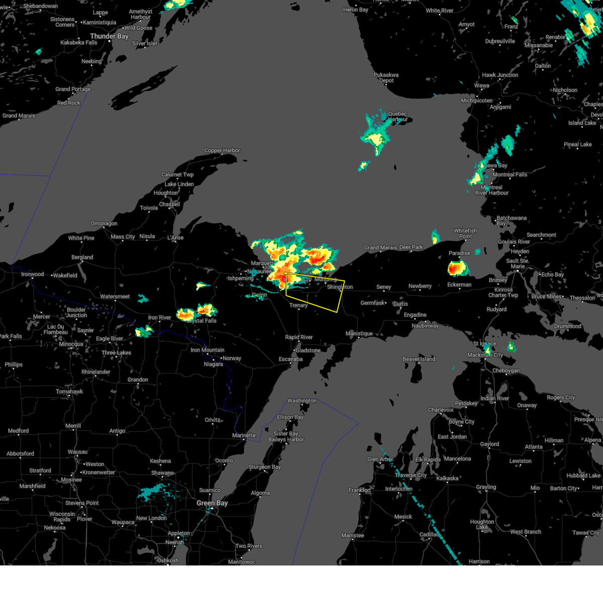
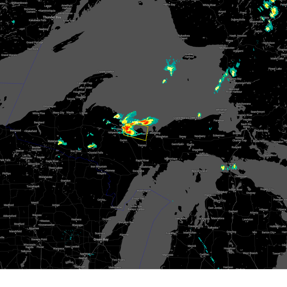
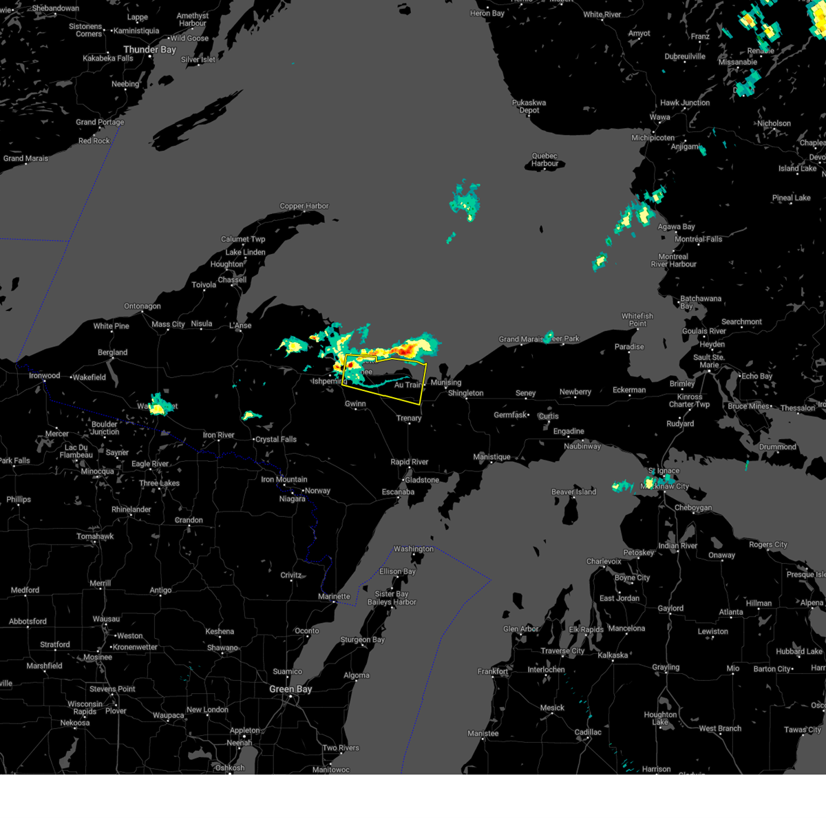
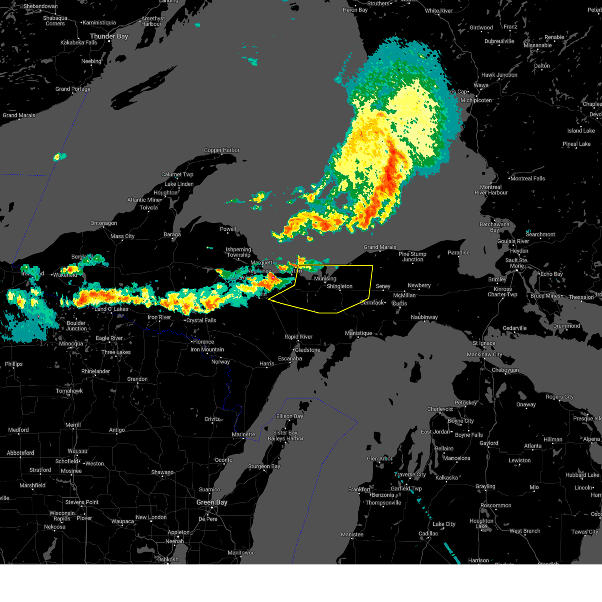
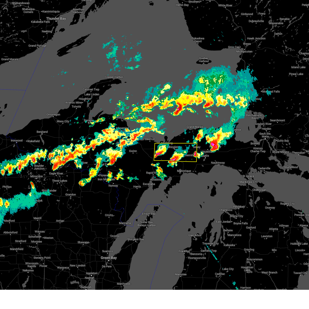
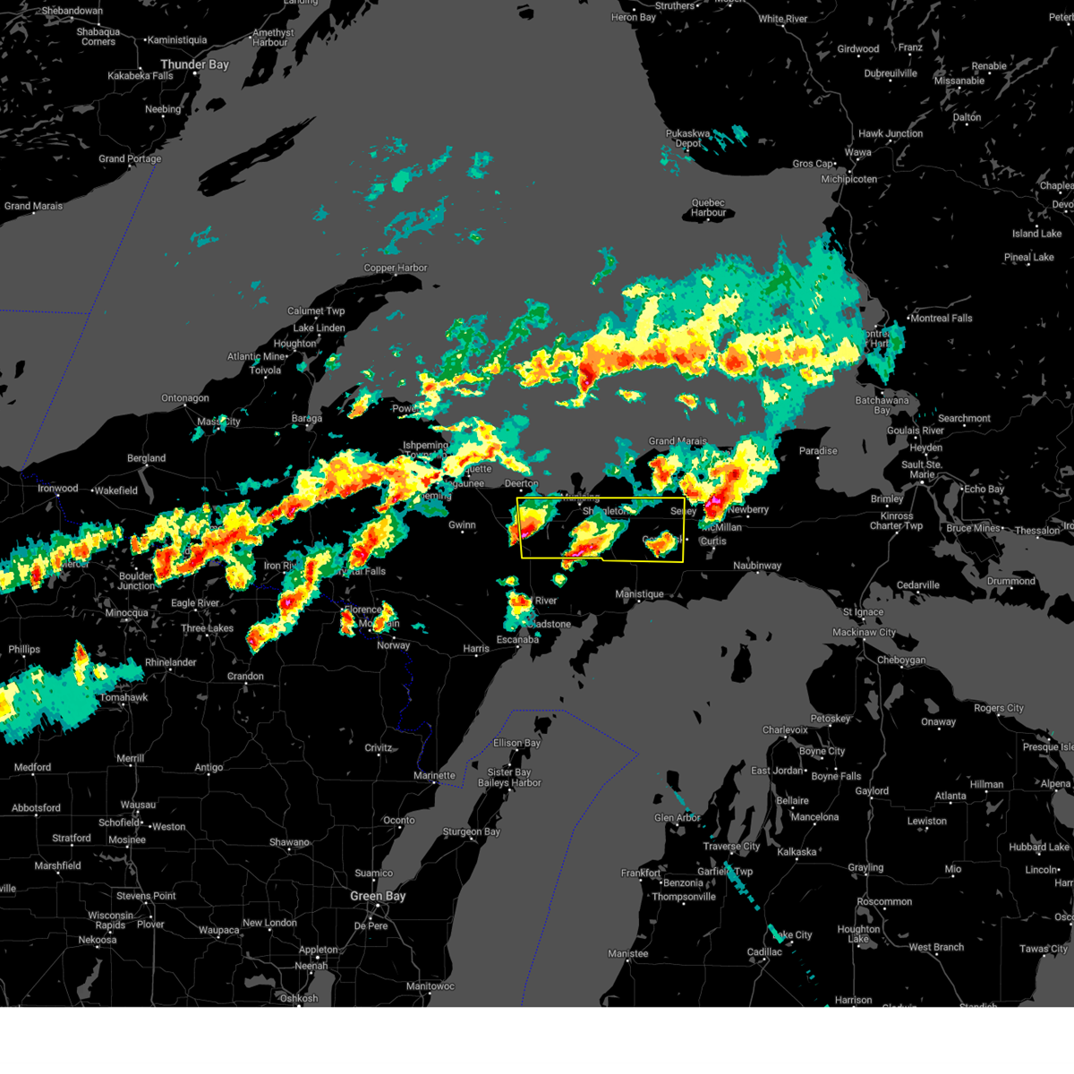
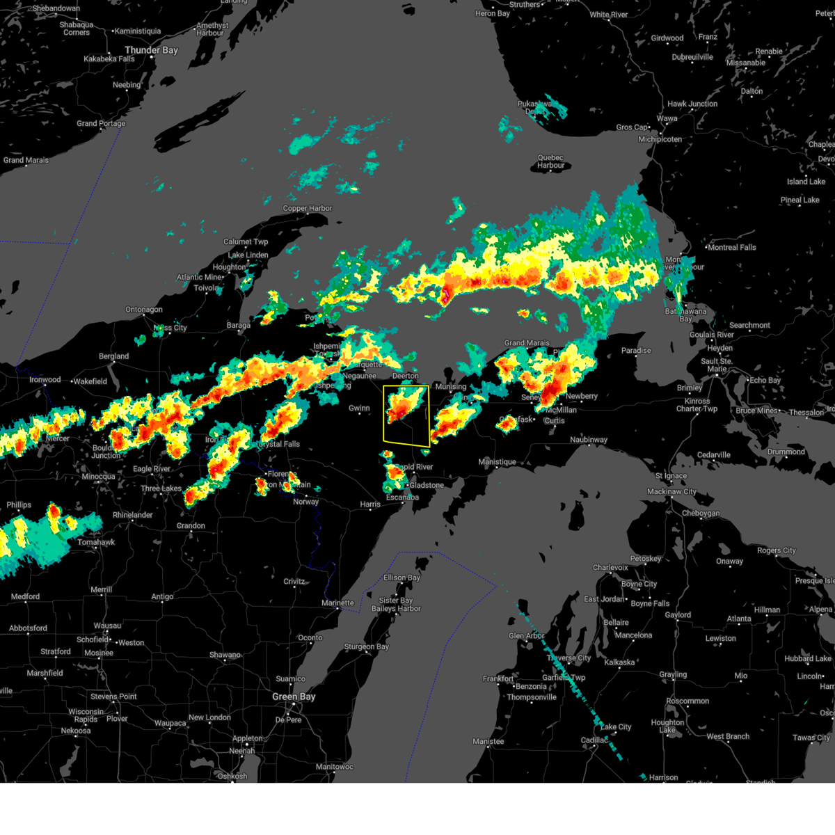
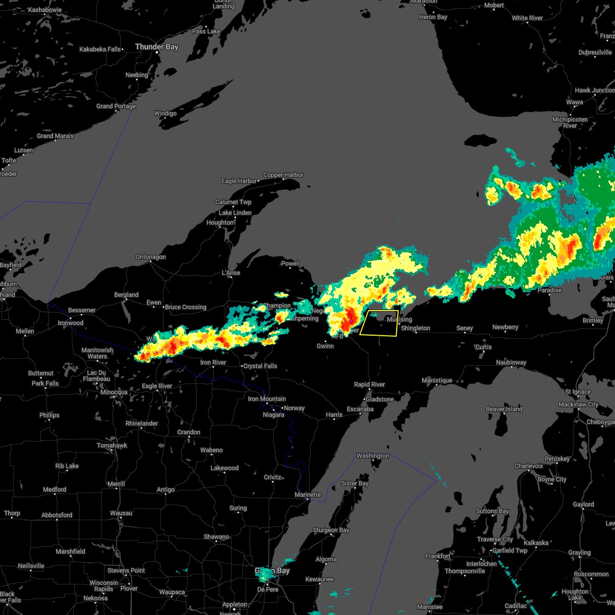
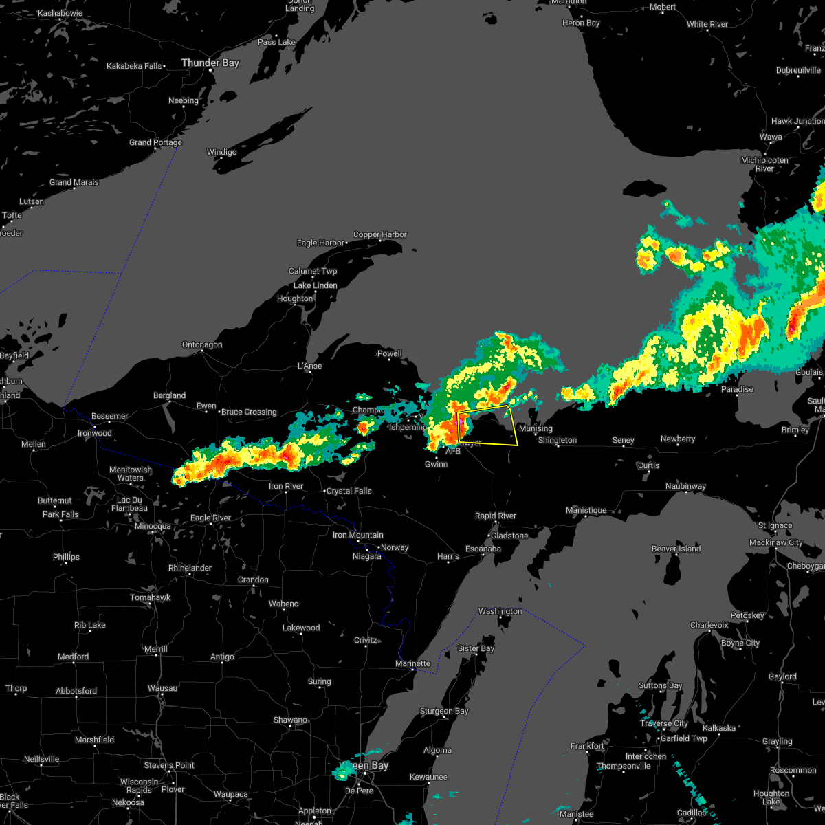
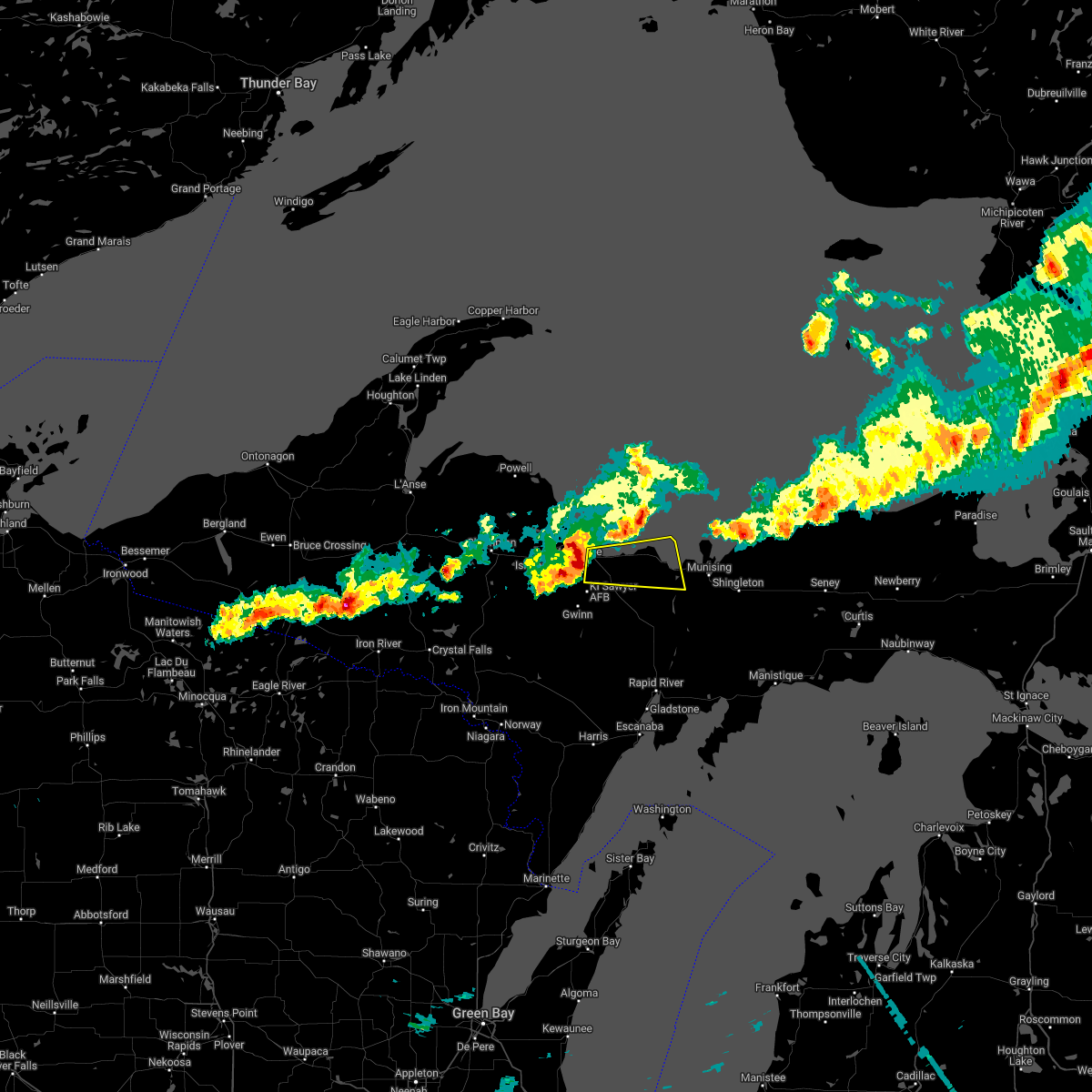
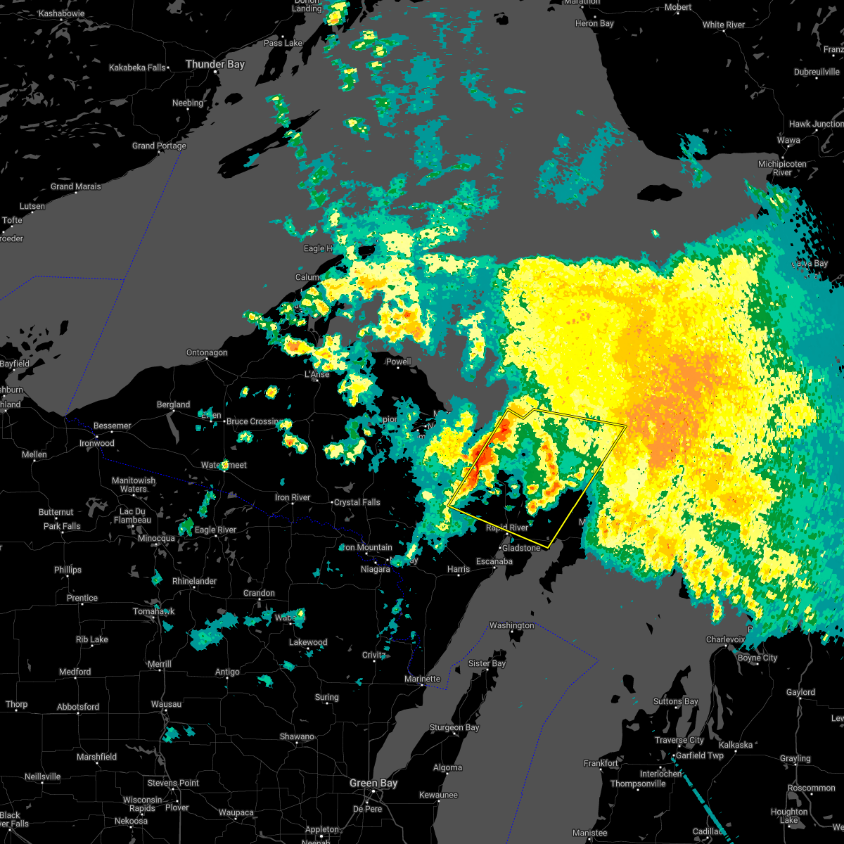
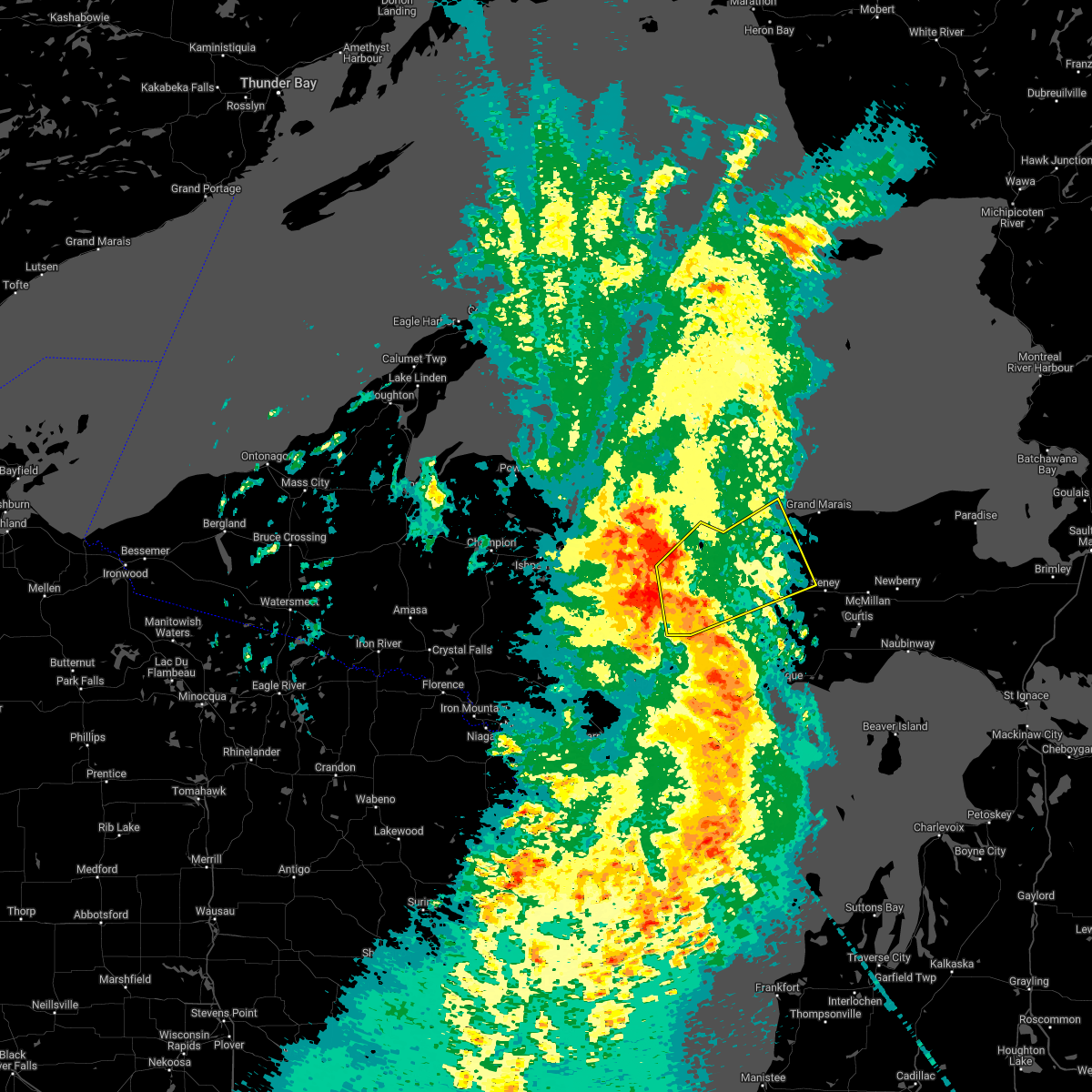
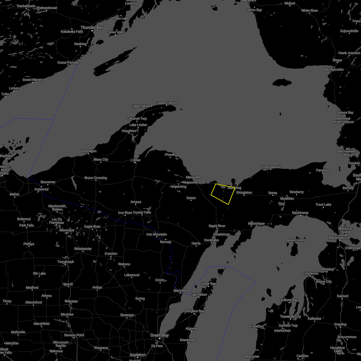
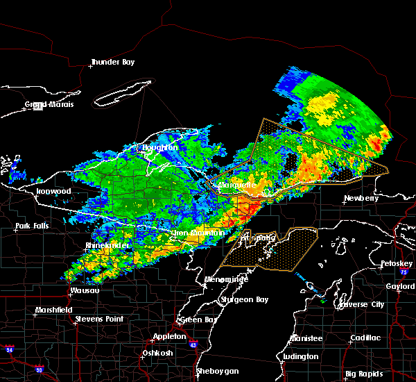
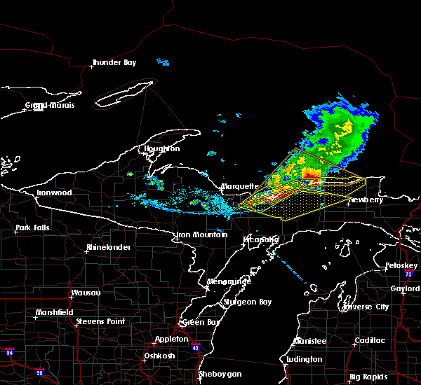
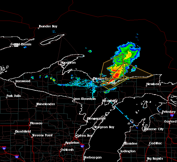
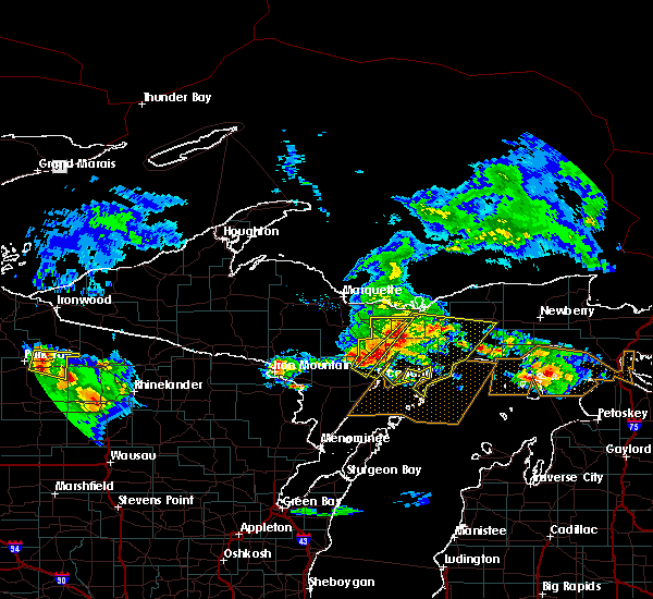
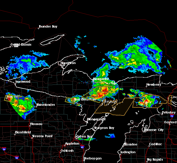
Hail Map for Chatham, MI
The Chatham, MI area has had 14 reports of on-the-ground hail by trained spotters, and has been under severe weather warnings 9 times during the past 12 months. Doppler radar has detected hail at or near Chatham, MI on 18 occasions.
| Name: | Chatham, MI |
| Where Located: | 26.9 miles ESE of Marquette, MI |
| Map: | Google Map for Chatham, MI |
| Population: | 220 |
| Housing Units: | 120 |
| More Info: | Search Google for Chatham, MI |
3
The Top Recent Hail Date for Chatham, MI is Thursday, June 13, 2024 (5th out of 18)

Hail and Wind Damage Spotted near Chatham, MI
| Date / Time | Report Details |
|---|---|
| 5/16/2025 5:55 PM EDT | the severe thunderstorm warning has been cancelled and is no longer in effect |
| 5/16/2025 5:48 PM EDT | At 547 pm edt, severe thunderstorms were located along a line extending from 6 miles east of presque isle to near shot point to 7 miles west of chatham, moving northeast at 65 mph (radar indicated). Hazards include 60 mph wind gusts. Expect damage to roofs, siding, and trees. Locations impacted include, au train, chatham, deerton, skandia, shot point, laughing whitefish falls, sundell, eben junction, and carlshend. |
| 5/16/2025 5:48 PM EDT | the severe thunderstorm warning has been cancelled and is no longer in effect |
| 5/16/2025 5:35 PM EDT | At 534 pm edt, severe thunderstorms were located along a line extending from harvey to 6 miles east of gwinn to near watson, moving northeast at 50 mph (radar indicated). Hazards include 60 mph wind gusts. Expect damage to roofs, siding, and trees. locations impacted include, marquette, au train, chatham, deerton, trenary, k. i. Sawyer airport, harvey, gwinn, sands, skandia, forest lake, and the 553 and 480 crossroads. |
| 5/16/2025 5:35 PM EDT | the severe thunderstorm warning has been cancelled and is no longer in effect |
| 5/16/2025 5:13 PM EDT |
 Svrmqt the national weather service in marquette has issued a * severe thunderstorm warning for, northwestern delta county in south central upper michigan, northeastern menominee county in south central upper michigan, southeastern marquette county in north central upper michigan, southwestern alger county in north central upper michigan, * until 615 pm edt/515 pm cdt/. * at 513 pm edt/413 pm cdt/, severe thunderstorms were located along a line extending from near gwinn to near watson to hermansville, moving northeast at 50 mph (radar indicated). Hazards include 60 mph wind gusts. expect damage to roofs, siding, and trees Svrmqt the national weather service in marquette has issued a * severe thunderstorm warning for, northwestern delta county in south central upper michigan, northeastern menominee county in south central upper michigan, southeastern marquette county in north central upper michigan, southwestern alger county in north central upper michigan, * until 615 pm edt/515 pm cdt/. * at 513 pm edt/413 pm cdt/, severe thunderstorms were located along a line extending from near gwinn to near watson to hermansville, moving northeast at 50 mph (radar indicated). Hazards include 60 mph wind gusts. expect damage to roofs, siding, and trees
|
| 8/27/2024 3:33 AM EDT |
 At 333 am edt, severe thunderstorms were located along a line extending from 7 miles northeast of deerton to trenary, moving east at 30 mph (radar indicated). Hazards include 60 mph wind gusts and quarter size hail. Hail damage to vehicles is expected. expect wind damage to roofs, siding, and trees. Locations impacted include, munising, grand island, miners castle, pictured rocks national lakeshore, au train, chatham, deerton, trenary, laughing whitefish falls, christmas, forest lake, and sundell. At 333 am edt, severe thunderstorms were located along a line extending from 7 miles northeast of deerton to trenary, moving east at 30 mph (radar indicated). Hazards include 60 mph wind gusts and quarter size hail. Hail damage to vehicles is expected. expect wind damage to roofs, siding, and trees. Locations impacted include, munising, grand island, miners castle, pictured rocks national lakeshore, au train, chatham, deerton, trenary, laughing whitefish falls, christmas, forest lake, and sundell.
|
| 8/27/2024 3:12 AM EDT |
 Svrmqt the national weather service in marquette has issued a * severe thunderstorm warning for, east central marquette county in north central upper michigan, west central schoolcraft county in east central upper michigan, southwestern alger county in north central upper michigan, * until 345 am edt. * at 311 am edt, severe thunderstorms were located along a line extending from near shot point to 6 miles north of rock, moving east at 30 mph (radar indicated). Hazards include 60 mph wind gusts and quarter size hail. Hail damage to vehicles is expected. Expect wind damage to roofs, siding, and trees. Svrmqt the national weather service in marquette has issued a * severe thunderstorm warning for, east central marquette county in north central upper michigan, west central schoolcraft county in east central upper michigan, southwestern alger county in north central upper michigan, * until 345 am edt. * at 311 am edt, severe thunderstorms were located along a line extending from near shot point to 6 miles north of rock, moving east at 30 mph (radar indicated). Hazards include 60 mph wind gusts and quarter size hail. Hail damage to vehicles is expected. Expect wind damage to roofs, siding, and trees.
|
| 7/15/2024 7:46 PM EDT |
 Svrmqt the national weather service in marquette has issued a * severe thunderstorm warning for, west central schoolcraft county in east central upper michigan, southwestern alger county in north central upper michigan, * until 815 pm edt. * at 745 pm edt, a severe thunderstorm was located over chatham, or 13 miles southwest of munising, moving east at 35 mph (radar indicated). Hazards include 60 mph wind gusts. expect damage to roofs, siding, and trees Svrmqt the national weather service in marquette has issued a * severe thunderstorm warning for, west central schoolcraft county in east central upper michigan, southwestern alger county in north central upper michigan, * until 815 pm edt. * at 745 pm edt, a severe thunderstorm was located over chatham, or 13 miles southwest of munising, moving east at 35 mph (radar indicated). Hazards include 60 mph wind gusts. expect damage to roofs, siding, and trees
|
| 6/13/2024 1:25 PM EDT |
 At 124 pm edt, a severe thunderstorm was located near au train, or 9 miles west of munising, moving east at 45 mph (radar indicated). Hazards include golf ball size hail and 60 mph wind gusts. People and animals outdoors will be injured. expect hail damage to roofs, siding, windows, and vehicles. expect wind damage to roofs, siding, and trees. Locations impacted include, munising, au train, chatham, shingleton, christmas, forest lake, wetmore, eben junction, and van meer. At 124 pm edt, a severe thunderstorm was located near au train, or 9 miles west of munising, moving east at 45 mph (radar indicated). Hazards include golf ball size hail and 60 mph wind gusts. People and animals outdoors will be injured. expect hail damage to roofs, siding, windows, and vehicles. expect wind damage to roofs, siding, and trees. Locations impacted include, munising, au train, chatham, shingleton, christmas, forest lake, wetmore, eben junction, and van meer.
|
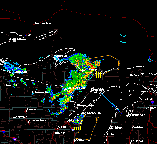
| 6/13/2024 1:20 PM EDT | Half Dollar sized hail reported 0.2 miles S of Chatham, MI, image of hail in chatham from social media. |
| 6/13/2024 1:11 PM EDT |
 Svrmqt the national weather service in marquette has issued a * severe thunderstorm warning for, west central schoolcraft county in east central upper michigan, southwestern alger county in north central upper michigan, * until 145 pm edt. * at 110 pm edt, a severe thunderstorm was located near deerton, or 18 miles southeast of marquette, moving east at 45 mph (radar indicated). Hazards include quarter size hail. damage to vehicles is expected Svrmqt the national weather service in marquette has issued a * severe thunderstorm warning for, west central schoolcraft county in east central upper michigan, southwestern alger county in north central upper michigan, * until 145 pm edt. * at 110 pm edt, a severe thunderstorm was located near deerton, or 18 miles southeast of marquette, moving east at 45 mph (radar indicated). Hazards include quarter size hail. damage to vehicles is expected
|
| 6/13/2024 1:02 PM EDT |
 At 101 pm edt, a severe thunderstorm was located over shot point, or 9 miles southeast of marquette, moving east at 45 mph (broadcast media, nws employees, and trained spotters). Hazards include quarter size hail. Damage to vehicles is expected. Locations impacted include, marquette, presque isle, chatham, deerton, harvey, sands, skandia, shot point, laughing whitefish falls, beaver grove, sundell, and the 553 and 480 crossroads. At 101 pm edt, a severe thunderstorm was located over shot point, or 9 miles southeast of marquette, moving east at 45 mph (broadcast media, nws employees, and trained spotters). Hazards include quarter size hail. Damage to vehicles is expected. Locations impacted include, marquette, presque isle, chatham, deerton, harvey, sands, skandia, shot point, laughing whitefish falls, beaver grove, sundell, and the 553 and 480 crossroads.
|
| 6/13/2024 12:47 PM EDT |
 Svrmqt the national weather service in marquette has issued a * severe thunderstorm warning for, east central marquette county in north central upper michigan, west central alger county in north central upper michigan, * until 115 pm edt. * at 1247 pm edt, a severe thunderstorm was located near trowbridge park, or near marquette, moving east at 45 mph (broadcast media). Hazards include quarter size hail. damage to vehicles is expected Svrmqt the national weather service in marquette has issued a * severe thunderstorm warning for, east central marquette county in north central upper michigan, west central alger county in north central upper michigan, * until 115 pm edt. * at 1247 pm edt, a severe thunderstorm was located near trowbridge park, or near marquette, moving east at 45 mph (broadcast media). Hazards include quarter size hail. damage to vehicles is expected
|
| 8/25/2023 4:10 PM EDT |
 At 410 pm edt, severe thunderstorms were located along a line extending from near au train to near chatham to 7 miles northwest of trenary, moving east at 45 mph (radar indicated). Hazards include 60 mph wind gusts and penny size hail. expect damage to roofs, siding, and trees At 410 pm edt, severe thunderstorms were located along a line extending from near au train to near chatham to 7 miles northwest of trenary, moving east at 45 mph (radar indicated). Hazards include 60 mph wind gusts and penny size hail. expect damage to roofs, siding, and trees
|
| 7/27/2023 9:02 PM EDT |
 At 901 pm edt, a severe thunderstorm was located near deerton, or 15 miles west of grand island, moving east at 70 mph (radar indicated). Hazards include 60 mph wind gusts. Expect damage to roofs, siding, and trees. locations impacted include, au train. hail threat, radar indicated max hail size, <. 75 in wind threat, radar indicated max wind gust, 60 mph. At 901 pm edt, a severe thunderstorm was located near deerton, or 15 miles west of grand island, moving east at 70 mph (radar indicated). Hazards include 60 mph wind gusts. Expect damage to roofs, siding, and trees. locations impacted include, au train. hail threat, radar indicated max hail size, <. 75 in wind threat, radar indicated max wind gust, 60 mph.
|
| 7/27/2023 8:46 PM EDT |
 At 846 pm edt, a severe thunderstorm was located over harvey, or over marquette, moving east at 70 mph (radar indicated). Hazards include 60 mph wind gusts and penny size hail. Expect damage to roofs, siding, and trees. this severe thunderstorm will be near, shot point around 855 pm edt. deerton around 900 pm edt. other locations in the path of this severe thunderstorm include au train. hail threat, radar indicated max hail size, 0. 75 in wind threat, radar indicated max wind gust, 60 mph. At 846 pm edt, a severe thunderstorm was located over harvey, or over marquette, moving east at 70 mph (radar indicated). Hazards include 60 mph wind gusts and penny size hail. Expect damage to roofs, siding, and trees. this severe thunderstorm will be near, shot point around 855 pm edt. deerton around 900 pm edt. other locations in the path of this severe thunderstorm include au train. hail threat, radar indicated max hail size, 0. 75 in wind threat, radar indicated max wind gust, 60 mph.
|
| 7/10/2023 8:00 PM EDT | Several trees down. camper windows blown ou in alger county MI, 15.8 miles NW of Chatham, MI |
| 7/10/2023 7:52 PM EDT |
 At 752 pm edt, a severe thunderstorm was located 8 miles southeast of chatham, or 11 miles southwest of munising, moving east at 40 mph (radar indicated). Hazards include quarter size hail. Damage to vehicles is expected. locations impacted include, munising, pictured rocks national lakeshore, au train, chatham, seney, shingleton, steuben, m-28 between shingleton and seney, christmas, forest lake, wetmore and van meer. hail threat, radar indicated max hail size, 1. 00 in wind threat, radar indicated max wind gust, <50 mph. At 752 pm edt, a severe thunderstorm was located 8 miles southeast of chatham, or 11 miles southwest of munising, moving east at 40 mph (radar indicated). Hazards include quarter size hail. Damage to vehicles is expected. locations impacted include, munising, pictured rocks national lakeshore, au train, chatham, seney, shingleton, steuben, m-28 between shingleton and seney, christmas, forest lake, wetmore and van meer. hail threat, radar indicated max hail size, 1. 00 in wind threat, radar indicated max wind gust, <50 mph.
|
| 7/10/2023 7:40 PM EDT |
 At 740 pm edt, a severe thunderstorm was located near chatham, or 17 miles southwest of munising, moving east at 40 mph (radar indicated). Hazards include quarter size hail. damage to vehicles is expected At 740 pm edt, a severe thunderstorm was located near chatham, or 17 miles southwest of munising, moving east at 40 mph (radar indicated). Hazards include quarter size hail. damage to vehicles is expected
|
| 7/10/2023 7:33 PM EDT |
 At 733 pm edt, a severe thunderstorm was located near trenary, or 21 miles southwest of munising, moving east at 45 mph (radar indicated). Hazards include quarter size hail. Damage to vehicles is expected. locations impacted include, chatham, trenary, u. s. 41 between trenary and rapid river, laughing whitefish falls, forest lake, sundell, lathrop, eben junction, kiva, diffin, carlshend and traunik. hail threat, radar indicated max hail size, 1. 00 in wind threat, radar indicated max wind gust, <50 mph. At 733 pm edt, a severe thunderstorm was located near trenary, or 21 miles southwest of munising, moving east at 45 mph (radar indicated). Hazards include quarter size hail. Damage to vehicles is expected. locations impacted include, chatham, trenary, u. s. 41 between trenary and rapid river, laughing whitefish falls, forest lake, sundell, lathrop, eben junction, kiva, diffin, carlshend and traunik. hail threat, radar indicated max hail size, 1. 00 in wind threat, radar indicated max wind gust, <50 mph.
|
| 7/10/2023 7:16 PM EDT |
 At 716 pm edt, a severe thunderstorm was located near k. i. sawyer airport, or 16 miles south of marquette, moving east at 40 mph (radar indicated). Hazards include quarter size hail. Damage to vehicles is expected. locations impacted include, chatham, k. i. sawyer airport, trenary, gwinn, u. s. 41 between trenary and rapid river, sands, skandia, laughing whitefish falls, forest lake, sundell, little lake and kiva. hail threat, radar indicated max hail size, 1. 00 in wind threat, radar indicated max wind gust, <50 mph. At 716 pm edt, a severe thunderstorm was located near k. i. sawyer airport, or 16 miles south of marquette, moving east at 40 mph (radar indicated). Hazards include quarter size hail. Damage to vehicles is expected. locations impacted include, chatham, k. i. sawyer airport, trenary, gwinn, u. s. 41 between trenary and rapid river, sands, skandia, laughing whitefish falls, forest lake, sundell, little lake and kiva. hail threat, radar indicated max hail size, 1. 00 in wind threat, radar indicated max wind gust, <50 mph.
|
| 7/10/2023 7:04 PM EDT |
 At 704 pm edt/604 pm cdt/, a severe thunderstorm was located near gwinn, or 13 miles southeast of ishpeming, moving east at 40 mph (radar indicated). Hazards include 60 mph wind gusts and quarter size hail. Hail damage to vehicles is expected. expect wind damage to roofs, siding, and trees. locations impacted include, ishpeming, chatham, k. i. sawyer airport, trenary, gwinn, u. s. 41 between trenary and rapid river, sands, skandia, laughing whitefish falls, forest lake, sundell and little lake. hail threat, radar indicated max hail size, 1. 00 in wind threat, radar indicated max wind gust, 60 mph. At 704 pm edt/604 pm cdt/, a severe thunderstorm was located near gwinn, or 13 miles southeast of ishpeming, moving east at 40 mph (radar indicated). Hazards include 60 mph wind gusts and quarter size hail. Hail damage to vehicles is expected. expect wind damage to roofs, siding, and trees. locations impacted include, ishpeming, chatham, k. i. sawyer airport, trenary, gwinn, u. s. 41 between trenary and rapid river, sands, skandia, laughing whitefish falls, forest lake, sundell and little lake. hail threat, radar indicated max hail size, 1. 00 in wind threat, radar indicated max wind gust, 60 mph.
|
| 7/10/2023 7:00 PM EDT | Hen Egg sized hail reported 6.7 miles NNE of Chatham, MI |
| 7/10/2023 6:43 PM EDT |
 At 643 pm edt/543 pm cdt/, a severe thunderstorm was located 8 miles east of witch lake, or 14 miles southwest of ishpeming, moving east at 40 mph (radar indicated). Hazards include 60 mph wind gusts and quarter size hail. Hail damage to vehicles is expected. Expect wind damage to roofs, siding, and trees. At 643 pm edt/543 pm cdt/, a severe thunderstorm was located 8 miles east of witch lake, or 14 miles southwest of ishpeming, moving east at 40 mph (radar indicated). Hazards include 60 mph wind gusts and quarter size hail. Hail damage to vehicles is expected. Expect wind damage to roofs, siding, and trees.
|
| 6/30/2022 10:05 PM EDT | Quarter sized hail reported 0.2 miles S of Chatham, MI, multiple pictures of quarter sized hail from chatham. |
| 6/30/2022 10:05 PM EDT | Half Dollar sized hail reported 0.2 miles S of Chatham, MI, corrects previous hail report from chatham. multiple pictures of quarter sized hail from chatham... and a half-dollar sized hail report via facebook. |
| 6/30/2022 10:03 PM EDT | Over 200 residences were reported to be without power along au train forest lake road due to thunderstorm wind damage. power lines were also reported down near the all in alger county MI, 6.6 miles SW of Chatham, MI |
| 6/30/2022 10:00 PM EDT | Power lines and trees down via twitter... time estimated on rada in alger county MI, 7.2 miles SW of Chatham, MI |
| 6/30/2022 9:52 PM EDT |
 At 952 pm edt, a severe thunderstorm was located near deerton, or 16 miles west of munising, moving east at 55 mph (radar indicated). Hazards include 60 mph wind gusts. Expect damage to roofs, siding, and trees. this severe thunderstorm will be near, chatham around 955 pm edt. au train around 1000 pm edt. grand island around 1010 pm edt. other locations in the path of this severe thunderstorm include munising. hail threat, radar indicated max hail size, <. 75 in wind threat, observed max wind gust, 60 mph. At 952 pm edt, a severe thunderstorm was located near deerton, or 16 miles west of munising, moving east at 55 mph (radar indicated). Hazards include 60 mph wind gusts. Expect damage to roofs, siding, and trees. this severe thunderstorm will be near, chatham around 955 pm edt. au train around 1000 pm edt. grand island around 1010 pm edt. other locations in the path of this severe thunderstorm include munising. hail threat, radar indicated max hail size, <. 75 in wind threat, observed max wind gust, 60 mph.
|
| 6/30/2022 9:46 PM EDT |
 At 945 pm edt, a severe thunderstorm was located near shot point, or 14 miles east of marquette, moving east at 55 mph (radar indicated). Hazards include 70 mph wind gusts. Expect considerable tree damage. damage is likely to mobile homes, roofs, and outbuildings. this severe storm will be near, au train around 1000 pm edt. thunderstorm damage threat, considerable hail threat, radar indicated max hail size, <. 75 in wind threat, observed max wind gust, 70 mph. At 945 pm edt, a severe thunderstorm was located near shot point, or 14 miles east of marquette, moving east at 55 mph (radar indicated). Hazards include 70 mph wind gusts. Expect considerable tree damage. damage is likely to mobile homes, roofs, and outbuildings. this severe storm will be near, au train around 1000 pm edt. thunderstorm damage threat, considerable hail threat, radar indicated max hail size, <. 75 in wind threat, observed max wind gust, 70 mph.
|
| 6/30/2022 9:43 PM EDT |
 At 942 pm edt, a severe thunderstorm was located over shot point, or 11 miles southeast of marquette, moving east at 55 mph (radar indicated). Hazards include 70 mph wind gusts. Expect considerable tree damage. damage is likely to mobile homes, roofs, and outbuildings. this severe storm will be near, deerton around 950 pm edt. other locations in the path of this severe thunderstorm include au train. thunderstorm damage threat, considerable hail threat, radar indicated max hail size, <. 75 in wind threat, radar indicated max wind gust, 70 mph. At 942 pm edt, a severe thunderstorm was located over shot point, or 11 miles southeast of marquette, moving east at 55 mph (radar indicated). Hazards include 70 mph wind gusts. Expect considerable tree damage. damage is likely to mobile homes, roofs, and outbuildings. this severe storm will be near, deerton around 950 pm edt. other locations in the path of this severe thunderstorm include au train. thunderstorm damage threat, considerable hail threat, radar indicated max hail size, <. 75 in wind threat, radar indicated max wind gust, 70 mph.
|
| 6/30/2022 9:35 PM EDT |
 At 935 pm edt, a severe thunderstorm was located over harvey, or near marquette, moving east at 55 mph (radar indicated). Hazards include 60 mph wind gusts. Expect damage to roofs, siding, and trees. this severe thunderstorm will be near, shot point around 945 pm edt. deerton around 950 pm edt. other locations in the path of this severe thunderstorm include au train. hail threat, radar indicated max hail size, <. 75 in wind threat, radar indicated max wind gust, 60 mph. At 935 pm edt, a severe thunderstorm was located over harvey, or near marquette, moving east at 55 mph (radar indicated). Hazards include 60 mph wind gusts. Expect damage to roofs, siding, and trees. this severe thunderstorm will be near, shot point around 945 pm edt. deerton around 950 pm edt. other locations in the path of this severe thunderstorm include au train. hail threat, radar indicated max hail size, <. 75 in wind threat, radar indicated max wind gust, 60 mph.
|
| 6/30/2022 3:45 AM EDT |
 At 344 am edt, severe thunderstorms were located along a line extending from chatham to near rock, moving east at 50 mph (radar indicated). Hazards include 60 mph wind gusts. Expect damage to roofs, siding, and trees. locations impacted include, munising, grand island, miners castle, chapel lake, au train, chatham, shingleton, trenary, rock, steuben, u. s. 41 between trenary and rapid river and m-28 between shingleton and seney. hail threat, radar indicated max hail size, <. 75 in wind threat, radar indicated max wind gust, 60 mph. At 344 am edt, severe thunderstorms were located along a line extending from chatham to near rock, moving east at 50 mph (radar indicated). Hazards include 60 mph wind gusts. Expect damage to roofs, siding, and trees. locations impacted include, munising, grand island, miners castle, chapel lake, au train, chatham, shingleton, trenary, rock, steuben, u. s. 41 between trenary and rapid river and m-28 between shingleton and seney. hail threat, radar indicated max hail size, <. 75 in wind threat, radar indicated max wind gust, 60 mph.
|
| 6/30/2022 3:36 AM EDT |
 At 335 am edt, severe thunderstorms were located along a line extending from 7 miles northeast of deerton to 8 miles northeast of watson, moving east at 35 mph (radar indicated). Hazards include 60 mph wind gusts. expect damage to roofs, siding, and trees At 335 am edt, severe thunderstorms were located along a line extending from 7 miles northeast of deerton to 8 miles northeast of watson, moving east at 35 mph (radar indicated). Hazards include 60 mph wind gusts. expect damage to roofs, siding, and trees
|
| 6/15/2022 9:03 PM EDT |
 At 903 pm edt, a severe thunderstorm was located near chatham, or 8 miles southwest of munising, moving northeast at 55 mph (radar indicated). Hazards include 60 mph wind gusts and quarter size hail. Hail damage to vehicles is expected. expect wind damage to roofs, siding, and trees. this severe thunderstorm will be near, munising around 915 pm edt. pictured rocks national lakeshore miners castle and shingleton around 920 pm edt. other locations in the path of this severe thunderstorm include chapel lake. hail threat, radar indicated max hail size, 1. 00 in wind threat, radar indicated max wind gust, 60 mph. At 903 pm edt, a severe thunderstorm was located near chatham, or 8 miles southwest of munising, moving northeast at 55 mph (radar indicated). Hazards include 60 mph wind gusts and quarter size hail. Hail damage to vehicles is expected. expect wind damage to roofs, siding, and trees. this severe thunderstorm will be near, munising around 915 pm edt. pictured rocks national lakeshore miners castle and shingleton around 920 pm edt. other locations in the path of this severe thunderstorm include chapel lake. hail threat, radar indicated max hail size, 1. 00 in wind threat, radar indicated max wind gust, 60 mph.
|
| 5/10/2022 7:30 PM EDT | Quarter sized hail reported 10.7 miles S of Chatham, MI, mi-ag-8 cocorahs observer. |
| 5/9/2022 8:35 PM EDT | Tree on powerline about a half mile south of the store in rumel in alger county MI, 4.8 miles E of Chatham, MI |
| 8/10/2021 6:35 PM EDT |
 The severe thunderstorm warning for southwestern alger county will expire at 645 pm edt, the storm which prompted the warning has weakened below severe limits, and no longer poses an immediate threat to life or property. therefore, the warning will be allowed to expire. however heavy rain is still possible with this thunderstorm. The severe thunderstorm warning for southwestern alger county will expire at 645 pm edt, the storm which prompted the warning has weakened below severe limits, and no longer poses an immediate threat to life or property. therefore, the warning will be allowed to expire. however heavy rain is still possible with this thunderstorm.
|
| 8/10/2021 6:08 PM EDT |
 At 608 pm edt, a severe thunderstorm was located near chatham, or 17 miles west of munising, moving southeast at 35 mph (public). Hazards include 60 mph wind gusts and quarter size hail. Hail damage to vehicles is expected. expect wind damage to roofs, siding, and trees. locations impacted include, chatham and au train. hail threat, radar indicated max hail size, 1. 00 in wind threat, radar indicated max wind gust, 60 mph. At 608 pm edt, a severe thunderstorm was located near chatham, or 17 miles west of munising, moving southeast at 35 mph (public). Hazards include 60 mph wind gusts and quarter size hail. Hail damage to vehicles is expected. expect wind damage to roofs, siding, and trees. locations impacted include, chatham and au train. hail threat, radar indicated max hail size, 1. 00 in wind threat, radar indicated max wind gust, 60 mph.
|
| 8/10/2021 5:54 PM EDT |
 At 554 pm edt, a severe thunderstorm was located near shot point, or 13 miles southeast of marquette, moving southeast at 35 mph (public). Hazards include 60 mph wind gusts and quarter size hail. Hail damage to vehicles is expected. expect wind damage to roofs, siding, and trees. this severe thunderstorm will be near, deerton around 600 pm edt. other locations in the path of this severe thunderstorm include chatham and au train. hail threat, radar indicated max hail size, 1. 00 in wind threat, radar indicated max wind gust, 60 mph. At 554 pm edt, a severe thunderstorm was located near shot point, or 13 miles southeast of marquette, moving southeast at 35 mph (public). Hazards include 60 mph wind gusts and quarter size hail. Hail damage to vehicles is expected. expect wind damage to roofs, siding, and trees. this severe thunderstorm will be near, deerton around 600 pm edt. other locations in the path of this severe thunderstorm include chatham and au train. hail threat, radar indicated max hail size, 1. 00 in wind threat, radar indicated max wind gust, 60 mph.
|
| 8/10/2021 5:15 PM EDT | Quarter sized hail reported 10.3 miles N of Chatham, MI, from facebook. time of hail estimated by radar. |
| 8/10/2021 4:55 PM EDT |
 The severe thunderstorm warning for northeastern dickinson, northwestern delta, northeastern menominee, southeastern marquette and southwestern alger counties will expire at 500 pm edt/400 pm cdt/, the storm which prompted the warning has weakened below severe limits, and no longer poses an immediate threat to life or property. therefore, the warning will be allowed to expire. however gusty winds and heavy rain are still possible with this thunderstorm. The severe thunderstorm warning for northeastern dickinson, northwestern delta, northeastern menominee, southeastern marquette and southwestern alger counties will expire at 500 pm edt/400 pm cdt/, the storm which prompted the warning has weakened below severe limits, and no longer poses an immediate threat to life or property. therefore, the warning will be allowed to expire. however gusty winds and heavy rain are still possible with this thunderstorm.
|
| 8/10/2021 4:35 PM EDT |
 At 434 pm edt/334 pm cdt/, a severe thunderstorm was located near k i sawyer, or 18 miles south of marquette, moving east at 30 mph (radar indicated). Hazards include 60 mph wind gusts and penny size hail. expect damage to roofs, siding, and trees At 434 pm edt/334 pm cdt/, a severe thunderstorm was located near k i sawyer, or 18 miles south of marquette, moving east at 30 mph (radar indicated). Hazards include 60 mph wind gusts and penny size hail. expect damage to roofs, siding, and trees
|
| 8/10/2020 10:43 AM EDT |
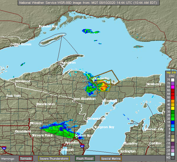 At 1043 am edt, severe thunderstorms were located along a line extending from near deerton to chatham to near trenary, moving east at 40 mph (radar indicated). Hazards include 60 mph wind gusts and quarter size hail. Hail damage to vehicles is expected. expect wind damage to roofs, siding, and trees. Locations impacted include, au train, chatham, deerton, trenary, skandia, shot point, laughing whitefish falls, forest lake, sundell, kiva, diffin and eben junction. At 1043 am edt, severe thunderstorms were located along a line extending from near deerton to chatham to near trenary, moving east at 40 mph (radar indicated). Hazards include 60 mph wind gusts and quarter size hail. Hail damage to vehicles is expected. expect wind damage to roofs, siding, and trees. Locations impacted include, au train, chatham, deerton, trenary, skandia, shot point, laughing whitefish falls, forest lake, sundell, kiva, diffin and eben junction.
|
| 8/10/2020 10:36 AM EDT |
 At 1035 am edt, severe thunderstorms were located along a line extending from shot point to 8 miles west of chatham to near rock, moving east at 40 mph (radar indicated). Hazards include 60 mph wind gusts and half dollar size hail. Hail damage to vehicles is expected. expect wind damage to roofs, siding, and trees. locations impacted include, au train, chatham, deerton, trenary, harvey, u. s. 41 between trenary and rapid river, skandia, shot point, laughing whitefish falls, forest lake, beaver grove and sundell. At 1035 am edt, severe thunderstorms were located along a line extending from shot point to 8 miles west of chatham to near rock, moving east at 40 mph (radar indicated). Hazards include 60 mph wind gusts and half dollar size hail. Hail damage to vehicles is expected. expect wind damage to roofs, siding, and trees. locations impacted include, au train, chatham, deerton, trenary, harvey, u. s. 41 between trenary and rapid river, skandia, shot point, laughing whitefish falls, forest lake, beaver grove and sundell.
|
| 8/10/2020 10:23 AM EDT |
 At 1022 am edt, severe thunderstorms were located along a line extending from near harvey to 8 miles east of k i sawyer to 6 miles northeast of watson, moving east at 45 mph (radar indicated). Hazards include 60 mph wind gusts and half dollar size hail. Hail damage to vehicles is expected. expect wind damage to roofs, siding, and trees. locations impacted include, watson, au train, chatham, deerton, trenary, k. i. sawyer airport, rock, k i sawyer, harvey, gwinn, u. s. 41 between trenary and rapid river and sands. At 1022 am edt, severe thunderstorms were located along a line extending from near harvey to 8 miles east of k i sawyer to 6 miles northeast of watson, moving east at 45 mph (radar indicated). Hazards include 60 mph wind gusts and half dollar size hail. Hail damage to vehicles is expected. expect wind damage to roofs, siding, and trees. locations impacted include, watson, au train, chatham, deerton, trenary, k. i. sawyer airport, rock, k i sawyer, harvey, gwinn, u. s. 41 between trenary and rapid river and sands.
|
| 8/10/2020 10:11 AM EDT |
 At 1010 am edt/910 am cdt/, severe thunderstorms were located along a line extending from 7 miles south of negaunee to 7 miles southwest of gwinn to 7 miles northeast of foster city, moving east at 40 mph (radar indicated). Hazards include 60 mph wind gusts and quarter size hail. Hail damage to vehicles is expected. Expect wind damage to roofs, siding, and trees. At 1010 am edt/910 am cdt/, severe thunderstorms were located along a line extending from 7 miles south of negaunee to 7 miles southwest of gwinn to 7 miles northeast of foster city, moving east at 40 mph (radar indicated). Hazards include 60 mph wind gusts and quarter size hail. Hail damage to vehicles is expected. Expect wind damage to roofs, siding, and trees.
|
| 7/19/2020 3:27 AM EDT |
 The severe thunderstorm warning for northwestern delta, southeastern marquette and southwestern alger counties will expire at 330 am edt, the storm which prompted the warning has moved out of the area. therefore, the warning will be allowed to expire. a severe thunderstorm watch remains in effect until 600 am edt for north central upper and south central upper michigan. to report severe weather, contact your nearest law enforcement agency. they will relay your report to the national weather service marquette. The severe thunderstorm warning for northwestern delta, southeastern marquette and southwestern alger counties will expire at 330 am edt, the storm which prompted the warning has moved out of the area. therefore, the warning will be allowed to expire. a severe thunderstorm watch remains in effect until 600 am edt for north central upper and south central upper michigan. to report severe weather, contact your nearest law enforcement agency. they will relay your report to the national weather service marquette.
|
| 7/19/2020 3:12 AM EDT |
 At 311 am edt, a severe thunderstorm was located near trenary, or 19 miles southwest of munising, moving east at 50 mph (radar indicated). Hazards include 60 mph wind gusts and penny size hail. Expect damage to roofs, siding, and trees. locations impacted include, chatham, rock, trenary, u. s. 41 between trenary and rapid river, mcfarland, lathrop, kiva, diffin and traunik. At 311 am edt, a severe thunderstorm was located near trenary, or 19 miles southwest of munising, moving east at 50 mph (radar indicated). Hazards include 60 mph wind gusts and penny size hail. Expect damage to roofs, siding, and trees. locations impacted include, chatham, rock, trenary, u. s. 41 between trenary and rapid river, mcfarland, lathrop, kiva, diffin and traunik.
|
| 7/19/2020 2:54 AM EDT |
 At 254 am edt, a severe thunderstorm was located 8 miles west of trenary, or 26 miles southeast of marquette, moving east at 45 mph (radar indicated). Hazards include 60 mph wind gusts and penny size hail. Expect damage to roofs, siding, and trees. locations impacted include, chatham, rock, trenary, u. s. 41 between trenary and rapid river, forest lake, kiva, diffin, mcfarland, lathrop, eben junction, carlshend and traunik. At 254 am edt, a severe thunderstorm was located 8 miles west of trenary, or 26 miles southeast of marquette, moving east at 45 mph (radar indicated). Hazards include 60 mph wind gusts and penny size hail. Expect damage to roofs, siding, and trees. locations impacted include, chatham, rock, trenary, u. s. 41 between trenary and rapid river, forest lake, kiva, diffin, mcfarland, lathrop, eben junction, carlshend and traunik.
|
| 7/19/2020 2:37 AM EDT |
 At 237 am edt, severe thunderstorms were located along a line extending from 10 miles southeast of k i sawyer to 8 miles southeast of gwinn to 12 miles northwest of watson, moving east at 25 mph (radar indicated). Hazards include 60 mph wind gusts and penny size hail. expect damage to roofs, siding, and trees At 237 am edt, severe thunderstorms were located along a line extending from 10 miles southeast of k i sawyer to 8 miles southeast of gwinn to 12 miles northwest of watson, moving east at 25 mph (radar indicated). Hazards include 60 mph wind gusts and penny size hail. expect damage to roofs, siding, and trees
|
| 8/27/2019 3:55 PM EDT |
 At 355 pm edt, severe thunderstorms were located along a line extending from shot point to 10 miles east of k i sawyer, moving east at 40 mph (radar indicated). Hazards include 60 mph wind gusts. Expect damage to roofs, siding, and trees. Locations impacted include, munising, grand island, au train, chatham, deerton, skandia, shot point, laughing whitefish falls, christmas, forest lake, sundell and kiva. At 355 pm edt, severe thunderstorms were located along a line extending from shot point to 10 miles east of k i sawyer, moving east at 40 mph (radar indicated). Hazards include 60 mph wind gusts. Expect damage to roofs, siding, and trees. Locations impacted include, munising, grand island, au train, chatham, deerton, skandia, shot point, laughing whitefish falls, christmas, forest lake, sundell and kiva.
|
| 8/27/2019 3:42 PM EDT |
 At 340 pm edt, severe thunderstorms were located along a line extending from 8 miles northeast of little presque isle to near k i sawyer, moving east at 45 mph (radar indicated). Hazards include 60 mph wind gusts and penny size hail. expect damage to roofs, siding, and trees At 340 pm edt, severe thunderstorms were located along a line extending from 8 miles northeast of little presque isle to near k i sawyer, moving east at 45 mph (radar indicated). Hazards include 60 mph wind gusts and penny size hail. expect damage to roofs, siding, and trees
|
| 8/2/2019 3:39 PM EDT |
 At 338 pm edt, a severe thunderstorm was located 9 miles west of chatham, or 21 miles southeast of marquette, moving southeast at 5 mph (radar indicated). Hazards include quarter size hail. Damage to vehicles is expected. Locations impacted include, chatham, kiva, carlshend and sundell. At 338 pm edt, a severe thunderstorm was located 9 miles west of chatham, or 21 miles southeast of marquette, moving southeast at 5 mph (radar indicated). Hazards include quarter size hail. Damage to vehicles is expected. Locations impacted include, chatham, kiva, carlshend and sundell.
|
| 8/5/2018 8:35 PM EDT |
 At 834 pm edt, a severe thunderstorm was located near trenary, or 23 miles southwest of munising, moving east at 30 mph (radar indicated). Hazards include 60 mph wind gusts and penny size hail. Expect damage to roofs, siding, and trees. Locations impacted include, chatham, trenary, sundell, eben junction, kiva, diffin and traunik. At 834 pm edt, a severe thunderstorm was located near trenary, or 23 miles southwest of munising, moving east at 30 mph (radar indicated). Hazards include 60 mph wind gusts and penny size hail. Expect damage to roofs, siding, and trees. Locations impacted include, chatham, trenary, sundell, eben junction, kiva, diffin and traunik.
|
| 8/5/2018 8:16 PM EDT |
 At 816 pm edt, a severe thunderstorm was located near k i sawyer, or 18 miles south of marquette, moving southeast at 30 mph (radar indicated). Hazards include 60 mph wind gusts and penny size hail. Expect damage to roofs, siding, and trees. locations impacted include, chatham, k. i. Sawyer airport, k i sawyer, trenary, gwinn, skandia, sundell, little lake, kiva, diffin, eben junction and carlshend. At 816 pm edt, a severe thunderstorm was located near k i sawyer, or 18 miles south of marquette, moving southeast at 30 mph (radar indicated). Hazards include 60 mph wind gusts and penny size hail. Expect damage to roofs, siding, and trees. locations impacted include, chatham, k. i. Sawyer airport, k i sawyer, trenary, gwinn, skandia, sundell, little lake, kiva, diffin, eben junction and carlshend.
|
| 8/5/2018 8:03 PM EDT |
 At 802 pm edt, a severe thunderstorm was located over k i sawyer, or 15 miles south of marquette, moving east at 35 mph (radar indicated). Hazards include 60 mph wind gusts and nickel size hail. expect damage to roofs, siding, and trees At 802 pm edt, a severe thunderstorm was located over k i sawyer, or 15 miles south of marquette, moving east at 35 mph (radar indicated). Hazards include 60 mph wind gusts and nickel size hail. expect damage to roofs, siding, and trees
|
| 9/22/2017 2:45 PM EDT |
 At 244 pm edt, severe thunderstorms were located along a line extending from near munising to near trenary to near u.s. 41 between trenary and rapid river, moving southeast at 40 mph (radar indicated). Hazards include 60 mph wind gusts and penny size hail. expect damage to roofs, siding, and trees At 244 pm edt, severe thunderstorms were located along a line extending from near munising to near trenary to near u.s. 41 between trenary and rapid river, moving southeast at 40 mph (radar indicated). Hazards include 60 mph wind gusts and penny size hail. expect damage to roofs, siding, and trees
|
| 8/9/2017 4:45 PM EDT | Ping Pong Ball sized hail reported 11.1 miles NNE of Chatham, MI, picture of near golf ball sized hail near trenary via social media. hail fell for about 20 minutes. strong winds also observed. |
| 8/9/2017 4:37 PM EDT | Ping Pong Ball sized hail reported 10.9 miles N of Chatham, MI, report via picture on social media. |
| 8/1/2017 5:00 PM EDT | Over 100 12-24 inch diameter trees snapped and uprooted. 2 trees on a house along rock river road. power lines dow in alger county MI, 7.8 miles S of Chatham, MI |
| 6/15/2017 7:20 PM EDT |
 At 720 pm edt, severe thunderstorms were located along a line extending from 9 miles north of seney to 10 miles south of munising, moving southeast at 25 mph (radar indicated). Hazards include 60 mph wind gusts and half dollar size hail. Hail damage to vehicles is expected. expect wind damage to roofs, siding, and trees. Locations impacted include, munising, chatham, seney, shingleton, steuben, m-28 between shingleton and seney, forest lake, cusino lake, wetmore, melstrand, snyder lake and van meer. At 720 pm edt, severe thunderstorms were located along a line extending from 9 miles north of seney to 10 miles south of munising, moving southeast at 25 mph (radar indicated). Hazards include 60 mph wind gusts and half dollar size hail. Hail damage to vehicles is expected. expect wind damage to roofs, siding, and trees. Locations impacted include, munising, chatham, seney, shingleton, steuben, m-28 between shingleton and seney, forest lake, cusino lake, wetmore, melstrand, snyder lake and van meer.
|
| 6/15/2017 6:51 PM EDT |
 At 651 pm edt, severe thunderstorms were located along a line extending from 10 miles southwest of grand sable dunes to chatham, moving southeast at 25 mph (public). Hazards include golf ball size hail and 60 mph wind gusts. People and animals outdoors will be injured. expect hail damage to roofs, siding, windows, and vehicles. expect wind damage to roofs, siding, and trees. Locations impacted include, munising, miners castle, chapel lake, grand island, au train, chatham, seney, shingleton, steuben, m-28 between shingleton and seney, christmas, forest lake, sundell, cusino lake, beaver lake, wetmore, melstrand, eben junction, snyder lake and van meer. At 651 pm edt, severe thunderstorms were located along a line extending from 10 miles southwest of grand sable dunes to chatham, moving southeast at 25 mph (public). Hazards include golf ball size hail and 60 mph wind gusts. People and animals outdoors will be injured. expect hail damage to roofs, siding, windows, and vehicles. expect wind damage to roofs, siding, and trees. Locations impacted include, munising, miners castle, chapel lake, grand island, au train, chatham, seney, shingleton, steuben, m-28 between shingleton and seney, christmas, forest lake, sundell, cusino lake, beaver lake, wetmore, melstrand, eben junction, snyder lake and van meer.
|
| 6/15/2017 6:39 PM EDT |
 At 639 pm edt, severe thunderstorms were located along a line extending from 8 miles east of chapel lake to near chatham, moving southeast at 30 mph (public). Hazards include ping pong ball size hail and 60 mph wind gusts. People and animals outdoors will be injured. expect hail damage to roofs, siding, windows, and vehicles. Expect wind damage to roofs, siding, and trees. At 639 pm edt, severe thunderstorms were located along a line extending from 8 miles east of chapel lake to near chatham, moving southeast at 30 mph (public). Hazards include ping pong ball size hail and 60 mph wind gusts. People and animals outdoors will be injured. expect hail damage to roofs, siding, windows, and vehicles. Expect wind damage to roofs, siding, and trees.
|
| 6/15/2017 6:18 PM EDT |
 At 617 pm edt, severe thunderstorms were located along a line extending from near chapel lake to munising, moving southeast at 20 mph (radar indicated). Hazards include 60 mph wind gusts and quarter size hail. Hail damage to vehicles is expected. expect wind damage to roofs, siding, and trees. Locations impacted include, munising, grand island, miners castle, chapel lake, au train, chatham, christmas, forest lake, beaver lake, grand portal point, wetmore, melstrand, eben junction and kingston lake. At 617 pm edt, severe thunderstorms were located along a line extending from near chapel lake to munising, moving southeast at 20 mph (radar indicated). Hazards include 60 mph wind gusts and quarter size hail. Hail damage to vehicles is expected. expect wind damage to roofs, siding, and trees. Locations impacted include, munising, grand island, miners castle, chapel lake, au train, chatham, christmas, forest lake, beaver lake, grand portal point, wetmore, melstrand, eben junction and kingston lake.
|
| 6/15/2017 5:55 PM EDT |
 At 554 pm edt, severe thunderstorms were located along a line extending from 9 miles north of grand island to near au train, moving southeast at 25 mph (radar indicated). Hazards include 60 mph wind gusts and quarter size hail. Hail damage to vehicles is expected. Expect wind damage to roofs, siding, and trees. At 554 pm edt, severe thunderstorms were located along a line extending from 9 miles north of grand island to near au train, moving southeast at 25 mph (radar indicated). Hazards include 60 mph wind gusts and quarter size hail. Hail damage to vehicles is expected. Expect wind damage to roofs, siding, and trees.
|
| 4/10/2017 3:52 AM EDT |
 At 350 am edt, severe thunderstorms were located along a line extending from near deerton to trenary, moving northeast at 55 mph (radar indicated). Hazards include 60 mph wind gusts and quarter size hail. Hail damage to vehicles is expected. expect wind damage to roofs, siding, and trees. Locations impacted include, munising, grand island, au train, chatham, deerton, trenary, shot point, laughing whitefish falls, christmas, forest lake, sundell, kiva, diffin, eben junction and traunik. At 350 am edt, severe thunderstorms were located along a line extending from near deerton to trenary, moving northeast at 55 mph (radar indicated). Hazards include 60 mph wind gusts and quarter size hail. Hail damage to vehicles is expected. expect wind damage to roofs, siding, and trees. Locations impacted include, munising, grand island, au train, chatham, deerton, trenary, shot point, laughing whitefish falls, christmas, forest lake, sundell, kiva, diffin, eben junction and traunik.
|
| 4/10/2017 3:29 AM EDT |
 At 329 am edt, severe thunderstorms were located along a line extending from k. i. sawyer airport to 8 miles north of rock, moving northeast at 55 mph (radar indicated). Hazards include 60 mph wind gusts and quarter size hail. Hail damage to vehicles is expected. expect wind damage to roofs, siding, and trees. locations impacted include, munising, grand island, watson, au train, chatham, deerton, trenary, k. i. sawyer airport, rock, k i sawyer, harvey, gwinn, u. s. 41 between trenary and rapid river, sands, skandia, christmas, forest lake, chicago lake, the 553 and 480 crossroads and little lake. At 329 am edt, severe thunderstorms were located along a line extending from k. i. sawyer airport to 8 miles north of rock, moving northeast at 55 mph (radar indicated). Hazards include 60 mph wind gusts and quarter size hail. Hail damage to vehicles is expected. expect wind damage to roofs, siding, and trees. locations impacted include, munising, grand island, watson, au train, chatham, deerton, trenary, k. i. sawyer airport, rock, k i sawyer, harvey, gwinn, u. s. 41 between trenary and rapid river, sands, skandia, christmas, forest lake, chicago lake, the 553 and 480 crossroads and little lake.
|
| 4/10/2017 3:14 AM EDT |
 At 313 am edt, severe thunderstorms were located along a line extending from 11 miles west of gwinn to 8 miles northeast of foster city, moving northeast at 60 mph (radar indicated). Hazards include 60 mph wind gusts and quarter size hail. Hail damage to vehicles is expected. Expect wind damage to roofs, siding, and trees. At 313 am edt, severe thunderstorms were located along a line extending from 11 miles west of gwinn to 8 miles northeast of foster city, moving northeast at 60 mph (radar indicated). Hazards include 60 mph wind gusts and quarter size hail. Hail damage to vehicles is expected. Expect wind damage to roofs, siding, and trees.
|
| 8/14/2015 12:51 PM EDT | Golf Ball sized hail reported 15.9 miles N of Chatham, MI, social media report of up to golf ball sized hail near u.s. 41. |
| 8/2/2015 8:19 AM EDT |
 At 819 am edt, severe thunderstorms were located along a line extending from 9 miles northwest of forest road 13 in northern delta county to near gladstone, moving east at 45 mph (radar indicated). Hazards include 60 mph wind gusts and quarter size hail. Hail damage to vehicles is expected. expect wind damage to roofs, siding and trees. locations impacted include, chatham, trenary, u. s. 41 between trenary and rapid river, rock, brampton, cornell, sundell, forest lake, diffin, perkins, st. Nicholas, traunik, lathrop, eben junction and kiva. At 819 am edt, severe thunderstorms were located along a line extending from 9 miles northwest of forest road 13 in northern delta county to near gladstone, moving east at 45 mph (radar indicated). Hazards include 60 mph wind gusts and quarter size hail. Hail damage to vehicles is expected. expect wind damage to roofs, siding and trees. locations impacted include, chatham, trenary, u. s. 41 between trenary and rapid river, rock, brampton, cornell, sundell, forest lake, diffin, perkins, st. Nicholas, traunik, lathrop, eben junction and kiva.
|
| 8/2/2015 8:09 AM EDT |
 At 809 am edt /709 am cdt/, severe thunderstorms were located along a line extending from 6 miles northeast of trenary to 10 miles northwest of gladstone, moving east at 80 mph (radar indicated). Hazards include 60 mph wind gusts and quarter size hail. Hail damage to vehicles is expected. expect wind damage to roofs, siding and trees. these severe thunderstorms will remain over mainly rural areas of northwestern delta, northeastern menominee and southwestern alger counties, including the following locations, eben junction, sundell, forest lake, diffin, perkins, cornell, st. Nicholas, brampton, traunik and kiva. At 809 am edt /709 am cdt/, severe thunderstorms were located along a line extending from 6 miles northeast of trenary to 10 miles northwest of gladstone, moving east at 80 mph (radar indicated). Hazards include 60 mph wind gusts and quarter size hail. Hail damage to vehicles is expected. expect wind damage to roofs, siding and trees. these severe thunderstorms will remain over mainly rural areas of northwestern delta, northeastern menominee and southwestern alger counties, including the following locations, eben junction, sundell, forest lake, diffin, perkins, cornell, st. Nicholas, brampton, traunik and kiva.
|
| 8/2/2015 8:05 AM EDT | Ping Pong Ball sized hail reported 10.2 miles NNE of Chatham, MI, report via picture on social media along us 41 between trenary and kiva. time estimated from radar. |
| 8/21/2013 6:23 PM EDT | Quarter sized hail reported 15.5 miles NNW of Chatham, MI, had two different storms that went through and both dropped quarter sized hail. first storm went through around 1805 edt...the second came through around 1823 edt. |
| 8/21/2013 6:05 PM EDT | Quarter sized hail reported 10.3 miles N of Chatham, MI, several reports of dime and quarter sized hail. |
| 8/21/2013 5:40 PM EDT | Half Dollar sized hail reported 1.2 miles N of Chatham, MI, time estimated from radar. report via wluc tv facebook page. |
| 8/21/2013 5:40 PM EDT | Quarter sized hail reported 2 miles E of Chatham, MI, quarter sized hail. |
| 7/29/2012 8:50 PM EDT | Microburst winds snapped off or uprooted numerous large tree in alger county MI, 11.2 miles NE of Chatham, MI |
| 7/5/2012 5:20 AM EDT | 15 inch diameter branch came down on a cottage along the northwest shore of au train lake. a perched roof on the porch of the cottage was heavily damaged. other branche in alger county MI, 5.8 miles SW of Chatham, MI |
| 1/1/0001 12:00 AM | Numerous 100 ft white pine trees down along n. shore road near au train lake. one tree fell over a powerline. a telephone pole was snapped in hal in alger county MI, 6.1 miles SW of Chatham, MI |
Hail Maps for Chatham, MI


Connect with Interactive Hail Maps