

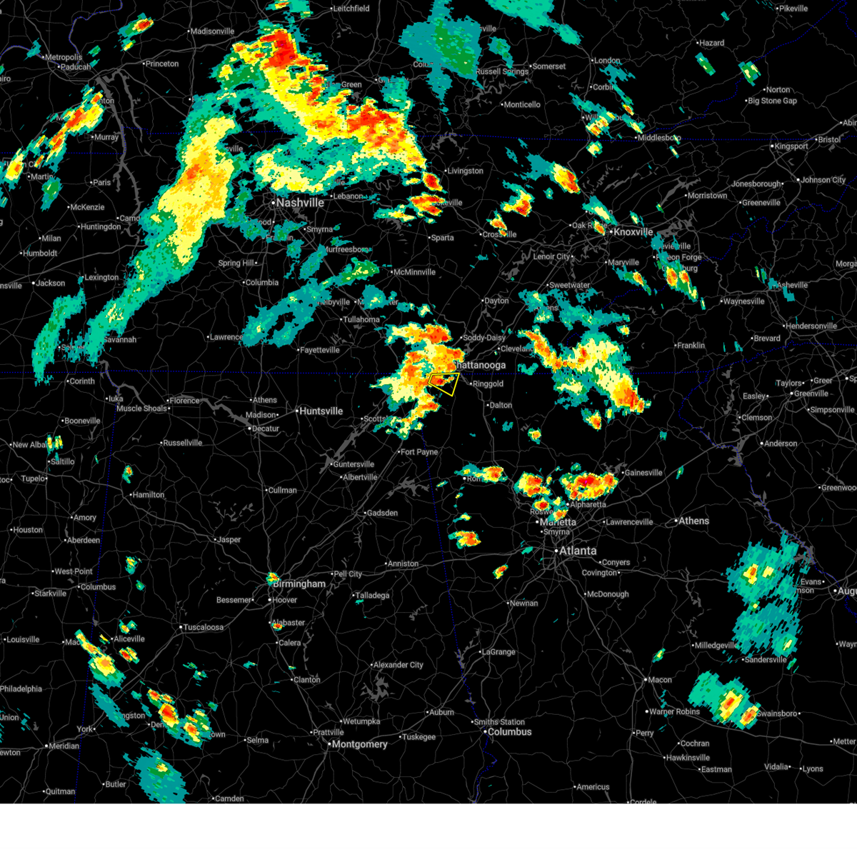
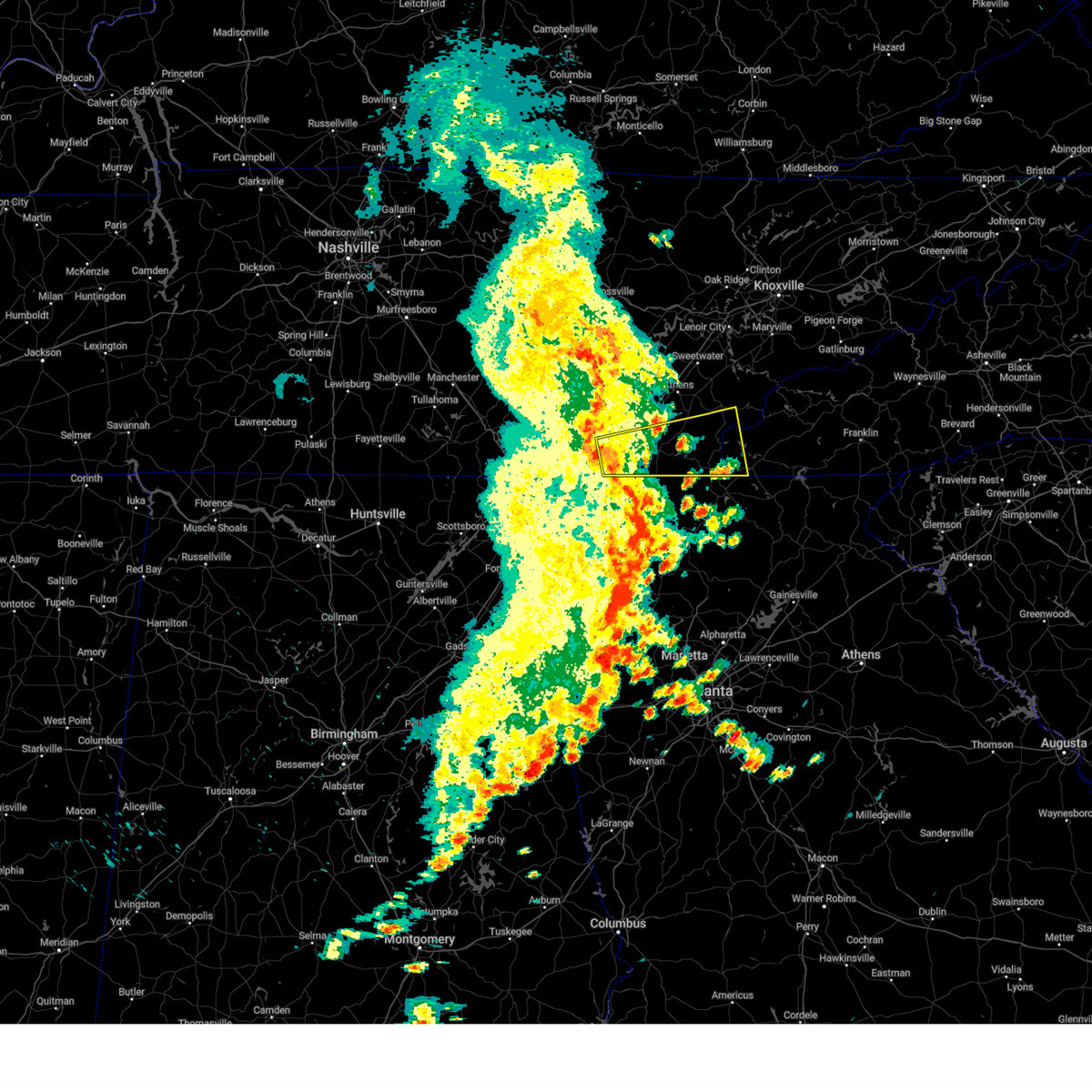
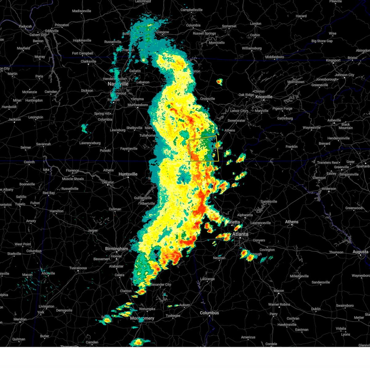
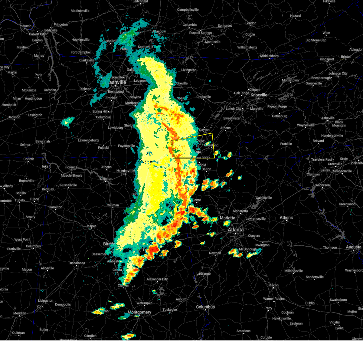
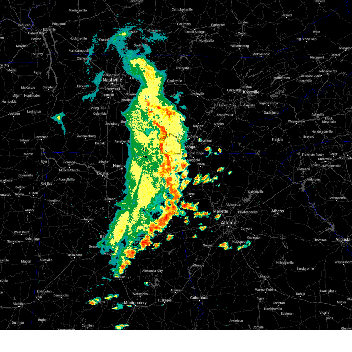
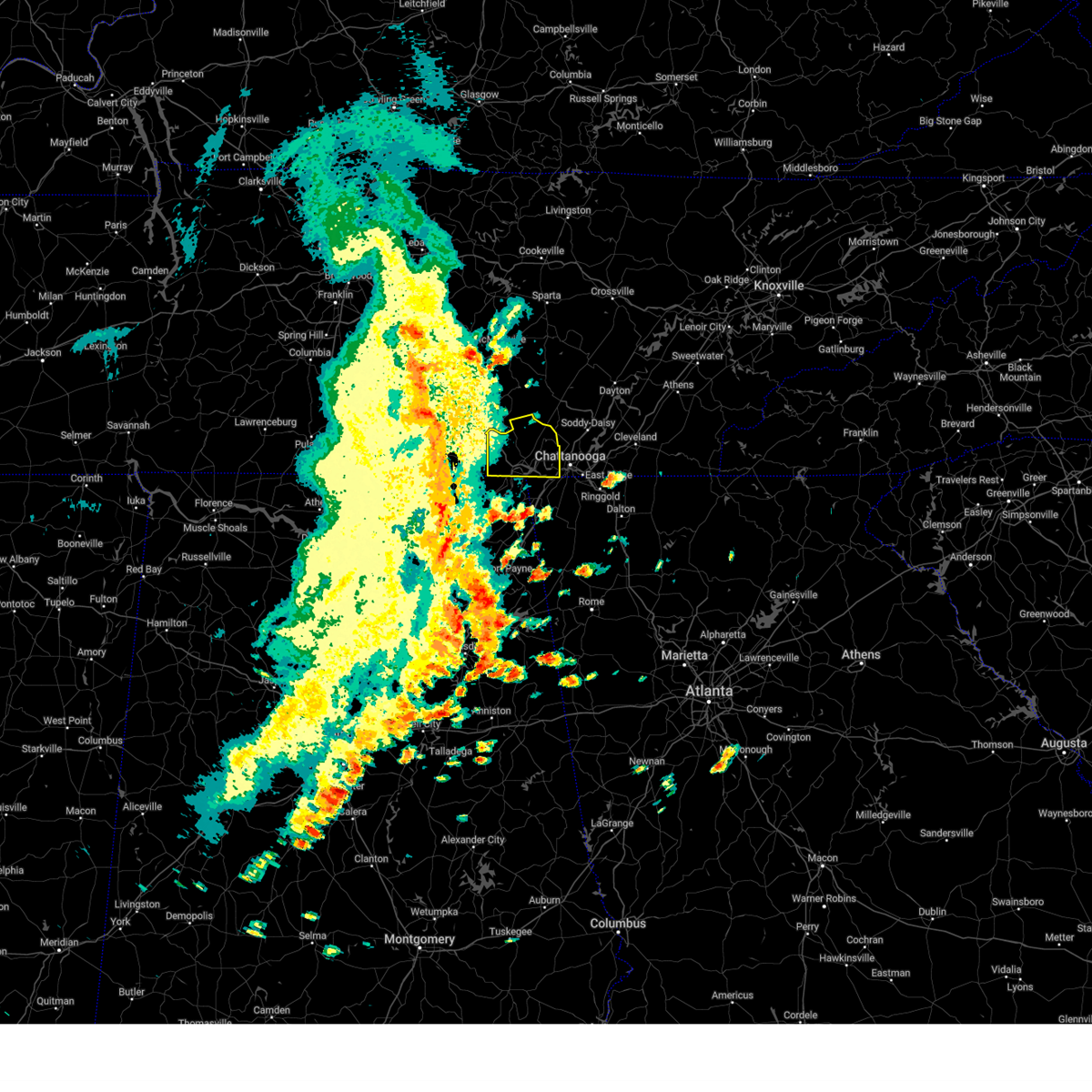
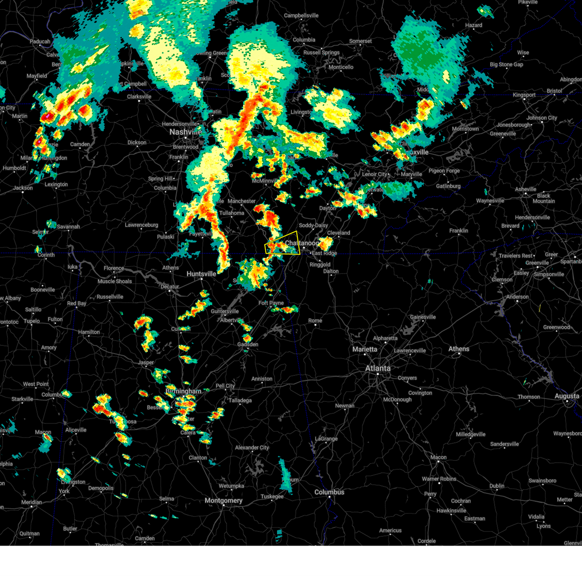
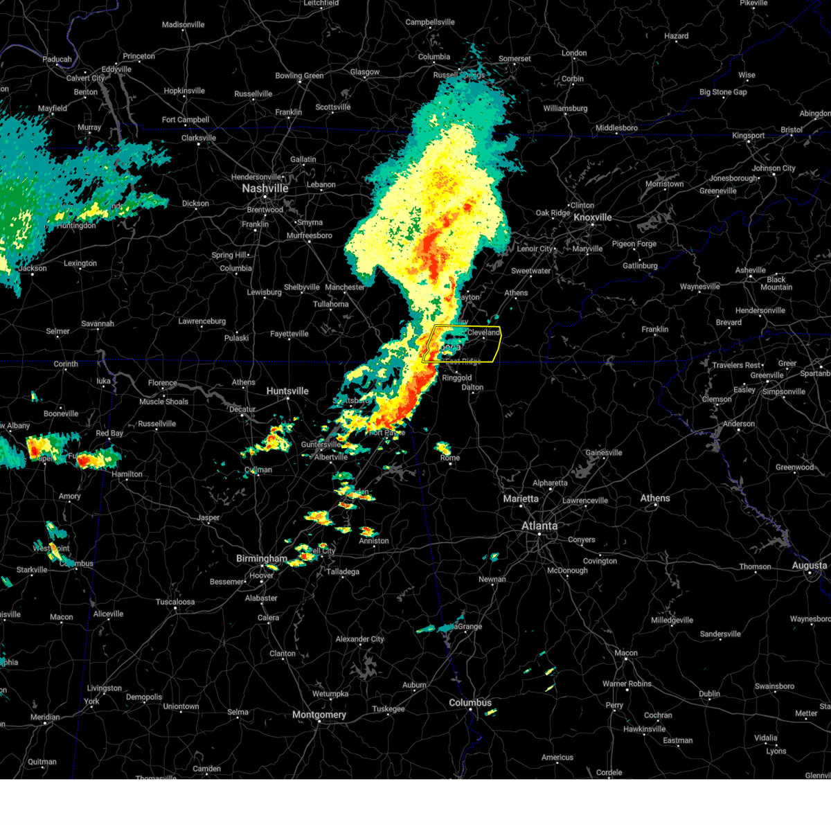
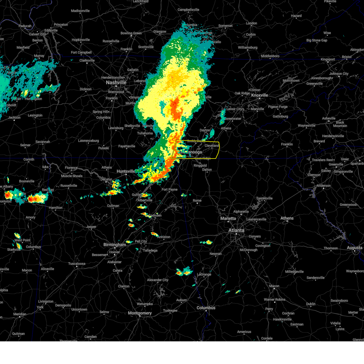
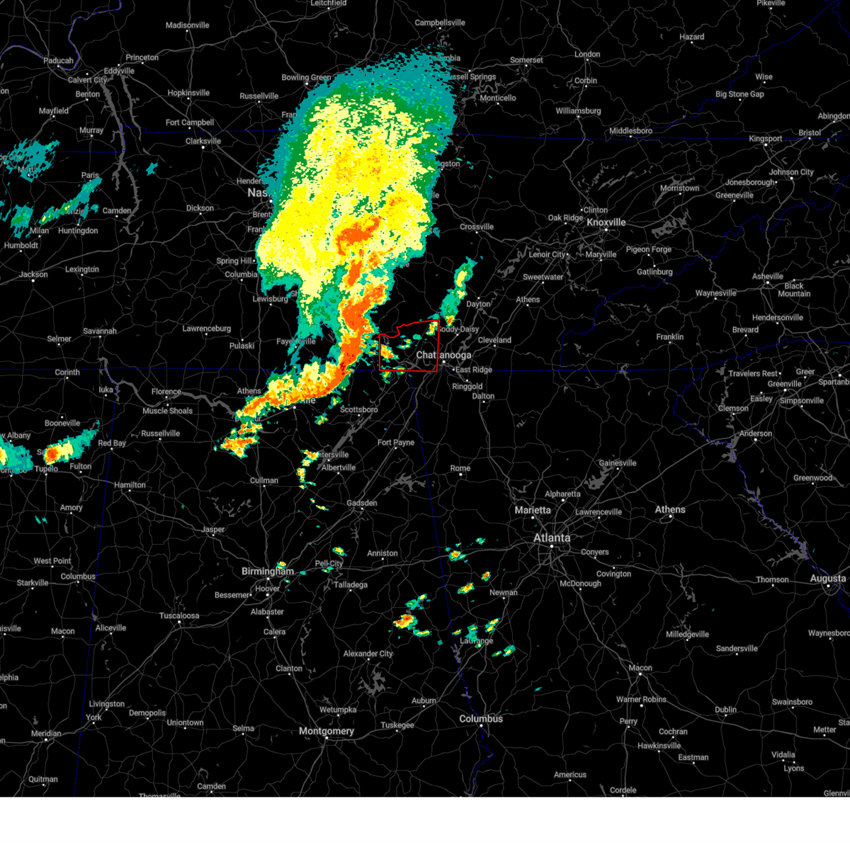
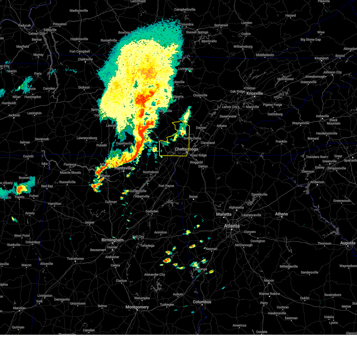
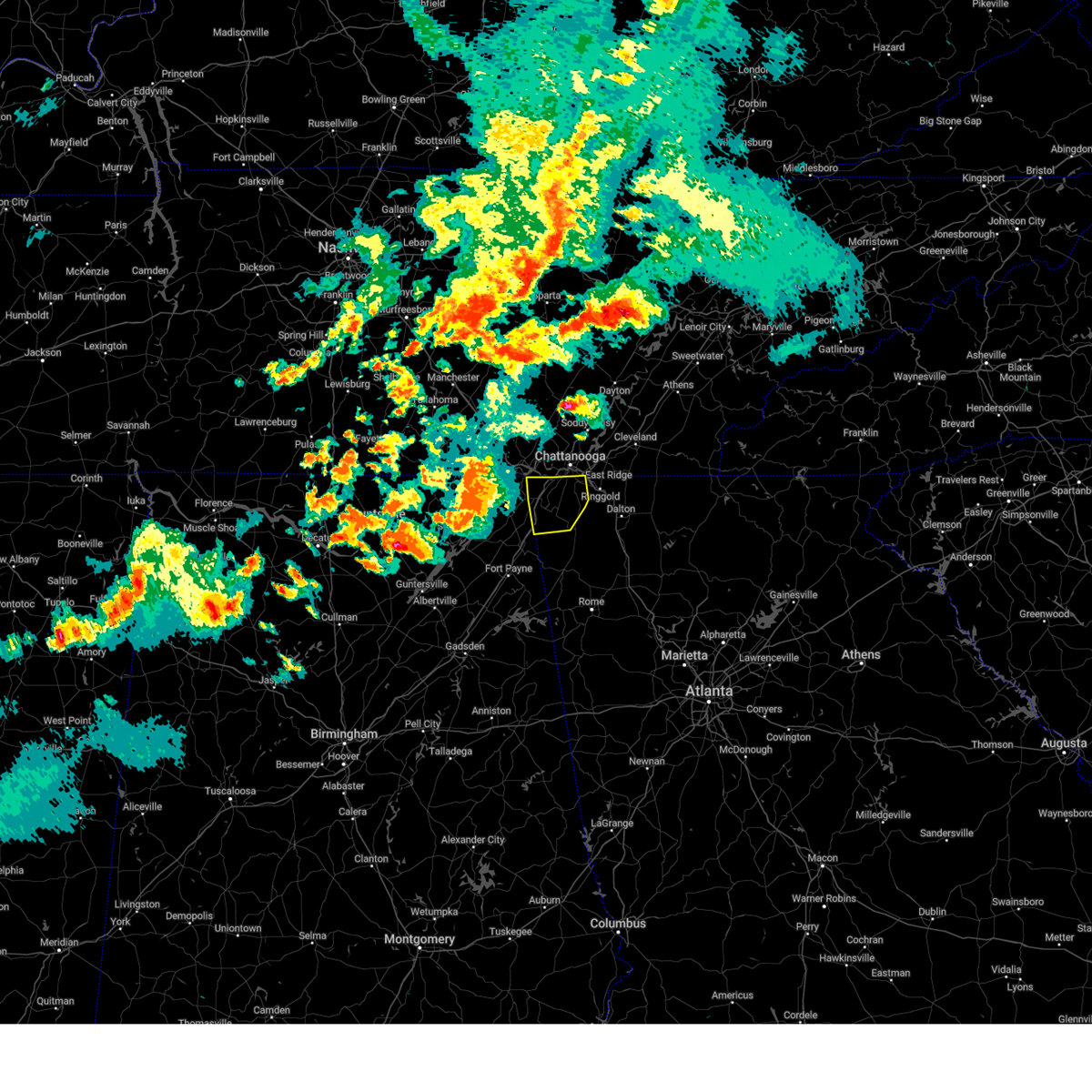
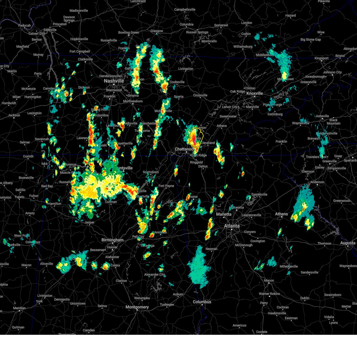
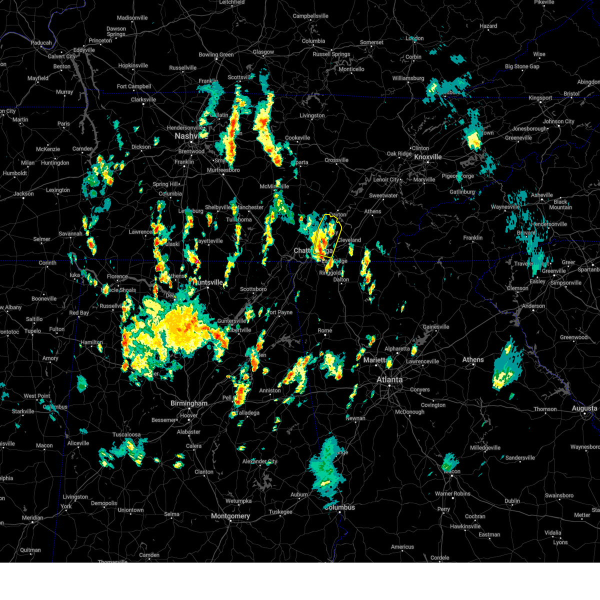
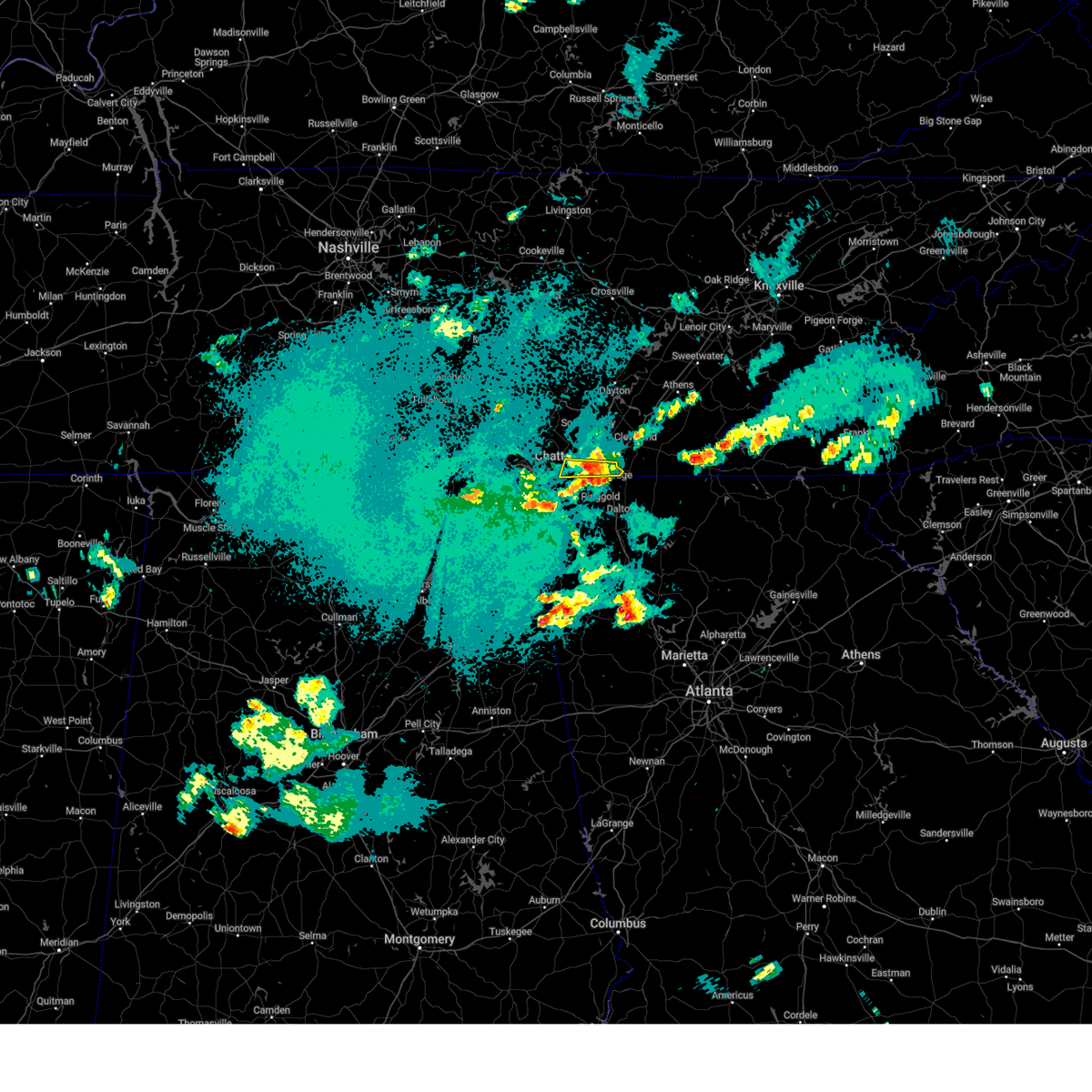
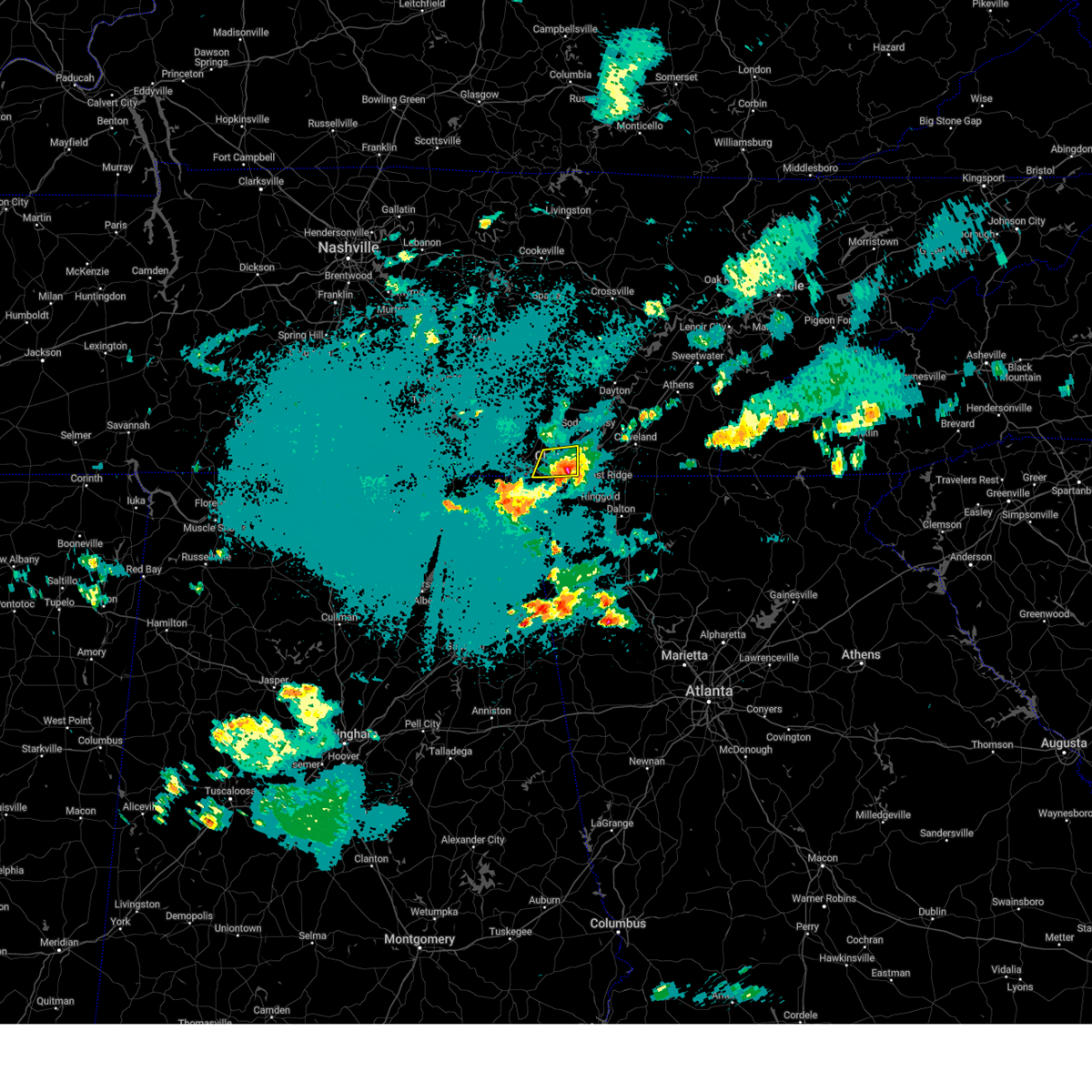
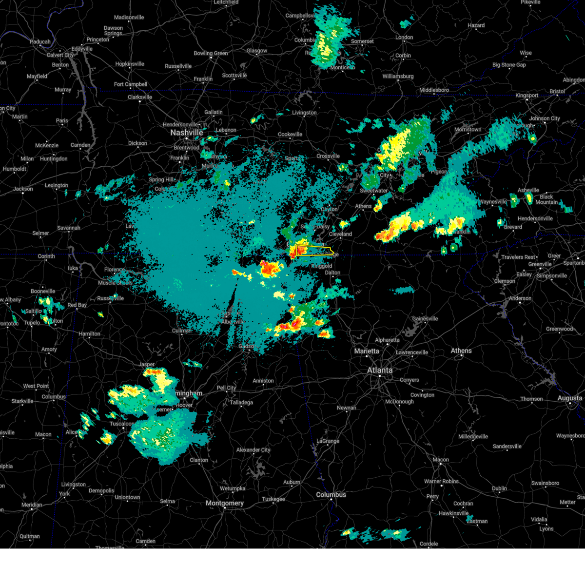
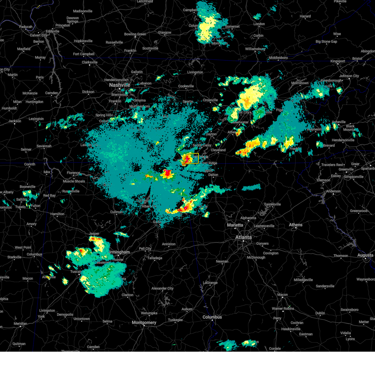
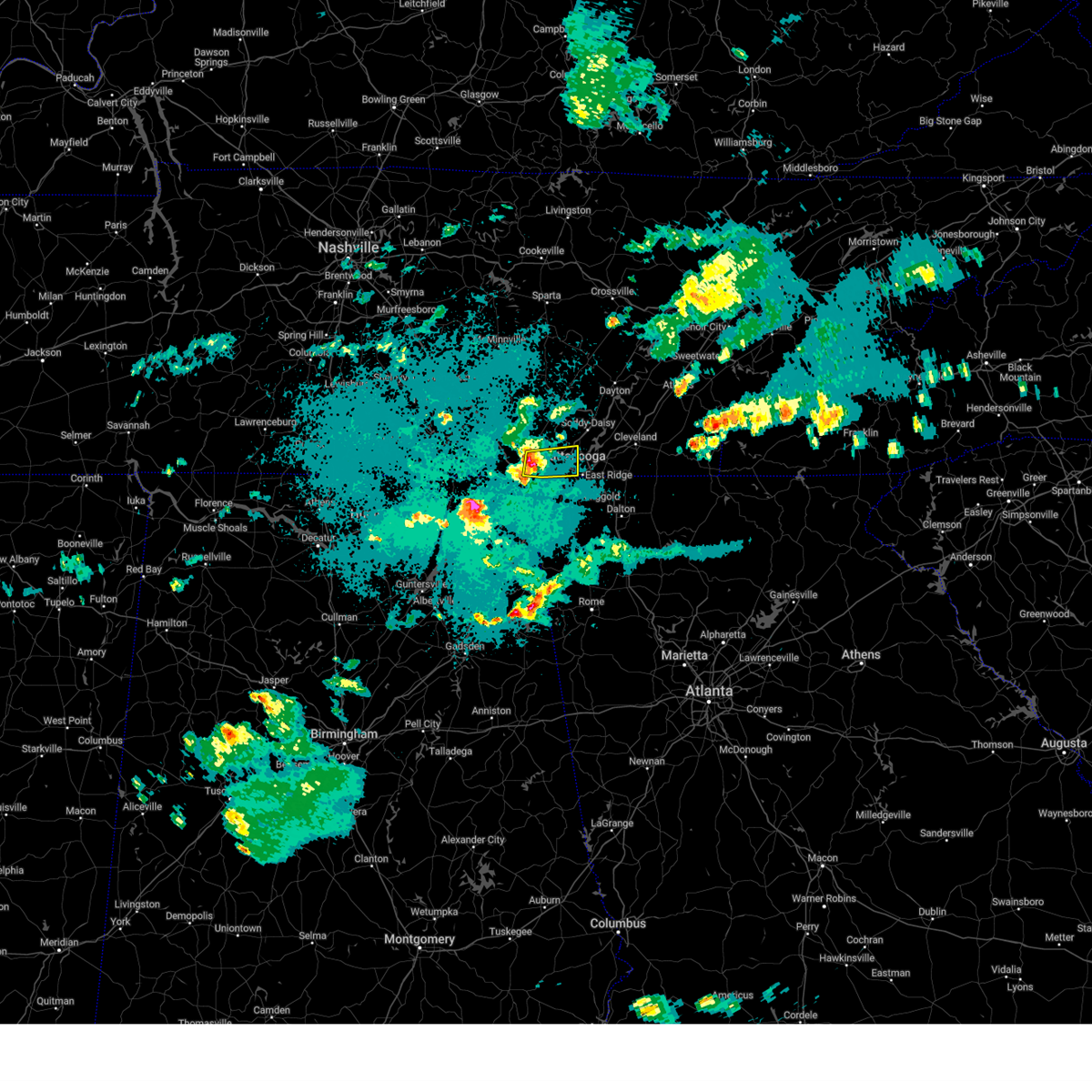
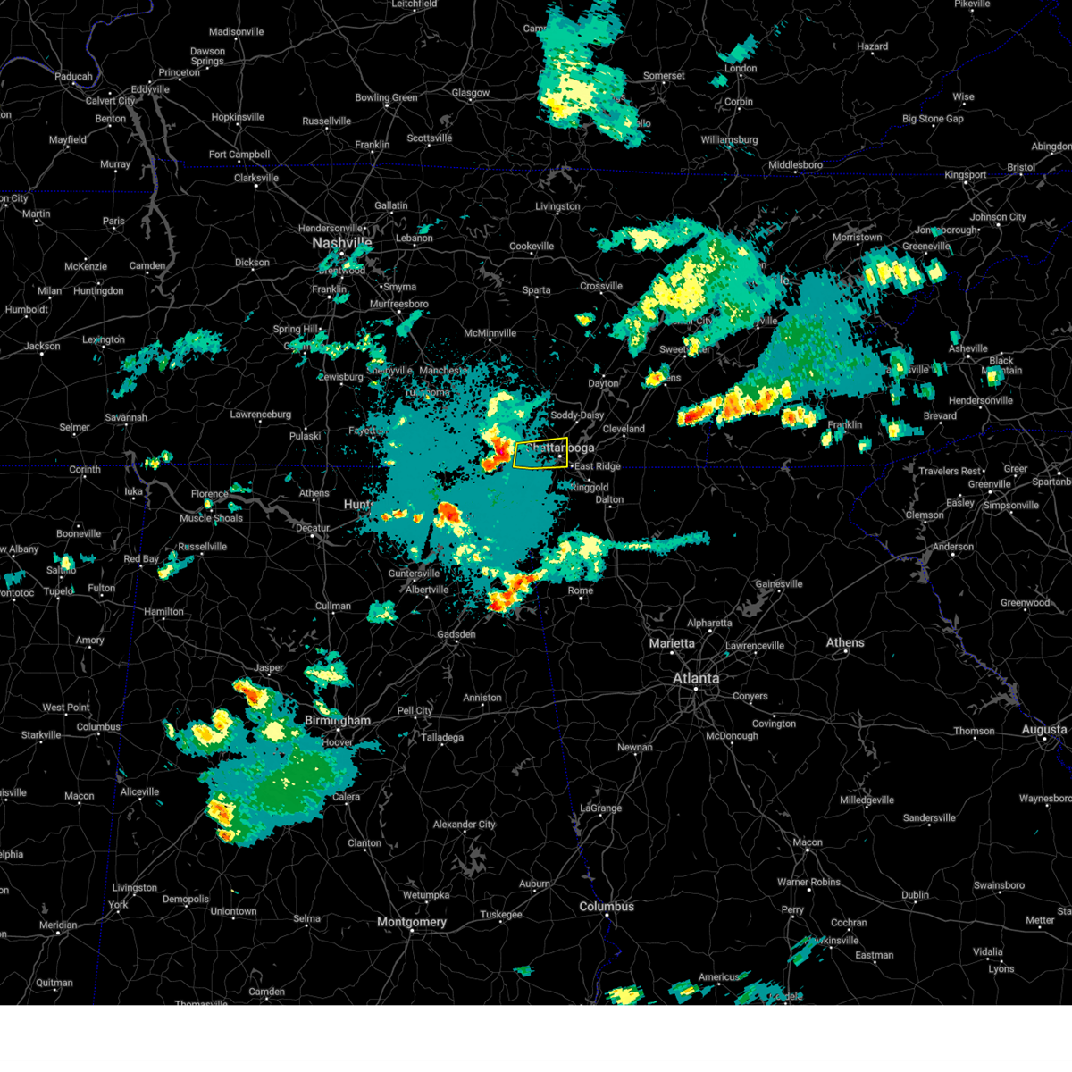
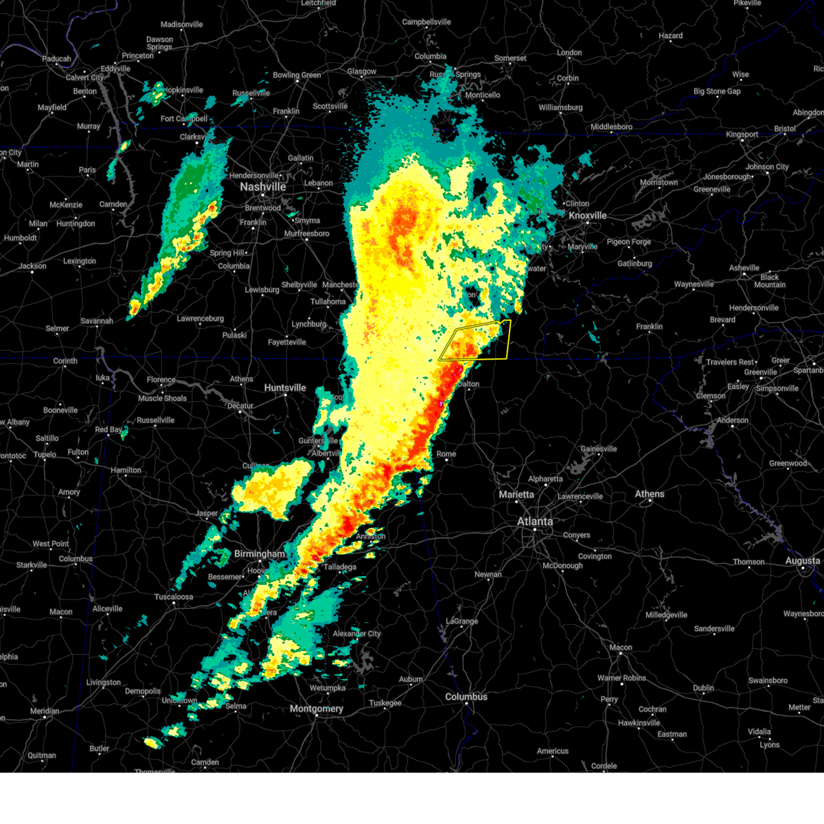
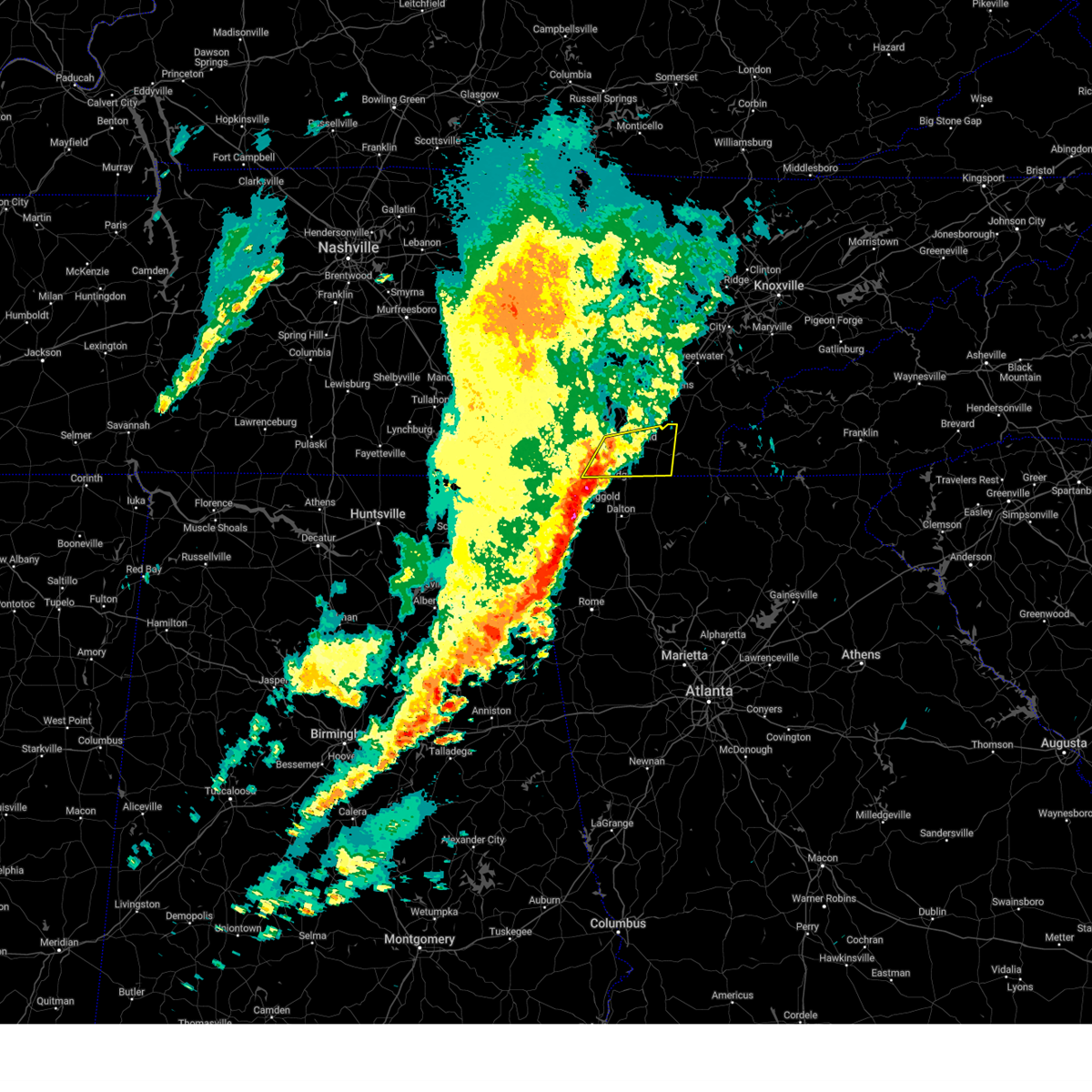
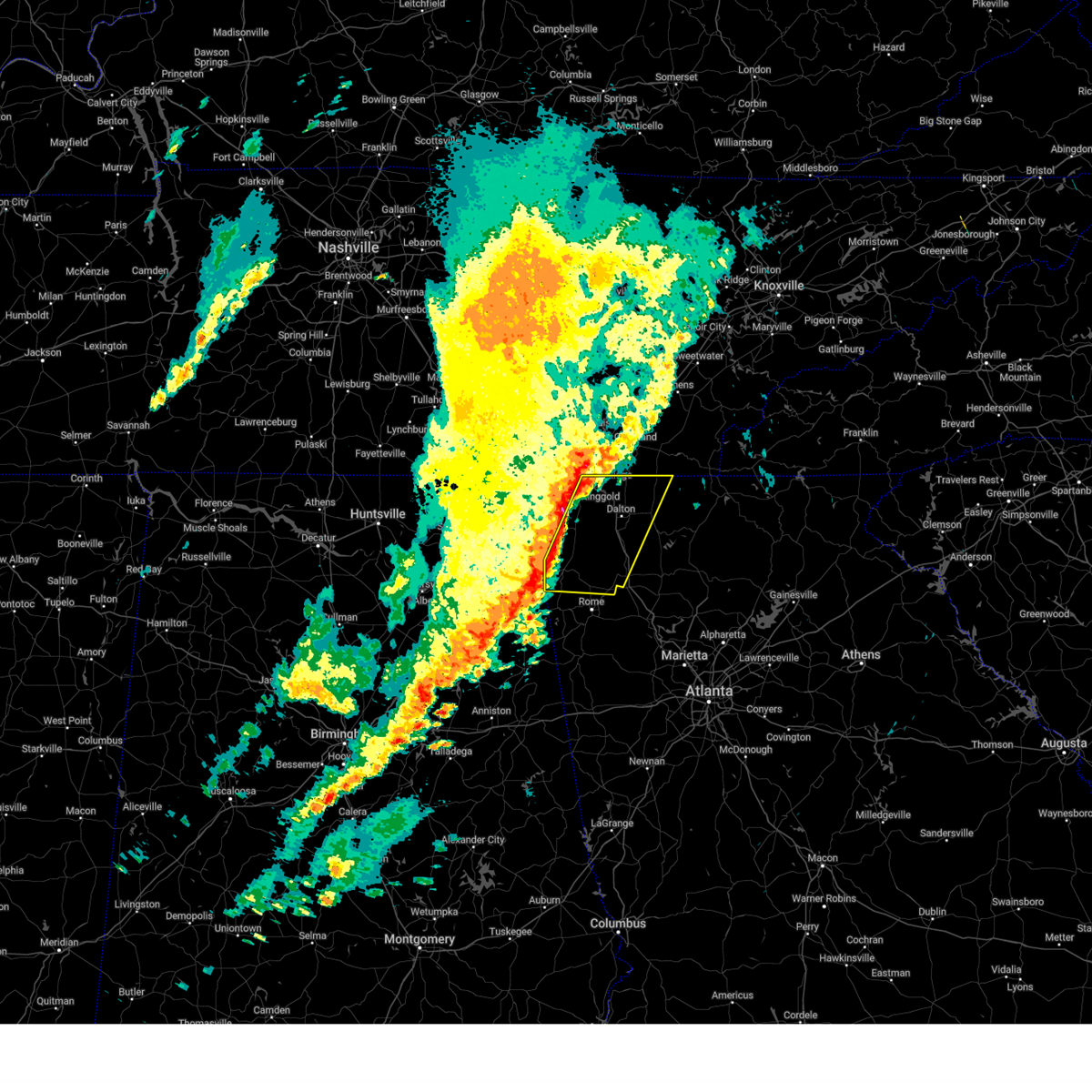
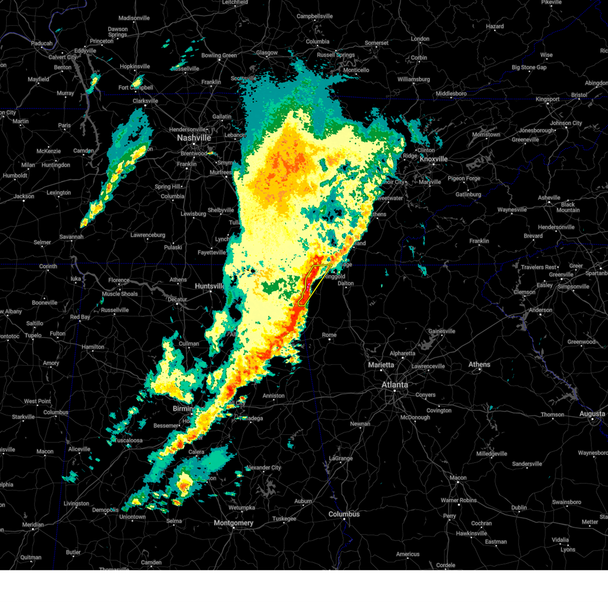
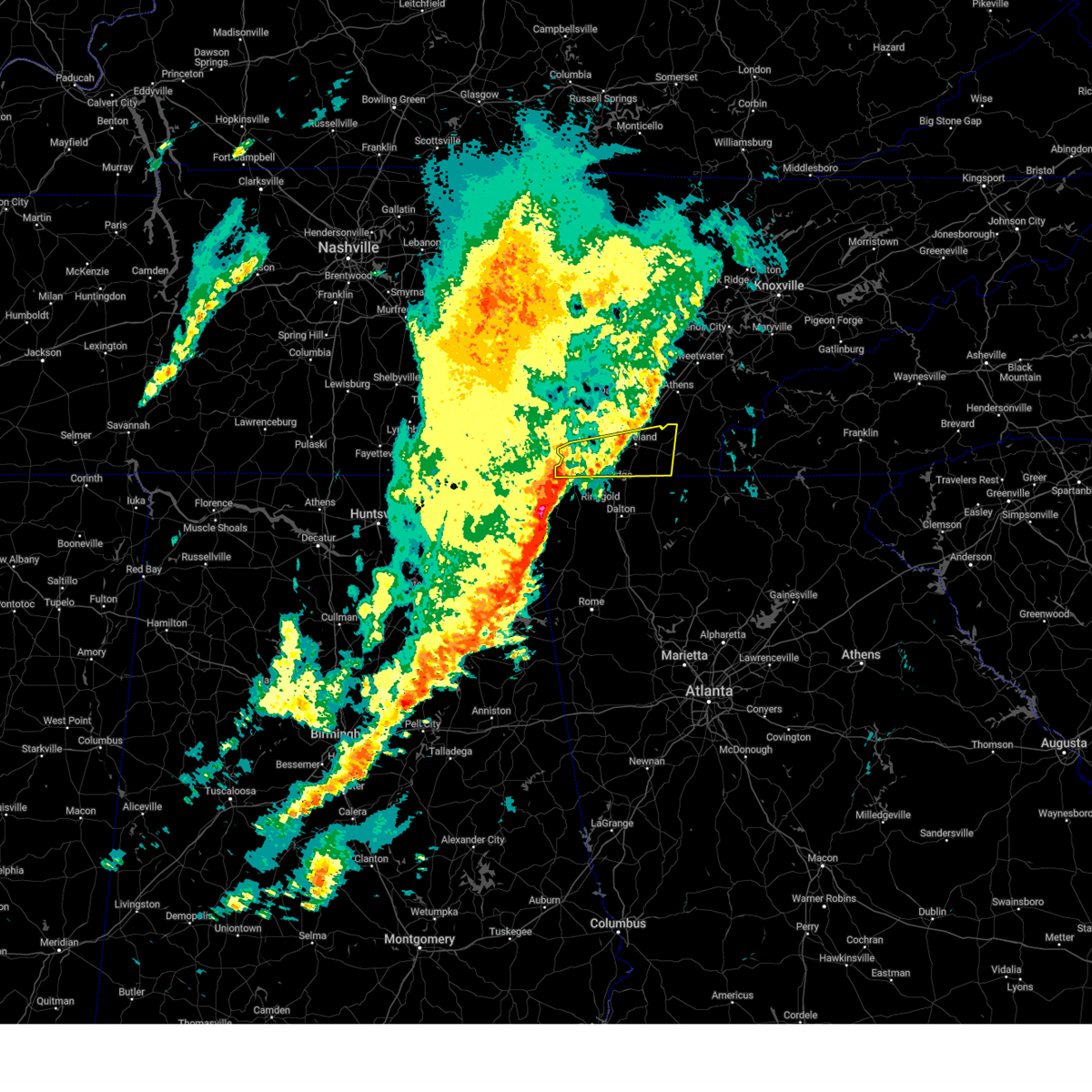
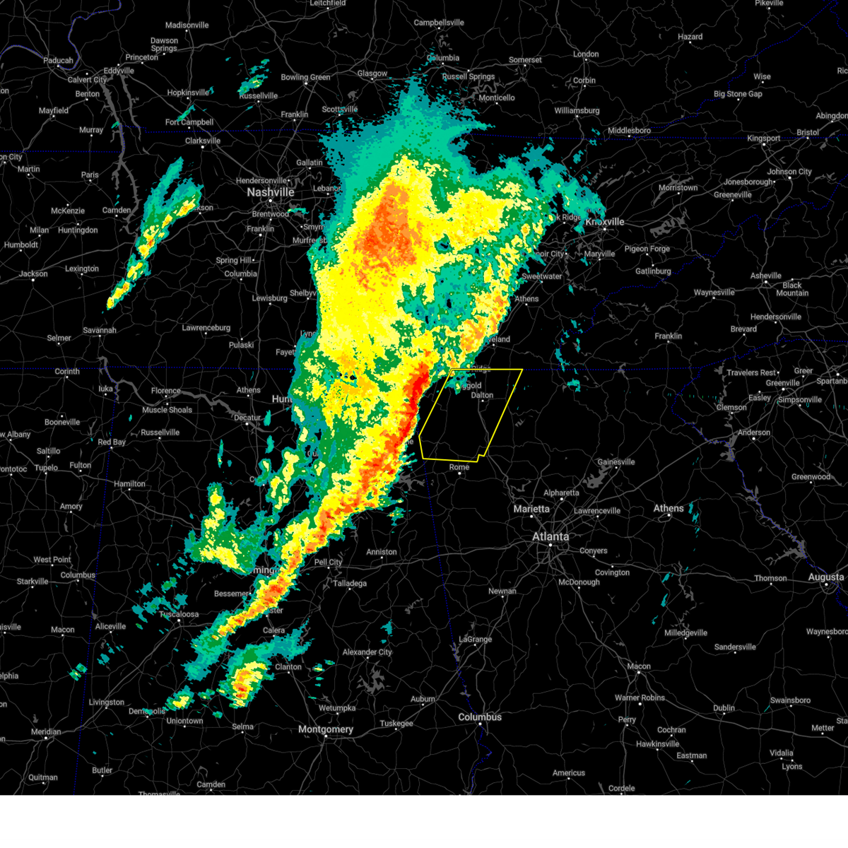
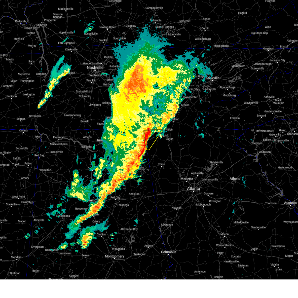
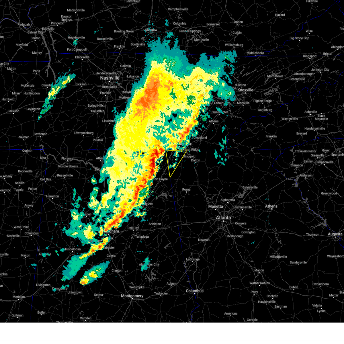
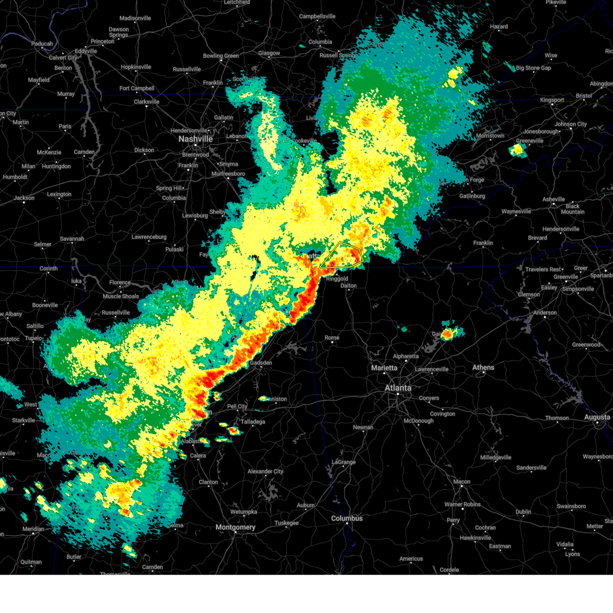
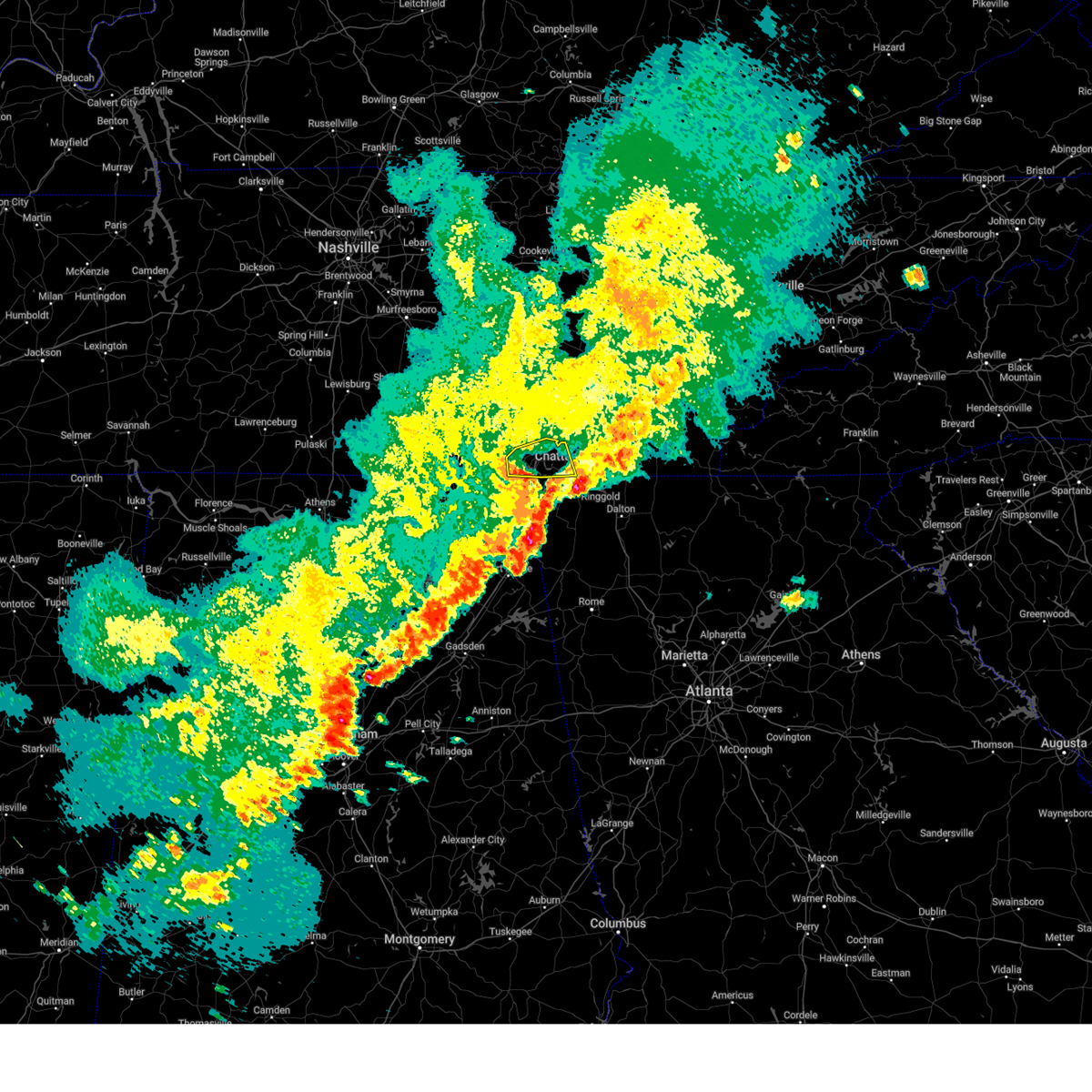
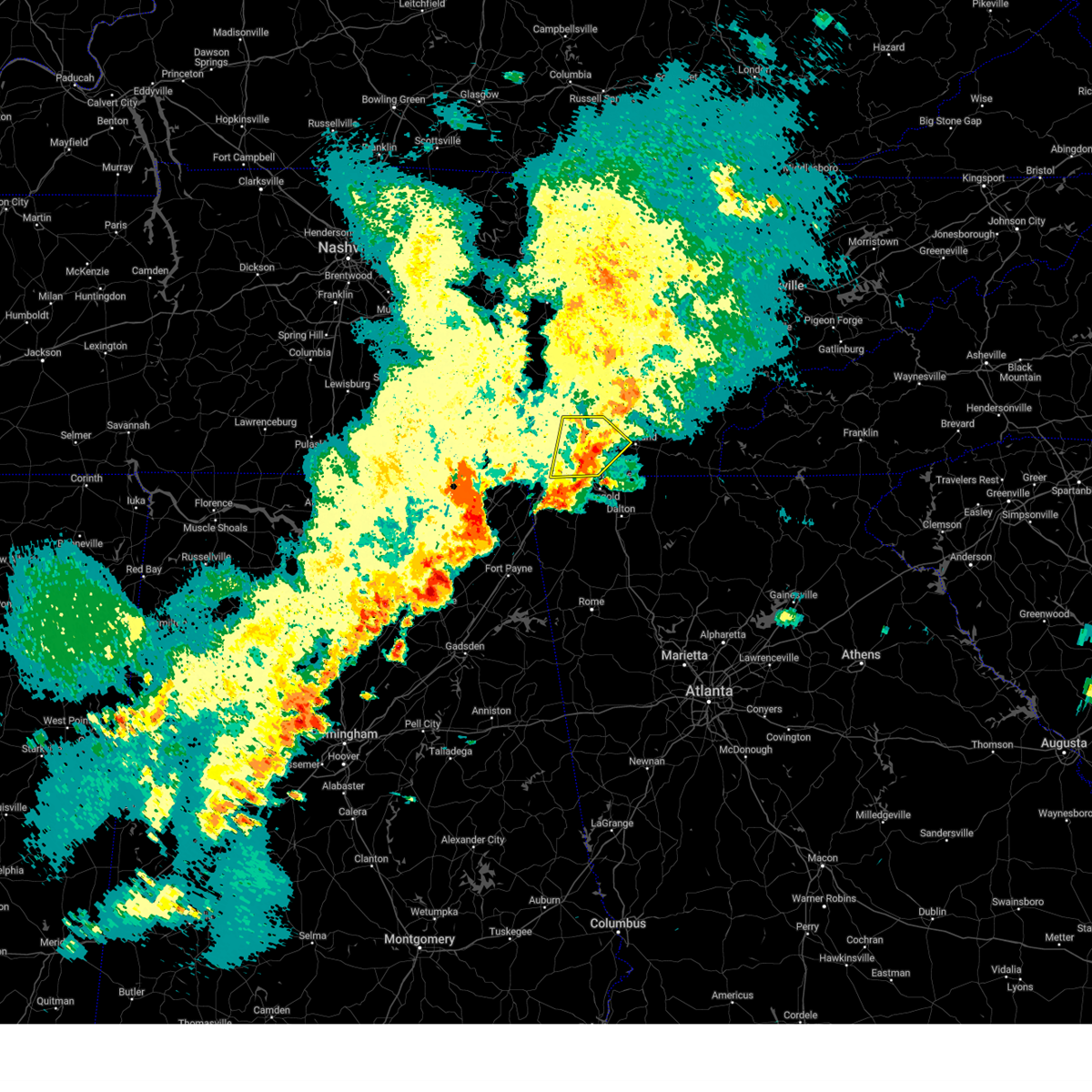
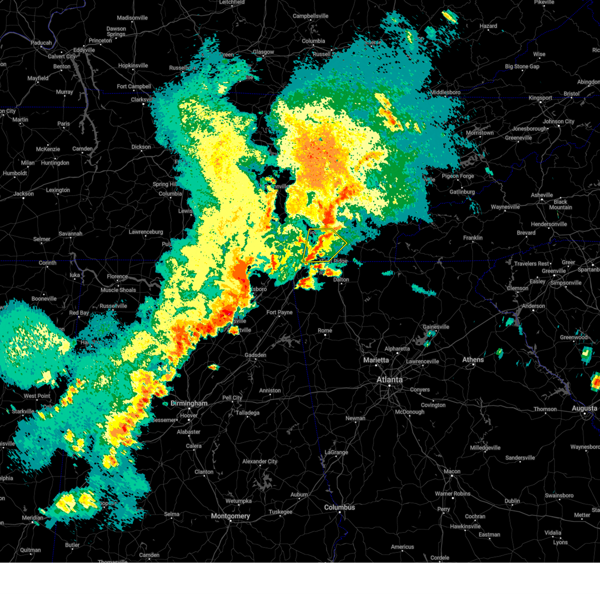
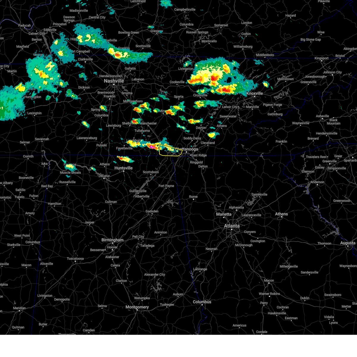
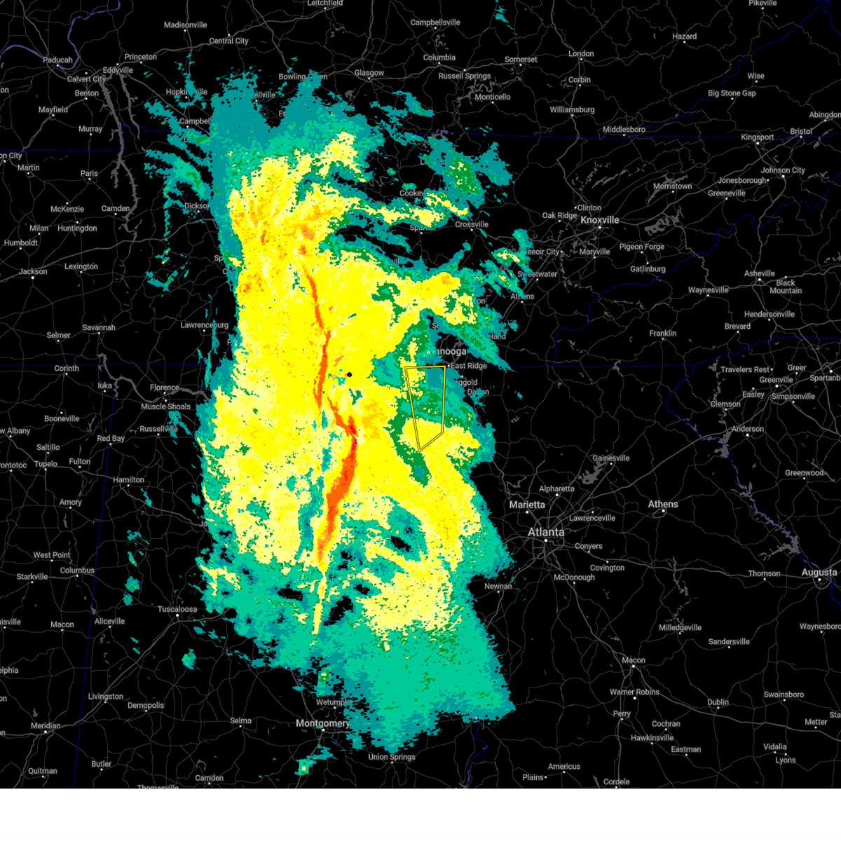
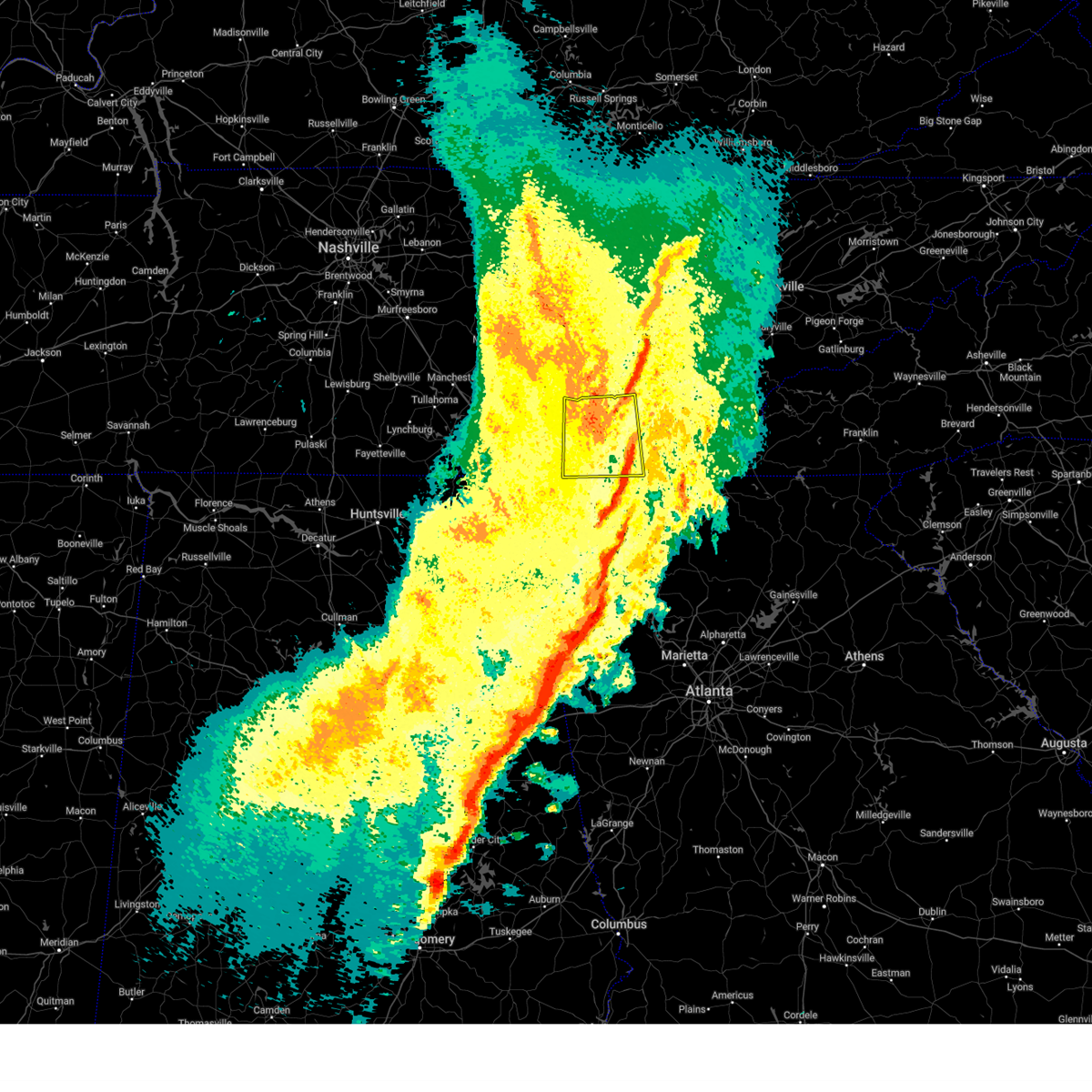
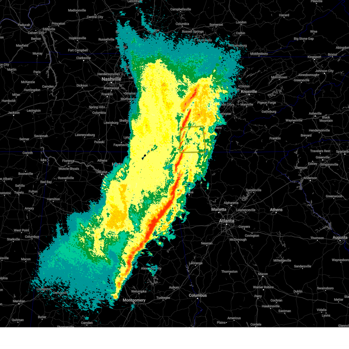
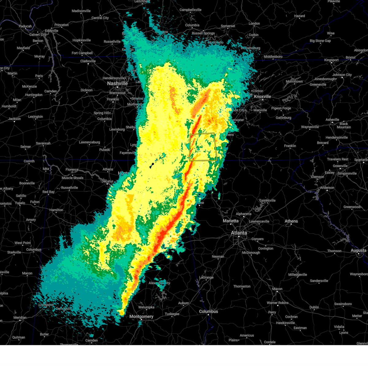
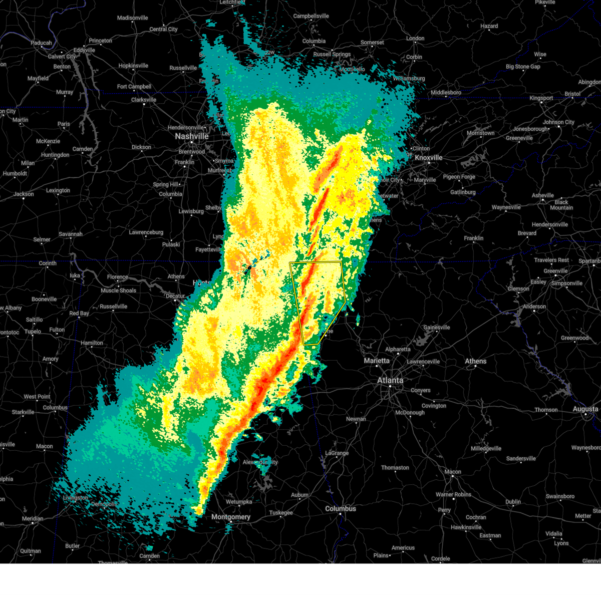
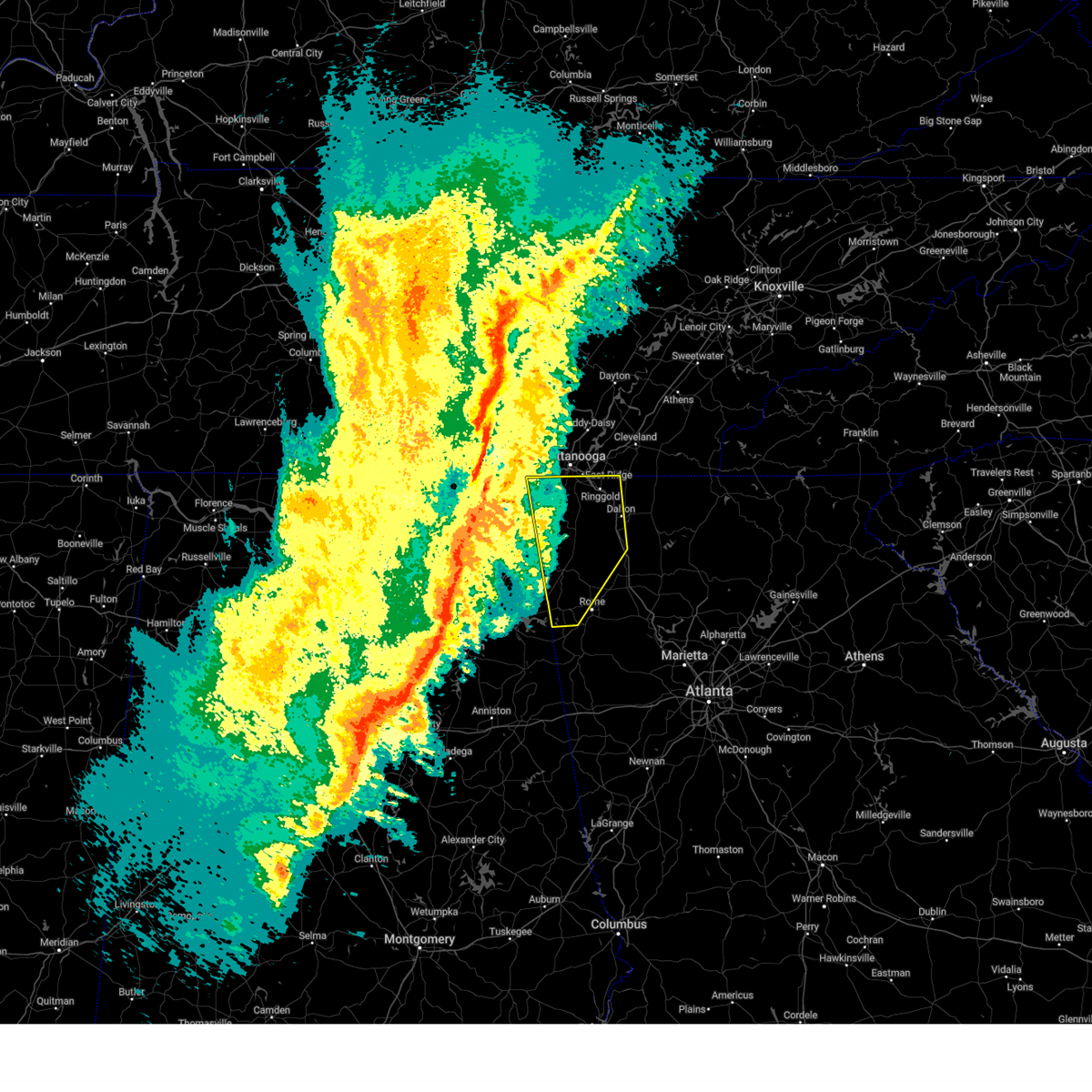
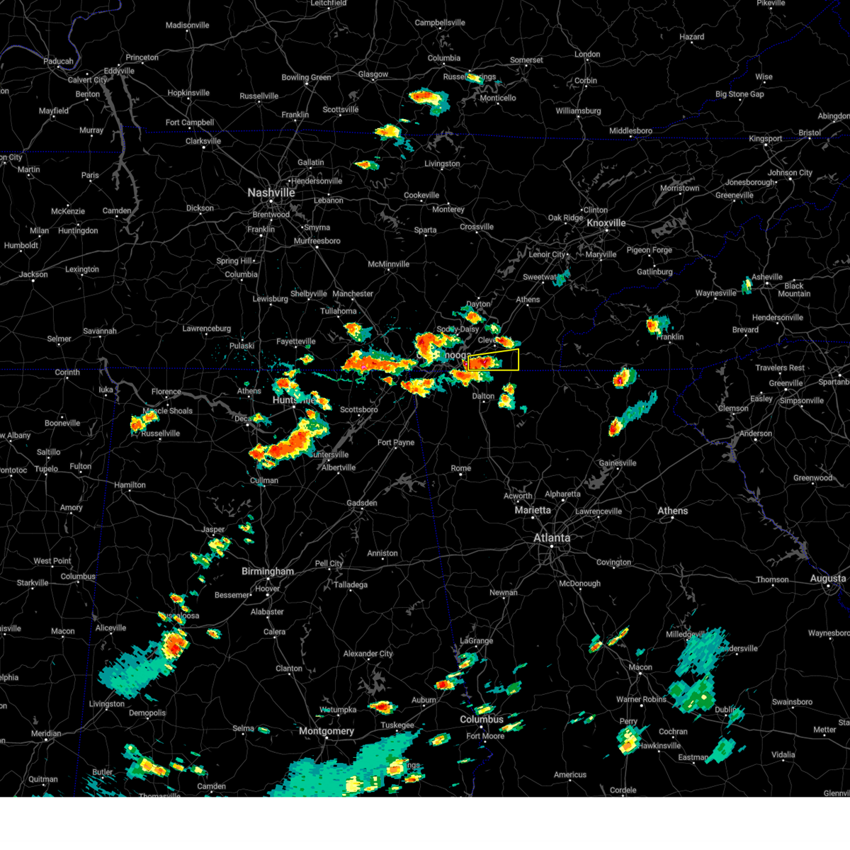
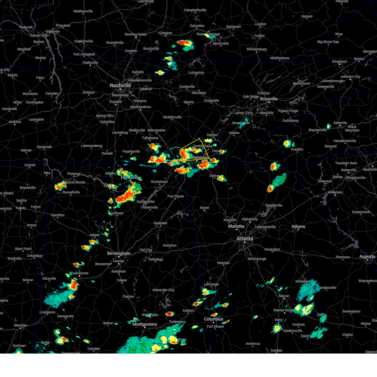
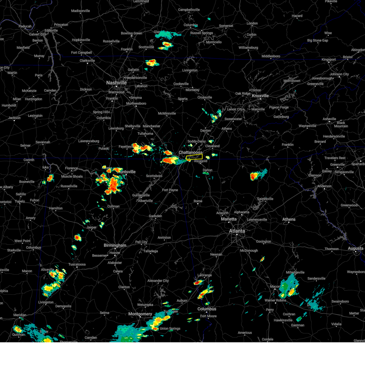
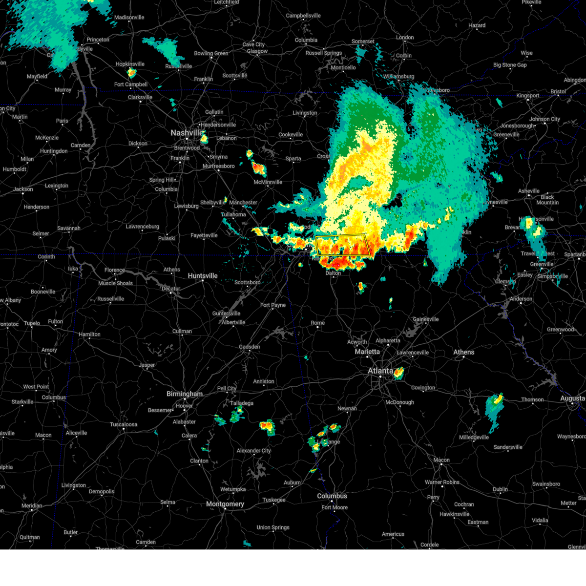
Hail Map for Chattanooga, TN
The Chattanooga, TN area has had 19 reports of on-the-ground hail by trained spotters, and has been under severe weather warnings 108 times during the past 12 months. Doppler radar has detected hail at or near Chattanooga, TN on 108 occasions, including 9 occasions during the past year.
| Name: | Chattanooga, TN |
| Where Located: | 4.1 miles ENE of Chattanooga, TN |
| Map: | Google Map for Chattanooga, TN |
| Population: | 167674 |
| Housing Units: | 79607 |
| More Info: | Search Google for Chattanooga, TN |
1
The Top Recent Hail Date for Chattanooga, TN is Thursday, May 8, 2025 (8th out of 108)

Hail and Wind Damage Spotted near Chattanooga, TN
| Date / Time | Report Details |
|---|---|
| 6/27/2025 6:13 PM EDT | the severe thunderstorm warning has been cancelled and is no longer in effect |
| 6/27/2025 5:49 PM EDT | the severe thunderstorm warning has been cancelled and is no longer in effect |
| 6/27/2025 5:37 PM EDT |
 Svrffc the national weather service in peachtree city has issued a * severe thunderstorm warning for, northwestern catoosa county in northwestern georgia, north central walker county in northwestern georgia, northeastern dade county in northwestern georgia, * until 630 pm edt. * at 537 pm edt, a severe thunderstorm was located over chattanooga valley, or 9 miles southwest of chattanooga, moving northeast at 10 mph (radar indicated). Hazards include 60 mph wind gusts and quarter size hail. Hail damage to vehicles is expected. Expect wind damage to roofs, siding, and trees. Svrffc the national weather service in peachtree city has issued a * severe thunderstorm warning for, northwestern catoosa county in northwestern georgia, north central walker county in northwestern georgia, northeastern dade county in northwestern georgia, * until 630 pm edt. * at 537 pm edt, a severe thunderstorm was located over chattanooga valley, or 9 miles southwest of chattanooga, moving northeast at 10 mph (radar indicated). Hazards include 60 mph wind gusts and quarter size hail. Hail damage to vehicles is expected. Expect wind damage to roofs, siding, and trees.
|
| 6/27/2025 5:25 PM EDT | Huge branch down in backyard of home in the hill city neighborhoo in hamilton county TN, 3.9 miles E of Chattanooga, TN |
| 6/27/2025 5:24 PM EDT | A few trees are down at university of tennessee chattanoog in hamilton county TN, 3 miles ENE of Chattanooga, TN |
| 6/27/2025 4:10 PM CDT | Facebook report of large branches and trees down in the suck creek are in marion county TN, 9.9 miles ESE of Chattanooga, TN |
| 6/27/2025 5:07 PM EDT | Svrmrx the national weather service in morristown has issued a * severe thunderstorm warning for, southern sequatchie county in east tennessee, southeastern marion county in east tennessee, southwestern hamilton county in east tennessee, * until 600 pm edt/500 pm cdt/. * at 507 pm edt/407 pm cdt/, a severe thunderstorm was located near chattanooga, moving north at 10 mph (radar indicated). Hazards include 60 mph wind gusts and quarter size hail. Hail damage to vehicles is expected. Expect wind damage to roofs, siding, and trees. |
| 6/7/2025 5:10 PM EDT |
 Svrmrx the national weather service in morristown has issued a * severe thunderstorm warning for, western cherokee county in southwestern north carolina, bradley county in east tennessee, polk county in east tennessee, southeastern mcminn county in east tennessee, southwestern monroe county in east tennessee, southeastern hamilton county in east tennessee, * until 600 pm edt. * at 510 pm edt, a severe thunderstorm was located over south cleveland, or near cleveland, moving east at 60 mph (radar indicated). Hazards include 60 mph wind gusts. expect damage to roofs, siding, and trees Svrmrx the national weather service in morristown has issued a * severe thunderstorm warning for, western cherokee county in southwestern north carolina, bradley county in east tennessee, polk county in east tennessee, southeastern mcminn county in east tennessee, southwestern monroe county in east tennessee, southeastern hamilton county in east tennessee, * until 600 pm edt. * at 510 pm edt, a severe thunderstorm was located over south cleveland, or near cleveland, moving east at 60 mph (radar indicated). Hazards include 60 mph wind gusts. expect damage to roofs, siding, and trees
|
| 6/7/2025 4:58 PM EDT |
 At 458 pm edt/358 pm cdt/, severe thunderstorms were located along a line extending from near soddy-daisy to near ridgeside, moving east at 50 mph (radar indicated). Hazards include 70 mph wind gusts. Expect considerable tree damage. damage is likely to mobile homes, roofs, and outbuildings. locations impacted include, chattanooga, cleveland, soddy-daisy, signal mountain, walden, lakesite, ridgeside, south cleveland, fairmount, and harrison. This includes interstate 75 in tennessee between mile markers 1 and 29. At 458 pm edt/358 pm cdt/, severe thunderstorms were located along a line extending from near soddy-daisy to near ridgeside, moving east at 50 mph (radar indicated). Hazards include 70 mph wind gusts. Expect considerable tree damage. damage is likely to mobile homes, roofs, and outbuildings. locations impacted include, chattanooga, cleveland, soddy-daisy, signal mountain, walden, lakesite, ridgeside, south cleveland, fairmount, and harrison. This includes interstate 75 in tennessee between mile markers 1 and 29.
|
| 6/7/2025 4:58 PM EDT |
 the severe thunderstorm warning has been cancelled and is no longer in effect the severe thunderstorm warning has been cancelled and is no longer in effect
|
| 6/7/2025 4:50 PM EDT | Social media videos of trees uproote in hamilton county TN, 4.5 miles SE of Chattanooga, TN |
| 6/7/2025 4:48 PM EDT | Social media images of large trees snapped at trunk on mountain creek roa in hamilton county TN, 5.9 miles SE of Chattanooga, TN |
| 6/7/2025 4:36 PM EDT |
 Svrmrx the national weather service in morristown has issued a * severe thunderstorm warning for, bradley county in east tennessee, southwestern meigs county in east tennessee, southern sequatchie county in east tennessee, eastern marion county in east tennessee, hamilton county in east tennessee, * until 515 pm edt/415 pm cdt/. * at 435 pm edt/335 pm cdt/, severe thunderstorms were located along a line extending from 6 miles northwest of whitwell to near trenton, moving east at 50 mph. these are destructive storms for the chattanooga metro area (radar indicated). Hazards include 80 mph wind gusts. Flying debris will be dangerous to those caught without shelter. mobile homes will be heavily damaged. expect considerable damage to roofs, windows, and vehicles. Extensive tree damage and power outages are likely. Svrmrx the national weather service in morristown has issued a * severe thunderstorm warning for, bradley county in east tennessee, southwestern meigs county in east tennessee, southern sequatchie county in east tennessee, eastern marion county in east tennessee, hamilton county in east tennessee, * until 515 pm edt/415 pm cdt/. * at 435 pm edt/335 pm cdt/, severe thunderstorms were located along a line extending from 6 miles northwest of whitwell to near trenton, moving east at 50 mph. these are destructive storms for the chattanooga metro area (radar indicated). Hazards include 80 mph wind gusts. Flying debris will be dangerous to those caught without shelter. mobile homes will be heavily damaged. expect considerable damage to roofs, windows, and vehicles. Extensive tree damage and power outages are likely.
|
| 6/7/2025 3:28 PM CDT |
 At 428 pm edt/328 pm cdt/, severe thunderstorms were located along a line extending from near tracy city to near bridgeport, moving east at 45 mph (radar indicated). Hazards include 70 mph wind gusts. Expect considerable tree damage. damage is likely to mobile homes, roofs, and outbuildings. Locations impacted include, chattanooga, jasper, south pittsburg, whitwell, kimball, monteagle, powells crossroads, orme, martin springs, and fiery gizzard state park. At 428 pm edt/328 pm cdt/, severe thunderstorms were located along a line extending from near tracy city to near bridgeport, moving east at 45 mph (radar indicated). Hazards include 70 mph wind gusts. Expect considerable tree damage. damage is likely to mobile homes, roofs, and outbuildings. Locations impacted include, chattanooga, jasper, south pittsburg, whitwell, kimball, monteagle, powells crossroads, orme, martin springs, and fiery gizzard state park.
|
| 6/7/2025 2:55 PM CDT |
 Svrmrx the national weather service in morristown has issued a * severe thunderstorm warning for, marion county in east tennessee, southwestern hamilton county in east tennessee, * until 445 pm edt/345 pm cdt/. * at 355 pm edt/255 pm cdt/, severe thunderstorms were located along a line extending from near estill springs to 10 miles southeast of huntland to near scottsboro, moving east at 50 mph (radar indicated). Hazards include 60 mph wind gusts. expect damage to roofs, siding, and trees Svrmrx the national weather service in morristown has issued a * severe thunderstorm warning for, marion county in east tennessee, southwestern hamilton county in east tennessee, * until 445 pm edt/345 pm cdt/. * at 355 pm edt/255 pm cdt/, severe thunderstorms were located along a line extending from near estill springs to 10 miles southeast of huntland to near scottsboro, moving east at 50 mph (radar indicated). Hazards include 60 mph wind gusts. expect damage to roofs, siding, and trees
|
| 6/6/2025 4:07 PM CDT |
 Svrmrx the national weather service in morristown has issued a * severe thunderstorm warning for, southern marion county in east tennessee, southwestern hamilton county in east tennessee, * until 545 pm edt/445 pm cdt/. * at 507 pm edt/407 pm cdt/, a severe thunderstorm was located over south pittsburg, or near jasper, moving east at 25 mph (radar indicated). Hazards include 60 mph wind gusts and quarter size hail. Hail damage to vehicles is expected. Expect wind damage to roofs, siding, and trees. Svrmrx the national weather service in morristown has issued a * severe thunderstorm warning for, southern marion county in east tennessee, southwestern hamilton county in east tennessee, * until 545 pm edt/445 pm cdt/. * at 507 pm edt/407 pm cdt/, a severe thunderstorm was located over south pittsburg, or near jasper, moving east at 25 mph (radar indicated). Hazards include 60 mph wind gusts and quarter size hail. Hail damage to vehicles is expected. Expect wind damage to roofs, siding, and trees.
|
| 5/25/2025 6:48 PM EDT | the severe thunderstorm warning has been cancelled and is no longer in effect |
| 5/25/2025 6:36 PM EDT | At 636 pm edt, severe thunderstorms were located along a line extending from lakesite to near harrison to near ringgold, moving east at 45 mph (radar indicated). Hazards include 60 mph wind gusts and penny size hail. Expect damage to roofs, siding, and trees. locations impacted include, chattanooga, waterville, east brainerd, south cleveland, hopewell, lakesite, red clay state park, harrison bay state park, flint springs, and collegedale. This includes interstate 75 in tennessee between mile markers 1 and 29. |
| 5/25/2025 6:30 PM EDT | Report of a tree down in hamilton county. location unknown. time approximated by rada in hamilton county TN, 4.1 miles ENE of Chattanooga, TN |
| 5/25/2025 6:24 PM EDT |
 the severe thunderstorm warning has been cancelled and is no longer in effect the severe thunderstorm warning has been cancelled and is no longer in effect
|
| 5/25/2025 6:24 PM EDT |
 At 623 pm edt, severe thunderstorms were located along a line extending from near walden to chattanooga to rossville, moving east at 45 mph (radar indicated). Hazards include 60 mph wind gusts and penny size hail. Expect damage to roofs, siding, and trees. locations impacted include, waterville, south cleveland, lookout mountain, lakesite, red clay state park, flint springs, collegedale, east ridge, cleveland, and ooltewah. This includes interstate 75 in tennessee between mile markers 1 and 29. At 623 pm edt, severe thunderstorms were located along a line extending from near walden to chattanooga to rossville, moving east at 45 mph (radar indicated). Hazards include 60 mph wind gusts and penny size hail. Expect damage to roofs, siding, and trees. locations impacted include, waterville, south cleveland, lookout mountain, lakesite, red clay state park, flint springs, collegedale, east ridge, cleveland, and ooltewah. This includes interstate 75 in tennessee between mile markers 1 and 29.
|
| 5/25/2025 6:12 PM EDT | Tree down near intersection of morganville ridge rd and hwy 1 in dade county GA, 14.7 miles NE of Chattanooga, TN |
| 5/25/2025 6:12 PM EDT | At 611 pm edt/511 pm cdt/, severe thunderstorms were located along a line extending from near fairmount to near signal mountain to near lookout mountain, moving east at 30 mph (radar indicated). Hazards include 60 mph wind gusts and penny size hail. Expect damage to roofs, siding, and trees. locations impacted include, waterville, south cleveland, lookout mountain, lakesite, red clay state park, flint springs, collegedale, east ridge, cleveland, and ooltewah. This includes interstate 75 in tennessee between mile markers 1 and 29. |
| 5/25/2025 5:58 PM EDT |
 Svrmrx the national weather service in morristown has issued a * severe thunderstorm warning for, bradley county in east tennessee, southeastern sequatchie county in east tennessee, eastern marion county in east tennessee, hamilton county in east tennessee, * until 700 pm edt/600 pm cdt/. * at 557 pm edt/457 pm cdt/, severe thunderstorms were located along a line extending from 7 miles south of gruetli-laager to near jasper to near stevenson, moving east at 40 mph (radar indicated). Hazards include 60 mph wind gusts and penny size hail. expect damage to roofs, siding, and trees Svrmrx the national weather service in morristown has issued a * severe thunderstorm warning for, bradley county in east tennessee, southeastern sequatchie county in east tennessee, eastern marion county in east tennessee, hamilton county in east tennessee, * until 700 pm edt/600 pm cdt/. * at 557 pm edt/457 pm cdt/, severe thunderstorms were located along a line extending from 7 miles south of gruetli-laager to near jasper to near stevenson, moving east at 40 mph (radar indicated). Hazards include 60 mph wind gusts and penny size hail. expect damage to roofs, siding, and trees
|
| 5/25/2025 4:57 PM CDT |
 The tornado threat has diminished and the tornado warning has been cancelled. however, damaging winds remain likely and a severe thunderstorm warning remains in effect for the area. a severe thunderstorm watch remains in effect until midnight edt/1100 pm cdt/ for east tennessee. The tornado threat has diminished and the tornado warning has been cancelled. however, damaging winds remain likely and a severe thunderstorm warning remains in effect for the area. a severe thunderstorm watch remains in effect until midnight edt/1100 pm cdt/ for east tennessee.
|
| 5/25/2025 4:53 PM CDT | At 552 pm edt/452 pm cdt/, severe thunderstorms were located along a line extending from 6 miles east of gruetli-laager to near whitwell to near bridgeport to near stevenson, moving east at 45 mph (radar indicated). Hazards include 70 mph wind gusts and penny size hail. Expect considerable tree damage. damage is likely to mobile homes, roofs, and outbuildings. Locations impacted include, cartwright, lookout mountain, north chickamauga creek gorge, south pittsburg, chimneys state park, red bank, signal mountain, new hope, falling water, and kimball. |
| 5/25/2025 4:22 PM CDT |
 Tormrx the national weather service in morristown has issued a * tornado warning for, southwestern sequatchie county in east tennessee, marion county in east tennessee, southwestern hamilton county in east tennessee, * until 600 pm edt/500 pm cdt/. * at 522 pm edt/422 pm cdt/, a severe thunderstorm capable of producing a tornado was located near sewanee, or 7 miles northeast of winchester, moving east at 45 mph (radar indicated rotation). Hazards include tornado. Flying debris will be dangerous to those caught without shelter. mobile homes will be damaged or destroyed. damage to roofs, windows, and vehicles will occur. tree damage is likely. this dangerous storm will be near, monteagle around 425 pm cdt. whitwell around 450 pm cdt. Other locations impacted by this tornadic thunderstorm include martin springs, cartwright, fiery gizzard state park, griffith creek, haletown (guild), chimneys state park, hicks gap state park, lone oak, sequatchie cave, and foster falls state park. Tormrx the national weather service in morristown has issued a * tornado warning for, southwestern sequatchie county in east tennessee, marion county in east tennessee, southwestern hamilton county in east tennessee, * until 600 pm edt/500 pm cdt/. * at 522 pm edt/422 pm cdt/, a severe thunderstorm capable of producing a tornado was located near sewanee, or 7 miles northeast of winchester, moving east at 45 mph (radar indicated rotation). Hazards include tornado. Flying debris will be dangerous to those caught without shelter. mobile homes will be damaged or destroyed. damage to roofs, windows, and vehicles will occur. tree damage is likely. this dangerous storm will be near, monteagle around 425 pm cdt. whitwell around 450 pm cdt. Other locations impacted by this tornadic thunderstorm include martin springs, cartwright, fiery gizzard state park, griffith creek, haletown (guild), chimneys state park, hicks gap state park, lone oak, sequatchie cave, and foster falls state park.
|
| 5/25/2025 4:06 PM CDT |
 Svrmrx the national weather service in morristown has issued a * severe thunderstorm warning for, sequatchie county in east tennessee, southwestern bledsoe county in east tennessee, marion county in east tennessee, southwestern hamilton county in east tennessee, * until 600 pm edt/500 pm cdt/. * at 505 pm edt/405 pm cdt/, severe thunderstorms were located along a line extending from 9 miles east of shelbyville to tims ford lake to near huntland to near new market, moving east at 55 mph (radar indicated). Hazards include 70 mph wind gusts and penny size hail. Expect considerable tree damage. Damage is likely to mobile homes, roofs, and outbuildings. Svrmrx the national weather service in morristown has issued a * severe thunderstorm warning for, sequatchie county in east tennessee, southwestern bledsoe county in east tennessee, marion county in east tennessee, southwestern hamilton county in east tennessee, * until 600 pm edt/500 pm cdt/. * at 505 pm edt/405 pm cdt/, severe thunderstorms were located along a line extending from 9 miles east of shelbyville to tims ford lake to near huntland to near new market, moving east at 55 mph (radar indicated). Hazards include 70 mph wind gusts and penny size hail. Expect considerable tree damage. Damage is likely to mobile homes, roofs, and outbuildings.
|
| 5/20/2025 8:47 PM EDT |
 Svrffc the national weather service in peachtree city has issued a * severe thunderstorm warning for, northwestern catoosa county in northwestern georgia, central walker county in northwestern georgia, dade county in northwestern georgia, * until 930 pm edt. * at 846 pm edt, severe thunderstorms were located along a line extending from orme to near fabius to near fackler to near martintown, moving east at 45 mph (radar indicated). Hazards include 60 mph wind gusts and half dollar size hail. Hail damage to vehicles is expected. Expect wind damage to roofs, siding, and trees. Svrffc the national weather service in peachtree city has issued a * severe thunderstorm warning for, northwestern catoosa county in northwestern georgia, central walker county in northwestern georgia, dade county in northwestern georgia, * until 930 pm edt. * at 846 pm edt, severe thunderstorms were located along a line extending from orme to near fabius to near fackler to near martintown, moving east at 45 mph (radar indicated). Hazards include 60 mph wind gusts and half dollar size hail. Hail damage to vehicles is expected. Expect wind damage to roofs, siding, and trees.
|
| 5/12/2025 5:20 PM EDT |
 At 520 pm edt, a severe thunderstorm was located over lakesite, or 13 miles northeast of chattanooga, moving northeast at 20 mph (radar indicated). Hazards include 60 mph wind gusts and half dollar size hail. Hail damage to vehicles is expected. expect wind damage to roofs, siding, and trees. Locations impacted include, flat top mountain, lakesite, harrison bay state park, sale creek, soddy-daisy, mowbray mountain, middle valley, birchwood, shady grove, and falling water. At 520 pm edt, a severe thunderstorm was located over lakesite, or 13 miles northeast of chattanooga, moving northeast at 20 mph (radar indicated). Hazards include 60 mph wind gusts and half dollar size hail. Hail damage to vehicles is expected. expect wind damage to roofs, siding, and trees. Locations impacted include, flat top mountain, lakesite, harrison bay state park, sale creek, soddy-daisy, mowbray mountain, middle valley, birchwood, shady grove, and falling water.
|
| 5/12/2025 5:06 PM EDT | Tree down on house reported by 911 call center. no injurie in hamilton county TN, 1.8 miles N of Chattanooga, TN |
| 5/12/2025 5:05 PM EDT |
 Svrmrx the national weather service in morristown has issued a * severe thunderstorm warning for, hamilton county in east tennessee, * until 545 pm edt. * at 505 pm edt, a severe thunderstorm was located near lakesite, or 7 miles northeast of chattanooga, moving north at 20 mph (radar indicated). Hazards include 60 mph wind gusts and quarter size hail. Hail damage to vehicles is expected. Expect wind damage to roofs, siding, and trees. Svrmrx the national weather service in morristown has issued a * severe thunderstorm warning for, hamilton county in east tennessee, * until 545 pm edt. * at 505 pm edt, a severe thunderstorm was located near lakesite, or 7 miles northeast of chattanooga, moving north at 20 mph (radar indicated). Hazards include 60 mph wind gusts and quarter size hail. Hail damage to vehicles is expected. Expect wind damage to roofs, siding, and trees.
|
| 5/8/2025 10:26 PM EDT |
 the severe thunderstorm warning has been cancelled and is no longer in effect the severe thunderstorm warning has been cancelled and is no longer in effect
|
| 5/8/2025 10:11 PM EDT | Quarter sized hail reported 1.2 miles WNW of Chattanooga, TN, quarter size hail. |
| 5/8/2025 10:06 PM EDT |
 the severe thunderstorm warning has been cancelled and is no longer in effect the severe thunderstorm warning has been cancelled and is no longer in effect
|
| 5/8/2025 10:06 PM EDT |
 At 1006 pm edt, a severe thunderstorm was located over ridgeside, or near chattanooga, moving east at 30 mph (radar indicated). Hazards include 60 mph wind gusts and half dollar size hail. Hail damage to vehicles is expected. expect wind damage to roofs, siding, and trees. locations impacted include, chattanooga, east brainerd, lookout mountain, collegedale, east ridge, ridgeside, rossville, apison, ooltewah, and red bank. This includes interstate 75 in tennessee between mile markers 1 and 8. At 1006 pm edt, a severe thunderstorm was located over ridgeside, or near chattanooga, moving east at 30 mph (radar indicated). Hazards include 60 mph wind gusts and half dollar size hail. Hail damage to vehicles is expected. expect wind damage to roofs, siding, and trees. locations impacted include, chattanooga, east brainerd, lookout mountain, collegedale, east ridge, ridgeside, rossville, apison, ooltewah, and red bank. This includes interstate 75 in tennessee between mile markers 1 and 8.
|
| 5/8/2025 9:05 PM CDT |
 The storm which prompted the warning has moved out of the area. therefore, the warning will be allowed to expire. a severe thunderstorm watch remains in effect until 1100 pm edt/1000 pm cdt/ for east tennessee. remember, a severe thunderstorm warning still remains in effect for southern hamilton county. The storm which prompted the warning has moved out of the area. therefore, the warning will be allowed to expire. a severe thunderstorm watch remains in effect until 1100 pm edt/1000 pm cdt/ for east tennessee. remember, a severe thunderstorm warning still remains in effect for southern hamilton county.
|
| 5/8/2025 9:59 PM EDT |
 Svrmrx the national weather service in morristown has issued a * severe thunderstorm warning for, southeastern marion county in east tennessee, southern hamilton county in east tennessee, * until 1045 pm edt/945 pm cdt/. * at 959 pm edt/859 pm cdt/, a severe thunderstorm was located near lookout mountain, or near chattanooga, moving east at 30 mph (radar indicated). Hazards include 60 mph wind gusts and half dollar size hail. Hail damage to vehicles is expected. Expect wind damage to roofs, siding, and trees. Svrmrx the national weather service in morristown has issued a * severe thunderstorm warning for, southeastern marion county in east tennessee, southern hamilton county in east tennessee, * until 1045 pm edt/945 pm cdt/. * at 959 pm edt/859 pm cdt/, a severe thunderstorm was located near lookout mountain, or near chattanooga, moving east at 30 mph (radar indicated). Hazards include 60 mph wind gusts and half dollar size hail. Hail damage to vehicles is expected. Expect wind damage to roofs, siding, and trees.
|
| 5/8/2025 8:49 PM CDT |
 At 949 pm edt/849 pm cdt/, a severe thunderstorm was located near lookout mountain, or 9 miles west of chattanooga, moving east at 35 mph (radar indicated). Hazards include 60 mph wind gusts and quarter size hail. Hail damage to vehicles is expected. expect wind damage to roofs, siding, and trees. Locations impacted include, lookout mountain, red bank, hicks gap state park, signal mountain, haletown (guild), chattanooga, walden, and east ridge. At 949 pm edt/849 pm cdt/, a severe thunderstorm was located near lookout mountain, or 9 miles west of chattanooga, moving east at 35 mph (radar indicated). Hazards include 60 mph wind gusts and quarter size hail. Hail damage to vehicles is expected. expect wind damage to roofs, siding, and trees. Locations impacted include, lookout mountain, red bank, hicks gap state park, signal mountain, haletown (guild), chattanooga, walden, and east ridge.
|
| 5/8/2025 8:39 PM CDT |
 At 939 pm edt/839 pm cdt/, a severe thunderstorm was located near jasper, moving east at 35 mph (radar indicated). Hazards include 60 mph wind gusts and quarter size hail. Hail damage to vehicles is expected. expect wind damage to roofs, siding, and trees. Locations impacted include, lookout mountain, sequatchie cave, haletown (guild), red bank, hicks gap state park, signal mountain, chattanooga, jasper, walden, and east ridge. At 939 pm edt/839 pm cdt/, a severe thunderstorm was located near jasper, moving east at 35 mph (radar indicated). Hazards include 60 mph wind gusts and quarter size hail. Hail damage to vehicles is expected. expect wind damage to roofs, siding, and trees. Locations impacted include, lookout mountain, sequatchie cave, haletown (guild), red bank, hicks gap state park, signal mountain, chattanooga, jasper, walden, and east ridge.
|
| 5/8/2025 8:28 PM CDT |
 Svrmrx the national weather service in morristown has issued a * severe thunderstorm warning for, southeastern marion county in east tennessee, southwestern hamilton county in east tennessee, * until 1015 pm edt/915 pm cdt/. * at 927 pm edt/827 pm cdt/, a severe thunderstorm was located over kimball, or over jasper, moving east at 35 mph (radar indicated). Hazards include quarter size hail. damage to vehicles is expected Svrmrx the national weather service in morristown has issued a * severe thunderstorm warning for, southeastern marion county in east tennessee, southwestern hamilton county in east tennessee, * until 1015 pm edt/915 pm cdt/. * at 927 pm edt/827 pm cdt/, a severe thunderstorm was located over kimball, or over jasper, moving east at 35 mph (radar indicated). Hazards include quarter size hail. damage to vehicles is expected
|
| 5/3/2025 5:52 PM EDT |
 The storm which prompted the warning has weakened below severe limits, and no longer poses an immediate threat to life or property. therefore, the warning will be allowed to expire. however, gusty winds are still possible with this thunderstorm. The storm which prompted the warning has weakened below severe limits, and no longer poses an immediate threat to life or property. therefore, the warning will be allowed to expire. however, gusty winds are still possible with this thunderstorm.
|
| 5/3/2025 5:43 PM EDT |
 At 543 pm edt, a severe thunderstorm was located near south cleveland, or 10 miles southwest of cleveland, moving east at 55 mph (radar indicated). Hazards include 60 mph wind gusts. Expect damage to roofs, siding, and trees. locations impacted include, waterville, conasauga, east brainerd, south cleveland, parksville, red clay state park, flint springs, benton, collegedale, and cleveland. This includes interstate 75 in tennessee between mile markers 1 and 28. At 543 pm edt, a severe thunderstorm was located near south cleveland, or 10 miles southwest of cleveland, moving east at 55 mph (radar indicated). Hazards include 60 mph wind gusts. Expect damage to roofs, siding, and trees. locations impacted include, waterville, conasauga, east brainerd, south cleveland, parksville, red clay state park, flint springs, benton, collegedale, and cleveland. This includes interstate 75 in tennessee between mile markers 1 and 28.
|
| 5/3/2025 5:38 PM EDT |
 At 538 pm edt, severe thunderstorms were located along a line extending from graysville to near berryton, moving east at 40 mph (radar indicated). Hazards include 60 mph wind gusts and penny size hail. Expect damage to roofs, siding, and trees. locations impacted include, center post, crandall, pinson, subligna, beaverdale, villanow, dalton, james h. Floyd state park, plainville, wood station, indian springs, varnell, tidings, summerville, armuchee, tilton, lyerly, ringgold, tennga, and cohutta. At 538 pm edt, severe thunderstorms were located along a line extending from graysville to near berryton, moving east at 40 mph (radar indicated). Hazards include 60 mph wind gusts and penny size hail. Expect damage to roofs, siding, and trees. locations impacted include, center post, crandall, pinson, subligna, beaverdale, villanow, dalton, james h. Floyd state park, plainville, wood station, indian springs, varnell, tidings, summerville, armuchee, tilton, lyerly, ringgold, tennga, and cohutta.
|
| 5/3/2025 5:30 PM EDT |
 At 530 pm edt, severe thunderstorms were located along a line extending from rossville to near cloudland, moving east at 35 mph (radar indicated). Hazards include 60 mph wind gusts and penny size hail. Expect damage to roofs, siding, and trees. Locations impacted include, fairview, chickamauga, lookout mountain, chattanooga valley, lakeview, chattanooga valley, fort oglethorpe, rossville, cooper heights, indian springs, and east ridge. At 530 pm edt, severe thunderstorms were located along a line extending from rossville to near cloudland, moving east at 35 mph (radar indicated). Hazards include 60 mph wind gusts and penny size hail. Expect damage to roofs, siding, and trees. Locations impacted include, fairview, chickamauga, lookout mountain, chattanooga valley, lakeview, chattanooga valley, fort oglethorpe, rossville, cooper heights, indian springs, and east ridge.
|
| 5/3/2025 5:30 PM EDT |
 the severe thunderstorm warning has been cancelled and is no longer in effect the severe thunderstorm warning has been cancelled and is no longer in effect
|
| 5/3/2025 5:29 PM EDT |
 the severe thunderstorm warning has been cancelled and is no longer in effect the severe thunderstorm warning has been cancelled and is no longer in effect
|
| 5/3/2025 5:29 PM EDT |
 At 529 pm edt, severe thunderstorms were located along a line extending from rossville to near cloudland, moving east at 40 mph (radar indicated). Hazards include 60 mph wind gusts and penny size hail. Expect damage to roofs, siding, and trees. Locations impacted include, fairview, chickamauga, lookout mountain, chattanooga valley, lakeview, chattanooga valley, fort oglethorpe, rossville, cooper heights, indian springs, and east ridge. At 529 pm edt, severe thunderstorms were located along a line extending from rossville to near cloudland, moving east at 40 mph (radar indicated). Hazards include 60 mph wind gusts and penny size hail. Expect damage to roofs, siding, and trees. Locations impacted include, fairview, chickamauga, lookout mountain, chattanooga valley, lakeview, chattanooga valley, fort oglethorpe, rossville, cooper heights, indian springs, and east ridge.
|
| 5/3/2025 5:21 PM EDT |
 Svrmrx the national weather service in morristown has issued a * severe thunderstorm warning for, bradley county in east tennessee, western polk county in east tennessee, southern hamilton county in east tennessee, * until 600 pm edt. * at 520 pm edt, a severe thunderstorm was located over rossville, or near chattanooga, moving east at 55 mph (radar indicated). Hazards include 60 mph wind gusts. expect damage to roofs, siding, and trees Svrmrx the national weather service in morristown has issued a * severe thunderstorm warning for, bradley county in east tennessee, western polk county in east tennessee, southern hamilton county in east tennessee, * until 600 pm edt. * at 520 pm edt, a severe thunderstorm was located over rossville, or near chattanooga, moving east at 55 mph (radar indicated). Hazards include 60 mph wind gusts. expect damage to roofs, siding, and trees
|
| 5/3/2025 5:20 PM EDT |
 Svrffc the national weather service in peachtree city has issued a * severe thunderstorm warning for, catoosa county in northwestern georgia, central murray county in northwestern georgia, northeastern floyd county in northwestern georgia, whitfield county in northwestern georgia, walker county in northwestern georgia, western gordon county in northwestern georgia, chattooga county in northwestern georgia, * until 615 pm edt. * at 520 pm edt, severe thunderstorms were located along a line extending from lookout mountain to desoto state park, moving east at 40 mph (radar indicated). Hazards include 60 mph wind gusts and penny size hail. expect damage to roofs, siding, and trees Svrffc the national weather service in peachtree city has issued a * severe thunderstorm warning for, catoosa county in northwestern georgia, central murray county in northwestern georgia, northeastern floyd county in northwestern georgia, whitfield county in northwestern georgia, walker county in northwestern georgia, western gordon county in northwestern georgia, chattooga county in northwestern georgia, * until 615 pm edt. * at 520 pm edt, severe thunderstorms were located along a line extending from lookout mountain to desoto state park, moving east at 40 mph (radar indicated). Hazards include 60 mph wind gusts and penny size hail. expect damage to roofs, siding, and trees
|
| 5/3/2025 5:16 PM EDT |
 At 515 pm edt, severe thunderstorms were located along a line extending from new england to near valley head, moving east at 35 mph (radar indicated). Hazards include 60 mph wind gusts and penny size hail. Expect damage to roofs, siding, and trees. Locations impacted include, rising fawn, chickamauga, lookout mountain, lakeview, fort oglethorpe, cole city, fairview, stephensville, chattanooga valley, chattanooga valley, new england, morganville, trenton, hooker, cloudland canyon state park, rossville, cooper heights, indian springs, east ridge, and chattanooga. At 515 pm edt, severe thunderstorms were located along a line extending from new england to near valley head, moving east at 35 mph (radar indicated). Hazards include 60 mph wind gusts and penny size hail. Expect damage to roofs, siding, and trees. Locations impacted include, rising fawn, chickamauga, lookout mountain, lakeview, fort oglethorpe, cole city, fairview, stephensville, chattanooga valley, chattanooga valley, new england, morganville, trenton, hooker, cloudland canyon state park, rossville, cooper heights, indian springs, east ridge, and chattanooga.
|
| 5/3/2025 5:16 PM EDT |
 At 516 pm edt, a severe thunderstorm was located over trenton, moving northeast at 45 mph (radar indicated). Hazards include 60 mph wind gusts and penny size hail. Expect damage to roofs, siding, and trees. Locations impacted include, rising fawn, chickamauga, lookout mountain, lakeview, fort oglethorpe, fairview, stephensville, chattanooga valley, chattanooga valley, new england, morganville, trenton, cloudland canyon state park, rossville, cooper heights, indian springs, and east ridge. At 516 pm edt, a severe thunderstorm was located over trenton, moving northeast at 45 mph (radar indicated). Hazards include 60 mph wind gusts and penny size hail. Expect damage to roofs, siding, and trees. Locations impacted include, rising fawn, chickamauga, lookout mountain, lakeview, fort oglethorpe, fairview, stephensville, chattanooga valley, chattanooga valley, new england, morganville, trenton, cloudland canyon state park, rossville, cooper heights, indian springs, and east ridge.
|
| 5/3/2025 5:01 PM EDT |
 Svrffc the national weather service in peachtree city has issued a * severe thunderstorm warning for, northwestern catoosa county in northwestern georgia, western walker county in northwestern georgia, dade county in northwestern georgia, northwestern chattooga county in northwestern georgia, * until 545 pm edt. * at 501 pm edt, a severe thunderstorm was located near higdon, or 9 miles south of bridgeport, moving east at 45 mph (radar indicated). Hazards include 60 mph wind gusts. expect damage to roofs, siding, and trees Svrffc the national weather service in peachtree city has issued a * severe thunderstorm warning for, northwestern catoosa county in northwestern georgia, western walker county in northwestern georgia, dade county in northwestern georgia, northwestern chattooga county in northwestern georgia, * until 545 pm edt. * at 501 pm edt, a severe thunderstorm was located near higdon, or 9 miles south of bridgeport, moving east at 45 mph (radar indicated). Hazards include 60 mph wind gusts. expect damage to roofs, siding, and trees
|
| 5/3/2025 4:58 PM EDT |
 Svrffc the national weather service in peachtree city has issued a * severe thunderstorm warning for, northwestern catoosa county in northwestern georgia, western walker county in northwestern georgia, dade county in northwestern georgia, * until 545 pm edt. * at 458 pm edt, severe thunderstorms were located along a line extending from near higdon to near sylvania, moving east at 35 mph (radar indicated). Hazards include 60 mph wind gusts. expect damage to roofs, siding, and trees Svrffc the national weather service in peachtree city has issued a * severe thunderstorm warning for, northwestern catoosa county in northwestern georgia, western walker county in northwestern georgia, dade county in northwestern georgia, * until 545 pm edt. * at 458 pm edt, severe thunderstorms were located along a line extending from near higdon to near sylvania, moving east at 35 mph (radar indicated). Hazards include 60 mph wind gusts. expect damage to roofs, siding, and trees
|
| 5/2/2025 7:17 PM EDT | At 716 pm edt, a severe thunderstorm was located near south cleveland, or 7 miles west of cleveland, moving northeast at 20 mph (radar indicated). Hazards include 60 mph wind gusts. Expect damage to roofs, siding, and trees. locations impacted include, waterville, east brainerd, south cleveland, red clay state park, flint springs, collegedale, ooltewah, mcdonald, wildwood lake, and apison. This includes interstate 75 in tennessee near mile marker 3, and between mile markers 7 and 17. |
| 5/2/2025 6:06 PM CDT | the severe thunderstorm warning has been cancelled and is no longer in effect |
| 5/2/2025 7:02 PM EDT | Quarter sized hail reported 5.4 miles WNW of Chattanooga, TN, report from mping: quarter (1.00 in.). |
| 5/2/2025 6:44 PM EDT |
 Svrmrx the national weather service in morristown has issued a * severe thunderstorm warning for, southwestern bradley county in east tennessee, southeastern hamilton county in east tennessee, * until 730 pm edt. * at 644 pm edt, a severe thunderstorm was located near harrison, or 7 miles east of chattanooga, moving northeast at 20 mph (radar indicated). Hazards include 60 mph wind gusts. expect damage to roofs, siding, and trees Svrmrx the national weather service in morristown has issued a * severe thunderstorm warning for, southwestern bradley county in east tennessee, southeastern hamilton county in east tennessee, * until 730 pm edt. * at 644 pm edt, a severe thunderstorm was located near harrison, or 7 miles east of chattanooga, moving northeast at 20 mph (radar indicated). Hazards include 60 mph wind gusts. expect damage to roofs, siding, and trees
|
| 5/2/2025 5:37 PM CDT |
 Svrmrx the national weather service in morristown has issued a * severe thunderstorm warning for, southeastern marion county in east tennessee, southwestern hamilton county in east tennessee, * until 730 pm edt/630 pm cdt/. * at 637 pm edt/537 pm cdt/, a severe thunderstorm was located near kimball, or near jasper, moving northeast at 20 mph (radar indicated). Hazards include 60 mph wind gusts. expect damage to roofs, siding, and trees Svrmrx the national weather service in morristown has issued a * severe thunderstorm warning for, southeastern marion county in east tennessee, southwestern hamilton county in east tennessee, * until 730 pm edt/630 pm cdt/. * at 637 pm edt/537 pm cdt/, a severe thunderstorm was located near kimball, or near jasper, moving northeast at 20 mph (radar indicated). Hazards include 60 mph wind gusts. expect damage to roofs, siding, and trees
|
| 5/2/2025 6:33 PM EDT | At 633 pm edt, severe thunderstorms were located along a line extending from 10 miles northwest of cleveland to 6 miles southeast of harrison, moving northeast at 20 mph (radar indicated). Hazards include 60 mph wind gusts and penny size hail. Expect damage to roofs, siding, and trees. locations impacted include, charleston, east brainerd, south cleveland, calhoun, hopewell, lakesite, harrison bay state park, collegedale, cleveland, and big spring. This includes interstate 75 in tennessee between mile markers 7 and 37. |
| 5/2/2025 6:15 PM EDT | Svrmrx the national weather service in morristown has issued a * severe thunderstorm warning for, bradley county in east tennessee, southwestern meigs county in east tennessee, southwestern mcminn county in east tennessee, southeastern hamilton county in east tennessee, * until 700 pm edt. * at 614 pm edt, a severe thunderstorm was located near harrison, or 10 miles northeast of chattanooga, moving northeast at 20 mph (radar indicated). Hazards include 60 mph wind gusts and penny size hail. expect damage to roofs, siding, and trees |
| 5/2/2025 6:09 PM EDT |
 The storm which prompted the warning has weakened below severe limits, and no longer poses an immediate threat to life or property. therefore, the warning will be allowed to expire. however, gusty winds are still possible with this thunderstorm. a severe thunderstorm watch remains in effect until 900 pm edt/800 pm cdt/ for east tennessee. to report severe weather, contact your nearest law enforcement agency. they will relay your report to the national weather service morristown. The storm which prompted the warning has weakened below severe limits, and no longer poses an immediate threat to life or property. therefore, the warning will be allowed to expire. however, gusty winds are still possible with this thunderstorm. a severe thunderstorm watch remains in effect until 900 pm edt/800 pm cdt/ for east tennessee. to report severe weather, contact your nearest law enforcement agency. they will relay your report to the national weather service morristown.
|
| 5/2/2025 6:03 PM EDT |
 At 603 pm edt/503 pm cdt/, a severe thunderstorm was located near harrison, or near chattanooga, moving east at 5 mph (radar indicated). Hazards include 60 mph wind gusts and penny size hail. Expect damage to roofs, siding, and trees. locations impacted include, chattanooga, east brainerd, lookout mountain, north chickamauga creek gorge, fairmount, lakesite, harrison bay state park, collegedale, east ridge, and ooltewah. This includes interstate 75 in tennessee between mile markers 1 and 23. At 603 pm edt/503 pm cdt/, a severe thunderstorm was located near harrison, or near chattanooga, moving east at 5 mph (radar indicated). Hazards include 60 mph wind gusts and penny size hail. Expect damage to roofs, siding, and trees. locations impacted include, chattanooga, east brainerd, lookout mountain, north chickamauga creek gorge, fairmount, lakesite, harrison bay state park, collegedale, east ridge, and ooltewah. This includes interstate 75 in tennessee between mile markers 1 and 23.
|
| 5/2/2025 6:00 PM EDT | Multiple trees down. reported via social medi in hamilton county TN, 4.1 miles ENE of Chattanooga, TN |
| 5/2/2025 5:57 PM EDT |
 the severe thunderstorm warning has been cancelled and is no longer in effect the severe thunderstorm warning has been cancelled and is no longer in effect
|
| 5/2/2025 5:44 PM EDT | At 544 pm edt, a severe thunderstorm was located over beaumont, or near ringgold, moving northeast at 25 mph (radar indicated). Hazards include quarter size hail. Damage to vehicles is expected. Locations impacted include, ringgold, fort oglethorpe, boynton, beaumont, indian springs, wood station, graysville, blue spring, and east ridge. |
| 5/2/2025 5:44 PM EDT | the severe thunderstorm warning has been cancelled and is no longer in effect |
| 5/2/2025 5:33 PM EDT | Quarter sized hail reported 4.4 miles S of Chattanooga, TN, report from mping: quarter (1.00 in.). |
| 5/2/2025 5:32 PM EDT | Svrffc the national weather service in peachtree city has issued a * severe thunderstorm warning for, catoosa county in northwestern georgia, central walker county in northwestern georgia, * until 615 pm edt. * at 531 pm edt, a severe thunderstorm was located over noble, or near lafayette, moving northeast at 25 mph (radar indicated). Hazards include quarter size hail. Hail damage to vehicles is expected. Expect wind damage to roofs, siding, and trees. |
| 5/2/2025 5:24 PM EDT | Svrmrx the national weather service in morristown has issued a * severe thunderstorm warning for, west central bradley county in east tennessee, southeastern sequatchie county in east tennessee, southeastern marion county in east tennessee, hamilton county in east tennessee, * until 615 pm edt/515 pm cdt/. * at 524 pm edt/424 pm cdt/, a severe thunderstorm was located over lookout mountain, or 7 miles southwest of chattanooga, moving northeast at 30 mph (radar indicated). Hazards include 60 mph wind gusts and penny size hail. expect damage to roofs, siding, and trees |
| 5/2/2025 4:40 PM EDT | Svrmrx the national weather service in morristown has issued a * severe thunderstorm warning for, southeastern sequatchie county in east tennessee, central hamilton county in east tennessee, * until 515 pm edt/415 pm cdt/. * at 440 pm edt/340 pm cdt/, a severe thunderstorm was located over chattanooga, moving north at 25 mph (radar indicated). Hazards include 60 mph wind gusts and quarter size hail. Hail damage to vehicles is expected. Expect wind damage to roofs, siding, and trees. |
| 5/2/2025 4:14 PM EDT |
 Svrmrx the national weather service in morristown has issued a * severe thunderstorm warning for, southwestern rhea county in east tennessee, northwestern bradley county in east tennessee, southwestern meigs county in east tennessee, west central mcminn county in east tennessee, hamilton county in east tennessee, * until 500 pm edt. * at 413 pm edt, a severe thunderstorm was located over harrison, or near chattanooga, moving northeast at 30 mph (radar indicated). Hazards include 60 mph wind gusts and quarter size hail. Hail damage to vehicles is expected. Expect wind damage to roofs, siding, and trees. Svrmrx the national weather service in morristown has issued a * severe thunderstorm warning for, southwestern rhea county in east tennessee, northwestern bradley county in east tennessee, southwestern meigs county in east tennessee, west central mcminn county in east tennessee, hamilton county in east tennessee, * until 500 pm edt. * at 413 pm edt, a severe thunderstorm was located over harrison, or near chattanooga, moving northeast at 30 mph (radar indicated). Hazards include 60 mph wind gusts and quarter size hail. Hail damage to vehicles is expected. Expect wind damage to roofs, siding, and trees.
|
| 4/10/2025 5:31 PM EDT |
 Svrmrx the national weather service in morristown has issued a * severe thunderstorm warning for, northwestern bradley county in east tennessee, southern meigs county in east tennessee, east central sequatchie county in east tennessee, south central bledsoe county in east tennessee, northeastern hamilton county in east tennessee, * until 615 pm edt/515 pm cdt/. * at 531 pm edt/431 pm cdt/, a severe thunderstorm was located near dunlap, moving east at 30 mph (radar indicated). Hazards include quarter size hail. damage to vehicles is expected Svrmrx the national weather service in morristown has issued a * severe thunderstorm warning for, northwestern bradley county in east tennessee, southern meigs county in east tennessee, east central sequatchie county in east tennessee, south central bledsoe county in east tennessee, northeastern hamilton county in east tennessee, * until 615 pm edt/515 pm cdt/. * at 531 pm edt/431 pm cdt/, a severe thunderstorm was located near dunlap, moving east at 30 mph (radar indicated). Hazards include quarter size hail. damage to vehicles is expected
|
| 4/10/2025 4:07 PM CDT | At 407 pm cdt, a severe thunderstorm was located over kimball, or near jasper, moving east at 30 mph (radar indicated). Hazards include quarter size hail. Damage to vehicles is expected. Locations impacted include, kimball, jasper, south pittsburg, sequatchie cave, haletown (guild), new hope, and hicks gap state park. |
| 4/10/2025 3:53 PM CDT |
 At 352 pm cdt, a severe thunderstorm was located near south pittsburg, or 9 miles northwest of bridgeport, moving east at 30 mph (radar indicated). Hazards include 60 mph wind gusts and quarter size hail. Hail damage to vehicles is expected. expect wind damage to roofs, siding, and trees. Locations impacted include, kimball, jasper, south pittsburg, sequatchie cave, haletown (guild), new hope, hicks gap state park, and orme. At 352 pm cdt, a severe thunderstorm was located near south pittsburg, or 9 miles northwest of bridgeport, moving east at 30 mph (radar indicated). Hazards include 60 mph wind gusts and quarter size hail. Hail damage to vehicles is expected. expect wind damage to roofs, siding, and trees. Locations impacted include, kimball, jasper, south pittsburg, sequatchie cave, haletown (guild), new hope, hicks gap state park, and orme.
|
| 4/10/2025 3:39 PM CDT |
 Svrmrx the national weather service in morristown has issued a * severe thunderstorm warning for, southern marion county in east tennessee, * until 430 pm cdt. * at 339 pm cdt, a severe thunderstorm was located near cowan, or 12 miles southeast of winchester, moving east at 30 mph (radar indicated). Hazards include ping pong ball size hail and 60 mph wind gusts. People and animals outdoors will be injured. expect hail damage to roofs, siding, windows, and vehicles. Expect wind damage to roofs, siding, and trees. Svrmrx the national weather service in morristown has issued a * severe thunderstorm warning for, southern marion county in east tennessee, * until 430 pm cdt. * at 339 pm cdt, a severe thunderstorm was located near cowan, or 12 miles southeast of winchester, moving east at 30 mph (radar indicated). Hazards include ping pong ball size hail and 60 mph wind gusts. People and animals outdoors will be injured. expect hail damage to roofs, siding, windows, and vehicles. Expect wind damage to roofs, siding, and trees.
|
| 3/15/2025 9:23 PM EDT |
 The storm which prompted the warning has weakened below severe limits, and has exited the warned area. therefore, the warning will be allowed to expire. however, gusty winds and heavy rain are still possible with this thunderstorm. a tornado watch remains in effect until 100 am edt/midnight cdt/ for east tennessee. The storm which prompted the warning has weakened below severe limits, and has exited the warned area. therefore, the warning will be allowed to expire. however, gusty winds and heavy rain are still possible with this thunderstorm. a tornado watch remains in effect until 100 am edt/midnight cdt/ for east tennessee.
|
| 3/15/2025 8:52 PM EDT |
 Svrmrx the national weather service in morristown has issued a * severe thunderstorm warning for, southwestern rhea county in east tennessee, southeastern sequatchie county in east tennessee, south central bledsoe county in east tennessee, northeastern hamilton county in east tennessee, * until 930 pm edt/830 pm cdt/. * at 851 pm edt/751 pm cdt/, a severe thunderstorm was located near soddy-daisy, or 9 miles southeast of dunlap, moving north at 60 mph (radar indicated). Hazards include 60 mph wind gusts. expect damage to roofs, siding, and trees Svrmrx the national weather service in morristown has issued a * severe thunderstorm warning for, southwestern rhea county in east tennessee, southeastern sequatchie county in east tennessee, south central bledsoe county in east tennessee, northeastern hamilton county in east tennessee, * until 930 pm edt/830 pm cdt/. * at 851 pm edt/751 pm cdt/, a severe thunderstorm was located near soddy-daisy, or 9 miles southeast of dunlap, moving north at 60 mph (radar indicated). Hazards include 60 mph wind gusts. expect damage to roofs, siding, and trees
|
| 3/15/2025 6:52 PM EDT | At 651 pm edt, a severe thunderstorm capable of producing a tornado was located over lakesite, or 10 miles northeast of chattanooga, moving northeast at 40 mph (radar indicated rotation). Hazards include tornado. Flying debris will be dangerous to those caught without shelter. mobile homes will be damaged or destroyed. damage to roofs, windows, and vehicles will occur. tree damage is likely. this dangerous storm will be near, lakesite and soddy-daisy around 655 pm edt. Other locations impacted by this tornadic thunderstorm include sale creek, harrison bay state park, middle valley, birchwood, shady grove, mowbray mountain, and flat top mountain. |
| 3/15/2025 6:46 PM EDT | Tormrx the national weather service in morristown has issued a * tornado warning for, northwestern bradley county in east tennessee, southwestern meigs county in east tennessee, eastern hamilton county in east tennessee, * until 730 pm edt. * at 646 pm edt, a severe thunderstorm capable of producing a tornado was located over harrison, or near chattanooga, moving northeast at 40 mph (radar indicated rotation). Hazards include tornado. Flying debris will be dangerous to those caught without shelter. mobile homes will be damaged or destroyed. damage to roofs, windows, and vehicles will occur. tree damage is likely. this dangerous storm will be near, harrison, lakesite, and soddy-daisy around 650 pm edt. Other locations impacted by this tornadic thunderstorm include sale creek, red bank, harrison bay state park, middle valley, birchwood, shady grove, falling water, mowbray mountain, flat top mountain, and north chickamauga creek gorge. |
| 3/15/2025 6:36 PM EDT | Svrmrx the national weather service in morristown has issued a * severe thunderstorm warning for, northwestern bradley county in east tennessee, hamilton county in east tennessee, * until 715 pm edt. * at 636 pm edt, a severe thunderstorm was located over ridgeside, or over chattanooga, moving northeast at 40 mph (radar indicated). Hazards include 60 mph wind gusts and nickel size hail. expect damage to roofs, siding, and trees |
| 3/4/2025 11:44 PM EST |
 The storms which prompted the warning have moved out of the warned area. therefore, the warning will be allowed to expire. a severe thunderstorm watch remains in effect until 400 am est for northwestern georgia. remember, a severe thunderstorm warning still remains in effect for portions of dade, walker, and chattooga county. The storms which prompted the warning have moved out of the warned area. therefore, the warning will be allowed to expire. a severe thunderstorm watch remains in effect until 400 am est for northwestern georgia. remember, a severe thunderstorm warning still remains in effect for portions of dade, walker, and chattooga county.
|
| 3/4/2025 11:42 PM EST |
 Svrffc the national weather service in peachtree city has issued a * severe thunderstorm warning for, catoosa county in northwestern georgia, whitfield county in northwestern georgia, walker county in northwestern georgia, northwestern gordon county in northwestern georgia, dade county in northwestern georgia, northern chattooga county in northwestern georgia, * until 1230 am est. * at 1142 pm est, severe thunderstorms were located along a line extending from cole city to sulpher springs to near chesterfield, moving northeast at 45 mph (radar indicated). Hazards include 60 mph wind gusts. expect damage to roofs, siding, and trees Svrffc the national weather service in peachtree city has issued a * severe thunderstorm warning for, catoosa county in northwestern georgia, whitfield county in northwestern georgia, walker county in northwestern georgia, northwestern gordon county in northwestern georgia, dade county in northwestern georgia, northern chattooga county in northwestern georgia, * until 1230 am est. * at 1142 pm est, severe thunderstorms were located along a line extending from cole city to sulpher springs to near chesterfield, moving northeast at 45 mph (radar indicated). Hazards include 60 mph wind gusts. expect damage to roofs, siding, and trees
|
| 3/4/2025 10:56 PM EST |
 Svrffc the national weather service in peachtree city has issued a * severe thunderstorm warning for, walker county in northwestern georgia, dade county in northwestern georgia, northwestern chattooga county in northwestern georgia, * until 1145 pm est. * at 1055 pm est, severe thunderstorms were located along a line extending from near larkinsville to near fyffe to crudup, moving northeast at 60 mph (radar indicated). Hazards include 60 mph wind gusts. expect damage to roofs, siding, and trees Svrffc the national weather service in peachtree city has issued a * severe thunderstorm warning for, walker county in northwestern georgia, dade county in northwestern georgia, northwestern chattooga county in northwestern georgia, * until 1145 pm est. * at 1055 pm est, severe thunderstorms were located along a line extending from near larkinsville to near fyffe to crudup, moving northeast at 60 mph (radar indicated). Hazards include 60 mph wind gusts. expect damage to roofs, siding, and trees
|
| 2/16/2025 3:25 AM EST |
 The storm which prompted the warning has weakened below severe limits, and has exited the warned area. therefore, the warning will be allowed to expire. however, gusty winds and heavy rain are still possible with this thunderstorm. a tornado watch remains in effect until 900 am est/800 am cst/ for east tennessee. The storm which prompted the warning has weakened below severe limits, and has exited the warned area. therefore, the warning will be allowed to expire. however, gusty winds and heavy rain are still possible with this thunderstorm. a tornado watch remains in effect until 900 am est/800 am cst/ for east tennessee.
|
| 2/16/2025 3:01 AM EST |
 the severe thunderstorm warning has been cancelled and is no longer in effect the severe thunderstorm warning has been cancelled and is no longer in effect
|
| 2/16/2025 3:01 AM EST |
 At 301 am est/201 am cst/, a severe thunderstorm was located over soddy-daisy, or 12 miles southeast of dunlap, moving east at 60 mph (radar indicated). Hazards include 60 mph wind gusts. Expect damage to roofs, siding, and trees. locations impacted include, chattanooga, cleveland, soddy-daisy, signal mountain, rossville, walden, lakesite, ridgeside, south cleveland, and fairmount. This includes interstate 75 in tennessee between mile markers 1 and 28. At 301 am est/201 am cst/, a severe thunderstorm was located over soddy-daisy, or 12 miles southeast of dunlap, moving east at 60 mph (radar indicated). Hazards include 60 mph wind gusts. Expect damage to roofs, siding, and trees. locations impacted include, chattanooga, cleveland, soddy-daisy, signal mountain, rossville, walden, lakesite, ridgeside, south cleveland, and fairmount. This includes interstate 75 in tennessee between mile markers 1 and 28.
|
| 2/16/2025 3:00 AM EST |
 The storms which prompted the warning have moved out of the area. therefore, the warning will be allowed to expire. a tornado watch remains in effect until 900 am est for northwestern georgia. remember, a severe thunderstorm warning still remains in effect for portions of catoosa, walker, chattooga, and whitfield counties. The storms which prompted the warning have moved out of the area. therefore, the warning will be allowed to expire. a tornado watch remains in effect until 900 am est for northwestern georgia. remember, a severe thunderstorm warning still remains in effect for portions of catoosa, walker, chattooga, and whitfield counties.
|
| 2/16/2025 2:51 AM EST |
 At 251 am est, severe thunderstorms were located along a line extending from hicks gap state park to near sulpher springs to near cedar bluff, moving east at 65 mph (radar indicated). Hazards include 60 mph wind gusts. Expect damage to roofs, siding, and trees. Locations impacted include, rome, dalton, lafayette, summerville, ringgold, trenton, fort oglethorpe, rossville, chickamauga, trion, varnell, lookout mountain, tunnel hill, cohutta, resaca, chattanooga valley, la fayette, lyerly, menlo, and center post. At 251 am est, severe thunderstorms were located along a line extending from hicks gap state park to near sulpher springs to near cedar bluff, moving east at 65 mph (radar indicated). Hazards include 60 mph wind gusts. Expect damage to roofs, siding, and trees. Locations impacted include, rome, dalton, lafayette, summerville, ringgold, trenton, fort oglethorpe, rossville, chickamauga, trion, varnell, lookout mountain, tunnel hill, cohutta, resaca, chattanooga valley, la fayette, lyerly, menlo, and center post.
|
| 2/16/2025 2:41 AM EST |
 At 241 am est, severe thunderstorms were located along a line extending from jasper to near ider to near sand rock, moving east at 40 mph (radar indicated). Hazards include 60 mph wind gusts. Expect damage to roofs, siding, and trees. Locations impacted include, rome, dalton, lafayette, summerville, ringgold, trenton, fort oglethorpe, rossville, chickamauga, trion, varnell, lookout mountain, tunnel hill, cohutta, resaca, chattanooga valley, la fayette, lyerly, menlo, and center post. At 241 am est, severe thunderstorms were located along a line extending from jasper to near ider to near sand rock, moving east at 40 mph (radar indicated). Hazards include 60 mph wind gusts. Expect damage to roofs, siding, and trees. Locations impacted include, rome, dalton, lafayette, summerville, ringgold, trenton, fort oglethorpe, rossville, chickamauga, trion, varnell, lookout mountain, tunnel hill, cohutta, resaca, chattanooga valley, la fayette, lyerly, menlo, and center post.
|
| 2/16/2025 1:41 AM CST |
 Svrmrx the national weather service in morristown has issued a * severe thunderstorm warning for, western bradley county in east tennessee, sequatchie county in east tennessee, south central bledsoe county in east tennessee, southwestern meigs county in east tennessee, eastern marion county in east tennessee, hamilton county in east tennessee, * until 330 am est/230 am cst/. * at 241 am est/141 am cst/, a severe thunderstorm was located near whitwell, or 7 miles northeast of jasper, moving east at 60 mph (radar indicated). Hazards include 60 mph wind gusts. expect damage to roofs, siding, and trees Svrmrx the national weather service in morristown has issued a * severe thunderstorm warning for, western bradley county in east tennessee, sequatchie county in east tennessee, south central bledsoe county in east tennessee, southwestern meigs county in east tennessee, eastern marion county in east tennessee, hamilton county in east tennessee, * until 330 am est/230 am cst/. * at 241 am est/141 am cst/, a severe thunderstorm was located near whitwell, or 7 miles northeast of jasper, moving east at 60 mph (radar indicated). Hazards include 60 mph wind gusts. expect damage to roofs, siding, and trees
|
| 2/16/2025 1:40 AM CST | Tree(s) down. location approximat in marion county TN, 11.9 miles ESE of Chattanooga, TN |
| 2/16/2025 1:32 AM CST |
 At 232 am est/132 am cst/, severe thunderstorms were located along a line extending from 12 miles southeast of mcminnville to near gruetli-laager to jasper, moving east at 60 mph (radar indicated). Hazards include 60 mph wind gusts. Expect damage to roofs, siding, and trees. Locations impacted include, chattanooga, dunlap, jasper, signal mountain, south pittsburg, walden, whitwell, kimball, fairmount, and red bank. At 232 am est/132 am cst/, severe thunderstorms were located along a line extending from 12 miles southeast of mcminnville to near gruetli-laager to jasper, moving east at 60 mph (radar indicated). Hazards include 60 mph wind gusts. Expect damage to roofs, siding, and trees. Locations impacted include, chattanooga, dunlap, jasper, signal mountain, south pittsburg, walden, whitwell, kimball, fairmount, and red bank.
|
| 2/16/2025 2:20 AM EST |
 At 219 am est, severe thunderstorms were located along a line extending from near sherwood to martintown to near mcville, moving east at 65 mph (radar indicated). Hazards include 60 mph wind gusts. Expect damage to roofs, siding, and trees. Locations impacted include, rome, dalton, lafayette, summerville, ringgold, trenton, fort oglethorpe, rossville, chickamauga, trion, varnell, lookout mountain, tunnel hill, cohutta, resaca, chattanooga valley, la fayette, lyerly, menlo, and center post. At 219 am est, severe thunderstorms were located along a line extending from near sherwood to martintown to near mcville, moving east at 65 mph (radar indicated). Hazards include 60 mph wind gusts. Expect damage to roofs, siding, and trees. Locations impacted include, rome, dalton, lafayette, summerville, ringgold, trenton, fort oglethorpe, rossville, chickamauga, trion, varnell, lookout mountain, tunnel hill, cohutta, resaca, chattanooga valley, la fayette, lyerly, menlo, and center post.
|
| 2/16/2025 2:12 AM EST |
 Svrffc the national weather service in peachtree city has issued a * severe thunderstorm warning for, catoosa county in northwestern georgia, central floyd county in northwestern georgia, central whitfield county in northwestern georgia, walker county in northwestern georgia, northwestern gordon county in northwestern georgia, dade county in northwestern georgia, chattooga county in northwestern georgia, * until 300 am est. * at 212 am est, severe thunderstorms were located along a line extending from cowan to near hollywood to guntersville, moving east at 65 mph (radar indicated). Hazards include 60 mph wind gusts. expect damage to roofs, siding, and trees Svrffc the national weather service in peachtree city has issued a * severe thunderstorm warning for, catoosa county in northwestern georgia, central floyd county in northwestern georgia, central whitfield county in northwestern georgia, walker county in northwestern georgia, northwestern gordon county in northwestern georgia, dade county in northwestern georgia, chattooga county in northwestern georgia, * until 300 am est. * at 212 am est, severe thunderstorms were located along a line extending from cowan to near hollywood to guntersville, moving east at 65 mph (radar indicated). Hazards include 60 mph wind gusts. expect damage to roofs, siding, and trees
|
| 2/16/2025 1:05 AM CST |
 Svrmrx the national weather service in morristown has issued a * severe thunderstorm warning for, sequatchie county in east tennessee, marion county in east tennessee, southwestern hamilton county in east tennessee, * until 245 am est/145 am cst/. * at 204 am est/104 am cst/, severe thunderstorms were located along a line extending from near manchester to winchester to 6 miles northeast of skyline, moving northeast at 60 mph (radar indicated). Hazards include 60 mph wind gusts and quarter size hail. Hail damage to vehicles is expected. Expect wind damage to roofs, siding, and trees. Svrmrx the national weather service in morristown has issued a * severe thunderstorm warning for, sequatchie county in east tennessee, marion county in east tennessee, southwestern hamilton county in east tennessee, * until 245 am est/145 am cst/. * at 204 am est/104 am cst/, severe thunderstorms were located along a line extending from near manchester to winchester to 6 miles northeast of skyline, moving northeast at 60 mph (radar indicated). Hazards include 60 mph wind gusts and quarter size hail. Hail damage to vehicles is expected. Expect wind damage to roofs, siding, and trees.
|
| 8/17/2024 4:11 PM EDT | The storm which prompted the warning has weakened below severe limits, and no longer poses an immediate threat to life or property. therefore, the warning will be allowed to expire. however, gusty winds are still possible with this thunderstorm. to report severe weather, contact your nearest law enforcement agency. they will relay your report to the national weather service morristown. |
| 8/17/2024 4:02 PM EDT |
 Svrffc the national weather service in peachtree city has issued a * severe thunderstorm warning for, northwestern catoosa county in northwestern georgia, northwestern walker county in northwestern georgia, dade county in northwestern georgia, * until 445 pm edt. * at 401 pm edt, a severe thunderstorm was located near long island, or near bridgeport, moving east at 20 mph (radar indicated). Hazards include 60 mph wind gusts and quarter size hail. Hail damage to vehicles is expected. Expect wind damage to roofs, siding, and trees. Svrffc the national weather service in peachtree city has issued a * severe thunderstorm warning for, northwestern catoosa county in northwestern georgia, northwestern walker county in northwestern georgia, dade county in northwestern georgia, * until 445 pm edt. * at 401 pm edt, a severe thunderstorm was located near long island, or near bridgeport, moving east at 20 mph (radar indicated). Hazards include 60 mph wind gusts and quarter size hail. Hail damage to vehicles is expected. Expect wind damage to roofs, siding, and trees.
|
| 8/17/2024 3:44 PM EDT |
 At 342 pm edt/242 pm cdt/, a severe thunderstorm was located near fairmount, or 12 miles south of dunlap, moving northeast at 25 mph (law enforcement. this storm has produced damaging winds and penny size hail in jasper). Hazards include 60 mph wind gusts and penny size hail. Expect damage to roofs, siding, and trees. locations impacted include, chattanooga, soddy-daisy, signal mountain, walden, lakesite, fairmount, harrison, red bank, powells crossroads, and north chickamauga creek gorge. This includes interstate 75 in tennessee between mile markers 10 and 11. At 342 pm edt/242 pm cdt/, a severe thunderstorm was located near fairmount, or 12 miles south of dunlap, moving northeast at 25 mph (law enforcement. this storm has produced damaging winds and penny size hail in jasper). Hazards include 60 mph wind gusts and penny size hail. Expect damage to roofs, siding, and trees. locations impacted include, chattanooga, soddy-daisy, signal mountain, walden, lakesite, fairmount, harrison, red bank, powells crossroads, and north chickamauga creek gorge. This includes interstate 75 in tennessee between mile markers 10 and 11.
|
| 8/17/2024 3:38 PM EDT |
 The storm which prompted the warning has moved out of the area. therefore, the warning will be allowed to expire. The storm which prompted the warning has moved out of the area. therefore, the warning will be allowed to expire.
|
| 8/17/2024 3:34 PM EDT |
 Svrmrx the national weather service in morristown has issued a * severe thunderstorm warning for, southern bradley county in east tennessee, southwestern polk county in east tennessee, southeastern hamilton county in east tennessee, * until 415 pm edt. * at 333 pm edt, a severe thunderstorm was located near south cleveland, or 10 miles south of cleveland, moving east at 20 mph (radar indicated). Hazards include 60 mph wind gusts and quarter size hail. Hail damage to vehicles is expected. Expect wind damage to roofs, siding, and trees. Svrmrx the national weather service in morristown has issued a * severe thunderstorm warning for, southern bradley county in east tennessee, southwestern polk county in east tennessee, southeastern hamilton county in east tennessee, * until 415 pm edt. * at 333 pm edt, a severe thunderstorm was located near south cleveland, or 10 miles south of cleveland, moving east at 20 mph (radar indicated). Hazards include 60 mph wind gusts and quarter size hail. Hail damage to vehicles is expected. Expect wind damage to roofs, siding, and trees.
|
| 8/17/2024 3:30 PM EDT | Quarter sized hail reported 8.4 miles WNW of Chattanooga, TN, social media report of quarter sized hail in east brainerd. time estimated from radar. |
| 8/17/2024 2:27 PM CDT |
 Svrmrx the national weather service in morristown has issued a * severe thunderstorm warning for, southeastern sequatchie county in east tennessee, eastern marion county in east tennessee, central hamilton county in east tennessee, * until 415 pm edt/315 pm cdt/. * at 326 pm edt/226 pm cdt/, a severe thunderstorm was located near whitwell, or 7 miles northeast of jasper, moving northeast at 25 mph (radar indicated. at marion county 911 call center reported trees down in jasper). Hazards include 60 mph wind gusts and penny size hail. expect damage to roofs, siding, and trees Svrmrx the national weather service in morristown has issued a * severe thunderstorm warning for, southeastern sequatchie county in east tennessee, eastern marion county in east tennessee, central hamilton county in east tennessee, * until 415 pm edt/315 pm cdt/. * at 326 pm edt/226 pm cdt/, a severe thunderstorm was located near whitwell, or 7 miles northeast of jasper, moving northeast at 25 mph (radar indicated. at marion county 911 call center reported trees down in jasper). Hazards include 60 mph wind gusts and penny size hail. expect damage to roofs, siding, and trees
|
| 8/17/2024 3:05 PM EDT | Power poles down on rossville blvd. location approximate from dispatc in hamilton county TN, 6 miles NNE of Chattanooga, TN |
| 8/17/2024 2:58 PM EDT |
 Svrmrx the national weather service in morristown has issued a * severe thunderstorm warning for, south central hamilton county in east tennessee, * until 345 pm edt. * at 258 pm edt, a severe thunderstorm was located over rossville, or near chattanooga, moving east at 20 mph (radar indicated). Hazards include 60 mph wind gusts and penny size hail. expect damage to roofs, siding, and trees Svrmrx the national weather service in morristown has issued a * severe thunderstorm warning for, south central hamilton county in east tennessee, * until 345 pm edt. * at 258 pm edt, a severe thunderstorm was located over rossville, or near chattanooga, moving east at 20 mph (radar indicated). Hazards include 60 mph wind gusts and penny size hail. expect damage to roofs, siding, and trees
|
| 7/30/2024 6:30 PM EDT |
 At 626 pm edt, severe thunderstorms were located along a line extending from 6 miles east of charleston to near lakesite, moving southeast at 15 mph (radar indicated). Hazards include 60 mph wind gusts and penny size hail. Expect damage to roofs, siding, and trees. locations impacted include, chattanooga, cleveland, benton, south cleveland, harrison, east cleveland, wildwood lake, collegedale, waterville, and conasauga. This includes interstate 75 in tennessee between mile markers 5 and 24. At 626 pm edt, severe thunderstorms were located along a line extending from 6 miles east of charleston to near lakesite, moving southeast at 15 mph (radar indicated). Hazards include 60 mph wind gusts and penny size hail. Expect damage to roofs, siding, and trees. locations impacted include, chattanooga, cleveland, benton, south cleveland, harrison, east cleveland, wildwood lake, collegedale, waterville, and conasauga. This includes interstate 75 in tennessee between mile markers 5 and 24.
|
| 7/30/2024 6:30 PM EDT |
 the severe thunderstorm warning has been cancelled and is no longer in effect the severe thunderstorm warning has been cancelled and is no longer in effect
|
| 7/30/2024 5:25 PM CDT |
 the severe thunderstorm warning has been cancelled and is no longer in effect the severe thunderstorm warning has been cancelled and is no longer in effect
|
| 7/30/2024 5:25 PM CDT |
 At 625 pm edt/525 pm cdt/, severe thunderstorms were located along a line extending from near harrison to near jasper to near decherd, moving south at 35 mph (radar indicated). Hazards include 60 mph wind gusts. Expect damage to roofs, siding, and trees. locations impacted include, chattanooga, jasper, signal mountain, south pittsburg, walden, kimball, monteagle, ridgeside, harrison, and red bank. This includes interstate 75 in tennessee between mile markers 1 and 6. At 625 pm edt/525 pm cdt/, severe thunderstorms were located along a line extending from near harrison to near jasper to near decherd, moving south at 35 mph (radar indicated). Hazards include 60 mph wind gusts. Expect damage to roofs, siding, and trees. locations impacted include, chattanooga, jasper, signal mountain, south pittsburg, walden, kimball, monteagle, ridgeside, harrison, and red bank. This includes interstate 75 in tennessee between mile markers 1 and 6.
|
| 7/30/2024 6:16 PM EDT | Asos at chattanooga airport measured a 62 mph gus in hamilton county TN, 2.9 miles NW of Chattanooga, TN |
| 7/30/2024 6:05 PM EDT | A large tree was felled near chickamauga da in hamilton county TN, 3.8 miles S of Chattanooga, TN |
| 7/30/2024 4:49 PM CDT |
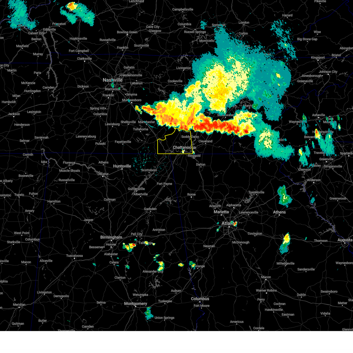 Svrmrx the national weather service in morristown has issued a * severe thunderstorm warning for, sequatchie county in east tennessee, marion county in east tennessee, western hamilton county in east tennessee, * until 645 pm edt/545 pm cdt/. * at 549 pm edt/449 pm cdt/, severe thunderstorms were located along a line extending from 7 miles north of soddy-daisy to near gruetli-laager to 8 miles north of manchester, moving south at 35 mph (radar indicated). Hazards include 60 mph wind gusts. expect damage to roofs, siding, and trees Svrmrx the national weather service in morristown has issued a * severe thunderstorm warning for, sequatchie county in east tennessee, marion county in east tennessee, western hamilton county in east tennessee, * until 645 pm edt/545 pm cdt/. * at 549 pm edt/449 pm cdt/, severe thunderstorms were located along a line extending from 7 miles north of soddy-daisy to near gruetli-laager to 8 miles north of manchester, moving south at 35 mph (radar indicated). Hazards include 60 mph wind gusts. expect damage to roofs, siding, and trees
|
| 7/30/2024 5:45 PM EDT |
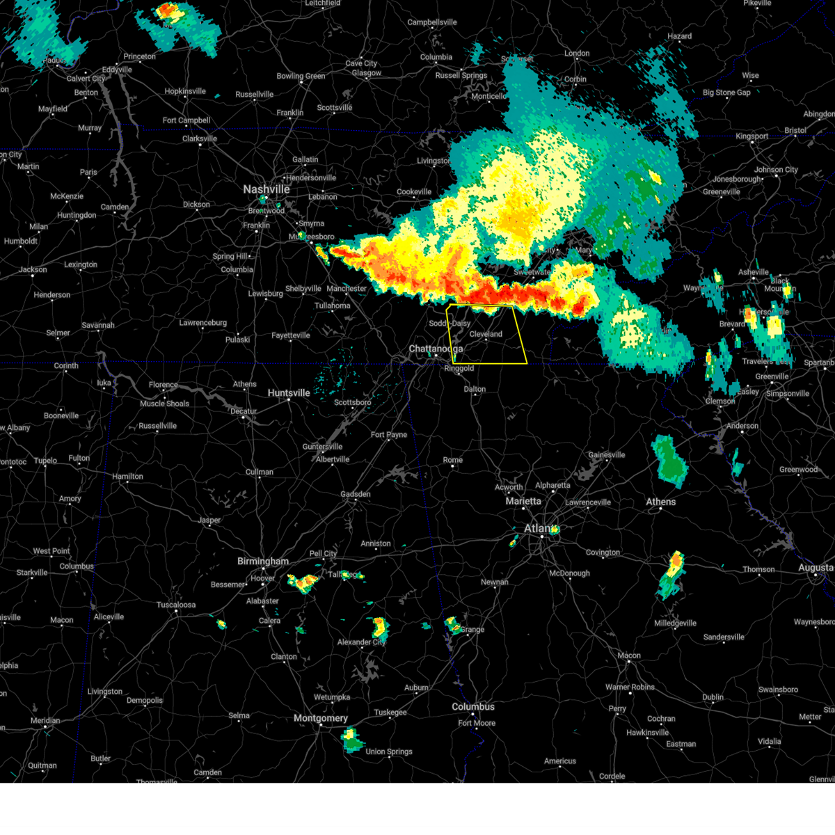 Svrmrx the national weather service in morristown has issued a * severe thunderstorm warning for, bradley county in east tennessee, southwestern meigs county in east tennessee, western polk county in east tennessee, southwestern mcminn county in east tennessee, eastern hamilton county in east tennessee, * until 645 pm edt. * at 544 pm edt, severe thunderstorms were located along a line extending from 7 miles north of charleston to 8 miles north of soddy-daisy, moving southeast at 30 mph (radar indicated). Hazards include 60 mph wind gusts and penny size hail. expect damage to roofs, siding, and trees Svrmrx the national weather service in morristown has issued a * severe thunderstorm warning for, bradley county in east tennessee, southwestern meigs county in east tennessee, western polk county in east tennessee, southwestern mcminn county in east tennessee, eastern hamilton county in east tennessee, * until 645 pm edt. * at 544 pm edt, severe thunderstorms were located along a line extending from 7 miles north of charleston to 8 miles north of soddy-daisy, moving southeast at 30 mph (radar indicated). Hazards include 60 mph wind gusts and penny size hail. expect damage to roofs, siding, and trees
|
| 7/29/2024 5:49 PM EDT |
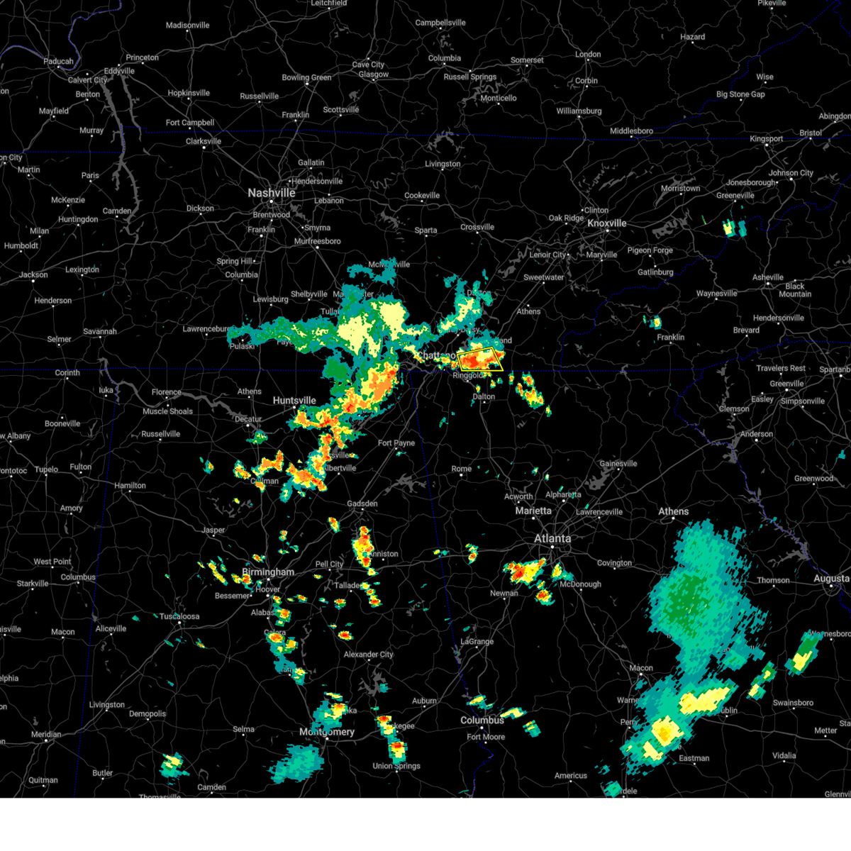 At 549 pm edt, a severe thunderstorm was located near cohutta, or 8 miles northeast of ringgold, moving southeast at 25 mph (radar indicated). Hazards include 60 mph wind gusts. Expect damage to roofs, siding, and trees. locations impacted include, chattanooga, cleveland, south cleveland, wildwood lake, harrison, collegedale, mcdonald, east brainerd, red clay state park, and flint springs. This includes interstate 75 in tennessee between mile markers 5 and 17. At 549 pm edt, a severe thunderstorm was located near cohutta, or 8 miles northeast of ringgold, moving southeast at 25 mph (radar indicated). Hazards include 60 mph wind gusts. Expect damage to roofs, siding, and trees. locations impacted include, chattanooga, cleveland, south cleveland, wildwood lake, harrison, collegedale, mcdonald, east brainerd, red clay state park, and flint springs. This includes interstate 75 in tennessee between mile markers 5 and 17.
|
| 7/29/2024 5:41 PM EDT |
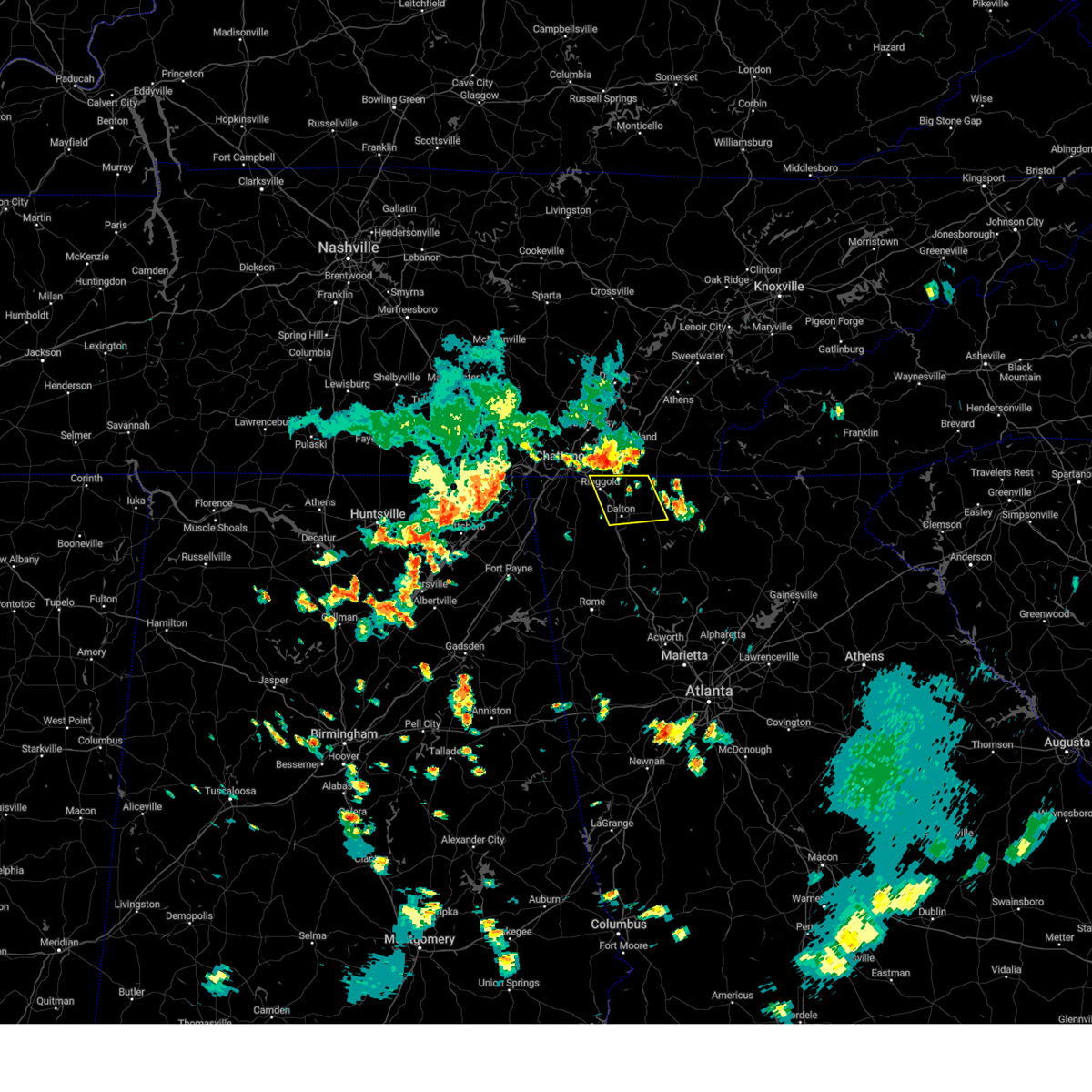 Svrffc the national weather service in peachtree city has issued a * severe thunderstorm warning for, northeastern catoosa county in northwestern georgia, central murray county in northwestern georgia, whitfield county in northwestern georgia, * until 630 pm edt. * at 541 pm edt, severe thunderstorms were located along a line extending from near east ridge to near gap springs, moving southeast at 30 mph (radar indicated). Hazards include 60 mph wind gusts and penny size hail. expect damage to roofs, siding, and trees Svrffc the national weather service in peachtree city has issued a * severe thunderstorm warning for, northeastern catoosa county in northwestern georgia, central murray county in northwestern georgia, whitfield county in northwestern georgia, * until 630 pm edt. * at 541 pm edt, severe thunderstorms were located along a line extending from near east ridge to near gap springs, moving southeast at 30 mph (radar indicated). Hazards include 60 mph wind gusts and penny size hail. expect damage to roofs, siding, and trees
|
| 7/29/2024 5:39 PM EDT |
 The storm which prompted the warning has moved out of the area. therefore, the warning will be allowed to expire. however, gusty winds are still possible with this thunderstorm. remember, a severe thunderstorm warning still remains in effect for southeastern hamilton county and southwestern bradley county until 600 pm edt. The storm which prompted the warning has moved out of the area. therefore, the warning will be allowed to expire. however, gusty winds are still possible with this thunderstorm. remember, a severe thunderstorm warning still remains in effect for southeastern hamilton county and southwestern bradley county until 600 pm edt.
|
| 7/29/2024 5:28 PM EDT |
 At 528 pm edt, a severe thunderstorm was located 7 miles east of lakesite, or 8 miles west of cleveland, moving southeast at 20 mph (radar indicated). Hazards include 60 mph wind gusts. Expect damage to roofs, siding, and trees. locations impacted include, chattanooga, cleveland, soddy-daisy, lakesite, south cleveland, harrison, east cleveland, wildwood lake, collegedale, and hopewell. This includes interstate 75 in tennessee between mile markers 11 and 27. At 528 pm edt, a severe thunderstorm was located 7 miles east of lakesite, or 8 miles west of cleveland, moving southeast at 20 mph (radar indicated). Hazards include 60 mph wind gusts. Expect damage to roofs, siding, and trees. locations impacted include, chattanooga, cleveland, soddy-daisy, lakesite, south cleveland, harrison, east cleveland, wildwood lake, collegedale, and hopewell. This includes interstate 75 in tennessee between mile markers 11 and 27.
|
| 7/29/2024 5:28 PM EDT |
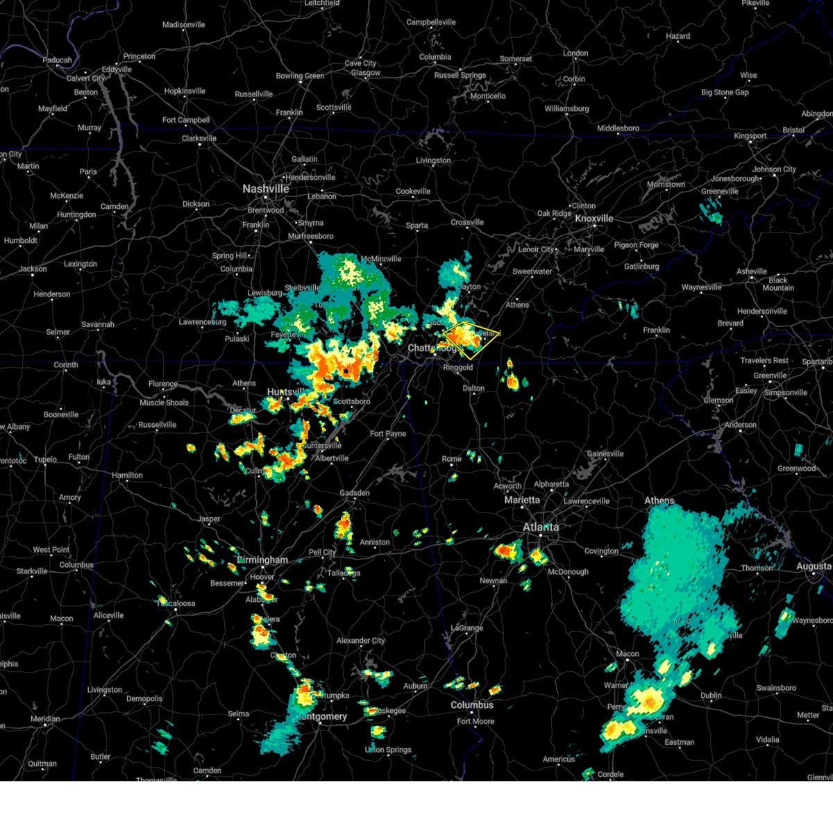 the severe thunderstorm warning has been cancelled and is no longer in effect the severe thunderstorm warning has been cancelled and is no longer in effect
|
| 7/29/2024 5:26 PM EDT |
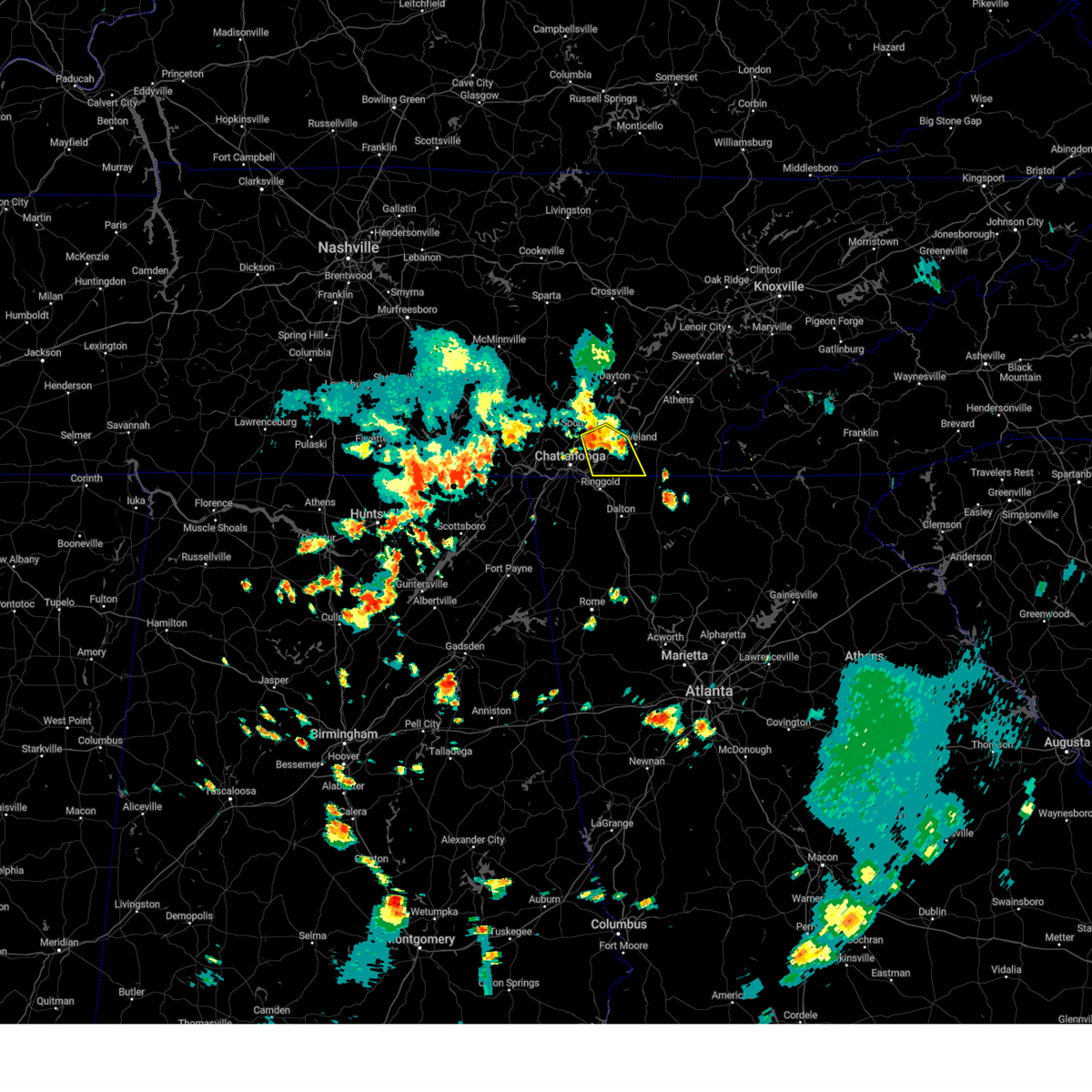 Svrmrx the national weather service in morristown has issued a * severe thunderstorm warning for, southwestern bradley county in east tennessee, southeastern hamilton county in east tennessee, * until 600 pm edt. * at 525 pm edt, a severe thunderstorm was located over harrison, or 9 miles northeast of chattanooga, moving southeast at 25 mph (radar indicated). Hazards include 60 mph wind gusts. expect damage to roofs, siding, and trees Svrmrx the national weather service in morristown has issued a * severe thunderstorm warning for, southwestern bradley county in east tennessee, southeastern hamilton county in east tennessee, * until 600 pm edt. * at 525 pm edt, a severe thunderstorm was located over harrison, or 9 miles northeast of chattanooga, moving southeast at 25 mph (radar indicated). Hazards include 60 mph wind gusts. expect damage to roofs, siding, and trees
|
| 7/29/2024 4:55 PM EDT |
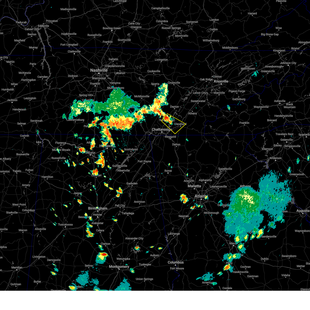 Svrmrx the national weather service in morristown has issued a * severe thunderstorm warning for, northwestern bradley county in east tennessee, east central sequatchie county in east tennessee, eastern hamilton county in east tennessee, * until 545 pm edt/445 pm cdt/. * at 455 pm edt/355 pm cdt/, a severe thunderstorm was located over soddy-daisy, or 12 miles southeast of dunlap, moving southeast at 20 mph (radar indicated). Hazards include 60 mph wind gusts. expect damage to roofs, siding, and trees Svrmrx the national weather service in morristown has issued a * severe thunderstorm warning for, northwestern bradley county in east tennessee, east central sequatchie county in east tennessee, eastern hamilton county in east tennessee, * until 545 pm edt/445 pm cdt/. * at 455 pm edt/355 pm cdt/, a severe thunderstorm was located over soddy-daisy, or 12 miles southeast of dunlap, moving southeast at 20 mph (radar indicated). Hazards include 60 mph wind gusts. expect damage to roofs, siding, and trees
|
| 7/21/2024 7:16 PM EDT |
 At 715 pm edt, a severe thunderstorm was located 8 miles south of dayton, moving east at 15 mph (radar indicated). Hazards include 60 mph wind gusts and penny size hail. Expect damage to roofs, siding, and trees. Locations impacted include, chattanooga, soddy-daisy, walden, lakesite, flat top mountain, north chickamauga creek gorge, big spring, sale creek, mowbray mountain, and middle valley. At 715 pm edt, a severe thunderstorm was located 8 miles south of dayton, moving east at 15 mph (radar indicated). Hazards include 60 mph wind gusts and penny size hail. Expect damage to roofs, siding, and trees. Locations impacted include, chattanooga, soddy-daisy, walden, lakesite, flat top mountain, north chickamauga creek gorge, big spring, sale creek, mowbray mountain, and middle valley.
|
| 7/21/2024 7:16 PM EDT |
 the severe thunderstorm warning has been cancelled and is no longer in effect the severe thunderstorm warning has been cancelled and is no longer in effect
|
| 7/21/2024 6:53 PM EDT |
 Svrmrx the national weather service in morristown has issued a * severe thunderstorm warning for, south central rhea county in east tennessee, southwestern meigs county in east tennessee, northeastern hamilton county in east tennessee, * until 745 pm edt. * at 653 pm edt, a severe thunderstorm was located 8 miles northeast of soddy-daisy, or 10 miles southwest of dayton, moving east at 15 mph (radar indicated). Hazards include 60 mph wind gusts and penny size hail. expect damage to roofs, siding, and trees Svrmrx the national weather service in morristown has issued a * severe thunderstorm warning for, south central rhea county in east tennessee, southwestern meigs county in east tennessee, northeastern hamilton county in east tennessee, * until 745 pm edt. * at 653 pm edt, a severe thunderstorm was located 8 miles northeast of soddy-daisy, or 10 miles southwest of dayton, moving east at 15 mph (radar indicated). Hazards include 60 mph wind gusts and penny size hail. expect damage to roofs, siding, and trees
|
| 7/16/2024 5:06 PM EDT |
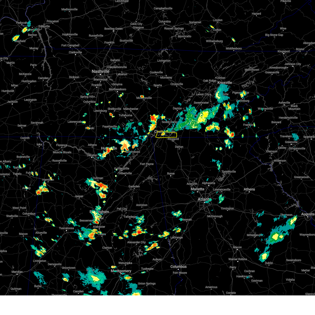 At 505 pm edt/405 pm cdt/, a severe thunderstorm was located over rossville, or near chattanooga, moving east at 20 mph (radar indicated). Hazards include 60 mph wind gusts and penny size hail. Expect damage to roofs, siding, and trees. locations impacted include, chattanooga, rossville, ridgeside, red bank, collegedale, east brainerd, lookout mountain, east ridge, hicks gap state park, and ooltewah. This includes interstate 75 in tennessee between mile markers 1 and 9. At 505 pm edt/405 pm cdt/, a severe thunderstorm was located over rossville, or near chattanooga, moving east at 20 mph (radar indicated). Hazards include 60 mph wind gusts and penny size hail. Expect damage to roofs, siding, and trees. locations impacted include, chattanooga, rossville, ridgeside, red bank, collegedale, east brainerd, lookout mountain, east ridge, hicks gap state park, and ooltewah. This includes interstate 75 in tennessee between mile markers 1 and 9.
|
| 7/16/2024 5:05 PM EDT | Several large branches dow in hamilton county TN, 7.3 miles NE of Chattanooga, TN |
| 7/16/2024 4:46 PM EDT |
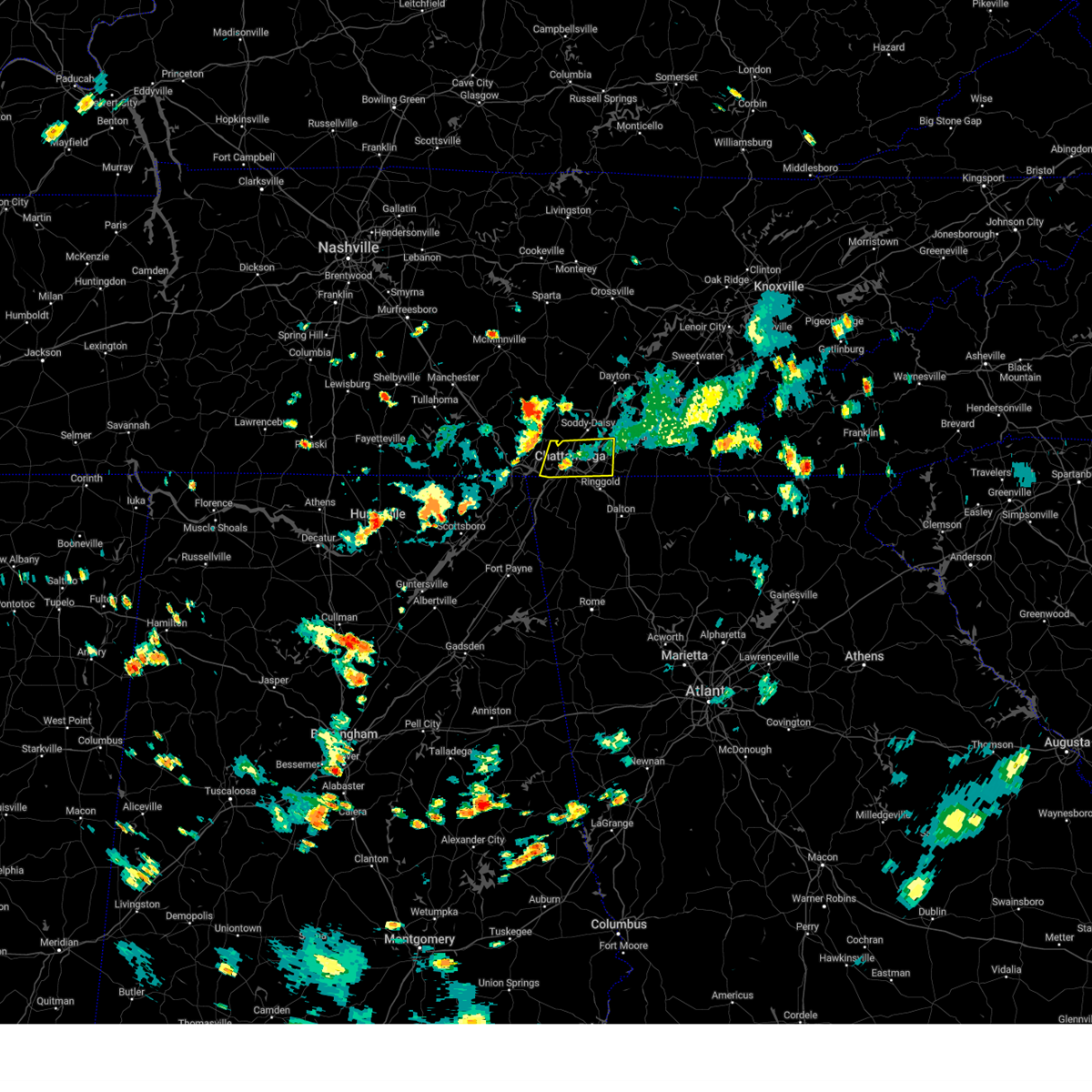 Svrmrx the national weather service in morristown has issued a * severe thunderstorm warning for, southeastern marion county in east tennessee, southern hamilton county in east tennessee, * until 530 pm edt/430 pm cdt/. * at 446 pm edt/346 pm cdt/, a severe thunderstorm was located near lookout mountain, or 10 miles west of chattanooga, moving east at 20 mph (radar indicated). Hazards include 60 mph wind gusts and penny size hail. expect damage to roofs, siding, and trees Svrmrx the national weather service in morristown has issued a * severe thunderstorm warning for, southeastern marion county in east tennessee, southern hamilton county in east tennessee, * until 530 pm edt/430 pm cdt/. * at 446 pm edt/346 pm cdt/, a severe thunderstorm was located near lookout mountain, or 10 miles west of chattanooga, moving east at 20 mph (radar indicated). Hazards include 60 mph wind gusts and penny size hail. expect damage to roofs, siding, and trees
|
| 5/27/2024 4:57 AM EDT |
 The storm which prompted the warning has moved out of the area. therefore, the warning will be allowed to expire. a tornado watch remains in effect until 900 am edt for northwestern georgia. remember, a severe thunderstorm warning still remains in effect for whitfield county!. The storm which prompted the warning has moved out of the area. therefore, the warning will be allowed to expire. a tornado watch remains in effect until 900 am edt for northwestern georgia. remember, a severe thunderstorm warning still remains in effect for whitfield county!.
|
| 5/27/2024 4:44 AM EDT |
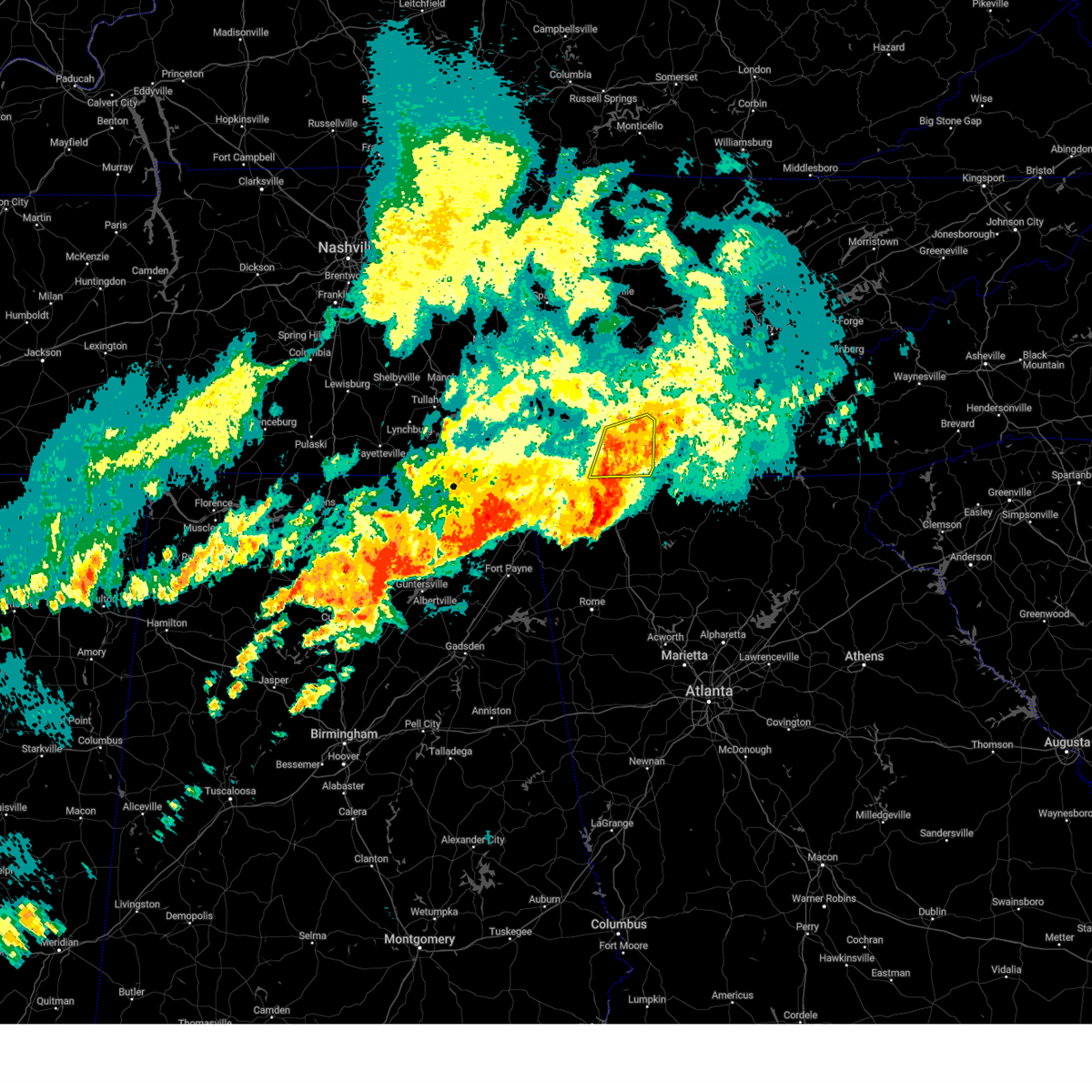 At 444 am edt, a severe thunderstorm was located over south cleveland, or 7 miles southwest of cleveland, moving east at 40 mph (radar indicated). Hazards include 60 mph wind gusts and penny size hail. Expect damage to roofs, siding, and trees. locations impacted include, chattanooga, cleveland, charleston, south cleveland, east cleveland, wildwood lake, harrison, collegedale, calhoun, and waterville. This includes interstate 75 in tennessee between mile markers 6 and 35. At 444 am edt, a severe thunderstorm was located over south cleveland, or 7 miles southwest of cleveland, moving east at 40 mph (radar indicated). Hazards include 60 mph wind gusts and penny size hail. Expect damage to roofs, siding, and trees. locations impacted include, chattanooga, cleveland, charleston, south cleveland, east cleveland, wildwood lake, harrison, collegedale, calhoun, and waterville. This includes interstate 75 in tennessee between mile markers 6 and 35.
|
| 5/27/2024 4:30 AM EDT |
 the severe thunderstorm warning has been cancelled and is no longer in effect the severe thunderstorm warning has been cancelled and is no longer in effect
|
| 5/27/2024 4:30 AM EDT |
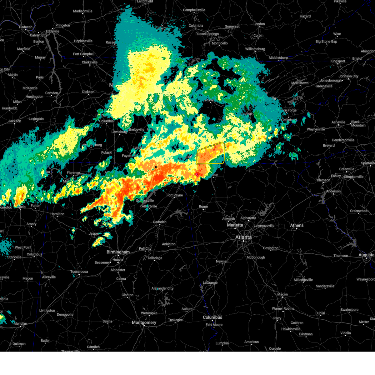 At 429 am edt, a severe thunderstorm was located near harrison, or 8 miles east of chattanooga, moving east at 45 mph (radar indicated). Hazards include 60 mph wind gusts and quarter size hail. Hail damage to vehicles is expected. expect wind damage to roofs, siding, and trees. locations impacted include, chattanooga, cleveland, soddy-daisy, rossville, walden, lakesite, charleston, ridgeside, south cleveland, and harrison. This includes interstate 75 in tennessee between mile markers 1 and 35. At 429 am edt, a severe thunderstorm was located near harrison, or 8 miles east of chattanooga, moving east at 45 mph (radar indicated). Hazards include 60 mph wind gusts and quarter size hail. Hail damage to vehicles is expected. expect wind damage to roofs, siding, and trees. locations impacted include, chattanooga, cleveland, soddy-daisy, rossville, walden, lakesite, charleston, ridgeside, south cleveland, and harrison. This includes interstate 75 in tennessee between mile markers 1 and 35.
|
| 5/27/2024 4:25 AM EDT |
 Svrffc the national weather service in peachtree city has issued a * severe thunderstorm warning for, catoosa county in northwestern georgia, whitfield county in northwestern georgia, central walker county in northwestern georgia, * until 500 am edt. * at 425 am edt, a severe thunderstorm was located over boynton, or near ringgold, moving east at 40 mph (radar indicated). Hazards include 60 mph wind gusts and quarter size hail. Hail damage to vehicles is expected. Expect wind damage to roofs, siding, and trees. Svrffc the national weather service in peachtree city has issued a * severe thunderstorm warning for, catoosa county in northwestern georgia, whitfield county in northwestern georgia, central walker county in northwestern georgia, * until 500 am edt. * at 425 am edt, a severe thunderstorm was located over boynton, or near ringgold, moving east at 40 mph (radar indicated). Hazards include 60 mph wind gusts and quarter size hail. Hail damage to vehicles is expected. Expect wind damage to roofs, siding, and trees.
|
| 5/27/2024 4:20 AM EDT | Widespread reports of down trees and powerlines throughout the count in hamilton county TN, 4.1 miles ENE of Chattanooga, TN |
| 5/27/2024 3:15 AM CDT |
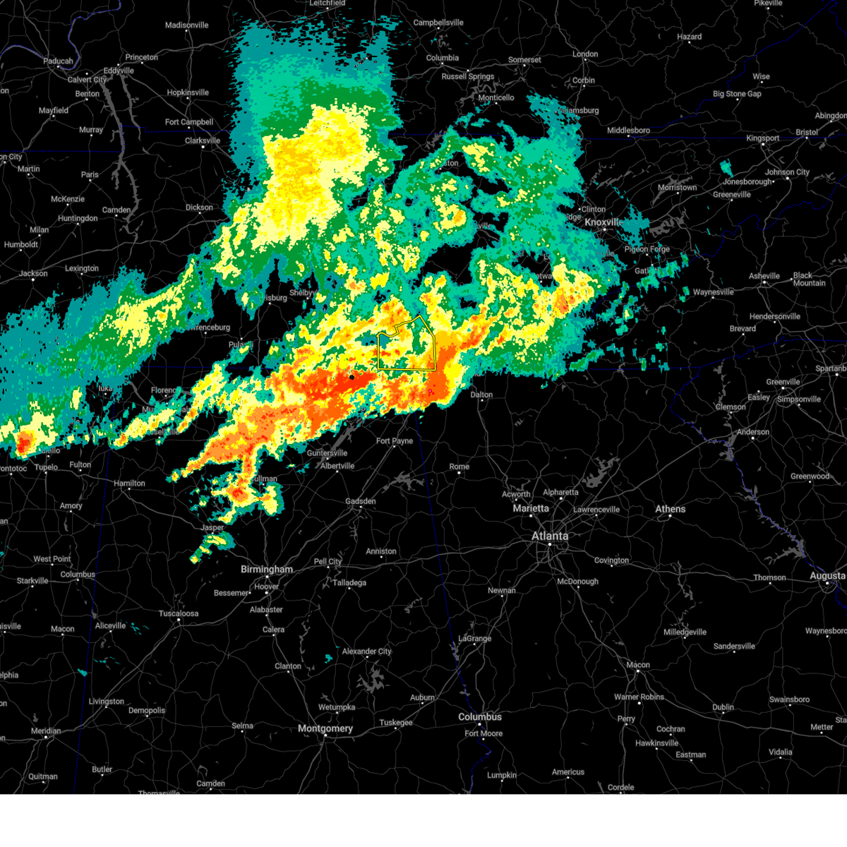 the severe thunderstorm warning has been cancelled and is no longer in effect the severe thunderstorm warning has been cancelled and is no longer in effect
|
| 5/27/2024 4:03 AM EDT |
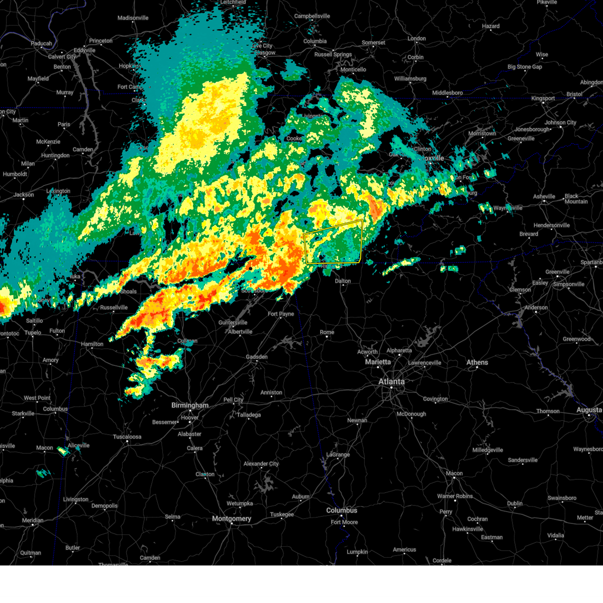 Svrmrx the national weather service in morristown has issued a * severe thunderstorm warning for, bradley county in east tennessee, southwestern meigs county in east tennessee, southeastern sequatchie county in east tennessee, southwestern mcminn county in east tennessee, east central marion county in east tennessee, hamilton county in east tennessee, * until 500 am edt/400 am cdt/. * at 402 am edt/302 am cdt/, a severe thunderstorm was located near signal mountain, or 10 miles west of chattanooga, moving east at 40 mph (radar indicated). Hazards include 60 mph wind gusts and quarter size hail. Hail damage to vehicles is expected. Expect wind damage to roofs, siding, and trees. Svrmrx the national weather service in morristown has issued a * severe thunderstorm warning for, bradley county in east tennessee, southwestern meigs county in east tennessee, southeastern sequatchie county in east tennessee, southwestern mcminn county in east tennessee, east central marion county in east tennessee, hamilton county in east tennessee, * until 500 am edt/400 am cdt/. * at 402 am edt/302 am cdt/, a severe thunderstorm was located near signal mountain, or 10 miles west of chattanooga, moving east at 40 mph (radar indicated). Hazards include 60 mph wind gusts and quarter size hail. Hail damage to vehicles is expected. Expect wind damage to roofs, siding, and trees.
|
| 5/27/2024 4:03 AM EDT |
 Svrffc the national weather service in peachtree city has issued a * severe thunderstorm warning for, western catoosa county in northwestern georgia, central walker county in northwestern georgia, northeastern dade county in northwestern georgia, * until 430 am edt. * at 402 am edt, severe thunderstorms were located along a line extending from cole city to stephensville to near ider, moving east at 40 mph (radar indicated). Hazards include 60 mph wind gusts and quarter size hail. Hail damage to vehicles is expected. Expect wind damage to roofs, siding, and trees. Svrffc the national weather service in peachtree city has issued a * severe thunderstorm warning for, western catoosa county in northwestern georgia, central walker county in northwestern georgia, northeastern dade county in northwestern georgia, * until 430 am edt. * at 402 am edt, severe thunderstorms were located along a line extending from cole city to stephensville to near ider, moving east at 40 mph (radar indicated). Hazards include 60 mph wind gusts and quarter size hail. Hail damage to vehicles is expected. Expect wind damage to roofs, siding, and trees.
|
| 5/27/2024 2:26 AM CDT |
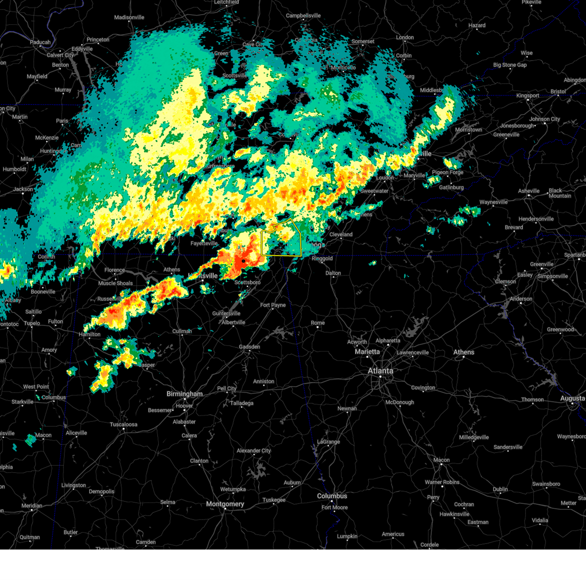 Svrmrx the national weather service in morristown has issued a * severe thunderstorm warning for, southwestern sequatchie county in east tennessee, marion county in east tennessee, southwestern hamilton county in east tennessee, * until 430 am edt/330 am cdt/. * at 325 am edt/225 am cdt/, a severe thunderstorm was located 9 miles north of skyline, or 17 miles south of winchester, moving northeast at 40 mph (radar indicated). Hazards include 60 mph wind gusts and quarter size hail. Hail damage to vehicles is expected. Expect wind damage to roofs, siding, and trees. Svrmrx the national weather service in morristown has issued a * severe thunderstorm warning for, southwestern sequatchie county in east tennessee, marion county in east tennessee, southwestern hamilton county in east tennessee, * until 430 am edt/330 am cdt/. * at 325 am edt/225 am cdt/, a severe thunderstorm was located 9 miles north of skyline, or 17 miles south of winchester, moving northeast at 40 mph (radar indicated). Hazards include 60 mph wind gusts and quarter size hail. Hail damage to vehicles is expected. Expect wind damage to roofs, siding, and trees.
|
| 5/24/2024 3:31 PM EDT |
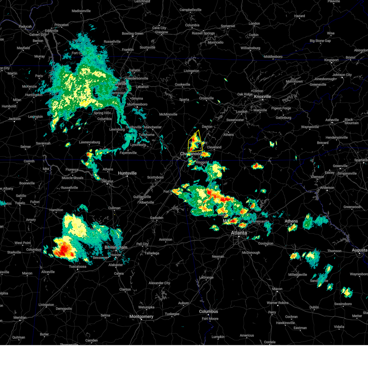 the severe thunderstorm warning has been cancelled and is no longer in effect the severe thunderstorm warning has been cancelled and is no longer in effect
|
| 5/24/2024 3:20 PM EDT |
 At 319 pm edt/219 pm cdt/, a severe thunderstorm was located near fairmount, or 7 miles southeast of dunlap, moving northeast at 20 mph (radar indicated). Hazards include 60 mph wind gusts and quarter size hail. Hail damage to vehicles is expected. expect wind damage to roofs, siding, and trees. Locations impacted include, chattanooga, soddy-daisy, signal mountain, walden, lakesite, fairmount, harrison, red bank, flat top mountain, and north chickamauga creek gorge. At 319 pm edt/219 pm cdt/, a severe thunderstorm was located near fairmount, or 7 miles southeast of dunlap, moving northeast at 20 mph (radar indicated). Hazards include 60 mph wind gusts and quarter size hail. Hail damage to vehicles is expected. expect wind damage to roofs, siding, and trees. Locations impacted include, chattanooga, soddy-daisy, signal mountain, walden, lakesite, fairmount, harrison, red bank, flat top mountain, and north chickamauga creek gorge.
|
| 5/24/2024 3:20 PM EDT |
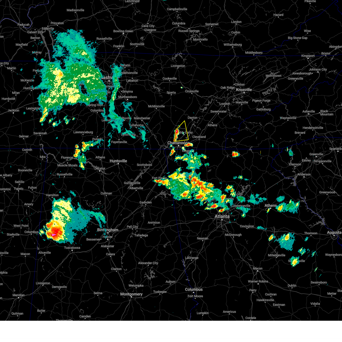 the severe thunderstorm warning has been cancelled and is no longer in effect the severe thunderstorm warning has been cancelled and is no longer in effect
|
| 5/24/2024 3:07 PM EDT |
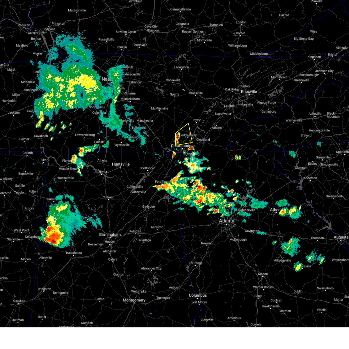 Svrmrx the national weather service in morristown has issued a * severe thunderstorm warning for, southeastern sequatchie county in east tennessee, south central bledsoe county in east tennessee, east central marion county in east tennessee, central hamilton county in east tennessee, * until 400 pm edt/300 pm cdt/. * at 307 pm edt/207 pm cdt/, a severe thunderstorm was located near fairmount, or 8 miles south of dunlap, moving east at 20 mph (radar indicated). Hazards include 60 mph wind gusts and quarter size hail. Hail damage to vehicles is expected. Expect wind damage to roofs, siding, and trees. Svrmrx the national weather service in morristown has issued a * severe thunderstorm warning for, southeastern sequatchie county in east tennessee, south central bledsoe county in east tennessee, east central marion county in east tennessee, central hamilton county in east tennessee, * until 400 pm edt/300 pm cdt/. * at 307 pm edt/207 pm cdt/, a severe thunderstorm was located near fairmount, or 8 miles south of dunlap, moving east at 20 mph (radar indicated). Hazards include 60 mph wind gusts and quarter size hail. Hail damage to vehicles is expected. Expect wind damage to roofs, siding, and trees.
|
| 5/9/2024 6:16 AM EDT |
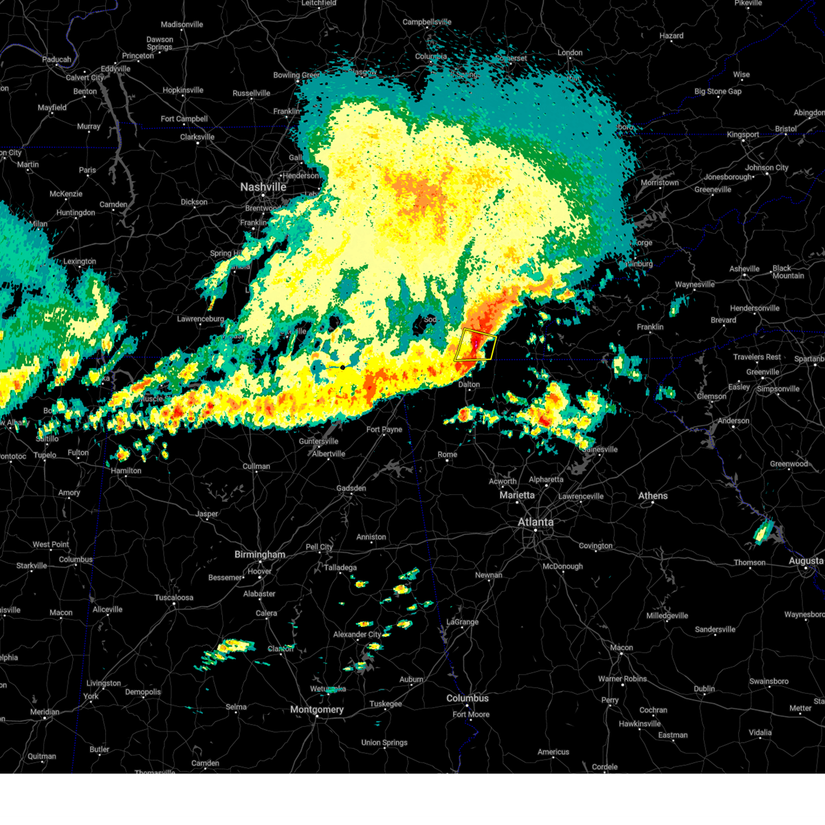 At 616 am edt, severe thunderstorms were located along a line extending from near benton to near wildwood lake to 6 miles east of cohutta, moving east at 65 mph (radar indicated). Hazards include 70 mph wind gusts and half dollar size hail. Hail damage to vehicles is expected. expect considerable tree damage. wind damage is also likely to mobile homes, roofs, and outbuildings. locations impacted include, cleveland, south cleveland, east cleveland, wildwood lake, collegedale, mcdonald, waterville, red clay state park, flint springs, and apison. This includes interstate 75 in tennessee between mile markers 15 and 24. At 616 am edt, severe thunderstorms were located along a line extending from near benton to near wildwood lake to 6 miles east of cohutta, moving east at 65 mph (radar indicated). Hazards include 70 mph wind gusts and half dollar size hail. Hail damage to vehicles is expected. expect considerable tree damage. wind damage is also likely to mobile homes, roofs, and outbuildings. locations impacted include, cleveland, south cleveland, east cleveland, wildwood lake, collegedale, mcdonald, waterville, red clay state park, flint springs, and apison. This includes interstate 75 in tennessee between mile markers 15 and 24.
|
| 5/9/2024 6:05 AM EDT |
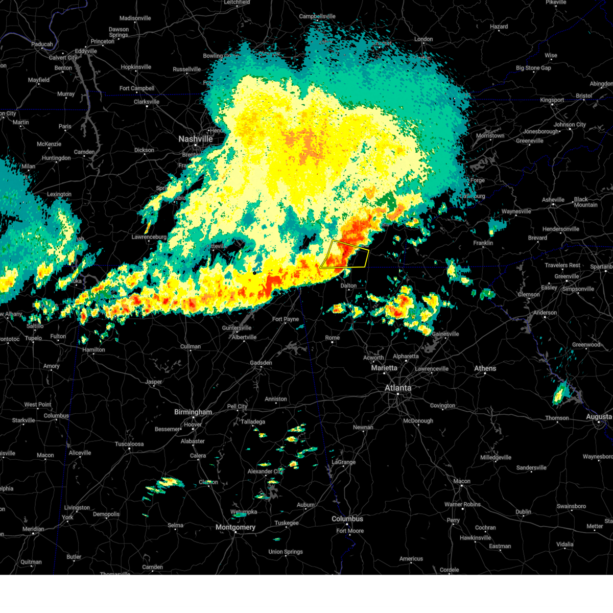 At 604 am edt, severe thunderstorms were located along a line extending from cleveland to south cleveland to near ringgold, moving east at 50 mph (radar indicated). Hazards include 70 mph wind gusts and half dollar size hail. Hail damage to vehicles is expected. expect considerable tree damage. wind damage is also likely to mobile homes, roofs, and outbuildings. locations impacted include, chattanooga, cleveland, soddy-daisy, rossville, lakesite, ridgeside, south cleveland, harrison, east cleveland, and wildwood lake. This includes interstate 75 in tennessee between mile markers 1 and 24. At 604 am edt, severe thunderstorms were located along a line extending from cleveland to south cleveland to near ringgold, moving east at 50 mph (radar indicated). Hazards include 70 mph wind gusts and half dollar size hail. Hail damage to vehicles is expected. expect considerable tree damage. wind damage is also likely to mobile homes, roofs, and outbuildings. locations impacted include, chattanooga, cleveland, soddy-daisy, rossville, lakesite, ridgeside, south cleveland, harrison, east cleveland, and wildwood lake. This includes interstate 75 in tennessee between mile markers 1 and 24.
|
| 5/9/2024 5:50 AM EDT | Several large trees have been blown down with multiple power outages in the are in hamilton county TN, 6.5 miles S of Chattanooga, TN |
| 5/9/2024 5:43 AM EDT |
 Svrffc the national weather service in peachtree city has issued a * severe thunderstorm warning for, catoosa county in northwestern georgia, whitfield county in northwestern georgia, walker county in northwestern georgia, dade county in northwestern georgia, * until 645 am edt. * at 541 am edt, severe thunderstorms were located along a line extending from lakesite to near skyline, moving southeast at 45 mph (radar indicated). Hazards include 60 mph wind gusts and quarter size hail. Hail damage to vehicles is expected. Expect wind damage to roofs, siding, and trees. Svrffc the national weather service in peachtree city has issued a * severe thunderstorm warning for, catoosa county in northwestern georgia, whitfield county in northwestern georgia, walker county in northwestern georgia, dade county in northwestern georgia, * until 645 am edt. * at 541 am edt, severe thunderstorms were located along a line extending from lakesite to near skyline, moving southeast at 45 mph (radar indicated). Hazards include 60 mph wind gusts and quarter size hail. Hail damage to vehicles is expected. Expect wind damage to roofs, siding, and trees.
|
| 5/9/2024 4:43 AM CDT |
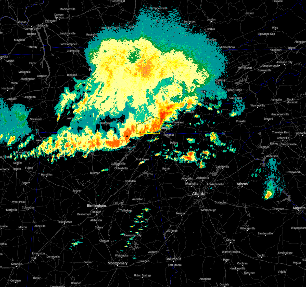 At 543 am edt/443 am cdt/, severe thunderstorms were located along a line extending from near soddy-daisy to near whitwell to 8 miles northwest of south pittsburg to 7 miles west of stevenson, moving east at 55 mph (radar indicated). Hazards include 70 mph wind gusts and half dollar size hail. Hail damage to vehicles is expected. expect considerable tree damage. wind damage is also likely to mobile homes, roofs, and outbuildings. Locations impacted include, chattanooga, jasper, soddy-daisy, signal mountain, south pittsburg, walden, whitwell, kimball, fairmount, and red bank. At 543 am edt/443 am cdt/, severe thunderstorms were located along a line extending from near soddy-daisy to near whitwell to 8 miles northwest of south pittsburg to 7 miles west of stevenson, moving east at 55 mph (radar indicated). Hazards include 70 mph wind gusts and half dollar size hail. Hail damage to vehicles is expected. expect considerable tree damage. wind damage is also likely to mobile homes, roofs, and outbuildings. Locations impacted include, chattanooga, jasper, soddy-daisy, signal mountain, south pittsburg, walden, whitwell, kimball, fairmount, and red bank.
|
| 5/9/2024 5:35 AM EDT |
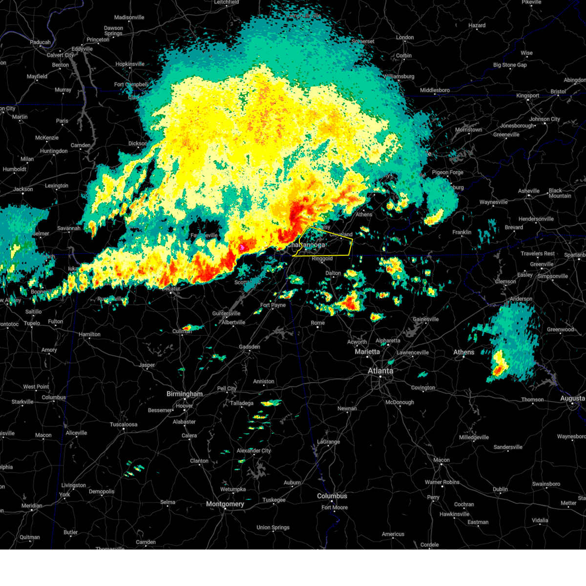 Svrmrx the national weather service in morristown has issued a * severe thunderstorm warning for, southern bradley county in east tennessee, hamilton county in east tennessee, * until 630 am edt. * at 534 am edt, severe thunderstorms were located along a line extending from near dunlap to near whitwell to 9 miles west of south pittsburg, moving east at 50 mph (radar indicated). Hazards include 70 mph wind gusts and half dollar size hail. Hail damage to vehicles is expected. expect considerable tree damage. Wind damage is also likely to mobile homes, roofs, and outbuildings. Svrmrx the national weather service in morristown has issued a * severe thunderstorm warning for, southern bradley county in east tennessee, hamilton county in east tennessee, * until 630 am edt. * at 534 am edt, severe thunderstorms were located along a line extending from near dunlap to near whitwell to 9 miles west of south pittsburg, moving east at 50 mph (radar indicated). Hazards include 70 mph wind gusts and half dollar size hail. Hail damage to vehicles is expected. expect considerable tree damage. Wind damage is also likely to mobile homes, roofs, and outbuildings.
|
| 5/9/2024 4:11 AM CDT |
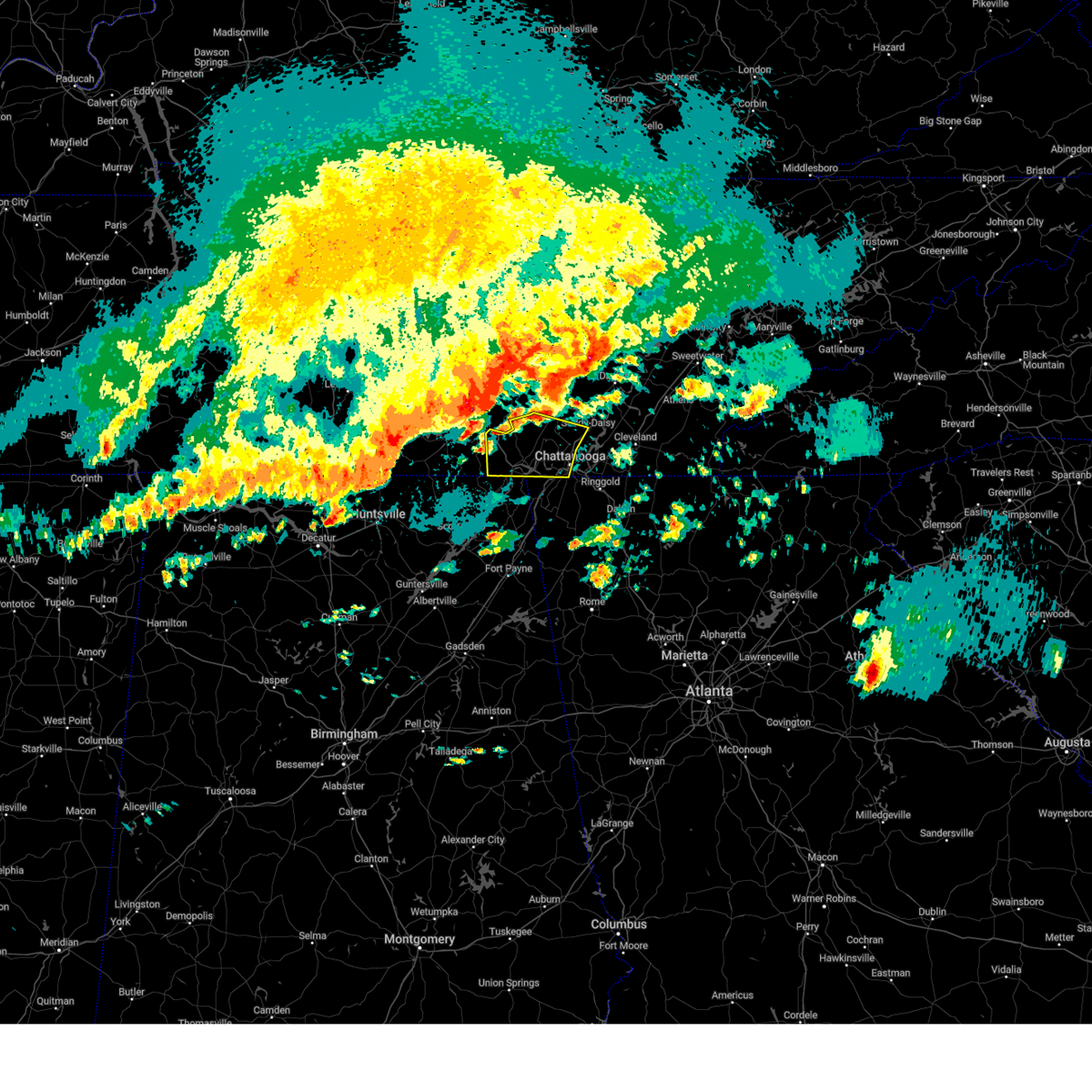 Svrmrx the national weather service in morristown has issued a * severe thunderstorm warning for, southern sequatchie county in east tennessee, marion county in east tennessee, southwestern hamilton county in east tennessee, * until 600 am edt/500 am cdt/. * at 510 am edt/410 am cdt/, severe thunderstorms were located along a line extending from 6 miles west of gruetli-laager to near sewanee to 6 miles southwest of tims ford lake to near new market, moving east at 55 mph (radar indicated). Hazards include 70 mph wind gusts and half dollar size hail. Hail damage to vehicles is expected. expect considerable tree damage. Wind damage is also likely to mobile homes, roofs, and outbuildings. Svrmrx the national weather service in morristown has issued a * severe thunderstorm warning for, southern sequatchie county in east tennessee, marion county in east tennessee, southwestern hamilton county in east tennessee, * until 600 am edt/500 am cdt/. * at 510 am edt/410 am cdt/, severe thunderstorms were located along a line extending from 6 miles west of gruetli-laager to near sewanee to 6 miles southwest of tims ford lake to near new market, moving east at 55 mph (radar indicated). Hazards include 70 mph wind gusts and half dollar size hail. Hail damage to vehicles is expected. expect considerable tree damage. Wind damage is also likely to mobile homes, roofs, and outbuildings.
|
| 5/8/2024 10:57 PM EDT |
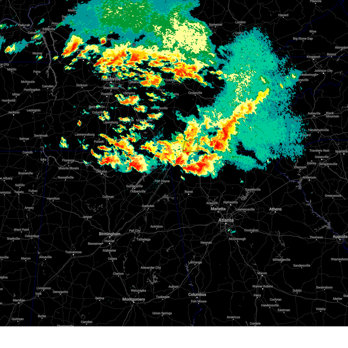 At 1057 pm edt, a severe thunderstorm was located near harrison, or 11 miles southwest of cleveland, moving east at 45 mph (radar indicated). Hazards include 60 mph wind gusts and quarter size hail. Hail damage to vehicles is expected. expect wind damage to roofs, siding, and trees. locations impacted include, chattanooga, ridgeside, harrison, collegedale, mcdonald, east brainerd, harrison bay state park, east ridge, apison, and ooltewah. This includes interstate 75 in tennessee between mile markers 1 and 18. At 1057 pm edt, a severe thunderstorm was located near harrison, or 11 miles southwest of cleveland, moving east at 45 mph (radar indicated). Hazards include 60 mph wind gusts and quarter size hail. Hail damage to vehicles is expected. expect wind damage to roofs, siding, and trees. locations impacted include, chattanooga, ridgeside, harrison, collegedale, mcdonald, east brainerd, harrison bay state park, east ridge, apison, and ooltewah. This includes interstate 75 in tennessee between mile markers 1 and 18.
|
| 5/8/2024 10:57 PM EDT |
 the severe thunderstorm warning has been cancelled and is no longer in effect the severe thunderstorm warning has been cancelled and is no longer in effect
|
| 5/8/2024 9:42 PM CDT |
 At 1042 pm edt/942 pm cdt/, a severe thunderstorm was located near soddy-daisy, or 12 miles east of dunlap, moving east at 40 mph (radar indicated). Hazards include 70 mph wind gusts and ping pong ball size hail. People and animals outdoors will be injured. expect hail damage to roofs, siding, windows, and vehicles. expect considerable tree damage. wind damage is also likely to mobile homes, roofs, and outbuildings. Locations impacted include, chattanooga, dunlap, soddy-daisy, walden, lakesite, fairmount, harrison, graysville, cartwright, and flat top mountain. At 1042 pm edt/942 pm cdt/, a severe thunderstorm was located near soddy-daisy, or 12 miles east of dunlap, moving east at 40 mph (radar indicated). Hazards include 70 mph wind gusts and ping pong ball size hail. People and animals outdoors will be injured. expect hail damage to roofs, siding, windows, and vehicles. expect considerable tree damage. wind damage is also likely to mobile homes, roofs, and outbuildings. Locations impacted include, chattanooga, dunlap, soddy-daisy, walden, lakesite, fairmount, harrison, graysville, cartwright, and flat top mountain.
|
| 5/8/2024 10:39 PM EDT |
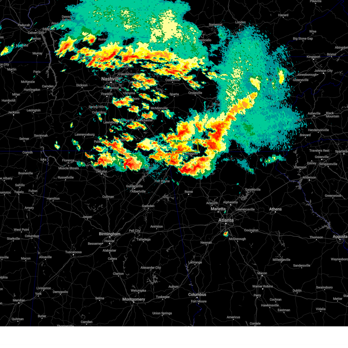 At 1039 pm edt/939 pm cdt/, a severe thunderstorm was located over chattanooga, moving east at 45 mph (radar indicated). Hazards include 70 mph wind gusts and ping pong ball size hail. People and animals outdoors will be injured. expect hail damage to roofs, siding, windows, and vehicles. expect considerable tree damage. wind damage is also likely to mobile homes, roofs, and outbuildings. locations impacted include, chattanooga, signal mountain, walden, ridgeside, harrison, red bank, collegedale, east brainerd, lookout mountain, and harrison bay state park. This includes interstate 75 in tennessee between mile markers 1 and 18. At 1039 pm edt/939 pm cdt/, a severe thunderstorm was located over chattanooga, moving east at 45 mph (radar indicated). Hazards include 70 mph wind gusts and ping pong ball size hail. People and animals outdoors will be injured. expect hail damage to roofs, siding, windows, and vehicles. expect considerable tree damage. wind damage is also likely to mobile homes, roofs, and outbuildings. locations impacted include, chattanooga, signal mountain, walden, ridgeside, harrison, red bank, collegedale, east brainerd, lookout mountain, and harrison bay state park. This includes interstate 75 in tennessee between mile markers 1 and 18.
|
| 5/8/2024 10:25 PM EDT |
 Svrffc the national weather service in peachtree city has issued a * severe thunderstorm warning for, northwestern catoosa county in northwestern georgia, northwestern walker county in northwestern georgia, dade county in northwestern georgia, * until 1130 pm edt. * at 1024 pm edt, a severe thunderstorm was located over fabius, or 9 miles south of bridgeport, moving east at 30 mph. another severe storm was centered 5 miles north of cole city also moving east at 30 mph (radar indicated). Hazards include ping pong ball size hail and 60 mph wind gusts. People and animals outdoors will be injured. expect hail damage to roofs, siding, windows, and vehicles. Expect wind damage to roofs, siding, and trees. Svrffc the national weather service in peachtree city has issued a * severe thunderstorm warning for, northwestern catoosa county in northwestern georgia, northwestern walker county in northwestern georgia, dade county in northwestern georgia, * until 1130 pm edt. * at 1024 pm edt, a severe thunderstorm was located over fabius, or 9 miles south of bridgeport, moving east at 30 mph. another severe storm was centered 5 miles north of cole city also moving east at 30 mph (radar indicated). Hazards include ping pong ball size hail and 60 mph wind gusts. People and animals outdoors will be injured. expect hail damage to roofs, siding, windows, and vehicles. Expect wind damage to roofs, siding, and trees.
|
| 5/8/2024 10:20 PM EDT |
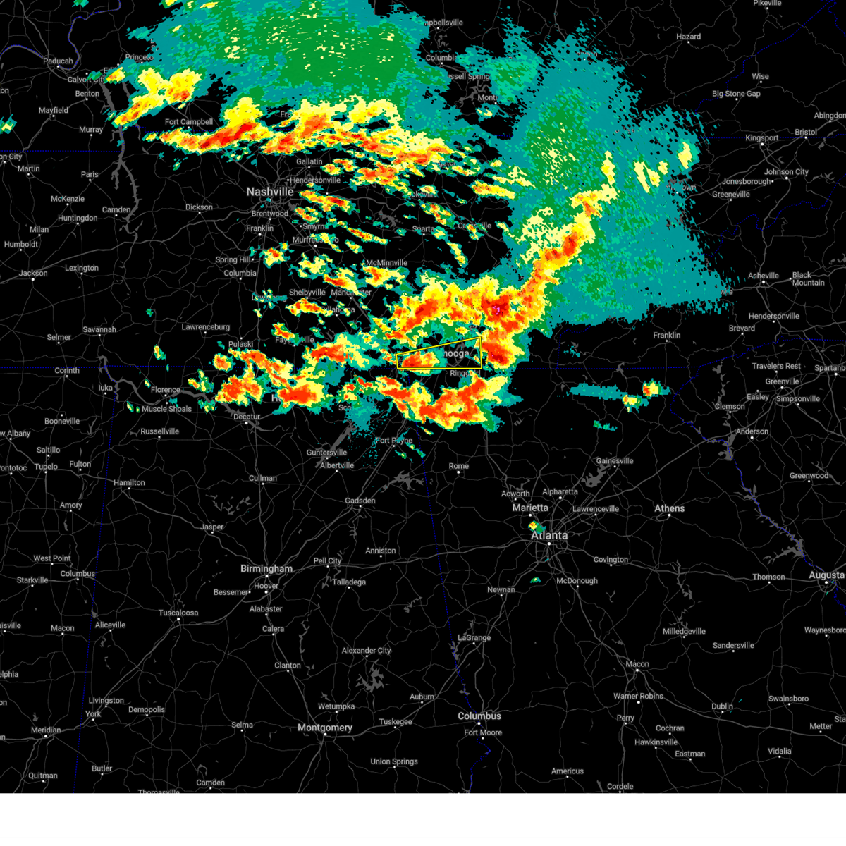 Svrmrx the national weather service in morristown has issued a * severe thunderstorm warning for, southwestern bradley county in east tennessee, southeastern marion county in east tennessee, southern hamilton county in east tennessee, * until 1115 pm edt/1015 pm cdt/. * at 1019 pm edt/919 pm cdt/, a severe thunderstorm was located near jasper, moving east at 45 mph (radar indicated). Hazards include 70 mph wind gusts and ping pong ball size hail. People and animals outdoors will be injured. expect hail damage to roofs, siding, windows, and vehicles. expect considerable tree damage. Wind damage is also likely to mobile homes, roofs, and outbuildings. Svrmrx the national weather service in morristown has issued a * severe thunderstorm warning for, southwestern bradley county in east tennessee, southeastern marion county in east tennessee, southern hamilton county in east tennessee, * until 1115 pm edt/1015 pm cdt/. * at 1019 pm edt/919 pm cdt/, a severe thunderstorm was located near jasper, moving east at 45 mph (radar indicated). Hazards include 70 mph wind gusts and ping pong ball size hail. People and animals outdoors will be injured. expect hail damage to roofs, siding, windows, and vehicles. expect considerable tree damage. Wind damage is also likely to mobile homes, roofs, and outbuildings.
|
| 5/8/2024 10:09 PM EDT |
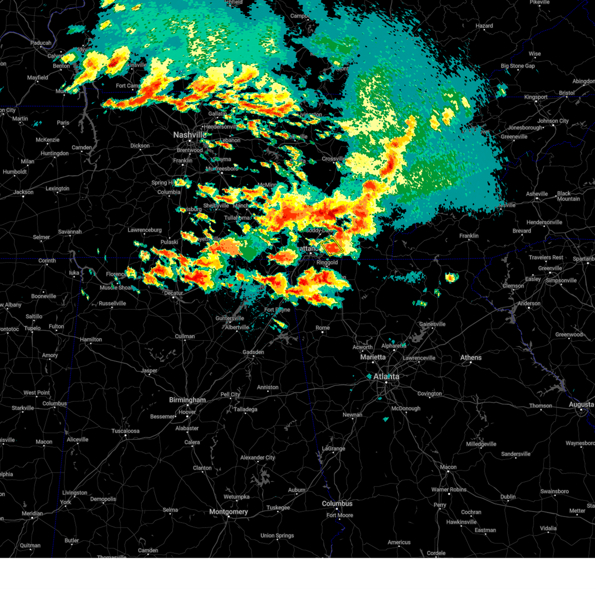 At 1009 pm edt, a severe thunderstorm was located near south cleveland, or 9 miles southwest of cleveland, moving east at 40 mph (radar indicated). Hazards include ping pong ball size hail and 60 mph wind gusts. People and animals outdoors will be injured. expect hail damage to roofs, siding, windows, and vehicles. expect wind damage to roofs, siding, and trees. locations impacted include, chattanooga, harrison, south cleveland, collegedale, mcdonald, harrison bay state park, ooltewah, and apison. This includes interstate 75 in tennessee between mile markers 9 and 18. At 1009 pm edt, a severe thunderstorm was located near south cleveland, or 9 miles southwest of cleveland, moving east at 40 mph (radar indicated). Hazards include ping pong ball size hail and 60 mph wind gusts. People and animals outdoors will be injured. expect hail damage to roofs, siding, windows, and vehicles. expect wind damage to roofs, siding, and trees. locations impacted include, chattanooga, harrison, south cleveland, collegedale, mcdonald, harrison bay state park, ooltewah, and apison. This includes interstate 75 in tennessee between mile markers 9 and 18.
|
| 5/8/2024 8:57 PM CDT |
 Svrmrx the national weather service in morristown has issued a * severe thunderstorm warning for, southwestern rhea county in east tennessee, sequatchie county in east tennessee, southwestern bledsoe county in east tennessee, northeastern marion county in east tennessee, central hamilton county in east tennessee, * until 1100 pm edt/1000 pm cdt/. * at 956 pm edt/856 pm cdt/, a severe thunderstorm was located near gruetli-laager, or 19 miles west of dunlap, moving east at 40 mph (radar indicated). Hazards include 70 mph wind gusts and ping pong ball size hail. People and animals outdoors will be injured. expect hail damage to roofs, siding, windows, and vehicles. expect considerable tree damage. Wind damage is also likely to mobile homes, roofs, and outbuildings. Svrmrx the national weather service in morristown has issued a * severe thunderstorm warning for, southwestern rhea county in east tennessee, sequatchie county in east tennessee, southwestern bledsoe county in east tennessee, northeastern marion county in east tennessee, central hamilton county in east tennessee, * until 1100 pm edt/1000 pm cdt/. * at 956 pm edt/856 pm cdt/, a severe thunderstorm was located near gruetli-laager, or 19 miles west of dunlap, moving east at 40 mph (radar indicated). Hazards include 70 mph wind gusts and ping pong ball size hail. People and animals outdoors will be injured. expect hail damage to roofs, siding, windows, and vehicles. expect considerable tree damage. Wind damage is also likely to mobile homes, roofs, and outbuildings.
|
| 5/8/2024 9:49 PM EDT |
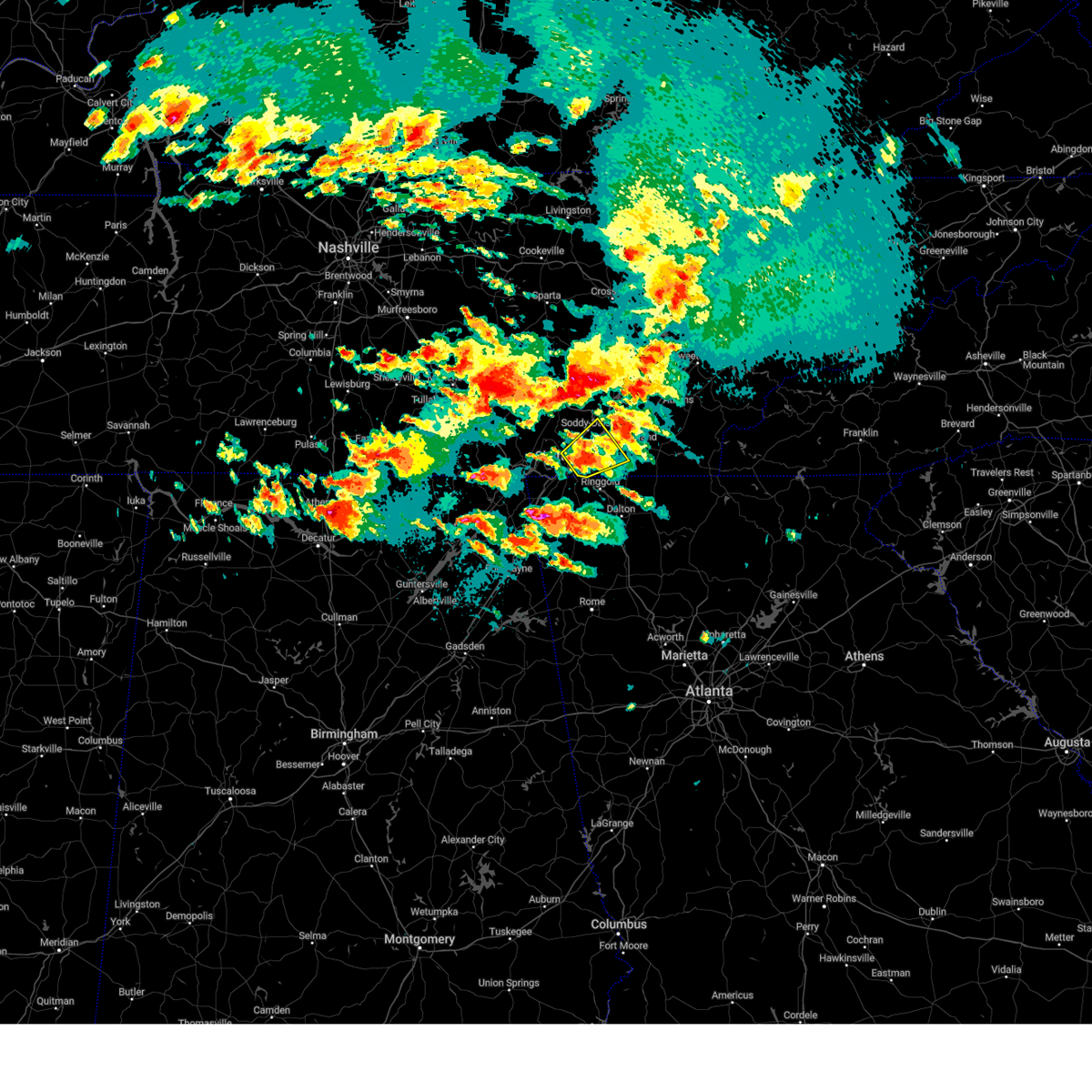 Svrmrx the national weather service in morristown has issued a * severe thunderstorm warning for, southwestern bradley county in east tennessee, southern hamilton county in east tennessee, * until 1030 pm edt. * at 949 pm edt, a severe thunderstorm was located over chattanooga, moving northeast at 40 mph (radar indicated). Hazards include ping pong ball size hail and 60 mph wind gusts. People and animals outdoors will be injured. expect hail damage to roofs, siding, windows, and vehicles. Expect wind damage to roofs, siding, and trees. Svrmrx the national weather service in morristown has issued a * severe thunderstorm warning for, southwestern bradley county in east tennessee, southern hamilton county in east tennessee, * until 1030 pm edt. * at 949 pm edt, a severe thunderstorm was located over chattanooga, moving northeast at 40 mph (radar indicated). Hazards include ping pong ball size hail and 60 mph wind gusts. People and animals outdoors will be injured. expect hail damage to roofs, siding, windows, and vehicles. Expect wind damage to roofs, siding, and trees.
|
| 5/8/2024 9:35 PM EDT |
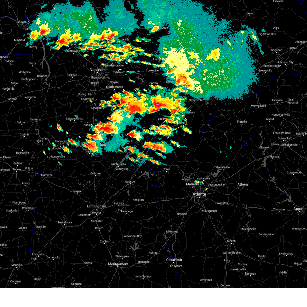 Svrmrx the national weather service in morristown has issued a * severe thunderstorm warning for, bradley county in east tennessee, southwestern meigs county in east tennessee, southwestern mcminn county in east tennessee, southeastern hamilton county in east tennessee, * until 1015 pm edt. * at 935 pm edt, a severe thunderstorm was located over harrison, or 8 miles northeast of chattanooga, moving northeast at 35 mph (radar indicated). Hazards include ping pong ball size hail and 60 mph wind gusts. People and animals outdoors will be injured. expect hail damage to roofs, siding, windows, and vehicles. Expect wind damage to roofs, siding, and trees. Svrmrx the national weather service in morristown has issued a * severe thunderstorm warning for, bradley county in east tennessee, southwestern meigs county in east tennessee, southwestern mcminn county in east tennessee, southeastern hamilton county in east tennessee, * until 1015 pm edt. * at 935 pm edt, a severe thunderstorm was located over harrison, or 8 miles northeast of chattanooga, moving northeast at 35 mph (radar indicated). Hazards include ping pong ball size hail and 60 mph wind gusts. People and animals outdoors will be injured. expect hail damage to roofs, siding, windows, and vehicles. Expect wind damage to roofs, siding, and trees.
|
| 2/28/2024 10:44 AM CST |
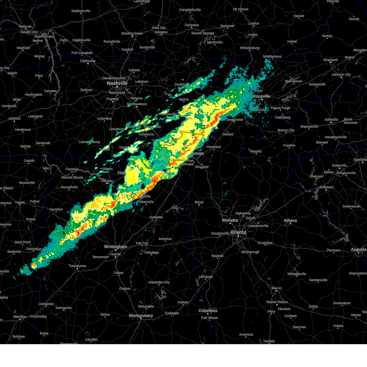 The storms which prompted the warning have weakened below severe limits, and have exited the warned area. therefore, the warning will be allowed to expire. however, gusty winds are still possible with these thunderstorms. The storms which prompted the warning have weakened below severe limits, and have exited the warned area. therefore, the warning will be allowed to expire. however, gusty winds are still possible with these thunderstorms.
|
| 2/28/2024 9:58 AM CST |
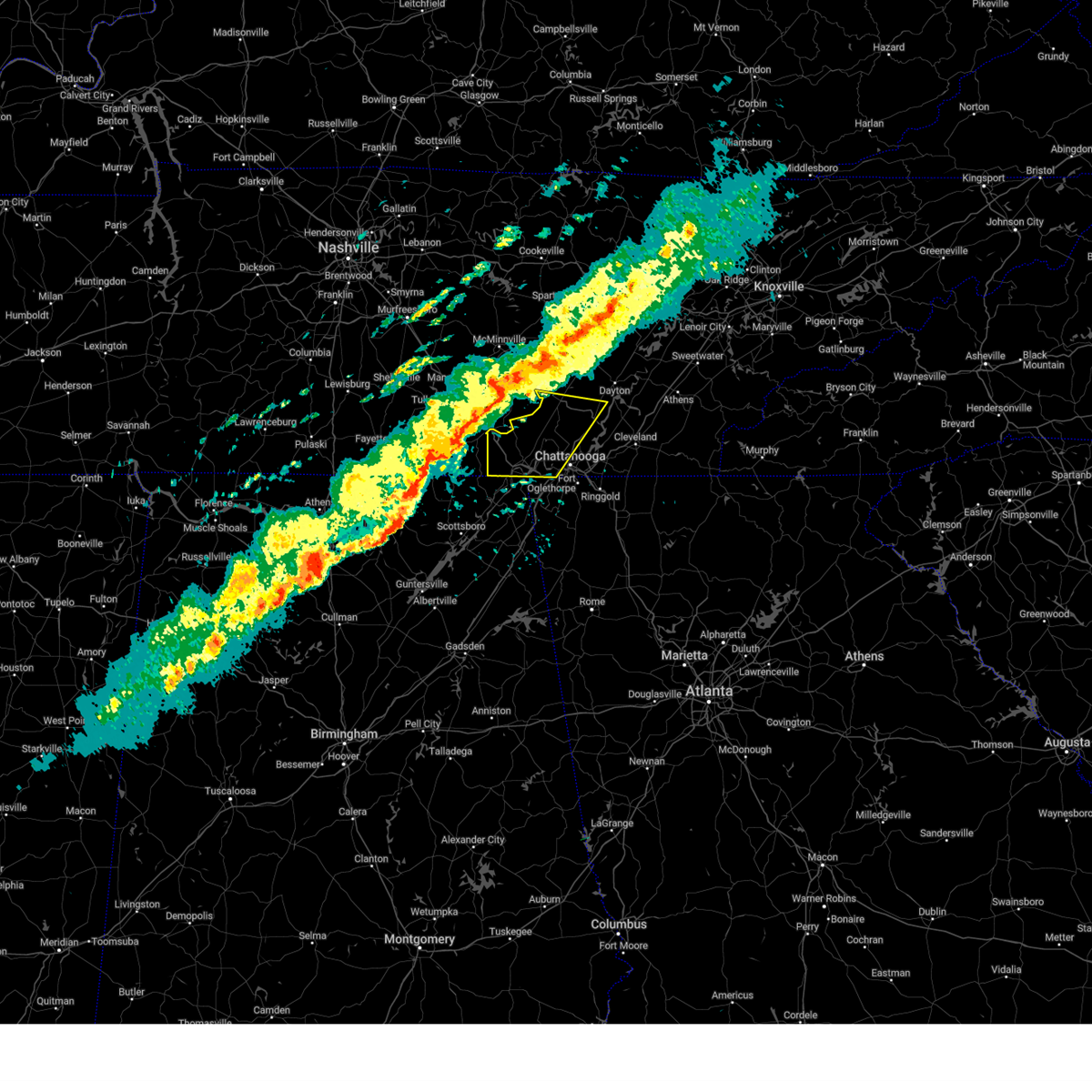 Svrmrx the national weather service in morristown has issued a * severe thunderstorm warning for, sequatchie county in east tennessee, south central bledsoe county in east tennessee, marion county in east tennessee, central hamilton county in east tennessee, * until 1145 am est/1045 am cst/. * at 1057 am est/957 am cst/, severe thunderstorms were located along a line extending from 7 miles north of monteagle to near huntland to 6 miles southeast of huntsville, moving east at 40 mph (radar indicated). Hazards include 60 mph wind gusts and penny size hail. expect damage to roofs, siding, and trees Svrmrx the national weather service in morristown has issued a * severe thunderstorm warning for, sequatchie county in east tennessee, south central bledsoe county in east tennessee, marion county in east tennessee, central hamilton county in east tennessee, * until 1145 am est/1045 am cst/. * at 1057 am est/957 am cst/, severe thunderstorms were located along a line extending from 7 miles north of monteagle to near huntland to 6 miles southeast of huntsville, moving east at 40 mph (radar indicated). Hazards include 60 mph wind gusts and penny size hail. expect damage to roofs, siding, and trees
|
| 12/9/2023 10:37 PM CST |
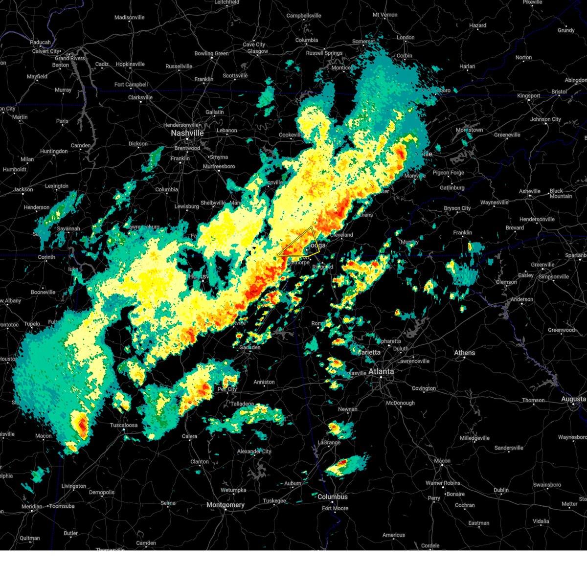 At 1137 pm est/1037 pm cst/, a severe thunderstorm was located 7 miles southeast of jasper, moving northeast at 30 mph (radar indicated). Hazards include 60 mph wind gusts and quarter size hail. Hail damage to vehicles is expected. Expect wind damage to roofs, siding, and trees. At 1137 pm est/1037 pm cst/, a severe thunderstorm was located 7 miles southeast of jasper, moving northeast at 30 mph (radar indicated). Hazards include 60 mph wind gusts and quarter size hail. Hail damage to vehicles is expected. Expect wind damage to roofs, siding, and trees.
|
| 8/15/2023 2:13 AM EDT |
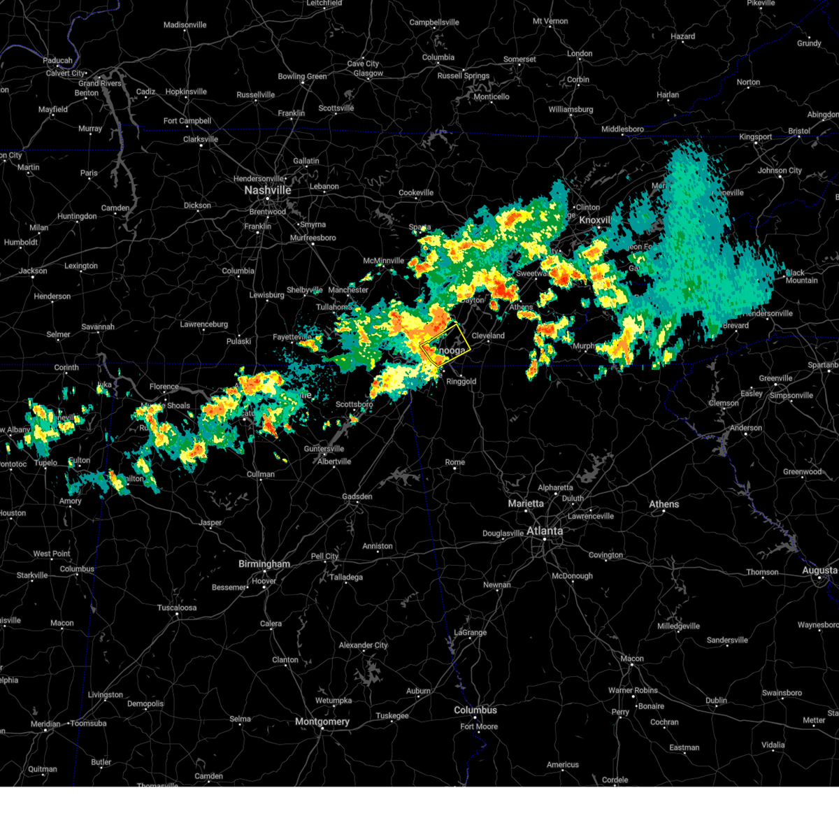 The severe thunderstorm warning for east central marion and southern hamilton counties will expire at 215 am edt/115 am cdt/, the storm which prompted the warning has weakened below severe limits, and no longer poses an immediate threat to life or property. therefore, the warning will be allowed to expire. however, heavy rain is still possible with this thunderstorm. a severe thunderstorm watch remains in effect until 300 am edt/200 am cdt/ for east tennessee. to report severe weather, contact your nearest law enforcement agency. they will relay your report to the national weather service morristown. The severe thunderstorm warning for east central marion and southern hamilton counties will expire at 215 am edt/115 am cdt/, the storm which prompted the warning has weakened below severe limits, and no longer poses an immediate threat to life or property. therefore, the warning will be allowed to expire. however, heavy rain is still possible with this thunderstorm. a severe thunderstorm watch remains in effect until 300 am edt/200 am cdt/ for east tennessee. to report severe weather, contact your nearest law enforcement agency. they will relay your report to the national weather service morristown.
|
| 8/15/2023 1:09 AM CDT |
 At 209 am edt/109 am cdt/, a severe thunderstorm was located near soddy-daisy, or 14 miles east of dunlap, moving east at 45 mph (radar indicated). Hazards include 60 mph wind gusts and quarter size hail. Hail damage to vehicles is expected. expect wind damage to roofs, siding, and trees. locations impacted include, chattanooga, dunlap, soddy-daisy, signal mountain, walden, lakesite, whitwell, fairmount, red bank, and powells crossroads. hail threat, radar indicated max hail size, 1. 00 in wind threat, radar indicated max wind gust, 60 mph. At 209 am edt/109 am cdt/, a severe thunderstorm was located near soddy-daisy, or 14 miles east of dunlap, moving east at 45 mph (radar indicated). Hazards include 60 mph wind gusts and quarter size hail. Hail damage to vehicles is expected. expect wind damage to roofs, siding, and trees. locations impacted include, chattanooga, dunlap, soddy-daisy, signal mountain, walden, lakesite, whitwell, fairmount, red bank, and powells crossroads. hail threat, radar indicated max hail size, 1. 00 in wind threat, radar indicated max wind gust, 60 mph.
|
| 8/15/2023 2:08 AM EDT |
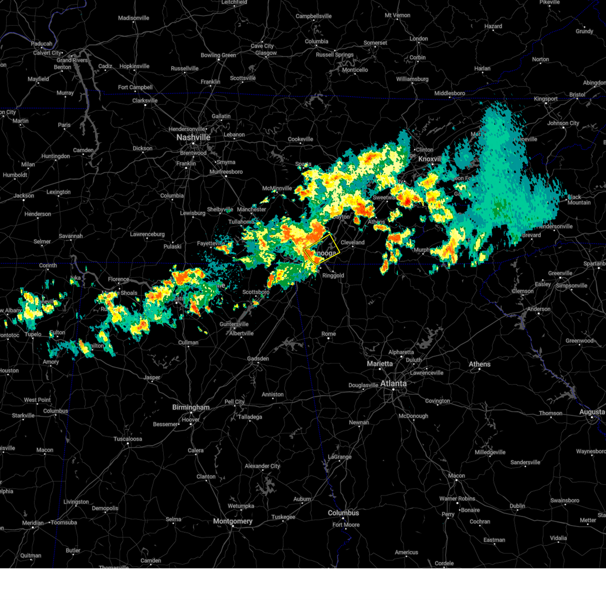 At 208 am edt/108 am cdt/, a severe thunderstorm was located near harrison, or near chattanooga, moving northeast at 45 mph (radar indicated). Hazards include 60 mph wind gusts and quarter size hail. Hail damage to vehicles is expected. expect wind damage to roofs, siding, and trees. locations impacted include, chattanooga, soddy-daisy, signal mountain, walden, lakesite, ridgeside, fairmount, harrison, red bank, and harrison bay state park. this includes interstate 75 in tennessee between mile markers 7 and 14. hail threat, radar indicated max hail size, 1. 00 in wind threat, radar indicated max wind gust, 60 mph. At 208 am edt/108 am cdt/, a severe thunderstorm was located near harrison, or near chattanooga, moving northeast at 45 mph (radar indicated). Hazards include 60 mph wind gusts and quarter size hail. Hail damage to vehicles is expected. expect wind damage to roofs, siding, and trees. locations impacted include, chattanooga, soddy-daisy, signal mountain, walden, lakesite, ridgeside, fairmount, harrison, red bank, and harrison bay state park. this includes interstate 75 in tennessee between mile markers 7 and 14. hail threat, radar indicated max hail size, 1. 00 in wind threat, radar indicated max wind gust, 60 mph.
|
| 8/15/2023 12:54 AM CDT |
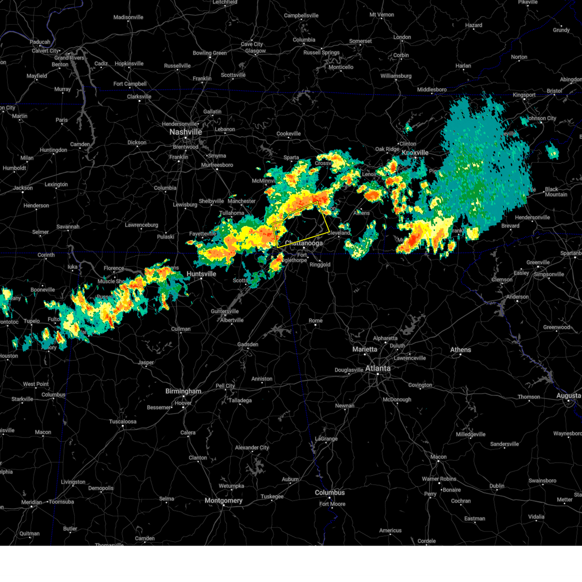 At 154 am edt/1254 am cdt/, a severe thunderstorm was located near fairmount, or 8 miles south of dunlap, moving east at 45 mph (radar indicated). Hazards include 60 mph wind gusts and quarter size hail. Hail damage to vehicles is expected. expect wind damage to roofs, siding, and trees. locations impacted include, chattanooga, dunlap, jasper, soddy-daisy, signal mountain, walden, lakesite, whitwell, fairmount, and red bank. hail threat, radar indicated max hail size, 1. 00 in wind threat, radar indicated max wind gust, 60 mph. At 154 am edt/1254 am cdt/, a severe thunderstorm was located near fairmount, or 8 miles south of dunlap, moving east at 45 mph (radar indicated). Hazards include 60 mph wind gusts and quarter size hail. Hail damage to vehicles is expected. expect wind damage to roofs, siding, and trees. locations impacted include, chattanooga, dunlap, jasper, soddy-daisy, signal mountain, walden, lakesite, whitwell, fairmount, and red bank. hail threat, radar indicated max hail size, 1. 00 in wind threat, radar indicated max wind gust, 60 mph.
|
| 8/15/2023 1:50 AM EDT |
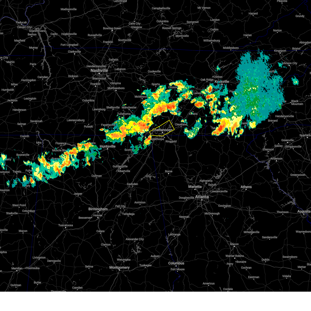 At 149 am edt/1249 am cdt/, a severe thunderstorm was located 7 miles northwest of lookout mountain, or 10 miles east of jasper, moving northeast at 45 mph (radar indicated). Hazards include 60 mph wind gusts and quarter size hail. Hail damage to vehicles is expected. Expect wind damage to roofs, siding, and trees. At 149 am edt/1249 am cdt/, a severe thunderstorm was located 7 miles northwest of lookout mountain, or 10 miles east of jasper, moving northeast at 45 mph (radar indicated). Hazards include 60 mph wind gusts and quarter size hail. Hail damage to vehicles is expected. Expect wind damage to roofs, siding, and trees.
|
| 8/15/2023 12:35 AM CDT |
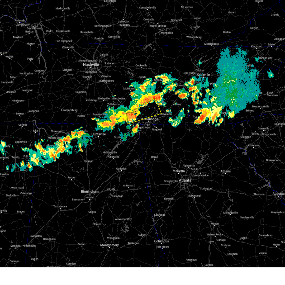 At 134 am edt/1234 am cdt/, a severe thunderstorm was located near whitwell, or 7 miles north of jasper, moving east at 45 mph (radar indicated). Hazards include 60 mph wind gusts and nickel size hail. expect damage to roofs, siding, and trees At 134 am edt/1234 am cdt/, a severe thunderstorm was located near whitwell, or 7 miles north of jasper, moving east at 45 mph (radar indicated). Hazards include 60 mph wind gusts and nickel size hail. expect damage to roofs, siding, and trees
|
| 8/12/2023 4:11 PM EDT |
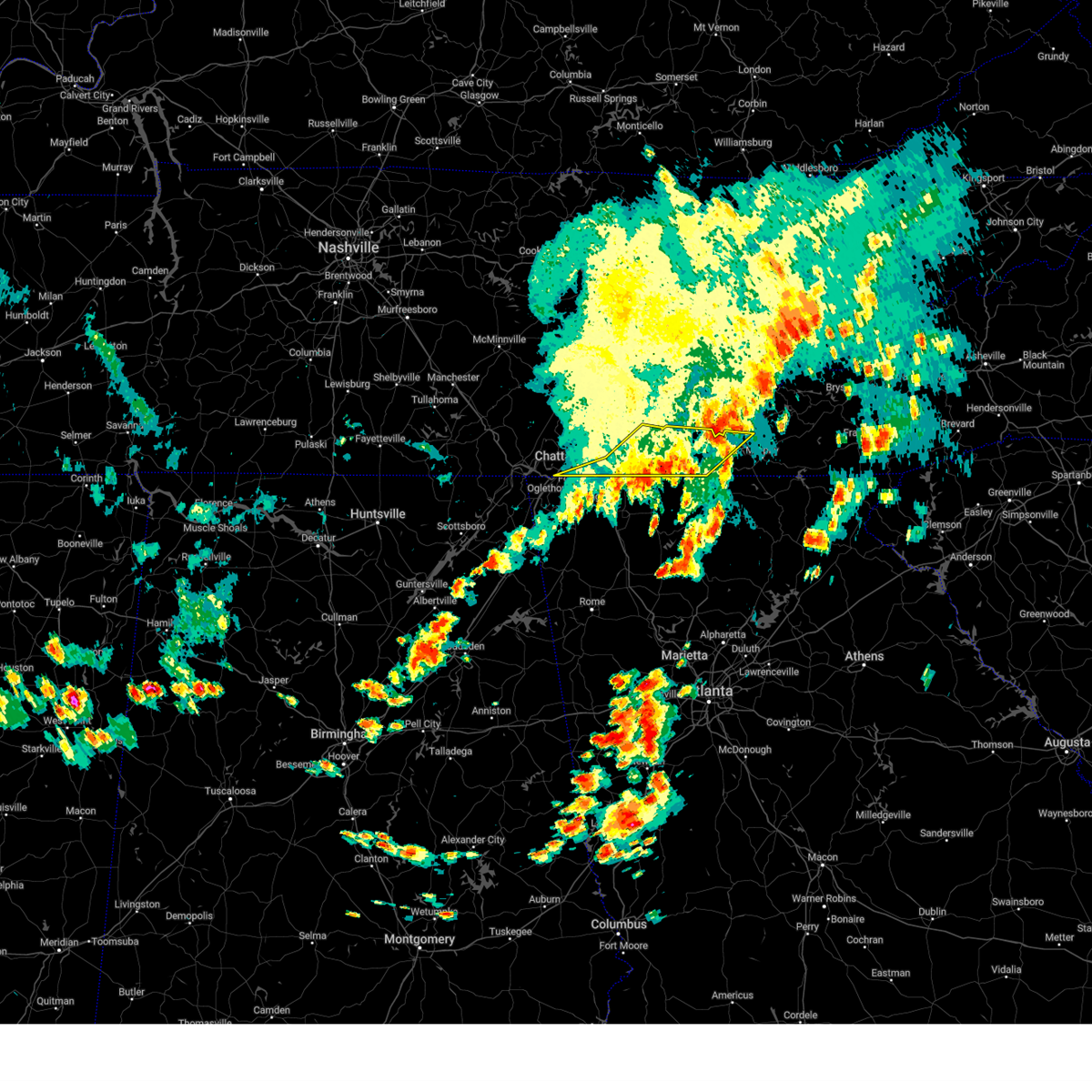 The severe thunderstorm warning for northwestern cherokee, bradley, polk and southeastern hamilton counties will expire at 415 pm edt, the storms which prompted the warning have weakened below severe limits, and have exited the warned area. therefore, the warning will be allowed to expire. however, gusty winds and heavy rain are still possible with these thunderstorms. a severe thunderstorm watch remains in effect until 700 pm edt for east tennessee. a severe thunderstorm watch also remains in effect until 800 pm edt for southwestern north carolina. The severe thunderstorm warning for northwestern cherokee, bradley, polk and southeastern hamilton counties will expire at 415 pm edt, the storms which prompted the warning have weakened below severe limits, and have exited the warned area. therefore, the warning will be allowed to expire. however, gusty winds and heavy rain are still possible with these thunderstorms. a severe thunderstorm watch remains in effect until 700 pm edt for east tennessee. a severe thunderstorm watch also remains in effect until 800 pm edt for southwestern north carolina.
|
| 8/12/2023 3:38 PM EDT |
 At 337 pm edt/237 pm cdt/, severe thunderstorms were located along a line extending from 6 miles south of fairview to 6 miles west of charleston to 6 miles west of lookout mountain, moving east at 30 mph (law enforcement reported trees down in rhea and meigs counties). Hazards include 60 mph wind gusts. Expect damage to roofs, siding, and trees. locations impacted include, chattanooga, cleveland, athens, sweetwater, loudon, decatur, soddy-daisy, signal mountain, walden, and lakesite. this includes interstate 75 in tennessee between mile markers 28 and 71. hail threat, radar indicated max hail size, <. 75 in wind threat, radar indicated max wind gust, 60 mph. At 337 pm edt/237 pm cdt/, severe thunderstorms were located along a line extending from 6 miles south of fairview to 6 miles west of charleston to 6 miles west of lookout mountain, moving east at 30 mph (law enforcement reported trees down in rhea and meigs counties). Hazards include 60 mph wind gusts. Expect damage to roofs, siding, and trees. locations impacted include, chattanooga, cleveland, athens, sweetwater, loudon, decatur, soddy-daisy, signal mountain, walden, and lakesite. this includes interstate 75 in tennessee between mile markers 28 and 71. hail threat, radar indicated max hail size, <. 75 in wind threat, radar indicated max wind gust, 60 mph.
|
| 8/12/2023 3:34 PM EDT |
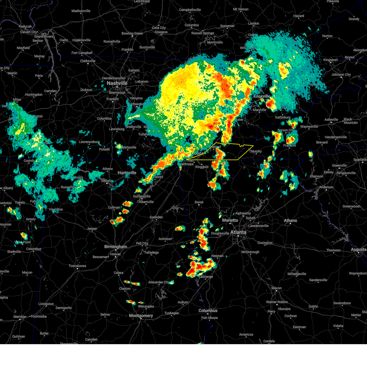 At 334 pm edt, severe thunderstorms were located along a line extending from near charleston to near south cleveland to rossville, moving east at 40 mph (law enforcement reported trees down in marion and hamilton counties). Hazards include 60 mph wind gusts. expect damage to roofs, siding, and trees At 334 pm edt, severe thunderstorms were located along a line extending from near charleston to near south cleveland to rossville, moving east at 40 mph (law enforcement reported trees down in marion and hamilton counties). Hazards include 60 mph wind gusts. expect damage to roofs, siding, and trees
|
| 8/12/2023 3:34 PM EDT |
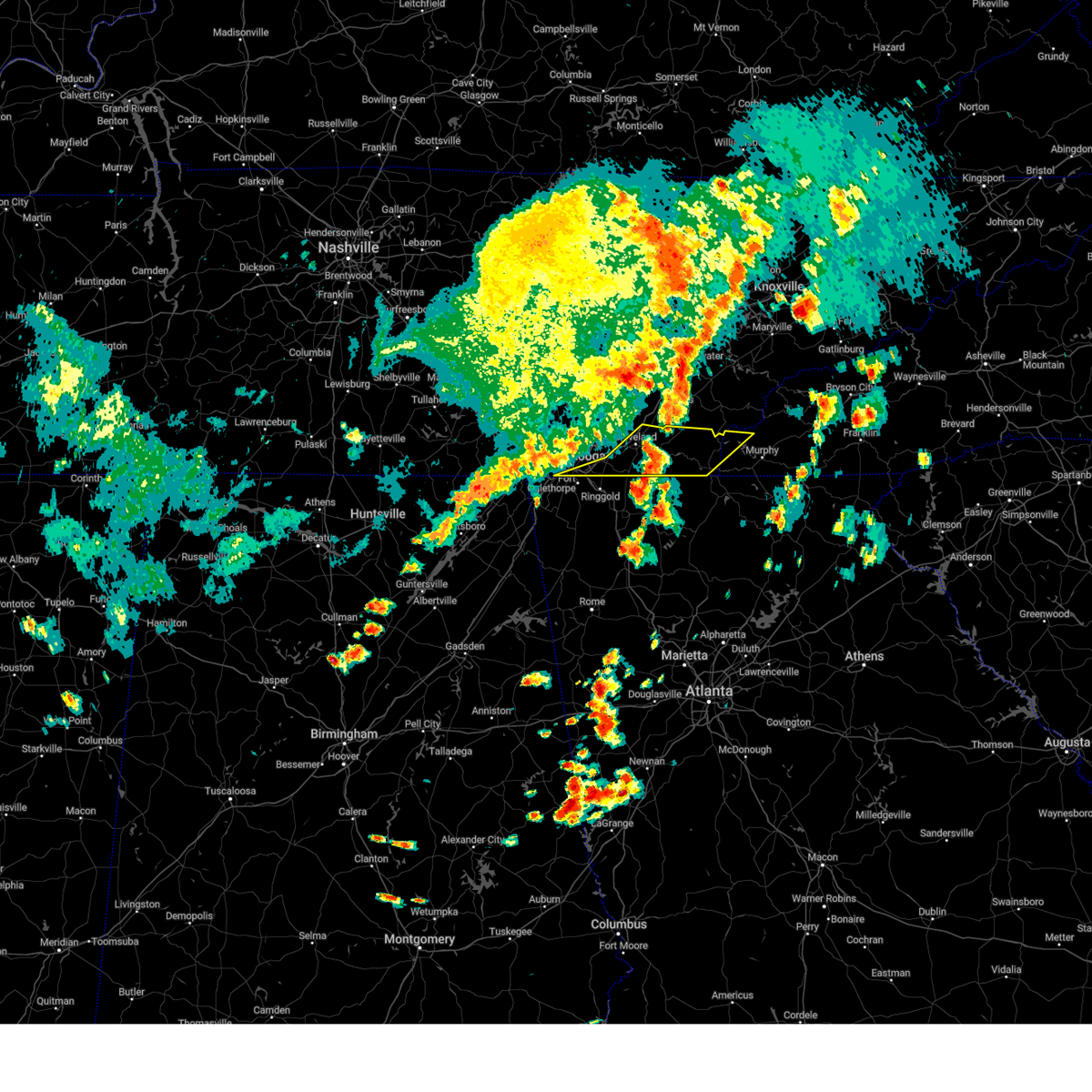 At 334 pm edt, severe thunderstorms were located along a line extending from near charleston to near south cleveland to rossville, moving east at 40 mph (law enforcement reported trees down in marion and hamilton counties). Hazards include 60 mph wind gusts. expect damage to roofs, siding, and trees At 334 pm edt, severe thunderstorms were located along a line extending from near charleston to near south cleveland to rossville, moving east at 40 mph (law enforcement reported trees down in marion and hamilton counties). Hazards include 60 mph wind gusts. expect damage to roofs, siding, and trees
|
| 8/12/2023 3:24 PM EDT |
 At 323 pm edt/223 pm cdt/, severe thunderstorms were located along a line extending from 8 miles southwest of fairview to 10 miles east of soddy-daisy to near jasper, moving east at 30 mph (law enforcement). Hazards include 70 mph wind gusts. Expect considerable tree damage. damage is likely to mobile homes, roofs, and outbuildings. locations impacted include, chattanooga, cleveland, athens, dayton, sweetwater, loudon, jasper, decatur, soddy-daisy, and signal mountain. this includes interstate 75 in tennessee between mile markers 28 and 71. thunderstorm damage threat, considerable hail threat, radar indicated max hail size, <. 75 in wind threat, radar indicated max wind gust, 70 mph. At 323 pm edt/223 pm cdt/, severe thunderstorms were located along a line extending from 8 miles southwest of fairview to 10 miles east of soddy-daisy to near jasper, moving east at 30 mph (law enforcement). Hazards include 70 mph wind gusts. Expect considerable tree damage. damage is likely to mobile homes, roofs, and outbuildings. locations impacted include, chattanooga, cleveland, athens, dayton, sweetwater, loudon, jasper, decatur, soddy-daisy, and signal mountain. this includes interstate 75 in tennessee between mile markers 28 and 71. thunderstorm damage threat, considerable hail threat, radar indicated max hail size, <. 75 in wind threat, radar indicated max wind gust, 70 mph.
|
| 8/12/2023 2:08 PM CDT |
 At 307 pm edt/207 pm cdt/, severe thunderstorms were located along a line extending from near spring city to near soddy-daisy to south pittsburg, moving east at 30 mph (law enforcement). Hazards include 60 mph wind gusts. expect damage to roofs, siding, and trees At 307 pm edt/207 pm cdt/, severe thunderstorms were located along a line extending from near spring city to near soddy-daisy to south pittsburg, moving east at 30 mph (law enforcement). Hazards include 60 mph wind gusts. expect damage to roofs, siding, and trees
|
| 8/12/2023 1:35 PM CDT |
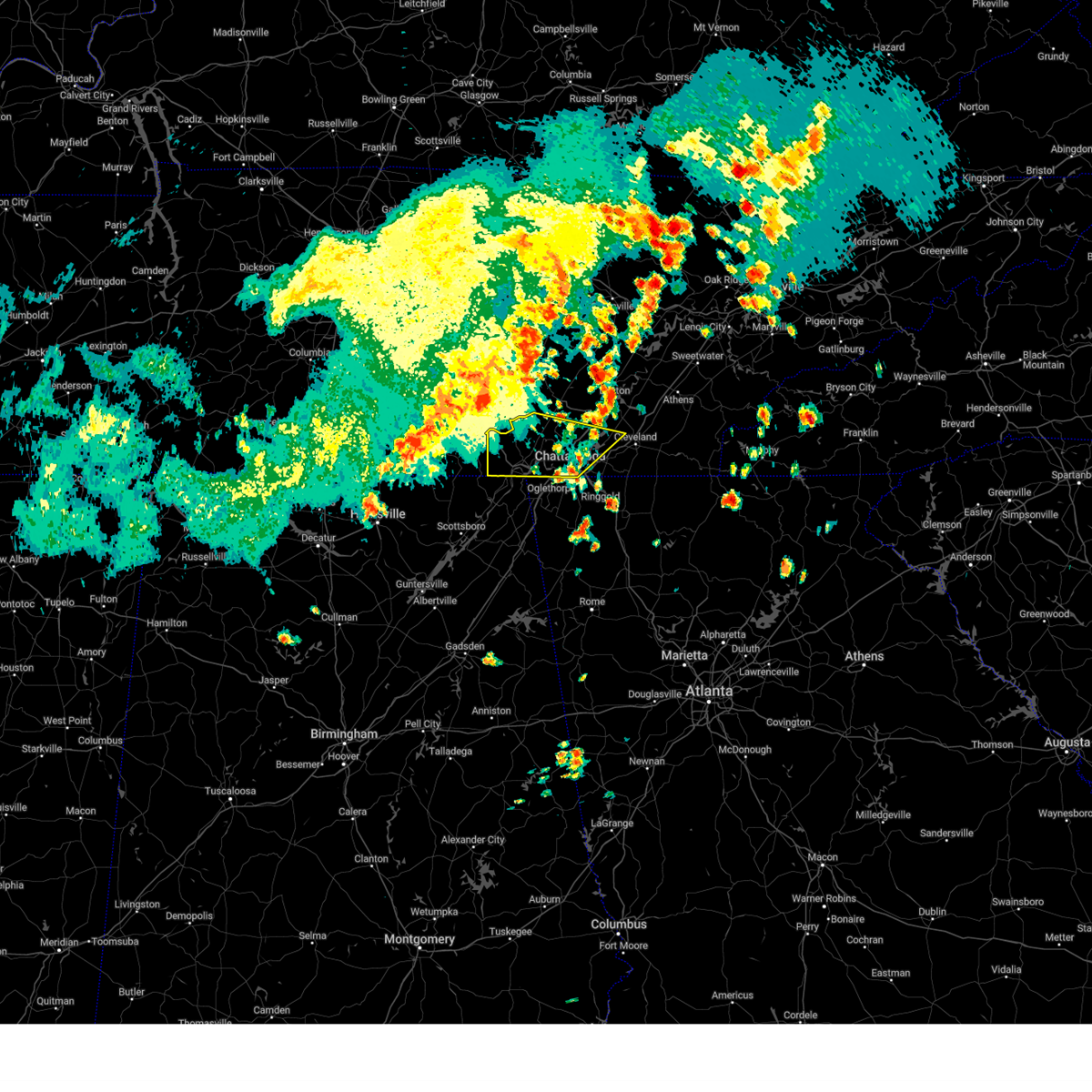 At 233 pm edt/133 pm cdt/, severe thunderstorms were located along a line extending from near gruetli-laager to sewanee to 6 miles south of huntland, moving southeast at 40 mph (radar indicated). Hazards include 70 mph wind gusts. Expect considerable tree damage. Damage is likely to mobile homes, roofs, and outbuildings. At 233 pm edt/133 pm cdt/, severe thunderstorms were located along a line extending from near gruetli-laager to sewanee to 6 miles south of huntland, moving southeast at 40 mph (radar indicated). Hazards include 70 mph wind gusts. Expect considerable tree damage. Damage is likely to mobile homes, roofs, and outbuildings.
|
| 8/12/2023 1:26 PM CDT |
 At 226 pm edt/126 pm cdt/, severe thunderstorms were located along a line extending from near spencer to 7 miles north of gruetli- laager to 6 miles north of monteagle, moving east at 50 mph (radar indicated). Hazards include 70 mph wind gusts. Expect considerable tree damage. Damage is likely to mobile homes, roofs, and outbuildings. At 226 pm edt/126 pm cdt/, severe thunderstorms were located along a line extending from near spencer to 7 miles north of gruetli- laager to 6 miles north of monteagle, moving east at 50 mph (radar indicated). Hazards include 70 mph wind gusts. Expect considerable tree damage. Damage is likely to mobile homes, roofs, and outbuildings.
|
| 8/12/2023 1:59 PM EDT |
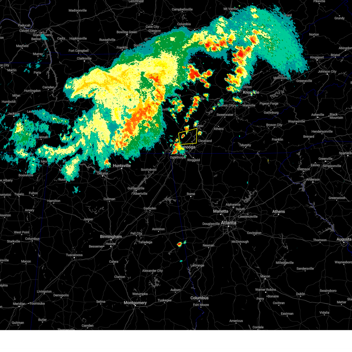 At 159 pm edt/1259 pm cdt/, a severe thunderstorm was located near fairmount, or 7 miles southeast of dunlap, moving east at 20 mph (radar indicated). Hazards include 60 mph wind gusts and quarter size hail. Hail damage to vehicles is expected. Expect wind damage to roofs, siding, and trees. At 159 pm edt/1259 pm cdt/, a severe thunderstorm was located near fairmount, or 7 miles southeast of dunlap, moving east at 20 mph (radar indicated). Hazards include 60 mph wind gusts and quarter size hail. Hail damage to vehicles is expected. Expect wind damage to roofs, siding, and trees.
|
| 8/12/2023 12:54 PM CDT |
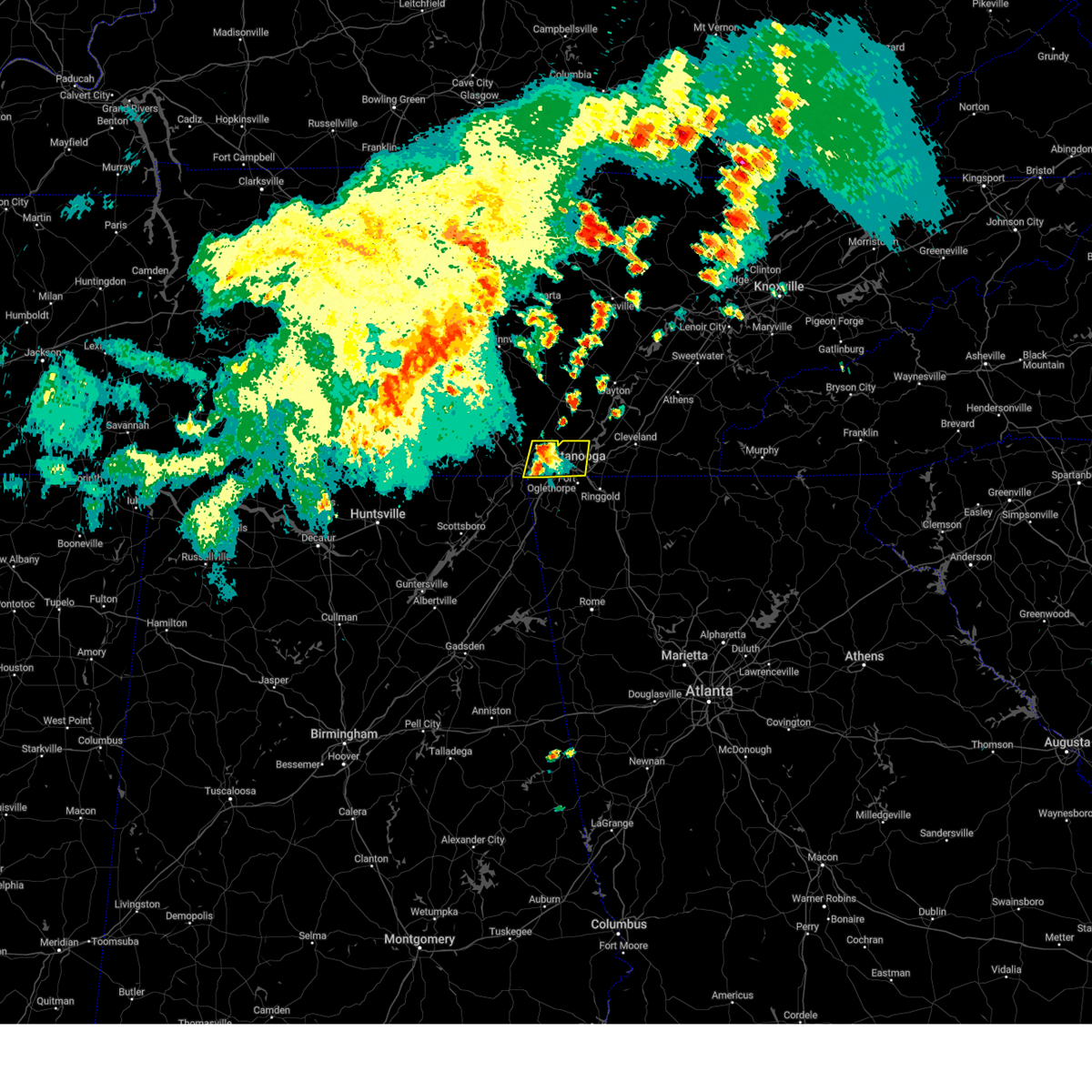 At 153 pm edt/1253 pm cdt/, a severe thunderstorm was located 7 miles southwest of signal mountain, or 9 miles east of jasper, moving east at 20 mph (law enforcement. at 145 pm local law enforcement reported multiple trees down across portions of marion county). Hazards include 60 mph wind gusts and quarter size hail. Hail damage to vehicles is expected. expect wind damage to roofs, siding, and trees. locations impacted include, chattanooga, signal mountain, walden, whitwell, ridgeside, fairmount, red bank, powells crossroads, martin springs, and lookout mountain. this includes interstate 75 in tennessee near mile marker 1. hail threat, radar indicated max hail size, 1. 00 in wind threat, observed max wind gust, 60 mph. At 153 pm edt/1253 pm cdt/, a severe thunderstorm was located 7 miles southwest of signal mountain, or 9 miles east of jasper, moving east at 20 mph (law enforcement. at 145 pm local law enforcement reported multiple trees down across portions of marion county). Hazards include 60 mph wind gusts and quarter size hail. Hail damage to vehicles is expected. expect wind damage to roofs, siding, and trees. locations impacted include, chattanooga, signal mountain, walden, whitwell, ridgeside, fairmount, red bank, powells crossroads, martin springs, and lookout mountain. this includes interstate 75 in tennessee near mile marker 1. hail threat, radar indicated max hail size, 1. 00 in wind threat, observed max wind gust, 60 mph.
|
| 8/12/2023 12:33 PM CDT |
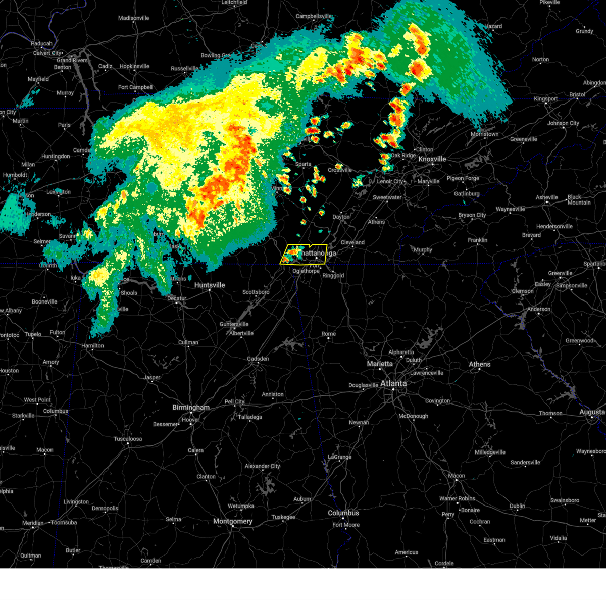 At 133 pm edt/1233 pm cdt/, a severe thunderstorm was located over jasper, moving east at 20 mph (radar indicated). Hazards include 60 mph wind gusts and quarter size hail. Hail damage to vehicles is expected. Expect wind damage to roofs, siding, and trees. At 133 pm edt/1233 pm cdt/, a severe thunderstorm was located over jasper, moving east at 20 mph (radar indicated). Hazards include 60 mph wind gusts and quarter size hail. Hail damage to vehicles is expected. Expect wind damage to roofs, siding, and trees.
|
| 8/10/2023 4:58 AM EDT |
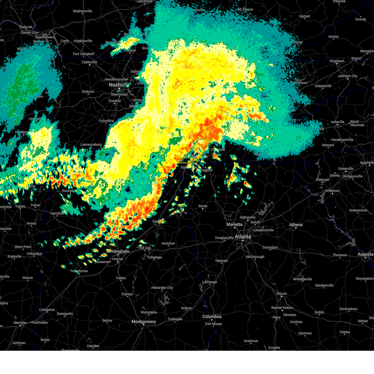 At 458 am edt/358 am cdt/, severe thunderstorms were located along a line extending from 6 miles north of soddy-daisy to near signal mountain to near lookout mountain, moving east at 55 mph (radar indicated). Hazards include 60 mph wind gusts. Expect damage to roofs, siding, and trees. locations impacted include, chattanooga, soddy-daisy, signal mountain, walden, lakesite, fairmount, red bank, flat top mountain, lookout mountain, and north chickamauga creek gorge. hail threat, radar indicated max hail size, <. 75 in wind threat, radar indicated max wind gust, 60 mph. At 458 am edt/358 am cdt/, severe thunderstorms were located along a line extending from 6 miles north of soddy-daisy to near signal mountain to near lookout mountain, moving east at 55 mph (radar indicated). Hazards include 60 mph wind gusts. Expect damage to roofs, siding, and trees. locations impacted include, chattanooga, soddy-daisy, signal mountain, walden, lakesite, fairmount, red bank, flat top mountain, lookout mountain, and north chickamauga creek gorge. hail threat, radar indicated max hail size, <. 75 in wind threat, radar indicated max wind gust, 60 mph.
|
| 8/10/2023 4:57 AM EDT |
 At 456 am edt, severe thunderstorms were located along a line extending from 9 miles southwest of dayton to near soddy-daisy to 6 miles west of lookout mountain, moving east at 60 mph (radar indicated). Hazards include 60 mph wind gusts. expect damage to roofs, siding, and trees At 456 am edt, severe thunderstorms were located along a line extending from 9 miles southwest of dayton to near soddy-daisy to 6 miles west of lookout mountain, moving east at 60 mph (radar indicated). Hazards include 60 mph wind gusts. expect damage to roofs, siding, and trees
|
| 8/10/2023 3:18 AM CDT |
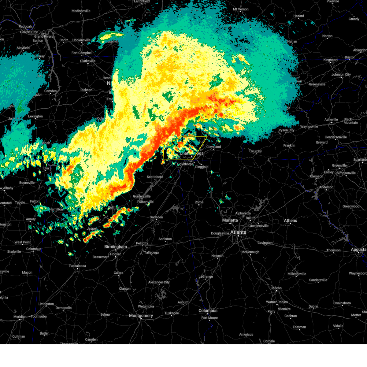 At 417 am edt/317 am cdt/, severe thunderstorms were located along a line extending from near monteagle to near cowan to 11 miles north of skyline, moving east at 60 mph (radar indicated). Hazards include 60 mph wind gusts. expect damage to roofs, siding, and trees At 417 am edt/317 am cdt/, severe thunderstorms were located along a line extending from near monteagle to near cowan to 11 miles north of skyline, moving east at 60 mph (radar indicated). Hazards include 60 mph wind gusts. expect damage to roofs, siding, and trees
|
| 8/7/2023 2:31 PM EDT |
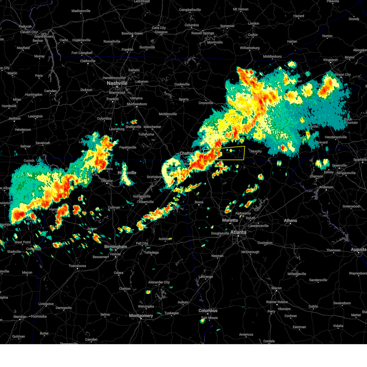 At 231 pm edt, a severe thunderstorm was located over wildwood lake, or 9 miles south of cleveland, moving east at 55 mph (radar indicated). Hazards include 70 mph wind gusts and quarter size hail. Hail damage to vehicles is expected. expect considerable tree damage. wind damage is also likely to mobile homes, roofs, and outbuildings. A gust of 68 mph was also reported at lovell field. At 231 pm edt, a severe thunderstorm was located over wildwood lake, or 9 miles south of cleveland, moving east at 55 mph (radar indicated). Hazards include 70 mph wind gusts and quarter size hail. Hail damage to vehicles is expected. expect considerable tree damage. wind damage is also likely to mobile homes, roofs, and outbuildings. A gust of 68 mph was also reported at lovell field.
|
| 8/7/2023 2:31 PM EDT |
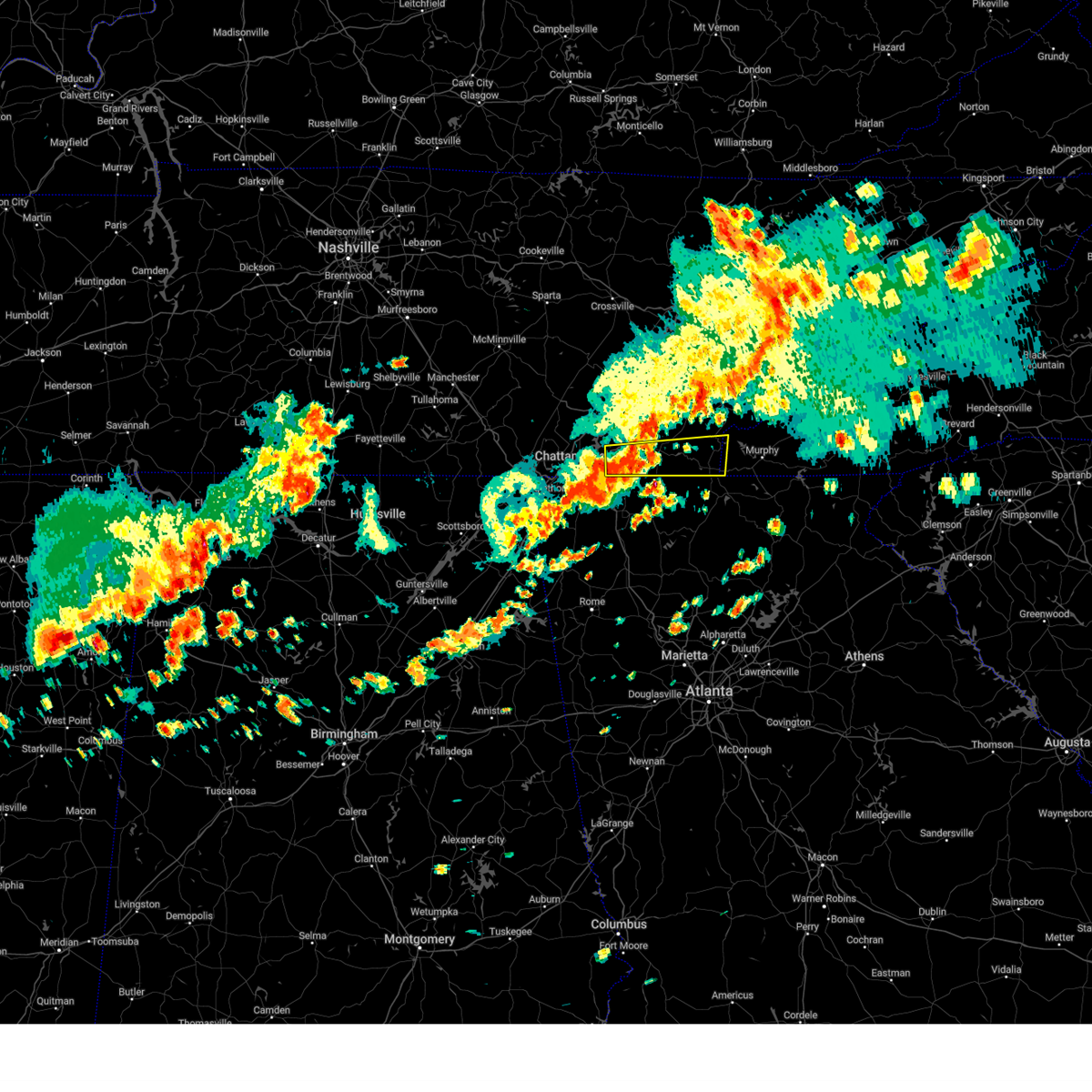 At 231 pm edt, a severe thunderstorm was located over wildwood lake, or 9 miles south of cleveland, moving east at 55 mph (radar indicated). Hazards include 70 mph wind gusts and quarter size hail. Hail damage to vehicles is expected. expect considerable tree damage. wind damage is also likely to mobile homes, roofs, and outbuildings. A gust of 68 mph was also reported at lovell field. At 231 pm edt, a severe thunderstorm was located over wildwood lake, or 9 miles south of cleveland, moving east at 55 mph (radar indicated). Hazards include 70 mph wind gusts and quarter size hail. Hail damage to vehicles is expected. expect considerable tree damage. wind damage is also likely to mobile homes, roofs, and outbuildings. A gust of 68 mph was also reported at lovell field.
|
| 8/7/2023 2:24 PM EDT |
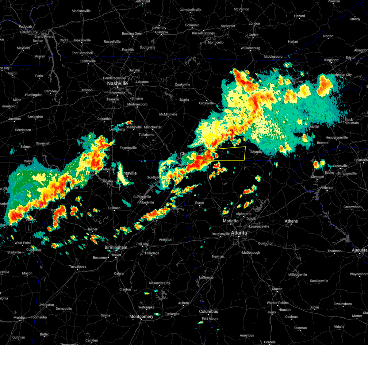 At 224 pm edt, a severe thunderstorm was located over chattanooga, moving east at 50 mph (radar indicated). Hazards include 60 mph wind gusts and quarter size hail. Hail damage to vehicles is expected. Expect wind damage to roofs, siding, and trees. At 224 pm edt, a severe thunderstorm was located over chattanooga, moving east at 50 mph (radar indicated). Hazards include 60 mph wind gusts and quarter size hail. Hail damage to vehicles is expected. Expect wind damage to roofs, siding, and trees.
|
| 8/7/2023 2:24 PM EDT |
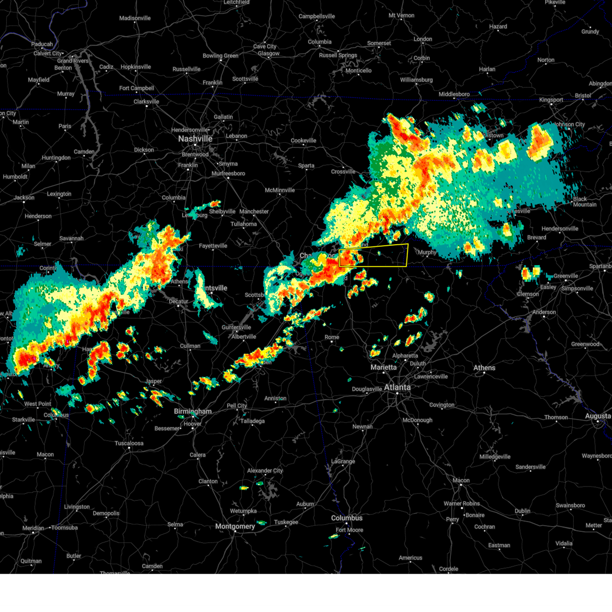 At 224 pm edt, a severe thunderstorm was located over chattanooga, moving east at 50 mph (radar indicated). Hazards include 60 mph wind gusts and quarter size hail. Hail damage to vehicles is expected. Expect wind damage to roofs, siding, and trees. At 224 pm edt, a severe thunderstorm was located over chattanooga, moving east at 50 mph (radar indicated). Hazards include 60 mph wind gusts and quarter size hail. Hail damage to vehicles is expected. Expect wind damage to roofs, siding, and trees.
|
| 8/7/2023 2:19 PM EDT | Asos station kcha chattanooga airpor in hamilton county TN, 3.4 miles NW of Chattanooga, TN |
| 8/7/2023 2:02 PM EDT | A tree was downed on hooker cemetery roa in dade county GA, 12.3 miles ENE of Chattanooga, TN |
| 8/7/2023 2:00 PM EDT |
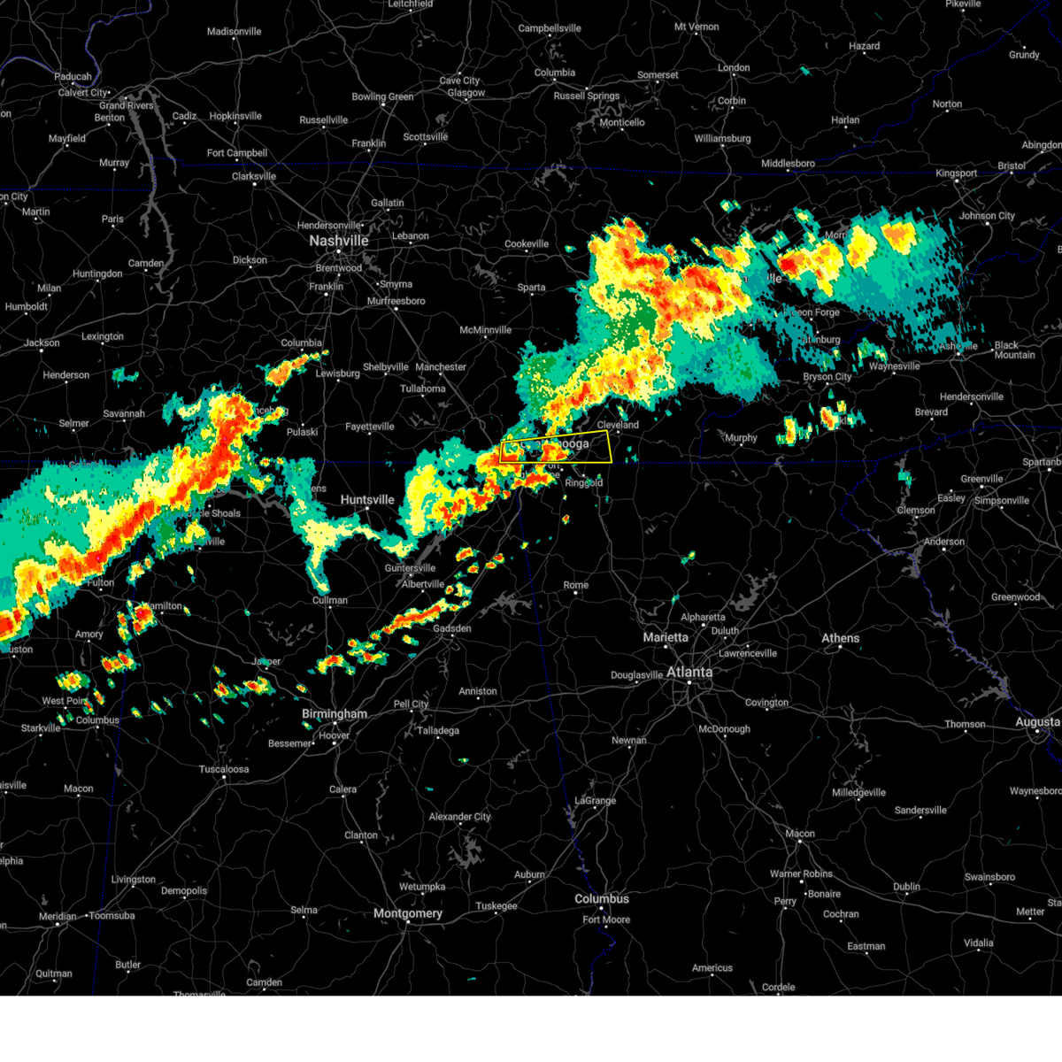 At 200 pm edt/100 pm cdt/, a severe thunderstorm was located over south pittsburg, or near bridgeport, moving east at 55 mph (radar indicated). Hazards include 70 mph wind gusts and quarter size hail. Hail damage to vehicles is expected. expect considerable tree damage. Wind damage is also likely to mobile homes, roofs, and outbuildings. At 200 pm edt/100 pm cdt/, a severe thunderstorm was located over south pittsburg, or near bridgeport, moving east at 55 mph (radar indicated). Hazards include 70 mph wind gusts and quarter size hail. Hail damage to vehicles is expected. expect considerable tree damage. Wind damage is also likely to mobile homes, roofs, and outbuildings.
|
| 8/7/2023 1:59 PM EDT |
 At 159 pm edt, a severe thunderstorm was located over chattanooga valley, or 7 miles east of trenton, moving east at 35 mph (radar indicated). Hazards include 70 mph wind gusts and quarter size hail. Hail damage to vehicles is expected. expect considerable tree damage. Wind damage is also likely to mobile homes, roofs, and outbuildings. At 159 pm edt, a severe thunderstorm was located over chattanooga valley, or 7 miles east of trenton, moving east at 35 mph (radar indicated). Hazards include 70 mph wind gusts and quarter size hail. Hail damage to vehicles is expected. expect considerable tree damage. Wind damage is also likely to mobile homes, roofs, and outbuildings.
|
| 8/7/2023 1:49 PM EDT |
 At 149 pm edt/1249 pm cdt/, severe thunderstorms were located along a line extending from near fairview to near decatur to near fairmount, moving east at 50 mph (law enforcement). Hazards include 60 mph wind gusts and nickel size hail. expect damage to roofs, siding, and trees At 149 pm edt/1249 pm cdt/, severe thunderstorms were located along a line extending from near fairview to near decatur to near fairmount, moving east at 50 mph (law enforcement). Hazards include 60 mph wind gusts and nickel size hail. expect damage to roofs, siding, and trees
|
| 7/20/2023 4:29 PM EDT |
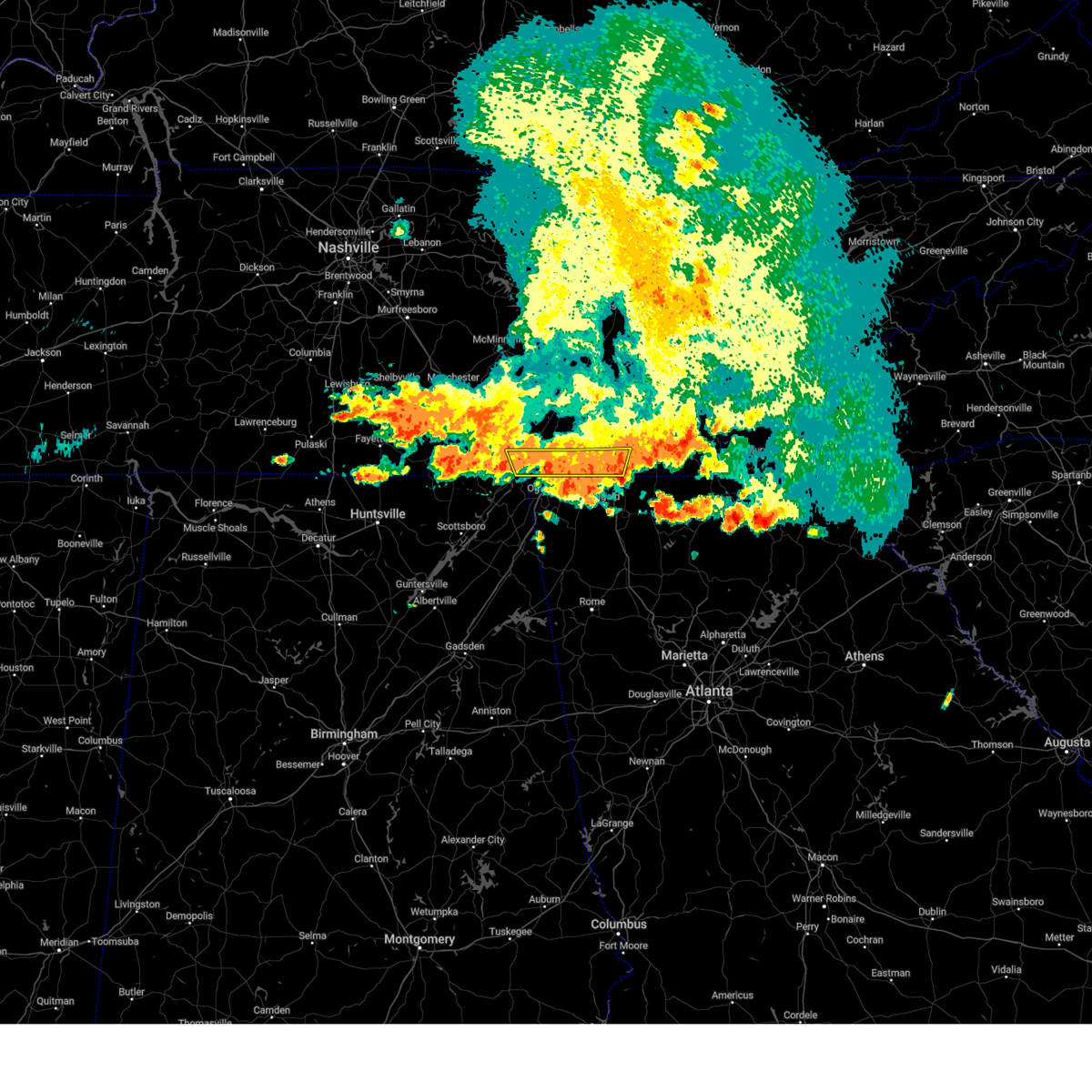 At 428 pm edt/328 pm cdt/, a severe thunderstorm was located near ringgold, moving southeast at 35 mph (radar indicated). Hazards include 60 mph wind gusts and quarter size hail. Hail damage to vehicles is expected. expect wind damage to roofs, siding, and trees. locations impacted include, chattanooga, jasper, signal mountain, kimball, ridgeside, harrison, south cleveland, red bank, collegedale and east brainerd. this includes interstate 75 in tennessee between mile markers 1 and 17. hail threat, radar indicated max hail size, 1. 00 in wind threat, radar indicated max wind gust, 60 mph. At 428 pm edt/328 pm cdt/, a severe thunderstorm was located near ringgold, moving southeast at 35 mph (radar indicated). Hazards include 60 mph wind gusts and quarter size hail. Hail damage to vehicles is expected. expect wind damage to roofs, siding, and trees. locations impacted include, chattanooga, jasper, signal mountain, kimball, ridgeside, harrison, south cleveland, red bank, collegedale and east brainerd. this includes interstate 75 in tennessee between mile markers 1 and 17. hail threat, radar indicated max hail size, 1. 00 in wind threat, radar indicated max wind gust, 60 mph.
|
| 7/20/2023 4:11 PM EDT |
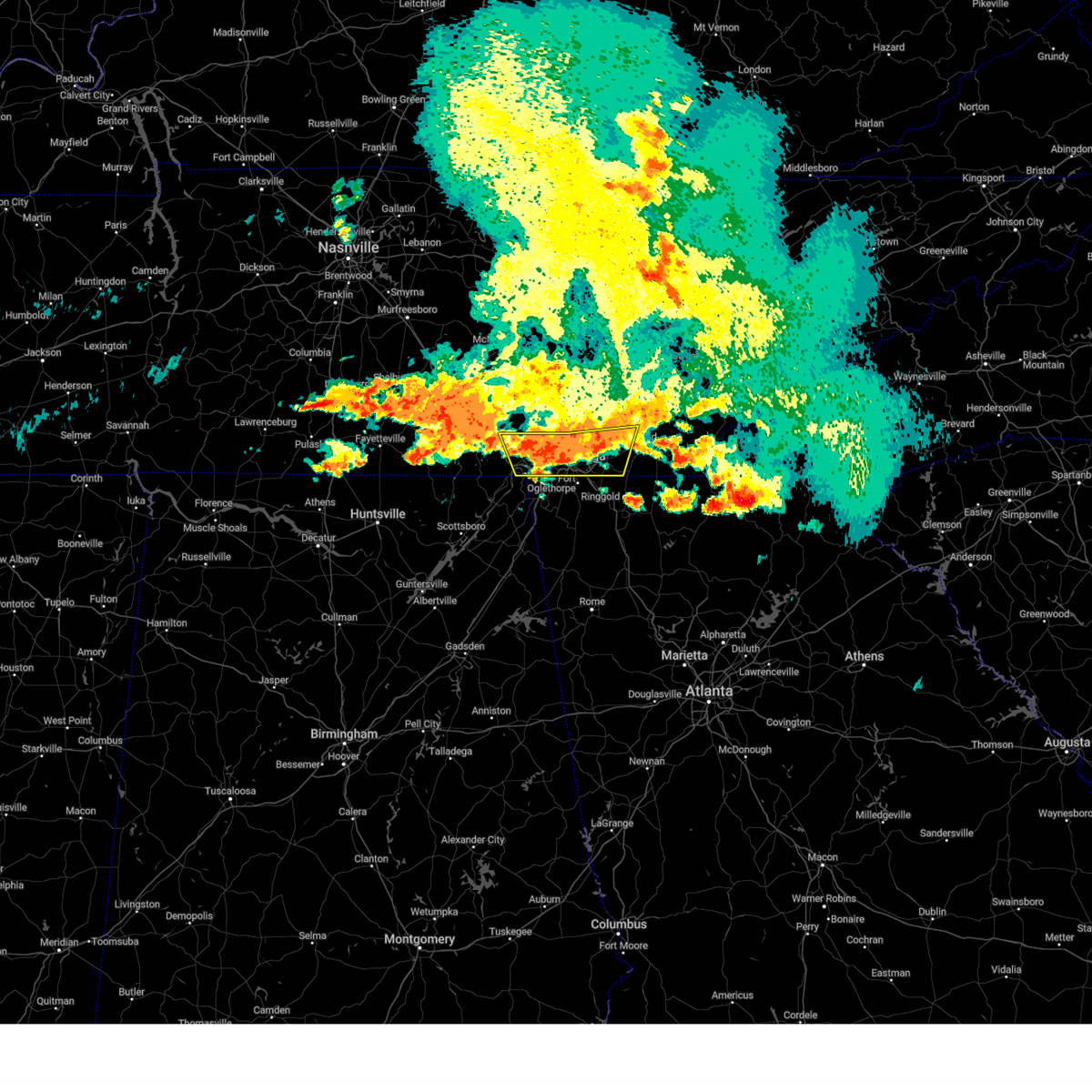 At 411 pm edt/311 pm cdt/, a severe thunderstorm was located near chattanooga, moving southeast at 35 mph (radar indicated). Hazards include 60 mph wind gusts and quarter size hail. Hail damage to vehicles is expected. expect wind damage to roofs, siding, and trees. locations impacted include, chattanooga, cleveland, jasper, soddy-daisy, signal mountain, walden, lakesite, whitwell, kimball and ridgeside. this includes interstate 75 in tennessee between mile markers 1 and 25. hail threat, radar indicated max hail size, 1. 00 in wind threat, radar indicated max wind gust, 60 mph. At 411 pm edt/311 pm cdt/, a severe thunderstorm was located near chattanooga, moving southeast at 35 mph (radar indicated). Hazards include 60 mph wind gusts and quarter size hail. Hail damage to vehicles is expected. expect wind damage to roofs, siding, and trees. locations impacted include, chattanooga, cleveland, jasper, soddy-daisy, signal mountain, walden, lakesite, whitwell, kimball and ridgeside. this includes interstate 75 in tennessee between mile markers 1 and 25. hail threat, radar indicated max hail size, 1. 00 in wind threat, radar indicated max wind gust, 60 mph.
|
| 7/20/2023 2:55 PM CDT |
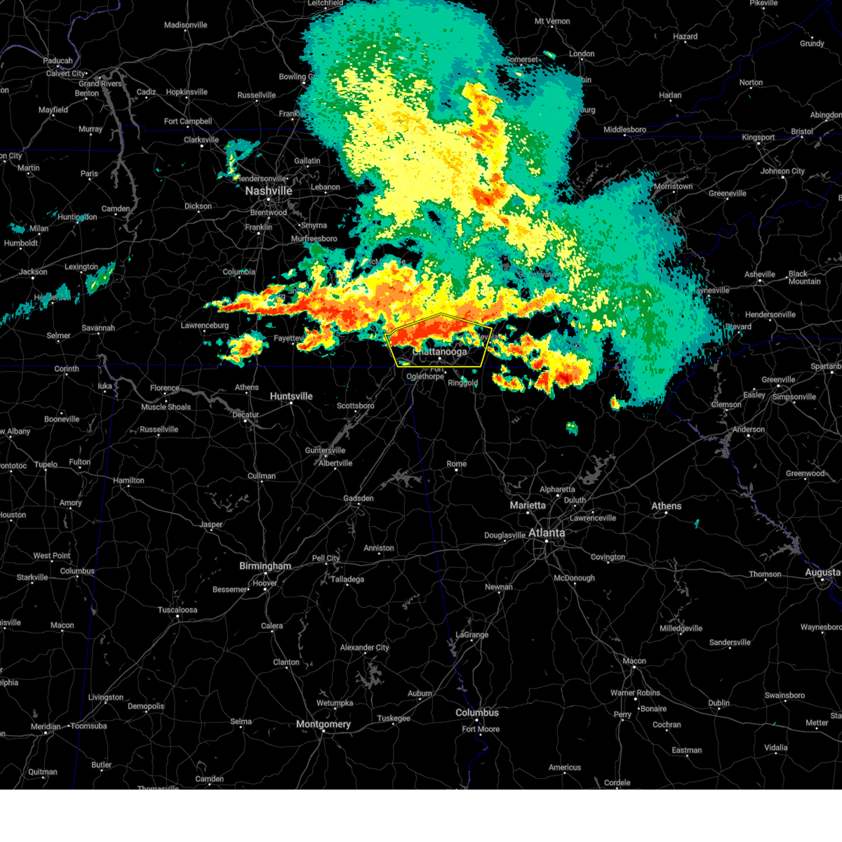 At 355 pm edt/255 pm cdt/, a severe thunderstorm was located near whitwell, or 12 miles northeast of jasper, moving southeast at 35 mph (radar indicated). Hazards include 60 mph wind gusts and quarter size hail. Hail damage to vehicles is expected. Expect wind damage to roofs, siding, and trees. At 355 pm edt/255 pm cdt/, a severe thunderstorm was located near whitwell, or 12 miles northeast of jasper, moving southeast at 35 mph (radar indicated). Hazards include 60 mph wind gusts and quarter size hail. Hail damage to vehicles is expected. Expect wind damage to roofs, siding, and trees.
|
| 7/20/2023 2:46 PM CDT |
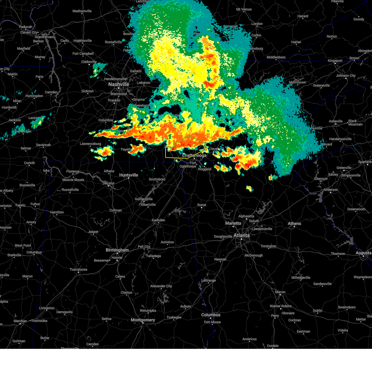 At 346 pm edt/246 pm cdt/, severe thunderstorms were located along a line extending from near dunlap to 8 miles northeast of whitwell to 6 miles east of tracy city to near monteagle, moving southeast at 55 mph (radar indicated). Hazards include 60 mph wind gusts. Expect damage to roofs, siding, and trees. locations impacted include, chattanooga, dunlap, jasper, soddy-daisy, signal mountain, walden, lakesite, whitwell, kimball and monteagle. hail threat, radar indicated max hail size, <. 75 in wind threat, radar indicated max wind gust, 60 mph. At 346 pm edt/246 pm cdt/, severe thunderstorms were located along a line extending from near dunlap to 8 miles northeast of whitwell to 6 miles east of tracy city to near monteagle, moving southeast at 55 mph (radar indicated). Hazards include 60 mph wind gusts. Expect damage to roofs, siding, and trees. locations impacted include, chattanooga, dunlap, jasper, soddy-daisy, signal mountain, walden, lakesite, whitwell, kimball and monteagle. hail threat, radar indicated max hail size, <. 75 in wind threat, radar indicated max wind gust, 60 mph.
|
| 7/20/2023 2:35 PM CDT |
 At 335 pm edt/235 pm cdt/, severe thunderstorms were located along a line extending from 13 miles north of dunlap to near gruetli-laager to 10 miles northwest of monteagle, moving southeast at 45 mph (radar indicated). Hazards include 70 mph wind gusts. Expect considerable tree damage. damage is likely to mobile homes, roofs, and outbuildings. locations impacted include, chattanooga, dunlap, jasper, soddy-daisy, signal mountain, walden, lakesite, whitwell, kimball and monteagle. thunderstorm damage threat, considerable hail threat, radar indicated max hail size, <. 75 in wind threat, radar indicated max wind gust, 70 mph. At 335 pm edt/235 pm cdt/, severe thunderstorms were located along a line extending from 13 miles north of dunlap to near gruetli-laager to 10 miles northwest of monteagle, moving southeast at 45 mph (radar indicated). Hazards include 70 mph wind gusts. Expect considerable tree damage. damage is likely to mobile homes, roofs, and outbuildings. locations impacted include, chattanooga, dunlap, jasper, soddy-daisy, signal mountain, walden, lakesite, whitwell, kimball and monteagle. thunderstorm damage threat, considerable hail threat, radar indicated max hail size, <. 75 in wind threat, radar indicated max wind gust, 70 mph.
|
| 7/20/2023 2:18 PM CDT |
 At 318 pm edt/218 pm cdt/, severe thunderstorms were located along a line extending from 7 miles southwest of spencer to 10 miles southeast of mcminnville to 15 miles northwest of gruetli-laager to near manchester, moving southeast at 50 mph (radar indicated). Hazards include 60 mph wind gusts and penny size hail. expect damage to roofs, siding, and trees At 318 pm edt/218 pm cdt/, severe thunderstorms were located along a line extending from 7 miles southwest of spencer to 10 miles southeast of mcminnville to 15 miles northwest of gruetli-laager to near manchester, moving southeast at 50 mph (radar indicated). Hazards include 60 mph wind gusts and penny size hail. expect damage to roofs, siding, and trees
|
| 7/18/2023 7:51 PM EDT |
 At 751 pm edt, a severe thunderstorm was located near cooper heights, or 8 miles north of lafayette, moving east at 40 mph (radar indicated). Hazards include 60 mph wind gusts. Expect damage to roofs, siding, and trees. locations impacted include, chattanooga, trenton, fort oglethorpe, rossville, chickamauga, lookout mountain, chattanooga valley, rising fawn, lakeview, cole city, wildwood, fairview, stephensville, chattanooga valley, new england, morganville, hooker, cloudland canyon state park, cooper heights and east ridge. hail threat, radar indicated max hail size, <. 75 in wind threat, radar indicated max wind gust, 60 mph. At 751 pm edt, a severe thunderstorm was located near cooper heights, or 8 miles north of lafayette, moving east at 40 mph (radar indicated). Hazards include 60 mph wind gusts. Expect damage to roofs, siding, and trees. locations impacted include, chattanooga, trenton, fort oglethorpe, rossville, chickamauga, lookout mountain, chattanooga valley, rising fawn, lakeview, cole city, wildwood, fairview, stephensville, chattanooga valley, new england, morganville, hooker, cloudland canyon state park, cooper heights and east ridge. hail threat, radar indicated max hail size, <. 75 in wind threat, radar indicated max wind gust, 60 mph.
|
| 7/18/2023 7:36 PM EDT |
 At 736 pm edt, a severe thunderstorm was located over stephensville, or near trenton, moving east at 70 mph (radar indicated). Hazards include 60 mph wind gusts. expect damage to roofs, siding, and trees At 736 pm edt, a severe thunderstorm was located over stephensville, or near trenton, moving east at 70 mph (radar indicated). Hazards include 60 mph wind gusts. expect damage to roofs, siding, and trees
|
| 7/18/2023 5:51 PM CDT |
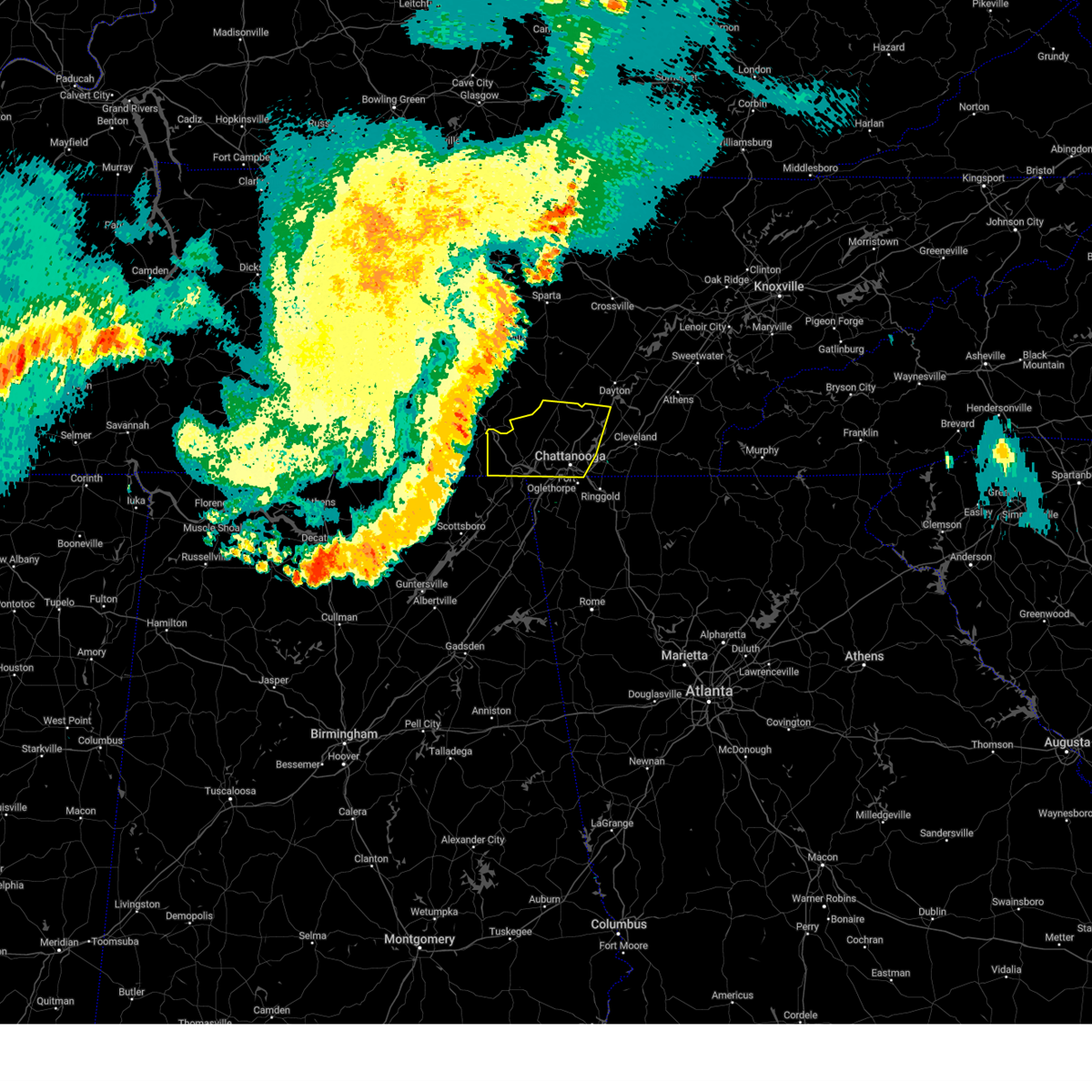 At 649 pm edt/549 pm cdt/, severe thunderstorms were located along a line extending from 11 miles east of manchester to near cowan to 9 miles northeast of gurley, moving east at 45 mph (radar indicated). Hazards include 60 mph wind gusts. expect damage to roofs, siding, and trees At 649 pm edt/549 pm cdt/, severe thunderstorms were located along a line extending from 11 miles east of manchester to near cowan to 9 miles northeast of gurley, moving east at 45 mph (radar indicated). Hazards include 60 mph wind gusts. expect damage to roofs, siding, and trees
|
| 7/2/2023 4:40 PM EDT |
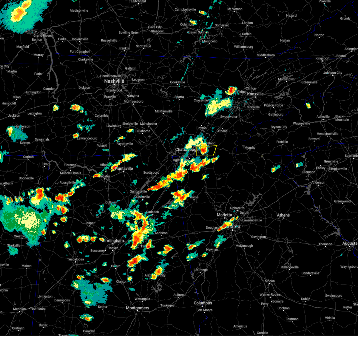 At 438 pm edt, a severe thunderstorm was located near south cleveland, or 11 miles southwest of cleveland, moving east at 30 mph (law enforcement. numerous trees and power lines have been reported down across portions of southern hamilton county). Hazards include 60 mph wind gusts and quarter size hail. Hail damage to vehicles is expected. expect wind damage to roofs, siding, and trees. locations impacted include, chattanooga, cleveland, south cleveland, east cleveland, wildwood lake, collegedale, waterville, east brainerd, red clay state park and flint springs. this includes interstate 75 in tennessee between mile markers 10 and 19. hail threat, radar indicated max hail size, 1. 00 in wind threat, radar indicated max wind gust, 60 mph. At 438 pm edt, a severe thunderstorm was located near south cleveland, or 11 miles southwest of cleveland, moving east at 30 mph (law enforcement. numerous trees and power lines have been reported down across portions of southern hamilton county). Hazards include 60 mph wind gusts and quarter size hail. Hail damage to vehicles is expected. expect wind damage to roofs, siding, and trees. locations impacted include, chattanooga, cleveland, south cleveland, east cleveland, wildwood lake, collegedale, waterville, east brainerd, red clay state park and flint springs. this includes interstate 75 in tennessee between mile markers 10 and 19. hail threat, radar indicated max hail size, 1. 00 in wind threat, radar indicated max wind gust, 60 mph.
|
| 7/2/2023 4:27 PM EDT |
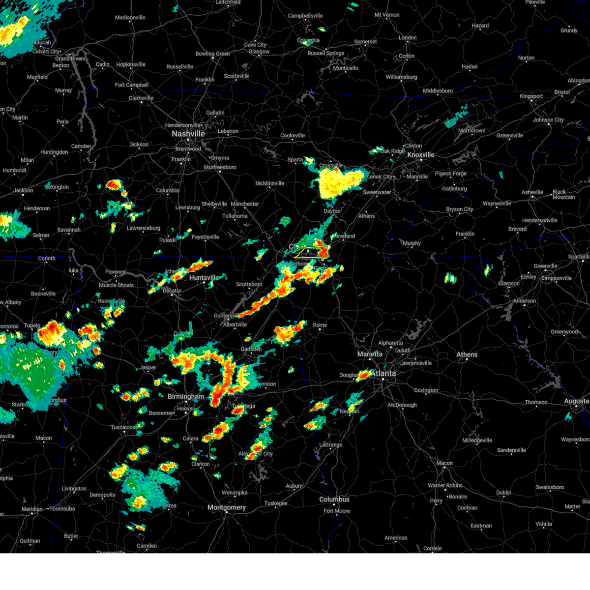 The severe thunderstorm warning for south central hamilton county will expire at 430 pm edt, the storm which prompted the warning has moved out of the area. therefore, the warning will be allowed to expire. however hail, gusty winds and heavy rain are still possible with this thunderstorm. a severe thunderstorm watch remains in effect until 900 pm edt for east tennessee. remember, a severe thunderstorm warning still remains in effect for the southeast part of hamilton county. The severe thunderstorm warning for south central hamilton county will expire at 430 pm edt, the storm which prompted the warning has moved out of the area. therefore, the warning will be allowed to expire. however hail, gusty winds and heavy rain are still possible with this thunderstorm. a severe thunderstorm watch remains in effect until 900 pm edt for east tennessee. remember, a severe thunderstorm warning still remains in effect for the southeast part of hamilton county.
|
| 7/2/2023 4:20 PM EDT |
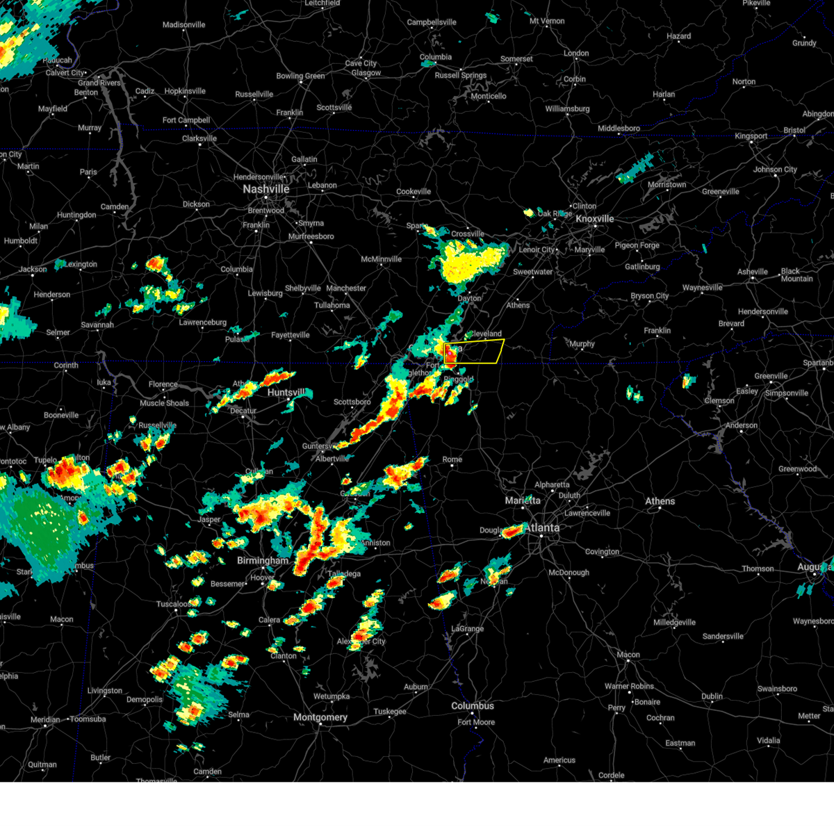 At 419 pm edt, a severe thunderstorm was located near harrison, or near chattanooga, moving east at 30 mph (radar indicated). Hazards include 60 mph wind gusts and quarter size hail. Hail damage to vehicles is expected. Expect wind damage to roofs, siding, and trees. At 419 pm edt, a severe thunderstorm was located near harrison, or near chattanooga, moving east at 30 mph (radar indicated). Hazards include 60 mph wind gusts and quarter size hail. Hail damage to vehicles is expected. Expect wind damage to roofs, siding, and trees.
|
| 7/2/2023 4:15 PM EDT | Numerous reports of trees and power lines blown down around chattanoog in hamilton county TN, 1.1 miles ESE of Chattanooga, TN |
| 7/2/2023 4:14 PM EDT | Storm damage reported in hamilton county TN, 1.1 miles ESE of Chattanooga, TN |
| 7/2/2023 4:07 PM EDT |
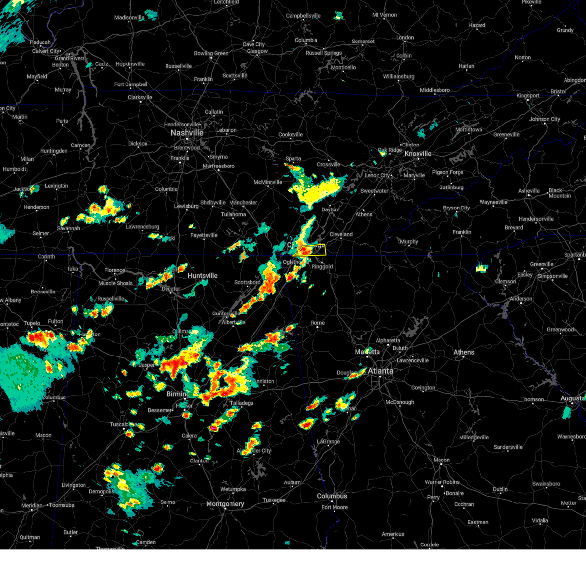 At 406 pm edt, a severe thunderstorm was located over ridgeside, or near chattanooga, moving east at 35 mph (radar indicated). Hazards include 60 mph wind gusts and penny size hail. Expect damage to roofs, siding, and trees. locations impacted include, chattanooga, ridgeside, red bank, collegedale, east brainerd, lookout mountain, east ridge and ooltewah. this includes interstate 75 in tennessee between mile markers 1 and 11. hail threat, radar indicated max hail size, 0. 75 in wind threat, radar indicated max wind gust, 60 mph. At 406 pm edt, a severe thunderstorm was located over ridgeside, or near chattanooga, moving east at 35 mph (radar indicated). Hazards include 60 mph wind gusts and penny size hail. Expect damage to roofs, siding, and trees. locations impacted include, chattanooga, ridgeside, red bank, collegedale, east brainerd, lookout mountain, east ridge and ooltewah. this includes interstate 75 in tennessee between mile markers 1 and 11. hail threat, radar indicated max hail size, 0. 75 in wind threat, radar indicated max wind gust, 60 mph.
|
| 7/2/2023 3:40 PM EDT |
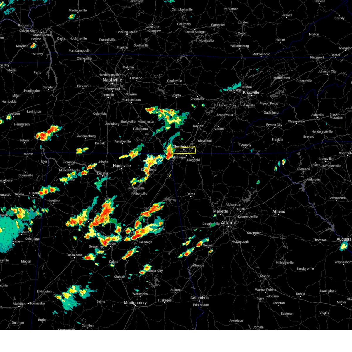 At 340 pm edt/240 pm cdt/, a severe thunderstorm was located 7 miles west of lookout mountain, or 7 miles north of trenton, moving east at 35 mph (radar indicated). Hazards include 60 mph wind gusts and quarter size hail. Hail damage to vehicles is expected. Expect wind damage to roofs, siding, and trees. At 340 pm edt/240 pm cdt/, a severe thunderstorm was located 7 miles west of lookout mountain, or 7 miles north of trenton, moving east at 35 mph (radar indicated). Hazards include 60 mph wind gusts and quarter size hail. Hail damage to vehicles is expected. Expect wind damage to roofs, siding, and trees.
|
| 7/1/2023 5:12 PM EDT |
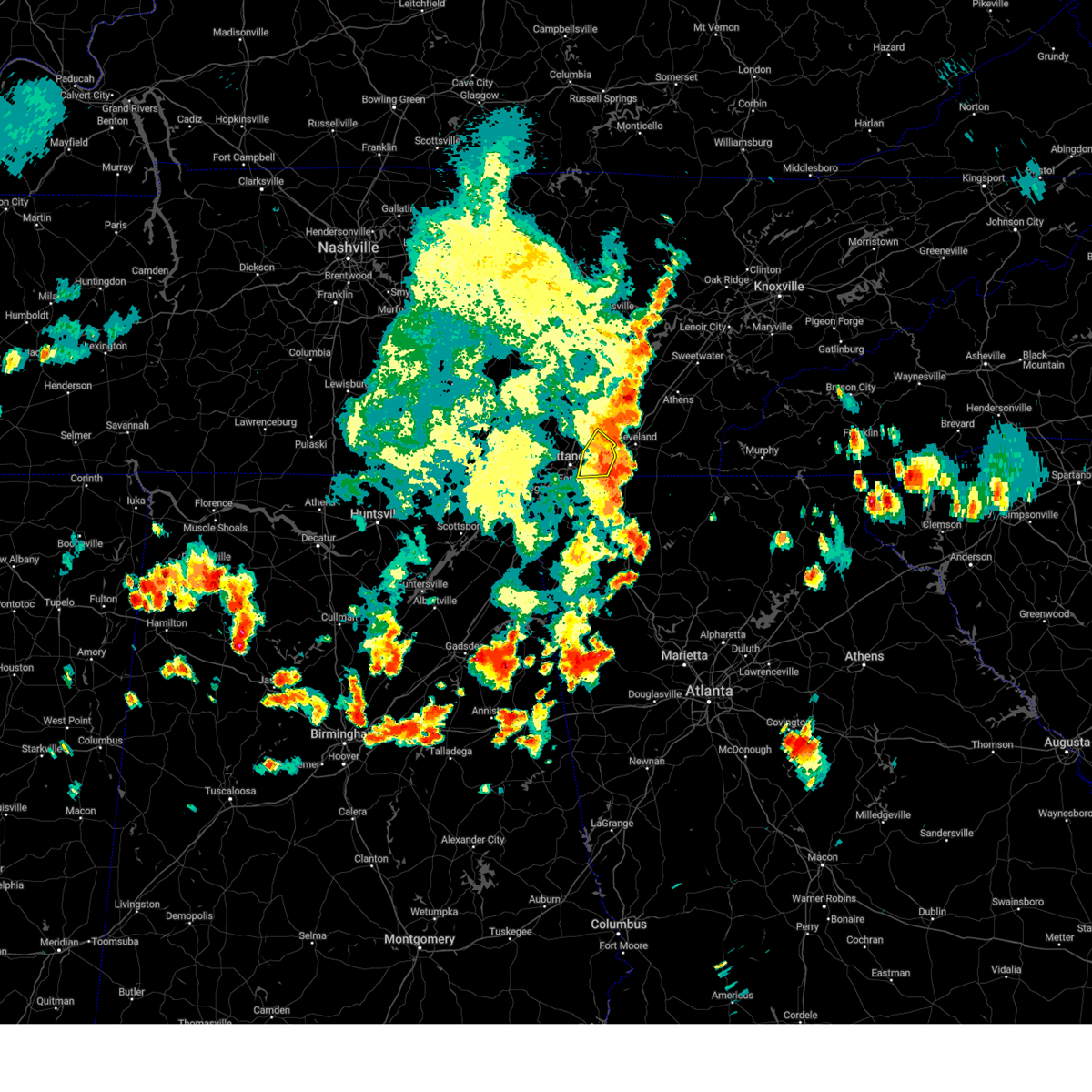 The severe thunderstorm warning for southeastern hamilton county will expire at 515 pm edt, the storms which prompted the warning have weakened below severe limits, and no longer pose an immediate threat to life or property. therefore, the warning will be allowed to expire. however gusty winds are still possible with these thunderstorms. a severe thunderstorm watch remains in effect until 900 pm edt for east tennessee. The severe thunderstorm warning for southeastern hamilton county will expire at 515 pm edt, the storms which prompted the warning have weakened below severe limits, and no longer pose an immediate threat to life or property. therefore, the warning will be allowed to expire. however gusty winds are still possible with these thunderstorms. a severe thunderstorm watch remains in effect until 900 pm edt for east tennessee.
|
| 7/1/2023 4:58 PM EDT |
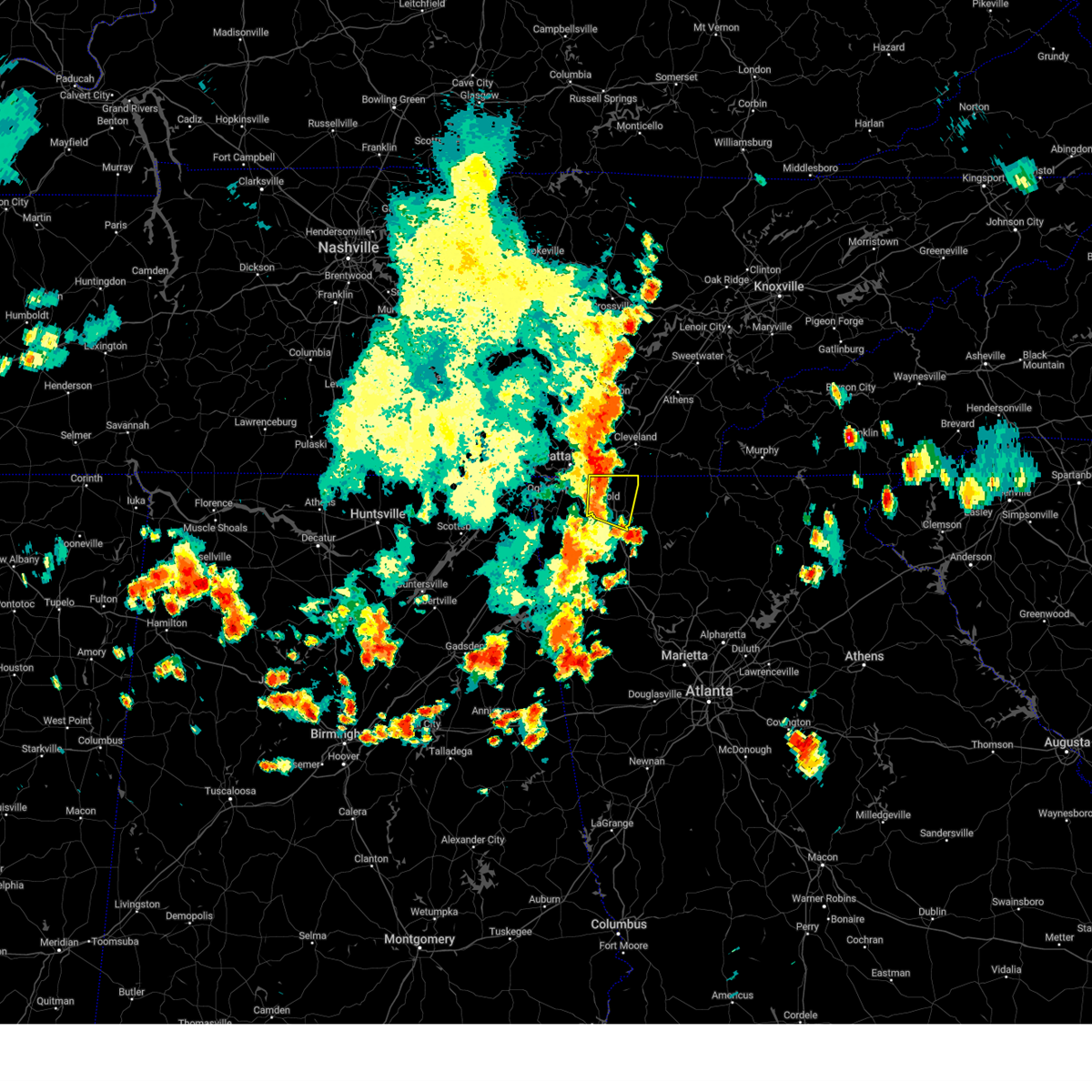 At 457 pm edt, severe thunderstorms were located along a line extending from ooltewah to near wood station, moving east at 15 mph (radar indicated). Hazards include 60 mph wind gusts and quarter size hail. Hail damage to vehicles is expected. Expect wind damage to roofs, siding, and trees. At 457 pm edt, severe thunderstorms were located along a line extending from ooltewah to near wood station, moving east at 15 mph (radar indicated). Hazards include 60 mph wind gusts and quarter size hail. Hail damage to vehicles is expected. Expect wind damage to roofs, siding, and trees.
|
| 7/1/2023 4:57 PM EDT |
 At 456 pm edt, severe thunderstorms were located along a line extending from lakesite to near harrison to near chattanooga, moving southeast at 30 mph (radar indicated). Hazards include 60 mph wind gusts and penny size hail. Expect damage to roofs, siding, and trees. locations impacted include, chattanooga, lakesite, ridgeside, harrison, collegedale, east brainerd, harrison bay state park, east ridge, ooltewah and lakeview. this includes interstate 75 in tennessee between mile markers 1 and 15. hail threat, radar indicated max hail size, 0. 75 in wind threat, radar indicated max wind gust, 60 mph. At 456 pm edt, severe thunderstorms were located along a line extending from lakesite to near harrison to near chattanooga, moving southeast at 30 mph (radar indicated). Hazards include 60 mph wind gusts and penny size hail. Expect damage to roofs, siding, and trees. locations impacted include, chattanooga, lakesite, ridgeside, harrison, collegedale, east brainerd, harrison bay state park, east ridge, ooltewah and lakeview. this includes interstate 75 in tennessee between mile markers 1 and 15. hail threat, radar indicated max hail size, 0. 75 in wind threat, radar indicated max wind gust, 60 mph.
|
| 7/1/2023 4:40 PM EDT | Trees and powerlines down county-wid in hamilton county TN, 0.7 miles NE of Chattanooga, TN |
| 7/1/2023 4:33 PM EDT |
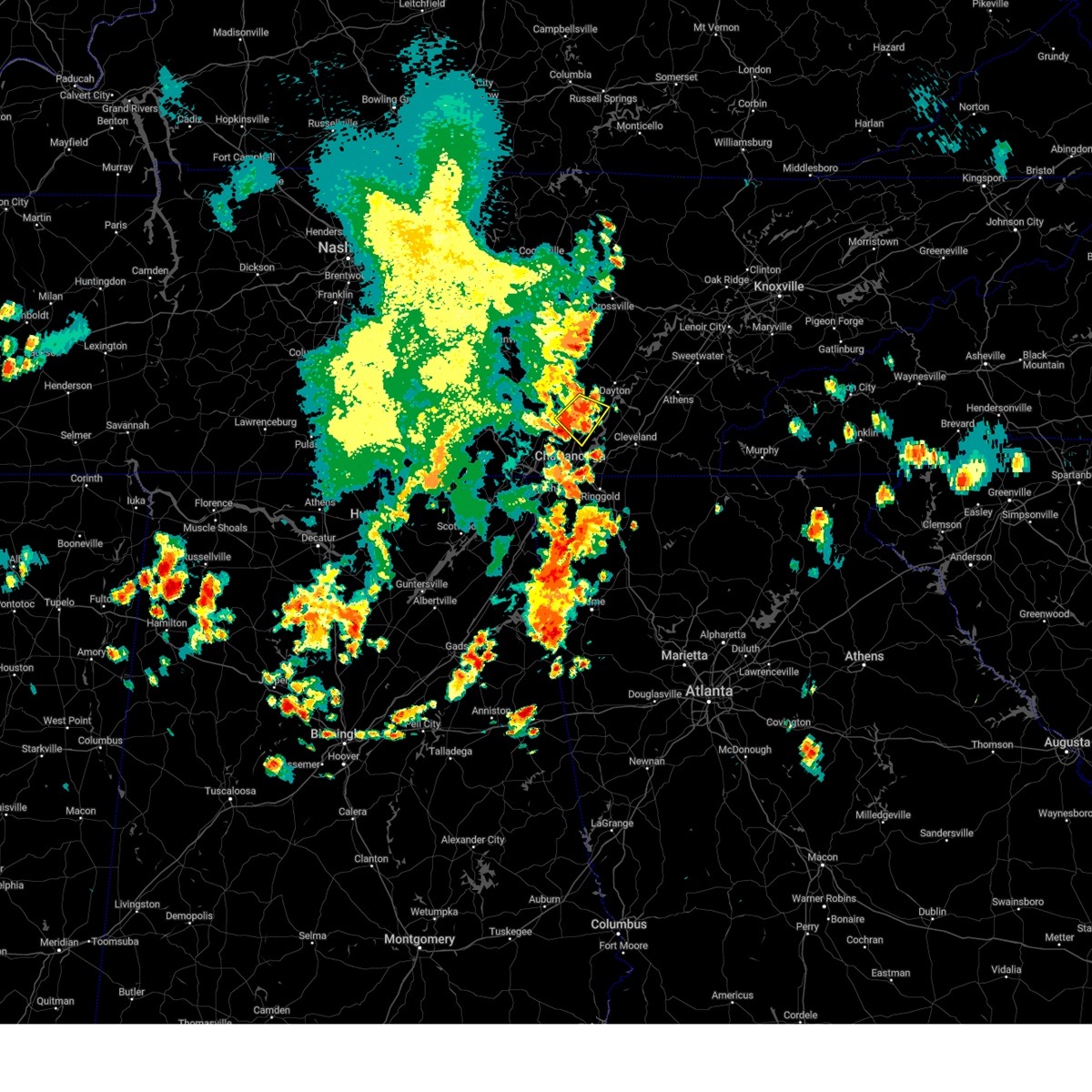 At 432 pm edt/332 pm cdt/, a severe thunderstorm was located near soddy-daisy, or 8 miles east of dunlap, moving southeast at 30 mph (radar indicated). Hazards include 60 mph wind gusts and penny size hail. Expect damage to roofs, siding, and trees. locations impacted include, chattanooga, soddy-daisy, flat top mountain, north chickamauga creek gorge, mowbray mountain, falling water, middle valley and sale creek. hail threat, radar indicated max hail size, 0. 75 in wind threat, radar indicated max wind gust, 60 mph. At 432 pm edt/332 pm cdt/, a severe thunderstorm was located near soddy-daisy, or 8 miles east of dunlap, moving southeast at 30 mph (radar indicated). Hazards include 60 mph wind gusts and penny size hail. Expect damage to roofs, siding, and trees. locations impacted include, chattanooga, soddy-daisy, flat top mountain, north chickamauga creek gorge, mowbray mountain, falling water, middle valley and sale creek. hail threat, radar indicated max hail size, 0. 75 in wind threat, radar indicated max wind gust, 60 mph.
|
| 7/1/2023 4:31 PM EDT |
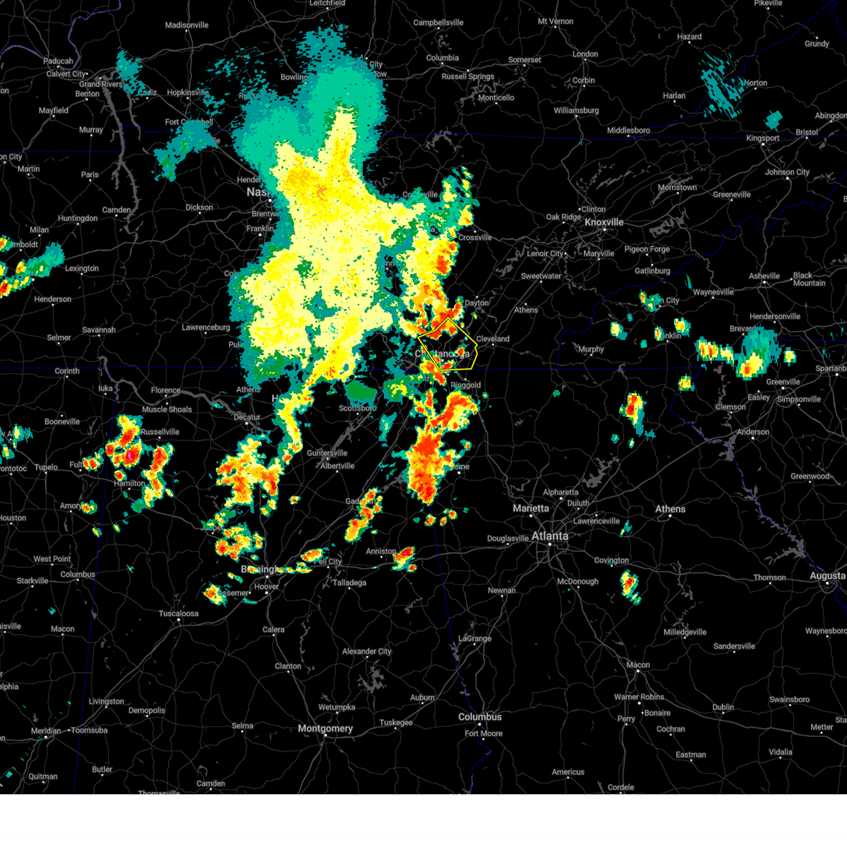 At 431 pm edt/331 pm cdt/, severe thunderstorms were located along a line extending from 6 miles northwest of soddy-daisy to near fairmount to near whitwell, moving southeast at 30 mph (radar indicated). Hazards include 60 mph wind gusts and penny size hail. expect damage to roofs, siding, and trees At 431 pm edt/331 pm cdt/, severe thunderstorms were located along a line extending from 6 miles northwest of soddy-daisy to near fairmount to near whitwell, moving southeast at 30 mph (radar indicated). Hazards include 60 mph wind gusts and penny size hail. expect damage to roofs, siding, and trees
|
| 7/1/2023 3:06 PM CDT |
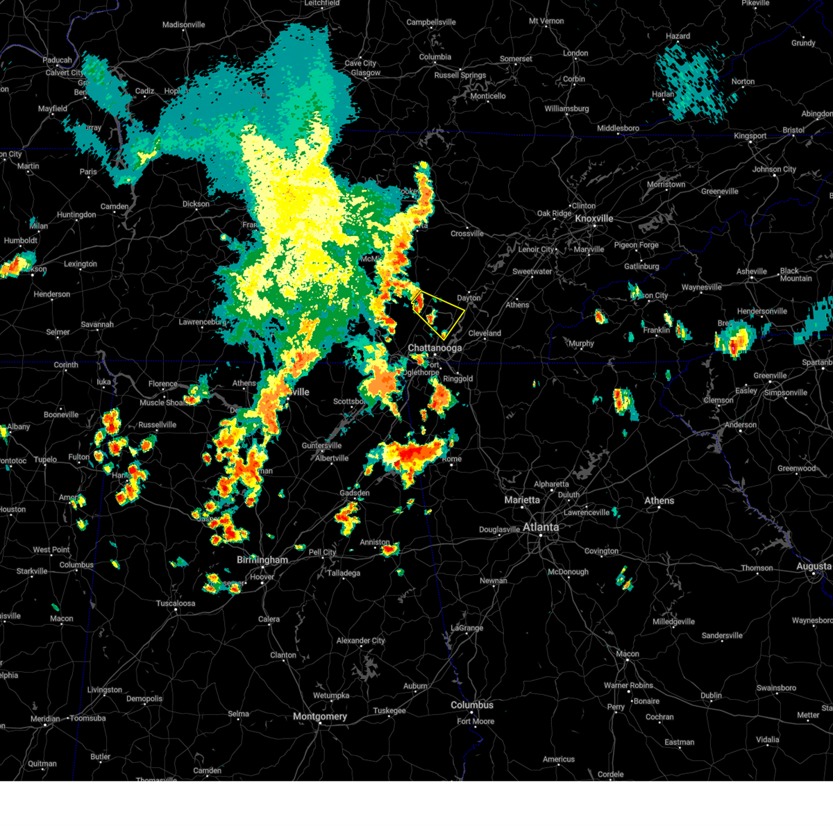 At 405 pm edt/305 pm cdt/, a severe thunderstorm was located near dunlap, moving southeast at 25 mph (radar indicated). Hazards include 60 mph wind gusts and penny size hail. expect damage to roofs, siding, and trees At 405 pm edt/305 pm cdt/, a severe thunderstorm was located near dunlap, moving southeast at 25 mph (radar indicated). Hazards include 60 mph wind gusts and penny size hail. expect damage to roofs, siding, and trees
|
| 6/30/2023 11:26 AM EDT |
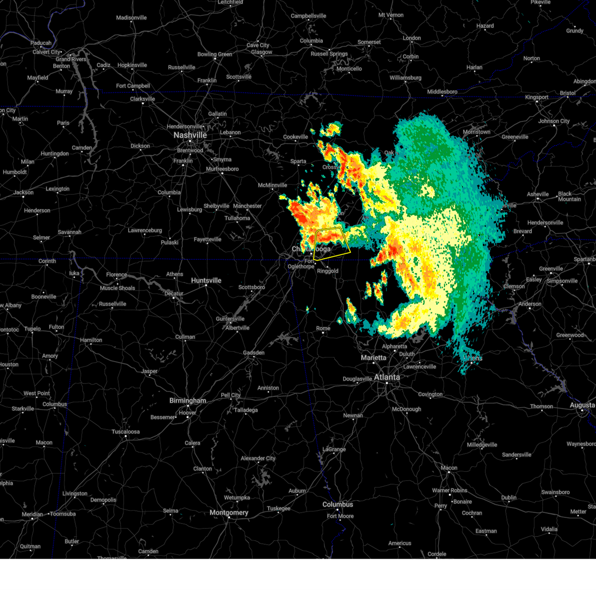 The severe thunderstorm warning for western bradley and southeastern hamilton counties will expire at 1130 am edt, the storm which prompted the warning has weakened below severe limits, and no longer poses an immediate threat to life or property. therefore, the warning will be allowed to expire. however gusty winds and heavy rain are still possible with this thunderstorm. The severe thunderstorm warning for western bradley and southeastern hamilton counties will expire at 1130 am edt, the storm which prompted the warning has weakened below severe limits, and no longer poses an immediate threat to life or property. therefore, the warning will be allowed to expire. however gusty winds and heavy rain are still possible with this thunderstorm.
|
| 6/30/2023 11:11 AM EDT |
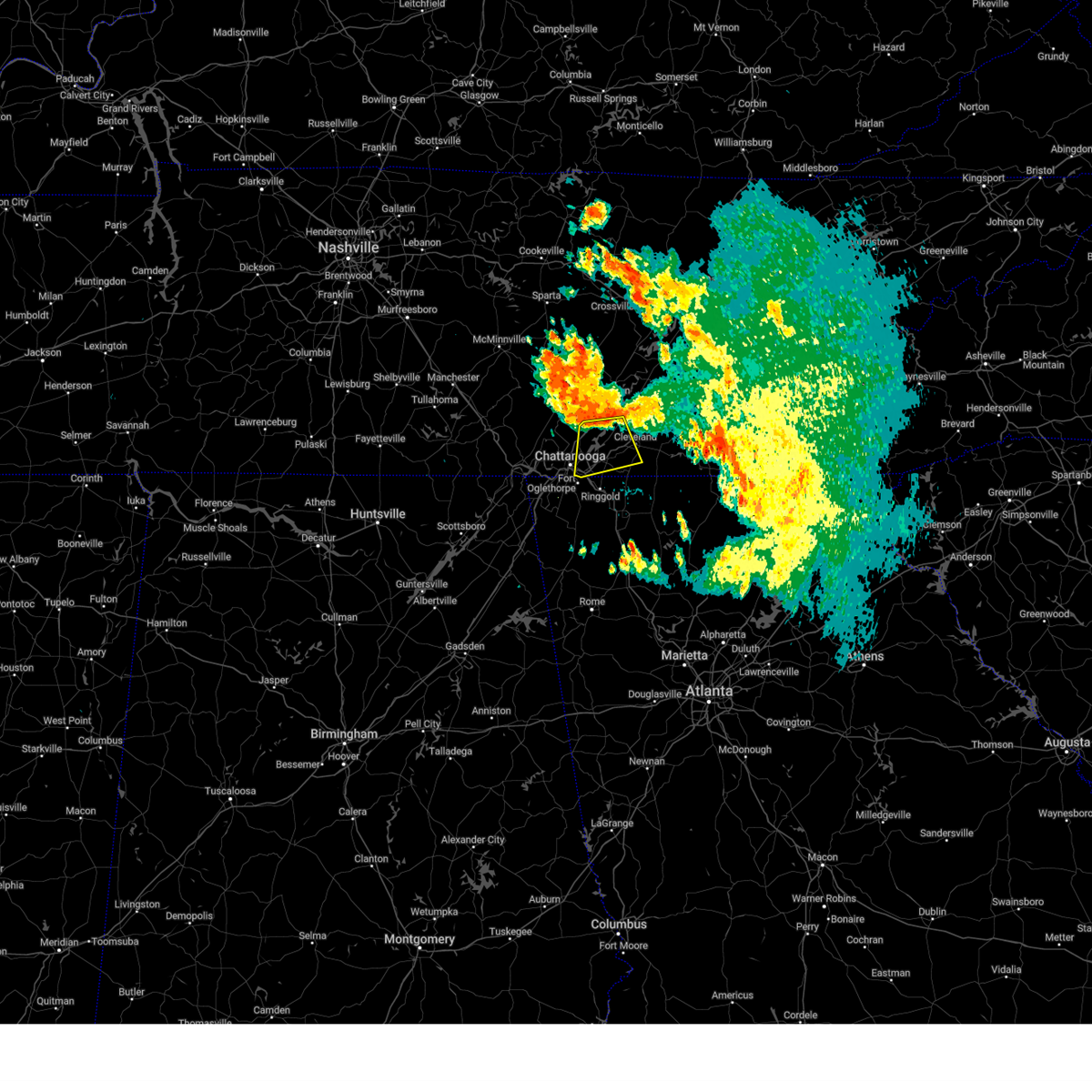 At 1110 am edt, a severe thunderstorm was located over lakesite, or 13 miles west of cleveland, moving southeast at 30 mph (radar indicated). Hazards include 60 mph wind gusts. Expect damage to roofs, siding, and trees. locations impacted include, chattanooga, cleveland, soddy-daisy, lakesite, ridgeside, south cleveland, harrison, wildwood lake, collegedale and waterville. this includes interstate 75 in tennessee between mile markers 1 and 24. hail threat, radar indicated max hail size, <. 75 in wind threat, radar indicated max wind gust, 60 mph. At 1110 am edt, a severe thunderstorm was located over lakesite, or 13 miles west of cleveland, moving southeast at 30 mph (radar indicated). Hazards include 60 mph wind gusts. Expect damage to roofs, siding, and trees. locations impacted include, chattanooga, cleveland, soddy-daisy, lakesite, ridgeside, south cleveland, harrison, wildwood lake, collegedale and waterville. this includes interstate 75 in tennessee between mile markers 1 and 24. hail threat, radar indicated max hail size, <. 75 in wind threat, radar indicated max wind gust, 60 mph.
|
| 6/30/2023 10:49 AM EDT |
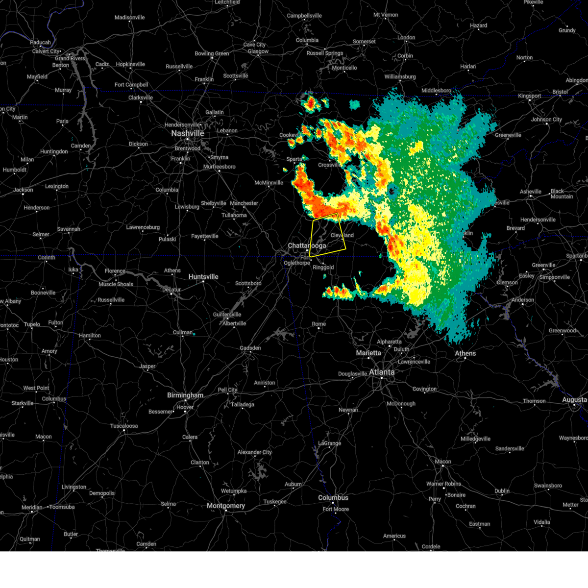 At 1049 am edt, a severe thunderstorm was located near soddy-daisy, or 12 miles east of dunlap, moving south at 30 mph (radar indicated). Hazards include 60 mph wind gusts. expect damage to roofs, siding, and trees At 1049 am edt, a severe thunderstorm was located near soddy-daisy, or 12 miles east of dunlap, moving south at 30 mph (radar indicated). Hazards include 60 mph wind gusts. expect damage to roofs, siding, and trees
|
| 6/25/2023 4:52 PM EDT |
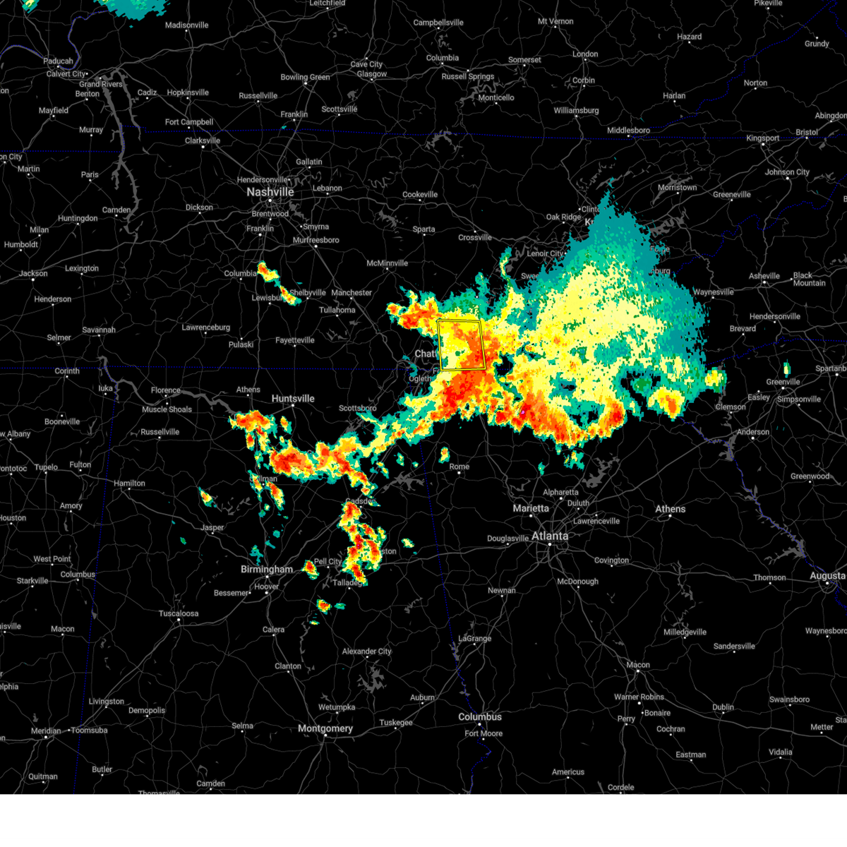 The severe thunderstorm warning for southwestern bradley, southeastern sequatchie and hamilton counties will expire at 500 pm edt/400 pm cdt/, the storm which prompted the warning has weakened below severe limits, and no longer poses an immediate threat to life or property. therefore, the warning will be allowed to expire. however small hail and gusty winds are still possible with this thunderstorm. a severe thunderstorm watch remains in effect until 700 pm edt/600 pm cdt/ for east tennessee. The severe thunderstorm warning for southwestern bradley, southeastern sequatchie and hamilton counties will expire at 500 pm edt/400 pm cdt/, the storm which prompted the warning has weakened below severe limits, and no longer poses an immediate threat to life or property. therefore, the warning will be allowed to expire. however small hail and gusty winds are still possible with this thunderstorm. a severe thunderstorm watch remains in effect until 700 pm edt/600 pm cdt/ for east tennessee.
|
| 6/25/2023 4:43 PM EDT |
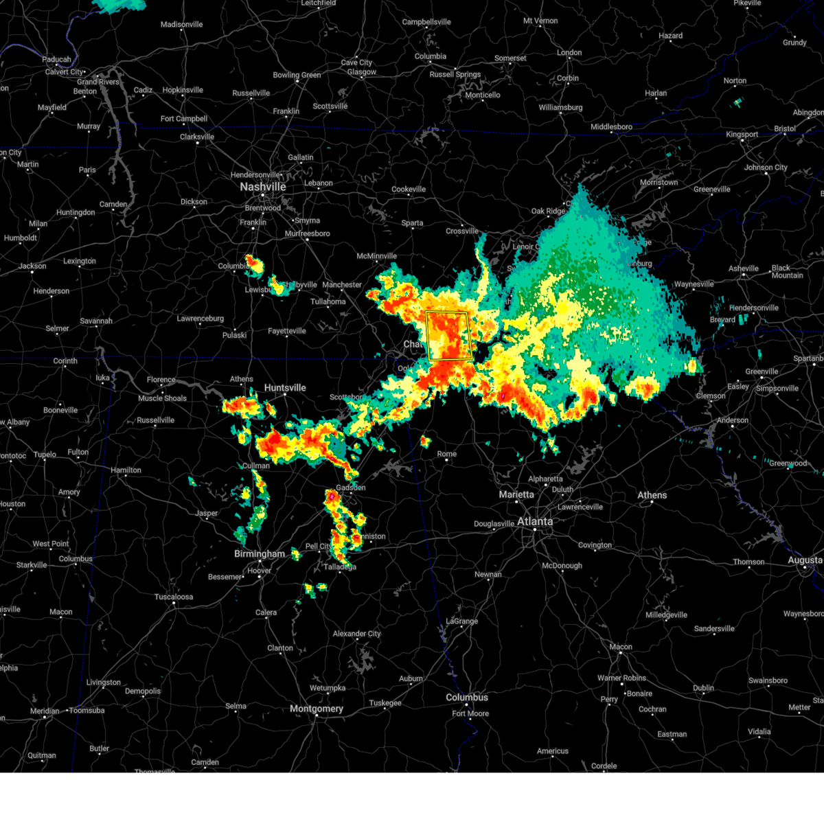 At 442 pm edt/342 pm cdt/, a severe thunderstorm was located near cohutta, or 10 miles northeast of ringgold, moving east at 30 mph (radar indicated). Hazards include 60 mph wind gusts and quarter size hail. Hail damage to vehicles is expected. expect wind damage to roofs, siding, and trees. locations impacted include, chattanooga, soddy-daisy, signal mountain, rossville, walden, lakesite, ridgeside, fairmount, harrison and south cleveland. this includes interstate 75 in tennessee between mile markers 1 and 19. hail threat, radar indicated max hail size, 1. 00 in wind threat, radar indicated max wind gust, 60 mph. At 442 pm edt/342 pm cdt/, a severe thunderstorm was located near cohutta, or 10 miles northeast of ringgold, moving east at 30 mph (radar indicated). Hazards include 60 mph wind gusts and quarter size hail. Hail damage to vehicles is expected. expect wind damage to roofs, siding, and trees. locations impacted include, chattanooga, soddy-daisy, signal mountain, rossville, walden, lakesite, ridgeside, fairmount, harrison and south cleveland. this includes interstate 75 in tennessee between mile markers 1 and 19. hail threat, radar indicated max hail size, 1. 00 in wind threat, radar indicated max wind gust, 60 mph.
|
| 6/25/2023 4:31 PM EDT |
 At 431 pm edt, a severe thunderstorm was located over lafayette, moving southeast at 35 mph (radar indicated). Hazards include 60 mph wind gusts and penny size hail. Expect damage to roofs, siding, and trees. locations impacted include, lafayette, trenton, fort oglethorpe, rossville, chickamauga, lookout mountain, la fayette, chattanooga valley, naomi, center post, rising fawn, suttles mill, noble, lakeview, fairview, linwood, villanow, chattanooga valley, new england and cloudland canyon state park. hail threat, radar indicated max hail size, 0. 75 in wind threat, radar indicated max wind gust, 60 mph. At 431 pm edt, a severe thunderstorm was located over lafayette, moving southeast at 35 mph (radar indicated). Hazards include 60 mph wind gusts and penny size hail. Expect damage to roofs, siding, and trees. locations impacted include, lafayette, trenton, fort oglethorpe, rossville, chickamauga, lookout mountain, la fayette, chattanooga valley, naomi, center post, rising fawn, suttles mill, noble, lakeview, fairview, linwood, villanow, chattanooga valley, new england and cloudland canyon state park. hail threat, radar indicated max hail size, 0. 75 in wind threat, radar indicated max wind gust, 60 mph.
|
| 6/25/2023 4:30 PM EDT | Quarter sized hail reported 3.2 miles N of Chattanooga, TN, quarter size hail in east ridge tn. |
| 6/25/2023 4:25 PM EDT | Golf Ball sized hail reported 3.9 miles N of Chattanooga, TN, picture of golfball size hail in east ridge tn. |
| 6/25/2023 3:17 PM CDT |
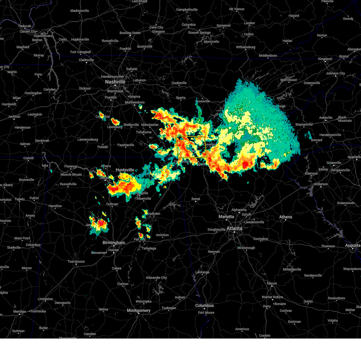 At 417 pm edt/317 pm cdt/, a severe thunderstorm was located over ridgeside, or near chattanooga, moving northeast at 15 mph (radar indicated). Hazards include golf ball size hail and 70 mph wind gusts. People and animals outdoors will be injured. expect hail damage to roofs, siding, windows, and vehicles. expect considerable tree damage. wind damage is also likely to mobile homes, roofs, and outbuildings. locations impacted include, chattanooga, dunlap, soddy-daisy, signal mountain, rossville, walden, lakesite, whitwell, ridgeside and fairmount. this includes interstate 75 in tennessee between mile markers 1 and 19. thunderstorm damage threat, considerable hail threat, radar indicated max hail size, 1. 75 in wind threat, radar indicated max wind gust, 70 mph. At 417 pm edt/317 pm cdt/, a severe thunderstorm was located over ridgeside, or near chattanooga, moving northeast at 15 mph (radar indicated). Hazards include golf ball size hail and 70 mph wind gusts. People and animals outdoors will be injured. expect hail damage to roofs, siding, windows, and vehicles. expect considerable tree damage. wind damage is also likely to mobile homes, roofs, and outbuildings. locations impacted include, chattanooga, dunlap, soddy-daisy, signal mountain, rossville, walden, lakesite, whitwell, ridgeside and fairmount. this includes interstate 75 in tennessee between mile markers 1 and 19. thunderstorm damage threat, considerable hail threat, radar indicated max hail size, 1. 75 in wind threat, radar indicated max wind gust, 70 mph.
|
| 6/25/2023 3:09 PM CDT |
 At 409 pm edt/309 pm cdt/, a severe thunderstorm was located near whitwell, or 11 miles northeast of jasper, moving east at 30 mph (radar indicated). Hazards include 60 mph wind gusts and quarter size hail. Hail damage to vehicles is expected. Expect wind damage to roofs, siding, and trees. At 409 pm edt/309 pm cdt/, a severe thunderstorm was located near whitwell, or 11 miles northeast of jasper, moving east at 30 mph (radar indicated). Hazards include 60 mph wind gusts and quarter size hail. Hail damage to vehicles is expected. Expect wind damage to roofs, siding, and trees.
|
| 6/25/2023 3:56 PM EDT |
 At 355 pm edt, a severe thunderstorm was located near cooper heights, or near trenton, moving south at 45 mph (these storms have a history of producing wind damage in tennessee). Hazards include 60 mph wind gusts. expect damage to roofs, siding, and trees At 355 pm edt, a severe thunderstorm was located near cooper heights, or near trenton, moving south at 45 mph (these storms have a history of producing wind damage in tennessee). Hazards include 60 mph wind gusts. expect damage to roofs, siding, and trees
|
| 6/25/2023 2:44 PM CDT |
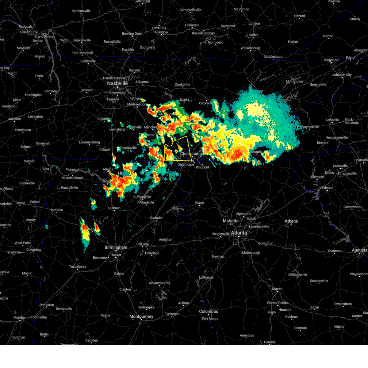 At 344 pm edt/244 pm cdt/, a severe thunderstorm was located 9 miles west of south pittsburg, or 10 miles northwest of bridgeport, moving east at 30 mph (radar indicated). Hazards include 60 mph wind gusts and quarter size hail. Hail damage to vehicles is expected. Expect wind damage to roofs, siding, and trees. At 344 pm edt/244 pm cdt/, a severe thunderstorm was located 9 miles west of south pittsburg, or 10 miles northwest of bridgeport, moving east at 30 mph (radar indicated). Hazards include 60 mph wind gusts and quarter size hail. Hail damage to vehicles is expected. Expect wind damage to roofs, siding, and trees.
|
| 6/25/2023 3:27 PM EDT |
 At 327 pm edt/227 pm cdt/, severe thunderstorms were located along a line extending from ducktown to 6 miles east of wildwood lake to 6 miles southeast of dunlap, moving southeast at 35 mph (radar indicated). Hazards include 60 mph wind gusts and quarter size hail. Hail damage to vehicles is expected. Expect wind damage to roofs, siding, and trees. At 327 pm edt/227 pm cdt/, severe thunderstorms were located along a line extending from ducktown to 6 miles east of wildwood lake to 6 miles southeast of dunlap, moving southeast at 35 mph (radar indicated). Hazards include 60 mph wind gusts and quarter size hail. Hail damage to vehicles is expected. Expect wind damage to roofs, siding, and trees.
|
| 6/25/2023 3:27 PM EDT |
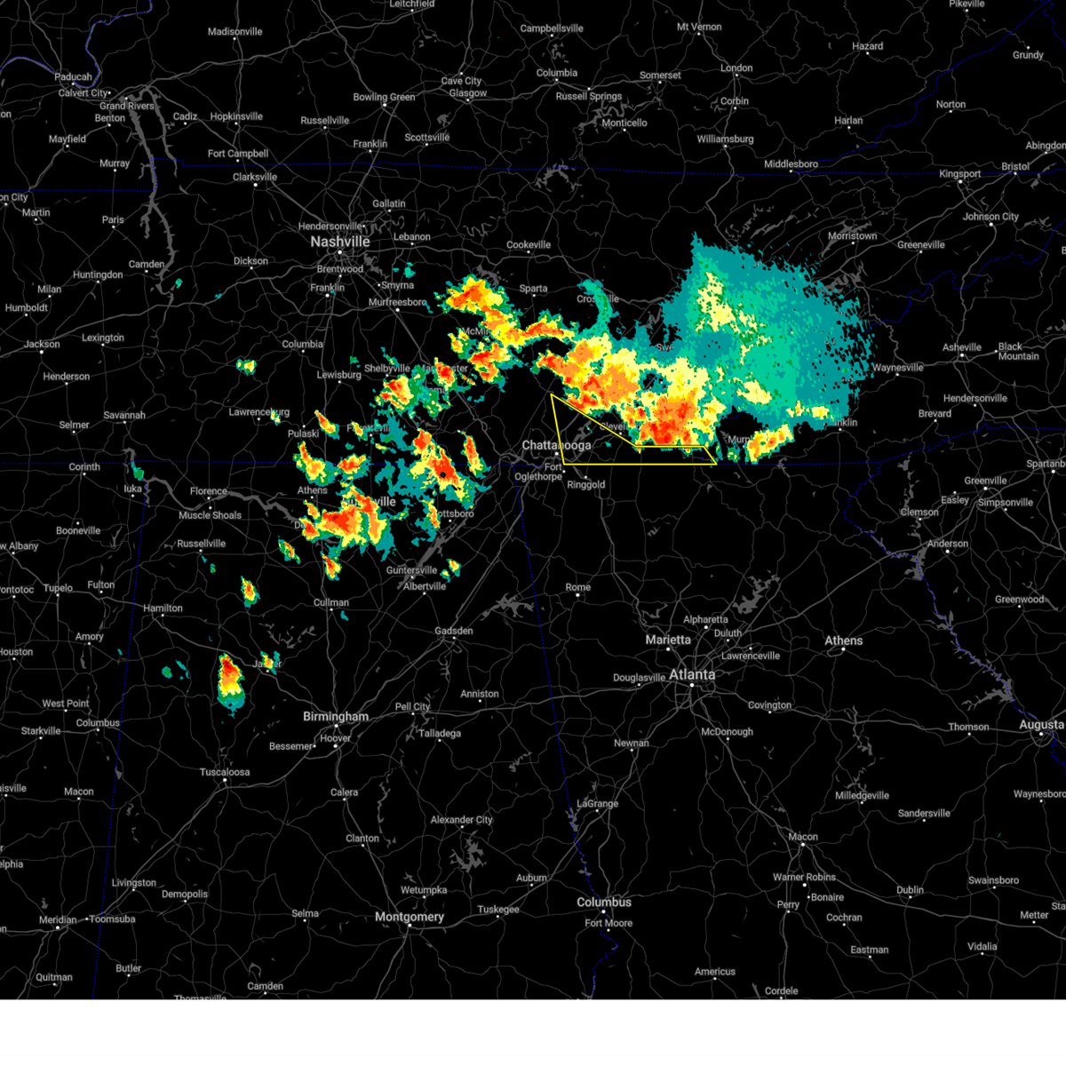 At 327 pm edt/227 pm cdt/, severe thunderstorms were located along a line extending from ducktown to 6 miles east of wildwood lake to 6 miles southeast of dunlap, moving southeast at 35 mph (radar indicated). Hazards include 60 mph wind gusts and quarter size hail. Hail damage to vehicles is expected. Expect wind damage to roofs, siding, and trees. At 327 pm edt/227 pm cdt/, severe thunderstorms were located along a line extending from ducktown to 6 miles east of wildwood lake to 6 miles southeast of dunlap, moving southeast at 35 mph (radar indicated). Hazards include 60 mph wind gusts and quarter size hail. Hail damage to vehicles is expected. Expect wind damage to roofs, siding, and trees.
|
| 6/25/2023 2:54 PM EDT |
 At 254 pm edt/154 pm cdt/, severe thunderstorms were located along a line extending from 6 miles northeast of charleston to 10 miles southeast of dayton to 12 miles west of pikeville, moving south at 25 mph (radar indicated). Hazards include 60 mph wind gusts and quarter size hail. Hail damage to vehicles is expected. Expect wind damage to roofs, siding, and trees. At 254 pm edt/154 pm cdt/, severe thunderstorms were located along a line extending from 6 miles northeast of charleston to 10 miles southeast of dayton to 12 miles west of pikeville, moving south at 25 mph (radar indicated). Hazards include 60 mph wind gusts and quarter size hail. Hail damage to vehicles is expected. Expect wind damage to roofs, siding, and trees.
|
| 6/15/2023 3:45 PM EDT |
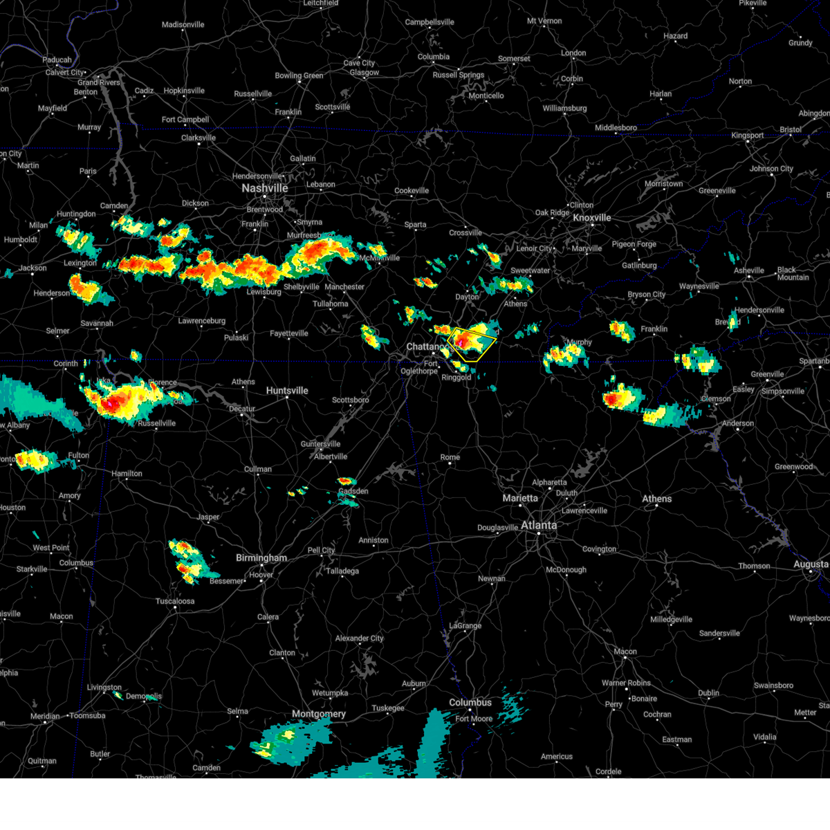 At 344 pm edt, a severe thunderstorm was located near harrison, or 10 miles west of cleveland, moving southeast at 15 mph (radar indicated). Hazards include 60 mph wind gusts and penny size hail. Expect damage to roofs, siding, and trees. locations impacted include, chattanooga, cleveland, lakesite, south cleveland, harrison, east cleveland, wildwood lake, collegedale, waterville and red clay state park. this includes interstate 75 in tennessee between mile markers 9 and 23. hail threat, radar indicated max hail size, 0. 75 in wind threat, radar indicated max wind gust, 60 mph. At 344 pm edt, a severe thunderstorm was located near harrison, or 10 miles west of cleveland, moving southeast at 15 mph (radar indicated). Hazards include 60 mph wind gusts and penny size hail. Expect damage to roofs, siding, and trees. locations impacted include, chattanooga, cleveland, lakesite, south cleveland, harrison, east cleveland, wildwood lake, collegedale, waterville and red clay state park. this includes interstate 75 in tennessee between mile markers 9 and 23. hail threat, radar indicated max hail size, 0. 75 in wind threat, radar indicated max wind gust, 60 mph.
|
| 6/15/2023 3:26 PM EDT |
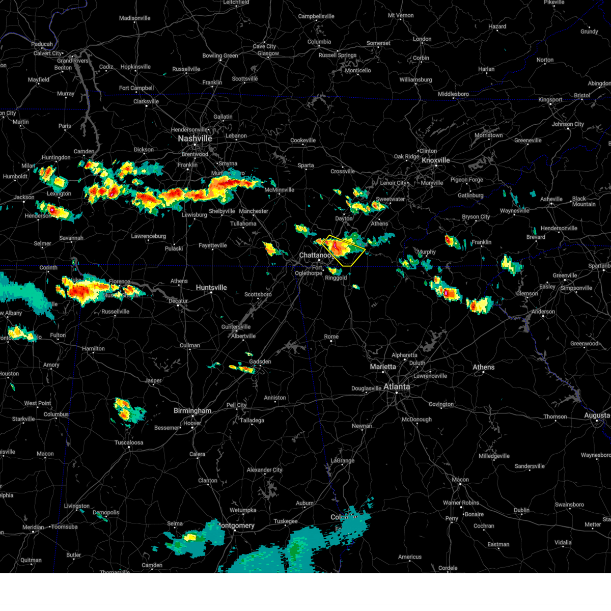 At 325 pm edt, a severe thunderstorm was located over lakesite, or 11 miles northeast of chattanooga, moving southeast at 15 mph (radar indicated). Hazards include 60 mph wind gusts and penny size hail. expect damage to roofs, siding, and trees At 325 pm edt, a severe thunderstorm was located over lakesite, or 11 miles northeast of chattanooga, moving southeast at 15 mph (radar indicated). Hazards include 60 mph wind gusts and penny size hail. expect damage to roofs, siding, and trees
|
| 6/5/2023 10:19 PM EDT |
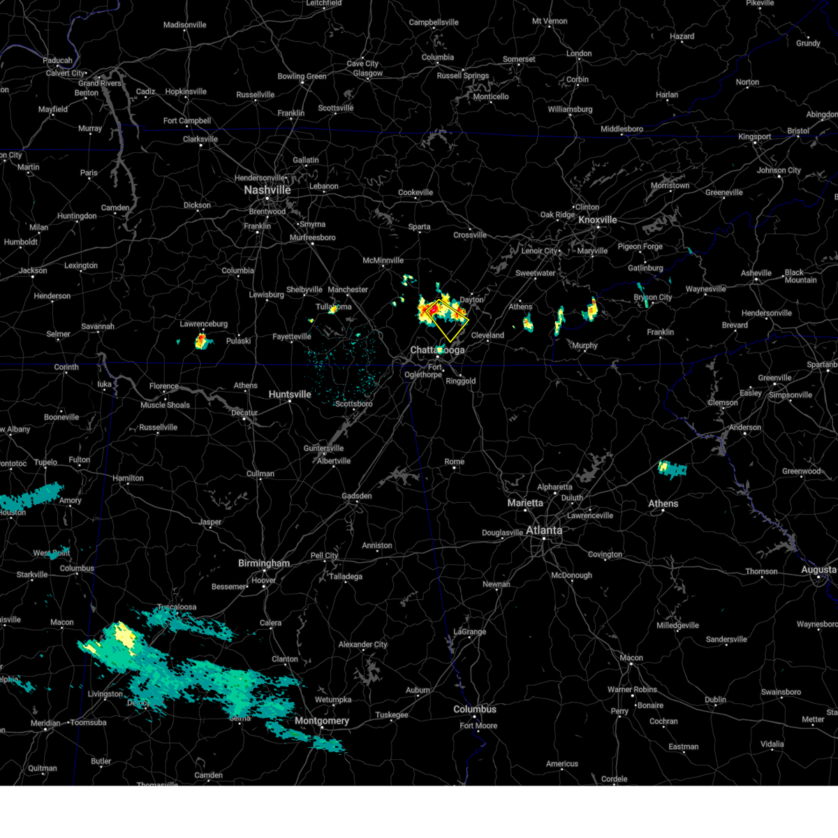 At 1019 pm edt/919 pm cdt/, a severe thunderstorm was located near dunlap, moving southeast at 25 mph (radar indicated). Hazards include 60 mph wind gusts and quarter size hail. Hail damage to vehicles is expected. Expect wind damage to roofs, siding, and trees. At 1019 pm edt/919 pm cdt/, a severe thunderstorm was located near dunlap, moving southeast at 25 mph (radar indicated). Hazards include 60 mph wind gusts and quarter size hail. Hail damage to vehicles is expected. Expect wind damage to roofs, siding, and trees.
|
| 6/5/2023 5:50 PM EDT |
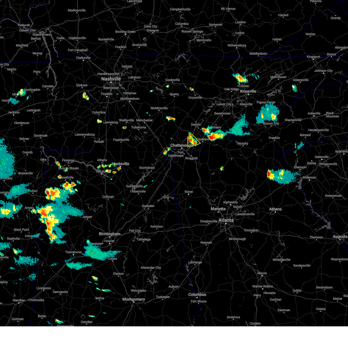 The severe thunderstorm warning for west central bradley and southeastern hamilton counties will expire at 600 pm edt, the storm which prompted the warning has weakened below severe limits, and no longer poses an immediate threat to life or property. therefore, the warning will be allowed to expire. however small hail is still possible with this thunderstorm. The severe thunderstorm warning for west central bradley and southeastern hamilton counties will expire at 600 pm edt, the storm which prompted the warning has weakened below severe limits, and no longer poses an immediate threat to life or property. therefore, the warning will be allowed to expire. however small hail is still possible with this thunderstorm.
|
| 6/5/2023 5:38 PM EDT |
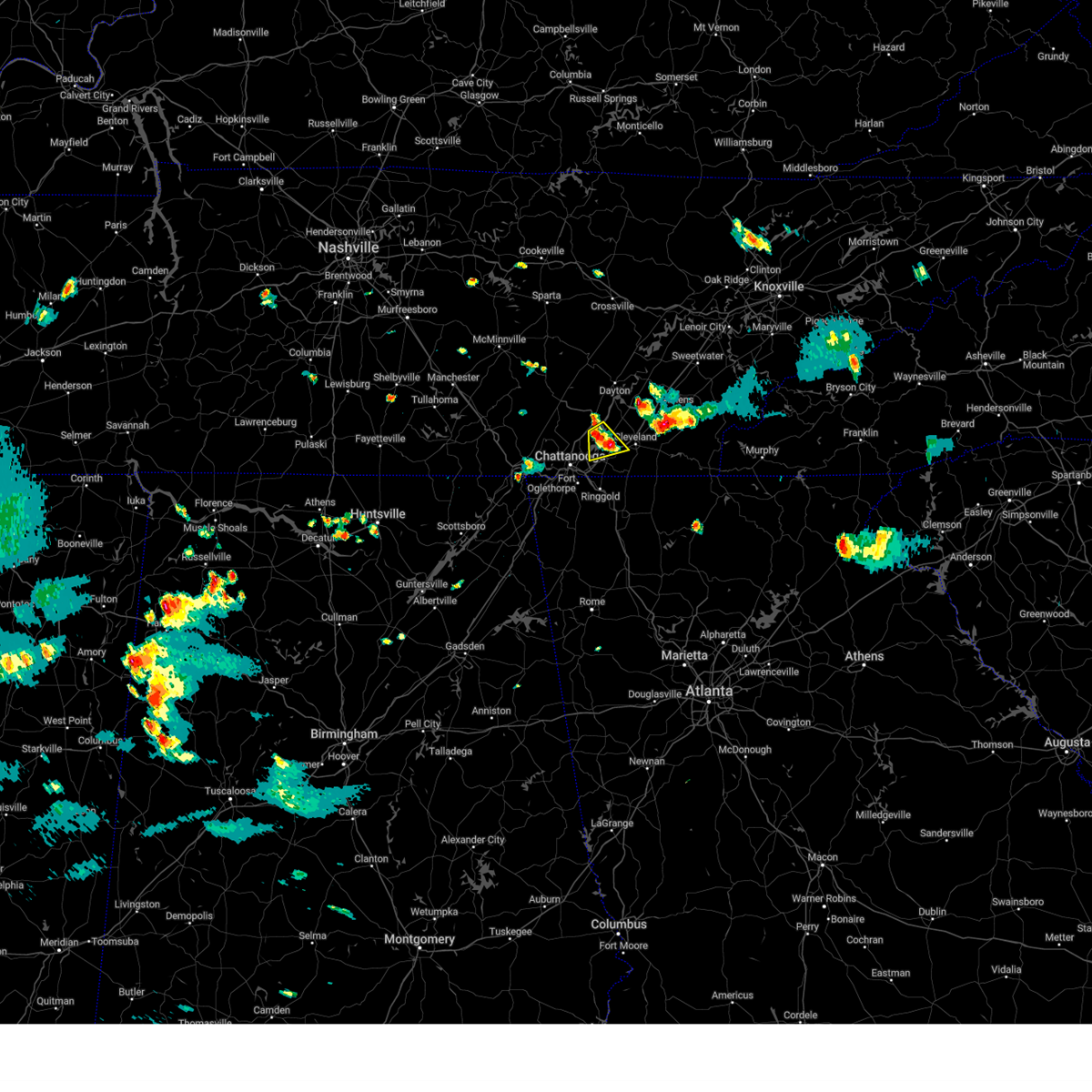 At 538 pm edt, a severe thunderstorm was located near lakesite, or 11 miles northeast of chattanooga, moving southeast at 10 mph (radar indicated). Hazards include quarter size hail. Damage to vehicles is expected. locations impacted include, chattanooga, cleveland, soddy-daisy, lakesite, harrison, south cleveland, harrison bay state park, shady grove and middle valley. this includes interstate 75 in tennessee between mile markers 13 and 20. hail threat, radar indicated max hail size, 1. 00 in wind threat, radar indicated max wind gust, <50 mph. At 538 pm edt, a severe thunderstorm was located near lakesite, or 11 miles northeast of chattanooga, moving southeast at 10 mph (radar indicated). Hazards include quarter size hail. Damage to vehicles is expected. locations impacted include, chattanooga, cleveland, soddy-daisy, lakesite, harrison, south cleveland, harrison bay state park, shady grove and middle valley. this includes interstate 75 in tennessee between mile markers 13 and 20. hail threat, radar indicated max hail size, 1. 00 in wind threat, radar indicated max wind gust, <50 mph.
|
| 6/5/2023 5:21 PM EDT |
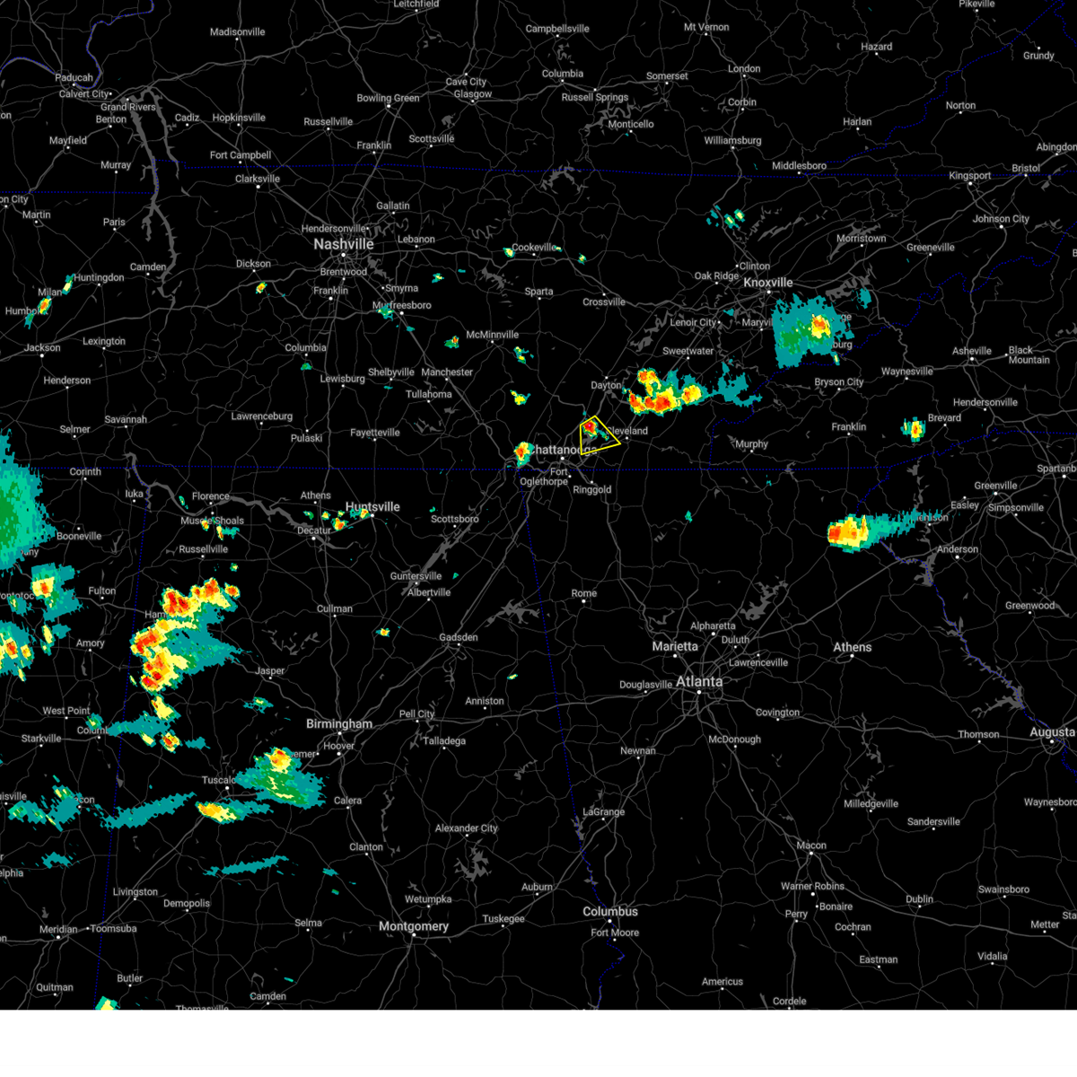 At 521 pm edt, a severe thunderstorm was located over lakesite, or 12 miles northeast of chattanooga, moving southeast at 10 mph (radar indicated). Hazards include quarter size hail. damage to vehicles is expected At 521 pm edt, a severe thunderstorm was located over lakesite, or 12 miles northeast of chattanooga, moving southeast at 10 mph (radar indicated). Hazards include quarter size hail. damage to vehicles is expected
|
| 5/7/2023 8:59 PM CDT | Power lines down along hwy 4 in marion county TN, 14.7 miles E of Chattanooga, TN |
| 5/7/2023 8:51 PM CDT |
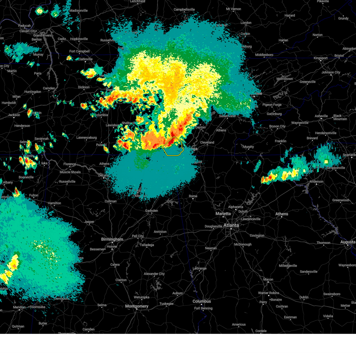 At 851 pm cdt, a severe thunderstorm was located near jasper, moving southeast at 35 mph (radar indicated). Hazards include 60 mph wind gusts. Expect damage to roofs, siding, and trees. locations impacted include, jasper, south pittsburg, whitwell, kimball, powells crossroads, martin springs, griffith creek, haletown (guild), chimneys state park and hicks gap state park. hail threat, radar indicated max hail size, <. 75 in wind threat, radar indicated max wind gust, 60 mph. At 851 pm cdt, a severe thunderstorm was located near jasper, moving southeast at 35 mph (radar indicated). Hazards include 60 mph wind gusts. Expect damage to roofs, siding, and trees. locations impacted include, jasper, south pittsburg, whitwell, kimball, powells crossroads, martin springs, griffith creek, haletown (guild), chimneys state park and hicks gap state park. hail threat, radar indicated max hail size, <. 75 in wind threat, radar indicated max wind gust, 60 mph.
|
| 5/7/2023 8:19 PM CDT |
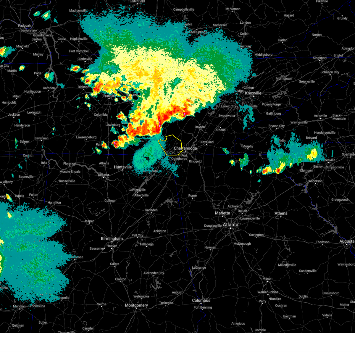 At 819 pm cdt, a severe thunderstorm was located near tracy city, or 19 miles northwest of jasper, moving southeast at 35 mph (radar indicated). Hazards include 60 mph wind gusts. expect damage to roofs, siding, and trees At 819 pm cdt, a severe thunderstorm was located near tracy city, or 19 miles northwest of jasper, moving southeast at 35 mph (radar indicated). Hazards include 60 mph wind gusts. expect damage to roofs, siding, and trees
|
| 3/25/2023 2:56 AM EDT | Chattanooga asos recorded a 65 mph wind gus in hamilton county TN, 2.9 miles NW of Chattanooga, TN |
| 3/25/2023 2:53 AM EDT |
 At 253 am edt, a severe thunderstorm was located near fairmount, or 11 miles southeast of dunlap, moving northeast at 45 mph (radar indicated). Hazards include 60 mph wind gusts. Expect damage to roofs, siding, and trees. locations impacted include, chattanooga, soddy-daisy, walden, lakesite, ridgeside, harrison, red bank, flat top mountain, lookout mountain and north chickamauga creek gorge. This includes interstate 75 in tennessee between mile markers 1 and 5. At 253 am edt, a severe thunderstorm was located near fairmount, or 11 miles southeast of dunlap, moving northeast at 45 mph (radar indicated). Hazards include 60 mph wind gusts. Expect damage to roofs, siding, and trees. locations impacted include, chattanooga, soddy-daisy, walden, lakesite, ridgeside, harrison, red bank, flat top mountain, lookout mountain and north chickamauga creek gorge. This includes interstate 75 in tennessee between mile markers 1 and 5.
|
| 3/25/2023 2:52 AM EDT |
 At 251 am edt, a severe thunderstorm was located over chattanooga, moving east at 45 mph (radar indicated). Hazards include 60 mph wind gusts. expect damage to roofs, siding, and trees At 251 am edt, a severe thunderstorm was located over chattanooga, moving east at 45 mph (radar indicated). Hazards include 60 mph wind gusts. expect damage to roofs, siding, and trees
|
| 3/25/2023 2:32 AM EDT |
 At 231 am edt/131 am cdt/, a severe thunderstorm was located over jasper, moving northeast at 40 mph (radar indicated). Hazards include 60 mph wind gusts. expect damage to roofs, siding, and trees At 231 am edt/131 am cdt/, a severe thunderstorm was located over jasper, moving northeast at 40 mph (radar indicated). Hazards include 60 mph wind gusts. expect damage to roofs, siding, and trees
|
| 3/3/2023 2:48 PM EST |
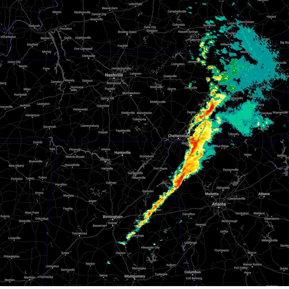 At 247 pm est, a severe thunderstorm was located near cohutta, or 10 miles northeast of ringgold, moving southwest at 40 mph (radar indicated). Hazards include 70 mph wind gusts. Expect considerable tree damage. damage is likely to mobile homes, roofs, and outbuildings. locations impacted include, cleveland, decatur, charleston, south cleveland, east cleveland, wildwood lake, collegedale, calhoun, waterville and hillsview. this includes interstate 75 in tennessee between mile markers 13 and 43. time, mot, loc 1947z 027deg 130kt 3502 8497 thunderstorm damage threat, considerable hail threat, radar indicated max hail size, <. 75 in wind threat, observed max wind gust, 70 mph. At 247 pm est, a severe thunderstorm was located near cohutta, or 10 miles northeast of ringgold, moving southwest at 40 mph (radar indicated). Hazards include 70 mph wind gusts. Expect considerable tree damage. damage is likely to mobile homes, roofs, and outbuildings. locations impacted include, cleveland, decatur, charleston, south cleveland, east cleveland, wildwood lake, collegedale, calhoun, waterville and hillsview. this includes interstate 75 in tennessee between mile markers 13 and 43. time, mot, loc 1947z 027deg 130kt 3502 8497 thunderstorm damage threat, considerable hail threat, radar indicated max hail size, <. 75 in wind threat, observed max wind gust, 70 mph.
|
| 3/3/2023 2:27 PM EST |
 At 227 pm est, severe thunderstorms were located along a line extending from ooltewah to ringgold to near noble to near center post, moving northeast at 80 mph (radar indicated). Hazards include 70 mph wind gusts. Expect considerable tree damage. Damage is likely to mobile homes, roofs, and outbuildings. At 227 pm est, severe thunderstorms were located along a line extending from ooltewah to ringgold to near noble to near center post, moving northeast at 80 mph (radar indicated). Hazards include 70 mph wind gusts. Expect considerable tree damage. Damage is likely to mobile homes, roofs, and outbuildings.
|
| 3/3/2023 1:14 PM CST |
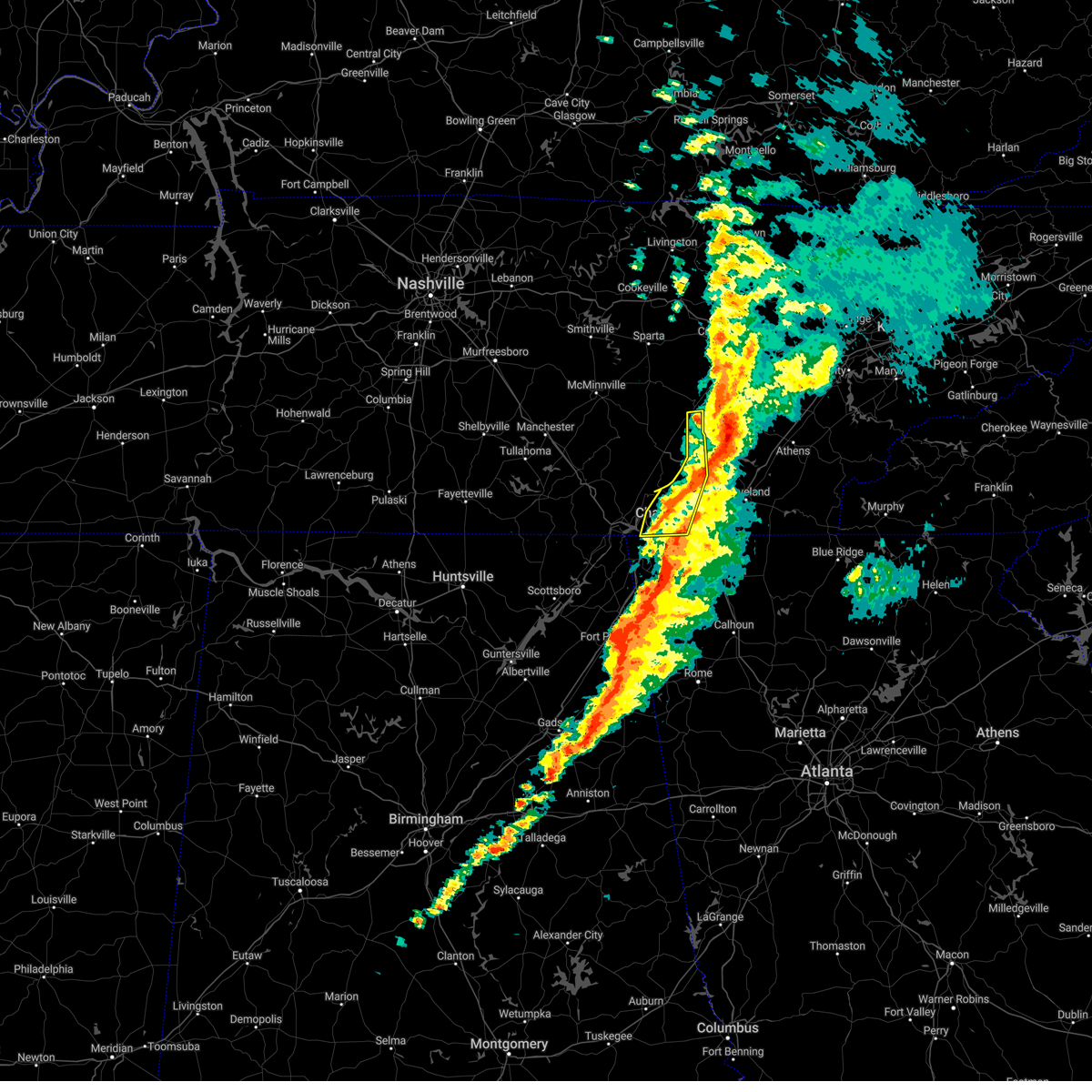 At 214 pm est/114 pm cst/, a severe thunderstorm was located 8 miles northeast of decatur, moving northeast at 40 mph (radar indicated). Hazards include 70 mph wind gusts. Expect considerable tree damage. damage is likely to mobile homes, roofs, and outbuildings. Locations impacted include, chattanooga, pikeville, soddy-daisy, signal mountain, walden, lakesite, ridgeside, fairmount, harrison and red bank. At 214 pm est/114 pm cst/, a severe thunderstorm was located 8 miles northeast of decatur, moving northeast at 40 mph (radar indicated). Hazards include 70 mph wind gusts. Expect considerable tree damage. damage is likely to mobile homes, roofs, and outbuildings. Locations impacted include, chattanooga, pikeville, soddy-daisy, signal mountain, walden, lakesite, ridgeside, fairmount, harrison and red bank.
|
| 3/3/2023 2:07 PM EST |
 At 207 pm est/107 pm cst/, a severe thunderstorm was located 8 miles northeast of soddy-daisy, or 9 miles southwest of dayton, moving northeast at 40 mph (radar indicated). Hazards include 70 mph wind gusts. Expect considerable tree damage. Damage is likely to mobile homes, roofs, and outbuildings. At 207 pm est/107 pm cst/, a severe thunderstorm was located 8 miles northeast of soddy-daisy, or 9 miles southwest of dayton, moving northeast at 40 mph (radar indicated). Hazards include 70 mph wind gusts. Expect considerable tree damage. Damage is likely to mobile homes, roofs, and outbuildings.
|
| 3/3/2023 12:39 PM CST |
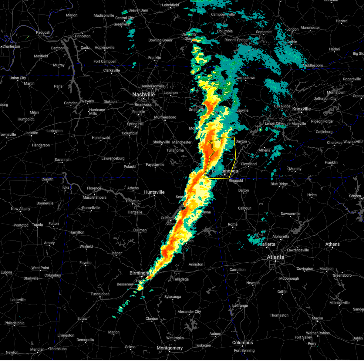 At 137 pm est/1237 pm cst/, a severe thunderstorm was located over whitwell, or 12 miles northeast of jasper, moving northeast at 40 mph (radar indicated). Hazards include 70 mph wind gusts. Expect considerable tree damage. Damage is likely to mobile homes, roofs, and outbuildings. At 137 pm est/1237 pm cst/, a severe thunderstorm was located over whitwell, or 12 miles northeast of jasper, moving northeast at 40 mph (radar indicated). Hazards include 70 mph wind gusts. Expect considerable tree damage. Damage is likely to mobile homes, roofs, and outbuildings.
|
| 3/3/2023 1:28 PM EST |
 At 125 pm est, severe thunderstorms were located along a line extending from near monteagle to near anderson to near columbus city, moving northeast at 75 mph. these are destructive storms for lookout mountain, trenton, lafayette, and ringgold (radar indicated). Hazards include 80 mph wind gusts. Flying debris will be dangerous to those caught without shelter. mobile homes will be heavily damaged. expect considerable damage to roofs, windows, and vehicles. Extensive tree damage and power outages are likely. At 125 pm est, severe thunderstorms were located along a line extending from near monteagle to near anderson to near columbus city, moving northeast at 75 mph. these are destructive storms for lookout mountain, trenton, lafayette, and ringgold (radar indicated). Hazards include 80 mph wind gusts. Flying debris will be dangerous to those caught without shelter. mobile homes will be heavily damaged. expect considerable damage to roofs, windows, and vehicles. Extensive tree damage and power outages are likely.
|
| 3/2/2023 1:40 AM EST |
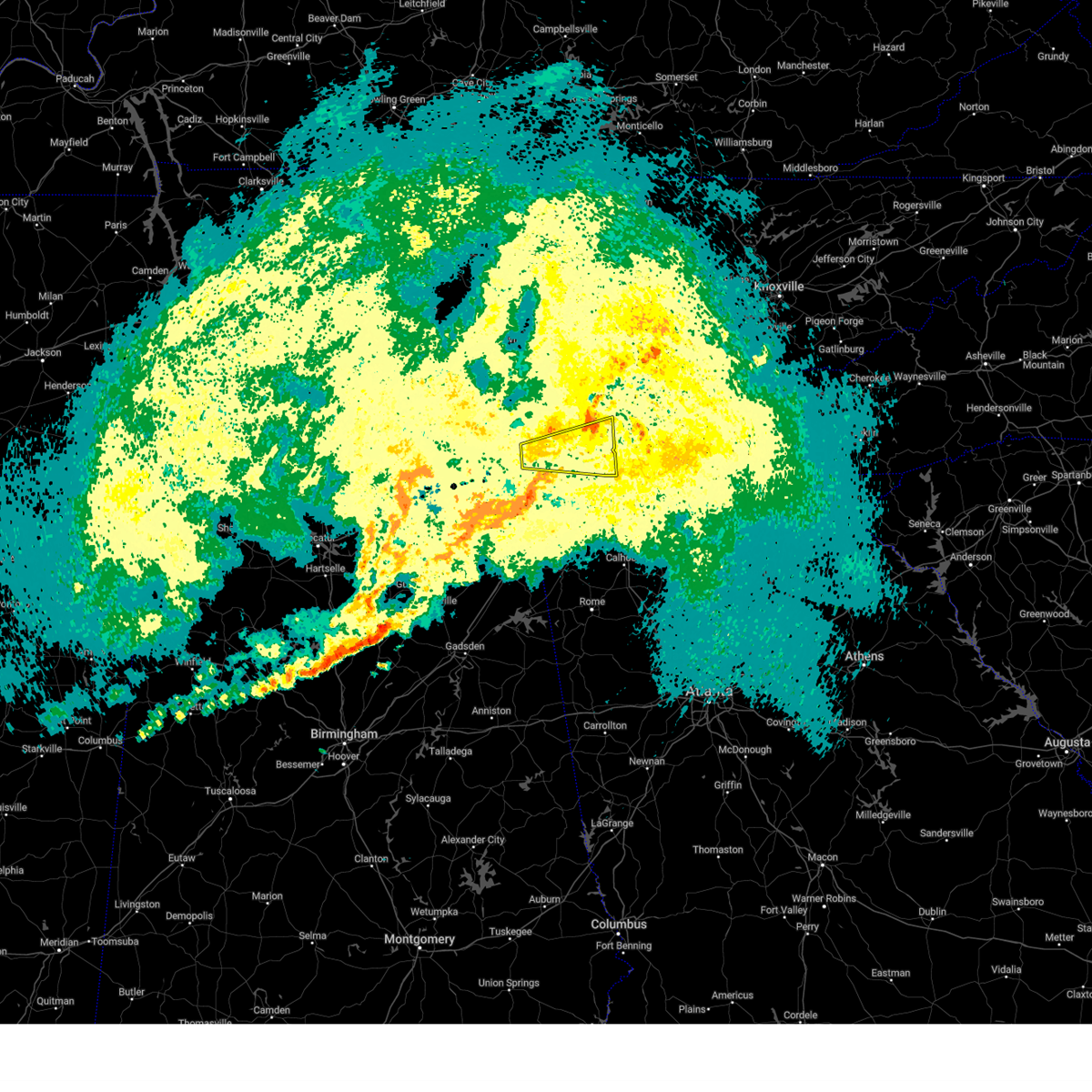 The severe thunderstorm warning for southern sequatchie, southeastern marion and hamilton counties will expire at 145 am est/1245 am cst/, the storm which prompted the warning has moved out of the area. therefore, the warning will be allowed to expire. a tornado watch remains in effect until 600 am est/500 am cst/ for east tennessee. remember, a tornado warning still remains in effect for northeastern hamilton county until 215 am est. The severe thunderstorm warning for southern sequatchie, southeastern marion and hamilton counties will expire at 145 am est/1245 am cst/, the storm which prompted the warning has moved out of the area. therefore, the warning will be allowed to expire. a tornado watch remains in effect until 600 am est/500 am cst/ for east tennessee. remember, a tornado warning still remains in effect for northeastern hamilton county until 215 am est.
|
| 3/2/2023 1:25 AM EST |
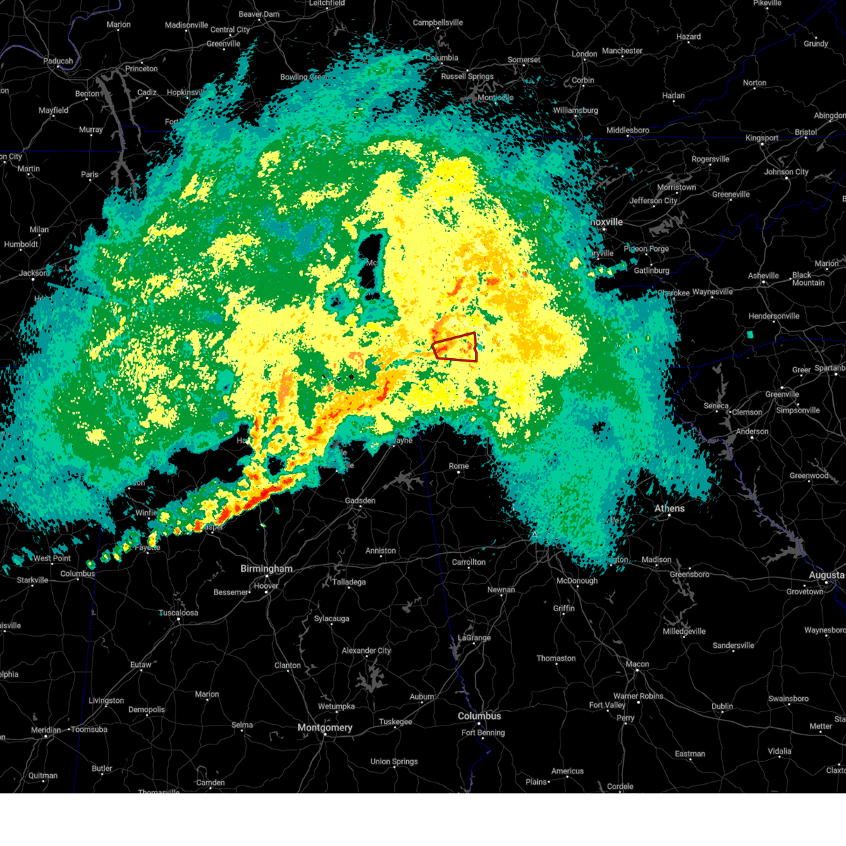 At 124 am est, a severe thunderstorm capable of producing a tornado was located near walden, or near chattanooga, moving east at 40 mph (radar indicated rotation). Hazards include tornado. Flying debris will be dangerous to those caught without shelter. mobile homes will be damaged or destroyed. damage to roofs, windows, and vehicles will occur. tree damage is likely. this dangerous storm will be near, harrison around 135 am est. chattanooga and lakesite around 140 am est. other locations impacted by this tornadic thunderstorm include red bank, harrison bay state park, middle valley, collegedale, ooltewah, falling water and apison. This includes interstate 75 in tennessee between mile markers 7 and 15. At 124 am est, a severe thunderstorm capable of producing a tornado was located near walden, or near chattanooga, moving east at 40 mph (radar indicated rotation). Hazards include tornado. Flying debris will be dangerous to those caught without shelter. mobile homes will be damaged or destroyed. damage to roofs, windows, and vehicles will occur. tree damage is likely. this dangerous storm will be near, harrison around 135 am est. chattanooga and lakesite around 140 am est. other locations impacted by this tornadic thunderstorm include red bank, harrison bay state park, middle valley, collegedale, ooltewah, falling water and apison. This includes interstate 75 in tennessee between mile markers 7 and 15.
|
| 3/2/2023 1:11 AM EST |
 At 111 am est/1211 am cst/, a severe thunderstorm capable of producing a tornado was located near signal mountain, or 10 miles east of jasper, moving east at 40 mph (radar indicated rotation). Hazards include tornado. Flying debris will be dangerous to those caught without shelter. mobile homes will be damaged or destroyed. damage to roofs, windows, and vehicles will occur. tree damage is likely. this dangerous storm will be near, signal mountain around 120 am est. walden and fairmount around 125 am est. chattanooga, lakesite and harrison around 140 am est. other locations impacted by this tornadic thunderstorm include red bank, harrison bay state park, middle valley, collegedale, hicks gap state park, ooltewah, falling water and apison. This includes interstate 75 in tennessee between mile markers 6 and 15. At 111 am est/1211 am cst/, a severe thunderstorm capable of producing a tornado was located near signal mountain, or 10 miles east of jasper, moving east at 40 mph (radar indicated rotation). Hazards include tornado. Flying debris will be dangerous to those caught without shelter. mobile homes will be damaged or destroyed. damage to roofs, windows, and vehicles will occur. tree damage is likely. this dangerous storm will be near, signal mountain around 120 am est. walden and fairmount around 125 am est. chattanooga, lakesite and harrison around 140 am est. other locations impacted by this tornadic thunderstorm include red bank, harrison bay state park, middle valley, collegedale, hicks gap state park, ooltewah, falling water and apison. This includes interstate 75 in tennessee between mile markers 6 and 15.
|
| 3/2/2023 1:04 AM EST |
 At 103 am est/1203 am cst/, a severe thunderstorm was located near jasper, moving east at 45 mph (radar indicated). Hazards include 60 mph wind gusts. expect damage to roofs, siding, and trees At 103 am est/1203 am cst/, a severe thunderstorm was located near jasper, moving east at 45 mph (radar indicated). Hazards include 60 mph wind gusts. expect damage to roofs, siding, and trees
|
| 1/12/2023 11:49 AM EST |
 At 1148 am est, a severe thunderstorm was located near lakesite, or 9 miles west of cleveland, moving east at 55 mph (radar indicated). Hazards include 60 mph wind gusts. expect damage to roofs, siding, and trees At 1148 am est, a severe thunderstorm was located near lakesite, or 9 miles west of cleveland, moving east at 55 mph (radar indicated). Hazards include 60 mph wind gusts. expect damage to roofs, siding, and trees
|
| 1/12/2023 11:44 AM EST |
 At 1143 am est, severe thunderstorms were located along a line extending from ridgeside to near chickamauga to near sulpher springs, moving east at 30 mph (radar indicated). Hazards include 60 mph wind gusts. expect damage to roofs, siding, and trees At 1143 am est, severe thunderstorms were located along a line extending from ridgeside to near chickamauga to near sulpher springs, moving east at 30 mph (radar indicated). Hazards include 60 mph wind gusts. expect damage to roofs, siding, and trees
|
| 1/12/2023 11:06 AM EST |
 At 1106 am est, severe thunderstorms were located along a line extending from near kimball to near stevenson to near pisgah, moving northeast at 50 mph (radar indicated). Hazards include 60 mph wind gusts. expect damage to roofs, siding, and trees At 1106 am est, severe thunderstorms were located along a line extending from near kimball to near stevenson to near pisgah, moving northeast at 50 mph (radar indicated). Hazards include 60 mph wind gusts. expect damage to roofs, siding, and trees
|
| 1/3/2023 2:43 PM EST |
 At 242 pm est, severe thunderstorms were located along a line extending from 6 miles north of cleveland to near ringgold, moving east at 40 mph (radar indicated). Hazards include 60 mph wind gusts. Expect damage to roofs, siding, and trees. locations impacted include, chattanooga, cleveland, soddy-daisy, signal mountain, walden, lakesite, ridgeside, south cleveland, harrison and east cleveland. this includes interstate 75 in tennessee between mile markers 1 and 28. hail threat, radar indicated max hail size, <. 75 in wind threat, observed max wind gust, 60 mph. At 242 pm est, severe thunderstorms were located along a line extending from 6 miles north of cleveland to near ringgold, moving east at 40 mph (radar indicated). Hazards include 60 mph wind gusts. Expect damage to roofs, siding, and trees. locations impacted include, chattanooga, cleveland, soddy-daisy, signal mountain, walden, lakesite, ridgeside, south cleveland, harrison and east cleveland. this includes interstate 75 in tennessee between mile markers 1 and 28. hail threat, radar indicated max hail size, <. 75 in wind threat, observed max wind gust, 60 mph.
|
| 1/3/2023 2:32 PM EST | Corrects previous non-tstm wnd gst report from 4 se chattanooga. measured at the asos station kcha lovell field from thunderstorm winds. in addition... public report of in hamilton county TN, 3.4 miles NW of Chattanooga, TN |
| 1/3/2023 2:23 PM EST |
 At 223 pm est, severe thunderstorms were located along a line extending from near red bank to near ider, moving southeast at 40 mph (radar indicated). Hazards include 60 mph wind gusts. expect damage to roofs, siding, and trees At 223 pm est, severe thunderstorms were located along a line extending from near red bank to near ider, moving southeast at 40 mph (radar indicated). Hazards include 60 mph wind gusts. expect damage to roofs, siding, and trees
|
| 1/3/2023 2:17 PM EST |
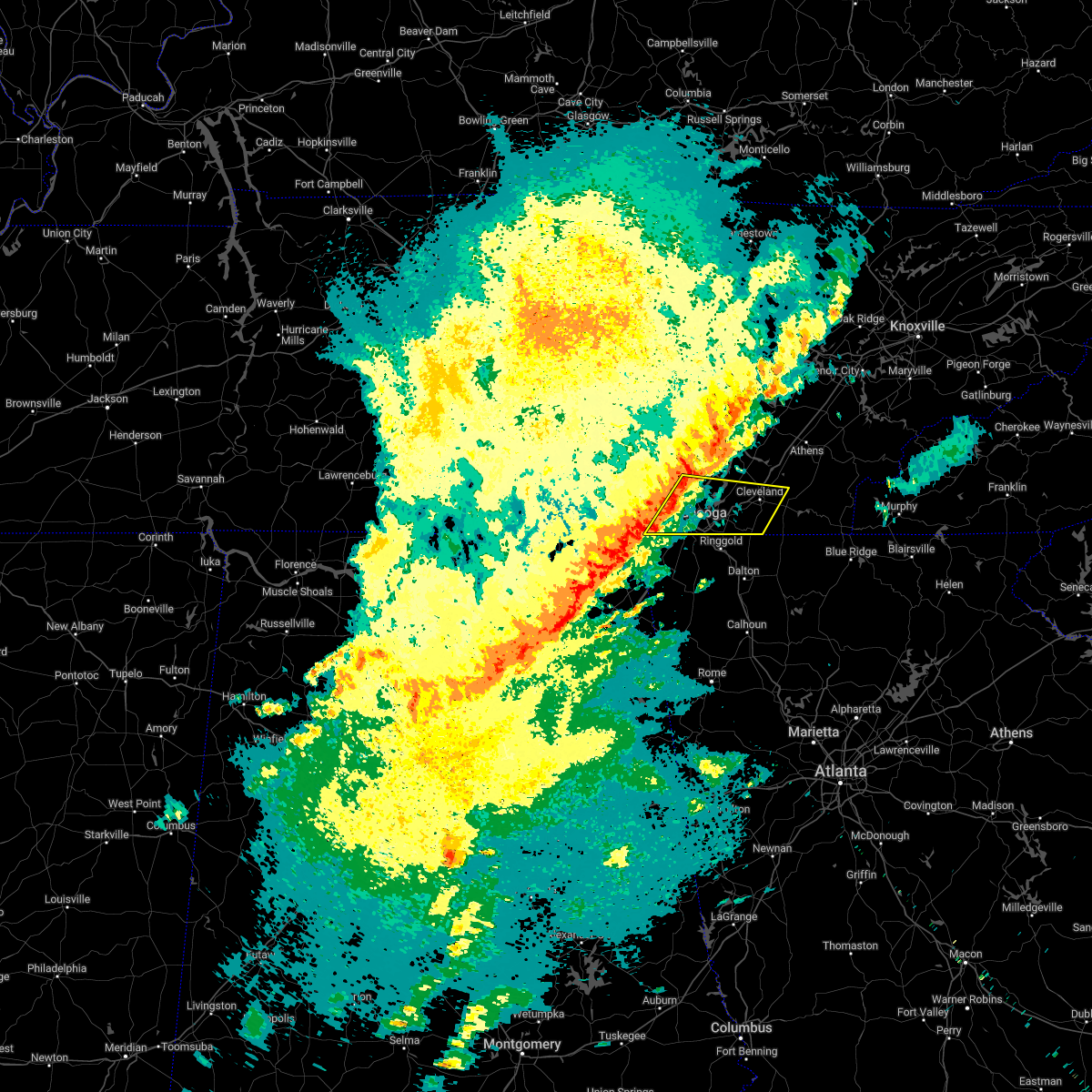 At 216 pm est/116 pm cst/, a severe thunderstorm was located near lookout mountain, or 9 miles west of chattanooga, moving east at 45 mph (radar indicated). Hazards include 60 mph wind gusts. expect damage to roofs, siding, and trees At 216 pm est/116 pm cst/, a severe thunderstorm was located near lookout mountain, or 9 miles west of chattanooga, moving east at 45 mph (radar indicated). Hazards include 60 mph wind gusts. expect damage to roofs, siding, and trees
|
| 8/6/2022 8:08 PM EDT |
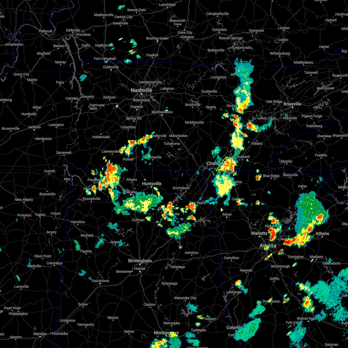 The severe thunderstorm warning for southeastern hamilton county will expire at 815 pm edt, the storm which prompted the warning has weakened below severe limits, and no longer poses an immediate threat to life or property. therefore, the warning will be allowed to expire. however heavy rain is still possible with this thunderstorm. The severe thunderstorm warning for southeastern hamilton county will expire at 815 pm edt, the storm which prompted the warning has weakened below severe limits, and no longer poses an immediate threat to life or property. therefore, the warning will be allowed to expire. however heavy rain is still possible with this thunderstorm.
|
| 8/6/2022 7:52 PM EDT | Tree down on battlefield trail. time estimated from rada in hamilton county TN, 7.3 miles NE of Chattanooga, TN |
| 8/6/2022 7:50 PM EDT |
 At 750 pm edt, a severe thunderstorm was located over harrison, or near chattanooga, and is nearly stationary (radar indicated). Hazards include 60 mph wind gusts and penny size hail. Expect damage to roofs, siding, and trees. locations impacted include, chattanooga, rossville, ridgeside, harrison, east brainerd, lookout mountain, harrison bay state park, east ridge, ooltewah and middle valley. this includes interstate 75 in tennessee between mile markers 1 and 10. hail threat, radar indicated max hail size, 0. 75 in wind threat, radar indicated max wind gust, 60 mph. At 750 pm edt, a severe thunderstorm was located over harrison, or near chattanooga, and is nearly stationary (radar indicated). Hazards include 60 mph wind gusts and penny size hail. Expect damage to roofs, siding, and trees. locations impacted include, chattanooga, rossville, ridgeside, harrison, east brainerd, lookout mountain, harrison bay state park, east ridge, ooltewah and middle valley. this includes interstate 75 in tennessee between mile markers 1 and 10. hail threat, radar indicated max hail size, 0. 75 in wind threat, radar indicated max wind gust, 60 mph.
|
| 8/6/2022 7:31 PM EDT |
 At 731 pm edt, a severe thunderstorm was located near harrison, or near chattanooga, moving east at 5 mph (radar indicated). Hazards include 60 mph wind gusts and penny size hail. Expect damage to roofs, siding, and trees. locations impacted include, chattanooga, soddy-daisy, lakesite, ridgeside, harrison, red bank, east brainerd, lookout mountain, harrison bay state park and east ridge. this includes interstate 75 in tennessee between mile markers 1 and 10. hail threat, radar indicated max hail size, 0. 75 in wind threat, radar indicated max wind gust, 60 mph. At 731 pm edt, a severe thunderstorm was located near harrison, or near chattanooga, moving east at 5 mph (radar indicated). Hazards include 60 mph wind gusts and penny size hail. Expect damage to roofs, siding, and trees. locations impacted include, chattanooga, soddy-daisy, lakesite, ridgeside, harrison, red bank, east brainerd, lookout mountain, harrison bay state park and east ridge. this includes interstate 75 in tennessee between mile markers 1 and 10. hail threat, radar indicated max hail size, 0. 75 in wind threat, radar indicated max wind gust, 60 mph.
|
| 8/6/2022 7:23 PM EDT |
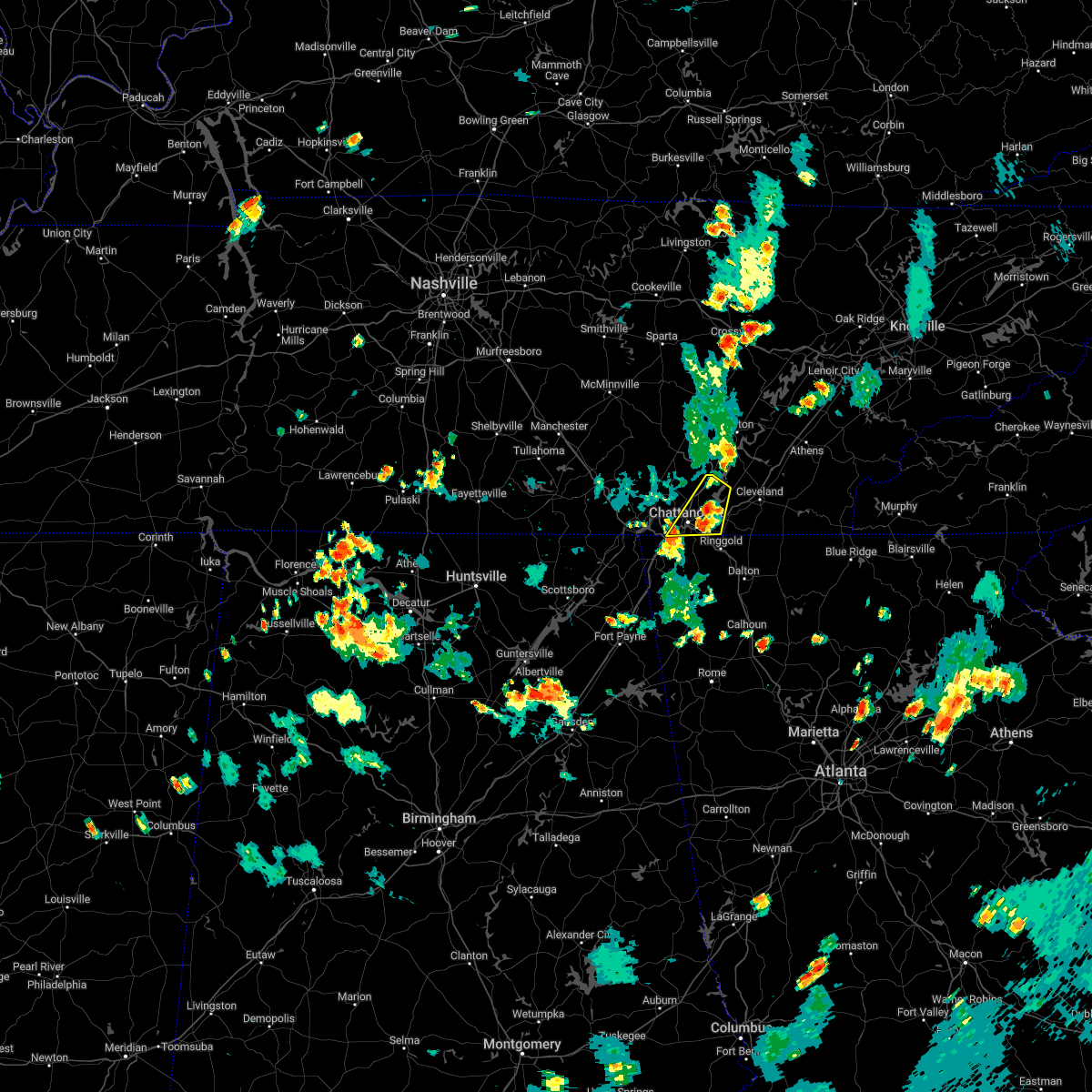 At 723 pm edt, a severe thunderstorm was located near chattanooga, moving northeast at 5 mph (radar indicated). Hazards include 60 mph wind gusts and penny size hail. expect damage to roofs, siding, and trees At 723 pm edt, a severe thunderstorm was located near chattanooga, moving northeast at 5 mph (radar indicated). Hazards include 60 mph wind gusts and penny size hail. expect damage to roofs, siding, and trees
|
| 7/28/2022 9:04 PM EDT |
 At 903 pm edt, severe thunderstorms were located along a line extending from near decatur to near walden, moving east at 20 mph (radar indicated). Hazards include 60 mph wind gusts. expect damage to roofs, siding, and trees At 903 pm edt, severe thunderstorms were located along a line extending from near decatur to near walden, moving east at 20 mph (radar indicated). Hazards include 60 mph wind gusts. expect damage to roofs, siding, and trees
|
| 7/20/2022 5:40 PM CDT |
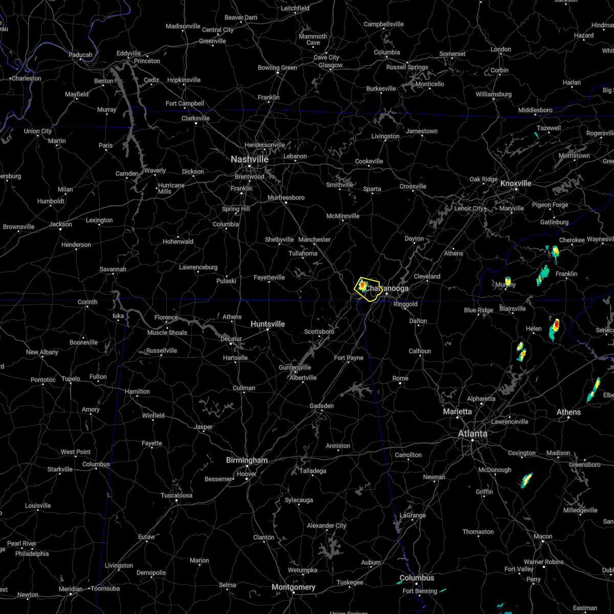 At 540 pm cdt, a severe thunderstorm was located near jasper, moving southeast at 15 mph (radar indicated). Hazards include 60 mph wind gusts. expect damage to roofs, siding, and trees At 540 pm cdt, a severe thunderstorm was located near jasper, moving southeast at 15 mph (radar indicated). Hazards include 60 mph wind gusts. expect damage to roofs, siding, and trees
|
| 7/8/2022 7:40 PM EDT |
 At 740 pm edt, severe thunderstorms were located along a line extending from near ooltewah to boynton to chickamauga, moving east at 15 mph (radar indicated). Hazards include 60 mph wind gusts and quarter size hail. Hail damage to vehicles is expected. Expect wind damage to roofs, siding, and trees. At 740 pm edt, severe thunderstorms were located along a line extending from near ooltewah to boynton to chickamauga, moving east at 15 mph (radar indicated). Hazards include 60 mph wind gusts and quarter size hail. Hail damage to vehicles is expected. Expect wind damage to roofs, siding, and trees.
|
| 7/7/2022 1:57 PM CDT |
 The severe thunderstorm warning for southern marion and southwestern hamilton counties will expire at 300 pm edt/200 pm cdt/, the storm which prompted the warning has weakened below severe limits, and has exited the warned area. therefore, the warning will be allowed to expire. however small hail and gusty winds are still possible with this thunderstorm. The severe thunderstorm warning for southern marion and southwestern hamilton counties will expire at 300 pm edt/200 pm cdt/, the storm which prompted the warning has weakened below severe limits, and has exited the warned area. therefore, the warning will be allowed to expire. however small hail and gusty winds are still possible with this thunderstorm.
|
| 7/7/2022 1:11 PM CDT |
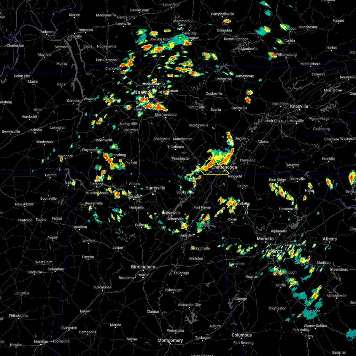 At 211 pm edt/111 pm cdt/, a severe thunderstorm was located near jasper, moving southeast at 15 mph (radar indicated). Hazards include 60 mph wind gusts and penny size hail. expect damage to roofs, siding, and trees At 211 pm edt/111 pm cdt/, a severe thunderstorm was located near jasper, moving southeast at 15 mph (radar indicated). Hazards include 60 mph wind gusts and penny size hail. expect damage to roofs, siding, and trees
|
| 7/3/2022 2:45 PM EDT |
 At 245 pm edt, a severe thunderstorm was located over chickamauga, or 8 miles west of ringgold, moving southeast at 5 mph (radar indicated). Hazards include 60 mph wind gusts and quarter size hail. Hail damage to vehicles is expected. Expect wind damage to roofs, siding, and trees. At 245 pm edt, a severe thunderstorm was located over chickamauga, or 8 miles west of ringgold, moving southeast at 5 mph (radar indicated). Hazards include 60 mph wind gusts and quarter size hail. Hail damage to vehicles is expected. Expect wind damage to roofs, siding, and trees.
|
| 6/6/2022 6:13 PM EDT |
 The severe thunderstorm warning for southeastern sequatchie, southeastern marion and central hamilton counties will expire at 615 pm edt/515 pm cdt/, the storm which prompted the warning has weakened below severe limits, and no longer poses an immediate threat to life or property. therefore, the warning will be allowed to expire. however gusty winds are still possible with this thunderstorm. The severe thunderstorm warning for southeastern sequatchie, southeastern marion and central hamilton counties will expire at 615 pm edt/515 pm cdt/, the storm which prompted the warning has weakened below severe limits, and no longer poses an immediate threat to life or property. therefore, the warning will be allowed to expire. however gusty winds are still possible with this thunderstorm.
|
| 6/6/2022 6:01 PM EDT |
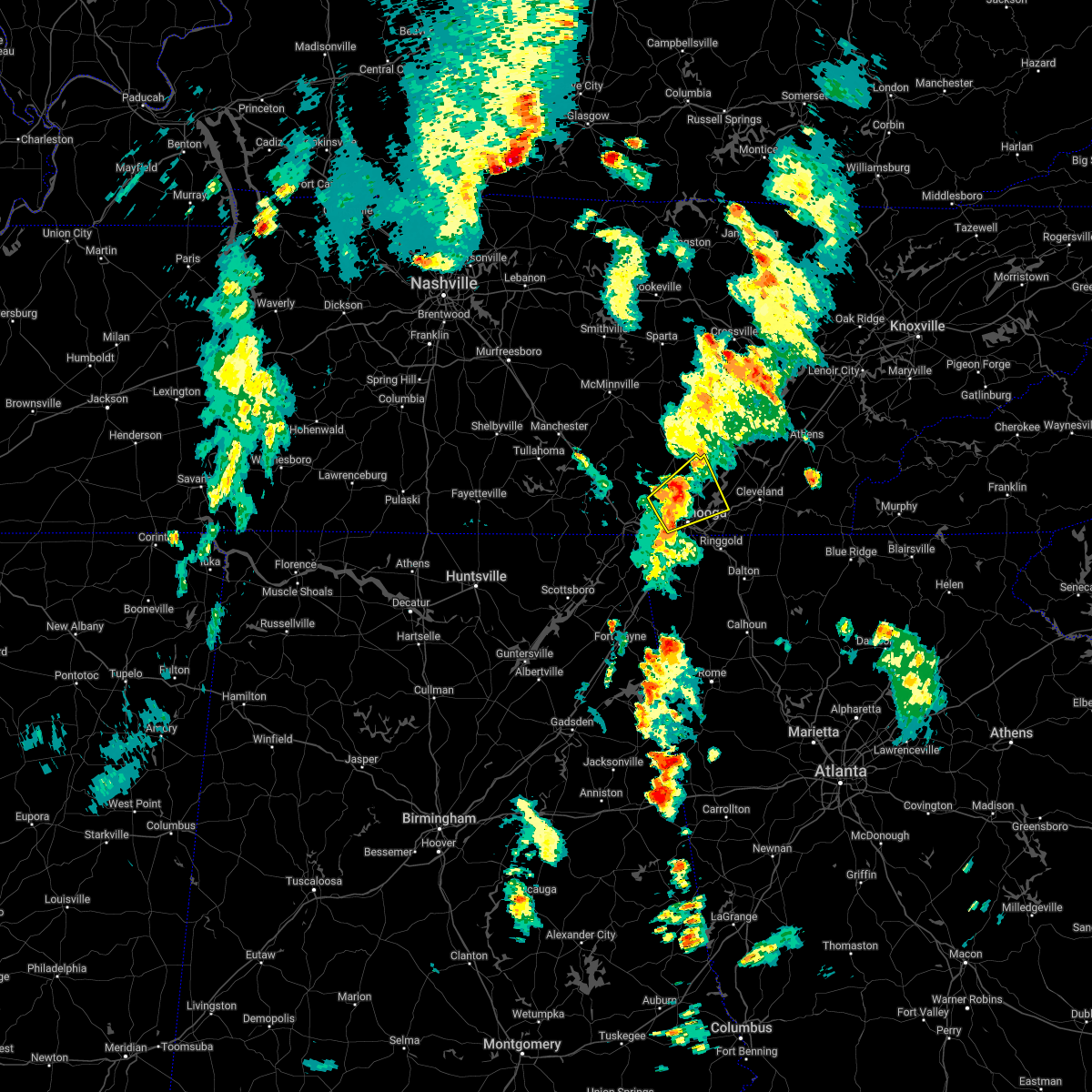 At 601 pm edt/501 pm cdt/, a severe thunderstorm was located over walden, or 8 miles north of chattanooga, moving northeast at 30 mph (radar indicated). Hazards include 60 mph wind gusts. Expect damage to roofs, siding, and trees. locations impacted include, chattanooga, soddy-daisy, signal mountain, walden, lakesite, whitwell, fairmount, harrison, red bank and powells crossroads. hail threat, radar indicated max hail size, <. 75 in wind threat, radar indicated max wind gust, 60 mph. At 601 pm edt/501 pm cdt/, a severe thunderstorm was located over walden, or 8 miles north of chattanooga, moving northeast at 30 mph (radar indicated). Hazards include 60 mph wind gusts. Expect damage to roofs, siding, and trees. locations impacted include, chattanooga, soddy-daisy, signal mountain, walden, lakesite, whitwell, fairmount, harrison, red bank and powells crossroads. hail threat, radar indicated max hail size, <. 75 in wind threat, radar indicated max wind gust, 60 mph.
|
| 6/6/2022 5:24 PM EDT |
 At 524 pm edt/424 pm cdt/, a severe thunderstorm was located near jasper, moving northeast at 30 mph (radar indicated). Hazards include 60 mph wind gusts and penny size hail. expect damage to roofs, siding, and trees At 524 pm edt/424 pm cdt/, a severe thunderstorm was located near jasper, moving northeast at 30 mph (radar indicated). Hazards include 60 mph wind gusts and penny size hail. expect damage to roofs, siding, and trees
|
| 5/6/2022 4:20 PM EDT |
 The severe thunderstorm warning for catoosa, north central murray and northern whitfield counties will expire at 430 pm edt, the storm which prompted the warning has moved out of the area. therefore, the warning will be allowed to expire. however gusty winds are still possible with this thunderstorm. a tornado watch remains in effect until 800 pm edt for northwestern georgia. The severe thunderstorm warning for catoosa, north central murray and northern whitfield counties will expire at 430 pm edt, the storm which prompted the warning has moved out of the area. therefore, the warning will be allowed to expire. however gusty winds are still possible with this thunderstorm. a tornado watch remains in effect until 800 pm edt for northwestern georgia.
|
| 5/6/2022 4:10 PM EDT |
 At 407 pm edt, a severe thunderstorm was located over beaverdale, or 13 miles northeast of dalton, moving east at 60 mph (observations with radar indicated). Hazards include 60 mph wind gusts with several 50-65 mph wind gusts have been observed in the warning area. Expect damage to roofs, siding, and trees. locations impacted include, dalton, ringgold, fort oglethorpe, varnell, tunnel hill, cohutta, sumac, indian springs, gregory, graysville, blue spring, boynton, beaumont, beaverdale, dawnville, red clay s. p. east ridge and apison. hail threat, radar indicated max hail size, <. 75 in wind threat, observed max wind gust, 60 mph. At 407 pm edt, a severe thunderstorm was located over beaverdale, or 13 miles northeast of dalton, moving east at 60 mph (observations with radar indicated). Hazards include 60 mph wind gusts with several 50-65 mph wind gusts have been observed in the warning area. Expect damage to roofs, siding, and trees. locations impacted include, dalton, ringgold, fort oglethorpe, varnell, tunnel hill, cohutta, sumac, indian springs, gregory, graysville, blue spring, boynton, beaumont, beaverdale, dawnville, red clay s. p. east ridge and apison. hail threat, radar indicated max hail size, <. 75 in wind threat, observed max wind gust, 60 mph.
|
| 5/6/2022 3:59 PM EDT |
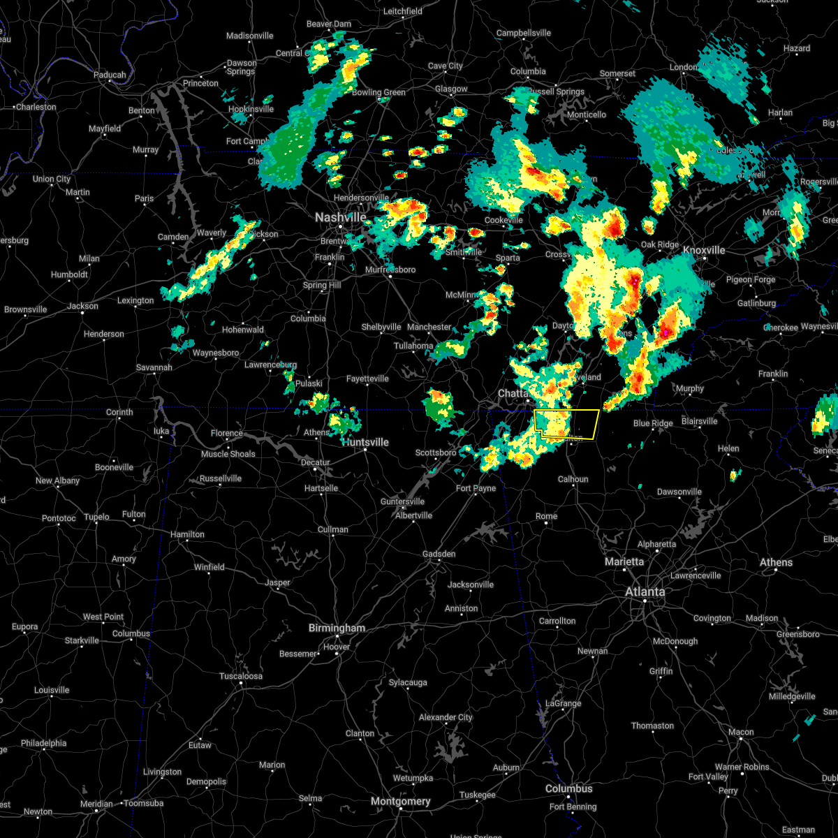 At 357 pm edt, a severe thunderstorm was located over ringgold, moving east at 60 mph (radar indicated). Hazards include 60 mph wind gusts. gusts of 56 mph were observed in chattanooga. expect damage to roofs, siding, and trees At 357 pm edt, a severe thunderstorm was located over ringgold, moving east at 60 mph (radar indicated). Hazards include 60 mph wind gusts. gusts of 56 mph were observed in chattanooga. expect damage to roofs, siding, and trees
|
| 5/6/2022 3:55 PM EDT |
 At 355 pm edt, a severe thunderstorm was located near ridgeside, or near chattanooga, moving east at 40 mph (radar indicated). Hazards include 60 mph wind gusts and penny size hail. Expect damage to roofs, siding, and trees. locations impacted include, chattanooga, cleveland, lakesite, south cleveland, harrison, east cleveland, wildwood lake, collegedale, waterville and east brainerd. this includes interstate 75 in tennessee between mile markers 1 and 27. hail threat, radar indicated max hail size, 0. 75 in wind threat, radar indicated max wind gust, 60 mph. At 355 pm edt, a severe thunderstorm was located near ridgeside, or near chattanooga, moving east at 40 mph (radar indicated). Hazards include 60 mph wind gusts and penny size hail. Expect damage to roofs, siding, and trees. locations impacted include, chattanooga, cleveland, lakesite, south cleveland, harrison, east cleveland, wildwood lake, collegedale, waterville and east brainerd. this includes interstate 75 in tennessee between mile markers 1 and 27. hail threat, radar indicated max hail size, 0. 75 in wind threat, radar indicated max wind gust, 60 mph.
|
| 5/6/2022 3:53 PM EDT | Asos station kcha chattanooga airpor in hamilton county TN, 3.4 miles NW of Chattanooga, TN |
| 5/6/2022 3:45 PM EDT | Reports of trees and power lines down across the cit in hamilton county TN, 1.1 miles ESE of Chattanooga, TN |
| 5/6/2022 3:41 PM EDT |
 At 341 pm edt, a severe thunderstorm was located over rossville, or near chattanooga, moving east at 40 mph (radar indicated). Hazards include 60 mph wind gusts and penny size hail. expect damage to roofs, siding, and trees At 341 pm edt, a severe thunderstorm was located over rossville, or near chattanooga, moving east at 40 mph (radar indicated). Hazards include 60 mph wind gusts and penny size hail. expect damage to roofs, siding, and trees
|
| 5/6/2022 3:33 PM EDT | Tree down on vehicle east 8th street near douglas stree in hamilton county TN, 1.1 miles ESE of Chattanooga, TN |
| 5/6/2022 3:21 PM EDT |
 At 321 pm edt, a severe thunderstorm was located over trenton, moving east at 60 mph (radar indicated). Hazards include 60 mph wind gusts. expect damage to roofs, siding, and trees At 321 pm edt, a severe thunderstorm was located over trenton, moving east at 60 mph (radar indicated). Hazards include 60 mph wind gusts. expect damage to roofs, siding, and trees
|
| 4/13/2022 9:33 PM CDT |
 At 1033 pm edt/933 pm cdt/, severe thunderstorms were located along a line extending from 11 miles north of pikeville to 6 miles north of stevenson, moving east at 55 mph (radar indicated). Hazards include 60 mph wind gusts. Expect damage to roofs, siding, and trees. locations impacted include, chattanooga, dayton, dunlap, jasper, pikeville, soddy-daisy, signal mountain, south pittsburg, spring city and walden. hail threat, radar indicated max hail size, <. 75 in wind threat, radar indicated max wind gust, 60 mph. At 1033 pm edt/933 pm cdt/, severe thunderstorms were located along a line extending from 11 miles north of pikeville to 6 miles north of stevenson, moving east at 55 mph (radar indicated). Hazards include 60 mph wind gusts. Expect damage to roofs, siding, and trees. locations impacted include, chattanooga, dayton, dunlap, jasper, pikeville, soddy-daisy, signal mountain, south pittsburg, spring city and walden. hail threat, radar indicated max hail size, <. 75 in wind threat, radar indicated max wind gust, 60 mph.
|
| 4/13/2022 9:06 PM CDT |
 At 1005 pm edt/905 pm cdt/, severe thunderstorms were located along a line extending from 11 miles northwest of spencer to 8 miles south of huntland, moving east at 45 mph (radar indicated). Hazards include 60 mph wind gusts. expect damage to roofs, siding, and trees At 1005 pm edt/905 pm cdt/, severe thunderstorms were located along a line extending from 11 miles northwest of spencer to 8 miles south of huntland, moving east at 45 mph (radar indicated). Hazards include 60 mph wind gusts. expect damage to roofs, siding, and trees
|
| 4/6/2022 6:33 PM EDT |
 At 632 pm edt, severe thunderstorms were located along a line extending from near harrison to near ridgeside, moving east at 35 mph (radar indicated). Hazards include 60 mph wind gusts and quarter size hail. Hail damage to vehicles is expected. expect wind damage to roofs, siding, and trees. locations impacted include, chattanooga, ridgeside, harrison, collegedale, harrison bay state park, east ridge, ooltewah and middle valley. this includes interstate 75 in tennessee between mile markers 1 and 11, and near mile marker 14. hail threat, radar indicated max hail size, 1. 00 in wind threat, radar indicated max wind gust, 60 mph. At 632 pm edt, severe thunderstorms were located along a line extending from near harrison to near ridgeside, moving east at 35 mph (radar indicated). Hazards include 60 mph wind gusts and quarter size hail. Hail damage to vehicles is expected. expect wind damage to roofs, siding, and trees. locations impacted include, chattanooga, ridgeside, harrison, collegedale, harrison bay state park, east ridge, ooltewah and middle valley. this includes interstate 75 in tennessee between mile markers 1 and 11, and near mile marker 14. hail threat, radar indicated max hail size, 1. 00 in wind threat, radar indicated max wind gust, 60 mph.
|
| 4/6/2022 6:00 PM EDT |
 At 600 pm edt/500 pm cdt/, severe thunderstorms were located along a line extending from near signal mountain to near bridgeport, moving east at 40 mph (radar indicated). Hazards include 60 mph wind gusts and half dollar size hail. Hail damage to vehicles is expected. Expect wind damage to roofs, siding, and trees. At 600 pm edt/500 pm cdt/, severe thunderstorms were located along a line extending from near signal mountain to near bridgeport, moving east at 40 mph (radar indicated). Hazards include 60 mph wind gusts and half dollar size hail. Hail damage to vehicles is expected. Expect wind damage to roofs, siding, and trees.
|
| 4/6/2022 4:56 PM CDT |
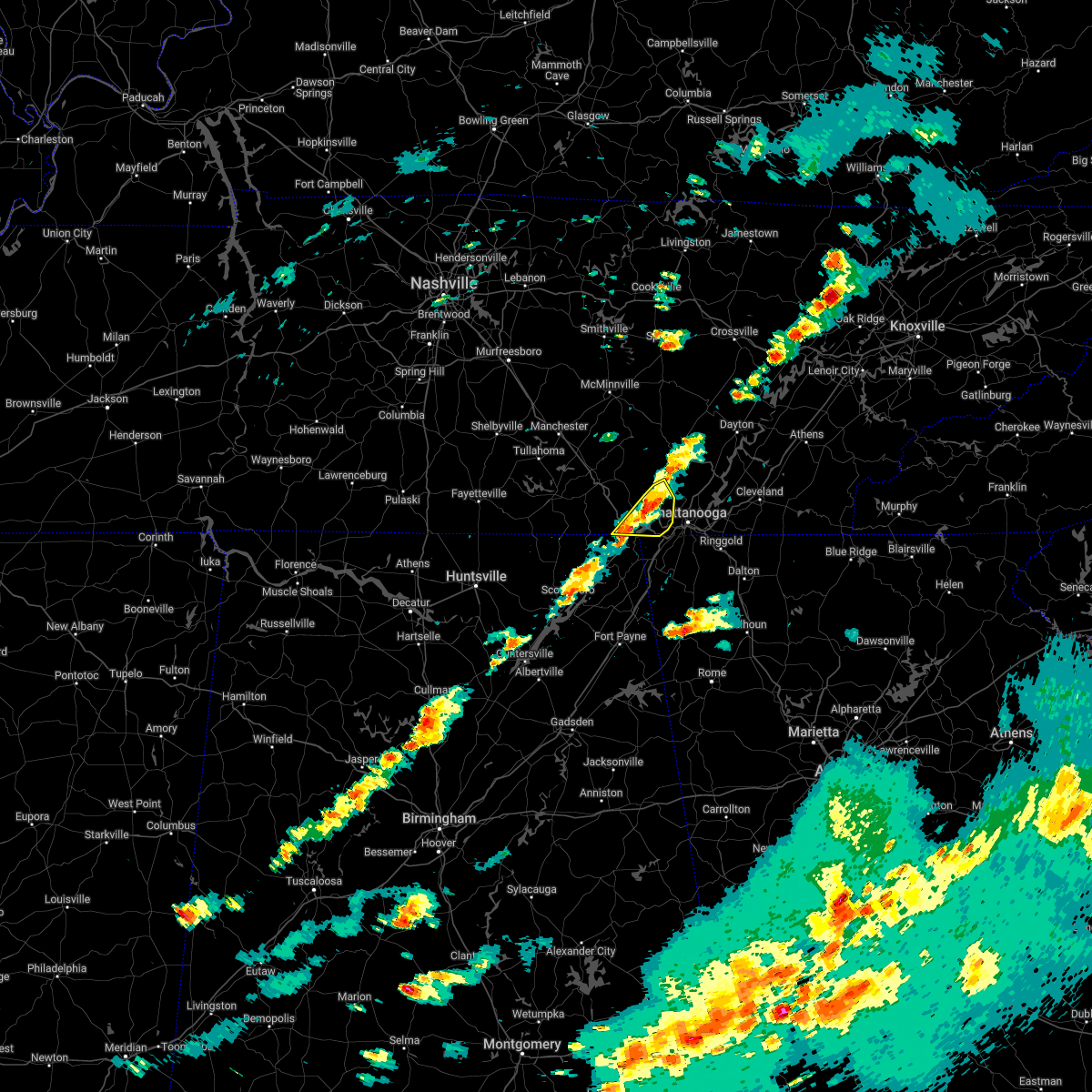 At 454 pm cdt, severe thunderstorms were located along a line extending from near whitwell to bridgeport, moving east at 45 mph (radar indicated). Hazards include 60 mph wind gusts and half dollar size hail. larger hail closer to the alabama state line. Hail damage to vehicles is expected. expect wind damage to roofs, siding, and trees. locations impacted include, jasper, south pittsburg, whitwell, kimball, powells crossroads, martin springs, sequatchie cave, haletown (guild), new hope and hicks gap state park. hail threat, radar indicated max hail size, 1. 25 in wind threat, radar indicated max wind gust, 60 mph. At 454 pm cdt, severe thunderstorms were located along a line extending from near whitwell to bridgeport, moving east at 45 mph (radar indicated). Hazards include 60 mph wind gusts and half dollar size hail. larger hail closer to the alabama state line. Hail damage to vehicles is expected. expect wind damage to roofs, siding, and trees. locations impacted include, jasper, south pittsburg, whitwell, kimball, powells crossroads, martin springs, sequatchie cave, haletown (guild), new hope and hicks gap state park. hail threat, radar indicated max hail size, 1. 25 in wind threat, radar indicated max wind gust, 60 mph.
|
| 4/6/2022 4:35 PM CDT |
 At 434 pm cdt, a severe thunderstorm was located near south pittsburg, or 8 miles west of jasper, moving east at 45 mph (radar indicated). Hazards include 60 mph wind gusts and quarter size hail. Hail damage to vehicles is expected. Expect wind damage to roofs, siding, and trees. At 434 pm cdt, a severe thunderstorm was located near south pittsburg, or 8 miles west of jasper, moving east at 45 mph (radar indicated). Hazards include 60 mph wind gusts and quarter size hail. Hail damage to vehicles is expected. Expect wind damage to roofs, siding, and trees.
|
| 1/1/2022 10:28 PM EST | Trees and power lines dow in hamilton county TN, 4.7 miles WSW of Chattanooga, TN |
| 1/1/2022 10:20 PM EST |
 At 1020 pm est, severe thunderstorms were located along a line extending from ooltewah to cloudland canyon state park, moving east at 55 mph (radar indicated). Hazards include 60 mph wind gusts. Expect damage to roofs, siding, and trees. Locations impacted include, ringgold, trenton, fort oglethorpe, rossville, chickamauga, lookout mountain, blue spring, fairview, chattanooga valley, hooker, cloudland canyon state park, cooper heights, rock spring, lakeview, indian springs, graysville, cole city, wildwood, stephensville and boynton. At 1020 pm est, severe thunderstorms were located along a line extending from ooltewah to cloudland canyon state park, moving east at 55 mph (radar indicated). Hazards include 60 mph wind gusts. Expect damage to roofs, siding, and trees. Locations impacted include, ringgold, trenton, fort oglethorpe, rossville, chickamauga, lookout mountain, blue spring, fairview, chattanooga valley, hooker, cloudland canyon state park, cooper heights, rock spring, lakeview, indian springs, graysville, cole city, wildwood, stephensville and boynton.
|
| 1/1/2022 10:20 PM EST |
 At 1020 pm est, a severe thunderstorm was located over harrison, or near chattanooga, moving east at 55 mph (radar indicated). Hazards include 60 mph wind gusts. Expect damage to roofs, siding, and trees. locations impacted include, chattanooga, cleveland, soddy-daisy, rossville, lakesite, charleston, ridgeside, south cleveland, harrison and east cleveland. This includes interstate 75 in tennessee between mile markers 1 and 34. At 1020 pm est, a severe thunderstorm was located over harrison, or near chattanooga, moving east at 55 mph (radar indicated). Hazards include 60 mph wind gusts. Expect damage to roofs, siding, and trees. locations impacted include, chattanooga, cleveland, soddy-daisy, rossville, lakesite, charleston, ridgeside, south cleveland, harrison and east cleveland. This includes interstate 75 in tennessee between mile markers 1 and 34.
|
| 1/1/2022 10:10 PM EST |
 At 1010 pm est, a severe thunderstorm was located over ridgeside, or over chattanooga, moving east at 55 mph (radar indicated). Hazards include 60 mph wind gusts. Expect damage to roofs, siding, and trees. locations impacted include, chattanooga, cleveland, soddy-daisy, signal mountain, rossville, walden, lakesite, charleston, ridgeside and south cleveland. This includes interstate 75 in tennessee between mile markers 1 and 34. At 1010 pm est, a severe thunderstorm was located over ridgeside, or over chattanooga, moving east at 55 mph (radar indicated). Hazards include 60 mph wind gusts. Expect damage to roofs, siding, and trees. locations impacted include, chattanooga, cleveland, soddy-daisy, signal mountain, rossville, walden, lakesite, charleston, ridgeside and south cleveland. This includes interstate 75 in tennessee between mile markers 1 and 34.
|
| 1/1/2022 9:55 PM EST |
 At 955 pm est/855 pm cst/, a severe thunderstorm was located 7 miles southeast of jasper, moving east at 55 mph (radar indicated). Hazards include 60 mph wind gusts. expect damage to roofs, siding, and trees At 955 pm est/855 pm cst/, a severe thunderstorm was located 7 miles southeast of jasper, moving east at 55 mph (radar indicated). Hazards include 60 mph wind gusts. expect damage to roofs, siding, and trees
|
| 1/1/2022 9:52 PM EST |
 At 951 pm est, a severe thunderstorm capable of producing a tornado was located over stephensville, or over trenton, moving east at 50 mph (radar indicated rotation). Hazards include tornado. Flying debris will be dangerous to those caught without shelter. mobile homes will be damaged or destroyed. damage to roofs, windows, and vehicles will occur. Tree damage is likely. At 951 pm est, a severe thunderstorm capable of producing a tornado was located over stephensville, or over trenton, moving east at 50 mph (radar indicated rotation). Hazards include tornado. Flying debris will be dangerous to those caught without shelter. mobile homes will be damaged or destroyed. damage to roofs, windows, and vehicles will occur. Tree damage is likely.
|
| 1/1/2022 9:46 PM EST |
 At 945 pm est, severe thunderstorms were located along a line extending from near stephensville to near hollywood, moving east at 55 mph (radar indicated). Hazards include 60 mph wind gusts. expect damage to roofs, siding, and trees At 945 pm est, severe thunderstorms were located along a line extending from near stephensville to near hollywood, moving east at 55 mph (radar indicated). Hazards include 60 mph wind gusts. expect damage to roofs, siding, and trees
|
| 12/11/2021 9:45 AM EST | Few trees dow in hamilton county TN, 6.7 miles SSW of Chattanooga, TN |
| 8/10/2021 7:04 PM EDT |
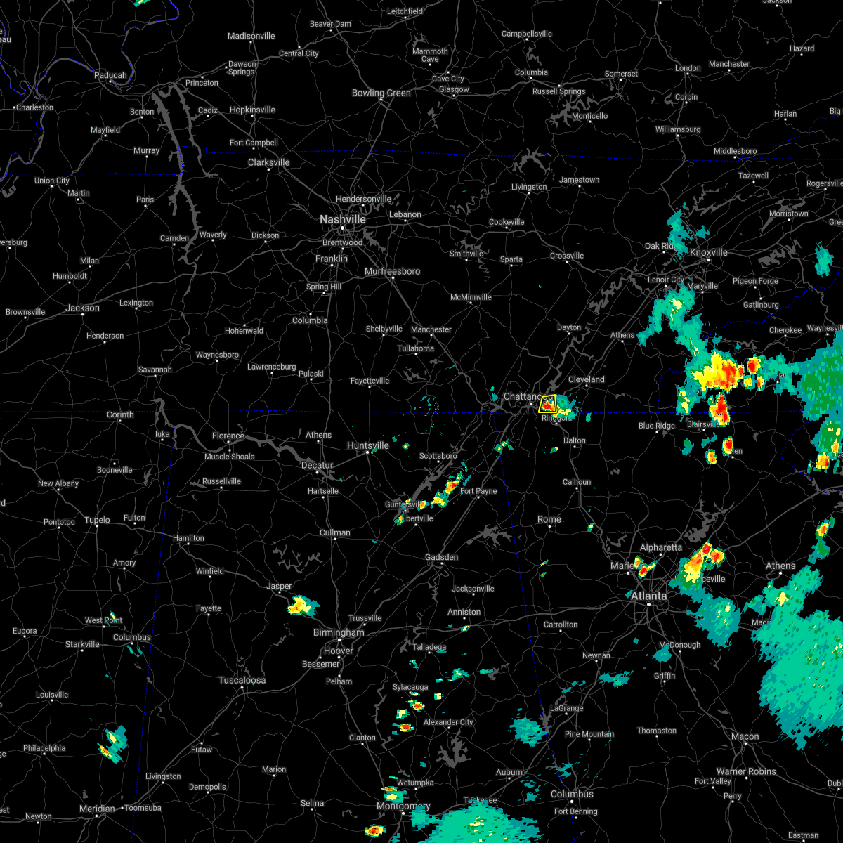 At 704 pm edt, a severe thunderstorm was located near ridgeside, or near chattanooga, and is nearly stationary (radar indicated). Hazards include 60 mph wind gusts and quarter size hail. Hail damage to vehicles is expected. expect wind damage to roofs, siding, and trees. locations impacted include, chattanooga, east ridge and ooltewah. this includes interstate 75 in tennessee between mile markers 1 and 8. hail threat, radar indicated max hail size, 1. 00 in wind threat, radar indicated max wind gust, 60 mph. At 704 pm edt, a severe thunderstorm was located near ridgeside, or near chattanooga, and is nearly stationary (radar indicated). Hazards include 60 mph wind gusts and quarter size hail. Hail damage to vehicles is expected. expect wind damage to roofs, siding, and trees. locations impacted include, chattanooga, east ridge and ooltewah. this includes interstate 75 in tennessee between mile markers 1 and 8. hail threat, radar indicated max hail size, 1. 00 in wind threat, radar indicated max wind gust, 60 mph.
|
| 8/10/2021 6:33 PM EDT | Reports of numerous trees down across southern portions of the county... east of the main metro area. time is estimated from rada in hamilton county TN, 6 miles WNW of Chattanooga, TN |
| 8/10/2021 6:28 PM EDT |
 At 628 pm edt, a severe thunderstorm was located near ridgeside, or near chattanooga, and is nearly stationary (radar indicated). Hazards include 60 mph wind gusts and quarter size hail. Hail damage to vehicles is expected. Expect wind damage to roofs, siding, and trees. At 628 pm edt, a severe thunderstorm was located near ridgeside, or near chattanooga, and is nearly stationary (radar indicated). Hazards include 60 mph wind gusts and quarter size hail. Hail damage to vehicles is expected. Expect wind damage to roofs, siding, and trees.
|
| 8/10/2021 6:01 PM EDT |
 At 601 pm edt, a severe thunderstorm was located near harrison, or 9 miles east of chattanooga, and is nearly stationary (radar indicated). Hazards include 60 mph wind gusts and quarter size hail. Hail damage to vehicles is expected. Expect wind damage to roofs, siding, and trees. At 601 pm edt, a severe thunderstorm was located near harrison, or 9 miles east of chattanooga, and is nearly stationary (radar indicated). Hazards include 60 mph wind gusts and quarter size hail. Hail damage to vehicles is expected. Expect wind damage to roofs, siding, and trees.
|
| 5/6/2021 9:10 PM EDT | Large tree fell on home and trapped resident inside at the 4000 block of st elmo ave. no injurie in hamilton county TN, 6.4 miles NE of Chattanooga, TN |
| 5/4/2021 10:43 AM EDT |
 At 1043 am edt, a severe thunderstorm was located over higdon, or near trenton, moving east at 50 mph (radar indicated). Hazards include 60 mph wind gusts and penny size hail. Expect damage to roofs, siding, and trees. Locations impacted include, ringgold, trenton, fort oglethorpe, rossville, chickamauga, lookout mountain, blue spring, fairview, chattanooga valley, hooker, cloudland canyon state park, cooper heights, rock spring, rising fawn, noble, lakeview, wood station, indian springs, graysville and cole city. At 1043 am edt, a severe thunderstorm was located over higdon, or near trenton, moving east at 50 mph (radar indicated). Hazards include 60 mph wind gusts and penny size hail. Expect damage to roofs, siding, and trees. Locations impacted include, ringgold, trenton, fort oglethorpe, rossville, chickamauga, lookout mountain, blue spring, fairview, chattanooga valley, hooker, cloudland canyon state park, cooper heights, rock spring, rising fawn, noble, lakeview, wood station, indian springs, graysville and cole city.
|
| 3/28/2021 5:02 AM CDT |
 At 502 am cdt, a severe thunderstorm was located near kimball, or near jasper, moving northeast at 60 mph (radar indicated). Hazards include 60 mph wind gusts. Expect damage to roofs, siding, and trees. Locations impacted include, jasper, south pittsburg, whitwell, kimball, powells crossroads, orme, martin springs, fiery gizzard state park, griffith creek and haletown (guild). At 502 am cdt, a severe thunderstorm was located near kimball, or near jasper, moving northeast at 60 mph (radar indicated). Hazards include 60 mph wind gusts. Expect damage to roofs, siding, and trees. Locations impacted include, jasper, south pittsburg, whitwell, kimball, powells crossroads, orme, martin springs, fiery gizzard state park, griffith creek and haletown (guild).
|
| 3/28/2021 4:43 AM CDT |
 At 442 am cdt, a severe thunderstorm was located 10 miles north of skyline, or 16 miles south of winchester, moving east at 60 mph (radar indicated). Hazards include 60 mph wind gusts. expect damage to roofs, siding, and trees At 442 am cdt, a severe thunderstorm was located 10 miles north of skyline, or 16 miles south of winchester, moving east at 60 mph (radar indicated). Hazards include 60 mph wind gusts. expect damage to roofs, siding, and trees
|
| 3/27/2021 6:23 AM EDT |
 At 622 am edt, a severe thunderstorm was located 7 miles north of ringgold, moving east at 30 mph (radar indicated). Hazards include ping pong ball size hail. People and animals outdoors will be injured. expect damage to roofs, siding, windows, and vehicles. locations impacted include, chattanooga, cleveland, south cleveland, east cleveland, wildwood lake, collegedale, waterville, east brainerd, red clay state park and flint springs. This includes interstate 75 in tennessee between mile markers 11 and 12. At 622 am edt, a severe thunderstorm was located 7 miles north of ringgold, moving east at 30 mph (radar indicated). Hazards include ping pong ball size hail. People and animals outdoors will be injured. expect damage to roofs, siding, windows, and vehicles. locations impacted include, chattanooga, cleveland, south cleveland, east cleveland, wildwood lake, collegedale, waterville, east brainerd, red clay state park and flint springs. This includes interstate 75 in tennessee between mile markers 11 and 12.
|
| 3/27/2021 6:08 AM EDT |
 At 608 am edt, a severe thunderstorm was located near ridgeside, or near chattanooga, moving east at 30 mph (radar indicated). Hazards include half dollar size hail. damage to vehicles is expected At 608 am edt, a severe thunderstorm was located near ridgeside, or near chattanooga, moving east at 30 mph (radar indicated). Hazards include half dollar size hail. damage to vehicles is expected
|
| 3/25/2021 11:28 AM EDT |
 The severe thunderstorm warning for catoosa, western whitfield, southeastern walker and chattooga counties will expire at 1130 am edt, the storms which prompted the warning have weakened below severe limits, and no longer pose an immediate threat to life or property. therefore, the warning will be allowed to expire. however gusty winds and heavy rain are still possible with these thunderstorms. to report severe weather, contact your nearest law enforcement agency. they will relay your report to the national weather service peachtree city. The severe thunderstorm warning for catoosa, western whitfield, southeastern walker and chattooga counties will expire at 1130 am edt, the storms which prompted the warning have weakened below severe limits, and no longer pose an immediate threat to life or property. therefore, the warning will be allowed to expire. however gusty winds and heavy rain are still possible with these thunderstorms. to report severe weather, contact your nearest law enforcement agency. they will relay your report to the national weather service peachtree city.
|
| 3/25/2021 11:21 AM EDT |
 At 1120 am edt, severe thunderstorms were located along a line extending from graysville to new moon, moving east at 45 mph (radar indicated). Hazards include 60 mph wind gusts. Expect damage to roofs, siding, and trees. locations impacted include, dalton, lafayette, summerville, ringgold, fort oglethorpe, trion, tunnel hill, lyerly, menlo, center post, subligna, blue spring, linwood, villanow, james h. Floyd state park, rock spring, naomi, suttles mill, noble and wood station. At 1120 am edt, severe thunderstorms were located along a line extending from graysville to new moon, moving east at 45 mph (radar indicated). Hazards include 60 mph wind gusts. Expect damage to roofs, siding, and trees. locations impacted include, dalton, lafayette, summerville, ringgold, fort oglethorpe, trion, tunnel hill, lyerly, menlo, center post, subligna, blue spring, linwood, villanow, james h. Floyd state park, rock spring, naomi, suttles mill, noble and wood station.
|
| 3/25/2021 11:12 AM EDT |
 At 1112 am edt, severe thunderstorms were located along a line extending from near harrison to near chickamauga to near trion, moving northeast at 70 mph (radar indicated). Hazards include 60 mph wind gusts and quarter size hail. Hail damage to vehicles is expected. expect wind damage to roofs, siding, and trees. locations impacted include, chattanooga, harrison, collegedale, east brainerd, harrison bay state park, apison, ooltewah and east ridge. This includes interstate 75 in tennessee between mile markers 1 and 15. At 1112 am edt, severe thunderstorms were located along a line extending from near harrison to near chickamauga to near trion, moving northeast at 70 mph (radar indicated). Hazards include 60 mph wind gusts and quarter size hail. Hail damage to vehicles is expected. expect wind damage to roofs, siding, and trees. locations impacted include, chattanooga, harrison, collegedale, east brainerd, harrison bay state park, apison, ooltewah and east ridge. This includes interstate 75 in tennessee between mile markers 1 and 15.
|
| 3/25/2021 11:10 AM EDT |
 At 1110 am edt, severe thunderstorms were located along a line extending from fairview to little river canyon np, moving east at 45 mph (radar indicated). Hazards include 60 mph wind gusts. Expect damage to roofs, siding, and trees. locations impacted include, dalton, lafayette, summerville, ringgold, fort oglethorpe, rossville, chickamauga, trion, tunnel hill, lyerly, menlo, center post, subligna, blue spring, fairview, linwood, villanow, cloudland, cooper heights and james h. Floyd state park. At 1110 am edt, severe thunderstorms were located along a line extending from fairview to little river canyon np, moving east at 45 mph (radar indicated). Hazards include 60 mph wind gusts. Expect damage to roofs, siding, and trees. locations impacted include, dalton, lafayette, summerville, ringgold, fort oglethorpe, rossville, chickamauga, trion, tunnel hill, lyerly, menlo, center post, subligna, blue spring, fairview, linwood, villanow, cloudland, cooper heights and james h. Floyd state park.
|
| 3/25/2021 11:02 AM EDT |
 At 1102 am edt, severe thunderstorms were located along a line extending from near soddy-daisy to chickamauga to 9 miles northeast of little river falls, moving northeast at 70 mph (radar indicated). Hazards include 60 mph wind gusts and quarter size hail. Hail damage to vehicles is expected. expect wind damage to roofs, siding, and trees. locations impacted include, chattanooga, soddy-daisy, signal mountain, walden, lakesite, ridgeside, fairmount, harrison, red bank and collegedale. This includes interstate 75 in tennessee between mile markers 1 and 15. At 1102 am edt, severe thunderstorms were located along a line extending from near soddy-daisy to chickamauga to 9 miles northeast of little river falls, moving northeast at 70 mph (radar indicated). Hazards include 60 mph wind gusts and quarter size hail. Hail damage to vehicles is expected. expect wind damage to roofs, siding, and trees. locations impacted include, chattanooga, soddy-daisy, signal mountain, walden, lakesite, ridgeside, fairmount, harrison, red bank and collegedale. This includes interstate 75 in tennessee between mile markers 1 and 15.
|
| 3/25/2021 10:53 AM EDT |
 At 1053 am edt/953 am cdt/, severe thunderstorms were located along a line extending from signal mountain to 7 miles southeast of trenton to little river falls, moving northeast at 70 mph (radar indicated). Hazards include 60 mph wind gusts and quarter size hail. Hail damage to vehicles is expected. Expect wind damage to roofs, siding, and trees. At 1053 am edt/953 am cdt/, severe thunderstorms were located along a line extending from signal mountain to 7 miles southeast of trenton to little river falls, moving northeast at 70 mph (radar indicated). Hazards include 60 mph wind gusts and quarter size hail. Hail damage to vehicles is expected. Expect wind damage to roofs, siding, and trees.
|
| 3/25/2021 10:51 AM EDT |
 At 1050 am edt, severe thunderstorms were located along a line extending from near cole city to near skirum, moving east at 50 mph (radar indicated). Hazards include 60 mph wind gusts and quarter size hail. Hail damage to vehicles is expected. expect wind damage to roofs, siding, and trees. Locations impacted include, dalton, lafayette, summerville, ringgold, trenton, fort oglethorpe, rossville, chickamauga, trion, lookout mountain, tunnel hill, lyerly, menlo, center post, subligna, fairview, villanow, cloudland, chattanooga valley and hooker. At 1050 am edt, severe thunderstorms were located along a line extending from near cole city to near skirum, moving east at 50 mph (radar indicated). Hazards include 60 mph wind gusts and quarter size hail. Hail damage to vehicles is expected. expect wind damage to roofs, siding, and trees. Locations impacted include, dalton, lafayette, summerville, ringgold, trenton, fort oglethorpe, rossville, chickamauga, trion, lookout mountain, tunnel hill, lyerly, menlo, center post, subligna, fairview, villanow, cloudland, chattanooga valley and hooker.
|
| 3/25/2021 10:37 AM EDT |
 At 1036 am edt, severe thunderstorms were located along a line extending from near stephensville to near geraldine, moving east at 50 mph (radar indicated). Hazards include ping pong ball size hail and 60 mph wind gusts. People and animals outdoors will be injured. expect hail damage to roofs, siding, windows, and vehicles. Expect wind damage to roofs, siding, and trees. At 1036 am edt, severe thunderstorms were located along a line extending from near stephensville to near geraldine, moving east at 50 mph (radar indicated). Hazards include ping pong ball size hail and 60 mph wind gusts. People and animals outdoors will be injured. expect hail damage to roofs, siding, windows, and vehicles. Expect wind damage to roofs, siding, and trees.
|
| 8/19/2020 2:37 PM EDT |
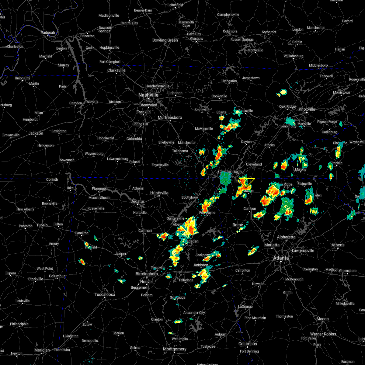 At 237 pm edt, a severe thunderstorm was located over ringgold, moving northeast at 25 mph (radar indicated). Hazards include 60 mph wind gusts and quarter size hail. Hail damage to vehicles is expected. Expect wind damage to roofs, siding, and trees. At 237 pm edt, a severe thunderstorm was located over ringgold, moving northeast at 25 mph (radar indicated). Hazards include 60 mph wind gusts and quarter size hail. Hail damage to vehicles is expected. Expect wind damage to roofs, siding, and trees.
|
| 8/12/2020 4:26 PM EDT |
 The severe thunderstorm warning for catoosa and central whitfield counties will expire at 430 pm edt, the storm which prompted the warning has weakened below severe limits, and no longer poses an immediate threat to life or property. therefore, the warning will be allowed to expire. however gusty winds and heavy rain are still possible with this thunderstorm. The severe thunderstorm warning for catoosa and central whitfield counties will expire at 430 pm edt, the storm which prompted the warning has weakened below severe limits, and no longer poses an immediate threat to life or property. therefore, the warning will be allowed to expire. however gusty winds and heavy rain are still possible with this thunderstorm.
|
| 8/12/2020 4:15 PM EDT |
 At 415 pm edt, a severe thunderstorm was located over ringgold, moving northeast at 5 mph (radar indicated). Hazards include 60 mph wind gusts and quarter size hail. Hail damage to vehicles is expected. expect wind damage to roofs, siding, and trees. Locations impacted include, dalton, ringgold, varnell, tunnel hill, cohutta, wood station, rocky face, graysville, blue spring, boynton, beaumont, indian springs and apison. At 415 pm edt, a severe thunderstorm was located over ringgold, moving northeast at 5 mph (radar indicated). Hazards include 60 mph wind gusts and quarter size hail. Hail damage to vehicles is expected. expect wind damage to roofs, siding, and trees. Locations impacted include, dalton, ringgold, varnell, tunnel hill, cohutta, wood station, rocky face, graysville, blue spring, boynton, beaumont, indian springs and apison.
|
| 8/12/2020 3:58 PM EDT |
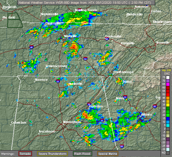 At 358 pm edt, a severe thunderstorm was located near ringgold, moving northeast at 5 mph (radar indicated). Hazards include 60 mph wind gusts and nickel size hail. expect damage to roofs, siding, and trees At 358 pm edt, a severe thunderstorm was located near ringgold, moving northeast at 5 mph (radar indicated). Hazards include 60 mph wind gusts and nickel size hail. expect damage to roofs, siding, and trees
|
| 8/10/2020 6:52 PM EDT |
 At 651 pm edt/551 pm cdt/, severe thunderstorms were located along a line extending from 11 miles west of spring city to 7 miles southwest of pikeville to dunlap to near gruetli-laager, moving southeast at 25 mph (radar indicated). Hazards include 60 mph wind gusts. Expect damage to roofs, siding, and trees. Locations impacted include, dayton, dunlap, pikeville, soddy-daisy, spring city, fairmount, graysville, cartwright, flat top mountain and north chickamauga creek gorge. At 651 pm edt/551 pm cdt/, severe thunderstorms were located along a line extending from 11 miles west of spring city to 7 miles southwest of pikeville to dunlap to near gruetli-laager, moving southeast at 25 mph (radar indicated). Hazards include 60 mph wind gusts. Expect damage to roofs, siding, and trees. Locations impacted include, dayton, dunlap, pikeville, soddy-daisy, spring city, fairmount, graysville, cartwright, flat top mountain and north chickamauga creek gorge.
|
| 8/10/2020 6:38 PM EDT |
 At 637 pm edt/537 pm cdt/, severe thunderstorms were located along a line extending from 11 miles southwest of crossville to 8 miles southwest of pikeville to 7 miles northwest of dunlap to near gruetli-laager, moving southeast at 25 mph (radar indicated). Hazards include 60 mph wind gusts. expect damage to roofs, siding, and trees At 637 pm edt/537 pm cdt/, severe thunderstorms were located along a line extending from 11 miles southwest of crossville to 8 miles southwest of pikeville to 7 miles northwest of dunlap to near gruetli-laager, moving southeast at 25 mph (radar indicated). Hazards include 60 mph wind gusts. expect damage to roofs, siding, and trees
|
| 7/26/2020 7:21 PM EDT | One tree downed across power lines on south crest road. a 37 mph gust was measured at the nearby kcha airpor in hamilton county TN, 4.2 miles NNE of Chattanooga, TN |
| 6/29/2020 5:09 PM EDT |
 At 509 pm edt, a severe thunderstorm was located near ringgold, moving east at 20 mph (radar indicated). Hazards include 60 mph wind gusts and quarter size hail. Hail damage to vehicles is expected. Expect wind damage to roofs, siding, and trees. At 509 pm edt, a severe thunderstorm was located near ringgold, moving east at 20 mph (radar indicated). Hazards include 60 mph wind gusts and quarter size hail. Hail damage to vehicles is expected. Expect wind damage to roofs, siding, and trees.
|
| 6/28/2020 8:17 PM EDT |
 At 817 pm edt, a severe thunderstorm was located near south cleveland, or 10 miles southwest of cleveland, moving southeast at 35 mph (radar indicated). Hazards include 60 mph wind gusts. expect damage to roofs, siding, and trees At 817 pm edt, a severe thunderstorm was located near south cleveland, or 10 miles southwest of cleveland, moving southeast at 35 mph (radar indicated). Hazards include 60 mph wind gusts. expect damage to roofs, siding, and trees
|
| 6/3/2020 3:57 PM CDT |
 At 357 pm cdt, a severe thunderstorm was located near south pittsburg, or near bridgeport, moving northeast at 55 mph (radar indicated). Hazards include 60 mph wind gusts and quarter size hail. Hail damage to vehicles is expected. Expect wind damage to roofs, siding, and trees. At 357 pm cdt, a severe thunderstorm was located near south pittsburg, or near bridgeport, moving northeast at 55 mph (radar indicated). Hazards include 60 mph wind gusts and quarter size hail. Hail damage to vehicles is expected. Expect wind damage to roofs, siding, and trees.
|
| 5/4/2020 10:33 PM CDT |
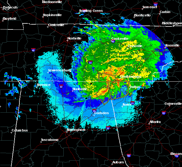 At 1033 pm cdt, a severe thunderstorm was located over jasper, moving east at 40 mph (radar indicated). Hazards include 60 mph wind gusts. Expect damage to roofs, siding, and trees. Locations impacted include, jasper, whitwell, kimball, powells crossroads, martin springs, sequatchie cave, haletown (guild), new hope and hicks gap state park. At 1033 pm cdt, a severe thunderstorm was located over jasper, moving east at 40 mph (radar indicated). Hazards include 60 mph wind gusts. Expect damage to roofs, siding, and trees. Locations impacted include, jasper, whitwell, kimball, powells crossroads, martin springs, sequatchie cave, haletown (guild), new hope and hicks gap state park.
|
| 5/4/2020 11:29 PM EDT |
 At 1128 pm edt, severe thunderstorms were located along a line extending from anderson to hollywood to near scottsboro, moving east at 70 mph (radar indicated). Hazards include 60 mph wind gusts and quarter size hail. Hail damage to vehicles is expected. Expect wind damage to roofs, siding, and trees. At 1128 pm edt, severe thunderstorms were located along a line extending from anderson to hollywood to near scottsboro, moving east at 70 mph (radar indicated). Hazards include 60 mph wind gusts and quarter size hail. Hail damage to vehicles is expected. Expect wind damage to roofs, siding, and trees.
|
| 5/4/2020 10:18 PM CDT |
 At 1018 pm cdt, a severe thunderstorm was located near kimball, or 7 miles west of jasper, moving east at 45 mph (radar indicated). Hazards include 60 mph wind gusts. Expect damage to roofs, siding, and trees. Locations impacted include, jasper, south pittsburg, whitwell, kimball, monteagle, powells crossroads, orme, martin springs, fiery gizzard state park and haletown (guild). At 1018 pm cdt, a severe thunderstorm was located near kimball, or 7 miles west of jasper, moving east at 45 mph (radar indicated). Hazards include 60 mph wind gusts. Expect damage to roofs, siding, and trees. Locations impacted include, jasper, south pittsburg, whitwell, kimball, monteagle, powells crossroads, orme, martin springs, fiery gizzard state park and haletown (guild).
|
| 5/4/2020 10:03 PM CDT |
 At 1003 pm cdt, a severe thunderstorm was located near cowan, or 10 miles southeast of winchester, moving east at 40 mph (radar indicated). Hazards include 60 mph wind gusts. expect damage to roofs, siding, and trees At 1003 pm cdt, a severe thunderstorm was located near cowan, or 10 miles southeast of winchester, moving east at 40 mph (radar indicated). Hazards include 60 mph wind gusts. expect damage to roofs, siding, and trees
|
| 5/3/2020 7:42 PM EDT |
 The severe thunderstorm warning for rhea, meigs and hamilton counties will expire at 745 pm edt, the storms which prompted the warning have moved out of the warned area. therefore, the warning will be allowed to expire. a severe thunderstorm watch remains in effect until 900 pm edt for east tennessee. a severe thunderstorm watch also remains in effect until 1100 pm edt for east tennessee. The severe thunderstorm warning for rhea, meigs and hamilton counties will expire at 745 pm edt, the storms which prompted the warning have moved out of the warned area. therefore, the warning will be allowed to expire. a severe thunderstorm watch remains in effect until 900 pm edt for east tennessee. a severe thunderstorm watch also remains in effect until 1100 pm edt for east tennessee.
|
| 5/3/2020 7:26 PM EDT |
 At 726 pm edt, severe thunderstorms were located along a line extending from 10 miles north of spring city to 10 miles east of soddy-daisy to chattanooga valley, moving east at 70 mph (radar indicated). Hazards include 60 mph wind gusts. Expect damage to roofs, siding, and trees. locations impacted include, chattanooga, dayton, decatur, soddy-daisy, signal mountain, spring city, walden, lakesite, ridgeside and fairmount. This includes interstate 75 in tennessee between mile markers 1 and 15. At 726 pm edt, severe thunderstorms were located along a line extending from 10 miles north of spring city to 10 miles east of soddy-daisy to chattanooga valley, moving east at 70 mph (radar indicated). Hazards include 60 mph wind gusts. Expect damage to roofs, siding, and trees. locations impacted include, chattanooga, dayton, decatur, soddy-daisy, signal mountain, spring city, walden, lakesite, ridgeside and fairmount. This includes interstate 75 in tennessee between mile markers 1 and 15.
|
| 5/3/2020 7:16 PM EDT | Tree reported down near the intersection of hwy 11 north and wawona d in dade county GA, 12.2 miles ENE of Chattanooga, TN |
| 5/3/2020 6:13 PM CDT |
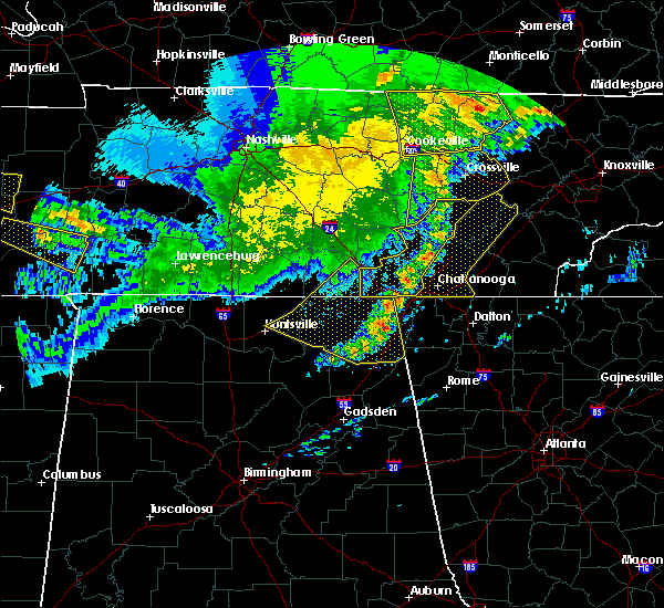 At 613 pm cdt, severe thunderstorms were located along a line extending from 10 miles southwest of crossville to 10 miles south of pikeville to 6 miles southeast of jasper, moving east at 60 mph (radar indicated). Hazards include 60 mph wind gusts. Expect damage to roofs, siding, and trees. Locations impacted include, pikeville, signal mountain, fairmount, lone oak, haletown (guild), brayton, melvine, hicks gap state park and north chickamauga creek gorge. At 613 pm cdt, severe thunderstorms were located along a line extending from 10 miles southwest of crossville to 10 miles south of pikeville to 6 miles southeast of jasper, moving east at 60 mph (radar indicated). Hazards include 60 mph wind gusts. Expect damage to roofs, siding, and trees. Locations impacted include, pikeville, signal mountain, fairmount, lone oak, haletown (guild), brayton, melvine, hicks gap state park and north chickamauga creek gorge.
|
| 5/3/2020 7:02 PM EDT |
 At 702 pm edt, severe thunderstorms were located along a line extending from 9 miles southeast of sparta to near dunlap to near bridgeport, moving east at 70 mph (radar indicated). Hazards include 60 mph wind gusts. expect damage to roofs, siding, and trees At 702 pm edt, severe thunderstorms were located along a line extending from 9 miles southeast of sparta to near dunlap to near bridgeport, moving east at 70 mph (radar indicated). Hazards include 60 mph wind gusts. expect damage to roofs, siding, and trees
|
| 5/3/2020 5:44 PM CDT |
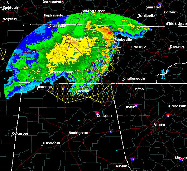 At 544 pm cdt, severe thunderstorms were located along a line extending from 10 miles southeast of smithville to 10 miles northwest of gruetli-laager to 8 miles south of cowan, moving east at 65 mph (radar indicated). Hazards include 60 mph wind gusts. expect damage to roofs, siding, and trees At 544 pm cdt, severe thunderstorms were located along a line extending from 10 miles southeast of smithville to 10 miles northwest of gruetli-laager to 8 miles south of cowan, moving east at 65 mph (radar indicated). Hazards include 60 mph wind gusts. expect damage to roofs, siding, and trees
|
| 4/12/2020 11:39 PM EDT |
 The tornado warning for southeastern hamilton county will expire at 1145 pm edt, the storm which prompted the warning has moved out of the area. therefore, the warning will be allowed to expire. however gusty winds are still possible with this thunderstorm. a tornado watch remains in effect until 200 am edt for east tennessee. The tornado warning for southeastern hamilton county will expire at 1145 pm edt, the storm which prompted the warning has moved out of the area. therefore, the warning will be allowed to expire. however gusty winds are still possible with this thunderstorm. a tornado watch remains in effect until 200 am edt for east tennessee.
|
| 4/12/2020 11:32 PM EDT |
 At 1131 pm edt, a confirmed large and destructive tornado was located near cohutta, or 7 miles northeast of ringgold, moving east at 45 mph. tornado emergency for ooltewah and collegedale. this is a particularly dangerous situation. take cover now! (radar confirmed tornado). Hazards include deadly tornado. You are in a life-threatening situation. flying debris may be deadly to those caught without shelter. mobile homes will be destroyed. considerable damage to homes, businesses, and vehicles is likely and complete destruction is possible. locations impacted include, collegedale, ooltewah and apison. This includes interstate 75 in tennessee between mile markers 10 and 13. At 1131 pm edt, a confirmed large and destructive tornado was located near cohutta, or 7 miles northeast of ringgold, moving east at 45 mph. tornado emergency for ooltewah and collegedale. this is a particularly dangerous situation. take cover now! (radar confirmed tornado). Hazards include deadly tornado. You are in a life-threatening situation. flying debris may be deadly to those caught without shelter. mobile homes will be destroyed. considerable damage to homes, businesses, and vehicles is likely and complete destruction is possible. locations impacted include, collegedale, ooltewah and apison. This includes interstate 75 in tennessee between mile markers 10 and 13.
|
| 4/12/2020 11:27 PM EDT |
 At 1126 pm edt, a confirmed large and destructive tornado was located near ringgold, moving east at 45 mph. tornado emergency for oolewah and collegedale. this is a particularly dangerous situation. take cover now! (radar confirmed tornado). Hazards include deadly tornado. You are in a life-threatening situation. flying debris may be deadly to those caught without shelter. mobile homes will be destroyed. considerable damage to homes, businesses, and vehicles is likely and complete destruction is possible. this tornadic thunderstorm will remain over mainly rural areas of southeastern hamilton county, including the following locations, collegedale, ooltewah and apison. This includes interstate 75 in tennessee between mile markers 6 and 13. At 1126 pm edt, a confirmed large and destructive tornado was located near ringgold, moving east at 45 mph. tornado emergency for oolewah and collegedale. this is a particularly dangerous situation. take cover now! (radar confirmed tornado). Hazards include deadly tornado. You are in a life-threatening situation. flying debris may be deadly to those caught without shelter. mobile homes will be destroyed. considerable damage to homes, businesses, and vehicles is likely and complete destruction is possible. this tornadic thunderstorm will remain over mainly rural areas of southeastern hamilton county, including the following locations, collegedale, ooltewah and apison. This includes interstate 75 in tennessee between mile markers 6 and 13.
|
| 4/12/2020 11:26 PM EDT |
 At 1126 pm edt, severe thunderstorms were located along a line extending from indian springs to linwood to chesterfield, moving east at 50 mph (radar indicated). Hazards include 60 mph wind gusts. expect damage to roofs, siding, and trees At 1126 pm edt, severe thunderstorms were located along a line extending from indian springs to linwood to chesterfield, moving east at 50 mph (radar indicated). Hazards include 60 mph wind gusts. expect damage to roofs, siding, and trees
|
| 4/12/2020 11:25 PM EDT |
 At 1125 pm edt, a confirmed large and extremely dangerous tornado was located near ringgold, moving east at 45 mph. this is a particularly dangerous situation. take cover now! (radar confirmed tornado). Hazards include damaging tornado. You are in a life-threatening situation. flying debris may be deadly to those caught without shelter. mobile homes will be destroyed. considerable damage to homes, businesses, and vehicles is likely and complete destruction is possible. this tornadic thunderstorm will remain over mainly rural areas of southeastern hamilton county, including the following locations, collegedale, east brainerd, ooltewah and apison. This includes interstate 75 in tennessee between mile markers 4 and 13. At 1125 pm edt, a confirmed large and extremely dangerous tornado was located near ringgold, moving east at 45 mph. this is a particularly dangerous situation. take cover now! (radar confirmed tornado). Hazards include damaging tornado. You are in a life-threatening situation. flying debris may be deadly to those caught without shelter. mobile homes will be destroyed. considerable damage to homes, businesses, and vehicles is likely and complete destruction is possible. this tornadic thunderstorm will remain over mainly rural areas of southeastern hamilton county, including the following locations, collegedale, east brainerd, ooltewah and apison. This includes interstate 75 in tennessee between mile markers 4 and 13.
|
| 4/12/2020 11:24 PM EDT | Chattanooga airpor in hamilton county TN, 3.4 miles NW of Chattanooga, TN |
| 4/12/2020 11:24 PM EDT |
 At 1124 pm edt, a large and extremely dangerous tornado was located near ringgold, moving east at 45 mph. this is a particularly dangerous situation. take cover now! (radar indicated rotation). Hazards include damaging tornado. You are in a life-threatening situation. flying debris may be deadly to those caught without shelter. mobile homes will be destroyed. considerable damage to homes, businesses, and vehicles is likely and complete destruction is possible. this tornadic thunderstorm will remain over mainly rural areas of southeastern hamilton county, including the following locations, collegedale, east brainerd, ooltewah and apison. This includes interstate 75 in tennessee between mile markers 4 and 13. At 1124 pm edt, a large and extremely dangerous tornado was located near ringgold, moving east at 45 mph. this is a particularly dangerous situation. take cover now! (radar indicated rotation). Hazards include damaging tornado. You are in a life-threatening situation. flying debris may be deadly to those caught without shelter. mobile homes will be destroyed. considerable damage to homes, businesses, and vehicles is likely and complete destruction is possible. this tornadic thunderstorm will remain over mainly rural areas of southeastern hamilton county, including the following locations, collegedale, east brainerd, ooltewah and apison. This includes interstate 75 in tennessee between mile markers 4 and 13.
|
| 4/12/2020 11:22 PM EDT |
 At 1122 pm edt, a severe thunderstorm was located over chattanooga, moving northeast at 45 mph (radar indicated). Hazards include 70 mph wind gusts. Expect considerable tree damage. damage is likely to mobile homes, roofs, and outbuildings. locations impacted include, chattanooga, soddy-daisy, signal mountain, walden, lakesite, ridgeside, harrison, fairmount, red bank and collegedale. This includes interstate 75 in tennessee between mile markers 1 and 15. At 1122 pm edt, a severe thunderstorm was located over chattanooga, moving northeast at 45 mph (radar indicated). Hazards include 70 mph wind gusts. Expect considerable tree damage. damage is likely to mobile homes, roofs, and outbuildings. locations impacted include, chattanooga, soddy-daisy, signal mountain, walden, lakesite, ridgeside, harrison, fairmount, red bank and collegedale. This includes interstate 75 in tennessee between mile markers 1 and 15.
|
| 4/12/2020 11:18 PM EDT |
 At 1118 pm edt, a severe thunderstorm capable of producing a tornado was located over fort oglethorpe, or 7 miles northwest of ringgold, moving east at 45 mph (radar indicated rotation). Hazards include tornado. Flying debris will be dangerous to those caught without shelter. mobile homes will be damaged or destroyed. damage to roofs, windows, and vehicles will occur. tree damage is likely. this dangerous storm will be near, chattanooga around 1130 pm edt. other locations impacted by this tornadic thunderstorm include collegedale, east brainerd, east ridge, apison and ooltewah. This includes interstate 75 in tennessee between mile markers 1 and 13. At 1118 pm edt, a severe thunderstorm capable of producing a tornado was located over fort oglethorpe, or 7 miles northwest of ringgold, moving east at 45 mph (radar indicated rotation). Hazards include tornado. Flying debris will be dangerous to those caught without shelter. mobile homes will be damaged or destroyed. damage to roofs, windows, and vehicles will occur. tree damage is likely. this dangerous storm will be near, chattanooga around 1130 pm edt. other locations impacted by this tornadic thunderstorm include collegedale, east brainerd, east ridge, apison and ooltewah. This includes interstate 75 in tennessee between mile markers 1 and 13.
|
| 4/12/2020 11:18 PM EDT |
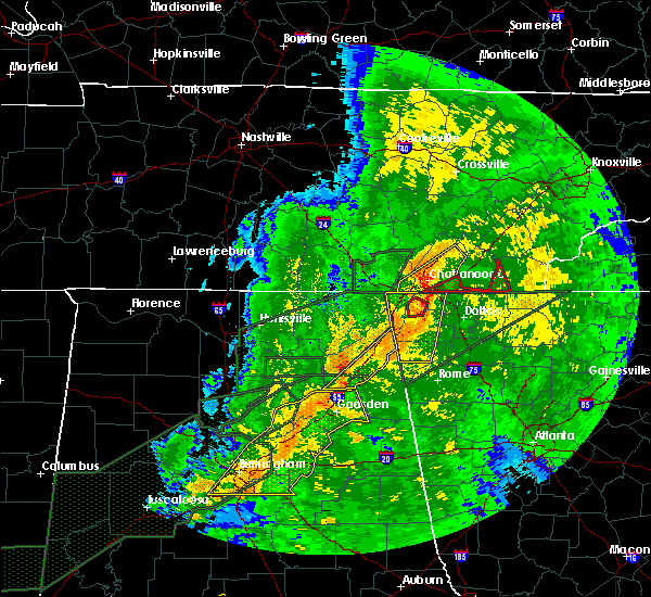 At 1118 pm edt, a severe thunderstorm capable of producing a tornado was located over lakeview, or near chattanooga, moving east at 55 mph (radar indicated rotation). Hazards include tornado. Flying debris will be dangerous to those caught without shelter. mobile homes will be damaged or destroyed. damage to roofs, windows, and vehicles will occur. Tree damage is likely. At 1118 pm edt, a severe thunderstorm capable of producing a tornado was located over lakeview, or near chattanooga, moving east at 55 mph (radar indicated rotation). Hazards include tornado. Flying debris will be dangerous to those caught without shelter. mobile homes will be damaged or destroyed. damage to roofs, windows, and vehicles will occur. Tree damage is likely.
|
| 4/12/2020 11:16 PM EDT |
 The national weather service in morristown has issued a * tornado warning for. western polk county in east tennessee. southeastern hamilton county in east tennessee. until 1145 pm edt. At 1116 pm edt, a severe thunderstorm capable of producing a. The national weather service in morristown has issued a * tornado warning for. western polk county in east tennessee. southeastern hamilton county in east tennessee. until 1145 pm edt. At 1116 pm edt, a severe thunderstorm capable of producing a.
|
| 4/12/2020 11:10 PM EDT |
 At 1110 pm edt/1010 pm cdt/, a severe thunderstorm was located near lookout mountain, or 9 miles northeast of trenton, moving northeast at 45 mph (radar indicated). Hazards include 70 mph wind gusts. Expect considerable tree damage. damage is likely to mobile homes, roofs, and outbuildings. locations impacted include, chattanooga, soddy-daisy, signal mountain, walden, lakesite, ridgeside, harrison, fairmount, red bank and collegedale. This includes interstate 75 in tennessee between mile markers 1 and 15. At 1110 pm edt/1010 pm cdt/, a severe thunderstorm was located near lookout mountain, or 9 miles northeast of trenton, moving northeast at 45 mph (radar indicated). Hazards include 70 mph wind gusts. Expect considerable tree damage. damage is likely to mobile homes, roofs, and outbuildings. locations impacted include, chattanooga, soddy-daisy, signal mountain, walden, lakesite, ridgeside, harrison, fairmount, red bank and collegedale. This includes interstate 75 in tennessee between mile markers 1 and 15.
|
| 4/12/2020 11:03 PM EDT |
 At 1102 pm edt/1002 pm cdt/, a severe thunderstorm was located near trenton, moving northeast at 45 mph (radar indicated). Hazards include 60 mph wind gusts. expect damage to roofs, siding, and trees At 1102 pm edt/1002 pm cdt/, a severe thunderstorm was located near trenton, moving northeast at 45 mph (radar indicated). Hazards include 60 mph wind gusts. expect damage to roofs, siding, and trees
|
| 4/12/2020 10:50 PM EDT |
 At 1050 pm edt, severe thunderstorms were located along a line extending from near cole city to near ider to near lebanon, moving east at 40 mph (radar indicated). Hazards include 60 mph wind gusts. expect damage to roofs, siding, and trees At 1050 pm edt, severe thunderstorms were located along a line extending from near cole city to near ider to near lebanon, moving east at 40 mph (radar indicated). Hazards include 60 mph wind gusts. expect damage to roofs, siding, and trees
|
| 2/12/2020 9:56 PM EST |
 The severe thunderstorm warning for southeastern rhea, southwestern loudon, bradley, meigs, mcminn, northwestern monroe, southeastern hamilton and southwestern roane counties will expire at 1000 pm est, the storms which prompted the warning have weakened below severe limits, and no longer pose an immediate threat to life or property. therefore, the warning will be allowed to expire. however gusty winds are still possible with these thunderstorms. The severe thunderstorm warning for southeastern rhea, southwestern loudon, bradley, meigs, mcminn, northwestern monroe, southeastern hamilton and southwestern roane counties will expire at 1000 pm est, the storms which prompted the warning have weakened below severe limits, and no longer pose an immediate threat to life or property. therefore, the warning will be allowed to expire. however gusty winds are still possible with these thunderstorms.
|
| 2/12/2020 9:31 PM EST |
 At 931 pm est, severe thunderstorms were located along a line extending from near fairview to 7 miles north of charleston to near ringgold, moving east at 40 mph (radar indicated). Hazards include 60 mph wind gusts. Expect damage to roofs, siding, and trees. Locations impacted include, chattanooga, cleveland, athens, sweetwater, decatur, etowah, lakesite, charleston, ridgeside and south cleveland. At 931 pm est, severe thunderstorms were located along a line extending from near fairview to 7 miles north of charleston to near ringgold, moving east at 40 mph (radar indicated). Hazards include 60 mph wind gusts. Expect damage to roofs, siding, and trees. Locations impacted include, chattanooga, cleveland, athens, sweetwater, decatur, etowah, lakesite, charleston, ridgeside and south cleveland.
|
| 2/12/2020 8:58 PM EST |
 At 857 pm est/757 pm cst/, severe thunderstorms were located along a line extending from near fairmount to near trenton, moving east at 35 mph (radar indicated). Hazards include 60 mph wind gusts. Expect damage to roofs, siding, and trees. Locations impacted include, chattanooga, soddy-daisy, signal mountain, walden, lakesite, ridgeside, fairmount, harrison, red bank and powells crossroads. At 857 pm est/757 pm cst/, severe thunderstorms were located along a line extending from near fairmount to near trenton, moving east at 35 mph (radar indicated). Hazards include 60 mph wind gusts. Expect damage to roofs, siding, and trees. Locations impacted include, chattanooga, soddy-daisy, signal mountain, walden, lakesite, ridgeside, fairmount, harrison, red bank and powells crossroads.
|
| 2/12/2020 8:56 PM EST |
 At 855 pm est/755 pm cst/, severe thunderstorms were located along a line extending from 7 miles northwest of spring city to 7 miles north of soddy-daisy to near trenton, moving east at 40 mph (radar indicated). Hazards include 60 mph wind gusts. expect damage to roofs, siding, and trees At 855 pm est/755 pm cst/, severe thunderstorms were located along a line extending from 7 miles northwest of spring city to 7 miles north of soddy-daisy to near trenton, moving east at 40 mph (radar indicated). Hazards include 60 mph wind gusts. expect damage to roofs, siding, and trees
|
| 2/12/2020 8:30 PM EST |
 At 829 pm est/729 pm cst/, severe thunderstorms were located along a line extending from 6 miles east of tracy city to near stevenson, moving east at 35 mph (radar indicated). Hazards include 60 mph wind gusts. expect damage to roofs, siding, and trees At 829 pm est/729 pm cst/, severe thunderstorms were located along a line extending from 6 miles east of tracy city to near stevenson, moving east at 35 mph (radar indicated). Hazards include 60 mph wind gusts. expect damage to roofs, siding, and trees
|
| 1/11/2020 4:24 PM EST |
 The severe thunderstorm warning for catoosa, western murray, floyd, whitfield, southeastern walker, western gordon, northeastern chattooga and western bartow counties will expire at 430 pm est, the storms which prompted the warning have moved out of the area. therefore, the warning will be allowed to expire. however, a new warning has been issued just downstream a tornado watch remains in effect until 900 pm est for northwestern georgia. The severe thunderstorm warning for catoosa, western murray, floyd, whitfield, southeastern walker, western gordon, northeastern chattooga and western bartow counties will expire at 430 pm est, the storms which prompted the warning have moved out of the area. therefore, the warning will be allowed to expire. however, a new warning has been issued just downstream a tornado watch remains in effect until 900 pm est for northwestern georgia.
|
| 1/11/2020 4:07 PM EST |
 At 406 pm est, severe thunderstorms were located along a line extending from collegedale to near oostanaula to near lindale, moving northeast at 45 mph (radar indicated). Hazards include 60 mph wind gusts. Expect damage to roofs, siding, and trees. Locations impacted include, rome, dalton, calhoun, chatsworth, ringgold, adairsville, varnell, cave spring, tunnel hill, cohutta, kingston, resaca, plainville, taylorsville, shannon, pinson, subligna, lake marvin, beaverdale and coosa. At 406 pm est, severe thunderstorms were located along a line extending from collegedale to near oostanaula to near lindale, moving northeast at 45 mph (radar indicated). Hazards include 60 mph wind gusts. Expect damage to roofs, siding, and trees. Locations impacted include, rome, dalton, calhoun, chatsworth, ringgold, adairsville, varnell, cave spring, tunnel hill, cohutta, kingston, resaca, plainville, taylorsville, shannon, pinson, subligna, lake marvin, beaverdale and coosa.
|
| 1/11/2020 3:51 PM EST |
 At 351 pm est/251 pm cst/, severe thunderstorms were located along a line extending from 9 miles north of dunlap to near walden, moving northeast at 60 mph (radar indicated). Hazards include 70 mph wind gusts. Expect considerable tree damage. damage is likely to mobile homes, roofs, and outbuildings. Locations impacted include, chattanooga, dunlap, soddy-daisy, signal mountain, walden, lakesite, ridgeside, fairmount, harrison and red bank. At 351 pm est/251 pm cst/, severe thunderstorms were located along a line extending from 9 miles north of dunlap to near walden, moving northeast at 60 mph (radar indicated). Hazards include 70 mph wind gusts. Expect considerable tree damage. damage is likely to mobile homes, roofs, and outbuildings. Locations impacted include, chattanooga, dunlap, soddy-daisy, signal mountain, walden, lakesite, ridgeside, fairmount, harrison and red bank.
|
| 1/11/2020 3:49 PM EST |
 At 348 pm est/248 pm cst/, severe thunderstorms were located along a line extending from near tracy city to near trenton, moving east at 60 mph (radar indicated). Hazards include 70 mph wind gusts. Expect considerable tree damage. Damage is likely to mobile homes, roofs, and outbuildings. At 348 pm est/248 pm cst/, severe thunderstorms were located along a line extending from near tracy city to near trenton, moving east at 60 mph (radar indicated). Hazards include 70 mph wind gusts. Expect considerable tree damage. Damage is likely to mobile homes, roofs, and outbuildings.
|
| 1/11/2020 3:42 PM EST |
 At 341 pm est, severe thunderstorms were located along a line extending from fairview to near tidings to near forney, moving northeast at 45 mph (radar indicated). Hazards include 60 mph wind gusts. expect damage to roofs, siding, and trees At 341 pm est, severe thunderstorms were located along a line extending from fairview to near tidings to near forney, moving northeast at 45 mph (radar indicated). Hazards include 60 mph wind gusts. expect damage to roofs, siding, and trees
|
| 1/11/2020 3:39 PM EST |
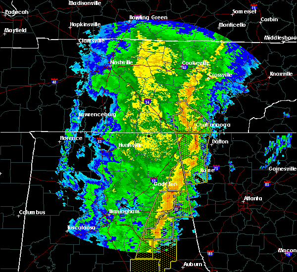 At 338 pm est/238 pm cst/, a severe thunderstorm capable of producing a tornado was located near fairmount, or 11 miles northwest of chattanooga, moving northeast at 70 mph (radar indicated rotation). Hazards include tornado. Flying debris will be dangerous to those caught without shelter. mobile homes will be damaged or destroyed. damage to roofs, windows, and vehicles will occur. tree damage is likely. this dangerous storm will be near, dunlap around 250 pm cst. soddy-daisy around 255 pm cst. Other locations impacted by this tornadic thunderstorm include sale creek, lone oak, flat top mountain, palio, north chickamauga creek gorge, mowbray mountain, brayton, falling water and powells crossroads. At 338 pm est/238 pm cst/, a severe thunderstorm capable of producing a tornado was located near fairmount, or 11 miles northwest of chattanooga, moving northeast at 70 mph (radar indicated rotation). Hazards include tornado. Flying debris will be dangerous to those caught without shelter. mobile homes will be damaged or destroyed. damage to roofs, windows, and vehicles will occur. tree damage is likely. this dangerous storm will be near, dunlap around 250 pm cst. soddy-daisy around 255 pm cst. Other locations impacted by this tornadic thunderstorm include sale creek, lone oak, flat top mountain, palio, north chickamauga creek gorge, mowbray mountain, brayton, falling water and powells crossroads.
|
| 1/11/2020 2:36 PM CST |
 At 336 pm est/236 pm cst/, severe thunderstorms were located along a line extending from 6 miles east of gruetli-laager to near lookout mountain, moving northeast at 60 mph (radar indicated). Hazards include 70 mph wind gusts. Expect considerable tree damage. damage is likely to mobile homes, roofs, and outbuildings. Locations impacted include, chattanooga, dunlap, jasper, soddy-daisy, signal mountain, walden, lakesite, whitwell, ridgeside and fairmount. At 336 pm est/236 pm cst/, severe thunderstorms were located along a line extending from 6 miles east of gruetli-laager to near lookout mountain, moving northeast at 60 mph (radar indicated). Hazards include 70 mph wind gusts. Expect considerable tree damage. damage is likely to mobile homes, roofs, and outbuildings. Locations impacted include, chattanooga, dunlap, jasper, soddy-daisy, signal mountain, walden, lakesite, whitwell, ridgeside and fairmount.
|
| 1/11/2020 3:20 PM EST |
 At 319 pm est, severe thunderstorms were located along a line extending from 6 miles southwest of fiery gizzard s.p. to near mentone to near coloma, moving northeast at 60 mph (radar indicated). Hazards include 60 mph wind gusts. Expect damage to roofs, siding, and trees. Locations impacted include, rome, lafayette, summerville, ringgold, trenton, fort oglethorpe, rossville, chickamauga, trion, lookout mountain, cave spring, tunnel hill, shannon, lyerly, menlo, center post, pinson, subligna, fairview and coosa. At 319 pm est, severe thunderstorms were located along a line extending from 6 miles southwest of fiery gizzard s.p. to near mentone to near coloma, moving northeast at 60 mph (radar indicated). Hazards include 60 mph wind gusts. Expect damage to roofs, siding, and trees. Locations impacted include, rome, lafayette, summerville, ringgold, trenton, fort oglethorpe, rossville, chickamauga, trion, lookout mountain, cave spring, tunnel hill, shannon, lyerly, menlo, center post, pinson, subligna, fairview and coosa.
|
| 1/11/2020 3:00 PM EST |
 At 300 pm est, severe thunderstorms were located along a line extending from jericho to pine ridge to near reaves, moving northeast at 60 mph (radar indicated). Hazards include 60 mph wind gusts. expect damage to roofs, siding, and trees At 300 pm est, severe thunderstorms were located along a line extending from jericho to pine ridge to near reaves, moving northeast at 60 mph (radar indicated). Hazards include 60 mph wind gusts. expect damage to roofs, siding, and trees
|
| 1/11/2020 1:56 PM CST |
 At 255 pm est/155 pm cst/, severe thunderstorms were located along a line extending from near skyline to near powell, moving northeast at 60 mph (radar indicated). Hazards include 70 mph wind gusts. Expect considerable tree damage. Damage is likely to mobile homes, roofs, and outbuildings. At 255 pm est/155 pm cst/, severe thunderstorms were located along a line extending from near skyline to near powell, moving northeast at 60 mph (radar indicated). Hazards include 70 mph wind gusts. Expect considerable tree damage. Damage is likely to mobile homes, roofs, and outbuildings.
|
| 12/16/2019 7:17 PM CST |
 At 717 pm cst, severe thunderstorms were located along a line extending from near dunlap to near trenton, moving east at 45 mph (radar indicated). Hazards include 60 mph wind gusts. Expect damage to roofs, siding, and trees. Locations impacted include, jasper, whitwell, powells crossroads, martin springs, sequatchie cave, griffith creek, haletown (guild), chimneys state park, hicks gap state park and new hope. At 717 pm cst, severe thunderstorms were located along a line extending from near dunlap to near trenton, moving east at 45 mph (radar indicated). Hazards include 60 mph wind gusts. Expect damage to roofs, siding, and trees. Locations impacted include, jasper, whitwell, powells crossroads, martin springs, sequatchie cave, griffith creek, haletown (guild), chimneys state park, hicks gap state park and new hope.
|
| 12/16/2019 8:04 PM EST |
 At 804 pm est, a severe thunderstorm was located over long island, or near bridgeport, moving east at 45 mph (radar indicated). Hazards include 60 mph wind gusts. expect damage to roofs, siding, and trees At 804 pm est, a severe thunderstorm was located over long island, or near bridgeport, moving east at 45 mph (radar indicated). Hazards include 60 mph wind gusts. expect damage to roofs, siding, and trees
|
| 12/16/2019 6:46 PM CST |
 At 645 pm cst, severe thunderstorms were located along a line extending from near lynchburg to near new market, moving east at 55 mph (radar indicated). Hazards include 60 mph wind gusts. expect damage to roofs, siding, and trees At 645 pm cst, severe thunderstorms were located along a line extending from near lynchburg to near new market, moving east at 55 mph (radar indicated). Hazards include 60 mph wind gusts. expect damage to roofs, siding, and trees
|
| 8/19/2019 4:43 PM EDT |
 At 422 pm edt, a severe thunderstorm was located over lookout mountain, or 9 miles northeast of trenton, moving west at 10 mph (radar indicated). Hazards include 60 mph wind gusts and half dollar size hail. Hail damage to vehicles is expected. Expect wind damage to roofs, siding, and trees. At 422 pm edt, a severe thunderstorm was located over lookout mountain, or 9 miles northeast of trenton, moving west at 10 mph (radar indicated). Hazards include 60 mph wind gusts and half dollar size hail. Hail damage to vehicles is expected. Expect wind damage to roofs, siding, and trees.
|
| 8/19/2019 4:23 PM EDT |
 The national weather service in peachtree city has issued a * severe thunderstorm warning for. central walker county in northwestern georgia. dade county in northwestern georgia. until 515 pm edt. At 422 pm edt, a severe thunderstorm was located over lookout. The national weather service in peachtree city has issued a * severe thunderstorm warning for. central walker county in northwestern georgia. dade county in northwestern georgia. until 515 pm edt. At 422 pm edt, a severe thunderstorm was located over lookout.
|
| 8/13/2019 9:15 PM EDT |
 At 914 pm edt, a severe thunderstorm was located near varnell, or near dalton, moving east at 20 mph (radar indicated). Hazards include 60 mph wind gusts and penny size hail. Expect damage to roofs, siding, and trees. Locations impacted include, dalton, ringgold, varnell, tunnel hill, cohutta, rocky face, graysville and indian springs. At 914 pm edt, a severe thunderstorm was located near varnell, or near dalton, moving east at 20 mph (radar indicated). Hazards include 60 mph wind gusts and penny size hail. Expect damage to roofs, siding, and trees. Locations impacted include, dalton, ringgold, varnell, tunnel hill, cohutta, rocky face, graysville and indian springs.
|
| 8/13/2019 8:53 PM EDT |
 At 852 pm edt, a severe thunderstorm was located over ringgold, moving east at 20 mph (radar indicated). Hazards include 60 mph wind gusts and penny size hail. expect damage to roofs, siding, and trees At 852 pm edt, a severe thunderstorm was located over ringgold, moving east at 20 mph (radar indicated). Hazards include 60 mph wind gusts and penny size hail. expect damage to roofs, siding, and trees
|
| 7/30/2019 2:15 PM EDT | Tree down and power lines down around the skyline dr vicinit in hamilton county TN, 4.7 miles WNW of Chattanooga, TN |
| 7/30/2019 2:15 PM EDT |
 At 215 pm edt, a severe thunderstorm was located near lakesite, or 11 miles west of cleveland, moving northeast at 10 mph (radar indicated). Hazards include 60 mph wind gusts and quarter size hail. Hail damage to vehicles is expected. expect wind damage to roofs, siding, and trees. Locations impacted include, chattanooga, cleveland, soddy-daisy, signal mountain, walden, lakesite, ridgeside, harrison, fairmount, south cleveland, red bank, collegedale, flat top mountain, east ridge, ooltewah, mcdonald, middle valley, falling water, shady grove and east brainerd. At 215 pm edt, a severe thunderstorm was located near lakesite, or 11 miles west of cleveland, moving northeast at 10 mph (radar indicated). Hazards include 60 mph wind gusts and quarter size hail. Hail damage to vehicles is expected. expect wind damage to roofs, siding, and trees. Locations impacted include, chattanooga, cleveland, soddy-daisy, signal mountain, walden, lakesite, ridgeside, harrison, fairmount, south cleveland, red bank, collegedale, flat top mountain, east ridge, ooltewah, mcdonald, middle valley, falling water, shady grove and east brainerd.
|
| 7/30/2019 1:56 PM EDT | Roof damage at chattanooga airpor in hamilton county TN, 2.9 miles NW of Chattanooga, TN |
| 7/30/2019 1:56 PM EDT |
 At 155 pm edt, a severe thunderstorm was located over harrison, or 9 miles northeast of chattanooga, moving northeast at 10 mph (radar indicated). Hazards include 60 mph wind gusts and quarter size hail. Hail damage to vehicles is expected. Expect wind damage to roofs, siding, and trees. At 155 pm edt, a severe thunderstorm was located over harrison, or 9 miles northeast of chattanooga, moving northeast at 10 mph (radar indicated). Hazards include 60 mph wind gusts and quarter size hail. Hail damage to vehicles is expected. Expect wind damage to roofs, siding, and trees.
|
| 6/24/2019 4:22 PM EDT |
 The severe thunderstorm warning for southeastern hamilton county will expire at 430 pm edt, the storm which prompted the warning has weakened below severe limits, and has exited the warned area. therefore, the warning will be allowed to expire. however gusty winds are still possible with this thunderstorm. a severe thunderstorm watch remains in effect until 900 pm edt for east tennessee. The severe thunderstorm warning for southeastern hamilton county will expire at 430 pm edt, the storm which prompted the warning has weakened below severe limits, and has exited the warned area. therefore, the warning will be allowed to expire. however gusty winds are still possible with this thunderstorm. a severe thunderstorm watch remains in effect until 900 pm edt for east tennessee.
|
| 6/24/2019 4:03 PM EDT | Several trees down in the county from earlier thunderstorms. time estimated by rada in hamilton county TN, 7.1 miles S of Chattanooga, TN |
| 6/24/2019 4:03 PM EDT |
 At 402 pm edt, a severe thunderstorm was located near harrison, or near chattanooga, moving northeast at 35 mph (radar indicated). Hazards include 60 mph wind gusts. Expect damage to roofs, siding, and trees. Locations impacted include, chattanooga, soddy-daisy, walden, lakesite, harrison, fairmount, red bank, collegedale, harrison bay state park, middle valley, falling water, shady grove and ooltewah. At 402 pm edt, a severe thunderstorm was located near harrison, or near chattanooga, moving northeast at 35 mph (radar indicated). Hazards include 60 mph wind gusts. Expect damage to roofs, siding, and trees. Locations impacted include, chattanooga, soddy-daisy, walden, lakesite, harrison, fairmount, red bank, collegedale, harrison bay state park, middle valley, falling water, shady grove and ooltewah.
|
| 6/24/2019 3:57 PM EDT | Report of power line down in red ban in hamilton county TN, 3.7 miles ESE of Chattanooga, TN |
| 6/24/2019 3:48 PM EDT |
 At 348 pm edt/248 pm cdt/, a severe thunderstorm was located near signal mountain, or near chattanooga, moving east at 30 mph (radar indicated). Hazards include 60 mph wind gusts. expect damage to roofs, siding, and trees At 348 pm edt/248 pm cdt/, a severe thunderstorm was located near signal mountain, or near chattanooga, moving east at 30 mph (radar indicated). Hazards include 60 mph wind gusts. expect damage to roofs, siding, and trees
|
| 6/22/2019 7:06 PM CDT |
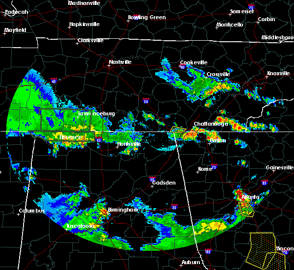 The severe thunderstorm warning for southeastern marion county will expire at 715 pm cdt, the storm which prompted the warning has weakened below severe limits, and has exited the warned area. therefore, the warning will be allowed to expire. The severe thunderstorm warning for southeastern marion county will expire at 715 pm cdt, the storm which prompted the warning has weakened below severe limits, and has exited the warned area. therefore, the warning will be allowed to expire.
|
| 6/22/2019 6:52 PM CDT |
 At 650 pm cdt, a severe thunderstorm was located 7 miles southeast of jasper, moving east at 30 mph (emergency dispatch had eight reports of trees down across the south end of marion county near south pittsburg, kimball, and new hope. local utility providers are also indicating power outages in these areas). Hazards include 60 mph wind gusts and penny size hail. Expect damage to roofs, siding, and trees. Locations impacted include, jasper, kimball, new hope, hicks gap state park and haletown (guild). At 650 pm cdt, a severe thunderstorm was located 7 miles southeast of jasper, moving east at 30 mph (emergency dispatch had eight reports of trees down across the south end of marion county near south pittsburg, kimball, and new hope. local utility providers are also indicating power outages in these areas). Hazards include 60 mph wind gusts and penny size hail. Expect damage to roofs, siding, and trees. Locations impacted include, jasper, kimball, new hope, hicks gap state park and haletown (guild).
|
| 6/22/2019 6:31 PM CDT |
 At 630 pm cdt, a severe thunderstorm was located over south pittsburg, or near jasper, moving east at 30 mph (radar indicated). Hazards include 60 mph wind gusts and nickel size hail. Expect damage to roofs, siding, and trees. Locations impacted include, jasper, south pittsburg, kimball, orme, haletown (guild), new hope and hicks gap state park. At 630 pm cdt, a severe thunderstorm was located over south pittsburg, or near jasper, moving east at 30 mph (radar indicated). Hazards include 60 mph wind gusts and nickel size hail. Expect damage to roofs, siding, and trees. Locations impacted include, jasper, south pittsburg, kimball, orme, haletown (guild), new hope and hicks gap state park.
|
| 6/22/2019 6:23 PM CDT |
 At 623 pm cdt, a severe thunderstorm was located near south pittsburg, or 7 miles northwest of bridgeport, moving east at 30 mph (radar indicated). Hazards include 60 mph wind gusts and penny size hail. expect damage to roofs, siding, and trees At 623 pm cdt, a severe thunderstorm was located near south pittsburg, or 7 miles northwest of bridgeport, moving east at 30 mph (radar indicated). Hazards include 60 mph wind gusts and penny size hail. expect damage to roofs, siding, and trees
|
| 6/21/2019 11:47 PM EDT |
 At 1146 pm edt, severe thunderstorms were located along a line extending from near athens to charleston to near chickamauga, moving east at 50 mph (radar indicated). Hazards include 65 mph wind gusts and quarter size hail. Hail damage to vehicles is expected. expect wind damage to roofs, siding, and trees. locations impacted include, chattanooga, cleveland, athens, benton, ducktown, soddy-daisy, etowah, lakesite, charleston, ridgeside, harrison, east cleveland, south cleveland, wildwood lake, red bank, collegedale, englewood, tellico plains, calhoun and william l. Davenport refuge. At 1146 pm edt, severe thunderstorms were located along a line extending from near athens to charleston to near chickamauga, moving east at 50 mph (radar indicated). Hazards include 65 mph wind gusts and quarter size hail. Hail damage to vehicles is expected. expect wind damage to roofs, siding, and trees. locations impacted include, chattanooga, cleveland, athens, benton, ducktown, soddy-daisy, etowah, lakesite, charleston, ridgeside, harrison, east cleveland, south cleveland, wildwood lake, red bank, collegedale, englewood, tellico plains, calhoun and william l. Davenport refuge.
|
| 6/21/2019 11:47 PM EDT |
 A severe thunderstorm warning remains in effect until 1230 am edt for bradley. polk. southwestern meigs. southern mcminn. southwestern monroe and southeastern hamilton counties. At 1146 pm edt, severe thunderstorms were located along a line extending from near athens to charleston to near chickamauga, moving east at 50 mph. A severe thunderstorm warning remains in effect until 1230 am edt for bradley. polk. southwestern meigs. southern mcminn. southwestern monroe and southeastern hamilton counties. At 1146 pm edt, severe thunderstorms were located along a line extending from near athens to charleston to near chickamauga, moving east at 50 mph.
|
| 6/21/2019 11:25 PM EDT | Report of power lines down near red ban in hamilton county TN, 5.5 miles SE of Chattanooga, TN |
| 6/21/2019 11:25 PM EDT |
 At 1124 pm edt, severe thunderstorms were located along a line extending from decatur to 8 miles northeast of soddy-daisy to near trenton, moving east at 40 mph (radar indicated). Hazards include 60 mph wind gusts and quarter size hail. Hail damage to vehicles is expected. Expect wind damage to roofs, siding, and trees. At 1124 pm edt, severe thunderstorms were located along a line extending from decatur to 8 miles northeast of soddy-daisy to near trenton, moving east at 40 mph (radar indicated). Hazards include 60 mph wind gusts and quarter size hail. Hail damage to vehicles is expected. Expect wind damage to roofs, siding, and trees.
|
| 6/21/2019 11:19 PM EDT |
 At 1119 pm edt/1019 pm cdt/, severe thunderstorms were located along a line extending from 8 miles northeast of lakesite to near lookout mountain to 6 miles south of stevenson, moving southeast at 45 mph (radar indicated). Hazards include 60 mph wind gusts and quarter size hail. Hail damage to vehicles is expected. expect wind damage to roofs, siding, and trees. Locations impacted include, chattanooga, dunlap, jasper, soddy-daisy, signal mountain, south pittsburg, walden, lakesite, whitwell, kimball, ridgeside, fairmount, harrison, red bank, collegedale, powells crossroads, orme, cartwright, flat top mountain and lookout mountain. At 1119 pm edt/1019 pm cdt/, severe thunderstorms were located along a line extending from 8 miles northeast of lakesite to near lookout mountain to 6 miles south of stevenson, moving southeast at 45 mph (radar indicated). Hazards include 60 mph wind gusts and quarter size hail. Hail damage to vehicles is expected. expect wind damage to roofs, siding, and trees. Locations impacted include, chattanooga, dunlap, jasper, soddy-daisy, signal mountain, south pittsburg, walden, lakesite, whitwell, kimball, ridgeside, fairmount, harrison, red bank, collegedale, powells crossroads, orme, cartwright, flat top mountain and lookout mountain.
|
| 6/21/2019 9:59 PM CDT |
 At 1059 pm edt/959 pm cdt/, severe thunderstorms were located along a line extending from 8 miles northwest of soddy-daisy to near jasper to near skyline, moving southeast at 45 mph (radar indicated). Hazards include 70 mph wind gusts and quarter size hail. Hail damage to vehicles is expected. expect considerable tree damage. wind damage is also likely to mobile homes, roofs, and outbuildings. Locations impacted include, chattanooga, dunlap, jasper, soddy-daisy, signal mountain, south pittsburg, walden, lakesite, whitwell, kimball, monteagle, ridgeside, fairmount, harrison, red bank, collegedale, powells crossroads, orme, cartwright and flat top mountain. At 1059 pm edt/959 pm cdt/, severe thunderstorms were located along a line extending from 8 miles northwest of soddy-daisy to near jasper to near skyline, moving southeast at 45 mph (radar indicated). Hazards include 70 mph wind gusts and quarter size hail. Hail damage to vehicles is expected. expect considerable tree damage. wind damage is also likely to mobile homes, roofs, and outbuildings. Locations impacted include, chattanooga, dunlap, jasper, soddy-daisy, signal mountain, south pittsburg, walden, lakesite, whitwell, kimball, monteagle, ridgeside, fairmount, harrison, red bank, collegedale, powells crossroads, orme, cartwright and flat top mountain.
|
| 6/21/2019 9:32 PM CDT |
 At 1032 pm edt/932 pm cdt/, severe thunderstorms were located along a line extending from 8 miles north of gruetli-laager to near sewanee to 6 miles northeast of new market, moving southeast at 45 mph (radar indicated). Hazards include 70 mph wind gusts and penny size hail. Expect considerable tree damage. Damage is likely to mobile homes, roofs, and outbuildings. At 1032 pm edt/932 pm cdt/, severe thunderstorms were located along a line extending from 8 miles north of gruetli-laager to near sewanee to 6 miles northeast of new market, moving southeast at 45 mph (radar indicated). Hazards include 70 mph wind gusts and penny size hail. Expect considerable tree damage. Damage is likely to mobile homes, roofs, and outbuildings.
|
| 6/20/2019 6:13 AM EDT |
 At 612 am edt/512 am cdt/, severe thunderstorms were located along a line extending from near pikeville to near dunlap to near walden to near ringgold, moving northeast at 45 mph (law enforcement). Hazards include 70 mph wind gusts. Expect considerable tree damage. damage is likely to mobile homes, roofs, and outbuildings. Locations impacted include, chattanooga, cleveland, dayton, dunlap, pikeville, decatur, soddy-daisy, signal mountain, rossville, walden, lakesite, charleston, ridgeside, harrison, east cleveland, south cleveland, fairmount, wildwood lake, red bank and collegedale. At 612 am edt/512 am cdt/, severe thunderstorms were located along a line extending from near pikeville to near dunlap to near walden to near ringgold, moving northeast at 45 mph (law enforcement). Hazards include 70 mph wind gusts. Expect considerable tree damage. damage is likely to mobile homes, roofs, and outbuildings. Locations impacted include, chattanooga, cleveland, dayton, dunlap, pikeville, decatur, soddy-daisy, signal mountain, rossville, walden, lakesite, charleston, ridgeside, harrison, east cleveland, south cleveland, fairmount, wildwood lake, red bank and collegedale.
|
| 6/20/2019 4:57 AM CDT |
 At 555 am edt/455 am cdt/, severe thunderstorms were located along a line extending from 10 miles west of pikeville to 6 miles north of whitwell to near signal mountain to near la fayette, moving northeast at 50 mph (law enforcement). Hazards include 70 mph wind gusts. Expect considerable tree damage. Damage is likely to mobile homes, roofs, and outbuildings. At 555 am edt/455 am cdt/, severe thunderstorms were located along a line extending from 10 miles west of pikeville to 6 miles north of whitwell to near signal mountain to near la fayette, moving northeast at 50 mph (law enforcement). Hazards include 70 mph wind gusts. Expect considerable tree damage. Damage is likely to mobile homes, roofs, and outbuildings.
|
| 6/20/2019 4:38 AM CDT |
 At 537 am edt/437 am cdt/, severe thunderstorms were located along a line extending from 9 miles south of mcminnville to near trenton to near gaylesville, moving east northeast at 45 mph (radar indicated). Hazards include 60 mph wind gusts. Expect damage to roofs, siding, and trees. Locations impacted include, chattanooga, dunlap, jasper, pikeville, soddy-daisy, signal mountain, south pittsburg, walden, lakesite, whitwell, kimball, monteagle, ridgeside, harrison, fairmount, red bank, collegedale, powells crossroads, orme and cartwright. At 537 am edt/437 am cdt/, severe thunderstorms were located along a line extending from 9 miles south of mcminnville to near trenton to near gaylesville, moving east northeast at 45 mph (radar indicated). Hazards include 60 mph wind gusts. Expect damage to roofs, siding, and trees. Locations impacted include, chattanooga, dunlap, jasper, pikeville, soddy-daisy, signal mountain, south pittsburg, walden, lakesite, whitwell, kimball, monteagle, ridgeside, harrison, fairmount, red bank, collegedale, powells crossroads, orme and cartwright.
|
| 6/20/2019 5:28 AM EDT |
 At 528 am edt, severe thunderstorms were located along a line extending from orme to ider, moving northeast at 55 mph (radar indicated). Hazards include 60 mph wind gusts. expect damage to roofs, siding, and trees At 528 am edt, severe thunderstorms were located along a line extending from orme to ider, moving northeast at 55 mph (radar indicated). Hazards include 60 mph wind gusts. expect damage to roofs, siding, and trees
|
| 6/20/2019 4:05 AM CDT |
 At 504 am edt/404 am cdt/, severe thunderstorms were located along a line extending from near tullahoma to near hollywood to near tabor road, moving east northeast at 40 mph (radar indicated). Hazards include 60 mph wind gusts. expect damage to roofs, siding, and trees At 504 am edt/404 am cdt/, severe thunderstorms were located along a line extending from near tullahoma to near hollywood to near tabor road, moving east northeast at 40 mph (radar indicated). Hazards include 60 mph wind gusts. expect damage to roofs, siding, and trees
|
| 5/4/2019 9:45 AM CDT |
 At 1045 am edt/945 am cdt/, severe thunderstorms were located along a line extending from near gruetli-laager to fairmount to near ridgeside, moving northeast at 35 mph (radar indicated). Hazards include 60 mph wind gusts and nickel size hail. Expect damage to roofs, siding, and trees. Locations impacted include, chattanooga, dunlap, soddy-daisy, signal mountain, walden, lakesite, ridgeside, fairmount, harrison, red bank, collegedale, cartwright, flat top mountain, north chickamauga creek gorge, east ridge, ooltewah, brayton, middle valley, birchwood and falling water. At 1045 am edt/945 am cdt/, severe thunderstorms were located along a line extending from near gruetli-laager to fairmount to near ridgeside, moving northeast at 35 mph (radar indicated). Hazards include 60 mph wind gusts and nickel size hail. Expect damage to roofs, siding, and trees. Locations impacted include, chattanooga, dunlap, soddy-daisy, signal mountain, walden, lakesite, ridgeside, fairmount, harrison, red bank, collegedale, cartwright, flat top mountain, north chickamauga creek gorge, east ridge, ooltewah, brayton, middle valley, birchwood and falling water.
|
| 5/4/2019 9:29 AM CDT |
 At 1029 am edt/929 am cdt/, severe thunderstorms were located along a line extending from near tracy city to near signal mountain to chattanooga valley, moving northeast at 35 mph (radar indicated). Hazards include 60 mph wind gusts and penny size hail. expect damage to roofs, siding, and trees At 1029 am edt/929 am cdt/, severe thunderstorms were located along a line extending from near tracy city to near signal mountain to chattanooga valley, moving northeast at 35 mph (radar indicated). Hazards include 60 mph wind gusts and penny size hail. expect damage to roofs, siding, and trees
|
| 4/14/2019 7:49 AM EDT |
 At 749 am edt, severe thunderstorms were located along a line extending from near bridgeport to hammondville to near sand rock, moving northeast at 35 mph (radar indicated). Hazards include 60 mph wind gusts. expect damage to roofs, siding, and trees At 749 am edt, severe thunderstorms were located along a line extending from near bridgeport to hammondville to near sand rock, moving northeast at 35 mph (radar indicated). Hazards include 60 mph wind gusts. expect damage to roofs, siding, and trees
|
| 11/6/2018 4:24 AM EST |
 At 423 am est, severe thunderstorms were located along a line extending from 6 miles north of cleveland to near ringgold, moving east at 50 mph (emergency management). Hazards include 60 mph wind gusts. Expect damage to roofs, siding, and trees. locations impacted include, chattanooga, cleveland, lakesite, charleston, ridgeside, south cleveland, harrison, east cleveland, wildwood lake, collegedale, waterville, east brainerd, lookout mountain, hopewell, red clay state park, harrison bay state park, flint springs, east ridge, tasso and ooltewah. a tornado watch remains in effect until 700 am est for east tennessee. A tornado watch also remains in effect until 900 am est for east tennessee. At 423 am est, severe thunderstorms were located along a line extending from 6 miles north of cleveland to near ringgold, moving east at 50 mph (emergency management). Hazards include 60 mph wind gusts. Expect damage to roofs, siding, and trees. locations impacted include, chattanooga, cleveland, lakesite, charleston, ridgeside, south cleveland, harrison, east cleveland, wildwood lake, collegedale, waterville, east brainerd, lookout mountain, hopewell, red clay state park, harrison bay state park, flint springs, east ridge, tasso and ooltewah. a tornado watch remains in effect until 700 am est for east tennessee. A tornado watch also remains in effect until 900 am est for east tennessee.
|
| 11/6/2018 4:00 AM EST |
 At 358 am est, severe thunderstorms were located along a line extending from soddy-daisy to near lookout mountain, moving east at 50 mph (emergency management). Hazards include 60 mph wind gusts. expect damage to roofs, siding, and trees At 358 am est, severe thunderstorms were located along a line extending from soddy-daisy to near lookout mountain, moving east at 50 mph (emergency management). Hazards include 60 mph wind gusts. expect damage to roofs, siding, and trees
|
| 11/6/2018 3:58 AM EST |
 At 358 am est, severe thunderstorms were located along a line extending from near fabius to near dutton, moving east at 50 mph (radar indicated). Hazards include up to 70 mph wind gusts. Expect considerable tree damage. Damage is likely to mobile homes, roofs, and outbuildings. At 358 am est, severe thunderstorms were located along a line extending from near fabius to near dutton, moving east at 50 mph (radar indicated). Hazards include up to 70 mph wind gusts. Expect considerable tree damage. Damage is likely to mobile homes, roofs, and outbuildings.
|
| 11/6/2018 3:46 AM EST |
 At 345 am est/245 am cst/, severe thunderstorms were located along a line extending from near whitwell to near bridgeport, moving east at 55 mph (radar indicated). Hazards include 60 mph wind gusts. Expect damage to roofs, siding, and trees. locations impacted include, chattanooga, jasper, soddy-daisy, signal mountain, south pittsburg, walden, lakesite, whitwell, kimball, fairmount, red bank, powells crossroads, cartwright, flat top mountain, lookout mountain, north chickamauga creek gorge, middle valley, new hope, falling water and shady grove. a tornado watch remains in effect until 700 am est/600 am cst/ for east tennessee. A tornado watch also remains in effect until 900 am est/800 am cst/ for east tennessee. At 345 am est/245 am cst/, severe thunderstorms were located along a line extending from near whitwell to near bridgeport, moving east at 55 mph (radar indicated). Hazards include 60 mph wind gusts. Expect damage to roofs, siding, and trees. locations impacted include, chattanooga, jasper, soddy-daisy, signal mountain, south pittsburg, walden, lakesite, whitwell, kimball, fairmount, red bank, powells crossroads, cartwright, flat top mountain, lookout mountain, north chickamauga creek gorge, middle valley, new hope, falling water and shady grove. a tornado watch remains in effect until 700 am est/600 am cst/ for east tennessee. A tornado watch also remains in effect until 900 am est/800 am cst/ for east tennessee.
|
| 11/6/2018 2:27 AM CST |
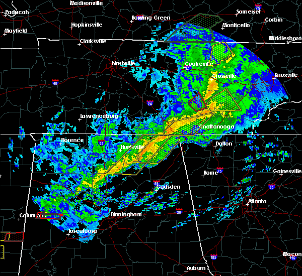 At 326 am est/226 am cst/, severe thunderstorms were located along a line extending from 7 miles southeast of tracy city to 6 miles west of stevenson, moving east at 55 mph (radar indicated). Hazards include 60 mph wind gusts. expect damage to roofs, siding, and trees At 326 am est/226 am cst/, severe thunderstorms were located along a line extending from 7 miles southeast of tracy city to 6 miles west of stevenson, moving east at 55 mph (radar indicated). Hazards include 60 mph wind gusts. expect damage to roofs, siding, and trees
|
| 11/1/2018 2:06 PM EDT |
 The tornado warning for northwestern catoosa and north central walker counties will expire at 215 pm edt, the storm which prompted the warning has moved out of the area. therefore, the warning will be allowed to expire. The tornado warning for northwestern catoosa and north central walker counties will expire at 215 pm edt, the storm which prompted the warning has moved out of the area. therefore, the warning will be allowed to expire.
|
| 11/1/2018 2:03 PM EDT |
 At 203 pm edt, a severe thunderstorm capable of producing a tornado was located near harrison, or 8 miles north of ringgold, moving northeast at 35 mph (radar indicated rotation). Hazards include tornado. Flying debris will be dangerous to those caught without shelter. mobile homes will be damaged or destroyed. damage to roofs, windows, and vehicles will occur. tree damage is likely. this dangerous storm will be near, south cleveland around 215 pm edt. Other locations impacted by this tornadic thunderstorm include mcdonald, east brainerd, collegedale, east ridge, apison, ooltewah and harrison bay state park. At 203 pm edt, a severe thunderstorm capable of producing a tornado was located near harrison, or 8 miles north of ringgold, moving northeast at 35 mph (radar indicated rotation). Hazards include tornado. Flying debris will be dangerous to those caught without shelter. mobile homes will be damaged or destroyed. damage to roofs, windows, and vehicles will occur. tree damage is likely. this dangerous storm will be near, south cleveland around 215 pm edt. Other locations impacted by this tornadic thunderstorm include mcdonald, east brainerd, collegedale, east ridge, apison, ooltewah and harrison bay state park.
|
| 11/1/2018 1:50 PM EDT |
 At 150 pm edt, a severe thunderstorm capable of producing a tornado was located near fort oglethorpe, or near chattanooga, moving northeast at 35 mph (radar indicated rotation). Hazards include tornado. Flying debris will be dangerous to those caught without shelter. mobile homes will be damaged or destroyed. damage to roofs, windows, and vehicles will occur. tree damage is likely. this dangerous storm will be near, harrison around 205 pm edt. south cleveland around 215 pm edt. Other locations impacted by this tornadic thunderstorm include mcdonald, east brainerd, collegedale, east ridge, apison, ooltewah and harrison bay state park. At 150 pm edt, a severe thunderstorm capable of producing a tornado was located near fort oglethorpe, or near chattanooga, moving northeast at 35 mph (radar indicated rotation). Hazards include tornado. Flying debris will be dangerous to those caught without shelter. mobile homes will be damaged or destroyed. damage to roofs, windows, and vehicles will occur. tree damage is likely. this dangerous storm will be near, harrison around 205 pm edt. south cleveland around 215 pm edt. Other locations impacted by this tornadic thunderstorm include mcdonald, east brainerd, collegedale, east ridge, apison, ooltewah and harrison bay state park.
|
| 11/1/2018 1:39 PM EDT |
 At 139 pm edt, a severe thunderstorm capable of producing a tornado was located over chattanooga valley, or 10 miles southwest of chattanooga, moving northeast at 25 mph (radar indicated rotation). Hazards include tornado. Flying debris will be dangerous to those caught without shelter. mobile homes will be damaged or destroyed. damage to roofs, windows, and vehicles will occur. Tree damage is likely. At 139 pm edt, a severe thunderstorm capable of producing a tornado was located over chattanooga valley, or 10 miles southwest of chattanooga, moving northeast at 25 mph (radar indicated rotation). Hazards include tornado. Flying debris will be dangerous to those caught without shelter. mobile homes will be damaged or destroyed. damage to roofs, windows, and vehicles will occur. Tree damage is likely.
|
| 11/1/2018 1:07 PM EDT |
 At 106 pm edt, a severe thunderstorm capable of producing a tornado was located near flat rock, or 9 miles southwest of trenton, moving northeast at 30 mph. unconfirmed reports of a tornado near ider (radar indicated rotation). Hazards include tornado. Flying debris will be dangerous to those caught without shelter. mobile homes will be damaged or destroyed. damage to roofs, windows, and vehicles will occur. Tree damage is likely. At 106 pm edt, a severe thunderstorm capable of producing a tornado was located near flat rock, or 9 miles southwest of trenton, moving northeast at 30 mph. unconfirmed reports of a tornado near ider (radar indicated rotation). Hazards include tornado. Flying debris will be dangerous to those caught without shelter. mobile homes will be damaged or destroyed. damage to roofs, windows, and vehicles will occur. Tree damage is likely.
|
| 8/17/2018 9:34 PM EDT |
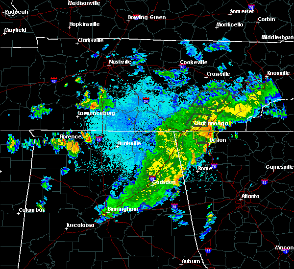 At 932 pm edt, a severe thunderstorm was located over ringgold, moving east at 35 mph (radar indicated). Hazards include 60 mph wind gusts. Expect damage to roofs, siding, and trees. Locations impacted include, dalton, ringgold, fort oglethorpe, varnell, tunnel hill, cohutta, indian springs, wood station, rocky face, graysville, blue spring, boynton, beaumont, beaverdale, dawnville, lakeview, east ridge and apison. At 932 pm edt, a severe thunderstorm was located over ringgold, moving east at 35 mph (radar indicated). Hazards include 60 mph wind gusts. Expect damage to roofs, siding, and trees. Locations impacted include, dalton, ringgold, fort oglethorpe, varnell, tunnel hill, cohutta, indian springs, wood station, rocky face, graysville, blue spring, boynton, beaumont, beaverdale, dawnville, lakeview, east ridge and apison.
|
| 8/17/2018 9:21 PM EDT |
 At 920 pm edt, a severe thunderstorm was located over blue spring, or near ringgold, moving east at 35 mph (radar indicated). Hazards include 60 mph wind gusts. expect damage to roofs, siding, and trees At 920 pm edt, a severe thunderstorm was located over blue spring, or near ringgold, moving east at 35 mph (radar indicated). Hazards include 60 mph wind gusts. expect damage to roofs, siding, and trees
|
| 8/17/2018 9:09 PM EDT |
 The severe thunderstorm warning for hamilton county will expire at 915 pm edt, the storm which prompted the warning has weakened below severe limits, and no longer poses an immediate threat to life or property. therefore, the warning will be allowed to expire. however gusty winds are still possible with this thunderstorm. The severe thunderstorm warning for hamilton county will expire at 915 pm edt, the storm which prompted the warning has weakened below severe limits, and no longer poses an immediate threat to life or property. therefore, the warning will be allowed to expire. however gusty winds are still possible with this thunderstorm.
|
| 8/17/2018 8:57 PM EDT |
 At 857 pm edt, a severe thunderstorm was located over chattanooga, moving northeast at 25 mph (radar indicated). Hazards include 60 mph wind gusts and penny size hail. Expect damage to roofs, siding, and trees. Locations impacted include, chattanooga, soddy-daisy, signal mountain, walden, lakesite, ridgeside, fairmount, harrison, red bank, collegedale, flat top mountain, east brainerd, lookout mountain, north chickamauga creek gorge, harrison bay state park, east ridge, ooltewah, mowbray mountain, middle valley and falling water. At 857 pm edt, a severe thunderstorm was located over chattanooga, moving northeast at 25 mph (radar indicated). Hazards include 60 mph wind gusts and penny size hail. Expect damage to roofs, siding, and trees. Locations impacted include, chattanooga, soddy-daisy, signal mountain, walden, lakesite, ridgeside, fairmount, harrison, red bank, collegedale, flat top mountain, east brainerd, lookout mountain, north chickamauga creek gorge, harrison bay state park, east ridge, ooltewah, mowbray mountain, middle valley and falling water.
|
| 8/17/2018 8:38 PM EDT |
 At 838 pm edt/738 pm cdt/, a severe thunderstorm was located near lookout mountain, or near chattanooga, moving northeast at 30 mph (law enforcement). Hazards include 60 mph wind gusts and penny size hail. Expect damage to roofs, siding, and trees. Locations impacted include, chattanooga, jasper, soddy-daisy, signal mountain, south pittsburg, walden, lakesite, whitwell, kimball, ridgeside, fairmount, harrison, red bank, collegedale, powells crossroads, flat top mountain, lookout mountain, north chickamauga creek gorge, east ridge and ooltewah. At 838 pm edt/738 pm cdt/, a severe thunderstorm was located near lookout mountain, or near chattanooga, moving northeast at 30 mph (law enforcement). Hazards include 60 mph wind gusts and penny size hail. Expect damage to roofs, siding, and trees. Locations impacted include, chattanooga, jasper, soddy-daisy, signal mountain, south pittsburg, walden, lakesite, whitwell, kimball, ridgeside, fairmount, harrison, red bank, collegedale, powells crossroads, flat top mountain, lookout mountain, north chickamauga creek gorge, east ridge and ooltewah.
|
| 8/17/2018 8:21 PM EDT |
 At 820 pm edt/720 pm cdt/, a severe thunderstorm was located near trenton, moving northeast at 25 mph (law enforcement). Hazards include 60 mph wind gusts and penny size hail. Expect damage to roofs, siding, and trees. Locations impacted include, chattanooga, jasper, soddy-daisy, signal mountain, south pittsburg, walden, lakesite, whitwell, kimball, ridgeside, fairmount, harrison, red bank, collegedale, powells crossroads, orme, cartwright, flat top mountain, lookout mountain and north chickamauga creek gorge. At 820 pm edt/720 pm cdt/, a severe thunderstorm was located near trenton, moving northeast at 25 mph (law enforcement). Hazards include 60 mph wind gusts and penny size hail. Expect damage to roofs, siding, and trees. Locations impacted include, chattanooga, jasper, soddy-daisy, signal mountain, south pittsburg, walden, lakesite, whitwell, kimball, ridgeside, fairmount, harrison, red bank, collegedale, powells crossroads, orme, cartwright, flat top mountain, lookout mountain and north chickamauga creek gorge.
|
| 8/17/2018 8:03 PM EDT |
 At 802 pm edt/702 pm cdt/, a severe thunderstorm was located near trenton, moving northeast at 30 mph (law enforcement). Hazards include 60 mph wind gusts and penny size hail. expect damage to roofs, siding, and trees At 802 pm edt/702 pm cdt/, a severe thunderstorm was located near trenton, moving northeast at 30 mph (law enforcement). Hazards include 60 mph wind gusts and penny size hail. expect damage to roofs, siding, and trees
|
| 7/21/2018 6:20 PM EDT |
 The severe thunderstorm warning for southwestern bradley and southeastern hamilton counties will expire at 630 pm edt, the storm which prompted the warning has moved out of the area. therefore, the warning will be allowed to expire. The severe thunderstorm warning for southwestern bradley and southeastern hamilton counties will expire at 630 pm edt, the storm which prompted the warning has moved out of the area. therefore, the warning will be allowed to expire.
|
| 7/21/2018 6:01 PM EDT |
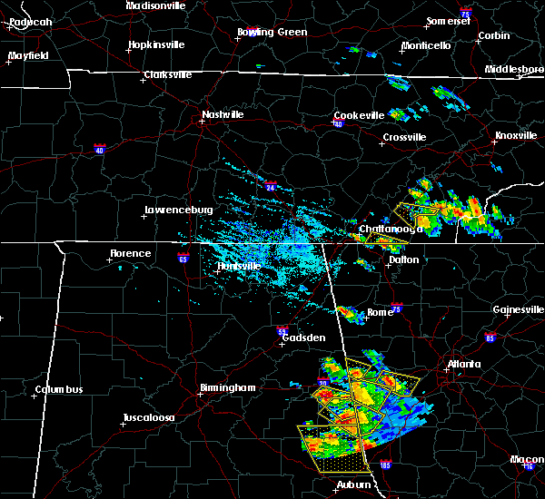 At 601 pm edt, a severe thunderstorm was located over apison, or near ringgold, moving southeast at 35 mph (radar indicated). Hazards include 60 mph wind gusts and quarter size hail. Hail damage to vehicles is expected. Expect wind damage to roofs, siding, and trees. At 601 pm edt, a severe thunderstorm was located over apison, or near ringgold, moving southeast at 35 mph (radar indicated). Hazards include 60 mph wind gusts and quarter size hail. Hail damage to vehicles is expected. Expect wind damage to roofs, siding, and trees.
|
| 7/21/2018 5:53 PM EDT |
 At 553 pm edt, a severe thunderstorm was located 7 miles north of ringgold, moving southeast at 20 mph (radar indicated). Hazards include 60 mph wind gusts and quarter size hail. Hail damage to vehicles is expected. Expect wind damage to roofs, siding, and trees. At 553 pm edt, a severe thunderstorm was located 7 miles north of ringgold, moving southeast at 20 mph (radar indicated). Hazards include 60 mph wind gusts and quarter size hail. Hail damage to vehicles is expected. Expect wind damage to roofs, siding, and trees.
|
| 7/21/2018 4:28 AM EDT |
 At 428 am edt, severe thunderstorms were located along a line extending from 7 miles southeast of benton to 6 miles west of south cleveland, moving southeast at 35 mph (radar indicated). Hazards include 60 mph wind gusts. Expect damage to roofs, siding, and trees. locations impacted include, cleveland, benton, ducktown, south cleveland, wildwood lake, collegedale, william l. Davenport refuge, waterville, conasauga, big frog mountain, parksville, turtletown, red clay state park, copperhill, flint springs, archville, gap springs, apison and ooltewah. At 428 am edt, severe thunderstorms were located along a line extending from 7 miles southeast of benton to 6 miles west of south cleveland, moving southeast at 35 mph (radar indicated). Hazards include 60 mph wind gusts. Expect damage to roofs, siding, and trees. locations impacted include, cleveland, benton, ducktown, south cleveland, wildwood lake, collegedale, william l. Davenport refuge, waterville, conasauga, big frog mountain, parksville, turtletown, red clay state park, copperhill, flint springs, archville, gap springs, apison and ooltewah.
|
| 7/21/2018 3:08 AM CDT |
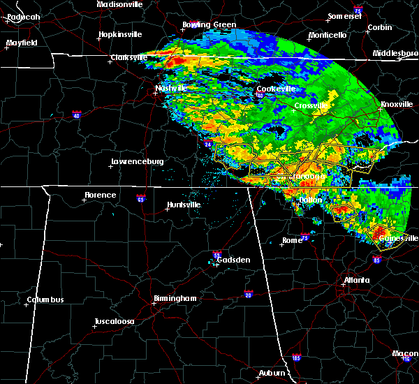 At 408 am edt/308 am cdt/, severe thunderstorms were located along a line extending from near soddy-daisy to 6 miles north of whitwell, moving south at 25 mph (radar indicated). Hazards include 60 mph wind gusts. Expect damage to roofs, siding, and trees. Locations impacted include, chattanooga, soddy-daisy, signal mountain, walden, lakesite, whitwell, fairmount, harrison, red bank, powells crossroads, martin springs, cartwright, north chickamauga creek gorge, griffith creek, harrison bay state park, chimneys state park, lone oak, mowbray mountain, middle valley and falling water. At 408 am edt/308 am cdt/, severe thunderstorms were located along a line extending from near soddy-daisy to 6 miles north of whitwell, moving south at 25 mph (radar indicated). Hazards include 60 mph wind gusts. Expect damage to roofs, siding, and trees. Locations impacted include, chattanooga, soddy-daisy, signal mountain, walden, lakesite, whitwell, fairmount, harrison, red bank, powells crossroads, martin springs, cartwright, north chickamauga creek gorge, griffith creek, harrison bay state park, chimneys state park, lone oak, mowbray mountain, middle valley and falling water.
|
| 7/21/2018 4:05 AM EDT |
 The national weather service in morristown has issued a * severe thunderstorm warning for. bradley county in east tennessee. polk county in east tennessee. southwestern mcminn county in east tennessee. Southeastern hamilton county in east tennessee. The national weather service in morristown has issued a * severe thunderstorm warning for. bradley county in east tennessee. polk county in east tennessee. southwestern mcminn county in east tennessee. Southeastern hamilton county in east tennessee.
|
| 7/21/2018 2:41 AM CDT |
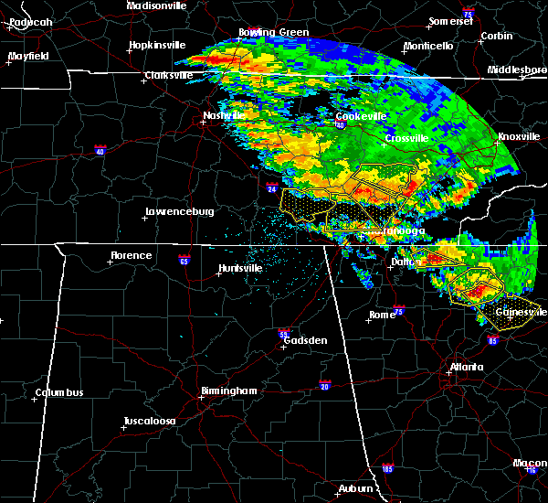 At 341 am edt/241 am cdt/, a severe thunderstorm was located near dunlap, moving southeast at 25 mph (radar indicated). Hazards include 60 mph wind gusts. expect damage to roofs, siding, and trees At 341 am edt/241 am cdt/, a severe thunderstorm was located near dunlap, moving southeast at 25 mph (radar indicated). Hazards include 60 mph wind gusts. expect damage to roofs, siding, and trees
|
| 6/28/2018 11:25 AM CDT |
 At 1124 am cdt, a severe thunderstorm was located near jasper, moving south at 20 mph (radar indicated). Hazards include 60 mph wind gusts and penny size hail. Expect damage to roofs, siding, and trees. Locations impacted include, jasper, south pittsburg, kimball, orme, haletown (guild), new hope and hicks gap state park. At 1124 am cdt, a severe thunderstorm was located near jasper, moving south at 20 mph (radar indicated). Hazards include 60 mph wind gusts and penny size hail. Expect damage to roofs, siding, and trees. Locations impacted include, jasper, south pittsburg, kimball, orme, haletown (guild), new hope and hicks gap state park.
|
| 6/28/2018 11:09 AM CDT |
 At 1108 am cdt, a severe thunderstorm was located over jasper, moving south at 20 mph (radar indicated). Hazards include 60 mph wind gusts and penny size hail. expect damage to roofs, siding, and trees At 1108 am cdt, a severe thunderstorm was located over jasper, moving south at 20 mph (radar indicated). Hazards include 60 mph wind gusts and penny size hail. expect damage to roofs, siding, and trees
|
| 6/28/2018 12:00 PM EDT |
 The national weather service in peachtree city has issued a * severe thunderstorm warning for. catoosa county in northwestern georgia. northeastern floyd county in northwestern georgia. southwestern whitfield county in northwestern georgia. Walker county in northwestern georgia. The national weather service in peachtree city has issued a * severe thunderstorm warning for. catoosa county in northwestern georgia. northeastern floyd county in northwestern georgia. southwestern whitfield county in northwestern georgia. Walker county in northwestern georgia.
|
| 6/28/2018 10:45 AM CDT |
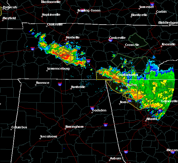 At 1144 am edt/1044 am cdt/, severe thunderstorms were located along a line extending from near monteagle to near ringgold, moving south at 15 mph (radar indicated). Hazards include 60 mph wind gusts and penny size hail. Expect damage to roofs, siding, and trees. Locations impacted include, chattanooga, jasper, signal mountain, south pittsburg, walden, whitwell, kimball, monteagle, ridgeside, fairmount, red bank, powells crossroads, orme, martin springs, east brainerd, lookout mountain, fiery gizzard state park, haletown (guild), chimneys state park and east ridge. At 1144 am edt/1044 am cdt/, severe thunderstorms were located along a line extending from near monteagle to near ringgold, moving south at 15 mph (radar indicated). Hazards include 60 mph wind gusts and penny size hail. Expect damage to roofs, siding, and trees. Locations impacted include, chattanooga, jasper, signal mountain, south pittsburg, walden, whitwell, kimball, monteagle, ridgeside, fairmount, red bank, powells crossroads, orme, martin springs, east brainerd, lookout mountain, fiery gizzard state park, haletown (guild), chimneys state park and east ridge.
|
| 6/28/2018 10:14 AM CDT |
 At 1113 am edt/1013 am cdt/, severe thunderstorms were located along a line extending from 10 miles northwest of tracy city to 6 miles northeast of ringgold, moving south at 15 mph (radar indicated). Hazards include 60 mph wind gusts and penny size hail. expect damage to roofs, siding, and trees At 1113 am edt/1013 am cdt/, severe thunderstorms were located along a line extending from 10 miles northwest of tracy city to 6 miles northeast of ringgold, moving south at 15 mph (radar indicated). Hazards include 60 mph wind gusts and penny size hail. expect damage to roofs, siding, and trees
|
| 6/28/2018 9:54 AM CDT |
 At 1054 am edt/954 am cdt/, a severe thunderstorm was located near fairmount, or 9 miles south of dunlap, moving south at 20 mph (radar indicated). Hazards include 60 mph wind gusts and penny size hail. Expect damage to roofs, siding, and trees. Locations impacted include, chattanooga, dunlap, soddy-daisy, signal mountain, walden, lakesite, whitwell, south cleveland, fairmount, harrison, wildwood lake, red bank, collegedale, powells crossroads, cartwright, flat top mountain, north chickamauga creek gorge, ooltewah, mcdonald and middle valley. At 1054 am edt/954 am cdt/, a severe thunderstorm was located near fairmount, or 9 miles south of dunlap, moving south at 20 mph (radar indicated). Hazards include 60 mph wind gusts and penny size hail. Expect damage to roofs, siding, and trees. Locations impacted include, chattanooga, dunlap, soddy-daisy, signal mountain, walden, lakesite, whitwell, south cleveland, fairmount, harrison, wildwood lake, red bank, collegedale, powells crossroads, cartwright, flat top mountain, north chickamauga creek gorge, ooltewah, mcdonald and middle valley.
|
| 6/28/2018 10:27 AM EDT |
 At 1026 am edt, severe thunderstorms were located along a line extending from near cohutta wilderness to near red clay state park to collegedale, moving southeast at 30 mph (radar indicated). Hazards include 60 mph wind gusts. expect damage to roofs, siding, and trees At 1026 am edt, severe thunderstorms were located along a line extending from near cohutta wilderness to near red clay state park to collegedale, moving southeast at 30 mph (radar indicated). Hazards include 60 mph wind gusts. expect damage to roofs, siding, and trees
|
| 6/28/2018 9:15 AM CDT |
 At 1014 am edt/914 am cdt/, a severe thunderstorm was located near dunlap, moving south at 15 mph (radar indicated). Hazards include 60 mph wind gusts and penny size hail. expect damage to roofs, siding, and trees At 1014 am edt/914 am cdt/, a severe thunderstorm was located near dunlap, moving south at 15 mph (radar indicated). Hazards include 60 mph wind gusts and penny size hail. expect damage to roofs, siding, and trees
|
| 6/27/2018 7:55 PM CDT |
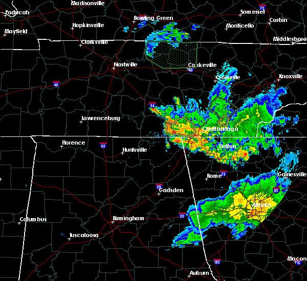 The severe thunderstorm warning for marion county will expire at 800 pm cdt, the storm which prompted the warning has weakened below severe limits, and no longer poses an immediate threat to life or property. therefore, the warning will be allowed to expire. however heavy rain is still possible with this thunderstorm. The severe thunderstorm warning for marion county will expire at 800 pm cdt, the storm which prompted the warning has weakened below severe limits, and no longer poses an immediate threat to life or property. therefore, the warning will be allowed to expire. however heavy rain is still possible with this thunderstorm.
|
| 6/27/2018 7:25 PM CDT |
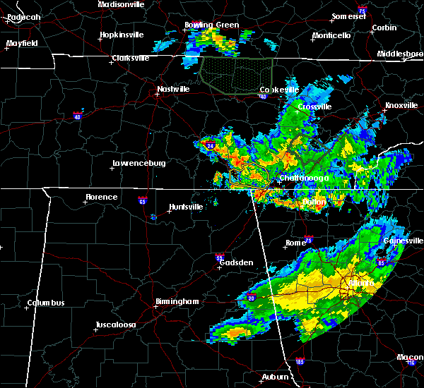 At 725 pm cdt, a severe thunderstorm was located near whitwell, or 7 miles north of jasper, moving east at 30 mph (radar indicated). Hazards include 60 mph wind gusts and penny size hail. Expect damage to roofs, siding, and trees. Locations impacted include, jasper, south pittsburg, whitwell, kimball, monteagle, powells crossroads, martin springs, fiery gizzard state park, haletown (guild), griffith creek, chimneys state park, hicks gap state park, sequatchie cave, foster falls state park, lone oak and new hope. At 725 pm cdt, a severe thunderstorm was located near whitwell, or 7 miles north of jasper, moving east at 30 mph (radar indicated). Hazards include 60 mph wind gusts and penny size hail. Expect damage to roofs, siding, and trees. Locations impacted include, jasper, south pittsburg, whitwell, kimball, monteagle, powells crossroads, martin springs, fiery gizzard state park, haletown (guild), griffith creek, chimneys state park, hicks gap state park, sequatchie cave, foster falls state park, lone oak and new hope.
|
| 6/27/2018 6:57 PM CDT |
 At 657 pm cdt, a severe thunderstorm was located over monteagle, or 15 miles east of winchester, moving east at 25 mph (radar indicated). Hazards include 60 mph wind gusts and nickel size hail. expect damage to roofs, siding, and trees At 657 pm cdt, a severe thunderstorm was located over monteagle, or 15 miles east of winchester, moving east at 25 mph (radar indicated). Hazards include 60 mph wind gusts and nickel size hail. expect damage to roofs, siding, and trees
|
| 6/26/2018 8:10 PM EDT | Small tree on home in hamilton county TN, 4.6 miles N of Chattanooga, TN |
| 6/26/2018 7:48 PM EDT |
 At 748 pm edt/648 pm cdt/, severe thunderstorms were located along a line extending from near murphy to near jasper, moving south at 25 mph (radar indicated). Hazards include 60 mph wind gusts and penny size hail. Expect damage to roofs, siding, and trees. Locations impacted include, chattanooga, cleveland, jasper, andrews, murphy, benton, ducktown, hayesville, soddy-daisy, signal mountain, south pittsburg, walden, lakesite, whitwell, kimball, monteagle, ridgeside, harrison, east cleveland and south cleveland. At 748 pm edt/648 pm cdt/, severe thunderstorms were located along a line extending from near murphy to near jasper, moving south at 25 mph (radar indicated). Hazards include 60 mph wind gusts and penny size hail. Expect damage to roofs, siding, and trees. Locations impacted include, chattanooga, cleveland, jasper, andrews, murphy, benton, ducktown, hayesville, soddy-daisy, signal mountain, south pittsburg, walden, lakesite, whitwell, kimball, monteagle, ridgeside, harrison, east cleveland and south cleveland.
|
| 6/26/2018 7:17 PM EDT |
 At 716 pm edt/616 pm cdt/, severe thunderstorms were located along a line extending from 10 miles north of murphy to near whitwell, moving south at 30 mph (radar indicated). Hazards include 60 mph wind gusts and penny size hail. expect damage to roofs, siding, and trees At 716 pm edt/616 pm cdt/, severe thunderstorms were located along a line extending from 10 miles north of murphy to near whitwell, moving south at 30 mph (radar indicated). Hazards include 60 mph wind gusts and penny size hail. expect damage to roofs, siding, and trees
|
| 6/26/2018 6:53 PM EDT |
 At 653 pm edt/553 pm cdt/, severe thunderstorms were located along a line extending from fontana village to 6 miles northwest of dunlap, moving southeast at 25 mph (radar indicated). Hazards include 60 mph wind gusts and quarter size hail. Hail damage to vehicles is expected. expect wind damage to roofs, siding, and trees. Locations impacted include, chattanooga, cleveland, athens, dayton, sweetwater, dunlap, madisonville, andrews, pikeville, decatur, benton, soddy-daisy, signal mountain, etowah, walden, lakesite, charleston, fairmount, englewood and graysville. At 653 pm edt/553 pm cdt/, severe thunderstorms were located along a line extending from fontana village to 6 miles northwest of dunlap, moving southeast at 25 mph (radar indicated). Hazards include 60 mph wind gusts and quarter size hail. Hail damage to vehicles is expected. expect wind damage to roofs, siding, and trees. Locations impacted include, chattanooga, cleveland, athens, dayton, sweetwater, dunlap, madisonville, andrews, pikeville, decatur, benton, soddy-daisy, signal mountain, etowah, walden, lakesite, charleston, fairmount, englewood and graysville.
|
| 6/26/2018 6:25 PM EDT |
 At 624 pm edt/524 pm cdt/, severe thunderstorms were located along a line extending from near smoky mountains-twentymile creek to 8 miles north of dunlap, moving southeast at 30 mph (radar indicated). Hazards include 60 mph wind gusts and quarter size hail. Hail damage to vehicles is expected. Expect wind damage to roofs, siding, and trees. At 624 pm edt/524 pm cdt/, severe thunderstorms were located along a line extending from near smoky mountains-twentymile creek to 8 miles north of dunlap, moving southeast at 30 mph (radar indicated). Hazards include 60 mph wind gusts and quarter size hail. Hail damage to vehicles is expected. Expect wind damage to roofs, siding, and trees.
|
| 6/25/2018 1:55 PM EDT | Numerous trees were reported down with many homes damaged by falling limbs. one home was destroyed by the combination of falling trees and limb in hamilton county TN, 6.8 miles SW of Chattanooga, TN |
| 6/24/2018 5:44 PM EDT |
 At 544 pm edt, a severe thunderstorm was located over south cleveland, or 7 miles southwest of cleveland, moving east at 30 mph (radar indicated). Hazards include 60 mph wind gusts and penny size hail. expect damage to roofs, siding, and trees At 544 pm edt, a severe thunderstorm was located over south cleveland, or 7 miles southwest of cleveland, moving east at 30 mph (radar indicated). Hazards include 60 mph wind gusts and penny size hail. expect damage to roofs, siding, and trees
|
| 6/24/2018 5:13 PM EDT |
 At 513 pm edt/413 pm cdt/, a severe thunderstorm was located near signal mountain, or 9 miles west of chattanooga, moving east at 20 mph (radar indicated). Hazards include 60 mph wind gusts and quarter size hail. Hail damage to vehicles is expected. expect wind damage to roofs, siding, and trees. Locations impacted include, chattanooga, jasper, soddy-daisy, signal mountain, walden, lakesite, whitwell, ridgeside, fairmount, harrison, red bank, powells crossroads, cartwright, lookout mountain, north chickamauga creek gorge, east ridge, middle valley, falling water, shady grove and martin springs. At 513 pm edt/413 pm cdt/, a severe thunderstorm was located near signal mountain, or 9 miles west of chattanooga, moving east at 20 mph (radar indicated). Hazards include 60 mph wind gusts and quarter size hail. Hail damage to vehicles is expected. expect wind damage to roofs, siding, and trees. Locations impacted include, chattanooga, jasper, soddy-daisy, signal mountain, walden, lakesite, whitwell, ridgeside, fairmount, harrison, red bank, powells crossroads, cartwright, lookout mountain, north chickamauga creek gorge, east ridge, middle valley, falling water, shady grove and martin springs.
|
| 6/24/2018 3:59 PM CDT |
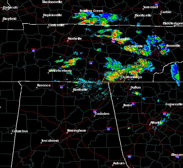 At 459 pm edt/359 pm cdt/, a severe thunderstorm was located near whitwell, or 8 miles northeast of jasper, moving east at 15 mph (radar indicated). Hazards include 60 mph wind gusts and quarter size hail. Hail damage to vehicles is expected. Expect wind damage to roofs, siding, and trees. At 459 pm edt/359 pm cdt/, a severe thunderstorm was located near whitwell, or 8 miles northeast of jasper, moving east at 15 mph (radar indicated). Hazards include 60 mph wind gusts and quarter size hail. Hail damage to vehicles is expected. Expect wind damage to roofs, siding, and trees.
|
| 6/23/2018 2:18 PM EDT |
 At 216 pm edt/116 pm cdt/, severe thunderstorms were located along a line extending from 9 miles northwest of dunlap to near lakesite to near ringgold, moving east at 50 mph (radar indicated). Hazards include 70 mph wind gusts and quarter size hail. Hail damage to vehicles is expected. expect considerable tree damage. wind damage is also likely to mobile homes, roofs, and outbuildings. Locations impacted include, chattanooga, cleveland, dunlap, soddy-daisy, walden, lakesite, charleston, ridgeside, south cleveland, harrison, east cleveland, wildwood lake, fairmount, red bank, collegedale, waterville, flat top mountain, north chickamauga creek gorge, red clay state park and flint springs. At 216 pm edt/116 pm cdt/, severe thunderstorms were located along a line extending from 9 miles northwest of dunlap to near lakesite to near ringgold, moving east at 50 mph (radar indicated). Hazards include 70 mph wind gusts and quarter size hail. Hail damage to vehicles is expected. expect considerable tree damage. wind damage is also likely to mobile homes, roofs, and outbuildings. Locations impacted include, chattanooga, cleveland, dunlap, soddy-daisy, walden, lakesite, charleston, ridgeside, south cleveland, harrison, east cleveland, wildwood lake, fairmount, red bank, collegedale, waterville, flat top mountain, north chickamauga creek gorge, red clay state park and flint springs.
|
| 6/23/2018 2:15 PM EDT | A few trees were down across the count in hamilton county TN, 1.1 miles ESE of Chattanooga, TN |
| 6/23/2018 2:12 PM EDT | Trees down on a few houses in a small area on maplewood drive. possible microburs in hamilton county TN, 8.4 miles WNW of Chattanooga, TN |
| 6/23/2018 1:54 PM EDT |
 At 153 pm edt/1253 pm cdt/, severe thunderstorms were located along a line extending from gruetli-laager to near whitwell to near chattanooga valley, moving east at 50 mph (radar indicated). Hazards include 70 mph wind gusts and quarter size hail. Hail damage to vehicles is expected. expect considerable tree damage. Wind damage is also likely to mobile homes, roofs, and outbuildings. At 153 pm edt/1253 pm cdt/, severe thunderstorms were located along a line extending from gruetli-laager to near whitwell to near chattanooga valley, moving east at 50 mph (radar indicated). Hazards include 70 mph wind gusts and quarter size hail. Hail damage to vehicles is expected. expect considerable tree damage. Wind damage is also likely to mobile homes, roofs, and outbuildings.
|
| 6/23/2018 12:47 PM CDT |
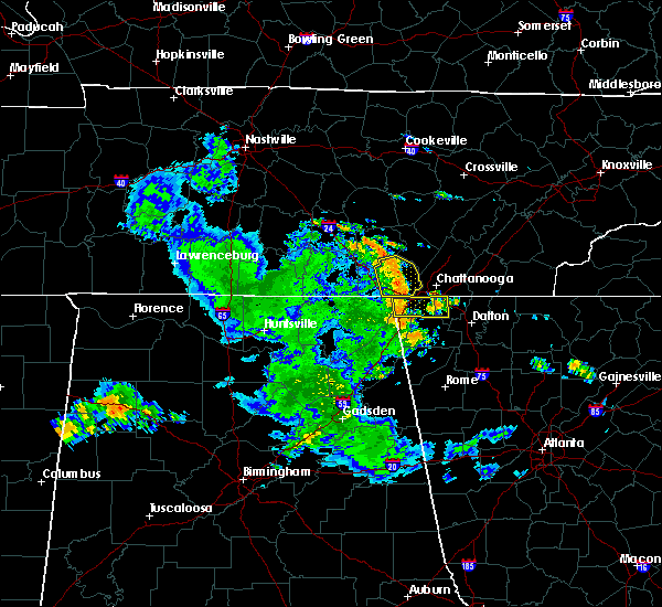 At 1247 pm cdt, severe thunderstorms were located along a line extending from 6 miles southeast of tracy city to near jasper to 6 miles southeast of kimball, moving east at 50 mph (radar indicated). Hazards include 60 mph wind gusts and nickel size hail. Expect damage to roofs, siding, and trees. Locations impacted include, jasper, whitwell, kimball, powells crossroads, martin springs, fiery gizzard state park, haletown (guild), griffith creek, chimneys state park, hicks gap state park, sequatchie cave, foster falls state park and new hope. At 1247 pm cdt, severe thunderstorms were located along a line extending from 6 miles southeast of tracy city to near jasper to 6 miles southeast of kimball, moving east at 50 mph (radar indicated). Hazards include 60 mph wind gusts and nickel size hail. Expect damage to roofs, siding, and trees. Locations impacted include, jasper, whitwell, kimball, powells crossroads, martin springs, fiery gizzard state park, haletown (guild), griffith creek, chimneys state park, hicks gap state park, sequatchie cave, foster falls state park and new hope.
|
| 6/23/2018 12:35 PM CDT |
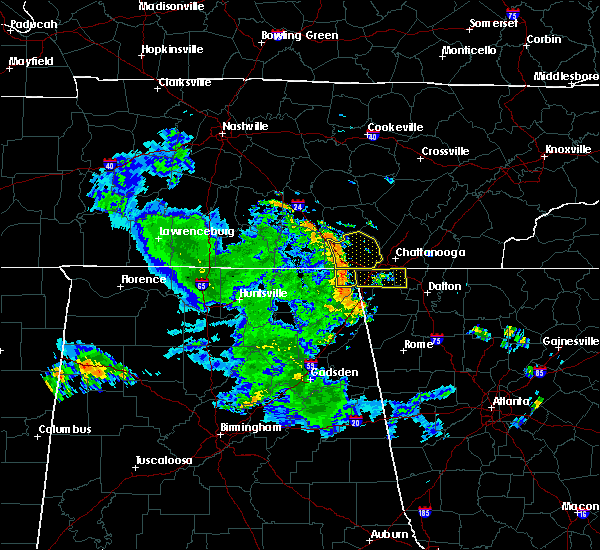 At 1234 pm cdt, severe thunderstorms were located along a line extending from near monteagle to near kimball to near south pittsburg, moving east at 50 mph (radar indicated). Hazards include 60 mph wind gusts. expect damage to roofs, siding, and trees At 1234 pm cdt, severe thunderstorms were located along a line extending from near monteagle to near kimball to near south pittsburg, moving east at 50 mph (radar indicated). Hazards include 60 mph wind gusts. expect damage to roofs, siding, and trees
|
| 6/23/2018 1:32 PM EDT |
 At 132 pm edt, severe thunderstorms were located along a line extending from near south pittsburg to near bridgeport, moving east at 45 mph (radar indicated). Hazards include 60 mph wind gusts. expect damage to roofs, siding, and trees At 132 pm edt, severe thunderstorms were located along a line extending from near south pittsburg to near bridgeport, moving east at 45 mph (radar indicated). Hazards include 60 mph wind gusts. expect damage to roofs, siding, and trees
|
| 6/3/2018 3:28 PM EDT |
 At 328 pm edt, a severe thunderstorm was located near cohutta, or 8 miles northeast of ringgold, moving southeast at 10 mph (radar indicated). Hazards include 60 mph wind gusts and quarter size hail. Hail damage to vehicles is expected. expect wind damage to roofs, siding, and trees. Locations impacted include, chattanooga, collegedale, east brainerd, red clay state park, flint springs, apison and ooltewah. At 328 pm edt, a severe thunderstorm was located near cohutta, or 8 miles northeast of ringgold, moving southeast at 10 mph (radar indicated). Hazards include 60 mph wind gusts and quarter size hail. Hail damage to vehicles is expected. expect wind damage to roofs, siding, and trees. Locations impacted include, chattanooga, collegedale, east brainerd, red clay state park, flint springs, apison and ooltewah.
|
| 6/3/2018 3:17 PM EDT |
 At 317 pm edt, a severe thunderstorm was located near cohutta, or 8 miles northeast of ringgold, moving southeast at 10 mph (radar indicated). Hazards include 60 mph wind gusts and quarter size hail. Hail damage to vehicles is expected. Expect wind damage to roofs, siding, and trees. At 317 pm edt, a severe thunderstorm was located near cohutta, or 8 miles northeast of ringgold, moving southeast at 10 mph (radar indicated). Hazards include 60 mph wind gusts and quarter size hail. Hail damage to vehicles is expected. Expect wind damage to roofs, siding, and trees.
|
| 5/31/2018 9:36 PM EDT |
 At 935 pm edt, a severe thunderstorm was located over ringgold, moving southeast at 15 mph (radar indicated). Hazards include 60 mph wind gusts and quarter size hail. Hail damage to vehicles is expected. Expect wind damage to roofs, siding, and trees. At 935 pm edt, a severe thunderstorm was located over ringgold, moving southeast at 15 mph (radar indicated). Hazards include 60 mph wind gusts and quarter size hail. Hail damage to vehicles is expected. Expect wind damage to roofs, siding, and trees.
|
| 4/4/2018 1:40 AM EDT | Trees and power lines down across the count in hamilton county TN, 1.1 miles ESE of Chattanooga, TN |
| 4/4/2018 1:38 AM EDT |
 At 138 am edt, severe thunderstorms were located along a line extending from fairview to near ringgold, moving east at 45 mph (radar indicated). Hazards include 60 mph wind gusts and quarter size hail. Hail damage to vehicles is expected. expect wind damage to roofs, siding, and trees. Locations impacted include, chattanooga, cleveland, athens, sweetwater, decatur, soddy-daisy, rossville, lakesite, charleston, ridgeside, south cleveland, harrison, east cleveland, wildwood lake, collegedale, niota, calhoun, waterville, hillsview and clear water. At 138 am edt, severe thunderstorms were located along a line extending from fairview to near ringgold, moving east at 45 mph (radar indicated). Hazards include 60 mph wind gusts and quarter size hail. Hail damage to vehicles is expected. expect wind damage to roofs, siding, and trees. Locations impacted include, chattanooga, cleveland, athens, sweetwater, decatur, soddy-daisy, rossville, lakesite, charleston, ridgeside, south cleveland, harrison, east cleveland, wildwood lake, collegedale, niota, calhoun, waterville, hillsview and clear water.
|
| 4/4/2018 1:15 AM EDT |
 At 115 am edt, severe thunderstorms were located along a line extending from near spring city to near lookout mountain, moving east at 50 mph (radar indicated). Hazards include 60 mph wind gusts and quarter size hail. Hail damage to vehicles is expected. Expect wind damage to roofs, siding, and trees. At 115 am edt, severe thunderstorms were located along a line extending from near spring city to near lookout mountain, moving east at 50 mph (radar indicated). Hazards include 60 mph wind gusts and quarter size hail. Hail damage to vehicles is expected. Expect wind damage to roofs, siding, and trees.
|
| 4/4/2018 12:03 AM CDT |
 At 103 am edt/1203 am cdt/, severe thunderstorms were located along a line extending from near midtown to near kimball, moving east at 60 mph (radar indicated). Hazards include 60 mph wind gusts and quarter size hail. Hail damage to vehicles is expected. expect wind damage to roofs, siding, and trees. Locations impacted include, chattanooga, dayton, dunlap, jasper, pikeville, decatur, soddy-daisy, signal mountain, south pittsburg, spring city, walden, lakesite, whitwell, kimball, monteagle, ridgeside, harrison, fairmount, red bank and collegedale. At 103 am edt/1203 am cdt/, severe thunderstorms were located along a line extending from near midtown to near kimball, moving east at 60 mph (radar indicated). Hazards include 60 mph wind gusts and quarter size hail. Hail damage to vehicles is expected. expect wind damage to roofs, siding, and trees. Locations impacted include, chattanooga, dayton, dunlap, jasper, pikeville, decatur, soddy-daisy, signal mountain, south pittsburg, spring city, walden, lakesite, whitwell, kimball, monteagle, ridgeside, harrison, fairmount, red bank and collegedale.
|
| 4/3/2018 11:38 PM CDT |
 At 1237 am edt/1137 pm cdt/, severe thunderstorms were located along a line extending from near rockwood to near gruetli-laager, moving east at 60 mph (radar indicated). Hazards include 60 mph wind gusts and quarter size hail. Hail damage to vehicles is expected. expect wind damage to roofs, siding, and trees. Locations impacted include, chattanooga, dayton, dunlap, jasper, pikeville, decatur, soddy-daisy, signal mountain, south pittsburg, spring city, walden, lakesite, whitwell, kimball, monteagle, ridgeside, harrison, fairmount, red bank and collegedale. At 1237 am edt/1137 pm cdt/, severe thunderstorms were located along a line extending from near rockwood to near gruetli-laager, moving east at 60 mph (radar indicated). Hazards include 60 mph wind gusts and quarter size hail. Hail damage to vehicles is expected. expect wind damage to roofs, siding, and trees. Locations impacted include, chattanooga, dayton, dunlap, jasper, pikeville, decatur, soddy-daisy, signal mountain, south pittsburg, spring city, walden, lakesite, whitwell, kimball, monteagle, ridgeside, harrison, fairmount, red bank and collegedale.
|
| 4/4/2018 12:31 AM EDT |
 The national weather service in peachtree city has issued a * severe thunderstorm warning for. walker county in northwestern georgia. western chattooga county in northwestern georgia. dade county in northwestern georgia. Until 115 am edt. The national weather service in peachtree city has issued a * severe thunderstorm warning for. walker county in northwestern georgia. western chattooga county in northwestern georgia. dade county in northwestern georgia. Until 115 am edt.
|
| 4/3/2018 11:08 PM CDT |
 The national weather service in morristown has issued a * severe thunderstorm warning for. rhea county in east tennessee. meigs county in east tennessee. sequatchie county in east tennessee. Bledsoe county in east tennessee. The national weather service in morristown has issued a * severe thunderstorm warning for. rhea county in east tennessee. meigs county in east tennessee. sequatchie county in east tennessee. Bledsoe county in east tennessee.
|
| 3/19/2018 8:17 PM CDT |
 At 817 pm cdt, a severe thunderstorm was located near jasper, moving east at 50 mph (radar indicated). Hazards include 60 mph wind gusts and quarter size hail. Hail damage to vehicles is expected. expect wind damage to roofs, siding, and trees. Locations impacted include, jasper, south pittsburg, whitwell, kimball, powells crossroads, orme, martin springs, haletown (guild), griffith creek, chimneys state park, hicks gap state park, sequatchie cave, foster falls state park, new hope, fiery gizzard state park and lone oak. At 817 pm cdt, a severe thunderstorm was located near jasper, moving east at 50 mph (radar indicated). Hazards include 60 mph wind gusts and quarter size hail. Hail damage to vehicles is expected. expect wind damage to roofs, siding, and trees. Locations impacted include, jasper, south pittsburg, whitwell, kimball, powells crossroads, orme, martin springs, haletown (guild), griffith creek, chimneys state park, hicks gap state park, sequatchie cave, foster falls state park, new hope, fiery gizzard state park and lone oak.
|
| 3/19/2018 7:47 PM CDT |
 At 747 pm cdt, a severe thunderstorm was located 9 miles south of cowan, or 13 miles southeast of winchester, moving east at 50 mph (radar indicated). Hazards include 60 mph wind gusts and quarter size hail. Hail damage to vehicles is expected. Expect wind damage to roofs, siding, and trees. At 747 pm cdt, a severe thunderstorm was located 9 miles south of cowan, or 13 miles southeast of winchester, moving east at 50 mph (radar indicated). Hazards include 60 mph wind gusts and quarter size hail. Hail damage to vehicles is expected. Expect wind damage to roofs, siding, and trees.
|
| 9/5/2017 4:30 PM EDT | One tree fell on a house on jarnigan ave in chattanooga. no injuries reported. time estimated by rada in hamilton county TN, 1.1 miles SSE of Chattanooga, TN |
| 8/4/2017 9:06 PM EDT |
 The severe thunderstorm warning for western catoosa, west central whitfield, central walker and central dade counties will expire at 915 pm edt, the storm which prompted the warning has weakened below severe limits, and no longer poses an immediate threat to life or property. therefore the warning will be allowed to expire. The severe thunderstorm warning for western catoosa, west central whitfield, central walker and central dade counties will expire at 915 pm edt, the storm which prompted the warning has weakened below severe limits, and no longer poses an immediate threat to life or property. therefore the warning will be allowed to expire.
|
| 8/4/2017 8:27 PM EDT |
 At 827 pm edt, a severe thunderstorm was located over cloudland canyon state park, or near trenton, moving east at 20 mph (radar indicated). Hazards include quarter size hail. damage to vehicles is expected At 827 pm edt, a severe thunderstorm was located over cloudland canyon state park, or near trenton, moving east at 20 mph (radar indicated). Hazards include quarter size hail. damage to vehicles is expected
|
| 6/15/2017 2:16 PM CDT |
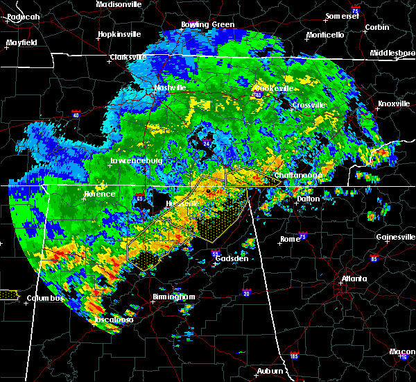 At 315 pm edt/215 pm cdt/, a severe thunderstorm was located near jasper, moving southeast at 35 mph (radar indicated). Hazards include 60 mph wind gusts. Expect damage to roofs, siding, and trees. Locations impacted include, chattanooga, jasper, signal mountain, south pittsburg, whitwell, kimball, ridgeside, red bank, powells crossroads, orme, martin springs, lookout mountain, haletown (guild), east ridge, hicks gap state park, sequatchie cave, foster falls state park, new hope and fiery gizzard state park. At 315 pm edt/215 pm cdt/, a severe thunderstorm was located near jasper, moving southeast at 35 mph (radar indicated). Hazards include 60 mph wind gusts. Expect damage to roofs, siding, and trees. Locations impacted include, chattanooga, jasper, signal mountain, south pittsburg, whitwell, kimball, ridgeside, red bank, powells crossroads, orme, martin springs, lookout mountain, haletown (guild), east ridge, hicks gap state park, sequatchie cave, foster falls state park, new hope and fiery gizzard state park.
|
| 6/15/2017 1:58 PM CDT |
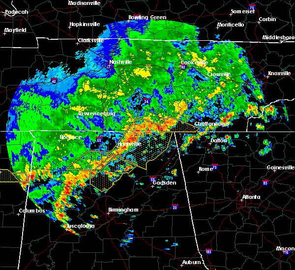 At 257 pm edt/157 pm cdt/, a severe thunderstorm was located near kimball, or near jasper, moving southeast at 35 mph (radar indicated). Hazards include 60 mph wind gusts and penny size hail. expect damage to roofs, siding, and trees At 257 pm edt/157 pm cdt/, a severe thunderstorm was located near kimball, or near jasper, moving southeast at 35 mph (radar indicated). Hazards include 60 mph wind gusts and penny size hail. expect damage to roofs, siding, and trees
|
| 5/27/2017 11:01 PM EDT |
 At 1101 pm edt/1001 pm cdt/, severe thunderstorms were located along a line extending from 9 miles north of fontana village to 10 miles south of madisonville to near etowah to near harrison to 8 miles southeast of sewanee, moving southeast at 45 mph (radar indicated). Hazards include 70 mph wind gusts and quarter size hail. Hail damage to vehicles is expected. expect considerable tree damage. wind damage is also likely to mobile homes, roofs, and outbuildings. Locations impacted include, chattanooga, cleveland, jasper, soddy-daisy, signal mountain, etowah, south pittsburg, walden, lakesite, whitwell, kimball, monteagle, charleston, ridgeside, harrison, east cleveland, south cleveland, fairmount, wildwood lake and red bank. At 1101 pm edt/1001 pm cdt/, severe thunderstorms were located along a line extending from 9 miles north of fontana village to 10 miles south of madisonville to near etowah to near harrison to 8 miles southeast of sewanee, moving southeast at 45 mph (radar indicated). Hazards include 70 mph wind gusts and quarter size hail. Hail damage to vehicles is expected. expect considerable tree damage. wind damage is also likely to mobile homes, roofs, and outbuildings. Locations impacted include, chattanooga, cleveland, jasper, soddy-daisy, signal mountain, etowah, south pittsburg, walden, lakesite, whitwell, kimball, monteagle, charleston, ridgeside, harrison, east cleveland, south cleveland, fairmount, wildwood lake and red bank.
|
| 5/27/2017 10:39 PM EDT |
 At 1039 pm edt/939 pm cdt/, severe thunderstorms were located along a line extending from near louisville to 7 miles west of madisonville to 6 miles southwest of athens to near dunlap, moving southeast at 45 mph (radar indicated). Hazards include 70 mph wind gusts and quarter size hail. Hail damage to vehicles is expected. expect considerable tree damage. wind damage is also likely to mobile homes, roofs, and outbuildings. Locations impacted include, chattanooga, cleveland, maryville, athens, alcoa, sweetwater, loudon, madisonville, jasper, decatur, soddy-daisy, signal mountain, etowah, south pittsburg, louisville, walden, lakesite, whitwell, tracy city and kimball. At 1039 pm edt/939 pm cdt/, severe thunderstorms were located along a line extending from near louisville to 7 miles west of madisonville to 6 miles southwest of athens to near dunlap, moving southeast at 45 mph (radar indicated). Hazards include 70 mph wind gusts and quarter size hail. Hail damage to vehicles is expected. expect considerable tree damage. wind damage is also likely to mobile homes, roofs, and outbuildings. Locations impacted include, chattanooga, cleveland, maryville, athens, alcoa, sweetwater, loudon, madisonville, jasper, decatur, soddy-daisy, signal mountain, etowah, south pittsburg, louisville, walden, lakesite, whitwell, tracy city and kimball.
|
| 5/27/2017 10:08 PM EDT |
 At 1008 pm edt/908 pm cdt/, severe thunderstorms were located along a line extending from oliver springs to 6 miles east of spring city to 6 miles north of dayton to 7 miles north of gruetli-laager, moving southeast at 45 mph (radar indicated). Hazards include 70 mph wind gusts and quarter size hail. Hail damage to vehicles is expected. expect considerable tree damage. Wind damage is also likely to mobile homes, roofs, and outbuildings. At 1008 pm edt/908 pm cdt/, severe thunderstorms were located along a line extending from oliver springs to 6 miles east of spring city to 6 miles north of dayton to 7 miles north of gruetli-laager, moving southeast at 45 mph (radar indicated). Hazards include 70 mph wind gusts and quarter size hail. Hail damage to vehicles is expected. expect considerable tree damage. Wind damage is also likely to mobile homes, roofs, and outbuildings.
|
| 5/23/2017 6:59 PM CDT |
 At 758 pm edt/658 pm cdt/, a severe thunderstorm was located over whitwell, or 9 miles northeast of jasper, moving northeast at 25 mph (radar indicated). Hazards include 60 mph wind gusts and quarter size hail. Hail damage to vehicles is expected. Expect wind damage to roofs, siding, and trees. At 758 pm edt/658 pm cdt/, a severe thunderstorm was located over whitwell, or 9 miles northeast of jasper, moving northeast at 25 mph (radar indicated). Hazards include 60 mph wind gusts and quarter size hail. Hail damage to vehicles is expected. Expect wind damage to roofs, siding, and trees.
|
| 4/30/2017 6:07 PM CDT |
 The severe thunderstorm warning for rhea, southeastern sequatchie, bledsoe, west central meigs and northeastern hamilton counties will expire at 715 pm edt/615 pm cdt/, the storms which prompted the warning have weakened. therefore, the warning will be allowed to expire 715 pm edt. a tornado watch remains in effect until 800 pm edt/700 pm cdt/ for eastern tennessee. The severe thunderstorm warning for rhea, southeastern sequatchie, bledsoe, west central meigs and northeastern hamilton counties will expire at 715 pm edt/615 pm cdt/, the storms which prompted the warning have weakened. therefore, the warning will be allowed to expire 715 pm edt. a tornado watch remains in effect until 800 pm edt/700 pm cdt/ for eastern tennessee.
|
| 4/30/2017 5:30 PM CDT |
 At 630 pm edt/530 pm cdt/, severe thunderstorms were located along a line extending from near pikeville to near dayton to soddy-daisy, moving northeast at 45 mph (radar indicated). Hazards include 60 mph wind gusts and penny size hail. Expect damage to roofs, siding, and trees. locations impacted include, chattanooga, dayton, pikeville, soddy-daisy, spring city, walden, lakesite, fairmount, red bank, graysville, flat top mountain, north chickamauga creek gorge, mount crest, piney falls s. p. old washington, brayton, middle valley, birchwood, falling water and melvine. A tornado watch remains in effect until 800 pm edt/700 pm cdt/ for eastern tennessee. At 630 pm edt/530 pm cdt/, severe thunderstorms were located along a line extending from near pikeville to near dayton to soddy-daisy, moving northeast at 45 mph (radar indicated). Hazards include 60 mph wind gusts and penny size hail. Expect damage to roofs, siding, and trees. locations impacted include, chattanooga, dayton, pikeville, soddy-daisy, spring city, walden, lakesite, fairmount, red bank, graysville, flat top mountain, north chickamauga creek gorge, mount crest, piney falls s. p. old washington, brayton, middle valley, birchwood, falling water and melvine. A tornado watch remains in effect until 800 pm edt/700 pm cdt/ for eastern tennessee.
|
| 4/30/2017 5:14 PM CDT |
 At 614 pm edt/514 pm cdt/, severe thunderstorms were located along a line extending from 7 miles southwest of pikeville to 6 miles north of soddy-daisy to walden, moving northeast at 45 mph (radar indicated). Hazards include 60 mph wind gusts and penny size hail. expect damage to roofs, siding, and trees At 614 pm edt/514 pm cdt/, severe thunderstorms were located along a line extending from 7 miles southwest of pikeville to 6 miles north of soddy-daisy to walden, moving northeast at 45 mph (radar indicated). Hazards include 60 mph wind gusts and penny size hail. expect damage to roofs, siding, and trees
|
| 4/30/2017 5:00 PM CDT |
 At 600 pm edt/500 pm cdt/, severe thunderstorms were located along a line extending from 6 miles northeast of dunlap to near soddy-daisy to walden, moving northeast at 55 mph (radar indicated). Hazards include 60 mph wind gusts and penny size hail. Expect damage to roofs, siding, and trees. locations impacted include, chattanooga, dayton, dunlap, pikeville, soddy-daisy, signal mountain, walden, fairmount, graysville, powells crossroads, cartwright, flat top mountain, north chickamauga creek gorge, sale creek, lone oak, palio, mowbray mountain, brayton, falling water and middle valley. A tornado watch remains in effect until 800 pm edt/700 pm cdt/ for eastern tennessee. At 600 pm edt/500 pm cdt/, severe thunderstorms were located along a line extending from 6 miles northeast of dunlap to near soddy-daisy to walden, moving northeast at 55 mph (radar indicated). Hazards include 60 mph wind gusts and penny size hail. Expect damage to roofs, siding, and trees. locations impacted include, chattanooga, dayton, dunlap, pikeville, soddy-daisy, signal mountain, walden, fairmount, graysville, powells crossroads, cartwright, flat top mountain, north chickamauga creek gorge, sale creek, lone oak, palio, mowbray mountain, brayton, falling water and middle valley. A tornado watch remains in effect until 800 pm edt/700 pm cdt/ for eastern tennessee.
|
| 4/30/2017 4:52 PM CDT |
 At 551 pm edt/451 pm cdt/, severe thunderstorms were located along a line extending from near dunlap to fairmount to near signal mountain, moving northeast at 55 mph (radar indicated). Hazards include 60 mph wind gusts and penny size hail. expect damage to roofs, siding, and trees At 551 pm edt/451 pm cdt/, severe thunderstorms were located along a line extending from near dunlap to fairmount to near signal mountain, moving northeast at 55 mph (radar indicated). Hazards include 60 mph wind gusts and penny size hail. expect damage to roofs, siding, and trees
|
| 4/29/2017 6:34 PM CDT |
 At 734 pm edt/634 pm cdt/, a severe thunderstorm was located near dunlap, moving north at 30 mph (radar indicated). Hazards include ping pong ball size hail and 60 mph wind gusts. People and animals outdoors will be injured. expect hail damage to roofs, siding, windows, and vehicles. expect wind damage to roofs, siding, and trees. Locations impacted include, chattanooga, dayton, dunlap, pikeville, soddy-daisy, signal mountain, walden, lakesite, whitwell, fairmount, harrison, red bank, graysville, powells crossroads, cartwright, flat top mountain, north chickamauga creek gorge, mount crest, brayton and middle valley. At 734 pm edt/634 pm cdt/, a severe thunderstorm was located near dunlap, moving north at 30 mph (radar indicated). Hazards include ping pong ball size hail and 60 mph wind gusts. People and animals outdoors will be injured. expect hail damage to roofs, siding, windows, and vehicles. expect wind damage to roofs, siding, and trees. Locations impacted include, chattanooga, dayton, dunlap, pikeville, soddy-daisy, signal mountain, walden, lakesite, whitwell, fairmount, harrison, red bank, graysville, powells crossroads, cartwright, flat top mountain, north chickamauga creek gorge, mount crest, brayton and middle valley.
|
| 4/29/2017 6:29 PM CDT |
 At 728 pm edt/628 pm cdt/, a severe thunderstorm was located near dunlap, moving north at 30 mph (radar indicated). Hazards include 60 mph wind gusts and quarter size hail. Hail damage to vehicles is expected. Expect wind damage to roofs, siding, and trees. At 728 pm edt/628 pm cdt/, a severe thunderstorm was located near dunlap, moving north at 30 mph (radar indicated). Hazards include 60 mph wind gusts and quarter size hail. Hail damage to vehicles is expected. Expect wind damage to roofs, siding, and trees.
|
| 4/5/2017 8:49 PM EDT |
 At 848 pm edt, severe thunderstorms were located along a line extending from 6 miles southwest of decatur to rossville, moving northeast at 40 mph (radar indicated). Hazards include 60 mph wind gusts and quarter size hail. Hail damage to vehicles is expected. expect wind damage to roofs, siding, and trees. locations impacted include, chattanooga, soddy-daisy, rossville, lakesite, ridgeside, harrison, red bank, collegedale, east brainerd, lookout mountain, east ridge, big spring, ooltewah, middle valley, birchwood, falling water, apison, harrison bay s. p. shady grove and mowbray mountain. A tornado watch remains in effect until 1000 pm edt for eastern tennessee. At 848 pm edt, severe thunderstorms were located along a line extending from 6 miles southwest of decatur to rossville, moving northeast at 40 mph (radar indicated). Hazards include 60 mph wind gusts and quarter size hail. Hail damage to vehicles is expected. expect wind damage to roofs, siding, and trees. locations impacted include, chattanooga, soddy-daisy, rossville, lakesite, ridgeside, harrison, red bank, collegedale, east brainerd, lookout mountain, east ridge, big spring, ooltewah, middle valley, birchwood, falling water, apison, harrison bay s. p. shady grove and mowbray mountain. A tornado watch remains in effect until 1000 pm edt for eastern tennessee.
|
| 4/5/2017 8:41 PM EDT |
 At 841 pm edt, a severe thunderstorm was located near sulpher springs, or 9 miles west of lafayette, moving northeast at 50 mph (radar indicated). Hazards include ping pong ball size hail and 60 mph wind gusts. People and animals outdoors will be injured. expect hail damage to roofs, siding, windows, and vehicles. Expect wind damage to roofs, siding, and trees. At 841 pm edt, a severe thunderstorm was located near sulpher springs, or 9 miles west of lafayette, moving northeast at 50 mph (radar indicated). Hazards include ping pong ball size hail and 60 mph wind gusts. People and animals outdoors will be injured. expect hail damage to roofs, siding, windows, and vehicles. Expect wind damage to roofs, siding, and trees.
|
| 4/5/2017 8:29 PM EDT |
 At 828 pm edt/728 pm cdt/, severe thunderstorms were located along a line extending from 7 miles southwest of dayton to near trenton, moving east at 55 mph (radar indicated). Hazards include 60 mph wind gusts and quarter size hail. Hail damage to vehicles is expected. expect wind damage to roofs, siding, and trees. locations impacted include, chattanooga, dunlap, soddy-daisy, signal mountain, walden, lakesite, ridgeside, fairmount, harrison, red bank, collegedale, powells crossroads, flat top mountain, north chickamauga creek gorge, lookout mountain, east ridge, big spring, ooltewah, hicks gap s. p. and middle valley. A tornado watch remains in effect until 1000 pm edt/900 pm cdt/ for eastern tennessee. At 828 pm edt/728 pm cdt/, severe thunderstorms were located along a line extending from 7 miles southwest of dayton to near trenton, moving east at 55 mph (radar indicated). Hazards include 60 mph wind gusts and quarter size hail. Hail damage to vehicles is expected. expect wind damage to roofs, siding, and trees. locations impacted include, chattanooga, dunlap, soddy-daisy, signal mountain, walden, lakesite, ridgeside, fairmount, harrison, red bank, collegedale, powells crossroads, flat top mountain, north chickamauga creek gorge, lookout mountain, east ridge, big spring, ooltewah, hicks gap s. p. and middle valley. A tornado watch remains in effect until 1000 pm edt/900 pm cdt/ for eastern tennessee.
|
| 4/5/2017 8:10 PM EDT |
 At 809 pm edt/709 pm cdt/, severe thunderstorms were located along a line extending from dunlap to 7 miles southeast of stevenson, moving east at 40 mph (radar indicated). Hazards include 60 mph wind gusts and quarter size hail. Hail damage to vehicles is expected. Expect wind damage to roofs, siding, and trees. At 809 pm edt/709 pm cdt/, severe thunderstorms were located along a line extending from dunlap to 7 miles southeast of stevenson, moving east at 40 mph (radar indicated). Hazards include 60 mph wind gusts and quarter size hail. Hail damage to vehicles is expected. Expect wind damage to roofs, siding, and trees.
|
| 4/5/2017 6:34 PM CDT |
 At 733 pm edt/633 pm cdt/, a severe thunderstorm was located near dunlap, moving northeast at 40 mph (radar indicated). Hazards include 60 mph wind gusts and quarter size hail. Hail damage to vehicles is expected. expect wind damage to roofs, siding, and trees. locations impacted include, dunlap, soddy-daisy, signal mountain, walden, fairmount, cartwright, flat top mountain, north chickamauga creek gorge, sale creek, lone oak, palio, mowbray mountain, brayton, birchwood and falling water. A tornado watch remains in effect until 1000 pm edt/900 pm cdt/ for eastern tennessee. At 733 pm edt/633 pm cdt/, a severe thunderstorm was located near dunlap, moving northeast at 40 mph (radar indicated). Hazards include 60 mph wind gusts and quarter size hail. Hail damage to vehicles is expected. expect wind damage to roofs, siding, and trees. locations impacted include, dunlap, soddy-daisy, signal mountain, walden, fairmount, cartwright, flat top mountain, north chickamauga creek gorge, sale creek, lone oak, palio, mowbray mountain, brayton, birchwood and falling water. A tornado watch remains in effect until 1000 pm edt/900 pm cdt/ for eastern tennessee.
|
| 4/5/2017 6:18 PM CDT |
 The national weather service in morristown has issued a * severe thunderstorm warning for. sequatchie county in eastern tennessee. southwestern bledsoe county in eastern tennessee. northern hamilton county in eastern tennessee. Until 815 pm edt/715 pm cdt/. The national weather service in morristown has issued a * severe thunderstorm warning for. sequatchie county in eastern tennessee. southwestern bledsoe county in eastern tennessee. northern hamilton county in eastern tennessee. Until 815 pm edt/715 pm cdt/.
|
| 3/21/2017 7:00 PM EDT | Three homes on sims drive in dade county suffered significant roof damag in dade county GA, 13.8 miles NE of Chattanooga, TN |
| 3/21/2017 7:00 PM EDT | Reported tree through a home on creek roa in dade county GA, 13 miles NE of Chattanooga, TN |
| 3/21/2017 5:59 PM CDT |
 At 558 pm cdt, severe thunderstorms were located along a line extending from near tracy city to near trenton to near ider, moving east at 55 mph (radar indicated). Hazards include 70 mph wind gusts and quarter size hail. Hail damage to vehicles is expected. expect considerable tree damage. wind damage is also likely to mobile homes, roofs, and outbuildings. locations impacted include, jasper, south pittsburg, whitwell, kimball, monteagle, powells crossroads, orme, chimneys s. p. martin springs, fiery gizzard s. p. foster falls s. p. griffith creek, haletown (guild), hicks gap s. p. Sequatchie cave, new hope and lone oak. At 558 pm cdt, severe thunderstorms were located along a line extending from near tracy city to near trenton to near ider, moving east at 55 mph (radar indicated). Hazards include 70 mph wind gusts and quarter size hail. Hail damage to vehicles is expected. expect considerable tree damage. wind damage is also likely to mobile homes, roofs, and outbuildings. locations impacted include, jasper, south pittsburg, whitwell, kimball, monteagle, powells crossroads, orme, chimneys s. p. martin springs, fiery gizzard s. p. foster falls s. p. griffith creek, haletown (guild), hicks gap s. p. Sequatchie cave, new hope and lone oak.
|
| 3/21/2017 6:50 PM EDT |
 At 650 pm edt, severe thunderstorms were located along a line extending from near spencer to 6 miles west of pikeville to 9 miles northeast of dunlap to 7 miles northwest of jasper to near south pittsburg, moving east at 45 mph (radar indicated). Hazards include 60 mph wind gusts and quarter size hail. Hail damage to vehicles is expected. Expect wind damage to roofs, siding, and trees. At 650 pm edt, severe thunderstorms were located along a line extending from near spencer to 6 miles west of pikeville to 9 miles northeast of dunlap to 7 miles northwest of jasper to near south pittsburg, moving east at 45 mph (radar indicated). Hazards include 60 mph wind gusts and quarter size hail. Hail damage to vehicles is expected. Expect wind damage to roofs, siding, and trees.
|
| 3/21/2017 6:38 PM EDT |
 At 637 pm edt, severe thunderstorms were located extending from near fiery gizzard state park to russell cave national monument to near hollywood to near farley, moving southeast at 50 mph (radar indicated). Hazards include 70 mph wind gusts and quarter size hail. Hail damage to vehicles is expected. expect considerable tree damage. Wind damage is also likely to mobile homes, roofs, and outbuildings. At 637 pm edt, severe thunderstorms were located extending from near fiery gizzard state park to russell cave national monument to near hollywood to near farley, moving southeast at 50 mph (radar indicated). Hazards include 70 mph wind gusts and quarter size hail. Hail damage to vehicles is expected. expect considerable tree damage. Wind damage is also likely to mobile homes, roofs, and outbuildings.
|
| 3/21/2017 5:37 PM CDT |
 At 536 pm cdt, severe thunderstorms were located along a line extending from near monteagle to 8 miles north of stevenson to near skyline, moving east at 55 mph (radar indicated). Hazards include 70 mph wind gusts and quarter size hail. Hail damage to vehicles is expected. expect considerable tree damage. wind damage is also likely to mobile homes, roofs, and outbuildings. locations impacted include, jasper, south pittsburg, whitwell, kimball, monteagle, powells crossroads, orme, chimneys s. p. martin springs, fiery gizzard s. p. foster falls s. p. griffith creek, haletown (guild), hicks gap s. p. Sequatchie cave, new hope and lone oak. At 536 pm cdt, severe thunderstorms were located along a line extending from near monteagle to 8 miles north of stevenson to near skyline, moving east at 55 mph (radar indicated). Hazards include 70 mph wind gusts and quarter size hail. Hail damage to vehicles is expected. expect considerable tree damage. wind damage is also likely to mobile homes, roofs, and outbuildings. locations impacted include, jasper, south pittsburg, whitwell, kimball, monteagle, powells crossroads, orme, chimneys s. p. martin springs, fiery gizzard s. p. foster falls s. p. griffith creek, haletown (guild), hicks gap s. p. Sequatchie cave, new hope and lone oak.
|
| 3/21/2017 5:21 PM CDT |
 At 520 pm cdt, severe thunderstorms were located along a line extending from 6 miles south of manchester to 9 miles southwest of cowan to 8 miles south of huntland, moving east at 45 mph (radar indicated). Hazards include 70 mph wind gusts and quarter size hail. Hail damage to vehicles is expected. expect considerable tree damage. Wind damage is also likely to mobile homes, roofs, and outbuildings. At 520 pm cdt, severe thunderstorms were located along a line extending from 6 miles south of manchester to 9 miles southwest of cowan to 8 miles south of huntland, moving east at 45 mph (radar indicated). Hazards include 70 mph wind gusts and quarter size hail. Hail damage to vehicles is expected. expect considerable tree damage. Wind damage is also likely to mobile homes, roofs, and outbuildings.
|
| 3/10/2017 2:06 AM EST |
 The severe thunderstorm warning for southern hamilton county will expire at 215 am est, the storms which prompted the warning have moved out of the area. therefore the warning will be allowed to expire. however gusty winds and heavy rain are still possible with these thunderstorms. a severe thunderstorm watch remains in effect until 500 am est for eastern tennessee. The severe thunderstorm warning for southern hamilton county will expire at 215 am est, the storms which prompted the warning have moved out of the area. therefore the warning will be allowed to expire. however gusty winds and heavy rain are still possible with these thunderstorms. a severe thunderstorm watch remains in effect until 500 am est for eastern tennessee.
|
| 3/10/2017 2:00 AM EST | A few drees down near the 3700 block of bonny oaks driv in hamilton county TN, 0.6 miles WSW of Chattanooga, TN |
| 3/10/2017 2:00 AM EST |
 At 159 am est, severe thunderstorms extended from near ridgeside to near stephensville to near pisgah, moving east at 60 mph (radar indicated). Hazards include 60 mph wind gusts and quarter size hail. Hail damage to vehicles is expected. expect wind damage to roofs, siding, and trees. locations impacted include, lafayette, summerville, ringgold, trenton, fort oglethorpe, rossville, chickamauga, trion, lookout mountain, menlo, center post, blue spring, fairview, linwood, cloudland, chattanooga valley, cloudland canyon state park, hooker, cooper heights and james h. Floyd state park. At 159 am est, severe thunderstorms extended from near ridgeside to near stephensville to near pisgah, moving east at 60 mph (radar indicated). Hazards include 60 mph wind gusts and quarter size hail. Hail damage to vehicles is expected. expect wind damage to roofs, siding, and trees. locations impacted include, lafayette, summerville, ringgold, trenton, fort oglethorpe, rossville, chickamauga, trion, lookout mountain, menlo, center post, blue spring, fairview, linwood, cloudland, chattanooga valley, cloudland canyon state park, hooker, cooper heights and james h. Floyd state park.
|
| 3/10/2017 1:58 AM EST |
 At 157 am est, severe thunderstorms were located along a line extending from fairmount to near lookout mountain to near trenton, moving southeast at 55 mph (radar indicated). Hazards include 70 mph wind gusts and quarter size hail. Hail damage to vehicles is expected. expect considerable tree damage. wind damage is also likely to mobile homes, roofs, and outbuildings. locations impacted include, chattanooga, signal mountain, walden, ridgeside, fairmount, harrison, red bank, collegedale, east brainerd, lookout mountain, east ridge, ooltewah, apison, harrison bay s. p. Middle valley and falling water. At 157 am est, severe thunderstorms were located along a line extending from fairmount to near lookout mountain to near trenton, moving southeast at 55 mph (radar indicated). Hazards include 70 mph wind gusts and quarter size hail. Hail damage to vehicles is expected. expect considerable tree damage. wind damage is also likely to mobile homes, roofs, and outbuildings. locations impacted include, chattanooga, signal mountain, walden, ridgeside, fairmount, harrison, red bank, collegedale, east brainerd, lookout mountain, east ridge, ooltewah, apison, harrison bay s. p. Middle valley and falling water.
|
| 3/10/2017 1:38 AM EST |
 At 138 am est/1238 am cst/, severe thunderstorms were located along a line extending from 6 miles northwest of whitwell to near jasper to near bridgeport, moving southeast at 55 mph (radar indicated). Hazards include 70 mph wind gusts and quarter size hail. Hail damage to vehicles is expected. expect considerable tree damage. Wind damage is also likely to mobile homes, roofs, and outbuildings. At 138 am est/1238 am cst/, severe thunderstorms were located along a line extending from 6 miles northwest of whitwell to near jasper to near bridgeport, moving southeast at 55 mph (radar indicated). Hazards include 70 mph wind gusts and quarter size hail. Hail damage to vehicles is expected. expect considerable tree damage. Wind damage is also likely to mobile homes, roofs, and outbuildings.
|
| 3/10/2017 1:36 AM EST |
 At 133 am est, severe thunderstorms were located 20 miles northwest of a trenton to wildwood line, moving east at 60 mph (radar indicated). Hazards include 60 mph wind gusts and quarter size hail. Hail damage to vehicles is expected. Expect wind damage to roofs, siding, and trees. At 133 am est, severe thunderstorms were located 20 miles northwest of a trenton to wildwood line, moving east at 60 mph (radar indicated). Hazards include 60 mph wind gusts and quarter size hail. Hail damage to vehicles is expected. Expect wind damage to roofs, siding, and trees.
|
| 3/10/2017 12:30 AM CST |
 At 1230 am cst, severe thunderstorms were located along a line extending from near gruetli-laager to 6 miles northeast of skyline, moving southeast at 60 mph (radar indicated). Hazards include 70 mph wind gusts and quarter size hail. Hail damage to vehicles is expected. expect considerable tree damage. wind damage is also likely to mobile homes, roofs, and outbuildings. locations impacted include, dunlap, jasper, signal mountain, south pittsburg, whitwell, kimball, monteagle, fairmount, powells crossroads, orme, chimneys s. p. martin springs, cartwright, fiery gizzard s. p. foster falls s. p. griffith creek, haletown (guild), hicks gap s. p. Lone oak and sequatchie cave. At 1230 am cst, severe thunderstorms were located along a line extending from near gruetli-laager to 6 miles northeast of skyline, moving southeast at 60 mph (radar indicated). Hazards include 70 mph wind gusts and quarter size hail. Hail damage to vehicles is expected. expect considerable tree damage. wind damage is also likely to mobile homes, roofs, and outbuildings. locations impacted include, dunlap, jasper, signal mountain, south pittsburg, whitwell, kimball, monteagle, fairmount, powells crossroads, orme, chimneys s. p. martin springs, cartwright, fiery gizzard s. p. foster falls s. p. griffith creek, haletown (guild), hicks gap s. p. Lone oak and sequatchie cave.
|
| 3/10/2017 12:09 AM CST |
 At 1209 am cst, severe thunderstorms were located along a line extending from 11 miles south of mcminnville to near huntland, moving southeast at 60 mph (radar indicated). Hazards include 70 mph wind gusts and quarter size hail. Hail damage to vehicles is expected. expect considerable tree damage. Wind damage is also likely to mobile homes, roofs, and outbuildings. At 1209 am cst, severe thunderstorms were located along a line extending from 11 miles south of mcminnville to near huntland, moving southeast at 60 mph (radar indicated). Hazards include 70 mph wind gusts and quarter size hail. Hail damage to vehicles is expected. expect considerable tree damage. Wind damage is also likely to mobile homes, roofs, and outbuildings.
|
| 3/1/2017 3:50 PM EST |
 At 349 pm est, a severe thunderstorm was located near harrison, or 8 miles east of chattanooga, moving east at 70 mph (radar indicated). Hazards include 60 mph wind gusts and quarter size hail. Hail damage to vehicles is expected. expect wind damage to roofs, siding, and trees. locations impacted include, chattanooga, ridgeside, harrison, collegedale, east brainerd, apison, ooltewah and east ridge. A tornado watch remains in effect until 700 pm est for eastern tennessee. At 349 pm est, a severe thunderstorm was located near harrison, or 8 miles east of chattanooga, moving east at 70 mph (radar indicated). Hazards include 60 mph wind gusts and quarter size hail. Hail damage to vehicles is expected. expect wind damage to roofs, siding, and trees. locations impacted include, chattanooga, ridgeside, harrison, collegedale, east brainerd, apison, ooltewah and east ridge. A tornado watch remains in effect until 700 pm est for eastern tennessee.
|
| 3/1/2017 3:45 PM EST | One business had its roof blown off and there are several trees into house in hamilton county TN, 1.1 miles ESE of Chattanooga, TN |
| 3/1/2017 3:45 PM EST | One business had its roof blown off and there are several trees into house in hamilton county TN, 1.1 miles ESE of Chattanooga, TN |
| 3/1/2017 3:35 PM EST |
 At 333 pm est, a severe thunderstorm was located over cleveland, moving east at 45 mph (radar indicated). Hazards include 60 mph wind gusts and quarter size hail. Hail damage to vehicles is expected. Expect wind damage to roofs, siding, and trees. At 333 pm est, a severe thunderstorm was located over cleveland, moving east at 45 mph (radar indicated). Hazards include 60 mph wind gusts and quarter size hail. Hail damage to vehicles is expected. Expect wind damage to roofs, siding, and trees.
|
| 3/1/2017 3:30 PM EST | Golf Ball sized hail reported 1.1 miles ESE of Chattanooga, TN |
| 3/1/2017 3:30 PM EST | Numerous trees and wires down across hamilton count in hamilton county TN, 1.1 miles ESE of Chattanooga, TN |
| 3/1/2017 3:29 PM EST |
 At 329 pm est/229 pm cst/, a severe thunderstorm was located 7 miles east of lakesite, or 9 miles west of cleveland, moving east at 70 mph (radar indicated). Hazards include 60 mph wind gusts and quarter size hail. Hail damage to vehicles is expected. expect wind damage to roofs, siding, and trees. locations impacted include, chattanooga, lakesite, ridgeside, harrison, red bank, collegedale, east brainerd, lookout mountain, east ridge, ooltewah, hicks gap s. p. middle valley, apison and harrison bay s. p. A tornado watch remains in effect until 700 pm est/600 pm cst/ for eastern tennessee. At 329 pm est/229 pm cst/, a severe thunderstorm was located 7 miles east of lakesite, or 9 miles west of cleveland, moving east at 70 mph (radar indicated). Hazards include 60 mph wind gusts and quarter size hail. Hail damage to vehicles is expected. expect wind damage to roofs, siding, and trees. locations impacted include, chattanooga, lakesite, ridgeside, harrison, red bank, collegedale, east brainerd, lookout mountain, east ridge, ooltewah, hicks gap s. p. middle valley, apison and harrison bay s. p. A tornado watch remains in effect until 700 pm est/600 pm cst/ for eastern tennessee.
|
| 3/1/2017 3:25 PM EST | Quarter sized hail reported 1.1 miles ESE of Chattanooga, TN |
| 3/1/2017 3:17 PM EST | Trees and wires down on welch road. report via social medi in hamilton county TN, 4.1 miles SE of Chattanooga, TN |
| 3/1/2017 3:16 PM EST | Gust to 67 mph recorded by davis weather station at 33 feet above ground level. several large trees down and power poles damage in hamilton county TN, 4.5 miles E of Chattanooga, TN |
| 3/1/2017 3:02 PM EST |
 At 301 pm est/201 pm cst/, a severe thunderstorm was located near jasper, moving east at 40 mph (radar indicated). Hazards include golf ball size hail and 60 mph wind gusts. People and animals outdoors will be injured. expect hail damage to roofs, siding, windows, and vehicles. Expect wind damage to roofs, siding, and trees. At 301 pm est/201 pm cst/, a severe thunderstorm was located near jasper, moving east at 40 mph (radar indicated). Hazards include golf ball size hail and 60 mph wind gusts. People and animals outdoors will be injured. expect hail damage to roofs, siding, windows, and vehicles. Expect wind damage to roofs, siding, and trees.
|
| 3/1/2017 1:58 PM CST |
 At 156 pm cst, a severe thunderstorm was located over kimball, or near jasper, moving east at 55 mph (radar indicated). Hazards include golf ball size hail and 60 mph wind gusts. People and animals outdoors will be injured. expect hail damage to roofs, siding, windows, and vehicles. expect wind damage to roofs, siding, and trees. locations impacted include, jasper, south pittsburg, whitwell, kimball, powells crossroads, orme, chimneys s. p. martin springs, haletown (guild), hicks gap s. p. sequatchie cave, new hope, foster falls s. p. and lone oak. A tornado watch remains in effect until 600 pm cst for east tennessee. At 156 pm cst, a severe thunderstorm was located over kimball, or near jasper, moving east at 55 mph (radar indicated). Hazards include golf ball size hail and 60 mph wind gusts. People and animals outdoors will be injured. expect hail damage to roofs, siding, windows, and vehicles. expect wind damage to roofs, siding, and trees. locations impacted include, jasper, south pittsburg, whitwell, kimball, powells crossroads, orme, chimneys s. p. martin springs, haletown (guild), hicks gap s. p. sequatchie cave, new hope, foster falls s. p. and lone oak. A tornado watch remains in effect until 600 pm cst for east tennessee.
|
| 3/1/2017 1:30 PM CST |
 At 130 pm cst, a severe thunderstorm was located 9 miles southeast of cowan, or 14 miles northwest of bridgeport, moving east at 45 mph (radar indicated). Hazards include 60 mph wind gusts and quarter size hail. Hail damage to vehicles is expected. Expect wind damage to roofs, siding, and trees. At 130 pm cst, a severe thunderstorm was located 9 miles southeast of cowan, or 14 miles northwest of bridgeport, moving east at 45 mph (radar indicated). Hazards include 60 mph wind gusts and quarter size hail. Hail damage to vehicles is expected. Expect wind damage to roofs, siding, and trees.
|
| 2/25/2017 2:03 AM EST |
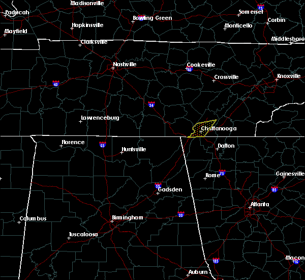 At 202 am est, severe thunderstorms were located along a line extending from near lakesite to ridgeside, moving east at 30 mph (radar indicated). Hazards include 60 mph wind gusts and quarter size hail. Hail damage to vehicles is expected. expect wind damage to roofs, siding, and trees. locations impacted include, chattanooga, soddy-daisy, signal mountain, walden, lakesite, ridgeside, fairmount, harrison, red bank, lookout mountain, east ridge, middle valley, falling water, harrison bay s. p. Shady grove and north chickamauga creek gorge. At 202 am est, severe thunderstorms were located along a line extending from near lakesite to ridgeside, moving east at 30 mph (radar indicated). Hazards include 60 mph wind gusts and quarter size hail. Hail damage to vehicles is expected. expect wind damage to roofs, siding, and trees. locations impacted include, chattanooga, soddy-daisy, signal mountain, walden, lakesite, ridgeside, fairmount, harrison, red bank, lookout mountain, east ridge, middle valley, falling water, harrison bay s. p. Shady grove and north chickamauga creek gorge.
|
| 2/25/2017 1:31 AM EST |
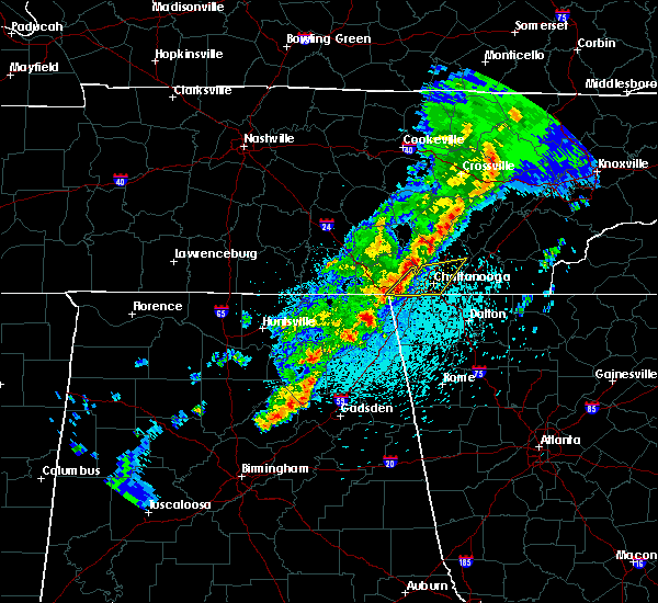 At 130 am est/1230 am cst/, severe thunderstorms were located along a line extending from near fairmount to 6 miles south of jasper, moving east at 30 mph (radar indicated). Hazards include 60 mph wind gusts and quarter size hail. Hail damage to vehicles is expected. Expect wind damage to roofs, siding, and trees. At 130 am est/1230 am cst/, severe thunderstorms were located along a line extending from near fairmount to 6 miles south of jasper, moving east at 30 mph (radar indicated). Hazards include 60 mph wind gusts and quarter size hail. Hail damage to vehicles is expected. Expect wind damage to roofs, siding, and trees.
|
| 11/30/2016 6:25 AM EST |
 At 624 am est, a severe thunderstorm was located near lakesite, or 12 miles west of cleveland, moving northeast at 65 mph (radar indicated). Hazards include 60 mph wind gusts and penny size hail. Expect damage to roofs. siding. And trees. At 624 am est, a severe thunderstorm was located near lakesite, or 12 miles west of cleveland, moving northeast at 65 mph (radar indicated). Hazards include 60 mph wind gusts and penny size hail. Expect damage to roofs. siding. And trees.
|
| 11/30/2016 6:17 AM EST |
 At 616 am est, severe thunderstorms were located along a line extending from near eagleton village to near wildwood lake, moving northeast at 45 mph (radar indicated). Hazards include 60 mph wind gusts and penny size hail. Expect damage to roofs. siding. and trees. locations impacted include, chattanooga, cleveland, athens, sweetwater, madisonville, benton, ducktown, etowah, charleston, south cleveland, east cleveland, wildwood lake, collegedale, englewood, vonore, tellico plains, niota, calhoun, ooltewah and parksville. A tornado watch remains in effect until 1100 am est for eastern tennessee. At 616 am est, severe thunderstorms were located along a line extending from near eagleton village to near wildwood lake, moving northeast at 45 mph (radar indicated). Hazards include 60 mph wind gusts and penny size hail. Expect damage to roofs. siding. and trees. locations impacted include, chattanooga, cleveland, athens, sweetwater, madisonville, benton, ducktown, etowah, charleston, south cleveland, east cleveland, wildwood lake, collegedale, englewood, vonore, tellico plains, niota, calhoun, ooltewah and parksville. A tornado watch remains in effect until 1100 am est for eastern tennessee.
|
| 11/30/2016 6:16 AM EST |
 At 615 am est, a severe thunderstorm was located near harrison, or 7 miles northeast of chattanooga, moving northeast at 65 mph (radar indicated). Hazards include 70 mph wind gusts and penny size hail. Expect considerable tree damage. damage is likely to mobile homes, roofs, and outbuildings. locations impacted include, chattanooga, soddy-daisy, signal mountain, rossville, walden, lakesite, ridgeside, harrison, fairmount, south cleveland, red bank, collegedale, mcdonald, ooltewah, east brainerd, shady grove, east ridge, harrison bay s. p,. falling water and apison. A tornado watch remains in effect until 1100 am est for eastern tennessee. At 615 am est, a severe thunderstorm was located near harrison, or 7 miles northeast of chattanooga, moving northeast at 65 mph (radar indicated). Hazards include 70 mph wind gusts and penny size hail. Expect considerable tree damage. damage is likely to mobile homes, roofs, and outbuildings. locations impacted include, chattanooga, soddy-daisy, signal mountain, rossville, walden, lakesite, ridgeside, harrison, fairmount, south cleveland, red bank, collegedale, mcdonald, ooltewah, east brainerd, shady grove, east ridge, harrison bay s. p,. falling water and apison. A tornado watch remains in effect until 1100 am est for eastern tennessee.
|
| 11/30/2016 5:54 AM EST |
 At 553 am est/453 am cst/, a severe thunderstorm was located 7 miles north of trenton, moving northeast at 65 mph (radar indicated). Hazards include 70 mph wind gusts and penny size hail. Expect considerable tree damage. Damage is likely to mobile homes, roofs, and outbuildings. At 553 am est/453 am cst/, a severe thunderstorm was located 7 miles north of trenton, moving northeast at 65 mph (radar indicated). Hazards include 70 mph wind gusts and penny size hail. Expect considerable tree damage. Damage is likely to mobile homes, roofs, and outbuildings.
|
| 11/30/2016 5:46 AM EST |
 At 545 am est, severe thunderstorms were located along a line extending from 8 miles northeast of madisonville to near ringgold, moving northeast at 45 mph (radar indicated). Hazards include 70 mph wind gusts and penny size hail. Expect considerable tree damage. Damage is likely to mobile homes, roofs, and outbuildings. At 545 am est, severe thunderstorms were located along a line extending from 8 miles northeast of madisonville to near ringgold, moving northeast at 45 mph (radar indicated). Hazards include 70 mph wind gusts and penny size hail. Expect considerable tree damage. Damage is likely to mobile homes, roofs, and outbuildings.
|
| 11/30/2016 5:42 AM EST |
 At 542 am est, severe thunderstorms were located along a line extending from near madisonville to 6 miles northwest of cohutta, moving east at 40 mph (radar indicated). Hazards include 70 mph wind gusts and penny size hail. Expect considerable tree damage. damage is likely to mobile homes, roofs, and outbuildings. locations impacted include, chattanooga, cleveland, athens, sweetwater, madisonville, charleston, ridgeside, harrison, wildwood lake, south cleveland, east cleveland, collegedale, englewood, niota, calhoun, mcdonald, riceville, ooltewah, east brainerd and clear water. A tornado watch remains in effect until 1100 am est for eastern tennessee. At 542 am est, severe thunderstorms were located along a line extending from near madisonville to 6 miles northwest of cohutta, moving east at 40 mph (radar indicated). Hazards include 70 mph wind gusts and penny size hail. Expect considerable tree damage. damage is likely to mobile homes, roofs, and outbuildings. locations impacted include, chattanooga, cleveland, athens, sweetwater, madisonville, charleston, ridgeside, harrison, wildwood lake, south cleveland, east cleveland, collegedale, englewood, niota, calhoun, mcdonald, riceville, ooltewah, east brainerd and clear water. A tornado watch remains in effect until 1100 am est for eastern tennessee.
|
| 11/30/2016 5:30 AM EST |
 At 530 am est, severe thunderstorms were located along a line extending from 8 miles southwest of fairview to 6 miles northwest of south cleveland, moving east at 50 mph (radar indicated). Hazards include 60 mph wind gusts and penny size hail. Expect damage to roofs. siding. And trees. At 530 am est, severe thunderstorms were located along a line extending from 8 miles southwest of fairview to 6 miles northwest of south cleveland, moving east at 50 mph (radar indicated). Hazards include 60 mph wind gusts and penny size hail. Expect damage to roofs. siding. And trees.
|
| 11/30/2016 5:25 AM EST | Trees dow in hamilton county TN, 1.1 miles ESE of Chattanooga, TN |
| 11/30/2016 5:16 AM EST |
 At 515 am est/415 am cst/, severe thunderstorms were located along a line extending from 7 miles southeast of dayton to near ridgeside to trenton, moving northeast at 60 mph (radar indicated). Hazards include 70 mph wind gusts and penny size hail. Expect considerable tree damage. damage is likely to mobile homes, roofs, and outbuildings. locations impacted include, chattanooga, soddy-daisy, signal mountain, walden, lakesite, ridgeside, harrison, fairmount, red bank, collegedale, ooltewah, east brainerd, shady grove, east ridge, harrison bay s. p,. north chickamauga creek gorge, falling water, lookout mountain, middle valley and hicks gap s. p. A tornado watch remains in effect until 1100 am est/1000 am cst/ for eastern tennessee. At 515 am est/415 am cst/, severe thunderstorms were located along a line extending from 7 miles southeast of dayton to near ridgeside to trenton, moving northeast at 60 mph (radar indicated). Hazards include 70 mph wind gusts and penny size hail. Expect considerable tree damage. damage is likely to mobile homes, roofs, and outbuildings. locations impacted include, chattanooga, soddy-daisy, signal mountain, walden, lakesite, ridgeside, harrison, fairmount, red bank, collegedale, ooltewah, east brainerd, shady grove, east ridge, harrison bay s. p,. north chickamauga creek gorge, falling water, lookout mountain, middle valley and hicks gap s. p. A tornado watch remains in effect until 1100 am est/1000 am cst/ for eastern tennessee.
|
| 11/30/2016 4:55 AM EST |
 At 455 am est, severe thunderstorms were located along a line extending from near athens to 6 miles east of charleston to near south cleveland, moving east at 50 mph (radar indicated). Hazards include 70 mph wind gusts and nickel size hail. Expect considerable tree damage. damage is likely to mobile homes, roofs, and outbuildings. locations impacted include, cleveland, athens, madisonville, decatur, benton, etowah, charleston, wildwood lake, south cleveland, east cleveland, collegedale, englewood, niota, calhoun, mcdonald, riceville, big spring, parksville, mount vernon and bullet creek. A tornado watch remains in effect until 1100 am est for eastern tennessee. At 455 am est, severe thunderstorms were located along a line extending from near athens to 6 miles east of charleston to near south cleveland, moving east at 50 mph (radar indicated). Hazards include 70 mph wind gusts and nickel size hail. Expect considerable tree damage. damage is likely to mobile homes, roofs, and outbuildings. locations impacted include, cleveland, athens, madisonville, decatur, benton, etowah, charleston, wildwood lake, south cleveland, east cleveland, collegedale, englewood, niota, calhoun, mcdonald, riceville, big spring, parksville, mount vernon and bullet creek. A tornado watch remains in effect until 1100 am est for eastern tennessee.
|
| 11/30/2016 4:53 AM EST |
 At 452 am est/352 am cst/, severe thunderstorms were located along a line extending from 6 miles north of fairmount to near trenton to near pisgah, moving northeast at 60 mph (radar indicated). Hazards include 70 mph wind gusts and nickel size hail. Expect considerable tree damage. Damage is likely to mobile homes, roofs, and outbuildings. At 452 am est/352 am cst/, severe thunderstorms were located along a line extending from 6 miles north of fairmount to near trenton to near pisgah, moving northeast at 60 mph (radar indicated). Hazards include 70 mph wind gusts and nickel size hail. Expect considerable tree damage. Damage is likely to mobile homes, roofs, and outbuildings.
|
| 11/30/2016 4:42 AM EST |
 At 441 am est, severe thunderstorms were located along a line extending from near decatur to near charleston to near harrison, moving east at 50 mph (radar indicated). Hazards include 70 mph wind gusts and nickel size hail. Expect considerable tree damage. Damage is likely to mobile homes, roofs, and outbuildings. At 441 am est, severe thunderstorms were located along a line extending from near decatur to near charleston to near harrison, moving east at 50 mph (radar indicated). Hazards include 70 mph wind gusts and nickel size hail. Expect considerable tree damage. Damage is likely to mobile homes, roofs, and outbuildings.
|
| 11/30/2016 4:34 AM EST |
 At 433 am est, severe thunderstorms were located along a line extending from kingston to 6 miles southeast of decatur to 6 miles south of harrison, moving east at 45 mph (radar indicated). Hazards include 70 mph wind gusts and nickel size hail. Expect considerable tree damage. damage is likely to mobile homes, roofs, and outbuildings. locations impacted include, chattanooga, cleveland, athens, dayton, sweetwater, loudon, decatur, soddy-daisy, fairview, lakesite, charleston, ridgeside, harrison, south cleveland, east cleveland, wildwood lake, red bank, collegedale, graysville and niota. A tornado watch remains in effect until 1100 am est for eastern tennessee. At 433 am est, severe thunderstorms were located along a line extending from kingston to 6 miles southeast of decatur to 6 miles south of harrison, moving east at 45 mph (radar indicated). Hazards include 70 mph wind gusts and nickel size hail. Expect considerable tree damage. damage is likely to mobile homes, roofs, and outbuildings. locations impacted include, chattanooga, cleveland, athens, dayton, sweetwater, loudon, decatur, soddy-daisy, fairview, lakesite, charleston, ridgeside, harrison, south cleveland, east cleveland, wildwood lake, red bank, collegedale, graysville and niota. A tornado watch remains in effect until 1100 am est for eastern tennessee.
|
| 11/30/2016 4:30 AM EST | Trees dow in hamilton county TN, 1.1 miles ESE of Chattanooga, TN |
| 11/30/2016 4:22 AM EST |
 The severe thunderstorm warning for northwestern walker, northwestern catoosa and dade counties will expire at 430 am est, the storms which prompted the warning have moved out of the area. therefore the warning will be allowed to expire. a tornado watch remains in effect until 1100 am est for northwestern georgia. The severe thunderstorm warning for northwestern walker, northwestern catoosa and dade counties will expire at 430 am est, the storms which prompted the warning have moved out of the area. therefore the warning will be allowed to expire. a tornado watch remains in effect until 1100 am est for northwestern georgia.
|
| 11/30/2016 4:12 AM EST |
 At 412 am est/312 am cst/, severe thunderstorms were located along a line extending from 6 miles southwest of rockwood to 6 miles south of dayton to lookout mountain, moving east at 50 mph (radar indicated). Hazards include 60 mph wind gusts. Expect damage to roofs. siding. And trees. At 412 am est/312 am cst/, severe thunderstorms were located along a line extending from 6 miles southwest of rockwood to 6 miles south of dayton to lookout mountain, moving east at 50 mph (radar indicated). Hazards include 60 mph wind gusts. Expect damage to roofs. siding. And trees.
|
| 11/30/2016 4:04 AM EST |
 At 404 am est/304 am cst/, severe thunderstorms were located along a line extending from 7 miles west of spring city to soddy-daisy to near trenton, moving east at 40 mph (radar indicated). Hazards include 60 mph wind gusts. Expect damage to roofs. siding. and trees. locations impacted include, chattanooga, dayton, soddy-daisy, signal mountain, walden, lakesite, ridgeside, harrison, fairmount, red bank, collegedale, graysville, ooltewah, stinging fork falls s. p,. birchwood, haletown (guild), evensville, east brainerd, shady grove and old washington. A tornado watch remains in effect until 1100 am est/1000 am cst/ for eastern tennessee. At 404 am est/304 am cst/, severe thunderstorms were located along a line extending from 7 miles west of spring city to soddy-daisy to near trenton, moving east at 40 mph (radar indicated). Hazards include 60 mph wind gusts. Expect damage to roofs. siding. and trees. locations impacted include, chattanooga, dayton, soddy-daisy, signal mountain, walden, lakesite, ridgeside, harrison, fairmount, red bank, collegedale, graysville, ooltewah, stinging fork falls s. p,. birchwood, haletown (guild), evensville, east brainerd, shady grove and old washington. A tornado watch remains in effect until 1100 am est/1000 am cst/ for eastern tennessee.
|
| 11/30/2016 3:47 AM EST |
 At 346 am est, severe thunderstorms were located along a line extending from long island to near bridgeport to near fabius, moving northeast at 60 mph (radar indicated). Hazards include 60 mph wind gusts. Expect damage to roofs. siding. And trees. At 346 am est, severe thunderstorms were located along a line extending from long island to near bridgeport to near fabius, moving northeast at 60 mph (radar indicated). Hazards include 60 mph wind gusts. Expect damage to roofs. siding. And trees.
|
| 11/30/2016 2:41 AM CST |
 At 340 am est/240 am cst/, severe thunderstorms were located along a line extending from 9 miles west of pikeville to near fairmount to near bridgeport, moving east at 55 mph (radar indicated). Hazards include 60 mph wind gusts. Expect damage to roofs. siding. And trees. At 340 am est/240 am cst/, severe thunderstorms were located along a line extending from 9 miles west of pikeville to near fairmount to near bridgeport, moving east at 55 mph (radar indicated). Hazards include 60 mph wind gusts. Expect damage to roofs. siding. And trees.
|
| 11/30/2016 2:00 AM EST |
 At 159 am est, a severe thunderstorm capable of producing a tornado was located near cohutta, or near ringgold, moving northeast at 50 mph (radar indicated rotation). Hazards include tornado. Flying debris will be dangerous to those caught without shelter. mobile homes will be damaged or destroyed. damage to roofs, windows, and vehicles will occur. tree damage is likely. this dangerous storm will be near, wildwood lake, south cleveland and east cleveland around 215 am est. benton around 230 am est. other locations impacted by this tornadic thunderstorm include mcdonald, apison, collegedale, flint springs, ooltewah, waterville, tasso, conasauga, parksville and red clay s. P At 159 am est, a severe thunderstorm capable of producing a tornado was located near cohutta, or near ringgold, moving northeast at 50 mph (radar indicated rotation). Hazards include tornado. Flying debris will be dangerous to those caught without shelter. mobile homes will be damaged or destroyed. damage to roofs, windows, and vehicles will occur. tree damage is likely. this dangerous storm will be near, wildwood lake, south cleveland and east cleveland around 215 am est. benton around 230 am est. other locations impacted by this tornadic thunderstorm include mcdonald, apison, collegedale, flint springs, ooltewah, waterville, tasso, conasauga, parksville and red clay s. P
|
| 11/30/2016 1:56 AM EST |
 At 156 am est, a severe thunderstorm was located 7 miles southeast of harrison, or 9 miles north of ringgold, moving northeast at 55 mph (radar indicated). Hazards include 60 mph wind gusts. Expect damage to roofs. siding. and trees. locations impacted include, chattanooga, harrison, collegedale, apison, ooltewah, east ridge, east brainerd and harrison bay s. p. A tornado watch remains in effect until 400 am est for eastern tennessee. At 156 am est, a severe thunderstorm was located 7 miles southeast of harrison, or 9 miles north of ringgold, moving northeast at 55 mph (radar indicated). Hazards include 60 mph wind gusts. Expect damage to roofs. siding. and trees. locations impacted include, chattanooga, harrison, collegedale, apison, ooltewah, east ridge, east brainerd and harrison bay s. p. A tornado watch remains in effect until 400 am est for eastern tennessee.
|
| 11/30/2016 1:53 AM EST |
 At 153 am est, a severe thunderstorm capable of producing a tornado was located near ringgold, moving northeast at 50 mph (radar indicated rotation). Hazards include tornado. Flying debris will be dangerous to those caught without shelter. mobile homes will be damaged or destroyed. damage to roofs, windows, and vehicles will occur. Tree damage is likely. At 153 am est, a severe thunderstorm capable of producing a tornado was located near ringgold, moving northeast at 50 mph (radar indicated rotation). Hazards include tornado. Flying debris will be dangerous to those caught without shelter. mobile homes will be damaged or destroyed. damage to roofs, windows, and vehicles will occur. Tree damage is likely.
|
| 11/30/2016 1:41 AM EST |
 At 140 am est, a severe thunderstorm was located over chattanooga valley, or 8 miles southwest of chattanooga, moving northeast at 55 mph (radar indicated). Hazards include 60 mph wind gusts. Expect damage to roofs. siding. And trees. At 140 am est, a severe thunderstorm was located over chattanooga valley, or 8 miles southwest of chattanooga, moving northeast at 55 mph (radar indicated). Hazards include 60 mph wind gusts. Expect damage to roofs. siding. And trees.
|
| 11/30/2016 12:46 AM EST |
 At 1246 am est, a severe thunderstorm capable of producing a tornado was located over lakesite, or 10 miles northeast of chattanooga, moving northeast at 55 mph (radar indicated rotation). Hazards include tornado and quarter size hail. Flying debris will be dangerous to those caught without shelter. mobile homes will be damaged or destroyed. damage to roofs, windows, and vehicles will occur. tree damage is likely. this dangerous storm will be near, cleveland around 100 am est. other locations impacted by this tornadic thunderstorm include mcdonald, ooltewah, middle valley, shady grove, hopewell, red bank, waterville, harrison bay s. p,. Falling water and lookout mountain. At 1246 am est, a severe thunderstorm capable of producing a tornado was located over lakesite, or 10 miles northeast of chattanooga, moving northeast at 55 mph (radar indicated rotation). Hazards include tornado and quarter size hail. Flying debris will be dangerous to those caught without shelter. mobile homes will be damaged or destroyed. damage to roofs, windows, and vehicles will occur. tree damage is likely. this dangerous storm will be near, cleveland around 100 am est. other locations impacted by this tornadic thunderstorm include mcdonald, ooltewah, middle valley, shady grove, hopewell, red bank, waterville, harrison bay s. p,. Falling water and lookout mountain.
|
| 11/30/2016 12:34 AM EST |
 At 1234 am est, a severe thunderstorm capable of producing a tornado was located over chattanooga, moving northeast at 50 mph (radar indicated rotation). Hazards include tornado and quarter size hail. Flying debris will be dangerous to those caught without shelter. mobile homes will be damaged or destroyed. damage to roofs, windows, and vehicles will occur. tree damage is likely. this dangerous storm will be near, harrison around 1245 am est. lakesite around 1250 am est. cleveland, east cleveland and south cleveland around 100 am est. other locations impacted by this tornadic thunderstorm include mcdonald, ooltewah, middle valley, shady grove, hopewell, red bank, waterville, harrison bay s. p,. Falling water and lookout mountain. At 1234 am est, a severe thunderstorm capable of producing a tornado was located over chattanooga, moving northeast at 50 mph (radar indicated rotation). Hazards include tornado and quarter size hail. Flying debris will be dangerous to those caught without shelter. mobile homes will be damaged or destroyed. damage to roofs, windows, and vehicles will occur. tree damage is likely. this dangerous storm will be near, harrison around 1245 am est. lakesite around 1250 am est. cleveland, east cleveland and south cleveland around 100 am est. other locations impacted by this tornadic thunderstorm include mcdonald, ooltewah, middle valley, shady grove, hopewell, red bank, waterville, harrison bay s. p,. Falling water and lookout mountain.
|
| 11/30/2016 12:28 AM EST |
 At 1228 am est/1128 pm cst/, a severe thunderstorm was located near signal mountain, or near chattanooga, moving northeast at 50 mph (radar indicated). Hazards include 60 mph wind gusts. Expect damage to roofs. siding. and trees. locations impacted include, chattanooga, jasper, soddy-daisy, signal mountain, walden, lakesite, ridgeside, harrison, fairmount, red bank, collegedale, lookout mountain, ooltewah, new hope, middle valley, haletown (guild), hicks gap s. p,. harrison bay s. p,. falling water and east ridge. A tornado watch remains in effect until 400 am est/300 am cst/ for eastern tennessee. At 1228 am est/1128 pm cst/, a severe thunderstorm was located near signal mountain, or near chattanooga, moving northeast at 50 mph (radar indicated). Hazards include 60 mph wind gusts. Expect damage to roofs. siding. and trees. locations impacted include, chattanooga, jasper, soddy-daisy, signal mountain, walden, lakesite, ridgeside, harrison, fairmount, red bank, collegedale, lookout mountain, ooltewah, new hope, middle valley, haletown (guild), hicks gap s. p,. harrison bay s. p,. falling water and east ridge. A tornado watch remains in effect until 400 am est/300 am cst/ for eastern tennessee.
|
| 11/30/2016 12:09 AM EST |
 At 1209 am est/1109 pm cst/, a severe thunderstorm was located near trenton, moving northeast at 50 mph (radar indicated). Hazards include 60 mph wind gusts. Expect damage to roofs. siding. And trees. At 1209 am est/1109 pm cst/, a severe thunderstorm was located near trenton, moving northeast at 50 mph (radar indicated). Hazards include 60 mph wind gusts. Expect damage to roofs. siding. And trees.
|
| 8/28/2016 4:27 PM EDT |
 At 426 pm edt, a severe thunderstorm was located near harrison, or 11 miles west of cleveland, moving northwest at 15 mph (radar indicated). Hazards include 60 mph wind gusts. Expect damage to roofs. siding. and trees. locations impacted include, chattanooga, cleveland, soddy-daisy, signal mountain, walden, lakesite, harrison, south cleveland, fairmount, red bank, collegedale, mcdonald, ooltewah, middle valley, east brainerd, shady grove, harrison bay s. p,. Falling water, mowbray mountain and sale creek. At 426 pm edt, a severe thunderstorm was located near harrison, or 11 miles west of cleveland, moving northwest at 15 mph (radar indicated). Hazards include 60 mph wind gusts. Expect damage to roofs. siding. and trees. locations impacted include, chattanooga, cleveland, soddy-daisy, signal mountain, walden, lakesite, harrison, south cleveland, fairmount, red bank, collegedale, mcdonald, ooltewah, middle valley, east brainerd, shady grove, harrison bay s. p,. Falling water, mowbray mountain and sale creek.
|
| 8/28/2016 4:25 PM EDT | Couple trees down on a hous in hamilton county TN, 2.3 miles W of Chattanooga, TN |
| 8/28/2016 4:09 PM EDT |
 At 409 pm edt, a severe thunderstorm was located near south cleveland, or 9 miles southwest of cleveland, moving northwest at 15 mph (radar indicated). Hazards include 60 mph wind gusts and penny size hail. Expect damage to roofs. siding. And trees. At 409 pm edt, a severe thunderstorm was located near south cleveland, or 9 miles southwest of cleveland, moving northwest at 15 mph (radar indicated). Hazards include 60 mph wind gusts and penny size hail. Expect damage to roofs. siding. And trees.
|
| 8/17/2016 7:57 PM EDT |
 The severe thunderstorm warning for southwestern bradley and southeastern hamilton counties will expire at 800 pm edt, the storm which prompted the warning has weakened below severe limits, and no longer pose an immediate threat to life or property. therefore, the warning will be allowed to expire. however gusty winds and heavy rain are still possible with this thunderstorm. The severe thunderstorm warning for southwestern bradley and southeastern hamilton counties will expire at 800 pm edt, the storm which prompted the warning has weakened below severe limits, and no longer pose an immediate threat to life or property. therefore, the warning will be allowed to expire. however gusty winds and heavy rain are still possible with this thunderstorm.
|
| 8/17/2016 7:29 PM EDT |
 At 726 pm edt, a severe thunderstorm was located near south cleveland, or 10 miles northeast of ringgold, moving east at 10 mph. the storm has shown some signs of weakening but could strengthen at any time (radar indicated). Hazards include 60 mph wind gusts and penny size hail. Expect damage to roofs. siding. and trees. locations impacted include, cleveland, south cleveland, east cleveland, wildwood lake, collegedale, mcdonald, apison, flint springs, waterville, red clay s. p. And ooltewah. At 726 pm edt, a severe thunderstorm was located near south cleveland, or 10 miles northeast of ringgold, moving east at 10 mph. the storm has shown some signs of weakening but could strengthen at any time (radar indicated). Hazards include 60 mph wind gusts and penny size hail. Expect damage to roofs. siding. and trees. locations impacted include, cleveland, south cleveland, east cleveland, wildwood lake, collegedale, mcdonald, apison, flint springs, waterville, red clay s. p. And ooltewah.
|
| 8/17/2016 7:14 PM EDT |
 At 712 pm edt, a severe thunderstorm was located near harrison, or 10 miles north of ringgold, moving east at 10 mph (radar indicated). Hazards include 60 mph wind gusts and quarter size hail. very heavy rainfall is also occurring with this storm. Hail damage to vehicles is expected. Expect wind damage to roofs, siding, and trees. At 712 pm edt, a severe thunderstorm was located near harrison, or 10 miles north of ringgold, moving east at 10 mph (radar indicated). Hazards include 60 mph wind gusts and quarter size hail. very heavy rainfall is also occurring with this storm. Hail damage to vehicles is expected. Expect wind damage to roofs, siding, and trees.
|
| 7/16/2016 1:58 PM EDT |
 At 158 pm edt, a severe thunderstorm was located over harrison, or 8 miles northeast of chattanooga, moving east at 15 mph (radar indicated). Hazards include 60 mph wind gusts and quarter size hail. Hail damage to vehicles is expected. expect wind damage to roofs, siding, and trees. locations impacted include, chattanooga, lakesite, ridgeside, harrison, red bank, collegedale, ooltewah, east ridge, harrison bay s. p,. Middle valley, east brainerd and apison. At 158 pm edt, a severe thunderstorm was located over harrison, or 8 miles northeast of chattanooga, moving east at 15 mph (radar indicated). Hazards include 60 mph wind gusts and quarter size hail. Hail damage to vehicles is expected. expect wind damage to roofs, siding, and trees. locations impacted include, chattanooga, lakesite, ridgeside, harrison, red bank, collegedale, ooltewah, east ridge, harrison bay s. p,. Middle valley, east brainerd and apison.
|
| 7/16/2016 1:50 PM EDT | A few trees down in the hixson area via social medi in hamilton county TN, 5.2 miles SSE of Chattanooga, TN |
| 7/16/2016 1:47 PM EDT |
 At 147 pm edt, a severe thunderstorm was located near walden, or near chattanooga, moving southeast at 10 mph (radar indicated). Hazards include 60 mph wind gusts and quarter size hail. Hail damage to vehicles is expected. Expect wind damage to roofs, siding, and trees. At 147 pm edt, a severe thunderstorm was located near walden, or near chattanooga, moving southeast at 10 mph (radar indicated). Hazards include 60 mph wind gusts and quarter size hail. Hail damage to vehicles is expected. Expect wind damage to roofs, siding, and trees.
|
| 7/14/2016 4:49 PM EDT |
 At 448 pm edt/348 pm cdt/, severe thunderstorms were located along a line extending from near spring city to near lookout mountain, moving east at 25 mph (radar indicated). Hazards include 60 mph wind gusts and quarter size hail. Hail damage to vehicles is expected. expect wind damage to roofs, siding, and trees. Locations impacted include, chattanooga, dayton, jasper, decatur, soddy-daisy, signal mountain, spring city, walden, lakesite, whitwell, ridgeside, harrison, fairmount, red bank, collegedale, graysville, powells crossroads, martin springs, peakland and big spring. At 448 pm edt/348 pm cdt/, severe thunderstorms were located along a line extending from near spring city to near lookout mountain, moving east at 25 mph (radar indicated). Hazards include 60 mph wind gusts and quarter size hail. Hail damage to vehicles is expected. expect wind damage to roofs, siding, and trees. Locations impacted include, chattanooga, dayton, jasper, decatur, soddy-daisy, signal mountain, spring city, walden, lakesite, whitwell, ridgeside, harrison, fairmount, red bank, collegedale, graysville, powells crossroads, martin springs, peakland and big spring.
|
| 7/14/2016 3:28 PM CDT |
 At 428 pm edt/328 pm cdt/, severe thunderstorms were located along a line extending from 6 miles west of spring city to 6 miles southeast of jasper, moving east at 25 mph (radar indicated). Hazards include 60 mph wind gusts and quarter size hail. Hail damage to vehicles is expected. Expect wind damage to roofs, siding, and trees. At 428 pm edt/328 pm cdt/, severe thunderstorms were located along a line extending from 6 miles west of spring city to 6 miles southeast of jasper, moving east at 25 mph (radar indicated). Hazards include 60 mph wind gusts and quarter size hail. Hail damage to vehicles is expected. Expect wind damage to roofs, siding, and trees.
|
| 7/9/2016 12:38 AM EDT |
 At 1238 am edt, a severe thunderstorm was located near south cleveland, or 9 miles southwest of cleveland, moving east at 35 mph (radar indicated). Hazards include 60 mph wind gusts and quarter size hail. Hail damage to vehicles is expected. expect wind damage to roofs, siding, and trees. locations impacted include, chattanooga, cleveland, lakesite, harrison, south cleveland, wildwood lake, collegedale, mcdonald, apison, flint springs, ooltewah, east brainerd, waterville, east ridge, harrison bay s. p,. red clay s. p. And middle valley. At 1238 am edt, a severe thunderstorm was located near south cleveland, or 9 miles southwest of cleveland, moving east at 35 mph (radar indicated). Hazards include 60 mph wind gusts and quarter size hail. Hail damage to vehicles is expected. expect wind damage to roofs, siding, and trees. locations impacted include, chattanooga, cleveland, lakesite, harrison, south cleveland, wildwood lake, collegedale, mcdonald, apison, flint springs, ooltewah, east brainerd, waterville, east ridge, harrison bay s. p,. red clay s. p. And middle valley.
|
| 7/9/2016 12:28 AM EDT |
 At 1227 am edt, a severe thunderstorm was located over ridgeside, or near chattanooga, moving southeast at 25 mph (radar indicated). Hazards include 60 mph wind gusts and quarter size hail. Hail damage to vehicles is expected. expect wind damage to roofs, siding, and trees. locations impacted include, chattanooga, cleveland, soddy-daisy, signal mountain, walden, lakesite, ridgeside, harrison, fairmount, wildwood lake, south cleveland, red bank, collegedale, mcdonald, ooltewah, east brainerd, east ridge, harrison bay s. p,. North chickamauga creek gorge and falling water. At 1227 am edt, a severe thunderstorm was located over ridgeside, or near chattanooga, moving southeast at 25 mph (radar indicated). Hazards include 60 mph wind gusts and quarter size hail. Hail damage to vehicles is expected. expect wind damage to roofs, siding, and trees. locations impacted include, chattanooga, cleveland, soddy-daisy, signal mountain, walden, lakesite, ridgeside, harrison, fairmount, wildwood lake, south cleveland, red bank, collegedale, mcdonald, ooltewah, east brainerd, east ridge, harrison bay s. p,. North chickamauga creek gorge and falling water.
|
| 7/9/2016 12:20 AM EDT | Trees and power lines down across the city of chattanoog in hamilton county TN, 1.1 miles ESE of Chattanooga, TN |
| 7/9/2016 12:19 AM EDT |
 At 1219 am edt/1119 pm cdt/, a severe thunderstorm was located over chattanooga, moving southeast at 25 mph (radar indicated). Hazards include 60 mph wind gusts and quarter size hail. Hail damage to vehicles is expected. expect wind damage to roofs, siding, and trees. Locations impacted include, chattanooga, cleveland, soddy-daisy, signal mountain, walden, lakesite, whitwell, ridgeside, harrison, fairmount, wildwood lake, south cleveland, red bank, collegedale, powells crossroads, mcdonald, martin springs, ooltewah, east brainerd and east ridge. At 1219 am edt/1119 pm cdt/, a severe thunderstorm was located over chattanooga, moving southeast at 25 mph (radar indicated). Hazards include 60 mph wind gusts and quarter size hail. Hail damage to vehicles is expected. expect wind damage to roofs, siding, and trees. Locations impacted include, chattanooga, cleveland, soddy-daisy, signal mountain, walden, lakesite, whitwell, ridgeside, harrison, fairmount, wildwood lake, south cleveland, red bank, collegedale, powells crossroads, mcdonald, martin springs, ooltewah, east brainerd and east ridge.
|
| 7/9/2016 12:10 AM EDT |
 At 1209 am edt/1109 pm cdt/, a severe thunderstorm was located near signal mountain, or near chattanooga, moving southeast at 25 mph (radar indicated). Hazards include 60 mph wind gusts. Expect damage to roofs. siding. And trees. At 1209 am edt/1109 pm cdt/, a severe thunderstorm was located near signal mountain, or near chattanooga, moving southeast at 25 mph (radar indicated). Hazards include 60 mph wind gusts. Expect damage to roofs. siding. And trees.
|
| 7/8/2016 10:58 PM CDT |
 At 1158 pm edt/1058 pm cdt/, severe thunderstorms were located along a line extending from near dunlap to near whitwell to near tracy city, moving southeast at 45 mph (radar indicated). Hazards include 60 mph wind gusts. Expect damage to roofs. siding. and trees. locations impacted include, chattanooga, dunlap, jasper, soddy-daisy, signal mountain, walden, whitwell, kimball, monteagle, fairmount, red bank, powells crossroads, martin springs, foster falls s. p,. Sequatchie cave, haletown (guild), cagle, north chickamauga creek gorge, griffith creek and falling water. At 1158 pm edt/1058 pm cdt/, severe thunderstorms were located along a line extending from near dunlap to near whitwell to near tracy city, moving southeast at 45 mph (radar indicated). Hazards include 60 mph wind gusts. Expect damage to roofs. siding. and trees. locations impacted include, chattanooga, dunlap, jasper, soddy-daisy, signal mountain, walden, whitwell, kimball, monteagle, fairmount, red bank, powells crossroads, martin springs, foster falls s. p,. Sequatchie cave, haletown (guild), cagle, north chickamauga creek gorge, griffith creek and falling water.
|
| 7/8/2016 10:47 PM CDT |
 At 1147 pm edt/1047 pm cdt/, severe thunderstorms were located along a line extending from 14 miles northwest of dunlap to near gruetli-laager to near monteagle, moving southeast at 40 mph (radar indicated). Hazards include 60 mph wind gusts. Expect damage to roofs. siding. And trees. At 1147 pm edt/1047 pm cdt/, severe thunderstorms were located along a line extending from 14 miles northwest of dunlap to near gruetli-laager to near monteagle, moving southeast at 40 mph (radar indicated). Hazards include 60 mph wind gusts. Expect damage to roofs. siding. And trees.
|
| 7/6/2016 8:30 PM EDT | Several trees down across chattanooga and county-wid in hamilton county TN, 1.1 miles ESE of Chattanooga, TN |
| 7/6/2016 8:27 PM EDT |
 At 826 pm edt, severe thunderstorms were located along a line extending from near murphy to near ducktown to near benton to near harrison, moving southeast at 30 mph (radar indicated). Hazards include 60 mph wind gusts. Expect damage to roofs. siding. and trees. Locations impacted include, chattanooga, cleveland, murphy, benton, ducktown, soddy-daisy, signal mountain, walden, lakesite, charleston, ridgeside, harrison, south cleveland, east cleveland, fairmount, wildwood lake, red bank, collegedale, graysville and calhoun. At 826 pm edt, severe thunderstorms were located along a line extending from near murphy to near ducktown to near benton to near harrison, moving southeast at 30 mph (radar indicated). Hazards include 60 mph wind gusts. Expect damage to roofs. siding. and trees. Locations impacted include, chattanooga, cleveland, murphy, benton, ducktown, soddy-daisy, signal mountain, walden, lakesite, charleston, ridgeside, harrison, south cleveland, east cleveland, fairmount, wildwood lake, red bank, collegedale, graysville and calhoun.
|
| 7/6/2016 8:12 PM EDT |
 At 812 pm edt, severe thunderstorms were located along a line extending from 6 miles north of blairsville to near ducktown to near charleston to near walden, moving southeast at 55 mph (radar indicated). Hazards include 60 mph wind gusts. Expect damage to roofs. siding. And trees. At 812 pm edt, severe thunderstorms were located along a line extending from 6 miles north of blairsville to near ducktown to near charleston to near walden, moving southeast at 55 mph (radar indicated). Hazards include 60 mph wind gusts. Expect damage to roofs. siding. And trees.
|
| 6/15/2016 8:12 PM EDT |
 The severe thunderstorm warning for southern sequatchie. hamilton and marion counties will expire at 815 pm edt/715 pm cdt/. the storms which prompted the warning have weakened below severe limits. and no longer pose an immediate threat to life or property. therefore the warning will be allowed to expire. However gusty winds are still possible with these thunderstorms. The severe thunderstorm warning for southern sequatchie. hamilton and marion counties will expire at 815 pm edt/715 pm cdt/. the storms which prompted the warning have weakened below severe limits. and no longer pose an immediate threat to life or property. therefore the warning will be allowed to expire. However gusty winds are still possible with these thunderstorms.
|
| 6/15/2016 7:47 PM EDT |
 At 747 pm edt/647 pm cdt/, severe thunderstorms were located along a line extending from soddy-daisy to 6 miles south of bridgeport, moving southeast at 45 mph (radar indicated). Hazards include 60 mph wind gusts. Expect damage to roofs. siding. and trees. locations impacted include, chattanooga, dunlap, jasper, soddy-daisy, signal mountain, south pittsburg, walden, lakesite, whitwell, kimball, ridgeside, harrison, fairmount, red bank, collegedale, graysville, powells crossroads, orme, martin springs and foster falls s. P At 747 pm edt/647 pm cdt/, severe thunderstorms were located along a line extending from soddy-daisy to 6 miles south of bridgeport, moving southeast at 45 mph (radar indicated). Hazards include 60 mph wind gusts. Expect damage to roofs. siding. and trees. locations impacted include, chattanooga, dunlap, jasper, soddy-daisy, signal mountain, south pittsburg, walden, lakesite, whitwell, kimball, ridgeside, harrison, fairmount, red bank, collegedale, graysville, powells crossroads, orme, martin springs and foster falls s. P
|
| 6/15/2016 6:28 PM CDT |
 At 728 pm edt/628 pm cdt/, severe thunderstorms were located along a line extending from dunlap to 8 miles northwest of stevenson, moving southeast at 45 mph (radar indicated). Hazards include 60 mph wind gusts. Expect damage to roofs. siding. and trees. Locations impacted include, chattanooga, dunlap, jasper, soddy-daisy, signal mountain, south pittsburg, walden, lakesite, whitwell, kimball, monteagle, ridgeside, harrison, fairmount, red bank, collegedale, graysville, powells crossroads, orme and martin springs. At 728 pm edt/628 pm cdt/, severe thunderstorms were located along a line extending from dunlap to 8 miles northwest of stevenson, moving southeast at 45 mph (radar indicated). Hazards include 60 mph wind gusts. Expect damage to roofs. siding. and trees. Locations impacted include, chattanooga, dunlap, jasper, soddy-daisy, signal mountain, south pittsburg, walden, lakesite, whitwell, kimball, monteagle, ridgeside, harrison, fairmount, red bank, collegedale, graysville, powells crossroads, orme and martin springs.
|
| 6/15/2016 6:13 PM CDT |
 At 712 pm edt/612 pm cdt/, severe thunderstorms were located along a line extending from 9 miles northwest of dunlap to near winchester, moving southeast at 40 mph (radar indicated). Hazards include 60 mph wind gusts. Expect damage to roofs. siding. And trees. At 712 pm edt/612 pm cdt/, severe thunderstorms were located along a line extending from 9 miles northwest of dunlap to near winchester, moving southeast at 40 mph (radar indicated). Hazards include 60 mph wind gusts. Expect damage to roofs. siding. And trees.
|
| 2/3/2016 3:47 AM EST |
 At 346 am est /246 am cst/, a severe thunderstorm was located near soddy-daisy, or 12 miles southwest of dayton, moving northeast at 65 mph (radar indicated). Hazards include 60 mph wind gusts and penny size hail. Expect damage to roofs. siding and trees. Locations impacted include, chattanooga, soddy-daisy, signal mountain, walden, lakesite, ridgeside, harrison, fairmount, red bank, collegedale, ooltewah, east brainerd, sale creek, birchwood, shady grove, middle valley and lone oak. At 346 am est /246 am cst/, a severe thunderstorm was located near soddy-daisy, or 12 miles southwest of dayton, moving northeast at 65 mph (radar indicated). Hazards include 60 mph wind gusts and penny size hail. Expect damage to roofs. siding and trees. Locations impacted include, chattanooga, soddy-daisy, signal mountain, walden, lakesite, ridgeside, harrison, fairmount, red bank, collegedale, ooltewah, east brainerd, sale creek, birchwood, shady grove, middle valley and lone oak.
|
| 2/3/2016 3:20 AM EST |
 At 319 am est /219 am cst/, a severe thunderstorm was located near jasper, moving northeast at 55 mph (radar indicated). Hazards include 60 mph wind gusts and penny size hail. Expect damage to roofs. Siding and trees. At 319 am est /219 am cst/, a severe thunderstorm was located near jasper, moving northeast at 55 mph (radar indicated). Hazards include 60 mph wind gusts and penny size hail. Expect damage to roofs. Siding and trees.
|
| 7/22/2015 4:55 PM EDT |
 At 455 pm edt, a severe thunderstorm was located 7 miles south of south cleveland, or 12 miles south of cleveland, moving east at 20 mph (radar indicated). Hazards include 60 mph wind gusts and quarter size hail. Hail damage to vehicles is expected. expect wind damage to roofs, siding and trees. Locations impacted include, wildwood lake, south cleveland, collegedale, flint springs, ooltewah, gap springs and waterville. At 455 pm edt, a severe thunderstorm was located 7 miles south of south cleveland, or 12 miles south of cleveland, moving east at 20 mph (radar indicated). Hazards include 60 mph wind gusts and quarter size hail. Hail damage to vehicles is expected. expect wind damage to roofs, siding and trees. Locations impacted include, wildwood lake, south cleveland, collegedale, flint springs, ooltewah, gap springs and waterville.
|
| 7/22/2015 4:46 PM EDT | Power lines down near wal mart in the eastgate are in hamilton county TN, 4.8 miles NW of Chattanooga, TN |
| 7/22/2015 4:40 PM EDT |
 At 439 pm edt, a severe thunderstorm was located 8 miles southwest of south cleveland, or 14 miles east of chattanooga, moving east at 20 mph (radar indicated). Hazards include 60 mph wind gusts and quarter size hail. Hail damage to vehicles is expected. Expect wind damage to roofs, siding and trees. At 439 pm edt, a severe thunderstorm was located 8 miles southwest of south cleveland, or 14 miles east of chattanooga, moving east at 20 mph (radar indicated). Hazards include 60 mph wind gusts and quarter size hail. Hail damage to vehicles is expected. Expect wind damage to roofs, siding and trees.
|
| 7/14/2015 5:56 PM CDT |
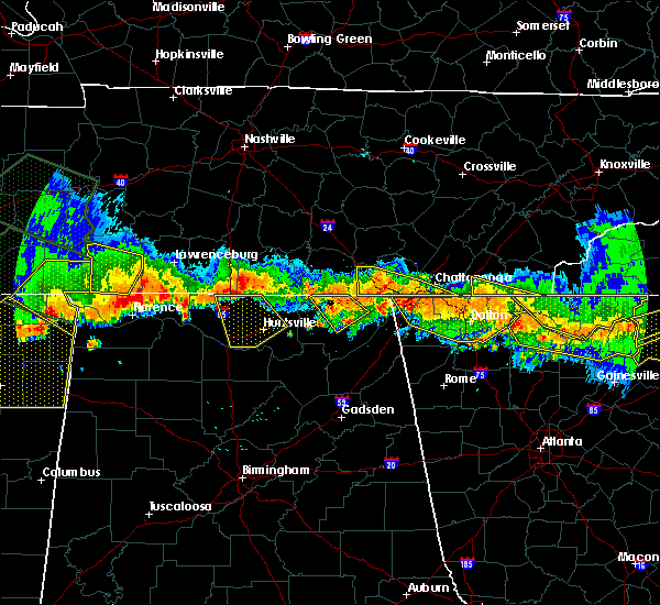 At 655 pm edt /555 pm cdt/, severe thunderstorms were located along a line extending from near ridgeside to 7 miles northwest of kimball, moving south at 25 mph (radar indicated). Hazards include 60 mph wind gusts and nickel size hail. Expect damage to roofs. siding and trees. Locations impacted include, chattanooga, jasper, south pittsburg, kimball, ridgeside, red bank, orme and haletown (guild). At 655 pm edt /555 pm cdt/, severe thunderstorms were located along a line extending from near ridgeside to 7 miles northwest of kimball, moving south at 25 mph (radar indicated). Hazards include 60 mph wind gusts and nickel size hail. Expect damage to roofs. siding and trees. Locations impacted include, chattanooga, jasper, south pittsburg, kimball, ridgeside, red bank, orme and haletown (guild).
|
| 7/14/2015 5:37 PM CDT |
 At 637 pm edt /537 pm cdt/, severe thunderstorms were located along a line extending from near south cleveland to 8 miles northwest of south pittsburg, moving south at 25 mph (radar indicated). Hazards include 60 mph wind gusts and quarter size hail. Hail damage to vehicles is expected. expect wind damage to roofs, siding and trees. Locations impacted include, chattanooga, jasper, soddy-daisy, signal mountain, south pittsburg, walden, whitwell, kimball, ridgeside, harrison, fairmount, south cleveland, red bank, collegedale, powells crossroads, orme, martin springs, haletown (guild), ooltewah and east brainerd. At 637 pm edt /537 pm cdt/, severe thunderstorms were located along a line extending from near south cleveland to 8 miles northwest of south pittsburg, moving south at 25 mph (radar indicated). Hazards include 60 mph wind gusts and quarter size hail. Hail damage to vehicles is expected. expect wind damage to roofs, siding and trees. Locations impacted include, chattanooga, jasper, soddy-daisy, signal mountain, south pittsburg, walden, whitwell, kimball, ridgeside, harrison, fairmount, south cleveland, red bank, collegedale, powells crossroads, orme, martin springs, haletown (guild), ooltewah and east brainerd.
|
| 7/14/2015 5:27 PM CDT |
 At 627 pm edt /527 pm cdt/, severe thunderstorms were located along a line extending from wildwood lake to 6 miles northwest of south pittsburg, moving southeast at 35 mph (radar indicated). Hazards include 60 mph wind gusts and half dollar size hail. Hail damage to vehicles is expected. Expect wind damage to roofs, siding and trees. At 627 pm edt /527 pm cdt/, severe thunderstorms were located along a line extending from wildwood lake to 6 miles northwest of south pittsburg, moving southeast at 35 mph (radar indicated). Hazards include 60 mph wind gusts and half dollar size hail. Hail damage to vehicles is expected. Expect wind damage to roofs, siding and trees.
|
| 7/14/2015 6:20 PM EDT | Trees down countywid in hamilton county TN, 1.1 miles ESE of Chattanooga, TN |
| 7/14/2015 5:19 PM CDT |
 At 619 pm edt /519 pm cdt/, severe thunderstorms were located along a line extending from near cleveland to 7 miles east of monteagle, moving south at 20 mph (radar indicated). Hazards include 60 mph wind gusts and quarter size hail. Hail damage to vehicles is expected. expect wind damage to roofs, siding and trees. Locations impacted include, chattanooga, cleveland, jasper, soddy-daisy, signal mountain, south pittsburg, walden, lakesite, whitwell, kimball, ridgeside, harrison, fairmount, south cleveland, red bank, collegedale, powells crossroads, orme, martin springs and ooltewah. At 619 pm edt /519 pm cdt/, severe thunderstorms were located along a line extending from near cleveland to 7 miles east of monteagle, moving south at 20 mph (radar indicated). Hazards include 60 mph wind gusts and quarter size hail. Hail damage to vehicles is expected. expect wind damage to roofs, siding and trees. Locations impacted include, chattanooga, cleveland, jasper, soddy-daisy, signal mountain, south pittsburg, walden, lakesite, whitwell, kimball, ridgeside, harrison, fairmount, south cleveland, red bank, collegedale, powells crossroads, orme, martin springs and ooltewah.
|
| 7/14/2015 5:01 PM CDT |
 At 600 pm edt /500 pm cdt/, severe thunderstorms were located along a line extending from 9 miles northwest of cleveland to 9 miles west of dunlap, moving south at 30 mph (radar indicated). Hazards include 60 mph wind gusts and quarter size hail. Hail damage to vehicles is expected. expect wind damage to roofs, siding and trees. Locations impacted include, chattanooga, cleveland, dunlap, jasper, soddy-daisy, signal mountain, south pittsburg, walden, lakesite, whitwell, kimball, ridgeside, harrison, fairmount, south cleveland, red bank, collegedale, powells crossroads, orme and martin springs. At 600 pm edt /500 pm cdt/, severe thunderstorms were located along a line extending from 9 miles northwest of cleveland to 9 miles west of dunlap, moving south at 30 mph (radar indicated). Hazards include 60 mph wind gusts and quarter size hail. Hail damage to vehicles is expected. expect wind damage to roofs, siding and trees. Locations impacted include, chattanooga, cleveland, dunlap, jasper, soddy-daisy, signal mountain, south pittsburg, walden, lakesite, whitwell, kimball, ridgeside, harrison, fairmount, south cleveland, red bank, collegedale, powells crossroads, orme and martin springs.
|
| 7/14/2015 4:43 PM CDT |
 At 542 pm edt /442 pm cdt/, severe thunderstorms were located along a line extending from near dayton to 12 miles northwest of dunlap, moving south at 30 mph (radar indicated). Hazards include 60 mph wind gusts and quarter size hail. Hail damage to vehicles is expected. expect wind damage to roofs, siding and trees. Locations impacted include, chattanooga, cleveland, dayton, dunlap, jasper, soddy-daisy, signal mountain, south pittsburg, walden, lakesite, whitwell, kimball, monteagle, ridgeside, harrison, fairmount, south cleveland, red bank, collegedale and graysville. At 542 pm edt /442 pm cdt/, severe thunderstorms were located along a line extending from near dayton to 12 miles northwest of dunlap, moving south at 30 mph (radar indicated). Hazards include 60 mph wind gusts and quarter size hail. Hail damage to vehicles is expected. expect wind damage to roofs, siding and trees. Locations impacted include, chattanooga, cleveland, dayton, dunlap, jasper, soddy-daisy, signal mountain, south pittsburg, walden, lakesite, whitwell, kimball, monteagle, ridgeside, harrison, fairmount, south cleveland, red bank, collegedale and graysville.
|
| 7/14/2015 4:27 PM CDT |
 At 526 pm edt /426 pm cdt/, severe thunderstorms were located along a line extending from 6 miles southwest of decatur to 23 miles north of monteagle, moving south at 20 mph (radar indicated). Hazards include 60 mph wind gusts and half dollar size hail. Hail damage to vehicles is expected. Expect wind damage to roofs, siding and trees. At 526 pm edt /426 pm cdt/, severe thunderstorms were located along a line extending from 6 miles southwest of decatur to 23 miles north of monteagle, moving south at 20 mph (radar indicated). Hazards include 60 mph wind gusts and half dollar size hail. Hail damage to vehicles is expected. Expect wind damage to roofs, siding and trees.
|
| 7/12/2015 2:46 PM EDT |
 At 245 pm edt, a severe thunderstorm was located 10 miles east of ridgeside, or 11 miles southeast of chattanooga, moving southeast at 15 mph (radar indicated). Hazards include 60 mph wind gusts and quarter size hail. Hail damage to vehicles is expected. expect wind damage to roofs, siding and trees. Locations impacted include, collegedale, ooltewah and east brainerd. At 245 pm edt, a severe thunderstorm was located 10 miles east of ridgeside, or 11 miles southeast of chattanooga, moving southeast at 15 mph (radar indicated). Hazards include 60 mph wind gusts and quarter size hail. Hail damage to vehicles is expected. expect wind damage to roofs, siding and trees. Locations impacted include, collegedale, ooltewah and east brainerd.
|
| 7/12/2015 2:45 PM EDT | Trees down near east brainer in hamilton county TN, 8.4 miles WNW of Chattanooga, TN |
| 7/12/2015 2:32 PM EDT |
 At 231 pm edt, a severe thunderstorm was located near ridgeside, or 8 miles southeast of chattanooga, moving southeast at 15 mph (radar indicated). Hazards include 60 mph wind gusts and half dollar size hail. Hail damage to vehicles is expected. expect wind damage to roofs, siding and trees. Locations impacted include, ridgeside, harrison, collegedale, ooltewah and east brainerd. At 231 pm edt, a severe thunderstorm was located near ridgeside, or 8 miles southeast of chattanooga, moving southeast at 15 mph (radar indicated). Hazards include 60 mph wind gusts and half dollar size hail. Hail damage to vehicles is expected. expect wind damage to roofs, siding and trees. Locations impacted include, ridgeside, harrison, collegedale, ooltewah and east brainerd.
|
| 7/12/2015 2:20 PM EDT |
 At 219 pm edt, a severe thunderstorm was located near ridgeside, or near chattanooga, moving south at 15 mph (radar indicated). Hazards include 60 mph wind gusts and quarter size hail. Hail damage to vehicles is expected. Expect wind damage to roofs, siding and trees. At 219 pm edt, a severe thunderstorm was located near ridgeside, or near chattanooga, moving south at 15 mph (radar indicated). Hazards include 60 mph wind gusts and quarter size hail. Hail damage to vehicles is expected. Expect wind damage to roofs, siding and trees.
|
| 6/26/2015 4:36 PM EDT | At 436 pm edt, a severe thunderstorm was located over cleveland, moving northeast at 15 mph (radar indicated). Hazards include 60 mph wind gusts and penny size hail. Expect damage to roofs. Siding and trees. |
| 6/26/2015 4:11 PM EDT | At 410 pm edt, a severe thunderstorm was located near south cleveland, or 8 miles south of cleveland, moving northeast at 10 mph (radar indicated). Hazards include 60 mph wind gusts and quarter size hail. Hail damage to vehicles is expected. expect wind damage to roofs, siding and trees. locations impacted include, chattanooga, cleveland, south cleveland, east cleveland, wildwood lake, collegedale, mcdonald, apison, flint springs, ooltewah, east brainerd, waterville, red clay s. p,. harrison bay s. p. And east ridge. |
| 6/26/2015 3:53 PM EDT | At 351 pm edt, a severe thunderstorm was located near south cleveland, or 11 miles southwest of cleveland, moving north at 20 mph (radar indicated). Hazards include 60 mph wind gusts and penny size hail. Expect damage to roofs. Siding and trees. |
| 6/24/2015 4:51 PM EDT |
 At 451 pm edt, a severe thunderstorm was located near cohutta, or 10 miles northeast of ringgold, moving southeast at 15 mph (radar indicated). Hazards include 60 mph wind gusts and quarter size hail. Hail damage to vehicles is expected. Expect wind damage to roofs, siding and trees. At 451 pm edt, a severe thunderstorm was located near cohutta, or 10 miles northeast of ringgold, moving southeast at 15 mph (radar indicated). Hazards include 60 mph wind gusts and quarter size hail. Hail damage to vehicles is expected. Expect wind damage to roofs, siding and trees.
|
| 6/24/2015 3:29 PM CDT |
 At 429 pm edt /329 pm cdt/, severe thunderstorms were located along a line extending from near benton to near ridgeside to 7 miles northwest of lookout mountain to near jasper, moving southeast at 15 mph (radar indicated). Hazards include 60 mph wind gusts and quarter size hail. Hail damage to vehicles is expected. expect wind damage to roofs, siding and trees. Locations impacted include, chattanooga, cleveland, dayton, dunlap, jasper, benton, soddy-daisy, signal mountain, south pittsburg, walden, lakesite, whitwell, kimball, charleston, ridgeside, harrison, south cleveland, east cleveland, fairmount and wildwood lake. At 429 pm edt /329 pm cdt/, severe thunderstorms were located along a line extending from near benton to near ridgeside to 7 miles northwest of lookout mountain to near jasper, moving southeast at 15 mph (radar indicated). Hazards include 60 mph wind gusts and quarter size hail. Hail damage to vehicles is expected. expect wind damage to roofs, siding and trees. Locations impacted include, chattanooga, cleveland, dayton, dunlap, jasper, benton, soddy-daisy, signal mountain, south pittsburg, walden, lakesite, whitwell, kimball, charleston, ridgeside, harrison, south cleveland, east cleveland, fairmount and wildwood lake.
|
| 6/24/2015 3:06 PM CDT |
 At 406 pm edt /306 pm cdt/, severe thunderstorms were located along a line extending from near etowah to near chattanooga to near whitwell to near monteagle, moving south at 20 mph (radar indicated). Hazards include 60 mph wind gusts and quarter size hail. Hail damage to vehicles is expected. expect wind damage to roofs, siding and trees. Locations impacted include, chattanooga, cleveland, dayton, dunlap, jasper, benton, soddy-daisy, signal mountain, south pittsburg, walden, lakesite, whitwell, kimball, monteagle, charleston, ridgeside, harrison, south cleveland, east cleveland and fairmount. At 406 pm edt /306 pm cdt/, severe thunderstorms were located along a line extending from near etowah to near chattanooga to near whitwell to near monteagle, moving south at 20 mph (radar indicated). Hazards include 60 mph wind gusts and quarter size hail. Hail damage to vehicles is expected. expect wind damage to roofs, siding and trees. Locations impacted include, chattanooga, cleveland, dayton, dunlap, jasper, benton, soddy-daisy, signal mountain, south pittsburg, walden, lakesite, whitwell, kimball, monteagle, charleston, ridgeside, harrison, south cleveland, east cleveland and fairmount.
|
| 6/24/2015 4:05 PM EDT | Several trees and power lines down near hixson pike at longview driv in hamilton county TN, 1.1 miles ESE of Chattanooga, TN |
| 6/24/2015 2:54 PM CDT |
 At 354 pm edt /254 pm cdt/, severe thunderstorms were located along a line extending from 6 miles southwest of etowah to near monteagle, moving southeast at 10 mph (radar indicated). Hazards include 60 mph wind gusts and quarter size hail. Hail damage to vehicles is expected. expect wind damage to roofs, siding and trees. Locations impacted include, chattanooga, cleveland, dayton, dunlap, jasper, benton, soddy-daisy, signal mountain, south pittsburg, walden, lakesite, whitwell, kimball, monteagle, charleston, ridgeside, harrison, south cleveland, east cleveland and fairmount. At 354 pm edt /254 pm cdt/, severe thunderstorms were located along a line extending from 6 miles southwest of etowah to near monteagle, moving southeast at 10 mph (radar indicated). Hazards include 60 mph wind gusts and quarter size hail. Hail damage to vehicles is expected. expect wind damage to roofs, siding and trees. Locations impacted include, chattanooga, cleveland, dayton, dunlap, jasper, benton, soddy-daisy, signal mountain, south pittsburg, walden, lakesite, whitwell, kimball, monteagle, charleston, ridgeside, harrison, south cleveland, east cleveland and fairmount.
|
| 6/24/2015 2:39 PM CDT |
 At 338 pm edt /238 pm cdt/, severe thunderstorms were located along a line extending from 6 miles west of etowah to monteagle, moving southeast at 10 mph (radar indicated). Hazards include 60 mph wind gusts and quarter size hail. Hail damage to vehicles is expected. Expect wind damage to roofs, siding and trees. At 338 pm edt /238 pm cdt/, severe thunderstorms were located along a line extending from 6 miles west of etowah to monteagle, moving southeast at 10 mph (radar indicated). Hazards include 60 mph wind gusts and quarter size hail. Hail damage to vehicles is expected. Expect wind damage to roofs, siding and trees.
|
| 6/24/2015 2:17 PM CDT |
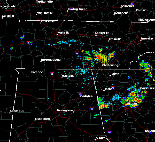 At 317 pm edt /217 pm cdt/, a severe thunderstorm was located near soddy-daisy, or 11 miles east of dunlap, moving southeast at 15 mph (radar indicated). Hazards include 60 mph wind gusts and half dollar size hail. Hail damage to vehicles is expected. expect wind damage to roofs, siding and trees. locations impacted include, dunlap, soddy-daisy, lakesite, brayton, birchwood, flat top mountain, old cumberland, shady grove, palio, mowbray mountain, cagle, harrison bay s. p,. North chickamauga creek gorge, sale creek, middle valley and falling water. At 317 pm edt /217 pm cdt/, a severe thunderstorm was located near soddy-daisy, or 11 miles east of dunlap, moving southeast at 15 mph (radar indicated). Hazards include 60 mph wind gusts and half dollar size hail. Hail damage to vehicles is expected. expect wind damage to roofs, siding and trees. locations impacted include, dunlap, soddy-daisy, lakesite, brayton, birchwood, flat top mountain, old cumberland, shady grove, palio, mowbray mountain, cagle, harrison bay s. p,. North chickamauga creek gorge, sale creek, middle valley and falling water.
|
| 6/24/2015 1:58 PM CDT |
 At 257 pm edt /157 pm cdt/, a severe thunderstorm was located over dunlap, moving southeast at 15 mph (radar indicated). Hazards include 60 mph wind gusts and quarter size hail. Hail damage to vehicles is expected. expect wind damage to roofs, siding and trees. locations impacted include, dunlap, soddy-daisy, lakesite, brayton, birchwood, flat top mountain, old cumberland, shady grove, palio, mowbray mountain, cagle, harrison bay s. p,. North chickamauga creek gorge, sale creek, middle valley and falling water. At 257 pm edt /157 pm cdt/, a severe thunderstorm was located over dunlap, moving southeast at 15 mph (radar indicated). Hazards include 60 mph wind gusts and quarter size hail. Hail damage to vehicles is expected. expect wind damage to roofs, siding and trees. locations impacted include, dunlap, soddy-daisy, lakesite, brayton, birchwood, flat top mountain, old cumberland, shady grove, palio, mowbray mountain, cagle, harrison bay s. p,. North chickamauga creek gorge, sale creek, middle valley and falling water.
|
| 6/24/2015 1:43 PM CDT |
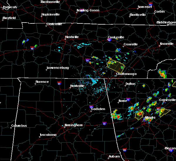 At 243 pm edt /143 pm cdt/, a severe thunderstorm was located near dunlap, moving southeast at 20 mph (radar indicated). Hazards include 60 mph wind gusts and quarter size hail. Hail damage to vehicles is expected. Expect wind damage to roofs, siding and trees. At 243 pm edt /143 pm cdt/, a severe thunderstorm was located near dunlap, moving southeast at 20 mph (radar indicated). Hazards include 60 mph wind gusts and quarter size hail. Hail damage to vehicles is expected. Expect wind damage to roofs, siding and trees.
|
| 6/8/2015 7:44 PM EDT | At 744 pm edt, severe thunderstorms were located along a line extending from 10 miles southeast of madisonville to 11 miles south of benton, moving east at 35 mph (radar indicated). Hazards include 60 mph wind gusts and nickel size hail. Expect damage to roofs. siding and trees. Locations impacted include, cleveland, athens, sweetwater, madisonville, murphy, benton, ducktown, etowah, charleston, south cleveland, east cleveland, wildwood lake, collegedale, englewood, vonore, tellico plains, niota, calhoun, parksville and mount vernon. |
| 6/8/2015 7:44 PM EDT | At 744 pm edt, severe thunderstorms were located along a line extending from 10 miles southeast of madisonville to 11 miles south of benton, moving east at 35 mph (radar indicated). Hazards include 60 mph wind gusts and nickel size hail. Expect damage to roofs. siding and trees. Locations impacted include, cleveland, athens, sweetwater, madisonville, murphy, benton, ducktown, etowah, charleston, south cleveland, east cleveland, wildwood lake, collegedale, englewood, vonore, tellico plains, niota, calhoun, parksville and mount vernon. |
| 6/8/2015 7:15 PM EDT | At 715 pm edt, severe thunderstorms were located along a line extending from near etowah to cohutta, moving east at 30 mph (radar indicated). Hazards include 65 mph wind gusts and penny size hail. Expect damage to roofs. siding and trees. Locations impacted include, cleveland, athens, sweetwater, madisonville, murphy, benton, ducktown, etowah, charleston, south cleveland, east cleveland, wildwood lake, collegedale, englewood, vonore, tellico plains, niota, calhoun, parksville and mount vernon. |
| 6/8/2015 7:15 PM EDT | At 715 pm edt, severe thunderstorms were located along a line extending from near etowah to cohutta, moving east at 30 mph (radar indicated). Hazards include 65 mph wind gusts and penny size hail. Expect damage to roofs. siding and trees. Locations impacted include, cleveland, athens, sweetwater, madisonville, murphy, benton, ducktown, etowah, charleston, south cleveland, east cleveland, wildwood lake, collegedale, englewood, vonore, tellico plains, niota, calhoun, parksville and mount vernon. |
| 6/8/2015 7:09 PM EDT | At 709 pm edt, a severe thunderstorm was located near south cleveland, or 9 miles west of cleveland, moving east at 35 mph (radar indicated). Hazards include 60 mph wind gusts and nickel size hail. Expect damage to roofs. siding and trees. locations impacted include, chattanooga, soddy-daisy, signal mountain, rossville, walden, lakesite, ridgeside, harrison, fairmount, south cleveland, red bank, collegedale, mcdonald, ooltewah, east brainerd, shady grove, east ridge, harrison bay s. p,. North chickamauga creek gorge and falling water. |
| 6/8/2015 7:00 PM EDT | Trees down county-wid in hamilton county TN, 1.1 miles ESE of Chattanooga, TN |
| 6/8/2015 6:55 PM EDT | At 655 pm edt, severe thunderstorms were located along a line extending from near athens to near east cleveland, moving east at 35 mph (radar indicated). Hazards include 60 mph wind gusts and penny size hail. Expect damage to roofs. Siding and trees. |
| 6/8/2015 6:55 PM EDT | At 655 pm edt, severe thunderstorms were located along a line extending from near athens to near east cleveland, moving east at 35 mph (radar indicated). Hazards include 60 mph wind gusts and penny size hail. Expect damage to roofs. Siding and trees. |
| 6/8/2015 6:41 PM EDT | At 641 pm edt, a severe thunderstorm was located over chattanooga valley, or 10 miles southwest of chattanooga, moving east at 40 mph (radar indicated). Hazards include 70 mph wind gusts and quarter size hail. Hail damage to vehicles is expected. expect considerable tree damage. wind damage is also likely to mobile homes, roofs and outbuildings. Other locations in the warning include but are not limited to ringgold, fort oglethorpe, rossville, chickamauga, lookout mountain, chattanooga valley, lakeview, chattanooga valley, graysville, blue spring, boynton, morganville, indian springs, wildwood, hooker, fairview and apison. |
| 6/8/2015 6:40 PM EDT | At 640 pm edt /540 pm cdt/, a severe thunderstorm was located near chattanooga, moving east northeast at 40 mph (radar indicated). Hazards include 60 mph wind gusts and nickel size hail. Expect damage to roofs. siding and trees. Locations impacted include, chattanooga, jasper, soddy-daisy, signal mountain, rossville, walden, lakesite, ridgeside, harrison, fairmount, south cleveland, red bank, collegedale, powells crossroads, mcdonald, ooltewah, sequatchie cave, haletown (guild), east brainerd and shady grove. |
| 6/8/2015 5:14 PM CDT | At 613 pm edt /513 pm cdt/, a severe thunderstorm was located near kimball, or near jasper, moving east northeast at 35 mph (radar indicated). Hazards include 60 mph wind gusts and nickel size hail. Expect damage to roofs. Siding and trees. |
| 6/8/2015 5:16 PM EDT | At 515 pm edt, a severe thunderstorm was located near south cleveland, or 8 miles west of cleveland, moving northeast at 35 mph (radar indicated). Hazards include 60 mph wind gusts and penny size hail. Expect damage to roofs. siding and trees. locations impacted include, chattanooga, cleveland, lakesite, charleston, ridgeside, harrison, south cleveland, east cleveland, wildwood lake, collegedale, calhoun, mcdonald, ooltewah, east brainerd, hopewell, waterville, east ridge, tasso, harrison bay s. p. And big spring. |
| 6/8/2015 5:15 PM EDT | Trees and power lines as well as at least 5 homes damage in hamilton county TN, 4.8 miles NW of Chattanooga, TN |
| 6/8/2015 5:00 PM EDT | One tree and several large tree limbs down in the brainerd are in hamilton county TN, 4.8 miles NW of Chattanooga, TN |
| 6/8/2015 4:57 PM EDT | At 457 pm edt, a severe thunderstorm was located near ridgeside, or near chattanooga, moving northeast at 30 mph (radar indicated). Hazards include 60 mph wind gusts and penny size hail. Expect damage to roofs. Siding and trees. |
| 5/31/2015 2:03 PM EDT | At 202 pm edt, a severe thunderstorm was located near cleveland, moving northeast at 20 mph (radar indicated). Hazards include 60 mph wind gusts and penny size hail. Expect damage to roofs. siding and trees. locations impacted include, cleveland, benton, charleston, south cleveland, east cleveland, wildwood lake, harrison, calhoun, mcdonald, flint springs, gap springs, hopewell, waterville, tasso, conasauga, birchwood and harrison bay s. P |
| 5/31/2015 1:45 PM EDT | At 145 pm edt, a severe thunderstorm was located over south cleveland, or near cleveland, moving northeast at 10 mph (radar indicated). Hazards include 60 mph wind gusts and penny size hail. Expect damage to roofs. Siding and trees. |
| 4/20/2015 3:22 AM CDT | At 422 am edt /322 am cdt/, severe thunderstorms were located along a line extending from 9 miles west of pikeville to 8 miles east of jasper, moving northeast at 60 mph (radar indicated). Hazards include 60 mph wind gusts and penny size hail. Expect damage to roofs. siding and trees. locations impacted include, chattanooga, dunlap, jasper, pikeville, soddy-daisy, signal mountain, walden, lakesite, whitwell, ridgeside, harrison, fairmount, red bank, collegedale, powells crossroads, martin springs, ooltewah, lone oak, melvine and brayton. 0. 75in. |
| 4/20/2015 3:13 AM CDT | At 413 am edt /313 am cdt/, severe thunderstorms were located along a line extending from 12 miles north of dunlap to near jasper, moving northeast at 55 mph (radar indicated). Hazards include 60 mph wind gusts and penny size hail. Expect damage to roofs. siding and trees. locations impacted include, chattanooga, dunlap, jasper, pikeville, soddy-daisy, signal mountain, south pittsburg, walden, lakesite, whitwell, kimball, monteagle, ridgeside, harrison, fairmount, red bank, collegedale, powells crossroads, orme and martin springs. 0. 75in. |
| 4/20/2015 2:58 AM CDT | At 357 am edt /257 am cdt/, severe thunderstorms were located along a line extending from 16 miles north of monteagle to 7 miles west of south pittsburg, moving northeast at 55 mph (radar indicated). Hazards include 60 mph wind gusts and penny size hail. Expect damage to roofs. siding and trees. locations impacted include, chattanooga, dunlap, jasper, pikeville, soddy-daisy, signal mountain, south pittsburg, walden, lakesite, whitwell, kimball, monteagle, ridgeside, harrison, fairmount, red bank, collegedale, powells crossroads, orme and martin springs. 0. 75in. |
| 4/20/2015 3:57 AM EDT | At 356 am edt, severe thunderstorms were located along a line extending from 6 miles northwest of bridgeport to near aurora, moving east at 65 mph (radar indicated). Hazards include 60 mph wind gusts and penny size hail. Expect damage to roofs. siding and trees. other locations in the warning include but are not limited to lafayette, summerville, ringgold, trenton, fort oglethorpe, rossville, chickamauga, trion, lookout mountain, chattanooga valley, la fayette, lyerly, menlo, rising fawn, lakeview, naomi, cloudland, boynton, suttles mill and holland. 0. 75in. |
| 4/20/2015 2:44 AM CDT | At 343 am edt /243 am cdt/, severe thunderstorms were located along a line extending from 10 miles northwest of monteagle to 21 miles west of south pittsburg, moving northeast at 60 mph (radar indicated). Hazards include 60 mph wind gusts and penny size hail. Expect damage to roofs. Siding and trees. |
| 4/3/2015 8:51 PM CDT | A severe thunderstorm warning remains in effect until 900 pm cdt for southeastern marion county. at 851 pm cdt. severe thunderstorms were located along a line extending from near south pittsburg to near walden. moving southeast at 35 mph. hazard. 60 mph wind gusts and penny size hail. |
| 4/3/2015 8:29 PM CDT | A severe thunderstorm warning remains in effect until 900 pm cdt for marion and southern sequatchie counties. at 829 pm cdt. severe thunderstorms were located along a line extending from 6 miles south of monteagle to 6 miles north of fairmount. moving southeast at 20 mph. hazard. 60 mph wind gusts and penny size hail. |
| 4/3/2015 9:15 PM EDT | A severe thunderstorm warning remains in effect until 1000 pm edt for southwestern monroe. mcminn. polk. meigs. bradley and hamilton counties. at 915 pm edt. severe thunderstorms were located along a line extending from 8 miles west of sweetwater to near soddy-daisy. Moving east at 30 mph. |
| 4/3/2015 8:13 PM CDT | The national weather service in morristown has issued a * severe thunderstorm warning for. marion county in eastern tennessee. southern sequatchie county in eastern tennessee. until 900 pm cdt * at 812 pm cdt. Severe thunderstorms were located along a line. |
| 4/3/2015 8:05 PM CDT | A severe thunderstorm warning remains in effect until 815 pm cdt for marion and sequatchie counties. at 804 pm cdt. severe thunderstorms were located along a line extending from near dunlap to near monteagle. moving east at 60 mph. hazard. quarter size hail and 60 mph wind gusts. source. Radar indicated. |
| 4/3/2015 8:58 PM EDT | The national weather service in morristown has issued a * severe thunderstorm warning for. southwestern monroe county in eastern tennessee. mcminn county in eastern tennessee. polk county in eastern tennessee. Meigs county in eastern tennessee. |
| 4/3/2015 7:50 PM CDT | A severe thunderstorm warning remains in effect until 815 pm cdt for marion and sequatchie counties. at 749 pm cdt. severe thunderstorms were located along a line extending from 8 miles northeast of dunlap to 35 miles southwest of monteagle. moving east at 50 mph. hazard. Quarter size hail and 60 mph wind gusts. |
| 4/3/2015 8:30 PM EDT | A severe thunderstorm warning remains in effect until 900 pm edt/800 pm cdt/ for bledsoe. meigs. roane. eastern hamilton and rhea counties. at 829 pm edt /729 pm cdt/. severe thunderstorms were located along a line extending from near rockwood to 11 miles southwest of pikeville. Moving southeast at 40 mph. |
| 4/3/2015 7:27 PM CDT | The national weather service in morristown has issued a * severe thunderstorm warning for. marion county in eastern tennessee. sequatchie county in eastern tennessee. until 815 pm cdt * at 725 pm cdt. Severe thunderstorms were located along a line. |
| 4/3/2015 8:12 PM EDT | The national weather service in morristown has issued a * severe thunderstorm warning for. bledsoe county in eastern tennessee. meigs county in eastern tennessee. roane county in eastern tennessee. Eastern hamilton county in eastern tennessee. |
| 6/29/2014 6:39 PM EDT | Dispatch reported 1 tree downed in rural southeast hamilton county from ooltewah to georgetow in hamilton county TN, 1.1 miles ESE of Chattanooga, TN |
| 6/29/2014 6:14 PM EDT | Dispatch reported 2 trees downed in rural southeast hamilton county on picadilly trai in hamilton county TN, 1.1 miles ESE of Chattanooga, TN |
| 2/21/2014 12:55 AM EST | Numerous trees down across the county in hamilton county TN, 1.1 miles ESE of Chattanooga, TN |
| 12/22/2013 3:40 AM EST | Couple trees dow in hamilton county TN, 1.1 miles ESE of Chattanooga, TN |
| 11/18/2013 12:05 AM EST | Awning ripped off of building and blown 300 yards...2 trees down...and windows busted along manufacturers roa in hamilton county TN, 1.5 miles SE of Chattanooga, TN |
| 7/17/2013 9:20 PM EDT | Several trees down in hamilton county TN, 8.5 miles W of Chattanooga, TN |
| 6/13/2013 5:30 PM EDT | Dispatch reported 2 to 3 trees downed across the count in hamilton county TN, 1.1 miles ESE of Chattanooga, TN |
| 6/5/2013 3:00 PM EDT | A few trees down around the chattanooga are in hamilton county TN, 1.1 miles ESE of Chattanooga, TN |
| 3/18/2013 4:00 PM EDT | A few trees down around the chattanooga are in hamilton county TN, 1.1 miles ESE of Chattanooga, TN |
| 8/10/2012 5:43 PM EDT | A few trees down and powerline in hamilton county TN, 1.1 miles ESE of Chattanooga, TN |
| 8/1/2012 11:15 PM EDT | Law enforcement reported several trees down in the wildwood are in dade county GA, 11.7 miles NE of Chattanooga, TN |
| 7/31/2012 8:55 PM EDT | Dispatch reported a tree down off of birchwood driv in hamilton county TN, 1.7 miles SSW of Chattanooga, TN |
| 7/5/2012 7:50 PM EDT | *** 1 in hamilton county TN, 4.7 miles SW of Chattanooga, TN |
| 7/5/2012 7:38 PM EDT | *** 2 fatal *** houseboat capsized on chickmauga lak in hamilton county TN, 4.7 miles SW of Chattanooga, TN |
| 3/2/2012 7:05 PM EST | Amateur radio relayed reports of several downed trees closing interstate 24 in dade count in dade county GA, 13.8 miles ENE of Chattanooga, TN |
| 3/2/2012 6:43 PM EST | Half Dollar sized hail reported 5.7 miles W of Chattanooga, TN |
| 3/2/2012 6:36 PM EST | Tennis Ball sized hail reported 1.1 miles ESE of Chattanooga, TN, tennis ball size hail on highway 27 in chattanooga. |
| 3/2/2012 6:31 PM EST | Golf Ball sized hail reported 1.1 miles ESE of Chattanooga, TN |
| 3/2/2012 6:30 PM EST | Quarter sized hail reported 4.1 miles SE of Chattanooga, TN |
| 1/1/0001 12:00 AM | Trees and powerlines down in the east ridge are in hamilton county TN, 1.1 miles ESE of Chattanooga, TN |
| 1/1/0001 12:00 AM | Power lines down at 6900 lee hwy. report by dispatc in hamilton county TN, 6.3 miles W of Chattanooga, TN |
| 1/1/0001 12:00 AM | Tree down on power lines at 1500 jenkins road. rpt by dispatch in hamilton county TN, 6.6 miles NW of Chattanooga, TN |
| 1/1/0001 12:00 AM | Numerous trees and powerlines down in the chattanooga area. reported by dispatc in hamilton county TN, 1.1 miles ESE of Chattanooga, TN |
| 1/1/0001 12:00 AM | A few trees down in chattanooga. reported by dispatc in hamilton county TN, 1.1 miles ESE of Chattanooga, TN |
| 1/1/0001 12:00 AM | Several trees down in hamilton county TN, 1.1 miles ESE of Chattanooga, TN |
| 1/1/0001 12:00 AM | Numerous trees and power lines dow in hamilton county TN, 1.1 miles ESE of Chattanooga, TN |
| 1/1/0001 12:00 AM | Golf Ball sized hail reported 6.8 miles SW of Chattanooga, TN, golf ball sized hail on highway 58. reported by spotter. |
| 1/1/0001 12:00 AM | Quarter sized hail reported 4.8 miles NW of Chattanooga, TN |
| 1/1/0001 12:00 AM | Hen Egg sized hail reported 1.1 miles ESE of Chattanooga, TN, hen egg hail was reported along interstate 75 near hamilton place mall. |
| 1/1/0001 12:00 AM | A few power lines were downed by thunderstorm wind in hamilton county TN, 3.4 miles WNW of Chattanooga, TN |
| 4/27/2011 6:19 PM EDT | Golf Ball sized hail reported 8.5 miles W of Chattanooga, TN, hail at interstate 75 near ooltewah |
| 1/1/0001 12:00 AM | Golf Ball sized hail reported 1.1 miles ESE of Chattanooga, TN, hail occurring in the missionary ridge area. |
| 4/27/2011 5:45 PM EDT | Tennis Ball sized hail reported 11.7 miles NE of Chattanooga, TN, trained spotter reported driving through large hail in wildwood. |
| 4/27/2011 2:44 PM EDT | Quarter sized hail reported 1.7 miles ENE of Chattanooga, TN |
| 1/1/0001 12:00 AM | Dade county emergency management reported over 50 downed trees and powerlines along highway 299 in the northern section of the count in dade county GA, 12.3 miles ENE of Chattanooga, TN |
| 1/1/0001 12:00 AM | One tree down on roberts st reported by dispatc in hamilton county TN, 0.9 miles S of Chattanooga, TN |
| 1/1/0001 12:00 AM | Dade county emergency management reports widespread tree damage in north dade county. includes damage to 2 houses along highway 299 and in the pinecrest subdivision fro in dade county GA, 11.7 miles NE of Chattanooga, TN |
| 1/1/0001 12:00 AM | Few trees down near intersection of hooker and wilson road in hamilton county TN, 1.1 miles ESE of Chattanooga, TN |
| 1/1/0001 12:00 AM | Several trees and numerous power lines down in and around chattanooga. reported by dispatc in hamilton county TN, 1.1 miles ESE of Chattanooga, TN |
Hail Maps for Chattanooga, TN


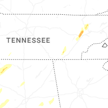


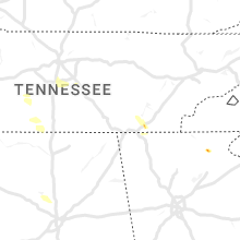
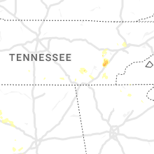


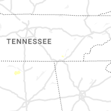


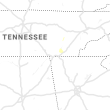


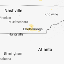


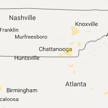


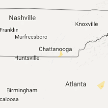


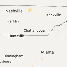


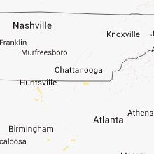


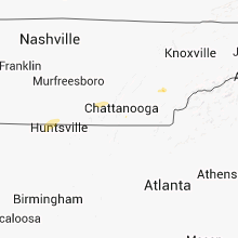


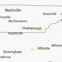


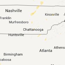


Connect with Interactive Hail Maps