

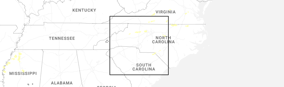
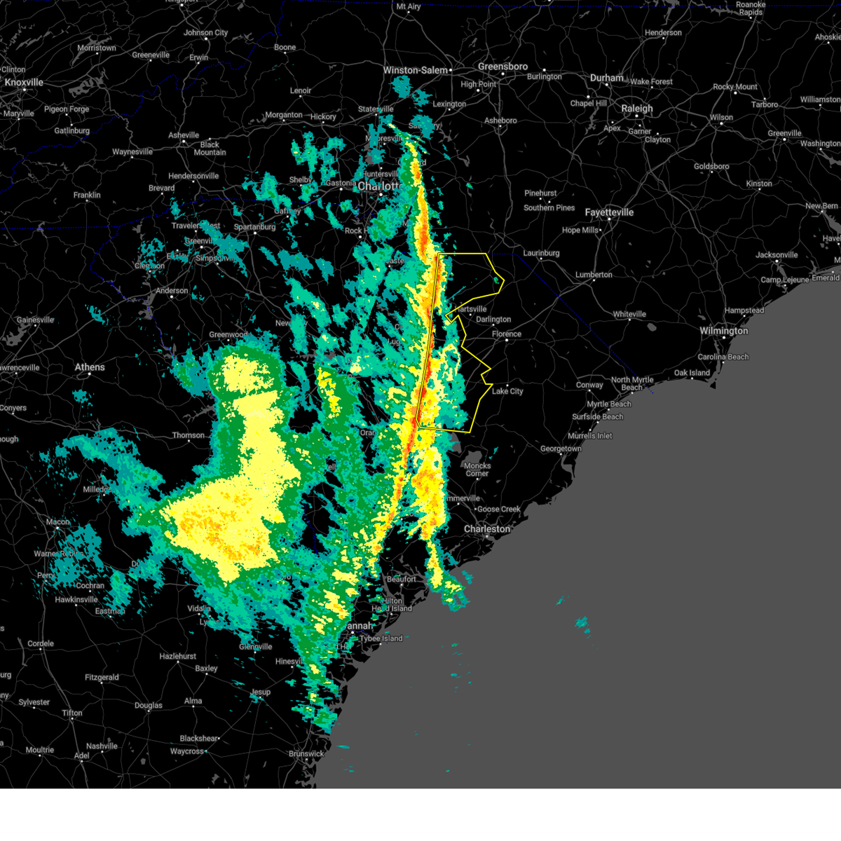
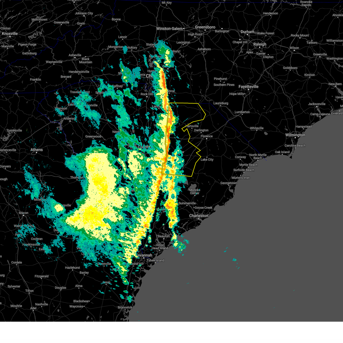
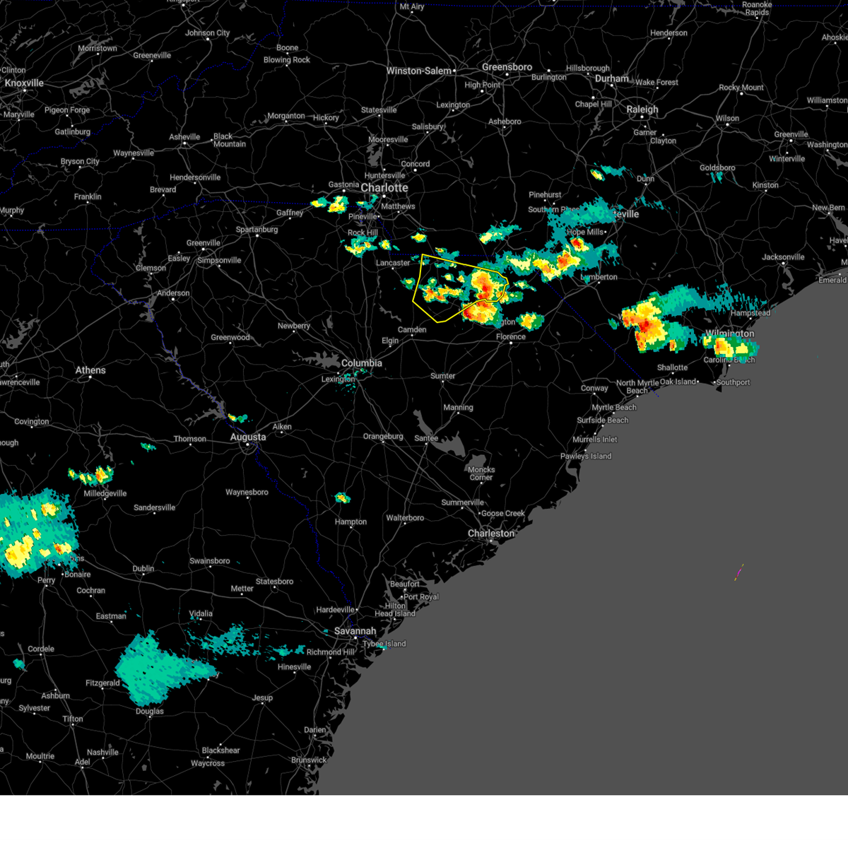
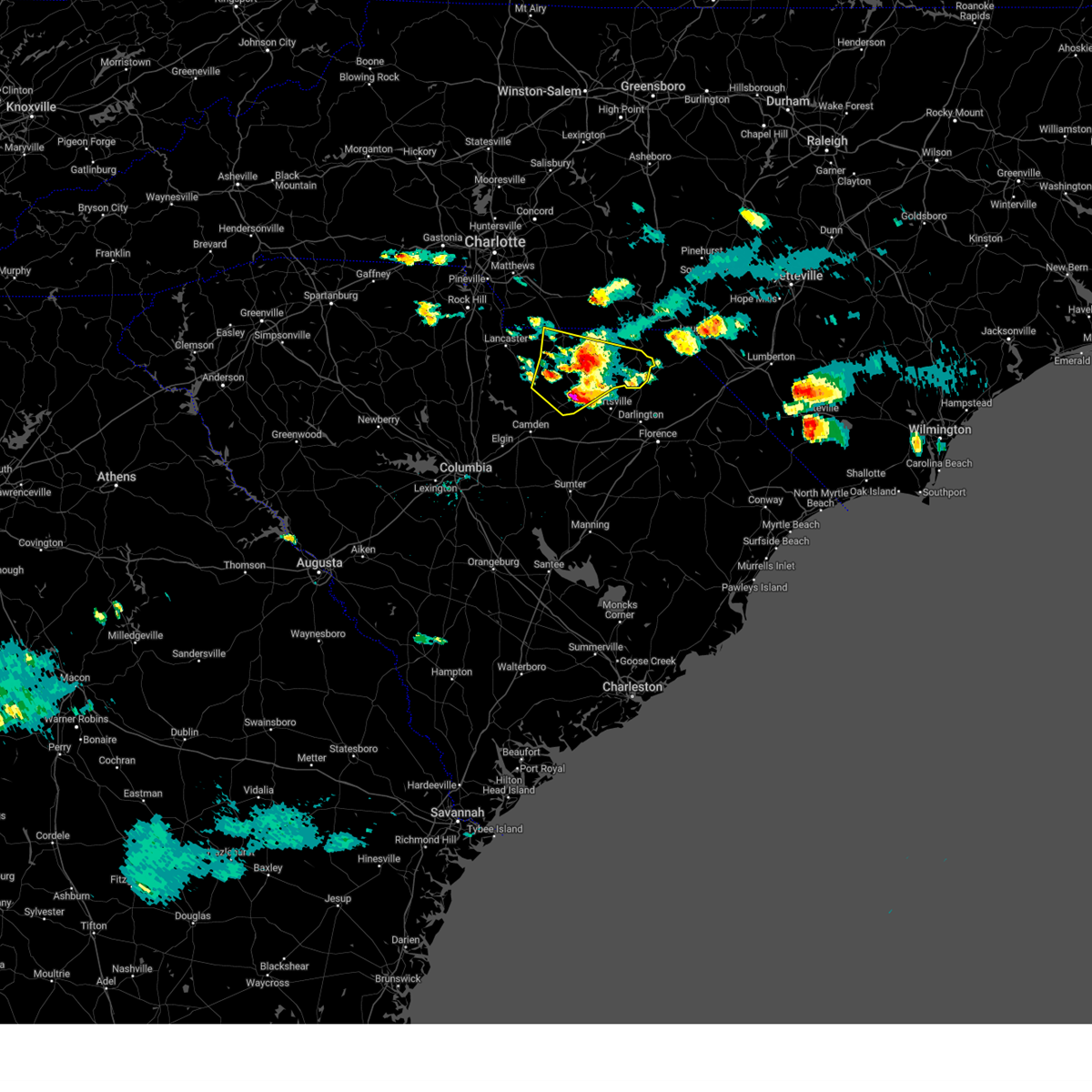
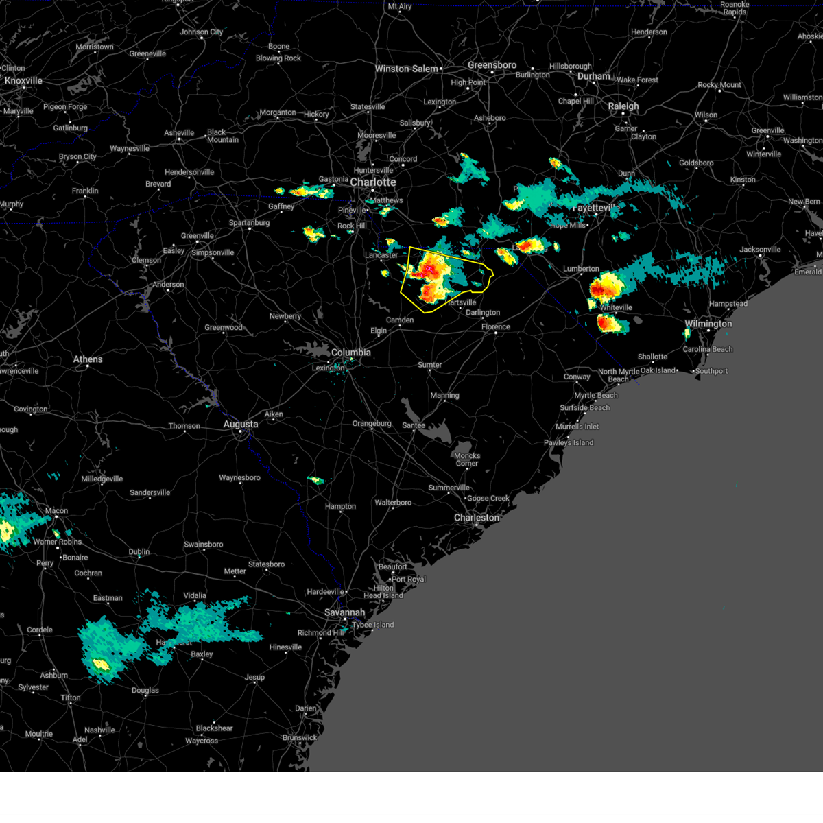
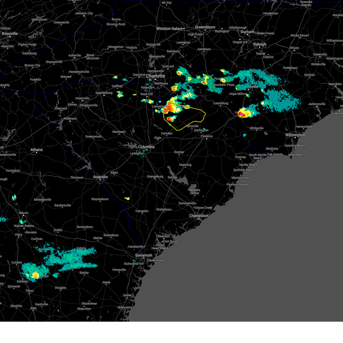
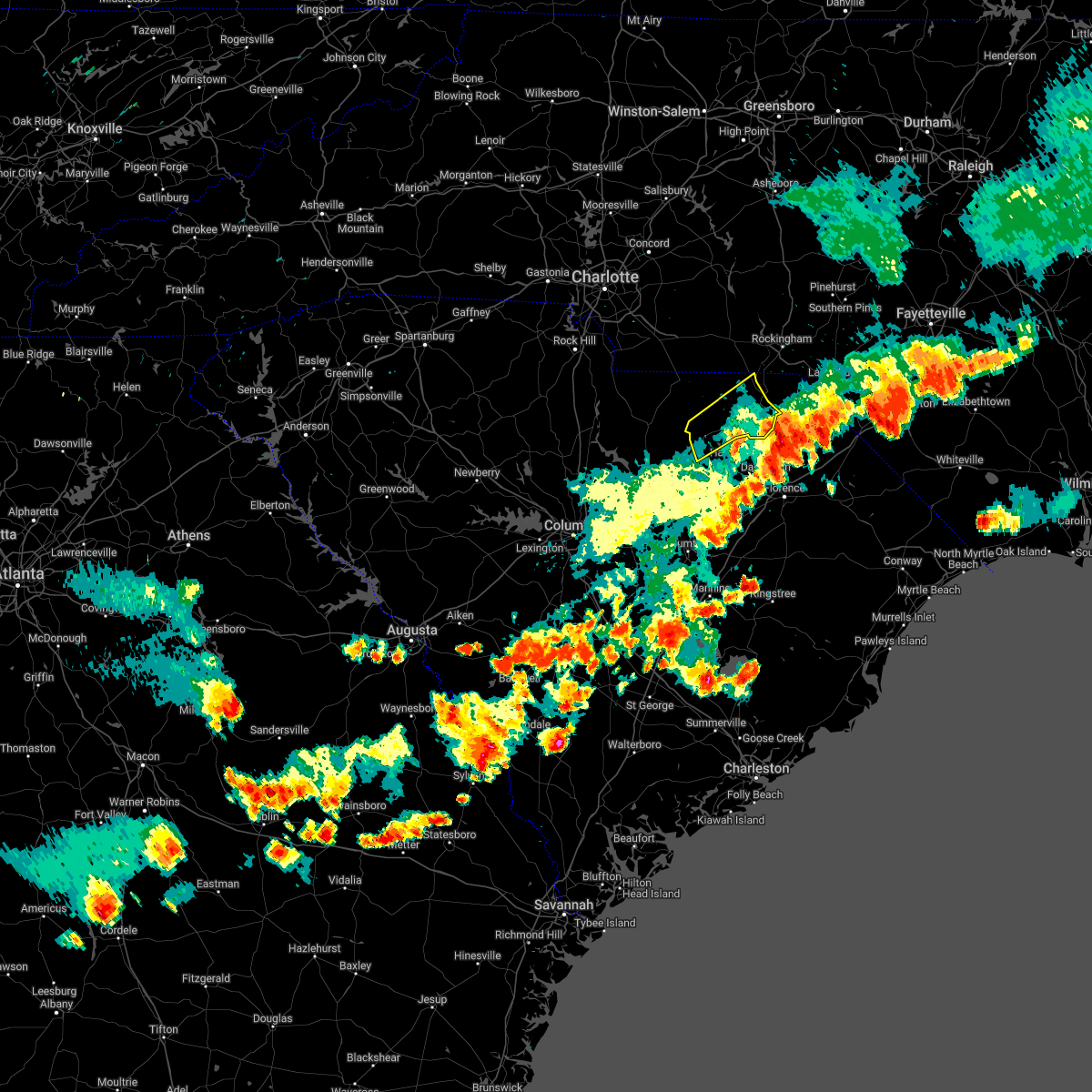
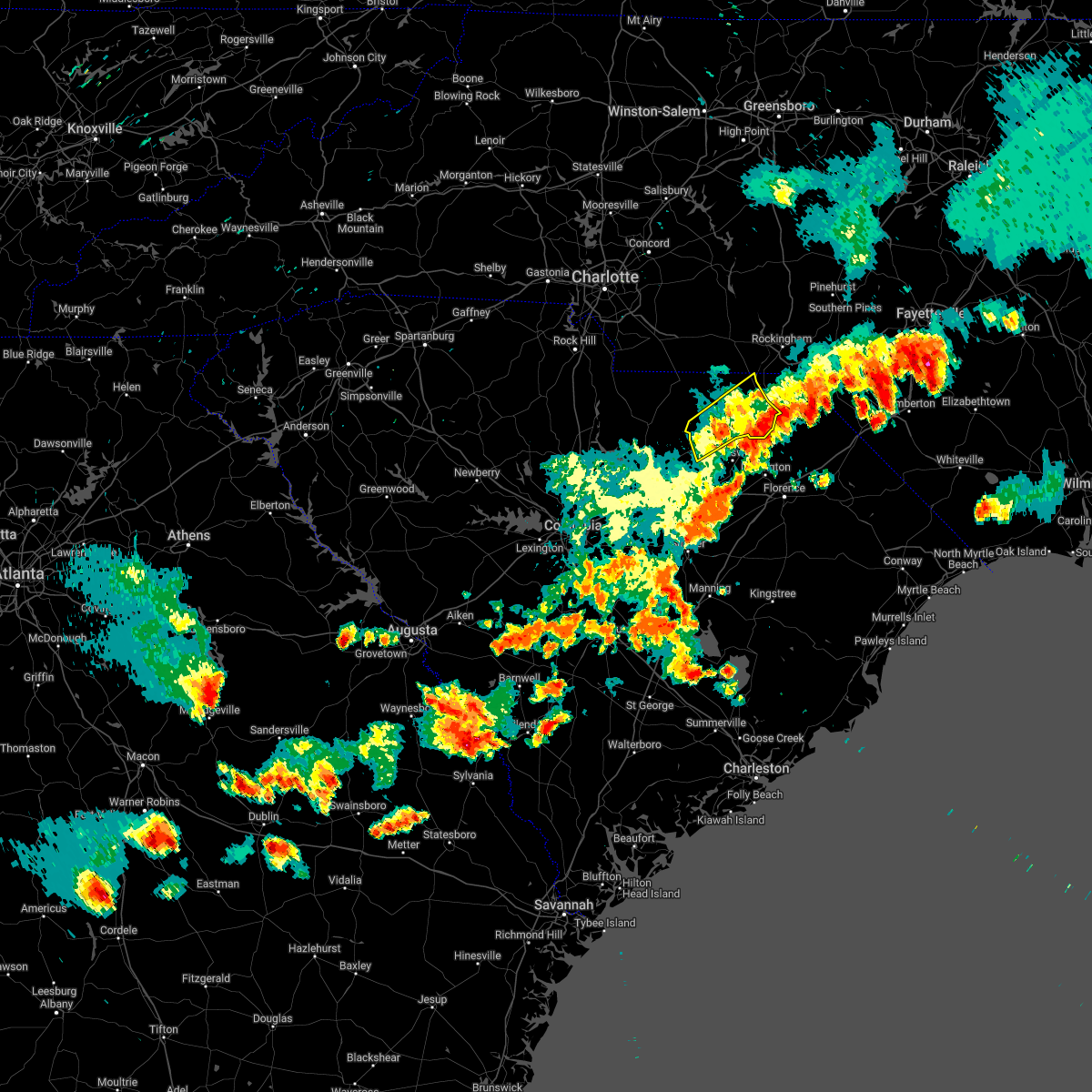
Hail Map for Cheraw, SC
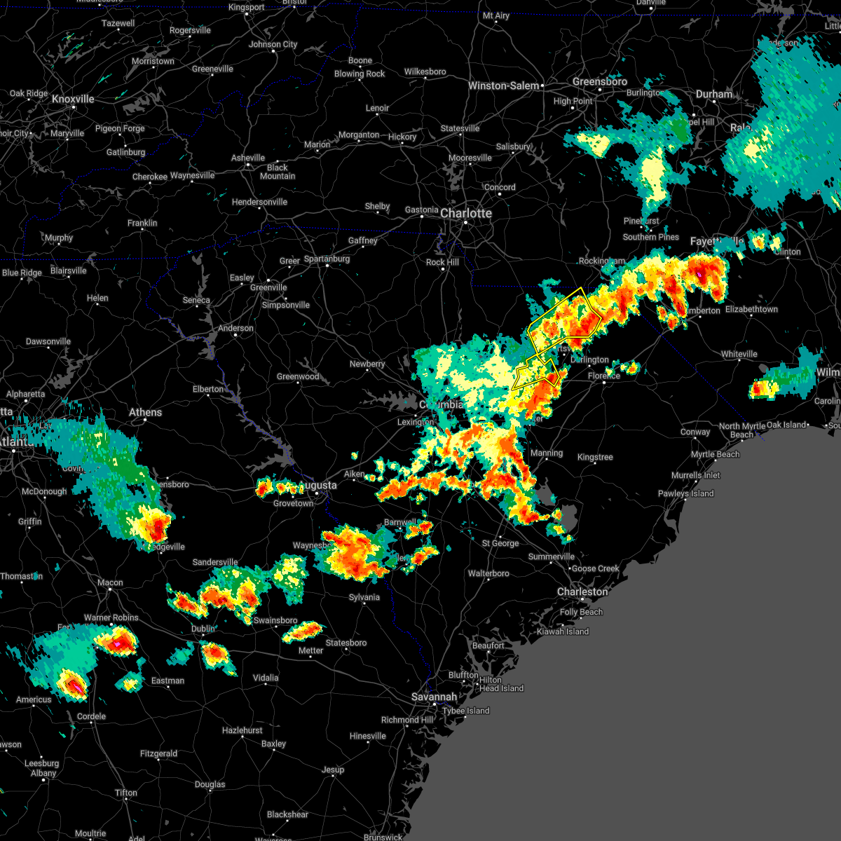
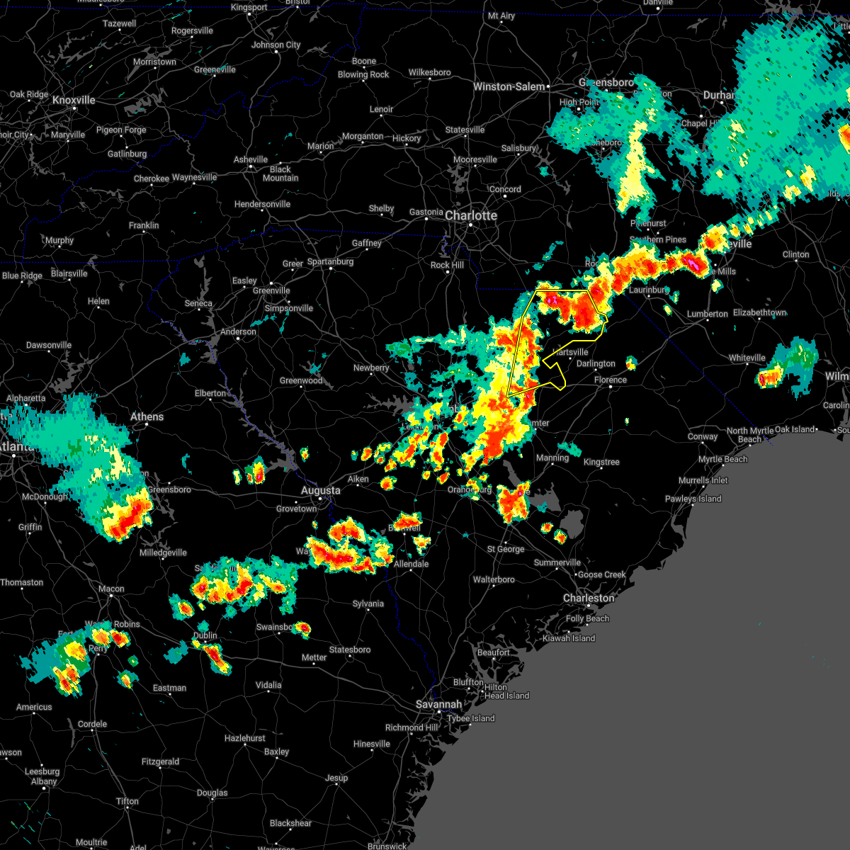
The Cheraw, SC area has had 11 reports of on-the-ground hail by trained spotters, and has been under severe weather warnings 10 times during the past 12 months. Doppler radar has detected hail at or near Cheraw, SC on 68 occasions, including 4 occasions during the past year.
| Name: | Cheraw, SC |
| Where Located: | 64 miles SE of Charlotte, NC |
| Map: | Google Map for Cheraw, SC |
| Population: | 5851 |
| Housing Units: | 2709 |
| More Info: | Search Google for Cheraw, SC |
0
The Top Recent Hail Date for Cheraw, SC is Thursday, June 19, 2025 (68th out of 68)
Hail and Wind Damage Spotted near Cheraw, SC
| Date / Time | Report Details |
|---|---|
| 2/16/2025 8:33 AM EST | Chesterfield dispatch reported trees and powerlines down on hwy 52 near the cheraw state park entrance. time estimated by rada in chesterfield county SC, 3.3 miles NNW of Cheraw, SC |
| 2/16/2025 8:30 AM EST | Chesterfield dispatch reported trees and powerlines down on hwy 1 at society hill rd. time estimated by rada in chesterfield county SC, 5.1 miles NNE of Cheraw, SC |
| 2/16/2025 8:13 AM EST |
 At 813 am est, severe thunderstorms were located along a line extending from 8 miles north of chesterfield to carolina sandhills wildlife refuge, moving east at 55 mph (radar indicated). Hazards include 60 mph wind gusts. Expect damage to trees and powerlines. Locations impacted include, cheraw, chesterfield, carolina sandhills wildlife refuge, cheraw state park, northeastern technical college, cheraw municipal airport, ruby, patrick, mount croghan, chesterfield ruby middle school, cheraw fish hatchery, bay springs fire station, and chesterfield detention center. At 813 am est, severe thunderstorms were located along a line extending from 8 miles north of chesterfield to carolina sandhills wildlife refuge, moving east at 55 mph (radar indicated). Hazards include 60 mph wind gusts. Expect damage to trees and powerlines. Locations impacted include, cheraw, chesterfield, carolina sandhills wildlife refuge, cheraw state park, northeastern technical college, cheraw municipal airport, ruby, patrick, mount croghan, chesterfield ruby middle school, cheraw fish hatchery, bay springs fire station, and chesterfield detention center.
|
| 2/16/2025 8:13 AM EST |
 the severe thunderstorm warning has been cancelled and is no longer in effect the severe thunderstorm warning has been cancelled and is no longer in effect
|
| 2/16/2025 8:06 AM EST |
 Svrilm the national weather service in wilmington has issued a * severe thunderstorm warning for, northwestern robeson county in southeastern north carolina, northwestern florence county in northeastern south carolina, dillon county in northeastern south carolina, darlington county in northeastern south carolina, northwestern marion county in northeastern south carolina, marlboro county in northeastern south carolina, * until 900 am est. * at 805 am est, severe thunderstorms were located along a line extending from 6 miles north of chesterfield to 7 miles southeast of elgin, moving east at 65 mph (radar indicated). Hazards include 60 mph wind gusts. expect wind damage to trees and power lines Svrilm the national weather service in wilmington has issued a * severe thunderstorm warning for, northwestern robeson county in southeastern north carolina, northwestern florence county in northeastern south carolina, dillon county in northeastern south carolina, darlington county in northeastern south carolina, northwestern marion county in northeastern south carolina, marlboro county in northeastern south carolina, * until 900 am est. * at 805 am est, severe thunderstorms were located along a line extending from 6 miles north of chesterfield to 7 miles southeast of elgin, moving east at 65 mph (radar indicated). Hazards include 60 mph wind gusts. expect wind damage to trees and power lines
|
| 2/16/2025 7:41 AM EST |
 Svrcae the national weather service in columbia has issued a * severe thunderstorm warning for, southeastern lancaster county in central south carolina, chesterfield county in central south carolina, north central kershaw county in central south carolina, * until 845 am est. * at 741 am est, severe thunderstorms were located along a line extending from 8 miles northeast of buford to near elgin, moving east at 55 mph (radar indicated). Hazards include 60 mph wind gusts. expect damage to trees and powerlines Svrcae the national weather service in columbia has issued a * severe thunderstorm warning for, southeastern lancaster county in central south carolina, chesterfield county in central south carolina, north central kershaw county in central south carolina, * until 845 am est. * at 741 am est, severe thunderstorms were located along a line extending from 8 miles northeast of buford to near elgin, moving east at 55 mph (radar indicated). Hazards include 60 mph wind gusts. expect damage to trees and powerlines
|
| 12/29/2024 10:01 AM EST |
 the severe thunderstorm warning has been cancelled and is no longer in effect the severe thunderstorm warning has been cancelled and is no longer in effect
|
| 12/29/2024 10:01 AM EST |
 At 1001 am est, severe thunderstorms were located along a line extending from 6 miles east of pageland to near summerton, moving east at 35 mph (radar indicated). Hazards include 60 mph wind gusts. Expect damage to trees and powerlines. locations impacted include, sumter, cheraw, manning, bishopville, south sumter, chesterfield, summerton, mulberry, cheraw state park, alcolu, northeastern technical college, woods bay state park, santee cooper regional airport, elliott, cheraw municipal airport, lee state park, carolina sandhills wildlife refuge, sumter county airport, millwood, and mcbee. this includes the following highways, interstate 20 in south carolina between mile markers 108 and 125. Interstate 95 between mile markers 105 and 146. At 1001 am est, severe thunderstorms were located along a line extending from 6 miles east of pageland to near summerton, moving east at 35 mph (radar indicated). Hazards include 60 mph wind gusts. Expect damage to trees and powerlines. locations impacted include, sumter, cheraw, manning, bishopville, south sumter, chesterfield, summerton, mulberry, cheraw state park, alcolu, northeastern technical college, woods bay state park, santee cooper regional airport, elliott, cheraw municipal airport, lee state park, carolina sandhills wildlife refuge, sumter county airport, millwood, and mcbee. this includes the following highways, interstate 20 in south carolina between mile markers 108 and 125. Interstate 95 between mile markers 105 and 146.
|
| 12/29/2024 9:41 AM EST |
 Svrcae the national weather service in columbia has issued a * severe thunderstorm warning for, southeastern lancaster county in central south carolina, lee county in central south carolina, east central calhoun county in central south carolina, clarendon county in central south carolina, chesterfield county in central south carolina, sumter county in central south carolina, eastern kershaw county in central south carolina, * until 1045 am est. * at 940 am est, severe thunderstorms were located along a line extending from near pageland to 8 miles north of elloree, moving east at 35 mph (radar indicated). Hazards include 60 mph wind gusts. expect damage to trees and powerlines Svrcae the national weather service in columbia has issued a * severe thunderstorm warning for, southeastern lancaster county in central south carolina, lee county in central south carolina, east central calhoun county in central south carolina, clarendon county in central south carolina, chesterfield county in central south carolina, sumter county in central south carolina, eastern kershaw county in central south carolina, * until 1045 am est. * at 940 am est, severe thunderstorms were located along a line extending from near pageland to 8 miles north of elloree, moving east at 35 mph (radar indicated). Hazards include 60 mph wind gusts. expect damage to trees and powerlines
|
| 7/15/2024 2:48 PM EDT |
 At 248 pm edt, a severe thunderstorm was located near cheraw state park, or near cheraw, moving northeast at 15 mph (radar indicated). Hazards include 60 mph wind gusts and penny size hail. Expect damage to trees and powerlines. Locations impacted include, cheraw, cheraw municipal airport, cheraw state park, northeastern technical college, patrick, and cheraw fish hatchery. At 248 pm edt, a severe thunderstorm was located near cheraw state park, or near cheraw, moving northeast at 15 mph (radar indicated). Hazards include 60 mph wind gusts and penny size hail. Expect damage to trees and powerlines. Locations impacted include, cheraw, cheraw municipal airport, cheraw state park, northeastern technical college, patrick, and cheraw fish hatchery.
|
| 7/15/2024 2:38 PM EDT |
 At 238 pm edt, a severe thunderstorm was located near cheraw state park, or 7 miles south of cheraw, moving northeast at 15 mph (radar indicated). Hazards include 60 mph wind gusts and penny size hail. Expect damage to trees and powerlines. Locations impacted include, cheraw, cheraw municipal airport, cheraw state park, northeastern technical college, patrick, and cheraw fish hatchery. At 238 pm edt, a severe thunderstorm was located near cheraw state park, or 7 miles south of cheraw, moving northeast at 15 mph (radar indicated). Hazards include 60 mph wind gusts and penny size hail. Expect damage to trees and powerlines. Locations impacted include, cheraw, cheraw municipal airport, cheraw state park, northeastern technical college, patrick, and cheraw fish hatchery.
|
| 7/15/2024 2:32 PM EDT |
 Svrcae the national weather service in columbia has issued a * severe thunderstorm warning for, northeastern chesterfield county in central south carolina, * until 315 pm edt. * at 231 pm edt, a severe thunderstorm was located near cheraw state park, or 8 miles south of cheraw, moving northeast at 15 mph (radar indicated). Hazards include 60 mph wind gusts. expect damage to trees and powerlines Svrcae the national weather service in columbia has issued a * severe thunderstorm warning for, northeastern chesterfield county in central south carolina, * until 315 pm edt. * at 231 pm edt, a severe thunderstorm was located near cheraw state park, or 8 miles south of cheraw, moving northeast at 15 mph (radar indicated). Hazards include 60 mph wind gusts. expect damage to trees and powerlines
|
| 5/10/2024 3:15 PM EDT | Quarter sized hail reported 1 miles S of Cheraw, SC, skywarn spotters noted several reports of quarter sized hail just north of cheraw along highway 52 at 315pm. |
| 5/10/2024 3:12 PM EDT | Ping Pong Ball sized hail reported 1.1 miles WSW of Cheraw, SC, broadcast meteorologist passed on a public report with photo of roughly ping-pong sized hail in cheraw. |
| 5/10/2024 2:57 PM EDT |
 Svrcae the national weather service in columbia has issued a * severe thunderstorm warning for, chesterfield county in central south carolina, * until 400 pm edt. * at 256 pm edt, severe thunderstorms were located along a line extending from near chesterfield to 7 miles east of pageland, moving east at 40 mph (radar indicated). Hazards include ping pong ball size hail and 60 mph wind gusts. People and animals outdoors will be injured. expect hail damage to roofs, siding, windows, and vehicles. Expect wind damage to trees and powerlines. Svrcae the national weather service in columbia has issued a * severe thunderstorm warning for, chesterfield county in central south carolina, * until 400 pm edt. * at 256 pm edt, severe thunderstorms were located along a line extending from near chesterfield to 7 miles east of pageland, moving east at 40 mph (radar indicated). Hazards include ping pong ball size hail and 60 mph wind gusts. People and animals outdoors will be injured. expect hail damage to roofs, siding, windows, and vehicles. Expect wind damage to trees and powerlines.
|
| 5/10/2024 2:48 PM EDT |
 At 247 pm edt, severe thunderstorms were located along a line extending from near chesterfield to near pageland, moving east at 30 mph (radar indicated). Hazards include ping pong ball size hail and 60 mph wind gusts. People and animals outdoors will be injured. expect hail damage to roofs, siding, windows, and vehicles. expect wind damage to trees and powerlines. locations impacted include, lancaster, cheraw, pageland, kershaw, chesterfield, elgin, heath springs, cheraw state park, usc lancaster, irwin, northeastern technical college, cheraw municipal airport, carolina sandhills wildlife refuge, mt pisgah, buford, jefferson, ruby, patrick, mount croghan, and chesterfield ruby middle school. Hail up to ping pong ball size is expected near ruby and chesterfield and vicinities. At 247 pm edt, severe thunderstorms were located along a line extending from near chesterfield to near pageland, moving east at 30 mph (radar indicated). Hazards include ping pong ball size hail and 60 mph wind gusts. People and animals outdoors will be injured. expect hail damage to roofs, siding, windows, and vehicles. expect wind damage to trees and powerlines. locations impacted include, lancaster, cheraw, pageland, kershaw, chesterfield, elgin, heath springs, cheraw state park, usc lancaster, irwin, northeastern technical college, cheraw municipal airport, carolina sandhills wildlife refuge, mt pisgah, buford, jefferson, ruby, patrick, mount croghan, and chesterfield ruby middle school. Hail up to ping pong ball size is expected near ruby and chesterfield and vicinities.
|
| 5/10/2024 2:31 PM EDT |
 At 230 pm edt, severe thunderstorms were located along a line extending from 6 miles east of pageland to near buford, moving east at 30 mph (radar indicated). Hazards include 60 mph wind gusts and half dollar size hail. Hail damage to vehicles is expected. expect wind damage to trees and powerlines. locations impacted include, lancaster, cheraw, pageland, kershaw, chesterfield, elgin, heath springs, cheraw state park, usc lancaster, irwin, northeastern technical college, cheraw municipal airport, carolina sandhills wildlife refuge, mt pisgah, buford, jefferson, ruby, patrick, mount croghan, and chesterfield ruby middle school. quarter sized hail was reported with this storm north of pageland. hail up to half dollar sized will be possible with this storm from near pageland to mt. Croghan and vicinities. At 230 pm edt, severe thunderstorms were located along a line extending from 6 miles east of pageland to near buford, moving east at 30 mph (radar indicated). Hazards include 60 mph wind gusts and half dollar size hail. Hail damage to vehicles is expected. expect wind damage to trees and powerlines. locations impacted include, lancaster, cheraw, pageland, kershaw, chesterfield, elgin, heath springs, cheraw state park, usc lancaster, irwin, northeastern technical college, cheraw municipal airport, carolina sandhills wildlife refuge, mt pisgah, buford, jefferson, ruby, patrick, mount croghan, and chesterfield ruby middle school. quarter sized hail was reported with this storm north of pageland. hail up to half dollar sized will be possible with this storm from near pageland to mt. Croghan and vicinities.
|
| 5/10/2024 2:04 PM EDT |
 Svrcae the national weather service in columbia has issued a * severe thunderstorm warning for, lancaster county in central south carolina, chesterfield county in central south carolina, northeastern kershaw county in central south carolina, * until 300 pm edt. * at 203 pm edt, severe thunderstorms were located along a line extending from 6 miles northwest of pageland to near andrew jackson state park, moving east at 30 mph (radar indicated). Hazards include 60 mph wind gusts and half dollar size hail. Hail damage to vehicles is expected. Expect wind damage to trees and powerlines. Svrcae the national weather service in columbia has issued a * severe thunderstorm warning for, lancaster county in central south carolina, chesterfield county in central south carolina, northeastern kershaw county in central south carolina, * until 300 pm edt. * at 203 pm edt, severe thunderstorms were located along a line extending from 6 miles northwest of pageland to near andrew jackson state park, moving east at 30 mph (radar indicated). Hazards include 60 mph wind gusts and half dollar size hail. Hail damage to vehicles is expected. Expect wind damage to trees and powerlines.
|
| 5/9/2024 4:35 AM EDT |
 At 435 am edt, severe thunderstorms were located along a line extending from near dovesville to near elliott, moving east at 55 mph (radar indicated). Hazards include 60 mph wind gusts. Expect damage to trees and powerlines. locations impacted include, sumter, cheraw, bishopville, shaw air base, cheraw state park, oakland, elliott, mulberry, lee state park, carolina sandhills wildlife refuge, sumter county airport, mcbee, mayesville, lynchburg, patrick, bethune, lucknow, dalzell, dinkins mill, and manville. this includes the following highways, interstate 20 in south carolina between mile markers 104 and 126. Interstate 95 between mile markers 138 and 146. At 435 am edt, severe thunderstorms were located along a line extending from near dovesville to near elliott, moving east at 55 mph (radar indicated). Hazards include 60 mph wind gusts. Expect damage to trees and powerlines. locations impacted include, sumter, cheraw, bishopville, shaw air base, cheraw state park, oakland, elliott, mulberry, lee state park, carolina sandhills wildlife refuge, sumter county airport, mcbee, mayesville, lynchburg, patrick, bethune, lucknow, dalzell, dinkins mill, and manville. this includes the following highways, interstate 20 in south carolina between mile markers 104 and 126. Interstate 95 between mile markers 138 and 146.
|
| 5/9/2024 4:15 AM EDT |
 the severe thunderstorm warning has been cancelled and is no longer in effect the severe thunderstorm warning has been cancelled and is no longer in effect
|
| 5/9/2024 4:15 AM EDT |
 At 414 am edt, severe thunderstorms were located along a line extending from 6 miles northwest of clyde to near oakland, moving east at 55 mph (radar indicated). Hazards include 60 mph wind gusts. Expect damage to trees and powerlines. locations impacted include, columbia, sumter, forest acres, camden, cheraw, bishopville, shaw air base, oakland, mulberry, sc state fair grounds, fort jackson, cheraw state park, cassatt, elliott, lee state park, carolina sandhills wildlife refuge, sumter county airport, goodale state park, mcbee, and mayesville. this includes the following highways, interstate 20 in south carolina between mile markers 85 and 88, and between mile markers 96 and 126. interstate 77 between mile markers 9 and 12. Interstate 95 between mile markers 138 and 146. At 414 am edt, severe thunderstorms were located along a line extending from 6 miles northwest of clyde to near oakland, moving east at 55 mph (radar indicated). Hazards include 60 mph wind gusts. Expect damage to trees and powerlines. locations impacted include, columbia, sumter, forest acres, camden, cheraw, bishopville, shaw air base, oakland, mulberry, sc state fair grounds, fort jackson, cheraw state park, cassatt, elliott, lee state park, carolina sandhills wildlife refuge, sumter county airport, goodale state park, mcbee, and mayesville. this includes the following highways, interstate 20 in south carolina between mile markers 85 and 88, and between mile markers 96 and 126. interstate 77 between mile markers 9 and 12. Interstate 95 between mile markers 138 and 146.
|
| 5/9/2024 3:49 AM EDT |
 Svrcae the national weather service in columbia has issued a * severe thunderstorm warning for, east central fairfield county in central south carolina, south central lancaster county in central south carolina, lee county in central south carolina, central chesterfield county in central south carolina, northern sumter county in central south carolina, northeastern richland county in central south carolina, kershaw county in central south carolina, * until 445 am edt. * at 348 am edt, severe thunderstorms were located along a line extending from near westville to sesquicentennial state park, moving east at 55 mph (radar indicated). Hazards include 60 mph wind gusts and penny size hail. expect damage to trees and powerlines Svrcae the national weather service in columbia has issued a * severe thunderstorm warning for, east central fairfield county in central south carolina, south central lancaster county in central south carolina, lee county in central south carolina, central chesterfield county in central south carolina, northern sumter county in central south carolina, northeastern richland county in central south carolina, kershaw county in central south carolina, * until 445 am edt. * at 348 am edt, severe thunderstorms were located along a line extending from near westville to sesquicentennial state park, moving east at 55 mph (radar indicated). Hazards include 60 mph wind gusts and penny size hail. expect damage to trees and powerlines
|
| 5/8/2024 6:31 PM EDT |
 Svrcae the national weather service in columbia has issued a * severe thunderstorm warning for, east central chesterfield county in central south carolina, * until 700 pm edt. * at 631 pm edt, severe thunderstorms were located along a line extending from near wallace to 7 miles northeast of north hartsville, moving east at 20 mph (radar indicated). Hazards include 60 mph wind gusts and quarter size hail. Hail damage to vehicles is expected. Expect wind damage to trees and powerlines. Svrcae the national weather service in columbia has issued a * severe thunderstorm warning for, east central chesterfield county in central south carolina, * until 700 pm edt. * at 631 pm edt, severe thunderstorms were located along a line extending from near wallace to 7 miles northeast of north hartsville, moving east at 20 mph (radar indicated). Hazards include 60 mph wind gusts and quarter size hail. Hail damage to vehicles is expected. Expect wind damage to trees and powerlines.
|
| 5/8/2024 6:18 PM EDT |
 the severe thunderstorm warning has been cancelled and is no longer in effect the severe thunderstorm warning has been cancelled and is no longer in effect
|
| 5/8/2024 6:18 PM EDT |
 At 617 pm edt, severe thunderstorms were located along a line extending from chesterfield to near clyde, moving southeast at 30 mph (radar indicated). Hazards include 60 mph wind gusts and quarter size hail. Hail damage to vehicles is expected. expect wind damage to trees and powerlines. Locations impacted include, cheraw, chesterfield, cheraw state park, cheraw municipal airport, northeastern technical college, mcbee, patrick, cheraw fish hatchery, alligator fire station, middendorf, bay springs fire station, and chesterfield detention center. At 617 pm edt, severe thunderstorms were located along a line extending from chesterfield to near clyde, moving southeast at 30 mph (radar indicated). Hazards include 60 mph wind gusts and quarter size hail. Hail damage to vehicles is expected. expect wind damage to trees and powerlines. Locations impacted include, cheraw, chesterfield, cheraw state park, cheraw municipal airport, northeastern technical college, mcbee, patrick, cheraw fish hatchery, alligator fire station, middendorf, bay springs fire station, and chesterfield detention center.
|
| 5/8/2024 6:13 PM EDT |
 At 613 pm edt, severe thunderstorms were located along a line extending from 6 miles east of hamlet to 8 miles north of dovesville to near cassatt, moving southeast at 35 mph (radar indicated). Hazards include 60 mph wind gusts and quarter size hail. Minor hail damage to vehicles is possible. expect wind damage to trees and power lines. Locations impacted include, bennettsville, hartsville, darlington, mccoll, lamar, clio, mont clare, brownsville, lydia, darlington raceway, swift creek, oats, chavistown, floyd, north hartsville, dovesville, auburn, wallace, clyde, and mechanicsville. At 613 pm edt, severe thunderstorms were located along a line extending from 6 miles east of hamlet to 8 miles north of dovesville to near cassatt, moving southeast at 35 mph (radar indicated). Hazards include 60 mph wind gusts and quarter size hail. Minor hail damage to vehicles is possible. expect wind damage to trees and power lines. Locations impacted include, bennettsville, hartsville, darlington, mccoll, lamar, clio, mont clare, brownsville, lydia, darlington raceway, swift creek, oats, chavistown, floyd, north hartsville, dovesville, auburn, wallace, clyde, and mechanicsville.
|
| 5/8/2024 5:31 PM EDT |
 Svrilm the national weather service in wilmington has issued a * severe thunderstorm warning for, darlington county in northeastern south carolina, marlboro county in northeastern south carolina, * until 645 pm edt. * at 530 pm edt, severe thunderstorms were located along a line extending from 11 miles east of ansonville to near chesterfield to near liberty hill, moving southeast at 35 mph (radar indicated). Hazards include 60 mph wind gusts and quarter size hail. Minor hail damage to vehicles is possible. Expect wind damage to trees and power lines. Svrilm the national weather service in wilmington has issued a * severe thunderstorm warning for, darlington county in northeastern south carolina, marlboro county in northeastern south carolina, * until 645 pm edt. * at 530 pm edt, severe thunderstorms were located along a line extending from 11 miles east of ansonville to near chesterfield to near liberty hill, moving southeast at 35 mph (radar indicated). Hazards include 60 mph wind gusts and quarter size hail. Minor hail damage to vehicles is possible. Expect wind damage to trees and power lines.
|
| 5/8/2024 5:29 PM EDT |
 Svrcae the national weather service in columbia has issued a * severe thunderstorm warning for, chesterfield county in central south carolina, northeastern kershaw county in central south carolina, * until 630 pm edt. * at 528 pm edt, severe thunderstorms were located along a line extending from 6 miles southwest of wadesboro to heath springs, moving east at 35 mph (radar indicated). Hazards include 60 mph wind gusts and quarter size hail. Hail damage to vehicles is expected. Expect wind damage to trees and powerlines. Svrcae the national weather service in columbia has issued a * severe thunderstorm warning for, chesterfield county in central south carolina, northeastern kershaw county in central south carolina, * until 630 pm edt. * at 528 pm edt, severe thunderstorms were located along a line extending from 6 miles southwest of wadesboro to heath springs, moving east at 35 mph (radar indicated). Hazards include 60 mph wind gusts and quarter size hail. Hail damage to vehicles is expected. Expect wind damage to trees and powerlines.
|
| 4/20/2024 6:13 PM EDT |
 The storm which prompted the warning has moved out of the area. therefore, the warning will be allowed to expire. a severe thunderstorm watch remains in effect until 1000 pm edt for central south carolina. to report severe weather, contact your nearest law enforcement agency. they will relay your report to the national weather service columbia. The storm which prompted the warning has moved out of the area. therefore, the warning will be allowed to expire. a severe thunderstorm watch remains in effect until 1000 pm edt for central south carolina. to report severe weather, contact your nearest law enforcement agency. they will relay your report to the national weather service columbia.
|
| 4/20/2024 5:54 PM EDT |
 At 553 pm edt, a severe thunderstorm was located near clyde, or 12 miles northwest of hartsville, moving east at 25 mph (radar indicated). Hazards include ping pong ball size hail and 60 mph wind gusts. People and animals outdoors will be injured. expect hail damage to roofs, siding, windows, and vehicles. expect wind damage to trees and powerlines. Locations impacted include, cheraw, pageland, kershaw, chesterfield, cheraw state park, northeastern technical college, carolina sandhills wildlife refuge, mt pisgah, cheraw municipal airport, mcbee, jefferson, ruby, patrick, bethune, chesterfield ruby middle school, cheraw fish hatchery, middendorf, central high school, high point fire station, and alligator fire station. At 553 pm edt, a severe thunderstorm was located near clyde, or 12 miles northwest of hartsville, moving east at 25 mph (radar indicated). Hazards include ping pong ball size hail and 60 mph wind gusts. People and animals outdoors will be injured. expect hail damage to roofs, siding, windows, and vehicles. expect wind damage to trees and powerlines. Locations impacted include, cheraw, pageland, kershaw, chesterfield, cheraw state park, northeastern technical college, carolina sandhills wildlife refuge, mt pisgah, cheraw municipal airport, mcbee, jefferson, ruby, patrick, bethune, chesterfield ruby middle school, cheraw fish hatchery, middendorf, central high school, high point fire station, and alligator fire station.
|
| 4/20/2024 5:49 PM EDT |
 Svrilm the national weather service in wilmington has issued a * severe thunderstorm warning for, northwestern florence county in northeastern south carolina, northwestern dillon county in northeastern south carolina, darlington county in northeastern south carolina, central marlboro county in northeastern south carolina, * until 700 pm edt. * at 549 pm edt, a severe thunderstorm was located near clyde, or 12 miles west of hartsville, moving southeast at 30 mph (radar indicated). Hazards include 60 mph wind gusts and half dollar size hail. Minor hail damage to vehicles is possible. Expect wind damage to trees and power lines. Svrilm the national weather service in wilmington has issued a * severe thunderstorm warning for, northwestern florence county in northeastern south carolina, northwestern dillon county in northeastern south carolina, darlington county in northeastern south carolina, central marlboro county in northeastern south carolina, * until 700 pm edt. * at 549 pm edt, a severe thunderstorm was located near clyde, or 12 miles west of hartsville, moving southeast at 30 mph (radar indicated). Hazards include 60 mph wind gusts and half dollar size hail. Minor hail damage to vehicles is possible. Expect wind damage to trees and power lines.
|
| 4/20/2024 5:43 PM EDT |
 At 542 pm edt, a severe thunderstorm was located near carolina sandhills wildlife refuge, or 22 miles northwest of hartsville, moving east at 40 mph (radar indicated). Hazards include ping pong ball size hail and 60 mph wind gusts. People and animals outdoors will be injured. expect hail damage to roofs, siding, windows, and vehicles. expect wind damage to trees and powerlines. Locations impacted include, cheraw, pageland, kershaw, chesterfield, cheraw state park, northeastern technical college, carolina sandhills wildlife refuge, mt pisgah, cheraw municipal airport, mcbee, jefferson, ruby, patrick, bethune, chesterfield ruby middle school, cheraw fish hatchery, middendorf, central high school, high point fire station, and alligator fire station. At 542 pm edt, a severe thunderstorm was located near carolina sandhills wildlife refuge, or 22 miles northwest of hartsville, moving east at 40 mph (radar indicated). Hazards include ping pong ball size hail and 60 mph wind gusts. People and animals outdoors will be injured. expect hail damage to roofs, siding, windows, and vehicles. expect wind damage to trees and powerlines. Locations impacted include, cheraw, pageland, kershaw, chesterfield, cheraw state park, northeastern technical college, carolina sandhills wildlife refuge, mt pisgah, cheraw municipal airport, mcbee, jefferson, ruby, patrick, bethune, chesterfield ruby middle school, cheraw fish hatchery, middendorf, central high school, high point fire station, and alligator fire station.
|
| 4/20/2024 5:18 PM EDT |
 Svrcae the national weather service in columbia has issued a * severe thunderstorm warning for, southeastern lancaster county in central south carolina, chesterfield county in central south carolina, northeastern kershaw county in central south carolina, * until 615 pm edt. * at 517 pm edt, a severe thunderstorm was located near heath springs, or 11 miles southeast of lancaster, moving southeast at 35 mph (trained weather spotter reports 2 inch hail observed in the city of lancaster). Hazards include two inch hail and 60 mph wind gusts. People and animals outdoors will be injured. expect hail damage to roofs, siding, windows, and vehicles. Expect wind damage to trees and powerlines. Svrcae the national weather service in columbia has issued a * severe thunderstorm warning for, southeastern lancaster county in central south carolina, chesterfield county in central south carolina, northeastern kershaw county in central south carolina, * until 615 pm edt. * at 517 pm edt, a severe thunderstorm was located near heath springs, or 11 miles southeast of lancaster, moving southeast at 35 mph (trained weather spotter reports 2 inch hail observed in the city of lancaster). Hazards include two inch hail and 60 mph wind gusts. People and animals outdoors will be injured. expect hail damage to roofs, siding, windows, and vehicles. Expect wind damage to trees and powerlines.
|
| 1/9/2024 4:54 PM EST |
 The severe thunderstorm warning for eastern chesterfield county will expire at 500 pm est, the storm which prompted the warning has moved out of the area. therefore, the warning will be allowed to expire. please report any storm related damage to the national weather service in columbia sc. The severe thunderstorm warning for eastern chesterfield county will expire at 500 pm est, the storm which prompted the warning has moved out of the area. therefore, the warning will be allowed to expire. please report any storm related damage to the national weather service in columbia sc.
|
| 1/9/2024 4:40 PM EST |
 At 440 pm est, a severe thunderstorm was located near rockingham, moving east at 55 mph (radar indicated). Hazards include 60 mph wind gusts. Expect damage to trees and powerlines. locations impacted include, cheraw, chesterfield, cheraw state park, cheraw municipal airport, northeastern technical college, patrick, cheraw fish hatchery, and alligator fire station. hail threat, radar indicated max hail size, <. 75 in wind threat, radar indicated max wind gust, 60 mph. At 440 pm est, a severe thunderstorm was located near rockingham, moving east at 55 mph (radar indicated). Hazards include 60 mph wind gusts. Expect damage to trees and powerlines. locations impacted include, cheraw, chesterfield, cheraw state park, cheraw municipal airport, northeastern technical college, patrick, cheraw fish hatchery, and alligator fire station. hail threat, radar indicated max hail size, <. 75 in wind threat, radar indicated max wind gust, 60 mph.
|
| 1/9/2024 4:27 PM EST | Chesterfield em reported trees down on hwy 52 north at belton rd. time estimated by rada in chesterfield county SC, 4.1 miles SSE of Cheraw, SC |
| 1/9/2024 3:58 PM EST |
 At 358 pm est, a severe thunderstorm was located near carolina sandhills wildlife refuge, or 18 miles north of hartsville, moving northeast at 55 mph (radar indicated). Hazards include 60 mph wind gusts. expect damage to trees and powerlines At 358 pm est, a severe thunderstorm was located near carolina sandhills wildlife refuge, or 18 miles north of hartsville, moving northeast at 55 mph (radar indicated). Hazards include 60 mph wind gusts. expect damage to trees and powerlines
|
| 8/7/2023 7:22 PM EDT | 911 call center reported multiple trees down on highway 52 south and north. time estimate in chesterfield county SC, 1.4 miles SW of Cheraw, SC |
| 8/7/2023 6:50 PM EDT |
 At 649 pm edt, severe thunderstorms were located along a line extending from near sturdivants to near liberty hill, moving east at 55 mph (radar indicated). Hazards include 70 mph wind gusts. Expect considerable tree damage. Damage is likely to mobile homes, roofs, and outbuildings. At 649 pm edt, severe thunderstorms were located along a line extending from near sturdivants to near liberty hill, moving east at 55 mph (radar indicated). Hazards include 70 mph wind gusts. Expect considerable tree damage. Damage is likely to mobile homes, roofs, and outbuildings.
|
| 7/23/2023 3:23 PM EDT |
 At 322 pm edt, a severe thunderstorm was located over cheraw state park, or near cheraw, moving southeast at 25 mph (radar indicated. this storm has a history of producing downed trees). Hazards include 70 mph wind gusts and quarter size hail. Hail damage to vehicles is expected. expect considerable tree damage. wind damage is also likely to mobile homes, roofs, and outbuildings. locations impacted include, cheraw, cheraw municipal airport, cheraw state park, northeastern technical college, patrick and cheraw fish hatchery. thunderstorm damage threat, considerable hail threat, radar indicated max hail size, 1. 00 in wind threat, radar indicated max wind gust, 70 mph. At 322 pm edt, a severe thunderstorm was located over cheraw state park, or near cheraw, moving southeast at 25 mph (radar indicated. this storm has a history of producing downed trees). Hazards include 70 mph wind gusts and quarter size hail. Hail damage to vehicles is expected. expect considerable tree damage. wind damage is also likely to mobile homes, roofs, and outbuildings. locations impacted include, cheraw, cheraw municipal airport, cheraw state park, northeastern technical college, patrick and cheraw fish hatchery. thunderstorm damage threat, considerable hail threat, radar indicated max hail size, 1. 00 in wind threat, radar indicated max wind gust, 70 mph.
|
| 7/23/2023 3:00 PM EDT |
 At 300 pm edt, a severe thunderstorm was located near chesterfield, or 8 miles west of cheraw, moving southeast at 25 mph (radar indicated). Hazards include 70 mph wind gusts and quarter size hail. Hail damage to vehicles is expected. expect considerable tree damage. Wind damage is also likely to mobile homes, roofs, and outbuildings. At 300 pm edt, a severe thunderstorm was located near chesterfield, or 8 miles west of cheraw, moving southeast at 25 mph (radar indicated). Hazards include 70 mph wind gusts and quarter size hail. Hail damage to vehicles is expected. expect considerable tree damage. Wind damage is also likely to mobile homes, roofs, and outbuildings.
|
| 7/14/2023 6:13 PM EDT |
 At 613 pm edt, a severe thunderstorm was located near bennettsville, moving south at 30 mph (radar indicated). Hazards include 60 mph wind gusts. expect wind damage to trees and power lines At 613 pm edt, a severe thunderstorm was located near bennettsville, moving south at 30 mph (radar indicated). Hazards include 60 mph wind gusts. expect wind damage to trees and power lines
|
| 7/7/2022 10:38 PM EDT |
 The severe thunderstorm warning for chesterfield county will expire at 1045 pm edt, the storm which prompted the warning has weakened below severe limits, and no longer poses an immediate threat to life or property. therefore, the warning will be allowed to expire. however heavy rain is still possible with this thunderstorm. to report severe weather, contact your nearest law enforcement agency. they will relay your report to the national weather service columbia. The severe thunderstorm warning for chesterfield county will expire at 1045 pm edt, the storm which prompted the warning has weakened below severe limits, and no longer poses an immediate threat to life or property. therefore, the warning will be allowed to expire. however heavy rain is still possible with this thunderstorm. to report severe weather, contact your nearest law enforcement agency. they will relay your report to the national weather service columbia.
|
| 7/7/2022 10:14 PM EDT |
 At 1014 pm edt, a severe thunderstorm was located near chesterfield, or 15 miles west of cheraw, moving southeast at 25 mph (radar indicated). Hazards include 60 mph wind gusts. Expect damage to trees and powerlines. locations impacted include, cheraw, chesterfield, carolina sandhills wildlife refuge, cheraw state park, northeastern technical college, cheraw municipal airport, ruby, patrick, mount croghan, chesterfield ruby middle school, cheraw fish hatchery, alligator fire station, middendorf, bay springs fire station and chesterfield detention center. hail threat, radar indicated max hail size, <. 75 in wind threat, radar indicated max wind gust, 60 mph. At 1014 pm edt, a severe thunderstorm was located near chesterfield, or 15 miles west of cheraw, moving southeast at 25 mph (radar indicated). Hazards include 60 mph wind gusts. Expect damage to trees and powerlines. locations impacted include, cheraw, chesterfield, carolina sandhills wildlife refuge, cheraw state park, northeastern technical college, cheraw municipal airport, ruby, patrick, mount croghan, chesterfield ruby middle school, cheraw fish hatchery, alligator fire station, middendorf, bay springs fire station and chesterfield detention center. hail threat, radar indicated max hail size, <. 75 in wind threat, radar indicated max wind gust, 60 mph.
|
| 7/7/2022 10:12 PM EDT |
 At 1012 pm edt, a severe thunderstorm was located near bennettsville, moving east at 30 mph (radar indicated). Hazards include 60 mph wind gusts and penny size hail. expect wind damage to trees and power lines At 1012 pm edt, a severe thunderstorm was located near bennettsville, moving east at 30 mph (radar indicated). Hazards include 60 mph wind gusts and penny size hail. expect wind damage to trees and power lines
|
| 7/7/2022 9:52 PM EDT |
 At 952 pm edt, a severe thunderstorm was located near chesterfield, or 15 miles south of wadesboro, moving east at 55 mph (radar indicated). Hazards include 60 mph wind gusts. expect damage to trees and powerlines At 952 pm edt, a severe thunderstorm was located near chesterfield, or 15 miles south of wadesboro, moving east at 55 mph (radar indicated). Hazards include 60 mph wind gusts. expect damage to trees and powerlines
|
| 7/6/2022 8:31 PM EDT |
 At 831 pm edt, a severe thunderstorm was located 8 miles east of pageland, or 16 miles southwest of wadesboro, moving east at 20 mph (radar indicated). Hazards include 60 mph wind gusts. expect damage to trees and powerlines At 831 pm edt, a severe thunderstorm was located 8 miles east of pageland, or 16 miles southwest of wadesboro, moving east at 20 mph (radar indicated). Hazards include 60 mph wind gusts. expect damage to trees and powerlines
|
| 6/17/2022 8:11 PM EDT |
 The severe thunderstorm warning for central chesterfield county will expire at 815 pm edt, the storm which prompted the warning has weakened below severe limits, and has exited the warned area. therefore, the warning will be allowed to expire. a severe thunderstorm watch remains in effect until midnight edt for central south carolina. The severe thunderstorm warning for central chesterfield county will expire at 815 pm edt, the storm which prompted the warning has weakened below severe limits, and has exited the warned area. therefore, the warning will be allowed to expire. a severe thunderstorm watch remains in effect until midnight edt for central south carolina.
|
| 6/17/2022 7:54 PM EDT |
 At 753 pm edt, a severe thunderstorm was located near bishopville, moving southeast at 20 mph (radar indicated). Hazards include 60 mph wind gusts and penny size hail. Expect damage to trees and powerlines. locations impacted include, cheraw, chesterfield, carolina sandhills wildlife refuge, cheraw state park, northeastern technical college, cheraw municipal airport, mcbee, patrick, cheraw fish hatchery, alligator fire station, middendorf, bay springs fire station and chesterfield detention center. hail threat, radar indicated max hail size, 0. 75 in wind threat, radar indicated max wind gust, 60 mph. At 753 pm edt, a severe thunderstorm was located near bishopville, moving southeast at 20 mph (radar indicated). Hazards include 60 mph wind gusts and penny size hail. Expect damage to trees and powerlines. locations impacted include, cheraw, chesterfield, carolina sandhills wildlife refuge, cheraw state park, northeastern technical college, cheraw municipal airport, mcbee, patrick, cheraw fish hatchery, alligator fire station, middendorf, bay springs fire station and chesterfield detention center. hail threat, radar indicated max hail size, 0. 75 in wind threat, radar indicated max wind gust, 60 mph.
|
| 6/17/2022 7:49 PM EDT |
 At 749 pm edt, a severe thunderstorm was located near bishopville, moving southeast at 20 mph (radar indicated). Hazards include 60 mph wind gusts and penny size hail. Expect damage to trees and powerlines. locations impacted include, cheraw, bishopville, chesterfield, lee state park, carolina sandhills wildlife refuge, cheraw state park, northeastern technical college, cheraw municipal airport, mcbee, patrick, lucknow, cheraw fish hatchery, alligator fire station, middendorf, bay springs fire station and chesterfield detention center. this includes interstate 20 in south carolina between mile markers 106 and 113, and between mile markers 122 and 124. hail threat, radar indicated max hail size, 0. 75 in wind threat, radar indicated max wind gust, 60 mph. At 749 pm edt, a severe thunderstorm was located near bishopville, moving southeast at 20 mph (radar indicated). Hazards include 60 mph wind gusts and penny size hail. Expect damage to trees and powerlines. locations impacted include, cheraw, bishopville, chesterfield, lee state park, carolina sandhills wildlife refuge, cheraw state park, northeastern technical college, cheraw municipal airport, mcbee, patrick, lucknow, cheraw fish hatchery, alligator fire station, middendorf, bay springs fire station and chesterfield detention center. this includes interstate 20 in south carolina between mile markers 106 and 113, and between mile markers 122 and 124. hail threat, radar indicated max hail size, 0. 75 in wind threat, radar indicated max wind gust, 60 mph.
|
| 6/17/2022 7:25 PM EDT |
 At 725 pm edt, a severe thunderstorm was located near cassatt, or 11 miles northwest of bishopville, moving southeast at 20 mph (radar indicated). Hazards include 60 mph wind gusts and penny size hail. expect damage to trees and powerlines At 725 pm edt, a severe thunderstorm was located near cassatt, or 11 miles northwest of bishopville, moving southeast at 20 mph (radar indicated). Hazards include 60 mph wind gusts and penny size hail. expect damage to trees and powerlines
|
| 6/17/2022 7:05 PM EDT | Social media report of a power outage and shingles blown off a home on eddins rd. near the intersection of zoar r in chesterfield county SC, 8.1 miles ESE of Cheraw, SC |
| 6/17/2022 6:51 PM EDT |
 At 650 pm edt, a severe thunderstorm was located over chesterfield, or 9 miles northwest of cheraw, moving southeast at 15 mph (radar indicated). Hazards include 60 mph wind gusts and quarter size hail. Hail damage to vehicles is expected. Expect wind damage to trees and powerlines. At 650 pm edt, a severe thunderstorm was located over chesterfield, or 9 miles northwest of cheraw, moving southeast at 15 mph (radar indicated). Hazards include 60 mph wind gusts and quarter size hail. Hail damage to vehicles is expected. Expect wind damage to trees and powerlines.
|
| 6/16/2022 7:02 PM EDT |
 At 702 pm edt, severe thunderstorms were located along a line extending from 6 miles north of bennettsville to near mont clare to near timmonsville, moving southeast at 10 mph (radar indicated). Hazards include 60 mph wind gusts and quarter size hail. Minor hail damage to vehicles is possible. expect wind damage to trees and power lines. locations impacted include, bennettsville, hartsville, darlington, mccoll, lamar, clio, mont clare, brownsville, lydia, darlington raceway, swift creek, oats, chavistown, floyd, minturn, dovesville, auburn, wallace, bingham and mechanicsville. hail threat, radar indicated max hail size, 1. 00 in wind threat, radar indicated max wind gust, 60 mph. At 702 pm edt, severe thunderstorms were located along a line extending from 6 miles north of bennettsville to near mont clare to near timmonsville, moving southeast at 10 mph (radar indicated). Hazards include 60 mph wind gusts and quarter size hail. Minor hail damage to vehicles is possible. expect wind damage to trees and power lines. locations impacted include, bennettsville, hartsville, darlington, mccoll, lamar, clio, mont clare, brownsville, lydia, darlington raceway, swift creek, oats, chavistown, floyd, minturn, dovesville, auburn, wallace, bingham and mechanicsville. hail threat, radar indicated max hail size, 1. 00 in wind threat, radar indicated max wind gust, 60 mph.
|
| 6/16/2022 6:45 PM EDT |
 At 645 pm edt, severe thunderstorms were located along a line extending from near chavistown to near mont clare to near lamar, moving southeast at 15 mph (radar indicated). Hazards include 60 mph wind gusts and quarter size hail. Minor hail damage to vehicles is possible. expect wind damage to trees and power lines. locations impacted include, bennettsville, hartsville, darlington, mccoll, lamar, clio, mont clare, brownsville, lydia, darlington raceway, swift creek, oats, chavistown, floyd, minturn, north hartsville, dovesville, auburn, wallace and bingham. hail threat, radar indicated max hail size, 1. 00 in wind threat, radar indicated max wind gust, 60 mph. At 645 pm edt, severe thunderstorms were located along a line extending from near chavistown to near mont clare to near lamar, moving southeast at 15 mph (radar indicated). Hazards include 60 mph wind gusts and quarter size hail. Minor hail damage to vehicles is possible. expect wind damage to trees and power lines. locations impacted include, bennettsville, hartsville, darlington, mccoll, lamar, clio, mont clare, brownsville, lydia, darlington raceway, swift creek, oats, chavistown, floyd, minturn, north hartsville, dovesville, auburn, wallace and bingham. hail threat, radar indicated max hail size, 1. 00 in wind threat, radar indicated max wind gust, 60 mph.
|
| 6/16/2022 6:18 PM EDT | Sc highway patrol reported trees down along hwy 52 at belton r in chesterfield county SC, 4.1 miles SSE of Cheraw, SC |
| 6/16/2022 6:08 PM EDT |
 At 608 pm edt, severe thunderstorms were located along a line extending from near cheraw municipal airport to near cassatt, moving southeast at 20 mph (radar indicated). Hazards include 60 mph wind gusts and quarter size hail. Minor hail damage to vehicles is possible. Expect wind damage to trees and power lines. At 608 pm edt, severe thunderstorms were located along a line extending from near cheraw municipal airport to near cassatt, moving southeast at 20 mph (radar indicated). Hazards include 60 mph wind gusts and quarter size hail. Minor hail damage to vehicles is possible. Expect wind damage to trees and power lines.
|
| 6/3/2022 6:10 PM EDT |
 The severe thunderstorm warning for southeastern lancaster, chesterfield and northeastern kershaw counties will expire at 615 pm edt, the storm which prompted the warning has moved out of the area. therefore, the warning will be allowed to expire. however heavy rain is still possible with this thunderstorm. The severe thunderstorm warning for southeastern lancaster, chesterfield and northeastern kershaw counties will expire at 615 pm edt, the storm which prompted the warning has moved out of the area. therefore, the warning will be allowed to expire. however heavy rain is still possible with this thunderstorm.
|
| 6/3/2022 5:51 PM EDT |
 At 551 pm edt, a severe thunderstorm was located over cheraw state park, or near cheraw, moving east at 30 mph (radar indicated). Hazards include 60 mph wind gusts and penny size hail. expect wind damage to trees and power lines At 551 pm edt, a severe thunderstorm was located over cheraw state park, or near cheraw, moving east at 30 mph (radar indicated). Hazards include 60 mph wind gusts and penny size hail. expect wind damage to trees and power lines
|
| 6/3/2022 5:43 PM EDT |
 At 543 pm edt, a severe thunderstorm was located over chesterfield, or 9 miles west of cheraw, moving east at 20 mph (radar indicated). Hazards include ping pong ball size hail and 60 mph wind gusts. People and animals outdoors will be injured. expect hail damage to roofs, siding, windows, and vehicles. expect wind damage to trees and powerlines. locations impacted include, cheraw, kershaw, chesterfield, carolina sandhills wildlife refuge, cheraw state park, mt pisgah, northeastern technical college, cheraw municipal airport, mcbee, jefferson, ruby, patrick, bethune, mount croghan, chesterfield ruby middle school, north central high school, cheraw fish hatchery, alligator fire station, middendorf and bay springs fire station. hail threat, radar indicated max hail size, 1. 50 in wind threat, radar indicated max wind gust, 60 mph. At 543 pm edt, a severe thunderstorm was located over chesterfield, or 9 miles west of cheraw, moving east at 20 mph (radar indicated). Hazards include ping pong ball size hail and 60 mph wind gusts. People and animals outdoors will be injured. expect hail damage to roofs, siding, windows, and vehicles. expect wind damage to trees and powerlines. locations impacted include, cheraw, kershaw, chesterfield, carolina sandhills wildlife refuge, cheraw state park, mt pisgah, northeastern technical college, cheraw municipal airport, mcbee, jefferson, ruby, patrick, bethune, mount croghan, chesterfield ruby middle school, north central high school, cheraw fish hatchery, alligator fire station, middendorf and bay springs fire station. hail threat, radar indicated max hail size, 1. 50 in wind threat, radar indicated max wind gust, 60 mph.
|
| 6/3/2022 5:28 PM EDT |
 At 528 pm edt, a severe thunderstorm was located near chesterfield, or 15 miles west of cheraw, moving east at 25 mph (radar indicated). Hazards include ping pong ball size hail and 60 mph wind gusts. People and animals outdoors will be injured. expect hail damage to roofs, siding, windows, and vehicles. expect wind damage to trees and powerlines. locations impacted include, cheraw, pageland, kershaw, chesterfield, cheraw state park, northeastern technical college, cheraw municipal airport, carolina sandhills wildlife refuge, mt pisgah, mcbee, jefferson, ruby, patrick, bethune, mount croghan, chesterfield ruby middle school, north central high school, cheraw fish hatchery, middendorf and central high school. hail threat, radar indicated max hail size, 1. 50 in wind threat, radar indicated max wind gust, 60 mph. At 528 pm edt, a severe thunderstorm was located near chesterfield, or 15 miles west of cheraw, moving east at 25 mph (radar indicated). Hazards include ping pong ball size hail and 60 mph wind gusts. People and animals outdoors will be injured. expect hail damage to roofs, siding, windows, and vehicles. expect wind damage to trees and powerlines. locations impacted include, cheraw, pageland, kershaw, chesterfield, cheraw state park, northeastern technical college, cheraw municipal airport, carolina sandhills wildlife refuge, mt pisgah, mcbee, jefferson, ruby, patrick, bethune, mount croghan, chesterfield ruby middle school, north central high school, cheraw fish hatchery, middendorf and central high school. hail threat, radar indicated max hail size, 1. 50 in wind threat, radar indicated max wind gust, 60 mph.
|
| 6/3/2022 5:04 PM EDT |
 At 504 pm edt, a severe thunderstorm was located over pageland, or 19 miles southeast of monroe, moving east at 15 mph (radar indicated). Hazards include 60 mph wind gusts and quarter size hail. Hail damage to vehicles is expected. Expect wind damage to trees and powerlines. At 504 pm edt, a severe thunderstorm was located over pageland, or 19 miles southeast of monroe, moving east at 15 mph (radar indicated). Hazards include 60 mph wind gusts and quarter size hail. Hail damage to vehicles is expected. Expect wind damage to trees and powerlines.
|
| 5/6/2022 6:58 PM EDT |
 The severe thunderstorm warning for northwestern marlboro county will expire at 700 pm edt, a new warning will be issued to cover the threat for northern marlboro county. a severe thunderstorm watch remains in effect until 1000 pm edt for northeastern south carolina. to report severe weather, contact your nearest law enforcement agency. they will relay your report to the national weather service wilmington. The severe thunderstorm warning for northwestern marlboro county will expire at 700 pm edt, a new warning will be issued to cover the threat for northern marlboro county. a severe thunderstorm watch remains in effect until 1000 pm edt for northeastern south carolina. to report severe weather, contact your nearest law enforcement agency. they will relay your report to the national weather service wilmington.
|
| 5/6/2022 6:37 PM EDT |
 At 637 pm edt, a severe thunderstorm was located over wallace, or near cheraw, moving northeast at 50 mph (radar indicated). Hazards include 60 mph wind gusts and quarter size hail. Minor hail damage to vehicles is possible. Expect wind damage to trees and power lines. At 637 pm edt, a severe thunderstorm was located over wallace, or near cheraw, moving northeast at 50 mph (radar indicated). Hazards include 60 mph wind gusts and quarter size hail. Minor hail damage to vehicles is possible. Expect wind damage to trees and power lines.
|
| 7/28/2021 6:08 PM EDT |
 At 607 pm edt, severe thunderstorms were located along a line extending from cheraw state park to near carolina sandhills wildlife refuge, moving south at 25 mph (radar indicated). Hazards include 70 mph wind gusts and quarter size hail. Hail damage to vehicles is expected. expect considerable tree damage. wind damage is also likely to mobile homes, roofs, and outbuildings. locations impacted include, cheraw, carolina sandhills wildlife refuge, cheraw state park, northeastern technical college, mcbee, jefferson, patrick, cheraw fish hatchery, alligator fire station, middendorf and bay springs fire station. thunderstorm damage threat, considerable hail threat, radar indicated max hail size, 1. 00 in wind threat, radar indicated max wind gust, 70 mph. At 607 pm edt, severe thunderstorms were located along a line extending from cheraw state park to near carolina sandhills wildlife refuge, moving south at 25 mph (radar indicated). Hazards include 70 mph wind gusts and quarter size hail. Hail damage to vehicles is expected. expect considerable tree damage. wind damage is also likely to mobile homes, roofs, and outbuildings. locations impacted include, cheraw, carolina sandhills wildlife refuge, cheraw state park, northeastern technical college, mcbee, jefferson, patrick, cheraw fish hatchery, alligator fire station, middendorf and bay springs fire station. thunderstorm damage threat, considerable hail threat, radar indicated max hail size, 1. 00 in wind threat, radar indicated max wind gust, 70 mph.
|
| 7/28/2021 5:58 PM EDT | A tree fell onto an apartment complex on basin st in cheraw. extent of damage unknown at this time. time estimate in chesterfield county SC, 2.4 miles E of Cheraw, SC |
| 7/28/2021 5:58 PM EDT |
 At 555 pm edt, a severe thunderstorm was located over northeastern technical college, or over cheraw, moving south at 15 mph (radar indicated. at 5:55 pm a 68 mph wind gust was recorded at the cheraw municipal airport near cheraw, sc). Hazards include 70 mph wind gusts and nickel size hail. Expect considerable tree damage. damage is likely to mobile homes, roofs, and outbuildings. locations impacted include, cheraw, pageland, chesterfield, carolina sandhills wildlife refuge, cheraw state park, northeastern technical college, cheraw municipal airport, mcbee, jefferson, ruby, patrick, mount croghan, chesterfield ruby middle school, cheraw fish hatchery, alligator fire station, middendorf, bay springs fire station, chesterfield detention center and central high school. thunderstorm damage threat, considerable hail threat, radar indicated max hail size, 0. 88 in wind threat, radar indicated max wind gust, 70 mph. At 555 pm edt, a severe thunderstorm was located over northeastern technical college, or over cheraw, moving south at 15 mph (radar indicated. at 5:55 pm a 68 mph wind gust was recorded at the cheraw municipal airport near cheraw, sc). Hazards include 70 mph wind gusts and nickel size hail. Expect considerable tree damage. damage is likely to mobile homes, roofs, and outbuildings. locations impacted include, cheraw, pageland, chesterfield, carolina sandhills wildlife refuge, cheraw state park, northeastern technical college, cheraw municipal airport, mcbee, jefferson, ruby, patrick, mount croghan, chesterfield ruby middle school, cheraw fish hatchery, alligator fire station, middendorf, bay springs fire station, chesterfield detention center and central high school. thunderstorm damage threat, considerable hail threat, radar indicated max hail size, 0. 88 in wind threat, radar indicated max wind gust, 70 mph.
|
| 7/28/2021 5:53 PM EDT | Two power lines downed on four mile loop rd. time estimate in chesterfield county SC, 2.4 miles SE of Cheraw, SC |
| 7/28/2021 5:52 PM EDT | Awos unit at cheraw municipal airport measured a wind gust of 59 knots or 68 mp in chesterfield county SC, 3.1 miles ESE of Cheraw, SC |
| 7/28/2021 5:51 PM EDT | Power lines down on us hwy 52 near cheraw... exact location not given. time estimate in chesterfield county SC, 3.3 miles SSE of Cheraw, SC |
| 7/28/2021 5:45 PM EDT |
 At 544 pm edt, a severe thunderstorm was located over cheraw, moving south at 20 mph. additional thunderstorms in central chesterfield county may also become severe soon (radar indicated). Hazards include 60 mph wind gusts and penny size hail. expect damage to roofs, siding, and trees At 544 pm edt, a severe thunderstorm was located over cheraw, moving south at 20 mph. additional thunderstorms in central chesterfield county may also become severe soon (radar indicated). Hazards include 60 mph wind gusts and penny size hail. expect damage to roofs, siding, and trees
|
| 7/17/2021 2:30 PM EDT |
 At 230 pm edt, a severe thunderstorm was located over chavistown, just northwest of bennettsville, moving northeast at 10 mph (radar indicated). Hazards include 60 mph wind gusts and penny size hail. Expect wind damage to trees and power lines. Locations impacted include, bennettsville, mccoll, chavistown and wallace. At 230 pm edt, a severe thunderstorm was located over chavistown, just northwest of bennettsville, moving northeast at 10 mph (radar indicated). Hazards include 60 mph wind gusts and penny size hail. Expect wind damage to trees and power lines. Locations impacted include, bennettsville, mccoll, chavistown and wallace.
|
| 7/17/2021 2:23 PM EDT |
 At 220 pm edt, a severe thunderstorm was located over chavistown, or near bennettsville, moving northeast at 10 mph (radar indicated). Hazards include 60 mph wind gusts and penny size hail. expect wind damage to trees and power lines At 220 pm edt, a severe thunderstorm was located over chavistown, or near bennettsville, moving northeast at 10 mph (radar indicated). Hazards include 60 mph wind gusts and penny size hail. expect wind damage to trees and power lines
|
| 5/4/2021 6:13 PM EDT |
 At 612 pm edt, a severe thunderstorm was located near mccoll, or near laurinburg, moving east at 55 mph (radar indicated). Hazards include 70 mph wind gusts and penny size hail. Expect considerable tree damage. damage is likely to mobile homes, roofs, and outbuildings. Locations impacted include, bennettsville, pembroke, maxton, mccoll, rowland, clio, raemon, wallace, wakulla, chavistown, purvis, prospect, dunbar, minturn, elrod, gibson, blenheim, mcdonald, tatum and raynham. At 612 pm edt, a severe thunderstorm was located near mccoll, or near laurinburg, moving east at 55 mph (radar indicated). Hazards include 70 mph wind gusts and penny size hail. Expect considerable tree damage. damage is likely to mobile homes, roofs, and outbuildings. Locations impacted include, bennettsville, pembroke, maxton, mccoll, rowland, clio, raemon, wallace, wakulla, chavistown, purvis, prospect, dunbar, minturn, elrod, gibson, blenheim, mcdonald, tatum and raynham.
|
| 5/4/2021 5:57 PM EDT |
 The national weather service in wilmington has issued a * severe thunderstorm warning for. northwestern robeson county in southeastern north carolina. northwestern dillon county in northeastern south carolina. northeastern darlington county in northeastern south carolina. Marlboro county in northeastern south carolina. The national weather service in wilmington has issued a * severe thunderstorm warning for. northwestern robeson county in southeastern north carolina. northwestern dillon county in northeastern south carolina. northeastern darlington county in northeastern south carolina. Marlboro county in northeastern south carolina.
|
| 5/4/2021 5:57 PM EDT |
 At 557 pm edt, a severe thunderstorm was located near bennettsville, moving east at 55 mph (radar indicated). Hazards include 70 mph wind gusts and penny size hail. Expect considerable tree damage. Damage is likely to mobile homes, roofs, and outbuildings. At 557 pm edt, a severe thunderstorm was located near bennettsville, moving east at 55 mph (radar indicated). Hazards include 70 mph wind gusts and penny size hail. Expect considerable tree damage. Damage is likely to mobile homes, roofs, and outbuildings.
|
| 5/4/2021 5:49 PM EDT |
 At 548 pm edt, severe thunderstorms were located along a line extending from 14 miles south of biscoe to near cheraw state park, moving northeast at 60 mph (radar indicated). Hazards include 70 mph wind gusts. Expect considerable tree damage. damage is likely to mobile homes, roofs, and outbuildings. Locations impacted include, cheraw, chesterfield, cheraw state park, cheraw municipal airport, northeastern technical college, patrick, cheraw fish hatchery and chesterfield detention center. At 548 pm edt, severe thunderstorms were located along a line extending from 14 miles south of biscoe to near cheraw state park, moving northeast at 60 mph (radar indicated). Hazards include 70 mph wind gusts. Expect considerable tree damage. damage is likely to mobile homes, roofs, and outbuildings. Locations impacted include, cheraw, chesterfield, cheraw state park, cheraw municipal airport, northeastern technical college, patrick, cheraw fish hatchery and chesterfield detention center.
|
| 5/4/2021 5:33 PM EDT |
 At 533 pm edt, severe thunderstorms were located along a line extending from 6 miles southeast of ansonville to 8 miles north of north hartsville, moving northeast at 60 mph (radar indicated). Hazards include 70 mph wind gusts. Expect considerable tree damage. damage is likely to mobile homes, roofs, and outbuildings. Locations impacted include, cheraw, chesterfield, cheraw state park, northeastern technical college, cheraw municipal airport, mcbee, ruby, patrick, mount croghan, lucknow, chesterfield ruby middle school, cheraw fish hatchery, alligator fire station, middendorf, bay springs fire station, chesterfield detention center and ashland. At 533 pm edt, severe thunderstorms were located along a line extending from 6 miles southeast of ansonville to 8 miles north of north hartsville, moving northeast at 60 mph (radar indicated). Hazards include 70 mph wind gusts. Expect considerable tree damage. damage is likely to mobile homes, roofs, and outbuildings. Locations impacted include, cheraw, chesterfield, cheraw state park, northeastern technical college, cheraw municipal airport, mcbee, ruby, patrick, mount croghan, lucknow, chesterfield ruby middle school, cheraw fish hatchery, alligator fire station, middendorf, bay springs fire station, chesterfield detention center and ashland.
|
| 5/4/2021 5:18 PM EDT |
 At 517 pm edt, a severe thunderstorm was located near carolina sandhills wildlife refuge, or 13 miles northwest of hartsville, moving northeast at 60 mph (radar indicated). Hazards include 70 mph wind gusts and penny size hail. Expect considerable tree damage. damage is likely to mobile homes, roofs, and outbuildings. Locations impacted include, bennettsville, hartsville, clio, north hartsville, dovesville, mont clare, auburn, wallace, clyde, chavistown, floyd, dunbar, kellytown, society hill, blenheim, tatum and carolina pines regional medical center. At 517 pm edt, a severe thunderstorm was located near carolina sandhills wildlife refuge, or 13 miles northwest of hartsville, moving northeast at 60 mph (radar indicated). Hazards include 70 mph wind gusts and penny size hail. Expect considerable tree damage. damage is likely to mobile homes, roofs, and outbuildings. Locations impacted include, bennettsville, hartsville, clio, north hartsville, dovesville, mont clare, auburn, wallace, clyde, chavistown, floyd, dunbar, kellytown, society hill, blenheim, tatum and carolina pines regional medical center.
|
| 5/4/2021 5:12 PM EDT |
 At 512 pm edt, severe thunderstorms were located along a line extending from sturdivants to near cassatt, moving northeast at 60 mph (radar indicated). Hazards include 70 mph wind gusts. Expect considerable tree damage. damage is likely to mobile homes, roofs, and outbuildings. Locations impacted include, cheraw, pageland, chesterfield, cheraw state park, northeastern technical college, cassatt, cheraw municipal airport, carolina sandhills wildlife refuge, mt pisgah, goodale state park, mcbee, jefferson, ruby, patrick, bethune, mount croghan, lucknow, chesterfield ruby middle school, north central high school and cheraw fish hatchery. At 512 pm edt, severe thunderstorms were located along a line extending from sturdivants to near cassatt, moving northeast at 60 mph (radar indicated). Hazards include 70 mph wind gusts. Expect considerable tree damage. damage is likely to mobile homes, roofs, and outbuildings. Locations impacted include, cheraw, pageland, chesterfield, cheraw state park, northeastern technical college, cassatt, cheraw municipal airport, carolina sandhills wildlife refuge, mt pisgah, goodale state park, mcbee, jefferson, ruby, patrick, bethune, mount croghan, lucknow, chesterfield ruby middle school, north central high school and cheraw fish hatchery.
|
| 5/4/2021 5:08 PM EDT |
 At 508 pm edt, a severe thunderstorm was located near cassatt, or 16 miles northeast of camden, moving east at 60 mph (radar indicated). Hazards include 60 mph wind gusts and penny size hail. expect wind damage to trees and power lines At 508 pm edt, a severe thunderstorm was located near cassatt, or 16 miles northeast of camden, moving east at 60 mph (radar indicated). Hazards include 60 mph wind gusts and penny size hail. expect wind damage to trees and power lines
|
| 5/4/2021 5:03 PM EDT |
 At 502 pm edt, severe thunderstorms were located along a line extending from 6 miles northwest of pageland to goodale state park, moving northeast at 60 mph (radar indicated). Hazards include 60 mph wind gusts. expect damage to roofs, siding, and trees At 502 pm edt, severe thunderstorms were located along a line extending from 6 miles northwest of pageland to goodale state park, moving northeast at 60 mph (radar indicated). Hazards include 60 mph wind gusts. expect damage to roofs, siding, and trees
|
| 3/25/2021 7:14 PM EDT |
 At 714 pm edt, a severe thunderstorm was located over cheraw, moving east at 55 mph (radar indicated). Hazards include 60 mph wind gusts and quarter size hail. Hail damage to vehicles is expected. Expect wind damage to roofs, siding, and trees. At 714 pm edt, a severe thunderstorm was located over cheraw, moving east at 55 mph (radar indicated). Hazards include 60 mph wind gusts and quarter size hail. Hail damage to vehicles is expected. Expect wind damage to roofs, siding, and trees.
|
| 3/25/2021 6:58 PM EDT |
 At 657 pm edt, a severe thunderstorm was located near chesterfield, or 11 miles west of cheraw, moving east at 35 mph (radar indicated). Hazards include 70 mph wind gusts and quarter size hail. Hail damage to vehicles is expected. expect considerable tree damage. wind damage is also likely to mobile homes, roofs, and outbuildings. Locations impacted include, cheraw, chesterfield, cheraw state park, cheraw municipal airport, northeastern technical college, ruby, patrick, mount croghan, chesterfield ruby middle school, cheraw fish hatchery, bay springs fire station and chesterfield detention center. At 657 pm edt, a severe thunderstorm was located near chesterfield, or 11 miles west of cheraw, moving east at 35 mph (radar indicated). Hazards include 70 mph wind gusts and quarter size hail. Hail damage to vehicles is expected. expect considerable tree damage. wind damage is also likely to mobile homes, roofs, and outbuildings. Locations impacted include, cheraw, chesterfield, cheraw state park, cheraw municipal airport, northeastern technical college, ruby, patrick, mount croghan, chesterfield ruby middle school, cheraw fish hatchery, bay springs fire station and chesterfield detention center.
|
| 3/25/2021 6:41 PM EDT |
 At 639 pm edt, a severe thunderstorm was located 7 miles north of carolina sandhills wildlife refuge, or 17 miles west of cheraw, moving east at 55 mph (radar indicated). Hazards include 70 mph wind gusts and quarter size hail. Hail damage to vehicles is expected. expect considerable tree damage. wind damage is also likely to mobile homes, roofs, and outbuildings. Locations impacted include, cheraw, pageland, chesterfield, carolina sandhills wildlife refuge, cheraw state park, northeastern technical college, cheraw municipal airport, jefferson, ruby, patrick, mount croghan, chesterfield ruby middle school, cheraw fish hatchery, bay springs fire station, chesterfield detention center and central high school. At 639 pm edt, a severe thunderstorm was located 7 miles north of carolina sandhills wildlife refuge, or 17 miles west of cheraw, moving east at 55 mph (radar indicated). Hazards include 70 mph wind gusts and quarter size hail. Hail damage to vehicles is expected. expect considerable tree damage. wind damage is also likely to mobile homes, roofs, and outbuildings. Locations impacted include, cheraw, pageland, chesterfield, carolina sandhills wildlife refuge, cheraw state park, northeastern technical college, cheraw municipal airport, jefferson, ruby, patrick, mount croghan, chesterfield ruby middle school, cheraw fish hatchery, bay springs fire station, chesterfield detention center and central high school.
|
| 3/25/2021 6:28 PM EDT |
 At 628 pm edt, a severe thunderstorm was located 7 miles northeast of mt pisgah, or 22 miles east of lancaster, moving east at 55 mph (radar indicated). Hazards include 60 mph wind gusts and quarter size hail. Hail damage to vehicles is expected. Expect wind damage to roofs, siding, and trees. At 628 pm edt, a severe thunderstorm was located 7 miles northeast of mt pisgah, or 22 miles east of lancaster, moving east at 55 mph (radar indicated). Hazards include 60 mph wind gusts and quarter size hail. Hail damage to vehicles is expected. Expect wind damage to roofs, siding, and trees.
|
| 8/6/2020 2:30 PM EDT |
 At 230 pm edt, a severe thunderstorm was located over chavistown, or near bennettsville, moving northeast at 25 mph (radar indicated). Hazards include 60 mph wind gusts and quarter size hail. Hail damage to vehicles is expected. expect wind damage to roofs, siding, and trees. Locations impacted include, cheraw, cheraw municipal airport, cheraw state park, northeastern technical college and cheraw fish hatchery. At 230 pm edt, a severe thunderstorm was located over chavistown, or near bennettsville, moving northeast at 25 mph (radar indicated). Hazards include 60 mph wind gusts and quarter size hail. Hail damage to vehicles is expected. expect wind damage to roofs, siding, and trees. Locations impacted include, cheraw, cheraw municipal airport, cheraw state park, northeastern technical college and cheraw fish hatchery.
|
| 8/6/2020 2:21 PM EDT | Quarter sized hail reported 1.7 miles WNW of Cheraw, SC, spotter reported hail fell across the town of cheraw with a few hailstones the size of quarters... although most were nickel to penny sized. |
| 8/6/2020 2:15 PM EDT |
 At 215 pm edt, a severe thunderstorm was located near cheraw state park, or near cheraw, moving northeast at 25 mph (radar indicated). Hazards include 60 mph wind gusts and quarter size hail. Hail damage to vehicles is expected. Expect wind damage to roofs, siding, and trees. At 215 pm edt, a severe thunderstorm was located near cheraw state park, or near cheraw, moving northeast at 25 mph (radar indicated). Hazards include 60 mph wind gusts and quarter size hail. Hail damage to vehicles is expected. Expect wind damage to roofs, siding, and trees.
|
| 5/28/2020 8:01 PM EDT |
 At 801 pm edt, a severe thunderstorm was located near carolina sandhills wildlife refuge, or 15 miles west of cheraw, moving northeast at 15 mph (radar indicated). Hazards include 60 mph wind gusts and quarter size hail. Hail damage to vehicles is expected. Expect wind damage to roofs, siding, and trees. At 801 pm edt, a severe thunderstorm was located near carolina sandhills wildlife refuge, or 15 miles west of cheraw, moving northeast at 15 mph (radar indicated). Hazards include 60 mph wind gusts and quarter size hail. Hail damage to vehicles is expected. Expect wind damage to roofs, siding, and trees.
|
| 5/22/2020 5:38 PM EDT |
 At 538 pm edt, severe thunderstorms were located along a line extending from near biscoe to 6 miles northwest of dovesville, moving east at 30 mph. the strongest part of this line is traveling across northern marlboro county (radar indicated). Hazards include 60 mph wind gusts and penny size hail. Expect wind damage to trees and power lines. Locations impacted include, bennettsville, hartsville, mccoll, clio, north hartsville, dovesville, mont clare, brownsville, auburn, wallace, clyde, chavistown, floyd, dunbar, society hill, blenheim and tatum. At 538 pm edt, severe thunderstorms were located along a line extending from near biscoe to 6 miles northwest of dovesville, moving east at 30 mph. the strongest part of this line is traveling across northern marlboro county (radar indicated). Hazards include 60 mph wind gusts and penny size hail. Expect wind damage to trees and power lines. Locations impacted include, bennettsville, hartsville, mccoll, clio, north hartsville, dovesville, mont clare, brownsville, auburn, wallace, clyde, chavistown, floyd, dunbar, society hill, blenheim and tatum.
|
| 5/22/2020 5:13 PM EDT |
 At 513 pm edt, severe thunderstorms were located along a line extending from 9 miles southwest of troy to 6 miles northwest of clyde, moving east at 50 mph (radar indicated). Hazards include 60 mph wind gusts and penny size hail. expect wind damage to trees and power lines At 513 pm edt, severe thunderstorms were located along a line extending from 9 miles southwest of troy to 6 miles northwest of clyde, moving east at 50 mph (radar indicated). Hazards include 60 mph wind gusts and penny size hail. expect wind damage to trees and power lines
|
| 5/22/2020 5:09 PM EDT |
 At 508 pm edt, severe thunderstorms were located along a line extending from near chesterfield to near cassatt, moving east at 55 mph (radar indicated). Hazards include 60 mph wind gusts. expect damage to roofs, siding, and trees At 508 pm edt, severe thunderstorms were located along a line extending from near chesterfield to near cassatt, moving east at 55 mph (radar indicated). Hazards include 60 mph wind gusts. expect damage to roofs, siding, and trees
|
| 5/5/2020 1:31 AM EDT |
 At 131 am edt, a severe thunderstorm was located near cheraw state park, or 9 miles south of cheraw, moving east at 35 mph (radar indicated). Hazards include 60 mph wind gusts and half dollar size hail. Hail damage to vehicles is expected. expect wind damage to roofs, siding, and trees. Locations impacted include, cheraw, cheraw state park and cheraw fish hatchery. At 131 am edt, a severe thunderstorm was located near cheraw state park, or 9 miles south of cheraw, moving east at 35 mph (radar indicated). Hazards include 60 mph wind gusts and half dollar size hail. Hail damage to vehicles is expected. expect wind damage to roofs, siding, and trees. Locations impacted include, cheraw, cheraw state park and cheraw fish hatchery.
|
| 5/5/2020 1:23 AM EDT |
 At 123 am edt, a severe thunderstorm was located 8 miles southwest of cheraw state park, or 11 miles southwest of cheraw, moving east at 35 mph (radar indicated). Hazards include 60 mph wind gusts and quarter size hail. Hail damage to vehicles is expected. Expect wind damage to roofs, siding, and trees. At 123 am edt, a severe thunderstorm was located 8 miles southwest of cheraw state park, or 11 miles southwest of cheraw, moving east at 35 mph (radar indicated). Hazards include 60 mph wind gusts and quarter size hail. Hail damage to vehicles is expected. Expect wind damage to roofs, siding, and trees.
|
| 4/13/2020 7:38 AM EDT |
 The severe thunderstorm warning for northwestern florence, northwestern dillon, darlington and marlboro counties will expire at 745 am edt, the storm which prompted the warning has moved out of the area. therefore, the warning will be allowed to expire. however gusty winds are still possible with this thunderstorm. a tornado watch remains in effect until noon edt for southeastern north carolina, and northeastern south carolina. The severe thunderstorm warning for northwestern florence, northwestern dillon, darlington and marlboro counties will expire at 745 am edt, the storm which prompted the warning has moved out of the area. therefore, the warning will be allowed to expire. however gusty winds are still possible with this thunderstorm. a tornado watch remains in effect until noon edt for southeastern north carolina, and northeastern south carolina.
|
| 4/13/2020 6:58 AM EDT |
 At 658 am edt, a severe thunderstorm was located over auburn, or 7 miles east of hartsville, moving northeast at 75 mph (radar indicated). Hazards include 60 mph wind gusts and penny size hail. expect wind damage to trees and power lines At 658 am edt, a severe thunderstorm was located over auburn, or 7 miles east of hartsville, moving northeast at 75 mph (radar indicated). Hazards include 60 mph wind gusts and penny size hail. expect wind damage to trees and power lines
|
| 4/13/2020 6:49 AM EDT |
 At 649 am edt, a severe thunderstorm was located 7 miles northwest of clyde, or 13 miles northwest of hartsville, moving northeast at 65 mph (radar indicated). Hazards include 60 mph wind gusts and penny size hail. Expect wind damage to trees and power lines. Locations impacted include, bennettsville, hartsville, darlington, timmonsville, mccoll, lamar, mont clare, lydia, darlington raceway, swift creek, cartersville, florence darlington technical college main campus, oats, chavistown, floyd, north hartsville, dovesville, auburn, wallace and clyde. At 649 am edt, a severe thunderstorm was located 7 miles northwest of clyde, or 13 miles northwest of hartsville, moving northeast at 65 mph (radar indicated). Hazards include 60 mph wind gusts and penny size hail. Expect wind damage to trees and power lines. Locations impacted include, bennettsville, hartsville, darlington, timmonsville, mccoll, lamar, mont clare, lydia, darlington raceway, swift creek, cartersville, florence darlington technical college main campus, oats, chavistown, floyd, north hartsville, dovesville, auburn, wallace and clyde.
|
| 4/13/2020 6:46 AM EDT |
 At 646 am edt, severe thunderstorms were located along a line extending from 9 miles north of cheraw municipal airport to near clyde, moving east at 50 mph (radar indicated). Hazards include 70 mph wind gusts and penny size hail. Expect considerable tree damage. Damage is likely to mobile homes, roofs, and outbuildings. At 646 am edt, severe thunderstorms were located along a line extending from 9 miles north of cheraw municipal airport to near clyde, moving east at 50 mph (radar indicated). Hazards include 70 mph wind gusts and penny size hail. Expect considerable tree damage. Damage is likely to mobile homes, roofs, and outbuildings.
|
| 4/13/2020 6:32 AM EDT |
 At 631 am edt, a severe thunderstorm was located 8 miles southeast of camden, moving northeast at 65 mph (radar indicated). Hazards include 60 mph wind gusts and penny size hail. expect wind damage to trees and power lines At 631 am edt, a severe thunderstorm was located 8 miles southeast of camden, moving northeast at 65 mph (radar indicated). Hazards include 60 mph wind gusts and penny size hail. expect wind damage to trees and power lines
|
| 2/6/2020 4:43 PM EST |
 At 443 pm est, severe thunderstorms were located along a line extending from near clyde to 9 miles southwest of bishopville to near eastover, moving east at 35 mph (radar indicated). Hazards include 60 mph wind gusts. expect damage to roofs, siding, and trees At 443 pm est, severe thunderstorms were located along a line extending from near clyde to 9 miles southwest of bishopville to near eastover, moving east at 35 mph (radar indicated). Hazards include 60 mph wind gusts. expect damage to roofs, siding, and trees
|
| 1/11/2020 11:21 PM EST |
 At 1120 pm est, likely severe thunderstorms were in parts of eastern chesterfield county, moving east-northeast near 45 mph (radar indicated). Hazards include 60 mph wind gusts. Expect damage to roofs, siding, and trees. Locations impacted include, cheraw, cheraw state park, cheraw municipal airport, northeastern technical college, mcbee, patrick, cheraw fish hatchery, alligator fire station and middendorf. At 1120 pm est, likely severe thunderstorms were in parts of eastern chesterfield county, moving east-northeast near 45 mph (radar indicated). Hazards include 60 mph wind gusts. Expect damage to roofs, siding, and trees. Locations impacted include, cheraw, cheraw state park, cheraw municipal airport, northeastern technical college, mcbee, patrick, cheraw fish hatchery, alligator fire station and middendorf.
|
| 1/11/2020 11:03 PM EST |
 At 1102 pm est, a severe thunderstorm was located 10 miles south of chesterfield, or 11 miles southwest of cheraw, moving northeast at 55 mph (radar indicated). Hazards include 60 mph wind gusts and penny size hail. expect wind damage to trees and power lines At 1102 pm est, a severe thunderstorm was located 10 miles south of chesterfield, or 11 miles southwest of cheraw, moving northeast at 55 mph (radar indicated). Hazards include 60 mph wind gusts and penny size hail. expect wind damage to trees and power lines
|
| 1/11/2020 10:29 PM EST |
 At 1027 pm est, likely severe thunderstorms extended through eastern lancaster county and central kershaw county. movement was east-northeast near 50 mph (radar indicated). Hazards include 60 mph wind gusts. expect damage to roofs, siding, and trees At 1027 pm est, likely severe thunderstorms extended through eastern lancaster county and central kershaw county. movement was east-northeast near 50 mph (radar indicated). Hazards include 60 mph wind gusts. expect damage to roofs, siding, and trees
|
| 10/31/2019 8:06 PM EDT |
 The severe thunderstorm warning for lee, chesterfield and north central sumter counties will expire at 815 pm edt, the storms which prompted the warning have moved out of the area. therefore, the warning will be allowed to expire. a tornado watch remains in effect until 1100 pm edt for central south carolina. The severe thunderstorm warning for lee, chesterfield and north central sumter counties will expire at 815 pm edt, the storms which prompted the warning have moved out of the area. therefore, the warning will be allowed to expire. a tornado watch remains in effect until 1100 pm edt for central south carolina.
|
| 10/31/2019 7:46 PM EDT |
 At 745 pm edt, severe thunderstorms were located along a line extending from 8 miles southwest of rockingham to near dovesville to near swift creek, moving east at 50 mph (radar indicated). Hazards include 60 mph wind gusts. Expect damage to roofs, siding, and trees. locations impacted include, cheraw, bishopville, chesterfield, cheraw state park, northeastern technical college, elliott, cheraw municipal airport, lee state park, carolina sandhills wildlife refuge, lynchburg, ruby, patrick, mount croghan, dalzell, chesterfield ruby middle school, manville, cheraw fish hatchery, middendorf, woodrow and ashland. This includes interstate 20 in south carolina between mile markers 112 and 125. At 745 pm edt, severe thunderstorms were located along a line extending from 8 miles southwest of rockingham to near dovesville to near swift creek, moving east at 50 mph (radar indicated). Hazards include 60 mph wind gusts. Expect damage to roofs, siding, and trees. locations impacted include, cheraw, bishopville, chesterfield, cheraw state park, northeastern technical college, elliott, cheraw municipal airport, lee state park, carolina sandhills wildlife refuge, lynchburg, ruby, patrick, mount croghan, dalzell, chesterfield ruby middle school, manville, cheraw fish hatchery, middendorf, woodrow and ashland. This includes interstate 20 in south carolina between mile markers 112 and 125.
|
| 10/31/2019 7:45 PM EDT |
 At 745 pm edt, severe thunderstorms were located along a line extending from 14 miles south of biscoe to 9 miles south of bishopville, moving northeast at 55 mph (radar indicated). Hazards include 60 mph wind gusts. Expect wind damage to trees and power lines. Locations impacted include, hartsville, darlington, timmonsville, lamar, north hartsville, dovesville, lydia, darlington raceway, auburn, swift creek, cartersville, wallace, clyde, oats, chavistown, floyd, kellytown, society hill and carolina pines regional medical center. At 745 pm edt, severe thunderstorms were located along a line extending from 14 miles south of biscoe to 9 miles south of bishopville, moving northeast at 55 mph (radar indicated). Hazards include 60 mph wind gusts. Expect wind damage to trees and power lines. Locations impacted include, hartsville, darlington, timmonsville, lamar, north hartsville, dovesville, lydia, darlington raceway, auburn, swift creek, cartersville, wallace, clyde, oats, chavistown, floyd, kellytown, society hill and carolina pines regional medical center.
|
| 10/31/2019 7:22 PM EDT |
 At 722 pm edt, a line of strong and severe thunderstorms was approaching western marlboro and western darlington counties, moving northeast at 50 mph (radar indicated). Hazards include 60 mph wind gusts. expect wind damage to trees and power lines At 722 pm edt, a line of strong and severe thunderstorms was approaching western marlboro and western darlington counties, moving northeast at 50 mph (radar indicated). Hazards include 60 mph wind gusts. expect wind damage to trees and power lines
|
| 10/31/2019 7:15 PM EDT |
 At 714 pm edt, severe thunderstorms were located along a line extending from near pageland to 7 miles southeast of cassatt to 10 miles southeast of goodale state park, moving east at 50 mph (radar indicated). Hazards include 60 mph wind gusts. Expect damage to roofs, siding, and trees. locations impacted include, camden, cheraw, bishopville, pageland, chesterfield, cheraw state park, northeastern technical college, cassatt, elliott, cheraw municipal airport, lee state park, carolina sandhills wildlife refuge, mt pisgah, goodale state park, mcbee, jefferson, lynchburg, ruby, patrick and bethune. This includes interstate 20 in south carolina between mile markers 98 and 125. At 714 pm edt, severe thunderstorms were located along a line extending from near pageland to 7 miles southeast of cassatt to 10 miles southeast of goodale state park, moving east at 50 mph (radar indicated). Hazards include 60 mph wind gusts. Expect damage to roofs, siding, and trees. locations impacted include, camden, cheraw, bishopville, pageland, chesterfield, cheraw state park, northeastern technical college, cassatt, elliott, cheraw municipal airport, lee state park, carolina sandhills wildlife refuge, mt pisgah, goodale state park, mcbee, jefferson, lynchburg, ruby, patrick and bethune. This includes interstate 20 in south carolina between mile markers 98 and 125.
|
| 10/31/2019 6:53 PM EDT |
 At 653 pm edt, severe thunderstorms were located along a line extending from near camden to near lugoff to 9 miles southeast of elgin, moving east at 50 mph (radar indicated). Hazards include 60 mph wind gusts. expect damage to roofs, siding, and trees At 653 pm edt, severe thunderstorms were located along a line extending from near camden to near lugoff to 9 miles southeast of elgin, moving east at 50 mph (radar indicated). Hazards include 60 mph wind gusts. expect damage to roofs, siding, and trees
|
| 9/12/2019 5:32 PM EDT |
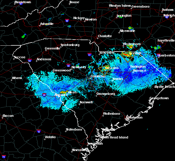 At 531 pm edt, a severe thunderstorm was near the cheraw municipal airport. movement was southwest at 6 mph (radar indicated). Hazards include 70 mph wind gusts and ping pong ball size hail. People and animals outdoors will be injured. expect hail damage to roofs, siding, windows, and vehicles. expect considerable tree damage. wind damage is also likely to mobile homes, roofs, and outbuildings. Locations impacted include, cheraw, chesterfield, cheraw state park, cheraw municipal airport, northeastern technical college, cheraw fish hatchery and chesterfield detention center. At 531 pm edt, a severe thunderstorm was near the cheraw municipal airport. movement was southwest at 6 mph (radar indicated). Hazards include 70 mph wind gusts and ping pong ball size hail. People and animals outdoors will be injured. expect hail damage to roofs, siding, windows, and vehicles. expect considerable tree damage. wind damage is also likely to mobile homes, roofs, and outbuildings. Locations impacted include, cheraw, chesterfield, cheraw state park, cheraw municipal airport, northeastern technical college, cheraw fish hatchery and chesterfield detention center.
|
| 9/12/2019 5:27 PM EDT |
 At 525 pm edt, a likely severe thunderstorm was near the cheraw municipal airport, moving southwest at 8 mph (radar indicated). Hazards include 60 mph wind gusts and quarter size hail. Hail damage to vehicles is expected. expect wind damage to roofs, siding, and trees. Locations impacted include, cheraw, chesterfield, cheraw state park, cheraw municipal airport, northeastern technical college, cheraw fish hatchery and chesterfield detention center. At 525 pm edt, a likely severe thunderstorm was near the cheraw municipal airport, moving southwest at 8 mph (radar indicated). Hazards include 60 mph wind gusts and quarter size hail. Hail damage to vehicles is expected. expect wind damage to roofs, siding, and trees. Locations impacted include, cheraw, chesterfield, cheraw state park, cheraw municipal airport, northeastern technical college, cheraw fish hatchery and chesterfield detention center.
|
| 9/12/2019 5:13 PM EDT |
 At 513 pm edt, a severe thunderstorm was approaching, and will soon cross the great pee dee river, northwest of wallace, movement was to the southwest at 10 mph. those on the river should be seeking shelter (radar indicated). Hazards include 60 mph wind gusts and quarter size hail. Minor hail damage is possible. expect wind damage to trees and power lines. Locations impacted include, chavistown and wallace. At 513 pm edt, a severe thunderstorm was approaching, and will soon cross the great pee dee river, northwest of wallace, movement was to the southwest at 10 mph. those on the river should be seeking shelter (radar indicated). Hazards include 60 mph wind gusts and quarter size hail. Minor hail damage is possible. expect wind damage to trees and power lines. Locations impacted include, chavistown and wallace.
|
| 9/12/2019 5:02 PM EDT |
 At 501 pm edt, a likely severe thunderstorm was near the northern marlboro-chesterfield county line. movement was southwest near 8 mph and toward the cheraw and cheraw airport area (radar indicated). Hazards include 60 mph wind gusts and quarter size hail. Hail damage to vehicles is expected. Expect wind damage to roofs, siding, and trees. At 501 pm edt, a likely severe thunderstorm was near the northern marlboro-chesterfield county line. movement was southwest near 8 mph and toward the cheraw and cheraw airport area (radar indicated). Hazards include 60 mph wind gusts and quarter size hail. Hail damage to vehicles is expected. Expect wind damage to roofs, siding, and trees.
|
| 9/12/2019 4:53 PM EDT |
 At 454 pm edt, a severe thunderstorm was located over wallace, or over cheraw, moving southwest at 10 mph (radar indicated). Hazards include 60 mph wind gusts and quarter size hail. Minor hail damage to vehicles is possible. Expect wind damage to trees and power lines. At 454 pm edt, a severe thunderstorm was located over wallace, or over cheraw, moving southwest at 10 mph (radar indicated). Hazards include 60 mph wind gusts and quarter size hail. Minor hail damage to vehicles is possible. Expect wind damage to trees and power lines.
|
| 7/13/2019 7:05 PM EDT | Chesterfield co dispatch reported one tree down on society hill rd and bethel church rd. time estimate in chesterfield county SC, 8 miles N of Cheraw, SC |
| 7/13/2019 2:19 PM EDT |
 At 219 pm edt, severe thunderstorms were located along a line extending from near chesterfield to 6 miles north of north hartsville, moving northeast at 25 mph (radar indicated). Hazards include 60 mph wind gusts and quarter size hail. Hail damage to vehicles is expected. Expect wind damage to roofs, siding, and trees. At 219 pm edt, severe thunderstorms were located along a line extending from near chesterfield to 6 miles north of north hartsville, moving northeast at 25 mph (radar indicated). Hazards include 60 mph wind gusts and quarter size hail. Hail damage to vehicles is expected. Expect wind damage to roofs, siding, and trees.
|
| 6/22/2019 6:23 PM EDT |
 The severe thunderstorm warning for marlboro county will expire at 630 pm edt, the storm which prompted the warning has moved out of the area. therefore, the warning will be allowed to expire. a severe thunderstorm watch remains in effect until 900 pm edt for northeastern south carolina. The severe thunderstorm warning for marlboro county will expire at 630 pm edt, the storm which prompted the warning has moved out of the area. therefore, the warning will be allowed to expire. a severe thunderstorm watch remains in effect until 900 pm edt for northeastern south carolina.
|
| 6/22/2019 5:56 PM EDT |
 The severe thunderstorm warning for northeastern chesterfield county will expire at 600 pm edt, the storm which prompted the warning has moved out of the area. therefore, the warning will be allowed to expire. a severe thunderstorm watch remains in effect until 900 pm edt for central south carolina. to report severe weather, contact your nearest law enforcement agency. they will relay your report to the national weather service columbia. The severe thunderstorm warning for northeastern chesterfield county will expire at 600 pm edt, the storm which prompted the warning has moved out of the area. therefore, the warning will be allowed to expire. a severe thunderstorm watch remains in effect until 900 pm edt for central south carolina. to report severe weather, contact your nearest law enforcement agency. they will relay your report to the national weather service columbia.
|
| 6/22/2019 5:41 PM EDT |
 At 540 pm edt, a severe thunderstorm was located near cheraw state park, or 7 miles west of bennettsville, moving southeast at 50 mph (radar indicated). Hazards include 60 mph wind gusts. Expect damage to roofs, siding, and trees. Locations impacted include, cheraw, chesterfield, cheraw state park, cheraw municipal airport, northeastern technical college, patrick and cheraw fish hatchery. At 540 pm edt, a severe thunderstorm was located near cheraw state park, or 7 miles west of bennettsville, moving southeast at 50 mph (radar indicated). Hazards include 60 mph wind gusts. Expect damage to roofs, siding, and trees. Locations impacted include, cheraw, chesterfield, cheraw state park, cheraw municipal airport, northeastern technical college, patrick and cheraw fish hatchery.
|
| 6/22/2019 5:25 PM EDT |
 At 524 pm edt, a severe thunderstorm was located near cheraw municipal airport, or 7 miles west of cheraw, moving southeast at 50 mph (radar indicated). Hazards include 60 mph wind gusts. expect damage to roofs, siding, and trees At 524 pm edt, a severe thunderstorm was located near cheraw municipal airport, or 7 miles west of cheraw, moving southeast at 50 mph (radar indicated). Hazards include 60 mph wind gusts. expect damage to roofs, siding, and trees
|
| 6/22/2019 5:23 PM EDT |
 At 523 pm edt, a severe thunderstorm was located 8 miles southeast of wadesboro, moving southeast at 45 mph (public). Hazards include 60 mph wind gusts and quarter size hail. Minor hail damage to vehicles is possible. Expect wind damage to trees and power lines. At 523 pm edt, a severe thunderstorm was located 8 miles southeast of wadesboro, moving southeast at 45 mph (public). Hazards include 60 mph wind gusts and quarter size hail. Minor hail damage to vehicles is possible. Expect wind damage to trees and power lines.
|
| 6/22/2019 4:46 AM EDT |
 At 445 am edt, severe thunderstorms were located along a line extending from near carolina sandhills wildlife refuge to near poinsett state park, moving east at 45 mph (radar indicated). Hazards include 70 mph wind gusts. Expect considerable tree damage. damage is likely to mobile homes, roofs, and outbuildings. locations impacted include, sumter, cheraw, manning, bishopville, south sumter, shaw air base, oakland, mulberry, cheraw state park, alcolu, northeastern technical college, woods bay state park, cassatt, elliott, lee state park, carolina sandhills wildlife refuge, mt pisgah, sumter county airport, millwood and poinsett state park. this includes the following highways, interstate 20 in south carolina between mile markers 100 and 125. Interstate 26 interstate 95 between mile markers 113 and 146. At 445 am edt, severe thunderstorms were located along a line extending from near carolina sandhills wildlife refuge to near poinsett state park, moving east at 45 mph (radar indicated). Hazards include 70 mph wind gusts. Expect considerable tree damage. damage is likely to mobile homes, roofs, and outbuildings. locations impacted include, sumter, cheraw, manning, bishopville, south sumter, shaw air base, oakland, mulberry, cheraw state park, alcolu, northeastern technical college, woods bay state park, cassatt, elliott, lee state park, carolina sandhills wildlife refuge, mt pisgah, sumter county airport, millwood and poinsett state park. this includes the following highways, interstate 20 in south carolina between mile markers 100 and 125. Interstate 26 interstate 95 between mile markers 113 and 146.
|
| 6/22/2019 4:22 AM EDT |
 At 421 am edt, severe thunderstorms were located along a line extending from near mt pisgah to near eastover, moving east at 80 mph (radar indicated). Hazards include 70 mph wind gusts. Expect considerable tree damage. Damage is likely to mobile homes, roofs, and outbuildings. At 421 am edt, severe thunderstorms were located along a line extending from near mt pisgah to near eastover, moving east at 80 mph (radar indicated). Hazards include 70 mph wind gusts. Expect considerable tree damage. Damage is likely to mobile homes, roofs, and outbuildings.
|
| 5/4/2019 6:39 PM EDT |
 At 638 pm edt, severe thunderstorms were located along a line extending from wadesboro to 8 miles north of cheraw municipal airport to near chesterfield, moving northeast at 50 mph (radar indicated). Hazards include 60 mph wind gusts and quarter size hail. Hail damage to vehicles is expected. expect wind damage to roofs, siding, and trees. Locations impacted include, cheraw, pageland, chesterfield, cheraw municipal airport, northeastern technical college, jefferson, ruby, mount croghan, chesterfield ruby middle school, high point fire station, chesterfield detention center and central high school. At 638 pm edt, severe thunderstorms were located along a line extending from wadesboro to 8 miles north of cheraw municipal airport to near chesterfield, moving northeast at 50 mph (radar indicated). Hazards include 60 mph wind gusts and quarter size hail. Hail damage to vehicles is expected. expect wind damage to roofs, siding, and trees. Locations impacted include, cheraw, pageland, chesterfield, cheraw municipal airport, northeastern technical college, jefferson, ruby, mount croghan, chesterfield ruby middle school, high point fire station, chesterfield detention center and central high school.
|
| 5/4/2019 6:18 PM EDT |
 The national weather service in columbia has issued a * severe thunderstorm warning for. chesterfield county in central south carolina. until 700 pm edt. At 618 pm edt, severe thunderstorms were located along a line extending from near sturdivants to 6 miles west of chesterfield to. The national weather service in columbia has issued a * severe thunderstorm warning for. chesterfield county in central south carolina. until 700 pm edt. At 618 pm edt, severe thunderstorms were located along a line extending from near sturdivants to 6 miles west of chesterfield to.
|
| 4/19/2019 3:24 PM EDT |
 At 323 pm edt, severe thunderstorms were located along a line extending from mt pisgah to 6 miles northwest of north hartsville to near quinby, moving north at 65 mph (radar indicated). Hazards include 70 mph wind gusts. Expect considerable tree damage. damage is likely to mobile homes, roofs, and outbuildings. Locations impacted include, cheraw, pageland, chesterfield, carolina sandhills wildlife refuge, cheraw state park, northeastern technical college, cheraw municipal airport, jefferson, ruby, patrick, mount croghan, chesterfield ruby middle school, cheraw fish hatchery, alligator fire station, middendorf, bay springs fire station, and chesterfield detention center. At 323 pm edt, severe thunderstorms were located along a line extending from mt pisgah to 6 miles northwest of north hartsville to near quinby, moving north at 65 mph (radar indicated). Hazards include 70 mph wind gusts. Expect considerable tree damage. damage is likely to mobile homes, roofs, and outbuildings. Locations impacted include, cheraw, pageland, chesterfield, carolina sandhills wildlife refuge, cheraw state park, northeastern technical college, cheraw municipal airport, jefferson, ruby, patrick, mount croghan, chesterfield ruby middle school, cheraw fish hatchery, alligator fire station, middendorf, bay springs fire station, and chesterfield detention center.
|
| 4/19/2019 2:48 PM EDT |
 At 248 pm edt, severe thunderstorms were located along a line extending from 10 miles northeast of mcentire air base to mulberry to 7 miles west of kingstree, moving north at 65 mph (radar indicated). Hazards include 70 mph wind gusts. Expect considerable tree damage. Damage is likely to mobile homes, roofs, and outbuildings. At 248 pm edt, severe thunderstorms were located along a line extending from 10 miles northeast of mcentire air base to mulberry to 7 miles west of kingstree, moving north at 65 mph (radar indicated). Hazards include 70 mph wind gusts. Expect considerable tree damage. Damage is likely to mobile homes, roofs, and outbuildings.
|
| 4/14/2019 6:16 PM EDT |
 At 616 pm edt, a severe thunderstorm was located near wallace, or near cheraw, moving northeast at 45 mph (radar indicated). Hazards include 60 mph wind gusts and penny size hail. Expect damage to roofs, siding, and trees. Locations impacted include, cheraw, cheraw municipal airport and northeastern technical college. At 616 pm edt, a severe thunderstorm was located near wallace, or near cheraw, moving northeast at 45 mph (radar indicated). Hazards include 60 mph wind gusts and penny size hail. Expect damage to roofs, siding, and trees. Locations impacted include, cheraw, cheraw municipal airport and northeastern technical college.
|
| 4/14/2019 5:54 PM EDT |
 At 554 pm edt, a severe thunderstorm was located 8 miles south of chesterfield, or 11 miles southwest of cheraw, moving northeast at 45 mph (radar indicated). Hazards include 60 mph wind gusts and penny size hail. expect damage to roofs, siding, and trees At 554 pm edt, a severe thunderstorm was located 8 miles south of chesterfield, or 11 miles southwest of cheraw, moving northeast at 45 mph (radar indicated). Hazards include 60 mph wind gusts and penny size hail. expect damage to roofs, siding, and trees
|
| 3/3/2019 7:06 PM EST |
 At 705 pm est, a severe thunderstorm was located near auburn, or 18 miles south of cheraw, moving east at 50 mph (radar indicated). Hazards include 60 mph wind gusts. Expect damage to roofs, siding, and trees. locations impacted include, cheraw, bishopville, lee state park, cheraw state park, patrick, cheraw fish hatchery, alligator fire station, middendorf and ashland. this includes the following highways, interstate 20 in south carolina between mile markers 115 and 116. Interstate 26 a tornado watch remains in effect until 1100 pm est for central south carolina. At 705 pm est, a severe thunderstorm was located near auburn, or 18 miles south of cheraw, moving east at 50 mph (radar indicated). Hazards include 60 mph wind gusts. Expect damage to roofs, siding, and trees. locations impacted include, cheraw, bishopville, lee state park, cheraw state park, patrick, cheraw fish hatchery, alligator fire station, middendorf and ashland. this includes the following highways, interstate 20 in south carolina between mile markers 115 and 116. Interstate 26 a tornado watch remains in effect until 1100 pm est for central south carolina.
|
| 3/3/2019 6:45 PM EST |
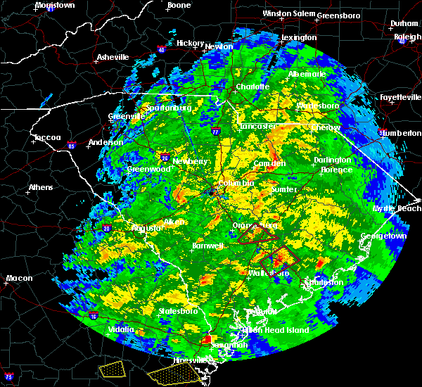 At 644 pm est, a severe thunderstorm was located near clyde, or 9 miles north of bishopville, moving east at 50 mph (radar indicated). Hazards include 60 mph wind gusts. expect damage to roofs, siding, and trees At 644 pm est, a severe thunderstorm was located near clyde, or 9 miles north of bishopville, moving east at 50 mph (radar indicated). Hazards include 60 mph wind gusts. expect damage to roofs, siding, and trees
|
| 2/12/2019 6:47 PM EST |
 At 647 pm est, a severe thunderstorm was located near bennettsville, moving northeast at 65 mph (radar indicated). Hazards include 60 mph wind gusts. Expect wind damage to trees and power lines. Locations impacted include, bennettsville, mccoll, clio, wallace, chavistown, dunbar, blenheim and tatum. At 647 pm est, a severe thunderstorm was located near bennettsville, moving northeast at 65 mph (radar indicated). Hazards include 60 mph wind gusts. Expect wind damage to trees and power lines. Locations impacted include, bennettsville, mccoll, clio, wallace, chavistown, dunbar, blenheim and tatum.
|
| 2/12/2019 6:38 PM EST |
 At 637 pm est, a severe thunderstorm was located near chavistown, or near cheraw, moving northeast at 55 mph (radar indicated). Hazards include 60 mph wind gusts. Expect wind damage to trees and power lines. Locations impacted include, bennettsville, hartsville, mccoll, clio, north hartsville, dovesville, mont clare, lydia, auburn, wallace, clyde, chavistown, floyd, dunbar, kellytown, society hill, blenheim, tatum and carolina pines regional medical center. At 637 pm est, a severe thunderstorm was located near chavistown, or near cheraw, moving northeast at 55 mph (radar indicated). Hazards include 60 mph wind gusts. Expect wind damage to trees and power lines. Locations impacted include, bennettsville, hartsville, mccoll, clio, north hartsville, dovesville, mont clare, lydia, auburn, wallace, clyde, chavistown, floyd, dunbar, kellytown, society hill, blenheim, tatum and carolina pines regional medical center.
|
| 2/12/2019 6:24 PM EST |
 At 624 pm est, a severe thunderstorm was located near chesterfield, or 7 miles west of cheraw, moving northeast at 45 to 50 mph (radar indicated). Hazards include 60 mph wind gusts. Expect damage to roofs, siding, and trees. Locations impacted include, cheraw, chesterfield and patrick. At 624 pm est, a severe thunderstorm was located near chesterfield, or 7 miles west of cheraw, moving northeast at 45 to 50 mph (radar indicated). Hazards include 60 mph wind gusts. Expect damage to roofs, siding, and trees. Locations impacted include, cheraw, chesterfield and patrick.
|
| 2/12/2019 6:22 PM EST |
 At 621 pm est, a severe thunderstorm was located 10 miles north of north hartsville, or 12 miles north of hartsville, moving northeast at 70 mph (radar indicated). Hazards include 60 mph wind gusts. expect wind damage to trees and power lines At 621 pm est, a severe thunderstorm was located 10 miles north of north hartsville, or 12 miles north of hartsville, moving northeast at 70 mph (radar indicated). Hazards include 60 mph wind gusts. expect wind damage to trees and power lines
|
| 2/12/2019 6:15 PM EST |
 At 614 pm est, a severe thunderstorm was located 11 miles southwest of chesterfield, or 17 miles southwest of cheraw, moving northeast at 40 to 45 mph (radar indicated). Hazards include 60 mph wind gusts. expect damage to roofs, siding, and trees At 614 pm est, a severe thunderstorm was located 11 miles southwest of chesterfield, or 17 miles southwest of cheraw, moving northeast at 40 to 45 mph (radar indicated). Hazards include 60 mph wind gusts. expect damage to roofs, siding, and trees
|
| 6/25/2018 9:43 PM EDT |
 The severe thunderstorm warning for southeastern lancaster. chesterfield and northeastern kershaw counties will expire at 945 pm edt. the storms which prompted the warning have weakened below severe limits, and no longer pose an immediate threat to life or property. therefore, the warning will be allowed to expire. However gusty. The severe thunderstorm warning for southeastern lancaster. chesterfield and northeastern kershaw counties will expire at 945 pm edt. the storms which prompted the warning have weakened below severe limits, and no longer pose an immediate threat to life or property. therefore, the warning will be allowed to expire. However gusty.
|
| 6/25/2018 8:45 PM EDT |
 At 845 pm edt, severe thunderstorms were located along a line extending from 8 miles west of wadesboro to near kershaw, moving east at 25 mph (radar indicated). Hazards include 60 mph wind gusts. expect damage to roofs, siding, and trees At 845 pm edt, severe thunderstorms were located along a line extending from 8 miles west of wadesboro to near kershaw, moving east at 25 mph (radar indicated). Hazards include 60 mph wind gusts. expect damage to roofs, siding, and trees
|
| 4/15/2018 4:29 PM EDT |
 At 427 pm edt, likely severe thunderstorms extended through central chesterfield county from around ruby southward to near mcbee. movement was northeast near 35 mph (radar indicated). Hazards include 60 mph wind gusts. Expect damage to roofs, siding, and trees. locations impacted include, cheraw, chesterfield, ruby, patrick and mount croghan. A tornado watch remains in effect until 700 pm edt for central south carolina. At 427 pm edt, likely severe thunderstorms extended through central chesterfield county from around ruby southward to near mcbee. movement was northeast near 35 mph (radar indicated). Hazards include 60 mph wind gusts. Expect damage to roofs, siding, and trees. locations impacted include, cheraw, chesterfield, ruby, patrick and mount croghan. A tornado watch remains in effect until 700 pm edt for central south carolina.
|
| 4/15/2018 3:48 PM EDT |
 At 345 pm edt, severe thunderstorms extended from lancaster county southward into kershaw county. storm movement was northeast near 50 mph and toward chesterfield county (radar indicated). Hazards include 60 mph wind gusts. expect damage to roofs, siding, and trees At 345 pm edt, severe thunderstorms extended from lancaster county southward into kershaw county. storm movement was northeast near 50 mph and toward chesterfield county (radar indicated). Hazards include 60 mph wind gusts. expect damage to roofs, siding, and trees
|
| 3/1/2018 4:07 PM EST |
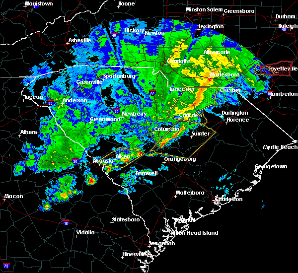 At 405 pm est, showers extending from around the city of chesterfield southward into lee county. movement was eastward near 50 mph. some of the showers likely contained wind gusts of 40 to 60 mph (radar indicated). Hazards include 60 mph wind gusts. Expect damage to roofs, siding, and trees. Locations impacted include, bishopville, chesterfield, mcbee, ruby, patrick, bethune and mount croghan. At 405 pm est, showers extending from around the city of chesterfield southward into lee county. movement was eastward near 50 mph. some of the showers likely contained wind gusts of 40 to 60 mph (radar indicated). Hazards include 60 mph wind gusts. Expect damage to roofs, siding, and trees. Locations impacted include, bishopville, chesterfield, mcbee, ruby, patrick, bethune and mount croghan.
|
| 3/1/2018 3:55 PM EST |
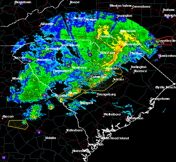 At 353 pm est, showers with damaging wind extending along the chesterfield and lancaster county line southward in kershaw county. movement was eastward near 50 mph (radar indicated). Hazards include 60 mph wind gusts. Expect damage to roofs, siding, and trees. Locations impacted include, camden, bishopville, pageland, kershaw, chesterfield, mcbee, jefferson, ruby, patrick, bethune and mount croghan. At 353 pm est, showers with damaging wind extending along the chesterfield and lancaster county line southward in kershaw county. movement was eastward near 50 mph (radar indicated). Hazards include 60 mph wind gusts. Expect damage to roofs, siding, and trees. Locations impacted include, camden, bishopville, pageland, kershaw, chesterfield, mcbee, jefferson, ruby, patrick, bethune and mount croghan.
|
| 3/1/2018 3:43 PM EST |
 At 342 pm est, showers with damaging wind were in lancaster and western kershaw counties moving eastward near 45 mph and toward chesterfield and parts of lee county (radar indicated). Hazards include 60 mph wind gusts. expect damage to roofs, siding, and trees At 342 pm est, showers with damaging wind were in lancaster and western kershaw counties moving eastward near 45 mph and toward chesterfield and parts of lee county (radar indicated). Hazards include 60 mph wind gusts. expect damage to roofs, siding, and trees
|
| 9/1/2017 4:04 PM EDT |
 At 404 pm edt, a severe thunderstorm was located 10 miles south of chesterfield, or 12 miles southwest of cheraw, moving northeast at 40 mph (radar indicated). Hazards include 60 mph wind gusts and half dollar size hail. Hail damage to vehicles is expected. expect wind damage to roofs, siding, and trees. locations impacted include, cheraw, chesterfield, ruby and patrick. A tornado watch remains in effect until 1000 pm edt for central south carolina. At 404 pm edt, a severe thunderstorm was located 10 miles south of chesterfield, or 12 miles southwest of cheraw, moving northeast at 40 mph (radar indicated). Hazards include 60 mph wind gusts and half dollar size hail. Hail damage to vehicles is expected. expect wind damage to roofs, siding, and trees. locations impacted include, cheraw, chesterfield, ruby and patrick. A tornado watch remains in effect until 1000 pm edt for central south carolina.
|
| 9/1/2017 3:50 PM EDT |
 At 349 pm edt, a severe thunderstorm was located near mcbee, or 19 miles north of bishopville, moving northeast at 30 mph (radar indicated). Hazards include 60 mph wind gusts and half dollar size hail. Hail damage to vehicles is expected. expect wind damage to roofs, siding, and trees. locations impacted include, cheraw, chesterfield, mcbee, ruby and patrick. A tornado watch remains in effect until 1000 pm edt for central south carolina. At 349 pm edt, a severe thunderstorm was located near mcbee, or 19 miles north of bishopville, moving northeast at 30 mph (radar indicated). Hazards include 60 mph wind gusts and half dollar size hail. Hail damage to vehicles is expected. expect wind damage to roofs, siding, and trees. locations impacted include, cheraw, chesterfield, mcbee, ruby and patrick. A tornado watch remains in effect until 1000 pm edt for central south carolina.
|
| 9/1/2017 3:39 PM EDT |
 At 338 pm edt, severe thunderstorms were located along a broken line extending from near pageland to near clyde, moving northeast at 40 mph. the strongest storm is located near mcbee (radar indicated). Hazards include 60 mph wind gusts and half dollar size hail. Hail damage to vehicles is expected. Expect wind damage to roofs, siding, and trees. At 338 pm edt, severe thunderstorms were located along a broken line extending from near pageland to near clyde, moving northeast at 40 mph. the strongest storm is located near mcbee (radar indicated). Hazards include 60 mph wind gusts and half dollar size hail. Hail damage to vehicles is expected. Expect wind damage to roofs, siding, and trees.
|
| 8/31/2017 5:45 PM EDT |
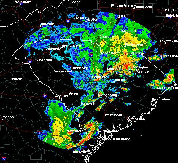 At 543 pm edt, a severe thunderstorm was located over southern chesterfield county, moving east at 25 mph (radar indicated). Hazards include 60 mph wind gusts. Expect wind damage to roofs, siding, and trees. Locations impacted include, cheraw, chesterfield, mcbee and patrick. At 543 pm edt, a severe thunderstorm was located over southern chesterfield county, moving east at 25 mph (radar indicated). Hazards include 60 mph wind gusts. Expect wind damage to roofs, siding, and trees. Locations impacted include, cheraw, chesterfield, mcbee and patrick.
|
| 8/31/2017 5:06 PM EDT |
 At 505 pm edt, a severe thunderstorm was located 12 miles east of kershaw, or 21 miles north of bishopville, moving east at 25 mph (radar indicated). Hazards include 60 mph wind gusts and quarter size hail. Hail damage to vehicles is expected. Expect wind damage to roofs, siding, and trees. At 505 pm edt, a severe thunderstorm was located 12 miles east of kershaw, or 21 miles north of bishopville, moving east at 25 mph (radar indicated). Hazards include 60 mph wind gusts and quarter size hail. Hail damage to vehicles is expected. Expect wind damage to roofs, siding, and trees.
|
| 7/23/2017 4:28 PM EDT |
 At 427 pm edt, a severe thunderstorm was located near pageland, or 16 miles east of lancaster, moving northeast at 5 mph (radar indicated). Hazards include 60 mph wind gusts and quarter size hail. Minor hail damage to vehicles is expected. Expect wind damage to roofs, siding, and trees. At 427 pm edt, a severe thunderstorm was located near pageland, or 16 miles east of lancaster, moving northeast at 5 mph (radar indicated). Hazards include 60 mph wind gusts and quarter size hail. Minor hail damage to vehicles is expected. Expect wind damage to roofs, siding, and trees.
|
| 7/23/2017 4:21 PM EDT |
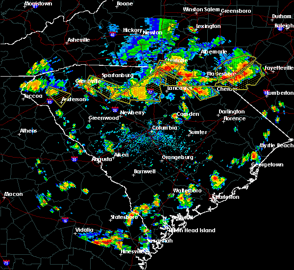 At 420 pm edt, a severe thunderstorm was located near chesterfield, or 16 miles west of cheraw, and is nearly stationary (radar indicated). Hazards include 60 mph wind gusts and quarter size hail. Hail damage to vehicles is expected. expect wind damage to roofs, siding, and trees. Locations impacted include, cheraw, pageland, chesterfield, ruby and mount croghan. At 420 pm edt, a severe thunderstorm was located near chesterfield, or 16 miles west of cheraw, and is nearly stationary (radar indicated). Hazards include 60 mph wind gusts and quarter size hail. Hail damage to vehicles is expected. expect wind damage to roofs, siding, and trees. Locations impacted include, cheraw, pageland, chesterfield, ruby and mount croghan.
|
| 7/23/2017 3:27 PM EDT |
 At 326 pm edt, a severe thunderstorm was located near ruby, or 15 miles west of cheraw, and is nearly stationary (radar indicated). Hazards include 60 mph wind gusts and quarter size hail. Minor hail damage to vehicles is expected. Expect wind damage to roofs, siding, and trees. At 326 pm edt, a severe thunderstorm was located near ruby, or 15 miles west of cheraw, and is nearly stationary (radar indicated). Hazards include 60 mph wind gusts and quarter size hail. Minor hail damage to vehicles is expected. Expect wind damage to roofs, siding, and trees.
|
| 7/18/2017 8:22 PM EDT |
 At 821 pm edt, a severe thunderstorm was located near chesterfield, or 12 miles west of cheraw, moving southwest at 10 mph (radar indicated). Hazards include 60 mph wind gusts. Expect damage to roofs, siding, and trees. Locations impacted include, cheraw, pageland, chesterfield, ruby, patrick and mount croghan. At 821 pm edt, a severe thunderstorm was located near chesterfield, or 12 miles west of cheraw, moving southwest at 10 mph (radar indicated). Hazards include 60 mph wind gusts. Expect damage to roofs, siding, and trees. Locations impacted include, cheraw, pageland, chesterfield, ruby, patrick and mount croghan.
|
| 7/18/2017 7:50 PM EDT |
 At 749 pm edt, a severe thunderstorm was located near chesterfield, or near cheraw, and is nearly stationary (radar indicated). Hazards include 60 mph wind gusts and quarter size hail. Hail damage to vehicles is expected. Expect wind damage to roofs, siding, and trees. At 749 pm edt, a severe thunderstorm was located near chesterfield, or near cheraw, and is nearly stationary (radar indicated). Hazards include 60 mph wind gusts and quarter size hail. Hail damage to vehicles is expected. Expect wind damage to roofs, siding, and trees.
|
| 7/18/2017 7:04 PM EDT |
 At 704 pm edt, a severe thunderstorm was located near chesterfield, or 11 miles northwest of cheraw, and is nearly stationary (radar indicated). Hazards include 60 mph wind gusts and quarter size hail. Hail damage to vehicles is expected. expect wind damage to roofs, siding, and trees. Locations impacted include, cheraw, chesterfield and ruby. At 704 pm edt, a severe thunderstorm was located near chesterfield, or 11 miles northwest of cheraw, and is nearly stationary (radar indicated). Hazards include 60 mph wind gusts and quarter size hail. Hail damage to vehicles is expected. expect wind damage to roofs, siding, and trees. Locations impacted include, cheraw, chesterfield and ruby.
|
| 7/18/2017 6:43 PM EDT |
 At 643 pm edt, a severe thunderstorm was located near chesterfield, or 17 miles northwest of cheraw, and is nearly stationary (radar indicated). Hazards include 60 mph wind gusts and quarter size hail. Hail damage to vehicles is expected. expect wind damage to roofs, siding, and trees. Locations impacted include, cheraw, chesterfield, ruby and mount croghan. At 643 pm edt, a severe thunderstorm was located near chesterfield, or 17 miles northwest of cheraw, and is nearly stationary (radar indicated). Hazards include 60 mph wind gusts and quarter size hail. Hail damage to vehicles is expected. expect wind damage to roofs, siding, and trees. Locations impacted include, cheraw, chesterfield, ruby and mount croghan.
|
| 7/18/2017 6:34 PM EDT |
 At 633 pm edt, a severe thunderstorm was located near chesterfield, or 16 miles west of cheraw, and is nearly stationary (radar indicated). Hazards include 60 mph wind gusts and quarter size hail. Hail damage to vehicles is expected. Expect wind damage to roofs, siding, and trees. At 633 pm edt, a severe thunderstorm was located near chesterfield, or 16 miles west of cheraw, and is nearly stationary (radar indicated). Hazards include 60 mph wind gusts and quarter size hail. Hail damage to vehicles is expected. Expect wind damage to roofs, siding, and trees.
|
| 7/15/2017 5:46 PM EDT |
 At 546 pm edt, a severe thunderstorm was located over chavistown, or near bennettsville, moving east at 25 mph (radar indicated). Hazards include 60 mph wind gusts and nickel size hail. expect damage trees and power lines At 546 pm edt, a severe thunderstorm was located over chavistown, or near bennettsville, moving east at 25 mph (radar indicated). Hazards include 60 mph wind gusts and nickel size hail. expect damage trees and power lines
|
| 4/3/2017 5:45 PM EDT |
 At 545 pm edt, severe thunderstorms were located along a line extending from wallace to near north hartsville, moving east at 45 mph (radar indicated). Hazards include 60 mph wind gusts. expect damage to roofs, siding, and trees At 545 pm edt, severe thunderstorms were located along a line extending from wallace to near north hartsville, moving east at 45 mph (radar indicated). Hazards include 60 mph wind gusts. expect damage to roofs, siding, and trees
|
| 4/3/2017 5:39 PM EDT |
 At 538 pm edt, severe thunderstorms were located along a line extending from near wallace to 9 miles south of bishopville, moving east at 60 mph (radar indicated). Hazards include 70 mph wind gusts. Expect considerable tree damage. damage is likely to mobile homes, roofs, and outbuildings. locations impacted include, cheraw and patrick. A tornado watch remains in effect until 900 pm edt for central south carolina. At 538 pm edt, severe thunderstorms were located along a line extending from near wallace to 9 miles south of bishopville, moving east at 60 mph (radar indicated). Hazards include 70 mph wind gusts. Expect considerable tree damage. damage is likely to mobile homes, roofs, and outbuildings. locations impacted include, cheraw and patrick. A tornado watch remains in effect until 900 pm edt for central south carolina.
|
| 4/3/2017 5:18 PM EDT |
 At 518 pm edt, severe thunderstorms were located along a line extending from near chesterfield to 9 miles southeast of lugoff, moving east at 35 mph (radar indicated). Hazards include 70 mph wind gusts. Expect considerable tree damage. damage is likely to mobile homes, roofs, and outbuildings. locations impacted include, camden, cheraw, bishopville, chesterfield, mcbee, ruby, patrick, bethune, mount croghan and rembert. A tornado watch remains in effect until 900 pm edt for central south carolina. At 518 pm edt, severe thunderstorms were located along a line extending from near chesterfield to 9 miles southeast of lugoff, moving east at 35 mph (radar indicated). Hazards include 70 mph wind gusts. Expect considerable tree damage. damage is likely to mobile homes, roofs, and outbuildings. locations impacted include, camden, cheraw, bishopville, chesterfield, mcbee, ruby, patrick, bethune, mount croghan and rembert. A tornado watch remains in effect until 900 pm edt for central south carolina.
|
| 4/3/2017 4:51 PM EDT |
 At 451 pm edt, severe thunderstorms were located along a line extending from near pageland to near dentsville, moving east at 60 mph (radar indicated). Hazards include 70 mph wind gusts. Expect considerable tree damage. Damage is likely to mobile homes, roofs, and outbuildings. At 451 pm edt, severe thunderstorms were located along a line extending from near pageland to near dentsville, moving east at 60 mph (radar indicated). Hazards include 70 mph wind gusts. Expect considerable tree damage. Damage is likely to mobile homes, roofs, and outbuildings.
|
| 7/16/2016 8:28 PM EDT |
 At 828 pm edt, a severe thunderstorm was located near chavistown, or near cheraw, moving east at 30 mph (radar indicated). Hazards include 60 mph wind gusts. Expect damage to roofs. siding. And trees. At 828 pm edt, a severe thunderstorm was located near chavistown, or near cheraw, moving east at 30 mph (radar indicated). Hazards include 60 mph wind gusts. Expect damage to roofs. siding. And trees.
|
| 7/15/2016 2:51 PM EDT |
 At 251 pm edt, a severe thunderstorm was located near rockingham, moving northeast at 40 mph (radar indicated). Hazards include 60 mph wind gusts and quarter size hail. Hail damage to vehicles is expected. expect wind damage to roofs, siding, and trees. Locations impacted include, cheraw, chesterfield, society hill and patrick. At 251 pm edt, a severe thunderstorm was located near rockingham, moving northeast at 40 mph (radar indicated). Hazards include 60 mph wind gusts and quarter size hail. Hail damage to vehicles is expected. expect wind damage to roofs, siding, and trees. Locations impacted include, cheraw, chesterfield, society hill and patrick.
|
| 7/15/2016 2:36 PM EDT | Trees down diane driv in chesterfield county SC, 1.2 miles ESE of Cheraw, SC |
| 7/15/2016 2:30 PM EDT | Public report of wind gust 60 mph. pea size hail also reporte in chesterfield county SC, 1.1 miles WSW of Cheraw, SC |
| 7/15/2016 2:30 PM EDT |
 At 228 pm edt, a severe thunderstorm was located over chesterfield, or 11 miles northwest of cheraw, moving northeast at 40 mph (radar indicated). Hazards include 60 mph wind gusts and quarter size hail. Hail damage to vehicles is expected. expect wind damage to roofs, siding, and trees. Locations impacted include, cheraw, chesterfield, mcbee, jefferson, society hill, ruby, patrick, mount croghan and mcfarlan. At 228 pm edt, a severe thunderstorm was located over chesterfield, or 11 miles northwest of cheraw, moving northeast at 40 mph (radar indicated). Hazards include 60 mph wind gusts and quarter size hail. Hail damage to vehicles is expected. expect wind damage to roofs, siding, and trees. Locations impacted include, cheraw, chesterfield, mcbee, jefferson, society hill, ruby, patrick, mount croghan and mcfarlan.
|
| 7/15/2016 2:27 PM EDT |
 At 227 pm edt, a severe thunderstorm was located over cheraw, moving northeast at 30 mph (radar indicated). Hazards include 60 mph wind gusts and quarter size hail. Hail damage to vehicles is expected. Expect wind damage to roofs, siding, and trees. At 227 pm edt, a severe thunderstorm was located over cheraw, moving northeast at 30 mph (radar indicated). Hazards include 60 mph wind gusts and quarter size hail. Hail damage to vehicles is expected. Expect wind damage to roofs, siding, and trees.
|
| 7/15/2016 2:08 PM EDT |
 At 208 pm edt, a severe thunderstorm was located 7 miles southeast of pageland, or 22 miles west of cheraw, moving northeast at 40 mph (radar indicated). Hazards include 60 mph wind gusts and quarter size hail. Hail damage to vehicles is expected. Expect wind damage to roofs, siding, and trees. At 208 pm edt, a severe thunderstorm was located 7 miles southeast of pageland, or 22 miles west of cheraw, moving northeast at 40 mph (radar indicated). Hazards include 60 mph wind gusts and quarter size hail. Hail damage to vehicles is expected. Expect wind damage to roofs, siding, and trees.
|
| 7/11/2016 1:18 PM EDT |
 At 118 pm edt, a severe thunderstorm was located 9 miles south of chesterfield, or 10 miles southwest of cheraw, moving east at 15 mph (radar indicated). Hazards include 60 mph wind gusts. Expect damage to roofs. siding. And trees. At 118 pm edt, a severe thunderstorm was located 9 miles south of chesterfield, or 10 miles southwest of cheraw, moving east at 15 mph (radar indicated). Hazards include 60 mph wind gusts. Expect damage to roofs. siding. And trees.
|
| 7/8/2016 11:19 PM EDT |
 At 1118 pm edt, a severe thunderstorm was located near hestertown, or near lumberton, moving east at 50 mph (emergency management has reported trees down with this activity). Hazards include 60 mph wind gusts and quarter size hail. Hail damage to vehicles is expected. expect wind damage to roofs, siding, and trees. locations impacted include, lumberton, bennettsville, dillon, red springs, pembroke, fairmont, maxton, mccoll, st. Pauls, latta, rowland, fair bluff, lake view, clio, boardman, howellsville, tolarsville, minturn, hamer and wakulla. At 1118 pm edt, a severe thunderstorm was located near hestertown, or near lumberton, moving east at 50 mph (emergency management has reported trees down with this activity). Hazards include 60 mph wind gusts and quarter size hail. Hail damage to vehicles is expected. expect wind damage to roofs, siding, and trees. locations impacted include, lumberton, bennettsville, dillon, red springs, pembroke, fairmont, maxton, mccoll, st. Pauls, latta, rowland, fair bluff, lake view, clio, boardman, howellsville, tolarsville, minturn, hamer and wakulla.
|
| 7/8/2016 10:35 PM EDT |
 At 1034 pm edt, a severe thunderstorm was located near clio, or near bennettsville, moving east, southeast at 40 mph (radar indicated). Hazards include 60 mph wind gusts and quarter size hail. Hail damage to vehicles is expected. Expect wind damage to roofs, siding, and trees. At 1034 pm edt, a severe thunderstorm was located near clio, or near bennettsville, moving east, southeast at 40 mph (radar indicated). Hazards include 60 mph wind gusts and quarter size hail. Hail damage to vehicles is expected. Expect wind damage to roofs, siding, and trees.
|
| 7/8/2016 10:35 PM EDT |
 At 1034 pm edt, severe thunderstorms were located along a line extending from near bennettsville to 8 miles south of cheraw to near kershaw, moving southeast at 65 mph (radar indicated). Hazards include 60 mph wind gusts. Expect damage to roofs. siding. And trees. At 1034 pm edt, severe thunderstorms were located along a line extending from near bennettsville to 8 miles south of cheraw to near kershaw, moving southeast at 65 mph (radar indicated). Hazards include 60 mph wind gusts. Expect damage to roofs. siding. And trees.
|
| 7/8/2016 10:35 PM EDT |
 At 1034 pm edt, a severe thunderstorm was located near clio, or near bennettsville, moving east, southeast at 40 mph (radar indicated). Hazards include 60 mph wind gusts and quarter size hail. Hail damage to vehicles is expected. Expect wind damage to roofs, siding, and trees. At 1034 pm edt, a severe thunderstorm was located near clio, or near bennettsville, moving east, southeast at 40 mph (radar indicated). Hazards include 60 mph wind gusts and quarter size hail. Hail damage to vehicles is expected. Expect wind damage to roofs, siding, and trees.
|
| 7/8/2016 10:08 PM EDT |
 At 1008 pm edt, a severe thunderstorm was located near bennettsville, moving southeast at 40 mph (radar indicated). Hazards include 60 mph wind gusts and quarter size hail. Hail damage to vehicles is expected. expect wind damage to roofs, siding, and trees. Locations impacted include, bennettsville, mccoll, clio, chavistown, dunbar, brownsville, wallace, blenheim and tatum. At 1008 pm edt, a severe thunderstorm was located near bennettsville, moving southeast at 40 mph (radar indicated). Hazards include 60 mph wind gusts and quarter size hail. Hail damage to vehicles is expected. expect wind damage to roofs, siding, and trees. Locations impacted include, bennettsville, mccoll, clio, chavistown, dunbar, brownsville, wallace, blenheim and tatum.
|
| 7/8/2016 10:01 PM EDT | Reported numerous trees and power lines in and around the town of cheraw. many areas without power. in chesterfield county SC, 0.6 miles WSW of Cheraw, SC |
| 7/8/2016 9:41 PM EDT |
 At 940 pm edt, severe thunderstorms were located along a line extending from near cheraw to near irwin, moving southeast at 40 mph (radar indicated). Hazards include 60 mph wind gusts. Expect damage to roofs. siding. And trees. At 940 pm edt, severe thunderstorms were located along a line extending from near cheraw to near irwin, moving southeast at 40 mph (radar indicated). Hazards include 60 mph wind gusts. Expect damage to roofs. siding. And trees.
|
| 7/8/2016 9:36 PM EDT |
 At 935 pm edt, a severe thunderstorm was located 7 miles northwest of cheraw, moving southeast at 35 mph (radar indicated). Hazards include 60 mph wind gusts and quarter size hail. Hail damage to vehicles is expected. Expect wind damage to roofs, siding, and trees. At 935 pm edt, a severe thunderstorm was located 7 miles northwest of cheraw, moving southeast at 35 mph (radar indicated). Hazards include 60 mph wind gusts and quarter size hail. Hail damage to vehicles is expected. Expect wind damage to roofs, siding, and trees.
|
| 7/7/2016 5:11 PM EDT |
 At 510 pm edt, a severe thunderstorm was located 11 miles south of chesterfield, or 14 miles north of hartsville, moving east at 35 mph (law enforcement has reported damaging winds with this storm). Hazards include 60 mph wind gusts. Expect damage to roofs. siding. and trees. Locations impacted include, cheraw, chesterfield, society hill and patrick. At 510 pm edt, a severe thunderstorm was located 11 miles south of chesterfield, or 14 miles north of hartsville, moving east at 35 mph (law enforcement has reported damaging winds with this storm). Hazards include 60 mph wind gusts. Expect damage to roofs. siding. and trees. Locations impacted include, cheraw, chesterfield, society hill and patrick.
|
| 7/7/2016 5:03 PM EDT |
 At 501 pm edt, a severe thunderstorm was located 13 miles north of clyde, or 15 miles northwest of hartsville, moving east at 35 mph (radar estimated). Hazards include 60 mph wind gusts. Expect damage to roofs. siding. and trees. Locations impacted include, cheraw, chesterfield, mcbee, society hill, ruby, patrick, mount croghan and mcfarlan. At 501 pm edt, a severe thunderstorm was located 13 miles north of clyde, or 15 miles northwest of hartsville, moving east at 35 mph (radar estimated). Hazards include 60 mph wind gusts. Expect damage to roofs. siding. and trees. Locations impacted include, cheraw, chesterfield, mcbee, society hill, ruby, patrick, mount croghan and mcfarlan.
|
| 7/7/2016 4:48 PM EDT |
 At 447 pm edt, a severe thunderstorm was located 13 miles east of kershaw, or 20 miles northwest of hartsville, moving east at 35 mph (law enforcement). Hazards include 60 mph wind gusts. Expect damage to roofs. siding. and trees. Locations impacted include, cheraw, pageland, chesterfield, mcbee, jefferson, society hill, ruby, patrick, mount croghan and mcfarlan. At 447 pm edt, a severe thunderstorm was located 13 miles east of kershaw, or 20 miles northwest of hartsville, moving east at 35 mph (law enforcement). Hazards include 60 mph wind gusts. Expect damage to roofs. siding. and trees. Locations impacted include, cheraw, pageland, chesterfield, mcbee, jefferson, society hill, ruby, patrick, mount croghan and mcfarlan.
|
| 7/7/2016 4:30 PM EDT |
 At 430 pm edt, a severe thunderstorm was located near kershaw, or 17 miles southeast of lancaster, moving east at 35 mph (law enforcement). Hazards include 60 mph wind gusts and penny size hail. Expect damage to roofs. siding. And trees. At 430 pm edt, a severe thunderstorm was located near kershaw, or 17 miles southeast of lancaster, moving east at 35 mph (law enforcement). Hazards include 60 mph wind gusts and penny size hail. Expect damage to roofs. siding. And trees.
|
| 7/6/2016 5:50 PM EDT |
 At 549 pm edt, severe thunderstorms were located along a line extending from near cheraw to just east of quinby, moving east and northeast at 25 mph (radar indicated). Hazards include 60 mph wind gusts and frequent cloud to ground lightning. Expect damage to roofs. siding. And trees. At 549 pm edt, severe thunderstorms were located along a line extending from near cheraw to just east of quinby, moving east and northeast at 25 mph (radar indicated). Hazards include 60 mph wind gusts and frequent cloud to ground lightning. Expect damage to roofs. siding. And trees.
|
| 7/5/2016 6:48 PM EDT | Chesterfield dispatch reported a tree blocking the roadway at hwy 52 and new zion church roa in chesterfield county SC, 5.5 miles NNW of Cheraw, SC |
| 7/5/2016 6:41 PM EDT |
 At 636 pm edt, a line of thunderstorms extended from central chesterfield county southward through lee county, eastern sumter county, and western clarendon county. movement was eastward near 35 mph. some of the thunderstorms in the line contained wind gusts of 40 to 60 mph (radar indicated). Hazards include 60 mph wind gusts. Expect damage to roofs. siding. and trees. locations impacted include, sumter, cheraw, manning, bishopville, south sumter, chesterfield, summerton, clyde, mulberry, wallace, mcbee, turbeville, mayesville, pinewood, lynchburg, ruby, patrick, paxville, mcfarlan and shiloh. 75in <50mph. At 636 pm edt, a line of thunderstorms extended from central chesterfield county southward through lee county, eastern sumter county, and western clarendon county. movement was eastward near 35 mph. some of the thunderstorms in the line contained wind gusts of 40 to 60 mph (radar indicated). Hazards include 60 mph wind gusts. Expect damage to roofs. siding. and trees. locations impacted include, sumter, cheraw, manning, bishopville, south sumter, chesterfield, summerton, clyde, mulberry, wallace, mcbee, turbeville, mayesville, pinewood, lynchburg, ruby, patrick, paxville, mcfarlan and shiloh. 75in <50mph.
|
| 7/5/2016 6:23 PM EDT |
 At 622 pm edt, severe thunderstorms were located along a line extending from 9 miles southwest of rockingham to 8 miles northwest of manning, moving east at 50 mph (radar indicated). Hazards include 60 mph wind gusts and penny size hail. Expect damage to roofs. siding. and trees. Locations impacted include, florence, bennettsville, hartsville, darlington, timmonsville, mccoll, lamar, quinby, sardis, chavistown, kellytown, cartersville, florence darlington technical college main campus, dovesville, wallace, north hartsville, mont clare, darlington raceway, floyd and lydia. At 622 pm edt, severe thunderstorms were located along a line extending from 9 miles southwest of rockingham to 8 miles northwest of manning, moving east at 50 mph (radar indicated). Hazards include 60 mph wind gusts and penny size hail. Expect damage to roofs. siding. and trees. Locations impacted include, florence, bennettsville, hartsville, darlington, timmonsville, mccoll, lamar, quinby, sardis, chavistown, kellytown, cartersville, florence darlington technical college main campus, dovesville, wallace, north hartsville, mont clare, darlington raceway, floyd and lydia.
|
| 7/5/2016 6:08 PM EDT |
 At 608 pm edt, severe thunderstorms were located along a line extending from 6 miles north of chesterfield to 11 miles north of elloree, moving east at 50 mph (radar indicated). Hazards include 60 mph wind gusts and penny size hail. Expect damage to roofs. siding. And trees. At 608 pm edt, severe thunderstorms were located along a line extending from 6 miles north of chesterfield to 11 miles north of elloree, moving east at 50 mph (radar indicated). Hazards include 60 mph wind gusts and penny size hail. Expect damage to roofs. siding. And trees.
|
| 7/5/2016 5:45 PM EDT |
 At 542 pm edt, a line of thunderstorms extended from lancaster county southward through kershaw, lower richland and calhoun county. movement was east-northeast near 35 mph. some of the thunderstorms within the line likely contained wind gusts of 40 to 60 mph (radar indicated). Hazards include 60 mph wind gusts. Expect damage to roofs. Siding and trees. At 542 pm edt, a line of thunderstorms extended from lancaster county southward through kershaw, lower richland and calhoun county. movement was east-northeast near 35 mph. some of the thunderstorms within the line likely contained wind gusts of 40 to 60 mph (radar indicated). Hazards include 60 mph wind gusts. Expect damage to roofs. Siding and trees.
|
| 7/4/2016 7:22 PM EDT |
 At 721 pm edt, a severe thunderstorm was located near chesterfield, or near cheraw, moving east at 20 mph (radar indicated). Hazards include 60 mph wind gusts. Expect damage to roofs. siding. and trees. Locations impacted include, cheraw, chesterfield and mcfarlan. At 721 pm edt, a severe thunderstorm was located near chesterfield, or near cheraw, moving east at 20 mph (radar indicated). Hazards include 60 mph wind gusts. Expect damage to roofs. siding. and trees. Locations impacted include, cheraw, chesterfield and mcfarlan.
|
| 7/4/2016 6:57 PM EDT |
 At 656 pm edt, a severe thunderstorm was located over chesterfield, or 12 miles west of cheraw, moving east at 20 mph (radar indicated). Hazards include 60 mph wind gusts. Expect damage to roofs. siding. And trees. At 656 pm edt, a severe thunderstorm was located over chesterfield, or 12 miles west of cheraw, moving east at 20 mph (radar indicated). Hazards include 60 mph wind gusts. Expect damage to roofs. siding. And trees.
|
| 7/3/2016 3:50 PM EDT |
 The severe thunderstorm warning for southeastern chesterfield county will expire at 400 pm edt, the storm which prompted the warning has moved out of the area. therefore the warning will be allowed to expire. The severe thunderstorm warning for southeastern chesterfield county will expire at 400 pm edt, the storm which prompted the warning has moved out of the area. therefore the warning will be allowed to expire.
|
| 7/3/2016 3:25 PM EDT |
 At 324 pm edt, a severe thunderstorm was located near clyde, or 9 miles northwest of hartsville, moving east at 10 mph (radar indicated). Hazards include 60 mph wind gusts and penny size hail. Expect damage to roofs. siding. And trees. At 324 pm edt, a severe thunderstorm was located near clyde, or 9 miles northwest of hartsville, moving east at 10 mph (radar indicated). Hazards include 60 mph wind gusts and penny size hail. Expect damage to roofs. siding. And trees.
|
| 6/30/2016 7:28 PM EDT | Report of trees across roadway hwy 52 and hwy in chesterfield county SC, 2.5 miles N of Cheraw, SC |
| 6/30/2016 7:16 PM EDT | Quarter sized hail reported 8.8 miles N of Cheraw, SC, quarter-size hail along hwy 52 near camp coker rd. |
| 6/30/2016 7:14 PM EDT |
 At 714 pm edt, a severe thunderstorm was located 7 miles south of cheraw, moving north at 10 mph (radar indicated). Hazards include 60 mph wind gusts and quarter size hail. Hail damage to vehicles is expected. Expect wind damage to roofs, siding, and trees. At 714 pm edt, a severe thunderstorm was located 7 miles south of cheraw, moving north at 10 mph (radar indicated). Hazards include 60 mph wind gusts and quarter size hail. Hail damage to vehicles is expected. Expect wind damage to roofs, siding, and trees.
|
| 6/14/2016 6:20 PM EDT |
 The severe thunderstorm warning for central chesterfield county will expire at 630 pm edt, the storms which prompted the warning have weakened below severe limits, and no longer pose an immediate threat to life or property. therefore the warning will be allowed to expire. however gusty winds are still possible with these thunderstorms. The severe thunderstorm warning for central chesterfield county will expire at 630 pm edt, the storms which prompted the warning have weakened below severe limits, and no longer pose an immediate threat to life or property. therefore the warning will be allowed to expire. however gusty winds are still possible with these thunderstorms.
|
| 6/14/2016 6:02 PM EDT |
 At 602 pm edt, severe thunderstorms were located along a line extending from 6 miles west of bennettsville to 10 miles north of clyde, moving southeast at 5 mph (radar indicated). Hazards include 60 mph wind gusts and quarter size hail. Hail damage to vehicles is expected. expect wind damage to roofs, siding, and trees. Locations impacted include, cheraw, mcbee, society hill and patrick. At 602 pm edt, severe thunderstorms were located along a line extending from 6 miles west of bennettsville to 10 miles north of clyde, moving southeast at 5 mph (radar indicated). Hazards include 60 mph wind gusts and quarter size hail. Hail damage to vehicles is expected. expect wind damage to roofs, siding, and trees. Locations impacted include, cheraw, mcbee, society hill and patrick.
|
| 6/14/2016 5:24 PM EDT | Downed trees and blown transformer on market stree in chesterfield county SC, 1.7 miles W of Cheraw, SC |
| 6/14/2016 5:20 PM EDT | Downed power lines legrand and bepot street in chesterfield county SC, 0.6 miles NW of Cheraw, SC |
| 6/14/2016 12:02 PM EDT | At 602 pm edt, severe thunderstorms were located along a line extending from 6 miles west of bennettsville to 10 miles north of clyde, moving southeast at 5 mph (radar indicated). Hazards include 60 mph wind gusts and quarter size hail. Hail damage to vehicles is expected. expect wind damage to roofs, siding, and trees. Locations impacted include, cheraw, mcbee, society hill and patrick. |
| 6/5/2016 7:55 PM EDT | The severe thunderstorm warning for northeastern kershaw and chesterfield counties will expire at 800 pm edt, the storm which prompted the warning has weakened below severe limits, and has exited the warned area. therefore the warning will be allowed to expire. a severe thunderstorm watch remains in effect until 1100 pm edt for central south carolina. to report severe weather, contact your nearest law enforcement agency. they will relay your report to the national weather service in columbia. |
| 6/5/2016 7:27 PM EDT |
 At 726 pm edt, a severe thunderstorm was located 7 miles northwest of clyde, or 13 miles northwest of hartsville, moving northeast at 40 mph (radar indicated). Hazards include 60 mph wind gusts and penny size hail. Expect damage to roofs. siding. and trees. Locations impacted include, cheraw, chesterfield, mcbee, society hill, patrick and bethune. At 726 pm edt, a severe thunderstorm was located 7 miles northwest of clyde, or 13 miles northwest of hartsville, moving northeast at 40 mph (radar indicated). Hazards include 60 mph wind gusts and penny size hail. Expect damage to roofs. siding. and trees. Locations impacted include, cheraw, chesterfield, mcbee, society hill, patrick and bethune.
|
| 6/5/2016 6:56 PM EDT |
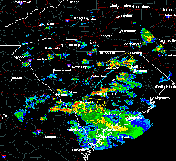 At 656 pm edt, a severe thunderstorm was located 13 miles southeast of kershaw, or 15 miles northeast of camden, moving northeast at 35 mph (radar indicated). Hazards include 60 mph wind gusts and penny size hail. Expect damage to roofs. siding. And trees. At 656 pm edt, a severe thunderstorm was located 13 miles southeast of kershaw, or 15 miles northeast of camden, moving northeast at 35 mph (radar indicated). Hazards include 60 mph wind gusts and penny size hail. Expect damage to roofs. siding. And trees.
|
| 2/24/2016 3:37 PM EST |
 The tornado warning for northeastern chesterfield county will expire at 345 pm est, the line of storms which prompted the warning have moved out of the area. therefore the warning will be allowed to expire. The tornado warning for northeastern chesterfield county will expire at 345 pm est, the line of storms which prompted the warning have moved out of the area. therefore the warning will be allowed to expire.
|
| 2/24/2016 3:24 PM EST |
 At 324 pm est, doppler radar indicated a line of severe thunderstorms capable of producing tornadoes. these dangerous storms were located along a line extending from 11 miles south of chesterfield to near cheraw, moving northeast at 80 mph. locations impacted include, cheraw, chesterfield, patrick and mcfarlan. At 324 pm est, doppler radar indicated a line of severe thunderstorms capable of producing tornadoes. these dangerous storms were located along a line extending from 11 miles south of chesterfield to near cheraw, moving northeast at 80 mph. locations impacted include, cheraw, chesterfield, patrick and mcfarlan.
|
| 2/24/2016 3:03 PM EST |
 At 302 pm est, doppler radar indicated a severe thunderstorm capable of producing a tornado. this dangerous storm was located over clyde, or near hartsville, and moving northeast at 70 mph. At 302 pm est, doppler radar indicated a severe thunderstorm capable of producing a tornado. this dangerous storm was located over clyde, or near hartsville, and moving northeast at 70 mph.
|
| 12/30/2015 2:38 PM EST |
 The severe thunderstorm warning for northeastern chesterfield county will expire at 245 pm est, the line of storms which prompted the warning have weakened below severe limits, and exiting the warned area. therefore the warning will be allowed to expire. very heavy rain is still occuring and a flash flood warning remains in effect for chesterfield county until 530 pm. The severe thunderstorm warning for northeastern chesterfield county will expire at 245 pm est, the line of storms which prompted the warning have weakened below severe limits, and exiting the warned area. therefore the warning will be allowed to expire. very heavy rain is still occuring and a flash flood warning remains in effect for chesterfield county until 530 pm.
|
| 12/30/2015 2:15 PM EST |
 A severe thunderstorm warning remains in effect until 245 pm est for northeastern chesterfield county. at 215 pm est. doppler radar indicated a line of severe thunderstorms capable of producing damaging winds in excess of 60 mph. These storms were located along a line extending from 7 miles northeast of chesterfield to 10 miles northwest of north. A severe thunderstorm warning remains in effect until 245 pm est for northeastern chesterfield county. at 215 pm est. doppler radar indicated a line of severe thunderstorms capable of producing damaging winds in excess of 60 mph. These storms were located along a line extending from 7 miles northeast of chesterfield to 10 miles northwest of north.
|
| 12/30/2015 1:45 PM EST |
 At 144 pm est, doppler radar indicated a line of severe thunderstorms capable of producing damaging winds in excess of 60 mph. these storms were located along a line extending from 9 miles southeast of sturdivants to 11 miles east of kershaw, and moving east at 35 mph. At 144 pm est, doppler radar indicated a line of severe thunderstorms capable of producing damaging winds in excess of 60 mph. these storms were located along a line extending from 9 miles southeast of sturdivants to 11 miles east of kershaw, and moving east at 35 mph.
|
| 12/30/2015 1:05 PM EST |
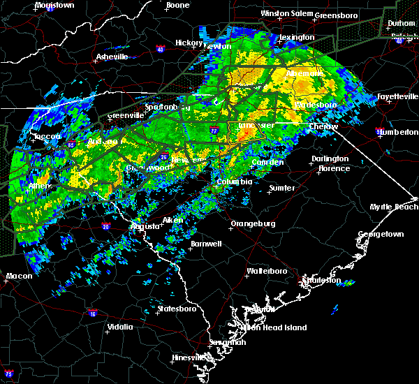 At 105 pm est, doppler radar indicated a line of severe thunderstorms capable of producing damaging winds in excess of 60 mph. these storms were located along a line extending from 6 miles west of pageland to kershaw, and moving east at 50 mph. At 105 pm est, doppler radar indicated a line of severe thunderstorms capable of producing damaging winds in excess of 60 mph. these storms were located along a line extending from 6 miles west of pageland to kershaw, and moving east at 50 mph.
|
| 8/11/2015 6:40 PM EDT | Tree damage/trees down tec road and west market street extensio in chesterfield county SC, 2.5 miles NE of Cheraw, SC |
| 8/11/2015 6:33 PM EDT |
 At 633 pm edt, doppler radar indicated a severe thunderstorm capable of producing quarter size hail and damaging winds in excess of 60 mph. this storm was located 7 miles south of cheraw, and moving southeast at 35 mph. At 633 pm edt, doppler radar indicated a severe thunderstorm capable of producing quarter size hail and damaging winds in excess of 60 mph. this storm was located 7 miles south of cheraw, and moving southeast at 35 mph.
|
| 8/5/2015 6:05 PM EDT |
 At 604 pm edt, doppler radar indicated a severe thunderstorm capable of producing destructive winds in excess of 70 mph. this storm was located over chesterfield and moving northeast at 25 mph. penny size hail may also accompany the damaging winds. At 604 pm edt, doppler radar indicated a severe thunderstorm capable of producing destructive winds in excess of 70 mph. this storm was located over chesterfield and moving northeast at 25 mph. penny size hail may also accompany the damaging winds.
|
| 7/23/2015 5:14 PM EDT |
 At 514 pm edt, doppler radar indicated a severe thunderstorm capable of producing quarter size hail and damaging winds in excess of 60 mph. this storm was located 7 miles southwest of cheraw, and moving southeast at 25 mph. At 514 pm edt, doppler radar indicated a severe thunderstorm capable of producing quarter size hail and damaging winds in excess of 60 mph. this storm was located 7 miles southwest of cheraw, and moving southeast at 25 mph.
|
| 7/23/2015 4:52 PM EDT |
 At 450 pm edt, doppler radar indicated a severe thunderstorm capable of producing damaging winds in excess of 60 mph. this storm was located near chesterfield, or 10 miles west of cheraw, and moving southeast at 15 mph. At 450 pm edt, doppler radar indicated a severe thunderstorm capable of producing damaging winds in excess of 60 mph. this storm was located near chesterfield, or 10 miles west of cheraw, and moving southeast at 15 mph.
|
| 7/13/2015 9:53 PM EDT |
 At 952 pm edt, doppler radar indicated a severe thunderstorm capable of producing damaging winds in excess of 60 mph. this storm was located near pageland, or 12 miles south of monroe, and moving southeast at 35 mph. penny size hail may also accompany the damaging winds. At 952 pm edt, doppler radar indicated a severe thunderstorm capable of producing damaging winds in excess of 60 mph. this storm was located near pageland, or 12 miles south of monroe, and moving southeast at 35 mph. penny size hail may also accompany the damaging winds.
|
| 6/30/2015 6:19 PM EDT |
 At 618 pm edt, doppler radar indicated a line of severe thunderstorms capable of producing damaging winds in excess of 60 mph. these storms were located along a line extending from near wallace to lydia to near manning, moving east at 35 mph. locations impacted include, cheraw, bishopville, clyde, mayesville, society hill, lynchburg, patrick, shiloh, oswego and east sumter. At 618 pm edt, doppler radar indicated a line of severe thunderstorms capable of producing damaging winds in excess of 60 mph. these storms were located along a line extending from near wallace to lydia to near manning, moving east at 35 mph. locations impacted include, cheraw, bishopville, clyde, mayesville, society hill, lynchburg, patrick, shiloh, oswego and east sumter.
|
| 6/30/2015 6:03 PM EDT |
 At 602 pm edt, doppler radar indicated a line of severe thunderstorms capable of producing damaging winds in excess of 60 mph. these storms were located along a line extending from near cheraw to near bishopville to near manning, and moving east at 35 mph. At 602 pm edt, doppler radar indicated a line of severe thunderstorms capable of producing damaging winds in excess of 60 mph. these storms were located along a line extending from near cheraw to near bishopville to near manning, and moving east at 35 mph.
|
| 6/19/2015 7:26 PM EDT |
 At 725 pm edt, doppler radar indicated a severe thunderstorm capable of producing quarter size hail and damaging winds in excess of 60 mph. this storm was located near chesterfield, or 16 miles west of cheraw, moving northeast at 15 mph. locations impacted include, cheraw, chesterfield, ruby, patrick, mount croghan and mcfarlan. At 725 pm edt, doppler radar indicated a severe thunderstorm capable of producing quarter size hail and damaging winds in excess of 60 mph. this storm was located near chesterfield, or 16 miles west of cheraw, moving northeast at 15 mph. locations impacted include, cheraw, chesterfield, ruby, patrick, mount croghan and mcfarlan.
|
| 6/19/2015 7:10 PM EDT |
 At 708 pm edt, doppler radar indicated a severe thunderstorm capable of producing quarter size hail and damaging winds in excess of 60 mph. this storm was located 10 miles southeast of pageland, or 21 miles west of cheraw, moving northeast at 15 mph. locations impacted include, cheraw, chesterfield, jefferson, ruby, patrick, mount croghan and mcfarlan. At 708 pm edt, doppler radar indicated a severe thunderstorm capable of producing quarter size hail and damaging winds in excess of 60 mph. this storm was located 10 miles southeast of pageland, or 21 miles west of cheraw, moving northeast at 15 mph. locations impacted include, cheraw, chesterfield, jefferson, ruby, patrick, mount croghan and mcfarlan.
|
| 6/19/2015 6:40 PM EDT |
 At 640 pm edt, doppler radar indicated a severe thunderstorm capable of producing quarter size hail and damaging winds in excess of 60 mph. this storm was located 9 miles east of kershaw, and moving northeast at 15 mph. At 640 pm edt, doppler radar indicated a severe thunderstorm capable of producing quarter size hail and damaging winds in excess of 60 mph. this storm was located 9 miles east of kershaw, and moving northeast at 15 mph.
|
| 6/18/2015 3:19 PM EDT | Quarter sized hail reported 8.8 miles N of Cheraw, SC, nickel to quarter size hail on camp coker rd at hwy 52. |
| 6/18/2015 2:50 PM EDT | At 249 pm edt, doppler radar indicated a severe thunderstorm capable of producing quarter size hail and damaging winds in excess of 60 mph. this storm was located 8 miles south of heath springs, or 15 miles north of camden, and moving east northeast at 20 mph. |
| 6/9/2015 6:00 PM EDT |
 At 600 pm edt, doppler radar indicated a severe thunderstorm capable of producing quarter size hail and damaging winds in excess of 60 mph. this storm was located 10 miles south of chesterfield, or 15 miles north of hartsville, and moving east northeast at 20 mph. At 600 pm edt, doppler radar indicated a severe thunderstorm capable of producing quarter size hail and damaging winds in excess of 60 mph. this storm was located 10 miles south of chesterfield, or 15 miles north of hartsville, and moving east northeast at 20 mph.
|
| 9/2/2014 6:01 PM EDT | Chesterfield county dispatch reported trees down on hwy 1 near the national guard armor in chesterfield county SC, 1.9 miles NNW of Cheraw, SC |
| 9/2/2014 2:33 PM EDT | Cheraw state park golf course reported several trees down along with dime size hai in chesterfield county SC, 3.3 miles NNW of Cheraw, SC |
| 7/15/2014 3:03 PM EDT | Sheriff dispatch reported trees down along old cash roa in chesterfield county SC, 3.2 miles N of Cheraw, SC |
| 7/1/2012 3:20 PM EDT | Golf Ball sized hail reported 0.6 miles WSW of Cheraw, SC, golfball hail on the north side of cheraw |
| 7/1/2012 2:55 PM EDT | Golf Ball sized hail reported 3.8 miles SE of Cheraw, SC |
| 7/1/2012 2:25 PM EDT | Quarter sized hail reported 1.1 miles SSW of Cheraw, SC, public reported quarter size hail covering the ground near highway 145. |
| 6/13/2012 4:49 PM EDT | Quarter sized hail reported 10.8 miles N of Cheraw, SC, public reported nickel to quarter size hail from moree road to funderburk road along with estimated 40 to 50 mph winds. |
| 5/23/2012 2:16 PM EDT | Quarter sized hail reported 4.9 miles ESE of Cheraw, SC, public report of nickel to quarter sized hail |
| 4/26/2012 3:52 PM EDT | Quarter sized hail reported 4 miles NNW of Cheraw, SC, public reported nickel to quarter size hail south of cheraw. |
| 1/1/0001 12:00 AM | Sheriff dispatch reported trees down in chera in chesterfield county SC, 0.6 miles WSW of Cheraw, SC |
| 1/1/0001 12:00 AM | Em reported trees down in cheraw on laney and old cash road in chesterfield county SC, 0.6 miles WSW of Cheraw, SC |
Hail Maps for Cheraw, SC
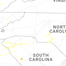


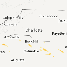


Connect with Interactive Hail Maps