

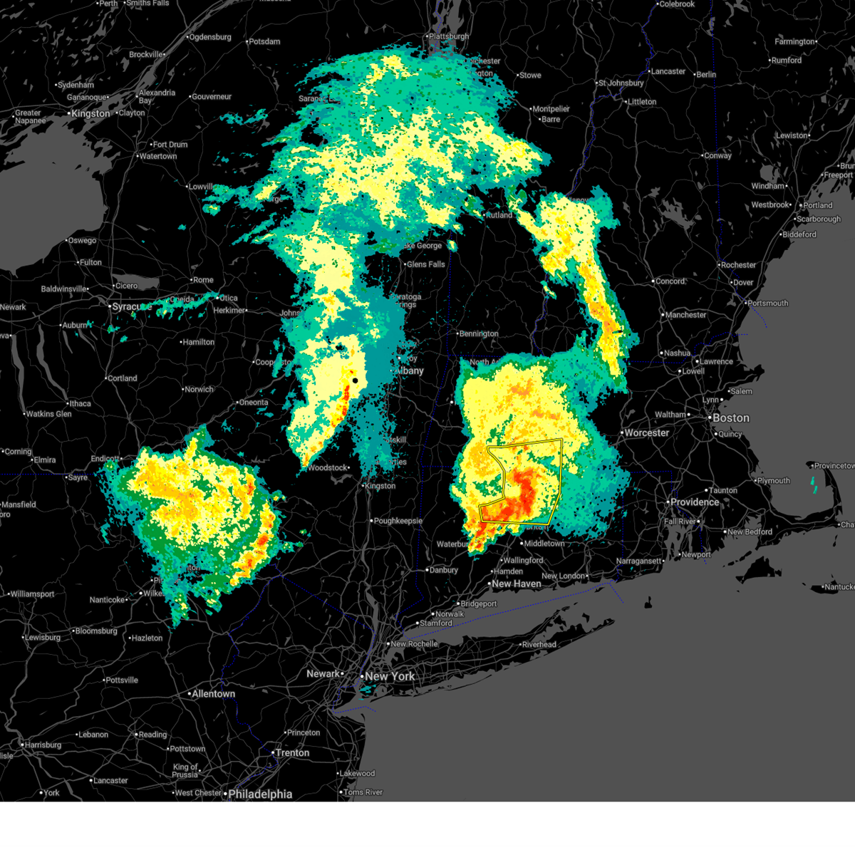
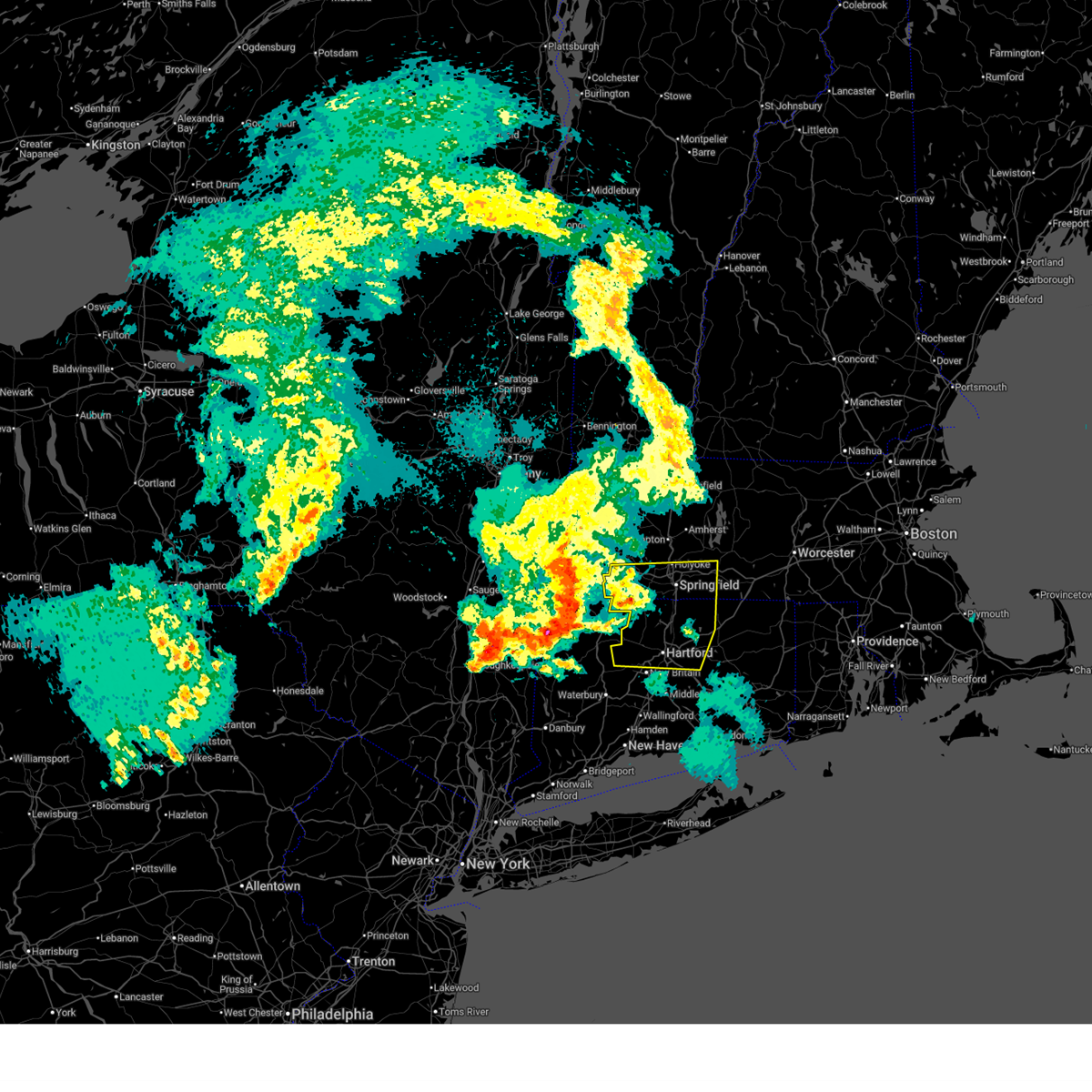
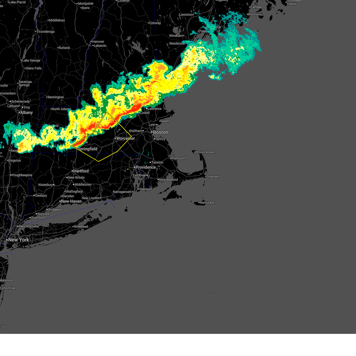
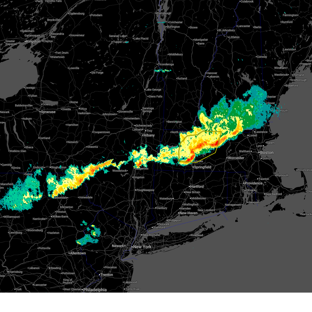
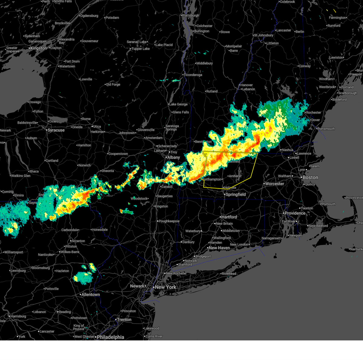
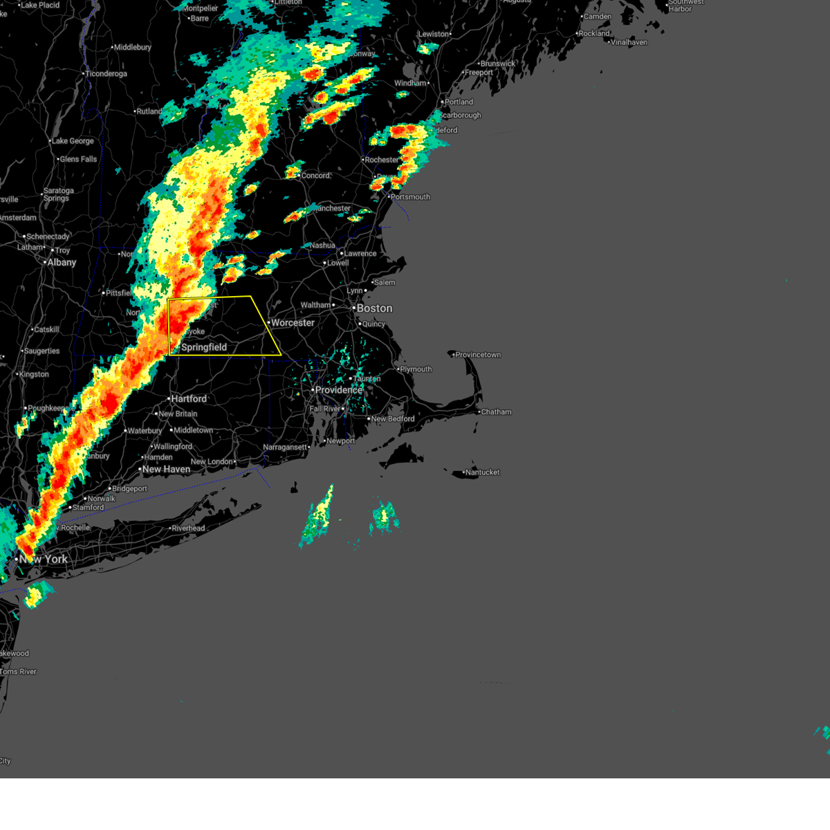
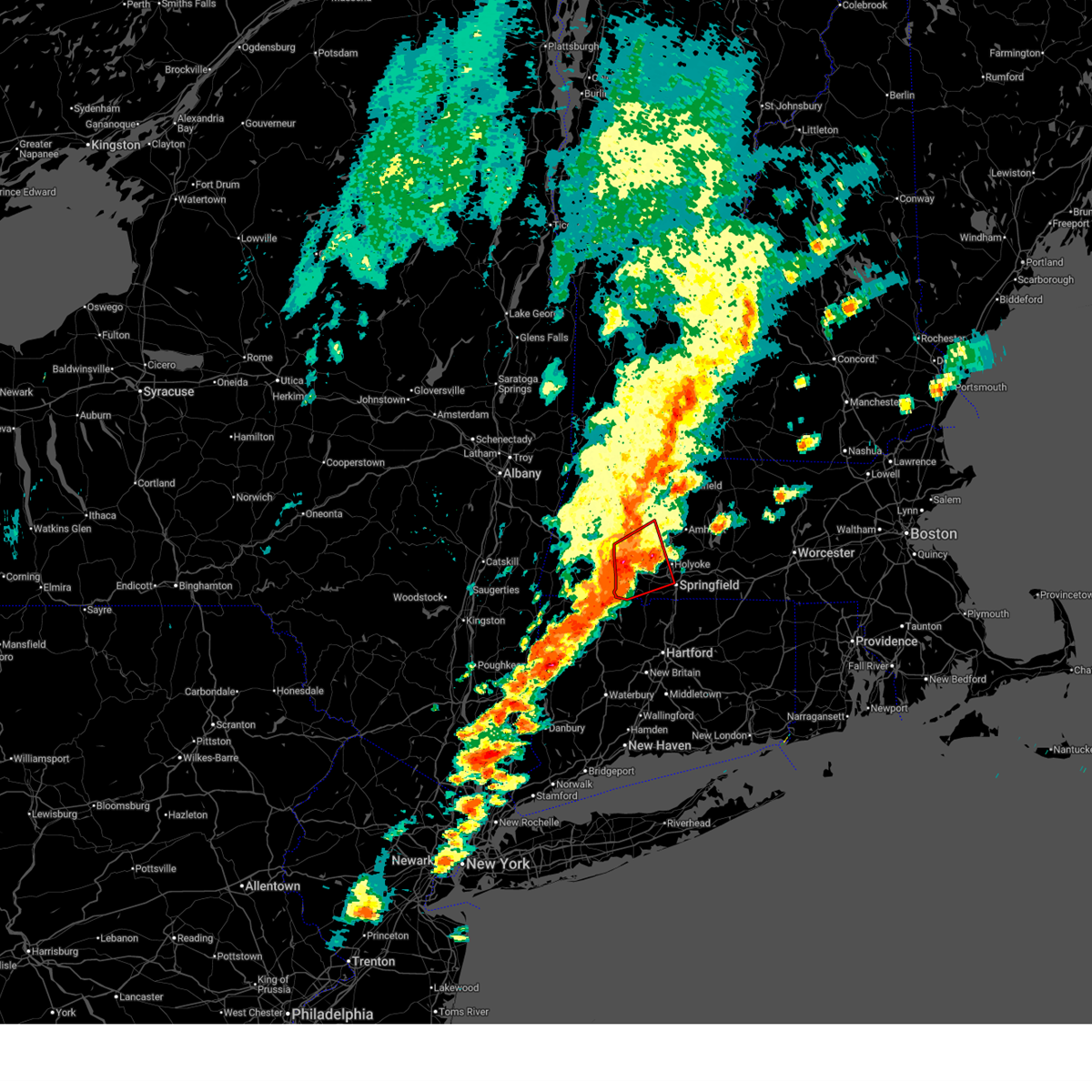
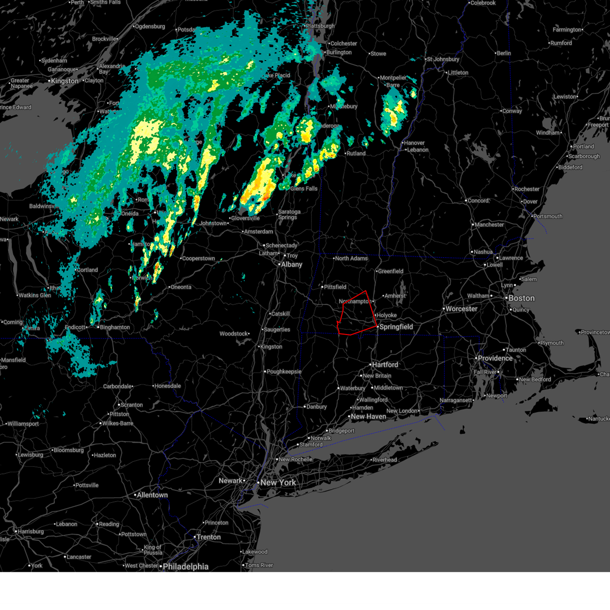
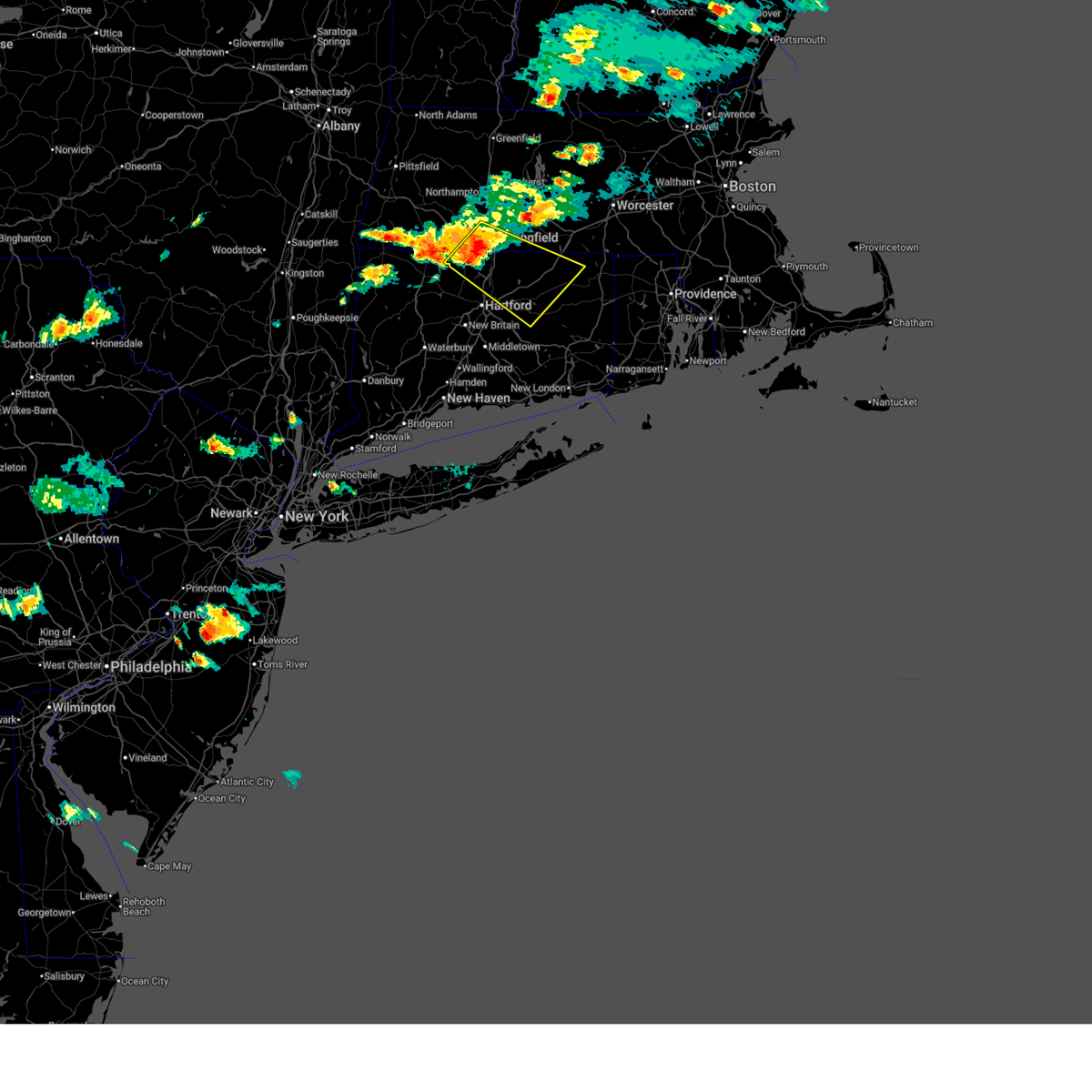
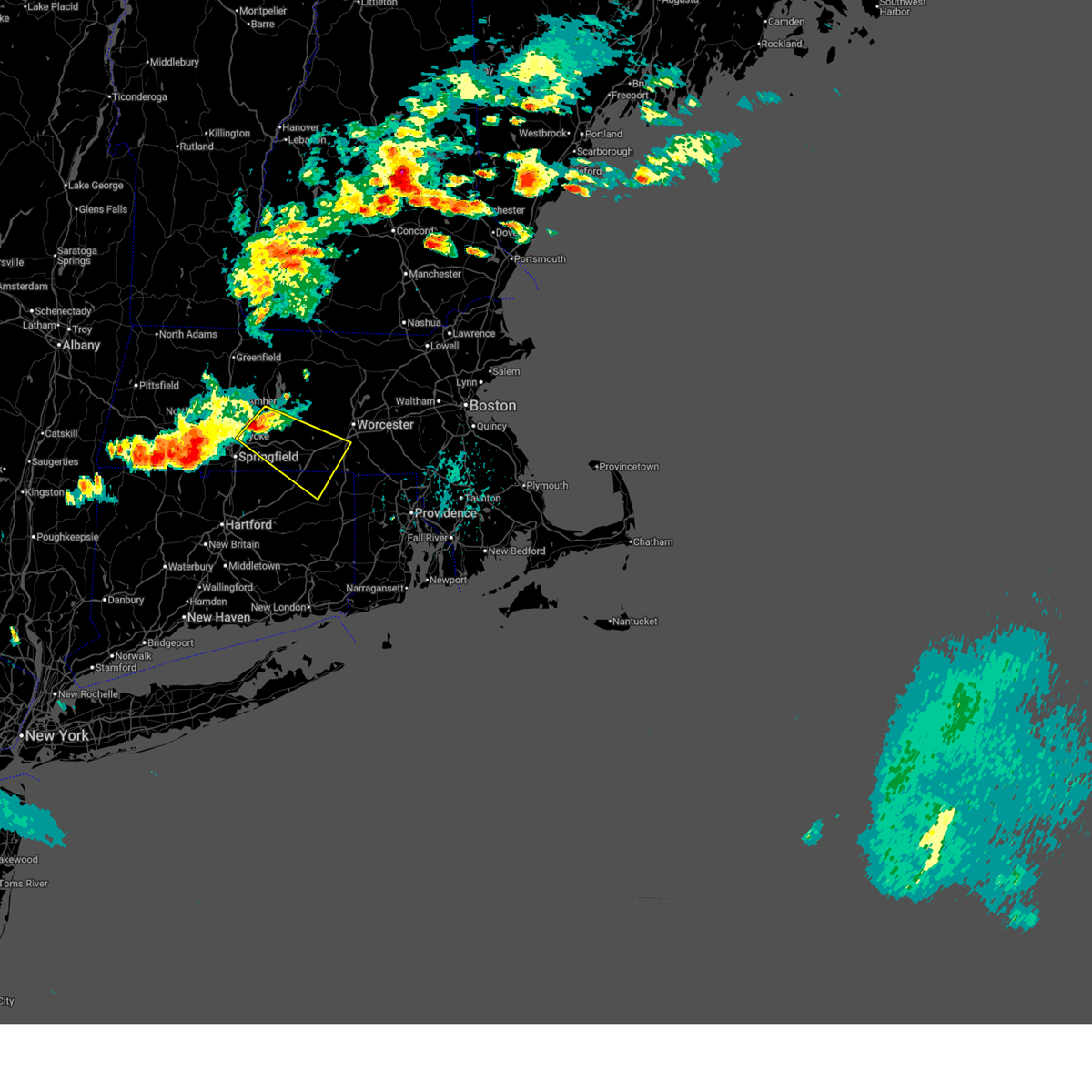
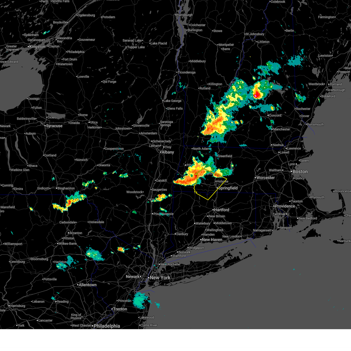
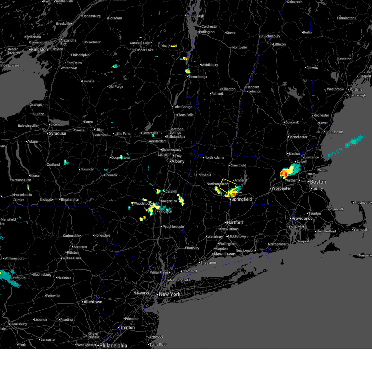
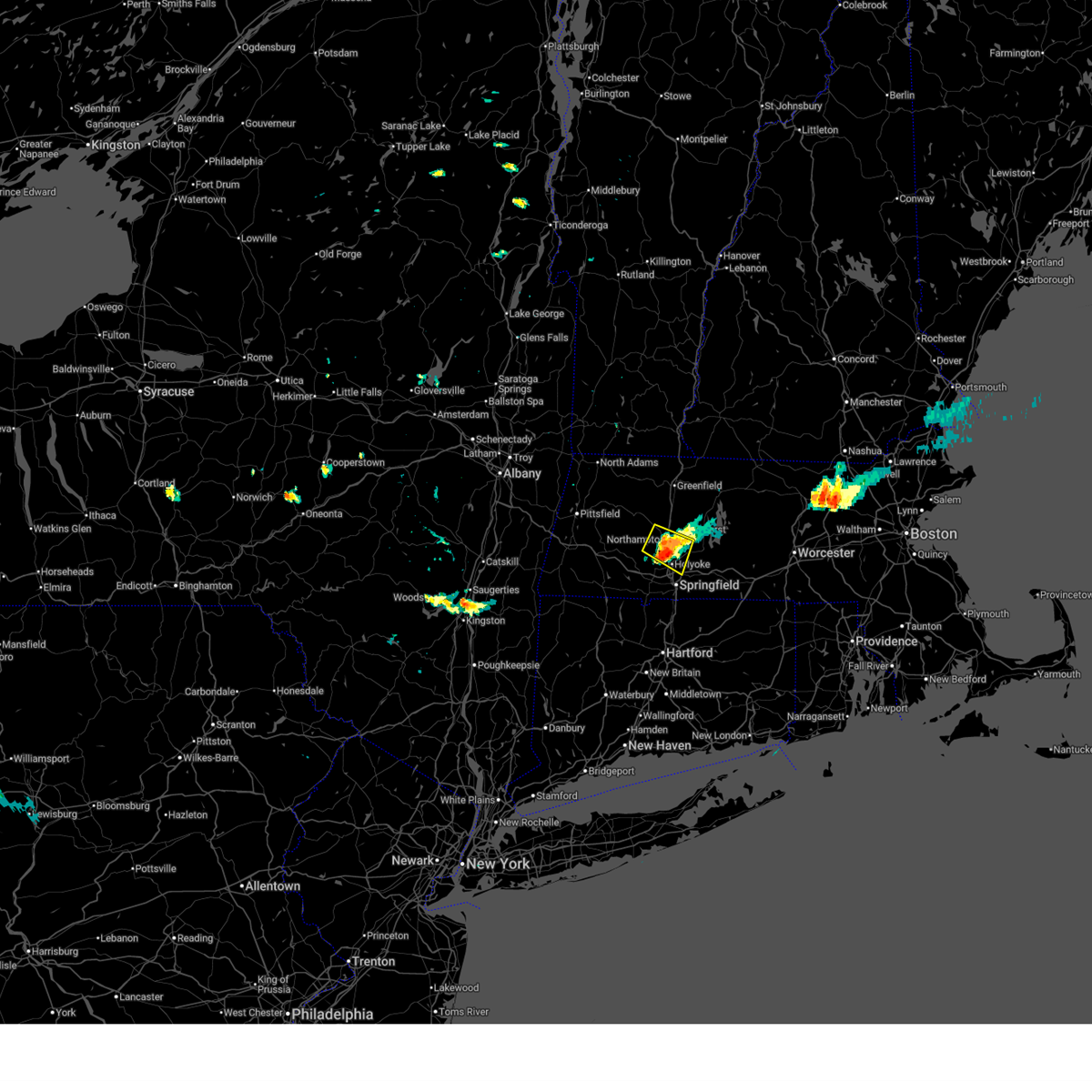
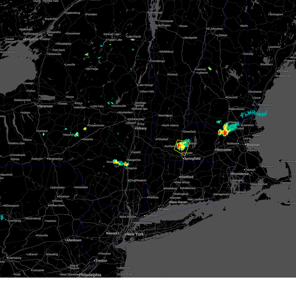
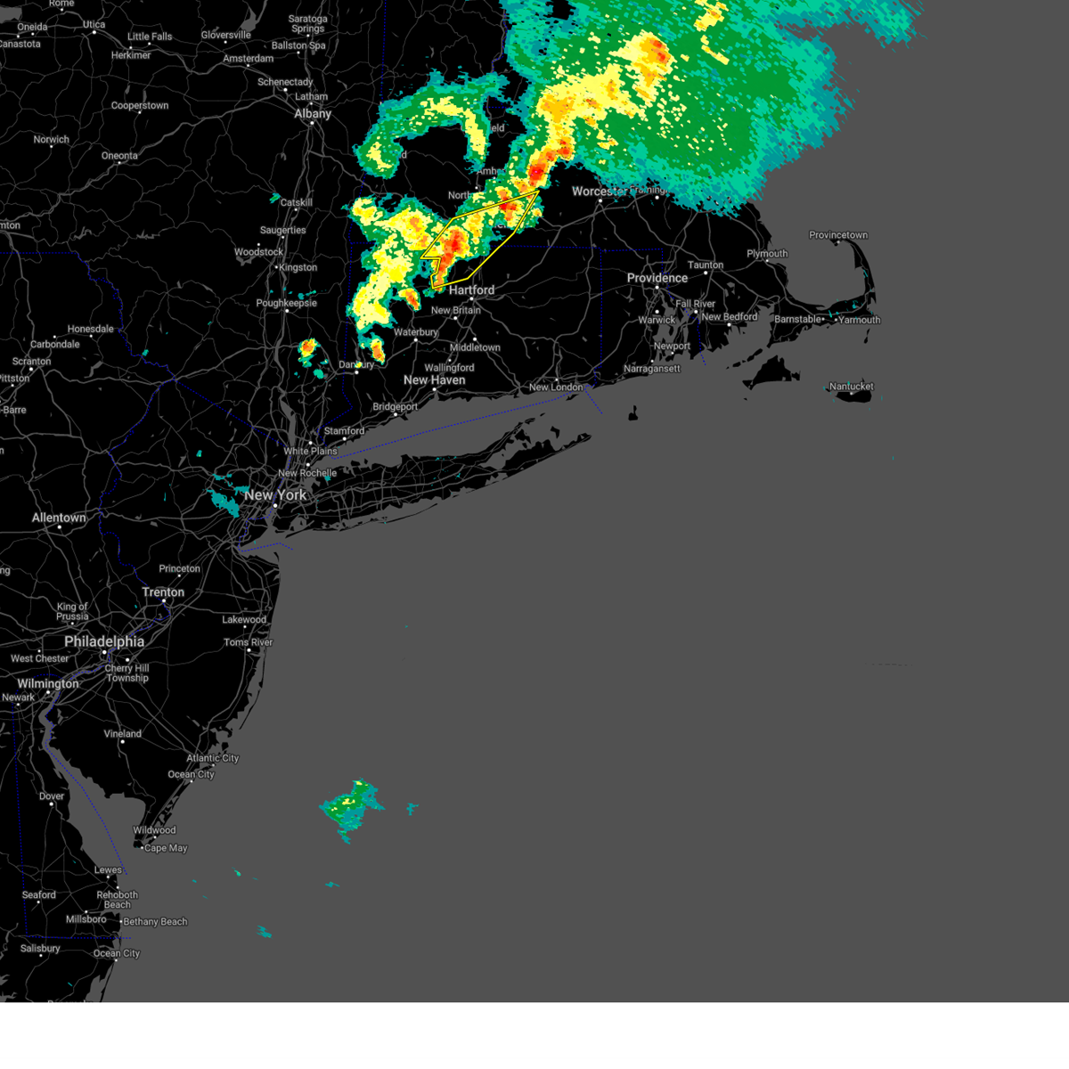
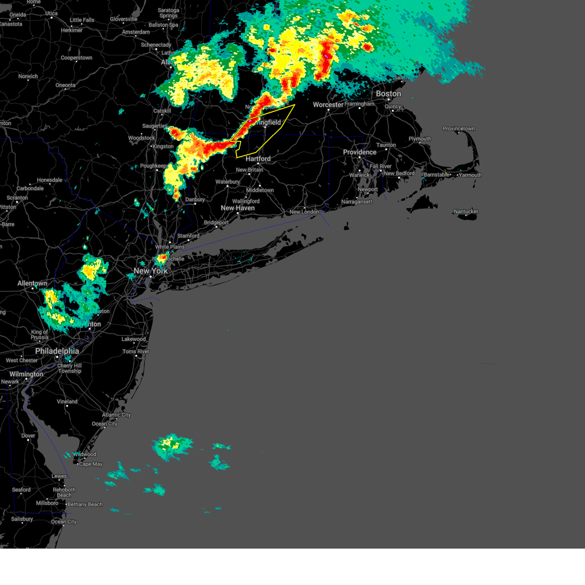
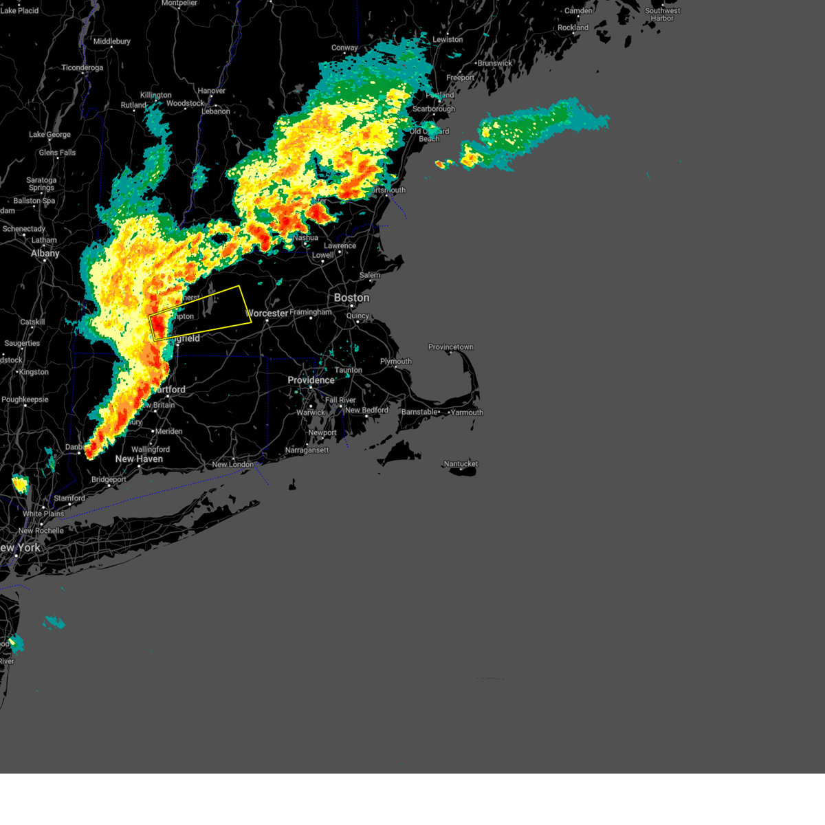
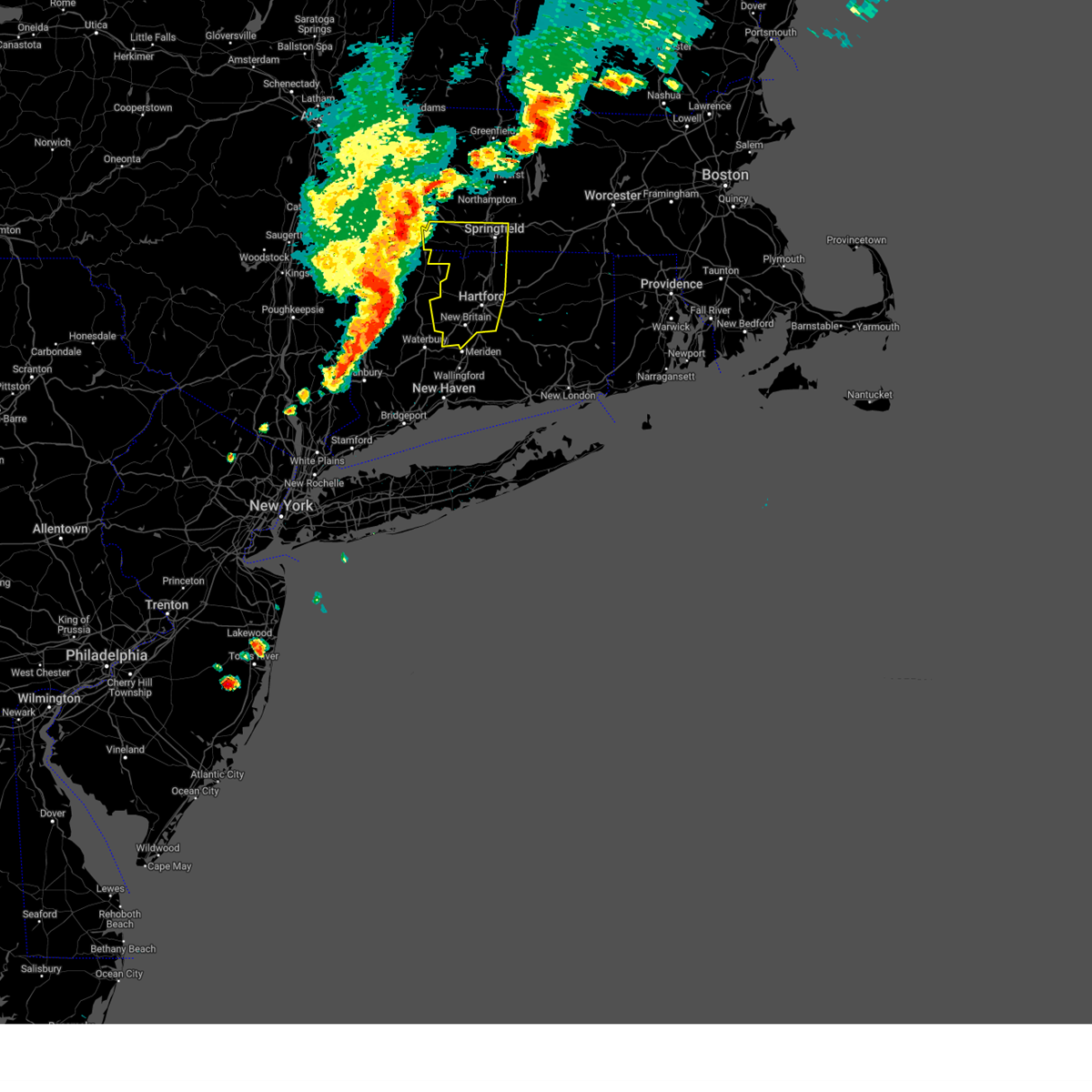
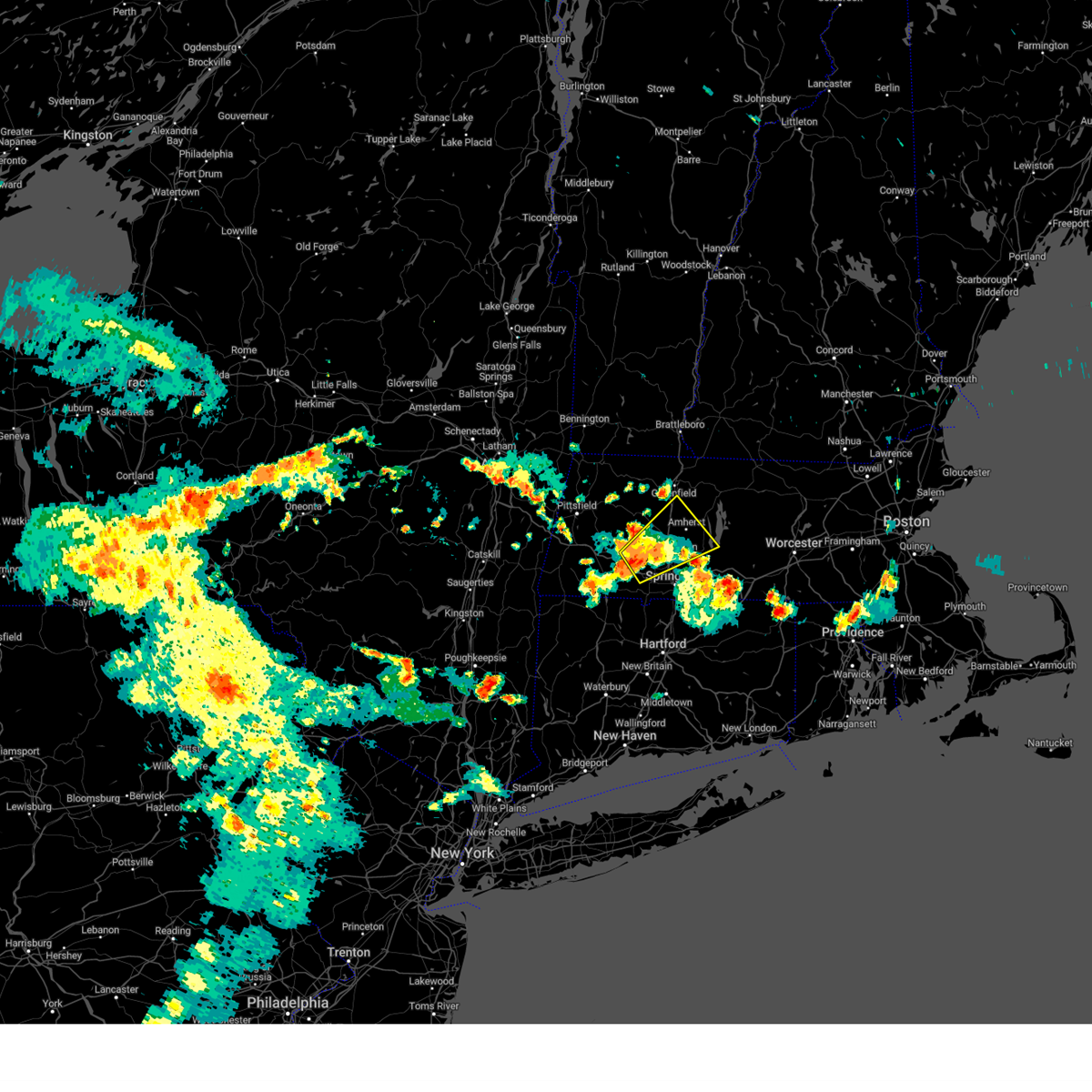
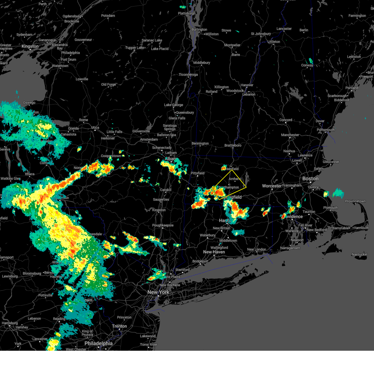
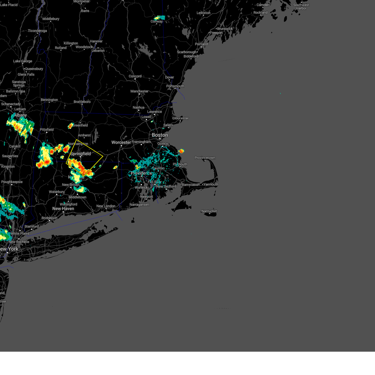
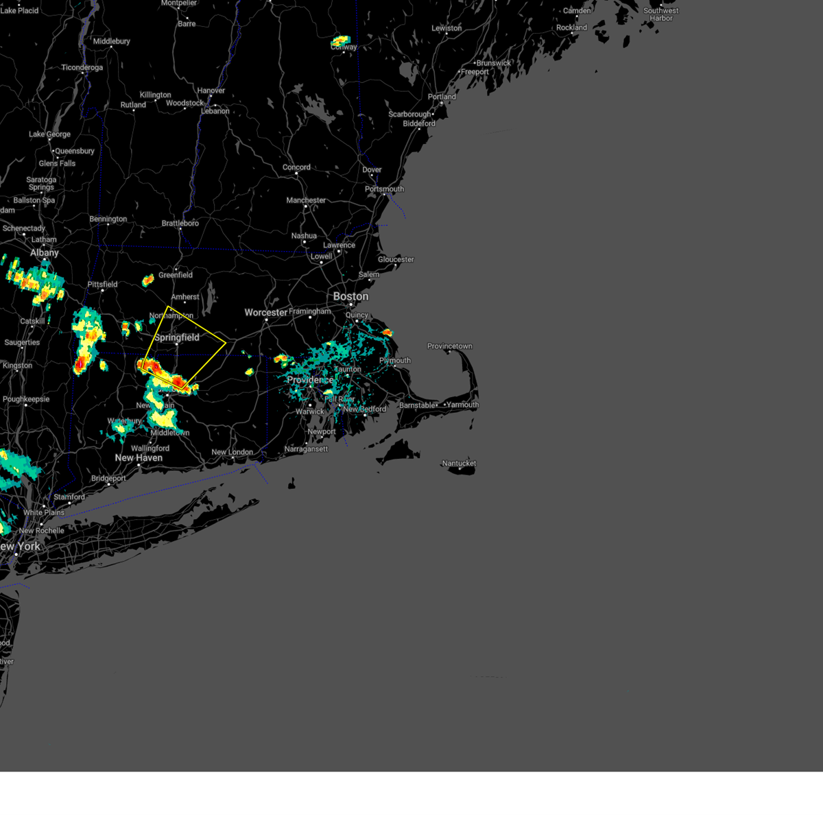
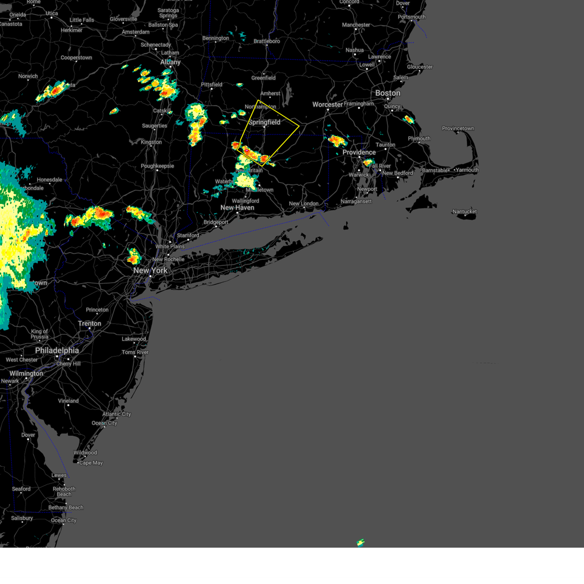
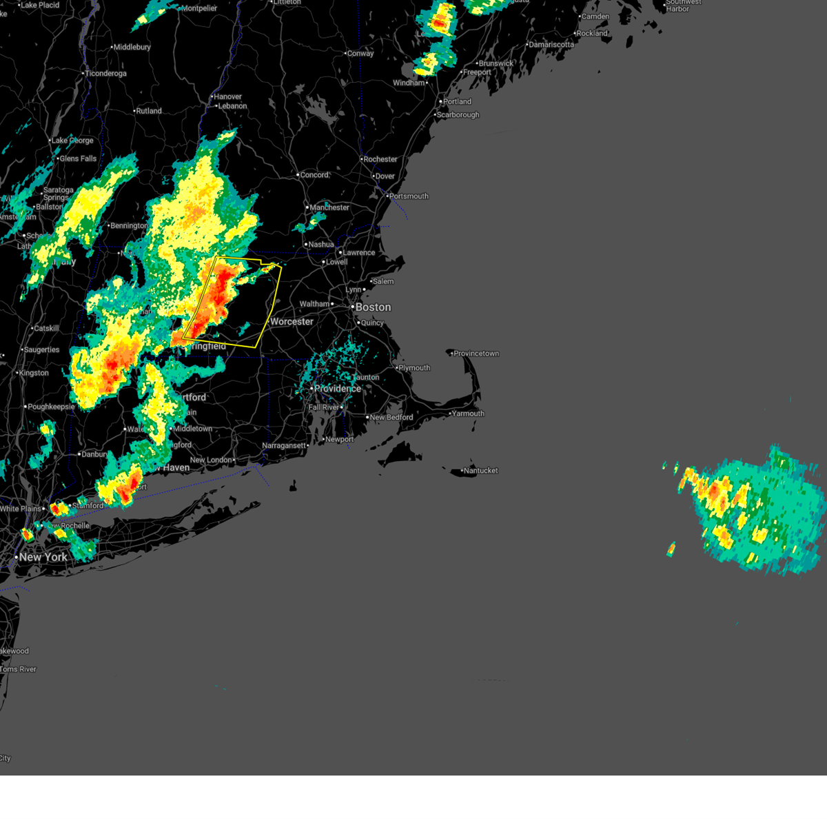
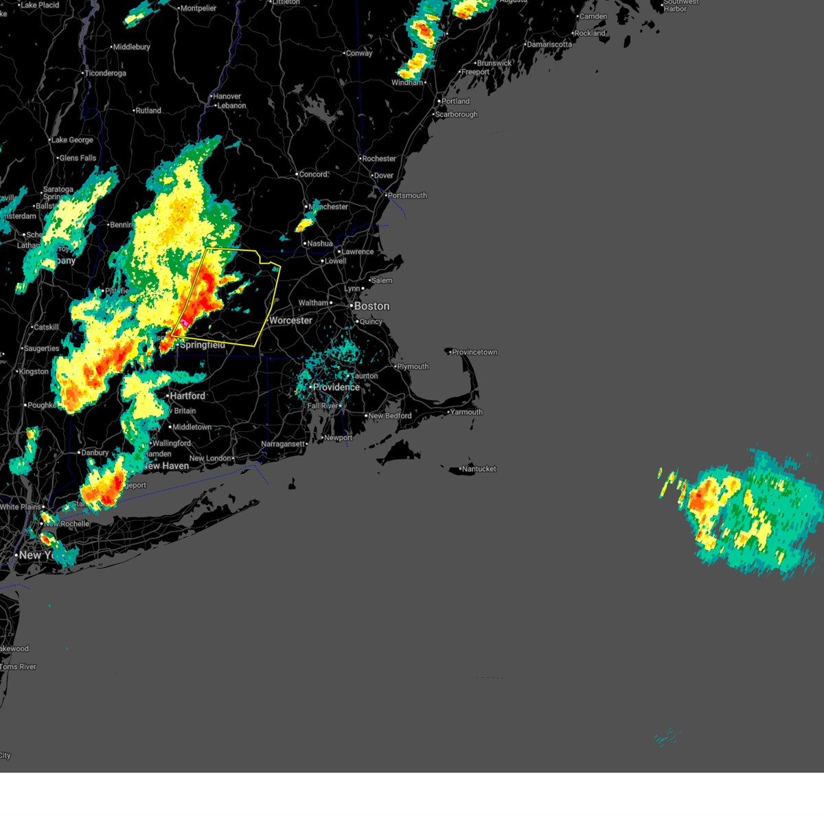
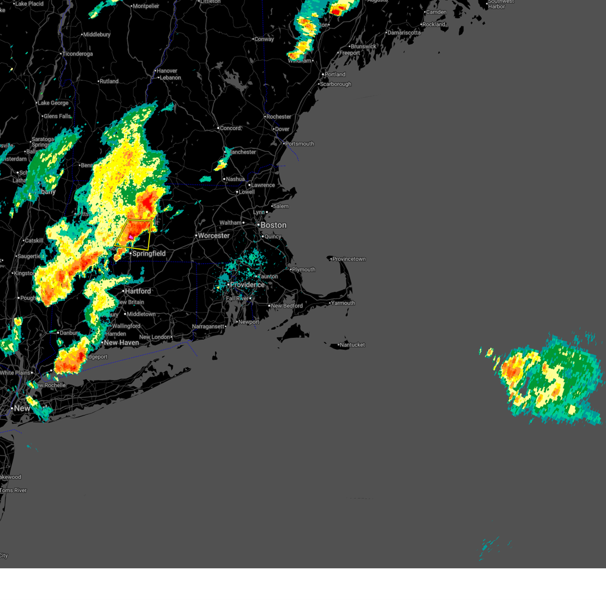
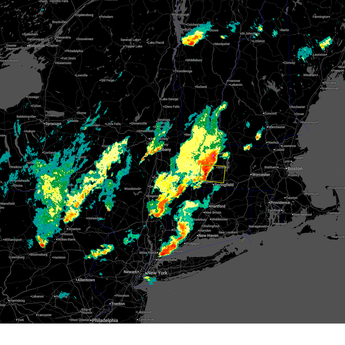
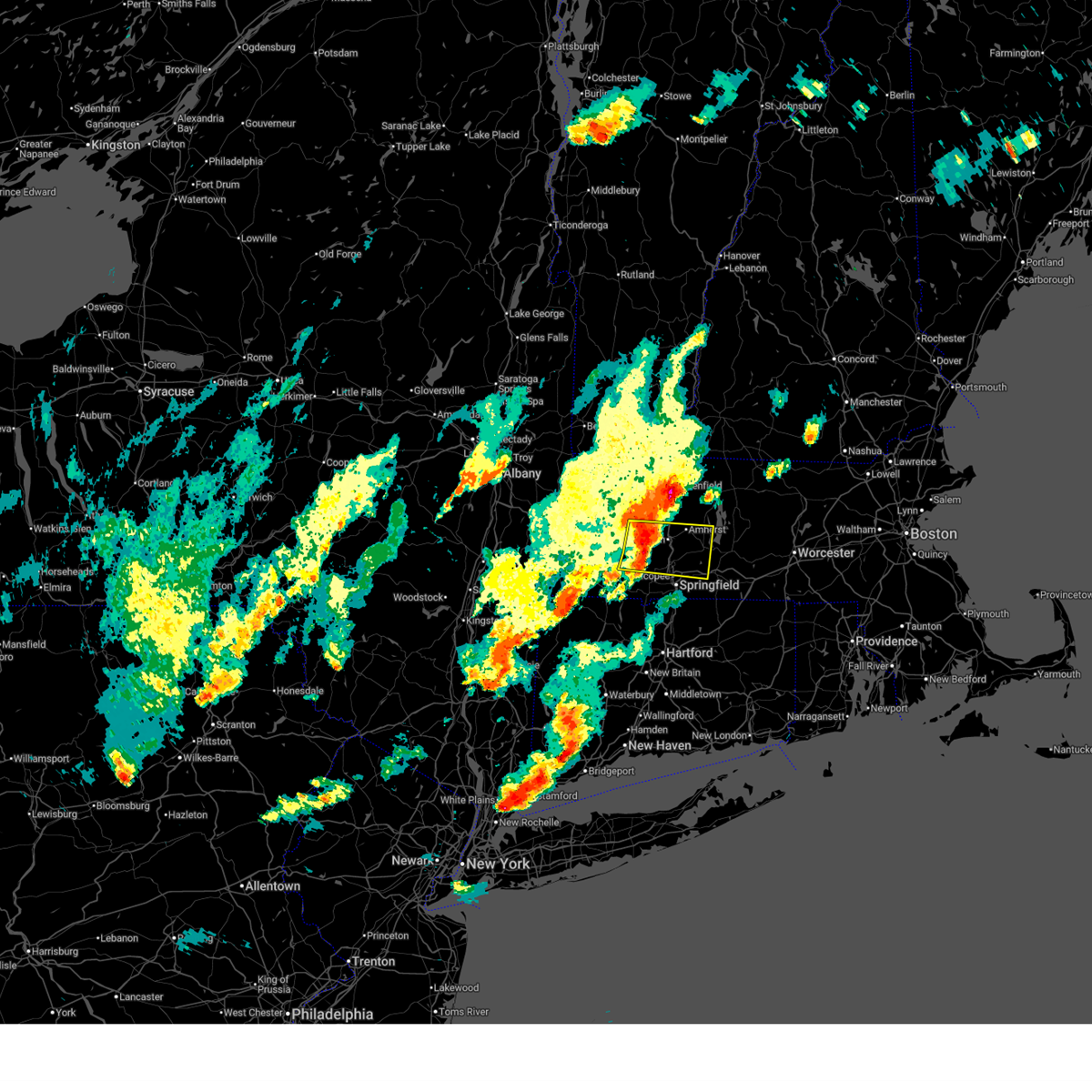
Hail Map for Chicopee, MA
The Chicopee, MA area has had 4 reports of on-the-ground hail by trained spotters, and has been under severe weather warnings 20 times during the past 12 months. Doppler radar has detected hail at or near Chicopee, MA on 38 occasions, including 1 occasion during the past year.
| Name: | Chicopee, MA |
| Where Located: | 64.6 miles WNW of Providence, RI |
| Map: | Google Map for Chicopee, MA |
| Population: | 55298 |
| Housing Units: | 25140 |
| More Info: | Search Google for Chicopee, MA |
0
The Top Recent Hail Date for Chicopee, MA is Sunday, July 20, 2025 (35th out of 38)

Hail and Wind Damage Spotted near Chicopee, MA
| Date / Time | Report Details |
|---|---|
| 4/16/2026 12:20 AM EDT |
 At 1220 am edt, severe thunderstorms were located along a line extending from near southampton to windsor to near farmington, moving east at 45 mph (radar indicated). Hazards include 60 mph wind gusts and penny size hail. Expect damage to trees and power lines. Locations impacted include, springfield, hartford, new britain, west hartford, bristol, manchester, chicopee, east hartford, enfield, westfield, holyoke, glastonbury, newington, vernon, windsor, agawam, west springfield, wethersfield, south windsor, and farmington. At 1220 am edt, severe thunderstorms were located along a line extending from near southampton to windsor to near farmington, moving east at 45 mph (radar indicated). Hazards include 60 mph wind gusts and penny size hail. Expect damage to trees and power lines. Locations impacted include, springfield, hartford, new britain, west hartford, bristol, manchester, chicopee, east hartford, enfield, westfield, holyoke, glastonbury, newington, vernon, windsor, agawam, west springfield, wethersfield, south windsor, and farmington.
|
| 4/15/2026 11:33 PM EDT |
 Svrbox the national weather service in boston/norton has issued a * severe thunderstorm warning for, northwestern tolland county in northern connecticut, hartford county in northern connecticut, south central hampshire county in western massachusetts, hampden county in western massachusetts, * until 1230 am edt. * at 1132 pm edt, severe thunderstorms were located along a line extending from near great barrington to near torrington to near new preston, moving east at 45 mph (radar indicated). Hazards include 60 mph wind gusts and penny size hail. expect damage to trees and power lines Svrbox the national weather service in boston/norton has issued a * severe thunderstorm warning for, northwestern tolland county in northern connecticut, hartford county in northern connecticut, south central hampshire county in western massachusetts, hampden county in western massachusetts, * until 1230 am edt. * at 1132 pm edt, severe thunderstorms were located along a line extending from near great barrington to near torrington to near new preston, moving east at 45 mph (radar indicated). Hazards include 60 mph wind gusts and penny size hail. expect damage to trees and power lines
|
| 4/14/2026 7:54 PM EDT |
 Svrbox the national weather service in boston/norton has issued a * severe thunderstorm warning for, northwestern windham county in northern connecticut, northeastern tolland county in northern connecticut, worcester county in central massachusetts, southeastern hampshire county in western massachusetts, south central middlesex county in northeastern massachusetts, southeastern hampden county in western massachusetts, * until 845 pm edt. * at 751 pm edt, severe thunderstorms were located along a line extending from gardner to near hardwick to near chicopee, moving southeast at 30 mph (radar indicated. these storms have downed trees in hawley, greenfield and deerfield between 725 and 730 pm). Hazards include 60 mph wind gusts. expect damage to trees and power lines Svrbox the national weather service in boston/norton has issued a * severe thunderstorm warning for, northwestern windham county in northern connecticut, northeastern tolland county in northern connecticut, worcester county in central massachusetts, southeastern hampshire county in western massachusetts, south central middlesex county in northeastern massachusetts, southeastern hampden county in western massachusetts, * until 845 pm edt. * at 751 pm edt, severe thunderstorms were located along a line extending from gardner to near hardwick to near chicopee, moving southeast at 30 mph (radar indicated. these storms have downed trees in hawley, greenfield and deerfield between 725 and 730 pm). Hazards include 60 mph wind gusts. expect damage to trees and power lines
|
| 4/14/2026 7:42 PM EDT |
 At 741 pm edt, severe thunderstorms were located along a line extending from ashburnham to near hadley to near chester, moving east at 45 mph (law enforcement and doppler radar. these storms have downed trees in hawley, greenfield and deerfield between 725 and 730 pm). Hazards include 60 mph wind gusts. Expect damage to trees and power lines. Locations impacted include, chicopee, holyoke, amherst, northampton, greenfield, orange, deerfield, ludlow, gardner, south hadley, easthampton, belchertown, athol, winchendon, ware, montague, templeton, granby, ashburnham, and southampton. At 741 pm edt, severe thunderstorms were located along a line extending from ashburnham to near hadley to near chester, moving east at 45 mph (law enforcement and doppler radar. these storms have downed trees in hawley, greenfield and deerfield between 725 and 730 pm). Hazards include 60 mph wind gusts. Expect damage to trees and power lines. Locations impacted include, chicopee, holyoke, amherst, northampton, greenfield, orange, deerfield, ludlow, gardner, south hadley, easthampton, belchertown, athol, winchendon, ware, montague, templeton, granby, ashburnham, and southampton.
|
| 4/14/2026 7:09 PM EDT |
 Svrbox the national weather service in boston/norton has issued a * severe thunderstorm warning for, northwestern worcester county in central massachusetts, hampshire county in western massachusetts, franklin county in western massachusetts, northwestern hampden county in western massachusetts, * until 815 pm edt. * at 708 pm edt, severe thunderstorms were located along a line extending from near colrain to near east windsor to housatonic, moving east at 45 mph (radar indicated). Hazards include 60 mph wind gusts. a wind gust to 59 mph was observed in pittsfield as of 658 pm. expect damage to trees and power lines Svrbox the national weather service in boston/norton has issued a * severe thunderstorm warning for, northwestern worcester county in central massachusetts, hampshire county in western massachusetts, franklin county in western massachusetts, northwestern hampden county in western massachusetts, * until 815 pm edt. * at 708 pm edt, severe thunderstorms were located along a line extending from near colrain to near east windsor to housatonic, moving east at 45 mph (radar indicated). Hazards include 60 mph wind gusts. a wind gust to 59 mph was observed in pittsfield as of 658 pm. expect damage to trees and power lines
|
| 9/6/2025 3:09 PM EDT |
 At 307 pm edt, a severe thunderstorm was located over ludlow, or 8 miles east of chicopee, moving east at 45 mph (numerous reports of wind damage). Hazards include 60 mph wind gusts and quarter size hail. Hail damage to vehicles is expected. expect wind damage to trees and power lines. Locations impacted include, worcester, springfield, chicopee, holyoke, amherst, northampton, agawam, west springfield, ludlow, south hadley, holden, webster, southbridge, auburn, easthampton, longmeadow, east longmeadow, belchertown, wilbraham, and oxford. At 307 pm edt, a severe thunderstorm was located over ludlow, or 8 miles east of chicopee, moving east at 45 mph (numerous reports of wind damage). Hazards include 60 mph wind gusts and quarter size hail. Hail damage to vehicles is expected. expect wind damage to trees and power lines. Locations impacted include, worcester, springfield, chicopee, holyoke, amherst, northampton, agawam, west springfield, ludlow, south hadley, holden, webster, southbridge, auburn, easthampton, longmeadow, east longmeadow, belchertown, wilbraham, and oxford.
|
| 9/6/2025 2:50 PM EDT |
 Svrbox the national weather service in boston/norton has issued a * severe thunderstorm warning for, southwestern worcester county in central massachusetts, southeastern hampshire county in western massachusetts, southeastern franklin county in western massachusetts, eastern hampden county in western massachusetts, * until 345 pm edt. * at 249 pm edt, a severe thunderstorm was located near west springfield, moving east at 40 mph (radar indicated). Hazards include 60 mph wind gusts and quarter size hail. Hail damage to vehicles is expected. Expect wind damage to trees and power lines. Svrbox the national weather service in boston/norton has issued a * severe thunderstorm warning for, southwestern worcester county in central massachusetts, southeastern hampshire county in western massachusetts, southeastern franklin county in western massachusetts, eastern hampden county in western massachusetts, * until 345 pm edt. * at 249 pm edt, a severe thunderstorm was located near west springfield, moving east at 40 mph (radar indicated). Hazards include 60 mph wind gusts and quarter size hail. Hail damage to vehicles is expected. Expect wind damage to trees and power lines.
|
| 9/6/2025 2:41 PM EDT |
 At 241 pm edt, a severe thunderstorm capable of producing a tornado was located over russell, or 7 miles west of westfield, moving northeast at 35 mph (radar indicated rotation). Hazards include tornado and quarter size hail. Flying debris will be dangerous to those caught without shelter. mobile homes will be damaged or destroyed. damage to roofs, windows, and vehicles will occur. tree damage is likely. this dangerous storm will be near, westfield, holyoke, easthampton, southwick, southampton, huntington, russell, westhampton, chester, and blandford around 245 pm edt. northampton and west springfield around 250 pm edt. Williamsburg around 300 pm edt. At 241 pm edt, a severe thunderstorm capable of producing a tornado was located over russell, or 7 miles west of westfield, moving northeast at 35 mph (radar indicated rotation). Hazards include tornado and quarter size hail. Flying debris will be dangerous to those caught without shelter. mobile homes will be damaged or destroyed. damage to roofs, windows, and vehicles will occur. tree damage is likely. this dangerous storm will be near, westfield, holyoke, easthampton, southwick, southampton, huntington, russell, westhampton, chester, and blandford around 245 pm edt. northampton and west springfield around 250 pm edt. Williamsburg around 300 pm edt.
|
| 9/6/2025 2:31 PM EDT |
 At 230 pm edt, a severe thunderstorm capable of producing a tornado was located over blandford, or 11 miles west of westfield, moving northeast at 45 mph (radar indicated rotation). Hazards include tornado and quarter size hail. Flying debris will be dangerous to those caught without shelter. mobile homes will be damaged or destroyed. damage to roofs, windows, and vehicles will occur. tree damage is likely. this dangerous storm will be near, westfield, southwick, southampton, huntington, russell, westhampton, granville, chester, blandford, and montgomery around 235 pm edt. holyoke, northampton, and easthampton around 240 pm edt. west springfield and chesterfield around 245 pm edt. Williamsburg around 250 pm edt. At 230 pm edt, a severe thunderstorm capable of producing a tornado was located over blandford, or 11 miles west of westfield, moving northeast at 45 mph (radar indicated rotation). Hazards include tornado and quarter size hail. Flying debris will be dangerous to those caught without shelter. mobile homes will be damaged or destroyed. damage to roofs, windows, and vehicles will occur. tree damage is likely. this dangerous storm will be near, westfield, southwick, southampton, huntington, russell, westhampton, granville, chester, blandford, and montgomery around 235 pm edt. holyoke, northampton, and easthampton around 240 pm edt. west springfield and chesterfield around 245 pm edt. Williamsburg around 250 pm edt.
|
| 9/6/2025 2:18 PM EDT |
 Torbox the national weather service in boston/norton has issued a * tornado warning for, southwestern hampshire county in western massachusetts, western hampden county in western massachusetts, * until 300 pm edt. * at 217 pm edt, a severe thunderstorm capable of producing a tornado was located over sandisfield, or 12 miles southeast of great barrington, moving northeast at 45 mph (radar indicated rotation). Hazards include tornado and quarter size hail. Flying debris will be dangerous to those caught without shelter. mobile homes will be damaged or destroyed. damage to roofs, windows, and vehicles will occur. tree damage is likely. this dangerous storm will be near, russell, granville, chester, blandford, and tolland around 225 pm edt. westfield, huntington, and montgomery around 230 pm edt. southwick, southampton, and westhampton around 235 pm edt. northampton and easthampton around 240 pm edt. holyoke, west springfield, and chesterfield around 245 pm edt. Williamsburg around 250 pm edt. Torbox the national weather service in boston/norton has issued a * tornado warning for, southwestern hampshire county in western massachusetts, western hampden county in western massachusetts, * until 300 pm edt. * at 217 pm edt, a severe thunderstorm capable of producing a tornado was located over sandisfield, or 12 miles southeast of great barrington, moving northeast at 45 mph (radar indicated rotation). Hazards include tornado and quarter size hail. Flying debris will be dangerous to those caught without shelter. mobile homes will be damaged or destroyed. damage to roofs, windows, and vehicles will occur. tree damage is likely. this dangerous storm will be near, russell, granville, chester, blandford, and tolland around 225 pm edt. westfield, huntington, and montgomery around 230 pm edt. southwick, southampton, and westhampton around 235 pm edt. northampton and easthampton around 240 pm edt. holyoke, west springfield, and chesterfield around 245 pm edt. Williamsburg around 250 pm edt.
|
| 7/20/2025 6:27 PM EDT |
 The storm which prompted the warning has moved out of the area. therefore, the warning will be allowed to expire. however gusty winds are still possible with this thunderstorm. a severe thunderstorm watch remains in effect until 900 pm edt for northern connecticut, and western massachusetts. The storm which prompted the warning has moved out of the area. therefore, the warning will be allowed to expire. however gusty winds are still possible with this thunderstorm. a severe thunderstorm watch remains in effect until 900 pm edt for northern connecticut, and western massachusetts.
|
| 7/20/2025 5:52 PM EDT |
 At 552 pm edt, a severe thunderstorm was located over enfield, moving southeast at 30 mph (radar indicated). Hazards include 60 mph wind gusts. Expect damage to trees and power lines. Locations impacted include, springfield, manchester, enfield, westfield, glastonbury, vernon, windsor, agawam, west springfield, mansfield, south windsor, simsbury, bloomfield, longmeadow, suffield, east longmeadow, ellington, tolland, wilbraham, and windsor locks. At 552 pm edt, a severe thunderstorm was located over enfield, moving southeast at 30 mph (radar indicated). Hazards include 60 mph wind gusts. Expect damage to trees and power lines. Locations impacted include, springfield, manchester, enfield, westfield, glastonbury, vernon, windsor, agawam, west springfield, mansfield, south windsor, simsbury, bloomfield, longmeadow, suffield, east longmeadow, ellington, tolland, wilbraham, and windsor locks.
|
| 7/20/2025 5:41 PM EDT |
 The storm which prompted the warning has moved out of the area. therefore, the warning will be allowed to expire. however gusty winds are still possible with this thunderstorm. a severe thunderstorm watch remains in effect until 900 pm edt for northern connecticut, and western massachusetts. remember, a severe thunderstorm warning still remains in effect for northern hartford county and parts of central and southern hampden county. The storm which prompted the warning has moved out of the area. therefore, the warning will be allowed to expire. however gusty winds are still possible with this thunderstorm. a severe thunderstorm watch remains in effect until 900 pm edt for northern connecticut, and western massachusetts. remember, a severe thunderstorm warning still remains in effect for northern hartford county and parts of central and southern hampden county.
|
| 7/20/2025 5:34 PM EDT |
 Svrbox the national weather service in boston/norton has issued a * severe thunderstorm warning for, northwestern windham county in northern connecticut, tolland county in northern connecticut, northeastern hartford county in northern connecticut, southeastern hampden county in western massachusetts, * until 630 pm edt. * at 534 pm edt, a severe thunderstorm was located over agawam, moving southeast at 30 mph (radar indicated). Hazards include 60 mph wind gusts. expect damage to trees and power lines Svrbox the national weather service in boston/norton has issued a * severe thunderstorm warning for, northwestern windham county in northern connecticut, tolland county in northern connecticut, northeastern hartford county in northern connecticut, southeastern hampden county in western massachusetts, * until 630 pm edt. * at 534 pm edt, a severe thunderstorm was located over agawam, moving southeast at 30 mph (radar indicated). Hazards include 60 mph wind gusts. expect damage to trees and power lines
|
| 7/20/2025 5:20 PM EDT |
 Svrbox the national weather service in boston/norton has issued a * severe thunderstorm warning for, north central windham county in northern connecticut, northeastern tolland county in northern connecticut, southwestern worcester county in central massachusetts, southeastern hampshire county in western massachusetts, southeastern franklin county in western massachusetts, southeastern hampden county in western massachusetts, * until 600 pm edt. * at 520 pm edt, a severe thunderstorm was located near ludlow, or 8 miles east of chicopee, moving southeast at 40 mph (radar indicated). Hazards include 60 mph wind gusts and quarter size hail. Hail damage to vehicles is expected. Expect wind damage to trees and power lines. Svrbox the national weather service in boston/norton has issued a * severe thunderstorm warning for, north central windham county in northern connecticut, northeastern tolland county in northern connecticut, southwestern worcester county in central massachusetts, southeastern hampshire county in western massachusetts, southeastern franklin county in western massachusetts, southeastern hampden county in western massachusetts, * until 600 pm edt. * at 520 pm edt, a severe thunderstorm was located near ludlow, or 8 miles east of chicopee, moving southeast at 40 mph (radar indicated). Hazards include 60 mph wind gusts and quarter size hail. Hail damage to vehicles is expected. Expect wind damage to trees and power lines.
|
| 7/20/2025 4:59 PM EDT |
 Svrbox the national weather service in boston/norton has issued a * severe thunderstorm warning for, northwestern hartford county in northern connecticut, southwestern hampshire county in western massachusetts, hampden county in western massachusetts, * until 545 pm edt. * at 458 pm edt, a severe thunderstorm was located near chester, or 14 miles northwest of westfield, moving southeast at 30 mph (radar indicated). Hazards include 60 mph wind gusts. expect damage to trees and power lines Svrbox the national weather service in boston/norton has issued a * severe thunderstorm warning for, northwestern hartford county in northern connecticut, southwestern hampshire county in western massachusetts, hampden county in western massachusetts, * until 545 pm edt. * at 458 pm edt, a severe thunderstorm was located near chester, or 14 miles northwest of westfield, moving southeast at 30 mph (radar indicated). Hazards include 60 mph wind gusts. expect damage to trees and power lines
|
| 7/11/2025 7:37 PM EDT |
 The storm which prompted the warning has weakened below severe limits, and has exited the warned area. therefore, the warning will be allowed to expire. however heavy rain is still possible with this thunderstorm. The storm which prompted the warning has weakened below severe limits, and has exited the warned area. therefore, the warning will be allowed to expire. however heavy rain is still possible with this thunderstorm.
|
| 7/11/2025 6:57 PM EDT |
 At 657 pm edt, a severe thunderstorm was located over easthampton, or near northampton, moving southeast at 5 mph (radar indicated). Hazards include 60 mph wind gusts and penny size hail. Expect damage to trees and power lines. Locations impacted include, chicopee, holyoke, amherst, northampton, south hadley, easthampton, granby, southampton, hadley, hatfield, williamsburg, and westhampton. At 657 pm edt, a severe thunderstorm was located over easthampton, or near northampton, moving southeast at 5 mph (radar indicated). Hazards include 60 mph wind gusts and penny size hail. Expect damage to trees and power lines. Locations impacted include, chicopee, holyoke, amherst, northampton, south hadley, easthampton, granby, southampton, hadley, hatfield, williamsburg, and westhampton.
|
| 7/11/2025 6:57 PM EDT |
 the severe thunderstorm warning has been cancelled and is no longer in effect the severe thunderstorm warning has been cancelled and is no longer in effect
|
| 7/11/2025 6:39 PM EDT |
 Svrbox the national weather service in boston/norton has issued a * severe thunderstorm warning for, south central hampshire county in western massachusetts, central franklin county in western massachusetts, central hampden county in western massachusetts, * until 745 pm edt. * at 638 pm edt, a severe thunderstorm was located over northampton, and is nearly stationary (radar indicated. this storm has had a history of downing powerlines in willamsburg). Hazards include 60 mph wind gusts and penny size hail. expect damage to trees and power lines Svrbox the national weather service in boston/norton has issued a * severe thunderstorm warning for, south central hampshire county in western massachusetts, central franklin county in western massachusetts, central hampden county in western massachusetts, * until 745 pm edt. * at 638 pm edt, a severe thunderstorm was located over northampton, and is nearly stationary (radar indicated. this storm has had a history of downing powerlines in willamsburg). Hazards include 60 mph wind gusts and penny size hail. expect damage to trees and power lines
|
| 6/6/2025 6:53 PM EDT |
 The storms which prompted the warning have weakened below severe limits, and no longer pose an immediate threat to life or property. therefore, the warning will be allowed to expire. The storms which prompted the warning have weakened below severe limits, and no longer pose an immediate threat to life or property. therefore, the warning will be allowed to expire.
|
| 6/6/2025 6:09 PM EDT |
 Svrbox the national weather service in boston/norton has issued a * severe thunderstorm warning for, northwestern tolland county in northern connecticut, northwestern hartford county in northern connecticut, southeastern hampshire county in western massachusetts, southern hampden county in western massachusetts, * until 700 pm edt. * at 608 pm edt, severe thunderstorms were located along a line extending from near holyoke to near granby to near torrington, moving east at 20 mph (radar indicated). Hazards include 60 mph wind gusts and quarter size hail. Hail damage to vehicles is expected. Expect wind damage to trees and power lines. Svrbox the national weather service in boston/norton has issued a * severe thunderstorm warning for, northwestern tolland county in northern connecticut, northwestern hartford county in northern connecticut, southeastern hampshire county in western massachusetts, southern hampden county in western massachusetts, * until 700 pm edt. * at 608 pm edt, severe thunderstorms were located along a line extending from near holyoke to near granby to near torrington, moving east at 20 mph (radar indicated). Hazards include 60 mph wind gusts and quarter size hail. Hail damage to vehicles is expected. Expect wind damage to trees and power lines.
|
| 5/3/2025 4:20 PM EDT | Utility pole down near fernwood ave. relayed via amateur radi in hampden county MA, 0.6 miles SW of Chicopee, MA |
| 5/3/2025 4:20 PM EDT | Wires down on beachwood terrace. relayed via amateur radi in hampden county MA, 0.6 miles SW of Chicopee, MA |
| 5/3/2025 3:56 PM EDT |
 Svrbox the national weather service in boston/norton has issued a * severe thunderstorm warning for, west central worcester county in central massachusetts, southeastern hampshire county in western massachusetts, southeastern franklin county in western massachusetts, central hampden county in western massachusetts, * until 445 pm edt. * at 356 pm edt, a severe thunderstorm was located over holyoke, moving east at 45 mph (radar indicated). Hazards include 60 mph wind gusts and quarter size hail. Hail damage to vehicles is expected. Expect wind damage to trees and power lines. Svrbox the national weather service in boston/norton has issued a * severe thunderstorm warning for, west central worcester county in central massachusetts, southeastern hampshire county in western massachusetts, southeastern franklin county in western massachusetts, central hampden county in western massachusetts, * until 445 pm edt. * at 356 pm edt, a severe thunderstorm was located over holyoke, moving east at 45 mph (radar indicated). Hazards include 60 mph wind gusts and quarter size hail. Hail damage to vehicles is expected. Expect wind damage to trees and power lines.
|
| 5/3/2025 3:21 PM EDT |
 Svrbox the national weather service in boston/norton has issued a * severe thunderstorm warning for, hartford county in northern connecticut, southwestern hampden county in western massachusetts, * until 415 pm edt. * at 320 pm edt, severe thunderstorms were located along a line extending from near norfolk to near litchfield to 6 miles west of ridgefield, moving east at 45 mph (radar indicated). Hazards include 60 mph wind gusts and nickel size hail. expect damage to trees and power lines Svrbox the national weather service in boston/norton has issued a * severe thunderstorm warning for, hartford county in northern connecticut, southwestern hampden county in western massachusetts, * until 415 pm edt. * at 320 pm edt, severe thunderstorms were located along a line extending from near norfolk to near litchfield to 6 miles west of ridgefield, moving east at 45 mph (radar indicated). Hazards include 60 mph wind gusts and nickel size hail. expect damage to trees and power lines
|
| 8/2/2024 3:34 PM EDT |
 the severe thunderstorm warning has been cancelled and is no longer in effect the severe thunderstorm warning has been cancelled and is no longer in effect
|
| 8/2/2024 3:11 PM EDT |
 the severe thunderstorm warning has been cancelled and is no longer in effect the severe thunderstorm warning has been cancelled and is no longer in effect
|
| 8/2/2024 3:08 PM EDT |
 Svrbox the national weather service in boston/norton has issued a * severe thunderstorm warning for, hampshire county in western massachusetts, south central franklin county in western massachusetts, northwestern hampden county in western massachusetts, * until 415 pm edt. * at 308 pm edt, a severe thunderstorm was located over southampton, or 7 miles west of holyoke, moving northeast at 20 mph (radar indicated). Hazards include 60 mph wind gusts and penny size hail. expect damage to trees and power lines Svrbox the national weather service in boston/norton has issued a * severe thunderstorm warning for, hampshire county in western massachusetts, south central franklin county in western massachusetts, northwestern hampden county in western massachusetts, * until 415 pm edt. * at 308 pm edt, a severe thunderstorm was located over southampton, or 7 miles west of holyoke, moving northeast at 20 mph (radar indicated). Hazards include 60 mph wind gusts and penny size hail. expect damage to trees and power lines
|
| 8/2/2024 2:56 PM EDT |
 At 256 pm edt, a severe thunderstorm was located over longmeadow, or over agawam, moving northeast at 25 mph (radar indicated). Hazards include 60 mph wind gusts and quarter size hail. Hail damage to vehicles is expected. expect wind damage to trees and power lines. Locations impacted include, springfield, chicopee, enfield, westfield, holyoke, vernon, windsor, northampton, agawam, west springfield, south windsor, ludlow, south hadley, easthampton, longmeadow, suffield, east longmeadow, ellington, tolland, and belchertown. At 256 pm edt, a severe thunderstorm was located over longmeadow, or over agawam, moving northeast at 25 mph (radar indicated). Hazards include 60 mph wind gusts and quarter size hail. Hail damage to vehicles is expected. expect wind damage to trees and power lines. Locations impacted include, springfield, chicopee, enfield, westfield, holyoke, vernon, windsor, northampton, agawam, west springfield, south windsor, ludlow, south hadley, easthampton, longmeadow, suffield, east longmeadow, ellington, tolland, and belchertown.
|
| 8/2/2024 2:42 PM EDT |
 At 242 pm edt, a severe thunderstorm was located over suffield, or near agawam, moving northeast at 25 mph (radar indicated). Hazards include 60 mph wind gusts and quarter size hail. Hail damage to vehicles is expected. expect wind damage to trees and power lines. Locations impacted include, springfield, chicopee, enfield, westfield, holyoke, vernon, windsor, northampton, agawam, west springfield, south windsor, simsbury, ludlow, bloomfield, south hadley, easthampton, longmeadow, suffield, east longmeadow, and ellington. At 242 pm edt, a severe thunderstorm was located over suffield, or near agawam, moving northeast at 25 mph (radar indicated). Hazards include 60 mph wind gusts and quarter size hail. Hail damage to vehicles is expected. expect wind damage to trees and power lines. Locations impacted include, springfield, chicopee, enfield, westfield, holyoke, vernon, windsor, northampton, agawam, west springfield, south windsor, simsbury, ludlow, bloomfield, south hadley, easthampton, longmeadow, suffield, east longmeadow, and ellington.
|
| 8/2/2024 2:24 PM EDT |
 Svrbox the national weather service in boston/norton has issued a * severe thunderstorm warning for, northwestern tolland county in northern connecticut, northern hartford county in northern connecticut, south central hampshire county in western massachusetts, eastern hampden county in western massachusetts, * until 330 pm edt. * at 224 pm edt, a severe thunderstorm was located over simsbury, or near windsor, moving northeast at 25 mph (radar indicated). Hazards include 60 mph wind gusts and quarter size hail. Hail damage to vehicles is expected. Expect wind damage to trees and power lines. Svrbox the national weather service in boston/norton has issued a * severe thunderstorm warning for, northwestern tolland county in northern connecticut, northern hartford county in northern connecticut, south central hampshire county in western massachusetts, eastern hampden county in western massachusetts, * until 330 pm edt. * at 224 pm edt, a severe thunderstorm was located over simsbury, or near windsor, moving northeast at 25 mph (radar indicated). Hazards include 60 mph wind gusts and quarter size hail. Hail damage to vehicles is expected. Expect wind damage to trees and power lines.
|
| 7/17/2024 5:55 PM EDT |
 At 555 pm edt, severe thunderstorms were located along a line extending from gardner to new braintree to monson, moving east at 40 mph (radar indicated). Hazards include 60 mph wind gusts and penny size hail. Expect damage to roofs, siding, and trees. Locations impacted include, worcester, springfield, chicopee, leominster, fitchburg, orange, ludlow, gardner, holden, southbridge, auburn, belchertown, wilbraham, oxford, charlton, palmer, spencer, athol, leicester, and winchendon. At 555 pm edt, severe thunderstorms were located along a line extending from gardner to new braintree to monson, moving east at 40 mph (radar indicated). Hazards include 60 mph wind gusts and penny size hail. Expect damage to roofs, siding, and trees. Locations impacted include, worcester, springfield, chicopee, leominster, fitchburg, orange, ludlow, gardner, holden, southbridge, auburn, belchertown, wilbraham, oxford, charlton, palmer, spencer, athol, leicester, and winchendon.
|
| 7/17/2024 5:46 PM EDT |
 At 545 pm edt, severe thunderstorms were located along a line extending from near templeton to hardwick to hampden, moving east at 45 mph (radar indicated). Hazards include 60 mph wind gusts and penny size hail. Expect damage to roofs, siding, and trees. Locations impacted include, worcester, springfield, chicopee, leominster, fitchburg, holyoke, amherst, orange, ludlow, gardner, south hadley, holden, southbridge, auburn, belchertown, wilbraham, oxford, charlton, palmer, and spencer. At 545 pm edt, severe thunderstorms were located along a line extending from near templeton to hardwick to hampden, moving east at 45 mph (radar indicated). Hazards include 60 mph wind gusts and penny size hail. Expect damage to roofs, siding, and trees. Locations impacted include, worcester, springfield, chicopee, leominster, fitchburg, holyoke, amherst, orange, ludlow, gardner, south hadley, holden, southbridge, auburn, belchertown, wilbraham, oxford, charlton, palmer, and spencer.
|
| 7/17/2024 5:35 PM EDT |
 At 535 pm edt, a severe thunderstorm was located over granby, or near chicopee, moving east at 35 mph (trained weather spotters). Hazards include 60 mph wind gusts and penny size hail. Expect damage to roofs, siding, and trees. Locations impacted include, springfield, chicopee, westfield, holyoke, amherst, northampton, west springfield, ludlow, south hadley, easthampton, belchertown, wilbraham, palmer, monson, granby, southampton, hadley, hatfield, pelham, and new salem. At 535 pm edt, a severe thunderstorm was located over granby, or near chicopee, moving east at 35 mph (trained weather spotters). Hazards include 60 mph wind gusts and penny size hail. Expect damage to roofs, siding, and trees. Locations impacted include, springfield, chicopee, westfield, holyoke, amherst, northampton, west springfield, ludlow, south hadley, easthampton, belchertown, wilbraham, palmer, monson, granby, southampton, hadley, hatfield, pelham, and new salem.
|
| 7/17/2024 5:26 PM EDT |
 Svrbox the national weather service in boston/norton has issued a * severe thunderstorm warning for, worcester county in central massachusetts, southeastern hampshire county in western massachusetts, eastern franklin county in western massachusetts, northeastern hampden county in western massachusetts, * until 630 pm edt. * at 525 pm edt, severe thunderstorms were located along a line extending from near erving to hadley to westfield, moving east at 55 mph (radar indicated). Hazards include 60 mph wind gusts and penny size hail. expect damage to roofs, siding, and trees Svrbox the national weather service in boston/norton has issued a * severe thunderstorm warning for, worcester county in central massachusetts, southeastern hampshire county in western massachusetts, eastern franklin county in western massachusetts, northeastern hampden county in western massachusetts, * until 630 pm edt. * at 525 pm edt, severe thunderstorms were located along a line extending from near erving to hadley to westfield, moving east at 55 mph (radar indicated). Hazards include 60 mph wind gusts and penny size hail. expect damage to roofs, siding, and trees
|
| 7/17/2024 5:13 PM EDT |
 At 513 pm edt, a severe thunderstorm was located over hadley, or near northampton, moving east at 30 mph (trained weather spotters). Hazards include 60 mph wind gusts and penny size hail. Expect damage to roofs, siding, and trees. Locations impacted include, springfield, chicopee, westfield, holyoke, amherst, northampton, west springfield, ludlow, south hadley, easthampton, belchertown, wilbraham, palmer, monson, granby, southampton, hadley, hatfield, williamsburg, and huntington. At 513 pm edt, a severe thunderstorm was located over hadley, or near northampton, moving east at 30 mph (trained weather spotters). Hazards include 60 mph wind gusts and penny size hail. Expect damage to roofs, siding, and trees. Locations impacted include, springfield, chicopee, westfield, holyoke, amherst, northampton, west springfield, ludlow, south hadley, easthampton, belchertown, wilbraham, palmer, monson, granby, southampton, hadley, hatfield, williamsburg, and huntington.
|
| 7/17/2024 5:06 PM EDT |
 At 506 pm edt, a severe thunderstorm was located over northampton, moving east at 30 mph (trained weather spotters). Hazards include 60 mph wind gusts and penny size hail. Expect damage to roofs, siding, and trees. Locations impacted include, springfield, chicopee, westfield, holyoke, amherst, northampton, west springfield, ludlow, south hadley, easthampton, belchertown, wilbraham, palmer, monson, granby, southampton, hadley, hatfield, williamsburg, and huntington. At 506 pm edt, a severe thunderstorm was located over northampton, moving east at 30 mph (trained weather spotters). Hazards include 60 mph wind gusts and penny size hail. Expect damage to roofs, siding, and trees. Locations impacted include, springfield, chicopee, westfield, holyoke, amherst, northampton, west springfield, ludlow, south hadley, easthampton, belchertown, wilbraham, palmer, monson, granby, southampton, hadley, hatfield, williamsburg, and huntington.
|
| 7/17/2024 4:47 PM EDT |
 Svrbox the national weather service in boston/norton has issued a * severe thunderstorm warning for, hampshire county in western massachusetts, southeastern franklin county in western massachusetts, northwestern hampden county in western massachusetts, * until 545 pm edt. * at 447 pm edt, a severe thunderstorm was located over chesterfield, or 8 miles west of northampton, moving east at 30 mph (radar indicated). Hazards include 60 mph wind gusts and penny size hail. expect damage to roofs, siding, and trees Svrbox the national weather service in boston/norton has issued a * severe thunderstorm warning for, hampshire county in western massachusetts, southeastern franklin county in western massachusetts, northwestern hampden county in western massachusetts, * until 545 pm edt. * at 447 pm edt, a severe thunderstorm was located over chesterfield, or 8 miles west of northampton, moving east at 30 mph (radar indicated). Hazards include 60 mph wind gusts and penny size hail. expect damage to roofs, siding, and trees
|
| 7/16/2024 7:56 PM EDT |
 Svrbox the national weather service in boston/norton has issued a * severe thunderstorm warning for, western worcester county in central massachusetts, hampshire county in western massachusetts, franklin county in western massachusetts, northern hampden county in western massachusetts, * until 900 pm edt. * at 755 pm edt, severe thunderstorms were located along a line extending from near vernon to near montague to near huntington, moving east at 45 mph (radar indicated). Hazards include 60 mph wind gusts. expect damage to roofs, siding, and trees Svrbox the national weather service in boston/norton has issued a * severe thunderstorm warning for, western worcester county in central massachusetts, hampshire county in western massachusetts, franklin county in western massachusetts, northern hampden county in western massachusetts, * until 900 pm edt. * at 755 pm edt, severe thunderstorms were located along a line extending from near vernon to near montague to near huntington, moving east at 45 mph (radar indicated). Hazards include 60 mph wind gusts. expect damage to roofs, siding, and trees
|
| 7/16/2024 7:43 PM EDT |
 At 743 pm edt, a severe thunderstorm was located over chester, or 13 miles west of northampton, moving east at 45 mph (radar indicated). Hazards include 60 mph wind gusts and penny size hail. Expect damage to roofs, siding, and trees. Locations impacted include, chicopee, holyoke, amherst, northampton, ludlow, south hadley, easthampton, belchertown, wilbraham, palmer, ware, monson, granby, southampton, hadley, sunderland, hatfield, hardwick, williamsburg, and huntington. At 743 pm edt, a severe thunderstorm was located over chester, or 13 miles west of northampton, moving east at 45 mph (radar indicated). Hazards include 60 mph wind gusts and penny size hail. Expect damage to roofs, siding, and trees. Locations impacted include, chicopee, holyoke, amherst, northampton, ludlow, south hadley, easthampton, belchertown, wilbraham, palmer, ware, monson, granby, southampton, hadley, sunderland, hatfield, hardwick, williamsburg, and huntington.
|
| 7/16/2024 7:36 PM EDT |
 Svrbox the national weather service in boston/norton has issued a * severe thunderstorm warning for, west central worcester county in central massachusetts, hampshire county in western massachusetts, southeastern franklin county in western massachusetts, northern hampden county in western massachusetts, * until 815 pm edt. * at 735 pm edt, a severe thunderstorm was located over becket, or 13 miles southeast of pittsfield, moving east at 45 mph (radar indicated). Hazards include 60 mph wind gusts and penny size hail. expect damage to roofs, siding, and trees Svrbox the national weather service in boston/norton has issued a * severe thunderstorm warning for, west central worcester county in central massachusetts, hampshire county in western massachusetts, southeastern franklin county in western massachusetts, northern hampden county in western massachusetts, * until 815 pm edt. * at 735 pm edt, a severe thunderstorm was located over becket, or 13 miles southeast of pittsfield, moving east at 45 mph (radar indicated). Hazards include 60 mph wind gusts and penny size hail. expect damage to roofs, siding, and trees
|
| 6/26/2024 10:22 PM EDT |
 At 1021 pm edt, severe thunderstorms were located along a line extending from agawam to vernon to near east hampton, moving northeast at 55 mph. these are destructive storms for rockville, tolland, somers and stafford springs. these storms have a history of producing 77 mph winds at bradley international airport. take cover immediately! (radar indicated). Hazards include 80 mph wind gusts. Flying debris will be dangerous to those caught without shelter. mobile homes will be heavily damaged. expect considerable damage to roofs, windows, and vehicles. extensive tree damage and power outages are likely. Locations impacted include, springfield, manchester, chicopee, east hartford, enfield, glastonbury, vernon, agawam, west springfield, mansfield, south windsor, ludlow, willimantic, longmeadow, suffield, east longmeadow, ellington, tolland, wilbraham, and windsor locks. At 1021 pm edt, severe thunderstorms were located along a line extending from agawam to vernon to near east hampton, moving northeast at 55 mph. these are destructive storms for rockville, tolland, somers and stafford springs. these storms have a history of producing 77 mph winds at bradley international airport. take cover immediately! (radar indicated). Hazards include 80 mph wind gusts. Flying debris will be dangerous to those caught without shelter. mobile homes will be heavily damaged. expect considerable damage to roofs, windows, and vehicles. extensive tree damage and power outages are likely. Locations impacted include, springfield, manchester, chicopee, east hartford, enfield, glastonbury, vernon, agawam, west springfield, mansfield, south windsor, ludlow, willimantic, longmeadow, suffield, east longmeadow, ellington, tolland, wilbraham, and windsor locks.
|
| 6/26/2024 10:07 PM EDT |
 Svrbox the national weather service in boston/norton has issued a * severe thunderstorm warning for, tolland county in northern connecticut, eastern hartford county in northern connecticut, southeastern hampden county in western massachusetts, * until 1045 pm edt. * at 1007 pm edt, severe thunderstorms were located along a line extending from granby to near wethersfield to near north madison, moving east at 50 mph (radar indicated). Hazards include 70 mph wind gusts. Expect considerable tree damage. Damage is likely to mobile homes, roofs, and outbuildings. Svrbox the national weather service in boston/norton has issued a * severe thunderstorm warning for, tolland county in northern connecticut, eastern hartford county in northern connecticut, southeastern hampden county in western massachusetts, * until 1045 pm edt. * at 1007 pm edt, severe thunderstorms were located along a line extending from granby to near wethersfield to near north madison, moving east at 50 mph (radar indicated). Hazards include 70 mph wind gusts. Expect considerable tree damage. Damage is likely to mobile homes, roofs, and outbuildings.
|
| 6/22/2024 3:22 PM EDT |
 Svrbox the national weather service in boston/norton has issued a * severe thunderstorm warning for, northern windham county in northern connecticut, northern tolland county in northern connecticut, northeastern hartford county in northern connecticut, southern worcester county in central massachusetts, southeastern hampshire county in western massachusetts, south central middlesex county in northeastern massachusetts, southeastern franklin county in western massachusetts, southeastern hampden county in western massachusetts, * until 415 pm edt. * at 321 pm edt, severe thunderstorms were located along a line extending from oakham to near ludlow to enfield, moving east at 30 mph (radar indicated). Hazards include 60 mph wind gusts and penny size hail. expect damage to roofs, siding, and trees Svrbox the national weather service in boston/norton has issued a * severe thunderstorm warning for, northern windham county in northern connecticut, northern tolland county in northern connecticut, northeastern hartford county in northern connecticut, southern worcester county in central massachusetts, southeastern hampshire county in western massachusetts, south central middlesex county in northeastern massachusetts, southeastern franklin county in western massachusetts, southeastern hampden county in western massachusetts, * until 415 pm edt. * at 321 pm edt, severe thunderstorms were located along a line extending from oakham to near ludlow to enfield, moving east at 30 mph (radar indicated). Hazards include 60 mph wind gusts and penny size hail. expect damage to roofs, siding, and trees
|
| 6/21/2024 5:44 PM EDT |
 the severe thunderstorm warning has been cancelled and is no longer in effect the severe thunderstorm warning has been cancelled and is no longer in effect
|
| 6/21/2024 5:28 PM EDT |
 At 528 pm edt, a severe thunderstorm was located over hampden, or 8 miles northeast of enfield, moving east at 25 mph (radar indicated). Hazards include 60 mph wind gusts and penny size hail. Expect damage to roofs, siding, and trees. Locations impacted include, springfield, chicopee, enfield, agawam, west springfield, longmeadow, suffield, east longmeadow, ellington, wilbraham, stafford, somers, monson, and hampden. At 528 pm edt, a severe thunderstorm was located over hampden, or 8 miles northeast of enfield, moving east at 25 mph (radar indicated). Hazards include 60 mph wind gusts and penny size hail. Expect damage to roofs, siding, and trees. Locations impacted include, springfield, chicopee, enfield, agawam, west springfield, longmeadow, suffield, east longmeadow, ellington, wilbraham, stafford, somers, monson, and hampden.
|
| 6/21/2024 5:18 PM EDT |
 the severe thunderstorm warning has been cancelled and is no longer in effect the severe thunderstorm warning has been cancelled and is no longer in effect
|
| 6/21/2024 4:57 PM EDT |
 Svrbox the national weather service in boston/norton has issued a * severe thunderstorm warning for, northwestern tolland county in northern connecticut, northeastern hartford county in northern connecticut, southern hampden county in western massachusetts, * until 600 pm edt. * at 457 pm edt, a severe thunderstorm was located near granville, or near westfield, moving east at 25 mph (radar indicated). Hazards include 60 mph wind gusts and penny size hail. expect damage to roofs, siding, and trees Svrbox the national weather service in boston/norton has issued a * severe thunderstorm warning for, northwestern tolland county in northern connecticut, northeastern hartford county in northern connecticut, southern hampden county in western massachusetts, * until 600 pm edt. * at 457 pm edt, a severe thunderstorm was located near granville, or near westfield, moving east at 25 mph (radar indicated). Hazards include 60 mph wind gusts and penny size hail. expect damage to roofs, siding, and trees
|
| 6/21/2024 4:52 PM EDT |
 At 451 pm edt, a severe thunderstorm was located over easthampton, or near holyoke, moving east at 30 mph (radar indicated). Hazards include 60 mph wind gusts and penny size hail. Expect damage to roofs, siding, and trees. Locations impacted include, springfield, chicopee, westfield, holyoke, amherst, northampton, west springfield, ludlow, south hadley, easthampton, belchertown, wilbraham, palmer, ware, monson, granby, southampton, hadley, hatfield, and westhampton. At 451 pm edt, a severe thunderstorm was located over easthampton, or near holyoke, moving east at 30 mph (radar indicated). Hazards include 60 mph wind gusts and penny size hail. Expect damage to roofs, siding, and trees. Locations impacted include, springfield, chicopee, westfield, holyoke, amherst, northampton, west springfield, ludlow, south hadley, easthampton, belchertown, wilbraham, palmer, ware, monson, granby, southampton, hadley, hatfield, and westhampton.
|
| 6/21/2024 4:29 PM EDT |
 Svrbox the national weather service in boston/norton has issued a * severe thunderstorm warning for, hampshire county in western massachusetts, southeastern franklin county in western massachusetts, central hampden county in western massachusetts, * until 530 pm edt. * at 429 pm edt, a severe thunderstorm was located over chester, or 12 miles northwest of westfield, moving east at 30 mph (radar indicated). Hazards include 60 mph wind gusts and nickel size hail. expect damage to roofs, siding, and trees Svrbox the national weather service in boston/norton has issued a * severe thunderstorm warning for, hampshire county in western massachusetts, southeastern franklin county in western massachusetts, central hampden county in western massachusetts, * until 530 pm edt. * at 429 pm edt, a severe thunderstorm was located over chester, or 12 miles northwest of westfield, moving east at 30 mph (radar indicated). Hazards include 60 mph wind gusts and nickel size hail. expect damage to roofs, siding, and trees
|
| 6/20/2024 8:26 PM EDT |
 At 826 pm edt, severe thunderstorms were located along a line extending from clinton to new braintree to south hadley, moving east at 40 mph (radar indicated). Hazards include 60 mph wind gusts. Expect damage to roofs, siding, and trees. Locations impacted include, worcester, framingham, leominster, holyoke, marlborough, amherst, shrewsbury, northampton, ludlow, hudson, westborough, grafton, sudbury, south hadley, holden, auburn, easthampton, belchertown, wilbraham, and northborough. At 826 pm edt, severe thunderstorms were located along a line extending from clinton to new braintree to south hadley, moving east at 40 mph (radar indicated). Hazards include 60 mph wind gusts. Expect damage to roofs, siding, and trees. Locations impacted include, worcester, framingham, leominster, holyoke, marlborough, amherst, shrewsbury, northampton, ludlow, hudson, westborough, grafton, sudbury, south hadley, holden, auburn, easthampton, belchertown, wilbraham, and northborough.
|
| 6/20/2024 8:10 PM EDT |
 Svrbox the national weather service in boston/norton has issued a * severe thunderstorm warning for, central worcester county in central massachusetts, southeastern hampshire county in western massachusetts, central middlesex county in northeastern massachusetts, southeastern franklin county in western massachusetts, northeastern hampden county in western massachusetts, * until 915 pm edt. * at 809 pm edt, severe thunderstorms were located along a line extending from near princeton to hardwick to near hadley, moving southeast at 20 mph (radar indicated). Hazards include 60 mph wind gusts. expect damage to roofs, siding, and trees Svrbox the national weather service in boston/norton has issued a * severe thunderstorm warning for, central worcester county in central massachusetts, southeastern hampshire county in western massachusetts, central middlesex county in northeastern massachusetts, southeastern franklin county in western massachusetts, northeastern hampden county in western massachusetts, * until 915 pm edt. * at 809 pm edt, severe thunderstorms were located along a line extending from near princeton to hardwick to near hadley, moving southeast at 20 mph (radar indicated). Hazards include 60 mph wind gusts. expect damage to roofs, siding, and trees
|
| 6/20/2024 3:44 PM EDT |
 the severe thunderstorm warning has been cancelled and is no longer in effect the severe thunderstorm warning has been cancelled and is no longer in effect
|
| 6/20/2024 3:26 PM EDT |
 the severe thunderstorm warning has been cancelled and is no longer in effect the severe thunderstorm warning has been cancelled and is no longer in effect
|
| 6/20/2024 3:26 PM EDT |
 At 326 pm edt, a severe thunderstorm was located over westfield, moving east at 10 mph (public reported quarter sized hail in westfield, ma at 320 pm). Hazards include 60 mph wind gusts and quarter size hail. Hail damage to vehicles is expected. expect wind damage to roofs, siding, and trees. Locations impacted include, springfield, chicopee, westfield, holyoke, agawam, west springfield, ludlow, longmeadow, east longmeadow, wilbraham, southampton, and montgomery. At 326 pm edt, a severe thunderstorm was located over westfield, moving east at 10 mph (public reported quarter sized hail in westfield, ma at 320 pm). Hazards include 60 mph wind gusts and quarter size hail. Hail damage to vehicles is expected. expect wind damage to roofs, siding, and trees. Locations impacted include, springfield, chicopee, westfield, holyoke, agawam, west springfield, ludlow, longmeadow, east longmeadow, wilbraham, southampton, and montgomery.
|
| 6/20/2024 3:07 PM EDT |
 Svrbox the national weather service in boston/norton has issued a * severe thunderstorm warning for, northeastern hartford county in northern connecticut, southwestern hampshire county in western massachusetts, south central hampden county in western massachusetts, * until 400 pm edt. * at 306 pm edt, a severe thunderstorm was located over westfield, moving southeast at 10 mph (radar indicated). Hazards include 60 mph wind gusts and quarter size hail. Hail damage to vehicles is expected. Expect wind damage to roofs, siding, and trees. Svrbox the national weather service in boston/norton has issued a * severe thunderstorm warning for, northeastern hartford county in northern connecticut, southwestern hampshire county in western massachusetts, south central hampden county in western massachusetts, * until 400 pm edt. * at 306 pm edt, a severe thunderstorm was located over westfield, moving southeast at 10 mph (radar indicated). Hazards include 60 mph wind gusts and quarter size hail. Hail damage to vehicles is expected. Expect wind damage to roofs, siding, and trees.
|
| 6/19/2024 5:59 PM EDT |
 the severe thunderstorm warning has been cancelled and is no longer in effect the severe thunderstorm warning has been cancelled and is no longer in effect
|
| 6/19/2024 5:59 PM EDT |
 At 558 pm edt, a severe thunderstorm was located over easthampton, or near northampton, moving southeast at 10 mph (trained weather spotters). Hazards include 60 mph wind gusts and nickel size hail. Expect damage to roofs, siding, and trees. Locations impacted include, chicopee, westfield, holyoke, northampton, ludlow, south hadley, easthampton, granby, southampton, hadley, hatfield, huntington, russell, westhampton, and montgomery. At 558 pm edt, a severe thunderstorm was located over easthampton, or near northampton, moving southeast at 10 mph (trained weather spotters). Hazards include 60 mph wind gusts and nickel size hail. Expect damage to roofs, siding, and trees. Locations impacted include, chicopee, westfield, holyoke, northampton, ludlow, south hadley, easthampton, granby, southampton, hadley, hatfield, huntington, russell, westhampton, and montgomery.
|
| 6/19/2024 5:33 PM EDT |
 Svrbox the national weather service in boston/norton has issued a * severe thunderstorm warning for, southwestern hampshire county in western massachusetts, southwestern franklin county in western massachusetts, northwestern hampden county in western massachusetts, * until 615 pm edt. * at 533 pm edt, a severe thunderstorm was located over westhampton, or near northampton, moving southeast at 15 mph (radar indicated). Hazards include 60 mph wind gusts and nickel size hail. expect damage to roofs, siding, and trees Svrbox the national weather service in boston/norton has issued a * severe thunderstorm warning for, southwestern hampshire county in western massachusetts, southwestern franklin county in western massachusetts, northwestern hampden county in western massachusetts, * until 615 pm edt. * at 533 pm edt, a severe thunderstorm was located over westhampton, or near northampton, moving southeast at 15 mph (radar indicated). Hazards include 60 mph wind gusts and nickel size hail. expect damage to roofs, siding, and trees
|
| 6/14/2024 4:26 PM EDT |
 the severe thunderstorm warning has been cancelled and is no longer in effect the severe thunderstorm warning has been cancelled and is no longer in effect
|
| 6/14/2024 3:59 PM EDT |
 Svrbox the national weather service in boston/norton has issued a * severe thunderstorm warning for, western worcester county in central massachusetts, southeastern hampshire county in western massachusetts, southeastern franklin county in western massachusetts, northeastern hampden county in western massachusetts, * until 500 pm edt. * at 358 pm edt, a severe thunderstorm was located over amherst, moving northeast at 10 mph (radar indicated). Hazards include 60 mph wind gusts and penny size hail. expect damage to roofs, siding, and trees Svrbox the national weather service in boston/norton has issued a * severe thunderstorm warning for, western worcester county in central massachusetts, southeastern hampshire county in western massachusetts, southeastern franklin county in western massachusetts, northeastern hampden county in western massachusetts, * until 500 pm edt. * at 358 pm edt, a severe thunderstorm was located over amherst, moving northeast at 10 mph (radar indicated). Hazards include 60 mph wind gusts and penny size hail. expect damage to roofs, siding, and trees
|
| 5/8/2024 4:38 PM EDT |
 The storm which prompted the warning has moved out of the area. therefore, the warning will be allowed to expire. however small hail and gusty winds are still possible with this thunderstorm. The storm which prompted the warning has moved out of the area. therefore, the warning will be allowed to expire. however small hail and gusty winds are still possible with this thunderstorm.
|
| 5/8/2024 4:13 PM EDT |
 At 412 pm edt, a line of severe thunderstorms were located from west springfield to wilbraham, moving east at 15 mph (radar indicated). Hazards include 60 mph wind gusts and quarter size hail. this storm has a prior history of hail up to one inch in diameter. Hail damage to vehicles is expected. expect wind damage to roofs, siding, and trees. Locations impacted include, springfield, chicopee, westfield, holyoke, agawam, west springfield, ludlow, south hadley, easthampton, longmeadow, east longmeadow, belchertown, wilbraham, palmer, ware, southwick, monson, granby, southampton, and hampden. At 412 pm edt, a line of severe thunderstorms were located from west springfield to wilbraham, moving east at 15 mph (radar indicated). Hazards include 60 mph wind gusts and quarter size hail. this storm has a prior history of hail up to one inch in diameter. Hail damage to vehicles is expected. expect wind damage to roofs, siding, and trees. Locations impacted include, springfield, chicopee, westfield, holyoke, agawam, west springfield, ludlow, south hadley, easthampton, longmeadow, east longmeadow, belchertown, wilbraham, palmer, ware, southwick, monson, granby, southampton, and hampden.
|
| 5/8/2024 3:42 PM EDT |
 Svrbox the national weather service in boston/norton has issued a * severe thunderstorm warning for, west central worcester county in central massachusetts, southeastern hampshire county in western massachusetts, hampden county in western massachusetts, * until 445 pm edt. * at 341 pm edt, a severe thunderstorm was located over chicopee, moving east at 15 mph (trained weather spotters and doppler radar. at 330 pm, hail up to 1 inch in diameter was reported covering the ground in russell). Hazards include 60 mph wind gusts and quarter size hail. Hail damage to vehicles is expected. Expect wind damage to roofs, siding, and trees. Svrbox the national weather service in boston/norton has issued a * severe thunderstorm warning for, west central worcester county in central massachusetts, southeastern hampshire county in western massachusetts, hampden county in western massachusetts, * until 445 pm edt. * at 341 pm edt, a severe thunderstorm was located over chicopee, moving east at 15 mph (trained weather spotters and doppler radar. at 330 pm, hail up to 1 inch in diameter was reported covering the ground in russell). Hazards include 60 mph wind gusts and quarter size hail. Hail damage to vehicles is expected. Expect wind damage to roofs, siding, and trees.
|
| 5/8/2024 3:28 PM EDT |
 At 328 pm edt, a severe thunderstorm was located over easthampton, or near northampton, moving east at 35 mph (radar indicated). Hazards include 60 mph wind gusts and quarter size hail. Minor hail damage to vehicles is possible. expect wind damage to trees and power lines. This severe thunderstorm will remain over mainly rural areas of southwestern hampshire and northwestern hampden counties. At 328 pm edt, a severe thunderstorm was located over easthampton, or near northampton, moving east at 35 mph (radar indicated). Hazards include 60 mph wind gusts and quarter size hail. Minor hail damage to vehicles is possible. expect wind damage to trees and power lines. This severe thunderstorm will remain over mainly rural areas of southwestern hampshire and northwestern hampden counties.
|
| 5/8/2024 3:02 PM EDT |
 Svrbox the national weather service in norton has issued a * severe thunderstorm warning for, southwestern hampshire county in western massachusetts, northwestern hampden county in western massachusetts, * until 345 pm edt. * at 302 pm edt, a severe thunderstorm was located near blandford, or 13 miles northwest of westfield, moving east at 35 mph (radar indicated). Hazards include 60 mph wind gusts and quarter size hail. Minor hail damage to vehicles is possible. expect wind damage to trees and power lines. this severe thunderstorm will be near, southampton and huntington around 310 pm edt. northampton and easthampton around 320 pm edt. Holyoke around 325 pm edt. Svrbox the national weather service in norton has issued a * severe thunderstorm warning for, southwestern hampshire county in western massachusetts, northwestern hampden county in western massachusetts, * until 345 pm edt. * at 302 pm edt, a severe thunderstorm was located near blandford, or 13 miles northwest of westfield, moving east at 35 mph (radar indicated). Hazards include 60 mph wind gusts and quarter size hail. Minor hail damage to vehicles is possible. expect wind damage to trees and power lines. this severe thunderstorm will be near, southampton and huntington around 310 pm edt. northampton and easthampton around 320 pm edt. Holyoke around 325 pm edt.
|
| 9/8/2023 9:19 PM EDT |
 At 919 pm edt, a severe thunderstorm was located over enfield, moving northeast at 20 mph (radar indicated). Hazards include 60 mph wind gusts and quarter size hail. Hail damage to vehicles is expected. expect wind damage to roofs, siding, and trees. locations impacted include, springfield, hartford, new britain, west hartford, bristol, manchester, chicopee, east hartford, enfield, southington, glastonbury, newington, vernon, windsor, agawam, west springfield, wethersfield, south windsor, farmington, and simsbury. hail threat, radar indicated max hail size, 1. 00 in wind threat, radar indicated max wind gust, 60 mph. At 919 pm edt, a severe thunderstorm was located over enfield, moving northeast at 20 mph (radar indicated). Hazards include 60 mph wind gusts and quarter size hail. Hail damage to vehicles is expected. expect wind damage to roofs, siding, and trees. locations impacted include, springfield, hartford, new britain, west hartford, bristol, manchester, chicopee, east hartford, enfield, southington, glastonbury, newington, vernon, windsor, agawam, west springfield, wethersfield, south windsor, farmington, and simsbury. hail threat, radar indicated max hail size, 1. 00 in wind threat, radar indicated max wind gust, 60 mph.
|
| 9/8/2023 8:56 PM EDT |
 At 856 pm edt, a severe thunderstorm was located over farmington, moving northeast at 30 mph (radar indicated). Hazards include 60 mph wind gusts and quarter size hail. Hail damage to vehicles is expected. Expect wind damage to roofs, siding, and trees. At 856 pm edt, a severe thunderstorm was located over farmington, moving northeast at 30 mph (radar indicated). Hazards include 60 mph wind gusts and quarter size hail. Hail damage to vehicles is expected. Expect wind damage to roofs, siding, and trees.
|
| 9/8/2023 5:49 PM EDT |
 At 548 pm edt, an area of severe thunderstorms were located over hartland, and blandford moving northeast at 20 mph (radar indicated). Hazards include 60 mph wind gusts and quarter size hail. Hail damage to vehicles is expected. expect wind damage to roofs, siding, and trees. locations impacted include, springfield, chicopee, enfield, westfield, holyoke, windsor, agawam, west springfield, simsbury, bloomfield, longmeadow, suffield, east longmeadow, ellington, windsor locks, somers, granby, east windsor, canton, and southwick. hail threat, radar indicated max hail size, 1. 00 in wind threat, radar indicated max wind gust, 60 mph. At 548 pm edt, an area of severe thunderstorms were located over hartland, and blandford moving northeast at 20 mph (radar indicated). Hazards include 60 mph wind gusts and quarter size hail. Hail damage to vehicles is expected. expect wind damage to roofs, siding, and trees. locations impacted include, springfield, chicopee, enfield, westfield, holyoke, windsor, agawam, west springfield, simsbury, bloomfield, longmeadow, suffield, east longmeadow, ellington, windsor locks, somers, granby, east windsor, canton, and southwick. hail threat, radar indicated max hail size, 1. 00 in wind threat, radar indicated max wind gust, 60 mph.
|
| 9/8/2023 5:31 PM EDT |
 At 530 pm edt, an area of severe thunderstorms were located over torrington, norfolk and westfield and were moving northeast at 35 mph (radar indicated). Hazards include 60 mph wind gusts and quarter size hail. Hail damage to vehicles is expected. Expect wind damage to roofs, siding, and trees. At 530 pm edt, an area of severe thunderstorms were located over torrington, norfolk and westfield and were moving northeast at 35 mph (radar indicated). Hazards include 60 mph wind gusts and quarter size hail. Hail damage to vehicles is expected. Expect wind damage to roofs, siding, and trees.
|
| 7/27/2023 5:22 PM EDT |
 At 521 pm edt, a severe thunderstorm was located over east windsor, or near vernon, moving east at 40 mph (radar indicated). Hazards include 60 mph wind gusts and penny size hail. expect damage to trees and power lines At 521 pm edt, a severe thunderstorm was located over east windsor, or near vernon, moving east at 40 mph (radar indicated). Hazards include 60 mph wind gusts and penny size hail. expect damage to trees and power lines
|
| 7/27/2023 5:14 PM EDT |
 At 514 pm edt, a severe thunderstorm was located over east windsor, or near enfield, moving east at 40 mph (radar indicated). Hazards include 60 mph wind gusts and penny size hail. Expect damage to trees and power lines. locations impacted include, springfield, hartford, new britain, west hartford, bristol, manchester, east hartford, enfield, westfield, glastonbury, newington, vernon, windsor, agawam, west springfield, wethersfield, south windsor, farmington, simsbury and bloomfield. hail threat, radar indicated max hail size, 0. 75 in wind threat, radar indicated max wind gust, 60 mph. At 514 pm edt, a severe thunderstorm was located over east windsor, or near enfield, moving east at 40 mph (radar indicated). Hazards include 60 mph wind gusts and penny size hail. Expect damage to trees and power lines. locations impacted include, springfield, hartford, new britain, west hartford, bristol, manchester, east hartford, enfield, westfield, glastonbury, newington, vernon, windsor, agawam, west springfield, wethersfield, south windsor, farmington, simsbury and bloomfield. hail threat, radar indicated max hail size, 0. 75 in wind threat, radar indicated max wind gust, 60 mph.
|
| 7/27/2023 5:03 PM EDT |
 At 502 pm edt, a severe thunderstorm was located over avon, or near farmington, moving east at 35 mph (radar indicated). Hazards include 60 mph wind gusts and penny size hail. Expect damage to trees and power lines. locations impacted include, springfield, hartford, new britain, west hartford, bristol, manchester, east hartford, enfield, westfield, glastonbury, newington, vernon, windsor, agawam, west springfield, wethersfield, south windsor, farmington, simsbury and bloomfield. hail threat, radar indicated max hail size, 0. 75 in wind threat, radar indicated max wind gust, 60 mph. At 502 pm edt, a severe thunderstorm was located over avon, or near farmington, moving east at 35 mph (radar indicated). Hazards include 60 mph wind gusts and penny size hail. Expect damage to trees and power lines. locations impacted include, springfield, hartford, new britain, west hartford, bristol, manchester, east hartford, enfield, westfield, glastonbury, newington, vernon, windsor, agawam, west springfield, wethersfield, south windsor, farmington, simsbury and bloomfield. hail threat, radar indicated max hail size, 0. 75 in wind threat, radar indicated max wind gust, 60 mph.
|
| 7/27/2023 4:35 PM EDT |
 At 435 pm edt, a severe thunderstorm was located near litchfield, or near torrington, moving east at 35 mph (radar indicated). Hazards include 60 mph wind gusts and penny size hail. expect damage to trees and power lines At 435 pm edt, a severe thunderstorm was located near litchfield, or near torrington, moving east at 35 mph (radar indicated). Hazards include 60 mph wind gusts and penny size hail. expect damage to trees and power lines
|
| 7/27/2023 4:29 PM EDT |
 At 428 pm edt, a severe thunderstorm was located over palmer, or 12 miles east of springfield, moving east at 35 mph (trained weather spotters have reported a history of wind damage with these storms). Hazards include 60 mph wind gusts and penny size hail. Expect damage to trees and power lines. locations impacted include, worcester, springfield, chicopee, enfield, westfield, holyoke, amherst, agawam, west springfield, ludlow, south hadley, holden, webster, southbridge, auburn, easthampton, longmeadow, suffield, east longmeadow and ellington. hail threat, radar indicated max hail size, 0. 75 in wind threat, observed max wind gust, 60 mph. At 428 pm edt, a severe thunderstorm was located over palmer, or 12 miles east of springfield, moving east at 35 mph (trained weather spotters have reported a history of wind damage with these storms). Hazards include 60 mph wind gusts and penny size hail. Expect damage to trees and power lines. locations impacted include, worcester, springfield, chicopee, enfield, westfield, holyoke, amherst, agawam, west springfield, ludlow, south hadley, holden, webster, southbridge, auburn, easthampton, longmeadow, suffield, east longmeadow and ellington. hail threat, radar indicated max hail size, 0. 75 in wind threat, observed max wind gust, 60 mph.
|
| 7/27/2023 4:19 PM EDT |
 At 417 pm edt, a severe thunderstorm was located over ludlow, or near springfield, moving east at 35 mph (trained weather spotters that these storms have resulted in wind damage. this is particularly true in the westfield area where the asos recorded a 66 mph wind gusts as the storms moved across the region). Hazards include 60 mph wind gusts and penny size hail. Expect damage to trees and power lines. locations impacted include, worcester, springfield, chicopee, enfield, westfield, holyoke, amherst, northampton, agawam, west springfield, ludlow, south hadley, holden, webster, southbridge, auburn, easthampton, longmeadow, suffield and east longmeadow. hail threat, radar indicated max hail size, 0. 75 in wind threat, observed max wind gust, 60 mph. At 417 pm edt, a severe thunderstorm was located over ludlow, or near springfield, moving east at 35 mph (trained weather spotters that these storms have resulted in wind damage. this is particularly true in the westfield area where the asos recorded a 66 mph wind gusts as the storms moved across the region). Hazards include 60 mph wind gusts and penny size hail. Expect damage to trees and power lines. locations impacted include, worcester, springfield, chicopee, enfield, westfield, holyoke, amherst, northampton, agawam, west springfield, ludlow, south hadley, holden, webster, southbridge, auburn, easthampton, longmeadow, suffield and east longmeadow. hail threat, radar indicated max hail size, 0. 75 in wind threat, observed max wind gust, 60 mph.
|
| 7/27/2023 4:12 PM EDT | In chicopee... a tree was down on grattan street. another tree was down at the intersection of granby road and springfield stree in hampden county MA, 0.7 miles ENE of Chicopee, MA |
| 7/27/2023 4:03 PM EDT |
 At 400 pm edt, a severe thunderstorm was located over west springfield, moving east at 35 mph (the westfield asos just reported a wind gusts of 66 mph. these are dangerous storms that will produced wind damage). Hazards include 60 mph wind gusts and penny size hail. expect damage to trees and power lines At 400 pm edt, a severe thunderstorm was located over west springfield, moving east at 35 mph (the westfield asos just reported a wind gusts of 66 mph. these are dangerous storms that will produced wind damage). Hazards include 60 mph wind gusts and penny size hail. expect damage to trees and power lines
|
| 7/27/2023 3:53 PM EDT |
 At 352 pm edt, a severe thunderstorm was located over westfield, moving east at 35 mph (radar indicated). Hazards include 60 mph wind gusts and penny size hail. Expect damage to trees and power lines. Locations impacted include, springfield, chicopee, enfield, westfield, holyoke, northampton, agawam, west springfield, south hadley, easthampton, longmeadow, suffield, east longmeadow, granby, southwick, southampton, hadley, east granby, hatfield and huntington. At 352 pm edt, a severe thunderstorm was located over westfield, moving east at 35 mph (radar indicated). Hazards include 60 mph wind gusts and penny size hail. Expect damage to trees and power lines. Locations impacted include, springfield, chicopee, enfield, westfield, holyoke, northampton, agawam, west springfield, south hadley, easthampton, longmeadow, suffield, east longmeadow, granby, southwick, southampton, hadley, east granby, hatfield and huntington.
|
| 7/27/2023 3:41 PM EDT |
 At 341 pm edt, a severe thunderstorm was located near blandford, or 8 miles west of westfield, moving east at 35 mph (radar indicated). Hazards include 60 mph wind gusts and penny size hail. Expect damage to trees and power lines. Locations impacted include, springfield, chicopee, enfield, westfield, holyoke, northampton, agawam, west springfield, south hadley, easthampton, longmeadow, suffield, east longmeadow, granby, southwick, southampton, hadley, east granby, hatfield and huntington. At 341 pm edt, a severe thunderstorm was located near blandford, or 8 miles west of westfield, moving east at 35 mph (radar indicated). Hazards include 60 mph wind gusts and penny size hail. Expect damage to trees and power lines. Locations impacted include, springfield, chicopee, enfield, westfield, holyoke, northampton, agawam, west springfield, south hadley, easthampton, longmeadow, suffield, east longmeadow, granby, southwick, southampton, hadley, east granby, hatfield and huntington.
|
| 7/27/2023 3:36 PM EDT |
 At 335 pm edt, a severe thunderstorm was located near tolland, or 11 miles west of westfield, moving east at 35 mph (radar indicated). Hazards include 60 mph wind gusts and penny size hail. Expect damage to trees and power lines. locations impacted include, springfield, chicopee, enfield, westfield, holyoke, northampton, agawam, west springfield, south hadley, easthampton, longmeadow, suffield, east longmeadow, granby, southwick, southampton, hadley, east granby, hatfield and huntington. hail threat, radar indicated max hail size, 0. 75 in wind threat, radar indicated max wind gust, 60 mph. At 335 pm edt, a severe thunderstorm was located near tolland, or 11 miles west of westfield, moving east at 35 mph (radar indicated). Hazards include 60 mph wind gusts and penny size hail. Expect damage to trees and power lines. locations impacted include, springfield, chicopee, enfield, westfield, holyoke, northampton, agawam, west springfield, south hadley, easthampton, longmeadow, suffield, east longmeadow, granby, southwick, southampton, hadley, east granby, hatfield and huntington. hail threat, radar indicated max hail size, 0. 75 in wind threat, radar indicated max wind gust, 60 mph.
|
| 7/27/2023 3:21 PM EDT |
 At 320 pm edt, a severe thunderstorm was located near sandisfield, or 8 miles southeast of great barrington, moving east at 35 mph (radar indicated). Hazards include 60 mph wind gusts and penny size hail. Expect damage to trees and power lines. locations impacted include, springfield, chicopee, enfield, westfield, holyoke, northampton, agawam, west springfield, south hadley, easthampton, longmeadow, suffield, east longmeadow, granby, southwick, southampton, hadley, east granby, hatfield and huntington. hail threat, radar indicated max hail size, 0. 75 in wind threat, radar indicated max wind gust, 60 mph. At 320 pm edt, a severe thunderstorm was located near sandisfield, or 8 miles southeast of great barrington, moving east at 35 mph (radar indicated). Hazards include 60 mph wind gusts and penny size hail. Expect damage to trees and power lines. locations impacted include, springfield, chicopee, enfield, westfield, holyoke, northampton, agawam, west springfield, south hadley, easthampton, longmeadow, suffield, east longmeadow, granby, southwick, southampton, hadley, east granby, hatfield and huntington. hail threat, radar indicated max hail size, 0. 75 in wind threat, radar indicated max wind gust, 60 mph.
|
| 7/27/2023 3:10 PM EDT |
 At 309 pm edt, a severe thunderstorm was located over sheffield, or near great barrington, moving east at 35 mph (radar indicated). Hazards include 60 mph wind gusts and penny size hail. expect damage to trees and power lines At 309 pm edt, a severe thunderstorm was located over sheffield, or near great barrington, moving east at 35 mph (radar indicated). Hazards include 60 mph wind gusts and penny size hail. expect damage to trees and power lines
|
| 7/25/2023 3:00 PM EDT | Tree uprooted and fell on wires on beaufort circle relayed by amateur radi in hampden county MA, 1.8 miles NNW of Chicopee, MA |
| 7/13/2023 10:09 PM EDT |
 The severe thunderstorm warning for southern hampshire and northwestern hampden counties will expire at 1015 pm edt, the storm which prompted the warning has weakened below severe limits, and no longer poses an immediate threat to life or property. therefore, the warning will be allowed to expire. however gusty winds are still possible with this thunderstorm. The severe thunderstorm warning for southern hampshire and northwestern hampden counties will expire at 1015 pm edt, the storm which prompted the warning has weakened below severe limits, and no longer poses an immediate threat to life or property. therefore, the warning will be allowed to expire. however gusty winds are still possible with this thunderstorm.
|
| 7/13/2023 9:51 PM EDT |
 At 950 pm edt, a severe thunderstorm was located over southampton, or near holyoke, moving east at 35 mph (radar indicated). Hazards include 60 mph wind gusts and penny size hail. Expect damage to trees and power lines. locations impacted include, springfield, chicopee, westfield, holyoke, amherst, northampton, west springfield, ludlow, south hadley, easthampton, belchertown, wilbraham, palmer, southwick, granby, southampton, hadley, hatfield, huntington and russell. hail threat, radar indicated max hail size, 0. 75 in wind threat, radar indicated max wind gust, 60 mph. At 950 pm edt, a severe thunderstorm was located over southampton, or near holyoke, moving east at 35 mph (radar indicated). Hazards include 60 mph wind gusts and penny size hail. Expect damage to trees and power lines. locations impacted include, springfield, chicopee, westfield, holyoke, amherst, northampton, west springfield, ludlow, south hadley, easthampton, belchertown, wilbraham, palmer, southwick, granby, southampton, hadley, hatfield, huntington and russell. hail threat, radar indicated max hail size, 0. 75 in wind threat, radar indicated max wind gust, 60 mph.
|
| 7/13/2023 9:15 PM EDT |
 At 914 pm edt, a severe thunderstorm was located near sandisfield, or 7 miles east of great barrington, moving east at 40 mph (radar indicated). Hazards include 60 mph wind gusts and penny size hail. expect damage to trees and power lines At 914 pm edt, a severe thunderstorm was located near sandisfield, or 7 miles east of great barrington, moving east at 40 mph (radar indicated). Hazards include 60 mph wind gusts and penny size hail. expect damage to trees and power lines
|
| 7/8/2023 5:42 PM EDT |
 The severe thunderstorm warning for west central worcester, southeastern hampshire, southeastern franklin and north central hampden counties will expire at 545 pm edt, the storm which prompted the warning has weakened below severe limits, and no longer poses an immediate threat to life or property. therefore, the warning will be allowed to expire. however gusty winds and heavy rain are still possible with this thunderstorm. The severe thunderstorm warning for west central worcester, southeastern hampshire, southeastern franklin and north central hampden counties will expire at 545 pm edt, the storm which prompted the warning has weakened below severe limits, and no longer poses an immediate threat to life or property. therefore, the warning will be allowed to expire. however gusty winds and heavy rain are still possible with this thunderstorm.
|
| 7/8/2023 5:25 PM EDT |
 At 525 pm edt, a severe thunderstorm was located over belchertown, or near amherst, moving southeast at 10 mph (radar indicated). Hazards include 60 mph wind gusts and penny size hail. Expect damage to trees and power lines. locations impacted include, holyoke, amherst, northampton, ludlow, south hadley, easthampton, belchertown, wilbraham, palmer, ware, granby, hadley, hatfield, hardwick, pelham, petersham and new salem. hail threat, radar indicated max hail size, 0. 75 in wind threat, radar indicated max wind gust, 60 mph. At 525 pm edt, a severe thunderstorm was located over belchertown, or near amherst, moving southeast at 10 mph (radar indicated). Hazards include 60 mph wind gusts and penny size hail. Expect damage to trees and power lines. locations impacted include, holyoke, amherst, northampton, ludlow, south hadley, easthampton, belchertown, wilbraham, palmer, ware, granby, hadley, hatfield, hardwick, pelham, petersham and new salem. hail threat, radar indicated max hail size, 0. 75 in wind threat, radar indicated max wind gust, 60 mph.
|
| 7/8/2023 5:06 PM EDT |
 At 505 pm edt, a severe thunderstorm was located over granby, or near amherst, moving southeast at 15 mph (radar indicated). Hazards include 60 mph wind gusts and penny size hail. Expect damage to trees and power lines. locations impacted include, holyoke, amherst, northampton, ludlow, south hadley, easthampton, belchertown, wilbraham, palmer, ware, granby, hadley, sunderland, hatfield, hardwick, leverett, shutesbury, pelham, petersham and new salem. hail threat, radar indicated max hail size, 0. 75 in wind threat, radar indicated max wind gust, 60 mph. At 505 pm edt, a severe thunderstorm was located over granby, or near amherst, moving southeast at 15 mph (radar indicated). Hazards include 60 mph wind gusts and penny size hail. Expect damage to trees and power lines. locations impacted include, holyoke, amherst, northampton, ludlow, south hadley, easthampton, belchertown, wilbraham, palmer, ware, granby, hadley, sunderland, hatfield, hardwick, leverett, shutesbury, pelham, petersham and new salem. hail threat, radar indicated max hail size, 0. 75 in wind threat, radar indicated max wind gust, 60 mph.
|
| 7/8/2023 4:44 PM EDT |
 At 444 pm edt, a severe thunderstorm was located over hadley, or over amherst, moving southeast at 10 mph (radar indicated). Hazards include 60 mph wind gusts and penny size hail. expect damage to trees and power lines At 444 pm edt, a severe thunderstorm was located over hadley, or over amherst, moving southeast at 10 mph (radar indicated). Hazards include 60 mph wind gusts and penny size hail. expect damage to trees and power lines
|
| 6/14/2023 4:28 PM EDT |
 At 425 pm edt, a severe thunderstorm was located over erving, or near orange, moving northeast at 30 mph (at 407 pm a spotter reported two trees down along with wires in leverett ma. at 412 pm another spotter reported a tree was down on wires in whately ma). Hazards include 60 mph wind gusts and quarter size hail. Expect wind damage to trees and power lines. minor hail damage to vehicles is possible. locations impacted include, springfield, chicopee, amherst, greenfield, orange, deerfield, ludlow, south hadley, belchertown, wilbraham, palmer, athol, winchendon, ware, monson, montague, templeton, granby, barre and hadley. hail threat, radar indicated max hail size, 1. 00 in wind threat, radar indicated max wind gust, 60 mph. At 425 pm edt, a severe thunderstorm was located over erving, or near orange, moving northeast at 30 mph (at 407 pm a spotter reported two trees down along with wires in leverett ma. at 412 pm another spotter reported a tree was down on wires in whately ma). Hazards include 60 mph wind gusts and quarter size hail. Expect wind damage to trees and power lines. minor hail damage to vehicles is possible. locations impacted include, springfield, chicopee, amherst, greenfield, orange, deerfield, ludlow, south hadley, belchertown, wilbraham, palmer, athol, winchendon, ware, monson, montague, templeton, granby, barre and hadley. hail threat, radar indicated max hail size, 1. 00 in wind threat, radar indicated max wind gust, 60 mph.
|
| 6/14/2023 4:15 PM EDT |
 At 415 pm edt, a severe thunderstorm was located over gill, or near greenfield, moving north at 35 mph (radar indicated). Hazards include 60 mph wind gusts and quarter size hail. Expect wind damage to trees and power lines. minor hail damage to vehicles is possible. locations impacted include, springfield, chicopee, holyoke, amherst, northampton, west springfield, greenfield, orange, deerfield, ludlow, south hadley, easthampton, belchertown, wilbraham, palmer, athol, winchendon, ware, monson and montague. hail threat, radar indicated max hail size, 1. 00 in wind threat, radar indicated max wind gust, 60 mph. At 415 pm edt, a severe thunderstorm was located over gill, or near greenfield, moving north at 35 mph (radar indicated). Hazards include 60 mph wind gusts and quarter size hail. Expect wind damage to trees and power lines. minor hail damage to vehicles is possible. locations impacted include, springfield, chicopee, holyoke, amherst, northampton, west springfield, greenfield, orange, deerfield, ludlow, south hadley, easthampton, belchertown, wilbraham, palmer, athol, winchendon, ware, monson and montague. hail threat, radar indicated max hail size, 1. 00 in wind threat, radar indicated max wind gust, 60 mph.
|
| 6/14/2023 4:06 PM EDT |
 At 406 pm edt, a severe thunderstorm was located over montague, or near greenfield, moving north at 30 mph (radar indicated). Hazards include 60 mph wind gusts and quarter size hail. Expect wind damage to trees and power lines. Minor hail damage to vehicles is possible. At 406 pm edt, a severe thunderstorm was located over montague, or near greenfield, moving north at 30 mph (radar indicated). Hazards include 60 mph wind gusts and quarter size hail. Expect wind damage to trees and power lines. Minor hail damage to vehicles is possible.
|
| 9/22/2022 7:43 AM EDT |
 The severe thunderstorm warning for southwestern hampshire and western hampden counties will expire at 745 am edt, the storms which prompted the warning have weakened below severe limits, and no longer pose an immediate threat to life or property. therefore, the warning will be allowed to expire. however heavy rain may result in minor flooding of roadways and other poor drainage areas this morning. &&. The severe thunderstorm warning for southwestern hampshire and western hampden counties will expire at 745 am edt, the storms which prompted the warning have weakened below severe limits, and no longer pose an immediate threat to life or property. therefore, the warning will be allowed to expire. however heavy rain may result in minor flooding of roadways and other poor drainage areas this morning. &&.
|
| 9/22/2022 7:11 AM EDT |
 At 710 am edt, severe thunderstorms were located along a line extending from near westhampton to granville, moving east at 25 mph (radar indicated). Hazards include 60 mph wind gusts and quarter size hail. Expect wind damage to trees and power lines. minor hail damage to vehicles is possible. these severe storms will be near, westhampton and chesterfield around 715 am edt. southampton around 720 am edt. easthampton around 725 am edt. northampton and williamsburg around 730 am edt. westfield and agawam around 735 am edt. west springfield, south hadley, longmeadow and hatfield around 740 am edt. hadley, holyoke, and granby around 745 am edt. hail threat, radar indicated max hail size, 1. 00 in wind threat, radar indicated max wind gust, 60 mph. At 710 am edt, severe thunderstorms were located along a line extending from near westhampton to granville, moving east at 25 mph (radar indicated). Hazards include 60 mph wind gusts and quarter size hail. Expect wind damage to trees and power lines. minor hail damage to vehicles is possible. these severe storms will be near, westhampton and chesterfield around 715 am edt. southampton around 720 am edt. easthampton around 725 am edt. northampton and williamsburg around 730 am edt. westfield and agawam around 735 am edt. west springfield, south hadley, longmeadow and hatfield around 740 am edt. hadley, holyoke, and granby around 745 am edt. hail threat, radar indicated max hail size, 1. 00 in wind threat, radar indicated max wind gust, 60 mph.
|
| 9/22/2022 6:48 AM EDT |
 At 647 am edt, severe thunderstorms were located along a line extending from near chester to near tolland, moving east at 25 mph (radar indicated). Hazards include 60 mph wind gusts and quarter size hail. Expect wind damage to trees and power lines. minor hail damage to vehicles is possible. severe thunderstorms will be near, chester, blandford and middlefield around 655 am edt. montgomery around 705 am edt. huntington around 710 am edt. granby, westhampton, granville and chesterfield around 715 am edt. southampton and russell around 720 am edt. easthampton and southwick around 725 am edt. northampton and williamsburg around 730 am edt. westfield and agawam around 735 am edt. hail threat, radar indicated max hail size, 1. 00 in wind threat, radar indicated max wind gust, 60 mph. At 647 am edt, severe thunderstorms were located along a line extending from near chester to near tolland, moving east at 25 mph (radar indicated). Hazards include 60 mph wind gusts and quarter size hail. Expect wind damage to trees and power lines. minor hail damage to vehicles is possible. severe thunderstorms will be near, chester, blandford and middlefield around 655 am edt. montgomery around 705 am edt. huntington around 710 am edt. granby, westhampton, granville and chesterfield around 715 am edt. southampton and russell around 720 am edt. easthampton and southwick around 725 am edt. northampton and williamsburg around 730 am edt. westfield and agawam around 735 am edt. hail threat, radar indicated max hail size, 1. 00 in wind threat, radar indicated max wind gust, 60 mph.
|
| 8/23/2022 3:17 PM EDT | At 317 pm edt, a severe thunderstorm was located over south hadley, or near holyoke, moving east at 15 mph (radar indicated). Hazards include 60 mph wind gusts and quarter size hail. Expect wind damage to trees and power lines. Minor hail damage to vehicles is possible. |
| 7/28/2022 7:54 PM EDT |
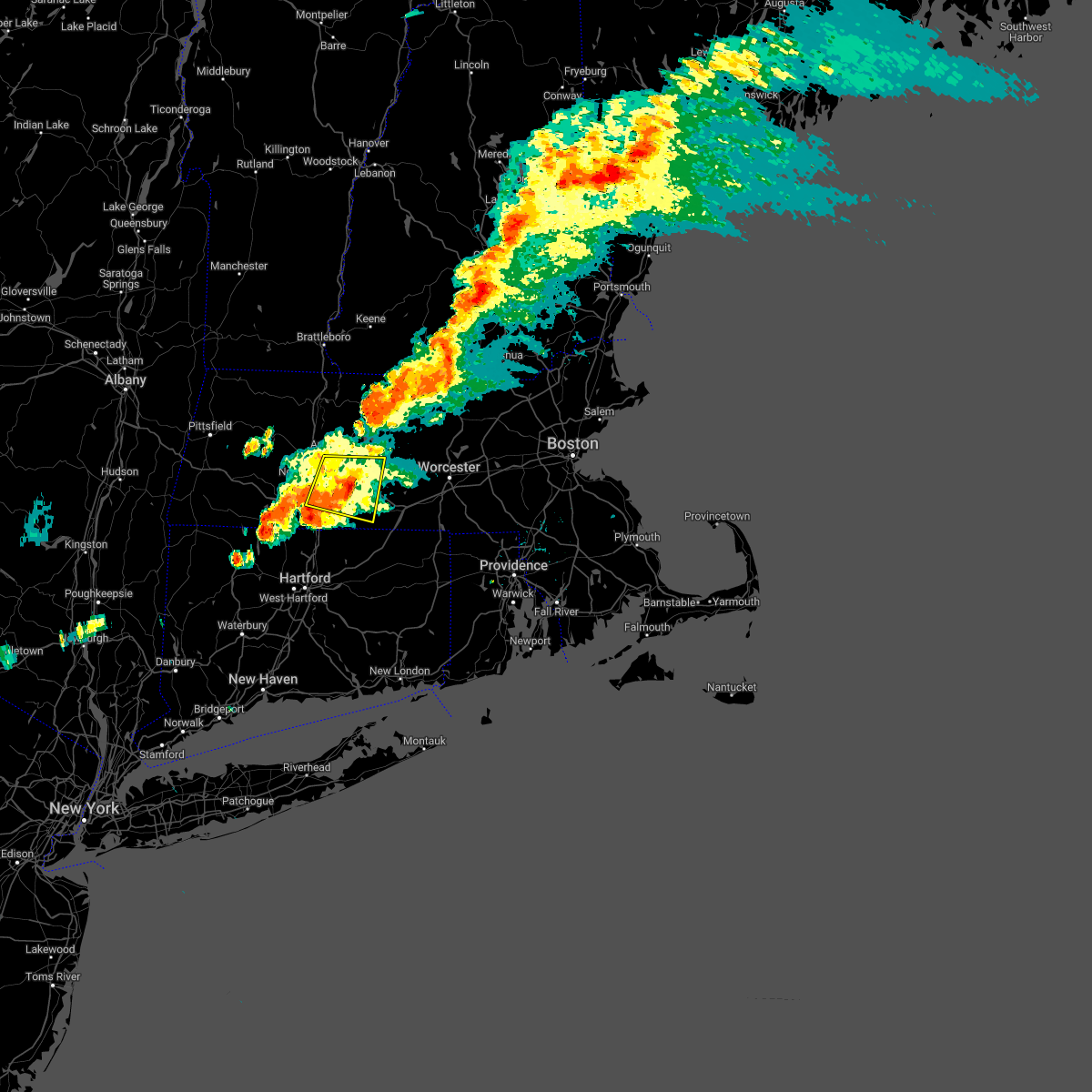 The severe thunderstorm warning for western worcester, southeastern hampshire, southeastern franklin and northeastern hampden counties will expire at 800 pm edt, the storm which prompted the warning has weakened below severe limits, and no longer poses an immediate threat to life or property. therefore, the warning will be allowed to expire. however heavy rain may cause minor flooding. a severe thunderstorm watch remains in effect until 1000 pm edt for western and central massachusetts. The severe thunderstorm warning for western worcester, southeastern hampshire, southeastern franklin and northeastern hampden counties will expire at 800 pm edt, the storm which prompted the warning has weakened below severe limits, and no longer poses an immediate threat to life or property. therefore, the warning will be allowed to expire. however heavy rain may cause minor flooding. a severe thunderstorm watch remains in effect until 1000 pm edt for western and central massachusetts.
|
| 7/28/2022 7:36 PM EDT |
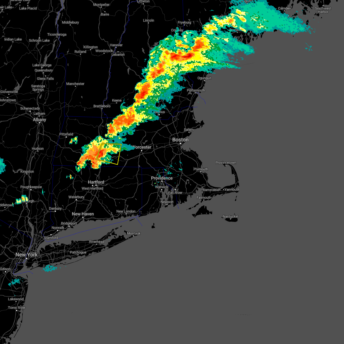 At 736 pm edt, a severe thunderstorm was located over ludlow, or near chicopee, moving east at 30 mph (radar indicated). Hazards include 60 mph wind gusts. Expect damage to trees and power lines. this severe storm will be near, wilbraham around 745 pm edt. monson and hampden around 750 pm edt. palmer around 800 pm edt. Warren, west brookfield and brimfield around 805 pm edt. At 736 pm edt, a severe thunderstorm was located over ludlow, or near chicopee, moving east at 30 mph (radar indicated). Hazards include 60 mph wind gusts. Expect damage to trees and power lines. this severe storm will be near, wilbraham around 745 pm edt. monson and hampden around 750 pm edt. palmer around 800 pm edt. Warren, west brookfield and brimfield around 805 pm edt.
|
| 7/28/2022 7:20 PM EDT |
 At 720 pm edt, a severe thunderstorm was located over holyoke, moving east at 30 mph (radar indicated). Hazards include 60 mph wind gusts. Expect damage to trees and power lines. this severe storm will be near, south hadley around 730 pm edt. springfield, chicopee and granby around 735 pm edt. ludlow and wilbraham around 745 pm edt. monson and hampden around 750 pm edt. palmer around 800 pm edt. Warren, west brookfield and brimfield around 805 pm edt. At 720 pm edt, a severe thunderstorm was located over holyoke, moving east at 30 mph (radar indicated). Hazards include 60 mph wind gusts. Expect damage to trees and power lines. this severe storm will be near, south hadley around 730 pm edt. springfield, chicopee and granby around 735 pm edt. ludlow and wilbraham around 745 pm edt. monson and hampden around 750 pm edt. palmer around 800 pm edt. Warren, west brookfield and brimfield around 805 pm edt.
|
| 7/28/2022 7:02 PM EDT |
 At 702 pm edt, a severe thunderstorm was located over huntington, or 8 miles southwest of northampton, moving east at 30 mph (radar indicated). Hazards include 60 mph wind gusts. Expect damage to trees and power lines. this severe thunderstorm will be near, southampton around 710 pm edt. westfield, northampton and easthampton around 720 pm edt. holyoke around 725 pm edt. south hadley around 730 pm edt. springfield, chicopee and granby around 735 pm edt. ludlow and wilbraham around 745 pm edt. monson and hampden around 750 pm edt. Palmer, warren, west brookfield and brimfield around 800 pm edt. At 702 pm edt, a severe thunderstorm was located over huntington, or 8 miles southwest of northampton, moving east at 30 mph (radar indicated). Hazards include 60 mph wind gusts. Expect damage to trees and power lines. this severe thunderstorm will be near, southampton around 710 pm edt. westfield, northampton and easthampton around 720 pm edt. holyoke around 725 pm edt. south hadley around 730 pm edt. springfield, chicopee and granby around 735 pm edt. ludlow and wilbraham around 745 pm edt. monson and hampden around 750 pm edt. Palmer, warren, west brookfield and brimfield around 800 pm edt.
|
| 7/12/2022 6:02 PM EDT | Tree on car on chicopee street. relayed by amateur radi in hampden county MA, 2.4 miles NE of Chicopee, MA |
| 7/12/2022 6:02 PM EDT | Large tree on wires between 77 and 88 watson stree in hampden county MA, 1.6 miles NNW of Chicopee, MA |
| 7/12/2022 6:02 PM EDT | 10-12 inch diameter branch down on a house on newbury stree in hampden county MA, 2.6 miles NNE of Chicopee, MA |
| 7/12/2022 6:02 PM EDT | One panel of a wooden fence blown down in the fairview section of chicopee. relayed by amateur radi in hampden county MA, 0.6 miles SW of Chicopee, MA |
| 7/12/2022 6:00 PM EDT |
 At 559 pm edt, a severe thunderstorm was located over chicopee, moving east at 45 mph (radar indicated). Hazards include 60 mph wind gusts and quarter size hail. this storm has a history of producing tree damage. Expect wind damage to trees and power lines. Minor hail damage to vehicles is possible. At 559 pm edt, a severe thunderstorm was located over chicopee, moving east at 45 mph (radar indicated). Hazards include 60 mph wind gusts and quarter size hail. this storm has a history of producing tree damage. Expect wind damage to trees and power lines. Minor hail damage to vehicles is possible.
|
| 7/12/2022 5:52 PM EDT |
 The severe thunderstorm warning for hampshire and hampden counties will expire at 600 pm edt, the storms which prompted the warning have moved out of the area. therefore, the warning will be allowed to expire. however gusty winds are still possible with these thunderstorms. The severe thunderstorm warning for hampshire and hampden counties will expire at 600 pm edt, the storms which prompted the warning have moved out of the area. therefore, the warning will be allowed to expire. however gusty winds are still possible with these thunderstorms.
|
| 7/12/2022 5:26 PM EDT |
 At 525 pm edt, severe thunderstorms were located along a line extending from greenfield to near norfolk, moving east at 50 mph (radar indicated. amateur radio reported several trees down in lenox, ma). Hazards include 60 mph wind gusts and quarter size hail. Expect wind damage to trees and power lines. minor hail damage to vehicles is possible. locations impacted include, springfield, chicopee, westfield, holyoke, amherst, northampton, agawam, west springfield, ludlow, south hadley, easthampton, longmeadow, east longmeadow, belchertown, wilbraham, palmer, ware, southwick, monson and granby. hail threat, radar indicated max hail size, 1. 00 in wind threat, observed max wind gust, 60 mph. At 525 pm edt, severe thunderstorms were located along a line extending from greenfield to near norfolk, moving east at 50 mph (radar indicated. amateur radio reported several trees down in lenox, ma). Hazards include 60 mph wind gusts and quarter size hail. Expect wind damage to trees and power lines. minor hail damage to vehicles is possible. locations impacted include, springfield, chicopee, westfield, holyoke, amherst, northampton, agawam, west springfield, ludlow, south hadley, easthampton, longmeadow, east longmeadow, belchertown, wilbraham, palmer, ware, southwick, monson and granby. hail threat, radar indicated max hail size, 1. 00 in wind threat, observed max wind gust, 60 mph.
|
| 7/12/2022 5:05 PM EDT |
 At 505 pm edt, severe thunderstorms were located along a line extending from hawley to near millerton, moving east at 50 mph (radar indicated). Hazards include 60 mph wind gusts and quarter size hail. Expect wind damage to trees and power lines. Minor hail damage to vehicles is possible. At 505 pm edt, severe thunderstorms were located along a line extending from hawley to near millerton, moving east at 50 mph (radar indicated). Hazards include 60 mph wind gusts and quarter size hail. Expect wind damage to trees and power lines. Minor hail damage to vehicles is possible.
|
| 7/2/2022 5:27 PM EDT |
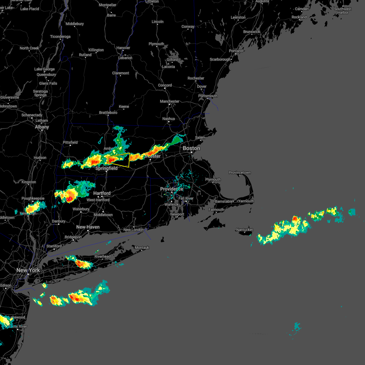 At 527 pm edt, a severe thunderstorm was located over granby, or near chicopee, moving east at 25 mph (radar indicated). Hazards include 60 mph wind gusts and quarter size hail. Expect wind damage to trees and power lines. Minor hail damage to vehicles is possible. At 527 pm edt, a severe thunderstorm was located over granby, or near chicopee, moving east at 25 mph (radar indicated). Hazards include 60 mph wind gusts and quarter size hail. Expect wind damage to trees and power lines. Minor hail damage to vehicles is possible.
|
| 5/22/2022 8:00 PM EDT |
 At 800 pm edt, severe thunderstorms were located along a line extending from near belchertown to enfield, moving east at 30 mph (radar indicated). Hazards include 60 mph wind gusts and quarter size hail. Expect wind damage to trees and power lines. Minor hail damage to vehicles is possible. At 800 pm edt, severe thunderstorms were located along a line extending from near belchertown to enfield, moving east at 30 mph (radar indicated). Hazards include 60 mph wind gusts and quarter size hail. Expect wind damage to trees and power lines. Minor hail damage to vehicles is possible.
|
| 3/7/2022 9:24 PM EST |
 The severe thunderstorm warning for northwestern tolland, northwestern worcester, hampshire, franklin and hampden counties will expire at 930 pm est, the storms which prompted the warning have moved out of the area. therefore, the warning will be allowed to expire. however gusty winds are still possible with these thunderstorms. The severe thunderstorm warning for northwestern tolland, northwestern worcester, hampshire, franklin and hampden counties will expire at 930 pm est, the storms which prompted the warning have moved out of the area. therefore, the warning will be allowed to expire. however gusty winds are still possible with these thunderstorms.
|
| 3/7/2022 9:23 PM EST |
 At 923 pm est, severe thunderstorms were located along a line extending from nelson to near whately to near norfolk, moving east at 75 mph (radar indicated). Hazards include 60 mph wind gusts. expect damage to trees and power lines At 923 pm est, severe thunderstorms were located along a line extending from nelson to near whately to near norfolk, moving east at 75 mph (radar indicated). Hazards include 60 mph wind gusts. expect damage to trees and power lines
|
| 3/7/2022 8:47 PM EST |
 At 847 pm est, severe thunderstorms were located along a line extending from 6 miles northwest of townshend to williamstown to catskill, moving east at 70 mph (radar indicated). Hazards include 60 mph wind gusts. expect damage to trees and power lines At 847 pm est, severe thunderstorms were located along a line extending from 6 miles northwest of townshend to williamstown to catskill, moving east at 70 mph (radar indicated). Hazards include 60 mph wind gusts. expect damage to trees and power lines
|
| 8/27/2021 5:24 PM EDT |
 At 522 pm edt, a severe thunderstorm was located over longmeadow, or near springfield, moving southeast at 15 mph (radar indicated). Hazards include 60 mph wind gusts. Expect damage to trees and power lines. locations impacted include, springfield, chicopee, enfield, vernon, agawam, west springfield, ludlow, longmeadow, suffield, east longmeadow, ellington, tolland, wilbraham, coventry, stafford, somers, east windsor, monson, willington and hampden. hail threat, radar indicated max hail size, <. 75 in wind threat, radar indicated max wind gust, 60 mph. At 522 pm edt, a severe thunderstorm was located over longmeadow, or near springfield, moving southeast at 15 mph (radar indicated). Hazards include 60 mph wind gusts. Expect damage to trees and power lines. locations impacted include, springfield, chicopee, enfield, vernon, agawam, west springfield, ludlow, longmeadow, suffield, east longmeadow, ellington, tolland, wilbraham, coventry, stafford, somers, east windsor, monson, willington and hampden. hail threat, radar indicated max hail size, <. 75 in wind threat, radar indicated max wind gust, 60 mph.
|
| 8/27/2021 5:15 PM EDT | Tree down on wires on granby roa in hampden county MA, 0.6 miles SW of Chicopee, MA |
| 8/27/2021 4:59 PM EDT |
 The national weather service in boston/norton has issued a * severe thunderstorm warning for. northwestern windham county in northern connecticut. northern tolland county in northern connecticut. northeastern hartford county in northern connecticut. South central hampshire county in western massachusetts. The national weather service in boston/norton has issued a * severe thunderstorm warning for. northwestern windham county in northern connecticut. northern tolland county in northern connecticut. northeastern hartford county in northern connecticut. South central hampshire county in western massachusetts.
|
| 8/27/2021 4:59 PM EDT |
 At 457 pm edt, a severe thunderstorm was located over west springfield, moving southeast at 20 mph (radar indicated). Hazards include 60 mph wind gusts and penny size hail. expect damage to trees and power lines At 457 pm edt, a severe thunderstorm was located over west springfield, moving southeast at 20 mph (radar indicated). Hazards include 60 mph wind gusts and penny size hail. expect damage to trees and power lines
|
| 8/12/2021 5:57 PM EDT |
 At 556 pm edt, severe thunderstorms were located along a line extending from near ludlow to near simsbury, moving east at 35 mph (radar indicated). Hazards include 60 mph wind gusts and penny size hail. Expect damage to trees and power lines. locations impacted include, springfield, hartford, west hartford, manchester, chicopee, east hartford, enfield, westfield, glastonbury, vernon, windsor, agawam, west springfield, south windsor, simsbury, ludlow, bloomfield, avon, longmeadow and suffield. hail threat, radar indicated max hail size, 0. 75 in wind threat, radar indicated max wind gust, 60 mph. At 556 pm edt, severe thunderstorms were located along a line extending from near ludlow to near simsbury, moving east at 35 mph (radar indicated). Hazards include 60 mph wind gusts and penny size hail. Expect damage to trees and power lines. locations impacted include, springfield, hartford, west hartford, manchester, chicopee, east hartford, enfield, westfield, glastonbury, vernon, windsor, agawam, west springfield, south windsor, simsbury, ludlow, bloomfield, avon, longmeadow and suffield. hail threat, radar indicated max hail size, 0. 75 in wind threat, radar indicated max wind gust, 60 mph.
|
| 8/12/2021 5:50 PM EDT | Tree down on home on crescent drive in hampden county MA, 0.6 miles SW of Chicopee, MA |
| 8/12/2021 5:37 PM EDT | Storm damage reported in hampden county MA, 3 miles SW of Chicopee, MA |
| 8/12/2021 5:35 PM EDT |
 At 534 pm edt, severe thunderstorms were located along a line extending from holyoke to near winsted, moving east at 35 mph (radar indicated). Hazards include 60 mph wind gusts. expect damage to trees and power lines At 534 pm edt, severe thunderstorms were located along a line extending from holyoke to near winsted, moving east at 35 mph (radar indicated). Hazards include 60 mph wind gusts. expect damage to trees and power lines
|
| 8/12/2021 5:27 PM EDT |
 At 525 pm edt, a severe thunderstorm was located over westhampton, or near northampton, moving east at 30 mph (radar indicated). Hazards include 70 mph wind gusts. Expect considerable damage to trees and power lines. damage is likely to mobile homes and outbuildings. locations impacted include, springfield, chicopee, westfield, holyoke, amherst, northampton, agawam, west springfield, ludlow, south hadley, easthampton, east longmeadow, belchertown, wilbraham, palmer, ware, monson, granby, southampton and hadley. thunderstorm damage threat, considerable hail threat, radar indicated max hail size, <. 75 in wind threat, radar indicated max wind gust, 70 mph. At 525 pm edt, a severe thunderstorm was located over westhampton, or near northampton, moving east at 30 mph (radar indicated). Hazards include 70 mph wind gusts. Expect considerable damage to trees and power lines. damage is likely to mobile homes and outbuildings. locations impacted include, springfield, chicopee, westfield, holyoke, amherst, northampton, agawam, west springfield, ludlow, south hadley, easthampton, east longmeadow, belchertown, wilbraham, palmer, ware, monson, granby, southampton and hadley. thunderstorm damage threat, considerable hail threat, radar indicated max hail size, <. 75 in wind threat, radar indicated max wind gust, 70 mph.
|
| 8/12/2021 5:02 PM EDT |
 At 502 pm edt, a severe thunderstorm was located near middlefield, or 16 miles southeast of pittsfield, moving east at 30 mph (radar indicated). Hazards include 60 mph wind gusts. expect damage to trees and power lines At 502 pm edt, a severe thunderstorm was located near middlefield, or 16 miles southeast of pittsfield, moving east at 30 mph (radar indicated). Hazards include 60 mph wind gusts. expect damage to trees and power lines
|
| 7/27/2021 6:26 PM EDT |
 The severe thunderstorm warning for northern hartford, hampshire, south central franklin and hampden counties will expire at 630 pm edt, the storms which prompted the warning have weakened below severe limits, and no longer pose an immediate threat to life or property. therefore, the warning will be allowed to expire. however gusty winds are still possible with these thunderstorms. a severe thunderstorm watch remains in effect until 1000 pm edt for northern connecticut, and western massachusetts. The severe thunderstorm warning for northern hartford, hampshire, south central franklin and hampden counties will expire at 630 pm edt, the storms which prompted the warning have weakened below severe limits, and no longer pose an immediate threat to life or property. therefore, the warning will be allowed to expire. however gusty winds are still possible with these thunderstorms. a severe thunderstorm watch remains in effect until 1000 pm edt for northern connecticut, and western massachusetts.
|
| 7/27/2021 6:11 PM EDT |
 At 610 pm edt, severe thunderstorms were located along a line extending from near cummington to near montgomery to near tolland, moving southeast at 35 mph (radar indicated). Hazards include 60 mph wind gusts and quarter size hail. Expect wind damage to trees and power lines. minor hail damage to vehicles is possible. Locations impacted include, springfield, chicopee, enfield, westfield, holyoke, amherst, northampton, agawam, west springfield, ludlow, south hadley, easthampton, longmeadow, suffield, east longmeadow, belchertown, wilbraham, windsor locks, somers and east windsor. At 610 pm edt, severe thunderstorms were located along a line extending from near cummington to near montgomery to near tolland, moving southeast at 35 mph (radar indicated). Hazards include 60 mph wind gusts and quarter size hail. Expect wind damage to trees and power lines. minor hail damage to vehicles is possible. Locations impacted include, springfield, chicopee, enfield, westfield, holyoke, amherst, northampton, agawam, west springfield, ludlow, south hadley, easthampton, longmeadow, suffield, east longmeadow, belchertown, wilbraham, windsor locks, somers and east windsor.
|
| 7/27/2021 5:34 PM EDT |
 At 534 pm edt, severe thunderstorms were located along a line extending from near cheshire to near lee to sheffield, moving southeast at 35 mph (radar indicated). Hazards include 60 mph wind gusts and quarter size hail. Expect wind damage to trees and power lines. Minor hail damage to vehicles is possible. At 534 pm edt, severe thunderstorms were located along a line extending from near cheshire to near lee to sheffield, moving southeast at 35 mph (radar indicated). Hazards include 60 mph wind gusts and quarter size hail. Expect wind damage to trees and power lines. Minor hail damage to vehicles is possible.
|
| 7/27/2021 5:25 PM EDT |
 At 524 pm edt, a severe thunderstorm was located over goshen, or 7 miles northwest of northampton, moving southeast at 35 mph (trained weather spotters. at 518 pm, powerline wires were downed in cummington from this severe thunderstorm). Hazards include 60 mph wind gusts and quarter size hail. Expect wind damage to trees and power lines. minor hail damage to vehicles is possible. Locations impacted include, springfield, chicopee, holyoke, amherst, northampton, deerfield, ludlow, south hadley, easthampton, belchertown, wilbraham, ware, montague, granby, southampton, hadley, sunderland, hatfield, williamsburg and huntington. At 524 pm edt, a severe thunderstorm was located over goshen, or 7 miles northwest of northampton, moving southeast at 35 mph (trained weather spotters. at 518 pm, powerline wires were downed in cummington from this severe thunderstorm). Hazards include 60 mph wind gusts and quarter size hail. Expect wind damage to trees and power lines. minor hail damage to vehicles is possible. Locations impacted include, springfield, chicopee, holyoke, amherst, northampton, deerfield, ludlow, south hadley, easthampton, belchertown, wilbraham, ware, montague, granby, southampton, hadley, sunderland, hatfield, williamsburg and huntington.
|
| 7/27/2021 5:04 PM EDT |
 At 503 pm edt, a severe thunderstorm was located over east windsor, or 15 miles east of pittsfield, moving southeast at 40 mph (radar indicated. this storm has downed trees in portions of central berkshire county). Hazards include 60 mph wind gusts and quarter size hail. Expect wind damage to trees and power lines. Minor hail damage to vehicles is possible. At 503 pm edt, a severe thunderstorm was located over east windsor, or 15 miles east of pittsfield, moving southeast at 40 mph (radar indicated. this storm has downed trees in portions of central berkshire county). Hazards include 60 mph wind gusts and quarter size hail. Expect wind damage to trees and power lines. Minor hail damage to vehicles is possible.
|
| 7/17/2021 4:38 PM EDT |
 At 438 pm edt, a severe thunderstorm was located over agawam, moving east at 15 mph (radar indicated). Hazards include 60 mph wind gusts and quarter size hail. Expect wind damage to trees and power lines. Minor hail damage to vehicles is possible. At 438 pm edt, a severe thunderstorm was located over agawam, moving east at 15 mph (radar indicated). Hazards include 60 mph wind gusts and quarter size hail. Expect wind damage to trees and power lines. Minor hail damage to vehicles is possible.
|
| 7/14/2021 7:46 PM EDT |
 At 746 pm edt, a severe thunderstorm was located over ludlow, or near chicopee, moving east at 20 mph (radar indicated). Hazards include 60 mph wind gusts and penny size hail. expect damage to trees and power lines At 746 pm edt, a severe thunderstorm was located over ludlow, or near chicopee, moving east at 20 mph (radar indicated). Hazards include 60 mph wind gusts and penny size hail. expect damage to trees and power lines
|
| 7/6/2021 5:14 PM EDT |
 At 513 pm edt, a severe thunderstorm was located over southampton, or near westfield, moving east at 30 mph (radar indicated). Hazards include 60 mph wind gusts. Expect damage to trees and power lines. Locations impacted include, springfield, chicopee, westfield, holyoke, amherst, northampton, west springfield, ludlow, south hadley, easthampton, belchertown, wilbraham, palmer, ware, monson, granby, southampton, hadley, hardwick and huntington. At 513 pm edt, a severe thunderstorm was located over southampton, or near westfield, moving east at 30 mph (radar indicated). Hazards include 60 mph wind gusts. Expect damage to trees and power lines. Locations impacted include, springfield, chicopee, westfield, holyoke, amherst, northampton, west springfield, ludlow, south hadley, easthampton, belchertown, wilbraham, palmer, ware, monson, granby, southampton, hadley, hardwick and huntington.
|
| 7/6/2021 4:53 PM EDT |
 At 453 pm edt, a severe thunderstorm was located over chester, or 14 miles northwest of westfield, moving east at 30 mph. this is a dangerous storm (radar indicated). Hazards include 70 mph wind gusts and half dollar size hail. Expect considerable damage to trees and power lines. wind damage is also likely to mobile homes, roofs, and outbuildings. minor hail damage to vehicles is possible. Locations impacted include, springfield, chicopee, westfield, holyoke, amherst, northampton, west springfield, ludlow, south hadley, easthampton, belchertown, wilbraham, palmer, ware, monson, granby, southampton, hadley, hardwick and huntington. At 453 pm edt, a severe thunderstorm was located over chester, or 14 miles northwest of westfield, moving east at 30 mph. this is a dangerous storm (radar indicated). Hazards include 70 mph wind gusts and half dollar size hail. Expect considerable damage to trees and power lines. wind damage is also likely to mobile homes, roofs, and outbuildings. minor hail damage to vehicles is possible. Locations impacted include, springfield, chicopee, westfield, holyoke, amherst, northampton, west springfield, ludlow, south hadley, easthampton, belchertown, wilbraham, palmer, ware, monson, granby, southampton, hadley, hardwick and huntington.
|
| 7/6/2021 4:51 PM EDT |
 At 451 pm edt, a severe thunderstorm was located near chester, or 15 miles northwest of westfield, moving east at 30 mph (radar indicated). Hazards include 60 mph wind gusts and quarter size hail. Expect wind damage to trees and power lines. Minor hail damage to vehicles is possible. At 451 pm edt, a severe thunderstorm was located near chester, or 15 miles northwest of westfield, moving east at 30 mph (radar indicated). Hazards include 60 mph wind gusts and quarter size hail. Expect wind damage to trees and power lines. Minor hail damage to vehicles is possible.
|
| 7/6/2021 4:38 PM EDT |
 At 437 pm edt, severe thunderstorm was located from suffield to granville, moving east at 30 mph (trained weather spotters. trees and wires were downed in southwick at 430 pm from these severe thunderstorms). Hazards include 60 mph wind gusts and penny size hail. Expect damage to trees and power lines. Locations impacted include, springfield, chicopee, enfield, westfield, holyoke, windsor, agawam, west springfield, simsbury, ludlow, bloomfield, longmeadow, suffield, east longmeadow, ellington, wilbraham, windsor locks, palmer, stafford and somers. At 437 pm edt, severe thunderstorm was located from suffield to granville, moving east at 30 mph (trained weather spotters. trees and wires were downed in southwick at 430 pm from these severe thunderstorms). Hazards include 60 mph wind gusts and penny size hail. Expect damage to trees and power lines. Locations impacted include, springfield, chicopee, enfield, westfield, holyoke, windsor, agawam, west springfield, simsbury, ludlow, bloomfield, longmeadow, suffield, east longmeadow, ellington, wilbraham, windsor locks, palmer, stafford and somers.
|
| 7/6/2021 4:20 PM EDT |
 At 419 pm edt, a severe thunderstorm was located over granville, or 9 miles southwest of westfield. additional severe storms were located between tolland and sheffield. theses storms were moving east at 30 mph (radar indicated). Hazards include 60 mph wind gusts and penny size hail. expect damage to trees and power lines At 419 pm edt, a severe thunderstorm was located over granville, or 9 miles southwest of westfield. additional severe storms were located between tolland and sheffield. theses storms were moving east at 30 mph (radar indicated). Hazards include 60 mph wind gusts and penny size hail. expect damage to trees and power lines
|
| 7/6/2021 4:13 PM EDT |
 At 413 pm edt, a severe thunderstorm was located near northampton, moving east at 15 mph (radar indicated). Hazards include 60 mph wind gusts and penny size hail. expect damage to trees and power lines At 413 pm edt, a severe thunderstorm was located near northampton, moving east at 15 mph (radar indicated). Hazards include 60 mph wind gusts and penny size hail. expect damage to trees and power lines
|
| 7/6/2021 3:51 PM EDT |
 At 350 pm edt, a severe thunderstorm was located over goshen, or 12 miles northwest of northampton, moving east at 20 mph (radar indicated). Hazards include 60 mph wind gusts and nickel size hail. Expect damage to trees and power lines. Locations impacted include, chicopee, holyoke, amherst, northampton, deerfield, south hadley, easthampton, montague, granby, southampton, hadley, sunderland, hatfield, williamsburg, huntington, buckland, conway, shelburne, leverett and shutesbury. At 350 pm edt, a severe thunderstorm was located over goshen, or 12 miles northwest of northampton, moving east at 20 mph (radar indicated). Hazards include 60 mph wind gusts and nickel size hail. Expect damage to trees and power lines. Locations impacted include, chicopee, holyoke, amherst, northampton, deerfield, south hadley, easthampton, montague, granby, southampton, hadley, sunderland, hatfield, williamsburg, huntington, buckland, conway, shelburne, leverett and shutesbury.
|
| 7/6/2021 3:12 PM EDT |
 At 311 pm edt, a severe thunderstorm was located near cheshire, or 8 miles east of pittsfield, moving east at 20 mph (radar indicated). Hazards include 60 mph wind gusts and nickel size hail. expect damage to trees and power lines At 311 pm edt, a severe thunderstorm was located near cheshire, or 8 miles east of pittsfield, moving east at 20 mph (radar indicated). Hazards include 60 mph wind gusts and nickel size hail. expect damage to trees and power lines
|
| 6/30/2021 4:39 PM EDT |
 At 439 pm edt, a severe thunderstorm was located over northampton, moving east at 25 mph (radar indicated). Hazards include 60 mph wind gusts and quarter size hail. Expect wind damage to trees and power lines. Minor hail damage to vehicles is possible. At 439 pm edt, a severe thunderstorm was located over northampton, moving east at 25 mph (radar indicated). Hazards include 60 mph wind gusts and quarter size hail. Expect wind damage to trees and power lines. Minor hail damage to vehicles is possible.
|
| 6/30/2021 4:09 PM EDT |
 At 408 pm edt, a severe thunderstorm was located over becket, or 10 miles southeast of pittsfield, moving east at 25 mph (radar indicated). Hazards include 70 mph wind gusts and ping pong ball size hail. Expect considerable damage to trees and power lines. wind damage is also likely to mobile homes, roofs, and outbuildings. minor hail damage to vehicles is possible. Locations impacted include, chicopee, holyoke, northampton, deerfield, south hadley, easthampton, southampton, hadley, sunderland, hatfield, williamsburg, huntington, conway, ashfield, westhampton, whately, chester, blandford, chesterfield and worthington. At 408 pm edt, a severe thunderstorm was located over becket, or 10 miles southeast of pittsfield, moving east at 25 mph (radar indicated). Hazards include 70 mph wind gusts and ping pong ball size hail. Expect considerable damage to trees and power lines. wind damage is also likely to mobile homes, roofs, and outbuildings. minor hail damage to vehicles is possible. Locations impacted include, chicopee, holyoke, northampton, deerfield, south hadley, easthampton, southampton, hadley, sunderland, hatfield, williamsburg, huntington, conway, ashfield, westhampton, whately, chester, blandford, chesterfield and worthington.
|
| 6/30/2021 3:52 PM EDT |
 At 352 pm edt, a severe thunderstorm was located near lenox, or near pittsfield, moving east at 35 mph (radar indicated). Hazards include golf ball size hail and 70 mph wind gusts. Large hail may injure people caught outdoors. expect hail damage to roofs, siding, windows, and vehicles. expect considerable damage to trees and power lines. wind damage is also likely to mobile homes, roofs, and outbuildings. Locations impacted include, chicopee, westfield, holyoke, northampton, west springfield, deerfield, south hadley, easthampton, southampton, hadley, sunderland, hatfield, williamsburg, huntington, conway, russell, ashfield, westhampton, whately and chester. At 352 pm edt, a severe thunderstorm was located near lenox, or near pittsfield, moving east at 35 mph (radar indicated). Hazards include golf ball size hail and 70 mph wind gusts. Large hail may injure people caught outdoors. expect hail damage to roofs, siding, windows, and vehicles. expect considerable damage to trees and power lines. wind damage is also likely to mobile homes, roofs, and outbuildings. Locations impacted include, chicopee, westfield, holyoke, northampton, west springfield, deerfield, south hadley, easthampton, southampton, hadley, sunderland, hatfield, williamsburg, huntington, conway, russell, ashfield, westhampton, whately and chester.
|
| 6/30/2021 3:48 PM EDT |
 At 347 pm edt, a severe thunderstorm was located over lenox, or near pittsfield, moving east at 35 mph (radar indicated). Hazards include 60 mph wind gusts and quarter size hail. Expect wind damage to trees and power lines. Minor hail damage to vehicles is possible. At 347 pm edt, a severe thunderstorm was located over lenox, or near pittsfield, moving east at 35 mph (radar indicated). Hazards include 60 mph wind gusts and quarter size hail. Expect wind damage to trees and power lines. Minor hail damage to vehicles is possible.
|
| 6/29/2021 7:28 PM EDT |
 At 727 pm edt, a severe thunderstorm was located over agawam, moving east at 15 mph (amateur radio and emergency management. at 708 pm, a tree was downed on the southwick and agawam town line). Hazards include 60 mph wind gusts and penny size hail. Expect damage to trees and power lines. Locations impacted include, springfield, chicopee, enfield, agawam, west springfield, ludlow, longmeadow, suffield, east longmeadow, ellington, tolland, wilbraham, windsor locks, palmer, stafford, somers, granby, east windsor, southwick and monson. At 727 pm edt, a severe thunderstorm was located over agawam, moving east at 15 mph (amateur radio and emergency management. at 708 pm, a tree was downed on the southwick and agawam town line). Hazards include 60 mph wind gusts and penny size hail. Expect damage to trees and power lines. Locations impacted include, springfield, chicopee, enfield, agawam, west springfield, ludlow, longmeadow, suffield, east longmeadow, ellington, tolland, wilbraham, windsor locks, palmer, stafford, somers, granby, east windsor, southwick and monson.
|
| 6/29/2021 7:15 PM EDT |
 At 714 pm edt, a severe thunderstorm was located over agawam, moving east at 15 mph (amateur radio and emergency management. at 708 pm, a tree was downed on the southwick and agawam town line). Hazards include 60 mph wind gusts and penny size hail. Expect damage to trees and power lines. Locations impacted include, springfield, chicopee, enfield, westfield, holyoke, agawam, west springfield, ludlow, longmeadow, suffield, east longmeadow, ellington, tolland, belchertown, wilbraham, windsor locks, palmer, stafford, somers and granby. At 714 pm edt, a severe thunderstorm was located over agawam, moving east at 15 mph (amateur radio and emergency management. at 708 pm, a tree was downed on the southwick and agawam town line). Hazards include 60 mph wind gusts and penny size hail. Expect damage to trees and power lines. Locations impacted include, springfield, chicopee, enfield, westfield, holyoke, agawam, west springfield, ludlow, longmeadow, suffield, east longmeadow, ellington, tolland, belchertown, wilbraham, windsor locks, palmer, stafford, somers and granby.
|
| 6/29/2021 6:59 PM EDT |
 At 658 pm edt, severe thunderstorms were clustered over southwick, or near westfield, moving east at 15 mph (radar indicated). Hazards include 60 mph wind gusts and penny size hail. expect damage to trees and power lines At 658 pm edt, severe thunderstorms were clustered over southwick, or near westfield, moving east at 15 mph (radar indicated). Hazards include 60 mph wind gusts and penny size hail. expect damage to trees and power lines
|
| 6/29/2021 6:59 PM EDT |
 The national weather service in boston/norton has issued a * severe thunderstorm warning for. northwestern tolland county in northern connecticut. northeastern hartford county in northern connecticut. south central hampshire county in western massachusetts. Southern hampden county in western massachusetts. The national weather service in boston/norton has issued a * severe thunderstorm warning for. northwestern tolland county in northern connecticut. northeastern hartford county in northern connecticut. south central hampshire county in western massachusetts. Southern hampden county in western massachusetts.
|
| 6/8/2021 2:04 PM EDT |
 At 203 pm edt, a severe thunderstorm was located over west springfield, moving east at 5 mph. 46 kt wind gust was reported at westfield airport (radar indicated). Hazards include 60 mph wind gusts and quarter size hail. Expect wind damage to trees and power lines. minor hail damage to vehicles is possible. Locations impacted include, springfield, chicopee, westfield, holyoke, west springfield, ludlow, south hadley, granby and southampton. At 203 pm edt, a severe thunderstorm was located over west springfield, moving east at 5 mph. 46 kt wind gust was reported at westfield airport (radar indicated). Hazards include 60 mph wind gusts and quarter size hail. Expect wind damage to trees and power lines. minor hail damage to vehicles is possible. Locations impacted include, springfield, chicopee, westfield, holyoke, west springfield, ludlow, south hadley, granby and southampton.
|
| 6/8/2021 1:34 PM EDT |
 At 133 pm edt, a severe thunderstorm was located over westfield, moving east at 10 mph (radar indicated). Hazards include 60 mph wind gusts and quarter size hail. Expect wind damage to trees and power lines. Minor hail damage to vehicles is possible. At 133 pm edt, a severe thunderstorm was located over westfield, moving east at 10 mph (radar indicated). Hazards include 60 mph wind gusts and quarter size hail. Expect wind damage to trees and power lines. Minor hail damage to vehicles is possible.
|
| 5/26/2021 7:33 PM EDT |
 At 732 pm edt, a severe thunderstorm was located near longmeadow, or near agawam, moving east at 30 mph (trained weather spotters. at 7:20 pm multiple trees were down on north branch parkway in springfield, ma). Hazards include 60 mph wind gusts. Expect damage to trees and power lines. Locations impacted include, springfield, chicopee, enfield, westfield, windsor, agawam, west springfield, simsbury, bloomfield, longmeadow, suffield, east longmeadow, ellington, wilbraham, windsor locks, stafford, somers, granby, east windsor and canton. At 732 pm edt, a severe thunderstorm was located near longmeadow, or near agawam, moving east at 30 mph (trained weather spotters. at 7:20 pm multiple trees were down on north branch parkway in springfield, ma). Hazards include 60 mph wind gusts. Expect damage to trees and power lines. Locations impacted include, springfield, chicopee, enfield, westfield, windsor, agawam, west springfield, simsbury, bloomfield, longmeadow, suffield, east longmeadow, ellington, wilbraham, windsor locks, stafford, somers, granby, east windsor and canton.
|
| 5/26/2021 7:26 PM EDT |
 At 725 pm edt, severe thunderstorms were located along a line extending from lancaster to monson, moving east at 35 mph (trained weather spotters). Hazards include 60 mph wind gusts. Expect damage to trees and power lines. Locations impacted include, worcester, springfield, chicopee, westfield, leominster, holyoke, shrewsbury, west springfield, ludlow, south hadley, holden, southbridge, auburn, belchertown, wilbraham, northborough, oxford, clinton, millbury and charlton. At 725 pm edt, severe thunderstorms were located along a line extending from lancaster to monson, moving east at 35 mph (trained weather spotters). Hazards include 60 mph wind gusts. Expect damage to trees and power lines. Locations impacted include, worcester, springfield, chicopee, westfield, leominster, holyoke, shrewsbury, west springfield, ludlow, south hadley, holden, southbridge, auburn, belchertown, wilbraham, northborough, oxford, clinton, millbury and charlton.
|
| 5/26/2021 7:05 PM EDT |
 At 704 pm edt, a severe thunderstorm was located near granville, or 9 miles southwest of westfield, moving east at 30 mph (radar indicated). Hazards include 60 mph wind gusts. expect damage to trees and power lines At 704 pm edt, a severe thunderstorm was located near granville, or 9 miles southwest of westfield, moving east at 30 mph (radar indicated). Hazards include 60 mph wind gusts. expect damage to trees and power lines
|
| 5/26/2021 6:50 PM EDT |
 At 648 pm edt, severe thunderstorms were located along a line extending from hubbardston to near granby, moving east at 30 mph (trained weather spotters. at 640 pm edt trees down in pelham, ma on amherst and jones roads). Hazards include 60 mph wind gusts. Expect damage to trees and power lines. Locations impacted include, worcester, springfield, chicopee, westfield, leominster, holyoke, amherst, shrewsbury, northampton, west springfield, ludlow, south hadley, holden, southbridge, auburn, easthampton, belchertown, wilbraham, northborough and oxford. At 648 pm edt, severe thunderstorms were located along a line extending from hubbardston to near granby, moving east at 30 mph (trained weather spotters. at 640 pm edt trees down in pelham, ma on amherst and jones roads). Hazards include 60 mph wind gusts. Expect damage to trees and power lines. Locations impacted include, worcester, springfield, chicopee, westfield, leominster, holyoke, amherst, shrewsbury, northampton, west springfield, ludlow, south hadley, holden, southbridge, auburn, easthampton, belchertown, wilbraham, northborough and oxford.
|
| 5/26/2021 6:39 PM EDT |
 At 638 pm edt, severe thunderstorms were located along a line extending from near templeton to near south hadley, moving east at 30 mph (radar indicated). Hazards include 60 mph wind gusts. expect damage to trees and power lines At 638 pm edt, severe thunderstorms were located along a line extending from near templeton to near south hadley, moving east at 30 mph (radar indicated). Hazards include 60 mph wind gusts. expect damage to trees and power lines
|
| 4/21/2021 4:10 PM EDT | Tree down blocking chicopee street at carpenter blv in hampden county MA, 0.6 miles SW of Chicopee, MA |
| 4/21/2021 4:10 PM EDT | Tree down blocking chicopee street at carpenter blv in hampden county MA, 0.6 miles SW of Chicopee, MA |
| 4/21/2021 4:09 PM EDT |
 The severe thunderstorm warning for north central hartford, south central hampshire and eastern hampden counties will expire at 415 pm edt, the storms which prompted the warning have weakened below severe limits, so the warning will be allowed to expire at 415 pm. however, strong winds gusting to 40 mph may cause minor damage such as a downed tree limbs. pea sized hail is also possible. a severe thunderstorm watch remains in effect until 600 pm edt for northern connecticut, and western massachusetts. &&. The severe thunderstorm warning for north central hartford, south central hampshire and eastern hampden counties will expire at 415 pm edt, the storms which prompted the warning have weakened below severe limits, so the warning will be allowed to expire at 415 pm. however, strong winds gusting to 40 mph may cause minor damage such as a downed tree limbs. pea sized hail is also possible. a severe thunderstorm watch remains in effect until 600 pm edt for northern connecticut, and western massachusetts. &&.
|
| 4/21/2021 3:59 PM EDT |
 At 358 pm edt, severe thunderstorms were located along a line extending from southampton to near west springfield to longmeadow, moving northeast at 45 mph (radar indicated). Hazards include 60 mph wind gusts and penny size hail. Expect damage to trees and power lines. these severe storms will be near, ludlow, south hadley, wilbraham and hampden around 410 pm edt. Monson and granby around 415 pm edt. At 358 pm edt, severe thunderstorms were located along a line extending from southampton to near west springfield to longmeadow, moving northeast at 45 mph (radar indicated). Hazards include 60 mph wind gusts and penny size hail. Expect damage to trees and power lines. these severe storms will be near, ludlow, south hadley, wilbraham and hampden around 410 pm edt. Monson and granby around 415 pm edt.
|
| 4/21/2021 3:43 PM EDT |
 At 342 pm edt, severe thunderstorms were located along a line extending from near blandford to near southwick to near east granby, moving northeast at 40 mph. the strongest storm along the line was near granby (radar indicated). Hazards include 60 mph wind gusts and penny size hail. Expect damage to trees and power lines. these severe storms will be near, southwick around 350 pm edt. windsor, agawam, suffield and windsor locks around 355 pm edt. westfield, west springfield, longmeadow and montgomery around 400 pm edt. southampton and westhampton around 405 pm edt. chicopee, enfield and somers around 410 pm edt. springfield, holyoke, northampton, easthampton and east longmeadow around 415 pm edt. ludlow, south hadley, wilbraham and hampden around 420 pm edt. Monson and hatfield around 425 pm edt. At 342 pm edt, severe thunderstorms were located along a line extending from near blandford to near southwick to near east granby, moving northeast at 40 mph. the strongest storm along the line was near granby (radar indicated). Hazards include 60 mph wind gusts and penny size hail. Expect damage to trees and power lines. these severe storms will be near, southwick around 350 pm edt. windsor, agawam, suffield and windsor locks around 355 pm edt. westfield, west springfield, longmeadow and montgomery around 400 pm edt. southampton and westhampton around 405 pm edt. chicopee, enfield and somers around 410 pm edt. springfield, holyoke, northampton, easthampton and east longmeadow around 415 pm edt. ludlow, south hadley, wilbraham and hampden around 420 pm edt. Monson and hatfield around 425 pm edt.
|
| 4/21/2021 3:17 PM EDT |
 At 317 pm edt, severe thunderstorms were located along a line extending from near canaan to near winsted to torrington, moving northeast at 50 mph (radar indicated). Hazards include 60 mph wind gusts and penny size hail. Expect damage to trees and power lines. severe thunderstorms will be near, burlington around 325 pm edt. canton, hartland and tolland around 330 pm edt. granby around 335 pm edt. simsbury, granville and blandford around 340 pm edt. windsor, windsor locks, southwick, east granby and russell around 345 pm edt. westfield, agawam, west springfield, suffield and montgomery around 350 pm edt. holyoke, longmeadow, southampton, huntington and westhampton around 355 pm edt. Springfield, chicopee, enfield, easthampton and somers around 400 pm edt. At 317 pm edt, severe thunderstorms were located along a line extending from near canaan to near winsted to torrington, moving northeast at 50 mph (radar indicated). Hazards include 60 mph wind gusts and penny size hail. Expect damage to trees and power lines. severe thunderstorms will be near, burlington around 325 pm edt. canton, hartland and tolland around 330 pm edt. granby around 335 pm edt. simsbury, granville and blandford around 340 pm edt. windsor, windsor locks, southwick, east granby and russell around 345 pm edt. westfield, agawam, west springfield, suffield and montgomery around 350 pm edt. holyoke, longmeadow, southampton, huntington and westhampton around 355 pm edt. Springfield, chicopee, enfield, easthampton and somers around 400 pm edt.
|
| 11/15/2020 9:53 PM EST |
 At 952 pm est, severe thunderstorms were located along a line extending from sunderland to near ludlow to longmeadow, moving east at 45 mph (radar indicated. trained spotters also reported downed trees in agawam and westfield, ma). Hazards include 60 mph wind gusts. Expect damage to trees and power lines. Locations impacted include, springfield, chicopee, enfield, holyoke, amherst, northampton, agawam, west springfield, ludlow, south hadley, easthampton, longmeadow, suffield, east longmeadow, belchertown, wilbraham, palmer, stafford, somers and ware. At 952 pm est, severe thunderstorms were located along a line extending from sunderland to near ludlow to longmeadow, moving east at 45 mph (radar indicated. trained spotters also reported downed trees in agawam and westfield, ma). Hazards include 60 mph wind gusts. Expect damage to trees and power lines. Locations impacted include, springfield, chicopee, enfield, holyoke, amherst, northampton, agawam, west springfield, ludlow, south hadley, easthampton, longmeadow, suffield, east longmeadow, belchertown, wilbraham, palmer, stafford, somers and ware.
|
| 11/15/2020 9:45 PM EST |
 At 944 pm est, severe thunderstorms were located along a line extending from granby to east windsor to cromwell, moving east at 55 mph (radar indicated). Hazards include 60 mph wind gusts. expect damage to trees and power lines At 944 pm est, severe thunderstorms were located along a line extending from granby to east windsor to cromwell, moving east at 55 mph (radar indicated). Hazards include 60 mph wind gusts. expect damage to trees and power lines
|
| 11/15/2020 9:29 PM EST |
 At 928 pm est, severe thunderstorms were located along a line extending from near goshen to westfield to near granby, moving east at 45 mph (radar indicated). Hazards include 60 mph wind gusts. expect damage to trees and power lines At 928 pm est, severe thunderstorms were located along a line extending from near goshen to westfield to near granby, moving east at 45 mph (radar indicated). Hazards include 60 mph wind gusts. expect damage to trees and power lines
|
| 10/7/2020 5:39 PM EDT |
 The severe thunderstorm warning for southeastern hampshire and central hampden counties will expire at 545 pm edt, the storms which prompted the warning have moved out of the area. therefore, the warning will be allowed to expire. The severe thunderstorm warning for southeastern hampshire and central hampden counties will expire at 545 pm edt, the storms which prompted the warning have moved out of the area. therefore, the warning will be allowed to expire.
|
| 10/7/2020 5:15 PM EDT |
 At 514 pm edt, severe thunderstorms were located along a line extending from near belchertown to near southampton, moving east at 65 mph (radar indicated). Hazards include 60 mph wind gusts. Expect damage to trees and power lines. Locations impacted include, springfield, chicopee, westfield, holyoke, agawam, west springfield, ludlow, south hadley, easthampton, longmeadow, east longmeadow, belchertown, wilbraham, palmer, ware, southwick, monson, granby, southampton and hampden. At 514 pm edt, severe thunderstorms were located along a line extending from near belchertown to near southampton, moving east at 65 mph (radar indicated). Hazards include 60 mph wind gusts. Expect damage to trees and power lines. Locations impacted include, springfield, chicopee, westfield, holyoke, agawam, west springfield, ludlow, south hadley, easthampton, longmeadow, east longmeadow, belchertown, wilbraham, palmer, ware, southwick, monson, granby, southampton and hampden.
|
| 10/7/2020 5:11 PM EDT | Storm damage reported in hampden county MA, 3 miles SW of Chicopee, MA |
| 10/7/2020 4:38 PM EDT |
 At 438 pm edt, severe thunderstorms were located along a line extending from near east windsor to near austerlitz, moving east at 65 mph (radar indicated). Hazards include 60 mph wind gusts. expect damage to trees and power lines At 438 pm edt, severe thunderstorms were located along a line extending from near east windsor to near austerlitz, moving east at 65 mph (radar indicated). Hazards include 60 mph wind gusts. expect damage to trees and power lines
|
| 8/29/2020 8:44 PM EDT |
 At 843 pm edt, severe thunderstorms were located along a line extending from bernardston to cummington, moving east at 40 mph (radar indicated). Hazards include 60 mph wind gusts. Expect damage to trees and power lines. Locations impacted include, chicopee, holyoke, amherst, northampton, greenfield, orange, deerfield, south hadley, easthampton, belchertown, athol, montague, granby, hadley, sunderland, hatfield, northfield, williamsburg, huntington and bernardston. At 843 pm edt, severe thunderstorms were located along a line extending from bernardston to cummington, moving east at 40 mph (radar indicated). Hazards include 60 mph wind gusts. Expect damage to trees and power lines. Locations impacted include, chicopee, holyoke, amherst, northampton, greenfield, orange, deerfield, south hadley, easthampton, belchertown, athol, montague, granby, hadley, sunderland, hatfield, northfield, williamsburg, huntington and bernardston.
|
| 8/29/2020 8:14 PM EDT |
 At 814 pm edt, severe thunderstorms were located along a line extending from readsboro to near hancock, moving southeast at 50 mph (radar indicated). Hazards include 60 mph wind gusts. expect damage to trees and power lines At 814 pm edt, severe thunderstorms were located along a line extending from readsboro to near hancock, moving southeast at 50 mph (radar indicated). Hazards include 60 mph wind gusts. expect damage to trees and power lines
|
| 8/23/2020 6:32 PM EDT |
 At 632 pm edt, a severe thunderstorm was located over granby, or near chicopee, moving east at 15 mph (radar indicated). Hazards include 60 mph wind gusts and quarter size hail. Expect wind damage to trees and power lines. Minor hail damage to vehicles is possible. At 632 pm edt, a severe thunderstorm was located over granby, or near chicopee, moving east at 15 mph (radar indicated). Hazards include 60 mph wind gusts and quarter size hail. Expect wind damage to trees and power lines. Minor hail damage to vehicles is possible.
|
| 7/29/2020 11:58 PM EDT |
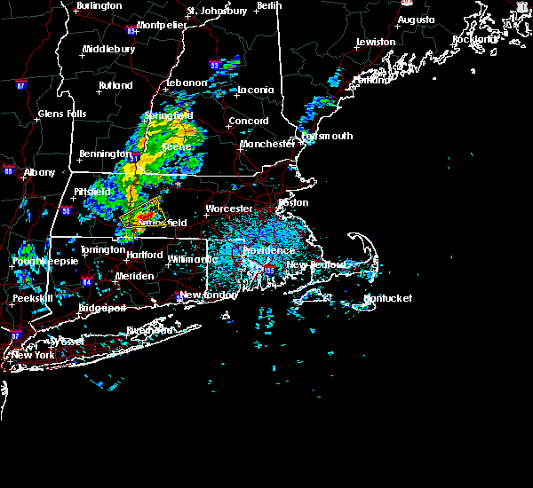 At 1158 pm edt, a severe thunderstorm was located over belchertown, or near amherst, moving east at 35 mph (radar indicated). Hazards include 60 mph wind gusts and quarter size hail. Expect wind damage to trees and power lines. minor hail damage to vehicles is possible. Locations impacted include, springfield, chicopee, amherst, ludlow, belchertown, wilbraham, palmer, ware, granby, warren, brimfield, shutesbury, pelham and new salem. At 1158 pm edt, a severe thunderstorm was located over belchertown, or near amherst, moving east at 35 mph (radar indicated). Hazards include 60 mph wind gusts and quarter size hail. Expect wind damage to trees and power lines. minor hail damage to vehicles is possible. Locations impacted include, springfield, chicopee, amherst, ludlow, belchertown, wilbraham, palmer, ware, granby, warren, brimfield, shutesbury, pelham and new salem.
|
| 7/29/2020 11:47 PM EDT | Large trees down on east st at sherwood d in hampshire county MA, 4.7 miles SW of Chicopee, MA |
| 7/29/2020 11:41 PM EDT |
 The national weather service in boston/norton has issued a * severe thunderstorm warning for. southeastern hampshire county in western massachusetts. southeastern franklin county in western massachusetts. central hampden county in western massachusetts. Until 1215 am edt. The national weather service in boston/norton has issued a * severe thunderstorm warning for. southeastern hampshire county in western massachusetts. southeastern franklin county in western massachusetts. central hampden county in western massachusetts. Until 1215 am edt.
|
| 7/29/2020 11:41 PM EDT |
 At 1141 pm edt, a severe thunderstorm was located over holyoke, moving east at 35 mph (radar indicated). Hazards include 60 mph wind gusts and quarter size hail. Expect wind damage to trees and power lines. Minor hail damage to vehicles is possible. At 1141 pm edt, a severe thunderstorm was located over holyoke, moving east at 35 mph (radar indicated). Hazards include 60 mph wind gusts and quarter size hail. Expect wind damage to trees and power lines. Minor hail damage to vehicles is possible.
|
| 7/23/2020 2:33 PM EDT |
 At 233 pm edt, a severe thunderstorm was located near amherst, moving east at 30 mph (radar indicated). Hazards include 60 mph wind gusts and quarter size hail. Expect wind damage to trees and power lines. Minor hail damage to vehicles is possible. At 233 pm edt, a severe thunderstorm was located near amherst, moving east at 30 mph (radar indicated). Hazards include 60 mph wind gusts and quarter size hail. Expect wind damage to trees and power lines. Minor hail damage to vehicles is possible.
|
| 7/22/2020 6:51 PM EDT |
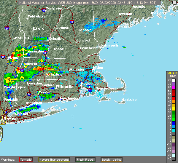 At 650 pm edt, a severe thunderstorm was located over ludlow, or 8 miles east of chicopee, moving northeast at 20 mph (radar indicated). Hazards include 60 mph wind gusts and quarter size hail. Expect wind damage to trees and power lines. Minor hail damage to vehicles is possible. At 650 pm edt, a severe thunderstorm was located over ludlow, or 8 miles east of chicopee, moving northeast at 20 mph (radar indicated). Hazards include 60 mph wind gusts and quarter size hail. Expect wind damage to trees and power lines. Minor hail damage to vehicles is possible.
|
| 7/14/2020 12:55 PM EDT |
 The severe thunderstorm warning for northwestern tolland, north central hartford, south central hampshire and central hampden counties will expire at 100 pm edt, the storm which prompted the warning has weakened below severe limits, and no longer poses an immediate threat to life or property. therefore, the warning will be allowed to expire. however small hail, gusty winds and heavy rain leading to localized minor flooding are still possible with this thunderstorm. therefore, it will be followed by a special weather statement. The severe thunderstorm warning for northwestern tolland, north central hartford, south central hampshire and central hampden counties will expire at 100 pm edt, the storm which prompted the warning has weakened below severe limits, and no longer poses an immediate threat to life or property. therefore, the warning will be allowed to expire. however small hail, gusty winds and heavy rain leading to localized minor flooding are still possible with this thunderstorm. therefore, it will be followed by a special weather statement.
|
| 7/14/2020 12:34 PM EDT |
 At 1232 pm edt, a severe thunderstorm was located over chicopee, moving south at 15 mph (radar indicated and trained spotters. at 1220 pm, a large tree was downed blocking one line of interstate 91 in holyoke. quarter sized hail was also reported in south hadley). Hazards include 60 mph wind gusts and quarter size hail. Expect wind damage to trees and power lines. minor hail damage to vehicles is possible. Locations impacted include, springfield, chicopee, enfield, westfield, holyoke, amherst, northampton, agawam, west springfield, ludlow, south hadley, easthampton, longmeadow, suffield, east longmeadow, wilbraham, windsor locks, stafford, somers and southwick. At 1232 pm edt, a severe thunderstorm was located over chicopee, moving south at 15 mph (radar indicated and trained spotters. at 1220 pm, a large tree was downed blocking one line of interstate 91 in holyoke. quarter sized hail was also reported in south hadley). Hazards include 60 mph wind gusts and quarter size hail. Expect wind damage to trees and power lines. minor hail damage to vehicles is possible. Locations impacted include, springfield, chicopee, enfield, westfield, holyoke, amherst, northampton, agawam, west springfield, ludlow, south hadley, easthampton, longmeadow, suffield, east longmeadow, wilbraham, windsor locks, stafford, somers and southwick.
|
| 7/14/2020 12:25 PM EDT |
 At 1224 pm edt, a severe thunderstorm was located over chicopee, moving southeast at 20 mph (radar indicated and trained spotters. at 1220 pm, a large tree was downed blocking one line of interstate 91 in holyoke. penny size hail was also reported in south hadley). Hazards include 60 mph wind gusts and quarter size hail. Expect wind damage to trees and power lines. minor hail damage to vehicles is possible. Locations impacted include, springfield, chicopee, enfield, westfield, holyoke, amherst, northampton, agawam, west springfield, ludlow, south hadley, easthampton, longmeadow, suffield, east longmeadow, wilbraham, windsor locks, stafford, somers and southwick. At 1224 pm edt, a severe thunderstorm was located over chicopee, moving southeast at 20 mph (radar indicated and trained spotters. at 1220 pm, a large tree was downed blocking one line of interstate 91 in holyoke. penny size hail was also reported in south hadley). Hazards include 60 mph wind gusts and quarter size hail. Expect wind damage to trees and power lines. minor hail damage to vehicles is possible. Locations impacted include, springfield, chicopee, enfield, westfield, holyoke, amherst, northampton, agawam, west springfield, ludlow, south hadley, easthampton, longmeadow, suffield, east longmeadow, wilbraham, windsor locks, stafford, somers and southwick.
|
| 7/14/2020 12:05 PM EDT |
 At 1204 pm edt, a severe thunderstorm was located over northampton, moving south at 15 mph (radar indicated). Hazards include ping pong ball size hail and 60 mph wind gusts. Expect wind damage to trees and power lines. Minor hail damage to vehicles is possible. At 1204 pm edt, a severe thunderstorm was located over northampton, moving south at 15 mph (radar indicated). Hazards include ping pong ball size hail and 60 mph wind gusts. Expect wind damage to trees and power lines. Minor hail damage to vehicles is possible.
|
| 7/13/2020 8:50 PM EDT |
 At 847 pm edt, a severe thunderstorm was located over blandford, or 11 miles west of westfield, moving east at 20 mph (radar indicated. also, there were reports of power lines down in monterey, massachusetts at around 810 pm). Hazards include 60 mph wind gusts and quarter size hail. Expect wind damage to trees and power lines. minor hail damage to vehicles is possible. Locations impacted include, chicopee, westfield, holyoke, agawam, west springfield, south hadley, easthampton, southwick, southampton, huntington, russell, westhampton, granville, chester, blandford, montgomery and tolland. At 847 pm edt, a severe thunderstorm was located over blandford, or 11 miles west of westfield, moving east at 20 mph (radar indicated. also, there were reports of power lines down in monterey, massachusetts at around 810 pm). Hazards include 60 mph wind gusts and quarter size hail. Expect wind damage to trees and power lines. minor hail damage to vehicles is possible. Locations impacted include, chicopee, westfield, holyoke, agawam, west springfield, south hadley, easthampton, southwick, southampton, huntington, russell, westhampton, granville, chester, blandford, montgomery and tolland.
|
| 7/13/2020 8:31 PM EDT |
 At 830 pm edt, a severe thunderstorm was located over otis, or 13 miles east of great barrington, moving east at 20 mph (radar indicated). Hazards include 60 mph wind gusts and quarter size hail. Expect wind damage to trees and power lines. Minor hail damage to vehicles is possible. At 830 pm edt, a severe thunderstorm was located over otis, or 13 miles east of great barrington, moving east at 20 mph (radar indicated). Hazards include 60 mph wind gusts and quarter size hail. Expect wind damage to trees and power lines. Minor hail damage to vehicles is possible.
|
| 7/6/2020 8:47 PM EDT |
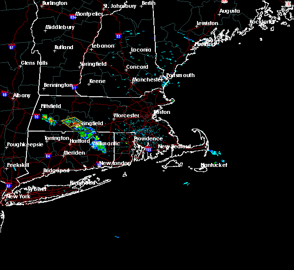 At 846 pm edt, a severe thunderstorm was located over chicopee, moving southeast at 5 mph (radar indicated). Hazards include quarter size hail. Minor hail damage to vehicles is possible. Locations impacted include, chicopee, holyoke, ludlow, south hadley and granby. At 846 pm edt, a severe thunderstorm was located over chicopee, moving southeast at 5 mph (radar indicated). Hazards include quarter size hail. Minor hail damage to vehicles is possible. Locations impacted include, chicopee, holyoke, ludlow, south hadley and granby.
|
| 7/6/2020 8:28 PM EDT |
 At 827 pm edt, a severe thunderstorm was located over chicopee, moving southeast at 15 mph (radar indicated). Hazards include quarter size hail. Minor hail damage to vehicles is possible. Locations impacted include, chicopee, westfield, holyoke, northampton, west springfield, ludlow, south hadley, easthampton, granby, southampton, hadley and montgomery. At 827 pm edt, a severe thunderstorm was located over chicopee, moving southeast at 15 mph (radar indicated). Hazards include quarter size hail. Minor hail damage to vehicles is possible. Locations impacted include, chicopee, westfield, holyoke, northampton, west springfield, ludlow, south hadley, easthampton, granby, southampton, hadley and montgomery.
|
| 7/6/2020 7:57 PM EDT |
 At 757 pm edt, a severe thunderstorm was located over holyoke, moving northeast at 5 mph (radar indicated). Hazards include quarter size hail. minor hail damage to vehicles is possible At 757 pm edt, a severe thunderstorm was located over holyoke, moving northeast at 5 mph (radar indicated). Hazards include quarter size hail. minor hail damage to vehicles is possible
|
| 6/29/2020 3:23 PM EDT |
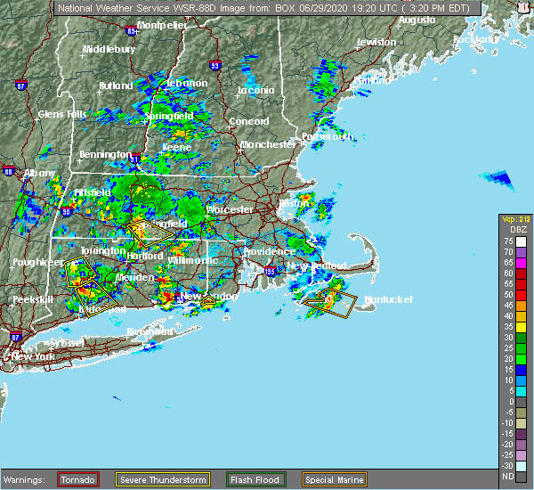 At 322 pm edt, a severe thunderstorm was located over wilbraham, or near springfield, moving southeast at 20 mph (radar indicated). Hazards include 60 mph wind gusts and quarter size hail. this storm has a history of producing damaging winds. Expect wind damage to trees and power lines. minor hail damage to vehicles is possible. Locations impacted include, springfield, chicopee, enfield, ludlow, longmeadow, east longmeadow, ellington, wilbraham, palmer, stafford, somers, monson, granby, hampden, brimfield, holland and wales. At 322 pm edt, a severe thunderstorm was located over wilbraham, or near springfield, moving southeast at 20 mph (radar indicated). Hazards include 60 mph wind gusts and quarter size hail. this storm has a history of producing damaging winds. Expect wind damage to trees and power lines. minor hail damage to vehicles is possible. Locations impacted include, springfield, chicopee, enfield, ludlow, longmeadow, east longmeadow, ellington, wilbraham, palmer, stafford, somers, monson, granby, hampden, brimfield, holland and wales.
|
| 6/29/2020 3:12 PM EDT | Wires down on granby rd and nelson rd in hampden county MA, 0.6 miles SW of Chicopee, MA |
| 6/29/2020 3:08 PM EDT |
 The severe thunderstorm warning for south central hampshire and central hampden counties will expire at 315 pm edt, the storm which prompted the warning has weakened and moved out of the area. therefore, the warning will be allowed to expire. The severe thunderstorm warning for south central hampshire and central hampden counties will expire at 315 pm edt, the storm which prompted the warning has weakened and moved out of the area. therefore, the warning will be allowed to expire.
|
| 6/29/2020 3:06 PM EDT |
 At 306 pm edt, a severe thunderstorm was located over chicopee, moving southeast at 20 mph (radar indicated). Hazards include 60 mph wind gusts and quarter size hail. Expect wind damage to trees and power lines. Minor hail damage to vehicles is possible. At 306 pm edt, a severe thunderstorm was located over chicopee, moving southeast at 20 mph (radar indicated). Hazards include 60 mph wind gusts and quarter size hail. Expect wind damage to trees and power lines. Minor hail damage to vehicles is possible.
|
| 6/29/2020 2:37 PM EDT |
 At 236 pm edt, a severe thunderstorm was located over easthampton, or over northampton, moving southeast at 10 mph (radar indicated). Hazards include 60 mph wind gusts and quarter size hail. Expect wind damage to trees and power lines. Minor hail damage to vehicles is possible. At 236 pm edt, a severe thunderstorm was located over easthampton, or over northampton, moving southeast at 10 mph (radar indicated). Hazards include 60 mph wind gusts and quarter size hail. Expect wind damage to trees and power lines. Minor hail damage to vehicles is possible.
|
| 6/28/2020 5:16 PM EDT |
 At 514 pm edt, a very severe thunderstorm was located over suffield, or over agawam, and is nearly stationary (radar indicated). Hazards include two inch hail and 60 mph wind gusts. Large hail may injure people caught outdoors. expect hail damage to roofs, siding, windows, and vehicles. expect wind damage to trees and power lines. Locations impacted include, springfield, chicopee, enfield, agawam, west springfield, ludlow, southbridge, longmeadow, suffield, east longmeadow, ellington, wilbraham, charlton, windsor locks, palmer, stafford, spencer, somers, dudley and thompson. At 514 pm edt, a very severe thunderstorm was located over suffield, or over agawam, and is nearly stationary (radar indicated). Hazards include two inch hail and 60 mph wind gusts. Large hail may injure people caught outdoors. expect hail damage to roofs, siding, windows, and vehicles. expect wind damage to trees and power lines. Locations impacted include, springfield, chicopee, enfield, agawam, west springfield, ludlow, southbridge, longmeadow, suffield, east longmeadow, ellington, wilbraham, charlton, windsor locks, palmer, stafford, spencer, somers, dudley and thompson.
|
| 6/28/2020 5:02 PM EDT |
 At 501 pm edt, a severe thunderstorm was located over east longmeadow, or near enfield, moving east at 25 mph (radar indicated). Hazards include 60 mph wind gusts and quarter size hail. Expect wind damage to trees and power lines. Minor hail damage to vehicles is possible. At 501 pm edt, a severe thunderstorm was located over east longmeadow, or near enfield, moving east at 25 mph (radar indicated). Hazards include 60 mph wind gusts and quarter size hail. Expect wind damage to trees and power lines. Minor hail damage to vehicles is possible.
|
| 6/28/2020 3:39 PM EDT |
 At 338 pm edt, a severe thunderstorm was located over easthampton, or near northampton, moving east at 20 mph. another severe thunderstorm was near chicopee, moving east at 20 mph (radar indicated). Hazards include 60 mph wind gusts and quarter size hail. Expect wind damage to trees and power lines. minor hail damage to vehicles is possible. Locations impacted include, springfield, chicopee, holyoke, amherst, northampton, ludlow, south hadley, easthampton, belchertown, wilbraham, palmer, ware, monson, granby, southampton, hadley, hatfield, westhampton, pelham and petersham. At 338 pm edt, a severe thunderstorm was located over easthampton, or near northampton, moving east at 20 mph. another severe thunderstorm was near chicopee, moving east at 20 mph (radar indicated). Hazards include 60 mph wind gusts and quarter size hail. Expect wind damage to trees and power lines. minor hail damage to vehicles is possible. Locations impacted include, springfield, chicopee, holyoke, amherst, northampton, ludlow, south hadley, easthampton, belchertown, wilbraham, palmer, ware, monson, granby, southampton, hadley, hatfield, westhampton, pelham and petersham.
|
| 6/28/2020 3:16 PM EDT |
 At 316 pm edt, a severe thunderstorm was located over westhampton, or near northampton, moving east at 20 mph (radar indicated). Hazards include 60 mph wind gusts and quarter size hail. Expect wind damage to trees and power lines. Minor hail damage to vehicles is possible. At 316 pm edt, a severe thunderstorm was located over westhampton, or near northampton, moving east at 20 mph (radar indicated). Hazards include 60 mph wind gusts and quarter size hail. Expect wind damage to trees and power lines. Minor hail damage to vehicles is possible.
|
| 5/15/2020 8:06 PM EDT |
 At 805 pm edt, a severe thunderstorm was located over granby, or near chicopee, moving east at 45 mph (radar indicated). Hazards include 60 mph wind gusts and quarter size hail. Expect wind damage to trees and power lines. Minor hail damage to vehicles is possible. At 805 pm edt, a severe thunderstorm was located over granby, or near chicopee, moving east at 45 mph (radar indicated). Hazards include 60 mph wind gusts and quarter size hail. Expect wind damage to trees and power lines. Minor hail damage to vehicles is possible.
|
| 5/15/2020 7:57 PM EDT |
 At 735 pm edt, a severe thunderstorm was located near otis, or 16 miles east of great barrington, moving east at 55 mph (radar indicated). Hazards include 60 mph wind gusts and quarter size hail. Expect wind damage to trees and power lines. minor hail damage to vehicles is possible. Locations impacted include, springfield, chicopee, enfield, westfield, holyoke, amherst, northampton, agawam, west springfield, ludlow, south hadley, easthampton, longmeadow, suffield, east longmeadow, belchertown, southwick, granby, southampton and hadley. At 735 pm edt, a severe thunderstorm was located near otis, or 16 miles east of great barrington, moving east at 55 mph (radar indicated). Hazards include 60 mph wind gusts and quarter size hail. Expect wind damage to trees and power lines. minor hail damage to vehicles is possible. Locations impacted include, springfield, chicopee, enfield, westfield, holyoke, amherst, northampton, agawam, west springfield, ludlow, south hadley, easthampton, longmeadow, suffield, east longmeadow, belchertown, southwick, granby, southampton and hadley.
|
| 5/15/2020 7:35 PM EDT |
 At 735 pm edt, a severe thunderstorm was located near otis, or 16 miles east of great barrington, moving east at 55 mph (radar indicated). Hazards include 60 mph wind gusts and quarter size hail. Expect wind damage to trees and power lines. minor hail damage to vehicles is possible. Locations impacted include, springfield, chicopee, enfield, westfield, holyoke, amherst, northampton, agawam, west springfield, ludlow, south hadley, easthampton, longmeadow, suffield, east longmeadow, belchertown, southwick, granby, southampton and hadley. At 735 pm edt, a severe thunderstorm was located near otis, or 16 miles east of great barrington, moving east at 55 mph (radar indicated). Hazards include 60 mph wind gusts and quarter size hail. Expect wind damage to trees and power lines. minor hail damage to vehicles is possible. Locations impacted include, springfield, chicopee, enfield, westfield, holyoke, amherst, northampton, agawam, west springfield, ludlow, south hadley, easthampton, longmeadow, suffield, east longmeadow, belchertown, southwick, granby, southampton and hadley.
|
| 5/15/2020 7:26 PM EDT |
 At 726 pm edt, a severe thunderstorm was located over lee, or 9 miles northeast of great barrington, moving east at 50 mph (radar indicated). Hazards include 60 mph wind gusts. Expect damage to trees and power lines. Locations impacted include, springfield, chicopee, enfield, westfield, holyoke, amherst, northampton, agawam, west springfield, ludlow, south hadley, easthampton, longmeadow, suffield, east longmeadow, belchertown, southwick, granby, southampton and hadley. At 726 pm edt, a severe thunderstorm was located over lee, or 9 miles northeast of great barrington, moving east at 50 mph (radar indicated). Hazards include 60 mph wind gusts. Expect damage to trees and power lines. Locations impacted include, springfield, chicopee, enfield, westfield, holyoke, amherst, northampton, agawam, west springfield, ludlow, south hadley, easthampton, longmeadow, suffield, east longmeadow, belchertown, southwick, granby, southampton and hadley.
|
| 5/15/2020 7:17 PM EDT |
 At 717 pm edt, a severe thunderstorm was located near great barrington, moving east at 55 mph (radar indicated). Hazards include 60 mph wind gusts. expect damage to trees and power lines At 717 pm edt, a severe thunderstorm was located near great barrington, moving east at 55 mph (radar indicated). Hazards include 60 mph wind gusts. expect damage to trees and power lines
|
| 5/11/2020 7:24 PM EDT |
 At 722 pm edt, a severe thunderstorm was located over east longmeadow, or near springfield, moving east at 40 mph (radar indicated). Hazards include 60 mph wind gusts and quarter size hail. Expect wind damage to trees and power lines. Minor hail damage to vehicles is possible. At 722 pm edt, a severe thunderstorm was located over east longmeadow, or near springfield, moving east at 40 mph (radar indicated). Hazards include 60 mph wind gusts and quarter size hail. Expect wind damage to trees and power lines. Minor hail damage to vehicles is possible.
|
| 12/30/2019 3:51 PM EST |
 At 350 pm est, a severe thunderstorm was located over granby, or near chicopee, moving northeast at 55 mph. quarter size hail was reported in westfield with this storm (radar indicated). Hazards include quarter size hail. Minor hail damage to vehicles is possible. Locations impacted include, chicopee, holyoke, amherst, ludlow, south hadley, belchertown, palmer, spencer, ware, rutland, granby, barre, hadley, warren, paxton, north brookfield, west brookfield, hardwick, oakham and pelham. At 350 pm est, a severe thunderstorm was located over granby, or near chicopee, moving northeast at 55 mph. quarter size hail was reported in westfield with this storm (radar indicated). Hazards include quarter size hail. Minor hail damage to vehicles is possible. Locations impacted include, chicopee, holyoke, amherst, ludlow, south hadley, belchertown, palmer, spencer, ware, rutland, granby, barre, hadley, warren, paxton, north brookfield, west brookfield, hardwick, oakham and pelham.
|
| 12/30/2019 3:39 PM EST |
 At 337 pm est, a severe thunderstorm was located over westfield, moving northeast at 55 mph. quarter size hail was observed in norfolk and hartland, ct and in southwick, ma (radar indicated). Hazards include quarter size hail. minor hail damage to vehicles is possible At 337 pm est, a severe thunderstorm was located over westfield, moving northeast at 55 mph. quarter size hail was observed in norfolk and hartland, ct and in southwick, ma (radar indicated). Hazards include quarter size hail. minor hail damage to vehicles is possible
|
| 8/21/2019 6:34 PM EDT |
 At 634 pm edt, severe thunderstorms were located along a line extending from near east windsor to falls village, moving east at 40 mph (radar indicated). Hazards include 60 mph wind gusts. expect damage to trees and power lines At 634 pm edt, severe thunderstorms were located along a line extending from near east windsor to falls village, moving east at 40 mph (radar indicated). Hazards include 60 mph wind gusts. expect damage to trees and power lines
|
| 8/19/2019 2:38 PM EDT |
 At 236 pm edt, a severe thunderstorm was located over monson, or 9 miles east of springfield, moving east at 30 mph. golfball size hail was reported in agawam. tree damage was reported in agawam, west springfield, and ludlow (radar indicated). Hazards include golf ball size hail and 60 mph wind gusts. Expect hail damage to roofs, siding, windows, and vehicles. expect damage to trees and power lines. Locations impacted include, springfield, chicopee, enfield, agawam, west springfield, ludlow, longmeadow, suffield, east longmeadow, belchertown, wilbraham, palmer, stafford, somers, ware, sturbridge, monson, woodstock, hampden and warren. At 236 pm edt, a severe thunderstorm was located over monson, or 9 miles east of springfield, moving east at 30 mph. golfball size hail was reported in agawam. tree damage was reported in agawam, west springfield, and ludlow (radar indicated). Hazards include golf ball size hail and 60 mph wind gusts. Expect hail damage to roofs, siding, windows, and vehicles. expect damage to trees and power lines. Locations impacted include, springfield, chicopee, enfield, agawam, west springfield, ludlow, longmeadow, suffield, east longmeadow, belchertown, wilbraham, palmer, stafford, somers, ware, sturbridge, monson, woodstock, hampden and warren.
|
| 8/19/2019 2:38 PM EDT |
 At 203 pm edt, a severe thunderstorm was located over agawam, moving east at 30 mph (radar indicated). Hazards include 60 mph wind gusts and quarter size hail. Expect damage to trees and power lines. Hail damage possible to vehicles. At 203 pm edt, a severe thunderstorm was located over agawam, moving east at 30 mph (radar indicated). Hazards include 60 mph wind gusts and quarter size hail. Expect damage to trees and power lines. Hail damage possible to vehicles.
|
| 8/19/2019 2:20 PM EDT |
 At 218 pm edt, a severe thunderstorm was located over springfield, moving east at 30 mph. radar indicated large hail near agawam and damaging winds between suffield connecticut and agawam (radar indicated). Hazards include 60 mph wind gusts and half dollar size hail. Hail damage to vehicles is possible. expect damage to trees and power lines. Locations impacted include, springfield, chicopee, enfield, westfield, holyoke, agawam, west springfield, ludlow, longmeadow, suffield, east longmeadow, belchertown, wilbraham, palmer, stafford, somers, ware, sturbridge, monson and woodstock. At 218 pm edt, a severe thunderstorm was located over springfield, moving east at 30 mph. radar indicated large hail near agawam and damaging winds between suffield connecticut and agawam (radar indicated). Hazards include 60 mph wind gusts and half dollar size hail. Hail damage to vehicles is possible. expect damage to trees and power lines. Locations impacted include, springfield, chicopee, enfield, westfield, holyoke, agawam, west springfield, ludlow, longmeadow, suffield, east longmeadow, belchertown, wilbraham, palmer, stafford, somers, ware, sturbridge, monson and woodstock.
|
| 8/19/2019 2:04 PM EDT |
 The national weather service in boston/norton has issued a * severe thunderstorm warning for. northwestern windham county in northern connecticut. northern tolland county in northern connecticut. north central hartford county in northern connecticut. Southwestern worcester county in central massachusetts. The national weather service in boston/norton has issued a * severe thunderstorm warning for. northwestern windham county in northern connecticut. northern tolland county in northern connecticut. north central hartford county in northern connecticut. Southwestern worcester county in central massachusetts.
|
| 8/17/2019 8:50 PM EDT |
 At 849 pm edt, a severe thunderstorm was located near amherst, moving east at 20 mph (radar indicated). Hazards include 60 mph wind gusts and quarter size hail. Hail damage to vehicles is possible. expect damage to trees and power lines. Locations impacted include, springfield, chicopee, holyoke, amherst, northampton, ludlow, south hadley, easthampton, belchertown, wilbraham, palmer, ware, monson, granby, barre, hadley, warren, west brookfield, brimfield and brookfield. At 849 pm edt, a severe thunderstorm was located near amherst, moving east at 20 mph (radar indicated). Hazards include 60 mph wind gusts and quarter size hail. Hail damage to vehicles is possible. expect damage to trees and power lines. Locations impacted include, springfield, chicopee, holyoke, amherst, northampton, ludlow, south hadley, easthampton, belchertown, wilbraham, palmer, ware, monson, granby, barre, hadley, warren, west brookfield, brimfield and brookfield.
|
| 8/17/2019 8:28 PM EDT |
 At 827 pm edt, a severe thunderstorm was located over northampton, moving east at 15 mph (radar indicated). Hazards include 60 mph wind gusts and quarter size hail. Hail damage to vehicles is possible. Expect damage to trees and power lines. At 827 pm edt, a severe thunderstorm was located over northampton, moving east at 15 mph (radar indicated). Hazards include 60 mph wind gusts and quarter size hail. Hail damage to vehicles is possible. Expect damage to trees and power lines.
|
| 8/17/2019 7:30 PM EDT |
 At 729 pm edt, a severe thunderstorm was located over chesterfield, or 10 miles west of northampton, moving east at 10 mph (radar indicated). Hazards include 60 mph wind gusts and quarter size hail. Hail damage to vehicles is possible. Expect damage to trees and power lines. At 729 pm edt, a severe thunderstorm was located over chesterfield, or 10 miles west of northampton, moving east at 10 mph (radar indicated). Hazards include 60 mph wind gusts and quarter size hail. Hail damage to vehicles is possible. Expect damage to trees and power lines.
|
| 8/8/2019 7:27 PM EDT |
 The severe thunderstorm warning for northwestern tolland, northern hartford, northwestern worcester, southeastern hampshire, eastern franklin and hampden counties will expire at 730 pm edt, the storms which prompted the warning have moved out of the area. therefore, the warning will be allowed to expire. however gusty winds are still possible behind the line of showers and thunderstorms. a severe thunderstorm watch remains in effect until midnight edt for northern connecticut, and western massachusetts. remember, a severe thunderstorm warning still remains in effect for central massachusetts. The severe thunderstorm warning for northwestern tolland, northern hartford, northwestern worcester, southeastern hampshire, eastern franklin and hampden counties will expire at 730 pm edt, the storms which prompted the warning have moved out of the area. therefore, the warning will be allowed to expire. however gusty winds are still possible behind the line of showers and thunderstorms. a severe thunderstorm watch remains in effect until midnight edt for northern connecticut, and western massachusetts. remember, a severe thunderstorm warning still remains in effect for central massachusetts.
|
| 8/8/2019 7:27 PM EDT |
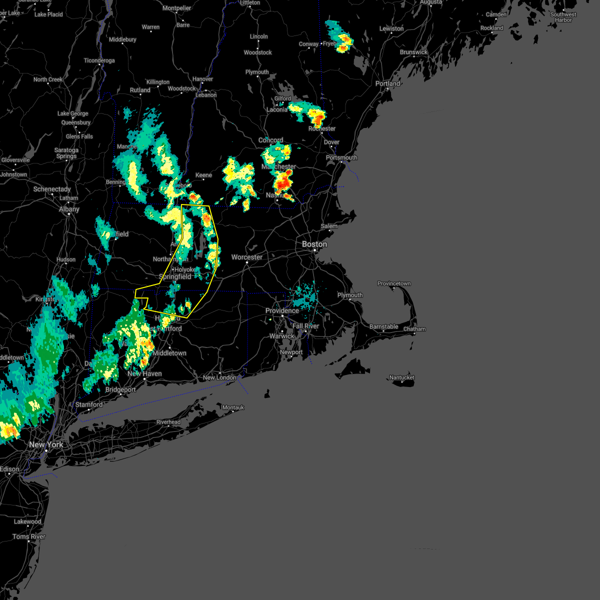 The severe thunderstorm warning for northwestern tolland, northern hartford, northwestern worcester, southeastern hampshire, eastern franklin and hampden counties will expire at 730 pm edt, the storms which prompted the warning have moved out of the area. therefore, the warning will be allowed to expire. however gusty winds are still possible behind the line of showers and thunderstorms. a severe thunderstorm watch remains in effect until midnight edt for northern connecticut, and western massachusetts. remember, a severe thunderstorm warning still remains in effect for central massachusetts. The severe thunderstorm warning for northwestern tolland, northern hartford, northwestern worcester, southeastern hampshire, eastern franklin and hampden counties will expire at 730 pm edt, the storms which prompted the warning have moved out of the area. therefore, the warning will be allowed to expire. however gusty winds are still possible behind the line of showers and thunderstorms. a severe thunderstorm watch remains in effect until midnight edt for northern connecticut, and western massachusetts. remember, a severe thunderstorm warning still remains in effect for central massachusetts.
|
| 8/8/2019 7:02 PM EDT |
 At 659 pm edt, strong to damaging winds are preceding a broken line of showers and thunderstorms. reports of wind gusts as high as around 60 mph have been reported across western massachusetts along with several reports of downed trees and power lines. gusty winds continue to proceed east at 40 mph and in doing so will continue to result in wind damage across the warned area (trained weather spotters). Hazards include 60 mph wind gusts. Expect damage to trees and power lines. Locations impacted include, springfield, chicopee, enfield, westfield, holyoke, amherst, vernon, windsor, northampton, agawam, west springfield, south windsor, orange, simsbury, ludlow, bloomfield, south hadley, easthampton, longmeadow and suffield. At 659 pm edt, strong to damaging winds are preceding a broken line of showers and thunderstorms. reports of wind gusts as high as around 60 mph have been reported across western massachusetts along with several reports of downed trees and power lines. gusty winds continue to proceed east at 40 mph and in doing so will continue to result in wind damage across the warned area (trained weather spotters). Hazards include 60 mph wind gusts. Expect damage to trees and power lines. Locations impacted include, springfield, chicopee, enfield, westfield, holyoke, amherst, vernon, windsor, northampton, agawam, west springfield, south windsor, orange, simsbury, ludlow, bloomfield, south hadley, easthampton, longmeadow and suffield.
|
| 8/8/2019 6:30 PM EDT |
 At 629 pm edt, severe thunderstorms were located along a line extending from near shaftsbury to plainfield to chester to near tolland to near wingdale, moving east at 40 mph (radar indicated). Hazards include 60 mph wind gusts. expect damage to trees and power lines At 629 pm edt, severe thunderstorms were located along a line extending from near shaftsbury to plainfield to chester to near tolland to near wingdale, moving east at 40 mph (radar indicated). Hazards include 60 mph wind gusts. expect damage to trees and power lines
|
| 8/7/2019 2:54 PM EDT |
 At 253 pm edt, a severe thunderstorm was located over hadley, or near amherst, moving northeast at 30 mph. winds gusted to 63 mph at a weather station on mt. tom at 238 pm. trees were reported down in southampton, easthampton, and holyoke (radar indicated). Hazards include 60 mph wind gusts. Expect damage to trees and power lines. this severe storm will be near, sunderland around 300 pm edt. amherst, belchertown and leverett around 310 pm edt. pelham around 315 pm edt. shutesbury around 325 pm edt. New salem around 330 pm edt. At 253 pm edt, a severe thunderstorm was located over hadley, or near amherst, moving northeast at 30 mph. winds gusted to 63 mph at a weather station on mt. tom at 238 pm. trees were reported down in southampton, easthampton, and holyoke (radar indicated). Hazards include 60 mph wind gusts. Expect damage to trees and power lines. this severe storm will be near, sunderland around 300 pm edt. amherst, belchertown and leverett around 310 pm edt. pelham around 315 pm edt. shutesbury around 325 pm edt. New salem around 330 pm edt.
|
| 8/7/2019 2:45 PM EDT |
 At 244 pm edt, a severe thunderstorm was located over northampton, moving northeast at 30 mph. this storm downed a tree and wires in easthampton at 240 pm edt (radar indicated). Hazards include 60 mph wind gusts. Expect damage to trees and power lines. this severe storm will be near, granby, sunderland and hatfield around 300 pm edt. hadley around 305 pm edt. amherst, belchertown and leverett around 310 pm edt. pelham around 315 pm edt. shutesbury around 325 pm edt. New salem around 330 pm edt. At 244 pm edt, a severe thunderstorm was located over northampton, moving northeast at 30 mph. this storm downed a tree and wires in easthampton at 240 pm edt (radar indicated). Hazards include 60 mph wind gusts. Expect damage to trees and power lines. this severe storm will be near, granby, sunderland and hatfield around 300 pm edt. hadley around 305 pm edt. amherst, belchertown and leverett around 310 pm edt. pelham around 315 pm edt. shutesbury around 325 pm edt. New salem around 330 pm edt.
|
| 8/7/2019 2:36 PM EDT |
 At 236 pm edt, a severe thunderstorm was located over southampton, or near holyoke, moving northeast at 25 mph (radar indicated). Hazards include 60 mph wind gusts and quarter size hail. Hail damage to vehicles is possible. expect damage to trees and power lines. this severe storm will be near, holyoke around 245 pm edt. easthampton around 250 pm edt. northampton around 255 pm edt. south hadley around 300 pm edt. granby and hatfield around 305 pm edt. sunderland around 310 pm edt. amherst, belchertown, hadley and leverett around 315 pm edt. Pelham around 325 pm edt. At 236 pm edt, a severe thunderstorm was located over southampton, or near holyoke, moving northeast at 25 mph (radar indicated). Hazards include 60 mph wind gusts and quarter size hail. Hail damage to vehicles is possible. expect damage to trees and power lines. this severe storm will be near, holyoke around 245 pm edt. easthampton around 250 pm edt. northampton around 255 pm edt. south hadley around 300 pm edt. granby and hatfield around 305 pm edt. sunderland around 310 pm edt. amherst, belchertown, hadley and leverett around 315 pm edt. Pelham around 325 pm edt.
|
| 8/7/2019 2:26 PM EDT |
 At 225 pm edt, a severe thunderstorm was located near westfield, moving northeast at 25 mph (radar indicated). Hazards include 60 mph wind gusts and quarter size hail. Hail damage to vehicles is possible. expect damage to trees and power lines. this severe thunderstorm will be near, southampton and westhampton around 240 pm edt. holyoke around 245 pm edt. easthampton around 250 pm edt. northampton around 255 pm edt. south hadley around 300 pm edt. granby around 305 pm edt. sunderland and hatfield around 310 pm edt. Amherst, belchertown and hadley around 315 pm edt. At 225 pm edt, a severe thunderstorm was located near westfield, moving northeast at 25 mph (radar indicated). Hazards include 60 mph wind gusts and quarter size hail. Hail damage to vehicles is possible. expect damage to trees and power lines. this severe thunderstorm will be near, southampton and westhampton around 240 pm edt. holyoke around 245 pm edt. easthampton around 250 pm edt. northampton around 255 pm edt. south hadley around 300 pm edt. granby around 305 pm edt. sunderland and hatfield around 310 pm edt. Amherst, belchertown and hadley around 315 pm edt.
|
| 8/3/2019 1:56 PM EDT |
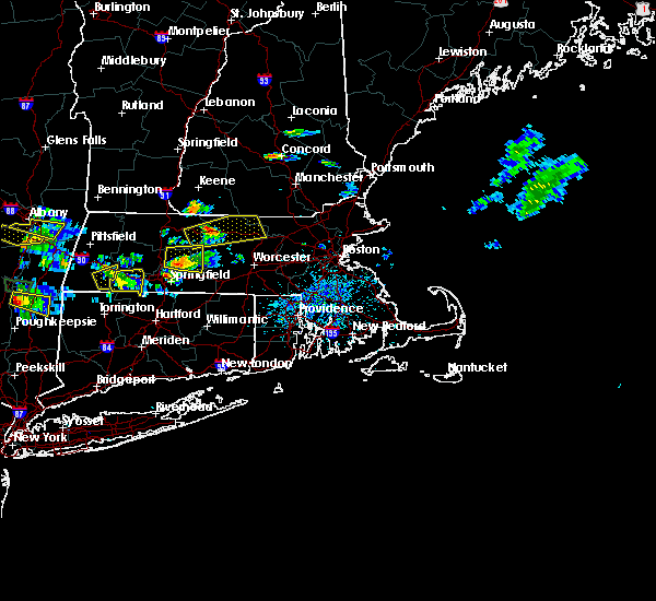 At 156 pm edt, a severe thunderstorm was located near belchertown, or near amherst, moving east at 15 mph (radar indicated). Hazards include 60 mph wind gusts and penny size hail. expect damage to trees and power lines At 156 pm edt, a severe thunderstorm was located near belchertown, or near amherst, moving east at 15 mph (radar indicated). Hazards include 60 mph wind gusts and penny size hail. expect damage to trees and power lines
|
| 7/31/2019 2:29 PM EDT | Tree down on car on beverly street in hampden county MA, 0.6 miles SW of Chicopee, MA |
| 7/31/2019 1:50 PM EDT | Tree down on car on beverly street in hampden county MA, 0.6 miles SW of Chicopee, MA |
| 7/31/2019 1:47 PM EDT | Quarter sized hail reported 0.6 miles SW of Chicopee, MA, amateur radio |
| 7/31/2019 1:41 PM EDT |
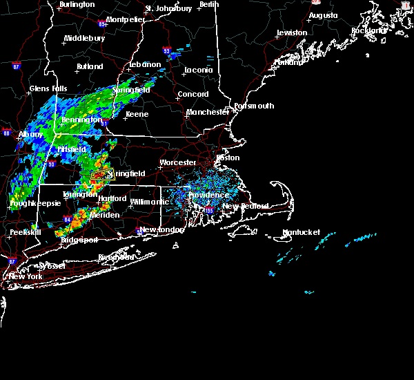 At 121 pm edt, a severe thunderstorm was located over westfield, moving east at 15 mph (radar indicated). Hazards include 60 mph wind gusts and quarter size hail. Hail damage to vehicles is possible. Expect damage to trees and power lines. At 121 pm edt, a severe thunderstorm was located over westfield, moving east at 15 mph (radar indicated). Hazards include 60 mph wind gusts and quarter size hail. Hail damage to vehicles is possible. Expect damage to trees and power lines.
|
| 7/31/2019 1:22 PM EDT |
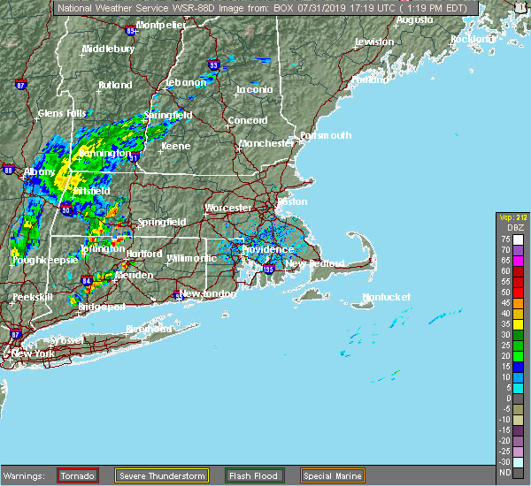 At 121 pm edt, a severe thunderstorm was located over westfield, moving east at 15 mph (radar indicated). Hazards include 60 mph wind gusts and quarter size hail. Hail damage to vehicles is possible. Expect damage to trees and power lines. At 121 pm edt, a severe thunderstorm was located over westfield, moving east at 15 mph (radar indicated). Hazards include 60 mph wind gusts and quarter size hail. Hail damage to vehicles is possible. Expect damage to trees and power lines.
|
| 7/17/2019 4:03 PM EDT |
 At 403 pm edt, a severe thunderstorm was located near belchertown, or near amherst, moving east at 40 mph (radar indicated). Hazards include 60 mph wind gusts. expect damage to trees and power lines At 403 pm edt, a severe thunderstorm was located near belchertown, or near amherst, moving east at 40 mph (radar indicated). Hazards include 60 mph wind gusts. expect damage to trees and power lines
|
| 7/6/2019 4:30 PM EDT |
 At 429 pm edt, a severe thunderstorm was located near ludlow, or 8 miles northeast of chicopee, moving east at 20 mph (radar indicated). Hazards include 60 mph wind gusts. expect damage to trees and power lines At 429 pm edt, a severe thunderstorm was located near ludlow, or 8 miles northeast of chicopee, moving east at 20 mph (radar indicated). Hazards include 60 mph wind gusts. expect damage to trees and power lines
|
| 5/23/2019 10:49 PM EDT |
 At 1049 pm edt, a severe thunderstorm was located near becket, or 13 miles southeast of pittsfield, moving southeast at 45 mph (radar indicated). Hazards include 60 mph wind gusts. expect damage to trees and power lines At 1049 pm edt, a severe thunderstorm was located near becket, or 13 miles southeast of pittsfield, moving southeast at 45 mph (radar indicated). Hazards include 60 mph wind gusts. expect damage to trees and power lines
|
| 5/20/2019 12:56 AM EDT |
 At 1256 am edt, a severe thunderstorm was located over windsor locks, or near enfield, moving northeast at 50 mph (radar indicated). Hazards include 60 mph wind gusts and quarter size hail. Hail damage to vehicles is possible. Expect damage to trees and power lines. At 1256 am edt, a severe thunderstorm was located over windsor locks, or near enfield, moving northeast at 50 mph (radar indicated). Hazards include 60 mph wind gusts and quarter size hail. Hail damage to vehicles is possible. Expect damage to trees and power lines.
|
| 4/15/2019 5:24 AM EDT |
 At 523 am edt, severe thunderstorms were located along a line extending from near otis to granville, moving east at 50 mph (radar indicated). Hazards include 60 mph wind gusts. Expect damage to trees and power lines. Locations impacted include, springfield, chicopee, westfield, holyoke, amherst, northampton, agawam, west springfield, greenfield, orange, deerfield, ludlow, south hadley, easthampton, longmeadow, belchertown, southwick, montague, granby and southampton. At 523 am edt, severe thunderstorms were located along a line extending from near otis to granville, moving east at 50 mph (radar indicated). Hazards include 60 mph wind gusts. Expect damage to trees and power lines. Locations impacted include, springfield, chicopee, westfield, holyoke, amherst, northampton, agawam, west springfield, greenfield, orange, deerfield, ludlow, south hadley, easthampton, longmeadow, belchertown, southwick, montague, granby and southampton.
|
| 4/15/2019 5:02 AM EDT |
 At 502 am edt, severe thunderstorms were located along a line extending from near middlefield to near cornwall bridge, moving east at 45 mph (radar indicated). Hazards include 60 mph wind gusts. expect damage to trees and power lines At 502 am edt, severe thunderstorms were located along a line extending from near middlefield to near cornwall bridge, moving east at 45 mph (radar indicated). Hazards include 60 mph wind gusts. expect damage to trees and power lines
|
| 9/6/2018 3:36 PM EDT |
 At 336 pm edt, severe thunderstorms were located along a line extending from easthampton to near southwick to hartland, moving east at 25 mph (radar indicated). Hazards include 60 mph wind gusts. Expect damage to trees and power lines. Locations impacted include, springfield, chicopee, westfield, holyoke, agawam, west springfield, ludlow, south hadley, easthampton, suffield, granby, southwick, southampton, east granby, russell and montgomery. At 336 pm edt, severe thunderstorms were located along a line extending from easthampton to near southwick to hartland, moving east at 25 mph (radar indicated). Hazards include 60 mph wind gusts. Expect damage to trees and power lines. Locations impacted include, springfield, chicopee, westfield, holyoke, agawam, west springfield, ludlow, south hadley, easthampton, suffield, granby, southwick, southampton, east granby, russell and montgomery.
|
| 9/6/2018 3:22 PM EDT |
 At 321 pm edt, severe thunderstorms were located along a line extending from near westhampton to near granville and hartland, moving east at 25 mph (radar indicated). Hazards include 60 mph wind gusts. Expect damage to trees and power lines. Locations impacted include, springfield, chicopee, westfield, holyoke, agawam, west springfield, simsbury, ludlow, south hadley, easthampton, suffield, granby, canton, southwick, southampton, east granby, huntington, hartland, russell and westhampton. At 321 pm edt, severe thunderstorms were located along a line extending from near westhampton to near granville and hartland, moving east at 25 mph (radar indicated). Hazards include 60 mph wind gusts. Expect damage to trees and power lines. Locations impacted include, springfield, chicopee, westfield, holyoke, agawam, west springfield, simsbury, ludlow, south hadley, easthampton, suffield, granby, canton, southwick, southampton, east granby, huntington, hartland, russell and westhampton.
|
| 9/6/2018 2:59 PM EDT |
 At 259 pm edt, severe thunderstorms were located along a line extending from near chester to otis and sandisfield in the berkshires, moving east at 25 mph (radar indicated). Hazards include 60 mph wind gusts and penny size hail. expect damage to trees and power lines At 259 pm edt, severe thunderstorms were located along a line extending from near chester to otis and sandisfield in the berkshires, moving east at 25 mph (radar indicated). Hazards include 60 mph wind gusts and penny size hail. expect damage to trees and power lines
|
| 8/2/2018 4:47 PM EDT |
 At 447 pm edt, severe thunderstorms were located along a line extending from ludlow to near ellington, moving northeast at 30 mph (radar indicated). Hazards include 60 mph wind gusts. expect damage to trees and power lines At 447 pm edt, severe thunderstorms were located along a line extending from ludlow to near ellington, moving northeast at 30 mph (radar indicated). Hazards include 60 mph wind gusts. expect damage to trees and power lines
|
| 8/2/2018 4:47 PM EDT |
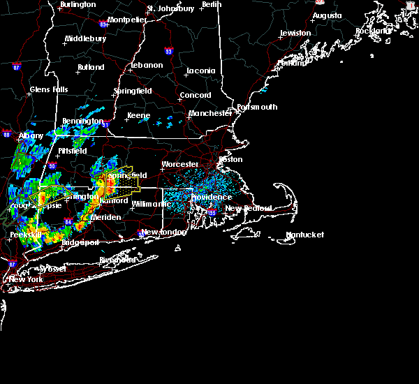 At 447 pm edt, severe thunderstorms were located along a line extending from ludlow to near ellington, moving northeast at 30 mph (radar indicated). Hazards include 60 mph wind gusts. expect damage to trees and power lines At 447 pm edt, severe thunderstorms were located along a line extending from ludlow to near ellington, moving northeast at 30 mph (radar indicated). Hazards include 60 mph wind gusts. expect damage to trees and power lines
|
| 6/18/2018 5:49 PM EDT |
 At 549 pm edt, a severe thunderstorm capable of producing a tornado was located over granby, or near chicopee, moving east at 30 mph (radar indicated rotation). Hazards include tornado. Flying debris will be dangerous to those caught without shelter. mobile homes will be damaged or destroyed. damage to roofs#commaorellipsis()windows#commaorellipsis()and vehicles will occur. tree damage is likely. this dangerous storm will be near, ludlow around 600 pm edt. wilbraham around 605 pm edt. monson around 610 pm edt. Palmer, warren, west brookfield and brimfield around 615 pm edt. At 549 pm edt, a severe thunderstorm capable of producing a tornado was located over granby, or near chicopee, moving east at 30 mph (radar indicated rotation). Hazards include tornado. Flying debris will be dangerous to those caught without shelter. mobile homes will be damaged or destroyed. damage to roofs#commaorellipsis()windows#commaorellipsis()and vehicles will occur. tree damage is likely. this dangerous storm will be near, ludlow around 600 pm edt. wilbraham around 605 pm edt. monson around 610 pm edt. Palmer, warren, west brookfield and brimfield around 615 pm edt.
|
| 6/18/2018 5:44 PM EDT |
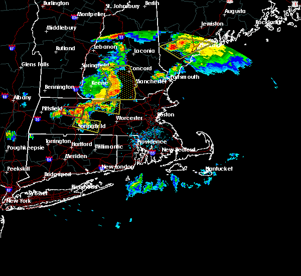 At 543 pm edt, a severe thunderstorm was located over granby, or near chicopee, moving east at 35 mph (radar indicated). Hazards include 60 mph wind gusts and quarter size hail. Hail damage to vehicles is possible. Expect damage to trees and power lines. At 543 pm edt, a severe thunderstorm was located over granby, or near chicopee, moving east at 35 mph (radar indicated). Hazards include 60 mph wind gusts and quarter size hail. Hail damage to vehicles is possible. Expect damage to trees and power lines.
|
| 5/15/2018 3:46 PM EDT |
 At 345 pm edt, a severe thunderstorm was located near hartland, or 14 miles northeast of torrington, moving east at 40 mph (radar indicated). Hazards include up to ping pong ball size hail and 60 mph wind gusts. People and animals outdoors will be injured. expect hail damage to roofs, siding, windows, and vehicles. Expect damage to trees and power lines. At 345 pm edt, a severe thunderstorm was located near hartland, or 14 miles northeast of torrington, moving east at 40 mph (radar indicated). Hazards include up to ping pong ball size hail and 60 mph wind gusts. People and animals outdoors will be injured. expect hail damage to roofs, siding, windows, and vehicles. Expect damage to trees and power lines.
|
| 8/2/2017 3:10 PM EDT |
 At 310 pm edt, a severe thunderstorm was located over granby, or 9 miles southwest of agawam, moving northeast at 25 mph (radar indicated). Hazards include 60 mph wind gusts and quarter size hail. Hail damage to vehicles is possible. Expect damage to trees and power lines. At 310 pm edt, a severe thunderstorm was located over granby, or 9 miles southwest of agawam, moving northeast at 25 mph (radar indicated). Hazards include 60 mph wind gusts and quarter size hail. Hail damage to vehicles is possible. Expect damage to trees and power lines.
|
| 7/12/2017 1:53 PM EDT |
 The severe thunderstorm warning for northwestern tolland and southeastern hampden counties will expire at 200 pm edt, the storm which prompted the warning has weakened below severe limits, and no longer poses an immediate threat to life or property. therefore the warning will be allowed to expire. The severe thunderstorm warning for northwestern tolland and southeastern hampden counties will expire at 200 pm edt, the storm which prompted the warning has weakened below severe limits, and no longer poses an immediate threat to life or property. therefore the warning will be allowed to expire.
|
| 7/12/2017 1:22 PM EDT |
 The national weather service in taunton has issued a * severe thunderstorm warning for. northwestern tolland county in northern connecticut. southeastern hampden county in western massachusetts. Until 200 pm edt * at 121 pm edt, a severe thunderstorm was located over agawam,. The national weather service in taunton has issued a * severe thunderstorm warning for. northwestern tolland county in northern connecticut. southeastern hampden county in western massachusetts. Until 200 pm edt * at 121 pm edt, a severe thunderstorm was located over agawam,.
|
| 7/12/2017 1:22 PM EDT |
 At 121 pm edt, a severe thunderstorm was located over agawam, moving east at 30 mph (radar indicated). Hazards include 60 mph wind gusts and quarter size hail. Hail damage to vehicles is possible. Expect damage to trees and power lines. At 121 pm edt, a severe thunderstorm was located over agawam, moving east at 30 mph (radar indicated). Hazards include 60 mph wind gusts and quarter size hail. Hail damage to vehicles is possible. Expect damage to trees and power lines.
|
| 6/30/2017 5:52 PM EDT |
 At 549 pm edt, a severe thunderstorm was locateed near new hartford in eastern litchfield county, moving east at 35 mph. this storm may produce large hail and damaging winds from simsbury to canton and burlington connecticut. other strong storms extended along a line from westhampton massachusetts to new preston connecticut (radar indicated). Hazards include 60 mph wind gusts and quarter size hail. Hail damage to vehicles is possible. expect damage to trees and power lines. Locations impacted include, springfield, west hartford, bristol, chicopee, enfield, southington, westfield, holyoke, windsor, northampton, agawam, west springfield, farmington, wolcott, simsbury, ludlow, bloomfield, avon, plainville and south hadley. At 549 pm edt, a severe thunderstorm was locateed near new hartford in eastern litchfield county, moving east at 35 mph. this storm may produce large hail and damaging winds from simsbury to canton and burlington connecticut. other strong storms extended along a line from westhampton massachusetts to new preston connecticut (radar indicated). Hazards include 60 mph wind gusts and quarter size hail. Hail damage to vehicles is possible. expect damage to trees and power lines. Locations impacted include, springfield, west hartford, bristol, chicopee, enfield, southington, westfield, holyoke, windsor, northampton, agawam, west springfield, farmington, wolcott, simsbury, ludlow, bloomfield, avon, plainville and south hadley.
|
| 6/30/2017 5:31 PM EDT |
 At 530 pm edt, severe thunderstorms were located along a line extending from near blandford massachusetts to near new milford, connecticut, moving east at 20 mph (radar indicated). Hazards include 60 mph wind gusts. expect damage to trees and power lines At 530 pm edt, severe thunderstorms were located along a line extending from near blandford massachusetts to near new milford, connecticut, moving east at 20 mph (radar indicated). Hazards include 60 mph wind gusts. expect damage to trees and power lines
|
| 6/27/2017 11:24 AM EDT |
 The severe thunderstorm warning for southwestern worcester, southeastern hampshire and southeastern hampden counties will expire at 330 pm edt, the storm which prompted the warning has weakened below severe limits, and no longer poses an immediate threat to life or property. therefore the warning will be allowed to expire. however small hail is still possible with this thunderstorm. The severe thunderstorm warning for southwestern worcester, southeastern hampshire and southeastern hampden counties will expire at 330 pm edt, the storm which prompted the warning has weakened below severe limits, and no longer poses an immediate threat to life or property. therefore the warning will be allowed to expire. however small hail is still possible with this thunderstorm.
|
| 6/27/2017 11:08 AM EDT |
 At 307 pm edt, a severe thunderstorm was located over wilbraham, or near springfield, moving northeast at 30 mph (radar indicated. spotters have reported hail up to three quarters of an inch). Hazards include quarter size hail. Damage to vehicles is possible. Locations impacted include, springfield, chicopee, agawam, west springfield, ludlow, longmeadow, east longmeadow, belchertown, wilbraham, charlton, palmer, ware, sturbridge, monson, granby, hampden, warren, north brookfield, west brookfield and brimfield. At 307 pm edt, a severe thunderstorm was located over wilbraham, or near springfield, moving northeast at 30 mph (radar indicated. spotters have reported hail up to three quarters of an inch). Hazards include quarter size hail. Damage to vehicles is possible. Locations impacted include, springfield, chicopee, agawam, west springfield, ludlow, longmeadow, east longmeadow, belchertown, wilbraham, charlton, palmer, ware, sturbridge, monson, granby, hampden, warren, north brookfield, west brookfield and brimfield.
|
| 6/27/2017 10:49 AM EDT |
 At 248 pm edt, a severe thunderstorm was located over agawam, moving northeast at 30 mph (radar indicated. spotters have reported up to three quarter inch hail). Hazards include 60 mph wind gusts and quarter size hail. Hail damage to vehicles is possible. Expect damage to trees and power lines. At 248 pm edt, a severe thunderstorm was located over agawam, moving northeast at 30 mph (radar indicated. spotters have reported up to three quarter inch hail). Hazards include 60 mph wind gusts and quarter size hail. Hail damage to vehicles is possible. Expect damage to trees and power lines.
|
| 6/19/2017 4:29 PM EDT |
 At 429 pm edt, severe thunderstorms were located along a line extending from near lenox to near norfolk to near litchfield, moving northeast at 30 mph (radar indicated). Hazards include 60 mph wind gusts and penny size hail. expect damage to trees and power lines At 429 pm edt, severe thunderstorms were located along a line extending from near lenox to near norfolk to near litchfield, moving northeast at 30 mph (radar indicated). Hazards include 60 mph wind gusts and penny size hail. expect damage to trees and power lines
|
| 5/31/2017 7:43 PM EDT |
 At 743 pm edt, severe thunderstorms were located along a line extending from barre to west brookfield to near palmer to near west springfield to near granby, moving southeast at 20 mph (trained weather spotters in and around the westfield massachusetts region have reported dime to quarter sized hail). Hazards include quarter size hail. Damage to vehicles is possible. Locations impacted include, springfield, chicopee, enfield, westfield, holyoke, windsor, agawam, west springfield, simsbury, ludlow, bloomfield, avon, south hadley, easthampton, longmeadow, suffield, east longmeadow, ellington, belchertown and wilbraham. At 743 pm edt, severe thunderstorms were located along a line extending from barre to west brookfield to near palmer to near west springfield to near granby, moving southeast at 20 mph (trained weather spotters in and around the westfield massachusetts region have reported dime to quarter sized hail). Hazards include quarter size hail. Damage to vehicles is possible. Locations impacted include, springfield, chicopee, enfield, westfield, holyoke, windsor, agawam, west springfield, simsbury, ludlow, bloomfield, avon, south hadley, easthampton, longmeadow, suffield, east longmeadow, ellington, belchertown and wilbraham.
|
| 5/31/2017 7:28 PM EDT |
 At 726 pm edt, severe thunderstorms were located along a line extending from near petersham to near ware to near ludlow to westfield to near hartland, moving southeast at 20 mph (trained weather spotters have reported mainly dime to nickel sized hail with a couple of reports of quarter sized hail with the latest reports out of granby massachusetts). Hazards include quarter size hail. damage to vehicles is possible At 726 pm edt, severe thunderstorms were located along a line extending from near petersham to near ware to near ludlow to westfield to near hartland, moving southeast at 20 mph (trained weather spotters have reported mainly dime to nickel sized hail with a couple of reports of quarter sized hail with the latest reports out of granby massachusetts). Hazards include quarter size hail. damage to vehicles is possible
|
| 5/31/2017 7:14 PM EDT |
 At 712 pm edt, severe thunderstorms were located along a line extending from near royalston to pelham to near granville, moving east at 25 mph (trained weather spotters have reported mainly dime to nickel sized hail with a few locations up to quarters. latest reports from south hadley to granby). Hazards include quarter size hail. wind gusts to 45 mph. Damage to vehicles is possible. Locations impacted include, springfield, chicopee, westfield, holyoke, amherst, northampton, west springfield, ludlow, south hadley, easthampton, belchertown, wilbraham, palmer, athol, ware, templeton, granby, southampton, barre and hadley. At 712 pm edt, severe thunderstorms were located along a line extending from near royalston to pelham to near granville, moving east at 25 mph (trained weather spotters have reported mainly dime to nickel sized hail with a few locations up to quarters. latest reports from south hadley to granby). Hazards include quarter size hail. wind gusts to 45 mph. Damage to vehicles is possible. Locations impacted include, springfield, chicopee, westfield, holyoke, amherst, northampton, west springfield, ludlow, south hadley, easthampton, belchertown, wilbraham, palmer, athol, ware, templeton, granby, southampton, barre and hadley.
|
| 5/31/2017 7:02 PM EDT |
 At 700 pm edt, severe thunderstorms were located along a line extending from warwick to near amherst to near tolland, moving east at 25 mph (trained weather spotters...many of whom have reported dime to quarter sized hail from sunderland down to southampton). Hazards include quarter size hail. gusty winds up to 50 mph. Damage to vehicles is possible. Locations impacted include, springfield, chicopee, westfield, holyoke, amherst, northampton, west springfield, deerfield, ludlow, south hadley, easthampton, belchertown, wilbraham, palmer, athol, ware, montague, templeton, granby and southampton. At 700 pm edt, severe thunderstorms were located along a line extending from warwick to near amherst to near tolland, moving east at 25 mph (trained weather spotters...many of whom have reported dime to quarter sized hail from sunderland down to southampton). Hazards include quarter size hail. gusty winds up to 50 mph. Damage to vehicles is possible. Locations impacted include, springfield, chicopee, westfield, holyoke, amherst, northampton, west springfield, deerfield, ludlow, south hadley, easthampton, belchertown, wilbraham, palmer, athol, ware, montague, templeton, granby and southampton.
|
| 5/31/2017 6:59 PM EDT |
 At 659 pm edt, severe thunderstorms were located along a line extending from near wendell to easthampton to ashley falls, moving southeast at 15 mph (radar indicated. though numerous reports north across the connecticut river valley in massachusetts of dime to nickel sized hail). Hazards include 60 mph wind gusts. expect damage to trees and power lines At 659 pm edt, severe thunderstorms were located along a line extending from near wendell to easthampton to ashley falls, moving southeast at 15 mph (radar indicated. though numerous reports north across the connecticut river valley in massachusetts of dime to nickel sized hail). Hazards include 60 mph wind gusts. expect damage to trees and power lines
|
| 5/31/2017 6:42 PM EDT |
 At 640 pm edt, severe thunderstorms were located along a line extending from near bernardston to hatfield to near sandisfield, moving east at 25 mph (radar indicated. though trained spotters have supplied several reports of hail from dime to nickel sized along with trees and wires down across western massachusetts). Hazards include 60 mph wind gusts and quarter size hail. Hail damage to vehicles is possible. Expect damage to trees and power lines. At 640 pm edt, severe thunderstorms were located along a line extending from near bernardston to hatfield to near sandisfield, moving east at 25 mph (radar indicated. though trained spotters have supplied several reports of hail from dime to nickel sized along with trees and wires down across western massachusetts). Hazards include 60 mph wind gusts and quarter size hail. Hail damage to vehicles is possible. Expect damage to trees and power lines.
|
| 9/11/2016 10:10 AM EDT |
 The severe thunderstorm warning for northwestern essex, southeastern hampshire, southeastern hampden, worcester and middlesex counties will expire at 1015 am edt, the storms which prompted the warning have moved out of the area. therefore, the warning will be allowed to expire. The severe thunderstorm warning for northwestern essex, southeastern hampshire, southeastern hampden, worcester and middlesex counties will expire at 1015 am edt, the storms which prompted the warning have moved out of the area. therefore, the warning will be allowed to expire.
|
| 9/11/2016 9:23 AM EDT |
 At 922 am edt, severe thunderstorms were located along a line extending from near new boston to near westminster to north brookfield to west hartford, moving east at 45 mph (radar indicated). Hazards include 60 mph wind gusts. Expect damage to roofs. siding. And trees. At 922 am edt, severe thunderstorms were located along a line extending from near new boston to near westminster to north brookfield to west hartford, moving east at 45 mph (radar indicated). Hazards include 60 mph wind gusts. Expect damage to roofs. siding. And trees.
|
| 9/11/2016 8:49 AM EDT |
 At 848 am edt, severe thunderstorms were located along a line extending from near danbury to near windsor to near richmond to leverett to new hartford, moving northeast at 45 mph (radar indicated). Hazards include 60 mph wind gusts. Expect damage to roofs. siding. And trees. At 848 am edt, severe thunderstorms were located along a line extending from near danbury to near windsor to near richmond to leverett to new hartford, moving northeast at 45 mph (radar indicated). Hazards include 60 mph wind gusts. Expect damage to roofs. siding. And trees.
|
| 8/13/2016 9:43 PM EDT |
 At 941 pm edt, a severe thunderstorm was located near ashfield, or 11 miles north of northampton, moving east at 65 mph (radar indicated). Hazards include 70 mph wind gusts. Expect considerable tree damage. damage is likely to mobile homes, roofs, and outbuildings. locations impacted include, conway, sunderland, deerfield,. montague,. leverett,. Wendell, new salem. At 941 pm edt, a severe thunderstorm was located near ashfield, or 11 miles north of northampton, moving east at 65 mph (radar indicated). Hazards include 70 mph wind gusts. Expect considerable tree damage. damage is likely to mobile homes, roofs, and outbuildings. locations impacted include, conway, sunderland, deerfield,. montague,. leverett,. Wendell, new salem.
|
| 8/13/2016 9:29 PM EDT |
 At 927 pm edt, severe thunderstorms were located along a line extending from near guilford center to plainfield to near blandford to 6 miles south of norfolk, moving east at 45 mph (radar indicated). Hazards include 60 mph wind gusts. Expect damage to roofs. siding. And trees. At 927 pm edt, severe thunderstorms were located along a line extending from near guilford center to plainfield to near blandford to 6 miles south of norfolk, moving east at 45 mph (radar indicated). Hazards include 60 mph wind gusts. Expect damage to roofs. siding. And trees.
|
| 8/13/2016 9:09 PM EDT |
 At 908 pm edt, severe thunderstorms were located along a line extending from near readsboro to near pittsfield to near sandisfield to sharon, moving east at 45 mph (radar indicated). Hazards include 60 mph wind gusts. Expect damage to roofs. siding. And trees. At 908 pm edt, severe thunderstorms were located along a line extending from near readsboro to near pittsfield to near sandisfield to sharon, moving east at 45 mph (radar indicated). Hazards include 60 mph wind gusts. Expect damage to roofs. siding. And trees.
|
| 8/13/2016 1:52 PM EDT |
 At 152 pm edt, a pair of severe thunderstorms were located near agawam, moving east at 10 mph (radar indicated). Hazards include 60 mph wind gusts. Expect damage to roofs. siding. And trees. At 152 pm edt, a pair of severe thunderstorms were located near agawam, moving east at 10 mph (radar indicated). Hazards include 60 mph wind gusts. Expect damage to roofs. siding. And trees.
|
| 8/12/2016 3:12 PM EDT |
 At 312 pm edt, severe thunderstorms were located along a line extending from near chicopee to near west springfield to near westfield, moving southeast at 25 mph (radar indicated). Hazards include 60 mph wind gusts. Expect damage to roofs. siding. and trees. Locations impacted include, springfield, chicopee, westfield, holyoke, agawam, west springfield, ludlow, longmeadow, east longmeadow, belchertown, wilbraham, palmer, southwick, monson, granby and hampden. At 312 pm edt, severe thunderstorms were located along a line extending from near chicopee to near west springfield to near westfield, moving southeast at 25 mph (radar indicated). Hazards include 60 mph wind gusts. Expect damage to roofs. siding. and trees. Locations impacted include, springfield, chicopee, westfield, holyoke, agawam, west springfield, ludlow, longmeadow, east longmeadow, belchertown, wilbraham, palmer, southwick, monson, granby and hampden.
|
| 8/12/2016 2:57 PM EDT |
 At 256 pm edt, severe thunderstorms were located along a line extending from easthampton to near southampton to near montgomery, moving southeast at 25 mph (radar indicated). Hazards include 60 mph wind gusts. Expect damage to roofs. siding. And trees. At 256 pm edt, severe thunderstorms were located along a line extending from easthampton to near southampton to near montgomery, moving southeast at 25 mph (radar indicated). Hazards include 60 mph wind gusts. Expect damage to roofs. siding. And trees.
|
| 7/23/2016 8:06 PM EDT |
 The severe thunderstorm warning for hampshire, northern hampden, northwestern worcester and franklin counties will expire at 815 pm edt, the severe thunderstorm which prompted the warning has weakened. however, brief wind gusts to 45 mph from weakening showers may still result in a few downed trees and isolated power outages. a severe thunderstorm watch remains in effect until 1000 pm edt for western and central massachusetts. The severe thunderstorm warning for hampshire, northern hampden, northwestern worcester and franklin counties will expire at 815 pm edt, the severe thunderstorm which prompted the warning has weakened. however, brief wind gusts to 45 mph from weakening showers may still result in a few downed trees and isolated power outages. a severe thunderstorm watch remains in effect until 1000 pm edt for western and central massachusetts.
|
| 7/23/2016 7:15 PM EDT |
 At 713 pm edt, a line of severe thunderstorms with a history of damaging wind gusts will drop south into much of western massachusetts. the strongest winds may occur well out ahead of the thunderstorms (radar indicated). Hazards include 60 mph wind gusts. Expect damage to roofs. siding. And trees. At 713 pm edt, a line of severe thunderstorms with a history of damaging wind gusts will drop south into much of western massachusetts. the strongest winds may occur well out ahead of the thunderstorms (radar indicated). Hazards include 60 mph wind gusts. Expect damage to roofs. siding. And trees.
|
| 7/22/2016 8:22 PM EDT |
 At 819 pm edt, strong thunderstorms were over the southwick massachusetts and granby connecticut areas. they had weakened to below severe criteria but still could produce localized damaging wind gusts. the storms were moving to the east at 35 mph (radar indicated). Hazards include 50 to 60 mph wind gusts and penny size hail. Isolated wind damage possible. Locations impacted include, springfield, chicopee, enfield, westfield, agawam, west springfield, ludlow, longmeadow, suffield, east longmeadow, windsor locks, granby, east windsor, southwick, east granby, hartland and granville. At 819 pm edt, strong thunderstorms were over the southwick massachusetts and granby connecticut areas. they had weakened to below severe criteria but still could produce localized damaging wind gusts. the storms were moving to the east at 35 mph (radar indicated). Hazards include 50 to 60 mph wind gusts and penny size hail. Isolated wind damage possible. Locations impacted include, springfield, chicopee, enfield, westfield, agawam, west springfield, ludlow, longmeadow, suffield, east longmeadow, windsor locks, granby, east windsor, southwick, east granby, hartland and granville.
|
| 7/22/2016 7:39 PM EDT |
 At 737 pm edt, a severe thunderstorm was located over tolland, or 12 miles west of westfield, moving east at 35 mph. another strong storm with the potential to become severe was located near new marlboro in southern berkshire county (radar indicated). Hazards include 60 mph wind gusts and penny size hail. Expect damage to roofs. siding. And trees. At 737 pm edt, a severe thunderstorm was located over tolland, or 12 miles west of westfield, moving east at 35 mph. another strong storm with the potential to become severe was located near new marlboro in southern berkshire county (radar indicated). Hazards include 60 mph wind gusts and penny size hail. Expect damage to roofs. siding. And trees.
|
| 7/22/2016 6:56 PM EDT |
 At 655 pm edt, a severe thunderstorm was located over belchertown, or near amherst, moving east at 30 mph (radar indicated). Hazards include 60 mph wind gusts and quarter size hail. Hail damage to vehicles is expected. expect wind damage to roofs, siding, and trees. this severe storm will be near, ware around 705 pm edt. Palmer, warren, west brookfield, brimfield and brookfield around 715 pm edt. At 655 pm edt, a severe thunderstorm was located over belchertown, or near amherst, moving east at 30 mph (radar indicated). Hazards include 60 mph wind gusts and quarter size hail. Hail damage to vehicles is expected. expect wind damage to roofs, siding, and trees. this severe storm will be near, ware around 705 pm edt. Palmer, warren, west brookfield, brimfield and brookfield around 715 pm edt.
|
| 7/22/2016 6:48 PM EDT |
 At 646 pm edt, a severe thunderstorm was located over amherst, moving east at 35 mph (radar indicated). Hazards include 60 mph wind gusts and quarter size hail. Hail damage to vehicles is expected. expect wind damage to roofs, siding, and trees. this severe storm will be near, belchertown and pelham around 700 pm edt. ware around 705 pm edt. palmer and warren around 710 pm edt. North brookfield, west brookfield, brookfield, hardwick and new braintree around 715 pm edt. At 646 pm edt, a severe thunderstorm was located over amherst, moving east at 35 mph (radar indicated). Hazards include 60 mph wind gusts and quarter size hail. Hail damage to vehicles is expected. expect wind damage to roofs, siding, and trees. this severe storm will be near, belchertown and pelham around 700 pm edt. ware around 705 pm edt. palmer and warren around 710 pm edt. North brookfield, west brookfield, brookfield, hardwick and new braintree around 715 pm edt.
|
| 7/22/2016 6:36 PM EDT |
 At 636 pm edt, a severe thunderstorm was located near hadley, or near northampton, moving east at 35 mph (radar indicated). Hazards include 60 mph wind gusts and quarter size hail. Hail damage to vehicles is expected. expect wind damage to roofs, siding, and trees. this severe thunderstorm will be near, granby around 650 pm edt. belchertown and pelham around 655 pm edt. ludlow and wilbraham around 700 pm edt. monson around 705 pm edt. palmer around 710 pm edt. Warren, west brookfield, brimfield, brookfield, holland and wales around 715 pm edt. At 636 pm edt, a severe thunderstorm was located near hadley, or near northampton, moving east at 35 mph (radar indicated). Hazards include 60 mph wind gusts and quarter size hail. Hail damage to vehicles is expected. expect wind damage to roofs, siding, and trees. this severe thunderstorm will be near, granby around 650 pm edt. belchertown and pelham around 655 pm edt. ludlow and wilbraham around 700 pm edt. monson around 705 pm edt. palmer around 710 pm edt. Warren, west brookfield, brimfield, brookfield, holland and wales around 715 pm edt.
|
| 7/22/2016 6:25 PM EDT |
 At 625 pm edt, a severe thunderstorm was located over westhampton, or over northampton, moving east at 35 mph (radar indicated). Hazards include 60 mph wind gusts and penny size hail. Expect damage to roofs. siding. and trees. Locations impacted include, westfield, holyoke, northampton, agawam, west springfield, south hadley, easthampton, southampton, hadley, hatfield, williamsburg, huntington, russell, westhampton, blandford, chesterfield, goshen and montgomery. At 625 pm edt, a severe thunderstorm was located over westhampton, or over northampton, moving east at 35 mph (radar indicated). Hazards include 60 mph wind gusts and penny size hail. Expect damage to roofs. siding. and trees. Locations impacted include, westfield, holyoke, northampton, agawam, west springfield, south hadley, easthampton, southampton, hadley, hatfield, williamsburg, huntington, russell, westhampton, blandford, chesterfield, goshen and montgomery.
|
| 7/22/2016 6:14 PM EDT |
 At 613 pm edt, a severe thunderstorm was located over chesterfield, or 9 miles west of northampton, moving southeast at 30 mph (radar indicated). Hazards include 60 mph wind gusts and penny size hail. Expect damage to roofs. siding. and trees. Locations impacted include, westfield, holyoke, northampton, agawam, west springfield, south hadley, easthampton, southwick, southampton, hadley, hatfield, williamsburg, huntington, russell, westhampton, granville, chester, blandford, chesterfield and worthington. At 613 pm edt, a severe thunderstorm was located over chesterfield, or 9 miles west of northampton, moving southeast at 30 mph (radar indicated). Hazards include 60 mph wind gusts and penny size hail. Expect damage to roofs. siding. and trees. Locations impacted include, westfield, holyoke, northampton, agawam, west springfield, south hadley, easthampton, southwick, southampton, hadley, hatfield, williamsburg, huntington, russell, westhampton, granville, chester, blandford, chesterfield and worthington.
|
| 7/22/2016 5:54 PM EDT |
 At 553 pm edt, a severe thunderstorm was located near becket, or 14 miles east of great barrington, moving east at 35 mph (radar indicated). Hazards include 60 mph wind gusts and quarter size hail. Hail damage to vehicles is expected. Expect wind damage to roofs, siding, and trees. At 553 pm edt, a severe thunderstorm was located near becket, or 14 miles east of great barrington, moving east at 35 mph (radar indicated). Hazards include 60 mph wind gusts and quarter size hail. Hail damage to vehicles is expected. Expect wind damage to roofs, siding, and trees.
|
| 7/14/2016 6:48 PM EDT | Tree down at the intersection of burlingame and warregan street...blocking burlingame in hampden county MA, 0.6 miles SW of Chicopee, MA |
| 6/21/2016 4:39 AM EDT |
 The severe thunderstorm warning for northwestern tolland, northeastern hartford and southwestern hampden counties will expire at 445 am edt, the storm which prompted the warning has weakened below severe limits, and have exited the warned area. therefore, the warning will be allowed to expire. The severe thunderstorm warning for northwestern tolland, northeastern hartford and southwestern hampden counties will expire at 445 am edt, the storm which prompted the warning has weakened below severe limits, and have exited the warned area. therefore, the warning will be allowed to expire.
|
| 6/21/2016 4:39 AM EDT | The severe thunderstorm warning for northwestern tolland, northeastern hartford and southwestern hampden counties will expire at 445 am edt, the storm which prompted the warning has weakened below severe limits, and have exited the warned area. therefore, the warning will be allowed to expire. |
| 6/21/2016 4:26 AM EDT |
 At 425 am edt, a severe thunderstorm was located between agawam massachusetts and enfield connecticut, moving southeast at 30 mph (radar indicated). Hazards include 60 mph wind gusts. Expect damage to roofs. siding. and trees. Locations impacted include, springfield, chicopee, enfield, westfield, agawam, west springfield, longmeadow, suffield, east longmeadow, ellington, wilbraham, somers, granby, east windsor, southwick, east granby, hampden, hartland, russell and granville. At 425 am edt, a severe thunderstorm was located between agawam massachusetts and enfield connecticut, moving southeast at 30 mph (radar indicated). Hazards include 60 mph wind gusts. Expect damage to roofs. siding. and trees. Locations impacted include, springfield, chicopee, enfield, westfield, agawam, west springfield, longmeadow, suffield, east longmeadow, ellington, wilbraham, somers, granby, east windsor, southwick, east granby, hampden, hartland, russell and granville.
|
| 6/21/2016 4:05 AM EDT |
 At 404 am edt, a severe thunderstorm was located over granville, or near westfield, moving east at 30 mph (radar indicated). Hazards include 60 mph wind gusts. Expect damage to roofs. siding. And trees. At 404 am edt, a severe thunderstorm was located over granville, or near westfield, moving east at 30 mph (radar indicated). Hazards include 60 mph wind gusts. Expect damage to roofs. siding. And trees.
|
| 2/25/2016 12:58 AM EST |
 At 1258 am est, doppler radar indicated a severe thunderstorm capable of producing destructive winds in excess of 70 mph. this storm was located over east windsor, or near south windsor, and was moving northeast at 45 mph. At 1258 am est, doppler radar indicated a severe thunderstorm capable of producing destructive winds in excess of 70 mph. this storm was located over east windsor, or near south windsor, and was moving northeast at 45 mph.
|
| 8/4/2015 2:44 PM EDT |
 At 243 pm edt, doppler radar indicated a severe thunderstorm capable of producing quarter size hail and damaging winds in excess of 60 mph. this storm was located over holyoke, moving east at 35 mph. locations impacted include, springfield, chicopee, westfield, holyoke, amherst, agawam, west springfield, ludlow, south hadley, southbridge, longmeadow, east longmeadow, belchertown, wilbraham, palmer, spencer, ware, southwick, sturbridge and monson. At 243 pm edt, doppler radar indicated a severe thunderstorm capable of producing quarter size hail and damaging winds in excess of 60 mph. this storm was located over holyoke, moving east at 35 mph. locations impacted include, springfield, chicopee, westfield, holyoke, amherst, agawam, west springfield, ludlow, south hadley, southbridge, longmeadow, east longmeadow, belchertown, wilbraham, palmer, spencer, ware, southwick, sturbridge and monson.
|
| 8/4/2015 2:17 PM EDT |
 At 216 pm edt, doppler radar indicated a severe thunderstorm capable of producing quarter size hail and damaging winds in excess of 60 mph. this storm was located over blandford, or 12 miles northwest of westfield, and was moving east at 35 mph. * some locations impacted include, springfield, chicopee, westfield, holyoke, amherst, northampton, agawam, west springfield, ludlow, south hadley, southbridge, easthampton, longmeadow, east longmeadow, belchertown, wilbraham, palmer, spencer, ware and southwick. At 216 pm edt, doppler radar indicated a severe thunderstorm capable of producing quarter size hail and damaging winds in excess of 60 mph. this storm was located over blandford, or 12 miles northwest of westfield, and was moving east at 35 mph. * some locations impacted include, springfield, chicopee, westfield, holyoke, amherst, northampton, agawam, west springfield, ludlow, south hadley, southbridge, easthampton, longmeadow, east longmeadow, belchertown, wilbraham, palmer, spencer, ware and southwick.
|
| 7/28/2015 2:47 PM EDT |
 At 247 pm edt, doppler radar indicated a severe thunderstorm that has a history of strong winds with localized damage. this storm was located over hatfield, or near amherst. this storm was nearly stationary. locations impacted include, holyoke, amherst, northampton, ludlow, south hadley, easthampton, belchertown, granby, southampton, hadley, sunderland, hatfield, williamsburg, shutesbury, whately and pelham. At 247 pm edt, doppler radar indicated a severe thunderstorm that has a history of strong winds with localized damage. this storm was located over hatfield, or near amherst. this storm was nearly stationary. locations impacted include, holyoke, amherst, northampton, ludlow, south hadley, easthampton, belchertown, granby, southampton, hadley, sunderland, hatfield, williamsburg, shutesbury, whately and pelham.
|
| 7/28/2015 2:18 PM EDT |
 At 217 pm edt, doppler radar indicated a severe thunderstorm capable of producing quarter size hail and damaging winds in excess of 60 mph. this storm was located over deerfield, or 8 miles south of greenfield, and was moving south at 15 mph. * some locations impacted include, holyoke, amherst, northampton, deerfield, ludlow, south hadley, easthampton, belchertown, montague, granby, southampton, hadley, sunderland, hatfield, williamsburg, conway, shelburne, leverett, shutesbury and whately. At 217 pm edt, doppler radar indicated a severe thunderstorm capable of producing quarter size hail and damaging winds in excess of 60 mph. this storm was located over deerfield, or 8 miles south of greenfield, and was moving south at 15 mph. * some locations impacted include, holyoke, amherst, northampton, deerfield, ludlow, south hadley, easthampton, belchertown, montague, granby, southampton, hadley, sunderland, hatfield, williamsburg, conway, shelburne, leverett, shutesbury and whately.
|
| 7/27/2015 6:38 PM EDT |
 At 637 pm edt, trained weather spotters reported a severe thunderstorm producing quarter size hail. this storm was located over westfield, moving southeast at 10 mph. locations impacted include, springfield, chicopee, westfield, holyoke, agawam, west springfield, longmeadow, suffield, east longmeadow, granby, southwick, russell, granville, blandford and montgomery. At 637 pm edt, trained weather spotters reported a severe thunderstorm producing quarter size hail. this storm was located over westfield, moving southeast at 10 mph. locations impacted include, springfield, chicopee, westfield, holyoke, agawam, west springfield, longmeadow, suffield, east longmeadow, granby, southwick, russell, granville, blandford and montgomery.
|
| 7/27/2015 6:15 PM EDT |
 At 614 pm edt, doppler radar indicated a severe thunderstorm capable of producing quarter size hail and damaging winds in excess of 60 mph. this storm was located over russell, or near westfield, and was moving southeast at 10 mph. * some locations impacted include, springfield, chicopee, westfield, holyoke, agawam, west springfield, longmeadow, suffield, east longmeadow, granby, southwick, southampton, huntington, russell, granville, blandford, montgomery and tolland. At 614 pm edt, doppler radar indicated a severe thunderstorm capable of producing quarter size hail and damaging winds in excess of 60 mph. this storm was located over russell, or near westfield, and was moving southeast at 10 mph. * some locations impacted include, springfield, chicopee, westfield, holyoke, agawam, west springfield, longmeadow, suffield, east longmeadow, granby, southwick, southampton, huntington, russell, granville, blandford, montgomery and tolland.
|
| 7/26/2015 7:13 PM EDT |
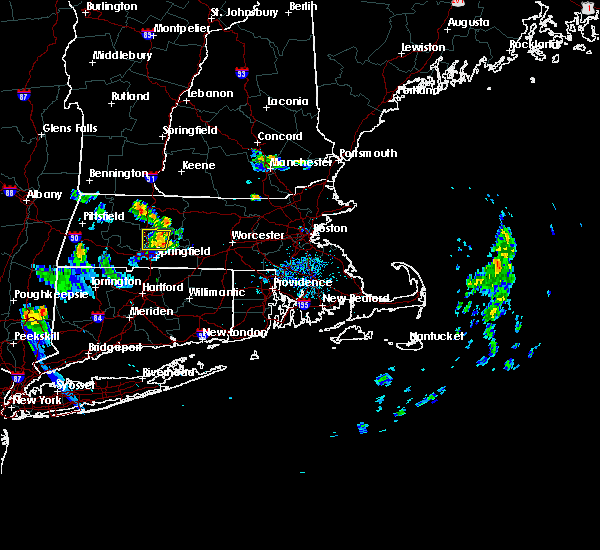 At 712 pm edt, doppler radar indicated a severe thunderstorm capable of producing quarter size hail and damaging winds in excess of 60 mph. this storm was located over amherst, moving east at 15 mph. locations impacted include, chicopee, amherst, ludlow, south hadley, belchertown, granby and pelham. At 712 pm edt, doppler radar indicated a severe thunderstorm capable of producing quarter size hail and damaging winds in excess of 60 mph. this storm was located over amherst, moving east at 15 mph. locations impacted include, chicopee, amherst, ludlow, south hadley, belchertown, granby and pelham.
|
| 7/26/2015 7:02 PM EDT |
 At 659 pm edt, trained weather spotters reported a tree down on wires in hatfield. in addition, spotters also reported many tree limbs down in hadley. this severe thunderstorm continues to be capable of producing quarter size hail and damaging winds in excess of 60 mph. the storm was located over hadley, or near amherst, moving east at 20 mph. locations impacted include, chicopee, holyoke, amherst, northampton, ludlow, south hadley, easthampton, belchertown, granby, hadley, hatfield and pelham. At 659 pm edt, trained weather spotters reported a tree down on wires in hatfield. in addition, spotters also reported many tree limbs down in hadley. this severe thunderstorm continues to be capable of producing quarter size hail and damaging winds in excess of 60 mph. the storm was located over hadley, or near amherst, moving east at 20 mph. locations impacted include, chicopee, holyoke, amherst, northampton, ludlow, south hadley, easthampton, belchertown, granby, hadley, hatfield and pelham.
|
| 7/26/2015 6:50 PM EDT |
 At 650 pm edt, doppler radar indicated a severe thunderstorm capable of producing quarter size hail and damaging winds in excess of 60 mph. this storm was located over northampton, and was moving east at 15 mph. * some locations impacted include, chicopee, holyoke, amherst, northampton, ludlow, south hadley, easthampton, belchertown, granby, southampton, hadley, hatfield, williamsburg and pelham. At 650 pm edt, doppler radar indicated a severe thunderstorm capable of producing quarter size hail and damaging winds in excess of 60 mph. this storm was located over northampton, and was moving east at 15 mph. * some locations impacted include, chicopee, holyoke, amherst, northampton, ludlow, south hadley, easthampton, belchertown, granby, southampton, hadley, hatfield, williamsburg and pelham.
|
| 6/23/2015 7:51 PM EDT |
 At 750 pm edt, doppler radar indicated a line of severe thunderstorms capable of producing damaging winds in excess of 60 mph. these storms were located along a line extending from ludlow to granville, moving east at 35 mph. in addition, trees and power lines were downed in russell and westfield as the storms moved through. locations impacted include, springfield, chicopee, enfield, westfield, holyoke, windsor, agawam, west springfield, south windsor, simsbury, ludlow, bloomfield, longmeadow, suffield, east longmeadow, ellington, wilbraham, windsor locks, stafford and somers. At 750 pm edt, doppler radar indicated a line of severe thunderstorms capable of producing damaging winds in excess of 60 mph. these storms were located along a line extending from ludlow to granville, moving east at 35 mph. in addition, trees and power lines were downed in russell and westfield as the storms moved through. locations impacted include, springfield, chicopee, enfield, westfield, holyoke, windsor, agawam, west springfield, south windsor, simsbury, ludlow, bloomfield, longmeadow, suffield, east longmeadow, ellington, wilbraham, windsor locks, stafford and somers.
|
| 6/23/2015 7:41 PM EDT |
 At 740 pm edt, doppler radar indicated a line of severe thunderstorms capable of producing damaging winds in excess of 60 mph. these storms were located along a line extending from ludlow to near granville, moving southeast at 20 mph. in addition, at 738 pm, trees and wires were reported downed in westfield. locations impacted include, springfield, chicopee, enfield, westfield, holyoke, windsor, agawam, west springfield, south windsor, simsbury, ludlow, bloomfield, south hadley, easthampton, longmeadow, suffield, east longmeadow, ellington, wilbraham and windsor locks. At 740 pm edt, doppler radar indicated a line of severe thunderstorms capable of producing damaging winds in excess of 60 mph. these storms were located along a line extending from ludlow to near granville, moving southeast at 20 mph. in addition, at 738 pm, trees and wires were reported downed in westfield. locations impacted include, springfield, chicopee, enfield, westfield, holyoke, windsor, agawam, west springfield, south windsor, simsbury, ludlow, bloomfield, south hadley, easthampton, longmeadow, suffield, east longmeadow, ellington, wilbraham and windsor locks.
|
| 6/23/2015 7:19 PM EDT |
 At 718 pm edt, doppler radar indicated a line of severe thunderstorms capable of producing damaging winds in excess of 60 mph. these storms were located along a line extending from south hadley to near otis, and was moving east at 40 mph. * some locations impacted include, springfield, chicopee, enfield, westfield, holyoke, windsor, agawam, west springfield, south windsor, simsbury, ludlow, bloomfield, south hadley, easthampton, longmeadow, suffield, east longmeadow, ellington, wilbraham and windsor locks. At 718 pm edt, doppler radar indicated a line of severe thunderstorms capable of producing damaging winds in excess of 60 mph. these storms were located along a line extending from south hadley to near otis, and was moving east at 40 mph. * some locations impacted include, springfield, chicopee, enfield, westfield, holyoke, windsor, agawam, west springfield, south windsor, simsbury, ludlow, bloomfield, south hadley, easthampton, longmeadow, suffield, east longmeadow, ellington, wilbraham and windsor locks.
|
| 6/9/2015 4:32 PM EDT |
 At 432 pm edt, doppler radar indicated a severe thunderstorm capable of producing damaging winds in excess of 60 mph. this storm was located over springfield, and was moving northeast at 40 mph. * some locations impacted include, springfield, chicopee, westfield, holyoke, agawam, west springfield, ludlow, south hadley, longmeadow, suffield, east longmeadow, belchertown, wilbraham, oxford, charlton, palmer, spencer, somers, leicester and ware. At 432 pm edt, doppler radar indicated a severe thunderstorm capable of producing damaging winds in excess of 60 mph. this storm was located over springfield, and was moving northeast at 40 mph. * some locations impacted include, springfield, chicopee, westfield, holyoke, agawam, west springfield, ludlow, south hadley, longmeadow, suffield, east longmeadow, belchertown, wilbraham, oxford, charlton, palmer, spencer, somers, leicester and ware.
|
| 5/28/2015 5:15 PM EDT | At 514 pm edt, doppler radar indicated a severe thunderstorm capable of producing quarter size hail and damaging winds in excess of 60 mph. this storm was located over chelmsford, moving east at 40 mph. locations impacted include, worcester, framingham, chicopee, leominster, fitchburg, marlborough, shrewsbury, westford, acton, ludlow, hudson, westborough, grafton, sudbury, holden, ashland, auburn, hopkinton, belchertown and northborough. |
| 5/28/2015 4:48 PM EDT | At 448 pm edt, doppler radar indicated a severe thunderstorm capable of producing quarter size hail and damaging winds in excess of 60 mph. this storm was located over lunenburg, or near leominster, and was moving east at 40 mph. * some locations impacted include, worcester, framingham, chicopee, leominster, fitchburg, holyoke, marlborough, amherst, shrewsbury, westford, acton, ludlow, hudson, westborough, grafton, sudbury, south hadley, holden, ashland and auburn. |
| 5/27/2015 7:01 PM EDT | At 700 pm edt, doppler radar indicated a line of severe thunderstorms capable of producing damaging winds in excess of 60 mph. these storms were located along a line extending from near russell to near granville to hartland, moving northeast at 50 mph. locations impacted include, springfield, chicopee, westfield, holyoke, agawam, west springfield, ludlow, south hadley, easthampton, longmeadow, suffield, southwick, granby, southampton, east granby, hartland, russell, granville, blandford and montgomery. |
| 5/27/2015 7:01 PM EDT | At 700 pm edt, doppler radar indicated a line of severe thunderstorms capable of producing damaging winds in excess of 60 mph. these storms were located along a line extending from near russell to near granville to hartland, moving northeast at 50 mph. locations impacted include, springfield, chicopee, westfield, holyoke, agawam, west springfield, ludlow, south hadley, easthampton, longmeadow, suffield, southwick, granby, southampton, east granby, hartland, russell, granville, blandford and montgomery. |
| 5/27/2015 6:42 PM EDT | At 642 pm edt, doppler radar indicated a line of severe thunderstorms capable of producing damaging winds in excess of 60 mph. these storms were located along a line extending from near sandisfield to near norfolk to near torrington, and was moving northeast at 45 mph. * some locations impacted include, springfield, chicopee, westfield, holyoke, agawam, west springfield, ludlow, south hadley, easthampton, longmeadow, suffield, belchertown, southwick, granby, southampton, east granby, hartland, russell, granville and blandford. |
| 5/27/2015 6:42 PM EDT | At 642 pm edt, doppler radar indicated a line of severe thunderstorms capable of producing damaging winds in excess of 60 mph. these storms were located along a line extending from near sandisfield to near norfolk to near torrington, and was moving northeast at 45 mph. * some locations impacted include, springfield, chicopee, westfield, holyoke, agawam, west springfield, ludlow, south hadley, easthampton, longmeadow, suffield, belchertown, southwick, granby, southampton, east granby, hartland, russell, granville and blandford. |
| 5/19/2015 9:13 PM EDT | At 912 pm edt, doppler radar indicated a severe thunderstorm capable of producing damaging winds in excess of 60 mph. this storm was located over west springfield, moving southeast at 35 mph. in addition, pea sized hail was reported at blandford with this storm. locations impacted include, springfield, chicopee, westfield, holyoke, northampton, agawam, west springfield, ludlow, south hadley, easthampton, southwick, granby, southampton, huntington, russell, westhampton, granville, chester, blandford and chesterfield. |
| 5/19/2015 8:45 PM EDT | At 844 pm edt, doppler radar indicated a severe thunderstorm capable of producing damaging winds in excess of 60 mph. this storm was located near blandford, or 12 miles northwest of westfield, and was moving southeast at 35 mph. * some locations impacted include, springfield, chicopee, westfield, holyoke, northampton, agawam, west springfield, ludlow, south hadley, easthampton, southwick, granby, southampton, huntington, russell, westhampton, granville, chester, blandford and chesterfield. |
| 6/2/2013 6:04 PM EDT | Wires down on mckintry avenue in hampden county MA, 0.6 miles SW of Chicopee, MA |
| 1/1/0001 12:00 AM | Trees down on fuller road in hampden county MA, 0.6 miles SW of Chicopee, MA |
| 1/1/0001 12:00 AM | *** 1 inj *** trees down on fuller road...the route 33 area....westover road....dolores st...james st....prospect st. home depot on route 33 has a significant amount of in hampden county MA, 0.6 miles SW of Chicopee, MA |
| 1/1/0001 12:00 AM | Trees down on fuller road and the route 33 area. trees down on westover road. home depot on route 33 has a significant amount of damage to sheds and displays. no power in hampden county MA, 0.6 miles SW of Chicopee, MA |
| 1/1/0001 12:00 AM | Golf Ball sized hail reported 0.6 miles SW of Chicopee, MA, golf ball size hail |
| 1/1/0001 12:00 AM | Quarter sized hail reported 2.4 miles NE of Chicopee, MA, ham radio |
| 1/1/0001 12:00 AM | Quarter sized hail reported 2.4 miles NE of Chicopee, MA, ham radio |
Hail Maps for Chicopee, MA


Connect with Interactive Hail Maps