

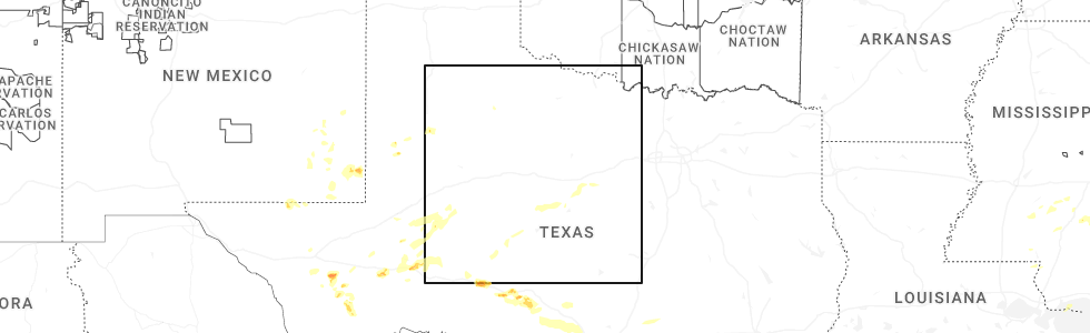
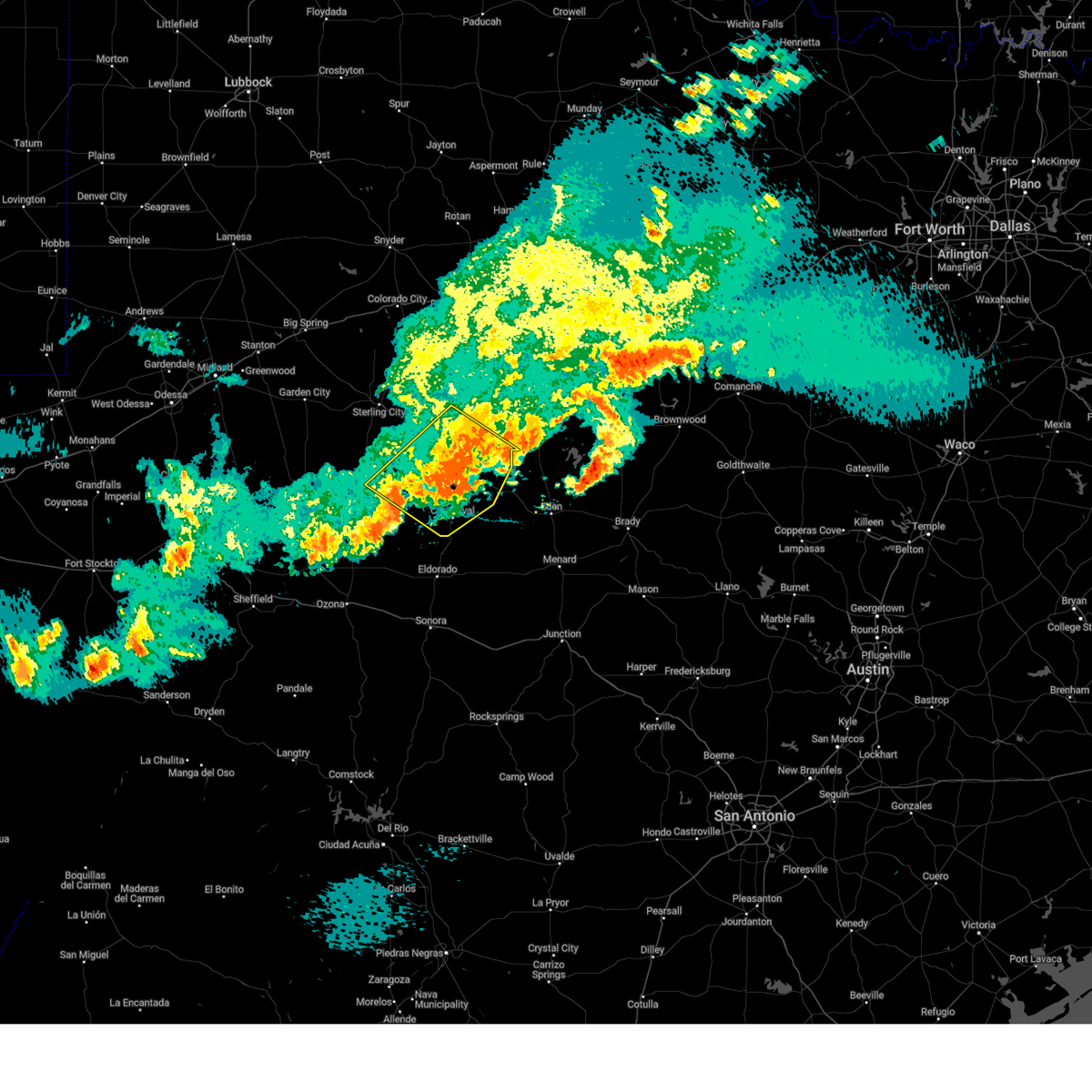
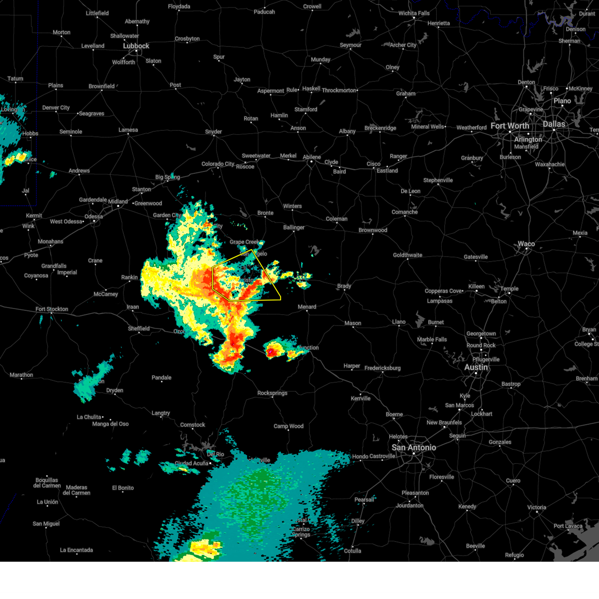
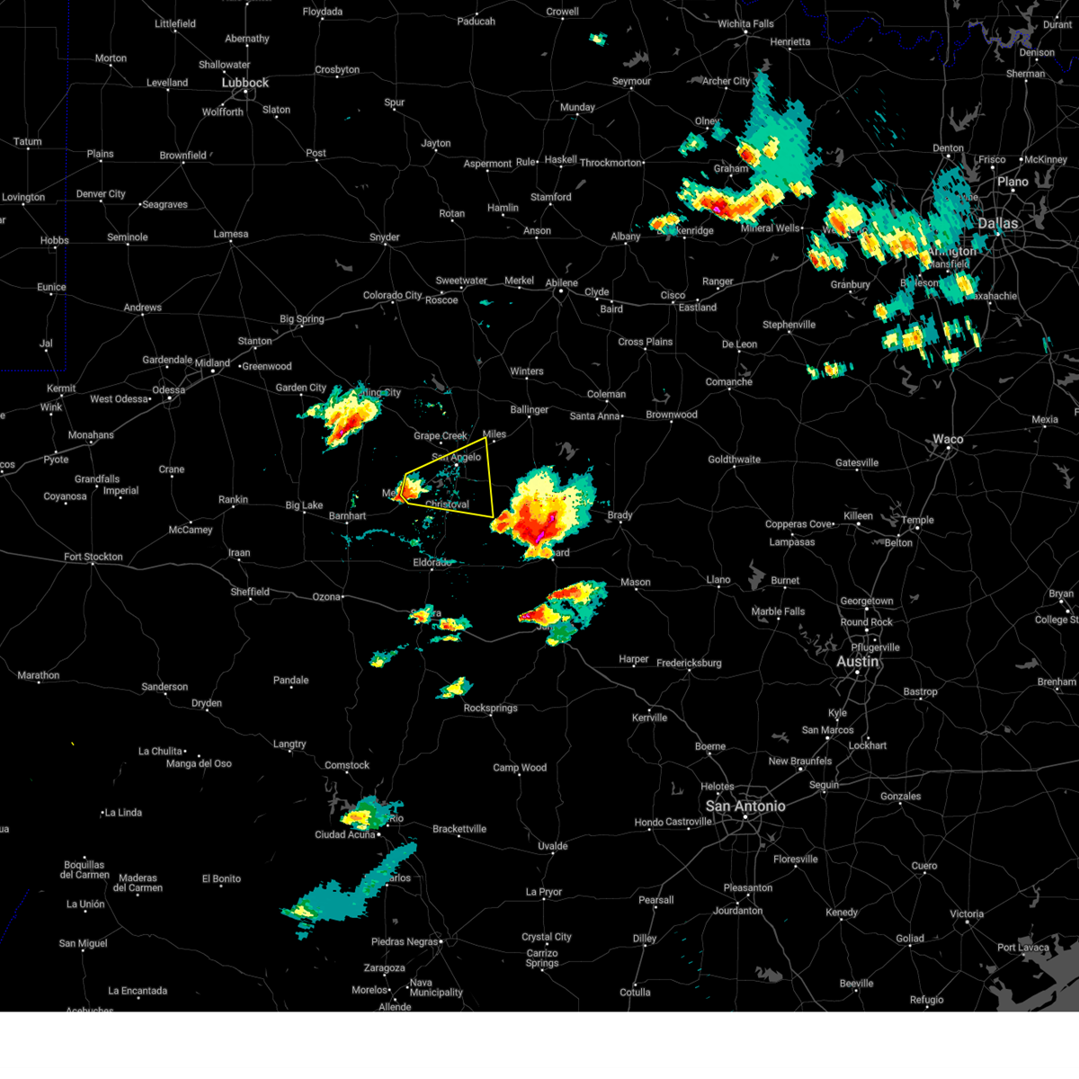
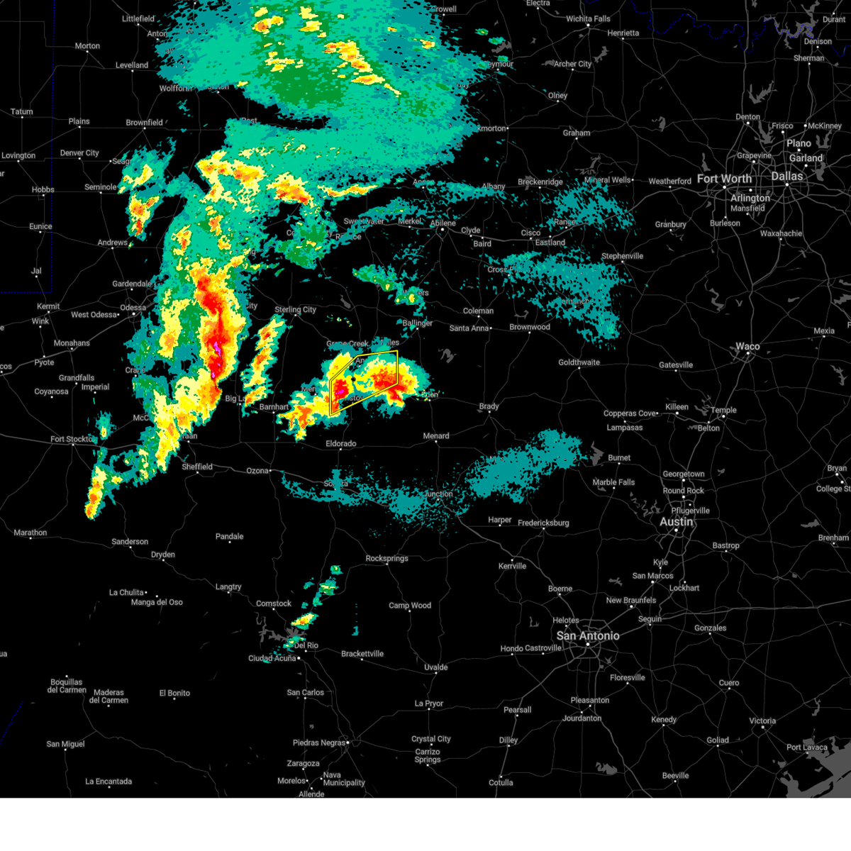
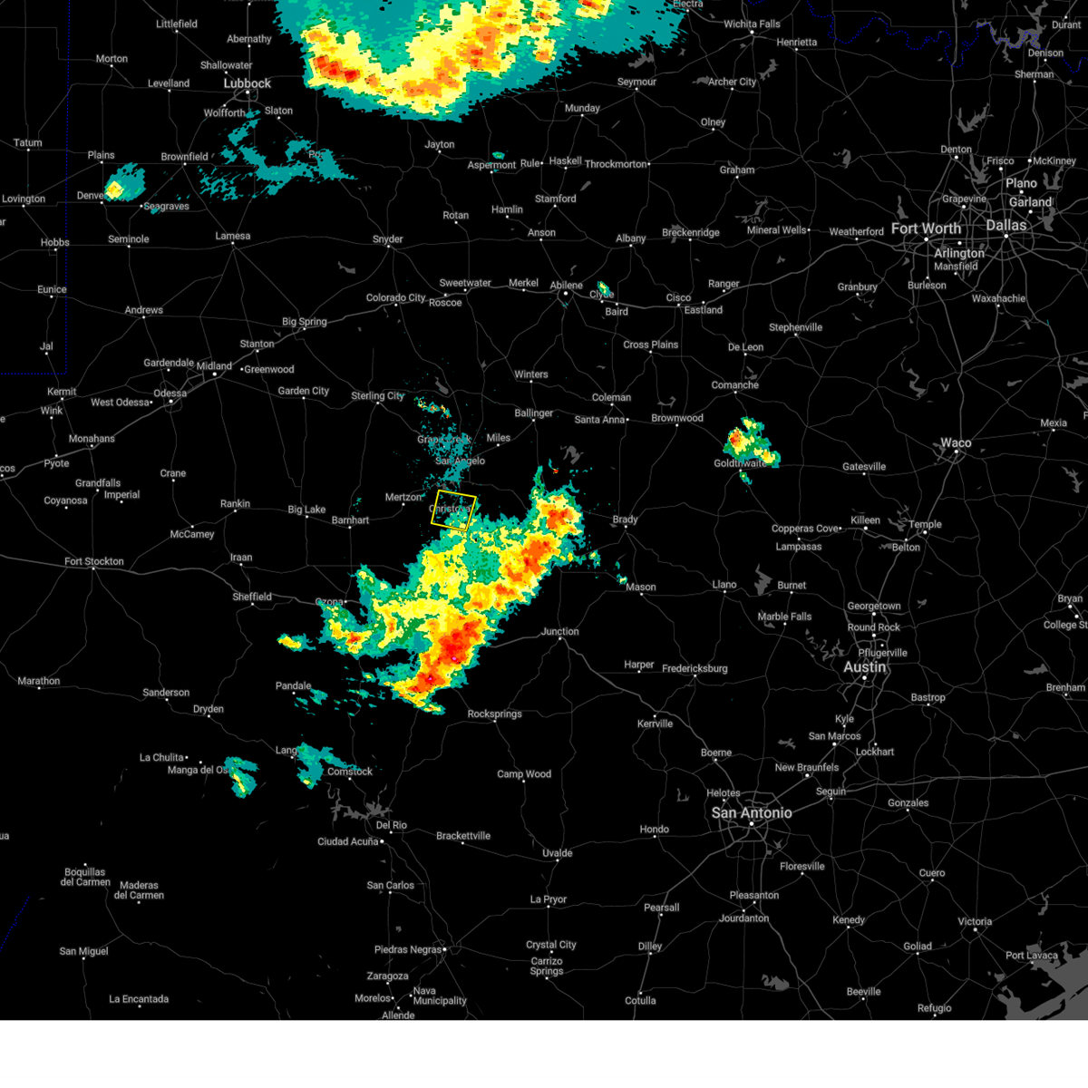
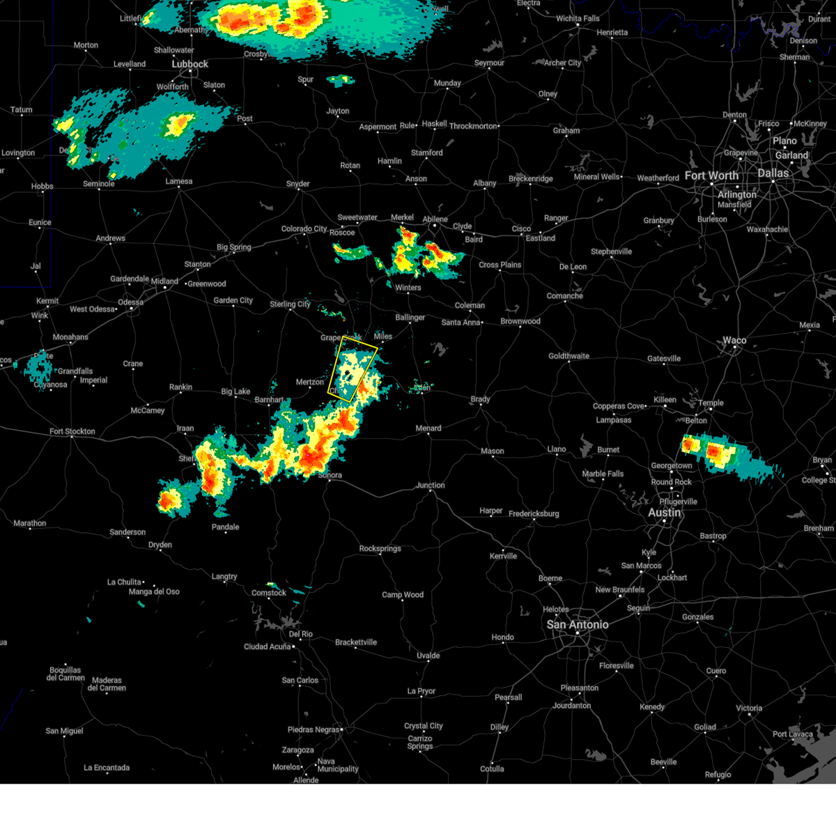
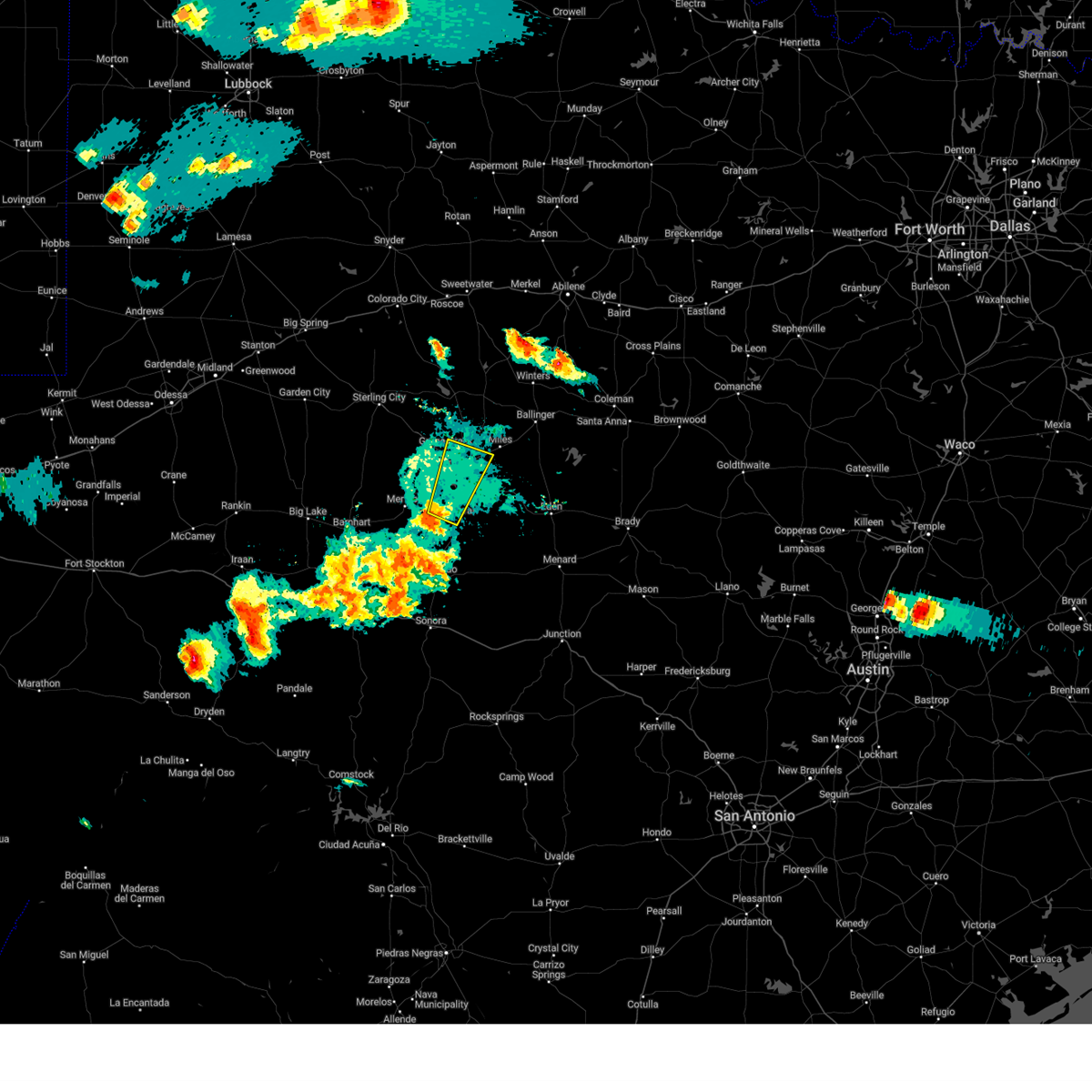
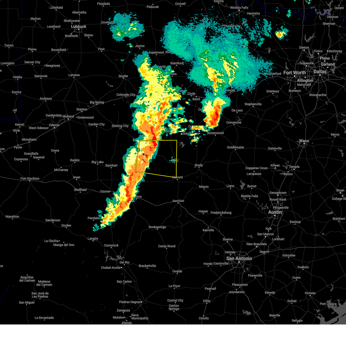
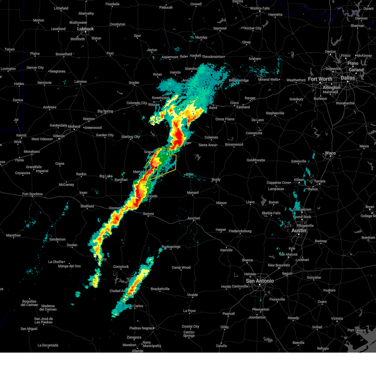
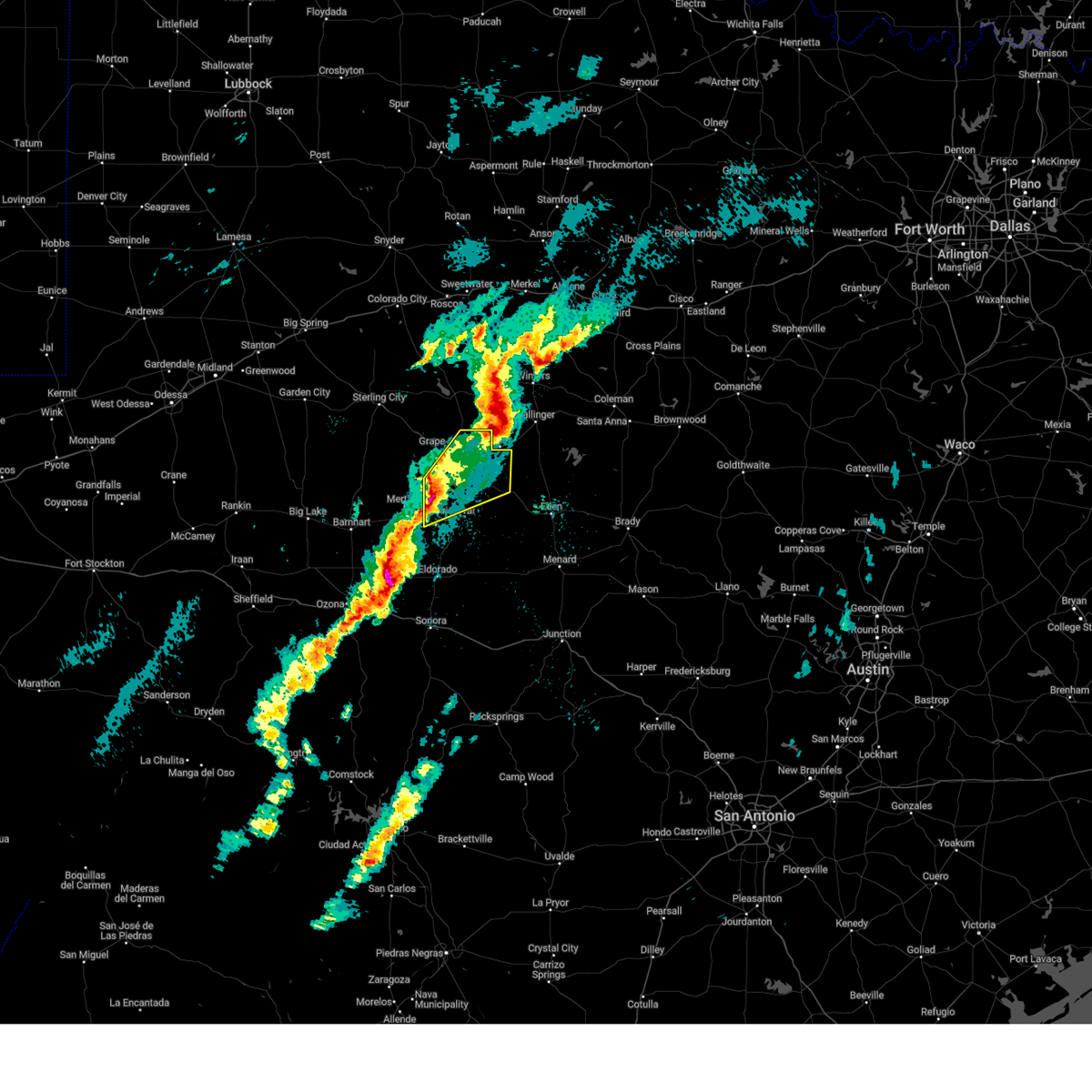
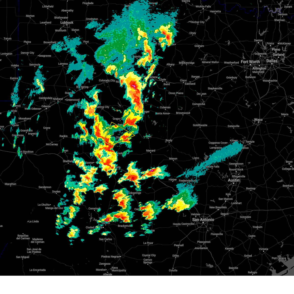
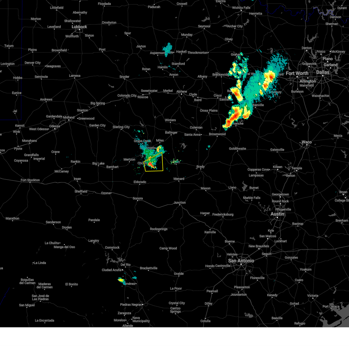
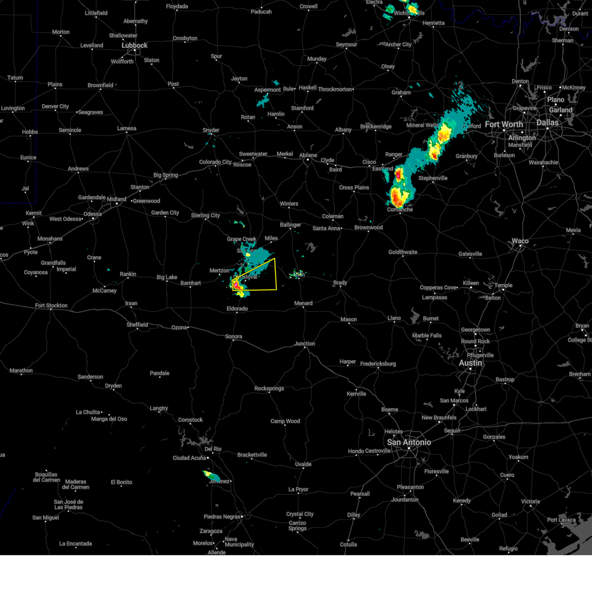
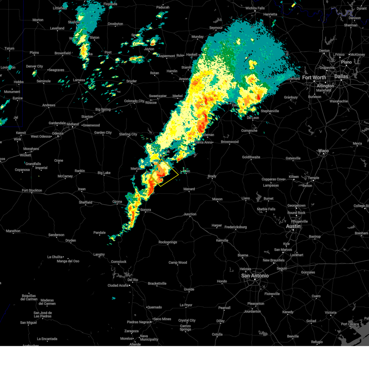
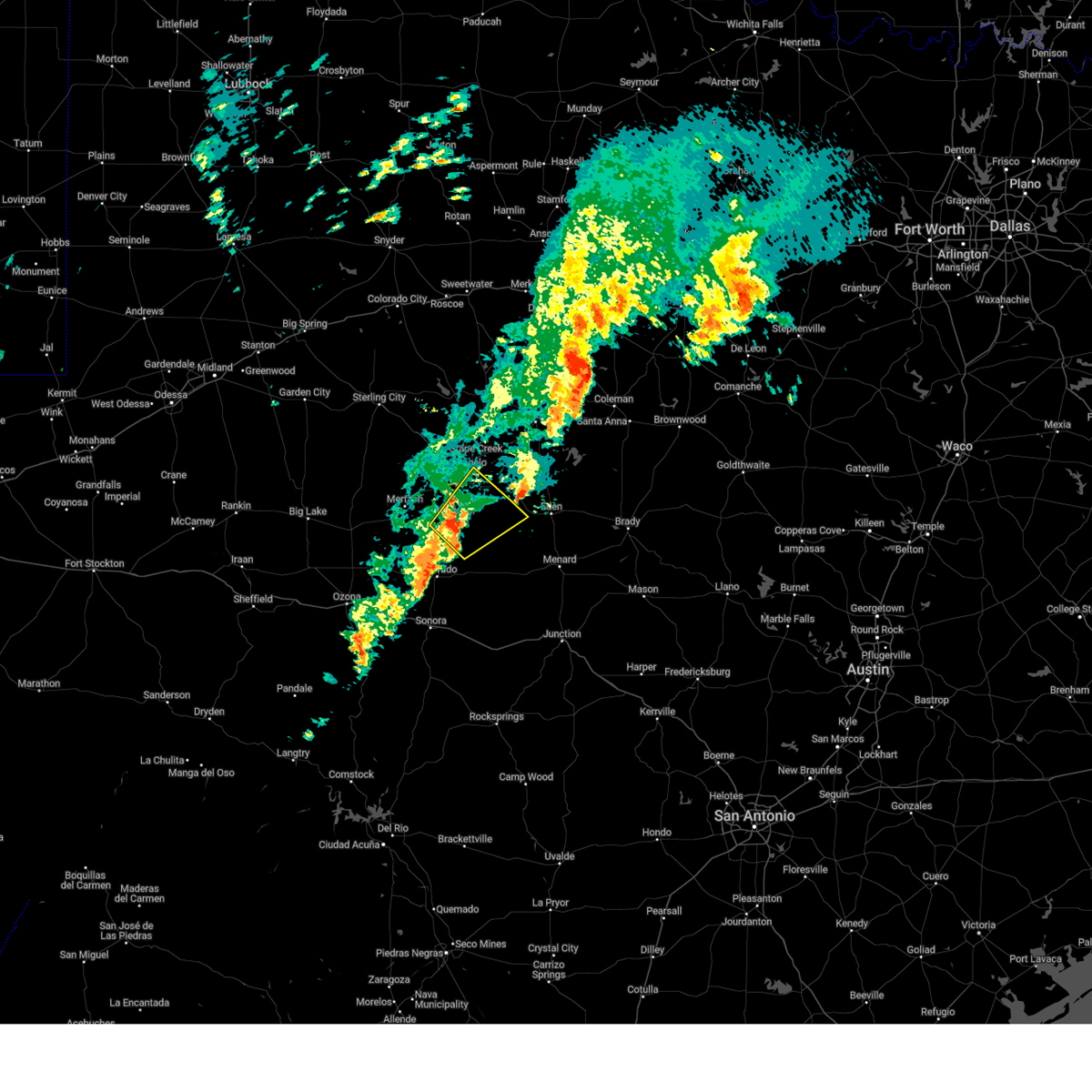
Hail Map for Christoval, TX
The Christoval, TX area has had 25 reports of on-the-ground hail by trained spotters, and has been under severe weather warnings 38 times during the past 12 months. Doppler radar has detected hail at or near Christoval, TX on 73 occasions, including 6 occasions during the past year.
| Name: | Christoval, TX |
| Where Located: | 96.9 miles SSW of Abilene, TX |
| Map: | Google Map for Christoval, TX |
| Population: | 504 |
| Housing Units: | 256 |
| More Info: | Search Google for Christoval, TX |
0
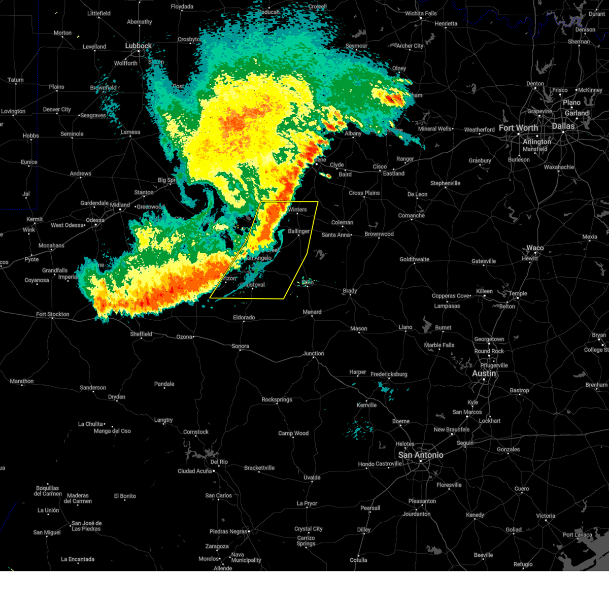
The Top Recent Hail Date for Christoval, TX is Tuesday, May 27, 2025 (61st out of 73)
Hail and Wind Damage Spotted near Christoval, TX
| Date / Time | Report Details |
|---|---|
| 6/10/2025 4:45 AM CDT |
 Svrsjt the national weather service in san angelo has issued a * severe thunderstorm warning for, eastern coke county in west central texas, tom green county in west central texas, runnels county in west central texas, northwestern concho county in west central texas, southeastern irion county in west central texas, * until 530 am cdt. * at 444 am cdt, severe thunderstorms were located along a line extending from near pumphrey to near san angelo to near us-67 near the irion-tom green county line, moving east at 35 mph (radar indicated). Hazards include 60 mph wind gusts. Expect damage to roofs, siding, and trees. severe thunderstorms will be near, san angelo, ballinger, winters, christoval, miles, lowake, wall, veribest, mereta, and knickerbocker around 450 am cdt. paint rock, eola, vancourt, crews, and benoit around 455 am cdt. Other locations impacted by these severe thunderstorms include wilmeth, the intersection of ranch road 380 and ranch road 381, drasco, vick, pumphrey, the intersection of us- 83 and ranch road 1929, the intersection of highway 208 and ranch road 2662, lake winters lake, ballinger lake, and us- 67 near the irion-tom green county line. Svrsjt the national weather service in san angelo has issued a * severe thunderstorm warning for, eastern coke county in west central texas, tom green county in west central texas, runnels county in west central texas, northwestern concho county in west central texas, southeastern irion county in west central texas, * until 530 am cdt. * at 444 am cdt, severe thunderstorms were located along a line extending from near pumphrey to near san angelo to near us-67 near the irion-tom green county line, moving east at 35 mph (radar indicated). Hazards include 60 mph wind gusts. Expect damage to roofs, siding, and trees. severe thunderstorms will be near, san angelo, ballinger, winters, christoval, miles, lowake, wall, veribest, mereta, and knickerbocker around 450 am cdt. paint rock, eola, vancourt, crews, and benoit around 455 am cdt. Other locations impacted by these severe thunderstorms include wilmeth, the intersection of ranch road 380 and ranch road 381, drasco, vick, pumphrey, the intersection of us- 83 and ranch road 1929, the intersection of highway 208 and ranch road 2662, lake winters lake, ballinger lake, and us- 67 near the irion-tom green county line.
|
| 6/9/2025 9:28 PM CDT |
 the severe thunderstorm warning has been cancelled and is no longer in effect the severe thunderstorm warning has been cancelled and is no longer in effect
|
| 6/9/2025 8:55 PM CDT |
 Svrsjt the national weather service in san angelo has issued a * severe thunderstorm warning for, northeastern schleicher county in west central texas, southeastern tom green county in west central texas, * until 945 pm cdt. * at 854 pm cdt, a severe thunderstorm was located 11 miles south of christoval, moving east at 20 mph (radar indicated). Hazards include 60 mph wind gusts and quarter size hail. Hail damage to vehicles is expected. expect wind damage to roofs, siding, and trees. This severe thunderstorm will remain over mainly rural areas of northeastern schleicher and southeastern tom green counties, including the following locations, adams. Svrsjt the national weather service in san angelo has issued a * severe thunderstorm warning for, northeastern schleicher county in west central texas, southeastern tom green county in west central texas, * until 945 pm cdt. * at 854 pm cdt, a severe thunderstorm was located 11 miles south of christoval, moving east at 20 mph (radar indicated). Hazards include 60 mph wind gusts and quarter size hail. Hail damage to vehicles is expected. expect wind damage to roofs, siding, and trees. This severe thunderstorm will remain over mainly rural areas of northeastern schleicher and southeastern tom green counties, including the following locations, adams.
|
| 5/29/2025 10:40 PM CDT |
 At 1039 pm cdt, a line of severe thunderstorms were located from harriet to san angelo to mertzon, moving southeast at 30 mph (radar indicated). Hazards include 60 mph wind gusts. Expect damage to roofs, siding, and trees. this severe storm will be near, southeastern san angelo and wall around 1045 pm cdt. Other locations impacted by this severe thunderstorm include the intersection of highway 208 and ranch road 2662, harriet, and us- 67 near the irion-tom green county line. At 1039 pm cdt, a line of severe thunderstorms were located from harriet to san angelo to mertzon, moving southeast at 30 mph (radar indicated). Hazards include 60 mph wind gusts. Expect damage to roofs, siding, and trees. this severe storm will be near, southeastern san angelo and wall around 1045 pm cdt. Other locations impacted by this severe thunderstorm include the intersection of highway 208 and ranch road 2662, harriet, and us- 67 near the irion-tom green county line.
|
| 5/29/2025 10:24 PM CDT |
 At 1021 pm cdt, a line of severe severe thunderstorms were located from grape creek to arden to mertzon, moving southeast at 30 mph (radar indicated). Hazards include 60 mph wind gusts. Hail damage to vehicles is expected. expect wind damage to roofs, siding, and trees. this severe storm will be near, san angelo, o. c. fisher reservoir, and san angelo state park around 1025 pm cdt. goodfellow air force base around 1030 pm cdt. veribest around 1035 pm cdt. wall around 1040 pm cdt. mereta around 1055 pm cdt. Other locations impacted by this severe thunderstorm include the intersection of highway 208 and ranch road 2662, harriet, and us- 67 near the irion-tom green county line. At 1021 pm cdt, a line of severe severe thunderstorms were located from grape creek to arden to mertzon, moving southeast at 30 mph (radar indicated). Hazards include 60 mph wind gusts. Hail damage to vehicles is expected. expect wind damage to roofs, siding, and trees. this severe storm will be near, san angelo, o. c. fisher reservoir, and san angelo state park around 1025 pm cdt. goodfellow air force base around 1030 pm cdt. veribest around 1035 pm cdt. wall around 1040 pm cdt. mereta around 1055 pm cdt. Other locations impacted by this severe thunderstorm include the intersection of highway 208 and ranch road 2662, harriet, and us- 67 near the irion-tom green county line.
|
| 5/29/2025 10:24 PM CDT |
 the severe thunderstorm warning has been cancelled and is no longer in effect the severe thunderstorm warning has been cancelled and is no longer in effect
|
| 5/29/2025 10:01 PM CDT |
 Svrsjt the national weather service in san angelo has issued a * severe thunderstorm warning for, southwestern coke county in west central texas, southeastern sterling county in west central texas, tom green county in west central texas, southwestern runnels county in west central texas, northern irion county in west central texas, * until 1100 pm cdt. * at 958 pm cdt, a line of severe thunderstorms across near robert lee to water valley to mertzon, moving southeast at 30 mph (radar indicated). Hazards include 70 mph wind gusts and quarter size hail. Hail damage to vehicles is expected. expect considerable tree damage. wind damage is also likely to mobile homes, roofs, and outbuildings. these severe thunderstorms will be near, carlsbad and grape creek around 1005 pm cdt. san angelo and san angelo state park around 1010 pm cdt. o. c. fisher reservoir around 1015 pm cdt. goodfellow air force base around 1030 pm cdt. veribest around 1035 pm cdt. wall around 1040 pm cdt. Other locations impacted by this severe thunderstorm include the intersection of highway 208 and ranch road 2662, us-87 near the coke- tom green county line, us-67 near the irion- tom green county line, and harriet. Svrsjt the national weather service in san angelo has issued a * severe thunderstorm warning for, southwestern coke county in west central texas, southeastern sterling county in west central texas, tom green county in west central texas, southwestern runnels county in west central texas, northern irion county in west central texas, * until 1100 pm cdt. * at 958 pm cdt, a line of severe thunderstorms across near robert lee to water valley to mertzon, moving southeast at 30 mph (radar indicated). Hazards include 70 mph wind gusts and quarter size hail. Hail damage to vehicles is expected. expect considerable tree damage. wind damage is also likely to mobile homes, roofs, and outbuildings. these severe thunderstorms will be near, carlsbad and grape creek around 1005 pm cdt. san angelo and san angelo state park around 1010 pm cdt. o. c. fisher reservoir around 1015 pm cdt. goodfellow air force base around 1030 pm cdt. veribest around 1035 pm cdt. wall around 1040 pm cdt. Other locations impacted by this severe thunderstorm include the intersection of highway 208 and ranch road 2662, us-87 near the coke- tom green county line, us-67 near the irion- tom green county line, and harriet.
|
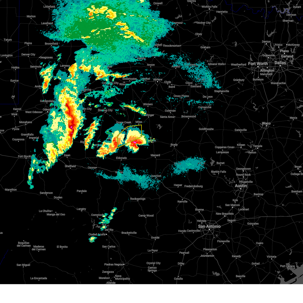
| 5/27/2025 11:43 PM CDT |
 Svrsjt the national weather service in san angelo has issued a * severe thunderstorm warning for, northeastern schleicher county in west central texas, southeastern tom green county in west central texas, northwestern menard county in west central texas, southwestern runnels county in west central texas, western concho county in west central texas, * until 1245 am cdt. * at 1142 pm cdt, a severe thunderstorm was located 7 miles northeast of christoval, moving east at 25 mph (radar indicated). Hazards include 70 mph wind gusts and quarter size hail. Hail damage to vehicles is expected. expect considerable tree damage. wind damage is also likely to mobile homes, roofs, and outbuildings. this severe thunderstorm will be near, wall around 1150 pm cdt. vancourt around 1155 pm cdt. eola around 1210 am cdt. mereta around 1225 am cdt. Other locations impacted by this severe thunderstorm include vick, the intersection of us- 190 and ranch road 2084, adams, and the intersection of ranch road 380 and ranch road 381. Svrsjt the national weather service in san angelo has issued a * severe thunderstorm warning for, northeastern schleicher county in west central texas, southeastern tom green county in west central texas, northwestern menard county in west central texas, southwestern runnels county in west central texas, western concho county in west central texas, * until 1245 am cdt. * at 1142 pm cdt, a severe thunderstorm was located 7 miles northeast of christoval, moving east at 25 mph (radar indicated). Hazards include 70 mph wind gusts and quarter size hail. Hail damage to vehicles is expected. expect considerable tree damage. wind damage is also likely to mobile homes, roofs, and outbuildings. this severe thunderstorm will be near, wall around 1150 pm cdt. vancourt around 1155 pm cdt. eola around 1210 am cdt. mereta around 1225 am cdt. Other locations impacted by this severe thunderstorm include vick, the intersection of us- 190 and ranch road 2084, adams, and the intersection of ranch road 380 and ranch road 381.
|
| 5/27/2025 11:18 PM CDT | Corrected time on previous tstm wnd gst report from 2 w christova in tom green county TX, 2.2 miles ENE of Christoval, TX |
| 5/27/2025 11:01 PM CDT |
 Svrsjt the national weather service in san angelo has issued a * severe thunderstorm warning for, northeastern schleicher county in west central texas, southeastern tom green county in west central texas, southeastern irion county in west central texas, * until 1145 pm cdt. * at 1100 pm cdt, a severe thunderstorm was located 7 miles south of mertzon, moving northeast at 45 mph (radar indicated). Hazards include 70 mph wind gusts and quarter size hail. Hail damage to vehicles is expected. expect considerable tree damage. wind damage is also likely to mobile homes, roofs, and outbuildings. this severe thunderstorm will be near, mertzon, sherwood, and knickerbocker around 1105 pm cdt. christoval, tankersley, and twin buttes reservoir around 1115 pm cdt. san angelo and lake nasworthy around 1120 pm cdt. goodfellow air force base around 1130 pm cdt. Other locations impacted by this severe thunderstorm include us- 67 near the irion-tom green county line. Svrsjt the national weather service in san angelo has issued a * severe thunderstorm warning for, northeastern schleicher county in west central texas, southeastern tom green county in west central texas, southeastern irion county in west central texas, * until 1145 pm cdt. * at 1100 pm cdt, a severe thunderstorm was located 7 miles south of mertzon, moving northeast at 45 mph (radar indicated). Hazards include 70 mph wind gusts and quarter size hail. Hail damage to vehicles is expected. expect considerable tree damage. wind damage is also likely to mobile homes, roofs, and outbuildings. this severe thunderstorm will be near, mertzon, sherwood, and knickerbocker around 1105 pm cdt. christoval, tankersley, and twin buttes reservoir around 1115 pm cdt. san angelo and lake nasworthy around 1120 pm cdt. goodfellow air force base around 1130 pm cdt. Other locations impacted by this severe thunderstorm include us- 67 near the irion-tom green county line.
|
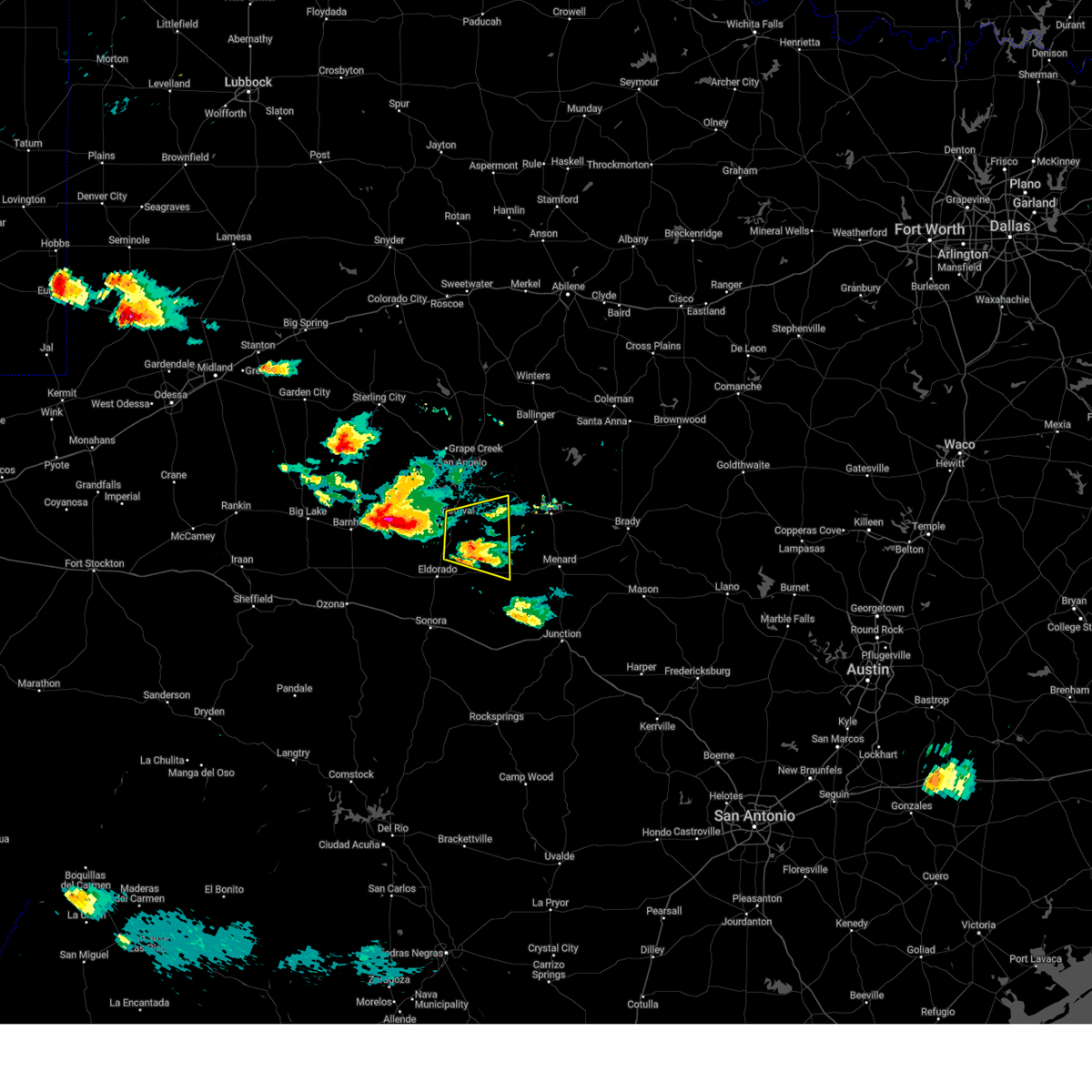
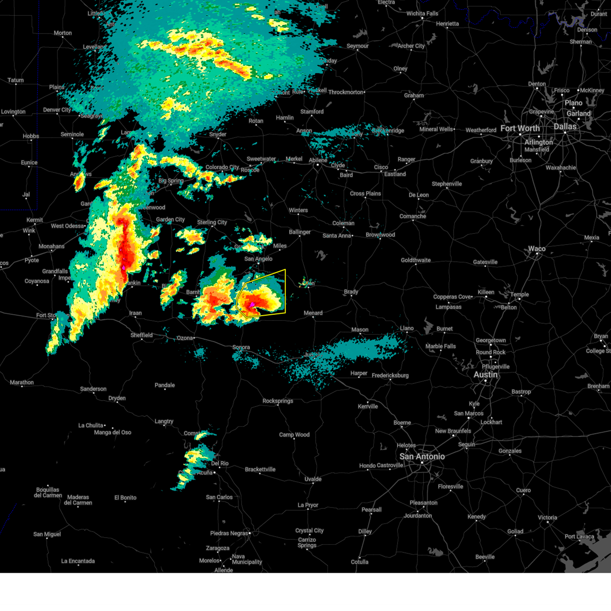
| 5/26/2025 6:13 PM CDT | Tea Cup sized hail reported 2.2 miles S of Christoval, TX, a trained spotter reported 3 to 3.5 inch hail. |
| 5/26/2025 6:08 PM CDT | Baseball sized hail reported 0.6 miles NNW of Christoval, TX, the public reported ping pong to baseball size hail. |
| 5/26/2025 6:08 PM CDT |
 At 606 pm cdt, a severe thunderstorm was located 5 miles north of christoval, moving southeast at 35 mph. this is a destructive storm for christoval and rural areas of tom green county (trained weather spotters reported baseball sized hail north of christoval). Hazards include baseball size hail and 60 mph wind gusts. People and animals outdoors will be severely injured. expect shattered windows, extensive damage to roofs, siding, and vehicles. This severe thunderstorm will remain over mainly rural areas of southeastern tom green and concho counties, including the following locations, vick, the intersection of us- 83 and ranch road 765, the intersection of us- 83 and ranch road 1929, live oak, us-83 near the concho- runnels county line, harriet, and the intersection of ranch road 380 and ranch road 381. At 606 pm cdt, a severe thunderstorm was located 5 miles north of christoval, moving southeast at 35 mph. this is a destructive storm for christoval and rural areas of tom green county (trained weather spotters reported baseball sized hail north of christoval). Hazards include baseball size hail and 60 mph wind gusts. People and animals outdoors will be severely injured. expect shattered windows, extensive damage to roofs, siding, and vehicles. This severe thunderstorm will remain over mainly rural areas of southeastern tom green and concho counties, including the following locations, vick, the intersection of us- 83 and ranch road 765, the intersection of us- 83 and ranch road 1929, live oak, us-83 near the concho- runnels county line, harriet, and the intersection of ranch road 380 and ranch road 381.
|
| 5/26/2025 6:03 PM CDT | Golf Ball sized hail reported 4.5 miles SSW of Christoval, TX, report from mping: golf ball (1.75 in.). |
| 5/26/2025 6:03 PM CDT | Baseball sized hail reported 0.9 miles SSE of Christoval, TX |
| 5/26/2025 6:00 PM CDT | Quarter sized hail reported 3 miles SSW of Christoval, TX, report from mping: quarter (1.00 in.). |
| 5/26/2025 6:00 PM CDT | Tea Cup sized hail reported 4.9 miles SE of Christoval, TX, a spotter measured 3.75 inch hail. |
| 5/26/2025 5:57 PM CDT | Tea Cup sized hail reported 4 miles SE of Christoval, TX, report from mping: baseball++ (3.50 in.). |
| 5/26/2025 5:42 PM CDT |
 Svrsjt the national weather service in san angelo has issued a * severe thunderstorm warning for, eastern tom green county in west central texas, concho county in west central texas, * until 645 pm cdt. * at 542 pm cdt, a severe thunderstorm was located over central and western tom green county, including san angelo, moving east at 25 mph (radar indicated). Hazards include golf ball size hail and 60 mph wind gusts. People and animals outdoors will be injured. expect hail damage to roofs, siding, windows, and vehicles. expect wind damage to roofs, siding, and trees. this severe thunderstorm will be near, eastern san angelo, wall, and goodfellow air force base around 545 pm cdt. veribest around 550 pm cdt. vancourt around 600 pm cdt. mereta around 605 pm cdt. eola around 610 pm cdt. Other locations impacted by this severe thunderstorm include vick, the intersection of us-83 and ranch road 765, the intersection of us- 83 and ranch road 1929, live oak, us-83 near the concho- runnels county line, harriet, and the intersection of ranch road 380 and ranch road 381. Svrsjt the national weather service in san angelo has issued a * severe thunderstorm warning for, eastern tom green county in west central texas, concho county in west central texas, * until 645 pm cdt. * at 542 pm cdt, a severe thunderstorm was located over central and western tom green county, including san angelo, moving east at 25 mph (radar indicated). Hazards include golf ball size hail and 60 mph wind gusts. People and animals outdoors will be injured. expect hail damage to roofs, siding, windows, and vehicles. expect wind damage to roofs, siding, and trees. this severe thunderstorm will be near, eastern san angelo, wall, and goodfellow air force base around 545 pm cdt. veribest around 550 pm cdt. vancourt around 600 pm cdt. mereta around 605 pm cdt. eola around 610 pm cdt. Other locations impacted by this severe thunderstorm include vick, the intersection of us-83 and ranch road 765, the intersection of us- 83 and ranch road 1929, live oak, us-83 near the concho- runnels county line, harriet, and the intersection of ranch road 380 and ranch road 381.
|
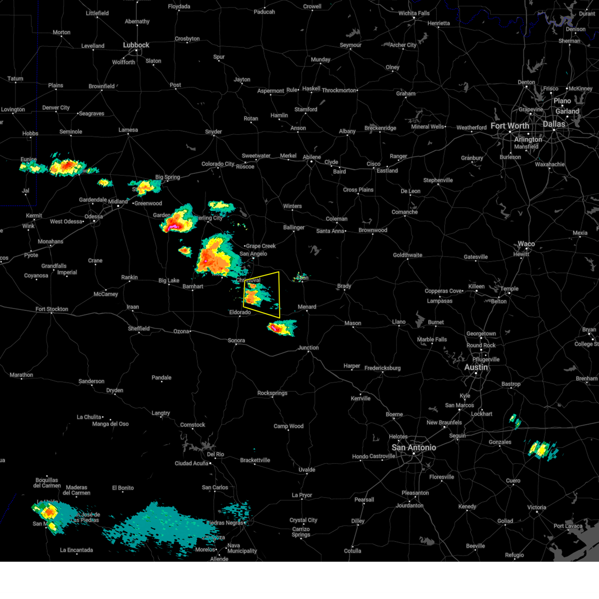
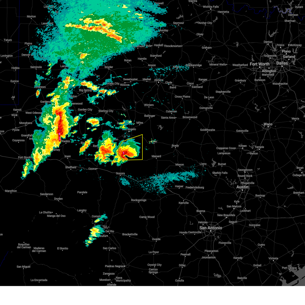
| 5/26/2025 4:20 PM CDT |
 At 419 pm cdt, a severe thunderstorm was located over tankersley, moving east at 25 mph (radar indicated). Hazards include 60 mph wind gusts and quarter size hail. Hail damage to vehicles is expected. expect wind damage to roofs, siding, and trees. this severe storm will be near, san angelo, twin buttes reservoir, and lake nasworthy around 425 pm cdt. goodfellow air force base around 435 pm cdt. wall around 445 pm cdt. veribest around 500 pm cdt. Other locations impacted by this severe thunderstorm include harriet and us-67 near the irion-tom green county line. At 419 pm cdt, a severe thunderstorm was located over tankersley, moving east at 25 mph (radar indicated). Hazards include 60 mph wind gusts and quarter size hail. Hail damage to vehicles is expected. expect wind damage to roofs, siding, and trees. this severe storm will be near, san angelo, twin buttes reservoir, and lake nasworthy around 425 pm cdt. goodfellow air force base around 435 pm cdt. wall around 445 pm cdt. veribest around 500 pm cdt. Other locations impacted by this severe thunderstorm include harriet and us-67 near the irion-tom green county line.
|
| 5/26/2025 4:20 PM CDT |
 the severe thunderstorm warning has been cancelled and is no longer in effect the severe thunderstorm warning has been cancelled and is no longer in effect
|
| 5/26/2025 4:03 PM CDT |
 Svrsjt the national weather service in san angelo has issued a * severe thunderstorm warning for, eastern tom green county in west central texas, east central irion county in west central texas, * until 500 pm cdt. * at 403 pm cdt, a severe thunderstorm was located near sherwood, moving east at 25 mph (radar indicated). Hazards include 60 mph wind gusts and quarter size hail. Hail damage to vehicles is expected. expect wind damage to roofs, siding, and trees. this severe thunderstorm will be near, tankersley and knickerbocker around 410 pm cdt. twin buttes reservoir around 415 pm cdt. san angelo around 420 pm cdt. lake nasworthy around 425 pm cdt. goodfellow air force base around 440 pm cdt. Other locations impacted by this severe thunderstorm include harriet and us-67 near the irion-tom green county line. Svrsjt the national weather service in san angelo has issued a * severe thunderstorm warning for, eastern tom green county in west central texas, east central irion county in west central texas, * until 500 pm cdt. * at 403 pm cdt, a severe thunderstorm was located near sherwood, moving east at 25 mph (radar indicated). Hazards include 60 mph wind gusts and quarter size hail. Hail damage to vehicles is expected. expect wind damage to roofs, siding, and trees. this severe thunderstorm will be near, tankersley and knickerbocker around 410 pm cdt. twin buttes reservoir around 415 pm cdt. san angelo around 420 pm cdt. lake nasworthy around 425 pm cdt. goodfellow air force base around 440 pm cdt. Other locations impacted by this severe thunderstorm include harriet and us-67 near the irion-tom green county line.
|
| 5/22/2025 9:35 PM CDT |
 the severe thunderstorm warning has been cancelled and is no longer in effect the severe thunderstorm warning has been cancelled and is no longer in effect
|
| 5/22/2025 9:35 PM CDT |
 At 934 pm cdt, 60 mph winds continued across the southern and eastern portions of tom green county, spreading southeast at 40 mph. the strongest winds have moved out of san angelo (radar indicated). Hazards include 60 mph wind gusts. Expect damage to roofs, siding, and trees. This severe thunderstorm will remain over mainly rural areas of southeastern tom green and southwestern concho counties, including the following locations, vick, live oak, and us-83 near the menard- concho county line. At 934 pm cdt, 60 mph winds continued across the southern and eastern portions of tom green county, spreading southeast at 40 mph. the strongest winds have moved out of san angelo (radar indicated). Hazards include 60 mph wind gusts. Expect damage to roofs, siding, and trees. This severe thunderstorm will remain over mainly rural areas of southeastern tom green and southwestern concho counties, including the following locations, vick, live oak, and us-83 near the menard- concho county line.
|
| 5/22/2025 9:16 PM CDT |
 Svrsjt the national weather service in san angelo has issued a * severe thunderstorm warning for, tom green county in west central texas, southwestern runnels county in west central texas, southwestern concho county in west central texas, * until 1000 pm cdt. * at 913 pm cdt, 60 mph winds associated with a thunderstorm staying north of san angelo will continue to produce strong winds across the city and south into southern tom green county through 10 pm. the winds are spreading southeast at 40 mph (trained spotters). Hazards include 60 mph wind gusts. Expect damage to roofs, siding, and trees. this severe thunderstorm will be near, wall around 920 pm cdt. Other locations impacted by this severe thunderstorm include vick, us-67 near the irion- tom green county line, harriet, live oak, and us-83 near the menard- concho county line. Svrsjt the national weather service in san angelo has issued a * severe thunderstorm warning for, tom green county in west central texas, southwestern runnels county in west central texas, southwestern concho county in west central texas, * until 1000 pm cdt. * at 913 pm cdt, 60 mph winds associated with a thunderstorm staying north of san angelo will continue to produce strong winds across the city and south into southern tom green county through 10 pm. the winds are spreading southeast at 40 mph (trained spotters). Hazards include 60 mph wind gusts. Expect damage to roofs, siding, and trees. this severe thunderstorm will be near, wall around 920 pm cdt. Other locations impacted by this severe thunderstorm include vick, us-67 near the irion- tom green county line, harriet, live oak, and us-83 near the menard- concho county line.
|
| 5/6/2025 3:40 AM CDT |
 At 340 am cdt, a severe thunderstorm was located near wall, moving northeast at 35 mph (radar indicated). Hazards include 60 mph wind gusts and quarter size hail. Hail damage to vehicles is expected. expect wind damage to roofs, siding, and trees. this severe storm will be near, veribest, vancourt, and mereta around 345 am cdt. Other locations impacted by this severe thunderstorm include harriet and us-67 near the irion-tom green county line. At 340 am cdt, a severe thunderstorm was located near wall, moving northeast at 35 mph (radar indicated). Hazards include 60 mph wind gusts and quarter size hail. Hail damage to vehicles is expected. expect wind damage to roofs, siding, and trees. this severe storm will be near, veribest, vancourt, and mereta around 345 am cdt. Other locations impacted by this severe thunderstorm include harriet and us-67 near the irion-tom green county line.
|
| 5/6/2025 3:13 AM CDT |
 At 313 am cdt, a severe thunderstorm was located near knickerbocker, moving northeast at 40 mph (radar indicated). Hazards include golf ball size hail and 60 mph wind gusts. People and animals outdoors will be injured. expect hail damage to roofs, siding, windows, and vehicles. expect wind damage to roofs, siding, and trees. this severe storm will be near, twin buttes reservoir, lake nasworthy, goodfellow air force base, and san angelo around 320 am cdt. wall around 325 am cdt. veribest around 335 am cdt. vancourt and mereta around 340 am cdt. Other locations impacted by this severe thunderstorm include harriet and us-67 near the irion-tom green county line. At 313 am cdt, a severe thunderstorm was located near knickerbocker, moving northeast at 40 mph (radar indicated). Hazards include golf ball size hail and 60 mph wind gusts. People and animals outdoors will be injured. expect hail damage to roofs, siding, windows, and vehicles. expect wind damage to roofs, siding, and trees. this severe storm will be near, twin buttes reservoir, lake nasworthy, goodfellow air force base, and san angelo around 320 am cdt. wall around 325 am cdt. veribest around 335 am cdt. vancourt and mereta around 340 am cdt. Other locations impacted by this severe thunderstorm include harriet and us-67 near the irion-tom green county line.
|
| 5/6/2025 3:05 AM CDT |
 Svrsjt the national weather service in san angelo has issued a * severe thunderstorm warning for, southeastern tom green county in west central texas, * until 400 am cdt. * at 305 am cdt, a severe thunderstorm was located over knickerbocker, moving northeast at 40 mph (radar indicated). Hazards include 60 mph wind gusts and quarter size hail. Hail damage to vehicles is expected. expect wind damage to roofs, siding, and trees. this severe thunderstorm will be near, tankersley, twin buttes reservoir, christoval, and san angelo around 310 am cdt. lake nasworthy around 315 am cdt. wall and goodfellow air force base around 325 am cdt. veribest around 335 am cdt. vancourt and mereta around 340 am cdt. Other locations impacted by this severe thunderstorm include harriet and us-67 near the irion-tom green county line. Svrsjt the national weather service in san angelo has issued a * severe thunderstorm warning for, southeastern tom green county in west central texas, * until 400 am cdt. * at 305 am cdt, a severe thunderstorm was located over knickerbocker, moving northeast at 40 mph (radar indicated). Hazards include 60 mph wind gusts and quarter size hail. Hail damage to vehicles is expected. expect wind damage to roofs, siding, and trees. this severe thunderstorm will be near, tankersley, twin buttes reservoir, christoval, and san angelo around 310 am cdt. lake nasworthy around 315 am cdt. wall and goodfellow air force base around 325 am cdt. veribest around 335 am cdt. vancourt and mereta around 340 am cdt. Other locations impacted by this severe thunderstorm include harriet and us-67 near the irion-tom green county line.
|
| 5/6/2025 2:34 AM CDT |
 At 234 am cdt, a severe thunderstorm was located 9 miles south of christoval, moving northeast at 35 mph (radar indicated). Hazards include two inch hail and 60 mph wind gusts. People and animals outdoors will be injured. expect hail damage to roofs, siding, windows, and vehicles. expect wind damage to roofs, siding, and trees. this severe storm will be near, christoval around 240 am cdt. vancourt around 305 am cdt. Other locations impacted by this severe thunderstorm include the intersection of ranch road 1828 and ranch road 915. At 234 am cdt, a severe thunderstorm was located 9 miles south of christoval, moving northeast at 35 mph (radar indicated). Hazards include two inch hail and 60 mph wind gusts. People and animals outdoors will be injured. expect hail damage to roofs, siding, windows, and vehicles. expect wind damage to roofs, siding, and trees. this severe storm will be near, christoval around 240 am cdt. vancourt around 305 am cdt. Other locations impacted by this severe thunderstorm include the intersection of ranch road 1828 and ranch road 915.
|
| 5/6/2025 2:24 AM CDT |
 Svrsjt the national weather service in san angelo has issued a * severe thunderstorm warning for, northeastern schleicher county in west central texas, southeastern tom green county in west central texas, * until 330 am cdt. * at 224 am cdt, a severe thunderstorm was located about 8 miles north of eldorado, moving northeast at 35 mph (radar indicated). Hazards include golf ball size hail and 60 mph wind gusts. People and animals outdoors will be injured. expect hail damage to roofs, siding, windows, and vehicles. expect wind damage to roofs, siding, and trees. this severe thunderstorm will be near, christoval around 240 am cdt. vancourt around 310 am cdt. Other locations impacted by this severe thunderstorm include the intersection of ranch road 1828 and ranch road 915 and adams. Svrsjt the national weather service in san angelo has issued a * severe thunderstorm warning for, northeastern schleicher county in west central texas, southeastern tom green county in west central texas, * until 330 am cdt. * at 224 am cdt, a severe thunderstorm was located about 8 miles north of eldorado, moving northeast at 35 mph (radar indicated). Hazards include golf ball size hail and 60 mph wind gusts. People and animals outdoors will be injured. expect hail damage to roofs, siding, windows, and vehicles. expect wind damage to roofs, siding, and trees. this severe thunderstorm will be near, christoval around 240 am cdt. vancourt around 310 am cdt. Other locations impacted by this severe thunderstorm include the intersection of ranch road 1828 and ranch road 915 and adams.
|
| 4/22/2025 10:56 PM CDT |
 Svrsjt the national weather service in san angelo has issued a * severe thunderstorm warning for, southeastern tom green county in west central texas, * until midnight cdt. * at 1054 pm cdt, an area of persistent severe winds was located over christoval. this is a destructive wind storm for christoval (trained weather spotters). Hazards include 80 mph wind gusts. Flying debris will be dangerous to those caught without shelter. mobile homes will be heavily damaged. expect considerable damage to roofs, windows, and vehicles. Extensive tree damage and power outages are likely. Svrsjt the national weather service in san angelo has issued a * severe thunderstorm warning for, southeastern tom green county in west central texas, * until midnight cdt. * at 1054 pm cdt, an area of persistent severe winds was located over christoval. this is a destructive wind storm for christoval (trained weather spotters). Hazards include 80 mph wind gusts. Flying debris will be dangerous to those caught without shelter. mobile homes will be heavily damaged. expect considerable damage to roofs, windows, and vehicles. Extensive tree damage and power outages are likely.
|
| 4/22/2025 10:34 PM CDT | Estimated wind gusts were 70-80 mp in tom green county TX, 4.2 miles NE of Christoval, TX |
| 4/22/2025 9:26 PM CDT |
 the severe thunderstorm warning has been cancelled and is no longer in effect the severe thunderstorm warning has been cancelled and is no longer in effect
|
| 4/22/2025 9:01 PM CDT |
 Svrsjt the national weather service in san angelo has issued a * severe thunderstorm warning for, eastern tom green county in west central texas, * until 945 pm cdt. * at 901 pm cdt, a severe thunderstorm was located near christoval, moving north at 25 mph (radar indicated). Hazards include 60 mph wind gusts and quarter size hail. Hail damage to vehicles is expected. expect wind damage to roofs, siding, and trees. this severe thunderstorm will be near, twin buttes reservoir, lake nasworthy, and san angelo around 905 pm cdt. goodfellow air force base around 920 pm cdt. san angelo state park and o. c. fisher reservoir around 925 pm cdt. grape creek around 935 pm cdt. Other locations impacted by this severe thunderstorm include harriet. Svrsjt the national weather service in san angelo has issued a * severe thunderstorm warning for, eastern tom green county in west central texas, * until 945 pm cdt. * at 901 pm cdt, a severe thunderstorm was located near christoval, moving north at 25 mph (radar indicated). Hazards include 60 mph wind gusts and quarter size hail. Hail damage to vehicles is expected. expect wind damage to roofs, siding, and trees. this severe thunderstorm will be near, twin buttes reservoir, lake nasworthy, and san angelo around 905 pm cdt. goodfellow air force base around 920 pm cdt. san angelo state park and o. c. fisher reservoir around 925 pm cdt. grape creek around 935 pm cdt. Other locations impacted by this severe thunderstorm include harriet.
|
| 4/20/2025 12:19 AM CDT |
 the severe thunderstorm warning has been cancelled and is no longer in effect the severe thunderstorm warning has been cancelled and is no longer in effect
|
| 4/20/2025 12:19 AM CDT |
 At 1217 am cdt, severe thunderstorms were located along a line extending from near miles to near wall to 8 miles southeast of christoval, moving east at 55 mph (trained weather spotters). Hazards include 61 mph wind gust was reported 6 miles southeast of san angelo. nickel size hail. Expect damage to roofs, siding, and trees. these severe storms will be near, lowake, eola, vancourt, mereta, and paint rock around 1225 am cdt. eden around 1235 am cdt. Other locations impacted by these severe thunderstorms include vick, the intersection of us-83 and ranch road 765, the intersection of us- 83 and ranch road 1929, live oak, us-83 near the menard- concho county line, us-83 near the concho- runnels county line, harriet, and the intersection of ranch road 380 and ranch road 381. At 1217 am cdt, severe thunderstorms were located along a line extending from near miles to near wall to 8 miles southeast of christoval, moving east at 55 mph (trained weather spotters). Hazards include 61 mph wind gust was reported 6 miles southeast of san angelo. nickel size hail. Expect damage to roofs, siding, and trees. these severe storms will be near, lowake, eola, vancourt, mereta, and paint rock around 1225 am cdt. eden around 1235 am cdt. Other locations impacted by these severe thunderstorms include vick, the intersection of us-83 and ranch road 765, the intersection of us- 83 and ranch road 1929, live oak, us-83 near the menard- concho county line, us-83 near the concho- runnels county line, harriet, and the intersection of ranch road 380 and ranch road 381.
|
| 4/19/2025 11:53 PM CDT | Svrsjt the national weather service in san angelo has issued a * severe thunderstorm warning for, northeastern schleicher county in west central texas, tom green county in west central texas, northwestern menard county in west central texas, southwestern runnels county in west central texas, concho county in west central texas, southeastern irion county in west central texas, * until 1245 am cdt. * at 1152 pm cdt, severe thunderstorms were located along a line extending from carlsbad to near twin buttes reservoir to 9 miles south of knickerbocker, moving east at 50 mph (radar indicated). Hazards include 60 mph wind gusts and nickel size hail. Expect damage to roofs, siding, and trees. severe thunderstorms will be near, wall, carlsbad, san angelo state park, o. c. fisher reservoir, twin buttes reservoir, lake nasworthy, goodfellow air force base, christoval, grape creek, and san angelo around 1155 pm cdt. veribest around 1200 am cdt. vancourt around 1205 am cdt. eola, mereta, and miles around 1210 am cdt. lowake around 1215 am cdt. eden and paint rock around 1225 am cdt. Other locations impacted by these severe thunderstorms include vick, the intersection of us-83 and ranch road 765, the intersection of us- 83 and ranch road 1929, live oak, us-83 near the menard- concho county line, us-67 near the irion-tom green county line, us- 83 near the concho- runnels county line, harriet, and the intersection of ranch road 380 and ranch road 381. |
| 4/19/2025 1:26 AM CDT |
 At 126 am cdt, a severe thunderstorm was located over twin buttes reservoir, moving northeast at 30 mph (radar indicated). Hazards include 60 mph wind gusts and half dollar size hail. Hail damage to vehicles is expected. expect wind damage to roofs, siding, and trees. this severe storm will be near, san angelo state park, o. c. fisher reservoir, lake nasworthy, goodfellow air force base, and san angelo around 130 am cdt. wall around 145 am cdt. veribest around 150 am cdt. Other locations impacted by this severe thunderstorm include harriet and us-67 near the irion-tom green county line. At 126 am cdt, a severe thunderstorm was located over twin buttes reservoir, moving northeast at 30 mph (radar indicated). Hazards include 60 mph wind gusts and half dollar size hail. Hail damage to vehicles is expected. expect wind damage to roofs, siding, and trees. this severe storm will be near, san angelo state park, o. c. fisher reservoir, lake nasworthy, goodfellow air force base, and san angelo around 130 am cdt. wall around 145 am cdt. veribest around 150 am cdt. Other locations impacted by this severe thunderstorm include harriet and us-67 near the irion-tom green county line.
|
| 4/19/2025 1:13 AM CDT |
 Svrsjt the national weather service in san angelo has issued a * severe thunderstorm warning for, tom green county in west central texas, * until 215 am cdt. * at 113 am cdt, a severe thunderstorm was located over tankersley, moving northeast at 30 mph (radar indicated). Hazards include 60 mph wind gusts and quarter size hail. Hail damage to vehicles is expected. expect wind damage to roofs, siding, and trees. this severe thunderstorm will be near, twin buttes reservoir, lake nasworthy, and san angelo around 120 am cdt. san angelo state park, o. c. fisher reservoir, and goodfellow air force base around 130 am cdt. veribest and wall around 145 am cdt. Other locations impacted by this severe thunderstorm include harriet and us-67 near the irion-tom green county line. Svrsjt the national weather service in san angelo has issued a * severe thunderstorm warning for, tom green county in west central texas, * until 215 am cdt. * at 113 am cdt, a severe thunderstorm was located over tankersley, moving northeast at 30 mph (radar indicated). Hazards include 60 mph wind gusts and quarter size hail. Hail damage to vehicles is expected. expect wind damage to roofs, siding, and trees. this severe thunderstorm will be near, twin buttes reservoir, lake nasworthy, and san angelo around 120 am cdt. san angelo state park, o. c. fisher reservoir, and goodfellow air force base around 130 am cdt. veribest and wall around 145 am cdt. Other locations impacted by this severe thunderstorm include harriet and us-67 near the irion-tom green county line.
|
| 4/5/2025 12:39 AM CDT |
 Svrsjt the national weather service in san angelo has issued a * severe thunderstorm warning for, southeastern tom green county in west central texas, eastern irion county in west central texas, * until 115 am cdt. * at 1238 am cdt, a severe thunderstorm was located near mertzon, moving northeast at 40 mph (radar indicated). Hazards include 60 mph wind gusts and quarter size hail. Hail damage to vehicles is expected. expect wind damage to roofs, siding, and trees. this severe thunderstorm will be near, sherwood, knickerbocker, and mertzon around 1245 am cdt. tankersley around 1250 am cdt. twin buttes reservoir around 1255 am cdt. san angelo around 100 am cdt. lake nasworthy around 105 am cdt. Other locations impacted by this severe thunderstorm include us- 67 near the irion-tom green county line. Svrsjt the national weather service in san angelo has issued a * severe thunderstorm warning for, southeastern tom green county in west central texas, eastern irion county in west central texas, * until 115 am cdt. * at 1238 am cdt, a severe thunderstorm was located near mertzon, moving northeast at 40 mph (radar indicated). Hazards include 60 mph wind gusts and quarter size hail. Hail damage to vehicles is expected. expect wind damage to roofs, siding, and trees. this severe thunderstorm will be near, sherwood, knickerbocker, and mertzon around 1245 am cdt. tankersley around 1250 am cdt. twin buttes reservoir around 1255 am cdt. san angelo around 100 am cdt. lake nasworthy around 105 am cdt. Other locations impacted by this severe thunderstorm include us- 67 near the irion-tom green county line.
|
| 3/29/2025 8:43 PM CDT |
 At 843 pm cdt, a severe thunderstorm was located 7 miles east of christoval, moving northeast at 35 mph (trained weather spotters). Hazards include 60 mph wind gusts. Expect damage to roofs, siding, and trees. This severe storm will be near, vancourt around 855 pm cdt. At 843 pm cdt, a severe thunderstorm was located 7 miles east of christoval, moving northeast at 35 mph (trained weather spotters). Hazards include 60 mph wind gusts. Expect damage to roofs, siding, and trees. This severe storm will be near, vancourt around 855 pm cdt.
|
| 3/29/2025 8:26 PM CDT | Storm damage reported in tom green county TX, 4.1 miles ENE of Christoval, TX |
| 3/29/2025 8:25 PM CDT |
 Svrsjt the national weather service in san angelo has issued a * severe thunderstorm warning for, southeastern tom green county in west central texas, * until 930 pm cdt. * at 824 pm cdt, a severe thunderstorm was located near christoval, moving northeast at 30 mph (trained weather spotters). Hazards include 60 mph wind gusts. Expect damage to roofs, siding, and trees. this severe thunderstorm will be near, christoval around 830 pm cdt. Vancourt around 900 pm cdt. Svrsjt the national weather service in san angelo has issued a * severe thunderstorm warning for, southeastern tom green county in west central texas, * until 930 pm cdt. * at 824 pm cdt, a severe thunderstorm was located near christoval, moving northeast at 30 mph (trained weather spotters). Hazards include 60 mph wind gusts. Expect damage to roofs, siding, and trees. this severe thunderstorm will be near, christoval around 830 pm cdt. Vancourt around 900 pm cdt.
|
| 3/29/2025 8:22 PM CDT | Storm damage reported in tom green county TX, 4.1 miles ENE of Christoval, TX |
| 3/4/2025 2:41 AM CST | Quarter sized hail reported 3 miles SSW of Christoval, TX, the public reported up to quarter size hail. |
| 3/4/2025 2:38 AM CST |
 the tornado warning has been cancelled and is no longer in effect the tornado warning has been cancelled and is no longer in effect
|
| 3/4/2025 2:38 AM CST |
 At 237 am cst, a severe thunderstorm capable of producing a tornado was located near christoval, moving east at 65 mph (radar indicated rotation). Hazards include tornado and quarter size hail. Flying debris will be dangerous to those caught without shelter. mobile homes will be damaged or destroyed. damage to roofs, windows, and vehicles will occur. tree damage is likely. this dangerous storm will be near, vancourt around 255 am cst. eden around 310 am cst. Other locations impacted by this tornadic thunderstorm include vick, the intersection of us-83 and ranch road 765, us-83 near the concho- runnels county line, the intersection of us- 83 and ranch road 1929, and the intersection of ranch road 380 and ranch road 381. At 237 am cst, a severe thunderstorm capable of producing a tornado was located near christoval, moving east at 65 mph (radar indicated rotation). Hazards include tornado and quarter size hail. Flying debris will be dangerous to those caught without shelter. mobile homes will be damaged or destroyed. damage to roofs, windows, and vehicles will occur. tree damage is likely. this dangerous storm will be near, vancourt around 255 am cst. eden around 310 am cst. Other locations impacted by this tornadic thunderstorm include vick, the intersection of us-83 and ranch road 765, us-83 near the concho- runnels county line, the intersection of us- 83 and ranch road 1929, and the intersection of ranch road 380 and ranch road 381.
|
| 3/4/2025 2:28 AM CST |
 Torsjt the national weather service in san angelo has issued a * tornado warning for, southeastern tom green county in west central texas, south central runnels county in west central texas, western concho county in west central texas, southeastern irion county in west central texas, * until 315 am cst. * at 228 am cst, a severe thunderstorm capable of producing a tornado was located over knickerbocker, moving east at 50 mph (radar indicated rotation). Hazards include tornado and quarter size hail. Flying debris will be dangerous to those caught without shelter. mobile homes will be damaged or destroyed. damage to roofs, windows, and vehicles will occur. tree damage is likely. this dangerous storm will be near, twin buttes reservoir, christoval, and san angelo around 235 am cst. lake nasworthy around 240 am cst. wall around 245 am cst. vancourt around 255 am cst. eola around 300 am cst. mereta around 305 am cst. Other locations impacted by this tornadic thunderstorm include vick, the intersection of us-83 and ranch road 765, us-67 near the irion- tom green county line, us-83 near the concho- runnels county line, the intersection of us- 83 and ranch road 1929, and the intersection of ranch road 380 and ranch road 381. Torsjt the national weather service in san angelo has issued a * tornado warning for, southeastern tom green county in west central texas, south central runnels county in west central texas, western concho county in west central texas, southeastern irion county in west central texas, * until 315 am cst. * at 228 am cst, a severe thunderstorm capable of producing a tornado was located over knickerbocker, moving east at 50 mph (radar indicated rotation). Hazards include tornado and quarter size hail. Flying debris will be dangerous to those caught without shelter. mobile homes will be damaged or destroyed. damage to roofs, windows, and vehicles will occur. tree damage is likely. this dangerous storm will be near, twin buttes reservoir, christoval, and san angelo around 235 am cst. lake nasworthy around 240 am cst. wall around 245 am cst. vancourt around 255 am cst. eola around 300 am cst. mereta around 305 am cst. Other locations impacted by this tornadic thunderstorm include vick, the intersection of us-83 and ranch road 765, us-67 near the irion- tom green county line, us-83 near the concho- runnels county line, the intersection of us- 83 and ranch road 1929, and the intersection of ranch road 380 and ranch road 381.
|
| 11/7/2024 11:57 PM CST |
 At 1157 pm cst, a severe thunderstorm was located 8 miles east of christoval, moving northeast at 20 mph (radar indicated). Hazards include 60 mph wind gusts and half dollar size hail. Hail damage to vehicles is expected. expect wind damage to roofs, siding, and trees. this severe storm will be near, vancourt around 1215 am cst. Wall around 1220 am cst. At 1157 pm cst, a severe thunderstorm was located 8 miles east of christoval, moving northeast at 20 mph (radar indicated). Hazards include 60 mph wind gusts and half dollar size hail. Hail damage to vehicles is expected. expect wind damage to roofs, siding, and trees. this severe storm will be near, vancourt around 1215 am cst. Wall around 1220 am cst.
|
| 11/7/2024 11:37 PM CST |
 Svrsjt the national weather service in san angelo has issued a * severe thunderstorm warning for, north central schleicher county in west central texas, southeastern tom green county in west central texas, west central concho county in west central texas, * until 1230 am cst. * at 1137 pm cst, a severe thunderstorm was located near christoval, moving northeast at 20 mph (radar indicated). Hazards include 60 mph wind gusts and quarter size hail. Hail damage to vehicles is expected. expect wind damage to roofs, siding, and trees. This severe thunderstorm will be near, christoval around 1145 pm cst. Svrsjt the national weather service in san angelo has issued a * severe thunderstorm warning for, north central schleicher county in west central texas, southeastern tom green county in west central texas, west central concho county in west central texas, * until 1230 am cst. * at 1137 pm cst, a severe thunderstorm was located near christoval, moving northeast at 20 mph (radar indicated). Hazards include 60 mph wind gusts and quarter size hail. Hail damage to vehicles is expected. expect wind damage to roofs, siding, and trees. This severe thunderstorm will be near, christoval around 1145 pm cst.
|
| 5/31/2024 1:20 AM CDT |
 The storms which prompted the warning have weakened below severe limits, and no longer pose an immediate threat to life or property. therefore, the warning will be allowed to expire. however, gusty winds are still possible with these thunderstorms. a severe thunderstorm watch remains in effect until 700 am cdt for west central texas. The storms which prompted the warning have weakened below severe limits, and no longer pose an immediate threat to life or property. therefore, the warning will be allowed to expire. however, gusty winds are still possible with these thunderstorms. a severe thunderstorm watch remains in effect until 700 am cdt for west central texas.
|
| 5/31/2024 12:31 AM CDT |
 Svrsjt the national weather service in san angelo has issued a * severe thunderstorm warning for, north central schleicher county in west central texas, southeastern tom green county in west central texas, southwestern concho county in west central texas, eastern irion county in west central texas, * until 130 am cdt. * at 1230 am cdt, strong outflow winds were located along a line extending from san angelo to near tankersley to 10 miles west of arden, moving southeast at 25 mph (radar indicated). Hazards include 60 mph wind gusts. Expect damage to roofs, siding, and trees. severe thunderstorms will be near, san angelo, mertzon, christoval, tankersley, wall, sherwood, knickerbocker, lake nasworthy, twin buttes reservoir, and goodfellow air force base around 1235 am cdt. Other locations impacted by these severe thunderstorms include us- 67 near the irion-tom green county line. Svrsjt the national weather service in san angelo has issued a * severe thunderstorm warning for, north central schleicher county in west central texas, southeastern tom green county in west central texas, southwestern concho county in west central texas, eastern irion county in west central texas, * until 130 am cdt. * at 1230 am cdt, strong outflow winds were located along a line extending from san angelo to near tankersley to 10 miles west of arden, moving southeast at 25 mph (radar indicated). Hazards include 60 mph wind gusts. Expect damage to roofs, siding, and trees. severe thunderstorms will be near, san angelo, mertzon, christoval, tankersley, wall, sherwood, knickerbocker, lake nasworthy, twin buttes reservoir, and goodfellow air force base around 1235 am cdt. Other locations impacted by these severe thunderstorms include us- 67 near the irion-tom green county line.
|
| 5/26/2024 3:44 AM CDT |
 At 344 am cdt, a severe thunderstorm was located near christoval, moving east at 45 mph (radar indicated). Hazards include 60 mph wind gusts and quarter size hail. Hail damage to vehicles is expected. expect wind damage to roofs, siding, and trees. this severe storm will be near, southern san angelo around 350 am cdt. Other locations impacted by this severe thunderstorm include us- 67 near the irion-tom green county line. At 344 am cdt, a severe thunderstorm was located near christoval, moving east at 45 mph (radar indicated). Hazards include 60 mph wind gusts and quarter size hail. Hail damage to vehicles is expected. expect wind damage to roofs, siding, and trees. this severe storm will be near, southern san angelo around 350 am cdt. Other locations impacted by this severe thunderstorm include us- 67 near the irion-tom green county line.
|
| 5/26/2024 3:44 AM CDT |
 the severe thunderstorm warning has been cancelled and is no longer in effect the severe thunderstorm warning has been cancelled and is no longer in effect
|
| 5/26/2024 3:31 AM CDT |
 At 331 am cdt, a severe thunderstorm was located over knickerbocker, moving east at 45 mph (radar indicated). Hazards include ping pong ball size hail and 60 mph wind gusts. People and animals outdoors will be injured. expect hail damage to roofs, siding, windows, and vehicles. expect wind damage to roofs, siding, and trees. this severe storm will be near, southwestern san angelo, christoval, tankersley, knickerbocker, and twin buttes reservoir around 335 am cdt. lake nasworthy around 340 am cdt. Other locations impacted by this severe thunderstorm include us- 67 near the irion-tom green county line. At 331 am cdt, a severe thunderstorm was located over knickerbocker, moving east at 45 mph (radar indicated). Hazards include ping pong ball size hail and 60 mph wind gusts. People and animals outdoors will be injured. expect hail damage to roofs, siding, windows, and vehicles. expect wind damage to roofs, siding, and trees. this severe storm will be near, southwestern san angelo, christoval, tankersley, knickerbocker, and twin buttes reservoir around 335 am cdt. lake nasworthy around 340 am cdt. Other locations impacted by this severe thunderstorm include us- 67 near the irion-tom green county line.
|
| 5/26/2024 3:23 AM CDT |
 At 322 am cdt, a severe thunderstorm was located over sherwood, moving east at 40 mph (radar indicated). Hazards include golf ball size hail and 60 mph wind gusts. People and animals outdoors will be injured. expect hail damage to roofs, siding, windows, and vehicles. expect wind damage to roofs, siding, and trees. this severe storm will be near, tankersley and knickerbocker around 330 am cdt. southern san angelo and twin buttes reservoir around 335 am cdt. christoval and lake nasworthy around 340 am cdt. Other locations impacted by this severe thunderstorm include us- 67 near the irion-tom green county line. At 322 am cdt, a severe thunderstorm was located over sherwood, moving east at 40 mph (radar indicated). Hazards include golf ball size hail and 60 mph wind gusts. People and animals outdoors will be injured. expect hail damage to roofs, siding, windows, and vehicles. expect wind damage to roofs, siding, and trees. this severe storm will be near, tankersley and knickerbocker around 330 am cdt. southern san angelo and twin buttes reservoir around 335 am cdt. christoval and lake nasworthy around 340 am cdt. Other locations impacted by this severe thunderstorm include us- 67 near the irion-tom green county line.
|
| 5/26/2024 3:18 AM CDT |
 Svrsjt the national weather service in san angelo has issued a * severe thunderstorm warning for, south central tom green county in west central texas, southeastern irion county in west central texas, * until 400 am cdt. * at 318 am cdt, a severe thunderstorm was located over mertzon, moving east at 45 mph (radar indicated). Hazards include 60 mph wind gusts and quarter size hail. Hail damage to vehicles is expected. expect wind damage to roofs, siding, and trees. this severe thunderstorm will be near, tankersley and knickerbocker around 325 am cdt. southwestern san angelo, christoval, and twin buttes reservoir around 335 am cdt. lake nasworthy around 340 am cdt. Other locations impacted by this severe thunderstorm include us- 67 near the irion-tom green county line. Svrsjt the national weather service in san angelo has issued a * severe thunderstorm warning for, south central tom green county in west central texas, southeastern irion county in west central texas, * until 400 am cdt. * at 318 am cdt, a severe thunderstorm was located over mertzon, moving east at 45 mph (radar indicated). Hazards include 60 mph wind gusts and quarter size hail. Hail damage to vehicles is expected. expect wind damage to roofs, siding, and trees. this severe thunderstorm will be near, tankersley and knickerbocker around 325 am cdt. southwestern san angelo, christoval, and twin buttes reservoir around 335 am cdt. lake nasworthy around 340 am cdt. Other locations impacted by this severe thunderstorm include us- 67 near the irion-tom green county line.
|
| 5/26/2024 1:29 AM CDT |
 Svrsjt the national weather service in san angelo has issued a * severe thunderstorm warning for, southeastern sterling county in west central texas, central tom green county in west central texas, northeastern irion county in west central texas, * until 215 am cdt. * at 129 am cdt, a severe thunderstorm was located 7 miles northwest of arden, moving southeast at 40 mph (radar indicated). Hazards include 70 mph wind gusts and quarter size hail. Hail damage to vehicles is expected. expect considerable tree damage. wind damage is also likely to mobile homes, roofs, and outbuildings. this severe thunderstorm will be near, arden around 135 am cdt. grape creek around 140 am cdt. san angelo, tankersley, o. c. fisher reservoir, and san angelo state park around 145 am cdt. lake nasworthy and twin buttes reservoir around 150 am cdt. goodfellow air force base around 155 am cdt. Other locations impacted by this severe thunderstorm include harriet and us-67 near the irion-tom green county line. Svrsjt the national weather service in san angelo has issued a * severe thunderstorm warning for, southeastern sterling county in west central texas, central tom green county in west central texas, northeastern irion county in west central texas, * until 215 am cdt. * at 129 am cdt, a severe thunderstorm was located 7 miles northwest of arden, moving southeast at 40 mph (radar indicated). Hazards include 70 mph wind gusts and quarter size hail. Hail damage to vehicles is expected. expect considerable tree damage. wind damage is also likely to mobile homes, roofs, and outbuildings. this severe thunderstorm will be near, arden around 135 am cdt. grape creek around 140 am cdt. san angelo, tankersley, o. c. fisher reservoir, and san angelo state park around 145 am cdt. lake nasworthy and twin buttes reservoir around 150 am cdt. goodfellow air force base around 155 am cdt. Other locations impacted by this severe thunderstorm include harriet and us-67 near the irion-tom green county line.
|
| 5/22/2024 6:18 PM CDT |
 At 618 pm cdt, a severe thunderstorm was located near christoval, moving east at 30 mph (radar indicated). Hazards include ping pong ball size hail and 60 mph wind gusts. People and animals outdoors will be injured. expect hail damage to roofs, siding, windows, and vehicles. expect wind damage to roofs, siding, and trees. Locations impacted include, christoval. At 618 pm cdt, a severe thunderstorm was located near christoval, moving east at 30 mph (radar indicated). Hazards include ping pong ball size hail and 60 mph wind gusts. People and animals outdoors will be injured. expect hail damage to roofs, siding, windows, and vehicles. expect wind damage to roofs, siding, and trees. Locations impacted include, christoval.
|
| 5/22/2024 6:12 PM CDT |
 Svrsjt the national weather service in san angelo has issued a * severe thunderstorm warning for, northeastern schleicher county in west central texas, southeastern tom green county in west central texas, northwestern menard county in west central texas, southwestern concho county in west central texas, * until 700 pm cdt. * at 612 pm cdt, a severe thunderstorm was located near christoval, moving east at 30 mph (radar indicated). Hazards include 60 mph wind gusts and quarter size hail. Hail damage to vehicles is expected. expect wind damage to roofs, siding, and trees. This severe thunderstorm will remain over mainly rural areas of northeastern schleicher, southeastern tom green, northwestern menard and southwestern concho counties. Svrsjt the national weather service in san angelo has issued a * severe thunderstorm warning for, northeastern schleicher county in west central texas, southeastern tom green county in west central texas, northwestern menard county in west central texas, southwestern concho county in west central texas, * until 700 pm cdt. * at 612 pm cdt, a severe thunderstorm was located near christoval, moving east at 30 mph (radar indicated). Hazards include 60 mph wind gusts and quarter size hail. Hail damage to vehicles is expected. expect wind damage to roofs, siding, and trees. This severe thunderstorm will remain over mainly rural areas of northeastern schleicher, southeastern tom green, northwestern menard and southwestern concho counties.
|
| 5/22/2024 6:03 PM CDT | Golf Ball sized hail reported 2.2 miles S of Christoval, TX, most stones between 1 and 1.25 with max 1.75. |
| 5/22/2024 5:42 PM CDT |
 At 541 pm cdt, a severe thunderstorm was located near knickerbocker, moving east at 40 mph. law enforcement reported quarter size hail in the city of mertzon at 539 pm (radar indicated). Hazards include ping pong ball size hail and 60 mph wind gusts. People and animals outdoors will be injured. expect hail damage to roofs, siding, windows, and vehicles. expect wind damage to roofs, siding, and trees. This severe storm will be near, knickerbocker around 545 pm cdt. At 541 pm cdt, a severe thunderstorm was located near knickerbocker, moving east at 40 mph. law enforcement reported quarter size hail in the city of mertzon at 539 pm (radar indicated). Hazards include ping pong ball size hail and 60 mph wind gusts. People and animals outdoors will be injured. expect hail damage to roofs, siding, windows, and vehicles. expect wind damage to roofs, siding, and trees. This severe storm will be near, knickerbocker around 545 pm cdt.
|
| 5/22/2024 5:31 PM CDT |
 Svrsjt the national weather service in san angelo has issued a * severe thunderstorm warning for, south central tom green county in west central texas, southeastern irion county in west central texas, * until 600 pm cdt. * at 530 pm cdt, a severe thunderstorm was located over sherwood, moving east at 40 mph (radar indicated). Hazards include 60 mph wind gusts and quarter size hail. Hail damage to vehicles is expected. expect wind damage to roofs, siding, and trees. This severe thunderstorm will be near, knickerbocker around 535 pm cdt. Svrsjt the national weather service in san angelo has issued a * severe thunderstorm warning for, south central tom green county in west central texas, southeastern irion county in west central texas, * until 600 pm cdt. * at 530 pm cdt, a severe thunderstorm was located over sherwood, moving east at 40 mph (radar indicated). Hazards include 60 mph wind gusts and quarter size hail. Hail damage to vehicles is expected. expect wind damage to roofs, siding, and trees. This severe thunderstorm will be near, knickerbocker around 535 pm cdt.
|
| 5/22/2024 5:11 PM CDT |
 At 510 pm cdt, a severe thunderstorm was located near lake nasworthy, moving southeast at 25 mph. multiple reports of ping pong to golf ball size hail have been reported across the city of san angelo (radar indicated). Hazards include golf ball size hail and 60 mph wind gusts. People and animals outdoors will be injured. expect hail damage to roofs, siding, windows, and vehicles. expect wind damage to roofs, siding, and trees. this severe storm will be near, wall around 515 pm cdt. Other locations impacted by this severe thunderstorm include vick, harriet, the intersection of ranch road 380 and ranch road 381, and us-67 near the irion-tom green county line. At 510 pm cdt, a severe thunderstorm was located near lake nasworthy, moving southeast at 25 mph. multiple reports of ping pong to golf ball size hail have been reported across the city of san angelo (radar indicated). Hazards include golf ball size hail and 60 mph wind gusts. People and animals outdoors will be injured. expect hail damage to roofs, siding, windows, and vehicles. expect wind damage to roofs, siding, and trees. this severe storm will be near, wall around 515 pm cdt. Other locations impacted by this severe thunderstorm include vick, harriet, the intersection of ranch road 380 and ranch road 381, and us-67 near the irion-tom green county line.
|
| 5/22/2024 4:58 PM CDT |
 Svrsjt the national weather service in san angelo has issued a * severe thunderstorm warning for, tom green county in west central texas, western concho county in west central texas, * until 600 pm cdt. * at 458 pm cdt, a severe thunderstorm was located over goodfellow air force base, moving southeast at 35 mph (radar indicated). Hazards include golf ball size hail and 60 mph wind gusts. People and animals outdoors will be injured. expect hail damage to roofs, siding, windows, and vehicles. expect wind damage to roofs, siding, and trees. this severe thunderstorm will be near, wall around 505 pm cdt. vancourt around 510 pm cdt. Other locations impacted by this severe thunderstorm include vick, harriet, the intersection of ranch road 380 and ranch road 381, and us-67 near the irion-tom green county line. Svrsjt the national weather service in san angelo has issued a * severe thunderstorm warning for, tom green county in west central texas, western concho county in west central texas, * until 600 pm cdt. * at 458 pm cdt, a severe thunderstorm was located over goodfellow air force base, moving southeast at 35 mph (radar indicated). Hazards include golf ball size hail and 60 mph wind gusts. People and animals outdoors will be injured. expect hail damage to roofs, siding, windows, and vehicles. expect wind damage to roofs, siding, and trees. this severe thunderstorm will be near, wall around 505 pm cdt. vancourt around 510 pm cdt. Other locations impacted by this severe thunderstorm include vick, harriet, the intersection of ranch road 380 and ranch road 381, and us-67 near the irion-tom green county line.
|
| 5/16/2024 6:57 PM CDT |
 At 656 pm cdt, a severe thunderstorm was located near christoval, moving east at 35 mph (radar indicated). Hazards include 60 mph wind gusts and half dollar size hail. Hail damage to vehicles is expected. expect wind damage to roofs, siding, and trees. this severe storm will be near, christoval around 700 pm cdt. Other locations impacted by this severe thunderstorm include adams. At 656 pm cdt, a severe thunderstorm was located near christoval, moving east at 35 mph (radar indicated). Hazards include 60 mph wind gusts and half dollar size hail. Hail damage to vehicles is expected. expect wind damage to roofs, siding, and trees. this severe storm will be near, christoval around 700 pm cdt. Other locations impacted by this severe thunderstorm include adams.
|
| 5/16/2024 6:57 PM CDT |
 the severe thunderstorm warning has been cancelled and is no longer in effect the severe thunderstorm warning has been cancelled and is no longer in effect
|
| 5/16/2024 6:52 PM CDT | Quarter sized hail reported 4.7 miles NE of Christoval, TX |
| 5/16/2024 6:45 PM CDT |
 Svrsjt the national weather service in san angelo has issued a * severe thunderstorm warning for, northeastern schleicher county in west central texas, southeastern tom green county in west central texas, southeastern irion county in west central texas, * until 730 pm cdt. * at 645 pm cdt, a severe thunderstorm was located 8 miles south of knickerbocker, moving east at 35 mph (radar indicated). Hazards include ping pong ball size hail and 60 mph wind gusts. People and animals outdoors will be injured. expect hail damage to roofs, siding, windows, and vehicles. expect wind damage to roofs, siding, and trees. this severe thunderstorm will be near, christoval around 650 pm cdt. Other locations impacted by this severe thunderstorm include adams. Svrsjt the national weather service in san angelo has issued a * severe thunderstorm warning for, northeastern schleicher county in west central texas, southeastern tom green county in west central texas, southeastern irion county in west central texas, * until 730 pm cdt. * at 645 pm cdt, a severe thunderstorm was located 8 miles south of knickerbocker, moving east at 35 mph (radar indicated). Hazards include ping pong ball size hail and 60 mph wind gusts. People and animals outdoors will be injured. expect hail damage to roofs, siding, windows, and vehicles. expect wind damage to roofs, siding, and trees. this severe thunderstorm will be near, christoval around 650 pm cdt. Other locations impacted by this severe thunderstorm include adams.
|
| 5/16/2024 6:06 PM CDT |
 Svrsjt the national weather service in san angelo has issued a * severe thunderstorm warning for, northwestern schleicher county in west central texas, south central tom green county in west central texas, northeastern crockett county in west central texas, southern irion county in west central texas, * until 645 pm cdt. * at 606 pm cdt, a severe thunderstorm was located 7 miles northeast of barnhart, moving east at 40 mph (radar indicated). Hazards include golf ball size hail and 60 mph wind gusts. People and animals outdoors will be injured. expect hail damage to roofs, siding, windows, and vehicles. expect wind damage to roofs, siding, and trees. This severe thunderstorm will remain over mainly rural areas of northwestern schleicher, south central tom green, northeastern crockett and southern irion counties, including the following locations, the intersection of ranch road 1828 and ranch road 915. Svrsjt the national weather service in san angelo has issued a * severe thunderstorm warning for, northwestern schleicher county in west central texas, south central tom green county in west central texas, northeastern crockett county in west central texas, southern irion county in west central texas, * until 645 pm cdt. * at 606 pm cdt, a severe thunderstorm was located 7 miles northeast of barnhart, moving east at 40 mph (radar indicated). Hazards include golf ball size hail and 60 mph wind gusts. People and animals outdoors will be injured. expect hail damage to roofs, siding, windows, and vehicles. expect wind damage to roofs, siding, and trees. This severe thunderstorm will remain over mainly rural areas of northwestern schleicher, south central tom green, northeastern crockett and southern irion counties, including the following locations, the intersection of ranch road 1828 and ranch road 915.
|
| 9/16/2023 7:39 AM CDT |
 At 738 am cdt, a severe thunderstorm was located near christoval, moving southeast at 40 mph (radar indicated). Hazards include 60 mph wind gusts and penny size hail. Expect damage to roofs, siding, and trees. this severe thunderstorm will remain over mainly rural areas of northeastern schleicher, southeastern tom green and southwestern concho counties, including the following locations, adams. hail threat, radar indicated max hail size, 0. 75 in wind threat, radar indicated max wind gust, 60 mph. At 738 am cdt, a severe thunderstorm was located near christoval, moving southeast at 40 mph (radar indicated). Hazards include 60 mph wind gusts and penny size hail. Expect damage to roofs, siding, and trees. this severe thunderstorm will remain over mainly rural areas of northeastern schleicher, southeastern tom green and southwestern concho counties, including the following locations, adams. hail threat, radar indicated max hail size, 0. 75 in wind threat, radar indicated max wind gust, 60 mph.
|
| 9/16/2023 7:22 AM CDT |
 At 722 am cdt, a severe thunderstorm was located near christoval, moving southeast at 55 mph (radar indicated). Hazards include 60 mph wind gusts and nickel size hail. Expect damage to roofs, siding, and trees. this severe thunderstorm will be near, christoval around 725 am cdt. other locations impacted by this severe thunderstorm include adams. hail threat, radar indicated max hail size, 0. 88 in wind threat, radar indicated max wind gust, 60 mph. At 722 am cdt, a severe thunderstorm was located near christoval, moving southeast at 55 mph (radar indicated). Hazards include 60 mph wind gusts and nickel size hail. Expect damage to roofs, siding, and trees. this severe thunderstorm will be near, christoval around 725 am cdt. other locations impacted by this severe thunderstorm include adams. hail threat, radar indicated max hail size, 0. 88 in wind threat, radar indicated max wind gust, 60 mph.
|
| 9/10/2023 9:11 PM CDT |
 At 911 pm cdt, a severe thunderstorm was located near the intersection of ranch road 1828 and ranch road 915, or 12 miles northwest of eldorado, moving east at 15 mph (radar indicated). Hazards include ping pong ball size hail and 60 mph wind gusts. People and animals outdoors will be injured. expect hail damage to roofs, siding, windows, and vehicles. expect wind damage to roofs, siding, and trees. this severe storm will be near, eldorado around 950 pm cdt. christoval around 955 pm cdt. other locations impacted by this severe thunderstorm include the intersection of ranch road 1828 and ranch road 915 and the intersection of us-190 and ranch road 1828. hail threat, radar indicated max hail size, 1. 50 in wind threat, radar indicated max wind gust, 60 mph. At 911 pm cdt, a severe thunderstorm was located near the intersection of ranch road 1828 and ranch road 915, or 12 miles northwest of eldorado, moving east at 15 mph (radar indicated). Hazards include ping pong ball size hail and 60 mph wind gusts. People and animals outdoors will be injured. expect hail damage to roofs, siding, windows, and vehicles. expect wind damage to roofs, siding, and trees. this severe storm will be near, eldorado around 950 pm cdt. christoval around 955 pm cdt. other locations impacted by this severe thunderstorm include the intersection of ranch road 1828 and ranch road 915 and the intersection of us-190 and ranch road 1828. hail threat, radar indicated max hail size, 1. 50 in wind threat, radar indicated max wind gust, 60 mph.
|
| 9/10/2023 9:02 PM CDT |
 At 901 pm cdt, a severe thunderstorm was located 8 miles west of the intersection of ranch road 1828 and ranch road 915, or 14 miles northwest of eldorado, moving east at 15 mph (radar indicated). Hazards include 60 mph wind gusts and half dollar size hail. Hail damage to vehicles is expected. expect wind damage to roofs, siding, and trees. this severe storm will be near, eldorado around 950 pm cdt. christoval around 955 pm cdt. other locations impacted by this severe thunderstorm include the intersection of ranch road 1828 and ranch road 915 and the intersection of us-190 and ranch road 1828. hail threat, radar indicated max hail size, 1. 25 in wind threat, radar indicated max wind gust, 60 mph. At 901 pm cdt, a severe thunderstorm was located 8 miles west of the intersection of ranch road 1828 and ranch road 915, or 14 miles northwest of eldorado, moving east at 15 mph (radar indicated). Hazards include 60 mph wind gusts and half dollar size hail. Hail damage to vehicles is expected. expect wind damage to roofs, siding, and trees. this severe storm will be near, eldorado around 950 pm cdt. christoval around 955 pm cdt. other locations impacted by this severe thunderstorm include the intersection of ranch road 1828 and ranch road 915 and the intersection of us-190 and ranch road 1828. hail threat, radar indicated max hail size, 1. 25 in wind threat, radar indicated max wind gust, 60 mph.
|
| 9/10/2023 8:44 PM CDT |
 At 844 pm cdt, a severe thunderstorm was located 9 miles northeast of us-190 near the crockett-sutton county line, or 17 miles south of mertzon, moving east at 15 mph (radar indicated). Hazards include 60 mph wind gusts. Expect damage to roofs, siding, and trees. this severe thunderstorm will be near, eldorado and christoval around 945 pm cdt. other locations impacted by this severe thunderstorm include the intersection of ranch road 1828 and ranch road 915 and the intersection of us-190 and ranch road 1828. hail threat, radar indicated max hail size, <. 75 in wind threat, radar indicated max wind gust, 60 mph. At 844 pm cdt, a severe thunderstorm was located 9 miles northeast of us-190 near the crockett-sutton county line, or 17 miles south of mertzon, moving east at 15 mph (radar indicated). Hazards include 60 mph wind gusts. Expect damage to roofs, siding, and trees. this severe thunderstorm will be near, eldorado and christoval around 945 pm cdt. other locations impacted by this severe thunderstorm include the intersection of ranch road 1828 and ranch road 915 and the intersection of us-190 and ranch road 1828. hail threat, radar indicated max hail size, <. 75 in wind threat, radar indicated max wind gust, 60 mph.
|
| 9/5/2023 10:28 PM CDT |
 At 1028 pm cdt, a severe thunderstorm was located 7 miles southeast of lake nasworthy, moving southeast at 20 mph (radar indicated). Hazards include 70 mph wind gusts. Expect considerable tree damage. damage is likely to mobile homes, roofs, and outbuildings. this severe thunderstorm will remain over mainly rural areas of southeastern tom green county. thunderstorm damage threat, considerable hail threat, radar indicated max hail size, <. 75 in wind threat, radar indicated max wind gust, 70 mph. At 1028 pm cdt, a severe thunderstorm was located 7 miles southeast of lake nasworthy, moving southeast at 20 mph (radar indicated). Hazards include 70 mph wind gusts. Expect considerable tree damage. damage is likely to mobile homes, roofs, and outbuildings. this severe thunderstorm will remain over mainly rural areas of southeastern tom green county. thunderstorm damage threat, considerable hail threat, radar indicated max hail size, <. 75 in wind threat, radar indicated max wind gust, 70 mph.
|
| 9/5/2023 10:17 PM CDT |
 At 1016 pm cdt, a severe thunderstorm was located near lake nasworthy, moving southeast at 20 mph (radar indicated). Hazards include 60 mph wind gusts. Expect damage to roofs, siding, and trees. this severe thunderstorm will be near, christoval around 1035 pm cdt. hail threat, radar indicated max hail size, <. 75 in wind threat, radar indicated max wind gust, 60 mph. At 1016 pm cdt, a severe thunderstorm was located near lake nasworthy, moving southeast at 20 mph (radar indicated). Hazards include 60 mph wind gusts. Expect damage to roofs, siding, and trees. this severe thunderstorm will be near, christoval around 1035 pm cdt. hail threat, radar indicated max hail size, <. 75 in wind threat, radar indicated max wind gust, 60 mph.
|
| 8/10/2023 8:58 PM CDT |
 At 857 pm cdt, a severe thunderstorm was located near lake nasworthy, moving east at 15 mph (radar indicated). Hazards include 70 mph wind gusts. Expect considerable tree damage. damage is likely to mobile homes, roofs, and outbuildings. this severe storm will be near, goodfellow air force base around 915 pm cdt. wall around 935 pm cdt. thunderstorm damage threat, considerable hail threat, radar indicated max hail size, <. 75 in wind threat, radar indicated max wind gust, 70 mph. At 857 pm cdt, a severe thunderstorm was located near lake nasworthy, moving east at 15 mph (radar indicated). Hazards include 70 mph wind gusts. Expect considerable tree damage. damage is likely to mobile homes, roofs, and outbuildings. this severe storm will be near, goodfellow air force base around 915 pm cdt. wall around 935 pm cdt. thunderstorm damage threat, considerable hail threat, radar indicated max hail size, <. 75 in wind threat, radar indicated max wind gust, 70 mph.
|
| 8/10/2023 8:30 PM CDT |
 At 829 pm cdt, a severe thunderstorm was located near twin buttes reservoir, and is nearly stationary (radar indicated). Hazards include 70 mph wind gusts. Expect considerable tree damage. damage is likely to mobile homes, roofs, and outbuildings. this severe thunderstorm will be near, san angelo, lake nasworthy, goodfellow air force base and wall around 930 pm cdt. thunderstorm damage threat, considerable hail threat, radar indicated max hail size, <. 75 in wind threat, radar indicated max wind gust, 70 mph. At 829 pm cdt, a severe thunderstorm was located near twin buttes reservoir, and is nearly stationary (radar indicated). Hazards include 70 mph wind gusts. Expect considerable tree damage. damage is likely to mobile homes, roofs, and outbuildings. this severe thunderstorm will be near, san angelo, lake nasworthy, goodfellow air force base and wall around 930 pm cdt. thunderstorm damage threat, considerable hail threat, radar indicated max hail size, <. 75 in wind threat, radar indicated max wind gust, 70 mph.
|
| 6/23/2023 8:02 PM CDT |
 At 802 pm cdt, severe thunderstorms were located along a line extending from near wall to 8 miles east of christoval to 7 miles east of the intersection of ranch road 1828 and ranch road 915, moving east at 30 mph (radar indicated). Hazards include 60 mph wind gusts. Expect damage to roofs, siding, and trees. these severe storms will be near, vancourt and veribest around 810 pm cdt. mereta around 815 pm cdt. hail threat, radar indicated max hail size, <. 75 in wind threat, radar indicated max wind gust, 60 mph. At 802 pm cdt, severe thunderstorms were located along a line extending from near wall to 8 miles east of christoval to 7 miles east of the intersection of ranch road 1828 and ranch road 915, moving east at 30 mph (radar indicated). Hazards include 60 mph wind gusts. Expect damage to roofs, siding, and trees. these severe storms will be near, vancourt and veribest around 810 pm cdt. mereta around 815 pm cdt. hail threat, radar indicated max hail size, <. 75 in wind threat, radar indicated max wind gust, 60 mph.
|
| 6/23/2023 7:49 PM CDT | Storm damage reported in tom green county TX, 4.7 miles NE of Christoval, TX |
| 6/23/2023 7:49 PM CDT |
 At 748 pm cdt, severe thunderstorms were located along a line extending from goodfellow air force base to christoval to near the intersection of ranch road 1828 and ranch road 915, moving east at 20 mph (radar indicated). Hazards include 70 mph wind gusts. Expect considerable tree damage. damage is likely to mobile homes, roofs, and outbuildings. these severe storms will be near, goodfellow air force base around 755 pm cdt. wall around 805 pm cdt. veribest around 810 pm cdt. vancourt around 825 pm cdt. mereta around 830 pm cdt. thunderstorm damage threat, considerable hail threat, radar indicated max hail size, <. 75 in wind threat, radar indicated max wind gust, 70 mph. At 748 pm cdt, severe thunderstorms were located along a line extending from goodfellow air force base to christoval to near the intersection of ranch road 1828 and ranch road 915, moving east at 20 mph (radar indicated). Hazards include 70 mph wind gusts. Expect considerable tree damage. damage is likely to mobile homes, roofs, and outbuildings. these severe storms will be near, goodfellow air force base around 755 pm cdt. wall around 805 pm cdt. veribest around 810 pm cdt. vancourt around 825 pm cdt. mereta around 830 pm cdt. thunderstorm damage threat, considerable hail threat, radar indicated max hail size, <. 75 in wind threat, radar indicated max wind gust, 70 mph.
|
| 6/23/2023 7:38 PM CDT |
 At 737 pm cdt, severe thunderstorms were located along a line extending from san angelo to near christoval to 6 miles northwest of the intersection of ranch road 1828 and ranch road 915, moving southeast at 20 mph (radar indicated). Hazards include 60 mph wind gusts and penny size hail. Expect damage to roofs, siding, and trees. these severe storms will be near, goodfellow air force base around 745 pm cdt. christoval around 750 pm cdt. veribest around 800 pm cdt. wall around 805 pm cdt. mereta around 820 pm cdt. vancourt around 825 pm cdt. other locations impacted by these severe thunderstorms include us- 67 near the irion-tom green county line. hail threat, radar indicated max hail size, 0. 75 in wind threat, radar indicated max wind gust, 60 mph. At 737 pm cdt, severe thunderstorms were located along a line extending from san angelo to near christoval to 6 miles northwest of the intersection of ranch road 1828 and ranch road 915, moving southeast at 20 mph (radar indicated). Hazards include 60 mph wind gusts and penny size hail. Expect damage to roofs, siding, and trees. these severe storms will be near, goodfellow air force base around 745 pm cdt. christoval around 750 pm cdt. veribest around 800 pm cdt. wall around 805 pm cdt. mereta around 820 pm cdt. vancourt around 825 pm cdt. other locations impacted by these severe thunderstorms include us- 67 near the irion-tom green county line. hail threat, radar indicated max hail size, 0. 75 in wind threat, radar indicated max wind gust, 60 mph.
|
| 6/23/2023 7:10 PM CDT |
 At 710 pm cdt, a severe thunderstorm was located over twin buttes reservoir, moving east at 25 mph (radar indicated). Hazards include 60 mph wind gusts. Expect damage to roofs, siding, and trees. this severe thunderstorm will be near, san angelo and lake nasworthy around 715 pm cdt. christoval around 725 pm cdt. goodfellow air force base around 730 pm cdt. wall around 745 pm cdt. veribest around 750 pm cdt. vancourt around 805 pm cdt. mereta around 810 pm cdt. other locations impacted by this severe thunderstorm include us- 67 near the irion-tom green county line. hail threat, radar indicated max hail size, <. 75 in wind threat, radar indicated max wind gust, 60 mph. At 710 pm cdt, a severe thunderstorm was located over twin buttes reservoir, moving east at 25 mph (radar indicated). Hazards include 60 mph wind gusts. Expect damage to roofs, siding, and trees. this severe thunderstorm will be near, san angelo and lake nasworthy around 715 pm cdt. christoval around 725 pm cdt. goodfellow air force base around 730 pm cdt. wall around 745 pm cdt. veribest around 750 pm cdt. vancourt around 805 pm cdt. mereta around 810 pm cdt. other locations impacted by this severe thunderstorm include us- 67 near the irion-tom green county line. hail threat, radar indicated max hail size, <. 75 in wind threat, radar indicated max wind gust, 60 mph.
|
| 6/19/2023 6:16 PM CDT |
 At 616 pm cdt, a severe thunderstorm was located 7 miles southeast of christoval, moving southeast at 10 mph (radar indicated). Hazards include 60 mph wind gusts and quarter size hail. Hail damage to vehicles is expected. expect wind damage to roofs, siding, and trees. locations impacted include, christoval. hail threat, radar indicated max hail size, 1. 00 in wind threat, radar indicated max wind gust, 60 mph. At 616 pm cdt, a severe thunderstorm was located 7 miles southeast of christoval, moving southeast at 10 mph (radar indicated). Hazards include 60 mph wind gusts and quarter size hail. Hail damage to vehicles is expected. expect wind damage to roofs, siding, and trees. locations impacted include, christoval. hail threat, radar indicated max hail size, 1. 00 in wind threat, radar indicated max wind gust, 60 mph.
|
| 6/19/2023 5:50 PM CDT | Quarter sized hail reported 2.7 miles NNW of Christoval, TX |
| 6/19/2023 5:50 PM CDT |
 At 549 pm cdt, a severe thunderstorm was located near christoval, moving east at 15 mph (radar indicated). Hazards include two inch hail and 60 mph wind gusts. People and animals outdoors will be injured. expect hail damage to roofs, siding, windows, and vehicles. expect wind damage to roofs, siding, and trees. this severe thunderstorm will remain over mainly rural areas of northeastern schleicher and southeastern tom green counties. thunderstorm damage threat, considerable hail threat, radar indicated max hail size, 2. 00 in wind threat, radar indicated max wind gust, 60 mph. At 549 pm cdt, a severe thunderstorm was located near christoval, moving east at 15 mph (radar indicated). Hazards include two inch hail and 60 mph wind gusts. People and animals outdoors will be injured. expect hail damage to roofs, siding, windows, and vehicles. expect wind damage to roofs, siding, and trees. this severe thunderstorm will remain over mainly rural areas of northeastern schleicher and southeastern tom green counties. thunderstorm damage threat, considerable hail threat, radar indicated max hail size, 2. 00 in wind threat, radar indicated max wind gust, 60 mph.
|
| 6/19/2023 5:35 PM CDT |
 At 535 pm cdt, a severe thunderstorm was located near christoval, moving southeast at 15 mph (radar indicated). Hazards include 60 mph wind gusts and quarter size hail. Hail damage to vehicles is expected. expect wind damage to roofs, siding, and trees. this severe thunderstorm will remain over mainly rural areas of northeastern schleicher and southeastern tom green counties. hail threat, radar indicated max hail size, 1. 00 in wind threat, radar indicated max wind gust, 60 mph. At 535 pm cdt, a severe thunderstorm was located near christoval, moving southeast at 15 mph (radar indicated). Hazards include 60 mph wind gusts and quarter size hail. Hail damage to vehicles is expected. expect wind damage to roofs, siding, and trees. this severe thunderstorm will remain over mainly rural areas of northeastern schleicher and southeastern tom green counties. hail threat, radar indicated max hail size, 1. 00 in wind threat, radar indicated max wind gust, 60 mph.
|
| 6/19/2023 5:15 PM CDT | Golf Ball sized hail reported 2.1 miles NNW of Christoval, TX |
| 6/19/2023 5:13 PM CDT |
 At 512 pm cdt, a severe thunderstorm was located over christoval, and is nearly stationary (radar indicated). Hazards include 70 mph wind gusts and ping pong ball size hail. People and animals outdoors will be injured. expect hail damage to roofs, siding, windows, and vehicles. expect considerable tree damage. wind damage is also likely to mobile homes, roofs, and outbuildings. this severe storm will be near, christoval around 545 pm cdt. thunderstorm damage threat, considerable hail threat, radar indicated max hail size, 1. 50 in wind threat, radar indicated max wind gust, 70 mph. At 512 pm cdt, a severe thunderstorm was located over christoval, and is nearly stationary (radar indicated). Hazards include 70 mph wind gusts and ping pong ball size hail. People and animals outdoors will be injured. expect hail damage to roofs, siding, windows, and vehicles. expect considerable tree damage. wind damage is also likely to mobile homes, roofs, and outbuildings. this severe storm will be near, christoval around 545 pm cdt. thunderstorm damage threat, considerable hail threat, radar indicated max hail size, 1. 50 in wind threat, radar indicated max wind gust, 70 mph.
|
| 6/19/2023 5:10 PM CDT | Extensive tree damage and some structures damaged around christova in tom green county TX, 0.6 miles NNE of Christoval, TX |
| 6/19/2023 5:07 PM CDT |
 At 506 pm cdt, a severe thunderstorm was located over christoval, and is moving east at 15 mph (radar indicated). Hazards include ping pong ball size hail and 60 mph wind gusts. People and animals outdoors will be injured. expect hail damage to roofs, siding, windows, and vehicles. expect wind damage to roofs, siding, and trees. this severe thunderstorm will be near, christoval around 535 pm cdt. hail threat, radar indicated max hail size, 1. 50 in wind threat, radar indicated max wind gust, 60 mph. At 506 pm cdt, a severe thunderstorm was located over christoval, and is moving east at 15 mph (radar indicated). Hazards include ping pong ball size hail and 60 mph wind gusts. People and animals outdoors will be injured. expect hail damage to roofs, siding, windows, and vehicles. expect wind damage to roofs, siding, and trees. this severe thunderstorm will be near, christoval around 535 pm cdt. hail threat, radar indicated max hail size, 1. 50 in wind threat, radar indicated max wind gust, 60 mph.
|
| 6/17/2023 6:15 PM CDT | Quarter sized hail reported 6.5 miles SSW of Christoval, TX |
| 6/17/2023 6:12 PM CDT |
 At 610 pm cdt, a severe thunderstorm was located just south of mathis field, moving northeast at 25 mph. ping pong ball size hail has been reported with this storm just south of san angelo (trained weather spotters). Hazards include ping pong ball size hail and 60 mph wind gusts. People and animals outdoors will be injured. expect hail damage to roofs, siding, windows, and vehicles. expect wind damage to roofs, siding, and trees. this severe storm will be near, goodfellow air force base around 620 pm cdt. wall around 625 pm cdt. veribest around 640 pm cdt. hail threat, radar indicated max hail size, 1. 50 in wind threat, radar indicated max wind gust, 60 mph. At 610 pm cdt, a severe thunderstorm was located just south of mathis field, moving northeast at 25 mph. ping pong ball size hail has been reported with this storm just south of san angelo (trained weather spotters). Hazards include ping pong ball size hail and 60 mph wind gusts. People and animals outdoors will be injured. expect hail damage to roofs, siding, windows, and vehicles. expect wind damage to roofs, siding, and trees. this severe storm will be near, goodfellow air force base around 620 pm cdt. wall around 625 pm cdt. veribest around 640 pm cdt. hail threat, radar indicated max hail size, 1. 50 in wind threat, radar indicated max wind gust, 60 mph.
|
| 6/17/2023 6:04 PM CDT | Ping Pong Ball sized hail reported 4.8 miles SSE of Christoval, TX |
| 6/17/2023 6:03 PM CDT |
 At 601 pm cdt, a severe thunderstorm was located near twin buttes reservoir, moving northeast at 25 mph. this storm is strengthening and will be moving across the southern and southeast sides of san angle (radar indicated). Hazards include ping pong ball size hail and 60 mph wind gusts. People and animals outdoors will be injured. expect hail damage to roofs, siding, windows, and vehicles. expect wind damage to roofs, siding, and trees. this severe storm will be near, lake nasworthy around 610 pm cdt. san angelo and goodfellow air force base around 625 pm cdt. wall around 630 pm cdt. veribest around 645 pm cdt. hail threat, radar indicated max hail size, 1. 50 in wind threat, radar indicated max wind gust, 60 mph. At 601 pm cdt, a severe thunderstorm was located near twin buttes reservoir, moving northeast at 25 mph. this storm is strengthening and will be moving across the southern and southeast sides of san angle (radar indicated). Hazards include ping pong ball size hail and 60 mph wind gusts. People and animals outdoors will be injured. expect hail damage to roofs, siding, windows, and vehicles. expect wind damage to roofs, siding, and trees. this severe storm will be near, lake nasworthy around 610 pm cdt. san angelo and goodfellow air force base around 625 pm cdt. wall around 630 pm cdt. veribest around 645 pm cdt. hail threat, radar indicated max hail size, 1. 50 in wind threat, radar indicated max wind gust, 60 mph.
|
| 6/17/2023 5:54 PM CDT |
 At 554 pm cdt, a severe thunderstorm was located near knickerbocker, moving northeast at 25 mph (radar indicated). Hazards include 60 mph wind gusts and half dollar size hail. Hail damage to vehicles is expected. expect wind damage to roofs, siding, and trees. this severe thunderstorm will be near, lake nasworthy around 610 pm cdt. san angelo and goodfellow air force base around 625 pm cdt. wall around 630 pm cdt. veribest around 645 pm cdt. hail threat, radar indicated max hail size, 1. 25 in wind threat, radar indicated max wind gust, 60 mph. At 554 pm cdt, a severe thunderstorm was located near knickerbocker, moving northeast at 25 mph (radar indicated). Hazards include 60 mph wind gusts and half dollar size hail. Hail damage to vehicles is expected. expect wind damage to roofs, siding, and trees. this severe thunderstorm will be near, lake nasworthy around 610 pm cdt. san angelo and goodfellow air force base around 625 pm cdt. wall around 630 pm cdt. veribest around 645 pm cdt. hail threat, radar indicated max hail size, 1. 25 in wind threat, radar indicated max wind gust, 60 mph.
|
| 6/8/2023 12:42 AM CDT |
 At 1242 am cdt, a severe thunderstorm was located near christoval, moving northeast at 25 mph (radar indicated). Hazards include 60 mph wind gusts and nickel size hail. Expect damage to roofs, siding, and trees. this severe storm will be near, lake nasworthy around 1250 am cdt. goodfellow air force base around 105 am cdt. san angelo and wall around 110 am cdt. vancourt and veribest around 125 am cdt. hail threat, radar indicated max hail size, 0. 88 in wind threat, radar indicated max wind gust, 60 mph. At 1242 am cdt, a severe thunderstorm was located near christoval, moving northeast at 25 mph (radar indicated). Hazards include 60 mph wind gusts and nickel size hail. Expect damage to roofs, siding, and trees. this severe storm will be near, lake nasworthy around 1250 am cdt. goodfellow air force base around 105 am cdt. san angelo and wall around 110 am cdt. vancourt and veribest around 125 am cdt. hail threat, radar indicated max hail size, 0. 88 in wind threat, radar indicated max wind gust, 60 mph.
|
| 6/8/2023 12:26 AM CDT |
 At 1226 am cdt, a severe thunderstorm was located near christoval, moving northeast at 25 mph (radar indicated). Hazards include ping pong ball size hail and 60 mph wind gusts. People and animals outdoors will be injured. expect hail damage to roofs, siding, windows, and vehicles. expect wind damage to roofs, siding, and trees. this severe thunderstorm will be near, christoval around 1235 am cdt. twin buttes reservoir around 1240 am cdt. lake nasworthy around 1250 am cdt. san angelo and goodfellow air force base around 105 am cdt. wall around 110 am cdt. vancourt around 120 am cdt. veribest around 125 am cdt. hail threat, radar indicated max hail size, 1. 50 in wind threat, radar indicated max wind gust, 60 mph. At 1226 am cdt, a severe thunderstorm was located near christoval, moving northeast at 25 mph (radar indicated). Hazards include ping pong ball size hail and 60 mph wind gusts. People and animals outdoors will be injured. expect hail damage to roofs, siding, windows, and vehicles. expect wind damage to roofs, siding, and trees. this severe thunderstorm will be near, christoval around 1235 am cdt. twin buttes reservoir around 1240 am cdt. lake nasworthy around 1250 am cdt. san angelo and goodfellow air force base around 105 am cdt. wall around 110 am cdt. vancourt around 120 am cdt. veribest around 125 am cdt. hail threat, radar indicated max hail size, 1. 50 in wind threat, radar indicated max wind gust, 60 mph.
|
| 5/19/2023 6:25 PM CDT |
 At 625 pm cdt, a severe thunderstorm was located near christoval, moving east at 15 mph (radar indicated). Hazards include 60 mph wind gusts and quarter size hail. Hail damage to vehicles is expected. expect wind damage to roofs, siding, and trees. this severe thunderstorm will remain over mainly rural areas of northeastern schleicher and southeastern tom green counties. hail threat, radar indicated max hail size, 1. 00 in wind threat, radar indicated max wind gust, 60 mph. At 625 pm cdt, a severe thunderstorm was located near christoval, moving east at 15 mph (radar indicated). Hazards include 60 mph wind gusts and quarter size hail. Hail damage to vehicles is expected. expect wind damage to roofs, siding, and trees. this severe thunderstorm will remain over mainly rural areas of northeastern schleicher and southeastern tom green counties. hail threat, radar indicated max hail size, 1. 00 in wind threat, radar indicated max wind gust, 60 mph.
|
| 7/14/2022 5:09 PM CDT |
 The severe thunderstorm warning for southeastern tom green county will expire at 515 pm cdt, the storm which prompted the warning has weakened below severe limits, and has exited the warned area. therefore, the warning will be allowed to expire. however small hail and gusty winds are still possible with this thunderstorm. The severe thunderstorm warning for southeastern tom green county will expire at 515 pm cdt, the storm which prompted the warning has weakened below severe limits, and has exited the warned area. therefore, the warning will be allowed to expire. however small hail and gusty winds are still possible with this thunderstorm.
|
| 7/14/2022 4:46 PM CDT |
 At 446 pm cdt, a severe thunderstorm was located 9 miles northeast of christoval, moving southeast at 10 mph (radar indicated). Hazards include 60 mph wind gusts and nickel size hail. Expect damage to roofs, siding, and trees. this severe thunderstorm will remain over mainly rural areas of southeastern tom green county. hail threat, radar indicated max hail size, 0. 88 in wind threat, radar indicated max wind gust, 60 mph. At 446 pm cdt, a severe thunderstorm was located 9 miles northeast of christoval, moving southeast at 10 mph (radar indicated). Hazards include 60 mph wind gusts and nickel size hail. Expect damage to roofs, siding, and trees. this severe thunderstorm will remain over mainly rural areas of southeastern tom green county. hail threat, radar indicated max hail size, 0. 88 in wind threat, radar indicated max wind gust, 60 mph.
|
| 5/24/2022 7:59 PM CDT |
 At 759 pm cdt, a severe thunderstorm was located over lake nasworthy, moving southeast at 40 mph (radar indicated). Hazards include 60 mph wind gusts and quarter size hail. Hail damage to vehicles is expected. expect wind damage to roofs, siding, and trees. this severe thunderstorm will be near, goodfellow air force base around 805 pm cdt. wall around 815 pm cdt. vancourt around 830 pm cdt. other locations impacted by this severe thunderstorm include the intersection of ranch road 380 and ranch road 381. hail threat, radar indicated max hail size, 1. 00 in wind threat, radar indicated max wind gust, 60 mph. At 759 pm cdt, a severe thunderstorm was located over lake nasworthy, moving southeast at 40 mph (radar indicated). Hazards include 60 mph wind gusts and quarter size hail. Hail damage to vehicles is expected. expect wind damage to roofs, siding, and trees. this severe thunderstorm will be near, goodfellow air force base around 805 pm cdt. wall around 815 pm cdt. vancourt around 830 pm cdt. other locations impacted by this severe thunderstorm include the intersection of ranch road 380 and ranch road 381. hail threat, radar indicated max hail size, 1. 00 in wind threat, radar indicated max wind gust, 60 mph.
|
| 5/24/2022 4:42 PM CDT | Tennis Ball sized hail reported 4.5 miles SSW of Christoval, TX |
| 5/13/2022 10:01 PM CDT |
 At 1001 pm cdt, a severe thunderstorm was located near christoval, moving southeast at 20 mph (radar indicated). Hazards include golf ball size hail. People and animals outdoors will be injured. expect damage to roofs, siding, windows, and vehicles. this severe storm will be near, christoval around 1010 pm cdt. thunderstorm damage threat, considerable hail threat, radar indicated max hail size, 1. 75 in wind threat, radar indicated max wind gust, <50 mph. At 1001 pm cdt, a severe thunderstorm was located near christoval, moving southeast at 20 mph (radar indicated). Hazards include golf ball size hail. People and animals outdoors will be injured. expect damage to roofs, siding, windows, and vehicles. this severe storm will be near, christoval around 1010 pm cdt. thunderstorm damage threat, considerable hail threat, radar indicated max hail size, 1. 75 in wind threat, radar indicated max wind gust, <50 mph.
|
| 5/13/2022 9:46 PM CDT |
 At 945 pm cdt, a severe thunderstorm was located near knickerbocker, moving southeast at 20 mph (radar indicated). Hazards include half dollar size hail. Damage to vehicles is expected. this severe thunderstorm will be near, christoval around 1010 pm cdt. hail threat, radar indicated max hail size, 1. 25 in wind threat, radar indicated max wind gust, <50 mph. At 945 pm cdt, a severe thunderstorm was located near knickerbocker, moving southeast at 20 mph (radar indicated). Hazards include half dollar size hail. Damage to vehicles is expected. this severe thunderstorm will be near, christoval around 1010 pm cdt. hail threat, radar indicated max hail size, 1. 25 in wind threat, radar indicated max wind gust, <50 mph.
|
| 5/13/2022 8:53 PM CDT |
 At 853 pm cdt, a severe thunderstorm was located over knickerbocker, moving east at 15 mph (radar indicated). Hazards include quarter size hail. Damage to vehicles is expected. this severe storm will be near, christoval around 925 pm cdt. hail threat, radar indicated max hail size, 1. 00 in wind threat, radar indicated max wind gust, <50 mph. At 853 pm cdt, a severe thunderstorm was located over knickerbocker, moving east at 15 mph (radar indicated). Hazards include quarter size hail. Damage to vehicles is expected. this severe storm will be near, christoval around 925 pm cdt. hail threat, radar indicated max hail size, 1. 00 in wind threat, radar indicated max wind gust, <50 mph.
|
| 5/13/2022 8:37 PM CDT |
 At 837 pm cdt, a severe thunderstorm was located over knickerbocker, moving east at 30 mph (radar indicated). Hazards include 60 mph wind gusts and quarter size hail. Hail damage to vehicles is expected. expect wind damage to roofs, siding, and trees. this severe thunderstorm will be near, christoval around 900 pm cdt. hail threat, radar indicated max hail size, 1. 00 in wind threat, radar indicated max wind gust, 60 mph. At 837 pm cdt, a severe thunderstorm was located over knickerbocker, moving east at 30 mph (radar indicated). Hazards include 60 mph wind gusts and quarter size hail. Hail damage to vehicles is expected. expect wind damage to roofs, siding, and trees. this severe thunderstorm will be near, christoval around 900 pm cdt. hail threat, radar indicated max hail size, 1. 00 in wind threat, radar indicated max wind gust, 60 mph.
|
| 5/10/2022 9:13 PM CDT |
 At 913 pm cdt, a severe thunderstorm was located over christoval, moving north at 45 mph (radar indicated). Hazards include 60 mph wind gusts and nickel size hail. Expect damage to roofs, siding, and trees. this severe thunderstorm will be near, twin buttes reservoir and tankersley around 925 pm cdt. lake nasworthy around 930 pm cdt. goodfellow air force base around 935 pm cdt. san angelo, o. c. fisher reservoir and san angelo state park around 940 pm cdt. grape creek around 950 pm cdt. other locations impacted by this severe thunderstorm include the intersection of ranch road 1828 and ranch road 915 and us- 67 near the irion-tom green county line. hail threat, radar indicated max hail size, 0. 88 in wind threat, radar indicated max wind gust, 60 mph. At 913 pm cdt, a severe thunderstorm was located over christoval, moving north at 45 mph (radar indicated). Hazards include 60 mph wind gusts and nickel size hail. Expect damage to roofs, siding, and trees. this severe thunderstorm will be near, twin buttes reservoir and tankersley around 925 pm cdt. lake nasworthy around 930 pm cdt. goodfellow air force base around 935 pm cdt. san angelo, o. c. fisher reservoir and san angelo state park around 940 pm cdt. grape creek around 950 pm cdt. other locations impacted by this severe thunderstorm include the intersection of ranch road 1828 and ranch road 915 and us- 67 near the irion-tom green county line. hail threat, radar indicated max hail size, 0. 88 in wind threat, radar indicated max wind gust, 60 mph.
|
| 4/24/2022 6:28 PM CDT |
 At 626 pm cdt, a severe thunderstorm was located 9 miles south of mertzon, moving east at 30 mph. this storm will track across portions of irion county south of mertzon and into tom green county west of christoval (radar indicated). Hazards include 60 mph wind gusts and quarter size hail. Hail damage to vehicles is expected. expect wind damage to roofs, siding, and trees. this severe thunderstorm will be near, christoval around 715 pm cdt. hail threat, radar indicated max hail size, 1. 00 in wind threat, radar indicated max wind gust, 60 mph. At 626 pm cdt, a severe thunderstorm was located 9 miles south of mertzon, moving east at 30 mph. this storm will track across portions of irion county south of mertzon and into tom green county west of christoval (radar indicated). Hazards include 60 mph wind gusts and quarter size hail. Hail damage to vehicles is expected. expect wind damage to roofs, siding, and trees. this severe thunderstorm will be near, christoval around 715 pm cdt. hail threat, radar indicated max hail size, 1. 00 in wind threat, radar indicated max wind gust, 60 mph.
|
| 6/14/2021 9:02 PM CDT |
 At 901 pm cdt, a severe thunderstorm was located near christoval, moving northwest at 15 mph (radar indicated). Hazards include 70 mph wind gusts and half dollar size hail. Hail damage to vehicles is expected. expect considerable tree damage. wind damage is also likely to mobile homes, roofs, and outbuildings. this severe storm will be near, christoval around 905 pm cdt. knickerbocker and tankersley around 925 pm cdt. Other locations impacted by this severe thunderstorm include us- 67 near the irion-tom green county line. At 901 pm cdt, a severe thunderstorm was located near christoval, moving northwest at 15 mph (radar indicated). Hazards include 70 mph wind gusts and half dollar size hail. Hail damage to vehicles is expected. expect considerable tree damage. wind damage is also likely to mobile homes, roofs, and outbuildings. this severe storm will be near, christoval around 905 pm cdt. knickerbocker and tankersley around 925 pm cdt. Other locations impacted by this severe thunderstorm include us- 67 near the irion-tom green county line.
|
| 6/14/2021 8:51 PM CDT |
 At 849 pm cdt, a severe thunderstorm was located near christoval, moving northwest at 25 mph (radar indicated). Hazards include 60 mph wind gusts and quarter size hail. Hail damage to vehicles is expected. expect wind damage to roofs, siding, and trees. this severe thunderstorm will be near, christoval around 900 pm cdt. knickerbocker and tankersley around 920 pm cdt. Other locations impacted by this severe thunderstorm include us- 67 near the irion-tom green county line. At 849 pm cdt, a severe thunderstorm was located near christoval, moving northwest at 25 mph (radar indicated). Hazards include 60 mph wind gusts and quarter size hail. Hail damage to vehicles is expected. expect wind damage to roofs, siding, and trees. this severe thunderstorm will be near, christoval around 900 pm cdt. knickerbocker and tankersley around 920 pm cdt. Other locations impacted by this severe thunderstorm include us- 67 near the irion-tom green county line.
|
| 5/18/2021 5:03 AM CDT |
 At 501 am cdt, severe thunderstorms were located along a line extending from near silver to near mertzon, moving east at 30 mph (radar indicated). Hazards include 60 mph wind gusts and quarter size hail. Hail damage to vehicles is expected. expect wind damage to roofs, siding, and trees. severe thunderstorms will be near, silver around 510 am cdt. sanco around 530 am cdt. san angelo and christoval around 540 am cdt. blackwell and fort chadbourne around 600 am cdt. Other locations impacted by these severe thunderstorms include the intersection of highway 208 and ranch road 2662, the intersection of highway 158 and ranch road 2059, us-87 near the coke- tom green county line, us-67 near the irion- tom green county line and oak creek reservoir. At 501 am cdt, severe thunderstorms were located along a line extending from near silver to near mertzon, moving east at 30 mph (radar indicated). Hazards include 60 mph wind gusts and quarter size hail. Hail damage to vehicles is expected. expect wind damage to roofs, siding, and trees. severe thunderstorms will be near, silver around 510 am cdt. sanco around 530 am cdt. san angelo and christoval around 540 am cdt. blackwell and fort chadbourne around 600 am cdt. Other locations impacted by these severe thunderstorms include the intersection of highway 208 and ranch road 2662, the intersection of highway 158 and ranch road 2059, us-87 near the coke- tom green county line, us-67 near the irion- tom green county line and oak creek reservoir.
|
| 8/22/2020 2:24 AM CDT |
 At 224 am cdt, a severe thunderstorm was located near christoval, moving south at 25 mph (radar indicated). Hazards include 60 mph wind gusts and penny size hail. Expect damage to roofs, siding, and trees. This severe thunderstorm will remain over mainly rural areas of north central schleicher, south central tom green and southeastern irion counties. At 224 am cdt, a severe thunderstorm was located near christoval, moving south at 25 mph (radar indicated). Hazards include 60 mph wind gusts and penny size hail. Expect damage to roofs, siding, and trees. This severe thunderstorm will remain over mainly rural areas of north central schleicher, south central tom green and southeastern irion counties.
|
| 8/22/2020 2:03 AM CDT |
 At 203 am cdt, a severe thunderstorm was located near twin buttes reservoir, or 8 miles north of christoval, moving south at 25 mph. this is a very dangerous storm (radar indicated). Hazards include 90 mph wind gusts and nickel size hail. You are in a life-threatening situation. flying debris may be deadly to those caught without shelter. mobile homes will be heavily damaged or destroyed. homes and businesses will have substantial roof and window damage. expect extensive tree damage and power outages. this severe thunderstorm will be near, knickerbocker around 215 am cdt. Christoval around 220 am cdt. At 203 am cdt, a severe thunderstorm was located near twin buttes reservoir, or 8 miles north of christoval, moving south at 25 mph. this is a very dangerous storm (radar indicated). Hazards include 90 mph wind gusts and nickel size hail. You are in a life-threatening situation. flying debris may be deadly to those caught without shelter. mobile homes will be heavily damaged or destroyed. homes and businesses will have substantial roof and window damage. expect extensive tree damage and power outages. this severe thunderstorm will be near, knickerbocker around 215 am cdt. Christoval around 220 am cdt.
|
| 7/1/2020 7:12 PM CDT |
 At 712 pm cdt, a severe thunderstorm was located over tankersley, or 11 miles east of mertzon, moving northeast at 20 mph (radar indicated). Hazards include 70 mph wind gusts and quarter size hail. Hail damage to vehicles is expected. expect considerable tree damage. wind damage is also likely to mobile homes, roofs, and outbuildings. this severe thunderstorm will be near, twin buttes reservoir around 730 pm cdt. lake nasworthy around 740 pm cdt. o. c. fisher reservoir and san angelo state park around 755 pm cdt. goodfellow air force base around 800 pm cdt. san angelo around 810 pm cdt. grape creek around 815 pm cdt. Other locations impacted by this severe thunderstorm include us- 67 near the irion-tom green county line. At 712 pm cdt, a severe thunderstorm was located over tankersley, or 11 miles east of mertzon, moving northeast at 20 mph (radar indicated). Hazards include 70 mph wind gusts and quarter size hail. Hail damage to vehicles is expected. expect considerable tree damage. wind damage is also likely to mobile homes, roofs, and outbuildings. this severe thunderstorm will be near, twin buttes reservoir around 730 pm cdt. lake nasworthy around 740 pm cdt. o. c. fisher reservoir and san angelo state park around 755 pm cdt. goodfellow air force base around 800 pm cdt. san angelo around 810 pm cdt. grape creek around 815 pm cdt. Other locations impacted by this severe thunderstorm include us- 67 near the irion-tom green county line.
|
| 7/1/2020 6:00 PM CDT | Golf Ball sized hail reported 14 miles NW of Christoval, TX |
| 5/28/2020 1:44 PM CDT |
 At 143 pm cdt, a severe thunderstorm was located near veribest, or 11 miles east of san angelo, moving southwest at 20 mph. radar indicates 50 to 60 mph southwest of veribest which is moving into eastern portions of the city of san angelo (radar indicated). Hazards include 60 mph wind gusts and half dollar size hail. Hail damage to vehicles is expected. expect wind damage to roofs, siding, and trees. this severe thunderstorm will be near, wall around 155 pm cdt. goodfellow air force base around 200 pm cdt. lake nasworthy around 215 pm cdt. christoval around 240 pm cdt. knickerbocker around 245 pm cdt. Other locations impacted by this severe thunderstorm include vick. At 143 pm cdt, a severe thunderstorm was located near veribest, or 11 miles east of san angelo, moving southwest at 20 mph. radar indicates 50 to 60 mph southwest of veribest which is moving into eastern portions of the city of san angelo (radar indicated). Hazards include 60 mph wind gusts and half dollar size hail. Hail damage to vehicles is expected. expect wind damage to roofs, siding, and trees. this severe thunderstorm will be near, wall around 155 pm cdt. goodfellow air force base around 200 pm cdt. lake nasworthy around 215 pm cdt. christoval around 240 pm cdt. knickerbocker around 245 pm cdt. Other locations impacted by this severe thunderstorm include vick.
|
| 5/24/2020 6:56 PM CDT |
 At 653 pm cdt, a severe thunderstorm was located over veribest, or to san angelo, moving northeast at 50 mph. a line of damaging winds of 60 mph also extended from miles to eolat to vancourt (radar indicated). Hazards include 60 mph wind gusts. Expect damage to roofs, siding, and trees. this severe thunderstorm will be near, mereta around 700 pm cdt. miles around 700 pm cdt. lowake around 710 pm cdt. rowena around 710 pm cdt. ballinger and benoit around 730 pm cdt. Other locations impacted by this severe thunderstorm include the intersection of ranch road 1929 and ranch road 2134, the intersection of us-87 and ranch road 2134, vick, the intersection of us- 83 and ranch road 765, the intersection of us- 83 and ranch road 1929, live oak, ballinger lake, us- 83 near the concho- runnels county line, harriet and the intersection of ranch road 380 and ranch road 381. At 653 pm cdt, a severe thunderstorm was located over veribest, or to san angelo, moving northeast at 50 mph. a line of damaging winds of 60 mph also extended from miles to eolat to vancourt (radar indicated). Hazards include 60 mph wind gusts. Expect damage to roofs, siding, and trees. this severe thunderstorm will be near, mereta around 700 pm cdt. miles around 700 pm cdt. lowake around 710 pm cdt. rowena around 710 pm cdt. ballinger and benoit around 730 pm cdt. Other locations impacted by this severe thunderstorm include the intersection of ranch road 1929 and ranch road 2134, the intersection of us-87 and ranch road 2134, vick, the intersection of us- 83 and ranch road 765, the intersection of us- 83 and ranch road 1929, live oak, ballinger lake, us- 83 near the concho- runnels county line, harriet and the intersection of ranch road 380 and ranch road 381.
|
| 5/24/2020 6:46 PM CDT |
 At 643 pm cdt, a severe thunderstorms were located over lake nasworthy, or near san angelo, north to carlsbad and southward to christoval, moving northeast at 50 mph. 60 mile winds were recorded at the san angelo airport at 640 pm cdt (radar indicated). Hazards include 70 mph wind gusts and quarter size hail. Hail damage to vehicles is expected. expect considerable tree damage. wind damage is also likely to mobile homes, roofs, and outbuildings. this severe storm will be near, goodfellow air force base around 655 pm cdt. san angelo and wall around 700 pm cdt. veribest around 715 pm cdt. Other locations impacted by this severe thunderstorm include the intersection of ranch road 1828 and ranch road 915, us- 87 near the coke-tom green county line, us-67 near the irion- tom green county line and harriet. At 643 pm cdt, a severe thunderstorms were located over lake nasworthy, or near san angelo, north to carlsbad and southward to christoval, moving northeast at 50 mph. 60 mile winds were recorded at the san angelo airport at 640 pm cdt (radar indicated). Hazards include 70 mph wind gusts and quarter size hail. Hail damage to vehicles is expected. expect considerable tree damage. wind damage is also likely to mobile homes, roofs, and outbuildings. this severe storm will be near, goodfellow air force base around 655 pm cdt. san angelo and wall around 700 pm cdt. veribest around 715 pm cdt. Other locations impacted by this severe thunderstorm include the intersection of ranch road 1828 and ranch road 915, us- 87 near the coke-tom green county line, us-67 near the irion- tom green county line and harriet.
|
| 5/24/2020 6:18 PM CDT |
 At 618 pm cdt, a severe thunderstorm was located over lake nasworthy, or near san angelo, moving northeast at 50 mph (radar indicated). Hazards include 70 mph wind gusts and quarter size hail. Hail damage to vehicles is expected. expect considerable tree damage. wind damage is also likely to mobile homes, roofs, and outbuildings. this severe storm will be near, goodfellow air force base around 625 pm cdt. wall around 630 pm cdt. veribest around 635 pm cdt. mereta around 645 pm cdt. Other locations impacted by this severe thunderstorm include the intersection of ranch road 1828 and ranch road 915, us- 87 near the coke-tom green county line, us-67 near the irion- tom green county line and harriet. At 618 pm cdt, a severe thunderstorm was located over lake nasworthy, or near san angelo, moving northeast at 50 mph (radar indicated). Hazards include 70 mph wind gusts and quarter size hail. Hail damage to vehicles is expected. expect considerable tree damage. wind damage is also likely to mobile homes, roofs, and outbuildings. this severe storm will be near, goodfellow air force base around 625 pm cdt. wall around 630 pm cdt. veribest around 635 pm cdt. mereta around 645 pm cdt. Other locations impacted by this severe thunderstorm include the intersection of ranch road 1828 and ranch road 915, us- 87 near the coke-tom green county line, us-67 near the irion- tom green county line and harriet.
|
| 5/24/2020 6:05 PM CDT |
 At 604 pm cdt, a severe thunderstorm was located near sherwood, or near mertzon, moving northeast at 25 mph (radar indicated). Hazards include 60 mph wind gusts and quarter size hail. Hail damage to vehicles is expected. expect wind damage to roofs, siding, and trees. this severe thunderstorm will be near, knickerbocker around 620 pm cdt. tankersley around 625 pm cdt. twin buttes reservoir around 635 pm cdt. lake nasworthy around 645 pm cdt. san angelo state park around 650 pm cdt. o. c. fisher reservoir around 655 pm cdt. san angelo, goodfellow air force base and wall around 700 pm cdt. Other locations impacted by this severe thunderstorm include the intersection of ranch road 1828 and ranch road 915, us- 87 near the coke-tom green county line, us-67 near the irion- tom green county line and harriet. At 604 pm cdt, a severe thunderstorm was located near sherwood, or near mertzon, moving northeast at 25 mph (radar indicated). Hazards include 60 mph wind gusts and quarter size hail. Hail damage to vehicles is expected. expect wind damage to roofs, siding, and trees. this severe thunderstorm will be near, knickerbocker around 620 pm cdt. tankersley around 625 pm cdt. twin buttes reservoir around 635 pm cdt. lake nasworthy around 645 pm cdt. san angelo state park around 650 pm cdt. o. c. fisher reservoir around 655 pm cdt. san angelo, goodfellow air force base and wall around 700 pm cdt. Other locations impacted by this severe thunderstorm include the intersection of ranch road 1828 and ranch road 915, us- 87 near the coke-tom green county line, us-67 near the irion- tom green county line and harriet.
|
| 5/15/2020 7:13 PM CDT |
 At 712 pm cdt, a severe thunderstorm was located 14 miles south of mertzon, moving northeast at 25 mph (radar indicated). Hazards include 60 mph wind gusts and quarter size hail. Hail damage to vehicles is expected. expect wind damage to roofs, siding, and trees. Locations impacted include, eldorado, mertzon, christoval, barnhart, sherwood, knickerbocker, arden, tankersley, us-190 near the crockett-sutton county line and the intersection of us-190 and ranch road 2084. At 712 pm cdt, a severe thunderstorm was located 14 miles south of mertzon, moving northeast at 25 mph (radar indicated). Hazards include 60 mph wind gusts and quarter size hail. Hail damage to vehicles is expected. expect wind damage to roofs, siding, and trees. Locations impacted include, eldorado, mertzon, christoval, barnhart, sherwood, knickerbocker, arden, tankersley, us-190 near the crockett-sutton county line and the intersection of us-190 and ranch road 2084.
|
| 5/15/2020 6:34 PM CDT |
 At 633 pm cdt, a severe thunderstorm was located 17 miles northeast of ozona, moving northeast at 25 mph (radar indicated). Hazards include 60 mph wind gusts and quarter size hail. Hail damage to vehicles is expected. expect wind damage to roofs, siding, and trees. This severe thunderstorm will remain over mainly rural areas of schleicher, southeastern tom green, northeastern crockett and irion counties, including the following locations, the intersection of ranch road 1828 and ranch road 915, the intersection of us-190 and ranch road 1828, us-67 near the irion-tom green county line, us-190 near the crockett-sutton county line, the intersection of us-190 and ranch road 2084 and adams. At 633 pm cdt, a severe thunderstorm was located 17 miles northeast of ozona, moving northeast at 25 mph (radar indicated). Hazards include 60 mph wind gusts and quarter size hail. Hail damage to vehicles is expected. expect wind damage to roofs, siding, and trees. This severe thunderstorm will remain over mainly rural areas of schleicher, southeastern tom green, northeastern crockett and irion counties, including the following locations, the intersection of ranch road 1828 and ranch road 915, the intersection of us-190 and ranch road 1828, us-67 near the irion-tom green county line, us-190 near the crockett-sutton county line, the intersection of us-190 and ranch road 2084 and adams.
|
| 4/12/2020 3:41 AM CDT |
 At 341 am cdt, severe thunderstorms were located along a line extending from near grape creek to 14 miles southeast of barnhart, moving east at 40 mph (radar indicated). Hazards include 60 mph wind gusts and quarter size hail. Hail damage to vehicles is expected. expect wind damage to roofs, siding, and trees. these severe storms will be near, grape creek around 345 am cdt. san angelo around 350 am cdt. orient around 400 am cdt. miles around 415 am cdt. Other locations impacted by these severe thunderstorms include harriet. At 341 am cdt, severe thunderstorms were located along a line extending from near grape creek to 14 miles southeast of barnhart, moving east at 40 mph (radar indicated). Hazards include 60 mph wind gusts and quarter size hail. Hail damage to vehicles is expected. expect wind damage to roofs, siding, and trees. these severe storms will be near, grape creek around 345 am cdt. san angelo around 350 am cdt. orient around 400 am cdt. miles around 415 am cdt. Other locations impacted by these severe thunderstorms include harriet.
|
| 4/12/2020 3:10 AM CDT |
 At 310 am cdt, severe thunderstorms were located along a line extending from 9 miles southwest of water valley to 17 miles southwest of barnhart, moving east at 40 mph (radar indicated). Hazards include 60 mph wind gusts and quarter size hail. Hail damage to vehicles is expected. expect wind damage to roofs, siding, and trees. these severe storms will be near, water valley around 325 am cdt. carlsbad around 330 am cdt. grape creek around 340 am cdt. san angelo around 345 am cdt. orient around 400 am cdt. tennyson around 405 am cdt. miles around 415 am cdt. Other locations impacted by these severe thunderstorms include the intersection of us- 190 and ranch road 1828, the intersection of us 190 and highway 163, us-87 near the coke-tom green county line, us-67 near the irion- tom green county line, us-190 near the crockett- sutton county line and harriet. At 310 am cdt, severe thunderstorms were located along a line extending from 9 miles southwest of water valley to 17 miles southwest of barnhart, moving east at 40 mph (radar indicated). Hazards include 60 mph wind gusts and quarter size hail. Hail damage to vehicles is expected. expect wind damage to roofs, siding, and trees. these severe storms will be near, water valley around 325 am cdt. carlsbad around 330 am cdt. grape creek around 340 am cdt. san angelo around 345 am cdt. orient around 400 am cdt. tennyson around 405 am cdt. miles around 415 am cdt. Other locations impacted by these severe thunderstorms include the intersection of us- 190 and ranch road 1828, the intersection of us 190 and highway 163, us-87 near the coke-tom green county line, us-67 near the irion- tom green county line, us-190 near the crockett- sutton county line and harriet.
|
| 4/12/2020 3:01 AM CDT |
 At 301 am cdt, severe thunderstorms were located along a line extending from 12 miles southwest of broome to 18 miles south of big lake, moving east at 40 mph (radar indicated). Hazards include 60 mph wind gusts and penny size hail. Expect damage to roofs, siding, and trees. severe thunderstorms will be near, water valley around 320 am cdt. carlsbad around 330 am cdt. grape creek around 340 am cdt. san angelo around 345 am cdt. orient around 355 am cdt. miles around 400 am cdt. Other locations impacted by these severe thunderstorms include the intersection of us- 190 and ranch road 1828, the intersection of us 190 and highway 163, us-87 near the coke-tom green county line, us-67 near the irion- tom green county line, us-190 near the crockett- sutton county line and harriet. At 301 am cdt, severe thunderstorms were located along a line extending from 12 miles southwest of broome to 18 miles south of big lake, moving east at 40 mph (radar indicated). Hazards include 60 mph wind gusts and penny size hail. Expect damage to roofs, siding, and trees. severe thunderstorms will be near, water valley around 320 am cdt. carlsbad around 330 am cdt. grape creek around 340 am cdt. san angelo around 345 am cdt. orient around 355 am cdt. miles around 400 am cdt. Other locations impacted by these severe thunderstorms include the intersection of us- 190 and ranch road 1828, the intersection of us 190 and highway 163, us-87 near the coke-tom green county line, us-67 near the irion- tom green county line, us-190 near the crockett- sutton county line and harriet.
|
| 6/24/2019 6:39 PM CDT | Quarter sized hail reported 3.6 miles NNE of Christoval, TX |
| 6/24/2019 6:38 PM CDT | Quarter sized hail reported 4.7 miles NE of Christoval, TX |
| 6/24/2019 6:35 PM CDT |
 The national weather service in san angelo has issued a * severe thunderstorm warning for. north central schleicher county in west central texas. eastern tom green county in west central texas. until 715 pm cdt. At 635 pm cdt, a severe thunderstorm was located near christoval,. The national weather service in san angelo has issued a * severe thunderstorm warning for. north central schleicher county in west central texas. eastern tom green county in west central texas. until 715 pm cdt. At 635 pm cdt, a severe thunderstorm was located near christoval,.
|
| 6/24/2019 6:12 PM CDT |
 At 612 pm cdt, a severe thunderstorm was located near christoval, and is nearly stationary (radar indicated). Hazards include golf ball size hail and 60 mph wind gusts. People and animals outdoors will be injured. expect hail damage to roofs, siding, windows, and vehicles. expect wind damage to roofs, siding, and trees. Locations impacted include, christoval, wall, vancourt and vick. At 612 pm cdt, a severe thunderstorm was located near christoval, and is nearly stationary (radar indicated). Hazards include golf ball size hail and 60 mph wind gusts. People and animals outdoors will be injured. expect hail damage to roofs, siding, windows, and vehicles. expect wind damage to roofs, siding, and trees. Locations impacted include, christoval, wall, vancourt and vick.
|
| 6/24/2019 5:42 PM CDT |
 At 541 pm cdt, a severe thunderstorm was located 7 miles southeast of vancourt, or 21 miles southwest of paint rock, moving south at 15 mph (radar indicated). Hazards include ping pong ball size hail and 60 mph wind gusts. People and animals outdoors will be injured. expect hail damage to roofs, siding, windows, and vehicles. expect wind damage to roofs, siding, and trees. This severe thunderstorm will remain over mainly rural areas of southeastern tom green and southwestern concho counties, including the following locations, vick. At 541 pm cdt, a severe thunderstorm was located 7 miles southeast of vancourt, or 21 miles southwest of paint rock, moving south at 15 mph (radar indicated). Hazards include ping pong ball size hail and 60 mph wind gusts. People and animals outdoors will be injured. expect hail damage to roofs, siding, windows, and vehicles. expect wind damage to roofs, siding, and trees. This severe thunderstorm will remain over mainly rural areas of southeastern tom green and southwestern concho counties, including the following locations, vick.
|
| 4/24/2019 8:13 AM CDT | Quarter sized hail reported 3.8 miles NE of Christoval, TX |
| 4/24/2019 8:12 AM CDT |
 At 811 am cdt, a severe thunderstorm was located over christoval, moving northeast at 35 mph (radar indicated). Hazards include 60 mph wind gusts and quarter size hail. Hail damage to vehicles is expected. expect wind damage to roofs, siding, and trees. this severe thunderstorm will be near, wall around 835 am cdt. vancourt, mereta, eola and veribest around 845 am cdt. Other locations impacted by this severe thunderstorm include vick, harriet, the intersection of ranch road 380 and ranch road 381 and us-67 near the irion-tom green county line. At 811 am cdt, a severe thunderstorm was located over christoval, moving northeast at 35 mph (radar indicated). Hazards include 60 mph wind gusts and quarter size hail. Hail damage to vehicles is expected. expect wind damage to roofs, siding, and trees. this severe thunderstorm will be near, wall around 835 am cdt. vancourt, mereta, eola and veribest around 845 am cdt. Other locations impacted by this severe thunderstorm include vick, harriet, the intersection of ranch road 380 and ranch road 381 and us-67 near the irion-tom green county line.
|
| 4/13/2019 6:10 AM CDT |
 At 609 am cdt, severe thunderstorms were located along a line extending from near carlsbad to near twin buttes reservoir to 6 miles north of eldorado, moving east at 35 mph (radar indicated). Hazards include 60 mph wind gusts and half dollar size hail. Hail damage to vehicles is expected. expect wind damage to roofs, siding, and trees. locations impacted include, san angelo, christoval, wall, orient, san angelo state park, twin buttes reservoir, water valley, grape creek, goodfellow air force base, carlsbad, knickerbocker, o. c. Fisher reservoir, lake nasworthy, tankersley, the intersection of ranch road 1828 and ranch road 915, adams, us-67 near the irion-tom green county line and harriet. At 609 am cdt, severe thunderstorms were located along a line extending from near carlsbad to near twin buttes reservoir to 6 miles north of eldorado, moving east at 35 mph (radar indicated). Hazards include 60 mph wind gusts and half dollar size hail. Hail damage to vehicles is expected. expect wind damage to roofs, siding, and trees. locations impacted include, san angelo, christoval, wall, orient, san angelo state park, twin buttes reservoir, water valley, grape creek, goodfellow air force base, carlsbad, knickerbocker, o. c. Fisher reservoir, lake nasworthy, tankersley, the intersection of ranch road 1828 and ranch road 915, adams, us-67 near the irion-tom green county line and harriet.
|
| 4/13/2019 5:54 AM CDT |
 At 552 am cdt, severe thunderstorms were located along a line extending from near water valley to 6 miles east of arden to 11 miles northwest of eldorado, moving east at 25 mph. this line of severe thunderstorms will be moving across the san angelo area by 610 am cdt (radar indicated). Hazards include 60 mph wind gusts and quarter size hail. Hail damage to vehicles is expected. Expect wind damage to roofs, siding, and trees. At 552 am cdt, severe thunderstorms were located along a line extending from near water valley to 6 miles east of arden to 11 miles northwest of eldorado, moving east at 25 mph. this line of severe thunderstorms will be moving across the san angelo area by 610 am cdt (radar indicated). Hazards include 60 mph wind gusts and quarter size hail. Hail damage to vehicles is expected. Expect wind damage to roofs, siding, and trees.
|
| 3/13/2019 1:47 AM CDT |
 At 146 am cdt, severe thunderstorms were located along a line extending from wingate to near veribest to near christoval, moving east at 40 mph (radar indicated). Hazards include 60 mph wind gusts. Expect damage to roofs, siding, and trees. these severe storms will be near, wingate around 150 am cdt. lowake and rowena around 200 am cdt. other locations impacted by these severe thunderstorms include wilmeth, ballinger lake, vick, pumphrey, harriet and the intersection of ranch road 380 and ranch road 381. A tornado watch remains in effect until 500 am cdt for west central texas. At 146 am cdt, severe thunderstorms were located along a line extending from wingate to near veribest to near christoval, moving east at 40 mph (radar indicated). Hazards include 60 mph wind gusts. Expect damage to roofs, siding, and trees. these severe storms will be near, wingate around 150 am cdt. lowake and rowena around 200 am cdt. other locations impacted by these severe thunderstorms include wilmeth, ballinger lake, vick, pumphrey, harriet and the intersection of ranch road 380 and ranch road 381. A tornado watch remains in effect until 500 am cdt for west central texas.
|
| 3/13/2019 1:29 AM CDT |
 At 127 am cdt, severe thunderstorms were located along a line extending from fort chadbourne to near goodfellow air force base to 6 miles southwest of christoval, moving northeast at 40 mph (radar indicated). Hazards include 60 mph wind gusts. Expect damage to roofs, siding, and trees. these severe storms will be near, blackwell and fort chadbourne around 130 am cdt. veribest around 135 am cdt. wingate around 140 am cdt. mereta around 145 am cdt. miles around 150 am cdt. lowake and rowena around 200 am cdt. other locations impacted by these severe thunderstorms include vick, pumphrey, the intersection of highway 208 and ranch road 2662, the intersection of highway 158 and ranch road 2059, wilmeth, ballinger lake, us-87 near the coke-tom green county line, us- 67 near the irion- tom green county line, harriet and oak creek reservoir. A tornado watch remains in effect until 500 am cdt for west central texas. At 127 am cdt, severe thunderstorms were located along a line extending from fort chadbourne to near goodfellow air force base to 6 miles southwest of christoval, moving northeast at 40 mph (radar indicated). Hazards include 60 mph wind gusts. Expect damage to roofs, siding, and trees. these severe storms will be near, blackwell and fort chadbourne around 130 am cdt. veribest around 135 am cdt. wingate around 140 am cdt. mereta around 145 am cdt. miles around 150 am cdt. lowake and rowena around 200 am cdt. other locations impacted by these severe thunderstorms include vick, pumphrey, the intersection of highway 208 and ranch road 2662, the intersection of highway 158 and ranch road 2059, wilmeth, ballinger lake, us-87 near the coke-tom green county line, us- 67 near the irion- tom green county line, harriet and oak creek reservoir. A tornado watch remains in effect until 500 am cdt for west central texas.
|
| 3/13/2019 1:16 AM CDT |
 At 114 am cdt, severe thunderstorms were located along a line extending from 7 miles northwest of bronte to san angelo to 11 miles southwest of knickerbocker, moving northeast at 40 mph (radar indicated). Hazards include 60 mph wind gusts. Expect damage to roofs, siding, and trees. severe thunderstorms will be near, blackwell and bronte around 120 am cdt. fort chadbourne and wall around 125 am cdt. veribest around 135 am cdt. christoval and wingate around 140 am cdt. miles and mereta around 145 am cdt. lowake around 155 am cdt. rowena around 200 am cdt. other locations impacted by these severe thunderstorms include vick, pumphrey, the intersection of highway 208 and ranch road 2662, the intersection of highway 158 and ranch road 2059, wilmeth, ballinger lake, us-87 near the coke-tom green county line, us- 67 near the irion- tom green county line, harriet and oak creek reservoir. A tornado watch remains in effect until 500 am cdt for west central texas. At 114 am cdt, severe thunderstorms were located along a line extending from 7 miles northwest of bronte to san angelo to 11 miles southwest of knickerbocker, moving northeast at 40 mph (radar indicated). Hazards include 60 mph wind gusts. Expect damage to roofs, siding, and trees. severe thunderstorms will be near, blackwell and bronte around 120 am cdt. fort chadbourne and wall around 125 am cdt. veribest around 135 am cdt. christoval and wingate around 140 am cdt. miles and mereta around 145 am cdt. lowake around 155 am cdt. rowena around 200 am cdt. other locations impacted by these severe thunderstorms include vick, pumphrey, the intersection of highway 208 and ranch road 2662, the intersection of highway 158 and ranch road 2059, wilmeth, ballinger lake, us-87 near the coke-tom green county line, us- 67 near the irion- tom green county line, harriet and oak creek reservoir. A tornado watch remains in effect until 500 am cdt for west central texas.
|
| 3/13/2019 12:59 AM CDT |
 At 1258 am cdt, severe thunderstorms were located along a line extending from near broome to near san angelo state park to 15 miles south of mertzon, moving northeast at 40 mph (radar indicated). Hazards include 60 mph wind gusts. Expect damage to roofs, siding, and trees. these severe storms will be near, san angelo, o. c. fisher reservoir, san angelo state park and twin buttes reservoir around 105 am cdt. lake nasworthy around 110 am cdt. goodfellow air force base and water valley around 115 am cdt. other locations impacted by these severe thunderstorms include the intersection of highway 208 and ranch road 2662, the intersection of highway 158 and ranch road 2059, us-87 near the coke- tom green county line and us-67 near the irion-tom green county line. A tornado watch remains in effect until 500 am cdt for west central texas. At 1258 am cdt, severe thunderstorms were located along a line extending from near broome to near san angelo state park to 15 miles south of mertzon, moving northeast at 40 mph (radar indicated). Hazards include 60 mph wind gusts. Expect damage to roofs, siding, and trees. these severe storms will be near, san angelo, o. c. fisher reservoir, san angelo state park and twin buttes reservoir around 105 am cdt. lake nasworthy around 110 am cdt. goodfellow air force base and water valley around 115 am cdt. other locations impacted by these severe thunderstorms include the intersection of highway 208 and ranch road 2662, the intersection of highway 158 and ranch road 2059, us-87 near the coke- tom green county line and us-67 near the irion-tom green county line. A tornado watch remains in effect until 500 am cdt for west central texas.
|
| 3/13/2019 12:31 AM CDT |
 At 1230 am cdt, severe thunderstorms were located along a line extending from 10 miles west of sterling city to 7 miles northwest of arden to barnhart, moving east at 40 mph (radar indicated). Hazards include 60 mph wind gusts. Expect damage to roofs, siding, and trees. severe thunderstorms will be near, arden around 1240 am cdt. tankersley around 1250 am cdt. san angelo state park around 1255 am cdt. broome, o. c. fisher reservoir and twin buttes reservoir around 100 am cdt. san angelo and lake nasworthy around 105 am cdt. goodfellow air force base and water valley around 110 am cdt. other locations impacted by these severe thunderstorms include the intersection of highway 208 and ranch road 2662, the intersection of highway 158 and ranch road 2059, us-87 near the coke- tom green county line and us-67 near the irion-tom green county line. A tornado watch remains in effect until 500 am cdt for west central texas. At 1230 am cdt, severe thunderstorms were located along a line extending from 10 miles west of sterling city to 7 miles northwest of arden to barnhart, moving east at 40 mph (radar indicated). Hazards include 60 mph wind gusts. Expect damage to roofs, siding, and trees. severe thunderstorms will be near, arden around 1240 am cdt. tankersley around 1250 am cdt. san angelo state park around 1255 am cdt. broome, o. c. fisher reservoir and twin buttes reservoir around 100 am cdt. san angelo and lake nasworthy around 105 am cdt. goodfellow air force base and water valley around 110 am cdt. other locations impacted by these severe thunderstorms include the intersection of highway 208 and ranch road 2662, the intersection of highway 158 and ranch road 2059, us-87 near the coke- tom green county line and us-67 near the irion-tom green county line. A tornado watch remains in effect until 500 am cdt for west central texas.
|
| 10/13/2018 6:56 AM CDT |
 At 655 am cdt, a severe thunderstorm capable of producing a tornado was located 7 miles southwest of knickerbocker, or 8 miles southeast of mertzon, moving east at 20 mph (radar indicated rotation). Hazards include tornado. Flying debris will be dangerous to those caught without shelter. mobile homes will be damaged or destroyed. damage to roofs, windows, and vehicles will occur. tree damage is likely. This dangerous storm will be near, christoval around 730 am cdt. At 655 am cdt, a severe thunderstorm capable of producing a tornado was located 7 miles southwest of knickerbocker, or 8 miles southeast of mertzon, moving east at 20 mph (radar indicated rotation). Hazards include tornado. Flying debris will be dangerous to those caught without shelter. mobile homes will be damaged or destroyed. damage to roofs, windows, and vehicles will occur. tree damage is likely. This dangerous storm will be near, christoval around 730 am cdt.
|
| 10/13/2018 6:40 AM CDT |
 At 640 am cdt, a severe thunderstorm was located near knickerbocker, or 7 miles east of mertzon, moving east at 35 mph (radar indicated). Hazards include 60 mph wind gusts and nickel size hail. Expect damage to roofs, siding, and trees. this severe storm will be near, knickerbocker and tankersley around 645 am cdt. twin buttes reservoir around 655 am cdt. christoval around 700 am cdt. lake nasworthy around 705 am cdt. Other locations impacted by this severe thunderstorm include us- 67 near the irion-tom green county line. At 640 am cdt, a severe thunderstorm was located near knickerbocker, or 7 miles east of mertzon, moving east at 35 mph (radar indicated). Hazards include 60 mph wind gusts and nickel size hail. Expect damage to roofs, siding, and trees. this severe storm will be near, knickerbocker and tankersley around 645 am cdt. twin buttes reservoir around 655 am cdt. christoval around 700 am cdt. lake nasworthy around 705 am cdt. Other locations impacted by this severe thunderstorm include us- 67 near the irion-tom green county line.
|
| 10/13/2018 6:27 AM CDT |
 At 626 am cdt, a severe thunderstorm was located over mertzon, moving east at 35 mph (radar indicated). Hazards include 60 mph wind gusts and nickel size hail. Expect damage to roofs, siding, and trees. this severe thunderstorm will be near, knickerbocker and tankersley around 645 am cdt. twin buttes reservoir around 655 am cdt. christoval around 700 am cdt. lake nasworthy around 705 am cdt. Other locations impacted by this severe thunderstorm include us- 67 near the irion-tom green county line. At 626 am cdt, a severe thunderstorm was located over mertzon, moving east at 35 mph (radar indicated). Hazards include 60 mph wind gusts and nickel size hail. Expect damage to roofs, siding, and trees. this severe thunderstorm will be near, knickerbocker and tankersley around 645 am cdt. twin buttes reservoir around 655 am cdt. christoval around 700 am cdt. lake nasworthy around 705 am cdt. Other locations impacted by this severe thunderstorm include us- 67 near the irion-tom green county line.
|
| 10/13/2018 6:02 AM CDT |
 At 601 am cdt, a severe thunderstorm capable of producing a tornado was located 10 miles west of mertzon, moving east at 40 mph (radar indicated rotation). Hazards include tornado and quarter size hail. Flying debris will be dangerous to those caught without shelter. mobile homes will be damaged or destroyed. damage to roofs, windows, and vehicles will occur. tree damage is likely. this dangerous storm will be near, mertzon around 615 am cdt. sherwood around 620 am cdt. tankersley and knickerbocker around 630 am cdt. Other locations impacted by this tornadic thunderstorm include us- 67 near the irion-tom green county line. At 601 am cdt, a severe thunderstorm capable of producing a tornado was located 10 miles west of mertzon, moving east at 40 mph (radar indicated rotation). Hazards include tornado and quarter size hail. Flying debris will be dangerous to those caught without shelter. mobile homes will be damaged or destroyed. damage to roofs, windows, and vehicles will occur. tree damage is likely. this dangerous storm will be near, mertzon around 615 am cdt. sherwood around 620 am cdt. tankersley and knickerbocker around 630 am cdt. Other locations impacted by this tornadic thunderstorm include us- 67 near the irion-tom green county line.
|
| 6/23/2018 9:05 PM CDT |
 At 902 pm cdt, severe thunderstorms were located along a line extending from near lowake to wall to near tankersley, moving southeast at 40 mph. wind gusts of 60 to 65 mph are expected in san angelo (radar indicated). Hazards include 70 mph wind gusts and quarter size hail. at 855 pm a wind gust of 72 mph was reported 7 miles northwest of san angelo, at a mesonet observation site. Hail damage to vehicles is expected. expect considerable tree damage. wind damage is also likely to mobile homes, roofs, and outbuildings. these severe storms will be near, vancourt around 910 pm cdt. eola around 915 pm cdt. christoval around 925 pm cdt. Other locations impacted by these severe thunderstorms include vick, the intersection of us-83 and ranch road 765, us-67 near the irion- tom green county line, harriet, the intersection of us- 83 and ranch road 1929 and the intersection of ranch road 380 and ranch road 381. At 902 pm cdt, severe thunderstorms were located along a line extending from near lowake to wall to near tankersley, moving southeast at 40 mph. wind gusts of 60 to 65 mph are expected in san angelo (radar indicated). Hazards include 70 mph wind gusts and quarter size hail. at 855 pm a wind gust of 72 mph was reported 7 miles northwest of san angelo, at a mesonet observation site. Hail damage to vehicles is expected. expect considerable tree damage. wind damage is also likely to mobile homes, roofs, and outbuildings. these severe storms will be near, vancourt around 910 pm cdt. eola around 915 pm cdt. christoval around 925 pm cdt. Other locations impacted by these severe thunderstorms include vick, the intersection of us-83 and ranch road 765, us-67 near the irion- tom green county line, harriet, the intersection of us- 83 and ranch road 1929 and the intersection of ranch road 380 and ranch road 381.
|
| 6/23/2018 8:55 PM CDT |
 At 854 pm cdt, severe thunderstorms were located along a line extending from miles to goodfellow air force base to near arden, moving southeast at 50 mph. also wind gusts of 60 to 70 mph are expected in san angelo. take cover now! (radar indicated). Hazards include 70 mph wind gusts and quarter size hail. Hail damage to vehicles is expected. expect considerable tree damage. wind damage is also likely to mobile homes, roofs, and outbuildings. these severe storms will be near, wall and lowake around 900 pm cdt. mereta around 905 pm cdt. twin buttes reservoir and vancourt around 910 pm cdt. knickerbocker and eola around 915 pm cdt. christoval around 920 pm cdt. Other locations impacted by these severe thunderstorms include vick, the intersection of us-83 and ranch road 765, us-67 near the irion- tom green county line, harriet, the intersection of us- 83 and ranch road 1929 and the intersection of ranch road 380 and ranch road 381. At 854 pm cdt, severe thunderstorms were located along a line extending from miles to goodfellow air force base to near arden, moving southeast at 50 mph. also wind gusts of 60 to 70 mph are expected in san angelo. take cover now! (radar indicated). Hazards include 70 mph wind gusts and quarter size hail. Hail damage to vehicles is expected. expect considerable tree damage. wind damage is also likely to mobile homes, roofs, and outbuildings. these severe storms will be near, wall and lowake around 900 pm cdt. mereta around 905 pm cdt. twin buttes reservoir and vancourt around 910 pm cdt. knickerbocker and eola around 915 pm cdt. christoval around 920 pm cdt. Other locations impacted by these severe thunderstorms include vick, the intersection of us-83 and ranch road 765, us-67 near the irion- tom green county line, harriet, the intersection of us- 83 and ranch road 1929 and the intersection of ranch road 380 and ranch road 381.
|
| 6/23/2018 8:47 PM CDT |
 At 846 pm cdt, severe thunderstorms were located along a line extending from near tennyson to near san angelo to near water valley, moving southeast at 40 mph. these are very dangerous storms (radar indicated). Hazards include 80 to 85 mph wind gusts and quarter size hail. Flying debris will be dangerous to those caught without shelter. mobile homes will be heavily damaged. expect considerable damage to roofs, windows, and vehicles. extensive tree damage and power outages are likely. these severe storms will be near, san angelo and o. c. fisher reservoir around 850 pm cdt. miles, goodfellow air force base, rowena and veribest around 855 pm cdt. wall, lowake and arden around 900 pm cdt. mereta and vancourt around 905 pm cdt. tankersley, twin buttes reservoir and lake nasworthy around 910 pm cdt. knickerbocker and eola around 915 pm cdt. christoval around 925 pm cdt. Other locations impacted by these severe thunderstorms include vick, the intersection of us-83 and ranch road 765, the intersection of us- 83 and ranch road 1929, the intersection of highway 208 and ranch road 2662, us-87 near the coke-tom green county line, us- 67 near the irion- tom green county line, harriet and the intersection of ranch road 380 and ranch road 381. At 846 pm cdt, severe thunderstorms were located along a line extending from near tennyson to near san angelo to near water valley, moving southeast at 40 mph. these are very dangerous storms (radar indicated). Hazards include 80 to 85 mph wind gusts and quarter size hail. Flying debris will be dangerous to those caught without shelter. mobile homes will be heavily damaged. expect considerable damage to roofs, windows, and vehicles. extensive tree damage and power outages are likely. these severe storms will be near, san angelo and o. c. fisher reservoir around 850 pm cdt. miles, goodfellow air force base, rowena and veribest around 855 pm cdt. wall, lowake and arden around 900 pm cdt. mereta and vancourt around 905 pm cdt. tankersley, twin buttes reservoir and lake nasworthy around 910 pm cdt. knickerbocker and eola around 915 pm cdt. christoval around 925 pm cdt. Other locations impacted by these severe thunderstorms include vick, the intersection of us-83 and ranch road 765, the intersection of us- 83 and ranch road 1929, the intersection of highway 208 and ranch road 2662, us-87 near the coke-tom green county line, us- 67 near the irion- tom green county line, harriet and the intersection of ranch road 380 and ranch road 381.
|
| 6/23/2018 8:41 PM CDT |
 The national weather service in san angelo has issued a * severe thunderstorm warning for. southeastern coke county in west central texas. tom green county in west central texas. southwestern runnels county in west central texas. Northern concho county in west central texas. The national weather service in san angelo has issued a * severe thunderstorm warning for. southeastern coke county in west central texas. tom green county in west central texas. southwestern runnels county in west central texas. Northern concho county in west central texas.
|
| 6/6/2018 2:15 AM CDT |
 At 214 am cdt, a severe thunderstorm was located 10 miles south of vancourt, or 20 miles east of christoval, moving south at 30 mph (radar indicated). Hazards include 70 mph wind gusts and quarter size hail. Hail damage to vehicles is expected. expect considerable tree damage. wind damage is also likely to mobile homes, roofs, and outbuildings. This severe thunderstorm will remain over mainly rural areas of northeastern schleicher, tom green, northwestern menard, southwestern runnels and western concho counties, including the following locations, the intersection of ranch road 1828 and ranch road 915, vick, harriet, adams, live oak and the intersection of ranch road 380 and ranch road 381. At 214 am cdt, a severe thunderstorm was located 10 miles south of vancourt, or 20 miles east of christoval, moving south at 30 mph (radar indicated). Hazards include 70 mph wind gusts and quarter size hail. Hail damage to vehicles is expected. expect considerable tree damage. wind damage is also likely to mobile homes, roofs, and outbuildings. This severe thunderstorm will remain over mainly rural areas of northeastern schleicher, tom green, northwestern menard, southwestern runnels and western concho counties, including the following locations, the intersection of ranch road 1828 and ranch road 915, vick, harriet, adams, live oak and the intersection of ranch road 380 and ranch road 381.
|
| 5/15/2018 6:55 PM CDT |
 At 655 pm cdt, a severe thunderstorm was located near wall, or 8 miles east of san angelo, moving northeast at 20 mph (radar indicated). Hazards include 70 mph wind gusts and quarter size hail. Hail damage to vehicles is expected. expect considerable tree damage. wind damage is also likely to mobile homes, roofs, and outbuildings. this severe storm will be near, veribest around 705 pm cdt. mereta and eola around 715 pm cdt. Other locations impacted by this severe thunderstorm include harriet, vick and the intersection of ranch road 380 and ranch road 381. At 655 pm cdt, a severe thunderstorm was located near wall, or 8 miles east of san angelo, moving northeast at 20 mph (radar indicated). Hazards include 70 mph wind gusts and quarter size hail. Hail damage to vehicles is expected. expect considerable tree damage. wind damage is also likely to mobile homes, roofs, and outbuildings. this severe storm will be near, veribest around 705 pm cdt. mereta and eola around 715 pm cdt. Other locations impacted by this severe thunderstorm include harriet, vick and the intersection of ranch road 380 and ranch road 381.
|
| 5/15/2018 6:29 PM CDT |
 At 628 pm cdt, a severe thunderstorm was located over twin buttes reservoir, or near san angelo, moving northeast at 10 mph (radar indicated). Hazards include 70 mph wind gusts and quarter size hail. Hail damage to vehicles is expected. expect considerable tree damage. wind damage is also likely to mobile homes, roofs, and outbuildings. this severe storm will be near, lake nasworthy and san angelo state park around 630 pm cdt. o. c. fisher reservoir around 640 pm cdt. san angelo and goodfellow air force base around 700 pm cdt. wall and veribest around 715 pm cdt. Other locations impacted by this severe thunderstorm include harriet, vick and the intersection of ranch road 380 and ranch road 381. At 628 pm cdt, a severe thunderstorm was located over twin buttes reservoir, or near san angelo, moving northeast at 10 mph (radar indicated). Hazards include 70 mph wind gusts and quarter size hail. Hail damage to vehicles is expected. expect considerable tree damage. wind damage is also likely to mobile homes, roofs, and outbuildings. this severe storm will be near, lake nasworthy and san angelo state park around 630 pm cdt. o. c. fisher reservoir around 640 pm cdt. san angelo and goodfellow air force base around 700 pm cdt. wall and veribest around 715 pm cdt. Other locations impacted by this severe thunderstorm include harriet, vick and the intersection of ranch road 380 and ranch road 381.
|
| 5/15/2018 6:19 PM CDT |
 At 618 pm cdt, a severe thunderstorm was located near twin buttes reservoir, or 9 miles northwest of christoval, moving east at 10 mph (radar indicated). Hazards include 60 mph wind gusts and quarter size hail. Hail damage to vehicles is expected. expect wind damage to roofs, siding, and trees. this severe thunderstorm will be near, twin buttes reservoir around 630 pm cdt. lake nasworthy around 650 pm cdt. goodfellow air force base and wall around 715 pm cdt. Other locations impacted by this severe thunderstorm include harriet, vick and the intersection of ranch road 380 and ranch road 381. At 618 pm cdt, a severe thunderstorm was located near twin buttes reservoir, or 9 miles northwest of christoval, moving east at 10 mph (radar indicated). Hazards include 60 mph wind gusts and quarter size hail. Hail damage to vehicles is expected. expect wind damage to roofs, siding, and trees. this severe thunderstorm will be near, twin buttes reservoir around 630 pm cdt. lake nasworthy around 650 pm cdt. goodfellow air force base and wall around 715 pm cdt. Other locations impacted by this severe thunderstorm include harriet, vick and the intersection of ranch road 380 and ranch road 381.
|
| 5/14/2018 8:52 PM CDT |
 At 851 pm cdt, a severe thunderstorm was located near wall, or 11 miles east of san angelo, moving east at 25 mph (radar indicated). Hazards include 60 mph wind gusts and quarter size hail. Hail damage to vehicles is expected. expect wind damage to roofs, siding, and trees. this severe storm will be near, veribest around 855 pm cdt. Vancourt around 900 pm cdt. At 851 pm cdt, a severe thunderstorm was located near wall, or 11 miles east of san angelo, moving east at 25 mph (radar indicated). Hazards include 60 mph wind gusts and quarter size hail. Hail damage to vehicles is expected. expect wind damage to roofs, siding, and trees. this severe storm will be near, veribest around 855 pm cdt. Vancourt around 900 pm cdt.
|
| 5/14/2018 8:19 PM CDT |
 The national weather service in san angelo has issued a * severe thunderstorm warning for. southeastern tom green county in west central texas. southwestern runnels county in west central texas. northwestern concho county in west central texas. Until 900 pm cdt. The national weather service in san angelo has issued a * severe thunderstorm warning for. southeastern tom green county in west central texas. southwestern runnels county in west central texas. northwestern concho county in west central texas. Until 900 pm cdt.
|
| 5/3/2018 6:11 AM CDT |
 At 610 am cdt, a severe thunderstorm was located over twin buttes reservoir, or 9 miles southwest of san angelo, moving east at 35 mph (radar indicated). Hazards include 60 mph wind gusts and quarter size hail. Hail damage to vehicles is expected. expect wind damage to roofs, siding, and trees. this severe thunderstorm will be near, san angelo and twin buttes reservoir around 615 am cdt. lake nasworthy around 620 am cdt. goodfellow air force base around 630 am cdt. wall around 640 am cdt. Vancourt around 655 am cdt. At 610 am cdt, a severe thunderstorm was located over twin buttes reservoir, or 9 miles southwest of san angelo, moving east at 35 mph (radar indicated). Hazards include 60 mph wind gusts and quarter size hail. Hail damage to vehicles is expected. expect wind damage to roofs, siding, and trees. this severe thunderstorm will be near, san angelo and twin buttes reservoir around 615 am cdt. lake nasworthy around 620 am cdt. goodfellow air force base around 630 am cdt. wall around 640 am cdt. Vancourt around 655 am cdt.
|
| 7/4/2017 7:19 PM CDT |
 At 718 pm cdt, severe thunderstorms were located along a line extending from near paint rock to 11 miles west of eden to 10 miles south of knickerbocker, moving southeast at 45 mph (radar indicated). Hazards include 60 mph wind gusts. Expect damage to roofs, siding, and trees. these severe storms will be near, eden and millersview around 730 pm cdt. Other locations impacted by these severe thunderstorms include vick, us-67 near the irion-tom green county line, the intersection of us- 83 and ranch road 1929, us-83 near the concho- runnels county line, the intersection of us- 83 and ranch road 765, harriet, the intersection of ranch road 380 and ranch road 381 and the intersection of us-87 and ranch road 2134. At 718 pm cdt, severe thunderstorms were located along a line extending from near paint rock to 11 miles west of eden to 10 miles south of knickerbocker, moving southeast at 45 mph (radar indicated). Hazards include 60 mph wind gusts. Expect damage to roofs, siding, and trees. these severe storms will be near, eden and millersview around 730 pm cdt. Other locations impacted by these severe thunderstorms include vick, us-67 near the irion-tom green county line, the intersection of us- 83 and ranch road 1929, us-83 near the concho- runnels county line, the intersection of us- 83 and ranch road 765, harriet, the intersection of ranch road 380 and ranch road 381 and the intersection of us-87 and ranch road 2134.
|
| 7/4/2017 6:55 PM CDT |
 At 654 pm cdt, severe thunderstorms were located along a line extending from near ivie reservoir near concho park marina to near wall to near mertzon, moving southeast at 40 mph. wind gusts to 60 mph are still likely in san angelo (radar indicated). Hazards include 60 to 65 mph wind gusts. Expect damage to roofs, siding, and trees. severe thunderstorms will be near, vancourt and eola around 705 pm cdt. eden around 735 pm cdt. Other locations impacted by these severe thunderstorms include vick, us-67 near the irion-tom green county line, the intersection of us- 83 and ranch road 1929, us-83 near the concho- runnels county line, the intersection of us- 83 and ranch road 765, harriet, the intersection of ranch road 380 and ranch road 381 and the intersection of us-87 and ranch road 2134. At 654 pm cdt, severe thunderstorms were located along a line extending from near ivie reservoir near concho park marina to near wall to near mertzon, moving southeast at 40 mph. wind gusts to 60 mph are still likely in san angelo (radar indicated). Hazards include 60 to 65 mph wind gusts. Expect damage to roofs, siding, and trees. severe thunderstorms will be near, vancourt and eola around 705 pm cdt. eden around 735 pm cdt. Other locations impacted by these severe thunderstorms include vick, us-67 near the irion-tom green county line, the intersection of us- 83 and ranch road 1929, us-83 near the concho- runnels county line, the intersection of us- 83 and ranch road 765, harriet, the intersection of ranch road 380 and ranch road 381 and the intersection of us-87 and ranch road 2134.
|
| 6/23/2017 8:43 PM CDT |
 At 842 pm cdt, severe thunderstorms were located along a line extending from near paint rock to near christoval to 8 miles west of barnhart, moving south at 35 mph (radar indicated). Hazards include 70 mph wind gusts. Expect considerable tree damage. damage is likely to mobile homes, roofs, and outbuildings. severe thunderstorms will be near, christoval around 850 pm cdt. eden around 920 pm cdt. Other locations impacted by these severe thunderstorms include the intersection of ranch road 1828 and ranch road 915, vick and the intersection of ranch road 380 and ranch road 381. At 842 pm cdt, severe thunderstorms were located along a line extending from near paint rock to near christoval to 8 miles west of barnhart, moving south at 35 mph (radar indicated). Hazards include 70 mph wind gusts. Expect considerable tree damage. damage is likely to mobile homes, roofs, and outbuildings. severe thunderstorms will be near, christoval around 850 pm cdt. eden around 920 pm cdt. Other locations impacted by these severe thunderstorms include the intersection of ranch road 1828 and ranch road 915, vick and the intersection of ranch road 380 and ranch road 381.
|
| 6/23/2017 8:01 PM CDT |
 At 801 pm cdt, severe thunderstorms were located along a line extending from near lowake to near christoval to 8 miles southwest of mertzon to 7 miles northwest of barnhart, moving south at 25 mph (radar indicated). Hazards include 70 mph wind gusts and penny size hail. Expect considerable tree damage. damage is likely to mobile homes, roofs, and outbuildings. severe thunderstorms will be near, christoval around 810 pm cdt. barnhart around 815 pm cdt. vancourt around 830 pm cdt. other locations impacted by these severe thunderstorms include the intersection of u. S 190 and highway 163, the intersection of ranch road 1828 and ranch road 915, the intersection of us- 190 and ranch road 1828, us-190 near the crockett- sutton county line, vick and the intersection of ranch road 380 and ranch road 381. At 801 pm cdt, severe thunderstorms were located along a line extending from near lowake to near christoval to 8 miles southwest of mertzon to 7 miles northwest of barnhart, moving south at 25 mph (radar indicated). Hazards include 70 mph wind gusts and penny size hail. Expect considerable tree damage. damage is likely to mobile homes, roofs, and outbuildings. severe thunderstorms will be near, christoval around 810 pm cdt. barnhart around 815 pm cdt. vancourt around 830 pm cdt. other locations impacted by these severe thunderstorms include the intersection of u. S 190 and highway 163, the intersection of ranch road 1828 and ranch road 915, the intersection of us- 190 and ranch road 1828, us-190 near the crockett- sutton county line, vick and the intersection of ranch road 380 and ranch road 381.
|
| 6/4/2017 8:52 PM CDT |
 At 851 pm cdt, a severe thunderstorm was located 6 miles southwest of christoval, moving south at 40 mph (radar indicated). Hazards include 65 mph wind gusts. Expect damage to roofs, siding, and trees. this severe thunderstorm will be near, eldorado around 910 pm cdt. Other locations impacted by this severe thunderstorm include the intersection of ranch road 1828 and ranch road 915 and the intersection of us-190 and ranch road 2084. At 851 pm cdt, a severe thunderstorm was located 6 miles southwest of christoval, moving south at 40 mph (radar indicated). Hazards include 65 mph wind gusts. Expect damage to roofs, siding, and trees. this severe thunderstorm will be near, eldorado around 910 pm cdt. Other locations impacted by this severe thunderstorm include the intersection of ranch road 1828 and ranch road 915 and the intersection of us-190 and ranch road 2084.
|
| 5/22/2017 11:22 PM CDT |
 At 1121 pm cdt, a severe thunderstorm was located near arden, or 12 miles northeast of mertzon, moving southeast at 50 mph (radar indicated). Hazards include 60 to 65 mph wind gusts. Expect damage to roofs, siding, and trees. this severe storm will be near, tankersley around 1130 pm cdt. san angelo around 1135 pm cdt. christoval around 1145 pm cdt. Other locations impacted by this severe thunderstorm include harriet and us-67 near the irion-tom green county line. At 1121 pm cdt, a severe thunderstorm was located near arden, or 12 miles northeast of mertzon, moving southeast at 50 mph (radar indicated). Hazards include 60 to 65 mph wind gusts. Expect damage to roofs, siding, and trees. this severe storm will be near, tankersley around 1130 pm cdt. san angelo around 1135 pm cdt. christoval around 1145 pm cdt. Other locations impacted by this severe thunderstorm include harriet and us-67 near the irion-tom green county line.
|
| 5/22/2017 11:08 PM CDT |
 At 1106 pm cdt, a severe thunderstorm was located 10 miles northwest of arden, or 19 miles south of sterling city, moving southeast at 45 mph (radar indicated). Hazards include 70 mph wind gusts and penny size hail. Expect considerable tree damage. damage is likely to mobile homes, roofs, and outbuildings. this severe thunderstorm will be near, arden around 1120 pm cdt. san angelo around 1135 pm cdt. christoval and wall around 1150 pm cdt. Other locations impacted by this severe thunderstorm include harriet and us-67 near the irion-tom green county line. At 1106 pm cdt, a severe thunderstorm was located 10 miles northwest of arden, or 19 miles south of sterling city, moving southeast at 45 mph (radar indicated). Hazards include 70 mph wind gusts and penny size hail. Expect considerable tree damage. damage is likely to mobile homes, roofs, and outbuildings. this severe thunderstorm will be near, arden around 1120 pm cdt. san angelo around 1135 pm cdt. christoval and wall around 1150 pm cdt. Other locations impacted by this severe thunderstorm include harriet and us-67 near the irion-tom green county line.
|
| 5/19/2017 10:17 PM CDT |
 At 1017 pm cdt, a severe thunderstorm was located 10 miles southeast of christoval, moving east at 25 mph (radar indicated). Hazards include golf ball size hail and 60 mph wind gusts. People and animals outdoors will be injured. expect hail damage to roofs, siding, windows, and vehicles. expect wind damage to roofs, siding, and trees. this severe thunderstorm will remain over mainly rural areas of northeastern schleicher, southeastern tom green, northwestern menard and southwestern concho counties. A tornado watch remains in effect until 300 am cdt for west central texas. At 1017 pm cdt, a severe thunderstorm was located 10 miles southeast of christoval, moving east at 25 mph (radar indicated). Hazards include golf ball size hail and 60 mph wind gusts. People and animals outdoors will be injured. expect hail damage to roofs, siding, windows, and vehicles. expect wind damage to roofs, siding, and trees. this severe thunderstorm will remain over mainly rural areas of northeastern schleicher, southeastern tom green, northwestern menard and southwestern concho counties. A tornado watch remains in effect until 300 am cdt for west central texas.
|
| 5/19/2017 10:01 PM CDT |
 At 1000 pm cdt, a severe thunderstorm was located 10 miles southeast of christoval, moving east at 30 mph (radar indicated). Hazards include golf ball size hail and 60 mph wind gusts. People and animals outdoors will be injured. expect hail damage to roofs, siding, windows, and vehicles. expect wind damage to roofs, siding, and trees. this severe thunderstorm will remain over mainly rural areas of northeastern schleicher, southeastern tom green, northwestern menard and southwestern concho counties. A tornado watch remains in effect until 300 am cdt for west central texas. At 1000 pm cdt, a severe thunderstorm was located 10 miles southeast of christoval, moving east at 30 mph (radar indicated). Hazards include golf ball size hail and 60 mph wind gusts. People and animals outdoors will be injured. expect hail damage to roofs, siding, windows, and vehicles. expect wind damage to roofs, siding, and trees. this severe thunderstorm will remain over mainly rural areas of northeastern schleicher, southeastern tom green, northwestern menard and southwestern concho counties. A tornado watch remains in effect until 300 am cdt for west central texas.
|
| 5/19/2017 9:04 PM CDT |
 At 903 pm cdt, a severe thunderstorm was located over christoval, moving northeast at 30 mph (trained weather spotters). Hazards include 60 mph wind gusts and quarter size hail. Hail damage to vehicles is expected. expect wind damage to roofs, siding, and trees. this severe thunderstorm will move over mainly rural areas of southeastern tom green county. A tornado watch remains in effect until 300 am cdt for west central texas. At 903 pm cdt, a severe thunderstorm was located over christoval, moving northeast at 30 mph (trained weather spotters). Hazards include 60 mph wind gusts and quarter size hail. Hail damage to vehicles is expected. expect wind damage to roofs, siding, and trees. this severe thunderstorm will move over mainly rural areas of southeastern tom green county. A tornado watch remains in effect until 300 am cdt for west central texas.
|
| 5/19/2017 8:56 PM CDT | Quarter sized hail reported 4.2 miles NE of Christoval, TX, nws employee reported quarter sized hail 4 miles sw of christoval |
| 5/19/2017 8:47 PM CDT |
 At 845 pm cdt, a severe thunderstorm was located near wall, or 13 miles southeast of san angelo, moving east at 20 mph (radar indicated). Hazards include 60 mph wind gusts and half dollar size hail. Hail damage to vehicles is expected. expect wind damage to roofs, siding, and trees. this severe thunderstorm will remain over mainly rural areas of north central schleicher and southeastern tom green counties. A tornado watch remains in effect until 300 am cdt for west central texas. At 845 pm cdt, a severe thunderstorm was located near wall, or 13 miles southeast of san angelo, moving east at 20 mph (radar indicated). Hazards include 60 mph wind gusts and half dollar size hail. Hail damage to vehicles is expected. expect wind damage to roofs, siding, and trees. this severe thunderstorm will remain over mainly rural areas of north central schleicher and southeastern tom green counties. A tornado watch remains in effect until 300 am cdt for west central texas.
|
| 3/28/2017 9:27 PM CDT |
 At 926 pm cdt, severe thunderstorms were located along a line extending from 6 miles west of wingate to miles to 12 miles southeast of christoval, moving east at 50 mph. at 924 pm the san angelo airport recorded a gust of 63 mph (trained weather spotters). Hazards include 70 mph wind gusts and quarter size hail. Hail damage to vehicles is expected. expect considerable tree damage. wind damage is also likely to mobile homes, roofs, and outbuildings. A tornado watch remains in effect until 1100 pm cdt for west central texas. At 926 pm cdt, severe thunderstorms were located along a line extending from 6 miles west of wingate to miles to 12 miles southeast of christoval, moving east at 50 mph. at 924 pm the san angelo airport recorded a gust of 63 mph (trained weather spotters). Hazards include 70 mph wind gusts and quarter size hail. Hail damage to vehicles is expected. expect considerable tree damage. wind damage is also likely to mobile homes, roofs, and outbuildings. A tornado watch remains in effect until 1100 pm cdt for west central texas.
|
| 3/28/2017 9:07 PM CDT |
 At 906 pm cdt, severe thunderstorms were located along a line extending from sanco to near grape creek to 8 miles southwest of christoval, moving east at 50 mph (radar indicated). Hazards include 70 mph wind gusts and quarter size hail. Hail damage to vehicles is expected. expect considerable tree damage. wind damage is also likely to mobile homes, roofs, and outbuildings. severe thunderstorms will be near, san angelo around 910 pm cdt. christoval and orient around 915 pm cdt. blackwell around 920 pm cdt. miles around 930 pm cdt. wingate, lowake and rowena around 935 pm cdt. winters and paint rock around 945 pm cdt. A tornado watch remains in effect until 1100 pm cdt for west central texas. At 906 pm cdt, severe thunderstorms were located along a line extending from sanco to near grape creek to 8 miles southwest of christoval, moving east at 50 mph (radar indicated). Hazards include 70 mph wind gusts and quarter size hail. Hail damage to vehicles is expected. expect considerable tree damage. wind damage is also likely to mobile homes, roofs, and outbuildings. severe thunderstorms will be near, san angelo around 910 pm cdt. christoval and orient around 915 pm cdt. blackwell around 920 pm cdt. miles around 930 pm cdt. wingate, lowake and rowena around 935 pm cdt. winters and paint rock around 945 pm cdt. A tornado watch remains in effect until 1100 pm cdt for west central texas.
|
| 3/28/2017 8:34 PM CDT |
 At 832 pm cdt, severe thunderstorms were located along a line extending from 11 miles west of silver to near broome to 7 miles northeast of barnhart, moving east at 50 mph (radar indicated). Hazards include 70 mph wind gusts and quarter size hail. Hail damage to vehicles is expected. expect considerable tree damage. wind damage is also likely to mobile homes, roofs, and outbuildings. severe thunderstorms will be near, broome around 835 pm cdt. silver and water valley around 845 pm cdt. mertzon, sherwood and carlsbad around 850 pm cdt. sanco around 855 pm cdt. grape creek and knickerbocker around 900 pm cdt. san angelo around 905 pm cdt blackwell, christoval and orient around 910 pm cdt. tennyson around 915 pm cdt. A tornado watch remains in effect until 1100 pm cdt for west central texas. At 832 pm cdt, severe thunderstorms were located along a line extending from 11 miles west of silver to near broome to 7 miles northeast of barnhart, moving east at 50 mph (radar indicated). Hazards include 70 mph wind gusts and quarter size hail. Hail damage to vehicles is expected. expect considerable tree damage. wind damage is also likely to mobile homes, roofs, and outbuildings. severe thunderstorms will be near, broome around 835 pm cdt. silver and water valley around 845 pm cdt. mertzon, sherwood and carlsbad around 850 pm cdt. sanco around 855 pm cdt. grape creek and knickerbocker around 900 pm cdt. san angelo around 905 pm cdt blackwell, christoval and orient around 910 pm cdt. tennyson around 915 pm cdt. A tornado watch remains in effect until 1100 pm cdt for west central texas.
|
| 5/26/2016 5:55 PM CDT |
 At 554 pm cdt, a severe thunderstorm was located near knickerbocker, or near christoval, moving east at 30 mph (radar indicated). Hazards include 60 mph wind gusts and half dollar size hail. Hail damage to vehicles is expected. expect wind damage to roofs, siding, and trees. This severe thunderstorm will be near, christoval around 605 pm cdt. At 554 pm cdt, a severe thunderstorm was located near knickerbocker, or near christoval, moving east at 30 mph (radar indicated). Hazards include 60 mph wind gusts and half dollar size hail. Hail damage to vehicles is expected. expect wind damage to roofs, siding, and trees. This severe thunderstorm will be near, christoval around 605 pm cdt.
|
| 5/26/2016 5:46 PM CDT |
 At 545 pm cdt, a severe thunderstorm was located near knickerbocker, or 8 miles west of christoval, moving east at 30 mph (radar indicated). Hazards include 60 mph wind gusts and quarter size hail. Hail damage to vehicles is expected. expect wind damage to roofs, siding, and trees. this severe storm will be near, knickerbocker around 550 pm cdt. Christoval around 600 pm cdt. At 545 pm cdt, a severe thunderstorm was located near knickerbocker, or 8 miles west of christoval, moving east at 30 mph (radar indicated). Hazards include 60 mph wind gusts and quarter size hail. Hail damage to vehicles is expected. expect wind damage to roofs, siding, and trees. this severe storm will be near, knickerbocker around 550 pm cdt. Christoval around 600 pm cdt.
|
| 5/26/2016 5:15 PM CDT |
 At 514 pm cdt, a severe thunderstorm was located 9 miles south of mertzon, moving east at 25 mph (radar indicated). Hazards include 60 mph wind gusts and quarter size hail. Hail damage to vehicles is expected. expect wind damage to roofs, siding, and trees. this severe thunderstorm will be near, knickerbocker around 550 pm cdt. Christoval around 600 pm cdt. At 514 pm cdt, a severe thunderstorm was located 9 miles south of mertzon, moving east at 25 mph (radar indicated). Hazards include 60 mph wind gusts and quarter size hail. Hail damage to vehicles is expected. expect wind damage to roofs, siding, and trees. this severe thunderstorm will be near, knickerbocker around 550 pm cdt. Christoval around 600 pm cdt.
|
| 5/17/2016 5:42 PM CDT | Quarter sized hail reported 6.1 miles N of Christoval, TX |
| 5/17/2016 5:40 PM CDT |
 At 539 pm cdt, a severe thunderstorm was located 13 miles north of ozona, moving east at 25 mph. additional severe thunderstorms were affecting southern tom green, and schleicher counties (radar indicated). Hazards include golf ball size hail and 60 mph wind gusts. People and animals outdoors will be injured. expect hail damage to roofs, siding, windows, and vehicles. expect wind damage to roofs, siding, and trees. this severe thunderstorm will remain over mainly rural areas of schleicher, southeastern tom green and northeastern crockett counties, including the following locations: the intersection of us-190 and ranch road 2084, us-190 near the crockett-sutton county line, the intersection of u. S 190 and highway 163, the intersection of ranch road 1828 and ranch road 915 and the intersection of us-190 and ranch road 1828. At 539 pm cdt, a severe thunderstorm was located 13 miles north of ozona, moving east at 25 mph. additional severe thunderstorms were affecting southern tom green, and schleicher counties (radar indicated). Hazards include golf ball size hail and 60 mph wind gusts. People and animals outdoors will be injured. expect hail damage to roofs, siding, windows, and vehicles. expect wind damage to roofs, siding, and trees. this severe thunderstorm will remain over mainly rural areas of schleicher, southeastern tom green and northeastern crockett counties, including the following locations: the intersection of us-190 and ranch road 2084, us-190 near the crockett-sutton county line, the intersection of u. S 190 and highway 163, the intersection of ranch road 1828 and ranch road 915 and the intersection of us-190 and ranch road 1828.
|
| 5/17/2016 5:23 PM CDT |
 At 521 pm cdt, a severe thunderstorm was located 7 miles southwest of christoval, moving southeast at 25 mph (radar indicated). Hazards include golf ball size hail and 60 mph wind gusts. People and animals outdoors will be injured. expect hail damage to roofs, siding, windows, and vehicles. expect wind damage to roofs, siding, and trees. this severe storm will be near, christoval around 535 pm cdt. Other locations impacted by this severe thunderstorm include us- 67 near the irion-tom green county line. At 521 pm cdt, a severe thunderstorm was located 7 miles southwest of christoval, moving southeast at 25 mph (radar indicated). Hazards include golf ball size hail and 60 mph wind gusts. People and animals outdoors will be injured. expect hail damage to roofs, siding, windows, and vehicles. expect wind damage to roofs, siding, and trees. this severe storm will be near, christoval around 535 pm cdt. Other locations impacted by this severe thunderstorm include us- 67 near the irion-tom green county line.
|
| 5/17/2016 4:51 PM CDT |
 At 451 pm cdt, a severe thunderstorm was located near mertzon, moving southeast at 15 mph (radar indicated). Hazards include golf ball size hail and 60 mph wind gusts. People and animals outdoors will be injured. expect hail damage to roofs, siding, windows, and vehicles. expect wind damage to roofs, siding, and trees. this severe thunderstorm will be near, knickerbocker around 515 pm cdt. christoval around 545 pm cdt. Other locations impacted by this severe thunderstorm include us- 67 near the irion-tom green county line. At 451 pm cdt, a severe thunderstorm was located near mertzon, moving southeast at 15 mph (radar indicated). Hazards include golf ball size hail and 60 mph wind gusts. People and animals outdoors will be injured. expect hail damage to roofs, siding, windows, and vehicles. expect wind damage to roofs, siding, and trees. this severe thunderstorm will be near, knickerbocker around 515 pm cdt. christoval around 545 pm cdt. Other locations impacted by this severe thunderstorm include us- 67 near the irion-tom green county line.
|
| 5/10/2016 10:39 PM CDT |
 At 1039 pm cdt, a severe thunderstorm was located near christoval, moving east at 20 mph (public). Hazards include 60 mph wind gusts and quarter size hail. Hail damage to vehicles is expected. expect wind damage to roofs, siding, and trees. This severe thunderstorm will remain over mainly rural areas of southeastern tom green county. At 1039 pm cdt, a severe thunderstorm was located near christoval, moving east at 20 mph (public). Hazards include 60 mph wind gusts and quarter size hail. Hail damage to vehicles is expected. expect wind damage to roofs, siding, and trees. This severe thunderstorm will remain over mainly rural areas of southeastern tom green county.
|
| 5/10/2016 10:31 PM CDT | Quarter sized hail reported 0.6 miles NNE of Christoval, TX |
| 5/10/2016 10:29 PM CDT | Quarter sized hail reported 0.6 miles NNE of Christoval, TX |
| 5/10/2016 10:24 PM CDT |
 At 1024 pm cdt, a severe thunderstorm was located over christoval, moving east at 15 mph (radar indicated). Hazards include 60 mph wind gusts and half dollar size hail. Hail damage to vehicles is expected. expect wind damage to roofs, siding, and trees. This severe thunderstorm will be near, christoval around 1035 pm cdt. At 1024 pm cdt, a severe thunderstorm was located over christoval, moving east at 15 mph (radar indicated). Hazards include 60 mph wind gusts and half dollar size hail. Hail damage to vehicles is expected. expect wind damage to roofs, siding, and trees. This severe thunderstorm will be near, christoval around 1035 pm cdt.
|
| 5/10/2016 10:18 PM CDT |
 At 1018 pm cdt, a severe thunderstorm was located near christoval, moving east at 15 mph (radar indicated). Hazards include 60 mph wind gusts and half dollar size hail. Hail damage to vehicles is expected. expect wind damage to roofs, siding, and trees. This severe storm will be near, christoval around 1030 pm cdt. At 1018 pm cdt, a severe thunderstorm was located near christoval, moving east at 15 mph (radar indicated). Hazards include 60 mph wind gusts and half dollar size hail. Hail damage to vehicles is expected. expect wind damage to roofs, siding, and trees. This severe storm will be near, christoval around 1030 pm cdt.
|
| 5/10/2016 9:58 PM CDT |
 At 958 pm cdt, a severe thunderstorm was located near knickerbocker, or 8 miles west of christoval, moving northeast at 15 mph (radar indicated). Hazards include golf ball size hail and 60 mph wind gusts. People and animals outdoors will be injured. expect hail damage to roofs, siding, windows, and vehicles. expect wind damage to roofs, siding, and trees. this severe storm will be near, knickerbocker around 1010 pm cdt. Christoval around 1025 pm cdt. At 958 pm cdt, a severe thunderstorm was located near knickerbocker, or 8 miles west of christoval, moving northeast at 15 mph (radar indicated). Hazards include golf ball size hail and 60 mph wind gusts. People and animals outdoors will be injured. expect hail damage to roofs, siding, windows, and vehicles. expect wind damage to roofs, siding, and trees. this severe storm will be near, knickerbocker around 1010 pm cdt. Christoval around 1025 pm cdt.
|
| 5/10/2016 9:51 PM CDT |
 At 951 pm cdt, a severe thunderstorm was located near knickerbocker, or 9 miles west of christoval, moving northeast at 20 mph (radar indicated). Hazards include 60 mph wind gusts and half dollar size hail. Hail damage to vehicles is expected. expect wind damage to roofs, siding, and trees. this severe thunderstorm will be near, knickerbocker around 1005 pm cdt. Christoval around 1020 pm cdt. At 951 pm cdt, a severe thunderstorm was located near knickerbocker, or 9 miles west of christoval, moving northeast at 20 mph (radar indicated). Hazards include 60 mph wind gusts and half dollar size hail. Hail damage to vehicles is expected. expect wind damage to roofs, siding, and trees. this severe thunderstorm will be near, knickerbocker around 1005 pm cdt. Christoval around 1020 pm cdt.
|
| 5/10/2016 8:48 PM CDT |
 At 848 pm cdt, a severe thunderstorm was located 11 miles southeast of christoval, moving northeast at 15 mph (radar indicated). Hazards include 60 mph wind gusts and quarter size hail. Hail damage to vehicles is expected. expect wind damage to roofs, siding, and trees. Locations impacted include, christoval and wall. At 848 pm cdt, a severe thunderstorm was located 11 miles southeast of christoval, moving northeast at 15 mph (radar indicated). Hazards include 60 mph wind gusts and quarter size hail. Hail damage to vehicles is expected. expect wind damage to roofs, siding, and trees. Locations impacted include, christoval and wall.
|
| 5/10/2016 8:32 PM CDT |
 At 832 pm cdt, a severe thunderstorm was located 8 miles southeast of christoval, moving northeast at 15 mph (radar indicated). Hazards include 60 mph wind gusts and half dollar size hail. Hail damage to vehicles is expected. expect wind damage to roofs, siding, and trees. This severe thunderstorm will remain over mainly rural areas of northeastern schleicher and southeastern tom green counties. At 832 pm cdt, a severe thunderstorm was located 8 miles southeast of christoval, moving northeast at 15 mph (radar indicated). Hazards include 60 mph wind gusts and half dollar size hail. Hail damage to vehicles is expected. expect wind damage to roofs, siding, and trees. This severe thunderstorm will remain over mainly rural areas of northeastern schleicher and southeastern tom green counties.
|
| 4/26/2016 8:24 PM CDT |
 At 822 pm cdt, a severe thunderstorm was located near christoval, moving east at 35 mph. another severe thunderstorm was located just west of vancourt, moving east at 35 mph (radar indicated). Hazards include 60 mph wind gusts and quarter size hail. Hail damage to vehicles is expected. expect wind damage to roofs, siding, and trees. this severe thunderstorm will remain over mainly rural areas of southeastern tom green and southwestern concho counties, including the following locations: vick. A tornado watch remains in effect until midnight cdt for west central texas. At 822 pm cdt, a severe thunderstorm was located near christoval, moving east at 35 mph. another severe thunderstorm was located just west of vancourt, moving east at 35 mph (radar indicated). Hazards include 60 mph wind gusts and quarter size hail. Hail damage to vehicles is expected. expect wind damage to roofs, siding, and trees. this severe thunderstorm will remain over mainly rural areas of southeastern tom green and southwestern concho counties, including the following locations: vick. A tornado watch remains in effect until midnight cdt for west central texas.
|
| 4/26/2016 7:59 PM CDT | Quarter sized hail reported 0.6 miles NNE of Christoval, TX, quarter size hail was reported |
| 4/26/2016 7:51 PM CDT |
 At 751 pm cdt, a severe thunderstorm was located near christoval, moving east at 40 mph (radar indicated). Hazards include 60 mph wind gusts and quarter size hail. Hail damage to vehicles is expected. expect wind damage to roofs, siding, and trees. this severe thunderstorm will be near, christoval around 755 pm cdt. vancourt around 825 pm cdt. A tornado watch remains in effect until midnight cdt for west central texas. At 751 pm cdt, a severe thunderstorm was located near christoval, moving east at 40 mph (radar indicated). Hazards include 60 mph wind gusts and quarter size hail. Hail damage to vehicles is expected. expect wind damage to roofs, siding, and trees. this severe thunderstorm will be near, christoval around 755 pm cdt. vancourt around 825 pm cdt. A tornado watch remains in effect until midnight cdt for west central texas.
|
| 4/20/2016 3:31 PM CDT |
 At 330 pm cdt, a severe thunderstorm was located 8 miles southeast of mertzon, moving southeast at 15 mph (radar indicated). Hazards include tennis ball size hail and 70 mph wind gusts. People and animals outdoors will be injured. expect hail damage to roofs, siding, windows, and vehicles. expect considerable tree damage. wind damage is also likely to mobile homes, roofs, and outbuildings. Locations impacted include, mertzon, christoval, knickerbocker and sherwood. At 330 pm cdt, a severe thunderstorm was located 8 miles southeast of mertzon, moving southeast at 15 mph (radar indicated). Hazards include tennis ball size hail and 70 mph wind gusts. People and animals outdoors will be injured. expect hail damage to roofs, siding, windows, and vehicles. expect considerable tree damage. wind damage is also likely to mobile homes, roofs, and outbuildings. Locations impacted include, mertzon, christoval, knickerbocker and sherwood.
|
| 4/20/2016 3:18 PM CDT |
 At 318 pm cdt, a severe thunderstorm was located near mertzon, moving southeast at 25 mph (radar indicated). Hazards include two inch hail and 60 mph wind gusts. People and animals outdoors will be injured. expect hail damage to roofs, siding, windows, and vehicles. expect wind damage to roofs, siding, and trees. This severe thunderstorm will remain over mainly rural areas of north central schleicher, south central tom green and southeastern irion counties. At 318 pm cdt, a severe thunderstorm was located near mertzon, moving southeast at 25 mph (radar indicated). Hazards include two inch hail and 60 mph wind gusts. People and animals outdoors will be injured. expect hail damage to roofs, siding, windows, and vehicles. expect wind damage to roofs, siding, and trees. This severe thunderstorm will remain over mainly rural areas of north central schleicher, south central tom green and southeastern irion counties.
|
| 3/8/2016 2:32 AM CST |
 At 232 am cst, a severe thunderstorm was located near san angelo, moving northeast at 45 mph (radar indicated). Hazards include 70 mph wind gusts and quarter size hail. Hail damage to vehicles is expected. expect considerable tree damage. wind damage is also likely to mobile homes, roofs, and outbuildings. This severe thunderstorm will remain over mainly rural areas of southwestern coke, tom green and northeastern irion counties, including the following locations: us-67 near the irion-tom green county line, us-87 near the coke-tom green county line and harriet. At 232 am cst, a severe thunderstorm was located near san angelo, moving northeast at 45 mph (radar indicated). Hazards include 70 mph wind gusts and quarter size hail. Hail damage to vehicles is expected. expect considerable tree damage. wind damage is also likely to mobile homes, roofs, and outbuildings. This severe thunderstorm will remain over mainly rural areas of southwestern coke, tom green and northeastern irion counties, including the following locations: us-67 near the irion-tom green county line, us-87 near the coke-tom green county line and harriet.
|
| 3/8/2016 2:20 AM CST |
 At 219 am cst, a severe thunderstorm was located over tankersley, or 12 miles southwest of san angelo, moving northeast at 45 mph (radar indicated). Hazards include 70 mph wind gusts and quarter size hail. Hail damage to vehicles is expected. expect considerable tree damage. wind damage is also likely to mobile homes, roofs, and outbuildings. this severe thunderstorm will be near, san angelo around 240 am cst. Other locations impacted by this severe thunderstorm include us- 67 near the irion-tom green county line, us-87 near the coke- tom green county line and harriet. At 219 am cst, a severe thunderstorm was located over tankersley, or 12 miles southwest of san angelo, moving northeast at 45 mph (radar indicated). Hazards include 70 mph wind gusts and quarter size hail. Hail damage to vehicles is expected. expect considerable tree damage. wind damage is also likely to mobile homes, roofs, and outbuildings. this severe thunderstorm will be near, san angelo around 240 am cst. Other locations impacted by this severe thunderstorm include us- 67 near the irion-tom green county line, us-87 near the coke- tom green county line and harriet.
|
| 10/23/2015 5:17 PM CDT |
 At 515 pm cdt, a severe thunderstorm was located 10 miles south of mertzon, moving east at 25 mph (radar indicated). Hazards include 60 mph wind gusts...quarter size hail and deadly lightning. Hail damage to vehicles is expected. expect wind damage to roofs, siding and trees. this severe thunderstorm will be near, knickerbocker around 540 pm cdt. Christoval around 545 pm cdt. At 515 pm cdt, a severe thunderstorm was located 10 miles south of mertzon, moving east at 25 mph (radar indicated). Hazards include 60 mph wind gusts...quarter size hail and deadly lightning. Hail damage to vehicles is expected. expect wind damage to roofs, siding and trees. this severe thunderstorm will be near, knickerbocker around 540 pm cdt. Christoval around 545 pm cdt.
|
| 5/28/2015 8:31 PM CDT | At 828 pm cdt, severe thunderstorms were located along a line extending from 7 miles west of eden to 14 miles northwest of fort mckavett, and moving southeast at 35 mph (trained weather spotters). Hazards include 60 mph wind gusts. Expect damage to roofs. siding and trees. Locations impacted include, eden, live oak, the intersection of us-87 and ranch road 2134 and us-83 near the menard-concho county line. |
| 5/28/2015 8:27 PM CDT | Storm damage reported in tom green county TX, 3.8 miles ENE of Christoval, TX |
| 5/28/2015 8:00 PM CDT | At 758 pm cdt, a severe thunderstorm was located 6 miles southwest of vancourt, and moving southeast at 50 mph (trained weather spotters). Hazards include 70 mph wind gusts. Expect considerable tree damage. damage is likely to mobile homes, roofs and outbuildings. Locations impacted include, paint rock, eola, millersview, eden, vick, adams, the intersection of us-83 and ranch road 765, live oak, the intersection of us-87 and ranch road 2134 and us-83 near the menard-concho county line. |
| 5/28/2015 7:58 PM CDT | At 755 pm cdt, a severe thunderstorm was located near wall, moving southeast at 50 mph (radar indicated). Hazards include 60 mph wind gusts. Expect damage to roofs. siding and trees. The severe thunderstorm will affect mainly rural areas of concho, northeastern schleicher, northwestern menard and tom green counties, including the following locations, live oak and us-83 near the menard-concho county line. |
| 5/28/2015 7:41 PM CDT | At 739 pm cdt, severe thunderstorms were located along a line extending from orient to 6 miles south of knickerbocker, and moving east at 45 mph (trained weather spotters). Hazards include 70 mph wind gusts. Expect considerable tree damage. damage is likely to mobile homes, roofs and outbuildings. severe thunderstorms will be near, goodfellow air force base and christoval around 750 pm cdt. wall around 755 pm cdt. Other locations in the warning include harriet. |
| 5/28/2015 7:30 PM CDT | At 726 pm cdt, severe thunderstorms were located along a line extending from water valley to mertzon, and moving east at 35 mph (radar indicated). Hazards include 60 mph wind gusts. Expect damage to roofs. siding and trees. severe thunderstorms will be near, grape creek around 735 pm cdt. san angelo state park and tankersley around 740 pm cdt. o. c. fisher reservoir and twin buttes reservoir around 745 pm cdt. lake nasworthy and san angelo around 750 pm cdt. goodfellow air force base and christoval around 755 pm cdt. wall around 800 pm cdt. Other locations in the warning include us-67 near the irion-tom green county line and harriet. |
| 5/28/2015 7:19 PM CDT | At 718 pm cdt, severe thunderstorms were located along a line extending from 5 miles south of broome to 11 miles northeast of barnhart, moving east at 35 mph (radar indicated). Hazards include 60 mph wind gusts and quarter size hail. Hail damage to vehicles is expected. expect wind damage to roofs, siding and trees. severe thunderstorms will be near, water valley around 730 pm cdt. arden around 740 pm cdt. sherwood and mertzon around 745 pm cdt. grape creek around 755 pm cdt. tankersley and san angelo state park around 800 pm cdt. Other locations in the warning include us-67 near the irion-tom green county line. |
| 5/20/2015 5:37 PM CDT | At 533 pm cdt, a severe thunderstorm was located 14 miles south of mertzon, moving southeast at 25 mph (radar indicated). Hazards include ping pong ball size hail and 60 mph wind gusts. People and pets outdoors will be injured. expect hail damage to roofs, siding, windows and vehicles. expect wind damage to roofs, siding and trees. the severe thunderstorm will be near, eldorado around 610 pm cdt. Other locations in the warning include the intersection of ranch road 1828 and ranch road 915. |
| 5/19/2015 3:34 AM CDT | At 331 am cdt, severe thunderstorms were located along a line extending from san angelo state park to christoval to 8 miles west of eldorado, and moving east at 35 mph (radar indicated). Hazards include 60 mph wind gusts and nickel size hail. Expect damage to roofs. siding and trees. severe thunderstorms will be near, san angelo state park and o. c. fisher reservoir around 340 am cdt. san angelo around 345 am cdt. goodfellow air force base around 350 am cdt. wall around 400 am cdt. other locations in the warning include the intersection of us-190 and ranch road 2084. 0. 88in. |
| 5/19/2015 3:13 AM CDT | At 309 am cdt, severe thunderstorms were located along a line extending from 8 miles northwest of arden to 6 miles southeast of mertzon to 18 miles west of eldorado, moving east at 35 mph (radar indicated). Hazards include 60 mph wind gusts and quarter size hail. Hail damage to vehicles is expected. expect wind damage to roofs, siding and trees. severe thunderstorms will be near, tankersley and knickerbocker around 325 am cdt. twin buttes reservoir and christoval around 335 am cdt. san angelo state park and o. c. fisher reservoir around 340 am cdt. san angelo around 345 am cdt. goodfellow air force base around 350 am cdt. wall around 400 am cdt. other locations in the warning include us-67 near the irion-tom green county line, the intersection of ranch road 1828 and ranch road 915 and the intersection of us-190 and ranch road 2084. 1. 00in. |
| 5/18/2015 10:51 PM CDT | Storm damage reported in tom green county TX, 5.6 miles SSW of Christoval, TX |
| 5/18/2015 8:45 PM CDT | At 843 pm cdt, severe thunderstorms were located along a line extending from christoval to 13 miles north of barnhart, moving northeast at 20 mph (radar indicated). Hazards include 60 mph wind gusts and quarter size hail. Hail damage to vehicles is expected. expect wind damage to roofs, siding and trees. severe thunderstorms will be near, mertzon and christoval around 850 pm cdt. sherwood around 855 pm cdt. knickerbocker around 900 pm cdt. tankersley around 915 pm cdt. twin buttes reservoir around 925 pm cdt. lake nasworthy and arden around 930 pm cdt. other locations in the warning include us-67 near the irion-tom green county line. 1. 00in. |
| 5/16/2015 9:56 PM CDT | At 953 pm cdt, a severe thunderstorm was located near knickerbocker, and moving east at 30 mph (radar indicated). Hazards include 60 mph wind gusts and quarter size hail. Hail damage to vehicles is expected. expect wind damage to roofs, siding and trees. the severe thunderstorm will be near, christoval around 1010 pm cdt. 1. 00in. |
| 5/16/2015 9:32 PM CDT | At 927 pm cdt, a severe thunderstorm was located near mertzon, moving east at 35 mph (radar indicated). Hazards include 60 mph wind gusts and quarter size hail. Hail damage to vehicles is expected. expect wind damage to roofs, siding and trees. the severe thunderstorm will be near, knickerbocker around 950 pm cdt. christoval and twin buttes reservoir around 1000 pm cdt. 1. 00in. |
| 5/10/2015 2:16 AM CDT | At 214 am cdt, a line of severe thunderstorms were located from grape creek, to san angelo, to sheffield, and were moving east at 40 mph. at 210 am cdt trained weather spotters reported a 60 mph wind gust 4 miles north of knickerbocker (trained weather spotters). Hazards include 60 mph wind gusts and half dollar size hail. Hail damage to vehicles is expected. expect wind damage to roofs, siding and trees. the severe thunderstorm will be near, twin buttes reservoir around 220 am cdt. o. c. fisher reservoir and san angelo state park around 225 am cdt. san angelo and goodfellow air force base around 230 am cdt. veribest around 245 am cdt. other locations in the warning include harriet. this includes interstate 10 between mile markers 325 and 341. 1. 25in. |
| 5/10/2015 1:56 AM CDT | At 155 am cdt, a line of severe thunderstorms were located along a line from water valley, to mertzon, to sheffield, and were moving east at 40 mph (radar indicated). Hazards include 60 mph wind gusts and half dollar size hail. Hail damage to vehicles is expected. expect wind damage to roofs, siding and trees. the severe thunderstorm will be near, arden around 205 am cdt. tankersley around 210 am cdt. o. c. fisher reservoir and san angelo state park around 225 am cdt. san angelo and goodfellow air force base around 230 am cdt. veribest around 245 am cdt. other locations in the warning include us-67 near the irion-tom green county line and harriet. this includes interstate 10 between mile markers 325 and 341. 1. 25in. |
| 5/10/2015 1:50 AM CDT | At 147 am cdt, a severe thunderstorm was located 8 miles northwest of mertzon, moving east at 40 mph (radar indicated). Hazards include 60 mph wind gusts and half dollar size hail. Hail damage to vehicles is expected. expect wind damage to roofs, siding and trees. the severe thunderstorm will be near, arden around 205 am cdt. tankersley around 210 am cdt. twin buttes reservoir around 215 am cdt. o. c. fisher reservoir and san angelo state park around 225 am cdt. san angelo and goodfellow air force base around 230 am cdt. veribest around 240 am cdt. other locations in the warning include us-67 near the irion-tom green county line and harriet. this also includes interstate 10 between mile markers 325 and 341. 1. 25in. |
| 1/1/0001 12:00 AM | Quarter sized hail reported 1.3 miles NNE of Christoval, TX |
Hail Maps for Christoval, TX


Connect with Interactive Hail Maps