

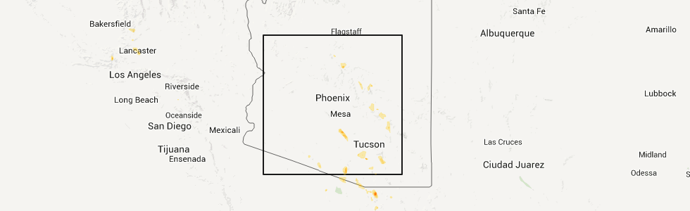
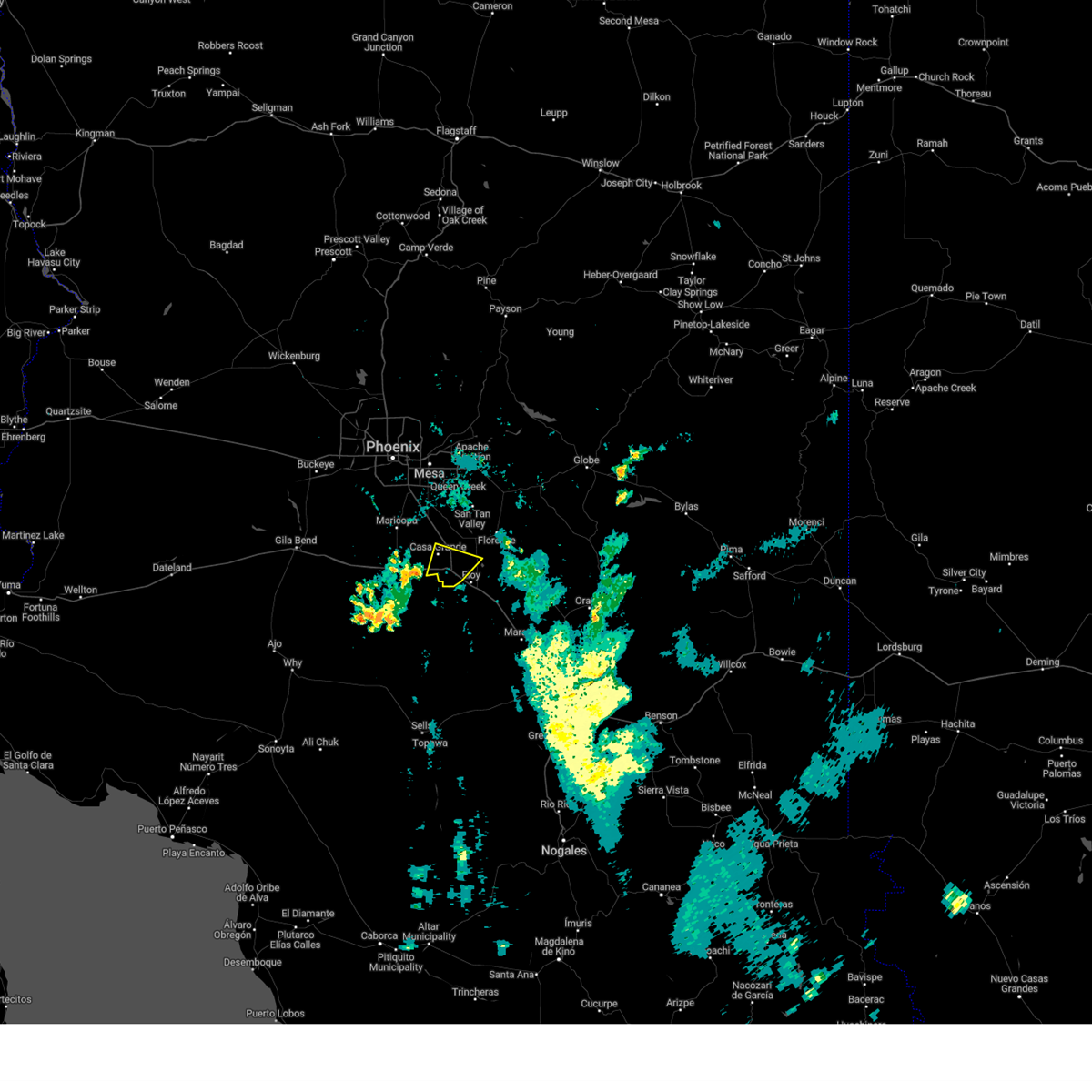
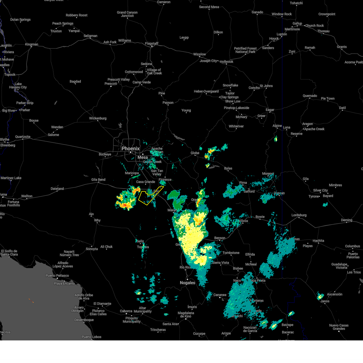
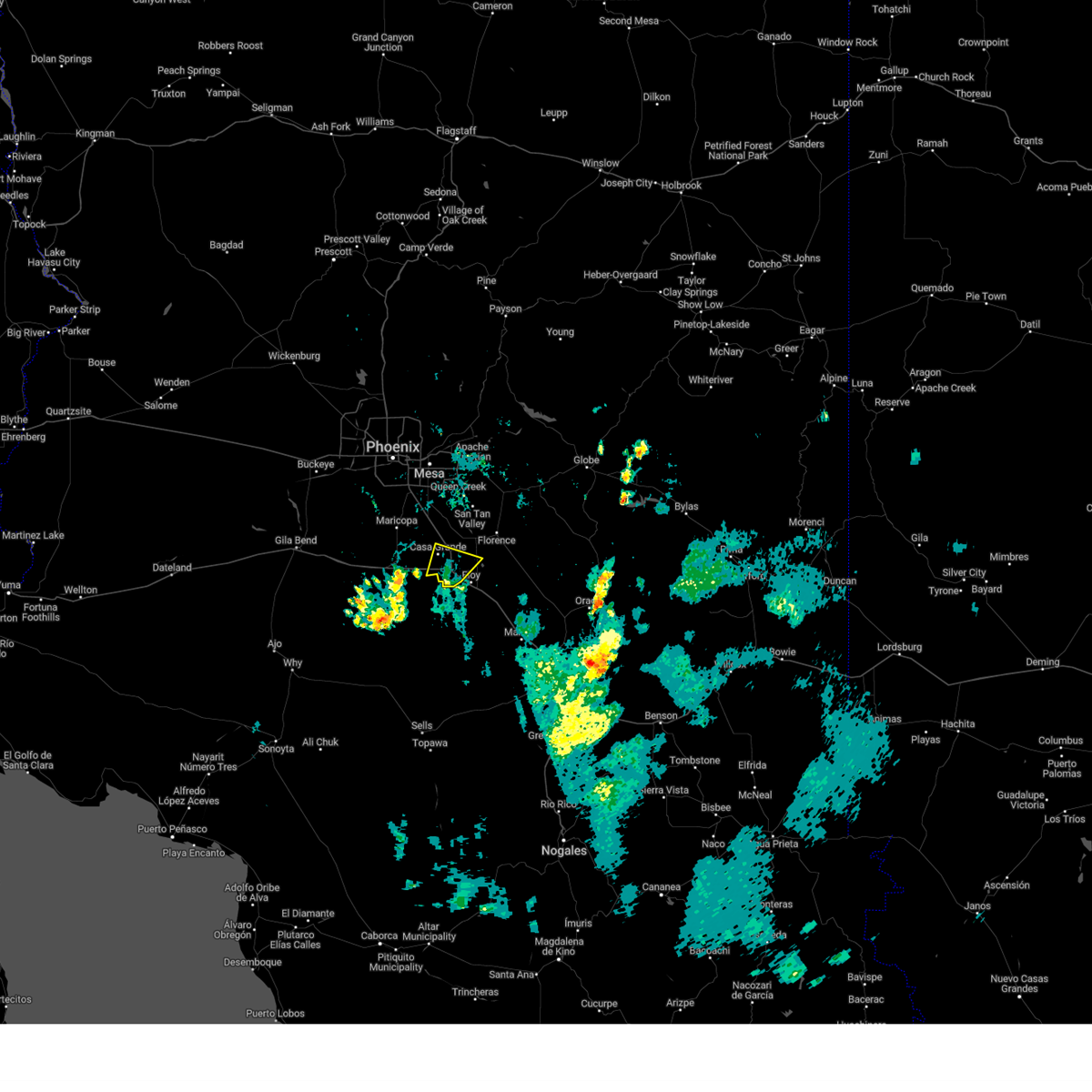
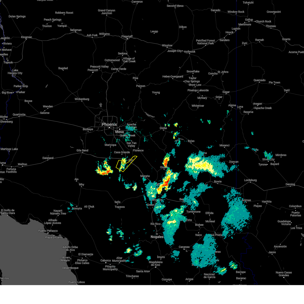
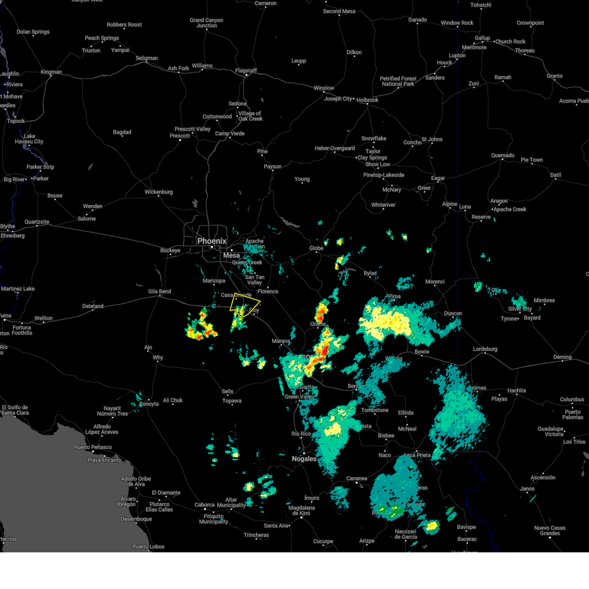
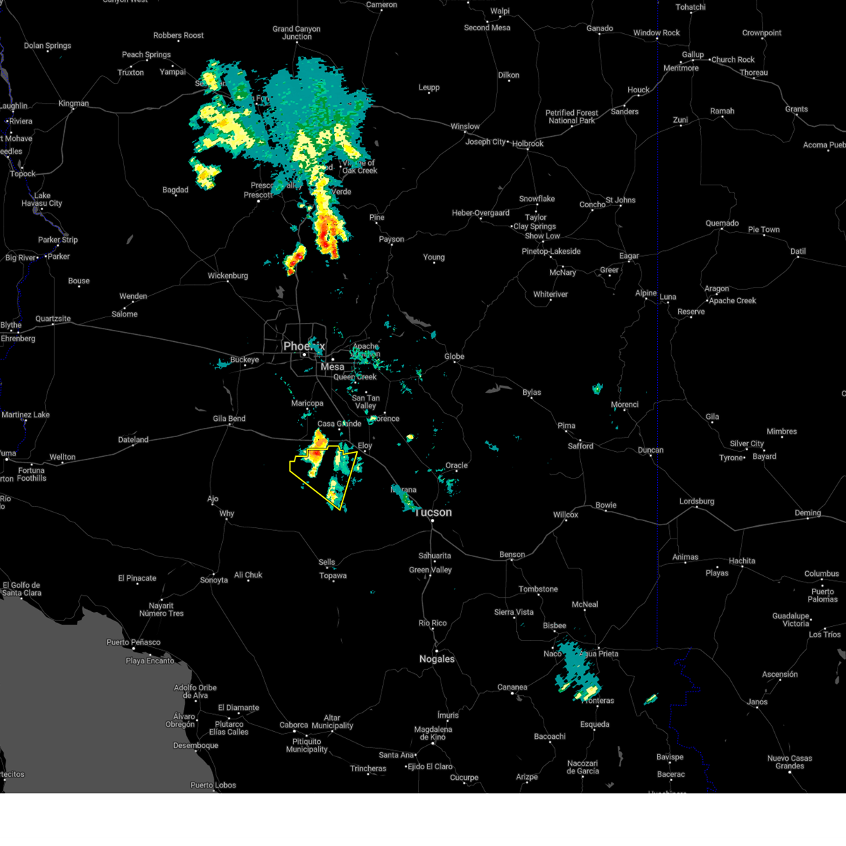
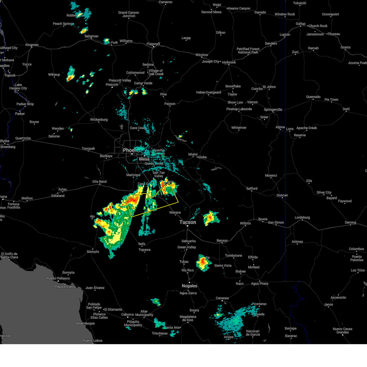
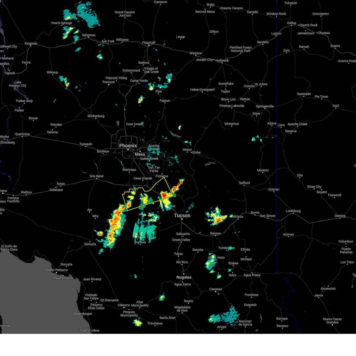
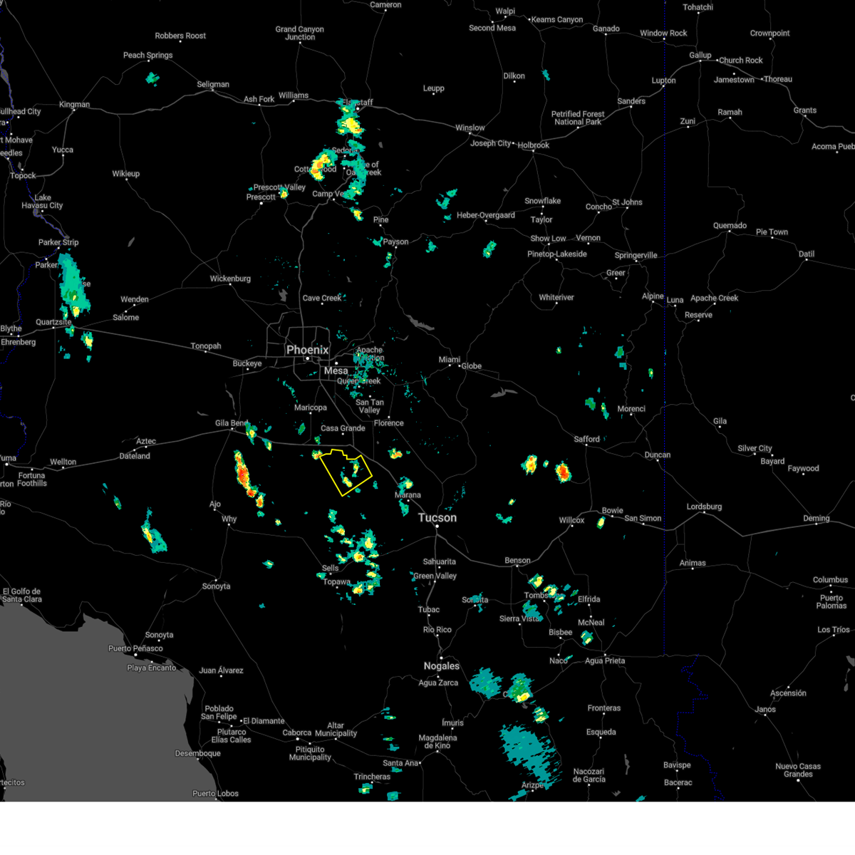
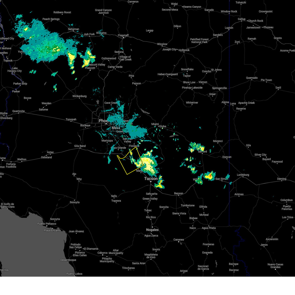
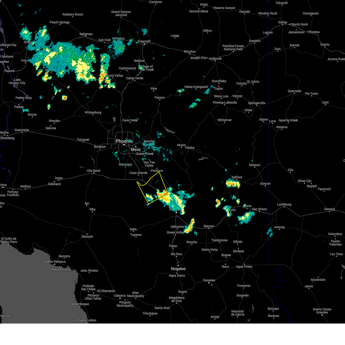
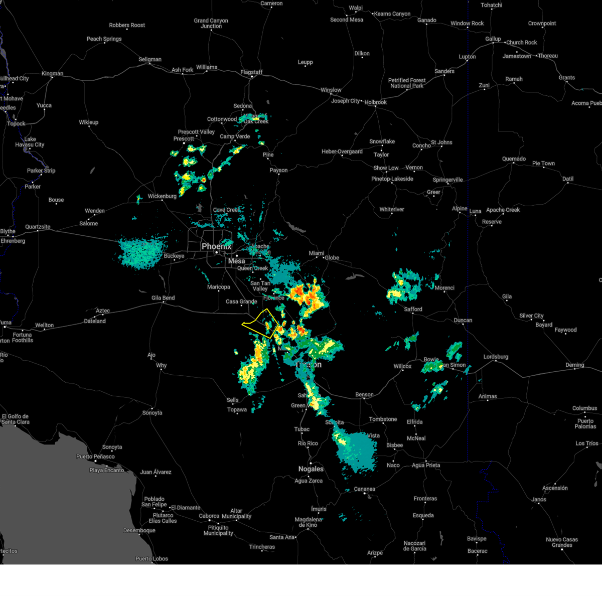
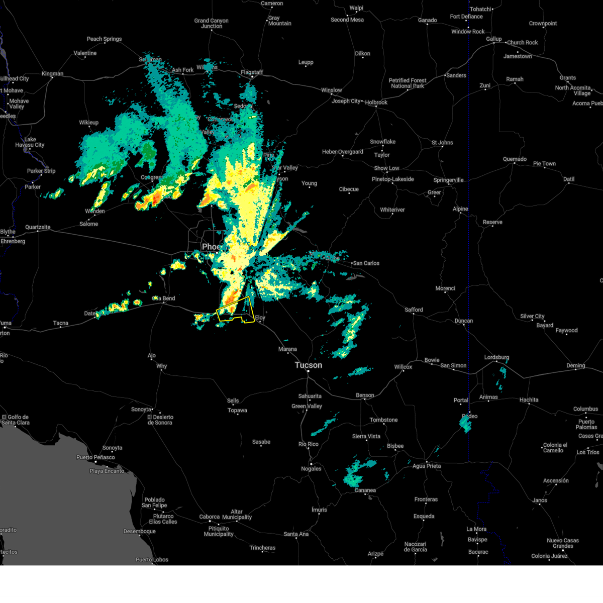
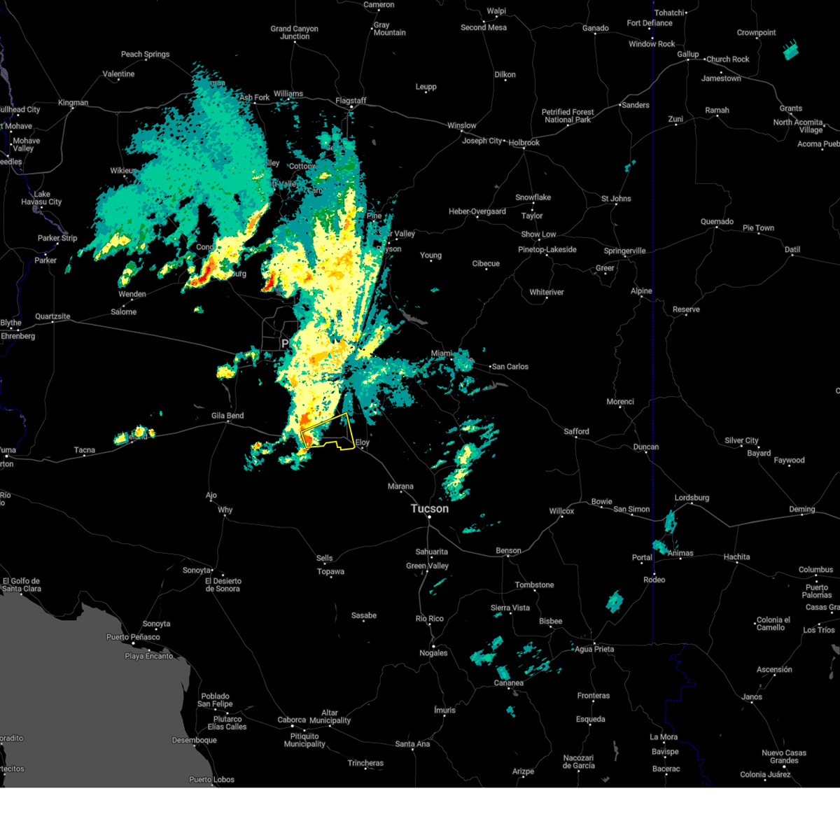
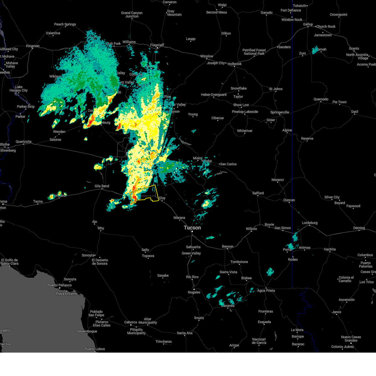
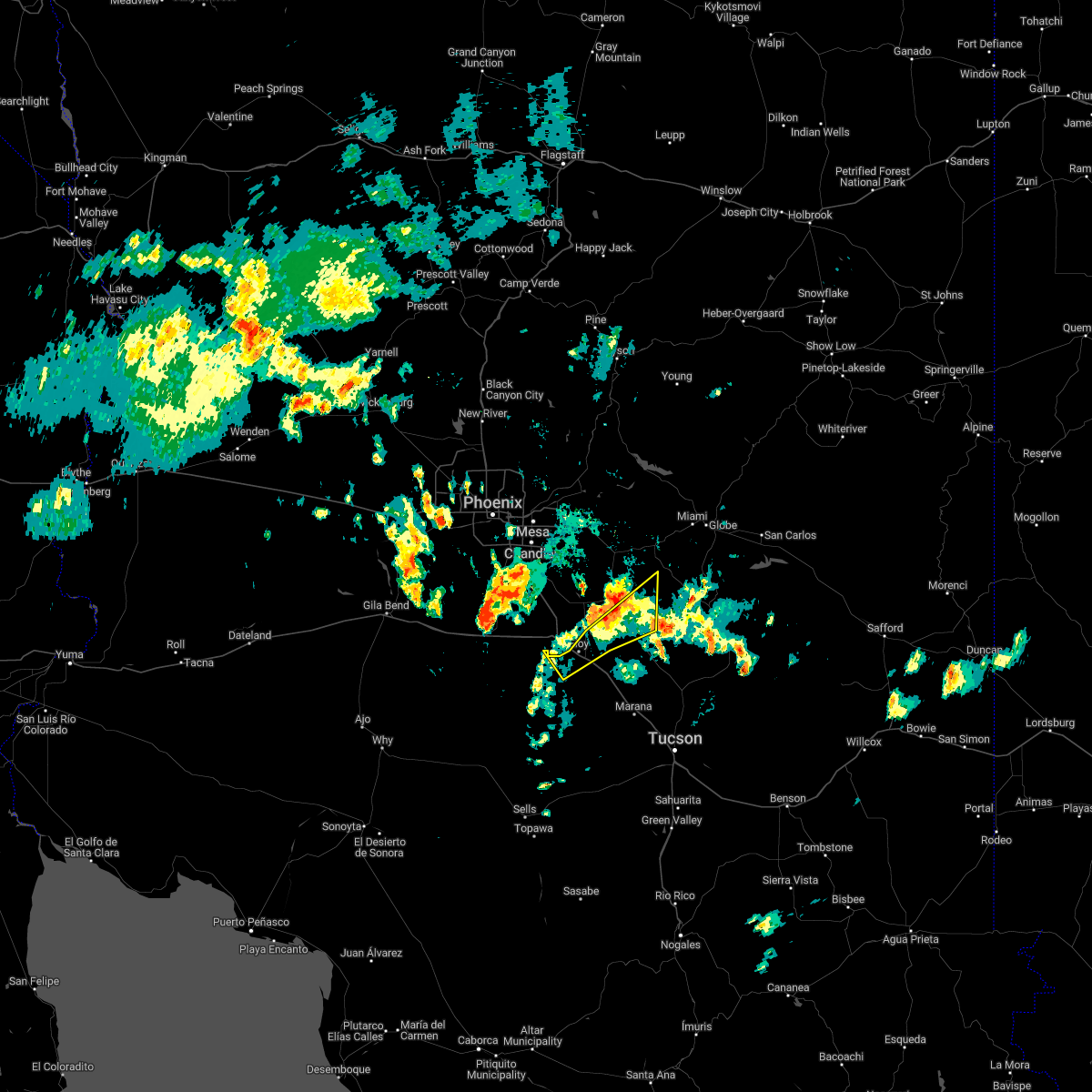
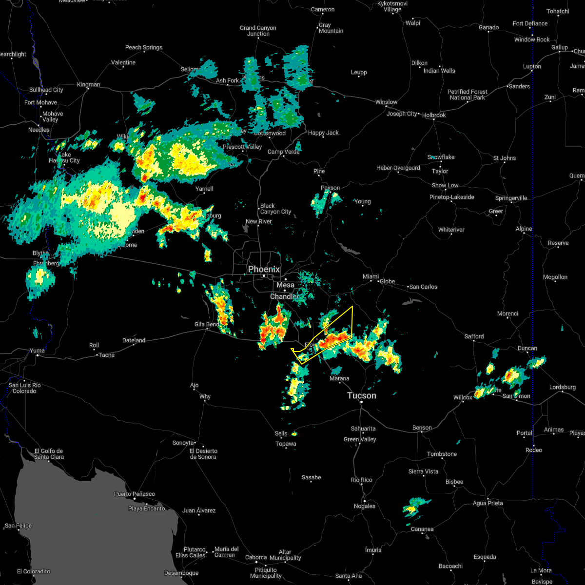
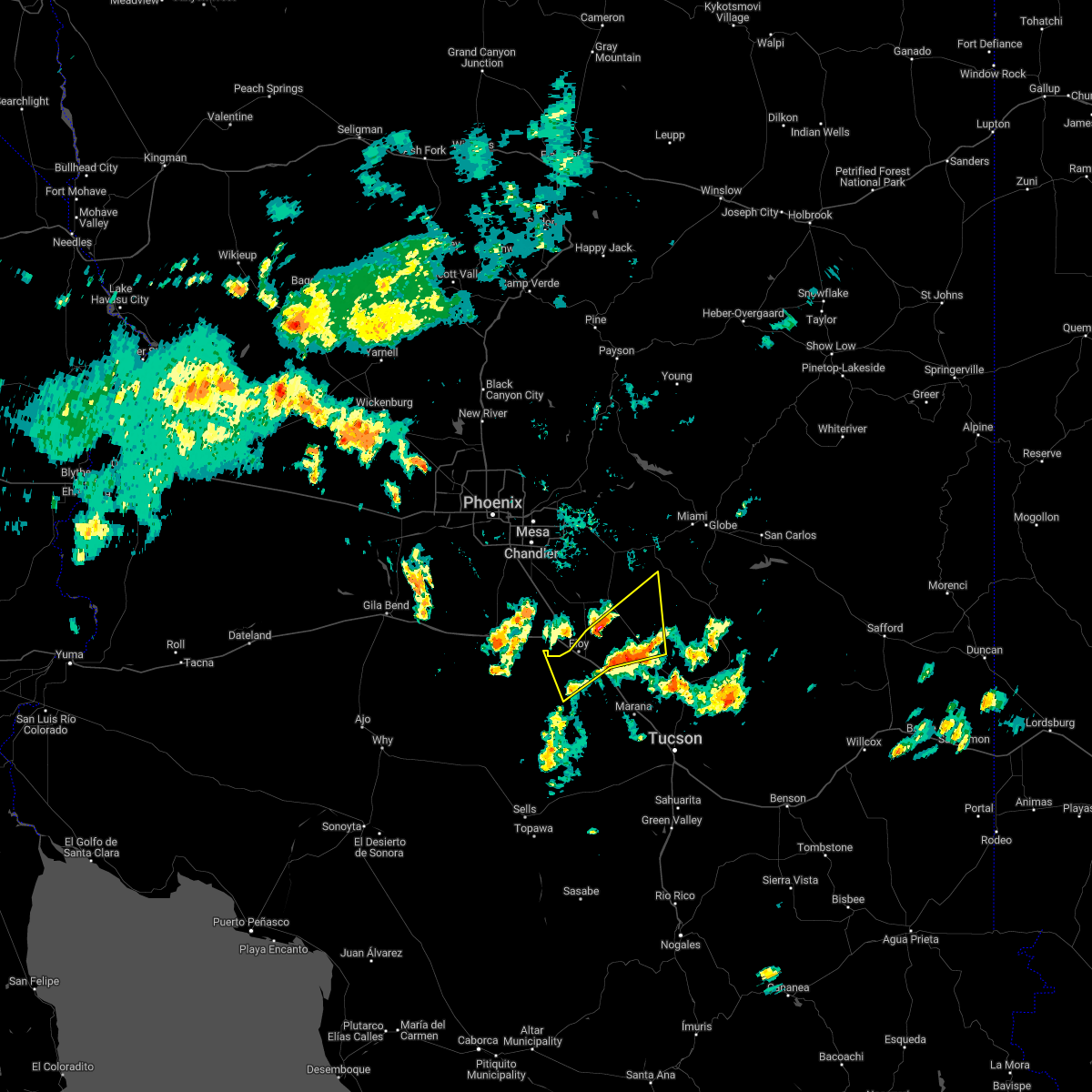
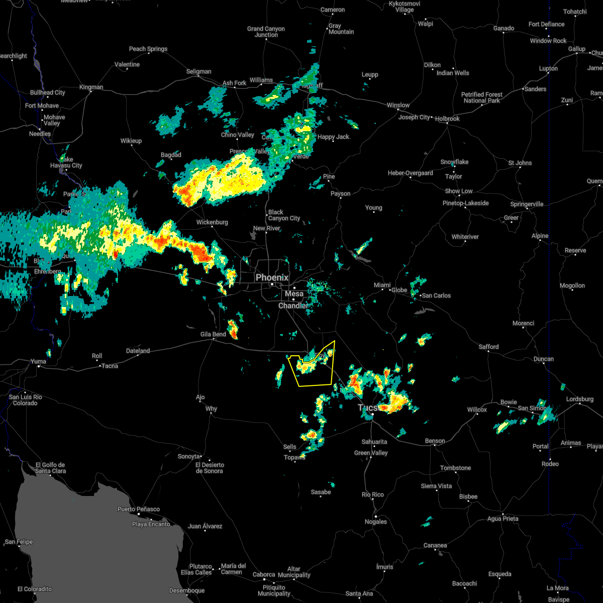
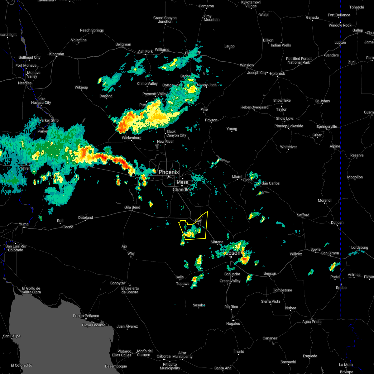
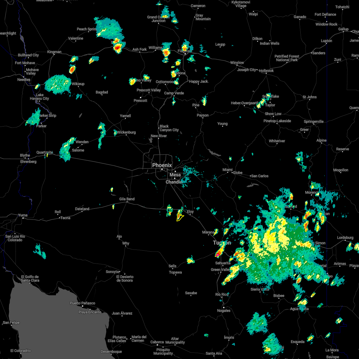
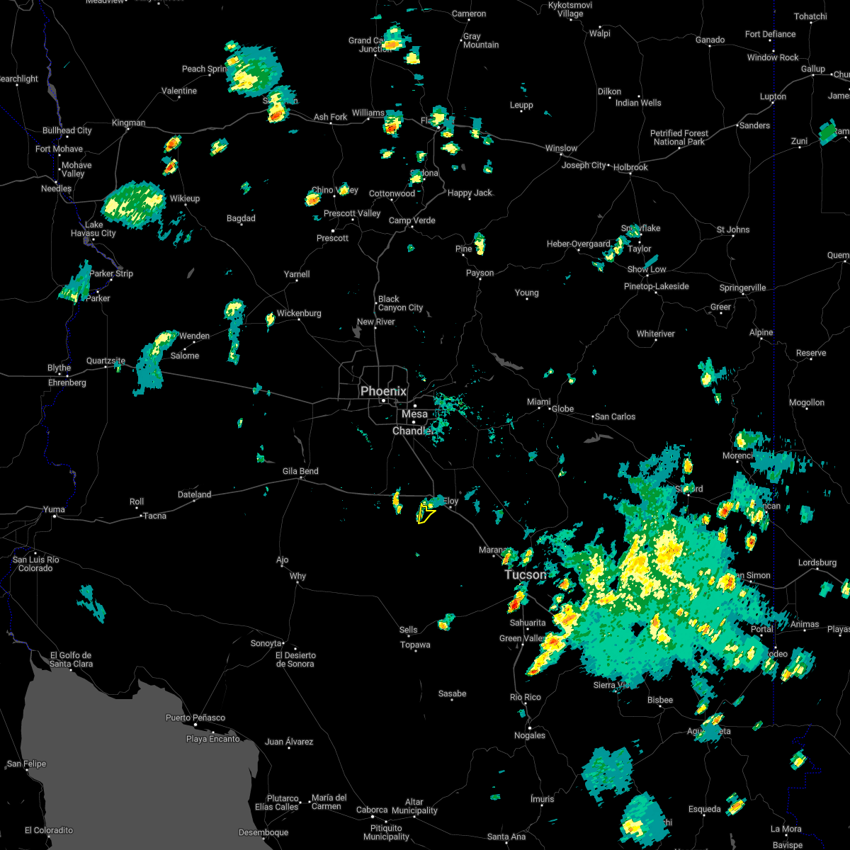
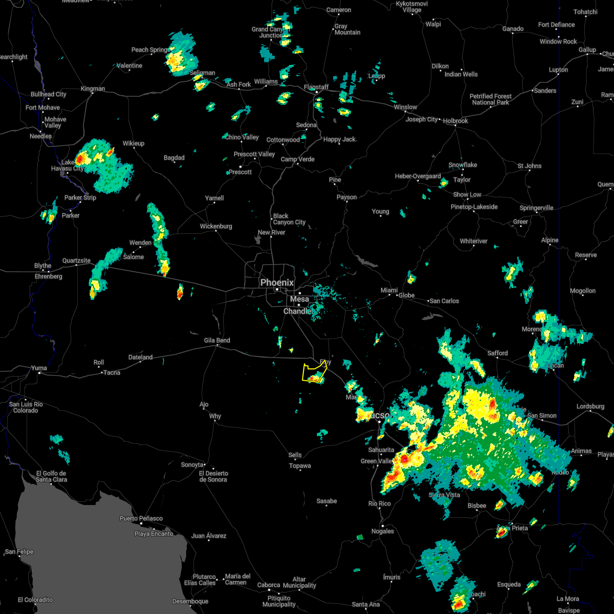
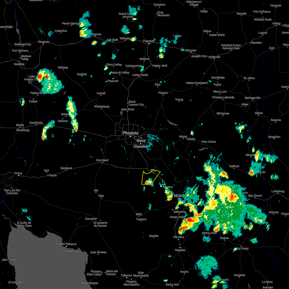
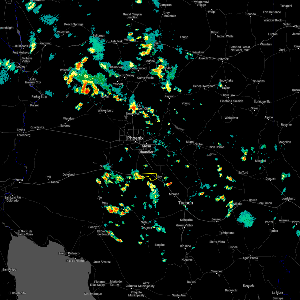
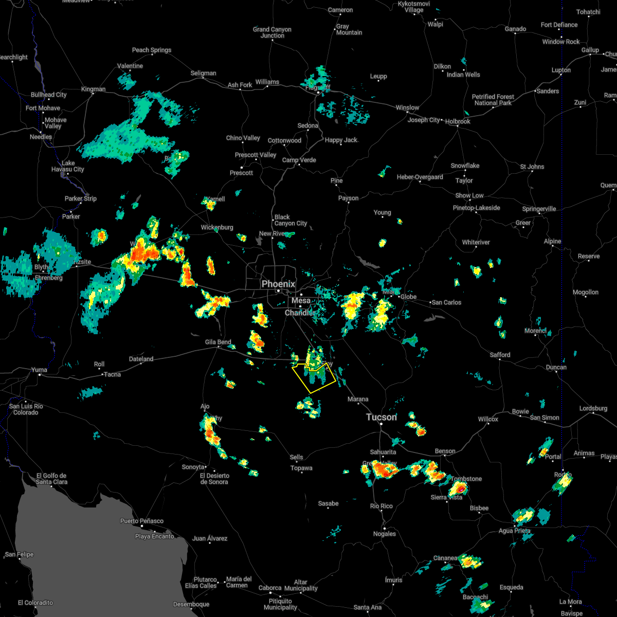
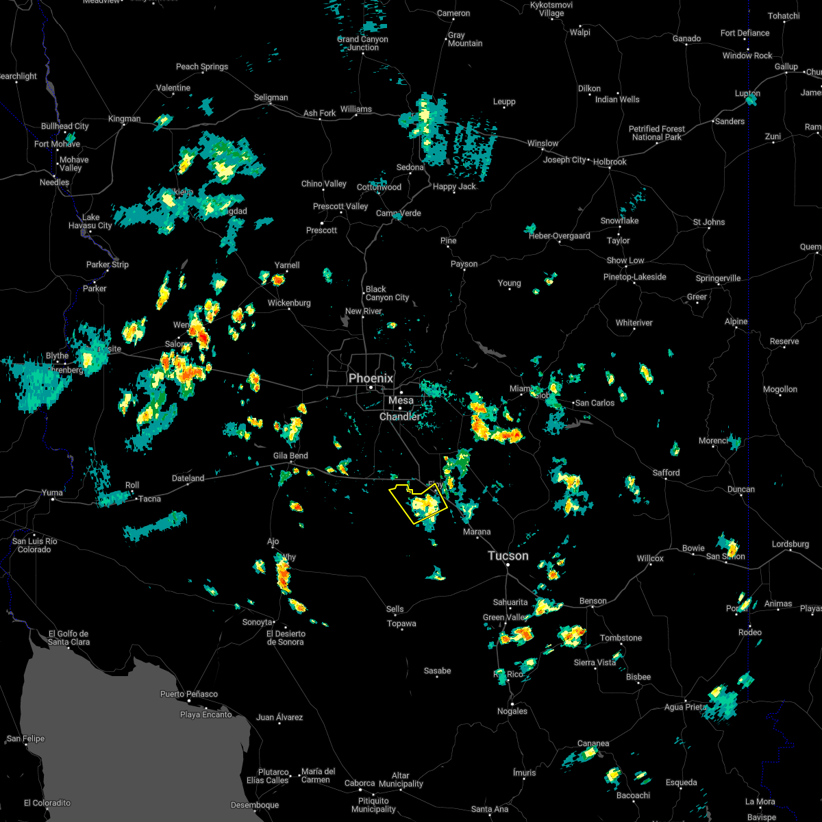
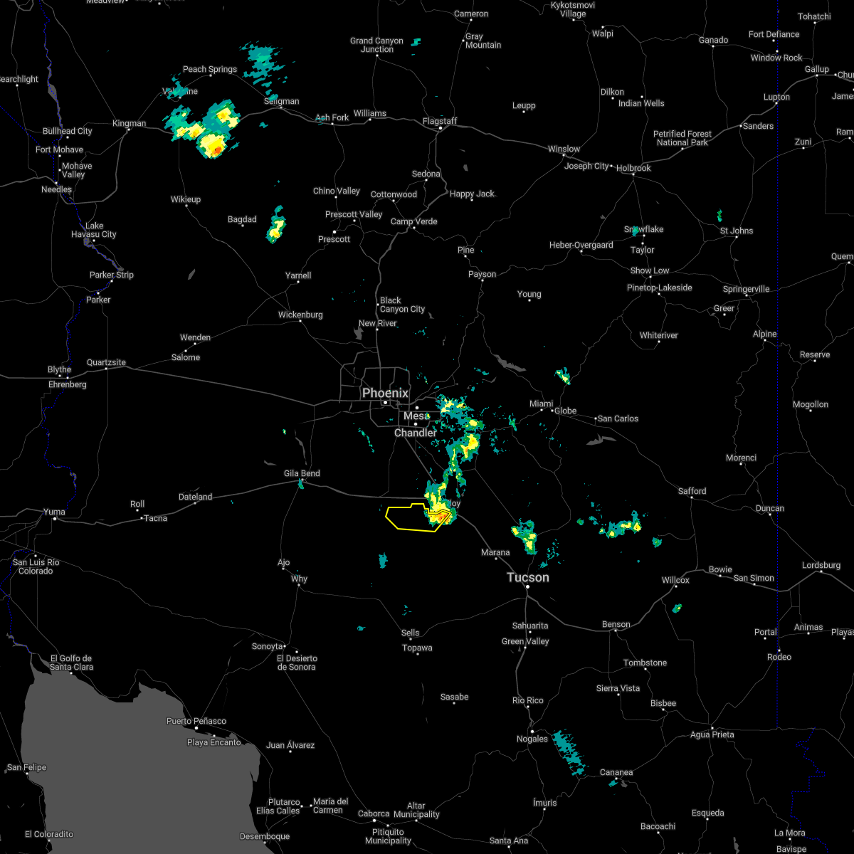
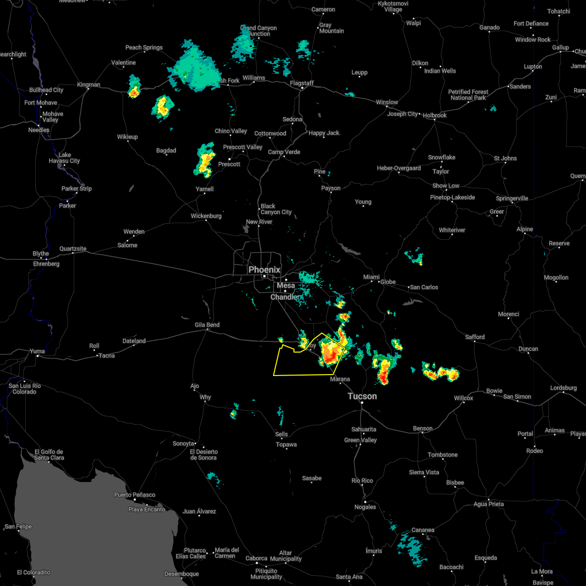
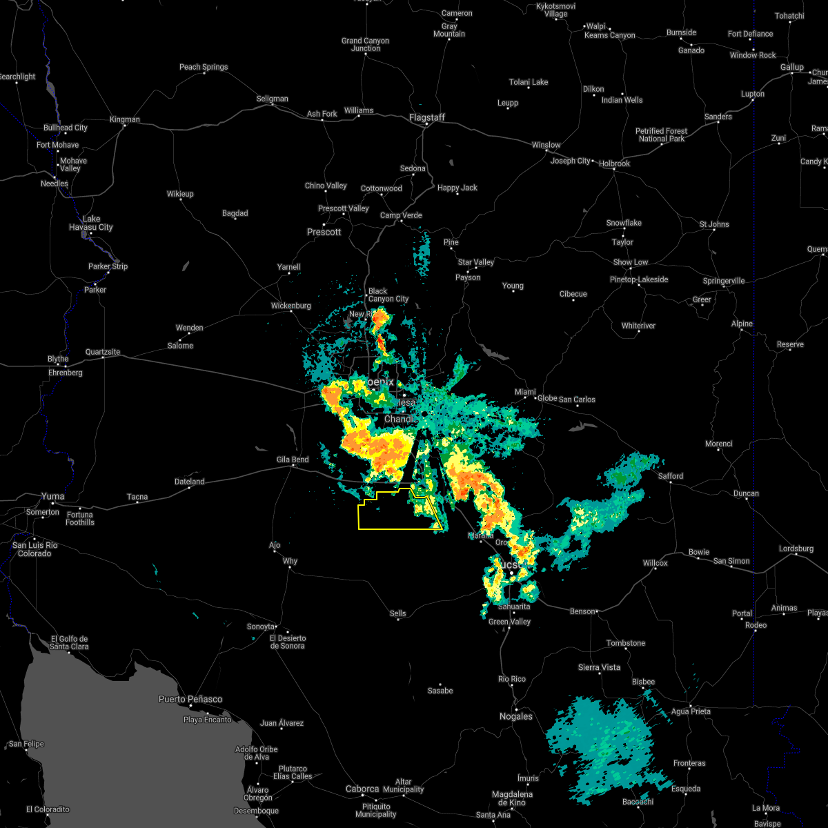
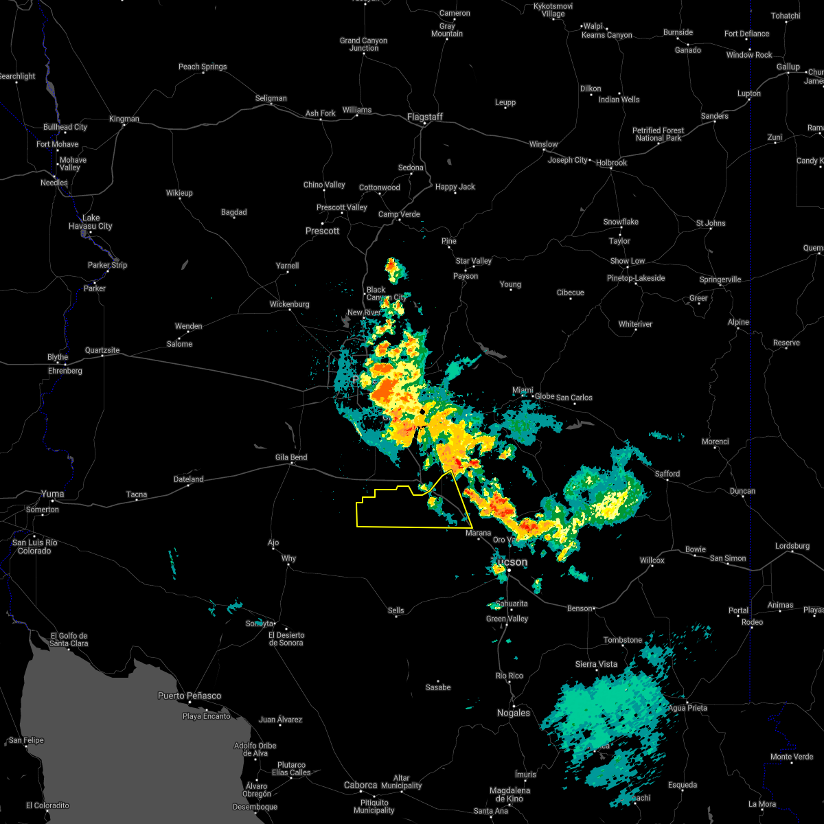
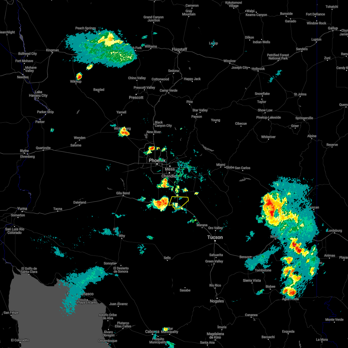
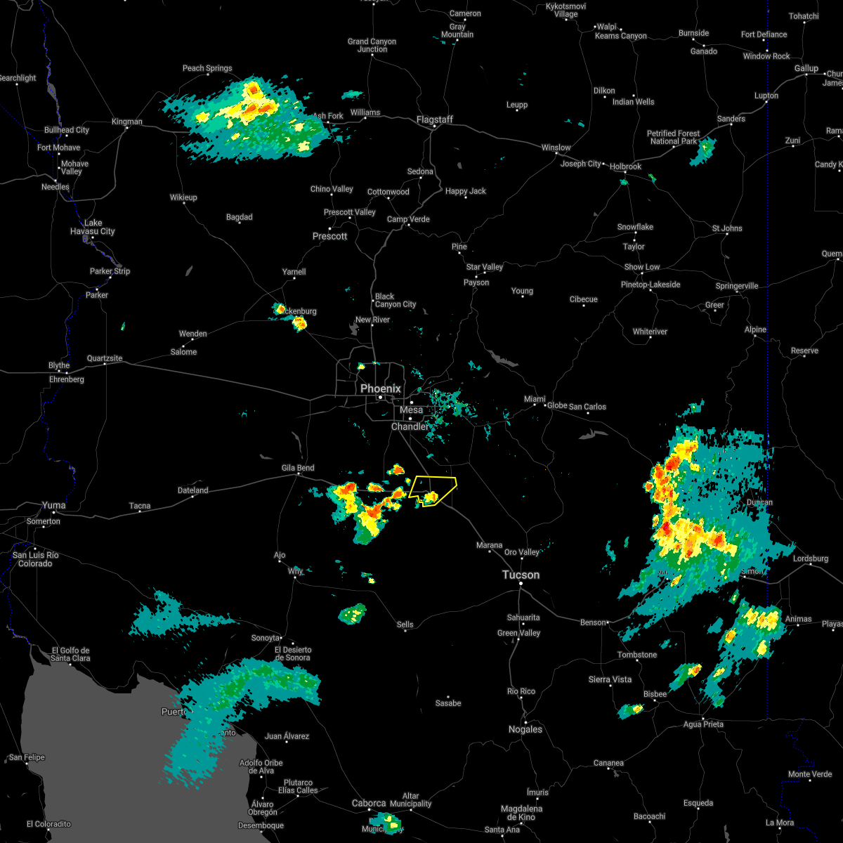
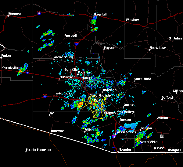
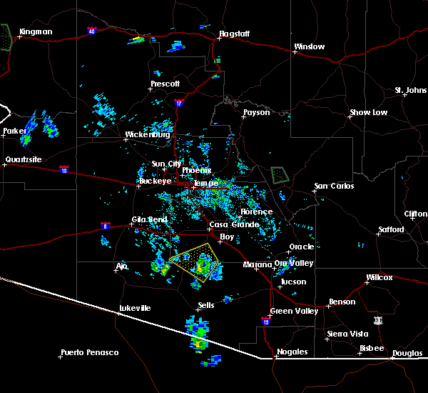
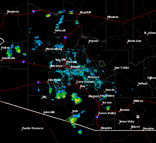
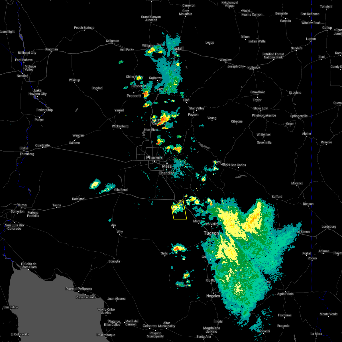
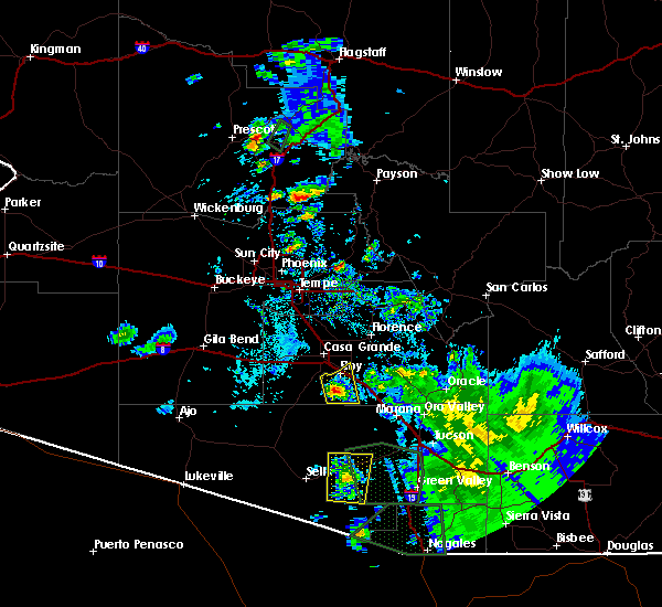
Hail Map for Chuichu, AZ
The Chuichu, AZ area has had 0 reports of on-the-ground hail by trained spotters, and has been under severe weather warnings 9 times during the past 12 months. Doppler radar has detected hail at or near Chuichu, AZ on 9 occasions.
| Name: | Chuichu, AZ |
| Where Located: | 52.1 miles SSE of Phoenix, AZ |
| Map: | Google Map for Chuichu, AZ |
| Population: | 269 |
| Housing Units: | 96 |
| More Info: | Search Google for Chuichu, AZ |
5
The Top Recent Hail Date for Chuichu, AZ is Monday, July 4, 2011 (1st out of 9)
Hail and Wind Damage Spotted near Chuichu, AZ
| Date / Time | Report Details |
|---|---|
| 7/28/2024 5:16 PM MST |
 The storm which prompted the warning has weakened below severe limits, and no longer poses an immediate threat to life or property. therefore, the warning has been allowed to expire. however, gusty winds are still possible with this thunderstorm. The storm which prompted the warning has weakened below severe limits, and no longer poses an immediate threat to life or property. therefore, the warning has been allowed to expire. however, gusty winds are still possible with this thunderstorm.
|
| 7/28/2024 5:05 PM MST |
 The storm which prompted the warning has moved out of the area. therefore, the warning will be allowed to expire. The storm which prompted the warning has moved out of the area. therefore, the warning will be allowed to expire.
|
| 7/28/2024 5:00 PM MST |
 At 459 pm mst, a severe thunderstorm was located over arizola, or near casa grande, moving northeast at 5 mph (radar indicated). Hazards include 60 mph wind gusts. Expect damage to roofs, siding, and trees. locations impacted include, casa grande, arizona city, la palma, arizola, and toltec. this includes the following highways, az interstate 10 between mile markers 190 and 204. az interstate 8 between mile markers 169 and 178. Az route 87 between mile markers 125 and 127. At 459 pm mst, a severe thunderstorm was located over arizola, or near casa grande, moving northeast at 5 mph (radar indicated). Hazards include 60 mph wind gusts. Expect damage to roofs, siding, and trees. locations impacted include, casa grande, arizona city, la palma, arizola, and toltec. this includes the following highways, az interstate 10 between mile markers 190 and 204. az interstate 8 between mile markers 169 and 178. Az route 87 between mile markers 125 and 127.
|
| 7/28/2024 4:32 PM MST |
 Svrtwc the national weather service in tucson has issued a * severe thunderstorm warning for, southwestern pinal county in southeastern arizona, * until 515 pm mst. * at 431 pm mst, a severe thunderstorm was located near chui-chu, or 10 miles south of casa grande, moving northeast at 30 mph (radar indicated). Hazards include 60 mph wind gusts. expect damage to roofs, siding, and trees Svrtwc the national weather service in tucson has issued a * severe thunderstorm warning for, southwestern pinal county in southeastern arizona, * until 515 pm mst. * at 431 pm mst, a severe thunderstorm was located near chui-chu, or 10 miles south of casa grande, moving northeast at 30 mph (radar indicated). Hazards include 60 mph wind gusts. expect damage to roofs, siding, and trees
|
| 7/28/2024 4:28 PM MST |
 Svrpsr the national weather service in phoenix has issued a * severe thunderstorm warning for, pinal county in southeastern arizona, * until 515 pm mst. * at 428 pm mst, a severe thunderstorm was located near arizola, or 7 miles south of casa grande, and is nearly stationary (radar indicated). Hazards include 60 mph wind gusts. expect damage to roofs, siding, and trees Svrpsr the national weather service in phoenix has issued a * severe thunderstorm warning for, pinal county in southeastern arizona, * until 515 pm mst. * at 428 pm mst, a severe thunderstorm was located near arizola, or 7 miles south of casa grande, and is nearly stationary (radar indicated). Hazards include 60 mph wind gusts. expect damage to roofs, siding, and trees
|
| 7/14/2024 8:11 PM MST |
 Svrtwc the national weather service in tucson has issued a * severe thunderstorm warning for, north central pima county in southeastern arizona, southwestern pinal county in southeastern arizona, * until 900 pm mst. * at 811 pm mst, a severe thunderstorm was located 13 miles west of chui-chu, or 19 miles southwest of casa grande, moving northwest at 25 mph (radar indicated). Hazards include 60 mph wind gusts and quarter size hail. Hail damage to vehicles is expected. Expect wind damage to roofs, siding, and trees. Svrtwc the national weather service in tucson has issued a * severe thunderstorm warning for, north central pima county in southeastern arizona, southwestern pinal county in southeastern arizona, * until 900 pm mst. * at 811 pm mst, a severe thunderstorm was located 13 miles west of chui-chu, or 19 miles southwest of casa grande, moving northwest at 25 mph (radar indicated). Hazards include 60 mph wind gusts and quarter size hail. Hail damage to vehicles is expected. Expect wind damage to roofs, siding, and trees.
|
| 7/14/2024 7:24 PM MST |
 Svrtwc the national weather service in tucson has issued a * severe thunderstorm warning for, north central pima county in southeastern arizona, southwestern pinal county in southeastern arizona, * until 815 pm mst. * at 722 pm mst, severe thunderstorms were located along a line extending from 8 miles southwest of chui-chu to 13 miles south of arizona city to 10 miles west of avra valley, moving northwest at 25 mph (radar indicated). Hazards include 70 mph wind gusts and quarter size hail. Hail damage to vehicles is expected. expect considerable tree damage. Wind damage is also likely to mobile homes, roofs, and outbuildings. Svrtwc the national weather service in tucson has issued a * severe thunderstorm warning for, north central pima county in southeastern arizona, southwestern pinal county in southeastern arizona, * until 815 pm mst. * at 722 pm mst, severe thunderstorms were located along a line extending from 8 miles southwest of chui-chu to 13 miles south of arizona city to 10 miles west of avra valley, moving northwest at 25 mph (radar indicated). Hazards include 70 mph wind gusts and quarter size hail. Hail damage to vehicles is expected. expect considerable tree damage. Wind damage is also likely to mobile homes, roofs, and outbuildings.
|
| 7/14/2024 6:48 PM MST |
 At 647 pm mst, severe thunderstorms were located along a line extending from 9 miles south of chui-chu to 9 miles southwest of picacho peak state park to near avra valley, moving northwest at 10 mph (radar indicated). Hazards include 70 mph wind gusts and quarter size hail. Hail damage to vehicles is expected. expect considerable tree damage. wind damage is also likely to mobile homes, roofs, and outbuildings. locations impacted include, marana, eloy, avra valley, picacho, picacho peak state park, pinal airpark, picture rocks, red rock, north komelik, queens well, jack rabbit, shopishk, east chui-chu, and silver bell. this includes the following highways, interstate 10 between mile markers 206 and 236. Route 87 between mile markers 116 and 122. At 647 pm mst, severe thunderstorms were located along a line extending from 9 miles south of chui-chu to 9 miles southwest of picacho peak state park to near avra valley, moving northwest at 10 mph (radar indicated). Hazards include 70 mph wind gusts and quarter size hail. Hail damage to vehicles is expected. expect considerable tree damage. wind damage is also likely to mobile homes, roofs, and outbuildings. locations impacted include, marana, eloy, avra valley, picacho, picacho peak state park, pinal airpark, picture rocks, red rock, north komelik, queens well, jack rabbit, shopishk, east chui-chu, and silver bell. this includes the following highways, interstate 10 between mile markers 206 and 236. Route 87 between mile markers 116 and 122.
|
| 7/14/2024 6:26 PM MST |
 Svrtwc the national weather service in tucson has issued a * severe thunderstorm warning for, north central pima county in southeastern arizona, southwestern pinal county in southeastern arizona, * until 730 pm mst. * at 625 pm mst, an area of severe severe thunderstorm was located along and west of interstate-10, 11 miles southwest of picacho peak state park, or 25 miles south of casa grande, moving northwest at 10 mph (radar indicated). Hazards include 60 mph wind gusts and quarter size hail. Hail damage to vehicles is expected. Expect wind damage to roofs, siding, and trees. Svrtwc the national weather service in tucson has issued a * severe thunderstorm warning for, north central pima county in southeastern arizona, southwestern pinal county in southeastern arizona, * until 730 pm mst. * at 625 pm mst, an area of severe severe thunderstorm was located along and west of interstate-10, 11 miles southwest of picacho peak state park, or 25 miles south of casa grande, moving northwest at 10 mph (radar indicated). Hazards include 60 mph wind gusts and quarter size hail. Hail damage to vehicles is expected. Expect wind damage to roofs, siding, and trees.
|
| 8/31/2023 9:12 PM MST |
 The severe thunderstorm warning for maricopa and pinal counties will expire at 915 pm mst, the storms which prompted the warning have weakened below severe limits, and no longer pose an immediate threat to life or property. therefore, the warning will be allowed to expire. The severe thunderstorm warning for maricopa and pinal counties will expire at 915 pm mst, the storms which prompted the warning have weakened below severe limits, and no longer pose an immediate threat to life or property. therefore, the warning will be allowed to expire.
|
| 8/31/2023 8:02 PM MST |
 At 802 pm mst, severe thunderstorms were located along a line extending from near florence to near casa grande to 11 miles south of freeman, moving north at 40 mph (radar indicated). Hazards include 70 mph wind gusts and penny size hail. Expect considerable tree damage. Damage is likely to mobile homes, roofs, and outbuildings. At 802 pm mst, severe thunderstorms were located along a line extending from near florence to near casa grande to 11 miles south of freeman, moving north at 40 mph (radar indicated). Hazards include 70 mph wind gusts and penny size hail. Expect considerable tree damage. Damage is likely to mobile homes, roofs, and outbuildings.
|
| 8/31/2023 7:57 PM MST |
 The severe thunderstorm warning for north central pima and southwestern pinal counties will expire at 800 pm mst, the storm which prompted the warning has moved out of the area. therefore, the warning will be allowed to expire. however gusty winds are still possible with this thunderstorm. The severe thunderstorm warning for north central pima and southwestern pinal counties will expire at 800 pm mst, the storm which prompted the warning has moved out of the area. therefore, the warning will be allowed to expire. however gusty winds are still possible with this thunderstorm.
|
| 8/31/2023 7:30 PM MST |
 At 729 pm mst, a severe thunderstorm was located near chui-chu, or 10 miles south of casa grande, moving north at 25 mph (radar indicated). Hazards include 70 mph wind gusts and penny size hail. Expect considerable tree damage. damage is likely to mobile homes, roofs, and outbuildings. locations impacted include, casa grande, florence, coolidge, arizona city, la palma, blackwater, toltec, coolidge airport, arizola, randolph, valley farms, stanfield, and east chui-chu. this includes the following highways, az interstate 8 between mile markers 145 and 178. az route 87 between mile markers 124 and 147. az route 79 between mile markers 129 and 136. az route 347 between mile markers 161 and 167. this includes az interstate 10 between 181 and 204. thunderstorm damage threat, considerable hail threat, radar indicated max hail size, 0. 75 in wind threat, radar indicated max wind gust, 70 mph. At 729 pm mst, a severe thunderstorm was located near chui-chu, or 10 miles south of casa grande, moving north at 25 mph (radar indicated). Hazards include 70 mph wind gusts and penny size hail. Expect considerable tree damage. damage is likely to mobile homes, roofs, and outbuildings. locations impacted include, casa grande, florence, coolidge, arizona city, la palma, blackwater, toltec, coolidge airport, arizola, randolph, valley farms, stanfield, and east chui-chu. this includes the following highways, az interstate 8 between mile markers 145 and 178. az route 87 between mile markers 124 and 147. az route 79 between mile markers 129 and 136. az route 347 between mile markers 161 and 167. this includes az interstate 10 between 181 and 204. thunderstorm damage threat, considerable hail threat, radar indicated max hail size, 0. 75 in wind threat, radar indicated max wind gust, 70 mph.
|
| 8/31/2023 7:15 PM MST |
 At 714 pm mst, a severe thunderstorm was located 11 miles south of arizona city, or 21 miles south of casa grande, moving north at 5 mph (radar indicated). Hazards include 60 mph wind gusts and penny size hail. expect damage to roofs, siding, and trees At 714 pm mst, a severe thunderstorm was located 11 miles south of arizona city, or 21 miles south of casa grande, moving north at 5 mph (radar indicated). Hazards include 60 mph wind gusts and penny size hail. expect damage to roofs, siding, and trees
|
| 8/31/2023 7:09 PM MST |
 At 709 pm mst, a severe thunderstorm was located near arizona city, or 17 miles south of casa grande, moving north at 20 mph (radar indicated). Hazards include 60 mph wind gusts and quarter size hail. Hail damage to vehicles is expected. Expect wind damage to roofs, siding, and trees. At 709 pm mst, a severe thunderstorm was located near arizona city, or 17 miles south of casa grande, moving north at 20 mph (radar indicated). Hazards include 60 mph wind gusts and quarter size hail. Hail damage to vehicles is expected. Expect wind damage to roofs, siding, and trees.
|
| 8/17/2023 5:26 PM MST |
 The severe thunderstorm warning for pinal county will expire at 530 pm mst, the storm which prompted the warning has weakened below severe limits, and no longer poses an immediate threat to life or property. therefore, the warning will be allowed to expire. however gusty winds are still possible with this thunderstorm. The severe thunderstorm warning for pinal county will expire at 530 pm mst, the storm which prompted the warning has weakened below severe limits, and no longer poses an immediate threat to life or property. therefore, the warning will be allowed to expire. however gusty winds are still possible with this thunderstorm.
|
| 8/17/2023 5:25 PM MST |
 The severe thunderstorm warning for northern pima and southwestern pinal counties will expire at 530 pm mst, the storm which prompted the warning has weakened below severe limits, and no longer poses an immediate threat to life or property. therefore, the warning will be allowed to expire. The severe thunderstorm warning for northern pima and southwestern pinal counties will expire at 530 pm mst, the storm which prompted the warning has weakened below severe limits, and no longer poses an immediate threat to life or property. therefore, the warning will be allowed to expire.
|
| 8/17/2023 5:11 PM MST |
 At 510 pm mst, a severe thunderstorm was located near arizola, or near casa grande, moving north at 10 mph (radar indicated). Hazards include 60 mph wind gusts. Expect damage to roofs, siding, and trees. locations impacted include, casa grande, arizona city, arizola, toltec, and stanfield. this includes the following highways, az interstate 10 between mile markers 187 and 204. az interstate 8 between mile markers 158 and 178. az route 347 near mile marker 161. hail threat, radar indicated max hail size, <. 75 in wind threat, radar indicated max wind gust, 60 mph. At 510 pm mst, a severe thunderstorm was located near arizola, or near casa grande, moving north at 10 mph (radar indicated). Hazards include 60 mph wind gusts. Expect damage to roofs, siding, and trees. locations impacted include, casa grande, arizona city, arizola, toltec, and stanfield. this includes the following highways, az interstate 10 between mile markers 187 and 204. az interstate 8 between mile markers 158 and 178. az route 347 near mile marker 161. hail threat, radar indicated max hail size, <. 75 in wind threat, radar indicated max wind gust, 60 mph.
|
| 8/17/2023 5:01 PM MST |
 At 500 pm mst, a severe thunderstorm was located near chui-chu, or 14 miles south of casa grande, moving northwest at 5 mph (radar indicated). Hazards include 60 mph wind gusts and quarter size hail. Hail damage to vehicles is expected. expect wind damage to roofs, siding, and trees. locations impacted include, chui-chu, cockleburr, shopishk and east chui-chu. hail threat, radar indicated max hail size, 1. 00 in wind threat, radar indicated max wind gust, 60 mph. At 500 pm mst, a severe thunderstorm was located near chui-chu, or 14 miles south of casa grande, moving northwest at 5 mph (radar indicated). Hazards include 60 mph wind gusts and quarter size hail. Hail damage to vehicles is expected. expect wind damage to roofs, siding, and trees. locations impacted include, chui-chu, cockleburr, shopishk and east chui-chu. hail threat, radar indicated max hail size, 1. 00 in wind threat, radar indicated max wind gust, 60 mph.
|
| 8/17/2023 4:41 PM MST |
 At 441 pm mst, a severe thunderstorm was located near arizona city, or 11 miles south of casa grande, moving northwest at 10 mph (radar indicated). Hazards include 60 mph wind gusts and penny size hail. expect damage to roofs, siding, and trees At 441 pm mst, a severe thunderstorm was located near arizona city, or 11 miles south of casa grande, moving northwest at 10 mph (radar indicated). Hazards include 60 mph wind gusts and penny size hail. expect damage to roofs, siding, and trees
|
| 8/17/2023 4:38 PM MST |
 At 438 pm mst, a severe thunderstorm was located near chui-chu, or 16 miles south of casa grande, moving northwest at 5 mph (radar indicated). Hazards include 60 mph wind gusts and quarter size hail. Hail damage to vehicles is expected. Expect wind damage to roofs, siding, and trees. At 438 pm mst, a severe thunderstorm was located near chui-chu, or 16 miles south of casa grande, moving northwest at 5 mph (radar indicated). Hazards include 60 mph wind gusts and quarter size hail. Hail damage to vehicles is expected. Expect wind damage to roofs, siding, and trees.
|
| 7/31/2023 8:54 PM MST |
 The severe thunderstorm warning for northeastern pima and south central pinal counties will expire at 900 pm mst, the storm which prompted the warning has weakened below severe limits, and no longer poses an immediate threat to life or property. therefore, the warning will be allowed to expire. however gusty winds are still possible with this thunderstorm. The severe thunderstorm warning for northeastern pima and south central pinal counties will expire at 900 pm mst, the storm which prompted the warning has weakened below severe limits, and no longer poses an immediate threat to life or property. therefore, the warning will be allowed to expire. however gusty winds are still possible with this thunderstorm.
|
| 7/31/2023 8:07 PM MST |
 At 807 pm mst, a severe thunderstorm was located over picacho peak state park, or 20 miles northwest of marana, moving northwest at 15 mph (radar indicated). Hazards include 60 mph wind gusts. expect damage to roofs, siding, and trees At 807 pm mst, a severe thunderstorm was located over picacho peak state park, or 20 miles northwest of marana, moving northwest at 15 mph (radar indicated). Hazards include 60 mph wind gusts. expect damage to roofs, siding, and trees
|
| 7/26/2023 8:43 PM MST |
 At 843 pm mst, a severe thunderstorm was located over picacho, or 17 miles south of coolidge, moving northwest at 10 mph (radar indicated). Hazards include 60 mph wind gusts and penny size hail. expect damage to roofs, siding, and trees At 843 pm mst, a severe thunderstorm was located over picacho, or 17 miles south of coolidge, moving northwest at 10 mph (radar indicated). Hazards include 60 mph wind gusts and penny size hail. expect damage to roofs, siding, and trees
|
| 3/15/2023 9:11 PM MST |
 The severe thunderstorm warning for pinal county will expire at 915 pm mst, the storm which prompted the warning has weakened below severe limits, and no longer poses an immediate threat to life or property. therefore, the warning will be allowed to expire. however gusty winds are still possible with this thunderstorm. The severe thunderstorm warning for pinal county will expire at 915 pm mst, the storm which prompted the warning has weakened below severe limits, and no longer poses an immediate threat to life or property. therefore, the warning will be allowed to expire. however gusty winds are still possible with this thunderstorm.
|
| 3/15/2023 8:57 PM MST |
 At 856 pm mst, a severe thunderstorm was located 11 miles northwest of chui-chu, or 13 miles west of casa grande, moving east at 40 mph (radar indicated). Hazards include 60 mph wind gusts. Expect damage to roofs, siding, and trees. locations impacted include, casa grande, arizona city, arizola and stanfield. this includes the following highways, az interstate 10 between mile markers 187 and 203. az interstate 8 between mile markers 156 and 178. Az route 347 near mile marker 161. At 856 pm mst, a severe thunderstorm was located 11 miles northwest of chui-chu, or 13 miles west of casa grande, moving east at 40 mph (radar indicated). Hazards include 60 mph wind gusts. Expect damage to roofs, siding, and trees. locations impacted include, casa grande, arizona city, arizola and stanfield. this includes the following highways, az interstate 10 between mile markers 187 and 203. az interstate 8 between mile markers 156 and 178. Az route 347 near mile marker 161.
|
| 3/15/2023 8:49 PM MST |
 At 848 pm mst, a severe thunderstorm was located 14 miles east of freeman, or 18 miles west of casa grande, moving east at 40 mph (radar indicated). Hazards include 60 mph wind gusts. expect damage to roofs, siding, and trees At 848 pm mst, a severe thunderstorm was located 14 miles east of freeman, or 18 miles west of casa grande, moving east at 40 mph (radar indicated). Hazards include 60 mph wind gusts. expect damage to roofs, siding, and trees
|
| 10/15/2022 4:51 PM MST |
 The severe thunderstorm warning for central pinal county will expire at 500 pm mst, the storms which prompted the warning have moved out of the area. therefore, the warning will be allowed to expire. however gusty winds and heavy rain are still possible with these thunderstorms. to report severe weather, contact your nearest law enforcement agency. they will relay your report to the national weather service tucson. The severe thunderstorm warning for central pinal county will expire at 500 pm mst, the storms which prompted the warning have moved out of the area. therefore, the warning will be allowed to expire. however gusty winds and heavy rain are still possible with these thunderstorms. to report severe weather, contact your nearest law enforcement agency. they will relay your report to the national weather service tucson.
|
| 10/15/2022 4:33 PM MST |
 At 432 pm mst, severe thunderstorms were located along a line extending from 14 miles southwest of kearny to 7 miles southeast of la palma to 7 miles south of arizona city, moving north at 25 mph (radar indicated). Hazards include 60 mph wind gusts and penny size hail. Expect damage to roofs, siding, and trees. locations impacted include, eloy, picacho, cactus forest and east chui-chu. hail threat, radar indicated max hail size, 0. 75 in wind threat, radar indicated max wind gust, 60 mph. At 432 pm mst, severe thunderstorms were located along a line extending from 14 miles southwest of kearny to 7 miles southeast of la palma to 7 miles south of arizona city, moving north at 25 mph (radar indicated). Hazards include 60 mph wind gusts and penny size hail. Expect damage to roofs, siding, and trees. locations impacted include, eloy, picacho, cactus forest and east chui-chu. hail threat, radar indicated max hail size, 0. 75 in wind threat, radar indicated max wind gust, 60 mph.
|
| 10/15/2022 4:16 PM MST |
 At 416 pm mst, severe thunderstorms were located along a line extending from 17 miles southwest of kearny to 6 miles north of picacho peak state park to 12 miles south of arizona city, moving north at 25 mph (radar indicated). Hazards include 60 mph wind gusts and penny size hail. expect damage to roofs, siding, and trees At 416 pm mst, severe thunderstorms were located along a line extending from 17 miles southwest of kearny to 6 miles north of picacho peak state park to 12 miles south of arizona city, moving north at 25 mph (radar indicated). Hazards include 60 mph wind gusts and penny size hail. expect damage to roofs, siding, and trees
|
| 10/15/2022 4:00 PM MST |
 At 400 pm mst, severe thunderstorms were located along a line extending from 6 miles southeast of la palma to near chui-chu, moving north at 35 mph (radar indicated). Hazards include 70 mph wind gusts and quarter size hail. Hail damage to vehicles is expected. expect considerable tree damage. wind damage is also likely to mobile homes, roofs, and outbuildings. locations impacted include, casa grande, florence, coolidge, maricopa, queen creek, arizona city, la palma, blackwater, toltec, magma, san tan valley, coolidge airport, bapchule, olberg and arizola. this includes the following highways, az interstate 10 between mile markers 172 and 204. az interstate 8 between mile markers 160 and 178. Us highway 60 between mile markers 214 and 217. At 400 pm mst, severe thunderstorms were located along a line extending from 6 miles southeast of la palma to near chui-chu, moving north at 35 mph (radar indicated). Hazards include 70 mph wind gusts and quarter size hail. Hail damage to vehicles is expected. expect considerable tree damage. wind damage is also likely to mobile homes, roofs, and outbuildings. locations impacted include, casa grande, florence, coolidge, maricopa, queen creek, arizona city, la palma, blackwater, toltec, magma, san tan valley, coolidge airport, bapchule, olberg and arizola. this includes the following highways, az interstate 10 between mile markers 172 and 204. az interstate 8 between mile markers 160 and 178. Us highway 60 between mile markers 214 and 217.
|
| 10/15/2022 3:51 PM MST |
 At 350 pm mst, a severe thunderstorm was located over picacho, or 18 miles southeast of casa grande, moving north at 25 mph (radar indicated). Hazards include 70 mph wind gusts and quarter size hail. Hail damage to vehicles is expected. expect considerable tree damage. wind damage is also likely to mobile homes, roofs, and outbuildings. locations impacted include, eloy, picacho, chui-chu, picacho peak state park, shopishk and east chui-chu. thunderstorm damage threat, considerable hail threat, radar indicated max hail size, 1. 00 in wind threat, radar indicated max wind gust, 70 mph. At 350 pm mst, a severe thunderstorm was located over picacho, or 18 miles southeast of casa grande, moving north at 25 mph (radar indicated). Hazards include 70 mph wind gusts and quarter size hail. Hail damage to vehicles is expected. expect considerable tree damage. wind damage is also likely to mobile homes, roofs, and outbuildings. locations impacted include, eloy, picacho, chui-chu, picacho peak state park, shopishk and east chui-chu. thunderstorm damage threat, considerable hail threat, radar indicated max hail size, 1. 00 in wind threat, radar indicated max wind gust, 70 mph.
|
| 10/15/2022 3:49 PM MST |
 At 349 pm mst, severe thunderstorms were located along a line extending from near picacho to near chui-chu, moving north at 35 mph (radar indicated). Hazards include 60 mph wind gusts and quarter size hail. Hail damage to vehicles is expected. Expect wind damage to roofs, siding, and trees. At 349 pm mst, severe thunderstorms were located along a line extending from near picacho to near chui-chu, moving north at 35 mph (radar indicated). Hazards include 60 mph wind gusts and quarter size hail. Hail damage to vehicles is expected. Expect wind damage to roofs, siding, and trees.
|
| 10/15/2022 3:36 PM MST |
 At 335 pm mst, a couple of severe thunderstorms were located 7 miles south an 10 miles southwest of picacho, or 22 to 25 miles southeast of casa grande, moving north at 25 mph (radar indicated). Hazards include 60 mph wind gusts and quarter size hail. Hail damage to vehicles is expected. Expect wind damage to roofs, siding, and trees. At 335 pm mst, a couple of severe thunderstorms were located 7 miles south an 10 miles southwest of picacho, or 22 to 25 miles southeast of casa grande, moving north at 25 mph (radar indicated). Hazards include 60 mph wind gusts and quarter size hail. Hail damage to vehicles is expected. Expect wind damage to roofs, siding, and trees.
|
| 9/12/2022 5:12 PM MST |
 The severe thunderstorm warning for southwestern pinal county will expire at 515 pm mst, the storm which prompted the warning has weakened below severe limits, and no longer poses an immediate threat to life or property. therefore, the warning will be allowed to expire. however small hail, gusty winds and heavy rain are still possible with this thunderstorm. The severe thunderstorm warning for southwestern pinal county will expire at 515 pm mst, the storm which prompted the warning has weakened below severe limits, and no longer poses an immediate threat to life or property. therefore, the warning will be allowed to expire. however small hail, gusty winds and heavy rain are still possible with this thunderstorm.
|
| 9/12/2022 4:59 PM MST |
 At 459 pm mst, a severe thunderstorm was located over chui-chu, or 13 miles south of casa grande, moving northeast at 15 mph (radar indicated). Hazards include 60 mph wind gusts and quarter size hail. Hail damage to vehicles is expected. expect wind damage to roofs, siding, and trees. locations impacted include, chui-chu, shopishk and east chui-chu. hail threat, radar indicated max hail size, 1. 00 in wind threat, radar indicated max wind gust, 60 mph. At 459 pm mst, a severe thunderstorm was located over chui-chu, or 13 miles south of casa grande, moving northeast at 15 mph (radar indicated). Hazards include 60 mph wind gusts and quarter size hail. Hail damage to vehicles is expected. expect wind damage to roofs, siding, and trees. locations impacted include, chui-chu, shopishk and east chui-chu. hail threat, radar indicated max hail size, 1. 00 in wind threat, radar indicated max wind gust, 60 mph.
|
| 9/12/2022 4:35 PM MST |
 At 435 pm mst, a severe thunderstorm was located 7 miles south of arizona city, or 17 miles south of casa grande, moving north at 20 mph (radar indicated). Hazards include 60 mph wind gusts and quarter size hail. Hail damage to vehicles is expected. expect wind damage to roofs, siding, and trees. locations impacted include, eloy, chui-chu, shopishk and east chui-chu. hail threat, radar indicated max hail size, 1. 00 in wind threat, radar indicated max wind gust, 60 mph. At 435 pm mst, a severe thunderstorm was located 7 miles south of arizona city, or 17 miles south of casa grande, moving north at 20 mph (radar indicated). Hazards include 60 mph wind gusts and quarter size hail. Hail damage to vehicles is expected. expect wind damage to roofs, siding, and trees. locations impacted include, eloy, chui-chu, shopishk and east chui-chu. hail threat, radar indicated max hail size, 1. 00 in wind threat, radar indicated max wind gust, 60 mph.
|
| 9/12/2022 4:23 PM MST |
 At 422 pm mst, a severe thunderstorm was located 12 miles south of arizona city, or 23 miles south of casa grande, moving north at 20 mph (radar indicated). Hazards include 60 mph wind gusts and half dollar size hail. Hail damage to vehicles is expected. Expect wind damage to roofs, siding, and trees. At 422 pm mst, a severe thunderstorm was located 12 miles south of arizona city, or 23 miles south of casa grande, moving north at 20 mph (radar indicated). Hazards include 60 mph wind gusts and half dollar size hail. Hail damage to vehicles is expected. Expect wind damage to roofs, siding, and trees.
|
| 9/11/2022 7:25 PM MST |
 The severe thunderstorm warning for north central pima and southwestern pinal counties will expire at 730 pm mst, the storm which prompted the warning has weakened below severe limits, and no longer poses an immediate threat to life or property. therefore, the warning will be allowed to expire. however gusty winds are still possible with this thunderstorm. The severe thunderstorm warning for north central pima and southwestern pinal counties will expire at 730 pm mst, the storm which prompted the warning has weakened below severe limits, and no longer poses an immediate threat to life or property. therefore, the warning will be allowed to expire. however gusty winds are still possible with this thunderstorm.
|
| 9/11/2022 7:03 PM MST |
 At 703 pm mst, a severe thunderstorm was located 10 miles north of santa rosa, or 33 miles southwest of casa grande, moving northwest at 15 mph (radar indicated). Hazards include 60 mph wind gusts and quarter size hail. Hail damage to vehicles is expected. expect wind damage to roofs, siding, and trees. locations impacted include, santa rosa, chui-chu, anegam, north komelik, kohatk, palo verde stand, ventana, jack rabbit, shopishk, san luis, east chui-chu and santa rosa school. hail threat, radar indicated max hail size, 1. 00 in wind threat, radar indicated max wind gust, 60 mph. At 703 pm mst, a severe thunderstorm was located 10 miles north of santa rosa, or 33 miles southwest of casa grande, moving northwest at 15 mph (radar indicated). Hazards include 60 mph wind gusts and quarter size hail. Hail damage to vehicles is expected. expect wind damage to roofs, siding, and trees. locations impacted include, santa rosa, chui-chu, anegam, north komelik, kohatk, palo verde stand, ventana, jack rabbit, shopishk, san luis, east chui-chu and santa rosa school. hail threat, radar indicated max hail size, 1. 00 in wind threat, radar indicated max wind gust, 60 mph.
|
| 9/11/2022 6:44 PM MST |
 At 643 pm mst, a severe thunderstorm was located 7 miles northeast of santa rosa, or 33 miles north of sells, moving northwest at 15 mph (radar indicated). Hazards include 60 mph wind gusts and quarter size hail. Hail damage to vehicles is expected. Expect wind damage to roofs, siding, and trees. At 643 pm mst, a severe thunderstorm was located 7 miles northeast of santa rosa, or 33 miles north of sells, moving northwest at 15 mph (radar indicated). Hazards include 60 mph wind gusts and quarter size hail. Hail damage to vehicles is expected. Expect wind damage to roofs, siding, and trees.
|
| 8/12/2022 1:38 PM MST |
 At 138 pm mst, a severe thunderstorm was located over chui-chu, or 12 miles south of casa grande, and is nearly stationary (radar indicated). Hazards include 60 mph wind gusts. expect damage to roofs, siding, and trees At 138 pm mst, a severe thunderstorm was located over chui-chu, or 12 miles south of casa grande, and is nearly stationary (radar indicated). Hazards include 60 mph wind gusts. expect damage to roofs, siding, and trees
|
| 7/30/2022 4:38 PM MST |
 The severe thunderstorm warning for southwestern pinal county will expire at 445 pm mst, the storm which prompted the warning has weakened below severe limits, and has exited the warned area. therefore, the warning will be allowed to expire. however heavy rain is still possible with this thunderstorm. The severe thunderstorm warning for southwestern pinal county will expire at 445 pm mst, the storm which prompted the warning has weakened below severe limits, and has exited the warned area. therefore, the warning will be allowed to expire. however heavy rain is still possible with this thunderstorm.
|
| 7/30/2022 4:09 PM MST |
 At 408 pm mst, a severe thunderstorm was located near arizona city, or 17 miles south of casa grande, moving northwest at 15 mph (radar indicated). Hazards include 60 mph wind gusts and penny size hail. expect damage to roofs, siding, and trees At 408 pm mst, a severe thunderstorm was located near arizona city, or 17 miles south of casa grande, moving northwest at 15 mph (radar indicated). Hazards include 60 mph wind gusts and penny size hail. expect damage to roofs, siding, and trees
|
| 7/17/2022 8:00 PM MST |
 At 759 pm mst, a severe thunderstorm was located over arizona city, or 12 miles south of casa grande, moving west at 15 mph (radar indicated). Hazards include 60 mph wind gusts and quarter size hail. Hail damage to vehicles is expected. Expect wind damage to roofs, siding, and trees. At 759 pm mst, a severe thunderstorm was located over arizona city, or 12 miles south of casa grande, moving west at 15 mph (radar indicated). Hazards include 60 mph wind gusts and quarter size hail. Hail damage to vehicles is expected. Expect wind damage to roofs, siding, and trees.
|
| 7/17/2022 7:11 PM MST |
 At 710 pm mst, a severe thunderstorm was located near picacho, or 19 miles southeast of casa grande, moving west at 25 mph (radar indicated). Hazards include 70 mph wind gusts and ping pong ball size hail, also dense blowing dust. People and animals outdoors will be injured. expect hail damage to roofs, siding, windows, and vehicles. expect considerable tree damage. Wind damage is also likely to mobile homes, roofs, and outbuildings. At 710 pm mst, a severe thunderstorm was located near picacho, or 19 miles southeast of casa grande, moving west at 25 mph (radar indicated). Hazards include 70 mph wind gusts and ping pong ball size hail, also dense blowing dust. People and animals outdoors will be injured. expect hail damage to roofs, siding, windows, and vehicles. expect considerable tree damage. Wind damage is also likely to mobile homes, roofs, and outbuildings.
|
| 8/17/2021 12:09 AM MST |
 At 1209 am mst, severe thunderstorms were located along a line extending from near palo verde nuclear generation station to near cotton center to near gila bend to 9 miles southwest of big horn to near kaka, moving southwest at 35 mph (radar indicated). Hazards include 60 mph wind gusts. Expect damage to roofs, siding, and trees. locations impacted include, avondale, goodyear, buckeye, gila bend, maricopa, estrella, palo verde, big horn, cotton center, liberty, estrella sailport, estrella mountain park, palo verde nuclear generation station, estrella mountain ranch and bosque. this includes the following highways, az interstate 8 between mile markers 100 and 173. az route 238 between mile markers 1 and 41. az route 85 between mile markers 1 and 16, and between mile markers 119 and 153. hail threat, radar indicated max hail size, <. 75 in wind threat, radar indicated max wind gust, 60 mph. At 1209 am mst, severe thunderstorms were located along a line extending from near palo verde nuclear generation station to near cotton center to near gila bend to 9 miles southwest of big horn to near kaka, moving southwest at 35 mph (radar indicated). Hazards include 60 mph wind gusts. Expect damage to roofs, siding, and trees. locations impacted include, avondale, goodyear, buckeye, gila bend, maricopa, estrella, palo verde, big horn, cotton center, liberty, estrella sailport, estrella mountain park, palo verde nuclear generation station, estrella mountain ranch and bosque. this includes the following highways, az interstate 8 between mile markers 100 and 173. az route 238 between mile markers 1 and 41. az route 85 between mile markers 1 and 16, and between mile markers 119 and 153. hail threat, radar indicated max hail size, <. 75 in wind threat, radar indicated max wind gust, 60 mph.
|
| 8/16/2021 11:54 PM MST |
 At 1153 pm mst, a severe thunderstorm was located 8 miles south of arizona city, or 19 miles south of casa grande, moving southwest at 5 mph (radar indicated). Hazards include 60 mph wind gusts and quarter size hail. Hail damage to vehicles is expected. expect wind damage to roofs, siding, and trees. locations impacted include, chui-chu, cockleburr, kohatk, jack rabbit, shopishk and east chui-chu. hail threat, radar indicated max hail size, 1. 00 in wind threat, radar indicated max wind gust, 60 mph. At 1153 pm mst, a severe thunderstorm was located 8 miles south of arizona city, or 19 miles south of casa grande, moving southwest at 5 mph (radar indicated). Hazards include 60 mph wind gusts and quarter size hail. Hail damage to vehicles is expected. expect wind damage to roofs, siding, and trees. locations impacted include, chui-chu, cockleburr, kohatk, jack rabbit, shopishk and east chui-chu. hail threat, radar indicated max hail size, 1. 00 in wind threat, radar indicated max wind gust, 60 mph.
|
| 8/16/2021 11:41 PM MST |
 At 1140 pm mst, severe thunderstorms were located along a line extending from near white tank mountain park to near palo verde to 10 miles northeast of cotton center to near estrella to 11 miles west of chui-chu, moving southwest at 35 mph (radar indicated). Hazards include 70 mph wind gusts and nickel size hail. Expect considerable tree damage. Damage is likely to mobile homes, roofs, and outbuildings. At 1140 pm mst, severe thunderstorms were located along a line extending from near white tank mountain park to near palo verde to 10 miles northeast of cotton center to near estrella to 11 miles west of chui-chu, moving southwest at 35 mph (radar indicated). Hazards include 70 mph wind gusts and nickel size hail. Expect considerable tree damage. Damage is likely to mobile homes, roofs, and outbuildings.
|
| 8/16/2021 11:16 PM MST |
 At 1115 pm mst, a severe thunderstorm was located near arizona city moving southwest at 5 mph. additional thunderstorms will be developing in the next hour that may become severe (radar indicated). Hazards include 60 mph wind gusts and quarter size hail. Hail damage to vehicles is expected. Expect wind damage to roofs, siding, and trees. At 1115 pm mst, a severe thunderstorm was located near arizona city moving southwest at 5 mph. additional thunderstorms will be developing in the next hour that may become severe (radar indicated). Hazards include 60 mph wind gusts and quarter size hail. Hail damage to vehicles is expected. Expect wind damage to roofs, siding, and trees.
|
| 7/22/2021 8:07 PM MST |
 The severe thunderstorm warning for pinal county will expire at 815 pm mst, the storm which prompted the warning has weakened below severe limits, and no longer poses an immediate threat to life or property. therefore, the warning will be allowed to expire. however gusty winds and heavy rain are still possible with this thunderstorm. The severe thunderstorm warning for pinal county will expire at 815 pm mst, the storm which prompted the warning has weakened below severe limits, and no longer poses an immediate threat to life or property. therefore, the warning will be allowed to expire. however gusty winds and heavy rain are still possible with this thunderstorm.
|
| 7/22/2021 7:40 PM MST |
 At 740 pm mst, a severe thunderstorm was located over toltec, or 7 miles southeast of casa grande, and is nearly stationary (radar indicated). Hazards include 60 mph wind gusts and penny size hail. expect damage to roofs, siding, and trees At 740 pm mst, a severe thunderstorm was located over toltec, or 7 miles southeast of casa grande, and is nearly stationary (radar indicated). Hazards include 60 mph wind gusts and penny size hail. expect damage to roofs, siding, and trees
|
| 7/10/2021 8:40 PM MST |
 At 839 pm mst, severe thunderstorms were located along a line extending from near chui-chu to 12 miles southeast of kitt peak, moving west southwest at 20 mph (radar indicated). Hazards include 60 mph wind gusts and quarter size hail. Hail damage to vehicles is expected. Expect wind damage to roofs, siding, and trees. At 839 pm mst, severe thunderstorms were located along a line extending from near chui-chu to 12 miles southeast of kitt peak, moving west southwest at 20 mph (radar indicated). Hazards include 60 mph wind gusts and quarter size hail. Hail damage to vehicles is expected. Expect wind damage to roofs, siding, and trees.
|
| 7/9/2021 10:44 PM MST |
 At 1044 pm mst, severe thunderstorms were located along a line extending from 8 miles south of south mountain park to near maricopa to 11 miles west of casa grande, moving west at 55 mph (radar indicated). Hazards include 60 mph wind gusts. expect damage to roofs, siding, and trees At 1044 pm mst, severe thunderstorms were located along a line extending from 8 miles south of south mountain park to near maricopa to 11 miles west of casa grande, moving west at 55 mph (radar indicated). Hazards include 60 mph wind gusts. expect damage to roofs, siding, and trees
|
| 9/16/2019 2:37 PM MST |
 The severe thunderstorm warning for pinal county will expire at 245 pm mst, the storm which prompted the warning has weakened below severe limits, and no longer poses an immediate threat to life or property. therefore, the warning will be allowed to expire. however gusty winds and blowing dust are still possible with this thunderstorm. The severe thunderstorm warning for pinal county will expire at 245 pm mst, the storm which prompted the warning has weakened below severe limits, and no longer poses an immediate threat to life or property. therefore, the warning will be allowed to expire. however gusty winds and blowing dust are still possible with this thunderstorm.
|
| 9/16/2019 2:27 PM MST |
 At 226 pm mst, a severe thunderstorm was located near toltec, or near casa grande, moving northeast at 20 mph (radar indicated). Hazards include 60 mph wind gusts and quarter size hail. Hail damage to vehicles is expected. expect wind damage to roofs, siding, and trees. locations impacted include, casa grande, arizona city, arizola and toltec. this includes the following highways, az interstate 10 between mile markers 191 and 204. az interstate 8 between mile markers 173 and 178. Az route 87 between mile markers 124 and 125. At 226 pm mst, a severe thunderstorm was located near toltec, or near casa grande, moving northeast at 20 mph (radar indicated). Hazards include 60 mph wind gusts and quarter size hail. Hail damage to vehicles is expected. expect wind damage to roofs, siding, and trees. locations impacted include, casa grande, arizona city, arizola and toltec. this includes the following highways, az interstate 10 between mile markers 191 and 204. az interstate 8 between mile markers 173 and 178. Az route 87 between mile markers 124 and 125.
|
| 9/16/2019 2:08 PM MST |
 At 208 pm mst, a severe thunderstorm was located over arizola, or near casa grande, moving northeast at 20 mph (radar indicated). Hazards include 60 mph wind gusts and quarter size hail. Hail damage to vehicles is expected. expect wind damage to roofs, siding, and trees. locations impacted include, casa grande, arizona city, arizola and toltec. this includes the following highways, az interstate 10 between mile markers 190 and 204. az interstate 8 between mile markers 167 and 178. Az route 87 between mile markers 124 and 125. At 208 pm mst, a severe thunderstorm was located over arizola, or near casa grande, moving northeast at 20 mph (radar indicated). Hazards include 60 mph wind gusts and quarter size hail. Hail damage to vehicles is expected. expect wind damage to roofs, siding, and trees. locations impacted include, casa grande, arizona city, arizola and toltec. this includes the following highways, az interstate 10 between mile markers 190 and 204. az interstate 8 between mile markers 167 and 178. Az route 87 between mile markers 124 and 125.
|
| 9/16/2019 2:02 PM MST |
 At 201 pm mst, a severe thunderstorm was located near chui-chu, or 12 miles southwest of casa grande, moving northeast at 10 mph (radar indicated). Hazards include 70 mph wind gusts and quarter size hail. Hail damage to vehicles is expected. expect considerable tree damage. wind damage is also likely to mobile homes, roofs, and outbuildings. Locations impacted include, chui-chu, cockleburr, kohatk and shopishk. At 201 pm mst, a severe thunderstorm was located near chui-chu, or 12 miles southwest of casa grande, moving northeast at 10 mph (radar indicated). Hazards include 70 mph wind gusts and quarter size hail. Hail damage to vehicles is expected. expect considerable tree damage. wind damage is also likely to mobile homes, roofs, and outbuildings. Locations impacted include, chui-chu, cockleburr, kohatk and shopishk.
|
| 9/16/2019 1:56 PM MST |
 At 156 pm mst, a severe thunderstorm was located near chui-chu, or 7 miles southwest of casa grande, moving northeast at 20 mph (radar indicated). Hazards include 70 mph wind gusts and half dollar size hail. Hail damage to vehicles is expected. expect considerable tree damage. Wind damage is also likely to mobile homes, roofs, and outbuildings. At 156 pm mst, a severe thunderstorm was located near chui-chu, or 7 miles southwest of casa grande, moving northeast at 20 mph (radar indicated). Hazards include 70 mph wind gusts and half dollar size hail. Hail damage to vehicles is expected. expect considerable tree damage. Wind damage is also likely to mobile homes, roofs, and outbuildings.
|
| 9/16/2019 1:52 PM MST |
 At 151 pm mst, a severe thunderstorm was located near chui-chu, or 14 miles southwest of casa grande, moving northeast at 10 mph (radar indicated). Hazards include 60 mph wind gusts. expect damage to roofs, siding, and trees At 151 pm mst, a severe thunderstorm was located near chui-chu, or 14 miles southwest of casa grande, moving northeast at 10 mph (radar indicated). Hazards include 60 mph wind gusts. expect damage to roofs, siding, and trees
|
| 7/25/2019 6:43 PM MST |
 At 642 pm mst, a severe thunderstorm was located 13 miles north of santa rosa, or 29 miles southwest of casa grande, moving west at 10 mph (radar indicated). Hazards include 60 mph wind gusts and quarter size hail along with heavy rain. Hail damage to vehicles is expected. expect wind damage to roofs, siding, and trees. Locations impacted include, north komelik, kohatk, jack rabbit and shopishk. At 642 pm mst, a severe thunderstorm was located 13 miles north of santa rosa, or 29 miles southwest of casa grande, moving west at 10 mph (radar indicated). Hazards include 60 mph wind gusts and quarter size hail along with heavy rain. Hail damage to vehicles is expected. expect wind damage to roofs, siding, and trees. Locations impacted include, north komelik, kohatk, jack rabbit and shopishk.
|
| 7/25/2019 6:12 PM MST |
 At 610 pm mst, an area of severe thunderstorms was located 10 to 18 miles northeast of santa rosa, or 28 to 35 miles south of casa grande, moving northwest at 10 mph (radar indicated). Hazards include 60 mph wind gusts and quarter size hail along with blowing dust, followed by heavy rain. Hail damage to vehicles is expected. Expect wind damage to roofs, siding, and trees. At 610 pm mst, an area of severe thunderstorms was located 10 to 18 miles northeast of santa rosa, or 28 to 35 miles south of casa grande, moving northwest at 10 mph (radar indicated). Hazards include 60 mph wind gusts and quarter size hail along with blowing dust, followed by heavy rain. Hail damage to vehicles is expected. Expect wind damage to roofs, siding, and trees.
|
| 10/23/2018 2:56 PM MST |
 The severe thunderstorm warning for south central pinal county will expire at 300 pm mst, the storm which prompted the warning has weakened below severe limits, and no longer poses an immediate threat to life or property. therefore, the warning will be allowed to expire. however small hail is still possible with this thunderstorm. The severe thunderstorm warning for south central pinal county will expire at 300 pm mst, the storm which prompted the warning has weakened below severe limits, and no longer poses an immediate threat to life or property. therefore, the warning will be allowed to expire. however small hail is still possible with this thunderstorm.
|
| 10/23/2018 2:36 PM MST |
 At 236 pm mst, a severe thunderstorm was located 8 miles south of eloy, or 19 miles southeast of casa grande, moving north at 25 mph (radar indicated). Hazards include quarter size hail. Damage to vehicles is expected. locations impacted include, eloy, friendly corners and picacho. this includes the following highways, interstate 10 between mile markers 206 and 212. Route 87 between mile markers 116 and 120. At 236 pm mst, a severe thunderstorm was located 8 miles south of eloy, or 19 miles southeast of casa grande, moving north at 25 mph (radar indicated). Hazards include quarter size hail. Damage to vehicles is expected. locations impacted include, eloy, friendly corners and picacho. this includes the following highways, interstate 10 between mile markers 206 and 212. Route 87 between mile markers 116 and 120.
|
| 10/23/2018 2:18 PM MST |
 At 218 pm mst, a severe thunderstorm was located 14 miles south of eloy, or 23 miles west of marana, moving north at 25 mph (radar indicated). Hazards include quarter size hail. Damage to vehicles is expected. locations impacted include, eloy, friendly corners and picacho. this includes the following highways, interstate 10 between mile markers 206 and 217. Route 87 between mile markers 116 and 122. At 218 pm mst, a severe thunderstorm was located 14 miles south of eloy, or 23 miles west of marana, moving north at 25 mph (radar indicated). Hazards include quarter size hail. Damage to vehicles is expected. locations impacted include, eloy, friendly corners and picacho. this includes the following highways, interstate 10 between mile markers 206 and 217. Route 87 between mile markers 116 and 122.
|
| 10/23/2018 1:52 PM MST |
 At 151 pm mst, a severe thunderstorm was located 10 miles west of avra valley, or 18 miles west of marana, moving north at 25 mph (radar indicated). Hazards include quarter size hail. areas of blowing dust are also possible. damage to vehicles is expected At 151 pm mst, a severe thunderstorm was located 10 miles west of avra valley, or 18 miles west of marana, moving north at 25 mph (radar indicated). Hazards include quarter size hail. areas of blowing dust are also possible. damage to vehicles is expected
|
| 10/21/2018 6:40 PM MST |
 At 640 pm mst, a severe thunderstorm was located 7 miles southwest of casa grande, moving north at 20 mph (radar indicated). Hazards include 60 mph wind gusts and quarter size hail. Hail damage to vehicles is expected. Expect wind damage to roofs, siding, and trees. At 640 pm mst, a severe thunderstorm was located 7 miles southwest of casa grande, moving north at 20 mph (radar indicated). Hazards include 60 mph wind gusts and quarter size hail. Hail damage to vehicles is expected. Expect wind damage to roofs, siding, and trees.
|
| 8/22/2018 5:23 PM MST |
 The severe thunderstorm warning for northeastern pima and southwestern pinal counties will expire at 530 pm mst, the storms which prompted the warning have moved out of the area. therefore, the warning will be allowed to expire. however gusty winds are still possible with these thunderstorms. The severe thunderstorm warning for northeastern pima and southwestern pinal counties will expire at 530 pm mst, the storms which prompted the warning have moved out of the area. therefore, the warning will be allowed to expire. however gusty winds are still possible with these thunderstorms.
|
| 8/22/2018 5:01 PM MST |
 At 501 pm mst, severe thunderstorms were located along a line extending from 19 miles southwest of arizola to 12 miles south of arizona city, moving northwest at 10 mph (radar indicated). Hazards include 60 mph wind gusts. Expect damage to roofs, siding, and trees. locations impacted include, eloy, friendly corners, picacho, silver bell, white horse pass, chuichu, jackrabbit and cocklebur. this includes the following highways, interstate 10 between mile markers 206 and 213. Route 87 between mile markers 116 and 124. At 501 pm mst, severe thunderstorms were located along a line extending from 19 miles southwest of arizola to 12 miles south of arizona city, moving northwest at 10 mph (radar indicated). Hazards include 60 mph wind gusts. Expect damage to roofs, siding, and trees. locations impacted include, eloy, friendly corners, picacho, silver bell, white horse pass, chuichu, jackrabbit and cocklebur. this includes the following highways, interstate 10 between mile markers 206 and 213. Route 87 between mile markers 116 and 124.
|
| 8/22/2018 4:37 PM MST |
 At 437 pm mst, severe thunderstorms were located along a line extending from 17 miles southwest of arizona city to 16 miles west of avra valley, moving northwest at 5 mph (radar indicated). Hazards include 60 mph wind gusts and quarter size hail. Hail damage to vehicles is expected. Expect wind damage to roofs, siding, and trees. At 437 pm mst, severe thunderstorms were located along a line extending from 17 miles southwest of arizona city to 16 miles west of avra valley, moving northwest at 5 mph (radar indicated). Hazards include 60 mph wind gusts and quarter size hail. Hail damage to vehicles is expected. Expect wind damage to roofs, siding, and trees.
|
| 8/12/2018 7:39 PM MST |
 At 706 pm mst, a severe thunderstorm was located 14 miles south of arizona city, or 20 miles south of casa grande, moving southwest at 10 mph. additional thunderstorm development with strong outflow is expected in the area (radar indicated). Hazards include 60 mph wind gusts and quarter size hail. Hail damage to vehicles is expected. Expect wind damage to roofs, siding, and trees. At 706 pm mst, a severe thunderstorm was located 14 miles south of arizona city, or 20 miles south of casa grande, moving southwest at 10 mph. additional thunderstorm development with strong outflow is expected in the area (radar indicated). Hazards include 60 mph wind gusts and quarter size hail. Hail damage to vehicles is expected. Expect wind damage to roofs, siding, and trees.
|
| 8/12/2018 7:07 PM MST |
 At 706 pm mst, a severe thunderstorm was located 14 miles south of arizona city, or 20 miles south of casa grande, moving southwest at 10 mph. additional thunderstorm development with strong outflow is expected in the area (radar indicated). Hazards include 60 mph wind gusts and quarter size hail. Hail damage to vehicles is expected. Expect wind damage to roofs, siding, and trees. At 706 pm mst, a severe thunderstorm was located 14 miles south of arizona city, or 20 miles south of casa grande, moving southwest at 10 mph. additional thunderstorm development with strong outflow is expected in the area (radar indicated). Hazards include 60 mph wind gusts and quarter size hail. Hail damage to vehicles is expected. Expect wind damage to roofs, siding, and trees.
|
| 8/12/2018 6:58 PM MST |
 At 657 pm mst, a severe thunderstorm was located near olberg, or 9 miles northwest of casa grande, moving southwest at 25 mph (radar indicated). Hazards include 60 mph wind gusts and penny size hail. Expect damage to roofs, siding, and trees. locations impacted include, casa grande, sun lakes, maricopa, arizona city, toltec, bapchule, estrella sailport, olberg, arizola, sacaton, santan, stanfield and ak-chin village. this includes the following highways, az interstate 10 between mile markers 169 and 204. az interstate 8 between mile markers 154 and 178. Az route 87 between mile markers 152 and 160. At 657 pm mst, a severe thunderstorm was located near olberg, or 9 miles northwest of casa grande, moving southwest at 25 mph (radar indicated). Hazards include 60 mph wind gusts and penny size hail. Expect damage to roofs, siding, and trees. locations impacted include, casa grande, sun lakes, maricopa, arizona city, toltec, bapchule, estrella sailport, olberg, arizola, sacaton, santan, stanfield and ak-chin village. this includes the following highways, az interstate 10 between mile markers 169 and 204. az interstate 8 between mile markers 154 and 178. Az route 87 between mile markers 152 and 160.
|
| 8/12/2018 6:39 PM MST |
 At 639 pm mst, a severe thunderstorm was located near bapchule, or 7 miles southeast of sun lakes, moving southwest at 30 mph (radar indicated). Hazards include 60 mph wind gusts and penny size hail. expect damage to roofs, siding, and trees At 639 pm mst, a severe thunderstorm was located near bapchule, or 7 miles southeast of sun lakes, moving southwest at 30 mph (radar indicated). Hazards include 60 mph wind gusts and penny size hail. expect damage to roofs, siding, and trees
|
| 7/9/2018 5:26 PM MST |
 The severe thunderstorm warning for southwestern pinal county will expire at 530 pm mst, the storm which prompted the warning has moved out of the area. therefore, the warning will be allowed to expire. The severe thunderstorm warning for southwestern pinal county will expire at 530 pm mst, the storm which prompted the warning has moved out of the area. therefore, the warning will be allowed to expire.
|
| 7/9/2018 4:49 PM MST |
 At 447 pm mst, a severe thunderstorm was located near jack rabbit, or 19 miles southwest of casa grande, moving northwest at 15 to 20 mph (radar indicated). Hazards include 60 mph wind gusts and quarter size hail. Hail damage to vehicles is expected. Expect wind damage to roofs, siding, and trees. At 447 pm mst, a severe thunderstorm was located near jack rabbit, or 19 miles southwest of casa grande, moving northwest at 15 to 20 mph (radar indicated). Hazards include 60 mph wind gusts and quarter size hail. Hail damage to vehicles is expected. Expect wind damage to roofs, siding, and trees.
|
| 7/9/2018 4:33 PM MST |
 At 433 pm mst, a severe thunderstorm was located near casa grande, moving northwest at 20 mph (radar indicated). Hazards include 60 mph wind gusts and penny size hail. expect damage to roofs, siding, and trees At 433 pm mst, a severe thunderstorm was located near casa grande, moving northwest at 20 mph (radar indicated). Hazards include 60 mph wind gusts and penny size hail. expect damage to roofs, siding, and trees
|
| 7/14/2017 6:32 PM MST |
 At 632 pm mst, a severe thunderstorm was located near la palma, or 10 miles south of coolidge, moving southwest at 15 mph (radar indicated). Hazards include 60 mph wind gusts. expect damage to roofs, siding, and trees At 632 pm mst, a severe thunderstorm was located near la palma, or 10 miles south of coolidge, moving southwest at 15 mph (radar indicated). Hazards include 60 mph wind gusts. expect damage to roofs, siding, and trees
|
| 7/14/2017 6:29 PM MST |
 At 629 pm mst, a severe thunderstorm was located near la palma, or 10 miles south of coolidge, moving south at 15 mph (radar indicated). Hazards include 60 mph wind gusts. expect damage to roofs, siding, and trees At 629 pm mst, a severe thunderstorm was located near la palma, or 10 miles south of coolidge, moving south at 15 mph (radar indicated). Hazards include 60 mph wind gusts. expect damage to roofs, siding, and trees
|
| 11/3/2016 1:57 PM MST |
 The severe thunderstorm warning for southwestern pinal and northeastern pima counties will expire at 200 pm mst, the storm which prompted the warning is weakening as it moves northwest of eloy and exiting the warned area. therefore the warning will be allowed to expire. however gusty winds and blowing dust are still possible with this thunderstorm. The severe thunderstorm warning for southwestern pinal and northeastern pima counties will expire at 200 pm mst, the storm which prompted the warning is weakening as it moves northwest of eloy and exiting the warned area. therefore the warning will be allowed to expire. however gusty winds and blowing dust are still possible with this thunderstorm.
|
| 11/3/2016 1:37 PM MST |
 At 134 pm mst, doppler radar indicated a severe thunderstorm capable of producing quarter size hail and damaging winds in excess of 60 mph. this storm was located near friendly corners just south of eloy, or 16 miles southeast of casa grande, moving north at 25 mph. watch for dense blowing dust along interstate 10 between red rock and eloy. locations impacted include, eloy, friendly corners, picacho. At 134 pm mst, doppler radar indicated a severe thunderstorm capable of producing quarter size hail and damaging winds in excess of 60 mph. this storm was located near friendly corners just south of eloy, or 16 miles southeast of casa grande, moving north at 25 mph. watch for dense blowing dust along interstate 10 between red rock and eloy. locations impacted include, eloy, friendly corners, picacho.
|
| 11/3/2016 1:12 PM MST |
 At 110 pm mst, doppler radar indicated a severe thunderstorm capable of producing quarter size hail and damaging winds in excess of 60 mph. this storm was located 12 miles south of eloy, or 20 miles west-northwest of marana, and moving north at 25 to 30 mph. At 110 pm mst, doppler radar indicated a severe thunderstorm capable of producing quarter size hail and damaging winds in excess of 60 mph. this storm was located 12 miles south of eloy, or 20 miles west-northwest of marana, and moving north at 25 to 30 mph.
|
| 10/6/2015 11:26 AM MST | The severe thunderstorm warning for southwestern pinal county will expire at 1130 am mst, the storm which prompted the warning has weakened below severe limits and exited the warned area. therefore the warning will be allowed to expire. |
| 10/6/2015 11:01 AM MST |
 At 1100 am mst, doppler radar indicated a severe thunderstorm capable of producing half dollar size hail and damaging winds in excess of 60 mph. this storm was located over jackrabbit, moving northeast at 25 mph. locations impacted include, eloy, white horse pass, cocklebur, kohatk, chuichu and jackrabbit. At 1100 am mst, doppler radar indicated a severe thunderstorm capable of producing half dollar size hail and damaging winds in excess of 60 mph. this storm was located over jackrabbit, moving northeast at 25 mph. locations impacted include, eloy, white horse pass, cocklebur, kohatk, chuichu and jackrabbit.
|
| 10/6/2015 10:36 AM MST |
 At 1035 am mst, doppler radar indicated a severe thunderstorm capable of producing half dollar size hail and damaging winds in excess of 60 mph. this storm was located near north komelik, and moving northeast at 20 mph. At 1035 am mst, doppler radar indicated a severe thunderstorm capable of producing half dollar size hail and damaging winds in excess of 60 mph. this storm was located near north komelik, and moving northeast at 20 mph.
|
| 1/1/0001 12:00 AM | Roof damage in pinal county AZ, 1.1 miles ESE of Chuichu, AZ |
| 1/1/0001 12:00 AM | Large tree blown down into power lines. power lines downe in pinal county AZ, 6 miles SE of Chuichu, AZ |
Hail Maps for Chuichu, AZ


Connect with Interactive Hail Maps