

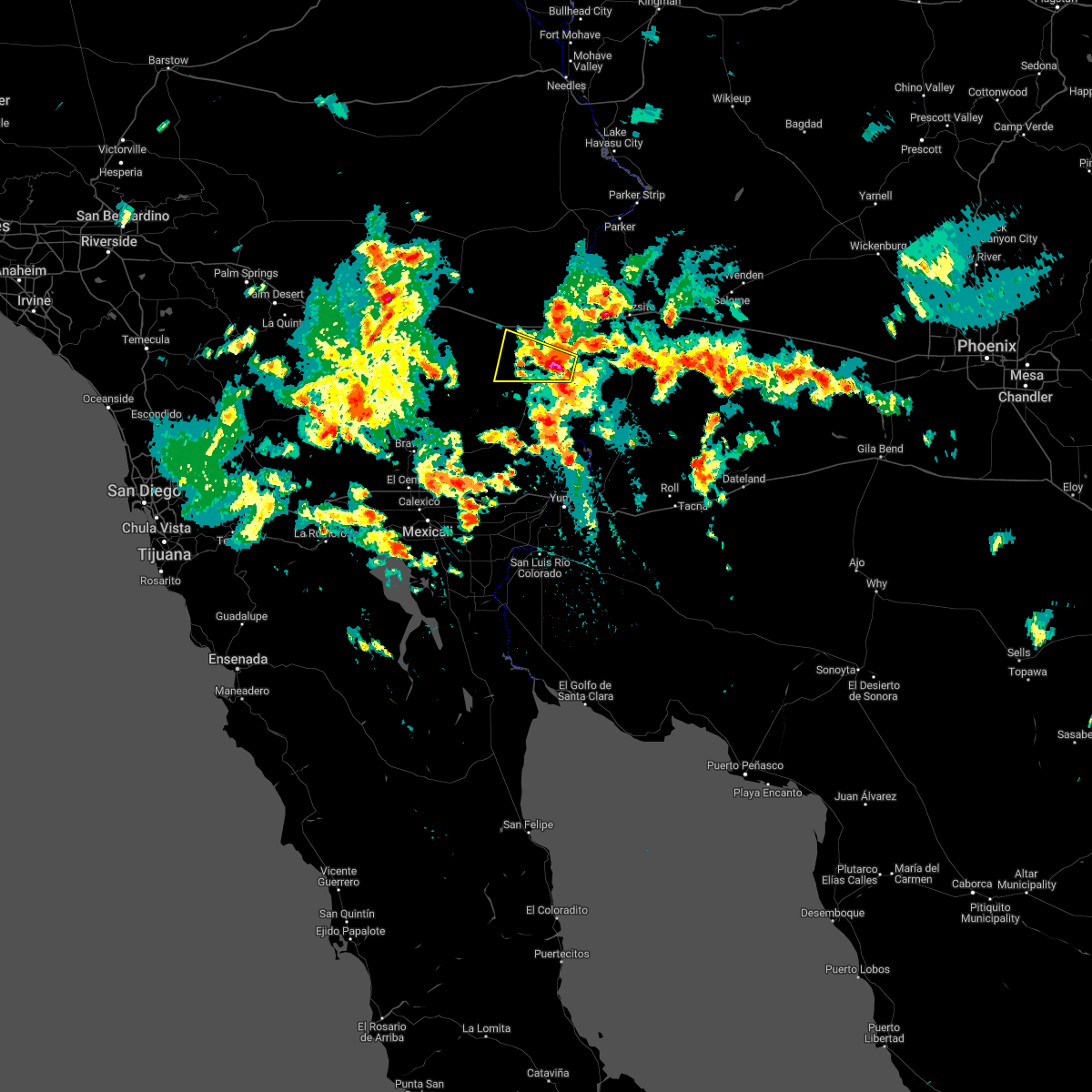
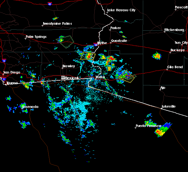
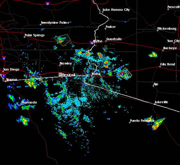
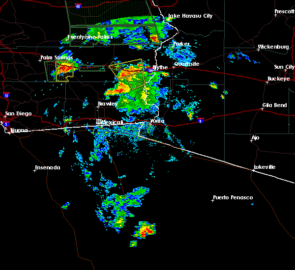
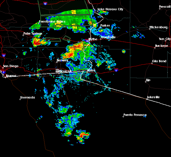
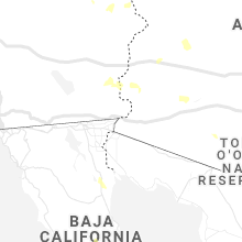
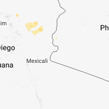
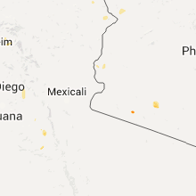
Hail Map for Cibola, AZ
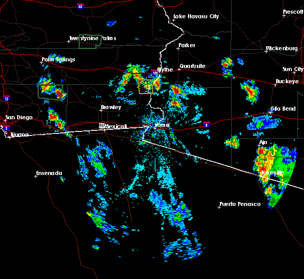
The Cibola, AZ area has had 0 reports of on-the-ground hail by trained spotters, and has been under severe weather warnings 2 times during the past 12 months. Doppler radar has detected hail at or near Cibola, AZ on 11 occasions.
| Name: | Cibola, AZ |
| Where Located: | 47.3 miles N of Yuma, AZ |
| Map: | Google Map for Cibola, AZ |
| Population: | 250 |
| Housing Units: | 307 |
| More Info: | Search Google for Cibola, AZ |
5
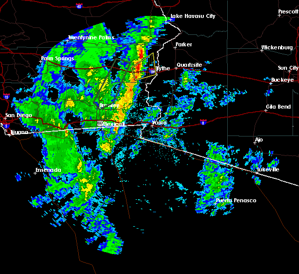
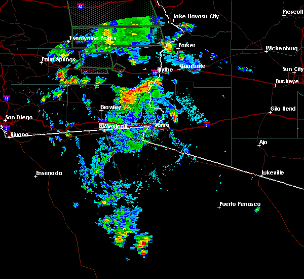
The Top Recent Hail Date for Cibola, AZ is Saturday, October 15, 2022 (1st out of 11)

Hail and Wind Damage Spotted near Cibola, AZ
| Date / Time | Report Details |
|---|---|
| 8/10/2024 5:42 PM PDT |
 At 539 pm mst/539 pm pdt/, a severe thunderstorm was located near ripley, or 41 miles east of desert center, moving northwest at 15 mph (radar indicated). Hazards include 60 mph wind gusts. Expect damage to roofs, siding, and trees. very hazardous driving conditions due to difficult handling conditions and poor visibility. locations impacted include, blythe, cibola, palo verde, ripley, and ehrenberg. this includes the following highways, az interstate 10 between mile markers 1 and 2. ca interstate 10 between mile markers 131 and 156. Ca route 78 between mile markers 77 and 80. At 539 pm mst/539 pm pdt/, a severe thunderstorm was located near ripley, or 41 miles east of desert center, moving northwest at 15 mph (radar indicated). Hazards include 60 mph wind gusts. Expect damage to roofs, siding, and trees. very hazardous driving conditions due to difficult handling conditions and poor visibility. locations impacted include, blythe, cibola, palo verde, ripley, and ehrenberg. this includes the following highways, az interstate 10 between mile markers 1 and 2. ca interstate 10 between mile markers 131 and 156. Ca route 78 between mile markers 77 and 80.
|
| 8/10/2024 5:21 PM PDT |
 Svrpsr the national weather service in phoenix has issued a * severe thunderstorm warning for, west central la paz county in west central arizona, northern imperial county in southeastern california, riverside county in southern california, * until 600 pm mst/600 pm pdt/. * at 520 pm mst/520 pm pdt/, a severe thunderstorm was located over ripley, or 39 miles north of martinez lake, moving northwest at 15 mph (radar indicated). Hazards include 60 mph wind gusts. Expect damage to roofs, siding, and trees. Areas of blowing dust. Svrpsr the national weather service in phoenix has issued a * severe thunderstorm warning for, west central la paz county in west central arizona, northern imperial county in southeastern california, riverside county in southern california, * until 600 pm mst/600 pm pdt/. * at 520 pm mst/520 pm pdt/, a severe thunderstorm was located over ripley, or 39 miles north of martinez lake, moving northwest at 15 mph (radar indicated). Hazards include 60 mph wind gusts. Expect damage to roofs, siding, and trees. Areas of blowing dust.
|
| 10/15/2022 2:32 PM PDT |
 At 232 pm mst/232 pm pdt/, a severe thunderstorm was located over palo verde, or 32 miles north of martinez lake, moving west at 15 mph (radar indicated). Hazards include 60 mph wind gusts and quarter size hail. Hail damage to vehicles is expected. Expect wind damage to roofs, siding, and trees. At 232 pm mst/232 pm pdt/, a severe thunderstorm was located over palo verde, or 32 miles north of martinez lake, moving west at 15 mph (radar indicated). Hazards include 60 mph wind gusts and quarter size hail. Hail damage to vehicles is expected. Expect wind damage to roofs, siding, and trees.
|
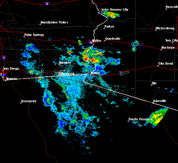
| 9/2/2022 9:40 PM MST |
 The severe thunderstorm warning for southwestern la paz, north central yuma, northeastern imperial and riverside counties will expire at 945 pm mst/945 pm pdt/, the storm which prompted the warning has weakened below severe limits, and no longer poses an immediate threat to life or property. therefore, the warning will be allowed to expire. however small hail, gusty winds and heavy rain are still possible with this thunderstorm. a severe thunderstorm watch remains in effect until 1100 pm mst/1100 pm pdt/ for west central arizona. The severe thunderstorm warning for southwestern la paz, north central yuma, northeastern imperial and riverside counties will expire at 945 pm mst/945 pm pdt/, the storm which prompted the warning has weakened below severe limits, and no longer poses an immediate threat to life or property. therefore, the warning will be allowed to expire. however small hail, gusty winds and heavy rain are still possible with this thunderstorm. a severe thunderstorm watch remains in effect until 1100 pm mst/1100 pm pdt/ for west central arizona.
|
| 9/2/2022 8:55 PM MST |
 At 855 pm mst/855 pm pdt/, severe thunderstorms were located along a line extending from near blythe to 14 miles southwest of kofa wildlife refuge, moving west at 25 mph (radar indicated). Hazards include 60 mph wind gusts and quarter size hail. Hail damage to vehicles is expected. Expect wind damage to roofs, siding, and trees. At 855 pm mst/855 pm pdt/, severe thunderstorms were located along a line extending from near blythe to 14 miles southwest of kofa wildlife refuge, moving west at 25 mph (radar indicated). Hazards include 60 mph wind gusts and quarter size hail. Hail damage to vehicles is expected. Expect wind damage to roofs, siding, and trees.
|
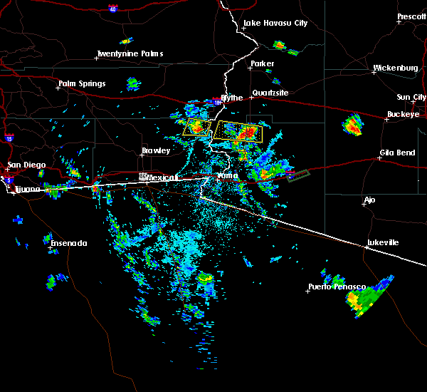
| 8/23/2022 8:33 PM MST | At 833 pm mst, severe thunderstorms were located along a line extending from 12 miles southwest of quartzsite to 11 miles southwest of kofa wildlife refuge to 23 miles west of sundad, moving southwest at 20 mph (radar indicated). Hazards include 60 mph wind gusts. expect damage to roofs, siding, and trees |
| 8/22/2022 12:44 AM PDT | At 1243 am mst/1243 am pdt/, severe thunderstorms were located along a line extending from 22 miles west of palo verde to 12 miles south of cibola to 7 miles east of yuma proving ground, moving southwest at 30 mph (radar indicated). Hazards include 70 mph wind gusts. Expect considerable tree damage. damage is likely to mobile homes, roofs, and outbuildings. locations impacted include, yuma, somerton, martinez lake, gadsden, fortuna foothills, wellton, cibola, palo verde, gordon`s well, algodones dunes, kinter, andrade, winterhaven, araby and yuma proving ground. this includes the following highways, az interstate 8 between mile markers 1 and 32. ca interstate 8 between mile markers 55 and 96. az route 95 between mile markers 29 and 90. thunderstorm damage threat, considerable hail threat, radar indicated max hail size, <. 75 in wind threat, radar indicated max wind gust, 70 mph. |
| 8/22/2022 12:44 AM PDT | At 1243 am mst/1243 am pdt/, severe thunderstorms were located along a line extending from 22 miles west of palo verde to 12 miles south of cibola to 7 miles east of yuma proving ground, moving southwest at 30 mph (radar indicated). Hazards include 70 mph wind gusts. Expect considerable tree damage. damage is likely to mobile homes, roofs, and outbuildings. locations impacted include, yuma, somerton, martinez lake, gadsden, fortuna foothills, wellton, cibola, palo verde, gordon`s well, algodones dunes, kinter, andrade, winterhaven, araby and yuma proving ground. this includes the following highways, az interstate 8 between mile markers 1 and 32. ca interstate 8 between mile markers 55 and 96. az route 95 between mile markers 29 and 90. thunderstorm damage threat, considerable hail threat, radar indicated max hail size, <. 75 in wind threat, radar indicated max wind gust, 70 mph. |
| 8/22/2022 12:34 AM PDT | At 1234 am mst/1234 am pdt/, severe thunderstorms were located along a line extending from 20 miles west of palo verde to 9 miles south of cibola to 11 miles northeast of yuma proving ground, moving southwest at 30 mph (radar indicated). Hazards include 70 mph wind gusts. Expect considerable tree damage. Damage is likely to mobile homes, roofs, and outbuildings. |
| 8/22/2022 12:34 AM PDT | At 1234 am mst/1234 am pdt/, severe thunderstorms were located along a line extending from 20 miles west of palo verde to 9 miles south of cibola to 11 miles northeast of yuma proving ground, moving southwest at 30 mph (radar indicated). Hazards include 70 mph wind gusts. Expect considerable tree damage. Damage is likely to mobile homes, roofs, and outbuildings. |
| 8/22/2022 12:19 AM PDT | At 1218 am mst/1218 am pdt/, severe thunderstorms were located along a line extending from 16 miles southwest of midland to 15 miles southwest of nicholls warm springs to near palo verde to 13 miles north of yuma proving ground, moving southwest at 30 mph (radar indicated). Hazards include 60 mph wind gusts. Expect damage to roofs, siding, and trees. locations impacted include, blythe, nicholls warm springs, cibola, palo verde, blythe airport, ripley, east blythe and ehrenberg. this includes the following highways, az interstate 10 between mile markers 1 and 3. ca interstate 10 between mile markers 113 and 156. az route 95 between mile markers 85 and 97. hail threat, radar indicated max hail size, <. 75 in wind threat, radar indicated max wind gust, 60 mph. |
| 8/22/2022 12:19 AM PDT | At 1218 am mst/1218 am pdt/, severe thunderstorms were located along a line extending from 16 miles southwest of midland to 15 miles southwest of nicholls warm springs to near palo verde to 13 miles north of yuma proving ground, moving southwest at 30 mph (radar indicated). Hazards include 60 mph wind gusts. Expect damage to roofs, siding, and trees. locations impacted include, blythe, nicholls warm springs, cibola, palo verde, blythe airport, ripley, east blythe and ehrenberg. this includes the following highways, az interstate 10 between mile markers 1 and 3. ca interstate 10 between mile markers 113 and 156. az route 95 between mile markers 85 and 97. hail threat, radar indicated max hail size, <. 75 in wind threat, radar indicated max wind gust, 60 mph. |
| 8/21/2022 11:57 PM PDT | At 1157 pm mst/1157 pm pdt/, severe thunderstorms were located along a line extending from 8 miles west of midland to 7 miles west of nicholls warm springs to ripley to 19 miles west of kofa wildlife refuge, moving southwest at 30 mph (radar indicated). Hazards include 60 mph wind gusts. expect damage to roofs, siding, and trees |
| 8/21/2022 11:57 PM PDT | At 1157 pm mst/1157 pm pdt/, severe thunderstorms were located along a line extending from 8 miles west of midland to 7 miles west of nicholls warm springs to ripley to 19 miles west of kofa wildlife refuge, moving southwest at 30 mph (radar indicated). Hazards include 60 mph wind gusts. expect damage to roofs, siding, and trees |
| 8/10/2021 8:18 PM MST |
 At 816 pm mst/pdt, severe thunderstorms were located over central and southwest la paz county moving southwest at 20 mph (radar indicated). Hazards include 60 mph wind gusts. small hail. expect damage to roofs, siding, and trees At 816 pm mst/pdt, severe thunderstorms were located over central and southwest la paz county moving southwest at 20 mph (radar indicated). Hazards include 60 mph wind gusts. small hail. expect damage to roofs, siding, and trees
|
| 8/10/2021 8:08 PM MST |
 At 806 pm mst/806 pm pdt/, severe thunderstorms were located over central and southwestern portions of la paz county moving southwest at 15 mph (radar indicated). Hazards include 60 mph wind gusts. dense blowing dust. Expect damage to roofs, siding, and trees. very hazardous driving conditions due to sudden very strong wind gusts and poor visibility. locations impacted include, blythe, quartzsite, cibola, salome, brenda, bouse, vicksburg junction, wenden, vicksburg, harcuvar, and ehrenberg. this includes the following highways, az interstate 10 between mile markers 1 and 71. ca interstate 10 between mile markers 153 and 156. Us highway 60 between mile markers 31 and 70. At 806 pm mst/806 pm pdt/, severe thunderstorms were located over central and southwestern portions of la paz county moving southwest at 15 mph (radar indicated). Hazards include 60 mph wind gusts. dense blowing dust. Expect damage to roofs, siding, and trees. very hazardous driving conditions due to sudden very strong wind gusts and poor visibility. locations impacted include, blythe, quartzsite, cibola, salome, brenda, bouse, vicksburg junction, wenden, vicksburg, harcuvar, and ehrenberg. this includes the following highways, az interstate 10 between mile markers 1 and 71. ca interstate 10 between mile markers 153 and 156. Us highway 60 between mile markers 31 and 70.
|
| 8/10/2021 7:26 PM MST |
 At 723 pm mst/723 pm pdt/, multiple severe thunderstorms were located over central la paz county, moving southwest at 15 mph (radar indicated). Hazards include 60 mph wind gusts. dense blowing dust. Expect damage to roofs, siding, and trees. Very hazardous driving conditions due to sudden very strong wind gusts and poor visibility. At 723 pm mst/723 pm pdt/, multiple severe thunderstorms were located over central la paz county, moving southwest at 15 mph (radar indicated). Hazards include 60 mph wind gusts. dense blowing dust. Expect damage to roofs, siding, and trees. Very hazardous driving conditions due to sudden very strong wind gusts and poor visibility.
|
| 11/28/2019 6:49 PM MST |
 At 648 pm mst/548 pm pst/, a severe thunderstorm was located near ripley, or 34 miles north of martinez lake, moving northeast at 20 mph (radar indicated). Hazards include 60 mph wind gusts. Expect damage to roofs, siding, and trees. locations impacted include, blythe, cibola, palo verde, ripley, ehrenberg and east blythe. this includes the following highways, az interstate 10 between mile markers 1 and 3. ca interstate 10 between mile markers 152 and 156. Ca route 78 between mile markers 70 and 80. At 648 pm mst/548 pm pst/, a severe thunderstorm was located near ripley, or 34 miles north of martinez lake, moving northeast at 20 mph (radar indicated). Hazards include 60 mph wind gusts. Expect damage to roofs, siding, and trees. locations impacted include, blythe, cibola, palo verde, ripley, ehrenberg and east blythe. this includes the following highways, az interstate 10 between mile markers 1 and 3. ca interstate 10 between mile markers 152 and 156. Ca route 78 between mile markers 70 and 80.
|
| 11/28/2019 5:31 PM PST |
 At 631 pm mst/531 pm pst/, a severe thunderstorm was located near palo verde, or 34 miles north of martinez lake, moving northeast at 25 mph (radar indicated). Hazards include 60 mph wind gusts. Expect damage to roofs, siding, and trees. locations impacted include, blythe, cibola, palo verde, ripley, ehrenberg and east blythe. this includes the following highways, az interstate 10 between mile markers 1 and 3. ca interstate 10 between mile markers 152 and 156. Ca route 78 between mile markers 65 and 80. At 631 pm mst/531 pm pst/, a severe thunderstorm was located near palo verde, or 34 miles north of martinez lake, moving northeast at 25 mph (radar indicated). Hazards include 60 mph wind gusts. Expect damage to roofs, siding, and trees. locations impacted include, blythe, cibola, palo verde, ripley, ehrenberg and east blythe. this includes the following highways, az interstate 10 between mile markers 1 and 3. ca interstate 10 between mile markers 152 and 156. Ca route 78 between mile markers 65 and 80.
|
| 11/28/2019 5:15 PM PST |
 At 614 pm mst/514 pm pst/, a severe thunderstorm was located near palo verde, or 32 miles northwest of martinez lake, moving northeast at 25 mph (radar indicated). Hazards include 60 mph wind gusts. expect damage to roofs, siding, and trees At 614 pm mst/514 pm pst/, a severe thunderstorm was located near palo verde, or 32 miles northwest of martinez lake, moving northeast at 25 mph (radar indicated). Hazards include 60 mph wind gusts. expect damage to roofs, siding, and trees
|
| 11/28/2019 5:02 PM PST |
 At 602 pm mst/502 pm pst/, a severe thunderstorm was located 8 miles west of cibola, or 30 miles northwest of martinez lake, moving northeast at 30 mph (radar indicated). Hazards include 60 mph wind gusts. Expect damage to roofs, siding, and trees. locations impacted include, cibola and palo verde. This includes ca route 78 between mile markers 60 and 80. At 602 pm mst/502 pm pst/, a severe thunderstorm was located 8 miles west of cibola, or 30 miles northwest of martinez lake, moving northeast at 30 mph (radar indicated). Hazards include 60 mph wind gusts. Expect damage to roofs, siding, and trees. locations impacted include, cibola and palo verde. This includes ca route 78 between mile markers 60 and 80.
|
| 11/28/2019 4:51 PM PST |
 At 551 pm mst/451 pm pst/, a severe thunderstorm was located 14 miles southwest of cibola, or 31 miles northwest of martinez lake, moving northeast at 30 mph (radar indicated). Hazards include 60 mph wind gusts. expect damage to roofs, siding, and trees At 551 pm mst/451 pm pst/, a severe thunderstorm was located 14 miles southwest of cibola, or 31 miles northwest of martinez lake, moving northeast at 30 mph (radar indicated). Hazards include 60 mph wind gusts. expect damage to roofs, siding, and trees
|
| 9/4/2019 8:01 PM MST |
 At 801 pm mst/801 pm pdt/, a severe thunderstorm was located 10 miles west of yuma proving ground, or 10 miles northwest of martinez lake, moving northwest at 30 mph (radar indicated). Hazards include 60 mph wind gusts and quarter size hail. Hail damage to vehicles is expected. expect wind damage to roofs, siding, and trees. this severe thunderstorm will remain over mainly rural areas of southwestern la paz, west central yuma and northeastern imperial counties. This includes ca route 78 between mile markers 51 and 73. At 801 pm mst/801 pm pdt/, a severe thunderstorm was located 10 miles west of yuma proving ground, or 10 miles northwest of martinez lake, moving northwest at 30 mph (radar indicated). Hazards include 60 mph wind gusts and quarter size hail. Hail damage to vehicles is expected. expect wind damage to roofs, siding, and trees. this severe thunderstorm will remain over mainly rural areas of southwestern la paz, west central yuma and northeastern imperial counties. This includes ca route 78 between mile markers 51 and 73.
|
| 9/4/2019 8:01 PM MST |
 The national weather service in phoenix has issued a * severe thunderstorm warning for. southwestern la paz county in west central arizona. west central yuma county in southwestern arizona. northeastern imperial county in southeastern california. Until 845 pm mst/845 pm pdt/. The national weather service in phoenix has issued a * severe thunderstorm warning for. southwestern la paz county in west central arizona. west central yuma county in southwestern arizona. northeastern imperial county in southeastern california. Until 845 pm mst/845 pm pdt/.
|
| 9/4/2019 6:53 PM PDT |
 The severe thunderstorm warning for southwestern la paz and northeastern imperial counties will expire at 700 pm mst/700 pm pdt/, the storm which prompted the warning has weakened below severe limits, and no longer poses an immediate threat to life or property. therefore, the warning will be allowed to expire. however gusty winds are still possible with this thunderstorm. The severe thunderstorm warning for southwestern la paz and northeastern imperial counties will expire at 700 pm mst/700 pm pdt/, the storm which prompted the warning has weakened below severe limits, and no longer poses an immediate threat to life or property. therefore, the warning will be allowed to expire. however gusty winds are still possible with this thunderstorm.
|
| 9/4/2019 6:33 PM PDT |
 At 633 pm mst/633 pm pdt/, a severe thunderstorm was located 8 miles west of cibola, or 31 miles northwest of martinez lake, moving west at 20 mph (radar indicated). Hazards include 60 mph wind gusts and quarter size hail. Hail damage to vehicles is expected. expect wind damage to roofs, siding, and trees. locations impacted include, cibola. This includes ca route 78 between mile markers 63 and 77. At 633 pm mst/633 pm pdt/, a severe thunderstorm was located 8 miles west of cibola, or 31 miles northwest of martinez lake, moving west at 20 mph (radar indicated). Hazards include 60 mph wind gusts and quarter size hail. Hail damage to vehicles is expected. expect wind damage to roofs, siding, and trees. locations impacted include, cibola. This includes ca route 78 between mile markers 63 and 77.
|
| 9/4/2019 6:16 PM PDT |
 At 616 pm mst/616 pm pdt/, a severe thunderstorm was located near cibola, or 27 miles northwest of martinez lake, moving west at 20 mph (radar indicated). Hazards include 60 mph wind gusts and quarter size hail. Hail damage to vehicles is expected. Expect wind damage to roofs, siding, and trees. At 616 pm mst/616 pm pdt/, a severe thunderstorm was located near cibola, or 27 miles northwest of martinez lake, moving west at 20 mph (radar indicated). Hazards include 60 mph wind gusts and quarter size hail. Hail damage to vehicles is expected. Expect wind damage to roofs, siding, and trees.
|
| 7/21/2018 7:05 AM MST |
 At 705 am mst/705 am pdt/, severe thunderstorms were located along a line extending from 7 miles east of buckskin mountain park to 8 miles south of parker to 15 miles northwest of quartzsite to near blythe to 8 miles southeast of cibola, moving west at 40 mph (radar indicated). Hazards include 60 mph wind gusts. expect damage to roofs, siding, and trees At 705 am mst/705 am pdt/, severe thunderstorms were located along a line extending from 7 miles east of buckskin mountain park to 8 miles south of parker to 15 miles northwest of quartzsite to near blythe to 8 miles southeast of cibola, moving west at 40 mph (radar indicated). Hazards include 60 mph wind gusts. expect damage to roofs, siding, and trees
|
| 9/8/2017 5:51 PM PDT |
 The severe thunderstorm warning for northern imperial and riverside counties will expire at 600 pm pdt, the storm which prompted the warning has moved out of the area. therefore the warning will be allowed to expire. remember, a severe thunderstorm warning still remains in effect for portions of eastern riverside county until 630 pm pdt. The severe thunderstorm warning for northern imperial and riverside counties will expire at 600 pm pdt, the storm which prompted the warning has moved out of the area. therefore the warning will be allowed to expire. remember, a severe thunderstorm warning still remains in effect for portions of eastern riverside county until 630 pm pdt.
|
| 9/8/2017 5:31 PM PDT |
 At 530 pm pdt, a severe thunderstorm was located near palo verde, or 36 miles southeast of desert center, moving north at 20 mph (radar indicated). Hazards include 60 mph wind gusts and penny size hail. Expect damage to roofs, siding, and trees. Locations impacted include, palo verde. At 530 pm pdt, a severe thunderstorm was located near palo verde, or 36 miles southeast of desert center, moving north at 20 mph (radar indicated). Hazards include 60 mph wind gusts and penny size hail. Expect damage to roofs, siding, and trees. Locations impacted include, palo verde.
|
| 9/8/2017 5:12 PM PDT |
 At 512 pm mst/512 pm pdt/, a severe thunderstorm was located near palo verde, or 34 miles northwest of martinez lake, moving north at 20 mph (radar indicated). Hazards include 60 mph wind gusts and penny size hail. expect damage to roofs, siding, and trees At 512 pm mst/512 pm pdt/, a severe thunderstorm was located near palo verde, or 34 miles northwest of martinez lake, moving north at 20 mph (radar indicated). Hazards include 60 mph wind gusts and penny size hail. expect damage to roofs, siding, and trees
|
| 9/7/2017 5:12 PM PDT |
 At 510 pm mst/510 pm pdt/, a severe thunderstorm was located near nicholls warm springs, or 37 miles east of desert center, moving north at 15 mph. the storm was just to the west of the towns of cibola and palo verde (radar indicated). Hazards include 60 mph wind gusts and penny size hail. dense blowing dust remains a possibility as well. Expect damage to roofs, siding, and trees. Locations impacted include, cibola and palo verde. At 510 pm mst/510 pm pdt/, a severe thunderstorm was located near nicholls warm springs, or 37 miles east of desert center, moving north at 15 mph. the storm was just to the west of the towns of cibola and palo verde (radar indicated). Hazards include 60 mph wind gusts and penny size hail. dense blowing dust remains a possibility as well. Expect damage to roofs, siding, and trees. Locations impacted include, cibola and palo verde.
|
| 9/7/2017 4:42 PM PDT |
 At 441 pm mst/441 pm pdt/, a severe thunderstorm was located over palo verde, or 36 miles northwest of martinez lake, moving north at 15 mph (radar indicated). Hazards include 60 mph wind gusts and penny size hail. dense blowing dust is also likely. expect damage to roofs, siding, and trees At 441 pm mst/441 pm pdt/, a severe thunderstorm was located over palo verde, or 36 miles northwest of martinez lake, moving north at 15 mph (radar indicated). Hazards include 60 mph wind gusts and penny size hail. dense blowing dust is also likely. expect damage to roofs, siding, and trees
|
| 9/6/2017 6:02 PM MST |
 At 601 pm mst/601 pm pdt/, a severe thunderstorm was located 7 miles southeast of ripley, or 34 miles north of martinez lake, moving generally to the west at 15 mph (radar indicated). Hazards include 60 mph wind gusts and quarter size hail. dense blowing dust is also possible. Hail damage to vehicles is expected. Expect wind damage to roofs, siding, and trees. At 601 pm mst/601 pm pdt/, a severe thunderstorm was located 7 miles southeast of ripley, or 34 miles north of martinez lake, moving generally to the west at 15 mph (radar indicated). Hazards include 60 mph wind gusts and quarter size hail. dense blowing dust is also possible. Hail damage to vehicles is expected. Expect wind damage to roofs, siding, and trees.
|
Hail Maps for Cibola, AZ


Connect with Interactive Hail Maps