

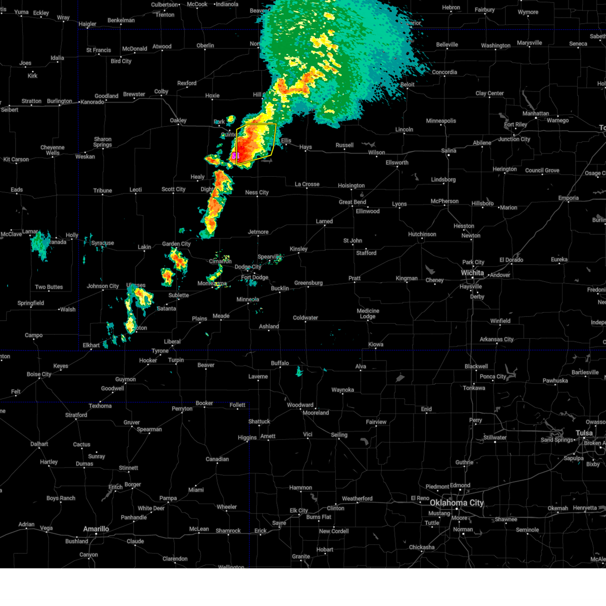
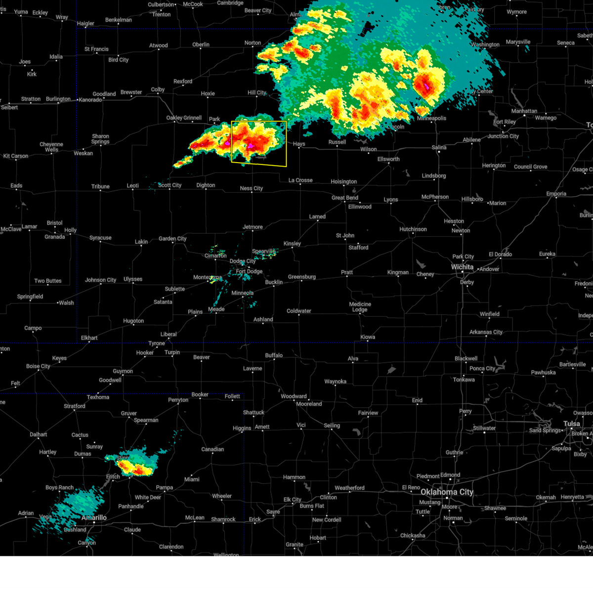
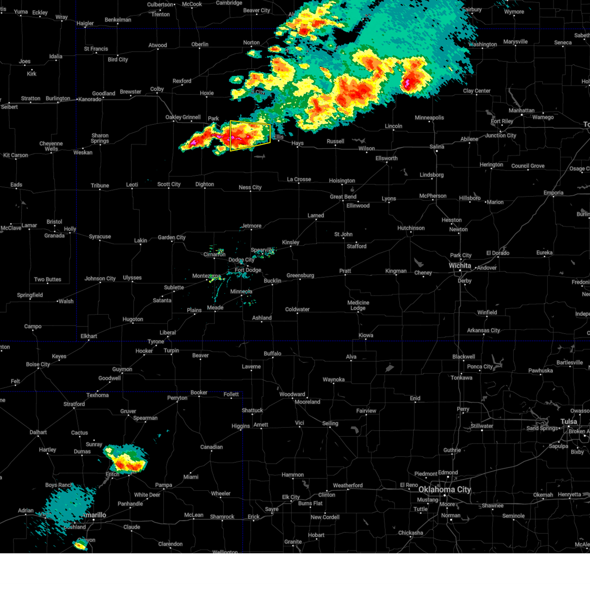
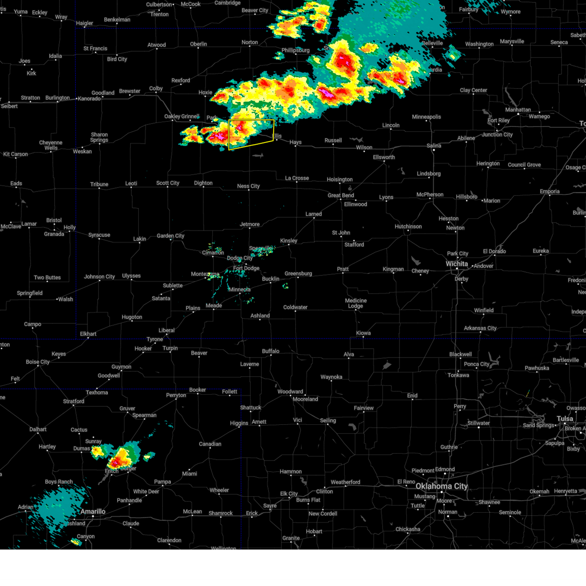
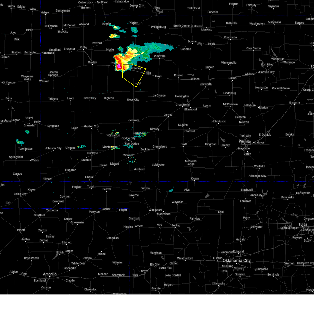
Hail Map for Collyer, KS
The Collyer, KS area has had 19 reports of on-the-ground hail by trained spotters, and has been under severe weather warnings 17 times during the past 12 months. Doppler radar has detected hail at or near Collyer, KS on 105 occasions, including 10 occasions during the past year.
| Name: | Collyer, KS |
| Where Located: | 43.8 miles WNW of Hays, KS |
| Map: | Google Map for Collyer, KS |
| Population: | 109 |
| Housing Units: | 77 |
| More Info: | Search Google for Collyer, KS |
4
The Top Recent Hail Date for Collyer, KS is Monday, September 16, 2024 (4th out of 105)

Hail and Wind Damage Spotted near Collyer, KS
| Date / Time | Report Details |
|---|---|
| 6/17/2025 1:03 AM CDT |
 At 103 am cdt, a severe thunderstorm was located near yocemento, moving southeast at 40 mph (radar indicated). Hazards include 60 mph wind gusts and quarter size hail. Hail damage to vehicles is expected. expect wind damage to roofs, siding, and trees. Locations impacted include, hays, ellis, wakeeney, catherine, ogallah, collyer, emmeram, riga, and voda. At 103 am cdt, a severe thunderstorm was located near yocemento, moving southeast at 40 mph (radar indicated). Hazards include 60 mph wind gusts and quarter size hail. Hail damage to vehicles is expected. expect wind damage to roofs, siding, and trees. Locations impacted include, hays, ellis, wakeeney, catherine, ogallah, collyer, emmeram, riga, and voda.
|
| 6/17/2025 12:48 AM CDT |
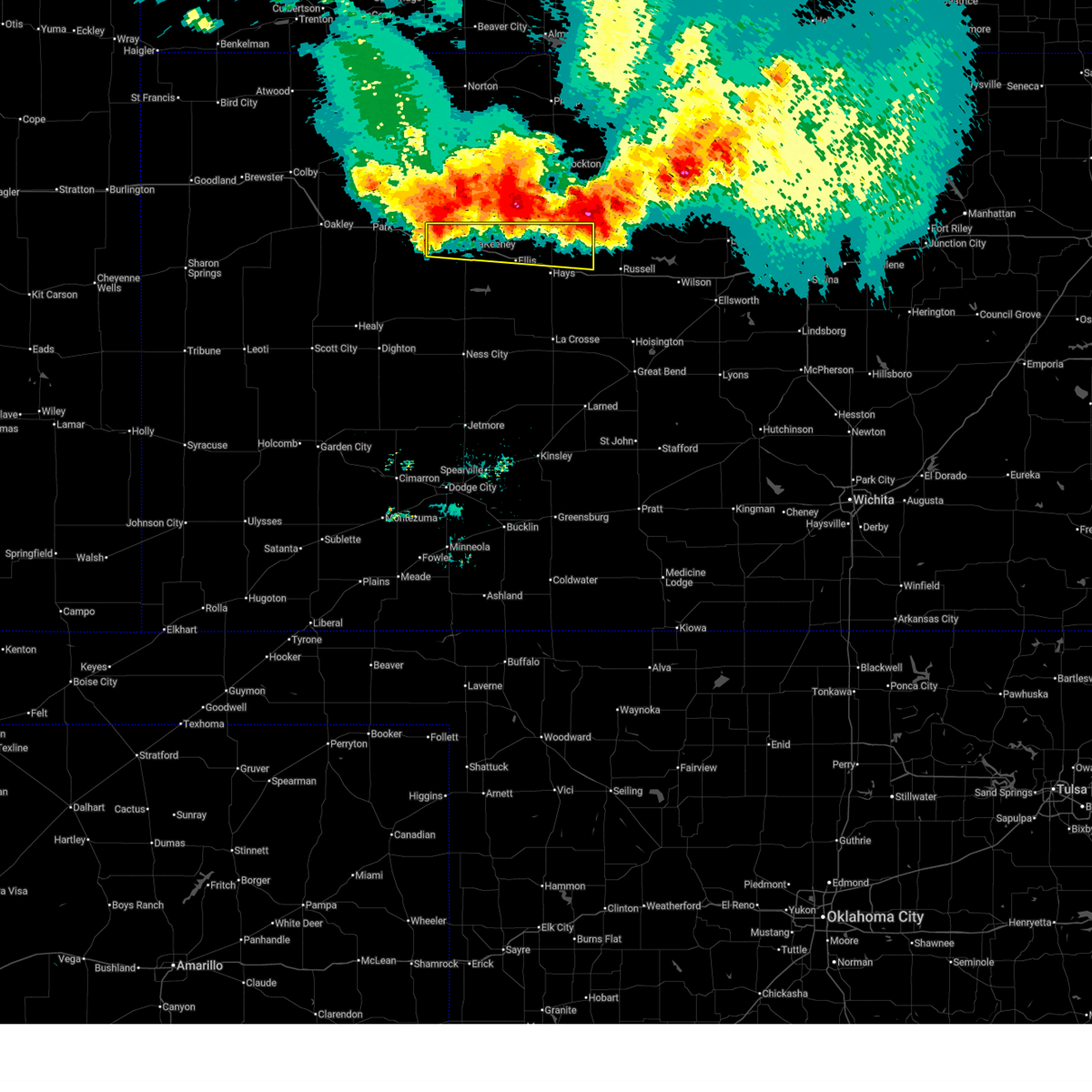 At 1247 am cdt, a severe thunderstorm was located near wakeeney, moving east at 45 mph (radar indicated). Hazards include 60 mph wind gusts and quarter size hail. Hail damage to vehicles is expected. expect wind damage to roofs, siding, and trees. Locations impacted include, hays, ellis, wakeeney, catherine, ogallah, collyer, emmeram, riga, and voda. At 1247 am cdt, a severe thunderstorm was located near wakeeney, moving east at 45 mph (radar indicated). Hazards include 60 mph wind gusts and quarter size hail. Hail damage to vehicles is expected. expect wind damage to roofs, siding, and trees. Locations impacted include, hays, ellis, wakeeney, catherine, ogallah, collyer, emmeram, riga, and voda.
|
| 6/17/2025 12:35 AM CDT |
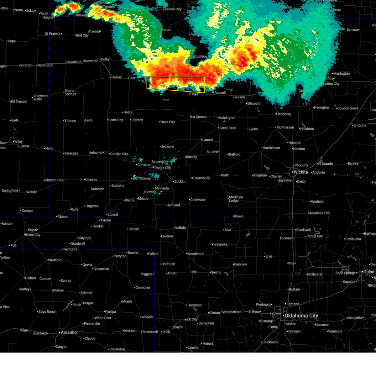
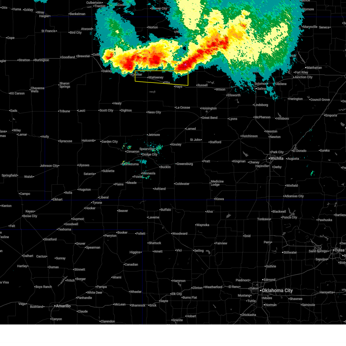 Svrddc the national weather service in dodge city has issued a * severe thunderstorm warning for, northern trego county in west central kansas, northern ellis county in central kansas, * until 130 am cdt. * at 1234 am cdt, a severe thunderstorm was located 8 miles north of collyer, moving east at 35 mph (radar indicated). Hazards include 60 mph wind gusts and quarter size hail. Hail damage to vehicles is expected. expect wind damage to roofs, siding, and trees. This severe thunderstorm will remain over mainly rural areas of northern trego and northern ellis counties. Svrddc the national weather service in dodge city has issued a * severe thunderstorm warning for, northern trego county in west central kansas, northern ellis county in central kansas, * until 130 am cdt. * at 1234 am cdt, a severe thunderstorm was located 8 miles north of collyer, moving east at 35 mph (radar indicated). Hazards include 60 mph wind gusts and quarter size hail. Hail damage to vehicles is expected. expect wind damage to roofs, siding, and trees. This severe thunderstorm will remain over mainly rural areas of northern trego and northern ellis counties.
|
| 9/16/2024 9:28 PM CDT |
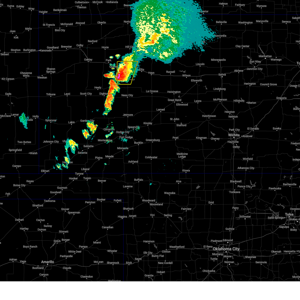 Svrddc the national weather service in dodge city has issued a * severe thunderstorm warning for, trego county in west central kansas, * until 1030 pm cdt. * at 927 pm cdt, a severe thunderstorm was located 11 miles west of trego center, moving east at 15 mph (radar indicated). Hazards include two inch hail and 60 mph wind gusts. People and animals outdoors will be injured. expect hail damage to roofs, siding, windows, and vehicles. Expect wind damage to roofs, siding, and trees. Svrddc the national weather service in dodge city has issued a * severe thunderstorm warning for, trego county in west central kansas, * until 1030 pm cdt. * at 927 pm cdt, a severe thunderstorm was located 11 miles west of trego center, moving east at 15 mph (radar indicated). Hazards include two inch hail and 60 mph wind gusts. People and animals outdoors will be injured. expect hail damage to roofs, siding, windows, and vehicles. Expect wind damage to roofs, siding, and trees.
|
| 9/16/2024 9:17 PM CDT |
 At 915 pm cdt, a severe thunderstorm was located near trego center, moving east at 25 mph (radar indicated). Hazards include two inch hail and 60 mph wind gusts. People and animals outdoors will be injured. expect hail damage to roofs, siding, windows, and vehicles. expect wind damage to roofs, siding, and trees. at 845 pm hail measuring 2. 25 inches in diameter was reported 9 miles south of collyer. Locations impacted include, trego center and ogallah. At 915 pm cdt, a severe thunderstorm was located near trego center, moving east at 25 mph (radar indicated). Hazards include two inch hail and 60 mph wind gusts. People and animals outdoors will be injured. expect hail damage to roofs, siding, windows, and vehicles. expect wind damage to roofs, siding, and trees. at 845 pm hail measuring 2. 25 inches in diameter was reported 9 miles south of collyer. Locations impacted include, trego center and ogallah.
|
| 9/16/2024 8:54 PM CDT | Ping Pong Ball sized hail reported 9.6 miles N of Collyer, KS, delayed report via social media. estimated up to ping pong ball sized hail that occurred on and off over an hour. hail broke some vehicle windshields with some smaller |
| 9/16/2024 8:45 PM CDT | Hen Egg sized hail reported 8.8 miles N of Collyer, KS, facebook with pictures of multiple 2-2.25 stones. |
| 9/16/2024 8:43 PM CDT |
 Svrddc the national weather service in dodge city has issued a * severe thunderstorm warning for, trego county in west central kansas, * until 930 pm cdt. * at 843 pm cdt, a severe thunderstorm was located 7 miles south of voda, moving east at 25 mph (radar indicated). Hazards include 60 mph wind gusts and quarter size hail. Hail damage to vehicles is expected. expect wind damage to roofs, siding, and trees. this severe thunderstorm will be near, wakeeney around 900 pm cdt. Other locations in the path of this severe thunderstorm include ogallah. Svrddc the national weather service in dodge city has issued a * severe thunderstorm warning for, trego county in west central kansas, * until 930 pm cdt. * at 843 pm cdt, a severe thunderstorm was located 7 miles south of voda, moving east at 25 mph (radar indicated). Hazards include 60 mph wind gusts and quarter size hail. Hail damage to vehicles is expected. expect wind damage to roofs, siding, and trees. this severe thunderstorm will be near, wakeeney around 900 pm cdt. Other locations in the path of this severe thunderstorm include ogallah.
|
| 9/16/2024 7:31 PM CDT |
 Svrddc the national weather service in dodge city has issued a * severe thunderstorm warning for, central trego county in west central kansas, * until 815 pm cdt. * at 731 pm cdt, a severe thunderstorm was located near collyer, moving east at 20 mph (radar indicated). Hazards include 60 mph wind gusts and half dollar size hail. Hail damage to vehicles is expected. Expect wind damage to roofs, siding, and trees. Svrddc the national weather service in dodge city has issued a * severe thunderstorm warning for, central trego county in west central kansas, * until 815 pm cdt. * at 731 pm cdt, a severe thunderstorm was located near collyer, moving east at 20 mph (radar indicated). Hazards include 60 mph wind gusts and half dollar size hail. Hail damage to vehicles is expected. Expect wind damage to roofs, siding, and trees.
|
| 7/31/2024 6:59 PM CDT | Svrddc the national weather service in dodge city has issued a * severe thunderstorm warning for, northeastern ness county in west central kansas, trego county in west central kansas, rush county in central kansas, ellis county in central kansas, * until 745 pm cdt. * at 658 pm cdt, a severe thunderstorm was located near antonino, moving east at 20 mph (radar indicated). Hazards include golf ball size hail and 60 mph wind gusts. People and animals outdoors will be injured. expect hail damage to roofs, siding, windows, and vehicles. expect wind damage to roofs, siding, and trees. this severe thunderstorm will be near, antonino around 705 pm cdt. hays and munjor around 710 pm cdt. toulon around 715 pm cdt. Other locations in the path of this severe thunderstorm include victoria and walker. |
| 7/31/2024 6:40 PM CDT | At 640 pm cdt, a severe thunderstorm was located near yocemento, moving east at 20 mph (radar indicated). Hazards include two inch hail and 60 mph wind gusts. People and animals outdoors will be injured. expect hail damage to roofs, siding, windows, and vehicles. expect wind damage to roofs, siding, and trees. Locations impacted include, ellis, wakeeney, ogallah, collyer, trego center, cedar bluff, riga, and voda. |
| 7/31/2024 6:28 PM CDT |
 At 628 pm cdt, a severe thunderstorm was located very near riga, moving east at 20 mph (radar indicated). Hazards include ping pong ball size hail and 60 mph wind gusts. People and animals outdoors will be injured. expect hail damage to roofs, siding, windows, and vehicles. expect wind damage to roofs, siding, and trees. Locations impacted include, ellis. At 628 pm cdt, a severe thunderstorm was located very near riga, moving east at 20 mph (radar indicated). Hazards include ping pong ball size hail and 60 mph wind gusts. People and animals outdoors will be injured. expect hail damage to roofs, siding, windows, and vehicles. expect wind damage to roofs, siding, and trees. Locations impacted include, ellis.
|
| 7/31/2024 6:14 PM CDT |
 Svrddc the national weather service in dodge city has issued a * severe thunderstorm warning for, trego county in west central kansas, western ellis county in central kansas, * until 700 pm cdt. * at 613 pm cdt, a severe thunderstorm was located near trego center, moving east at 20 mph (radar indicated). Hazards include 60 mph wind gusts and half dollar size hail. Hail damage to vehicles is expected. expect wind damage to roofs, siding, and trees. this severe thunderstorm will be near, ogallah around 620 pm cdt. riga around 625 pm cdt. Ellis around 630 pm cdt. Svrddc the national weather service in dodge city has issued a * severe thunderstorm warning for, trego county in west central kansas, western ellis county in central kansas, * until 700 pm cdt. * at 613 pm cdt, a severe thunderstorm was located near trego center, moving east at 20 mph (radar indicated). Hazards include 60 mph wind gusts and half dollar size hail. Hail damage to vehicles is expected. expect wind damage to roofs, siding, and trees. this severe thunderstorm will be near, ogallah around 620 pm cdt. riga around 625 pm cdt. Ellis around 630 pm cdt.
|
| 7/31/2024 6:00 PM CDT |
 At 600 pm cdt, a severe thunderstorm was located 10 miles southwest of zurich, or 10 miles north of ellis, moving east at 20 mph (radar indicated). Hazards include ping pong ball size hail and 60 mph wind gusts. People and animals outdoors will be injured. expect hail damage to roofs, siding, windows, and vehicles. expect wind damage to roofs, siding, and trees. This severe thunderstorm will remain over mainly rural areas of northern trego county. At 600 pm cdt, a severe thunderstorm was located 10 miles southwest of zurich, or 10 miles north of ellis, moving east at 20 mph (radar indicated). Hazards include ping pong ball size hail and 60 mph wind gusts. People and animals outdoors will be injured. expect hail damage to roofs, siding, windows, and vehicles. expect wind damage to roofs, siding, and trees. This severe thunderstorm will remain over mainly rural areas of northern trego county.
|
| 7/31/2024 5:31 PM CDT |
 Svrddc the national weather service in dodge city has issued a * severe thunderstorm warning for, northern trego county in west central kansas, * until 615 pm cdt. * at 530 pm cdt, a severe thunderstorm was located near voda, moving east at 20 mph (radar indicated). Hazards include ping pong ball size hail and 60 mph wind gusts. People and animals outdoors will be injured. expect hail damage to roofs, siding, windows, and vehicles. expect wind damage to roofs, siding, and trees. This severe thunderstorm will be near, wakeeney around 535 pm cdt. Svrddc the national weather service in dodge city has issued a * severe thunderstorm warning for, northern trego county in west central kansas, * until 615 pm cdt. * at 530 pm cdt, a severe thunderstorm was located near voda, moving east at 20 mph (radar indicated). Hazards include ping pong ball size hail and 60 mph wind gusts. People and animals outdoors will be injured. expect hail damage to roofs, siding, windows, and vehicles. expect wind damage to roofs, siding, and trees. This severe thunderstorm will be near, wakeeney around 535 pm cdt.
|
| 7/28/2024 8:59 PM CDT |
 Svrddc the national weather service in dodge city has issued a * severe thunderstorm warning for, central trego county in west central kansas, * until 1000 pm cdt. * at 859 pm cdt, a severe thunderstorm was located very near quinter, moving southeast at 30 mph (radar indicated). Hazards include two inch hail and 70 mph wind gusts. People and animals outdoors will be injured. expect hail damage to roofs, siding, windows, and vehicles. expect considerable tree damage. wind damage is also likely to mobile homes, roofs, and outbuildings. this severe thunderstorm will be near, collyer around 905 pm cdt. voda around 915 pm cdt. Other locations in the path of this severe thunderstorm include trego center. Svrddc the national weather service in dodge city has issued a * severe thunderstorm warning for, central trego county in west central kansas, * until 1000 pm cdt. * at 859 pm cdt, a severe thunderstorm was located very near quinter, moving southeast at 30 mph (radar indicated). Hazards include two inch hail and 70 mph wind gusts. People and animals outdoors will be injured. expect hail damage to roofs, siding, windows, and vehicles. expect considerable tree damage. wind damage is also likely to mobile homes, roofs, and outbuildings. this severe thunderstorm will be near, collyer around 905 pm cdt. voda around 915 pm cdt. Other locations in the path of this severe thunderstorm include trego center.
|
| 7/16/2024 2:34 AM CDT |
 Svrddc the national weather service in dodge city has issued a * severe thunderstorm warning for, ness county in west central kansas, trego county in west central kansas, western rush county in central kansas, ellis county in central kansas, * until 315 am cdt. * at 234 am cdt, a severe thunderstorm was located near cedar bluff, moving east at 35 mph (radar indicated). Hazards include 70 mph wind gusts and nickel size hail. Expect considerable tree damage. Damage is likely to mobile homes, roofs, and outbuildings. Svrddc the national weather service in dodge city has issued a * severe thunderstorm warning for, ness county in west central kansas, trego county in west central kansas, western rush county in central kansas, ellis county in central kansas, * until 315 am cdt. * at 234 am cdt, a severe thunderstorm was located near cedar bluff, moving east at 35 mph (radar indicated). Hazards include 70 mph wind gusts and nickel size hail. Expect considerable tree damage. Damage is likely to mobile homes, roofs, and outbuildings.
|
| 7/6/2024 4:32 PM CDT |
 At 431 pm cdt, a severe thunderstorm was located 8 miles south of collyer, moving east at 30 mph. this is a destructive storm for western and central trego county (radar indicated). Hazards include 80 mph wind gusts and half dollar size hail. Flying debris will be dangerous to those caught without shelter. mobile homes will be heavily damaged. expect considerable damage to roofs, windows, and vehicles. extensive tree damage and power outages are likely. Locations impacted include, wakeeney, collyer, trego center, and voda. At 431 pm cdt, a severe thunderstorm was located 8 miles south of collyer, moving east at 30 mph. this is a destructive storm for western and central trego county (radar indicated). Hazards include 80 mph wind gusts and half dollar size hail. Flying debris will be dangerous to those caught without shelter. mobile homes will be heavily damaged. expect considerable damage to roofs, windows, and vehicles. extensive tree damage and power outages are likely. Locations impacted include, wakeeney, collyer, trego center, and voda.
|
| 7/6/2024 4:07 PM CDT |
 Svrddc the national weather service in dodge city has issued a * severe thunderstorm warning for, western trego county in west central kansas, * until 500 pm cdt. * at 405 pm cdt, a severe thunderstorm was located 7 miles east of gove, moving east at 30 mph. this is a destructive storm for western trego county (radar indicated). Hazards include 80 mph wind gusts and half dollar size hail. Flying debris will be dangerous to those caught without shelter. mobile homes will be heavily damaged. expect considerable damage to roofs, windows, and vehicles. Extensive tree damage and power outages are likely. Svrddc the national weather service in dodge city has issued a * severe thunderstorm warning for, western trego county in west central kansas, * until 500 pm cdt. * at 405 pm cdt, a severe thunderstorm was located 7 miles east of gove, moving east at 30 mph. this is a destructive storm for western trego county (radar indicated). Hazards include 80 mph wind gusts and half dollar size hail. Flying debris will be dangerous to those caught without shelter. mobile homes will be heavily damaged. expect considerable damage to roofs, windows, and vehicles. Extensive tree damage and power outages are likely.
|
| 6/7/2024 7:58 PM CDT |
 At 757 pm cdt, a severe thunderstorm was located 8 miles north of voda, moving southeast at 30 mph (radar indicated). Hazards include tennis ball size hail and 70 mph wind gusts. People and animals outdoors will be injured. expect hail damage to roofs, siding, windows, and vehicles. expect considerable tree damage. wind damage is also likely to mobile homes, roofs, and outbuildings. Locations impacted include, wakeeney, ogallah, collyer, and voda. At 757 pm cdt, a severe thunderstorm was located 8 miles north of voda, moving southeast at 30 mph (radar indicated). Hazards include tennis ball size hail and 70 mph wind gusts. People and animals outdoors will be injured. expect hail damage to roofs, siding, windows, and vehicles. expect considerable tree damage. wind damage is also likely to mobile homes, roofs, and outbuildings. Locations impacted include, wakeeney, ogallah, collyer, and voda.
|
| 6/7/2024 7:44 PM CDT |
 Svrddc the national weather service in dodge city has issued a * severe thunderstorm warning for, northern trego county in west central kansas, * until 830 pm cdt. * at 743 pm cdt, a severe thunderstorm was located 9 miles south of morland, or 11 miles northeast of quinter, moving southeast at 35 mph (radar indicated). Hazards include tennis ball size hail and 60 mph wind gusts. People and animals outdoors will be injured. expect hail damage to roofs, siding, windows, and vehicles. Expect wind damage to roofs, siding, and trees. Svrddc the national weather service in dodge city has issued a * severe thunderstorm warning for, northern trego county in west central kansas, * until 830 pm cdt. * at 743 pm cdt, a severe thunderstorm was located 9 miles south of morland, or 11 miles northeast of quinter, moving southeast at 35 mph (radar indicated). Hazards include tennis ball size hail and 60 mph wind gusts. People and animals outdoors will be injured. expect hail damage to roofs, siding, windows, and vehicles. Expect wind damage to roofs, siding, and trees.
|
| 5/1/2024 7:51 PM CDT |
 Svrddc the national weather service in dodge city has issued a * severe thunderstorm warning for, northwestern trego county in west central kansas, * until 830 pm cdt. * at 751 pm cdt, a severe thunderstorm was located near collyer, moving northeast at 15 mph (radar indicated). Hazards include golf ball size hail and 60 mph wind gusts. People and animals outdoors will be injured. expect hail damage to roofs, siding, windows, and vehicles. expect wind damage to roofs, siding, and trees. this severe thunderstorm will be near, collyer around 755 pm cdt. Voda around 805 pm cdt. Svrddc the national weather service in dodge city has issued a * severe thunderstorm warning for, northwestern trego county in west central kansas, * until 830 pm cdt. * at 751 pm cdt, a severe thunderstorm was located near collyer, moving northeast at 15 mph (radar indicated). Hazards include golf ball size hail and 60 mph wind gusts. People and animals outdoors will be injured. expect hail damage to roofs, siding, windows, and vehicles. expect wind damage to roofs, siding, and trees. this severe thunderstorm will be near, collyer around 755 pm cdt. Voda around 805 pm cdt.
|
| 5/1/2024 7:50 PM CDT |
 The storm which prompted the warning has moved out of the area. therefore, the warning will be allowed to expire. a tornado watch remains in effect until midnight cdt for west central kansas. The storm which prompted the warning has moved out of the area. therefore, the warning will be allowed to expire. a tornado watch remains in effect until midnight cdt for west central kansas.
|
| 5/1/2024 7:41 PM CDT |
 At 740 pm cdt, a severe thunderstorm was located near collyer, moving northeast at 15 mph (radar indicated). Hazards include two inch hail and 60 mph wind gusts. People and animals outdoors will be injured. expect hail damage to roofs, siding, windows, and vehicles. expect wind damage to roofs, siding, and trees. Locations impacted include, collyer. At 740 pm cdt, a severe thunderstorm was located near collyer, moving northeast at 15 mph (radar indicated). Hazards include two inch hail and 60 mph wind gusts. People and animals outdoors will be injured. expect hail damage to roofs, siding, windows, and vehicles. expect wind damage to roofs, siding, and trees. Locations impacted include, collyer.
|
| 5/1/2024 7:15 PM CDT |
 Svrddc the national weather service in dodge city has issued a * severe thunderstorm warning for, west central trego county in west central kansas, * until 800 pm cdt. * at 715 pm cdt, a severe thunderstorm was located 12 miles south of quinter, moving northeast at 15 mph (radar indicated). Hazards include tennis ball size hail and 60 mph wind gusts. People and animals outdoors will be injured. expect hail damage to roofs, siding, windows, and vehicles. expect wind damage to roofs, siding, and trees. This severe thunderstorm will remain over mainly rural areas of west central trego county. Svrddc the national weather service in dodge city has issued a * severe thunderstorm warning for, west central trego county in west central kansas, * until 800 pm cdt. * at 715 pm cdt, a severe thunderstorm was located 12 miles south of quinter, moving northeast at 15 mph (radar indicated). Hazards include tennis ball size hail and 60 mph wind gusts. People and animals outdoors will be injured. expect hail damage to roofs, siding, windows, and vehicles. expect wind damage to roofs, siding, and trees. This severe thunderstorm will remain over mainly rural areas of west central trego county.
|
| 3/13/2024 7:22 PM CDT | Quarter sized hail reported 16.8 miles NNW of Collyer, KS |
| 3/13/2024 7:11 PM CDT | Quarter sized hail reported 11.5 miles N of Collyer, KS |
| 10/3/2023 5:40 PM CDT |
 The severe thunderstorm warning for northern trego and west central ellis counties will expire at 545 pm cdt, the storm which prompted the warning has weakened below severe limits, and no longer poses an immediate threat to life or property. therefore, the warning will be allowed to expire. a severe thunderstorm watch remains in effect until 800 pm cdt for central and west central kansas. The severe thunderstorm warning for northern trego and west central ellis counties will expire at 545 pm cdt, the storm which prompted the warning has weakened below severe limits, and no longer poses an immediate threat to life or property. therefore, the warning will be allowed to expire. a severe thunderstorm watch remains in effect until 800 pm cdt for central and west central kansas.
|
| 10/3/2023 5:25 PM CDT |
 At 525 pm cdt, a severe thunderstorm was located very near wakeeney, moving northeast at 50 mph (radar indicated). Hazards include 60 mph wind gusts and penny size hail. Expect damage to roofs, siding, and trees. this severe thunderstorm will remain over mainly rural areas of northern trego and west central ellis counties. hail threat, radar indicated max hail size, 0. 75 in wind threat, radar indicated max wind gust, 60 mph. At 525 pm cdt, a severe thunderstorm was located very near wakeeney, moving northeast at 50 mph (radar indicated). Hazards include 60 mph wind gusts and penny size hail. Expect damage to roofs, siding, and trees. this severe thunderstorm will remain over mainly rural areas of northern trego and west central ellis counties. hail threat, radar indicated max hail size, 0. 75 in wind threat, radar indicated max wind gust, 60 mph.
|
| 10/3/2023 5:00 PM CDT |
 At 500 pm cdt, a severe thunderstorm was located 12 miles southwest of collyer, moving northeast at 50 mph (radar indicated). Hazards include 60 mph wind gusts and quarter size hail. Hail damage to vehicles is expected. expect wind damage to roofs, siding, and trees. this severe thunderstorm will be near, wakeeney around 520 pm cdt. hail threat, radar indicated max hail size, 1. 00 in wind threat, radar indicated max wind gust, 60 mph. At 500 pm cdt, a severe thunderstorm was located 12 miles southwest of collyer, moving northeast at 50 mph (radar indicated). Hazards include 60 mph wind gusts and quarter size hail. Hail damage to vehicles is expected. expect wind damage to roofs, siding, and trees. this severe thunderstorm will be near, wakeeney around 520 pm cdt. hail threat, radar indicated max hail size, 1. 00 in wind threat, radar indicated max wind gust, 60 mph.
|
| 8/25/2023 7:16 PM CDT |
 At 715 pm cdt, a severe thunderstorm was located very near trego center, moving north at 15 mph (radar indicated). Hazards include 60 mph wind gusts and nickel size hail. Expect damage to roofs, siding, and trees. this severe thunderstorm will be near, wakeeney and ogallah around 725 pm cdt. hail threat, radar indicated max hail size, 0. 88 in wind threat, radar indicated max wind gust, 60 mph. At 715 pm cdt, a severe thunderstorm was located very near trego center, moving north at 15 mph (radar indicated). Hazards include 60 mph wind gusts and nickel size hail. Expect damage to roofs, siding, and trees. this severe thunderstorm will be near, wakeeney and ogallah around 725 pm cdt. hail threat, radar indicated max hail size, 0. 88 in wind threat, radar indicated max wind gust, 60 mph.
|
| 7/19/2023 9:51 PM CDT |
 The severe thunderstorm warning for trego and western ellis counties will expire at 1000 pm cdt, the storms which prompted the warning have weakened below severe limits, and no longer pose an immediate threat to life or property. therefore, the warning will be allowed to expire. a severe thunderstorm watch remains in effect until 300 am cdt for central and west central kansas. The severe thunderstorm warning for trego and western ellis counties will expire at 1000 pm cdt, the storms which prompted the warning have weakened below severe limits, and no longer pose an immediate threat to life or property. therefore, the warning will be allowed to expire. a severe thunderstorm watch remains in effect until 300 am cdt for central and west central kansas.
|
| 7/19/2023 9:39 PM CDT |
 At 939 pm cdt, severe thunderstorms were located along a line extending from 8 miles northeast of ellis to 9 miles west of trego center, moving southeast at 35 mph (radar indicated). Hazards include 60 mph wind gusts. Expect damage to roofs, siding, and trees. locations impacted include, ellis, wakeeney, ogallah, collyer, trego center, cedar bluff, riga and voda. hail threat, radar indicated max hail size, <. 75 in wind threat, radar indicated max wind gust, 60 mph. At 939 pm cdt, severe thunderstorms were located along a line extending from 8 miles northeast of ellis to 9 miles west of trego center, moving southeast at 35 mph (radar indicated). Hazards include 60 mph wind gusts. Expect damage to roofs, siding, and trees. locations impacted include, ellis, wakeeney, ogallah, collyer, trego center, cedar bluff, riga and voda. hail threat, radar indicated max hail size, <. 75 in wind threat, radar indicated max wind gust, 60 mph.
|
| 7/19/2023 9:17 PM CDT |
 At 917 pm cdt, severe thunderstorms were located along a line extending from 8 miles southwest of palco to 7 miles south of quinter, moving southeast at 35 mph (radar indicated). Hazards include 70 mph wind gusts and quarter size hail. Hail damage to vehicles is expected. expect considerable tree damage. Wind damage is also likely to mobile homes, roofs, and outbuildings. At 917 pm cdt, severe thunderstorms were located along a line extending from 8 miles southwest of palco to 7 miles south of quinter, moving southeast at 35 mph (radar indicated). Hazards include 70 mph wind gusts and quarter size hail. Hail damage to vehicles is expected. expect considerable tree damage. Wind damage is also likely to mobile homes, roofs, and outbuildings.
|
| 9/2/2022 7:02 PM CDT |
 At 701 pm cdt, severe thunderstorms were located along a line extending from 7 miles south of hill city to near quinter, moving south at 30 mph (radar indicated). Hazards include 60 mph wind gusts and penny size hail. Expect damage to roofs, siding, and trees. severe thunderstorms will be near, collyer around 710 pm cdt. other locations in the path of these severe thunderstorms include wakeeney, voda and trego center. hail threat, radar indicated max hail size, 0. 75 in wind threat, radar indicated max wind gust, 60 mph. At 701 pm cdt, severe thunderstorms were located along a line extending from 7 miles south of hill city to near quinter, moving south at 30 mph (radar indicated). Hazards include 60 mph wind gusts and penny size hail. Expect damage to roofs, siding, and trees. severe thunderstorms will be near, collyer around 710 pm cdt. other locations in the path of these severe thunderstorms include wakeeney, voda and trego center. hail threat, radar indicated max hail size, 0. 75 in wind threat, radar indicated max wind gust, 60 mph.
|
| 6/12/2022 10:24 PM CDT |
 The severe thunderstorm warning for north central ness, trego and northwestern ellis counties will expire at 1030 pm cdt, the storms which prompted the warning will move out of the warning area and weaken through 1030 pm. therefore, the warning will be allowed to expire. a severe thunderstorm watch remains in effect until midnight cdt for central and west central kansas. The severe thunderstorm warning for north central ness, trego and northwestern ellis counties will expire at 1030 pm cdt, the storms which prompted the warning will move out of the warning area and weaken through 1030 pm. therefore, the warning will be allowed to expire. a severe thunderstorm watch remains in effect until midnight cdt for central and west central kansas.
|
| 6/12/2022 10:06 PM CDT |
 The severe thunderstorm warning for northwestern ness, southwestern trego and northeastern lane counties will expire at 1015 pm cdt, the storms which prompted the warning are moving out of the warned area. therefore, the warning will be allowed to expire. a severe thunderstorm watch remains in effect until midnight cdt for west central kansas. The severe thunderstorm warning for northwestern ness, southwestern trego and northeastern lane counties will expire at 1015 pm cdt, the storms which prompted the warning are moving out of the warned area. therefore, the warning will be allowed to expire. a severe thunderstorm watch remains in effect until midnight cdt for west central kansas.
|
| 6/12/2022 9:57 PM CDT |
 At 957 pm cdt, severe thunderstorms were located along a line extending from 8 miles south of morland to 7 miles southeast of cedar bluff, moving northeast at 30 mph (radar indicated). Hazards include 70 mph wind gusts and penny size hail. Expect considerable tree damage. damage is likely to mobile homes, roofs, and outbuildings. these severe storms will be near, cedar bluff around 1000 pm cdt. thunderstorm damage threat, considerable hail threat, radar indicated max hail size, 0. 75 in wind threat, radar indicated max wind gust, 70 mph. At 957 pm cdt, severe thunderstorms were located along a line extending from 8 miles south of morland to 7 miles southeast of cedar bluff, moving northeast at 30 mph (radar indicated). Hazards include 70 mph wind gusts and penny size hail. Expect considerable tree damage. damage is likely to mobile homes, roofs, and outbuildings. these severe storms will be near, cedar bluff around 1000 pm cdt. thunderstorm damage threat, considerable hail threat, radar indicated max hail size, 0. 75 in wind threat, radar indicated max wind gust, 70 mph.
|
| 6/12/2022 9:42 PM CDT |
 At 941 pm cdt, severe thunderstorms were located along a line extending from near park to near brownell, moving northeast at 25 mph (radar indicated). Hazards include 60 mph wind gusts and penny size hail. Expect damage to roofs, siding, and trees. severe thunderstorms will be near, brownell around 955 pm cdt. other locations in the path of these severe thunderstorms include cedar bluff. hail threat, radar indicated max hail size, 0. 75 in wind threat, radar indicated max wind gust, 60 mph. At 941 pm cdt, severe thunderstorms were located along a line extending from near park to near brownell, moving northeast at 25 mph (radar indicated). Hazards include 60 mph wind gusts and penny size hail. Expect damage to roofs, siding, and trees. severe thunderstorms will be near, brownell around 955 pm cdt. other locations in the path of these severe thunderstorms include cedar bluff. hail threat, radar indicated max hail size, 0. 75 in wind threat, radar indicated max wind gust, 60 mph.
|
| 6/12/2022 9:39 PM CDT |
 At 939 pm cdt, severe thunderstorms were located along a line extending from 12 miles south of quinter to near ransom, moving northeast at 20 mph (radar indicated). Hazards include 60 mph wind gusts and penny size hail. Expect damage to roofs, siding, and trees. locations impacted include, ransom, utica, collyer, brownell and arnold. hail threat, radar indicated max hail size, 0. 75 in wind threat, radar indicated max wind gust, 60 mph. At 939 pm cdt, severe thunderstorms were located along a line extending from 12 miles south of quinter to near ransom, moving northeast at 20 mph (radar indicated). Hazards include 60 mph wind gusts and penny size hail. Expect damage to roofs, siding, and trees. locations impacted include, ransom, utica, collyer, brownell and arnold. hail threat, radar indicated max hail size, 0. 75 in wind threat, radar indicated max wind gust, 60 mph.
|
| 6/12/2022 9:29 PM CDT |
 At 928 pm cdt, severe thunderstorms were located along a line extending from 11 miles north of pendennis to 7 miles west of ness city, moving northeast at 20 mph (radar indicated). Hazards include 60 mph wind gusts and nickel size hail. Expect damage to roofs, siding, and trees. these severe thunderstorms will remain over mainly rural areas of northwestern ness, southwestern trego and northeastern lane counties. hail threat, radar indicated max hail size, 0. 88 in wind threat, radar indicated max wind gust, 60 mph. At 928 pm cdt, severe thunderstorms were located along a line extending from 11 miles north of pendennis to 7 miles west of ness city, moving northeast at 20 mph (radar indicated). Hazards include 60 mph wind gusts and nickel size hail. Expect damage to roofs, siding, and trees. these severe thunderstorms will remain over mainly rural areas of northwestern ness, southwestern trego and northeastern lane counties. hail threat, radar indicated max hail size, 0. 88 in wind threat, radar indicated max wind gust, 60 mph.
|
| 5/12/2022 6:03 PM CDT |
 At 603 pm cdt, a severe thunderstorm was located 10 miles west of trego center, moving northeast at 30 mph (radar indicated). Hazards include 60 mph wind gusts and quarter size hail. Hail damage to vehicles is expected. expect wind damage to roofs, siding, and trees. locations impacted include, wakeeney, ogallah, collyer, trego center and voda. hail threat, radar indicated max hail size, 1. 00 in wind threat, radar indicated max wind gust, 60 mph. At 603 pm cdt, a severe thunderstorm was located 10 miles west of trego center, moving northeast at 30 mph (radar indicated). Hazards include 60 mph wind gusts and quarter size hail. Hail damage to vehicles is expected. expect wind damage to roofs, siding, and trees. locations impacted include, wakeeney, ogallah, collyer, trego center and voda. hail threat, radar indicated max hail size, 1. 00 in wind threat, radar indicated max wind gust, 60 mph.
|
| 5/12/2022 5:58 PM CDT |
 At 557 pm cdt, a severe thunderstorm was located 7 miles north of arnold, moving east at 35 mph (radar indicated). Hazards include 60 mph wind gusts and quarter size hail. Hail damage to vehicles is expected. expect wind damage to roofs, siding, and trees. locations impacted include, wakeeney, ransom, ogallah, utica, collyer, trego center, voda, arnold and cedar bluff. hail threat, radar indicated max hail size, 1. 00 in wind threat, radar indicated max wind gust, 60 mph. At 557 pm cdt, a severe thunderstorm was located 7 miles north of arnold, moving east at 35 mph (radar indicated). Hazards include 60 mph wind gusts and quarter size hail. Hail damage to vehicles is expected. expect wind damage to roofs, siding, and trees. locations impacted include, wakeeney, ransom, ogallah, utica, collyer, trego center, voda, arnold and cedar bluff. hail threat, radar indicated max hail size, 1. 00 in wind threat, radar indicated max wind gust, 60 mph.
|
| 5/12/2022 5:38 PM CDT |
 At 538 pm cdt, a severe thunderstorm was located near utica, moving east at 35 mph (radar indicated). Hazards include 60 mph wind gusts and quarter size hail. Hail damage to vehicles is expected. expect wind damage to roofs, siding, and trees. locations impacted include, wakeeney, ransom, ogallah, utica, collyer, trego center, pendennis, voda, arnold and cedar bluff. hail threat, radar indicated max hail size, 1. 00 in wind threat, radar indicated max wind gust, 60 mph. At 538 pm cdt, a severe thunderstorm was located near utica, moving east at 35 mph (radar indicated). Hazards include 60 mph wind gusts and quarter size hail. Hail damage to vehicles is expected. expect wind damage to roofs, siding, and trees. locations impacted include, wakeeney, ransom, ogallah, utica, collyer, trego center, pendennis, voda, arnold and cedar bluff. hail threat, radar indicated max hail size, 1. 00 in wind threat, radar indicated max wind gust, 60 mph.
|
| 5/12/2022 5:26 PM CDT |
 At 526 pm cdt, a severe thunderstorm was located near shields, moving east at 35 mph (radar indicated). Hazards include 60 mph wind gusts and quarter size hail. Hail damage to vehicles is expected. expect wind damage to roofs, siding, and trees. this severe thunderstorm will be near, pendennis around 530 pm cdt. utica around 545 pm cdt. other locations in the path of this severe thunderstorm include arnold and ransom. hail threat, radar indicated max hail size, 1. 00 in wind threat, radar indicated max wind gust, 60 mph. At 526 pm cdt, a severe thunderstorm was located near shields, moving east at 35 mph (radar indicated). Hazards include 60 mph wind gusts and quarter size hail. Hail damage to vehicles is expected. expect wind damage to roofs, siding, and trees. this severe thunderstorm will be near, pendennis around 530 pm cdt. utica around 545 pm cdt. other locations in the path of this severe thunderstorm include arnold and ransom. hail threat, radar indicated max hail size, 1. 00 in wind threat, radar indicated max wind gust, 60 mph.
|
| 4/29/2022 6:11 PM CDT |
 At 611 pm cdt, severe thunderstorms were located along a line extending from 6 miles west of palco to 8 miles south of zurich to near pfeifer, moving northeast at 50 mph (radar indicated). Hazards include 60 mph wind gusts. Expect damage to roofs, siding, and trees. locations impacted include, victoria and walker. hail threat, radar indicated max hail size, <. 75 in wind threat, radar indicated max wind gust, 60 mph. At 611 pm cdt, severe thunderstorms were located along a line extending from 6 miles west of palco to 8 miles south of zurich to near pfeifer, moving northeast at 50 mph (radar indicated). Hazards include 60 mph wind gusts. Expect damage to roofs, siding, and trees. locations impacted include, victoria and walker. hail threat, radar indicated max hail size, <. 75 in wind threat, radar indicated max wind gust, 60 mph.
|
| 4/29/2022 5:39 PM CDT |
 At 539 pm cdt, severe thunderstorms were located along a line extending from collyer to near trego center to mccracken, moving northeast at 40 mph (radar indicated). Hazards include 60 mph wind gusts and nickel size hail. Expect damage to roofs, siding, and trees. severe thunderstorms will be near, ogallah around 545 pm cdt. wakeeney and riga around 550 pm cdt. ellis and liebenthal around 555 pm cdt. other locations in the path of these severe thunderstorms include schoenchen, antonino, munjor, toulon, victoria and walker. hail threat, radar indicated max hail size, 0. 88 in wind threat, radar indicated max wind gust, 60 mph. At 539 pm cdt, severe thunderstorms were located along a line extending from collyer to near trego center to mccracken, moving northeast at 40 mph (radar indicated). Hazards include 60 mph wind gusts and nickel size hail. Expect damage to roofs, siding, and trees. severe thunderstorms will be near, ogallah around 545 pm cdt. wakeeney and riga around 550 pm cdt. ellis and liebenthal around 555 pm cdt. other locations in the path of these severe thunderstorms include schoenchen, antonino, munjor, toulon, victoria and walker. hail threat, radar indicated max hail size, 0. 88 in wind threat, radar indicated max wind gust, 60 mph.
|
| 4/23/2022 1:58 AM CDT |
 At 157 am cdt, severe thunderstorms were located along a line extending from near quinter to 15 miles east of friend, moving east at 40 mph (radar indicated). Hazards include 60 mph wind gusts. Expect damage to roofs, siding, and trees. severe thunderstorms will be near, collyer around 210 am cdt. voda around 215 am cdt. other locations in the path of these severe thunderstorms include wakeeney and ness city. hail threat, radar indicated max hail size, <. 75 in wind threat, radar indicated max wind gust, 60 mph. At 157 am cdt, severe thunderstorms were located along a line extending from near quinter to 15 miles east of friend, moving east at 40 mph (radar indicated). Hazards include 60 mph wind gusts. Expect damage to roofs, siding, and trees. severe thunderstorms will be near, collyer around 210 am cdt. voda around 215 am cdt. other locations in the path of these severe thunderstorms include wakeeney and ness city. hail threat, radar indicated max hail size, <. 75 in wind threat, radar indicated max wind gust, 60 mph.
|
| 4/22/2022 10:25 PM CDT |
 At 1024 pm cdt, a severe thunderstorm was located near collyer, moving northeast at 50 mph (radar indicated). Hazards include 60 mph wind gusts and half dollar size hail. Hail damage to vehicles is expected. expect wind damage to roofs, siding, and trees. this severe thunderstorm will be near, voda around 1035 pm cdt. hail threat, radar indicated max hail size, 1. 25 in wind threat, radar indicated max wind gust, 60 mph. At 1024 pm cdt, a severe thunderstorm was located near collyer, moving northeast at 50 mph (radar indicated). Hazards include 60 mph wind gusts and half dollar size hail. Hail damage to vehicles is expected. expect wind damage to roofs, siding, and trees. this severe thunderstorm will be near, voda around 1035 pm cdt. hail threat, radar indicated max hail size, 1. 25 in wind threat, radar indicated max wind gust, 60 mph.
|
| 8/15/2021 5:55 PM CDT | Ping Pong Ball sized hail reported 16.8 miles NNW of Collyer, KS |
| 6/19/2021 9:46 PM CDT |
 At 946 pm cdt, severe thunderstorms were located along a line extending from near glade to near schoenchen, moving east at 50 mph (public). Hazards include 60 mph wind gusts. Expect damage to roofs, siding, and trees. Locations impacted include, hays, ellis, wakeeney, victoria, walker, catherine, schoenchen, ogallah, collyer, emmeram, trego center, yocemento, cedar bluff, munjor, riga, pfeifer, toulon, voda and antonino. At 946 pm cdt, severe thunderstorms were located along a line extending from near glade to near schoenchen, moving east at 50 mph (public). Hazards include 60 mph wind gusts. Expect damage to roofs, siding, and trees. Locations impacted include, hays, ellis, wakeeney, victoria, walker, catherine, schoenchen, ogallah, collyer, emmeram, trego center, yocemento, cedar bluff, munjor, riga, pfeifer, toulon, voda and antonino.
|
| 6/19/2021 9:31 PM CDT |
 At 930 pm cdt, severe thunderstorms were located along a line extending from near logan to 6 miles southeast of cedar bluff, moving east at 50 mph (radar indicated). Hazards include 60 mph wind gusts. Expect damage to roofs, siding, and trees. Locations impacted include, hays, ellis, wakeeney, victoria, walker, catherine, schoenchen, ogallah, collyer, emmeram, trego center, yocemento, cedar bluff, munjor, riga, pfeifer, toulon, voda and antonino. At 930 pm cdt, severe thunderstorms were located along a line extending from near logan to 6 miles southeast of cedar bluff, moving east at 50 mph (radar indicated). Hazards include 60 mph wind gusts. Expect damage to roofs, siding, and trees. Locations impacted include, hays, ellis, wakeeney, victoria, walker, catherine, schoenchen, ogallah, collyer, emmeram, trego center, yocemento, cedar bluff, munjor, riga, pfeifer, toulon, voda and antonino.
|
| 6/19/2021 9:02 PM CDT |
 At 901 pm cdt, severe thunderstorms were located along a line extending from 7 miles southeast of jennings to near utica, moving east at 50 mph (radar indicated). Hazards include 60 mph wind gusts. expect damage to roofs, siding, and trees At 901 pm cdt, severe thunderstorms were located along a line extending from 7 miles southeast of jennings to near utica, moving east at 50 mph (radar indicated). Hazards include 60 mph wind gusts. expect damage to roofs, siding, and trees
|
| 5/24/2021 7:23 PM CDT |
 At 723 pm cdt, a severe thunderstorm was located 8 miles south of collyer, moving northeast at 20 mph (radar indicated). Hazards include 60 mph wind gusts and half dollar size hail. Hail damage to vehicles is expected. expect wind damage to roofs, siding, and trees. this severe thunderstorm will be near, trego center and voda around 735 pm cdt. Other locations in the path of this severe thunderstorm include wakeeney and ogallah. At 723 pm cdt, a severe thunderstorm was located 8 miles south of collyer, moving northeast at 20 mph (radar indicated). Hazards include 60 mph wind gusts and half dollar size hail. Hail damage to vehicles is expected. expect wind damage to roofs, siding, and trees. this severe thunderstorm will be near, trego center and voda around 735 pm cdt. Other locations in the path of this severe thunderstorm include wakeeney and ogallah.
|
| 5/14/2021 8:52 PM CDT |
 The severe thunderstorm warning for northern trego county will expire at 900 pm cdt, the storm which prompted the warning has moved out of the area. therefore, the warning will be allowed to expire. however small hail, gusty winds and heavy rain are still possible with this thunderstorm. a severe thunderstorm watch remains in effect until 1100 pm cdt for west central kansas. The severe thunderstorm warning for northern trego county will expire at 900 pm cdt, the storm which prompted the warning has moved out of the area. therefore, the warning will be allowed to expire. however small hail, gusty winds and heavy rain are still possible with this thunderstorm. a severe thunderstorm watch remains in effect until 1100 pm cdt for west central kansas.
|
| 5/14/2021 8:46 PM CDT |
 At 846 pm cdt, a severe thunderstorm was located near wakeeney, moving southeast at 20 mph (radar indicated). Hazards include tennis ball size hail and 60 mph wind gusts. People and animals outdoors will be injured. expect hail damage to roofs, siding, windows, and vehicles. expect wind damage to roofs, siding, and trees. Locations impacted include, wakeeney, collyer and voda. At 846 pm cdt, a severe thunderstorm was located near wakeeney, moving southeast at 20 mph (radar indicated). Hazards include tennis ball size hail and 60 mph wind gusts. People and animals outdoors will be injured. expect hail damage to roofs, siding, windows, and vehicles. expect wind damage to roofs, siding, and trees. Locations impacted include, wakeeney, collyer and voda.
|
| 5/14/2021 8:31 PM CDT |
 At 831 pm cdt, a severe thunderstorm was located near voda, moving southeast at 20 mph. this is a very dangerous storm (radar indicated). Hazards include three inch hail and 60 mph wind gusts. People and animals outdoors will be severely injured. expect shattered windows, extensive damage to roofs, siding, and vehicles. Locations impacted include, wakeeney, collyer and voda. At 831 pm cdt, a severe thunderstorm was located near voda, moving southeast at 20 mph. this is a very dangerous storm (radar indicated). Hazards include three inch hail and 60 mph wind gusts. People and animals outdoors will be severely injured. expect shattered windows, extensive damage to roofs, siding, and vehicles. Locations impacted include, wakeeney, collyer and voda.
|
| 5/14/2021 8:27 PM CDT |
 At 826 pm cdt, a severe thunderstorm was located near voda, moving south at 20 mph (radar indicated). Hazards include tennis ball size hail and 60 mph wind gusts. People and animals outdoors will be injured. expect hail damage to roofs, siding, windows, and vehicles. expect wind damage to roofs, siding, and trees. Locations impacted include, wakeeney, collyer and voda. At 826 pm cdt, a severe thunderstorm was located near voda, moving south at 20 mph (radar indicated). Hazards include tennis ball size hail and 60 mph wind gusts. People and animals outdoors will be injured. expect hail damage to roofs, siding, windows, and vehicles. expect wind damage to roofs, siding, and trees. Locations impacted include, wakeeney, collyer and voda.
|
| 5/14/2021 8:04 PM CDT |
 At 804 pm cdt, a severe thunderstorm was located 8 miles south of morland, or 12 miles north of voda, moving southeast at 20 mph (radar indicated). Hazards include two inch hail and 60 mph wind gusts. People and animals outdoors will be injured. expect hail damage to roofs, siding, windows, and vehicles. Expect wind damage to roofs, siding, and trees. At 804 pm cdt, a severe thunderstorm was located 8 miles south of morland, or 12 miles north of voda, moving southeast at 20 mph (radar indicated). Hazards include two inch hail and 60 mph wind gusts. People and animals outdoors will be injured. expect hail damage to roofs, siding, windows, and vehicles. Expect wind damage to roofs, siding, and trees.
|
| 6/27/2020 1:55 AM CDT |
 The severe thunderstorm warning for trego and northwestern ellis counties will expire at 200 am cdt, the storms which prompted the warning have weakened below severe limits, and no longer pose an immediate threat to life or property. therefore, the warning will be allowed to expire. however gusty winds are still possible with these thunderstorms. a severe thunderstorm watch remains in effect until 400 am cdt for central and west central kansas. The severe thunderstorm warning for trego and northwestern ellis counties will expire at 200 am cdt, the storms which prompted the warning have weakened below severe limits, and no longer pose an immediate threat to life or property. therefore, the warning will be allowed to expire. however gusty winds are still possible with these thunderstorms. a severe thunderstorm watch remains in effect until 400 am cdt for central and west central kansas.
|
| 6/27/2020 1:09 AM CDT |
 At 108 am cdt, severe thunderstorms were located along a line extending from 10 miles southeast of morland to near utica, moving east at 40 mph (radar indicated). Hazards include 60 mph wind gusts and nickel size hail. expect damage to roofs, siding, and trees At 108 am cdt, severe thunderstorms were located along a line extending from 10 miles southeast of morland to near utica, moving east at 40 mph (radar indicated). Hazards include 60 mph wind gusts and nickel size hail. expect damage to roofs, siding, and trees
|
| 6/21/2020 3:58 PM CDT |
 At 356 pm cdt, severe thunderstorms were located along a line extending from near arnold to near shallow water, moving east at 30 mph (radar indicated. at 335 pm...a wind gust of 64 mph was reported at the scott city airport). Hazards include two inch hail and 60 mph wind gusts. People and animals outdoors will be injured. expect hail damage to roofs, siding, windows, and vehicles. expect wind damage to roofs, siding, and trees. Locations impacted include, scott city, wakeeney, dighton, ransom, utica, collyer, alamota, grigston, scott state lake, modoc, shallow water, manning, pendennis, amy, arnold, healy, shields, voda and trego center. At 356 pm cdt, severe thunderstorms were located along a line extending from near arnold to near shallow water, moving east at 30 mph (radar indicated. at 335 pm...a wind gust of 64 mph was reported at the scott city airport). Hazards include two inch hail and 60 mph wind gusts. People and animals outdoors will be injured. expect hail damage to roofs, siding, windows, and vehicles. expect wind damage to roofs, siding, and trees. Locations impacted include, scott city, wakeeney, dighton, ransom, utica, collyer, alamota, grigston, scott state lake, modoc, shallow water, manning, pendennis, amy, arnold, healy, shields, voda and trego center.
|
| 6/21/2020 3:41 PM CDT |
 At 341 pm cdt, severe thunderstorms were located along a line extending from near utica to 6 miles west of shallow water, moving east at 30 mph (radar indicated). Hazards include two inch hail and 60 mph wind gusts. People and animals outdoors will be injured. expect hail damage to roofs, siding, windows, and vehicles. expect wind damage to roofs, siding, and trees. Locations impacted include, scott city, wakeeney, dighton, ransom, utica, collyer, alamota, grigston, scott state lake, modoc, shallow water, manning, pendennis, amy, arnold, healy, shields, voda and trego center. At 341 pm cdt, severe thunderstorms were located along a line extending from near utica to 6 miles west of shallow water, moving east at 30 mph (radar indicated). Hazards include two inch hail and 60 mph wind gusts. People and animals outdoors will be injured. expect hail damage to roofs, siding, windows, and vehicles. expect wind damage to roofs, siding, and trees. Locations impacted include, scott city, wakeeney, dighton, ransom, utica, collyer, alamota, grigston, scott state lake, modoc, shallow water, manning, pendennis, amy, arnold, healy, shields, voda and trego center.
|
| 6/21/2020 3:14 PM CDT |
 At 314 pm cdt, severe thunderstorms were located along a line extending from 9 miles north of pendennis to near modoc, moving east at 35 mph (radar indicated). Hazards include two inch hail and 60 mph wind gusts. People and animals outdoors will be injured. expect hail damage to roofs, siding, windows, and vehicles. Expect wind damage to roofs, siding, and trees. At 314 pm cdt, severe thunderstorms were located along a line extending from 9 miles north of pendennis to near modoc, moving east at 35 mph (radar indicated). Hazards include two inch hail and 60 mph wind gusts. People and animals outdoors will be injured. expect hail damage to roofs, siding, windows, and vehicles. Expect wind damage to roofs, siding, and trees.
|
| 5/21/2020 8:35 PM CDT |
 At 835 pm cdt, a severe thunderstorm was located 9 miles southwest of collyer, moving east at 40 mph (radar indicated). Hazards include ping pong ball size hail and 60 mph wind gusts. People and animals outdoors will be injured. expect hail damage to roofs, siding, windows, and vehicles. Expect wind damage to roofs, siding, and trees. At 835 pm cdt, a severe thunderstorm was located 9 miles southwest of collyer, moving east at 40 mph (radar indicated). Hazards include ping pong ball size hail and 60 mph wind gusts. People and animals outdoors will be injured. expect hail damage to roofs, siding, windows, and vehicles. Expect wind damage to roofs, siding, and trees.
|
| 8/29/2019 9:03 PM CDT |
 At 901 pm cdt, a line of severe thunderstorms was located along a line extending from near zurich to near collyer, moving southeast at 30 mph. these are very dangerous storms (automated weather equipment. hill city measured a wind gust of 77 mph from these storms at 8:43 cdt. these storms have a history of producing wind damage). Hazards include 80 mph wind gusts and up to half dollar size hail. Flying debris will be dangerous to those caught without shelter. mobile homes will be heavily damaged. expect considerable damage to roofs, windows, and vehicles. extensive tree damage and power outages are likely. Locations impacted include, hays, ellis, wakeeney, catherine, ogallah, collyer, emmeram, trego center, yocemento, riga and voda. At 901 pm cdt, a line of severe thunderstorms was located along a line extending from near zurich to near collyer, moving southeast at 30 mph. these are very dangerous storms (automated weather equipment. hill city measured a wind gust of 77 mph from these storms at 8:43 cdt. these storms have a history of producing wind damage). Hazards include 80 mph wind gusts and up to half dollar size hail. Flying debris will be dangerous to those caught without shelter. mobile homes will be heavily damaged. expect considerable damage to roofs, windows, and vehicles. extensive tree damage and power outages are likely. Locations impacted include, hays, ellis, wakeeney, catherine, ogallah, collyer, emmeram, trego center, yocemento, riga and voda.
|
| 8/29/2019 8:44 PM CDT |
 At 843 pm cdt, severe thunderstorms were located along a line extending from near bogue to near park, moving south at 25 mph (automated weather equipment. hill city measured a wind gust of 66 mph at 8:37 pm cdt. these storms have a history of producing wind damage). Hazards include golf ball size hail and 70 mph wind gusts. People and animals outdoors will be injured. expect hail damage to roofs, siding, windows, and vehicles. expect considerable tree damage. Wind damage is also likely to mobile homes, roofs, and outbuildings. At 843 pm cdt, severe thunderstorms were located along a line extending from near bogue to near park, moving south at 25 mph (automated weather equipment. hill city measured a wind gust of 66 mph at 8:37 pm cdt. these storms have a history of producing wind damage). Hazards include golf ball size hail and 70 mph wind gusts. People and animals outdoors will be injured. expect hail damage to roofs, siding, windows, and vehicles. expect considerable tree damage. Wind damage is also likely to mobile homes, roofs, and outbuildings.
|
| 8/24/2019 11:25 PM CDT |
 The severe thunderstorm warning for trego and northwestern ellis counties will expire at 1130 pm cdt, the storm which prompted the warning has moved out of the area. therefore, the warning will be allowed to expire. however small hail, gusty winds and heavy rain are still possible with this thunderstorm. a tornado watch remains in effect until midnight cdt for central and west central kansas. to report severe weather, contact your nearest law enforcement agency. they will relay your report to the national weather service dodge city. The severe thunderstorm warning for trego and northwestern ellis counties will expire at 1130 pm cdt, the storm which prompted the warning has moved out of the area. therefore, the warning will be allowed to expire. however small hail, gusty winds and heavy rain are still possible with this thunderstorm. a tornado watch remains in effect until midnight cdt for central and west central kansas. to report severe weather, contact your nearest law enforcement agency. they will relay your report to the national weather service dodge city.
|
| 8/24/2019 10:37 PM CDT |
 At 1037 pm cdt, a severe thunderstorm was located near collyer, moving southeast at 20 mph. this is a very dangerous storm (radar indicated). Hazards include 80 mph wind gusts and two inch hail. Flying debris will be dangerous to those caught without shelter. mobile homes will be heavily damaged. expect considerable damage to roofs, windows, and vehicles. extensive tree damage and power outages are likely. Locations impacted include, ellis, wakeeney, ogallah, collyer, trego center, riga and voda. At 1037 pm cdt, a severe thunderstorm was located near collyer, moving southeast at 20 mph. this is a very dangerous storm (radar indicated). Hazards include 80 mph wind gusts and two inch hail. Flying debris will be dangerous to those caught without shelter. mobile homes will be heavily damaged. expect considerable damage to roofs, windows, and vehicles. extensive tree damage and power outages are likely. Locations impacted include, ellis, wakeeney, ogallah, collyer, trego center, riga and voda.
|
| 8/24/2019 10:35 PM CDT | Half Dollar sized hail reported 0.2 miles SE of Collyer, KS |
| 8/24/2019 10:25 PM CDT |
 At 1025 pm cdt, a severe thunderstorm was located 7 miles northeast of quinter, moving southeast at 20 mph. this is a very dangerous storm (radar indicated). Hazards include 80 mph wind gusts and baseball size hail. Flying debris will be dangerous to those caught without shelter. mobile homes will be heavily damaged. expect considerable damage to roofs, windows, and vehicles. Extensive tree damage and power outages are likely. At 1025 pm cdt, a severe thunderstorm was located 7 miles northeast of quinter, moving southeast at 20 mph. this is a very dangerous storm (radar indicated). Hazards include 80 mph wind gusts and baseball size hail. Flying debris will be dangerous to those caught without shelter. mobile homes will be heavily damaged. expect considerable damage to roofs, windows, and vehicles. Extensive tree damage and power outages are likely.
|
| 8/24/2019 10:11 PM CDT |
 At 1010 pm cdt, a severe thunderstorm was located 7 miles north of wakeeney, moving southeast at 15 mph (radar indicated). Hazards include ping pong ball size hail and 60 mph wind gusts. People and animals outdoors will be injured. expect hail damage to roofs, siding, windows, and vehicles. expect wind damage to roofs, siding, and trees. Locations impacted include, wakeeney, ogallah, collyer, voda and riga. At 1010 pm cdt, a severe thunderstorm was located 7 miles north of wakeeney, moving southeast at 15 mph (radar indicated). Hazards include ping pong ball size hail and 60 mph wind gusts. People and animals outdoors will be injured. expect hail damage to roofs, siding, windows, and vehicles. expect wind damage to roofs, siding, and trees. Locations impacted include, wakeeney, ogallah, collyer, voda and riga.
|
| 8/24/2019 9:48 PM CDT |
 At 948 pm cdt, a severe thunderstorm was located near voda, moving southeast at 20 mph (radar indicated). Hazards include golf ball size hail and 60 mph wind gusts. People and animals outdoors will be injured. expect hail damage to roofs, siding, windows, and vehicles. expect wind damage to roofs, siding, and trees. Locations impacted include, wakeeney, ogallah, collyer, voda and riga. At 948 pm cdt, a severe thunderstorm was located near voda, moving southeast at 20 mph (radar indicated). Hazards include golf ball size hail and 60 mph wind gusts. People and animals outdoors will be injured. expect hail damage to roofs, siding, windows, and vehicles. expect wind damage to roofs, siding, and trees. Locations impacted include, wakeeney, ogallah, collyer, voda and riga.
|
| 8/24/2019 9:30 PM CDT |
 At 930 pm cdt, a severe thunderstorm was located 10 miles south of morland, or 10 miles north of voda, moving southeast at 20 mph (radar indicated). Hazards include golf ball size hail and 60 mph wind gusts. People and animals outdoors will be injured. expect hail damage to roofs, siding, windows, and vehicles. Expect wind damage to roofs, siding, and trees. At 930 pm cdt, a severe thunderstorm was located 10 miles south of morland, or 10 miles north of voda, moving southeast at 20 mph (radar indicated). Hazards include golf ball size hail and 60 mph wind gusts. People and animals outdoors will be injured. expect hail damage to roofs, siding, windows, and vehicles. Expect wind damage to roofs, siding, and trees.
|
| 8/18/2019 1:00 AM CDT |
 At 100 am cdt, a severe thunderstorm was located very near voda, moving east at 25 mph (radar indicated). Hazards include 60 mph wind gusts and quarter size hail. Hail damage to vehicles is expected. Expect wind damage to roofs, siding, and trees. At 100 am cdt, a severe thunderstorm was located very near voda, moving east at 25 mph (radar indicated). Hazards include 60 mph wind gusts and quarter size hail. Hail damage to vehicles is expected. Expect wind damage to roofs, siding, and trees.
|
| 8/17/2019 8:24 PM CDT |
 At 824 pm cdt, a severe thunderstorm was located near wakeeney, moving east at 35 mph (radar indicated). Hazards include 60 mph wind gusts and quarter size hail. Hail damage to vehicles is expected. expect wind damage to roofs, siding, and trees. Locations impacted include, wakeeney, ogallah, collyer, trego center, voda and riga. At 824 pm cdt, a severe thunderstorm was located near wakeeney, moving east at 35 mph (radar indicated). Hazards include 60 mph wind gusts and quarter size hail. Hail damage to vehicles is expected. expect wind damage to roofs, siding, and trees. Locations impacted include, wakeeney, ogallah, collyer, trego center, voda and riga.
|
| 8/17/2019 8:01 PM CDT |
 The national weather service in dodge city has issued a * severe thunderstorm warning for. trego county in west central kansas. until 845 pm cdt. At 801 pm cdt, a severe thunderstorm was located near collyer, moving east at 25 mph. The national weather service in dodge city has issued a * severe thunderstorm warning for. trego county in west central kansas. until 845 pm cdt. At 801 pm cdt, a severe thunderstorm was located near collyer, moving east at 25 mph.
|
| 8/17/2019 2:01 AM CDT |
 The national weather service in dodge city has issued a * severe thunderstorm warning for. trego county in west central kansas. until 245 am cdt. At 201 am cdt, a severe thunderstorm was located near voda, moving east at 35 mph. The national weather service in dodge city has issued a * severe thunderstorm warning for. trego county in west central kansas. until 245 am cdt. At 201 am cdt, a severe thunderstorm was located near voda, moving east at 35 mph.
|
| 8/13/2019 6:49 PM CDT |
 At 617 pm cdt, severe thunderstorms were located along a line extending from 10 miles north of voda to 11 miles southeast of gove, moving east at 25 mph (radar indicated). Hazards include 70 mph wind gusts and half dollar size hail. Hail damage to vehicles is expected. expect considerable tree damage. Wind damage is also likely to mobile homes, roofs, and outbuildings. At 617 pm cdt, severe thunderstorms were located along a line extending from 10 miles north of voda to 11 miles southeast of gove, moving east at 25 mph (radar indicated). Hazards include 70 mph wind gusts and half dollar size hail. Hail damage to vehicles is expected. expect considerable tree damage. Wind damage is also likely to mobile homes, roofs, and outbuildings.
|
| 8/13/2019 6:19 PM CDT |
 The national weather service in dodge city has issued a * severe thunderstorm warning for. northwestern ness county in west central kansas. trego county in west central kansas. western ellis county in central kansas. Until 715 pm cdt. The national weather service in dodge city has issued a * severe thunderstorm warning for. northwestern ness county in west central kansas. trego county in west central kansas. western ellis county in central kansas. Until 715 pm cdt.
|
| 8/11/2019 11:35 PM CDT |
 At 1134 pm cdt, a severe thunderstorm was located near collyer, moving east at 30 mph (radar indicated). Hazards include 60 mph wind gusts and nickel size hail. Expect damage to roofs, siding, and trees. Locations impacted include, wakeeney, ogallah, collyer, trego center, cedar bluff, riga and voda. At 1134 pm cdt, a severe thunderstorm was located near collyer, moving east at 30 mph (radar indicated). Hazards include 60 mph wind gusts and nickel size hail. Expect damage to roofs, siding, and trees. Locations impacted include, wakeeney, ogallah, collyer, trego center, cedar bluff, riga and voda.
|
| 8/11/2019 11:12 PM CDT |
 At 1110 pm cdt, a severe thunderstorm was located 9 miles southeast of gove, moving east at 35 mph (radar indicated). Hazards include 60 mph wind gusts and quarter size hail. Hail damage to vehicles is expected. Expect wind damage to roofs, siding, and trees. At 1110 pm cdt, a severe thunderstorm was located 9 miles southeast of gove, moving east at 35 mph (radar indicated). Hazards include 60 mph wind gusts and quarter size hail. Hail damage to vehicles is expected. Expect wind damage to roofs, siding, and trees.
|
| 8/11/2019 1:12 AM CDT |
 The severe thunderstorm warning for trego county will expire at 115 am cdt, the storm which prompted the warning has weakened below severe limits, and no longer poses an immediate threat to life or property. therefore, the warning will be allowed to expire. however gusty winds and heavy rain are still possible with this thunderstorm. The severe thunderstorm warning for trego county will expire at 115 am cdt, the storm which prompted the warning has weakened below severe limits, and no longer poses an immediate threat to life or property. therefore, the warning will be allowed to expire. however gusty winds and heavy rain are still possible with this thunderstorm.
|
| 8/11/2019 12:43 AM CDT |
 At 1242 am cdt, a severe thunderstorm was located near voda, moving east at 30 mph (radar indicated). Hazards include 60 mph wind gusts and penny size hail. Expect damage to roofs, siding, and trees. Locations impacted include, wakeeney, collyer, trego center and voda. At 1242 am cdt, a severe thunderstorm was located near voda, moving east at 30 mph (radar indicated). Hazards include 60 mph wind gusts and penny size hail. Expect damage to roofs, siding, and trees. Locations impacted include, wakeeney, collyer, trego center and voda.
|
| 8/11/2019 12:24 AM CDT |
 The national weather service in dodge city has issued a * severe thunderstorm warning for. trego county in west central kansas. until 115 am cdt. At 1224 am cdt, a severe thunderstorm was located near quinter, moving east at 30 mph. The national weather service in dodge city has issued a * severe thunderstorm warning for. trego county in west central kansas. until 115 am cdt. At 1224 am cdt, a severe thunderstorm was located near quinter, moving east at 30 mph.
|
| 7/5/2019 8:02 PM CDT |
 At 801 pm cdt, a severe thunderstorm was located near collyer, moving south at 20 mph (radar indicated). Hazards include ping pong ball size hail and 60 mph wind gusts. People and animals outdoors will be injured. expect hail damage to roofs, siding, windows, and vehicles. Expect wind damage to roofs, siding, and trees. At 801 pm cdt, a severe thunderstorm was located near collyer, moving south at 20 mph (radar indicated). Hazards include ping pong ball size hail and 60 mph wind gusts. People and animals outdoors will be injured. expect hail damage to roofs, siding, windows, and vehicles. Expect wind damage to roofs, siding, and trees.
|
| 7/5/2019 7:35 PM CDT |
 The severe thunderstorm warning for northwestern trego county will expire at 745 pm cdt, the storm which prompted the warning has weakened below severe limits, and no longer poses an immediate threat to life or property. therefore, the warning will be allowed to expire. The severe thunderstorm warning for northwestern trego county will expire at 745 pm cdt, the storm which prompted the warning has weakened below severe limits, and no longer poses an immediate threat to life or property. therefore, the warning will be allowed to expire.
|
| 7/5/2019 7:05 PM CDT |
 At 705 pm cdt, a severe thunderstorm was located near collyer, moving southeast at 10 mph (radar indicated). Hazards include 60 mph wind gusts and half dollar size hail. Hail damage to vehicles is expected. expect wind damage to roofs, siding, and trees. Locations impacted include, wakeeney, collyer and voda. At 705 pm cdt, a severe thunderstorm was located near collyer, moving southeast at 10 mph (radar indicated). Hazards include 60 mph wind gusts and half dollar size hail. Hail damage to vehicles is expected. expect wind damage to roofs, siding, and trees. Locations impacted include, wakeeney, collyer and voda.
|
| 7/5/2019 6:39 PM CDT |
 At 639 pm cdt, a severe thunderstorm was located near quinter, moving southeast at 10 mph (radar indicated). Hazards include 60 mph wind gusts and half dollar size hail. Hail damage to vehicles is expected. Expect wind damage to roofs, siding, and trees. At 639 pm cdt, a severe thunderstorm was located near quinter, moving southeast at 10 mph (radar indicated). Hazards include 60 mph wind gusts and half dollar size hail. Hail damage to vehicles is expected. Expect wind damage to roofs, siding, and trees.
|
| 6/23/2019 4:14 PM CDT |
 At 414 pm cdt, a severe thunderstorm was located 11 miles south of quinter, moving east at 35 mph (radar indicated). Hazards include 60 mph wind gusts and quarter size hail. Hail damage to vehicles is expected. Expect wind damage to roofs, siding, and trees. At 414 pm cdt, a severe thunderstorm was located 11 miles south of quinter, moving east at 35 mph (radar indicated). Hazards include 60 mph wind gusts and quarter size hail. Hail damage to vehicles is expected. Expect wind damage to roofs, siding, and trees.
|
| 6/21/2019 11:21 PM CDT |
 At 1121 pm cdt, a severe thunderstorm was located near quinter, moving east at 35 mph (radar indicated). Hazards include 60 mph wind gusts and quarter size hail. Hail damage to vehicles is expected. Expect wind damage to roofs, siding, and trees. At 1121 pm cdt, a severe thunderstorm was located near quinter, moving east at 35 mph (radar indicated). Hazards include 60 mph wind gusts and quarter size hail. Hail damage to vehicles is expected. Expect wind damage to roofs, siding, and trees.
|
| 6/9/2019 12:18 AM CDT |
 At 1217 am cdt, severe thunderstorms were located along a line extending from 7 miles northeast of wakeeney to 10 miles southeast of gove, moving southeast at 40 mph (radar indicated). Hazards include 60 mph wind gusts and half dollar size hail. Hail damage to vehicles is expected. Expect wind damage to roofs, siding, and trees. At 1217 am cdt, severe thunderstorms were located along a line extending from 7 miles northeast of wakeeney to 10 miles southeast of gove, moving southeast at 40 mph (radar indicated). Hazards include 60 mph wind gusts and half dollar size hail. Hail damage to vehicles is expected. Expect wind damage to roofs, siding, and trees.
|
| 5/28/2019 7:02 PM CDT |
 At 702 pm cdt, a severe thunderstorm capable of producing a tornado was located near quinter, moving east at 30 mph (radar indicated rotation). Hazards include tornado and tennis ball size hail. Flying debris will be dangerous to those caught without shelter. mobile homes will be damaged or destroyed. damage to roofs, windows, and vehicles will occur. tree damage is likely. this dangerous storm will be near, collyer around 715 pm cdt. voda around 725 pm cdt. Wakeeney around 740 pm cdt. At 702 pm cdt, a severe thunderstorm capable of producing a tornado was located near quinter, moving east at 30 mph (radar indicated rotation). Hazards include tornado and tennis ball size hail. Flying debris will be dangerous to those caught without shelter. mobile homes will be damaged or destroyed. damage to roofs, windows, and vehicles will occur. tree damage is likely. this dangerous storm will be near, collyer around 715 pm cdt. voda around 725 pm cdt. Wakeeney around 740 pm cdt.
|
| 5/28/2019 5:38 PM CDT | Quarter sized hail reported 9.5 miles N of Collyer, KS, reports of quarter size hail. |
| 5/23/2019 4:20 PM CDT |
 The severe thunderstorm warning for central trego county will expire at 430 pm cdt, the storm which prompted the warning has weakened below severe limits, and no longer poses an immediate threat to life or property. therefore, the warning will be allowed to expire. however gusty winds and heavy rain are still possible with this thunderstorm. a severe thunderstorm watch remains in effect until 1000 pm cdt for central and west central kansas. The severe thunderstorm warning for central trego county will expire at 430 pm cdt, the storm which prompted the warning has weakened below severe limits, and no longer poses an immediate threat to life or property. therefore, the warning will be allowed to expire. however gusty winds and heavy rain are still possible with this thunderstorm. a severe thunderstorm watch remains in effect until 1000 pm cdt for central and west central kansas.
|
| 5/23/2019 4:04 PM CDT |
 At 404 pm cdt, a severe thunderstorm was located near wakeeney, moving north at 40 mph (radar indicated). Hazards include 60 mph wind gusts and quarter size hail. Hail damage to vehicles is expected. expect wind damage to roofs, siding, and trees. Locations impacted include, wakeeney, ogallah, collyer, trego center and voda. At 404 pm cdt, a severe thunderstorm was located near wakeeney, moving north at 40 mph (radar indicated). Hazards include 60 mph wind gusts and quarter size hail. Hail damage to vehicles is expected. expect wind damage to roofs, siding, and trees. Locations impacted include, wakeeney, ogallah, collyer, trego center and voda.
|
| 5/23/2019 3:47 PM CDT |
 At 346 pm cdt, a severe thunderstorm was located near trego center, moving north at 50 mph (radar indicated). Hazards include 60 mph wind gusts and quarter size hail. Hail damage to vehicles is expected. expect wind damage to roofs, siding, and trees. Locations impacted include, wakeeney, ogallah, collyer, trego center and voda. At 346 pm cdt, a severe thunderstorm was located near trego center, moving north at 50 mph (radar indicated). Hazards include 60 mph wind gusts and quarter size hail. Hail damage to vehicles is expected. expect wind damage to roofs, siding, and trees. Locations impacted include, wakeeney, ogallah, collyer, trego center and voda.
|
| 5/23/2019 3:26 PM CDT |
 At 325 pm cdt, a severe thunderstorm was located near utica, moving north at 50 mph. this replaces the previous warning for lane and ness counties (radar indicated). Hazards include 60 mph wind gusts and half dollar size hail. Hail damage to vehicles is expected. Expect wind damage to roofs, siding, and trees. At 325 pm cdt, a severe thunderstorm was located near utica, moving north at 50 mph. this replaces the previous warning for lane and ness counties (radar indicated). Hazards include 60 mph wind gusts and half dollar size hail. Hail damage to vehicles is expected. Expect wind damage to roofs, siding, and trees.
|
| 4/28/2019 8:45 PM CDT |
 At 844 pm cdt, a severe thunderstorm was located 8 miles southwest of trego center, moving east at 20 mph (radar indicated). Hazards include 60 mph wind gusts and quarter size hail. Hail damage to vehicles is expected. expect wind damage to roofs, siding, and trees. Locations impacted include, wakeeney, ransom, ogallah, collyer, brownell, trego center, cedar bluff, riga, voda and arnold. At 844 pm cdt, a severe thunderstorm was located 8 miles southwest of trego center, moving east at 20 mph (radar indicated). Hazards include 60 mph wind gusts and quarter size hail. Hail damage to vehicles is expected. expect wind damage to roofs, siding, and trees. Locations impacted include, wakeeney, ransom, ogallah, collyer, brownell, trego center, cedar bluff, riga, voda and arnold.
|
| 4/28/2019 8:12 PM CDT |
 At 812 pm cdt, a severe thunderstorm was located 12 miles north of pendennis, moving east at 40 mph (radar indicated). Hazards include 70 mph wind gusts and ping pong ball size hail. People and animals outdoors will be injured. expect hail damage to roofs, siding, windows, and vehicles. expect considerable tree damage. Wind damage is also likely to mobile homes, roofs, and outbuildings. At 812 pm cdt, a severe thunderstorm was located 12 miles north of pendennis, moving east at 40 mph (radar indicated). Hazards include 70 mph wind gusts and ping pong ball size hail. People and animals outdoors will be injured. expect hail damage to roofs, siding, windows, and vehicles. expect considerable tree damage. Wind damage is also likely to mobile homes, roofs, and outbuildings.
|
| 4/21/2019 7:10 PM CDT |
 At 710 pm cdt, a severe thunderstorm was located 8 miles northeast of ogallah, moving east at 45 mph (radar indicated). Hazards include 60 mph wind gusts and penny size hail. Expect damage to roofs, siding, and trees. Locations impacted include, wakeeney, ogallah, collyer, trego center, cedar bluff, riga and voda. At 710 pm cdt, a severe thunderstorm was located 8 miles northeast of ogallah, moving east at 45 mph (radar indicated). Hazards include 60 mph wind gusts and penny size hail. Expect damage to roofs, siding, and trees. Locations impacted include, wakeeney, ogallah, collyer, trego center, cedar bluff, riga and voda.
|
| 4/21/2019 7:02 PM CDT |
 At 702 pm cdt, a severe thunderstorm was located near ogallah, moving east at 40 mph (radar indicated). Hazards include 60 mph wind gusts and nickel size hail. Expect damage to roofs, siding, and trees. Locations impacted include, wakeeney, bazine, ransom, ogallah, collyer, brownell, trego center, cedar bluff, riga and voda. At 702 pm cdt, a severe thunderstorm was located near ogallah, moving east at 40 mph (radar indicated). Hazards include 60 mph wind gusts and nickel size hail. Expect damage to roofs, siding, and trees. Locations impacted include, wakeeney, bazine, ransom, ogallah, collyer, brownell, trego center, cedar bluff, riga and voda.
|
| 4/21/2019 6:46 PM CDT |
 At 646 pm cdt, a severe thunderstorm was located near trego center, moving east at 40 mph (radar indicated). Hazards include 70 mph wind gusts and nickel size hail. Expect considerable tree damage. damage is likely to mobile homes, roofs, and outbuildings. Locations impacted include, wakeeney, ness city, bazine, ransom, ogallah, utica, collyer, brownell, trego center, cedar bluff, arnold, riga and voda. At 646 pm cdt, a severe thunderstorm was located near trego center, moving east at 40 mph (radar indicated). Hazards include 70 mph wind gusts and nickel size hail. Expect considerable tree damage. damage is likely to mobile homes, roofs, and outbuildings. Locations impacted include, wakeeney, ness city, bazine, ransom, ogallah, utica, collyer, brownell, trego center, cedar bluff, arnold, riga and voda.
|
| 4/21/2019 6:45 PM CDT | 60 to 70 mp in trego county KS, 6.2 miles NNW of Collyer, KS |
| 4/21/2019 6:24 PM CDT |
 At 624 pm cdt, a severe thunderstorm was located 13 miles north of utica, moving east at 40 mph (radar indicated). Hazards include 70 mph wind gusts and penny size hail. Expect considerable tree damage. Damage is likely to mobile homes, roofs, and outbuildings. At 624 pm cdt, a severe thunderstorm was located 13 miles north of utica, moving east at 40 mph (radar indicated). Hazards include 70 mph wind gusts and penny size hail. Expect considerable tree damage. Damage is likely to mobile homes, roofs, and outbuildings.
|
| 9/2/2018 5:50 PM CDT |
 The severe thunderstorm warning for northwestern trego county will expire at 600 pm cdt, the storm which prompted the warning has weakened below severe limits, and no longer poses an immediate threat to life or property. therefore, the warning will be allowed to expire. The severe thunderstorm warning for northwestern trego county will expire at 600 pm cdt, the storm which prompted the warning has weakened below severe limits, and no longer poses an immediate threat to life or property. therefore, the warning will be allowed to expire.
|
| 9/2/2018 5:27 PM CDT |
 At 526 pm cdt, a severe thunderstorm was located near collyer, moving northeast at 15 mph (radar indicated). Hazards include two inch hail and 70 mph wind gusts. People and animals outdoors will be injured. expect hail damage to roofs, siding, windows, and vehicles. expect considerable tree damage. wind damage is also likely to mobile homes, roofs, and outbuildings. while not an immediate threat, this storm was showing signs of rotation and is in a favorable environment for a brief tornado. Be alert to any possible tornadic activity! locations impacted include, collyer. At 526 pm cdt, a severe thunderstorm was located near collyer, moving northeast at 15 mph (radar indicated). Hazards include two inch hail and 70 mph wind gusts. People and animals outdoors will be injured. expect hail damage to roofs, siding, windows, and vehicles. expect considerable tree damage. wind damage is also likely to mobile homes, roofs, and outbuildings. while not an immediate threat, this storm was showing signs of rotation and is in a favorable environment for a brief tornado. Be alert to any possible tornadic activity! locations impacted include, collyer.
|
| 9/2/2018 5:19 PM CDT |
 At 519 pm cdt, a severe thunderstorm was located very near collyer, moving northeast at 15 mph (radar indicated). Hazards include golf ball size hail and 60 mph wind gusts. People and animals outdoors will be injured. expect hail damage to roofs, siding, windows, and vehicles. Expect wind damage to roofs, siding, and trees. At 519 pm cdt, a severe thunderstorm was located very near collyer, moving northeast at 15 mph (radar indicated). Hazards include golf ball size hail and 60 mph wind gusts. People and animals outdoors will be injured. expect hail damage to roofs, siding, windows, and vehicles. Expect wind damage to roofs, siding, and trees.
|
| 8/8/2018 12:25 PM CDT |
 At 1225 pm cdt, a severe thunderstorm was located near voda, moving southeast at 10 mph (radar indicated). Hazards include 60 mph wind gusts and quarter size hail. Hail damage to vehicles is expected. expect wind damage to roofs, siding, and trees. Locations impacted include, wakeeney, collyer and voda. At 1225 pm cdt, a severe thunderstorm was located near voda, moving southeast at 10 mph (radar indicated). Hazards include 60 mph wind gusts and quarter size hail. Hail damage to vehicles is expected. expect wind damage to roofs, siding, and trees. Locations impacted include, wakeeney, collyer and voda.
|
| 8/8/2018 12:06 PM CDT |
 At 1206 pm cdt, a severe thunderstorm was located 6 miles northwest of voda, moving southeast at 10 mph (radar indicated). Hazards include 60 mph wind gusts and quarter size hail. Hail damage to vehicles is expected. Expect wind damage to roofs, siding, and trees. At 1206 pm cdt, a severe thunderstorm was located 6 miles northwest of voda, moving southeast at 10 mph (radar indicated). Hazards include 60 mph wind gusts and quarter size hail. Hail damage to vehicles is expected. Expect wind damage to roofs, siding, and trees.
|
| 8/6/2018 11:41 PM CDT |
 At 1140 pm cdt, a severe thunderstorm was located near voda, moving east at 30 mph (radar indicated). Hazards include 60 mph wind gusts and half dollar size hail. Hail damage to vehicles is expected. Expect wind damage to roofs, siding, and trees. At 1140 pm cdt, a severe thunderstorm was located near voda, moving east at 30 mph (radar indicated). Hazards include 60 mph wind gusts and half dollar size hail. Hail damage to vehicles is expected. Expect wind damage to roofs, siding, and trees.
|
| 6/30/2018 10:54 PM CDT |
 The severe thunderstorm warning for trego county will expire at 1100 pm cdt, the storms which prompted the warning have weakened below severe limits, and no longer pose an immediate threat to life or property. therefore, the warning will be allowed to expire. however gusty winds are still possible with these thunderstorms. The severe thunderstorm warning for trego county will expire at 1100 pm cdt, the storms which prompted the warning have weakened below severe limits, and no longer pose an immediate threat to life or property. therefore, the warning will be allowed to expire. however gusty winds are still possible with these thunderstorms.
|
| 6/30/2018 10:37 PM CDT |
 At 1036 pm cdt, severe thunderstorms were located along a line extending from 7 miles southwest of palco to 3 miles east of trego center to 10 miles north of arnold, moving east at 45 mph. a report of 70 mph winds was recorded on the trego and gove county line just west of collyer at 10:30 pm (emergency management). Hazards include 70 mph wind gusts and nickel size hail. Expect considerable tree damage. damage is likely to mobile homes, roofs, and outbuildings. Locations impacted include, wakeeney, ogallah, collyer, trego center, cedar bluff, riga and voda. At 1036 pm cdt, severe thunderstorms were located along a line extending from 7 miles southwest of palco to 3 miles east of trego center to 10 miles north of arnold, moving east at 45 mph. a report of 70 mph winds was recorded on the trego and gove county line just west of collyer at 10:30 pm (emergency management). Hazards include 70 mph wind gusts and nickel size hail. Expect considerable tree damage. damage is likely to mobile homes, roofs, and outbuildings. Locations impacted include, wakeeney, ogallah, collyer, trego center, cedar bluff, riga and voda.
|
| 6/30/2018 9:55 PM CDT |
 At 954 pm cdt, severe thunderstorms were located along a line extending from 3 miles northeast of park to 10 miles north of healy, moving east at 45 mph. this line of storms has had a history of producing winds in excess of 60 mph (radar indicated). Hazards include 70 mph wind gusts and quarter size hail. Hail damage to vehicles is expected. expect considerable tree damage. Wind damage is also likely to mobile homes, roofs, and outbuildings. At 954 pm cdt, severe thunderstorms were located along a line extending from 3 miles northeast of park to 10 miles north of healy, moving east at 45 mph. this line of storms has had a history of producing winds in excess of 60 mph (radar indicated). Hazards include 70 mph wind gusts and quarter size hail. Hail damage to vehicles is expected. expect considerable tree damage. Wind damage is also likely to mobile homes, roofs, and outbuildings.
|
| 6/24/2018 8:33 PM CDT |
 At 832 pm cdt, severe thunderstorms were located along a line extending from 7 miles southwest of zurich to 4 miles northeast of brownell, moving east at 45 mph (radar indicated). Hazards include 60 mph wind gusts and penny size hail. Expect damage to roofs, siding, and trees. Locations impacted include, hays, ellis, wakeeney, victoria, walker, catherine, otis, bison, schoenchen, ogallah, collyer, liebenthal, brownell, emmeram, trego center, yocemento, cedar bluff, munjor, loretta and riga. At 832 pm cdt, severe thunderstorms were located along a line extending from 7 miles southwest of zurich to 4 miles northeast of brownell, moving east at 45 mph (radar indicated). Hazards include 60 mph wind gusts and penny size hail. Expect damage to roofs, siding, and trees. Locations impacted include, hays, ellis, wakeeney, victoria, walker, catherine, otis, bison, schoenchen, ogallah, collyer, liebenthal, brownell, emmeram, trego center, yocemento, cedar bluff, munjor, loretta and riga.
|
| 6/24/2018 8:04 PM CDT |
 At 804 pm cdt, severe thunderstorms were located along a line extending from 5 miles northeast of voda to 3 miles northeast of utica, moving east at 55 mph (radar indicated). Hazards include 60 mph wind gusts and penny size hail. expect damage to roofs, siding, and trees At 804 pm cdt, severe thunderstorms were located along a line extending from 5 miles northeast of voda to 3 miles northeast of utica, moving east at 55 mph (radar indicated). Hazards include 60 mph wind gusts and penny size hail. expect damage to roofs, siding, and trees
|
| 6/23/2018 7:28 PM CDT |
 At 727 pm cdt, a severe thunderstorm was located 4 miles northeast of collyer, moving east at 20 mph (radar indicated). Hazards include 60 mph wind gusts and quarter size hail. Hail damage to vehicles is expected. expect wind damage to roofs, siding, and trees. Locations impacted include, wakeeney, collyer, trego center and voda. At 727 pm cdt, a severe thunderstorm was located 4 miles northeast of collyer, moving east at 20 mph (radar indicated). Hazards include 60 mph wind gusts and quarter size hail. Hail damage to vehicles is expected. expect wind damage to roofs, siding, and trees. Locations impacted include, wakeeney, collyer, trego center and voda.
|
| 6/23/2018 7:14 PM CDT |
 At 714 pm cdt, a severe thunderstorm was located 4 miles northeast of quinter, moving east at 20 mph (radar indicated). Hazards include 60 mph wind gusts and quarter size hail. Hail damage to vehicles is expected. Expect wind damage to roofs, siding, and trees. At 714 pm cdt, a severe thunderstorm was located 4 miles northeast of quinter, moving east at 20 mph (radar indicated). Hazards include 60 mph wind gusts and quarter size hail. Hail damage to vehicles is expected. Expect wind damage to roofs, siding, and trees.
|
| 6/22/2018 5:18 PM CDT |
 At 518 pm cdt, severe thunderstorms were located along a line extending from 8 miles north of quinter to 10 miles southeast of gove to 4 miles north of healy, moving southeast at 30 mph (radar indicated). Hazards include 60 mph wind gusts and penny size hail. Expect damage to roofs, siding, and trees. Locations impacted include, wakeeney, ransom, ogallah, utica, collyer, brownell, trego center, scott state lake, cedar bluff, pendennis, arnold, healy, riga, shields and voda. At 518 pm cdt, severe thunderstorms were located along a line extending from 8 miles north of quinter to 10 miles southeast of gove to 4 miles north of healy, moving southeast at 30 mph (radar indicated). Hazards include 60 mph wind gusts and penny size hail. Expect damage to roofs, siding, and trees. Locations impacted include, wakeeney, ransom, ogallah, utica, collyer, brownell, trego center, scott state lake, cedar bluff, pendennis, arnold, healy, riga, shields and voda.
|
| 6/22/2018 4:59 PM CDT |
 The national weather service in dodge city has issued a * severe thunderstorm warning for. northwestern ness county in west central kansas. northeastern scott county in west central kansas. trego county in west central kansas. Northern lane county in west central kansas. The national weather service in dodge city has issued a * severe thunderstorm warning for. northwestern ness county in west central kansas. northeastern scott county in west central kansas. trego county in west central kansas. Northern lane county in west central kansas.
|
| 6/19/2018 9:57 PM CDT |
 At 957 pm cdt, severe thunderstorms were located along a line extending from 11 miles north of wakeeney to 4 miles north of ness city, moving east at 60 mph (radar indicated). Hazards include 70 mph wind gusts and penny size hail. Expect considerable tree damage. damage is likely to mobile homes, roofs, and outbuildings. Locations impacted include, hays, ellis, wakeeney, la crosse, victoria, walker, catherine, ransom, otis, bison, schoenchen, mccracken, ogallah, utica, collyer, liebenthal, timken, brownell, emmeram and yocemento. At 957 pm cdt, severe thunderstorms were located along a line extending from 11 miles north of wakeeney to 4 miles north of ness city, moving east at 60 mph (radar indicated). Hazards include 70 mph wind gusts and penny size hail. Expect considerable tree damage. damage is likely to mobile homes, roofs, and outbuildings. Locations impacted include, hays, ellis, wakeeney, la crosse, victoria, walker, catherine, ransom, otis, bison, schoenchen, mccracken, ogallah, utica, collyer, liebenthal, timken, brownell, emmeram and yocemento.
|
| 6/19/2018 9:37 PM CDT |
 At 936 pm cdt, severe thunderstorms were located along a line extending from 6 miles northeast of quinter to 5 miles north of alamota, moving east at 50 mph (radar indicated). Hazards include 70 mph wind gusts and penny size hail. Expect considerable tree damage. Damage is likely to mobile homes, roofs, and outbuildings. At 936 pm cdt, severe thunderstorms were located along a line extending from 6 miles northeast of quinter to 5 miles north of alamota, moving east at 50 mph (radar indicated). Hazards include 70 mph wind gusts and penny size hail. Expect considerable tree damage. Damage is likely to mobile homes, roofs, and outbuildings.
|
| 6/19/2018 5:23 PM CDT |
 The severe thunderstorm warning for northern trego county will expire at 530 pm cdt, the storm which prompted the warning has weakened below severe limits, and no longer poses an immediate threat to life or property. therefore, the warning will be allowed to expire. however gusty winds and heavy rain are still possible with this thunderstorm. a severe thunderstorm watch remains in effect until 1100 pm cdt for central and west central kansas. The severe thunderstorm warning for northern trego county will expire at 530 pm cdt, the storm which prompted the warning has weakened below severe limits, and no longer poses an immediate threat to life or property. therefore, the warning will be allowed to expire. however gusty winds and heavy rain are still possible with this thunderstorm. a severe thunderstorm watch remains in effect until 1100 pm cdt for central and west central kansas.
|
| 6/19/2018 4:59 PM CDT |
 At 459 pm cdt, a severe thunderstorm was located 8 miles west of trego center, moving north at 15 mph (radar indicated). Hazards include 60 mph wind gusts and quarter size hail. Hail damage to vehicles is expected. expect wind damage to roofs, siding, and trees. Locations impacted include, wakeeney, collyer, trego center and voda. At 459 pm cdt, a severe thunderstorm was located 8 miles west of trego center, moving north at 15 mph (radar indicated). Hazards include 60 mph wind gusts and quarter size hail. Hail damage to vehicles is expected. expect wind damage to roofs, siding, and trees. Locations impacted include, wakeeney, collyer, trego center and voda.
|
| 6/19/2018 4:37 PM CDT |
 At 436 pm cdt, a severe thunderstorm was located 9 miles west of trego center, moving northeast at 15 mph (radar indicated). Hazards include 60 mph wind gusts and half dollar size hail. Hail damage to vehicles is expected. Expect wind damage to roofs, siding, and trees. At 436 pm cdt, a severe thunderstorm was located 9 miles west of trego center, moving northeast at 15 mph (radar indicated). Hazards include 60 mph wind gusts and half dollar size hail. Hail damage to vehicles is expected. Expect wind damage to roofs, siding, and trees.
|
| 6/19/2018 3:57 PM CDT |
 At 357 pm cdt, a severe thunderstorm was located 12 miles south of collyer, moving northeast at 10 mph (radar indicated). Hazards include ping pong ball size hail and 60 mph wind gusts. People and animals outdoors will be injured. expect hail damage to roofs, siding, windows, and vehicles. expect wind damage to roofs, siding, and trees. Locations impacted include, wakeeney, collyer, trego center and voda. At 357 pm cdt, a severe thunderstorm was located 12 miles south of collyer, moving northeast at 10 mph (radar indicated). Hazards include ping pong ball size hail and 60 mph wind gusts. People and animals outdoors will be injured. expect hail damage to roofs, siding, windows, and vehicles. expect wind damage to roofs, siding, and trees. Locations impacted include, wakeeney, collyer, trego center and voda.
|
| 6/19/2018 3:39 PM CDT |
 The national weather service in dodge city has issued a * severe thunderstorm warning for. western trego county in west central kansas. until 445 pm cdt. At 339 pm cdt, a severe thunderstorm was located 13 miles north of utica, moving northeast at 15 mph. The national weather service in dodge city has issued a * severe thunderstorm warning for. western trego county in west central kansas. until 445 pm cdt. At 339 pm cdt, a severe thunderstorm was located 13 miles north of utica, moving northeast at 15 mph.
|
| 5/28/2018 5:37 PM CDT |
 At 537 pm cdt, a severe thunderstorm was located 7 miles south of collyer, moving northeast at 20 mph (radar indicated). Hazards include 60 mph wind gusts and quarter size hail. Hail damage to vehicles is expected. expect wind damage to roofs, siding, and trees. locations impacted include, collyer. A tornado watch remains in effect until 1000 pm cdt for west central kansas. At 537 pm cdt, a severe thunderstorm was located 7 miles south of collyer, moving northeast at 20 mph (radar indicated). Hazards include 60 mph wind gusts and quarter size hail. Hail damage to vehicles is expected. expect wind damage to roofs, siding, and trees. locations impacted include, collyer. A tornado watch remains in effect until 1000 pm cdt for west central kansas.
|
| 5/28/2018 5:18 PM CDT |
 At 517 pm cdt, a severe thunderstorm was located 13 miles north of utica, moving northeast at 20 mph (radar indicated). Hazards include 60 mph wind gusts and quarter size hail. Hail damage to vehicles is expected. Expect wind damage to roofs, siding, and trees. At 517 pm cdt, a severe thunderstorm was located 13 miles north of utica, moving northeast at 20 mph (radar indicated). Hazards include 60 mph wind gusts and quarter size hail. Hail damage to vehicles is expected. Expect wind damage to roofs, siding, and trees.
|
| 5/28/2018 4:40 PM CDT |
 The severe thunderstorm warning for northwestern trego county will expire at 445 pm cdt, the storm which prompted the warning has weakened below severe limits, and no longer poses an immediate threat to life or property. therefore the warning will be allowed to expire. however small hail, gusty winds and heavy rain are still possible with this thunderstorm. a tornado watch remains in effect until 1000 pm cdt for west central kansas. The severe thunderstorm warning for northwestern trego county will expire at 445 pm cdt, the storm which prompted the warning has weakened below severe limits, and no longer poses an immediate threat to life or property. therefore the warning will be allowed to expire. however small hail, gusty winds and heavy rain are still possible with this thunderstorm. a tornado watch remains in effect until 1000 pm cdt for west central kansas.
|
| 5/28/2018 4:16 PM CDT |
 At 416 pm cdt, a severe thunderstorm was located very near quinter, moving north at 25 mph (radar indicated). Hazards include ping pong ball size hail and 60 mph wind gusts. People and animals outdoors will be injured. expect hail damage to roofs, siding, windows, and vehicles. expect wind damage to roofs, siding, and trees. locations impacted include, collyer and voda. A tornado watch remains in effect until 1000 pm cdt for west central kansas. At 416 pm cdt, a severe thunderstorm was located very near quinter, moving north at 25 mph (radar indicated). Hazards include ping pong ball size hail and 60 mph wind gusts. People and animals outdoors will be injured. expect hail damage to roofs, siding, windows, and vehicles. expect wind damage to roofs, siding, and trees. locations impacted include, collyer and voda. A tornado watch remains in effect until 1000 pm cdt for west central kansas.
|
| 5/28/2018 3:52 PM CDT | Half Dollar sized hail reported 5.2 miles SSW of Collyer, KS |
| 5/28/2018 3:47 PM CDT |
 At 346 pm cdt, a severe thunderstorm was located 9 miles south of quinter, moving north at 15 mph (radar indicated). Hazards include ping pong ball size hail and 60 mph wind gusts. People and animals outdoors will be injured. expect hail damage to roofs, siding, windows, and vehicles. Expect wind damage to roofs, siding, and trees. At 346 pm cdt, a severe thunderstorm was located 9 miles south of quinter, moving north at 15 mph (radar indicated). Hazards include ping pong ball size hail and 60 mph wind gusts. People and animals outdoors will be injured. expect hail damage to roofs, siding, windows, and vehicles. Expect wind damage to roofs, siding, and trees.
|
| 5/28/2018 3:07 PM CDT |
 The severe thunderstorm warning for northwestern trego county will expire at 315 pm cdt, the storm which prompted the warning has moved out of the area. therefore the warning will be allowed to expire. however small hail, gusty winds and heavy rain are still possible with this thunderstorm. a tornado watch remains in effect until 1000 pm cdt for west central kansas. The severe thunderstorm warning for northwestern trego county will expire at 315 pm cdt, the storm which prompted the warning has moved out of the area. therefore the warning will be allowed to expire. however small hail, gusty winds and heavy rain are still possible with this thunderstorm. a tornado watch remains in effect until 1000 pm cdt for west central kansas.
|
| 5/28/2018 3:06 PM CDT |
 At 306 pm cdt, a severe thunderstorm was located 3 miles northwest of collyer, moving north at 20 mph (radar indicated). Hazards include two inch hail and 60 mph wind gusts. People and animals outdoors will be injured. expect hail damage to roofs, siding, windows, and vehicles. Expect wind damage to roofs, siding, and trees. At 306 pm cdt, a severe thunderstorm was located 3 miles northwest of collyer, moving north at 20 mph (radar indicated). Hazards include two inch hail and 60 mph wind gusts. People and animals outdoors will be injured. expect hail damage to roofs, siding, windows, and vehicles. Expect wind damage to roofs, siding, and trees.
|
| 5/28/2018 2:56 PM CDT |
 At 256 pm cdt, a severe thunderstorm was located 4 miles west of voda, moving northeast at 5 mph (radar indicated). Hazards include 60 mph wind gusts and up to half dollar size hail. Hail damage to vehicles is expected. expect wind damage to roofs, siding, and trees. locations impacted include, collyer and voda. A tornado watch remains in effect until 1000 pm cdt for west central kansas. At 256 pm cdt, a severe thunderstorm was located 4 miles west of voda, moving northeast at 5 mph (radar indicated). Hazards include 60 mph wind gusts and up to half dollar size hail. Hail damage to vehicles is expected. expect wind damage to roofs, siding, and trees. locations impacted include, collyer and voda. A tornado watch remains in effect until 1000 pm cdt for west central kansas.
|
| 5/28/2018 2:30 PM CDT |
 At 230 pm cdt, a severe thunderstorm was located 5 miles north of voda, moving northeast at 5 mph (radar indicated). Hazards include 60 mph wind gusts and half dollar size hail. Hail damage to vehicles is expected. Expect wind damage to roofs, siding, and trees. At 230 pm cdt, a severe thunderstorm was located 5 miles north of voda, moving northeast at 5 mph (radar indicated). Hazards include 60 mph wind gusts and half dollar size hail. Hail damage to vehicles is expected. Expect wind damage to roofs, siding, and trees.
|
| 5/28/2018 2:09 PM CDT |
 At 208 pm cdt, a severe thunderstorm was located 4 miles northwest of voda, moving northeast at 5 mph (radar indicated). Hazards include 60 mph wind gusts and half dollar size hail. Hail damage to vehicles is expected. expect wind damage to roofs, siding, and trees. Locations impacted include, wakeeney, collyer and voda. At 208 pm cdt, a severe thunderstorm was located 4 miles northwest of voda, moving northeast at 5 mph (radar indicated). Hazards include 60 mph wind gusts and half dollar size hail. Hail damage to vehicles is expected. expect wind damage to roofs, siding, and trees. Locations impacted include, wakeeney, collyer and voda.
|
| 5/28/2018 1:43 PM CDT |
 At 143 pm cdt, a severe thunderstorm was located 3 miles north of collyer, moving northeast at 5 mph (radar indicated). Hazards include 60 mph wind gusts and up to half dollar size hail. Hail damage to vehicles is expected. Expect wind damage to roofs, siding, and trees. At 143 pm cdt, a severe thunderstorm was located 3 miles north of collyer, moving northeast at 5 mph (radar indicated). Hazards include 60 mph wind gusts and up to half dollar size hail. Hail damage to vehicles is expected. Expect wind damage to roofs, siding, and trees.
|
| 5/28/2018 1:24 PM CDT | Quarter sized hail reported 0.6 miles NW of Collyer, KS |
| 5/18/2018 9:26 PM CDT |
 At 925 pm cdt, a severe thunderstorm was located 9 miles west of trego center, moving north at 10 mph. several other very strong to severe thunderstorms were located along i-70 and also 7 miles south of trego center. the storms were moving very slowly (radar indicated). Hazards include 60 mph wind gusts and quarter size hail. Hail damage to vehicles is expected. Expect wind damage to roofs, siding, and trees. At 925 pm cdt, a severe thunderstorm was located 9 miles west of trego center, moving north at 10 mph. several other very strong to severe thunderstorms were located along i-70 and also 7 miles south of trego center. the storms were moving very slowly (radar indicated). Hazards include 60 mph wind gusts and quarter size hail. Hail damage to vehicles is expected. Expect wind damage to roofs, siding, and trees.
|
| 5/18/2018 8:30 PM CDT |
 At 830 pm cdt, a severe thunderstorm was located near collyer, moving east at 20 mph (radar indicated). Hazards include golf ball size hail and 60 mph wind gusts. People and animals outdoors will be injured. expect hail damage to roofs, siding, windows, and vehicles. Expect wind damage to roofs, siding, and trees. At 830 pm cdt, a severe thunderstorm was located near collyer, moving east at 20 mph (radar indicated). Hazards include golf ball size hail and 60 mph wind gusts. People and animals outdoors will be injured. expect hail damage to roofs, siding, windows, and vehicles. Expect wind damage to roofs, siding, and trees.
|
| 10/2/2017 10:40 PM CDT |
 At 1040 pm cdt, a severe thunderstorm was located 5 miles northeast of quinter, moving northeast at 30 mph (radar indicated). Hazards include ping pong ball size hail and 60 mph wind gusts. People and animals outdoors will be injured. expect hail damage to roofs, siding, windows, and vehicles. expect wind damage to roofs, siding, and trees. this severe thunderstorm will remain over mainly rural areas of northwestern trego county. A tornado watch remains in effect until 1100 pm cdt for west central kansas. At 1040 pm cdt, a severe thunderstorm was located 5 miles northeast of quinter, moving northeast at 30 mph (radar indicated). Hazards include ping pong ball size hail and 60 mph wind gusts. People and animals outdoors will be injured. expect hail damage to roofs, siding, windows, and vehicles. expect wind damage to roofs, siding, and trees. this severe thunderstorm will remain over mainly rural areas of northwestern trego county. A tornado watch remains in effect until 1100 pm cdt for west central kansas.
|
| 10/2/2017 10:21 PM CDT |
 At 1021 pm cdt, a severe thunderstorm was located 3 miles southwest of quinter, moving northeast at 35 mph (radar indicated). Hazards include ping pong ball size hail and 60 mph wind gusts. People and animals outdoors will be injured. expect hail damage to roofs, siding, windows, and vehicles. Expect wind damage to roofs, siding, and trees. At 1021 pm cdt, a severe thunderstorm was located 3 miles southwest of quinter, moving northeast at 35 mph (radar indicated). Hazards include ping pong ball size hail and 60 mph wind gusts. People and animals outdoors will be injured. expect hail damage to roofs, siding, windows, and vehicles. Expect wind damage to roofs, siding, and trees.
|
| 10/2/2017 9:19 PM CDT |
 At 918 pm cdt, a severe thunderstorm was located very near voda, or 6 miles northwest of wakeeney, moving east at 40 mph (radar indicated). Hazards include 70 mph wind gusts and ping pong ball size hail. People and animals outdoors will be injured. expect hail damage to roofs, siding, windows, and vehicles. expect considerable tree damage. wind damage is also likely to mobile homes, roofs, and outbuildings. locations impacted include, wakeeney, collyer and voda. A tornado watch remains in effect until 1100 pm cdt for west central kansas. At 918 pm cdt, a severe thunderstorm was located very near voda, or 6 miles northwest of wakeeney, moving east at 40 mph (radar indicated). Hazards include 70 mph wind gusts and ping pong ball size hail. People and animals outdoors will be injured. expect hail damage to roofs, siding, windows, and vehicles. expect considerable tree damage. wind damage is also likely to mobile homes, roofs, and outbuildings. locations impacted include, wakeeney, collyer and voda. A tornado watch remains in effect until 1100 pm cdt for west central kansas.
|
| 10/2/2017 9:13 PM CDT |
 At 912 pm cdt, a severe thunderstorm was located near collyer, or 8 miles east of quinter, moving east at 40 mph (radar indicated. this storm has a history of producing significant wind damage). Hazards include golf ball size hail and 70 mph wind gusts. People and animals outdoors will be injured. expect hail damage to roofs, siding, windows, and vehicles. expect considerable tree damage. wind damage is also likely to mobile homes, roofs, and outbuildings. locations impacted include, wakeeney, collyer and voda. A tornado watch remains in effect until 1100 pm cdt for west central kansas. At 912 pm cdt, a severe thunderstorm was located near collyer, or 8 miles east of quinter, moving east at 40 mph (radar indicated. this storm has a history of producing significant wind damage). Hazards include golf ball size hail and 70 mph wind gusts. People and animals outdoors will be injured. expect hail damage to roofs, siding, windows, and vehicles. expect considerable tree damage. wind damage is also likely to mobile homes, roofs, and outbuildings. locations impacted include, wakeeney, collyer and voda. A tornado watch remains in effect until 1100 pm cdt for west central kansas.
|
| 10/2/2017 9:07 PM CDT |
 At 904 pm cdt, a severe thunderstorm was located near collyer, or 4 miles near quinter, moving east at 40 mph (radar indicated. this storm has a history of producing wind damage near quinter). Hazards include 70 mph wind gusts and ping pong ball size hail. People and animals outdoors will be injured. expect hail damage to roofs, siding, windows, and vehicles. expect considerable tree damage. wind damage is also likely to mobile homes, roofs, and outbuildings. locations impacted include, wakeeney, collyer and voda. A tornado watch remains in effect until 1100 pm cdt for west central kansas. At 904 pm cdt, a severe thunderstorm was located near collyer, or 4 miles near quinter, moving east at 40 mph (radar indicated. this storm has a history of producing wind damage near quinter). Hazards include 70 mph wind gusts and ping pong ball size hail. People and animals outdoors will be injured. expect hail damage to roofs, siding, windows, and vehicles. expect considerable tree damage. wind damage is also likely to mobile homes, roofs, and outbuildings. locations impacted include, wakeeney, collyer and voda. A tornado watch remains in effect until 1100 pm cdt for west central kansas.
|
| 10/2/2017 8:58 PM CDT |
 At 856 pm cdt, a severe thunderstorm was located 3 miles southwest of quinter, moving east at 40 mph (radar indicated). Hazards include 70 mph wind gusts and ping pong ball size hail. People and animals outdoors will be injured. expect hail damage to roofs, siding, windows, and vehicles. expect considerable tree damage. Wind damage is also likely to mobile homes, roofs, and outbuildings. At 856 pm cdt, a severe thunderstorm was located 3 miles southwest of quinter, moving east at 40 mph (radar indicated). Hazards include 70 mph wind gusts and ping pong ball size hail. People and animals outdoors will be injured. expect hail damage to roofs, siding, windows, and vehicles. expect considerable tree damage. Wind damage is also likely to mobile homes, roofs, and outbuildings.
|
| 10/2/2017 8:42 PM CDT |
 At 842 pm cdt, a severe thunderstorm was located 7 miles northwest of voda, or 9 miles northeast of quinter, moving northeast at 25 mph (radar indicated). Hazards include two inch hail and 60 mph wind gusts. People and animals outdoors will be injured. expect hail damage to roofs, siding, windows, and vehicles. expect wind damage to roofs, siding, and trees. locations impacted include, collyer. A tornado watch remains in effect until 1100 pm cdt for west central kansas. At 842 pm cdt, a severe thunderstorm was located 7 miles northwest of voda, or 9 miles northeast of quinter, moving northeast at 25 mph (radar indicated). Hazards include two inch hail and 60 mph wind gusts. People and animals outdoors will be injured. expect hail damage to roofs, siding, windows, and vehicles. expect wind damage to roofs, siding, and trees. locations impacted include, collyer. A tornado watch remains in effect until 1100 pm cdt for west central kansas.
|
| 10/2/2017 8:31 PM CDT |
 At 831 pm cdt, a severe thunderstorm was located 4 miles north of collyer, or 5 miles northeast of quinter, moving east at 25 mph (radar indicated). Hazards include ping pong ball size hail and 60 mph wind gusts. People and animals outdoors will be injured. expect hail damage to roofs, siding, windows, and vehicles. expect wind damage to roofs, siding, and trees. locations impacted include, collyer. A tornado watch remains in effect until 1100 pm cdt for west central kansas. At 831 pm cdt, a severe thunderstorm was located 4 miles north of collyer, or 5 miles northeast of quinter, moving east at 25 mph (radar indicated). Hazards include ping pong ball size hail and 60 mph wind gusts. People and animals outdoors will be injured. expect hail damage to roofs, siding, windows, and vehicles. expect wind damage to roofs, siding, and trees. locations impacted include, collyer. A tornado watch remains in effect until 1100 pm cdt for west central kansas.
|
| 10/2/2017 8:16 PM CDT |
 At 816 pm cdt, a severe thunderstorm was located very near quinter, moving northeast at 25 mph (radar indicated). Hazards include ping pong ball size hail and 60 mph wind gusts. People and animals outdoors will be injured. expect hail damage to roofs, siding, windows, and vehicles. Expect wind damage to roofs, siding, and trees. At 816 pm cdt, a severe thunderstorm was located very near quinter, moving northeast at 25 mph (radar indicated). Hazards include ping pong ball size hail and 60 mph wind gusts. People and animals outdoors will be injured. expect hail damage to roofs, siding, windows, and vehicles. Expect wind damage to roofs, siding, and trees.
|
| 8/10/2017 2:50 PM CDT |
 The tornado warning for northwestern trego county will expire at 300 pm cdt, the tornadic thunderstorm which prompted the warning has moved out of the warned area. therefore, the warning will be allowed to expire. a severe thunderstorm watch remains in effect until 900 pm cdt for west central kansas. The tornado warning for northwestern trego county will expire at 300 pm cdt, the tornadic thunderstorm which prompted the warning has moved out of the warned area. therefore, the warning will be allowed to expire. a severe thunderstorm watch remains in effect until 900 pm cdt for west central kansas.
|
| 8/10/2017 2:28 PM CDT |
 At 228 pm cdt, a severe thunderstorm capable of producing a tornado was located 3 miles east of voda, or 3 miles west of wakeeney, moving southeast at 55 mph (radar indicated rotation). Hazards include tornado and three inch hail. Flying debris will be dangerous to those caught without shelter. mobile homes will be damaged or destroyed. damage to roofs, windows, and vehicles will occur. tree damage is likely. This tornadic thunderstorm will remain over mainly rural areas of northwestern trego county. At 228 pm cdt, a severe thunderstorm capable of producing a tornado was located 3 miles east of voda, or 3 miles west of wakeeney, moving southeast at 55 mph (radar indicated rotation). Hazards include tornado and three inch hail. Flying debris will be dangerous to those caught without shelter. mobile homes will be damaged or destroyed. damage to roofs, windows, and vehicles will occur. tree damage is likely. This tornadic thunderstorm will remain over mainly rural areas of northwestern trego county.
|
| 8/10/2017 2:19 PM CDT | Grapefruit sized hail reported 3.3 miles WNW of Collyer, KS, em report of softball to baseball hail at mile post 121 on i-70. |
| 8/10/2017 2:11 PM CDT |
 At 211 pm cdt, a severe thunderstorm capable of producing a tornado was located 5 miles north of collyer, or 7 miles northeast of quinter, moving southeast at 35 mph (radar indicated rotation). Hazards include tornado and baseball size hail. Flying debris will be dangerous to those caught without shelter. mobile homes will be damaged or destroyed. damage to roofs, windows, and vehicles will occur. tree damage is likely. this dangerous storm will be near, collyer around 220 pm cdt. Voda around 225 pm cdt. At 211 pm cdt, a severe thunderstorm capable of producing a tornado was located 5 miles north of collyer, or 7 miles northeast of quinter, moving southeast at 35 mph (radar indicated rotation). Hazards include tornado and baseball size hail. Flying debris will be dangerous to those caught without shelter. mobile homes will be damaged or destroyed. damage to roofs, windows, and vehicles will occur. tree damage is likely. this dangerous storm will be near, collyer around 220 pm cdt. Voda around 225 pm cdt.
|
| 8/10/2017 1:52 PM CDT |
 At 151 pm cdt, a severe thunderstorm was located 9 miles northeast of park, or 11 miles southeast of hoxie, moving southeast at 25 mph. this is a very dangerous storm (radar indicated). Hazards include three inch hail and 70 mph wind gusts. People and animals outdoors will be severely injured. Expect shattered windows, extensive damage to roofs, siding, and vehicles. At 151 pm cdt, a severe thunderstorm was located 9 miles northeast of park, or 11 miles southeast of hoxie, moving southeast at 25 mph. this is a very dangerous storm (radar indicated). Hazards include three inch hail and 70 mph wind gusts. People and animals outdoors will be severely injured. Expect shattered windows, extensive damage to roofs, siding, and vehicles.
|
| 7/22/2017 4:42 PM CDT |
 At 441 pm cdt, a severe thunderstorm was located 4 miles northeast of voda, or 6 miles northwest of wakeeney, moving southwest at 10 mph (radar indicated). Hazards include 70 mph wind gusts and quarter size hail. Hail damage to vehicles is expected. expect considerable tree damage. wind damage is also likely to mobile homes, roofs, and outbuildings. Locations impacted include, wakeeney, ogallah, collyer, voda, trego center and cedar bluff reservoir. At 441 pm cdt, a severe thunderstorm was located 4 miles northeast of voda, or 6 miles northwest of wakeeney, moving southwest at 10 mph (radar indicated). Hazards include 70 mph wind gusts and quarter size hail. Hail damage to vehicles is expected. expect considerable tree damage. wind damage is also likely to mobile homes, roofs, and outbuildings. Locations impacted include, wakeeney, ogallah, collyer, voda, trego center and cedar bluff reservoir.
|
| 7/22/2017 4:23 PM CDT |
 At 422 pm cdt, a severe thunderstorm was located 7 miles northeast of voda, or 8 miles north of wakeeney, moving southwest at 10 mph (radar indicated). Hazards include 60 mph wind gusts and quarter size hail. Hail damage to vehicles is expected. Expect wind damage to roofs, siding, and trees. At 422 pm cdt, a severe thunderstorm was located 7 miles northeast of voda, or 8 miles north of wakeeney, moving southwest at 10 mph (radar indicated). Hazards include 60 mph wind gusts and quarter size hail. Hail damage to vehicles is expected. Expect wind damage to roofs, siding, and trees.
|
| 7/2/2017 11:41 PM CDT |
 At 1141 pm cdt, a severe thunderstorm was located 8 miles south of hill city, moving southeast at 25 mph (radar indicated). Hazards include 70 mph wind gusts and quarter size hail. Hail damage to vehicles is expected. expect considerable tree damage. Wind damage is also likely to mobile homes, roofs, and outbuildings. At 1141 pm cdt, a severe thunderstorm was located 8 miles south of hill city, moving southeast at 25 mph (radar indicated). Hazards include 70 mph wind gusts and quarter size hail. Hail damage to vehicles is expected. expect considerable tree damage. Wind damage is also likely to mobile homes, roofs, and outbuildings.
|
| 6/20/2017 5:46 PM CDT |
 At 546 pm cdt, a severe thunderstorm was located 4 miles west of trego center, or 11 miles southwest of wakeeney, moving east at 15 mph (radar indicated). Hazards include 60 mph wind gusts and half dollar size hail. Hail damage to vehicles is expected. expect wind damage to roofs, siding, and trees. Locations impacted include, wakeeney, ogallah, collyer, brownell, voda, trego center, riga and cedar bluff reservoir. At 546 pm cdt, a severe thunderstorm was located 4 miles west of trego center, or 11 miles southwest of wakeeney, moving east at 15 mph (radar indicated). Hazards include 60 mph wind gusts and half dollar size hail. Hail damage to vehicles is expected. expect wind damage to roofs, siding, and trees. Locations impacted include, wakeeney, ogallah, collyer, brownell, voda, trego center, riga and cedar bluff reservoir.
|
| 6/20/2017 5:21 PM CDT |
 At 520 pm cdt, a severe thunderstorm was located 4 miles south of trego center, or 14 miles south of wakeeney. a second severe thunderstorm was located 10 miles south of collyer. a third severe thunderstorm was located 10 miles northwest of wakeeney. all of these storms were moving very slowly southeast at less than 10 mph (radar indicated). Hazards include two inch hail and 60 mph wind gusts. People and animals outdoors will be injured. expect hail damage to roofs, siding, windows, and vehicles. Expect wind damage to roofs, siding, and trees. At 520 pm cdt, a severe thunderstorm was located 4 miles south of trego center, or 14 miles south of wakeeney. a second severe thunderstorm was located 10 miles south of collyer. a third severe thunderstorm was located 10 miles northwest of wakeeney. all of these storms were moving very slowly southeast at less than 10 mph (radar indicated). Hazards include two inch hail and 60 mph wind gusts. People and animals outdoors will be injured. expect hail damage to roofs, siding, windows, and vehicles. Expect wind damage to roofs, siding, and trees.
|
| 6/20/2017 4:48 PM CDT |
 At 447 pm cdt, a severe thunderstorm was located 5 miles west of cedar bluff reservoir, or 16 miles south of wakeeney, moving southeast at 15 mph (trained weather spotters). Hazards include golf ball size hail and 60 mph wind gusts. People and animals outdoors will be injured. expect hail damage to roofs, siding, windows, and vehicles. expect wind damage to roofs, siding, and trees. locations impacted include, wakeeney, ransom, ogallah, collyer, arnold, brownell, voda, trego center, riga and cedar bluff reservoir. At 432 pm, ping pong ball size hail was reported 2 miles southwest of trego center. At 447 pm cdt, a severe thunderstorm was located 5 miles west of cedar bluff reservoir, or 16 miles south of wakeeney, moving southeast at 15 mph (trained weather spotters). Hazards include golf ball size hail and 60 mph wind gusts. People and animals outdoors will be injured. expect hail damage to roofs, siding, windows, and vehicles. expect wind damage to roofs, siding, and trees. locations impacted include, wakeeney, ransom, ogallah, collyer, arnold, brownell, voda, trego center, riga and cedar bluff reservoir. At 432 pm, ping pong ball size hail was reported 2 miles southwest of trego center.
|
| 6/20/2017 4:27 PM CDT |
 At 426 pm cdt, a severe thunderstorm was located 5 miles south of trego center, or 15 miles south of wakeeney, moving southeast at 15 mph. another severe thunderstorm was located 15 miles west southwest of collyer (radar indicated). Hazards include golf ball size hail and 60 mph wind gusts. People and animals outdoors will be injured. expect hail damage to roofs, siding, windows, and vehicles. Expect wind damage to roofs, siding, and trees. At 426 pm cdt, a severe thunderstorm was located 5 miles south of trego center, or 15 miles south of wakeeney, moving southeast at 15 mph. another severe thunderstorm was located 15 miles west southwest of collyer (radar indicated). Hazards include golf ball size hail and 60 mph wind gusts. People and animals outdoors will be injured. expect hail damage to roofs, siding, windows, and vehicles. Expect wind damage to roofs, siding, and trees.
|
| 5/27/2017 1:37 AM CDT |
 At 136 am cdt, a severe thunderstorm was located 4 miles northeast of voda, or 5 miles northwest of wakeeney, moving east at 30 mph (radar indicated). Hazards include 70 mph wind gusts and half dollar size hail. Hail damage to vehicles is expected. expect considerable tree damage. wind damage is also likely to mobile homes, roofs, and outbuildings. Locations impacted include, wakeeney, collyer and voda. At 136 am cdt, a severe thunderstorm was located 4 miles northeast of voda, or 5 miles northwest of wakeeney, moving east at 30 mph (radar indicated). Hazards include 70 mph wind gusts and half dollar size hail. Hail damage to vehicles is expected. expect considerable tree damage. wind damage is also likely to mobile homes, roofs, and outbuildings. Locations impacted include, wakeeney, collyer and voda.
|
| 5/27/2017 1:33 AM CDT |
 At 132 am cdt, a severe thunderstorm capable of producing a tornado was located 3 miles southeast of collyer, or 9 miles southeast of quinter, moving east at 30 mph (radar indicated rotation). Hazards include tornado and golf ball size hail. Flying debris will be dangerous to those caught without shelter. mobile homes will be damaged or destroyed. damage to roofs, windows, and vehicles will occur. tree damage is likely. this dangerous storm will be near, wakeeney around 155 am cdt. Ogallah around 200 am cdt. At 132 am cdt, a severe thunderstorm capable of producing a tornado was located 3 miles southeast of collyer, or 9 miles southeast of quinter, moving east at 30 mph (radar indicated rotation). Hazards include tornado and golf ball size hail. Flying debris will be dangerous to those caught without shelter. mobile homes will be damaged or destroyed. damage to roofs, windows, and vehicles will occur. tree damage is likely. this dangerous storm will be near, wakeeney around 155 am cdt. Ogallah around 200 am cdt.
|
| 5/27/2017 1:21 AM CDT |
 At 121 am cdt, a severe thunderstorm capable of producing a tornado was located 3 miles southwest of collyer, or 4 miles southeast of quinter, moving east at 30 mph (radar indicated rotation). Hazards include tornado and golf ball size hail. Flying debris will be dangerous to those caught without shelter. mobile homes will be damaged or destroyed. damage to roofs, windows, and vehicles will occur. tree damage is likely. this dangerous storm will be near, collyer around 125 am cdt. wakeeney and trego center around 155 am cdt. Ogallah around 200 am cdt. At 121 am cdt, a severe thunderstorm capable of producing a tornado was located 3 miles southwest of collyer, or 4 miles southeast of quinter, moving east at 30 mph (radar indicated rotation). Hazards include tornado and golf ball size hail. Flying debris will be dangerous to those caught without shelter. mobile homes will be damaged or destroyed. damage to roofs, windows, and vehicles will occur. tree damage is likely. this dangerous storm will be near, collyer around 125 am cdt. wakeeney and trego center around 155 am cdt. Ogallah around 200 am cdt.
|
| 5/27/2017 1:19 AM CDT |
 At 118 am cdt, a severe thunderstorm was located 4 miles north of collyer, or 6 miles northeast of quinter, moving east at 30 mph (radar indicated). Hazards include 70 mph wind gusts and ping pong ball size hail. People and animals outdoors will be injured. expect hail damage to roofs, siding, windows, and vehicles. expect considerable tree damage. Wind damage is also likely to mobile homes, roofs, and outbuildings. At 118 am cdt, a severe thunderstorm was located 4 miles north of collyer, or 6 miles northeast of quinter, moving east at 30 mph (radar indicated). Hazards include 70 mph wind gusts and ping pong ball size hail. People and animals outdoors will be injured. expect hail damage to roofs, siding, windows, and vehicles. expect considerable tree damage. Wind damage is also likely to mobile homes, roofs, and outbuildings.
|
| 5/25/2017 7:44 PM CDT |
 At 744 pm cdt, a severe thunderstorm was located 8 miles north of pendennis, or 17 miles southeast of gove, moving east at 35 mph (radar indicated). Hazards include golf ball size hail and 70 mph wind gusts. People and animals outdoors will be injured. expect hail damage to roofs, siding, windows, and vehicles. expect considerable tree damage. wind damage is also likely to mobile homes, roofs, and outbuildings. Locations impacted include, utica, collyer, arnold, shields, pendennis and voda. At 744 pm cdt, a severe thunderstorm was located 8 miles north of pendennis, or 17 miles southeast of gove, moving east at 35 mph (radar indicated). Hazards include golf ball size hail and 70 mph wind gusts. People and animals outdoors will be injured. expect hail damage to roofs, siding, windows, and vehicles. expect considerable tree damage. wind damage is also likely to mobile homes, roofs, and outbuildings. Locations impacted include, utica, collyer, arnold, shields, pendennis and voda.
|
| 5/25/2017 7:26 PM CDT |
 At 726 pm cdt, a severe thunderstorm was located 10 miles south of gove, moving southeast at 30 mph (radar indicated). Hazards include two inch hail and 70 mph wind gusts. People and animals outdoors will be injured. expect hail damage to roofs, siding, windows, and vehicles. expect considerable tree damage. wind damage is also likely to mobile homes, roofs, and outbuildings. Locations impacted include, utica, collyer, arnold, shields, pendennis and voda. At 726 pm cdt, a severe thunderstorm was located 10 miles south of gove, moving southeast at 30 mph (radar indicated). Hazards include two inch hail and 70 mph wind gusts. People and animals outdoors will be injured. expect hail damage to roofs, siding, windows, and vehicles. expect considerable tree damage. wind damage is also likely to mobile homes, roofs, and outbuildings. Locations impacted include, utica, collyer, arnold, shields, pendennis and voda.
|
| 5/25/2017 7:06 PM CDT |
 At 704 pm cdt, a severe thunderstorm was located 4 miles southwest of gove, moving southeast at 45 mph (radar indicated). Hazards include tennis ball size hail and 70 mph wind gusts. People and animals outdoors will be injured. expect hail damage to roofs, siding, windows, and vehicles. expect considerable tree damage. Wind damage is also likely to mobile homes, roofs, and outbuildings. At 704 pm cdt, a severe thunderstorm was located 4 miles southwest of gove, moving southeast at 45 mph (radar indicated). Hazards include tennis ball size hail and 70 mph wind gusts. People and animals outdoors will be injured. expect hail damage to roofs, siding, windows, and vehicles. expect considerable tree damage. Wind damage is also likely to mobile homes, roofs, and outbuildings.
|
| 5/16/2017 5:14 PM CDT |
 At 514 pm cdt, several severe thunderstorms were located along a line extending from 2 miles northwest of natoma to 9 miles west of trego center, moving north at 30 mph (radar indicated). Hazards include 60 mph wind gusts and half dollar size hail. Hail damage to vehicles is expected. expect wind damage to roofs, siding, and trees. locations impacted include, wakeeney, ellis, ogallah, collyer, voda, trego center, riga and turkville. A tornado watch remains in effect until 1000 pm cdt for central and west central kansas. At 514 pm cdt, several severe thunderstorms were located along a line extending from 2 miles northwest of natoma to 9 miles west of trego center, moving north at 30 mph (radar indicated). Hazards include 60 mph wind gusts and half dollar size hail. Hail damage to vehicles is expected. expect wind damage to roofs, siding, and trees. locations impacted include, wakeeney, ellis, ogallah, collyer, voda, trego center, riga and turkville. A tornado watch remains in effect until 1000 pm cdt for central and west central kansas.
|
| 5/16/2017 4:59 PM CDT |
 At 456 pm cdt, several severe thunderstorms were located along a line extending from 3 miles northeast of codell to 8 miles north of utica, moving north at 30 mph (radar indicated). Hazards include tennis ball size hail and 70 mph wind gusts. People and animals outdoors will be injured. expect hail damage to roofs, siding, windows, and vehicles. expect considerable tree damage. Wind damage is also likely to mobile homes, roofs, and outbuildings. At 456 pm cdt, several severe thunderstorms were located along a line extending from 3 miles northeast of codell to 8 miles north of utica, moving north at 30 mph (radar indicated). Hazards include tennis ball size hail and 70 mph wind gusts. People and animals outdoors will be injured. expect hail damage to roofs, siding, windows, and vehicles. expect considerable tree damage. Wind damage is also likely to mobile homes, roofs, and outbuildings.
|
| 5/16/2017 4:49 PM CDT |
 At 449 pm cdt, a severe thunderstorm was located near trego center, or 11 miles south of wakeeney, moving north at 50 mph (radar indicated). Hazards include two inch hail and 70 mph wind gusts. People and animals outdoors will be injured. expect hail damage to roofs, siding, windows, and vehicles. expect considerable tree damage. wind damage is also likely to mobile homes, roofs, and outbuildings. locations impacted include, wakeeney, ogallah, collyer, voda, trego center and cedar bluff reservoir. A tornado watch remains in effect until 1000 pm cdt for central and west central kansas. At 449 pm cdt, a severe thunderstorm was located near trego center, or 11 miles south of wakeeney, moving north at 50 mph (radar indicated). Hazards include two inch hail and 70 mph wind gusts. People and animals outdoors will be injured. expect hail damage to roofs, siding, windows, and vehicles. expect considerable tree damage. wind damage is also likely to mobile homes, roofs, and outbuildings. locations impacted include, wakeeney, ogallah, collyer, voda, trego center and cedar bluff reservoir. A tornado watch remains in effect until 1000 pm cdt for central and west central kansas.
|
| 5/16/2017 4:42 PM CDT |
 At 442 pm cdt, a severe thunderstorm was located 3 miles west of trego center, or 9 miles south of wakeeney, moving north at 30 mph (radar indicated). Hazards include tennis ball size hail and 60 mph wind gusts. People and animals outdoors will be injured. expect hail damage to roofs, siding, windows, and vehicles. expect wind damage to roofs, siding, and trees. locations impacted include, wakeeney, ogallah, collyer, voda, trego center and cedar bluff reservoir. A tornado watch remains in effect until 1000 pm cdt for central and west central kansas. At 442 pm cdt, a severe thunderstorm was located 3 miles west of trego center, or 9 miles south of wakeeney, moving north at 30 mph (radar indicated). Hazards include tennis ball size hail and 60 mph wind gusts. People and animals outdoors will be injured. expect hail damage to roofs, siding, windows, and vehicles. expect wind damage to roofs, siding, and trees. locations impacted include, wakeeney, ogallah, collyer, voda, trego center and cedar bluff reservoir. A tornado watch remains in effect until 1000 pm cdt for central and west central kansas.
|
| 5/16/2017 4:18 PM CDT |
 At 418 pm cdt, a severe thunderstorm was located 6 miles northeast of arnold, or 19 miles north of ness city, moving north at 30 mph (radar indicated). Hazards include tennis ball size hail and 60 mph wind gusts. People and animals outdoors will be injured. expect hail damage to roofs, siding, windows, and vehicles. Expect wind damage to roofs, siding, and trees. At 418 pm cdt, a severe thunderstorm was located 6 miles northeast of arnold, or 19 miles north of ness city, moving north at 30 mph (radar indicated). Hazards include tennis ball size hail and 60 mph wind gusts. People and animals outdoors will be injured. expect hail damage to roofs, siding, windows, and vehicles. Expect wind damage to roofs, siding, and trees.
|
| 8/4/2016 6:55 PM CDT |
 The severe thunderstorm warning for trego county will expire at 700 pm cdt, the severe thunderstorm which prompted the warning has weakened. therefore, the warning will be allowed to expire. however gusty winds and heavy rain are still possible with this thunderstorm. The severe thunderstorm warning for trego county will expire at 700 pm cdt, the severe thunderstorm which prompted the warning has weakened. therefore, the warning will be allowed to expire. however gusty winds and heavy rain are still possible with this thunderstorm.
|
| 8/4/2016 6:25 PM CDT |
 At 624 pm cdt, a severe thunderstorm was located 6 miles northwest of trego center, moving southeast at 15 mph (radar indicated). Hazards include 60 mph wind gusts and penny size hail. Expect damage to roofs. siding. and trees. Locations impacted include, wakeeney, ogallah, collyer, cedar bluff, voda and trego center. At 624 pm cdt, a severe thunderstorm was located 6 miles northwest of trego center, moving southeast at 15 mph (radar indicated). Hazards include 60 mph wind gusts and penny size hail. Expect damage to roofs. siding. and trees. Locations impacted include, wakeeney, ogallah, collyer, cedar bluff, voda and trego center.
|
| 8/4/2016 6:21 PM CDT | . in trego county KS, 11.6 miles NNW of Collyer, KS |
| 8/4/2016 6:13 PM CDT |
 At 613 pm cdt, a severe thunderstorm was located 5 miles south of voda, moving southeast at 20 mph (radar indicated). Hazards include 60 mph wind gusts and quarter size hail. Hail damage to vehicles is expected. Expect wind damage to roofs, siding, and trees. At 613 pm cdt, a severe thunderstorm was located 5 miles south of voda, moving southeast at 20 mph (radar indicated). Hazards include 60 mph wind gusts and quarter size hail. Hail damage to vehicles is expected. Expect wind damage to roofs, siding, and trees.
|
| 7/13/2016 5:11 AM CDT |
 At 510 am cdt, a severe thunderstorm was located 5 miles northeast of wakeeney, moving east at 30 mph (radar indicated). Hazards include 60 mph wind gusts and penny size hail. Expect damage to roofs. siding. and trees. Locations impacted include, ellis, wakeeney, ogallah, collyer, riga, trego center, cedar bluff and voda. At 510 am cdt, a severe thunderstorm was located 5 miles northeast of wakeeney, moving east at 30 mph (radar indicated). Hazards include 60 mph wind gusts and penny size hail. Expect damage to roofs. siding. and trees. Locations impacted include, ellis, wakeeney, ogallah, collyer, riga, trego center, cedar bluff and voda.
|
| 7/13/2016 4:52 AM CDT |
 At 451 am cdt, a severe thunderstorm was located 5 miles north of voda, moving east at 30 mph (radar indicated). Hazards include 60 mph wind gusts and quarter size hail. Hail damage to vehicles is expected. Expect wind damage to roofs, siding, and trees. At 451 am cdt, a severe thunderstorm was located 5 miles north of voda, moving east at 30 mph (radar indicated). Hazards include 60 mph wind gusts and quarter size hail. Hail damage to vehicles is expected. Expect wind damage to roofs, siding, and trees.
|
| 7/5/2016 10:22 PM CDT |
 At 1022 pm cdt, a severe thunderstorm was located near trego center, moving southeast at 15 mph (radar indicated). Hazards include golf ball size hail and 70 mph wind gusts. People and animals outdoors will be injured. expect hail damage to roofs, siding, windows and vehicles. expect considerable tree damage. wind damage is also likely to mobile homes, roofs and outbuildings. Locations impacted include, ellis, wakeeney, ogallah, collyer, riga, voda, trego center and cedar bluff. At 1022 pm cdt, a severe thunderstorm was located near trego center, moving southeast at 15 mph (radar indicated). Hazards include golf ball size hail and 70 mph wind gusts. People and animals outdoors will be injured. expect hail damage to roofs, siding, windows and vehicles. expect considerable tree damage. wind damage is also likely to mobile homes, roofs and outbuildings. Locations impacted include, ellis, wakeeney, ogallah, collyer, riga, voda, trego center and cedar bluff.
|
| 7/5/2016 9:59 PM CDT |
 At 958 pm cdt, a severe thunderstorm was located very near trego center, moving east at 25 mph (radar indicated). Hazards include golf ball size hail and 70 mph wind gusts. People and animals outdoors will be injured. expect hail damage to roofs, siding, windows and vehicles. expect considerable tree damage. Wind damage is also likely to mobile homes, roofs and outbuildings. At 958 pm cdt, a severe thunderstorm was located very near trego center, moving east at 25 mph (radar indicated). Hazards include golf ball size hail and 70 mph wind gusts. People and animals outdoors will be injured. expect hail damage to roofs, siding, windows and vehicles. expect considerable tree damage. Wind damage is also likely to mobile homes, roofs and outbuildings.
|
| 7/5/2016 9:25 PM CDT | Quarter sized hail reported 5.2 miles SSW of Collyer, KS, . |
| 7/5/2016 9:07 PM CDT |
 At 906 pm cdt, a severe thunderstorm was located 4 miles northeast of collyer, moving east at 25 mph (radar indicated). Hazards include golf ball size hail and 70 mph wind gusts. People and animals outdoors will be injured. expect hail damage to roofs, siding, windows and vehicles. expect considerable tree damage. Wind damage is also likely to mobile homes, roofs and outbuildings. At 906 pm cdt, a severe thunderstorm was located 4 miles northeast of collyer, moving east at 25 mph (radar indicated). Hazards include golf ball size hail and 70 mph wind gusts. People and animals outdoors will be injured. expect hail damage to roofs, siding, windows and vehicles. expect considerable tree damage. Wind damage is also likely to mobile homes, roofs and outbuildings.
|
| 6/17/2016 6:22 PM CDT |
 At 621 pm cdt, a severe thunderstorm was located 5 miles south of riga, and is nearly stationary (radar indicated). Hazards include up to two inch hail and 70 mph wind gusts. People and animals outdoors will be injured. expect hail damage to roofs, siding, windows and vehicles. expect considerable tree damage. Wind damage is also likely to mobile homes, roofs and outbuildings. At 621 pm cdt, a severe thunderstorm was located 5 miles south of riga, and is nearly stationary (radar indicated). Hazards include up to two inch hail and 70 mph wind gusts. People and animals outdoors will be injured. expect hail damage to roofs, siding, windows and vehicles. expect considerable tree damage. Wind damage is also likely to mobile homes, roofs and outbuildings.
|
| 5/8/2016 6:20 PM CDT |
 At 620 pm cdt, a severe thunderstorm was located near damar, or 6 miles southeast of nicodemus, moving northeast at 45 mph (radar indicated). Hazards include golf ball size hail and 70 mph wind gusts. People and animals outdoors will be injured. expect hail damage to roofs, siding, windows and vehicles. expect considerable tree damage. wind damage is also likely to mobile homes, roofs and outbuildings. locations impacted include, collyer and voda. A tornado watch remains in effect until 1000 pm cdt for west central kansas. At 620 pm cdt, a severe thunderstorm was located near damar, or 6 miles southeast of nicodemus, moving northeast at 45 mph (radar indicated). Hazards include golf ball size hail and 70 mph wind gusts. People and animals outdoors will be injured. expect hail damage to roofs, siding, windows and vehicles. expect considerable tree damage. wind damage is also likely to mobile homes, roofs and outbuildings. locations impacted include, collyer and voda. A tornado watch remains in effect until 1000 pm cdt for west central kansas.
|
| 5/8/2016 5:53 PM CDT |
 At 553 pm cdt, a severe thunderstorm was located 7 miles north of wakeeney, moving northeast at 45 mph. this is a very dangerous storm (radar indicated). Hazards include three inch hail and 70 mph wind gusts. People and animals outdoors will be severely injured. expect shattered windows, extensive damage to roofs, siding and vehicles. locations impacted include, wakeeney, collyer and voda. A tornado watch remains in effect until 1000 pm cdt for west central kansas. At 553 pm cdt, a severe thunderstorm was located 7 miles north of wakeeney, moving northeast at 45 mph. this is a very dangerous storm (radar indicated). Hazards include three inch hail and 70 mph wind gusts. People and animals outdoors will be severely injured. expect shattered windows, extensive damage to roofs, siding and vehicles. locations impacted include, wakeeney, collyer and voda. A tornado watch remains in effect until 1000 pm cdt for west central kansas.
|
| 5/8/2016 5:43 PM CDT |
 At 542 pm cdt, a severe thunderstorm was located near voda, moving northeast at 45 mph (radar indicated). Hazards include golf ball size hail and 70 mph wind gusts. People and animals outdoors will be injured. expect hail damage to roofs, siding, windows and vehicles. expect considerable tree damage. Wind damage is also likely to mobile homes, roofs and outbuildings. At 542 pm cdt, a severe thunderstorm was located near voda, moving northeast at 45 mph (radar indicated). Hazards include golf ball size hail and 70 mph wind gusts. People and animals outdoors will be injured. expect hail damage to roofs, siding, windows and vehicles. expect considerable tree damage. Wind damage is also likely to mobile homes, roofs and outbuildings.
|
| 11/16/2015 8:25 PM CST | Storm damage reported in trego county KS, 6.2 miles NNW of Collyer, KS |
| 11/16/2015 8:25 PM CST | Storm damage reported in trego county KS, 6.2 miles NNW of Collyer, KS |
| 11/16/2015 8:12 PM CST |
 At 812 pm cst, a severe thunderstorm was located 6 miles south of collyer, moving northeast at 45 mph (radar indicated). Hazards include 60 mph wind gusts and quarter size hail. Hail damage to vehicles is expected. Expect wind damage to roofs, siding and trees. At 812 pm cst, a severe thunderstorm was located 6 miles south of collyer, moving northeast at 45 mph (radar indicated). Hazards include 60 mph wind gusts and quarter size hail. Hail damage to vehicles is expected. Expect wind damage to roofs, siding and trees.
|
| 8/7/2015 10:21 PM CDT |
 The severe thunderstorm warning for northern trego county will expire at 1030 pm cdt, the line of storms which prompted the warning have weakened below severe limits, and no longer pose an immediate threat to life or property. therefore the warning will be allowed to expire. however gusty winds and heavy rain are still possible with these thunderstorms. The severe thunderstorm warning for northern trego county will expire at 1030 pm cdt, the line of storms which prompted the warning have weakened below severe limits, and no longer pose an immediate threat to life or property. therefore the warning will be allowed to expire. however gusty winds and heavy rain are still possible with these thunderstorms.
|
| 8/7/2015 9:51 PM CDT |
 At 951 pm cdt, severe thunderstorms were located along a line extending from 6 miles east of saint peter to 2 miles north of wakeeney to 4 miles north of trego center, moving east at 35 mph (radar indicated). Hazards include 60 mph wind gusts and penny size hail. Expect damage to roofs. siding and trees. Locations impacted include, wakeeney, ogallah, collyer, riga and voda. At 951 pm cdt, severe thunderstorms were located along a line extending from 6 miles east of saint peter to 2 miles north of wakeeney to 4 miles north of trego center, moving east at 35 mph (radar indicated). Hazards include 60 mph wind gusts and penny size hail. Expect damage to roofs. siding and trees. Locations impacted include, wakeeney, ogallah, collyer, riga and voda.
|
| 8/7/2015 9:25 PM CDT |
 At 924 pm cdt, severe thunderstorms were located along a line extending from 6 miles north of quinter to 2 miles south of collyer to 12 miles southwest of voda, moving east at 45 mph (radar indicated). Hazards include 70 mph wind gusts. Expect considerable tree damage. Damage is likely to mobile homes, roofs and outbuildings. At 924 pm cdt, severe thunderstorms were located along a line extending from 6 miles north of quinter to 2 miles south of collyer to 12 miles southwest of voda, moving east at 45 mph (radar indicated). Hazards include 70 mph wind gusts. Expect considerable tree damage. Damage is likely to mobile homes, roofs and outbuildings.
|
| 7/19/2015 3:23 AM CDT |
 The severe thunderstorm warning for trego, northern ness and northeastern lane counties will expire at 330 am cdt, the storm which prompted the warning has weakened below severe limits and exited the warned area. therefore the warning will be allowed to expire. however gusty winds and heavy rain are still possible with this thunderstorm. The severe thunderstorm warning for trego, northern ness and northeastern lane counties will expire at 330 am cdt, the storm which prompted the warning has weakened below severe limits and exited the warned area. therefore the warning will be allowed to expire. however gusty winds and heavy rain are still possible with this thunderstorm.
|
| 7/19/2015 2:31 AM CDT |
 At 230 am cdt, a severe thunderstorm was located 3 miles northeast of pendennis, moving east at 25 mph (radar indicated). Hazards include 60 mph wind gusts and nickel size hail. Expect damage to roofs. Siding and trees. At 230 am cdt, a severe thunderstorm was located 3 miles northeast of pendennis, moving east at 25 mph (radar indicated). Hazards include 60 mph wind gusts and nickel size hail. Expect damage to roofs. Siding and trees.
|
| 6/17/2015 7:28 PM CDT | Quarter sized hail reported 9.5 miles N of Collyer, KS |
| 6/17/2015 7:05 PM CDT | Quarter sized hail reported 2.7 miles NNW of Collyer, KS |
| 5/9/2015 7:30 PM CDT | At 730 pm cdt, a confirmed tornado was located 5 miles north of collyer, moving north at 45 mph (weather spotters confirmed tornado). Hazards include damaging tornado and quarter size hail. Flying debris will be dangerous to those caught without shelter. mobile homes will be damaged or destroyed. damage to roofs, windows and vehicles will occur. tree damage is likely. this tornadic thunderstorm will remain over mainly rural areas of northwestern trego county. Observed. |
| 4/24/2015 6:55 PM CDT | Quarter sized hail reported 8.8 miles NNW of Collyer, KS |
| 4/24/2015 6:39 PM CDT | At 639 pm cdt, a severe thunderstorm was located 8 miles northwest of trego center, moving east at 25 mph (radar indicated). Hazards include 60 mph wind gusts and half dollar size hail. Hail damage to vehicles is expected. Expect wind damage to roofs, siding and trees. |
| 4/24/2015 6:33 PM CDT | Quarter sized hail reported 6.2 miles NNW of Collyer, KS |
| 4/2/2015 9:29 PM CDT | A severe thunderstorm warning remains in effect until 1000 pm cdt for trego and western ellis counties. at 929 pm cdt. a severe thunderstorm was located over wakeeney. moving east at 30 mph. hazard. 60 mph wind gusts and quarter size hail. source. Radar indicated. |
| 4/2/2015 9:06 PM CDT | The national weather service in dodge city has issued a * severe thunderstorm warning for. trego county in west central kansas. western ellis county in central kansas. until 1000 pm cdt * at 905 pm cdt. A severe thunderstorm was located near collyer. |
| 9/9/2014 9:50 PM CDT | Storm damage reported in trego county KS, 6 miles N of Collyer, KS |
| 5/18/2013 4:00 PM CDT | Golf Ball sized hail reported 5.9 miles WNW of Collyer, KS |
| 6/14/2012 7:10 PM CDT | Quarter sized hail reported 7.4 miles WSW of Collyer, KS |
| 4/27/2012 7:40 AM CDT | Quarter sized hail reported 6.2 miles WNW of Collyer, KS |
| 4/27/2012 6:40 AM CDT | Quarter sized hail reported 6.2 miles WNW of Collyer, KS |
| 1/1/0001 12:00 AM | Storm damage reported in trego county KS, 6.8 miles NNW of Collyer, KS |
Hail Maps for Collyer, KS
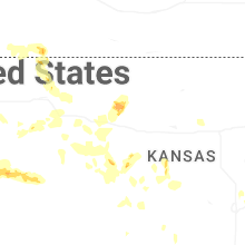


Connect with Interactive Hail Maps