

Hail Map for Columbia, SC
The Columbia, SC area has had 33 reports of on-the-ground hail by trained spotters, and has been under severe weather warnings 109 times during the past 12 months. Doppler radar has detected hail at or near Columbia, SC on 126 occasions, including 2 occasions during the past year.
| Name: | Columbia, SC |
| Where Located: | 68.5 miles NE of Augusta, GA |
| Map: | Google Map for Columbia, SC |
| Population: | 129272 |
| Housing Units: | 52471 |
| More Info: | Search Google for Columbia, SC |
1
The Top Recent Hail Date for Columbia, SC is Wednesday, June 25, 2025 (26th out of 126)

Hail and Wind Damage Spotted near Columbia, SC
| Date / Time | Report Details |
|---|---|
| 7/4/2025 7:26 PM EDT |
 The storm which prompted the warning has weakened below severe limits, and has exited the warned area. therefore, the warning will be allowed to expire. however, gusty winds are still possible with this thunderstorm. to report severe weather, contact your nearest law enforcement agency. they will relay your report to the national weather service columbia. The storm which prompted the warning has weakened below severe limits, and has exited the warned area. therefore, the warning will be allowed to expire. however, gusty winds are still possible with this thunderstorm. to report severe weather, contact your nearest law enforcement agency. they will relay your report to the national weather service columbia.
|
| 7/4/2025 7:11 PM EDT |
 the severe thunderstorm warning has been cancelled and is no longer in effect the severe thunderstorm warning has been cancelled and is no longer in effect
|
| 7/4/2025 7:11 PM EDT |
 At 710 pm edt, a severe thunderstorm was located over oakland, or over shaw air base, moving southwest at 20 mph (radar indicated). Hazards include 60 mph wind gusts. Expect damage to trees and powerlines. Locations impacted include, columbia, sumter, shaw air base, eastover, oakland, fort jackson mccrady training center, dalzell, dinkins mill, cherryvale, and stateburg. At 710 pm edt, a severe thunderstorm was located over oakland, or over shaw air base, moving southwest at 20 mph (radar indicated). Hazards include 60 mph wind gusts. Expect damage to trees and powerlines. Locations impacted include, columbia, sumter, shaw air base, eastover, oakland, fort jackson mccrady training center, dalzell, dinkins mill, cherryvale, and stateburg.
|
| 7/4/2025 6:45 PM EDT |
 Svrcae the national weather service in columbia has issued a * severe thunderstorm warning for, southwestern lee county in central south carolina, northwestern sumter county in central south carolina, east central richland county in central south carolina, * until 730 pm edt. * at 645 pm edt, a severe thunderstorm was located near sumter county airport, or 8 miles north of sumter, moving west at 25 mph (radar indicated). Hazards include 60 mph wind gusts. expect damage to trees and powerlines Svrcae the national weather service in columbia has issued a * severe thunderstorm warning for, southwestern lee county in central south carolina, northwestern sumter county in central south carolina, east central richland county in central south carolina, * until 730 pm edt. * at 645 pm edt, a severe thunderstorm was located near sumter county airport, or 8 miles north of sumter, moving west at 25 mph (radar indicated). Hazards include 60 mph wind gusts. expect damage to trees and powerlines
|
| 6/25/2025 9:29 PM EDT |
 The storms which prompted the warning have moved out of the area. therefore, the warning will be allowed to expire. however, heavy rain is still possible with these thunderstorms. a severe thunderstorm watch remains in effect until midnight edt for central south carolina. The storms which prompted the warning have moved out of the area. therefore, the warning will be allowed to expire. however, heavy rain is still possible with these thunderstorms. a severe thunderstorm watch remains in effect until midnight edt for central south carolina.
|
| 6/25/2025 9:00 PM EDT |
 The storms which prompted the warning have moved out of the area. therefore, the warning has been allowed to expire. however, heavy rain is still possible with these thunderstorms. a severe thunderstorm watch remains in effect until midnight edt for central south carolina. The storms which prompted the warning have moved out of the area. therefore, the warning has been allowed to expire. however, heavy rain is still possible with these thunderstorms. a severe thunderstorm watch remains in effect until midnight edt for central south carolina.
|
| 6/25/2025 8:58 PM EDT | Scdps reported trees down on patricia drive. time estimated by rada in richland county SC, 6.2 miles NW of Columbia, SC |
| 6/25/2025 8:33 PM EDT |
 At 833 pm edt, severe thunderstorms were located along a line extending from near elgin to 9 miles southwest of prosperity, moving southeast at 20 mph (radar indicated). Hazards include 60 mph wind gusts and half dollar size hail. Hail damage to vehicles is expected. expect wind damage to trees and powerlines. locations impacted include, columbia, sumter, lexington, west columbia, cayce, irmo, forest acres, newberry, camden, batesburg-leesville, springdale, dentsville, oak grove, st. andrews, vc summer nuclear station, highway 6 at lake murray dam, red bank, saluda, south congaree, and pine ridge. this includes the following highways, interstate 126 between mile markers 0 and 3. interstate 20 in south carolina between mile markers 49 and 100. interstate 26 between mile markers 77 and 116. Interstate 77 between mile markers 0 and 35. At 833 pm edt, severe thunderstorms were located along a line extending from near elgin to 9 miles southwest of prosperity, moving southeast at 20 mph (radar indicated). Hazards include 60 mph wind gusts and half dollar size hail. Hail damage to vehicles is expected. expect wind damage to trees and powerlines. locations impacted include, columbia, sumter, lexington, west columbia, cayce, irmo, forest acres, newberry, camden, batesburg-leesville, springdale, dentsville, oak grove, st. andrews, vc summer nuclear station, highway 6 at lake murray dam, red bank, saluda, south congaree, and pine ridge. this includes the following highways, interstate 126 between mile markers 0 and 3. interstate 20 in south carolina between mile markers 49 and 100. interstate 26 between mile markers 77 and 116. Interstate 77 between mile markers 0 and 35.
|
| 6/25/2025 8:27 PM EDT |
 Svrcae the national weather service in columbia has issued a * severe thunderstorm warning for, calhoun county in central south carolina, lexington county in central south carolina, northeastern aiken county in central south carolina, northern orangeburg county in central south carolina, southeastern richland county in central south carolina, * until 930 pm edt. * at 827 pm edt, severe thunderstorms were located along a line extending from near horrel hill to near batesburg-leesville, moving southeast at 35 mph (radar indicated). Hazards include 60 mph wind gusts. expect damage to trees and powerlines Svrcae the national weather service in columbia has issued a * severe thunderstorm warning for, calhoun county in central south carolina, lexington county in central south carolina, northeastern aiken county in central south carolina, northern orangeburg county in central south carolina, southeastern richland county in central south carolina, * until 930 pm edt. * at 827 pm edt, severe thunderstorms were located along a line extending from near horrel hill to near batesburg-leesville, moving southeast at 35 mph (radar indicated). Hazards include 60 mph wind gusts. expect damage to trees and powerlines
|
| 6/25/2025 8:21 PM EDT | Richland county em reported a tree on a power line causing a brush fire. time estimated by rada in richland county SC, 8.6 miles SSW of Columbia, SC |
| 6/25/2025 8:10 PM EDT | Columbia fire dept reported a collapsed structure. time estimated by rada in richland county SC, 3 miles SSE of Columbia, SC |
| 6/25/2025 7:56 PM EDT |
 Svrcae the national weather service in columbia has issued a * severe thunderstorm warning for, southern fairfield county in central south carolina, southern newberry county in central south carolina, northern lexington county in central south carolina, northwestern sumter county in central south carolina, saluda county in central south carolina, richland county in central south carolina, southwestern kershaw county in central south carolina, * until 900 pm edt. * at 756 pm edt, severe thunderstorms were located along a line extending from 6 miles south of longtown to 7 miles southwest of newberry college, moving southeast at 20 mph (radar indicated). Hazards include 60 mph wind gusts and quarter size hail. Hail damage to vehicles is expected. Expect wind damage to trees and powerlines. Svrcae the national weather service in columbia has issued a * severe thunderstorm warning for, southern fairfield county in central south carolina, southern newberry county in central south carolina, northern lexington county in central south carolina, northwestern sumter county in central south carolina, saluda county in central south carolina, richland county in central south carolina, southwestern kershaw county in central south carolina, * until 900 pm edt. * at 756 pm edt, severe thunderstorms were located along a line extending from 6 miles south of longtown to 7 miles southwest of newberry college, moving southeast at 20 mph (radar indicated). Hazards include 60 mph wind gusts and quarter size hail. Hail damage to vehicles is expected. Expect wind damage to trees and powerlines.
|
| 6/17/2025 9:42 PM EDT | the severe thunderstorm warning has been cancelled and is no longer in effect |
| 6/17/2025 9:42 PM EDT | At 941 pm edt, severe thunderstorms were located along a line extending from near jenkinsville to near harbison state forest to oak grove to red bank, moving east at 45 mph (radar indicated). Hazards include 60 mph wind gusts. Expect damage to trees and powerlines. locations impacted include, columbia, lexington, west columbia, cayce, irmo, forest acres, springdale, st. andrews, dentsville, oak grove, highway 6 at lake murray dam, red bank, south congaree, pine ridge, arcadia lakes, columbia international university, harbison state forest, sesquicentennial state park, lake carolina, and sc state fair grounds. this includes the following highways, interstate 126 between mile markers 0 and 3. interstate 20 in south carolina between mile markers 48 and 78. interstate 26 between mile markers 90 and 116. Interstate 77 between mile markers 0 and 2, between mile markers 5 and 6, and between mile markers 8 and 37. |
| 6/17/2025 9:15 PM EDT | Svrcae the national weather service in columbia has issued a * severe thunderstorm warning for, southeastern fairfield county in central south carolina, southeastern newberry county in central south carolina, lexington county in central south carolina, northeastern saluda county in central south carolina, northeastern aiken county in central south carolina, northwestern richland county in central south carolina, * until 1000 pm edt. * at 915 pm edt, severe thunderstorms were located along a line extending from 6 miles south of prosperity to near dreher island state park to near batesburg-leesville to 7 miles east of ridge spring, moving northeast at 45 mph (radar indicated). Hazards include 60 mph wind gusts. expect damage to trees and powerlines |
| 6/9/2025 10:10 PM EDT |
 The storms which prompted the warning have weakened below severe limits, and have exited the warned area. therefore, the warning will be allowed to expire. however, gusty winds and heavy rain are still possible with these thunderstorms. The storms which prompted the warning have weakened below severe limits, and have exited the warned area. therefore, the warning will be allowed to expire. however, gusty winds and heavy rain are still possible with these thunderstorms.
|
| 6/9/2025 9:51 PM EDT |
 At 951 pm edt, severe thunderstorms were located along a line extending from near camden to 6 miles southeast of lugoff to near sc state farmer's market, moving east at 40 mph (radar indicated). Hazards include 60 mph wind gusts. Expect damage to trees and powerlines. locations impacted include, columbia, west columbia, cayce, forest acres, camden, mcentire air base, dentsville, south congaree, pine ridge, arcadia lakes, eastover, lugoff, hopkins, villages at sandhill, elgin, horrel hill, sc state farmer's market, woodfield, sesquicentennial state park, and lake carolina. this includes the following highways, interstate 20 in south carolina between mile markers 72 and 112. interstate 26 between mile markers 114 and 120. Interstate 77 between mile markers 0 and 20. At 951 pm edt, severe thunderstorms were located along a line extending from near camden to 6 miles southeast of lugoff to near sc state farmer's market, moving east at 40 mph (radar indicated). Hazards include 60 mph wind gusts. Expect damage to trees and powerlines. locations impacted include, columbia, west columbia, cayce, forest acres, camden, mcentire air base, dentsville, south congaree, pine ridge, arcadia lakes, eastover, lugoff, hopkins, villages at sandhill, elgin, horrel hill, sc state farmer's market, woodfield, sesquicentennial state park, and lake carolina. this includes the following highways, interstate 20 in south carolina between mile markers 72 and 112. interstate 26 between mile markers 114 and 120. Interstate 77 between mile markers 0 and 20.
|
| 6/9/2025 9:51 PM EDT |
 the severe thunderstorm warning has been cancelled and is no longer in effect the severe thunderstorm warning has been cancelled and is no longer in effect
|
| 6/9/2025 9:26 PM EDT |
 Svrcae the national weather service in columbia has issued a * severe thunderstorm warning for, southeastern fairfield county in central south carolina, northwestern lee county in central south carolina, east central lexington county in central south carolina, northwestern sumter county in central south carolina, richland county in central south carolina, southern kershaw county in central south carolina, * until 1015 pm edt. * at 926 pm edt, severe thunderstorms were located along a line extending from near springdale to villages at sandhill to near red bank, moving east at 40 mph (radar indicated). Hazards include 60 mph wind gusts. expect damage to trees and powerlines Svrcae the national weather service in columbia has issued a * severe thunderstorm warning for, southeastern fairfield county in central south carolina, northwestern lee county in central south carolina, east central lexington county in central south carolina, northwestern sumter county in central south carolina, richland county in central south carolina, southern kershaw county in central south carolina, * until 1015 pm edt. * at 926 pm edt, severe thunderstorms were located along a line extending from near springdale to villages at sandhill to near red bank, moving east at 40 mph (radar indicated). Hazards include 60 mph wind gusts. expect damage to trees and powerlines
|
| 6/9/2025 9:12 PM EDT |
 the severe thunderstorm warning has been cancelled and is no longer in effect the severe thunderstorm warning has been cancelled and is no longer in effect
|
| 6/9/2025 9:12 PM EDT |
 At 912 pm edt, severe thunderstorms were located along a line extending from 7 miles northwest of killian to near south congaree, moving east at 45 mph (radar indicated). Hazards include 60 mph wind gusts. Expect damage to trees and powerlines. locations impacted include, columbia, lexington, west columbia, cayce, irmo, forest acres, springdale, st. andrews, dentsville, oak grove, mcentire air base, highway 6 at lake murray dam, red bank, south congaree, pine ridge, arcadia lakes, lugoff, columbia international university, harbison state forest, and sesquicentennial state park. this includes the following highways, interstate 126 between mile markers 0 and 3. interstate 20 in south carolina between mile markers 45 and 91. interstate 26 between mile markers 92 and 120. Interstate 77 between mile markers 0 and 32. At 912 pm edt, severe thunderstorms were located along a line extending from 7 miles northwest of killian to near south congaree, moving east at 45 mph (radar indicated). Hazards include 60 mph wind gusts. Expect damage to trees and powerlines. locations impacted include, columbia, lexington, west columbia, cayce, irmo, forest acres, springdale, st. andrews, dentsville, oak grove, mcentire air base, highway 6 at lake murray dam, red bank, south congaree, pine ridge, arcadia lakes, lugoff, columbia international university, harbison state forest, and sesquicentennial state park. this includes the following highways, interstate 126 between mile markers 0 and 3. interstate 20 in south carolina between mile markers 45 and 91. interstate 26 between mile markers 92 and 120. Interstate 77 between mile markers 0 and 32.
|
| 6/9/2025 8:49 PM EDT |
 Torcae the national weather service in columbia has issued a * tornado warning for, north central lexington county in central south carolina, northwestern richland county in central south carolina, * until 915 pm edt. * at 849 pm edt, a severe thunderstorm capable of producing a tornado was located near dreher island state park, or 9 miles northwest of highway 6 at lake murray dam, moving east at 5 mph (radar indicated rotation). Hazards include tornado. Flying debris will be dangerous to those caught without shelter. mobile homes will be damaged or destroyed. damage to roofs, windows, and vehicles will occur. tree damage is likely. this tornadic thunderstorm will remain over mainly rural areas of north central lexington and northwestern richland counties, including the following locations, white rock, lighthouse marina, melvin park, chapin, and lake murray marina. This includes interstate 26 between mile markers 90 and 102. Torcae the national weather service in columbia has issued a * tornado warning for, north central lexington county in central south carolina, northwestern richland county in central south carolina, * until 915 pm edt. * at 849 pm edt, a severe thunderstorm capable of producing a tornado was located near dreher island state park, or 9 miles northwest of highway 6 at lake murray dam, moving east at 5 mph (radar indicated rotation). Hazards include tornado. Flying debris will be dangerous to those caught without shelter. mobile homes will be damaged or destroyed. damage to roofs, windows, and vehicles will occur. tree damage is likely. this tornadic thunderstorm will remain over mainly rural areas of north central lexington and northwestern richland counties, including the following locations, white rock, lighthouse marina, melvin park, chapin, and lake murray marina. This includes interstate 26 between mile markers 90 and 102.
|
| 6/9/2025 8:48 PM EDT |
 Svrcae the national weather service in columbia has issued a * severe thunderstorm warning for, southern fairfield county in central south carolina, southeastern newberry county in central south carolina, central lexington county in central south carolina, richland county in central south carolina, southwestern kershaw county in central south carolina, * until 930 pm edt. * at 847 pm edt, severe thunderstorms were located along a line extending from near jenkinsville to near batesburg-leesville, moving east at 45 mph (radar indicated). Hazards include 60 mph wind gusts. expect damage to trees and powerlines Svrcae the national weather service in columbia has issued a * severe thunderstorm warning for, southern fairfield county in central south carolina, southeastern newberry county in central south carolina, central lexington county in central south carolina, richland county in central south carolina, southwestern kershaw county in central south carolina, * until 930 pm edt. * at 847 pm edt, severe thunderstorms were located along a line extending from near jenkinsville to near batesburg-leesville, moving east at 45 mph (radar indicated). Hazards include 60 mph wind gusts. expect damage to trees and powerlines
|
| 6/8/2025 11:06 AM EDT |
 At 1106 am edt, a severe thunderstorm was located 7 miles north of eastover, or 8 miles northeast of mcentire air base, moving east at 45 mph (radar indicated). Hazards include 60 mph wind gusts. Expect damage to trees and powerlines. locations impacted include, columbia, cayce, forest acres, mcentire air base, dentsville, pine ridge, gaston, arcadia lakes, eastover, congaree national park, hopkins, villages at sandhill, horrel hill, sc state farmer's market, woodfield, sesquicentennial state park, lake carolina, sc state fair grounds, sandy run, and fort jackson. this includes the following highways, interstate 20 in south carolina between mile markers 73 and 84. interstate 26 between mile markers 115 and 133. Interstate 77 between mile markers 0 and 18. At 1106 am edt, a severe thunderstorm was located 7 miles north of eastover, or 8 miles northeast of mcentire air base, moving east at 45 mph (radar indicated). Hazards include 60 mph wind gusts. Expect damage to trees and powerlines. locations impacted include, columbia, cayce, forest acres, mcentire air base, dentsville, pine ridge, gaston, arcadia lakes, eastover, congaree national park, hopkins, villages at sandhill, horrel hill, sc state farmer's market, woodfield, sesquicentennial state park, lake carolina, sc state fair grounds, sandy run, and fort jackson. this includes the following highways, interstate 20 in south carolina between mile markers 73 and 84. interstate 26 between mile markers 115 and 133. Interstate 77 between mile markers 0 and 18.
|
| 6/8/2025 10:38 AM EDT | Broadcast media relayed a picture of a tree down on the 900 block of tara trail causing minor damage to the property. time estimated by rada in lexington county SC, 8.3 miles E of Columbia, SC |
| 6/8/2025 10:36 AM EDT |
 Svrcae the national weather service in columbia has issued a * severe thunderstorm warning for, northern calhoun county in central south carolina, lexington county in central south carolina, richland county in central south carolina, * until 1115 am edt. * at 1036 am edt, a severe thunderstorm was located over west columbia riverwalk, or over west columbia, moving east at 40 mph (radar indicated). Hazards include 60 mph wind gusts. expect damage to trees and powerlines Svrcae the national weather service in columbia has issued a * severe thunderstorm warning for, northern calhoun county in central south carolina, lexington county in central south carolina, richland county in central south carolina, * until 1115 am edt. * at 1036 am edt, a severe thunderstorm was located over west columbia riverwalk, or over west columbia, moving east at 40 mph (radar indicated). Hazards include 60 mph wind gusts. expect damage to trees and powerlines
|
| 6/7/2025 10:08 PM EDT |
 The storms which prompted the warning have weakened below severe limits, and no longer pose an immediate threat to life or property. therefore, the warning will be allowed to expire. however, gusty winds up to 50 mph are still possible with these thunderstorms. a severe thunderstorm watch remains in effect until midnight edt for central south carolina. The storms which prompted the warning have weakened below severe limits, and no longer pose an immediate threat to life or property. therefore, the warning will be allowed to expire. however, gusty winds up to 50 mph are still possible with these thunderstorms. a severe thunderstorm watch remains in effect until midnight edt for central south carolina.
|
| 6/7/2025 9:36 PM EDT |
 Svrcae the national weather service in columbia has issued a * severe thunderstorm warning for, lee county in central south carolina, central calhoun county in central south carolina, clarendon county in central south carolina, sumter county in central south carolina, southeastern richland county in central south carolina, southern kershaw county in central south carolina, * until 1015 pm edt. * at 935 pm edt, severe thunderstorms were located along a line extending from near lake wateree dam to near st. matthews, moving east at 55 mph (radar indicated). Hazards include 60 mph wind gusts. expect damage to trees and powerlines Svrcae the national weather service in columbia has issued a * severe thunderstorm warning for, lee county in central south carolina, central calhoun county in central south carolina, clarendon county in central south carolina, sumter county in central south carolina, southeastern richland county in central south carolina, southern kershaw county in central south carolina, * until 1015 pm edt. * at 935 pm edt, severe thunderstorms were located along a line extending from near lake wateree dam to near st. matthews, moving east at 55 mph (radar indicated). Hazards include 60 mph wind gusts. expect damage to trees and powerlines
|
| 6/7/2025 9:26 PM EDT |
 the severe thunderstorm warning has been cancelled and is no longer in effect the severe thunderstorm warning has been cancelled and is no longer in effect
|
| 6/7/2025 9:26 PM EDT |
 At 926 pm edt, severe thunderstorms were located along a line extending from lake wateree state park to near sandy run, moving east at 55 mph (radar indicated). Hazards include 60 mph wind gusts and penny size hail. these storms have a history of producing damaging wind gusts. Expect damage to trees and powerlines. locations impacted include, columbia, west columbia, cayce, forest acres, camden, winnsboro, springdale, st. andrews, dentsville, oak grove, mcentire air base, lake wateree dam, red bank, south congaree, pine ridge, kershaw, gaston, arcadia lakes, eastover, and lugoff. this includes the following highways, interstate 126 between mile markers 0 and 3. interstate 20 in south carolina between mile markers 60 and 99. interstate 26 between mile markers 105 and 132. Interstate 77 between mile markers 0 and 50. At 926 pm edt, severe thunderstorms were located along a line extending from lake wateree state park to near sandy run, moving east at 55 mph (radar indicated). Hazards include 60 mph wind gusts and penny size hail. these storms have a history of producing damaging wind gusts. Expect damage to trees and powerlines. locations impacted include, columbia, west columbia, cayce, forest acres, camden, winnsboro, springdale, st. andrews, dentsville, oak grove, mcentire air base, lake wateree dam, red bank, south congaree, pine ridge, kershaw, gaston, arcadia lakes, eastover, and lugoff. this includes the following highways, interstate 126 between mile markers 0 and 3. interstate 20 in south carolina between mile markers 60 and 99. interstate 26 between mile markers 105 and 132. Interstate 77 between mile markers 0 and 50.
|
| 6/7/2025 9:19 PM EDT | Sc highway patrol reported trees down in the road along running fox rd. time estimated by rada in richland county SC, 7.2 miles SW of Columbia, SC |
| 6/7/2025 9:17 PM EDT | Nws employee estimated wind gusts to 60 mph in blythewoo in richland county SC, 6.6 miles SSW of Columbia, SC |
| 6/7/2025 9:15 PM EDT | Sc highway patrol reports a tree down blocking the roadway on i77 and sc48. time estimated by rada in richland county SC, 6.3 miles N of Columbia, SC |
| 6/7/2025 9:08 PM EDT | Video posted on social media of numerous trees down along i20 near the broad river bridge on the richland county side. trees were blocking the right two lanes of traffi in richland county SC, 4.4 miles E of Columbia, SC |
| 6/7/2025 9:06 PM EDT | Sc highway patrol reports a tree down in the roadway at romain dr and cambout st. time estimated by rada in richland county SC, 4.9 miles E of Columbia, SC |
| 6/7/2025 8:57 PM EDT | Sc highway patrol reports powerlines down blocking the roadway along north lake dr. time estimated by rada in lexington county SC, 13.1 miles E of Columbia, SC |
| 6/7/2025 8:54 PM EDT |
 Svrcae the national weather service in columbia has issued a * severe thunderstorm warning for, fairfield county in central south carolina, southwestern lancaster county in central south carolina, eastern newberry county in central south carolina, northern calhoun county in central south carolina, lexington county in central south carolina, west central sumter county in central south carolina, richland county in central south carolina, western kershaw county in central south carolina, * until 945 pm edt. * at 854 pm edt, severe thunderstorms were located along a line extending from near blair to 13 miles southeast of batesburg-leesville, moving east at 55 mph (radar indicated). Hazards include 60 mph wind gusts and penny size hail. expect damage to trees and powerlines Svrcae the national weather service in columbia has issued a * severe thunderstorm warning for, fairfield county in central south carolina, southwestern lancaster county in central south carolina, eastern newberry county in central south carolina, northern calhoun county in central south carolina, lexington county in central south carolina, west central sumter county in central south carolina, richland county in central south carolina, western kershaw county in central south carolina, * until 945 pm edt. * at 854 pm edt, severe thunderstorms were located along a line extending from near blair to 13 miles southeast of batesburg-leesville, moving east at 55 mph (radar indicated). Hazards include 60 mph wind gusts and penny size hail. expect damage to trees and powerlines
|
| 5/30/2025 4:39 PM EDT |
 At 439 pm edt, severe thunderstorms were located along a line extending from mcentire air base to 12 miles northwest of edisto gardens to 6 miles east of new ellenton, moving east at 35 mph (radar indicated). Hazards include 70 mph wind gusts and quarter size hail. Hail damage to vehicles is expected. expect considerable tree damage. wind damage is also likely to mobile homes, roofs, and outbuildings. locations impacted include, orangeburg, mcentire air base, brookdale, williston, new ellenton, st. matthews, eastover, congaree national park, hopkins, horrel hill, sandy run, gadsden, north, springfield, cameron, salley, neeses, norway, elko, and livingston. This includes interstate 26 between mile markers 125 and 127, and between mile markers 131 and 149. At 439 pm edt, severe thunderstorms were located along a line extending from mcentire air base to 12 miles northwest of edisto gardens to 6 miles east of new ellenton, moving east at 35 mph (radar indicated). Hazards include 70 mph wind gusts and quarter size hail. Hail damage to vehicles is expected. expect considerable tree damage. wind damage is also likely to mobile homes, roofs, and outbuildings. locations impacted include, orangeburg, mcentire air base, brookdale, williston, new ellenton, st. matthews, eastover, congaree national park, hopkins, horrel hill, sandy run, gadsden, north, springfield, cameron, salley, neeses, norway, elko, and livingston. This includes interstate 26 between mile markers 125 and 127, and between mile markers 131 and 149.
|
| 5/30/2025 4:39 PM EDT |
 the severe thunderstorm warning has been cancelled and is no longer in effect the severe thunderstorm warning has been cancelled and is no longer in effect
|
| 5/30/2025 4:33 PM EDT |
 Svrcae the national weather service in columbia has issued a * severe thunderstorm warning for, calhoun county in central south carolina, clarendon county in central south carolina, sumter county in central south carolina, central orangeburg county in central south carolina, southeastern richland county in central south carolina, * until 515 pm edt. * at 433 pm edt, severe thunderstorms were located along a line extending from near mcentire air base to near st. matthews to 9 miles northwest of edisto gardens, moving east at 45 mph (trained weather spotters reported several large trees down). Hazards include 70 mph wind gusts. Expect considerable tree damage. Damage is likely to mobile homes, roofs, and outbuildings. Svrcae the national weather service in columbia has issued a * severe thunderstorm warning for, calhoun county in central south carolina, clarendon county in central south carolina, sumter county in central south carolina, central orangeburg county in central south carolina, southeastern richland county in central south carolina, * until 515 pm edt. * at 433 pm edt, severe thunderstorms were located along a line extending from near mcentire air base to near st. matthews to 9 miles northwest of edisto gardens, moving east at 45 mph (trained weather spotters reported several large trees down). Hazards include 70 mph wind gusts. Expect considerable tree damage. Damage is likely to mobile homes, roofs, and outbuildings.
|
| 5/30/2025 4:10 PM EDT |
 Svrcae the national weather service in columbia has issued a * severe thunderstorm warning for, calhoun county in central south carolina, northeastern barnwell county in central south carolina, southeastern lexington county in central south carolina, central aiken county in central south carolina, northwestern orangeburg county in central south carolina, southeastern richland county in central south carolina, * until 500 pm edt. * at 409 pm edt, severe thunderstorms were located along a line extending from columbia metro airport to 7 miles northeast of aiken state park to near clearwater, moving east at 35 mph (radar indicated). Hazards include 60 mph wind gusts and quarter size hail. Hail damage to vehicles is expected. Expect wind damage to trees and powerlines. Svrcae the national weather service in columbia has issued a * severe thunderstorm warning for, calhoun county in central south carolina, northeastern barnwell county in central south carolina, southeastern lexington county in central south carolina, central aiken county in central south carolina, northwestern orangeburg county in central south carolina, southeastern richland county in central south carolina, * until 500 pm edt. * at 409 pm edt, severe thunderstorms were located along a line extending from columbia metro airport to 7 miles northeast of aiken state park to near clearwater, moving east at 35 mph (radar indicated). Hazards include 60 mph wind gusts and quarter size hail. Hail damage to vehicles is expected. Expect wind damage to trees and powerlines.
|
| 5/30/2025 3:56 PM EDT |
 At 355 pm edt, severe thunderstorms were located along a line extending from near lexington to near aiken municipal airport to near grovetown, moving east at 50 mph (radar indicated). Hazards include 60 mph wind gusts. Expect damage to trees and powerlines. locations impacted include, columbia, aiken, north augusta, lexington, west columbia, cayce, grovetown, evans, forest acres, thomson, batesburg-leesville, oak grove, fort eisenhower, augusta, clearwater, martinez, aiken mall, red bank, belvedere, and st. andrews. this includes the following highways, interstate 126 between mile markers 1 and 3. interstate 20 in georgia between mile markers 167 and 201. interstate 20 in south carolina between mile markers 0 and 62. interstate 26 between mile markers 109 and 118. interstate 520 in georgia between mile markers 1 and 15. interstate 520 in south carolina between mile markers 16 and 23. Interstate 77 between mile markers 0 and 5, and between mile markers 10 and 11. At 355 pm edt, severe thunderstorms were located along a line extending from near lexington to near aiken municipal airport to near grovetown, moving east at 50 mph (radar indicated). Hazards include 60 mph wind gusts. Expect damage to trees and powerlines. locations impacted include, columbia, aiken, north augusta, lexington, west columbia, cayce, grovetown, evans, forest acres, thomson, batesburg-leesville, oak grove, fort eisenhower, augusta, clearwater, martinez, aiken mall, red bank, belvedere, and st. andrews. this includes the following highways, interstate 126 between mile markers 1 and 3. interstate 20 in georgia between mile markers 167 and 201. interstate 20 in south carolina between mile markers 0 and 62. interstate 26 between mile markers 109 and 118. interstate 520 in georgia between mile markers 1 and 15. interstate 520 in south carolina between mile markers 16 and 23. Interstate 77 between mile markers 0 and 5, and between mile markers 10 and 11.
|
| 5/30/2025 3:56 PM EDT |
 the severe thunderstorm warning has been cancelled and is no longer in effect the severe thunderstorm warning has been cancelled and is no longer in effect
|
| 5/30/2025 3:34 PM EDT |
 Svrcae the national weather service in columbia has issued a * severe thunderstorm warning for, mcduffie county in east central georgia, columbia county in east central georgia, richmond county in east central georgia, southeastern newberry county in central south carolina, central edgefield county in central south carolina, lexington county in central south carolina, eastern saluda county in central south carolina, aiken county in central south carolina, southeastern mccormick county in central south carolina, central richland county in central south carolina, * until 415 pm edt. * at 333 pm edt, severe thunderstorms were located along a line extending from 7 miles north of batesburg-leesville to 9 miles northwest of belvedere to thomson-mcduffie county airport, moving east at 35 mph (radar indicated). Hazards include 60 mph wind gusts. expect damage to trees and powerlines Svrcae the national weather service in columbia has issued a * severe thunderstorm warning for, mcduffie county in east central georgia, columbia county in east central georgia, richmond county in east central georgia, southeastern newberry county in central south carolina, central edgefield county in central south carolina, lexington county in central south carolina, eastern saluda county in central south carolina, aiken county in central south carolina, southeastern mccormick county in central south carolina, central richland county in central south carolina, * until 415 pm edt. * at 333 pm edt, severe thunderstorms were located along a line extending from 7 miles north of batesburg-leesville to 9 miles northwest of belvedere to thomson-mcduffie county airport, moving east at 35 mph (radar indicated). Hazards include 60 mph wind gusts. expect damage to trees and powerlines
|
| 5/29/2025 5:58 PM EDT |
 The storms which prompted the warning have weakened below severe limits, and no longer pose an immediate threat to life or property. therefore, the warning will be allowed to expire. however, heavy rain is still likely with these thunderstorms, causing some localized roadway flooding. The storms which prompted the warning have weakened below severe limits, and no longer pose an immediate threat to life or property. therefore, the warning will be allowed to expire. however, heavy rain is still likely with these thunderstorms, causing some localized roadway flooding.
|
| 5/29/2025 5:56 PM EDT | Sc highway patrol reported roadway flooding on summit parkway at ridge trail d in richland county SC, 9.6 miles SW of Columbia, SC |
| 5/29/2025 5:41 PM EDT |
 At 541 pm edt, severe thunderstorms were located along a line extending from lake wateree dam to 7 miles north of oakland to 6 miles southwest of poinsett state park, moving northeast at 45 mph (radar indicated). Hazards include 60 mph wind gusts. Expect damage to trees and powerlines. locations impacted include, columbia, sumter, camden, lake wateree dam, shaw air base, eastover, lugoff, westville, villages at sandhill, oakland, cassatt, elgin, lake carolina, sumter county airport, millwood, poinsett state park, goodale state park, lucknow, cane savannah, and dalzell. This includes interstate 20 in south carolina between mile markers 80 and 115. At 541 pm edt, severe thunderstorms were located along a line extending from lake wateree dam to 7 miles north of oakland to 6 miles southwest of poinsett state park, moving northeast at 45 mph (radar indicated). Hazards include 60 mph wind gusts. Expect damage to trees and powerlines. locations impacted include, columbia, sumter, camden, lake wateree dam, shaw air base, eastover, lugoff, westville, villages at sandhill, oakland, cassatt, elgin, lake carolina, sumter county airport, millwood, poinsett state park, goodale state park, lucknow, cane savannah, and dalzell. This includes interstate 20 in south carolina between mile markers 80 and 115.
|
| 5/29/2025 5:17 PM EDT |
 Svrcae the national weather service in columbia has issued a * severe thunderstorm warning for, northwestern lee county in central south carolina, central calhoun county in central south carolina, northwestern sumter county in central south carolina, eastern richland county in central south carolina, kershaw county in central south carolina, * until 600 pm edt. * at 517 pm edt, severe thunderstorms were located along a line extending from killian to near eastover to near brookdale, moving northeast at 45 mph (radar indicated). Hazards include 60 mph wind gusts. expect damage to trees and powerlines Svrcae the national weather service in columbia has issued a * severe thunderstorm warning for, northwestern lee county in central south carolina, central calhoun county in central south carolina, northwestern sumter county in central south carolina, eastern richland county in central south carolina, kershaw county in central south carolina, * until 600 pm edt. * at 517 pm edt, severe thunderstorms were located along a line extending from killian to near eastover to near brookdale, moving northeast at 45 mph (radar indicated). Hazards include 60 mph wind gusts. expect damage to trees and powerlines
|
| 5/29/2025 5:09 PM EDT |
 the severe thunderstorm warning has been cancelled and is no longer in effect the severe thunderstorm warning has been cancelled and is no longer in effect
|
| 5/29/2025 5:09 PM EDT |
 At 509 pm edt, severe thunderstorms were located along a line extending from near ballentine to sandy run, moving northeast at 30 mph (radar indicated). Hazards include 60 mph wind gusts. Expect damage to trees and powerlines. locations impacted include, columbia, west columbia, cayce, irmo, forest acres, st. andrews, mcentire air base, dentsville, arcadia lakes, eastover, fairfield county airport, congaree national park, hopkins, columbia international university, horrel hill, killian, harbison state forest, riverbanks zoo, woodfield, and sesquicentennial state park. this includes the following highways, interstate 126 between mile markers 0 and 3. interstate 20 in south carolina between mile markers 64 and 79. interstate 26 between mile markers 93 and 108. Interstate 77 between mile markers 3 and 27. At 509 pm edt, severe thunderstorms were located along a line extending from near ballentine to sandy run, moving northeast at 30 mph (radar indicated). Hazards include 60 mph wind gusts. Expect damage to trees and powerlines. locations impacted include, columbia, west columbia, cayce, irmo, forest acres, st. andrews, mcentire air base, dentsville, arcadia lakes, eastover, fairfield county airport, congaree national park, hopkins, columbia international university, horrel hill, killian, harbison state forest, riverbanks zoo, woodfield, and sesquicentennial state park. this includes the following highways, interstate 126 between mile markers 0 and 3. interstate 20 in south carolina between mile markers 64 and 79. interstate 26 between mile markers 93 and 108. Interstate 77 between mile markers 3 and 27.
|
| 5/29/2025 5:08 PM EDT | Sc highway patrol reported a tree on the roadway on lost creek dr near broad river rd. time estimated by rada in richland county SC, 8.7 miles ESE of Columbia, SC |
| 5/29/2025 5:04 PM EDT | Richland county dispatch reports thunderstorm wind damage near the intersection of south woodrow st and heyward st. power lines were downed from strong wind in richland county SC, 3.7 miles NNE of Columbia, SC |
| 5/29/2025 4:52 PM EDT |
 At 452 pm edt, severe thunderstorms were located along a line extending from dreher island state park to near gaston, moving northeast at 30 mph (radar indicated). Hazards include 60 mph wind gusts. Expect damage to trees and powerlines. locations impacted include, columbia, lexington, west columbia, cayce, irmo, forest acres, springdale, st. andrews, dentsville, oak grove, mcentire air base, highway 6 at lake murray dam, red bank, south congaree, pine ridge, gaston, arcadia lakes, eastover, columbia international university, and harbison state forest. this includes the following highways, interstate 126 between mile markers 0 and 3. interstate 20 in south carolina between mile markers 50 and 79. interstate 26 between mile markers 90 and 130. Interstate 77 between mile markers 0 and 27. At 452 pm edt, severe thunderstorms were located along a line extending from dreher island state park to near gaston, moving northeast at 30 mph (radar indicated). Hazards include 60 mph wind gusts. Expect damage to trees and powerlines. locations impacted include, columbia, lexington, west columbia, cayce, irmo, forest acres, springdale, st. andrews, dentsville, oak grove, mcentire air base, highway 6 at lake murray dam, red bank, south congaree, pine ridge, gaston, arcadia lakes, eastover, columbia international university, and harbison state forest. this includes the following highways, interstate 126 between mile markers 0 and 3. interstate 20 in south carolina between mile markers 50 and 79. interstate 26 between mile markers 90 and 130. Interstate 77 between mile markers 0 and 27.
|
| 5/29/2025 4:38 PM EDT |
 Svrcae the national weather service in columbia has issued a * severe thunderstorm warning for, south central fairfield county in central south carolina, northwestern calhoun county in central south carolina, lexington county in central south carolina, richland county in central south carolina, * until 530 pm edt. * at 438 pm edt, severe thunderstorms were located along a line extending from near dreher island state park to 6 miles southwest of gaston, moving northeast at 30 mph (radar indicated). Hazards include 60 mph wind gusts. expect damage to trees and powerlines Svrcae the national weather service in columbia has issued a * severe thunderstorm warning for, south central fairfield county in central south carolina, northwestern calhoun county in central south carolina, lexington county in central south carolina, richland county in central south carolina, * until 530 pm edt. * at 438 pm edt, severe thunderstorms were located along a line extending from near dreher island state park to 6 miles southwest of gaston, moving northeast at 30 mph (radar indicated). Hazards include 60 mph wind gusts. expect damage to trees and powerlines
|
| 3/31/2025 5:08 PM EDT |
 the severe thunderstorm warning has been cancelled and is no longer in effect the severe thunderstorm warning has been cancelled and is no longer in effect
|
| 3/31/2025 5:08 PM EDT |
 At 508 pm edt, severe thunderstorms were located along a line extending from near irwin to near lake wateree dam to horrel hill, moving east at 65 mph (radar indicated). Hazards include 60 mph wind gusts. Expect damage to trees and powerlines. locations impacted include, dalzell, manville, bell town fire station, community of almond glen, mitford, faith christian school, midway elementary school, heath springs, wateree river correctional institution, woodrow, camden, mulberry, dentsville, forty acre rock preserve, south sumter, kershaw correctional institution, shaw air base, mcwhirter airfield, bethune, and north towne square shopping center. this includes the following highways, interstate 20 in south carolina between mile markers 74 and 116. Interstate 77 between mile markers 6 and 19, and between mile markers 22 and 51. At 508 pm edt, severe thunderstorms were located along a line extending from near irwin to near lake wateree dam to horrel hill, moving east at 65 mph (radar indicated). Hazards include 60 mph wind gusts. Expect damage to trees and powerlines. locations impacted include, dalzell, manville, bell town fire station, community of almond glen, mitford, faith christian school, midway elementary school, heath springs, wateree river correctional institution, woodrow, camden, mulberry, dentsville, forty acre rock preserve, south sumter, kershaw correctional institution, shaw air base, mcwhirter airfield, bethune, and north towne square shopping center. this includes the following highways, interstate 20 in south carolina between mile markers 74 and 116. Interstate 77 between mile markers 6 and 19, and between mile markers 22 and 51.
|
| 3/31/2025 4:55 PM EDT |
 the severe thunderstorm warning has been cancelled and is no longer in effect the severe thunderstorm warning has been cancelled and is no longer in effect
|
| 3/31/2025 4:55 PM EDT |
 At 454 pm edt, severe thunderstorms were located along a line extending from near blackstock to near springdale to near pine ridge, moving northeast at 50 mph (radar indicated). Hazards include 60 mph wind gusts. Expect damage to trees and powerlines. locations impacted include, dalzell, lebanon fire station, manville, bell town fire station, community of almond glen, mitford, faith christian school, cayce riverwalk, columbia international university, midway elementary school, pine ridge, heath springs, wateree river correctional institution, woodrow, camden, mulberry, seven oaks, olympia, dentsville, and lake murray marina. this includes the following highways, interstate 126 between mile markers 0 and 3. interstate 20 in south carolina between mile markers 55 and 116. interstate 26 between mile markers 95 and 126. Interstate 77 between mile markers 0 and 51. At 454 pm edt, severe thunderstorms were located along a line extending from near blackstock to near springdale to near pine ridge, moving northeast at 50 mph (radar indicated). Hazards include 60 mph wind gusts. Expect damage to trees and powerlines. locations impacted include, dalzell, lebanon fire station, manville, bell town fire station, community of almond glen, mitford, faith christian school, cayce riverwalk, columbia international university, midway elementary school, pine ridge, heath springs, wateree river correctional institution, woodrow, camden, mulberry, seven oaks, olympia, dentsville, and lake murray marina. this includes the following highways, interstate 126 between mile markers 0 and 3. interstate 20 in south carolina between mile markers 55 and 116. interstate 26 between mile markers 95 and 126. Interstate 77 between mile markers 0 and 51.
|
| 3/31/2025 4:32 PM EDT |
 Svrcae the national weather service in columbia has issued a * severe thunderstorm warning for, fairfield county in central south carolina, lancaster county in central south carolina, western lee county in central south carolina, eastern newberry county in central south carolina, northern calhoun county in central south carolina, west central clarendon county in central south carolina, lexington county in central south carolina, sumter county in central south carolina, northeastern aiken county in central south carolina, richland county in central south carolina, kershaw county in central south carolina, * until 530 pm edt. * at 432 pm edt, severe thunderstorms were located along a line extending from 6 miles west of chester state park to near jenkinsville to 13 miles southwest of red bank, moving northeast at 55 mph (radar indicated). Hazards include 60 mph wind gusts. expect damage to trees and powerlines Svrcae the national weather service in columbia has issued a * severe thunderstorm warning for, fairfield county in central south carolina, lancaster county in central south carolina, western lee county in central south carolina, eastern newberry county in central south carolina, northern calhoun county in central south carolina, west central clarendon county in central south carolina, lexington county in central south carolina, sumter county in central south carolina, northeastern aiken county in central south carolina, richland county in central south carolina, kershaw county in central south carolina, * until 530 pm edt. * at 432 pm edt, severe thunderstorms were located along a line extending from 6 miles west of chester state park to near jenkinsville to 13 miles southwest of red bank, moving northeast at 55 mph (radar indicated). Hazards include 60 mph wind gusts. expect damage to trees and powerlines
|
| 3/16/2025 8:45 AM EDT |
 Svrcae the national weather service in columbia has issued a * severe thunderstorm warning for, lee county in central south carolina, northwestern sumter county in central south carolina, east central richland county in central south carolina, southeastern kershaw county in central south carolina, * until 945 am edt. * at 845 am edt, a severe thunderstorm was located 9 miles northeast of mcentire air base, moving northeast at 35 mph (radar indicated). Hazards include 60 mph wind gusts. expect damage to trees and powerlines Svrcae the national weather service in columbia has issued a * severe thunderstorm warning for, lee county in central south carolina, northwestern sumter county in central south carolina, east central richland county in central south carolina, southeastern kershaw county in central south carolina, * until 945 am edt. * at 845 am edt, a severe thunderstorm was located 9 miles northeast of mcentire air base, moving northeast at 35 mph (radar indicated). Hazards include 60 mph wind gusts. expect damage to trees and powerlines
|
| 3/16/2025 8:25 AM EDT |
 The storms which prompted the warning have weakened below severe limits, and no longer pose an immediate threat to life or property. therefore, the warning will be allowed to expire. a tornado watch remains in effect until 1000 am edt for central south carolina. a tornado watch also remains in effect until 200 pm edt for central south carolina. The storms which prompted the warning have weakened below severe limits, and no longer pose an immediate threat to life or property. therefore, the warning will be allowed to expire. a tornado watch remains in effect until 1000 am edt for central south carolina. a tornado watch also remains in effect until 200 pm edt for central south carolina.
|
| 3/16/2025 8:06 AM EDT |
 The storm which prompted the warning has weakened below severe limits, and no longer appears capable of producing a tornado. therefore, the warning will be allowed to expire. a tornado watch remains in effect until 200 pm edt for central south carolina. remember, a severe thunderstorm warning still remains in effect for richland and lexington counties until 830am. The storm which prompted the warning has weakened below severe limits, and no longer appears capable of producing a tornado. therefore, the warning will be allowed to expire. a tornado watch remains in effect until 200 pm edt for central south carolina. remember, a severe thunderstorm warning still remains in effect for richland and lexington counties until 830am.
|
| 3/16/2025 7:55 AM EDT |
 the tornado warning has been cancelled and is no longer in effect the tornado warning has been cancelled and is no longer in effect
|
| 3/16/2025 7:55 AM EDT |
 At 755 am edt, a severe thunderstorm capable of producing a tornado was located near jenkinsville, or 7 miles southeast of vc summer nuclear station, moving northeast at 40 mph (radar indicated rotation). Hazards include tornado. Flying debris will be dangerous to those caught without shelter. mobile homes will be damaged or destroyed. damage to roofs, windows, and vehicles will occur. tree damage is likely. this dangerous storm will be near, fairfield county airport around 800 am edt. other locations impacted by this tornadic thunderstorm include rion, white rock, lighthouse marina, lake murray marina, upper richland fire station, and cedar creek fire station. This includes interstate 26 between mile markers 93 and 101. At 755 am edt, a severe thunderstorm capable of producing a tornado was located near jenkinsville, or 7 miles southeast of vc summer nuclear station, moving northeast at 40 mph (radar indicated rotation). Hazards include tornado. Flying debris will be dangerous to those caught without shelter. mobile homes will be damaged or destroyed. damage to roofs, windows, and vehicles will occur. tree damage is likely. this dangerous storm will be near, fairfield county airport around 800 am edt. other locations impacted by this tornadic thunderstorm include rion, white rock, lighthouse marina, lake murray marina, upper richland fire station, and cedar creek fire station. This includes interstate 26 between mile markers 93 and 101.
|
| 3/16/2025 7:54 AM EDT |
 At 754 am edt, severe thunderstorms were located along a line extending from 7 miles southwest of fairfield county airport to 11 miles south of gaston, moving northeast at 40 mph (radar indicated). Hazards include 60 mph wind gusts. Expect damage to trees and powerlines. locations impacted include, arcadia lakes, cayce, bundrick island, white rock, irmo, st. andrews, lexington, cayce riverwalk, columbia international university, pine ridge, cedar creek fire station, dixiana, harbison state forest, blythewood, seven oaks, olympia, dentsville, lake murray marina, oak grove, and sesquicentennial state park. this includes the following highways, interstate 126 between mile markers 0 and 3. interstate 20 in south carolina between mile markers 51 and 81. interstate 26 between mile markers 92 and 131. Interstate 77 between mile markers 0 and 29. At 754 am edt, severe thunderstorms were located along a line extending from 7 miles southwest of fairfield county airport to 11 miles south of gaston, moving northeast at 40 mph (radar indicated). Hazards include 60 mph wind gusts. Expect damage to trees and powerlines. locations impacted include, arcadia lakes, cayce, bundrick island, white rock, irmo, st. andrews, lexington, cayce riverwalk, columbia international university, pine ridge, cedar creek fire station, dixiana, harbison state forest, blythewood, seven oaks, olympia, dentsville, lake murray marina, oak grove, and sesquicentennial state park. this includes the following highways, interstate 126 between mile markers 0 and 3. interstate 20 in south carolina between mile markers 51 and 81. interstate 26 between mile markers 92 and 131. Interstate 77 between mile markers 0 and 29.
|
| 3/16/2025 7:54 AM EDT |
 the severe thunderstorm warning has been cancelled and is no longer in effect the severe thunderstorm warning has been cancelled and is no longer in effect
|
| 3/16/2025 7:39 AM EDT |
 Torcae the national weather service in columbia has issued a * tornado warning for, south central fairfield county in central south carolina, southeastern newberry county in central south carolina, northwestern lexington county in central south carolina, northwestern richland county in central south carolina, * until 815 am edt. * at 739 am edt, a severe thunderstorm capable of producing a tornado was located over dreher island state park, or 9 miles west of highway 6 at lake murray dam, moving east at 35 mph (radar indicated rotation). Hazards include tornado. Flying debris will be dangerous to those caught without shelter. mobile homes will be damaged or destroyed. damage to roofs, windows, and vehicles will occur. tree damage is likely. this dangerous storm will be near, irmo, columbia, and ballentine around 745 am edt. other locations impacted by this tornadic thunderstorm include lighthouse marina, chapin, lake murray marina, shull island, putnam's landing, siesta cove marina, white rock, rocky point recreation area, upper richland fire station, and pine island. This includes interstate 26 between mile markers 89 and 102. Torcae the national weather service in columbia has issued a * tornado warning for, south central fairfield county in central south carolina, southeastern newberry county in central south carolina, northwestern lexington county in central south carolina, northwestern richland county in central south carolina, * until 815 am edt. * at 739 am edt, a severe thunderstorm capable of producing a tornado was located over dreher island state park, or 9 miles west of highway 6 at lake murray dam, moving east at 35 mph (radar indicated rotation). Hazards include tornado. Flying debris will be dangerous to those caught without shelter. mobile homes will be damaged or destroyed. damage to roofs, windows, and vehicles will occur. tree damage is likely. this dangerous storm will be near, irmo, columbia, and ballentine around 745 am edt. other locations impacted by this tornadic thunderstorm include lighthouse marina, chapin, lake murray marina, shull island, putnam's landing, siesta cove marina, white rock, rocky point recreation area, upper richland fire station, and pine island. This includes interstate 26 between mile markers 89 and 102.
|
| 3/16/2025 7:25 AM EDT |
 Svrcae the national weather service in columbia has issued a * severe thunderstorm warning for, south central newberry county in central south carolina, northwestern calhoun county in central south carolina, lexington county in central south carolina, east central saluda county in central south carolina, northeastern aiken county in central south carolina, northwestern orangeburg county in central south carolina, central richland county in central south carolina, * until 830 am edt. * at 724 am edt, severe thunderstorms were located along a line extending from near dreher island state park to near williston, moving northeast at 40 mph (radar indicated). Hazards include 60 mph wind gusts. expect damage to trees and powerlines Svrcae the national weather service in columbia has issued a * severe thunderstorm warning for, south central newberry county in central south carolina, northwestern calhoun county in central south carolina, lexington county in central south carolina, east central saluda county in central south carolina, northeastern aiken county in central south carolina, northwestern orangeburg county in central south carolina, central richland county in central south carolina, * until 830 am edt. * at 724 am edt, severe thunderstorms were located along a line extending from near dreher island state park to near williston, moving northeast at 40 mph (radar indicated). Hazards include 60 mph wind gusts. expect damage to trees and powerlines
|
| 3/5/2025 8:23 AM EST |
 The storms which prompted the warning have weakened below severe limits, and no longer pose an immediate threat to life or property. therefore, the warning will be allowed to expire. a tornado watch remains in effect until 100 pm est for central south carolina. The storms which prompted the warning have weakened below severe limits, and no longer pose an immediate threat to life or property. therefore, the warning will be allowed to expire. a tornado watch remains in effect until 100 pm est for central south carolina.
|
| 3/5/2025 8:10 AM EST | Public reported thunderstorm wind damage associated with the passage of the squall line at this locatio in richland county SC, 2.2 miles N of Columbia, SC |
| 3/5/2025 8:00 AM EST | Several rail cars pushed off their track near owens field airport. time estimate in richland county SC, 4.9 miles N of Columbia, SC |
| 3/5/2025 7:58 AM EST |
 The storm which prompted the warning has weakened below severe limits, and no longer appears capable of producing a tornado. therefore, the warning will be allowed to expire. however, gusty winds are still possible with this thunderstorm. a tornado watch remains in effect until 100 pm est for central south carolina. remember, a severe thunderstorm warning still remains in effect for 830 am!. The storm which prompted the warning has weakened below severe limits, and no longer appears capable of producing a tornado. therefore, the warning will be allowed to expire. however, gusty winds are still possible with this thunderstorm. a tornado watch remains in effect until 100 pm est for central south carolina. remember, a severe thunderstorm warning still remains in effect for 830 am!.
|
| 3/5/2025 7:46 AM EST |
 At 746 am est, a severe thunderstorm capable of producing a tornado was located over red bank, moving northeast at 45 mph (radar indicated rotation). Hazards include tornado. Flying debris will be dangerous to those caught without shelter. mobile homes will be damaged or destroyed. damage to roofs, windows, and vehicles will occur. tree damage is likely. this dangerous storm will be near, south congaree, west columbia, gaston, pine ridge, st. andrews, springdale, lexington, oak grove, columbia, and red bank around 750 am est. five points and forest acres around 755 am est. dentsville, arcadia lakes, and columbia international university around 800 am est. other locations impacted by this tornadic thunderstorm include new zion, lexington county airport at pelion, olympia, rosewood, lexington acres pond, peachtree rock, cayce riverwalk, edmund, silver lake, and pelion. this includes the following highways, interstate 126 between mile markers 0 and 3. interstate 20 in south carolina between mile markers 48 and 73. interstate 26 between mile markers 106 and 123. Interstate 77 between mile markers 0 and 13. At 746 am est, a severe thunderstorm capable of producing a tornado was located over red bank, moving northeast at 45 mph (radar indicated rotation). Hazards include tornado. Flying debris will be dangerous to those caught without shelter. mobile homes will be damaged or destroyed. damage to roofs, windows, and vehicles will occur. tree damage is likely. this dangerous storm will be near, south congaree, west columbia, gaston, pine ridge, st. andrews, springdale, lexington, oak grove, columbia, and red bank around 750 am est. five points and forest acres around 755 am est. dentsville, arcadia lakes, and columbia international university around 800 am est. other locations impacted by this tornadic thunderstorm include new zion, lexington county airport at pelion, olympia, rosewood, lexington acres pond, peachtree rock, cayce riverwalk, edmund, silver lake, and pelion. this includes the following highways, interstate 126 between mile markers 0 and 3. interstate 20 in south carolina between mile markers 48 and 73. interstate 26 between mile markers 106 and 123. Interstate 77 between mile markers 0 and 13.
|
| 3/5/2025 7:43 AM EST |
 The storm which prompted the warning has weakened below severe limits, and no longer appears capable of producing a tornado. therefore, the warning will be allowed to expire. however, gusty winds are still possible with this thunderstorm. remember, a severe thunderstorm warning still remains in effect!. The storm which prompted the warning has weakened below severe limits, and no longer appears capable of producing a tornado. therefore, the warning will be allowed to expire. however, gusty winds are still possible with this thunderstorm. remember, a severe thunderstorm warning still remains in effect!.
|
| 3/5/2025 7:43 AM EST |
 Svrcae the national weather service in columbia has issued a * severe thunderstorm warning for, fairfield county in central south carolina, southwestern lancaster county in central south carolina, central lexington county in central south carolina, richland county in central south carolina, western kershaw county in central south carolina, * until 830 am est. * at 743 am est, severe thunderstorms were located along a line extending from near blackstock to 9 miles southwest of red bank, moving east at 40 mph (radar indicated). Hazards include 60 mph wind gusts. expect damage to trees and powerlines Svrcae the national weather service in columbia has issued a * severe thunderstorm warning for, fairfield county in central south carolina, southwestern lancaster county in central south carolina, central lexington county in central south carolina, richland county in central south carolina, western kershaw county in central south carolina, * until 830 am est. * at 743 am est, severe thunderstorms were located along a line extending from near blackstock to 9 miles southwest of red bank, moving east at 40 mph (radar indicated). Hazards include 60 mph wind gusts. expect damage to trees and powerlines
|
| 3/5/2025 7:35 AM EST |
 Torcae the national weather service in columbia has issued a * tornado warning for, northwestern calhoun county in central south carolina, central lexington county in central south carolina, central richland county in central south carolina, * until 800 am est. * at 734 am est, a severe thunderstorm capable of producing a tornado was located 9 miles southwest of red bank, moving northeast at 45 mph (radar indicated rotation). Hazards include tornado. Flying debris will be dangerous to those caught without shelter. mobile homes will be damaged or destroyed. damage to roofs, windows, and vehicles will occur. tree damage is likely. this dangerous storm will be near, south congaree, springdale, lexington, red bank, and cayce around 740 am est. west columbia, gaston, pine ridge, oak grove, columbia metro airport, and sc state farmer's market around 745 am est. other locations impacted by this tornadic thunderstorm include new zion, lexington county airport at pelion, olympia, rosewood, lexington acres pond, peachtree rock, cayce riverwalk, edmund, camp kinard, and silver lake. this includes the following highways, interstate 126 between mile markers 0 and 3. interstate 20 in south carolina between mile markers 39 and 73. interstate 26 between mile markers 106 and 123. Interstate 77 between mile markers 0 and 13. Torcae the national weather service in columbia has issued a * tornado warning for, northwestern calhoun county in central south carolina, central lexington county in central south carolina, central richland county in central south carolina, * until 800 am est. * at 734 am est, a severe thunderstorm capable of producing a tornado was located 9 miles southwest of red bank, moving northeast at 45 mph (radar indicated rotation). Hazards include tornado. Flying debris will be dangerous to those caught without shelter. mobile homes will be damaged or destroyed. damage to roofs, windows, and vehicles will occur. tree damage is likely. this dangerous storm will be near, south congaree, springdale, lexington, red bank, and cayce around 740 am est. west columbia, gaston, pine ridge, oak grove, columbia metro airport, and sc state farmer's market around 745 am est. other locations impacted by this tornadic thunderstorm include new zion, lexington county airport at pelion, olympia, rosewood, lexington acres pond, peachtree rock, cayce riverwalk, edmund, camp kinard, and silver lake. this includes the following highways, interstate 126 between mile markers 0 and 3. interstate 20 in south carolina between mile markers 39 and 73. interstate 26 between mile markers 106 and 123. Interstate 77 between mile markers 0 and 13.
|
| 3/5/2025 7:26 AM EST |
 the tornado warning has been cancelled and is no longer in effect the tornado warning has been cancelled and is no longer in effect
|
| 3/5/2025 7:26 AM EST |
 At 725 am est, a severe squall line capable of producing both tornadoes and extensive straight line wind damage was located over dreher island state park, or 11 miles northwest of highway 6 at lake murray dam, moving northeast at 50 mph (radar indicated rotation). Hazards include tornado. Flying debris will be dangerous to those caught without shelter. mobile homes will be damaged or destroyed. damage to roofs, windows, and vehicles will occur. tree damage is likely. these dangerous storms will be near, irmo, ballentine, and jenkinsville around 730 am est. vc summer nuclear station around 735 am est. fairfield county airport around 740 am est. other locations impacted by this tornadic thunderstorm include little mountain, cedar grove fire station, south shore marina, oswald park, bundrick island, putnam's landing, white rock, murray, rocky point recreation area, and rion. this includes the following highways, interstate 20 in south carolina near mile marker 60, and between mile markers 63 and 64. interstate 26 between mile markers 84 and 107. Interstate 77 between mile markers 21 and 23. At 725 am est, a severe squall line capable of producing both tornadoes and extensive straight line wind damage was located over dreher island state park, or 11 miles northwest of highway 6 at lake murray dam, moving northeast at 50 mph (radar indicated rotation). Hazards include tornado. Flying debris will be dangerous to those caught without shelter. mobile homes will be damaged or destroyed. damage to roofs, windows, and vehicles will occur. tree damage is likely. these dangerous storms will be near, irmo, ballentine, and jenkinsville around 730 am est. vc summer nuclear station around 735 am est. fairfield county airport around 740 am est. other locations impacted by this tornadic thunderstorm include little mountain, cedar grove fire station, south shore marina, oswald park, bundrick island, putnam's landing, white rock, murray, rocky point recreation area, and rion. this includes the following highways, interstate 20 in south carolina near mile marker 60, and between mile markers 63 and 64. interstate 26 between mile markers 84 and 107. Interstate 77 between mile markers 21 and 23.
|
| 3/5/2025 7:26 AM EST |
 the severe thunderstorm warning has been cancelled and is no longer in effect the severe thunderstorm warning has been cancelled and is no longer in effect
|
| 3/5/2025 7:26 AM EST |
 At 726 am est, a severe thunderstorm was located 8 miles west of red bank, moving east at 40 mph (radar indicated). Hazards include 60 mph wind gusts. Expect damage to trees and powerlines. locations impacted include, cedar grove fire station, cayce, south shore marina, oswald park, bundrick island, putnam's landing, gilbert, white rock, irmo, summit, murray, rocky point recreation area, st. andrews, lexington, columbia international university, pine ridge, camp kinard, west columbia, highway 6 at lake murray dam, and south congaree. this includes the following highways, interstate 126 between mile markers 0 and 3. interstate 20 in south carolina between mile markers 39 and 66. interstate 26 between mile markers 89 and 119. Interstate 77 between mile markers 0 and 2. At 726 am est, a severe thunderstorm was located 8 miles west of red bank, moving east at 40 mph (radar indicated). Hazards include 60 mph wind gusts. Expect damage to trees and powerlines. locations impacted include, cedar grove fire station, cayce, south shore marina, oswald park, bundrick island, putnam's landing, gilbert, white rock, irmo, summit, murray, rocky point recreation area, st. andrews, lexington, columbia international university, pine ridge, camp kinard, west columbia, highway 6 at lake murray dam, and south congaree. this includes the following highways, interstate 126 between mile markers 0 and 3. interstate 20 in south carolina between mile markers 39 and 66. interstate 26 between mile markers 89 and 119. Interstate 77 between mile markers 0 and 2.
|
| 3/5/2025 7:17 AM EST |
 Torcae the national weather service in columbia has issued a * tornado warning for, southwestern fairfield county in central south carolina, southeastern newberry county in central south carolina, northwestern lexington county in central south carolina, northeastern saluda county in central south carolina, northwestern richland county in central south carolina, * until 745 am est. * at 717 am est, severe thunderstorms capable of producing both tornadoes and extensive straight line wind damage were located near dreher island state park, or 10 miles north of batesburg-leesville, moving northeast at 50 mph (radar indicated rotation). Hazards include tornado. Flying debris will be dangerous to those caught without shelter. mobile homes will be damaged or destroyed. damage to roofs, windows, and vehicles will occur. tree damage is likely. these dangerous storms will be near, dreher island state park around 720 am est. irmo, ballentine, and jenkinsville around 730 am est. vc summer nuclear station around 735 am est. other locations impacted by this tornadic thunderstorm include little mountain, cedar grove fire station, south shore marina, oswald park, bundrick island, putnam's landing, white rock, murray, rocky point recreation area, and rion. this includes the following highways, interstate 20 in south carolina near mile marker 60, and between mile markers 63 and 64. interstate 26 between mile markers 84 and 107. Interstate 77 between mile markers 21 and 23. Torcae the national weather service in columbia has issued a * tornado warning for, southwestern fairfield county in central south carolina, southeastern newberry county in central south carolina, northwestern lexington county in central south carolina, northeastern saluda county in central south carolina, northwestern richland county in central south carolina, * until 745 am est. * at 717 am est, severe thunderstorms capable of producing both tornadoes and extensive straight line wind damage were located near dreher island state park, or 10 miles north of batesburg-leesville, moving northeast at 50 mph (radar indicated rotation). Hazards include tornado. Flying debris will be dangerous to those caught without shelter. mobile homes will be damaged or destroyed. damage to roofs, windows, and vehicles will occur. tree damage is likely. these dangerous storms will be near, dreher island state park around 720 am est. irmo, ballentine, and jenkinsville around 730 am est. vc summer nuclear station around 735 am est. other locations impacted by this tornadic thunderstorm include little mountain, cedar grove fire station, south shore marina, oswald park, bundrick island, putnam's landing, white rock, murray, rocky point recreation area, and rion. this includes the following highways, interstate 20 in south carolina near mile marker 60, and between mile markers 63 and 64. interstate 26 between mile markers 84 and 107. Interstate 77 between mile markers 21 and 23.
|
| 3/5/2025 7:05 AM EST |
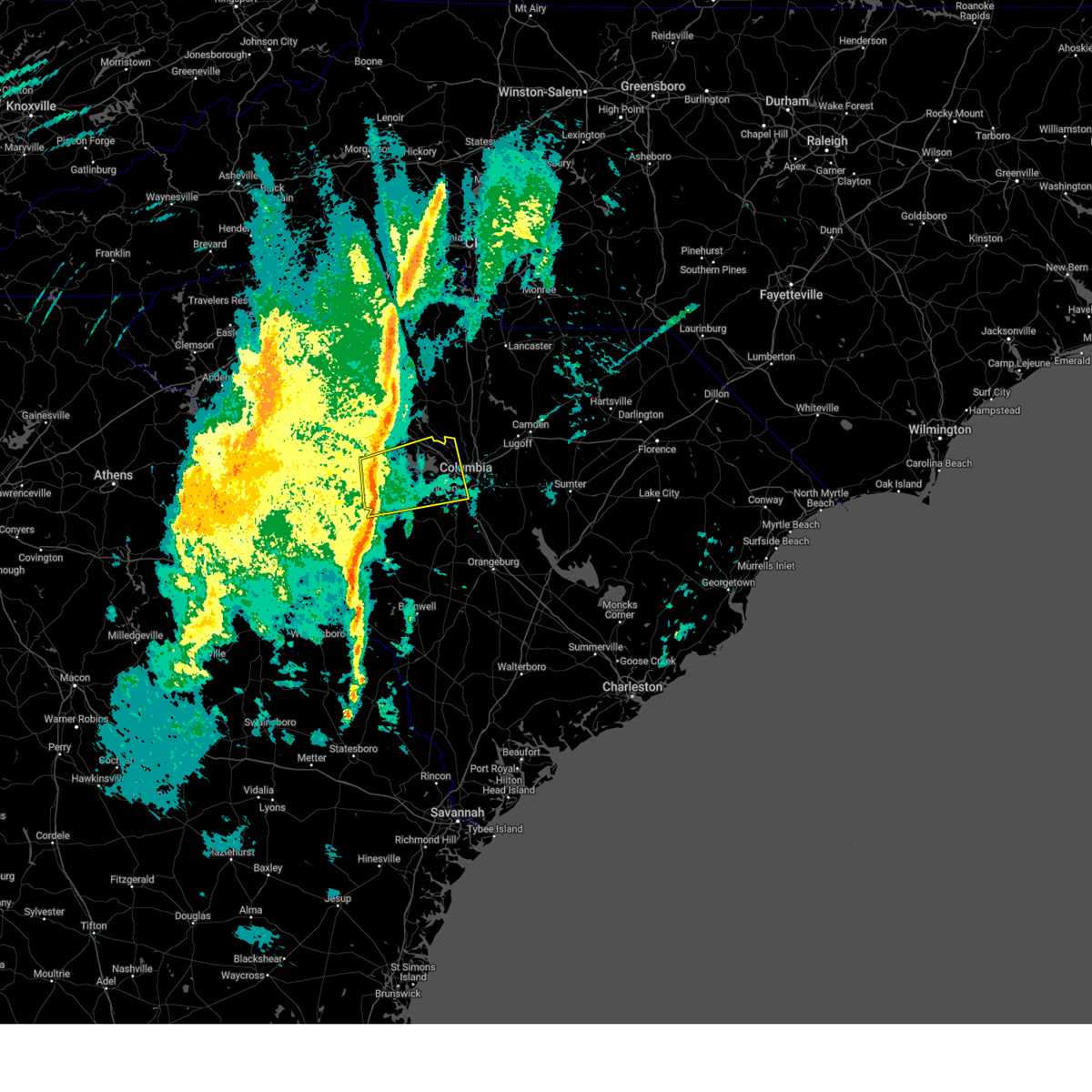 Svrcae the national weather service in columbia has issued a * severe thunderstorm warning for, southeastern newberry county in central south carolina, lexington county in central south carolina, eastern saluda county in central south carolina, north central aiken county in central south carolina, northwestern richland county in central south carolina, * until 745 am est. * at 704 am est, a severe thunderstorm was located near ridge spring, or near batesburg-leesville, moving east at 40 mph (radar indicated). Hazards include 60 mph wind gusts. expect damage to trees and powerlines Svrcae the national weather service in columbia has issued a * severe thunderstorm warning for, southeastern newberry county in central south carolina, lexington county in central south carolina, eastern saluda county in central south carolina, north central aiken county in central south carolina, northwestern richland county in central south carolina, * until 745 am est. * at 704 am est, a severe thunderstorm was located near ridge spring, or near batesburg-leesville, moving east at 40 mph (radar indicated). Hazards include 60 mph wind gusts. expect damage to trees and powerlines
|
| 2/16/2025 8:29 AM EST |
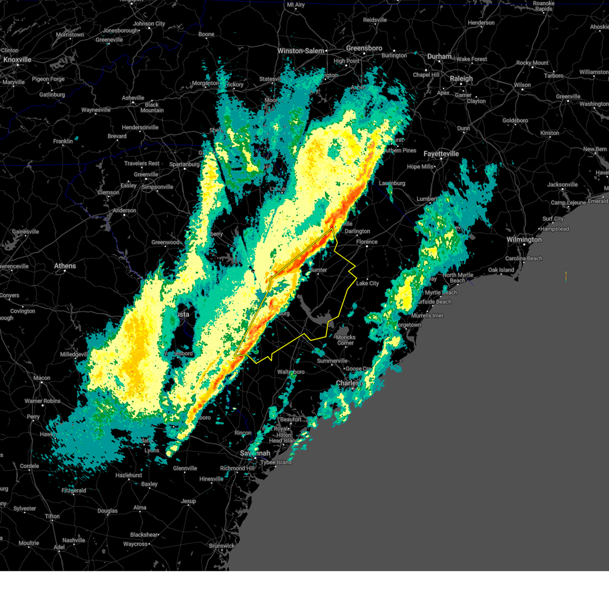 Svrcae the national weather service in columbia has issued a * severe thunderstorm warning for, lee county in central south carolina, calhoun county in central south carolina, clarendon county in central south carolina, southeastern barnwell county in central south carolina, bamberg county in central south carolina, sumter county in central south carolina, orangeburg county in central south carolina, southeastern richland county in central south carolina, * until 945 am est. * at 827 am est, severe thunderstorms were located along a line extending from near bishopville to near ulmer, moving east at 45 mph (numerous reports of downed trees from trained weather spotters). Hazards include 60 mph wind gusts. expect damage to trees and powerlines Svrcae the national weather service in columbia has issued a * severe thunderstorm warning for, lee county in central south carolina, calhoun county in central south carolina, clarendon county in central south carolina, southeastern barnwell county in central south carolina, bamberg county in central south carolina, sumter county in central south carolina, orangeburg county in central south carolina, southeastern richland county in central south carolina, * until 945 am est. * at 827 am est, severe thunderstorms were located along a line extending from near bishopville to near ulmer, moving east at 45 mph (numerous reports of downed trees from trained weather spotters). Hazards include 60 mph wind gusts. expect damage to trees and powerlines
|
| 2/16/2025 8:10 AM EST |
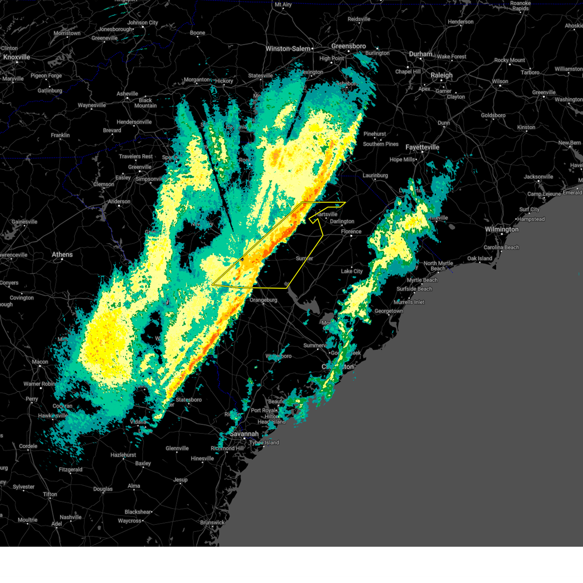 At 810 am est, severe thunderstorms were located along a line extending from 8 miles southeast of mt pisgah to near sandy run, moving east at 50 mph (radar indicated). Hazards include 60 mph wind gusts. Expect damage to trees and powerlines. locations impacted include, columbia, sumter, west columbia, cayce, forest acres, camden, bishopville, dentsville, shaw air base, mcentire air base, south congaree, pine ridge, st. matthews, gaston, arcadia lakes, eastover, lugoff, oakland, mulberry, and sesquicentennial state park. this includes the following highways, interstate 126 near mile marker 3. interstate 20 in south carolina between mile markers 72 and 126. interstate 26 between mile markers 112 and 137. Interstate 77 between mile markers 0 and 18. At 810 am est, severe thunderstorms were located along a line extending from 8 miles southeast of mt pisgah to near sandy run, moving east at 50 mph (radar indicated). Hazards include 60 mph wind gusts. Expect damage to trees and powerlines. locations impacted include, columbia, sumter, west columbia, cayce, forest acres, camden, bishopville, dentsville, shaw air base, mcentire air base, south congaree, pine ridge, st. matthews, gaston, arcadia lakes, eastover, lugoff, oakland, mulberry, and sesquicentennial state park. this includes the following highways, interstate 126 near mile marker 3. interstate 20 in south carolina between mile markers 72 and 126. interstate 26 between mile markers 112 and 137. Interstate 77 between mile markers 0 and 18.
|
| 2/16/2025 8:10 AM EST |
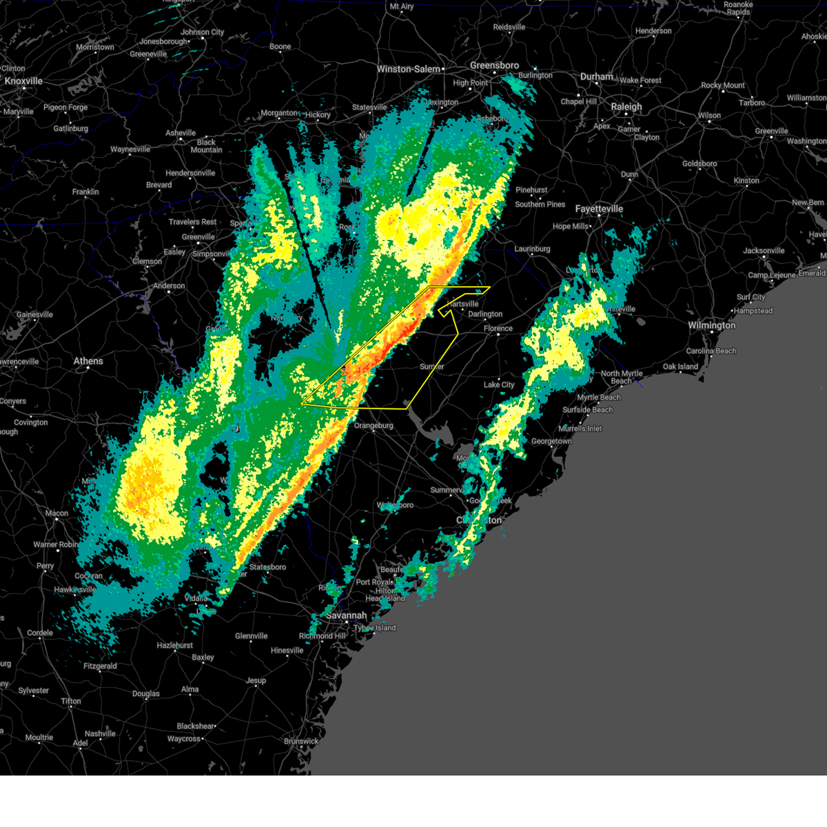 the severe thunderstorm warning has been cancelled and is no longer in effect the severe thunderstorm warning has been cancelled and is no longer in effect
|
| 2/16/2025 7:57 AM EST | Spotter provided a video of downed flag pole due to thunderstorm wind in richland county SC, 11.2 miles SW of Columbia, SC |
| 2/16/2025 7:50 AM EST | Sc department of public safety reported a tree down on wilson blv in richland county SC, 4.7 miles S of Columbia, SC |
| 2/16/2025 7:37 AM EST | Sc department of public safety reported trees down on i2 in richland county SC, 9.8 miles ESE of Columbia, SC |
| 2/16/2025 7:26 AM EST |
 Svrcae the national weather service in columbia has issued a * severe thunderstorm warning for, central fairfield county in central south carolina, southwestern lancaster county in central south carolina, lee county in central south carolina, calhoun county in central south carolina, southeastern chesterfield county in central south carolina, lexington county in central south carolina, western sumter county in central south carolina, northeastern aiken county in central south carolina, northwestern orangeburg county in central south carolina, richland county in central south carolina, kershaw county in central south carolina, * until 830 am est. * at 725 am est, severe thunderstorms were located along a line extending from 7 miles southwest of great falls to 6 miles southeast of ridge spring, moving east at 55 mph (radar indicated). Hazards include 60 mph wind gusts. expect damage to trees and powerlines Svrcae the national weather service in columbia has issued a * severe thunderstorm warning for, central fairfield county in central south carolina, southwestern lancaster county in central south carolina, lee county in central south carolina, calhoun county in central south carolina, southeastern chesterfield county in central south carolina, lexington county in central south carolina, western sumter county in central south carolina, northeastern aiken county in central south carolina, northwestern orangeburg county in central south carolina, richland county in central south carolina, kershaw county in central south carolina, * until 830 am est. * at 725 am est, severe thunderstorms were located along a line extending from 7 miles southwest of great falls to 6 miles southeast of ridge spring, moving east at 55 mph (radar indicated). Hazards include 60 mph wind gusts. expect damage to trees and powerlines
|
| 12/29/2024 9:37 AM EST |
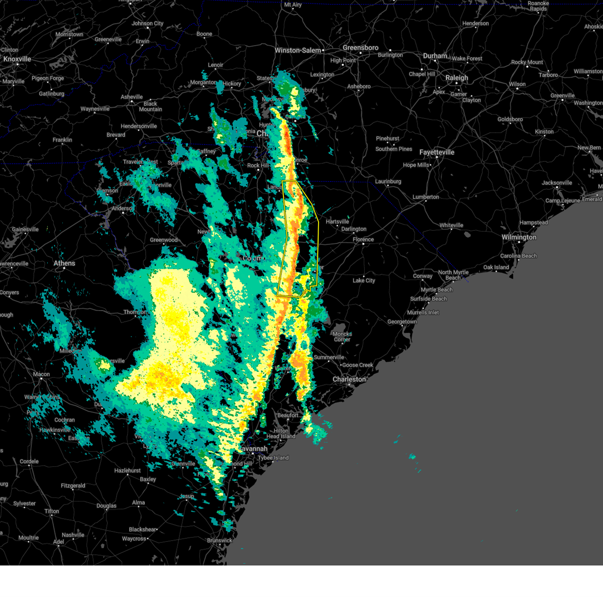 At 937 am est, severe thunderstorms were located along a line extending from 6 miles northeast of mt pisgah to near south sumter, moving east at 60 mph (radar indicated). Hazards include 60 mph wind gusts. Expect damage to trees and powerlines. locations impacted include, columbia, sumter, camden, south sumter, shaw air base, kershaw, elgin, eastover, heath springs, oakland, mulberry, westville, cassatt, mt pisgah, buford, sumter county airport, gadsden, millwood, poinsett state park, and goodale state park. This includes interstate 20 in south carolina between mile markers 92 and 114. At 937 am est, severe thunderstorms were located along a line extending from 6 miles northeast of mt pisgah to near south sumter, moving east at 60 mph (radar indicated). Hazards include 60 mph wind gusts. Expect damage to trees and powerlines. locations impacted include, columbia, sumter, camden, south sumter, shaw air base, kershaw, elgin, eastover, heath springs, oakland, mulberry, westville, cassatt, mt pisgah, buford, sumter county airport, gadsden, millwood, poinsett state park, and goodale state park. This includes interstate 20 in south carolina between mile markers 92 and 114.
|
| 12/29/2024 9:37 AM EST |
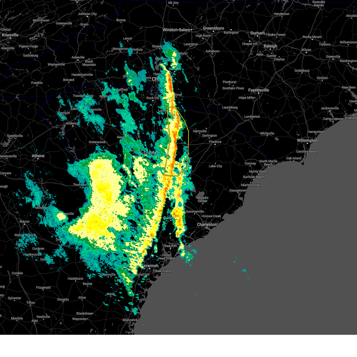 the severe thunderstorm warning has been cancelled and is no longer in effect the severe thunderstorm warning has been cancelled and is no longer in effect
|
| 12/29/2024 9:21 AM EST |
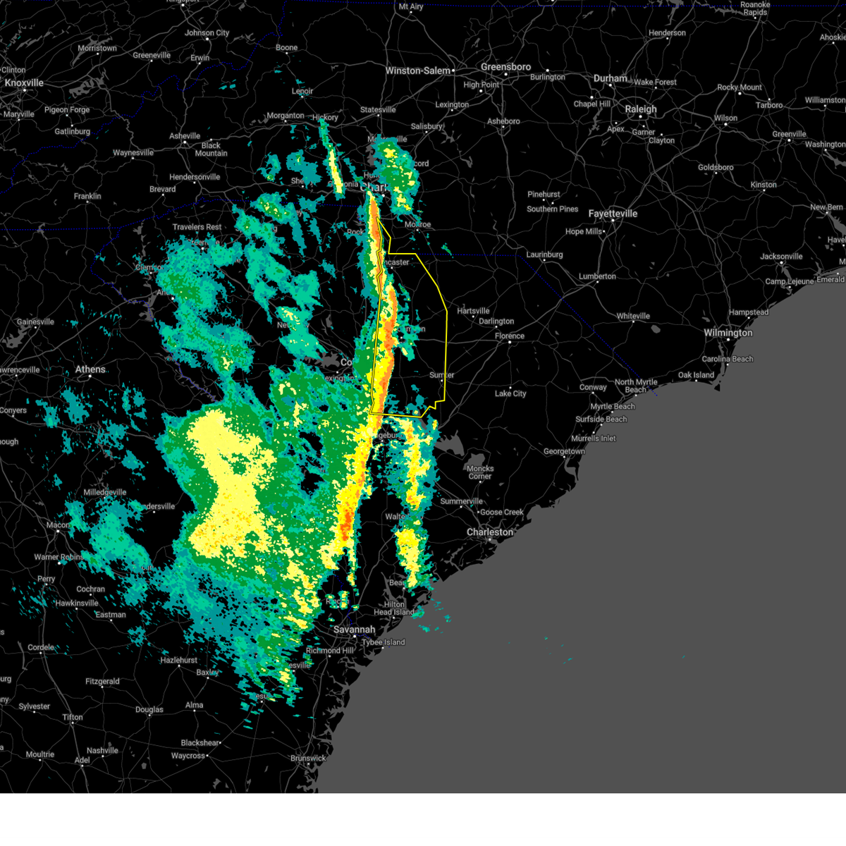 the severe thunderstorm warning has been cancelled and is no longer in effect the severe thunderstorm warning has been cancelled and is no longer in effect
|
| 12/29/2024 9:21 AM EST |
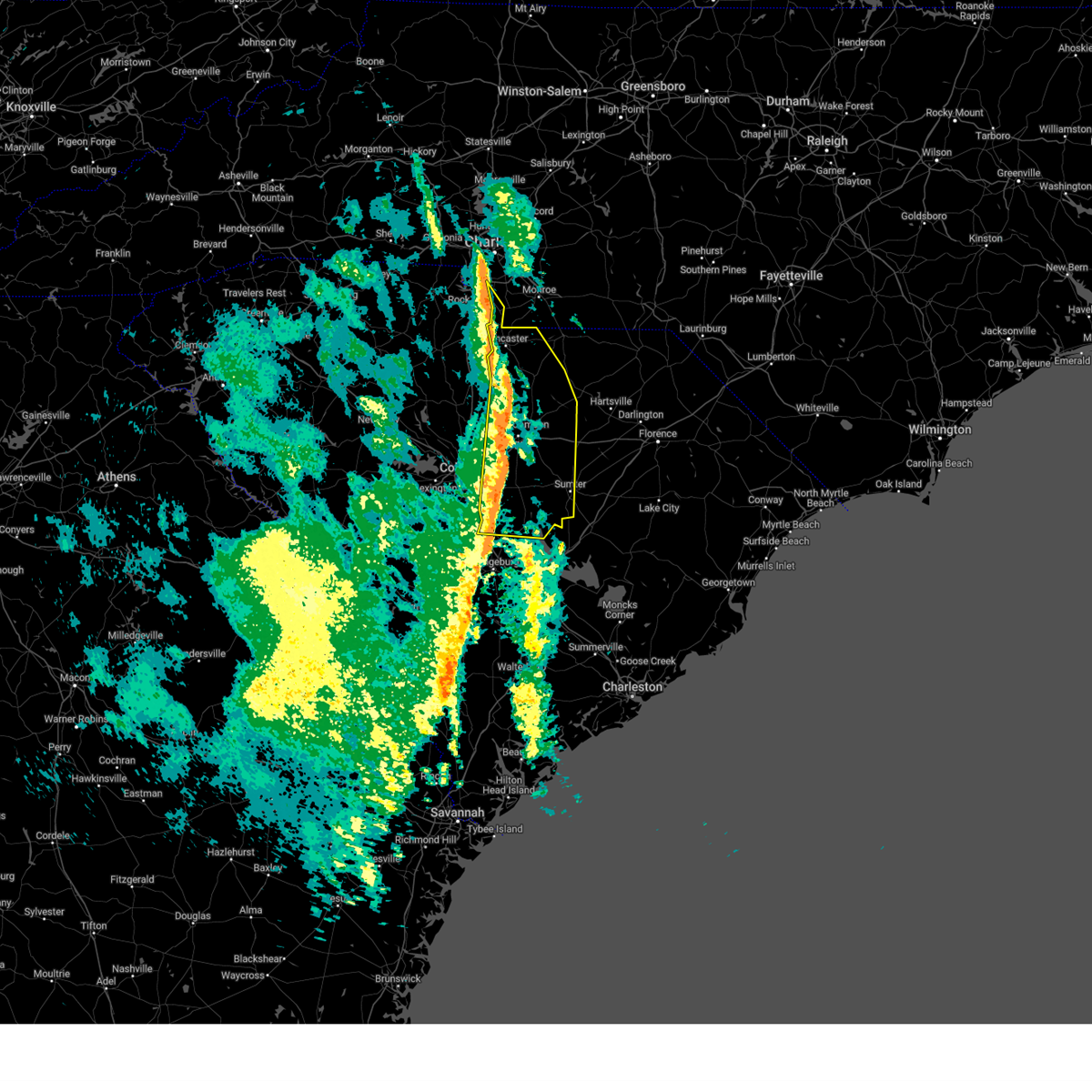 At 921 am est, severe thunderstorms were located along a line extending from near heath springs to near poinsett state park, moving east at 60 mph (radar indicated). Hazards include 60 mph wind gusts. Expect damage to trees and powerlines. locations impacted include, columbia, sumter, lancaster, camden, springdale, south sumter, shaw air base, mcentire air base, lake wateree dam, indian land, dentsville, kershaw, elgin, eastover, heath springs, lugoff, oakland, liberty hill, mulberry, and andrew jackson state park. this includes the following highways, interstate 20 in south carolina between mile markers 76 and 114. interstate 26 between mile markers 132 and 135. Interstate 77 near mile marker 15. At 921 am est, severe thunderstorms were located along a line extending from near heath springs to near poinsett state park, moving east at 60 mph (radar indicated). Hazards include 60 mph wind gusts. Expect damage to trees and powerlines. locations impacted include, columbia, sumter, lancaster, camden, springdale, south sumter, shaw air base, mcentire air base, lake wateree dam, indian land, dentsville, kershaw, elgin, eastover, heath springs, lugoff, oakland, liberty hill, mulberry, and andrew jackson state park. this includes the following highways, interstate 20 in south carolina between mile markers 76 and 114. interstate 26 between mile markers 132 and 135. Interstate 77 near mile marker 15.
|
| 12/29/2024 8:59 AM EST |
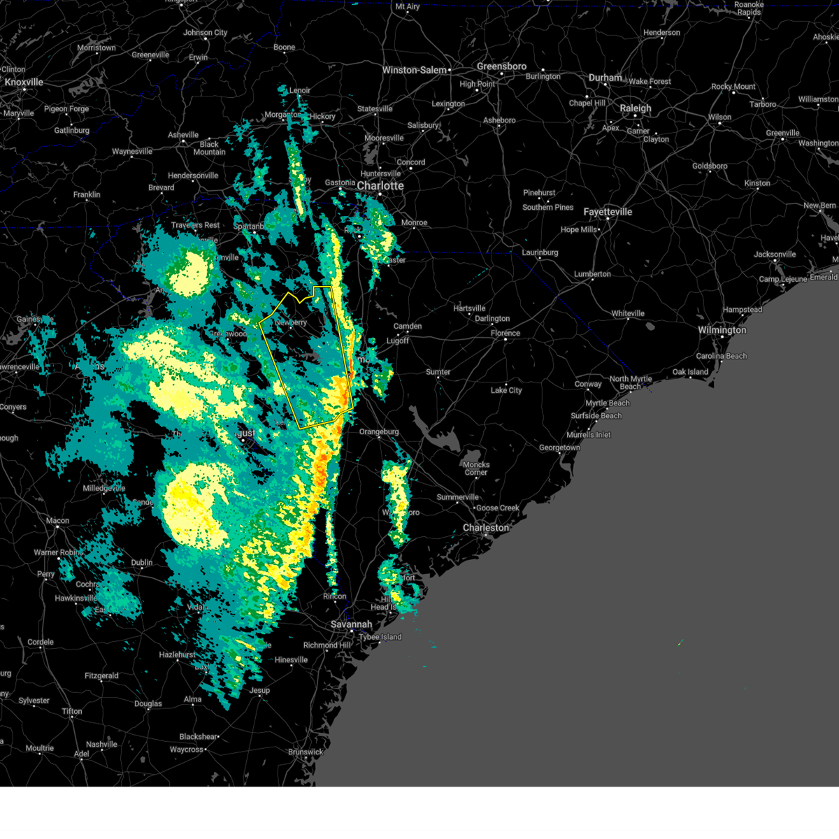 The storms which prompted the warning have moved out of the area. therefore, the warning will be allowed to expire. to report severe weather, contact your nearest law enforcement agency. they will relay your report to the national weather service columbia. The storms which prompted the warning have moved out of the area. therefore, the warning will be allowed to expire. to report severe weather, contact your nearest law enforcement agency. they will relay your report to the national weather service columbia.
|
| 12/29/2024 8:39 AM EST |
 Svrcae the national weather service in columbia has issued a * severe thunderstorm warning for, fairfield county in central south carolina, lancaster county in central south carolina, northwestern lee county in central south carolina, northern calhoun county in central south carolina, eastern lexington county in central south carolina, sumter county in central south carolina, richland county in central south carolina, kershaw county in central south carolina, * until 945 am est. * at 839 am est, severe thunderstorms were located along a line extending from 7 miles northeast of blair to 13 miles southwest of gaston, moving east at 55 mph (radar indicated). Hazards include 60 mph wind gusts. expect damage to trees and powerlines Svrcae the national weather service in columbia has issued a * severe thunderstorm warning for, fairfield county in central south carolina, lancaster county in central south carolina, northwestern lee county in central south carolina, northern calhoun county in central south carolina, eastern lexington county in central south carolina, sumter county in central south carolina, richland county in central south carolina, kershaw county in central south carolina, * until 945 am est. * at 839 am est, severe thunderstorms were located along a line extending from 7 miles northeast of blair to 13 miles southwest of gaston, moving east at 55 mph (radar indicated). Hazards include 60 mph wind gusts. expect damage to trees and powerlines
|
| 12/29/2024 8:03 AM EST |
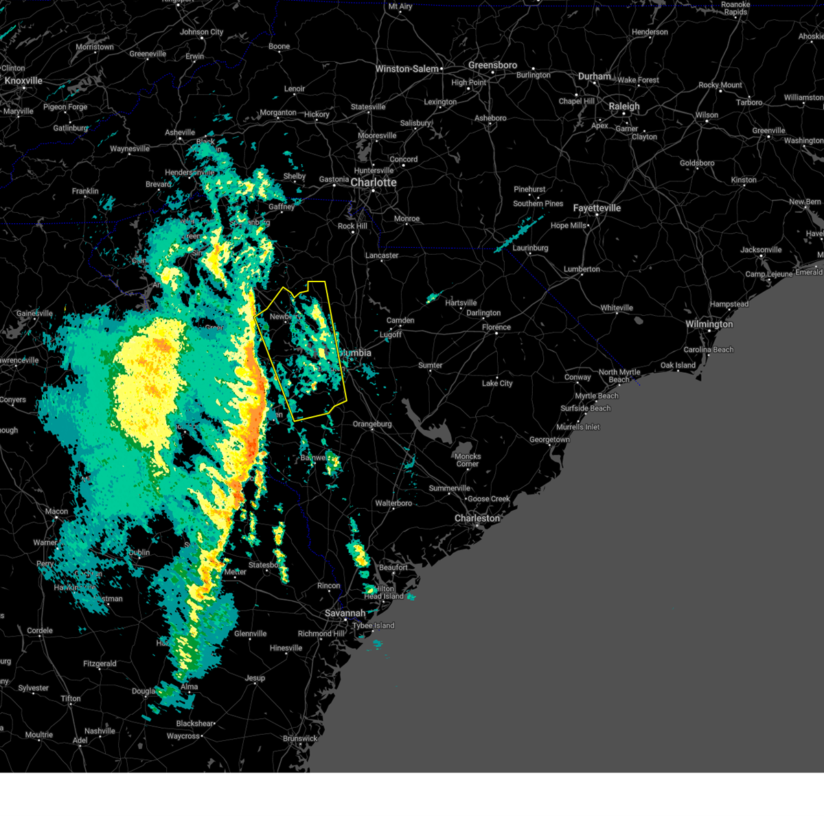 Svrcae the national weather service in columbia has issued a * severe thunderstorm warning for, western fairfield county in central south carolina, newberry county in central south carolina, lexington county in central south carolina, eastern saluda county in central south carolina, northeastern aiken county in central south carolina, northwestern richland county in central south carolina, * until 900 am est. * at 802 am est, severe thunderstorms were located along a line extending from 7 miles northeast of lake greenwood state park to graniteville, moving northeast at 50 mph (radar indicated). Hazards include 60 mph wind gusts. expect damage to trees and powerlines Svrcae the national weather service in columbia has issued a * severe thunderstorm warning for, western fairfield county in central south carolina, newberry county in central south carolina, lexington county in central south carolina, eastern saluda county in central south carolina, northeastern aiken county in central south carolina, northwestern richland county in central south carolina, * until 900 am est. * at 802 am est, severe thunderstorms were located along a line extending from 7 miles northeast of lake greenwood state park to graniteville, moving northeast at 50 mph (radar indicated). Hazards include 60 mph wind gusts. expect damage to trees and powerlines
|
| 8/17/2024 9:02 PM EDT |
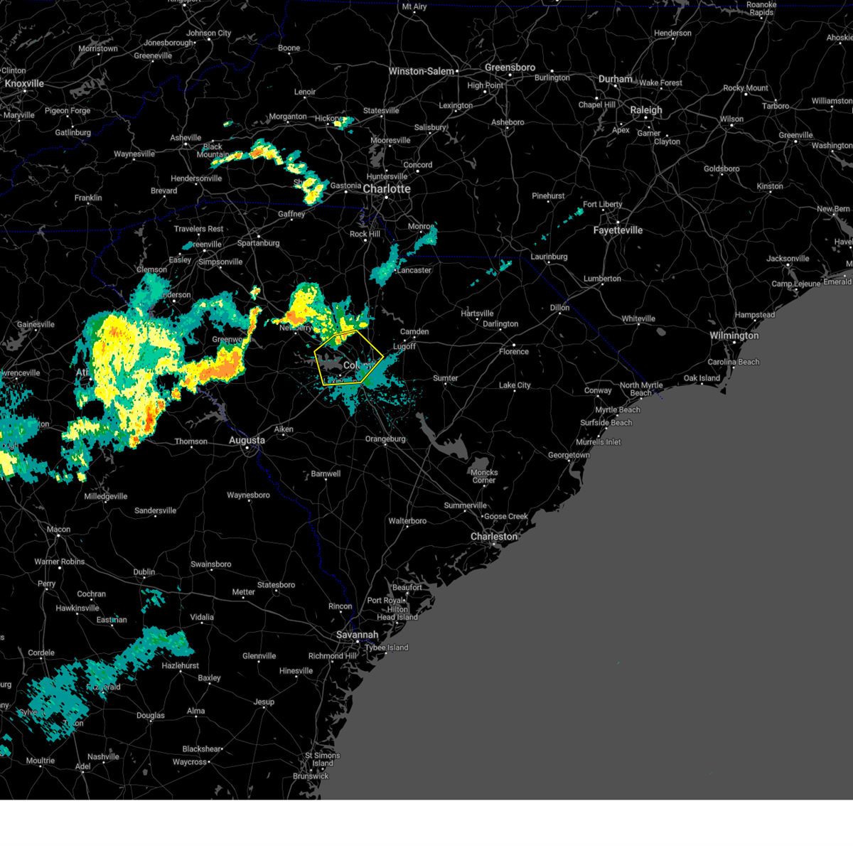 At 902 pm edt, severe thunderstorms were located along a line extending from killian to west columbia to 6 miles west of lexington, moving southeast at 35 mph (radar indicated). Hazards include 60 mph wind gusts and penny size hail. Expect damage to trees and powerlines. locations impacted include, columbia, lexington, west columbia, cayce, irmo, forest acres, springdale, st. andrews, dentsville, oak grove, highway 6 at lake murray dam, red bank, arcadia lakes, columbia international university, harbison state forest, sesquicentennial state park, sc state fair grounds, west columbia riverwalk, dreher island state park, and five points. this includes the following highways, interstate 126 between mile markers 0 and 3. interstate 20 in south carolina between mile markers 49 and 76. interstate 26 between mile markers 88 and 115. Interstate 77 near mile marker 0, and between mile markers 16 and 26. At 902 pm edt, severe thunderstorms were located along a line extending from killian to west columbia to 6 miles west of lexington, moving southeast at 35 mph (radar indicated). Hazards include 60 mph wind gusts and penny size hail. Expect damage to trees and powerlines. locations impacted include, columbia, lexington, west columbia, cayce, irmo, forest acres, springdale, st. andrews, dentsville, oak grove, highway 6 at lake murray dam, red bank, arcadia lakes, columbia international university, harbison state forest, sesquicentennial state park, sc state fair grounds, west columbia riverwalk, dreher island state park, and five points. this includes the following highways, interstate 126 between mile markers 0 and 3. interstate 20 in south carolina between mile markers 49 and 76. interstate 26 between mile markers 88 and 115. Interstate 77 near mile marker 0, and between mile markers 16 and 26.
|
| 8/17/2024 8:24 PM EDT |
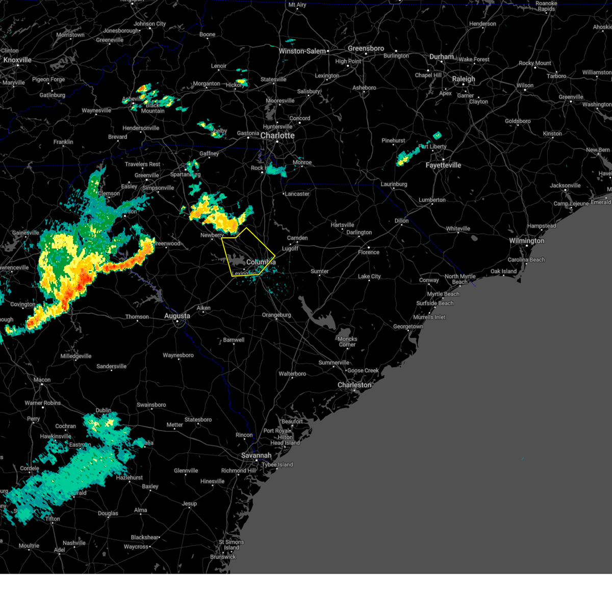 Svrcae the national weather service in columbia has issued a * severe thunderstorm warning for, southwestern fairfield county in central south carolina, southeastern newberry county in central south carolina, northern lexington county in central south carolina, northwestern richland county in central south carolina, * until 915 pm edt. * at 824 pm edt, severe thunderstorms were located along a line extending from near winnsboro to jenkinsville to near prosperity, moving southeast at 35 mph (radar indicated). Hazards include 60 mph wind gusts and penny size hail. expect damage to trees and powerlines Svrcae the national weather service in columbia has issued a * severe thunderstorm warning for, southwestern fairfield county in central south carolina, southeastern newberry county in central south carolina, northern lexington county in central south carolina, northwestern richland county in central south carolina, * until 915 pm edt. * at 824 pm edt, severe thunderstorms were located along a line extending from near winnsboro to jenkinsville to near prosperity, moving southeast at 35 mph (radar indicated). Hazards include 60 mph wind gusts and penny size hail. expect damage to trees and powerlines
|
| 8/11/2024 2:52 PM EDT | Sc department of public safety reported a tree down on arcadia lakes driv in richland county SC, 2.1 miles WSW of Columbia, SC |
| 8/4/2024 6:34 PM EDT |
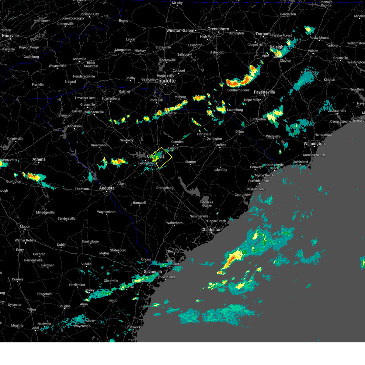 the severe thunderstorm warning has been cancelled and is no longer in effect the severe thunderstorm warning has been cancelled and is no longer in effect
|
| 8/4/2024 6:23 PM EDT |
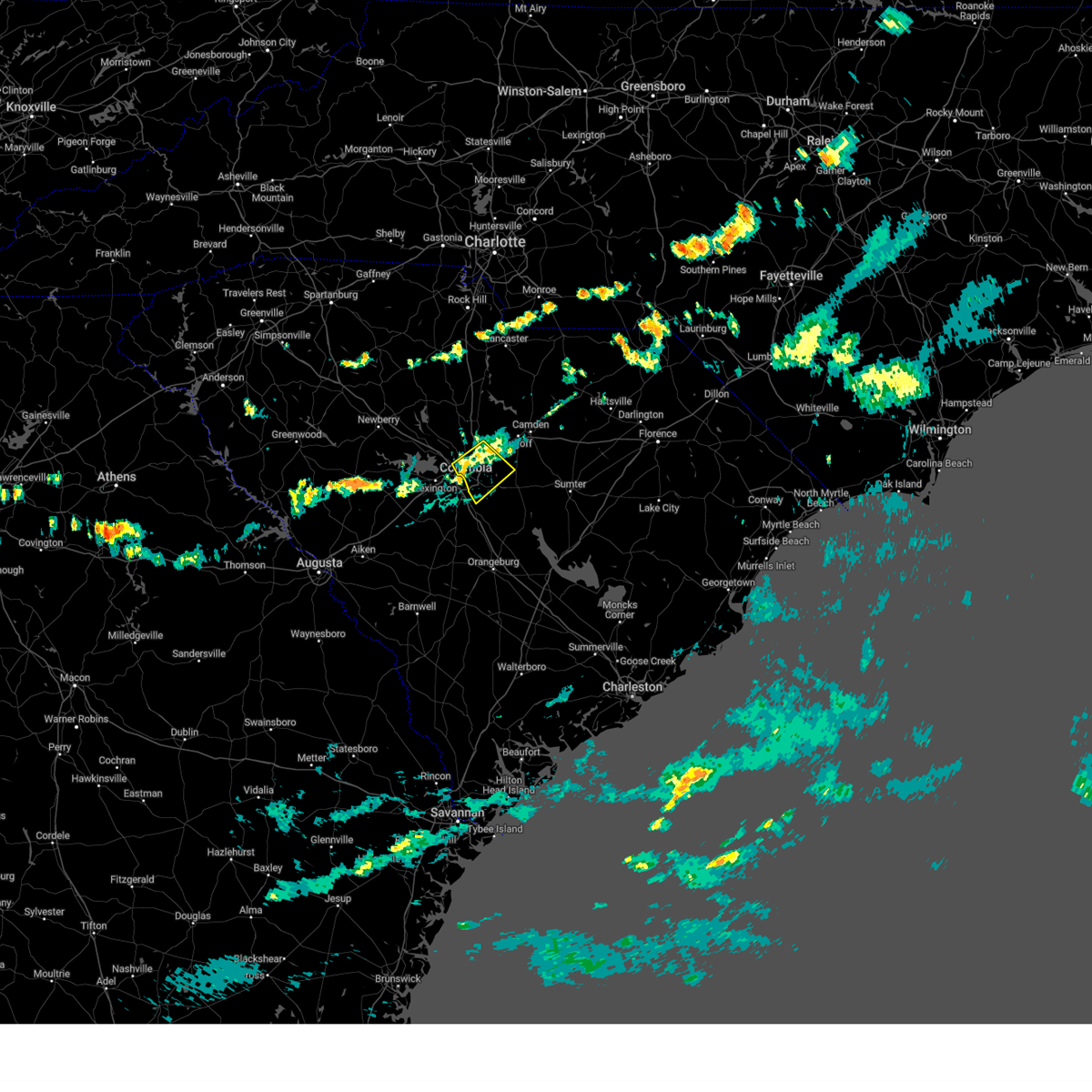 At 623 pm edt, a severe thunderstorm was located over forest acres, moving southeast at 10 mph (radar indicated). Hazards include 60 mph wind gusts. Expect damage to trees and powerlines. locations impacted include, columbia, west columbia, cayce, forest acres, dentsville, st. andrews, arcadia lakes, woodfield, sesquicentennial state park, lake carolina, sc state fair grounds, villages at sandhill, fort jackson, columbia international university, five points, horrel hill, killian, riverbanks zoo, olympia, and rosewood. this includes the following highways, interstate 126 between mile markers 1 and 3. interstate 20 in south carolina between mile markers 65 and 83. Interstate 77 between mile markers 3 and 23. At 623 pm edt, a severe thunderstorm was located over forest acres, moving southeast at 10 mph (radar indicated). Hazards include 60 mph wind gusts. Expect damage to trees and powerlines. locations impacted include, columbia, west columbia, cayce, forest acres, dentsville, st. andrews, arcadia lakes, woodfield, sesquicentennial state park, lake carolina, sc state fair grounds, villages at sandhill, fort jackson, columbia international university, five points, horrel hill, killian, riverbanks zoo, olympia, and rosewood. this includes the following highways, interstate 126 between mile markers 1 and 3. interstate 20 in south carolina between mile markers 65 and 83. Interstate 77 between mile markers 3 and 23.
|
| 8/4/2024 5:58 PM EDT | Schp reported a tree down along fairfield rd at i-2 in richland county SC, 2.4 miles SE of Columbia, SC |
| 8/4/2024 5:57 PM EDT |
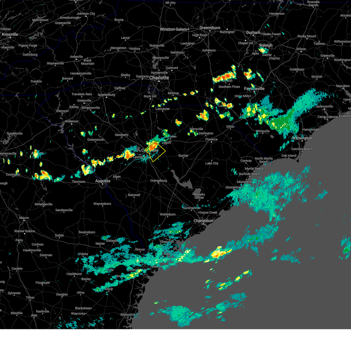 Svrcae the national weather service in columbia has issued a * severe thunderstorm warning for, central richland county in central south carolina, * until 645 pm edt. * at 556 pm edt, a severe thunderstorm was located over arcadia lakes, or over forest acres, moving southeast at 10 mph (radar indicated). Hazards include 60 mph wind gusts. expect damage to trees and powerlines Svrcae the national weather service in columbia has issued a * severe thunderstorm warning for, central richland county in central south carolina, * until 645 pm edt. * at 556 pm edt, a severe thunderstorm was located over arcadia lakes, or over forest acres, moving southeast at 10 mph (radar indicated). Hazards include 60 mph wind gusts. expect damage to trees and powerlines
|
| 8/4/2024 5:49 PM EDT |
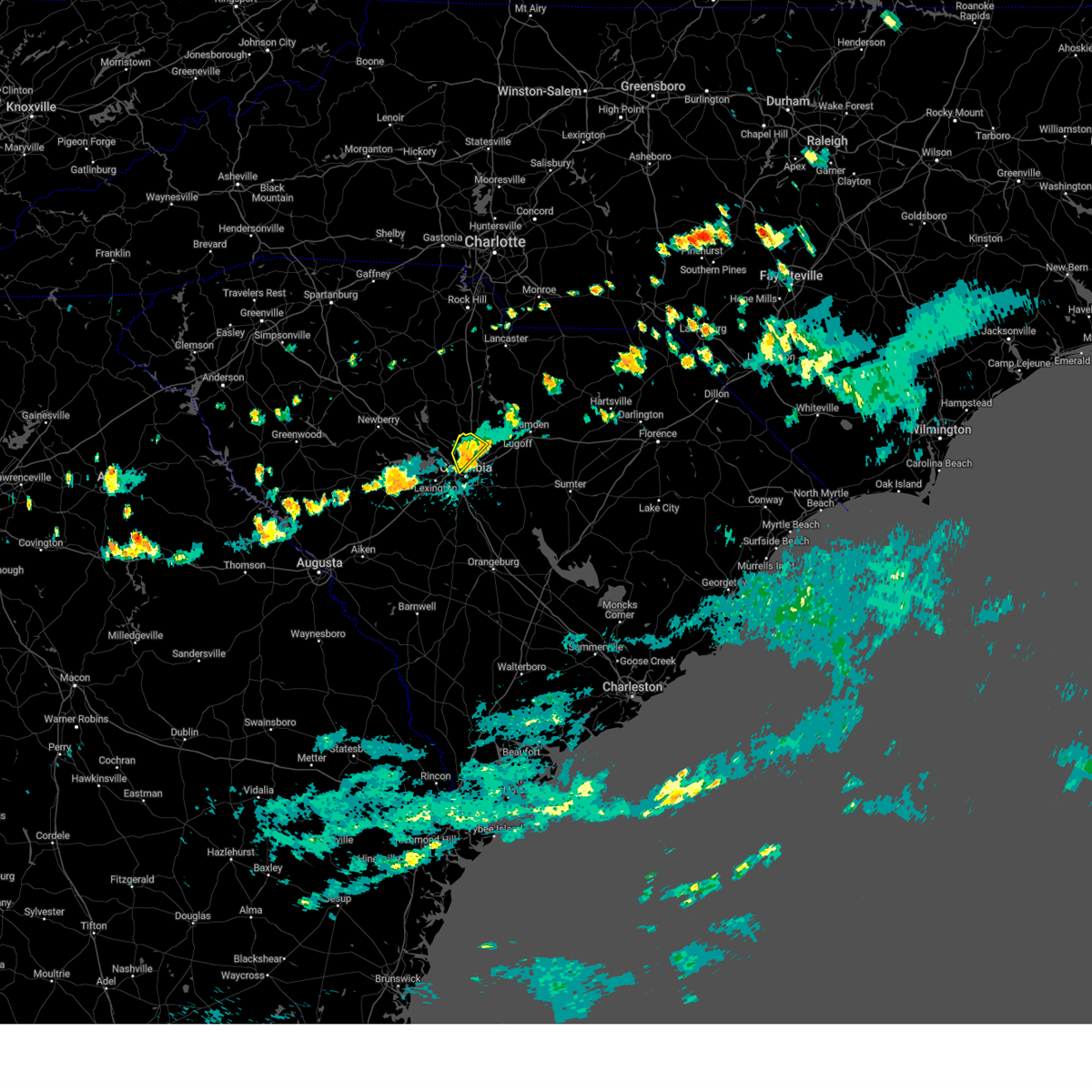 At 548 pm edt, a severe thunderstorm was located over killian, or near dentsville, moving southeast at 5 mph (radar indicated). Hazards include 60 mph wind gusts. Expect damage to trees and powerlines. locations impacted include, columbia, st. andrews, killian, columbia international university, blythewood, cedar creek fire station, and upper richland fire station. this includes the following highways, interstate 20 in south carolina between mile markers 66 and 69. Interstate 77 between mile markers 21 and 29. At 548 pm edt, a severe thunderstorm was located over killian, or near dentsville, moving southeast at 5 mph (radar indicated). Hazards include 60 mph wind gusts. Expect damage to trees and powerlines. locations impacted include, columbia, st. andrews, killian, columbia international university, blythewood, cedar creek fire station, and upper richland fire station. this includes the following highways, interstate 20 in south carolina between mile markers 66 and 69. Interstate 77 between mile markers 21 and 29.
|
| 8/4/2024 5:44 PM EDT | Schp reported tree down along fairfield rd at crane church r in richland county SC, 3.9 miles SSE of Columbia, SC |
| 8/4/2024 5:20 PM EDT |
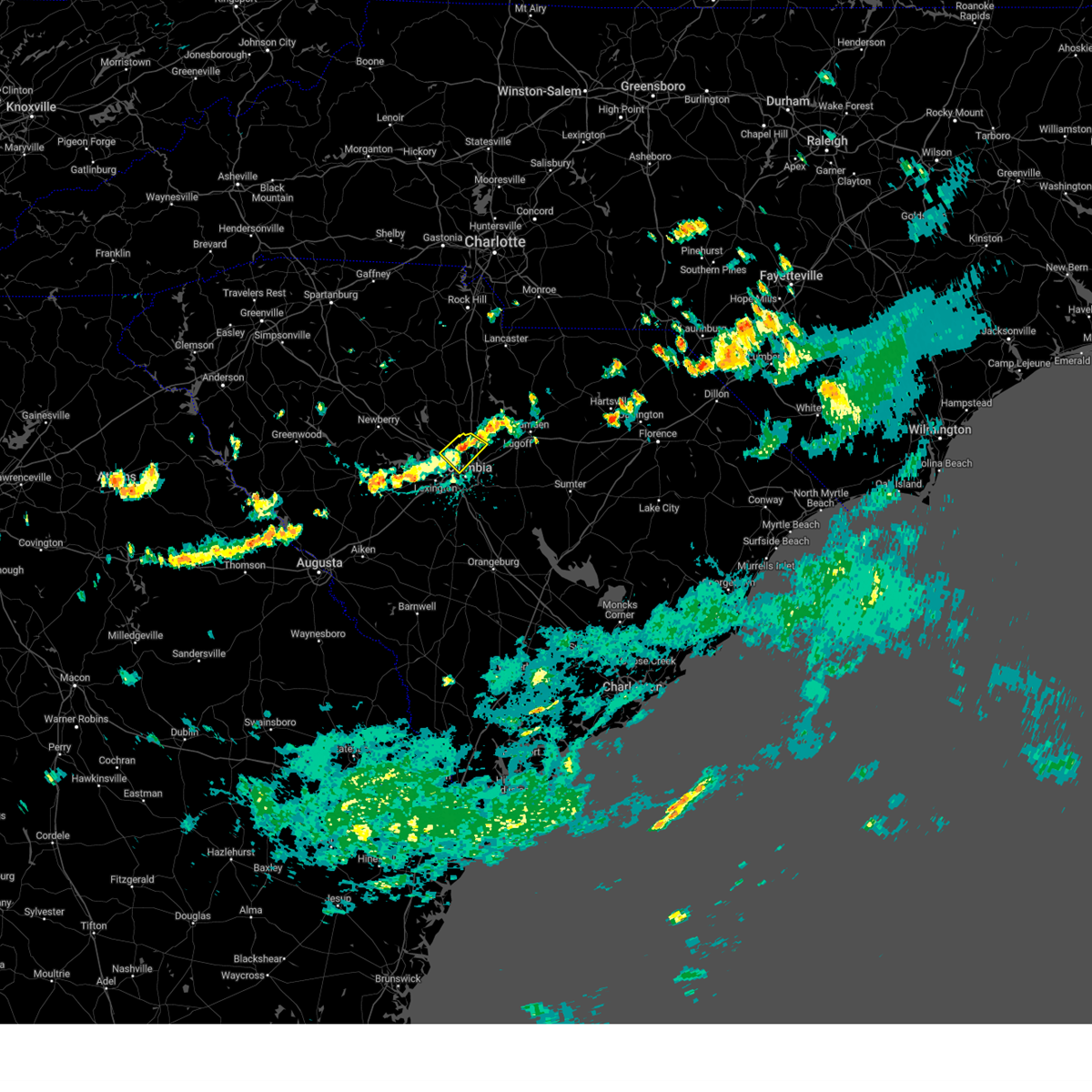 Svrcae the national weather service in columbia has issued a * severe thunderstorm warning for, northwestern richland county in central south carolina, * until 600 pm edt. * at 519 pm edt, a severe thunderstorm was located near killian, or 7 miles northwest of dentsville, moving southeast at 5 mph (radar indicated). Hazards include 60 mph wind gusts and penny size hail. expect damage to trees and powerlines Svrcae the national weather service in columbia has issued a * severe thunderstorm warning for, northwestern richland county in central south carolina, * until 600 pm edt. * at 519 pm edt, a severe thunderstorm was located near killian, or 7 miles northwest of dentsville, moving southeast at 5 mph (radar indicated). Hazards include 60 mph wind gusts and penny size hail. expect damage to trees and powerlines
|
| 8/3/2024 5:41 PM EDT |
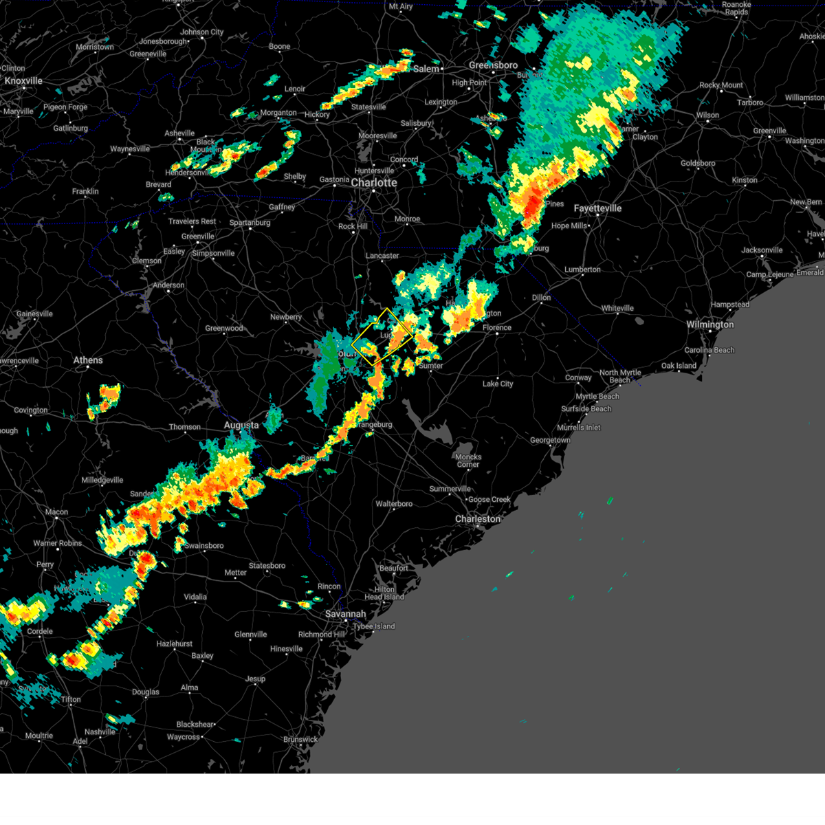 At 541 pm edt, a severe thunderstorm was located over sesquicentennial state park, or near columbia, moving northeast at 30 mph (radar indicated). Hazards include 60 mph wind gusts. Expect damage to trees and powerlines. locations impacted include, columbia, forest acres, camden, dentsville, lake wateree dam, arcadia lakes, lugoff, woodfield, sesquicentennial state park, lake carolina, villages at sandhill, fort jackson, elgin, killian, fort jackson wildcat road, and pine grove fire station. this includes the following highways, interstate 20 in south carolina between mile markers 72 and 100. Interstate 77 between mile markers 13 and 24. At 541 pm edt, a severe thunderstorm was located over sesquicentennial state park, or near columbia, moving northeast at 30 mph (radar indicated). Hazards include 60 mph wind gusts. Expect damage to trees and powerlines. locations impacted include, columbia, forest acres, camden, dentsville, lake wateree dam, arcadia lakes, lugoff, woodfield, sesquicentennial state park, lake carolina, villages at sandhill, fort jackson, elgin, killian, fort jackson wildcat road, and pine grove fire station. this includes the following highways, interstate 20 in south carolina between mile markers 72 and 100. Interstate 77 between mile markers 13 and 24.
|
| 8/3/2024 5:40 PM EDT |
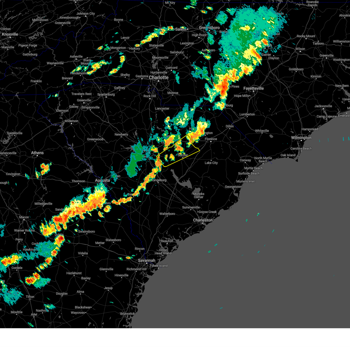 Svrcae the national weather service in columbia has issued a * severe thunderstorm warning for, lee county in central south carolina, northern sumter county in central south carolina, southeastern richland county in central south carolina, * until 630 pm edt. * at 540 pm edt, a severe thunderstorm was located over eastover, or near mcentire air base, moving northeast at 55 mph (radar indicated). Hazards include 60 mph wind gusts. expect damage to trees and powerlines Svrcae the national weather service in columbia has issued a * severe thunderstorm warning for, lee county in central south carolina, northern sumter county in central south carolina, southeastern richland county in central south carolina, * until 630 pm edt. * at 540 pm edt, a severe thunderstorm was located over eastover, or near mcentire air base, moving northeast at 55 mph (radar indicated). Hazards include 60 mph wind gusts. expect damage to trees and powerlines
|
| 8/3/2024 5:33 PM EDT | Schp reported tree down along trenholm dr at wyndham r in richland county SC, 2.2 miles N of Columbia, SC |
| 8/3/2024 5:27 PM EDT |
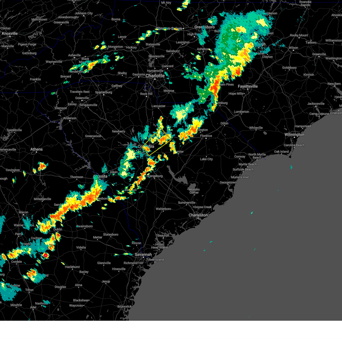 Svrcae the national weather service in columbia has issued a * severe thunderstorm warning for, central richland county in central south carolina, southwestern kershaw county in central south carolina, * until 615 pm edt. * at 527 pm edt, a severe thunderstorm was located over forest acres, moving northeast at 30 mph (radar indicated). Hazards include 70 mph wind gusts. Expect considerable tree damage. Damage is likely to mobile homes, roofs, and outbuildings. Svrcae the national weather service in columbia has issued a * severe thunderstorm warning for, central richland county in central south carolina, southwestern kershaw county in central south carolina, * until 615 pm edt. * at 527 pm edt, a severe thunderstorm was located over forest acres, moving northeast at 30 mph (radar indicated). Hazards include 70 mph wind gusts. Expect considerable tree damage. Damage is likely to mobile homes, roofs, and outbuildings.
|
| 8/3/2024 4:49 PM EDT | Schp reported downed power lines along landon place d in richland county SC, 7.9 miles SSW of Columbia, SC |
| 8/3/2024 2:54 PM EDT |
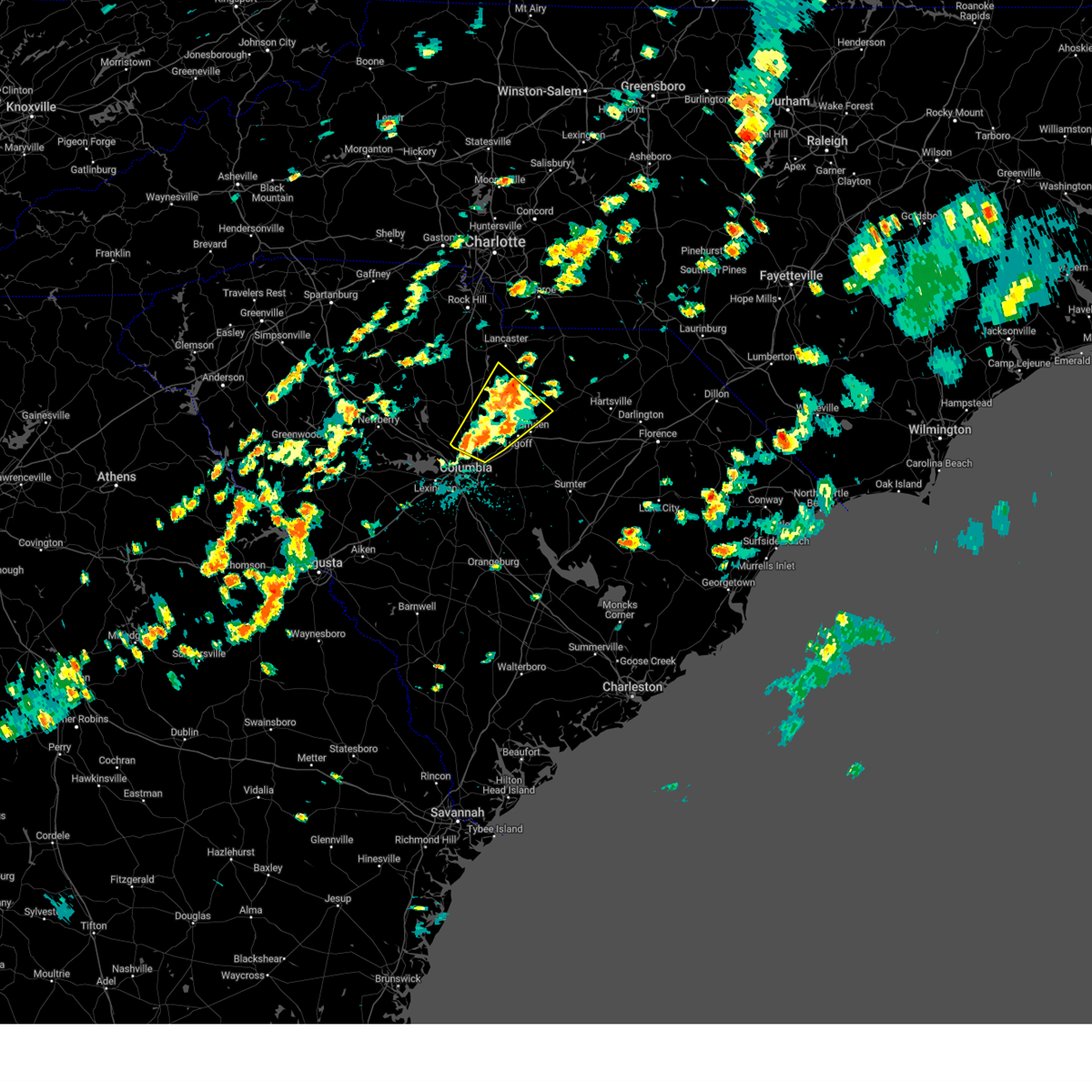 At 254 pm edt, a cluster of severe thunderstorms was located near lake carolina, or 7 miles southeast of springdale, moving northeast at 35 mph (radar indicated). Hazards include 60 mph wind gusts and penny size hail. Expect damage to trees and powerlines. locations impacted include, camden, lake wateree dam, dentsville, lugoff, westville, sesquicentennial state park, lake carolina, villages at sandhill, longtown, liberty hill, elgin, killian, lake wateree state park, blythewood, ridgeway, dekalb, north towne square shopping center, faith christian school, upper richland fire station, and midway elementary school. This includes interstate 77 between mile markers 19 and 39. At 254 pm edt, a cluster of severe thunderstorms was located near lake carolina, or 7 miles southeast of springdale, moving northeast at 35 mph (radar indicated). Hazards include 60 mph wind gusts and penny size hail. Expect damage to trees and powerlines. locations impacted include, camden, lake wateree dam, dentsville, lugoff, westville, sesquicentennial state park, lake carolina, villages at sandhill, longtown, liberty hill, elgin, killian, lake wateree state park, blythewood, ridgeway, dekalb, north towne square shopping center, faith christian school, upper richland fire station, and midway elementary school. This includes interstate 77 between mile markers 19 and 39.
|
| 8/3/2024 2:37 PM EDT |
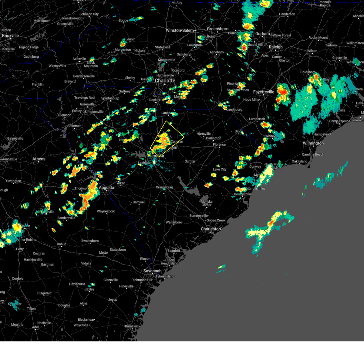 Svrcae the national weather service in columbia has issued a * severe thunderstorm warning for, eastern fairfield county in central south carolina, southwestern lancaster county in central south carolina, north central richland county in central south carolina, western kershaw county in central south carolina, * until 315 pm edt. * at 237 pm edt, a severe thunderstorm was located near killian, or 7 miles northwest of dentsville, moving northeast at 35 mph (radar indicated). Hazards include 60 mph wind gusts and penny size hail. expect damage to trees and powerlines Svrcae the national weather service in columbia has issued a * severe thunderstorm warning for, eastern fairfield county in central south carolina, southwestern lancaster county in central south carolina, north central richland county in central south carolina, western kershaw county in central south carolina, * until 315 pm edt. * at 237 pm edt, a severe thunderstorm was located near killian, or 7 miles northwest of dentsville, moving northeast at 35 mph (radar indicated). Hazards include 60 mph wind gusts and penny size hail. expect damage to trees and powerlines
|
| 7/23/2024 5:42 PM EDT |
 The storm which prompted the warning has weakened below severe limits, and no longer poses an immediate threat to life or property. therefore, the warning will be allowed to expire. however, gusty winds are still possible with this thunderstorm. The storm which prompted the warning has weakened below severe limits, and no longer poses an immediate threat to life or property. therefore, the warning will be allowed to expire. however, gusty winds are still possible with this thunderstorm.
|
| 7/23/2024 5:34 PM EDT |
 At 533 pm edt, a severe thunderstorm was located over lake carolina, or 8 miles northeast of dentsville, moving northeast at 15 mph (radar indicated). Hazards include 60 mph wind gusts and penny size hail. Expect damage to trees and powerlines. locations impacted include, columbia, lugoff, lake carolina, elgin, villages at sandhill, killian, blythewood, ridgeway, pine grove fire station, and smallwood. this includes the following highways, interstate 20 in south carolina between mile markers 78 and 97. Interstate 77 between mile markers 24 and 28. At 533 pm edt, a severe thunderstorm was located over lake carolina, or 8 miles northeast of dentsville, moving northeast at 15 mph (radar indicated). Hazards include 60 mph wind gusts and penny size hail. Expect damage to trees and powerlines. locations impacted include, columbia, lugoff, lake carolina, elgin, villages at sandhill, killian, blythewood, ridgeway, pine grove fire station, and smallwood. this includes the following highways, interstate 20 in south carolina between mile markers 78 and 97. Interstate 77 between mile markers 24 and 28.
|
| 7/23/2024 5:17 PM EDT |
 Svrcae the national weather service in columbia has issued a * severe thunderstorm warning for, southeastern fairfield county in central south carolina, northeastern richland county in central south carolina, southwestern kershaw county in central south carolina, * until 545 pm edt. * at 517 pm edt, a severe thunderstorm was located over killian, or near dentsville, moving northeast at 15 mph (radar indicated). Hazards include 60 mph wind gusts and penny size hail. expect damage to trees and powerlines Svrcae the national weather service in columbia has issued a * severe thunderstorm warning for, southeastern fairfield county in central south carolina, northeastern richland county in central south carolina, southwestern kershaw county in central south carolina, * until 545 pm edt. * at 517 pm edt, a severe thunderstorm was located over killian, or near dentsville, moving northeast at 15 mph (radar indicated). Hazards include 60 mph wind gusts and penny size hail. expect damage to trees and powerlines
|
| 7/18/2024 8:13 PM EDT |
 The storm which prompted the warning has weakened below severe limits, and no longer poses an immediate threat to life or property. therefore, the warning will be allowed to expire. however, gusty winds and heavy rain are still possible with this thunderstorm. to report severe weather, contact your nearest law enforcement agency. they will relay your report to the national weather service columbia. The storm which prompted the warning has weakened below severe limits, and no longer poses an immediate threat to life or property. therefore, the warning will be allowed to expire. however, gusty winds and heavy rain are still possible with this thunderstorm. to report severe weather, contact your nearest law enforcement agency. they will relay your report to the national weather service columbia.
|
| 7/18/2024 7:40 PM EDT |
 The storm which prompted the warning has weakened below severe limits, and has exited the warned area. therefore, the warning will be allowed to expire. however, gusty winds and heavy rain are still possible with this thunderstorm. to report severe weather, contact your nearest law enforcement agency. they will relay your report to the national weather service columbia. The storm which prompted the warning has weakened below severe limits, and has exited the warned area. therefore, the warning will be allowed to expire. however, gusty winds and heavy rain are still possible with this thunderstorm. to report severe weather, contact your nearest law enforcement agency. they will relay your report to the national weather service columbia.
|
| 7/18/2024 7:36 PM EDT |
 Svrcae the national weather service in columbia has issued a * severe thunderstorm warning for, southwestern lee county in central south carolina, northwestern calhoun county in central south carolina, southeastern lexington county in central south carolina, sumter county in central south carolina, southeastern richland county in central south carolina, south central kershaw county in central south carolina, * until 815 pm edt. * at 736 pm edt, a severe thunderstorm was located 8 miles north of eastover, or 8 miles northeast of mcentire air base, moving east at 35 mph (radar indicated). Hazards include 60 mph wind gusts. expect damage to trees and powerlines Svrcae the national weather service in columbia has issued a * severe thunderstorm warning for, southwestern lee county in central south carolina, northwestern calhoun county in central south carolina, southeastern lexington county in central south carolina, sumter county in central south carolina, southeastern richland county in central south carolina, south central kershaw county in central south carolina, * until 815 pm edt. * at 736 pm edt, a severe thunderstorm was located 8 miles north of eastover, or 8 miles northeast of mcentire air base, moving east at 35 mph (radar indicated). Hazards include 60 mph wind gusts. expect damage to trees and powerlines
|
| 7/18/2024 6:55 PM EDT | Richland county dispatch reports powerlines down on torwood dr. scdps also reported a tree down in ne columbia on trenholm r in richland county SC, 3.3 miles S of Columbia, SC |
| 7/18/2024 6:50 PM EDT |
 Svrcae the national weather service in columbia has issued a * severe thunderstorm warning for, eastern edgefield county in central south carolina, lexington county in central south carolina, southeastern saluda county in central south carolina, north central aiken county in central south carolina, central richland county in central south carolina, * until 745 pm edt. * at 650 pm edt, a severe thunderstorm was located over ridge spring, or 7 miles southwest of batesburg-leesville, moving northeast at 15 mph (radar indicated). Hazards include 60 mph wind gusts and quarter size hail. Hail damage to vehicles is expected. Expect wind damage to trees and powerlines. Svrcae the national weather service in columbia has issued a * severe thunderstorm warning for, eastern edgefield county in central south carolina, lexington county in central south carolina, southeastern saluda county in central south carolina, north central aiken county in central south carolina, central richland county in central south carolina, * until 745 pm edt. * at 650 pm edt, a severe thunderstorm was located over ridge spring, or 7 miles southwest of batesburg-leesville, moving northeast at 15 mph (radar indicated). Hazards include 60 mph wind gusts and quarter size hail. Hail damage to vehicles is expected. Expect wind damage to trees and powerlines.
|
| 7/17/2024 5:45 PM EDT |
 Svrcae the national weather service in columbia has issued a * severe thunderstorm warning for, northwestern calhoun county in central south carolina, southeastern richland county in central south carolina, * until 630 pm edt. * at 545 pm edt, a severe thunderstorm was located near hopkins, or 7 miles southeast of cayce, moving east at 15 mph (radar indicated). Hazards include 60 mph wind gusts and quarter size hail. Hail damage to vehicles is expected. Expect wind damage to trees and powerlines. Svrcae the national weather service in columbia has issued a * severe thunderstorm warning for, northwestern calhoun county in central south carolina, southeastern richland county in central south carolina, * until 630 pm edt. * at 545 pm edt, a severe thunderstorm was located near hopkins, or 7 miles southeast of cayce, moving east at 15 mph (radar indicated). Hazards include 60 mph wind gusts and quarter size hail. Hail damage to vehicles is expected. Expect wind damage to trees and powerlines.
|
| 7/16/2024 3:13 PM EDT |
 The storm which prompted the warning has weakened below severe limits, and no longer poses an immediate threat to life or property. therefore, the warning will be allowed to expire. remember, a severe thunderstorm warning still remains in effect for richland county until 345p!. The storm which prompted the warning has weakened below severe limits, and no longer poses an immediate threat to life or property. therefore, the warning will be allowed to expire. remember, a severe thunderstorm warning still remains in effect for richland county until 345p!.
|
| 7/16/2024 2:54 PM EDT |
 Svrcae the national weather service in columbia has issued a * severe thunderstorm warning for, west central lee county in central south carolina, northwestern sumter county in central south carolina, eastern richland county in central south carolina, southwestern kershaw county in central south carolina, * until 330 pm edt. * at 253 pm edt, a severe thunderstorm was located 7 miles south of lugoff, or 10 miles south of camden, moving east at 10 mph (radar indicated). Hazards include 60 mph wind gusts and penny size hail. expect damage to trees and powerlines Svrcae the national weather service in columbia has issued a * severe thunderstorm warning for, west central lee county in central south carolina, northwestern sumter county in central south carolina, eastern richland county in central south carolina, southwestern kershaw county in central south carolina, * until 330 pm edt. * at 253 pm edt, a severe thunderstorm was located 7 miles south of lugoff, or 10 miles south of camden, moving east at 10 mph (radar indicated). Hazards include 60 mph wind gusts and penny size hail. expect damage to trees and powerlines
|
| 7/16/2024 2:39 PM EDT |
 Svrcae the national weather service in columbia has issued a * severe thunderstorm warning for, west central sumter county in central south carolina, southeastern richland county in central south carolina, south central kershaw county in central south carolina, * until 315 pm edt. * at 239 pm edt, a severe thunderstorm was located over horrel hill, or near mcentire air base, moving east at 10 mph (radar indicated). Hazards include 60 mph wind gusts and quarter size hail. Hail damage to vehicles is expected. Expect wind damage to trees and powerlines. Svrcae the national weather service in columbia has issued a * severe thunderstorm warning for, west central sumter county in central south carolina, southeastern richland county in central south carolina, south central kershaw county in central south carolina, * until 315 pm edt. * at 239 pm edt, a severe thunderstorm was located over horrel hill, or near mcentire air base, moving east at 10 mph (radar indicated). Hazards include 60 mph wind gusts and quarter size hail. Hail damage to vehicles is expected. Expect wind damage to trees and powerlines.
|
| 7/15/2024 8:24 PM EDT |
 The storm which prompted the warning has weakened below severe limits, and no longer poses an immediate threat to life or property. therefore, the warning will be allowed to expire. The storm which prompted the warning has weakened below severe limits, and no longer poses an immediate threat to life or property. therefore, the warning will be allowed to expire.
|
| 7/15/2024 8:13 PM EDT |
 At 812 pm edt, a severe thunderstorm was located near harbison state forest, or 8 miles northeast of irmo, moving northeast at 20 mph (radar indicated). Hazards include 60 mph wind gusts. Expect damage to trees and powerlines. locations impacted include, columbia, west columbia, irmo, forest acres, dentsville, st. andrews, arcadia lakes, fairfield county airport, riverbanks zoo, lake carolina, west columbia riverwalk, villages at sandhill, columbia international university, killian, harbison state forest, five points, woodfield, blythewood, upper richland fire station, and eau claire. this includes the following highways, interstate 126 near mile marker 0, and between mile markers 2 and 3. interstate 20 in south carolina between mile markers 64 and 74. interstate 26 between mile markers 99 and 103, and between mile markers 106 and 107. Interstate 77 between mile markers 17 and 33. At 812 pm edt, a severe thunderstorm was located near harbison state forest, or 8 miles northeast of irmo, moving northeast at 20 mph (radar indicated). Hazards include 60 mph wind gusts. Expect damage to trees and powerlines. locations impacted include, columbia, west columbia, irmo, forest acres, dentsville, st. andrews, arcadia lakes, fairfield county airport, riverbanks zoo, lake carolina, west columbia riverwalk, villages at sandhill, columbia international university, killian, harbison state forest, five points, woodfield, blythewood, upper richland fire station, and eau claire. this includes the following highways, interstate 126 near mile marker 0, and between mile markers 2 and 3. interstate 20 in south carolina between mile markers 64 and 74. interstate 26 between mile markers 99 and 103, and between mile markers 106 and 107. Interstate 77 between mile markers 17 and 33.
|
| 7/15/2024 8:13 PM EDT |
 the severe thunderstorm warning has been cancelled and is no longer in effect the severe thunderstorm warning has been cancelled and is no longer in effect
|
| 7/15/2024 7:59 PM EDT |
 The storm which prompted the warning has moved out of the area. therefore, the warning will be allowed to expire. remember, a severe thunderstorm warning still remains in effect for portions of richland county until 830p!. The storm which prompted the warning has moved out of the area. therefore, the warning will be allowed to expire. remember, a severe thunderstorm warning still remains in effect for portions of richland county until 830p!.
|
| 7/15/2024 7:58 PM EDT |
 Svrcae the national weather service in columbia has issued a * severe thunderstorm warning for, south central fairfield county in central south carolina, northeastern lexington county in central south carolina, northwestern richland county in central south carolina, western kershaw county in central south carolina, * until 830 pm edt. * at 758 pm edt, a severe thunderstorm was located over harbison state forest, or near irmo, moving northeast at 20 mph (radar indicated). Hazards include 60 mph wind gusts. expect damage to trees and powerlines Svrcae the national weather service in columbia has issued a * severe thunderstorm warning for, south central fairfield county in central south carolina, northeastern lexington county in central south carolina, northwestern richland county in central south carolina, western kershaw county in central south carolina, * until 830 pm edt. * at 758 pm edt, a severe thunderstorm was located over harbison state forest, or near irmo, moving northeast at 20 mph (radar indicated). Hazards include 60 mph wind gusts. expect damage to trees and powerlines
|
| 7/15/2024 7:46 PM EDT | Public report with photo of medium sized tree down near the lake murray da in lexington county SC, 13.1 miles E of Columbia, SC |
| 7/15/2024 7:41 PM EDT | At 741 pm edt, a severe thunderstorm was located over west columbia, moving northeast at 20 mph (radar indicated). Hazards include 60 mph wind gusts and penny size hail. Expect damage to trees and powerlines. locations impacted include, columbia, lexington, west columbia, cayce, irmo, forest acres, st. andrews, highway 6 at lake murray dam, red bank, oak grove, south congaree, pine ridge, columbia international university, harbison state forest, riverbanks zoo, sc state farmer's market, columbia metro airport, sc state fair grounds, west columbia riverwalk, and ballentine. this includes the following highways, interstate 126 between mile markers 0 and 3. interstate 20 in south carolina between mile markers 52 and 68. interstate 26 between mile markers 96 and 118. Interstate 77 between mile markers 0 and 9. |
| 7/15/2024 7:29 PM EDT |
 At 729 pm edt, a severe thunderstorm was located over oak grove, moving northeast at 20 mph (radar indicated). Hazards include 60 mph wind gusts and penny size hail. Expect damage to trees and powerlines. locations impacted include, columbia, lexington, west columbia, cayce, irmo, forest acres, st. andrews, highway 6 at lake murray dam, red bank, oak grove, south congaree, pine ridge, columbia international university, harbison state forest, riverbanks zoo, sc state farmer's market, columbia metro airport, sc state fair grounds, west columbia riverwalk, and ballentine. this includes the following highways, interstate 126 between mile markers 0 and 3. interstate 20 in south carolina between mile markers 49 and 68. interstate 26 between mile markers 96 and 118. Interstate 77 between mile markers 0 and 9. At 729 pm edt, a severe thunderstorm was located over oak grove, moving northeast at 20 mph (radar indicated). Hazards include 60 mph wind gusts and penny size hail. Expect damage to trees and powerlines. locations impacted include, columbia, lexington, west columbia, cayce, irmo, forest acres, st. andrews, highway 6 at lake murray dam, red bank, oak grove, south congaree, pine ridge, columbia international university, harbison state forest, riverbanks zoo, sc state farmer's market, columbia metro airport, sc state fair grounds, west columbia riverwalk, and ballentine. this includes the following highways, interstate 126 between mile markers 0 and 3. interstate 20 in south carolina between mile markers 49 and 68. interstate 26 between mile markers 96 and 118. Interstate 77 between mile markers 0 and 9.
|
| 7/15/2024 7:14 PM EDT |
 Svrcae the national weather service in columbia has issued a * severe thunderstorm warning for, central lexington county in central south carolina, northwestern richland county in central south carolina, * until 800 pm edt. * at 714 pm edt, a severe thunderstorm was located over red bank, moving northeast at 20 mph (radar indicated). Hazards include 60 mph wind gusts and penny size hail. expect damage to trees and powerlines Svrcae the national weather service in columbia has issued a * severe thunderstorm warning for, central lexington county in central south carolina, northwestern richland county in central south carolina, * until 800 pm edt. * at 714 pm edt, a severe thunderstorm was located over red bank, moving northeast at 20 mph (radar indicated). Hazards include 60 mph wind gusts and penny size hail. expect damage to trees and powerlines
|
| 6/4/2024 4:20 PM EDT |
 The storm which prompted the warning has weakened below severe limits, and no longer poses an immediate threat to life or property. therefore, the warning will be allowed to expire. The storm which prompted the warning has weakened below severe limits, and no longer poses an immediate threat to life or property. therefore, the warning will be allowed to expire.
|
| 6/4/2024 3:47 PM EDT |
 Svrcae the national weather service in columbia has issued a * severe thunderstorm warning for, northwestern calhoun county in central south carolina, southeastern lexington county in central south carolina, central richland county in central south carolina, * until 430 pm edt. * at 347 pm edt, a severe thunderstorm was located over gaston, or 7 miles south of cayce, moving northeast at 20 mph (radar indicated). Hazards include 60 mph wind gusts and penny size hail. expect damage to trees and powerlines Svrcae the national weather service in columbia has issued a * severe thunderstorm warning for, northwestern calhoun county in central south carolina, southeastern lexington county in central south carolina, central richland county in central south carolina, * until 430 pm edt. * at 347 pm edt, a severe thunderstorm was located over gaston, or 7 miles south of cayce, moving northeast at 20 mph (radar indicated). Hazards include 60 mph wind gusts and penny size hail. expect damage to trees and powerlines
|
| 6/4/2024 3:38 PM EDT |
 The storm which prompted the warning has weakened below severe limits, and no longer poses an immediate threat to life or property. therefore, the warning will be allowed to expire. The storm which prompted the warning has weakened below severe limits, and no longer poses an immediate threat to life or property. therefore, the warning will be allowed to expire.
|
| 6/4/2024 2:55 PM EDT |
 Svrcae the national weather service in columbia has issued a * severe thunderstorm warning for, east central lexington county in central south carolina, central richland county in central south carolina, * until 345 pm edt. * at 255 pm edt, a severe thunderstorm was located over oak grove, moving east at 10 mph (radar indicated). Hazards include 60 mph wind gusts and nickel size hail. expect damage to trees and powerlines Svrcae the national weather service in columbia has issued a * severe thunderstorm warning for, east central lexington county in central south carolina, central richland county in central south carolina, * until 345 pm edt. * at 255 pm edt, a severe thunderstorm was located over oak grove, moving east at 10 mph (radar indicated). Hazards include 60 mph wind gusts and nickel size hail. expect damage to trees and powerlines
|
| 5/24/2024 7:57 PM EDT |
 At 756 pm edt, a severe thunderstorm was located over lake carolina, or near dentsville, moving southeast at 20 mph. richland county dispatch reports downed powerlines from these storms (law enforcement). Hazards include 60 mph wind gusts and penny size hail. Expect damage to trees and powerlines. locations impacted include, columbia, dentsville, sesquicentennial state park, lake carolina, elgin, killian, villages at sandhill, woodfield, blythewood, smallwood, cedar creek fire station, and upper richland fire station. this includes the following highways, interstate 20 in south carolina between mile markers 74 and 83. Interstate 77 between mile markers 16 and 34. At 756 pm edt, a severe thunderstorm was located over lake carolina, or near dentsville, moving southeast at 20 mph. richland county dispatch reports downed powerlines from these storms (law enforcement). Hazards include 60 mph wind gusts and penny size hail. Expect damage to trees and powerlines. locations impacted include, columbia, dentsville, sesquicentennial state park, lake carolina, elgin, killian, villages at sandhill, woodfield, blythewood, smallwood, cedar creek fire station, and upper richland fire station. this includes the following highways, interstate 20 in south carolina between mile markers 74 and 83. Interstate 77 between mile markers 16 and 34.
|
| 5/24/2024 7:42 PM EDT |
 At 741 pm edt, a severe thunderstorm was located near killian, or 7 miles north of dentsville, moving southeast at 15 mph (radar indicated). Hazards include 60 mph wind gusts and penny size hail. Expect damage to trees and powerlines. locations impacted include, columbia, dentsville, sesquicentennial state park, lake carolina, elgin, killian, villages at sandhill, woodfield, blythewood, smallwood, cedar creek fire station, and upper richland fire station. this includes the following highways, interstate 20 in south carolina between mile markers 74 and 83. Interstate 77 between mile markers 16 and 34. At 741 pm edt, a severe thunderstorm was located near killian, or 7 miles north of dentsville, moving southeast at 15 mph (radar indicated). Hazards include 60 mph wind gusts and penny size hail. Expect damage to trees and powerlines. locations impacted include, columbia, dentsville, sesquicentennial state park, lake carolina, elgin, killian, villages at sandhill, woodfield, blythewood, smallwood, cedar creek fire station, and upper richland fire station. this includes the following highways, interstate 20 in south carolina between mile markers 74 and 83. Interstate 77 between mile markers 16 and 34.
|
| 5/24/2024 7:23 PM EDT |
 Svrcae the national weather service in columbia has issued a * severe thunderstorm warning for, southeastern fairfield county in central south carolina, northwestern richland county in central south carolina, southwestern kershaw county in central south carolina, * until 815 pm edt. * at 723 pm edt, a severe thunderstorm was located 7 miles northwest of killian, or 10 miles southwest of springdale, moving southeast at 20 mph (radar indicated). Hazards include 60 mph wind gusts and penny size hail. expect damage to trees and powerlines Svrcae the national weather service in columbia has issued a * severe thunderstorm warning for, southeastern fairfield county in central south carolina, northwestern richland county in central south carolina, southwestern kershaw county in central south carolina, * until 815 pm edt. * at 723 pm edt, a severe thunderstorm was located 7 miles northwest of killian, or 10 miles southwest of springdale, moving southeast at 20 mph (radar indicated). Hazards include 60 mph wind gusts and penny size hail. expect damage to trees and powerlines
|
| 5/10/2024 5:54 PM EDT |
 At 554 pm edt, severe thunderstorms were located along a line extending from near oak grove to horrel hill, moving east at 30 mph (radar indicated). Hazards include 60 mph wind gusts and quarter size hail. Hail damage to vehicles is expected. expect wind damage to trees and powerlines. locations impacted include, columbia, lexington, west columbia, cayce, irmo, forest acres, st. andrews, dentsville, oak grove, mcentire air base, highway 6 at lake murray dam, red bank, south congaree, pine ridge, gaston, arcadia lakes, eastover, columbia international university, harbison state forest, and sesquicentennial state park. this includes the following highways, interstate 126 between mile markers 0 and 3. interstate 20 in south carolina between mile markers 51 and 84. interstate 26 between mile markers 97 and 131. Interstate 77 between mile markers 0 and 23. At 554 pm edt, severe thunderstorms were located along a line extending from near oak grove to horrel hill, moving east at 30 mph (radar indicated). Hazards include 60 mph wind gusts and quarter size hail. Hail damage to vehicles is expected. expect wind damage to trees and powerlines. locations impacted include, columbia, lexington, west columbia, cayce, irmo, forest acres, st. andrews, dentsville, oak grove, mcentire air base, highway 6 at lake murray dam, red bank, south congaree, pine ridge, gaston, arcadia lakes, eastover, columbia international university, harbison state forest, and sesquicentennial state park. this includes the following highways, interstate 126 between mile markers 0 and 3. interstate 20 in south carolina between mile markers 51 and 84. interstate 26 between mile markers 97 and 131. Interstate 77 between mile markers 0 and 23.
|
| 5/10/2024 5:54 PM EDT |
 the severe thunderstorm warning has been cancelled and is no longer in effect the severe thunderstorm warning has been cancelled and is no longer in effect
|
| 5/10/2024 5:40 PM EDT | Sc highway patrol reported trees down on roadway along arcadia woods road. time estimated by rada in richland county SC, 2.1 miles WSW of Columbia, SC |
| 5/10/2024 5:30 PM EDT | Powerlines down along weed drive. time estimated by rada in lexington county SC, 13.2 miles ESE of Columbia, SC |
| 5/10/2024 5:10 PM EDT |
 Svrcae the national weather service in columbia has issued a * severe thunderstorm warning for, south central newberry county in central south carolina, northwestern calhoun county in central south carolina, lexington county in central south carolina, west central sumter county in central south carolina, east central saluda county in central south carolina, richland county in central south carolina, * until 630 pm edt. * at 509 pm edt, severe thunderstorms were located along a line extending from near dreher island state park to columbia, moving east at 40 mph (radar indicated). Hazards include 60 mph wind gusts and half dollar size hail. Hail damage to vehicles is expected. Expect wind damage to trees and powerlines. Svrcae the national weather service in columbia has issued a * severe thunderstorm warning for, south central newberry county in central south carolina, northwestern calhoun county in central south carolina, lexington county in central south carolina, west central sumter county in central south carolina, east central saluda county in central south carolina, richland county in central south carolina, * until 630 pm edt. * at 509 pm edt, severe thunderstorms were located along a line extending from near dreher island state park to columbia, moving east at 40 mph (radar indicated). Hazards include 60 mph wind gusts and half dollar size hail. Hail damage to vehicles is expected. Expect wind damage to trees and powerlines.
|
| 5/9/2024 4:15 AM EDT |
 the severe thunderstorm warning has been cancelled and is no longer in effect the severe thunderstorm warning has been cancelled and is no longer in effect
|
| 5/9/2024 4:15 AM EDT |
 At 414 am edt, severe thunderstorms were located along a line extending from 6 miles northwest of clyde to near oakland, moving east at 55 mph (radar indicated). Hazards include 60 mph wind gusts. Expect damage to trees and powerlines. locations impacted include, columbia, sumter, forest acres, camden, cheraw, bishopville, shaw air base, oakland, mulberry, sc state fair grounds, fort jackson, cheraw state park, cassatt, elliott, lee state park, carolina sandhills wildlife refuge, sumter county airport, goodale state park, mcbee, and mayesville. this includes the following highways, interstate 20 in south carolina between mile markers 85 and 88, and between mile markers 96 and 126. interstate 77 between mile markers 9 and 12. Interstate 95 between mile markers 138 and 146. At 414 am edt, severe thunderstorms were located along a line extending from 6 miles northwest of clyde to near oakland, moving east at 55 mph (radar indicated). Hazards include 60 mph wind gusts. Expect damage to trees and powerlines. locations impacted include, columbia, sumter, forest acres, camden, cheraw, bishopville, shaw air base, oakland, mulberry, sc state fair grounds, fort jackson, cheraw state park, cassatt, elliott, lee state park, carolina sandhills wildlife refuge, sumter county airport, goodale state park, mcbee, and mayesville. this includes the following highways, interstate 20 in south carolina between mile markers 85 and 88, and between mile markers 96 and 126. interstate 77 between mile markers 9 and 12. Interstate 95 between mile markers 138 and 146.
|
| 5/9/2024 3:57 AM EDT |
 Svrcae the national weather service in columbia has issued a * severe thunderstorm warning for, calhoun county in central south carolina, northwestern clarendon county in central south carolina, southern lexington county in central south carolina, southern sumter county in central south carolina, northeastern aiken county in central south carolina, northwestern orangeburg county in central south carolina, southeastern richland county in central south carolina, * until 500 am edt. * at 357 am edt, severe thunderstorms were located along a line extending from near forest acres to 12 miles southeast of batesburg-leesville, moving east at 45 mph (radar indicated). Hazards include 60 mph wind gusts. expect damage to trees and powerlines Svrcae the national weather service in columbia has issued a * severe thunderstorm warning for, calhoun county in central south carolina, northwestern clarendon county in central south carolina, southern lexington county in central south carolina, southern sumter county in central south carolina, northeastern aiken county in central south carolina, northwestern orangeburg county in central south carolina, southeastern richland county in central south carolina, * until 500 am edt. * at 357 am edt, severe thunderstorms were located along a line extending from near forest acres to 12 miles southeast of batesburg-leesville, moving east at 45 mph (radar indicated). Hazards include 60 mph wind gusts. expect damage to trees and powerlines
|
| 5/9/2024 3:55 AM EDT |
 The storms which prompted the warning have moved out of the area. therefore, the warning will be allowed to expire. a severe thunderstorms warning is still in effect for kershaw and eastern richland counties until 445 am. The storms which prompted the warning have moved out of the area. therefore, the warning will be allowed to expire. a severe thunderstorms warning is still in effect for kershaw and eastern richland counties until 445 am.
|
| 5/9/2024 3:49 AM EDT |
 Svrcae the national weather service in columbia has issued a * severe thunderstorm warning for, east central fairfield county in central south carolina, south central lancaster county in central south carolina, lee county in central south carolina, central chesterfield county in central south carolina, northern sumter county in central south carolina, northeastern richland county in central south carolina, kershaw county in central south carolina, * until 445 am edt. * at 348 am edt, severe thunderstorms were located along a line extending from near westville to sesquicentennial state park, moving east at 55 mph (radar indicated). Hazards include 60 mph wind gusts and penny size hail. expect damage to trees and powerlines Svrcae the national weather service in columbia has issued a * severe thunderstorm warning for, east central fairfield county in central south carolina, south central lancaster county in central south carolina, lee county in central south carolina, central chesterfield county in central south carolina, northern sumter county in central south carolina, northeastern richland county in central south carolina, kershaw county in central south carolina, * until 445 am edt. * at 348 am edt, severe thunderstorms were located along a line extending from near westville to sesquicentennial state park, moving east at 55 mph (radar indicated). Hazards include 60 mph wind gusts and penny size hail. expect damage to trees and powerlines
|
| 5/9/2024 3:46 AM EDT |
 the severe thunderstorm warning has been cancelled and is no longer in effect the severe thunderstorm warning has been cancelled and is no longer in effect
|
| 5/9/2024 3:46 AM EDT |
 At 346 am edt, severe thunderstorms were located along a line extending from near longtown to 10 miles southwest of red bank, moving southeast at 50 mph (radar indicated). Hazards include 60 mph wind gusts and penny size hail. Expect damage to trees and powerlines. locations impacted include, columbia, lexington, west columbia, cayce, irmo, forest acres, batesburg-leesville, springdale, st. andrews, dentsville, oak grove, highway 6 at lake murray dam, red bank, lake wateree dam, south congaree, pine ridge, gaston, arcadia lakes, columbia international university, and harbison state forest. this includes the following highways, interstate 126 between mile markers 0 and 3. interstate 20 in south carolina between mile markers 38 and 83. interstate 26 between mile markers 95 and 120. Interstate 77 between mile markers 0 and 45. At 346 am edt, severe thunderstorms were located along a line extending from near longtown to 10 miles southwest of red bank, moving southeast at 50 mph (radar indicated). Hazards include 60 mph wind gusts and penny size hail. Expect damage to trees and powerlines. locations impacted include, columbia, lexington, west columbia, cayce, irmo, forest acres, batesburg-leesville, springdale, st. andrews, dentsville, oak grove, highway 6 at lake murray dam, red bank, lake wateree dam, south congaree, pine ridge, gaston, arcadia lakes, columbia international university, and harbison state forest. this includes the following highways, interstate 126 between mile markers 0 and 3. interstate 20 in south carolina between mile markers 38 and 83. interstate 26 between mile markers 95 and 120. Interstate 77 between mile markers 0 and 45.
|
| 5/9/2024 3:40 AM EDT |
 The tornado threat has diminished and the tornado warning has been cancelled. however, large hail and damaging winds remain likely and a severe thunderstorm warning remains in effect for the area. remember, a severe thunderstorm warning still remains in effect for portions of fairfield and kershaw counties until 4 am!. The tornado threat has diminished and the tornado warning has been cancelled. however, large hail and damaging winds remain likely and a severe thunderstorm warning remains in effect for the area. remember, a severe thunderstorm warning still remains in effect for portions of fairfield and kershaw counties until 4 am!.
|
| 5/9/2024 3:36 AM EDT |
 At 336 am edt, severe thunderstorms were located along a line extending from near springdale to 8 miles east of batesburg-leesville, moving southeast at 45 mph (radar indicated). Hazards include 70 mph wind gusts and penny size hail. Expect considerable tree damage. damage is likely to mobile homes, roofs, and outbuildings. locations impacted include, columbia, lexington, west columbia, cayce, irmo, forest acres, batesburg-leesville, winnsboro, springdale, dentsville, oak grove, lake wateree dam, st. andrews, vc summer nuclear station, highway 6 at lake murray dam, red bank, south congaree, pine ridge, gaston, and arcadia lakes. this includes the following highways, interstate 126 between mile markers 0 and 3. interstate 20 in south carolina between mile markers 38 and 83. interstate 26 between mile markers 87 and 120. Interstate 77 between mile markers 0 and 48. At 336 am edt, severe thunderstorms were located along a line extending from near springdale to 8 miles east of batesburg-leesville, moving southeast at 45 mph (radar indicated). Hazards include 70 mph wind gusts and penny size hail. Expect considerable tree damage. damage is likely to mobile homes, roofs, and outbuildings. locations impacted include, columbia, lexington, west columbia, cayce, irmo, forest acres, batesburg-leesville, winnsboro, springdale, dentsville, oak grove, lake wateree dam, st. andrews, vc summer nuclear station, highway 6 at lake murray dam, red bank, south congaree, pine ridge, gaston, and arcadia lakes. this includes the following highways, interstate 126 between mile markers 0 and 3. interstate 20 in south carolina between mile markers 38 and 83. interstate 26 between mile markers 87 and 120. Interstate 77 between mile markers 0 and 48.
|
| 5/9/2024 3:29 AM EDT |
 At 329 am edt, a severe thunderstorm capable of producing a tornado was located near fairfield county airport, or near springdale, moving east at 55 mph (radar indicated rotation). Hazards include tornado. Flying debris will be dangerous to those caught without shelter. mobile homes will be damaged or destroyed. damage to roofs, windows, and vehicles will occur. tree damage is likely. this dangerous storm will be near, lake carolina and longtown around 335 am edt. elgin, lugoff, and elgin around 340 am edt. lake wateree dam around 345 am edt. other locations impacted by this tornadic thunderstorm include rion, winnsboro mills, blythewood, pine grove fire station, fairfield elementary school, smallwood, ridgeway, and fairfield county detention center. this includes the following highways, interstate 20 in south carolina between mile markers 84 and 90. Interstate 77 between mile markers 26 and 39. At 329 am edt, a severe thunderstorm capable of producing a tornado was located near fairfield county airport, or near springdale, moving east at 55 mph (radar indicated rotation). Hazards include tornado. Flying debris will be dangerous to those caught without shelter. mobile homes will be damaged or destroyed. damage to roofs, windows, and vehicles will occur. tree damage is likely. this dangerous storm will be near, lake carolina and longtown around 335 am edt. elgin, lugoff, and elgin around 340 am edt. lake wateree dam around 345 am edt. other locations impacted by this tornadic thunderstorm include rion, winnsboro mills, blythewood, pine grove fire station, fairfield elementary school, smallwood, ridgeway, and fairfield county detention center. this includes the following highways, interstate 20 in south carolina between mile markers 84 and 90. Interstate 77 between mile markers 26 and 39.
|
| 5/9/2024 3:16 AM EDT |
 Torcae the national weather service in columbia has issued a * tornado warning for, central fairfield county in central south carolina, north central richland county in central south carolina, southwestern kershaw county in central south carolina, * until 345 am edt. * at 316 am edt, a severe thunderstorm capable of producing a tornado was located near monticello, or 7 miles northeast of vc summer nuclear station, moving east at 60 mph (radar indicated rotation). Hazards include tornado. Flying debris will be dangerous to those caught without shelter. mobile homes will be damaged or destroyed. damage to roofs, windows, and vehicles will occur. tree damage is likely. this dangerous storm will be near, winnsboro and fairfield county airport around 320 am edt. longtown around 330 am edt. elgin, lugoff, elgin, and lake carolina around 335 am edt. lake wateree dam around 345 am edt. other locations impacted by this tornadic thunderstorm include rion, winnsboro mills, blythewood, pine grove fire station, fairfield elementary school, lebanon fire station, smallwood, ridgeway, and fairfield county detention center. this includes the following highways, interstate 20 in south carolina between mile markers 84 and 90. Interstate 77 between mile markers 26 and 39. Torcae the national weather service in columbia has issued a * tornado warning for, central fairfield county in central south carolina, north central richland county in central south carolina, southwestern kershaw county in central south carolina, * until 345 am edt. * at 316 am edt, a severe thunderstorm capable of producing a tornado was located near monticello, or 7 miles northeast of vc summer nuclear station, moving east at 60 mph (radar indicated rotation). Hazards include tornado. Flying debris will be dangerous to those caught without shelter. mobile homes will be damaged or destroyed. damage to roofs, windows, and vehicles will occur. tree damage is likely. this dangerous storm will be near, winnsboro and fairfield county airport around 320 am edt. longtown around 330 am edt. elgin, lugoff, elgin, and lake carolina around 335 am edt. lake wateree dam around 345 am edt. other locations impacted by this tornadic thunderstorm include rion, winnsboro mills, blythewood, pine grove fire station, fairfield elementary school, lebanon fire station, smallwood, ridgeway, and fairfield county detention center. this includes the following highways, interstate 20 in south carolina between mile markers 84 and 90. Interstate 77 between mile markers 26 and 39.
|
| 5/9/2024 3:12 AM EDT |
 Svrcae the national weather service in columbia has issued a * severe thunderstorm warning for, fairfield county in central south carolina, southeastern newberry county in central south carolina, lexington county in central south carolina, eastern saluda county in central south carolina, northeastern aiken county in central south carolina, northwestern richland county in central south carolina, southwestern kershaw county in central south carolina, * until 400 am edt. * at 311 am edt, severe thunderstorms were located along a line extending from near blackstock to 6 miles east of saluda, moving southeast at 50 mph (radar indicated). Hazards include 70 mph wind gusts and penny size hail. Expect considerable tree damage. Damage is likely to mobile homes, roofs, and outbuildings. Svrcae the national weather service in columbia has issued a * severe thunderstorm warning for, fairfield county in central south carolina, southeastern newberry county in central south carolina, lexington county in central south carolina, eastern saluda county in central south carolina, northeastern aiken county in central south carolina, northwestern richland county in central south carolina, southwestern kershaw county in central south carolina, * until 400 am edt. * at 311 am edt, severe thunderstorms were located along a line extending from near blackstock to 6 miles east of saluda, moving southeast at 50 mph (radar indicated). Hazards include 70 mph wind gusts and penny size hail. Expect considerable tree damage. Damage is likely to mobile homes, roofs, and outbuildings.
|
| 4/19/2024 10:27 AM EDT |
 The storms which prompted the warning have weakened below severe limits, and no longer pose an immediate threat to life or property. therefore, the warning will be allowed to expire. The storms which prompted the warning have weakened below severe limits, and no longer pose an immediate threat to life or property. therefore, the warning will be allowed to expire.
|
| 4/19/2024 10:07 AM EDT |
 At 1006 am edt, severe thunderstorms were located along a line extending from near dreher island state park to 9 miles southeast of batesburg-leesville to 9 miles north of aiken state park, moving east at 35 mph (radar indicated). Hazards include 60 mph wind gusts and penny size hail. Expect damage to trees and powerlines. locations impacted include, lexington, west columbia, cayce, irmo, batesburg-leesville, st. andrews, oak grove, highway 6 at lake murray dam, red bank, south congaree, pine ridge, gaston, harbison state forest, columbia metro airport, swansea, wagener, pelion, gilbert, summit, and salley. this includes the following highways, interstate 126 between mile markers 0 and 1. interstate 20 in south carolina between mile markers 25 and 65. Interstate 26 between mile markers 101 and 114. At 1006 am edt, severe thunderstorms were located along a line extending from near dreher island state park to 9 miles southeast of batesburg-leesville to 9 miles north of aiken state park, moving east at 35 mph (radar indicated). Hazards include 60 mph wind gusts and penny size hail. Expect damage to trees and powerlines. locations impacted include, lexington, west columbia, cayce, irmo, batesburg-leesville, st. andrews, oak grove, highway 6 at lake murray dam, red bank, south congaree, pine ridge, gaston, harbison state forest, columbia metro airport, swansea, wagener, pelion, gilbert, summit, and salley. this includes the following highways, interstate 126 between mile markers 0 and 1. interstate 20 in south carolina between mile markers 25 and 65. Interstate 26 between mile markers 101 and 114.
|
| 4/19/2024 10:07 AM EDT |
 the severe thunderstorm warning has been cancelled and is no longer in effect the severe thunderstorm warning has been cancelled and is no longer in effect
|
| 4/19/2024 9:37 AM EDT |
 Svrcae the national weather service in columbia has issued a * severe thunderstorm warning for, east central edgefield county in central south carolina, lexington county in central south carolina, southeastern saluda county in central south carolina, northeastern aiken county in central south carolina, northwestern richland county in central south carolina, * until 1030 am edt. * at 937 am edt, severe thunderstorms were located along a line extending from 6 miles northeast of saluda to ridge spring to near aiken municipal airport, moving east at 35 mph (radar indicated). Hazards include 60 mph wind gusts and penny size hail. expect damage to trees and powerlines Svrcae the national weather service in columbia has issued a * severe thunderstorm warning for, east central edgefield county in central south carolina, lexington county in central south carolina, southeastern saluda county in central south carolina, northeastern aiken county in central south carolina, northwestern richland county in central south carolina, * until 1030 am edt. * at 937 am edt, severe thunderstorms were located along a line extending from 6 miles northeast of saluda to ridge spring to near aiken municipal airport, moving east at 35 mph (radar indicated). Hazards include 60 mph wind gusts and penny size hail. expect damage to trees and powerlines
|
| 4/3/2024 6:20 AM EDT |
 The storms which prompted the warning have weakened below severe limits, and no longer pose an immediate threat to life or property. therefore, the warning will be allowed to expire. a tornado watch remains in effect until 800 am edt for central south carolina. The storms which prompted the warning have weakened below severe limits, and no longer pose an immediate threat to life or property. therefore, the warning will be allowed to expire. a tornado watch remains in effect until 800 am edt for central south carolina.
|
| 4/3/2024 6:19 AM EDT |
 At 618 am edt, severe thunderstorms were located along a line extending from 7 miles northwest of oakland to near sandy run, moving east at 30 mph (radar indicated). Hazards include 60 mph wind gusts. Expect damage to trees and powerlines. locations impacted include, columbia, mcentire air base, hopkins, horrel hill, sandy run, fort jackson, fort jackson mccrady training center, new zion, and fort jackson wildcat road. this includes the following highways, interstate 20 in south carolina near mile marker 80. interstate 26 between mile markers 121 and 124. Interstate 77 between mile markers 7 and 8. At 618 am edt, severe thunderstorms were located along a line extending from 7 miles northwest of oakland to near sandy run, moving east at 30 mph (radar indicated). Hazards include 60 mph wind gusts. Expect damage to trees and powerlines. locations impacted include, columbia, mcentire air base, hopkins, horrel hill, sandy run, fort jackson, fort jackson mccrady training center, new zion, and fort jackson wildcat road. this includes the following highways, interstate 20 in south carolina near mile marker 80. interstate 26 between mile markers 121 and 124. Interstate 77 between mile markers 7 and 8.
|
| 4/3/2024 6:19 AM EDT |
 the severe thunderstorm warning has been cancelled and is no longer in effect the severe thunderstorm warning has been cancelled and is no longer in effect
|
| 4/3/2024 6:08 AM EDT |
 At 608 am edt, severe thunderstorms were located along a line extending from 10 miles southeast of elgin to near gaston, moving east at 30 mph (radar indicated). Hazards include 60 mph wind gusts. Expect damage to trees and powerlines. locations impacted include, columbia, cayce, mcentire air base, gaston, hopkins, sandy run, fort jackson, horrel hill, swansea, new zion, lexington acres pond, fort jackson wildcat road, thor, fort jackson mccrady training center, silver lake, and fort jackson cantonment area. this includes the following highways, interstate 20 in south carolina between mile markers 79 and 80. interstate 26 between mile markers 118 and 131. Interstate 77 between mile markers 3 and 11. At 608 am edt, severe thunderstorms were located along a line extending from 10 miles southeast of elgin to near gaston, moving east at 30 mph (radar indicated). Hazards include 60 mph wind gusts. Expect damage to trees and powerlines. locations impacted include, columbia, cayce, mcentire air base, gaston, hopkins, sandy run, fort jackson, horrel hill, swansea, new zion, lexington acres pond, fort jackson wildcat road, thor, fort jackson mccrady training center, silver lake, and fort jackson cantonment area. this includes the following highways, interstate 20 in south carolina between mile markers 79 and 80. interstate 26 between mile markers 118 and 131. Interstate 77 between mile markers 3 and 11.
|
| 4/3/2024 5:47 AM EDT |
 At 546 am edt, severe thunderstorms were located along a line extending from sesquicentennial state park to 10 miles southwest of gaston, moving east at 30 mph (radar indicated). Hazards include 60 mph wind gusts. Expect damage to trees and powerlines. locations impacted include, columbia, west columbia, cayce, forest acres, mcentire air base, red bank, dentsville, oak grove, st. andrews, south congaree, pine ridge, gaston, arcadia lakes, hopkins, horrel hill, riverbanks zoo, sc state farmer's market, woodfield, sesquicentennial state park, and columbia metro airport. this includes the following highways, interstate 126 between mile markers 0 and 3. interstate 20 in south carolina between mile markers 65 and 79. interstate 26 between mile markers 108 and 131. Interstate 77 between mile markers 0 and 20. At 546 am edt, severe thunderstorms were located along a line extending from sesquicentennial state park to 10 miles southwest of gaston, moving east at 30 mph (radar indicated). Hazards include 60 mph wind gusts. Expect damage to trees and powerlines. locations impacted include, columbia, west columbia, cayce, forest acres, mcentire air base, red bank, dentsville, oak grove, st. andrews, south congaree, pine ridge, gaston, arcadia lakes, hopkins, horrel hill, riverbanks zoo, sc state farmer's market, woodfield, sesquicentennial state park, and columbia metro airport. this includes the following highways, interstate 126 between mile markers 0 and 3. interstate 20 in south carolina between mile markers 65 and 79. interstate 26 between mile markers 108 and 131. Interstate 77 between mile markers 0 and 20.
|
| 4/3/2024 5:46 AM EDT | Richland county em reported a tree fell on power lines at south ott rd and gill s in richland county SC, 4.3 miles N of Columbia, SC |
| 4/3/2024 5:42 AM EDT | Columbia fire reported tree fell on a residence at barhamville rd at slighs av in richland county SC, 2.1 miles NE of Columbia, SC |
| 4/3/2024 5:38 AM EDT | Richland co em reported tree fell in roadway at chester st and gadsden s in richland county SC, 3.5 miles ENE of Columbia, SC |
| 4/3/2024 5:35 AM EDT | Richland co em reported power lines in the roadway at ems hq at hampton st and laurens s in richland county SC, 2.6 miles NNE of Columbia, SC |
| 4/3/2024 5:33 AM EDT |
 Svrcae the national weather service in columbia has issued a * severe thunderstorm warning for, northwestern calhoun county in central south carolina, lexington county in central south carolina, central richland county in central south carolina, * until 630 am edt. * at 533 am edt, severe thunderstorms were located along a line extending from near dentsville to 13 miles southeast of batesburg-leesville, moving east at 30 mph (radar indicated). Hazards include 60 mph wind gusts. expect damage to trees and powerlines Svrcae the national weather service in columbia has issued a * severe thunderstorm warning for, northwestern calhoun county in central south carolina, lexington county in central south carolina, central richland county in central south carolina, * until 630 am edt. * at 533 am edt, severe thunderstorms were located along a line extending from near dentsville to 13 miles southeast of batesburg-leesville, moving east at 30 mph (radar indicated). Hazards include 60 mph wind gusts. expect damage to trees and powerlines
|
| 2/28/2024 7:03 PM EST | Svrcae the national weather service in columbia has issued a * severe thunderstorm warning for, lee county in central south carolina, calhoun county in central south carolina, western clarendon county in central south carolina, southeastern lexington county in central south carolina, sumter county in central south carolina, east central aiken county in central south carolina, orangeburg county in central south carolina, southeastern richland county in central south carolina, * until 800 pm est. * at 702 pm est, severe thunderstorms were located along a line extending from kellytown to near mcentire air base to near aiken state park, moving east at 50 mph (radar indicated). Hazards include 60 mph wind gusts. expect damage to trees and powerlines |
| 2/28/2024 6:35 PM EST | Richland county em reported trees down on powerlines along valkill court. time estimated by rada in richland county SC, 3.8 miles ENE of Columbia, SC |
| 2/28/2024 6:35 PM EST | At 634 pm est, severe thunderstorms were located along a line extending from near mt pisgah to near villages at sandhill to 10 miles southeast of batesburg-leesville, moving southeast at 30 mph (radar indicated). Hazards include 60 mph wind gusts. Expect damage to trees and powerlines. locations impacted include, columbia, lexington, west columbia, cayce, irmo, forest acres, camden, springdale, st. andrews, dentsville, oak grove, mcentire air base, highway 6 at lake murray dam, red bank, lake wateree dam, south congaree, pine ridge, gaston, arcadia lakes, and lugoff. this includes the following highways, interstate 126 between mile markers 0 and 3. interstate 20 in south carolina between mile markers 37 and 113. interstate 26 between mile markers 102 and 129. Interstate 77 between mile markers 0 and 27. |
| 2/28/2024 6:15 PM EST | Svrcae the national weather service in columbia has issued a * severe thunderstorm warning for, southeastern fairfield county in central south carolina, southeastern lancaster county in central south carolina, northwestern lee county in central south carolina, northwestern calhoun county in central south carolina, south central chesterfield county in central south carolina, lexington county in central south carolina, northwestern sumter county in central south carolina, richland county in central south carolina, kershaw county in central south carolina, * until 715 pm est. * at 614 pm est, severe thunderstorms were located along a line extending from liberty hill to 6 miles southeast of fairfield county airport to near batesburg-leesville, moving east at 30 mph (radar indicated). Hazards include 60 mph wind gusts. expect damage to trees and powerlines |
| 1/27/2024 6:21 PM EST |
 At 621 pm est, severe thunderstorms were located along a line extending from near springdale to near columbia international university, moving northeast at 30 mph (radar indicated). Hazards include 60 mph wind gusts and quarter size hail. Hail damage to vehicles is expected. expect wind damage to trees and powerlines. locations impacted include, columbia, forest acres, dentsville, arcadia lakes, fairfield county airport, villages at sandhill, columbia international university, liberty hill, elgin, killian, sesquicentennial state park, lake carolina, longtown, lake wateree state park, woodfield, lugoff, blythewood, ridgeway, pine grove fire station, and smallwood. this includes the following highways, interstate 20 in south carolina between mile markers 68 and 75. Interstate 77 between mile markers 17 and 39. At 621 pm est, severe thunderstorms were located along a line extending from near springdale to near columbia international university, moving northeast at 30 mph (radar indicated). Hazards include 60 mph wind gusts and quarter size hail. Hail damage to vehicles is expected. expect wind damage to trees and powerlines. locations impacted include, columbia, forest acres, dentsville, arcadia lakes, fairfield county airport, villages at sandhill, columbia international university, liberty hill, elgin, killian, sesquicentennial state park, lake carolina, longtown, lake wateree state park, woodfield, lugoff, blythewood, ridgeway, pine grove fire station, and smallwood. this includes the following highways, interstate 20 in south carolina between mile markers 68 and 75. Interstate 77 between mile markers 17 and 39.
|
| 1/27/2024 5:59 PM EST |
 At 558 pm est, severe thunderstorms were located along a line extending from near fairfield county airport to oak grove, moving northeast at 40 mph (radar indicated). Hazards include 60 mph wind gusts and quarter size hail. Hail damage to vehicles is expected. Expect wind damage to trees and powerlines. At 558 pm est, severe thunderstorms were located along a line extending from near fairfield county airport to oak grove, moving northeast at 40 mph (radar indicated). Hazards include 60 mph wind gusts and quarter size hail. Hail damage to vehicles is expected. Expect wind damage to trees and powerlines.
|
| 1/27/2024 5:43 PM EST |
 At 542 pm est, a severe thunderstorm was located over red bank, moving northeast at 25 mph (radar indicated). Hazards include 60 mph wind gusts and quarter size hail. Hail damage to vehicles is expected. expect wind damage to trees and powerlines. locations impacted include, lexington, west columbia, cayce, irmo, oak grove, highway 6 at lake murray dam, red bank, south congaree, pine ridge, riverbanks zoo, columbia metro airport, west columbia riverwalk, seven oaks, guignard park, barr lake, and red bank sports complex. this includes the following highways, interstate 20 in south carolina between mile markers 49 and 64. interstate 26 between mile markers 104 and 105, and between mile markers 109 and 115. Interstate 77 near mile marker 0. At 542 pm est, a severe thunderstorm was located over red bank, moving northeast at 25 mph (radar indicated). Hazards include 60 mph wind gusts and quarter size hail. Hail damage to vehicles is expected. expect wind damage to trees and powerlines. locations impacted include, lexington, west columbia, cayce, irmo, oak grove, highway 6 at lake murray dam, red bank, south congaree, pine ridge, riverbanks zoo, columbia metro airport, west columbia riverwalk, seven oaks, guignard park, barr lake, and red bank sports complex. this includes the following highways, interstate 20 in south carolina between mile markers 49 and 64. interstate 26 between mile markers 104 and 105, and between mile markers 109 and 115. Interstate 77 near mile marker 0.
|
| 1/27/2024 5:24 PM EST |
 At 524 pm est, a severe thunderstorm was located 9 miles southwest of red bank, moving northeast at 30 mph (radar indicated). Hazards include 60 mph wind gusts and quarter size hail. Hail damage to vehicles is expected. Expect wind damage to trees and powerlines. At 524 pm est, a severe thunderstorm was located 9 miles southwest of red bank, moving northeast at 30 mph (radar indicated). Hazards include 60 mph wind gusts and quarter size hail. Hail damage to vehicles is expected. Expect wind damage to trees and powerlines.
|
| 1/27/2024 3:47 PM EST | Richland county em reports a tree down on power line blocking roadway in the 500 block of kelly mill rd. time estimated by rada in richland county SC, 11.2 miles SW of Columbia, SC |
| 1/9/2024 2:58 PM EST |
 At 258 pm est, severe thunderstorms were located along a line extending from arcadia lakes to 6 miles north of lodge, moving northeast at 45 mph (radar indicated). Hazards include 70 mph wind gusts. Expect considerable tree damage. Damage is likely to mobile homes, roofs, and outbuildings. At 258 pm est, severe thunderstorms were located along a line extending from arcadia lakes to 6 miles north of lodge, moving northeast at 45 mph (radar indicated). Hazards include 70 mph wind gusts. Expect considerable tree damage. Damage is likely to mobile homes, roofs, and outbuildings.
|
| 1/9/2024 2:49 PM EST | Tree leaning on power line and smoking at windsor lake blvd and windsor lake wa in richland county SC, 4.6 miles SW of Columbia, SC |
| 1/9/2024 2:39 PM EST | Trees down on power lines... blocking road at pinehurst and harriso in richland county SC, 1.7 miles NNE of Columbia, SC |
| 1/9/2024 2:25 PM EST | Tree down on road... blocking roadwa in richland county SC, 1 miles ESE of Columbia, SC |
| 1/9/2024 2:21 PM EST |
 At 220 pm est, a severe thunderstorm capable of producing a tornado was located over ballentine, or near irmo, moving northeast at 50 mph (radar indicated rotation). Hazards include tornado. Flying debris will be dangerous to those caught without shelter. mobile homes will be damaged or destroyed. damage to roofs, windows, and vehicles will occur. tree damage is likely. this dangerous storm will be near, fairfield county airport around 225 pm est. other locations impacted by this tornadic thunderstorm include rion, white rock, lighthouse marina, lake murray marina, and blythewood. this includes the following highways, interstate 26 between mile markers 93 and 101. Interstate 77 near mile marker 30. At 220 pm est, a severe thunderstorm capable of producing a tornado was located over ballentine, or near irmo, moving northeast at 50 mph (radar indicated rotation). Hazards include tornado. Flying debris will be dangerous to those caught without shelter. mobile homes will be damaged or destroyed. damage to roofs, windows, and vehicles will occur. tree damage is likely. this dangerous storm will be near, fairfield county airport around 225 pm est. other locations impacted by this tornadic thunderstorm include rion, white rock, lighthouse marina, lake murray marina, and blythewood. this includes the following highways, interstate 26 between mile markers 93 and 101. Interstate 77 near mile marker 30.
|
| 1/9/2024 2:15 PM EST |
 At 215 pm est, a severe thunderstorm capable of producing a tornado was located near ballentine, or near highway 6 at lake murray dam, moving northeast at 50 mph (radar indicated rotation). Hazards include tornado. Flying debris will be dangerous to those caught without shelter. mobile homes will be damaged or destroyed. damage to roofs, windows, and vehicles will occur. tree damage is likely. this dangerous storm will be near, irmo and ballentine around 220 pm est. fairfield county airport around 230 pm est. other locations impacted by this tornadic thunderstorm include pine island, rion, lighthouse marina, lake murray marina, bundrick island, putnam`s landing, white rock, and blythewood. this includes the following highways, interstate 26 between mile markers 93 and 101. Interstate 77 near mile marker 30. At 215 pm est, a severe thunderstorm capable of producing a tornado was located near ballentine, or near highway 6 at lake murray dam, moving northeast at 50 mph (radar indicated rotation). Hazards include tornado. Flying debris will be dangerous to those caught without shelter. mobile homes will be damaged or destroyed. damage to roofs, windows, and vehicles will occur. tree damage is likely. this dangerous storm will be near, irmo and ballentine around 220 pm est. fairfield county airport around 230 pm est. other locations impacted by this tornadic thunderstorm include pine island, rion, lighthouse marina, lake murray marina, bundrick island, putnam`s landing, white rock, and blythewood. this includes the following highways, interstate 26 between mile markers 93 and 101. Interstate 77 near mile marker 30.
|
| 1/9/2024 1:57 PM EST |
 At 157 pm est, severe thunderstorms were located along a line extending from near indian land to 6 miles northwest of aiken state park, moving northeast at 65 mph (radar indicated). Hazards include 60 mph wind gusts. Expect damage to trees and powerlines. locations impacted include, columbia, lexington, west columbia, cayce, irmo, forest acres, lancaster, camden, batesburg-leesville, winnsboro, springdale, dentsville, oak grove, lake wateree dam, st. andrews, vc summer nuclear station, highway 6 at lake murray dam, red bank, indian land, and pageland. this includes the following highways, interstate 126 between mile markers 0 and 3. interstate 20 in south carolina between mile markers 29 and 96. interstate 26 between mile markers 85 and 120. Interstate 77 between mile markers 0 and 51. At 157 pm est, severe thunderstorms were located along a line extending from near indian land to 6 miles northwest of aiken state park, moving northeast at 65 mph (radar indicated). Hazards include 60 mph wind gusts. Expect damage to trees and powerlines. locations impacted include, columbia, lexington, west columbia, cayce, irmo, forest acres, lancaster, camden, batesburg-leesville, winnsboro, springdale, dentsville, oak grove, lake wateree dam, st. andrews, vc summer nuclear station, highway 6 at lake murray dam, red bank, indian land, and pageland. this includes the following highways, interstate 126 between mile markers 0 and 3. interstate 20 in south carolina between mile markers 29 and 96. interstate 26 between mile markers 85 and 120. Interstate 77 between mile markers 0 and 51.
|
| 1/9/2024 1:55 PM EST |
 At 155 pm est, severe thunderstorms were located along a line extending from stallings to 12 miles southwest of red bank, moving northeast at 105 mph (radar indicated). Hazards include 60 mph wind gusts. expect damage to trees and powerlines At 155 pm est, severe thunderstorms were located along a line extending from stallings to 12 miles southwest of red bank, moving northeast at 105 mph (radar indicated). Hazards include 60 mph wind gusts. expect damage to trees and powerlines
|
| 1/9/2024 1:47 PM EST |
 At 147 pm est, severe thunderstorms were located along a line extending from near andrew jackson state park to near dreher island state park, moving northeast at 50 mph (emergency management). Hazards include 70 mph wind gusts. Expect considerable tree damage. damage is likely to mobile homes, roofs, and outbuildings. locations impacted include, lexington, irmo, newberry, batesburg-leesville, winnsboro, vc summer nuclear station, highway 6 at lake murray dam, red bank, oak grove, st. andrews, prosperity, ridge spring, jenkinsville, harbison state forest, monticello, dreher island state park, fairfield county airport, ballentine, aiken municipal airport, and blair. this includes the following highways, interstate 20 in south carolina between mile markers 18 and 62. interstate 26 between mile markers 75 and 106. Interstate 77 between mile markers 33 and 50. At 147 pm est, severe thunderstorms were located along a line extending from near andrew jackson state park to near dreher island state park, moving northeast at 50 mph (emergency management). Hazards include 70 mph wind gusts. Expect considerable tree damage. damage is likely to mobile homes, roofs, and outbuildings. locations impacted include, lexington, irmo, newberry, batesburg-leesville, winnsboro, vc summer nuclear station, highway 6 at lake murray dam, red bank, oak grove, st. andrews, prosperity, ridge spring, jenkinsville, harbison state forest, monticello, dreher island state park, fairfield county airport, ballentine, aiken municipal airport, and blair. this includes the following highways, interstate 20 in south carolina between mile markers 18 and 62. interstate 26 between mile markers 75 and 106. Interstate 77 between mile markers 33 and 50.
|
| 1/9/2024 1:08 PM EST |
 At 107 pm est, severe thunderstorms were located along a line extending from near chester state park to johnston, moving northeast at 50 mph (emergency management). Hazards include 70 mph wind gusts. Expect considerable tree damage. Damage is likely to mobile homes, roofs, and outbuildings. At 107 pm est, severe thunderstorms were located along a line extending from near chester state park to johnston, moving northeast at 50 mph (emergency management). Hazards include 70 mph wind gusts. Expect considerable tree damage. Damage is likely to mobile homes, roofs, and outbuildings.
|
| 9/7/2023 6:24 PM EDT |
 The severe thunderstorm warning for central fairfield, northeastern richland and southwestern kershaw counties will expire at 630 pm edt, the storms which prompted the warning have moved out of the area. therefore, the warning will be allowed to expire. to report severe weather, contact your nearest law enforcement agency. they will relay your report to the national weather service columbia. remember, a severe thunderstorm warning still remains in effect for eastern fairfield, richland, and northern calhoun counties until 6pm!. The severe thunderstorm warning for central fairfield, northeastern richland and southwestern kershaw counties will expire at 630 pm edt, the storms which prompted the warning have moved out of the area. therefore, the warning will be allowed to expire. to report severe weather, contact your nearest law enforcement agency. they will relay your report to the national weather service columbia. remember, a severe thunderstorm warning still remains in effect for eastern fairfield, richland, and northern calhoun counties until 6pm!.
|
| 9/7/2023 6:22 PM EDT |
 At 621 pm edt, severe thunderstorms were located along a line extending from near springdale to near elgin to congaree national park to 6 miles south of sandy run, moving east at 15 mph (radar indicated). Hazards include 60 mph wind gusts. numerous wind damage has been reported!. expect damage to trees and powerlines At 621 pm edt, severe thunderstorms were located along a line extending from near springdale to near elgin to congaree national park to 6 miles south of sandy run, moving east at 15 mph (radar indicated). Hazards include 60 mph wind gusts. numerous wind damage has been reported!. expect damage to trees and powerlines
|
| 9/7/2023 6:14 PM EDT |
 At 614 pm edt, severe thunderstorms were located along a line extending from fairfield county airport to 6 miles north of killian to dentsville, moving east at 30 mph (radar indicated). Hazards include 60 mph wind gusts and quarter size hail. Hail damage to vehicles is expected. expect wind damage to trees and powerlines. locations impacted include, columbia, west columbia, forest acres, winnsboro, st. andrews, dentsville, arcadia lakes, fairfield county airport, villages at sandhill, columbia international university, elgin, killian, harbison state forest, woodfield, sesquicentennial state park, lake carolina, fort jackson, riverbanks zoo, blythewood, and ridgeway. this includes the following highways, interstate 126 between mile markers 0 and 2. interstate 20 in south carolina between mile markers 64 and 85. interstate 26 between mile markers 107 and 108. interstate 77 between mile markers 13 and 46. hail threat, radar indicated max hail size, 1. 00 in wind threat, radar indicated max wind gust, 60 mph. At 614 pm edt, severe thunderstorms were located along a line extending from fairfield county airport to 6 miles north of killian to dentsville, moving east at 30 mph (radar indicated). Hazards include 60 mph wind gusts and quarter size hail. Hail damage to vehicles is expected. expect wind damage to trees and powerlines. locations impacted include, columbia, west columbia, forest acres, winnsboro, st. andrews, dentsville, arcadia lakes, fairfield county airport, villages at sandhill, columbia international university, elgin, killian, harbison state forest, woodfield, sesquicentennial state park, lake carolina, fort jackson, riverbanks zoo, blythewood, and ridgeway. this includes the following highways, interstate 126 between mile markers 0 and 2. interstate 20 in south carolina between mile markers 64 and 85. interstate 26 between mile markers 107 and 108. interstate 77 between mile markers 13 and 46. hail threat, radar indicated max hail size, 1. 00 in wind threat, radar indicated max wind gust, 60 mph.
|
| 9/7/2023 6:02 PM EDT | Richland county em reported roadway blocked by downed power lines at the 4100 block of kilbourne rd. time estimated by rada in richland county SC, 3 miles NNW of Columbia, SC |
| 9/7/2023 5:57 PM EDT |
 At 557 pm edt, severe thunderstorms were located along a line extending from west columbia riverwalk to near sc state farmer`s market to 7 miles southwest of gaston, moving east at 30 mph (radar indicated). Hazards include 60 mph wind gusts. expect damage to trees and powerlines At 557 pm edt, severe thunderstorms were located along a line extending from west columbia riverwalk to near sc state farmer`s market to 7 miles southwest of gaston, moving east at 30 mph (radar indicated). Hazards include 60 mph wind gusts. expect damage to trees and powerlines
|
| 9/7/2023 5:50 PM EDT | Corrects previous tstm wnd dmg report from 1 sw saint andrews. richland county em reported roadway blocked by downed power lines at the intersection of browning rd. and in lexington county SC, 6.6 miles E of Columbia, SC |
| 9/7/2023 5:47 PM EDT |
 At 546 pm edt, a severe thunderstorm was located near dreher island state park, or near lexington, moving northeast at 15 mph (radar indicated). Hazards include 70 mph wind gusts and quarter size hail. Hail damage to vehicles is expected. expect considerable tree damage. wind damage is also likely to mobile homes, roofs, and outbuildings. locations impacted include, lexington, irmo, newberry, batesburg-leesville, vc summer nuclear station, highway 6 at lake murray dam, red bank, oak grove, prosperity, jenkinsville, monticello, dreher island state park, ballentine, chapin, gilbert, summit, little mountain, pomaria, peak, and cedar grove fire station. this includes the following highways, interstate 20 in south carolina between mile markers 38 and 61. interstate 26 between mile markers 76 and 102. thunderstorm damage threat, considerable hail threat, radar indicated max hail size, 1. 00 in wind threat, radar indicated max wind gust, 70 mph. At 546 pm edt, a severe thunderstorm was located near dreher island state park, or near lexington, moving northeast at 15 mph (radar indicated). Hazards include 70 mph wind gusts and quarter size hail. Hail damage to vehicles is expected. expect considerable tree damage. wind damage is also likely to mobile homes, roofs, and outbuildings. locations impacted include, lexington, irmo, newberry, batesburg-leesville, vc summer nuclear station, highway 6 at lake murray dam, red bank, oak grove, prosperity, jenkinsville, monticello, dreher island state park, ballentine, chapin, gilbert, summit, little mountain, pomaria, peak, and cedar grove fire station. this includes the following highways, interstate 20 in south carolina between mile markers 38 and 61. interstate 26 between mile markers 76 and 102. thunderstorm damage threat, considerable hail threat, radar indicated max hail size, 1. 00 in wind threat, radar indicated max wind gust, 70 mph.
|
| 9/7/2023 5:40 PM EDT |
 At 540 pm edt, severe thunderstorms were located along a line extending from near vc summer nuclear station to ballentine to lexington, moving east at 30 mph (radar indicated). Hazards include 70 mph wind gusts and quarter size hail. Hail damage to vehicles is expected. expect considerable tree damage. Wind damage is also likely to mobile homes, roofs, and outbuildings. At 540 pm edt, severe thunderstorms were located along a line extending from near vc summer nuclear station to ballentine to lexington, moving east at 30 mph (radar indicated). Hazards include 70 mph wind gusts and quarter size hail. Hail damage to vehicles is expected. expect considerable tree damage. Wind damage is also likely to mobile homes, roofs, and outbuildings.
|
| 9/7/2023 5:38 PM EDT |
 At 538 pm edt, a severe thunderstorm was located near dreher island state park, or 7 miles west of highway 6 at lake murray dam, moving east at 25 mph. this is a destructive storm for areas around lake murray including chapin and irmo! (radar indicated). Hazards include 80 mph wind gusts. Flying debris will be dangerous to those caught without shelter. mobile homes will be heavily damaged. expect considerable damage to roofs, windows, and vehicles. Extensive tree damage and power outages are likely. At 538 pm edt, a severe thunderstorm was located near dreher island state park, or 7 miles west of highway 6 at lake murray dam, moving east at 25 mph. this is a destructive storm for areas around lake murray including chapin and irmo! (radar indicated). Hazards include 80 mph wind gusts. Flying debris will be dangerous to those caught without shelter. mobile homes will be heavily damaged. expect considerable damage to roofs, windows, and vehicles. Extensive tree damage and power outages are likely.
|
| 9/7/2023 5:34 PM EDT |
 At 534 pm edt, severe thunderstorms were located along a line extending from near lexington to near red bank to 10 miles southeast of batesburg-leesville, moving east at 30 mph (radar indicated). Hazards include 60 mph wind gusts and nickel size hail. expect damage to trees and powerlines At 534 pm edt, severe thunderstorms were located along a line extending from near lexington to near red bank to 10 miles southeast of batesburg-leesville, moving east at 30 mph (radar indicated). Hazards include 60 mph wind gusts and nickel size hail. expect damage to trees and powerlines
|
| 9/7/2023 5:28 PM EDT |
 At 528 pm edt, a severe thunderstorm was located near dreher island state park, or 8 miles northeast of batesburg-leesville, moving northeast at 15 mph (radar indicated). Hazards include 70 mph wind gusts and quarter size hail. Hail damage to vehicles is expected. expect considerable tree damage. wind damage is also likely to mobile homes, roofs, and outbuildings. locations impacted include, lexington, irmo, newberry, batesburg-leesville, vc summer nuclear station, highway 6 at lake murray dam, red bank, oak grove, prosperity, jenkinsville, monticello, dreher island state park, newberry college, newberry county airport, ballentine, chapin, gilbert, summit, little mountain, and pomaria. this includes the following highways, interstate 20 in south carolina between mile markers 38 and 61. interstate 26 between mile markers 71 and 102. thunderstorm damage threat, considerable hail threat, radar indicated max hail size, 1. 00 in wind threat, radar indicated max wind gust, 70 mph. At 528 pm edt, a severe thunderstorm was located near dreher island state park, or 8 miles northeast of batesburg-leesville, moving northeast at 15 mph (radar indicated). Hazards include 70 mph wind gusts and quarter size hail. Hail damage to vehicles is expected. expect considerable tree damage. wind damage is also likely to mobile homes, roofs, and outbuildings. locations impacted include, lexington, irmo, newberry, batesburg-leesville, vc summer nuclear station, highway 6 at lake murray dam, red bank, oak grove, prosperity, jenkinsville, monticello, dreher island state park, newberry college, newberry county airport, ballentine, chapin, gilbert, summit, little mountain, and pomaria. this includes the following highways, interstate 20 in south carolina between mile markers 38 and 61. interstate 26 between mile markers 71 and 102. thunderstorm damage threat, considerable hail threat, radar indicated max hail size, 1. 00 in wind threat, radar indicated max wind gust, 70 mph.
|
| 9/7/2023 5:20 PM EDT | Richland county em reported roadway blocked by downed power lines at the intersection of browning rd. and burning tree dr. time estimated by rada in lexington county SC, 6.6 miles E of Columbia, SC |
| 9/7/2023 5:10 PM EDT |
 At 509 pm edt, a severe thunderstorm was located over batesburg-leesville, moving northeast at 15 mph (radar indicated). Hazards include 60 mph wind gusts and quarter size hail. Hail damage to vehicles is expected. Expect wind damage to trees and powerlines. At 509 pm edt, a severe thunderstorm was located over batesburg-leesville, moving northeast at 15 mph (radar indicated). Hazards include 60 mph wind gusts and quarter size hail. Hail damage to vehicles is expected. Expect wind damage to trees and powerlines.
|
| 8/26/2023 6:25 PM EDT |
 At 625 pm edt, a severe thunderstorm was located near elgin, or 11 miles southwest of camden, moving south at 10 mph (radar indicated). Hazards include 70 mph wind gusts. Expect considerable tree damage. damage is likely to mobile homes, roofs, and outbuildings. locations impacted include, columbia, lugoff, boykin, fort jackson mccrady training center, and wateree river correctional institution. this includes interstate 20 in south carolina between mile markers 86 and 93. thunderstorm damage threat, considerable hail threat, radar indicated max hail size, <. 75 in wind threat, radar indicated max wind gust, 70 mph. At 625 pm edt, a severe thunderstorm was located near elgin, or 11 miles southwest of camden, moving south at 10 mph (radar indicated). Hazards include 70 mph wind gusts. Expect considerable tree damage. damage is likely to mobile homes, roofs, and outbuildings. locations impacted include, columbia, lugoff, boykin, fort jackson mccrady training center, and wateree river correctional institution. this includes interstate 20 in south carolina between mile markers 86 and 93. thunderstorm damage threat, considerable hail threat, radar indicated max hail size, <. 75 in wind threat, radar indicated max wind gust, 70 mph.
|
| 8/26/2023 6:21 PM EDT |
 At 621 pm edt, a severe thunderstorm was located over west columbia riverwalk, or over west columbia, moving south at 10 mph (radar indicated). Hazards include 60 mph wind gusts. expect damage to trees and powerlines At 621 pm edt, a severe thunderstorm was located over west columbia riverwalk, or over west columbia, moving south at 10 mph (radar indicated). Hazards include 60 mph wind gusts. expect damage to trees and powerlines
|
| 8/26/2023 6:18 PM EDT |
 At 617 pm edt, a severe thunderstorm was located near lugoff, or 9 miles southwest of camden, moving south at 10 mph (radar indicated). Hazards include 60 mph wind gusts. expect damage to trees and powerlines At 617 pm edt, a severe thunderstorm was located near lugoff, or 9 miles southwest of camden, moving south at 10 mph (radar indicated). Hazards include 60 mph wind gusts. expect damage to trees and powerlines
|
| 8/26/2023 6:00 PM EDT | Multiple trees down in sesquicentennial state par in richland county SC, 5.9 miles SW of Columbia, SC |
| 8/26/2023 5:59 PM EDT |
 At 559 pm edt, a severe thunderstorm was located over villages at sandhill, or near columbia, moving southeast at 10 mph (radar indicated). Hazards include 70 mph wind gusts. Expect considerable tree damage. damage is likely to mobile homes, roofs, and outbuildings. locations impacted include, columbia, forest acres, dentsville, arcadia lakes, woodfield, sesquicentennial state park, lake carolina, elgin, villages at sandhill, fort jackson, fort jackson cantonment area, and fort jackson wildcat road. this includes the following highways, interstate 20 in south carolina between mile markers 73 and 87. interstate 77 between mile markers 12 and 19. thunderstorm damage threat, considerable hail threat, radar indicated max hail size, <. 75 in wind threat, radar indicated max wind gust, 70 mph. At 559 pm edt, a severe thunderstorm was located over villages at sandhill, or near columbia, moving southeast at 10 mph (radar indicated). Hazards include 70 mph wind gusts. Expect considerable tree damage. damage is likely to mobile homes, roofs, and outbuildings. locations impacted include, columbia, forest acres, dentsville, arcadia lakes, woodfield, sesquicentennial state park, lake carolina, elgin, villages at sandhill, fort jackson, fort jackson cantonment area, and fort jackson wildcat road. this includes the following highways, interstate 20 in south carolina between mile markers 73 and 87. interstate 77 between mile markers 12 and 19. thunderstorm damage threat, considerable hail threat, radar indicated max hail size, <. 75 in wind threat, radar indicated max wind gust, 70 mph.
|
| 8/26/2023 5:57 PM EDT | Sc highway patrol reported powerlines in roadway on clemson road and i20. time estimate in richland county SC, 8.7 miles WSW of Columbia, SC |
| 8/26/2023 5:47 PM EDT |
 At 547 pm edt, severe thunderstorms were located along a line extending from lake carolina to sesquicentennial state park, moving southeast at 10 mph (radar indicated). Hazards include 60 mph wind gusts. expect damage to trees and powerlines At 547 pm edt, severe thunderstorms were located along a line extending from lake carolina to sesquicentennial state park, moving southeast at 10 mph (radar indicated). Hazards include 60 mph wind gusts. expect damage to trees and powerlines
|
| 8/15/2023 5:15 PM EDT |
 At 515 pm edt, a severe thunderstorm was located 10 miles south of goodale state park, or 10 miles southeast of camden, moving east at 45 mph (radar indicated. widespread wind damage has been reported as this storm pushed through lexington and richland counties). Hazards include 60 mph wind gusts. Expect damage to trees and powerlines. locations impacted include, sumter, camden, bishopville, shaw air base, lugoff, oakland, elliott, lee state park, goodale state park, sumter county airport, lucknow, dalzell, dinkins mill, manville, spring hill, boykin, wateree river correctional institution, stateburg, woodrow, and ashwood. this includes interstate 20 in south carolina between mile markers 88 and 121. hail threat, radar indicated max hail size, <. 75 in wind threat, radar indicated max wind gust, 60 mph. At 515 pm edt, a severe thunderstorm was located 10 miles south of goodale state park, or 10 miles southeast of camden, moving east at 45 mph (radar indicated. widespread wind damage has been reported as this storm pushed through lexington and richland counties). Hazards include 60 mph wind gusts. Expect damage to trees and powerlines. locations impacted include, sumter, camden, bishopville, shaw air base, lugoff, oakland, elliott, lee state park, goodale state park, sumter county airport, lucknow, dalzell, dinkins mill, manville, spring hill, boykin, wateree river correctional institution, stateburg, woodrow, and ashwood. this includes interstate 20 in south carolina between mile markers 88 and 121. hail threat, radar indicated max hail size, <. 75 in wind threat, radar indicated max wind gust, 60 mph.
|
| 8/15/2023 4:58 PM EDT |
 The severe thunderstorm warning for central richland and southwestern kershaw counties will expire at 500 pm edt, the storm which prompted the warning has moved out of the area. therefore, the warning will be allowed to expire. remember, a severe thunderstorm warning still remains in effect for eastern richland and southern kershaw counties until 530pm. The severe thunderstorm warning for central richland and southwestern kershaw counties will expire at 500 pm edt, the storm which prompted the warning has moved out of the area. therefore, the warning will be allowed to expire. remember, a severe thunderstorm warning still remains in effect for eastern richland and southern kershaw counties until 530pm.
|
| 8/15/2023 4:55 PM EDT |
 At 455 pm edt, a severe thunderstorm was located 7 miles southeast of elgin, or 9 miles east of columbia, moving east at 45 mph (radar indicated). Hazards include 70 mph wind gusts. Expect considerable tree damage. Damage is likely to mobile homes, roofs, and outbuildings. At 455 pm edt, a severe thunderstorm was located 7 miles southeast of elgin, or 9 miles east of columbia, moving east at 45 mph (radar indicated). Hazards include 70 mph wind gusts. Expect considerable tree damage. Damage is likely to mobile homes, roofs, and outbuildings.
|
| 8/15/2023 4:48 PM EDT |
 At 448 pm edt, a severe thunderstorm was located over fort jackson, or over columbia, moving east at 45 mph (radar indicated). Hazards include 70 mph wind gusts. Expect considerable tree damage. damage is likely to mobile homes, roofs, and outbuildings. locations impacted include, columbia, cayce, forest acres, camden, mcentire air base, dentsville, arcadia lakes, eastover, lugoff, hopkins, villages at sandhill, elgin, horrel hill, killian, woodfield, sesquicentennial state park, lake carolina, sc state fair grounds, fort jackson, and five points. this includes the following highways, interstate 20 in south carolina between mile markers 69 and 94. interstate 77 between mile markers 3 and 26. thunderstorm damage threat, considerable hail threat, radar indicated max hail size, <. 75 in wind threat, radar indicated max wind gust, 70 mph. At 448 pm edt, a severe thunderstorm was located over fort jackson, or over columbia, moving east at 45 mph (radar indicated). Hazards include 70 mph wind gusts. Expect considerable tree damage. damage is likely to mobile homes, roofs, and outbuildings. locations impacted include, columbia, cayce, forest acres, camden, mcentire air base, dentsville, arcadia lakes, eastover, lugoff, hopkins, villages at sandhill, elgin, horrel hill, killian, woodfield, sesquicentennial state park, lake carolina, sc state fair grounds, fort jackson, and five points. this includes the following highways, interstate 20 in south carolina between mile markers 69 and 94. interstate 77 between mile markers 3 and 26. thunderstorm damage threat, considerable hail threat, radar indicated max hail size, <. 75 in wind threat, radar indicated max wind gust, 70 mph.
|
| 8/15/2023 4:45 PM EDT | Richland county reported a tree on a powerline and both are on fire on tanglewood rd. time estimated by rada in richland county SC, 2.2 miles N of Columbia, SC |
| 8/15/2023 4:40 PM EDT | Richland county reported a tree down on the beltline village apartment complex. time estimated by rada in richland county SC, 0.9 miles NNE of Columbia, SC |
| 8/15/2023 4:36 PM EDT | *** 2 inj *** corrects previous tstm wnd dmg report from forest acres. photo on social media from possible spotter of large tree down on car on atascadero dr. in forest in richland county SC, 1.2 miles NW of Columbia, SC |
| 8/15/2023 4:33 PM EDT |
 At 433 pm edt, severe thunderstorms were located along a line extending from near killian to sc state farmer`s market, moving northeast at 45 mph (radar indicated). Hazards include 70 mph wind gusts. Expect considerable tree damage. damage is likely to mobile homes, roofs, and outbuildings. locations impacted include, columbia, west columbia, cayce, forest acres, camden, springdale, st. andrews, dentsville, oak grove, mcentire air base, south congaree, pine ridge, arcadia lakes, eastover, lugoff, columbia international university, harbison state forest, sesquicentennial state park, lake carolina, and sc state fair grounds. this includes the following highways, interstate 126 between mile markers 0 and 3. interstate 20 in south carolina between mile markers 61 and 94. interstate 26 between mile markers 104 and 122. interstate 77 between mile markers 0 and 28. thunderstorm damage threat, considerable hail threat, radar indicated max hail size, <. 75 in wind threat, radar indicated max wind gust, 70 mph. At 433 pm edt, severe thunderstorms were located along a line extending from near killian to sc state farmer`s market, moving northeast at 45 mph (radar indicated). Hazards include 70 mph wind gusts. Expect considerable tree damage. damage is likely to mobile homes, roofs, and outbuildings. locations impacted include, columbia, west columbia, cayce, forest acres, camden, springdale, st. andrews, dentsville, oak grove, mcentire air base, south congaree, pine ridge, arcadia lakes, eastover, lugoff, columbia international university, harbison state forest, sesquicentennial state park, lake carolina, and sc state fair grounds. this includes the following highways, interstate 126 between mile markers 0 and 3. interstate 20 in south carolina between mile markers 61 and 94. interstate 26 between mile markers 104 and 122. interstate 77 between mile markers 0 and 28. thunderstorm damage threat, considerable hail threat, radar indicated max hail size, <. 75 in wind threat, radar indicated max wind gust, 70 mph.
|
| 8/15/2023 4:31 PM EDT | Several trees down on 300 block of duke avenue... columbi in richland county SC, 3.2 miles E of Columbia, SC |
| 8/15/2023 4:25 PM EDT |
 At 425 pm edt, severe thunderstorms were located along a line extending from near harbison state forest to near south congaree, moving northeast at 45 mph (radar indicated). Hazards include 60 mph wind gusts. expect damage to trees and powerlines At 425 pm edt, severe thunderstorms were located along a line extending from near harbison state forest to near south congaree, moving northeast at 45 mph (radar indicated). Hazards include 60 mph wind gusts. expect damage to trees and powerlines
|
| 8/15/2023 4:20 PM EDT |
 At 420 pm edt, severe thunderstorms were located along a line extending from near jenkinsville to irmo to red bank, moving east at 50 mph (radar indicated). Hazards include 60 mph wind gusts. Expect damage to trees and powerlines. locations impacted include, columbia, lexington, west columbia, cayce, irmo, springdale, st. andrews, highway 6 at lake murray dam, red bank, oak grove, south congaree, pine ridge, columbia international university, harbison state forest, riverbanks zoo, columbia metro airport, ballentine, dreher island state park, chapin, and gilbert. this includes the following highways, interstate 126 between mile markers 0 and 2. interstate 20 in south carolina between mile markers 47 and 67. interstate 26 between mile markers 87 and 114. hail threat, radar indicated max hail size, <. 75 in wind threat, radar indicated max wind gust, 60 mph. At 420 pm edt, severe thunderstorms were located along a line extending from near jenkinsville to irmo to red bank, moving east at 50 mph (radar indicated). Hazards include 60 mph wind gusts. Expect damage to trees and powerlines. locations impacted include, columbia, lexington, west columbia, cayce, irmo, springdale, st. andrews, highway 6 at lake murray dam, red bank, oak grove, south congaree, pine ridge, columbia international university, harbison state forest, riverbanks zoo, columbia metro airport, ballentine, dreher island state park, chapin, and gilbert. this includes the following highways, interstate 126 between mile markers 0 and 2. interstate 20 in south carolina between mile markers 47 and 67. interstate 26 between mile markers 87 and 114. hail threat, radar indicated max hail size, <. 75 in wind threat, radar indicated max wind gust, 60 mph.
|
| 8/15/2023 4:00 PM EDT |
 At 400 pm edt, severe thunderstorms were located along a line extending from near prosperity to 7 miles west of dreher island state park to near batesburg-leesville, moving northeast at 40 mph (radar indicated). Hazards include 60 mph wind gusts. expect damage to trees and powerlines At 400 pm edt, severe thunderstorms were located along a line extending from near prosperity to 7 miles west of dreher island state park to near batesburg-leesville, moving northeast at 40 mph (radar indicated). Hazards include 60 mph wind gusts. expect damage to trees and powerlines
|
| 8/7/2023 7:03 PM EDT |
 At 703 pm edt, severe thunderstorms were located along a line extending from near cassatt to near lugoff to near villages at sandhill to near oak grove, moving east at 45 mph (radar indicated). Hazards include 60 mph wind gusts. Expect damage to trees and powerlines. locations impacted include, columbia, lexington, west columbia, irmo, forest acres, camden, st. andrews, highway 6 at lake murray dam, lake wateree dam, dentsville, oak grove, arcadia lakes, lugoff, westville, villages at sandhill, columbia international university, cassatt, elgin, killian, and harbison state forest. this includes the following highways, interstate 126 between mile markers 0 and 3. interstate 20 in south carolina between mile markers 59 and 102. interstate 26 between mile markers 100 and 110. interstate 77 between mile markers 11 and 29. hail threat, radar indicated max hail size, <. 75 in wind threat, radar indicated max wind gust, 60 mph. At 703 pm edt, severe thunderstorms were located along a line extending from near cassatt to near lugoff to near villages at sandhill to near oak grove, moving east at 45 mph (radar indicated). Hazards include 60 mph wind gusts. Expect damage to trees and powerlines. locations impacted include, columbia, lexington, west columbia, irmo, forest acres, camden, st. andrews, highway 6 at lake murray dam, lake wateree dam, dentsville, oak grove, arcadia lakes, lugoff, westville, villages at sandhill, columbia international university, cassatt, elgin, killian, and harbison state forest. this includes the following highways, interstate 126 between mile markers 0 and 3. interstate 20 in south carolina between mile markers 59 and 102. interstate 26 between mile markers 100 and 110. interstate 77 between mile markers 11 and 29. hail threat, radar indicated max hail size, <. 75 in wind threat, radar indicated max wind gust, 60 mph.
|
| 8/7/2023 7:00 PM EDT | Power line down on great north roa in richland county SC, 5.7 miles SSW of Columbia, SC |
| 8/7/2023 6:45 PM EDT | Tree/power line down with fire arborvine cour in richland county SC, 9 miles ESE of Columbia, SC |
| 8/7/2023 6:40 PM EDT |
 The severe thunderstorm warning for northwestern calhoun, southeastern lexington, northeastern aiken and south central richland counties will expire at 645 pm edt, the storms which prompted the warning have moved out of the area. therefore, the warning will be allowed to expire. a severe thunderstorm watch remains in effect until midnight edt for central south carolina. remember, a severe thunderstorm warning still remains in effect for all of lexington and aiken counties until 745pm. The severe thunderstorm warning for northwestern calhoun, southeastern lexington, northeastern aiken and south central richland counties will expire at 645 pm edt, the storms which prompted the warning have moved out of the area. therefore, the warning will be allowed to expire. a severe thunderstorm watch remains in effect until midnight edt for central south carolina. remember, a severe thunderstorm warning still remains in effect for all of lexington and aiken counties until 745pm.
|
| 8/7/2023 6:39 PM EDT |
 At 638 pm edt, a severe thunderstorm was located over gloverville, or near clearwater, moving east at 40 mph (radar indicated). Hazards include 70 mph wind gusts. Expect considerable tree damage. Damage is likely to mobile homes, roofs, and outbuildings. At 638 pm edt, a severe thunderstorm was located over gloverville, or near clearwater, moving east at 40 mph (radar indicated). Hazards include 70 mph wind gusts. Expect considerable tree damage. Damage is likely to mobile homes, roofs, and outbuildings.
|
| 8/7/2023 6:35 PM EDT |
 At 635 pm edt, severe thunderstorms were located along a line extending from near sc state fair grounds to near congaree national park, moving northeast at 35 mph (radar indicated). Hazards include 70 mph wind gusts. Expect considerable tree damage. Damage is likely to mobile homes, roofs, and outbuildings. At 635 pm edt, severe thunderstorms were located along a line extending from near sc state fair grounds to near congaree national park, moving northeast at 35 mph (radar indicated). Hazards include 70 mph wind gusts. Expect considerable tree damage. Damage is likely to mobile homes, roofs, and outbuildings.
|
| 8/7/2023 6:29 PM EDT |
 At 629 pm edt, severe thunderstorms were located along a line extending from near lake wateree state park to near fairfield county airport to near ballentine to near batesburg-leesville, moving east at 45 mph (radar indicated). Hazards include 60 mph wind gusts. expect damage to trees and powerlines At 629 pm edt, severe thunderstorms were located along a line extending from near lake wateree state park to near fairfield county airport to near ballentine to near batesburg-leesville, moving east at 45 mph (radar indicated). Hazards include 60 mph wind gusts. expect damage to trees and powerlines
|
| 8/7/2023 6:23 PM EDT |
 At 623 pm edt, severe thunderstorms were located along a line extending from five points to near gaston to 9 miles north of aiken state park, moving east at 45 mph (radar indicated). Hazards include 60 mph wind gusts and penny size hail. Expect damage to trees and powerlines. locations impacted include, columbia, lexington, west columbia, cayce, red bank, oak grove, south congaree, pine ridge, gaston, hopkins, horrel hill, sc state farmer`s market, columbia metro airport, sc state fair grounds, sandy run, swansea, wagener, pelion, cayce riverwalk, and thor. this includes the following highways, interstate 20 in south carolina between mile markers 52 and 57. interstate 26 between mile markers 111 and 129. interstate 77 between mile markers 0 and 10. hail threat, radar indicated max hail size, 0. 75 in wind threat, radar indicated max wind gust, 60 mph. At 623 pm edt, severe thunderstorms were located along a line extending from five points to near gaston to 9 miles north of aiken state park, moving east at 45 mph (radar indicated). Hazards include 60 mph wind gusts and penny size hail. Expect damage to trees and powerlines. locations impacted include, columbia, lexington, west columbia, cayce, red bank, oak grove, south congaree, pine ridge, gaston, hopkins, horrel hill, sc state farmer`s market, columbia metro airport, sc state fair grounds, sandy run, swansea, wagener, pelion, cayce riverwalk, and thor. this includes the following highways, interstate 20 in south carolina between mile markers 52 and 57. interstate 26 between mile markers 111 and 129. interstate 77 between mile markers 0 and 10. hail threat, radar indicated max hail size, 0. 75 in wind threat, radar indicated max wind gust, 60 mph.
|
| 8/7/2023 6:11 PM EDT |
 At 611 pm edt, severe thunderstorms were located along a line extending from oak grove to 7 miles south of red bank to near aiken municipal airport, moving east at 45 mph (radar indicated). Hazards include 70 mph wind gusts and penny size hail. Expect considerable tree damage. damage is likely to mobile homes, roofs, and outbuildings. locations impacted include, columbia, lexington, west columbia, cayce, red bank, oak grove, south congaree, pine ridge, gaston, hopkins, horrel hill, sc state farmer`s market, columbia metro airport, sc state fair grounds, west columbia riverwalk, sandy run, swansea, wagener, pelion, and cayce riverwalk. this includes the following highways, interstate 20 in south carolina between mile markers 43 and 58. interstate 26 between mile markers 111 and 129. interstate 77 between mile markers 0 and 10. thunderstorm damage threat, considerable hail threat, radar indicated max hail size, 0. 75 in wind threat, radar indicated max wind gust, 70 mph. At 611 pm edt, severe thunderstorms were located along a line extending from oak grove to 7 miles south of red bank to near aiken municipal airport, moving east at 45 mph (radar indicated). Hazards include 70 mph wind gusts and penny size hail. Expect considerable tree damage. damage is likely to mobile homes, roofs, and outbuildings. locations impacted include, columbia, lexington, west columbia, cayce, red bank, oak grove, south congaree, pine ridge, gaston, hopkins, horrel hill, sc state farmer`s market, columbia metro airport, sc state fair grounds, west columbia riverwalk, sandy run, swansea, wagener, pelion, and cayce riverwalk. this includes the following highways, interstate 20 in south carolina between mile markers 43 and 58. interstate 26 between mile markers 111 and 129. interstate 77 between mile markers 0 and 10. thunderstorm damage threat, considerable hail threat, radar indicated max hail size, 0. 75 in wind threat, radar indicated max wind gust, 70 mph.
|
| 8/7/2023 6:07 PM EDT |
 At 606 pm edt, severe thunderstorms were located along a line extending from oak grove to 8 miles southwest of red bank to aiken municipal airport, moving east at 45 mph (radar indicated). Hazards include 60 mph wind gusts and penny size hail. Expect damage to trees and powerlines. locations impacted include, columbia, lexington, west columbia, cayce, red bank, oak grove, south congaree, pine ridge, gaston, hopkins, horrel hill, sc state farmer`s market, columbia metro airport, sc state fair grounds, west columbia riverwalk, sandy run, aiken municipal airport, swansea, wagener, and pelion. this includes the following highways, interstate 20 in south carolina between mile markers 20 and 33, and between mile markers 43 and 58. interstate 26 between mile markers 111 and 129. interstate 77 between mile markers 0 and 10. hail threat, radar indicated max hail size, 0. 75 in wind threat, radar indicated max wind gust, 60 mph. At 606 pm edt, severe thunderstorms were located along a line extending from oak grove to 8 miles southwest of red bank to aiken municipal airport, moving east at 45 mph (radar indicated). Hazards include 60 mph wind gusts and penny size hail. Expect damage to trees and powerlines. locations impacted include, columbia, lexington, west columbia, cayce, red bank, oak grove, south congaree, pine ridge, gaston, hopkins, horrel hill, sc state farmer`s market, columbia metro airport, sc state fair grounds, west columbia riverwalk, sandy run, aiken municipal airport, swansea, wagener, and pelion. this includes the following highways, interstate 20 in south carolina between mile markers 20 and 33, and between mile markers 43 and 58. interstate 26 between mile markers 111 and 129. interstate 77 between mile markers 0 and 10. hail threat, radar indicated max hail size, 0. 75 in wind threat, radar indicated max wind gust, 60 mph.
|
| 8/7/2023 5:54 PM EDT |
 At 553 pm edt, severe thunderstorms were located along a line extending from near red bank to 9 miles southeast of batesburg-leesville to near graniteville, moving east at 45 mph (radar indicated). Hazards include 60 mph wind gusts and penny size hail. expect damage to trees and powerlines At 553 pm edt, severe thunderstorms were located along a line extending from near red bank to 9 miles southeast of batesburg-leesville to near graniteville, moving east at 45 mph (radar indicated). Hazards include 60 mph wind gusts and penny size hail. expect damage to trees and powerlines
|
| 7/9/2023 7:23 PM EDT |
 The severe thunderstorm warning for northeastern lexington and central richland counties will expire at 730 pm edt, the storm which prompted the warning has weakened below severe limits, and no longer poses an immediate threat to life or property. therefore, the warning will be allowed to expire. however gusty winds are still possible with this thunderstorm. The severe thunderstorm warning for northeastern lexington and central richland counties will expire at 730 pm edt, the storm which prompted the warning has weakened below severe limits, and no longer poses an immediate threat to life or property. therefore, the warning will be allowed to expire. however gusty winds are still possible with this thunderstorm.
|
| 7/9/2023 7:11 PM EDT |
 At 710 pm edt, a severe thunderstorm was located over st. andrews, moving southeast at 25 mph (radar indicated). Hazards include 60 mph wind gusts. Expect damage to trees and powerlines. locations impacted include, columbia, lexington, west columbia, cayce, irmo, forest acres, st. andrews, dentsville, oak grove, red bank, south congaree, pine ridge, gaston, arcadia lakes, columbia international university, harbison state forest, riverbanks zoo, sc state farmer`s market, woodfield and columbia metro airport. this includes the following highways, interstate 126 between mile markers 0 and 3. interstate 20 in south carolina between mile markers 56 and 76. interstate 26 between mile markers 103 and 120. interstate 77 between mile markers 0 and 19. hail threat, radar indicated max hail size, <. 75 in wind threat, radar indicated max wind gust, 60 mph. At 710 pm edt, a severe thunderstorm was located over st. andrews, moving southeast at 25 mph (radar indicated). Hazards include 60 mph wind gusts. Expect damage to trees and powerlines. locations impacted include, columbia, lexington, west columbia, cayce, irmo, forest acres, st. andrews, dentsville, oak grove, red bank, south congaree, pine ridge, gaston, arcadia lakes, columbia international university, harbison state forest, riverbanks zoo, sc state farmer`s market, woodfield and columbia metro airport. this includes the following highways, interstate 126 between mile markers 0 and 3. interstate 20 in south carolina between mile markers 56 and 76. interstate 26 between mile markers 103 and 120. interstate 77 between mile markers 0 and 19. hail threat, radar indicated max hail size, <. 75 in wind threat, radar indicated max wind gust, 60 mph.
|
| 7/9/2023 6:48 PM EDT |
 At 648 pm edt, a severe thunderstorm was located over irmo, moving southeast at 25 mph (radar indicated). Hazards include 60 mph wind gusts. expect damage to trees and powerlines At 648 pm edt, a severe thunderstorm was located over irmo, moving southeast at 25 mph (radar indicated). Hazards include 60 mph wind gusts. expect damage to trees and powerlines
|
| 7/7/2023 6:17 PM EDT |
 At 616 pm edt, a severe thunderstorm was located over elgin, or 9 miles northeast of columbia, moving southeast at 15 mph (radar indicated). Hazards include 60 mph wind gusts. Expect damage to trees and powerlines. locations impacted include, columbia, sesquicentennial state park, lake carolina, elgin, villages at sandhill, lugoff, fort jackson mccrady training center and fort jackson wildcat road. this includes interstate 20 in south carolina between mile markers 77 and 92. hail threat, radar indicated max hail size, <. 75 in wind threat, radar indicated max wind gust, 60 mph. At 616 pm edt, a severe thunderstorm was located over elgin, or 9 miles northeast of columbia, moving southeast at 15 mph (radar indicated). Hazards include 60 mph wind gusts. Expect damage to trees and powerlines. locations impacted include, columbia, sesquicentennial state park, lake carolina, elgin, villages at sandhill, lugoff, fort jackson mccrady training center and fort jackson wildcat road. this includes interstate 20 in south carolina between mile markers 77 and 92. hail threat, radar indicated max hail size, <. 75 in wind threat, radar indicated max wind gust, 60 mph.
|
| 7/7/2023 6:05 PM EDT | Trained storm spotters reports estimated 60 mph winds near the intersection of hard scrabble road and lake carolina blvd. time estimated from rada in richland county SC, 11 miles SSW of Columbia, SC |
| 7/7/2023 5:49 PM EDT |
 At 548 pm edt, a severe thunderstorm was located near lake carolina, or 8 miles southeast of springdale, moving southeast at 20 mph (radar indicated). Hazards include 60 mph wind gusts and penny size hail. expect damage to trees and powerlines At 548 pm edt, a severe thunderstorm was located near lake carolina, or 8 miles southeast of springdale, moving southeast at 20 mph (radar indicated). Hazards include 60 mph wind gusts and penny size hail. expect damage to trees and powerlines
|
| 6/27/2023 12:15 AM EDT | Tree on roadway kline st between shirley st and butler s in richland county SC, 2.9 miles N of Columbia, SC |
| 6/26/2023 11:47 PM EDT |
 At 1146 pm edt, a severe thunderstorm was located over woodfield, or over columbia, moving east at 30 mph (radar indicated). Hazards include 60 mph wind gusts and quarter size hail. Hail damage to vehicles is expected. Expect wind damage to trees and powerlines. At 1146 pm edt, a severe thunderstorm was located over woodfield, or over columbia, moving east at 30 mph (radar indicated). Hazards include 60 mph wind gusts and quarter size hail. Hail damage to vehicles is expected. Expect wind damage to trees and powerlines.
|
| 6/26/2023 11:34 PM EDT |
 At 1134 pm edt, a severe thunderstorm was located near sumter county airport, or 7 miles northeast of shaw air base, moving east at 35 mph (radar indicated). Hazards include 60 mph wind gusts and quarter size hail. Hail damage to vehicles is expected. expect wind damage to trees and powerlines. locations impacted include, columbia, sumter, camden, bishopville, lugoff, oakland, villages at sandhill, elgin, lake carolina, sumter county airport, mulberry, mayesville, dalzell, dinkins mill, manville, spring hill, fort jackson wildcat road, boykin, wateree river correctional institution and woodrow. this includes interstate 20 in south carolina between mile markers 78 and 118. hail threat, radar indicated max hail size, 1. 00 in wind threat, radar indicated max wind gust, 60 mph. At 1134 pm edt, a severe thunderstorm was located near sumter county airport, or 7 miles northeast of shaw air base, moving east at 35 mph (radar indicated). Hazards include 60 mph wind gusts and quarter size hail. Hail damage to vehicles is expected. expect wind damage to trees and powerlines. locations impacted include, columbia, sumter, camden, bishopville, lugoff, oakland, villages at sandhill, elgin, lake carolina, sumter county airport, mulberry, mayesville, dalzell, dinkins mill, manville, spring hill, fort jackson wildcat road, boykin, wateree river correctional institution and woodrow. this includes interstate 20 in south carolina between mile markers 78 and 118. hail threat, radar indicated max hail size, 1. 00 in wind threat, radar indicated max wind gust, 60 mph.
|
| 6/26/2023 11:33 PM EDT |
 At 1132 pm edt, a severe thunderstorm was located near columbia international university, or near dentsville, moving east at 25 mph (radar indicated). Hazards include 60 mph wind gusts and quarter size hail. Hail damage to vehicles is expected. expect wind damage to trees and powerlines. locations impacted include, columbia, irmo, forest acres, dentsville, st. andrews, arcadia lakes, woodfield, sesquicentennial state park, lake carolina, villages at sandhill, fort jackson, columbia international university, killian, harbison state forest, blythewood, ridgeway, seven oaks, upper richland fire station, eau claire and smallwood. this includes the following highways, interstate 126 near mile marker 0. interstate 20 in south carolina between mile markers 63 and 79. interstate 26 between mile markers 99 and 108. interstate 77 between mile markers 13 and 35. hail threat, radar indicated max hail size, 1. 00 in wind threat, radar indicated max wind gust, 60 mph. At 1132 pm edt, a severe thunderstorm was located near columbia international university, or near dentsville, moving east at 25 mph (radar indicated). Hazards include 60 mph wind gusts and quarter size hail. Hail damage to vehicles is expected. expect wind damage to trees and powerlines. locations impacted include, columbia, irmo, forest acres, dentsville, st. andrews, arcadia lakes, woodfield, sesquicentennial state park, lake carolina, villages at sandhill, fort jackson, columbia international university, killian, harbison state forest, blythewood, ridgeway, seven oaks, upper richland fire station, eau claire and smallwood. this includes the following highways, interstate 126 near mile marker 0. interstate 20 in south carolina between mile markers 63 and 79. interstate 26 between mile markers 99 and 108. interstate 77 between mile markers 13 and 35. hail threat, radar indicated max hail size, 1. 00 in wind threat, radar indicated max wind gust, 60 mph.
|
| 6/26/2023 11:11 PM EDT | 911 call center reported multiple trees down on duke ave. time estimate in richland county SC, 3.2 miles E of Columbia, SC |
| 6/26/2023 11:02 PM EDT |
 At 1102 pm edt, a severe thunderstorm was located near jenkinsville, or near vc summer nuclear station, moving east at 25 mph (radar indicated). Hazards include 60 mph wind gusts and quarter size hail. Hail damage to vehicles is expected. Expect wind damage to trees and powerlines. At 1102 pm edt, a severe thunderstorm was located near jenkinsville, or near vc summer nuclear station, moving east at 25 mph (radar indicated). Hazards include 60 mph wind gusts and quarter size hail. Hail damage to vehicles is expected. Expect wind damage to trees and powerlines.
|
| 6/26/2023 10:59 PM EDT |
 At 1059 pm edt, a severe thunderstorm was located near villages at sandhill, or near columbia, moving east at 35 mph (radar indicated). Hazards include 60 mph wind gusts and quarter size hail. Hail damage to vehicles is expected. Expect wind damage to trees and powerlines. At 1059 pm edt, a severe thunderstorm was located near villages at sandhill, or near columbia, moving east at 35 mph (radar indicated). Hazards include 60 mph wind gusts and quarter size hail. Hail damage to vehicles is expected. Expect wind damage to trees and powerlines.
|
| 6/26/2023 10:51 PM EDT |
 At 1050 pm edt, a severe thunderstorm was located over columbia international university, or near st. andrews, moving east at 35 mph (radar indicated). Hazards include 60 mph wind gusts and quarter size hail. Hail damage to vehicles is expected. expect wind damage to trees and powerlines. locations impacted include, columbia, lexington, west columbia, irmo, forest acres, st. andrews, highway 6 at lake murray dam, ballentine, columbia international university, harbison state forest, seven oaks, lighthouse marina, lake murray marina, white rock, upper richland fire station, pine island, eau claire and cedar creek fire station. this includes the following highways, interstate 126 between mile markers 0 and 2. interstate 20 in south carolina between mile markers 60 and 71. interstate 26 between mile markers 94 and 109. hail threat, radar indicated max hail size, 1. 00 in wind threat, radar indicated max wind gust, 60 mph. At 1050 pm edt, a severe thunderstorm was located over columbia international university, or near st. andrews, moving east at 35 mph (radar indicated). Hazards include 60 mph wind gusts and quarter size hail. Hail damage to vehicles is expected. expect wind damage to trees and powerlines. locations impacted include, columbia, lexington, west columbia, irmo, forest acres, st. andrews, highway 6 at lake murray dam, ballentine, columbia international university, harbison state forest, seven oaks, lighthouse marina, lake murray marina, white rock, upper richland fire station, pine island, eau claire and cedar creek fire station. this includes the following highways, interstate 126 between mile markers 0 and 2. interstate 20 in south carolina between mile markers 60 and 71. interstate 26 between mile markers 94 and 109. hail threat, radar indicated max hail size, 1. 00 in wind threat, radar indicated max wind gust, 60 mph.
|
| 6/26/2023 10:25 PM EDT |
 At 1024 pm edt, a severe thunderstorm was located over forest acres, moving east at 30 mph (radar indicated). Hazards include 60 mph wind gusts and quarter size hail. Hail damage to vehicles is expected. Expect wind damage to trees and powerlines. At 1024 pm edt, a severe thunderstorm was located over forest acres, moving east at 30 mph (radar indicated). Hazards include 60 mph wind gusts and quarter size hail. Hail damage to vehicles is expected. Expect wind damage to trees and powerlines.
|
| 6/26/2023 10:23 PM EDT |
 At 1023 pm edt, a severe thunderstorm was located near dreher island state park, or near highway 6 at lake murray dam, moving east at 35 mph (radar indicated). Hazards include 60 mph wind gusts and quarter size hail. Hail damage to vehicles is expected. Expect wind damage to trees and powerlines. At 1023 pm edt, a severe thunderstorm was located near dreher island state park, or near highway 6 at lake murray dam, moving east at 35 mph (radar indicated). Hazards include 60 mph wind gusts and quarter size hail. Hail damage to vehicles is expected. Expect wind damage to trees and powerlines.
|
| 6/26/2023 10:17 PM EDT | Emergency services division reports tree on powerline near cypress st and queen st in old shando in richland county SC, 3 miles NNE of Columbia, SC |
| 6/11/2023 2:43 PM EDT |
 At 243 pm edt, a severe thunderstorm was located over villages at sandhill, or near dentsville, moving northeast at 35 mph (radar indicated). Hazards include 60 mph wind gusts. expect damage to trees and powerlines At 243 pm edt, a severe thunderstorm was located over villages at sandhill, or near dentsville, moving northeast at 35 mph (radar indicated). Hazards include 60 mph wind gusts. expect damage to trees and powerlines
|
| 6/11/2023 2:26 PM EDT |
 At 225 pm edt, a severe thunderstorm was located over five points, or near forest acres, moving northeast at 35 mph (radar indicated. this storm has a history of knocking down large trees). Hazards include 60 mph wind gusts. Expect damage to trees and powerlines. locations impacted include, columbia, west columbia, cayce, forest acres, springdale, st. andrews, dentsville, oak grove, pine ridge, arcadia lakes, villages at sandhill, columbia international university, killian, riverbanks zoo, woodfield, sesquicentennial state park, sc state fair grounds, west columbia riverwalk, fort jackson and five points. this includes the following highways, interstate 126 between mile markers 0 and 3. interstate 20 in south carolina between mile markers 60 and 82. interstate 26 between mile markers 105 and 117. interstate 77 between mile markers 0 and 5, and between mile markers 9 and 28. hail threat, radar indicated max hail size, <. 75 in wind threat, radar indicated max wind gust, 60 mph. At 225 pm edt, a severe thunderstorm was located over five points, or near forest acres, moving northeast at 35 mph (radar indicated. this storm has a history of knocking down large trees). Hazards include 60 mph wind gusts. Expect damage to trees and powerlines. locations impacted include, columbia, west columbia, cayce, forest acres, springdale, st. andrews, dentsville, oak grove, pine ridge, arcadia lakes, villages at sandhill, columbia international university, killian, riverbanks zoo, woodfield, sesquicentennial state park, sc state fair grounds, west columbia riverwalk, fort jackson and five points. this includes the following highways, interstate 126 between mile markers 0 and 3. interstate 20 in south carolina between mile markers 60 and 82. interstate 26 between mile markers 105 and 117. interstate 77 between mile markers 0 and 5, and between mile markers 9 and 28. hail threat, radar indicated max hail size, <. 75 in wind threat, radar indicated max wind gust, 60 mph.
|
| 6/11/2023 2:24 PM EDT | Richland county dispatch reported powerlines down at the intersection of heatherwood & cedarwood rd. time estimated based on rada in richland county SC, 2.9 miles N of Columbia, SC |
| 6/11/2023 2:22 PM EDT | Richland county dispatch reported trees down at the intersection of lady st and assembly st. time estimated from rada in richland county SC, 3.9 miles NE of Columbia, SC |
| 6/11/2023 2:16 PM EDT |
 At 215 pm edt, a severe thunderstorm was located over oak grove, moving northeast at 30 mph (trained weather spotters. this storm has a history of knocking down large trees). Hazards include 60 mph wind gusts and penny size hail. Expect damage to trees and powerlines. locations impacted include, columbia, lexington, west columbia, cayce, irmo, forest acres, springdale, st. andrews, highway 6 at lake murray dam, red bank, dentsville, oak grove, south congaree, pine ridge, arcadia lakes, villages at sandhill, columbia international university, killian, harbison state forest and riverbanks zoo. this includes the following highways, interstate 126 between mile markers 0 and 3. interstate 20 in south carolina between mile markers 47 and 82. interstate 26 between mile markers 100 and 117. interstate 77 between mile markers 0 and 5, and between mile markers 9 and 30. hail threat, radar indicated max hail size, 0. 75 in wind threat, radar indicated max wind gust, 60 mph. At 215 pm edt, a severe thunderstorm was located over oak grove, moving northeast at 30 mph (trained weather spotters. this storm has a history of knocking down large trees). Hazards include 60 mph wind gusts and penny size hail. Expect damage to trees and powerlines. locations impacted include, columbia, lexington, west columbia, cayce, irmo, forest acres, springdale, st. andrews, highway 6 at lake murray dam, red bank, dentsville, oak grove, south congaree, pine ridge, arcadia lakes, villages at sandhill, columbia international university, killian, harbison state forest and riverbanks zoo. this includes the following highways, interstate 126 between mile markers 0 and 3. interstate 20 in south carolina between mile markers 47 and 82. interstate 26 between mile markers 100 and 117. interstate 77 between mile markers 0 and 5, and between mile markers 9 and 30. hail threat, radar indicated max hail size, 0. 75 in wind threat, radar indicated max wind gust, 60 mph.
|
| 6/11/2023 1:56 PM EDT |
 At 155 pm edt, a severe thunderstorm was located over red bank, moving northeast at 30 mph (radar indicated). Hazards include 60 mph wind gusts and penny size hail. expect damage to trees and powerlines At 155 pm edt, a severe thunderstorm was located over red bank, moving northeast at 30 mph (radar indicated). Hazards include 60 mph wind gusts and penny size hail. expect damage to trees and powerlines
|
| 1/4/2023 11:17 AM EST |
 At 1116 am est, severe thunderstorms were located along a line extending from 8 miles northeast of mcentire air base to 6 miles north of bowman to near branchville, moving east at 45 mph (radar indicated. wind damage has been reported with these storms!). Hazards include 60 mph wind gusts. expect damage to trees and powerlines At 1116 am est, severe thunderstorms were located along a line extending from 8 miles northeast of mcentire air base to 6 miles north of bowman to near branchville, moving east at 45 mph (radar indicated. wind damage has been reported with these storms!). Hazards include 60 mph wind gusts. expect damage to trees and powerlines
|
| 1/4/2023 11:04 AM EST |
 At 1104 am est, a severe thunderstorm capable of producing a tornado was located near sc state farmer`s market, or near cayce, moving east at 35 mph (radar indicated rotation). Hazards include tornado. Flying debris will be dangerous to those caught without shelter. mobile homes will be damaged or destroyed. damage to roofs, windows, and vehicles will occur. tree damage is likely. this dangerous storm will be near, hopkins and horrel hill around 1120 am est. mcentire air base and congaree national park around 1125 am est. gadsden around 1130 am est. other locations impacted by this tornadic thunderstorm include fort jackson mccrady training center, new zion, silver lake, olympia, rosewood, lexington acres pond, dixiana and cayce riverwalk. this includes the following highways, interstate 26 between mile markers 117 and 125. Interstate 77 between mile markers 1 and 10. At 1104 am est, a severe thunderstorm capable of producing a tornado was located near sc state farmer`s market, or near cayce, moving east at 35 mph (radar indicated rotation). Hazards include tornado. Flying debris will be dangerous to those caught without shelter. mobile homes will be damaged or destroyed. damage to roofs, windows, and vehicles will occur. tree damage is likely. this dangerous storm will be near, hopkins and horrel hill around 1120 am est. mcentire air base and congaree national park around 1125 am est. gadsden around 1130 am est. other locations impacted by this tornadic thunderstorm include fort jackson mccrady training center, new zion, silver lake, olympia, rosewood, lexington acres pond, dixiana and cayce riverwalk. this includes the following highways, interstate 26 between mile markers 117 and 125. Interstate 77 between mile markers 1 and 10.
|
| 1/4/2023 10:55 AM EST |
 At 1055 am est, a severe thunderstorm capable of producing a tornado was located over pine ridge, or near cayce, moving east at 35 mph (radar indicated rotation. this has a history of radar indicated tornadoes!). Hazards include tornado. Flying debris will be dangerous to those caught without shelter. mobile homes will be damaged or destroyed. damage to roofs, windows, and vehicles will occur. tree damage is likely. this dangerous storm will be near, springdale around 1100 am est. sc state fair grounds around 1105 am est. sandy run around 1110 am est. hopkins and horrel hill around 1120 am est. mcentire air base and congaree national park around 1125 am est. gadsden around 1130 am est. other locations impacted by this tornadic thunderstorm include fort jackson mccrady training center, new zion, silver lake, olympia, rosewood, guignard park, lexington acres pond, dixiana and cayce riverwalk. this includes the following highways, interstate 26 between mile markers 112 and 124. Interstate 77 between mile markers 0 and 10. At 1055 am est, a severe thunderstorm capable of producing a tornado was located over pine ridge, or near cayce, moving east at 35 mph (radar indicated rotation. this has a history of radar indicated tornadoes!). Hazards include tornado. Flying debris will be dangerous to those caught without shelter. mobile homes will be damaged or destroyed. damage to roofs, windows, and vehicles will occur. tree damage is likely. this dangerous storm will be near, springdale around 1100 am est. sc state fair grounds around 1105 am est. sandy run around 1110 am est. hopkins and horrel hill around 1120 am est. mcentire air base and congaree national park around 1125 am est. gadsden around 1130 am est. other locations impacted by this tornadic thunderstorm include fort jackson mccrady training center, new zion, silver lake, olympia, rosewood, guignard park, lexington acres pond, dixiana and cayce riverwalk. this includes the following highways, interstate 26 between mile markers 112 and 124. Interstate 77 between mile markers 0 and 10.
|
| 1/4/2023 10:16 AM EST |
 At 1016 am est, severe thunderstorms were located along a line extending from 9 miles west of dreher island state park to batesburg-leesville to 8 miles northeast of ridge spring to 10 miles northeast of aiken municipal airport, moving northeast at 65 mph (radar indicated). Hazards include 60 mph wind gusts. expect damage to trees and powerlines At 1016 am est, severe thunderstorms were located along a line extending from 9 miles west of dreher island state park to batesburg-leesville to 8 miles northeast of ridge spring to 10 miles northeast of aiken municipal airport, moving northeast at 65 mph (radar indicated). Hazards include 60 mph wind gusts. expect damage to trees and powerlines
|
| 11/11/2022 3:41 AM EST |
 At 340 am est, a severe thunderstorm capable of producing a tornado was located near gaston, or 10 miles south of cayce, moving north at 40 mph (radar indicated rotation). Hazards include tornado. Flying debris will be dangerous to those caught without shelter. mobile homes will be damaged or destroyed. damage to roofs, windows, and vehicles will occur. tree damage is likely. this dangerous storm will be near, sc state farmer`s market around 350 am est. cayce, red bank, south congaree, pine ridge, columbia metro airport and sc state fair grounds around 355 am est. springdale, oak grove, riverbanks zoo, west columbia riverwalk and five points around 400 am est. lexington, west columbia and st. andrews around 405 am est. columbia and columbia international university around 410 am est. irmo around 415 am est. other locations impacted by this tornadic thunderstorm include seven oaks, new zion, olympia, rosewood, lexington acres pond, cayce riverwalk, edmund, silver lake, eau claire and guignard park. this includes the following highways, interstate 126 between mile markers 0 and 3. interstate 20 in south carolina between mile markers 51 and 71. interstate 26 between mile markers 104 and 132. Interstate 77 between mile markers 0 and 7. At 340 am est, a severe thunderstorm capable of producing a tornado was located near gaston, or 10 miles south of cayce, moving north at 40 mph (radar indicated rotation). Hazards include tornado. Flying debris will be dangerous to those caught without shelter. mobile homes will be damaged or destroyed. damage to roofs, windows, and vehicles will occur. tree damage is likely. this dangerous storm will be near, sc state farmer`s market around 350 am est. cayce, red bank, south congaree, pine ridge, columbia metro airport and sc state fair grounds around 355 am est. springdale, oak grove, riverbanks zoo, west columbia riverwalk and five points around 400 am est. lexington, west columbia and st. andrews around 405 am est. columbia and columbia international university around 410 am est. irmo around 415 am est. other locations impacted by this tornadic thunderstorm include seven oaks, new zion, olympia, rosewood, lexington acres pond, cayce riverwalk, edmund, silver lake, eau claire and guignard park. this includes the following highways, interstate 126 between mile markers 0 and 3. interstate 20 in south carolina between mile markers 51 and 71. interstate 26 between mile markers 104 and 132. Interstate 77 between mile markers 0 and 7.
|
| 11/11/2022 3:22 AM EST |
 At 322 am est, a severe thunderstorm capable of producing a tornado was located 10 miles northwest of brookdale, moving north at 40 mph (radar indicated rotation). Hazards include tornado. Flying debris will be dangerous to those caught without shelter. mobile homes will be damaged or destroyed. damage to roofs, windows, and vehicles will occur. tree damage is likely. this dangerous storm will be near, sandy run around 340 am est. gaston around 345 am est. sc state farmer`s market around 350 am est. south congaree, pine ridge and columbia metro airport around 355 am est. cayce, springdale, oak grove, red bank, riverbanks zoo, west columbia riverwalk, sc state fair grounds and five points around 400 am est. lexington, west columbia and st. andrews around 405 am est. columbia, highway 6 at lake murray dam and columbia international university around 410 am est. irmo around 415 am est. other locations impacted by this tornadic thunderstorm include seven oaks, new zion, lexington county airport at pelion, olympia, rosewood, lexington acres pond, peachtree rock, cayce riverwalk, edmund and silver lake. this includes the following highways, interstate 126 between mile markers 0 and 3. interstate 20 in south carolina between mile markers 48 and 71. interstate 26 between mile markers 104 and 142. Interstate 77 between mile markers 0 and 7. At 322 am est, a severe thunderstorm capable of producing a tornado was located 10 miles northwest of brookdale, moving north at 40 mph (radar indicated rotation). Hazards include tornado. Flying debris will be dangerous to those caught without shelter. mobile homes will be damaged or destroyed. damage to roofs, windows, and vehicles will occur. tree damage is likely. this dangerous storm will be near, sandy run around 340 am est. gaston around 345 am est. sc state farmer`s market around 350 am est. south congaree, pine ridge and columbia metro airport around 355 am est. cayce, springdale, oak grove, red bank, riverbanks zoo, west columbia riverwalk, sc state fair grounds and five points around 400 am est. lexington, west columbia and st. andrews around 405 am est. columbia, highway 6 at lake murray dam and columbia international university around 410 am est. irmo around 415 am est. other locations impacted by this tornadic thunderstorm include seven oaks, new zion, lexington county airport at pelion, olympia, rosewood, lexington acres pond, peachtree rock, cayce riverwalk, edmund and silver lake. this includes the following highways, interstate 126 between mile markers 0 and 3. interstate 20 in south carolina between mile markers 48 and 71. interstate 26 between mile markers 104 and 142. Interstate 77 between mile markers 0 and 7.
|
| 11/11/2022 1:55 AM EST |
 The tornado warning for northwestern sumter and east central richland counties will expire at 200 am est, the storm which prompted the warning has weakened below severe limits, and has exited the warned area. therefore, the warning will be allowed to expire. a tornado watch remains in effect until 700 am est for central south carolina. The tornado warning for northwestern sumter and east central richland counties will expire at 200 am est, the storm which prompted the warning has weakened below severe limits, and has exited the warned area. therefore, the warning will be allowed to expire. a tornado watch remains in effect until 700 am est for central south carolina.
|
| 11/11/2022 1:40 AM EST |
 At 140 am est, a severe thunderstorm capable of producing a tornado was located over shaw air base, moving northwest at 35 mph (radar indicated rotation). Hazards include tornado. Flying debris will be dangerous to those caught without shelter. mobile homes will be damaged or destroyed. damage to roofs, windows, and vehicles will occur. tree damage is likely. This tornadic thunderstorm will remain over mainly rural areas of northwestern sumter and east central richland counties, including the following locations, dalzell, dinkins mill, cherryvale, wateree river correctional institution, rembert, stateburg and wedgewood. At 140 am est, a severe thunderstorm capable of producing a tornado was located over shaw air base, moving northwest at 35 mph (radar indicated rotation). Hazards include tornado. Flying debris will be dangerous to those caught without shelter. mobile homes will be damaged or destroyed. damage to roofs, windows, and vehicles will occur. tree damage is likely. This tornadic thunderstorm will remain over mainly rural areas of northwestern sumter and east central richland counties, including the following locations, dalzell, dinkins mill, cherryvale, wateree river correctional institution, rembert, stateburg and wedgewood.
|
| 11/11/2022 1:32 AM EST |
 At 132 am est, a severe thunderstorm capable of producing a tornado was located near millwood, or near shaw air base, moving northwest at 35 mph (radar indicated rotation). Hazards include tornado. Flying debris will be dangerous to those caught without shelter. mobile homes will be damaged or destroyed. damage to roofs, windows, and vehicles will occur. tree damage is likely. this dangerous storm will be near, shaw air base and oakland around 140 am est. Other locations impacted by this tornadic thunderstorm include wedgewood, cane savannah, dalzell, dinkins mill, cherryvale, wateree river correctional institution, rembert, stateburg, lakewood and privateer. At 132 am est, a severe thunderstorm capable of producing a tornado was located near millwood, or near shaw air base, moving northwest at 35 mph (radar indicated rotation). Hazards include tornado. Flying debris will be dangerous to those caught without shelter. mobile homes will be damaged or destroyed. damage to roofs, windows, and vehicles will occur. tree damage is likely. this dangerous storm will be near, shaw air base and oakland around 140 am est. Other locations impacted by this tornadic thunderstorm include wedgewood, cane savannah, dalzell, dinkins mill, cherryvale, wateree river correctional institution, rembert, stateburg, lakewood and privateer.
|
| 7/24/2022 6:24 PM EDT | Highway patrol reported trees down blocking the i-20 wb on-ramp at monticello r in richland county SC, 3.4 miles ESE of Columbia, SC |
| 7/8/2022 8:56 PM EDT |
 At 856 pm edt, severe thunderstorms were located along a line extending from near blackstock to 7 miles southeast of winnsboro to near camden, moving southwest at 25 mph (radar indicated). Hazards include 60 mph wind gusts. Expect damage to trees and powerlines. locations impacted include, columbia, forest acres, camden, winnsboro, lake wateree dam, vc summer nuclear station, dentsville, arcadia lakes, lugoff, fairfield county airport, villages at sandhill, columbia international university, jenkinsville, elgin, killian, blackstock, harbison state forest, woodfield, sesquicentennial state park and lake carolina. this includes the following highways, interstate 20 in south carolina between mile markers 68 and 101. interstate 77 between mile markers 14 and 46. hail threat, radar indicated max hail size, <. 75 in wind threat, radar indicated max wind gust, 60 mph. At 856 pm edt, severe thunderstorms were located along a line extending from near blackstock to 7 miles southeast of winnsboro to near camden, moving southwest at 25 mph (radar indicated). Hazards include 60 mph wind gusts. Expect damage to trees and powerlines. locations impacted include, columbia, forest acres, camden, winnsboro, lake wateree dam, vc summer nuclear station, dentsville, arcadia lakes, lugoff, fairfield county airport, villages at sandhill, columbia international university, jenkinsville, elgin, killian, blackstock, harbison state forest, woodfield, sesquicentennial state park and lake carolina. this includes the following highways, interstate 20 in south carolina between mile markers 68 and 101. interstate 77 between mile markers 14 and 46. hail threat, radar indicated max hail size, <. 75 in wind threat, radar indicated max wind gust, 60 mph.
|
| 7/8/2022 8:44 PM EDT |
 At 844 pm edt, severe thunderstorms were located along a line extending from near blackstock to 7 miles southwest of lake wateree state park to near goodale state park, moving southwest at 15 mph (radar indicated). Hazards include 60 mph wind gusts. expect damage to trees and powerlines At 844 pm edt, severe thunderstorms were located along a line extending from near blackstock to 7 miles southwest of lake wateree state park to near goodale state park, moving southwest at 15 mph (radar indicated). Hazards include 60 mph wind gusts. expect damage to trees and powerlines
|
| 7/7/2022 8:54 PM EDT |
 The severe thunderstorm warning for southeastern fairfield, northeastern lexington and northwestern richland counties will expire at 900 pm edt, the storm which prompted the warning has weakened below severe limits, and has exited the warned area. therefore, the warning will be allowed to expire. however gusty winds and heavy rain are still possible with this thunderstorm. to report severe weather, contact your nearest law enforcement agency. they will relay your report to the national weather service columbia. The severe thunderstorm warning for southeastern fairfield, northeastern lexington and northwestern richland counties will expire at 900 pm edt, the storm which prompted the warning has weakened below severe limits, and has exited the warned area. therefore, the warning will be allowed to expire. however gusty winds and heavy rain are still possible with this thunderstorm. to report severe weather, contact your nearest law enforcement agency. they will relay your report to the national weather service columbia.
|
| 7/7/2022 8:30 PM EDT |
 At 830 pm edt, a severe thunderstorm was located near columbia international university, or near st. andrews, moving north at 20 mph (radar indicated). Hazards include 60 mph wind gusts. Expect damage to trees and powerlines. locations impacted include, columbia, lexington, west columbia, cayce, irmo, forest acres, winnsboro, springdale, st. andrews, highway 6 at lake murray dam, dentsville, oak grove, arcadia lakes, fairfield county airport, villages at sandhill, columbia international university, killian, harbison state forest, riverbanks zoo and woodfield. this includes the following highways, interstate 126 between mile markers 0 and 3. interstate 20 in south carolina between mile markers 58 and 77. interstate 26 between mile markers 96 and 114. interstate 77 between mile markers 2 and 6, and between mile markers 9 and 37. hail threat, radar indicated max hail size, <. 75 in wind threat, radar indicated max wind gust, 60 mph. At 830 pm edt, a severe thunderstorm was located near columbia international university, or near st. andrews, moving north at 20 mph (radar indicated). Hazards include 60 mph wind gusts. Expect damage to trees and powerlines. locations impacted include, columbia, lexington, west columbia, cayce, irmo, forest acres, winnsboro, springdale, st. andrews, highway 6 at lake murray dam, dentsville, oak grove, arcadia lakes, fairfield county airport, villages at sandhill, columbia international university, killian, harbison state forest, riverbanks zoo and woodfield. this includes the following highways, interstate 126 between mile markers 0 and 3. interstate 20 in south carolina between mile markers 58 and 77. interstate 26 between mile markers 96 and 114. interstate 77 between mile markers 2 and 6, and between mile markers 9 and 37. hail threat, radar indicated max hail size, <. 75 in wind threat, radar indicated max wind gust, 60 mph.
|
| 7/7/2022 8:27 PM EDT | Public reported via social media a tree down on brentwood driv in richland county SC, 1.7 miles NNW of Columbia, SC |
| 7/7/2022 8:11 PM EDT |
 At 810 pm edt, a severe thunderstorm was located over st. andrews, moving north at 20 mph (radar indicated). Hazards include 60 mph wind gusts. expect damage to trees and powerlines At 810 pm edt, a severe thunderstorm was located over st. andrews, moving north at 20 mph (radar indicated). Hazards include 60 mph wind gusts. expect damage to trees and powerlines
|
| 7/7/2022 7:37 PM EDT |
 At 736 pm edt, a severe thunderstorm was located near red bank, moving northeast at 25 mph (radar indicated). Hazards include 60 mph wind gusts. expect damage to trees and powerlines At 736 pm edt, a severe thunderstorm was located near red bank, moving northeast at 25 mph (radar indicated). Hazards include 60 mph wind gusts. expect damage to trees and powerlines
|
| 6/17/2022 7:26 PM EDT |
 The severe thunderstorm warning for eastern fairfield, southern lancaster, northwestern sumter, northeastern richland and kershaw counties will expire at 730 pm edt, the storm which prompted the warning has moved out of the area. therefore, the warning will be allowed to expire. however heavy rain is still possible with this thunderstorm. a severe thunderstorm watch remains in effect until midnight edt for central south carolina. The severe thunderstorm warning for eastern fairfield, southern lancaster, northwestern sumter, northeastern richland and kershaw counties will expire at 730 pm edt, the storm which prompted the warning has moved out of the area. therefore, the warning will be allowed to expire. however heavy rain is still possible with this thunderstorm. a severe thunderstorm watch remains in effect until midnight edt for central south carolina.
|
| 6/17/2022 7:12 PM EDT |
 At 712 pm edt, a severe thunderstorm was located near liberty hill, or 7 miles north of lake wateree dam, moving east at 15 mph (radar indicated). Hazards include 60 mph wind gusts and penny size hail. Expect damage to trees and powerlines. locations impacted include, camden, lake wateree dam, kershaw, heath springs, lugoff, westville, liberty hill, elgin, lake carolina, mt pisgah, longtown, goodale state park, lake wateree state park, north central high school, bell town fire station, north towne square shopping center, faith christian school, midway elementary school, pine grove fire station and mcdonald green elementary school. this includes interstate 20 in south carolina between mile markers 82 and 100. hail threat, radar indicated max hail size, 0. 75 in wind threat, radar indicated max wind gust, 60 mph. At 712 pm edt, a severe thunderstorm was located near liberty hill, or 7 miles north of lake wateree dam, moving east at 15 mph (radar indicated). Hazards include 60 mph wind gusts and penny size hail. Expect damage to trees and powerlines. locations impacted include, camden, lake wateree dam, kershaw, heath springs, lugoff, westville, liberty hill, elgin, lake carolina, mt pisgah, longtown, goodale state park, lake wateree state park, north central high school, bell town fire station, north towne square shopping center, faith christian school, midway elementary school, pine grove fire station and mcdonald green elementary school. this includes interstate 20 in south carolina between mile markers 82 and 100. hail threat, radar indicated max hail size, 0. 75 in wind threat, radar indicated max wind gust, 60 mph.
|
| 6/17/2022 7:09 PM EDT |
 At 709 pm edt, a severe thunderstorm was located near ballentine, or near highway 6 at lake murray dam, moving southeast at 15 mph (radar indicated). Hazards include 60 mph wind gusts and penny size hail. Expect damage to trees and powerlines. locations impacted include, columbia, lexington, irmo, batesburg-leesville, st. andrews, highway 6 at lake murray dam, red bank, chapin, pelion, gilbert, summit, cedar grove fire station, south shore marina, oswald park, bundrick island, putnam`s landing, white rock, murray, rocky point recreation area and camp kinard. this includes the following highways, interstate 126 near mile marker 0. interstate 20 in south carolina between mile markers 41 and 53, and between mile markers 63 and 65. interstate 26 between mile markers 90 and 96, and between mile markers 102 and 108. hail threat, radar indicated max hail size, 0. 75 in wind threat, radar indicated max wind gust, 60 mph. At 709 pm edt, a severe thunderstorm was located near ballentine, or near highway 6 at lake murray dam, moving southeast at 15 mph (radar indicated). Hazards include 60 mph wind gusts and penny size hail. Expect damage to trees and powerlines. locations impacted include, columbia, lexington, irmo, batesburg-leesville, st. andrews, highway 6 at lake murray dam, red bank, chapin, pelion, gilbert, summit, cedar grove fire station, south shore marina, oswald park, bundrick island, putnam`s landing, white rock, murray, rocky point recreation area and camp kinard. this includes the following highways, interstate 126 near mile marker 0. interstate 20 in south carolina between mile markers 41 and 53, and between mile markers 63 and 65. interstate 26 between mile markers 90 and 96, and between mile markers 102 and 108. hail threat, radar indicated max hail size, 0. 75 in wind threat, radar indicated max wind gust, 60 mph.
|
| 6/17/2022 7:08 PM EDT | Schp reported numerous trees down throughout richland county. piney grove... fernandina... beltline... kilbourne... holt and howe roads/street in lexington county SC, 8.6 miles ESE of Columbia, SC |
| 6/17/2022 6:44 PM EDT |
 At 644 pm edt, a severe thunderstorm was located near dreher island state park, or 11 miles southwest of vc summer nuclear station, moving southeast at 15 mph (radar indicated). Hazards include 60 mph wind gusts and penny size hail. expect damage to trees and powerlines At 644 pm edt, a severe thunderstorm was located near dreher island state park, or 11 miles southwest of vc summer nuclear station, moving southeast at 15 mph (radar indicated). Hazards include 60 mph wind gusts and penny size hail. expect damage to trees and powerlines
|
| 6/17/2022 6:41 PM EDT | Schp reported tree down on i-77 mm1 in richland county SC, 8.4 miles WSW of Columbia, SC |
| 6/17/2022 6:34 PM EDT |
 At 634 pm edt, a severe thunderstorm was located over oak grove, moving south at 15 mph (radar indicated). Hazards include 60 mph wind gusts. expect damage to trees and powerlines At 634 pm edt, a severe thunderstorm was located over oak grove, moving south at 15 mph (radar indicated). Hazards include 60 mph wind gusts. expect damage to trees and powerlines
|
| 6/17/2022 6:31 PM EDT | Schp reports trees down at i-20 and monticello roa in richland county SC, 3.4 miles ESE of Columbia, SC |
| 6/17/2022 6:30 PM EDT | Schp reported trees down at overhill road and sigma cour in richland county SC, 3.8 miles W of Columbia, SC |
| 6/17/2022 6:28 PM EDT |
 At 627 pm edt, a severe thunderstorm was located near lake wateree state park, or 13 miles northeast of winnsboro, moving east at 15 mph (radar indicated). Hazards include 60 mph wind gusts and penny size hail. expect damage to trees and powerlines At 627 pm edt, a severe thunderstorm was located near lake wateree state park, or 13 miles northeast of winnsboro, moving east at 15 mph (radar indicated). Hazards include 60 mph wind gusts and penny size hail. expect damage to trees and powerlines
|
| 6/17/2022 6:27 PM EDT | Schp reports trees blocking roads. piney woods and suber road in richland county SC, 7.9 miles E of Columbia, SC |
| 6/17/2022 6:12 PM EDT |
 At 612 pm edt, a severe thunderstorm was located near vc summer nuclear station, moving southeast at 30 mph (radar indicated). Hazards include 70 mph wind gusts and quarter size hail. Hail damage to vehicles is expected. expect considerable tree damage. wind damage is also likely to mobile homes, roofs, and outbuildings. locations impacted include, columbia, lexington, west columbia, irmo, newberry, highway 6 at lake murray dam, st. andrews, red bank, oak grove, prosperity, dreher island state park, chapin, little mountain, pomaria, peak, oswald park, us-176 and sc- 34 crossroads, bundrick island, putnam`s landing and white rock. this includes the following highways, interstate 126 near mile marker 0. interstate 20 in south carolina between mile markers 53 and 64. interstate 26 between mile markers 72 and 96, and between mile markers 102 and 108. thunderstorm damage threat, considerable hail threat, radar indicated max hail size, 1. 00 in wind threat, radar indicated max wind gust, 70 mph. At 612 pm edt, a severe thunderstorm was located near vc summer nuclear station, moving southeast at 30 mph (radar indicated). Hazards include 70 mph wind gusts and quarter size hail. Hail damage to vehicles is expected. expect considerable tree damage. wind damage is also likely to mobile homes, roofs, and outbuildings. locations impacted include, columbia, lexington, west columbia, irmo, newberry, highway 6 at lake murray dam, st. andrews, red bank, oak grove, prosperity, dreher island state park, chapin, little mountain, pomaria, peak, oswald park, us-176 and sc- 34 crossroads, bundrick island, putnam`s landing and white rock. this includes the following highways, interstate 126 near mile marker 0. interstate 20 in south carolina between mile markers 53 and 64. interstate 26 between mile markers 72 and 96, and between mile markers 102 and 108. thunderstorm damage threat, considerable hail threat, radar indicated max hail size, 1. 00 in wind threat, radar indicated max wind gust, 70 mph.
|
| 6/17/2022 6:07 PM EDT |
 At 607 pm edt, a severe thunderstorm was located near vc summer nuclear station, moving southeast at 30 mph (radar indicated). Hazards include 60 mph wind gusts and penny size hail. expect damage to trees and powerlines At 607 pm edt, a severe thunderstorm was located near vc summer nuclear station, moving southeast at 30 mph (radar indicated). Hazards include 60 mph wind gusts and penny size hail. expect damage to trees and powerlines
|
| 6/17/2022 6:04 PM EDT |
 At 603 pm edt, a severe thunderstorm was located over arcadia lakes, or over forest acres, moving southeast at 10 mph (radar indicated). Hazards include 60 mph wind gusts and quarter size hail. Hail damage to vehicles is expected. Expect wind damage to trees and powerlines. At 603 pm edt, a severe thunderstorm was located over arcadia lakes, or over forest acres, moving southeast at 10 mph (radar indicated). Hazards include 60 mph wind gusts and quarter size hail. Hail damage to vehicles is expected. Expect wind damage to trees and powerlines.
|
| 6/16/2022 7:07 PM EDT |
 The severe thunderstorm warning for northwestern calhoun, central lexington and central richland counties will expire at 715 pm edt, the storm which prompted the warning has moved out of the area. therefore, the warning will be allowed to expire. a severe thunderstorm watch remains in effect until 900 pm edt for central south carolina. The severe thunderstorm warning for northwestern calhoun, central lexington and central richland counties will expire at 715 pm edt, the storm which prompted the warning has moved out of the area. therefore, the warning will be allowed to expire. a severe thunderstorm watch remains in effect until 900 pm edt for central south carolina.
|
| 6/16/2022 6:57 PM EDT |
 The severe thunderstorm warning for southwestern lee, northwestern sumter, northeastern richland and southwestern kershaw counties will expire at 700 pm edt, the storm which prompted the warning has moved out of the area. therefore, the warning will be allowed to expire. however gusty winds and heavy rain are still possible with this thunderstorm. a severe thunderstorm watch remains in effect until 900 pm edt for central south carolina. remember, a severe thunderstorm warning still remains in effect for northern sumter and eastern richland counties. The severe thunderstorm warning for southwestern lee, northwestern sumter, northeastern richland and southwestern kershaw counties will expire at 700 pm edt, the storm which prompted the warning has moved out of the area. therefore, the warning will be allowed to expire. however gusty winds and heavy rain are still possible with this thunderstorm. a severe thunderstorm watch remains in effect until 900 pm edt for central south carolina. remember, a severe thunderstorm warning still remains in effect for northern sumter and eastern richland counties.
|
| 6/16/2022 6:56 PM EDT |
 At 656 pm edt, a severe thunderstorm was located near eastover, or 8 miles southwest of shaw air base, moving southeast at 25 mph (radar indicated). Hazards include 60 mph wind gusts and penny size hail. expect damage to trees and powerlines At 656 pm edt, a severe thunderstorm was located near eastover, or 8 miles southwest of shaw air base, moving southeast at 25 mph (radar indicated). Hazards include 60 mph wind gusts and penny size hail. expect damage to trees and powerlines
|
| 6/16/2022 6:45 PM EDT |
 At 644 pm edt, a severe thunderstorm was located over horrel hill, or near mcentire air base, moving east at 30 mph (radar indicated). Hazards include 60 mph wind gusts and penny size hail. Expect damage to trees and powerlines. locations impacted include, columbia, lexington, west columbia, cayce, irmo, forest acres, springdale, st. andrews, red bank, oak grove, dentsville, south congaree, pine ridge, gaston, arcadia lakes, columbia international university, riverbanks zoo, sc state farmer`s market, columbia metro airport and sc state fair grounds. this includes the following highways, interstate 126 between mile markers 0 and 3. interstate 20 in south carolina between mile markers 49 and 73. interstate 26 between mile markers 105 and 124. interstate 77 between mile markers 0 and 11. hail threat, radar indicated max hail size, 0. 75 in wind threat, radar indicated max wind gust, 60 mph. At 644 pm edt, a severe thunderstorm was located over horrel hill, or near mcentire air base, moving east at 30 mph (radar indicated). Hazards include 60 mph wind gusts and penny size hail. Expect damage to trees and powerlines. locations impacted include, columbia, lexington, west columbia, cayce, irmo, forest acres, springdale, st. andrews, red bank, oak grove, dentsville, south congaree, pine ridge, gaston, arcadia lakes, columbia international university, riverbanks zoo, sc state farmer`s market, columbia metro airport and sc state fair grounds. this includes the following highways, interstate 126 between mile markers 0 and 3. interstate 20 in south carolina between mile markers 49 and 73. interstate 26 between mile markers 105 and 124. interstate 77 between mile markers 0 and 11. hail threat, radar indicated max hail size, 0. 75 in wind threat, radar indicated max wind gust, 60 mph.
|
| 6/16/2022 6:27 PM EDT |
 At 627 pm edt, a severe thunderstorm was located over five points, or over columbia, moving east at 30 mph (radar indicated). Hazards include 60 mph wind gusts and penny size hail. expect damage to trees and powerlines At 627 pm edt, a severe thunderstorm was located over five points, or over columbia, moving east at 30 mph (radar indicated). Hazards include 60 mph wind gusts and penny size hail. expect damage to trees and powerlines
|
| 6/16/2022 6:26 PM EDT | Sc highway patrol reports trees down along i-77 near ft jackso in richland county SC, 3 miles WNW of Columbia, SC |
| 6/16/2022 6:24 PM EDT | Columbia fire reports multiple collapsed structures along downing st in columbi in richland county SC, 3.8 miles NNW of Columbia, SC |
| 6/16/2022 6:20 PM EDT |
 At 620 pm edt, a severe thunderstorm was located over villages at sandhill, or 7 miles northeast of dentsville, moving east at 30 mph (radar indicated). Hazards include 60 mph wind gusts. expect damage to trees and powerlines At 620 pm edt, a severe thunderstorm was located over villages at sandhill, or 7 miles northeast of dentsville, moving east at 30 mph (radar indicated). Hazards include 60 mph wind gusts. expect damage to trees and powerlines
|
| 6/16/2022 6:16 PM EDT | Sc highway patrol reports trees down on surrey st at magrath s in richland county SC, 2 miles E of Columbia, SC |
| 6/16/2022 6:15 PM EDT | Sc highway patrol reported trees down at battleford road and emerald valley road. time estimate in richland county SC, 5.5 miles E of Columbia, SC |
| 6/16/2022 6:10 PM EDT | Sc highway patrol reported tree in the roadway at the intersection of williamsburg dr. and coronado dr. time estimated by rada in richland county SC, 4.4 miles E of Columbia, SC |
| 6/16/2022 6:10 PM EDT | Sc highway patrol reported tree in the roadway at the intersection of riverhill cir. and broad river rd. time estimated by rada in richland county SC, 5.1 miles ENE of Columbia, SC |
| 6/16/2022 6:09 PM EDT | Sc highway patrol reported tree blocking the roadway at the intersection of browning rd. and zimalcrest dr. time estimated by rada in richland county SC, 6.6 miles E of Columbia, SC |
| 6/16/2022 6:06 PM EDT |
 At 606 pm edt, a severe thunderstorm was located near ballentine, or near irmo, moving south at 20 mph (radar indicated). Hazards include 60 mph wind gusts and penny size hail. Expect damage to trees and powerlines. locations impacted include, columbia, irmo, killian, ballentine, harbison state forest, blythewood, lake murray marina, smallwood, cedar creek fire station and upper richland fire station. this includes the following highways, interstate 26 between mile markers 95 and 102. interstate 77 between mile markers 21 and 32. hail threat, radar indicated max hail size, 0. 75 in wind threat, radar indicated max wind gust, 60 mph. At 606 pm edt, a severe thunderstorm was located near ballentine, or near irmo, moving south at 20 mph (radar indicated). Hazards include 60 mph wind gusts and penny size hail. Expect damage to trees and powerlines. locations impacted include, columbia, irmo, killian, ballentine, harbison state forest, blythewood, lake murray marina, smallwood, cedar creek fire station and upper richland fire station. this includes the following highways, interstate 26 between mile markers 95 and 102. interstate 77 between mile markers 21 and 32. hail threat, radar indicated max hail size, 0. 75 in wind threat, radar indicated max wind gust, 60 mph.
|
| 6/16/2022 6:00 PM EDT | Sc highway patrol reported trees down at crane church and slab pile road. time estimated by rada in richland county SC, 5.7 miles SE of Columbia, SC |
| 6/16/2022 5:59 PM EDT |
 At 559 pm edt, a severe thunderstorm was located over red bank, moving south at 20 mph (radar indicated). Hazards include 60 mph wind gusts and penny size hail. expect damage to trees and powerlines At 559 pm edt, a severe thunderstorm was located over red bank, moving south at 20 mph (radar indicated). Hazards include 60 mph wind gusts and penny size hail. expect damage to trees and powerlines
|
| 6/16/2022 5:47 PM EDT |
 At 547 pm edt, a severe thunderstorm was located over oak grove, moving southeast at 15 mph (radar indicated). Hazards include 60 mph wind gusts and penny size hail. expect damage to trees and powerlines At 547 pm edt, a severe thunderstorm was located over oak grove, moving southeast at 15 mph (radar indicated). Hazards include 60 mph wind gusts and penny size hail. expect damage to trees and powerlines
|
| 6/16/2022 5:41 PM EDT |
 At 541 pm edt, a severe thunderstorm was located near jenkinsville, or near vc summer nuclear station, moving south at 20 mph (radar indicated). Hazards include 60 mph wind gusts and penny size hail. Expect damage to trees and powerlines. locations impacted include, columbia, irmo, winnsboro, vc summer nuclear station, fairfield county airport, monticello, ballentine, killian, harbison state forest, blythewood, ridgeway, lebanon fire station, lake murray marina, fairfield county detention center, upper richland fire station, rion, winnsboro mills, fairfield elementary school, smallwood and cedar creek fire station. this includes the following highways, interstate 26 between mile markers 95 and 102. interstate 77 between mile markers 21 and 49. hail threat, radar indicated max hail size, 0. 75 in wind threat, radar indicated max wind gust, 60 mph. At 541 pm edt, a severe thunderstorm was located near jenkinsville, or near vc summer nuclear station, moving south at 20 mph (radar indicated). Hazards include 60 mph wind gusts and penny size hail. Expect damage to trees and powerlines. locations impacted include, columbia, irmo, winnsboro, vc summer nuclear station, fairfield county airport, monticello, ballentine, killian, harbison state forest, blythewood, ridgeway, lebanon fire station, lake murray marina, fairfield county detention center, upper richland fire station, rion, winnsboro mills, fairfield elementary school, smallwood and cedar creek fire station. this includes the following highways, interstate 26 between mile markers 95 and 102. interstate 77 between mile markers 21 and 49. hail threat, radar indicated max hail size, 0. 75 in wind threat, radar indicated max wind gust, 60 mph.
|
| 6/16/2022 5:36 PM EDT |
 At 535 pm edt, a severe thunderstorm was located over elgin, or 10 miles northeast of dentsville, moving southeast at 15 mph (radar indicated). Hazards include 60 mph wind gusts and quarter size hail. Hail damage to vehicles is expected. Expect wind damage to trees and powerlines. At 535 pm edt, a severe thunderstorm was located over elgin, or 10 miles northeast of dentsville, moving southeast at 15 mph (radar indicated). Hazards include 60 mph wind gusts and quarter size hail. Hail damage to vehicles is expected. Expect wind damage to trees and powerlines.
|
| 6/16/2022 5:28 PM EDT |
 At 527 pm edt, a severe thunderstorm was located over monticello, or near vc summer nuclear station, moving south at 20 mph (radar indicated). Hazards include 60 mph wind gusts and penny size hail. expect damage to trees and powerlines At 527 pm edt, a severe thunderstorm was located over monticello, or near vc summer nuclear station, moving south at 20 mph (radar indicated). Hazards include 60 mph wind gusts and penny size hail. expect damage to trees and powerlines
|
| 5/23/2022 3:04 PM EDT |
 At 304 pm edt, a severe thunderstorm was located over eastover, or 7 miles east of mcentire air base, moving northeast at 40 mph (radar indicated). Hazards include 60 mph wind gusts and half dollar size hail. Hail damage to vehicles is expected. expect wind damage to trees and powerlines. locations impacted include, columbia, mcentire air base, eastover, gadsden, poinsett state park, congaree national park, hopkins, horrel hill, wedgewood, fort jackson mccrady training center, fort motte and stateburg. hail threat, radar indicated max hail size, 1. 25 in wind threat, radar indicated max wind gust, 60 mph. At 304 pm edt, a severe thunderstorm was located over eastover, or 7 miles east of mcentire air base, moving northeast at 40 mph (radar indicated). Hazards include 60 mph wind gusts and half dollar size hail. Hail damage to vehicles is expected. expect wind damage to trees and powerlines. locations impacted include, columbia, mcentire air base, eastover, gadsden, poinsett state park, congaree national park, hopkins, horrel hill, wedgewood, fort jackson mccrady training center, fort motte and stateburg. hail threat, radar indicated max hail size, 1. 25 in wind threat, radar indicated max wind gust, 60 mph.
|
| 5/23/2022 2:43 PM EDT |
 At 242 pm edt, a severe thunderstorm was located near sandy run, or 11 miles southwest of mcentire air base, moving northeast at 40 mph (radar indicated). Hazards include 60 mph wind gusts and half dollar size hail. Hail damage to vehicles is expected. Expect wind damage to trees and powerlines. At 242 pm edt, a severe thunderstorm was located near sandy run, or 11 miles southwest of mcentire air base, moving northeast at 40 mph (radar indicated). Hazards include 60 mph wind gusts and half dollar size hail. Hail damage to vehicles is expected. Expect wind damage to trees and powerlines.
|
| 5/23/2022 11:49 AM EDT |
 At 1149 am edt, a severe thunderstorm was located near dreher island state park, or 9 miles northeast of batesburg-leesville, moving northeast at 40 mph (radar indicated). Hazards include 60 mph wind gusts and penny size hail. Expect damage to trees and powerlines. locations impacted include, lexington, irmo, batesburg-leesville, highway 6 at lake murray dam, ridge spring, dreher island state park, chapin, gilbert, summit, little mountain, monetta, pomaria, cedar grove fire station, south shore marina, oswald park, bundrick island, putnam`s landing, murray, rocky point recreation area and camp kinard. this includes interstate 26 between mile markers 83 and 92. hail threat, radar indicated max hail size, 0. 75 in wind threat, radar indicated max wind gust, 60 mph. At 1149 am edt, a severe thunderstorm was located near dreher island state park, or 9 miles northeast of batesburg-leesville, moving northeast at 40 mph (radar indicated). Hazards include 60 mph wind gusts and penny size hail. Expect damage to trees and powerlines. locations impacted include, lexington, irmo, batesburg-leesville, highway 6 at lake murray dam, ridge spring, dreher island state park, chapin, gilbert, summit, little mountain, monetta, pomaria, cedar grove fire station, south shore marina, oswald park, bundrick island, putnam`s landing, murray, rocky point recreation area and camp kinard. this includes interstate 26 between mile markers 83 and 92. hail threat, radar indicated max hail size, 0. 75 in wind threat, radar indicated max wind gust, 60 mph.
|
| 5/23/2022 11:30 AM EDT |
 At 1130 am edt, a severe thunderstorm was located near ridge spring, or near batesburg-leesville, moving northeast at 40 mph (radar indicated). Hazards include 60 mph wind gusts and penny size hail. expect damage to trees and powerlines At 1130 am edt, a severe thunderstorm was located near ridge spring, or near batesburg-leesville, moving northeast at 40 mph (radar indicated). Hazards include 60 mph wind gusts and penny size hail. expect damage to trees and powerlines
|
| 5/21/2022 1:46 PM EDT |
 At 145 pm edt, a severe thunderstorm was located over five points, or over columbia, moving north at 15 mph (radar indicated). Hazards include 60 mph wind gusts and penny size hail. expect damage to trees and powerlines At 145 pm edt, a severe thunderstorm was located over five points, or over columbia, moving north at 15 mph (radar indicated). Hazards include 60 mph wind gusts and penny size hail. expect damage to trees and powerlines
|
| 5/21/2022 12:39 PM EDT |
 At 1238 pm edt, a severe thunderstorm was located near batesburg-leesville, moving northeast at 15 mph (radar indicated). Hazards include 60 mph wind gusts and nickel size hail. expect damage to trees and powerlines At 1238 pm edt, a severe thunderstorm was located near batesburg-leesville, moving northeast at 15 mph (radar indicated). Hazards include 60 mph wind gusts and nickel size hail. expect damage to trees and powerlines
|
| 5/6/2022 5:59 PM EDT | Highway patrol reported a tree in the roadway. time estimated from rada in richland county SC, 7.5 miles NNW of Columbia, SC |
| 5/6/2022 5:51 PM EDT | Highway patrol reported a tree in the roadway. time estimated from rada in richland county SC, 6.3 miles SE of Columbia, SC |
| 5/6/2022 5:51 PM EDT |
 At 549 pm edt, severe thunderstorms were located along a line extending from near prosperity to near oak grove, moving northeast at 50 mph (radar indicated). Hazards include 70 mph wind gusts and half dollar size hail. Hail damage to vehicles is expected. expect considerable tree damage. wind damage is also likely to mobile homes, roofs, and outbuildings. locations impacted include, columbia, lexington, west columbia, cayce, irmo, newberry, springdale, st. andrews, vc summer nuclear station, oak grove, highway 6 at lake murray dam, red bank, dentsville, south congaree, pine ridge, prosperity, columbia international university, jenkinsville, harbison state forest and west columbia riverwalk. this includes the following highways, interstate 126 between mile markers 0 and 3. interstate 20 in south carolina between mile markers 48 and 72. interstate 26 between mile markers 71 and 114. interstate 77 between mile markers 20 and 22. thunderstorm damage threat, considerable hail threat, radar indicated max hail size, 1. 25 in wind threat, radar indicated max wind gust, 70 mph. At 549 pm edt, severe thunderstorms were located along a line extending from near prosperity to near oak grove, moving northeast at 50 mph (radar indicated). Hazards include 70 mph wind gusts and half dollar size hail. Hail damage to vehicles is expected. expect considerable tree damage. wind damage is also likely to mobile homes, roofs, and outbuildings. locations impacted include, columbia, lexington, west columbia, cayce, irmo, newberry, springdale, st. andrews, vc summer nuclear station, oak grove, highway 6 at lake murray dam, red bank, dentsville, south congaree, pine ridge, prosperity, columbia international university, jenkinsville, harbison state forest and west columbia riverwalk. this includes the following highways, interstate 126 between mile markers 0 and 3. interstate 20 in south carolina between mile markers 48 and 72. interstate 26 between mile markers 71 and 114. interstate 77 between mile markers 20 and 22. thunderstorm damage threat, considerable hail threat, radar indicated max hail size, 1. 25 in wind threat, radar indicated max wind gust, 70 mph.
|
| 5/6/2022 5:48 PM EDT | Highway patrol reported the roadway blocked by tree along monticello road near i-2 in richland county SC, 3.4 miles ESE of Columbia, SC |
| 5/6/2022 5:44 PM EDT | Highway patrol reported tree in the roadway at the intersection of monticello road and dipsy do roa in richland county SC, 7.2 miles SE of Columbia, SC |
| 5/6/2022 5:37 PM EDT |
 At 536 pm edt, severe thunderstorms were located along a line extending from 8 miles southwest of prosperity to red bank, moving northeast at 50 mph (radar indicated). Hazards include 70 mph wind gusts and half dollar size hail. Hail damage to vehicles is expected. expect considerable tree damage. Wind damage is also likely to mobile homes, roofs, and outbuildings. At 536 pm edt, severe thunderstorms were located along a line extending from 8 miles southwest of prosperity to red bank, moving northeast at 50 mph (radar indicated). Hazards include 70 mph wind gusts and half dollar size hail. Hail damage to vehicles is expected. expect considerable tree damage. Wind damage is also likely to mobile homes, roofs, and outbuildings.
|
| 5/3/2022 5:10 PM EDT |
 At 509 pm edt, a severe thunderstorm was located near eastover, or 7 miles east of mcentire air base, moving northeast at 20 mph (radar indicated). Hazards include 60 mph wind gusts and quarter size hail. Hail damage to vehicles is expected. expect wind damage to trees and powerlines. locations impacted include, mcentire air base, eastover, congaree national park, gadsden, stateburg and wedgewood. hail threat, radar indicated max hail size, 1. 00 in wind threat, radar indicated max wind gust, 60 mph. At 509 pm edt, a severe thunderstorm was located near eastover, or 7 miles east of mcentire air base, moving northeast at 20 mph (radar indicated). Hazards include 60 mph wind gusts and quarter size hail. Hail damage to vehicles is expected. expect wind damage to trees and powerlines. locations impacted include, mcentire air base, eastover, congaree national park, gadsden, stateburg and wedgewood. hail threat, radar indicated max hail size, 1. 00 in wind threat, radar indicated max wind gust, 60 mph.
|
| 5/3/2022 4:43 PM EDT |
 At 442 pm edt, a severe thunderstorm was located over gadsden, or near mcentire air base, moving northeast at 20 mph (radar indicated). Hazards include 60 mph wind gusts and quarter size hail. Hail damage to vehicles is expected. Expect wind damage to trees and powerlines. At 442 pm edt, a severe thunderstorm was located over gadsden, or near mcentire air base, moving northeast at 20 mph (radar indicated). Hazards include 60 mph wind gusts and quarter size hail. Hail damage to vehicles is expected. Expect wind damage to trees and powerlines.
|
| 5/3/2022 3:47 PM EDT |
 At 347 pm edt, a severe thunderstorm was located over elgin, or 11 miles southwest of camden, moving northeast at 25 mph (radar indicated). Hazards include 60 mph wind gusts and quarter size hail. Hail damage to vehicles is expected. Expect wind damage to trees and powerlines. At 347 pm edt, a severe thunderstorm was located over elgin, or 11 miles southwest of camden, moving northeast at 25 mph (radar indicated). Hazards include 60 mph wind gusts and quarter size hail. Hail damage to vehicles is expected. Expect wind damage to trees and powerlines.
|
| 5/1/2022 9:12 PM EDT |
 At 911 pm edt, severe thunderstorms were located along a line extending from near sandy run to 7 miles southwest of gaston, moving east at 25 mph (radar indicated). Hazards include ping pong ball size hail and 60 mph wind gusts. People and animals outdoors will be injured. expect hail damage to roofs, siding, windows, and vehicles. Expect wind damage to trees and powerlines. At 911 pm edt, severe thunderstorms were located along a line extending from near sandy run to 7 miles southwest of gaston, moving east at 25 mph (radar indicated). Hazards include ping pong ball size hail and 60 mph wind gusts. People and animals outdoors will be injured. expect hail damage to roofs, siding, windows, and vehicles. Expect wind damage to trees and powerlines.
|
| 5/1/2022 8:54 PM EDT |
 At 853 pm edt, a severe thunderstorm was located over pine ridge, or near springdale, moving east at 15 mph (radar indicated). Hazards include ping pong ball size hail and 60 mph wind gusts. People and animals outdoors will be injured. expect hail damage to roofs, siding, windows, and vehicles. expect wind damage to trees and powerlines. locations impacted include, columbia, west columbia, cayce, springdale, oak grove, red bank, st. andrews, south congaree, pine ridge, gaston, riverbanks zoo, sc state farmer`s market, columbia metro airport, sc state fair grounds, west columbia riverwalk, five points, new zion, olympia, rosewood and lexington acres pond. this includes the following highways, interstate 126 between mile markers 2 and 3. interstate 26 between mile markers 110 and 122. interstate 77 between mile markers 0 and 7. hail threat, radar indicated max hail size, 1. 50 in wind threat, radar indicated max wind gust, 60 mph. At 853 pm edt, a severe thunderstorm was located over pine ridge, or near springdale, moving east at 15 mph (radar indicated). Hazards include ping pong ball size hail and 60 mph wind gusts. People and animals outdoors will be injured. expect hail damage to roofs, siding, windows, and vehicles. expect wind damage to trees and powerlines. locations impacted include, columbia, west columbia, cayce, springdale, oak grove, red bank, st. andrews, south congaree, pine ridge, gaston, riverbanks zoo, sc state farmer`s market, columbia metro airport, sc state fair grounds, west columbia riverwalk, five points, new zion, olympia, rosewood and lexington acres pond. this includes the following highways, interstate 126 between mile markers 2 and 3. interstate 26 between mile markers 110 and 122. interstate 77 between mile markers 0 and 7. hail threat, radar indicated max hail size, 1. 50 in wind threat, radar indicated max wind gust, 60 mph.
|
| 5/1/2022 8:32 PM EDT |
 At 832 pm edt, a severe thunderstorm was located near red bank, moving northeast at 15 mph (radar indicated). Hazards include ping pong ball size hail and 60 mph wind gusts. People and animals outdoors will be injured. expect hail damage to roofs, siding, windows, and vehicles. Expect wind damage to trees and powerlines. At 832 pm edt, a severe thunderstorm was located near red bank, moving northeast at 15 mph (radar indicated). Hazards include ping pong ball size hail and 60 mph wind gusts. People and animals outdoors will be injured. expect hail damage to roofs, siding, windows, and vehicles. Expect wind damage to trees and powerlines.
|
| 5/1/2022 7:42 PM EDT |
 The severe thunderstorm warning for southern newberry, northwestern lexington, east central saluda and northwestern richland counties will expire at 745 pm edt, the storm which prompted the warning has moved out of the area. therefore, the warning will be allowed to expire. however small hail is still possible with this thunderstorm. The severe thunderstorm warning for southern newberry, northwestern lexington, east central saluda and northwestern richland counties will expire at 745 pm edt, the storm which prompted the warning has moved out of the area. therefore, the warning will be allowed to expire. however small hail is still possible with this thunderstorm.
|
| 5/1/2022 7:29 PM EDT |
 At 727 pm edt, a severe thunderstorm was located near highway 6 at lake murray dam, moving east at 20 mph (radar indicated). Hazards include two inch hail and 60 mph wind gusts. People and animals outdoors will be injured. expect hail damage to roofs, siding, windows, and vehicles. expect wind damage to trees and powerlines. locations impacted include, columbia, lexington, irmo, highway 6 at lake murray dam, oak grove, st. andrews, dreher island state park, ballentine, chapin, cedar grove fire station, south shore marina, oswald park, bundrick island, putnam`s landing, white rock, rocky point recreation area, hollow creek public park, melvin park, seven oaks and lighthouse marina. this includes the following highways, interstate 20 in south carolina between mile markers 59 and 63. interstate 26 between mile markers 91 and 105. thunderstorm damage threat, considerable hail threat, observed max hail size, 2. 00 in wind threat, radar indicated max wind gust, 60 mph. At 727 pm edt, a severe thunderstorm was located near highway 6 at lake murray dam, moving east at 20 mph (radar indicated). Hazards include two inch hail and 60 mph wind gusts. People and animals outdoors will be injured. expect hail damage to roofs, siding, windows, and vehicles. expect wind damage to trees and powerlines. locations impacted include, columbia, lexington, irmo, highway 6 at lake murray dam, oak grove, st. andrews, dreher island state park, ballentine, chapin, cedar grove fire station, south shore marina, oswald park, bundrick island, putnam`s landing, white rock, rocky point recreation area, hollow creek public park, melvin park, seven oaks and lighthouse marina. this includes the following highways, interstate 20 in south carolina between mile markers 59 and 63. interstate 26 between mile markers 91 and 105. thunderstorm damage threat, considerable hail threat, observed max hail size, 2. 00 in wind threat, radar indicated max wind gust, 60 mph.
|
| 5/1/2022 7:09 PM EDT |
 At 709 pm edt, a severe thunderstorm was located near dreher island state park, or 10 miles west of highway 6 at lake murray dam, moving east at 20 mph (radar indicated). Hazards include two inch hail and 60 mph wind gusts. People and animals outdoors will be injured. expect hail damage to roofs, siding, windows, and vehicles. Expect wind damage to trees and powerlines. At 709 pm edt, a severe thunderstorm was located near dreher island state park, or 10 miles west of highway 6 at lake murray dam, moving east at 20 mph (radar indicated). Hazards include two inch hail and 60 mph wind gusts. People and animals outdoors will be injured. expect hail damage to roofs, siding, windows, and vehicles. Expect wind damage to trees and powerlines.
|
| 4/5/2022 6:57 PM EDT |
 The severe thunderstorm warning for northwestern calhoun, southeastern lexington, northwestern orangeburg and southeastern richland counties will expire at 700 pm edt, the storms which prompted the warning have weakened below severe limits, and no longer pose an immediate threat to life or property. therefore, the warning will be allowed to expire. however gusty winds are still possible with these thunderstorms. a tornado watch remains in effect until 900 pm edt for central south carolina. remember, a tornado warning still remains in effect for southeastern orangeburg county until 715 pm. The severe thunderstorm warning for northwestern calhoun, southeastern lexington, northwestern orangeburg and southeastern richland counties will expire at 700 pm edt, the storms which prompted the warning have weakened below severe limits, and no longer pose an immediate threat to life or property. therefore, the warning will be allowed to expire. however gusty winds are still possible with these thunderstorms. a tornado watch remains in effect until 900 pm edt for central south carolina. remember, a tornado warning still remains in effect for southeastern orangeburg county until 715 pm.
|
| 4/5/2022 6:40 PM EDT |
 At 640 pm edt, severe thunderstorms were located along a line extending from near sandy run to near denmark, moving east at 45 mph (radar indicated). Hazards include 60 mph wind gusts. Expect damage to trees and powerlines. locations impacted include, orangeburg, cayce, mcentire air base, brookdale, st. matthews, gaston, congaree national park, hopkins, claflin college, horrel hill, south carolina state university, orangeburg county airport, sandy run, gadsden, edisto gardens, swansea, north, neeses, norway and woodford. this includes the following highways, interstate 26 between mile markers 117 and 149. interstate 77 between mile markers 2 and 3. hail threat, radar indicated max hail size, <. 75 in wind threat, radar indicated max wind gust, 60 mph. At 640 pm edt, severe thunderstorms were located along a line extending from near sandy run to near denmark, moving east at 45 mph (radar indicated). Hazards include 60 mph wind gusts. Expect damage to trees and powerlines. locations impacted include, orangeburg, cayce, mcentire air base, brookdale, st. matthews, gaston, congaree national park, hopkins, claflin college, horrel hill, south carolina state university, orangeburg county airport, sandy run, gadsden, edisto gardens, swansea, north, neeses, norway and woodford. this includes the following highways, interstate 26 between mile markers 117 and 149. interstate 77 between mile markers 2 and 3. hail threat, radar indicated max hail size, <. 75 in wind threat, radar indicated max wind gust, 60 mph.
|
| 4/5/2022 6:09 PM EDT |
 At 608 pm edt, severe thunderstorms were located along a line extending from 11 miles southwest of red bank to near barnwell state park, moving east at 50 mph (radar indicated). Hazards include 60 mph wind gusts. expect damage to trees and powerlines At 608 pm edt, severe thunderstorms were located along a line extending from 11 miles southwest of red bank to near barnwell state park, moving east at 50 mph (radar indicated). Hazards include 60 mph wind gusts. expect damage to trees and powerlines
|
| 4/5/2022 6:06 PM EDT |
 The tornado warning for central lexington and northwestern richland counties will expire at 615 pm edt, the storm which prompted the warning has weakened below severe limits, and no longer appears capable of producing a tornado. therefore, the warning will be allowed to expire. however gusty winds are still possible with this thunderstorm. a tornado watch remains in effect until 900 pm edt for central south carolina. to report severe weather, contact your nearest law enforcement agency. they will relay your report to the national weather service columbia. The tornado warning for central lexington and northwestern richland counties will expire at 615 pm edt, the storm which prompted the warning has weakened below severe limits, and no longer appears capable of producing a tornado. therefore, the warning will be allowed to expire. however gusty winds are still possible with this thunderstorm. a tornado watch remains in effect until 900 pm edt for central south carolina. to report severe weather, contact your nearest law enforcement agency. they will relay your report to the national weather service columbia.
|
| 4/5/2022 5:56 PM EDT |
 At 555 pm edt, a confirmed tornado was located over red bank, moving northeast at 50 mph (radar confirmed tornado). Hazards include damaging tornado. Flying debris will be dangerous to those caught without shelter. mobile homes will be damaged or destroyed. damage to roofs, windows, and vehicles will occur. tree damage is likely. this tornado will be near, cayce, highway 6 at lake murray dam and south congaree around 600 pm edt. west columbia, springdale, oak grove, pine ridge and columbia metro airport around 605 pm edt. columbia, st. andrews, riverbanks zoo, columbia international university, west columbia riverwalk, five points, sc state fair grounds and harbison state forest around 610 pm edt. other locations impacted by this tornadic thunderstorm include seven oaks, olympia, rosewood, gilbert, edmund, cayce riverwalk, camp kinard, eau claire, guignard park and steedman. this includes the following highways, interstate 126 between mile markers 0 and 3. interstate 20 in south carolina between mile markers 38 and 68. interstate 26 between mile markers 101 and 117. Interstate 77 between mile markers 0 and 7. At 555 pm edt, a confirmed tornado was located over red bank, moving northeast at 50 mph (radar confirmed tornado). Hazards include damaging tornado. Flying debris will be dangerous to those caught without shelter. mobile homes will be damaged or destroyed. damage to roofs, windows, and vehicles will occur. tree damage is likely. this tornado will be near, cayce, highway 6 at lake murray dam and south congaree around 600 pm edt. west columbia, springdale, oak grove, pine ridge and columbia metro airport around 605 pm edt. columbia, st. andrews, riverbanks zoo, columbia international university, west columbia riverwalk, five points, sc state fair grounds and harbison state forest around 610 pm edt. other locations impacted by this tornadic thunderstorm include seven oaks, olympia, rosewood, gilbert, edmund, cayce riverwalk, camp kinard, eau claire, guignard park and steedman. this includes the following highways, interstate 126 between mile markers 0 and 3. interstate 20 in south carolina between mile markers 38 and 68. interstate 26 between mile markers 101 and 117. Interstate 77 between mile markers 0 and 7.
|
| 4/5/2022 5:45 PM EDT |
 At 544 pm edt, a confirmed large and extremely dangerous tornado was located 8 miles southeast of batesburg-leesville, moving northeast at 50 mph. this is a particularly dangerous situation. take cover now! (radar confirmed tornado). Hazards include damaging tornado. You are in a life-threatening situation. flying debris may be deadly to those caught without shelter. mobile homes will be destroyed. considerable damage to homes, businesses, and vehicles is likely and complete destruction is possible. the tornado will be near, lexington, cayce, red bank and south congaree around 600 pm edt. springdale, oak grove, highway 6 at lake murray dam, pine ridge and columbia metro airport around 605 pm edt. columbia, west columbia, st. andrews, riverbanks zoo, west columbia riverwalk, columbia international university, five points, sc state fair grounds and harbison state forest around 610 pm edt. other locations impacted by this tornadic thunderstorm include seven oaks, olympia, rosewood, gilbert, edmund, cayce riverwalk, camp kinard, eau claire, guignard park and steedman. this includes the following highways, interstate 126 between mile markers 0 and 3. interstate 20 in south carolina between mile markers 38 and 68. interstate 26 between mile markers 101 and 117. Interstate 77 between mile markers 0 and 7. At 544 pm edt, a confirmed large and extremely dangerous tornado was located 8 miles southeast of batesburg-leesville, moving northeast at 50 mph. this is a particularly dangerous situation. take cover now! (radar confirmed tornado). Hazards include damaging tornado. You are in a life-threatening situation. flying debris may be deadly to those caught without shelter. mobile homes will be destroyed. considerable damage to homes, businesses, and vehicles is likely and complete destruction is possible. the tornado will be near, lexington, cayce, red bank and south congaree around 600 pm edt. springdale, oak grove, highway 6 at lake murray dam, pine ridge and columbia metro airport around 605 pm edt. columbia, west columbia, st. andrews, riverbanks zoo, west columbia riverwalk, columbia international university, five points, sc state fair grounds and harbison state forest around 610 pm edt. other locations impacted by this tornadic thunderstorm include seven oaks, olympia, rosewood, gilbert, edmund, cayce riverwalk, camp kinard, eau claire, guignard park and steedman. this includes the following highways, interstate 126 between mile markers 0 and 3. interstate 20 in south carolina between mile markers 38 and 68. interstate 26 between mile markers 101 and 117. Interstate 77 between mile markers 0 and 7.
|
| 4/5/2022 5:33 PM EDT |
 At 532 pm edt, a severe thunderstorm capable of producing a tornado was located 8 miles southeast of ridge spring, or 9 miles south of batesburg-leesville, moving northeast at 50 mph (radar indicated rotation). Hazards include tornado. Flying debris will be dangerous to those caught without shelter. mobile homes will be damaged or destroyed. damage to roofs, windows, and vehicles will occur. tree damage is likely. this dangerous storm will be near, lexington, red bank and south congaree around 600 pm edt. cayce, springdale, oak grove, highway 6 at lake murray dam, pine ridge, columbia metro airport and sc state farmer`s market around 605 pm edt. columbia, west columbia, st. andrews, riverbanks zoo, west columbia riverwalk, five points, columbia international university, sc state fair grounds and harbison state forest around 610 pm edt. other locations impacted by this tornadic thunderstorm include seven oaks, olympia, rosewood, fredonia, bundrick island, gilbert, summit, murray, edmund and cayce riverwalk. this includes the following highways, interstate 126 between mile markers 0 and 3. interstate 20 in south carolina between mile markers 31 and 68. interstate 26 between mile markers 100 and 117. Interstate 77 between mile markers 0 and 7. At 532 pm edt, a severe thunderstorm capable of producing a tornado was located 8 miles southeast of ridge spring, or 9 miles south of batesburg-leesville, moving northeast at 50 mph (radar indicated rotation). Hazards include tornado. Flying debris will be dangerous to those caught without shelter. mobile homes will be damaged or destroyed. damage to roofs, windows, and vehicles will occur. tree damage is likely. this dangerous storm will be near, lexington, red bank and south congaree around 600 pm edt. cayce, springdale, oak grove, highway 6 at lake murray dam, pine ridge, columbia metro airport and sc state farmer`s market around 605 pm edt. columbia, west columbia, st. andrews, riverbanks zoo, west columbia riverwalk, five points, columbia international university, sc state fair grounds and harbison state forest around 610 pm edt. other locations impacted by this tornadic thunderstorm include seven oaks, olympia, rosewood, fredonia, bundrick island, gilbert, summit, murray, edmund and cayce riverwalk. this includes the following highways, interstate 126 between mile markers 0 and 3. interstate 20 in south carolina between mile markers 31 and 68. interstate 26 between mile markers 100 and 117. Interstate 77 between mile markers 0 and 7.
|
| 9/22/2021 6:08 PM EDT |
 At 607 pm edt, a severe thunderstorm was located near elgin, or 9 miles east of dentsville, moving northeast at 30 mph (radar indicated). Hazards include 60 mph wind gusts. Expect damage to roofs, siding, and trees. locations impacted include, camden, lugoff and elgin. hail threat, radar indicated max hail size, <. 75 in wind threat, radar indicated max wind gust, 60 mph. At 607 pm edt, a severe thunderstorm was located near elgin, or 9 miles east of dentsville, moving northeast at 30 mph (radar indicated). Hazards include 60 mph wind gusts. Expect damage to roofs, siding, and trees. locations impacted include, camden, lugoff and elgin. hail threat, radar indicated max hail size, <. 75 in wind threat, radar indicated max wind gust, 60 mph.
|
| 9/22/2021 5:53 PM EDT |
 At 552 pm edt, a severe thunderstorm was located over fort jackson, or near forest acres, moving northeast at 25 mph (radar indicated). Hazards include 60 mph wind gusts. expect damage to roofs, siding, and trees At 552 pm edt, a severe thunderstorm was located over fort jackson, or near forest acres, moving northeast at 25 mph (radar indicated). Hazards include 60 mph wind gusts. expect damage to roofs, siding, and trees
|
| 7/28/2021 8:05 PM EDT |
 The severe thunderstorm warning for northwestern sumter, richland and southwestern kershaw counties will expire at 815 pm edt, the storm which prompted the warning has weakened below severe limits, and no longer poses an immediate threat to life or property. therefore, the warning will be allowed to expire. however heavy rain is still possible with this thunderstorm. The severe thunderstorm warning for northwestern sumter, richland and southwestern kershaw counties will expire at 815 pm edt, the storm which prompted the warning has weakened below severe limits, and no longer poses an immediate threat to life or property. therefore, the warning will be allowed to expire. however heavy rain is still possible with this thunderstorm.
|
| 7/28/2021 7:14 PM EDT |
 At 713 pm edt, a severe thunderstorm was located near lugoff, or 7 miles southwest of camden, moving southwest at 20 mph. additional storms near columbia may also become severe soon (radar indicated). Hazards include 60 mph wind gusts and penny size hail. expect damage to roofs, siding, and trees At 713 pm edt, a severe thunderstorm was located near lugoff, or 7 miles southwest of camden, moving southwest at 20 mph. additional storms near columbia may also become severe soon (radar indicated). Hazards include 60 mph wind gusts and penny size hail. expect damage to roofs, siding, and trees
|
| 7/16/2021 3:44 PM EDT | Columbia fire dept reports a large branch fell on a home on the 1100 block of sunnyside drive. photo shared on social media. no injuries reported. time estimated from r in richland county SC, 2.2 miles N of Columbia, SC |
| 7/8/2021 3:20 AM EDT |
 At 319 am edt, a severe thunderstorm was located near poinsett state park, or 13 miles southeast of mcentire air base, moving northwest at 35 mph (radar indicated). Hazards include 60 mph wind gusts. expect damage to roofs, siding, and trees At 319 am edt, a severe thunderstorm was located near poinsett state park, or 13 miles southeast of mcentire air base, moving northwest at 35 mph (radar indicated). Hazards include 60 mph wind gusts. expect damage to roofs, siding, and trees
|
| 6/12/2021 3:55 PM EDT |
 The severe thunderstorm warning for south central fairfield, southeastern newberry, central lexington and northwestern richland counties will expire at 400 pm edt, the storm which prompted the warning has weakened below severe limits, and no longer poses an immediate threat to life or property. therefore, the warning will be allowed to expire. however gusty winds and heavy rain are still possible with this thunderstorm. The severe thunderstorm warning for south central fairfield, southeastern newberry, central lexington and northwestern richland counties will expire at 400 pm edt, the storm which prompted the warning has weakened below severe limits, and no longer poses an immediate threat to life or property. therefore, the warning will be allowed to expire. however gusty winds and heavy rain are still possible with this thunderstorm.
|
| 6/12/2021 3:42 PM EDT | Nws employee reports siding damage to a home on upper loop way with multiple trees down nearb in richland county SC, 9.9 miles ESE of Columbia, SC |
| 6/12/2021 3:34 PM EDT |
 At 334 pm edt, a severe thunderstorm was located over ballentine, or near irmo, moving southeast at 25 mph (radar indicated). Hazards include 70 mph wind gusts. Expect considerable tree damage. Damage is likely to mobile homes, roofs, and outbuildings. At 334 pm edt, a severe thunderstorm was located over ballentine, or near irmo, moving southeast at 25 mph (radar indicated). Hazards include 70 mph wind gusts. Expect considerable tree damage. Damage is likely to mobile homes, roofs, and outbuildings.
|
| 6/10/2021 8:51 PM EDT |
 The severe thunderstorm warning for north central lexington and central richland counties will expire at 900 pm edt, the storm which prompted the warning has weakened below severe limits, and no longer poses an immediate threat to life or property. therefore, the warning will be allowed to expire. however heavy rain is still possible with this thunderstorm. The severe thunderstorm warning for north central lexington and central richland counties will expire at 900 pm edt, the storm which prompted the warning has weakened below severe limits, and no longer poses an immediate threat to life or property. therefore, the warning will be allowed to expire. however heavy rain is still possible with this thunderstorm.
|
| 6/10/2021 8:43 PM EDT |
 At 842 pm edt, a severe thunderstorm was located near highway 6 at lake murray dam, moving east at 30 mph (radar indicated). Hazards include 60 mph wind gusts. Expect damage to roofs, siding, and trees. locations impacted include, columbia, lexington, irmo, highway 6 at lake murray dam, st. andrews, columbia international university, pine island, seven oaks and bundrick island. This includes interstate 26 between mile markers 103 and 106. At 842 pm edt, a severe thunderstorm was located near highway 6 at lake murray dam, moving east at 30 mph (radar indicated). Hazards include 60 mph wind gusts. Expect damage to roofs, siding, and trees. locations impacted include, columbia, lexington, irmo, highway 6 at lake murray dam, st. andrews, columbia international university, pine island, seven oaks and bundrick island. This includes interstate 26 between mile markers 103 and 106.
|
| 6/10/2021 8:31 PM EDT |
 At 830 pm edt, a severe thunderstorm was located near dreher island state park, or 8 miles west of highway 6 at lake murray dam, moving east at 30 mph (radar indicated). Hazards include 60 mph wind gusts. Expect damage to roofs, siding, and trees. locations impacted include, columbia, lexington, irmo, highway 6 at lake murray dam, st. andrews, columbia international university, harbison state forest, ballentine, dreher island state park, gilbert, summit, cedar grove fire station, south shore marina, oswald park, bundrick island, putnam`s landing, white rock, murray, rocky point recreation area and hollow creek public park. This includes interstate 26 between mile markers 99 and 106. At 830 pm edt, a severe thunderstorm was located near dreher island state park, or 8 miles west of highway 6 at lake murray dam, moving east at 30 mph (radar indicated). Hazards include 60 mph wind gusts. Expect damage to roofs, siding, and trees. locations impacted include, columbia, lexington, irmo, highway 6 at lake murray dam, st. andrews, columbia international university, harbison state forest, ballentine, dreher island state park, gilbert, summit, cedar grove fire station, south shore marina, oswald park, bundrick island, putnam`s landing, white rock, murray, rocky point recreation area and hollow creek public park. This includes interstate 26 between mile markers 99 and 106.
|
| 6/10/2021 8:19 PM EDT |
 At 819 pm edt, a severe thunderstorm was located near dreher island state park, or 7 miles northeast of batesburg-leesville, moving east at 30 mph (radar indicated). Hazards include 60 mph wind gusts and quarter size hail. Hail damage to vehicles is expected. Expect wind damage to roofs, siding, and trees. At 819 pm edt, a severe thunderstorm was located near dreher island state park, or 7 miles northeast of batesburg-leesville, moving east at 30 mph (radar indicated). Hazards include 60 mph wind gusts and quarter size hail. Hail damage to vehicles is expected. Expect wind damage to roofs, siding, and trees.
|
| 5/4/2021 6:07 PM EDT |
 At 607 pm edt, severe thunderstorms were located along a line extending from near clyde to near st. matthews, moving southeast at 45 mph (radar indicated). Hazards include 60 mph wind gusts and quarter size hail. Hail damage to vehicles is expected. Expect wind damage to roofs, siding, and trees. At 607 pm edt, severe thunderstorms were located along a line extending from near clyde to near st. matthews, moving southeast at 45 mph (radar indicated). Hazards include 60 mph wind gusts and quarter size hail. Hail damage to vehicles is expected. Expect wind damage to roofs, siding, and trees.
|
| 5/4/2021 5:41 PM EDT | Richland co emergency planner reports power lines arcing – tree on fire from power lin in richland county SC, 1.4 miles W of Columbia, SC |
| 5/4/2021 5:21 PM EDT |
 The severe thunderstorm warning for southwestern fairfield, southeastern newberry, central lexington and northern richland counties will expire at 530 pm edt, the storms which prompted the warning have weakened below severe limits, and no longer pose an immediate threat to life or property. therefore, the warning will be allowed to expire. however gusty winds and heavy rain are still possible with these thunderstorms. a severe thunderstorm watch remains in effect until 900 pm edt for central south carolina. to report severe weather, contact your nearest law enforcement agency. they will relay your report to the national weather service columbia. The severe thunderstorm warning for southwestern fairfield, southeastern newberry, central lexington and northern richland counties will expire at 530 pm edt, the storms which prompted the warning have weakened below severe limits, and no longer pose an immediate threat to life or property. therefore, the warning will be allowed to expire. however gusty winds and heavy rain are still possible with these thunderstorms. a severe thunderstorm watch remains in effect until 900 pm edt for central south carolina. to report severe weather, contact your nearest law enforcement agency. they will relay your report to the national weather service columbia.
|
| 5/4/2021 5:13 PM EDT |
 The severe thunderstorm warning for eastern fairfield, southwestern lancaster, northeastern richland and southwestern kershaw counties will expire at 515 pm edt, the storms which prompted the warning have moved out of the area. therefore, the warning will be allowed to expire. however gusty winds and heavy rain are still possible with these thunderstorms. a severe thunderstorm watch remains in effect until 900 pm edt for central south carolina. to report severe weather, contact your nearest law enforcement agency. they will relay your report to the national weather service columbia. The severe thunderstorm warning for eastern fairfield, southwestern lancaster, northeastern richland and southwestern kershaw counties will expire at 515 pm edt, the storms which prompted the warning have moved out of the area. therefore, the warning will be allowed to expire. however gusty winds and heavy rain are still possible with these thunderstorms. a severe thunderstorm watch remains in effect until 900 pm edt for central south carolina. to report severe weather, contact your nearest law enforcement agency. they will relay your report to the national weather service columbia.
|
| 5/4/2021 4:46 PM EDT |
 At 446 pm edt, severe thunderstorms were located along a line extending from near jenkinsville to 7 miles south of prosperity, moving east at 45 mph (radar indicated). Hazards include 60 mph wind gusts. expect damage to roofs, siding, and trees At 446 pm edt, severe thunderstorms were located along a line extending from near jenkinsville to 7 miles south of prosperity, moving east at 45 mph (radar indicated). Hazards include 60 mph wind gusts. expect damage to roofs, siding, and trees
|
| 5/4/2021 4:41 PM EDT |
 At 441 pm edt, severe thunderstorms were located along a line extending from 6 miles east of winnsboro to near elgin, moving northeast at 55 mph (radar indicated). Hazards include 70 mph wind gusts and penny size hail. Expect considerable tree damage. damage is likely to mobile homes, roofs, and outbuildings. locations impacted include, camden, winnsboro, lake wateree dam, lugoff, fairfield county airport, lake carolina, villages at sandhill, longtown, liberty hill, elgin, goodale state park, lake wateree state park, blythewood, ridgeway, north towne square shopping center, fairfield county detention center, rion, winnsboro mills, pine grove fire station and fairfield elementary school. this includes the following highways, interstate 20 in south carolina between mile markers 80 and 102. Interstate 77 between mile markers 24 and 46. At 441 pm edt, severe thunderstorms were located along a line extending from 6 miles east of winnsboro to near elgin, moving northeast at 55 mph (radar indicated). Hazards include 70 mph wind gusts and penny size hail. Expect considerable tree damage. damage is likely to mobile homes, roofs, and outbuildings. locations impacted include, camden, winnsboro, lake wateree dam, lugoff, fairfield county airport, lake carolina, villages at sandhill, longtown, liberty hill, elgin, goodale state park, lake wateree state park, blythewood, ridgeway, north towne square shopping center, fairfield county detention center, rion, winnsboro mills, pine grove fire station and fairfield elementary school. this includes the following highways, interstate 20 in south carolina between mile markers 80 and 102. Interstate 77 between mile markers 24 and 46.
|
| 5/4/2021 4:33 PM EDT | Cpd power lines downed by tree – 4 lanes blocke in richland county SC, 2.9 miles ESE of Columbia, SC |
| 5/4/2021 4:31 PM EDT |
 At 430 pm edt, severe thunderstorms were located along a line extending from fairfield county airport to villages at sandhill, moving northeast at 55 mph (radar indicated). Hazards include 70 mph wind gusts and penny size hail. Expect considerable tree damage. damage is likely to mobile homes, roofs, and outbuildings. locations impacted include, columbia, forest acres, camden, winnsboro, lake wateree dam, dentsville, arcadia lakes, lugoff, fairfield county airport, villages at sandhill, jenkinsville, liberty hill, elgin, killian, woodfield, sesquicentennial state park, lake carolina, longtown, fort jackson and goodale state park. this includes the following highways, interstate 20 in south carolina between mile markers 70 and 102. Interstate 77 between mile markers 13 and 46. At 430 pm edt, severe thunderstorms were located along a line extending from fairfield county airport to villages at sandhill, moving northeast at 55 mph (radar indicated). Hazards include 70 mph wind gusts and penny size hail. Expect considerable tree damage. damage is likely to mobile homes, roofs, and outbuildings. locations impacted include, columbia, forest acres, camden, winnsboro, lake wateree dam, dentsville, arcadia lakes, lugoff, fairfield county airport, villages at sandhill, jenkinsville, liberty hill, elgin, killian, woodfield, sesquicentennial state park, lake carolina, longtown, fort jackson and goodale state park. this includes the following highways, interstate 20 in south carolina between mile markers 70 and 102. Interstate 77 between mile markers 13 and 46.
|
| 5/4/2021 4:21 PM EDT | Highway patrol reports tree blocking roadway near i20 and monticello r in richland county SC, 3.7 miles ESE of Columbia, SC |
| 5/4/2021 4:16 PM EDT |
 At 415 pm edt, severe thunderstorms were located along a line extending from vc summer nuclear station to sc state fair grounds, moving northeast at 60 mph. an addition line of severe thunderstorms were also approaching from the northwest (radar indicated). Hazards include 70 mph wind gusts and quarter size hail. Hail damage to vehicles is expected. expect considerable tree damage. Wind damage is also likely to mobile homes, roofs, and outbuildings. At 415 pm edt, severe thunderstorms were located along a line extending from vc summer nuclear station to sc state fair grounds, moving northeast at 60 mph. an addition line of severe thunderstorms were also approaching from the northwest (radar indicated). Hazards include 70 mph wind gusts and quarter size hail. Hail damage to vehicles is expected. expect considerable tree damage. Wind damage is also likely to mobile homes, roofs, and outbuildings.
|
| 5/4/2021 4:05 PM EDT |
 At 405 pm edt, a severe thunderstorm was located over south congaree, or near springdale, moving northeast at 40 mph (radar indicated). Hazards include 60 mph wind gusts and quarter size hail. Hail damage to vehicles is expected. expect wind damage to roofs, siding, and trees. locations impacted include, columbia, lexington, west columbia, cayce, irmo, forest acres, batesburg-leesville, springdale, st. andrews, highway 6 at lake murray dam, red bank, oak grove, south congaree, pine ridge, gaston, hopkins, columbia international university, harbison state forest, riverbanks zoo and sc state farmer`s market. this includes the following highways, interstate 126 between mile markers 0 and 3. interstate 20 in south carolina between mile markers 44 and 70. interstate 26 between mile markers 102 and 125. Interstate 77 between mile markers 0 and 12. At 405 pm edt, a severe thunderstorm was located over south congaree, or near springdale, moving northeast at 40 mph (radar indicated). Hazards include 60 mph wind gusts and quarter size hail. Hail damage to vehicles is expected. expect wind damage to roofs, siding, and trees. locations impacted include, columbia, lexington, west columbia, cayce, irmo, forest acres, batesburg-leesville, springdale, st. andrews, highway 6 at lake murray dam, red bank, oak grove, south congaree, pine ridge, gaston, hopkins, columbia international university, harbison state forest, riverbanks zoo and sc state farmer`s market. this includes the following highways, interstate 126 between mile markers 0 and 3. interstate 20 in south carolina between mile markers 44 and 70. interstate 26 between mile markers 102 and 125. Interstate 77 between mile markers 0 and 12.
|
| 5/4/2021 4:03 PM EDT |
 At 403 pm edt, a severe thunderstorm was located near dreher island state park, or 11 miles southwest of vc summer nuclear station, moving northeast at 45 mph (radar indicated). Hazards include 60 mph wind gusts and quarter size hail. Hail damage to vehicles is expected. expect wind damage to roofs, siding, and trees. locations impacted include, irmo, batesburg-leesville, prosperity, dreher island state park, ballentine, chapin, little mountain, pomaria, peak, cedar grove fire station, south shore marina, oswald park, bundrick island, putnam`s landing, white rock, rocky point recreation area, hollywood elementary school, delmar, hollow creek public park and melvin park. This includes interstate 26 between mile markers 80 and 101. At 403 pm edt, a severe thunderstorm was located near dreher island state park, or 11 miles southwest of vc summer nuclear station, moving northeast at 45 mph (radar indicated). Hazards include 60 mph wind gusts and quarter size hail. Hail damage to vehicles is expected. expect wind damage to roofs, siding, and trees. locations impacted include, irmo, batesburg-leesville, prosperity, dreher island state park, ballentine, chapin, little mountain, pomaria, peak, cedar grove fire station, south shore marina, oswald park, bundrick island, putnam`s landing, white rock, rocky point recreation area, hollywood elementary school, delmar, hollow creek public park and melvin park. This includes interstate 26 between mile markers 80 and 101.
|
| 5/4/2021 3:52 PM EDT |
 At 352 pm edt, a severe thunderstorm was located 7 miles west of gaston, or 8 miles south of red bank, moving northeast at 35 mph (radar indicated). Hazards include 60 mph wind gusts and quarter size hail. Hail damage to vehicles is expected. Expect wind damage to roofs, siding, and trees. At 352 pm edt, a severe thunderstorm was located 7 miles west of gaston, or 8 miles south of red bank, moving northeast at 35 mph (radar indicated). Hazards include 60 mph wind gusts and quarter size hail. Hail damage to vehicles is expected. Expect wind damage to roofs, siding, and trees.
|
| 5/4/2021 3:45 PM EDT |
 At 345 pm edt, a severe thunderstorm was located near saluda, or 9 miles northwest of batesburg-leesville, moving northeast at 35 mph (radar indicated). Hazards include 60 mph wind gusts and quarter size hail. Hail damage to vehicles is expected. Expect wind damage to roofs, siding, and trees. At 345 pm edt, a severe thunderstorm was located near saluda, or 9 miles northwest of batesburg-leesville, moving northeast at 35 mph (radar indicated). Hazards include 60 mph wind gusts and quarter size hail. Hail damage to vehicles is expected. Expect wind damage to roofs, siding, and trees.
|
| 5/3/2021 5:07 PM EDT |
 At 506 pm edt, a severe thunderstorm was located 7 miles west of oakland, or 9 miles west of shaw air base, moving east at 35 mph (radar indicated). Hazards include 60 mph wind gusts and penny size hail. Expect damage to roofs, siding, and trees. Locations impacted include, columbia, sumter, mcentire air base, shaw air base, eastover, hopkins, oakland, horrel hill, dinkins mill, fort jackson mccrady training center, cherryvale, wateree river correctional institution, rembert, stateburg, wedgewood, cane savannah and dalzell. At 506 pm edt, a severe thunderstorm was located 7 miles west of oakland, or 9 miles west of shaw air base, moving east at 35 mph (radar indicated). Hazards include 60 mph wind gusts and penny size hail. Expect damage to roofs, siding, and trees. Locations impacted include, columbia, sumter, mcentire air base, shaw air base, eastover, hopkins, oakland, horrel hill, dinkins mill, fort jackson mccrady training center, cherryvale, wateree river correctional institution, rembert, stateburg, wedgewood, cane savannah and dalzell.
|
| 5/3/2021 4:44 PM EDT |
 At 443 pm edt, a severe thunderstorm was located over horrel hill, or near mcentire air base, moving east at 35 mph (radar indicated). Hazards include 60 mph wind gusts and quarter size hail. Hail damage to vehicles is expected. Expect wind damage to roofs, siding, and trees. At 443 pm edt, a severe thunderstorm was located over horrel hill, or near mcentire air base, moving east at 35 mph (radar indicated). Hazards include 60 mph wind gusts and quarter size hail. Hail damage to vehicles is expected. Expect wind damage to roofs, siding, and trees.
|
| 5/3/2021 4:30 PM EDT |
 At 430 pm edt, a severe thunderstorm was located over lexington, moving east at 25 mph (radar indicated). Hazards include 60 mph wind gusts and quarter size hail. Hail damage to vehicles is expected. Expect wind damage to roofs, siding, and trees. At 430 pm edt, a severe thunderstorm was located over lexington, moving east at 25 mph (radar indicated). Hazards include 60 mph wind gusts and quarter size hail. Hail damage to vehicles is expected. Expect wind damage to roofs, siding, and trees.
|
| 5/3/2021 4:22 PM EDT |
 At 421 pm edt, a severe thunderstorm was located over sc state fair grounds, or over columbia, moving east at 35 mph (radar indicated). Hazards include 60 mph wind gusts and half dollar size hail. Hail damage to vehicles is expected. Expect wind damage to roofs, siding, and trees. At 421 pm edt, a severe thunderstorm was located over sc state fair grounds, or over columbia, moving east at 35 mph (radar indicated). Hazards include 60 mph wind gusts and half dollar size hail. Hail damage to vehicles is expected. Expect wind damage to roofs, siding, and trees.
|
| 5/3/2021 4:21 PM EDT |
 At 421 pm edt, a severe thunderstorm was located near lexington, moving east at 45 mph (radar indicated). Hazards include ping pong ball size hail and 60 mph wind gusts. People and animals outdoors will be injured. expect hail damage to roofs, siding, windows, and vehicles. expect wind damage to roofs, siding, and trees. locations impacted include, irmo, batesburg-leesville, ballentine, blythewood, chapin, cedar grove fire station, south shore marina, oswald park, bundrick island, putnam`s landing, white rock, murray, rocky point recreation area, delmar, hollow creek public park, melvin park, lighthouse marina, fredonia, lake murray marina and shull island. this includes the following highways, interstate 26 between mile markers 90 and 101. Interstate 77 near mile marker 29. At 421 pm edt, a severe thunderstorm was located near lexington, moving east at 45 mph (radar indicated). Hazards include ping pong ball size hail and 60 mph wind gusts. People and animals outdoors will be injured. expect hail damage to roofs, siding, windows, and vehicles. expect wind damage to roofs, siding, and trees. locations impacted include, irmo, batesburg-leesville, ballentine, blythewood, chapin, cedar grove fire station, south shore marina, oswald park, bundrick island, putnam`s landing, white rock, murray, rocky point recreation area, delmar, hollow creek public park, melvin park, lighthouse marina, fredonia, lake murray marina and shull island. this includes the following highways, interstate 26 between mile markers 90 and 101. Interstate 77 near mile marker 29.
|
| 5/3/2021 4:05 PM EDT |
 At 404 pm edt, a severe thunderstorm was located 8 miles north of batesburg-leesville, moving east at 45 mph (radar indicated). Hazards include ping pong ball size hail and 60 mph wind gusts. People and animals outdoors will be injured. expect hail damage to roofs, siding, windows, and vehicles. Expect wind damage to roofs, siding, and trees. At 404 pm edt, a severe thunderstorm was located 8 miles north of batesburg-leesville, moving east at 45 mph (radar indicated). Hazards include ping pong ball size hail and 60 mph wind gusts. People and animals outdoors will be injured. expect hail damage to roofs, siding, windows, and vehicles. Expect wind damage to roofs, siding, and trees.
|
| 5/3/2021 4:03 PM EDT |
 At 403 pm edt, a severe thunderstorm was located 8 miles southeast of elgin, or 11 miles northeast of mcentire air base, moving east at 25 mph (radar indicated). Hazards include 60 mph wind gusts and quarter size hail. Hail damage to vehicles is expected. Expect wind damage to roofs, siding, and trees. At 403 pm edt, a severe thunderstorm was located 8 miles southeast of elgin, or 11 miles northeast of mcentire air base, moving east at 25 mph (radar indicated). Hazards include 60 mph wind gusts and quarter size hail. Hail damage to vehicles is expected. Expect wind damage to roofs, siding, and trees.
|
| 5/3/2021 3:59 PM EDT |
 The national weather service in columbia has issued a * severe thunderstorm warning for. central lexington county in central south carolina. west central richland county in central south carolina. until 430 pm edt. At 359 pm edt, a severe thunderstorm was located over red bank,. The national weather service in columbia has issued a * severe thunderstorm warning for. central lexington county in central south carolina. west central richland county in central south carolina. until 430 pm edt. At 359 pm edt, a severe thunderstorm was located over red bank,.
|
| 3/28/2021 4:06 PM EDT |
 At 405 pm edt, severe thunderstorms were located along a line extending from 8 miles northwest of oakland to near eastover to orangeburg, moving east at 55 mph (radar indicated). Hazards include 60 mph wind gusts. Expect damage to roofs, siding, and trees. locations impacted include, sumter, orangeburg, brookdale, south sumter, shaw air base, st. matthews, eastover, elloree, oakland, santee state park, mulberry, sumter county airport, gadsden, millwood, poinsett state park, santee, pinewood, cameron, paxville and cane savannah. this includes interstate 26 between mile markers 139 and 150. Multiple trees have been reported down near interstate 26 and exits 129 and 133. At 405 pm edt, severe thunderstorms were located along a line extending from 8 miles northwest of oakland to near eastover to orangeburg, moving east at 55 mph (radar indicated). Hazards include 60 mph wind gusts. Expect damage to roofs, siding, and trees. locations impacted include, sumter, orangeburg, brookdale, south sumter, shaw air base, st. matthews, eastover, elloree, oakland, santee state park, mulberry, sumter county airport, gadsden, millwood, poinsett state park, santee, pinewood, cameron, paxville and cane savannah. this includes interstate 26 between mile markers 139 and 150. Multiple trees have been reported down near interstate 26 and exits 129 and 133.
|
| 3/28/2021 3:49 PM EDT |
 At 348 pm edt, severe thunderstorms were located along a line extending from near fort jackson to near sandy run to 13 miles west of edisto gardens, moving east at 55 mph (radar indicated. at 343 pm a wind gust to 58 mph was reported at columbia owens airport). Hazards include 60 mph wind gusts. expect damage to roofs, siding, and trees At 348 pm edt, severe thunderstorms were located along a line extending from near fort jackson to near sandy run to 13 miles west of edisto gardens, moving east at 55 mph (radar indicated. at 343 pm a wind gust to 58 mph was reported at columbia owens airport). Hazards include 60 mph wind gusts. expect damage to roofs, siding, and trees
|
| 3/28/2021 3:43 PM EDT | The asos at hamilton owens field in columbia recorded a peak wind gust of 58 mph at 343 pm this afternoo in richland county SC, 4.9 miles N of Columbia, SC |
| 7/27/2020 7:13 PM EDT |
 The severe thunderstorm warning for western sumter, south central kershaw and eastern richland counties will expire at 715 pm edt, the storm which prompted the warning has weakened below severe limits, and no longer poses an immediate threat to life or property. therefore, the warning will be allowed to expire. however heavy rain is still possible with this thunderstorm. to report severe weather, contact your nearest law enforcement agency. they will relay your report to the national weather service columbia. The severe thunderstorm warning for western sumter, south central kershaw and eastern richland counties will expire at 715 pm edt, the storm which prompted the warning has weakened below severe limits, and no longer poses an immediate threat to life or property. therefore, the warning will be allowed to expire. however heavy rain is still possible with this thunderstorm. to report severe weather, contact your nearest law enforcement agency. they will relay your report to the national weather service columbia.
|
| 7/27/2020 6:57 PM EDT |
 At 637 pm edt, a severe thunderstorm was located near elgin, or 12 miles southwest of camden, and is nearly stationary (radar indicated). Hazards include 60 mph wind gusts and penny size hail. expect damage to roofs, siding, and trees At 637 pm edt, a severe thunderstorm was located near elgin, or 12 miles southwest of camden, and is nearly stationary (radar indicated). Hazards include 60 mph wind gusts and penny size hail. expect damage to roofs, siding, and trees
|
| 7/27/2020 6:38 PM EDT |
 At 637 pm edt, a severe thunderstorm was located near elgin, or 12 miles southwest of camden, and is nearly stationary (radar indicated). Hazards include 60 mph wind gusts and penny size hail. expect damage to roofs, siding, and trees At 637 pm edt, a severe thunderstorm was located near elgin, or 12 miles southwest of camden, and is nearly stationary (radar indicated). Hazards include 60 mph wind gusts and penny size hail. expect damage to roofs, siding, and trees
|
| 7/24/2020 4:45 PM EDT | Highway patrol reported trees in roadway longtown road at clemson road. time estimated from rada in richland county SC, 7.5 miles SSW of Columbia, SC |
| 7/24/2020 4:45 PM EDT | Corrects previous non-tstm wnd dmg report from 5 sse blythewood. highway patrol reported trees in roadway at longreen parkway and heather green d in richland county SC, 8.1 miles SSW of Columbia, SC |
| 7/24/2020 4:35 PM EDT |
 At 435 pm edt, a severe thunderstorm was located over elgin, or 9 miles northeast of dentsville, and is nearly stationary (radar indicated). Hazards include 60 mph wind gusts and quarter size hail. Hail damage to vehicles is expected. Expect wind damage to roofs, siding, and trees. At 435 pm edt, a severe thunderstorm was located over elgin, or 9 miles northeast of dentsville, and is nearly stationary (radar indicated). Hazards include 60 mph wind gusts and quarter size hail. Hail damage to vehicles is expected. Expect wind damage to roofs, siding, and trees.
|
| 7/10/2020 7:49 PM EDT |
 At 749 pm edt, a severe thunderstorm was located 7 miles east of fort jackson, or 8 miles north of mcentire air base, moving east at 10 mph (radar indicated). Hazards include 60 mph wind gusts and penny size hail. expect damage to roofs, siding, and trees At 749 pm edt, a severe thunderstorm was located 7 miles east of fort jackson, or 8 miles north of mcentire air base, moving east at 10 mph (radar indicated). Hazards include 60 mph wind gusts and penny size hail. expect damage to roofs, siding, and trees
|
| 7/1/2020 3:52 PM EDT |
 The severe thunderstorm warning for northwestern sumter, south central kershaw and east central richland counties will expire at 400 pm edt, the severe thunderstorm which prompted the warning has weakened. therefore, the warning will be allowed to expire. heavy rain is still a threat. motorists please use caution. The severe thunderstorm warning for northwestern sumter, south central kershaw and east central richland counties will expire at 400 pm edt, the severe thunderstorm which prompted the warning has weakened. therefore, the warning will be allowed to expire. heavy rain is still a threat. motorists please use caution.
|
| 7/1/2020 3:18 PM EDT |
 At 318 pm edt, a severe thunderstorm was located 7 miles southeast of elgin, or 11 miles north of mcentire air base, moving southeast at 15 mph (radar indicated). Hazards include 60 mph wind gusts and penny size hail. expect damage to roofs, siding, and trees At 318 pm edt, a severe thunderstorm was located 7 miles southeast of elgin, or 11 miles north of mcentire air base, moving southeast at 15 mph (radar indicated). Hazards include 60 mph wind gusts and penny size hail. expect damage to roofs, siding, and trees
|
| 6/28/2020 8:58 PM EDT |
 The severe thunderstorm warning for northwestern calhoun, southern lexington and southeastern richland counties will expire at 900 pm edt, the storm which prompted the warning has moved out of the area. therefore, the warning will be allowed to expire. to report severe weather, contact your nearest law enforcement agency. they will relay your report to the national weather service columbia. The severe thunderstorm warning for northwestern calhoun, southern lexington and southeastern richland counties will expire at 900 pm edt, the storm which prompted the warning has moved out of the area. therefore, the warning will be allowed to expire. to report severe weather, contact your nearest law enforcement agency. they will relay your report to the national weather service columbia.
|
| 6/28/2020 8:50 PM EDT |
 At 849 pm edt, a severe thunderstorm was located over gaston, or 10 miles south of cayce, moving southeast at 30 mph (radar indicated). Hazards include 60 mph wind gusts. Expect damage to roofs, siding, and trees. locations impacted include, columbia, cayce, mcentire air base, gaston, eastover, sc state farmer`s market, congaree national park, hopkins, sandy run, gadsden, horrel hill, swansea, pelion, new zion, lexington county airport at pelion, lexington acres pond, peachtree rock, fort jackson mccrady training center, silver lake and steedman. this includes the following highways, interstate 20 in south carolina between mile markers 37 and 43. Interstate 26 between mile markers 118 and 130. At 849 pm edt, a severe thunderstorm was located over gaston, or 10 miles south of cayce, moving southeast at 30 mph (radar indicated). Hazards include 60 mph wind gusts. Expect damage to roofs, siding, and trees. locations impacted include, columbia, cayce, mcentire air base, gaston, eastover, sc state farmer`s market, congaree national park, hopkins, sandy run, gadsden, horrel hill, swansea, pelion, new zion, lexington county airport at pelion, lexington acres pond, peachtree rock, fort jackson mccrady training center, silver lake and steedman. this includes the following highways, interstate 20 in south carolina between mile markers 37 and 43. Interstate 26 between mile markers 118 and 130.
|
| 6/28/2020 8:29 PM EDT |
 At 828 pm edt, severe thunderstorms were located along a line extending from 7 miles northeast of mcentire air base to near batesburg-leesville, moving southeast at 25 mph (radar indicated). Hazards include 60 mph wind gusts. Expect damage to roofs, siding, and trees. locations impacted include, columbia, lexington, west columbia, cayce, forest acres, batesburg-leesville, springdale, oak grove, mcentire air base, red bank, dentsville, st. andrews, south congaree, pine ridge, gaston, arcadia lakes, eastover, sc state fair grounds, west columbia riverwalk and fort jackson. this includes the following highways, interstate 126 between mile markers 0 and 3. interstate 20 in south carolina between mile markers 37 and 62, and between mile markers 75 and 77. interstate 26 between mile markers 108 and 130. Interstate 77 between mile markers 0 and 16. At 828 pm edt, severe thunderstorms were located along a line extending from 7 miles northeast of mcentire air base to near batesburg-leesville, moving southeast at 25 mph (radar indicated). Hazards include 60 mph wind gusts. Expect damage to roofs, siding, and trees. locations impacted include, columbia, lexington, west columbia, cayce, forest acres, batesburg-leesville, springdale, oak grove, mcentire air base, red bank, dentsville, st. andrews, south congaree, pine ridge, gaston, arcadia lakes, eastover, sc state fair grounds, west columbia riverwalk and fort jackson. this includes the following highways, interstate 126 between mile markers 0 and 3. interstate 20 in south carolina between mile markers 37 and 62, and between mile markers 75 and 77. interstate 26 between mile markers 108 and 130. Interstate 77 between mile markers 0 and 16.
|
| 6/28/2020 8:23 PM EDT | Tree in roadway at berryhill road and fairway lan in lexington county SC, 6.6 miles E of Columbia, SC |
| 6/28/2020 8:18 PM EDT | Large tree down at the intersection of garners ferry and abernathy roads. time estimated from rada in richland county SC, 6.4 miles NNW of Columbia, SC |
| 6/28/2020 8:02 PM EDT |
 At 802 pm edt, severe thunderstorms were located along a line extending from columbia international university to 6 miles southwest of dreher island state park, moving east at 40 mph (radar indicated). Hazards include 60 mph wind gusts. expect damage to roofs, siding, and trees At 802 pm edt, severe thunderstorms were located along a line extending from columbia international university to 6 miles southwest of dreher island state park, moving east at 40 mph (radar indicated). Hazards include 60 mph wind gusts. expect damage to roofs, siding, and trees
|
| 6/28/2020 7:50 PM EDT |
 At 750 pm edt, a severe thunderstorm was located over highway 6 at lake murray dam, moving southeast at 40 mph (radar indicated). Hazards include 60 mph wind gusts and penny size hail. Expect damage to roofs, siding, and trees. locations impacted include, columbia, lexington, west columbia, cayce, irmo, forest acres, springdale, st. andrews, dentsville, oak grove, highway 6 at lake murray dam, red bank, south congaree, pine ridge, gaston, arcadia lakes, columbia international university, jenkinsville, harbison state forest and sesquicentennial state park. this includes the following highways, interstate 126 between mile markers 0 and 3. interstate 20 in south carolina between mile markers 49 and 82. interstate 26 between mile markers 85 and 120. Interstate 77 between mile markers 0 and 27. At 750 pm edt, a severe thunderstorm was located over highway 6 at lake murray dam, moving southeast at 40 mph (radar indicated). Hazards include 60 mph wind gusts and penny size hail. Expect damage to roofs, siding, and trees. locations impacted include, columbia, lexington, west columbia, cayce, irmo, forest acres, springdale, st. andrews, dentsville, oak grove, highway 6 at lake murray dam, red bank, south congaree, pine ridge, gaston, arcadia lakes, columbia international university, jenkinsville, harbison state forest and sesquicentennial state park. this includes the following highways, interstate 126 between mile markers 0 and 3. interstate 20 in south carolina between mile markers 49 and 82. interstate 26 between mile markers 85 and 120. Interstate 77 between mile markers 0 and 27.
|
| 6/28/2020 7:22 PM EDT |
 At 720 pm edt, a severe thunderstorm was located near prosperity, or 8 miles southeast of newberry, moving southeast at 40 mph (radar indicated). Hazards include 60 mph wind gusts and penny size hail. expect damage to roofs, siding, and trees At 720 pm edt, a severe thunderstorm was located near prosperity, or 8 miles southeast of newberry, moving southeast at 40 mph (radar indicated). Hazards include 60 mph wind gusts and penny size hail. expect damage to roofs, siding, and trees
|
| 6/27/2020 8:36 PM EDT | Tree on house on beaumont ave. no reports of injuries at this tim in richland county SC, 1.7 miles ENE of Columbia, SC |
| 6/27/2020 8:29 PM EDT | Tree on house on windsor lake blvd. no reports of injuries at this tim in richland county SC, 4.6 miles SW of Columbia, SC |
| 6/27/2020 8:18 PM EDT | Tree in roadway at 517 whaley stree in richland county SC, 5 miles NNE of Columbia, SC |
| 6/27/2020 8:16 PM EDT | Tree in roadway at robinwood road and lake shore drive. time estimated from rada in richland county SC, 2.6 miles W of Columbia, SC |
| 6/27/2020 8:15 PM EDT | Tree on power lines on garners ferry road at garners crossing apartment in richland county SC, 6.4 miles NNW of Columbia, SC |
| 6/27/2020 8:14 PM EDT | Tree on house on beaumont ave. no reports of injuries at this time. corrected for time... estimated from rada in richland county SC, 1.7 miles ENE of Columbia, SC |
| 6/27/2020 8:11 PM EDT | Tree on house on windsor lake blvd. no reports of injuries at this time. corrected for time... estimated from rada in richland county SC, 4.6 miles SW of Columbia, SC |
| 6/27/2020 8:11 PM EDT | Tree on power lines on bridgewood roa in richland county SC, 2 miles W of Columbia, SC |
| 6/27/2020 8:10 PM EDT | Tree in roadway at 517 whaley street. corrected for time... estimated from rada in richland county SC, 5 miles NNE of Columbia, SC |
| 6/27/2020 8:00 PM EDT | Tree in roadway at robinwood road and lake shore drive. time estimated from radar. corrected for tim in richland county SC, 2.6 miles W of Columbia, SC |
| 6/27/2020 7:52 PM EDT | Trees in roadway at broad river and zimalcrest driv in richland county SC, 6.1 miles E of Columbia, SC |
| 6/27/2020 7:51 PM EDT |
 At 750 pm edt, severe thunderstorms were located along a line extending from near ballentine to near red bank, moving east at 35 mph (radar indicated). Hazards include 60 mph wind gusts. Expect damage to roofs, siding, and trees. locations impacted include, columbia, lexington, west columbia, cayce, irmo, forest acres, springdale, st. andrews, dentsville, oak grove, mcentire air base, highway 6 at lake murray dam, red bank, south congaree, pine ridge, arcadia lakes, columbia international university, harbison state forest, sesquicentennial state park and lake carolina. this includes the following highways, interstate 126 between mile markers 0 and 3. interstate 20 in south carolina between mile markers 43 and 84. interstate 26 between mile markers 92 and 120. Interstate 77 between mile markers 0 and 31. At 750 pm edt, severe thunderstorms were located along a line extending from near ballentine to near red bank, moving east at 35 mph (radar indicated). Hazards include 60 mph wind gusts. Expect damage to roofs, siding, and trees. locations impacted include, columbia, lexington, west columbia, cayce, irmo, forest acres, springdale, st. andrews, dentsville, oak grove, mcentire air base, highway 6 at lake murray dam, red bank, south congaree, pine ridge, arcadia lakes, columbia international university, harbison state forest, sesquicentennial state park and lake carolina. this includes the following highways, interstate 126 between mile markers 0 and 3. interstate 20 in south carolina between mile markers 43 and 84. interstate 26 between mile markers 92 and 120. Interstate 77 between mile markers 0 and 31.
|
| 6/27/2020 7:21 PM EDT |
 At 721 pm edt, severe thunderstorms were located along a line extending from prosperity to near batesburg-leesville, moving east at 30 mph (radar indicated). Hazards include 60 mph wind gusts. expect damage to roofs, siding, and trees At 721 pm edt, severe thunderstorms were located along a line extending from prosperity to near batesburg-leesville, moving east at 30 mph (radar indicated). Hazards include 60 mph wind gusts. expect damage to roofs, siding, and trees
|
| 6/19/2020 7:08 PM EDT |
 The severe thunderstorm warning for central lexington and south central richland counties will expire at 715 pm edt, the storm which prompted the warning has weakened below severe limits, and no longer poses an immediate threat to life or property. therefore, the warning will be allowed to expire. however heavy rain is still possible with this thunderstorm. The severe thunderstorm warning for central lexington and south central richland counties will expire at 715 pm edt, the storm which prompted the warning has weakened below severe limits, and no longer poses an immediate threat to life or property. therefore, the warning will be allowed to expire. however heavy rain is still possible with this thunderstorm.
|
| 6/19/2020 6:58 PM EDT |
 At 658 pm edt, a severe thunderstorm was located near south congaree, or near red bank, and is nearly stationary (radar indicated). Hazards include 60 mph wind gusts. Expect damage to roofs, siding, and trees. locations impacted include, columbia, lexington, west columbia, cayce, springdale, red bank, oak grove, south congaree, pine ridge, gaston, riverbanks zoo, sc state farmer`s market, columbia metro airport, sc state fair grounds, west columbia riverwalk, pelion, cayce riverwalk, guignard park, dixiana and lexington county airport at pelion. this includes the following highways, interstate 126 between mile markers 2 and 3. interstate 20 in south carolina between mile markers 50 and 62. interstate 26 between mile markers 109 and 120. Interstate 77 between mile markers 0 and 7. At 658 pm edt, a severe thunderstorm was located near south congaree, or near red bank, and is nearly stationary (radar indicated). Hazards include 60 mph wind gusts. Expect damage to roofs, siding, and trees. locations impacted include, columbia, lexington, west columbia, cayce, springdale, red bank, oak grove, south congaree, pine ridge, gaston, riverbanks zoo, sc state farmer`s market, columbia metro airport, sc state fair grounds, west columbia riverwalk, pelion, cayce riverwalk, guignard park, dixiana and lexington county airport at pelion. this includes the following highways, interstate 126 between mile markers 2 and 3. interstate 20 in south carolina between mile markers 50 and 62. interstate 26 between mile markers 109 and 120. Interstate 77 between mile markers 0 and 7.
|
| 6/19/2020 6:32 PM EDT |
 At 632 pm edt, a severe thunderstorm was located near gaston, or 7 miles southeast of red bank, moving north at 5 mph (radar indicated). Hazards include 60 mph wind gusts and penny size hail. expect damage to roofs, siding, and trees At 632 pm edt, a severe thunderstorm was located near gaston, or 7 miles southeast of red bank, moving north at 5 mph (radar indicated). Hazards include 60 mph wind gusts and penny size hail. expect damage to roofs, siding, and trees
|
| 5/29/2020 9:11 PM EDT |
 At 911 pm edt, a severe thunderstorm was located over mcentire air base, moving east at 20 mph (radar indicated). Hazards include 60 mph wind gusts and penny size hail. expect damage to roofs, siding, and trees At 911 pm edt, a severe thunderstorm was located over mcentire air base, moving east at 20 mph (radar indicated). Hazards include 60 mph wind gusts and penny size hail. expect damage to roofs, siding, and trees
|
| 5/23/2020 1:30 AM EDT |
 At 129 am edt, severe thunderstorms were located along a line extending from 6 miles southwest of longtown to hopkins, moving east at 25 mph (radar indicated). Hazards include 60 mph wind gusts. Expect damage to roofs, siding, and trees. locations impacted include, columbia, cayce, forest acres, mcentire air base, dentsville, arcadia lakes, eastover, lugoff, hopkins, villages at sandhill, elgin, horrel hill, killian, woodfield, sesquicentennial state park, lake carolina, sc state fair grounds, fort jackson, five points and fort jackson wildcat road. this includes the following highways, interstate 20 in south carolina between mile markers 67 and 93. Interstate 77 between mile markers 3 and 22. At 129 am edt, severe thunderstorms were located along a line extending from 6 miles southwest of longtown to hopkins, moving east at 25 mph (radar indicated). Hazards include 60 mph wind gusts. Expect damage to roofs, siding, and trees. locations impacted include, columbia, cayce, forest acres, mcentire air base, dentsville, arcadia lakes, eastover, lugoff, hopkins, villages at sandhill, elgin, horrel hill, killian, woodfield, sesquicentennial state park, lake carolina, sc state fair grounds, fort jackson, five points and fort jackson wildcat road. this includes the following highways, interstate 20 in south carolina between mile markers 67 and 93. Interstate 77 between mile markers 3 and 22.
|
| 5/23/2020 1:23 AM EDT |
 At 118 am edt, severe thunderstorms were located along a line extending from winnsboro to near sc state fair grounds, moving northeast at 35 mph (radar indicated). Hazards include 60 mph wind gusts. Expect damage to roofs, siding, and trees. locations impacted include, columbia, west columbia, cayce, irmo, forest acres, springdale, st. andrews, mcentire air base, dentsville, oak grove, south congaree, pine ridge, arcadia lakes, eastover, lugoff, hopkins, villages at sandhill, columbia international university, elgin and horrel hill. this includes the following highways, interstate 126 between mile markers 0 and 3. interstate 20 in south carolina between mile markers 59 and 93. interstate 26 between mile markers 97 and 118. Interstate 77 between mile markers 0 and 28. At 118 am edt, severe thunderstorms were located along a line extending from winnsboro to near sc state fair grounds, moving northeast at 35 mph (radar indicated). Hazards include 60 mph wind gusts. Expect damage to roofs, siding, and trees. locations impacted include, columbia, west columbia, cayce, irmo, forest acres, springdale, st. andrews, mcentire air base, dentsville, oak grove, south congaree, pine ridge, arcadia lakes, eastover, lugoff, hopkins, villages at sandhill, columbia international university, elgin and horrel hill. this includes the following highways, interstate 126 between mile markers 0 and 3. interstate 20 in south carolina between mile markers 59 and 93. interstate 26 between mile markers 97 and 118. Interstate 77 between mile markers 0 and 28.
|
| 5/23/2020 1:17 AM EDT | Richland county reported trees and power lines down along leesburg road. time estimated from rada in richland county SC, 7 miles WNW of Columbia, SC |
| 5/23/2020 1:15 AM EDT | Trees down and blocking roadway at the intersection of oakcrest drive and windsor lake blvd. time estimated from rada in richland county SC, 4.2 miles WSW of Columbia, SC |
| 5/23/2020 1:11 AM EDT |
 At 110 am edt, severe thunderstorms were located along a line extending from near fairfield county airport to pine ridge, moving northeast at 45 mph (radar indicated). Hazards include 60 mph wind gusts. Expect damage to roofs, siding, and trees. locations impacted include, columbia, lexington, west columbia, cayce, irmo, forest acres, springdale, st. andrews, dentsville, oak grove, mcentire air base, highway 6 at lake murray dam, red bank, south congaree, pine ridge, arcadia lakes, eastover, lugoff, columbia international university and harbison state forest. this includes the following highways, interstate 126 between mile markers 0 and 3. interstate 20 in south carolina between mile markers 53 and 93. interstate 26 between mile markers 93 and 118. Interstate 77 between mile markers 0 and 29. At 110 am edt, severe thunderstorms were located along a line extending from near fairfield county airport to pine ridge, moving northeast at 45 mph (radar indicated). Hazards include 60 mph wind gusts. Expect damage to roofs, siding, and trees. locations impacted include, columbia, lexington, west columbia, cayce, irmo, forest acres, springdale, st. andrews, dentsville, oak grove, mcentire air base, highway 6 at lake murray dam, red bank, south congaree, pine ridge, arcadia lakes, eastover, lugoff, columbia international university and harbison state forest. this includes the following highways, interstate 126 between mile markers 0 and 3. interstate 20 in south carolina between mile markers 53 and 93. interstate 26 between mile markers 93 and 118. Interstate 77 between mile markers 0 and 29.
|
| 5/23/2020 1:07 AM EDT | Trees down at main street and i-20. time estimated from rada in richland county SC, 2 miles S of Columbia, SC |
| 5/23/2020 1:03 AM EDT |
 At 103 am edt, severe thunderstorms were located along a line extending from near jenkinsville to near south congaree, moving northeast at 35 mph (radar indicated). Hazards include 60 mph wind gusts. Expect damage to roofs, siding, and trees. locations impacted include, columbia, lexington, west columbia, cayce, irmo, forest acres, camden, springdale, st. andrews, dentsville, oak grove, mcentire air base, highway 6 at lake murray dam, red bank, south congaree, pine ridge, arcadia lakes, eastover, lugoff and columbia international university. this includes the following highways, interstate 126 between mile markers 0 and 3. interstate 20 in south carolina between mile markers 50 and 95. interstate 26 between mile markers 90 and 122. Interstate 77 between mile markers 0 and 30. At 103 am edt, severe thunderstorms were located along a line extending from near jenkinsville to near south congaree, moving northeast at 35 mph (radar indicated). Hazards include 60 mph wind gusts. Expect damage to roofs, siding, and trees. locations impacted include, columbia, lexington, west columbia, cayce, irmo, forest acres, camden, springdale, st. andrews, dentsville, oak grove, mcentire air base, highway 6 at lake murray dam, red bank, south congaree, pine ridge, arcadia lakes, eastover, lugoff and columbia international university. this includes the following highways, interstate 126 between mile markers 0 and 3. interstate 20 in south carolina between mile markers 50 and 95. interstate 26 between mile markers 90 and 122. Interstate 77 between mile markers 0 and 30.
|
| 5/23/2020 12:52 AM EDT |
 At 1252 am edt, severe thunderstorms were located along a line extending from near jenkinsville to near gaston, moving northeast at 40 mph (radar indicated). Hazards include 60 mph wind gusts and quarter size hail. Hail damage to vehicles is expected. Expect wind damage to roofs, siding, and trees. At 1252 am edt, severe thunderstorms were located along a line extending from near jenkinsville to near gaston, moving northeast at 40 mph (radar indicated). Hazards include 60 mph wind gusts and quarter size hail. Hail damage to vehicles is expected. Expect wind damage to roofs, siding, and trees.
|
| 5/22/2020 6:18 PM EDT |
 At 617 pm edt, a severe thunderstorm was located near fort jackson, or near mcentire air base, moving east at 35 mph (radar indicated). Hazards include 60 mph wind gusts and quarter size hail. Hail damage to vehicles is expected. expect wind damage to roofs, siding, and trees. locations impacted include, columbia, sumter, camden, mcentire air base, shaw air base, lugoff, lake carolina, oakland, villages at sandhill, fort jackson, elgin, horrel hill, dinkins mill, antioch, fort jackson wildcat road, wedgewood, boykin, fort jackson mccrady training center, wateree river correctional institution and rembert. This includes interstate 20 in south carolina between mile markers 78 and 105. At 617 pm edt, a severe thunderstorm was located near fort jackson, or near mcentire air base, moving east at 35 mph (radar indicated). Hazards include 60 mph wind gusts and quarter size hail. Hail damage to vehicles is expected. expect wind damage to roofs, siding, and trees. locations impacted include, columbia, sumter, camden, mcentire air base, shaw air base, lugoff, lake carolina, oakland, villages at sandhill, fort jackson, elgin, horrel hill, dinkins mill, antioch, fort jackson wildcat road, wedgewood, boykin, fort jackson mccrady training center, wateree river correctional institution and rembert. This includes interstate 20 in south carolina between mile markers 78 and 105.
|
| 5/22/2020 6:04 PM EDT | Schp reported trees down on ashland rd and gardendale dr. time estimate in lexington county SC, 7.8 miles E of Columbia, SC |
| 5/22/2020 5:59 PM EDT |
 At 559 pm edt, severe thunderstorms were located along a line extending from dentsville to lexington, moving east at 35 mph (radar indicated). Hazards include 60 mph wind gusts and quarter size hail. Hail damage to vehicles is expected. Expect wind damage to roofs, siding, and trees. At 559 pm edt, severe thunderstorms were located along a line extending from dentsville to lexington, moving east at 35 mph (radar indicated). Hazards include 60 mph wind gusts and quarter size hail. Hail damage to vehicles is expected. Expect wind damage to roofs, siding, and trees.
|
| 5/22/2020 5:45 PM EDT |
 At 545 pm edt, a severe thunderstorm was located over elgin, or 9 miles southwest of lake wateree dam, moving northeast at 20 mph (public). Hazards include 60 mph wind gusts and quarter size hail. Hail damage to vehicles is expected. expect wind damage to roofs, siding, and trees. locations impacted include, camden, lugoff, elgin and pine grove fire station. This includes interstate 20 in south carolina between mile markers 85 and 96. At 545 pm edt, a severe thunderstorm was located over elgin, or 9 miles southwest of lake wateree dam, moving northeast at 20 mph (public). Hazards include 60 mph wind gusts and quarter size hail. Hail damage to vehicles is expected. expect wind damage to roofs, siding, and trees. locations impacted include, camden, lugoff, elgin and pine grove fire station. This includes interstate 20 in south carolina between mile markers 85 and 96.
|
| 5/22/2020 5:43 PM EDT |
 At 542 pm edt, severe thunderstorms were located along a line extending from near harbison state forest to near dreher island state park, moving east at 40 mph (radar indicated). Hazards include 70 mph wind gusts. Expect considerable tree damage. damage is likely to mobile homes, roofs, and outbuildings. locations impacted include, columbia, lexington, west columbia, cayce, irmo, springdale, st. andrews, highway 6 at lake murray dam, red bank, oak grove, south congaree, pine ridge, columbia international university, harbison state forest, riverbanks zoo, columbia metro airport, west columbia riverwalk, ballentine, blythewood and chapin. this includes the following highways, interstate 126 between mile markers 0 and 3. interstate 20 in south carolina between mile markers 46 and 71. interstate 26 between mile markers 92 and 116. Interstate 77 near mile marker 0, and between mile markers 21 and 28. At 542 pm edt, severe thunderstorms were located along a line extending from near harbison state forest to near dreher island state park, moving east at 40 mph (radar indicated). Hazards include 70 mph wind gusts. Expect considerable tree damage. damage is likely to mobile homes, roofs, and outbuildings. locations impacted include, columbia, lexington, west columbia, cayce, irmo, springdale, st. andrews, highway 6 at lake murray dam, red bank, oak grove, south congaree, pine ridge, columbia international university, harbison state forest, riverbanks zoo, columbia metro airport, west columbia riverwalk, ballentine, blythewood and chapin. this includes the following highways, interstate 126 between mile markers 0 and 3. interstate 20 in south carolina between mile markers 46 and 71. interstate 26 between mile markers 92 and 116. Interstate 77 near mile marker 0, and between mile markers 21 and 28.
|
| 5/22/2020 5:29 PM EDT |
 At 527 pm edt, severe thunderstorms were located along a line extending from near ballentine to 6 miles south of dreher island state park to near ridge spring, moving east at 25 mph. the strongest winds were east of putnam`s landing over lake murray (radar indicated). Hazards include 70 mph wind gusts. Expect considerable tree damage. Damage is likely to mobile homes, roofs, and outbuildings. At 527 pm edt, severe thunderstorms were located along a line extending from near ballentine to 6 miles south of dreher island state park to near ridge spring, moving east at 25 mph. the strongest winds were east of putnam`s landing over lake murray (radar indicated). Hazards include 70 mph wind gusts. Expect considerable tree damage. Damage is likely to mobile homes, roofs, and outbuildings.
|
| 5/22/2020 5:24 PM EDT |
 At 523 pm edt, a severe thunderstorm was located over villages at sandhill, or near dentsville, moving northeast at 20 mph (public reported quarter size hail in dentsville). Hazards include 60 mph wind gusts and quarter size hail. Hail damage to vehicles is expected. expect wind damage to roofs, siding, and trees. locations impacted include, columbia, camden, dentsville, lugoff, sesquicentennial state park, lake carolina, elgin, killian, villages at sandhill, woodfield, pine grove fire station and fort jackson wildcat road. this includes the following highways, interstate 20 in south carolina between mile markers 76 and 96. Interstate 77 between mile markers 18 and 23. At 523 pm edt, a severe thunderstorm was located over villages at sandhill, or near dentsville, moving northeast at 20 mph (public reported quarter size hail in dentsville). Hazards include 60 mph wind gusts and quarter size hail. Hail damage to vehicles is expected. expect wind damage to roofs, siding, and trees. locations impacted include, columbia, camden, dentsville, lugoff, sesquicentennial state park, lake carolina, elgin, killian, villages at sandhill, woodfield, pine grove fire station and fort jackson wildcat road. this includes the following highways, interstate 20 in south carolina between mile markers 76 and 96. Interstate 77 between mile markers 18 and 23.
|
| 5/22/2020 5:20 PM EDT | Quarter sized hail reported 6.6 miles SSW of Columbia, SC, public reported quarter size hail. |
| 5/22/2020 5:11 PM EDT |
 At 511 pm edt, severe thunderstorms were located along a line extending from near monticello to near dreher island state park to saluda county airport, moving east at 35 mph (radar indicated). Hazards include 60 mph wind gusts and quarter size hail. Hail damage to vehicles is expected. expect wind damage to roofs, siding, and trees. locations impacted include, columbia, lexington, irmo, winnsboro, vc summer nuclear station, highway 6 at lake murray dam, st. andrews, saluda, prosperity, jenkinsville, harbison state forest, dreher island state park, fairfield county airport, longtown, ballentine, blythewood, chapin, ridgeway, little mountain and pomaria. this includes the following highways, interstate 26 between mile markers 81 and 104. Interstate 77 between mile markers 25 and 37. At 511 pm edt, severe thunderstorms were located along a line extending from near monticello to near dreher island state park to saluda county airport, moving east at 35 mph (radar indicated). Hazards include 60 mph wind gusts and quarter size hail. Hail damage to vehicles is expected. expect wind damage to roofs, siding, and trees. locations impacted include, columbia, lexington, irmo, winnsboro, vc summer nuclear station, highway 6 at lake murray dam, st. andrews, saluda, prosperity, jenkinsville, harbison state forest, dreher island state park, fairfield county airport, longtown, ballentine, blythewood, chapin, ridgeway, little mountain and pomaria. this includes the following highways, interstate 26 between mile markers 81 and 104. Interstate 77 between mile markers 25 and 37.
|
| 5/22/2020 5:10 PM EDT |
 At 510 pm edt, a severe thunderstorm was located over dentsville, moving northeast at 20 mph (radar indicated). Hazards include 60 mph wind gusts and quarter size hail. Hail damage to vehicles is expected. Expect wind damage to roofs, siding, and trees. At 510 pm edt, a severe thunderstorm was located over dentsville, moving northeast at 20 mph (radar indicated). Hazards include 60 mph wind gusts and quarter size hail. Hail damage to vehicles is expected. Expect wind damage to roofs, siding, and trees.
|
| 5/22/2020 5:00 PM EDT |
 At 459 pm edt, severe thunderstorms were located along a line extending from 6 miles west of vc summer nuclear station to 8 miles west of saluda county airport, moving east at 40 mph (radar indicated). Hazards include 60 mph wind gusts and quarter size hail. Hail damage to vehicles is expected. expect wind damage to roofs, siding, and trees. locations impacted include, columbia, lexington, irmo, newberry, winnsboro, vc summer nuclear station, highway 6 at lake murray dam, st. andrews, saluda, prosperity, jenkinsville, harbison state forest, dreher island state park, fairfield county airport, longtown, ballentine, blythewood, chapin, ridgeway and little mountain. this includes the following highways, interstate 26 between mile markers 76 and 104. Interstate 77 between mile markers 25 and 38. At 459 pm edt, severe thunderstorms were located along a line extending from 6 miles west of vc summer nuclear station to 8 miles west of saluda county airport, moving east at 40 mph (radar indicated). Hazards include 60 mph wind gusts and quarter size hail. Hail damage to vehicles is expected. expect wind damage to roofs, siding, and trees. locations impacted include, columbia, lexington, irmo, newberry, winnsboro, vc summer nuclear station, highway 6 at lake murray dam, st. andrews, saluda, prosperity, jenkinsville, harbison state forest, dreher island state park, fairfield county airport, longtown, ballentine, blythewood, chapin, ridgeway and little mountain. this includes the following highways, interstate 26 between mile markers 76 and 104. Interstate 77 between mile markers 25 and 38.
|
| 5/22/2020 4:57 PM EDT |
 At 457 pm edt, severe thunderstorms were located along a line extending from 6 miles west of vc summer nuclear station to 8 miles west of saluda county airport, moving east at 40 mph (radar indicated). Hazards include 60 mph wind gusts and quarter size hail. Hail damage to vehicles is expected. expect wind damage to roofs, siding, and trees. locations impacted include, columbia, lexington, irmo, newberry, winnsboro, vc summer nuclear station, highway 6 at lake murray dam, st. andrews, saluda, mccormick, prosperity, jenkinsville, harbison state forest, dreher island state park, fairfield county airport, longtown, ballentine, blythewood, chapin and ridgeway. this includes the following highways, interstate 26 between mile markers 76 and 104. Interstate 77 between mile markers 25 and 38. At 457 pm edt, severe thunderstorms were located along a line extending from 6 miles west of vc summer nuclear station to 8 miles west of saluda county airport, moving east at 40 mph (radar indicated). Hazards include 60 mph wind gusts and quarter size hail. Hail damage to vehicles is expected. expect wind damage to roofs, siding, and trees. locations impacted include, columbia, lexington, irmo, newberry, winnsboro, vc summer nuclear station, highway 6 at lake murray dam, st. andrews, saluda, mccormick, prosperity, jenkinsville, harbison state forest, dreher island state park, fairfield county airport, longtown, ballentine, blythewood, chapin and ridgeway. this includes the following highways, interstate 26 between mile markers 76 and 104. Interstate 77 between mile markers 25 and 38.
|
| 5/22/2020 4:36 PM EDT |
 At 435 pm edt, severe thunderstorms were located along a line extending from newberry county airport to near mccormick county airport, moving east at 40 mph (radar indicated). Hazards include 60 mph wind gusts and quarter size hail. Hail damage to vehicles is expected. Expect wind damage to roofs, siding, and trees. At 435 pm edt, severe thunderstorms were located along a line extending from newberry county airport to near mccormick county airport, moving east at 40 mph (radar indicated). Hazards include 60 mph wind gusts and quarter size hail. Hail damage to vehicles is expected. Expect wind damage to roofs, siding, and trees.
|
| 4/30/2020 3:11 AM EDT |
 At 310 am edt, a severe thunderstorm was located near fort jackson, or 7 miles east of dentsville, moving east at 35 mph (radar indicated). Hazards include 60 mph wind gusts. Expect damage to roofs, siding, and trees. locations impacted include, columbia, camden, mcentire air base, lake wateree dam, eastover, lugoff, hopkins, villages at sandhill, fort jackson, elgin, horrel hill, woodfield, dekalb, north towne square shopping center, fort jackson wildcat road, fort jackson mccrady training center and pine grove fire station. this includes the following highways, interstate 20 in south carolina between mile markers 77 and 98. Interstate 77 near mile marker 8. At 310 am edt, a severe thunderstorm was located near fort jackson, or 7 miles east of dentsville, moving east at 35 mph (radar indicated). Hazards include 60 mph wind gusts. Expect damage to roofs, siding, and trees. locations impacted include, columbia, camden, mcentire air base, lake wateree dam, eastover, lugoff, hopkins, villages at sandhill, fort jackson, elgin, horrel hill, woodfield, dekalb, north towne square shopping center, fort jackson wildcat road, fort jackson mccrady training center and pine grove fire station. this includes the following highways, interstate 20 in south carolina between mile markers 77 and 98. Interstate 77 near mile marker 8.
|
| 4/30/2020 2:53 AM EDT |
 At 252 am edt, a severe thunderstorm was located over forest acres, moving east at 35 mph (radar indicated). Hazards include 60 mph wind gusts. Expect damage to roofs, siding, and trees. locations impacted include, columbia, west columbia, cayce, forest acres, camden, springdale, mcentire air base, lake wateree dam, dentsville, st. andrews, south congaree, pine ridge, arcadia lakes, eastover, lugoff, hopkins, villages at sandhill, elgin, horrel hill and killian. this includes the following highways, interstate 126 between mile markers 2 and 3. interstate 20 in south carolina between mile markers 68 and 98. interstate 26 between mile markers 113 and 117. Interstate 77 between mile markers 0 and 26. At 252 am edt, a severe thunderstorm was located over forest acres, moving east at 35 mph (radar indicated). Hazards include 60 mph wind gusts. Expect damage to roofs, siding, and trees. locations impacted include, columbia, west columbia, cayce, forest acres, camden, springdale, mcentire air base, lake wateree dam, dentsville, st. andrews, south congaree, pine ridge, arcadia lakes, eastover, lugoff, hopkins, villages at sandhill, elgin, horrel hill and killian. this includes the following highways, interstate 126 between mile markers 2 and 3. interstate 20 in south carolina between mile markers 68 and 98. interstate 26 between mile markers 113 and 117. Interstate 77 between mile markers 0 and 26.
|
| 4/30/2020 2:45 AM EDT |
 At 245 am edt, a severe thunderstorm was located over riverbanks zoo, or over st. andrews, moving east at 35 mph (radar indicated). Hazards include 60 mph wind gusts. expect damage to roofs, siding, and trees At 245 am edt, a severe thunderstorm was located over riverbanks zoo, or over st. andrews, moving east at 35 mph (radar indicated). Hazards include 60 mph wind gusts. expect damage to roofs, siding, and trees
|
| 4/30/2020 2:40 AM EDT | Sc highway patrol reports trees down on folk rd. at wilson blv in richland county SC, 6.8 miles S of Columbia, SC |
| 4/30/2020 2:01 AM EDT |
 At 200 am edt, a severe thunderstorm was located near highway 6 at lake murray dam, moving east at 50 mph (radar indicated). Hazards include 60 mph wind gusts. expect damage to roofs, siding, and trees At 200 am edt, a severe thunderstorm was located near highway 6 at lake murray dam, moving east at 50 mph (radar indicated). Hazards include 60 mph wind gusts. expect damage to roofs, siding, and trees
|
| 4/13/2020 6:50 AM EDT | Fire dept reported collapsed structure... tree through house on ferrell driv in richland county SC, 0.6 miles SSW of Columbia, SC |
| 4/13/2020 6:48 AM EDT | Fire dept. reported collapsed structure... tree through house on sycamore avenu in richland county SC, 2.7 miles ESE of Columbia, SC |
| 4/13/2020 6:04 AM EDT |
 At 604 am edt, severe thunderstorms were located along a line extending from near liberty hill to near gaston, moving northeast at 45 mph (radar indicated). Hazards include 70 mph wind gusts and penny size hail. Expect considerable tree damage. Damage is likely to mobile homes, roofs, and outbuildings. At 604 am edt, severe thunderstorms were located along a line extending from near liberty hill to near gaston, moving northeast at 45 mph (radar indicated). Hazards include 70 mph wind gusts and penny size hail. Expect considerable tree damage. Damage is likely to mobile homes, roofs, and outbuildings.
|
| 4/13/2020 5:59 AM EDT | Tree trunk snapped in the killian green subdivision near dentsville... sc. photo taken by trained spotter and shared via social medi in richland county SC, 6.8 miles SSW of Columbia, SC |
| 4/13/2020 5:48 AM EDT | Tree reported down on moving vehicle monticello rd. fire/rescue en route. time estimated by rada in richland county SC, 4.2 miles ESE of Columbia, SC |
| 4/13/2020 5:34 AM EDT |
 At 533 am edt, severe thunderstorms were located along a line extending from near jenkinsville to 9 miles southwest of red bank, moving northeast at 40 mph (radar indicated). Hazards include 70 mph wind gusts and penny size hail. Expect considerable tree damage. Damage is likely to mobile homes, roofs, and outbuildings. At 533 am edt, severe thunderstorms were located along a line extending from near jenkinsville to 9 miles southwest of red bank, moving northeast at 40 mph (radar indicated). Hazards include 70 mph wind gusts and penny size hail. Expect considerable tree damage. Damage is likely to mobile homes, roofs, and outbuildings.
|
| 4/13/2020 5:15 AM EDT | Public reported minor damage to homes... siding blown off. also tree limbs down and trash cans blown ove in richland county SC, 6.6 miles SSW of Columbia, SC |
| 3/3/2020 3:23 PM EST |
 At 323 pm est, a severe thunderstorm was located near lake carolina, or 10 miles southwest of lake wateree dam, moving east at 40 mph (radar indicated). Hazards include 60 mph wind gusts. Expect damage to roofs, siding, and trees. locations impacted include, camden, lugoff, lake carolina, elgin, villages at sandhill, blythewood, boykin, pine grove fire station, smallwood, north towne square shopping center and antioch. this includes the following highways, interstate 20 in south carolina between mile markers 82 and 105. Interstate 77 between mile markers 26 and 29. At 323 pm est, a severe thunderstorm was located near lake carolina, or 10 miles southwest of lake wateree dam, moving east at 40 mph (radar indicated). Hazards include 60 mph wind gusts. Expect damage to roofs, siding, and trees. locations impacted include, camden, lugoff, lake carolina, elgin, villages at sandhill, blythewood, boykin, pine grove fire station, smallwood, north towne square shopping center and antioch. this includes the following highways, interstate 20 in south carolina between mile markers 82 and 105. Interstate 77 between mile markers 26 and 29.
|
| 3/3/2020 3:14 PM EST |
 At 313 pm est, a severe thunderstorm was located 7 miles southeast of fairfield county airport, or 9 miles southeast of winnsboro, moving southeast at 40 mph (radar indicated). Hazards include 60 mph wind gusts and penny size hail. expect damage to roofs, siding, and trees At 313 pm est, a severe thunderstorm was located 7 miles southeast of fairfield county airport, or 9 miles southeast of winnsboro, moving southeast at 40 mph (radar indicated). Hazards include 60 mph wind gusts and penny size hail. expect damage to roofs, siding, and trees
|
| 2/13/2020 12:11 PM EST |
 At 1211 pm est, severe thunderstorms were located along a line extending from near goodale state park to gadsden, moving east at 65 mph (radar indicated). Hazards include 60 mph wind gusts. Expect damage to roofs, siding, and trees. locations impacted include, columbia, camden, mcentire air base, eastover, lugoff, congaree national park, hopkins, sandy run, gadsden, goodale state park, horrel hill, north towne square shopping center, antioch, midway elementary school, boykin, fort jackson mccrady training center and woodward airfield. this includes the following highways, interstate 20 in south carolina between mile markers 86 and 105. Interstate 26 between mile markers 125 and 127. At 1211 pm est, severe thunderstorms were located along a line extending from near goodale state park to gadsden, moving east at 65 mph (radar indicated). Hazards include 60 mph wind gusts. Expect damage to roofs, siding, and trees. locations impacted include, columbia, camden, mcentire air base, eastover, lugoff, congaree national park, hopkins, sandy run, gadsden, goodale state park, horrel hill, north towne square shopping center, antioch, midway elementary school, boykin, fort jackson mccrady training center and woodward airfield. this includes the following highways, interstate 20 in south carolina between mile markers 86 and 105. Interstate 26 between mile markers 125 and 127.
|
| 2/13/2020 11:55 AM EST | Schp reported trees in roadway at barnes and riley streets. time estimated by rada in richland county SC, 5.7 miles N of Columbia, SC |
| 2/13/2020 11:51 AM EST |
 At 1150 am est, severe thunderstorms were located along a line extending from near longtown to near gaston, moving east at 65 mph (radar indicated). Hazards include 60 mph wind gusts. expect damage to roofs, siding, and trees At 1150 am est, severe thunderstorms were located along a line extending from near longtown to near gaston, moving east at 65 mph (radar indicated). Hazards include 60 mph wind gusts. expect damage to roofs, siding, and trees
|
| 2/6/2020 4:27 PM EST |
 At 427 pm est, severe thunderstorms were located along a line extending from near carolina sandhills wildlife refuge to 8 miles southeast of goodale state park to near eastover, moving east at 55 mph (radar indicated). Hazards include 60 mph wind gusts. Expect damage to roofs, siding, and trees. locations impacted include, columbia, sumter, cayce, camden, bishopville, south sumter, shaw air base, mcentire air base, gaston, eastover, lugoff, oakland, mulberry, fort jackson, congaree national park, hopkins, cassatt, horrel hill, carolina sandhills wildlife refuge and sc state farmer`s market. this includes the following highways, interstate 20 in south carolina between mile markers 79 and 119. interstate 26 between mile markers 117 and 132. Interstate 77 between mile markers 2 and 12. At 427 pm est, severe thunderstorms were located along a line extending from near carolina sandhills wildlife refuge to 8 miles southeast of goodale state park to near eastover, moving east at 55 mph (radar indicated). Hazards include 60 mph wind gusts. Expect damage to roofs, siding, and trees. locations impacted include, columbia, sumter, cayce, camden, bishopville, south sumter, shaw air base, mcentire air base, gaston, eastover, lugoff, oakland, mulberry, fort jackson, congaree national park, hopkins, cassatt, horrel hill, carolina sandhills wildlife refuge and sc state farmer`s market. this includes the following highways, interstate 20 in south carolina between mile markers 79 and 119. interstate 26 between mile markers 117 and 132. Interstate 77 between mile markers 2 and 12.
|
| 2/6/2020 4:02 PM EST |
 At 402 pm est, severe thunderstorms were located along a line extending from kershaw to near elgin to sandy run, moving east at 55 mph (radar indicated). Hazards include 60 mph wind gusts. expect damage to roofs, siding, and trees At 402 pm est, severe thunderstorms were located along a line extending from kershaw to near elgin to sandy run, moving east at 55 mph (radar indicated). Hazards include 60 mph wind gusts. expect damage to roofs, siding, and trees
|
| 2/6/2020 3:10 PM EST |
 At 309 pm est, severe thunderstorms were located along a line extending from 7 miles northwest of pageland to near jenkinsville, moving east at 60 mph (radar indicated). Hazards include 60 mph wind gusts. expect damage to roofs, siding, and trees At 309 pm est, severe thunderstorms were located along a line extending from 7 miles northwest of pageland to near jenkinsville, moving east at 60 mph (radar indicated). Hazards include 60 mph wind gusts. expect damage to roofs, siding, and trees
|
| 1/11/2020 11:04 PM EST |
 At 1102 pm est, likely severe thunderstorms were located in parts of eastern kershaw county and eastern richland county moving northeast at 65 mph (radar indicated). Hazards include 60 mph wind gusts. expect damage to roofs, siding, and trees At 1102 pm est, likely severe thunderstorms were located in parts of eastern kershaw county and eastern richland county moving northeast at 65 mph (radar indicated). Hazards include 60 mph wind gusts. expect damage to roofs, siding, and trees
|
| 1/11/2020 10:39 PM EST |
 At 1038 pm est, severe thunderstorms were located along a line extending from near pageland to near goodale state park to villages at sandhill, moving east at 40 mph (law enforcement reported multiple trees and powerlines down). Hazards include 60 mph wind gusts. Expect damage to roofs, siding, and trees. locations impacted include, columbia, irmo, forest acres, camden, st. andrews, lake wateree dam, dentsville, arcadia lakes, lugoff, fairfield county airport, westville, villages at sandhill, columbia international university, cassatt, elgin, killian, harbison state forest, woodfield, sesquicentennial state park and lake carolina. this includes the following highways, interstate 20 in south carolina between mile markers 66 and 105. interstate 26 between mile markers 102 and 106. Interstate 77 between mile markers 15 and 37. At 1038 pm est, severe thunderstorms were located along a line extending from near pageland to near goodale state park to villages at sandhill, moving east at 40 mph (law enforcement reported multiple trees and powerlines down). Hazards include 60 mph wind gusts. Expect damage to roofs, siding, and trees. locations impacted include, columbia, irmo, forest acres, camden, st. andrews, lake wateree dam, dentsville, arcadia lakes, lugoff, fairfield county airport, westville, villages at sandhill, columbia international university, cassatt, elgin, killian, harbison state forest, woodfield, sesquicentennial state park and lake carolina. this includes the following highways, interstate 20 in south carolina between mile markers 66 and 105. interstate 26 between mile markers 102 and 106. Interstate 77 between mile markers 15 and 37.
|
| 1/11/2020 10:33 PM EST | Scdps reported tree blocking roadway at n. springs road and ridge point drive. time estimated from rada in richland county SC, 8.6 miles SW of Columbia, SC |
| 1/11/2020 10:30 PM EST | Scdps reported tree blocking roadway at parsons mill lane and water wheel way. time estimated from rada in richland county SC, 9.1 miles SW of Columbia, SC |
| 1/11/2020 10:24 PM EST |
 At 1022 pm est, likely severe thunderstorms extended from the columbia area southwards to along the aiken and orangeburg county line. movement was northeast near 70 mph (radar indicated). Hazards include 60 mph wind gusts. expect damage to roofs, siding, and trees At 1022 pm est, likely severe thunderstorms extended from the columbia area southwards to along the aiken and orangeburg county line. movement was northeast near 70 mph (radar indicated). Hazards include 60 mph wind gusts. expect damage to roofs, siding, and trees
|
| 1/11/2020 10:20 PM EST | Fire department responding to tree falling on an apartment buildin in richland county SC, 6.2 miles ESE of Columbia, SC |
| 1/11/2020 10:12 PM EST | Scdps reported tree in roadway at killian loop and killian roa in richland county SC, 6.3 miles SSW of Columbia, SC |
| 1/11/2020 10:02 PM EST |
 At 1001 pm est, severe thunderstorms were located along a line extending from near great falls to near columbia international university to near batesburg-leesville, moving east at 55 mph (law enforcement reported trees down in lexington county). Hazards include 60 mph wind gusts. Expect damage to roofs, siding, and trees. locations impacted include, columbia, lexington, west columbia, irmo, batesburg-leesville, winnsboro, st. andrews, highway 6 at lake murray dam, red bank, dentsville, oak grove, columbia international university, killian, harbison state forest, riverbanks zoo, ballentine, fairfield county airport, blythewood, gilbert and summit. this includes the following highways, interstate 126 between mile markers 0 and 2. interstate 20 in south carolina between mile markers 42 and 73. interstate 26 between mile markers 98 and 110. Interstate 77 between mile markers 18 and 44. At 1001 pm est, severe thunderstorms were located along a line extending from near great falls to near columbia international university to near batesburg-leesville, moving east at 55 mph (law enforcement reported trees down in lexington county). Hazards include 60 mph wind gusts. Expect damage to roofs, siding, and trees. locations impacted include, columbia, lexington, west columbia, irmo, batesburg-leesville, winnsboro, st. andrews, highway 6 at lake murray dam, red bank, dentsville, oak grove, columbia international university, killian, harbison state forest, riverbanks zoo, ballentine, fairfield county airport, blythewood, gilbert and summit. this includes the following highways, interstate 126 between mile markers 0 and 2. interstate 20 in south carolina between mile markers 42 and 73. interstate 26 between mile markers 98 and 110. Interstate 77 between mile markers 18 and 44.
|
| 1/11/2020 10:00 PM EST | Corrects previous tstm wnd dmg report from 2 n seven oaks. tree down on piney woods road. time estimated from rada in richland county SC, 8.7 miles ESE of Columbia, SC |
| 1/11/2020 10:00 PM EST | Corrects previous tstm wnd dmg report from 3 e irmo. tree down on lost creek drive. time estimated from rada in richland county SC, 9.2 miles ESE of Columbia, SC |
| 1/11/2020 9:58 PM EST |
 At 957 pm est, severe thunderstorms were located along a line extending through central fairfield county southward through the columbia area. movement was east-northeast near 60 mph (radar indicated). Hazards include 60 mph wind gusts. expect damage to roofs, siding, and trees At 957 pm est, severe thunderstorms were located along a line extending through central fairfield county southward through the columbia area. movement was east-northeast near 60 mph (radar indicated). Hazards include 60 mph wind gusts. expect damage to roofs, siding, and trees
|
| 1/11/2020 9:32 PM EST |
 At 931 pm est, severe thunderstorms were located along a line extending from 6 miles west of vc summer nuclear station to 6 miles northeast of batesburg-leesville to 6 miles east of edgefield county, moving east at 50 mph (radar indicated). Hazards include 60 mph wind gusts. expect damage to roofs, siding, and trees At 931 pm est, severe thunderstorms were located along a line extending from 6 miles west of vc summer nuclear station to 6 miles northeast of batesburg-leesville to 6 miles east of edgefield county, moving east at 50 mph (radar indicated). Hazards include 60 mph wind gusts. expect damage to roofs, siding, and trees
|
| 1/11/2020 11:00 AM EST | Tree down on lost creek drive. time estimated from rada in richland county SC, 9.2 miles ESE of Columbia, SC |
| 1/11/2020 10:00 AM EST | Tree down on piney woods road. time estimated from rada in richland county SC, 8.7 miles ESE of Columbia, SC |
| 10/31/2019 6:35 PM EDT |
 At 635 pm edt, severe thunderstorms were located along a line extending from near longtown to near fort jackson, moving east at 35 mph (radar indicated). Hazards include 60 mph wind gusts. Expect damage to roofs, siding, and trees. locations impacted include, columbia, west columbia, cayce, forest acres, camden, springdale, st. andrews, dentsville, oak grove, mcentire air base, lake wateree dam, south congaree, pine ridge, kershaw, gaston, arcadia lakes, heath springs, lugoff, columbia international university and liberty hill. this includes the following highways, interstate 126 between mile markers 0 and 3. interstate 20 in south carolina between mile markers 63 and 95. interstate 26 between mile markers 107 and 126. Interstate 77 between mile markers 0 and 40. At 635 pm edt, severe thunderstorms were located along a line extending from near longtown to near fort jackson, moving east at 35 mph (radar indicated). Hazards include 60 mph wind gusts. Expect damage to roofs, siding, and trees. locations impacted include, columbia, west columbia, cayce, forest acres, camden, springdale, st. andrews, dentsville, oak grove, mcentire air base, lake wateree dam, south congaree, pine ridge, kershaw, gaston, arcadia lakes, heath springs, lugoff, columbia international university and liberty hill. this includes the following highways, interstate 126 between mile markers 0 and 3. interstate 20 in south carolina between mile markers 63 and 95. interstate 26 between mile markers 107 and 126. Interstate 77 between mile markers 0 and 40.
|
| 10/31/2019 6:17 PM EDT |
 At 617 pm edt, a severe thunderstorm capable of producing a tornado was located over st. andrews, moving northeast at 45 mph (radar indicated rotation). Hazards include tornado. Flying debris will be dangerous to those caught without shelter. mobile homes will be damaged or destroyed. damage to roofs, windows, and vehicles will occur. tree damage is likely. this dangerous storm will be near, columbia and columbia international university around 620 pm edt. forest acres, dentsville, arcadia lakes and woodfield around 630 pm edt. killian and sesquicentennial state park around 635 pm edt. other locations impacted by this tornadic thunderstorm include blythewood, seven oaks, eau claire, upper richland fire station and cedar creek fire station. this includes the following highways, interstate 126 between mile markers 0 and 1. interstate 20 in south carolina between mile markers 60 and 78. interstate 26 between mile markers 103 and 109. Interstate 77 between mile markers 15 and 29. At 617 pm edt, a severe thunderstorm capable of producing a tornado was located over st. andrews, moving northeast at 45 mph (radar indicated rotation). Hazards include tornado. Flying debris will be dangerous to those caught without shelter. mobile homes will be damaged or destroyed. damage to roofs, windows, and vehicles will occur. tree damage is likely. this dangerous storm will be near, columbia and columbia international university around 620 pm edt. forest acres, dentsville, arcadia lakes and woodfield around 630 pm edt. killian and sesquicentennial state park around 635 pm edt. other locations impacted by this tornadic thunderstorm include blythewood, seven oaks, eau claire, upper richland fire station and cedar creek fire station. this includes the following highways, interstate 126 between mile markers 0 and 1. interstate 20 in south carolina between mile markers 60 and 78. interstate 26 between mile markers 103 and 109. Interstate 77 between mile markers 15 and 29.
|
| 10/31/2019 6:12 PM EDT |
 At 611 pm edt, severe thunderstorms were located along a line extending from near lake wateree state park to near red bank, moving east at 30 mph (radar indicated). Hazards include 60 mph wind gusts. expect damage to roofs, siding, and trees At 611 pm edt, severe thunderstorms were located along a line extending from near lake wateree state park to near red bank, moving east at 30 mph (radar indicated). Hazards include 60 mph wind gusts. expect damage to roofs, siding, and trees
|
| 10/31/2019 6:06 PM EDT |
 At 605 pm edt, a confirmed tornado was located over lexington, moving northeast at 45 mph. this tornado is approaching lexington now (radar confirmed tornado). Hazards include damaging tornado. Flying debris will be dangerous to those caught without shelter. mobile homes will be damaged or destroyed. damage to roofs, windows, and vehicles will occur. tree damage is likely. this tornado will be near, cayce and highway 6 at lake murray dam around 610 pm edt. irmo and oak grove around 615 pm edt. columbia, west columbia, st. andrews, columbia international university, harbison state forest, riverbanks zoo, west columbia riverwalk and five points around 620 pm edt. forest acres, dentsville, arcadia lakes, killian, woodfield and sesquicentennial state park around 630 pm edt. other locations impacted by this tornadic thunderstorm include blythewood, seven oaks, eau claire, cedar creek fire station, barr lake, fort jackson wildcat road, upper richland fire station and guignard park. this includes the following highways, interstate 126 between mile markers 0 and 3. interstate 20 in south carolina between mile markers 54 and 78. interstate 26 between mile markers 100 and 111. Interstate 77 between mile markers 12 and 29. At 605 pm edt, a confirmed tornado was located over lexington, moving northeast at 45 mph. this tornado is approaching lexington now (radar confirmed tornado). Hazards include damaging tornado. Flying debris will be dangerous to those caught without shelter. mobile homes will be damaged or destroyed. damage to roofs, windows, and vehicles will occur. tree damage is likely. this tornado will be near, cayce and highway 6 at lake murray dam around 610 pm edt. irmo and oak grove around 615 pm edt. columbia, west columbia, st. andrews, columbia international university, harbison state forest, riverbanks zoo, west columbia riverwalk and five points around 620 pm edt. forest acres, dentsville, arcadia lakes, killian, woodfield and sesquicentennial state park around 630 pm edt. other locations impacted by this tornadic thunderstorm include blythewood, seven oaks, eau claire, cedar creek fire station, barr lake, fort jackson wildcat road, upper richland fire station and guignard park. this includes the following highways, interstate 126 between mile markers 0 and 3. interstate 20 in south carolina between mile markers 54 and 78. interstate 26 between mile markers 100 and 111. Interstate 77 between mile markers 12 and 29.
|
| 10/31/2019 5:59 PM EDT |
 At 558 pm edt, a severe thunderstorm capable of producing a tornado was located near red bank, moving northeast at 45 mph (radar indicated rotation). Hazards include tornado. Flying debris will be dangerous to those caught without shelter. mobile homes will be damaged or destroyed. damage to roofs, windows, and vehicles will occur. tree damage is likely. this dangerous storm will be near, lexington, cayce and highway 6 at lake murray dam around 610 pm edt. columbia, west columbia, irmo, springdale and oak grove around 615 pm edt. st. andrews, columbia international university, harbison state forest, riverbanks zoo, west columbia riverwalk, five points and sc state fair grounds around 620 pm edt. forest acres, dentsville, arcadia lakes, killian, sesquicentennial state park, woodfield and fort jackson around 630 pm edt. other locations impacted by this tornadic thunderstorm include blythewood, seven oaks, olympia, bundrick island, gilbert, fort jackson wildcat road, upper richland fire station, pine island, eau claire and cedar creek fire station. this includes the following highways, interstate 126 between mile markers 0 and 3. interstate 20 in south carolina between mile markers 49 and 79. interstate 26 between mile markers 99 and 112. Interstate 77 between mile markers 10 and 29. At 558 pm edt, a severe thunderstorm capable of producing a tornado was located near red bank, moving northeast at 45 mph (radar indicated rotation). Hazards include tornado. Flying debris will be dangerous to those caught without shelter. mobile homes will be damaged or destroyed. damage to roofs, windows, and vehicles will occur. tree damage is likely. this dangerous storm will be near, lexington, cayce and highway 6 at lake murray dam around 610 pm edt. columbia, west columbia, irmo, springdale and oak grove around 615 pm edt. st. andrews, columbia international university, harbison state forest, riverbanks zoo, west columbia riverwalk, five points and sc state fair grounds around 620 pm edt. forest acres, dentsville, arcadia lakes, killian, sesquicentennial state park, woodfield and fort jackson around 630 pm edt. other locations impacted by this tornadic thunderstorm include blythewood, seven oaks, olympia, bundrick island, gilbert, fort jackson wildcat road, upper richland fire station, pine island, eau claire and cedar creek fire station. this includes the following highways, interstate 126 between mile markers 0 and 3. interstate 20 in south carolina between mile markers 49 and 79. interstate 26 between mile markers 99 and 112. Interstate 77 between mile markers 10 and 29.
|
| 10/31/2019 5:53 PM EDT |
 At 551 pm edt, severe thunderstorms were located along a line extending from fairfield county airport to 6 miles southeast of batesburg-leesville, moving east at 40 mph. the strongest winds are currently located near batesburg-leesville moving to the east towards lexington (radar indicated). Hazards include 60 mph wind gusts. Expect damage to roofs, siding, and trees. locations impacted include, columbia, lexington, west columbia, cayce, irmo, forest acres, batesburg-leesville, winnsboro, springdale, dentsville, oak grove, lake wateree dam, st. andrews, vc summer nuclear station, highway 6 at lake murray dam, and red bank. this includes the following highways, interstate 126 between mile markers 0 and 3. interstate 20 in south carolina between mile markers 47 and 88. interstate 26 between mile markers 84 and 120. Interstate 77 between mile markers 0 and 50. At 551 pm edt, severe thunderstorms were located along a line extending from fairfield county airport to 6 miles southeast of batesburg-leesville, moving east at 40 mph. the strongest winds are currently located near batesburg-leesville moving to the east towards lexington (radar indicated). Hazards include 60 mph wind gusts. Expect damage to roofs, siding, and trees. locations impacted include, columbia, lexington, west columbia, cayce, irmo, forest acres, batesburg-leesville, winnsboro, springdale, dentsville, oak grove, lake wateree dam, st. andrews, vc summer nuclear station, highway 6 at lake murray dam, and red bank. this includes the following highways, interstate 126 between mile markers 0 and 3. interstate 20 in south carolina between mile markers 47 and 88. interstate 26 between mile markers 84 and 120. Interstate 77 between mile markers 0 and 50.
|
| 10/31/2019 5:21 PM EDT |
 The national weather service in columbia has issued a * severe thunderstorm warning for. fairfield county in central south carolina. eastern newberry county in central south carolina. central lexington county in central south carolina. Northeastern saluda county in central south carolina. The national weather service in columbia has issued a * severe thunderstorm warning for. fairfield county in central south carolina. eastern newberry county in central south carolina. central lexington county in central south carolina. Northeastern saluda county in central south carolina.
|
| 9/27/2019 4:18 PM EDT |
 At 418 pm edt, severe thunderstorms were located along a line extending from near mcentire air base to oakland, moving northeast at 15 mph (radar indicated). Hazards include 60 mph wind gusts and quarter size hail. Hail damage to vehicles is expected. Expect wind damage to roofs, siding, and trees. At 418 pm edt, severe thunderstorms were located along a line extending from near mcentire air base to oakland, moving northeast at 15 mph (radar indicated). Hazards include 60 mph wind gusts and quarter size hail. Hail damage to vehicles is expected. Expect wind damage to roofs, siding, and trees.
|
| 9/27/2019 4:00 PM EDT |
 At 359 pm edt, a severe thunderstorm was located over sandy run, or 10 miles southeast of cayce, moving north at 10 mph (radar indicated). Hazards include 60 mph wind gusts and quarter size hail. Hail damage to vehicles is expected. Expect wind damage to roofs, siding, and trees. At 359 pm edt, a severe thunderstorm was located over sandy run, or 10 miles southeast of cayce, moving north at 10 mph (radar indicated). Hazards include 60 mph wind gusts and quarter size hail. Hail damage to vehicles is expected. Expect wind damage to roofs, siding, and trees.
|
| 9/13/2019 5:45 PM EDT |
 At 517 pm edt, thunderstorms with wind of 40 to 60 mph were moving into the columbia area from the north. storm movement was south near 15 mph (radar indicated). Hazards include 60 mph wind gusts. expect damage to roofs, siding, and trees At 517 pm edt, thunderstorms with wind of 40 to 60 mph were moving into the columbia area from the north. storm movement was south near 15 mph (radar indicated). Hazards include 60 mph wind gusts. expect damage to roofs, siding, and trees
|
| 9/13/2019 5:24 PM EDT | Schp reported tree in roadway on denny road and bishop ave. time estimated by rada in richland county SC, 4.2 miles ESE of Columbia, SC |
| 9/13/2019 5:18 PM EDT | Public caller reported 3 trees down on pinehurst roa in richland county SC, 1.7 miles NNE of Columbia, SC |
| 9/13/2019 5:18 PM EDT |
 At 517 pm edt, thunderstorms with wind of 40 to 60 mph were moving into the columbia area from the north. storm movement was south near 15 mph (radar indicated). Hazards include 60 mph wind gusts. expect damage to roofs, siding, and trees At 517 pm edt, thunderstorms with wind of 40 to 60 mph were moving into the columbia area from the north. storm movement was south near 15 mph (radar indicated). Hazards include 60 mph wind gusts. expect damage to roofs, siding, and trees
|
| 8/23/2019 6:44 PM EDT |
 At 643 pm edt, a severe thunderstorm was located over vc summer nuclear station, moving southeast at 20 mph (radar indicated). Hazards include 60 mph wind gusts and quarter size hail. Hail damage to vehicles is expected. expect wind damage to roofs, siding, and trees. locations impacted include, columbia, irmo, newberry, winnsboro, vc summer nuclear station, st. andrews, prosperity, fairfield county airport, jenkinsville, harbison state forest, monticello, ballentine, blair, chapin, little mountain, pomaria, peak, lebanon fire station, us-176 and sc- 34 crossroads and henderson island. this includes the following highways, interstate 26 between mile markers 75 and 103. Interstate 77 between mile markers 35 and 46. At 643 pm edt, a severe thunderstorm was located over vc summer nuclear station, moving southeast at 20 mph (radar indicated). Hazards include 60 mph wind gusts and quarter size hail. Hail damage to vehicles is expected. expect wind damage to roofs, siding, and trees. locations impacted include, columbia, irmo, newberry, winnsboro, vc summer nuclear station, st. andrews, prosperity, fairfield county airport, jenkinsville, harbison state forest, monticello, ballentine, blair, chapin, little mountain, pomaria, peak, lebanon fire station, us-176 and sc- 34 crossroads and henderson island. this includes the following highways, interstate 26 between mile markers 75 and 103. Interstate 77 between mile markers 35 and 46.
|
| 8/23/2019 6:33 PM EDT |
 At 632 pm edt, a severe thunderstorm was located over blair, or 9 miles northwest of vc summer nuclear station, moving east at 15 mph (radar indicated). Hazards include 60 mph wind gusts and quarter size hail. Hail damage to vehicles is expected. expect wind damage to roofs, siding, and trees. locations impacted include, columbia, irmo, newberry, winnsboro, vc summer nuclear station, st. andrews, prosperity, fairfield county airport, jenkinsville, newberry college, harbison state forest, monticello, ballentine, blair, chapin, little mountain, pomaria, peak, lebanon fire station and us- 176 and sc-34 crossroads. this includes the following highways, interstate 26 between mile markers 72 and 103. Interstate 77 between mile markers 35 and 46. At 632 pm edt, a severe thunderstorm was located over blair, or 9 miles northwest of vc summer nuclear station, moving east at 15 mph (radar indicated). Hazards include 60 mph wind gusts and quarter size hail. Hail damage to vehicles is expected. expect wind damage to roofs, siding, and trees. locations impacted include, columbia, irmo, newberry, winnsboro, vc summer nuclear station, st. andrews, prosperity, fairfield county airport, jenkinsville, newberry college, harbison state forest, monticello, ballentine, blair, chapin, little mountain, pomaria, peak, lebanon fire station and us- 176 and sc-34 crossroads. this includes the following highways, interstate 26 between mile markers 72 and 103. Interstate 77 between mile markers 35 and 46.
|
| 8/23/2019 6:29 PM EDT |
 At 628 pm edt, a severe thunderstorm was located over blair, or 10 miles northwest of vc summer nuclear station, moving east at 15 mph (radar indicated). Hazards include 60 mph wind gusts and nickel size hail. expect damage to roofs, siding, and trees At 628 pm edt, a severe thunderstorm was located over blair, or 10 miles northwest of vc summer nuclear station, moving east at 15 mph (radar indicated). Hazards include 60 mph wind gusts and nickel size hail. expect damage to roofs, siding, and trees
|
| 7/19/2019 9:11 PM EDT |
 At 909 pm edt, a likely severe thunderstorm was located over the ballentine area, moving southeast at 15 mph. the storm will affect parts of the irmo and lake murray area (radar indicated). Hazards include 60 mph wind gusts and penny size hail. Expect damage to roofs, siding, and trees. locations impacted include, columbia, lexington, irmo, lake murray dam, st. andrews, oak grove, ballentine, harbison state forest, chapin, seven oaks, lighthouse marina, lake murray marina, putnam`s landing, white rock, rocky point recreation area, upper richland fire station, pine island and melvin park. this includes the following highways, interstate 20 in south carolina between mile markers 58 and 62. Interstate 26 between mile markers 92 and 106. At 909 pm edt, a likely severe thunderstorm was located over the ballentine area, moving southeast at 15 mph. the storm will affect parts of the irmo and lake murray area (radar indicated). Hazards include 60 mph wind gusts and penny size hail. Expect damage to roofs, siding, and trees. locations impacted include, columbia, lexington, irmo, lake murray dam, st. andrews, oak grove, ballentine, harbison state forest, chapin, seven oaks, lighthouse marina, lake murray marina, putnam`s landing, white rock, rocky point recreation area, upper richland fire station, pine island and melvin park. this includes the following highways, interstate 20 in south carolina between mile markers 58 and 62. Interstate 26 between mile markers 92 and 106.
|
| 7/19/2019 9:01 PM EDT |
 At 900 pm edt, a severe thunderstorm was located near ballentine, moving southeast at 10 mph (radar indicated). Hazards include 60 mph wind gusts and penny size hail. expect damage to roofs, siding, and trees At 900 pm edt, a severe thunderstorm was located near ballentine, moving southeast at 10 mph (radar indicated). Hazards include 60 mph wind gusts and penny size hail. expect damage to roofs, siding, and trees
|
| 7/19/2019 4:36 PM EDT |
 At 432 pm edt, a likely severe thunderstorm was near the wateree river between boykin and dunns mount. movement was northeast near 10 mph (radar indicated). Hazards include 60 mph wind gusts and penny size hail. Expect damage to roofs, siding, and trees. Locations impacted include, boykin, boykin mill pond, rembert and wateree river correctional institution. At 432 pm edt, a likely severe thunderstorm was near the wateree river between boykin and dunns mount. movement was northeast near 10 mph (radar indicated). Hazards include 60 mph wind gusts and penny size hail. Expect damage to roofs, siding, and trees. Locations impacted include, boykin, boykin mill pond, rembert and wateree river correctional institution.
|
| 7/19/2019 4:20 PM EDT |
 At 420 pm edt, a severe thunderstorm was located 9 miles northwest of oakland, or 11 miles northwest of shaw air base, moving northeast at 10 mph (radar indicated). Hazards include 60 mph wind gusts and penny size hail. expect damage to roofs, siding, and trees At 420 pm edt, a severe thunderstorm was located 9 miles northwest of oakland, or 11 miles northwest of shaw air base, moving northeast at 10 mph (radar indicated). Hazards include 60 mph wind gusts and penny size hail. expect damage to roofs, siding, and trees
|
| 7/18/2019 4:12 PM EDT |
 At 411 pm edt, a severe thunderstorm was located near ballentine, or near lake murray dam, moving southeast at 25 mph (emergency management reported trees down in prosperity and northern lexington county with this storm. history of strong damaging winds). Hazards include 60 mph wind gusts and penny size hail. Expect damage to roofs, siding, and trees. locations impacted include, lexington, irmo, lake murray dam, ballentine, dreher island state park, chapin, lighthouse marina, south shore marina, oswald park, lake murray marina, shull island, bundrick island, putnam`s landing, siesta cove marina, white rock, rocky point recreation area, pine island, hollow creek public park and melvin park. This includes interstate 26 between mile markers 89 and 101. At 411 pm edt, a severe thunderstorm was located near ballentine, or near lake murray dam, moving southeast at 25 mph (emergency management reported trees down in prosperity and northern lexington county with this storm. history of strong damaging winds). Hazards include 60 mph wind gusts and penny size hail. Expect damage to roofs, siding, and trees. locations impacted include, lexington, irmo, lake murray dam, ballentine, dreher island state park, chapin, lighthouse marina, south shore marina, oswald park, lake murray marina, shull island, bundrick island, putnam`s landing, siesta cove marina, white rock, rocky point recreation area, pine island, hollow creek public park and melvin park. This includes interstate 26 between mile markers 89 and 101.
|
| 7/18/2019 3:59 PM EDT |
 At 358 pm edt, a severe thunderstorm was located over dreher island state park, or 11 miles northwest of lake murray dam, moving southeast at 25 mph (emergency management multiple trees down across newberry county near the prosperity area). Hazards include 70 mph wind gusts and quarter size hail. Hail damage to vehicles is expected. expect considerable tree damage. Wind damage is also likely to mobile homes, roofs, and outbuildings. At 358 pm edt, a severe thunderstorm was located over dreher island state park, or 11 miles northwest of lake murray dam, moving southeast at 25 mph (emergency management multiple trees down across newberry county near the prosperity area). Hazards include 70 mph wind gusts and quarter size hail. Hail damage to vehicles is expected. expect considerable tree damage. Wind damage is also likely to mobile homes, roofs, and outbuildings.
|
| 7/13/2019 6:10 PM EDT | Richland county reported trees down on leesburg rd at trotter rd. time estimated by rada in richland county SC, 7 miles WNW of Columbia, SC |
| 7/13/2019 6:09 PM EDT | Sc highway patrol reports a tree down on hallbrook dr at ronson st. time estimated by rada in richland county SC, 7.1 miles NW of Columbia, SC |
| 7/13/2019 6:05 PM EDT |
 At 605 pm edt, a severe thunderstorm was located near horrel hill, or near forest acres, moving east at 25 mph (radar indicated). Hazards include 60 mph wind gusts. expect damage to roofs, siding, and trees At 605 pm edt, a severe thunderstorm was located near horrel hill, or near forest acres, moving east at 25 mph (radar indicated). Hazards include 60 mph wind gusts. expect damage to roofs, siding, and trees
|
| 7/13/2019 4:36 PM EDT |
 At 436 pm edt, severe thunderstorms were located along a line extending from near carlisle to jenkinsville, moving east at 15 mph (radar indicated). Hazards include 60 mph wind gusts and quarter size hail. Hail damage to vehicles is expected. Expect wind damage to roofs, siding, and trees. At 436 pm edt, severe thunderstorms were located along a line extending from near carlisle to jenkinsville, moving east at 15 mph (radar indicated). Hazards include 60 mph wind gusts and quarter size hail. Hail damage to vehicles is expected. Expect wind damage to roofs, siding, and trees.
|
| 7/13/2019 1:56 PM EDT |
 At 155 pm edt, severe thunderstorms were located along a line extending from near winnsboro to 6 miles northeast of harbison state forest, moving east at 15 mph (radar indicated). Hazards include 60 mph wind gusts and quarter size hail. Hail damage to vehicles is expected. Expect wind damage to roofs, siding, and trees. At 155 pm edt, severe thunderstorms were located along a line extending from near winnsboro to 6 miles northeast of harbison state forest, moving east at 15 mph (radar indicated). Hazards include 60 mph wind gusts and quarter size hail. Hail damage to vehicles is expected. Expect wind damage to roofs, siding, and trees.
|
| 7/11/2019 11:08 PM EDT |
 The severe thunderstorm warning for central lexington and west central richland counties will expire at 1115 pm edt, the storm which prompted the warning has weakened below severe limits, and no longer poses an immediate threat to life or property. therefore, the warning will be allowed to expire. The severe thunderstorm warning for central lexington and west central richland counties will expire at 1115 pm edt, the storm which prompted the warning has weakened below severe limits, and no longer poses an immediate threat to life or property. therefore, the warning will be allowed to expire.
|
| 7/11/2019 11:00 PM EDT | Sc highway patrol reported trees on roadway on nursery road at lancer drive. time estimated based on rada in lexington county SC, 11.9 miles E of Columbia, SC |
| 7/11/2019 10:39 PM EDT |
 The national weather service in columbia has issued a * severe thunderstorm warning for. central lexington county in central south carolina. west central richland county in central south carolina. until 1115 pm edt. At 1038 pm edt, a severe thunderstorm was located near lexington,. The national weather service in columbia has issued a * severe thunderstorm warning for. central lexington county in central south carolina. west central richland county in central south carolina. until 1115 pm edt. At 1038 pm edt, a severe thunderstorm was located near lexington,.
|
| 7/8/2019 11:16 PM EDT |
 At 1116 pm edt, a severe thunderstorm was located over congaree national park, or near mcentire air base, moving northwest at 25 mph (radar indicated). Hazards include 60 mph wind gusts. expect damage to roofs, siding, and trees At 1116 pm edt, a severe thunderstorm was located over congaree national park, or near mcentire air base, moving northwest at 25 mph (radar indicated). Hazards include 60 mph wind gusts. expect damage to roofs, siding, and trees
|
| 6/22/2019 6:08 PM EDT |
 At 608 pm edt, severe thunderstorms were located along a line extending from near oats to sumter county airport to congaree national park, moving southeast at 50 mph (radar indicated). Hazards include 60 mph wind gusts. Expect damage to roofs, siding, and trees. locations impacted include, columbia, sumter, cayce, bishopville, mcentire air base, south sumter, shaw air base, st. matthews, eastover, congaree national park, hopkins, oakland, woods bay state park, elliott, horrel hill, mulberry, lee state park, sandy run, sumter county airport and gadsden. this includes the following highways, interstate 20 in south carolina between mile markers 106 and 125. interstate 26 interstate 77 between mile markers 3 and 8. Interstate 95 between mile markers 134 and 146. At 608 pm edt, severe thunderstorms were located along a line extending from near oats to sumter county airport to congaree national park, moving southeast at 50 mph (radar indicated). Hazards include 60 mph wind gusts. Expect damage to roofs, siding, and trees. locations impacted include, columbia, sumter, cayce, bishopville, mcentire air base, south sumter, shaw air base, st. matthews, eastover, congaree national park, hopkins, oakland, woods bay state park, elliott, horrel hill, mulberry, lee state park, sandy run, sumter county airport and gadsden. this includes the following highways, interstate 20 in south carolina between mile markers 106 and 125. interstate 26 interstate 77 between mile markers 3 and 8. Interstate 95 between mile markers 134 and 146.
|
| 6/22/2019 5:54 PM EDT | Highway patrol reported trees down along i-20 near mile marker 7 in richland county SC, 9.7 miles WSW of Columbia, SC |
| 6/22/2019 5:48 PM EDT |
 At 548 pm edt, severe thunderstorms were located along a line extending from 6 miles northwest of bishopville to near oakland to near sc state farmer`s market, moving southeast at 50 mph (radar indicated). Hazards include 60 mph wind gusts. expect damage to roofs, siding, and trees At 548 pm edt, severe thunderstorms were located along a line extending from 6 miles northwest of bishopville to near oakland to near sc state farmer`s market, moving southeast at 50 mph (radar indicated). Hazards include 60 mph wind gusts. expect damage to roofs, siding, and trees
|
| 6/22/2019 5:40 PM EDT | Trees and power lines down near the intersection of parklane road and hwy 277. time estimated from rada in richland county SC, 3.9 miles SSW of Columbia, SC |
| 6/22/2019 5:36 PM EDT |
 At 535 pm edt, severe thunderstorms were located along a line extending from camden to killian to near irmo, moving southeast at 50 mph (radar indicated). Hazards include 60 mph wind gusts. Expect damage to roofs, siding, and trees. locations impacted include, columbia, west columbia, cayce, irmo, forest acres, camden, springdale, st. andrews, dentsville, lake murray dam, oak grove, lake wateree dam, arcadia lakes, lugoff, columbia international university, harbison state forest, sesquicentennial state park, lake carolina, sc state fair grounds and west columbia riverwalk. this includes the following highways, interstate 126 between mile markers 0 and 3. interstate 20 in south carolina between mile markers 60 and 105. Interstate 26 interstate 77 between mile markers 9 and 33. At 535 pm edt, severe thunderstorms were located along a line extending from camden to killian to near irmo, moving southeast at 50 mph (radar indicated). Hazards include 60 mph wind gusts. Expect damage to roofs, siding, and trees. locations impacted include, columbia, west columbia, cayce, irmo, forest acres, camden, springdale, st. andrews, dentsville, lake murray dam, oak grove, lake wateree dam, arcadia lakes, lugoff, columbia international university, harbison state forest, sesquicentennial state park, lake carolina, sc state fair grounds and west columbia riverwalk. this includes the following highways, interstate 126 between mile markers 0 and 3. interstate 20 in south carolina between mile markers 60 and 105. Interstate 26 interstate 77 between mile markers 9 and 33.
|
| 6/22/2019 5:35 PM EDT | Schp reported tree in roadway i-20 at mm 74eb. time estimated by rada in richland county SC, 2 miles S of Columbia, SC |
| 6/22/2019 5:32 PM EDT | Schp reported multiple trees down on boston st... rhea st and darby st. time estimated by rada in richland county SC, 4.1 miles SE of Columbia, SC |
| 6/22/2019 5:22 PM EDT |
 At 522 pm edt, severe thunderstorms were located along a line extending from lake wateree dam to 6 miles northwest of killian to near dreher island state park, moving southeast at 50 mph (radar indicated). Hazards include 60 mph wind gusts. expect damage to roofs, siding, and trees At 522 pm edt, severe thunderstorms were located along a line extending from lake wateree dam to 6 miles northwest of killian to near dreher island state park, moving southeast at 50 mph (radar indicated). Hazards include 60 mph wind gusts. expect damage to roofs, siding, and trees
|
| 6/22/2019 4:57 AM EDT |
 The severe thunderstorm warning for southeastern lancaster, northern calhoun, western kershaw and richland counties will expire at 500 am edt, the storms which prompted the warning have moved out of the area. therefore, the warning will be allowed to expire. to report severe weather, contact your nearest law enforcement agency. they will relay your report to the national weather service columbia. The severe thunderstorm warning for southeastern lancaster, northern calhoun, western kershaw and richland counties will expire at 500 am edt, the storms which prompted the warning have moved out of the area. therefore, the warning will be allowed to expire. to report severe weather, contact your nearest law enforcement agency. they will relay your report to the national weather service columbia.
|
| 6/22/2019 4:40 AM EDT |
 At 439 am edt, severe thunderstorms were located along a line extending from near carolina sandhills wildlife refuge to near lugoff, moving east at 55 mph (radar indicated). Hazards include 70 mph wind gusts. Expect considerable tree damage. damage is likely to mobile homes, roofs, and outbuildings. Locations impacted include, columbia, cayce, forest acres, camden, mcentire air base, lake wateree dam, dentsville, arcadia lakes, eastover, lugoff, westville, congaree national park, hopkins, villages at sandhill, elgin, horrel hill, woodfield, sesquicentennial state park, sc state fair grounds and sandy run. At 439 am edt, severe thunderstorms were located along a line extending from near carolina sandhills wildlife refuge to near lugoff, moving east at 55 mph (radar indicated). Hazards include 70 mph wind gusts. Expect considerable tree damage. damage is likely to mobile homes, roofs, and outbuildings. Locations impacted include, columbia, cayce, forest acres, camden, mcentire air base, lake wateree dam, dentsville, arcadia lakes, eastover, lugoff, westville, congaree national park, hopkins, villages at sandhill, elgin, horrel hill, woodfield, sesquicentennial state park, sc state fair grounds and sandy run.
|
| 6/22/2019 4:38 AM EDT |
 The severe thunderstorm warning for southwestern fairfield, lexington and central aiken counties will expire at 445 am edt, the storms which prompted the warning have moved out of the area. therefore, the warning will be allowed to expire. to report severe weather, contact your nearest law enforcement agency. they will relay your report to the national weather service columbia. The severe thunderstorm warning for southwestern fairfield, lexington and central aiken counties will expire at 445 am edt, the storms which prompted the warning have moved out of the area. therefore, the warning will be allowed to expire. to report severe weather, contact your nearest law enforcement agency. they will relay your report to the national weather service columbia.
|
| 6/22/2019 4:29 AM EDT | Highway patrol reported trees down bluff rd and john mark dial r in richland county SC, 8.6 miles NNW of Columbia, SC |
| 6/22/2019 4:19 AM EDT | Sc highway patrol reports a tree in roadway along running fox road near polo road. time estimated based on rada in richland county SC, 7.2 miles SW of Columbia, SC |
| 6/22/2019 4:18 AM EDT | Sc highway patrol reports tree in roadway along tarpon springs road near hunt club road. time estimated based on rada in richland county SC, 4.2 miles WSW of Columbia, SC |
| 6/22/2019 4:17 AM EDT | Sc highway patrol reported multiple trees in roadway in the vicinity of mcrae street... wellesley drive and clelement road. time estimated based on rada in richland county SC, 3.8 miles ENE of Columbia, SC |
| 6/22/2019 4:17 AM EDT | Sc highway patrol reports tree in roadway along sheridan drive near green springs drive. time estimated based on rada in richland county SC, 7.7 miles SW of Columbia, SC |
| 6/22/2019 4:17 AM EDT | Highway patrol reported trees down nunamaker rd and broad river r in richland county SC, 6 miles E of Columbia, SC |
| 6/22/2019 4:16 AM EDT |
 At 414 am edt, severe thunderstorms were located along a line extending from near kershaw to near columbia international university, moving east at 65 mph. there is also another severe thunderstorm over fort jackson likely producing damaging winds (radar indicated). Hazards include 70 mph wind gusts. Expect considerable tree damage. damage is likely to mobile homes, roofs, and outbuildings. locations impacted include, columbia, west columbia, cayce, irmo, forest acres, camden, winnsboro, st. andrews, dentsville, mcentire air base, lake wateree dam, kershaw, arcadia lakes, eastover, heath springs, lugoff, columbia international university, liberty hill, harbison state forest and sesquicentennial state park. this includes the following highways, interstate 126 between mile markers 0 and 3. interstate 20 in south carolina between mile markers 65 and 100. interstate 26 between mile markers 65 and 100. Interstate 77 between mile markers 3 and 44. At 414 am edt, severe thunderstorms were located along a line extending from near kershaw to near columbia international university, moving east at 65 mph. there is also another severe thunderstorm over fort jackson likely producing damaging winds (radar indicated). Hazards include 70 mph wind gusts. Expect considerable tree damage. damage is likely to mobile homes, roofs, and outbuildings. locations impacted include, columbia, west columbia, cayce, irmo, forest acres, camden, winnsboro, st. andrews, dentsville, mcentire air base, lake wateree dam, kershaw, arcadia lakes, eastover, heath springs, lugoff, columbia international university, liberty hill, harbison state forest and sesquicentennial state park. this includes the following highways, interstate 126 between mile markers 0 and 3. interstate 20 in south carolina between mile markers 65 and 100. interstate 26 between mile markers 65 and 100. Interstate 77 between mile markers 3 and 44.
|
| 6/22/2019 4:15 AM EDT | Sc highway patrol reports downed tree on roadway at 116 n montague drive near mason road. time estimated based on rada in richland county SC, 2.4 miles SE of Columbia, SC |
| 6/22/2019 4:15 AM EDT | Sc highway patrol reported a tree down on i-20 west near the on ramp at exit 71. time estimated based on rada in richland county SC, 2 miles S of Columbia, SC |
| 6/22/2019 4:15 AM EDT | Sc highway patrol reports a tree in roadway along gingerbread court near heather green drive. time estimated based on rada in richland county SC, 8.1 miles SSW of Columbia, SC |
| 6/22/2019 4:13 AM EDT | Sc highway patrol reports a tree in roadway on monticello road near the intersection with heyward brockington road. time estimated based on rada in richland county SC, 5.1 miles ESE of Columbia, SC |
| 6/22/2019 4:11 AM EDT |
 At 410 am edt, severe thunderstorms were located along a line extending from near oak grove to near new ellenton, moving east at 30 mph (radar indicated). Hazards include 70 mph wind gusts. Expect considerable tree damage. damage is likely to mobile homes, roofs, and outbuildings. locations impacted include, columbia, aiken, lexington, west columbia, cayce, irmo, springdale, aiken mall, lake murray dam, oak grove, red bank, st. andrews, south congaree, pine ridge, new ellenton, gaston, west columbia riverwalk, citizens park, usc aiken and riverbanks zoo. this includes the following highways, interstate 126 between mile markers 0 and 2. interstate 20 in south carolina between mile markers 24 and 64. interstate 26 between mile markers 24 and 64, between mile markers 24 and 64. Interstate 77 between mile markers 0 and 2. At 410 am edt, severe thunderstorms were located along a line extending from near oak grove to near new ellenton, moving east at 30 mph (radar indicated). Hazards include 70 mph wind gusts. Expect considerable tree damage. damage is likely to mobile homes, roofs, and outbuildings. locations impacted include, columbia, aiken, lexington, west columbia, cayce, irmo, springdale, aiken mall, lake murray dam, oak grove, red bank, st. andrews, south congaree, pine ridge, new ellenton, gaston, west columbia riverwalk, citizens park, usc aiken and riverbanks zoo. this includes the following highways, interstate 126 between mile markers 0 and 2. interstate 20 in south carolina between mile markers 24 and 64. interstate 26 between mile markers 24 and 64, between mile markers 24 and 64. Interstate 77 between mile markers 0 and 2.
|
| 6/22/2019 3:58 AM EDT |
 At 357 am edt, severe thunderstorms were located along a line extending from 7 miles southwest of blackstock to 10 miles southeast of batesburg-leesville, moving east at 55 mph (radar indicated). Hazards include 60 mph wind gusts. expect damage to roofs, siding, and trees At 357 am edt, severe thunderstorms were located along a line extending from 7 miles southwest of blackstock to 10 miles southeast of batesburg-leesville, moving east at 55 mph (radar indicated). Hazards include 60 mph wind gusts. expect damage to roofs, siding, and trees
|
| 6/22/2019 3:44 AM EDT |
 At 343 am edt, severe thunderstorms were located along a line extending from near batesburg-leesville to graniteville, moving east at 50 mph (radar indicated). Hazards include 60 mph wind gusts and penny size hail. expect damage to roofs, siding, and trees At 343 am edt, severe thunderstorms were located along a line extending from near batesburg-leesville to graniteville, moving east at 50 mph (radar indicated). Hazards include 60 mph wind gusts and penny size hail. expect damage to roofs, siding, and trees
|
| 6/20/2019 5:03 PM EDT |
 At 503 pm edt, a severe thunderstorm was located over millwood, or over sumter, moving east at 35 mph (radar indicated). Hazards include 60 mph wind gusts. Expect damage to roofs, siding, and trees. locations impacted include, sumter, manning, mcentire air base, south sumter, shaw air base, st. matthews, summerton, eastover, congaree national park, alcolu, oakland, woods bay state park, elliott, mulberry, sumter county airport, gadsden, millwood, poinsett state park, turbeville and mayesville. This includes interstate 95 between mile markers 112 and 146. At 503 pm edt, a severe thunderstorm was located over millwood, or over sumter, moving east at 35 mph (radar indicated). Hazards include 60 mph wind gusts. Expect damage to roofs, siding, and trees. locations impacted include, sumter, manning, mcentire air base, south sumter, shaw air base, st. matthews, summerton, eastover, congaree national park, alcolu, oakland, woods bay state park, elliott, mulberry, sumter county airport, gadsden, millwood, poinsett state park, turbeville and mayesville. This includes interstate 95 between mile markers 112 and 146.
|
| 6/20/2019 4:40 PM EDT | Large tree down on atlas road in front of bible way church. the road is impassable. wis t in richland county SC, 7.1 miles N of Columbia, SC |
| 6/20/2019 4:35 PM EDT | Schp reports tree in roadway on i-26 at mile marker in richland county SC, 5.6 miles NNW of Columbia, SC |
| 6/20/2019 4:35 PM EDT | Tree down - deveraux and adger road columba per wltx t in richland county SC, 2.9 miles N of Columbia, SC |
| 6/20/2019 4:30 PM EDT | Social media reported a large tree limb down on a car at providence hospital in richland county. time estimated by rada in richland county SC, 1.7 miles NNE of Columbia, SC |
| 6/20/2019 4:30 PM EDT | William brice stadium mesonet sit in richland county SC, 5.1 miles NNE of Columbia, SC |
| 6/20/2019 4:30 PM EDT |
 At 430 pm edt, a severe thunderstorm was located 9 miles northeast of horrel hill, or 9 miles northeast of mcentire air base, moving east at 40 mph (radar indicated). Hazards include 60 mph wind gusts. expect damage to roofs, siding, and trees At 430 pm edt, a severe thunderstorm was located 9 miles northeast of horrel hill, or 9 miles northeast of mcentire air base, moving east at 40 mph (radar indicated). Hazards include 60 mph wind gusts. expect damage to roofs, siding, and trees
|
| 6/20/2019 4:29 PM EDT | A social media user reported a tree uprooted at bull and gervais st in downtown columbia in richland county. time estimated by rada in richland county SC, 3.5 miles NE of Columbia, SC |
| 6/20/2019 4:27 PM EDT | Jim hamilton owens airport measured wind gus in richland county SC, 4.9 miles N of Columbia, SC |
| 6/20/2019 4:25 PM EDT | *** 1 fatal *** tree fell and killed a 61 year old male in his backyard on columbia avenu in richland county SC, 3.5 miles ENE of Columbia, SC |
| 6/20/2019 4:23 PM EDT |
 At 423 pm edt, a severe thunderstorm was located near camden, moving east at 45 mph (radar indicated). Hazards include 60 mph wind gusts. expect damage to roofs, siding, and trees At 423 pm edt, a severe thunderstorm was located near camden, moving east at 45 mph (radar indicated). Hazards include 60 mph wind gusts. expect damage to roofs, siding, and trees
|
| 6/20/2019 4:12 PM EDT |
 At 411 pm edt, a severe thunderstorm was located near red bank, moving east at 60 mph (radar indicated). Hazards include 60 mph wind gusts. expect damage to roofs, siding, and trees At 411 pm edt, a severe thunderstorm was located near red bank, moving east at 60 mph (radar indicated). Hazards include 60 mph wind gusts. expect damage to roofs, siding, and trees
|
| 6/20/2019 3:56 PM EDT |
 At 356 pm edt, a severe thunderstorm was located 7 miles south of fairfield county airport, or 10 miles northeast of irmo, moving east at 40 mph (radar indicated). Hazards include 60 mph wind gusts and quarter size hail. Hail damage to vehicles is expected. Expect wind damage to roofs, siding, and trees. At 356 pm edt, a severe thunderstorm was located 7 miles south of fairfield county airport, or 10 miles northeast of irmo, moving east at 40 mph (radar indicated). Hazards include 60 mph wind gusts and quarter size hail. Hail damage to vehicles is expected. Expect wind damage to roofs, siding, and trees.
|
| 6/8/2019 3:55 PM EDT |
 At 353 pm edt, severe thunderstorms were located along a line extending from 11 miles southeast of batesburg-leesville to near gaston, moving north at 30 mph (radar indicated). Hazards include 60 mph wind gusts and penny size hail. expect damage to roofs, siding, and trees At 353 pm edt, severe thunderstorms were located along a line extending from 11 miles southeast of batesburg-leesville to near gaston, moving north at 30 mph (radar indicated). Hazards include 60 mph wind gusts and penny size hail. expect damage to roofs, siding, and trees
|
| 6/7/2019 6:54 PM EDT | Richland county sheriff reports trees down on power lines at buchanan and beltline. time estimated by rada in richland county SC, 2.3 miles NNW of Columbia, SC |
| 6/7/2019 6:38 PM EDT |
 At 638 pm edt, severe thunderstorms were located along a line extending from near killian to sc state fair grounds to near red bank, moving east at 35 mph (radar indicated). Hazards include 60 mph wind gusts. Expect damage to roofs, siding, and trees. locations impacted include, columbia, lexington, west columbia, cayce, irmo, forest acres, springdale, st. Andrews, dentsville, oak grove, red bank, south congaree, pine ridge, arcadia lakes, villages at sandhill, columbia international university, elgin, killian, harbison state forest and riverbanks zoo. At 638 pm edt, severe thunderstorms were located along a line extending from near killian to sc state fair grounds to near red bank, moving east at 35 mph (radar indicated). Hazards include 60 mph wind gusts. Expect damage to roofs, siding, and trees. locations impacted include, columbia, lexington, west columbia, cayce, irmo, forest acres, springdale, st. Andrews, dentsville, oak grove, red bank, south congaree, pine ridge, arcadia lakes, villages at sandhill, columbia international university, elgin, killian, harbison state forest and riverbanks zoo.
|
| 6/7/2019 6:22 PM EDT |
 At 621 pm edt, severe thunderstorms were located along a line extending from near harbison state forest to near south congaree to 8 miles east of batesburg-leesville, moving east at 35 mph (radar indicated). Hazards include 60 mph wind gusts. expect damage to roofs, siding, and trees At 621 pm edt, severe thunderstorms were located along a line extending from near harbison state forest to near south congaree to 8 miles east of batesburg-leesville, moving east at 35 mph (radar indicated). Hazards include 60 mph wind gusts. expect damage to roofs, siding, and trees
|
| 6/7/2019 6:07 PM EDT |
 At 606 pm edt, severe thunderstorms were located along a line extending from near ballentine to near red bank, moving east at 20 mph (radar indicated). Hazards include 60 mph wind gusts. Expect damage to roofs, siding, and trees. locations impacted include, columbia, lexington, west columbia, cayce, irmo, batesburg-leesville, springdale, st. Andrews, red bank, lake murray dam, oak grove, south congaree, harbison state forest, columbia metro airport, ballentine, dreher island state park, chapin, gilbert, summit and south shore marina. At 606 pm edt, severe thunderstorms were located along a line extending from near ballentine to near red bank, moving east at 20 mph (radar indicated). Hazards include 60 mph wind gusts. Expect damage to roofs, siding, and trees. locations impacted include, columbia, lexington, west columbia, cayce, irmo, batesburg-leesville, springdale, st. Andrews, red bank, lake murray dam, oak grove, south congaree, harbison state forest, columbia metro airport, ballentine, dreher island state park, chapin, gilbert, summit and south shore marina.
|
| 6/7/2019 5:45 PM EDT |
 At 545 pm edt, severe thunderstorms were located along a line extending from 6 miles southwest of jenkinsville to 6 miles northeast of batesburg-leesville, moving east at 20 mph (radar indicated). Hazards include 60 mph wind gusts. Expect damage to roofs, siding, and trees. locations impacted include, columbia, lexington, west columbia, cayce, irmo, batesburg-leesville, springdale, st. Andrews, red bank, lake murray dam, oak grove, south congaree, harbison state forest, columbia metro airport, ballentine, dreher island state park, chapin, gilbert, summit and little mountain. At 545 pm edt, severe thunderstorms were located along a line extending from 6 miles southwest of jenkinsville to 6 miles northeast of batesburg-leesville, moving east at 20 mph (radar indicated). Hazards include 60 mph wind gusts. Expect damage to roofs, siding, and trees. locations impacted include, columbia, lexington, west columbia, cayce, irmo, batesburg-leesville, springdale, st. Andrews, red bank, lake murray dam, oak grove, south congaree, harbison state forest, columbia metro airport, ballentine, dreher island state park, chapin, gilbert, summit and little mountain.
|
| 6/7/2019 5:35 PM EDT |
 At 534 pm edt, severe thunderstorms were located along a line extending from 7 miles north of dreher island state park to near batesburg-leesville, moving east at 20 mph (radar indicated). Hazards include 60 mph wind gusts. expect damage to roofs, siding, and trees At 534 pm edt, severe thunderstorms were located along a line extending from 7 miles north of dreher island state park to near batesburg-leesville, moving east at 20 mph (radar indicated). Hazards include 60 mph wind gusts. expect damage to roofs, siding, and trees
|
| 4/19/2019 2:20 PM EDT |
 At 220 pm edt, severe thunderstorms were located along a line extending from near st. matthews to near santee state park to 7 miles west of cross, moving north at 55 mph (radar indicated). Hazards include 70 mph wind gusts. Expect considerable tree damage. Damage is likely to mobile homes, roofs, and outbuildings. At 220 pm edt, severe thunderstorms were located along a line extending from near st. matthews to near santee state park to 7 miles west of cross, moving north at 55 mph (radar indicated). Hazards include 70 mph wind gusts. Expect considerable tree damage. Damage is likely to mobile homes, roofs, and outbuildings.
|
| 3/3/2019 8:16 PM EST | Columbia pd reported an uprooted tree fell and damaged a home at the 1100 block of price avenue. time estimated based on rada in richland county SC, 3 miles ENE of Columbia, SC |
| 3/3/2019 7:33 PM EST |
 At 733 pm est, a severe thunderstorm was located over fort jackson, or near dentsville, moving east at 40 mph (radar indicated). Hazards include 60 mph wind gusts. expect damage to roofs, siding, and trees At 733 pm est, a severe thunderstorm was located over fort jackson, or near dentsville, moving east at 40 mph (radar indicated). Hazards include 60 mph wind gusts. expect damage to roofs, siding, and trees
|
| 3/3/2019 7:24 PM EST |
 At 723 pm est, a severe thunderstorm capable of producing a tornado was located over five points, or over columbia, moving east at 30 mph (radar indicated rotation. there has been reports of possible tornado damage in parts of lexington county with this storm). Hazards include tornado. Flying debris will be dangerous to those caught without shelter. mobile homes will be damaged or destroyed. damage to roofs, windows, and vehicles will occur. tree damage is likely. locations impacted include, columbia, forest acres, dentsville, arcadia lakes, woodfield, sesquicentennial state park, fort jackson, five points, rosewood, fort jackson wildcat road, fort jackson mccrady training center, fort jackson cantonment area and olympia. this includes the following highways, interstate 126 near mile marker 3. interstate 20 in south carolina between mile markers 74 and 84. Interstate 26 interstate 77 between mile markers 9 and 17. At 723 pm est, a severe thunderstorm capable of producing a tornado was located over five points, or over columbia, moving east at 30 mph (radar indicated rotation. there has been reports of possible tornado damage in parts of lexington county with this storm). Hazards include tornado. Flying debris will be dangerous to those caught without shelter. mobile homes will be damaged or destroyed. damage to roofs, windows, and vehicles will occur. tree damage is likely. locations impacted include, columbia, forest acres, dentsville, arcadia lakes, woodfield, sesquicentennial state park, fort jackson, five points, rosewood, fort jackson wildcat road, fort jackson mccrady training center, fort jackson cantonment area and olympia. this includes the following highways, interstate 126 near mile marker 3. interstate 20 in south carolina between mile markers 74 and 84. Interstate 26 interstate 77 between mile markers 9 and 17.
|
| 3/3/2019 7:19 PM EST | Trees down on a vehicle in the 2400 block of lincoln street. possible tornad in richland county SC, 3.5 miles ENE of Columbia, SC |
| 3/3/2019 7:18 PM EST | Many power lines reported down along with heavy damage along saluda river rd. time estimated by radar. possible tornad in richland county SC, 5.1 miles ENE of Columbia, SC |
| 3/3/2019 7:18 PM EST | Richland fire reported a collapsed structure on skyland dr. a tree fell through the house. time estimated by radar. possible tornad in richland county SC, 4.6 miles ENE of Columbia, SC |
| 3/3/2019 7:17 PM EST |
 At 716 pm est, a severe thunderstorm capable of producing a tornado was located over west columbia, moving east at 40 mph (radar indicated rotation). Hazards include tornado. Flying debris will be dangerous to those caught without shelter. mobile homes will be damaged or destroyed. damage to roofs, windows, and vehicles will occur. tree damage is likely. locations impacted include, columbia, west columbia, cayce, forest acres, springdale, dentsville, oak grove, arcadia lakes, riverbanks zoo, woodfield, sesquicentennial state park, sc state fair grounds, west columbia riverwalk, fort jackson, five points, horrel hill, olympia, rosewood, fort jackson wildcat road and cayce riverwalk. this includes the following highways, interstate 126 between mile markers 1 and 3. interstate 20 in south carolina between mile markers 74 and 84. Interstate 26 interstate 77 between mile markers 4 and 17. At 716 pm est, a severe thunderstorm capable of producing a tornado was located over west columbia, moving east at 40 mph (radar indicated rotation). Hazards include tornado. Flying debris will be dangerous to those caught without shelter. mobile homes will be damaged or destroyed. damage to roofs, windows, and vehicles will occur. tree damage is likely. locations impacted include, columbia, west columbia, cayce, forest acres, springdale, dentsville, oak grove, arcadia lakes, riverbanks zoo, woodfield, sesquicentennial state park, sc state fair grounds, west columbia riverwalk, fort jackson, five points, horrel hill, olympia, rosewood, fort jackson wildcat road and cayce riverwalk. this includes the following highways, interstate 126 between mile markers 1 and 3. interstate 20 in south carolina between mile markers 74 and 84. Interstate 26 interstate 77 between mile markers 4 and 17.
|
| 3/3/2019 7:07 PM EST |
 At 707 pm est, a severe thunderstorm capable of producing a tornado was located over oak grove, moving east at 45 mph (radar indicated rotation). Hazards include tornado. Flying debris will be dangerous to those caught without shelter. mobile homes will be damaged or destroyed. damage to roofs, windows, and vehicles will occur. Tree damage is likely. At 707 pm est, a severe thunderstorm capable of producing a tornado was located over oak grove, moving east at 45 mph (radar indicated rotation). Hazards include tornado. Flying debris will be dangerous to those caught without shelter. mobile homes will be damaged or destroyed. damage to roofs, windows, and vehicles will occur. Tree damage is likely.
|
| 3/3/2019 7:04 PM EST |
 At 703 pm est, a severe thunderstorm capable of producing a tornado was located over red bank, moving east at 50 mph (radar indicated rotation). Hazards include tornado. Flying debris will be dangerous to those caught without shelter. mobile homes will be damaged or destroyed. damage to roofs, windows, and vehicles will occur. tree damage is likely. locations impacted include, lexington, west columbia, cayce, springdale, oak grove, red bank, st. andrews, south congaree, pine ridge, riverbanks zoo, columbia metro airport, west columbia riverwalk, cayce riverwalk, guignard park, barr lake, dixiana and red bank sports complex. this includes the following highways, interstate 126 near mile marker 0. interstate 20 in south carolina between mile markers 53 and 64. Interstate 26 interstate 77 between mile markers 0 and 2. At 703 pm est, a severe thunderstorm capable of producing a tornado was located over red bank, moving east at 50 mph (radar indicated rotation). Hazards include tornado. Flying debris will be dangerous to those caught without shelter. mobile homes will be damaged or destroyed. damage to roofs, windows, and vehicles will occur. tree damage is likely. locations impacted include, lexington, west columbia, cayce, springdale, oak grove, red bank, st. andrews, south congaree, pine ridge, riverbanks zoo, columbia metro airport, west columbia riverwalk, cayce riverwalk, guignard park, barr lake, dixiana and red bank sports complex. this includes the following highways, interstate 126 near mile marker 0. interstate 20 in south carolina between mile markers 53 and 64. Interstate 26 interstate 77 between mile markers 0 and 2.
|
| 3/3/2019 6:57 PM EST |
 At 657 pm est, a severe thunderstorm capable of producing a tornado was located near red bank, moving east at 40 mph (weather spotters reported a funnel cloud. downed trees were reported just south of gilbert with this storm). Hazards include tornado. Flying debris will be dangerous to those caught without shelter. mobile homes will be damaged or destroyed. damage to roofs, windows, and vehicles will occur. tree damage is likely. locations impacted include, lexington, west columbia, cayce, springdale, oak grove, red bank, st. andrews, south congaree, pine ridge, riverbanks zoo, sc state farmer`s market, columbia metro airport, west columbia riverwalk, cayce riverwalk, silver lake, guignard park, barr lake, dixiana and red bank sports complex. this includes the following highways, interstate 126 near mile marker 0. interstate 20 in south carolina between mile markers 47 and 64. Interstate 26 interstate 77 between mile markers 0 and 2. At 657 pm est, a severe thunderstorm capable of producing a tornado was located near red bank, moving east at 40 mph (weather spotters reported a funnel cloud. downed trees were reported just south of gilbert with this storm). Hazards include tornado. Flying debris will be dangerous to those caught without shelter. mobile homes will be damaged or destroyed. damage to roofs, windows, and vehicles will occur. tree damage is likely. locations impacted include, lexington, west columbia, cayce, springdale, oak grove, red bank, st. andrews, south congaree, pine ridge, riverbanks zoo, sc state farmer`s market, columbia metro airport, west columbia riverwalk, cayce riverwalk, silver lake, guignard park, barr lake, dixiana and red bank sports complex. this includes the following highways, interstate 126 near mile marker 0. interstate 20 in south carolina between mile markers 47 and 64. Interstate 26 interstate 77 between mile markers 0 and 2.
|
| 3/3/2019 6:52 PM EST |
 At 652 pm est, a severe thunderstorm capable of producing a tornado was located 7 miles west of red bank, moving east at 45 mph (radar indicated rotation). Hazards include tornado. Flying debris will be dangerous to those caught without shelter. mobile homes will be damaged or destroyed. damage to roofs, windows, and vehicles will occur. tree damage is likely. locations impacted include, lexington, west columbia, cayce, springdale, oak grove, red bank, st. andrews, south congaree, pine ridge, riverbanks zoo, sc state farmer`s market, columbia metro airport, west columbia riverwalk, gilbert, cayce riverwalk, edmund, silver lake, guignard park, barr lake and dixiana. this includes the following highways, interstate 126 near mile marker 0. interstate 20 in south carolina between mile markers 44 and 64. Interstate 26 interstate 77 between mile markers 0 and 2. At 652 pm est, a severe thunderstorm capable of producing a tornado was located 7 miles west of red bank, moving east at 45 mph (radar indicated rotation). Hazards include tornado. Flying debris will be dangerous to those caught without shelter. mobile homes will be damaged or destroyed. damage to roofs, windows, and vehicles will occur. tree damage is likely. locations impacted include, lexington, west columbia, cayce, springdale, oak grove, red bank, st. andrews, south congaree, pine ridge, riverbanks zoo, sc state farmer`s market, columbia metro airport, west columbia riverwalk, gilbert, cayce riverwalk, edmund, silver lake, guignard park, barr lake and dixiana. this includes the following highways, interstate 126 near mile marker 0. interstate 20 in south carolina between mile markers 44 and 64. Interstate 26 interstate 77 between mile markers 0 and 2.
|
| 3/3/2019 6:48 PM EST |
 At 647 pm est, a severe thunderstorm capable of producing a tornado was located near batesburg-leesville, moving northeast at 40 mph (radar indicated rotation). Hazards include tornado. Flying debris will be dangerous to those caught without shelter. mobile homes will be damaged or destroyed. damage to roofs, windows, and vehicles will occur. tree damage is likely. locations impacted include, lexington, west columbia, cayce, springdale, oak grove, red bank, st. andrews, south congaree, pine ridge, riverbanks zoo, sc state farmer`s market, columbia metro airport, west columbia riverwalk, gilbert, summit, cayce riverwalk, edmund, camp kinard, silver lake and guignard park. this includes the following highways, interstate 126 near mile marker 0. interstate 20 in south carolina between mile markers 42 and 64. Interstate 26 interstate 77 between mile markers 0 and 2. At 647 pm est, a severe thunderstorm capable of producing a tornado was located near batesburg-leesville, moving northeast at 40 mph (radar indicated rotation). Hazards include tornado. Flying debris will be dangerous to those caught without shelter. mobile homes will be damaged or destroyed. damage to roofs, windows, and vehicles will occur. tree damage is likely. locations impacted include, lexington, west columbia, cayce, springdale, oak grove, red bank, st. andrews, south congaree, pine ridge, riverbanks zoo, sc state farmer`s market, columbia metro airport, west columbia riverwalk, gilbert, summit, cayce riverwalk, edmund, camp kinard, silver lake and guignard park. this includes the following highways, interstate 126 near mile marker 0. interstate 20 in south carolina between mile markers 42 and 64. Interstate 26 interstate 77 between mile markers 0 and 2.
|
| 3/3/2019 6:40 PM EST |
 At 640 pm est, a severe thunderstorm capable of producing a tornado was located near batesburg-leesville, moving east at 50 mph (radar indicated rotation). Hazards include tornado. Flying debris will be dangerous to those caught without shelter. mobile homes will be damaged or destroyed. damage to roofs, windows, and vehicles will occur. Tree damage is likely. At 640 pm est, a severe thunderstorm capable of producing a tornado was located near batesburg-leesville, moving east at 50 mph (radar indicated rotation). Hazards include tornado. Flying debris will be dangerous to those caught without shelter. mobile homes will be damaged or destroyed. damage to roofs, windows, and vehicles will occur. Tree damage is likely.
|
| 2/12/2019 5:51 PM EST |
 The severe thunderstorm warning for southeastern fairfield, central lexington and northwestern richland counties will expire at 600 pm est, the storms which prompted the warning have weakened below severe limits, and no longer pose an immediate threat to life or property. therefore, the warning will be allowed to expire. however gusty winds to 50 mph are still possible. The severe thunderstorm warning for southeastern fairfield, central lexington and northwestern richland counties will expire at 600 pm est, the storms which prompted the warning have weakened below severe limits, and no longer pose an immediate threat to life or property. therefore, the warning will be allowed to expire. however gusty winds to 50 mph are still possible.
|
| 2/12/2019 5:51 PM EST |
 The severe thunderstorm warning for southeastern fairfield. central lexington and northwestern richland counties will expire at 600 pm est. the storms which prompted the warning have weakened below severe limits, and no longer pose an immediate threat to life or property. therefore, the warning will be allowed to expire. However gusty. The severe thunderstorm warning for southeastern fairfield. central lexington and northwestern richland counties will expire at 600 pm est. the storms which prompted the warning have weakened below severe limits, and no longer pose an immediate threat to life or property. therefore, the warning will be allowed to expire. However gusty.
|
| 2/12/2019 5:45 PM EST | Trees down wedgefield rd near decker blvd from wachfox twitter repor in richland county SC, 2.6 miles WSW of Columbia, SC |
| 2/12/2019 5:41 PM EST |
 At 541 pm est, severe thunderstorms were located along a line extending from winnsboro to near lexington, moving east at 30 mph (radar indicated). Hazards include 60 mph wind gusts. Expect damage to roofs, siding, and trees. locations impacted include, columbia, lexington, west columbia, cayce, irmo, forest acres, winnsboro, springdale, dentsville, oak grove, st. andrews, red bank, woodfields, south congaree, pine ridge, arcadia lakes, woodfield, five points, blythewood and ridgeway. this includes the following highways, interstate 126 between mile markers 0 and 3. interstate 20 in south carolina between mile markers 45 and 76. Interstate 26 interstate 77 between mile markers 0 and 41. At 541 pm est, severe thunderstorms were located along a line extending from winnsboro to near lexington, moving east at 30 mph (radar indicated). Hazards include 60 mph wind gusts. Expect damage to roofs, siding, and trees. locations impacted include, columbia, lexington, west columbia, cayce, irmo, forest acres, winnsboro, springdale, dentsville, oak grove, st. andrews, red bank, woodfields, south congaree, pine ridge, arcadia lakes, woodfield, five points, blythewood and ridgeway. this includes the following highways, interstate 126 between mile markers 0 and 3. interstate 20 in south carolina between mile markers 45 and 76. Interstate 26 interstate 77 between mile markers 0 and 41.
|
| 2/12/2019 5:30 PM EST | Trees down townes rd and nottingham r in richland county SC, 5 miles E of Columbia, SC |
| 2/12/2019 5:17 PM EST |
 At 516 pm est, severe thunderstorms were located along a line extending from 12 miles west of winnsboro to batesburg-leesville, moving east at 40 mph (radar indicated). Hazards include 60 mph wind gusts. Expect damage to roofs, siding, and trees. locations impacted include, columbia, lexington, west columbia, cayce, irmo, forest acres, winnsboro, springdale, st. andrews, batesburg, red bank, dentsville, oak grove, woodfields, batesburg-leesville, south congaree, pine ridge, arcadia lakes, leesville and woodfield. this includes the following highways, interstate 126 between mile markers 0 and 3. interstate 20 in south carolina between mile markers 44 and 76. Interstate 26 interstate 77 between mile markers 0 and 41. At 516 pm est, severe thunderstorms were located along a line extending from 12 miles west of winnsboro to batesburg-leesville, moving east at 40 mph (radar indicated). Hazards include 60 mph wind gusts. Expect damage to roofs, siding, and trees. locations impacted include, columbia, lexington, west columbia, cayce, irmo, forest acres, winnsboro, springdale, st. andrews, batesburg, red bank, dentsville, oak grove, woodfields, batesburg-leesville, south congaree, pine ridge, arcadia lakes, leesville and woodfield. this includes the following highways, interstate 126 between mile markers 0 and 3. interstate 20 in south carolina between mile markers 44 and 76. Interstate 26 interstate 77 between mile markers 0 and 41.
|
| 2/12/2019 5:00 PM EST |
 At 500 pm est, severe thunderstorms were located along a line extending from near newberry to near ridge spring, moving east at 30 mph (radar indicated). Hazards include 60 mph wind gusts. expect damage to roofs, siding, and trees At 500 pm est, severe thunderstorms were located along a line extending from near newberry to near ridge spring, moving east at 30 mph (radar indicated). Hazards include 60 mph wind gusts. expect damage to roofs, siding, and trees
|
| 10/11/2018 4:27 AM EDT |
 At 426 am edt, a severe thunderstorm capable of producing a tornado was located just south of eastover, moving north at 50 mph. eastover is in the path of this storm (radar indicated rotation). Hazards include tornado. Flying debris will be dangerous to those caught without shelter. mobile homes will be damaged or destroyed. damage to roofs, windows, and vehicles will occur. tree damage is likely. Locations impacted include, eastover. At 426 am edt, a severe thunderstorm capable of producing a tornado was located just south of eastover, moving north at 50 mph. eastover is in the path of this storm (radar indicated rotation). Hazards include tornado. Flying debris will be dangerous to those caught without shelter. mobile homes will be damaged or destroyed. damage to roofs, windows, and vehicles will occur. tree damage is likely. Locations impacted include, eastover.
|
| 10/11/2018 4:21 AM EDT |
 At 419 am edt, a severe thunderstorm capable of producing a tornado was in the congaree national park south of eastover, moving north at 40 mph. the area near the sumter and richland county line from around wateree to eastover is threatened by this storm (radar indicated rotation). Hazards include tornado. Flying debris will be dangerous to those caught without shelter. mobile homes will be damaged or destroyed. damage to roofs, windows, and vehicles will occur. tree damage is likely. Locations impacted include, eastover and wateree. At 419 am edt, a severe thunderstorm capable of producing a tornado was in the congaree national park south of eastover, moving north at 40 mph. the area near the sumter and richland county line from around wateree to eastover is threatened by this storm (radar indicated rotation). Hazards include tornado. Flying debris will be dangerous to those caught without shelter. mobile homes will be damaged or destroyed. damage to roofs, windows, and vehicles will occur. tree damage is likely. Locations impacted include, eastover and wateree.
|
| 10/11/2018 4:15 AM EDT |
 At 415 am edt, a severe thunderstorm capable of producing a tornado was located 7 miles northeast of st. matthews, or 17 miles northeast of brookdale, moving north at 55 mph (radar indicated rotation). Hazards include tornado. Flying debris will be dangerous to those caught without shelter. mobile homes will be damaged or destroyed. damage to roofs, windows, and vehicles will occur. Tree damage is likely. At 415 am edt, a severe thunderstorm capable of producing a tornado was located 7 miles northeast of st. matthews, or 17 miles northeast of brookdale, moving north at 55 mph (radar indicated rotation). Hazards include tornado. Flying debris will be dangerous to those caught without shelter. mobile homes will be damaged or destroyed. damage to roofs, windows, and vehicles will occur. Tree damage is likely.
|
| 9/27/2018 10:08 PM EDT |
 At 1007 pm edt, severe thunderstorms were located along a line extending from 7 miles northwest of camden to near eastover, moving northeast at 40 mph (radar indicated). Hazards include 60 mph wind gusts. expect damage to roofs, siding, and trees At 1007 pm edt, severe thunderstorms were located along a line extending from 7 miles northwest of camden to near eastover, moving northeast at 40 mph (radar indicated). Hazards include 60 mph wind gusts. expect damage to roofs, siding, and trees
|
| 9/27/2018 7:39 PM EDT |
 A severe thunderstorm warning remains in effect until 800 pm edt for northwestern calhoun. west central sumter and southeastern richland counties. At 738 pm edt, a severe thunderstorm was located 8 miles west of eastover, or 14 miles southeast of forest acres, moving northeast at 25 mph. A severe thunderstorm warning remains in effect until 800 pm edt for northwestern calhoun. west central sumter and southeastern richland counties. At 738 pm edt, a severe thunderstorm was located 8 miles west of eastover, or 14 miles southeast of forest acres, moving northeast at 25 mph.
|
| 9/27/2018 7:12 PM EDT |
 At 712 pm edt, a severe thunderstorm was located near gaston, or 13 miles south of cayce, moving northeast at 25 mph (radar indicated). Hazards include 60 mph wind gusts and quarter size hail. Hail damage to vehicles is possible. Expect wind damage to roofs, siding, and trees. At 712 pm edt, a severe thunderstorm was located near gaston, or 13 miles south of cayce, moving northeast at 25 mph (radar indicated). Hazards include 60 mph wind gusts and quarter size hail. Hail damage to vehicles is possible. Expect wind damage to roofs, siding, and trees.
|
| 8/9/2018 7:33 PM EDT |
 At 732 pm edt, a likely severe thunderstorm was located 8 miles northwest of irmo, moving southeast at 20 mph. this storm has had some indications of a tornado, but not quite enough for a tornado warning. remember, severe thunderstorms can product tornadoes with little advance warning (radar indicated). Hazards include 60 mph wind gusts. expect damage to roofs, siding, and trees At 732 pm edt, a likely severe thunderstorm was located 8 miles northwest of irmo, moving southeast at 20 mph. this storm has had some indications of a tornado, but not quite enough for a tornado warning. remember, severe thunderstorms can product tornadoes with little advance warning (radar indicated). Hazards include 60 mph wind gusts. expect damage to roofs, siding, and trees
|
| 8/6/2018 3:19 PM EDT |
 A severe thunderstorm warning remains in effect until 330 pm edt for east central richland county. at 318 pm edt, a severe thunderstorm was located near fort jackson, or 7 miles southeast of woodfields, moving south at 10 mph. hazard. 60 mph wind gusts and penny size hail. source. Radar indicated. A severe thunderstorm warning remains in effect until 330 pm edt for east central richland county. at 318 pm edt, a severe thunderstorm was located near fort jackson, or 7 miles southeast of woodfields, moving south at 10 mph. hazard. 60 mph wind gusts and penny size hail. source. Radar indicated.
|
| 8/6/2018 3:03 PM EDT |
 At 302 pm edt, a severe thunderstorm was located near fort jackson, or near woodfields, moving south at 10 mph (radar indicated). Hazards include 60 mph wind gusts and penny size hail. expect damage to roofs, siding, and trees At 302 pm edt, a severe thunderstorm was located near fort jackson, or near woodfields, moving south at 10 mph (radar indicated). Hazards include 60 mph wind gusts and penny size hail. expect damage to roofs, siding, and trees
|
| 7/25/2018 7:55 PM EDT |
 At 754 pm edt, a severe thunderstorm was located 8 miles west of lugoff, or 12 miles northeast of dentsville, moving southeast at 20 mph (radar indicated). Hazards include 60 mph wind gusts. Expect damage to roofs, siding, and trees. locations impacted include, winnsboro, dentsville, woodfields, woodfield, blythewood, ridgeway and winnsboro mills. this includes the following highways, interstate 20 in south carolina between mile markers 73 and 80. Interstate 77 between mile markers 15 and 40. At 754 pm edt, a severe thunderstorm was located 8 miles west of lugoff, or 12 miles northeast of dentsville, moving southeast at 20 mph (radar indicated). Hazards include 60 mph wind gusts. Expect damage to roofs, siding, and trees. locations impacted include, winnsboro, dentsville, woodfields, woodfield, blythewood, ridgeway and winnsboro mills. this includes the following highways, interstate 20 in south carolina between mile markers 73 and 80. Interstate 77 between mile markers 15 and 40.
|
| 7/25/2018 7:43 PM EDT |
 At 743 pm edt, a severe thunderstorm was located 11 miles west of lugoff, or 13 miles north of dentsville, moving southeast at 20 mph (radar indicated). Hazards include 60 mph wind gusts. Expect damage to roofs, siding, and trees. locations impacted include, winnsboro, dentsville, woodfields, woodfield, blythewood, ridgeway and winnsboro mills. this includes the following highways, interstate 20 in south carolina between mile markers 73 and 80. Interstate 77 between mile markers 15 and 40. At 743 pm edt, a severe thunderstorm was located 11 miles west of lugoff, or 13 miles north of dentsville, moving southeast at 20 mph (radar indicated). Hazards include 60 mph wind gusts. Expect damage to roofs, siding, and trees. locations impacted include, winnsboro, dentsville, woodfields, woodfield, blythewood, ridgeway and winnsboro mills. this includes the following highways, interstate 20 in south carolina between mile markers 73 and 80. Interstate 77 between mile markers 15 and 40.
|
| 7/25/2018 7:36 PM EDT | Schp reports tree in roadway on sweet knoll court. time estimated by rada in richland county SC, 8.9 miles SSW of Columbia, SC |
| 7/25/2018 7:23 PM EDT |
 At 723 pm edt, a severe thunderstorm was located 7 miles southeast of winnsboro, moving southeast at 25 mph (radar indicated). Hazards include 60 mph wind gusts. Expect damage to roofs, siding, and trees. locations impacted include, winnsboro, dentsville, woodfields, woodfield, blythewood, ridgeway and winnsboro mills. this includes the following highways, interstate 20 in south carolina between mile markers 73 and 80. Interstate 77 between mile markers 15 and 46. At 723 pm edt, a severe thunderstorm was located 7 miles southeast of winnsboro, moving southeast at 25 mph (radar indicated). Hazards include 60 mph wind gusts. Expect damage to roofs, siding, and trees. locations impacted include, winnsboro, dentsville, woodfields, woodfield, blythewood, ridgeway and winnsboro mills. this includes the following highways, interstate 20 in south carolina between mile markers 73 and 80. Interstate 77 between mile markers 15 and 46.
|
| 7/25/2018 7:14 PM EDT |
 At 713 pm edt, a severe thunderstorm was located near winnsboro, moving southeast at 20 mph (radar indicated). Hazards include 60 mph wind gusts. expect damage to roofs, siding, and trees At 713 pm edt, a severe thunderstorm was located near winnsboro, moving southeast at 20 mph (radar indicated). Hazards include 60 mph wind gusts. expect damage to roofs, siding, and trees
|
| 7/23/2018 2:13 PM EDT |
 At 213 pm edt, a severe thunderstorm was located near oakland, or 12 miles west of sumter, moving north at 10 mph (radar indicated). Hazards include 60 mph wind gusts and quarter size hail. Hail damage to vehicles is expected. expect wind damage to roofs, siding, and trees. Locations impacted include, oakland, stateburg and rembert. At 213 pm edt, a severe thunderstorm was located near oakland, or 12 miles west of sumter, moving north at 10 mph (radar indicated). Hazards include 60 mph wind gusts and quarter size hail. Hail damage to vehicles is expected. expect wind damage to roofs, siding, and trees. Locations impacted include, oakland, stateburg and rembert.
|
| 7/23/2018 1:52 PM EDT |
 At 152 pm edt, a severe thunderstorm was located near oakland, or 11 miles west of sumter, and is nearly stationary (radar indicated). Hazards include 60 mph wind gusts and quarter size hail. Hail damage to vehicles is expected. Expect wind damage to roofs, siding, and trees. At 152 pm edt, a severe thunderstorm was located near oakland, or 11 miles west of sumter, and is nearly stationary (radar indicated). Hazards include 60 mph wind gusts and quarter size hail. Hail damage to vehicles is expected. Expect wind damage to roofs, siding, and trees.
|
| 7/23/2018 1:29 PM EDT |
 At 105 pm edt, a severe thunderstorm was located near lexington, moving north at 5 mph (radar indicated). Hazards include 60 mph wind gusts and quarter size hail. Hail damage to vehicles is expected. Expect wind damage to roofs, siding, and trees. At 105 pm edt, a severe thunderstorm was located near lexington, moving north at 5 mph (radar indicated). Hazards include 60 mph wind gusts and quarter size hail. Hail damage to vehicles is expected. Expect wind damage to roofs, siding, and trees.
|
| 7/23/2018 1:05 PM EDT |
 At 105 pm edt, a severe thunderstorm was located near lexington, moving north at 5 mph (radar indicated). Hazards include 60 mph wind gusts and quarter size hail. Hail damage to vehicles is expected. Expect wind damage to roofs, siding, and trees. At 105 pm edt, a severe thunderstorm was located near lexington, moving north at 5 mph (radar indicated). Hazards include 60 mph wind gusts and quarter size hail. Hail damage to vehicles is expected. Expect wind damage to roofs, siding, and trees.
|
| 7/23/2018 12:29 PM EDT |
 At 1229 pm edt, a severe thunderstorm was located near fort jackson, or near woodfields, moving north at 15 mph (radar indicated). Hazards include 60 mph wind gusts and quarter size hail. Hail damage to vehicles is expected. Expect wind damage to roofs, siding, and trees. At 1229 pm edt, a severe thunderstorm was located near fort jackson, or near woodfields, moving north at 15 mph (radar indicated). Hazards include 60 mph wind gusts and quarter size hail. Hail damage to vehicles is expected. Expect wind damage to roofs, siding, and trees.
|
| 6/29/2018 8:47 PM EDT |
 At 846 pm edt, severe thunderstorms were located along a line extending from 8 miles south of heath springs to near oakland, moving west at 15 mph (radar indicated). Hazards include 60 mph wind gusts and penny size hail. expect damage to roofs, siding, and trees At 846 pm edt, severe thunderstorms were located along a line extending from 8 miles south of heath springs to near oakland, moving west at 15 mph (radar indicated). Hazards include 60 mph wind gusts and penny size hail. expect damage to roofs, siding, and trees
|
| 6/26/2018 7:20 PM EDT | Tree down... also taking down power lines... on kingsbridge r in lexington county SC, 7.8 miles E of Columbia, SC |
| 6/26/2018 7:01 PM EDT |
 At 701 pm edt, a severe thunderstorm was located 9 miles north of irmo, moving southeast at 20 mph (radar indicated). Hazards include 60 mph wind gusts. expect damage to roofs, siding, and trees At 701 pm edt, a severe thunderstorm was located 9 miles north of irmo, moving southeast at 20 mph (radar indicated). Hazards include 60 mph wind gusts. expect damage to roofs, siding, and trees
|
| 6/26/2018 6:24 PM EDT |
 At 624 pm edt, severe thunderstorms were located along a line extending from 7 miles southeast of blackstock to newberry, moving southeast at 20 mph (radar indicated). Hazards include 60 mph wind gusts. expect damage to roofs, siding, and trees At 624 pm edt, severe thunderstorms were located along a line extending from 7 miles southeast of blackstock to newberry, moving southeast at 20 mph (radar indicated). Hazards include 60 mph wind gusts. expect damage to roofs, siding, and trees
|
| 6/25/2018 9:28 PM EDT |
 The severe thunderstorm warning for lee, central calhoun, west central clarendon, sumter, central kershaw and southeastern richland counties will expire at 930 pm edt, the storms which prompted the warning have weakened below severe limits, and no longer pose an immediate threat to life or property. therefore, the warning will be allowed to expire. however gusty winds, frequent lightning, and heavy rain are still possible with these thunderstorms. a severe thunderstorm watch remains in effect until 1000 pm edt for central south carolina. remember, a severe thunderstorm warning still remains in effect for clarendon and calhoun coutnies through 10 pm. The severe thunderstorm warning for lee, central calhoun, west central clarendon, sumter, central kershaw and southeastern richland counties will expire at 930 pm edt, the storms which prompted the warning have weakened below severe limits, and no longer pose an immediate threat to life or property. therefore, the warning will be allowed to expire. however gusty winds, frequent lightning, and heavy rain are still possible with these thunderstorms. a severe thunderstorm watch remains in effect until 1000 pm edt for central south carolina. remember, a severe thunderstorm warning still remains in effect for clarendon and calhoun coutnies through 10 pm.
|
| 6/25/2018 9:16 PM EDT |
 At 916 pm edt, severe thunderstorms were located along a line extending from near bishopville to 7 miles east of eastover, moving east at 45 mph (radar indicated). Hazards include 60 mph wind gusts. Expect damage to roofs, siding, and trees. locations impacted include, sumter, camden, bishopville, south sumter, st. matthews, eastover, mulberry, oakland, millwood, mayesville, pinewood, bethune, paxville, cane savannah, oswego, dalzell, lakewood, privateer, wedgewood and east sumter. this includes the following highways, interstate 20 in south carolina between mile markers 95 and 125. Interstate 26 between mile markers 131 and 136. At 916 pm edt, severe thunderstorms were located along a line extending from near bishopville to 7 miles east of eastover, moving east at 45 mph (radar indicated). Hazards include 60 mph wind gusts. Expect damage to roofs, siding, and trees. locations impacted include, sumter, camden, bishopville, south sumter, st. matthews, eastover, mulberry, oakland, millwood, mayesville, pinewood, bethune, paxville, cane savannah, oswego, dalzell, lakewood, privateer, wedgewood and east sumter. this includes the following highways, interstate 20 in south carolina between mile markers 95 and 125. Interstate 26 between mile markers 131 and 136.
|
| 6/25/2018 8:43 PM EDT |
 At 843 pm edt, severe thunderstorms were located along a line extending from 9 miles north of camden to near forest acres, moving east at 40 mph (radar indicated). Hazards include 60 mph wind gusts. expect damage to roofs, siding, and trees At 843 pm edt, severe thunderstorms were located along a line extending from 9 miles north of camden to near forest acres, moving east at 40 mph (radar indicated). Hazards include 60 mph wind gusts. expect damage to roofs, siding, and trees
|
| 6/25/2018 8:32 PM EDT | Reported a tree on the roadway blocking the intersection of beltline boulevard and cross hill roa in richland county SC, 3 miles NNW of Columbia, SC |
| 6/25/2018 8:06 PM EDT |
 At 806 pm edt, a severe thunderstorm was located 10 miles southeast of wrens, or 13 miles west of waynesboro, moving east at 20 mph (radar indicated). Hazards include 60 mph wind gusts and quarter size hail. Hail damage to vehicles is expected. Expect wind damage to roofs, siding, and trees. At 806 pm edt, a severe thunderstorm was located 10 miles southeast of wrens, or 13 miles west of waynesboro, moving east at 20 mph (radar indicated). Hazards include 60 mph wind gusts and quarter size hail. Hail damage to vehicles is expected. Expect wind damage to roofs, siding, and trees.
|
| 6/25/2018 8:05 PM EDT |
 At 804 pm edt, severe thunderstorms were located along a line extending from near mineral springs to 7 miles northeast of irmo, moving southeast at 50 mph (radar indicated). Hazards include 60 mph wind gusts and penny size hail. expect damage to roofs, siding, and trees At 804 pm edt, severe thunderstorms were located along a line extending from near mineral springs to 7 miles northeast of irmo, moving southeast at 50 mph (radar indicated). Hazards include 60 mph wind gusts and penny size hail. expect damage to roofs, siding, and trees
|
| 6/24/2018 8:30 PM EDT | Tree in roadway on i-77 at exit in richland county SC, 5.3 miles NNW of Columbia, SC |
| 6/24/2018 8:28 PM EDT | Tree down at i-77 exit 6 blocking right lan in richland county SC, 6.5 miles NNW of Columbia, SC |
| 6/24/2018 8:28 PM EDT | Tree down at i-77 exit 6 blocking right lan in richland county SC, 6.5 miles NNW of Columbia, SC |
| 6/24/2018 8:25 PM EDT | Richland county emergency management reported downed trees blocking the roadway on greenlawn drive near the wellington farms apartment comple in richland county SC, 5.6 miles NNW of Columbia, SC |
| 6/24/2018 8:22 PM EDT | Fire department reports a downed tree caused a structure to collapse on devereaux roa in richland county SC, 3 miles NNW of Columbia, SC |
| 6/24/2018 8:22 PM EDT |
 At 822 pm edt, a severe thunderstorm was located near forest acres, moving southeast at 25 mph (radar indicated). Hazards include 60 mph wind gusts. expect damage to roofs, siding, and trees At 822 pm edt, a severe thunderstorm was located near forest acres, moving southeast at 25 mph (radar indicated). Hazards include 60 mph wind gusts. expect damage to roofs, siding, and trees
|
| 6/16/2018 7:34 PM EDT |
 At 731 pm edt, a severe thunderstorm was located near ballentine, moving south at 10 mph (law enforcement. a tree was reported down near broad river road and eleazer road in chapin). Hazards include 60 mph wind gusts and penny size hail. Expect damage to roofs, siding, and trees. locations impacted include, lexington, irmo, st. andrews, chapin, seven oaks and lake murray of richland. this includes the following highways, interstate 20 in south carolina near mile marker 60. Interstate 26 between mile markers 92 and 106. At 731 pm edt, a severe thunderstorm was located near ballentine, moving south at 10 mph (law enforcement. a tree was reported down near broad river road and eleazer road in chapin). Hazards include 60 mph wind gusts and penny size hail. Expect damage to roofs, siding, and trees. locations impacted include, lexington, irmo, st. andrews, chapin, seven oaks and lake murray of richland. this includes the following highways, interstate 20 in south carolina near mile marker 60. Interstate 26 between mile markers 92 and 106.
|
| 6/16/2018 7:14 PM EDT |
 At 712 pm edt, a severe thunderstorm was located near irmo, moving southeast at 5 mph (radar indicated). Hazards include 60 mph wind gusts and penny size hail. expect damage to roofs, siding, and trees At 712 pm edt, a severe thunderstorm was located near irmo, moving southeast at 5 mph (radar indicated). Hazards include 60 mph wind gusts and penny size hail. expect damage to roofs, siding, and trees
|
| 6/15/2018 9:40 PM EDT |
 At 940 pm edt, severe thunderstorms were located along a line extending from 6 miles west of oakland to 9 miles northeast of manning, moving south at 20 mph (radar indicated). Hazards include 60 mph wind gusts. Expect damage to roofs, siding, and trees. locations impacted include, sumter, manning, south sumter, eastover, oakland, millwood, pinewood, paxville, cane savannah, lakewood, privateer, wedgewood, cherryvale, stateburg and east sumter. This includes interstate 95 between mile markers 113 and 129. At 940 pm edt, severe thunderstorms were located along a line extending from 6 miles west of oakland to 9 miles northeast of manning, moving south at 20 mph (radar indicated). Hazards include 60 mph wind gusts. Expect damage to roofs, siding, and trees. locations impacted include, sumter, manning, south sumter, eastover, oakland, millwood, pinewood, paxville, cane savannah, lakewood, privateer, wedgewood, cherryvale, stateburg and east sumter. This includes interstate 95 between mile markers 113 and 129.
|
| 6/15/2018 9:24 PM EDT |
 At 924 pm edt, severe thunderstorms were located along a line extending from 10 miles northwest of oakland to 8 miles east of south sumter, moving south at 20 mph (radar indicated). Hazards include 60 mph wind gusts and penny size hail. expect damage to roofs, siding, and trees At 924 pm edt, severe thunderstorms were located along a line extending from 10 miles northwest of oakland to 8 miles east of south sumter, moving south at 20 mph (radar indicated). Hazards include 60 mph wind gusts and penny size hail. expect damage to roofs, siding, and trees
|
| 6/14/2018 9:34 PM EDT |
 At 934 pm edt, a severe thunderstorm was located 7 miles south of fort jackson, or 9 miles southeast of forest acres, and is nearly stationary (radar indicated). Hazards include 60 mph wind gusts and quarter size hail. Hail damage to vehicles is expected. expect wind damage to roofs, siding, and trees. locations impacted include, forest acres and eastover. This includes interstate 77 between mile markers 8 and 12. At 934 pm edt, a severe thunderstorm was located 7 miles south of fort jackson, or 9 miles southeast of forest acres, and is nearly stationary (radar indicated). Hazards include 60 mph wind gusts and quarter size hail. Hail damage to vehicles is expected. expect wind damage to roofs, siding, and trees. locations impacted include, forest acres and eastover. This includes interstate 77 between mile markers 8 and 12.
|
| 6/14/2018 9:15 PM EDT |
 At 914 pm edt, a severe thunderstorm was located 7 miles west of eastover, or 14 miles southeast of forest acres, and is nearly stationary (radar indicated). Hazards include 60 mph wind gusts and quarter size hail. Hail damage to vehicles is expected. Expect wind damage to roofs, siding, and trees. At 914 pm edt, a severe thunderstorm was located 7 miles west of eastover, or 14 miles southeast of forest acres, and is nearly stationary (radar indicated). Hazards include 60 mph wind gusts and quarter size hail. Hail damage to vehicles is expected. Expect wind damage to roofs, siding, and trees.
|
| 6/3/2018 11:25 PM EDT |
 At 1123 pm edt, a likely severe thunderstorm was located near gaston, moving east at 25 mph and toward northwest calhoun county (radar indicated). Hazards include 60 mph wind gusts and quarter size hail. Hail damage to vehicles is expected. Expect wind damage to roofs, siding, and trees. At 1123 pm edt, a likely severe thunderstorm was located near gaston, moving east at 25 mph and toward northwest calhoun county (radar indicated). Hazards include 60 mph wind gusts and quarter size hail. Hail damage to vehicles is expected. Expect wind damage to roofs, siding, and trees.
|
| 6/1/2018 8:15 PM EDT |
 At 815 pm edt, a severe thunderstorm was located over west columbia, moving northeast at 25 mph (radar indicated). Hazards include 60 mph wind gusts. Expect damage to roofs, siding, and trees. locations impacted include, columbia, west columbia, cayce, forest acres, springdale, dentsville, st. andrews, woodfields, oak grove, arcadia lakes, woodfield, five points and seven oaks. this includes the following highways, interstate 126 between mile markers 0 and 3. interstate 20 in south carolina between mile markers 61 and 75. interstate 26 between mile markers 105 and 114. Interstate 77 between mile markers 4 and 22. At 815 pm edt, a severe thunderstorm was located over west columbia, moving northeast at 25 mph (radar indicated). Hazards include 60 mph wind gusts. Expect damage to roofs, siding, and trees. locations impacted include, columbia, west columbia, cayce, forest acres, springdale, dentsville, st. andrews, woodfields, oak grove, arcadia lakes, woodfield, five points and seven oaks. this includes the following highways, interstate 126 between mile markers 0 and 3. interstate 20 in south carolina between mile markers 61 and 75. interstate 26 between mile markers 105 and 114. Interstate 77 between mile markers 4 and 22.
|
| 6/1/2018 7:57 PM EDT |
 At 757 pm edt, a severe thunderstorm was located over red bank, moving northeast at 25 mph (radar indicated). Hazards include 60 mph wind gusts. expect damage to roofs, siding, and trees At 757 pm edt, a severe thunderstorm was located over red bank, moving northeast at 25 mph (radar indicated). Hazards include 60 mph wind gusts. expect damage to roofs, siding, and trees
|
| 4/15/2018 3:32 PM EDT |
 At 330 pm edt, weather radar showed numerous thunderstorms extending from the area northeast of orangeburg to near bishopville. movement was northeast near 40 mph. some of these storms likely contained wind gusts of 40 to 60 mph (radar indicated). Hazards include 60 mph wind gusts. expect damage to roofs, siding, and trees At 330 pm edt, weather radar showed numerous thunderstorms extending from the area northeast of orangeburg to near bishopville. movement was northeast near 40 mph. some of these storms likely contained wind gusts of 40 to 60 mph (radar indicated). Hazards include 60 mph wind gusts. expect damage to roofs, siding, and trees
|
| 4/15/2018 2:40 PM EDT |
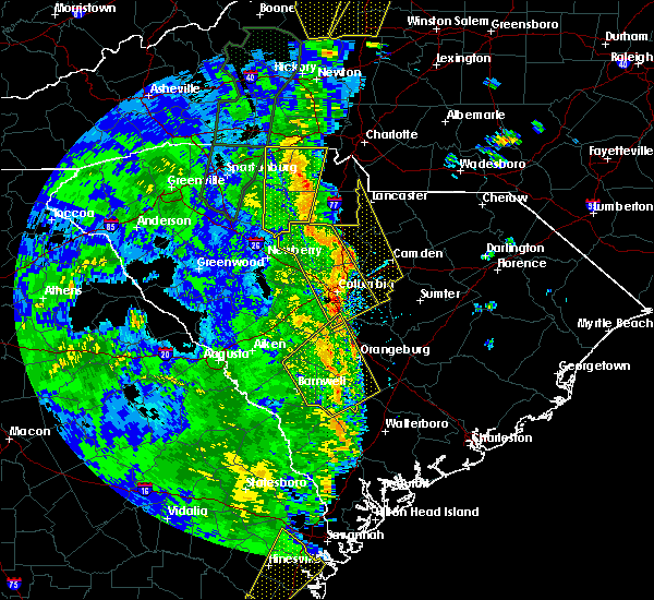 At 239 pm edt, severe thunderstorms extended from central fairfield county southward into central richland county. movement was northeast near 50 mph (radar indicated). Hazards include 70 mph wind gusts. Expect considerable tree damage. Damage is likely to mobile homes, roofs, and outbuildings. At 239 pm edt, severe thunderstorms extended from central fairfield county southward into central richland county. movement was northeast near 50 mph (radar indicated). Hazards include 70 mph wind gusts. Expect considerable tree damage. Damage is likely to mobile homes, roofs, and outbuildings.
|
| 4/15/2018 2:26 PM EDT | Power lines down reported on fairfield road and on lincolnshire blvd. time estimated by rada in richland county SC, 3.9 miles SSE of Columbia, SC |
| 4/15/2018 2:26 PM EDT |
 At 224 pm edt severe thunderstorms were located along a line extending from 10 miles southeast of whitmire to near irmo to near south congaree, moving northeast at 55 mph (nws columbia measured 74 mph wind gust at the columbia metropolitan airport). Hazards include 70 mph wind gusts. Expect considerable tree damage. damage is likely to mobile homes, roofs, and outbuildings. locations impacted include, lexington, west columbia, cayce, irmo, springdale, oak grove, red bank, st. andrews, south congaree, pine ridge, gaston, prosperity, chapin, swansea, pelion, gilbert, summit, salley, little mountain and perry. this includes the following highways, interstate 126 between mile markers 0 and 1. interstate 20 in south carolina between mile markers 43 and 64. interstate 26 between mile markers 76 and 92, and between mile markers 104 and 120. interstate 77 between mile markers 0 and 1. A tornado watch remains in effect until 700 pm edt for central south carolina. At 224 pm edt severe thunderstorms were located along a line extending from 10 miles southeast of whitmire to near irmo to near south congaree, moving northeast at 55 mph (nws columbia measured 74 mph wind gust at the columbia metropolitan airport). Hazards include 70 mph wind gusts. Expect considerable tree damage. damage is likely to mobile homes, roofs, and outbuildings. locations impacted include, lexington, west columbia, cayce, irmo, springdale, oak grove, red bank, st. andrews, south congaree, pine ridge, gaston, prosperity, chapin, swansea, pelion, gilbert, summit, salley, little mountain and perry. this includes the following highways, interstate 126 between mile markers 0 and 1. interstate 20 in south carolina between mile markers 43 and 64. interstate 26 between mile markers 76 and 92, and between mile markers 104 and 120. interstate 77 between mile markers 0 and 1. A tornado watch remains in effect until 700 pm edt for central south carolina.
|
| 4/15/2018 2:25 PM EDT | Richland county mesonet site measured a 60 mph wind gust near broad river road and st. andrews roa in richland county SC, 6.6 miles E of Columbia, SC |
| 4/15/2018 2:18 PM EDT | Trees in roadway 2400 ashland road and marydale lan in lexington county SC, 7.8 miles E of Columbia, SC |
| 4/15/2018 2:18 PM EDT |
 At 217 pm edt, severe thunderstorms extended along the fairfield and newberry county line southeastward and into the columbia area. movement was northeast near 50 mph (radar indicated). Hazards include 70 mph wind gusts. Expect considerable tree damage. Damage is likely to mobile homes, roofs, and outbuildings. At 217 pm edt, severe thunderstorms extended along the fairfield and newberry county line southeastward and into the columbia area. movement was northeast near 50 mph (radar indicated). Hazards include 70 mph wind gusts. Expect considerable tree damage. Damage is likely to mobile homes, roofs, and outbuildings.
|
| 4/15/2018 2:09 PM EDT |
 At 208 pm edt, a severe thunderstorm capable of producing a tornado was located 7 miles west of lexington, moving north at 50 mph (radar indicated rotation). Hazards include tornado. Flying debris will be dangerous to those caught without shelter. mobile homes will be damaged or destroyed. damage to roofs, windows, and vehicles will occur. Tree damage is likely. At 208 pm edt, a severe thunderstorm capable of producing a tornado was located 7 miles west of lexington, moving north at 50 mph (radar indicated rotation). Hazards include tornado. Flying debris will be dangerous to those caught without shelter. mobile homes will be damaged or destroyed. damage to roofs, windows, and vehicles will occur. Tree damage is likely.
|
| 4/15/2018 1:42 PM EDT |
 At 141 pm edt, severe thunderstorms were located along a line extending from 6 miles northwest of ridge spring to 14 miles east of aiken to near williston, moving northeast at 55 mph (law enforcement reported damaging wind gusts and downed trees with this line of storms). Hazards include 70 mph wind gusts. Expect considerable tree damage. Damage is likely to mobile homes, roofs, and outbuildings. At 141 pm edt, severe thunderstorms were located along a line extending from 6 miles northwest of ridge spring to 14 miles east of aiken to near williston, moving northeast at 55 mph (law enforcement reported damaging wind gusts and downed trees with this line of storms). Hazards include 70 mph wind gusts. Expect considerable tree damage. Damage is likely to mobile homes, roofs, and outbuildings.
|
| 3/1/2018 4:00 PM EST |
 At 358 pm est, showers with damaging wind extended from lower richland county into western calhoun county. movement was eastward near 50 mph and toward sumter county (radar indicated). Hazards include 60 mph wind gusts. expect damage to roofs, siding, and trees At 358 pm est, showers with damaging wind extended from lower richland county into western calhoun county. movement was eastward near 50 mph and toward sumter county (radar indicated). Hazards include 60 mph wind gusts. expect damage to roofs, siding, and trees
|
| 3/1/2018 3:42 PM EST | Schp reported tree in roadway abelia road at devine street. time estmd by rada in richland county SC, 2.9 miles N of Columbia, SC |
| 3/1/2018 3:38 PM EST |
 At 337 pm est, showers with damaging wind were in the columbia area moving eastward near 45 mph (radar indicated). Hazards include 60 mph wind gusts. expect damage to roofs, siding, and trees At 337 pm est, showers with damaging wind were in the columbia area moving eastward near 45 mph (radar indicated). Hazards include 60 mph wind gusts. expect damage to roofs, siding, and trees
|
| 9/1/2017 2:13 PM EDT |
 At 213 pm edt, a severe thunderstorm was located 11 miles south of gaston, or 19 miles northwest of orangeburg, moving northeast at 30 mph (radar indicated). Hazards include 60 mph wind gusts and nickel size hail. expect damage to roofs, siding, and trees At 213 pm edt, a severe thunderstorm was located 11 miles south of gaston, or 19 miles northwest of orangeburg, moving northeast at 30 mph (radar indicated). Hazards include 60 mph wind gusts and nickel size hail. expect damage to roofs, siding, and trees
|
| 8/5/2017 6:01 PM EDT |
 At 600 pm edt, a severe thunderstorm was located near pine ridge, or near cayce, moving east at 10 mph (radar indicated). Hazards include 60 mph wind gusts and penny size hail. expect damage to roofs, siding, and trees At 600 pm edt, a severe thunderstorm was located near pine ridge, or near cayce, moving east at 10 mph (radar indicated). Hazards include 60 mph wind gusts and penny size hail. expect damage to roofs, siding, and trees
|
| 7/23/2017 7:00 PM EDT | Highway patrol reported trees down on atlas road at shop roa in richland county SC, 6.5 miles NNW of Columbia, SC |
| 7/23/2017 6:55 PM EDT | Highway patrol reported trees down on longcreek drive at broad river r in richland county SC, 5.5 miles E of Columbia, SC |
| 7/23/2017 6:49 PM EDT | Social media report with image of tree down at hand middle school... 2600 wheat street in columbia... s in richland county SC, 3 miles NNE of Columbia, SC |
| 7/23/2017 6:38 PM EDT |
 At 637 pm edt, a severe thunderstorm was located over dentsville, moving southwest at 10 mph (radar indicated). Hazards include 60 mph wind gusts and quarter size hail. Hail damage to vehicles is expected. Expect wind damage to roofs, siding, and trees. At 637 pm edt, a severe thunderstorm was located over dentsville, moving southwest at 10 mph (radar indicated). Hazards include 60 mph wind gusts and quarter size hail. Hail damage to vehicles is expected. Expect wind damage to roofs, siding, and trees.
|
| 7/23/2017 5:19 PM EDT |
 At 518 pm edt, a severe thunderstorm was located 10 miles north of dentsville, moving northeast at 10 mph (radar indicated). Hazards include 60 mph wind gusts and quarter size hail. Hail damage to vehicles is expected. Expect wind damage to roofs, siding, and trees. At 518 pm edt, a severe thunderstorm was located 10 miles north of dentsville, moving northeast at 10 mph (radar indicated). Hazards include 60 mph wind gusts and quarter size hail. Hail damage to vehicles is expected. Expect wind damage to roofs, siding, and trees.
|
| 7/21/2017 5:21 PM EDT |
 At 520 pm edt, a severe thunderstorm was located near five points, or near columbia, nearly stationary. heavy rain has been reported near gills creek (radar indicated). Hazards include 60 mph wind gusts. Expect damage to roofs, siding, and trees. Locations impacted include, columbia, forest acres, dentsville, woodfields, arcadia lakes, five points, woodfield and fort jackson. At 520 pm edt, a severe thunderstorm was located near five points, or near columbia, nearly stationary. heavy rain has been reported near gills creek (radar indicated). Hazards include 60 mph wind gusts. Expect damage to roofs, siding, and trees. Locations impacted include, columbia, forest acres, dentsville, woodfields, arcadia lakes, five points, woodfield and fort jackson.
|
| 7/21/2017 5:02 PM EDT | Trees down reported on blue ridge terrace... blue ridge lane and monticello roa in richland county SC, 3.7 miles SE of Columbia, SC |
| 7/21/2017 4:56 PM EDT |
 At 456 pm edt, a severe thunderstorm was located over fort jackson, or near woodfields, moving southwest at 25 mph (radar indicated). Hazards include 60 mph wind gusts and penny size hail. expect damage to roofs, siding, and trees At 456 pm edt, a severe thunderstorm was located over fort jackson, or near woodfields, moving southwest at 25 mph (radar indicated). Hazards include 60 mph wind gusts and penny size hail. expect damage to roofs, siding, and trees
|
| 7/19/2017 3:06 PM EDT |
 At 305 pm edt, a severe thunderstorm was located near oakland, or 13 miles west of sumter, moving south at 10 mph (radar indicated). Hazards include 60 mph wind gusts and quarter size hail. Hail damage to vehicles is expected. expect wind damage to roofs, siding, and trees. Locations impacted include, sumter, eastover, oakland, dalzell, cherryvale, rembert and stateburg. At 305 pm edt, a severe thunderstorm was located near oakland, or 13 miles west of sumter, moving south at 10 mph (radar indicated). Hazards include 60 mph wind gusts and quarter size hail. Hail damage to vehicles is expected. expect wind damage to roofs, siding, and trees. Locations impacted include, sumter, eastover, oakland, dalzell, cherryvale, rembert and stateburg.
|
| 7/19/2017 2:47 PM EDT |
 At 247 pm edt, a severe thunderstorm was located 9 miles northwest of oakland, or 14 miles south of camden, moving southeast at 10 mph (radar indicated). Hazards include 60 mph wind gusts and quarter size hail. Hail damage to vehicles is expected. Expect wind damage to roofs, siding, and trees. At 247 pm edt, a severe thunderstorm was located 9 miles northwest of oakland, or 14 miles south of camden, moving southeast at 10 mph (radar indicated). Hazards include 60 mph wind gusts and quarter size hail. Hail damage to vehicles is expected. Expect wind damage to roofs, siding, and trees.
|
| 7/19/2017 2:07 PM EDT |
 At 205 pm edt, severe thunderstorms were located along a line extending from 8 miles northwest of camden to near lugoff to near winnsboro, moving southeast at 15 mph. the strongest portion of the storm is located near longtown, moving southeast at 15 mph (radar indicated). Hazards include 60 mph wind gusts and penny size hail. Expect damage to roofs, siding, and trees. locations impacted include, irmo, forest acres, winnsboro, dentsville, woodfields, st. Andrews, arcadia lakes, lugoff, woodfield, fort jackson, blythewood, ridgeway, lake murray of richland, winnsboro mills and seven oaks. At 205 pm edt, severe thunderstorms were located along a line extending from 8 miles northwest of camden to near lugoff to near winnsboro, moving southeast at 15 mph. the strongest portion of the storm is located near longtown, moving southeast at 15 mph (radar indicated). Hazards include 60 mph wind gusts and penny size hail. Expect damage to roofs, siding, and trees. locations impacted include, irmo, forest acres, winnsboro, dentsville, woodfields, st. Andrews, arcadia lakes, lugoff, woodfield, fort jackson, blythewood, ridgeway, lake murray of richland, winnsboro mills and seven oaks.
|
| 7/19/2017 1:53 PM EDT |
 At 151 pm edt, severe thunderstorms were located along a line extending from 10 miles northwest of lugoff to 14 miles west of camden to near winnsboro, moving south at 15 mph. the strongest part of the storm is between ridgeway and lake wateree moving south southeast (radar indicated). Hazards include 60 mph wind gusts and quarter size hail. Hail damage to vehicles is expected. expect wind damage to roofs, siding, and trees. locations impacted include, irmo, forest acres, winnsboro, dentsville, woodfields, st. Andrews, arcadia lakes, lugoff, woodfield, fort jackson, blythewood, ridgeway, lake murray of richland, winnsboro mills and seven oaks. At 151 pm edt, severe thunderstorms were located along a line extending from 10 miles northwest of lugoff to 14 miles west of camden to near winnsboro, moving south at 15 mph. the strongest part of the storm is between ridgeway and lake wateree moving south southeast (radar indicated). Hazards include 60 mph wind gusts and quarter size hail. Hail damage to vehicles is expected. expect wind damage to roofs, siding, and trees. locations impacted include, irmo, forest acres, winnsboro, dentsville, woodfields, st. Andrews, arcadia lakes, lugoff, woodfield, fort jackson, blythewood, ridgeway, lake murray of richland, winnsboro mills and seven oaks.
|
| 7/19/2017 1:48 PM EDT |
 At 148 pm edt, severe thunderstorms were located along a line extending from 10 miles northwest of lugoff to near winnsboro, moving south at 20 mph (radar indicated). Hazards include 60 mph wind gusts and quarter size hail. Hail damage to vehicles is expected. Expect wind damage to roofs, siding, and trees. At 148 pm edt, severe thunderstorms were located along a line extending from 10 miles northwest of lugoff to near winnsboro, moving south at 20 mph (radar indicated). Hazards include 60 mph wind gusts and quarter size hail. Hail damage to vehicles is expected. Expect wind damage to roofs, siding, and trees.
|
| 7/18/2017 4:20 PM EDT | Richland county dispatch reports multiple trees down in the crane creek area north of i-20 and w of dentsvill in richland county SC, 3.6 miles SSE of Columbia, SC |
| 7/18/2017 3:53 PM EDT |
 At 352 pm edt, a severe thunderstorm was located near winnsboro, moving south at 10 mph (radar indicated). Hazards include 60 mph wind gusts and quarter size hail. Hail damage to vehicles is expected. Expect wind damage to roofs, siding, and trees. At 352 pm edt, a severe thunderstorm was located near winnsboro, moving south at 10 mph (radar indicated). Hazards include 60 mph wind gusts and quarter size hail. Hail damage to vehicles is expected. Expect wind damage to roofs, siding, and trees.
|
| 7/16/2017 5:53 PM EDT |
 At 553 pm edt, a severe thunderstorm was located over woodfields, and is nearly stationary (radar indicated). Hazards include 60 mph wind gusts. expect damage to roofs, siding, and trees At 553 pm edt, a severe thunderstorm was located over woodfields, and is nearly stationary (radar indicated). Hazards include 60 mph wind gusts. expect damage to roofs, siding, and trees
|
| 7/6/2017 6:42 PM EDT |
 At 641 pm edt, severe thunderstorms were located along a line extending from great falls to 8 miles north of leesville, moving east at 25 mph (radar indicated). Hazards include 60 mph wind gusts. Expect damage to roofs, siding, and trees. locations impacted include, lexington, irmo, winnsboro, st. Andrews, red bank, blythewood, chapin, gilbert, summit, ridgeway, little mountain, pomaria, peak, seven oaks, lake murray of richland and winnsboro mills. At 641 pm edt, severe thunderstorms were located along a line extending from great falls to 8 miles north of leesville, moving east at 25 mph (radar indicated). Hazards include 60 mph wind gusts. Expect damage to roofs, siding, and trees. locations impacted include, lexington, irmo, winnsboro, st. Andrews, red bank, blythewood, chapin, gilbert, summit, ridgeway, little mountain, pomaria, peak, seven oaks, lake murray of richland and winnsboro mills.
|
| 7/6/2017 6:21 PM EDT |
 At 621 pm edt, severe thunderstorms were located along a line extending from near blackstock to near saluda, moving east at 25 mph (radar indicated). Hazards include 60 mph wind gusts. expect damage to roofs, siding, and trees At 621 pm edt, severe thunderstorms were located along a line extending from near blackstock to near saluda, moving east at 25 mph (radar indicated). Hazards include 60 mph wind gusts. expect damage to roofs, siding, and trees
|
| 7/4/2017 7:49 PM EDT |
 At 729 pm edt, a severe thunderstorm was located over fort jackson, or over woodfields, moving east at 20 mph (radar indicated). Hazards include 60 mph wind gusts. expect damage to roofs, siding, and trees At 729 pm edt, a severe thunderstorm was located over fort jackson, or over woodfields, moving east at 20 mph (radar indicated). Hazards include 60 mph wind gusts. expect damage to roofs, siding, and trees
|
| 7/4/2017 7:29 PM EDT |
 At 729 pm edt, a severe thunderstorm was located over fort jackson, or over woodfields, moving east at 20 mph (radar indicated). Hazards include 60 mph wind gusts. expect damage to roofs, siding, and trees At 729 pm edt, a severe thunderstorm was located over fort jackson, or over woodfields, moving east at 20 mph (radar indicated). Hazards include 60 mph wind gusts. expect damage to roofs, siding, and trees
|
| 7/1/2017 11:09 PM EDT |
 The severe thunderstorm warning for southwestern fairfield, southeastern newberry, northwestern lexington and northwestern richland counties will expire at 1115 pm edt, the storms which prompted the warning have weakened below severe limits, and no longer pose an immediate threat to life or property. therefore the warning will be allowed to expire. gusty winds to 25 mph can be expected. The severe thunderstorm warning for southwestern fairfield, southeastern newberry, northwestern lexington and northwestern richland counties will expire at 1115 pm edt, the storms which prompted the warning have weakened below severe limits, and no longer pose an immediate threat to life or property. therefore the warning will be allowed to expire. gusty winds to 25 mph can be expected.
|
| 7/1/2017 10:43 PM EDT |
 At 1042 pm edt, severe thunderstorms were located along a line extending from 11 miles northeast of prosperity to 10 miles north of leesville, moving southeast at 25 mph (radar indicated. at 1017 pm trees were reported down in newberry county). Hazards include 60 mph wind gusts. Expect damage to roofs, siding, and trees. Locations impacted include, lexington, irmo, chapin, little mountain, peak and lake murray of richland. At 1042 pm edt, severe thunderstorms were located along a line extending from 11 miles northeast of prosperity to 10 miles north of leesville, moving southeast at 25 mph (radar indicated. at 1017 pm trees were reported down in newberry county). Hazards include 60 mph wind gusts. Expect damage to roofs, siding, and trees. Locations impacted include, lexington, irmo, chapin, little mountain, peak and lake murray of richland.
|
| 7/1/2017 10:08 PM EDT |
 At 1008 pm edt, severe thunderstorms were located along a line extending from 8 miles northeast of newberry to 7 miles southwest of prosperity, moving southeast at 25 mph (radar indicated). Hazards include 60 mph wind gusts. expect damage to roofs, siding, and trees At 1008 pm edt, severe thunderstorms were located along a line extending from 8 miles northeast of newberry to 7 miles southwest of prosperity, moving southeast at 25 mph (radar indicated). Hazards include 60 mph wind gusts. expect damage to roofs, siding, and trees
|
| 5/29/2017 7:52 PM EDT |
 At 750 pm edt, a severe thunderstorm was located near forest acres, moving east at 35 mph. 60 mph wind gust was reported at the columbia metro airport (radar indicated). Hazards include 60 mph wind gusts. expect damage to roofs, siding, and trees At 750 pm edt, a severe thunderstorm was located near forest acres, moving east at 35 mph. 60 mph wind gust was reported at the columbia metro airport (radar indicated). Hazards include 60 mph wind gusts. expect damage to roofs, siding, and trees
|
| 5/29/2017 7:32 PM EDT |
 At 732 pm edt, a severe thunderstorm was located 7 miles west of eastover, or 14 miles southeast of forest acres, moving northeast at 40 mph (radar indicated). Hazards include 60 mph wind gusts and quarter size hail. Hail damage to vehicles is expected. Expect wind damage to roofs, siding, and trees. At 732 pm edt, a severe thunderstorm was located 7 miles west of eastover, or 14 miles southeast of forest acres, moving northeast at 40 mph (radar indicated). Hazards include 60 mph wind gusts and quarter size hail. Hail damage to vehicles is expected. Expect wind damage to roofs, siding, and trees.
|
| 5/29/2017 7:17 PM EDT |
 At 716 pm edt, a severe thunderstorm was located near leesville, or 8 miles east of batesburg, moving east at 35 mph. this is a very dangerous storm (radar indicated). Hazards include 80 mph wind gusts and golf ball size hail. Flying debris will be dangerous to those caught without shelter. mobile homes will be heavily damaged. expect considerable damage to roofs, windows, and vehicles. extensive tree damage and power outages are likely. locations impacted include, columbia, lexington, west columbia, cayce, irmo, forest acres, springdale, dentsville, oak grove, st. Andrews, batesburg, red bank, woodfields, batesburg-leesville, arcadia lakes, leesville, woodfield, fort jackson, five points and gilbert. At 716 pm edt, a severe thunderstorm was located near leesville, or 8 miles east of batesburg, moving east at 35 mph. this is a very dangerous storm (radar indicated). Hazards include 80 mph wind gusts and golf ball size hail. Flying debris will be dangerous to those caught without shelter. mobile homes will be heavily damaged. expect considerable damage to roofs, windows, and vehicles. extensive tree damage and power outages are likely. locations impacted include, columbia, lexington, west columbia, cayce, irmo, forest acres, springdale, dentsville, oak grove, st. Andrews, batesburg, red bank, woodfields, batesburg-leesville, arcadia lakes, leesville, woodfield, fort jackson, five points and gilbert.
|
| 5/29/2017 7:11 PM EDT |
 At 710 pm edt, a severe thunderstorm was located near leesville, or near batesburg, moving east at 35 mph (radar indicated). Hazards include 70 mph wind gusts and half dollar size hail. Hail damage to vehicles is expected. expect considerable tree damage. Wind damage is also likely to mobile homes, roofs, and outbuildings. At 710 pm edt, a severe thunderstorm was located near leesville, or near batesburg, moving east at 35 mph (radar indicated). Hazards include 70 mph wind gusts and half dollar size hail. Hail damage to vehicles is expected. expect considerable tree damage. Wind damage is also likely to mobile homes, roofs, and outbuildings.
|
| 5/28/2017 7:11 PM EDT | Trees on road - devereaux rd and beltline blv in richland county SC, 3 miles NNW of Columbia, SC |
| 5/28/2017 7:06 PM EDT |
 At 705 pm edt, a severe thunderstorm was located near fort jackson, or near woodfields, moving east at 35 mph (radar indicated). Hazards include 60 mph wind gusts. expect damage to roofs, siding, and trees At 705 pm edt, a severe thunderstorm was located near fort jackson, or near woodfields, moving east at 35 mph (radar indicated). Hazards include 60 mph wind gusts. expect damage to roofs, siding, and trees
|
| 5/28/2017 7:05 PM EDT | Tree in road harrow dr and stonehedge d in lexington county SC, 8.4 miles E of Columbia, SC |
| 5/28/2017 7:03 PM EDT | Powers lines down in road st. andrews and leisure lan in lexington county SC, 8.9 miles E of Columbia, SC |
| 5/28/2017 7:00 PM EDT | Trees down old shepherds rd and ashland r in lexington county SC, 7.8 miles E of Columbia, SC |
| 5/28/2017 6:56 PM EDT | Leeza's care connection. tree uprooted and crashed into home. several rooms damaged. damage to roof. reported by wis twitte in lexington county SC, 8.9 miles E of Columbia, SC |
| 5/28/2017 6:56 PM EDT |
 At 655 pm edt, a severe thunderstorm was located near irmo, moving east at 30 mph (radar indicated). Hazards include 60 mph wind gusts. Expect damage to roofs, siding, and trees. locations impacted include, columbia, lexington, west columbia, irmo, oak grove, st. Andrews, seven oaks and lake murray of richland. At 655 pm edt, a severe thunderstorm was located near irmo, moving east at 30 mph (radar indicated). Hazards include 60 mph wind gusts. Expect damage to roofs, siding, and trees. locations impacted include, columbia, lexington, west columbia, irmo, oak grove, st. Andrews, seven oaks and lake murray of richland.
|
| 5/28/2017 6:42 PM EDT |
 At 641 pm edt, a severe thunderstorm was located 11 miles northwest of lexington, moving east at 30 mph (radar indicated). Hazards include 60 mph wind gusts. expect damage to roofs, siding, and trees At 641 pm edt, a severe thunderstorm was located 11 miles northwest of lexington, moving east at 30 mph (radar indicated). Hazards include 60 mph wind gusts. expect damage to roofs, siding, and trees
|
| 5/24/2017 3:14 PM EDT |
 The national weather service in columbia has issued a * severe thunderstorm warning for. southwestern fairfield county in central south carolina. southeastern newberry county in central south carolina. northwestern lexington county in central south carolina. Eastern saluda county in central south carolina. The national weather service in columbia has issued a * severe thunderstorm warning for. southwestern fairfield county in central south carolina. southeastern newberry county in central south carolina. northwestern lexington county in central south carolina. Eastern saluda county in central south carolina.
|
| 5/24/2017 3:14 PM EDT |
 At 314 pm edt, a severe thunderstorm was located 9 miles east of saluda, or 9 miles northwest of batesburg, moving northeast at 35 mph (radar indicated). Hazards include 60 mph wind gusts. expect damage to roofs, siding, and trees At 314 pm edt, a severe thunderstorm was located 9 miles east of saluda, or 9 miles northwest of batesburg, moving northeast at 35 mph (radar indicated). Hazards include 60 mph wind gusts. expect damage to roofs, siding, and trees
|
| 5/24/2017 3:14 PM EDT |
 The national weather service in columbia has issued a * severe thunderstorm warning for. southwestern fairfield county in central south carolina. southeastern newberry county in central south carolina. northwestern lexington county in central south carolina. Eastern saluda county in central south carolina. The national weather service in columbia has issued a * severe thunderstorm warning for. southwestern fairfield county in central south carolina. southeastern newberry county in central south carolina. northwestern lexington county in central south carolina. Eastern saluda county in central south carolina.
|
| 5/22/2017 1:50 PM EDT | Tree down on cedar springs road in columbia via twitter wist in richland county SC, 1.4 miles W of Columbia, SC |
| 4/24/2017 2:52 PM EDT |
 The severe thunderstorm warning for northwestern calhoun, east central lexington and south central richland counties will expire at 300 pm edt, the storm which prompted the warning has weakened below severe limits, and no longer poses an immediate threat to life or property. therefore the warning will be allowed to expire. however gusty winds are still possible with this thunderstorm. The severe thunderstorm warning for northwestern calhoun, east central lexington and south central richland counties will expire at 300 pm edt, the storm which prompted the warning has weakened below severe limits, and no longer poses an immediate threat to life or property. therefore the warning will be allowed to expire. however gusty winds are still possible with this thunderstorm.
|
| 4/24/2017 2:43 PM EDT |
 At 243 pm edt, a severe thunderstorm was located 10 miles east of gaston, or 14 miles southeast of cayce, moving northwest at 30 mph (radar indicated). Hazards include 60 mph wind gusts and penny size hail. Expect damage to roofs, siding, and trees. Locations impacted include, columbia, west columbia, cayce, forest acres, springdale, woodfields, pine ridge, five points and woodfield. At 243 pm edt, a severe thunderstorm was located 10 miles east of gaston, or 14 miles southeast of cayce, moving northwest at 30 mph (radar indicated). Hazards include 60 mph wind gusts and penny size hail. Expect damage to roofs, siding, and trees. Locations impacted include, columbia, west columbia, cayce, forest acres, springdale, woodfields, pine ridge, five points and woodfield.
|
| 4/24/2017 2:33 PM EDT |
 At 233 pm edt, a severe thunderstorm was located near st. matthews, or 14 miles north of brookdale, moving northwest at 30 mph (radar indicated). Hazards include 60 mph wind gusts and quarter size hail. Hail damage to vehicles is expected. Expect wind damage to roofs, siding, and trees. At 233 pm edt, a severe thunderstorm was located near st. matthews, or 14 miles north of brookdale, moving northwest at 30 mph (radar indicated). Hazards include 60 mph wind gusts and quarter size hail. Hail damage to vehicles is expected. Expect wind damage to roofs, siding, and trees.
|
| 4/5/2017 4:17 PM EDT |
 At 416 pm edt, severe thunderstorms were located along a line extending from 9 miles north of oakland to 9 miles southwest of south sumter, moving east at 25 mph (radar indicated). Hazards include 70 mph wind gusts and quarter size hail. Hail damage to vehicles is expected. expect considerable tree damage. Wind damage is also likely to mobile homes, roofs, and outbuildings. At 416 pm edt, severe thunderstorms were located along a line extending from 9 miles north of oakland to 9 miles southwest of south sumter, moving east at 25 mph (radar indicated). Hazards include 70 mph wind gusts and quarter size hail. Hail damage to vehicles is expected. expect considerable tree damage. Wind damage is also likely to mobile homes, roofs, and outbuildings.
|
| 4/5/2017 3:36 PM EDT |
 At 336 pm edt, severe thunderstorms were located along a line extending from 7 miles south of bishopville to 8 miles west of eastover, moving east at 20 mph (radar indicated). Hazards include 70 mph wind gusts and quarter size hail. Hail damage to vehicles is expected. expect considerable tree damage. wind damage is also likely to mobile homes, roofs, and outbuildings. locations impacted include, sumter, south sumter, eastover, mulberry, oakland, millwood, mayesville, pinewood, lynchburg, cane savannah, oswego, dalzell, lakewood, privateer, wedgewood, east sumter, cherryvale, rembert, shiloh and stateburg. A tornado watch remains in effect until 800 pm edt for central south carolina. At 336 pm edt, severe thunderstorms were located along a line extending from 7 miles south of bishopville to 8 miles west of eastover, moving east at 20 mph (radar indicated). Hazards include 70 mph wind gusts and quarter size hail. Hail damage to vehicles is expected. expect considerable tree damage. wind damage is also likely to mobile homes, roofs, and outbuildings. locations impacted include, sumter, south sumter, eastover, mulberry, oakland, millwood, mayesville, pinewood, lynchburg, cane savannah, oswego, dalzell, lakewood, privateer, wedgewood, east sumter, cherryvale, rembert, shiloh and stateburg. A tornado watch remains in effect until 800 pm edt for central south carolina.
|
| 4/5/2017 3:12 PM EDT |
 At 311 pm edt, severe thunderstorms were located along a line extending from 6 miles north of oakland to 11 miles east of gaston, moving east at 45 mph (radar indicated). Hazards include 70 mph wind gusts and quarter size hail. Hail damage to vehicles is expected. expect considerable tree damage. Wind damage is also likely to mobile homes, roofs, and outbuildings. At 311 pm edt, severe thunderstorms were located along a line extending from 6 miles north of oakland to 11 miles east of gaston, moving east at 45 mph (radar indicated). Hazards include 70 mph wind gusts and quarter size hail. Hail damage to vehicles is expected. expect considerable tree damage. Wind damage is also likely to mobile homes, roofs, and outbuildings.
|
| 4/5/2017 2:53 PM EDT |
 At 253 pm edt, severe thunderstorms were located along a line extending from 8 miles east of camden to 7 miles south of fort jackson, moving northeast at 50 mph (radar indicated). Hazards include 70 mph wind gusts and half dollar size hail. Hail damage to vehicles is expected. expect considerable tree damage. wind damage is also likely to mobile homes, roofs, and outbuildings. locations impacted include, columbia, lexington, west columbia, cayce, forest acres, springdale, dentsville, oak grove, st. andrews, red bank, woodfields, south congaree, pine ridge, st. matthews, gaston, arcadia lakes, eastover, woodfield, fort jackson and five points. A tornado watch remains in effect until 800 pm edt for central south carolina. At 253 pm edt, severe thunderstorms were located along a line extending from 8 miles east of camden to 7 miles south of fort jackson, moving northeast at 50 mph (radar indicated). Hazards include 70 mph wind gusts and half dollar size hail. Hail damage to vehicles is expected. expect considerable tree damage. wind damage is also likely to mobile homes, roofs, and outbuildings. locations impacted include, columbia, lexington, west columbia, cayce, forest acres, springdale, dentsville, oak grove, st. andrews, red bank, woodfields, south congaree, pine ridge, st. matthews, gaston, arcadia lakes, eastover, woodfield, fort jackson and five points. A tornado watch remains in effect until 800 pm edt for central south carolina.
|
| 4/5/2017 2:24 PM EDT |
 The tornado warning for east central lexington county will expire at 230 pm edt, the storm which prompted the warning will be allowed to expire at 230 pm. however large hail, damaging winds and heavy rain are still possible with this thunderstorm and a severe thunderstorm warning remains in effect until 3:15 pm. in addition, a tornado watch remains in effect until 800 pm edt for central south carolina. report large hail, damaging winds or flooding to local law enforcement. send reports by facebook or twitter to nwscolumbia, e-mail us at [email protected] or call 803-234-4115. The tornado warning for east central lexington county will expire at 230 pm edt, the storm which prompted the warning will be allowed to expire at 230 pm. however large hail, damaging winds and heavy rain are still possible with this thunderstorm and a severe thunderstorm warning remains in effect until 3:15 pm. in addition, a tornado watch remains in effect until 800 pm edt for central south carolina. report large hail, damaging winds or flooding to local law enforcement. send reports by facebook or twitter to nwscolumbia, e-mail us at [email protected] or call 803-234-4115.
|
| 4/5/2017 2:22 PM EDT |
 The severe thunderstorm warning for northwestern lexington county will expire at 230 pm edt, the storm which prompted the warning has moved out of the area. therefore the warning will be allowed to expire. however heavy rain is still possible with this thunderstorm. a tornado watch remains in effect until 800 pm edt for central south carolina. The severe thunderstorm warning for northwestern lexington county will expire at 230 pm edt, the storm which prompted the warning has moved out of the area. therefore the warning will be allowed to expire. however heavy rain is still possible with this thunderstorm. a tornado watch remains in effect until 800 pm edt for central south carolina.
|
| 4/5/2017 2:17 PM EDT |
 At 216 pm edt, severe thunderstorms were located along a line extending from near dentsville to 14 miles southwest of red bank, moving northeast at 50 mph (radar indicated). Hazards include 60 mph wind gusts and half dollar size hail. Hail damage to vehicles is expected. Expect wind damage to roofs, siding, and trees. At 216 pm edt, severe thunderstorms were located along a line extending from near dentsville to 14 miles southwest of red bank, moving northeast at 50 mph (radar indicated). Hazards include 60 mph wind gusts and half dollar size hail. Hail damage to vehicles is expected. Expect wind damage to roofs, siding, and trees.
|
| 4/5/2017 2:14 PM EDT |
 At 214 pm edt, a severe thunderstorm capable of producing a tornado was located over south congaree, or near oak grove, moving east at 35 mph (radar indicated rotation). Hazards include tornado and half dollar size hail. Flying debris will be dangerous to those caught without shelter. mobile homes will be damaged or destroyed. damage to roofs, windows, and vehicles will occur. tree damage is likely. Locations impacted include, lexington, west columbia, cayce, springdale, red bank, oak grove, south congaree and pine ridge. At 214 pm edt, a severe thunderstorm capable of producing a tornado was located over south congaree, or near oak grove, moving east at 35 mph (radar indicated rotation). Hazards include tornado and half dollar size hail. Flying debris will be dangerous to those caught without shelter. mobile homes will be damaged or destroyed. damage to roofs, windows, and vehicles will occur. tree damage is likely. Locations impacted include, lexington, west columbia, cayce, springdale, red bank, oak grove, south congaree and pine ridge.
|
| 4/5/2017 2:04 PM EDT |
 At 203 pm edt, a severe thunderstorm capable of producing a tornado was located over red bank, moving east at 35 mph (radar indicated rotation). Hazards include tornado and ping pong ball size hail. Flying debris will be dangerous to those caught without shelter. mobile homes will be damaged or destroyed. damage to roofs, windows, and vehicles will occur. tree damage is likely. locations impacted include, lexington, west columbia, cayce, springdale, red bank, oak grove, st. Andrews, south congaree, pine ridge and seven oaks. At 203 pm edt, a severe thunderstorm capable of producing a tornado was located over red bank, moving east at 35 mph (radar indicated rotation). Hazards include tornado and ping pong ball size hail. Flying debris will be dangerous to those caught without shelter. mobile homes will be damaged or destroyed. damage to roofs, windows, and vehicles will occur. tree damage is likely. locations impacted include, lexington, west columbia, cayce, springdale, red bank, oak grove, st. Andrews, south congaree, pine ridge and seven oaks.
|
| 4/5/2017 2:01 PM EDT |
 At 201 pm edt, a severe thunderstorm was located near lexington, moving east at 30 mph (radar indicated). Hazards include golf ball size hail and 70 mph wind gusts. People and animals outdoors will be injured. expect hail damage to roofs, siding, windows, and vehicles. expect considerable tree damage. Wind damage is also likely to mobile homes, roofs, and outbuildings. At 201 pm edt, a severe thunderstorm was located near lexington, moving east at 30 mph (radar indicated). Hazards include golf ball size hail and 70 mph wind gusts. People and animals outdoors will be injured. expect hail damage to roofs, siding, windows, and vehicles. expect considerable tree damage. Wind damage is also likely to mobile homes, roofs, and outbuildings.
|
| 4/5/2017 1:56 PM EDT |
 At 155 pm edt, a severe thunderstorm capable of producing a tornado was located 7 miles west of red bank, moving east at 35 mph (radar indicated rotation). Hazards include tornado and ping pong ball size hail. Flying debris will be dangerous to those caught without shelter. mobile homes will be damaged or destroyed. damage to roofs, windows, and vehicles will occur. Tree damage is likely. At 155 pm edt, a severe thunderstorm capable of producing a tornado was located 7 miles west of red bank, moving east at 35 mph (radar indicated rotation). Hazards include tornado and ping pong ball size hail. Flying debris will be dangerous to those caught without shelter. mobile homes will be damaged or destroyed. damage to roofs, windows, and vehicles will occur. Tree damage is likely.
|
| 4/3/2017 5:26 PM EDT |
 At 525 pm edt, severe thunderstorms were located along a line extending from near camden to 6 miles east of eastover, moving east at 50 mph (radar indicated). Hazards include 60 mph wind gusts. Expect damage to roofs, siding, and trees. locations impacted include, eastover. A tornado watch remains in effect until 900 pm edt for central south carolina. At 525 pm edt, severe thunderstorms were located along a line extending from near camden to 6 miles east of eastover, moving east at 50 mph (radar indicated). Hazards include 60 mph wind gusts. Expect damage to roofs, siding, and trees. locations impacted include, eastover. A tornado watch remains in effect until 900 pm edt for central south carolina.
|
| 4/3/2017 5:18 PM EDT |
 At 518 pm edt, severe thunderstorms were located along a line extending from near chesterfield to 9 miles southeast of lugoff, moving east at 35 mph (radar indicated). Hazards include 70 mph wind gusts. Expect considerable tree damage. damage is likely to mobile homes, roofs, and outbuildings. locations impacted include, camden, cheraw, bishopville, chesterfield, mcbee, ruby, patrick, bethune, mount croghan and rembert. A tornado watch remains in effect until 900 pm edt for central south carolina. At 518 pm edt, severe thunderstorms were located along a line extending from near chesterfield to 9 miles southeast of lugoff, moving east at 35 mph (radar indicated). Hazards include 70 mph wind gusts. Expect considerable tree damage. damage is likely to mobile homes, roofs, and outbuildings. locations impacted include, camden, cheraw, bishopville, chesterfield, mcbee, ruby, patrick, bethune, mount croghan and rembert. A tornado watch remains in effect until 900 pm edt for central south carolina.
|
| 4/3/2017 5:05 PM EDT | Trees down in richland county SC, 3.4 miles NE of Columbia, SC |
| 4/3/2017 5:01 PM EDT |
 At 501 pm edt, severe thunderstorms were located along a line extending from 9 miles west of lugoff to 11 miles east of gaston, moving east at 50 mph (radar indicated). Hazards include 70 mph wind gusts. Expect considerable tree damage. Damage is likely to mobile homes, roofs, and outbuildings. At 501 pm edt, severe thunderstorms were located along a line extending from 9 miles west of lugoff to 11 miles east of gaston, moving east at 50 mph (radar indicated). Hazards include 70 mph wind gusts. Expect considerable tree damage. Damage is likely to mobile homes, roofs, and outbuildings.
|
| 4/3/2017 5:00 PM EDT | Richland county mesonet recorded a wind gust at williams brice stadium of 65 mph. in richland county SC, 5.1 miles NNE of Columbia, SC |
| 4/3/2017 4:51 PM EDT |
 At 451 pm edt, severe thunderstorms were located along a line extending from near pageland to near dentsville, moving east at 60 mph (radar indicated). Hazards include 70 mph wind gusts. Expect considerable tree damage. Damage is likely to mobile homes, roofs, and outbuildings. At 451 pm edt, severe thunderstorms were located along a line extending from near pageland to near dentsville, moving east at 60 mph (radar indicated). Hazards include 70 mph wind gusts. Expect considerable tree damage. Damage is likely to mobile homes, roofs, and outbuildings.
|
| 4/3/2017 4:49 PM EDT |
 At 449 pm edt, a severe thunderstorm capable of producing a tornado was located over oak grove, moving northeast at 40 mph (radar indicated rotation). Hazards include tornado and quarter size hail. Flying debris will be dangerous to those caught without shelter. mobile homes will be damaged or destroyed. damage to roofs, windows, and vehicles will occur. tree damage is likely. Locations impacted include, west columbia, cayce, springdale, oak grove, south congaree, pine ridge and seven oaks. At 449 pm edt, a severe thunderstorm capable of producing a tornado was located over oak grove, moving northeast at 40 mph (radar indicated rotation). Hazards include tornado and quarter size hail. Flying debris will be dangerous to those caught without shelter. mobile homes will be damaged or destroyed. damage to roofs, windows, and vehicles will occur. tree damage is likely. Locations impacted include, west columbia, cayce, springdale, oak grove, south congaree, pine ridge and seven oaks.
|
| 4/3/2017 4:39 PM EDT |
 At 439 pm edt, a severe thunderstorm capable of producing a tornado was located near red bank, moving east at 45 mph (radar indicated rotation). Hazards include tornado and quarter size hail. Flying debris will be dangerous to those caught without shelter. mobile homes will be damaged or destroyed. damage to roofs, windows, and vehicles will occur. tree damage is likely. Locations impacted include, lexington, west columbia, cayce, irmo, springdale, red bank, oak grove, south congaree, pine ridge and seven oaks. At 439 pm edt, a severe thunderstorm capable of producing a tornado was located near red bank, moving east at 45 mph (radar indicated rotation). Hazards include tornado and quarter size hail. Flying debris will be dangerous to those caught without shelter. mobile homes will be damaged or destroyed. damage to roofs, windows, and vehicles will occur. tree damage is likely. Locations impacted include, lexington, west columbia, cayce, irmo, springdale, red bank, oak grove, south congaree, pine ridge and seven oaks.
|
| 4/3/2017 4:33 PM EDT |
 At 433 pm edt, a severe thunderstorm capable of producing a tornado was located 8 miles west of red bank, moving northeast at 40 mph (radar indicated rotation). Hazards include tornado and quarter size hail. Flying debris will be dangerous to those caught without shelter. mobile homes will be damaged or destroyed. damage to roofs, windows, and vehicles will occur. Tree damage is likely. At 433 pm edt, a severe thunderstorm capable of producing a tornado was located 8 miles west of red bank, moving northeast at 40 mph (radar indicated rotation). Hazards include tornado and quarter size hail. Flying debris will be dangerous to those caught without shelter. mobile homes will be damaged or destroyed. damage to roofs, windows, and vehicles will occur. Tree damage is likely.
|
| 4/3/2017 4:15 PM EDT |
 At 415 pm edt, severe thunderstorms were located along a line extending from prosperity to 11 miles east of aiken, moving northeast at 80 mph (radar indicated). Hazards include 70 mph wind gusts and penny size hail. Expect considerable tree damage. Damage is likely to mobile homes, roofs, and outbuildings. At 415 pm edt, severe thunderstorms were located along a line extending from prosperity to 11 miles east of aiken, moving northeast at 80 mph (radar indicated). Hazards include 70 mph wind gusts and penny size hail. Expect considerable tree damage. Damage is likely to mobile homes, roofs, and outbuildings.
|
| 3/30/2017 3:55 PM EDT | Quarter sized hail reported 3.6 miles N of Columbia, SC, public reported quarter size hail in the rosewood community. . |
| 3/21/2017 10:34 PM EDT |
 At 1033 pm edt, a severe thunderstorm was located near eastover, or 18 miles southeast of woodfields, moving southeast at 45 mph (radar indicated). Hazards include 70 mph wind gusts. Expect considerable tree damage. Damage is likely to mobile homes, roofs, and outbuildings. At 1033 pm edt, a severe thunderstorm was located near eastover, or 18 miles southeast of woodfields, moving southeast at 45 mph (radar indicated). Hazards include 70 mph wind gusts. Expect considerable tree damage. Damage is likely to mobile homes, roofs, and outbuildings.
|
| 3/21/2017 10:18 PM EDT | Sc highway patrol reported tree down on pleasant ridge drive at mountainbrook driv in richland county SC, 6.5 miles NW of Columbia, SC |
| 3/21/2017 10:04 PM EDT |
 At 1003 pm edt, severe thunderstorms were located along a line extending from 10 miles northeast of irmo to red bank, moving east at 70 mph (radar indicated). Hazards include 70 mph wind gusts. Expect considerable tree damage. Damage is likely to mobile homes, roofs, and outbuildings. At 1003 pm edt, severe thunderstorms were located along a line extending from 10 miles northeast of irmo to red bank, moving east at 70 mph (radar indicated). Hazards include 70 mph wind gusts. Expect considerable tree damage. Damage is likely to mobile homes, roofs, and outbuildings.
|
| 3/21/2017 9:58 PM EDT |
 At 956 pm edt, severe thunderstorms were located along a line extending from near great falls to 7 miles southeast of winnsboro to near lexington, moving east at 45 mph (radar indicated). Hazards include 70 mph wind gusts. Expect considerable tree damage. damage is likely to mobile homes, roofs, and outbuildings. locations impacted include, lexington, irmo, winnsboro, st. Andrews, blythewood, chapin, ridgeway, winnsboro mills, seven oaks and lake murray of richland. At 956 pm edt, severe thunderstorms were located along a line extending from near great falls to 7 miles southeast of winnsboro to near lexington, moving east at 45 mph (radar indicated). Hazards include 70 mph wind gusts. Expect considerable tree damage. damage is likely to mobile homes, roofs, and outbuildings. locations impacted include, lexington, irmo, winnsboro, st. Andrews, blythewood, chapin, ridgeway, winnsboro mills, seven oaks and lake murray of richland.
|
| 3/21/2017 9:36 PM EDT |
 At 936 pm edt, severe thunderstorms were located along a line extending from near blackstock to 11 miles southwest of winnsboro to 8 miles north of batesburg, moving east at 50 mph (radar indicated). Hazards include 70 mph wind gusts. Expect considerable tree damage. Damage is likely to mobile homes, roofs, and outbuildings. At 936 pm edt, severe thunderstorms were located along a line extending from near blackstock to 11 miles southwest of winnsboro to 8 miles north of batesburg, moving east at 50 mph (radar indicated). Hazards include 70 mph wind gusts. Expect considerable tree damage. Damage is likely to mobile homes, roofs, and outbuildings.
|
| 9/19/2016 9:19 PM EDT |
 At 918 pm edt, a severe thunderstorm was located 7 miles north of dentsville, moving southeast at 20 mph (radar indicated). Hazards include 60 mph wind gusts. Expect damage to roofs. siding. and trees. Locations impacted include, forest acres, dentsville, arcadia lakes and blythewood. At 918 pm edt, a severe thunderstorm was located 7 miles north of dentsville, moving southeast at 20 mph (radar indicated). Hazards include 60 mph wind gusts. Expect damage to roofs. siding. and trees. Locations impacted include, forest acres, dentsville, arcadia lakes and blythewood.
|
| 9/19/2016 9:17 PM EDT | Sc hwy patrol reports a tree in roadway along the 400 block of longtown rd near jilda driv in richland county SC, 7.5 miles SSW of Columbia, SC |
| 9/19/2016 9:15 PM EDT | Sc hwy patrol reports a tree in roadway along hardscrabble rd near sloan rd in ne columbi in richland county SC, 6.2 miles SSW of Columbia, SC |
| 9/19/2016 8:51 PM EDT |
 At 849 pm edt, severe thunderstorms were located along a line extending from 6 miles southeast of winnsboro to 6 miles northeast of st. andrews to near lexington, moving southeast at 25 mph (radar indicated). Hazards include 60 mph wind gusts. Expect damage to roofs. siding. and trees. locations impacted include, columbia, lexington, west columbia, irmo, springdale, st. Andrews, red bank, batesburg-leesville, arcadia lakes, five points, blythewood, gilbert, summit and ridgeway. At 849 pm edt, severe thunderstorms were located along a line extending from 6 miles southeast of winnsboro to 6 miles northeast of st. andrews to near lexington, moving southeast at 25 mph (radar indicated). Hazards include 60 mph wind gusts. Expect damage to roofs. siding. and trees. locations impacted include, columbia, lexington, west columbia, irmo, springdale, st. Andrews, red bank, batesburg-leesville, arcadia lakes, five points, blythewood, gilbert, summit and ridgeway.
|
| 9/19/2016 8:31 PM EDT |
 At 830 pm edt, severe thunderstorms were located along a line extending from near winnsboro to 7 miles northwest of irmo to 10 miles south of prosperity, moving southwest at 30 mph (radar indicated). Hazards include 60 mph wind gusts. Expect damage to roofs. siding. And trees. At 830 pm edt, severe thunderstorms were located along a line extending from near winnsboro to 7 miles northwest of irmo to 10 miles south of prosperity, moving southwest at 30 mph (radar indicated). Hazards include 60 mph wind gusts. Expect damage to roofs. siding. And trees.
|
| 8/2/2016 8:15 PM EDT | Schp reported tree down at dellwood dr and brackenridge rd. photo posted by media confirms small tree down. time estimate in richland county SC, 2.7 miles WNW of Columbia, SC |
| 8/1/2016 9:38 PM EDT |
 The severe thunderstorm warning for north central orangeburg, northwestern calhoun and southeastern lexington counties will expire at 945 pm edt, the storms which prompted the warning have weakened below severe limits, and no longer pose an immediate threat to life or property. therefore the warning will be allowed to expire. however heavy rain and frequent lightning is still possible with these thunderstorms. to report severe weather, contact your nearest law enforcement agency. they will relay your report to the national weather service columbia. The severe thunderstorm warning for north central orangeburg, northwestern calhoun and southeastern lexington counties will expire at 945 pm edt, the storms which prompted the warning have weakened below severe limits, and no longer pose an immediate threat to life or property. therefore the warning will be allowed to expire. however heavy rain and frequent lightning is still possible with these thunderstorms. to report severe weather, contact your nearest law enforcement agency. they will relay your report to the national weather service columbia.
|
| 8/1/2016 9:06 PM EDT |
 At 905 pm edt, severe thunderstorms were located along a line extending from near pine ridge to 12 miles south of gaston, moving southeast at 10 mph (radar indicated). Hazards include 60 mph wind gusts. Expect damage to roofs. siding. and trees. locations impacted include, west columbia, orangeburg, cayce, springdale, south congaree, pine ridge, st. Matthews, gaston, swansea, north, pelion and woodford. At 905 pm edt, severe thunderstorms were located along a line extending from near pine ridge to 12 miles south of gaston, moving southeast at 10 mph (radar indicated). Hazards include 60 mph wind gusts. Expect damage to roofs. siding. and trees. locations impacted include, west columbia, orangeburg, cayce, springdale, south congaree, pine ridge, st. Matthews, gaston, swansea, north, pelion and woodford.
|
| 8/1/2016 8:58 PM EDT |
 At 858 pm edt, a severe thunderstorm was located near fort jackson, or near forest acres, moving east at 15 mph (radar indicated). Hazards include 60 mph wind gusts. Expect damage to roofs. siding. and trees. Locations impacted include, columbia, cayce, forest acres, dentsville, woodfields, arcadia lakes, eastover, five points, woodfield and fort jackson. At 858 pm edt, a severe thunderstorm was located near fort jackson, or near forest acres, moving east at 15 mph (radar indicated). Hazards include 60 mph wind gusts. Expect damage to roofs. siding. and trees. Locations impacted include, columbia, cayce, forest acres, dentsville, woodfields, arcadia lakes, eastover, five points, woodfield and fort jackson.
|
| 8/1/2016 8:50 PM EDT | Report of multiple trees down on spears creek church r in richland county SC, 10 miles WSW of Columbia, SC |
| 8/1/2016 8:46 PM EDT | Tree down on house... arcadia woods driv in richland county SC, 2.4 miles WSW of Columbia, SC |
| 8/1/2016 8:46 PM EDT | Large tree down on wildcat rd blocking one lane of traffic. picture received via social media and time estimated based on rada in richland county SC, 3.8 miles NNW of Columbia, SC |
| 8/1/2016 8:41 PM EDT |
 At 841 pm edt, severe thunderstorms were located along a line extending from near cayce to 15 miles southwest of gaston, moving southeast at 15 mph (radar indicated). Hazards include 60 mph wind gusts and penny size hail. Expect damage to roofs. siding. And trees. At 841 pm edt, severe thunderstorms were located along a line extending from near cayce to 15 miles southwest of gaston, moving southeast at 15 mph (radar indicated). Hazards include 60 mph wind gusts and penny size hail. Expect damage to roofs. siding. And trees.
|
| 8/1/2016 8:34 PM EDT |
 At 833 pm edt, a severe thunderstorm was located over five points, or over columbia, moving east at 15 mph (radar indicated). Hazards include 60 mph wind gusts. Expect damage to roofs. siding. And trees. At 833 pm edt, a severe thunderstorm was located over five points, or over columbia, moving east at 15 mph (radar indicated). Hazards include 60 mph wind gusts. Expect damage to roofs. siding. And trees.
|
| 8/1/2016 8:03 PM EDT |
 At 803 pm edt, severe thunderstorms were located along a line extending from near st. andrews to 10 miles southeast of leesville, moving east at 20 mph (radar indicated). Hazards include 60 mph wind gusts. Expect damage to roofs. siding. and trees. locations impacted include, columbia, lexington, west columbia, cayce, irmo, springdale, st. Andrews, red bank, oak grove, south congaree, pine ridge, gaston, swansea, pelion, gilbert, seven oaks and lake murray of richland. At 803 pm edt, severe thunderstorms were located along a line extending from near st. andrews to 10 miles southeast of leesville, moving east at 20 mph (radar indicated). Hazards include 60 mph wind gusts. Expect damage to roofs. siding. and trees. locations impacted include, columbia, lexington, west columbia, cayce, irmo, springdale, st. Andrews, red bank, oak grove, south congaree, pine ridge, gaston, swansea, pelion, gilbert, seven oaks and lake murray of richland.
|
| 8/1/2016 7:38 PM EDT |
 At 736 pm edt, severe thunderstorms were located along a line extending from 8 miles west of irmo to near leesville, moving east at 20 mph (radar indicated). Hazards include 60 mph wind gusts and penny size hail. Expect damage to roofs. siding. and trees. locations impacted include, columbia, lexington, west columbia, cayce, irmo, springdale, st. Andrews, red bank, oak grove, batesburg-leesville, south congaree, pine ridge, gaston, leesville, chapin, swansea, pelion, gilbert, summit and seven oaks. At 736 pm edt, severe thunderstorms were located along a line extending from 8 miles west of irmo to near leesville, moving east at 20 mph (radar indicated). Hazards include 60 mph wind gusts and penny size hail. Expect damage to roofs. siding. and trees. locations impacted include, columbia, lexington, west columbia, cayce, irmo, springdale, st. Andrews, red bank, oak grove, batesburg-leesville, south congaree, pine ridge, gaston, leesville, chapin, swansea, pelion, gilbert, summit and seven oaks.
|
| 8/1/2016 7:21 PM EDT |
 At 720 pm edt, severe thunderstorms were located along a line extending from near prosperity to near batesburg-leesville, moving east at 20 mph (radar indicated). Hazards include 60 mph wind gusts and penny size hail. Expect damage to roofs. siding. And trees. At 720 pm edt, severe thunderstorms were located along a line extending from near prosperity to near batesburg-leesville, moving east at 20 mph (radar indicated). Hazards include 60 mph wind gusts and penny size hail. Expect damage to roofs. siding. And trees.
|
| 7/31/2016 2:33 PM EDT |
 At 233 pm edt, a severe thunderstorm was located 7 miles southeast of gaston, or 13 miles south of cayce, moving northeast at 5 mph (radar indicated). Hazards include 60 mph wind gusts. Expect damage to roofs. siding. And trees. At 233 pm edt, a severe thunderstorm was located 7 miles southeast of gaston, or 13 miles south of cayce, moving northeast at 5 mph (radar indicated). Hazards include 60 mph wind gusts. Expect damage to roofs. siding. And trees.
|
| 7/19/2016 3:39 PM EDT |
 At 339 pm edt, a severe thunderstorm was located 8 miles south of lugoff, or 12 miles southwest of camden, moving southwest at 10 mph (radar indicated). Hazards include 60 mph wind gusts and penny size hail. Expect damage to roofs. siding. And trees. At 339 pm edt, a severe thunderstorm was located 8 miles south of lugoff, or 12 miles southwest of camden, moving southwest at 10 mph (radar indicated). Hazards include 60 mph wind gusts and penny size hail. Expect damage to roofs. siding. And trees.
|
| 7/18/2016 7:39 PM EDT |
 At 736 pm edt, a severe thunderstorm was located over northeast columbia, moving southeast at 5 mph. this storm was likely producing damaging winds near the intersection of interstates 20, 77 and 277, toward two notch road (radar indicated). Hazards include 60 mph wind gusts and quarter size hail. Hail damage to vehicles is expected. expect wind damage to roofs, siding, and trees. locations impacted include, columbia, west columbia, cayce, irmo, forest acres, springdale, st. Andrews, dentsville, oak grove, arcadia lakes, five points, woodfield and seven oaks. At 736 pm edt, a severe thunderstorm was located over northeast columbia, moving southeast at 5 mph. this storm was likely producing damaging winds near the intersection of interstates 20, 77 and 277, toward two notch road (radar indicated). Hazards include 60 mph wind gusts and quarter size hail. Hail damage to vehicles is expected. expect wind damage to roofs, siding, and trees. locations impacted include, columbia, west columbia, cayce, irmo, forest acres, springdale, st. Andrews, dentsville, oak grove, arcadia lakes, five points, woodfield and seven oaks.
|
| 7/18/2016 7:30 PM EDT | Quarter sized hail reported 4.7 miles ESE of Columbia, SC, public reported quarter sized hail at columbia international university. . |
| 7/18/2016 7:19 PM EDT |
 At 718 pm edt, a severe thunderstorm was located over north columbia near interstate 20, moving southeast at 5 mph (radar indicated). Hazards include 60 mph wind gusts and quarter size hail. Hail damage to vehicles is expected. Expect wind damage to roofs, siding, and trees. At 718 pm edt, a severe thunderstorm was located over north columbia near interstate 20, moving southeast at 5 mph (radar indicated). Hazards include 60 mph wind gusts and quarter size hail. Hail damage to vehicles is expected. Expect wind damage to roofs, siding, and trees.
|
| 7/16/2016 5:44 PM EDT |
 At 544 pm edt, severe thunderstorms were located along a line extending from 8 miles west of winnsboro to 6 miles northwest of dentsville, moving northeast at 30 mph (radar indicated). Hazards include 60 mph wind gusts. Expect damage to roofs. siding. And trees. At 544 pm edt, severe thunderstorms were located along a line extending from 8 miles west of winnsboro to 6 miles northwest of dentsville, moving northeast at 30 mph (radar indicated). Hazards include 60 mph wind gusts. Expect damage to roofs. siding. And trees.
|
| 7/15/2016 1:56 PM EDT |
 At 155 pm edt, a severe thunderstorm was located 9 miles south of lugoff, or 11 miles south of camden, moving northeast at 30 mph (radar indicated). Hazards include 60 mph wind gusts. Expect damage to roofs. siding. And trees. At 155 pm edt, a severe thunderstorm was located 9 miles south of lugoff, or 11 miles south of camden, moving northeast at 30 mph (radar indicated). Hazards include 60 mph wind gusts. Expect damage to roofs. siding. And trees.
|
| 7/15/2016 1:16 PM EDT | Tree in roadway 5715 koon r in richland county SC, 1.5 miles SE of Columbia, SC |
| 7/15/2016 1:14 PM EDT | Via social media. tree down stebondale rd and hwy 32 in richland county SC, 2.1 miles ESE of Columbia, SC |
| 7/15/2016 1:14 PM EDT | Tree on house... tree on deck and downed power lines. 1 injury reported on delverton roa in richland county SC, 2.9 miles ESE of Columbia, SC |
| 7/15/2016 1:11 PM EDT | Tree in roadway sc277 x parklane r in richland county SC, 3.9 miles SSW of Columbia, SC |
| 7/15/2016 1:11 PM EDT | Tree in roadway sc 277 and fontaine r in richland county SC, 1.3 miles SSW of Columbia, SC |
| 7/15/2016 1:00 PM EDT |
 At 100 pm edt, a severe thunderstorm was located 9 miles northeast of dentsville, moving northeast at 45 mph (radar indicated). Hazards include 60 mph wind gusts. Expect damage to roofs. siding. And trees. At 100 pm edt, a severe thunderstorm was located 9 miles northeast of dentsville, moving northeast at 45 mph (radar indicated). Hazards include 60 mph wind gusts. Expect damage to roofs. siding. And trees.
|
| 7/14/2016 1:54 PM EDT |
 At 154 pm edt, a severe thunderstorm was located near dentsville, moving east at 15 mph (radar indicated). Hazards include 60 mph wind gusts. Expect damage to roofs. siding. and trees. Locations impacted include, lugoff and blythewood. At 154 pm edt, a severe thunderstorm was located near dentsville, moving east at 15 mph (radar indicated). Hazards include 60 mph wind gusts. Expect damage to roofs. siding. and trees. Locations impacted include, lugoff and blythewood.
|
| 7/14/2016 1:40 PM EDT |
 At 140 pm edt, a severe thunderstorm was located near dentsville, moving east at 20 mph (radar indicated). Hazards include 60 mph wind gusts and penny size hail. Expect damage to roofs. siding. And trees. At 140 pm edt, a severe thunderstorm was located near dentsville, moving east at 20 mph (radar indicated). Hazards include 60 mph wind gusts and penny size hail. Expect damage to roofs. siding. And trees.
|
| 7/14/2016 12:43 PM EDT |
 At 1240 pm edt, a severe thunderstorm was located 8 miles north of eastover, or 12 miles east of woodfields, moving east at 15 mph (radar indicated. this storm has already knocked down a tree in richland county along leesburg road). Hazards include 60 mph wind gusts. Expect damage to roofs. siding. and trees. Locations impacted include, columbia, sumter, oakland, stateburg, cherryvale, dalzell and rembert. At 1240 pm edt, a severe thunderstorm was located 8 miles north of eastover, or 12 miles east of woodfields, moving east at 15 mph (radar indicated. this storm has already knocked down a tree in richland county along leesburg road). Hazards include 60 mph wind gusts. Expect damage to roofs. siding. and trees. Locations impacted include, columbia, sumter, oakland, stateburg, cherryvale, dalzell and rembert.
|
| 7/14/2016 12:17 PM EDT |
 At 1217 pm edt, a severe thunderstorm was located near fort jackson, or 7 miles southeast of woodfields, moving east at 30 mph (radar indicated). Hazards include 60 mph wind gusts. Expect damage to roofs. siding. And trees. At 1217 pm edt, a severe thunderstorm was located near fort jackson, or 7 miles southeast of woodfields, moving east at 30 mph (radar indicated). Hazards include 60 mph wind gusts. Expect damage to roofs. siding. And trees.
|
| 7/10/2016 4:36 PM EDT |
 At 435 pm edt, a severe thunderstorm was located over st. andrews, moving east at 20 mph (radar indicated). Hazards include 60 mph wind gusts. Expect damage to roofs. siding. and trees. locations impacted include, columbia, lexington, west columbia, cayce, irmo, forest acres, springdale, st. Andrews, oak grove, red bank, dentsville, south congaree, pine ridge, five points, seven oaks and lake murray of richland. At 435 pm edt, a severe thunderstorm was located over st. andrews, moving east at 20 mph (radar indicated). Hazards include 60 mph wind gusts. Expect damage to roofs. siding. and trees. locations impacted include, columbia, lexington, west columbia, cayce, irmo, forest acres, springdale, st. Andrews, oak grove, red bank, dentsville, south congaree, pine ridge, five points, seven oaks and lake murray of richland.
|
| 7/10/2016 4:31 PM EDT | Lexington county dispatch reports a tree has fallen on a house on mapleview drive near irmo sc. there were no injuries reporte in lexington county SC, 10.8 miles E of Columbia, SC |
| 7/10/2016 4:23 PM EDT |
 At 422 pm edt, a severe thunderstorm was located over eastern lake murray, moving east at 20 mph (radar indicated). Hazards include 70 mph wind gusts. Expect considerable tree damage. damage is likely to mobile homes, roofs, and outbuildings. locations impacted include, columbia, lexington, west columbia, cayce, irmo, forest acres, springdale, st. Andrews, red bank, oak grove, dentsville, south congaree, pine ridge, five points, seven oaks and lake murray of richland. At 422 pm edt, a severe thunderstorm was located over eastern lake murray, moving east at 20 mph (radar indicated). Hazards include 70 mph wind gusts. Expect considerable tree damage. damage is likely to mobile homes, roofs, and outbuildings. locations impacted include, columbia, lexington, west columbia, cayce, irmo, forest acres, springdale, st. Andrews, red bank, oak grove, dentsville, south congaree, pine ridge, five points, seven oaks and lake murray of richland.
|
| 7/10/2016 4:14 PM EDT |
 At 413 pm edt, a severe thunderstorm was located near lexington, moving east at 20 mph (radar indicated). Hazards include 60 mph wind gusts. Expect damage to roofs. siding. And trees. At 413 pm edt, a severe thunderstorm was located near lexington, moving east at 20 mph (radar indicated). Hazards include 60 mph wind gusts. Expect damage to roofs. siding. And trees.
|
| 7/8/2016 11:46 PM EDT |
 At 1145 pm edt, severe thunderstorms were located along a line extending from 12 miles west of clyde to 9 miles west of eastover, moving east at 40 mph (radar indicated). Hazards include 60 mph wind gusts. Expect damage to roofs. siding. And trees. At 1145 pm edt, severe thunderstorms were located along a line extending from 12 miles west of clyde to 9 miles west of eastover, moving east at 40 mph (radar indicated). Hazards include 60 mph wind gusts. Expect damage to roofs. siding. And trees.
|
| 7/7/2016 10:55 PM EDT | Trees down near old bush river road and saluda shoals par in lexington county SC, 11.2 miles E of Columbia, SC |
| 7/7/2016 10:42 PM EDT |
 At 1041 pm edt, a severe thunderstorm was located near oakland, or 7 miles west of sumter, moving southeast at 35 mph (radar indicated). Hazards include 70 mph wind gusts. Expect considerable tree damage. Damage is likely to mobile homes, roofs, and outbuildings. At 1041 pm edt, a severe thunderstorm was located near oakland, or 7 miles west of sumter, moving southeast at 35 mph (radar indicated). Hazards include 70 mph wind gusts. Expect considerable tree damage. Damage is likely to mobile homes, roofs, and outbuildings.
|
| 7/7/2016 10:37 PM EDT |
 At 1036 pm edt, severe thunderstorms were located along a line extending from 8 miles west of winnsboro to near saluda, moving southeast at 45 mph (radar indicated). Hazards include 70 mph wind gusts. Expect considerable tree damage. damage is likely to mobile homes, roofs, and outbuildings. severe thunderstorms will be near, winnsboro around 1045 pm edt. batesburg, batesburg-leesville and leesville around 1050 pm edt. red bank around 1105 pm edt. south congaree around 1115 pm edt. Other locations impacted by these severe thunderstorms include chapin, ridgeway, peak, seven oaks, pelion, little mountain, gilbert, pomaria, winnsboro mills and blythewood. At 1036 pm edt, severe thunderstorms were located along a line extending from 8 miles west of winnsboro to near saluda, moving southeast at 45 mph (radar indicated). Hazards include 70 mph wind gusts. Expect considerable tree damage. damage is likely to mobile homes, roofs, and outbuildings. severe thunderstorms will be near, winnsboro around 1045 pm edt. batesburg, batesburg-leesville and leesville around 1050 pm edt. red bank around 1105 pm edt. south congaree around 1115 pm edt. Other locations impacted by these severe thunderstorms include chapin, ridgeway, peak, seven oaks, pelion, little mountain, gilbert, pomaria, winnsboro mills and blythewood.
|
| 7/7/2016 10:00 PM EDT |
 At 1000 pm edt, severe thunderstorms were located along a line extending from 12 miles west of clyde to near lugoff to 8 miles southwest of winnsboro, moving southeast at 45 mph (radar indicated). Hazards include 60 mph wind gusts. Expect damage to roofs. siding. And trees. At 1000 pm edt, severe thunderstorms were located along a line extending from 12 miles west of clyde to near lugoff to 8 miles southwest of winnsboro, moving southeast at 45 mph (radar indicated). Hazards include 60 mph wind gusts. Expect damage to roofs. siding. And trees.
|
| 7/7/2016 8:56 PM EDT |
 At 855 pm edt, severe thunderstorms were located along a line extending from 7 miles west of winnsboro to lydia, moving southeast at 20 mph (radar indicated). Hazards include 60 mph wind gusts. Expect damage to roofs. siding. And trees. At 855 pm edt, severe thunderstorms were located along a line extending from 7 miles west of winnsboro to lydia, moving southeast at 20 mph (radar indicated). Hazards include 60 mph wind gusts. Expect damage to roofs. siding. And trees.
|
| 7/7/2016 4:22 PM EDT |
 At 422 pm edt, a severe thunderstorm was located near camden, moving east at 50 mph (law enforcement). Hazards include 60 mph wind gusts and penny size hail. Expect damage to roofs. siding. and trees. Locations impacted include, sumter, camden, oakland, lugoff, stateburg, cherryvale, rembert and dalzell. At 422 pm edt, a severe thunderstorm was located near camden, moving east at 50 mph (law enforcement). Hazards include 60 mph wind gusts and penny size hail. Expect damage to roofs. siding. and trees. Locations impacted include, sumter, camden, oakland, lugoff, stateburg, cherryvale, rembert and dalzell.
|
| 7/7/2016 4:04 PM EDT |
 At 402 pm edt, a severe thunderstorm was located 9 miles west of lugoff, or 12 miles northeast of dentsville, moving east at 45 mph (law enforcement has reported considerable wind damage associated with this storm). Hazards include 60 mph wind gusts and penny size hail. Expect damage to roofs. siding. And trees. At 402 pm edt, a severe thunderstorm was located 9 miles west of lugoff, or 12 miles northeast of dentsville, moving east at 45 mph (law enforcement has reported considerable wind damage associated with this storm). Hazards include 60 mph wind gusts and penny size hail. Expect damage to roofs. siding. And trees.
|
| 7/7/2016 3:56 PM EDT |
 At 356 pm edt, a severe thunderstorm was located 11 miles southeast of winnsboro, moving east at 45 mph (law enforcement has reported considerable wind damage from this storm ). Hazards include 70 mph wind gusts. Expect considerable tree damage. damage is likely to mobile homes, roofs, and outbuildings. Locations impacted include, forest acres, winnsboro, dentsville, arcadia lakes, woodfield, blythewood, ridgeway and winnsboro mills. At 356 pm edt, a severe thunderstorm was located 11 miles southeast of winnsboro, moving east at 45 mph (law enforcement has reported considerable wind damage from this storm ). Hazards include 70 mph wind gusts. Expect considerable tree damage. damage is likely to mobile homes, roofs, and outbuildings. Locations impacted include, forest acres, winnsboro, dentsville, arcadia lakes, woodfield, blythewood, ridgeway and winnsboro mills.
|
| 7/7/2016 3:39 PM EDT |
 At 339 pm edt, a severe thunderstorm was located near winnsboro, moving southeast at 40 mph (law enforcement). Hazards include 70 mph wind gusts and penny size hail. Expect considerable tree damage. damage is likely to mobile homes, roofs, and outbuildings. Locations impacted include, forest acres, winnsboro, dentsville, arcadia lakes, woodfield, blythewood, ridgeway and winnsboro mills. At 339 pm edt, a severe thunderstorm was located near winnsboro, moving southeast at 40 mph (law enforcement). Hazards include 70 mph wind gusts and penny size hail. Expect considerable tree damage. damage is likely to mobile homes, roofs, and outbuildings. Locations impacted include, forest acres, winnsboro, dentsville, arcadia lakes, woodfield, blythewood, ridgeway and winnsboro mills.
|
| 7/7/2016 3:29 PM EDT |
 At 328 pm edt, a severe thunderstorm was located 13 miles west of winnsboro, moving southeast at 40 mph (law enforcement reported trees and powerlines down). Hazards include 70 mph wind gusts. Expect considerable tree damage. Damage is likely to mobile homes, roofs, and outbuildings. At 328 pm edt, a severe thunderstorm was located 13 miles west of winnsboro, moving southeast at 40 mph (law enforcement reported trees and powerlines down). Hazards include 70 mph wind gusts. Expect considerable tree damage. Damage is likely to mobile homes, roofs, and outbuildings.
|
| 7/6/2016 3:45 PM EDT |
 At 344 pm edt, thunderstorms extended from west columbia southward to swansea. movement was eastward near 30 mph. some of the storms contained wind gusts of 40 to 60 mph (radar indicated). Hazards include 60 mph wind gusts. Expect damage to roofs. siding. and trees. locations impacted include, columbia, west columbia, cayce, irmo, forest acres, springdale, st. Andrews, woodfields, dentsville, oak grove, south congaree, pine ridge, gaston, arcadia lakes, woodfield, five points, fort jackson, swansea and seven oaks. At 344 pm edt, thunderstorms extended from west columbia southward to swansea. movement was eastward near 30 mph. some of the storms contained wind gusts of 40 to 60 mph (radar indicated). Hazards include 60 mph wind gusts. Expect damage to roofs. siding. and trees. locations impacted include, columbia, west columbia, cayce, irmo, forest acres, springdale, st. Andrews, woodfields, dentsville, oak grove, south congaree, pine ridge, gaston, arcadia lakes, woodfield, five points, fort jackson, swansea and seven oaks.
|
| 7/6/2016 3:30 PM EDT |
 At 328 pm edt, a thunderstorm was near little mountain moving eastward near 30 mph and toward the chapin area. the storm like contain wind gusts of 40 to 60 mph (radar indicated). Hazards include 60 mph wind gusts. Expect damage to roofs. siding. And trees. At 328 pm edt, a thunderstorm was near little mountain moving eastward near 30 mph and toward the chapin area. the storm like contain wind gusts of 40 to 60 mph (radar indicated). Hazards include 60 mph wind gusts. Expect damage to roofs. siding. And trees.
|
| 7/6/2016 3:21 PM EDT |
 At 321 pm edt, severe thunderstorms were located along a line extending from 11 miles west of irmo to 12 miles southeast of leesville, moving east at 25 mph (radar indicated). Hazards include 60 mph wind gusts. Expect damage to roofs. siding. And trees. At 321 pm edt, severe thunderstorms were located along a line extending from 11 miles west of irmo to 12 miles southeast of leesville, moving east at 25 mph (radar indicated). Hazards include 60 mph wind gusts. Expect damage to roofs. siding. And trees.
|
| 7/5/2016 5:51 PM EDT |
 At 549 pm edt, thunderstorms extended from lancaster county southward into lower richland county. movement was eastward near 35 mph. some of the thunderstorms contained wind gusts of 40 to 60 mph (radar indicated). Hazards include 60 mph wind gusts. Expect damage to roofs. siding. and trees. locations impacted include, orangeburg, camden, brookdale, pageland, st. Matthews, kershaw, eastover, lugoff, jefferson, mount croghan, rembert and edisto. At 549 pm edt, thunderstorms extended from lancaster county southward into lower richland county. movement was eastward near 35 mph. some of the thunderstorms contained wind gusts of 40 to 60 mph (radar indicated). Hazards include 60 mph wind gusts. Expect damage to roofs. siding. and trees. locations impacted include, orangeburg, camden, brookdale, pageland, st. Matthews, kershaw, eastover, lugoff, jefferson, mount croghan, rembert and edisto.
|
| 7/5/2016 5:28 PM EDT | Sc highway patrol reported a tree in the roadway at caughman road and benson road. in richland county SC, 7.4 miles NW of Columbia, SC |
| 7/5/2016 5:17 PM EDT |
 At 515 pm edt, a line of thunderstorms extended from lancaster county southward through columbia and swansea. movement was east northeastward near 35 mph. some of the storms likely contained wind gusts of 40 to 60 mph (radar indicated). Hazards include 60 mph wind gusts. Expect damage to roofs. siding. and trees. locations impacted include, columbia, orangeburg, cayce, forest acres, lancaster, camden, springdale, st. andrews, dentsville, oak grove, woodfields, brookdale, pageland, south congaree, pine ridge, st. Matthews, kershaw, gaston and elgin. At 515 pm edt, a line of thunderstorms extended from lancaster county southward through columbia and swansea. movement was east northeastward near 35 mph. some of the storms likely contained wind gusts of 40 to 60 mph (radar indicated). Hazards include 60 mph wind gusts. Expect damage to roofs. siding. and trees. locations impacted include, columbia, orangeburg, cayce, forest acres, lancaster, camden, springdale, st. andrews, dentsville, oak grove, woodfields, brookdale, pageland, south congaree, pine ridge, st. Matthews, kershaw, gaston and elgin.
|
| 7/5/2016 5:05 PM EDT |
 At 504 pm edt, severe thunderstorms were located along a line extending from 8 miles northeast of winnsboro to 15 miles southeast of batesburg-leesville, moving northeast at 75 mph (radar indicated). Hazards include 60 mph wind gusts. Expect damage to roofs. siding. And trees. At 504 pm edt, severe thunderstorms were located along a line extending from 8 miles northeast of winnsboro to 15 miles southeast of batesburg-leesville, moving northeast at 75 mph (radar indicated). Hazards include 60 mph wind gusts. Expect damage to roofs. siding. And trees.
|
| 6/17/2016 2:35 PM EDT | Quarter sized hail reported 13.1 miles E of Columbia, SC, coldstream subdivision in irmo. |
| 6/17/2016 2:15 PM EDT | Multiple trees and lines down 378 and pinewood roa in richland county SC, 7.3 miles NNW of Columbia, SC |
| 6/17/2016 2:14 PM EDT | Quarter sized hail reported 6.4 miles NNW of Columbia, SC, via social media. 7651 garners ferry rd. |
| 6/17/2016 2:07 PM EDT | Half Dollar sized hail reported 6 miles NW of Columbia, SC, report of half dollar sized hail near the intersection of leesburg rd and leitner rd. |
| 6/17/2016 2:07 PM EDT |
 At 207 pm edt, a severe thunderstorm was located 7 miles northwest of eastover, or 11 miles southeast of woodfields, moving southeast at 40 mph (radar indicated). Hazards include 70 mph wind gusts and nickel size hail. Expect considerable tree damage. Damage is likely to mobile homes, roofs, and outbuildings. At 207 pm edt, a severe thunderstorm was located 7 miles northwest of eastover, or 11 miles southeast of woodfields, moving southeast at 40 mph (radar indicated). Hazards include 70 mph wind gusts and nickel size hail. Expect considerable tree damage. Damage is likely to mobile homes, roofs, and outbuildings.
|
| 6/17/2016 2:05 PM EDT | Trees down in roadwa in richland county SC, 6.9 miles NW of Columbia, SC |
| 6/17/2016 2:00 PM EDT | Quarter sized hail reported 3.4 miles ESE of Columbia, SC, . |
| 6/17/2016 1:59 PM EDT |
 At 159 pm edt, a severe thunderstorm was located near fort jackson, or near forest acres, moving southeast at 40 mph (radar indicated). Hazards include 70 mph wind gusts and quarter size hail. Hail damage to vehicles is expected. expect considerable tree damage. wind damage is also likely to mobile homes, roofs, and outbuildings. locations impacted include, columbia, west columbia, cayce, irmo, forest acres, springdale, st. Andrews, woodfields, dentsville, oak grove, pine ridge, arcadia lakes, woodfield, five points, fort jackson, seven oaks and lake murray of richland. At 159 pm edt, a severe thunderstorm was located near fort jackson, or near forest acres, moving southeast at 40 mph (radar indicated). Hazards include 70 mph wind gusts and quarter size hail. Hail damage to vehicles is expected. expect considerable tree damage. wind damage is also likely to mobile homes, roofs, and outbuildings. locations impacted include, columbia, west columbia, cayce, irmo, forest acres, springdale, st. Andrews, woodfields, dentsville, oak grove, pine ridge, arcadia lakes, woodfield, five points, fort jackson, seven oaks and lake murray of richland.
|
| 6/17/2016 1:56 PM EDT |
 At 156 pm edt, a severe thunderstorm was located 7 miles south of lugoff, or 11 miles southwest of camden, moving southeast at 35 mph (radar indicated). Hazards include 70 mph wind gusts and half dollar size hail. Hail damage to vehicles is expected. expect considerable tree damage. wind damage is also likely to mobile homes, roofs, and outbuildings. Locations impacted include, columbia, irmo, forest acres, winnsboro, woodfields, dentsville, arcadia lakes, woodfield, fort jackson, lugoff, blythewood, ridgeway, rembert and winnsboro mills. At 156 pm edt, a severe thunderstorm was located 7 miles south of lugoff, or 11 miles southwest of camden, moving southeast at 35 mph (radar indicated). Hazards include 70 mph wind gusts and half dollar size hail. Hail damage to vehicles is expected. expect considerable tree damage. wind damage is also likely to mobile homes, roofs, and outbuildings. Locations impacted include, columbia, irmo, forest acres, winnsboro, woodfields, dentsville, arcadia lakes, woodfield, fort jackson, lugoff, blythewood, ridgeway, rembert and winnsboro mills.
|
| 6/17/2016 1:45 PM EDT | Quarter sized hail reported 6 miles NW of Columbia, SC, quarter sized hail reported near the intersection of leitner rd and leesburg rd. |
| 6/17/2016 1:45 PM EDT | Quarter sized hail reported 4.4 miles NW of Columbia, SC, . |
| 6/17/2016 1:43 PM EDT |
 At 143 pm edt, a severe thunderstorm was located 7 miles west of lugoff, or 11 miles northeast of dentsville, moving southeast at 30 mph (radar indicated). Hazards include 70 mph wind gusts and quarter size hail. Hail damage to vehicles is expected. expect considerable tree damage. Wind damage is also likely to mobile homes, roofs, and outbuildings. At 143 pm edt, a severe thunderstorm was located 7 miles west of lugoff, or 11 miles northeast of dentsville, moving southeast at 30 mph (radar indicated). Hazards include 70 mph wind gusts and quarter size hail. Hail damage to vehicles is expected. expect considerable tree damage. Wind damage is also likely to mobile homes, roofs, and outbuildings.
|
| 6/17/2016 1:38 PM EDT |
 At 136 pm edt, a severe thunderstorm was located near irmo, moving southeast at 30 mph (radar indicated). Hazards include 70 mph wind gusts and quarter size hail. Hail damage to vehicles is expected. expect considerable tree damage. wind damage is also likely to mobile homes, roofs, and outbuildings. locations impacted include, columbia, west columbia, cayce, irmo, forest acres, springdale, st. andrews, woodfields, dentsville, oak grove, pine ridge, arcadia lakes, woodfield, five points, fort jackson, seven oaks and lake murray of richland. the core of the strong winds are headed for downtown columbia. Please seek shelter inddors! this is a dangerous storm. At 136 pm edt, a severe thunderstorm was located near irmo, moving southeast at 30 mph (radar indicated). Hazards include 70 mph wind gusts and quarter size hail. Hail damage to vehicles is expected. expect considerable tree damage. wind damage is also likely to mobile homes, roofs, and outbuildings. locations impacted include, columbia, west columbia, cayce, irmo, forest acres, springdale, st. andrews, woodfields, dentsville, oak grove, pine ridge, arcadia lakes, woodfield, five points, fort jackson, seven oaks and lake murray of richland. the core of the strong winds are headed for downtown columbia. Please seek shelter inddors! this is a dangerous storm.
|
| 6/17/2016 1:35 PM EDT | Trees down near the intersection of highway 378 and shop roa in richland county SC, 6.5 miles NNW of Columbia, SC |
| 6/17/2016 1:35 PM EDT | Quarter sized hail reported 13.1 miles E of Columbia, SC, quarter size hail in irmo area. |
| 6/17/2016 1:31 PM EDT |
 At 131 pm edt, a severe thunderstorm was located over irmo, moving southeast at 30 mph (radar indicated). Hazards include 60 mph wind gusts and quarter size hail. Hail damage to vehicles is expected. Expect wind damage to roofs, siding, and trees. At 131 pm edt, a severe thunderstorm was located over irmo, moving southeast at 30 mph (radar indicated). Hazards include 60 mph wind gusts and quarter size hail. Hail damage to vehicles is expected. Expect wind damage to roofs, siding, and trees.
|
| 6/14/2016 3:40 PM EDT | Trees down fairview roa in richland county SC, 2.2 miles N of Columbia, SC |
| 6/14/2016 3:30 PM EDT |
 At 330 pm edt, a severe thunderstorm was located near pine ridge, or near cayce, and is nearly stationary (radar indicated). Hazards include 60 mph wind gusts. Expect damage to roofs. siding. And trees. At 330 pm edt, a severe thunderstorm was located near pine ridge, or near cayce, and is nearly stationary (radar indicated). Hazards include 60 mph wind gusts. Expect damage to roofs. siding. And trees.
|
| 6/14/2016 3:21 PM EDT |
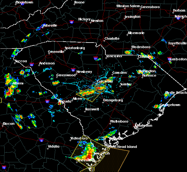 At 321 pm edt, a severe thunderstorm was located over pine ridge, or near cayce, and is nearly stationary (radar indicated). Hazards include 60 mph wind gusts and penny size hail. Expect damage to roofs. siding. and trees. Locations impacted include, columbia, cayce, pine ridge and fort jackson. At 321 pm edt, a severe thunderstorm was located over pine ridge, or near cayce, and is nearly stationary (radar indicated). Hazards include 60 mph wind gusts and penny size hail. Expect damage to roofs. siding. and trees. Locations impacted include, columbia, cayce, pine ridge and fort jackson.
|
| 6/14/2016 2:55 PM EDT | Trees down bluff road and i-7 in richland county SC, 6.3 miles N of Columbia, SC |
| 6/14/2016 2:49 PM EDT | Trees in roadway carswell drive and bluff roa in richland county SC, 8 miles NNW of Columbia, SC |
| 6/14/2016 2:41 PM EDT |
 At 241 pm edt, a severe thunderstorm was located 9 miles southeast of five points, or 9 miles southeast of cayce, and is nearly stationary (radar indicated). Hazards include 60 mph wind gusts. Expect damage to roofs. siding. And trees. At 241 pm edt, a severe thunderstorm was located 9 miles southeast of five points, or 9 miles southeast of cayce, and is nearly stationary (radar indicated). Hazards include 60 mph wind gusts. Expect damage to roofs. siding. And trees.
|
| 5/2/2016 3:55 PM EDT |
 At 351 pm edt, severe thunderstorms were located northeast of winnsboro, and near cedar creek. these storms are moving north at 25 mph (radar indicated). Hazards include 60 mph wind gusts and quarter size hail. Hail damage to vehicles is expected. expect wind damage to roofs, siding, and trees. Locations impacted include, cedar creek, winnsboro and lake wateree. At 351 pm edt, severe thunderstorms were located northeast of winnsboro, and near cedar creek. these storms are moving north at 25 mph (radar indicated). Hazards include 60 mph wind gusts and quarter size hail. Hail damage to vehicles is expected. expect wind damage to roofs, siding, and trees. Locations impacted include, cedar creek, winnsboro and lake wateree.
|
| 5/2/2016 3:36 PM EDT |
 At 335 pm edt, a severe thunderstorm was located 8 miles southeast of winnsboro. additional severe thunderstorms were located near ballentine and southeast of blythewood. all thunderstorms were moving northeast at 15 mph (radar indicated). Hazards include 60 mph wind gusts and quarter size hail. Hail damage to vehicles is expected. Expect wind damage to roofs, siding, and trees. At 335 pm edt, a severe thunderstorm was located 8 miles southeast of winnsboro. additional severe thunderstorms were located near ballentine and southeast of blythewood. all thunderstorms were moving northeast at 15 mph (radar indicated). Hazards include 60 mph wind gusts and quarter size hail. Hail damage to vehicles is expected. Expect wind damage to roofs, siding, and trees.
|
| 4/1/2016 4:53 PM EDT |
 At 453 pm edt, doppler radar indicated a severe thunderstorm capable of producing damaging winds in excess of 60 mph. this storm was located over lugoff, or near camden, moving east at 50 mph. locations impacted include, columbia, forest acres, camden, winnsboro, bishopville, woodfields, dentsville, kershaw, elgin, heath springs, woodfield, fort jackson, lugoff, blythewood, bethune, ridgeway, peak, rembert and winnsboro mills. At 453 pm edt, doppler radar indicated a severe thunderstorm capable of producing damaging winds in excess of 60 mph. this storm was located over lugoff, or near camden, moving east at 50 mph. locations impacted include, columbia, forest acres, camden, winnsboro, bishopville, woodfields, dentsville, kershaw, elgin, heath springs, woodfield, fort jackson, lugoff, blythewood, bethune, ridgeway, peak, rembert and winnsboro mills.
|
| 4/1/2016 4:29 PM EDT |
 At 429 pm edt, doppler radar indicated a severe thunderstorm capable of producing damaging winds in excess of 60 mph. this storm was located over arcadia lakes, or over forest acres, and moving east at 30 mph. At 429 pm edt, doppler radar indicated a severe thunderstorm capable of producing damaging winds in excess of 60 mph. this storm was located over arcadia lakes, or over forest acres, and moving east at 30 mph.
|
| 4/1/2016 3:59 PM EDT |
 At 357 pm edt, doppler radar indicated a severe thunderstorm capable of producing damaging winds in excess of 60 mph. the strongest winds were moving across southwest lexington county between pelion and batesburg-leesville. this storm was located 9 miles west of gaston, or 11 miles south of red bank, moving northeast at 45 mph. locations impacted include, columbia, lexington, west columbia, cayce, irmo, forest acres, springdale, st. andrews, batesburg, dentsville, oak grove, woodfields, red bank, batesburg-leesville, south congaree, pine ridge, gaston, arcadia lakes, eastover and ridge spring. At 357 pm edt, doppler radar indicated a severe thunderstorm capable of producing damaging winds in excess of 60 mph. the strongest winds were moving across southwest lexington county between pelion and batesburg-leesville. this storm was located 9 miles west of gaston, or 11 miles south of red bank, moving northeast at 45 mph. locations impacted include, columbia, lexington, west columbia, cayce, irmo, forest acres, springdale, st. andrews, batesburg, dentsville, oak grove, woodfields, red bank, batesburg-leesville, south congaree, pine ridge, gaston, arcadia lakes, eastover and ridge spring.
|
| 4/1/2016 3:45 PM EDT |
 At 345 pm edt, doppler radar indicated a severe thunderstorm capable of producing damaging winds in excess of 60 mph. this storm was located 17 miles southeast of leesville, or 18 miles southeast of batesburg, and moving northeast at 45 mph. At 345 pm edt, doppler radar indicated a severe thunderstorm capable of producing damaging winds in excess of 60 mph. this storm was located 17 miles southeast of leesville, or 18 miles southeast of batesburg, and moving northeast at 45 mph.
|
| 3/31/2016 7:02 PM EDT |
 At 659 pm edt, doppler radar indicated a severe thunderstorm capable of producing quarter size hail and damaging winds around 60 mph, just southwest of south congaree. movement was northeast near 35 mph and toward the south congaree and pine ridge ares, and the area near cayce and just south of cayce. At 659 pm edt, doppler radar indicated a severe thunderstorm capable of producing quarter size hail and damaging winds around 60 mph, just southwest of south congaree. movement was northeast near 35 mph and toward the south congaree and pine ridge ares, and the area near cayce and just south of cayce.
|
| 3/31/2016 6:53 PM EDT |
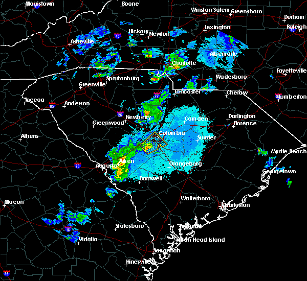 At 652 pm edt, doppler radar indicated a severe thunderstorm capable of producing quarter size hail and damaging winds in excess of 60 mph. this storm was located just north of pelion, and moving northeast at 35 mph. At 652 pm edt, doppler radar indicated a severe thunderstorm capable of producing quarter size hail and damaging winds in excess of 60 mph. this storm was located just north of pelion, and moving northeast at 35 mph.
|
| 2/3/2016 3:00 PM EST |
 At 259 pm est, doppler radar indicated a severe thunderstorm capable of producing destructive winds in excess of 70 mph. this storm was located near fort jackson, or 8 miles east of woodfields, moving east-northeast at 40 mph. locations impacted include, columbia, sumter, west columbia, cayce, forest acres, camden, woodfields, dentsville, pine ridge, gaston, arcadia lakes, eastover, woodfield, five points, oakland, fort jackson, lugoff, swansea, rembert and stateburg. At 259 pm est, doppler radar indicated a severe thunderstorm capable of producing destructive winds in excess of 70 mph. this storm was located near fort jackson, or 8 miles east of woodfields, moving east-northeast at 40 mph. locations impacted include, columbia, sumter, west columbia, cayce, forest acres, camden, woodfields, dentsville, pine ridge, gaston, arcadia lakes, eastover, woodfield, five points, oakland, fort jackson, lugoff, swansea, rembert and stateburg.
|
| 2/3/2016 2:55 PM EST |
 The national weather service in columbia has issued a * tornado warning for. southern kershaw county in central south carolina. northeastern richland county in central south carolina. south central chesterfield county in central south carolina. Lee county in central south carolina. The national weather service in columbia has issued a * tornado warning for. southern kershaw county in central south carolina. northeastern richland county in central south carolina. south central chesterfield county in central south carolina. Lee county in central south carolina.
|
| 2/3/2016 2:35 PM EST |
 At 235 pm est, doppler radar indicated a severe thunderstorm capable of producing a tornado. this dangerous storm was located over cayce, and moving east-northeast at 40 mph. At 235 pm est, doppler radar indicated a severe thunderstorm capable of producing a tornado. this dangerous storm was located over cayce, and moving east-northeast at 40 mph.
|
| 2/3/2016 2:27 PM EST |
 At 226 pm est, doppler radar indicated a severe thunderstorm capable of producing damaging winds in excess of 60 mph. this storm was located over south congaree, or near springdale, and moving east-northeast at 40 mph. At 226 pm est, doppler radar indicated a severe thunderstorm capable of producing damaging winds in excess of 60 mph. this storm was located over south congaree, or near springdale, and moving east-northeast at 40 mph.
|
| 2/3/2016 2:03 PM EST |
 At 201 pm est, doppler radar indicated a severe thunderstorm capable of producing damaging winds in excess of 60 mph. this storm was located over red bank, moving east-northeast at 40 mph. locations impacted include, columbia, aiken, lexington, west columbia, cayce, irmo, forest acres, winnsboro, springdale, st. andrews, batesburg, oak grove, red bank, dentsville, batesburg-leesville, south congaree, pine ridge, gaston, ridge spring and leesville. At 201 pm est, doppler radar indicated a severe thunderstorm capable of producing damaging winds in excess of 60 mph. this storm was located over red bank, moving east-northeast at 40 mph. locations impacted include, columbia, aiken, lexington, west columbia, cayce, irmo, forest acres, winnsboro, springdale, st. andrews, batesburg, oak grove, red bank, dentsville, batesburg-leesville, south congaree, pine ridge, gaston, ridge spring and leesville.
|
| 2/3/2016 1:40 PM EST |
 At 139 pm est, doppler radar indicated a severe thunderstorm capable of producing damaging winds in excess of 60 mph. this storm was located near leesville, or near batesburg, moving east at 40 mph. locations impacted include, columbia, aiken, lexington, west columbia, cayce, irmo, forest acres, winnsboro, springdale, st. andrews, batesburg, oak grove, red bank, dentsville, batesburg-leesville, south congaree, pine ridge, gaston, ridge spring and leesville. At 139 pm est, doppler radar indicated a severe thunderstorm capable of producing damaging winds in excess of 60 mph. this storm was located near leesville, or near batesburg, moving east at 40 mph. locations impacted include, columbia, aiken, lexington, west columbia, cayce, irmo, forest acres, winnsboro, springdale, st. andrews, batesburg, oak grove, red bank, dentsville, batesburg-leesville, south congaree, pine ridge, gaston, ridge spring and leesville.
|
| 2/3/2016 1:25 PM EST |
 At 124 pm est, doppler radar indicated a severe thunderstorm capable of producing damaging winds in excess of 60 mph. this storm was located over ridge spring, or 9 miles southwest of batesburg, and moving east-northeast at 45 mph. At 124 pm est, doppler radar indicated a severe thunderstorm capable of producing damaging winds in excess of 60 mph. this storm was located over ridge spring, or 9 miles southwest of batesburg, and moving east-northeast at 45 mph.
|
| 12/23/2015 2:05 PM EST | At 205 pm est, doppler radar indicated a severe squall line capable of producing a tornado as well as damaging straight line winds. these dangerous storms were located 9 miles northwest of irmo, and moving east at 30 mph. |
| 9/3/2015 6:19 PM EDT | Sc highway patrol reported multiple trees down near the bridgecreek drive and rhame road intersection. time estimated from rada in richland county SC, 10.3 miles SW of Columbia, SC |
| 9/3/2015 5:46 PM EDT |
 At 545 pm edt, doppler radar indicated a likely severe thunderstorm in the northeast part of columbia. movement was south near 10 mph. the storm will likely contain wind gusts of 40 to 60 mph. large hail may occur. At 545 pm edt, doppler radar indicated a likely severe thunderstorm in the northeast part of columbia. movement was south near 10 mph. the storm will likely contain wind gusts of 40 to 60 mph. large hail may occur.
|
| 9/3/2015 5:31 PM EDT | Sc highway patrol reported trees down at summit parkway and clemson road. time estimated by rada in richland county SC, 9.4 miles SW of Columbia, SC |
| 9/3/2015 5:31 PM EDT |
 At 526 pm edt, doppler radar indicated thunderstorms in the interstate 20 area near the kershaw and richland county line. movement was south near 10 mph. the storms likely contained winds of 40 to 60 mph. At 526 pm edt, doppler radar indicated thunderstorms in the interstate 20 area near the kershaw and richland county line. movement was south near 10 mph. the storms likely contained winds of 40 to 60 mph.
|
| 9/3/2015 5:05 PM EDT |
 At 501 pm edt, doppler radar indicated a likely severe thunderstorm capable of producing damaging winds in excess of 60 mph. this storm was located near the richland and kershaw county line. movement was south near 10 mph. the highway one area near the richland and kershaw county line was in the path of the storm. At 501 pm edt, doppler radar indicated a likely severe thunderstorm capable of producing damaging winds in excess of 60 mph. this storm was located near the richland and kershaw county line. movement was south near 10 mph. the highway one area near the richland and kershaw county line was in the path of the storm.
|
| 9/3/2015 4:55 PM EDT |
 At 454 pm edt, doppler radar indicated a severe thunderstorm capable of producing damaging winds in excess of 60 mph. this storm was near elgin. movement was east near 5 mph. At 454 pm edt, doppler radar indicated a severe thunderstorm capable of producing damaging winds in excess of 60 mph. this storm was near elgin. movement was east near 5 mph.
|
| 8/6/2015 5:46 PM EDT |
 At 546 pm edt, doppler radar indicated a severe thunderstorm capable of producing damaging winds in excess of 60 mph. this storm was located near pine ridge, or near cayce, and moving east at 40 mph. At 546 pm edt, doppler radar indicated a severe thunderstorm capable of producing damaging winds in excess of 60 mph. this storm was located near pine ridge, or near cayce, and moving east at 40 mph.
|
| 8/6/2015 5:04 PM EDT | Power outage reported via social medi in richland county SC, 8.6 miles SW of Columbia, SC |
| 8/6/2015 4:32 PM EDT |
 At 432 pm edt, doppler radar indicated a line of severe thunderstorms capable of producing damaging winds in excess of 60 mph. these storms were located along a line extending from 6 miles west of lugoff to near leesville, and moving east at 25 mph. At 432 pm edt, doppler radar indicated a line of severe thunderstorms capable of producing damaging winds in excess of 60 mph. these storms were located along a line extending from 6 miles west of lugoff to near leesville, and moving east at 25 mph.
|
| 8/6/2015 3:55 PM EDT |
 At 354 pm edt, doppler radar indicated a severe thunderstorm capable of producing damaging winds in excess of 60 mph. this storm was located 7 miles northwest of irmo, and moving east at 25 mph. At 354 pm edt, doppler radar indicated a severe thunderstorm capable of producing damaging winds in excess of 60 mph. this storm was located 7 miles northwest of irmo, and moving east at 25 mph.
|
| 8/5/2015 3:50 PM EDT | Highway patrol and news media report numerous trees down in richland county including tree on car sumter and wheat in richland county SC, 4.1 miles NNE of Columbia, SC |
| 8/5/2015 3:50 PM EDT | Twitter report of large tree down with house damage gladden st and millwood avenue in richland county SC, 2.9 miles N of Columbia, SC |
| 8/5/2015 3:17 PM EDT |
 At 317 pm edt, doppler radar indicated a severe thunderstorm capable of producing damaging winds in excess of 60 mph. this storm was located over cayce, and moving northeast at 15 mph. At 317 pm edt, doppler radar indicated a severe thunderstorm capable of producing damaging winds in excess of 60 mph. this storm was located over cayce, and moving northeast at 15 mph.
|
| 7/30/2015 2:33 PM EDT |
 At 232 pm edt, doppler radar indicated a severe thunderstorm capable of producing damaging winds in excess of 60 mph. this storm was located near irmo, and moving south at 10 mph. At 232 pm edt, doppler radar indicated a severe thunderstorm capable of producing damaging winds in excess of 60 mph. this storm was located near irmo, and moving south at 10 mph.
|
| 7/19/2015 8:23 PM EDT |
 At 822 pm edt, doppler radar indicated a severe thunderstorm capable of producing damaging winds in excess of 60 mph. this storm was located 9 miles northwest of oakland, or 11 miles south of camden, moving east at 20 mph. locations impacted include, eastover and stateburg. At 822 pm edt, doppler radar indicated a severe thunderstorm capable of producing damaging winds in excess of 60 mph. this storm was located 9 miles northwest of oakland, or 11 miles south of camden, moving east at 20 mph. locations impacted include, eastover and stateburg.
|
| 7/19/2015 7:26 PM EDT |
 At 725 pm edt, doppler radar indicated a line of severe thunderstorms capable of producing damaging winds in excess of 60 mph. these storms were located along a line extending from 8 miles south of lugoff to 6 miles south of ridge spring, and moving southeast at 15 mph. * these severe thunderstorms will remain over mainly rural areas of northeastern barnwell, calhoun, central aiken, lexington, southwestern sumter, south central kershaw, southeastern richland, east central edgefield and northwestern orangeburg counties, including the following locations, salley, wedgewood, woodford, springfield, pelion, livingston, wagener, neeses, gilbert and swansea. At 725 pm edt, doppler radar indicated a line of severe thunderstorms capable of producing damaging winds in excess of 60 mph. these storms were located along a line extending from 8 miles south of lugoff to 6 miles south of ridge spring, and moving southeast at 15 mph. * these severe thunderstorms will remain over mainly rural areas of northeastern barnwell, calhoun, central aiken, lexington, southwestern sumter, south central kershaw, southeastern richland, east central edgefield and northwestern orangeburg counties, including the following locations, salley, wedgewood, woodford, springfield, pelion, livingston, wagener, neeses, gilbert and swansea.
|
| 7/19/2015 7:09 PM EDT | Schp reports trees down on running fox rd at leaning tree rd. time estimate in richland county SC, 7.7 miles WSW of Columbia, SC |
| 7/19/2015 7:00 PM EDT |
 At 659 pm edt, doppler radar indicated a severe thunderstorm capable of producing damaging winds in excess of 60 mph. this storm was located over arcadia lakes, or over dentsville, moving southwest at 5 mph. this severe storm will be near, west columbia, st. andrews and oak grove around 715 pm edt. other locations impacted by this severe thunderstorm include seven oaks, gilbert and summit. At 659 pm edt, doppler radar indicated a severe thunderstorm capable of producing damaging winds in excess of 60 mph. this storm was located over arcadia lakes, or over dentsville, moving southwest at 5 mph. this severe storm will be near, west columbia, st. andrews and oak grove around 715 pm edt. other locations impacted by this severe thunderstorm include seven oaks, gilbert and summit.
|
| 7/19/2015 6:08 PM EDT |
 At 607 pm edt, doppler radar indicated a severe thunderstorm capable of producing damaging winds in excess of 60 mph. this storm was located 11 miles northwest of lexington, and moving south at 25 mph. * this severe thunderstorm will be near, lexington around 625 pm edt. red bank around 635 pm edt. other locations impacted by this severe thunderstorm include chapin, little mountain, ridgeway, peak, seven oaks, gilbert, blythewood, lake murray of richland and summit. At 607 pm edt, doppler radar indicated a severe thunderstorm capable of producing damaging winds in excess of 60 mph. this storm was located 11 miles northwest of lexington, and moving south at 25 mph. * this severe thunderstorm will be near, lexington around 625 pm edt. red bank around 635 pm edt. other locations impacted by this severe thunderstorm include chapin, little mountain, ridgeway, peak, seven oaks, gilbert, blythewood, lake murray of richland and summit.
|
| 7/19/2015 6:04 PM EDT | Schp reports trees down on leesburg rd at harmon r in richland county SC, 12.1 miles WNW of Columbia, SC |
| 7/19/2015 6:00 PM EDT | Schp reports trees down on leesburg rd at davis r in richland county SC, 10.4 miles WNW of Columbia, SC |
| 7/19/2015 5:46 PM EDT |
 At 546 pm edt, doppler radar indicated a severe thunderstorm capable of producing damaging winds in excess of 60 mph. this storm was located near fort jackson, or 7 miles east of woodfields, and moving east at 5 mph. penny size hail may also accompany the damaging winds. * this severe thunderstorm will be near, eastover around 630 pm edt. At 546 pm edt, doppler radar indicated a severe thunderstorm capable of producing damaging winds in excess of 60 mph. this storm was located near fort jackson, or 7 miles east of woodfields, and moving east at 5 mph. penny size hail may also accompany the damaging winds. * this severe thunderstorm will be near, eastover around 630 pm edt.
|
| 7/18/2015 6:46 PM EDT | Sc highway patrol reports a tree fallen onto merrimac drive near chilhowie roa in richland county SC, 8.2 miles NNW of Columbia, SC |
| 7/18/2015 6:22 PM EDT |
 At 622 pm edt, doppler radar indicated a line of severe thunderstorms capable of producing damaging winds in excess of 60 mph. these storms were located along a line extending from near pageland to near columbia, and moving southeast at 55 mph. penny size hail may also accompany the damaging winds. At 622 pm edt, doppler radar indicated a line of severe thunderstorms capable of producing damaging winds in excess of 60 mph. these storms were located along a line extending from near pageland to near columbia, and moving southeast at 55 mph. penny size hail may also accompany the damaging winds.
|
| 7/18/2015 6:07 PM EDT |
 At 606 pm edt, doppler radar indicated a line of severe thunderstorms capable of producing damaging winds in excess of 60 mph. these storms were located along a line extending from 11 miles northwest of irmo to 9 miles northeast of greenwood state park, and moving south at 15 mph. penny size hail may also accompany the damaging winds. At 606 pm edt, doppler radar indicated a line of severe thunderstorms capable of producing damaging winds in excess of 60 mph. these storms were located along a line extending from 11 miles northwest of irmo to 9 miles northeast of greenwood state park, and moving south at 15 mph. penny size hail may also accompany the damaging winds.
|
| 7/13/2015 11:35 PM EDT |
 At 1131 pm edt, doppler radar indicated a severe thunderstorm capable of producing damaging winds in excess of 60 mph. this storm was located 10 miles east of fort jackson, or 13 miles east of woodfields, moving southeast at 25 mph. penny size hail may also accompany the damaging winds. in addition, at 1115 pm edt, this storm produced penny size hail 4 miles north of dentsville in richland county. locations impacted include, columbia, forest acres, woodfields, dentsville, arcadia lakes, eastover, five points, woodfield, fort jackson and stateburg. At 1131 pm edt, doppler radar indicated a severe thunderstorm capable of producing damaging winds in excess of 60 mph. this storm was located 10 miles east of fort jackson, or 13 miles east of woodfields, moving southeast at 25 mph. penny size hail may also accompany the damaging winds. in addition, at 1115 pm edt, this storm produced penny size hail 4 miles north of dentsville in richland county. locations impacted include, columbia, forest acres, woodfields, dentsville, arcadia lakes, eastover, five points, woodfield, fort jackson and stateburg.
|
| 7/13/2015 11:18 PM EDT | Tree down at barhamville and tremain road. time estimated by rada in richland county SC, 1.7 miles ENE of Columbia, SC |
| 7/13/2015 10:58 PM EDT |
 At 1057 pm edt, doppler radar indicated a severe thunderstorm capable of producing damaging winds in excess of 60 mph. this storm was located 8 miles northeast of dentsville, and moving southeast at 25 mph. At 1057 pm edt, doppler radar indicated a severe thunderstorm capable of producing damaging winds in excess of 60 mph. this storm was located 8 miles northeast of dentsville, and moving southeast at 25 mph.
|
| 7/2/2015 5:03 PM EDT |
 At 502 pm edt, doppler radar indicated a line of severe thunderstorms capable of producing damaging winds in excess of 60 mph. these storms were located along a line extending from 11 miles south of heath springs to near cayce to 15 miles southwest of gaston, moving east at 30 mph. locations impacted include, columbia, cayce, forest acres, camden, woodfields, dentsville, pine ridge, st. matthews, gaston, arcadia lakes, eastover, woodfield, five points, fort jackson, lugoff, swansea, north, neeses, woodford and livingston. At 502 pm edt, doppler radar indicated a line of severe thunderstorms capable of producing damaging winds in excess of 60 mph. these storms were located along a line extending from 11 miles south of heath springs to near cayce to 15 miles southwest of gaston, moving east at 30 mph. locations impacted include, columbia, cayce, forest acres, camden, woodfields, dentsville, pine ridge, st. matthews, gaston, arcadia lakes, eastover, woodfield, five points, fort jackson, lugoff, swansea, north, neeses, woodford and livingston.
|
| 7/2/2015 4:52 PM EDT | Richland county mesonet reported a wind gust of 70 mph atop williams brice stadiu in richland county SC, 5.1 miles NNE of Columbia, SC |
| 7/2/2015 4:47 PM EDT | Public reported through twitter that a tree fell on a house in the olympia neighborhood of columbi in richland county SC, 4.7 miles NNE of Columbia, SC |
| 7/2/2015 4:29 PM EDT |
 At 429 pm edt, doppler radar indicated a line of severe thunderstorms capable of producing damaging winds in excess of 60 mph. these storms were located along a line extending from 7 miles southwest of great falls to near irmo to 6 miles east of leesville, and moving southeast at 30 mph. At 429 pm edt, doppler radar indicated a line of severe thunderstorms capable of producing damaging winds in excess of 60 mph. these storms were located along a line extending from 7 miles southwest of great falls to near irmo to 6 miles east of leesville, and moving southeast at 30 mph.
|
| 7/2/2015 3:25 PM EDT |
 At 324 pm edt, doppler radar indicated a line of severe thunderstorms capable of producing damaging winds in excess of 60 mph. these storms were located along a line extending from near clinton to cross hill, and moving east to southeast at 40 mph. At 324 pm edt, doppler radar indicated a line of severe thunderstorms capable of producing damaging winds in excess of 60 mph. these storms were located along a line extending from near clinton to cross hill, and moving east to southeast at 40 mph.
|
| 6/30/2015 5:17 PM EDT |
 At 516 pm edt, doppler radar indicated a line of severe thunderstorms capable of producing damaging winds in excess of 60 mph. these storms were located along a line extending from 6 miles northeast of fort jackson to near bamberg, and moving east at 30 mph. nickel size hail may also accompany the damaging winds. At 516 pm edt, doppler radar indicated a line of severe thunderstorms capable of producing damaging winds in excess of 60 mph. these storms were located along a line extending from 6 miles northeast of fort jackson to near bamberg, and moving east at 30 mph. nickel size hail may also accompany the damaging winds.
|
| 6/30/2015 5:12 PM EDT | Sc highway patrol reported trees down throughout central richland county in the garners ferry road are in richland county SC, 6.5 miles NW of Columbia, SC |
| 6/30/2015 4:56 PM EDT | Sc highway patrol reported trees down at the intersection of quarry street and granby lane. time estimated from rada in richland county SC, 5.3 miles NNE of Columbia, SC |
| 6/30/2015 4:46 PM EDT |
 At 446 pm edt, doppler radar indicated a severe thunderstorm capable of producing quarter size hail and damaging winds in excess of 60 mph. this storm was located over five points, or over cayce, and moving northeast at 55 mph. At 446 pm edt, doppler radar indicated a severe thunderstorm capable of producing quarter size hail and damaging winds in excess of 60 mph. this storm was located over five points, or over cayce, and moving northeast at 55 mph.
|
| 6/30/2015 4:30 PM EDT |
 At 429 pm edt, doppler radar indicated a severe thunderstorm capable of producing quarter size hail and damaging winds in excess of 60 mph. this storm was located over red bank, and moving east at 35 mph. At 429 pm edt, doppler radar indicated a severe thunderstorm capable of producing quarter size hail and damaging winds in excess of 60 mph. this storm was located over red bank, and moving east at 35 mph.
|
| 6/27/2015 6:42 PM EDT |
 At 640 pm edt, doppler radar indicated a line of severe thunderstorms capable of producing damaging winds in excess of 60 mph. these storms were located along a line extending from near lugoff to near eastover to 11 miles northwest of orangeburg, moving east at 35 mph. expect strong winds near camden, rembert, eastover, shaw air base, sumter, and st matthews. locations impacted include, columbia, sumter, camden, st. matthews, eastover, oakland, lugoff, stateburg, rembert, dalzell, cherryvale and wedgewood. At 640 pm edt, doppler radar indicated a line of severe thunderstorms capable of producing damaging winds in excess of 60 mph. these storms were located along a line extending from near lugoff to near eastover to 11 miles northwest of orangeburg, moving east at 35 mph. expect strong winds near camden, rembert, eastover, shaw air base, sumter, and st matthews. locations impacted include, columbia, sumter, camden, st. matthews, eastover, oakland, lugoff, stateburg, rembert, dalzell, cherryvale and wedgewood.
|
| 6/27/2015 6:14 PM EDT |
 At 613 pm edt, doppler radar indicated a line of severe thunderstorms capable of producing damaging winds in excess of 60 mph. these storms were located along a line extending from near dentsville to columbia to near wagener, and moving east at 40 mph. At 613 pm edt, doppler radar indicated a line of severe thunderstorms capable of producing damaging winds in excess of 60 mph. these storms were located along a line extending from near dentsville to columbia to near wagener, and moving east at 40 mph.
|
| 6/27/2015 6:13 PM EDT | Trees down in roadway 301 dean hall lane in richland county SC, 5.1 miles NNW of Columbia, SC |
| 6/27/2015 6:10 PM EDT | Highway patrol reported trees down near clement road at mountain dr in richland county SC, 3.7 miles E of Columbia, SC |
| 6/27/2015 6:02 PM EDT |
 At 601 pm edt, doppler radar indicated a line of severe thunderstorms capable of producing damaging winds in excess of 60 mph. these storms were located along a line extending from st. andrews to south congaree to 17 miles southwest of gaston, moving east at 45 mph. locations impacted include, columbia, lexington, west columbia, cayce, irmo, forest acres, springdale, st. andrews, dentsville, oak grove, woodfields, red bank, south congaree, pine ridge, gaston, arcadia lakes, eastover, fort jackson, woodfield and five points. At 601 pm edt, doppler radar indicated a line of severe thunderstorms capable of producing damaging winds in excess of 60 mph. these storms were located along a line extending from st. andrews to south congaree to 17 miles southwest of gaston, moving east at 45 mph. locations impacted include, columbia, lexington, west columbia, cayce, irmo, forest acres, springdale, st. andrews, dentsville, oak grove, woodfields, red bank, south congaree, pine ridge, gaston, arcadia lakes, eastover, fort jackson, woodfield and five points.
|
| 6/27/2015 5:42 PM EDT |
 At 541 pm edt, doppler radar indicated a line of severe thunderstorms capable of producing damaging winds in excess of 60 mph. these storms were located along a line extending from 8 miles northwest of lexington to 12 miles south of batesburg-leesville, and moving east at 40 mph. At 541 pm edt, doppler radar indicated a line of severe thunderstorms capable of producing damaging winds in excess of 60 mph. these storms were located along a line extending from 8 miles northwest of lexington to 12 miles south of batesburg-leesville, and moving east at 40 mph.
|
| 6/23/2015 6:45 PM EDT | Quarter sized hail reported 5.5 miles E of Columbia, SC, multiple reports from social media of nickel to quarter sized hail near i20 and broad river road. |
| 6/23/2015 6:35 PM EDT |
 At 634 pm edt, doppler radar indicated a severe thunderstorm capable of producing damaging winds in excess of 60 mph. this storm was located near st. andrews, and moving east at 10 mph. nickel size hail may also accompany the damaging winds. At 634 pm edt, doppler radar indicated a severe thunderstorm capable of producing damaging winds in excess of 60 mph. this storm was located near st. andrews, and moving east at 10 mph. nickel size hail may also accompany the damaging winds.
|
| 6/18/2015 4:06 PM EDT | Highway patrol reported trees down at universal drive and garners ferr in richland county SC, 7.6 miles NW of Columbia, SC |
| 6/18/2015 3:46 PM EDT | At 346 pm edt, doppler radar indicated a severe thunderstorm capable of producing damaging winds in excess of 60 mph. this storm was located 7 miles southeast of cayce, and moving east at 25 mph. |
| 6/18/2015 2:57 PM EDT | At 256 pm edt, doppler radar indicated a line of severe thunderstorms capable of producing quarter size hail and damaging winds in excess of 60 mph. these storms were located along a line extending from mulberry to 9 miles east of aiken, and moving east northeast at 20 mph. |
| 6/1/2015 2:17 PM EDT | At 212 pm edt, doppler radar indicated thunderstorms extending from kershaw county southward into southern lexington county. storms near camdan, swansea, and near the fairfield and richland county line near interstate 77, were likely severe with wind gusts of 40 to 60 mph and quarter-size hail. storm movement was northeast near 15 mph. a small interior room on the lowest flood usually offers the best protection from severe thunderstorms. |
| 6/1/2015 2:06 PM EDT | At 204 pm edt, doppler radar indicated thunderstorms, some of which were likely severe with wind gusts of 40 to 60 mph. the storms extended from southern lexington county northward into fairfield and kershaw counties. movement was northeast near 15 mph. |
| 5/11/2015 4:48 PM EDT | Sc highway patrol reported trees down on broad river rd near brevard street. time estimated from rada in richland county SC, 5 miles E of Columbia, SC |
| 5/11/2015 4:35 PM EDT | At 435 pm edt, doppler radar indicated a severe thunderstorm capable of producing damaging winds in excess of 60 mph. this storm was located near red bank, and moving northeast at 20 mph. penny size hail may also accompany the damaging winds. |
| 5/11/2015 3:59 PM EDT | Sc highway patrol reported trees down at the intersection of longwood rd and bluff rd. time estimated from rada in richland county SC, 8.8 miles NNW of Columbia, SC |
| 5/11/2015 3:16 PM EDT | At 315 pm edt, doppler radar indicated a severe thunderstorm capable of producing quarter size hail and damaging winds in excess of 60 mph. this storm was located 11 miles southeast of cayce, or 10 miles west of eastover, and moving east at 10 mph. |
| 4/19/2015 5:38 PM EDT | Richland county dispatch reported trees in the roadway at the intersection of wilmont ave and walker stree in richland county SC, 3.6 miles N of Columbia, SC |
| 4/19/2015 5:37 PM EDT | At 535 pm edt, national weather service doppler radar continued to indicate a tornado. this tornado was located over richland county, or near irmo, moving northeast at 30 mph. the tornado will otherwise remain over mainly rural areas of the indicated counties. |
| 4/19/2015 5:31 PM EDT | At 530 pm edt, national weather service doppler radar indicated a line of severe thunderstorms. these storms were located along a line extending from 20 miles west of winnsboro to 12 miles south of fort jackson, or along a line extending from 11 miles northeast of newberry to 13 miles southeast of cayce, and moving northeast at 25 mph. * some communities in the warning area include five points, fort jackson, woodfields, winnsboro, st. andrews, lugoff, forest acres, dentsville, columbia, camden, arcadia lakes and blackstock. |
| 4/19/2015 5:24 PM EDT | At 522 pm edt, national weather service doppler radar indicated a line of severe thunderstorms capable of producing damaging winds in excess of 60 mph. these storms were located along a line extending from 13 miles west of eastover to 15 miles south of bowman, or along a line extending from 9 miles south of forest acres to 6 miles southwest of saint george, and moving northeast at 40 mph. * some communities in the warning area include sumter, summerton, st. matthews, south sumter, orangeburg, mulberry, millwood, manning, holly hill, elloree, eastover, brookdale, bowman, bishopville and oakland. |
| 4/19/2015 5:15 PM EDT | The national weather service in columbia has issued a * tornado warning for. Southern fairfield county in central south carolina northern lexington county in central south carolina northwestern richland county in central south carolina * until 600 pm edt. |
| 4/19/2015 5:08 PM EDT | this alert has expired |
| 4/19/2015 4:46 PM EDT | At 444 pm edt, national weather service doppler radar indicated a line of severe thunderstorms capable of producing damaging winds in excess of 60 mph. these storms were located along a line extending from 9 miles north of saluda to 14 miles south of red bank, or along a line extending from 14 miles southwest of newberry to 14 miles south of red bank, and moving northeast at 45 mph. * some communities in the warning area include five points, fort jackson, woodfields, west columbia, st. andrews, springdale, south congaree, saluda, red bank, prosperity, pine ridge, oak grove, newberry, lexington, leesville, irmo, forest acres, dentsville, columbia, cayce, batesburg and arcadia lakes report large hail, damaging winds or flooding to your county sheriff, or use www.facebook.com/nwscolumbia and email [email protected] to relay severe weather reports. |
| 4/19/2015 4:42 PM EDT | this alert has expired |
| 4/19/2015 4:42 PM EDT | At 439 pm edt, national weather service doppler radar indicated a line of severe thunderstorms capable of producing damaging winds in excess of 60 mph. these storms were located along a line extending from 19 miles north of blackville to 25 miles south of denmark, or along a line extending from 20 miles east of aiken to 7 miles northwest of hampton, and moving northeast at 30 mph. * some communities in the warning area include st. matthews, orangeburg, gaston, denmark, brookdale, branchville, bowman, blackville and bamberg. |
| 4/7/2015 10:37 PM EDT | The national weather service in columbia has issued a * severe thunderstorm warning for. Southern kershaw county in central south carolina southern lee county in central south carolina southeastern richland county in central south carolina northern calhoun county in central south carolina. |
| 4/7/2015 10:00 PM EDT | The national weather service in columbia has issued a * severe thunderstorm warning for. Southern fairfield county in central south carolina southwestern kershaw county in central south carolina northern lexington county in central south carolina northwestern richland county in central south carolina. |
| 4/7/2015 9:14 PM EDT | The national weather service in columbia has issued a * severe thunderstorm warning for. fairfield county in central south carolina northwestern richland county in central south carolina * until 1000 pm edt * at 914 pm edt. National weather service doppler radar indicated a. |
| 1/4/2015 2:17 PM EST | Electric company reports power outages in the dentsville and eastern ft jackson area in richland county SC, 11 miles SW of Columbia, SC |
| 11/23/2014 8:00 PM EST | Sc highway patrol reported trees down along us 321 near blythewood roa in richland county SC, 5.5 miles S of Columbia, SC |
| 11/23/2014 7:30 PM EST | Richland county dispatch reported power lines down in downtown columbia at the intersection of maple and blossom stree in richland county SC, 2.9 miles N of Columbia, SC |
| 9/2/2014 6:10 PM EDT | Sc hwy patrol reported trees down on i-20 at mile marker 83 east boun in kershaw county SC, 14.8 miles WSW of Columbia, SC |
| 9/2/2014 6:07 PM EDT | Sc hwy patrol reported trees down at jacobs millpond rd. and sandy oaks r in richland county SC, 11.9 miles WSW of Columbia, SC |
| 9/1/2014 6:29 PM EDT | Sc highway patrol reported trees blocking roadways in the vicinity of i20 and clemson r in richland county SC, 8.1 miles SW of Columbia, SC |
| 9/1/2014 6:24 PM EDT | Public reported multiple trees down in woods near apartment comple in richland county SC, 7.9 miles WSW of Columbia, SC |
| 8/31/2014 5:25 PM EDT | Trees blocking roadway at the intersection of claremont drive and kilbourne road. time estimated from rada in richland county SC, 3 miles NNW of Columbia, SC |
| 8/8/2014 8:20 PM EDT | Quarter sized hail reported 6 miles W of Columbia, SC, quarter size hail reported at wltx television station and dime size hail seen across the street at the va hospital in columiba. |
| 8/8/2014 8:15 PM EDT | Asos station columbia hamilton-owens downtown airport reported a gust of 60 mp in richland county SC, 4.9 miles N of Columbia, SC |
| 8/8/2014 8:10 PM EDT | Sc highway patrol reported a tree in the roadway at lady street and oak stree in richland county SC, 2.6 miles NNE of Columbia, SC |
| 7/15/2014 1:57 PM EDT | Highway patrol reported trees down near garners ferry road and mcentire ang statio in richland county SC, 11.4 miles WNW of Columbia, SC |
| 5/23/2014 8:40 PM EDT | Highway patrol reported trees down on leesburg road near green lakes. tstm wnd dmg duration 2 minutes in richland county SC, 7.4 miles NW of Columbia, SC |
| 5/23/2014 8:15 PM EDT | Baseball sized hail reported 10.7 miles SW of Columbia, SC, public reported golfball to baseball size hail in the lake carolina vicinity |
| 5/23/2014 7:53 PM EDT | Quarter sized hail reported 10.1 miles SW of Columbia, SC, report received via social media of quarter sized hail in the summit neighborhood of ne columbia. |
| 7/17/2013 5:01 PM EDT | Trees down in richland county SC, 1 miles ESE of Columbia, SC |
| 6/13/2013 10:29 PM EDT | Trees down near interstate 20 close to mm 80 in richland county SC, 6 miles WSW of Columbia, SC |
| 3/18/2013 9:37 PM EDT | Trees down at mccords ferry rpad and old mcgraw roa in richland county SC, 16.9 miles W of Columbia, SC |
| 3/18/2013 9:28 PM EDT | Trees down at leesburg road and harmon roa in richland county SC, 12.1 miles WNW of Columbia, SC |
| 3/18/2013 9:25 PM EDT | Trees down at leesburg rd. and trotter r in richland county SC, 7 miles WNW of Columbia, SC |
| 3/18/2013 8:06 PM EDT | Trees down on screaming eagle road near melton r in richland county SC, 11.9 miles WSW of Columbia, SC |
| 3/18/2013 8:04 PM EDT | Trees down leesburg road and ulmer road in richland county SC, 6.9 miles NW of Columbia, SC |
| 3/18/2013 7:09 PM EDT | Trees down at bluff road and heyward s in richland county SC, 4.7 miles NNE of Columbia, SC |
| 1/30/2013 9:18 PM EST | Trees down on power lines in richland county SC, 5.3 miles NW of Columbia, SC |
| 1/30/2013 9:12 PM EST | A few trees down in columbia in richland county SC, 3.5 miles NE of Columbia, SC |
| 1/30/2013 8:50 PM EST | A few trees down along college street in irmo in lexington county SC, 10.6 miles ESE of Columbia, SC |
| 1/30/2013 8:12 PM EST | A few trees down in columbia in richland county SC, 3.5 miles NE of Columbia, SC |
| 8/2/2012 5:55 PM EDT | Quarter sized hail reported 3.3 miles SW of Columbia, SC, public report of quarter-size hail in dentsville |
| 8/2/2012 5:47 PM EDT | Quarter sized hail reported 5.4 miles SSW of Columbia, SC, dhec employee reported quarter-size at farrow rd and hardscrabble rd |
| 7/16/2012 4:40 PM EDT | Trees reported down along i-20 near the richland and kershaw county line in richland county SC, 12.9 miles WSW of Columbia, SC |
| 7/1/2012 8:32 PM EDT | Wind gusts blew down tree limb in richland county SC, 6.4 miles SSW of Columbia, SC |
| 7/1/2012 5:40 PM EDT | Ping Pong Ball sized hail reported 6 miles W of Columbia, SC, reported near lower richland high school. |
| 7/1/2012 5:30 PM EDT | Trees down in roadway on bluff rd and pineview...montgomery rds. trees down on amicks ferry rd. trees down on 155 newberry dr an lynch rd. tree in roadway on i-20 east in richland county SC, 6 miles W of Columbia, SC |
| 7/1/2012 5:25 PM EDT | Quarter sized hail reported 6 miles W of Columbia, SC, quarter size hail at intersection of assembly st and blossom st. |
| 7/1/2012 5:23 PM EDT | Quarter sized hail reported 6 miles W of Columbia, SC |
| 7/1/2012 5:15 PM EDT | Quarter sized hail reported 6 miles W of Columbia, SC, report of up to quarter size hail falling for about 10 minutes in the vicinity of assembly and blossom streets |
| 7/1/2012 5:10 PM EDT | Quarter sized hail reported 7.2 miles W of Columbia, SC, quarter size hail on two notch rd. |
| 7/1/2012 4:52 PM EDT | Quarter sized hail reported 7.7 miles WNW of Columbia, SC, one inch hail in shandon at the intersection of duncan and bonham roads. |
| 6/1/2012 2:15 PM EDT | Utility company reported power outages and lines down greybeck drive and mokernut lan in richland county SC, 6 miles W of Columbia, SC |
| 6/1/2012 2:05 PM EDT | Utility company reported power outages and a couple lines down just east of irmo near interstate 2 in richland county SC, 10.6 miles ESE of Columbia, SC |
| 5/16/2012 8:30 PM EDT | Large limbs down on wheat street near waccamaw ave. time estimated by rada in richland county SC, 3.2 miles NNE of Columbia, SC |
| 5/15/2012 6:21 PM EDT | Highway patrol reported trees down screaming eagle road and hwy 60 in richland county SC, 17 miles W of Columbia, SC |
| 5/15/2012 6:18 PM EDT | Highway patrol reported trees down near the intersection of screaming eagle road and koon roa in richland county SC, 14.9 miles W of Columbia, SC |
| 3/24/2012 6:40 PM EDT | Quarter sized hail reported 6.7 miles E of Columbia, SC, quarter size hail reported at walmart along bush river road. |
| 1/1/0001 12:00 AM | Trees blocking roadway on burning tree road near bush river roa in richland county SC, 2.6 miles E of Columbia, SC |
| 1/1/0001 12:00 AM | Skywarn spotter reported antennas and trees dow in richland county SC, 6.9 miles ESE of Columbia, SC |
| 1/1/0001 12:00 AM | Golf Ball sized hail reported 9.1 miles WSW of Columbia, SC, public report of golf ball size hail |
| 1/1/0001 12:00 AM | Trees down on monticello rd near eau claire high school in richland county SC, 2.7 miles ESE of Columbia, SC |
| 1/1/0001 12:00 AM | Trees down on i-20 near mile marker 68 in richland county SC, 3.4 miles ESE of Columbia, SC |
| 1/1/0001 12:00 AM | Numerous reports of trees down throughout the city of columbi in richland county SC, 3.9 miles NE of Columbia, SC |
| 1/1/0001 12:00 AM | Public reported trees and live powerlines down off kilbourne rd. near fort jackson blv in richland county SC, 3.8 miles NNW of Columbia, SC |
| 1/1/0001 12:00 AM | Trees down at intersection of 1700 block of fairlamb avenue and percival road in richland county SC, 4.9 miles W of Columbia, SC |
| 1/1/0001 12:00 AM | Trees in roadway on main st also monticell rd reported by highway patrol in richland county SC, 3.5 miles NE of Columbia, SC |
| 1/1/0001 12:00 AM | Trees down near heyward and pickens sts in richland county SC, 3.6 miles N of Columbia, SC |
| 1/1/0001 12:00 AM | Trees down near heyward and pickens sts in richland county SC, 3.5 miles NE of Columbia, SC |
| 1/1/0001 12:00 AM | Multiple reports of trees down along leesburg rd in richland county SC, 10.4 miles WNW of Columbia, SC |
| 1/1/0001 12:00 AM | Quarter sized hail reported 3.5 miles NE of Columbia, SC, skywarn observer reports quarter sized hail garners ferry road near trotter rd. |
| 1/1/0001 12:00 AM | South carolina highway patrol reported trees down screaming eagle road and koon roa in richland county SC, 13.9 miles SE of Columbia, SC |
| 1/1/0001 12:00 AM | Numerous trees down in the northeast columbia area. reported by sch in richland county SC, 6 miles W of Columbia, SC |
| 1/1/0001 12:00 AM | Highway patrol reported a tree down at cedar creek road adn blume roa in richland county SC, 12.2 miles SSE of Columbia, SC |
| 1/1/0001 12:00 AM | Highway patrol reported tree in the roadway at cedar creek road and monticello roa in richland county SC, 12.8 miles SE of Columbia, SC |
| 1/1/0001 12:00 AM | Sheriff dispatch reported a tree down on a house at florida s in richland county SC, 4.7 miles NNE of Columbia, SC |
| 1/1/0001 12:00 AM | Highway patrol reported a tree down along highway 12 at the congaree river bridg in richland county SC, 4.3 miles NE of Columbia, SC |
| 1/1/0001 12:00 AM | Highway patrol reported a tree down a glenn avenue and ryan stree in richland county SC, 3.2 miles E of Columbia, SC |
| 1/1/0001 12:00 AM | Sheriff dispatch reported trees down at the intersection of rosewood drive and assembly stree in richland county SC, 4.5 miles NNE of Columbia, SC |
| 1/1/0001 12:00 AM | Reported through wfo charleston. a pilot reported part of a room torn off at a building along huger stree in richland county SC, 4.4 miles NE of Columbia, SC |
| 1/1/0001 12:00 AM | Quarter sized hail reported 6 miles W of Columbia, SC, 1 inch hail reported by public in columbia. |
| 1/1/0001 12:00 AM | Tree in roadway near sc 277 and bull st reported by hwy patrol in richland county SC, 6 miles W of Columbia, SC |
| 1/1/0001 12:00 AM | Trees down at the governors mansion. tree fell on and crushed the first gentlemans vehicl in richland county SC, 3.9 miles NE of Columbia, SC |
| 1/1/0001 12:00 AM | Tree down on kennerly road near us 76 reported by highway patrol in richland county SC, 10.3 miles ESE of Columbia, SC |
| 1/1/0001 12:00 AM | Tree down on dreher island roa in richland county SC, 9.5 miles SE of Columbia, SC |
| 1/1/0001 12:00 AM | Trees down on monticello road in richland county SC, 10.5 miles SE of Columbia, SC |
| 1/1/0001 12:00 AM | Quarter sized hail reported 6 miles W of Columbia, SC, public reports quarter sized hail on usc campus |
| 1/1/0001 12:00 AM | Quarter sized hail reported 6 miles W of Columbia, SC, 1 inch hail reported by public |
| 1/1/0001 12:00 AM | Golf Ball sized hail reported 6.6 miles SW of Columbia, SC, local meteorologist reported marble to golf ball size hail. |
| 1/1/0001 12:00 AM | Trees down at victoria street and wallace street. one tree on a vehicle. time estimated from rada in richland county SC, 3.9 miles NE of Columbia, SC |
| 1/1/0001 12:00 AM | Quarter sized hail reported 9.5 miles W of Columbia, SC, shaw meteorologist reported 1 inch hail on hwy 378 just east of columbia. |
| 1/1/0001 12:00 AM | Public reported large branches down in northeast columbi in richland county SC, 8.5 miles WSW of Columbia, SC |
| 1/1/0001 12:00 AM | Half Dollar sized hail reported 6 miles NW of Columbia, SC, hail was measured and reported by public near the sw corner of ft jackson off leesburg rd about 2 miles east of i-77 |
| 1/1/0001 12:00 AM | Highway patrol reports trees down near bluff and avalon roads in richland county SC, 7.3 miles NNW of Columbia, SC |
| 1/1/0001 12:00 AM | Highway patrol reports trees down near laurel and waverly streets in richland county SC, 2.6 miles NNE of Columbia, SC |
| 1/1/0001 12:00 AM | Quarter sized hail reported 9 miles SW of Columbia, SC, quarter sized hail in ne columbia in the woodlands subdivision near two notch rd...clemson rd...and sparkleberry lane vicinity. |
| 4/16/2011 1:20 PM EDT | Quarter sized hail reported 6.8 miles SW of Columbia, SC, quarter size hail along with trees and power lines down at the village at sandhills. |
| 1/1/0001 12:00 AM | Trees down and on power lines at hwy 76 and hiller roa in richland county SC, 7.8 miles W of Columbia, SC |
Hail Maps for Columbia, SC


Connect with Interactive Hail Maps