

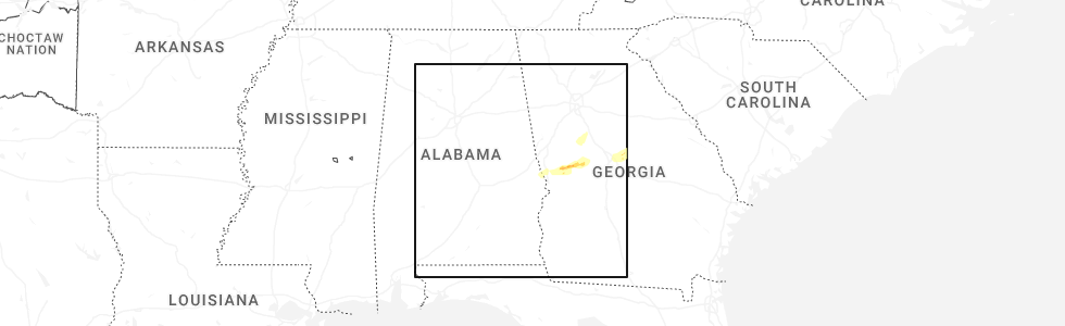
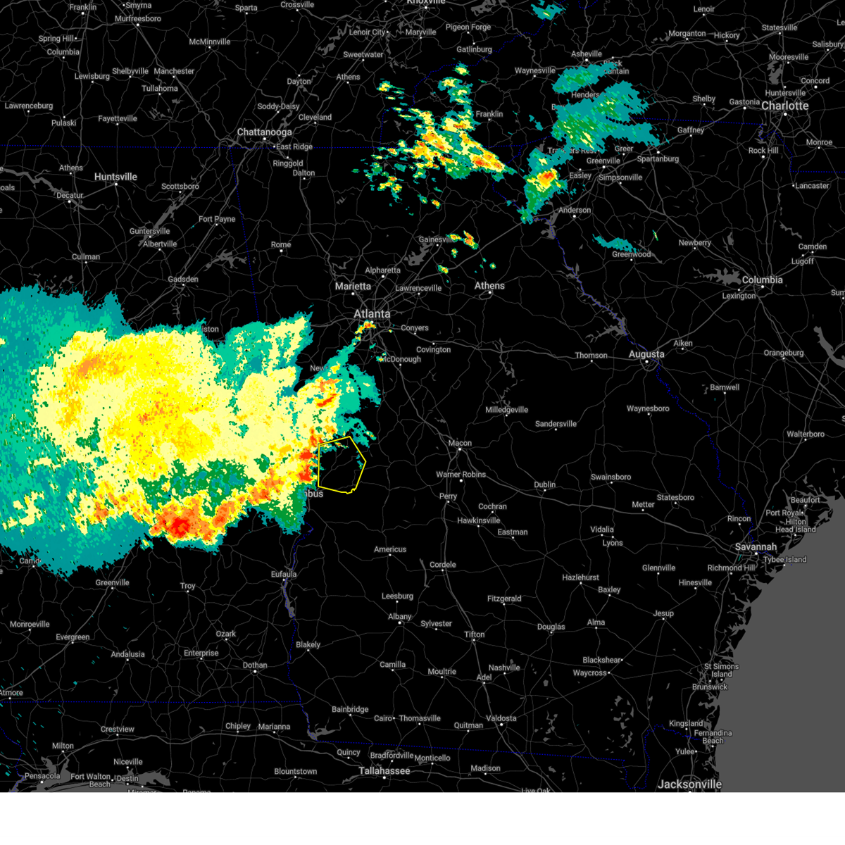
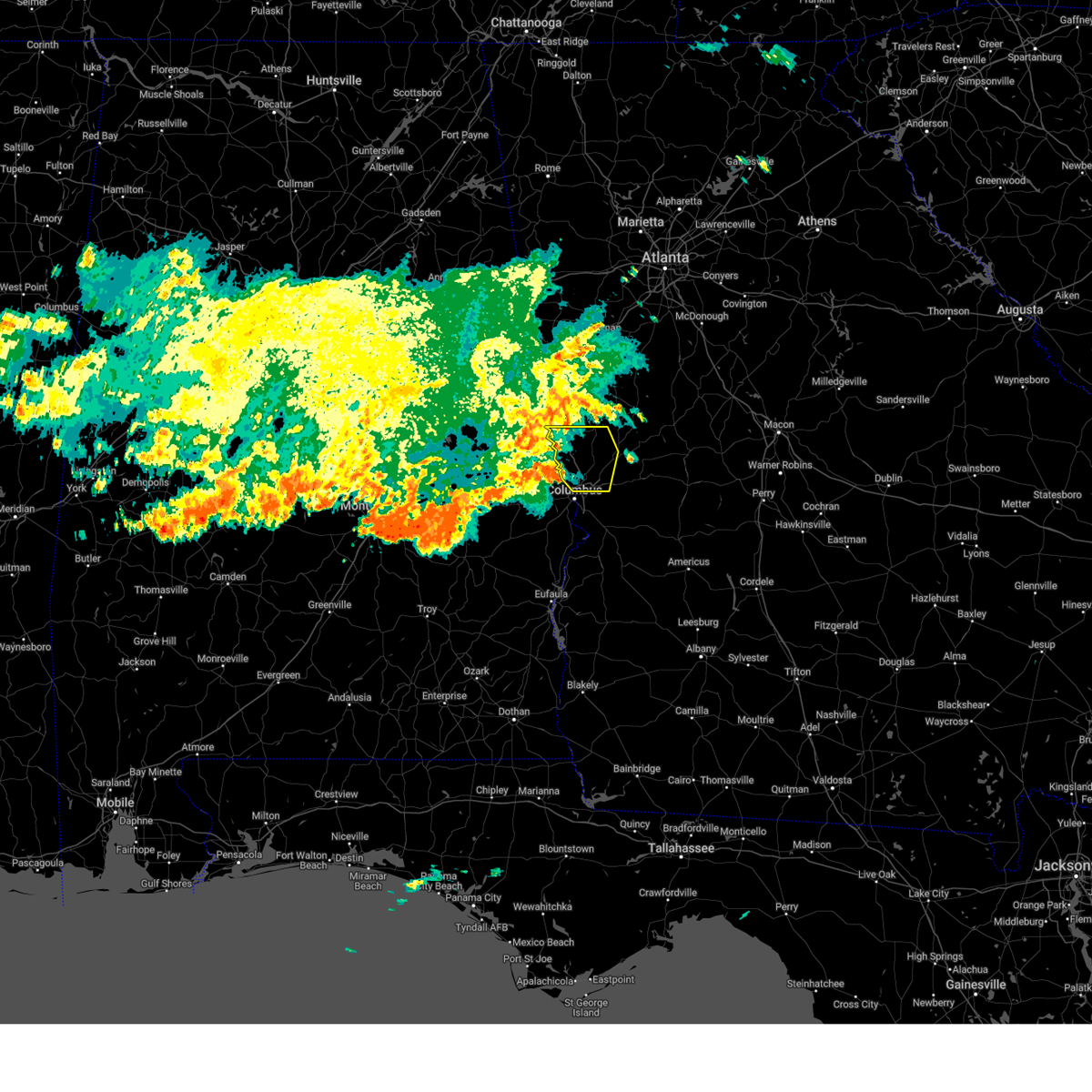
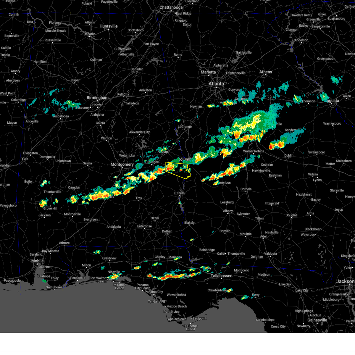
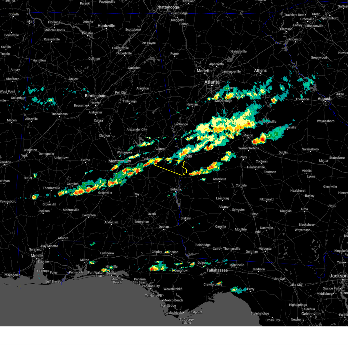
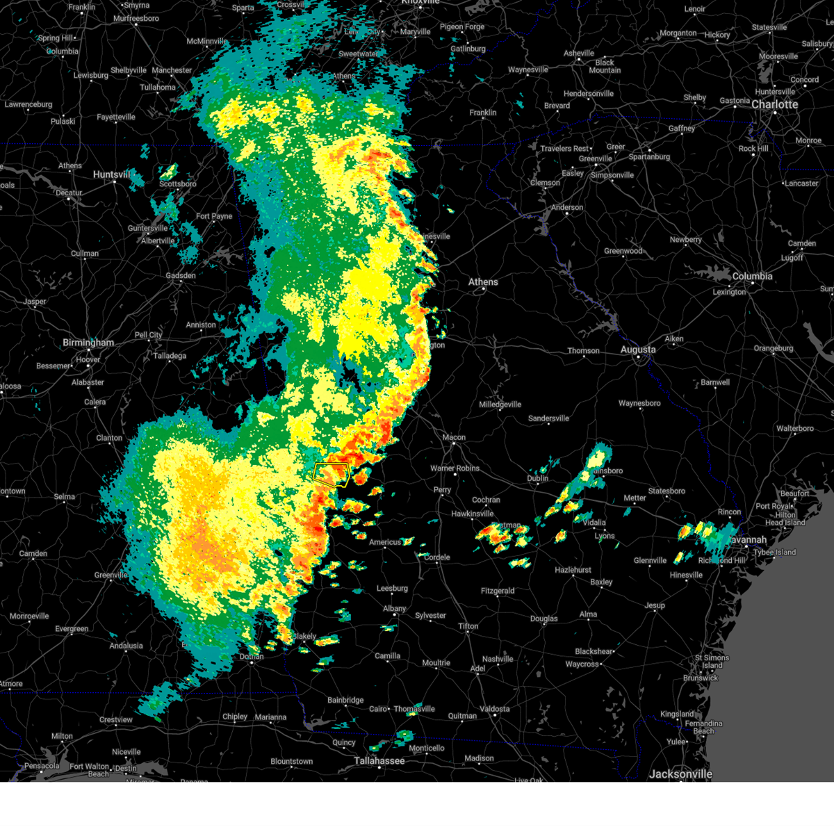
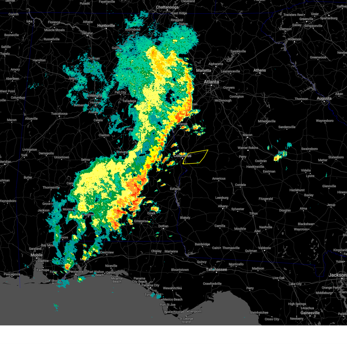
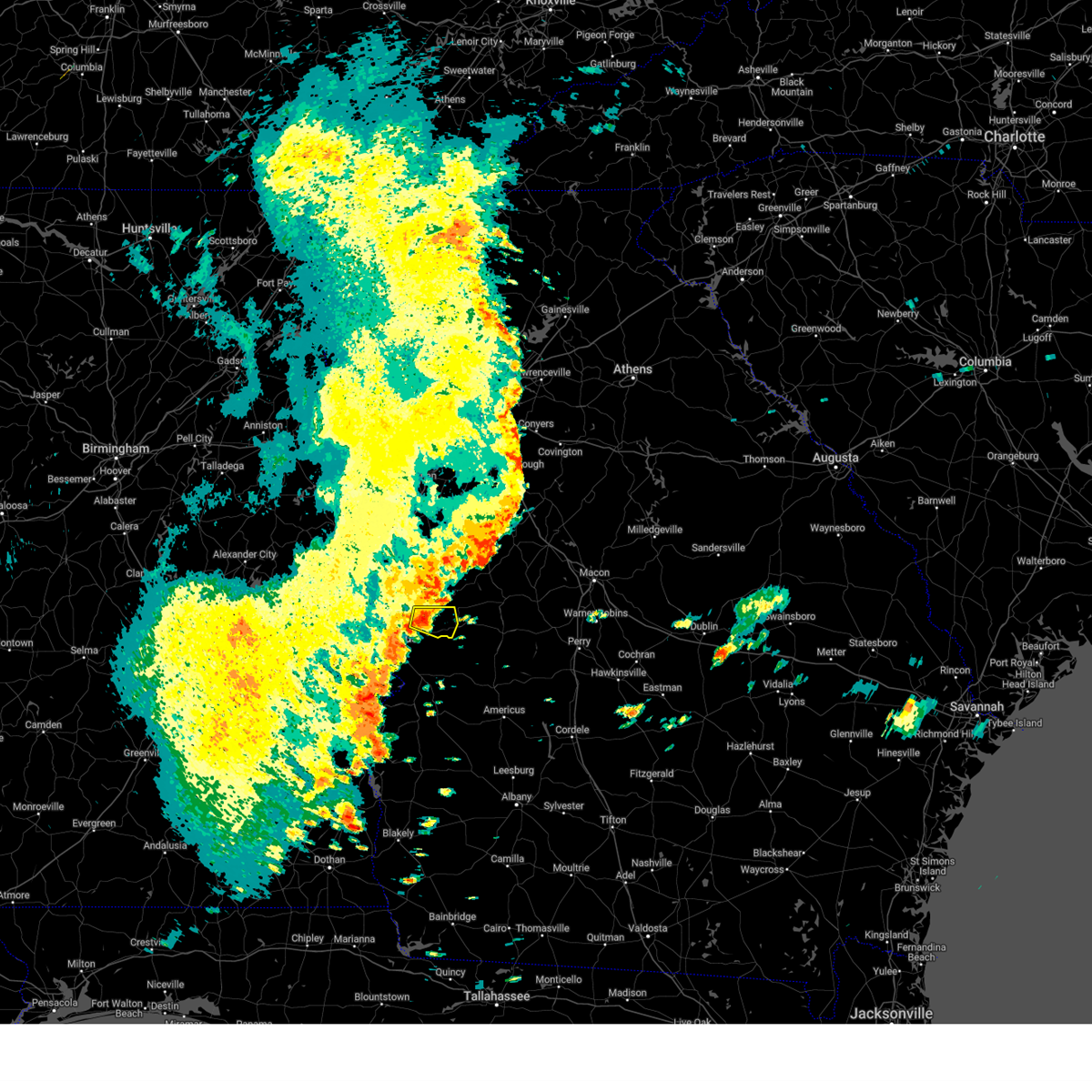
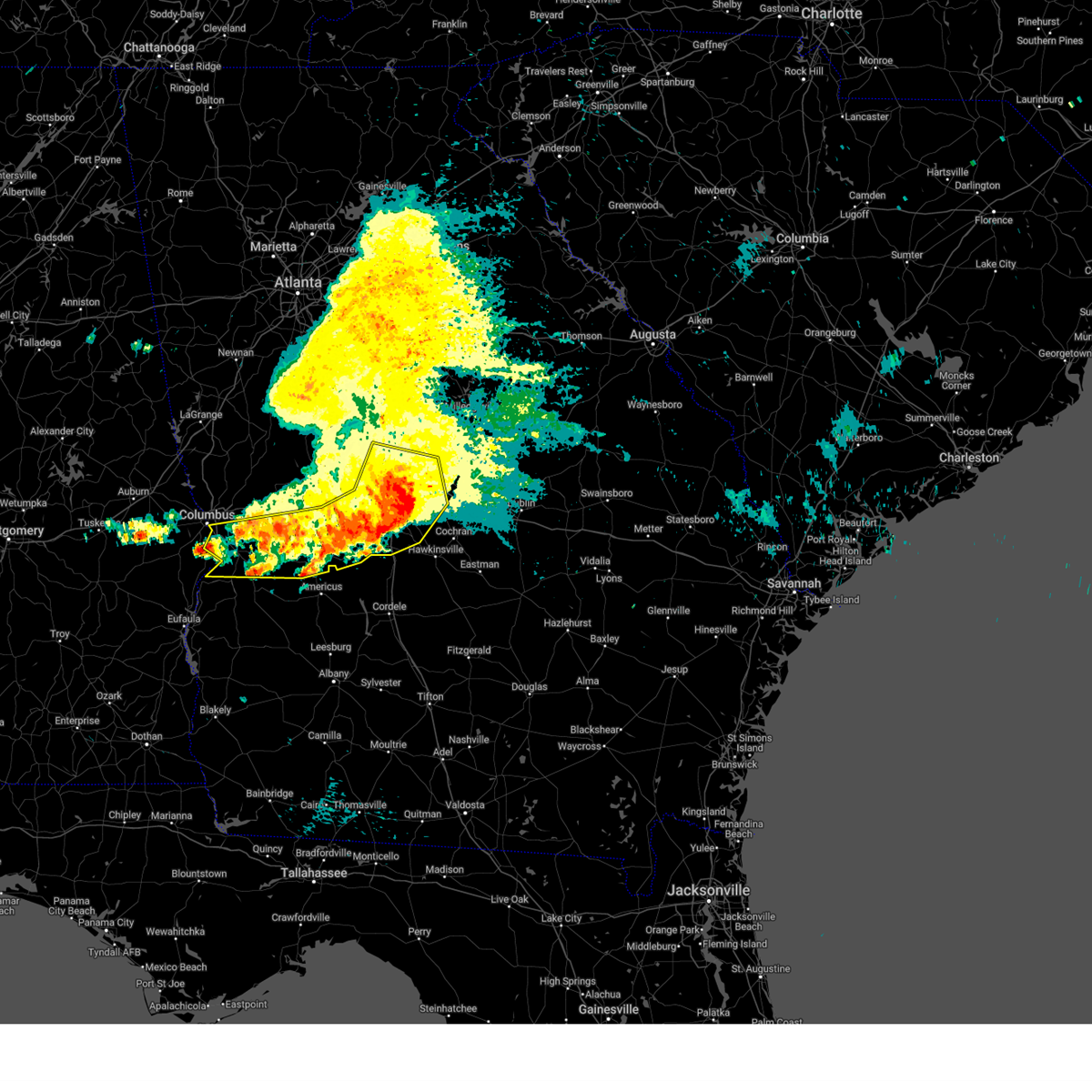
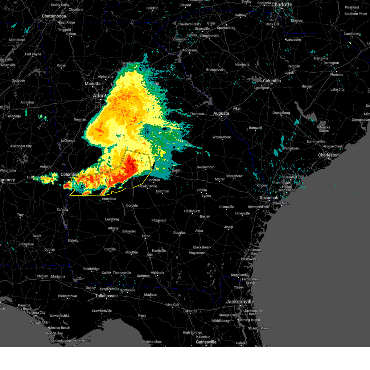
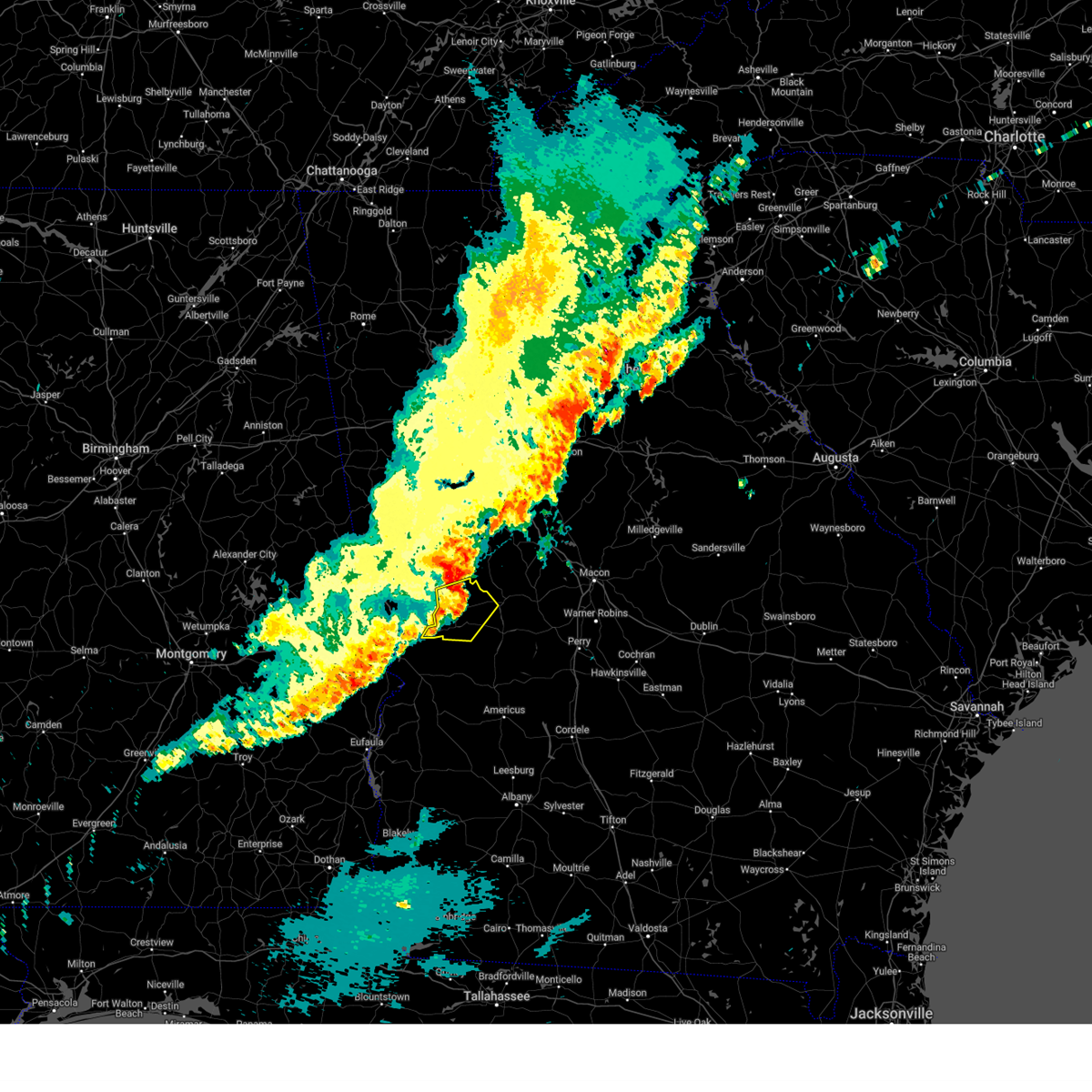
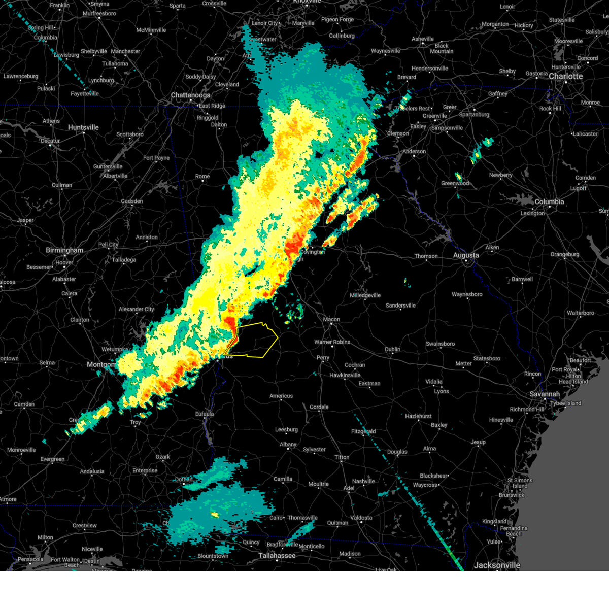
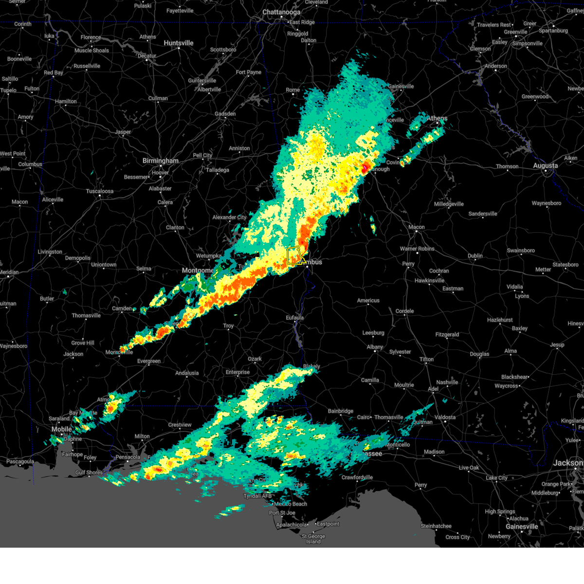
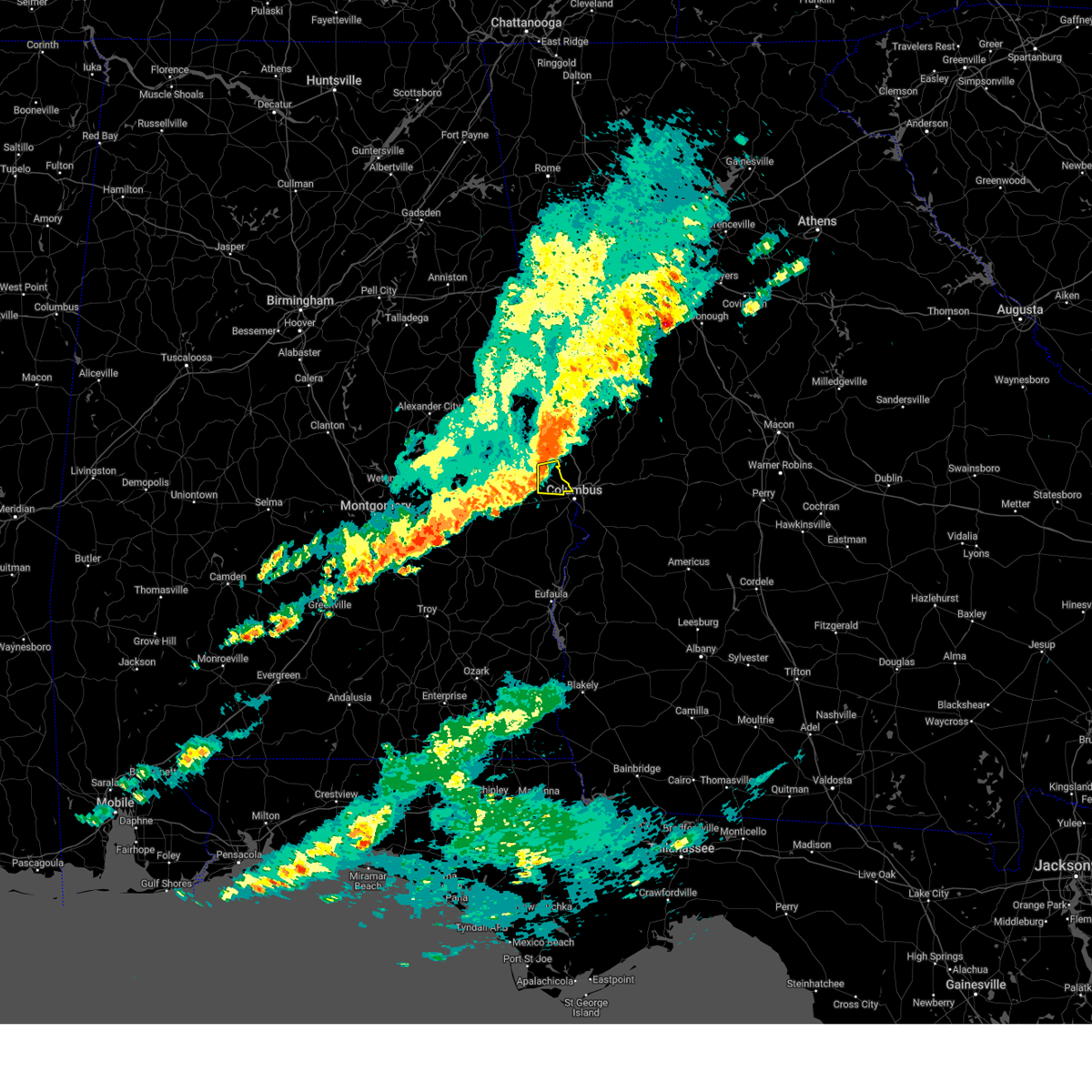
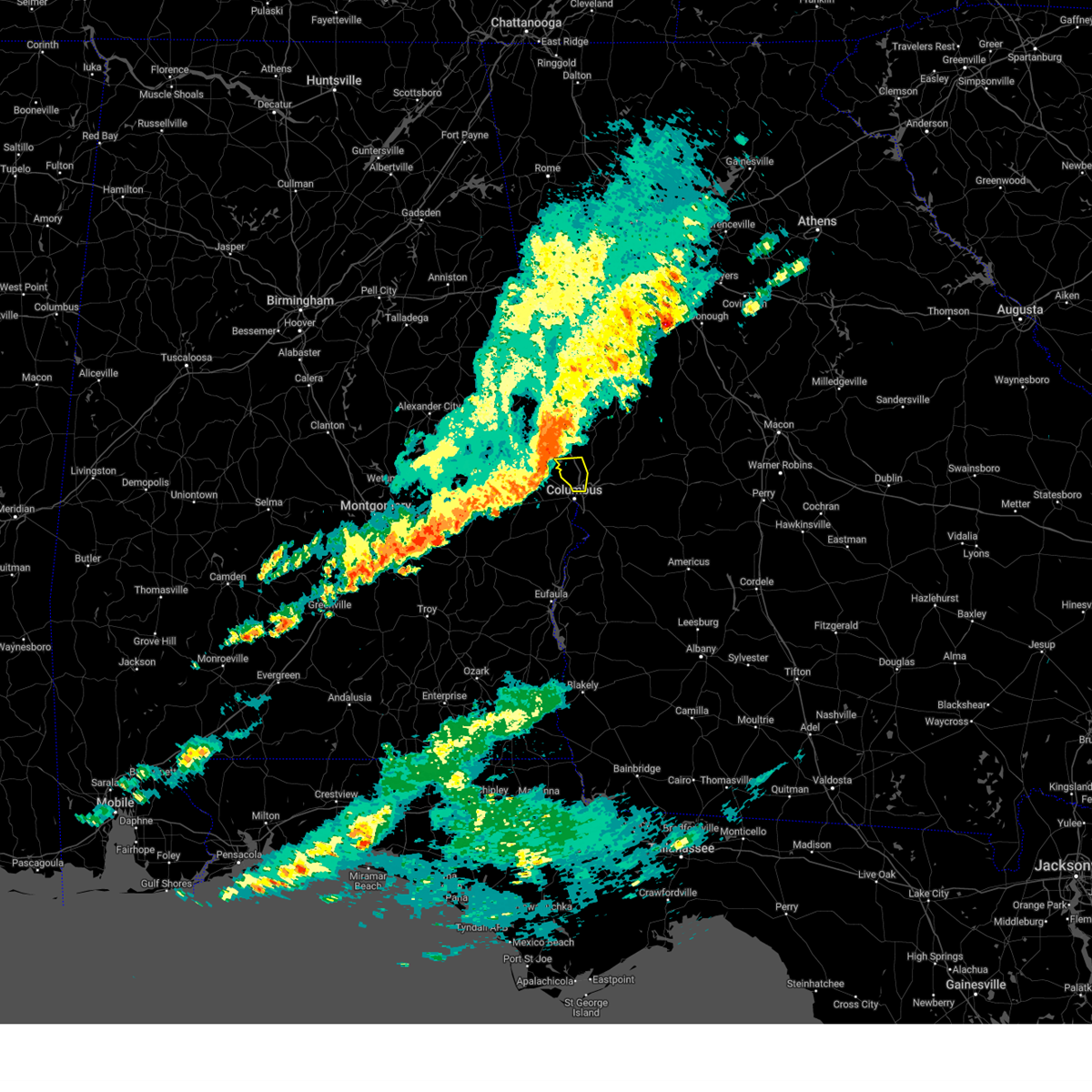
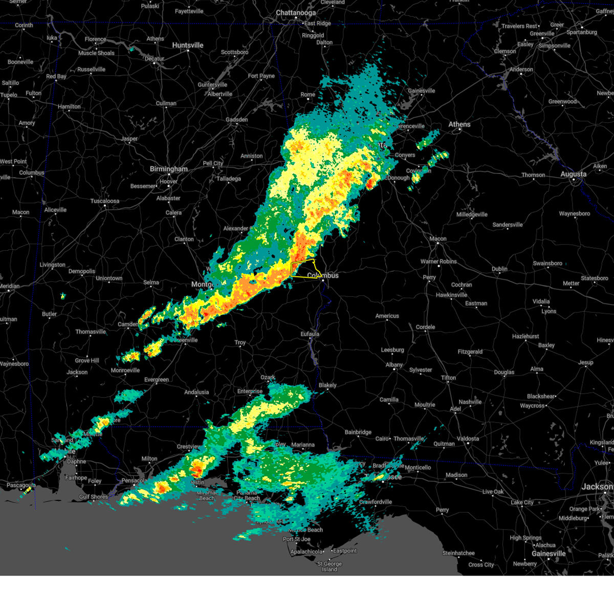
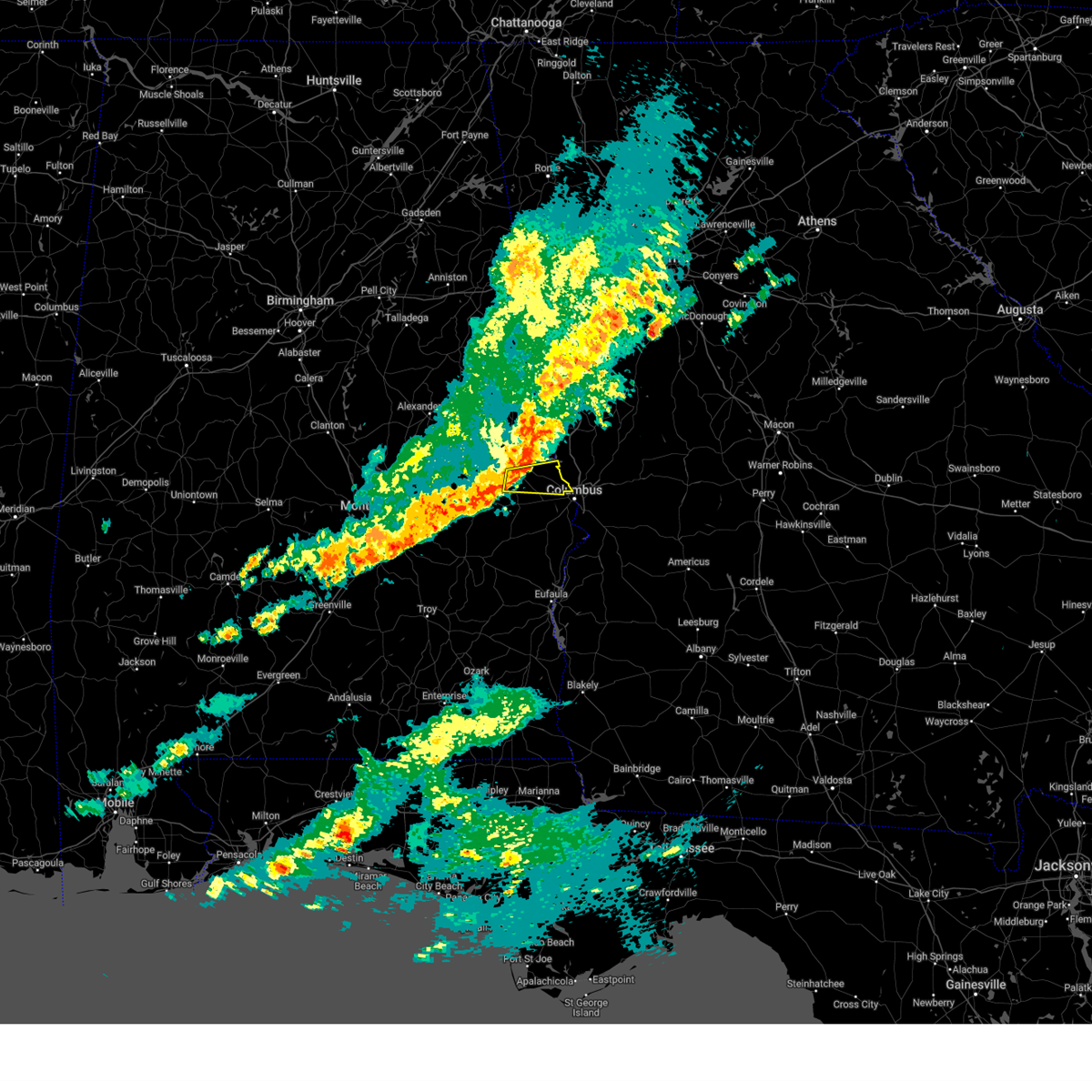
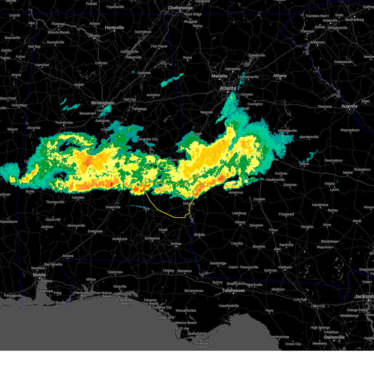
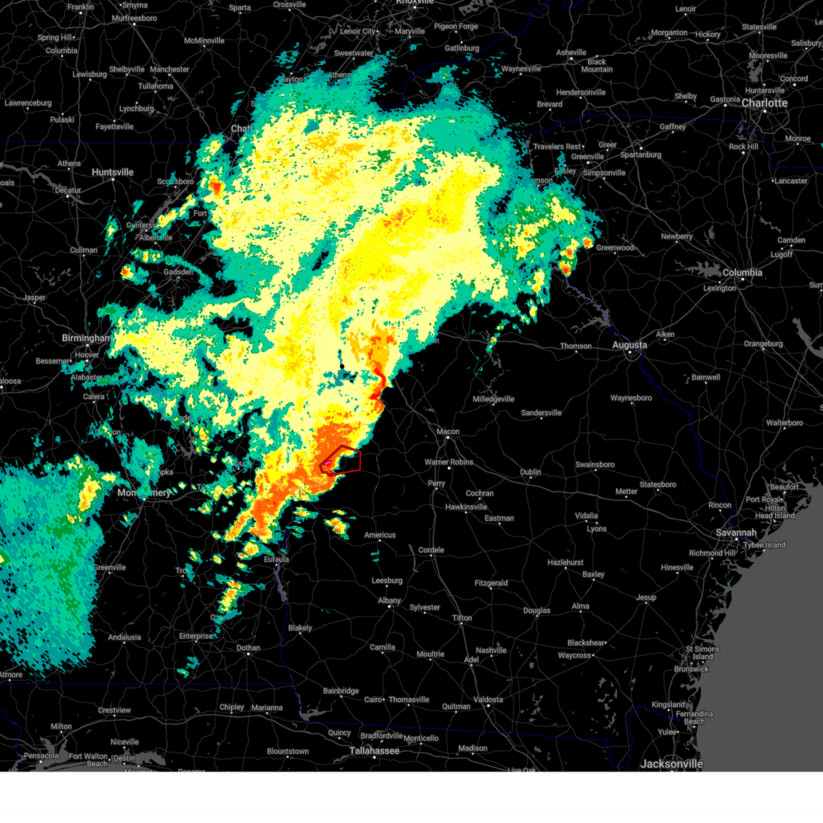
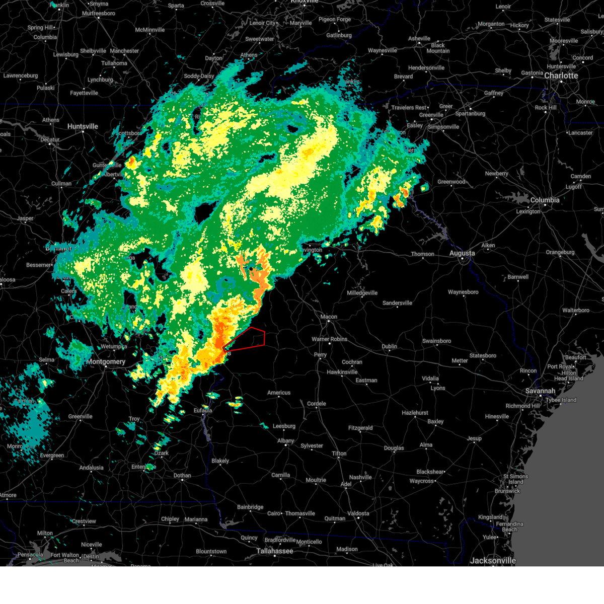
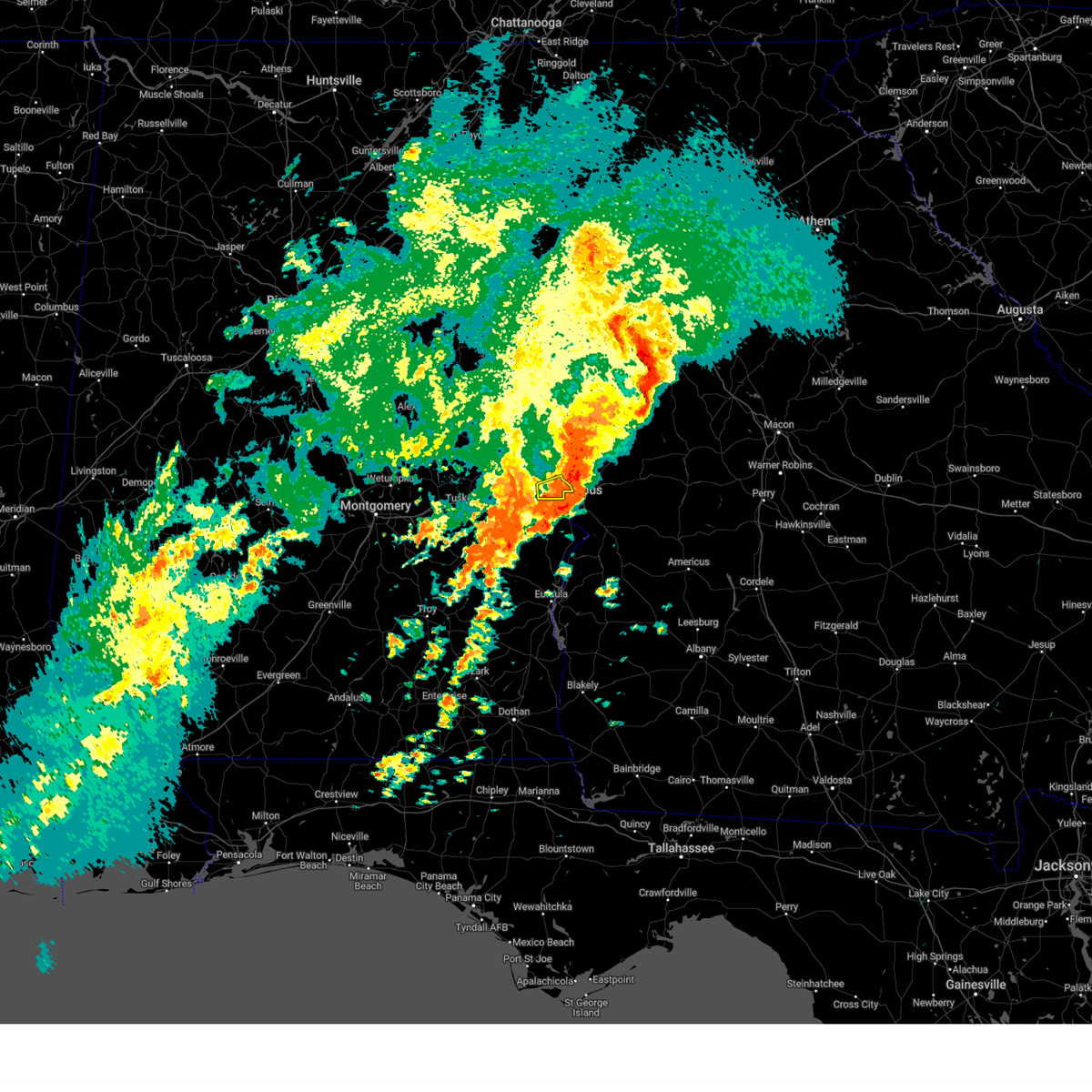
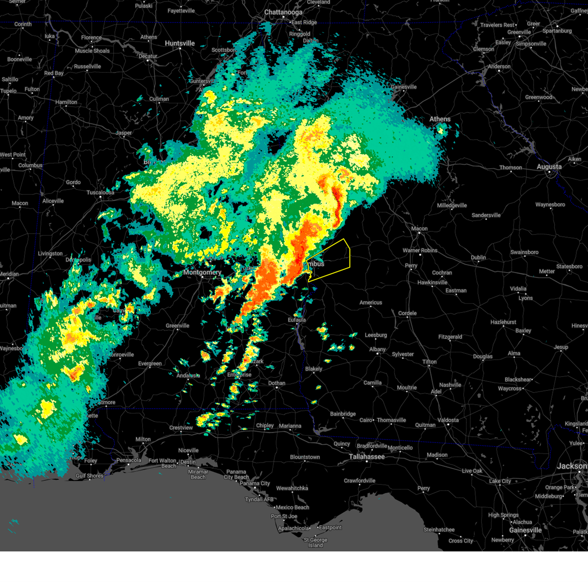
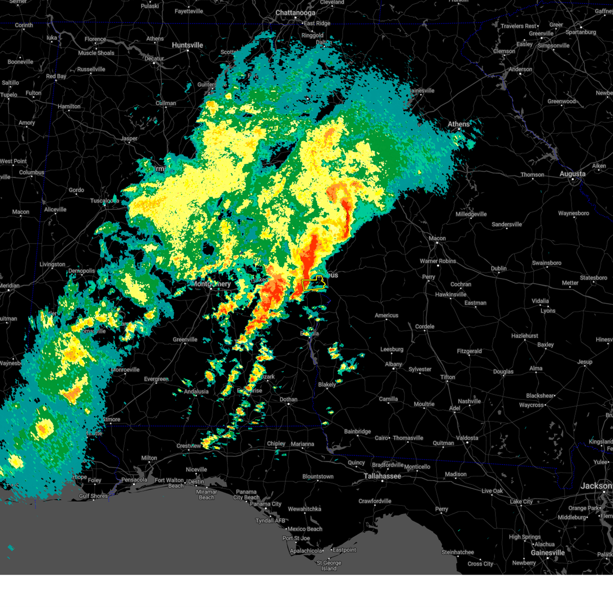
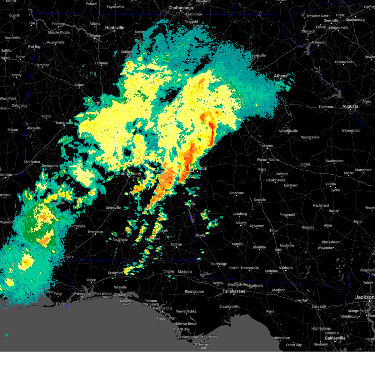
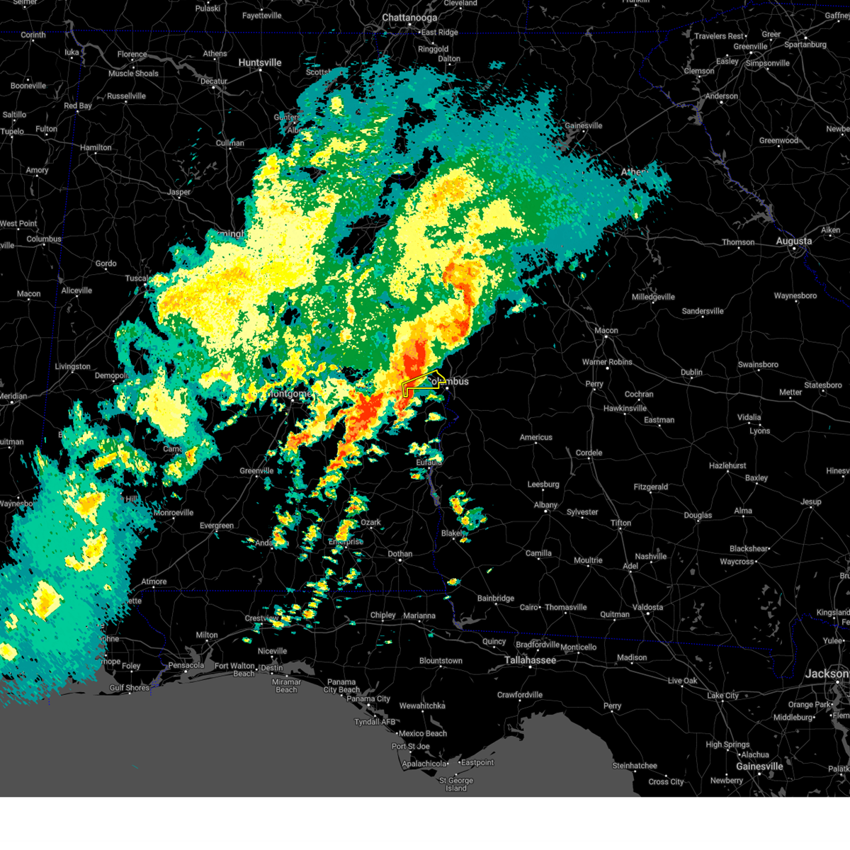
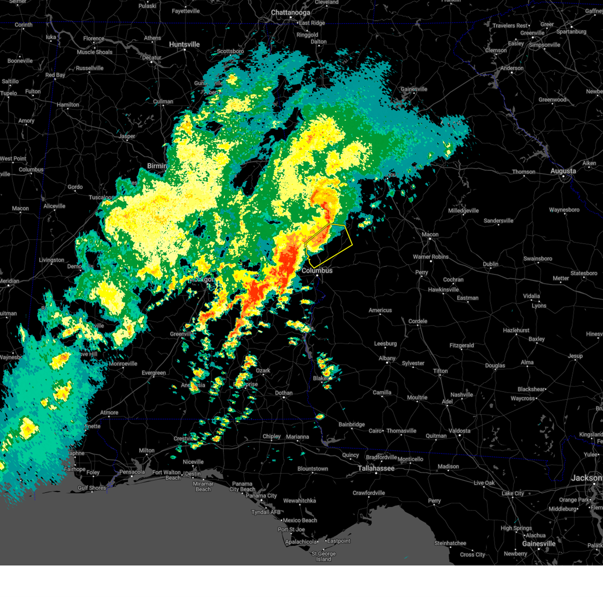
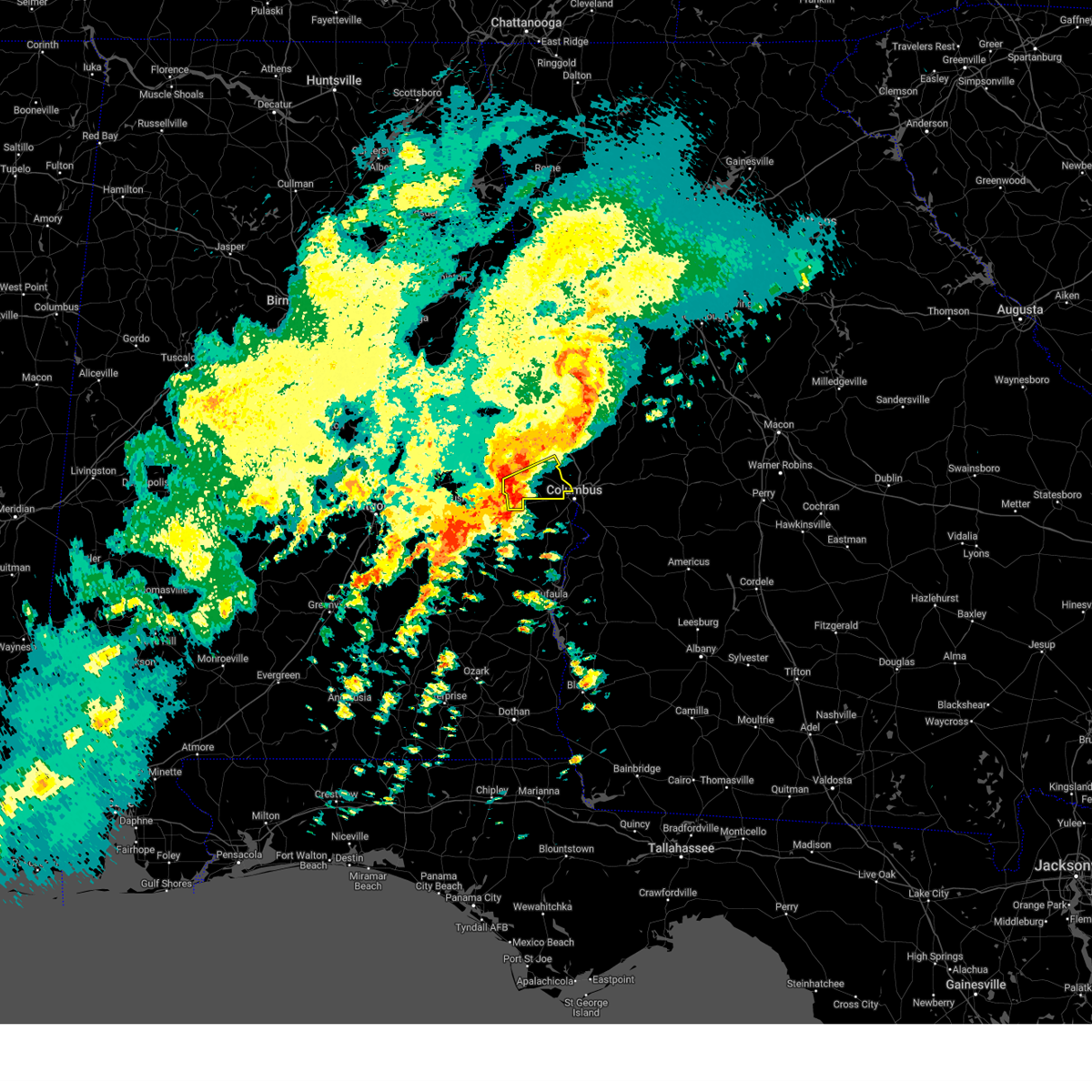
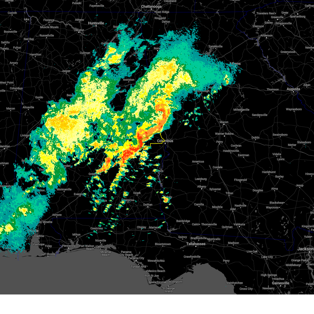
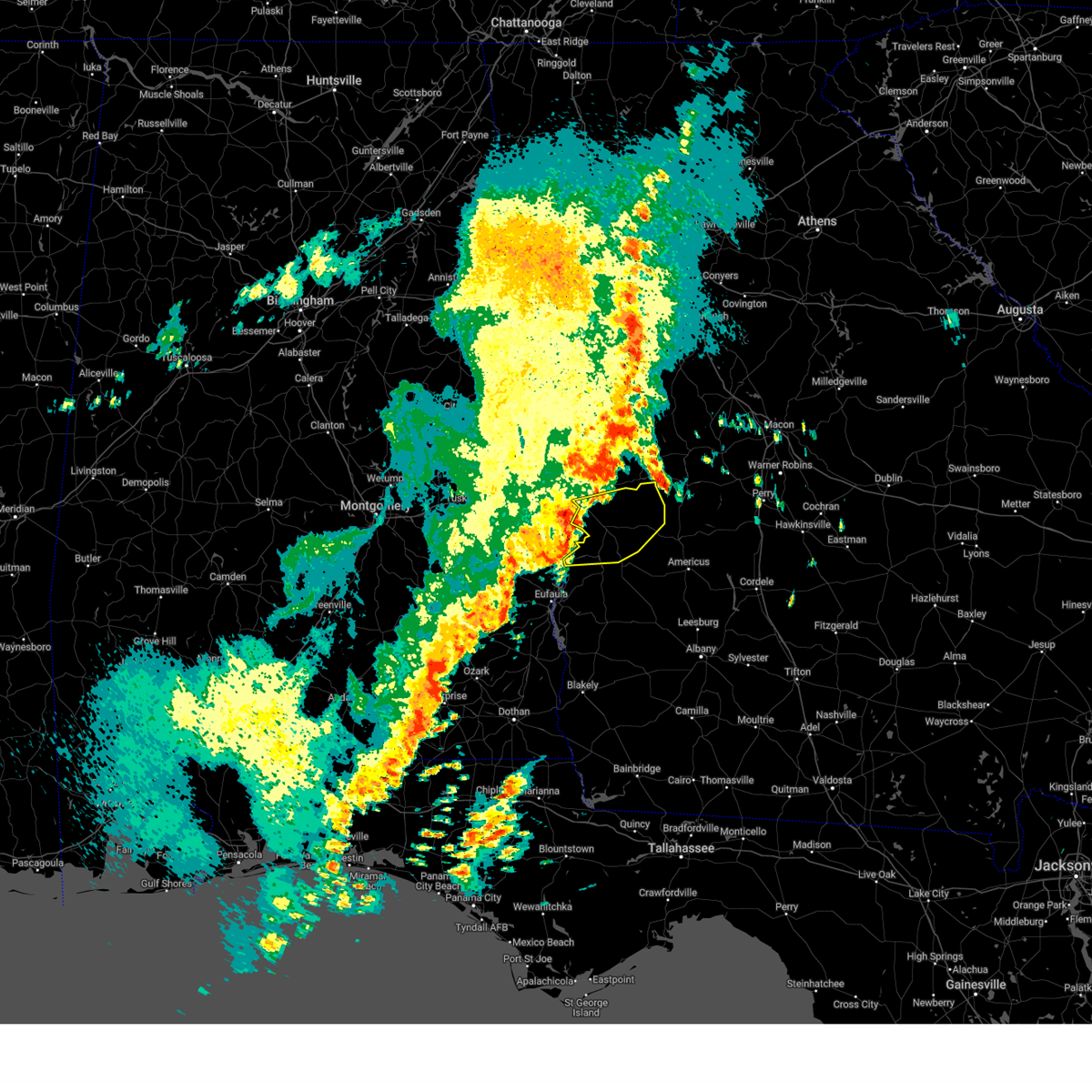
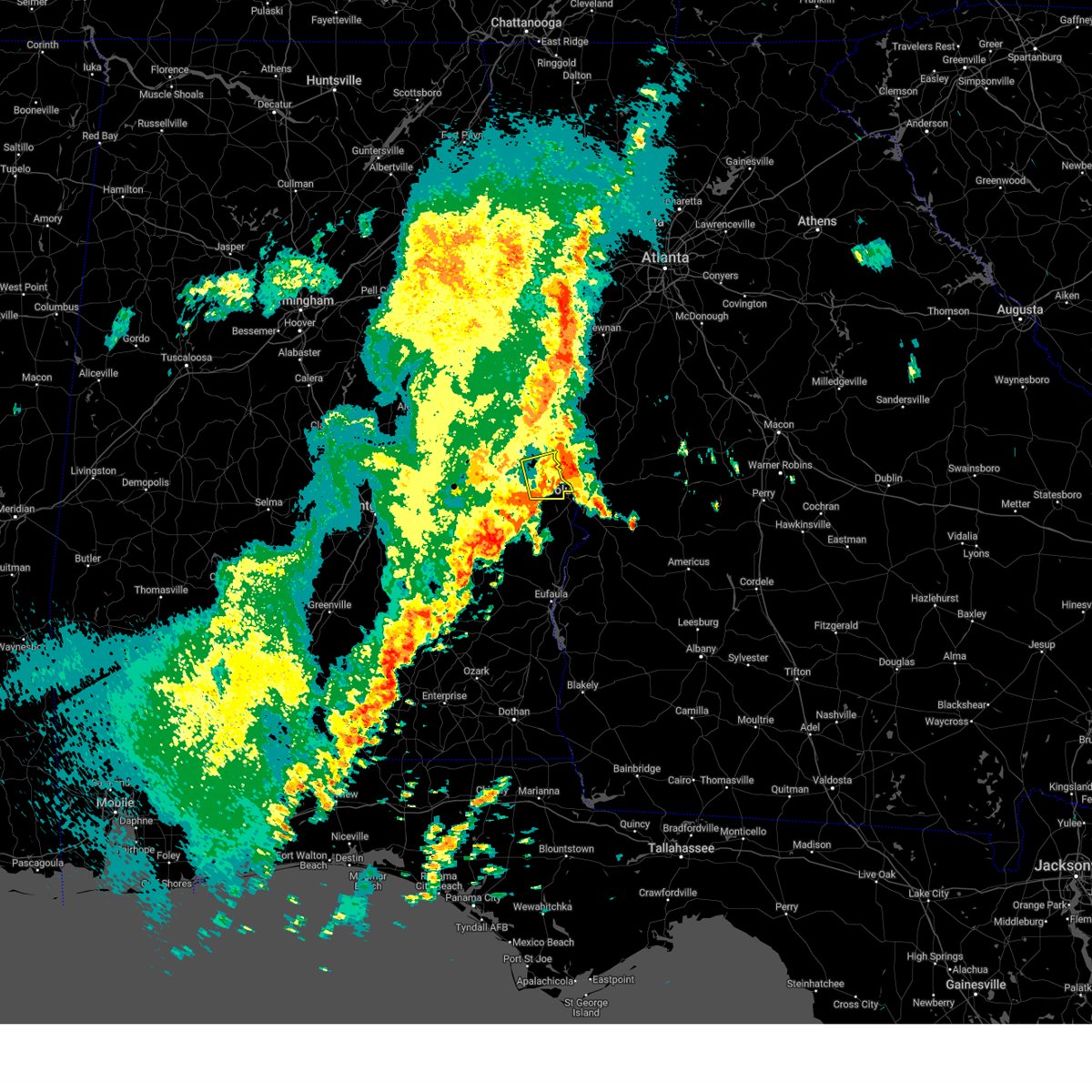
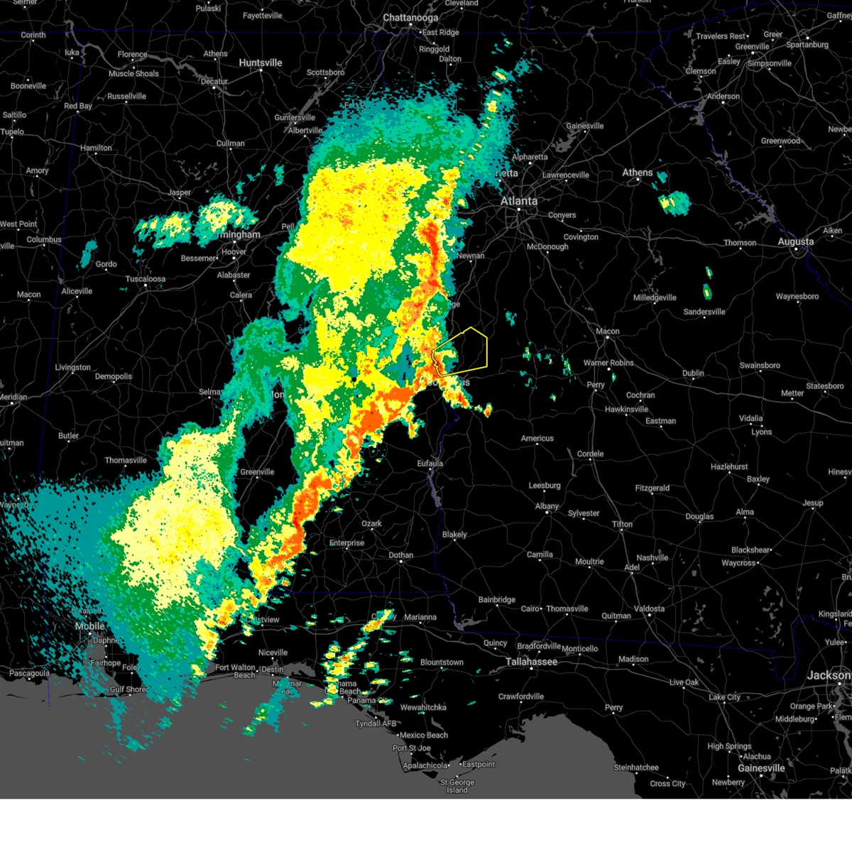
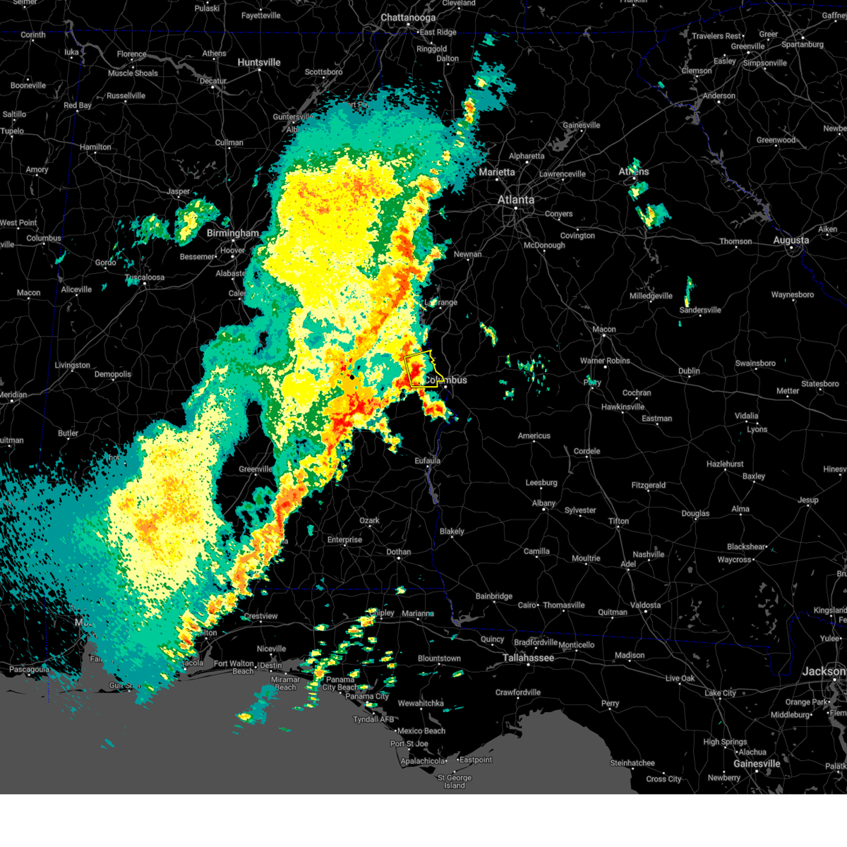
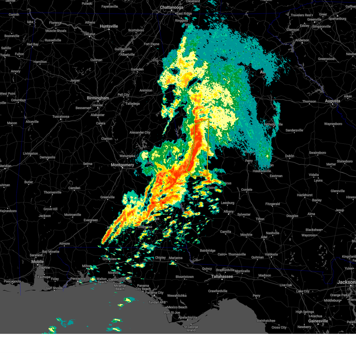
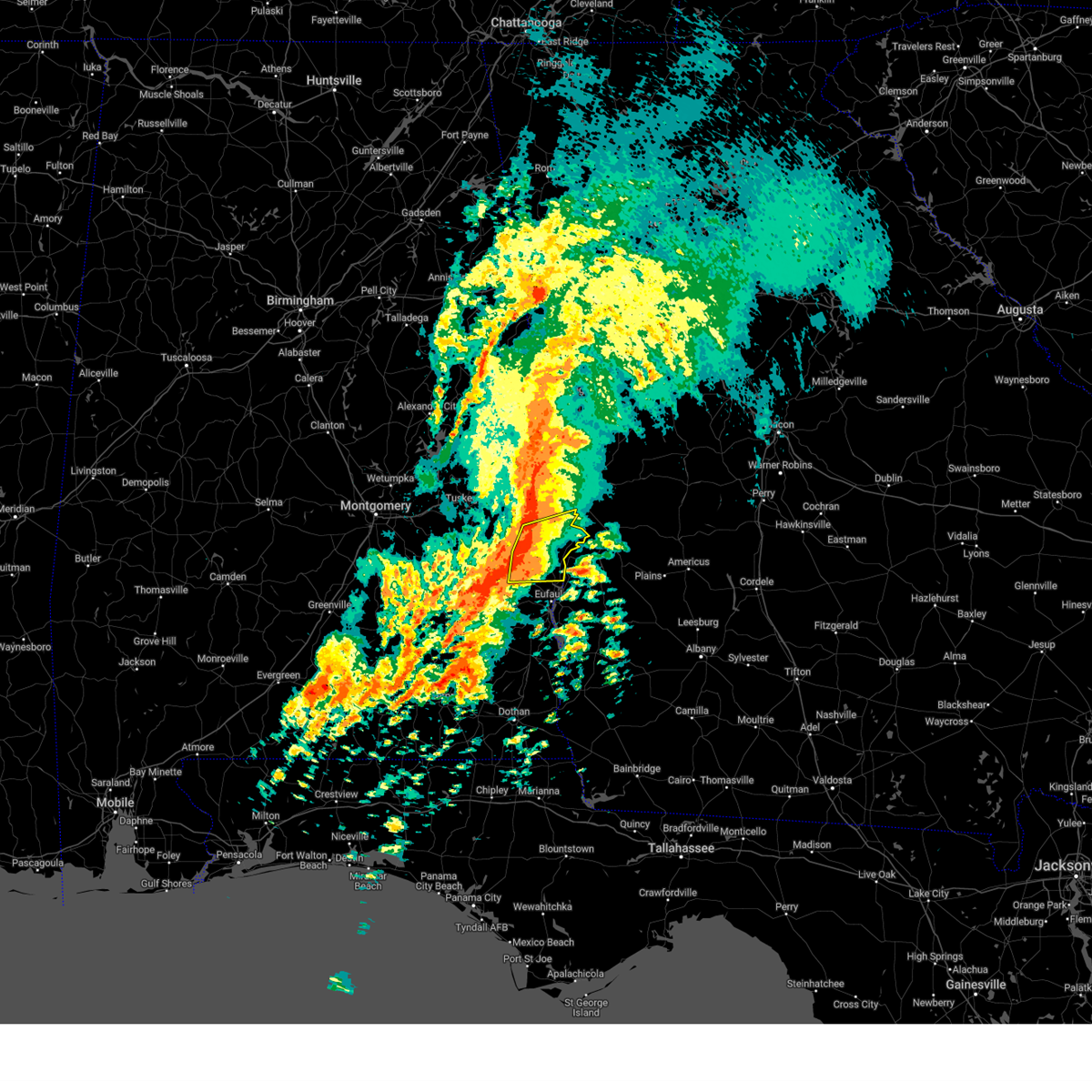
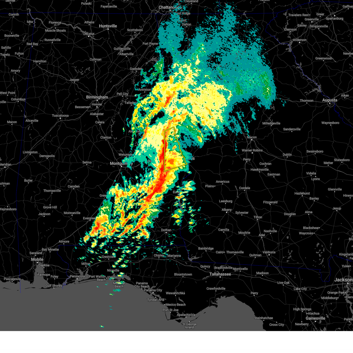
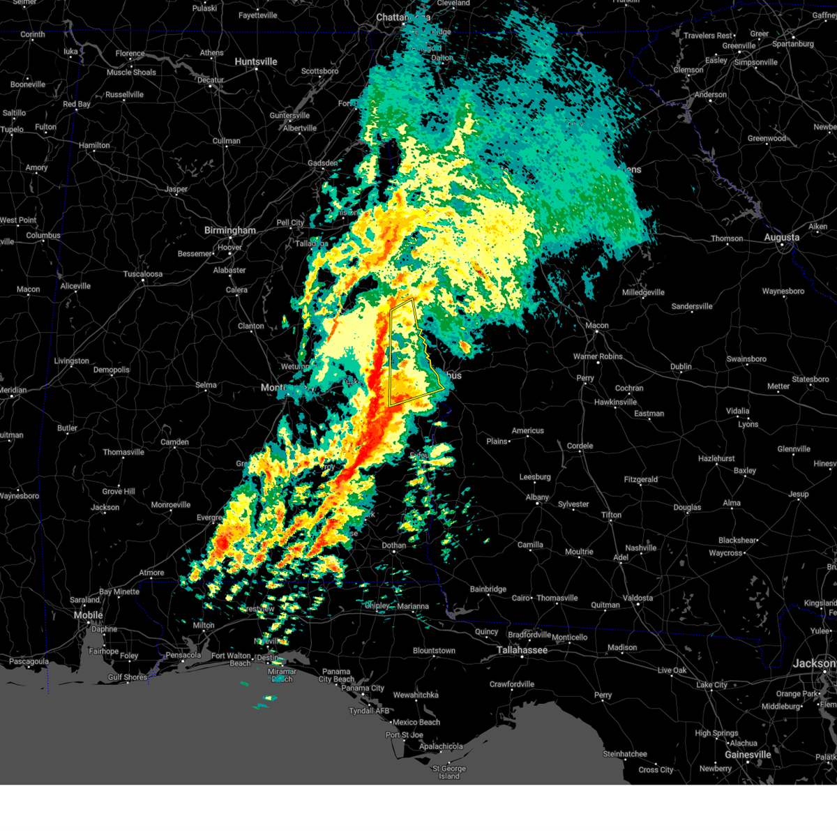
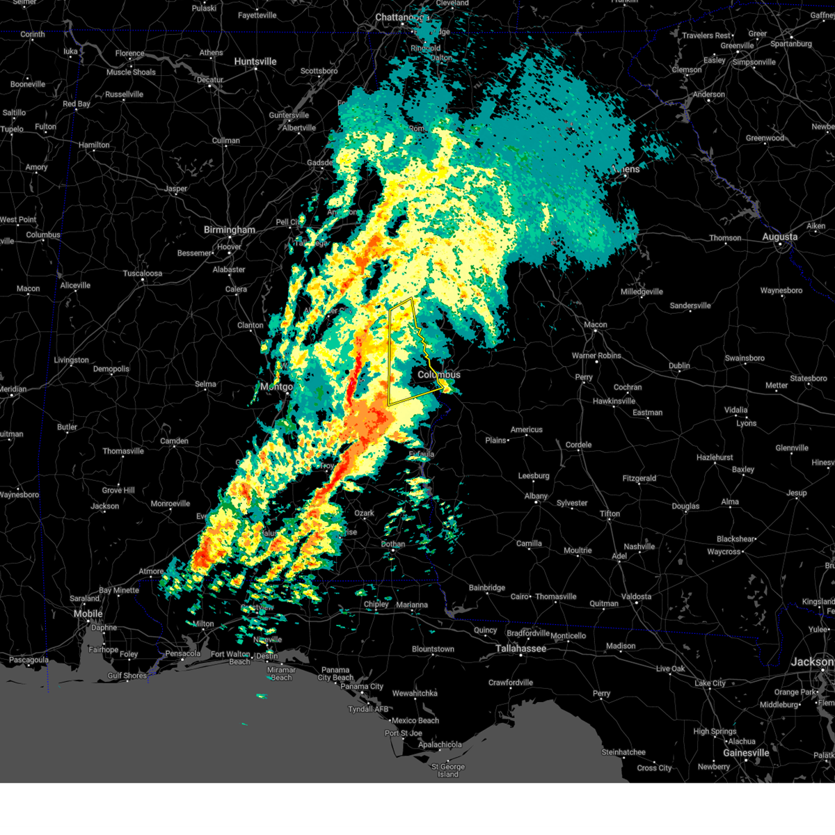
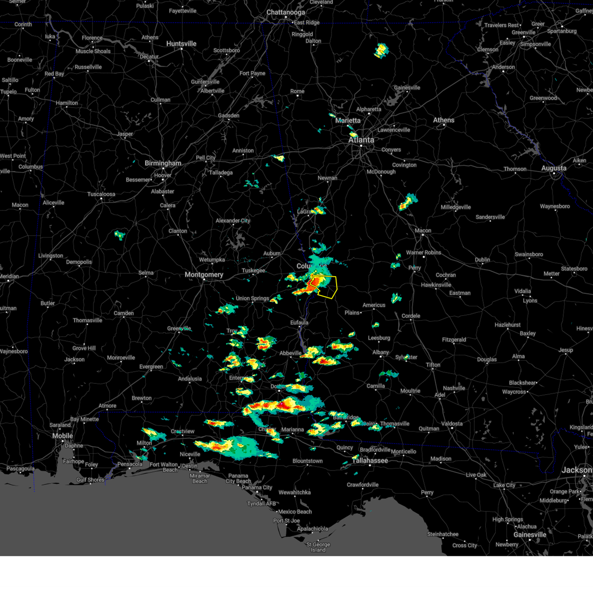
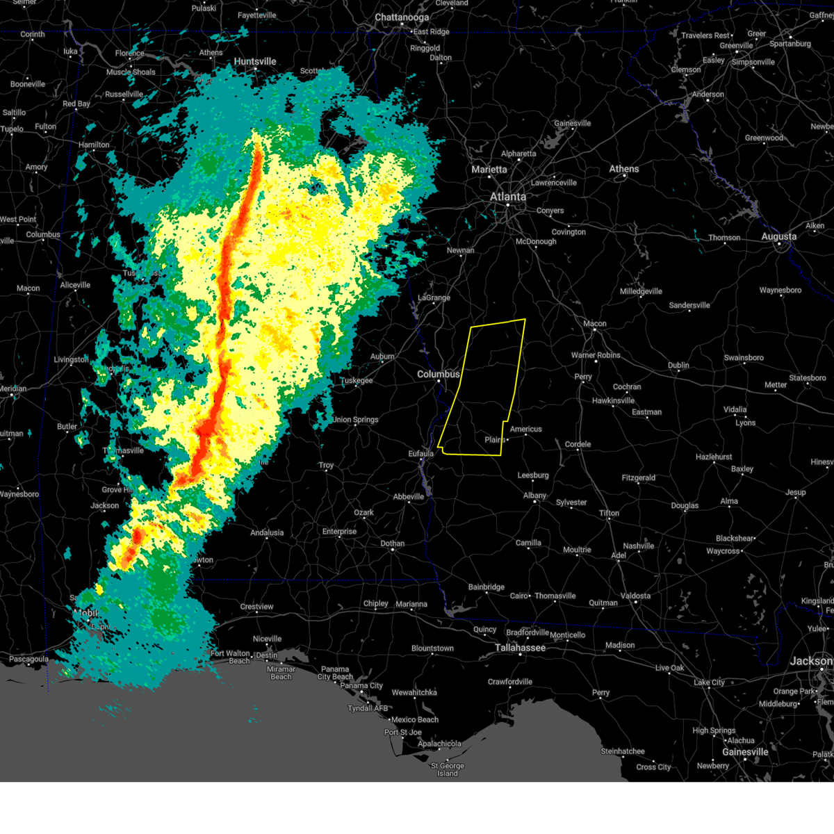
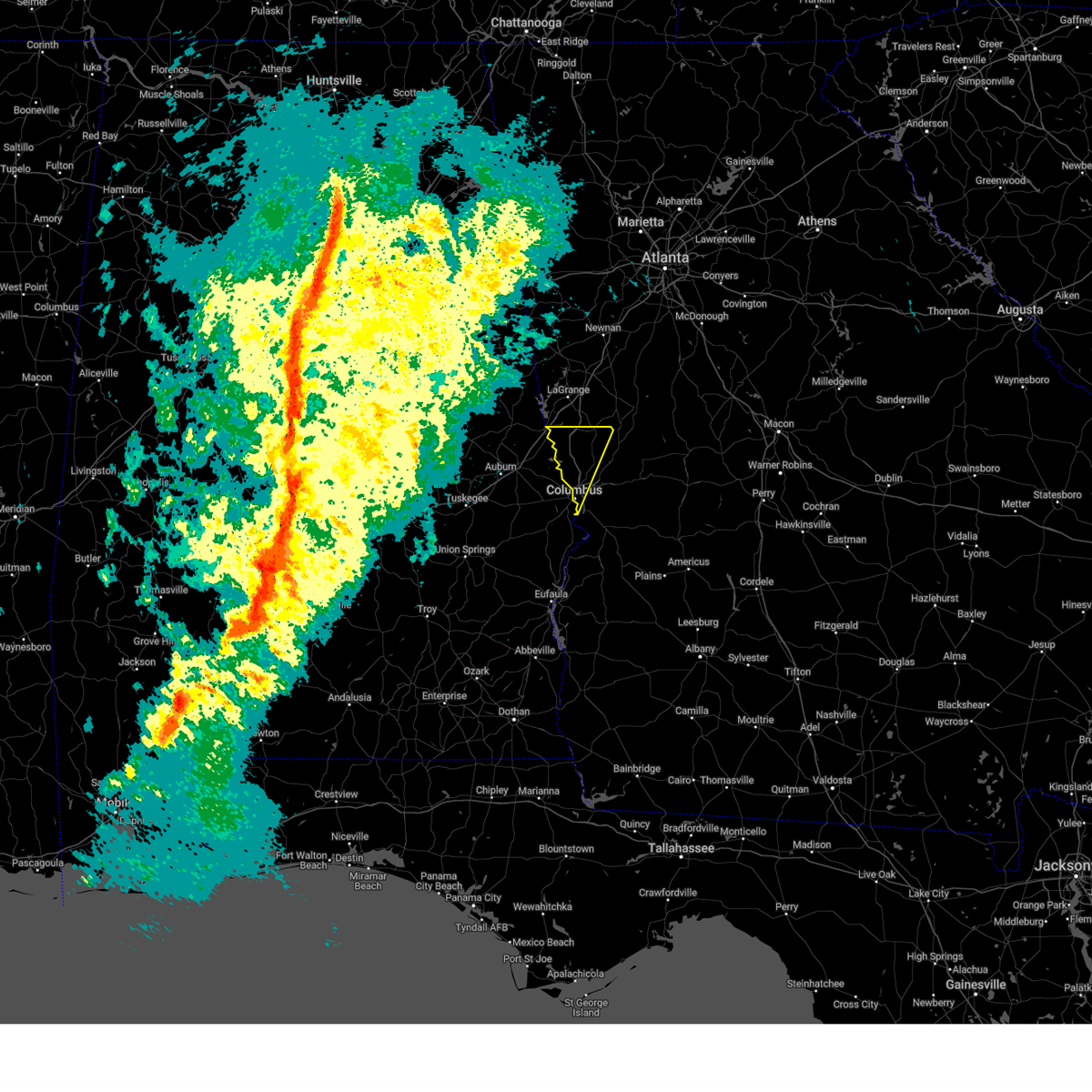
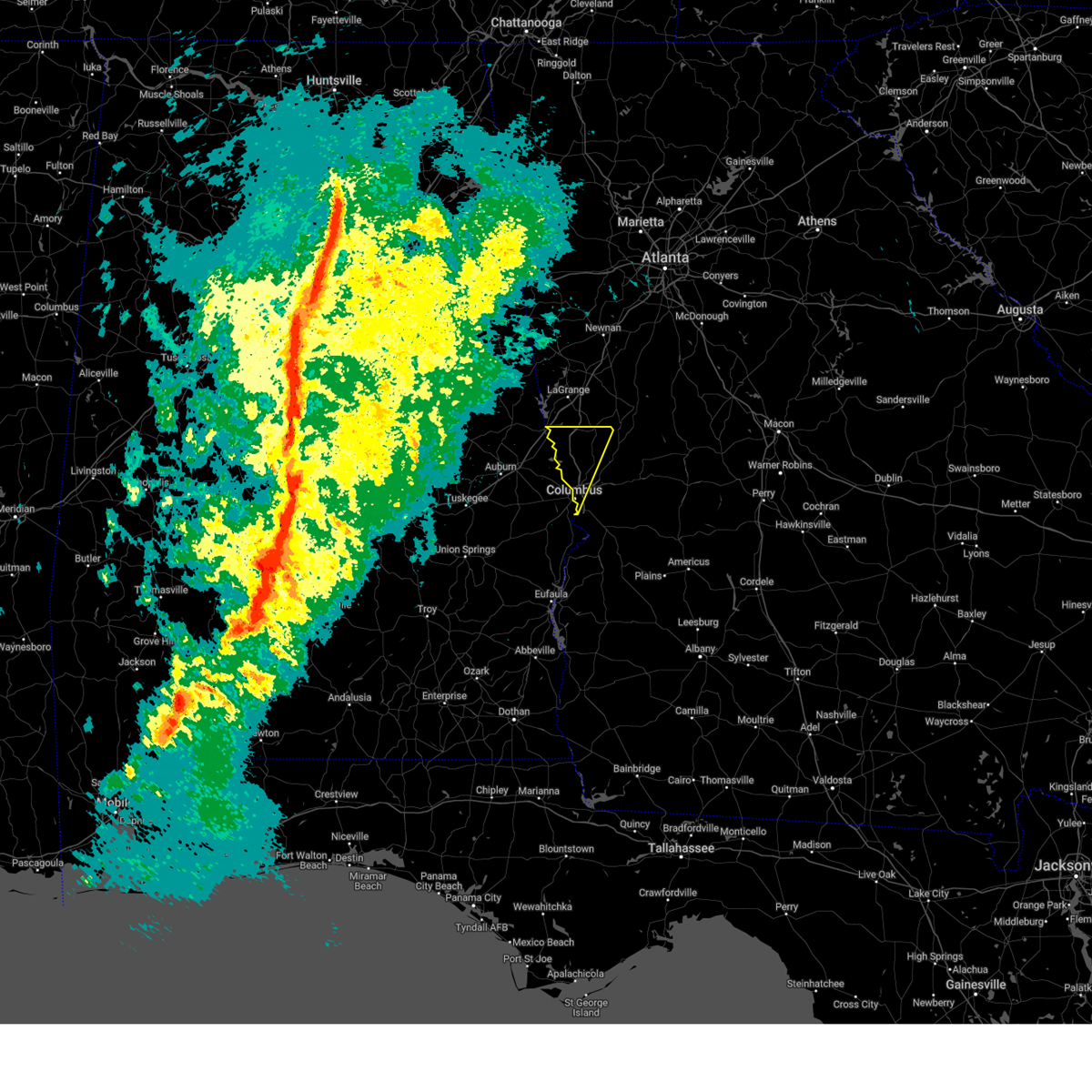
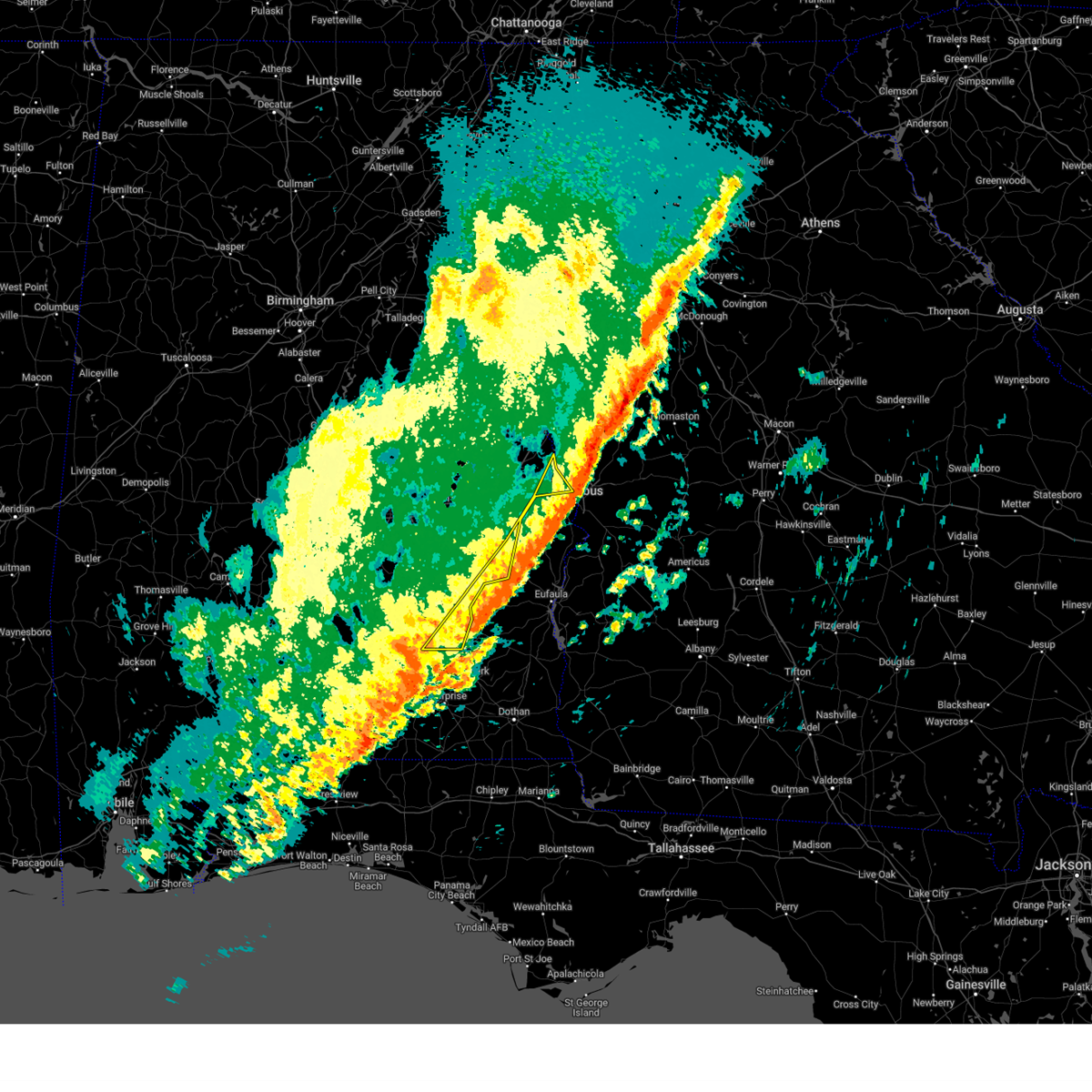
Hail Map for Columbus, GA
The Columbus, GA area has had 20 reports of on-the-ground hail by trained spotters, and has been under severe weather warnings 127 times during the past 12 months. Doppler radar has detected hail at or near Columbus, GA on 129 occasions, including 10 occasions during the past year.
| Name: | Columbus, GA |
| Where Located: | 37.7 miles ESE of Auburn, AL |
| Map: | Google Map for Columbus, GA |
| Population: | 189885 |
| Housing Units: | 82690 |
| More Info: | Search Google for Columbus, GA |
1
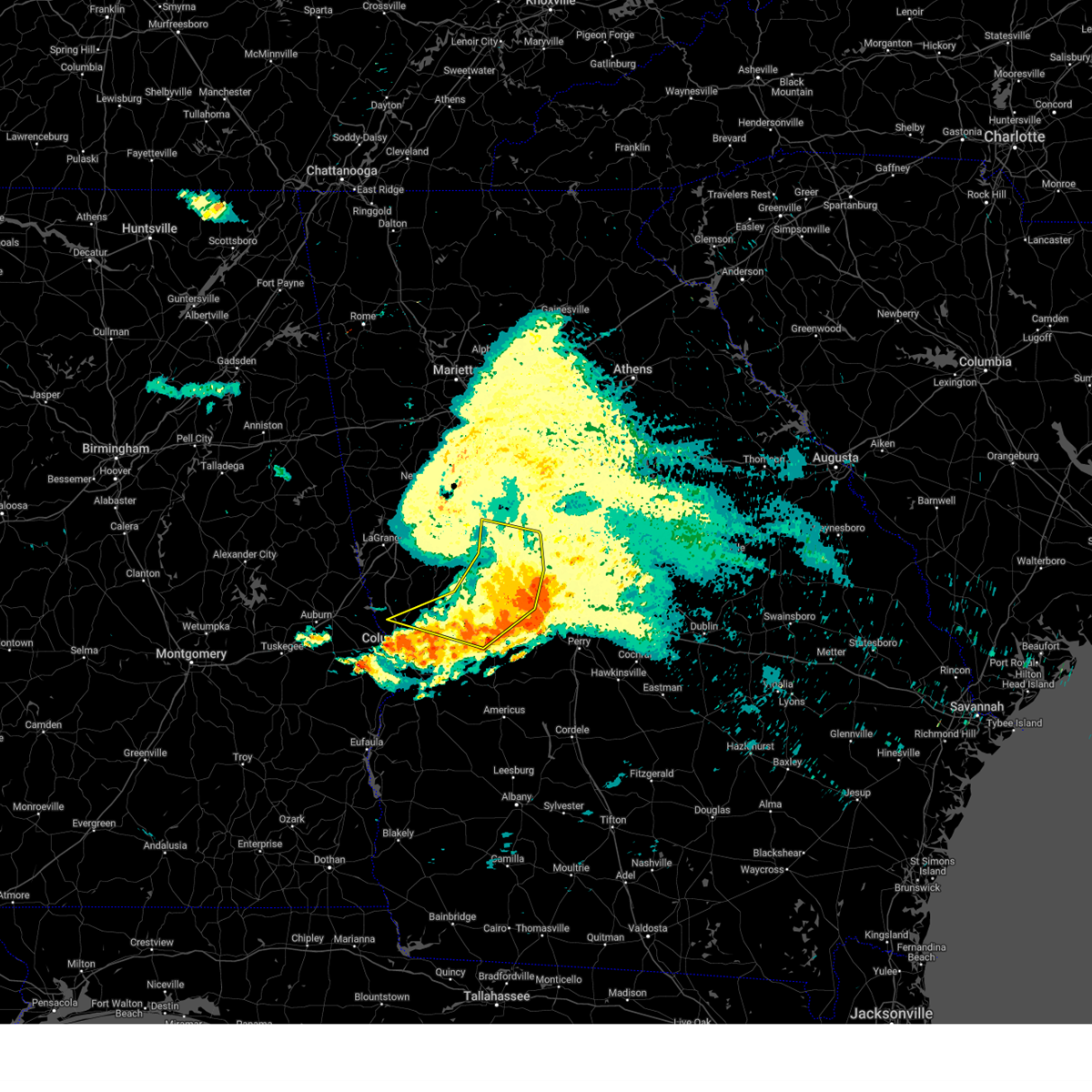
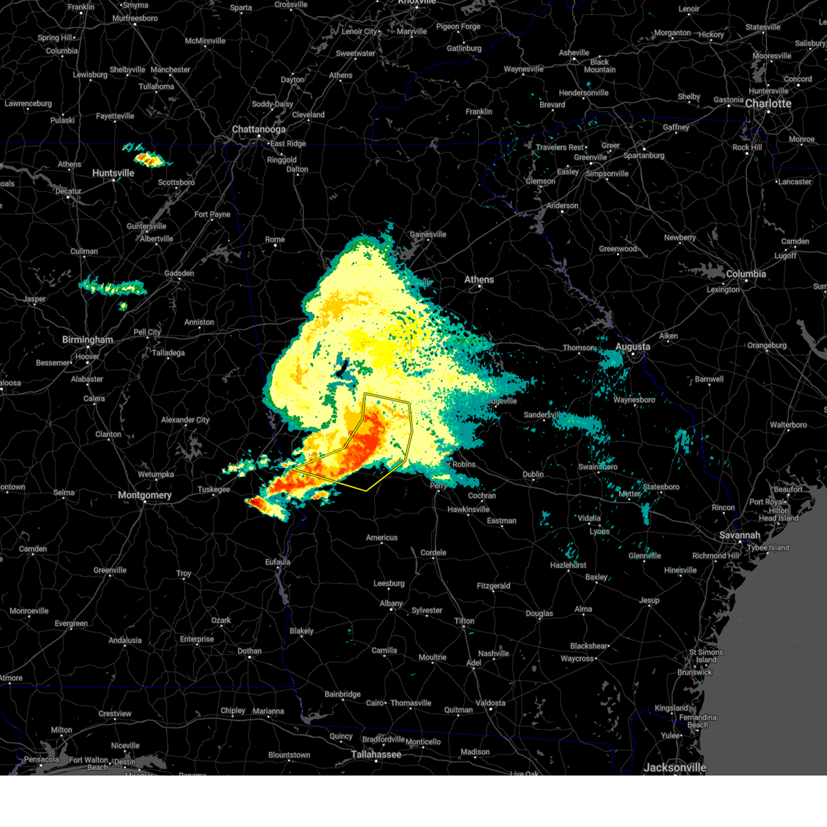
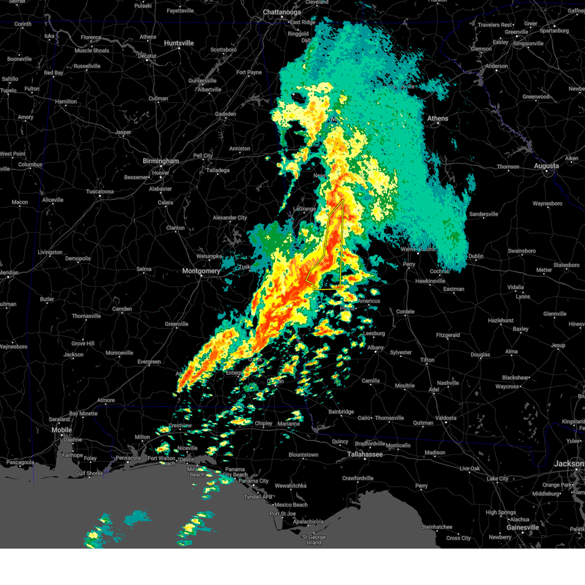
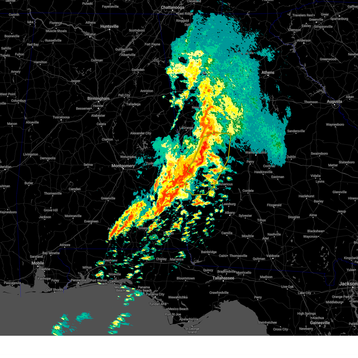
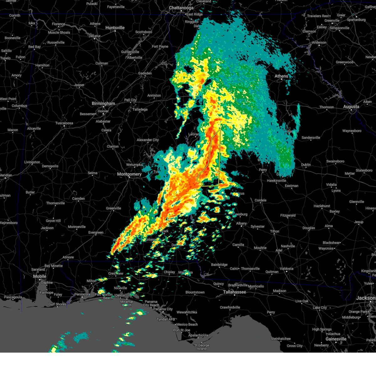
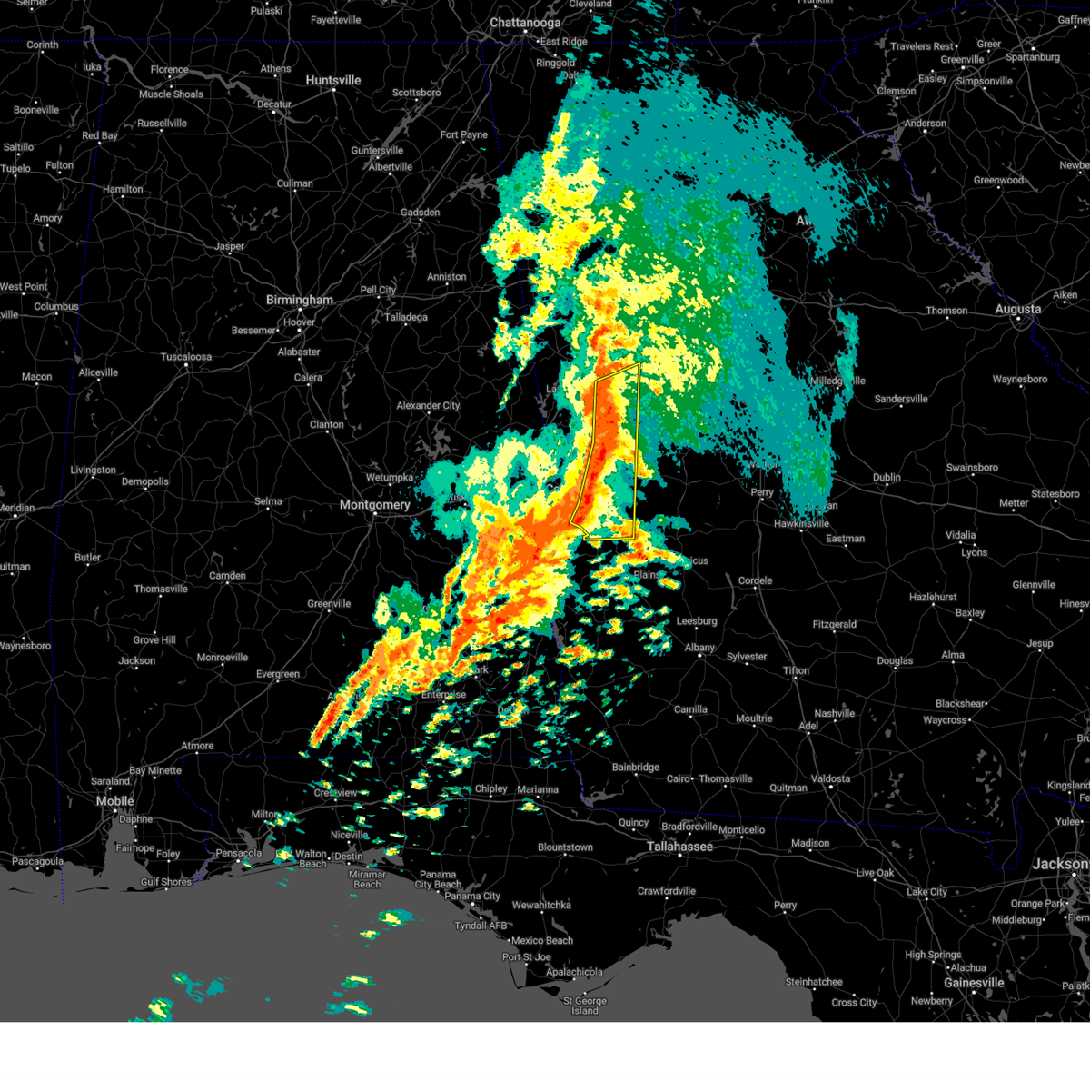
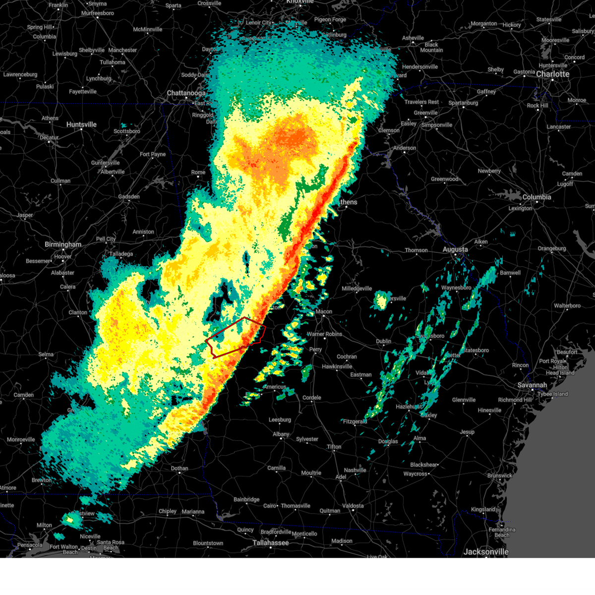
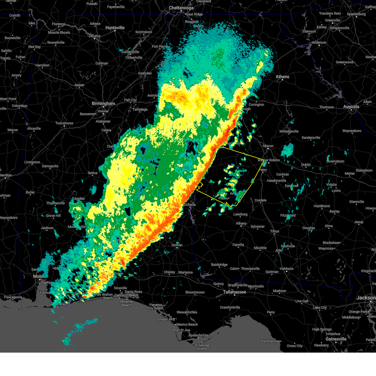
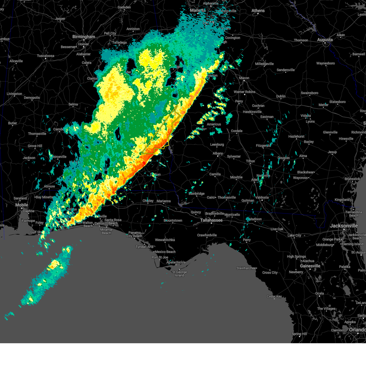
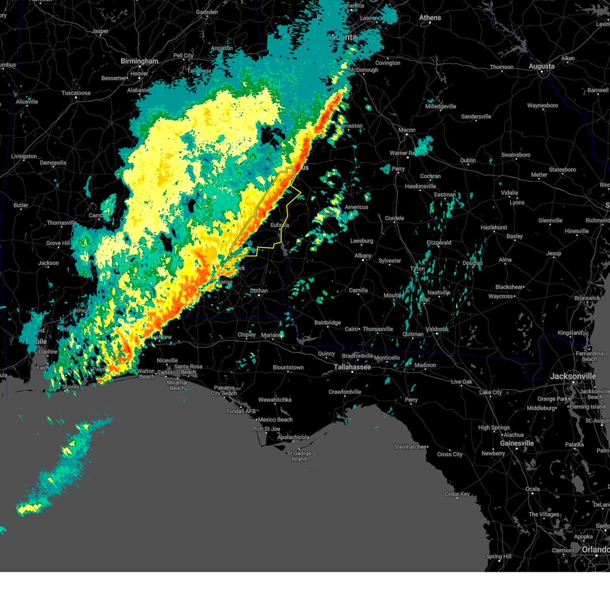
The Top Recent Hail Date for Columbus, GA is Sunday, April 6, 2025 (17th out of 129)
Hail and Wind Damage Spotted near Columbus, GA
| Date / Time | Report Details |
|---|---|
| 6/8/2025 7:44 AM EDT |
 The storm which prompted the warning has weakened below severe limits, and has exited the warned area. therefore, the warning will be allowed to expire. The storm which prompted the warning has weakened below severe limits, and has exited the warned area. therefore, the warning will be allowed to expire.
|
| 6/8/2025 7:32 AM EDT |
 the severe thunderstorm warning has been cancelled and is no longer in effect the severe thunderstorm warning has been cancelled and is no longer in effect
|
| 6/8/2025 7:32 AM EDT |
 At 731 am edt, a severe thunderstorm was located over prattsburg, or 8 miles northeast of talbotton, moving east at 50 mph (radar indicated). Hazards include 60 mph wind gusts. Expect damage to roofs, siding, and trees. Locations impacted include, talbotton, manchester, woodland, geneva, upatoi, box springs, pleasant hill, juniper, baughville, olive branch, and po biddy crossroads. At 731 am edt, a severe thunderstorm was located over prattsburg, or 8 miles northeast of talbotton, moving east at 50 mph (radar indicated). Hazards include 60 mph wind gusts. Expect damage to roofs, siding, and trees. Locations impacted include, talbotton, manchester, woodland, geneva, upatoi, box springs, pleasant hill, juniper, baughville, olive branch, and po biddy crossroads.
|
| 6/8/2025 7:23 AM EDT |
 At 722 am edt, a severe thunderstorm was located near talbotton, moving east at 50 mph (radar indicated). Hazards include 60 mph wind gusts. Expect damage to roofs, siding, and trees. Locations impacted include, talbotton, manchester, waverly hall, warm springs, woodland, geneva, upatoi, shiloh, ellerslie, juniper, baughville, flint hill, olive branch, po biddy crossroads, box springs, pleasant hill, and midland. At 722 am edt, a severe thunderstorm was located near talbotton, moving east at 50 mph (radar indicated). Hazards include 60 mph wind gusts. Expect damage to roofs, siding, and trees. Locations impacted include, talbotton, manchester, waverly hall, warm springs, woodland, geneva, upatoi, shiloh, ellerslie, juniper, baughville, flint hill, olive branch, po biddy crossroads, box springs, pleasant hill, and midland.
|
| 6/8/2025 7:07 AM EDT |
 Svrffc the national weather service in peachtree city has issued a * severe thunderstorm warning for, southwestern meriwether county in west central georgia, northeastern muscogee county in west central georgia, talbot county in west central georgia, eastern harris county in west central georgia, * until 745 am edt. * at 707 am edt, a severe thunderstorm was located near waverly hall, or 7 miles east of hamilton, moving east at 50 mph (radar indicated). Hazards include 60 mph wind gusts. expect damage to roofs, siding, and trees Svrffc the national weather service in peachtree city has issued a * severe thunderstorm warning for, southwestern meriwether county in west central georgia, northeastern muscogee county in west central georgia, talbot county in west central georgia, eastern harris county in west central georgia, * until 745 am edt. * at 707 am edt, a severe thunderstorm was located near waverly hall, or 7 miles east of hamilton, moving east at 50 mph (radar indicated). Hazards include 60 mph wind gusts. expect damage to roofs, siding, and trees
|
| 6/8/2025 6:46 AM EDT |
 Svrffc the national weather service in peachtree city has issued a * severe thunderstorm warning for, northern muscogee county in west central georgia, harris county in west central georgia, * until 715 am edt. * at 646 am edt, severe thunderstorms were located along a line extending from near valley to monterey heights, moving east at 40 mph (radar indicated). Hazards include 60 mph wind gusts. expect damage to roofs, siding, and trees Svrffc the national weather service in peachtree city has issued a * severe thunderstorm warning for, northern muscogee county in west central georgia, harris county in west central georgia, * until 715 am edt. * at 646 am edt, severe thunderstorms were located along a line extending from near valley to monterey heights, moving east at 40 mph (radar indicated). Hazards include 60 mph wind gusts. expect damage to roofs, siding, and trees
|
| 5/30/2025 2:34 PM CDT |
 At 233 pm cdt, a severe thunderstorm was located near uchee, or 10 miles northeast of hurtsboro, moving east at 40 mph (radar indicated). Hazards include 60 mph wind gusts and penny size hail. Expect damage to roofs, siding, and trees. Locations impacted include, russell county sports complex, uchee, seale, hatchechubbe, uchee creek, fort mitchell, marvyn, fort mitchell activity center, phenix drag strip, and parkmanville. At 233 pm cdt, a severe thunderstorm was located near uchee, or 10 miles northeast of hurtsboro, moving east at 40 mph (radar indicated). Hazards include 60 mph wind gusts and penny size hail. Expect damage to roofs, siding, and trees. Locations impacted include, russell county sports complex, uchee, seale, hatchechubbe, uchee creek, fort mitchell, marvyn, fort mitchell activity center, phenix drag strip, and parkmanville.
|
| 5/30/2025 2:34 PM CDT |
 the severe thunderstorm warning has been cancelled and is no longer in effect the severe thunderstorm warning has been cancelled and is no longer in effect
|
| 5/30/2025 2:17 PM CDT |
 Svrbmx the national weather service in birmingham has issued a * severe thunderstorm warning for, south central lee county in east central alabama, east central macon county in southeastern alabama, central russell county in southeastern alabama, * until 300 pm cdt. * at 217 pm cdt, a severe thunderstorm was located near society hill, or 11 miles north of hurtsboro, moving east at 40 mph (radar indicated). Hazards include 60 mph wind gusts and penny size hail. expect damage to roofs, siding, and trees Svrbmx the national weather service in birmingham has issued a * severe thunderstorm warning for, south central lee county in east central alabama, east central macon county in southeastern alabama, central russell county in southeastern alabama, * until 300 pm cdt. * at 217 pm cdt, a severe thunderstorm was located near society hill, or 11 miles north of hurtsboro, moving east at 40 mph (radar indicated). Hazards include 60 mph wind gusts and penny size hail. expect damage to roofs, siding, and trees
|
| 5/27/2025 4:57 PM EDT |
 The storms which prompted the warning have weakened below severe limits, and no longer pose an immediate threat to life or property. therefore, the warning will be allowed to expire. however, small hail, gusty winds and heavy rain are still possible with these thunderstorms. a severe thunderstorm watch remains in effect until 900 pm edt for west central georgia. The storms which prompted the warning have weakened below severe limits, and no longer pose an immediate threat to life or property. therefore, the warning will be allowed to expire. however, small hail, gusty winds and heavy rain are still possible with these thunderstorms. a severe thunderstorm watch remains in effect until 900 pm edt for west central georgia.
|
| 5/27/2025 4:50 PM EDT |
 The storm which prompted the warning has weakened below severe limits, and has exited the warned area. therefore, the warning will be allowed to expire. a severe thunderstorm watch remains in effect until 900 pm edt for west central georgia. The storm which prompted the warning has weakened below severe limits, and has exited the warned area. therefore, the warning will be allowed to expire. a severe thunderstorm watch remains in effect until 900 pm edt for west central georgia.
|
| 5/27/2025 4:25 PM EDT |
 Svrffc the national weather service in peachtree city has issued a * severe thunderstorm warning for, northwestern marion county in west central georgia, muscogee county in west central georgia, northern chattahoochee county in west central georgia, southwestern talbot county in west central georgia, * until 500 pm edt. * at 425 pm edt, severe thunderstorms were located along a line extending from flat rock to custer road terrace, moving east at 40 mph (radar indicated). Hazards include 60 mph wind gusts and penny size hail. expect damage to roofs, siding, and trees Svrffc the national weather service in peachtree city has issued a * severe thunderstorm warning for, northwestern marion county in west central georgia, muscogee county in west central georgia, northern chattahoochee county in west central georgia, southwestern talbot county in west central georgia, * until 500 pm edt. * at 425 pm edt, severe thunderstorms were located along a line extending from flat rock to custer road terrace, moving east at 40 mph (radar indicated). Hazards include 60 mph wind gusts and penny size hail. expect damage to roofs, siding, and trees
|
| 5/27/2025 4:17 PM EDT |
 Svrffc the national weather service in peachtree city has issued a * severe thunderstorm warning for, northeastern muscogee county in west central georgia, southwestern talbot county in west central georgia, southeastern harris county in west central georgia, * until 500 pm edt. * at 417 pm edt, a severe thunderstorm was located over ellerslie, or 11 miles southeast of hamilton, moving east at 15 mph (radar indicated). Hazards include 60 mph wind gusts and quarter size hail. Hail damage to vehicles is expected. Expect wind damage to roofs, siding, and trees. Svrffc the national weather service in peachtree city has issued a * severe thunderstorm warning for, northeastern muscogee county in west central georgia, southwestern talbot county in west central georgia, southeastern harris county in west central georgia, * until 500 pm edt. * at 417 pm edt, a severe thunderstorm was located over ellerslie, or 11 miles southeast of hamilton, moving east at 15 mph (radar indicated). Hazards include 60 mph wind gusts and quarter size hail. Hail damage to vehicles is expected. Expect wind damage to roofs, siding, and trees.
|
| 5/18/2025 11:03 AM EDT |
 The storms which prompted the warning have moved out of the area. therefore, the warning has been allowed to expire. a severe thunderstorm watch remains in effect until 100 pm edt for central and west central georgia. The storms which prompted the warning have moved out of the area. therefore, the warning has been allowed to expire. a severe thunderstorm watch remains in effect until 100 pm edt for central and west central georgia.
|
| 5/18/2025 10:47 AM EDT |
 At 1047 am edt, severe thunderstorms were located along a line extending from near lake tobesofkee to near skipperton to near saint louis to near garden valley to buena vista, moving east at 55 mph (radar indicated). Hazards include 60 mph wind gusts and quarter size hail. Hail damage to vehicles is expected. expect wind damage to roofs, siding, and trees. Locations impacted include, macon, perry, fort valley, buena vista, butler, ellaville, oglethorpe, cusseta, warner robins, centerville, byron, montezuma, marshallville, reynolds, ideal, payne, robins afb, payne city, north fort benning, and fort benning/lawson army air fld. At 1047 am edt, severe thunderstorms were located along a line extending from near lake tobesofkee to near skipperton to near saint louis to near garden valley to buena vista, moving east at 55 mph (radar indicated). Hazards include 60 mph wind gusts and quarter size hail. Hail damage to vehicles is expected. expect wind damage to roofs, siding, and trees. Locations impacted include, macon, perry, fort valley, buena vista, butler, ellaville, oglethorpe, cusseta, warner robins, centerville, byron, montezuma, marshallville, reynolds, ideal, payne, robins afb, payne city, north fort benning, and fort benning/lawson army air fld.
|
| 5/18/2025 10:47 AM EDT |
 the severe thunderstorm warning has been cancelled and is no longer in effect the severe thunderstorm warning has been cancelled and is no longer in effect
|
| 5/18/2025 10:30 AM EDT |
 The storms which prompted the warning have moved out of the area. therefore, the warning has been allowed to expire. a severe thunderstorm watch remains in effect until 100 pm edt for central and west central georgia. The storms which prompted the warning have moved out of the area. therefore, the warning has been allowed to expire. a severe thunderstorm watch remains in effect until 100 pm edt for central and west central georgia.
|
| 5/18/2025 10:13 AM EDT |
 At 1013 am edt, severe thunderstorms were located along a line extending from lake horton to near orchard hill to the rock to near carsonville to near geneva, moving east at 50 mph (radar indicated). Hazards include 60 mph wind gusts and quarter size hail. Hail damage to vehicles is expected. expect wind damage to roofs, siding, and trees. Locations impacted include, thomaston, barnesville, butler, zebulon, roberta, talbotton, waverly hall, milner, woodland, yatesville, williamson, meansville, junction city, culloden, geneva, aldora, sunset village, lincoln park, the rock, and upatoi. At 1013 am edt, severe thunderstorms were located along a line extending from lake horton to near orchard hill to the rock to near carsonville to near geneva, moving east at 50 mph (radar indicated). Hazards include 60 mph wind gusts and quarter size hail. Hail damage to vehicles is expected. expect wind damage to roofs, siding, and trees. Locations impacted include, thomaston, barnesville, butler, zebulon, roberta, talbotton, waverly hall, milner, woodland, yatesville, williamson, meansville, junction city, culloden, geneva, aldora, sunset village, lincoln park, the rock, and upatoi.
|
| 5/18/2025 10:13 AM EDT |
 the severe thunderstorm warning has been cancelled and is no longer in effect the severe thunderstorm warning has been cancelled and is no longer in effect
|
| 5/18/2025 10:11 AM EDT |
 Svrffc the national weather service in peachtree city has issued a * severe thunderstorm warning for, marion county in west central georgia, bibb county in central georgia, southeastern pike county in west central georgia, muscogee county in west central georgia, monroe county in central georgia, chattahoochee county in west central georgia, northern stewart county in west central georgia, eastern upson county in west central georgia, houston county in central georgia, central jones county in central georgia, southeastern harris county in west central georgia, macon county in west central georgia, western twiggs county in central georgia, northwestern webster county in west central georgia, peach county in central georgia, crawford county in central georgia, schley county in west central georgia, southern talbot county in west central georgia, taylor county in west central georgia, lamar county in west central georgia, * until 1100 am edt. * at 1011 am edt, severe thunderstorms were located along a line extending from piedmont to logtown to near howard to juniper to benning park, moving east at 55 mph (radar indicated). Hazards include 60 mph wind gusts and quarter size hail. Hail damage to vehicles is expected. Expect wind damage to roofs, siding, and trees. Svrffc the national weather service in peachtree city has issued a * severe thunderstorm warning for, marion county in west central georgia, bibb county in central georgia, southeastern pike county in west central georgia, muscogee county in west central georgia, monroe county in central georgia, chattahoochee county in west central georgia, northern stewart county in west central georgia, eastern upson county in west central georgia, houston county in central georgia, central jones county in central georgia, southeastern harris county in west central georgia, macon county in west central georgia, western twiggs county in central georgia, northwestern webster county in west central georgia, peach county in central georgia, crawford county in central georgia, schley county in west central georgia, southern talbot county in west central georgia, taylor county in west central georgia, lamar county in west central georgia, * until 1100 am edt. * at 1011 am edt, severe thunderstorms were located along a line extending from piedmont to logtown to near howard to juniper to benning park, moving east at 55 mph (radar indicated). Hazards include 60 mph wind gusts and quarter size hail. Hail damage to vehicles is expected. Expect wind damage to roofs, siding, and trees.
|
| 5/18/2025 9:43 AM EDT |
 Svrffc the national weather service in peachtree city has issued a * severe thunderstorm warning for, spalding county in west central georgia, southern fayette county in north central georgia, northeastern marion county in west central georgia, meriwether county in west central georgia, pike county in west central georgia, northeastern muscogee county in west central georgia, western monroe county in central georgia, upson county in west central georgia, southwestern butts county in central georgia, harris county in west central georgia, southwestern henry county in north central georgia, northwestern crawford county in central georgia, southern coweta county in west central georgia, southern clayton county in north central georgia, talbot county in west central georgia, northern taylor county in west central georgia, lamar county in west central georgia, * until 1030 am edt. * at 943 am edt, severe thunderstorms were located along a line extending from newnan to near rocky mount to near woodbury to shiloh to near mulberry grove, moving east at 50 mph (radar indicated). Hazards include 60 mph wind gusts and quarter size hail. Hail damage to vehicles is expected. Expect wind damage to roofs, siding, and trees. Svrffc the national weather service in peachtree city has issued a * severe thunderstorm warning for, spalding county in west central georgia, southern fayette county in north central georgia, northeastern marion county in west central georgia, meriwether county in west central georgia, pike county in west central georgia, northeastern muscogee county in west central georgia, western monroe county in central georgia, upson county in west central georgia, southwestern butts county in central georgia, harris county in west central georgia, southwestern henry county in north central georgia, northwestern crawford county in central georgia, southern coweta county in west central georgia, southern clayton county in north central georgia, talbot county in west central georgia, northern taylor county in west central georgia, lamar county in west central georgia, * until 1030 am edt. * at 943 am edt, severe thunderstorms were located along a line extending from newnan to near rocky mount to near woodbury to shiloh to near mulberry grove, moving east at 50 mph (radar indicated). Hazards include 60 mph wind gusts and quarter size hail. Hail damage to vehicles is expected. Expect wind damage to roofs, siding, and trees.
|
| 5/3/2025 9:39 PM EDT |
 The storm which prompted the warning has moved out of the area. therefore, the warning will be allowed to expire. however, gusty winds are still possible with this thunderstorm. a severe thunderstorm watch remains in effect until midnight edt for west central georgia. remember, a tornado warning still remains in effect for northeast talbot county including pleasant hill and big lazer creek wma until 10 pm. The storm which prompted the warning has moved out of the area. therefore, the warning will be allowed to expire. however, gusty winds are still possible with this thunderstorm. a severe thunderstorm watch remains in effect until midnight edt for west central georgia. remember, a tornado warning still remains in effect for northeast talbot county including pleasant hill and big lazer creek wma until 10 pm.
|
| 5/3/2025 9:29 PM EDT |
 the severe thunderstorm warning has been cancelled and is no longer in effect the severe thunderstorm warning has been cancelled and is no longer in effect
|
| 5/3/2025 9:29 PM EDT |
 At 928 pm edt, a severe thunderstorm was located over talbotton, moving east at 30 mph (radar indicated). Hazards include 60 mph wind gusts and penny size hail. Expect damage to roofs, siding, and trees. Locations impacted include, talbotton, woodland, junction city, geneva, upatoi, juniper, baldwinville, baughville, olive branch, po biddy crossroads, box springs, pleasant hill, howard, prattsburg, big lazer creek wma, carsonville, and wesley church. At 928 pm edt, a severe thunderstorm was located over talbotton, moving east at 30 mph (radar indicated). Hazards include 60 mph wind gusts and penny size hail. Expect damage to roofs, siding, and trees. Locations impacted include, talbotton, woodland, junction city, geneva, upatoi, juniper, baldwinville, baughville, olive branch, po biddy crossroads, box springs, pleasant hill, howard, prattsburg, big lazer creek wma, carsonville, and wesley church.
|
| 5/3/2025 9:05 PM EDT |
 Svrffc the national weather service in peachtree city has issued a * severe thunderstorm warning for, northwestern marion county in west central georgia, northeastern muscogee county in west central georgia, talbot county in west central georgia, northwestern taylor county in west central georgia, southeastern harris county in west central georgia, * until 945 pm edt. * at 905 pm edt, a severe thunderstorm was located over waverly hall, or 9 miles southeast of hamilton, moving east at 30 mph (radar indicated). Hazards include 60 mph wind gusts and penny size hail. expect damage to roofs, siding, and trees Svrffc the national weather service in peachtree city has issued a * severe thunderstorm warning for, northwestern marion county in west central georgia, northeastern muscogee county in west central georgia, talbot county in west central georgia, northwestern taylor county in west central georgia, southeastern harris county in west central georgia, * until 945 pm edt. * at 905 pm edt, a severe thunderstorm was located over waverly hall, or 9 miles southeast of hamilton, moving east at 30 mph (radar indicated). Hazards include 60 mph wind gusts and penny size hail. expect damage to roofs, siding, and trees
|
| 5/3/2025 7:47 PM CDT |
 the severe thunderstorm warning has been cancelled and is no longer in effect the severe thunderstorm warning has been cancelled and is no longer in effect
|
| 5/3/2025 7:31 PM CDT |
 At 730 pm cdt, a severe thunderstorm was located over bleecker, or near smiths, moving east at 35 mph (radar indicated). Hazards include 60 mph wind gusts and quarter size hail. Hail damage to vehicles is expected. expect wind damage to roofs, siding, and trees. Locations impacted include, smiths station, bleecker, monterey heights, and smiths. At 730 pm cdt, a severe thunderstorm was located over bleecker, or near smiths, moving east at 35 mph (radar indicated). Hazards include 60 mph wind gusts and quarter size hail. Hail damage to vehicles is expected. expect wind damage to roofs, siding, and trees. Locations impacted include, smiths station, bleecker, monterey heights, and smiths.
|
| 5/3/2025 8:30 PM EDT |
 Svrffc the national weather service in peachtree city has issued a * severe thunderstorm warning for, northwestern muscogee county in west central georgia, southwestern harris county in west central georgia, * until 915 pm edt. * at 830 pm edt, a severe thunderstorm was located over bleecker, or near smiths, moving east at 35 mph (radar indicated). Hazards include 60 mph wind gusts. expect damage to roofs, siding, and trees Svrffc the national weather service in peachtree city has issued a * severe thunderstorm warning for, northwestern muscogee county in west central georgia, southwestern harris county in west central georgia, * until 915 pm edt. * at 830 pm edt, a severe thunderstorm was located over bleecker, or near smiths, moving east at 35 mph (radar indicated). Hazards include 60 mph wind gusts. expect damage to roofs, siding, and trees
|
| 5/3/2025 7:19 PM CDT |
 At 719 pm cdt, a severe thunderstorm was located near beauregard, or near opelika, moving east at 35 mph (radar indicated). Hazards include 60 mph wind gusts and quarter size hail. Hail damage to vehicles is expected. expect wind damage to roofs, siding, and trees. Locations impacted include, smiths station, bleecker, monterey heights, smiths, griffen mill, and opelika. At 719 pm cdt, a severe thunderstorm was located near beauregard, or near opelika, moving east at 35 mph (radar indicated). Hazards include 60 mph wind gusts and quarter size hail. Hail damage to vehicles is expected. expect wind damage to roofs, siding, and trees. Locations impacted include, smiths station, bleecker, monterey heights, smiths, griffen mill, and opelika.
|
| 5/3/2025 7:14 PM CDT |
 Svrbmx the national weather service in birmingham has issued a * severe thunderstorm warning for, northeastern lee county in east central alabama, * until 800 pm cdt. * at 714 pm cdt, a severe thunderstorm was located near beauregard, or near opelika, moving east at 35 mph (radar indicated). Hazards include 60 mph wind gusts and quarter size hail. Hail damage to vehicles is expected. Expect wind damage to roofs, siding, and trees. Svrbmx the national weather service in birmingham has issued a * severe thunderstorm warning for, northeastern lee county in east central alabama, * until 800 pm cdt. * at 714 pm cdt, a severe thunderstorm was located near beauregard, or near opelika, moving east at 35 mph (radar indicated). Hazards include 60 mph wind gusts and quarter size hail. Hail damage to vehicles is expected. Expect wind damage to roofs, siding, and trees.
|
| 4/10/2025 11:41 PM CDT |
 the severe thunderstorm warning has been cancelled and is no longer in effect the severe thunderstorm warning has been cancelled and is no longer in effect
|
| 4/10/2025 11:26 PM CDT |
 At 1126 pm cdt, severe thunderstorms were located along a line extending from near cusseta to near spring hill to franklin field, moving southeast at 45 mph (radar indicated). Hazards include 60 mph wind gusts. Expect damage to roofs, siding, and trees. Locations impacted include, pickett, hawkinsville, millers ford, aberfoil, spring hill, high ridge, louisville, hurtsboro, franklin field, perote, josie, beans crossroads, fort davis, twin springs, guerryton, rutherford, shopton, osco, three notch, and mitchell. At 1126 pm cdt, severe thunderstorms were located along a line extending from near cusseta to near spring hill to franklin field, moving southeast at 45 mph (radar indicated). Hazards include 60 mph wind gusts. Expect damage to roofs, siding, and trees. Locations impacted include, pickett, hawkinsville, millers ford, aberfoil, spring hill, high ridge, louisville, hurtsboro, franklin field, perote, josie, beans crossroads, fort davis, twin springs, guerryton, rutherford, shopton, osco, three notch, and mitchell.
|
| 4/10/2025 11:11 PM CDT |
 the severe thunderstorm warning has been cancelled and is no longer in effect the severe thunderstorm warning has been cancelled and is no longer in effect
|
| 4/10/2025 11:11 PM CDT |
 At 1110 pm cdt, severe thunderstorms were located along a line extending from near fort moore/lawson army air fld to near midway to near shopton, moving southeast at 45 mph (radar indicated). Hazards include 60 mph wind gusts. Expect damage to roofs, siding, and trees. Locations impacted include, pickett, warriorstand, millers ford, high ridge, josie, beans crossroads, fort davis, guerryton, rutherford, shopton, three notch, richards crossroads, uchee creek, white oak, midway, mount andrew, gaino, clayton municipal airport, seale, and comer. At 1110 pm cdt, severe thunderstorms were located along a line extending from near fort moore/lawson army air fld to near midway to near shopton, moving southeast at 45 mph (radar indicated). Hazards include 60 mph wind gusts. Expect damage to roofs, siding, and trees. Locations impacted include, pickett, warriorstand, millers ford, high ridge, josie, beans crossroads, fort davis, guerryton, rutherford, shopton, three notch, richards crossroads, uchee creek, white oak, midway, mount andrew, gaino, clayton municipal airport, seale, and comer.
|
| 4/10/2025 10:56 PM CDT |
 Svrbmx the national weather service in birmingham has issued a * severe thunderstorm warning for, northeastern pike county in southeastern alabama, southeastern lee county in east central alabama, bullock county in southeastern alabama, southeastern macon county in southeastern alabama, east central montgomery county in south central alabama, barbour county in southeastern alabama, russell county in southeastern alabama, * until midnight cdt. * at 1056 pm cdt, severe thunderstorms were located along a line extending from uchee to near union springs to near pike road, moving southeast at 50 mph (radar indicated). Hazards include 60 mph wind gusts. expect damage to roofs, siding, and trees Svrbmx the national weather service in birmingham has issued a * severe thunderstorm warning for, northeastern pike county in southeastern alabama, southeastern lee county in east central alabama, bullock county in southeastern alabama, southeastern macon county in southeastern alabama, east central montgomery county in south central alabama, barbour county in southeastern alabama, russell county in southeastern alabama, * until midnight cdt. * at 1056 pm cdt, severe thunderstorms were located along a line extending from uchee to near union springs to near pike road, moving southeast at 50 mph (radar indicated). Hazards include 60 mph wind gusts. expect damage to roofs, siding, and trees
|
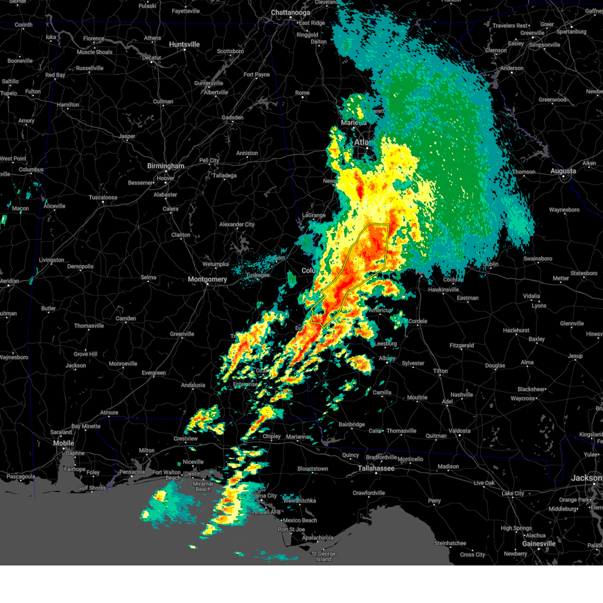
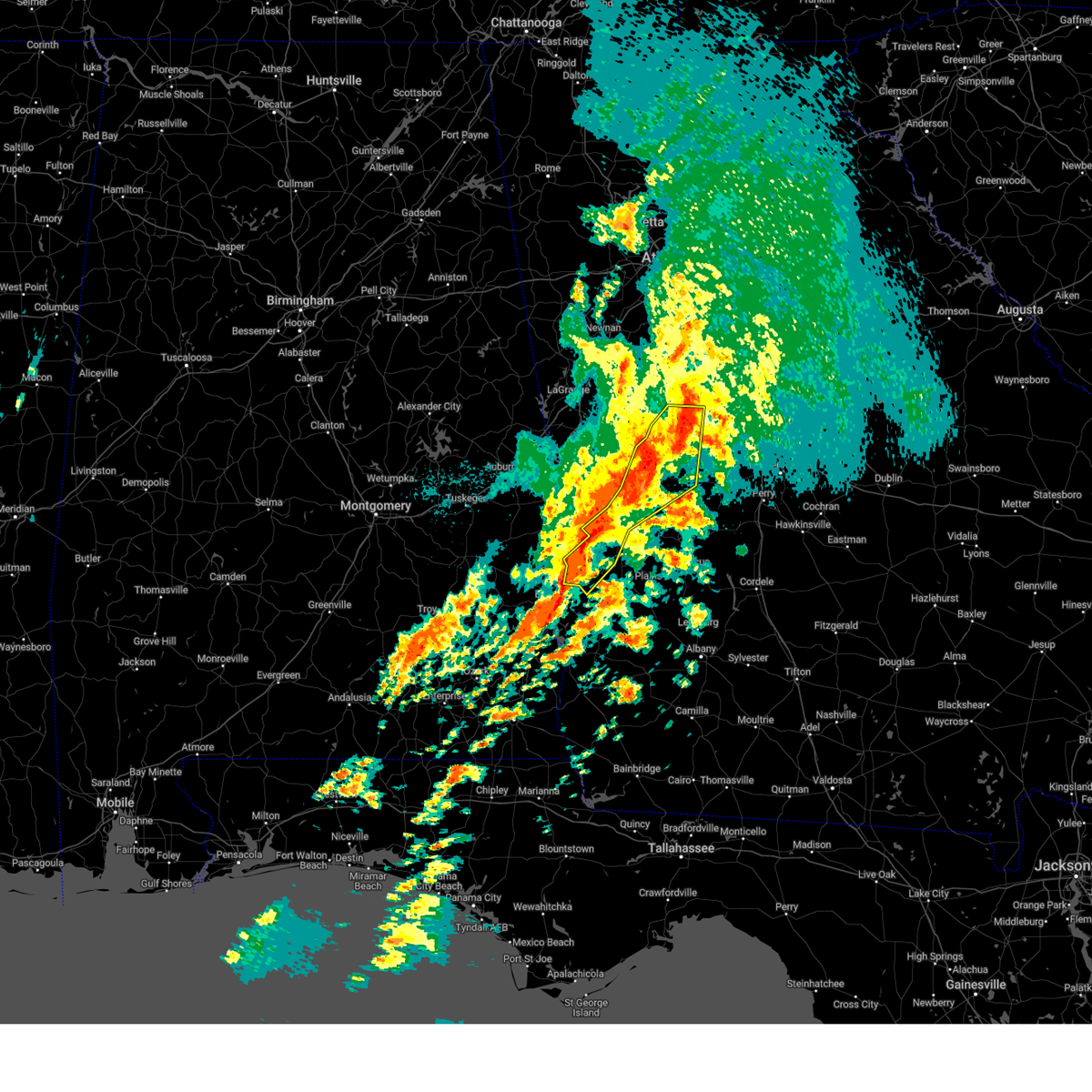
| 4/6/2025 4:37 PM EDT |
 The storm which prompted the warning has moved out of the area. therefore, the warning will be allowed to expire. a tornado watch remains in effect until 700 pm edt for west central georgia. to report severe weather, contact your nearest law enforcement agency. they will relay your report to the national weather service peachtree city. The storm which prompted the warning has moved out of the area. therefore, the warning will be allowed to expire. a tornado watch remains in effect until 700 pm edt for west central georgia. to report severe weather, contact your nearest law enforcement agency. they will relay your report to the national weather service peachtree city.
|
| 4/6/2025 4:14 PM EDT |
 At 413 pm edt, a severe thunderstorm capable of producing a tornado was located over baughville, or 8 miles west of talbotton, moving northeast at 40 mph (radar indicated rotation). Hazards include tornado. Flying debris will be dangerous to those caught without shelter. mobile homes will be damaged or destroyed. damage to roofs, windows, and vehicles will occur. tree damage is likely. Locations impacted include, junction city, baldwinville, baughville, olive branch, talbotton, po biddy crossroads, and geneva. At 413 pm edt, a severe thunderstorm capable of producing a tornado was located over baughville, or 8 miles west of talbotton, moving northeast at 40 mph (radar indicated rotation). Hazards include tornado. Flying debris will be dangerous to those caught without shelter. mobile homes will be damaged or destroyed. damage to roofs, windows, and vehicles will occur. tree damage is likely. Locations impacted include, junction city, baldwinville, baughville, olive branch, talbotton, po biddy crossroads, and geneva.
|
| 4/6/2025 4:14 PM EDT |
 the tornado warning has been cancelled and is no longer in effect the tornado warning has been cancelled and is no longer in effect
|
| 4/6/2025 3:58 PM EDT |
 Torffc the national weather service in peachtree city has issued a * tornado warning for, northeastern muscogee county in west central georgia, southwestern talbot county in west central georgia, southeastern harris county in west central georgia, * until 445 pm edt. * at 357 pm edt, a severe thunderstorm capable of producing a tornado was located over midland, or 10 miles northeast of columbus, moving northeast at 40 mph (radar indicated rotation). Hazards include tornado. Flying debris will be dangerous to those caught without shelter. mobile homes will be damaged or destroyed. damage to roofs, windows, and vehicles will occur. Tree damage is likely. Torffc the national weather service in peachtree city has issued a * tornado warning for, northeastern muscogee county in west central georgia, southwestern talbot county in west central georgia, southeastern harris county in west central georgia, * until 445 pm edt. * at 357 pm edt, a severe thunderstorm capable of producing a tornado was located over midland, or 10 miles northeast of columbus, moving northeast at 40 mph (radar indicated rotation). Hazards include tornado. Flying debris will be dangerous to those caught without shelter. mobile homes will be damaged or destroyed. damage to roofs, windows, and vehicles will occur. Tree damage is likely.
|
| 4/6/2025 3:57 PM EDT | *** 2 fatal *** multiple trees down at bull creek golf course in midland ga. two fatalities occurred from fallen trees while the victims were seeking shelter while in a in muscogee county GA, 5.8 miles S of Columbus, GA |
| 4/6/2025 3:55 PM EDT | A large tree was downed onto a home on trapper cour in muscogee county GA, 5.8 miles S of Columbus, GA |
| 4/6/2025 2:49 PM CDT |
 the severe thunderstorm warning has been cancelled and is no longer in effect the severe thunderstorm warning has been cancelled and is no longer in effect
|
| 4/6/2025 2:49 PM CDT |
 the severe thunderstorm warning has been cancelled and is no longer in effect the severe thunderstorm warning has been cancelled and is no longer in effect
|
| 4/6/2025 3:38 PM EDT |
 Svrffc the national weather service in peachtree city has issued a * severe thunderstorm warning for, northwestern marion county in west central georgia, muscogee county in west central georgia, northern chattahoochee county in west central georgia, southwestern talbot county in west central georgia, southeastern harris county in west central georgia, * until 430 pm edt. * at 338 pm edt, severe thunderstorms were located along a line extending from near green island hills to russell county sports complex, moving northeast at 45 mph (radar indicated). Hazards include 60 mph wind gusts. expect damage to roofs, siding, and trees Svrffc the national weather service in peachtree city has issued a * severe thunderstorm warning for, northwestern marion county in west central georgia, muscogee county in west central georgia, northern chattahoochee county in west central georgia, southwestern talbot county in west central georgia, southeastern harris county in west central georgia, * until 430 pm edt. * at 338 pm edt, severe thunderstorms were located along a line extending from near green island hills to russell county sports complex, moving northeast at 45 mph (radar indicated). Hazards include 60 mph wind gusts. expect damage to roofs, siding, and trees
|
| 4/6/2025 2:33 PM CDT |
 At 233 pm cdt, a severe thunderstorm was located over ladonia, or near phenix city, moving east at 45 mph (radar indicated). Hazards include 60 mph wind gusts. Expect damage to roofs, siding, and trees. Locations impacted include, ladonia, ladonia sports complex, phenix drag strip, phenix city, and parkmanville. At 233 pm cdt, a severe thunderstorm was located over ladonia, or near phenix city, moving east at 45 mph (radar indicated). Hazards include 60 mph wind gusts. Expect damage to roofs, siding, and trees. Locations impacted include, ladonia, ladonia sports complex, phenix drag strip, phenix city, and parkmanville.
|
| 4/6/2025 2:32 PM CDT |
 At 232 pm cdt, a severe thunderstorm was located over smiths station, or over smiths, moving northeast at 35 mph (radar indicated). Hazards include 60 mph wind gusts. Expect damage to roofs, siding, and trees. Locations impacted include, smiths station, monterey heights, smiths, and ladonia. At 232 pm cdt, a severe thunderstorm was located over smiths station, or over smiths, moving northeast at 35 mph (radar indicated). Hazards include 60 mph wind gusts. Expect damage to roofs, siding, and trees. Locations impacted include, smiths station, monterey heights, smiths, and ladonia.
|
| 4/6/2025 2:20 PM CDT |
 Svrbmx the national weather service in birmingham has issued a * severe thunderstorm warning for, northern russell county in southeastern alabama, * until 300 pm cdt. * at 220 pm cdt, a severe thunderstorm was located near griffen mill, or 11 miles southwest of smiths, moving east at 30 mph (radar indicated). Hazards include 60 mph wind gusts. expect damage to roofs, siding, and trees Svrbmx the national weather service in birmingham has issued a * severe thunderstorm warning for, northern russell county in southeastern alabama, * until 300 pm cdt. * at 220 pm cdt, a severe thunderstorm was located near griffen mill, or 11 miles southwest of smiths, moving east at 30 mph (radar indicated). Hazards include 60 mph wind gusts. expect damage to roofs, siding, and trees
|
| 4/6/2025 2:19 PM CDT |
 At 219 pm cdt, a severe thunderstorm was located over griffen mill, or 10 miles west of smiths, moving east at 35 mph (radar indicated). Hazards include 60 mph wind gusts. Expect damage to roofs, siding, and trees. Locations impacted include, smiths station, monterey heights, smiths, griffen mill, marvyn, and ladonia. At 219 pm cdt, a severe thunderstorm was located over griffen mill, or 10 miles west of smiths, moving east at 35 mph (radar indicated). Hazards include 60 mph wind gusts. Expect damage to roofs, siding, and trees. Locations impacted include, smiths station, monterey heights, smiths, griffen mill, marvyn, and ladonia.
|
| 4/6/2025 3:16 PM EDT |
 Svrffc the national weather service in peachtree city has issued a * severe thunderstorm warning for, southwestern meriwether county in west central georgia, northwestern muscogee county in west central georgia, southeastern troup county in west central georgia, northwestern talbot county in west central georgia, harris county in west central georgia, * until 400 pm edt. * at 315 pm edt, severe thunderstorms were located along a line extending from near beulah to near griffen mill, moving northeast at 55 mph (radar indicated). Hazards include 60 mph wind gusts. expect damage to roofs, siding, and trees Svrffc the national weather service in peachtree city has issued a * severe thunderstorm warning for, southwestern meriwether county in west central georgia, northwestern muscogee county in west central georgia, southeastern troup county in west central georgia, northwestern talbot county in west central georgia, harris county in west central georgia, * until 400 pm edt. * at 315 pm edt, severe thunderstorms were located along a line extending from near beulah to near griffen mill, moving northeast at 55 mph (radar indicated). Hazards include 60 mph wind gusts. expect damage to roofs, siding, and trees
|
| 4/6/2025 2:10 PM CDT |
 the severe thunderstorm warning has been cancelled and is no longer in effect the severe thunderstorm warning has been cancelled and is no longer in effect
|
| 4/6/2025 2:10 PM CDT |
 At 209 pm cdt, a severe thunderstorm was located over beauregard, or 7 miles southeast of auburn, moving northeast at 35 mph (radar indicated). Hazards include 60 mph wind gusts. Expect damage to roofs, siding, and trees. Locations impacted include, monterey heights, smiths, beauregard, smiths station, bleecker, marvyn, griffen mill, ladonia, auburn, and opelika. At 209 pm cdt, a severe thunderstorm was located over beauregard, or 7 miles southeast of auburn, moving northeast at 35 mph (radar indicated). Hazards include 60 mph wind gusts. Expect damage to roofs, siding, and trees. Locations impacted include, monterey heights, smiths, beauregard, smiths station, bleecker, marvyn, griffen mill, ladonia, auburn, and opelika.
|
| 4/6/2025 1:56 PM CDT |
 Svrbmx the national weather service in birmingham has issued a * severe thunderstorm warning for, central lee county in east central alabama, northeastern macon county in southeastern alabama, * until 300 pm cdt. * at 155 pm cdt, a severe thunderstorm was located near tuskegee national forest, or 7 miles south of auburn, moving northeast at 35 mph (radar indicated). Hazards include 60 mph wind gusts. expect damage to roofs, siding, and trees Svrbmx the national weather service in birmingham has issued a * severe thunderstorm warning for, central lee county in east central alabama, northeastern macon county in southeastern alabama, * until 300 pm cdt. * at 155 pm cdt, a severe thunderstorm was located near tuskegee national forest, or 7 miles south of auburn, moving northeast at 35 mph (radar indicated). Hazards include 60 mph wind gusts. expect damage to roofs, siding, and trees
|
| 3/31/2025 12:49 PM EDT |
 Svrffc the national weather service in peachtree city has issued a * severe thunderstorm warning for, marion county in west central georgia, southern muscogee county in west central georgia, chattahoochee county in west central georgia, northern stewart county in west central georgia, northwestern webster county in west central georgia, * until 130 pm edt. * at 1249 pm edt, severe thunderstorms were located along a line extending from carter acres to near omaha to near hawkinsville, moving east at 50 mph (radar indicated). Hazards include 60 mph wind gusts and quarter size hail. Hail damage to vehicles is expected. Expect wind damage to roofs, siding, and trees. Svrffc the national weather service in peachtree city has issued a * severe thunderstorm warning for, marion county in west central georgia, southern muscogee county in west central georgia, chattahoochee county in west central georgia, northern stewart county in west central georgia, northwestern webster county in west central georgia, * until 130 pm edt. * at 1249 pm edt, severe thunderstorms were located along a line extending from carter acres to near omaha to near hawkinsville, moving east at 50 mph (radar indicated). Hazards include 60 mph wind gusts and quarter size hail. Hail damage to vehicles is expected. Expect wind damage to roofs, siding, and trees.
|
| 3/31/2025 12:38 PM EDT | A large tree down along highway 315 across from pine ridge elementary schoo in harris county GA, 12.1 miles S of Columbus, GA |
| 3/31/2025 11:15 AM CDT |
 the severe thunderstorm warning has been cancelled and is no longer in effect the severe thunderstorm warning has been cancelled and is no longer in effect
|
| 3/31/2025 12:09 PM EDT |
 Svrffc the national weather service in peachtree city has issued a * severe thunderstorm warning for, southwestern meriwether county in west central georgia, northwestern muscogee county in west central georgia, west central talbot county in west central georgia, harris county in west central georgia, * until 100 pm edt. * at 1209 pm edt, a severe thunderstorm was located over bartletts ferry dam, or 7 miles north of smiths, moving northeast at 30 mph (radar indicated). Hazards include 60 mph wind gusts and quarter size hail. Hail damage to vehicles is expected. Expect wind damage to roofs, siding, and trees. Svrffc the national weather service in peachtree city has issued a * severe thunderstorm warning for, southwestern meriwether county in west central georgia, northwestern muscogee county in west central georgia, west central talbot county in west central georgia, harris county in west central georgia, * until 100 pm edt. * at 1209 pm edt, a severe thunderstorm was located over bartletts ferry dam, or 7 miles north of smiths, moving northeast at 30 mph (radar indicated). Hazards include 60 mph wind gusts and quarter size hail. Hail damage to vehicles is expected. Expect wind damage to roofs, siding, and trees.
|
| 3/31/2025 11:00 AM CDT |
 Svrbmx the national weather service in birmingham has issued a * severe thunderstorm warning for, eastern lee county in east central alabama, * until 1130 am cdt. * at 1059 am cdt, a severe thunderstorm was located over bleecker, or 7 miles northwest of smiths, moving east at 35 mph (radar indicated). Hazards include golf ball size hail and 60 mph wind gusts. People and animals outdoors will be injured. expect hail damage to roofs, siding, windows, and vehicles. Expect wind damage to roofs, siding, and trees. Svrbmx the national weather service in birmingham has issued a * severe thunderstorm warning for, eastern lee county in east central alabama, * until 1130 am cdt. * at 1059 am cdt, a severe thunderstorm was located over bleecker, or 7 miles northwest of smiths, moving east at 35 mph (radar indicated). Hazards include golf ball size hail and 60 mph wind gusts. People and animals outdoors will be injured. expect hail damage to roofs, siding, windows, and vehicles. Expect wind damage to roofs, siding, and trees.
|
| 3/16/2025 2:41 AM EDT |
 The storms which prompted the warning have weakened below severe limits, and no longer pose an immediate threat to life or property. therefore, the warning will be allowed to expire. a tornado watch remains in effect until 400 am edt for west central georgia. a tornado watch also remains in effect until 1000 am edt for central and west central georgia. The storms which prompted the warning have weakened below severe limits, and no longer pose an immediate threat to life or property. therefore, the warning will be allowed to expire. a tornado watch remains in effect until 400 am edt for west central georgia. a tornado watch also remains in effect until 1000 am edt for central and west central georgia.
|
| 3/16/2025 2:26 AM EDT |
 At 226 am edt, severe thunderstorms were located along a line extending from near the rock to marion estates to near florence marina state park, moving northeast at 45 mph (radar indicated). Hazards include 60 mph wind gusts. Expect damage to roofs, siding, and trees. Locations impacted include, sunset village, juniper, atwater, geneva, brooklyn, renfroe, oakland, manta, zellobee, omaha, sprewell bluff state park, cusseta, sanford, logtown, howard, sunnyside, jamestown/south fort benning, eelbeck/west fort benning, brantley, and yatesville. At 226 am edt, severe thunderstorms were located along a line extending from near the rock to marion estates to near florence marina state park, moving northeast at 45 mph (radar indicated). Hazards include 60 mph wind gusts. Expect damage to roofs, siding, and trees. Locations impacted include, sunset village, juniper, atwater, geneva, brooklyn, renfroe, oakland, manta, zellobee, omaha, sprewell bluff state park, cusseta, sanford, logtown, howard, sunnyside, jamestown/south fort benning, eelbeck/west fort benning, brantley, and yatesville.
|
| 3/16/2025 2:26 AM EDT |
 the severe thunderstorm warning has been cancelled and is no longer in effect the severe thunderstorm warning has been cancelled and is no longer in effect
|
| 3/16/2025 2:00 AM EDT |
 The storms which prompted the warning have moved out of the area. therefore, the warning will be allowed to expire. a tornado watch remains in effect until 400 am edt for west central georgia. remember, a severe thunderstorm warning still remains in effect for meriwether, muscogee, chattahoochee, marion, talbot, and harris counties. The storms which prompted the warning have moved out of the area. therefore, the warning will be allowed to expire. a tornado watch remains in effect until 400 am edt for west central georgia. remember, a severe thunderstorm warning still remains in effect for meriwether, muscogee, chattahoochee, marion, talbot, and harris counties.
|
| 3/16/2025 1:59 AM EDT |
 Svrffc the national weather service in peachtree city has issued a * severe thunderstorm warning for, marion county in west central georgia, southeastern meriwether county in west central georgia, muscogee county in west central georgia, chattahoochee county in west central georgia, stewart county in west central georgia, upson county in west central georgia, northwestern webster county in west central georgia, west central crawford county in central georgia, western schley county in west central georgia, talbot county in west central georgia, taylor county in west central georgia, southeastern harris county in west central georgia, * until 245 am edt. * at 159 am edt, severe thunderstorms were located along a line extending from raleigh to near eelbeck/west fort benning to lakepoint resort state park, moving east at 40 mph (radar indicated). Hazards include 60 mph wind gusts. expect damage to roofs, siding, and trees Svrffc the national weather service in peachtree city has issued a * severe thunderstorm warning for, marion county in west central georgia, southeastern meriwether county in west central georgia, muscogee county in west central georgia, chattahoochee county in west central georgia, stewart county in west central georgia, upson county in west central georgia, northwestern webster county in west central georgia, west central crawford county in central georgia, western schley county in west central georgia, talbot county in west central georgia, taylor county in west central georgia, southeastern harris county in west central georgia, * until 245 am edt. * at 159 am edt, severe thunderstorms were located along a line extending from raleigh to near eelbeck/west fort benning to lakepoint resort state park, moving east at 40 mph (radar indicated). Hazards include 60 mph wind gusts. expect damage to roofs, siding, and trees
|
| 3/16/2025 1:53 AM EDT |
 At 153 am edt, severe thunderstorms were located along a line extending from near wooster to eelbeck/west fort benning, moving northeast at 60 mph (radar indicated). Hazards include 60 mph wind gusts. Expect damage to roofs, siding, and trees. Locations impacted include, north fort benning, juniper, vista terrace, baughville, flint hill, manta, zellobee, cusseta, woodbury, waverly hall, jamestown/south fort benning, eelbeck/west fort benning, benning hills, benning park, christopher, sand hill, raleigh, battle park, fort benning, and warm springs. At 153 am edt, severe thunderstorms were located along a line extending from near wooster to eelbeck/west fort benning, moving northeast at 60 mph (radar indicated). Hazards include 60 mph wind gusts. Expect damage to roofs, siding, and trees. Locations impacted include, north fort benning, juniper, vista terrace, baughville, flint hill, manta, zellobee, cusseta, woodbury, waverly hall, jamestown/south fort benning, eelbeck/west fort benning, benning hills, benning park, christopher, sand hill, raleigh, battle park, fort benning, and warm springs.
|
| 3/16/2025 1:45 AM EDT |
 At 144 am edt, severe thunderstorms were located along a line extending from near saint marks to sand hill, moving east at 35 mph (radar indicated). Hazards include 60 mph wind gusts. Expect damage to roofs, siding, and trees. locations impacted include, f. d. Roosevelt state park, juniper, cataula, cusseta, jamestown/south fort benning, benning hills, benning park, pine mountain-callaway gardens, edgewood, highland park, saint marks, sand hill, greenville, pine mountain, warm springs, alvaton, box springs, midland, custer road terrace, and carter acres. At 144 am edt, severe thunderstorms were located along a line extending from near saint marks to sand hill, moving east at 35 mph (radar indicated). Hazards include 60 mph wind gusts. Expect damage to roofs, siding, and trees. locations impacted include, f. d. Roosevelt state park, juniper, cataula, cusseta, jamestown/south fort benning, benning hills, benning park, pine mountain-callaway gardens, edgewood, highland park, saint marks, sand hill, greenville, pine mountain, warm springs, alvaton, box springs, midland, custer road terrace, and carter acres.
|
| 3/16/2025 1:45 AM EDT |
 the severe thunderstorm warning has been cancelled and is no longer in effect the severe thunderstorm warning has been cancelled and is no longer in effect
|
| 3/16/2025 12:38 AM CDT |
 At 1238 am cdt, severe thunderstorms were located along a line extending from near fort moore/lawson army air fld to 7 miles northeast of spring hill to near comer, moving east at 20 mph (radar indicated). Hazards include 60 mph wind gusts. Expect damage to roofs, siding, and trees. Locations impacted include, hawkinsville, spring hill, batesville, uchee creek, fort mitchell, fort mitchell activity center, and twin springs. At 1238 am cdt, severe thunderstorms were located along a line extending from near fort moore/lawson army air fld to 7 miles northeast of spring hill to near comer, moving east at 20 mph (radar indicated). Hazards include 60 mph wind gusts. Expect damage to roofs, siding, and trees. Locations impacted include, hawkinsville, spring hill, batesville, uchee creek, fort mitchell, fort mitchell activity center, and twin springs.
|
| 3/16/2025 12:38 AM CDT |
 The storms which prompted the warning have moved out of the area. therefore, the warning will be allowed to expire. a tornado watch remains in effect until 300 am cdt for southeastern and east central alabama. The storms which prompted the warning have moved out of the area. therefore, the warning will be allowed to expire. a tornado watch remains in effect until 300 am cdt for southeastern and east central alabama.
|
| 3/16/2025 12:30 AM CDT |
 At 1230 am cdt, severe thunderstorms were located along a line extending from 9 miles east of beulah to near fort moore/lawson army air fld, moving northeast at 60 mph (radar indicated). Hazards include 70 mph wind gusts. Expect considerable tree damage. damage is likely to mobile homes, roofs, and outbuildings. Locations impacted include, goat rock lake, ladonia, monterey heights, smiths, smiths station, ladonia sports complex, bartletts ferry dam, phenix drag strip, and phenix city. At 1230 am cdt, severe thunderstorms were located along a line extending from 9 miles east of beulah to near fort moore/lawson army air fld, moving northeast at 60 mph (radar indicated). Hazards include 70 mph wind gusts. Expect considerable tree damage. damage is likely to mobile homes, roofs, and outbuildings. Locations impacted include, goat rock lake, ladonia, monterey heights, smiths, smiths station, ladonia sports complex, bartletts ferry dam, phenix drag strip, and phenix city.
|
| 3/16/2025 12:30 AM CDT |
 the severe thunderstorm warning has been cancelled and is no longer in effect the severe thunderstorm warning has been cancelled and is no longer in effect
|
| 3/16/2025 12:24 AM CDT |
 At 1224 am cdt, severe thunderstorms were located along a line extending from near fort moore/lawson army air fld to near seale to comer, moving northeast at 50 mph (radar indicated). Hazards include 60 mph wind gusts. Expect damage to roofs, siding, and trees. Locations impacted include, hawkinsville, russell county sports complex, spring hill, batesville, uchee creek, seale, comer, fort mitchell, fort mitchell activity center, and twin springs. At 1224 am cdt, severe thunderstorms were located along a line extending from near fort moore/lawson army air fld to near seale to comer, moving northeast at 50 mph (radar indicated). Hazards include 60 mph wind gusts. Expect damage to roofs, siding, and trees. Locations impacted include, hawkinsville, russell county sports complex, spring hill, batesville, uchee creek, seale, comer, fort mitchell, fort mitchell activity center, and twin springs.
|
| 3/16/2025 12:22 AM CDT |
 At 1222 am cdt, severe thunderstorms were located along a line extending from lanett to near beulah to near russell county sports complex, moving east at 55 mph (radar indicated). Hazards include 70 mph wind gusts. Expect considerable tree damage. damage is likely to mobile homes, roofs, and outbuildings. Locations impacted include, goat rock lake, smiths, beulah, lakeview, smiths station, lanett municipal airport, huguley, fairfax, i 85 welcome center at lanett, river view, ladonia, monterey heights, valley, lanett, bleecker, ladonia sports complex, phenix drag strip, phenix city, parkmanville, and southern harbor. At 1222 am cdt, severe thunderstorms were located along a line extending from lanett to near beulah to near russell county sports complex, moving east at 55 mph (radar indicated). Hazards include 70 mph wind gusts. Expect considerable tree damage. damage is likely to mobile homes, roofs, and outbuildings. Locations impacted include, goat rock lake, smiths, beulah, lakeview, smiths station, lanett municipal airport, huguley, fairfax, i 85 welcome center at lanett, river view, ladonia, monterey heights, valley, lanett, bleecker, ladonia sports complex, phenix drag strip, phenix city, parkmanville, and southern harbor.
|
| 3/16/2025 12:13 AM CDT |
 At 1213 am cdt, severe thunderstorms were located along a line extending from veasey creek park to beulah to 6 miles northwest of seale, moving east at 55 mph (radar indicated). Hazards include 70 mph wind gusts. Expect considerable tree damage. damage is likely to mobile homes, roofs, and outbuildings. Locations impacted include, goat rock lake, beulah, uchee, denson, beans mill, i 85 welcome center at lanett, river view, cusseta, amity park, bleecker, phenix city, smiths, fredonia, lakeview, veasey creek park, smiths station, lanett municipal airport, huguley, fairfax, and ladonia. At 1213 am cdt, severe thunderstorms were located along a line extending from veasey creek park to beulah to 6 miles northwest of seale, moving east at 55 mph (radar indicated). Hazards include 70 mph wind gusts. Expect considerable tree damage. damage is likely to mobile homes, roofs, and outbuildings. Locations impacted include, goat rock lake, beulah, uchee, denson, beans mill, i 85 welcome center at lanett, river view, cusseta, amity park, bleecker, phenix city, smiths, fredonia, lakeview, veasey creek park, smiths station, lanett municipal airport, huguley, fairfax, and ladonia.
|
| 3/16/2025 12:10 AM CDT |
 At 1210 am cdt, severe thunderstorms were located along a line extending from near uchee to 9 miles southwest of seale to comer, moving northeast at 50 mph (radar indicated). Hazards include 60 mph wind gusts. Expect damage to roofs, siding, and trees. Locations impacted include, rutherford, hawkinsville, russell county sports complex, spring hill, hatchechubbe, batesville, uchee creek, seale, comer, fort mitchell, fort mitchell activity center, and twin springs. At 1210 am cdt, severe thunderstorms were located along a line extending from near uchee to 9 miles southwest of seale to comer, moving northeast at 50 mph (radar indicated). Hazards include 60 mph wind gusts. Expect damage to roofs, siding, and trees. Locations impacted include, rutherford, hawkinsville, russell county sports complex, spring hill, hatchechubbe, batesville, uchee creek, seale, comer, fort mitchell, fort mitchell activity center, and twin springs.
|
| 3/16/2025 1:09 AM EDT |
 Svrffc the national weather service in peachtree city has issued a * severe thunderstorm warning for, northwestern marion county in west central georgia, meriwether county in west central georgia, muscogee county in west central georgia, chattahoochee county in west central georgia, troup county in west central georgia, western talbot county in west central georgia, harris county in west central georgia, * until 200 am edt. * at 109 am edt, severe thunderstorms were located along a line extending from southern harbor to near griffen mill, moving northeast at 60 mph (radar indicated). Hazards include 60 mph wind gusts. expect damage to roofs, siding, and trees Svrffc the national weather service in peachtree city has issued a * severe thunderstorm warning for, northwestern marion county in west central georgia, meriwether county in west central georgia, muscogee county in west central georgia, chattahoochee county in west central georgia, troup county in west central georgia, western talbot county in west central georgia, harris county in west central georgia, * until 200 am edt. * at 109 am edt, severe thunderstorms were located along a line extending from southern harbor to near griffen mill, moving northeast at 60 mph (radar indicated). Hazards include 60 mph wind gusts. expect damage to roofs, siding, and trees
|
| 3/16/2025 12:03 AM CDT |
 At 1203 am cdt, severe thunderstorms were located along a line extending from near chambers county lake to near beans mill to near uchee, moving east at 55 mph (radar indicated). Hazards include 70 mph wind gusts. Expect considerable tree damage. damage is likely to mobile homes, roofs, and outbuildings. Locations impacted include, goat rock lake, beulah, uchee, denson, beans mill, i 85 welcome center at lanett, river view, cusseta, amity park, beauregard, bleecker, phenix city, buffalo, chambers county lake, smiths, fredonia, lakeview, la fayette, veasey creek park, and smiths station. At 1203 am cdt, severe thunderstorms were located along a line extending from near chambers county lake to near beans mill to near uchee, moving east at 55 mph (radar indicated). Hazards include 70 mph wind gusts. Expect considerable tree damage. damage is likely to mobile homes, roofs, and outbuildings. Locations impacted include, goat rock lake, beulah, uchee, denson, beans mill, i 85 welcome center at lanett, river view, cusseta, amity park, beauregard, bleecker, phenix city, buffalo, chambers county lake, smiths, fredonia, lakeview, la fayette, veasey creek park, and smiths station.
|
| 3/15/2025 11:55 PM CDT |
 Svrbmx the national weather service in birmingham has issued a * severe thunderstorm warning for, northeastern barbour county in southeastern alabama, russell county in southeastern alabama, * until 100 am cdt. * at 1155 pm cdt, severe thunderstorms were located along a line extending from near guerryton to 6 miles northwest of spring hill to near midway, moving northeast at 40 mph (radar indicated). Hazards include 60 mph wind gusts. expect damage to roofs, siding, and trees Svrbmx the national weather service in birmingham has issued a * severe thunderstorm warning for, northeastern barbour county in southeastern alabama, russell county in southeastern alabama, * until 100 am cdt. * at 1155 pm cdt, severe thunderstorms were located along a line extending from near guerryton to 6 miles northwest of spring hill to near midway, moving northeast at 40 mph (radar indicated). Hazards include 60 mph wind gusts. expect damage to roofs, siding, and trees
|
| 3/15/2025 11:53 PM CDT |
 At 1153 pm cdt, severe thunderstorms were located along a line extending from near buffalo to near auburn university to near guerryton, moving east at 55 mph (radar indicated). Hazards include 60 mph wind gusts. Expect damage to roofs, siding, and trees. Locations impacted include, goat rock lake, beulah, post oak forks, uchee, denson, beans mill, i 85 welcome center at lanett, river view, cusseta, amity park, beauregard, bleecker, phenix city, buffalo, chambers county lake, smiths, fredonia, lakeview, la fayette, and veasey creek park. At 1153 pm cdt, severe thunderstorms were located along a line extending from near buffalo to near auburn university to near guerryton, moving east at 55 mph (radar indicated). Hazards include 60 mph wind gusts. Expect damage to roofs, siding, and trees. Locations impacted include, goat rock lake, beulah, post oak forks, uchee, denson, beans mill, i 85 welcome center at lanett, river view, cusseta, amity park, beauregard, bleecker, phenix city, buffalo, chambers county lake, smiths, fredonia, lakeview, la fayette, and veasey creek park.
|
| 3/15/2025 11:42 PM CDT |
 Svrbmx the national weather service in birmingham has issued a * severe thunderstorm warning for, lee county in east central alabama, central chambers county in east central alabama, northern russell county in southeastern alabama, * until 1245 am cdt. * at 1142 pm cdt, severe thunderstorms were located along a line extending from ridge grove to near notasulga to near davisville, moving east at 55 mph (radar indicated). Hazards include 60 mph wind gusts. expect damage to roofs, siding, and trees Svrbmx the national weather service in birmingham has issued a * severe thunderstorm warning for, lee county in east central alabama, central chambers county in east central alabama, northern russell county in southeastern alabama, * until 1245 am cdt. * at 1142 pm cdt, severe thunderstorms were located along a line extending from ridge grove to near notasulga to near davisville, moving east at 55 mph (radar indicated). Hazards include 60 mph wind gusts. expect damage to roofs, siding, and trees
|
| 3/13/2025 2:25 PM EDT |
 Svrffc the national weather service in peachtree city has issued a * severe thunderstorm warning for, south central muscogee county in west central georgia, chattahoochee county in west central georgia, north central stewart county in west central georgia, * until 315 pm edt. * at 225 pm edt, a severe thunderstorm was located over fort moore, or 8 miles south of columbus, moving east at 20 mph (radar indicated). Hazards include 60 mph wind gusts and quarter size hail. Hail damage to vehicles is expected. Expect wind damage to roofs, siding, and trees. Svrffc the national weather service in peachtree city has issued a * severe thunderstorm warning for, south central muscogee county in west central georgia, chattahoochee county in west central georgia, north central stewart county in west central georgia, * until 315 pm edt. * at 225 pm edt, a severe thunderstorm was located over fort moore, or 8 miles south of columbus, moving east at 20 mph (radar indicated). Hazards include 60 mph wind gusts and quarter size hail. Hail damage to vehicles is expected. Expect wind damage to roofs, siding, and trees.
|
| 3/5/2025 2:41 AM EST |
 The storms which prompted the warning have weakened below severe limits, and have exited the warned area. therefore, the warning will be allowed to expire. a severe thunderstorm watch remains in effect until 400 am est for west central georgia. The storms which prompted the warning have weakened below severe limits, and have exited the warned area. therefore, the warning will be allowed to expire. a severe thunderstorm watch remains in effect until 400 am est for west central georgia.
|
| 3/5/2025 2:03 AM EST |
 The storms which prompted the warning have moved out of the area. therefore, the warning has been allowed to expire. a severe thunderstorm watch remains in effect until 400 am est for west central georgia. The storms which prompted the warning have moved out of the area. therefore, the warning has been allowed to expire. a severe thunderstorm watch remains in effect until 400 am est for west central georgia.
|
| 3/5/2025 2:00 AM EST |
 Svrffc the national weather service in peachtree city has issued a * severe thunderstorm warning for, marion county in west central georgia, southeastern meriwether county in west central georgia, eastern muscogee county in west central georgia, chattahoochee county in west central georgia, stewart county in west central georgia, central upson county in west central georgia, webster county in west central georgia, western schley county in west central georgia, talbot county in west central georgia, western taylor county in west central georgia, southeastern harris county in west central georgia, * until 245 am est. * at 200 am est, severe thunderstorms were located along a line extending from flint hill to eelbeck/west fort moore to near sanford, moving east at 20 mph (radar indicated). Hazards include 60 mph wind gusts. expect damage to roofs, siding, and trees Svrffc the national weather service in peachtree city has issued a * severe thunderstorm warning for, marion county in west central georgia, southeastern meriwether county in west central georgia, eastern muscogee county in west central georgia, chattahoochee county in west central georgia, stewart county in west central georgia, central upson county in west central georgia, webster county in west central georgia, western schley county in west central georgia, talbot county in west central georgia, western taylor county in west central georgia, southeastern harris county in west central georgia, * until 245 am est. * at 200 am est, severe thunderstorms were located along a line extending from flint hill to eelbeck/west fort moore to near sanford, moving east at 20 mph (radar indicated). Hazards include 60 mph wind gusts. expect damage to roofs, siding, and trees
|
| 3/5/2025 1:30 AM EST |
 The storms which prompted the warning have moved out of the area. therefore, the warning has been allowed to expire. a severe thunderstorm watch remains in effect until 400 am est for west central georgia. remember, a severe thunderstorm warning still remains in effect for eastern muscogee and harris counties. The storms which prompted the warning have moved out of the area. therefore, the warning has been allowed to expire. a severe thunderstorm watch remains in effect until 400 am est for west central georgia. remember, a severe thunderstorm warning still remains in effect for eastern muscogee and harris counties.
|
| 3/5/2025 1:20 AM EST |
 Svrffc the national weather service in peachtree city has issued a * severe thunderstorm warning for, northwestern marion county in west central georgia, muscogee county in west central georgia, chattahoochee county in west central georgia, stewart county in west central georgia, western talbot county in west central georgia, eastern harris county in west central georgia, * until 200 am est. * at 120 am est, severe thunderstorms were located along a line extending from near stovall to near green island hills to 7 miles east of rutherford, moving northeast at 45 mph (radar indicated). Hazards include 60 mph wind gusts. expect damage to roofs, siding, and trees Svrffc the national weather service in peachtree city has issued a * severe thunderstorm warning for, northwestern marion county in west central georgia, muscogee county in west central georgia, chattahoochee county in west central georgia, stewart county in west central georgia, western talbot county in west central georgia, eastern harris county in west central georgia, * until 200 am est. * at 120 am est, severe thunderstorms were located along a line extending from near stovall to near green island hills to 7 miles east of rutherford, moving northeast at 45 mph (radar indicated). Hazards include 60 mph wind gusts. expect damage to roofs, siding, and trees
|
| 3/4/2025 11:57 PM CST |
 the severe thunderstorm warning has been cancelled and is no longer in effect the severe thunderstorm warning has been cancelled and is no longer in effect
|
| 3/5/2025 12:43 AM EST |
 Svrffc the national weather service in peachtree city has issued a * severe thunderstorm warning for, western muscogee county in west central georgia, harris county in west central georgia, * until 130 am est. * at 1242 am est, severe thunderstorms were located along a line extending from veasey creek park to near beans mill to hurtsboro, moving northeast at 55 mph (radar indicated). Hazards include 60 mph wind gusts. expect damage to roofs, siding, and trees Svrffc the national weather service in peachtree city has issued a * severe thunderstorm warning for, western muscogee county in west central georgia, harris county in west central georgia, * until 130 am est. * at 1242 am est, severe thunderstorms were located along a line extending from veasey creek park to near beans mill to hurtsboro, moving northeast at 55 mph (radar indicated). Hazards include 60 mph wind gusts. expect damage to roofs, siding, and trees
|
| 3/4/2025 11:18 PM CST |
 Svrbmx the national weather service in birmingham has issued a * severe thunderstorm warning for, northeastern lee county in east central alabama, * until 1215 am cst. * at 1118 pm cst, a severe thunderstorm was located over auburn university, or near auburn, moving east at 35 mph (radar indicated). Hazards include 60 mph wind gusts. expect damage to roofs, siding, and trees Svrbmx the national weather service in birmingham has issued a * severe thunderstorm warning for, northeastern lee county in east central alabama, * until 1215 am cst. * at 1118 pm cst, a severe thunderstorm was located over auburn university, or near auburn, moving east at 35 mph (radar indicated). Hazards include 60 mph wind gusts. expect damage to roofs, siding, and trees
|
| 2/16/2025 4:21 AM CST | The storms which prompted the warning have moved out of the area. therefore, the warning will be allowed to expire. a tornado watch remains in effect until 600 am cst for southeastern alabama. |
| 2/16/2025 5:09 AM EST |
 The tornadic thunderstorm which prompted the warning has moved out of the warned area. therefore, the warning will be allowed to expire. a tornado watch remains in effect until 900 am est for west central georgia. The tornadic thunderstorm which prompted the warning has moved out of the warned area. therefore, the warning will be allowed to expire. a tornado watch remains in effect until 900 am est for west central georgia.
|
| 2/16/2025 5:02 AM EST |
 Svrffc the national weather service in peachtree city has issued a * severe thunderstorm warning for, marion county in west central georgia, eastern muscogee county in west central georgia, chattahoochee county in west central georgia, northern stewart county in west central georgia, southern upson county in west central georgia, sumter county in west central georgia, southeastern harris county in west central georgia, macon county in west central georgia, webster county in west central georgia, peach county in central georgia, central crawford county in central georgia, schley county in west central georgia, talbot county in west central georgia, taylor county in west central georgia, * until 600 am est. * at 501 am est, severe thunderstorms were located along a line extending from woodland to near box springs to near jamestown/south fort moore, moving southeast at 45 mph (radar indicated). Hazards include 70 mph wind gusts. Expect considerable tree damage. Damage is likely to mobile homes, roofs, and outbuildings. Svrffc the national weather service in peachtree city has issued a * severe thunderstorm warning for, marion county in west central georgia, eastern muscogee county in west central georgia, chattahoochee county in west central georgia, northern stewart county in west central georgia, southern upson county in west central georgia, sumter county in west central georgia, southeastern harris county in west central georgia, macon county in west central georgia, webster county in west central georgia, peach county in central georgia, central crawford county in central georgia, schley county in west central georgia, talbot county in west central georgia, taylor county in west central georgia, * until 600 am est. * at 501 am est, severe thunderstorms were located along a line extending from woodland to near box springs to near jamestown/south fort moore, moving southeast at 45 mph (radar indicated). Hazards include 70 mph wind gusts. Expect considerable tree damage. Damage is likely to mobile homes, roofs, and outbuildings.
|
| 2/16/2025 4:02 AM CST |
 At 402 am cst, severe thunderstorms were located along a line extending from near fort moore/lawson army air fld to blue springs state park, moving east at 55 mph (radar indicated). Hazards include 60 mph wind gusts. Expect damage to roofs, siding, and trees. Locations impacted include, eufaula, clio, clayton, blue springs, tyler crossroads, hawkinsville, gaino, blue springs state park, osco, texasville, richards crossroads, white oak, lakepoint resort state park, millers ford, batesville, twin springs, lugo, baker hill, uchee creek, and fort mitchell. At 402 am cst, severe thunderstorms were located along a line extending from near fort moore/lawson army air fld to blue springs state park, moving east at 55 mph (radar indicated). Hazards include 60 mph wind gusts. Expect damage to roofs, siding, and trees. Locations impacted include, eufaula, clio, clayton, blue springs, tyler crossroads, hawkinsville, gaino, blue springs state park, osco, texasville, richards crossroads, white oak, lakepoint resort state park, millers ford, batesville, twin springs, lugo, baker hill, uchee creek, and fort mitchell.
|
| 2/16/2025 3:48 AM CST |
 At 348 am cst, severe thunderstorms were located along a line extending from columbus to near doster, moving east at 55 mph (radar indicated). Hazards include 60 mph wind gusts. Expect damage to roofs, siding, and trees. Locations impacted include, columbus, phenix city, eufaula, clio, clayton, louisville, blue springs, tyler crossroads, hawkinsville, spring hill, blue springs state park, osco, richards crossroads, white oak, doster, russell county sports complex, gaino, seale, comer, and barbour county public lake dam. At 348 am cst, severe thunderstorms were located along a line extending from columbus to near doster, moving east at 55 mph (radar indicated). Hazards include 60 mph wind gusts. Expect damage to roofs, siding, and trees. Locations impacted include, columbus, phenix city, eufaula, clio, clayton, louisville, blue springs, tyler crossroads, hawkinsville, spring hill, blue springs state park, osco, richards crossroads, white oak, doster, russell county sports complex, gaino, seale, comer, and barbour county public lake dam.
|
| 2/16/2025 3:47 AM CST |
 the severe thunderstorm warning has been cancelled and is no longer in effect the severe thunderstorm warning has been cancelled and is no longer in effect
|
| 2/16/2025 4:40 AM EST |
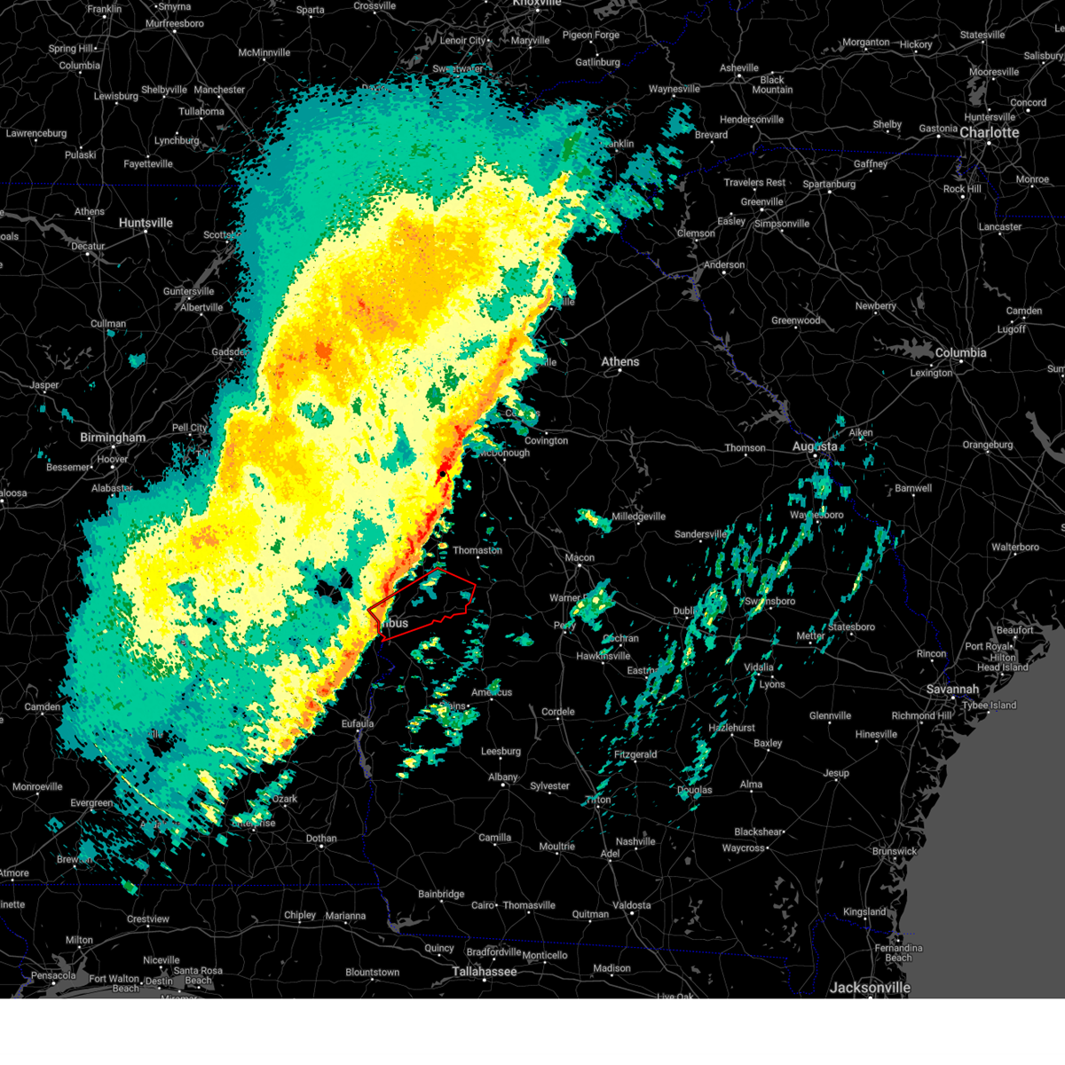 Torffc the national weather service in peachtree city has issued a * tornado warning for, muscogee county in west central georgia, northeastern chattahoochee county in west central georgia, talbot county in west central georgia, southeastern harris county in west central georgia, * until 515 am est. * at 439 am est, severe thunderstorms capable of producing both tornadoes and extensive straight line wind damage were located over green island hills, or near phenix city, moving east at 70 mph (radar indicated rotation). Hazards include tornado. Flying debris will be dangerous to those caught without shelter. mobile homes will be damaged or destroyed. damage to roofs, windows, and vehicles will occur. Tree damage is likely. Torffc the national weather service in peachtree city has issued a * tornado warning for, muscogee county in west central georgia, northeastern chattahoochee county in west central georgia, talbot county in west central georgia, southeastern harris county in west central georgia, * until 515 am est. * at 439 am est, severe thunderstorms capable of producing both tornadoes and extensive straight line wind damage were located over green island hills, or near phenix city, moving east at 70 mph (radar indicated rotation). Hazards include tornado. Flying debris will be dangerous to those caught without shelter. mobile homes will be damaged or destroyed. damage to roofs, windows, and vehicles will occur. Tree damage is likely.
|
| 2/16/2025 3:36 AM CST |
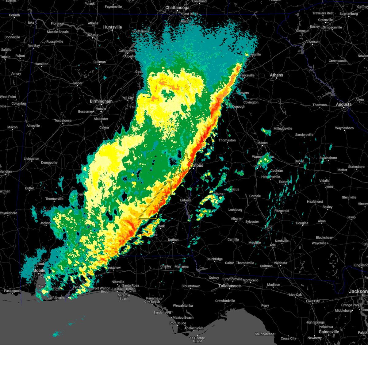 the severe thunderstorm warning has been cancelled and is no longer in effect the severe thunderstorm warning has been cancelled and is no longer in effect
|
| 2/16/2025 3:36 AM CST |
 At 335 am cst, severe thunderstorms were located along a line extending from near pine mountain to 6 miles north of russell county sports complex to near brundidge, moving east at 50 mph (radar indicated). Hazards include 70 mph wind gusts. Expect considerable tree damage. damage is likely to mobile homes, roofs, and outbuildings. Locations impacted include, troy, brundidge, midway, smiths, smiths station, banks, pickett, uchee, antioch, guerryton, bleecker, ladonia, tennille, tanyard, hamilton crossroads, monticello, springhill, perote, josie, and monterey heights. At 335 am cst, severe thunderstorms were located along a line extending from near pine mountain to 6 miles north of russell county sports complex to near brundidge, moving east at 50 mph (radar indicated). Hazards include 70 mph wind gusts. Expect considerable tree damage. damage is likely to mobile homes, roofs, and outbuildings. Locations impacted include, troy, brundidge, midway, smiths, smiths station, banks, pickett, uchee, antioch, guerryton, bleecker, ladonia, tennille, tanyard, hamilton crossroads, monticello, springhill, perote, josie, and monterey heights.
|
| 2/16/2025 3:36 AM CST |
 At 335 am cst, severe thunderstorms were located along a line extending from near pine mountain to 6 miles north of russell county sports complex to near brundidge, moving east at 65 mph (radar indicated). Hazards include 70 mph wind gusts. Expect considerable tree damage. damage is likely to mobile homes, roofs, and outbuildings. Locations impacted include, brundidge, hurtsboro, midway, smiths, smiths station, banks, pickett, bleecker, tennille, tanyard, hamilton crossroads, monticello, josie, monterey heights, tarentum, and brundidge municipal airport. At 335 am cst, severe thunderstorms were located along a line extending from near pine mountain to 6 miles north of russell county sports complex to near brundidge, moving east at 65 mph (radar indicated). Hazards include 70 mph wind gusts. Expect considerable tree damage. damage is likely to mobile homes, roofs, and outbuildings. Locations impacted include, brundidge, hurtsboro, midway, smiths, smiths station, banks, pickett, bleecker, tennille, tanyard, hamilton crossroads, monticello, josie, monterey heights, tarentum, and brundidge municipal airport.
|
| 2/16/2025 3:36 AM CST |
 the severe thunderstorm warning has been cancelled and is no longer in effect the severe thunderstorm warning has been cancelled and is no longer in effect
|
| 2/16/2025 3:26 AM CST |
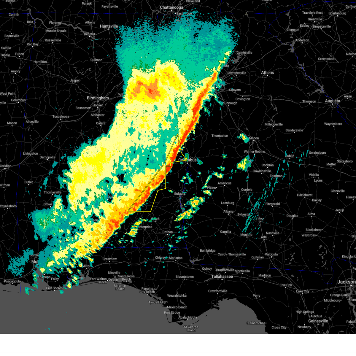 At 326 am cst, severe thunderstorms were located along a line extending from near west point to near uchee to 8 miles southeast of goshen, moving east at 60 mph (radar indicated). Hazards include 70 mph wind gusts. Expect considerable tree damage. damage is likely to mobile homes, roofs, and outbuildings. Locations impacted include, opelika, troy, valley, lanett, union springs, brundidge, midway, goshen, smiths, smiths station, west point, banks, lakeview, pickett, beulah, aberfoil, beans mill, beans crossroads, guerryton, and linwood. At 326 am cst, severe thunderstorms were located along a line extending from near west point to near uchee to 8 miles southeast of goshen, moving east at 60 mph (radar indicated). Hazards include 70 mph wind gusts. Expect considerable tree damage. damage is likely to mobile homes, roofs, and outbuildings. Locations impacted include, opelika, troy, valley, lanett, union springs, brundidge, midway, goshen, smiths, smiths station, west point, banks, lakeview, pickett, beulah, aberfoil, beans mill, beans crossroads, guerryton, and linwood.
|
| 2/16/2025 3:14 AM CST |
 Svrbmx the national weather service in birmingham has issued a * severe thunderstorm warning for, barbour county in southeastern alabama, russell county in southeastern alabama, * until 430 am cst. * at 313 am cst, severe thunderstorms were located along a line extending from near opelika to near goshen, moving east at 65 mph (radar indicated). Hazards include 70 mph wind gusts. Expect considerable tree damage. Damage is likely to mobile homes, roofs, and outbuildings. Svrbmx the national weather service in birmingham has issued a * severe thunderstorm warning for, barbour county in southeastern alabama, russell county in southeastern alabama, * until 430 am cst. * at 313 am cst, severe thunderstorms were located along a line extending from near opelika to near goshen, moving east at 65 mph (radar indicated). Hazards include 70 mph wind gusts. Expect considerable tree damage. Damage is likely to mobile homes, roofs, and outbuildings.
|
| 2/16/2025 4:11 AM EST |
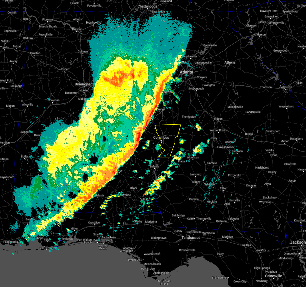 Svrffc the national weather service in peachtree city has issued a * severe thunderstorm warning for, muscogee county in west central georgia, chattahoochee county in west central georgia, northwestern stewart county in west central georgia, southwestern talbot county in west central georgia, harris county in west central georgia, * until 500 am est. * at 411 am est, severe thunderstorms were located along a line extending from near oak bowery to near society hill to near sedgefield, moving east at 65 mph (radar indicated). Hazards include 60 mph wind gusts. expect damage to roofs, siding, and trees Svrffc the national weather service in peachtree city has issued a * severe thunderstorm warning for, muscogee county in west central georgia, chattahoochee county in west central georgia, northwestern stewart county in west central georgia, southwestern talbot county in west central georgia, harris county in west central georgia, * until 500 am est. * at 411 am est, severe thunderstorms were located along a line extending from near oak bowery to near society hill to near sedgefield, moving east at 65 mph (radar indicated). Hazards include 60 mph wind gusts. expect damage to roofs, siding, and trees
|
| 2/16/2025 3:10 AM CST |
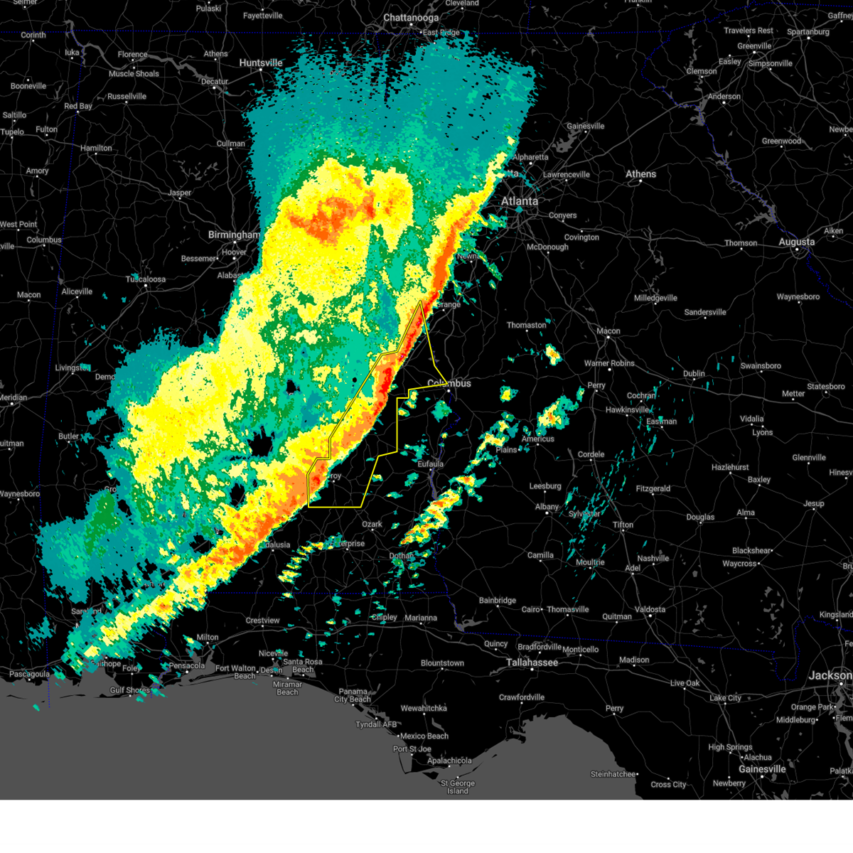 At 309 am cst, severe thunderstorms were located along a line extending from fredonia to 6 miles north of troy municipal airport, moving east at 65 mph (radar indicated). Hazards include 70 mph wind gusts. Expect considerable tree damage. damage is likely to mobile homes, roofs, and outbuildings. Locations impacted include, auburn, opelika, troy, tuskegee, valley, lanett, union springs, brundidge, notasulga, midway, goshen, smiths, smiths station, west point, glenwood, banks, lakeview, cusseta, pickett, and beulah. At 309 am cst, severe thunderstorms were located along a line extending from fredonia to 6 miles north of troy municipal airport, moving east at 65 mph (radar indicated). Hazards include 70 mph wind gusts. Expect considerable tree damage. damage is likely to mobile homes, roofs, and outbuildings. Locations impacted include, auburn, opelika, troy, tuskegee, valley, lanett, union springs, brundidge, notasulga, midway, goshen, smiths, smiths station, west point, glenwood, banks, lakeview, cusseta, pickett, and beulah.
|
| 2/16/2025 2:35 AM CST |
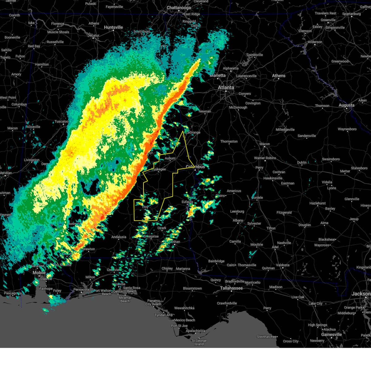 Svrbmx the national weather service in birmingham has issued a * severe thunderstorm warning for, pike county in southeastern alabama, lee county in east central alabama, bullock county in southeastern alabama, macon county in southeastern alabama, eastern chambers county in east central alabama, * until 400 am cst. * at 234 am cst, severe thunderstorms were located along a line extending from near new site to near logan, moving east at 65 mph (radar indicated). Hazards include 70 mph wind gusts. Expect considerable tree damage. Damage is likely to mobile homes, roofs, and outbuildings. Svrbmx the national weather service in birmingham has issued a * severe thunderstorm warning for, pike county in southeastern alabama, lee county in east central alabama, bullock county in southeastern alabama, macon county in southeastern alabama, eastern chambers county in east central alabama, * until 400 am cst. * at 234 am cst, severe thunderstorms were located along a line extending from near new site to near logan, moving east at 65 mph (radar indicated). Hazards include 70 mph wind gusts. Expect considerable tree damage. Damage is likely to mobile homes, roofs, and outbuildings.
|
| 12/29/2024 3:58 AM EST |
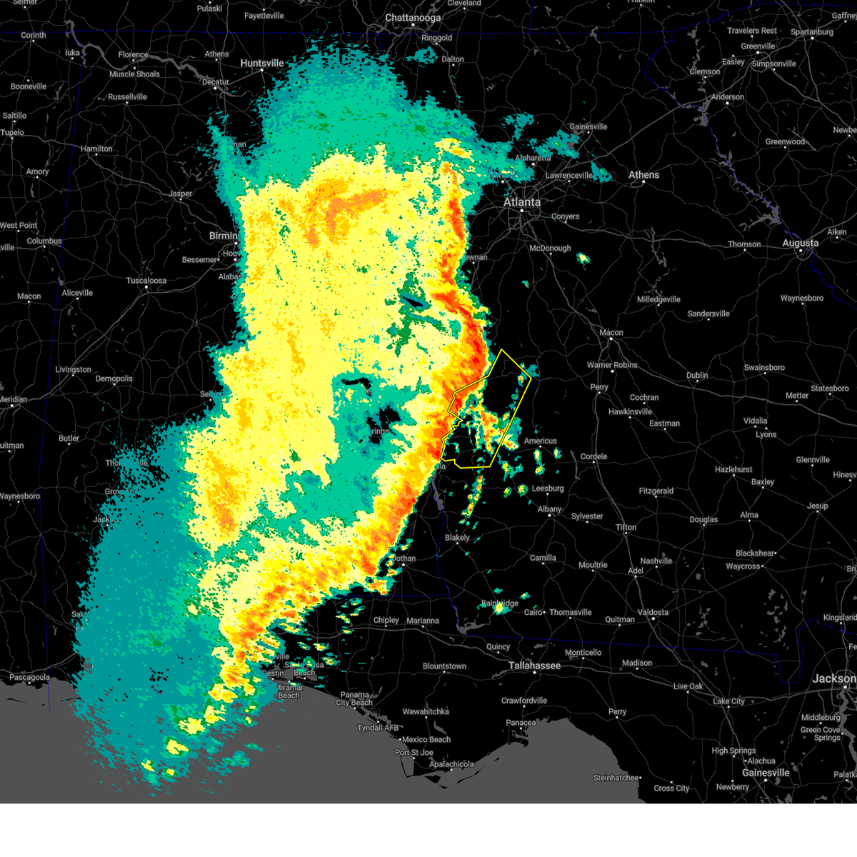 At 357 am est, severe thunderstorms were located along a line extending from near box springs to near sand hill to near lakepoint resort state park, moving east at 35 mph (radar indicated). Hazards include 60 mph wind gusts. Expect damage to roofs, siding, and trees. Locations impacted include, lumpkin, buena vista, talbotton, cusseta, richland, junction city, geneva, fort moore, north fort moore, upatoi, brantley, seminole, florence marina state park, westville, juniper, vista terrace, brooklyn, renfroe, oakland, and manta. At 357 am est, severe thunderstorms were located along a line extending from near box springs to near sand hill to near lakepoint resort state park, moving east at 35 mph (radar indicated). Hazards include 60 mph wind gusts. Expect damage to roofs, siding, and trees. Locations impacted include, lumpkin, buena vista, talbotton, cusseta, richland, junction city, geneva, fort moore, north fort moore, upatoi, brantley, seminole, florence marina state park, westville, juniper, vista terrace, brooklyn, renfroe, oakland, and manta.
|
| 12/29/2024 3:47 AM EST |
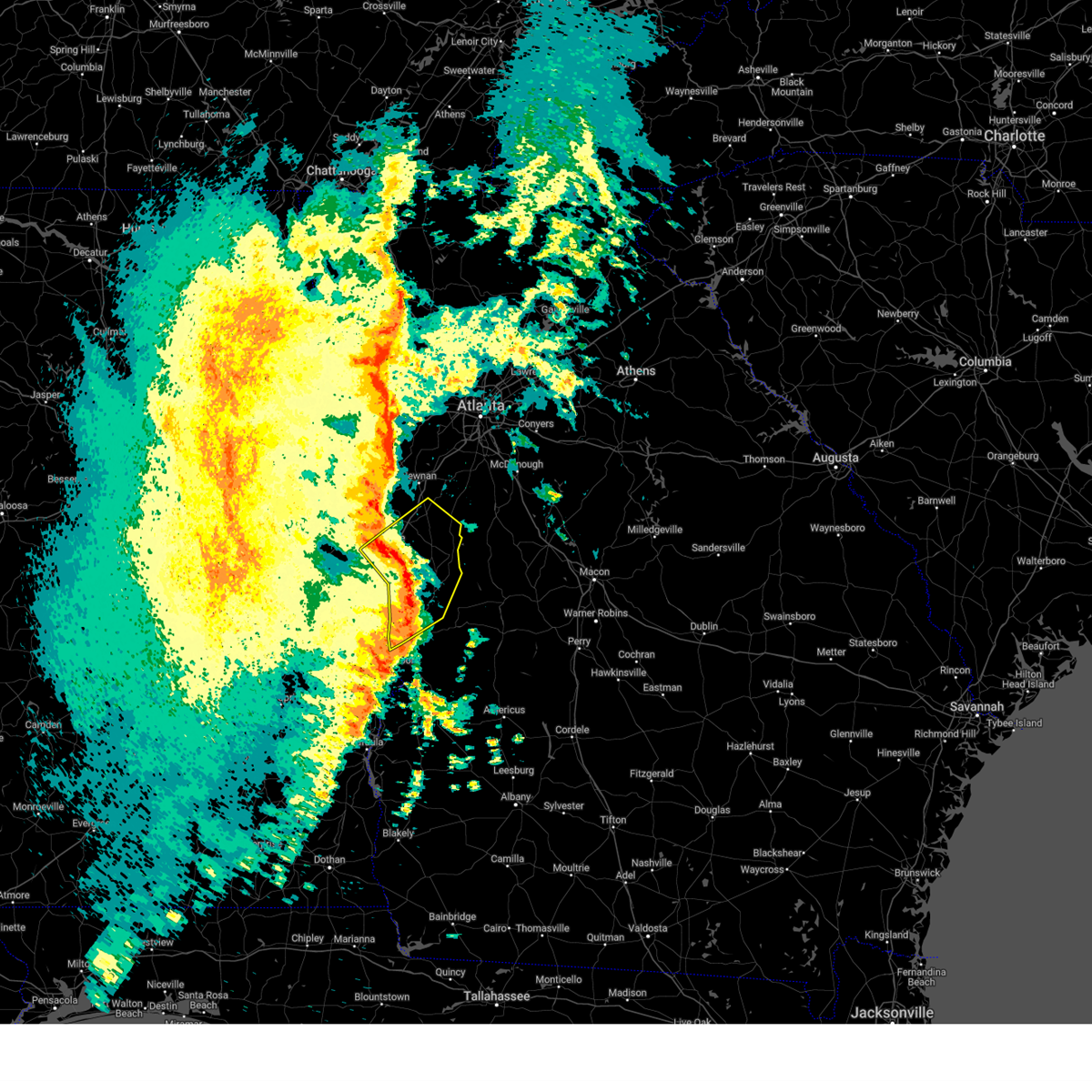 At 347 am est, severe thunderstorms were located along a line extending from near lagrange to pine mountain-callaway gardens to near ellerslie to flat rock, moving northeast at 55 mph (radar indicated). Hazards include 60 mph wind gusts. Expect damage to roofs, siding, and trees. locations impacted include, columbus, lagrange, hamilton, greenville, manchester, hogansville, grantville, pine mountain, woodbury, luthersville, waverly hall, warm springs, woodland, moreland, lone oak, gay, pine mountain-callaway gardens, bibb city, shiloh, and f. d. Roosevelt state park. At 347 am est, severe thunderstorms were located along a line extending from near lagrange to pine mountain-callaway gardens to near ellerslie to flat rock, moving northeast at 55 mph (radar indicated). Hazards include 60 mph wind gusts. Expect damage to roofs, siding, and trees. locations impacted include, columbus, lagrange, hamilton, greenville, manchester, hogansville, grantville, pine mountain, woodbury, luthersville, waverly hall, warm springs, woodland, moreland, lone oak, gay, pine mountain-callaway gardens, bibb city, shiloh, and f. d. Roosevelt state park.
|
| 12/29/2024 2:27 AM CST |
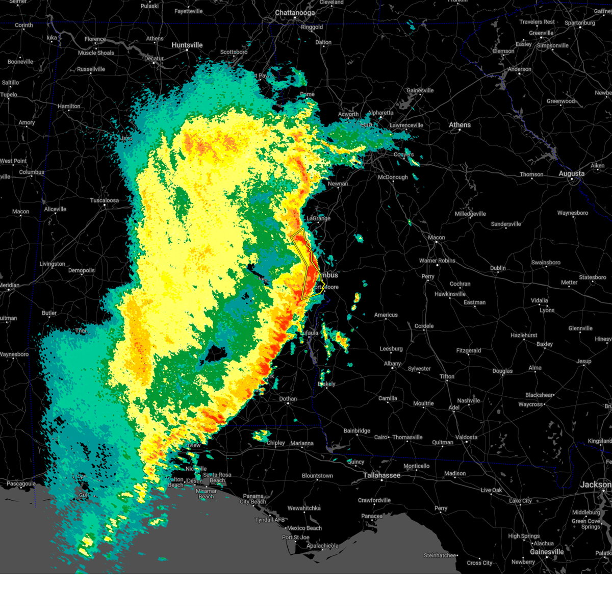 At 227 am cst, severe thunderstorms were located along a line extending from near denson to 6 miles north of smiths to seale, moving northeast at 50 mph (radar indicated). Hazards include 60 mph wind gusts. Expect damage to roofs, siding, and trees. Locations impacted include, phenix city, valley, lanett, smiths, smiths station, lakeview, beulah, russell county sports complex, seale, huguley, fairfax, river view, amity park, ladonia, bleecker, southern harbor, lanett municipal airport, i 85 welcome center at lanett, monterey heights, and fort mitchell. At 227 am cst, severe thunderstorms were located along a line extending from near denson to 6 miles north of smiths to seale, moving northeast at 50 mph (radar indicated). Hazards include 60 mph wind gusts. Expect damage to roofs, siding, and trees. Locations impacted include, phenix city, valley, lanett, smiths, smiths station, lakeview, beulah, russell county sports complex, seale, huguley, fairfax, river view, amity park, ladonia, bleecker, southern harbor, lanett municipal airport, i 85 welcome center at lanett, monterey heights, and fort mitchell.
|
| 12/29/2024 3:25 AM EST |
 Svrffc the national weather service in peachtree city has issued a * severe thunderstorm warning for, marion county in west central georgia, central muscogee county in west central georgia, chattahoochee county in west central georgia, stewart county in west central georgia, northwestern webster county in west central georgia, southwestern talbot county in west central georgia, southwestern taylor county in west central georgia, * until 430 am est. * at 325 am est, severe thunderstorms were located along a line extending from ladonia sports complex to near russell county sports complex to white oak, moving east at 45 mph (radar indicated). Hazards include 60 mph wind gusts. expect damage to roofs, siding, and trees Svrffc the national weather service in peachtree city has issued a * severe thunderstorm warning for, marion county in west central georgia, central muscogee county in west central georgia, chattahoochee county in west central georgia, stewart county in west central georgia, northwestern webster county in west central georgia, southwestern talbot county in west central georgia, southwestern taylor county in west central georgia, * until 430 am est. * at 325 am est, severe thunderstorms were located along a line extending from ladonia sports complex to near russell county sports complex to white oak, moving east at 45 mph (radar indicated). Hazards include 60 mph wind gusts. expect damage to roofs, siding, and trees
|
| 12/29/2024 3:12 AM EST |
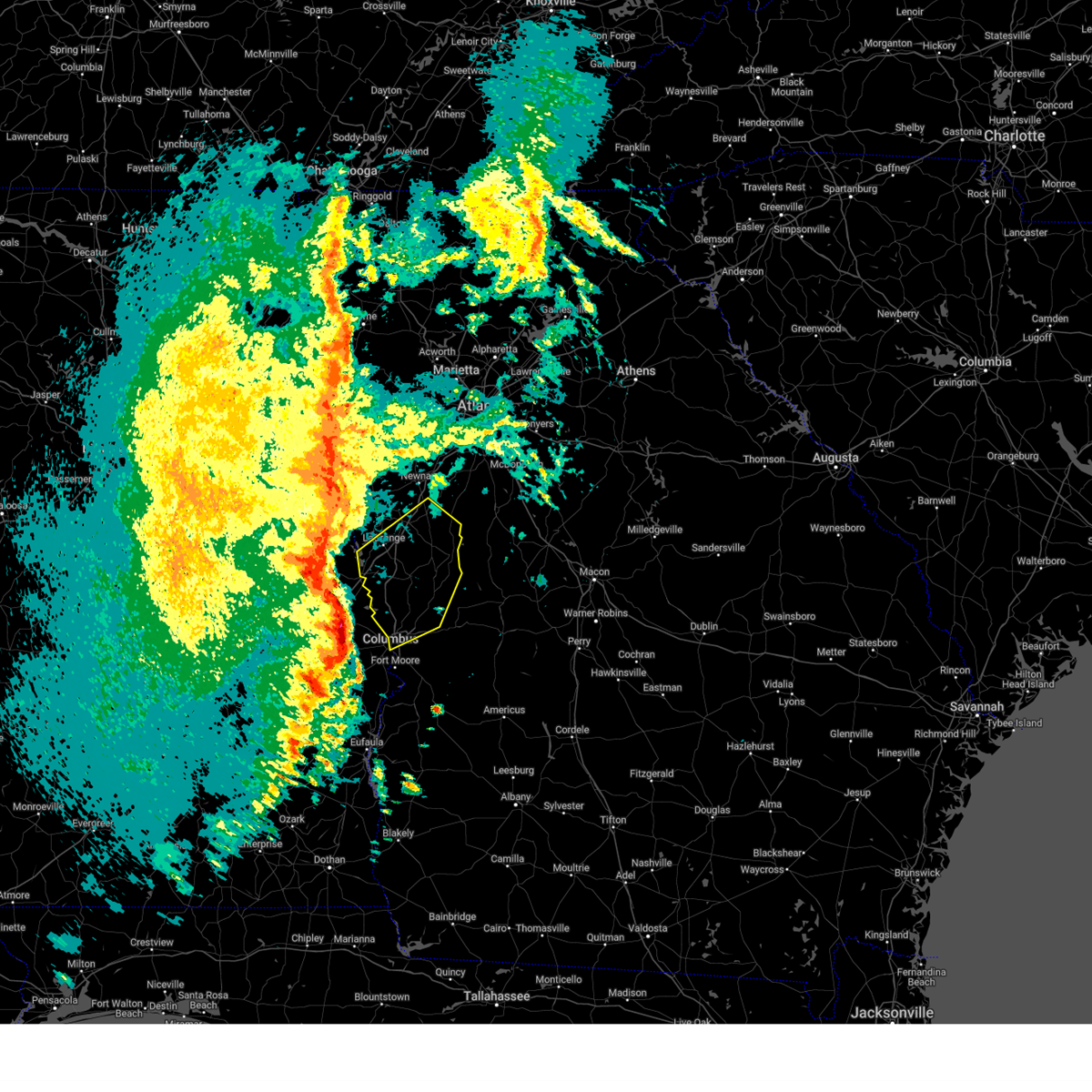 Svrffc the national weather service in peachtree city has issued a * severe thunderstorm warning for, meriwether county in west central georgia, northern muscogee county in west central georgia, troup county in west central georgia, south central coweta county in west central georgia, northwestern talbot county in west central georgia, harris county in west central georgia, * until 415 am est. * at 311 am est, severe thunderstorms were located along a line extending from near chambers county lake to beans mill to near griffen mill to near parkmanville in eastern alabama, moving northeast at 55 mph (radar indicated). Hazards include 60 mph wind gusts. expect damage to roofs, siding, and trees Svrffc the national weather service in peachtree city has issued a * severe thunderstorm warning for, meriwether county in west central georgia, northern muscogee county in west central georgia, troup county in west central georgia, south central coweta county in west central georgia, northwestern talbot county in west central georgia, harris county in west central georgia, * until 415 am est. * at 311 am est, severe thunderstorms were located along a line extending from near chambers county lake to beans mill to near griffen mill to near parkmanville in eastern alabama, moving northeast at 55 mph (radar indicated). Hazards include 60 mph wind gusts. expect damage to roofs, siding, and trees
|
| 12/29/2024 2:12 AM CST |
 At 212 am cst, severe thunderstorms were located along a line extending from near chambers county lake to near bleecker to near hurtsboro, moving east at 55 mph (radar indicated). Hazards include 60 mph wind gusts. Expect damage to roofs, siding, and trees. Locations impacted include, phenix city, opelika, valley, lanett, hurtsboro, smiths, smiths station, lakeview, cusseta, beulah, uchee, beans mill, river view, amity park, beauregard, sturkie, bleecker, chambers county lake, russell county sports complex, and seale. At 212 am cst, severe thunderstorms were located along a line extending from near chambers county lake to near bleecker to near hurtsboro, moving east at 55 mph (radar indicated). Hazards include 60 mph wind gusts. Expect damage to roofs, siding, and trees. Locations impacted include, phenix city, opelika, valley, lanett, hurtsboro, smiths, smiths station, lakeview, cusseta, beulah, uchee, beans mill, river view, amity park, beauregard, sturkie, bleecker, chambers county lake, russell county sports complex, and seale.
|
| 12/29/2024 2:12 AM CST |
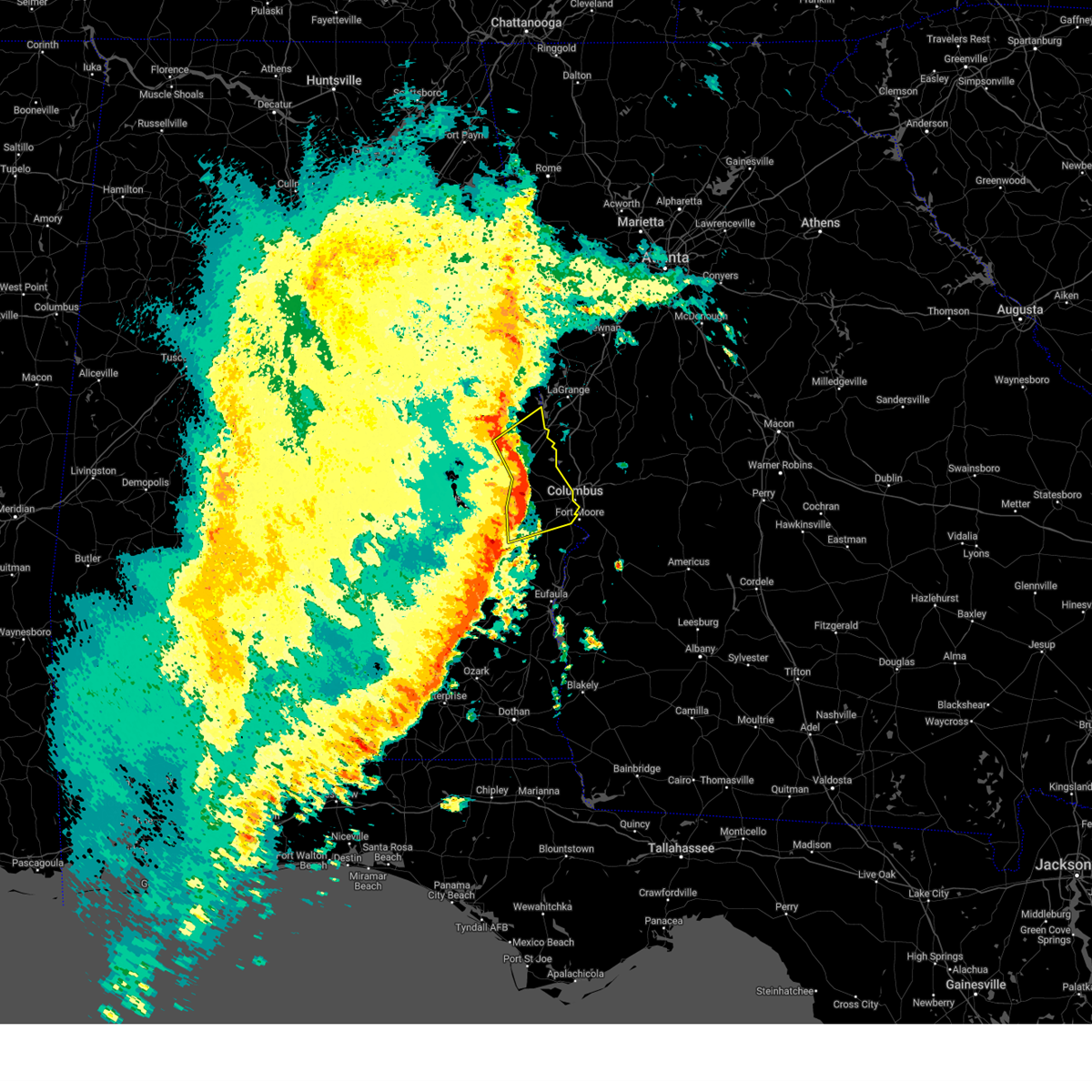 the severe thunderstorm warning has been cancelled and is no longer in effect the severe thunderstorm warning has been cancelled and is no longer in effect
|
| 12/29/2024 2:01 AM CST |
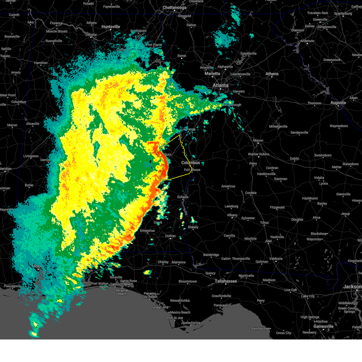 At 201 am cst, severe thunderstorms were located along a line extending from near sturkie to beauregard to near hurtsboro, moving east at 50 mph (radar indicated). Hazards include 60 mph wind gusts. Expect damage to roofs, siding, and trees. Locations impacted include, auburn, phenix city, opelika, valley, lanett, hurtsboro, smiths, smiths station, la fayette, waverly, lakeview, cusseta, beulah, uchee, beans mill, auburn university, river view, amity park, beauregard, and sturkie. At 201 am cst, severe thunderstorms were located along a line extending from near sturkie to beauregard to near hurtsboro, moving east at 50 mph (radar indicated). Hazards include 60 mph wind gusts. Expect damage to roofs, siding, and trees. Locations impacted include, auburn, phenix city, opelika, valley, lanett, hurtsboro, smiths, smiths station, la fayette, waverly, lakeview, cusseta, beulah, uchee, beans mill, auburn university, river view, amity park, beauregard, and sturkie.
|
| 12/29/2024 1:43 AM CST |
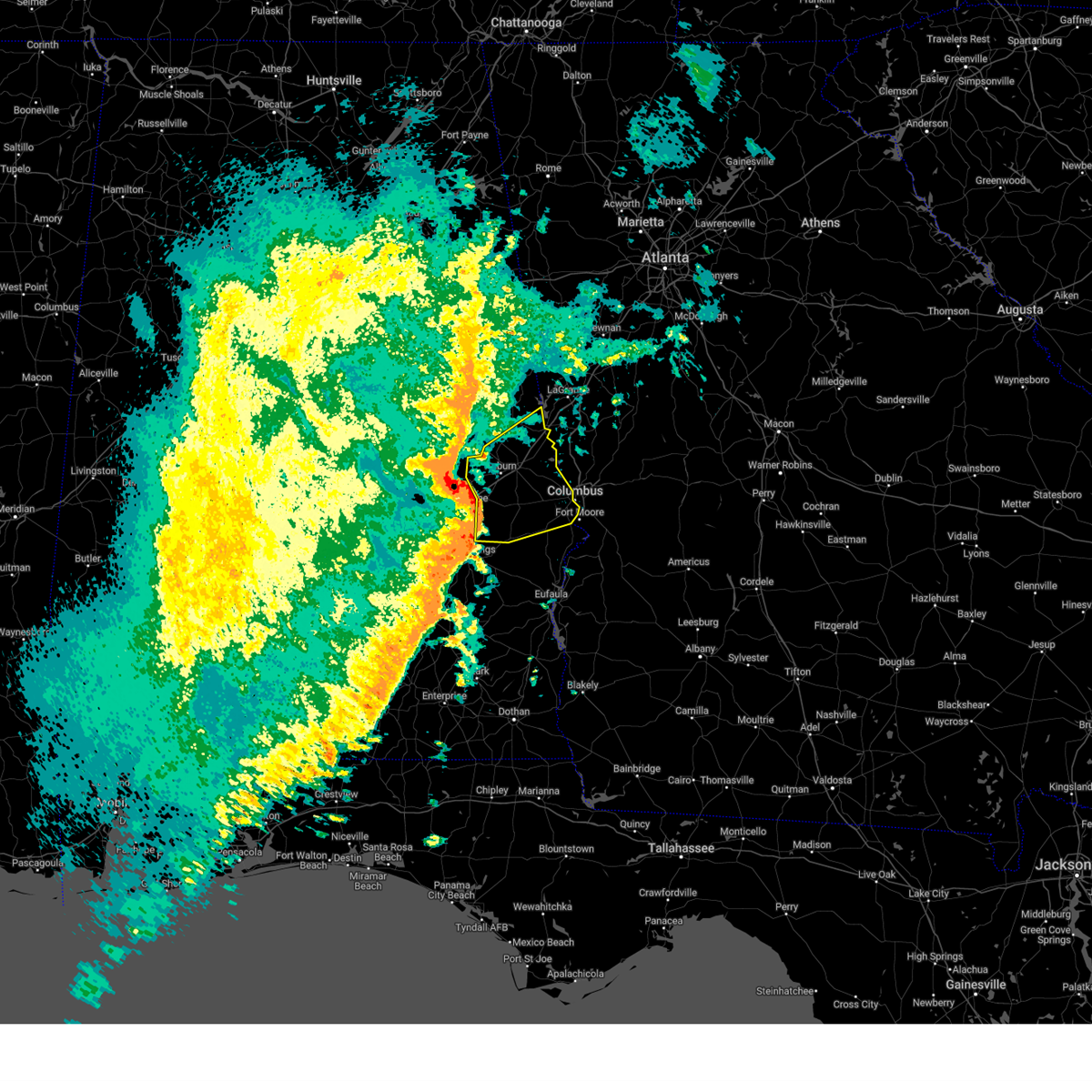 Svrbmx the national weather service in birmingham has issued a * severe thunderstorm warning for, lee county in east central alabama, eastern macon county in southeastern alabama, southern chambers county in east central alabama, northern russell county in southeastern alabama, * until 245 am cst. * at 143 am cst, severe thunderstorms were located along a line extending from liberty city to tuskegee national forest to near davisville, moving northeast at 50 mph (radar indicated). Hazards include 60 mph wind gusts. expect damage to roofs, siding, and trees Svrbmx the national weather service in birmingham has issued a * severe thunderstorm warning for, lee county in east central alabama, eastern macon county in southeastern alabama, southern chambers county in east central alabama, northern russell county in southeastern alabama, * until 245 am cst. * at 143 am cst, severe thunderstorms were located along a line extending from liberty city to tuskegee national forest to near davisville, moving northeast at 50 mph (radar indicated). Hazards include 60 mph wind gusts. expect damage to roofs, siding, and trees
|
| 9/13/2024 7:37 AM EDT |
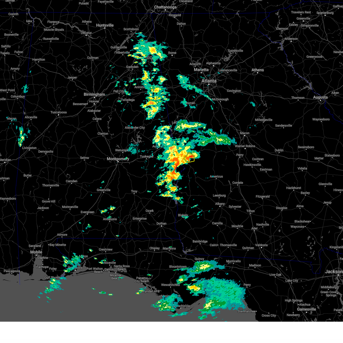 At 737 am edt, a severe thunderstorm was located over eelbeck/west fort moore, or 8 miles north of cusseta, moving northeast at 20 mph (radar indicated). Hazards include 60 mph wind gusts and quarter size hail. Hail damage to vehicles is expected. expect wind damage to roofs, siding, and trees. Locations impacted include, north fort moore, sand hill, and eelbeck/west fort moore. At 737 am edt, a severe thunderstorm was located over eelbeck/west fort moore, or 8 miles north of cusseta, moving northeast at 20 mph (radar indicated). Hazards include 60 mph wind gusts and quarter size hail. Hail damage to vehicles is expected. expect wind damage to roofs, siding, and trees. Locations impacted include, north fort moore, sand hill, and eelbeck/west fort moore.
|
| 9/13/2024 7:11 AM EDT |
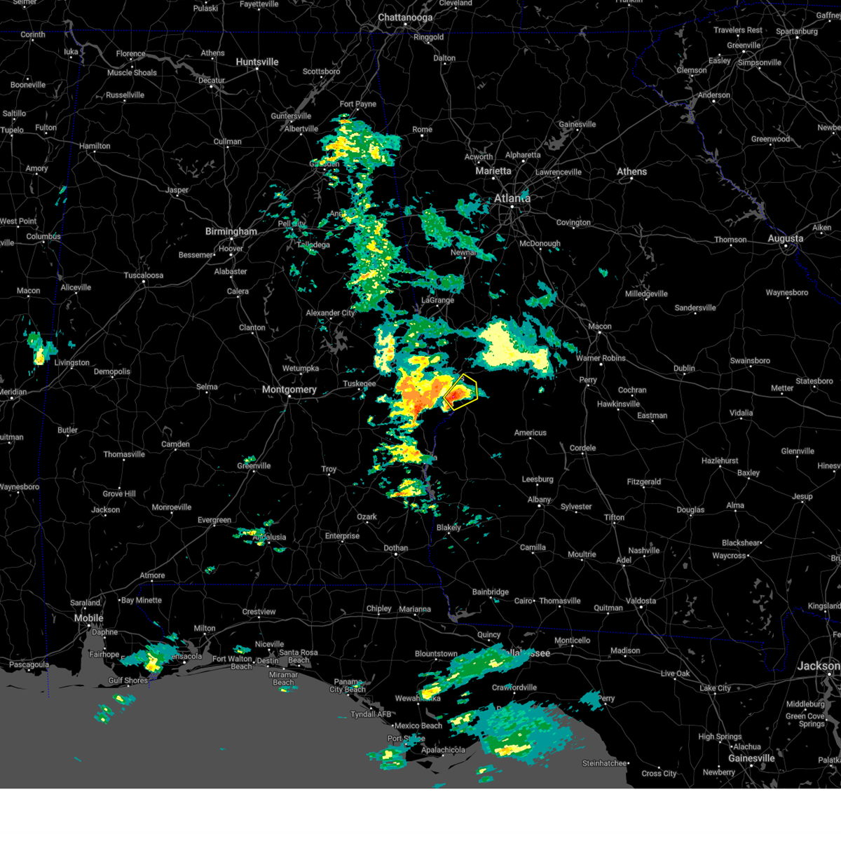 Svrffc the national weather service in peachtree city has issued a * severe thunderstorm warning for, southeastern muscogee county in west central georgia, central chattahoochee county in west central georgia, * until 745 am edt. * at 711 am edt, a severe thunderstorm was located near custer road terrace, or 8 miles northwest of cusseta, moving northeast at 20 mph (radar indicated). Hazards include 60 mph wind gusts and quarter size hail. Hail damage to vehicles is expected. Expect wind damage to roofs, siding, and trees. Svrffc the national weather service in peachtree city has issued a * severe thunderstorm warning for, southeastern muscogee county in west central georgia, central chattahoochee county in west central georgia, * until 745 am edt. * at 711 am edt, a severe thunderstorm was located near custer road terrace, or 8 miles northwest of cusseta, moving northeast at 20 mph (radar indicated). Hazards include 60 mph wind gusts and quarter size hail. Hail damage to vehicles is expected. Expect wind damage to roofs, siding, and trees.
|
| 9/13/2024 6:53 AM EDT |
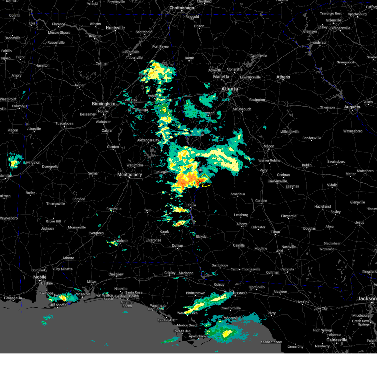 the severe thunderstorm warning has been cancelled and is no longer in effect the severe thunderstorm warning has been cancelled and is no longer in effect
|
| 9/13/2024 6:53 AM EDT |
 At 653 am edt, a severe thunderstorm was located near fort moore, or 8 miles west of cusseta, moving northeast at 15 mph (radar indicated). Hazards include 60 mph wind gusts and quarter size hail. Hail damage to vehicles is expected. expect wind damage to roofs, siding, and trees. Locations impacted include, cusseta, fort moore, jamestown/south fort moore, sand hill, custer road terrace, and battle park. At 653 am edt, a severe thunderstorm was located near fort moore, or 8 miles west of cusseta, moving northeast at 15 mph (radar indicated). Hazards include 60 mph wind gusts and quarter size hail. Hail damage to vehicles is expected. expect wind damage to roofs, siding, and trees. Locations impacted include, cusseta, fort moore, jamestown/south fort moore, sand hill, custer road terrace, and battle park.
|
| 9/13/2024 5:36 AM CDT |
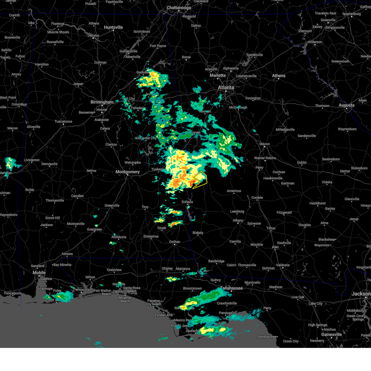 Svrffc the national weather service in peachtree city has issued a * severe thunderstorm warning for, south central muscogee county in west central georgia, southwestern chattahoochee county in west central georgia, northwestern stewart county in west central georgia, * until 715 am edt. * at 635 am edt, a severe thunderstorm was located over fort mitchell activity center, or 12 miles west of cusseta, moving northeast at 15 mph (radar indicated). Hazards include 60 mph wind gusts and quarter size hail. Hail damage to vehicles is expected. Expect wind damage to roofs, siding, and trees. Svrffc the national weather service in peachtree city has issued a * severe thunderstorm warning for, south central muscogee county in west central georgia, southwestern chattahoochee county in west central georgia, northwestern stewart county in west central georgia, * until 715 am edt. * at 635 am edt, a severe thunderstorm was located over fort mitchell activity center, or 12 miles west of cusseta, moving northeast at 15 mph (radar indicated). Hazards include 60 mph wind gusts and quarter size hail. Hail damage to vehicles is expected. Expect wind damage to roofs, siding, and trees.
|
| 8/30/2024 6:05 PM EDT | A few trees down on the north side of the city of columbus per e in muscogee county GA, 8.3 miles SE of Columbus, GA |
| 8/18/2024 6:46 PM EDT | the severe thunderstorm warning has been cancelled and is no longer in effect |
| 8/18/2024 6:46 PM EDT | Svrffc the national weather service in peachtree city has issued a * severe thunderstorm warning for, southwestern marion county in west central georgia, chattahoochee county in west central georgia, stewart county in west central georgia, northern webster county in west central georgia, * until 730 pm edt. * at 646 pm edt, severe thunderstorms were located along a line extending from near zellobee to 6 miles southeast of seale, moving southeast at 30 mph (radar indicated). Hazards include 60 mph wind gusts. expect damage to roofs, siding, and trees |
| 8/18/2024 5:35 PM CDT | the severe thunderstorm warning has been cancelled and is no longer in effect |
| 8/18/2024 5:35 PM CDT | At 535 pm cdt, a severe thunderstorm was located 8 miles southwest of seale, or 8 miles east of hurtsboro, moving south at 40 mph (radar indicated). Hazards include 70 mph wind gusts and quarter size hail. Hail damage to vehicles is expected. expect considerable tree damage. wind damage is also likely to mobile homes, roofs, and outbuildings. Locations impacted include, hurtsboro, russell county sports complex, uchee, seale, creek stand, rutherford, hatchechubbe, uchee creek, fort mitchell, fort mitchell activity center, phenix drag strip, and parkmanville. |
| 8/18/2024 6:33 PM EDT | At 632 pm edt, a severe thunderstorm was located near sand hill, or near cusseta, moving southeast at 20 mph (radar indicated). Hazards include 60 mph wind gusts and penny size hail. Expect damage to roofs, siding, and trees. Locations impacted include, benning hills, benning park, sand hill, carter acres, custer road terrace, and battle park. |
| 8/18/2024 6:15 PM EDT |
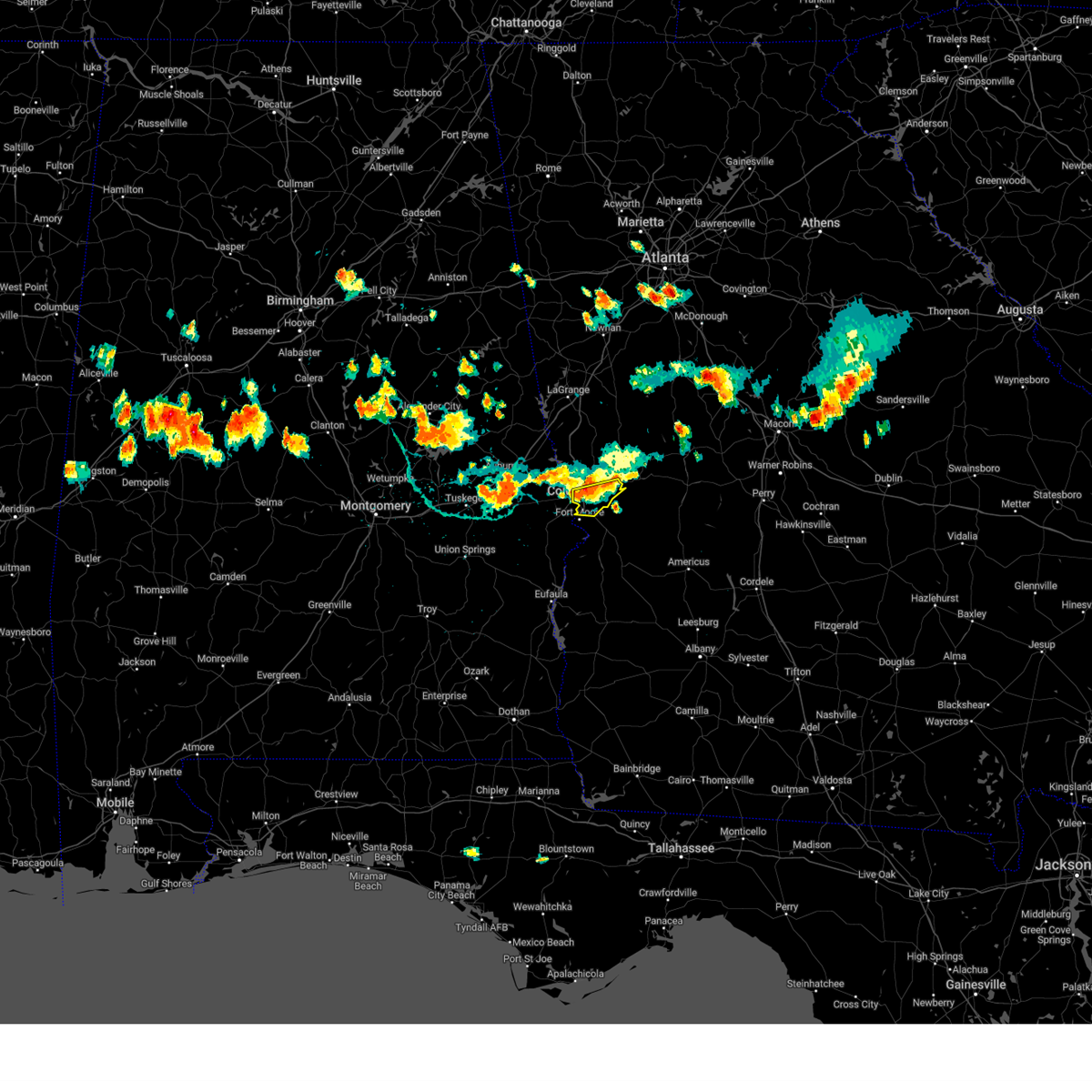 Svrffc the national weather service in peachtree city has issued a * severe thunderstorm warning for, muscogee county in west central georgia, northwestern chattahoochee county in west central georgia, * until 700 pm edt. * at 614 pm edt, a severe thunderstorm was located over vista terrace, or near columbus, moving southeast at 20 mph (radar indicated). Hazards include 60 mph wind gusts and penny size hail. expect damage to roofs, siding, and trees Svrffc the national weather service in peachtree city has issued a * severe thunderstorm warning for, muscogee county in west central georgia, northwestern chattahoochee county in west central georgia, * until 700 pm edt. * at 614 pm edt, a severe thunderstorm was located over vista terrace, or near columbus, moving southeast at 20 mph (radar indicated). Hazards include 60 mph wind gusts and penny size hail. expect damage to roofs, siding, and trees
|
| 8/18/2024 6:05 PM EDT |
 Svrffc the national weather service in peachtree city has issued a * severe thunderstorm warning for, northwestern marion county in west central georgia, chattahoochee county in west central georgia, * until 645 pm edt. * at 604 pm edt, a severe thunderstorm was located over vista terrace, or 7 miles east of columbus, moving southeast at 35 mph (radar indicated). Hazards include 60 mph wind gusts and penny size hail. expect damage to roofs, siding, and trees Svrffc the national weather service in peachtree city has issued a * severe thunderstorm warning for, northwestern marion county in west central georgia, chattahoochee county in west central georgia, * until 645 pm edt. * at 604 pm edt, a severe thunderstorm was located over vista terrace, or 7 miles east of columbus, moving southeast at 35 mph (radar indicated). Hazards include 60 mph wind gusts and penny size hail. expect damage to roofs, siding, and trees
|
| 8/18/2024 5:05 PM CDT |
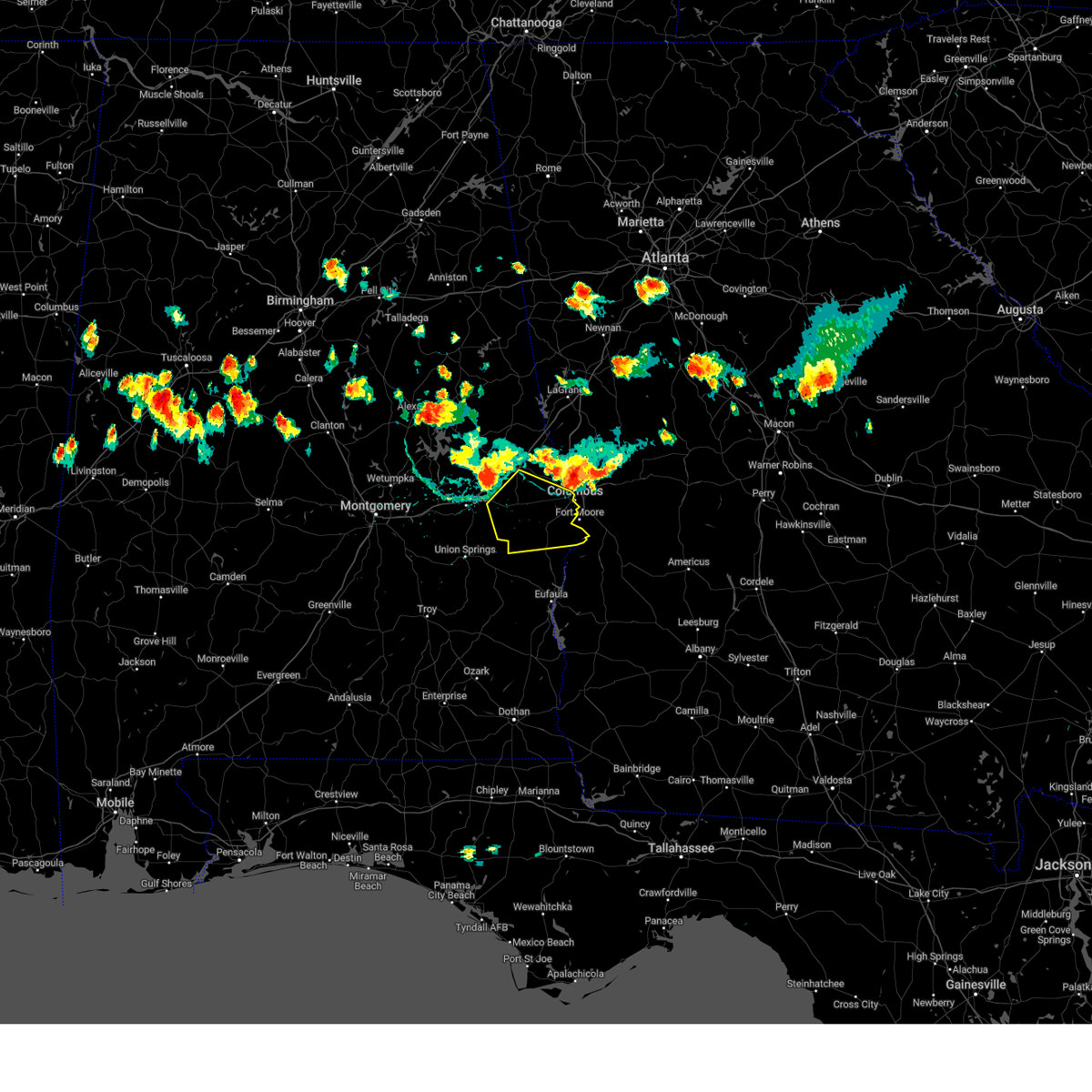 Svrbmx the national weather service in birmingham has issued a * severe thunderstorm warning for, southeastern lee county in east central alabama, southeastern macon county in southeastern alabama, russell county in southeastern alabama, * until 600 pm cdt. * at 505 pm cdt, a severe thunderstorm was located over beauregard, or 8 miles southeast of auburn, moving southeast at 30 mph (radar indicated). Hazards include 60 mph wind gusts and quarter size hail. Hail damage to vehicles is expected. Expect wind damage to roofs, siding, and trees. Svrbmx the national weather service in birmingham has issued a * severe thunderstorm warning for, southeastern lee county in east central alabama, southeastern macon county in southeastern alabama, russell county in southeastern alabama, * until 600 pm cdt. * at 505 pm cdt, a severe thunderstorm was located over beauregard, or 8 miles southeast of auburn, moving southeast at 30 mph (radar indicated). Hazards include 60 mph wind gusts and quarter size hail. Hail damage to vehicles is expected. Expect wind damage to roofs, siding, and trees.
|
| 8/18/2024 6:03 PM EDT | Storm damage reported in muscogee county GA, 6.1 miles SE of Columbus, GA |
| 8/18/2024 5:56 PM EDT | A tree was reported down on power lines on garrett rd between warm springs rd and county line r in muscogee county GA, 8.1 miles SSW of Columbus, GA |
| 8/18/2024 5:56 PM EDT | A large tree fell onto power lines along arrington driv in muscogee county GA, 5.7 miles SE of Columbus, GA |
| 8/18/2024 5:54 PM EDT |
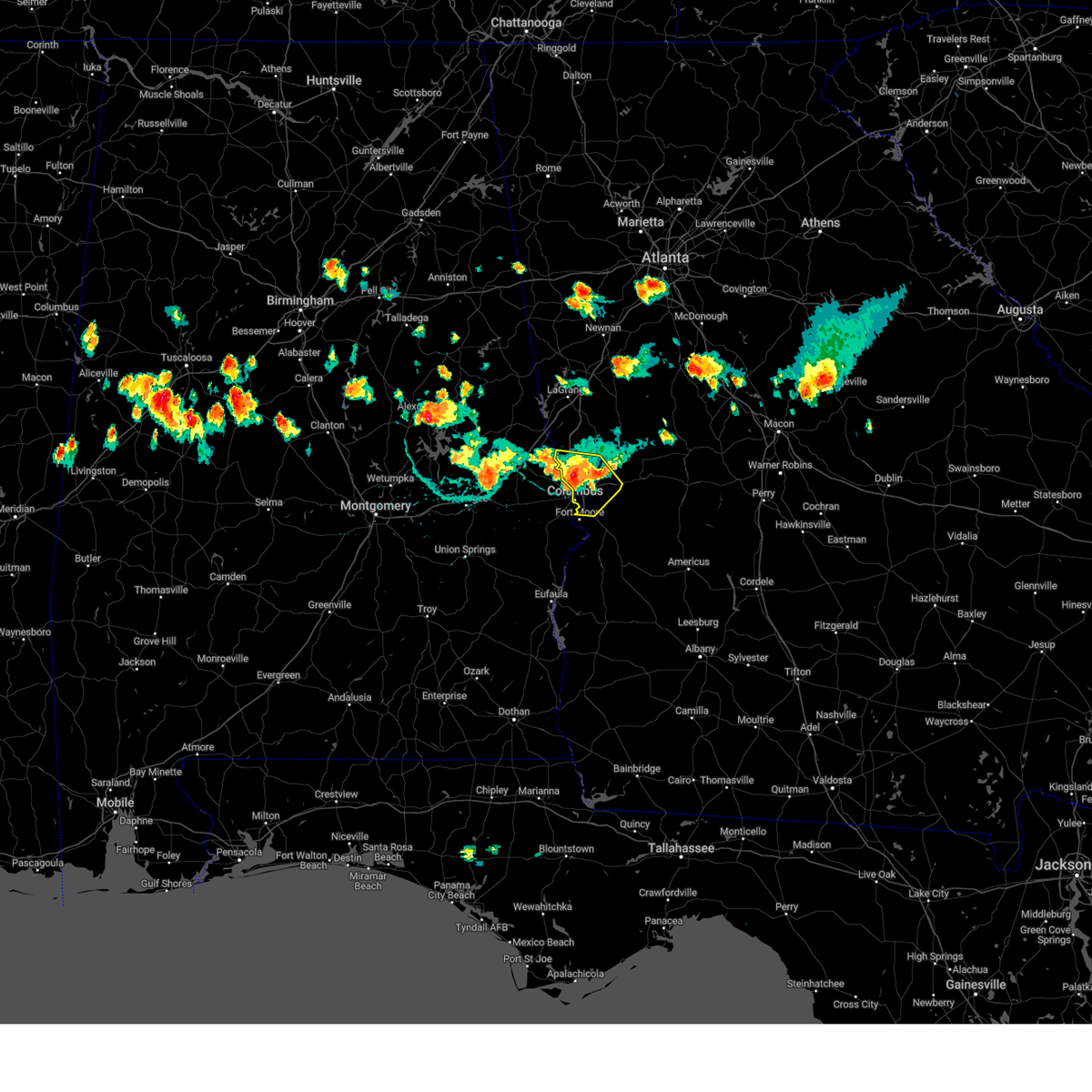 At 554 pm edt, a severe thunderstorm was located over highland park, or over columbus, moving south at 35 mph (radar indicated). Hazards include 60 mph wind gusts. Expect damage to roofs, siding, and trees. Locations impacted include, columbus, north fort moore, bibb city, upatoi, ellerslie, laurel hills, green island hills, vista terrace, cataula, columbus metropolitan airport, rose hill, mountain hill, benning hills, avondale, benning park, bartletts ferry dam, fortson, mulberry grove, saint marys hills, and edgewood. At 554 pm edt, a severe thunderstorm was located over highland park, or over columbus, moving south at 35 mph (radar indicated). Hazards include 60 mph wind gusts. Expect damage to roofs, siding, and trees. Locations impacted include, columbus, north fort moore, bibb city, upatoi, ellerslie, laurel hills, green island hills, vista terrace, cataula, columbus metropolitan airport, rose hill, mountain hill, benning hills, avondale, benning park, bartletts ferry dam, fortson, mulberry grove, saint marys hills, and edgewood.
|
| 8/18/2024 5:53 PM EDT | Estimated gust in the area of standing boy creek at lake olive in muscogee county GA, 10.2 miles ESE of Columbus, GA |
| 8/18/2024 5:50 PM EDT | A tree was reported down on whitesville road near twin chapel driv in muscogee county GA, 9.7 miles SE of Columbus, GA |
| 8/18/2024 5:50 PM EDT | A large tree was reported down across whitesville road near biggers roa in muscogee county GA, 11.1 miles SE of Columbus, GA |
| 8/18/2024 4:36 PM CDT |
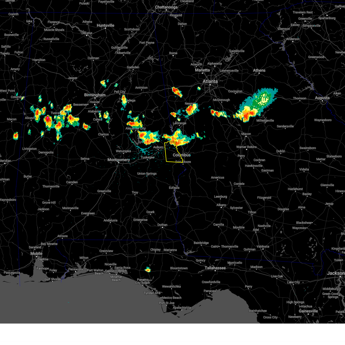 Svrbmx the national weather service in birmingham has issued a * severe thunderstorm warning for, eastern lee county in east central alabama, northeastern russell county in southeastern alabama, * until 515 pm cdt. * at 436 pm cdt, a severe thunderstorm was located over beulah, or 8 miles south of valley, moving southeast at 35 mph (radar indicated). Hazards include 60 mph wind gusts and quarter size hail. Hail damage to vehicles is expected. Expect wind damage to roofs, siding, and trees. Svrbmx the national weather service in birmingham has issued a * severe thunderstorm warning for, eastern lee county in east central alabama, northeastern russell county in southeastern alabama, * until 515 pm cdt. * at 436 pm cdt, a severe thunderstorm was located over beulah, or 8 miles south of valley, moving southeast at 35 mph (radar indicated). Hazards include 60 mph wind gusts and quarter size hail. Hail damage to vehicles is expected. Expect wind damage to roofs, siding, and trees.
|
| 8/18/2024 5:28 PM EDT |
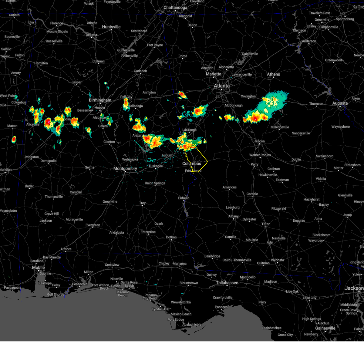 Svrffc the national weather service in peachtree city has issued a * severe thunderstorm warning for, muscogee county in west central georgia, central chattahoochee county in west central georgia, harris county in west central georgia, * until 615 pm edt. * at 528 pm edt, a severe thunderstorm was located over mountain hill, or 10 miles north of smiths, moving south at 35 mph (radar indicated). Hazards include 60 mph wind gusts. expect damage to roofs, siding, and trees Svrffc the national weather service in peachtree city has issued a * severe thunderstorm warning for, muscogee county in west central georgia, central chattahoochee county in west central georgia, harris county in west central georgia, * until 615 pm edt. * at 528 pm edt, a severe thunderstorm was located over mountain hill, or 10 miles north of smiths, moving south at 35 mph (radar indicated). Hazards include 60 mph wind gusts. expect damage to roofs, siding, and trees
|
| 7/30/2024 11:53 PM EDT |
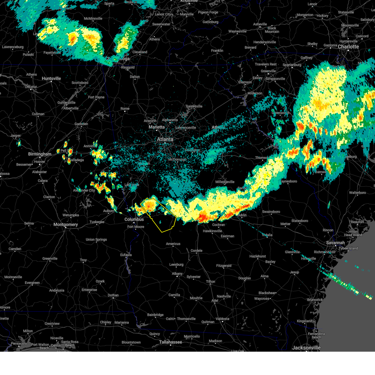 the severe thunderstorm warning has been cancelled and is no longer in effect the severe thunderstorm warning has been cancelled and is no longer in effect
|
| 7/30/2024 11:30 PM EDT |
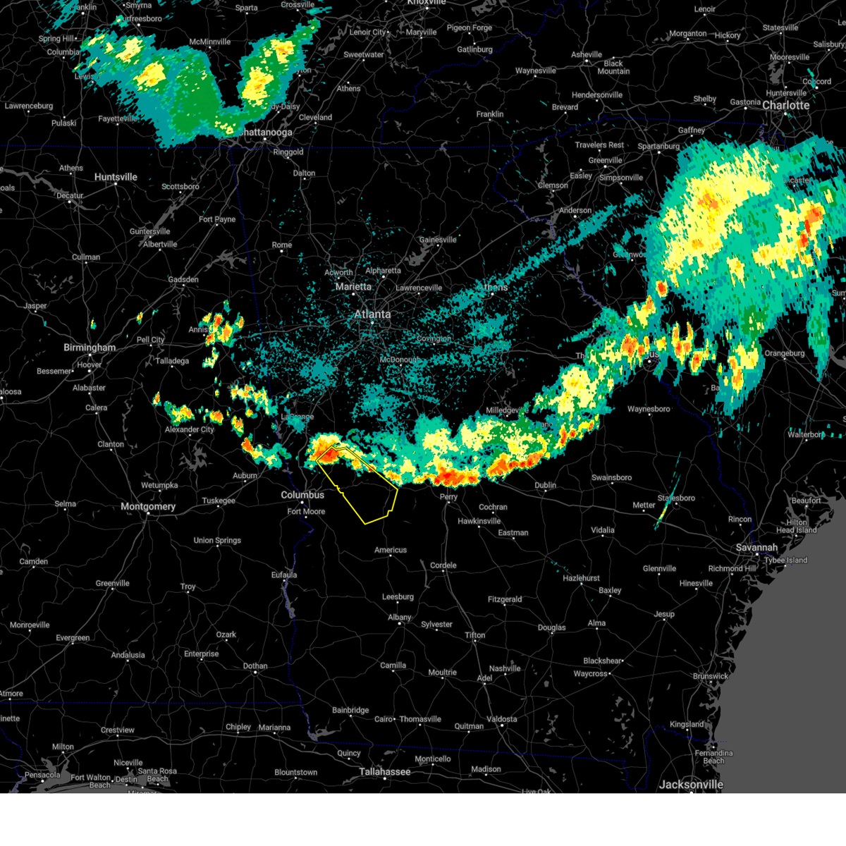 Svrffc the national weather service in peachtree city has issued a * severe thunderstorm warning for, northern marion county in west central georgia, northwestern schley county in west central georgia, talbot county in west central georgia, western taylor county in west central georgia, eastern harris county in west central georgia, * until 1215 am edt. * at 1129 pm edt, a severe thunderstorm was located near shiloh, or 9 miles east of hamilton, moving southeast at 35 mph (radar indicated). Hazards include 60 mph wind gusts and penny size hail. expect damage to roofs, siding, and trees Svrffc the national weather service in peachtree city has issued a * severe thunderstorm warning for, northern marion county in west central georgia, northwestern schley county in west central georgia, talbot county in west central georgia, western taylor county in west central georgia, eastern harris county in west central georgia, * until 1215 am edt. * at 1129 pm edt, a severe thunderstorm was located near shiloh, or 9 miles east of hamilton, moving southeast at 35 mph (radar indicated). Hazards include 60 mph wind gusts and penny size hail. expect damage to roofs, siding, and trees
|
| 7/7/2024 6:42 PM EDT |
 At 640 pm edt, a severe thunderstorm was located near cusseta, moving east at 15 mph (radar indicated). Hazards include 60 mph wind gusts and penny size hail. Expect damage to roofs, siding, and trees. Locations impacted include, cusseta, north fort moore, christopher, sand hill, custer road terrace, battle park, benning hills, benning park, and jamestown/south fort moore. At 640 pm edt, a severe thunderstorm was located near cusseta, moving east at 15 mph (radar indicated). Hazards include 60 mph wind gusts and penny size hail. Expect damage to roofs, siding, and trees. Locations impacted include, cusseta, north fort moore, christopher, sand hill, custer road terrace, battle park, benning hills, benning park, and jamestown/south fort moore.
|
| 7/7/2024 6:17 PM EDT |
 Svrffc the national weather service in peachtree city has issued a * severe thunderstorm warning for, south central muscogee county in west central georgia, southern chattahoochee county in west central georgia, * until 700 pm edt. * at 617 pm edt, a severe thunderstorm was located over uchee creek, or 9 miles south of columbus, moving east at 5 mph (radar indicated). Hazards include 60 mph wind gusts and penny size hail. expect damage to roofs, siding, and trees Svrffc the national weather service in peachtree city has issued a * severe thunderstorm warning for, south central muscogee county in west central georgia, southern chattahoochee county in west central georgia, * until 700 pm edt. * at 617 pm edt, a severe thunderstorm was located over uchee creek, or 9 miles south of columbus, moving east at 5 mph (radar indicated). Hazards include 60 mph wind gusts and penny size hail. expect damage to roofs, siding, and trees
|
| 5/27/2024 3:03 PM CDT |
 the severe thunderstorm warning has been cancelled and is no longer in effect the severe thunderstorm warning has been cancelled and is no longer in effect
|
| 5/27/2024 2:52 PM CDT |
 At 252 pm cdt, a severe thunderstorm was located over seale, or 12 miles northeast of hurtsboro, moving east at 30 mph (radar indicated). Hazards include 60 mph wind gusts and quarter size hail. Hail damage to vehicles is expected. expect wind damage to roofs, siding, and trees. Locations impacted include, russell county sports complex, seale, hatchechubbe, uchee creek, fort mitchell, fort mitchell activity center, and parkmanville. At 252 pm cdt, a severe thunderstorm was located over seale, or 12 miles northeast of hurtsboro, moving east at 30 mph (radar indicated). Hazards include 60 mph wind gusts and quarter size hail. Hail damage to vehicles is expected. expect wind damage to roofs, siding, and trees. Locations impacted include, russell county sports complex, seale, hatchechubbe, uchee creek, fort mitchell, fort mitchell activity center, and parkmanville.
|
| 5/27/2024 2:40 PM CDT |
 Svrbmx the national weather service in birmingham has issued a * severe thunderstorm warning for, central russell county in southeastern alabama, * until 315 pm cdt. * at 239 pm cdt, a severe thunderstorm was located over uchee, or near hurtsboro, moving east at 35 mph (radar indicated). Hazards include 60 mph wind gusts and quarter size hail. Hail damage to vehicles is expected. Expect wind damage to roofs, siding, and trees. Svrbmx the national weather service in birmingham has issued a * severe thunderstorm warning for, central russell county in southeastern alabama, * until 315 pm cdt. * at 239 pm cdt, a severe thunderstorm was located over uchee, or near hurtsboro, moving east at 35 mph (radar indicated). Hazards include 60 mph wind gusts and quarter size hail. Hail damage to vehicles is expected. Expect wind damage to roofs, siding, and trees.
|
| 5/27/2024 2:25 PM CDT |
 At 224 pm cdt, a severe thunderstorm was located near russell county sports complex, or 12 miles southwest of phenix city, moving southeast at 40 mph (radar indicated). Hazards include 60 mph wind gusts and quarter size hail. Hail damage to vehicles is expected. expect wind damage to roofs, siding, and trees. Locations impacted include, seale, russell county sports complex, uchee creek, fort mitchell, and fort mitchell activity center. At 224 pm cdt, a severe thunderstorm was located near russell county sports complex, or 12 miles southwest of phenix city, moving southeast at 40 mph (radar indicated). Hazards include 60 mph wind gusts and quarter size hail. Hail damage to vehicles is expected. expect wind damage to roofs, siding, and trees. Locations impacted include, seale, russell county sports complex, uchee creek, fort mitchell, and fort mitchell activity center.
|
| 5/27/2024 2:13 PM CDT |
 Svrbmx the national weather service in birmingham has issued a * severe thunderstorm warning for, central russell county in southeastern alabama, * until 300 pm cdt. * at 212 pm cdt, a severe thunderstorm was located near russell county sports complex, or 13 miles southwest of phenix city, moving east at 40 mph (radar indicated). Hazards include 60 mph wind gusts and quarter size hail. Hail damage to vehicles is expected. Expect wind damage to roofs, siding, and trees. Svrbmx the national weather service in birmingham has issued a * severe thunderstorm warning for, central russell county in southeastern alabama, * until 300 pm cdt. * at 212 pm cdt, a severe thunderstorm was located near russell county sports complex, or 13 miles southwest of phenix city, moving east at 40 mph (radar indicated). Hazards include 60 mph wind gusts and quarter size hail. Hail damage to vehicles is expected. Expect wind damage to roofs, siding, and trees.
|
| 5/9/2024 10:26 PM CDT |
 At 1025 pm cdt, severe thunderstorms were located along a line extending from near society hill to near uchee to 6 miles east of union springs to near beans crossroads to near dublin, moving southeast at 50 mph (radar indicated). Hazards include 70 mph wind gusts and quarter size hail. Hail damage to vehicles is expected. expect considerable tree damage. wind damage is also likely to mobile homes, roofs, and outbuildings. Locations impacted include, union springs, hurtsboro, midway, clayton, pickett, hawkinsville, aberfoil, spring hill, uchee, beans crossroads, white oak, boot hill, russell county sports complex, seale, comer, barbour county public lake dam, high ridge, perote, rutherford, and three notch. At 1025 pm cdt, severe thunderstorms were located along a line extending from near society hill to near uchee to 6 miles east of union springs to near beans crossroads to near dublin, moving southeast at 50 mph (radar indicated). Hazards include 70 mph wind gusts and quarter size hail. Hail damage to vehicles is expected. expect considerable tree damage. wind damage is also likely to mobile homes, roofs, and outbuildings. Locations impacted include, union springs, hurtsboro, midway, clayton, pickett, hawkinsville, aberfoil, spring hill, uchee, beans crossroads, white oak, boot hill, russell county sports complex, seale, comer, barbour county public lake dam, high ridge, perote, rutherford, and three notch.
|
| 5/9/2024 10:15 PM CDT |
 Svrbmx the national weather service in birmingham has issued a * severe thunderstorm warning for, southern bullock county in southeastern alabama, northern barbour county in southeastern alabama, russell county in southeastern alabama, * until 1115 pm cdt. * at 1015 pm cdt, severe thunderstorms were located along a line extending from near auburn to 6 miles southwest of society hill to 6 miles north of union springs to near shopton to near ramer, moving southeast at 50 mph (radar indicated). Hazards include 60 mph wind gusts and quarter size hail. Hail damage to vehicles is expected. Expect wind damage to roofs, siding, and trees. Svrbmx the national weather service in birmingham has issued a * severe thunderstorm warning for, southern bullock county in southeastern alabama, northern barbour county in southeastern alabama, russell county in southeastern alabama, * until 1115 pm cdt. * at 1015 pm cdt, severe thunderstorms were located along a line extending from near auburn to 6 miles southwest of society hill to 6 miles north of union springs to near shopton to near ramer, moving southeast at 50 mph (radar indicated). Hazards include 60 mph wind gusts and quarter size hail. Hail damage to vehicles is expected. Expect wind damage to roofs, siding, and trees.
|
| 5/9/2024 10:36 AM EDT |
 Svrffc the national weather service in peachtree city has issued a * severe thunderstorm warning for, southern talbot county in west central georgia, west central taylor county in west central georgia, * until 1100 am edt. * at 1036 am edt, a severe thunderstorm was located near baughville, or 9 miles southwest of talbotton, moving east at 55 mph (radar indicated). Hazards include 60 mph wind gusts and quarter size hail. Hail damage to vehicles is expected. Expect wind damage to roofs, siding, and trees. Svrffc the national weather service in peachtree city has issued a * severe thunderstorm warning for, southern talbot county in west central georgia, west central taylor county in west central georgia, * until 1100 am edt. * at 1036 am edt, a severe thunderstorm was located near baughville, or 9 miles southwest of talbotton, moving east at 55 mph (radar indicated). Hazards include 60 mph wind gusts and quarter size hail. Hail damage to vehicles is expected. Expect wind damage to roofs, siding, and trees.
|
| 4/20/2024 5:10 PM EDT | Tree down along hwy 219 north of maddox r in harris county GA, 18.4 miles SSE of Columbus, GA |
| 12/10/2023 4:56 AM CST |
 At 456 am cst, a severe thunderstorm capable of producing a tornado was located over bleecker, or near smiths, moving northeast at 50 mph (radar indicated rotation). Hazards include tornado. Flying debris will be dangerous to those caught without shelter. mobile homes will be damaged or destroyed. damage to roofs, windows, and vehicles will occur. tree damage is likely. Locations impacted include, smiths, smiths station, bleecker, ladonia, and monterey heights. At 456 am cst, a severe thunderstorm capable of producing a tornado was located over bleecker, or near smiths, moving northeast at 50 mph (radar indicated rotation). Hazards include tornado. Flying debris will be dangerous to those caught without shelter. mobile homes will be damaged or destroyed. damage to roofs, windows, and vehicles will occur. tree damage is likely. Locations impacted include, smiths, smiths station, bleecker, ladonia, and monterey heights.
|
| 12/10/2023 4:46 AM CST |
 At 446 am cst, a severe thunderstorm capable of producing a tornado was located over griffen mill, or 10 miles southeast of opelika, moving northeast at 45 mph (radar indicated rotation). Hazards include tornado. Flying debris will be dangerous to those caught without shelter. mobile homes will be damaged or destroyed. damage to roofs, windows, and vehicles will occur. tree damage is likely. Locations impacted include, auburn, smiths, smiths station, beauregard, bleecker, griffen mill, ladonia, and monterey heights. At 446 am cst, a severe thunderstorm capable of producing a tornado was located over griffen mill, or 10 miles southeast of opelika, moving northeast at 45 mph (radar indicated rotation). Hazards include tornado. Flying debris will be dangerous to those caught without shelter. mobile homes will be damaged or destroyed. damage to roofs, windows, and vehicles will occur. tree damage is likely. Locations impacted include, auburn, smiths, smiths station, beauregard, bleecker, griffen mill, ladonia, and monterey heights.
|
| 12/10/2023 4:38 AM CST |
 At 438 am cst, a severe thunderstorm capable of producing a tornado was located near society hill, or 9 miles southeast of auburn, moving northeast at 50 mph (radar indicated rotation). Hazards include tornado. Flying debris will be dangerous to those caught without shelter. mobile homes will be damaged or destroyed. damage to roofs, windows, and vehicles will occur. Tree damage is likely. At 438 am cst, a severe thunderstorm capable of producing a tornado was located near society hill, or 9 miles southeast of auburn, moving northeast at 50 mph (radar indicated rotation). Hazards include tornado. Flying debris will be dangerous to those caught without shelter. mobile homes will be damaged or destroyed. damage to roofs, windows, and vehicles will occur. Tree damage is likely.
|
| 8/28/2023 4:42 PM EDT |
 The severe thunderstorm warning for northwestern muscogee, southeastern troup and harris counties will expire at 445 pm edt, the storm which prompted the warning has weakened below severe limits, and no longer poses an immediate threat to life or property. therefore, the warning will be allowed to expire. however, small hail and gusty winds are still possible with this thunderstorm. The severe thunderstorm warning for northwestern muscogee, southeastern troup and harris counties will expire at 445 pm edt, the storm which prompted the warning has weakened below severe limits, and no longer poses an immediate threat to life or property. therefore, the warning will be allowed to expire. however, small hail and gusty winds are still possible with this thunderstorm.
|
| 8/28/2023 4:20 PM EDT | Trees down across river r in muscogee county GA, 12.3 miles SE of Columbus, GA |
| 8/28/2023 4:07 PM EDT |
 At 407 pm edt, a severe thunderstorm was located over green island hills, or near smiths, moving north at 15 mph (radar indicated). Hazards include 60 mph wind gusts and nickel size hail. expect damage to roofs, siding, and trees At 407 pm edt, a severe thunderstorm was located over green island hills, or near smiths, moving north at 15 mph (radar indicated). Hazards include 60 mph wind gusts and nickel size hail. expect damage to roofs, siding, and trees
|
| 8/27/2023 2:51 PM EDT | Asos station kcsg columbu in muscogee county GA, 6.5 miles SE of Columbus, GA |
| 8/27/2023 2:40 PM EDT | Tree down and some roof damage to an apartment comple in muscogee county GA, 7.3 miles ESE of Columbus, GA |
| 8/27/2023 2:40 PM EDT | Tree dow in muscogee county GA, 6.7 miles ESE of Columbus, GA |
| 8/27/2023 2:40 PM EDT | Tree dow in muscogee county GA, 7.5 miles ESE of Columbus, GA |
| 8/15/2023 8:14 PM EDT | Tree down on ga 315 between wildwood plantation dr and culpepper d in harris county GA, 13.4 miles S of Columbus, GA |
| 8/15/2023 6:25 PM EDT | Corrects previous tstm wnd dmg report from cataula. tree down on ga 315 between wildwood plantation dr and culpepper d in harris county GA, 13.4 miles S of Columbus, GA |
| 8/15/2023 6:14 PM EDT | Tree down at intersection of cannon rd and plantation creek r in harris county GA, 15.6 miles SE of Columbus, GA |
| 8/15/2023 6:11 PM EDT | Tree down at intersection of hamilton mulberry grove rd and ga 31 in harris county GA, 15.3 miles SSE of Columbus, GA |
| 8/15/2023 3:33 PM CDT |
 At 333 pm cdt, severe thunderstorms were located along a line extending from near smiths station to near russell county sports complex to near spring hill, moving east at 30 mph (radar indicated). Hazards include 60 mph wind gusts. Expect damage to roofs, siding, and trees. locations impacted include, hurtsboro, smiths, smiths station, ladonia, uchee, bleecker, rutherford, monterey heights, hatchechubbe and ladonia sports complex. hail threat, radar indicated max hail size, <. 75 in wind threat, radar indicated max wind gust, 60 mph. At 333 pm cdt, severe thunderstorms were located along a line extending from near smiths station to near russell county sports complex to near spring hill, moving east at 30 mph (radar indicated). Hazards include 60 mph wind gusts. Expect damage to roofs, siding, and trees. locations impacted include, hurtsboro, smiths, smiths station, ladonia, uchee, bleecker, rutherford, monterey heights, hatchechubbe and ladonia sports complex. hail threat, radar indicated max hail size, <. 75 in wind threat, radar indicated max wind gust, 60 mph.
|
| 8/15/2023 4:32 PM EDT | Tree down on hwy 27 near the intersection of ga 31 in harris county GA, 13.4 miles S of Columbus, GA |
| 8/15/2023 4:30 PM EDT | Tree downed across sr 315 near sr 1 intersection. both lanes blocke in harris county GA, 13.4 miles S of Columbus, GA |
| 8/15/2023 4:25 PM EDT | Corrects previous tstm wnd dmg report from cataula. corrects previous tstm wnd dmg report from cataula. tree down on ga 315 between wildwood plantation dr and culpepper in harris county GA, 13.4 miles S of Columbus, GA |
| 8/15/2023 3:20 PM CDT |
 At 320 pm cdt, severe thunderstorms were located along a line extending from near beauregard to near uchee to near hurtsboro, moving east at 40 mph (radar indicated). Hazards include 60 mph wind gusts. Expect damage to roofs, siding, and trees. locations impacted include, auburn, opelika, hurtsboro, smiths, smiths station, uchee, guerryton, ladonia, beauregard, society hill, bleecker, griffen mill, warriorstand, sedgefield, fort davis, creek stand, rutherford, monterey heights, hatchechubbe and ladonia sports complex. hail threat, radar indicated max hail size, <. 75 in wind threat, radar indicated max wind gust, 60 mph. At 320 pm cdt, severe thunderstorms were located along a line extending from near beauregard to near uchee to near hurtsboro, moving east at 40 mph (radar indicated). Hazards include 60 mph wind gusts. Expect damage to roofs, siding, and trees. locations impacted include, auburn, opelika, hurtsboro, smiths, smiths station, uchee, guerryton, ladonia, beauregard, society hill, bleecker, griffen mill, warriorstand, sedgefield, fort davis, creek stand, rutherford, monterey heights, hatchechubbe and ladonia sports complex. hail threat, radar indicated max hail size, <. 75 in wind threat, radar indicated max wind gust, 60 mph.
|
| 8/15/2023 4:11 PM EDT | Corrects previous tstm wnd dmg report from mulberry grove. tree down at intersection of hamilton mulberry grove rd and ga 31 in harris county GA, 15.3 miles SSE of Columbus, GA |
| 8/15/2023 3:04 PM CDT |
 At 304 pm cdt, severe thunderstorms were located along a line extending from near opelika to near tuskegee national forest to near davisville, moving east at 30 mph (radar indicated). Hazards include 60 mph wind gusts. expect damage to roofs, siding, and trees At 304 pm cdt, severe thunderstorms were located along a line extending from near opelika to near tuskegee national forest to near davisville, moving east at 30 mph (radar indicated). Hazards include 60 mph wind gusts. expect damage to roofs, siding, and trees
|
| 8/12/2023 4:30 PM CDT |
 At 430 pm cdt, severe thunderstorms were located along a line extending from near cusseta to near sturkie to near notasulga, moving southeast at 20 mph (radar indicated). Hazards include 60 mph wind gusts. expect damage to roofs, siding, and trees At 430 pm cdt, severe thunderstorms were located along a line extending from near cusseta to near sturkie to near notasulga, moving southeast at 20 mph (radar indicated). Hazards include 60 mph wind gusts. expect damage to roofs, siding, and trees
|
| 8/12/2023 5:23 PM EDT |
 At 523 pm edt, a severe thunderstorm was located near marion estates, or 11 miles northwest of buena vista, moving southeast at 15 mph (radar indicated). Hazards include 60 mph wind gusts and quarter size hail. Hail damage to vehicles is expected. expect wind damage to roofs, siding, and trees. locations impacted include, brantley, marion estates, oakland, and eelbeck/west fort moore. hail threat, radar indicated max hail size, 1. 00 in wind threat, radar indicated max wind gust, 60 mph. At 523 pm edt, a severe thunderstorm was located near marion estates, or 11 miles northwest of buena vista, moving southeast at 15 mph (radar indicated). Hazards include 60 mph wind gusts and quarter size hail. Hail damage to vehicles is expected. expect wind damage to roofs, siding, and trees. locations impacted include, brantley, marion estates, oakland, and eelbeck/west fort moore. hail threat, radar indicated max hail size, 1. 00 in wind threat, radar indicated max wind gust, 60 mph.
|
| 8/12/2023 5:07 PM EDT |
 At 507 pm edt, a severe thunderstorm was located over box springs, or 13 miles southwest of talbotton, moving southeast at 15 mph (radar indicated). Hazards include 60 mph wind gusts and quarter size hail. Hail damage to vehicles is expected. Expect wind damage to roofs, siding, and trees. At 507 pm edt, a severe thunderstorm was located over box springs, or 13 miles southwest of talbotton, moving southeast at 15 mph (radar indicated). Hazards include 60 mph wind gusts and quarter size hail. Hail damage to vehicles is expected. Expect wind damage to roofs, siding, and trees.
|
| 8/11/2023 12:49 PM CDT |
 At 1248 pm cdt, a severe thunderstorm was located near waverly, or 7 miles northwest of auburn, moving east at 25 mph (radar indicated). Hazards include 60 mph wind gusts and quarter size hail. Hail damage to vehicles is expected. Expect wind damage to roofs, siding, and trees. At 1248 pm cdt, a severe thunderstorm was located near waverly, or 7 miles northwest of auburn, moving east at 25 mph (radar indicated). Hazards include 60 mph wind gusts and quarter size hail. Hail damage to vehicles is expected. Expect wind damage to roofs, siding, and trees.
|
| 8/9/2023 11:08 PM EDT |
 The severe thunderstorm warning for northwestern marion, northeastern muscogee, northeastern chattahoochee, southwestern talbot and southeastern harris counties will expire at 1115 pm edt, the storm which prompted the warning has moved out of the area. therefore, the warning will be allowed to expire. however, small hail and heavy rain are still possible with this thunderstorm. a severe thunderstorm watch remains in effect until midnight edt for west central georgia. remember, a severe thunderstorm warning still remains in effect for northeastern marion county and southeastern talbot. The severe thunderstorm warning for northwestern marion, northeastern muscogee, northeastern chattahoochee, southwestern talbot and southeastern harris counties will expire at 1115 pm edt, the storm which prompted the warning has moved out of the area. therefore, the warning will be allowed to expire. however, small hail and heavy rain are still possible with this thunderstorm. a severe thunderstorm watch remains in effect until midnight edt for west central georgia. remember, a severe thunderstorm warning still remains in effect for northeastern marion county and southeastern talbot.
|
| 8/9/2023 10:42 PM EDT |
 The severe thunderstorm warning for northeastern muscogee, southwestern talbot and southeastern harris counties will expire at 1045 pm edt, the storm which prompted the warning has moved out of the area. therefore, the warning will be allowed to expire. however, small hail and heavy rain are still possible with this thunderstorm. a severe thunderstorm watch remains in effect until midnight edt for west central georgia. remember, a severe thunderstorm warning still remains in effect for northeast muscogee and southwest talbot. The severe thunderstorm warning for northeastern muscogee, southwestern talbot and southeastern harris counties will expire at 1045 pm edt, the storm which prompted the warning has moved out of the area. therefore, the warning will be allowed to expire. however, small hail and heavy rain are still possible with this thunderstorm. a severe thunderstorm watch remains in effect until midnight edt for west central georgia. remember, a severe thunderstorm warning still remains in effect for northeast muscogee and southwest talbot.
|
| 8/9/2023 10:37 PM EDT |
 At 1037 pm edt, a severe thunderstorm was located near baughville, or 10 miles southwest of talbotton, moving east at 20 mph (radar indicated). Hazards include quarter size hail. damage to vehicles is expected At 1037 pm edt, a severe thunderstorm was located near baughville, or 10 miles southwest of talbotton, moving east at 20 mph (radar indicated). Hazards include quarter size hail. damage to vehicles is expected
|
| 8/9/2023 10:01 PM EDT |
 At 1001 pm edt, a severe thunderstorm was located over mulberry grove, or 7 miles southwest of hamilton, moving east at 25 mph (radar indicated). Hazards include 60 mph wind gusts and quarter size hail. Hail damage to vehicles is expected. Expect wind damage to roofs, siding, and trees. At 1001 pm edt, a severe thunderstorm was located over mulberry grove, or 7 miles southwest of hamilton, moving east at 25 mph (radar indicated). Hazards include 60 mph wind gusts and quarter size hail. Hail damage to vehicles is expected. Expect wind damage to roofs, siding, and trees.
|
| 8/8/2023 4:28 PM EDT |
 At 428 pm edt, a severe thunderstorm was located near north fort moore, or 12 miles north of cusseta, moving east at 30 mph (radar indicated). Hazards include 60 mph wind gusts and nickel size hail. expect damage to roofs, siding, and trees At 428 pm edt, a severe thunderstorm was located near north fort moore, or 12 miles north of cusseta, moving east at 30 mph (radar indicated). Hazards include 60 mph wind gusts and nickel size hail. expect damage to roofs, siding, and trees
|
| 8/6/2023 7:04 PM CDT |
 At 703 pm cdt, severe thunderstorms were located along a line extending from near bibb city to near spring hill to near aberfoil, moving southeast at 35 mph (radar indicated). Hazards include 60 mph wind gusts. Expect damage to roofs, siding, and trees. locations impacted include, phenix city, union springs, midway, russell county sports complex, spring hill, seale, franklin field, comer, barbour county public lake dam, ladonia, sedgefield, batesville, three notch, uchee creek, fort mitchell, ladonia sports complex, fort mitchell activity center, phenix drag strip and rutherford. hail threat, radar indicated max hail size, <. 75 in wind threat, radar indicated max wind gust, 60 mph. At 703 pm cdt, severe thunderstorms were located along a line extending from near bibb city to near spring hill to near aberfoil, moving southeast at 35 mph (radar indicated). Hazards include 60 mph wind gusts. Expect damage to roofs, siding, and trees. locations impacted include, phenix city, union springs, midway, russell county sports complex, spring hill, seale, franklin field, comer, barbour county public lake dam, ladonia, sedgefield, batesville, three notch, uchee creek, fort mitchell, ladonia sports complex, fort mitchell activity center, phenix drag strip and rutherford. hail threat, radar indicated max hail size, <. 75 in wind threat, radar indicated max wind gust, 60 mph.
|
| 8/6/2023 6:49 PM CDT |
 At 649 pm cdt, severe thunderstorms were located along a line extending from near smiths to near spring hill to near union springs, moving southeast at 35 mph (radar indicated). Hazards include 60 mph wind gusts. Expect damage to roofs, siding, and trees. locations impacted include, phenix city, union springs, hurtsboro, midway, smiths, smiths station, uchee, spring hill, franklin field, guerryton, bleecker, russell county sports complex, seale, comer, barbour county public lake dam, ladonia, aberfoil, rutherford, three notch and uchee creek. hail threat, radar indicated max hail size, <. 75 in wind threat, radar indicated max wind gust, 60 mph. At 649 pm cdt, severe thunderstorms were located along a line extending from near smiths to near spring hill to near union springs, moving southeast at 35 mph (radar indicated). Hazards include 60 mph wind gusts. Expect damage to roofs, siding, and trees. locations impacted include, phenix city, union springs, hurtsboro, midway, smiths, smiths station, uchee, spring hill, franklin field, guerryton, bleecker, russell county sports complex, seale, comer, barbour county public lake dam, ladonia, aberfoil, rutherford, three notch and uchee creek. hail threat, radar indicated max hail size, <. 75 in wind threat, radar indicated max wind gust, 60 mph.
|
| 8/6/2023 6:33 PM CDT |
 At 633 pm cdt, severe thunderstorms were located along a line extending from near beulah to guerryton to near franklin field, moving southeast at 40 mph (radar indicated). Hazards include 60 mph wind gusts. Expect damage to roofs, siding, and trees. locations impacted include, phenix city, union springs, hurtsboro, midway, smiths, smiths station, uchee, spring hill, franklin field, guerryton, bleecker, russell county sports complex, seale, comer, barbour county public lake dam, ladonia, griffen mill, goat rock lake, rutherford and three notch. hail threat, radar indicated max hail size, <. 75 in wind threat, radar indicated max wind gust, 60 mph. At 633 pm cdt, severe thunderstorms were located along a line extending from near beulah to guerryton to near franklin field, moving southeast at 40 mph (radar indicated). Hazards include 60 mph wind gusts. Expect damage to roofs, siding, and trees. locations impacted include, phenix city, union springs, hurtsboro, midway, smiths, smiths station, uchee, spring hill, franklin field, guerryton, bleecker, russell county sports complex, seale, comer, barbour county public lake dam, ladonia, griffen mill, goat rock lake, rutherford and three notch. hail threat, radar indicated max hail size, <. 75 in wind threat, radar indicated max wind gust, 60 mph.
|
| 8/6/2023 6:16 PM CDT |
 At 616 pm cdt, severe thunderstorms were located along a line extending from near beans mill to near hardaway, moving southeast at 35 mph (radar indicated). Hazards include 60 mph wind gusts. expect damage to roofs, siding, and trees At 616 pm cdt, severe thunderstorms were located along a line extending from near beans mill to near hardaway, moving southeast at 35 mph (radar indicated). Hazards include 60 mph wind gusts. expect damage to roofs, siding, and trees
|
| 8/6/2023 4:15 PM CDT |
 At 414 pm cdt, severe thunderstorms were located along a line extending from near smiths to near uchee, moving east at 25 mph (radar indicated). Hazards include 60 mph wind gusts. Expect damage to roofs, siding, and trees. locations impacted include, hurtsboro, russell county sports complex, uchee, seale, society hill, creek stand, warriorstand, hatchechubbe, uchee creek, fort mitchell, fort mitchell activity center and parkmanville. hail threat, radar indicated max hail size, <. 75 in wind threat, radar indicated max wind gust, 60 mph. At 414 pm cdt, severe thunderstorms were located along a line extending from near smiths to near uchee, moving east at 25 mph (radar indicated). Hazards include 60 mph wind gusts. Expect damage to roofs, siding, and trees. locations impacted include, hurtsboro, russell county sports complex, uchee, seale, society hill, creek stand, warriorstand, hatchechubbe, uchee creek, fort mitchell, fort mitchell activity center and parkmanville. hail threat, radar indicated max hail size, <. 75 in wind threat, radar indicated max wind gust, 60 mph.
|
| 8/6/2023 3:59 PM CDT |
 At 359 pm cdt, severe thunderstorms were located along a line extending from near smiths station to near hurtsboro, moving east at 25 mph (radar indicated). Hazards include 60 mph wind gusts. Expect damage to roofs, siding, and trees. locations impacted include, phenix city, hurtsboro, smiths, smiths station, russell county sports complex, uchee, seale, ladonia, beauregard, davisville, society hill, bleecker, griffen mill, warriorstand, creek stand, monterey heights, hatchechubbe, uchee creek, fort mitchell and ladonia sports complex. hail threat, radar indicated max hail size, <. 75 in wind threat, radar indicated max wind gust, 60 mph. At 359 pm cdt, severe thunderstorms were located along a line extending from near smiths station to near hurtsboro, moving east at 25 mph (radar indicated). Hazards include 60 mph wind gusts. Expect damage to roofs, siding, and trees. locations impacted include, phenix city, hurtsboro, smiths, smiths station, russell county sports complex, uchee, seale, ladonia, beauregard, davisville, society hill, bleecker, griffen mill, warriorstand, creek stand, monterey heights, hatchechubbe, uchee creek, fort mitchell and ladonia sports complex. hail threat, radar indicated max hail size, <. 75 in wind threat, radar indicated max wind gust, 60 mph.
|
| 8/6/2023 3:45 PM CDT |
 At 345 pm cdt, severe thunderstorms were located along a line extending from near bleecker to near guerryton, moving east at 25 mph (radar indicated). Hazards include 60 mph wind gusts. expect damage to roofs, siding, and trees At 345 pm cdt, severe thunderstorms were located along a line extending from near bleecker to near guerryton, moving east at 25 mph (radar indicated). Hazards include 60 mph wind gusts. expect damage to roofs, siding, and trees
|
| 8/3/2023 6:42 PM CDT |
 At 642 pm cdt, severe thunderstorms were located along a line extending from fort benning/lawson army air fld to hurtsboro to near pickett to beans crossroads, moving southeast at 35 mph (radar indicated). Hazards include 60 mph wind gusts. Expect damage to roofs, siding, and trees. locations impacted include, hurtsboro, midway, clayton, pickett, hawkinsville, aberfoil, spring hill, beans crossroads, guerryton, boot hill, russell county sports complex, seale, comer, barbour county public lake dam, high ridge, perote, twin springs, rutherford, three notch and uchee creek. hail threat, radar indicated max hail size, <. 75 in wind threat, radar indicated max wind gust, 60 mph. At 642 pm cdt, severe thunderstorms were located along a line extending from fort benning/lawson army air fld to hurtsboro to near pickett to beans crossroads, moving southeast at 35 mph (radar indicated). Hazards include 60 mph wind gusts. Expect damage to roofs, siding, and trees. locations impacted include, hurtsboro, midway, clayton, pickett, hawkinsville, aberfoil, spring hill, beans crossroads, guerryton, boot hill, russell county sports complex, seale, comer, barbour county public lake dam, high ridge, perote, twin springs, rutherford, three notch and uchee creek. hail threat, radar indicated max hail size, <. 75 in wind threat, radar indicated max wind gust, 60 mph.
|
| 8/3/2023 6:33 PM CDT |
 At 633 pm cdt, severe thunderstorms were located along a line extending from near phenix city to near guerryton to aberfoil to near beans crossroads, moving southeast at 35 mph (radar indicated). Hazards include 60 mph wind gusts. Expect damage to roofs, siding, and trees. locations impacted include, columbus, phenix city, union springs, hurtsboro, midway, clayton, pickett, hawkinsville, aberfoil, uchee, spring hill, beans crossroads, guerryton, boot hill, russell county sports complex, seale, comer, barbour county public lake dam, ladonia and bibb city. hail threat, radar indicated max hail size, <. 75 in wind threat, radar indicated max wind gust, 60 mph. At 633 pm cdt, severe thunderstorms were located along a line extending from near phenix city to near guerryton to aberfoil to near beans crossroads, moving southeast at 35 mph (radar indicated). Hazards include 60 mph wind gusts. Expect damage to roofs, siding, and trees. locations impacted include, columbus, phenix city, union springs, hurtsboro, midway, clayton, pickett, hawkinsville, aberfoil, uchee, spring hill, beans crossroads, guerryton, boot hill, russell county sports complex, seale, comer, barbour county public lake dam, ladonia and bibb city. hail threat, radar indicated max hail size, <. 75 in wind threat, radar indicated max wind gust, 60 mph.
|
| 8/3/2023 6:25 PM CDT |
 At 624 pm cdt, severe thunderstorms were located along a line extending from ladonia to 7 miles east of davisville to union springs to near beans crossroads, moving south at 30 mph (radar indicated). Hazards include 60 mph wind gusts. Expect damage to roofs, siding, and trees. locations impacted include, columbus, phenix city, union springs, hurtsboro, midway, clayton, pickett, hawkinsville, aberfoil, uchee, spring hill, beans crossroads, guerryton, boot hill, russell county sports complex, seale, comer, barbour county public lake dam, ladonia and bibb city. hail threat, radar indicated max hail size, <. 75 in wind threat, radar indicated max wind gust, 60 mph. At 624 pm cdt, severe thunderstorms were located along a line extending from ladonia to 7 miles east of davisville to union springs to near beans crossroads, moving south at 30 mph (radar indicated). Hazards include 60 mph wind gusts. Expect damage to roofs, siding, and trees. locations impacted include, columbus, phenix city, union springs, hurtsboro, midway, clayton, pickett, hawkinsville, aberfoil, uchee, spring hill, beans crossroads, guerryton, boot hill, russell county sports complex, seale, comer, barbour county public lake dam, ladonia and bibb city. hail threat, radar indicated max hail size, <. 75 in wind threat, radar indicated max wind gust, 60 mph.
|
| 8/3/2023 6:22 PM CDT |
 The severe thunderstorm warning for central lee county will expire at 630 pm cdt, the storms which prompted the warning have moved out of the area. therefore, the warning will be allowed to expire. a severe thunderstorm watch remains in effect until 900 pm cdt for southeastern and east central alabama. The severe thunderstorm warning for central lee county will expire at 630 pm cdt, the storms which prompted the warning have moved out of the area. therefore, the warning will be allowed to expire. a severe thunderstorm watch remains in effect until 900 pm cdt for southeastern and east central alabama.
|
| 8/3/2023 7:08 PM EDT |
 At 708 pm edt, severe thunderstorms were located along a line extending from payne to near horns to near green island hills, moving southeast at 30 mph (radar indicated). Hazards include 60 mph wind gusts. expect damage to roofs, siding, and trees At 708 pm edt, severe thunderstorms were located along a line extending from payne to near horns to near green island hills, moving southeast at 30 mph (radar indicated). Hazards include 60 mph wind gusts. expect damage to roofs, siding, and trees
|
| 8/3/2023 6:07 PM CDT |
 At 607 pm cdt, severe thunderstorms were located along a line extending from near bleecker to near shopton, moving southeast at 35 mph (radar indicated). Hazards include 60 mph wind gusts. Expect damage to roofs, siding, and trees. locations impacted include, columbus, phenix city, union springs, hurtsboro, midway, clayton, pickett, hawkinsville, aberfoil, uchee, spring hill, beans crossroads, guerryton, boot hill, russell county sports complex, seale, comer, barbour county public lake dam, ladonia and bibb city. hail threat, radar indicated max hail size, <. 75 in wind threat, radar indicated max wind gust, 60 mph. At 607 pm cdt, severe thunderstorms were located along a line extending from near bleecker to near shopton, moving southeast at 35 mph (radar indicated). Hazards include 60 mph wind gusts. Expect damage to roofs, siding, and trees. locations impacted include, columbus, phenix city, union springs, hurtsboro, midway, clayton, pickett, hawkinsville, aberfoil, uchee, spring hill, beans crossroads, guerryton, boot hill, russell county sports complex, seale, comer, barbour county public lake dam, ladonia and bibb city. hail threat, radar indicated max hail size, <. 75 in wind threat, radar indicated max wind gust, 60 mph.
|
| 8/3/2023 6:04 PM CDT |
 At 604 pm cdt, severe thunderstorms were located along a line extending from 9 miles southwest of hamilton to near tuskegee national forest, moving southeast at 30 mph (radar indicated). Hazards include 60 mph wind gusts. Expect damage to roofs, siding, and trees. locations impacted include, auburn, opelika, smiths, smiths station, beauregard, bleecker, griffen mill, ladonia, monterey heights, chewacla state park and marvyn. hail threat, radar indicated max hail size, <. 75 in wind threat, radar indicated max wind gust, 60 mph. At 604 pm cdt, severe thunderstorms were located along a line extending from 9 miles southwest of hamilton to near tuskegee national forest, moving southeast at 30 mph (radar indicated). Hazards include 60 mph wind gusts. Expect damage to roofs, siding, and trees. locations impacted include, auburn, opelika, smiths, smiths station, beauregard, bleecker, griffen mill, ladonia, monterey heights, chewacla state park and marvyn. hail threat, radar indicated max hail size, <. 75 in wind threat, radar indicated max wind gust, 60 mph.
|
| 8/3/2023 5:57 PM CDT |
 At 557 pm cdt, severe thunderstorms were located along a line extending from near bleecker to near pike road, moving southeast at 35 mph (radar indicated). Hazards include 60 mph wind gusts. expect damage to roofs, siding, and trees At 557 pm cdt, severe thunderstorms were located along a line extending from near bleecker to near pike road, moving southeast at 35 mph (radar indicated). Hazards include 60 mph wind gusts. expect damage to roofs, siding, and trees
|
| 8/3/2023 5:49 PM CDT |
 At 549 pm cdt, severe thunderstorms were located along a line extending from 7 miles southeast of river view to near tuskegee national forest, moving southeast at 25 mph (radar indicated). Hazards include 60 mph wind gusts. Expect damage to roofs, siding, and trees. locations impacted include, auburn, opelika, notasulga, smiths, smiths station, beulah, beans mill, auburn university, beauregard, bleecker, griffen mill, ladonia, loachapoka, robert g. pitts airport, monterey heights, chewacla state park and marvyn. hail threat, radar indicated max hail size, <. 75 in wind threat, radar indicated max wind gust, 60 mph. At 549 pm cdt, severe thunderstorms were located along a line extending from 7 miles southeast of river view to near tuskegee national forest, moving southeast at 25 mph (radar indicated). Hazards include 60 mph wind gusts. Expect damage to roofs, siding, and trees. locations impacted include, auburn, opelika, notasulga, smiths, smiths station, beulah, beans mill, auburn university, beauregard, bleecker, griffen mill, ladonia, loachapoka, robert g. pitts airport, monterey heights, chewacla state park and marvyn. hail threat, radar indicated max hail size, <. 75 in wind threat, radar indicated max wind gust, 60 mph.
|
| 8/3/2023 6:42 PM EDT |
 At 642 pm edt, severe thunderstorms were located along a line extending from near big lazer creek wma to river view, moving southeast at 25 mph (radar indicated). Hazards include 60 mph wind gusts. expect damage to roofs, siding, and trees At 642 pm edt, severe thunderstorms were located along a line extending from near big lazer creek wma to river view, moving southeast at 25 mph (radar indicated). Hazards include 60 mph wind gusts. expect damage to roofs, siding, and trees
|
| 8/3/2023 5:36 PM CDT |
 At 536 pm cdt, severe thunderstorms were located along a line extending from near river view to near liberty city, moving southeast at 30 mph (radar indicated). Hazards include 60 mph wind gusts. Expect damage to roofs, siding, and trees. locations impacted include, auburn, opelika, notasulga, smiths, smiths station, waverly, beulah, beans mill, auburn university, beauregard, bleecker, griffen mill, ladonia, loachapoka, robert g. pitts airport, monterey heights, chewacla state park, roxana, marvyn and mount jefferson. hail threat, radar indicated max hail size, <. 75 in wind threat, radar indicated max wind gust, 60 mph. At 536 pm cdt, severe thunderstorms were located along a line extending from near river view to near liberty city, moving southeast at 30 mph (radar indicated). Hazards include 60 mph wind gusts. Expect damage to roofs, siding, and trees. locations impacted include, auburn, opelika, notasulga, smiths, smiths station, waverly, beulah, beans mill, auburn university, beauregard, bleecker, griffen mill, ladonia, loachapoka, robert g. pitts airport, monterey heights, chewacla state park, roxana, marvyn and mount jefferson. hail threat, radar indicated max hail size, <. 75 in wind threat, radar indicated max wind gust, 60 mph.
|
| 8/3/2023 5:10 PM CDT |
 At 510 pm cdt, severe thunderstorms were located along a line extending from lakeview to near still waters resort, moving southeast at 25 mph (radar indicated). Hazards include 60 mph wind gusts. expect damage to roofs, siding, and trees At 510 pm cdt, severe thunderstorms were located along a line extending from lakeview to near still waters resort, moving southeast at 25 mph (radar indicated). Hazards include 60 mph wind gusts. expect damage to roofs, siding, and trees
|
| 7/30/2023 3:36 PM EDT |
 The severe thunderstorm warning for northwestern marion, southeastern muscogee, central chattahoochee and southwestern talbot counties will expire at 345 pm edt, the storms which prompted the warning have weakened below severe limits and have exited the warned area. therefore, the warning will be allowed to expire. The severe thunderstorm warning for northwestern marion, southeastern muscogee, central chattahoochee and southwestern talbot counties will expire at 345 pm edt, the storms which prompted the warning have weakened below severe limits and have exited the warned area. therefore, the warning will be allowed to expire.
|
| 7/30/2023 3:27 PM EDT |
 At 326 pm edt, severe thunderstorms were located along a line extending from near geneva to near battle park, moving southeast at 25 mph (radar indicated). Hazards include 60 mph wind gusts. Expect damage to roofs, siding, and trees. locations impacted include, fort moore, north fort moore, sand hill, juniper, battle park, vista terrace, box springs, marion estates, eelbeck/west fort moore, custer road terrace, benning hills, benning park, and carter acres. hail threat, radar indicated max hail size, <. 75 in wind threat, radar indicated max wind gust, 60 mph. At 326 pm edt, severe thunderstorms were located along a line extending from near geneva to near battle park, moving southeast at 25 mph (radar indicated). Hazards include 60 mph wind gusts. Expect damage to roofs, siding, and trees. locations impacted include, fort moore, north fort moore, sand hill, juniper, battle park, vista terrace, box springs, marion estates, eelbeck/west fort moore, custer road terrace, benning hills, benning park, and carter acres. hail threat, radar indicated max hail size, <. 75 in wind threat, radar indicated max wind gust, 60 mph.
|
| 7/30/2023 2:57 PM EDT | Tree reported down at gentian blvd and cougar c in muscogee county GA, 5.3 miles ESE of Columbus, GA |
| 7/30/2023 2:53 PM EDT |
 At 253 pm edt, severe thunderstorms were located along a line extending from near ellerslie to rose hill, moving southeast at 25 mph (radar indicated). Hazards include 60 mph wind gusts and quarter size hail. Hail damage to vehicles is expected. Expect wind damage to roofs, siding, and trees. At 253 pm edt, severe thunderstorms were located along a line extending from near ellerslie to rose hill, moving southeast at 25 mph (radar indicated). Hazards include 60 mph wind gusts and quarter size hail. Hail damage to vehicles is expected. Expect wind damage to roofs, siding, and trees.
|
| 7/21/2023 8:53 PM CDT |
 The severe thunderstorm warning for southeastern lee, northeastern bullock, southeastern macon and northern russell counties will expire at 900 pm cdt, the storms which prompted the warning have moved out of the area. therefore, the warning will be allowed to expire. a severe thunderstorm watch remains in effect until midnight cdt for southeastern alabama, and southeastern and east central alabama. to report severe weather, contact your nearest law enforcement agency. they will relay your report to the national weather service birmingham. The severe thunderstorm warning for southeastern lee, northeastern bullock, southeastern macon and northern russell counties will expire at 900 pm cdt, the storms which prompted the warning have moved out of the area. therefore, the warning will be allowed to expire. a severe thunderstorm watch remains in effect until midnight cdt for southeastern alabama, and southeastern and east central alabama. to report severe weather, contact your nearest law enforcement agency. they will relay your report to the national weather service birmingham.
|
| 7/21/2023 8:31 PM CDT |
 At 831 pm cdt, severe thunderstorms were located along a line extending from near columbus to near seale to 6 miles west of guerryton, moving east at 30 mph (radar indicated). Hazards include 60 mph wind gusts and penny size hail. Expect damage to roofs, siding, and trees. locations impacted include, phenix city, hurtsboro, smiths, smiths station, russell county sports complex, uchee, guerryton, hardaway, ladonia, davisville, society hill, warriorstand, sedgefield, fort davis, creek stand, monterey heights, ladonia sports complex, marvyn, phenix drag strip and parkmanville. hail threat, radar indicated max hail size, 0. 75 in wind threat, radar indicated max wind gust, 60 mph. At 831 pm cdt, severe thunderstorms were located along a line extending from near columbus to near seale to 6 miles west of guerryton, moving east at 30 mph (radar indicated). Hazards include 60 mph wind gusts and penny size hail. Expect damage to roofs, siding, and trees. locations impacted include, phenix city, hurtsboro, smiths, smiths station, russell county sports complex, uchee, guerryton, hardaway, ladonia, davisville, society hill, warriorstand, sedgefield, fort davis, creek stand, monterey heights, ladonia sports complex, marvyn, phenix drag strip and parkmanville. hail threat, radar indicated max hail size, 0. 75 in wind threat, radar indicated max wind gust, 60 mph.
|
| 7/21/2023 8:29 PM CDT |
 At 828 pm cdt, severe thunderstorms were located along a line extending from near columbus to seale to near hurtsboro, moving southeast at 30 mph (radar indicated). Hazards include 60 mph wind gusts and penny size hail. expect damage to roofs, siding, and trees At 828 pm cdt, severe thunderstorms were located along a line extending from near columbus to seale to near hurtsboro, moving southeast at 30 mph (radar indicated). Hazards include 60 mph wind gusts and penny size hail. expect damage to roofs, siding, and trees
|
| 7/21/2023 8:15 PM CDT |
 At 815 pm cdt, severe thunderstorms were located along a line extending from bleecker to near uchee to near liverpool, moving east at 15 mph (radar indicated). Hazards include 60 mph wind gusts and penny size hail. Expect damage to roofs, siding, and trees. locations impacted include, phenix city, tuskegee, hurtsboro, smiths, smiths station, uchee, lake tuskegee, guerryton, beauregard, davisville, bleecker, liverpool, russell county sports complex, ladonia, society hill, griffen mill, hardaway, warriorstand, fort davis and sedgefield. hail threat, radar indicated max hail size, 0. 75 in wind threat, radar indicated max wind gust, 60 mph. At 815 pm cdt, severe thunderstorms were located along a line extending from bleecker to near uchee to near liverpool, moving east at 15 mph (radar indicated). Hazards include 60 mph wind gusts and penny size hail. Expect damage to roofs, siding, and trees. locations impacted include, phenix city, tuskegee, hurtsboro, smiths, smiths station, uchee, lake tuskegee, guerryton, beauregard, davisville, bleecker, liverpool, russell county sports complex, ladonia, society hill, griffen mill, hardaway, warriorstand, fort davis and sedgefield. hail threat, radar indicated max hail size, 0. 75 in wind threat, radar indicated max wind gust, 60 mph.
|
| 7/21/2023 7:57 PM CDT |
 At 757 pm cdt, severe thunderstorms were located along a line extending from near griffen mill to near society hill to near hardaway, moving east at 15 mph (radar indicated). Hazards include 60 mph wind gusts. expect damage to roofs, siding, and trees At 757 pm cdt, severe thunderstorms were located along a line extending from near griffen mill to near society hill to near hardaway, moving east at 15 mph (radar indicated). Hazards include 60 mph wind gusts. expect damage to roofs, siding, and trees
|
| 7/21/2023 7:32 PM EDT |
 At 731 pm edt, a severe thunderstorm was located near ellerslie, or 8 miles south of hamilton, moving southeast at 30 mph (radar indicated). Hazards include 60 mph wind gusts and penny size hail. Expect damage to roofs, siding, and trees. locations impacted include, waverly hall, upatoi, ellerslie, box springs, midland, cataula, baughville, fortson and olive branch. hail threat, radar indicated max hail size, 0. 75 in wind threat, radar indicated max wind gust, 60 mph. At 731 pm edt, a severe thunderstorm was located near ellerslie, or 8 miles south of hamilton, moving southeast at 30 mph (radar indicated). Hazards include 60 mph wind gusts and penny size hail. Expect damage to roofs, siding, and trees. locations impacted include, waverly hall, upatoi, ellerslie, box springs, midland, cataula, baughville, fortson and olive branch. hail threat, radar indicated max hail size, 0. 75 in wind threat, radar indicated max wind gust, 60 mph.
|
| 7/21/2023 7:21 PM EDT |
 At 720 pm edt, a severe thunderstorm was located near mulberry grove, or near hamilton, moving southeast at 25 mph (radar indicated). Hazards include 60 mph wind gusts and quarter size hail. Hail damage to vehicles is expected. Expect wind damage to roofs, siding, and trees. At 720 pm edt, a severe thunderstorm was located near mulberry grove, or near hamilton, moving southeast at 25 mph (radar indicated). Hazards include 60 mph wind gusts and quarter size hail. Hail damage to vehicles is expected. Expect wind damage to roofs, siding, and trees.
|
| 6/30/2023 4:13 PM CDT |
 The severe thunderstorm warning for russell county will expire at 415 pm cdt, the storms which prompted the warning have weakened below severe limits, and have exited the warned area. therefore, the warning will be allowed to expire. to report severe weather, contact your nearest law enforcement agency. they will relay your report to the national weather service birmingham. The severe thunderstorm warning for russell county will expire at 415 pm cdt, the storms which prompted the warning have weakened below severe limits, and have exited the warned area. therefore, the warning will be allowed to expire. to report severe weather, contact your nearest law enforcement agency. they will relay your report to the national weather service birmingham.
|
| 6/30/2023 3:39 PM CDT |
 At 339 pm cdt, severe thunderstorms were located along a line extending from near fort benning/lawson army air fld to near uchee to society hill, moving south at 40 mph (radar indicated). Hazards include 60 mph wind gusts and penny size hail. Expect damage to roofs, siding, and trees. locations impacted include, phenix city, hurtsboro, russell county sports complex, uchee, seale, ladonia, twin springs, rutherford, hatchechubbe, uchee creek, fort mitchell, ladonia sports complex, fort mitchell activity center, carter acres, phenix drag strip and parkmanville. hail threat, radar indicated max hail size, 0. 75 in wind threat, radar indicated max wind gust, 60 mph. At 339 pm cdt, severe thunderstorms were located along a line extending from near fort benning/lawson army air fld to near uchee to society hill, moving south at 40 mph (radar indicated). Hazards include 60 mph wind gusts and penny size hail. Expect damage to roofs, siding, and trees. locations impacted include, phenix city, hurtsboro, russell county sports complex, uchee, seale, ladonia, twin springs, rutherford, hatchechubbe, uchee creek, fort mitchell, ladonia sports complex, fort mitchell activity center, carter acres, phenix drag strip and parkmanville. hail threat, radar indicated max hail size, 0. 75 in wind threat, radar indicated max wind gust, 60 mph.
|
| 6/30/2023 4:32 PM EDT |
 At 432 pm edt, severe thunderstorms were located along a line extending from columbus to near north fort moore to geneva, moving south at 45 mph (radar indicated). Hazards include 60 mph wind gusts and penny size hail. expect damage to roofs, siding, and trees At 432 pm edt, severe thunderstorms were located along a line extending from columbus to near north fort moore to geneva, moving south at 45 mph (radar indicated). Hazards include 60 mph wind gusts and penny size hail. expect damage to roofs, siding, and trees
|
| 6/30/2023 4:15 PM EDT | Top of a large oak tree broken off near the intersection of twin chapel rd and maudie l in muscogee county GA, 9.7 miles SE of Columbus, GA |
| 6/30/2023 3:14 PM CDT |
 At 313 pm cdt, severe thunderstorms were located along a line extending from near smiths to near griffen mill to near auburn university, moving south at 40 mph (radar indicated). Hazards include 60 mph wind gusts and quarter size hail. Hail damage to vehicles is expected. Expect wind damage to roofs, siding, and trees. At 313 pm cdt, severe thunderstorms were located along a line extending from near smiths to near griffen mill to near auburn university, moving south at 40 mph (radar indicated). Hazards include 60 mph wind gusts and quarter size hail. Hail damage to vehicles is expected. Expect wind damage to roofs, siding, and trees.
|
| 6/30/2023 3:31 PM EDT |
 At 331 pm edt, severe thunderstorms were located along a line extending from durand to baughs crossroads to lakeview, moving south at 35 mph (radar indicated). Hazards include 60 mph wind gusts and nickel size hail. expect damage to roofs, siding, and trees At 331 pm edt, severe thunderstorms were located along a line extending from durand to baughs crossroads to lakeview, moving south at 35 mph (radar indicated). Hazards include 60 mph wind gusts and nickel size hail. expect damage to roofs, siding, and trees
|
| 6/25/2023 9:21 PM EDT |
 At 920 pm edt, severe thunderstorms were located along a line extending from new era to near richland to near omaha, moving south at 30 mph (radar indicated). Hazards include 60 mph wind gusts. Expect damage to roofs, siding, and trees. locations impacted include, americus, lumpkin, ellaville, cusseta, preston, richland, plains, leslie, andersonville, de soto, fort moore, desoto, weston, cobb, sumter, lamar, seminole, new era, la crosse and pennington. hail threat, radar indicated max hail size, <. 75 in wind threat, radar indicated max wind gust, 60 mph. At 920 pm edt, severe thunderstorms were located along a line extending from new era to near richland to near omaha, moving south at 30 mph (radar indicated). Hazards include 60 mph wind gusts. Expect damage to roofs, siding, and trees. locations impacted include, americus, lumpkin, ellaville, cusseta, preston, richland, plains, leslie, andersonville, de soto, fort moore, desoto, weston, cobb, sumter, lamar, seminole, new era, la crosse and pennington. hail threat, radar indicated max hail size, <. 75 in wind threat, radar indicated max wind gust, 60 mph.
|
| 6/25/2023 8:14 PM CDT |
 At 814 pm cdt, severe thunderstorms were located along a line extending from alexander city to near tuskegee national forest to near fort benning/lawson army air fld, moving south at 30 mph (radar indicated). Hazards include 60 mph wind gusts. Expect damage to roofs, siding, and trees. locations impacted include, auburn, phenix city, alexander city, tuskegee, tallassee, dadeville, notasulga, hurtsboro, jacksons` gap, franklin, martin dam, lake tuskegee, tuskegee national forest, beauregard, liverpool, liberty city, seale, western lake martin, tallapoosa city and ladonia. hail threat, radar indicated max hail size, <. 75 in wind threat, radar indicated max wind gust, 60 mph. At 814 pm cdt, severe thunderstorms were located along a line extending from alexander city to near tuskegee national forest to near fort benning/lawson army air fld, moving south at 30 mph (radar indicated). Hazards include 60 mph wind gusts. Expect damage to roofs, siding, and trees. locations impacted include, auburn, phenix city, alexander city, tuskegee, tallassee, dadeville, notasulga, hurtsboro, jacksons` gap, franklin, martin dam, lake tuskegee, tuskegee national forest, beauregard, liverpool, liberty city, seale, western lake martin, tallapoosa city and ladonia. hail threat, radar indicated max hail size, <. 75 in wind threat, radar indicated max wind gust, 60 mph.
|
| 6/25/2023 8:06 PM CDT |
 At 805 pm cdt, severe thunderstorms were located along a line extending from near western lake martin to near fort benning/lawson army air fld, moving south at 25 mph (radar indicated). Hazards include 60 mph wind gusts. Expect damage to roofs, siding, and trees. locations impacted include, columbus, auburn, phenix city, opelika, alexander city, tuskegee, tallassee, dadeville, camp hill, notasulga, hurtsboro, smiths, smiths station, jacksons` gap, franklin, waverly, martin dam, lake tuskegee, tuskegee national forest and beauregard. hail threat, radar indicated max hail size, <. 75 in wind threat, radar indicated max wind gust, 60 mph. At 805 pm cdt, severe thunderstorms were located along a line extending from near western lake martin to near fort benning/lawson army air fld, moving south at 25 mph (radar indicated). Hazards include 60 mph wind gusts. Expect damage to roofs, siding, and trees. locations impacted include, columbus, auburn, phenix city, opelika, alexander city, tuskegee, tallassee, dadeville, camp hill, notasulga, hurtsboro, smiths, smiths station, jacksons` gap, franklin, waverly, martin dam, lake tuskegee, tuskegee national forest and beauregard. hail threat, radar indicated max hail size, <. 75 in wind threat, radar indicated max wind gust, 60 mph.
|
| 6/25/2023 8:53 PM EDT |
 At 853 pm edt, severe thunderstorms were located along a line extending from fountainville to zellobee to fort mitchell, moving south at 30 mph (radar indicated). Hazards include 60 mph wind gusts. expect damage to roofs, siding, and trees At 853 pm edt, severe thunderstorms were located along a line extending from fountainville to zellobee to fort mitchell, moving south at 30 mph (radar indicated). Hazards include 60 mph wind gusts. expect damage to roofs, siding, and trees
|
| 6/25/2023 7:49 PM CDT |
 At 749 pm cdt, severe thunderstorms were located along a line extending from near wind creek state park to near fort benning/lawson army air fld, moving south at 35 mph (radar indicated). Hazards include 60 mph wind gusts. Expect damage to roofs, siding, and trees. locations impacted include, auburn, phenix city, opelika, alexander city, tuskegee, tallassee, dadeville, camp hill, notasulga, hurtsboro, smiths, smiths station, jacksons` gap, franklin, waverly, cusseta, martin dam, beulah, lake tuskegee and tuskegee national forest. hail threat, radar indicated max hail size, <. 75 in wind threat, radar indicated max wind gust, 60 mph. At 749 pm cdt, severe thunderstorms were located along a line extending from near wind creek state park to near fort benning/lawson army air fld, moving south at 35 mph (radar indicated). Hazards include 60 mph wind gusts. Expect damage to roofs, siding, and trees. locations impacted include, auburn, phenix city, opelika, alexander city, tuskegee, tallassee, dadeville, camp hill, notasulga, hurtsboro, smiths, smiths station, jacksons` gap, franklin, waverly, cusseta, martin dam, beulah, lake tuskegee and tuskegee national forest. hail threat, radar indicated max hail size, <. 75 in wind threat, radar indicated max wind gust, 60 mph.
|
| 6/25/2023 8:48 PM EDT | Tree reported down on home on vultee driv in muscogee county GA, 6.9 miles SE of Columbus, GA |
| 6/25/2023 7:43 PM CDT |
 At 742 pm cdt, severe thunderstorms were located along a line extending from kellyton to near columbus, moving south at 25 mph (radar indicated). Hazards include 60 mph wind gusts. expect damage to roofs, siding, and trees At 742 pm cdt, severe thunderstorms were located along a line extending from kellyton to near columbus, moving south at 25 mph (radar indicated). Hazards include 60 mph wind gusts. expect damage to roofs, siding, and trees
|
| 6/25/2023 8:18 PM EDT |
 At 818 pm edt, severe thunderstorms were located along a line extending from near junction city to near bleecker, moving south at 35 mph (radar indicated). Hazards include 60 mph wind gusts. expect damage to roofs, siding, and trees At 818 pm edt, severe thunderstorms were located along a line extending from near junction city to near bleecker, moving south at 35 mph (radar indicated). Hazards include 60 mph wind gusts. expect damage to roofs, siding, and trees
|
| 6/25/2023 7:47 PM EDT |
 At 747 pm edt, severe thunderstorms were located along a line extending from near crest to near stovall to valley, moving south at 40 mph (radar indicated). Hazards include 60 mph wind gusts. expect damage to roofs, siding, and trees At 747 pm edt, severe thunderstorms were located along a line extending from near crest to near stovall to valley, moving south at 40 mph (radar indicated). Hazards include 60 mph wind gusts. expect damage to roofs, siding, and trees
|
| 6/14/2023 2:54 PM CDT |
 At 254 pm cdt, a severe thunderstorm was located near opelika, moving east at 50 mph (radar indicated). Hazards include 60 mph wind gusts and quarter size hail. Hail damage to vehicles is expected. expect wind damage to roofs, siding, and trees. locations impacted include, auburn, phenix city, opelika, notasulga, smiths, smiths station, beulah, beans mill, auburn university, beauregard, bleecker, ladonia, griffen mill, loachapoka, chewacla state park, uchee creek, robert g. pitts airport, monterey heights, fort mitchell and ladonia sports complex. hail threat, radar indicated max hail size, 1. 00 in wind threat, radar indicated max wind gust, 60 mph. At 254 pm cdt, a severe thunderstorm was located near opelika, moving east at 50 mph (radar indicated). Hazards include 60 mph wind gusts and quarter size hail. Hail damage to vehicles is expected. expect wind damage to roofs, siding, and trees. locations impacted include, auburn, phenix city, opelika, notasulga, smiths, smiths station, beulah, beans mill, auburn university, beauregard, bleecker, ladonia, griffen mill, loachapoka, chewacla state park, uchee creek, robert g. pitts airport, monterey heights, fort mitchell and ladonia sports complex. hail threat, radar indicated max hail size, 1. 00 in wind threat, radar indicated max wind gust, 60 mph.
|
| 6/14/2023 2:41 PM CDT |
 At 240 pm cdt, a severe thunderstorm was located near waverly, or 7 miles northeast of notasulga, moving east at 45 mph (radar indicated). Hazards include 60 mph wind gusts and quarter size hail. Hail damage to vehicles is expected. Expect wind damage to roofs, siding, and trees. At 240 pm cdt, a severe thunderstorm was located near waverly, or 7 miles northeast of notasulga, moving east at 45 mph (radar indicated). Hazards include 60 mph wind gusts and quarter size hail. Hail damage to vehicles is expected. Expect wind damage to roofs, siding, and trees.
|
| 6/14/2023 1:23 PM EDT |
 The severe thunderstorm warning for eastern muscogee and northern chattahoochee counties will expire at 130 pm edt, the storm which prompted the warning has weakened below severe limits, and no longer poses an immediate threat to life or property. therefore, the warning will be allowed to expire. however heavy rain is still possible with this thunderstorm. a tornado watch remains in effect until 700 pm edt for west central georgia. The severe thunderstorm warning for eastern muscogee and northern chattahoochee counties will expire at 130 pm edt, the storm which prompted the warning has weakened below severe limits, and no longer poses an immediate threat to life or property. therefore, the warning will be allowed to expire. however heavy rain is still possible with this thunderstorm. a tornado watch remains in effect until 700 pm edt for west central georgia.
|
| 6/14/2023 1:21 PM EDT |
 At 120 pm edt, a severe thunderstorm was located near eelbeck/west fort moore, or 13 miles north of cusseta, moving east at 40 mph (radar indicated). Hazards include 60 mph wind gusts and half dollar size hail. Hail damage to vehicles is expected. expect wind damage to roofs, siding, and trees. locations impacted include, north fort moore, upatoi, flat rock, midland, sand hill, eelbeck/west fort moore and vista terrace. hail threat, radar indicated max hail size, 1. 25 in wind threat, radar indicated max wind gust, 60 mph. At 120 pm edt, a severe thunderstorm was located near eelbeck/west fort moore, or 13 miles north of cusseta, moving east at 40 mph (radar indicated). Hazards include 60 mph wind gusts and half dollar size hail. Hail damage to vehicles is expected. expect wind damage to roofs, siding, and trees. locations impacted include, north fort moore, upatoi, flat rock, midland, sand hill, eelbeck/west fort moore and vista terrace. hail threat, radar indicated max hail size, 1. 25 in wind threat, radar indicated max wind gust, 60 mph.
|
| 6/14/2023 1:20 PM EDT | Tree downed across chattsworth road near technology parkwa in muscogee county GA, 4.7 miles SSW of Columbus, GA |
| 6/14/2023 1:00 PM EDT |
 At 1259 pm edt, a severe thunderstorm was located over highland park, or over columbus, moving east at 40 mph (radar indicated). Hazards include 60 mph wind gusts and half dollar size hail. Hail damage to vehicles is expected. expect wind damage to roofs, siding, and trees. locations impacted include, columbus, bibb city, upatoi, north fort moore, saint marys hills, edgewood, flat rock, highland park, laurel hills, green island hills, sand hill, battle park, vista terrace, columbus metropolitan airport, rose hill, kenwood, midland, eelbeck/west fort moore, custer road terrace and benning hills. hail threat, radar indicated max hail size, 1. 25 in wind threat, radar indicated max wind gust, 60 mph. At 1259 pm edt, a severe thunderstorm was located over highland park, or over columbus, moving east at 40 mph (radar indicated). Hazards include 60 mph wind gusts and half dollar size hail. Hail damage to vehicles is expected. expect wind damage to roofs, siding, and trees. locations impacted include, columbus, bibb city, upatoi, north fort moore, saint marys hills, edgewood, flat rock, highland park, laurel hills, green island hills, sand hill, battle park, vista terrace, columbus metropolitan airport, rose hill, kenwood, midland, eelbeck/west fort moore, custer road terrace and benning hills. hail threat, radar indicated max hail size, 1. 25 in wind threat, radar indicated max wind gust, 60 mph.
|
| 6/14/2023 12:46 PM EDT |
 At 1245 pm edt, a severe thunderstorm was located over monterey heights, or near smiths, moving east at 40 mph (radar indicated). Hazards include 60 mph wind gusts and half also bmx, watching that storm up north ndollar size hail. Hail damage to vehicles is expected. Expect wind damage to roofs, siding, and trees. At 1245 pm edt, a severe thunderstorm was located over monterey heights, or near smiths, moving east at 40 mph (radar indicated). Hazards include 60 mph wind gusts and half also bmx, watching that storm up north ndollar size hail. Hail damage to vehicles is expected. Expect wind damage to roofs, siding, and trees.
|
| 4/13/2023 6:26 PM EDT |
 At 626 pm edt, a severe thunderstorm was located over upatoi, or 14 miles southwest of talbotton, moving north at 25 mph (radar indicated). Hazards include 60 mph wind gusts and quarter size hail. Hail damage to vehicles is expected. Expect wind damage to roofs, siding, and trees. At 626 pm edt, a severe thunderstorm was located over upatoi, or 14 miles southwest of talbotton, moving north at 25 mph (radar indicated). Hazards include 60 mph wind gusts and quarter size hail. Hail damage to vehicles is expected. Expect wind damage to roofs, siding, and trees.
|
| 3/27/2023 5:14 AM EDT |
 At 514 am edt, a severe thunderstorm was located over bartletts ferry dam, or 7 miles north of smiths, moving east at 35 mph (radar indicated). Hazards include 60 mph wind gusts. expect damage to roofs, siding, and trees At 514 am edt, a severe thunderstorm was located over bartletts ferry dam, or 7 miles north of smiths, moving east at 35 mph (radar indicated). Hazards include 60 mph wind gusts. expect damage to roofs, siding, and trees
|
| 3/27/2023 12:52 AM EDT |
 At 1252 am edt, severe thunderstorms were located along a line extending from near hollonville to near howard, moving east at 65 mph (radar indicated). Hazards include 60 mph wind gusts. Expect damage to roofs, siding, and trees. locations impacted include, talbotton, manchester, waverly hall, woodland, junction city, geneva, north fort benning, bibb city, upatoi, shiloh, ellerslie, laurel hills, vista terrace, cataula, columbus metropolitan airport, baughville, rose hill, flint hill, benning hills and avondale. hail threat, radar indicated max hail size, <. 75 in wind threat, radar indicated max wind gust, 60 mph. At 1252 am edt, severe thunderstorms were located along a line extending from near hollonville to near howard, moving east at 65 mph (radar indicated). Hazards include 60 mph wind gusts. Expect damage to roofs, siding, and trees. locations impacted include, talbotton, manchester, waverly hall, woodland, junction city, geneva, north fort benning, bibb city, upatoi, shiloh, ellerslie, laurel hills, vista terrace, cataula, columbus metropolitan airport, baughville, rose hill, flint hill, benning hills and avondale. hail threat, radar indicated max hail size, <. 75 in wind threat, radar indicated max wind gust, 60 mph.
|
| 3/27/2023 12:36 AM EDT |
 At 1235 am edt, severe thunderstorms were located along a line extending from near luthersville to juniper, moving east at 65 mph (radar indicated). Hazards include 60 mph wind gusts. Expect damage to roofs, siding, and trees. locations impacted include, hamilton, talbotton, greenville, manchester, pine mountain, woodbury, luthersville, waverly hall, warm springs, woodland, junction city, geneva, lone oak, gay, pine mountain-callaway gardens, north fort benning, bibb city, upatoi, shiloh and f. d. roosevelt state park. hail threat, radar indicated max hail size, <. 75 in wind threat, radar indicated max wind gust, 60 mph. At 1235 am edt, severe thunderstorms were located along a line extending from near luthersville to juniper, moving east at 65 mph (radar indicated). Hazards include 60 mph wind gusts. Expect damage to roofs, siding, and trees. locations impacted include, hamilton, talbotton, greenville, manchester, pine mountain, woodbury, luthersville, waverly hall, warm springs, woodland, junction city, geneva, lone oak, gay, pine mountain-callaway gardens, north fort benning, bibb city, upatoi, shiloh and f. d. roosevelt state park. hail threat, radar indicated max hail size, <. 75 in wind threat, radar indicated max wind gust, 60 mph.
|
| 3/27/2023 12:22 AM EDT |
 At 1222 am edt, severe thunderstorms were located along a line extending from near harrisonville to near north fort benning, moving east at 75 mph (radar indicated). Hazards include 60 mph wind gusts. Expect damage to roofs, siding, and trees. locations impacted include, columbus, lagrange, hamilton, talbotton, greenville, manchester, hogansville, pine mountain, woodbury, luthersville, waverly hall, warm springs, woodland, junction city, geneva, lone oak, gay, pine mountain-callaway gardens, north fort benning and river view. hail threat, radar indicated max hail size, <. 75 in wind threat, radar indicated max wind gust, 60 mph. At 1222 am edt, severe thunderstorms were located along a line extending from near harrisonville to near north fort benning, moving east at 75 mph (radar indicated). Hazards include 60 mph wind gusts. Expect damage to roofs, siding, and trees. locations impacted include, columbus, lagrange, hamilton, talbotton, greenville, manchester, hogansville, pine mountain, woodbury, luthersville, waverly hall, warm springs, woodland, junction city, geneva, lone oak, gay, pine mountain-callaway gardens, north fort benning and river view. hail threat, radar indicated max hail size, <. 75 in wind threat, radar indicated max wind gust, 60 mph.
|
| 3/26/2023 11:13 PM CDT |
 At 1113 pm cdt, severe thunderstorms were located along a line extending from near lagrange to near west point to smiths station, moving east at 60 mph (radar indicated). Hazards include 60 mph wind gusts. Expect damage to roofs, siding, and trees. locations impacted include, smiths, smiths station, bleecker, ladonia and monterey heights. hail threat, radar indicated max hail size, <. 75 in wind threat, radar indicated max wind gust, 60 mph. At 1113 pm cdt, severe thunderstorms were located along a line extending from near lagrange to near west point to smiths station, moving east at 60 mph (radar indicated). Hazards include 60 mph wind gusts. Expect damage to roofs, siding, and trees. locations impacted include, smiths, smiths station, bleecker, ladonia and monterey heights. hail threat, radar indicated max hail size, <. 75 in wind threat, radar indicated max wind gust, 60 mph.
|
| 3/26/2023 11:06 PM CDT |
 At 1106 pm cdt, severe thunderstorms were located along a line extending from fredonia to huguley to near griffen mill, moving east at 60 mph (radar indicated). Hazards include 60 mph wind gusts. Expect damage to roofs, siding, and trees. locations impacted include, valley, lanett, smiths, smiths station, lakeview, beulah, fredonia, post oak forks, veasey creek park, beans mill, huguley, fairfax, standing rock, bleecker, griffen mill, ladonia, lanett municipal airport, i 85 welcome center at lanett, monterey heights and stroud creek. hail threat, radar indicated max hail size, <. 75 in wind threat, radar indicated max wind gust, 60 mph. At 1106 pm cdt, severe thunderstorms were located along a line extending from fredonia to huguley to near griffen mill, moving east at 60 mph (radar indicated). Hazards include 60 mph wind gusts. Expect damage to roofs, siding, and trees. locations impacted include, valley, lanett, smiths, smiths station, lakeview, beulah, fredonia, post oak forks, veasey creek park, beans mill, huguley, fairfax, standing rock, bleecker, griffen mill, ladonia, lanett municipal airport, i 85 welcome center at lanett, monterey heights and stroud creek. hail threat, radar indicated max hail size, <. 75 in wind threat, radar indicated max wind gust, 60 mph.
|
| 3/26/2023 10:59 PM CDT |
 At 1058 pm cdt, severe thunderstorms were located along a line extending from buffalo to near chambers county lake to near beauregard, moving east at 60 mph (radar indicated). Hazards include 60 mph wind gusts. Expect damage to roofs, siding, and trees. locations impacted include, auburn, opelika, valley, lanett, smiths, lafayette, stroud, smiths station, la fayette, lakeview, five points, cusseta, beulah, post oak forks, denson, beans mill, beauregard, standing rock, bleecker and buffalo. hail threat, radar indicated max hail size, <. 75 in wind threat, radar indicated max wind gust, 60 mph. At 1058 pm cdt, severe thunderstorms were located along a line extending from buffalo to near chambers county lake to near beauregard, moving east at 60 mph (radar indicated). Hazards include 60 mph wind gusts. Expect damage to roofs, siding, and trees. locations impacted include, auburn, opelika, valley, lanett, smiths, lafayette, stroud, smiths station, la fayette, lakeview, five points, cusseta, beulah, post oak forks, denson, beans mill, beauregard, standing rock, bleecker and buffalo. hail threat, radar indicated max hail size, <. 75 in wind threat, radar indicated max wind gust, 60 mph.
|
| 3/26/2023 11:57 PM EDT |
 At 1157 pm edt, severe thunderstorms were located along a line extending from near penton to near marvyn, moving east at 65 mph (radar indicated). Hazards include 60 mph wind gusts and penny size hail. expect damage to roofs, siding, and trees At 1157 pm edt, severe thunderstorms were located along a line extending from near penton to near marvyn, moving east at 65 mph (radar indicated). Hazards include 60 mph wind gusts and penny size hail. expect damage to roofs, siding, and trees
|
| 3/26/2023 10:49 PM CDT |
 At 1049 pm cdt, severe thunderstorms were located along a line extending from ridge grove to near waverly to near tuskegee national forest, moving east at 60 mph (radar indicated). Hazards include 60 mph wind gusts. Expect damage to roofs, siding, and trees. locations impacted include, auburn, opelika, valley, lanett, smiths, lafayette, stroud, smiths station, la fayette, waverly, lakeview, five points, cusseta, beulah, post oak forks, denson, beans mill, auburn university, tuskegee national forest and beauregard. hail threat, radar indicated max hail size, <. 75 in wind threat, radar indicated max wind gust, 60 mph. At 1049 pm cdt, severe thunderstorms were located along a line extending from ridge grove to near waverly to near tuskegee national forest, moving east at 60 mph (radar indicated). Hazards include 60 mph wind gusts. Expect damage to roofs, siding, and trees. locations impacted include, auburn, opelika, valley, lanett, smiths, lafayette, stroud, smiths station, la fayette, waverly, lakeview, five points, cusseta, beulah, post oak forks, denson, beans mill, auburn university, tuskegee national forest and beauregard. hail threat, radar indicated max hail size, <. 75 in wind threat, radar indicated max wind gust, 60 mph.
|
| 3/26/2023 10:42 PM CDT |
 At 1042 pm cdt, severe thunderstorms were located along a line extending from near dadeville to near waverly to near lake tuskegee, moving east at 60 mph (radar indicated). Hazards include 60 mph wind gusts. Expect damage to roofs, siding, and trees. locations impacted include, auburn, opelika, tuskegee, valley, lanett, dadeville, camp hill, notasulga, smiths, stroud, lafayette, smiths station, la fayette, waverly, lakeview, five points, cusseta, beulah, lake tuskegee and tuskegee national forest. hail threat, radar indicated max hail size, <. 75 in wind threat, radar indicated max wind gust, 60 mph. At 1042 pm cdt, severe thunderstorms were located along a line extending from near dadeville to near waverly to near lake tuskegee, moving east at 60 mph (radar indicated). Hazards include 60 mph wind gusts. Expect damage to roofs, siding, and trees. locations impacted include, auburn, opelika, tuskegee, valley, lanett, dadeville, camp hill, notasulga, smiths, stroud, lafayette, smiths station, la fayette, waverly, lakeview, five points, cusseta, beulah, lake tuskegee and tuskegee national forest. hail threat, radar indicated max hail size, <. 75 in wind threat, radar indicated max wind gust, 60 mph.
|
| 3/26/2023 10:35 PM CDT |
 At 1035 pm cdt, severe thunderstorms were located along a line extending from near dadeville to near still waters resort to liverpool, moving east at 55 mph (radar indicated). Hazards include 60 mph wind gusts. Expect damage to roofs, siding, and trees. locations impacted include, auburn, opelika, alexander city, tuskegee, valley, lanett, roanoke, dadeville, camp hill, notasulga, smiths, stroud, milstead, lafayette, smiths station, la fayette, jacksons` gap, new site, wadley and shorter. hail threat, radar indicated max hail size, <. 75 in wind threat, radar indicated max wind gust, 60 mph. At 1035 pm cdt, severe thunderstorms were located along a line extending from near dadeville to near still waters resort to liverpool, moving east at 55 mph (radar indicated). Hazards include 60 mph wind gusts. Expect damage to roofs, siding, and trees. locations impacted include, auburn, opelika, alexander city, tuskegee, valley, lanett, roanoke, dadeville, camp hill, notasulga, smiths, stroud, milstead, lafayette, smiths station, la fayette, jacksons` gap, new site, wadley and shorter. hail threat, radar indicated max hail size, <. 75 in wind threat, radar indicated max wind gust, 60 mph.
|
| 3/26/2023 10:09 PM CDT |
 At 1008 pm cdt, severe thunderstorms were located along a line extending from near nixburg to martin dam to near shorter, moving east at 60 mph (radar indicated). Hazards include 60 mph wind gusts. expect damage to roofs, siding, and trees At 1008 pm cdt, severe thunderstorms were located along a line extending from near nixburg to martin dam to near shorter, moving east at 60 mph (radar indicated). Hazards include 60 mph wind gusts. expect damage to roofs, siding, and trees
|
| 3/26/2023 5:23 PM EDT |
 At 523 pm edt, a severe thunderstorm was located over juniper, or 9 miles south of talbotton, moving northeast at 40 mph (radar indicated). Hazards include 60 mph wind gusts and half dollar size hail. Hail damage to vehicles is expected. expect wind damage to roofs, siding, and trees. locations impacted include, junction city, geneva, box springs, juniper, po biddy crossroads and baldwinville. hail threat, radar indicated max hail size, 1. 25 in wind threat, radar indicated max wind gust, 60 mph. At 523 pm edt, a severe thunderstorm was located over juniper, or 9 miles south of talbotton, moving northeast at 40 mph (radar indicated). Hazards include 60 mph wind gusts and half dollar size hail. Hail damage to vehicles is expected. expect wind damage to roofs, siding, and trees. locations impacted include, junction city, geneva, box springs, juniper, po biddy crossroads and baldwinville. hail threat, radar indicated max hail size, 1. 25 in wind threat, radar indicated max wind gust, 60 mph.
|
| 3/26/2023 5:21 PM EDT | Ping Pong Ball sized hail reported 10.9 miles WSW of Columbus, GA, report from mping: ping pong ball (1.50 in.). |
| 3/26/2023 5:16 PM EDT | Half Dollar sized hail reported 11.9 miles WSW of Columbus, GA |
| 3/26/2023 5:06 PM EDT |
 At 505 pm edt, a severe thunderstorm was located over north fort benning, or 11 miles east of columbus, moving northeast at 40 mph (radar indicated). Hazards include 60 mph wind gusts and quarter size hail. Hail damage to vehicles is expected. Expect wind damage to roofs, siding, and trees. At 505 pm edt, a severe thunderstorm was located over north fort benning, or 11 miles east of columbus, moving northeast at 40 mph (radar indicated). Hazards include 60 mph wind gusts and quarter size hail. Hail damage to vehicles is expected. Expect wind damage to roofs, siding, and trees.
|
| 3/26/2023 4:57 PM EDT |
 At 457 pm edt, a severe thunderstorm was located over vista terrace, or 3 miles east of downtown columbus, moving northeast at 40 mph (radar indicated). Hazards include 60 mph wind gusts and half dollar size hail. Hail damage to vehicles is expected. expect wind damage to roofs, siding, and trees. locations impacted include, north fort benning, upatoi, saint marys hills, edgewood, highland park, sand hill, vista terrace, kenwood, midland, benning hills, avondale, benning park and flat rock. hail threat, radar indicated max hail size, 1. 25 in wind threat, radar indicated max wind gust, 60 mph. At 457 pm edt, a severe thunderstorm was located over vista terrace, or 3 miles east of downtown columbus, moving northeast at 40 mph (radar indicated). Hazards include 60 mph wind gusts and half dollar size hail. Hail damage to vehicles is expected. expect wind damage to roofs, siding, and trees. locations impacted include, north fort benning, upatoi, saint marys hills, edgewood, highland park, sand hill, vista terrace, kenwood, midland, benning hills, avondale, benning park and flat rock. hail threat, radar indicated max hail size, 1. 25 in wind threat, radar indicated max wind gust, 60 mph.
|
| 3/26/2023 4:55 PM EDT | Trees reported down on home in muscogee county GA, 5.7 miles NE of Columbus, GA |
| 3/26/2023 4:55 PM EDT | Quarter sized hail reported 4.3 miles ENE of Columbus, GA, 1 inch hail reported at st. marys rd and oakley dr. |
| 3/26/2023 4:45 PM EDT |
 At 445 pm edt, a severe thunderstorm was located 2 miels southwest of carter acres, or just west of downtown columbus, moving northeast at 45 mph (radar indicated). Hazards include two inch hail and 60 mph wind gusts. People and animals outdoors will be injured. expect hail damage to roofs, siding, windows, and vehicles. expect wind damage to roofs, siding, and trees. locations impacted include, columbus, north fort benning, bibb city, upatoi, fort benning/lawson army air fld, saint marys hills, edgewood, flat rock, highland park, laurel hills, green island hills, sand hill, battle park, vista terrace, columbus metropolitan airport, rose hill, kenwood, midland, custer road terrace and benning hills. thunderstorm damage threat, considerable hail threat, radar indicated max hail size, 2. 00 in wind threat, radar indicated max wind gust, 60 mph. At 445 pm edt, a severe thunderstorm was located 2 miels southwest of carter acres, or just west of downtown columbus, moving northeast at 45 mph (radar indicated). Hazards include two inch hail and 60 mph wind gusts. People and animals outdoors will be injured. expect hail damage to roofs, siding, windows, and vehicles. expect wind damage to roofs, siding, and trees. locations impacted include, columbus, north fort benning, bibb city, upatoi, fort benning/lawson army air fld, saint marys hills, edgewood, flat rock, highland park, laurel hills, green island hills, sand hill, battle park, vista terrace, columbus metropolitan airport, rose hill, kenwood, midland, custer road terrace and benning hills. thunderstorm damage threat, considerable hail threat, radar indicated max hail size, 2. 00 in wind threat, radar indicated max wind gust, 60 mph.
|
| 3/26/2023 3:41 PM CDT |
 At 341 pm cdt, a severe thunderstorm was located near fort benning/lawson army air fld, or 7 miles south of phenix city, moving northeast at 40 mph (radar indicated). Hazards include tennis ball size hail and 60 mph wind gusts. People and animals outdoors will be injured. expect hail damage to roofs, siding, windows, and vehicles. expect wind damage to roofs, siding, and trees. locations impacted include, phenix city, ladonia, uchee creek, fort mitchell, fort mitchell activity center, phenix drag strip and ladonia sports complex. thunderstorm damage threat, considerable hail threat, radar indicated max hail size, 2. 50 in wind threat, radar indicated max wind gust, 60 mph. At 341 pm cdt, a severe thunderstorm was located near fort benning/lawson army air fld, or 7 miles south of phenix city, moving northeast at 40 mph (radar indicated). Hazards include tennis ball size hail and 60 mph wind gusts. People and animals outdoors will be injured. expect hail damage to roofs, siding, windows, and vehicles. expect wind damage to roofs, siding, and trees. locations impacted include, phenix city, ladonia, uchee creek, fort mitchell, fort mitchell activity center, phenix drag strip and ladonia sports complex. thunderstorm damage threat, considerable hail threat, radar indicated max hail size, 2. 50 in wind threat, radar indicated max wind gust, 60 mph.
|
| 3/26/2023 4:36 PM EDT |
 At 436 pm edt, a severe thunderstorm was located near the russell county sports complex, or 10 miles southwest of phenix city, moving northeast at 40 mph (radar indicated). Hazards include ping pong ball size hail and 60 mph wind gusts. People and animals outdoors will be injured. expect hail damage to roofs, siding, windows, and vehicles. Expect wind damage to roofs, siding, and trees. At 436 pm edt, a severe thunderstorm was located near the russell county sports complex, or 10 miles southwest of phenix city, moving northeast at 40 mph (radar indicated). Hazards include ping pong ball size hail and 60 mph wind gusts. People and animals outdoors will be injured. expect hail damage to roofs, siding, windows, and vehicles. Expect wind damage to roofs, siding, and trees.
|
| 3/26/2023 3:36 PM CDT |
 At 336 pm cdt, a severe thunderstorm was located near fort benning/lawson army air fld, or 8 miles south of phenix city, moving northeast at 55 mph (radar indicated). Hazards include golf ball size hail and 60 mph wind gusts. People and animals outdoors will be injured. expect hail damage to roofs, siding, windows, and vehicles. expect wind damage to roofs, siding, and trees. locations impacted include, phenix city, ladonia, russell county sports complex, seale, uchee creek, fort mitchell, fort mitchell activity center, phenix drag strip, parkmanville and ladonia sports complex. thunderstorm damage threat, considerable hail threat, radar indicated max hail size, 1. 75 in wind threat, radar indicated max wind gust, 60 mph. At 336 pm cdt, a severe thunderstorm was located near fort benning/lawson army air fld, or 8 miles south of phenix city, moving northeast at 55 mph (radar indicated). Hazards include golf ball size hail and 60 mph wind gusts. People and animals outdoors will be injured. expect hail damage to roofs, siding, windows, and vehicles. expect wind damage to roofs, siding, and trees. locations impacted include, phenix city, ladonia, russell county sports complex, seale, uchee creek, fort mitchell, fort mitchell activity center, phenix drag strip, parkmanville and ladonia sports complex. thunderstorm damage threat, considerable hail threat, radar indicated max hail size, 1. 75 in wind threat, radar indicated max wind gust, 60 mph.
|
| 3/26/2023 3:30 PM CDT |
 At 329 pm cdt, a severe thunderstorm was located over seale, or 13 miles southwest of phenix city, moving northeast at 55 mph (radar indicated). Hazards include 60 mph wind gusts and quarter size hail. Hail damage to vehicles is expected. Expect wind damage to roofs, siding, and trees. At 329 pm cdt, a severe thunderstorm was located over seale, or 13 miles southwest of phenix city, moving northeast at 55 mph (radar indicated). Hazards include 60 mph wind gusts and quarter size hail. Hail damage to vehicles is expected. Expect wind damage to roofs, siding, and trees.
|
| 1/12/2023 5:20 PM EST |
 The severe thunderstorm warning for northeastern russell county will expire at 430 pm cst, the storm which prompted the warning has moved out of the area. therefore, the warning will be allowed to expire. a tornado watch remains in effect until 600 pm cst for southeastern alabama. The severe thunderstorm warning for northeastern russell county will expire at 430 pm cst, the storm which prompted the warning has moved out of the area. therefore, the warning will be allowed to expire. a tornado watch remains in effect until 600 pm cst for southeastern alabama.
|
| 1/12/2023 5:09 PM EST |
 At 409 pm cst, a severe thunderstorm was located over fort benning/lawson army air fld, or 10 miles south of columbus, moving east at 45 mph (radar indicated). Hazards include 60 mph wind gusts. Expect damage to roofs, siding, and trees. locations impacted include, fort mitchell activity center, uchee creek and fort mitchell. hail threat, radar indicated max hail size, <. 75 in wind threat, radar indicated max wind gust, 60 mph. At 409 pm cst, a severe thunderstorm was located over fort benning/lawson army air fld, or 10 miles south of columbus, moving east at 45 mph (radar indicated). Hazards include 60 mph wind gusts. Expect damage to roofs, siding, and trees. locations impacted include, fort mitchell activity center, uchee creek and fort mitchell. hail threat, radar indicated max hail size, <. 75 in wind threat, radar indicated max wind gust, 60 mph.
|
| 1/12/2023 5:04 PM EST |
 At 504 pm est, severe thunderstorms were located along a line extending from saint marys hills to near russell county sports complex to near seale, moving east at 40 mph (radar indicated). Hazards include 60 mph wind gusts. expect damage to roofs, siding, and trees At 504 pm est, severe thunderstorms were located along a line extending from saint marys hills to near russell county sports complex to near seale, moving east at 40 mph (radar indicated). Hazards include 60 mph wind gusts. expect damage to roofs, siding, and trees
|
| 1/12/2023 4:00 PM CST |
 At 400 pm cst, a severe thunderstorm was located near russell county sports complex, or 12 miles southwest of phenix city, moving east at 45 mph (radar indicated). Hazards include 60 mph wind gusts. expect damage to roofs, siding, and trees At 400 pm cst, a severe thunderstorm was located near russell county sports complex, or 12 miles southwest of phenix city, moving east at 45 mph (radar indicated). Hazards include 60 mph wind gusts. expect damage to roofs, siding, and trees
|
| 1/12/2023 4:42 PM EST |
 The severe thunderstorm warning for southern meriwether, southern pike, upson, talbot, northwestern taylor, harris and southwestern lamar counties will expire at 445 pm est, the storms which prompted the warning have weakened below severe limits, and no longer pose an immediate threat to life or property. therefore, the warning will be allowed to expire. however gusty winds are still possible with these thunderstorms. a tornado watch remains in effect until 700 pm est for central and west central georgia. The severe thunderstorm warning for southern meriwether, southern pike, upson, talbot, northwestern taylor, harris and southwestern lamar counties will expire at 445 pm est, the storms which prompted the warning have weakened below severe limits, and no longer pose an immediate threat to life or property. therefore, the warning will be allowed to expire. however gusty winds are still possible with these thunderstorms. a tornado watch remains in effect until 700 pm est for central and west central georgia.
|
| 1/12/2023 4:04 PM EST |
 At 403 pm est, severe thunderstorms were located along a line extending from raleigh to near hamilton to near mountain hill, moving east at 50 mph (radar indicated). Hazards include 60 mph wind gusts. expect damage to roofs, siding, and trees At 403 pm est, severe thunderstorms were located along a line extending from raleigh to near hamilton to near mountain hill, moving east at 50 mph (radar indicated). Hazards include 60 mph wind gusts. expect damage to roofs, siding, and trees
|
| 1/4/2023 6:03 AM EST |
 At 602 am est, a severe thunderstorm was located over mulberry grove, or 7 miles southwest of hamilton, moving northeast at 50 mph (radar indicated). Hazards include 60 mph wind gusts and quarter size hail. Hail damage to vehicles is expected. expect wind damage to roofs, siding, and trees. locations impacted include, hamilton, pine mountain, waverly hall, pine mountain-callaway gardens, ellerslie, f. d. r. state park, mountain hill, cataula, baughville, fortson, pine mountain valley and mulberry grove. hail threat, radar indicated max hail size, 1. 00 in wind threat, radar indicated max wind gust, 60 mph. At 602 am est, a severe thunderstorm was located over mulberry grove, or 7 miles southwest of hamilton, moving northeast at 50 mph (radar indicated). Hazards include 60 mph wind gusts and quarter size hail. Hail damage to vehicles is expected. expect wind damage to roofs, siding, and trees. locations impacted include, hamilton, pine mountain, waverly hall, pine mountain-callaway gardens, ellerslie, f. d. r. state park, mountain hill, cataula, baughville, fortson, pine mountain valley and mulberry grove. hail threat, radar indicated max hail size, 1. 00 in wind threat, radar indicated max wind gust, 60 mph.
|
| 1/4/2023 4:44 AM CST |
 At 444 am cst, a severe thunderstorm was located over smiths, moving east at 35 mph (radar indicated). Hazards include 60 mph wind gusts and penny size hail. Expect damage to roofs, siding, and trees. Locations impacted include, phenix city, smiths, smiths station, ladonia, beulah, bleecker, monterey heights and ladonia sports complex. At 444 am cst, a severe thunderstorm was located over smiths, moving east at 35 mph (radar indicated). Hazards include 60 mph wind gusts and penny size hail. Expect damage to roofs, siding, and trees. Locations impacted include, phenix city, smiths, smiths station, ladonia, beulah, bleecker, monterey heights and ladonia sports complex.
|
| 1/4/2023 5:33 AM EST |
 At 533 am est, severe thunderstorms were located along a line extending from beans mill to near bleecker to near parkmanville, moving east at 40 mph (radar indicated). Hazards include 60 mph wind gusts. expect damage to roofs, siding, and trees At 533 am est, severe thunderstorms were located along a line extending from beans mill to near bleecker to near parkmanville, moving east at 40 mph (radar indicated). Hazards include 60 mph wind gusts. expect damage to roofs, siding, and trees
|
| 1/4/2023 4:27 AM CST |
 At 427 am cst, a severe thunderstorm was located over griffen mill, or 7 miles west of smiths, moving east at 35 mph (radar indicated). Hazards include 60 mph wind gusts and quarter size hail. Hail damage to vehicles is expected. expect wind damage to roofs, siding, and trees. Locations impacted include, phenix city, opelika, smiths, smiths station, ladonia, beulah, beauregard, bleecker, griffen mill, monterey heights and ladonia sports complex. At 427 am cst, a severe thunderstorm was located over griffen mill, or 7 miles west of smiths, moving east at 35 mph (radar indicated). Hazards include 60 mph wind gusts and quarter size hail. Hail damage to vehicles is expected. expect wind damage to roofs, siding, and trees. Locations impacted include, phenix city, opelika, smiths, smiths station, ladonia, beulah, beauregard, bleecker, griffen mill, monterey heights and ladonia sports complex.
|
| 1/4/2023 4:25 AM CST |
 At 425 am cst, a severe thunderstorm capable of producing a tornado was located near griffen mill, or 11 miles southwest of smiths, moving east at 35 mph (radar indicated rotation). Hazards include tornado. Flying debris will be dangerous to those caught without shelter. mobile homes will be damaged or destroyed. damage to roofs, windows, and vehicles will occur. tree damage is likely. Locations impacted include, phenix city, smiths, smiths station, ladonia, bleecker, griffen mill, monterey heights and ladonia sports complex. At 425 am cst, a severe thunderstorm capable of producing a tornado was located near griffen mill, or 11 miles southwest of smiths, moving east at 35 mph (radar indicated rotation). Hazards include tornado. Flying debris will be dangerous to those caught without shelter. mobile homes will be damaged or destroyed. damage to roofs, windows, and vehicles will occur. tree damage is likely. Locations impacted include, phenix city, smiths, smiths station, ladonia, bleecker, griffen mill, monterey heights and ladonia sports complex.
|
| 1/4/2023 4:15 AM CST |
 At 415 am cst, a severe thunderstorm capable of producing a tornado was located near society hill, or 11 miles southeast of auburn, moving east at 35 mph (radar indicated rotation). Hazards include tornado. Flying debris will be dangerous to those caught without shelter. mobile homes will be damaged or destroyed. damage to roofs, windows, and vehicles will occur. Tree damage is likely. At 415 am cst, a severe thunderstorm capable of producing a tornado was located near society hill, or 11 miles southeast of auburn, moving east at 35 mph (radar indicated rotation). Hazards include tornado. Flying debris will be dangerous to those caught without shelter. mobile homes will be damaged or destroyed. damage to roofs, windows, and vehicles will occur. Tree damage is likely.
|
| 1/4/2023 4:10 AM CST |
 At 410 am cst, a severe thunderstorm was located near beauregard, or 8 miles southeast of auburn, moving east at 40 mph (radar indicated). Hazards include 60 mph wind gusts and quarter size hail. Hail damage to vehicles is expected. expect wind damage to roofs, siding, and trees. locations impacted include, auburn, phenix city, opelika, smiths, smiths station, beulah, beans mill, auburn university, ladonia, beauregard, society hill, bleecker, griffen mill, robert g. Pitts airport, monterey heights, chewacla state park, ladonia sports complex and marvyn. At 410 am cst, a severe thunderstorm was located near beauregard, or 8 miles southeast of auburn, moving east at 40 mph (radar indicated). Hazards include 60 mph wind gusts and quarter size hail. Hail damage to vehicles is expected. expect wind damage to roofs, siding, and trees. locations impacted include, auburn, phenix city, opelika, smiths, smiths station, beulah, beans mill, auburn university, ladonia, beauregard, society hill, bleecker, griffen mill, robert g. Pitts airport, monterey heights, chewacla state park, ladonia sports complex and marvyn.
|
| 1/4/2023 3:57 AM CST |
 At 357 am cst, a severe thunderstorm was located near tuskegee national forest, or 8 miles south of auburn, moving east at 45 mph (radar indicated). Hazards include 60 mph wind gusts and penny size hail. expect damage to roofs, siding, and trees At 357 am cst, a severe thunderstorm was located near tuskegee national forest, or 8 miles south of auburn, moving east at 45 mph (radar indicated). Hazards include 60 mph wind gusts and penny size hail. expect damage to roofs, siding, and trees
|
| 1/3/2023 6:37 PM EST |
 At 636 pm est, a severe thunderstorm was located near eelbeck/west fort benning, or 10 miles northeast of cusseta, moving east at 40 mph (radar indicated). Hazards include 60 mph wind gusts. Expect damage to roofs, siding, and trees. Locations impacted include, eelbeck/west fort benning. At 636 pm est, a severe thunderstorm was located near eelbeck/west fort benning, or 10 miles northeast of cusseta, moving east at 40 mph (radar indicated). Hazards include 60 mph wind gusts. Expect damage to roofs, siding, and trees. Locations impacted include, eelbeck/west fort benning.
|
| 1/3/2023 6:25 PM EST |
 At 625 pm est, a severe thunderstorm was located over north fort benning, or 8 miles north of cusseta, moving northeast at 40 mph (radar indicated). Hazards include 60 mph wind gusts. expect damage to roofs, siding, and trees At 625 pm est, a severe thunderstorm was located over north fort benning, or 8 miles north of cusseta, moving northeast at 40 mph (radar indicated). Hazards include 60 mph wind gusts. expect damage to roofs, siding, and trees
|
| 1/3/2023 5:02 PM EST |
 At 502 pm est, a severe thunderstorm was located near jamestown/south fort benning, or 7 miles southwest of cusseta, moving northeast at 40 mph (radar indicated). Hazards include 60 mph wind gusts and penny size hail. expect damage to roofs, siding, and trees At 502 pm est, a severe thunderstorm was located near jamestown/south fort benning, or 7 miles southwest of cusseta, moving northeast at 40 mph (radar indicated). Hazards include 60 mph wind gusts and penny size hail. expect damage to roofs, siding, and trees
|
| 1/3/2023 3:27 PM CST |
 At 327 pm cst, a severe thunderstorm was located over society hill, or 12 miles north of hurtsboro, moving northeast at 45 mph (radar indicated). Hazards include 60 mph wind gusts and penny size hail. expect damage to roofs, siding, and trees At 327 pm cst, a severe thunderstorm was located over society hill, or 12 miles north of hurtsboro, moving northeast at 45 mph (radar indicated). Hazards include 60 mph wind gusts and penny size hail. expect damage to roofs, siding, and trees
|
| 1/3/2023 4:21 PM EST |
 At 420 pm est, a severe thunderstorm was located over jamestown/south fort benning, or near cusseta, moving northeast at 30 mph (radar indicated). Hazards include 60 mph wind gusts and penny size hail. expect damage to roofs, siding, and trees At 420 pm est, a severe thunderstorm was located over jamestown/south fort benning, or near cusseta, moving northeast at 30 mph (radar indicated). Hazards include 60 mph wind gusts and penny size hail. expect damage to roofs, siding, and trees
|
| 8/10/2022 4:10 PM EDT | Tree down on powerlines along macon rd near intersection of s dixon d in muscogee county GA, 5.4 miles E of Columbus, GA |
| 8/7/2022 6:23 PM EDT |
 The severe thunderstorm warning for northwestern muscogee county will expire at 630 pm edt, the storm which prompted the warning has weakened below severe limits, and has exited the warned area. therefore, the warning will be allowed to expire. however heavy rain is still possible with this thunderstorm. The severe thunderstorm warning for northwestern muscogee county will expire at 630 pm edt, the storm which prompted the warning has weakened below severe limits, and has exited the warned area. therefore, the warning will be allowed to expire. however heavy rain is still possible with this thunderstorm.
|
| 8/7/2022 6:01 PM EDT |
 At 600 pm edt, a severe thunderstorm was located over green island hills, or near columbus, moving west at 10 mph (radar indicated). Hazards include 60 mph wind gusts. expect damage to roofs, siding, and trees At 600 pm edt, a severe thunderstorm was located over green island hills, or near columbus, moving west at 10 mph (radar indicated). Hazards include 60 mph wind gusts. expect damage to roofs, siding, and trees
|
| 8/7/2022 5:53 PM EDT | Asos station kcsg columbu in muscogee county GA, 6.5 miles SE of Columbus, GA |
| 6/15/2022 6:36 PM CDT |
 At 636 pm cdt, severe thunderstorms were located along a line extending from fairfax to ladonia, moving west at 20 mph (radar indicated). Hazards include 60 mph wind gusts. Expect damage to roofs, siding, and trees. locations impacted include, auburn, phenix city, opelika, valley, smiths, smiths station, cusseta, beulah, beans mill, river view, beauregard, sturkie, bleecker, chambers county lake, fairfax, ladonia, oak bowery, griffen mill, huguley and bibb city. hail threat, radar indicated max hail size, <. 75 in wind threat, radar indicated max wind gust, 60 mph. At 636 pm cdt, severe thunderstorms were located along a line extending from fairfax to ladonia, moving west at 20 mph (radar indicated). Hazards include 60 mph wind gusts. Expect damage to roofs, siding, and trees. locations impacted include, auburn, phenix city, opelika, valley, smiths, smiths station, cusseta, beulah, beans mill, river view, beauregard, sturkie, bleecker, chambers county lake, fairfax, ladonia, oak bowery, griffen mill, huguley and bibb city. hail threat, radar indicated max hail size, <. 75 in wind threat, radar indicated max wind gust, 60 mph.
|
| 6/15/2022 6:18 PM CDT |
 At 618 pm cdt, severe thunderstorms were located along a line extending from river view to columbus, moving west at 20 mph (radar indicated). Hazards include 60 mph wind gusts. expect damage to roofs, siding, and trees At 618 pm cdt, severe thunderstorms were located along a line extending from river view to columbus, moving west at 20 mph (radar indicated). Hazards include 60 mph wind gusts. expect damage to roofs, siding, and trees
|
| 6/15/2022 7:12 PM EDT |
 At 712 pm edt, a severe thunderstorm was located over mulberry grove, or 9 miles southwest of hamilton, moving southwest at 20 mph (radar indicated). Hazards include 60 mph wind gusts and quarter size hail. Hail damage to vehicles is expected. expect wind damage to roofs, siding, and trees. locations impacted include, columbus, bibb city, goat rock lake, saint marys hills, edgewood, flat rock, highland park, laurel hills, green island hills, vista terrace, columbus metropolitan airport, rose hill, kenwood, mountain hill, avondale, bartletts ferry dam, fortson, mulberry grove and lake harding. hail threat, radar indicated max hail size, 1. 00 in wind threat, radar indicated max wind gust, 60 mph. At 712 pm edt, a severe thunderstorm was located over mulberry grove, or 9 miles southwest of hamilton, moving southwest at 20 mph (radar indicated). Hazards include 60 mph wind gusts and quarter size hail. Hail damage to vehicles is expected. expect wind damage to roofs, siding, and trees. locations impacted include, columbus, bibb city, goat rock lake, saint marys hills, edgewood, flat rock, highland park, laurel hills, green island hills, vista terrace, columbus metropolitan airport, rose hill, kenwood, mountain hill, avondale, bartletts ferry dam, fortson, mulberry grove and lake harding. hail threat, radar indicated max hail size, 1. 00 in wind threat, radar indicated max wind gust, 60 mph.
|
| 6/15/2022 6:48 PM EDT |
 At 648 pm edt, a severe thunderstorm was located near hamilton, moving southwest at 20 mph (radar indicated). Hazards include 60 mph wind gusts and quarter size hail. Hail damage to vehicles is expected. Expect wind damage to roofs, siding, and trees. At 648 pm edt, a severe thunderstorm was located near hamilton, moving southwest at 20 mph (radar indicated). Hazards include 60 mph wind gusts and quarter size hail. Hail damage to vehicles is expected. Expect wind damage to roofs, siding, and trees.
|
| 6/15/2022 6:46 PM EDT | Tree reported down at the intersection of hwy 315 and old warm springs r in harris county GA, 10.9 miles SSW of Columbus, GA |
| 6/15/2022 6:40 PM EDT | Tree down at the intersection of ginn lake and ginn d in harris county GA, 12.2 miles S of Columbus, GA |
| 6/15/2022 6:35 PM EDT | Quarter sized hail reported 9 miles SW of Columbus, GA, quarter size hail reported in utapoi |
| 5/24/2022 6:11 PM CDT |
 The severe thunderstorm warning for northeastern russell county will expire at 615 pm cdt, the storm which prompted the warning has weakened below severe limits, and no longer poses an immediate threat to life or property. therefore, the warning will be allowed to expire. The severe thunderstorm warning for northeastern russell county will expire at 615 pm cdt, the storm which prompted the warning has weakened below severe limits, and no longer poses an immediate threat to life or property. therefore, the warning will be allowed to expire.
|
| 5/24/2022 6:02 PM CDT |
 At 601 pm cdt, a severe thunderstorm was located over fort benning/lawson army air fld, or 8 miles south of phenix city, moving north at 25 mph (radar indicated). Hazards include 60 mph wind gusts and quarter size hail. Hail damage to vehicles is expected. expect wind damage to roofs, siding, and trees. locations impacted include, phenix city, ladonia, uchee creek, fort mitchell, ladonia sports complex, fort mitchell activity center and phenix drag strip. hail threat, radar indicated max hail size, 1. 00 in wind threat, radar indicated max wind gust, 60 mph. At 601 pm cdt, a severe thunderstorm was located over fort benning/lawson army air fld, or 8 miles south of phenix city, moving north at 25 mph (radar indicated). Hazards include 60 mph wind gusts and quarter size hail. Hail damage to vehicles is expected. expect wind damage to roofs, siding, and trees. locations impacted include, phenix city, ladonia, uchee creek, fort mitchell, ladonia sports complex, fort mitchell activity center and phenix drag strip. hail threat, radar indicated max hail size, 1. 00 in wind threat, radar indicated max wind gust, 60 mph.
|
| 5/24/2022 5:41 PM CDT |
 At 540 pm cdt, a severe thunderstorm was located 10 miles south of fort benning/lawson army air fld, or 15 miles southwest of cusseta, moving north at 35 mph (radar indicated). Hazards include 60 mph wind gusts and quarter size hail. Hail damage to vehicles is expected. Expect wind damage to roofs, siding, and trees. At 540 pm cdt, a severe thunderstorm was located 10 miles south of fort benning/lawson army air fld, or 15 miles southwest of cusseta, moving north at 35 mph (radar indicated). Hazards include 60 mph wind gusts and quarter size hail. Hail damage to vehicles is expected. Expect wind damage to roofs, siding, and trees.
|
| 5/23/2022 5:06 AM EDT |
 At 506 am edt, a severe thunderstorm was located over north fort benning, or 12 miles north of cusseta, moving north at 40 mph (radar indicated). Hazards include 60 mph wind gusts and quarter size hail. Hail damage to vehicles is expected. Expect wind damage to roofs, siding, and trees. At 506 am edt, a severe thunderstorm was located over north fort benning, or 12 miles north of cusseta, moving north at 40 mph (radar indicated). Hazards include 60 mph wind gusts and quarter size hail. Hail damage to vehicles is expected. Expect wind damage to roofs, siding, and trees.
|
| 5/22/2022 1:07 PM CDT | Trees down on power lines along owens r in russell county AL, 15.6 miles NNE of Columbus, GA |
| 5/22/2022 1:01 PM CDT |
 At 101 pm cdt, a severe thunderstorm was located near russell county sports complex, or 10 miles southwest of phenix city, moving north at 50 mph (radar indicated). Hazards include 60 mph wind gusts and quarter size hail. Hail damage to vehicles is expected. expect wind damage to roofs, siding, and trees. locations impacted include, phenix city, hurtsboro, russell county sports complex, uchee, spring hill, seale, ladonia, twin springs, rutherford, hatchechubbe, uchee creek, fort mitchell, ladonia sports complex, fort mitchell activity center, carter acres, phenix drag strip and parkmanville. hail threat, radar indicated max hail size, 1. 00 in wind threat, radar indicated max wind gust, 60 mph. At 101 pm cdt, a severe thunderstorm was located near russell county sports complex, or 10 miles southwest of phenix city, moving north at 50 mph (radar indicated). Hazards include 60 mph wind gusts and quarter size hail. Hail damage to vehicles is expected. expect wind damage to roofs, siding, and trees. locations impacted include, phenix city, hurtsboro, russell county sports complex, uchee, spring hill, seale, ladonia, twin springs, rutherford, hatchechubbe, uchee creek, fort mitchell, ladonia sports complex, fort mitchell activity center, carter acres, phenix drag strip and parkmanville. hail threat, radar indicated max hail size, 1. 00 in wind threat, radar indicated max wind gust, 60 mph.
|
| 5/22/2022 12:46 PM CDT |
 At 1246 pm cdt, a severe thunderstorm was located 7 miles south of seale, or 12 miles east of hurtsboro, moving north at 50 mph (radar indicated). Hazards include 60 mph wind gusts and quarter size hail. Hail damage to vehicles is expected. expect wind damage to roofs, siding, and trees. locations impacted include, phenix city, hurtsboro, hawkinsville, russell county sports complex, uchee, spring hill, seale, comer, ladonia, lakepoint resort state park, batesville, twin springs, rutherford, hatchechubbe, uchee creek, fort mitchell, ladonia sports complex, fort mitchell activity center, carter acres and phenix drag strip. hail threat, radar indicated max hail size, 1. 00 in wind threat, radar indicated max wind gust, 60 mph. At 1246 pm cdt, a severe thunderstorm was located 7 miles south of seale, or 12 miles east of hurtsboro, moving north at 50 mph (radar indicated). Hazards include 60 mph wind gusts and quarter size hail. Hail damage to vehicles is expected. expect wind damage to roofs, siding, and trees. locations impacted include, phenix city, hurtsboro, hawkinsville, russell county sports complex, uchee, spring hill, seale, comer, ladonia, lakepoint resort state park, batesville, twin springs, rutherford, hatchechubbe, uchee creek, fort mitchell, ladonia sports complex, fort mitchell activity center, carter acres and phenix drag strip. hail threat, radar indicated max hail size, 1. 00 in wind threat, radar indicated max wind gust, 60 mph.
|
| 5/22/2022 12:30 PM CDT |
 At 1229 pm cdt, a severe thunderstorm was located near hawkinsville, or 8 miles northwest of eufaula, moving north at 50 mph (radar indicated). Hazards include 60 mph wind gusts and quarter size hail. Hail damage to vehicles is expected. Expect wind damage to roofs, siding, and trees. At 1229 pm cdt, a severe thunderstorm was located near hawkinsville, or 8 miles northwest of eufaula, moving north at 50 mph (radar indicated). Hazards include 60 mph wind gusts and quarter size hail. Hail damage to vehicles is expected. Expect wind damage to roofs, siding, and trees.
|
| 4/6/2022 5:00 PM EDT | Tree fell and crushed a car in apartment complex along milgen rd. asos at nearby csg airport reported a 53 mph wind gust at this tim in muscogee county GA, 4.8 miles SSE of Columbus, GA |
| 4/5/2022 2:28 PM EDT | The severe thunderstorm warning for marion, southeastern muscogee, chattahoochee, stewart and webster counties will expire at 230 pm edt, the storms which prompted the warning have moved out of the area. therefore, the warning will be allowed to expire. a tornado watch remains in effect until 700 pm edt for west central georgia. |
| 4/5/2022 2:22 PM EDT | The tornado warning for northern marion and northeastern chattahoochee counties will expire at 230 pm edt, the tornado threat has diminished and the tornado warning has been cancelled. however, large hail and damaging winds remain likely and a severe thunderstorm warning remains in effect for the area. a tornado watch remains in effect until 700 pm edt for west central georgia. to report severe weather, contact your nearest law enforcement agency. they will relay your report to the national weather service peachtree city. |
| 4/5/2022 2:11 PM EDT |
 At 211 pm edt, severe thunderstorms were located along a line extending from near juniper to louvale to near benevolence, moving east at 45 mph (radar indicated). Hazards include 60 mph wind gusts and quarter size hail. Hail damage to vehicles is expected. expect wind damage to roofs, siding, and trees. Locations impacted include, lumpkin, buena vista, preston, cusseta, richland, north fort benning, weston, upatoi, brantley, seminole, westville, jamestown/south fort benning, brooklyn, renfroe, oakland, manta, zellobee, leveretts, troutman and tazewell. At 211 pm edt, severe thunderstorms were located along a line extending from near juniper to louvale to near benevolence, moving east at 45 mph (radar indicated). Hazards include 60 mph wind gusts and quarter size hail. Hail damage to vehicles is expected. expect wind damage to roofs, siding, and trees. Locations impacted include, lumpkin, buena vista, preston, cusseta, richland, north fort benning, weston, upatoi, brantley, seminole, westville, jamestown/south fort benning, brooklyn, renfroe, oakland, manta, zellobee, leveretts, troutman and tazewell.
|
| 4/5/2022 2:07 PM EDT |
 At 207 pm edt, a confirmed large and extremely dangerous tornado was located over eelbeck/west fort benning, or 9 miles northeast of cusseta, moving northeast at 50 mph. this is a particularly dangerous situation. take cover now! (radar confirmed tornado). Hazards include damaging tornado. You are in a life-threatening situation. flying debris may be deadly to those caught without shelter. mobile homes will be destroyed. considerable damage to homes, businesses, and vehicles is likely and complete destruction is possible. Locations impacted include, marion estates, oakland, eelbeck/west fort benning and juniper. At 207 pm edt, a confirmed large and extremely dangerous tornado was located over eelbeck/west fort benning, or 9 miles northeast of cusseta, moving northeast at 50 mph. this is a particularly dangerous situation. take cover now! (radar confirmed tornado). Hazards include damaging tornado. You are in a life-threatening situation. flying debris may be deadly to those caught without shelter. mobile homes will be destroyed. considerable damage to homes, businesses, and vehicles is likely and complete destruction is possible. Locations impacted include, marion estates, oakland, eelbeck/west fort benning and juniper.
|
| 4/5/2022 1:58 PM EDT |
 At 157 pm edt, a severe thunderstorm capable of producing a tornado was located about 2 miles north of cusseta, moving northeast at 50 mph (radar indicated rotation). Hazards include tornado and quarter size hail. Flying debris will be dangerous to those caught without shelter. mobile homes will be damaged or destroyed. damage to roofs, windows, and vehicles will occur. Tree damage is likely. At 157 pm edt, a severe thunderstorm capable of producing a tornado was located about 2 miles north of cusseta, moving northeast at 50 mph (radar indicated rotation). Hazards include tornado and quarter size hail. Flying debris will be dangerous to those caught without shelter. mobile homes will be damaged or destroyed. damage to roofs, windows, and vehicles will occur. Tree damage is likely.
|
| 4/5/2022 1:54 PM EDT |
 At 154 pm edt, severe thunderstorms were located along a line extending from near north fort benning to omaha to near crossroads, moving east at 45 mph (radar indicated). Hazards include 60 mph wind gusts and quarter size hail. Hail damage to vehicles is expected. expect wind damage to roofs, siding, and trees. Locations impacted include, lumpkin, buena vista, cusseta, preston, richland, fort benning/lawson army air fld, north fort benning, weston, upatoi, bibb city, brantley, seminole, columbus metropolitan airport, oakland, troutman, sanford, benning hills, benning park, edgewood and charles. At 154 pm edt, severe thunderstorms were located along a line extending from near north fort benning to omaha to near crossroads, moving east at 45 mph (radar indicated). Hazards include 60 mph wind gusts and quarter size hail. Hail damage to vehicles is expected. expect wind damage to roofs, siding, and trees. Locations impacted include, lumpkin, buena vista, cusseta, preston, richland, fort benning/lawson army air fld, north fort benning, weston, upatoi, bibb city, brantley, seminole, columbus metropolitan airport, oakland, troutman, sanford, benning hills, benning park, edgewood and charles.
|
| 4/5/2022 1:37 PM EDT |
 At 137 pm edt, severe thunderstorms were located along a line extending from phenix city to 6 miles north of hawkinsville to near osco, moving east at 45 mph (radar indicated). Hazards include 60 mph wind gusts and quarter size hail. Hail damage to vehicles is expected. Expect wind damage to roofs, siding, and trees. At 137 pm edt, severe thunderstorms were located along a line extending from phenix city to 6 miles north of hawkinsville to near osco, moving east at 45 mph (radar indicated). Hazards include 60 mph wind gusts and quarter size hail. Hail damage to vehicles is expected. Expect wind damage to roofs, siding, and trees.
|
| 4/5/2022 12:27 PM CDT |
 At 1227 pm cdt, severe thunderstorms were located along a line extending from fort benning/lawson army air fld to near fort gaines, moving east at 60 mph (radar indicated). Hazards include 60 mph wind gusts and penny size hail. Expect damage to roofs, siding, and trees. locations impacted include, columbus, phenix city, eufaula, clio, clayton, louisville, tyler crossroads, hawkinsville, spring hill, blue springs state park, osco, richards crossroads, white oak, doster, russell county sports complex, gaino, seale, comer, barbour county public lake dam and ladonia. hail threat, radar indicated max hail size, 0. 75 in wind threat, radar indicated max wind gust, 60 mph. At 1227 pm cdt, severe thunderstorms were located along a line extending from fort benning/lawson army air fld to near fort gaines, moving east at 60 mph (radar indicated). Hazards include 60 mph wind gusts and penny size hail. Expect damage to roofs, siding, and trees. locations impacted include, columbus, phenix city, eufaula, clio, clayton, louisville, tyler crossroads, hawkinsville, spring hill, blue springs state park, osco, richards crossroads, white oak, doster, russell county sports complex, gaino, seale, comer, barbour county public lake dam and ladonia. hail threat, radar indicated max hail size, 0. 75 in wind threat, radar indicated max wind gust, 60 mph.
|
| 4/5/2022 12:09 PM CDT |
 At 1209 pm cdt, severe thunderstorms were located along a line extending from near uchee to near abbeville, moving east at 60 mph (radar indicated). Hazards include 60 mph wind gusts and penny size hail. Expect damage to roofs, siding, and trees. locations impacted include, columbus, phenix city, eufaula, brundidge, clio, hurtsboro, midway, georgetown, clayton, louisville, banks, tyler crossroads, pickett, guerryton, richards crossroads, white oak, doster, gaino, seale and comer. hail threat, radar indicated max hail size, 0. 75 in wind threat, radar indicated max wind gust, 60 mph. At 1209 pm cdt, severe thunderstorms were located along a line extending from near uchee to near abbeville, moving east at 60 mph (radar indicated). Hazards include 60 mph wind gusts and penny size hail. Expect damage to roofs, siding, and trees. locations impacted include, columbus, phenix city, eufaula, brundidge, clio, hurtsboro, midway, georgetown, clayton, louisville, banks, tyler crossroads, pickett, guerryton, richards crossroads, white oak, doster, gaino, seale and comer. hail threat, radar indicated max hail size, 0. 75 in wind threat, radar indicated max wind gust, 60 mph.
|
| 4/5/2022 11:52 AM CDT |
 At 1152 am cdt, severe thunderstorms were located along a line extending from 7 miles north of guerryton to near blue springs state park, moving east at 60 mph (radar indicated). Hazards include 60 mph wind gusts and penny size hail. Expect damage to roofs, siding, and trees. locations impacted include, columbus, phenix city, troy, eufaula, tuskegee, union springs, brundidge, clio, hurtsboro, midway, georgetown, clayton, louisville, banks, tyler crossroads, pickett, lake tuskegee, beans crossroads, guerryton and tuskegee national forest. hail threat, radar indicated max hail size, 0. 75 in wind threat, radar indicated max wind gust, 60 mph. At 1152 am cdt, severe thunderstorms were located along a line extending from 7 miles north of guerryton to near blue springs state park, moving east at 60 mph (radar indicated). Hazards include 60 mph wind gusts and penny size hail. Expect damage to roofs, siding, and trees. locations impacted include, columbus, phenix city, troy, eufaula, tuskegee, union springs, brundidge, clio, hurtsboro, midway, georgetown, clayton, louisville, banks, tyler crossroads, pickett, lake tuskegee, beans crossroads, guerryton and tuskegee national forest. hail threat, radar indicated max hail size, 0. 75 in wind threat, radar indicated max wind gust, 60 mph.
|
| 4/5/2022 11:21 AM CDT | At 1120 am cdt, severe thunderstorms were located along a line extending from near waugh to 8 miles southeast of glenwood, moving east at 60 mph (radar indicated). Hazards include 60 mph wind gusts and penny size hail. expect damage to roofs, siding, and trees |
| 2/3/2022 6:59 PM CST |
 At 659 pm cst, severe thunderstorms were located along a line extending from 6 miles north of corinth to lone oak to 6 miles west of greenville to fairfax, moving northeast at 50 mph (radar indicated). Hazards include 60 mph wind gusts. Expect damage to roofs, siding, and trees. locations impacted include, auburn, phenix city, opelika, valley, hurtsboro, smiths, smiths station, beulah, uchee, beans mill, river view, beauregard, davisville, bleecker, russell county sports complex, seale, fairfax, ladonia, society hill and griffen mill. hail threat, radar indicated max hail size, <. 75 in wind threat, radar indicated max wind gust, 60 mph. At 659 pm cst, severe thunderstorms were located along a line extending from 6 miles north of corinth to lone oak to 6 miles west of greenville to fairfax, moving northeast at 50 mph (radar indicated). Hazards include 60 mph wind gusts. Expect damage to roofs, siding, and trees. locations impacted include, auburn, phenix city, opelika, valley, hurtsboro, smiths, smiths station, beulah, uchee, beans mill, river view, beauregard, davisville, bleecker, russell county sports complex, seale, fairfax, ladonia, society hill and griffen mill. hail threat, radar indicated max hail size, <. 75 in wind threat, radar indicated max wind gust, 60 mph.
|
| 2/3/2022 6:31 PM CST |
 At 630 pm cst, severe thunderstorms were located along a line extending from near roanoke to near veasey creek park to lakeview to near auburn university, moving northeast at 50 mph (radar indicated). Hazards include 60 mph wind gusts. Expect damage to roofs, siding, and trees. locations impacted include, auburn, phenix city, opelika, tuskegee, valley, lanett, notasulga, hurtsboro, smiths, smiths station, lakeview, cusseta, beulah, lake tuskegee, tuskegee national forest, beauregard, seale, huguley, fairfax and ladonia. hail threat, radar indicated max hail size, <. 75 in wind threat, radar indicated max wind gust, 60 mph. At 630 pm cst, severe thunderstorms were located along a line extending from near roanoke to near veasey creek park to lakeview to near auburn university, moving northeast at 50 mph (radar indicated). Hazards include 60 mph wind gusts. Expect damage to roofs, siding, and trees. locations impacted include, auburn, phenix city, opelika, tuskegee, valley, lanett, notasulga, hurtsboro, smiths, smiths station, lakeview, cusseta, beulah, lake tuskegee, tuskegee national forest, beauregard, seale, huguley, fairfax and ladonia. hail threat, radar indicated max hail size, <. 75 in wind threat, radar indicated max wind gust, 60 mph.
|
| 2/3/2022 5:52 PM CST |
 At 552 pm cst, severe thunderstorms were located along a line extending from near hillabee creek to near camp hill to near waverly to near tysonville, moving northeast at 50 mph (radar indicated). Hazards include 60 mph wind gusts. expect damage to roofs, siding, and trees At 552 pm cst, severe thunderstorms were located along a line extending from near hillabee creek to near camp hill to near waverly to near tysonville, moving northeast at 50 mph (radar indicated). Hazards include 60 mph wind gusts. expect damage to roofs, siding, and trees
|
| 12/30/2021 4:35 PM EST |
 The severe thunderstorm warning for northwestern marion, central muscogee, northeastern chattahoochee and southwestern talbot counties will expire at 445 pm est, the storm which prompted the warning has moved out of the area. therefore, the warning will be allowed to expire. a severe thunderstorm watch remains in effect until 900 pm est for west central georgia. The severe thunderstorm warning for northwestern marion, central muscogee, northeastern chattahoochee and southwestern talbot counties will expire at 445 pm est, the storm which prompted the warning has moved out of the area. therefore, the warning will be allowed to expire. a severe thunderstorm watch remains in effect until 900 pm est for west central georgia.
|
| 12/30/2021 4:14 PM EST | Quarter sized hail reported 10.5 miles SW of Columbus, GA, nickel to quarter sized hail reported on mckee rd near the intersection of county line rd. |
| 12/30/2021 4:09 PM EST | Quarter sized hail reported 11.6 miles SSW of Columbus, GA, quarter sized hail reported in the deer run subdivision in ellerslie. |
| 12/30/2021 4:03 PM EST | Quarter sized hail reported 5.3 miles SSE of Columbus, GA, quarter-sized hail reported in ne columbus near flat rock park. |
| 12/30/2021 4:00 PM EST | Quarter sized hail reported 8.8 miles SE of Columbus, GA, the public reported hail the size of quarters on lloyd road. |
| 12/30/2021 4:00 PM EST |
 At 400 pm est, a severe thunderstorm was located over fortson, or 9 miles south of hamilton, moving east at 30 mph (radar indicated). Hazards include 60 mph wind gusts and half dollar size hail. Hail damage to vehicles is expected. expect wind damage to roofs, siding, and trees. Locations impacted include, bibb city, goat rock lake, ellerslie, flat rock, laurel hills, green island hills, cataula, columbus metropolitan airport, midland, mountain hill, bartletts ferry dam, fortson, mulberry grove and lake harding. At 400 pm est, a severe thunderstorm was located over fortson, or 9 miles south of hamilton, moving east at 30 mph (radar indicated). Hazards include 60 mph wind gusts and half dollar size hail. Hail damage to vehicles is expected. expect wind damage to roofs, siding, and trees. Locations impacted include, bibb city, goat rock lake, ellerslie, flat rock, laurel hills, green island hills, cataula, columbus metropolitan airport, midland, mountain hill, bartletts ferry dam, fortson, mulberry grove and lake harding.
|
| 12/30/2021 3:59 PM EST |
 At 359 pm est, a severe thunderstorm was located over highland park, or over columbus, moving east at 45 mph (radar indicated). Hazards include ping pong ball size hail and 60 mph wind gusts. People and animals outdoors will be injured. expect hail damage to roofs, siding, windows, and vehicles. Expect wind damage to roofs, siding, and trees. At 359 pm est, a severe thunderstorm was located over highland park, or over columbus, moving east at 45 mph (radar indicated). Hazards include ping pong ball size hail and 60 mph wind gusts. People and animals outdoors will be injured. expect hail damage to roofs, siding, windows, and vehicles. Expect wind damage to roofs, siding, and trees.
|
| 12/30/2021 3:58 PM EST | Quarter sized hail reported 7.5 miles ESE of Columbus, GA, quarter-sized hail reported near the intersection of river rd and veteran's pkwy. |
| 12/30/2021 3:45 PM EST |
 At 344 pm est, a severe thunderstorm was located near goat rock lake, or near smiths, moving east at 30 mph (radar indicated). Hazards include 60 mph wind gusts and quarter size hail. Hail damage to vehicles is expected. Expect wind damage to roofs, siding, and trees. At 344 pm est, a severe thunderstorm was located near goat rock lake, or near smiths, moving east at 30 mph (radar indicated). Hazards include 60 mph wind gusts and quarter size hail. Hail damage to vehicles is expected. Expect wind damage to roofs, siding, and trees.
|
| 12/30/2021 2:41 PM CST |
 At 241 pm cst, a severe thunderstorm was located over bleecker, or near smiths, moving east at 40 mph (radar indicated). Hazards include ping pong ball size hail and 60 mph wind gusts. People and animals outdoors will be injured. expect hail damage to roofs, siding, windows, and vehicles. Expect wind damage to roofs, siding, and trees. At 241 pm cst, a severe thunderstorm was located over bleecker, or near smiths, moving east at 40 mph (radar indicated). Hazards include ping pong ball size hail and 60 mph wind gusts. People and animals outdoors will be injured. expect hail damage to roofs, siding, windows, and vehicles. Expect wind damage to roofs, siding, and trees.
|
| 12/30/2021 2:34 PM CST |
 At 233 pm cst, a severe thunderstorm was located near griffen mill, or near opelika, moving east at 35 mph (radar indicated). Hazards include ping pong ball size hail and 60 mph wind gusts. People and animals outdoors will be injured. expect hail damage to roofs, siding, windows, and vehicles. expect wind damage to roofs, siding, and trees. locations impacted include, opelika, bleecker, beans mill, beulah, beauregard and mount jefferson. hail threat, observed max hail size, 1. 50 in wind threat, radar indicated max wind gust, 60 mph. At 233 pm cst, a severe thunderstorm was located near griffen mill, or near opelika, moving east at 35 mph (radar indicated). Hazards include ping pong ball size hail and 60 mph wind gusts. People and animals outdoors will be injured. expect hail damage to roofs, siding, windows, and vehicles. expect wind damage to roofs, siding, and trees. locations impacted include, opelika, bleecker, beans mill, beulah, beauregard and mount jefferson. hail threat, observed max hail size, 1. 50 in wind threat, radar indicated max wind gust, 60 mph.
|
| 12/30/2021 2:09 PM CST |
 At 208 pm cst, a severe thunderstorm was located over auburn university, or over auburn, moving east at 40 mph (radar indicated). Hazards include ping pong ball size hail and 60 mph wind gusts. People and animals outdoors will be injured. expect hail damage to roofs, siding, windows, and vehicles. Expect wind damage to roofs, siding, and trees. At 208 pm cst, a severe thunderstorm was located over auburn university, or over auburn, moving east at 40 mph (radar indicated). Hazards include ping pong ball size hail and 60 mph wind gusts. People and animals outdoors will be injured. expect hail damage to roofs, siding, windows, and vehicles. Expect wind damage to roofs, siding, and trees.
|
| 12/11/2021 4:23 PM EST | Broadcast media and local fire department reported a tree down near moore roa in muscogee county GA, 5.9 miles E of Columbus, GA |
| 8/27/2021 5:59 PM CDT |
 At 558 pm cdt, a severe thunderstorm was located over ladonia, or near smiths, moving northwest at 25 mph (radar indicated). Hazards include 60 mph wind gusts. Expect damage to roofs, siding, and trees. locations impacted include, phenix city, smiths, smiths station, ladonia, bleecker, griffen mill, monterey heights, ladonia sports complex and phenix drag strip. hail threat, radar indicated max hail size, <. 75 in wind threat, radar indicated max wind gust, 60 mph. At 558 pm cdt, a severe thunderstorm was located over ladonia, or near smiths, moving northwest at 25 mph (radar indicated). Hazards include 60 mph wind gusts. Expect damage to roofs, siding, and trees. locations impacted include, phenix city, smiths, smiths station, ladonia, bleecker, griffen mill, monterey heights, ladonia sports complex and phenix drag strip. hail threat, radar indicated max hail size, <. 75 in wind threat, radar indicated max wind gust, 60 mph.
|
| 8/27/2021 5:45 PM CDT |
 At 545 pm cdt, a severe thunderstorm was located over ladonia, or over phenix city, moving northwest at 25 mph (radar indicated). Hazards include 60 mph wind gusts and penny size hail. expect damage to roofs, siding, and trees At 545 pm cdt, a severe thunderstorm was located over ladonia, or over phenix city, moving northwest at 25 mph (radar indicated). Hazards include 60 mph wind gusts and penny size hail. expect damage to roofs, siding, and trees
|
| 8/10/2021 3:07 PM EDT | A tree was downed onto power lines on fortson roa in harris county GA, 14.4 miles SSE of Columbus, GA |
| 8/10/2021 3:05 PM EDT | A tree was downed onto fortson r in harris county GA, 12.5 miles SSE of Columbus, GA |
| 8/10/2021 3:02 PM EDT | A tree was downed onto west bonacre roa in harris county GA, 12.1 miles SSE of Columbus, GA |
| 8/10/2021 3:02 PM EDT | A tree was downed on veterans parkway at grey rock roa in muscogee county GA, 9.7 miles SSE of Columbus, GA |
| 8/10/2021 2:55 PM EDT | A tree was downed on milgen road near flat rock roa in muscogee county GA, 5.2 miles S of Columbus, GA |
| 8/10/2021 2:52 PM EDT |
 At 252 pm edt, a severe thunderstorm was located over fortson, or 9 miles south of hamilton, and is nearly stationary (radar indicated). Hazards include 60 mph wind gusts and quarter size hail. Hail damage to vehicles is expected. Expect wind damage to roofs, siding, and trees. At 252 pm edt, a severe thunderstorm was located over fortson, or 9 miles south of hamilton, and is nearly stationary (radar indicated). Hazards include 60 mph wind gusts and quarter size hail. Hail damage to vehicles is expected. Expect wind damage to roofs, siding, and trees.
|
| 7/27/2021 4:30 PM EDT | Tree down along 13th street in columbu in muscogee county GA, 6.5 miles E of Columbus, GA |
| 6/11/2021 5:01 PM EDT |
 At 501 pm edt, a severe thunderstorm was located near upatoi, or 14 miles southwest of talbotton, moving east at 25 mph (radar indicated). Hazards include 60 mph wind gusts. Expect damage to roofs, siding, and trees. Locations impacted include, upatoi, north fort benning and eelbeck/west fort benning. At 501 pm edt, a severe thunderstorm was located near upatoi, or 14 miles southwest of talbotton, moving east at 25 mph (radar indicated). Hazards include 60 mph wind gusts. Expect damage to roofs, siding, and trees. Locations impacted include, upatoi, north fort benning and eelbeck/west fort benning.
|
| 6/11/2021 4:42 PM EDT |
 At 442 pm edt, a severe thunderstorm was located over kenwood, or 7 miles east of columbus, moving east at 15 mph (radar indicated). Hazards include 60 mph wind gusts and quarter size hail. Hail damage to vehicles is expected. Expect wind damage to roofs, siding, and trees. At 442 pm edt, a severe thunderstorm was located over kenwood, or 7 miles east of columbus, moving east at 15 mph (radar indicated). Hazards include 60 mph wind gusts and quarter size hail. Hail damage to vehicles is expected. Expect wind damage to roofs, siding, and trees.
|
| 6/11/2021 4:33 PM EDT | A couple of trees were reported down in the double churches road and river road are in muscogee county GA, 10.1 miles SE of Columbus, GA |
| 5/4/2021 9:02 PM EDT |
 At 902 pm edt, severe thunderstorms were located along a line extending from big springs to near durand to near flint hill to near olive branch to near eelbeck/west fort benning, moving northeast at 80 mph (radar indicated). Hazards include 60 mph wind gusts and quarter size hail. Hail damage to vehicles is expected. expect wind damage to roofs, siding, and trees. locations impacted include, lagrange, hamilton, talbotton, greenville, cusseta, manchester, pine mountain, woodbury, waverly hall, warm springs, woodland, geneva, gay, upatoi, f. d. Roosevelt state park, mountville, jamestown/south fort benning, baughville, flint hill and odessadale. At 902 pm edt, severe thunderstorms were located along a line extending from big springs to near durand to near flint hill to near olive branch to near eelbeck/west fort benning, moving northeast at 80 mph (radar indicated). Hazards include 60 mph wind gusts and quarter size hail. Hail damage to vehicles is expected. expect wind damage to roofs, siding, and trees. locations impacted include, lagrange, hamilton, talbotton, greenville, cusseta, manchester, pine mountain, woodbury, waverly hall, warm springs, woodland, geneva, gay, upatoi, f. d. Roosevelt state park, mountville, jamestown/south fort benning, baughville, flint hill and odessadale.
|
| 5/4/2021 7:51 PM CDT |
 The severe thunderstorm warning for russell county will expire at 800 pm cdt, the storms which prompted the warning have moved out of the area. therefore, the warning will be allowed to expire. however gusty winds and heavy rain are still possible with these thunderstorms. a severe thunderstorm watch remains in effect until midnight cdt for southeastern and east central alabama. to report severe weather, contact your nearest law enforcement agency. they will relay your report to the national weather service birmingham. The severe thunderstorm warning for russell county will expire at 800 pm cdt, the storms which prompted the warning have moved out of the area. therefore, the warning will be allowed to expire. however gusty winds and heavy rain are still possible with these thunderstorms. a severe thunderstorm watch remains in effect until midnight cdt for southeastern and east central alabama. to report severe weather, contact your nearest law enforcement agency. they will relay your report to the national weather service birmingham.
|
| 5/4/2021 8:49 PM EDT |
 At 849 pm edt, severe thunderstorms were located along a line extending from near baughs crossroads to near cataula to near midland to fort benning/lawson army air fld, moving east at 65 mph (radar indicated). Hazards include 70 mph wind gusts and quarter size hail. Hail damage to vehicles is expected. expect considerable tree damage. wind damage is also likely to mobile homes, roofs, and outbuildings. locations impacted include, lagrange, hamilton, talbotton, greenville, cusseta, manchester, west point, pine mountain, woodbury, waverly hall, warm springs, woodland, geneva, gay, fort benning/lawson army air fld, north fort benning, upatoi, f. d. Roosevelt state park, cataula and columbus metropolitan airport. At 849 pm edt, severe thunderstorms were located along a line extending from near baughs crossroads to near cataula to near midland to fort benning/lawson army air fld, moving east at 65 mph (radar indicated). Hazards include 70 mph wind gusts and quarter size hail. Hail damage to vehicles is expected. expect considerable tree damage. wind damage is also likely to mobile homes, roofs, and outbuildings. locations impacted include, lagrange, hamilton, talbotton, greenville, cusseta, manchester, west point, pine mountain, woodbury, waverly hall, warm springs, woodland, geneva, gay, fort benning/lawson army air fld, north fort benning, upatoi, f. d. Roosevelt state park, cataula and columbus metropolitan airport.
|
| 5/4/2021 7:33 PM CDT |
 At 733 pm cdt, severe thunderstorms were located along a line extending from near ladonia to 6 miles northeast of spring hill, moving east at 55 mph (radar indicated). Hazards include 60 mph wind gusts. a wind gust to 53 mph was recently recorded at the troy airport. wind damage has also been reported with this line of storms. Expect damage to roofs, siding, and trees. Locations impacted include, hurtsboro, russell county sports complex, uchee, seale, ladonia, rutherford, hatchechubbe, uchee creek, fort mitchell, fort mitchell activity center, carter acres, phenix drag strip and parkmanville. At 733 pm cdt, severe thunderstorms were located along a line extending from near ladonia to 6 miles northeast of spring hill, moving east at 55 mph (radar indicated). Hazards include 60 mph wind gusts. a wind gust to 53 mph was recently recorded at the troy airport. wind damage has also been reported with this line of storms. Expect damage to roofs, siding, and trees. Locations impacted include, hurtsboro, russell county sports complex, uchee, seale, ladonia, rutherford, hatchechubbe, uchee creek, fort mitchell, fort mitchell activity center, carter acres, phenix drag strip and parkmanville.
|
| 5/4/2021 7:32 PM CDT |
 At 732 pm cdt, severe thunderstorms were located along a line extending from standing rock to 6 miles north of smiths to 7 miles northeast of spring hill, moving east at 60 mph (radar indicated). Hazards include 60 mph wind gusts. a wind gust to 53 mph was recently recorded at the troy airport. wind damage has also been reported with this line of storms. Expect damage to roofs, siding, and trees. Locations impacted include, valley, lanett, smiths, stroud, smiths station, lakeview, cusseta, beulah, post oak forks, denson, beans mill, river view, amity park, standing rock, bleecker, welch, fredonia, veasey creek park, huguley and fairfax. At 732 pm cdt, severe thunderstorms were located along a line extending from standing rock to 6 miles north of smiths to 7 miles northeast of spring hill, moving east at 60 mph (radar indicated). Hazards include 60 mph wind gusts. a wind gust to 53 mph was recently recorded at the troy airport. wind damage has also been reported with this line of storms. Expect damage to roofs, siding, and trees. Locations impacted include, valley, lanett, smiths, stroud, smiths station, lakeview, cusseta, beulah, post oak forks, denson, beans mill, river view, amity park, standing rock, bleecker, welch, fredonia, veasey creek park, huguley and fairfax.
|
| 5/4/2021 8:29 PM EDT |
 At 829 pm edt, severe thunderstorms were located along a line extending from fredonia to near beulah to smiths station to hatchechubbe, moving east at 60 mph (radar indicated). Hazards include 70 mph wind gusts and half dollar size hail. Hail damage to vehicles is expected. expect considerable tree damage. wind damage is also likely to mobile homes, roofs, and outbuildings. locations impacted include, lagrange, hamilton, talbotton, greenville, cusseta, manchester, west point, pine mountain, woodbury, waverly hall, warm springs, woodland, geneva, gay, fort benning/lawson army air fld, north fort benning, bibb city, upatoi, f. d. Roosevelt state park and green island hills. At 829 pm edt, severe thunderstorms were located along a line extending from fredonia to near beulah to smiths station to hatchechubbe, moving east at 60 mph (radar indicated). Hazards include 70 mph wind gusts and half dollar size hail. Hail damage to vehicles is expected. expect considerable tree damage. wind damage is also likely to mobile homes, roofs, and outbuildings. locations impacted include, lagrange, hamilton, talbotton, greenville, cusseta, manchester, west point, pine mountain, woodbury, waverly hall, warm springs, woodland, geneva, gay, fort benning/lawson army air fld, north fort benning, bibb city, upatoi, f. d. Roosevelt state park and green island hills.
|
| 5/4/2021 8:25 PM EDT |
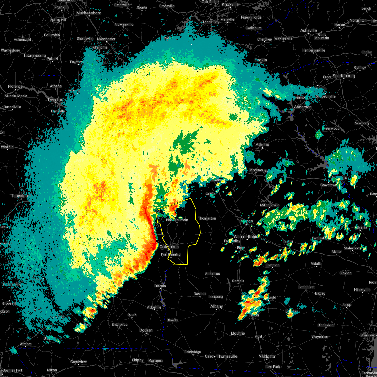 At 825 pm edt, severe thunderstorms were located along a line extending from near denson to near beans mill to marvyn to near warriorstand, moving east at 65 mph (radar indicated). Hazards include 70 mph wind gusts and quarter size hail. Hail damage to vehicles is expected. expect considerable tree damage. Wind damage is also likely to mobile homes, roofs, and outbuildings. At 825 pm edt, severe thunderstorms were located along a line extending from near denson to near beans mill to marvyn to near warriorstand, moving east at 65 mph (radar indicated). Hazards include 70 mph wind gusts and quarter size hail. Hail damage to vehicles is expected. expect considerable tree damage. Wind damage is also likely to mobile homes, roofs, and outbuildings.
|
| 5/4/2021 8:14 PM EDT |
 At 813 pm edt, a severe thunderstorm was located near lagrange, moving east at 55 mph. another lines of severe thunderstorms was located 15 miles west of the alabama-georgia state line also moving east at 55 mph. damaging winds are likely with this second line of storms (radar indicated). Hazards include 70 mph wind gusts and quarter size hail. Hail damage to vehicles is expected. expect considerable tree damage. wind damage is also likely to mobile homes, roofs, and outbuildings. locations impacted include, columbus, lagrange, hamilton, greenville, manchester, west point, hogansville, pine mountain, waverly hall, warm springs, lone oak, north fort benning, bibb city, upatoi, f. d. Roosevelt state park, green island hills, cataula, columbus metropolitan airport, louise and stovall. At 813 pm edt, a severe thunderstorm was located near lagrange, moving east at 55 mph. another lines of severe thunderstorms was located 15 miles west of the alabama-georgia state line also moving east at 55 mph. damaging winds are likely with this second line of storms (radar indicated). Hazards include 70 mph wind gusts and quarter size hail. Hail damage to vehicles is expected. expect considerable tree damage. wind damage is also likely to mobile homes, roofs, and outbuildings. locations impacted include, columbus, lagrange, hamilton, greenville, manchester, west point, hogansville, pine mountain, waverly hall, warm springs, lone oak, north fort benning, bibb city, upatoi, f. d. Roosevelt state park, green island hills, cataula, columbus metropolitan airport, louise and stovall.
|
| 5/4/2021 7:09 PM CDT |
 At 708 pm cdt, severe thunderstorms were located along a line extending from abanda to near opelika to near tuskegee national forest, moving east at 55 mph (radar indicated). Hazards include 60 mph wind gusts. Expect damage to roofs, siding, and trees. Locations impacted include, auburn, opelika, valley, lanett, notasulga, smiths, stroud, lafayette, smiths station, la fayette, waverly, lakeview, cusseta, beulah, beauregard, sturkie, trammel crossroads, buffalo, huguley and fairfax. At 708 pm cdt, severe thunderstorms were located along a line extending from abanda to near opelika to near tuskegee national forest, moving east at 55 mph (radar indicated). Hazards include 60 mph wind gusts. Expect damage to roofs, siding, and trees. Locations impacted include, auburn, opelika, valley, lanett, notasulga, smiths, stroud, lafayette, smiths station, la fayette, waverly, lakeview, cusseta, beulah, beauregard, sturkie, trammel crossroads, buffalo, huguley and fairfax.
|
| 5/4/2021 7:06 PM CDT |
 At 706 pm cdt, severe thunderstorms were located along a line extending from near tuskegee national forest to 6 miles north of union springs, moving east at 55 mph (radar indicated). Hazards include 60 mph wind gusts. expect damage to roofs, siding, and trees At 706 pm cdt, severe thunderstorms were located along a line extending from near tuskegee national forest to 6 miles north of union springs, moving east at 55 mph (radar indicated). Hazards include 60 mph wind gusts. expect damage to roofs, siding, and trees
|
| 5/4/2021 7:51 PM EDT |
 At 751 pm edt, a severe thunderstorm was located over state line park, or 8 miles east of stroud, moving northeast at 55 mph (radar indicated). Hazards include 60 mph wind gusts and quarter size hail. Hail damage to vehicles is expected. Expect wind damage to roofs, siding, and trees. At 751 pm edt, a severe thunderstorm was located over state line park, or 8 miles east of stroud, moving northeast at 55 mph (radar indicated). Hazards include 60 mph wind gusts and quarter size hail. Hail damage to vehicles is expected. Expect wind damage to roofs, siding, and trees.
|
| 5/4/2021 6:41 PM CDT |
 The national weather service in birmingham has issued a * severe thunderstorm warning for. lee county in east central alabama. chambers county in east central alabama. until 800 pm cdt. At 640 pm cdt, severe thunderstorms were located along a line. The national weather service in birmingham has issued a * severe thunderstorm warning for. lee county in east central alabama. chambers county in east central alabama. until 800 pm cdt. At 640 pm cdt, severe thunderstorms were located along a line.
|
| 10/10/2020 4:46 PM EDT |
 At 446 pm edt, a severe thunderstorm capable of producing a tornado was located over north fort benning, or 7 miles north of cusseta, moving north at 35 mph (radar indicated rotation). Hazards include tornado. Flying debris will be dangerous to those caught without shelter. mobile homes will be damaged or destroyed. damage to roofs, windows, and vehicles will occur. tree damage is likely. Locations impacted include, north fort benning, upatoi, flat rock, midland and eelbeck/west fort benning. At 446 pm edt, a severe thunderstorm capable of producing a tornado was located over north fort benning, or 7 miles north of cusseta, moving north at 35 mph (radar indicated rotation). Hazards include tornado. Flying debris will be dangerous to those caught without shelter. mobile homes will be damaged or destroyed. damage to roofs, windows, and vehicles will occur. tree damage is likely. Locations impacted include, north fort benning, upatoi, flat rock, midland and eelbeck/west fort benning.
|
| 10/10/2020 4:39 PM EDT |
 At 439 pm edt, a severe thunderstorm capable of producing a tornado was located over green island hills, or near smiths, moving north at 25 mph (radar indicated rotation). Hazards include tornado. Flying debris will be dangerous to those caught without shelter. mobile homes will be damaged or destroyed. damage to roofs, windows, and vehicles will occur. Tree damage is likely. At 439 pm edt, a severe thunderstorm capable of producing a tornado was located over green island hills, or near smiths, moving north at 25 mph (radar indicated rotation). Hazards include tornado. Flying debris will be dangerous to those caught without shelter. mobile homes will be damaged or destroyed. damage to roofs, windows, and vehicles will occur. Tree damage is likely.
|
| 10/10/2020 4:37 PM EDT |
 At 436 pm edt, a severe thunderstorm capable of producing a tornado was located near cusseta, moving north at 30 mph (radar indicated rotation). Hazards include tornado. Flying debris will be dangerous to those caught without shelter. mobile homes will be damaged or destroyed. damage to roofs, windows, and vehicles will occur. tree damage is likely. Locations impacted include, cusseta, north fort benning, upatoi, flat rock, midland, sand hill, eelbeck/west fort benning, vista terrace and jamestown/south fort benning. At 436 pm edt, a severe thunderstorm capable of producing a tornado was located near cusseta, moving north at 30 mph (radar indicated rotation). Hazards include tornado. Flying debris will be dangerous to those caught without shelter. mobile homes will be damaged or destroyed. damage to roofs, windows, and vehicles will occur. tree damage is likely. Locations impacted include, cusseta, north fort benning, upatoi, flat rock, midland, sand hill, eelbeck/west fort benning, vista terrace and jamestown/south fort benning.
|
| 10/10/2020 4:27 PM EDT |
 At 427 pm edt, a severe thunderstorm capable of producing a tornado was located over jamestown/south fort benning, or near cusseta, moving north at 30 mph (radar indicated rotation). Hazards include tornado. Flying debris will be dangerous to those caught without shelter. mobile homes will be damaged or destroyed. damage to roofs, windows, and vehicles will occur. Tree damage is likely. At 427 pm edt, a severe thunderstorm capable of producing a tornado was located over jamestown/south fort benning, or near cusseta, moving north at 30 mph (radar indicated rotation). Hazards include tornado. Flying debris will be dangerous to those caught without shelter. mobile homes will be damaged or destroyed. damage to roofs, windows, and vehicles will occur. Tree damage is likely.
|
| 8/20/2020 3:03 PM EDT |
 The national weather service in peachtree city has issued a * severe thunderstorm warning for. southeastern muscogee county in west central georgia. northeastern chattahoochee county in west central georgia. until 330 pm edt. At 303 pm edt, a severe thunderstorm was located over eelbeck/west. The national weather service in peachtree city has issued a * severe thunderstorm warning for. southeastern muscogee county in west central georgia. northeastern chattahoochee county in west central georgia. until 330 pm edt. At 303 pm edt, a severe thunderstorm was located over eelbeck/west.
|
| 8/12/2020 5:54 PM EDT | A tree was reported down in the 1700 block of carter av in muscogee county GA, 6 miles E of Columbus, GA |
| 8/10/2020 5:48 PM EDT |
 At 547 pm edt, a severe thunderstorm was located over eelbeck/west fort benning, or 8 miles north of cusseta, moving southeast at 10 mph (radar indicated). Hazards include 60 mph wind gusts and quarter size hail. Hail damage to vehicles is expected. expect wind damage to roofs, siding, and trees. Locations impacted include, cusseta, north fort benning, christopher and eelbeck/west fort benning. At 547 pm edt, a severe thunderstorm was located over eelbeck/west fort benning, or 8 miles north of cusseta, moving southeast at 10 mph (radar indicated). Hazards include 60 mph wind gusts and quarter size hail. Hail damage to vehicles is expected. expect wind damage to roofs, siding, and trees. Locations impacted include, cusseta, north fort benning, christopher and eelbeck/west fort benning.
|
| 8/10/2020 5:16 PM EDT |
 At 516 pm edt, a severe thunderstorm was located near po biddy crossroads, or near talbotton, moving east at 10 mph (radar indicated). Hazards include 60 mph wind gusts and quarter size hail. Hail damage to vehicles is expected. expect wind damage to roofs, siding, and trees. Locations impacted include, talbotton, woodland, junction city, geneva, juniper, baldwinville, baughville, olive branch, po biddy crossroads, box springs, pleasant hill, prattsburg and big lazer creek wma. At 516 pm edt, a severe thunderstorm was located near po biddy crossroads, or near talbotton, moving east at 10 mph (radar indicated). Hazards include 60 mph wind gusts and quarter size hail. Hail damage to vehicles is expected. expect wind damage to roofs, siding, and trees. Locations impacted include, talbotton, woodland, junction city, geneva, juniper, baldwinville, baughville, olive branch, po biddy crossroads, box springs, pleasant hill, prattsburg and big lazer creek wma.
|
| 8/10/2020 5:14 PM EDT |
 At 514 pm edt, a severe thunderstorm was located near north fort benning, or 12 miles north of cusseta, moving southeast at 10 mph (radar indicated). Hazards include 60 mph wind gusts and quarter size hail. Hail damage to vehicles is expected. Expect wind damage to roofs, siding, and trees. At 514 pm edt, a severe thunderstorm was located near north fort benning, or 12 miles north of cusseta, moving southeast at 10 mph (radar indicated). Hazards include 60 mph wind gusts and quarter size hail. Hail damage to vehicles is expected. Expect wind damage to roofs, siding, and trees.
|
| 8/10/2020 4:48 PM EDT |
 At 448 pm edt, a severe thunderstorm was located over talbotton, moving east at 10 mph (radar indicated). Hazards include 60 mph wind gusts and quarter size hail. Hail damage to vehicles is expected. Expect wind damage to roofs, siding, and trees. At 448 pm edt, a severe thunderstorm was located over talbotton, moving east at 10 mph (radar indicated). Hazards include 60 mph wind gusts and quarter size hail. Hail damage to vehicles is expected. Expect wind damage to roofs, siding, and trees.
|
| 8/3/2020 4:15 PM EDT | Tree down on powerline along yancy stree in muscogee county GA, 5.7 miles SE of Columbus, GA |
| 8/3/2020 4:15 PM EDT | Large tree down along grant roa in muscogee county GA, 4.3 miles ESE of Columbus, GA |
| 8/3/2020 4:15 PM EDT | Large tree down on house along yates driv in muscogee county GA, 4 miles ESE of Columbus, GA |
| 7/25/2020 6:50 PM EDT | Multiple trees were reported down along commanche roa in muscogee county GA, 11 miles SE of Columbus, GA |
| 7/25/2020 6:37 PM EDT |
 At 637 pm edt, a severe thunderstorm was located over flat rock, or 9 miles northeast of columbus, moving southwest at 15 mph (radar indicated). Hazards include 60 mph wind gusts and quarter size hail. Hail damage to vehicles is expected. Expect wind damage to roofs, siding, and trees. At 637 pm edt, a severe thunderstorm was located over flat rock, or 9 miles northeast of columbus, moving southwest at 15 mph (radar indicated). Hazards include 60 mph wind gusts and quarter size hail. Hail damage to vehicles is expected. Expect wind damage to roofs, siding, and trees.
|
| 7/25/2020 6:21 PM EDT | Csg asos reported a 52kt wind gust at at 6:21 p in muscogee county GA, 6.1 miles SE of Columbus, GA |
| 7/25/2020 5:13 PM CDT |
 At 613 pm edt, a severe thunderstorm was located over columbus, moving west at 25 mph (radar indicated). Hazards include 60 mph wind gusts and quarter size hail. Hail damage to vehicles is expected. expect wind damage to roofs, siding, and trees. Locations impacted include, columbus, bibb city, fort benning/lawson army air fld, saint marys hills, edgewood, highland park, laurel hills, green island hills, sand hill, battle park, vista terrace, columbus metropolitan airport, rose hill, kenwood, custer road terrace, benning hills, avondale, benning park and carter acres. At 613 pm edt, a severe thunderstorm was located over columbus, moving west at 25 mph (radar indicated). Hazards include 60 mph wind gusts and quarter size hail. Hail damage to vehicles is expected. expect wind damage to roofs, siding, and trees. Locations impacted include, columbus, bibb city, fort benning/lawson army air fld, saint marys hills, edgewood, highland park, laurel hills, green island hills, sand hill, battle park, vista terrace, columbus metropolitan airport, rose hill, kenwood, custer road terrace, benning hills, avondale, benning park and carter acres.
|
| 7/25/2020 6:11 PM EDT | A tree was reported down in the roadway on northgate driv in muscogee county GA, 4.7 miles SE of Columbus, GA |
| 7/25/2020 6:09 PM EDT |
 The national weather service in peachtree city has issued a * severe thunderstorm warning for. northwestern marion county in west central georgia. southwestern talbot county in west central georgia. until 645 pm edt. At 609 pm edt, a severe thunderstorm was located near geneva, or. The national weather service in peachtree city has issued a * severe thunderstorm warning for. northwestern marion county in west central georgia. southwestern talbot county in west central georgia. until 645 pm edt. At 609 pm edt, a severe thunderstorm was located near geneva, or.
|
| 7/25/2020 6:05 PM EDT | Quarter sized hail reported 1.2 miles SE of Columbus, GA, dime to quarter sized hail was reported near carver park. |
| 7/25/2020 5:57 PM EDT |
 At 557 pm edt, a severe thunderstorm was located over vista terrace, or near columbus, moving west at 15 mph (radar indicated). Hazards include 60 mph wind gusts and quarter size hail. Hail damage to vehicles is expected. Expect wind damage to roofs, siding, and trees. At 557 pm edt, a severe thunderstorm was located over vista terrace, or near columbus, moving west at 15 mph (radar indicated). Hazards include 60 mph wind gusts and quarter size hail. Hail damage to vehicles is expected. Expect wind damage to roofs, siding, and trees.
|
| 7/15/2020 4:11 PM EDT |
 The severe thunderstorm warning for northwestern muscogee and southwestern harris counties will expire at 415 pm edt, the storm which prompted the warning has weakened below severe limits, and has exited the warned area. therefore, the warning will be allowed to expire. to report severe weather, contact your nearest law enforcement agency. they will relay your report to the national weather service peachtree city. The severe thunderstorm warning for northwestern muscogee and southwestern harris counties will expire at 415 pm edt, the storm which prompted the warning has weakened below severe limits, and has exited the warned area. therefore, the warning will be allowed to expire. to report severe weather, contact your nearest law enforcement agency. they will relay your report to the national weather service peachtree city.
|
| 7/15/2020 3:42 PM EDT |
 At 342 pm edt, a severe thunderstorm was located over laurel hills, or near columbus, moving north at 15 mph (radar indicated). Hazards include 60 mph wind gusts and quarter size hail. Hail damage to vehicles is expected. Expect wind damage to roofs, siding, and trees. At 342 pm edt, a severe thunderstorm was located over laurel hills, or near columbus, moving north at 15 mph (radar indicated). Hazards include 60 mph wind gusts and quarter size hail. Hail damage to vehicles is expected. Expect wind damage to roofs, siding, and trees.
|
| 7/15/2020 2:54 PM EDT |
 At 254 pm edt, a severe thunderstorm was located over geneva, or near talbotton, moving northwest at 5 mph (radar indicated). Hazards include 60 mph wind gusts and quarter size hail. Hail damage to vehicles is expected. Expect wind damage to roofs, siding, and trees. At 254 pm edt, a severe thunderstorm was located over geneva, or near talbotton, moving northwest at 5 mph (radar indicated). Hazards include 60 mph wind gusts and quarter size hail. Hail damage to vehicles is expected. Expect wind damage to roofs, siding, and trees.
|
| 7/12/2020 6:22 PM EDT |
 The severe thunderstorm warning for chattahoochee and southwestern talbot counties will expire at 630 pm edt, the storms which prompted the warning have weakened below severe limits, and have exited the warned area. therefore, the warning will be allowed to expire. a severe thunderstorm watch remains in effect until 1100 pm edt for west central georgia. to report severe weather, contact your nearest law enforcement agency. The severe thunderstorm warning for chattahoochee and southwestern talbot counties will expire at 630 pm edt, the storms which prompted the warning have weakened below severe limits, and have exited the warned area. therefore, the warning will be allowed to expire. a severe thunderstorm watch remains in effect until 1100 pm edt for west central georgia. to report severe weather, contact your nearest law enforcement agency.
|
| 7/12/2020 6:07 PM EDT |
 At 606 pm edt, severe thunderstorms were located along a line extending from baughville to juniper to near west fort benning to jamestown, moving east at 40 mph (radar indicated). Hazards include 60 mph wind gusts. Expect damage to roofs, siding, and trees. Locations impacted include, cusseta, fort benning/lawson army air fld, box springs, christopher, eelbeck/west fort benning, jamestown/south fort benning, baughville and manta. At 606 pm edt, severe thunderstorms were located along a line extending from baughville to juniper to near west fort benning to jamestown, moving east at 40 mph (radar indicated). Hazards include 60 mph wind gusts. Expect damage to roofs, siding, and trees. Locations impacted include, cusseta, fort benning/lawson army air fld, box springs, christopher, eelbeck/west fort benning, jamestown/south fort benning, baughville and manta.
|
| 7/12/2020 5:51 PM EDT |
 At 551 pm edt, severe thunderstorms were located along a line extending from near waverly hall to upatoi to near north fort benning to battle park, moving east at 40 mph (radar indicated). Hazards include 60 mph wind gusts. Expect damage to roofs, siding, and trees. Locations impacted include, columbus, cusseta, waverly hall, north fort benning, bibb city, upatoi, fort benning/lawson army air fld, ellerslie, vista terrace, cataula, columbus metropolitan airport, jamestown/south fort benning, baughville, rose hill, manta, eelbeck/west fort benning, benning hills, avondale, benning park and saint marys hills. At 551 pm edt, severe thunderstorms were located along a line extending from near waverly hall to upatoi to near north fort benning to battle park, moving east at 40 mph (radar indicated). Hazards include 60 mph wind gusts. Expect damage to roofs, siding, and trees. Locations impacted include, columbus, cusseta, waverly hall, north fort benning, bibb city, upatoi, fort benning/lawson army air fld, ellerslie, vista terrace, cataula, columbus metropolitan airport, jamestown/south fort benning, baughville, rose hill, manta, eelbeck/west fort benning, benning hills, avondale, benning park and saint marys hills.
|
| 7/12/2020 5:46 PM EDT | Multiple trees down along river rd between bradley park dr and double churches rd in muscogee county GA, 9.7 miles ESE of Columbus, GA |
| 7/12/2020 5:40 PM EDT |
 At 540 pm edt, severe thunderstorms were located along a line extending from hamilton to midland to avondale, moving east at 40 mph (radar indicated). Hazards include 60 mph wind gusts. expect damage to roofs, siding, and trees At 540 pm edt, severe thunderstorms were located along a line extending from hamilton to midland to avondale, moving east at 40 mph (radar indicated). Hazards include 60 mph wind gusts. expect damage to roofs, siding, and trees
|
| 7/12/2020 5:38 PM EDT | Power pole reported down near the intersection of hamilton rd and veterans pkwy in muscogee county GA, 7.5 miles ESE of Columbus, GA |
| 7/12/2020 5:23 PM EDT |
 At 522 pm edt, severe thunderstorms were located along a line extending from near whitesville-pine lake to goat rock lake to near crawford, moving southeast at 40 mph (radar indicated). Hazards include 60 mph wind gusts and penny size hail. expect damage to roofs, siding, and trees At 522 pm edt, severe thunderstorms were located along a line extending from near whitesville-pine lake to goat rock lake to near crawford, moving southeast at 40 mph (radar indicated). Hazards include 60 mph wind gusts and penny size hail. expect damage to roofs, siding, and trees
|
| 6/30/2020 5:06 PM EDT |
 At 506 pm edt, severe thunderstorms were extending from near cusseta to near louvale to lumpkin, moving east at 30 mph (radar indicated). Hazards include 60 mph wind gusts and quarter size hail. Hail damage to vehicles is expected. Expect wind damage to roofs, siding, and trees. At 506 pm edt, severe thunderstorms were extending from near cusseta to near louvale to lumpkin, moving east at 30 mph (radar indicated). Hazards include 60 mph wind gusts and quarter size hail. Hail damage to vehicles is expected. Expect wind damage to roofs, siding, and trees.
|
| 6/28/2020 8:29 PM EDT | Tree reported down along firetower r in chattahoochee county GA, 14.6 miles NNW of Columbus, GA |
| 6/28/2020 8:02 PM EDT |
 At 802 pm edt, a severe thunderstorm was located near seale, or 17 miles south of phenix city, moving east at 30 mph (radar indicated). Hazards include 60 mph wind gusts and penny size hail. expect damage to roofs, siding, and trees At 802 pm edt, a severe thunderstorm was located near seale, or 17 miles south of phenix city, moving east at 30 mph (radar indicated). Hazards include 60 mph wind gusts and penny size hail. expect damage to roofs, siding, and trees
|
| 6/25/2020 7:00 PM EDT |
 At 659 pm edt, a severe thunderstorm was located over box springs, or 12 miles southwest of talbotton, moving east at 25 mph (radar indicated). Hazards include 60 mph wind gusts and quarter size hail. Hail damage to vehicles is expected. Expect wind damage to roofs, siding, and trees. At 659 pm edt, a severe thunderstorm was located over box springs, or 12 miles southwest of talbotton, moving east at 25 mph (radar indicated). Hazards include 60 mph wind gusts and quarter size hail. Hail damage to vehicles is expected. Expect wind damage to roofs, siding, and trees.
|
| 6/10/2020 5:59 PM EDT |
 A severe thunderstorm warning remains in effect until 630 pm edt for northwestern marion. western upson and talbot counties. at 558 pm edt, severe thunderstorms were located along a line extending from talbotton to near geneva to marion estates, moving northeast at 40 mph. hazard. 60 mph wind gusts. A severe thunderstorm warning remains in effect until 630 pm edt for northwestern marion. western upson and talbot counties. at 558 pm edt, severe thunderstorms were located along a line extending from talbotton to near geneva to marion estates, moving northeast at 40 mph. hazard. 60 mph wind gusts.
|
| 6/10/2020 5:41 PM EDT |
 At 541 pm edt, severe thunderstorms were located along a line extending from upatoi to near box springs to near christopher, moving northeast at 35 mph (radar indicated). Hazards include 60 mph wind gusts. expect damage to roofs, siding, and trees At 541 pm edt, severe thunderstorms were located along a line extending from upatoi to near box springs to near christopher, moving northeast at 35 mph (radar indicated). Hazards include 60 mph wind gusts. expect damage to roofs, siding, and trees
|
| 6/10/2020 5:21 PM EDT | One tree downed near the intersection of shelby street and esquiline cour in muscogee county GA, 5.7 miles ENE of Columbus, GA |
| 4/19/2020 10:38 PM EDT |
 The severe thunderstorm warning for marion, southeastern chattahoochee, northeastern stewart and northwestern webster counties will expire at 1045 pm edt, the storm which prompted the warning has weakened below severe limits, and no longer poses an immediate threat to life or property. therefore, the warning will be allowed to expire. The severe thunderstorm warning for marion, southeastern chattahoochee, northeastern stewart and northwestern webster counties will expire at 1045 pm edt, the storm which prompted the warning has weakened below severe limits, and no longer poses an immediate threat to life or property. therefore, the warning will be allowed to expire.
|
| 4/19/2020 10:22 PM EDT |
 At 1021 pm edt, a severe thunderstorm was located over zellobee, or 7 miles west of buena vista, moving east at 45 mph (radar indicated). Hazards include 60 mph wind gusts and penny size hail. Expect damage to roofs, siding, and trees. Locations impacted include, buena vista, cusseta, putnam, brantley, seminole, christopher, brooklyn, renfroe, oakland, draneville, manta, zellobee, tazewell, doyle and eelbeck/west fort benning. At 1021 pm edt, a severe thunderstorm was located over zellobee, or 7 miles west of buena vista, moving east at 45 mph (radar indicated). Hazards include 60 mph wind gusts and penny size hail. Expect damage to roofs, siding, and trees. Locations impacted include, buena vista, cusseta, putnam, brantley, seminole, christopher, brooklyn, renfroe, oakland, draneville, manta, zellobee, tazewell, doyle and eelbeck/west fort benning.
|
| 4/19/2020 9:56 PM EDT |
 At 955 pm edt, a severe thunderstorm was located over fort mitchell activity center, or 12 miles west of cusseta, moving east at 45 mph (radar indicated). Hazards include 60 mph wind gusts and quarter size hail. Hail damage to vehicles is expected. Expect wind damage to roofs, siding, and trees. At 955 pm edt, a severe thunderstorm was located over fort mitchell activity center, or 12 miles west of cusseta, moving east at 45 mph (radar indicated). Hazards include 60 mph wind gusts and quarter size hail. Hail damage to vehicles is expected. Expect wind damage to roofs, siding, and trees.
|
| 4/19/2020 7:38 AM CDT |
 At 738 am cdt, a severe thunderstorm was located over chambers county lake, or over lafayette, moving east at 60 mph (radar indicated). Hazards include 60 mph wind gusts and penny size hail. Expect damage to roofs, siding, and trees. Locations impacted include, auburn, opelika, valley, lanett, dadeville, camp hill, lafayette, stroud, la fayette, waverly, lakeview, cusseta, beulah, post oak forks, denson, beans mill, river view, amity park, sturkie and bleecker. At 738 am cdt, a severe thunderstorm was located over chambers county lake, or over lafayette, moving east at 60 mph (radar indicated). Hazards include 60 mph wind gusts and penny size hail. Expect damage to roofs, siding, and trees. Locations impacted include, auburn, opelika, valley, lanett, dadeville, camp hill, lafayette, stroud, la fayette, waverly, lakeview, cusseta, beulah, post oak forks, denson, beans mill, river view, amity park, sturkie and bleecker.
|
| 4/19/2020 7:21 AM CDT |
 At 720 am cdt, a severe thunderstorm was located near dadeville, moving east at 60 mph (radar indicated). Hazards include 70 mph wind gusts and half dollar size hail. Hail damage to vehicles is expected. expect considerable tree damage. Wind damage is also likely to mobile homes, roofs, and outbuildings. At 720 am cdt, a severe thunderstorm was located near dadeville, moving east at 60 mph (radar indicated). Hazards include 70 mph wind gusts and half dollar size hail. Hail damage to vehicles is expected. expect considerable tree damage. Wind damage is also likely to mobile homes, roofs, and outbuildings.
|
| 4/13/2020 2:18 AM EDT |
 At 218 am edt, severe thunderstorms were located along a line extending from junction city to near florence marina state park, moving east at 50 mph (radar indicated). Hazards include 60 mph wind gusts. expect damage to roofs, siding, and trees At 218 am edt, severe thunderstorms were located along a line extending from junction city to near florence marina state park, moving east at 50 mph (radar indicated). Hazards include 60 mph wind gusts. expect damage to roofs, siding, and trees
|
| 4/13/2020 1:50 AM EDT |
 At 149 am edt, severe thunderstorms were located along a line extending from ellerslie to midland to vista terrace, moving east at 55 mph (radar indicated). Hazards include 70 mph wind gusts. Expect considerable tree damage. damage is likely to mobile homes, roofs, and outbuildings. Locations impacted include, buena vista, talbotton, cusseta, manchester, waverly hall, woodland, junction city, geneva, north fort benning, upatoi, fort benning/lawson army air fld, brantley, ellerslie, juniper, vista terrace, baughville, flint hill, oakland, tazewell and eelbeck/west fort benning. At 149 am edt, severe thunderstorms were located along a line extending from ellerslie to midland to vista terrace, moving east at 55 mph (radar indicated). Hazards include 70 mph wind gusts. Expect considerable tree damage. damage is likely to mobile homes, roofs, and outbuildings. Locations impacted include, buena vista, talbotton, cusseta, manchester, waverly hall, woodland, junction city, geneva, north fort benning, upatoi, fort benning/lawson army air fld, brantley, ellerslie, juniper, vista terrace, baughville, flint hill, oakland, tazewell and eelbeck/west fort benning.
|
| 4/13/2020 1:45 AM EDT | Asos station kcsg columbus reported 58 mph wind gust as thunderstorm passed b in muscogee county GA, 6.5 miles SE of Columbus, GA |
| 4/13/2020 12:43 AM CDT |
 The severe thunderstorm warning for lee and russell counties will expire at 1245 am cdt, the storms which prompted the warning have weakened below severe limits, and no longer pose an immediate threat to life or property. therefore, the warning will be allowed to expire. however gusty winds are still possible with these thunderstorms. a tornado watch remains in effect until 600 am cdt for southeastern and east central alabama. to report severe weather, contact your nearest law enforcement agency. they will relay your report to the national weather service birmingham. The severe thunderstorm warning for lee and russell counties will expire at 1245 am cdt, the storms which prompted the warning have weakened below severe limits, and no longer pose an immediate threat to life or property. therefore, the warning will be allowed to expire. however gusty winds are still possible with these thunderstorms. a tornado watch remains in effect until 600 am cdt for southeastern and east central alabama. to report severe weather, contact your nearest law enforcement agency. they will relay your report to the national weather service birmingham.
|
| 4/13/2020 1:39 AM EDT |
 At 139 am edt, severe thunderstorms were located along a line extending from near fortson to laurel hills to near phenix drag strip, moving east at 55 mph (radar indicated). Hazards include 70 mph wind gusts. Expect considerable tree damage. damage is likely to mobile homes, roofs, and outbuildings. Locations impacted include, columbus, buena vista, hamilton, talbotton, cusseta, manchester, waverly hall, woodland, junction city, geneva, fort benning/lawson army air fld, north fort benning, bibb city, upatoi, brantley, green island hills, juniper, cataula, columbus metropolitan airport and oakland. At 139 am edt, severe thunderstorms were located along a line extending from near fortson to laurel hills to near phenix drag strip, moving east at 55 mph (radar indicated). Hazards include 70 mph wind gusts. Expect considerable tree damage. damage is likely to mobile homes, roofs, and outbuildings. Locations impacted include, columbus, buena vista, hamilton, talbotton, cusseta, manchester, waverly hall, woodland, junction city, geneva, fort benning/lawson army air fld, north fort benning, bibb city, upatoi, brantley, green island hills, juniper, cataula, columbus metropolitan airport and oakland.
|
| 4/13/2020 1:18 AM EDT |
 At 117 am edt, severe thunderstorms were located along a line extending from near griffen mill to near uchee to near guerryton, moving east at 55 mph (radar indicated). Hazards include 60 mph wind gusts. expect damage to roofs, siding, and trees At 117 am edt, severe thunderstorms were located along a line extending from near griffen mill to near uchee to near guerryton, moving east at 55 mph (radar indicated). Hazards include 60 mph wind gusts. expect damage to roofs, siding, and trees
|
| 4/13/2020 12:14 AM CDT |
 At 1214 am cdt, severe thunderstorms were located along a line extending from beulah to hurtsboro, moving east at 55 mph (radar indicated). Hazards include 60 mph wind gusts. winds over 60 mph have been reported with these storms. Expect damage to roofs, siding, and trees. locations impacted include, columbus, auburn, phenix city, opelika, hurtsboro, smiths, smiths station, beulah, uchee, beans mill, beauregard, bleecker, russell county sports complex, seale, ladonia, griffen mill, rutherford, uchee creek, robert g. Pitts airport and monterey heights. At 1214 am cdt, severe thunderstorms were located along a line extending from beulah to hurtsboro, moving east at 55 mph (radar indicated). Hazards include 60 mph wind gusts. winds over 60 mph have been reported with these storms. Expect damage to roofs, siding, and trees. locations impacted include, columbus, auburn, phenix city, opelika, hurtsboro, smiths, smiths station, beulah, uchee, beans mill, beauregard, bleecker, russell county sports complex, seale, ladonia, griffen mill, rutherford, uchee creek, robert g. Pitts airport and monterey heights.
|
| 4/12/2020 11:30 PM CDT |
 At 1130 pm cdt, severe thunderstorms were located along a line extending from near martin dam to near shopton, moving east at 60 mph (radar indicated). Hazards include 60 mph wind gusts. expect damage to roofs, siding, and trees At 1130 pm cdt, severe thunderstorms were located along a line extending from near martin dam to near shopton, moving east at 60 mph (radar indicated). Hazards include 60 mph wind gusts. expect damage to roofs, siding, and trees
|
| 4/8/2020 7:10 PM EDT |
 The severe thunderstorm warning for southwestern marion, southeastern muscogee, southeastern chattahoochee, northeastern stewart and northwestern webster counties will expire at 715 pm edt, the storm which prompted the warning has moved out of the area. therefore, the warning will be allowed to expire. The severe thunderstorm warning for southwestern marion, southeastern muscogee, southeastern chattahoochee, northeastern stewart and northwestern webster counties will expire at 715 pm edt, the storm which prompted the warning has moved out of the area. therefore, the warning will be allowed to expire.
|
| 4/8/2020 6:57 PM EDT |
 At 657 pm edt, a severe thunderstorm was located over manta, or near cusseta, moving southeast at 40 mph (radar indicated). Hazards include 60 mph wind gusts and penny size hail. Expect damage to roofs, siding, and trees. Locations impacted include, cusseta, north fort benning, seminole, charles, christopher, eelbeck/west fort benning, brooklyn, renfroe, louvale, manta and zellobee. At 657 pm edt, a severe thunderstorm was located over manta, or near cusseta, moving southeast at 40 mph (radar indicated). Hazards include 60 mph wind gusts and penny size hail. Expect damage to roofs, siding, and trees. Locations impacted include, cusseta, north fort benning, seminole, charles, christopher, eelbeck/west fort benning, brooklyn, renfroe, louvale, manta and zellobee.
|
| 4/8/2020 6:31 PM EDT |
 At 630 pm edt, a severe thunderstorm was located over fort mitchell, or near phenix city, moving southeast at 40 mph (radar indicated). Hazards include 60 mph wind gusts and penny size hail. expect damage to roofs, siding, and trees At 630 pm edt, a severe thunderstorm was located over fort mitchell, or near phenix city, moving southeast at 40 mph (radar indicated). Hazards include 60 mph wind gusts and penny size hail. expect damage to roofs, siding, and trees
|
| 4/8/2020 5:07 PM CDT |
 At 507 pm cdt, a severe thunderstorm was located near beauregard, or 10 miles southeast of auburn, moving east at 35 mph (radar indicated). Hazards include ping pong ball size hail and 60 mph wind gusts. People and animals outdoors will be injured. expect hail damage to roofs, siding, windows, and vehicles. expect wind damage to roofs, siding, and trees. Locations impacted include, phenix city, smiths, smiths station, russell county sports complex, uchee, seale, ladonia, bleecker, griffen mill, monterey heights, hatchechubbe, uchee creek, fort mitchell, ladonia sports complex, marvyn, fort mitchell activity center, phenix drag strip and parkmanville. At 507 pm cdt, a severe thunderstorm was located near beauregard, or 10 miles southeast of auburn, moving east at 35 mph (radar indicated). Hazards include ping pong ball size hail and 60 mph wind gusts. People and animals outdoors will be injured. expect hail damage to roofs, siding, windows, and vehicles. expect wind damage to roofs, siding, and trees. Locations impacted include, phenix city, smiths, smiths station, russell county sports complex, uchee, seale, ladonia, bleecker, griffen mill, monterey heights, hatchechubbe, uchee creek, fort mitchell, ladonia sports complex, marvyn, fort mitchell activity center, phenix drag strip and parkmanville.
|
| 4/8/2020 4:58 PM CDT |
 The national weather service in birmingham has issued a * severe thunderstorm warning for. southeastern lee county in east central alabama. russell county in southeastern alabama. until 545 pm cdt. At 458 pm cdt, severe thunderstorms were located along a line. The national weather service in birmingham has issued a * severe thunderstorm warning for. southeastern lee county in east central alabama. russell county in southeastern alabama. until 545 pm cdt. At 458 pm cdt, severe thunderstorms were located along a line.
|
| 4/8/2020 5:43 PM EDT |
 The severe thunderstorm warning for northwestern marion. northeastern muscogee. northeastern chattahoochee. southwestern talbot and southeastern harris counties will expire at 545 pm edt. the storm which prompted the warning has weakened below severe limits, and no longer poses an immediate threat to life or property. therefore, the warning will be allowed to expire. However gusty. The severe thunderstorm warning for northwestern marion. northeastern muscogee. northeastern chattahoochee. southwestern talbot and southeastern harris counties will expire at 545 pm edt. the storm which prompted the warning has weakened below severe limits, and no longer poses an immediate threat to life or property. therefore, the warning will be allowed to expire. However gusty.
|
| 4/8/2020 5:25 PM EDT |
 At 525 pm edt, a severe thunderstorm was located over upatoi, or 14 miles southeast of hamilton, moving east at 30 mph (radar indicated). Hazards include 60 mph wind gusts and quarter size hail. Hail damage to vehicles is expected. expect wind damage to roofs, siding, and trees. Locations impacted include, talbotton, waverly hall, geneva, upatoi, ellerslie, flat rock, box springs, midland, juniper, baughville and olive branch. At 525 pm edt, a severe thunderstorm was located over upatoi, or 14 miles southeast of hamilton, moving east at 30 mph (radar indicated). Hazards include 60 mph wind gusts and quarter size hail. Hail damage to vehicles is expected. expect wind damage to roofs, siding, and trees. Locations impacted include, talbotton, waverly hall, geneva, upatoi, ellerslie, flat rock, box springs, midland, juniper, baughville and olive branch.
|
| 4/8/2020 5:02 PM EDT |
 At 502 pm edt, a severe thunderstorm was located over mulberry grove, or 8 miles southwest of hamilton, moving east at 30 mph (radar indicated). Hazards include 60 mph wind gusts and quarter size hail. Hail damage to vehicles is expected. Expect wind damage to roofs, siding, and trees. At 502 pm edt, a severe thunderstorm was located over mulberry grove, or 8 miles southwest of hamilton, moving east at 30 mph (radar indicated). Hazards include 60 mph wind gusts and quarter size hail. Hail damage to vehicles is expected. Expect wind damage to roofs, siding, and trees.
|
| 3/31/2020 1:14 PM EDT |
 At 114 pm edt, a severe thunderstorm capable of producing a tornado was located near battle park, or 7 miles west of cusseta, moving east at 35 mph (radar indicated rotation). Hazards include tornado. Flying debris will be dangerous to those caught without shelter. mobile homes will be damaged or destroyed. damage to roofs, windows, and vehicles will occur. Tree damage is likely. At 114 pm edt, a severe thunderstorm capable of producing a tornado was located near battle park, or 7 miles west of cusseta, moving east at 35 mph (radar indicated rotation). Hazards include tornado. Flying debris will be dangerous to those caught without shelter. mobile homes will be damaged or destroyed. damage to roofs, windows, and vehicles will occur. Tree damage is likely.
|
| 3/31/2020 1:04 PM EDT |
 At 104 pm edt, a severe thunderstorm was located over fort benning/lawson army air fld, or 7 miles south of columbus, moving east at 55 mph (radar indicated). Hazards include 60 mph wind gusts. expect damage to roofs, siding, and trees At 104 pm edt, a severe thunderstorm was located over fort benning/lawson army air fld, or 7 miles south of columbus, moving east at 55 mph (radar indicated). Hazards include 60 mph wind gusts. expect damage to roofs, siding, and trees
|
| 2/6/2020 12:47 PM EST |
 At 1246 pm est, severe thunderstorms were located along a line extending from near orchard hill to near redbone crossroads to carsonville to near tazewell, moving east at 55 mph (radar indicated). Hazards include 60 mph wind gusts. Expect damage to roofs, siding, and trees. Locations impacted include, thomaston, buena vista, zebulon, talbotton, cusseta, meansville, junction city, geneva, sunset village, lincoln park, brantley, juniper, atwater, jamestown/south fort benning, oakland, manta, howard, tazewell, sunnyside and eelbeck/west fort benning. At 1246 pm est, severe thunderstorms were located along a line extending from near orchard hill to near redbone crossroads to carsonville to near tazewell, moving east at 55 mph (radar indicated). Hazards include 60 mph wind gusts. Expect damage to roofs, siding, and trees. Locations impacted include, thomaston, buena vista, zebulon, talbotton, cusseta, meansville, junction city, geneva, sunset village, lincoln park, brantley, juniper, atwater, jamestown/south fort benning, oakland, manta, howard, tazewell, sunnyside and eelbeck/west fort benning.
|
| 2/6/2020 12:28 PM EST |
 The severe thunderstorm warning for southwestern meriwether, northwestern muscogee, southeastern troup and harris counties will expire at 1230 pm est, the storm which prompted the warning has moved out of the area. therefore, the warning will be allowed to expire. a tornado watch remains in effect until 100 pm est for west central georgia. a tornado watch also remains in effect until 800 pm est for west central georgia. The severe thunderstorm warning for southwestern meriwether, northwestern muscogee, southeastern troup and harris counties will expire at 1230 pm est, the storm which prompted the warning has moved out of the area. therefore, the warning will be allowed to expire. a tornado watch remains in effect until 100 pm est for west central georgia. a tornado watch also remains in effect until 800 pm est for west central georgia.
|
| 2/6/2020 12:25 PM EST |
 At 1224 pm est, severe thunderstorms were located along a line extending from near gay to near woodland to near baughville to cusseta, moving east at 55 mph (radar indicated). Hazards include 60 mph wind gusts. expect damage to roofs, siding, and trees At 1224 pm est, severe thunderstorms were located along a line extending from near gay to near woodland to near baughville to cusseta, moving east at 55 mph (radar indicated). Hazards include 60 mph wind gusts. expect damage to roofs, siding, and trees
|
| 2/6/2020 12:03 PM EST |
 At 1203 pm est, a severe thunderstorm was located over fort mitchell, or 9 miles south of phenix city, moving northeast at 55 mph (radar indicated). Hazards include 60 mph wind gusts. expect damage to roofs, siding, and trees At 1203 pm est, a severe thunderstorm was located over fort mitchell, or 9 miles south of phenix city, moving northeast at 55 mph (radar indicated). Hazards include 60 mph wind gusts. expect damage to roofs, siding, and trees
|
| 2/6/2020 11:56 AM EST |
 At 1155 am est, a severe thunderstorm was located over lake harding, or 8 miles southeast of valley, moving northeast at 55 mph (radar indicated). Hazards include 60 mph wind gusts. expect damage to roofs, siding, and trees At 1155 am est, a severe thunderstorm was located over lake harding, or 8 miles southeast of valley, moving northeast at 55 mph (radar indicated). Hazards include 60 mph wind gusts. expect damage to roofs, siding, and trees
|
| 2/6/2020 10:50 AM CST |
 At 1050 am cst, a severe thunderstorm was located near beans mill, or 7 miles east of opelika, moving northeast at 65 mph (radar indicated). Hazards include 60 mph wind gusts. Expect damage to roofs, siding, and trees. Locations impacted include, phenix city, opelika, smiths, smiths station, beulah, beans mill, ladonia, bleecker, griffen mill, monterey heights, ladonia sports complex, phenix drag strip, mount jefferson and parkmanville. At 1050 am cst, a severe thunderstorm was located near beans mill, or 7 miles east of opelika, moving northeast at 65 mph (radar indicated). Hazards include 60 mph wind gusts. Expect damage to roofs, siding, and trees. Locations impacted include, phenix city, opelika, smiths, smiths station, beulah, beans mill, ladonia, bleecker, griffen mill, monterey heights, ladonia sports complex, phenix drag strip, mount jefferson and parkmanville.
|
| 2/6/2020 10:27 AM CST |
 At 1026 am cst, a severe thunderstorm was located over lake tuskegee, or near tuskegee, moving northeast at 55 mph (radar indicated). Hazards include 60 mph wind gusts. expect damage to roofs, siding, and trees At 1026 am cst, a severe thunderstorm was located over lake tuskegee, or near tuskegee, moving northeast at 55 mph (radar indicated). Hazards include 60 mph wind gusts. expect damage to roofs, siding, and trees
|
| 1/11/2020 5:34 PM EST |
 At 533 pm est, severe thunderstorms were located along a line extending from olive branch to eelbeck/west fort benning to fort benning/lawson army air fld to near lakepoint resort state park, moving northeast at 55 mph (radar indicated). Hazards include 60 mph wind gusts. expect damage to roofs, siding, and trees At 533 pm est, severe thunderstorms were located along a line extending from olive branch to eelbeck/west fort benning to fort benning/lawson army air fld to near lakepoint resort state park, moving northeast at 55 mph (radar indicated). Hazards include 60 mph wind gusts. expect damage to roofs, siding, and trees
|
| 1/11/2020 5:17 PM EST |
 At 517 pm est, a severe thunderstorm capable of producing a tornado was located over cataula, or near hamilton, moving northeast at 55 mph (radar indicated rotation). Hazards include tornado. Flying debris will be dangerous to those caught without shelter. mobile homes will be damaged or destroyed. damage to roofs, windows, and vehicles will occur. tree damage is likely. Locations impacted include, hamilton, pine mountain, waverly hall, fortson, mulberry grove and cataula. At 517 pm est, a severe thunderstorm capable of producing a tornado was located over cataula, or near hamilton, moving northeast at 55 mph (radar indicated rotation). Hazards include tornado. Flying debris will be dangerous to those caught without shelter. mobile homes will be damaged or destroyed. damage to roofs, windows, and vehicles will occur. tree damage is likely. Locations impacted include, hamilton, pine mountain, waverly hall, fortson, mulberry grove and cataula.
|
| 1/11/2020 5:13 PM EST | A large tree was reported to have fallen on double churches rd across the i-185 overpass. time indicated by rada in muscogee county GA, 8.8 miles SE of Columbus, GA |
| 1/11/2020 4:07 PM CST |
 At 407 pm cst, severe thunderstorms were located along a line extending from 7 miles north of lagrange to near bibb city to near seale, moving northeast at 55 mph (radar indicated). Hazards include 60 mph wind gusts. Expect damage to roofs, siding, and trees. Locations impacted include, phenix city, ladonia, uchee creek, fort mitchell, fort mitchell activity center and phenix drag strip. At 407 pm cst, severe thunderstorms were located along a line extending from 7 miles north of lagrange to near bibb city to near seale, moving northeast at 55 mph (radar indicated). Hazards include 60 mph wind gusts. Expect damage to roofs, siding, and trees. Locations impacted include, phenix city, ladonia, uchee creek, fort mitchell, fort mitchell activity center and phenix drag strip.
|
| 1/11/2020 5:02 PM EST |
 At 502 pm est, a severe thunderstorm capable of producing a tornado was located over smiths, moving northeast at 55 mph (radar indicated rotation). Hazards include tornado. Flying debris will be dangerous to those caught without shelter. mobile homes will be damaged or destroyed. damage to roofs, windows, and vehicles will occur. Tree damage is likely. At 502 pm est, a severe thunderstorm capable of producing a tornado was located over smiths, moving northeast at 55 mph (radar indicated rotation). Hazards include tornado. Flying debris will be dangerous to those caught without shelter. mobile homes will be damaged or destroyed. damage to roofs, windows, and vehicles will occur. Tree damage is likely.
|
| 1/11/2020 3:57 PM CST |
 At 347 pm cst, severe thunderstorms were located along a line extending from post oak forks to near ladonia to near spring hill, moving east at 65 mph (radar indicated). Hazards include 70 mph wind gusts. Expect considerable tree damage. damage is likely to mobile homes, roofs, and outbuildings. Locations impacted include, auburn, phenix city, opelika, valley, lanett, hurtsboro, smiths, stroud, lafayette, smiths station, la fayette, lakeview, cusseta, beulah, beauregard, buffalo, seale, huguley, fairfax and ladonia. At 347 pm cst, severe thunderstorms were located along a line extending from post oak forks to near ladonia to near spring hill, moving east at 65 mph (radar indicated). Hazards include 70 mph wind gusts. Expect considerable tree damage. damage is likely to mobile homes, roofs, and outbuildings. Locations impacted include, auburn, phenix city, opelika, valley, lanett, hurtsboro, smiths, stroud, lafayette, smiths station, la fayette, lakeview, cusseta, beulah, beauregard, buffalo, seale, huguley, fairfax and ladonia.
|
| 1/11/2020 4:47 PM EST |
 At 446 pm est, severe thunderstorms were located along a line extending from rock mills to near beulah to near hatchechubbe, moving northeast at 60 mph (radar indicated). Hazards include 60 mph wind gusts. expect damage to roofs, siding, and trees At 446 pm est, severe thunderstorms were located along a line extending from rock mills to near beulah to near hatchechubbe, moving northeast at 60 mph (radar indicated). Hazards include 60 mph wind gusts. expect damage to roofs, siding, and trees
|
| 1/11/2020 3:47 PM CST |
 At 347 pm cst, severe thunderstorms were located along a line extending from post oak forks to near ladonia to near spring hill, moving east at 65 mph (radar indicated). Hazards include 70 mph wind gusts. Expect considerable tree damage. damage is likely to mobile homes, roofs, and outbuildings. Locations impacted include, auburn, phenix city, opelika, valley, lanett, hurtsboro, smiths, stroud, lafayette, smiths station, la fayette, lakeview, cusseta, beulah, beauregard, buffalo, seale, huguley, fairfax and ladonia. At 347 pm cst, severe thunderstorms were located along a line extending from post oak forks to near ladonia to near spring hill, moving east at 65 mph (radar indicated). Hazards include 70 mph wind gusts. Expect considerable tree damage. damage is likely to mobile homes, roofs, and outbuildings. Locations impacted include, auburn, phenix city, opelika, valley, lanett, hurtsboro, smiths, stroud, lafayette, smiths station, la fayette, lakeview, cusseta, beulah, beauregard, buffalo, seale, huguley, fairfax and ladonia.
|
| 1/11/2020 3:35 PM CST |
 At 335 pm cst, severe thunderstorms were located along a line extending from crystal lake to near midway, moving east at 50 mph (radar indicated). Hazards include 70 mph wind gusts. Expect considerable tree damage. damage is likely to mobile homes, roofs, and outbuildings. Locations impacted include, auburn, phenix city, opelika, valley, lanett, hurtsboro, smiths, stroud, lafayette, smiths station, la fayette, waverly, lakeview, cusseta, beulah, beauregard, sturkie, trammel crossroads, buffalo and seale. At 335 pm cst, severe thunderstorms were located along a line extending from crystal lake to near midway, moving east at 50 mph (radar indicated). Hazards include 70 mph wind gusts. Expect considerable tree damage. damage is likely to mobile homes, roofs, and outbuildings. Locations impacted include, auburn, phenix city, opelika, valley, lanett, hurtsboro, smiths, stroud, lafayette, smiths station, la fayette, waverly, lakeview, cusseta, beulah, beauregard, sturkie, trammel crossroads, buffalo and seale.
|
| 1/11/2020 3:07 PM CST |
 At 307 pm cst, severe thunderstorms were located along a line extending from corinth to near franklin field, moving east at 55 mph (radar indicated). Hazards include 70 mph wind gusts. Expect considerable tree damage. Damage is likely to mobile homes, roofs, and outbuildings. At 307 pm cst, severe thunderstorms were located along a line extending from corinth to near franklin field, moving east at 55 mph (radar indicated). Hazards include 70 mph wind gusts. Expect considerable tree damage. Damage is likely to mobile homes, roofs, and outbuildings.
|
| 9/9/2019 3:49 PM EDT | Tree down near the intersection of louvale rd and jamestown r in chattahoochee county GA, 11.4 miles NNW of Columbus, GA |
| 9/9/2019 3:38 PM EDT |
 At 338 pm edt, a severe thunderstorm was located near christopher, or near cusseta, moving southwest at 10 mph (radar indicated). Hazards include 60 mph wind gusts and nickel size hail. Expect damage to roofs, siding, and trees. Locations impacted include, cusseta, eelbeck/west fort benning and christopher. At 338 pm edt, a severe thunderstorm was located near christopher, or near cusseta, moving southwest at 10 mph (radar indicated). Hazards include 60 mph wind gusts and nickel size hail. Expect damage to roofs, siding, and trees. Locations impacted include, cusseta, eelbeck/west fort benning and christopher.
|
| 9/9/2019 3:21 PM EDT |
 At 320 pm edt, a severe thunderstorm was located near eelbeck/west fort benning, or 8 miles northeast of cusseta, moving southwest at 10 mph (radar indicated). Hazards include 60 mph wind gusts and quarter size hail. Hail damage to vehicles is expected. Expect wind damage to roofs, siding, and trees. At 320 pm edt, a severe thunderstorm was located near eelbeck/west fort benning, or 8 miles northeast of cusseta, moving southwest at 10 mph (radar indicated). Hazards include 60 mph wind gusts and quarter size hail. Hail damage to vehicles is expected. Expect wind damage to roofs, siding, and trees.
|
| 8/20/2019 4:31 PM EDT |
 The national weather service in peachtree city has issued a * severe thunderstorm warning for. northwestern marion county in west central georgia. eastern muscogee county in west central georgia. northeastern chattahoochee county in west central georgia. Southwestern talbot county in west central georgia. The national weather service in peachtree city has issued a * severe thunderstorm warning for. northwestern marion county in west central georgia. eastern muscogee county in west central georgia. northeastern chattahoochee county in west central georgia. Southwestern talbot county in west central georgia.
|
| 8/1/2019 6:55 PM EDT |
 At 655 pm edt, a severe thunderstorm was located over eelbeck/west fort benning, or 9 miles north of cusseta, moving north at 20 mph (radar indicated). Hazards include 60 mph wind gusts and quarter size hail. Hail damage to vehicles is expected. Expect wind damage to roofs, siding, and trees. At 655 pm edt, a severe thunderstorm was located over eelbeck/west fort benning, or 9 miles north of cusseta, moving north at 20 mph (radar indicated). Hazards include 60 mph wind gusts and quarter size hail. Hail damage to vehicles is expected. Expect wind damage to roofs, siding, and trees.
|
| 7/5/2019 3:40 PM EDT |
 The severe thunderstorm warning for southwestern muscogee and west central chattahoochee counties will expire at 345 pm edt, the storm which prompted the warning has weakened below severe limits, and no longer poses an immediate threat to life or property. therefore, the warning will be allowed to expire. to report severe weather, contact your nearest law enforcement agency. they will relay your report to the national weather service peachtree city. The severe thunderstorm warning for southwestern muscogee and west central chattahoochee counties will expire at 345 pm edt, the storm which prompted the warning has weakened below severe limits, and no longer poses an immediate threat to life or property. therefore, the warning will be allowed to expire. to report severe weather, contact your nearest law enforcement agency. they will relay your report to the national weather service peachtree city.
|
| 7/5/2019 3:36 PM EDT |
 At 313 pm edt, a severe thunderstorm was located over saint marys hills, or over columbus, and is nearly stationary (radar indicated). Hazards include 60 mph wind gusts and half dollar size hail. Hail damage to vehicles is expected. expect wind damage to roofs, siding, and trees. Locations impacted include, columbus, north fort benning, bibb city, fort benning/lawson army air fld, saint marys hills, edgewood, flat rock, highland park, laurel hills, sand hill, battle park, vista terrace, columbus metropolitan airport, rose hill, kenwood, custer road terrace, benning hills, avondale, benning park and carter acres. At 313 pm edt, a severe thunderstorm was located over saint marys hills, or over columbus, and is nearly stationary (radar indicated). Hazards include 60 mph wind gusts and half dollar size hail. Hail damage to vehicles is expected. expect wind damage to roofs, siding, and trees. Locations impacted include, columbus, north fort benning, bibb city, fort benning/lawson army air fld, saint marys hills, edgewood, flat rock, highland park, laurel hills, sand hill, battle park, vista terrace, columbus metropolitan airport, rose hill, kenwood, custer road terrace, benning hills, avondale, benning park and carter acres.
|
| 7/5/2019 3:14 PM EDT |
 At 310 pm edt, a severe thunderstorm was located over saint marys hills, or over columbus, moving south at 5 mph (radar indicated). Hazards include 60 mph wind gusts and nickel size hail. expect damage to roofs, siding, and trees At 310 pm edt, a severe thunderstorm was located over saint marys hills, or over columbus, moving south at 5 mph (radar indicated). Hazards include 60 mph wind gusts and nickel size hail. expect damage to roofs, siding, and trees
|
| 7/5/2019 3:11 PM EDT | Tree down causing a power outage near the intersection of huggins st. and margaret av in muscogee county GA, 6 miles E of Columbus, GA |
| 7/5/2019 3:11 PM EDT | Structural roof damage off of blanchard blvd between 22nd and 25th av in muscogee county GA, 6.2 miles ENE of Columbus, GA |
| 7/5/2019 3:10 PM EDT |
 At 310 pm edt, a severe thunderstorm was located over saint marys hills, or over columbus, moving south at 5 mph (radar indicated). Hazards include 60 mph wind gusts and nickel size hail. expect damage to roofs, siding, and trees At 310 pm edt, a severe thunderstorm was located over saint marys hills, or over columbus, moving south at 5 mph (radar indicated). Hazards include 60 mph wind gusts and nickel size hail. expect damage to roofs, siding, and trees
|
| 6/7/2019 2:43 PM CDT |
 The severe thunderstorm warning for eastern russell county will expire at 245 pm cdt, the storms which prompted the warning have moved out of the area. therefore, the warning will be allowed to expire. a severe thunderstorm watch remains in effect until 600 pm cdt for southeastern alabama. The severe thunderstorm warning for eastern russell county will expire at 245 pm cdt, the storms which prompted the warning have moved out of the area. therefore, the warning will be allowed to expire. a severe thunderstorm watch remains in effect until 600 pm cdt for southeastern alabama.
|
| 6/7/2019 2:37 PM CDT |
 At 236 pm cdt, severe thunderstorms were located along a line extending from near beulah to near smiths to columbus to fort benning/lawson army air fld to 11 miles southeast of seale, moving east at 45 mph (radar indicated). Hazards include 60 mph wind gusts. Expect damage to roofs, siding, and trees. Locations impacted include, fort mitchell activity center, carter acres and uchee creek. At 236 pm cdt, severe thunderstorms were located along a line extending from near beulah to near smiths to columbus to fort benning/lawson army air fld to 11 miles southeast of seale, moving east at 45 mph (radar indicated). Hazards include 60 mph wind gusts. Expect damage to roofs, siding, and trees. Locations impacted include, fort mitchell activity center, carter acres and uchee creek.
|
| 6/7/2019 3:36 PM EDT | A tree was reported down on a car on 41st street and 16th avenu in muscogee county GA, 6.9 miles ESE of Columbus, GA |
| 6/7/2019 3:36 PM EDT | A tree was reported down on sightseeing road near bernheim dental clini in chattahoochee county GA, 10.7 miles NE of Columbus, GA |
| 6/7/2019 3:36 PM EDT | A tree was reported down on j.r. allen parkway near exit in muscogee county GA, 5.2 miles S of Columbus, GA |
| 6/7/2019 3:36 PM EDT | A tree was reported down on highway 315 at exit 1 in harris county GA, 15.2 miles SSE of Columbus, GA |
| 6/7/2019 2:31 PM CDT |
 At 223 pm cdt, severe thunderstorms were located along a line extending from beans mill to bleecker to ladonia to near russell county sports complex to 8 miles north of hawkinsville, moving east at 30 mph (radar indicated). Hazards include 60 mph wind gusts. Expect damage to roofs, siding, and trees. Locations impacted include, phenix city, opelika, smiths, smiths station, beulah, russell county sports complex, seale, beans mill, ladonia, bleecker, griffen mill, goat rock lake, monterey heights, uchee creek, fort mitchell, ladonia sports complex, fort mitchell activity center, carter acres, phenix drag strip and parkmanville. At 223 pm cdt, severe thunderstorms were located along a line extending from beans mill to bleecker to ladonia to near russell county sports complex to 8 miles north of hawkinsville, moving east at 30 mph (radar indicated). Hazards include 60 mph wind gusts. Expect damage to roofs, siding, and trees. Locations impacted include, phenix city, opelika, smiths, smiths station, beulah, russell county sports complex, seale, beans mill, ladonia, bleecker, griffen mill, goat rock lake, monterey heights, uchee creek, fort mitchell, ladonia sports complex, fort mitchell activity center, carter acres, phenix drag strip and parkmanville.
|
| 6/7/2019 2:24 PM CDT |
 At 223 pm cdt, severe thunderstorms were located along a line extending from beans mill to bleecker to ladonia to near russell county sports complex to 8 miles north of hawkinsville, moving east at 30 mph (radar indicated). Hazards include 60 mph wind gusts. Expect damage to roofs, siding, and trees. Locations impacted include, phenix city, opelika, smiths, smiths station, beulah, russell county sports complex, seale, beans mill, ladonia, bleecker, griffen mill, goat rock lake, monterey heights, uchee creek, fort mitchell, ladonia sports complex, fort mitchell activity center, carter acres, phenix drag strip and parkmanville. At 223 pm cdt, severe thunderstorms were located along a line extending from beans mill to bleecker to ladonia to near russell county sports complex to 8 miles north of hawkinsville, moving east at 30 mph (radar indicated). Hazards include 60 mph wind gusts. Expect damage to roofs, siding, and trees. Locations impacted include, phenix city, opelika, smiths, smiths station, beulah, russell county sports complex, seale, beans mill, ladonia, bleecker, griffen mill, goat rock lake, monterey heights, uchee creek, fort mitchell, ladonia sports complex, fort mitchell activity center, carter acres, phenix drag strip and parkmanville.
|
| 6/7/2019 3:12 PM EDT |
 At 312 pm edt, severe thunderstorms were located along a line extending from near beans mill to bleecker to near monterey heights to near phenix drag strip to near seale to 8 miles east of rutherford, moving east at 45 mph (radar indicated). Hazards include 60 mph wind gusts. expect damage to roofs, siding, and trees At 312 pm edt, severe thunderstorms were located along a line extending from near beans mill to bleecker to near monterey heights to near phenix drag strip to near seale to 8 miles east of rutherford, moving east at 45 mph (radar indicated). Hazards include 60 mph wind gusts. expect damage to roofs, siding, and trees
|
| 6/7/2019 2:07 PM CDT |
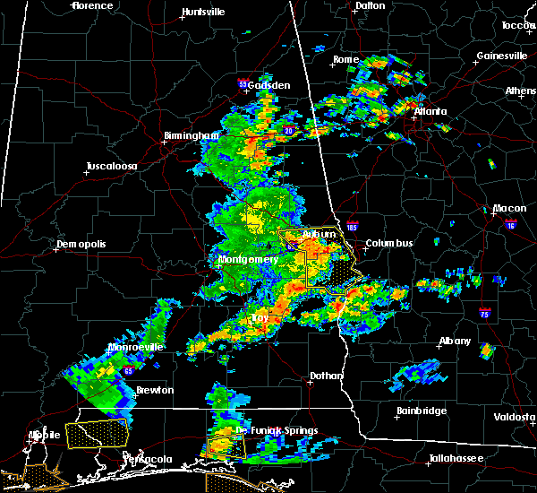 At 207 pm cdt, severe thunderstorms were located along a line extending from opelika to near griffen mill to 6 miles west of ladonia to seale to 9 miles southwest of russell county sports complex, moving east at 55 mph (radar indicated). Hazards include 60 mph wind gusts. Expect damage to roofs, siding, and trees. Locations impacted include, phenix city, opelika, smiths, smiths station, beulah, russell county sports complex, seale, beans mill, ladonia, bleecker, griffen mill, goat rock lake, monterey heights, uchee creek, fort mitchell, ladonia sports complex, fort mitchell activity center, carter acres, phenix drag strip and parkmanville. At 207 pm cdt, severe thunderstorms were located along a line extending from opelika to near griffen mill to 6 miles west of ladonia to seale to 9 miles southwest of russell county sports complex, moving east at 55 mph (radar indicated). Hazards include 60 mph wind gusts. Expect damage to roofs, siding, and trees. Locations impacted include, phenix city, opelika, smiths, smiths station, beulah, russell county sports complex, seale, beans mill, ladonia, bleecker, griffen mill, goat rock lake, monterey heights, uchee creek, fort mitchell, ladonia sports complex, fort mitchell activity center, carter acres, phenix drag strip and parkmanville.
|
| 6/7/2019 1:51 PM CDT |
 At 151 pm cdt, severe thunderstorms were located along a line extending from near auburn university to near auburn to near society hill to near uchee to near hurtsboro, moving east at 45 mph (radar indicated). Hazards include 60 mph wind gusts. expect damage to roofs, siding, and trees At 151 pm cdt, severe thunderstorms were located along a line extending from near auburn university to near auburn to near society hill to near uchee to near hurtsboro, moving east at 45 mph (radar indicated). Hazards include 60 mph wind gusts. expect damage to roofs, siding, and trees
|
| 5/9/2019 6:54 PM EDT | A tree and power line were reported down in the 100 block of missouri river roa in chattahoochee county GA, 12.9 miles NNW of Columbus, GA |
| 5/9/2019 6:51 PM EDT | A tree was reported down near the 15th mile marker along highway 520 n in chattahoochee county GA, 10.6 miles NNW of Columbus, GA |
| 5/9/2019 6:48 PM EDT | 3 trees were reported down at the entrance of river bend par in chattahoochee county GA, 15.8 miles N of Columbus, GA |
| 4/14/2019 10:46 AM EDT | Report of multiple trees down on boyd branch drive in upatoi... g in harris county GA, 10.5 miles SW of Columbus, GA |
| 4/14/2019 10:30 AM EDT |
 At 1030 am edt, severe thunderstorms were located along a line extending from near mulberry grove to flat rock to near battle park, moving northeast at 50 mph (radar indicated). Hazards include 60 mph wind gusts. expect damage to roofs, siding, and trees At 1030 am edt, severe thunderstorms were located along a line extending from near mulberry grove to flat rock to near battle park, moving northeast at 50 mph (radar indicated). Hazards include 60 mph wind gusts. expect damage to roofs, siding, and trees
|
| 4/14/2019 9:09 AM CDT |
 At 909 am cdt, a severe thunderstorm capable of producing a tornado was located near phenix city, moving northeast at 40 mph (radar indicated rotation). Hazards include tornado. Flying debris will be dangerous to those caught without shelter. mobile homes will be damaged or destroyed. damage to roofs, windows, and vehicles will occur. tree damage is likely. Locations impacted include, phenix city, ladonia, fort mitchell, ladonia sports complex and phenix drag strip. At 909 am cdt, a severe thunderstorm capable of producing a tornado was located near phenix city, moving northeast at 40 mph (radar indicated rotation). Hazards include tornado. Flying debris will be dangerous to those caught without shelter. mobile homes will be damaged or destroyed. damage to roofs, windows, and vehicles will occur. tree damage is likely. Locations impacted include, phenix city, ladonia, fort mitchell, ladonia sports complex and phenix drag strip.
|
| 4/14/2019 10:08 AM EDT | Tree reported down on 17th avenue in midtown columbu in muscogee county GA, 6.6 miles E of Columbus, GA |
| 4/14/2019 10:06 AM EDT |
 At 1006 am edt, severe thunderstorms were located along a line extending from near beulah to near bibb city to near uchee creek, moving northeast at 40 mph (radar indicated). Hazards include 60 mph wind gusts and penny size hail. Expect damage to roofs, siding, and trees. Locations impacted include, columbus, hamilton, cusseta, waverly hall, north fort benning, bibb city, upatoi, fort benning/lawson army air fld, ellerslie, laurel hills, green island hills, vista terrace, cataula, columbus metropolitan airport, jamestown/south fort benning, rose hill, mountain hill, eelbeck/west fort benning, benning hills and avondale. At 1006 am edt, severe thunderstorms were located along a line extending from near beulah to near bibb city to near uchee creek, moving northeast at 40 mph (radar indicated). Hazards include 60 mph wind gusts and penny size hail. Expect damage to roofs, siding, and trees. Locations impacted include, columbus, hamilton, cusseta, waverly hall, north fort benning, bibb city, upatoi, fort benning/lawson army air fld, ellerslie, laurel hills, green island hills, vista terrace, cataula, columbus metropolitan airport, jamestown/south fort benning, rose hill, mountain hill, eelbeck/west fort benning, benning hills and avondale.
|
| 4/14/2019 10:01 AM EDT | Part of a gas station awning was damaged on the 1500 block of nartin luther king jr blvd... near the intersection with murray s in muscogee county GA, 6.5 miles E of Columbus, GA |
| 4/14/2019 9:00 AM CDT |
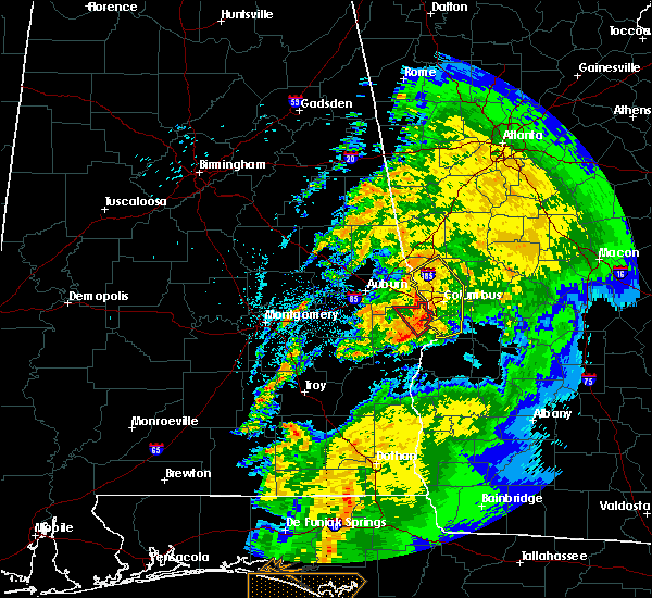 At 859 am cdt, a severe thunderstorm capable of producing a tornado was located near russell county sports complex, or 9 miles southwest of phenix city, moving northeast at 30 mph (radar indicated rotation). Hazards include tornado. Flying debris will be dangerous to those caught without shelter. mobile homes will be damaged or destroyed. damage to roofs, windows, and vehicles will occur. tree damage is likely. Locations impacted include, phenix city, ladonia, uchee creek, fort mitchell, ladonia sports complex, fort mitchell activity center, phenix drag strip and parkmanville. At 859 am cdt, a severe thunderstorm capable of producing a tornado was located near russell county sports complex, or 9 miles southwest of phenix city, moving northeast at 30 mph (radar indicated rotation). Hazards include tornado. Flying debris will be dangerous to those caught without shelter. mobile homes will be damaged or destroyed. damage to roofs, windows, and vehicles will occur. tree damage is likely. Locations impacted include, phenix city, ladonia, uchee creek, fort mitchell, ladonia sports complex, fort mitchell activity center, phenix drag strip and parkmanville.
|
| 4/14/2019 8:52 AM CDT |
 At 852 am cdt, a severe thunderstorm capable of producing a tornado was located over seale, or 13 miles southwest of phenix city, moving northeast at 30 mph (radar indicated rotation). Hazards include tornado. Flying debris will be dangerous to those caught without shelter. mobile homes will be damaged or destroyed. damage to roofs, windows, and vehicles will occur. tree damage is likely. Locations impacted include, phenix city, ladonia, russell county sports complex, seale, uchee creek, fort mitchell, ladonia sports complex, fort mitchell activity center, phenix drag strip and parkmanville. At 852 am cdt, a severe thunderstorm capable of producing a tornado was located over seale, or 13 miles southwest of phenix city, moving northeast at 30 mph (radar indicated rotation). Hazards include tornado. Flying debris will be dangerous to those caught without shelter. mobile homes will be damaged or destroyed. damage to roofs, windows, and vehicles will occur. tree damage is likely. Locations impacted include, phenix city, ladonia, russell county sports complex, seale, uchee creek, fort mitchell, ladonia sports complex, fort mitchell activity center, phenix drag strip and parkmanville.
|
| 4/14/2019 9:42 AM EDT |
 At 941 am edt, severe thunderstorms were located along a line extending from near bleecker to phenix drag strip to near seale, moving northeast at 45 mph (radar indicated). Hazards include 60 mph wind gusts and penny size hail. expect damage to roofs, siding, and trees At 941 am edt, severe thunderstorms were located along a line extending from near bleecker to phenix drag strip to near seale, moving northeast at 45 mph (radar indicated). Hazards include 60 mph wind gusts and penny size hail. expect damage to roofs, siding, and trees
|
| 4/14/2019 8:41 AM CDT |
 At 841 am cdt, a severe thunderstorm capable of producing a tornado was located near uchee, or 12 miles northeast of hurtsboro, moving northeast at 35 mph (radar indicated rotation). Hazards include tornado. Flying debris will be dangerous to those caught without shelter. mobile homes will be damaged or destroyed. damage to roofs, windows, and vehicles will occur. tree damage is likely. Locations impacted include, phenix city, ladonia, russell county sports complex, seale, hatchechubbe, uchee creek, fort mitchell, ladonia sports complex, fort mitchell activity center, phenix drag strip and parkmanville. At 841 am cdt, a severe thunderstorm capable of producing a tornado was located near uchee, or 12 miles northeast of hurtsboro, moving northeast at 35 mph (radar indicated rotation). Hazards include tornado. Flying debris will be dangerous to those caught without shelter. mobile homes will be damaged or destroyed. damage to roofs, windows, and vehicles will occur. tree damage is likely. Locations impacted include, phenix city, ladonia, russell county sports complex, seale, hatchechubbe, uchee creek, fort mitchell, ladonia sports complex, fort mitchell activity center, phenix drag strip and parkmanville.
|
| 4/14/2019 8:33 AM CDT |
 At 832 am cdt, a severe thunderstorm capable of producing a tornado was located near uchee, or 7 miles northeast of hurtsboro, moving northeast at 30 mph (radar indicated rotation). Hazards include tornado. Flying debris will be dangerous to those caught without shelter. mobile homes will be damaged or destroyed. damage to roofs, windows, and vehicles will occur. tree damage is likely. Locations impacted include, phenix city, russell county sports complex, uchee, seale, ladonia, rutherford, hatchechubbe, uchee creek, fort mitchell, ladonia sports complex, fort mitchell activity center, phenix drag strip and parkmanville. At 832 am cdt, a severe thunderstorm capable of producing a tornado was located near uchee, or 7 miles northeast of hurtsboro, moving northeast at 30 mph (radar indicated rotation). Hazards include tornado. Flying debris will be dangerous to those caught without shelter. mobile homes will be damaged or destroyed. damage to roofs, windows, and vehicles will occur. tree damage is likely. Locations impacted include, phenix city, russell county sports complex, uchee, seale, ladonia, rutherford, hatchechubbe, uchee creek, fort mitchell, ladonia sports complex, fort mitchell activity center, phenix drag strip and parkmanville.
|
| 4/14/2019 8:27 AM CDT |
 At 827 am cdt, a severe thunderstorm capable of producing a tornado was located near uchee, or near hurtsboro, moving northeast at 35 mph (radar indicated rotation). Hazards include tornado. Flying debris will be dangerous to those caught without shelter. mobile homes will be damaged or destroyed. damage to roofs, windows, and vehicles will occur. Tree damage is likely. At 827 am cdt, a severe thunderstorm capable of producing a tornado was located near uchee, or near hurtsboro, moving northeast at 35 mph (radar indicated rotation). Hazards include tornado. Flying debris will be dangerous to those caught without shelter. mobile homes will be damaged or destroyed. damage to roofs, windows, and vehicles will occur. Tree damage is likely.
|
| 3/3/2019 4:07 PM EST |
 At 407 pm est, a severe thunderstorm capable of producing a tornado was located over smiths station, or over smiths, moving east at 60 mph (radar indicated rotation). Hazards include tornado and quarter size hail. Flying debris will be dangerous to those caught without shelter. mobile homes will be damaged or destroyed. damage to roofs, windows, and vehicles will occur. Tree damage is likely. At 407 pm est, a severe thunderstorm capable of producing a tornado was located over smiths station, or over smiths, moving east at 60 mph (radar indicated rotation). Hazards include tornado and quarter size hail. Flying debris will be dangerous to those caught without shelter. mobile homes will be damaged or destroyed. damage to roofs, windows, and vehicles will occur. Tree damage is likely.
|
| 3/3/2019 3:07 PM CST |
 At 307 pm cst, a severe thunderstorm capable of producing a tornado was located near smiths station, or near smiths, moving northeast at 50 mph (radar indicated rotation). Hazards include tornado. Flying debris will be dangerous to those caught without shelter. mobile homes will be damaged or destroyed. damage to roofs, windows, and vehicles will occur. tree damage is likely. Locations impacted include, smiths, smiths station, bleecker, ladonia, monterey heights and bartletts ferry dam. At 307 pm cst, a severe thunderstorm capable of producing a tornado was located near smiths station, or near smiths, moving northeast at 50 mph (radar indicated rotation). Hazards include tornado. Flying debris will be dangerous to those caught without shelter. mobile homes will be damaged or destroyed. damage to roofs, windows, and vehicles will occur. tree damage is likely. Locations impacted include, smiths, smiths station, bleecker, ladonia, monterey heights and bartletts ferry dam.
|
| 3/3/2019 3:00 PM CST |
 At 300 pm cst, a confirmed large and extremely dangerous tornado was located over griffen mill, or 7 miles west of smiths, moving east at 65 mph. this is a particularly dangerous situation. take cover now! (radar confirmed tornado). Hazards include damaging tornado. You are in a life-threatening situation. flying debris may be deadly to those caught without shelter. mobile homes will be destroyed. considerable damage to homes, businesses, and vehicles is likely and complete destruction is possible. Locations impacted include, smiths, smiths station, bleecker, griffen mill, ladonia, monterey heights, ladonia sports complex and bartletts ferry dam. At 300 pm cst, a confirmed large and extremely dangerous tornado was located over griffen mill, or 7 miles west of smiths, moving east at 65 mph. this is a particularly dangerous situation. take cover now! (radar confirmed tornado). Hazards include damaging tornado. You are in a life-threatening situation. flying debris may be deadly to those caught without shelter. mobile homes will be destroyed. considerable damage to homes, businesses, and vehicles is likely and complete destruction is possible. Locations impacted include, smiths, smiths station, bleecker, griffen mill, ladonia, monterey heights, ladonia sports complex and bartletts ferry dam.
|
| 3/3/2019 3:57 PM EST |
 At 357 pm est, a confirmed large and extremely dangerous tornado was located near olive branch, or 7 miles northwest of talbotton, moving northeast at 55 mph. this is a particularly dangerous situation. take cover now! (radar confirmed tornado). Hazards include damaging tornado. You are in a life-threatening situation. flying debris may be deadly to those caught without shelter. mobile homes will be destroyed. considerable damage to homes, businesses, and vehicles is likely and complete destruction is possible. Locations impacted include, talbotton, manchester, woodland, junction city, geneva, pleasant hill, baldwinville, baughville, flint hill, olive branch and po biddy crossroads. At 357 pm est, a confirmed large and extremely dangerous tornado was located near olive branch, or 7 miles northwest of talbotton, moving northeast at 55 mph. this is a particularly dangerous situation. take cover now! (radar confirmed tornado). Hazards include damaging tornado. You are in a life-threatening situation. flying debris may be deadly to those caught without shelter. mobile homes will be destroyed. considerable damage to homes, businesses, and vehicles is likely and complete destruction is possible. Locations impacted include, talbotton, manchester, woodland, junction city, geneva, pleasant hill, baldwinville, baughville, flint hill, olive branch and po biddy crossroads.
|
| 3/3/2019 2:56 PM CST |
 At 256 pm cst, a confirmed large and extremely dangerous tornado was located over griffen mill, or 11 miles west of smiths, moving east at 55 mph. this is a particularly dangerous situation. take cover now! (radar confirmed tornado). Hazards include damaging tornado. You are in a life-threatening situation. flying debris may be deadly to those caught without shelter. mobile homes will be destroyed. considerable damage to homes, businesses, and vehicles is likely and complete destruction is possible. Locations impacted include, phenix city, smiths, smiths station, ladonia, bleecker, griffen mill, monterey heights, ladonia sports complex and bartletts ferry dam. At 256 pm cst, a confirmed large and extremely dangerous tornado was located over griffen mill, or 11 miles west of smiths, moving east at 55 mph. this is a particularly dangerous situation. take cover now! (radar confirmed tornado). Hazards include damaging tornado. You are in a life-threatening situation. flying debris may be deadly to those caught without shelter. mobile homes will be destroyed. considerable damage to homes, businesses, and vehicles is likely and complete destruction is possible. Locations impacted include, phenix city, smiths, smiths station, ladonia, bleecker, griffen mill, monterey heights, ladonia sports complex and bartletts ferry dam.
|
| 3/3/2019 3:54 PM EST |
 At 354 pm est, a severe thunderstorm capable of producing a tornado was located over christopher, or near cusseta, moving east at 45 mph (radar indicated rotation). Hazards include tornado and quarter size hail. Flying debris will be dangerous to those caught without shelter. mobile homes will be damaged or destroyed. damage to roofs, windows, and vehicles will occur. tree damage is likely. Locations impacted include, buena vista, junction city, geneva, brantley, christopher, juniper, oakland, manta, zellobee, box springs, tazewell, marion estates and doyle. At 354 pm est, a severe thunderstorm capable of producing a tornado was located over christopher, or near cusseta, moving east at 45 mph (radar indicated rotation). Hazards include tornado and quarter size hail. Flying debris will be dangerous to those caught without shelter. mobile homes will be damaged or destroyed. damage to roofs, windows, and vehicles will occur. tree damage is likely. Locations impacted include, buena vista, junction city, geneva, brantley, christopher, juniper, oakland, manta, zellobee, box springs, tazewell, marion estates and doyle.
|
| 3/3/2019 2:51 PM CST |
 At 250 pm cst, a confirmed large and extremely dangerous tornado was located near society hill, or 10 miles southeast of auburn, moving east at 45 mph. this is a particularly dangerous situation. take cover now! (radar confirmed tornado). Hazards include damaging tornado. You are in a life-threatening situation. flying debris may be deadly to those caught without shelter. mobile homes will be destroyed. considerable damage to homes, businesses, and vehicles is likely and complete destruction is possible. Locations impacted include, phenix city, smiths, smiths station, ladonia, bleecker, griffen mill, monterey heights, ladonia sports complex, marvyn and bartletts ferry dam. At 250 pm cst, a confirmed large and extremely dangerous tornado was located near society hill, or 10 miles southeast of auburn, moving east at 45 mph. this is a particularly dangerous situation. take cover now! (radar confirmed tornado). Hazards include damaging tornado. You are in a life-threatening situation. flying debris may be deadly to those caught without shelter. mobile homes will be destroyed. considerable damage to homes, businesses, and vehicles is likely and complete destruction is possible. Locations impacted include, phenix city, smiths, smiths station, ladonia, bleecker, griffen mill, monterey heights, ladonia sports complex, marvyn and bartletts ferry dam.
|
| 3/3/2019 3:41 PM EST |
 At 340 pm est, two severe thunderstorms capable of producing a tornado was located over jamestown/south fort benning, or near cusseta, moving east at 40 mph (radar indicated rotation). Hazards include tornado and quarter size hail. Flying debris will be dangerous to those caught without shelter. mobile homes will be damaged or destroyed. damage to roofs, windows, and vehicles will occur. Tree damage is likely. At 340 pm est, two severe thunderstorms capable of producing a tornado was located over jamestown/south fort benning, or near cusseta, moving east at 40 mph (radar indicated rotation). Hazards include tornado and quarter size hail. Flying debris will be dangerous to those caught without shelter. mobile homes will be damaged or destroyed. damage to roofs, windows, and vehicles will occur. Tree damage is likely.
|
| 3/3/2019 3:41 PM EST |
 At 341 pm est, a confirmed large and extremely dangerous tornado was located over cataula, or 8 miles south of hamilton, moving northeast at 55 mph. this is a particularly dangerous situation. take cover now! (radar confirmed tornado). Hazards include damaging tornado. You are in a life-threatening situation. flying debris may be deadly to those caught without shelter. mobile homes will be destroyed. Considerable damage to homes, businesses, and vehicles is likely and complete destruction is possible. At 341 pm est, a confirmed large and extremely dangerous tornado was located over cataula, or 8 miles south of hamilton, moving northeast at 55 mph. this is a particularly dangerous situation. take cover now! (radar confirmed tornado). Hazards include damaging tornado. You are in a life-threatening situation. flying debris may be deadly to those caught without shelter. mobile homes will be destroyed. Considerable damage to homes, businesses, and vehicles is likely and complete destruction is possible.
|
| 3/3/2019 2:38 PM CST |
 At 238 pm cst, a tornado producing storm was located near tuskegee national forest, or 9 miles east of tuskegee, moving east at 60 mph (radar confirmed tornado). Hazards include damaging tornado. Flying debris will be dangerous to those caught without shelter. mobile homes will be damaged or destroyed. damage to roofs, windows, and vehicles will occur. Tree damage is likely. At 238 pm cst, a tornado producing storm was located near tuskegee national forest, or 9 miles east of tuskegee, moving east at 60 mph (radar confirmed tornado). Hazards include damaging tornado. Flying debris will be dangerous to those caught without shelter. mobile homes will be damaged or destroyed. damage to roofs, windows, and vehicles will occur. Tree damage is likely.
|
| 3/3/2019 2:25 PM CST |
 At 224 pm cst, a confirmed large and destructive tornado was located over smiths station, or near smiths, moving east at 60 mph. tornado emergency for smiths station. this is a particularly dangerous situation. take cover now! (radar confirmed tornado). Hazards include deadly tornado. You are in a life-threatening situation. flying debris may be deadly to those caught without shelter. mobile homes will be destroyed. considerable damage to homes, businesses, and vehicles is likely and complete destruction is possible. Locations impacted include, smiths, smiths station, bleecker, monterey heights and bartletts ferry dam. At 224 pm cst, a confirmed large and destructive tornado was located over smiths station, or near smiths, moving east at 60 mph. tornado emergency for smiths station. this is a particularly dangerous situation. take cover now! (radar confirmed tornado). Hazards include deadly tornado. You are in a life-threatening situation. flying debris may be deadly to those caught without shelter. mobile homes will be destroyed. considerable damage to homes, businesses, and vehicles is likely and complete destruction is possible. Locations impacted include, smiths, smiths station, bleecker, monterey heights and bartletts ferry dam.
|
| 3/3/2019 3:19 PM EST |
 Tornado emergency for muscogee and harris counties, the national weather service in peachtree city has issued a * tornado warning for, northern muscogee county in west central georgia, southern harris county in west central georgia, * until 345 pm est. * at 317 pm est, a confirmed large and destructive tornado was observed near griffen mill, or 7 miles west of smiths, moving east at 60 mph. tornado emergency for muscogee and harris. this is a particularly dangerous situation. take cover now! (weather spotters confirmed tornado). Hazards include deadly tornado. You are in a life-threatening situation. flying debris may be deadly to those caught without shelter. mobile homes will be destroyed. Considerable damage to homes, businesses, and vehicles is likely and complete destruction is possible. Tornado emergency for muscogee and harris counties, the national weather service in peachtree city has issued a * tornado warning for, northern muscogee county in west central georgia, southern harris county in west central georgia, * until 345 pm est. * at 317 pm est, a confirmed large and destructive tornado was observed near griffen mill, or 7 miles west of smiths, moving east at 60 mph. tornado emergency for muscogee and harris. this is a particularly dangerous situation. take cover now! (weather spotters confirmed tornado). Hazards include deadly tornado. You are in a life-threatening situation. flying debris may be deadly to those caught without shelter. mobile homes will be destroyed. Considerable damage to homes, businesses, and vehicles is likely and complete destruction is possible.
|
| 3/3/2019 2:15 PM CST |
 At 214 pm cst, a confirmed large and destructive tornado was located over griffen mill, or 11 miles west of smiths, moving east at 60 mph. tornado emergency for southern lee and northern russell county. this is a particularly dangerous situation. take cover now! (radar confirmed tornado). Hazards include deadly tornado. You are in a life-threatening situation. flying debris may be deadly to those caught without shelter. mobile homes will be destroyed. considerable damage to homes, businesses, and vehicles is likely and complete destruction is possible. Locations impacted include, phenix city, smiths, smiths station, ladonia, bleecker, griffen mill, bibb city, monterey heights, ladonia sports complex and bartletts ferry dam. At 214 pm cst, a confirmed large and destructive tornado was located over griffen mill, or 11 miles west of smiths, moving east at 60 mph. tornado emergency for southern lee and northern russell county. this is a particularly dangerous situation. take cover now! (radar confirmed tornado). Hazards include deadly tornado. You are in a life-threatening situation. flying debris may be deadly to those caught without shelter. mobile homes will be destroyed. considerable damage to homes, businesses, and vehicles is likely and complete destruction is possible. Locations impacted include, phenix city, smiths, smiths station, ladonia, bleecker, griffen mill, bibb city, monterey heights, ladonia sports complex and bartletts ferry dam.
|
| 3/3/2019 2:09 PM CST |
 At 209 pm cst, a confirmed large and destructive tornado was located near griffen mill, or 11 miles southeast of auburn, moving east at 60 mph. tornado emergency for southern lee county and northern russell county. this is a particularly dangerous situation. take cover now! (radar confirmed tornado). Hazards include deadly tornado. You are in a life-threatening situation. flying debris may be deadly to those caught without shelter. mobile homes will be destroyed. considerable damage to homes, businesses, and vehicles is likely and complete destruction is possible. Locations impacted include, phenix city, smiths, smiths station, ladonia, bleecker, griffen mill, bibb city, monterey heights, ladonia sports complex, marvyn and bartletts ferry dam. At 209 pm cst, a confirmed large and destructive tornado was located near griffen mill, or 11 miles southeast of auburn, moving east at 60 mph. tornado emergency for southern lee county and northern russell county. this is a particularly dangerous situation. take cover now! (radar confirmed tornado). Hazards include deadly tornado. You are in a life-threatening situation. flying debris may be deadly to those caught without shelter. mobile homes will be destroyed. considerable damage to homes, businesses, and vehicles is likely and complete destruction is possible. Locations impacted include, phenix city, smiths, smiths station, ladonia, bleecker, griffen mill, bibb city, monterey heights, ladonia sports complex, marvyn and bartletts ferry dam.
|
| 3/3/2019 2:07 PM CST |
 At 206 pm cst, a confirmed large and extremely dangerous tornado was located near society hill, or 10 miles southeast of auburn, moving east at 55 mph. this is a particularly dangerous situation. take cover now! (radar confirmed tornado). Hazards include damaging tornado. You are in a life-threatening situation. flying debris may be deadly to those caught without shelter. mobile homes will be destroyed. considerable damage to homes, businesses, and vehicles is likely and complete destruction is possible. Locations impacted include, auburn, phenix city, opelika, smiths, smiths station, ladonia, beauregard, bleecker, griffen mill, bibb city, monterey heights, chewacla state park, ladonia sports complex, marvyn and bartletts ferry dam. At 206 pm cst, a confirmed large and extremely dangerous tornado was located near society hill, or 10 miles southeast of auburn, moving east at 55 mph. this is a particularly dangerous situation. take cover now! (radar confirmed tornado). Hazards include damaging tornado. You are in a life-threatening situation. flying debris may be deadly to those caught without shelter. mobile homes will be destroyed. considerable damage to homes, businesses, and vehicles is likely and complete destruction is possible. Locations impacted include, auburn, phenix city, opelika, smiths, smiths station, ladonia, beauregard, bleecker, griffen mill, bibb city, monterey heights, chewacla state park, ladonia sports complex, marvyn and bartletts ferry dam.
|
| 3/3/2019 1:58 PM CST |
 At 158 pm cst, a severe thunderstorm capable of producing a tornado was located near tuskegee national forest, or 9 miles south of auburn, moving east at 60 mph (radar indicated rotation). Hazards include tornado. Flying debris will be dangerous to those caught without shelter. mobile homes will be damaged or destroyed. damage to roofs, windows, and vehicles will occur. Tree damage is likely. At 158 pm cst, a severe thunderstorm capable of producing a tornado was located near tuskegee national forest, or 9 miles south of auburn, moving east at 60 mph (radar indicated rotation). Hazards include tornado. Flying debris will be dangerous to those caught without shelter. mobile homes will be damaged or destroyed. damage to roofs, windows, and vehicles will occur. Tree damage is likely.
|
| 3/3/2019 1:58 PM EST |
 At 158 pm est, a severe thunderstorm was located over baughville, or 8 miles west of talbotton, moving northeast at 40 mph (radar indicated). Hazards include 60 mph wind gusts. expect damage to roofs, siding, and trees At 158 pm est, a severe thunderstorm was located over baughville, or 8 miles west of talbotton, moving northeast at 40 mph (radar indicated). Hazards include 60 mph wind gusts. expect damage to roofs, siding, and trees
|
| 3/3/2019 1:24 PM EST |
 At 124 pm est, a severe thunderstorm capable of producing a tornado was located over green island hills, or near phenix city, moving northeast at 40 mph (radar indicated rotation). Hazards include tornado and quarter size hail. Flying debris will be dangerous to those caught without shelter. mobile homes will be damaged or destroyed. damage to roofs, windows, and vehicles will occur. Tree damage is likely. At 124 pm est, a severe thunderstorm capable of producing a tornado was located over green island hills, or near phenix city, moving northeast at 40 mph (radar indicated rotation). Hazards include tornado and quarter size hail. Flying debris will be dangerous to those caught without shelter. mobile homes will be damaged or destroyed. damage to roofs, windows, and vehicles will occur. Tree damage is likely.
|
| 3/3/2019 1:21 PM EST |
 At 121 pm est, a severe thunderstorm was located over green island hills, or near phenix city, moving northeast at 45 mph (radar indicated). Hazards include 60 mph wind gusts and quarter size hail. Hail damage to vehicles is expected. Expect wind damage to roofs, siding, and trees. At 121 pm est, a severe thunderstorm was located over green island hills, or near phenix city, moving northeast at 45 mph (radar indicated). Hazards include 60 mph wind gusts and quarter size hail. Hail damage to vehicles is expected. Expect wind damage to roofs, siding, and trees.
|
| 2/12/2019 1:54 PM EST |
 At 154 pm est, a severe thunderstorm was located near baughville, or 7 miles southwest of talbotton, moving east at 50 mph (radar indicated). Hazards include 60 mph wind gusts. expect damage to roofs, siding, and trees At 154 pm est, a severe thunderstorm was located near baughville, or 7 miles southwest of talbotton, moving east at 50 mph (radar indicated). Hazards include 60 mph wind gusts. expect damage to roofs, siding, and trees
|
| 2/12/2019 1:30 PM EST | The public reported trees and power lines blown down around the intersection of auburn avenue and macon road in columbu in muscogee county GA, 4.9 miles ESE of Columbus, GA |
| 2/12/2019 1:26 PM EST | Three trees were reported down on the tsys campus in downtown columbu in muscogee county GA, 7.7 miles E of Columbus, GA |
| 1/19/2019 6:22 PM EST |
 The severe thunderstorm warning for northeastern muscogee and eastern harris counties will expire at 630 pm est, the storm which prompted the warning has weakened below severe limits, and no longer poses an immediate threat to life or property. therefore, the warning will be allowed to expire. however gusty winds are still possible with this thunderstorm. a tornado watch remains in effect until 1000 pm est for west central georgia. The severe thunderstorm warning for northeastern muscogee and eastern harris counties will expire at 630 pm est, the storm which prompted the warning has weakened below severe limits, and no longer poses an immediate threat to life or property. therefore, the warning will be allowed to expire. however gusty winds are still possible with this thunderstorm. a tornado watch remains in effect until 1000 pm est for west central georgia.
|
| 1/19/2019 6:16 PM EST |
 At 616 pm est, a severe thunderstorm was located near cataula, or 10 miles south of hamilton, moving northeast at 65 mph (radar indicated). Hazards include 60 mph wind gusts. Expect damage to roofs, siding, and trees. locations impacted include, hamilton, waverly hall, upatoi, ellerslie, flat rock, f. d. roosevelt state park, kenwood, midland and cataula. A tornado watch remains in effect until 1000 pm est for west central georgia. At 616 pm est, a severe thunderstorm was located near cataula, or 10 miles south of hamilton, moving northeast at 65 mph (radar indicated). Hazards include 60 mph wind gusts. Expect damage to roofs, siding, and trees. locations impacted include, hamilton, waverly hall, upatoi, ellerslie, flat rock, f. d. roosevelt state park, kenwood, midland and cataula. A tornado watch remains in effect until 1000 pm est for west central georgia.
|
| 1/19/2019 5:10 PM CST |
 The severe thunderstorm warning for eastern lee and northeastern russell counties will expire at 515 pm cst, the storms which prompted the warning have moved out of the area. therefore, the warning will be allowed to expire. a tornado watch remains in effect until 900 pm cst for southeastern and east central alabama. The severe thunderstorm warning for eastern lee and northeastern russell counties will expire at 515 pm cst, the storms which prompted the warning have moved out of the area. therefore, the warning will be allowed to expire. a tornado watch remains in effect until 900 pm cst for southeastern and east central alabama.
|
| 1/19/2019 6:07 PM EST |
 At 607 pm est, a severe thunderstorm was located near green island hills, or 4 miles north of downtown columbus, moving northeast at 65 mph (radar indicated). Hazards include 60 mph wind gusts. Expect damage to roofs, siding, and trees. locations impacted include, hamilton, pine mountain, waverly hall, bibb city, upatoi, ellerslie, edgewood, flat rock, laurel hills, f. d. roosevelt state park, green island hills, cataula, columbus metropolitan airport, rose hill, kenwood, midland, fortson and mulberry grove. A tornado watch remains in effect until 1000 pm est for west central georgia. At 607 pm est, a severe thunderstorm was located near green island hills, or 4 miles north of downtown columbus, moving northeast at 65 mph (radar indicated). Hazards include 60 mph wind gusts. Expect damage to roofs, siding, and trees. locations impacted include, hamilton, pine mountain, waverly hall, bibb city, upatoi, ellerslie, edgewood, flat rock, laurel hills, f. d. roosevelt state park, green island hills, cataula, columbus metropolitan airport, rose hill, kenwood, midland, fortson and mulberry grove. A tornado watch remains in effect until 1000 pm est for west central georgia.
|
| 1/19/2019 5:01 PM CST |
 At 501 pm cst, severe thunderstorms were located along a line extending from near river view to near bleecker, moving northeast at 45 mph (radar indicated). Hazards include 60 mph wind gusts. Expect damage to roofs, siding, and trees. locations impacted include, phenix city, smiths, smiths station, ladonia, bleecker, bibb city, monterey heights, ladonia sports complex and phenix drag strip. A tornado watch remains in effect until 900 pm cst for southeastern and east central alabama. At 501 pm cst, severe thunderstorms were located along a line extending from near river view to near bleecker, moving northeast at 45 mph (radar indicated). Hazards include 60 mph wind gusts. Expect damage to roofs, siding, and trees. locations impacted include, phenix city, smiths, smiths station, ladonia, bleecker, bibb city, monterey heights, ladonia sports complex and phenix drag strip. A tornado watch remains in effect until 900 pm cst for southeastern and east central alabama.
|
| 1/19/2019 4:54 PM CST |
 At 454 pm cst, a severe thunderstorm capable of producing a tornado was located near ladonia, or 8 miles southwest of smiths, moving northeast at 50 mph (radar indicated rotation). Hazards include tornado. Flying debris will be dangerous to those caught without shelter. mobile homes will be damaged or destroyed. damage to roofs, windows, and vehicles will occur. Tree damage is likely. At 454 pm cst, a severe thunderstorm capable of producing a tornado was located near ladonia, or 8 miles southwest of smiths, moving northeast at 50 mph (radar indicated rotation). Hazards include tornado. Flying debris will be dangerous to those caught without shelter. mobile homes will be damaged or destroyed. damage to roofs, windows, and vehicles will occur. Tree damage is likely.
|
| 1/19/2019 5:53 PM EST |
 At 552 pm est, a severe thunderstorm was centered near crawford alabama, or 11 miles west of columbus, moving northeast at 60 mph (radar indicated). Hazards include 60 mph wind gusts. expect damage to roofs, siding, and trees At 552 pm est, a severe thunderstorm was centered near crawford alabama, or 11 miles west of columbus, moving northeast at 60 mph (radar indicated). Hazards include 60 mph wind gusts. expect damage to roofs, siding, and trees
|
| 1/19/2019 4:39 PM CST |
 At 439 pm cst, severe thunderstorms were located along a line extending from near beans mill to society hill, moving northeast at 45 mph (radar indicated). Hazards include 60 mph wind gusts. expect damage to roofs, siding, and trees At 439 pm cst, severe thunderstorms were located along a line extending from near beans mill to society hill, moving northeast at 45 mph (radar indicated). Hazards include 60 mph wind gusts. expect damage to roofs, siding, and trees
|
| 11/7/2018 4:37 PM EST |
 At 436 pm est, severe thunderstorms were located along a line extending from near sprewell bluff state park to talbotton to near box springs, moving east at 60 mph (radar indicated). Hazards include 60 mph wind gusts. Expect damage to roofs, siding, and trees. Locations impacted include, thomaston, butler, talbotton, manchester, reynolds, warm springs, woodland, yatesville, junction city, culloden, geneva, sunset village, lincoln park, upatoi, juniper, rupert, baughville, flint hill, oakland and sprewell bluff state park. At 436 pm est, severe thunderstorms were located along a line extending from near sprewell bluff state park to talbotton to near box springs, moving east at 60 mph (radar indicated). Hazards include 60 mph wind gusts. Expect damage to roofs, siding, and trees. Locations impacted include, thomaston, butler, talbotton, manchester, reynolds, warm springs, woodland, yatesville, junction city, culloden, geneva, sunset village, lincoln park, upatoi, juniper, rupert, baughville, flint hill, oakland and sprewell bluff state park.
|
| 11/7/2018 4:18 PM EST |
 At 418 pm est, severe thunderstorms were located along a line extending from durand to near waverly hall to kenwood, moving east at 55 mph (radar indicated). Hazards include 60 mph wind gusts. expect damage to roofs, siding, and trees At 418 pm est, severe thunderstorms were located along a line extending from durand to near waverly hall to kenwood, moving east at 55 mph (radar indicated). Hazards include 60 mph wind gusts. expect damage to roofs, siding, and trees
|
| 9/27/2018 3:22 PM EDT |
 The severe thunderstorm warning for southwestern meriwether, southeastern troup and eastern harris counties will expire at 330 pm edt, the storms which prompted the warning have weakened below severe limits, and have exited the warned area. therefore, the warning will be allowed to expire. to report severe weather, contact your nearest law enforcement agency. they will relay your report to the national weather service peachtree city. The severe thunderstorm warning for southwestern meriwether, southeastern troup and eastern harris counties will expire at 330 pm edt, the storms which prompted the warning have weakened below severe limits, and have exited the warned area. therefore, the warning will be allowed to expire. to report severe weather, contact your nearest law enforcement agency. they will relay your report to the national weather service peachtree city.
|
| 9/27/2018 3:12 PM EDT |
 At 312 pm edt, severe thunderstorms were located along a line extending from near louise to hamilton, moving northeast at 40 mph (radar indicated). Hazards include 60 mph wind gusts. Expect damage to roofs, siding, and trees. locations impacted include, lagrange, hamilton, pine mountain, waverly hall, ellerslie, f. d. Roosevelt state park, mountville, cataula, odessadale, stovall, big springs, durand, jones crossroads, baughs crossroads and smiths crossroad. At 312 pm edt, severe thunderstorms were located along a line extending from near louise to hamilton, moving northeast at 40 mph (radar indicated). Hazards include 60 mph wind gusts. Expect damage to roofs, siding, and trees. locations impacted include, lagrange, hamilton, pine mountain, waverly hall, ellerslie, f. d. Roosevelt state park, mountville, cataula, odessadale, stovall, big springs, durand, jones crossroads, baughs crossroads and smiths crossroad.
|
| 9/27/2018 2:52 PM EDT | A tree was blown down on holland rd south of cataul in harris county GA, 12 miles S of Columbus, GA |
| 9/27/2018 1:47 PM CDT |
 At 137 pm cdt, a severe thunderstorm was located near beulah, or 9 miles northwest of smiths, moving northeast at 40 mph (radar indicated). Hazards include 60 mph wind gusts. expect damage to roofs, siding, and trees At 137 pm cdt, a severe thunderstorm was located near beulah, or 9 miles northwest of smiths, moving northeast at 40 mph (radar indicated). Hazards include 60 mph wind gusts. expect damage to roofs, siding, and trees
|
| 9/27/2018 2:38 PM EDT |
 The national weather service in peachtree city has issued a * severe thunderstorm warning for. southwestern meriwether county in west central georgia. northwestern muscogee county in west central georgia. southern troup county in west central georgia. Harris county in west central georgia. The national weather service in peachtree city has issued a * severe thunderstorm warning for. southwestern meriwether county in west central georgia. northwestern muscogee county in west central georgia. southern troup county in west central georgia. Harris county in west central georgia.
|
| 9/27/2018 1:37 PM CDT |
 At 137 pm cdt, a severe thunderstorm was located near beulah, or 9 miles northwest of smiths, moving northeast at 40 mph (radar indicated). Hazards include 60 mph wind gusts. expect damage to roofs, siding, and trees At 137 pm cdt, a severe thunderstorm was located near beulah, or 9 miles northwest of smiths, moving northeast at 40 mph (radar indicated). Hazards include 60 mph wind gusts. expect damage to roofs, siding, and trees
|
| 8/28/2018 8:08 PM EDT |
 At 808 pm edt, a severe thunderstorm was located near baughville, or 10 miles southwest of talbotton, moving northwest at 10 mph (radar indicated). Hazards include 60 mph wind gusts and quarter size hail. Hail damage to vehicles is expected. Expect wind damage to roofs, siding, and trees. At 808 pm edt, a severe thunderstorm was located near baughville, or 10 miles southwest of talbotton, moving northwest at 10 mph (radar indicated). Hazards include 60 mph wind gusts and quarter size hail. Hail damage to vehicles is expected. Expect wind damage to roofs, siding, and trees.
|
| 8/12/2018 8:48 PM EDT |
 At 848 pm edt, a severe thunderstorm was located over north fort benning, or 9 miles east of columbus, moving southeast at 30 mph (radar indicated). Hazards include 60 mph wind gusts and quarter size hail. Hail damage to vehicles is expected. Expect wind damage to roofs, siding, and trees. At 848 pm edt, a severe thunderstorm was located over north fort benning, or 9 miles east of columbus, moving southeast at 30 mph (radar indicated). Hazards include 60 mph wind gusts and quarter size hail. Hail damage to vehicles is expected. Expect wind damage to roofs, siding, and trees.
|
| 8/8/2018 8:14 PM EDT |
 At 814 pm edt, a severe thunderstorm was located near goat rock lake, or 7 miles northeast of smiths, moving northeast at 10 mph (radar indicated). Hazards include 60 mph wind gusts and quarter size hail. Hail damage to vehicles is expected. Expect wind damage to roofs, siding, and trees. At 814 pm edt, a severe thunderstorm was located near goat rock lake, or 7 miles northeast of smiths, moving northeast at 10 mph (radar indicated). Hazards include 60 mph wind gusts and quarter size hail. Hail damage to vehicles is expected. Expect wind damage to roofs, siding, and trees.
|
| 7/21/2018 5:47 PM CDT |
 At 547 pm cdt, a severe thunderstorm capable of producing a tornado was located over opelika, moving southeast at 25 mph (radar indicated rotation). Hazards include tornado and ping pong ball size hail. Flying debris will be dangerous to those caught without shelter. mobile homes will be damaged or destroyed. damage to roofs, windows, and vehicles will occur. Tree damage is likely. At 547 pm cdt, a severe thunderstorm capable of producing a tornado was located over opelika, moving southeast at 25 mph (radar indicated rotation). Hazards include tornado and ping pong ball size hail. Flying debris will be dangerous to those caught without shelter. mobile homes will be damaged or destroyed. damage to roofs, windows, and vehicles will occur. Tree damage is likely.
|
| 7/4/2018 12:25 AM EDT |
 The severe thunderstorm warning for muscogee and central chattahoochee counties will expire at 1230 am edt, the storm which prompted the warning has weakened below severe limits, and has exited the warned area. therefore, the warning will be allowed to expire. The severe thunderstorm warning for muscogee and central chattahoochee counties will expire at 1230 am edt, the storm which prompted the warning has weakened below severe limits, and has exited the warned area. therefore, the warning will be allowed to expire.
|
| 7/3/2018 11:47 PM EDT |
 At 1147 pm edt, a severe thunderstorm was located over north fort benning, or 11 miles north of cusseta, moving west at 35 mph (radar indicated). Hazards include 60 mph wind gusts and quarter size hail. Hail damage to vehicles is expected. Expect wind damage to roofs, siding, and trees. At 1147 pm edt, a severe thunderstorm was located over north fort benning, or 11 miles north of cusseta, moving west at 35 mph (radar indicated). Hazards include 60 mph wind gusts and quarter size hail. Hail damage to vehicles is expected. Expect wind damage to roofs, siding, and trees.
|
| 6/28/2018 4:25 PM CDT |
 At 425 pm cdt, severe thunderstorms were located along a line extending from near smiths to near uchee to montgomery, moving southeast at 35 mph (radar indicated). Hazards include 60 mph wind gusts. expect damage to roofs, siding, and trees At 425 pm cdt, severe thunderstorms were located along a line extending from near smiths to near uchee to montgomery, moving southeast at 35 mph (radar indicated). Hazards include 60 mph wind gusts. expect damage to roofs, siding, and trees
|
| 6/28/2018 3:58 PM CDT |
 At 357 pm cdt, severe thunderstorms were located along a line extending from west point to near notasulga, moving south at 30 mph (radar indicated). Hazards include 60 mph wind gusts. expect damage to roofs, siding, and trees At 357 pm cdt, severe thunderstorms were located along a line extending from west point to near notasulga, moving south at 30 mph (radar indicated). Hazards include 60 mph wind gusts. expect damage to roofs, siding, and trees
|
| 6/28/2018 3:44 PM CDT |
 At 344 pm cdt, a severe thunderstorm was located 7 miles south of seale, or 17 miles east of hurtsboro, moving southeast at 30 mph (radar indicated). Hazards include 60 mph wind gusts. Expect damage to roofs, siding, and trees. Locations impacted include, auburn, phenix city, opelika, smiths, smiths station, waverly, hawkinsville, beulah, uchee, spring hill, beans mill, auburn university, beauregard, bleecker, russell county sports complex, seale, ladonia, oak bowery, griffen mill and twin springs. At 344 pm cdt, a severe thunderstorm was located 7 miles south of seale, or 17 miles east of hurtsboro, moving southeast at 30 mph (radar indicated). Hazards include 60 mph wind gusts. Expect damage to roofs, siding, and trees. Locations impacted include, auburn, phenix city, opelika, smiths, smiths station, waverly, hawkinsville, beulah, uchee, spring hill, beans mill, auburn university, beauregard, bleecker, russell county sports complex, seale, ladonia, oak bowery, griffen mill and twin springs.
|
| 6/28/2018 3:25 PM CDT |
 The national weather service in birmingham has issued a * severe thunderstorm warning for. lee county in east central alabama. southern chambers county in east central alabama. northeastern barbour county in southeastern alabama. Russell county in southeastern alabama. The national weather service in birmingham has issued a * severe thunderstorm warning for. lee county in east central alabama. southern chambers county in east central alabama. northeastern barbour county in southeastern alabama. Russell county in southeastern alabama.
|
| 6/28/2018 3:06 PM CDT |
 At 306 pm cdt, severe thunderstorms were located along a line extending from near society hill to 9 miles southwest of cusseta, moving southeast at 30 mph (radar indicated). Hazards include 60 mph wind gusts. expect damage to roofs, siding, and trees At 306 pm cdt, severe thunderstorms were located along a line extending from near society hill to 9 miles southwest of cusseta, moving southeast at 30 mph (radar indicated). Hazards include 60 mph wind gusts. expect damage to roofs, siding, and trees
|
| 6/28/2018 3:43 PM EDT |
 The national weather service in peachtree city has issued a * severe thunderstorm warning for. southern marion county in west central georgia. southwestern muscogee county in west central georgia. chattahoochee county in west central georgia. Stewart county in west central georgia. The national weather service in peachtree city has issued a * severe thunderstorm warning for. southern marion county in west central georgia. southwestern muscogee county in west central georgia. chattahoochee county in west central georgia. Stewart county in west central georgia.
|
| 6/28/2018 3:27 PM EDT |
 The severe thunderstorm warning for northwestern muscogee, southwestern troup and central harris counties will expire at 330 pm edt, the storms which prompted the warning have weakened or moved out of the warned area. therefore, the warning will be allowed to expire. however gusty winds are still possible with these thunderstorms. The severe thunderstorm warning for northwestern muscogee, southwestern troup and central harris counties will expire at 330 pm edt, the storms which prompted the warning have weakened or moved out of the warned area. therefore, the warning will be allowed to expire. however gusty winds are still possible with these thunderstorms.
|
| 6/28/2018 3:07 PM EDT |
 At 306 pm edt, the leading edge of a line of severe thunderstorms was located along a line extending from near beulah to green island hills, moving south at 35 mph (radar indicated). Hazards include 60 mph wind gusts. Expect damage to roofs, siding, and trees. Locations impacted include, lagrange, hamilton, west point, green island hills, cannonville, cataula, state line park, abbottsford, piedmont heights, mountain hill, jones crossroads, bartletts ferry dam, baughs crossroads, fortson, mulberry grove, smiths crossroad, whitesville-pine lake, lake harding and long cane. At 306 pm edt, the leading edge of a line of severe thunderstorms was located along a line extending from near beulah to green island hills, moving south at 35 mph (radar indicated). Hazards include 60 mph wind gusts. Expect damage to roofs, siding, and trees. Locations impacted include, lagrange, hamilton, west point, green island hills, cannonville, cataula, state line park, abbottsford, piedmont heights, mountain hill, jones crossroads, bartletts ferry dam, baughs crossroads, fortson, mulberry grove, smiths crossroad, whitesville-pine lake, lake harding and long cane.
|
| 6/28/2018 3:00 PM EDT |
 At 259 pm edt, the leading edge of a line of severe thunderstorms was located along a line extending from columbus metropolitan airport to near buena vista to near ellaville, moving southwest at 30 mph (radar indicated). Hazards include 60 mph wind gusts. expect damage to roofs, siding, and trees At 259 pm edt, the leading edge of a line of severe thunderstorms was located along a line extending from columbus metropolitan airport to near buena vista to near ellaville, moving southwest at 30 mph (radar indicated). Hazards include 60 mph wind gusts. expect damage to roofs, siding, and trees
|
| 6/28/2018 2:47 PM EDT |
 At 246 pm edt, the leading edge of a line of severe thunderstorms were located along a line extending from stroud creek to near fortson, moving southwest at 30 mph (radar indicated). Hazards include 60 mph wind gusts and quarter size hail. Hail damage to vehicles is expected. Expect wind damage to roofs, siding, and trees. At 246 pm edt, the leading edge of a line of severe thunderstorms were located along a line extending from stroud creek to near fortson, moving southwest at 30 mph (radar indicated). Hazards include 60 mph wind gusts and quarter size hail. Hail damage to vehicles is expected. Expect wind damage to roofs, siding, and trees.
|
| 6/25/2018 7:15 PM EDT |
 At 715 pm edt, a severe thunderstorm was located over cataula, or near hamilton, moving southeast at 20 mph (radar indicated). Hazards include 60 mph wind gusts and quarter size hail. Hail damage to vehicles is expected. expect wind damage to roofs, siding, and trees. Locations impacted include, hamilton, waverly hall, goat rock lake, ellerslie, flat rock, midland, mountain hill, cataula, bartletts ferry dam, fortson, mulberry grove and lake harding. At 715 pm edt, a severe thunderstorm was located over cataula, or near hamilton, moving southeast at 20 mph (radar indicated). Hazards include 60 mph wind gusts and quarter size hail. Hail damage to vehicles is expected. expect wind damage to roofs, siding, and trees. Locations impacted include, hamilton, waverly hall, goat rock lake, ellerslie, flat rock, midland, mountain hill, cataula, bartletts ferry dam, fortson, mulberry grove and lake harding.
|
| 6/25/2018 7:07 PM EDT | Tree down at the intersection of hoody harris rd and mulberry grove r in harris county GA, 16.6 miles SSE of Columbus, GA |
| 6/25/2018 6:59 PM EDT |
 The national weather service in peachtree city has issued a * severe thunderstorm warning for. north central muscogee county in west central georgia. harris county in west central georgia. until 730 pm edt. At 659 pm edt, a severe thunderstorm was located near mulberry. The national weather service in peachtree city has issued a * severe thunderstorm warning for. north central muscogee county in west central georgia. harris county in west central georgia. until 730 pm edt. At 659 pm edt, a severe thunderstorm was located near mulberry.
|
| 6/22/2018 8:12 PM EDT | Multiple trees down across the count in muscogee county GA, 7.7 miles E of Columbus, GA |
| 6/22/2018 8:10 PM EDT | A tree was downed at the intersection of hilton avenue and 17th stree in muscogee county GA, 5.4 miles E of Columbus, GA |
| 6/22/2018 8:10 PM EDT | A tree and power lines were downed at dupree drive and laney driv in muscogee county GA, 1.6 miles SE of Columbus, GA |
| 6/22/2018 8:01 PM EDT |
 At 800 pm edt, a severe thunderstorm was located over monterey heights, or over smiths, moving east at 35 mph (radar indicated). Hazards include 60 mph wind gusts. expect damage to roofs, siding, and trees At 800 pm edt, a severe thunderstorm was located over monterey heights, or over smiths, moving east at 35 mph (radar indicated). Hazards include 60 mph wind gusts. expect damage to roofs, siding, and trees
|
| 6/22/2018 6:57 PM CDT |
 At 657 pm cdt, a severe thunderstorm was located over smiths, moving east at 30 mph (radar indicated). Hazards include 60 mph wind gusts. expect damage to roofs, siding, and trees At 657 pm cdt, a severe thunderstorm was located over smiths, moving east at 30 mph (radar indicated). Hazards include 60 mph wind gusts. expect damage to roofs, siding, and trees
|
| 6/21/2018 6:00 PM EDT | Multiple trees were reported down on grey rock roa in muscogee county GA, 7.2 miles S of Columbus, GA |
| 6/9/2018 4:19 PM EDT |
 At 419 pm edt, a severe thunderstorm was located over fortson, or 8 miles northeast of columbus, and is nearly stationary (radar indicated). Hazards include 60 mph wind gusts and quarter size hail. Hail damage to vehicles is expected. Expect wind damage to roofs, siding, and trees. At 419 pm edt, a severe thunderstorm was located over fortson, or 8 miles northeast of columbus, and is nearly stationary (radar indicated). Hazards include 60 mph wind gusts and quarter size hail. Hail damage to vehicles is expected. Expect wind damage to roofs, siding, and trees.
|
| 6/3/2018 8:20 PM EDT | A tree was reported down along broad stree in chattahoochee county GA, 12.5 miles NNW of Columbus, GA |
| 6/3/2018 8:02 PM EDT |
 At 801 pm edt, a severe thunderstorm was located over fort mitchell activity center, or 10 miles south of phenix city, moving southeast at 30 mph (radar indicated). Hazards include 60 mph wind gusts and quarter size hail. Hail damage to vehicles is expected. Expect wind damage to roofs, siding, and trees. At 801 pm edt, a severe thunderstorm was located over fort mitchell activity center, or 10 miles south of phenix city, moving southeast at 30 mph (radar indicated). Hazards include 60 mph wind gusts and quarter size hail. Hail damage to vehicles is expected. Expect wind damage to roofs, siding, and trees.
|
| 6/3/2018 6:10 PM EDT |
 At 610 pm edt, a severe thunderstorm was located over ellerslie, or 11 miles southeast of hamilton, moving south at 15 mph (radar indicated). Hazards include 60 mph wind gusts and quarter size hail. Hail damage to vehicles is expected. Expect wind damage to roofs, siding, and trees. At 610 pm edt, a severe thunderstorm was located over ellerslie, or 11 miles southeast of hamilton, moving south at 15 mph (radar indicated). Hazards include 60 mph wind gusts and quarter size hail. Hail damage to vehicles is expected. Expect wind damage to roofs, siding, and trees.
|
| 6/3/2018 5:22 PM EDT |
 At 522 pm edt, a severe thunderstorm was located over jones crossroads, or 7 miles east of valley, moving southeast at 20 mph (radar indicated). Hazards include 60 mph wind gusts and quarter size hail. Hail damage to vehicles is expected. Expect wind damage to roofs, siding, and trees. At 522 pm edt, a severe thunderstorm was located over jones crossroads, or 7 miles east of valley, moving southeast at 20 mph (radar indicated). Hazards include 60 mph wind gusts and quarter size hail. Hail damage to vehicles is expected. Expect wind damage to roofs, siding, and trees.
|
| 6/1/2018 7:41 PM EDT |
 At 741 pm edt, a severe thunderstorm was located over christopher, or over cusseta, moving east at 15 mph (radar indicated). Hazards include 60 mph wind gusts. expect damage to roofs, siding, and trees At 741 pm edt, a severe thunderstorm was located over christopher, or over cusseta, moving east at 15 mph (radar indicated). Hazards include 60 mph wind gusts. expect damage to roofs, siding, and trees
|
| 2/7/2018 9:16 AM CST |
 At 916 am cst, a severe thunderstorm was located near bleecker, or near smiths, moving east at 55 mph (radar indicated). Hazards include 60 mph wind gusts and penny size hail. Expect damage to roofs, siding, and trees. Locations impacted include, bleecker, goat rock lake and bartletts ferry dam. At 916 am cst, a severe thunderstorm was located near bleecker, or near smiths, moving east at 55 mph (radar indicated). Hazards include 60 mph wind gusts and penny size hail. Expect damage to roofs, siding, and trees. Locations impacted include, bleecker, goat rock lake and bartletts ferry dam.
|
| 2/7/2018 9:15 AM CST | Half Dollar sized hail reported 20 miles SE of Columbus, GA |
| 2/7/2018 9:08 AM CST |
 At 908 am cst, a severe thunderstorm was located near bleecker, or 9 miles southeast of opelika, moving east at 55 mph (radar indicated). Hazards include 60 mph wind gusts and nickel size hail. expect damage to roofs, siding, and trees At 908 am cst, a severe thunderstorm was located near bleecker, or 9 miles southeast of opelika, moving east at 55 mph (radar indicated). Hazards include 60 mph wind gusts and nickel size hail. expect damage to roofs, siding, and trees
|
| 12/20/2017 2:12 PM EST |
 The severe thunderstorm warning for southwestern talbot county will expire at 215 pm est, the storm which prompted the warning has weakened below severe limits, and no longer poses an immediate threat to life or property. therefore the warning will be allowed to expire. however heavy rain is still possible with this thunderstorm. The severe thunderstorm warning for southwestern talbot county will expire at 215 pm est, the storm which prompted the warning has weakened below severe limits, and no longer poses an immediate threat to life or property. therefore the warning will be allowed to expire. however heavy rain is still possible with this thunderstorm.
|
| 12/20/2017 2:05 PM EST |
 At 205 pm est, a severe thunderstorm was located over geneva, or 8 miles south of talbotton, moving east at 45 mph (radar indicated). Hazards include 60 mph wind gusts. Expect damage to roofs, siding, and trees. Locations impacted include, talbotton, geneva, box springs, juniper, baughville, olive branch and po biddy crossroads. At 205 pm est, a severe thunderstorm was located over geneva, or 8 miles south of talbotton, moving east at 45 mph (radar indicated). Hazards include 60 mph wind gusts. Expect damage to roofs, siding, and trees. Locations impacted include, talbotton, geneva, box springs, juniper, baughville, olive branch and po biddy crossroads.
|
| 12/20/2017 1:58 PM EST | Damage to a structure near the intersection of mckee rd and county line rd. chimney blown off into pool; small trailer blown about 20 feet; 2 trees down near the proper in harris county GA, 10.5 miles SW of Columbus, GA |
| 12/20/2017 1:47 PM EST | Two trees reported down in midland community. metal furniture also blown off of a deck at the same locatio in muscogee county GA, 7.5 miles SSW of Columbus, GA |
| 12/20/2017 1:27 PM EST |
 At 127 pm est, a severe thunderstorm was located over goat rock lake, or near smiths, moving east at 45 mph (radar indicated). Hazards include 60 mph wind gusts. expect damage to roofs, siding, and trees At 127 pm est, a severe thunderstorm was located over goat rock lake, or near smiths, moving east at 45 mph (radar indicated). Hazards include 60 mph wind gusts. expect damage to roofs, siding, and trees
|
| 7/11/2017 7:42 PM EDT | A tree and power lines were reported down on gatlin lan in harris county GA, 12.8 miles S of Columbus, GA |
| 7/11/2017 7:36 PM EDT |
 At 736 pm edt, a severe thunderstorm was located over fortson, or 10 miles south of hamilton, moving north at 15 mph (radar indicated). Hazards include 60 mph wind gusts and quarter size hail. Hail damage to vehicles is expected. Expect wind damage to roofs, siding, and trees. At 736 pm edt, a severe thunderstorm was located over fortson, or 10 miles south of hamilton, moving north at 15 mph (radar indicated). Hazards include 60 mph wind gusts and quarter size hail. Hail damage to vehicles is expected. Expect wind damage to roofs, siding, and trees.
|
| 6/15/2017 6:06 PM CDT |
 At 605 pm cdt, severe thunderstorms were located along a line extending from near beulah to 6 miles south of davisville, moving southeast at 30 mph (radar indicated). Hazards include 60 mph wind gusts and penny size hail. Expect damage to roofs, siding, and trees. Locations impacted include, auburn, opelika, tuskegee, smiths, smiths station, beulah, beans mill, lake tuskegee, auburn university, tuskegee national forest, beauregard, davisville, bleecker, liverpool, hardaway, society hill, griffen mill, ladonia, warriorstand and fort davis. At 605 pm cdt, severe thunderstorms were located along a line extending from near beulah to 6 miles south of davisville, moving southeast at 30 mph (radar indicated). Hazards include 60 mph wind gusts and penny size hail. Expect damage to roofs, siding, and trees. Locations impacted include, auburn, opelika, tuskegee, smiths, smiths station, beulah, beans mill, lake tuskegee, auburn university, tuskegee national forest, beauregard, davisville, bleecker, liverpool, hardaway, society hill, griffen mill, ladonia, warriorstand and fort davis.
|
| 6/15/2017 5:42 PM CDT |
 At 542 pm cdt, severe thunderstorms were located along a line extending from amity park to near hardaway, moving southeast at 50 mph (radar indicated). Hazards include 60 mph wind gusts and penny size hail. these storms have a history of blowing down trees. Expect damage to roofs, siding, and trees. Locations impacted include, auburn, opelika, tuskegee, valley, lanett, notasulga, smiths, milstead, lafayette, smiths station, la fayette, shorter, franklin, waverly, lakeview, cusseta, beulah, lake tuskegee, tuskegee national forest and beauregard. At 542 pm cdt, severe thunderstorms were located along a line extending from amity park to near hardaway, moving southeast at 50 mph (radar indicated). Hazards include 60 mph wind gusts and penny size hail. these storms have a history of blowing down trees. Expect damage to roofs, siding, and trees. Locations impacted include, auburn, opelika, tuskegee, valley, lanett, notasulga, smiths, milstead, lafayette, smiths station, la fayette, shorter, franklin, waverly, lakeview, cusseta, beulah, lake tuskegee, tuskegee national forest and beauregard.
|
| 6/15/2017 5:16 PM CDT |
 At 516 pm cdt, severe thunderstorms were located along a line extending from near welch to shorter, moving southeast at 50 mph (radar indicated). Hazards include 60 mph wind gusts and penny size hail. these storms have a history of blowing down trees. expect damage to roofs, siding, and trees At 516 pm cdt, severe thunderstorms were located along a line extending from near welch to shorter, moving southeast at 50 mph (radar indicated). Hazards include 60 mph wind gusts and penny size hail. these storms have a history of blowing down trees. expect damage to roofs, siding, and trees
|
| 5/20/2017 3:15 PM EDT |
 At 314 pm edt, severe thunderstorms were located along a line extending from near omaha to near draneville, moving north at 25 mph (radar indicated). Hazards include 60 mph wind gusts and quarter size hail. Hail damage to vehicles is expected. expect wind damage to roofs, siding, and trees. Locations impacted include, buena vista, preston, cusseta, richland, fort benning/lawson army air fld, putnam, brantley, seminole, charles, christopher, battle park, jamestown/south fort benning, brooklyn, renfroe, draneville, manta, zellobee, omaha, tazewell and doyle. At 314 pm edt, severe thunderstorms were located along a line extending from near omaha to near draneville, moving north at 25 mph (radar indicated). Hazards include 60 mph wind gusts and quarter size hail. Hail damage to vehicles is expected. expect wind damage to roofs, siding, and trees. Locations impacted include, buena vista, preston, cusseta, richland, fort benning/lawson army air fld, putnam, brantley, seminole, charles, christopher, battle park, jamestown/south fort benning, brooklyn, renfroe, draneville, manta, zellobee, omaha, tazewell and doyle.
|
| 5/20/2017 2:56 PM EDT |
 At 256 pm edt, severe thunderstorms were located along a line extending from near twin springs to near friendship, moving north at 25 mph (radar indicated). Hazards include 60 mph wind gusts and quarter size hail. Hail damage to vehicles is expected. Expect wind damage to roofs, siding, and trees. At 256 pm edt, severe thunderstorms were located along a line extending from near twin springs to near friendship, moving north at 25 mph (radar indicated). Hazards include 60 mph wind gusts and quarter size hail. Hail damage to vehicles is expected. Expect wind damage to roofs, siding, and trees.
|
| 5/1/2017 10:42 AM EDT |
 The tornado warning for eastern muscogee and northeastern chattahoochee counties will expire at 1045 am edt, the storm which prompted the warning has weakened below severe limits, and has exited the warned area. therefore, the warning will be allowed to expire. to report severe weather, contact your nearest law enforcement agency. they will relay your report to the national weather service peachtree city. The tornado warning for eastern muscogee and northeastern chattahoochee counties will expire at 1045 am edt, the storm which prompted the warning has weakened below severe limits, and has exited the warned area. therefore, the warning will be allowed to expire. to report severe weather, contact your nearest law enforcement agency. they will relay your report to the national weather service peachtree city.
|
| 5/1/2017 10:34 AM EDT |
 At 1034 am edt, a severe thunderstorm capable of producing a tornado was located over upatoi, or 13 miles southwest of talbotton, moving northeast at 35 mph (radar indicated rotation). Hazards include tornado. Flying debris will be dangerous to those caught without shelter. mobile homes will be damaged or destroyed. damage to roofs, windows, and vehicles will occur. tree damage is likely. Locations impacted include, upatoi, north fort benning and eelbeck/west fort benning. At 1034 am edt, a severe thunderstorm capable of producing a tornado was located over upatoi, or 13 miles southwest of talbotton, moving northeast at 35 mph (radar indicated rotation). Hazards include tornado. Flying debris will be dangerous to those caught without shelter. mobile homes will be damaged or destroyed. damage to roofs, windows, and vehicles will occur. tree damage is likely. Locations impacted include, upatoi, north fort benning and eelbeck/west fort benning.
|
| 5/1/2017 10:20 AM EDT |
 At 1020 am edt, a severe thunderstorm capable of producing a tornado was located over sand hill, or 7 miles northwest of cusseta, moving northeast at 25 mph (radar indicated rotation). Hazards include tornado. Flying debris will be dangerous to those caught without shelter. mobile homes will be damaged or destroyed. damage to roofs, windows, and vehicles will occur. tree damage is likely. Locations impacted include, north fort benning, upatoi, sand hill, eelbeck/west fort benning and vista terrace. At 1020 am edt, a severe thunderstorm capable of producing a tornado was located over sand hill, or 7 miles northwest of cusseta, moving northeast at 25 mph (radar indicated rotation). Hazards include tornado. Flying debris will be dangerous to those caught without shelter. mobile homes will be damaged or destroyed. damage to roofs, windows, and vehicles will occur. tree damage is likely. Locations impacted include, north fort benning, upatoi, sand hill, eelbeck/west fort benning and vista terrace.
|
| 5/1/2017 10:05 AM EDT |
 At 1005 am edt, a severe thunderstorm capable of producing a tornado was located over fort benning/lawson army air fld, or 8 miles south of columbus, moving northeast at 25 mph (radar indicated rotation). Hazards include tornado. Flying debris will be dangerous to those caught without shelter. mobile homes will be damaged or destroyed. damage to roofs, windows, and vehicles will occur. Tree damage is likely. At 1005 am edt, a severe thunderstorm capable of producing a tornado was located over fort benning/lawson army air fld, or 8 miles south of columbus, moving northeast at 25 mph (radar indicated rotation). Hazards include tornado. Flying debris will be dangerous to those caught without shelter. mobile homes will be damaged or destroyed. damage to roofs, windows, and vehicles will occur. Tree damage is likely.
|
| 5/1/2017 8:32 AM CDT |
 At 831 am cdt, a severe thunderstorm capable of producing a tornado was located 7 miles north of hawkinsville, or 15 miles southeast of hurtsboro, moving northeast at 35 mph (radar indicated rotation). Hazards include tornado. Flying debris will be dangerous to those caught without shelter. mobile homes will be damaged or destroyed. damage to roofs, windows, and vehicles will occur. Tree damage is likely. At 831 am cdt, a severe thunderstorm capable of producing a tornado was located 7 miles north of hawkinsville, or 15 miles southeast of hurtsboro, moving northeast at 35 mph (radar indicated rotation). Hazards include tornado. Flying debris will be dangerous to those caught without shelter. mobile homes will be damaged or destroyed. damage to roofs, windows, and vehicles will occur. Tree damage is likely.
|
| 4/27/2017 6:47 PM EDT |
 At 646 pm edt, a severe thunderstorm was located near upatoi, or 12 miles east of columbus, moving east at 50 mph (radar indicated). Hazards include 60 mph wind gusts. expect damage to roofs, siding, and trees At 646 pm edt, a severe thunderstorm was located near upatoi, or 12 miles east of columbus, moving east at 50 mph (radar indicated). Hazards include 60 mph wind gusts. expect damage to roofs, siding, and trees
|
| 4/27/2017 6:30 PM EDT |
 At 630 pm edt, a severe thunderstorm was located over geneva, or 7 miles south of talbotton, moving east at 55 mph (radar indicated). Hazards include 60 mph wind gusts and quarter size hail. Hail damage to vehicles is expected. Expect wind damage to roofs, siding, and trees. At 630 pm edt, a severe thunderstorm was located over geneva, or 7 miles south of talbotton, moving east at 55 mph (radar indicated). Hazards include 60 mph wind gusts and quarter size hail. Hail damage to vehicles is expected. Expect wind damage to roofs, siding, and trees.
|
| 4/27/2017 1:09 PM EDT |
 At 108 pm edt, a severe thunderstorm was located over olive branch, or near talbotton, moving northeast at 45 mph (radar indicated). Hazards include 60 mph wind gusts. expect damage to roofs, siding, and trees At 108 pm edt, a severe thunderstorm was located over olive branch, or near talbotton, moving northeast at 45 mph (radar indicated). Hazards include 60 mph wind gusts. expect damage to roofs, siding, and trees
|
| 4/27/2017 12:40 PM EDT |
 At 1239 pm edt, a severe thunderstorm capable of producing a tornado was located over green island hills, or near phenix city, moving northeast at 55 mph (radar indicated rotation). Hazards include tornado and quarter size hail. Flying debris will be dangerous to those caught without shelter. mobile homes will be damaged or destroyed. damage to roofs, windows, and vehicles will occur. Tree damage is likely. At 1239 pm edt, a severe thunderstorm capable of producing a tornado was located over green island hills, or near phenix city, moving northeast at 55 mph (radar indicated rotation). Hazards include tornado and quarter size hail. Flying debris will be dangerous to those caught without shelter. mobile homes will be damaged or destroyed. damage to roofs, windows, and vehicles will occur. Tree damage is likely.
|
| 4/27/2017 11:31 AM CDT |
 At 1131 am cdt, a severe thunderstorm capable of producing a tornado was located over ladonia, or near phenix city, moving east at 45 mph (radar indicated rotation). Hazards include tornado. Flying debris will be dangerous to those caught without shelter. mobile homes will be damaged or destroyed. damage to roofs, windows, and vehicles will occur. Tree damage is likely. At 1131 am cdt, a severe thunderstorm capable of producing a tornado was located over ladonia, or near phenix city, moving east at 45 mph (radar indicated rotation). Hazards include tornado. Flying debris will be dangerous to those caught without shelter. mobile homes will be damaged or destroyed. damage to roofs, windows, and vehicles will occur. Tree damage is likely.
|
| 4/5/2017 10:10 PM CDT |
 The severe thunderstorm warning for eastern lee county will expire at 1015 pm cdt, the storm which prompted the warning has moved out of the area. therefore the warning will be allowed to expire. a tornado watch remains in effect until 100 am cdt for southeastern and east central alabama. The severe thunderstorm warning for eastern lee county will expire at 1015 pm cdt, the storm which prompted the warning has moved out of the area. therefore the warning will be allowed to expire. a tornado watch remains in effect until 100 am cdt for southeastern and east central alabama.
|
| 4/5/2017 9:58 PM CDT |
 At 957 pm cdt, a severe thunderstorm was located over smiths station, or over smiths, moving northeast at 55 mph (radar indicated). Hazards include 60 mph wind gusts and quarter size hail. Hail damage to vehicles is expected. expect wind damage to roofs, siding, and trees. locations impacted include, smiths, smiths station, bleecker, ladonia and monterey heights. a tornado watch remains in effect until 1000 pm cdt for southeastern and east central alabama. A tornado watch also remains in effect until 100 am cdt for southeastern and east central alabama. At 957 pm cdt, a severe thunderstorm was located over smiths station, or over smiths, moving northeast at 55 mph (radar indicated). Hazards include 60 mph wind gusts and quarter size hail. Hail damage to vehicles is expected. expect wind damage to roofs, siding, and trees. locations impacted include, smiths, smiths station, bleecker, ladonia and monterey heights. a tornado watch remains in effect until 1000 pm cdt for southeastern and east central alabama. A tornado watch also remains in effect until 100 am cdt for southeastern and east central alabama.
|
| 4/5/2017 10:53 PM EDT |
 At 1053 pm edt, a severe thunderstorm was located over mulberry grove, or 9 miles southwest of hamilton, moving east at 50 mph (radar indicated). Hazards include 60 mph wind gusts and quarter size hail. Hail damage to vehicles is expected. Expect wind damage to roofs, siding, and trees. At 1053 pm edt, a severe thunderstorm was located over mulberry grove, or 9 miles southwest of hamilton, moving east at 50 mph (radar indicated). Hazards include 60 mph wind gusts and quarter size hail. Hail damage to vehicles is expected. Expect wind damage to roofs, siding, and trees.
|
| 4/5/2017 9:49 PM CDT |
 At 948 pm cdt, a severe thunderstorm was located over griffen mill, or 9 miles west of smiths, moving northeast at 55 mph. quarter-sized hail has been reported with this storm (radar indicated). Hazards include 60 mph wind gusts and quarter size hail. Hail damage to vehicles is expected. expect wind damage to roofs, siding, and trees. locations impacted include, smiths, smiths station, beulah, bleecker, griffen mill, ladonia and monterey heights. a tornado watch remains in effect until 1000 pm cdt for southeastern and east central alabama. A tornado watch also remains in effect until 100 am cdt for southeastern and east central alabama. At 948 pm cdt, a severe thunderstorm was located over griffen mill, or 9 miles west of smiths, moving northeast at 55 mph. quarter-sized hail has been reported with this storm (radar indicated). Hazards include 60 mph wind gusts and quarter size hail. Hail damage to vehicles is expected. expect wind damage to roofs, siding, and trees. locations impacted include, smiths, smiths station, beulah, bleecker, griffen mill, ladonia and monterey heights. a tornado watch remains in effect until 1000 pm cdt for southeastern and east central alabama. A tornado watch also remains in effect until 100 am cdt for southeastern and east central alabama.
|
| 4/5/2017 9:38 PM CDT |
 At 938 pm cdt, a severe thunderstorm was located near beans mill, or near opelika, moving northeast at 50 mph (radar indicated). Hazards include 60 mph wind gusts and quarter size hail. Hail damage to vehicles is expected. Expect wind damage to roofs, siding, and trees. At 938 pm cdt, a severe thunderstorm was located near beans mill, or near opelika, moving northeast at 50 mph (radar indicated). Hazards include 60 mph wind gusts and quarter size hail. Hail damage to vehicles is expected. Expect wind damage to roofs, siding, and trees.
|
| 4/5/2017 4:03 AM CDT |
 At 403 am cdt, a severe thunderstorm was located over ladonia, or near smiths, moving northeast at 30 mph (radar indicated). Hazards include 60 mph wind gusts and quarter size hail. Hail damage to vehicles is expected. expect wind damage to roofs, siding, and trees. Locations impacted include, phenix city, ladonia and ladonia sports complex. At 403 am cdt, a severe thunderstorm was located over ladonia, or near smiths, moving northeast at 30 mph (radar indicated). Hazards include 60 mph wind gusts and quarter size hail. Hail damage to vehicles is expected. expect wind damage to roofs, siding, and trees. Locations impacted include, phenix city, ladonia and ladonia sports complex.
|
| 4/5/2017 3:51 AM CDT |
 At 351 am cdt, a severe thunderstorm was located over phenix city, moving northeast at 55 mph. this is a very dangerous storm (radar indicated). Hazards include softball size hail and 60 mph wind gusts. People and animals outdoors will be severely injured. expect shattered windows, extensive damage to roofs, siding, and vehicles. Locations impacted include, phenix city, ladonia, russell county sports complex, seale, crawford, uchee creek, fort mitchell, ladonia sports complex, fort mitchell activity center, phenix drag strip and parkmanville. At 351 am cdt, a severe thunderstorm was located over phenix city, moving northeast at 55 mph. this is a very dangerous storm (radar indicated). Hazards include softball size hail and 60 mph wind gusts. People and animals outdoors will be severely injured. expect shattered windows, extensive damage to roofs, siding, and vehicles. Locations impacted include, phenix city, ladonia, russell county sports complex, seale, crawford, uchee creek, fort mitchell, ladonia sports complex, fort mitchell activity center, phenix drag strip and parkmanville.
|
| 4/5/2017 4:49 AM EDT |
 At 449 am edt, a severe thunderstorm was located over phenix drag strip, or near phenix city, moving northeast at 55 mph (radar indicated). Hazards include golf ball size hail and 60 mph wind gusts. People and animals outdoors will be injured. expect hail damage to roofs, siding, windows, and vehicles. Expect wind damage to roofs, siding, and trees. At 449 am edt, a severe thunderstorm was located over phenix drag strip, or near phenix city, moving northeast at 55 mph (radar indicated). Hazards include golf ball size hail and 60 mph wind gusts. People and animals outdoors will be injured. expect hail damage to roofs, siding, windows, and vehicles. Expect wind damage to roofs, siding, and trees.
|
| 4/5/2017 3:48 AM CDT |
 At 348 am cdt, severe thunderstorms were located along a line extending from near ladonia to near seale, moving northeast at 45 mph (radar indicated). Hazards include tennis ball size hail and 60 mph wind gusts. People and animals outdoors will be injured. expect hail damage to roofs, siding, windows, and vehicles. expect wind damage to roofs, siding, and trees. Locations impacted include, phenix city, ladonia, russell county sports complex, seale, crawford, uchee creek, fort mitchell, ladonia sports complex, fort mitchell activity center, phenix drag strip and parkmanville. At 348 am cdt, severe thunderstorms were located along a line extending from near ladonia to near seale, moving northeast at 45 mph (radar indicated). Hazards include tennis ball size hail and 60 mph wind gusts. People and animals outdoors will be injured. expect hail damage to roofs, siding, windows, and vehicles. expect wind damage to roofs, siding, and trees. Locations impacted include, phenix city, ladonia, russell county sports complex, seale, crawford, uchee creek, fort mitchell, ladonia sports complex, fort mitchell activity center, phenix drag strip and parkmanville.
|
| 4/5/2017 3:46 AM CDT |
 At 346 am cdt, severe thunderstorms were located along a line extending from near russell county sports complex to near seale, moving northeast at 50 mph (radar indicated). Hazards include golf ball size hail and 60 mph wind gusts. People and animals outdoors will be injured. expect hail damage to roofs, siding, windows, and vehicles. expect wind damage to roofs, siding, and trees. Locations impacted include, phenix city, ladonia, russell county sports complex, seale, crawford, uchee creek, fort mitchell, ladonia sports complex, fort mitchell activity center, phenix drag strip and parkmanville. At 346 am cdt, severe thunderstorms were located along a line extending from near russell county sports complex to near seale, moving northeast at 50 mph (radar indicated). Hazards include golf ball size hail and 60 mph wind gusts. People and animals outdoors will be injured. expect hail damage to roofs, siding, windows, and vehicles. expect wind damage to roofs, siding, and trees. Locations impacted include, phenix city, ladonia, russell county sports complex, seale, crawford, uchee creek, fort mitchell, ladonia sports complex, fort mitchell activity center, phenix drag strip and parkmanville.
|
| 4/5/2017 3:39 AM CDT |
 At 339 am cdt, severe thunderstorms were located along a line extending from near uchee to 7 miles southwest of seale, moving northeast at 50 mph (radar indicated). Hazards include 60 mph wind gusts and half dollar size hail. Hail damage to vehicles is expected. expect wind damage to roofs, siding, and trees. Locations impacted include, phenix city, ladonia, russell county sports complex, seale, hatchechubbe, crawford, uchee creek, fort mitchell, ladonia sports complex, fort mitchell activity center, phenix drag strip and parkmanville. At 339 am cdt, severe thunderstorms were located along a line extending from near uchee to 7 miles southwest of seale, moving northeast at 50 mph (radar indicated). Hazards include 60 mph wind gusts and half dollar size hail. Hail damage to vehicles is expected. expect wind damage to roofs, siding, and trees. Locations impacted include, phenix city, ladonia, russell county sports complex, seale, hatchechubbe, crawford, uchee creek, fort mitchell, ladonia sports complex, fort mitchell activity center, phenix drag strip and parkmanville.
|
| 4/5/2017 3:32 AM CDT |
 At 332 am cdt, severe thunderstorms were located along a line extending from near uchee to 6 miles northeast of spring hill, moving northeast at 45 mph (radar indicated). Hazards include 60 mph wind gusts and half dollar size hail. Hail damage to vehicles is expected. Expect wind damage to roofs, siding, and trees. At 332 am cdt, severe thunderstorms were located along a line extending from near uchee to 6 miles northeast of spring hill, moving northeast at 45 mph (radar indicated). Hazards include 60 mph wind gusts and half dollar size hail. Hail damage to vehicles is expected. Expect wind damage to roofs, siding, and trees.
|
| 4/5/2017 2:55 AM CDT |
 At 255 am cdt, a severe thunderstorm was located 8 miles northeast of hawkinsville, or 16 miles north of eufaula, moving northeast at 55 mph (radar indicated). Hazards include tennis ball size hail and 60 mph wind gusts. People and animals outdoors will be injured. expect hail damage to roofs, siding, windows, and vehicles. expect wind damage to roofs, siding, and trees. Locations impacted include, uchee creek, fort mitchell, fort mitchell activity center and twin springs. At 255 am cdt, a severe thunderstorm was located 8 miles northeast of hawkinsville, or 16 miles north of eufaula, moving northeast at 55 mph (radar indicated). Hazards include tennis ball size hail and 60 mph wind gusts. People and animals outdoors will be injured. expect hail damage to roofs, siding, windows, and vehicles. expect wind damage to roofs, siding, and trees. Locations impacted include, uchee creek, fort mitchell, fort mitchell activity center and twin springs.
|
| 4/5/2017 2:44 AM CDT |
 At 244 am cdt, severe thunderstorms were located along a line extending from near spring hill to lakepoint resort state park, moving northeast at 50 mph (radar indicated). Hazards include tennis ball size hail and 60 mph wind gusts. People and animals outdoors will be injured. expect hail damage to roofs, siding, windows, and vehicles. Expect wind damage to roofs, siding, and trees. At 244 am cdt, severe thunderstorms were located along a line extending from near spring hill to lakepoint resort state park, moving northeast at 50 mph (radar indicated). Hazards include tennis ball size hail and 60 mph wind gusts. People and animals outdoors will be injured. expect hail damage to roofs, siding, windows, and vehicles. Expect wind damage to roofs, siding, and trees.
|
| 4/3/2017 11:58 AM EDT | A large oak tree was reported down across power lines at the intersection of robin road and st. marys roa in muscogee county GA, 4.3 miles ENE of Columbus, GA |
| 4/3/2017 11:56 AM EDT |
 At 1156 am edt, a severe squall line capable of producing both tornadoes and extensive straight line wind damage was located over box springs, or 12 miles southwest of talbotton, moving east at 50 mph (radar indicated rotation). Hazards include tornado. Flying debris will be dangerous to those caught without shelter. mobile homes will be damaged or destroyed. damage to roofs, windows, and vehicles will occur. tree damage is likely. Locations impacted include, geneva, upatoi, ellerslie, box springs, marion estates, juniper, eelbeck/west fort benning, baughville and olive branch. At 1156 am edt, a severe squall line capable of producing both tornadoes and extensive straight line wind damage was located over box springs, or 12 miles southwest of talbotton, moving east at 50 mph (radar indicated rotation). Hazards include tornado. Flying debris will be dangerous to those caught without shelter. mobile homes will be damaged or destroyed. damage to roofs, windows, and vehicles will occur. tree damage is likely. Locations impacted include, geneva, upatoi, ellerslie, box springs, marion estates, juniper, eelbeck/west fort benning, baughville and olive branch.
|
| 4/3/2017 11:54 AM EDT | Several trees were reported down near the 8000 block of fulton road. a power line was also down in the road on county line roa in muscogee county GA, 9.8 miles SW of Columbus, GA |
| 4/3/2017 11:42 AM EDT | A tree was reported down on a house on kingfisher roa in muscogee county GA, 4.5 miles ENE of Columbus, GA |
| 4/3/2017 11:42 AM EDT | A tree was reported down on a house blocking the road near the intersection of bob-o-link drive and robin roa in muscogee county GA, 4.3 miles ENE of Columbus, GA |
| 4/3/2017 11:39 AM EDT |
 At 1138 am edt, severe thunderstorms capable of producing both tornadoes and extensive straight line wind damage were located over saint marys hills, or near columbus, moving east at 50 mph (radar indicated rotation). Hazards include tornado. Flying debris will be dangerous to those caught without shelter. mobile homes will be damaged or destroyed. damage to roofs, windows, and vehicles will occur. Tree damage is likely. At 1138 am edt, severe thunderstorms capable of producing both tornadoes and extensive straight line wind damage were located over saint marys hills, or near columbus, moving east at 50 mph (radar indicated rotation). Hazards include tornado. Flying debris will be dangerous to those caught without shelter. mobile homes will be damaged or destroyed. damage to roofs, windows, and vehicles will occur. Tree damage is likely.
|
| 4/3/2017 11:33 AM EDT |
 At 1131 am edt, a severe thunderstorm was located over phenix city, moving northeast at 50 mph (radar indicated). Hazards include 60 mph wind gusts. expect damage to roofs, siding, and trees At 1131 am edt, a severe thunderstorm was located over phenix city, moving northeast at 50 mph (radar indicated). Hazards include 60 mph wind gusts. expect damage to roofs, siding, and trees
|
| 2/7/2017 4:40 PM EST | Multiple trees and power lines down in town of cataula on us 27. some power lines and trees down on vehicles with people insid in harris county GA, 13.4 miles S of Columbus, GA |
| 2/7/2017 4:27 PM EST |
 At 426 pm est, a severe thunderstorm was located over upatoi, or north of cusseta, moving northeast at 45 mph (radar indicated). Hazards include 60 mph wind gusts. expect damage to roofs, siding, and trees At 426 pm est, a severe thunderstorm was located over upatoi, or north of cusseta, moving northeast at 45 mph (radar indicated). Hazards include 60 mph wind gusts. expect damage to roofs, siding, and trees
|
| 2/7/2017 4:23 PM EST | Multiple trees and limbs down on structures near us 27 and old moon r in muscogee county GA, 8.1 miles SE of Columbus, GA |
| 2/7/2017 4:17 PM EST |
 At 416 pm est, severe thunderstorms extended from near west point to near vista terrace to near jamestown/south fort benning, moving northeast at 50 mph (radar indicated). Hazards include 60 mph wind gusts. Expect damage to roofs, siding, and trees. locations impacted include, columbus, hamilton, talbotton, cusseta, pine mountain, waverly hall, geneva, fort benning/lawson army air fld, north fort benning, bibb city, upatoi, brantley, f. d. Roosevelt state park, green island hills, juniper, cataula, columbus metropolitan airport, oakland, stovall and mountain hill. At 416 pm est, severe thunderstorms extended from near west point to near vista terrace to near jamestown/south fort benning, moving northeast at 50 mph (radar indicated). Hazards include 60 mph wind gusts. Expect damage to roofs, siding, and trees. locations impacted include, columbus, hamilton, talbotton, cusseta, pine mountain, waverly hall, geneva, fort benning/lawson army air fld, north fort benning, bibb city, upatoi, brantley, f. d. Roosevelt state park, green island hills, juniper, cataula, columbus metropolitan airport, oakland, stovall and mountain hill.
|
| 2/7/2017 3:17 PM CST |
 At 316 pm cst, severe thunderstorms were located along a line extending from near beulah to near cusseta, moving east at 40 mph (radar indicated). Hazards include 60 mph wind gusts. Expect damage to roofs, siding, and trees. Locations impacted include, beulah. At 316 pm cst, severe thunderstorms were located along a line extending from near beulah to near cusseta, moving east at 40 mph (radar indicated). Hazards include 60 mph wind gusts. Expect damage to roofs, siding, and trees. Locations impacted include, beulah.
|
| 2/7/2017 3:09 PM CST |
 At 309 pm cst, severe thunderstorms were located along a line extending from near beulah to near fort benning/lawson army air fld, moving east at 40 mph (radar indicated). Hazards include 60 mph wind gusts. Expect damage to roofs, siding, and trees. Locations impacted include, phenix city, opelika, smiths, smiths station, beans mill, beulah, bleecker, ladonia, ladonia sports complex, carter acres, fort mitchell, fort mitchell activity center, uchee creek and monterey heights. At 309 pm cst, severe thunderstorms were located along a line extending from near beulah to near fort benning/lawson army air fld, moving east at 40 mph (radar indicated). Hazards include 60 mph wind gusts. Expect damage to roofs, siding, and trees. Locations impacted include, phenix city, opelika, smiths, smiths station, beans mill, beulah, bleecker, ladonia, ladonia sports complex, carter acres, fort mitchell, fort mitchell activity center, uchee creek and monterey heights.
|
| 2/7/2017 2:57 PM CST |
 At 257 pm cst, severe thunderstorms were located along a line extending from near opelika to 6 miles southwest of fort benning/lawson army air fld, moving east at 40 mph (radar indicated). Hazards include 60 mph wind gusts. Expect damage to roofs, siding, and trees. Locations impacted include, auburn, phenix city, opelika, smiths, smiths station, ladonia, beans mill, beulah, bleecker, griffen mill, russell county sports complex, phenix drag strip, mount jefferson, crawford, ladonia sports complex, carter acres, fort mitchell, fort mitchell activity center, uchee creek and monterey heights. At 257 pm cst, severe thunderstorms were located along a line extending from near opelika to 6 miles southwest of fort benning/lawson army air fld, moving east at 40 mph (radar indicated). Hazards include 60 mph wind gusts. Expect damage to roofs, siding, and trees. Locations impacted include, auburn, phenix city, opelika, smiths, smiths station, ladonia, beans mill, beulah, bleecker, griffen mill, russell county sports complex, phenix drag strip, mount jefferson, crawford, ladonia sports complex, carter acres, fort mitchell, fort mitchell activity center, uchee creek and monterey heights.
|
| 2/7/2017 3:50 PM EST |
 At 347 pm est, severe thunderstorms were located extending from west of west point to west of fort benning, moving northeast at 55 mph (radar indicated). Hazards include 60 mph wind gusts. expect damage to roofs, siding, and trees At 347 pm est, severe thunderstorms were located extending from west of west point to west of fort benning, moving northeast at 55 mph (radar indicated). Hazards include 60 mph wind gusts. expect damage to roofs, siding, and trees
|
| 2/7/2017 2:43 PM CST |
 At 242 pm cst, severe thunderstorms were located along a line extending from auburn university to near seale, moving northeast at 55 mph (radar indicated). Hazards include 60 mph wind gusts. Expect damage to roofs, siding, and trees. Locations impacted include, auburn, phenix city, opelika, smiths, smiths station, waverly, ladonia, beans mill, bleecker, griffen mill, beulah, auburn university, seale, russell county sports complex, beauregard, loachapoka, crawford, ladonia sports complex, rutherford and chewacla state park. At 242 pm cst, severe thunderstorms were located along a line extending from auburn university to near seale, moving northeast at 55 mph (radar indicated). Hazards include 60 mph wind gusts. Expect damage to roofs, siding, and trees. Locations impacted include, auburn, phenix city, opelika, smiths, smiths station, waverly, ladonia, beans mill, bleecker, griffen mill, beulah, auburn university, seale, russell county sports complex, beauregard, loachapoka, crawford, ladonia sports complex, rutherford and chewacla state park.
|
| 2/7/2017 2:24 PM CST |
 At 224 pm cst, severe thunderstorms were located along a line extending from near notasulga to near guerryton, moving east at 40 mph (radar indicated). Hazards include 60 mph wind gusts. expect damage to roofs, siding, and trees At 224 pm cst, severe thunderstorms were located along a line extending from near notasulga to near guerryton, moving east at 40 mph (radar indicated). Hazards include 60 mph wind gusts. expect damage to roofs, siding, and trees
|
| 1/22/2017 2:30 PM CST |
 At 228 pm cst, severe thunderstorms were located along a line extending from 7 miles southwest of franklin to near hamilton to near upatoi, moving east at 65 mph (radar indicated). Hazards include 60 mph wind gusts and quarter size hail. Hail damage to vehicles is expected. expect wind damage to roofs, siding, and trees. locations impacted include, opelika, valley, lanett, roanoke, lafayette, smiths, stroud, smiths station, la fayette, wadley, red level, lakeview, cusseta, beans mill, welch, crystal lake, penton, huguley, fairfax and chambers county lake. A tornado watch remains in effect until 700 pm cst for southeastern and east central alabama. At 228 pm cst, severe thunderstorms were located along a line extending from 7 miles southwest of franklin to near hamilton to near upatoi, moving east at 65 mph (radar indicated). Hazards include 60 mph wind gusts and quarter size hail. Hail damage to vehicles is expected. expect wind damage to roofs, siding, and trees. locations impacted include, opelika, valley, lanett, roanoke, lafayette, smiths, stroud, smiths station, la fayette, wadley, red level, lakeview, cusseta, beans mill, welch, crystal lake, penton, huguley, fairfax and chambers county lake. A tornado watch remains in effect until 700 pm cst for southeastern and east central alabama.
|
| 1/22/2017 1:41 PM CST |
 At 140 pm cst, severe thunderstorms were located along a line extending from near kellyton to near notasulga to near tuskegee national forest, moving east at 65 mph (radar indicated). Hazards include 60 mph wind gusts and quarter size hail. Hail damage to vehicles is expected. Expect wind damage to roofs, siding, and trees. At 140 pm cst, severe thunderstorms were located along a line extending from near kellyton to near notasulga to near tuskegee national forest, moving east at 65 mph (radar indicated). Hazards include 60 mph wind gusts and quarter size hail. Hail damage to vehicles is expected. Expect wind damage to roofs, siding, and trees.
|
| 1/21/2017 10:43 AM EST |
 At 1042 am est, a severe thunderstorm capable of producing a tornado was located near cataula, or near hamilton, moving northeast at 45 mph (radar indicated rotation). Hazards include tornado. Flying debris will be dangerous to those caught without shelter. mobile homes will be damaged or destroyed. damage to roofs, windows, and vehicles will occur. tree damage is likely. Locations impacted include, hamilton, waverly hall, ellerslie, baughville and cataula. At 1042 am est, a severe thunderstorm capable of producing a tornado was located near cataula, or near hamilton, moving northeast at 45 mph (radar indicated rotation). Hazards include tornado. Flying debris will be dangerous to those caught without shelter. mobile homes will be damaged or destroyed. damage to roofs, windows, and vehicles will occur. tree damage is likely. Locations impacted include, hamilton, waverly hall, ellerslie, baughville and cataula.
|
| 1/21/2017 10:41 AM EST | 9 trees down in the town of cataula. one tree was hit by a car and another was on a hous in harris county GA, 13.4 miles S of Columbus, GA |
| 1/21/2017 10:35 AM EST |
 At 1035 am est, a severe thunderstorm capable of producing a tornado was located over fortson, or 8 miles south of hamilton, moving northeast at 50 mph (radar indicated rotation). Hazards include tornado. Flying debris will be dangerous to those caught without shelter. mobile homes will be damaged or destroyed. damage to roofs, windows, and vehicles will occur. Tree damage is likely. At 1035 am est, a severe thunderstorm capable of producing a tornado was located over fortson, or 8 miles south of hamilton, moving northeast at 50 mph (radar indicated rotation). Hazards include tornado. Flying debris will be dangerous to those caught without shelter. mobile homes will be damaged or destroyed. damage to roofs, windows, and vehicles will occur. Tree damage is likely.
|
| 1/21/2017 10:20 AM EST | Numerous trees down in laurel hills towards cgs airport in muscogee county GA, 7.7 miles E of Columbus, GA |
| 1/21/2017 9:17 AM CST |
 At 916 am cst, tornado producing storms were located along a line extending from near cusseta to near bleecker to near ladonia, moving east at 55 mph (radar confirmed tornado). Hazards include damaging tornado. Flying debris will be dangerous to those caught without shelter. mobile homes will be damaged or destroyed. damage to roofs, windows, and vehicles will occur. tree damage is likely. Locations impacted include, valley, lanett, smiths, smiths station, cusseta, beans mill, river view, beulah, huguley, fairfax, bleecker, ladonia, i 85 welcome center at lanett, lanett municipal airport, monterey heights and lake harding. At 916 am cst, tornado producing storms were located along a line extending from near cusseta to near bleecker to near ladonia, moving east at 55 mph (radar confirmed tornado). Hazards include damaging tornado. Flying debris will be dangerous to those caught without shelter. mobile homes will be damaged or destroyed. damage to roofs, windows, and vehicles will occur. tree damage is likely. Locations impacted include, valley, lanett, smiths, smiths station, cusseta, beans mill, river view, beulah, huguley, fairfax, bleecker, ladonia, i 85 welcome center at lanett, lanett municipal airport, monterey heights and lake harding.
|
| 1/21/2017 10:14 AM EST |
 At 1014 am est, a severe thunderstorm was located near monterey heights, or near smiths, moving east at 40 mph (radar indicated). Hazards include 60 mph wind gusts. expect damage to roofs, siding, and trees At 1014 am est, a severe thunderstorm was located near monterey heights, or near smiths, moving east at 40 mph (radar indicated). Hazards include 60 mph wind gusts. expect damage to roofs, siding, and trees
|
| 1/21/2017 9:08 AM CST |
 At 908 am cst, tornado producing storms were located along a line extending from near ridge grove to near beans mill to near griffen mill, moving northeast at 45 mph (radar confirmed tornado). Hazards include damaging tornado. Flying debris will be dangerous to those caught without shelter. mobile homes will be damaged or destroyed. damage to roofs, windows, and vehicles will occur. tree damage is likely. Locations impacted include, opelika, valley, lanett, lafayette, smiths, smiths station, la fayette, lakeview, cusseta, west chambers, beans mill, ridge grove, huguley, trammel crossroads, fairfax, chambers county lake, bleecker, griffen mill, river view and post oak forks. At 908 am cst, tornado producing storms were located along a line extending from near ridge grove to near beans mill to near griffen mill, moving northeast at 45 mph (radar confirmed tornado). Hazards include damaging tornado. Flying debris will be dangerous to those caught without shelter. mobile homes will be damaged or destroyed. damage to roofs, windows, and vehicles will occur. tree damage is likely. Locations impacted include, opelika, valley, lanett, lafayette, smiths, smiths station, la fayette, lakeview, cusseta, west chambers, beans mill, ridge grove, huguley, trammel crossroads, fairfax, chambers county lake, bleecker, griffen mill, river view and post oak forks.
|
| 1/21/2017 8:54 AM CST |
 At 854 am cst, tornado producing storms were located along a line extending from near trammel crossroads to near beauregard to near uchee, moving east at 60 mph (radar confirmed tornado). Hazards include damaging tornado. Flying debris will be dangerous to those caught without shelter. mobile homes will be damaged or destroyed. damage to roofs, windows, and vehicles will occur. tree damage is likely. Locations impacted include, auburn, opelika, valley, lanett, lafayette, smiths, smiths station, la fayette, waverly, lakeview, cusseta, west chambers, beans mill, ridge grove, huguley, trammel crossroads, fairfax, chambers county lake, bleecker and griffen mill. At 854 am cst, tornado producing storms were located along a line extending from near trammel crossroads to near beauregard to near uchee, moving east at 60 mph (radar confirmed tornado). Hazards include damaging tornado. Flying debris will be dangerous to those caught without shelter. mobile homes will be damaged or destroyed. damage to roofs, windows, and vehicles will occur. tree damage is likely. Locations impacted include, auburn, opelika, valley, lanett, lafayette, smiths, smiths station, la fayette, waverly, lakeview, cusseta, west chambers, beans mill, ridge grove, huguley, trammel crossroads, fairfax, chambers county lake, bleecker and griffen mill.
|
| 1/21/2017 8:41 AM CST |
 At 840 am cst, severe thunderstorms capable of producing both tornadoes and extensive straight line wind damage were located along a line extending from near jacksons` gap to near tuskegee national forest to 6 miles southwest of society hill, moving east at 60 mph (radar indicated rotation). Hazards include tornado. Flying debris will be dangerous to those caught without shelter. mobile homes will be damaged or destroyed. damage to roofs, windows, and vehicles will occur. Tree damage is likely. At 840 am cst, severe thunderstorms capable of producing both tornadoes and extensive straight line wind damage were located along a line extending from near jacksons` gap to near tuskegee national forest to 6 miles southwest of society hill, moving east at 60 mph (radar indicated rotation). Hazards include tornado. Flying debris will be dangerous to those caught without shelter. mobile homes will be damaged or destroyed. damage to roofs, windows, and vehicles will occur. Tree damage is likely.
|
| 1/2/2017 7:29 PM EST |
 At 728 pm est, a severe thunderstorm was located over juniper, or 13 miles south of talbotton, moving northeast at 15 mph (radar indicated). Hazards include 60 mph wind gusts and possible tornado. expect damage to roofs, siding, and trees At 728 pm est, a severe thunderstorm was located over juniper, or 13 miles south of talbotton, moving northeast at 15 mph (radar indicated). Hazards include 60 mph wind gusts and possible tornado. expect damage to roofs, siding, and trees
|
| 1/2/2017 6:36 PM EST |
 At 635 pm est, a severe thunderstorm was located near sand hill, or near cusseta, moving east at 25 mph (radar indicated). Hazards include 60 mph wind gusts and penny size hail. Expect damage to roofs, siding, and trees. locations impacted include, cusseta, north fort benning, eelbeck/west fort benning, sand hill, custer road terrace, benning hills and battle park. A tornado watch remains in effect until 1100 pm est for west central georgia. At 635 pm est, a severe thunderstorm was located near sand hill, or near cusseta, moving east at 25 mph (radar indicated). Hazards include 60 mph wind gusts and penny size hail. Expect damage to roofs, siding, and trees. locations impacted include, cusseta, north fort benning, eelbeck/west fort benning, sand hill, custer road terrace, benning hills and battle park. A tornado watch remains in effect until 1100 pm est for west central georgia.
|
| 1/2/2017 6:30 PM EST | Tree down at fort benning access point 2... blocking 1 lane of traffic in muscogee county GA, 8 miles NE of Columbus, GA |
| 1/2/2017 6:25 PM EST | Reports of a downed tree blocking the roadway on vibbert ave by olsen hall in chattahoochee county GA, 9.3 miles NE of Columbus, GA |
| 1/2/2017 6:06 PM EST |
 At 606 pm est, a severe thunderstorm was located over fort mitchell activity center, or 11 miles south of phenix city, moving east at 60 mph (radar indicated). Hazards include 60 mph wind gusts...possible tornado...and penny size hail. expect damage to roofs, siding, and trees At 606 pm est, a severe thunderstorm was located over fort mitchell activity center, or 11 miles south of phenix city, moving east at 60 mph (radar indicated). Hazards include 60 mph wind gusts...possible tornado...and penny size hail. expect damage to roofs, siding, and trees
|
| 12/29/2016 8:27 AM EST |
 At 827 am est, a severe thunderstorm capable of producing a tornado was located over box springs, or 10 miles southwest of talbotton, moving east at 40 mph (radar indicated rotation). Hazards include tornado. Flying debris will be dangerous to those caught without shelter. mobile homes will be damaged or destroyed. damage to roofs, windows, and vehicles will occur. Tree damage is likely. At 827 am est, a severe thunderstorm capable of producing a tornado was located over box springs, or 10 miles southwest of talbotton, moving east at 40 mph (radar indicated rotation). Hazards include tornado. Flying debris will be dangerous to those caught without shelter. mobile homes will be damaged or destroyed. damage to roofs, windows, and vehicles will occur. Tree damage is likely.
|
| 11/30/2016 2:05 PM EST |
 At 205 pm est, severe thunderstorms were located along a line extending from valley to near river view to near bleecker, moving east at 45 mph (radar indicated). Hazards include 60 mph wind gusts. Expect damage to roofs. siding. And trees. At 205 pm est, severe thunderstorms were located along a line extending from valley to near river view to near bleecker, moving east at 45 mph (radar indicated). Hazards include 60 mph wind gusts. Expect damage to roofs. siding. And trees.
|
| 7/21/2016 5:45 PM EDT |
 At 545 pm edt, a severe thunderstorm was located near geneva, or 7 miles southwest of talbotton, moving south at 10 mph (radar indicated). Hazards include 60 mph wind gusts and quarter size hail. Hail damage to vehicles is expected. expect wind damage to roofs, siding, and trees. Other locations in the warning include but are not limited to talbotton, junction city, geneva, upatoi, eelbeck/west fort benning, baughville, olive branch, oakland, marion estates, box springs and juniper. At 545 pm edt, a severe thunderstorm was located near geneva, or 7 miles southwest of talbotton, moving south at 10 mph (radar indicated). Hazards include 60 mph wind gusts and quarter size hail. Hail damage to vehicles is expected. expect wind damage to roofs, siding, and trees. Other locations in the warning include but are not limited to talbotton, junction city, geneva, upatoi, eelbeck/west fort benning, baughville, olive branch, oakland, marion estates, box springs and juniper.
|
| 7/21/2016 4:43 PM EDT |
 At 443 pm edt, a severe thunderstorm was located over north fort benning, or 10 miles east of columbus, moving south at 10 mph (radar indicated). Hazards include 60 mph wind gusts and quarter size hail. Hail damage to vehicles is expected. expect wind damage to roofs, siding, and trees. Other locations in the warning include but are not limited to cusseta, upatoi, north fort benning, edgewood, eelbeck/west fort benning, kenwood, vista terrace, benning hills, christopher, renfroe, sand hill, carter acres, benning park, manta, highland park, battle park, custer road terrace, saint marys hills, jamestown/south fort benning and avondale. At 443 pm edt, a severe thunderstorm was located over north fort benning, or 10 miles east of columbus, moving south at 10 mph (radar indicated). Hazards include 60 mph wind gusts and quarter size hail. Hail damage to vehicles is expected. expect wind damage to roofs, siding, and trees. Other locations in the warning include but are not limited to cusseta, upatoi, north fort benning, edgewood, eelbeck/west fort benning, kenwood, vista terrace, benning hills, christopher, renfroe, sand hill, carter acres, benning park, manta, highland park, battle park, custer road terrace, saint marys hills, jamestown/south fort benning and avondale.
|
| 7/19/2016 1:33 PM EDT |
 At 132 pm edt, a severe thunderstorm was located over talbotton, moving south at 10 mph (radar indicated). Hazards include 60 mph wind gusts and quarter size hail. Hail damage to vehicles is expected. expect wind damage to roofs, siding, and trees. Other locations in the warning include but are not limited to talbotton, waverly hall, geneva, baughville, olive branch, box springs and juniper. At 132 pm edt, a severe thunderstorm was located over talbotton, moving south at 10 mph (radar indicated). Hazards include 60 mph wind gusts and quarter size hail. Hail damage to vehicles is expected. expect wind damage to roofs, siding, and trees. Other locations in the warning include but are not limited to talbotton, waverly hall, geneva, baughville, olive branch, box springs and juniper.
|
| 7/19/2016 1:10 PM EDT |
 At 109 pm edt, a severe thunderstorm was located near waverly hall, or 7 miles west of talbotton, moving south at 15 mph (radar indicated). Hazards include 60 mph wind gusts and quarter size hail. Hail damage to vehicles is expected. expect wind damage to roofs, siding, and trees. Other locations in the warning include but are not limited to talbotton, waverly hall, geneva, baughville, olive branch, box springs and juniper. At 109 pm edt, a severe thunderstorm was located near waverly hall, or 7 miles west of talbotton, moving south at 15 mph (radar indicated). Hazards include 60 mph wind gusts and quarter size hail. Hail damage to vehicles is expected. expect wind damage to roofs, siding, and trees. Other locations in the warning include but are not limited to talbotton, waverly hall, geneva, baughville, olive branch, box springs and juniper.
|
| 7/18/2016 7:55 PM EDT | Numerous trees and powerlines downed as a result of a downburst in columbus. heaviest damages occurred in the east highlands and dinglewood portions of the city. numero in muscogee county GA, 6.6 miles E of Columbus, GA |
| 7/18/2016 7:54 PM EDT | Several trees downed outside wrbl tv studio on 13th ave. one sign blown down and several glass bus stops blown ou in muscogee county GA, 7.7 miles E of Columbus, GA |
| 7/9/2016 1:38 PM CDT |
 At 137 pm cdt, a severe thunderstorm was located near griffen mill, or 12 miles south of opelika, moving east at 10 mph. another severe thunderstorms was located southwest of phenix city (radar indicated). Hazards include 60 mph wind gusts and quarter size hail. Hail damage to vehicles is expected. expect wind damage to roofs, siding, and trees. Locations impacted include, phenix city, smiths, smiths station, ladonia, beauregard, bleecker, griffen mill, bibb city, phenix drag strip, crawford, ladonia sports complex, parkmanville, fort mitchell, fort mitchell activity center, uchee creek and monterey heights. At 137 pm cdt, a severe thunderstorm was located near griffen mill, or 12 miles south of opelika, moving east at 10 mph. another severe thunderstorms was located southwest of phenix city (radar indicated). Hazards include 60 mph wind gusts and quarter size hail. Hail damage to vehicles is expected. expect wind damage to roofs, siding, and trees. Locations impacted include, phenix city, smiths, smiths station, ladonia, beauregard, bleecker, griffen mill, bibb city, phenix drag strip, crawford, ladonia sports complex, parkmanville, fort mitchell, fort mitchell activity center, uchee creek and monterey heights.
|
| 7/9/2016 2:30 PM EDT |
 At 230 pm edt, a severe thunderstorm was located over phenix city, moving east at 15 mph (radar indicated). Hazards include 60 mph wind gusts and nickel size hail. Expect damage to roofs. siding. and trees. Other locations in the warning include but are not limited to columbus, bibb city, upatoi, fort benning/lawson army air fld, north fort benning, edgewood, eelbeck/west fort benning, kenwood, vista terrace, benning hills, flat rock, rose hill, avondale, sand hill, carter acres, benning park, columbus metropolitan airport, highland park, battle park and custer road terrace. At 230 pm edt, a severe thunderstorm was located over phenix city, moving east at 15 mph (radar indicated). Hazards include 60 mph wind gusts and nickel size hail. Expect damage to roofs. siding. and trees. Other locations in the warning include but are not limited to columbus, bibb city, upatoi, fort benning/lawson army air fld, north fort benning, edgewood, eelbeck/west fort benning, kenwood, vista terrace, benning hills, flat rock, rose hill, avondale, sand hill, carter acres, benning park, columbus metropolitan airport, highland park, battle park and custer road terrace.
|
| 7/9/2016 1:19 PM CDT |
 At 119 pm cdt, a severe thunderstorm was located near beauregard, or 10 miles southeast of auburn, moving east at 10 mph (radar indicated). Hazards include 60 mph wind gusts. Expect damage to roofs. siding. And trees. At 119 pm cdt, a severe thunderstorm was located near beauregard, or 10 miles southeast of auburn, moving east at 10 mph (radar indicated). Hazards include 60 mph wind gusts. Expect damage to roofs. siding. And trees.
|
| 7/9/2016 1:30 PM EDT | One tree down along highway 31 in harris county GA, 13.5 miles S of Columbus, GA |
| 7/6/2016 2:57 PM EDT |
 At 257 pm edt, a severe thunderstorm was located near cusseta, moving east at 25 mph (radar indicated). Hazards include 60 mph wind gusts and penny size hail. Expect damage to roofs. siding. and trees. Other locations in the warning include but are not limited to buena vista, cusseta, brantley, eelbeck/west fort benning, manta, oakland, zellobee, marion estates, christopher and jamestown/south fort benning. At 257 pm edt, a severe thunderstorm was located near cusseta, moving east at 25 mph (radar indicated). Hazards include 60 mph wind gusts and penny size hail. Expect damage to roofs. siding. and trees. Other locations in the warning include but are not limited to buena vista, cusseta, brantley, eelbeck/west fort benning, manta, oakland, zellobee, marion estates, christopher and jamestown/south fort benning.
|
| 6/25/2016 7:09 PM EDT |
 The severe thunderstorm warning for northwestern marion, northeastern chattahoochee, southwestern talbot and eastern muscogee counties will expire at 715 pm edt, the storm which prompted the warning has weakened below severe limits, and no longer pose an immediate threat to life or property. therefore the warning will be allowed to expire. The severe thunderstorm warning for northwestern marion, northeastern chattahoochee, southwestern talbot and eastern muscogee counties will expire at 715 pm edt, the storm which prompted the warning has weakened below severe limits, and no longer pose an immediate threat to life or property. therefore the warning will be allowed to expire.
|
| 6/25/2016 6:30 PM EDT | 911 call center received report of several trees on roadways near the intersection of highway 355 and dr brooks r in marion county GA, 13.9 miles WSW of Columbus, GA |
| 6/25/2016 6:28 PM EDT |
 At 627 pm edt, a severe thunderstorm was located 7 miles southwest of geneva, or 13 miles northwest of buena vista, moving south at 15 mph (radar indicated). Hazards include 60 mph wind gusts and quarter size hail. Hail damage to vehicles is expected. expect wind damage to roofs, siding, and trees. Other locations in the warning include but are not limited to buena vista, north fort benning, upatoi, brantley, eelbeck/west fort benning, oakland, marion estates, box springs and juniper. At 627 pm edt, a severe thunderstorm was located 7 miles southwest of geneva, or 13 miles northwest of buena vista, moving south at 15 mph (radar indicated). Hazards include 60 mph wind gusts and quarter size hail. Hail damage to vehicles is expected. expect wind damage to roofs, siding, and trees. Other locations in the warning include but are not limited to buena vista, north fort benning, upatoi, brantley, eelbeck/west fort benning, oakland, marion estates, box springs and juniper.
|
| 6/17/2016 6:03 PM CDT |
 At 603 pm cdt, severe thunderstorms were located along a line extending from near hardaway to hurtsboro to near fort benning/lawson army air fld, moving south at 20 mph (radar indicated). Hazards include 60 mph wind gusts and quarter size hail. Hail damage to vehicles is expected. expect wind damage to roofs, siding, and trees. Locations impacted include, hurtsboro, seale, russell county sports complex, hardaway, creek stand, warriorstand, fort davis, carter acres, rutherford, twin springs, hatchechubbe, fort mitchell, fort mitchell activity center and uchee creek. At 603 pm cdt, severe thunderstorms were located along a line extending from near hardaway to hurtsboro to near fort benning/lawson army air fld, moving south at 20 mph (radar indicated). Hazards include 60 mph wind gusts and quarter size hail. Hail damage to vehicles is expected. expect wind damage to roofs, siding, and trees. Locations impacted include, hurtsboro, seale, russell county sports complex, hardaway, creek stand, warriorstand, fort davis, carter acres, rutherford, twin springs, hatchechubbe, fort mitchell, fort mitchell activity center and uchee creek.
|
| 6/17/2016 5:48 PM CDT |
 At 548 pm cdt, severe thunderstorms were located along a line extending from shorter to near ladonia, moving south at 25 mph (radar indicated). Hazards include 60 mph wind gusts and quarter size hail. Hail damage to vehicles is expected. expect wind damage to roofs, siding, and trees. Locations impacted include, columbus, phenix city, tuskegee, hurtsboro, milstead, shorter, franklin, ladonia, uchee, lake tuskegee, davisville, society hill, tuskegee national forest, hardaway, liverpool, victoryland, tysonville, seale, russell county sports complex and bibb city. At 548 pm cdt, severe thunderstorms were located along a line extending from shorter to near ladonia, moving south at 25 mph (radar indicated). Hazards include 60 mph wind gusts and quarter size hail. Hail damage to vehicles is expected. expect wind damage to roofs, siding, and trees. Locations impacted include, columbus, phenix city, tuskegee, hurtsboro, milstead, shorter, franklin, ladonia, uchee, lake tuskegee, davisville, society hill, tuskegee national forest, hardaway, liverpool, victoryland, tysonville, seale, russell county sports complex and bibb city.
|
| 6/17/2016 5:38 PM CDT |
 At 538 pm cdt, severe thunderstorms were located along a line extending from near tallassee to near ladonia, moving south at 20 mph (radar indicated). Hazards include 60 mph wind gusts and quarter size hail. Hail damage to vehicles is expected. expect wind damage to roofs, siding, and trees. Locations impacted include, columbus, phenix city, tuskegee, notasulga, hurtsboro, milstead, shorter, franklin, ladonia, uchee, lake tuskegee, davisville, society hill, tuskegee national forest, hardaway, liverpool, victoryland, tysonville, seale and russell county sports complex. At 538 pm cdt, severe thunderstorms were located along a line extending from near tallassee to near ladonia, moving south at 20 mph (radar indicated). Hazards include 60 mph wind gusts and quarter size hail. Hail damage to vehicles is expected. expect wind damage to roofs, siding, and trees. Locations impacted include, columbus, phenix city, tuskegee, notasulga, hurtsboro, milstead, shorter, franklin, ladonia, uchee, lake tuskegee, davisville, society hill, tuskegee national forest, hardaway, liverpool, victoryland, tysonville, seale and russell county sports complex.
|
| 6/17/2016 6:31 PM EDT |
 At 631 pm edt, severe thunderstorms were located along a line extending from upatoi to near ladonia, moving south at 15 mph (radar indicated). Hazards include 60 mph wind gusts and quarter size hail. Hail damage to vehicles is expected. expect wind damage to roofs, siding, and trees. Other locations in the warning include but are not limited to columbus, cusseta, upatoi, fort benning/lawson army air fld, bibb city, north fort benning, edgewood, eelbeck/west fort benning, kenwood, rose hill, avondale, benning park, manta, columbus metropolitan airport, saint marys hills, vista terrace, green island hills, benning hills, flat rock and christopher. At 631 pm edt, severe thunderstorms were located along a line extending from upatoi to near ladonia, moving south at 15 mph (radar indicated). Hazards include 60 mph wind gusts and quarter size hail. Hail damage to vehicles is expected. expect wind damage to roofs, siding, and trees. Other locations in the warning include but are not limited to columbus, cusseta, upatoi, fort benning/lawson army air fld, bibb city, north fort benning, edgewood, eelbeck/west fort benning, kenwood, rose hill, avondale, benning park, manta, columbus metropolitan airport, saint marys hills, vista terrace, green island hills, benning hills, flat rock and christopher.
|
| 6/17/2016 5:29 PM CDT |
 At 529 pm cdt, severe thunderstorms were located along a line extending from bibb city to near beauregard to near liberty city, moving south at 20 mph (radar indicated). Hazards include 60 mph wind gusts. Expect damage to roofs. siding. and trees. locations impacted include, auburn, opelika, notasulga, smiths, smiths station, auburn university, beauregard, bleecker, griffen mill, ladonia, loachapoka, marvyn, robert g. Pitts airport, chewacla state park, roxana and monterey heights. At 529 pm cdt, severe thunderstorms were located along a line extending from bibb city to near beauregard to near liberty city, moving south at 20 mph (radar indicated). Hazards include 60 mph wind gusts. Expect damage to roofs. siding. and trees. locations impacted include, auburn, opelika, notasulga, smiths, smiths station, auburn university, beauregard, bleecker, griffen mill, ladonia, loachapoka, marvyn, robert g. Pitts airport, chewacla state park, roxana and monterey heights.
|
| 6/17/2016 5:18 PM CDT |
 At 518 pm cdt, severe thunderstorms were located along a line extending from near smiths to beauregard to near liberty city, moving south at 25 mph (radar indicated). Hazards include 60 mph wind gusts. Expect damage to roofs. siding. and trees. locations impacted include, auburn, opelika, notasulga, smiths, smiths station, waverly, beans mill, beulah, auburn university, beauregard, bleecker, griffen mill, ladonia, loachapoka, mount jefferson, marvyn, robert g. Pitts airport, chewacla state park, roxana and monterey heights. At 518 pm cdt, severe thunderstorms were located along a line extending from near smiths to beauregard to near liberty city, moving south at 25 mph (radar indicated). Hazards include 60 mph wind gusts. Expect damage to roofs. siding. and trees. locations impacted include, auburn, opelika, notasulga, smiths, smiths station, waverly, beans mill, beulah, auburn university, beauregard, bleecker, griffen mill, ladonia, loachapoka, mount jefferson, marvyn, robert g. Pitts airport, chewacla state park, roxana and monterey heights.
|
| 6/17/2016 5:14 PM CDT |
 At 514 pm cdt, severe thunderstorms were located along a line extending from near kent to near ladonia, moving south at 20 mph (radar indicated). Hazards include 60 mph wind gusts and quarter size hail. Hail damage to vehicles is expected. Expect wind damage to roofs, siding, and trees. At 514 pm cdt, severe thunderstorms were located along a line extending from near kent to near ladonia, moving south at 20 mph (radar indicated). Hazards include 60 mph wind gusts and quarter size hail. Hail damage to vehicles is expected. Expect wind damage to roofs, siding, and trees.
|
| 6/17/2016 5:05 PM CDT |
 At 505 pm cdt, severe thunderstorms were located along a line extending from smiths to beauregard to near waverly, moving south at 50 mph (radar indicated). Hazards include 60 mph wind gusts. Expect damage to roofs. siding. and trees. locations impacted include, auburn, opelika, notasulga, smiths, smiths station, waverly, beans mill, beulah, auburn university, beauregard, bleecker, griffen mill, ladonia, loachapoka, mount jefferson, marvyn, robert g. Pitts airport, chewacla state park, roxana and monterey heights. At 505 pm cdt, severe thunderstorms were located along a line extending from smiths to beauregard to near waverly, moving south at 50 mph (radar indicated). Hazards include 60 mph wind gusts. Expect damage to roofs. siding. and trees. locations impacted include, auburn, opelika, notasulga, smiths, smiths station, waverly, beans mill, beulah, auburn university, beauregard, bleecker, griffen mill, ladonia, loachapoka, mount jefferson, marvyn, robert g. Pitts airport, chewacla state park, roxana and monterey heights.
|
| 6/17/2016 4:49 PM CDT |
 At 448 pm cdt, severe thunderstorms were located along a line extending from near beulah to near camp hill, moving south at 30 mph (radar indicated). Hazards include 60 mph wind gusts. Expect damage to roofs. siding. And trees. At 448 pm cdt, severe thunderstorms were located along a line extending from near beulah to near camp hill, moving south at 30 mph (radar indicated). Hazards include 60 mph wind gusts. Expect damage to roofs. siding. And trees.
|
| 6/16/2016 9:18 PM EDT |
 At 918 pm edt, a severe thunderstorm was located near fort benning/lawson army air fld, or near cusseta, moving southeast at 30 mph (radar indicated). Hazards include 60 mph wind gusts and quarter size hail. Hail damage to vehicles is expected. expect wind damage to roofs, siding, and trees. Other locations in the warning include but are not limited to cusseta, fort benning/lawson army air fld, renfroe, christopher, jamestown/south fort benning and manta. At 918 pm edt, a severe thunderstorm was located near fort benning/lawson army air fld, or near cusseta, moving southeast at 30 mph (radar indicated). Hazards include 60 mph wind gusts and quarter size hail. Hail damage to vehicles is expected. expect wind damage to roofs, siding, and trees. Other locations in the warning include but are not limited to cusseta, fort benning/lawson army air fld, renfroe, christopher, jamestown/south fort benning and manta.
|
| 6/16/2016 9:10 PM EDT |
 At 910 pm edt, a severe thunderstorm was located near fort benning/lawson army air fld, or 7 miles northwest of cusseta, moving southeast at 20 mph (radar indicated). Hazards include 60 mph wind gusts and quarter size hail. Hail damage to vehicles is expected. expect wind damage to roofs, siding, and trees. Other locations in the warning include but are not limited to cusseta, fort benning/lawson army air fld, north fort benning, eelbeck/west fort benning, benning hills, christopher, renfroe, sand hill, carter acres, benning park, manta, battle park, custer road terrace, saint marys hills and jamestown/south fort benning. At 910 pm edt, a severe thunderstorm was located near fort benning/lawson army air fld, or 7 miles northwest of cusseta, moving southeast at 20 mph (radar indicated). Hazards include 60 mph wind gusts and quarter size hail. Hail damage to vehicles is expected. expect wind damage to roofs, siding, and trees. Other locations in the warning include but are not limited to cusseta, fort benning/lawson army air fld, north fort benning, eelbeck/west fort benning, benning hills, christopher, renfroe, sand hill, carter acres, benning park, manta, battle park, custer road terrace, saint marys hills and jamestown/south fort benning.
|
| 6/16/2016 8:42 PM EDT |
 At 842 pm edt, a severe thunderstorm was located over bibb city, or near columbus, moving southeast at 20 mph (radar indicated). Hazards include 60 mph wind gusts and quarter size hail. Hail damage to vehicles is expected. expect wind damage to roofs, siding, and trees. Other locations in the warning include but are not limited to columbus, cusseta, fort benning/lawson army air fld, bibb city, north fort benning, edgewood, eelbeck/west fort benning, kenwood, rose hill, avondale, benning park, manta, columbus metropolitan airport, saint marys hills, vista terrace, benning hills, flat rock, christopher, renfroe and sand hill. At 842 pm edt, a severe thunderstorm was located over bibb city, or near columbus, moving southeast at 20 mph (radar indicated). Hazards include 60 mph wind gusts and quarter size hail. Hail damage to vehicles is expected. expect wind damage to roofs, siding, and trees. Other locations in the warning include but are not limited to columbus, cusseta, fort benning/lawson army air fld, bibb city, north fort benning, edgewood, eelbeck/west fort benning, kenwood, rose hill, avondale, benning park, manta, columbus metropolitan airport, saint marys hills, vista terrace, benning hills, flat rock, christopher, renfroe and sand hill.
|
| 6/16/2016 8:34 PM EDT |
 At 833 pm edt, a severe thunderstorm was located near bibb city, or near columbus, moving south at 20 mph (radar indicated). Hazards include 60 mph wind gusts and quarter size hail. Hail damage to vehicles is expected. expect wind damage to roofs, siding, and trees. Other locations in the warning include but are not limited to columbus, bibb city, upatoi, north fort benning, edgewood, kenwood, vista terrace, green island hills, benning hills, flat rock, rose hill, avondale, sand hill, carter acres, benning park, columbus metropolitan airport, highland park, battle park, custer road terrace and midland. At 833 pm edt, a severe thunderstorm was located near bibb city, or near columbus, moving south at 20 mph (radar indicated). Hazards include 60 mph wind gusts and quarter size hail. Hail damage to vehicles is expected. expect wind damage to roofs, siding, and trees. Other locations in the warning include but are not limited to columbus, bibb city, upatoi, north fort benning, edgewood, kenwood, vista terrace, green island hills, benning hills, flat rock, rose hill, avondale, sand hill, carter acres, benning park, columbus metropolitan airport, highland park, battle park, custer road terrace and midland.
|
| 6/16/2016 8:30 PM EDT | Numerous trees...over 25...reported down across the count in muscogee county GA, 7.7 miles E of Columbus, GA |
| 6/16/2016 7:59 PM EDT |
 The national weather service in peachtree city has issued a * severe thunderstorm warning for. southern harris county in west central georgia. muscogee county in west central georgia. until 845 pm edt * at 759 pm edt. A severe thunderstorm was located 8 miles southwest. The national weather service in peachtree city has issued a * severe thunderstorm warning for. southern harris county in west central georgia. muscogee county in west central georgia. until 845 pm edt * at 759 pm edt. A severe thunderstorm was located 8 miles southwest.
|
| 6/16/2016 7:48 PM EDT |
 At 748 pm edt, severe thunderstorms were located along a line extending from near waverly hall to 7 miles east of beulah, moving southeast at 50 mph (radar indicated). Hazards include 60 mph wind gusts and quarter size hail. Hail damage to vehicles is expected. expect wind damage to roofs, siding, and trees. Other locations in the warning include but are not limited to hamilton, talbotton, pine mountain, waverly hall, woodland, junction city, geneva, river view, goat rock lake, baldwinville, mountain hill, bartletts ferry dam, mulberry grove, fortson, box springs, juniper, lake harding, baughville, olive branch and po biddy crossroads. At 748 pm edt, severe thunderstorms were located along a line extending from near waverly hall to 7 miles east of beulah, moving southeast at 50 mph (radar indicated). Hazards include 60 mph wind gusts and quarter size hail. Hail damage to vehicles is expected. expect wind damage to roofs, siding, and trees. Other locations in the warning include but are not limited to hamilton, talbotton, pine mountain, waverly hall, woodland, junction city, geneva, river view, goat rock lake, baldwinville, mountain hill, bartletts ferry dam, mulberry grove, fortson, box springs, juniper, lake harding, baughville, olive branch and po biddy crossroads.
|
| 6/16/2016 7:12 PM EDT |
 At 712 pm edt, severe thunderstorms were located along a line extending from near greenville to 7 miles south of lagrange, moving south at 35 mph (radar indicated). Hazards include 60 mph wind gusts and quarter size hail. Hail damage to vehicles is expected. expect wind damage to roofs, siding, and trees. Other locations in the warning include but are not limited to hamilton, talbotton, manchester, pine mountain, woodbury, waverly hall, warm springs, woodland, junction city, geneva, baughs crossroads, jones crossroads, pleasant hill, harris city, mountain hill, bartletts ferry dam, fortson, juniper, lake harding and baughville. At 712 pm edt, severe thunderstorms were located along a line extending from near greenville to 7 miles south of lagrange, moving south at 35 mph (radar indicated). Hazards include 60 mph wind gusts and quarter size hail. Hail damage to vehicles is expected. expect wind damage to roofs, siding, and trees. Other locations in the warning include but are not limited to hamilton, talbotton, manchester, pine mountain, woodbury, waverly hall, warm springs, woodland, junction city, geneva, baughs crossroads, jones crossroads, pleasant hill, harris city, mountain hill, bartletts ferry dam, fortson, juniper, lake harding and baughville.
|
| 6/11/2016 4:11 PM EDT |
 At 411 pm edt, a severe thunderstorm was located near fort benning/lawson army air fld, or 7 miles southeast of columbus, and is nearly stationary (radar indicated). Hazards include 60 mph wind gusts and quarter size hail. Hail damage to vehicles is expected. expect wind damage to roofs, siding, and trees. Other locations in the warning include but are not limited to cusseta, fort benning/lawson army air fld, sand hill, carter acres, benning park, battle park, custer road terrace, benning hills and jamestown/south fort benning. At 411 pm edt, a severe thunderstorm was located near fort benning/lawson army air fld, or 7 miles southeast of columbus, and is nearly stationary (radar indicated). Hazards include 60 mph wind gusts and quarter size hail. Hail damage to vehicles is expected. expect wind damage to roofs, siding, and trees. Other locations in the warning include but are not limited to cusseta, fort benning/lawson army air fld, sand hill, carter acres, benning park, battle park, custer road terrace, benning hills and jamestown/south fort benning.
|
| 6/1/2016 3:35 PM EDT |
 At 333 pm edt, a severe thunderstorm was located near waverly hall, or 10 miles southeast of hamilton, moving northeast at 5 mph. additional thunderstorms near pine mountain and callaway gardens are also severe (radar indicated). Hazards include 60 mph wind gusts and quarter size hail. Hail damage to vehicles is expected. expect wind damage to roofs, siding, and trees. other locations in the warning include but are not limited to hamilton, manchester, pine mountain, waverly hall, warm springs, woodland, upatoi, durand, baughville, f. d. Roosevelt state park, ellerslie, cataula, midland and flint hill. At 333 pm edt, a severe thunderstorm was located near waverly hall, or 10 miles southeast of hamilton, moving northeast at 5 mph. additional thunderstorms near pine mountain and callaway gardens are also severe (radar indicated). Hazards include 60 mph wind gusts and quarter size hail. Hail damage to vehicles is expected. expect wind damage to roofs, siding, and trees. other locations in the warning include but are not limited to hamilton, manchester, pine mountain, waverly hall, warm springs, woodland, upatoi, durand, baughville, f. d. Roosevelt state park, ellerslie, cataula, midland and flint hill.
|
| 4/7/2016 1:41 AM EDT |
 At 141 am edt, a severe thunderstorm was located near junction city, or 12 miles south of talbotton, moving east at 45 mph (radar indicated). Hazards include 60 mph wind gusts. Expect damage to roofs. siding. and trees. Other locations in the warning include but are not limited to junction city, geneva, upatoi, rupert, eelbeck/west fort benning, charing, oakland, marion estates, mauk, box springs, juniper and howard. At 141 am edt, a severe thunderstorm was located near junction city, or 12 miles south of talbotton, moving east at 45 mph (radar indicated). Hazards include 60 mph wind gusts. Expect damage to roofs. siding. and trees. Other locations in the warning include but are not limited to junction city, geneva, upatoi, rupert, eelbeck/west fort benning, charing, oakland, marion estates, mauk, box springs, juniper and howard.
|
| 4/7/2016 1:15 AM EDT |
 At 114 am edt, a severe thunderstorm was located near columbus, moving east at 70 mph (radar indicated). Hazards include 60 mph wind gusts. Expect damage to roofs. siding. and trees. Other locations in the warning include but are not limited to columbus, buena vista, junction city, geneva, upatoi, fort benning/lawson army air fld, bibb city, north fort benning, brantley, edgewood, rupert, eelbeck/west fort benning, kenwood, marion estates, rose hill, juniper, avondale, charing, benning park and tazewell. At 114 am edt, a severe thunderstorm was located near columbus, moving east at 70 mph (radar indicated). Hazards include 60 mph wind gusts. Expect damage to roofs. siding. and trees. Other locations in the warning include but are not limited to columbus, buena vista, junction city, geneva, upatoi, fort benning/lawson army air fld, bibb city, north fort benning, brantley, edgewood, rupert, eelbeck/west fort benning, kenwood, marion estates, rose hill, juniper, avondale, charing, benning park and tazewell.
|
| 4/7/2016 12:11 AM CDT |
 At 1211 am cdt, a severe thunderstorm capable of producing a tornado was located near phenix city, moving east at 50 mph (radar indicated rotation). Hazards include tornado. Flying debris will be dangerous to those caught without shelter. mobile homes will be damaged or destroyed. damage to roofs, windows, and vehicles will occur. tree damage is likely. This tornadic thunderstorm will remain over mainly rural areas of northeastern russell county. At 1211 am cdt, a severe thunderstorm capable of producing a tornado was located near phenix city, moving east at 50 mph (radar indicated rotation). Hazards include tornado. Flying debris will be dangerous to those caught without shelter. mobile homes will be damaged or destroyed. damage to roofs, windows, and vehicles will occur. tree damage is likely. This tornadic thunderstorm will remain over mainly rural areas of northeastern russell county.
|
| 4/7/2016 12:10 AM CDT |
 At 1209 am cdt, a severe thunderstorm capable of producing a tornado was located over smiths station, or over smiths, moving east at 45 mph (radar indicated rotation). Hazards include tornado. Flying debris will be dangerous to those caught without shelter. mobile homes will be damaged or destroyed. damage to roofs, windows, and vehicles will occur. tree damage is likely. Locations impacted include, phenix city, smiths, smiths station, ladonia, bibb city, ladonia sports complex and monterey heights. At 1209 am cdt, a severe thunderstorm capable of producing a tornado was located over smiths station, or over smiths, moving east at 45 mph (radar indicated rotation). Hazards include tornado. Flying debris will be dangerous to those caught without shelter. mobile homes will be damaged or destroyed. damage to roofs, windows, and vehicles will occur. tree damage is likely. Locations impacted include, phenix city, smiths, smiths station, ladonia, bibb city, ladonia sports complex and monterey heights.
|
| 4/7/2016 12:03 AM CDT |
 At 1202 am cdt, a severe thunderstorm capable of producing a tornado was located near bleecker, or near smiths, moving east at 45 mph (radar indicated rotation). Hazards include tornado. Flying debris will be dangerous to those caught without shelter. mobile homes will be damaged or destroyed. damage to roofs, windows, and vehicles will occur. Tree damage is likely. At 1202 am cdt, a severe thunderstorm capable of producing a tornado was located near bleecker, or near smiths, moving east at 45 mph (radar indicated rotation). Hazards include tornado. Flying debris will be dangerous to those caught without shelter. mobile homes will be damaged or destroyed. damage to roofs, windows, and vehicles will occur. Tree damage is likely.
|
| 4/6/2016 11:57 PM CDT |
 At 1157 pm cdt, a severe thunderstorm capable of producing a tornado was located 7 miles northwest of russell county sports complex, or 10 miles southwest of smiths, moving east at 50 mph (radar indicated rotation). Hazards include tornado. Flying debris will be dangerous to those caught without shelter. mobile homes will be damaged or destroyed. damage to roofs, windows, and vehicles will occur. Tree damage is likely. At 1157 pm cdt, a severe thunderstorm capable of producing a tornado was located 7 miles northwest of russell county sports complex, or 10 miles southwest of smiths, moving east at 50 mph (radar indicated rotation). Hazards include tornado. Flying debris will be dangerous to those caught without shelter. mobile homes will be damaged or destroyed. damage to roofs, windows, and vehicles will occur. Tree damage is likely.
|
| 4/7/2016 12:13 AM EDT |
 At 1212 am edt, a severe thunderstorm was located 7 miles southwest of geneva, or 12 miles northwest of buena vista, moving east at 40 mph (radar indicated). Hazards include 60 mph wind gusts and quarter size hail. Hail damage to vehicles is expected. expect wind damage to roofs, siding, and trees. Other locations in the warning include but are not limited to talbotton, junction city, geneva, upatoi, north fort benning, eelbeck/west fort benning, baldwinville, marion estates, box springs, juniper, olive branch, oakland and midland. At 1212 am edt, a severe thunderstorm was located 7 miles southwest of geneva, or 12 miles northwest of buena vista, moving east at 40 mph (radar indicated). Hazards include 60 mph wind gusts and quarter size hail. Hail damage to vehicles is expected. expect wind damage to roofs, siding, and trees. Other locations in the warning include but are not limited to talbotton, junction city, geneva, upatoi, north fort benning, eelbeck/west fort benning, baldwinville, marion estates, box springs, juniper, olive branch, oakland and midland.
|
| 4/6/2016 11:51 PM EDT |
 At 1151 pm edt, a severe thunderstorm was located near north fort benning, or 8 miles east of columbus, moving east at 40 mph (radar indicated). Hazards include 60 mph wind gusts and quarter size hail. Hail damage to vehicles is expected. expect wind damage to roofs, siding, and trees. Other locations in the warning include but are not limited to talbotton, junction city, geneva, upatoi, north fort benning, edgewood, eelbeck/west fort benning, baldwinville, kenwood, vista terrace, benning hills, marion estates, box springs, juniper, olive branch, sand hill, benning park, oakland, highland park and midland. At 1151 pm edt, a severe thunderstorm was located near north fort benning, or 8 miles east of columbus, moving east at 40 mph (radar indicated). Hazards include 60 mph wind gusts and quarter size hail. Hail damage to vehicles is expected. expect wind damage to roofs, siding, and trees. Other locations in the warning include but are not limited to talbotton, junction city, geneva, upatoi, north fort benning, edgewood, eelbeck/west fort benning, baldwinville, kenwood, vista terrace, benning hills, marion estates, box springs, juniper, olive branch, sand hill, benning park, oakland, highland park and midland.
|
| 4/6/2016 10:32 PM CDT |
 At 1032 pm cdt, a severe thunderstorm was located near ladonia, or near phenix city, moving northeast at 40 mph (trained weather spotters). Hazards include 60 mph wind gusts and quarter size hail. Hail damage to vehicles is expected. expect wind damage to roofs, siding, and trees. Locations impacted include, phenix city, ladonia, ladonia sports complex, phenix drag strip, fort mitchell, fort mitchell activity center and uchee creek. At 1032 pm cdt, a severe thunderstorm was located near ladonia, or near phenix city, moving northeast at 40 mph (trained weather spotters). Hazards include 60 mph wind gusts and quarter size hail. Hail damage to vehicles is expected. expect wind damage to roofs, siding, and trees. Locations impacted include, phenix city, ladonia, ladonia sports complex, phenix drag strip, fort mitchell, fort mitchell activity center and uchee creek.
|
| 4/6/2016 10:14 PM CDT |
 At 1013 pm cdt, a severe thunderstorm was located near seale, or 11 miles northeast of hurtsboro, moving northeast at 40 mph (radar indicated). Hazards include 60 mph wind gusts and quarter size hail. Hail damage to vehicles is expected. Expect wind damage to roofs, siding, and trees. At 1013 pm cdt, a severe thunderstorm was located near seale, or 11 miles northeast of hurtsboro, moving northeast at 40 mph (radar indicated). Hazards include 60 mph wind gusts and quarter size hail. Hail damage to vehicles is expected. Expect wind damage to roofs, siding, and trees.
|
| 3/1/2016 8:26 PM CST |
 At 826 pm cst, a severe thunderstorm capable of producing a tornado was located over opelika, moving east at 55 mph (radar indicated rotation). Hazards include tornado. Flying debris will be dangerous to those caught without shelter. mobile homes will be damaged or destroyed. damage to roofs, windows and vehicles will occur. tree damage is likely. this dangerous storm will be near, beans mill around 835 pm cst. beulah, bleecker and fairfax around 840 pm cst. river view around 945 pm est. other locations impacted by this tornadic thunderstorm include mount jefferson and robert g. pitts airport. This includes interstate 85 between mile markers 57 and 70. At 826 pm cst, a severe thunderstorm capable of producing a tornado was located over opelika, moving east at 55 mph (radar indicated rotation). Hazards include tornado. Flying debris will be dangerous to those caught without shelter. mobile homes will be damaged or destroyed. damage to roofs, windows and vehicles will occur. tree damage is likely. this dangerous storm will be near, beans mill around 835 pm cst. beulah, bleecker and fairfax around 840 pm cst. river view around 945 pm est. other locations impacted by this tornadic thunderstorm include mount jefferson and robert g. pitts airport. This includes interstate 85 between mile markers 57 and 70.
|
| 2/15/2016 8:40 PM EST | A tree was blown down onto miller rd. crews are working to clear the roa in chattahoochee county GA, 12.5 miles NNW of Columbus, GA |
| 2/15/2016 7:17 PM CST |
 At 717 pm cst, severe thunderstorms were located along a line extending from smiths to 7 miles north of lakepoint resort state park, moving east at 45 mph (radar indicated). Hazards include 60 mph wind gusts. Expect damage to roofs. siding and trees. locations impacted include, phenix city, ladonia, ladonia sports complex, phenix drag strip, fort mitchell, fort mitchell activity center and uchee creek. A tornado watch remains in effect until 900 pm cst for southeastern alabama. At 717 pm cst, severe thunderstorms were located along a line extending from smiths to 7 miles north of lakepoint resort state park, moving east at 45 mph (radar indicated). Hazards include 60 mph wind gusts. Expect damage to roofs. siding and trees. locations impacted include, phenix city, ladonia, ladonia sports complex, phenix drag strip, fort mitchell, fort mitchell activity center and uchee creek. A tornado watch remains in effect until 900 pm cst for southeastern alabama.
|
| 2/15/2016 7:13 PM CST |
 At 712 pm cst, a severe thunderstorm capable of producing a tornado was located near smiths station, or near smiths, moving northeast at 55 mph (radar indicated rotation). Hazards include tornado. Flying debris will be dangerous to those caught without shelter. mobile homes will be damaged or destroyed. damage to roofs, windows and vehicles will occur. tree damage is likely. Locations impacted include, smiths, smiths station, bleecker, ladonia and monterey heights. At 712 pm cst, a severe thunderstorm capable of producing a tornado was located near smiths station, or near smiths, moving northeast at 55 mph (radar indicated rotation). Hazards include tornado. Flying debris will be dangerous to those caught without shelter. mobile homes will be damaged or destroyed. damage to roofs, windows and vehicles will occur. tree damage is likely. Locations impacted include, smiths, smiths station, bleecker, ladonia and monterey heights.
|
| 2/15/2016 7:09 PM CST |
 At 709 pm cst, severe thunderstorms were located along a line extending from near ladonia to near hawkinsville, moving east at 55 mph (radar indicated). Hazards include 60 mph wind gusts. Expect damage to roofs. siding and trees. locations impacted include, phenix city, ladonia, seale, russell county sports complex, ladonia sports complex, parkmanville, phenix drag strip, crawford, fort mitchell, fort mitchell activity center and uchee creek. A tornado watch remains in effect until 900 pm cst for southeastern alabama. At 709 pm cst, severe thunderstorms were located along a line extending from near ladonia to near hawkinsville, moving east at 55 mph (radar indicated). Hazards include 60 mph wind gusts. Expect damage to roofs. siding and trees. locations impacted include, phenix city, ladonia, seale, russell county sports complex, ladonia sports complex, parkmanville, phenix drag strip, crawford, fort mitchell, fort mitchell activity center and uchee creek. A tornado watch remains in effect until 900 pm cst for southeastern alabama.
|
| 2/15/2016 7:08 PM CST |
 At 708 pm cst, a severe thunderstorm capable of producing a tornado was located near griffen mill, or 8 miles southwest of smiths, moving northeast at 50 mph (radar indicated rotation). Hazards include tornado. Flying debris will be dangerous to those caught without shelter. mobile homes will be damaged or destroyed. damage to roofs, windows and vehicles will occur. tree damage is likely. Locations impacted include, smiths, smiths station, ladonia, bleecker, griffen mill, ladonia sports complex, crawford and monterey heights. At 708 pm cst, a severe thunderstorm capable of producing a tornado was located near griffen mill, or 8 miles southwest of smiths, moving northeast at 50 mph (radar indicated rotation). Hazards include tornado. Flying debris will be dangerous to those caught without shelter. mobile homes will be damaged or destroyed. damage to roofs, windows and vehicles will occur. tree damage is likely. Locations impacted include, smiths, smiths station, ladonia, bleecker, griffen mill, ladonia sports complex, crawford and monterey heights.
|
| 2/15/2016 7:08 PM CST |
 At 806 pm est, a line of severe thunderstorms were located near opelika through central russell county to clayton in alabama, moving northeast at 60 mph (radar indicated). Hazards include 60 mph wind gusts. Expect damage to roofs. siding and trees. Other locations in the warning include but are not limited to lumpkin, hamilton, cusseta, richland, waverly hall, upatoi, fort benning/lawson army air fld, bibb city, north fort benning, edgewood, sanford, eelbeck/west fort benning, kenwood, mountain hill, bartletts ferry dam, fortson, rose hill, lake harding, avondale and benning park. At 806 pm est, a line of severe thunderstorms were located near opelika through central russell county to clayton in alabama, moving northeast at 60 mph (radar indicated). Hazards include 60 mph wind gusts. Expect damage to roofs. siding and trees. Other locations in the warning include but are not limited to lumpkin, hamilton, cusseta, richland, waverly hall, upatoi, fort benning/lawson army air fld, bibb city, north fort benning, edgewood, sanford, eelbeck/west fort benning, kenwood, mountain hill, bartletts ferry dam, fortson, rose hill, lake harding, avondale and benning park.
|
| 2/15/2016 7:01 PM CST |
 At 701 pm cst, severe thunderstorms were located along a line extending from near griffen mill to 9 miles northeast of spring hill, moving northeast at 55 mph (radar indicated). Hazards include 60 mph wind gusts. Expect damage to roofs. siding and trees. locations impacted include, phenix city, hurtsboro, ladonia, uchee, seale, russell county sports complex, phenix drag strip, crawford, ladonia sports complex, rutherford, parkmanville, hatchechubbe, fort mitchell, fort mitchell activity center and uchee creek. A tornado watch remains in effect until 900 pm cst for southeastern alabama. At 701 pm cst, severe thunderstorms were located along a line extending from near griffen mill to 9 miles northeast of spring hill, moving northeast at 55 mph (radar indicated). Hazards include 60 mph wind gusts. Expect damage to roofs. siding and trees. locations impacted include, phenix city, hurtsboro, ladonia, uchee, seale, russell county sports complex, phenix drag strip, crawford, ladonia sports complex, rutherford, parkmanville, hatchechubbe, fort mitchell, fort mitchell activity center and uchee creek. A tornado watch remains in effect until 900 pm cst for southeastern alabama.
|
| 2/15/2016 6:58 PM CST |
 At 658 pm cst, a severe thunderstorm capable of producing a tornado was located near griffen mill, or 13 miles southwest of smiths, moving northeast at 55 mph (radar indicated rotation). Hazards include tornado. Flying debris will be dangerous to those caught without shelter. mobile homes will be damaged or destroyed. damage to roofs, windows and vehicles will occur. Tree damage is likely. At 658 pm cst, a severe thunderstorm capable of producing a tornado was located near griffen mill, or 13 miles southwest of smiths, moving northeast at 55 mph (radar indicated rotation). Hazards include tornado. Flying debris will be dangerous to those caught without shelter. mobile homes will be damaged or destroyed. damage to roofs, windows and vehicles will occur. Tree damage is likely.
|
| 2/15/2016 6:44 PM CST |
 At 643 pm cst, severe thunderstorms were located along a line extending from 6 miles southwest of society hill to near midway, moving east at 60 mph (radar indicated). Hazards include 60 mph wind gusts. Expect damage to roofs. Siding and trees. At 643 pm cst, severe thunderstorms were located along a line extending from 6 miles southwest of society hill to near midway, moving east at 60 mph (radar indicated). Hazards include 60 mph wind gusts. Expect damage to roofs. Siding and trees.
|
| 12/28/2015 3:45 PM CST |
 At 345 pm cst, a severe thunderstorm capable of producing a tornado was located near hurtsboro, moving northeast at 40 mph (radar indicated rotation). Hazards include tornado. Flying debris will be dangerous to those caught without shelter. mobile homes will be damaged or destroyed. damage to roofs, windows and vehicles will occur. tree damage is likely. this dangerous storm will be near, uchee around 400 pm cst. griffen mill around 420 pm cst. smiths, smiths station and bleecker around 430 pm cst. Other locations impacted by this tornadic thunderstorm include ladonia sports complex, rutherford, marvyn, parkmanville, phenix drag strip, crawford, hatchechubbe and monterey heights. At 345 pm cst, a severe thunderstorm capable of producing a tornado was located near hurtsboro, moving northeast at 40 mph (radar indicated rotation). Hazards include tornado. Flying debris will be dangerous to those caught without shelter. mobile homes will be damaged or destroyed. damage to roofs, windows and vehicles will occur. tree damage is likely. this dangerous storm will be near, uchee around 400 pm cst. griffen mill around 420 pm cst. smiths, smiths station and bleecker around 430 pm cst. Other locations impacted by this tornadic thunderstorm include ladonia sports complex, rutherford, marvyn, parkmanville, phenix drag strip, crawford, hatchechubbe and monterey heights.
|
| 12/24/2015 10:35 AM CST |
 At 1035 am cst, severe thunderstorms were located along a line extending from near beans mill to near beulah to griffen mill, moving east at 40 mph (trained weather spotters). Hazards include 60 mph wind gusts reported with broken windows on home near opleika. Expect damage to roofs. Siding and trees. At 1035 am cst, severe thunderstorms were located along a line extending from near beans mill to near beulah to griffen mill, moving east at 40 mph (trained weather spotters). Hazards include 60 mph wind gusts reported with broken windows on home near opleika. Expect damage to roofs. Siding and trees.
|
| 8/6/2015 9:09 PM CDT |
 At 908 pm cdt, severe thunderstorms were located along a line extending from near fort benning/lawson army air fld to near hurtsboro, moving southeast at 35 mph (radar indicated). Hazards include 60 mph wind gusts. Expect damage to roofs. siding and trees. Locations impacted include, seale, russell county sports complex, hatchechubbe, fort mitchell, fort mitchell activity center and uchee creek. At 908 pm cdt, severe thunderstorms were located along a line extending from near fort benning/lawson army air fld to near hurtsboro, moving southeast at 35 mph (radar indicated). Hazards include 60 mph wind gusts. Expect damage to roofs. siding and trees. Locations impacted include, seale, russell county sports complex, hatchechubbe, fort mitchell, fort mitchell activity center and uchee creek.
|
| 8/6/2015 8:53 PM CDT |
 At 853 pm cdt, severe thunderstorms were located along a line extending from ladonia to uchee, moving southeast at 45 mph (radar indicated). Hazards include 60 mph wind gusts. Expect damage to roofs. Siding and trees. At 853 pm cdt, severe thunderstorms were located along a line extending from ladonia to uchee, moving southeast at 45 mph (radar indicated). Hazards include 60 mph wind gusts. Expect damage to roofs. Siding and trees.
|
| 8/6/2015 7:35 PM CDT |
 At 735 pm cdt, a severe thunderstorm was located over fort benning/lawson army air fld, or near columbus, moving southeast at 20 mph (radar indicated). Hazards include 60 mph wind gusts. Expect damage to roofs. siding and trees. This severe thunderstorm will remain over mainly rural areas of northeastern russell county. At 735 pm cdt, a severe thunderstorm was located over fort benning/lawson army air fld, or near columbus, moving southeast at 20 mph (radar indicated). Hazards include 60 mph wind gusts. Expect damage to roofs. siding and trees. This severe thunderstorm will remain over mainly rural areas of northeastern russell county.
|
| 8/6/2015 7:18 PM CDT |
 At 718 pm cdt, a severe thunderstorm was located over phenix city, moving southeast at 30 mph (radar indicated). Hazards include 60 mph wind gusts. Expect damage to roofs. siding and trees. Locations impacted include, phenix city, ladonia, bibb city, phenix drag strip and ladonia sports complex. At 718 pm cdt, a severe thunderstorm was located over phenix city, moving southeast at 30 mph (radar indicated). Hazards include 60 mph wind gusts. Expect damage to roofs. siding and trees. Locations impacted include, phenix city, ladonia, bibb city, phenix drag strip and ladonia sports complex.
|
| 8/6/2015 8:13 PM EDT | Observer at columbus airport reports wind gusts over 60 kts recorded on the elevated airport tower equipment in muscogee county GA, 6.1 miles SE of Columbus, GA |
| 8/6/2015 8:12 PM EDT | A large tree was blown down on morningside drive in columbu in muscogee county GA, 5.7 miles SE of Columbus, GA |
| 8/6/2015 8:07 PM EDT |
 At 807 pm edt, severe thunderstorms were located extending from 6 miles northwest of upatoi to near columbus to near bibb city, moving southeast at 20 mph (radar indicated). Hazards include 60 mph wind gusts. Expect damage to roofs. siding and trees. Other locations in the warning include but are not limited to columbus, upatoi, fort benning/lawson army air fld, bibb city, north fort benning, edgewood, eelbeck/west fort benning, kenwood, rose hill, avondale, benning park, columbus metropolitan airport, saint marys hills, vista terrace, green island hills, flat rock, benning hills, sand hill, carter acres and ellerslie. At 807 pm edt, severe thunderstorms were located extending from 6 miles northwest of upatoi to near columbus to near bibb city, moving southeast at 20 mph (radar indicated). Hazards include 60 mph wind gusts. Expect damage to roofs. siding and trees. Other locations in the warning include but are not limited to columbus, upatoi, fort benning/lawson army air fld, bibb city, north fort benning, edgewood, eelbeck/west fort benning, kenwood, rose hill, avondale, benning park, columbus metropolitan airport, saint marys hills, vista terrace, green island hills, flat rock, benning hills, sand hill, carter acres and ellerslie.
|
| 8/6/2015 7:04 PM CDT |
 At 704 pm cdt, a severe thunderstorm was located over ladonia, or near smiths, moving southeast at 35 mph (radar indicated). Hazards include 60 mph wind gusts. Expect damage to roofs. Siding and trees. At 704 pm cdt, a severe thunderstorm was located over ladonia, or near smiths, moving southeast at 35 mph (radar indicated). Hazards include 60 mph wind gusts. Expect damage to roofs. Siding and trees.
|
| 8/6/2015 3:11 PM EDT |
 At 311 pm edt, a severe thunderstorm was located near waverly hall, or 11 miles west of talbotton, moving east at 30 mph (radar indicated). Hazards include 60 mph wind gusts and quarter size hail. Hail damage to vehicles is expected. expect wind damage to roofs, siding and trees. Other locations in the warning include but are not limited to talbotton, waverly hall, geneva, upatoi, baughville, olive branch, ellerslie and midland. At 311 pm edt, a severe thunderstorm was located near waverly hall, or 11 miles west of talbotton, moving east at 30 mph (radar indicated). Hazards include 60 mph wind gusts and quarter size hail. Hail damage to vehicles is expected. expect wind damage to roofs, siding and trees. Other locations in the warning include but are not limited to talbotton, waverly hall, geneva, upatoi, baughville, olive branch, ellerslie and midland.
|
| 7/31/2015 3:56 PM EDT |
 At 356 pm edt, a severe thunderstorm was located near hamilton, moving southwest at 20 mph (radar indicated). Hazards include 60 mph wind gusts. Expect damage to roofs. siding and trees. Other locations in the warning include but are not limited to hamilton, pine mountain, goat rock lake, pine mountain valley, mountain hill, whitesville-pine lake, bartletts ferry dam, mulberry grove, fortson, cataula and lake harding. At 356 pm edt, a severe thunderstorm was located near hamilton, moving southwest at 20 mph (radar indicated). Hazards include 60 mph wind gusts. Expect damage to roofs. siding and trees. Other locations in the warning include but are not limited to hamilton, pine mountain, goat rock lake, pine mountain valley, mountain hill, whitesville-pine lake, bartletts ferry dam, mulberry grove, fortson, cataula and lake harding.
|
| 7/15/2015 4:35 PM CDT |
 At 435 pm cdt, a severe thunderstorm was located over fort benning/lawson army air fld, or 8 miles south of phenix city, moving southeast at 30 mph (radar indicated). Hazards include 60 mph wind gusts. Expect damage to roofs. siding and trees. Locations impacted include, russell county sports complex, fort mitchell, fort mitchell activity center and uchee creek. At 435 pm cdt, a severe thunderstorm was located over fort benning/lawson army air fld, or 8 miles south of phenix city, moving southeast at 30 mph (radar indicated). Hazards include 60 mph wind gusts. Expect damage to roofs. siding and trees. Locations impacted include, russell county sports complex, fort mitchell, fort mitchell activity center and uchee creek.
|
| 7/15/2015 5:17 PM EDT |
 At 416 pm cdt, a severe thunderstorm was located over ladonia, or near phenix city, moving southeast at 30 mph (radar indicated). Hazards include 60 mph wind gusts. Expect damage to roofs. Siding and trees. At 416 pm cdt, a severe thunderstorm was located over ladonia, or near phenix city, moving southeast at 30 mph (radar indicated). Hazards include 60 mph wind gusts. Expect damage to roofs. Siding and trees.
|
| 7/3/2015 10:45 PM EDT | Several trees down in north columbus west of the airport. approx 1700 outages reported by georgia powe in muscogee county GA, 7.9 miles ESE of Columbus, GA |
| 7/2/2015 3:05 PM EDT |
 The severe thunderstorm warning for chattahoochee and southeastern muscogee counties will expire at 315 pm edt, the storm which prompted the warning has moved out of the area. therefore the warning will be allowed to expire. The severe thunderstorm warning for chattahoochee and southeastern muscogee counties will expire at 315 pm edt, the storm which prompted the warning has moved out of the area. therefore the warning will be allowed to expire.
|
| 7/2/2015 2:41 PM EDT |
 At 241 pm edt, a severe thunderstorm was located near cusseta, moving east at 30 mph (radar indicated). Hazards include 60 mph wind gusts. Expect damage to roofs. siding and trees. Other locations in the warning include but are not limited to cusseta, eelbeck/west fort benning, christopher, jamestown/south fort benning and manta. At 241 pm edt, a severe thunderstorm was located near cusseta, moving east at 30 mph (radar indicated). Hazards include 60 mph wind gusts. Expect damage to roofs. siding and trees. Other locations in the warning include but are not limited to cusseta, eelbeck/west fort benning, christopher, jamestown/south fort benning and manta.
|
| 7/2/2015 2:26 PM EDT |
 At 225 pm edt, a severe thunderstorm was located over fort benning/lawson army air fld, or 9 miles south of columbus, moving east at 30 mph (radar indicated). Hazards include 60 mph wind gusts. Expect damage to roofs. siding and trees. Other locations in the warning include but are not limited to cusseta, fort benning/lawson army air fld, north fort benning, eelbeck/west fort benning, benning hills, christopher, sand hill, carter acres, benning park, manta, battle park, custer road terrace and jamestown/south fort benning. At 225 pm edt, a severe thunderstorm was located over fort benning/lawson army air fld, or 9 miles south of columbus, moving east at 30 mph (radar indicated). Hazards include 60 mph wind gusts. Expect damage to roofs. siding and trees. Other locations in the warning include but are not limited to cusseta, fort benning/lawson army air fld, north fort benning, eelbeck/west fort benning, benning hills, christopher, sand hill, carter acres, benning park, manta, battle park, custer road terrace and jamestown/south fort benning.
|
| 7/2/2015 2:25 PM EDT | Fort benning asos in chattahoochee county GA, 12.1 miles NE of Columbus, GA |
| 6/24/2015 7:01 PM CDT |
 At 701 pm cdt, severe thunderstorms were located along a line extending from near russell county sports complex to near beauregard to near opelika, moving west at 30 mph (radar indicated). Hazards include 60 mph wind gusts. Expect damage to roofs. siding and trees. Locations impacted include, auburn, phenix city, opelika, smiths, smiths station, ladonia, beans mill, uchee, bleecker, griffen mill, beulah, seale, russell county sports complex, beauregard, crawford, ladonia sports complex, fort mitchell activity center, goat rock lake, phenix drag strip and mount jefferson. At 701 pm cdt, severe thunderstorms were located along a line extending from near russell county sports complex to near beauregard to near opelika, moving west at 30 mph (radar indicated). Hazards include 60 mph wind gusts. Expect damage to roofs. siding and trees. Locations impacted include, auburn, phenix city, opelika, smiths, smiths station, ladonia, beans mill, uchee, bleecker, griffen mill, beulah, seale, russell county sports complex, beauregard, crawford, ladonia sports complex, fort mitchell activity center, goat rock lake, phenix drag strip and mount jefferson.
|
| 6/24/2015 7:45 PM EDT | About a dozen large trees were blown down in columbus...some onto power line in muscogee county GA, 7.7 miles E of Columbus, GA |
| 6/24/2015 7:45 PM EDT | About a dozen large trees were blown down in columbus...some onto power line in muscogee county GA, 6 miles E of Columbus, GA |
| 6/24/2015 7:38 PM EDT |
 At 738 pm edt, a severe thunderstorm was located near columbus, moving southwest at 10 mph (radar indicated). Hazards include 60 mph wind gusts and penny size hail. Expect damage to roofs. siding and trees. Other locations in the warning include but are not limited to columbus, north fort benning, edgewood, kenwood, vista terrace, benning hills, flat rock, rose hill, avondale, sand hill, carter acres, benning park, columbus metropolitan airport, highland park, battle park, custer road terrace and saint marys hills. At 738 pm edt, a severe thunderstorm was located near columbus, moving southwest at 10 mph (radar indicated). Hazards include 60 mph wind gusts and penny size hail. Expect damage to roofs. siding and trees. Other locations in the warning include but are not limited to columbus, north fort benning, edgewood, kenwood, vista terrace, benning hills, flat rock, rose hill, avondale, sand hill, carter acres, benning park, columbus metropolitan airport, highland park, battle park, custer road terrace and saint marys hills.
|
| 6/24/2015 6:34 PM CDT |
 At 633 pm cdt, severe thunderstorms were located along a line extending from columbus to bleecker to near beans mill, moving west at 40 mph (radar indicated). Hazards include 60 mph wind gusts. Expect damage to roofs. Siding and trees. At 633 pm cdt, severe thunderstorms were located along a line extending from columbus to bleecker to near beans mill, moving west at 40 mph (radar indicated). Hazards include 60 mph wind gusts. Expect damage to roofs. Siding and trees.
|
| 6/24/2015 7:26 PM EDT |
 At 726 pm edt, a severe thunderstorm was located 9 miles northeast of smiths, moving southwest at 25 mph (radar indicated). Hazards include 60 mph wind gusts and penny size hail. Expect damage to roofs. siding and trees. Other locations in the warning include but are not limited to columbus, bibb city, goat rock lake, mountain hill, green island hills, bartletts ferry dam, mulberry grove, fortson, rose hill, lake harding, laurel hills and columbus metropolitan airport. At 726 pm edt, a severe thunderstorm was located 9 miles northeast of smiths, moving southwest at 25 mph (radar indicated). Hazards include 60 mph wind gusts and penny size hail. Expect damage to roofs. siding and trees. Other locations in the warning include but are not limited to columbus, bibb city, goat rock lake, mountain hill, green island hills, bartletts ferry dam, mulberry grove, fortson, rose hill, lake harding, laurel hills and columbus metropolitan airport.
|
| 6/21/2015 3:34 PM EDT |
 At 334 pm edt, a severe thunderstorm was located near upatoi, or 11 miles southwest of talbotton, moving southeast at 20 mph (radar indicated). Hazards include 60 mph wind gusts and quarter size hail. Hail damage to vehicles is expected. expect wind damage to roofs, siding and trees. Other locations in the warning include but are not limited to junction city, geneva, brantley, tazewell, oakland, marion estates, box springs, juniper and baughville. At 334 pm edt, a severe thunderstorm was located near upatoi, or 11 miles southwest of talbotton, moving southeast at 20 mph (radar indicated). Hazards include 60 mph wind gusts and quarter size hail. Hail damage to vehicles is expected. expect wind damage to roofs, siding and trees. Other locations in the warning include but are not limited to junction city, geneva, brantley, tazewell, oakland, marion estates, box springs, juniper and baughville.
|
| 6/21/2015 3:00 PM EDT |
 At 300 pm edt, a severe thunderstorm was located 7 miles north of bibb city, or 8 miles northeast of smiths, moving east at 20 mph (radar indicated). Hazards include 60 mph wind gusts and quarter size hail. Hail damage to vehicles is expected. expect wind damage to roofs, siding and trees. Other locations in the warning include but are not limited to waverly hall, upatoi, north fort benning, edgewood, kenwood, mountain hill, green island hills, mulberry grove, fortson, flat rock, ellerslie, columbus metropolitan airport, cataula, midland, laurel hills and vista terrace. At 300 pm edt, a severe thunderstorm was located 7 miles north of bibb city, or 8 miles northeast of smiths, moving east at 20 mph (radar indicated). Hazards include 60 mph wind gusts and quarter size hail. Hail damage to vehicles is expected. expect wind damage to roofs, siding and trees. Other locations in the warning include but are not limited to waverly hall, upatoi, north fort benning, edgewood, kenwood, mountain hill, green island hills, mulberry grove, fortson, flat rock, ellerslie, columbus metropolitan airport, cataula, midland, laurel hills and vista terrace.
|
| 6/9/2015 3:54 PM EDT | Quarter sized hail reported 9.7 miles SE of Columbus, GA, dime to quarter size hail. report from summit gas station. time estimated from radar. |
| 6/9/2015 3:46 PM EDT |
 At 344 pm edt, a severe thunderstorm was centered near fortson, or 8 miles north of columbus metropolitan airport , moving southeast at 15 mph (radar indicated). Hazards include 60 mph wind gusts and half dollar size hail. Hail damage to vehicles is expected. expect wind damage to roofs, siding and trees. Other locations in the warning include but are not limited to upatoi, edgewood, kenwood, ellerslie, vista terrace, columbus metropolitan airport, cataula, mulberry grove, fortson, flat rock and midland. At 344 pm edt, a severe thunderstorm was centered near fortson, or 8 miles north of columbus metropolitan airport , moving southeast at 15 mph (radar indicated). Hazards include 60 mph wind gusts and half dollar size hail. Hail damage to vehicles is expected. expect wind damage to roofs, siding and trees. Other locations in the warning include but are not limited to upatoi, edgewood, kenwood, ellerslie, vista terrace, columbus metropolitan airport, cataula, mulberry grove, fortson, flat rock and midland.
|
| 6/9/2015 3:30 PM EDT |
 At 330 pm edt, a severe thunderstorm was located 8 miles southwest of hamilton, moving southeast at 15 mph (radar indicated). Hazards include 60 mph wind gusts and quarter size hail. Hail damage to vehicles is expected. expect wind damage to roofs, siding and trees. Other locations in the warning include but are not limited to waverly hall, baughville, mulberry grove, cataula and ellerslie. At 330 pm edt, a severe thunderstorm was located 8 miles southwest of hamilton, moving southeast at 15 mph (radar indicated). Hazards include 60 mph wind gusts and quarter size hail. Hail damage to vehicles is expected. expect wind damage to roofs, siding and trees. Other locations in the warning include but are not limited to waverly hall, baughville, mulberry grove, cataula and ellerslie.
|
| 6/9/2015 3:06 PM EDT |
 At 305 pm edt, a severe thunderstorm was located over hamilton, moving east at 20 mph (radar indicated). Hazards include 60 mph wind gusts and quarter size hail. Hail damage to vehicles is expected. expect wind damage to roofs, siding and trees. Other locations in the warning include but are not limited to hamilton, talbotton, waverly hall, junction city, geneva, baldwinville, mulberry grove, box springs, juniper, baughville, olive branch, pine mountain valley, po biddy crossroads, ellerslie and cataula. At 305 pm edt, a severe thunderstorm was located over hamilton, moving east at 20 mph (radar indicated). Hazards include 60 mph wind gusts and quarter size hail. Hail damage to vehicles is expected. expect wind damage to roofs, siding and trees. Other locations in the warning include but are not limited to hamilton, talbotton, waverly hall, junction city, geneva, baldwinville, mulberry grove, box springs, juniper, baughville, olive branch, pine mountain valley, po biddy crossroads, ellerslie and cataula.
|
| 6/9/2015 1:08 PM EDT |
 At 108 pm edt, a severe thunderstorm was located near fort benning/lawson army air fld, or 7 miles northwest of cusseta, moving east at 15 mph (radar indicated). Hazards include 60 mph wind gusts and quarter size hail. Hail damage to vehicles is expected. expect wind damage to roofs, siding and trees. Other locations in the warning include but are not limited to buena vista, cusseta, fort benning/lawson army air fld, north fort benning, brantley, eelbeck/west fort benning, vista terrace, zellobee, benning hills, christopher, renfroe, sand hill, benning park, manta, oakland, battle park, custer road terrace, saint marys hills and jamestown/south fort benning. At 108 pm edt, a severe thunderstorm was located near fort benning/lawson army air fld, or 7 miles northwest of cusseta, moving east at 15 mph (radar indicated). Hazards include 60 mph wind gusts and quarter size hail. Hail damage to vehicles is expected. expect wind damage to roofs, siding and trees. Other locations in the warning include but are not limited to buena vista, cusseta, fort benning/lawson army air fld, north fort benning, brantley, eelbeck/west fort benning, vista terrace, zellobee, benning hills, christopher, renfroe, sand hill, benning park, manta, oakland, battle park, custer road terrace, saint marys hills and jamestown/south fort benning.
|
| 5/31/2015 5:03 PM CDT | At 503 pm cdt, severe thunderstorms were located along a line extending from 8 miles north of bibb city to near uchee, moving north at 15 mph (radar indicated). Hazards include 60 mph wind gusts. Expect damage to trees. Locations impacted include, phenix city, smiths, smiths station, ladonia, russell county sports complex, bleecker, griffen mill, ladonia sports complex, parkmanville, phenix drag strip, crawford and monterey heights. |
| 5/31/2015 4:42 PM CDT | At 441 pm cdt, severe thunderstorms were located along a line extending from near bibb city to near hurtsboro, moving north at 15 mph (radar indicated). Hazards include 60 mph wind gusts. expect damage to trees |
| 5/31/2015 5:37 PM EDT | At 537 pm edt, a severe thunderstorm was located near bibb city, or near smiths, moving north at 30 mph (radar indicated). Hazards include 60 mph wind gusts and quarter size hail. Hail damage to vehicles is expected. expect wind damage to roofs, siding and trees. other locations in the warning include but are not limited to columbus, hamilton, pine mountain, waverly hall, pine mountain-callaway gardens, bibb city, edgewood, kenwood, jones crossroads, mountain hill, bartletts ferry dam, fortson, rose hill, avondale, f. d. Roosevelt state park, benning park, columbus metropolitan airport, whitesville-pine lake, saint marys hills and goat rock lake. |
| 5/26/2015 3:32 PM EDT | Several trees down along and across jones road and bonacre roa in harris county GA, 11.7 miles SSE of Columbus, GA |
| 5/26/2015 3:30 PM EDT | Numerous trees down in the fortson and cataula areas...some on roof in harris county GA, 13.4 miles S of Columbus, GA |
| 5/26/2015 3:30 PM EDT | Trees and powerlines down in many locations including buena vista rd...christine rd...solomon rd...macon rd...river rd...and woolrich r in muscogee county GA, 7.7 miles E of Columbus, GA |
| 5/26/2015 3:29 PM EDT | At 328 pm edt, a severe thunderstorm was located 7 miles southwest of hamilton, moving northeast at 35 mph (radar indicated). Hazards include 60 mph wind gusts and nickel size hail. Expect damage to roofs. siding and trees. other locations in the warning include but are not limited to hamilton, pine mountain, waverly hall, pine mountain-callaway gardens, pine mountain valley, f. d. Roosevelt state park, mountain hill, cataula, mulberry grove and fortson. |
| 5/26/2015 3:21 PM EDT | At 321 pm edt, a severe thunderstorm was located over bibb city, or over columbus, moving north at 30 mph (radar indicated). Hazards include 60 mph wind gusts and nickel size hail. Expect damage to roofs. siding and trees. Other locations in the warning include but are not limited to columbus, bibb city, edgewood, kenwood, vista terrace, green island hills, benning hills, flat rock, rose hill, avondale, carter acres, benning park, columbus metropolitan airport, highland park, midland, saint marys hills, laurel hills and fortson. |
| 4/25/2015 6:10 PM EDT | At 608 pm edt, two severe thunderstorms were occurring. one centered near junction city and another over southeast parts of columbus. both were moving east-northeast at 40 mph (radar indicated). Hazards include 60 mph wind gusts and quarter size hail. Hail damage to vehicles is expected. expect wind damage to roofs, siding and trees. other locations in the warning include but are not limited to talbotton, junction city, geneva, upatoi, fort benning/lawson army air fld, north fort benning, edgewood, eelbeck/west fort benning, kenwood, marion estates, juniper, avondale, olive branch, benning park, wesley church, saint marys hills, howard, baldwinville, vista terrace and benning hills. 1. 00in. |
| 4/25/2015 6:08 PM EDT | A tree was blown down onto powerlines on buena vista rd near holly hill in muscogee county GA, 4.2 miles E of Columbus, GA |
| 4/25/2015 6:04 PM EDT | At 604 pm edt, a severe thunderstorm was located near fort benning/lawson army air fld, or near columbus, moving northeast at 40 mph (radar indicated). Hazards include 60 mph wind gusts and quarter size hail. Hail damage to vehicles is expected. expect wind damage to roofs, siding and trees. other locations in the warning include but are not limited to talbotton, junction city, geneva, upatoi, fort benning/lawson army air fld, north fort benning, edgewood, eelbeck/west fort benning, kenwood, marion estates, juniper, avondale, olive branch, benning park, wesley church, saint marys hills, howard, baldwinville, vista terrace and benning hills. 1. 00in. |
| 4/25/2015 4:53 PM CDT | At 453 pm cdt, a severe thunderstorm was located near russell county sports complex, or 12 miles south of phenix city, moving east at 40 mph (radar indicated). Hazards include 60 mph wind gusts and quarter size hail. Expect wind damage to roofs. siding and trees. locations impacted include, seale, russell county sports complex, fort mitchell, fort mitchell activity center and uchee creek. 1. 00in. |
| 4/25/2015 4:39 PM CDT | At 439 pm cdt, a severe thunderstorm was located over seale, or 12 miles east of hurtsboro, moving east at 35 mph (radar indicated). Hazards include 60 mph wind gusts and quarter size hail. Hail damage to vehicles is expected. expect wind damage to roofs, siding and trees. locations impacted include, seale, russell county sports complex, rutherford, hatchechubbe, fort mitchell, fort mitchell activity center and uchee creek. 1. 00in. |
| 4/25/2015 4:15 PM CDT | At 415 pm cdt, a severe thunderstorm was located near spring hill, or 8 miles east of midway, moving northeast at 45 mph (radar indicated). Hazards include 60 mph wind gusts and quarter size hail. Hail damage to vehicles is expected. Expect wind damage to roofs, siding and trees. |
| 4/19/2015 10:47 AM EDT | A tornado warning remains in effect until 1100 am edt for central chattahoochee and southeastern muscogee counties. at 1046 am edt. a severe thunderstorm capable of producing a tornado was located between sand hill and cusseta. or near harmony church area moving northeast at 30 mph. Rotation on this storm has weakened but another tornado may develop at any time. |
| 4/19/2015 10:31 AM EDT | A tornado warning remains in effect until 1100 am edt for central chattahoochee and southeastern muscogee counties. at 1030 am edt. a confirmed tornado was located near fort benning/lawson army air fld. or 8 miles west of cusseta. moving northeast at 25 mph. hazard. Damaging tornado. |
| 4/19/2015 10:27 AM EDT | A tornado warning remains in effect until 1100 am edt for central chattahoochee and southeastern muscogee counties. at 1027 am edt. a severe thunderstorm capable of producing a tornado was located near fort benning/lawson army air fld. or 9 miles west of cusseta. moving northeast at 25 mph. hazard. Tornado. |
| 4/19/2015 10:17 AM EDT | A tornado warning remains in effect until 945 am cdt for east central russell county. at 912 am cdt. a severe thunderstorm capable of producing a tornado was located near fort benning/lawson army air fld. or 14 miles south of phenix city. moving northeast at 30 mph. hazard. Tornado. |
| 4/19/2015 10:09 AM EDT | The national weather service in peachtree city has issued a * tornado warning for. central chattahoochee county in west central georgia. southeastern muscogee county in west central georgia. until 1100 am edt * at 1009 am edt. A severe thunderstorm capable of producing a. |
| 4/19/2015 8:56 AM CDT | A tornado warning remains in effect until 945 am cdt for southeastern russell county. at 856 am cdt. a confirmed tornado was located 8 miles south of seale. or 17 miles east of hurtsboro. moving northeast at 30 mph. hazard. damaging tornado. source. Radar confirmed tornado. |
| 4/19/2015 8:44 AM CDT | The national weather service in birmingham has issued a * tornado warning for. southeastern russell county in southeastern alabama. until 945 am cdt * at 844 am cdt. a severe thunderstorm capable of producing a tornado was located 8 miles north of hawkinsville. Or 13 miles. |
| 11/23/2014 3:48 PM EST | Tree down on home on floyd cour in muscogee county GA, 7.7 miles E of Columbus, GA |
| 11/23/2014 3:30 PM EST | Multiple trees were blown down on wellborn driv in muscogee county GA, 7.7 miles E of Columbus, GA |
| 8/18/2014 7:17 PM EDT | Several trees and a few wires down in the eastern part of columbus especially along i-185 down near hwy 2 in muscogee county GA, 5.7 miles NE of Columbus, GA |
| 7/9/2014 7:30 PM EDT | A handful of trees and several power lines down at the intersection of standing boy rd and waterford rd in muscogee county GA, 7.7 miles E of Columbus, GA |
| 6/30/2014 5:45 PM EDT | Public reported several trees down at 1363 sandusky ct in muscogee county GA, 2.5 miles E of Columbus, GA |
| 4/29/2014 5:10 AM EDT | 25 to 35 trees reported down across northeast columbus by 911 cente in muscogee county GA, 9.2 miles SE of Columbus, GA |
| 8/23/2013 7:07 PM EDT | The harris county 911 center reported one tree down on mountain hill roa in harris county GA, 16.6 miles SSE of Columbus, GA |
| 7/24/2013 4:00 PM EDT | *** 1 fatal *** a 57 year old woman was killed when a tree limb fell on her in her back yar in muscogee county GA, 7.7 miles E of Columbus, GA |
| 7/24/2013 3:43 PM EDT | Numerous trees and powerlines reported down in and around the lake bottom communit in muscogee county GA, 6.2 miles ESE of Columbus, GA |
| 7/24/2013 3:30 PM EDT | Large tree down on pickup truck near wynnton rd and buena vista r in muscogee county GA, 6.5 miles E of Columbus, GA |
| 7/24/2013 3:30 PM EDT | *** 1 fatal *** a 57 year old woman was killed when a tree limb fell on her in her back yard at the 1200 block of 16th s in muscogee county GA, 7.1 miles E of Columbus, GA |
| 6/28/2013 3:57 PM EDT | The muscogee county 911 center reported four trees down county wid in muscogee county GA, 4.9 miles ESE of Columbus, GA |
| 6/7/2013 6:10 PM EDT | Several trees were blown down in the ellerslie are in harris county GA, 11.8 miles SSW of Columbus, GA |
| 4/19/2013 11:35 AM EDT | Tree down on a home on 4900 block of wilcox way in muscogee county GA, 3.6 miles E of Columbus, GA |
| 4/19/2013 11:30 AM EDT | Trees down and uprooted with large limbs twisted off. one tree down through house and another on car. glass blown out of circle-k store with part of roof down. one unco in muscogee county GA, 4.5 miles ESE of Columbus, GA |
| 4/19/2013 11:30 AM EDT | Trees down and uprooted with large limbs twisted off. one tree down through house and another on car. glass blown out of circle-k store with part of roof down. one unco in muscogee county GA, 5.7 miles ESE of Columbus, GA |
| 4/19/2013 11:30 AM EDT | A national weather service survey confirmed considerable damage due to a straight line wind event. dozens of large oak trees were uprooted along a path from highway 280 in muscogee county GA, 4.3 miles NE of Columbus, GA |
| 4/19/2013 11:30 AM EDT | A national weather service survey confirmed straight line wind damage with estimated winds of 80 to 90 mph resulting in dozens of trees down and uprooted with large lim in muscogee county GA, 4.5 miles ESE of Columbus, GA |
| 4/11/2013 11:15 PM EDT | A tree was blown down onto highway 520 at fort bennin in chattahoochee county GA, 10.7 miles NE of Columbus, GA |
| 3/18/2013 7:36 PM EDT | The fort benning emergency manager estimated wind gusts to 60 mph that caused damage to several trees on this portion of the military reservation. dime-sized hail was a in chattahoochee county GA, 6.9 miles NW of Columbus, GA |
| 3/18/2013 7:36 PM EDT | The fort benning emergency manager estimated wind gusts to 60 mph that caused damage to several trees on this portion of the military reservation. dime-sized hail was a in chattahoochee county GA, 11.4 miles NW of Columbus, GA |
| 3/18/2013 7:15 PM EDT | Quarter sized hail reported 7.7 miles E of Columbus, GA |
| 3/18/2013 7:14 PM EDT | Hen Egg sized hail reported 7.1 miles ENE of Columbus, GA, up to 2 inch hail covering the ground. hail fell for 10 minutes. |
| 3/5/2013 4:55 PM EST | Numerous trees were either blown down or snapped in the north half of the county. also numerous power outages were reporte in muscogee county GA, 3.8 miles SE of Columbus, GA |
| 1/30/2013 3:35 PM EST | Trees were reported down along highway 26 and 520 by local law enforcemen in chattahoochee county GA, 14.6 miles NW of Columbus, GA |
| 7/27/2012 7:20 PM EDT | Muscogee county 911 relayed a report of several trees down in north columbus. time is based on rada in muscogee county GA, 8.3 miles ESE of Columbus, GA |
| 7/10/2012 7:25 PM EDT | The media reported three trees down off river road near the muscogee and harris county lin in muscogee county GA, 13.6 miles SE of Columbus, GA |
| 7/10/2012 7:07 PM EDT | The media reported a few trees down resulting in power pole damage off lockwood avenu in muscogee county GA, 6 miles E of Columbus, GA |
| 7/5/2012 5:30 PM EDT | 10 to 20 trees down across columbus...mainly over the south part of the city. at least 10 power lines down. 1 tree down on wynnton road. 1 tree on house on matthew stre in muscogee county GA, 7.7 miles E of Columbus, GA |
| 7/3/2012 2:53 PM EDT | Kcsg asos reported 58mph gust...pk wnd 33050/185 in muscogee county GA, 6.1 miles SE of Columbus, GA |
| 7/3/2012 2:53 PM EDT | 911 center reported 3 to 4 trees and one traffic light down on north side of columbu in muscogee county GA, 9.2 miles SE of Columbus, GA |
| 5/6/2012 12:30 PM EDT | Quarter sized hail reported 7.5 miles SSW of Columbus, GA, broadcast media reported dime to quarter sized hail in midland. |
| 1/1/0001 12:00 AM | Columbus media relayed a report of trees across the road in northern muscogee count in muscogee county GA, 6.9 miles ESE of Columbus, GA |
| 1/1/0001 12:00 AM | Golf Ball sized hail reported 8.3 miles ESE of Columbus, GA, numerous reports of large hail across the northern part of muscogee county. sizes ranging from quarter to golf ball. |
| 1/1/0001 12:00 AM | Muscogee county 911 relayed report of a downed tree in the gateway road area of columbu in muscogee county GA, 4.6 miles SSE of Columbus, GA |
| 1/1/0001 12:00 AM | Harris county 911 relayed reports of several downed trees and power lines in southern harris county. several roads and 2 homes had trees downed onto the in harris county GA, 14.6 miles SSE of Columbus, GA |
| 1/1/0001 12:00 AM | Muscogee county 911 relayed reports of several downed trees and line in muscogee county GA, 7.7 miles E of Columbus, GA |
| 1/1/0001 12:00 AM | Harris county relayed reports of 3 downed trees in mulberry grov in harris county GA, 14.6 miles SSE of Columbus, GA |
| 1/1/0001 12:00 AM | Fort benning 911 relayed a report of a downed line near building 169 in chattahoochee county GA, 10.7 miles NE of Columbus, GA |
| 1/1/0001 12:00 AM | Fort benning 911 relayed a report of a downed line near building 169 in chattahoochee county GA, 12.5 miles NE of Columbus, GA |
| 1/1/0001 12:00 AM | Muscogee county public safety relayed reports of 4 downed trees and 5 downed powerline in muscogee county GA, 7.7 miles ESE of Columbus, GA |
| 7/3/2011 5:30 PM EDT | Half Dollar sized hail reported 7.5 miles SSW of Columbus, GA |
| 1/1/0001 12:00 AM | Muscogee county 911 relayed reports of a downed tree and a downed powerline in columbu in muscogee county GA, 6 miles E of Columbus, GA |
| 1/1/0001 12:00 AM | Quarter sized hail reported 6.6 miles WNW of Columbus, GA, public reported one inch hail. |
| 1/1/0001 12:00 AM | Harris county 911 relayed reports of several downed trees in an area from the harris-muscogee county line to cataul in harris county GA, 12.8 miles S of Columbus, GA |
| 1/1/0001 12:00 AM | A large oak tree was uprooted in muscogee county GA, 7.7 miles E of Columbus, GA |
| 1/1/0001 12:00 AM | One large tree down at a private residence in the ben hill area of columbu in muscogee county GA, 7.7 miles E of Columbus, GA |
| 1/1/0001 12:00 AM | Muscogee county 911 relayed reports of several downed trees and powerline in muscogee county GA, 8.3 miles SE of Columbus, GA |
| 1/1/0001 12:00 AM | *** 2 inj *** wrbl tv meteorologist reports possible downburst near the intersection of macon road and crystal road just east of columbus. one-hundred or more in muscogee county GA, 3.6 miles SSE of Columbus, GA |
| 1/1/0001 12:00 AM | Wtvm-tv and wrbl-tv in columbus both report a few downed trees near macon road and i-185. damage to metal gates and fences was reporte in muscogee county GA, 8.8 miles SE of Columbus, GA |
| 1/1/0001 12:00 AM | Roof torn off building and cars overturned on fort benning. damage near 8th division road and old cusseta hwy. possible tornad in chattahoochee county GA, 6.6 miles N of Columbus, GA |
| 1/1/0001 12:00 AM | A nws storm survey team determined that straight line winds caused damage 2 miles ne of fortson in harris county. there was one tree with its top clipped off and 3 hous in harris county GA, 11.9 miles SSE of Columbus, GA |
| 1/1/0001 12:00 AM | Muscogee county 911 relayed a report of a tree down in columbu in muscogee county GA, 8.5 miles ESE of Columbus, GA |
| 3/28/2011 12:35 AM EDT | Quarter sized hail reported 10.7 miles NE of Columbus, GA, quarter-sized hail reported by fort benning military police |
| 1/1/0001 12:00 AM | Quarter sized hail reported 9.9 miles SW of Columbus, GA |
Hail Maps for Columbus, GA
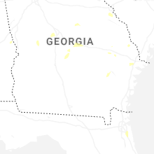
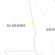
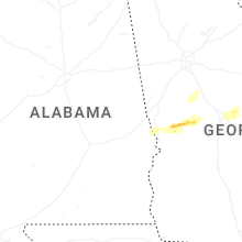

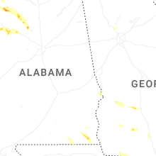


Connect with Interactive Hail Maps