

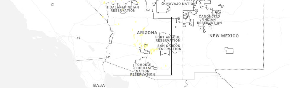
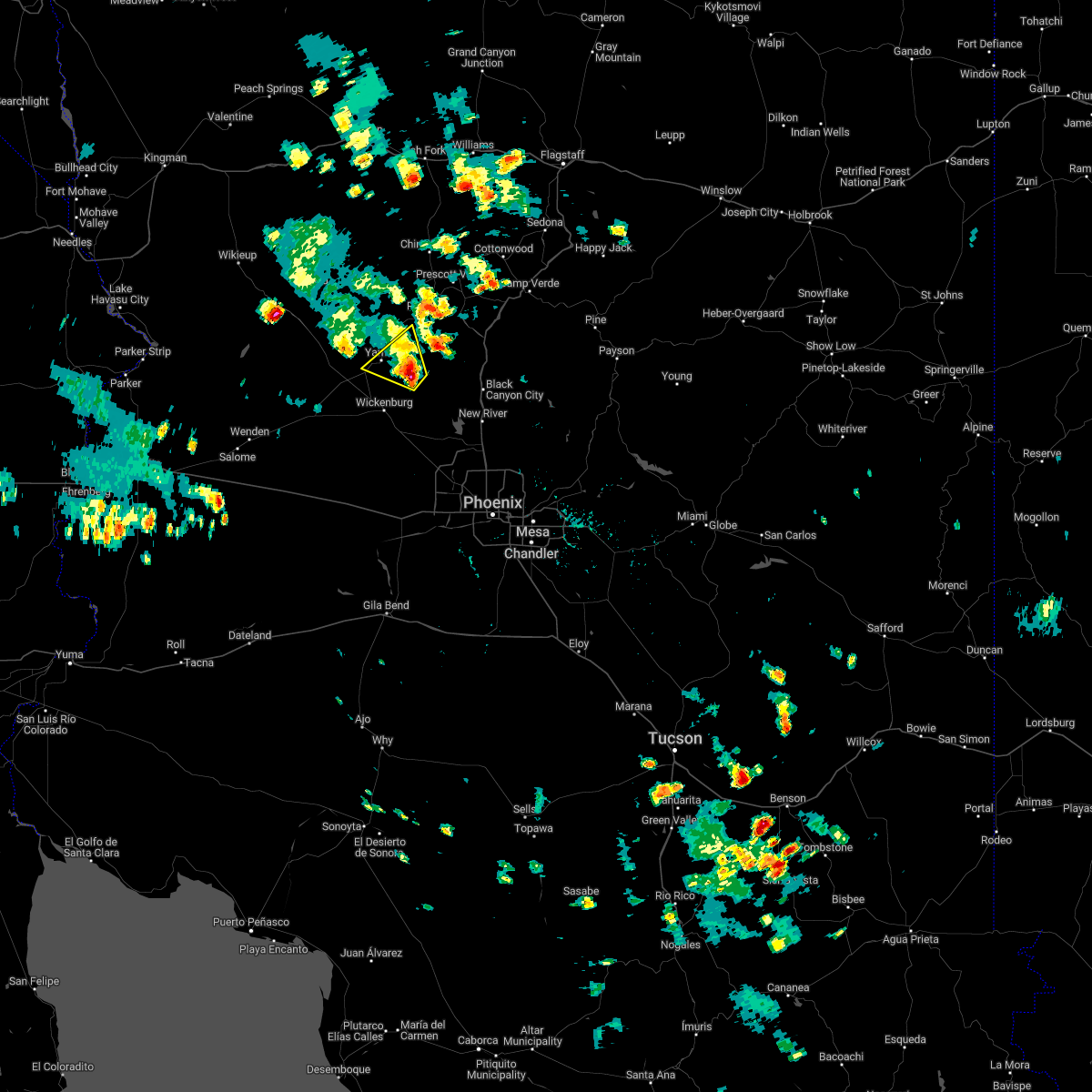
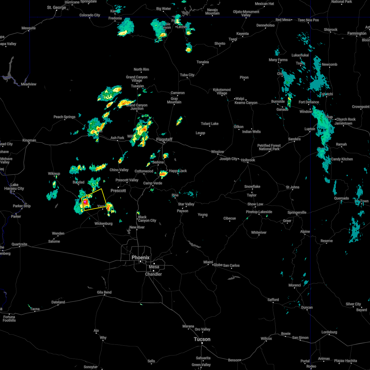
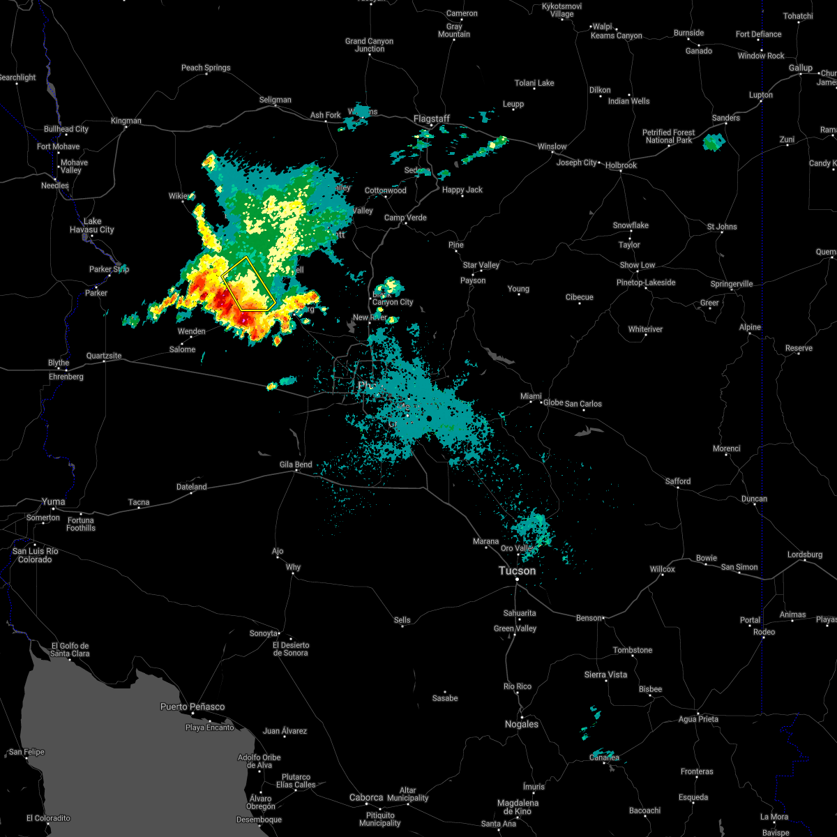
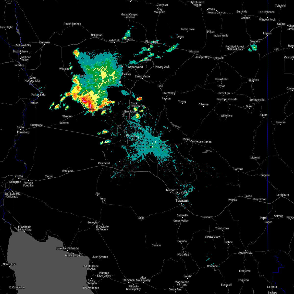
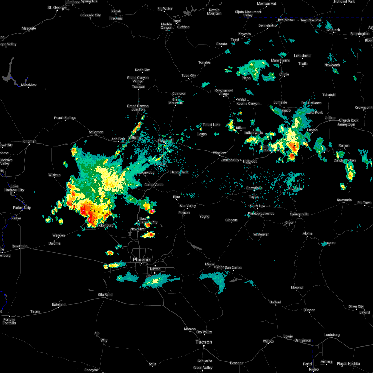
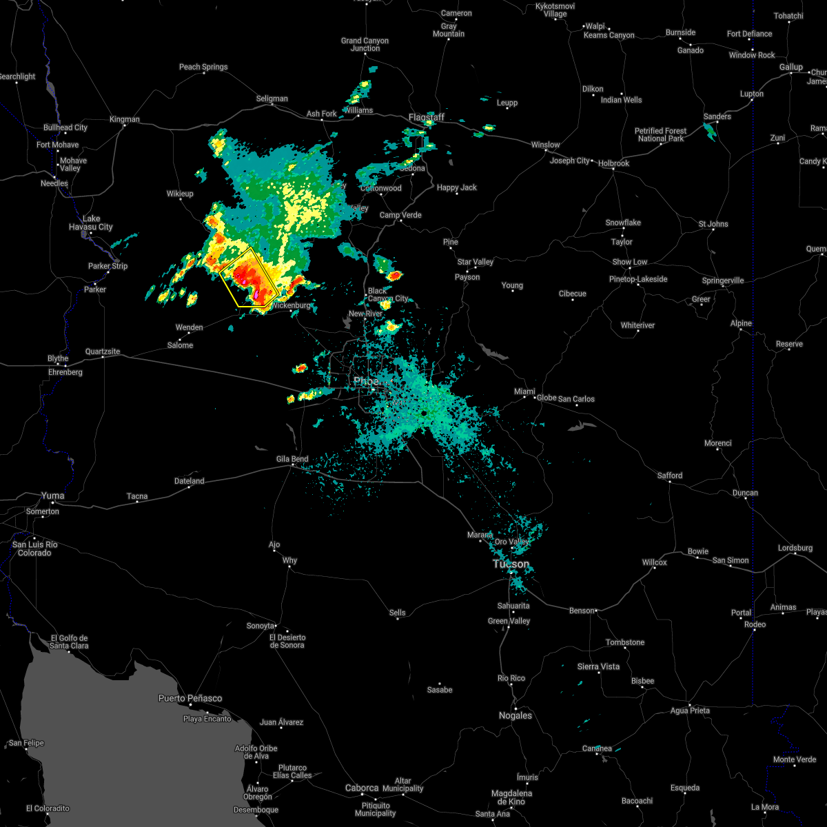
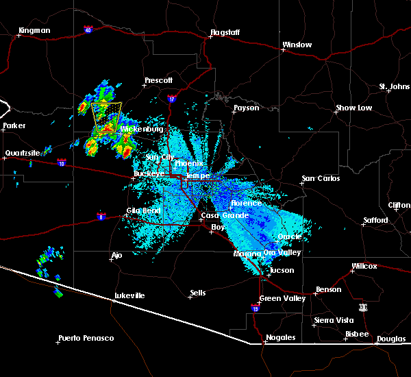
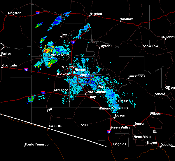
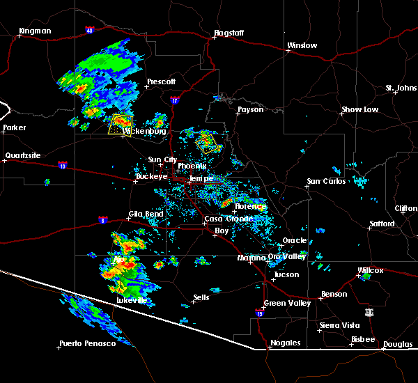
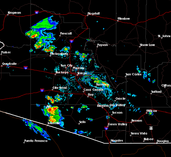
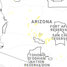
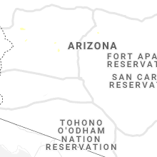
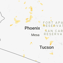
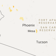
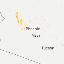
Hail Map for Congress, AZ
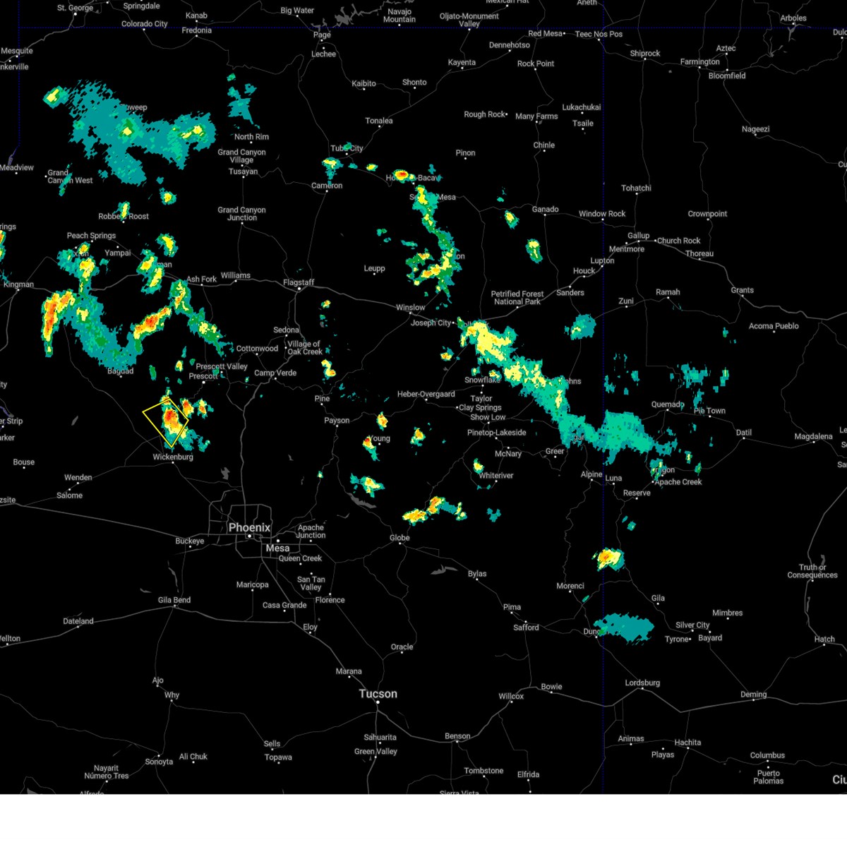
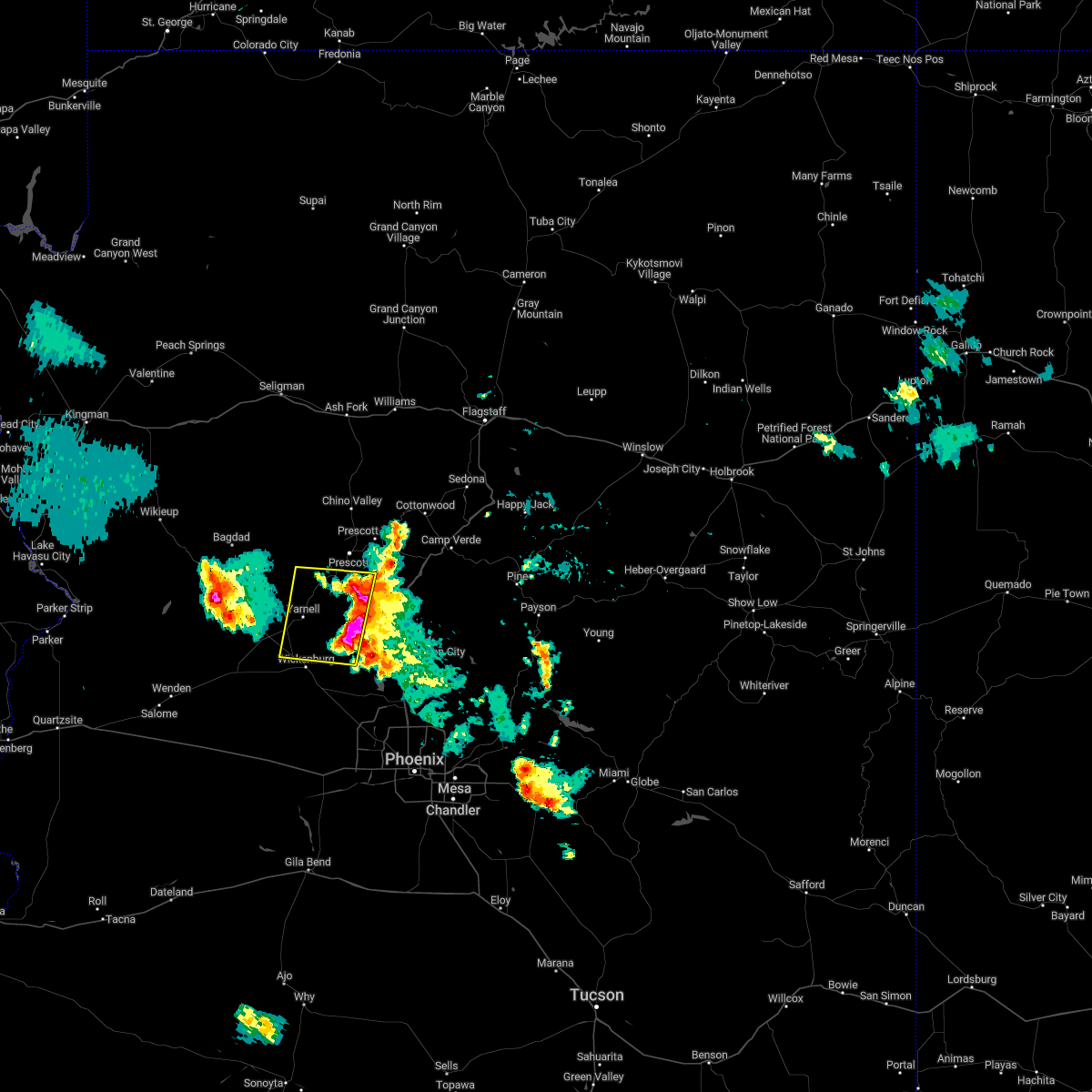
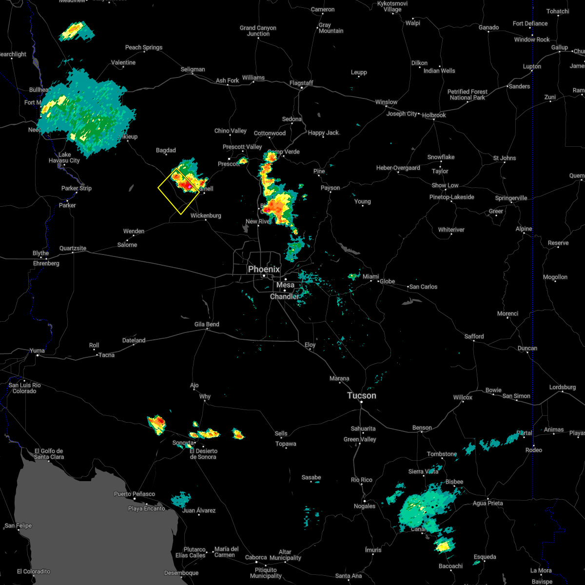
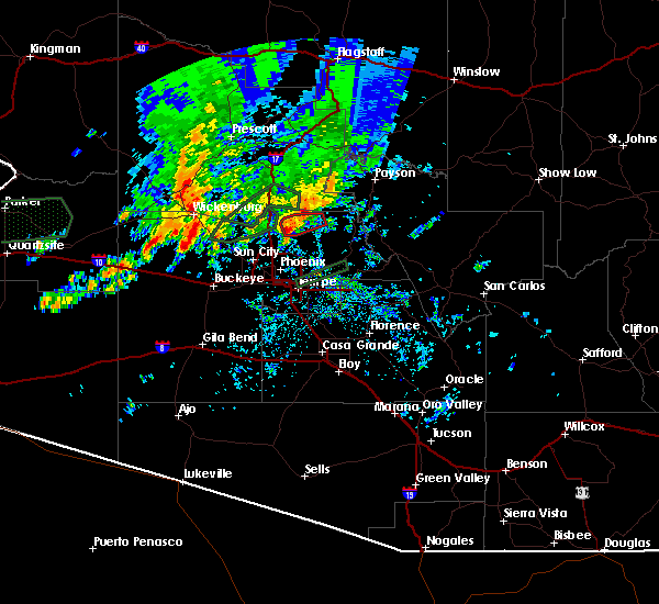
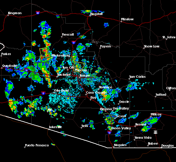
The Congress, AZ area has had 0 reports of on-the-ground hail by trained spotters, and has been under severe weather warnings 4 times during the past 12 months. Doppler radar has detected hail at or near Congress, AZ on 24 occasions, including 1 occasion during the past year.
| Name: | Congress, AZ |
| Where Located: | 67.5 miles NW of Phoenix, AZ |
| Map: | Google Map for Congress, AZ |
| Population: | 1975 |
| Housing Units: | 1226 |
| More Info: | Search Google for Congress, AZ |
0
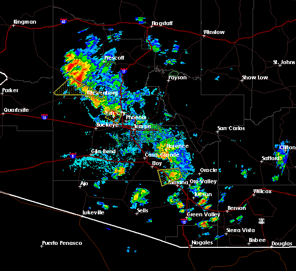
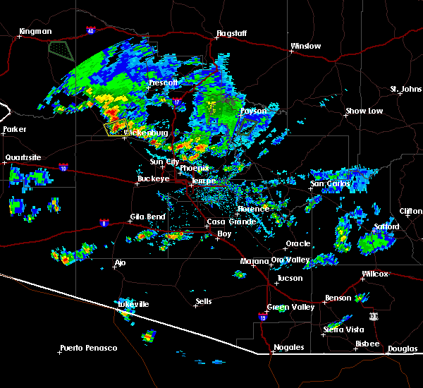
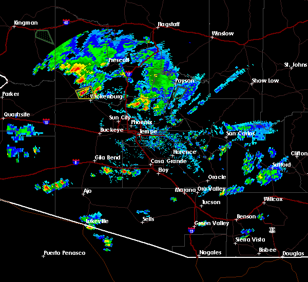
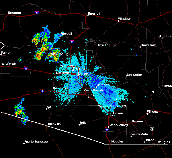
The Top Recent Hail Date for Congress, AZ is Friday, September 26, 2025 (24th out of 24)
Hail and Wind Damage Spotted near Congress, AZ
| Date / Time | Report Details |
|---|---|
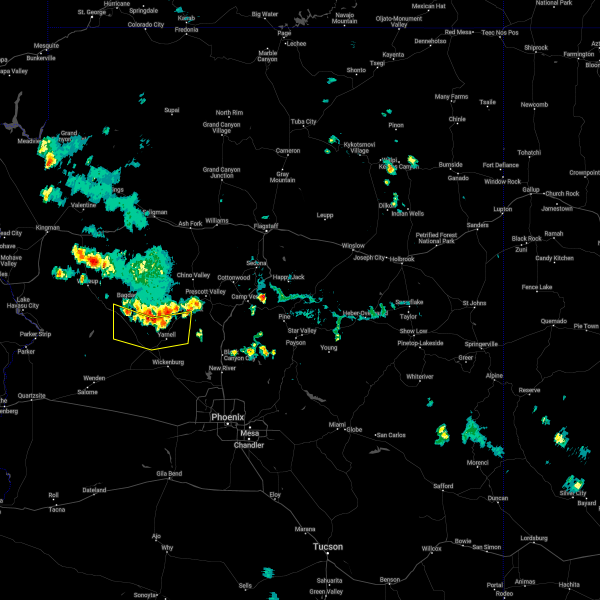
| 11/18/2025 4:51 PM MST | the severe thunderstorm warning has been cancelled and is no longer in effect |
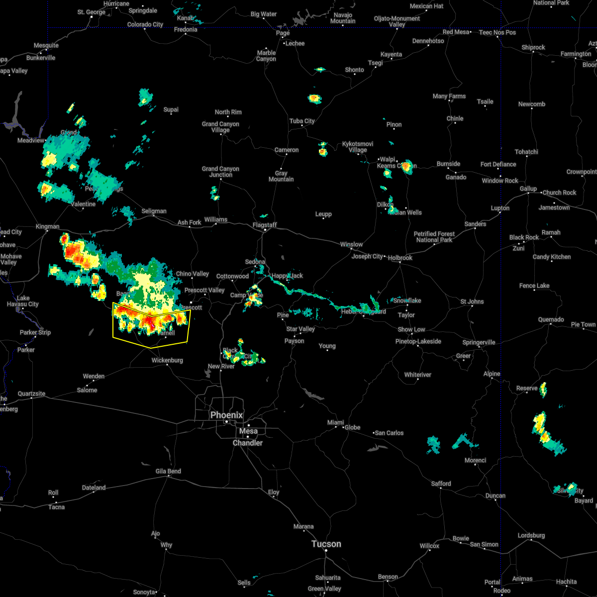
| 11/18/2025 4:28 PM MST | Svrfgz the national weather service in flagstaff has issued a * severe thunderstorm warning for, yavapai county in west central arizona, * until 500 pm mst. * at 428 pm mst, a severe thunderstorm was located 14 miles west of wickenburg ranch, or 51 miles southwest of prescott, moving northeast at 30 mph (radar indicated). Hazards include quarter size hail. damage to vehicles is expected |
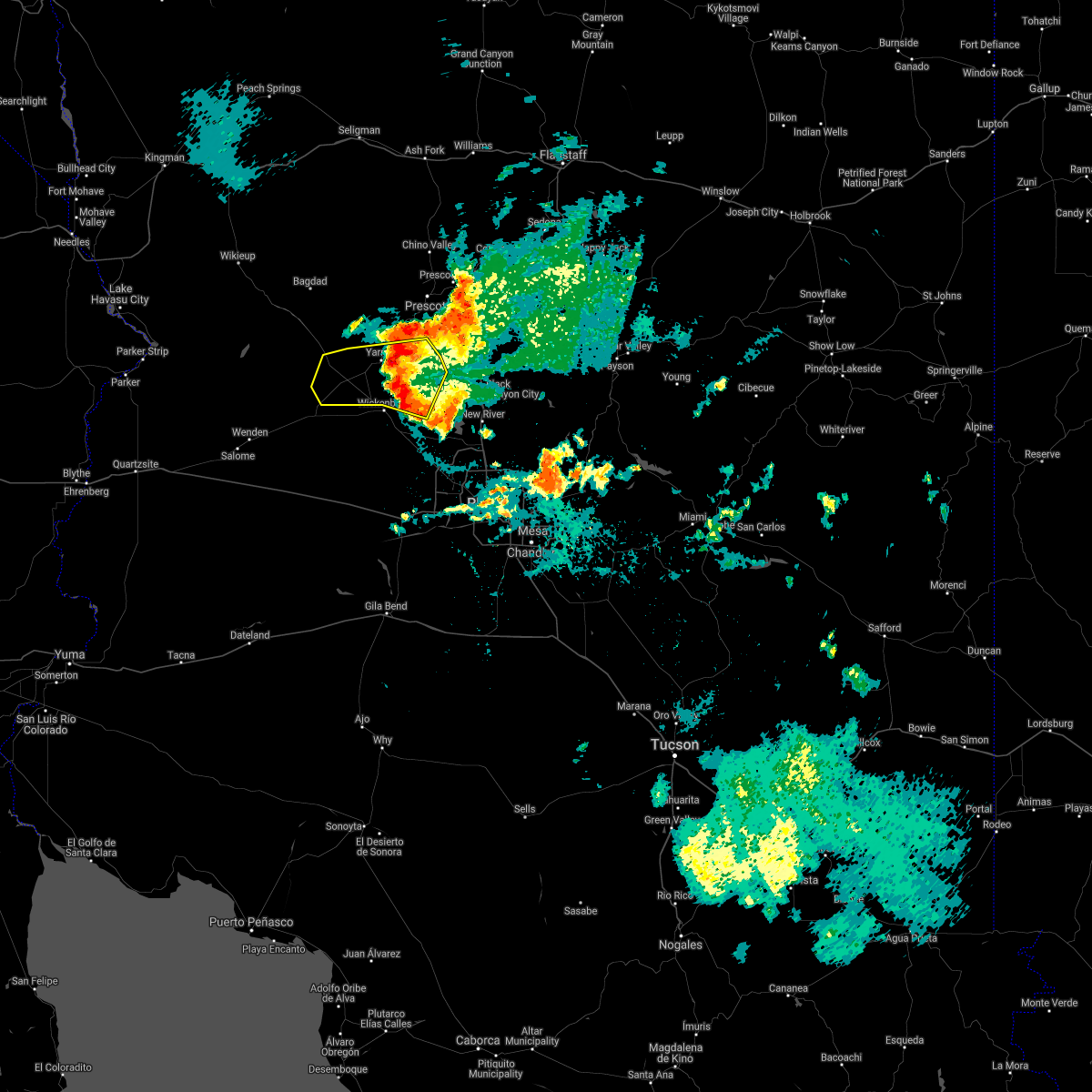
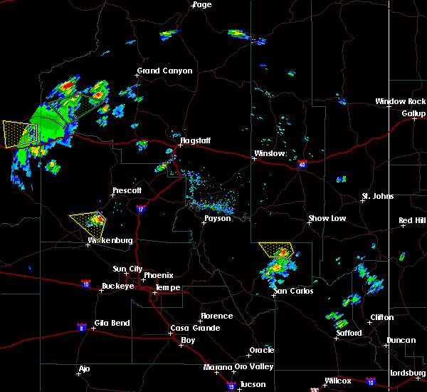
| 9/26/2025 10:22 AM MST | At 1022 am mst, a severe thunderstorm was located over yarnell, or 28 miles southwest of prescott, moving north at 30 mph (radar indicated). Hazards include 60 mph wind gusts and quarter size hail. Hail damage to vehicles is expected. expect wind damage to roofs, siding, and trees. locations impacted include, yarnell, peeples valley, weaver peak, congress, escapees north ranch, hawkins, wilhoit, stanton, granite mountain hotshots memorial state park, piedmont, hassayampa river canyon wilderness, walnut grove and date. This includes state route 89 between mile markers 268 and 288. |
| 9/26/2025 10:03 AM MST | Svrfgz the national weather service in flagstaff has issued a * severe thunderstorm warning for, yavapai county in west central arizona, * until 1045 am mst. * at 1003 am mst, a severe thunderstorm was located 6 miles northeast of wickenburg ranch, or 36 miles south of prescott, moving north at 25 mph (radar indicated). Hazards include ping pong ball size hail and 60 mph wind gusts. People and animals outdoors will be injured. expect hail damage to roofs, siding, windows, and vehicles. Expect wind damage to roofs, siding, and trees. |
| 7/22/2024 4:11 PM MST |
 Svrfgz the national weather service in flagstaff has issued a * severe thunderstorm warning for, yavapai county in west central arizona, * until 445 pm mst. * at 411 pm mst, a severe thunderstorm was located over peeples valley, or 23 miles southwest of prescott, and is nearly stationary (radar indicated). Hazards include 60 mph wind gusts and quarter size hail. Hail damage to vehicles is expected. Expect wind damage to roofs, siding, and trees. Svrfgz the national weather service in flagstaff has issued a * severe thunderstorm warning for, yavapai county in west central arizona, * until 445 pm mst. * at 411 pm mst, a severe thunderstorm was located over peeples valley, or 23 miles southwest of prescott, and is nearly stationary (radar indicated). Hazards include 60 mph wind gusts and quarter size hail. Hail damage to vehicles is expected. Expect wind damage to roofs, siding, and trees.
|
| 7/21/2024 4:01 PM MST | Mesonet station qsta3 stanto in yavapai county AZ, 8 miles W of Congress, AZ |
| 9/2/2022 6:15 PM MST | 68 mph gust measured at the stanton raws. time estimated from rada in yavapai county AZ, 8 miles W of Congress, AZ |
| 9/2/2022 5:49 PM MST |
 At 548 pm mst, severe thunderstorms were located along a line extending from near walker to 8 miles northwest of castle hot springs, moving west at 25 mph (radar indicated). Hazards include 60 mph wind gusts and quarter size hail. Hail damage to vehicles is expected. Expect wind damage to roofs, siding, and trees. At 548 pm mst, severe thunderstorms were located along a line extending from near walker to 8 miles northwest of castle hot springs, moving west at 25 mph (radar indicated). Hazards include 60 mph wind gusts and quarter size hail. Hail damage to vehicles is expected. Expect wind damage to roofs, siding, and trees.
|
| 9/2/2022 5:03 PM MST |
 At 502 pm mst, a severe thunderstorm was located 7 miles northwest of congress, or 21 miles northwest of wickenburg, moving southwest at 15 mph (radar indicated). Hazards include 60 mph wind gusts and quarter size hail. Hail damage to vehicles is expected. expect wind damage to roofs, siding, and trees. this severe thunderstorm will remain over mainly rural areas of yavapai county. this includes the following highways, state route 71 between mile markers 96 and 107. highway 93 between mile markers 163 and 184. hail threat, radar indicated max hail size, 1. 00 in wind threat, radar indicated max wind gust, 60 mph. At 502 pm mst, a severe thunderstorm was located 7 miles northwest of congress, or 21 miles northwest of wickenburg, moving southwest at 15 mph (radar indicated). Hazards include 60 mph wind gusts and quarter size hail. Hail damage to vehicles is expected. expect wind damage to roofs, siding, and trees. this severe thunderstorm will remain over mainly rural areas of yavapai county. this includes the following highways, state route 71 between mile markers 96 and 107. highway 93 between mile markers 163 and 184. hail threat, radar indicated max hail size, 1. 00 in wind threat, radar indicated max wind gust, 60 mph.
|
| 8/21/2022 7:24 PM MST | The severe thunderstorm warning for southern yavapai county will expire at 730 pm mst, the storm which prompted the warning north of wickenburg has weakened below severe limits, and has exited the warned area. therefore, the warning will be allowed to expire. however, gusty winds and heavy rain are still possible with additional thunderstorms in the area. continue to practice caution, and avoid traveling if possible. |
| 8/21/2022 6:45 PM MST | At 644 pm mst, a severe thunderstorm was located 8 miles northeast of wickenburg, moving southwest at 15 mph (radar indicated). Hazards include 60 mph wind gusts, penny size hail, and heavy rainfall. Expect damage to roofs, siding, and trees. this severe thunderstorm will remain over mainly rural areas of yavapai county. hail threat, radar indicated max hail size, 0. 75 in wind threat, radar indicated max wind gust, 60 mph. |
| 8/9/2022 1:55 PM MST |
 At 153 pm mst, a severe thunderstorm was located southeast of yarnell, near wagoner, or 16 miles northeast of wickenburg, moving northwest at 10 mph (radar indicated). Hazards include 60 mph wind gusts, up to penny size hail, and heavy rainfall. expect damage to roofs, siding, and trees At 153 pm mst, a severe thunderstorm was located southeast of yarnell, near wagoner, or 16 miles northeast of wickenburg, moving northwest at 10 mph (radar indicated). Hazards include 60 mph wind gusts, up to penny size hail, and heavy rainfall. expect damage to roofs, siding, and trees
|
| 6/28/2022 6:41 PM MST |
 At 641 pm mst, severe thunderstorms were located along a line extending from 16 miles south of bagdad to 6 miles northwest of congress to walnut grove, moving south at 20 mph (radar indicated). Hazards include 60 mph wind gusts and penny size hail. Expect damage to roofs, siding, and trees. locations impacted include, congress, wilhoit, walnut grove, kirkland, wagoner, yarnell, peeples valley and glen ilah. hail threat, radar indicated max hail size, 0. 75 in wind threat, radar indicated max wind gust, 60 mph. At 641 pm mst, severe thunderstorms were located along a line extending from 16 miles south of bagdad to 6 miles northwest of congress to walnut grove, moving south at 20 mph (radar indicated). Hazards include 60 mph wind gusts and penny size hail. Expect damage to roofs, siding, and trees. locations impacted include, congress, wilhoit, walnut grove, kirkland, wagoner, yarnell, peeples valley and glen ilah. hail threat, radar indicated max hail size, 0. 75 in wind threat, radar indicated max wind gust, 60 mph.
|
| 6/28/2022 6:12 PM MST |
 At 611 pm mst, severe thunderstorms were located along a line extending from 7 miles south of bagdad to 7 miles south of yava to wilhoit, moving south at 20 mph (radar indicated). Hazards include 60 mph wind gusts and penny size hail. expect damage to roofs, siding, and trees At 611 pm mst, severe thunderstorms were located along a line extending from 7 miles south of bagdad to 7 miles south of yava to wilhoit, moving south at 20 mph (radar indicated). Hazards include 60 mph wind gusts and penny size hail. expect damage to roofs, siding, and trees
|
| 9/1/2021 2:22 PM MST |
 The severe thunderstorm warning for yavapai county will expire at 230 pm mst, the storm which prompted the warning has weakened below severe limits, and no longer poses an immediate threat to life or property. therefore, the warning will be allowed to expire. however small hail, gusty winds and heavy rain are still possible with this thunderstorm. The severe thunderstorm warning for yavapai county will expire at 230 pm mst, the storm which prompted the warning has weakened below severe limits, and no longer poses an immediate threat to life or property. therefore, the warning will be allowed to expire. however small hail, gusty winds and heavy rain are still possible with this thunderstorm.
|
| 9/1/2021 1:59 PM MST |
 At 157 pm mst, a severe thunderstorm was located 12 miles southwest of yava, or 28 miles northwest of wickenburg, moving east at 35 mph (radar indicated). Hazards include 60 mph wind gusts and nickel size hail. expect damage to roofs, siding, and trees At 157 pm mst, a severe thunderstorm was located 12 miles southwest of yava, or 28 miles northwest of wickenburg, moving east at 35 mph (radar indicated). Hazards include 60 mph wind gusts and nickel size hail. expect damage to roofs, siding, and trees
|
| 8/16/2021 1:10 AM MST |
 The severe thunderstorm warning for yavapai county will expire at 115 am mst, the storms which prompted the warning have moved out of the area and a new warning has been issued. therefore, this warning will be allowed to expire. however gusty winds and heavy rain are still possible with these thunderstorms. The severe thunderstorm warning for yavapai county will expire at 115 am mst, the storms which prompted the warning have moved out of the area and a new warning has been issued. therefore, this warning will be allowed to expire. however gusty winds and heavy rain are still possible with these thunderstorms.
|
| 8/16/2021 12:54 AM MST |
 At 1254 am mst, severe thunderstorms were located along a line extending from 18 miles west of congress to 10 miles east of aguila, moving southwest at 20 mph (radar indicated). Hazards include 60 mph wind gusts and half dollar size hail. Hail damage to vehicles is expected. expect wind damage to roofs, siding, and trees. these severe thunderstorms will remain over mainly rural areas of yavapai county. hail threat, radar indicated max hail size, 1. 25 in wind threat, radar indicated max wind gust, 60 mph. At 1254 am mst, severe thunderstorms were located along a line extending from 18 miles west of congress to 10 miles east of aguila, moving southwest at 20 mph (radar indicated). Hazards include 60 mph wind gusts and half dollar size hail. Hail damage to vehicles is expected. expect wind damage to roofs, siding, and trees. these severe thunderstorms will remain over mainly rural areas of yavapai county. hail threat, radar indicated max hail size, 1. 25 in wind threat, radar indicated max wind gust, 60 mph.
|
| 8/16/2021 12:42 AM MST |
 The severe thunderstorm warning for yavapai county will expire at 1245 am mst, the storm which prompted the warning has moved out of the area. therefore, the warning will be allowed to expire. however gusty winds and heavy rain are still possible with this thunderstorm. The severe thunderstorm warning for yavapai county will expire at 1245 am mst, the storm which prompted the warning has moved out of the area. therefore, the warning will be allowed to expire. however gusty winds and heavy rain are still possible with this thunderstorm.
|
| 8/16/2021 12:40 AM MST |
 At 1240 am mst, severe thunderstorms were located along a line extending from 17 miles southwest of yava to 10 miles southwest of congress, moving southwest at 20 mph (radar indicated). Hazards include 60 mph wind gusts and quarter size hail. Hail damage to vehicles is expected. expect wind damage to roofs, siding, and trees. these severe thunderstorms will remain over mainly rural areas of yavapai county. hail threat, radar indicated max hail size, 1. 00 in wind threat, radar indicated max wind gust, 60 mph. At 1240 am mst, severe thunderstorms were located along a line extending from 17 miles southwest of yava to 10 miles southwest of congress, moving southwest at 20 mph (radar indicated). Hazards include 60 mph wind gusts and quarter size hail. Hail damage to vehicles is expected. expect wind damage to roofs, siding, and trees. these severe thunderstorms will remain over mainly rural areas of yavapai county. hail threat, radar indicated max hail size, 1. 00 in wind threat, radar indicated max wind gust, 60 mph.
|
| 8/16/2021 12:25 AM MST |
 At 1225 am mst, a severe thunderstorm was located 8 miles north of congress, or 22 miles north of wickenburg, moving southwest at 30 mph (radar indicated). Hazards include ping pong ball size hail and 60 mph wind gusts. People and animals outdoors will be injured. expect hail damage to roofs, siding, windows, and vehicles. expect wind damage to roofs, siding, and trees. locations impacted include, peeples valley, yarnell and glen ilah. hail threat, radar indicated max hail size, 1. 50 in wind threat, radar indicated max wind gust, 60 mph. At 1225 am mst, a severe thunderstorm was located 8 miles north of congress, or 22 miles north of wickenburg, moving southwest at 30 mph (radar indicated). Hazards include ping pong ball size hail and 60 mph wind gusts. People and animals outdoors will be injured. expect hail damage to roofs, siding, windows, and vehicles. expect wind damage to roofs, siding, and trees. locations impacted include, peeples valley, yarnell and glen ilah. hail threat, radar indicated max hail size, 1. 50 in wind threat, radar indicated max wind gust, 60 mph.
|
| 8/16/2021 12:08 AM MST |
 At 1207 am mst, a severe thunderstorm was located near kirkland, or 25 miles southwest of prescott valley, moving south at 20 mph (radar indicated). Hazards include ping pong ball size hail and 60 mph wind gusts. People and animals outdoors will be injured. expect hail damage to roofs, siding, windows, and vehicles. Expect wind damage to roofs, siding, and trees. At 1207 am mst, a severe thunderstorm was located near kirkland, or 25 miles southwest of prescott valley, moving south at 20 mph (radar indicated). Hazards include ping pong ball size hail and 60 mph wind gusts. People and animals outdoors will be injured. expect hail damage to roofs, siding, windows, and vehicles. Expect wind damage to roofs, siding, and trees.
|
| 8/13/2021 10:28 PM MST |
 The severe thunderstorm warning for yavapai county will expire at 1030 pm mst, the storm over southern yavapai county which prompted the warning has weakened. therefore, the warning will be allowed to expire. wind gusts to 30 to 40 mph will still be possible through 1130 pm mst. a severe thunderstorm watch remains in effect until 300 am mst for west central arizona. The severe thunderstorm warning for yavapai county will expire at 1030 pm mst, the storm over southern yavapai county which prompted the warning has weakened. therefore, the warning will be allowed to expire. wind gusts to 30 to 40 mph will still be possible through 1130 pm mst. a severe thunderstorm watch remains in effect until 300 am mst for west central arizona.
|
| 8/13/2021 10:00 PM MST | Mesonet station qsta3 stanton estimated winds 60 mp in yavapai county AZ, 8 miles W of Congress, AZ |
| 8/13/2021 9:43 PM MST |
 At 943 pm mst, a severe thunderstorm was located near yarnell, or 13 miles north of wickenburg, moving west at 40 mph (radar indicated). Hazards include 60 mph wind gusts. expect damage to roofs, siding, and trees At 943 pm mst, a severe thunderstorm was located near yarnell, or 13 miles north of wickenburg, moving west at 40 mph (radar indicated). Hazards include 60 mph wind gusts. expect damage to roofs, siding, and trees
|
| 9/23/2019 12:37 PM MST |
 At 1237 pm mst, a severe thunderstorm was located near wickenburg, moving east at 10 mph (radar indicated). Hazards include 70 mph wind gusts and half dollar size hail. Hail damage to vehicles is expected. expect considerable tree damage. wind damage is also likely to mobile homes, roofs, and outbuildings. This severe thunderstorm will remain over mainly rural areas of yavapai county. At 1237 pm mst, a severe thunderstorm was located near wickenburg, moving east at 10 mph (radar indicated). Hazards include 70 mph wind gusts and half dollar size hail. Hail damage to vehicles is expected. expect considerable tree damage. wind damage is also likely to mobile homes, roofs, and outbuildings. This severe thunderstorm will remain over mainly rural areas of yavapai county.
|
| 8/14/2018 8:01 PM MST | Wind gust of 61 mph measured at the raws site 4 miles south of yarnel in yavapai county AZ, 8 miles W of Congress, AZ |
| 8/11/2018 4:19 PM MST |
 At 419 pm mst, a severe thunderstorm was located near peeples valley, or 22 miles north of wickenburg, moving southwest at 15 mph (radar indicated). Hazards include 60 mph wind gusts and quarter size hail. Hail damage to vehicles is expected. Expect wind damage to roofs, siding, and trees. At 419 pm mst, a severe thunderstorm was located near peeples valley, or 22 miles north of wickenburg, moving southwest at 15 mph (radar indicated). Hazards include 60 mph wind gusts and quarter size hail. Hail damage to vehicles is expected. Expect wind damage to roofs, siding, and trees.
|
| 8/3/2017 3:51 PM MST |
 At 350 pm mst, a severe thunderstorm was located near congress, or 18 miles northwest of wickenburg, moving north at 5 mph (radar indicated). Hazards include 60 mph wind gusts and half dollar size hail. Hail damage to vehicles is expected. Expect wind damage to roofs, siding, and trees. At 350 pm mst, a severe thunderstorm was located near congress, or 18 miles northwest of wickenburg, moving north at 5 mph (radar indicated). Hazards include 60 mph wind gusts and half dollar size hail. Hail damage to vehicles is expected. Expect wind damage to roofs, siding, and trees.
|
| 7/15/2017 5:34 PM MST |
 At 533 pm mst, severe thunderstorms were located along a line extending from 9 miles northwest of congress to 9 miles northeast of morristown, moving southwest at 25 mph (radar indicated). Hazards include 60 mph wind gusts and quarter size hail. Hail damage to vehicles is expected. Expect wind damage to roofs, siding, and trees. At 533 pm mst, severe thunderstorms were located along a line extending from 9 miles northwest of congress to 9 miles northeast of morristown, moving southwest at 25 mph (radar indicated). Hazards include 60 mph wind gusts and quarter size hail. Hail damage to vehicles is expected. Expect wind damage to roofs, siding, and trees.
|
| 8/20/2016 5:51 PM MST |
 At 549 pm mst, doppler radar indicated a severe thunderstorm capable of producing quarter size hail and damaging winds in excess of 60 mph. this storm was located near congress, or 9 miles north of wickenburg, moving east at 10 mph. locations impacted include, congress. this includes highway 89 south of congress to the highway 93 intersection. At 549 pm mst, doppler radar indicated a severe thunderstorm capable of producing quarter size hail and damaging winds in excess of 60 mph. this storm was located near congress, or 9 miles north of wickenburg, moving east at 10 mph. locations impacted include, congress. this includes highway 89 south of congress to the highway 93 intersection.
|
| 8/20/2016 5:33 PM MST |
 At 533 pm mst, doppler radar indicated a severe thunderstorm capable of producing quarter size hail and damaging winds in excess of 60 mph. this storm was located near congress, or 10 miles northwest of wickenburg, and moving east at 10 mph. At 533 pm mst, doppler radar indicated a severe thunderstorm capable of producing quarter size hail and damaging winds in excess of 60 mph. this storm was located near congress, or 10 miles northwest of wickenburg, and moving east at 10 mph.
|
| 7/25/2016 6:01 PM MST | Thunderstorm wind gust reported by stanton raw in yavapai county AZ, 3.2 miles WNW of Congress, AZ |
| 10/19/2015 10:03 PM MST |
 At 1002 pm mst, doppler radar indicated a severe thunderstorm capable of producing large hail up to ping pong ball size and damaging winds in excess of 60 mph. this storm was located 9 miles northwest of congress, or 22 miles northwest of wickenburg, and moving north at 30 mph. * this severe thunderstorm will remain over mainly rural areas of southwestern yavapai county. this includes the following highways, state route 71 between mile markers 103 and 108. highway 93 between mile markers 157 and 183. state route 96 between mile markers 13 and 21. At 1002 pm mst, doppler radar indicated a severe thunderstorm capable of producing large hail up to ping pong ball size and damaging winds in excess of 60 mph. this storm was located 9 miles northwest of congress, or 22 miles northwest of wickenburg, and moving north at 30 mph. * this severe thunderstorm will remain over mainly rural areas of southwestern yavapai county. this includes the following highways, state route 71 between mile markers 103 and 108. highway 93 between mile markers 157 and 183. state route 96 between mile markers 13 and 21.
|
| 10/19/2015 9:36 PM MST |
 At 936 pm mst, doppler radar indicated a severe thunderstorm capable of producing large hail up to ping pong ball size and damaging winds in excess of 60 mph. this storm was located near congress, or 12 miles northwest of wickenburg, and moving north at 55 mph. At 936 pm mst, doppler radar indicated a severe thunderstorm capable of producing large hail up to ping pong ball size and damaging winds in excess of 60 mph. this storm was located near congress, or 12 miles northwest of wickenburg, and moving north at 55 mph.
|
| 10/19/2015 6:38 PM MST |
 At 638 pm mst, doppler radar indicated a severe thunderstorm capable of producing half dollar size hail and damaging winds in excess of 60 mph. this storm was located over congress, or 16 miles north of wickenburg, and moving north at 30 mph. At 638 pm mst, doppler radar indicated a severe thunderstorm capable of producing half dollar size hail and damaging winds in excess of 60 mph. this storm was located over congress, or 16 miles north of wickenburg, and moving north at 30 mph.
|
| 9/12/2015 5:05 PM MST |
 The severe thunderstorm warning for south central yavapai county will expire at 515 pm mst, the storm which prompted the warning has weakened below severe limits, and no longer poses an immediate threat to life or property. therefore the warning will be allowed to expire. however heavy rain is still possible with this thunderstorm. The severe thunderstorm warning for south central yavapai county will expire at 515 pm mst, the storm which prompted the warning has weakened below severe limits, and no longer poses an immediate threat to life or property. therefore the warning will be allowed to expire. however heavy rain is still possible with this thunderstorm.
|
| 9/12/2015 4:51 PM MST |
 At 450 pm mst, doppler radar indicated a severe thunderstorm capable of producing damaging winds in excess of 60 mph. this storm was located 8 miles southeast of yarnell, or 11 miles north of wickenburg, and moving southwest at 5 mph. penny size hail may also accompany the damaging winds. At 450 pm mst, doppler radar indicated a severe thunderstorm capable of producing damaging winds in excess of 60 mph. this storm was located 8 miles southeast of yarnell, or 11 miles north of wickenburg, and moving southwest at 5 mph. penny size hail may also accompany the damaging winds.
|
| 6/29/2015 7:45 PM MST |
 At 740 pm mst, weather spotters just north of wickenburg reported wind gusts to 72 mph that produced property damage. doppler radar continued to indicate a cluster of severe thunderstorms capable of producing nickel size hail and destructive winds in excess of 70 mph. these storms were located in far south-central yavapai county, roughly from near wickenburg and points west through east along the southern yavapai county line. these storms were moving west-southwest at 10 to 15 mph. locations impacted include, castle hot springs, north wickenburg, wickenburg, lake pleasant. At 740 pm mst, weather spotters just north of wickenburg reported wind gusts to 72 mph that produced property damage. doppler radar continued to indicate a cluster of severe thunderstorms capable of producing nickel size hail and destructive winds in excess of 70 mph. these storms were located in far south-central yavapai county, roughly from near wickenburg and points west through east along the southern yavapai county line. these storms were moving west-southwest at 10 to 15 mph. locations impacted include, castle hot springs, north wickenburg, wickenburg, lake pleasant.
|
| 6/29/2015 7:30 PM MST |
 At 727 pm mst, doppler radar indicated a cluster of severe thunderstorms capable of producing quarter size hail and destructive winds in excess of 70 mph. these storms were located in far south-central yavapai county, roughly from near wickenburg and extending north and west to just west of black canyon city. these storms were moving west at 10 to 15 mph. At 727 pm mst, doppler radar indicated a cluster of severe thunderstorms capable of producing quarter size hail and destructive winds in excess of 70 mph. these storms were located in far south-central yavapai county, roughly from near wickenburg and extending north and west to just west of black canyon city. these storms were moving west at 10 to 15 mph.
|
| 6/29/2015 6:59 PM MST |
 At 657 pm mst, doppler radar indicated three severe thunderstorms each capable of producing destructive winds in excess of 70 mph. these storms were located north and west of wickenburg and were moving west west at 20 mph. penny size hail may also accompany the damaging winds. At 657 pm mst, doppler radar indicated three severe thunderstorms each capable of producing destructive winds in excess of 70 mph. these storms were located north and west of wickenburg and were moving west west at 20 mph. penny size hail may also accompany the damaging winds.
|
| 8/29/2013 5:45 PM MST | Delayed report...numerous trees up to 14 in diameter downe in yavapai county AZ, 5.6 miles NNW of Congress, AZ |
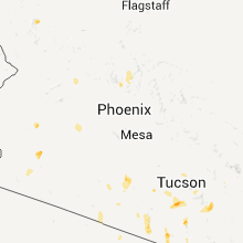
Hail Maps for Congress, AZ


Connect with Interactive Hail Maps