

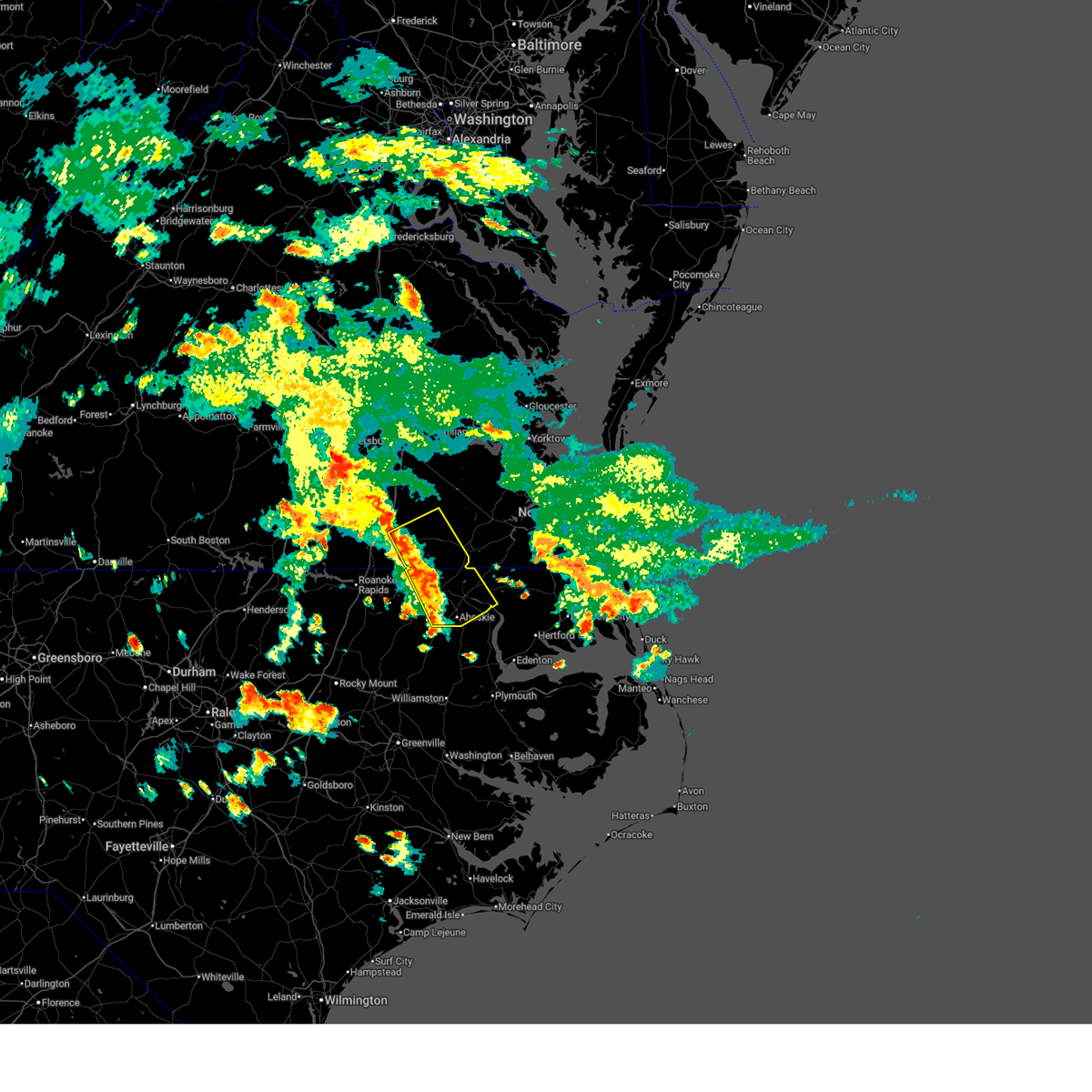
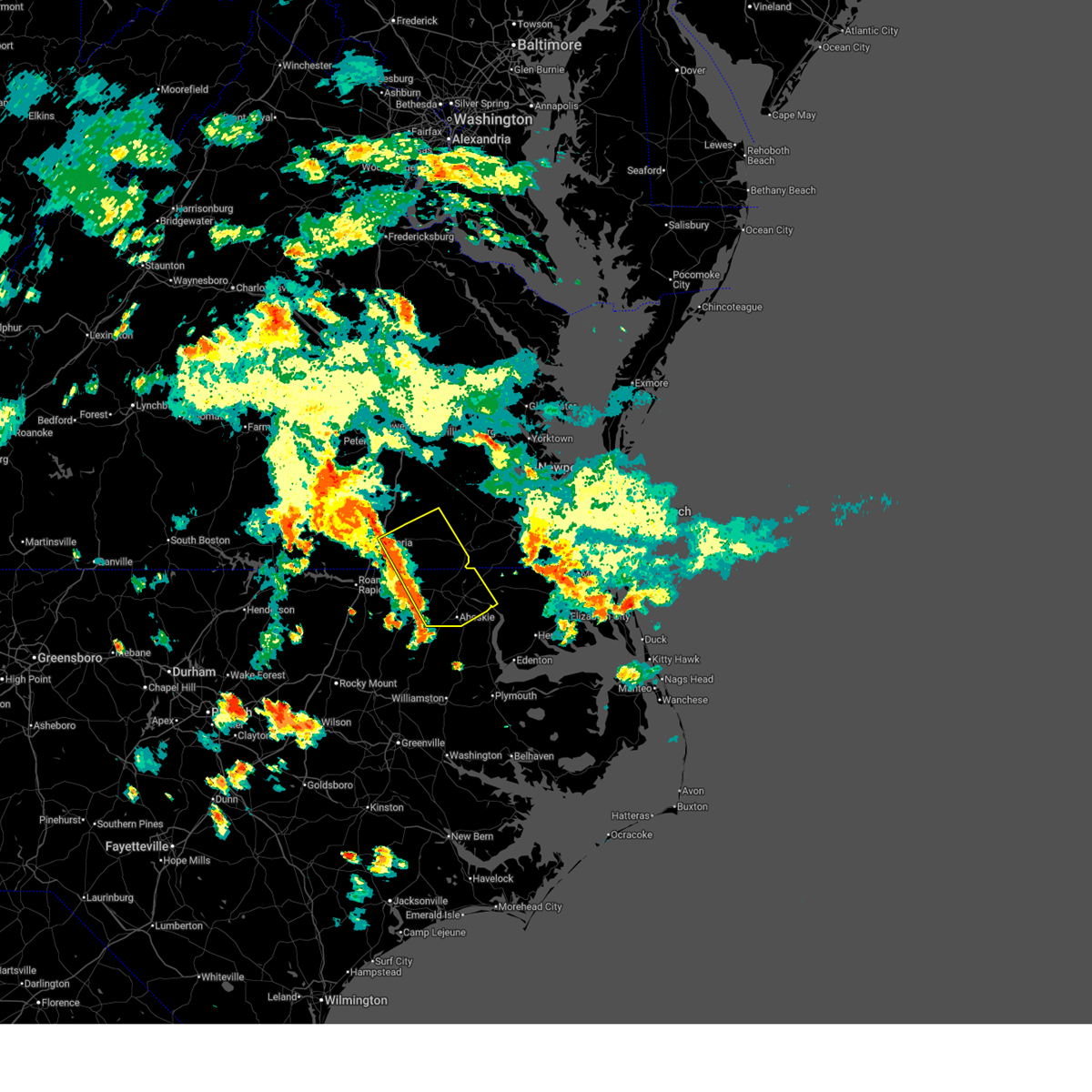
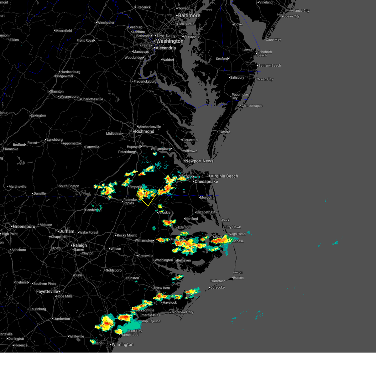
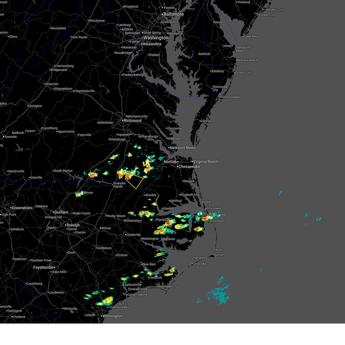
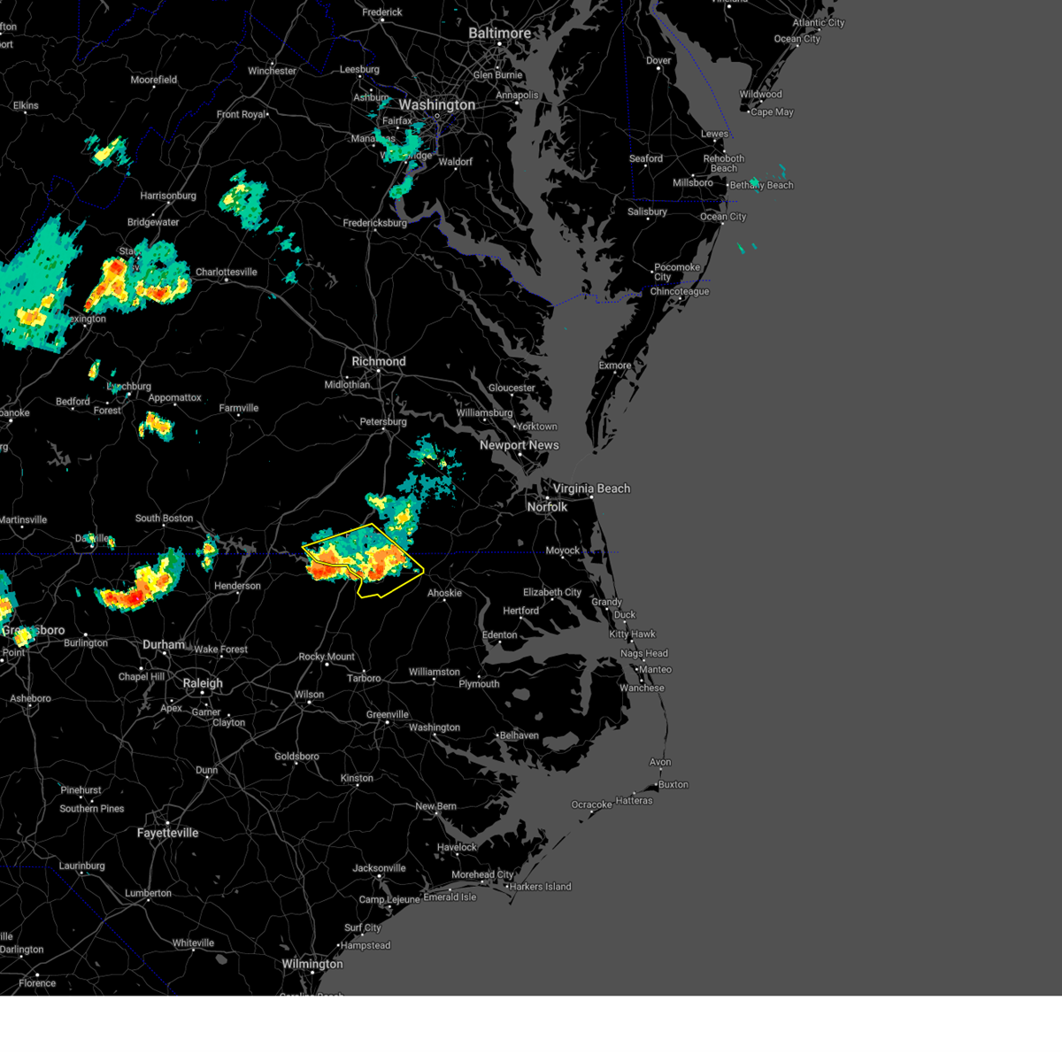
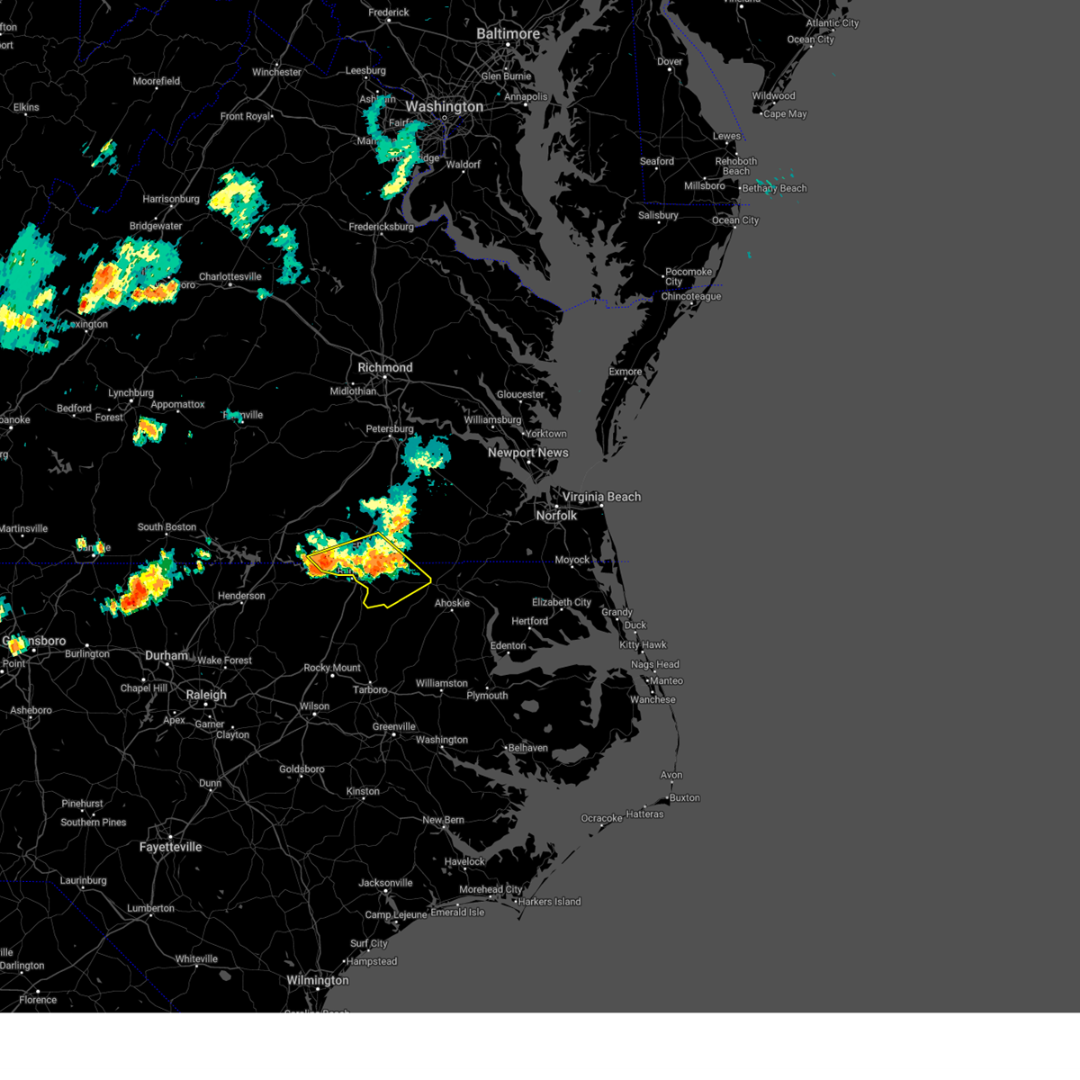
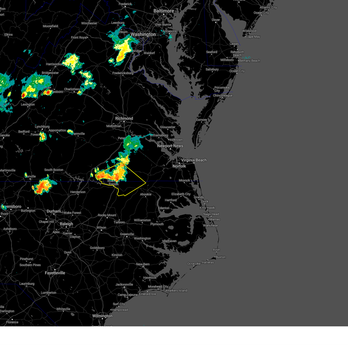
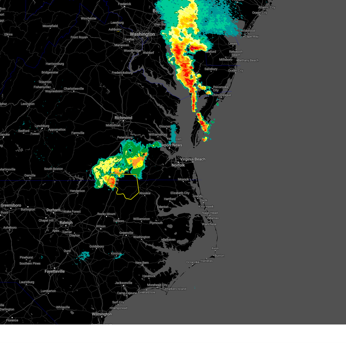
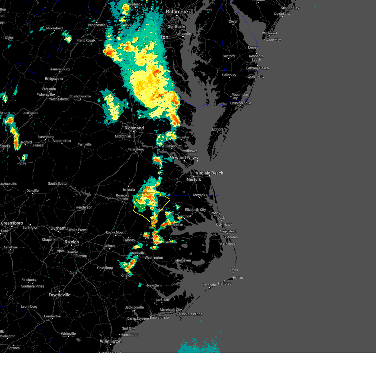
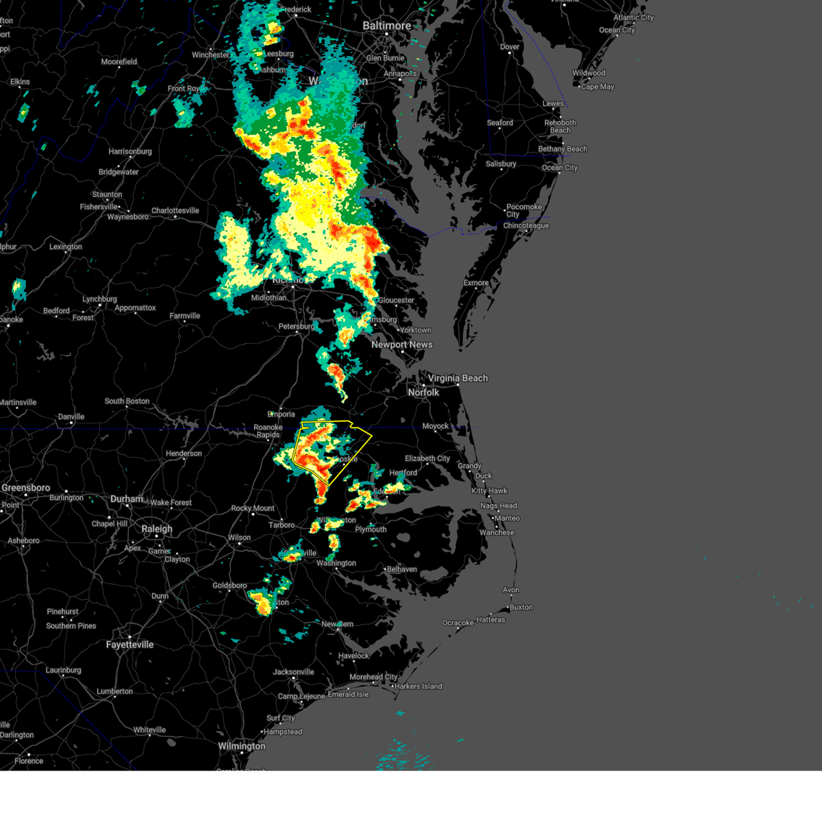
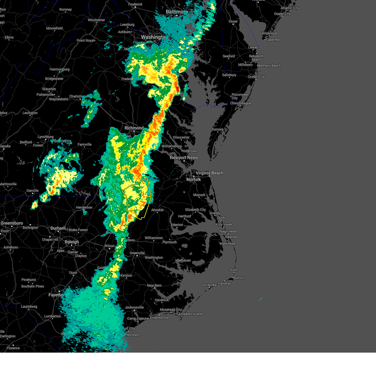
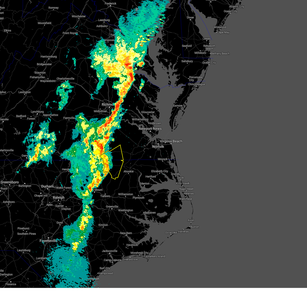
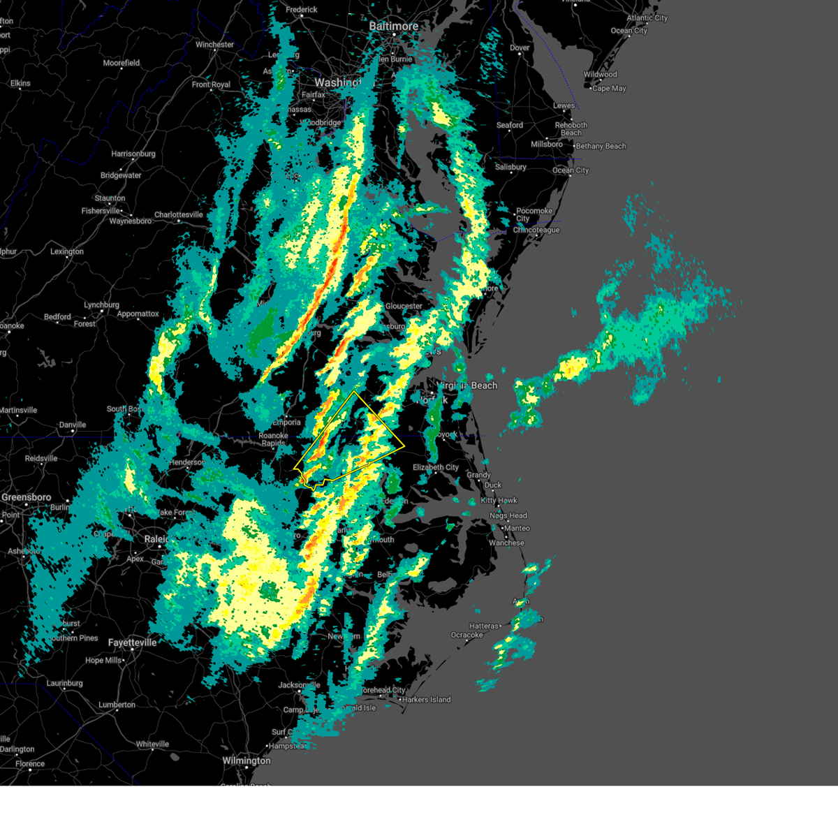
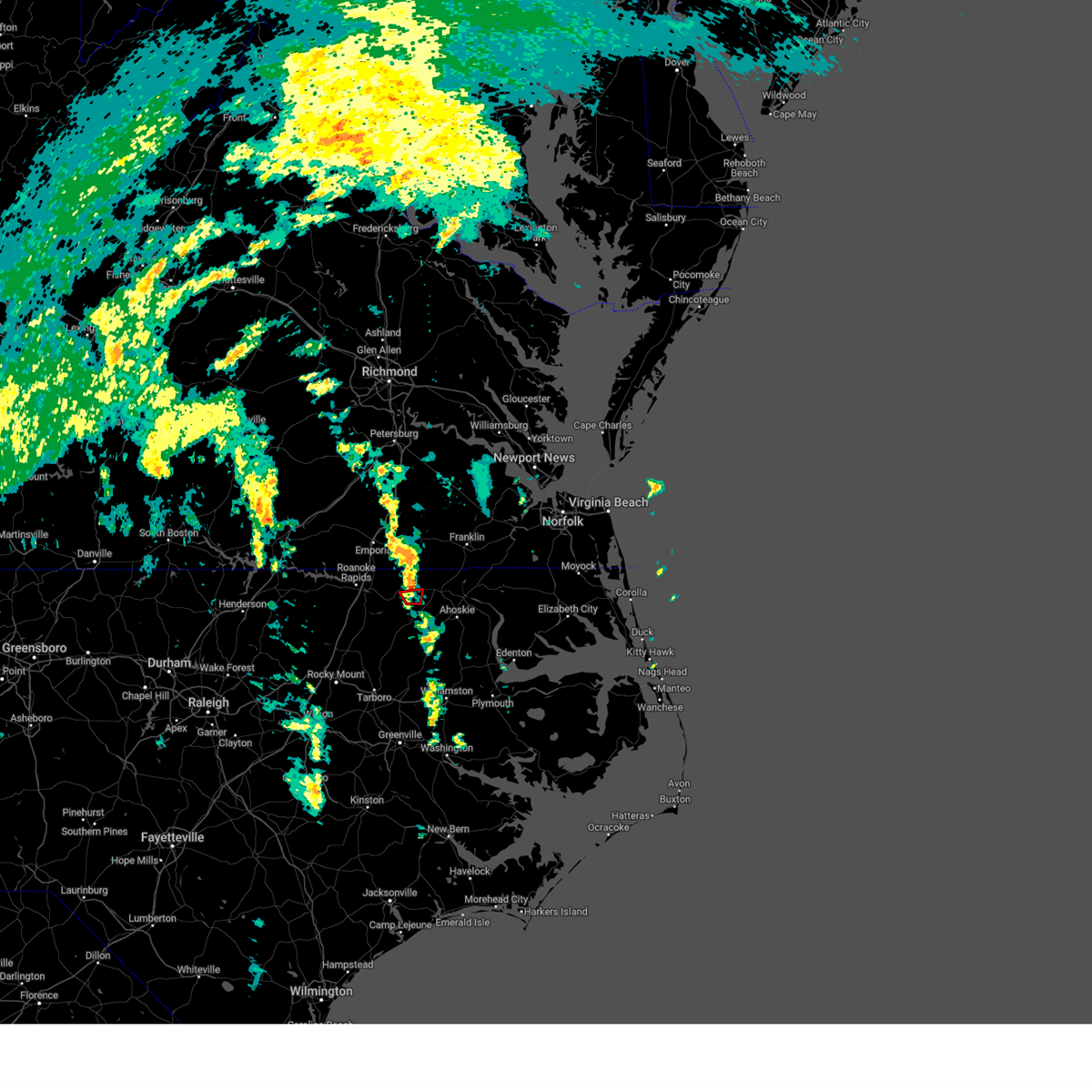
Hail Map for Conway, NC
The Conway, NC area has had 1 report of on-the-ground hail by trained spotters, and has been under severe weather warnings 35 times during the past 12 months. Doppler radar has detected hail at or near Conway, NC on 47 occasions, including 2 occasions during the past year.
| Name: | Conway, NC |
| Where Located: | 68.5 miles WSW of Virginia Beach, VA |
| Map: | Google Map for Conway, NC |
| Population: | 836 |
| Housing Units: | 405 |
| More Info: | Search Google for Conway, NC |
4
The Top Recent Hail Date for Conway, NC is Thursday, June 19, 2025 (8th out of 47)
Hail and Wind Damage Spotted near Conway, NC
| Date / Time | Report Details |
|---|---|
| 6/19/2025 8:52 PM EDT |
 At 852 pm edt, severe thunderstorms were located along a line extending from 8 miles northwest of courtland to near hunterdale to near como to near chowan university, moving east at 50 mph (radar indicated). Hazards include 60 mph wind gusts and nickel size hail. Expect damage to trees and powerlines. these severe storms will be near, franklin, murfreesboro, courtland, chowan university, suffolk, como, hunterdale, and sedley around 855 pm edt. winton and carrsville around 900 pm edt. holland, gates, cofield, roduco, and whaleyville around 905 pm edt. windsor and gatesville around 910 pm edt. downtown suffolk, kings fork, and zuni around 915 pm edt. corapeake around 920 pm edt. sunbury and isle of wight around 925 pm edt. Other locations impacted by these severe thunderstorms include eagletown, vicksville, milwaukee, tunis, earleys, menola, newsome store, savage, chowan beach, and topsy. At 852 pm edt, severe thunderstorms were located along a line extending from 8 miles northwest of courtland to near hunterdale to near como to near chowan university, moving east at 50 mph (radar indicated). Hazards include 60 mph wind gusts and nickel size hail. Expect damage to trees and powerlines. these severe storms will be near, franklin, murfreesboro, courtland, chowan university, suffolk, como, hunterdale, and sedley around 855 pm edt. winton and carrsville around 900 pm edt. holland, gates, cofield, roduco, and whaleyville around 905 pm edt. windsor and gatesville around 910 pm edt. downtown suffolk, kings fork, and zuni around 915 pm edt. corapeake around 920 pm edt. sunbury and isle of wight around 925 pm edt. Other locations impacted by these severe thunderstorms include eagletown, vicksville, milwaukee, tunis, earleys, menola, newsome store, savage, chowan beach, and topsy.
|
| 6/19/2025 8:42 PM EDT | Tree down along deberrys mill r in northampton county NC, 2.9 miles SE of Conway, NC |
| 6/19/2025 8:39 PM EDT |
 Svrakq the national weather service in wakefield has issued a * severe thunderstorm warning for, eastern northampton county in northeastern north carolina, hertford county in northeastern north carolina, gates county in northeastern north carolina, the city of franklin in southeastern virginia, southampton county in southeastern virginia, isle of wight county in southeastern virginia, the city of suffolk in southeastern virginia, * until 930 pm edt. * at 839 pm edt, severe thunderstorms were located along a line extending from near green plain to near boykins to near conway to 6 miles northwest of rich square, moving east at 50 mph (radar indicated). Hazards include 60 mph wind gusts and quarter size hail. Minor damage to vehicles is possible. expect wind damage to trees and powerlines. severe thunderstorms will be near, murfreesboro, chowan university, conway, woodland, newsoms, and como around 845 pm edt. courtland and suffolk around 850 pm edt. franklin and hunterdale around 855 pm edt. winton and sedley around 900 pm edt. holland, gates, cofield, carrsville, and roduco around 905 pm edt. whaleyville around 910 pm edt. windsor, gatesville, and zuni around 915 pm edt. downtown suffolk, kings fork, and corapeake around 920 pm edt. Other locations impacted by these severe thunderstorms include eagletown, vicksville, milwaukee, tunis, pons, earleys, longview, menola, newsome store, and savage. Svrakq the national weather service in wakefield has issued a * severe thunderstorm warning for, eastern northampton county in northeastern north carolina, hertford county in northeastern north carolina, gates county in northeastern north carolina, the city of franklin in southeastern virginia, southampton county in southeastern virginia, isle of wight county in southeastern virginia, the city of suffolk in southeastern virginia, * until 930 pm edt. * at 839 pm edt, severe thunderstorms were located along a line extending from near green plain to near boykins to near conway to 6 miles northwest of rich square, moving east at 50 mph (radar indicated). Hazards include 60 mph wind gusts and quarter size hail. Minor damage to vehicles is possible. expect wind damage to trees and powerlines. severe thunderstorms will be near, murfreesboro, chowan university, conway, woodland, newsoms, and como around 845 pm edt. courtland and suffolk around 850 pm edt. franklin and hunterdale around 855 pm edt. winton and sedley around 900 pm edt. holland, gates, cofield, carrsville, and roduco around 905 pm edt. whaleyville around 910 pm edt. windsor, gatesville, and zuni around 915 pm edt. downtown suffolk, kings fork, and corapeake around 920 pm edt. Other locations impacted by these severe thunderstorms include eagletown, vicksville, milwaukee, tunis, pons, earleys, longview, menola, newsome store, and savage.
|
| 6/19/2025 8:22 PM EDT |
 Svrakq the national weather service in wakefield has issued a * severe thunderstorm warning for, northampton county in northeastern north carolina, northwestern hertford county in northeastern north carolina, south central southampton county in southeastern virginia, * until 845 pm edt. * at 822 pm edt, a severe thunderstorm was located near garysburg, moving east at 40 mph (radar indicated). Hazards include 60 mph wind gusts. Expect damage to trees and powerlines. this severe thunderstorm will be near, conway around 840 pm edt. woodland around 845 pm edt. Other locations impacted by this severe thunderstorm include mud castle, milwaukee, tunis, pendleton, potecasi, menola, lasker, mapleton, jackson, and riddicksville. Svrakq the national weather service in wakefield has issued a * severe thunderstorm warning for, northampton county in northeastern north carolina, northwestern hertford county in northeastern north carolina, south central southampton county in southeastern virginia, * until 845 pm edt. * at 822 pm edt, a severe thunderstorm was located near garysburg, moving east at 40 mph (radar indicated). Hazards include 60 mph wind gusts. Expect damage to trees and powerlines. this severe thunderstorm will be near, conway around 840 pm edt. woodland around 845 pm edt. Other locations impacted by this severe thunderstorm include mud castle, milwaukee, tunis, pendleton, potecasi, menola, lasker, mapleton, jackson, and riddicksville.
|
| 6/15/2025 6:45 PM EDT |
 At 645 pm edt, severe thunderstorms were located along a line extending from 8 miles east of green plain to near ahoskie, moving east at 30 mph (radar indicated). Hazards include 60 mph wind gusts. Expect damage to trees and powerlines. these severe storms will be near, ahoskie, murfreesboro, boykins, chowan university, winton, cofield, newsoms, and como around 650 pm edt. courtland around 705 pm edt. Other locations impacted by these severe thunderstorms include milwaukee, tunis, adams grove, earleys, menola, chowan beach, topsy, mapleton, dort, and worrell. At 645 pm edt, severe thunderstorms were located along a line extending from 8 miles east of green plain to near ahoskie, moving east at 30 mph (radar indicated). Hazards include 60 mph wind gusts. Expect damage to trees and powerlines. these severe storms will be near, ahoskie, murfreesboro, boykins, chowan university, winton, cofield, newsoms, and como around 650 pm edt. courtland around 705 pm edt. Other locations impacted by these severe thunderstorms include milwaukee, tunis, adams grove, earleys, menola, chowan beach, topsy, mapleton, dort, and worrell.
|
| 6/15/2025 6:45 PM EDT |
 the severe thunderstorm warning has been cancelled and is no longer in effect the severe thunderstorm warning has been cancelled and is no longer in effect
|
| 6/15/2025 6:29 PM EDT |
 Svrakq the national weather service in wakefield has issued a * severe thunderstorm warning for, northeastern northampton county in northeastern north carolina, hertford county in northeastern north carolina, western gates county in northeastern north carolina, southeastern greensville county in southeastern virginia, southampton county in southeastern virginia, south central sussex county in southeastern virginia, * until 700 pm edt. * at 629 pm edt, severe thunderstorms were located along a line extending from near green plain to near aulander, moving northeast at 30 mph (radar indicated). Hazards include 60 mph wind gusts. Expect damage to trees and powerlines. severe thunderstorms will be near, ahoskie, murfreesboro, boykins, chowan university, and conway around 635 pm edt. newsoms around 650 pm edt. Other locations impacted by these severe thunderstorms include milwaukee, tunis, adams grove, grizzard, earleys, menola, chowan beach, topsy, mapleton, and bryants corner. Svrakq the national weather service in wakefield has issued a * severe thunderstorm warning for, northeastern northampton county in northeastern north carolina, hertford county in northeastern north carolina, western gates county in northeastern north carolina, southeastern greensville county in southeastern virginia, southampton county in southeastern virginia, south central sussex county in southeastern virginia, * until 700 pm edt. * at 629 pm edt, severe thunderstorms were located along a line extending from near green plain to near aulander, moving northeast at 30 mph (radar indicated). Hazards include 60 mph wind gusts. Expect damage to trees and powerlines. severe thunderstorms will be near, ahoskie, murfreesboro, boykins, chowan university, and conway around 635 pm edt. newsoms around 650 pm edt. Other locations impacted by these severe thunderstorms include milwaukee, tunis, adams grove, grizzard, earleys, menola, chowan beach, topsy, mapleton, and bryants corner.
|
| 6/11/2025 1:09 PM EDT |
 The storm which prompted the warning has weakened below severe limits, and no longer poses an immediate threat to life or property. therefore, the warning will be allowed to expire. however, gusty winds and heavy rain are still possible with this thunderstorm. The storm which prompted the warning has weakened below severe limits, and no longer poses an immediate threat to life or property. therefore, the warning will be allowed to expire. however, gusty winds and heavy rain are still possible with this thunderstorm.
|
| 6/11/2025 12:33 PM EDT |
 Svrakq the national weather service in wakefield has issued a * severe thunderstorm warning for, northeastern northampton county in northeastern north carolina, northwestern hertford county in northeastern north carolina, southeastern greensville county in southeastern virginia, south central southampton county in southeastern virginia, * until 115 pm edt. * at 1232 pm edt, a severe thunderstorm was located near boykins, moving southeast at 20 mph (radar indicated). Hazards include 60 mph wind gusts and quarter size hail. Hail damage to vehicles is expected. expect wind damage to roofs, siding, and trees. this severe thunderstorm will be near, boykins around 1240 pm edt. Other locations impacted by this severe thunderstorm include branchville, pendleton, shiloh, severn, little texas, and margarettsville. Svrakq the national weather service in wakefield has issued a * severe thunderstorm warning for, northeastern northampton county in northeastern north carolina, northwestern hertford county in northeastern north carolina, southeastern greensville county in southeastern virginia, south central southampton county in southeastern virginia, * until 115 pm edt. * at 1232 pm edt, a severe thunderstorm was located near boykins, moving southeast at 20 mph (radar indicated). Hazards include 60 mph wind gusts and quarter size hail. Hail damage to vehicles is expected. expect wind damage to roofs, siding, and trees. this severe thunderstorm will be near, boykins around 1240 pm edt. Other locations impacted by this severe thunderstorm include branchville, pendleton, shiloh, severn, little texas, and margarettsville.
|
| 6/6/2025 8:22 PM EDT |
 the severe thunderstorm warning has been cancelled and is no longer in effect the severe thunderstorm warning has been cancelled and is no longer in effect
|
| 6/6/2025 8:12 PM EDT |
 the severe thunderstorm warning has been cancelled and is no longer in effect the severe thunderstorm warning has been cancelled and is no longer in effect
|
| 6/6/2025 8:12 PM EDT |
 At 811 pm edt, severe thunderstorms were located along a line extending from 6 miles south of sussex to near seaboard to gasburg, moving southeast at 20 mph (radar indicated). Hazards include 60 mph wind gusts and penny size hail. Expect damage to trees and powerlines. these severe storms will be near, roanoke rapids, garysburg, gaston, and seaboard around 815 pm edt. conway around 840 pm edt. Other locations impacted by these severe thunderstorms include milwaukee, gum forks, lanes corner, henrico, bryants corner, jackson, slates corner, boones crossroads, pleasant grove, and creeksville. At 811 pm edt, severe thunderstorms were located along a line extending from 6 miles south of sussex to near seaboard to gasburg, moving southeast at 20 mph (radar indicated). Hazards include 60 mph wind gusts and penny size hail. Expect damage to trees and powerlines. these severe storms will be near, roanoke rapids, garysburg, gaston, and seaboard around 815 pm edt. conway around 840 pm edt. Other locations impacted by these severe thunderstorms include milwaukee, gum forks, lanes corner, henrico, bryants corner, jackson, slates corner, boones crossroads, pleasant grove, and creeksville.
|
| 6/6/2025 7:57 PM EDT |
 Svrakq the national weather service in wakefield has issued a * severe thunderstorm warning for, northampton county in northeastern north carolina, northwestern hertford county in northeastern north carolina, greensville county in southeastern virginia, the city of emporia in southeastern virginia, southwestern southampton county in southeastern virginia, southwestern sussex county in southeastern virginia, southern brunswick county in south central virginia, * until 845 pm edt. * at 756 pm edt, severe thunderstorms were located along a line extending from near sussex to dahlia to near gasburg, moving southeast at 20 mph (radar indicated). Hazards include 60 mph wind gusts and penny size hail. Expect damage to trees and powerlines. severe thunderstorms will be near, dahlia, gaston, claresville, green plain, barley, and gasburg around 800 pm edt. roanoke rapids and seaboard around 805 pm edt. garysburg around 810 pm edt. Other locations impacted by these severe thunderstorms include milwaukee, adams grove, grizzard, gum forks, bufford crossroads, lanes corner, bowens corner, pleasant shade, henrico, and bryants corner. Svrakq the national weather service in wakefield has issued a * severe thunderstorm warning for, northampton county in northeastern north carolina, northwestern hertford county in northeastern north carolina, greensville county in southeastern virginia, the city of emporia in southeastern virginia, southwestern southampton county in southeastern virginia, southwestern sussex county in southeastern virginia, southern brunswick county in south central virginia, * until 845 pm edt. * at 756 pm edt, severe thunderstorms were located along a line extending from near sussex to dahlia to near gasburg, moving southeast at 20 mph (radar indicated). Hazards include 60 mph wind gusts and penny size hail. Expect damage to trees and powerlines. severe thunderstorms will be near, dahlia, gaston, claresville, green plain, barley, and gasburg around 800 pm edt. roanoke rapids and seaboard around 805 pm edt. garysburg around 810 pm edt. Other locations impacted by these severe thunderstorms include milwaukee, adams grove, grizzard, gum forks, bufford crossroads, lanes corner, bowens corner, pleasant shade, henrico, and bryants corner.
|
| 5/16/2025 6:52 PM EDT | Svrakq the national weather service in wakefield has issued a * severe thunderstorm warning for, west central pasquotank county in northeastern north carolina, northwestern perquimans county in northeastern north carolina, northern bertie county in northeastern north carolina, eastern northampton county in northeastern north carolina, hertford county in northeastern north carolina, gates county in northeastern north carolina, chowan county in northeastern north carolina, * until 730 pm edt. * at 652 pm edt, severe thunderstorms were located along a line extending from near boykins to near conway to 7 miles northwest of rich square, moving east at 60 mph (radar indicated). Hazards include 60 mph wind gusts and penny size hail. Expect damage to trees and powerlines. severe thunderstorms will be near, rich square, conway, and woodland around 655 pm edt. murfreesboro and chowan university around 700 pm edt. ahoskie, winton, and como around 705 pm edt. cofield around 710 pm edt. gatesville, gates, powellsville, and roduco around 715 pm edt. harrellsville around 720 pm edt. sunbury around 725 pm edt. Other locations impacted by these severe thunderstorms include goose pond, eagletown, milwaukee, whites crossroads, tunis, earleys, menola, newsome store, savage, and arrowhead beach. |
| 5/16/2025 6:33 PM EDT |
 At 632 pm edt, severe thunderstorms were located along a line extending from near barley to roanoke rapids to 9 miles southwest of gaston, moving east at 65 mph (radar indicated). Hazards include 60 mph wind gusts and penny size hail. Expect damage to trees and powerlines. these severe storms will be near, garysburg, dahlia, and seaboard around 640 pm edt. conway around 650 pm edt. rich square and woodland around 655 pm edt. Other locations impacted by these severe thunderstorms include eagletown, milwaukee, gum forks, menola, bryants corner, jackson, slates corner, bryantown, boones crossroads, and pleasant grove. At 632 pm edt, severe thunderstorms were located along a line extending from near barley to roanoke rapids to 9 miles southwest of gaston, moving east at 65 mph (radar indicated). Hazards include 60 mph wind gusts and penny size hail. Expect damage to trees and powerlines. these severe storms will be near, garysburg, dahlia, and seaboard around 640 pm edt. conway around 650 pm edt. rich square and woodland around 655 pm edt. Other locations impacted by these severe thunderstorms include eagletown, milwaukee, gum forks, menola, bryants corner, jackson, slates corner, bryantown, boones crossroads, and pleasant grove.
|
| 5/16/2025 6:33 PM EDT |
 the severe thunderstorm warning has been cancelled and is no longer in effect the severe thunderstorm warning has been cancelled and is no longer in effect
|
| 5/16/2025 6:13 PM EDT | Svrakq the national weather service in wakefield has issued a * severe thunderstorm warning for, northampton county in northeastern north carolina, northwestern hertford county in northeastern north carolina, southern greensville county in southeastern virginia, southeastern mecklenburg county in south central virginia, southwestern southampton county in southeastern virginia, southern brunswick county in south central virginia, * until 700 pm edt. * at 612 pm edt, severe thunderstorms were located along a line extending from near ebony to near gasburg to near warrenton, moving east to southeast at 60 mph (radar indicated). Hazards include 60 mph wind gusts and half dollar size hail. Minor damage to vehicles is possible. expect wind damage to trees and powerlines. severe thunderstorms will be near, brunswick and gasburg around 615 pm edt. roanoke rapids, gaston, and barley around 625 pm edt. garysburg around 630 pm edt. dahlia and seaboard around 635 pm edt. rich square, conway, and woodland around 650 pm edt. Other locations impacted by these severe thunderstorms include eagletown, milwaukee, gum forks, menola, bowens corner, henrico, bryants corner, jackson, slates corner, and bryantown. |
| 5/5/2025 7:19 PM EDT |
 the severe thunderstorm warning has been cancelled and is no longer in effect the severe thunderstorm warning has been cancelled and is no longer in effect
|
| 5/5/2025 6:56 PM EDT |
 Svrakq the national weather service in wakefield has issued a * severe thunderstorm warning for, north central bertie county in northeastern north carolina, eastern northampton county in northeastern north carolina, hertford county in northeastern north carolina, northwestern gates county in northeastern north carolina, south central southampton county in southeastern virginia, * until 730 pm edt. * at 656 pm edt, severe thunderstorms were located along a line extending from 8 miles northwest of rich square to near woodland to aulander, moving northeast at 40 mph (radar indicated). Hazards include 60 mph wind gusts and quarter size hail. Minor damage to vehicles is possible. expect wind damage to trees and powerlines. severe thunderstorms will be near, ahoskie, murfreesboro, chowan university, and conway around 700 pm edt. winton, cofield, and como around 710 pm edt. boykins around 715 pm edt. Other locations impacted by these severe thunderstorms include eagletown, milwaukee, tunis, earleys, menola, chowan beach, topsy, mapleton, buckland, and dort. Svrakq the national weather service in wakefield has issued a * severe thunderstorm warning for, north central bertie county in northeastern north carolina, eastern northampton county in northeastern north carolina, hertford county in northeastern north carolina, northwestern gates county in northeastern north carolina, south central southampton county in southeastern virginia, * until 730 pm edt. * at 656 pm edt, severe thunderstorms were located along a line extending from 8 miles northwest of rich square to near woodland to aulander, moving northeast at 40 mph (radar indicated). Hazards include 60 mph wind gusts and quarter size hail. Minor damage to vehicles is possible. expect wind damage to trees and powerlines. severe thunderstorms will be near, ahoskie, murfreesboro, chowan university, and conway around 700 pm edt. winton, cofield, and como around 710 pm edt. boykins around 715 pm edt. Other locations impacted by these severe thunderstorms include eagletown, milwaukee, tunis, earleys, menola, chowan beach, topsy, mapleton, buckland, and dort.
|
| 3/31/2025 9:02 PM EDT |
 The storms which prompted the warning have weakened below severe limits, and have exited the warned area. therefore, the warning has been allowed to expire. however, gusty winds are still possible with these thunderstorms. The storms which prompted the warning have weakened below severe limits, and have exited the warned area. therefore, the warning has been allowed to expire. however, gusty winds are still possible with these thunderstorms.
|
| 3/31/2025 8:36 PM EDT |
 At 836 pm edt, severe thunderstorms were located along a line extending from near dahlia to 8 miles south of seaboard to 7 miles southeast of halifax, moving east at 50 mph (radar indicated). Hazards include 60 mph wind gusts. Expect damage to trees and powerlines. these severe storms will be near, seaboard around 840 pm edt. woodland, conway, and rich square around 845 pm edt. boykins around 850 pm edt. Other locations impacted by these severe thunderstorms include eagletown, milwaukee, adams grove, lanes corner, bryants corner, jackson, worrell, bryantown, boones crossroads, and pleasant grove. At 836 pm edt, severe thunderstorms were located along a line extending from near dahlia to 8 miles south of seaboard to 7 miles southeast of halifax, moving east at 50 mph (radar indicated). Hazards include 60 mph wind gusts. Expect damage to trees and powerlines. these severe storms will be near, seaboard around 840 pm edt. woodland, conway, and rich square around 845 pm edt. boykins around 850 pm edt. Other locations impacted by these severe thunderstorms include eagletown, milwaukee, adams grove, lanes corner, bryants corner, jackson, worrell, bryantown, boones crossroads, and pleasant grove.
|
| 3/31/2025 8:36 PM EDT |
 the severe thunderstorm warning has been cancelled and is no longer in effect the severe thunderstorm warning has been cancelled and is no longer in effect
|
| 3/31/2025 8:11 PM EDT |
 Svrakq the national weather service in wakefield has issued a * severe thunderstorm warning for, northampton county in northeastern north carolina, southern greensville county in southeastern virginia, the city of emporia in southeastern virginia, southwestern southampton county in southeastern virginia, south central brunswick county in south central virginia, * until 900 pm edt. * at 811 pm edt, severe thunderstorms were located along a line extending from 6 miles east of littleton to 9 miles west of halifax to 9 miles north of dortches, moving east at 50 mph (radar indicated). Hazards include 60 mph wind gusts. Expect damage to trees and powerlines. severe thunderstorms will be near, gaston and roanoke rapids around 815 pm edt. garysburg around 820 pm edt. dahlia around 825 pm edt. seaboard around 830 pm edt. claresville around 835 pm edt. woodland, conway, boykins, and rich square around 845 pm edt. newsoms around 855 pm edt. Other locations impacted by these severe thunderstorms include eagletown, milwaukee, adams grove, gum forks, lanes corner, henrico, bryants corner, jackson, slates corner, and worrell. Svrakq the national weather service in wakefield has issued a * severe thunderstorm warning for, northampton county in northeastern north carolina, southern greensville county in southeastern virginia, the city of emporia in southeastern virginia, southwestern southampton county in southeastern virginia, south central brunswick county in south central virginia, * until 900 pm edt. * at 811 pm edt, severe thunderstorms were located along a line extending from 6 miles east of littleton to 9 miles west of halifax to 9 miles north of dortches, moving east at 50 mph (radar indicated). Hazards include 60 mph wind gusts. Expect damage to trees and powerlines. severe thunderstorms will be near, gaston and roanoke rapids around 815 pm edt. garysburg around 820 pm edt. dahlia around 825 pm edt. seaboard around 830 pm edt. claresville around 835 pm edt. woodland, conway, boykins, and rich square around 845 pm edt. newsoms around 855 pm edt. Other locations impacted by these severe thunderstorms include eagletown, milwaukee, adams grove, gum forks, lanes corner, henrico, bryants corner, jackson, slates corner, and worrell.
|
| 3/5/2025 2:57 PM EST |
 At 256 pm est, severe thunderstorms were located along a line extending from near disputanta to near homeville to boykins, moving northeast at 55 mph (radar indicated). Hazards include 60 mph wind gusts. Expect damage to trees and powerlines. these severe storms will be near, newsoms, courtland, homeville, and waverly around 300 pm est. wakefield and cabin point around 305 pm est. claremont, dendron, and sedley around 310 pm est. Other locations impacted by these severe thunderstorms include vicksville, milwaukee, carsley, booker, yale, spring grove, lumberton, jackson, worrell, and bryantown. At 256 pm est, severe thunderstorms were located along a line extending from near disputanta to near homeville to boykins, moving northeast at 55 mph (radar indicated). Hazards include 60 mph wind gusts. Expect damage to trees and powerlines. these severe storms will be near, newsoms, courtland, homeville, and waverly around 300 pm est. wakefield and cabin point around 305 pm est. claremont, dendron, and sedley around 310 pm est. Other locations impacted by these severe thunderstorms include vicksville, milwaukee, carsley, booker, yale, spring grove, lumberton, jackson, worrell, and bryantown.
|
| 3/5/2025 2:57 PM EST |
 the severe thunderstorm warning has been cancelled and is no longer in effect the severe thunderstorm warning has been cancelled and is no longer in effect
|
| 3/5/2025 2:32 PM EST |
 Svrakq the national weather service in wakefield has issued a * severe thunderstorm warning for, eastern northampton county in northeastern north carolina, northwestern hertford county in northeastern north carolina, southeastern greensville county in southeastern virginia, southampton county in southeastern virginia, sussex county in southeastern virginia, western surry county in southeastern virginia, * until 315 pm est. * at 232 pm est, severe thunderstorms were located along a line extending from near jarratt to claresville to 8 miles east of halifax, moving northeast at 55 mph (radar indicated). Hazards include 60 mph wind gusts. Expect damage to trees and powerlines. severe thunderstorms will be near, seaboard and stony creek around 235 pm est. sussex around 240 pm est. boykins and homeville around 250 pm est. newsoms and waverly around 255 pm est. courtland around 300 pm est. wakefield and cabin point around 305 pm est. claremont and sedley around 310 pm est. Other locations impacted by these severe thunderstorms include vicksville, milwaukee, adams grove, carsley, booker, yale, spring grove, lumberton, bryants corner, and jackson. Svrakq the national weather service in wakefield has issued a * severe thunderstorm warning for, eastern northampton county in northeastern north carolina, northwestern hertford county in northeastern north carolina, southeastern greensville county in southeastern virginia, southampton county in southeastern virginia, sussex county in southeastern virginia, western surry county in southeastern virginia, * until 315 pm est. * at 232 pm est, severe thunderstorms were located along a line extending from near jarratt to claresville to 8 miles east of halifax, moving northeast at 55 mph (radar indicated). Hazards include 60 mph wind gusts. Expect damage to trees and powerlines. severe thunderstorms will be near, seaboard and stony creek around 235 pm est. sussex around 240 pm est. boykins and homeville around 250 pm est. newsoms and waverly around 255 pm est. courtland around 300 pm est. wakefield and cabin point around 305 pm est. claremont and sedley around 310 pm est. Other locations impacted by these severe thunderstorms include vicksville, milwaukee, adams grove, carsley, booker, yale, spring grove, lumberton, bryants corner, and jackson.
|
| 2/16/2025 10:59 AM EST |
 At 1059 am est, a severe thunderstorm was located over woodland, or 7 miles southwest of chowan university, moving northeast at 60 mph (radar indicated). Hazards include 60 mph wind gusts. Expect damage to trees and powerlines. this severe storm will be near, chowan university and murfreesboro around 1105 am est. como and winton around 1110 am est. roduco, gates, and suffolk around 1120 am est. whaleyville around 1130 am est. Other locations impacted by this severe thunderstorm include milwaukee, tunis, menola, savage, chowan beach, topsy, mapleton, buckland, dort, and union. At 1059 am est, a severe thunderstorm was located over woodland, or 7 miles southwest of chowan university, moving northeast at 60 mph (radar indicated). Hazards include 60 mph wind gusts. Expect damage to trees and powerlines. this severe storm will be near, chowan university and murfreesboro around 1105 am est. como and winton around 1110 am est. roduco, gates, and suffolk around 1120 am est. whaleyville around 1130 am est. Other locations impacted by this severe thunderstorm include milwaukee, tunis, menola, savage, chowan beach, topsy, mapleton, buckland, dort, and union.
|
| 2/16/2025 10:47 AM EST |
 Svrakq the national weather service in wakefield has issued a * severe thunderstorm warning for, eastern northampton county in northeastern north carolina, hertford county in northeastern north carolina, gates county in northeastern north carolina, the city of franklin in southeastern virginia, southwestern isle of wight county in southeastern virginia, southeastern southampton county in southeastern virginia, the southwestern city of suffolk in southeastern virginia, * until 1130 am est. * at 1047 am est, a severe thunderstorm was located near rich square, moving northeast at 60 mph (radar indicated). Hazards include 60 mph wind gusts. Expect damage to trees and powerlines. this severe thunderstorm will be near, woodland and rich square around 1050 am est. chowan university and murfreesboro around 1105 am est. como and winton around 1110 am est. roduco, gates, and suffolk around 1120 am est. Other locations impacted by this severe thunderstorm include eagletown, milwaukee, tunis, menola, savage, chowan beach, topsy, mapleton, buckland, and dort. Svrakq the national weather service in wakefield has issued a * severe thunderstorm warning for, eastern northampton county in northeastern north carolina, hertford county in northeastern north carolina, gates county in northeastern north carolina, the city of franklin in southeastern virginia, southwestern isle of wight county in southeastern virginia, southeastern southampton county in southeastern virginia, the southwestern city of suffolk in southeastern virginia, * until 1130 am est. * at 1047 am est, a severe thunderstorm was located near rich square, moving northeast at 60 mph (radar indicated). Hazards include 60 mph wind gusts. Expect damage to trees and powerlines. this severe thunderstorm will be near, woodland and rich square around 1050 am est. chowan university and murfreesboro around 1105 am est. como and winton around 1110 am est. roduco, gates, and suffolk around 1120 am est. Other locations impacted by this severe thunderstorm include eagletown, milwaukee, tunis, menola, savage, chowan beach, topsy, mapleton, buckland, and dort.
|
| 9/27/2024 3:00 PM EDT |
 The storms which prompted the warning have weakened below severe limits, and no longer pose an immediate threat to life or property. therefore, the warning has been allowed to expire. however, gusty winds and heavy rain are still possible with these thunderstorms. a tornado watch remains in effect until 600 pm edt for northeastern north carolina, and southeastern virginia. The storms which prompted the warning have weakened below severe limits, and no longer pose an immediate threat to life or property. therefore, the warning has been allowed to expire. however, gusty winds and heavy rain are still possible with these thunderstorms. a tornado watch remains in effect until 600 pm edt for northeastern north carolina, and southeastern virginia.
|
| 9/27/2024 2:44 PM EDT |
 At 244 pm edt, severe thunderstorms were located along a line extending from near green plain to woodland to 9 miles south of lewiston woodville, moving northeast at 35 mph (radar indicated). Hazards include 60 mph wind gusts. Expect damage to trees and powerlines. these severe storms will be near, aulander, conway, woodland, lewiston woodville, roxobel, and green plain around 250 pm edt. murfreesboro, boykins, and chowan university around 255 pm edt. ahoskie, newsoms, and como around 305 pm edt. winton and powellsville around 315 pm edt. cofield around 320 pm edt. Other locations impacted by these severe thunderstorms include eagletown, milwaukee, tunis, kelford, grizzard, earleys, menola, yale, republican, and jackson. At 244 pm edt, severe thunderstorms were located along a line extending from near green plain to woodland to 9 miles south of lewiston woodville, moving northeast at 35 mph (radar indicated). Hazards include 60 mph wind gusts. Expect damage to trees and powerlines. these severe storms will be near, aulander, conway, woodland, lewiston woodville, roxobel, and green plain around 250 pm edt. murfreesboro, boykins, and chowan university around 255 pm edt. ahoskie, newsoms, and como around 305 pm edt. winton and powellsville around 315 pm edt. cofield around 320 pm edt. Other locations impacted by these severe thunderstorms include eagletown, milwaukee, tunis, kelford, grizzard, earleys, menola, yale, republican, and jackson.
|
| 9/27/2024 2:21 PM EDT |
 Svrakq the national weather service in wakefield has issued a * severe thunderstorm warning for, western bertie county in northeastern north carolina, northampton county in northeastern north carolina, hertford county in northeastern north carolina, greensville county in southeastern virginia, the city of emporia in southeastern virginia, southwestern southampton county in southeastern virginia, southwestern sussex county in southeastern virginia, * until 300 pm edt. * at 220 pm edt, severe thunderstorms were located along a line extending from near dahlia to near scotland neck to near bethel, moving northeast at 35 mph (radar indicated). Hazards include 60 mph wind gusts. Expect damage to trees and powerlines. severe thunderstorms will be near, rich square, dahlia, seaboard, and roxobel around 225 pm edt. woodland and claresville around 230 pm edt. conway and lewiston woodville around 235 pm edt. aulander and green plain around 240 pm edt. murfreesboro and boykins around 245 pm edt. ahoskie and chowan university around 250 pm edt. Other locations impacted by these severe thunderstorms include eagletown, milwaukee, tunis, kelford, grizzard, earleys, gum forks, menola, chowan beach, and yale. Svrakq the national weather service in wakefield has issued a * severe thunderstorm warning for, western bertie county in northeastern north carolina, northampton county in northeastern north carolina, hertford county in northeastern north carolina, greensville county in southeastern virginia, the city of emporia in southeastern virginia, southwestern southampton county in southeastern virginia, southwestern sussex county in southeastern virginia, * until 300 pm edt. * at 220 pm edt, severe thunderstorms were located along a line extending from near dahlia to near scotland neck to near bethel, moving northeast at 35 mph (radar indicated). Hazards include 60 mph wind gusts. Expect damage to trees and powerlines. severe thunderstorms will be near, rich square, dahlia, seaboard, and roxobel around 225 pm edt. woodland and claresville around 230 pm edt. conway and lewiston woodville around 235 pm edt. aulander and green plain around 240 pm edt. murfreesboro and boykins around 245 pm edt. ahoskie and chowan university around 250 pm edt. Other locations impacted by these severe thunderstorms include eagletown, milwaukee, tunis, kelford, grizzard, earleys, gum forks, menola, chowan beach, and yale.
|
| 8/8/2024 8:38 PM EDT |
 The storm which prompted the warning has weakened below severe limits, and has exited the warned area. therefore, the warning will be allowed to expire. a tornado watch remains in effect until 700 am edt for northeastern north carolina. The storm which prompted the warning has weakened below severe limits, and has exited the warned area. therefore, the warning will be allowed to expire. a tornado watch remains in effect until 700 am edt for northeastern north carolina.
|
| 8/8/2024 8:28 PM EDT |
 At 828 pm edt, a severe thunderstorm capable of producing a tornado was located near conway, or 7 miles north of rich square, moving north at 30 mph (radar indicated rotation). Hazards include tornado. Flying debris will be dangerous to those caught without shelter. mobile homes will be damaged or destroyed. damage to roofs, windows, and vehicles will occur. tree damage is likely. this dangerous storm will be near, conway around 835 pm edt. Other locations impacted by this tornadic thunderstorm include milwaukee, potecasi, and creeksville. At 828 pm edt, a severe thunderstorm capable of producing a tornado was located near conway, or 7 miles north of rich square, moving north at 30 mph (radar indicated rotation). Hazards include tornado. Flying debris will be dangerous to those caught without shelter. mobile homes will be damaged or destroyed. damage to roofs, windows, and vehicles will occur. tree damage is likely. this dangerous storm will be near, conway around 835 pm edt. Other locations impacted by this tornadic thunderstorm include milwaukee, potecasi, and creeksville.
|
| 8/8/2024 8:15 PM EDT |
 Torakq the national weather service in wakefield has issued a * tornado warning for, southeastern northampton county in northeastern north carolina, * until 845 pm edt. * at 815 pm edt, a severe thunderstorm capable of producing a tornado was located over rich square, moving north at 25 mph (radar indicated rotation). Hazards include tornado. Flying debris will be dangerous to those caught without shelter. mobile homes will be damaged or destroyed. damage to roofs, windows, and vehicles will occur. tree damage is likely. this dangerous storm will be near, rich square and woodland around 820 pm edt. conway around 840 pm edt. Other locations impacted by this tornadic thunderstorm include eagletown, milwaukee, george, potecasi, creeksville, and lasker. Torakq the national weather service in wakefield has issued a * tornado warning for, southeastern northampton county in northeastern north carolina, * until 845 pm edt. * at 815 pm edt, a severe thunderstorm capable of producing a tornado was located over rich square, moving north at 25 mph (radar indicated rotation). Hazards include tornado. Flying debris will be dangerous to those caught without shelter. mobile homes will be damaged or destroyed. damage to roofs, windows, and vehicles will occur. tree damage is likely. this dangerous storm will be near, rich square and woodland around 820 pm edt. conway around 840 pm edt. Other locations impacted by this tornadic thunderstorm include eagletown, milwaukee, george, potecasi, creeksville, and lasker.
|
| 7/18/2024 3:55 PM EDT | At 354 pm edt, severe thunderstorms were located along a line extending from near sedley to 6 miles northwest of boykins to near gaston, moving east at 30 mph (radar indicated). Hazards include 60 mph wind gusts and quarter size hail. Minor damage to vehicles is possible. expect wind damage to trees and powerlines. these severe storms will be near, franklin, courtland, garysburg, boykins, seaboard, newsoms, hunterdale, and sedley around 400 pm edt. windsor around 405 pm edt. suffolk and carrsville around 410 pm edt. holland and kings fork around 420 pm edt. conway around 430 pm edt. Other locations impacted by these severe thunderstorms include vicksville, milwaukee, gum forks, jackson, worrell, dory, pleasant grove, sunbeam, lees mill, and creeksville. |
| 7/18/2024 3:37 PM EDT |
 Svrakq the national weather service in wakefield has issued a * severe thunderstorm warning for, northampton county in northeastern north carolina, northwestern hertford county in northeastern north carolina, southeastern greensville county in southeastern virginia, the city of franklin in southeastern virginia, southwestern isle of wight county in southeastern virginia, southampton county in southeastern virginia, the southwestern city of suffolk in southeastern virginia, * until 430 pm edt. * at 337 pm edt, severe thunderstorms were located along a line extending from 7 miles south of sussex to claresville to near barley, moving east at 30 mph (radar indicated). Hazards include 60 mph wind gusts and quarter size hail. Minor damage to vehicles is possible. expect wind damage to trees and powerlines. severe thunderstorms will be near, roanoke rapids and gaston around 340 pm edt. garysburg and seaboard around 350 pm edt. courtland and boykins around 355 pm edt. newsoms and sedley around 400 pm edt. franklin and hunterdale around 410 pm edt. Other locations impacted by these severe thunderstorms include vicksville, milwaukee, gum forks, jackson, worrell, dory, pleasant grove, sunbeam, lees mill, and creeksville. Svrakq the national weather service in wakefield has issued a * severe thunderstorm warning for, northampton county in northeastern north carolina, northwestern hertford county in northeastern north carolina, southeastern greensville county in southeastern virginia, the city of franklin in southeastern virginia, southwestern isle of wight county in southeastern virginia, southampton county in southeastern virginia, the southwestern city of suffolk in southeastern virginia, * until 430 pm edt. * at 337 pm edt, severe thunderstorms were located along a line extending from 7 miles south of sussex to claresville to near barley, moving east at 30 mph (radar indicated). Hazards include 60 mph wind gusts and quarter size hail. Minor damage to vehicles is possible. expect wind damage to trees and powerlines. severe thunderstorms will be near, roanoke rapids and gaston around 340 pm edt. garysburg and seaboard around 350 pm edt. courtland and boykins around 355 pm edt. newsoms and sedley around 400 pm edt. franklin and hunterdale around 410 pm edt. Other locations impacted by these severe thunderstorms include vicksville, milwaukee, gum forks, jackson, worrell, dory, pleasant grove, sunbeam, lees mill, and creeksville.
|
| 5/27/2024 4:56 PM EDT |
 The storms which prompted the warning have moved out of most of the warned area. therefore, the warning will be allowed to expire. a tornado watch remains in effect until 1100 pm edt for northeastern north carolina. remember, a new severe thunderstorm warning has been issued for eastern portions of the warned area until 545 pm. The storms which prompted the warning have moved out of most of the warned area. therefore, the warning will be allowed to expire. a tornado watch remains in effect until 1100 pm edt for northeastern north carolina. remember, a new severe thunderstorm warning has been issued for eastern portions of the warned area until 545 pm.
|
| 5/27/2024 4:49 PM EDT |
 At 448 pm edt, severe thunderstorms were located along a line extending from near woodland to near rich square to 8 miles north of tarboro, moving east at 30 mph (radar indicated). Hazards include 60 mph wind gusts and penny size hail. Expect damage to trees and powerlines. these severe storms will be near, rich square, woodland, and roxobel around 455 pm edt. lewiston woodville around 505 pm edt. Other locations impacted by these severe thunderstorms include eagletown, milwaukee, kelford, george, potecasi, creeksville, lasker, and bryantown. At 448 pm edt, severe thunderstorms were located along a line extending from near woodland to near rich square to 8 miles north of tarboro, moving east at 30 mph (radar indicated). Hazards include 60 mph wind gusts and penny size hail. Expect damage to trees and powerlines. these severe storms will be near, rich square, woodland, and roxobel around 455 pm edt. lewiston woodville around 505 pm edt. Other locations impacted by these severe thunderstorms include eagletown, milwaukee, kelford, george, potecasi, creeksville, lasker, and bryantown.
|
| 5/27/2024 4:30 PM EDT |
 At 430 pm edt, severe thunderstorms were located along a line extending from 8 miles northwest of rich square to 7 miles northwest of scotland neck to 12 miles north of tarboro, moving east at 20 mph (radar indicated). Hazards include 60 mph wind gusts and quarter size hail. Minor damage to vehicles is possible. expect wind damage to trees and powerlines. these severe storms will be near, rich square around 440 pm edt. woodland around 445 pm edt. roxobel around 455 pm edt. Other locations impacted by these severe thunderstorms include eagletown, mud castle, milwaukee, boones crossroads, kelford, george, potecasi, creeksville, lasker, and jackson. At 430 pm edt, severe thunderstorms were located along a line extending from 8 miles northwest of rich square to 7 miles northwest of scotland neck to 12 miles north of tarboro, moving east at 20 mph (radar indicated). Hazards include 60 mph wind gusts and quarter size hail. Minor damage to vehicles is possible. expect wind damage to trees and powerlines. these severe storms will be near, rich square around 440 pm edt. woodland around 445 pm edt. roxobel around 455 pm edt. Other locations impacted by these severe thunderstorms include eagletown, mud castle, milwaukee, boones crossroads, kelford, george, potecasi, creeksville, lasker, and jackson.
|
| 5/27/2024 4:08 PM EDT |
 Svrakq the national weather service in wakefield has issued a * severe thunderstorm warning for, northwestern bertie county in northeastern north carolina, northampton county in northeastern north carolina, * until 500 pm edt. * at 408 pm edt, severe thunderstorms were located along a line extending from near halifax to 12 miles northwest of scotland neck to 11 miles northeast of dortches, moving east at 20 mph (radar indicated). Hazards include 60 mph wind gusts and quarter size hail. Minor damage to vehicles is possible. expect wind damage to trees and powerlines. severe thunderstorms will be near, rich square and woodland around 440 pm edt. Other locations impacted by these severe thunderstorms include eagletown, mud castle, milwaukee, pendleton, kelford, potecasi, lasker, jackson, bryantown, and boones crossroads. Svrakq the national weather service in wakefield has issued a * severe thunderstorm warning for, northwestern bertie county in northeastern north carolina, northampton county in northeastern north carolina, * until 500 pm edt. * at 408 pm edt, severe thunderstorms were located along a line extending from near halifax to 12 miles northwest of scotland neck to 11 miles northeast of dortches, moving east at 20 mph (radar indicated). Hazards include 60 mph wind gusts and quarter size hail. Minor damage to vehicles is possible. expect wind damage to trees and powerlines. severe thunderstorms will be near, rich square and woodland around 440 pm edt. Other locations impacted by these severe thunderstorms include eagletown, mud castle, milwaukee, pendleton, kelford, potecasi, lasker, jackson, bryantown, and boones crossroads.
|
| 4/3/2024 4:42 PM EDT |
 The storms which prompted the warning havr weakened below severe limits, and no longer poses an immediate threat to life or property. therefore, the warning will be allowed to expire. however, gusty winds and heavy rain are still possible with these thunderstorms. a tornado watch remains in effect until 700 pm edt for northeastern north carolina. The storms which prompted the warning havr weakened below severe limits, and no longer poses an immediate threat to life or property. therefore, the warning will be allowed to expire. however, gusty winds and heavy rain are still possible with these thunderstorms. a tornado watch remains in effect until 700 pm edt for northeastern north carolina.
|
| 4/3/2024 4:07 PM EDT |
 Svrakq the national weather service in wakefield has issued a * severe thunderstorm warning for, northeastern northampton county in northeastern north carolina, * until 445 pm edt. * at 407 pm edt, a severe thunderstorm was located over halifax, moving northeast at 45 mph (radar indicated). Hazards include 60 mph wind gusts. Expect damage to trees and powerlines. this severe thunderstorm will be near, conway around 430 pm edt. Other locations impacted by this severe thunderstorm include mud castle, milwaukee, boones crossroads, pleasant grove, george, potecasi, creeksville, lasker, jackson, and galatia. Svrakq the national weather service in wakefield has issued a * severe thunderstorm warning for, northeastern northampton county in northeastern north carolina, * until 445 pm edt. * at 407 pm edt, a severe thunderstorm was located over halifax, moving northeast at 45 mph (radar indicated). Hazards include 60 mph wind gusts. Expect damage to trees and powerlines. this severe thunderstorm will be near, conway around 430 pm edt. Other locations impacted by this severe thunderstorm include mud castle, milwaukee, boones crossroads, pleasant grove, george, potecasi, creeksville, lasker, jackson, and galatia.
|
| 1/9/2024 8:02 PM EST |
 At 802 pm est, severe thunderstorms were located along a line extending from 9 miles northwest of courtland to near boykins to near rich square, moving northeast at 60 mph (radar indicated). Hazards include 60 mph wind gusts. Expect damage to trees and powerlines. these severe storms will be near, rich square, boykins, conway, woodland, and newsoms around 805 pm est. murfreesboro, courtland, and chowan university around 810 pm est. franklin, como, and sedley around 815 pm est. other locations impacted by these severe thunderstorms include eagletown, vicksville, milwaukee, menola, bryants corner, jackson, worrell, bryantown, boones crossroads, and dory. hail threat, radar indicated max hail size, <. 75 in wind threat, radar indicated max wind gust, 60 mph. At 802 pm est, severe thunderstorms were located along a line extending from 9 miles northwest of courtland to near boykins to near rich square, moving northeast at 60 mph (radar indicated). Hazards include 60 mph wind gusts. Expect damage to trees and powerlines. these severe storms will be near, rich square, boykins, conway, woodland, and newsoms around 805 pm est. murfreesboro, courtland, and chowan university around 810 pm est. franklin, como, and sedley around 815 pm est. other locations impacted by these severe thunderstorms include eagletown, vicksville, milwaukee, menola, bryants corner, jackson, worrell, bryantown, boones crossroads, and dory. hail threat, radar indicated max hail size, <. 75 in wind threat, radar indicated max wind gust, 60 mph.
|
| 1/9/2024 7:36 PM EST |
 At 735 pm est, severe thunderstorms were located along a line extending from near dahlia to near halifax to 10 miles northeast of rocky mount, moving northeast at 60 mph (radar indicated). Hazards include 60 mph wind gusts. Expect damage to trees and powerlines. severe thunderstorms will be near, garysburg, dahlia, seaboard, and claresville around 740 pm est. rich square and conway around 755 pm est. boykins and woodland around 800 pm est. courtland and newsoms around 805 pm est. murfreesboro around 810 pm est. other locations impacted by these severe thunderstorms include eagletown, vicksville, milwaukee, menola, bryants corner, jackson, worrell, bryantown, boones crossroads, and dory. hail threat, radar indicated max hail size, <. 75 in wind threat, radar indicated max wind gust, 60 mph. At 735 pm est, severe thunderstorms were located along a line extending from near dahlia to near halifax to 10 miles northeast of rocky mount, moving northeast at 60 mph (radar indicated). Hazards include 60 mph wind gusts. Expect damage to trees and powerlines. severe thunderstorms will be near, garysburg, dahlia, seaboard, and claresville around 740 pm est. rich square and conway around 755 pm est. boykins and woodland around 800 pm est. courtland and newsoms around 805 pm est. murfreesboro around 810 pm est. other locations impacted by these severe thunderstorms include eagletown, vicksville, milwaukee, menola, bryants corner, jackson, worrell, bryantown, boones crossroads, and dory. hail threat, radar indicated max hail size, <. 75 in wind threat, radar indicated max wind gust, 60 mph.
|
| 9/9/2023 3:13 PM EDT | Utility company reported 141 customers without power in northampton count in northampton county NC, 0.2 miles SE of Conway, NC |
| 9/9/2023 3:04 PM EDT |
 At 304 pm edt, a severe thunderstorm was located over boykins, moving north at 30 mph (radar indicated). Hazards include 60 mph wind gusts. Expect damage to trees and powerlines. this severe storm will be near, boykins around 310 pm edt. other locations impacted by this severe thunderstorm include milwaukee, pendleton, handsom, mapleton, bryants corner, sunbeam, severn, margarettsville, branchville, and barretts crossroad. hail threat, radar indicated max hail size, <. 75 in wind threat, radar indicated max wind gust, 60 mph. At 304 pm edt, a severe thunderstorm was located over boykins, moving north at 30 mph (radar indicated). Hazards include 60 mph wind gusts. Expect damage to trees and powerlines. this severe storm will be near, boykins around 310 pm edt. other locations impacted by this severe thunderstorm include milwaukee, pendleton, handsom, mapleton, bryants corner, sunbeam, severn, margarettsville, branchville, and barretts crossroad. hail threat, radar indicated max hail size, <. 75 in wind threat, radar indicated max wind gust, 60 mph.
|
| 9/9/2023 2:55 PM EDT |
 At 255 pm edt, a severe thunderstorm was located over conway, or 7 miles west of chowan university, moving north at 35 mph (radar indicated). Hazards include 60 mph wind gusts. Expect damage to trees and powerlines. this severe storm will be near, boykins around 300 pm edt. other locations impacted by this severe thunderstorm include milwaukee, menola, mapleton, bryants corner, jackson, bryantown, boones crossroads, pleasant grove, sunbeam, and creeksville. hail threat, radar indicated max hail size, <. 75 in wind threat, radar indicated max wind gust, 60 mph. At 255 pm edt, a severe thunderstorm was located over conway, or 7 miles west of chowan university, moving north at 35 mph (radar indicated). Hazards include 60 mph wind gusts. Expect damage to trees and powerlines. this severe storm will be near, boykins around 300 pm edt. other locations impacted by this severe thunderstorm include milwaukee, menola, mapleton, bryants corner, jackson, bryantown, boones crossroads, pleasant grove, sunbeam, and creeksville. hail threat, radar indicated max hail size, <. 75 in wind threat, radar indicated max wind gust, 60 mph.
|
| 9/9/2023 2:31 PM EDT |
 At 231 pm edt, a severe thunderstorm was located near woodland, or near aulander, moving north at 30 mph (radar indicated). Hazards include 60 mph wind gusts. Expect damage to trees and powerlines. this severe thunderstorm will be near, woodland around 235 pm edt. murfreesboro and conway around 245 pm edt. boykins around 300 pm edt. other locations impacted by this severe thunderstorm include eagletown, milwaukee, kelford, menola, mapleton, bryants corner, jackson, burden, bryantown, and boones crossroads. hail threat, radar indicated max hail size, <. 75 in wind threat, radar indicated max wind gust, 60 mph. At 231 pm edt, a severe thunderstorm was located near woodland, or near aulander, moving north at 30 mph (radar indicated). Hazards include 60 mph wind gusts. Expect damage to trees and powerlines. this severe thunderstorm will be near, woodland around 235 pm edt. murfreesboro and conway around 245 pm edt. boykins around 300 pm edt. other locations impacted by this severe thunderstorm include eagletown, milwaukee, kelford, menola, mapleton, bryants corner, jackson, burden, bryantown, and boones crossroads. hail threat, radar indicated max hail size, <. 75 in wind threat, radar indicated max wind gust, 60 mph.
|
| 9/8/2023 6:21 PM EDT |
 At 621 pm edt, a severe thunderstorm was located near woodland, or 7 miles north of aulander, moving north at 20 mph (radar indicated). Hazards include 60 mph wind gusts and quarter size hail. Minor damage to vehicles is possible. expect wind damage to trees and powerlines. this severe thunderstorm will remain over mainly rural areas of north central bertie, southeastern northampton and southwestern hertford counties, including the following locations, earleys, oak villa, saint john, menola, connaritsa, millennium, burden, proctors corner, poor town, and brantleys grove. hail threat, radar indicated max hail size, 1. 00 in wind threat, radar indicated max wind gust, 60 mph. At 621 pm edt, a severe thunderstorm was located near woodland, or 7 miles north of aulander, moving north at 20 mph (radar indicated). Hazards include 60 mph wind gusts and quarter size hail. Minor damage to vehicles is possible. expect wind damage to trees and powerlines. this severe thunderstorm will remain over mainly rural areas of north central bertie, southeastern northampton and southwestern hertford counties, including the following locations, earleys, oak villa, saint john, menola, connaritsa, millennium, burden, proctors corner, poor town, and brantleys grove. hail threat, radar indicated max hail size, 1. 00 in wind threat, radar indicated max wind gust, 60 mph.
|
| 9/8/2023 6:04 PM EDT |
 At 603 pm edt, a severe thunderstorm was located over aulander, moving north at 15 mph (radar indicated). Hazards include 60 mph wind gusts and quarter size hail. Minor damage to vehicles is possible. expect wind damage to trees and powerlines. this severe storm will be near, aulander around 610 pm edt. ahoskie around 625 pm edt. other locations impacted by this severe thunderstorm include milwaukee, earleys, menola, connaritsa, burden, union, oak villa, george, saint john, and millennium. hail threat, radar indicated max hail size, 1. 00 in wind threat, radar indicated max wind gust, 60 mph. At 603 pm edt, a severe thunderstorm was located over aulander, moving north at 15 mph (radar indicated). Hazards include 60 mph wind gusts and quarter size hail. Minor damage to vehicles is possible. expect wind damage to trees and powerlines. this severe storm will be near, aulander around 610 pm edt. ahoskie around 625 pm edt. other locations impacted by this severe thunderstorm include milwaukee, earleys, menola, connaritsa, burden, union, oak villa, george, saint john, and millennium. hail threat, radar indicated max hail size, 1. 00 in wind threat, radar indicated max wind gust, 60 mph.
|
| 9/8/2023 5:53 PM EDT |
 At 552 pm edt, a severe thunderstorm was located near aulander, moving northeast at 20 mph (radar indicated). Hazards include 60 mph wind gusts and quarter size hail. Minor damage to vehicles is possible. expect wind damage to trees and powerlines. this severe thunderstorm will be near, aulander around 600 pm edt. ahoskie around 610 pm edt. cofield around 635 pm edt. other locations impacted by this severe thunderstorm include eagletown, milwaukee, tunis, kelford, earleys, potecasi, menola, connaritsa, republican, and burden. hail threat, radar indicated max hail size, 1. 00 in wind threat, radar indicated max wind gust, 60 mph. At 552 pm edt, a severe thunderstorm was located near aulander, moving northeast at 20 mph (radar indicated). Hazards include 60 mph wind gusts and quarter size hail. Minor damage to vehicles is possible. expect wind damage to trees and powerlines. this severe thunderstorm will be near, aulander around 600 pm edt. ahoskie around 610 pm edt. cofield around 635 pm edt. other locations impacted by this severe thunderstorm include eagletown, milwaukee, tunis, kelford, earleys, potecasi, menola, connaritsa, republican, and burden. hail threat, radar indicated max hail size, 1. 00 in wind threat, radar indicated max wind gust, 60 mph.
|
| 8/15/2023 4:15 PM EDT | Tree knocked down. time estimated from rada in northampton county NC, 0.2 miles SE of Conway, NC |
| 8/15/2023 4:12 PM EDT |
 At 412 pm edt, severe thunderstorms were located along a line extending from near courtland to near boykins to near woodland, moving east at 35 mph (radar indicated). Hazards include 60 mph wind gusts and nickel size hail. Expect damage to trees and powerlines. severe thunderstorms will be near, murfreesboro, courtland, chowan university, conway, woodland, newsoms, and como around 415 pm edt. franklin, suffolk, and hunterdale around 425 pm edt. ahoskie around 430 pm edt. winton, cofield, and carrsville around 435 pm edt. holland, gates, and roduco around 440 pm edt. gatesville and whaleyville around 450 pm edt. other locations impacted by these severe thunderstorms include eagletown, milwaukee, tunis, menola, savage, chowan beach, topsy, jackson, carter, and dort. hail threat, radar indicated max hail size, 0. 88 in wind threat, radar indicated max wind gust, 60 mph. At 412 pm edt, severe thunderstorms were located along a line extending from near courtland to near boykins to near woodland, moving east at 35 mph (radar indicated). Hazards include 60 mph wind gusts and nickel size hail. Expect damage to trees and powerlines. severe thunderstorms will be near, murfreesboro, courtland, chowan university, conway, woodland, newsoms, and como around 415 pm edt. franklin, suffolk, and hunterdale around 425 pm edt. ahoskie around 430 pm edt. winton, cofield, and carrsville around 435 pm edt. holland, gates, and roduco around 440 pm edt. gatesville and whaleyville around 450 pm edt. other locations impacted by these severe thunderstorms include eagletown, milwaukee, tunis, menola, savage, chowan beach, topsy, jackson, carter, and dort. hail threat, radar indicated max hail size, 0. 88 in wind threat, radar indicated max wind gust, 60 mph.
|
| 8/15/2023 4:00 PM EDT |
 At 400 pm edt, severe thunderstorms were located along a line extending from 8 miles northwest of newsoms to 6 miles south of seaboard to 7 miles south of halifax, moving east at 35 mph (radar indicated). Hazards include 60 mph wind gusts and nickel size hail. Expect damage to trees and powerlines. these severe storms will be near, boykins, conway, and newsoms around 405 pm edt. courtland around 410 pm edt. rich square and woodland around 415 pm edt. sedley around 420 pm edt. other locations impacted by these severe thunderstorms include eagletown, milwaukee, adams grove, grizzard, bryants corner, jackson, worrell, bryantown, boones crossroads, and pleasant grove. hail threat, radar indicated max hail size, 0. 88 in wind threat, radar indicated max wind gust, 60 mph. At 400 pm edt, severe thunderstorms were located along a line extending from 8 miles northwest of newsoms to 6 miles south of seaboard to 7 miles south of halifax, moving east at 35 mph (radar indicated). Hazards include 60 mph wind gusts and nickel size hail. Expect damage to trees and powerlines. these severe storms will be near, boykins, conway, and newsoms around 405 pm edt. courtland around 410 pm edt. rich square and woodland around 415 pm edt. sedley around 420 pm edt. other locations impacted by these severe thunderstorms include eagletown, milwaukee, adams grove, grizzard, bryants corner, jackson, worrell, bryantown, boones crossroads, and pleasant grove. hail threat, radar indicated max hail size, 0. 88 in wind threat, radar indicated max wind gust, 60 mph.
|
| 8/15/2023 3:38 PM EDT |
 At 338 pm edt, severe thunderstorms were located along a line extending from green plain to near halifax to 13 miles north of dortches, moving east at 30 mph (radar indicated). Hazards include 60 mph wind gusts and nickel size hail. Expect damage to trees and powerlines. these severe storms will be near, garysburg, seaboard, and claresville around 345 pm edt. boykins around 405 pm edt. conway around 410 pm edt. courtland and newsoms around 415 pm edt. other locations impacted by these severe thunderstorms include eagletown, milwaukee, adams grove, grizzard, gum forks, lanes corner, bryants corner, jackson, slates corner, and emporia reservoir. hail threat, radar indicated max hail size, 0. 88 in wind threat, radar indicated max wind gust, 60 mph. At 338 pm edt, severe thunderstorms were located along a line extending from green plain to near halifax to 13 miles north of dortches, moving east at 30 mph (radar indicated). Hazards include 60 mph wind gusts and nickel size hail. Expect damage to trees and powerlines. these severe storms will be near, garysburg, seaboard, and claresville around 345 pm edt. boykins around 405 pm edt. conway around 410 pm edt. courtland and newsoms around 415 pm edt. other locations impacted by these severe thunderstorms include eagletown, milwaukee, adams grove, grizzard, gum forks, lanes corner, bryants corner, jackson, slates corner, and emporia reservoir. hail threat, radar indicated max hail size, 0. 88 in wind threat, radar indicated max wind gust, 60 mph.
|
| 8/15/2023 3:27 PM EDT |
 At 327 pm edt, severe thunderstorms were located along a line extending from 6 miles northwest of dahlia to 6 miles south of roanoke rapids to 11 miles north of dortches, moving east at 35 mph (radar indicated). Hazards include 60 mph wind gusts. Expect damage to trees and powerlines. severe thunderstorms will be near, roanoke rapids, emporia, garysburg, dahlia, and gaston around 330 pm edt. claresville around 335 pm edt. seaboard and green plain around 340 pm edt. boykins and conway around 405 pm edt. other locations impacted by these severe thunderstorms include eagletown, milwaukee, adams grove, grizzard, gum forks, lanes corner, henrico, bryants corner, jackson, and slates corner. hail threat, radar indicated max hail size, <. 75 in wind threat, radar indicated max wind gust, 60 mph. At 327 pm edt, severe thunderstorms were located along a line extending from 6 miles northwest of dahlia to 6 miles south of roanoke rapids to 11 miles north of dortches, moving east at 35 mph (radar indicated). Hazards include 60 mph wind gusts. Expect damage to trees and powerlines. severe thunderstorms will be near, roanoke rapids, emporia, garysburg, dahlia, and gaston around 330 pm edt. claresville around 335 pm edt. seaboard and green plain around 340 pm edt. boykins and conway around 405 pm edt. other locations impacted by these severe thunderstorms include eagletown, milwaukee, adams grove, grizzard, gum forks, lanes corner, henrico, bryants corner, jackson, and slates corner. hail threat, radar indicated max hail size, <. 75 in wind threat, radar indicated max wind gust, 60 mph.
|
| 8/7/2023 9:24 PM EDT |
 The severe thunderstorm warning for bertie, northampton, hertford, northwestern gates, southeastern greensville and south central southampton counties will expire at 930 pm edt, the storms which prompted the warning have weakened below severe limits, and no longer pose an immediate threat to life or property. therefore, the warning will be allowed to expire. however, gusty winds are still possible with these thunderstorms. a severe thunderstorm watch remains in effect until 1100 pm edt for northeastern north carolina. The severe thunderstorm warning for bertie, northampton, hertford, northwestern gates, southeastern greensville and south central southampton counties will expire at 930 pm edt, the storms which prompted the warning have weakened below severe limits, and no longer pose an immediate threat to life or property. therefore, the warning will be allowed to expire. however, gusty winds are still possible with these thunderstorms. a severe thunderstorm watch remains in effect until 1100 pm edt for northeastern north carolina.
|
| 8/7/2023 9:07 PM EDT |
 At 906 pm edt, severe thunderstorms were located along a line extending from near garysburg to near woodland to 10 miles north of robersonville, moving northeast at 55 mph (radar indicated). Hazards include 60 mph wind gusts. Expect damage to trees and powerlines. these severe storms will be near, murfreesboro, aulander, chowan university, conway, woodland, seaboard, lewiston woodville, and roxobel around 910 pm edt. ahoskie around 915 pm edt. windsor, boykins, winton, and como around 920 pm edt. cofield and powellsville around 925 pm edt. other locations impacted by these severe thunderstorms include eagletown, milwaukee, whites crossroads, tunis, kelford, earleys, menola, chowan beach, topsy, and republican. hail threat, radar indicated max hail size, <. 75 in wind threat, radar indicated max wind gust, 60 mph. At 906 pm edt, severe thunderstorms were located along a line extending from near garysburg to near woodland to 10 miles north of robersonville, moving northeast at 55 mph (radar indicated). Hazards include 60 mph wind gusts. Expect damage to trees and powerlines. these severe storms will be near, murfreesboro, aulander, chowan university, conway, woodland, seaboard, lewiston woodville, and roxobel around 910 pm edt. ahoskie around 915 pm edt. windsor, boykins, winton, and como around 920 pm edt. cofield and powellsville around 925 pm edt. other locations impacted by these severe thunderstorms include eagletown, milwaukee, whites crossroads, tunis, kelford, earleys, menola, chowan beach, topsy, and republican. hail threat, radar indicated max hail size, <. 75 in wind threat, radar indicated max wind gust, 60 mph.
|
| 8/7/2023 8:47 PM EDT |
 At 847 pm edt, severe thunderstorms were located along a line extending from 9 miles southeast of littleton to near halifax to near tarboro, moving northeast at 55 mph (radar indicated). Hazards include 60 mph wind gusts. Expect damage to trees and powerlines. these severe storms will be near, garysburg, rich square, woodland, and roxobel around 900 pm edt. conway, seaboard, and lewiston woodville around 905 pm edt. murfreesboro, aulander, and chowan university around 910 pm edt. ahoskie around 915 pm edt. windsor, boykins, winton, powellsville, and como around 920 pm edt. suffolk and cofield around 925 pm edt. newsoms, harrellsville, and roduco around 930 pm edt. gatesville, gates, and colerain around 935 pm edt. other locations impacted by these severe thunderstorms include goose pond, eagletown, milwaukee, whites crossroads, tunis, kelford, earleys, gum forks, menola, and newsome store. hail threat, radar indicated max hail size, <. 75 in wind threat, radar indicated max wind gust, 60 mph. At 847 pm edt, severe thunderstorms were located along a line extending from 9 miles southeast of littleton to near halifax to near tarboro, moving northeast at 55 mph (radar indicated). Hazards include 60 mph wind gusts. Expect damage to trees and powerlines. these severe storms will be near, garysburg, rich square, woodland, and roxobel around 900 pm edt. conway, seaboard, and lewiston woodville around 905 pm edt. murfreesboro, aulander, and chowan university around 910 pm edt. ahoskie around 915 pm edt. windsor, boykins, winton, powellsville, and como around 920 pm edt. suffolk and cofield around 925 pm edt. newsoms, harrellsville, and roduco around 930 pm edt. gatesville, gates, and colerain around 935 pm edt. other locations impacted by these severe thunderstorms include goose pond, eagletown, milwaukee, whites crossroads, tunis, kelford, earleys, gum forks, menola, and newsome store. hail threat, radar indicated max hail size, <. 75 in wind threat, radar indicated max wind gust, 60 mph.
|
| 8/7/2023 8:29 PM EDT |
 At 829 pm edt, severe thunderstorms were located along a line extending from 12 miles southeast of warrenton to 13 miles southwest of halifax to near elm city, moving northeast at 55 mph (radar indicated). Hazards include 60 mph wind gusts. Expect damage to trees and powerlines. severe thunderstorms will be near, garysburg and rich square around 855 pm edt. conway, woodland, and roxobel around 900 pm edt. aulander, seaboard, and lewiston woodville around 905 pm edt. murfreesboro and chowan university around 910 pm edt. ahoskie and como around 915 pm edt. windsor, boykins, winton, cofield, and powellsville around 920 pm edt. other locations impacted by these severe thunderstorms include goose pond, eagletown, milwaukee, whites crossroads, tunis, kelford, earleys, gum forks, menola, and newsome store. hail threat, radar indicated max hail size, <. 75 in wind threat, radar indicated max wind gust, 60 mph. At 829 pm edt, severe thunderstorms were located along a line extending from 12 miles southeast of warrenton to 13 miles southwest of halifax to near elm city, moving northeast at 55 mph (radar indicated). Hazards include 60 mph wind gusts. Expect damage to trees and powerlines. severe thunderstorms will be near, garysburg and rich square around 855 pm edt. conway, woodland, and roxobel around 900 pm edt. aulander, seaboard, and lewiston woodville around 905 pm edt. murfreesboro and chowan university around 910 pm edt. ahoskie and como around 915 pm edt. windsor, boykins, winton, cofield, and powellsville around 920 pm edt. other locations impacted by these severe thunderstorms include goose pond, eagletown, milwaukee, whites crossroads, tunis, kelford, earleys, gum forks, menola, and newsome store. hail threat, radar indicated max hail size, <. 75 in wind threat, radar indicated max wind gust, 60 mph.
|
| 7/3/2023 3:41 PM EDT |
 The severe thunderstorm warning for northwestern bertie, eastern northampton, hertford and southern southampton counties and the city of franklin will expire at 345 pm edt, the storms which prompted the warning have moved out of the area. therefore, the warning will be allowed to expire. a severe thunderstorm watch remains in effect until 1000 pm edt for northeastern north carolina, and southeastern virginia. The severe thunderstorm warning for northwestern bertie, eastern northampton, hertford and southern southampton counties and the city of franklin will expire at 345 pm edt, the storms which prompted the warning have moved out of the area. therefore, the warning will be allowed to expire. a severe thunderstorm watch remains in effect until 1000 pm edt for northeastern north carolina, and southeastern virginia.
|
| 7/3/2023 3:20 PM EDT |
 At 319 pm edt, severe thunderstorms were located along a line extending from near newsoms to near aulander to near lewiston woodville, moving east at 35 mph (at 3:02 pm edt the 911 call center reported widespread trees down across northampton county in north carolina). Hazards include 60 mph wind gusts. Expect damage to trees and powerlines. these severe storms will be near, franklin and como around 325 pm edt. ahoskie and hunterdale around 330 pm edt. other locations impacted by these severe thunderstorms include eagletown, milwaukee, kelford, earleys, menola, chowan beach, mapleton, republican, burden and union. hail threat, radar indicated max hail size, <. 75 in wind threat, observed max wind gust, 60 mph. At 319 pm edt, severe thunderstorms were located along a line extending from near newsoms to near aulander to near lewiston woodville, moving east at 35 mph (at 3:02 pm edt the 911 call center reported widespread trees down across northampton county in north carolina). Hazards include 60 mph wind gusts. Expect damage to trees and powerlines. these severe storms will be near, franklin and como around 325 pm edt. ahoskie and hunterdale around 330 pm edt. other locations impacted by these severe thunderstorms include eagletown, milwaukee, kelford, earleys, menola, chowan beach, mapleton, republican, burden and union. hail threat, radar indicated max hail size, <. 75 in wind threat, observed max wind gust, 60 mph.
|
| 7/3/2023 3:05 PM EDT |
 At 304 pm edt, severe thunderstorms were located along a line extending from near boykins to near roxobel to near scotland neck, moving east at 15 mph (radar indicated. at 3:02 pm edt the 911 call center reported widespread trees down across northampton county in north carolina). Hazards include 70 mph wind gusts and penny size hail. Expect considerable tree damage. damage is likely to mobile homes, roofs, and outbuildings. these severe storms will be near, roxobel around 310 pm edt. boykins around 320 pm edt. aulander and newsoms around 335 pm edt. como around 355 pm edt. franklin, ahoskie, lewiston woodville and hunterdale around 400 pm edt. other locations impacted by these severe thunderstorms include eagletown, milwaukee, kelford, earleys, menola, chowan beach, mapleton, republican, bryants corner and jackson. thunderstorm damage threat, considerable hail threat, radar indicated max hail size, 0. 75 in wind threat, observed max wind gust, 70 mph. At 304 pm edt, severe thunderstorms were located along a line extending from near boykins to near roxobel to near scotland neck, moving east at 15 mph (radar indicated. at 3:02 pm edt the 911 call center reported widespread trees down across northampton county in north carolina). Hazards include 70 mph wind gusts and penny size hail. Expect considerable tree damage. damage is likely to mobile homes, roofs, and outbuildings. these severe storms will be near, roxobel around 310 pm edt. boykins around 320 pm edt. aulander and newsoms around 335 pm edt. como around 355 pm edt. franklin, ahoskie, lewiston woodville and hunterdale around 400 pm edt. other locations impacted by these severe thunderstorms include eagletown, milwaukee, kelford, earleys, menola, chowan beach, mapleton, republican, bryants corner and jackson. thunderstorm damage threat, considerable hail threat, radar indicated max hail size, 0. 75 in wind threat, observed max wind gust, 70 mph.
|
| 7/3/2023 2:56 PM EDT |
 At 255 pm edt, severe thunderstorms were located along a line extending from 6 miles west of boykins to near roxobel to near scotland neck, moving east at 20 mph (radar indicated). Hazards include 60 mph wind gusts and penny size hail. Expect damage to trees and powerlines. severe thunderstorms will be near, rich square around 305 pm edt. roxobel around 310 pm edt. boykins around 320 pm edt. lewiston woodville around 325 pm edt. newsoms around 330 pm edt. aulander around 335 pm edt. franklin and como around 345 pm edt. other locations impacted by these severe thunderstorms include eagletown, milwaukee, kelford, earleys, menola, chowan beach, mapleton, republican, bryants corner and jackson. hail threat, radar indicated max hail size, 0. 75 in wind threat, radar indicated max wind gust, 60 mph. At 255 pm edt, severe thunderstorms were located along a line extending from 6 miles west of boykins to near roxobel to near scotland neck, moving east at 20 mph (radar indicated). Hazards include 60 mph wind gusts and penny size hail. Expect damage to trees and powerlines. severe thunderstorms will be near, rich square around 305 pm edt. roxobel around 310 pm edt. boykins around 320 pm edt. lewiston woodville around 325 pm edt. newsoms around 330 pm edt. aulander around 335 pm edt. franklin and como around 345 pm edt. other locations impacted by these severe thunderstorms include eagletown, milwaukee, kelford, earleys, menola, chowan beach, mapleton, republican, bryants corner and jackson. hail threat, radar indicated max hail size, 0. 75 in wind threat, radar indicated max wind gust, 60 mph.
|
| 7/3/2023 2:45 PM EDT |
 At 244 pm edt, a severe thunderstorm was located near woodland, or 7 miles north of rich square, moving northeast at 40 mph (radar indicated). Hazards include 60 mph wind gusts. Expect damage to trees and powerlines. this severe storm will be near, woodland around 250 pm edt. conway around 255 pm edt. murfreesboro and chowan university around 305 pm edt. other locations impacted by this severe thunderstorm include eagletown, milwaukee, kelford, earleys, menola, bryants corner, jackson, burden, union and bryantown. hail threat, radar indicated max hail size, <. 75 in wind threat, radar indicated max wind gust, 60 mph. At 244 pm edt, a severe thunderstorm was located near woodland, or 7 miles north of rich square, moving northeast at 40 mph (radar indicated). Hazards include 60 mph wind gusts. Expect damage to trees and powerlines. this severe storm will be near, woodland around 250 pm edt. conway around 255 pm edt. murfreesboro and chowan university around 305 pm edt. other locations impacted by this severe thunderstorm include eagletown, milwaukee, kelford, earleys, menola, bryants corner, jackson, burden, union and bryantown. hail threat, radar indicated max hail size, <. 75 in wind threat, radar indicated max wind gust, 60 mph.
|
| 7/3/2023 2:19 PM EDT |
 At 219 pm edt, a severe thunderstorm was located near halifax, moving northeast at 40 mph (radar indicated). Hazards include 60 mph wind gusts. Expect damage to trees and powerlines. this severe thunderstorm will be near, rich square around 245 pm edt. woodland around 250 pm edt. conway around 255 pm edt. murfreesboro and chowan university around 300 pm edt. other locations impacted by this severe thunderstorm include eagletown, milwaukee, kelford, earleys, menola, bryants corner, jackson, burden, union and bryantown. hail threat, radar indicated max hail size, <. 75 in wind threat, radar indicated max wind gust, 60 mph. At 219 pm edt, a severe thunderstorm was located near halifax, moving northeast at 40 mph (radar indicated). Hazards include 60 mph wind gusts. Expect damage to trees and powerlines. this severe thunderstorm will be near, rich square around 245 pm edt. woodland around 250 pm edt. conway around 255 pm edt. murfreesboro and chowan university around 300 pm edt. other locations impacted by this severe thunderstorm include eagletown, milwaukee, kelford, earleys, menola, bryants corner, jackson, burden, union and bryantown. hail threat, radar indicated max hail size, <. 75 in wind threat, radar indicated max wind gust, 60 mph.
|
| 6/22/2023 2:02 PM EDT |
 At 202 pm edt, severe thunderstorms were located along a line extending from near gatesville to near conway, moving north at 35 mph (radar indicated). Hazards include 60 mph wind gusts and penny size hail. Expect damage to trees and powerlines. severe thunderstorms will be near, boykins around 215 pm edt. newsoms and whaleyville around 220 pm edt. holland around 230 pm edt. downtown suffolk and carrsville around 235 pm edt. windsor, isle of wight, kings fork and zuni around 245 pm edt. other locations impacted by these severe thunderstorms include vicksville, milwaukee, longview, savage, chowan beach, topsy, dort, chuckatuck, dory and lees mill. hail threat, radar indicated max hail size, 0. 75 in wind threat, radar indicated max wind gust, 60 mph. At 202 pm edt, severe thunderstorms were located along a line extending from near gatesville to near conway, moving north at 35 mph (radar indicated). Hazards include 60 mph wind gusts and penny size hail. Expect damage to trees and powerlines. severe thunderstorms will be near, boykins around 215 pm edt. newsoms and whaleyville around 220 pm edt. holland around 230 pm edt. downtown suffolk and carrsville around 235 pm edt. windsor, isle of wight, kings fork and zuni around 245 pm edt. other locations impacted by these severe thunderstorms include vicksville, milwaukee, longview, savage, chowan beach, topsy, dort, chuckatuck, dory and lees mill. hail threat, radar indicated max hail size, 0. 75 in wind threat, radar indicated max wind gust, 60 mph.
|
| 5/16/2023 10:59 PM EDT |
 At 1059 pm edt, severe thunderstorms were located along a line extending from near conway to near woodland to near scotland neck, moving east at 55 mph (radar indicated). Hazards include 60 mph wind gusts. Expect damage to trees and powerlines. these severe storms will be near, woodland around 1105 pm edt. murfreesboro and chowan university around 1110 pm edt. ahoskie and como around 1115 pm edt. aulander, winton and cofield around 1120 pm edt. roduco around 1125 pm edt. powellsville around 1130 pm edt. other locations impacted by these severe thunderstorms include eagletown, milwaukee, tunis, kelford, earleys, menola, chowan beach, topsy, mapleton and dort. hail threat, radar indicated max hail size, <. 75 in wind threat, radar indicated max wind gust, 60 mph. At 1059 pm edt, severe thunderstorms were located along a line extending from near conway to near woodland to near scotland neck, moving east at 55 mph (radar indicated). Hazards include 60 mph wind gusts. Expect damage to trees and powerlines. these severe storms will be near, woodland around 1105 pm edt. murfreesboro and chowan university around 1110 pm edt. ahoskie and como around 1115 pm edt. aulander, winton and cofield around 1120 pm edt. roduco around 1125 pm edt. powellsville around 1130 pm edt. other locations impacted by these severe thunderstorms include eagletown, milwaukee, tunis, kelford, earleys, menola, chowan beach, topsy, mapleton and dort. hail threat, radar indicated max hail size, <. 75 in wind threat, radar indicated max wind gust, 60 mph.
|
| 5/16/2023 10:34 PM EDT |
 At 1033 pm edt, severe thunderstorms were located along a line extending from gaston to near halifax to 14 miles south of littleton, moving east at 55 mph (radar indicated). Hazards include 60 mph wind gusts and penny size hail. Expect damage to trees and powerlines. severe thunderstorms will be near, garysburg around 1040 pm edt. seaboard around 1045 pm edt. rich square around 1055 pm edt. conway and woodland around 1100 pm edt. murfreesboro, chowan university and roxobel around 1110 pm edt. ahoskie, aulander, winton, cofield, powellsville and como around 1115 pm edt. other locations impacted by these severe thunderstorms include eagletown, milwaukee, tunis, kelford, earleys, gum forks, menola, chowan beach, topsy and mapleton. hail threat, radar indicated max hail size, 0. 75 in wind threat, radar indicated max wind gust, 60 mph. At 1033 pm edt, severe thunderstorms were located along a line extending from gaston to near halifax to 14 miles south of littleton, moving east at 55 mph (radar indicated). Hazards include 60 mph wind gusts and penny size hail. Expect damage to trees and powerlines. severe thunderstorms will be near, garysburg around 1040 pm edt. seaboard around 1045 pm edt. rich square around 1055 pm edt. conway and woodland around 1100 pm edt. murfreesboro, chowan university and roxobel around 1110 pm edt. ahoskie, aulander, winton, cofield, powellsville and como around 1115 pm edt. other locations impacted by these severe thunderstorms include eagletown, milwaukee, tunis, kelford, earleys, gum forks, menola, chowan beach, topsy and mapleton. hail threat, radar indicated max hail size, 0. 75 in wind threat, radar indicated max wind gust, 60 mph.
|
| 4/30/2023 4:34 PM EDT |
 At 434 pm edt, severe thunderstorms were located along a line extending from near boykins to near ahoskie to near roper, moving northeast at 55 mph (radar indicated). Hazards include 60 mph wind gusts and penny size hail. Expect damage to trees and powerlines. these severe storms will be near, cofield, harrellsville and como around 440 pm edt. gatesville and winton around 445 pm edt. roduco and snug harbor around 450 pm edt. gates and burgess around 455 pm edt. hertford around 500 pm edt. other locations impacted by these severe thunderstorms include goose pond, milwaukee, whites crossroads, tunis, earleys, menola, newsome store, arrowhead beach, chowan beach and topsy. hail threat, radar indicated max hail size, 0. 75 in wind threat, radar indicated max wind gust, 60 mph. At 434 pm edt, severe thunderstorms were located along a line extending from near boykins to near ahoskie to near roper, moving northeast at 55 mph (radar indicated). Hazards include 60 mph wind gusts and penny size hail. Expect damage to trees and powerlines. these severe storms will be near, cofield, harrellsville and como around 440 pm edt. gatesville and winton around 445 pm edt. roduco and snug harbor around 450 pm edt. gates and burgess around 455 pm edt. hertford around 500 pm edt. other locations impacted by these severe thunderstorms include goose pond, milwaukee, whites crossroads, tunis, earleys, menola, newsome store, arrowhead beach, chowan beach and topsy. hail threat, radar indicated max hail size, 0. 75 in wind threat, radar indicated max wind gust, 60 mph.
|
| 4/30/2023 4:07 PM EDT |
 At 406 pm edt, severe thunderstorms were located along a line extending from 6 miles north of scotland neck to near aulander to pinetown, moving northeast at 55 mph (radar indicated). Hazards include 60 mph wind gusts and quarter size hail. Minor damage to vehicles is possible. expect wind damage to trees and powerlines. severe thunderstorms will be near, aulander and roxobel around 410 pm edt. rich square around 415 pm edt. ahoskie and woodland around 420 pm edt. murfreesboro, chowan university and cofield around 425 pm edt. conway and winton around 430 pm edt. como around 435 pm edt. other locations impacted by these severe thunderstorms include goose pond, eagletown, milwaukee, whites crossroads, tunis, kelford, earleys, menola, newsome store and arrowhead beach. hail threat, radar indicated max hail size, 1. 00 in wind threat, radar indicated max wind gust, 60 mph. At 406 pm edt, severe thunderstorms were located along a line extending from 6 miles north of scotland neck to near aulander to pinetown, moving northeast at 55 mph (radar indicated). Hazards include 60 mph wind gusts and quarter size hail. Minor damage to vehicles is possible. expect wind damage to trees and powerlines. severe thunderstorms will be near, aulander and roxobel around 410 pm edt. rich square around 415 pm edt. ahoskie and woodland around 420 pm edt. murfreesboro, chowan university and cofield around 425 pm edt. conway and winton around 430 pm edt. como around 435 pm edt. other locations impacted by these severe thunderstorms include goose pond, eagletown, milwaukee, whites crossroads, tunis, kelford, earleys, menola, newsome store and arrowhead beach. hail threat, radar indicated max hail size, 1. 00 in wind threat, radar indicated max wind gust, 60 mph.
|
| 8/10/2022 7:51 PM EDT |
 At 751 pm edt, a severe thunderstorm was located near conway, or 7 miles southwest of boykins, moving east at 25 mph (radar indicated). Hazards include 60 mph wind gusts. Expect damage to trees and powerlines. this severe storm will be near, boykins around 805 pm edt. other locations impacted by this severe thunderstorm include milwaukee, boones crossroads, pendleton, pleasant grove, severn, margarettsville, creeksville, branchville, jackson and little texas. hail threat, radar indicated max hail size, <. 75 in wind threat, radar indicated max wind gust, 60 mph. At 751 pm edt, a severe thunderstorm was located near conway, or 7 miles southwest of boykins, moving east at 25 mph (radar indicated). Hazards include 60 mph wind gusts. Expect damage to trees and powerlines. this severe storm will be near, boykins around 805 pm edt. other locations impacted by this severe thunderstorm include milwaukee, boones crossroads, pendleton, pleasant grove, severn, margarettsville, creeksville, branchville, jackson and little texas. hail threat, radar indicated max hail size, <. 75 in wind threat, radar indicated max wind gust, 60 mph.
|
| 8/10/2022 7:27 PM EDT |
 At 726 pm edt, a severe thunderstorm was located near seaboard, or near garysburg, moving northeast at 25 mph (radar indicated). Hazards include 60 mph wind gusts. Expect damage to trees and powerlines. this severe thunderstorm will be near, seaboard around 735 pm edt. boykins around 810 pm edt. other locations impacted by this severe thunderstorm include mud castle, milwaukee, pendleton, bryants corner, jackson, boones crossroads, pleasant grove, severn, margarettsville and creeksville. hail threat, radar indicated max hail size, <. 75 in wind threat, radar indicated max wind gust, 60 mph. At 726 pm edt, a severe thunderstorm was located near seaboard, or near garysburg, moving northeast at 25 mph (radar indicated). Hazards include 60 mph wind gusts. Expect damage to trees and powerlines. this severe thunderstorm will be near, seaboard around 735 pm edt. boykins around 810 pm edt. other locations impacted by this severe thunderstorm include mud castle, milwaukee, pendleton, bryants corner, jackson, boones crossroads, pleasant grove, severn, margarettsville and creeksville. hail threat, radar indicated max hail size, <. 75 in wind threat, radar indicated max wind gust, 60 mph.
|
| 6/17/2022 7:31 PM EDT |
 At 730 pm edt, severe thunderstorms were located along a line extending from near courtland to near conway to near tarboro, moving southeast at 45 mph (radar indicated). Hazards include 60 mph wind gusts. Expect damage to trees and powerlines. severe thunderstorms will be near, aulander around 745 pm edt. ahoskie and como around 750 pm edt. winton around 755 pm edt. cofield around 800 pm edt. other locations impacted by these severe thunderstorms include eagletown, milwaukee, kelford, earleys, menola, chowan beach, mapleton, republican, jackson and burden. hail threat, radar indicated max hail size, <. 75 in wind threat, radar indicated max wind gust, 60 mph. At 730 pm edt, severe thunderstorms were located along a line extending from near courtland to near conway to near tarboro, moving southeast at 45 mph (radar indicated). Hazards include 60 mph wind gusts. Expect damage to trees and powerlines. severe thunderstorms will be near, aulander around 745 pm edt. ahoskie and como around 750 pm edt. winton around 755 pm edt. cofield around 800 pm edt. other locations impacted by these severe thunderstorms include eagletown, milwaukee, kelford, earleys, menola, chowan beach, mapleton, republican, jackson and burden. hail threat, radar indicated max hail size, <. 75 in wind threat, radar indicated max wind gust, 60 mph.
|
| 6/17/2022 6:54 PM EDT |
 The severe thunderstorm warning for northeastern northampton, northwestern hertford and southwestern southampton counties will expire at 700 pm edt, the storm which prompted the warning has weakened below severe limits, and no longer poses an immediate threat to life or property. therefore, the warning will be allowed to expire. however gusty winds are still possible with this thunderstorm. a severe thunderstorm watch remains in effect until 800 pm edt for northeastern north carolina, and southeastern virginia. The severe thunderstorm warning for northeastern northampton, northwestern hertford and southwestern southampton counties will expire at 700 pm edt, the storm which prompted the warning has weakened below severe limits, and no longer poses an immediate threat to life or property. therefore, the warning will be allowed to expire. however gusty winds are still possible with this thunderstorm. a severe thunderstorm watch remains in effect until 800 pm edt for northeastern north carolina, and southeastern virginia.
|
| 6/17/2022 6:34 PM EDT |
 At 634 pm edt, a severe thunderstorm was located near boykins, moving southeast at 40 mph (radar indicated). Hazards include 60 mph wind gusts and quarter size hail. Minor damage to vehicles is possible. expect wind damage to trees and powerlines. this severe storm will be near, newsoms around 640 pm edt. murfreesboro and como around 655 pm edt. other locations impacted by this severe thunderstorm include pendleton, handsom, mapleton, worrell, riddicksville, sunbeam, severn, bartonsville, riverdale and branchville. hail threat, radar indicated max hail size, 1. 00 in wind threat, radar indicated max wind gust, 60 mph. At 634 pm edt, a severe thunderstorm was located near boykins, moving southeast at 40 mph (radar indicated). Hazards include 60 mph wind gusts and quarter size hail. Minor damage to vehicles is possible. expect wind damage to trees and powerlines. this severe storm will be near, newsoms around 640 pm edt. murfreesboro and como around 655 pm edt. other locations impacted by this severe thunderstorm include pendleton, handsom, mapleton, worrell, riddicksville, sunbeam, severn, bartonsville, riverdale and branchville. hail threat, radar indicated max hail size, 1. 00 in wind threat, radar indicated max wind gust, 60 mph.
|
| 6/17/2022 6:26 PM EDT |
 At 625 pm edt, a severe thunderstorm was located 7 miles east of green plain, or 9 miles northwest of boykins, moving southeast at 30 mph (radar indicated). Hazards include golf ball size hail and 60 mph wind gusts. People and animals outdoors will be injured. expect hail damage to roofs, siding, windows, and vehicles. expect wind damage to trees and powerlines. this severe storm will be near, boykins and newsoms around 645 pm edt. murfreesboro, chowan university and conway around 700 pm edt. other locations impacted by this severe thunderstorm include milwaukee, adams grove, grizzard, mapleton, bryants corner, worrell, sunbeam, creeksville, bartonsville and riverdale. thunderstorm damage threat, considerable hail threat, observed max hail size, 1. 75 in wind threat, radar indicated max wind gust, 60 mph. At 625 pm edt, a severe thunderstorm was located 7 miles east of green plain, or 9 miles northwest of boykins, moving southeast at 30 mph (radar indicated). Hazards include golf ball size hail and 60 mph wind gusts. People and animals outdoors will be injured. expect hail damage to roofs, siding, windows, and vehicles. expect wind damage to trees and powerlines. this severe storm will be near, boykins and newsoms around 645 pm edt. murfreesboro, chowan university and conway around 700 pm edt. other locations impacted by this severe thunderstorm include milwaukee, adams grove, grizzard, mapleton, bryants corner, worrell, sunbeam, creeksville, bartonsville and riverdale. thunderstorm damage threat, considerable hail threat, observed max hail size, 1. 75 in wind threat, radar indicated max wind gust, 60 mph.
|
| 6/17/2022 6:22 PM EDT |
 At 621 pm edt, a severe thunderstorm was located near green plain, or 10 miles northwest of boykins, moving southeast at 30 mph (radar indicated). Hazards include golf ball size hail and 60 mph wind gusts. People and animals outdoors will be injured. expect hail damage to roofs, siding, windows, and vehicles. expect wind damage to trees and powerlines. this severe storm will be near, newsoms around 640 pm edt. boykins around 645 pm edt. conway around 700 pm edt. murfreesboro and chowan university around 710 pm edt. other locations impacted by this severe thunderstorm include milwaukee, adams grove, grizzard, mapleton, bryants corner, worrell, sunbeam, creeksville, bartonsville and riverdale. thunderstorm damage threat, considerable hail threat, radar indicated max hail size, 1. 75 in wind threat, radar indicated max wind gust, 60 mph. At 621 pm edt, a severe thunderstorm was located near green plain, or 10 miles northwest of boykins, moving southeast at 30 mph (radar indicated). Hazards include golf ball size hail and 60 mph wind gusts. People and animals outdoors will be injured. expect hail damage to roofs, siding, windows, and vehicles. expect wind damage to trees and powerlines. this severe storm will be near, newsoms around 640 pm edt. boykins around 645 pm edt. conway around 700 pm edt. murfreesboro and chowan university around 710 pm edt. other locations impacted by this severe thunderstorm include milwaukee, adams grove, grizzard, mapleton, bryants corner, worrell, sunbeam, creeksville, bartonsville and riverdale. thunderstorm damage threat, considerable hail threat, radar indicated max hail size, 1. 75 in wind threat, radar indicated max wind gust, 60 mph.
|
| 6/17/2022 6:11 PM EDT |
 At 610 pm edt, a severe thunderstorm was located near green plain, or 8 miles east of emporia, moving southeast at 30 mph (radar indicated). Hazards include 60 mph wind gusts and quarter size hail. Minor damage to vehicles is possible. expect wind damage to trees and powerlines. this severe thunderstorm will be near, claresville around 620 pm edt. boykins around 640 pm edt. conway around 655 pm edt. murfreesboro and chowan university around 700 pm edt. other locations impacted by this severe thunderstorm include milwaukee, adams grove, grizzard, yale, mapleton, bryants corner, worrell, hilda, sunbeam and creeksville. hail threat, radar indicated max hail size, 1. 00 in wind threat, radar indicated max wind gust, 60 mph. At 610 pm edt, a severe thunderstorm was located near green plain, or 8 miles east of emporia, moving southeast at 30 mph (radar indicated). Hazards include 60 mph wind gusts and quarter size hail. Minor damage to vehicles is possible. expect wind damage to trees and powerlines. this severe thunderstorm will be near, claresville around 620 pm edt. boykins around 640 pm edt. conway around 655 pm edt. murfreesboro and chowan university around 700 pm edt. other locations impacted by this severe thunderstorm include milwaukee, adams grove, grizzard, yale, mapleton, bryants corner, worrell, hilda, sunbeam and creeksville. hail threat, radar indicated max hail size, 1. 00 in wind threat, radar indicated max wind gust, 60 mph.
|
| 6/12/2022 4:59 PM EDT |
 At 459 pm edt, severe thunderstorms were located along a line extending from chowan university to near woodland, moving southeast at 20 mph (radar indicated). Hazards include 60 mph wind gusts and penny size hail. Expect damage to trees and powerlines. severe thunderstorms will be near, woodland around 510 pm edt. winton around 525 pm edt. cofield and roxobel around 530 pm edt. ahoskie and aulander around 540 pm edt. lewiston woodville and powellsville around 545 pm edt. other locations impacted by these severe thunderstorms include eagletown, milwaukee, tunis, kelford, earleys, menola, newsome store, chowan beach, mapleton and republican. hail threat, radar indicated max hail size, 0. 75 in wind threat, radar indicated max wind gust, 60 mph. At 459 pm edt, severe thunderstorms were located along a line extending from chowan university to near woodland, moving southeast at 20 mph (radar indicated). Hazards include 60 mph wind gusts and penny size hail. Expect damage to trees and powerlines. severe thunderstorms will be near, woodland around 510 pm edt. winton around 525 pm edt. cofield and roxobel around 530 pm edt. ahoskie and aulander around 540 pm edt. lewiston woodville and powellsville around 545 pm edt. other locations impacted by these severe thunderstorms include eagletown, milwaukee, tunis, kelford, earleys, menola, newsome store, chowan beach, mapleton and republican. hail threat, radar indicated max hail size, 0. 75 in wind threat, radar indicated max wind gust, 60 mph.
|
| 5/6/2022 6:31 PM EDT |
 At 631 pm edt, a severe thunderstorm was located over woodland, or near rich square, moving northeast at 40 mph (radar indicated). Hazards include 60 mph wind gusts and half dollar size hail. Minor damage to vehicles is possible. expect wind damage to trees and powerlines. locations impacted include, ahoskie, murfreesboro, rich square, aulander, chowan university, conway, woodland, roxobel, union, jackson, severn, kelford, lasker, eagletown, milwaukee, earleys, menola, mapleton, bryantown and george. hail threat, radar indicated max hail size, 1. 25 in wind threat, radar indicated max wind gust, 60 mph. At 631 pm edt, a severe thunderstorm was located over woodland, or near rich square, moving northeast at 40 mph (radar indicated). Hazards include 60 mph wind gusts and half dollar size hail. Minor damage to vehicles is possible. expect wind damage to trees and powerlines. locations impacted include, ahoskie, murfreesboro, rich square, aulander, chowan university, conway, woodland, roxobel, union, jackson, severn, kelford, lasker, eagletown, milwaukee, earleys, menola, mapleton, bryantown and george. hail threat, radar indicated max hail size, 1. 25 in wind threat, radar indicated max wind gust, 60 mph.
|
| 5/6/2022 6:15 PM EDT |
 At 615 pm edt, a severe thunderstorm was located near rich square, moving northeast at 40 mph (radar indicated). Hazards include 60 mph wind gusts and quarter size hail. Minor damage to vehicles is possible. Expect wind damage to trees and powerlines. At 615 pm edt, a severe thunderstorm was located near rich square, moving northeast at 40 mph (radar indicated). Hazards include 60 mph wind gusts and quarter size hail. Minor damage to vehicles is possible. Expect wind damage to trees and powerlines.
|
| 5/6/2022 5:24 PM EDT |
 At 524 pm edt, severe thunderstorms were located along a line extending from near courtland to near seaboard, moving northeast at 40 mph (radar indicated). Hazards include 60 mph wind gusts and quarter size hail. Minor damage to vehicles is possible. expect wind damage to trees and powerlines. locations impacted include, garysburg, boykins, sussex, conway, seaboard, newsoms, stony creek, homeville, claresville, green plain, jackson, severn, capron, lasker, branchville, milwaukee, adams grove, grizzard, booker and yale. hail threat, radar indicated max hail size, 1. 00 in wind threat, radar indicated max wind gust, 60 mph. At 524 pm edt, severe thunderstorms were located along a line extending from near courtland to near seaboard, moving northeast at 40 mph (radar indicated). Hazards include 60 mph wind gusts and quarter size hail. Minor damage to vehicles is possible. expect wind damage to trees and powerlines. locations impacted include, garysburg, boykins, sussex, conway, seaboard, newsoms, stony creek, homeville, claresville, green plain, jackson, severn, capron, lasker, branchville, milwaukee, adams grove, grizzard, booker and yale. hail threat, radar indicated max hail size, 1. 00 in wind threat, radar indicated max wind gust, 60 mph.
|
| 5/6/2022 4:59 PM EDT |
 At 459 pm edt, severe thunderstorms were located along a line extending from near conway to 7 miles south of halifax, moving northeast at 40 mph (trained weather spotters). Hazards include ping pong ball size hail and 60 mph wind gusts. half dollar sized hail was reported with these thunderstorms in northhampton county nc. People and animals outdoors will be injured. expect hail damage to roofs, siding, windows, and vehicles. expect wind damage to trees and powerlines. severe thunderstorms will be near, boykins around 510 pm edt. newsoms around 515 pm edt. garysburg around 520 pm edt. conway and seaboard around 530 pm edt. other locations impacted by these severe thunderstorms include milwaukee, adams grove, grizzard, booker, yale, lumberton, bryants corner, jackson, worrell and hilda. hail threat, observed max hail size, 1. 50 in wind threat, radar indicated max wind gust, 60 mph. At 459 pm edt, severe thunderstorms were located along a line extending from near conway to 7 miles south of halifax, moving northeast at 40 mph (trained weather spotters). Hazards include ping pong ball size hail and 60 mph wind gusts. half dollar sized hail was reported with these thunderstorms in northhampton county nc. People and animals outdoors will be injured. expect hail damage to roofs, siding, windows, and vehicles. expect wind damage to trees and powerlines. severe thunderstorms will be near, boykins around 510 pm edt. newsoms around 515 pm edt. garysburg around 520 pm edt. conway and seaboard around 530 pm edt. other locations impacted by these severe thunderstorms include milwaukee, adams grove, grizzard, booker, yale, lumberton, bryants corner, jackson, worrell and hilda. hail threat, observed max hail size, 1. 50 in wind threat, radar indicated max wind gust, 60 mph.
|
| 5/6/2022 4:45 PM EDT |
 At 444 pm edt, severe thunderstorms were located along a line extending from 7 miles southeast of halifax to near conway, moving northeast at 30 mph (trained weather spotters). Hazards include ping pong ball size hail and 60 mph wind gusts. People and animals outdoors will be injured. expect hail damage to roofs, siding, windows, and vehicles. expect wind damage to trees and powerlines. locations impacted include, murfreesboro, rich square, boykins, chowan university, conway, woodland, newsoms, como, jackson, severn, lasker, branchville, eagletown, milwaukee, bryantown, boones crossroads, sunbeam, george, creeksville and barretts crossroad. hail threat, observed max hail size, 1. 50 in wind threat, radar indicated max wind gust, 60 mph. At 444 pm edt, severe thunderstorms were located along a line extending from 7 miles southeast of halifax to near conway, moving northeast at 30 mph (trained weather spotters). Hazards include ping pong ball size hail and 60 mph wind gusts. People and animals outdoors will be injured. expect hail damage to roofs, siding, windows, and vehicles. expect wind damage to trees and powerlines. locations impacted include, murfreesboro, rich square, boykins, chowan university, conway, woodland, newsoms, como, jackson, severn, lasker, branchville, eagletown, milwaukee, bryantown, boones crossroads, sunbeam, george, creeksville and barretts crossroad. hail threat, observed max hail size, 1. 50 in wind threat, radar indicated max wind gust, 60 mph.
|
| 5/6/2022 4:29 PM EDT |
 At 428 pm edt, a severe thunderstorm was located near rich square, moving northeast at 30 mph. an additional severe thunderstorm was located 5 miles north of scotland neck, moving northeast at 30 mph (trained weather spotters. one inch hail was reported by a trained spotter just west of rich square). Hazards include ping pong ball size hail and 60 mph wind gusts. People and animals outdoors will be injured. expect hail damage to roofs, siding, windows, and vehicles. expect wind damage to trees and powerlines. this severe storm will be near, conway around 445 pm edt. chowan university around 450 pm edt. murfreesboro around 455 pm edt. boykins and como around 505 pm edt. newsoms around 515 pm edt. other locations impacted by this severe thunderstorm include eagletown, milwaukee, pendleton, potecasi, lasker, jackson, bryantown, boones crossroads, sunbeam and george. hail threat, observed max hail size, 1. 50 in wind threat, radar indicated max wind gust, 60 mph. At 428 pm edt, a severe thunderstorm was located near rich square, moving northeast at 30 mph. an additional severe thunderstorm was located 5 miles north of scotland neck, moving northeast at 30 mph (trained weather spotters. one inch hail was reported by a trained spotter just west of rich square). Hazards include ping pong ball size hail and 60 mph wind gusts. People and animals outdoors will be injured. expect hail damage to roofs, siding, windows, and vehicles. expect wind damage to trees and powerlines. this severe storm will be near, conway around 445 pm edt. chowan university around 450 pm edt. murfreesboro around 455 pm edt. boykins and como around 505 pm edt. newsoms around 515 pm edt. other locations impacted by this severe thunderstorm include eagletown, milwaukee, pendleton, potecasi, lasker, jackson, bryantown, boones crossroads, sunbeam and george. hail threat, observed max hail size, 1. 50 in wind threat, radar indicated max wind gust, 60 mph.
|
| 5/6/2022 4:20 PM EDT |
 At 419 pm edt, a severe thunderstorm was located over rich square, moving northeast at 45 mph. there was an additional severe thunderstorm near scotland neck, moving northeast of 45 mph (radar indicated). Hazards include ping pong ball size hail and 60 mph wind gusts. People and animals outdoors will be injured. expect hail damage to roofs, siding, windows, and vehicles. expect wind damage to trees and powerlines. this severe thunderstorm will be near, woodland around 425 pm edt. conway around 435 pm edt. murfreesboro and chowan university around 440 pm edt. boykins and como around 450 pm edt. newsoms around 455 pm edt. other locations impacted by this severe thunderstorm include eagletown, milwaukee, pendleton, potecasi, lasker, jackson, bryantown, boones crossroads, sunbeam and george. hail threat, radar indicated max hail size, 1. 50 in wind threat, radar indicated max wind gust, 60 mph. At 419 pm edt, a severe thunderstorm was located over rich square, moving northeast at 45 mph. there was an additional severe thunderstorm near scotland neck, moving northeast of 45 mph (radar indicated). Hazards include ping pong ball size hail and 60 mph wind gusts. People and animals outdoors will be injured. expect hail damage to roofs, siding, windows, and vehicles. expect wind damage to trees and powerlines. this severe thunderstorm will be near, woodland around 425 pm edt. conway around 435 pm edt. murfreesboro and chowan university around 440 pm edt. boykins and como around 450 pm edt. newsoms around 455 pm edt. other locations impacted by this severe thunderstorm include eagletown, milwaukee, pendleton, potecasi, lasker, jackson, bryantown, boones crossroads, sunbeam and george. hail threat, radar indicated max hail size, 1. 50 in wind threat, radar indicated max wind gust, 60 mph.
|
| 5/3/2022 7:51 PM EDT |
 At 751 pm edt, a severe thunderstorm was located over conway, or near chowan university, moving northeast at 30 mph (radar indicated). Hazards include 60 mph wind gusts and quarter size hail. Minor damage to vehicles is possible. expect wind damage to trees and powerlines. this severe storm will be near, chowan university around 755 pm edt. murfreesboro around 800 pm edt. other locations impacted by this severe thunderstorm include milwaukee, pendleton, severn, galatia and falsons old tavern. hail threat, radar indicated max hail size, 1. 00 in wind threat, radar indicated max wind gust, 60 mph. At 751 pm edt, a severe thunderstorm was located over conway, or near chowan university, moving northeast at 30 mph (radar indicated). Hazards include 60 mph wind gusts and quarter size hail. Minor damage to vehicles is possible. expect wind damage to trees and powerlines. this severe storm will be near, chowan university around 755 pm edt. murfreesboro around 800 pm edt. other locations impacted by this severe thunderstorm include milwaukee, pendleton, severn, galatia and falsons old tavern. hail threat, radar indicated max hail size, 1. 00 in wind threat, radar indicated max wind gust, 60 mph.
|
| 5/3/2022 7:40 PM EDT |
 At 740 pm edt, a severe thunderstorm was located near woodland, or near rich square, moving northeast at 20 mph (radar indicated). Hazards include 60 mph wind gusts and quarter size hail. Minor damage to vehicles is possible. expect wind damage to trees and powerlines. this severe storm will be near, woodland around 745 pm edt. conway around 755 pm edt. chowan university around 810 pm edt. murfreesboro around 815 pm edt. other locations impacted by this severe thunderstorm include milwaukee, pendleton, george, severn, potecasi, creeksville, lasker, jackson, galatia and falsons old tavern. hail threat, radar indicated max hail size, 1. 00 in wind threat, radar indicated max wind gust, 60 mph. At 740 pm edt, a severe thunderstorm was located near woodland, or near rich square, moving northeast at 20 mph (radar indicated). Hazards include 60 mph wind gusts and quarter size hail. Minor damage to vehicles is possible. expect wind damage to trees and powerlines. this severe storm will be near, woodland around 745 pm edt. conway around 755 pm edt. chowan university around 810 pm edt. murfreesboro around 815 pm edt. other locations impacted by this severe thunderstorm include milwaukee, pendleton, george, severn, potecasi, creeksville, lasker, jackson, galatia and falsons old tavern. hail threat, radar indicated max hail size, 1. 00 in wind threat, radar indicated max wind gust, 60 mph.
|
| 5/3/2022 7:27 PM EDT |
 At 727 pm edt, a severe thunderstorm was located near rich square, moving northeast at 20 mph (radar indicated). Hazards include 60 mph wind gusts and quarter size hail. Minor damage to vehicles is possible. expect wind damage to trees and powerlines. this severe thunderstorm will be near, rich square around 730 pm edt. woodland around 740 pm edt. conway around 755 pm edt. murfreesboro and chowan university around 815 pm edt. other locations impacted by this severe thunderstorm include eagletown, milwaukee, pendleton, potecasi, menola, lasker, bryantown, boones crossroads, george and severn. hail threat, radar indicated max hail size, 1. 00 in wind threat, radar indicated max wind gust, 60 mph. At 727 pm edt, a severe thunderstorm was located near rich square, moving northeast at 20 mph (radar indicated). Hazards include 60 mph wind gusts and quarter size hail. Minor damage to vehicles is possible. expect wind damage to trees and powerlines. this severe thunderstorm will be near, rich square around 730 pm edt. woodland around 740 pm edt. conway around 755 pm edt. murfreesboro and chowan university around 815 pm edt. other locations impacted by this severe thunderstorm include eagletown, milwaukee, pendleton, potecasi, menola, lasker, bryantown, boones crossroads, george and severn. hail threat, radar indicated max hail size, 1. 00 in wind threat, radar indicated max wind gust, 60 mph.
|
| 4/7/2022 5:57 PM EDT |
 At 556 pm edt, a severe thunderstorm was located near murfreesboro, moving east at 45 mph (public). Hazards include golf ball size hail and 60 mph wind gusts. People and animals outdoors will be injured. expect hail damage to roofs, siding, windows, and vehicles. expect wind damage to trees and powerlines. this severe storm will be near, winton and cofield around 605 pm edt. gatesville, gates and roduco around 615 pm edt. other locations impacted by this severe thunderstorm include milwaukee, tunis, menola, chowan beach, topsy, mapleton, buckland, dort, sunbeam and george. thunderstorm damage threat, considerable hail threat, observed max hail size, 1. 75 in wind threat, radar indicated max wind gust, 60 mph. At 556 pm edt, a severe thunderstorm was located near murfreesboro, moving east at 45 mph (public). Hazards include golf ball size hail and 60 mph wind gusts. People and animals outdoors will be injured. expect hail damage to roofs, siding, windows, and vehicles. expect wind damage to trees and powerlines. this severe storm will be near, winton and cofield around 605 pm edt. gatesville, gates and roduco around 615 pm edt. other locations impacted by this severe thunderstorm include milwaukee, tunis, menola, chowan beach, topsy, mapleton, buckland, dort, sunbeam and george. thunderstorm damage threat, considerable hail threat, observed max hail size, 1. 75 in wind threat, radar indicated max wind gust, 60 mph.
|
| 4/7/2022 5:41 PM EDT |
 At 538 pm edt, a severe thunderstorm was located over conway, or near chowan university, moving northeast at 40 mph. quarter size hail was reported in rich square, nc (public). Hazards include golf ball size hail and 60 mph wind gusts. People and animals outdoors will be injured. expect hail damage to roofs, siding, windows, and vehicles. expect wind damage to trees and powerlines. this severe storm will be near, murfreesboro and chowan university around 550 pm edt. como around 600 pm edt. roduco around 610 pm edt. gates around 615 pm edt. holland around 620 pm edt. other locations impacted by this severe thunderstorm include milwaukee, tunis, menola, chowan beach, topsy, mapleton, buckland, jackson, dort and bryantown. thunderstorm damage threat, considerable hail threat, observed max hail size, 1. 75 in wind threat, radar indicated max wind gust, 60 mph. At 538 pm edt, a severe thunderstorm was located over conway, or near chowan university, moving northeast at 40 mph. quarter size hail was reported in rich square, nc (public). Hazards include golf ball size hail and 60 mph wind gusts. People and animals outdoors will be injured. expect hail damage to roofs, siding, windows, and vehicles. expect wind damage to trees and powerlines. this severe storm will be near, murfreesboro and chowan university around 550 pm edt. como around 600 pm edt. roduco around 610 pm edt. gates around 615 pm edt. holland around 620 pm edt. other locations impacted by this severe thunderstorm include milwaukee, tunis, menola, chowan beach, topsy, mapleton, buckland, jackson, dort and bryantown. thunderstorm damage threat, considerable hail threat, observed max hail size, 1. 75 in wind threat, radar indicated max wind gust, 60 mph.
|
| 4/7/2022 5:29 PM EDT |
 At 529 pm edt, a severe thunderstorm was located 7 miles southwest of conway, or 7 miles north of rich square, moving northeast at 40 mph (radar indicated). Hazards include golf ball size hail and 60 mph wind gusts. People and animals outdoors will be injured. expect hail damage to roofs, siding, windows, and vehicles. expect wind damage to trees and powerlines. this severe thunderstorm will be near, woodland around 535 pm edt. conway around 540 pm edt. murfreesboro and chowan university around 550 pm edt. como around 600 pm edt. roduco around 610 pm edt. holland and gates around 615 pm edt. other locations impacted by this severe thunderstorm include milwaukee, tunis, menola, chowan beach, topsy, mapleton, buckland, jackson, dort and bryantown. thunderstorm damage threat, considerable hail threat, radar indicated max hail size, 1. 75 in wind threat, radar indicated max wind gust, 60 mph. At 529 pm edt, a severe thunderstorm was located 7 miles southwest of conway, or 7 miles north of rich square, moving northeast at 40 mph (radar indicated). Hazards include golf ball size hail and 60 mph wind gusts. People and animals outdoors will be injured. expect hail damage to roofs, siding, windows, and vehicles. expect wind damage to trees and powerlines. this severe thunderstorm will be near, woodland around 535 pm edt. conway around 540 pm edt. murfreesboro and chowan university around 550 pm edt. como around 600 pm edt. roduco around 610 pm edt. holland and gates around 615 pm edt. other locations impacted by this severe thunderstorm include milwaukee, tunis, menola, chowan beach, topsy, mapleton, buckland, jackson, dort and bryantown. thunderstorm damage threat, considerable hail threat, radar indicated max hail size, 1. 75 in wind threat, radar indicated max wind gust, 60 mph.
|
| 4/7/2022 4:52 PM EDT |
 At 451 pm edt, a severe thunderstorm was located 8 miles southwest of halifax, moving east at 55 mph (radar indicated). Hazards include golf ball size hail and 60 mph wind gusts. People and animals outdoors will be injured. expect hail damage to roofs, siding, windows, and vehicles. expect wind damage to trees and powerlines. this severe thunderstorm will be near, woodland around 520 pm edt. conway around 525 pm edt. other locations impacted by this severe thunderstorm include eagletown, mud castle, milwaukee, pendleton, potecasi, lasker, jackson, bryantown, boones crossroads and pleasant grove. thunderstorm damage threat, considerable hail threat, radar indicated max hail size, 1. 75 in wind threat, radar indicated max wind gust, 60 mph. At 451 pm edt, a severe thunderstorm was located 8 miles southwest of halifax, moving east at 55 mph (radar indicated). Hazards include golf ball size hail and 60 mph wind gusts. People and animals outdoors will be injured. expect hail damage to roofs, siding, windows, and vehicles. expect wind damage to trees and powerlines. this severe thunderstorm will be near, woodland around 520 pm edt. conway around 525 pm edt. other locations impacted by this severe thunderstorm include eagletown, mud castle, milwaukee, pendleton, potecasi, lasker, jackson, bryantown, boones crossroads and pleasant grove. thunderstorm damage threat, considerable hail threat, radar indicated max hail size, 1. 75 in wind threat, radar indicated max wind gust, 60 mph.
|
| 8/30/2021 9:17 PM EDT |
 At 916 pm edt, severe thunderstorms were located along a line extending from windsor to near franklin to near newsoms to near seaboard, moving east at 25 mph (radar indicated). Hazards include 60 mph wind gusts. expect damage to trees and powerlines At 916 pm edt, severe thunderstorms were located along a line extending from windsor to near franklin to near newsoms to near seaboard, moving east at 25 mph (radar indicated). Hazards include 60 mph wind gusts. expect damage to trees and powerlines
|
| 7/28/2021 4:16 PM EDT |
 At 415 pm edt, a severe thunderstorm was located near conway, or 11 miles southwest of boykins, moving southeast at 15 mph (radar indicated). Hazards include 60 mph wind gusts and quarter size hail. Minor damage to vehicles is possible. expect wind damage to trees and powerlines. this severe thunderstorm will be near, conway and woodland around 445 pm edt. Other locations impacted by this severe thunderstorm include eagletown, milwaukee, george, potecasi, creeksville, lasker, galatia and falsons old tavern. At 415 pm edt, a severe thunderstorm was located near conway, or 11 miles southwest of boykins, moving southeast at 15 mph (radar indicated). Hazards include 60 mph wind gusts and quarter size hail. Minor damage to vehicles is possible. expect wind damage to trees and powerlines. this severe thunderstorm will be near, conway and woodland around 445 pm edt. Other locations impacted by this severe thunderstorm include eagletown, milwaukee, george, potecasi, creeksville, lasker, galatia and falsons old tavern.
|
| 5/28/2021 9:02 PM EDT |
 At 901 pm edt, a severe thunderstorm was located near boykins, moving east at 40 mph (radar indicated). Hazards include 60 mph wind gusts. Expect damage to trees and powerlines. this severe storm will be near, boykins around 910 pm edt. newsoms around 915 pm edt. courtland around 925 pm edt. Other locations impacted by this severe thunderstorm include adams grove, pendleton, handsom, mapleton, bryants corner, jackson, worrell, pleasant grove, sunbeam and severn. At 901 pm edt, a severe thunderstorm was located near boykins, moving east at 40 mph (radar indicated). Hazards include 60 mph wind gusts. Expect damage to trees and powerlines. this severe storm will be near, boykins around 910 pm edt. newsoms around 915 pm edt. courtland around 925 pm edt. Other locations impacted by this severe thunderstorm include adams grove, pendleton, handsom, mapleton, bryants corner, jackson, worrell, pleasant grove, sunbeam and severn.
|
| 5/28/2021 8:35 PM EDT |
 At 835 pm edt, a severe thunderstorm was located over gaston, or near garysburg, moving east at 40 mph (radar indicated). Hazards include 60 mph wind gusts. Expect damage to trees and powerlines. this severe thunderstorm will be near, dahlia around 840 pm edt. seaboard and claresville around 850 pm edt. boykins around 910 pm edt. newsoms around 915 pm edt. Other locations impacted by this severe thunderstorm include adams grove, gum forks, lanes corner, mapleton, bryants corner, slates corner, worrell, pleasant grove, sunbeam and gumberry. At 835 pm edt, a severe thunderstorm was located over gaston, or near garysburg, moving east at 40 mph (radar indicated). Hazards include 60 mph wind gusts. Expect damage to trees and powerlines. this severe thunderstorm will be near, dahlia around 840 pm edt. seaboard and claresville around 850 pm edt. boykins around 910 pm edt. newsoms around 915 pm edt. Other locations impacted by this severe thunderstorm include adams grove, gum forks, lanes corner, mapleton, bryants corner, slates corner, worrell, pleasant grove, sunbeam and gumberry.
|
| 4/9/2021 7:34 PM EDT |
 At 734 pm edt, a severe thunderstorm was located over woodland, or over rich square, moving east at 25 mph (radar indicated). Hazards include ping pong ball size hail and 60 mph wind gusts. People and animals outdoors will be injured. expect hail damage to roofs, siding, windows, and vehicles. expect wind damage to trees and powerlines. This severe thunderstorm will remain over mainly rural areas of eastern northampton county, including the following locations, eagletown, milwaukee, george, potecasi, creeksville, lasker, bryantown, falsons old tavern and jackson. At 734 pm edt, a severe thunderstorm was located over woodland, or over rich square, moving east at 25 mph (radar indicated). Hazards include ping pong ball size hail and 60 mph wind gusts. People and animals outdoors will be injured. expect hail damage to roofs, siding, windows, and vehicles. expect wind damage to trees and powerlines. This severe thunderstorm will remain over mainly rural areas of eastern northampton county, including the following locations, eagletown, milwaukee, george, potecasi, creeksville, lasker, bryantown, falsons old tavern and jackson.
|
| 4/9/2021 7:24 PM EDT |
 At 723 pm edt, a severe thunderstorm was located near rich square, moving southeast at 30 mph (radar indicated). Hazards include ping pong ball size hail and 60 mph wind gusts. People and animals outdoors will be injured. expect hail damage to roofs, siding, windows, and vehicles. expect wind damage to trees and powerlines. this severe storm will be near, woodland around 730 pm edt. Other locations impacted by this severe thunderstorm include eagletown, mud castle, milwaukee, potecasi, lasker, jackson, bryantown, boones crossroads, pleasant grove and george. At 723 pm edt, a severe thunderstorm was located near rich square, moving southeast at 30 mph (radar indicated). Hazards include ping pong ball size hail and 60 mph wind gusts. People and animals outdoors will be injured. expect hail damage to roofs, siding, windows, and vehicles. expect wind damage to trees and powerlines. this severe storm will be near, woodland around 730 pm edt. Other locations impacted by this severe thunderstorm include eagletown, mud castle, milwaukee, potecasi, lasker, jackson, bryantown, boones crossroads, pleasant grove and george.
|
| 4/9/2021 7:03 PM EDT |
 At 703 pm edt, a severe thunderstorm was located near garysburg, moving east at 25 mph (radar indicated). Hazards include 60 mph wind gusts and quarter size hail. Minor damage to vehicles is possible. expect wind damage to trees and powerlines. this severe thunderstorm will be near, conway around 735 pm edt. rich square and woodland around 740 pm edt. Other locations impacted by this severe thunderstorm include eagletown, mud castle, milwaukee, potecasi, lasker, jackson, bryantown, boones crossroads, pleasant grove and george. At 703 pm edt, a severe thunderstorm was located near garysburg, moving east at 25 mph (radar indicated). Hazards include 60 mph wind gusts and quarter size hail. Minor damage to vehicles is possible. expect wind damage to trees and powerlines. this severe thunderstorm will be near, conway around 735 pm edt. rich square and woodland around 740 pm edt. Other locations impacted by this severe thunderstorm include eagletown, mud castle, milwaukee, potecasi, lasker, jackson, bryantown, boones crossroads, pleasant grove and george.
|
| 2/22/2021 2:21 PM EST |
 At 221 pm est, severe thunderstorms were located along a line extending from near bavon to near conway, moving east at 40 mph (radar indicated). Hazards include 60 mph wind gusts. Expect damage to trees and powerlines. these severe storms will be near, murfreesboro and chowan university around 240 pm est. ahoskie, winton and cofield around 250 pm est. roduco around 300 pm est. gates around 305 pm est. Other locations impacted by these severe thunderstorms include eagletown, vicksville, milwaukee, tunis, pons, carrollton, lackey, longview, chowan beach and oriana. At 221 pm est, severe thunderstorms were located along a line extending from near bavon to near conway, moving east at 40 mph (radar indicated). Hazards include 60 mph wind gusts. Expect damage to trees and powerlines. these severe storms will be near, murfreesboro and chowan university around 240 pm est. ahoskie, winton and cofield around 250 pm est. roduco around 300 pm est. gates around 305 pm est. Other locations impacted by these severe thunderstorms include eagletown, vicksville, milwaukee, tunis, pons, carrollton, lackey, longview, chowan beach and oriana.
|
| 2/22/2021 1:57 PM EST |
 The national weather service in wakefield has issued a * severe thunderstorm warning for. northampton county in northeastern north carolina. northwestern gates county in northeastern north carolina. hertford county in northeastern north carolina. The city of poquoson in southeastern virginia. The national weather service in wakefield has issued a * severe thunderstorm warning for. northampton county in northeastern north carolina. northwestern gates county in northeastern north carolina. hertford county in northeastern north carolina. The city of poquoson in southeastern virginia.
|
| 8/19/2020 6:03 PM EDT |
 At 603 pm edt, a severe thunderstorm was located over murfreesboro, moving south at 30 mph (radar indicated). Hazards include 60 mph wind gusts and penny size hail. Expect damage to trees and powerlines. this severe storm will be near, ahoskie around 635 pm edt. Other locations impacted by this severe thunderstorm include milwaukee, pendleton, menola, chowan beach, mapleton, union, sunbeam, oak villa, saint john and severn. At 603 pm edt, a severe thunderstorm was located over murfreesboro, moving south at 30 mph (radar indicated). Hazards include 60 mph wind gusts and penny size hail. Expect damage to trees and powerlines. this severe storm will be near, ahoskie around 635 pm edt. Other locations impacted by this severe thunderstorm include milwaukee, pendleton, menola, chowan beach, mapleton, union, sunbeam, oak villa, saint john and severn.
|
| 8/19/2020 5:37 PM EDT |
 At 537 pm edt, a severe thunderstorm was located near newsoms, or near boykins, moving south at 30 mph (radar indicated). Hazards include 60 mph wind gusts and penny size hail. Expect damage to trees and powerlines. this severe thunderstorm will be near, newsoms around 540 pm edt. boykins around 545 pm edt. como around 600 pm edt. conway around 605 pm edt. murfreesboro and chowan university around 610 pm edt. Other locations impacted by this severe thunderstorm include milwaukee, pendleton, menola, chowan beach, mapleton, union, sunbeam, oak villa, saint john and severn. At 537 pm edt, a severe thunderstorm was located near newsoms, or near boykins, moving south at 30 mph (radar indicated). Hazards include 60 mph wind gusts and penny size hail. Expect damage to trees and powerlines. this severe thunderstorm will be near, newsoms around 540 pm edt. boykins around 545 pm edt. como around 600 pm edt. conway around 605 pm edt. murfreesboro and chowan university around 610 pm edt. Other locations impacted by this severe thunderstorm include milwaukee, pendleton, menola, chowan beach, mapleton, union, sunbeam, oak villa, saint john and severn.
|
| 8/4/2020 2:21 AM EDT |
 At 221 am edt, a confirmed large and extremely dangerous tornado was located near chowan university, moving northwest at 50 mph. this is a particularly dangerous situation. take cover now! (radar confirmed tornado). Hazards include damaging tornado. You are in a life-threatening situation. flying debris may be deadly to those caught without shelter. mobile homes will be destroyed. considerable damage to homes, businesses, and vehicles is likely and complete destruction is possible. the tornado will be near, boykins and newsoms around 235 am edt. Other locations impacted by this tornadic thunderstorm include milwaukee, pendleton, potecasi, mapleton, bryants corner, severn, margarettsville, branchville, barretts crossroad and shiloh. At 221 am edt, a confirmed large and extremely dangerous tornado was located near chowan university, moving northwest at 50 mph. this is a particularly dangerous situation. take cover now! (radar confirmed tornado). Hazards include damaging tornado. You are in a life-threatening situation. flying debris may be deadly to those caught without shelter. mobile homes will be destroyed. considerable damage to homes, businesses, and vehicles is likely and complete destruction is possible. the tornado will be near, boykins and newsoms around 235 am edt. Other locations impacted by this tornadic thunderstorm include milwaukee, pendleton, potecasi, mapleton, bryants corner, severn, margarettsville, branchville, barretts crossroad and shiloh.
|
| 8/4/2020 2:16 AM EDT |
 At 216 am edt, a confirmed tornado was located near chowan university, moving northwest at 45 mph (radar confirmed tornado). Hazards include damaging tornado. Flying debris will be dangerous to those caught without shelter. mobile homes will be damaged or destroyed. damage to roofs, windows, and vehicles will occur. tree damage is likely. this tornado will be near, murfreesboro and chowan university around 220 am edt. conway around 225 am edt. Other locations impacted by this tornadic thunderstorm include milwaukee, earleys, saint john, potecasi, menola, mapleton, barretts crossroad, millennium, proctors corner and poor town. At 216 am edt, a confirmed tornado was located near chowan university, moving northwest at 45 mph (radar confirmed tornado). Hazards include damaging tornado. Flying debris will be dangerous to those caught without shelter. mobile homes will be damaged or destroyed. damage to roofs, windows, and vehicles will occur. tree damage is likely. this tornado will be near, murfreesboro and chowan university around 220 am edt. conway around 225 am edt. Other locations impacted by this tornadic thunderstorm include milwaukee, earleys, saint john, potecasi, menola, mapleton, barretts crossroad, millennium, proctors corner and poor town.
|
| 8/4/2020 2:14 AM EDT |
 At 213 am edt, a severe thunderstorm capable of producing a tornado was located near chowan university, moving north at 45 mph (radar indicated rotation). Hazards include tornado. Flying debris will be dangerous to those caught without shelter. mobile homes will be damaged or destroyed. damage to roofs, windows, and vehicles will occur. tree damage is likely. this dangerous storm will be near, murfreesboro and chowan university around 220 am edt. conway around 225 am edt. Other locations impacted by this tornadic thunderstorm include milwaukee, earleys, saint john, potecasi, menola, mapleton, barretts crossroad, millennium, proctors corner and poor town. At 213 am edt, a severe thunderstorm capable of producing a tornado was located near chowan university, moving north at 45 mph (radar indicated rotation). Hazards include tornado. Flying debris will be dangerous to those caught without shelter. mobile homes will be damaged or destroyed. damage to roofs, windows, and vehicles will occur. tree damage is likely. this dangerous storm will be near, murfreesboro and chowan university around 220 am edt. conway around 225 am edt. Other locations impacted by this tornadic thunderstorm include milwaukee, earleys, saint john, potecasi, menola, mapleton, barretts crossroad, millennium, proctors corner and poor town.
|
| 8/4/2020 2:00 AM EDT |
 At 200 am edt, a severe thunderstorm capable of producing a tornado was located near aulander, moving north at 50 mph (radar indicated rotation). Hazards include tornado. Flying debris will be dangerous to those caught without shelter. mobile homes will be damaged or destroyed. damage to roofs, windows, and vehicles will occur. tree damage is likely. this dangerous storm will be near, murfreesboro, chowan university and conway around 220 am edt. Other locations impacted by this tornadic thunderstorm include milwaukee, earleys, potecasi, menola, connaritsa, mapleton, burden, union, saint john and barretts crossroad. At 200 am edt, a severe thunderstorm capable of producing a tornado was located near aulander, moving north at 50 mph (radar indicated rotation). Hazards include tornado. Flying debris will be dangerous to those caught without shelter. mobile homes will be damaged or destroyed. damage to roofs, windows, and vehicles will occur. tree damage is likely. this dangerous storm will be near, murfreesboro, chowan university and conway around 220 am edt. Other locations impacted by this tornadic thunderstorm include milwaukee, earleys, potecasi, menola, connaritsa, mapleton, burden, union, saint john and barretts crossroad.
|
| 6/17/2020 4:13 PM EDT |
 The tornado warning for northeastern northampton county will expire at 415 pm edt, the storm which prompted the warning has weakened below severe limits, and no longer appears capable of producing a tornado. therefore, the warning will be allowed to expire. The tornado warning for northeastern northampton county will expire at 415 pm edt, the storm which prompted the warning has weakened below severe limits, and no longer appears capable of producing a tornado. therefore, the warning will be allowed to expire.
|
| 6/17/2020 4:00 PM EDT |
 At 358 pm edt, a confirmed tornado was located over conway, or 8 miles west of chowan university, moving north at 10 mph (public confirmed tornado. spotters reported a tornado on the ground just south of conway). Hazards include damaging tornado. Flying debris will be dangerous to those caught without shelter. mobile homes will be damaged or destroyed. damage to roofs, windows, and vehicles will occur. tree damage is likely. This tornadic thunderstorm will remain over mainly rural areas of northeastern northampton county, including the following locations, milwaukee, pendleton, severn, margarettsville, creeksville, galatia and falsons old tavern. At 358 pm edt, a confirmed tornado was located over conway, or 8 miles west of chowan university, moving north at 10 mph (public confirmed tornado. spotters reported a tornado on the ground just south of conway). Hazards include damaging tornado. Flying debris will be dangerous to those caught without shelter. mobile homes will be damaged or destroyed. damage to roofs, windows, and vehicles will occur. tree damage is likely. This tornadic thunderstorm will remain over mainly rural areas of northeastern northampton county, including the following locations, milwaukee, pendleton, severn, margarettsville, creeksville, galatia and falsons old tavern.
|
| 6/17/2020 3:50 PM EDT |
 At 349 pm edt, a confirmed tornado was located over conway, or 8 miles west of chowan university, moving north at 10 mph (public confirmed tornado. a tornado was reported briefly on the ground at 345pm edt near conway. the tornado has lifted but spotters indicate that a funnel cloud continues with this storm. a tornado may develop at any time!). Hazards include damaging tornado. Flying debris will be dangerous to those caught without shelter. mobile homes will be damaged or destroyed. damage to roofs, windows, and vehicles will occur. tree damage is likely. the tornado will be near, conway around 400 pm edt. Other locations impacted by this tornadic thunderstorm include milwaukee, pendleton, severn, margarettsville, potecasi, creeksville, menola, lasker, galatia and falsons old tavern. At 349 pm edt, a confirmed tornado was located over conway, or 8 miles west of chowan university, moving north at 10 mph (public confirmed tornado. a tornado was reported briefly on the ground at 345pm edt near conway. the tornado has lifted but spotters indicate that a funnel cloud continues with this storm. a tornado may develop at any time!). Hazards include damaging tornado. Flying debris will be dangerous to those caught without shelter. mobile homes will be damaged or destroyed. damage to roofs, windows, and vehicles will occur. tree damage is likely. the tornado will be near, conway around 400 pm edt. Other locations impacted by this tornadic thunderstorm include milwaukee, pendleton, severn, margarettsville, potecasi, creeksville, menola, lasker, galatia and falsons old tavern.
|
| 4/7/2020 3:47 PM EDT |
 At 346 pm edt, a severe thunderstorm was located near boykins, moving east at 30 mph (radar indicated). Hazards include 60 mph wind gusts and quarter size hail. Minor damage to vehicles is possible. expect wind damage to trees and powerlines. this severe storm will be near, boykins around 355 pm edt. newsoms around 400 pm edt. murfreesboro and chowan university around 410 pm edt. como around 415 pm edt. Other locations impacted by this severe thunderstorm include pendleton, mapleton, riddicksville, sunbeam, oak villa, severn, margarettsville, bartonsville, riverdale and branchville. At 346 pm edt, a severe thunderstorm was located near boykins, moving east at 30 mph (radar indicated). Hazards include 60 mph wind gusts and quarter size hail. Minor damage to vehicles is possible. expect wind damage to trees and powerlines. this severe storm will be near, boykins around 355 pm edt. newsoms around 400 pm edt. murfreesboro and chowan university around 410 pm edt. como around 415 pm edt. Other locations impacted by this severe thunderstorm include pendleton, mapleton, riddicksville, sunbeam, oak villa, severn, margarettsville, bartonsville, riverdale and branchville.
|
| 4/7/2020 3:34 PM EDT |
 At 334 pm edt, a severe thunderstorm was located near claresville, or 8 miles east of dahlia, moving east at 30 mph (radar indicated). Hazards include 60 mph wind gusts and quarter size hail. Minor damage to vehicles is possible. expect wind damage to trees and powerlines. this severe thunderstorm will be near, boykins around 355 pm edt. newsoms around 400 pm edt. murfreesboro and chowan university around 410 pm edt. como around 415 pm edt. Other locations impacted by this severe thunderstorm include adams grove, pendleton, mapleton, bryants corner, riddicksville, sunbeam, oak villa, severn, margarettsville and bartonsville. At 334 pm edt, a severe thunderstorm was located near claresville, or 8 miles east of dahlia, moving east at 30 mph (radar indicated). Hazards include 60 mph wind gusts and quarter size hail. Minor damage to vehicles is possible. expect wind damage to trees and powerlines. this severe thunderstorm will be near, boykins around 355 pm edt. newsoms around 400 pm edt. murfreesboro and chowan university around 410 pm edt. como around 415 pm edt. Other locations impacted by this severe thunderstorm include adams grove, pendleton, mapleton, bryants corner, riddicksville, sunbeam, oak villa, severn, margarettsville and bartonsville.
|
| 9/9/2019 6:05 PM EDT |
 The severe thunderstorm warning for northeastern northampton and south central southampton counties will expire at 615 pm edt, the storm which prompted the warning has weakened below severe limits, and no longer poses an immediate threat to life or property. therefore, the warning will be allowed to expire. however gusty winds and heavy rain are still possible with this thunderstorm. The severe thunderstorm warning for northeastern northampton and south central southampton counties will expire at 615 pm edt, the storm which prompted the warning has weakened below severe limits, and no longer poses an immediate threat to life or property. therefore, the warning will be allowed to expire. however gusty winds and heavy rain are still possible with this thunderstorm.
|
| 9/9/2019 5:50 PM EDT |
 At 549 pm edt, a severe thunderstorm was located near boykins, moving southeast at 15 mph (radar indicated). Hazards include 60 mph wind gusts and penny size hail. Expect damage to trees and powerlines. Locations impacted include, boykins, conway, newsoms, severn, branchville, pendleton, margarettsville, shiloh, little texas and galatia. At 549 pm edt, a severe thunderstorm was located near boykins, moving southeast at 15 mph (radar indicated). Hazards include 60 mph wind gusts and penny size hail. Expect damage to trees and powerlines. Locations impacted include, boykins, conway, newsoms, severn, branchville, pendleton, margarettsville, shiloh, little texas and galatia.
|
| 9/9/2019 5:43 PM EDT |
 At 543 pm edt, a severe thunderstorm was located near boykins, moving southeast at 25 mph (radar indicated). Hazards include 60 mph wind gusts and half dollar size hail. Minor damage to vehicles is possible. expect wind damage to trees and powerlines. Locations impacted include, boykins, conway, newsoms, severn, branchville, pendleton, margarettsville, bryants corner, shiloh, little texas and galatia. At 543 pm edt, a severe thunderstorm was located near boykins, moving southeast at 25 mph (radar indicated). Hazards include 60 mph wind gusts and half dollar size hail. Minor damage to vehicles is possible. expect wind damage to trees and powerlines. Locations impacted include, boykins, conway, newsoms, severn, branchville, pendleton, margarettsville, bryants corner, shiloh, little texas and galatia.
|
| 9/9/2019 5:24 PM EDT |
 At 524 pm edt, a severe thunderstorm was located 7 miles east of claresville, or 7 miles northwest of boykins, moving southeast at 15 mph (radar indicated). Hazards include 60 mph wind gusts and half dollar size hail. Minor damage to vehicles is possible. expect wind damage to trees and powerlines. this severe thunderstorm will be near, boykins around 555 pm edt. newsoms around 600 pm edt. Other locations impacted by this severe thunderstorm include pendleton, severn, margarettsville, branchville, bryants corner, shiloh, little texas and galatia. At 524 pm edt, a severe thunderstorm was located 7 miles east of claresville, or 7 miles northwest of boykins, moving southeast at 15 mph (radar indicated). Hazards include 60 mph wind gusts and half dollar size hail. Minor damage to vehicles is possible. expect wind damage to trees and powerlines. this severe thunderstorm will be near, boykins around 555 pm edt. newsoms around 600 pm edt. Other locations impacted by this severe thunderstorm include pendleton, severn, margarettsville, branchville, bryants corner, shiloh, little texas and galatia.
|
| 9/9/2019 10:35 AM EDT |
 At 1035 am edt, a severe thunderstorm was located near boykins, moving east at 20 mph (radar indicated). Hazards include 60 mph wind gusts and quarter size hail. Minor damage to vehicles is possible. expect wind damage to trees and powerlines. this severe storm will be near, boykins and conway around 1045 am edt. murfreesboro, chowan university and como around 1100 am edt. Other locations impacted by this severe thunderstorm include pendleton, severn, margarettsville, branchville, barretts crossroad, shiloh and galatia. At 1035 am edt, a severe thunderstorm was located near boykins, moving east at 20 mph (radar indicated). Hazards include 60 mph wind gusts and quarter size hail. Minor damage to vehicles is possible. expect wind damage to trees and powerlines. this severe storm will be near, boykins and conway around 1045 am edt. murfreesboro, chowan university and como around 1100 am edt. Other locations impacted by this severe thunderstorm include pendleton, severn, margarettsville, branchville, barretts crossroad, shiloh and galatia.
|
| 9/9/2019 10:11 AM EDT |
 At 1011 am edt, a severe thunderstorm was located over claresville, or 7 miles southeast of emporia, moving southeast at 25 mph (radar indicated). Hazards include 60 mph wind gusts and quarter size hail. Minor damage to vehicles is possible. expect wind damage to trees and powerlines. this severe thunderstorm will be near, boykins around 1040 am edt. conway around 1050 am edt. murfreesboro, chowan university and como around 1100 am edt. Other locations impacted by this severe thunderstorm include milwaukee, pendleton, menola, mapleton, bryants corner, union, riddicksville, sunbeam, saint john and severn. At 1011 am edt, a severe thunderstorm was located over claresville, or 7 miles southeast of emporia, moving southeast at 25 mph (radar indicated). Hazards include 60 mph wind gusts and quarter size hail. Minor damage to vehicles is possible. expect wind damage to trees and powerlines. this severe thunderstorm will be near, boykins around 1040 am edt. conway around 1050 am edt. murfreesboro, chowan university and como around 1100 am edt. Other locations impacted by this severe thunderstorm include milwaukee, pendleton, menola, mapleton, bryants corner, union, riddicksville, sunbeam, saint john and severn.
|
| 7/18/2019 7:40 PM EDT |
 The severe thunderstorm warning for eastern northampton and southwestern hertford counties will expire at 745 pm edt, the storms which prompted the warning have weakened below severe limits, and no longer pose an immediate threat to life or property. therefore, the warning will be allowed to expire. however gusty winds and heavy rain are still possible with these thunderstorms. The severe thunderstorm warning for eastern northampton and southwestern hertford counties will expire at 745 pm edt, the storms which prompted the warning have weakened below severe limits, and no longer pose an immediate threat to life or property. therefore, the warning will be allowed to expire. however gusty winds and heavy rain are still possible with these thunderstorms.
|
| 7/18/2019 7:30 PM EDT | Measured at a mesonet station in conway... n in northampton county NC, 0.6 miles NNE of Conway, NC |
| 7/18/2019 7:12 PM EDT |
 At 712 pm edt, severe thunderstorms were located along a line extending from 6 miles south of seaboard to 6 miles west of rich square, moving east at 15 mph (radar indicated). Hazards include 60 mph wind gusts and penny size hail. Expect damage to trees and powerlines. severe thunderstorms will be near, rich square around 735 pm edt. conway and woodland around 745 pm edt. Other locations impacted by these severe thunderstorms include eagletown, milwaukee, pendleton, potecasi, menola, lasker, jackson, bryantown, boones crossroads and pleasant grove. At 712 pm edt, severe thunderstorms were located along a line extending from 6 miles south of seaboard to 6 miles west of rich square, moving east at 15 mph (radar indicated). Hazards include 60 mph wind gusts and penny size hail. Expect damage to trees and powerlines. severe thunderstorms will be near, rich square around 735 pm edt. conway and woodland around 745 pm edt. Other locations impacted by these severe thunderstorms include eagletown, milwaukee, pendleton, potecasi, menola, lasker, jackson, bryantown, boones crossroads and pleasant grove.
|
| 6/20/2019 4:44 PM EDT |
 At 443 pm edt, severe thunderstorms were located along a line extending from near newsoms to near como to near aulander, moving east at 50 mph (radar indicated). Hazards include 70 mph wind gusts. Expect considerable tree damage. damage is likely to mobile homes, roofs, and outbuildings. these severe storms will be near, franklin, ahoskie, winton, cofield and hunterdale around 455 pm edt. gatesville, holland, gates, roduco and carrsville around 500 pm edt. Other locations impacted by these severe thunderstorms include eagletown, vicksville, milwaukee, tunis, earleys, menola, chowan beach, topsy, jackson and dort. At 443 pm edt, severe thunderstorms were located along a line extending from near newsoms to near como to near aulander, moving east at 50 mph (radar indicated). Hazards include 70 mph wind gusts. Expect considerable tree damage. damage is likely to mobile homes, roofs, and outbuildings. these severe storms will be near, franklin, ahoskie, winton, cofield and hunterdale around 455 pm edt. gatesville, holland, gates, roduco and carrsville around 500 pm edt. Other locations impacted by these severe thunderstorms include eagletown, vicksville, milwaukee, tunis, earleys, menola, chowan beach, topsy, jackson and dort.
|
| 6/20/2019 4:38 PM EDT |
 At 437 pm edt, severe thunderstorms were located along a line extending from 6 miles south of sussex to near boykins to near woodland, moving east at 50 mph (radar indicated). Hazards include 70 mph wind gusts. Expect considerable tree damage. damage is likely to mobile homes, roofs, and outbuildings. these severe storms will be near, como around 445 pm edt. franklin, murfreesboro and sedley around 455 pm edt. ahoskie, holland, gates, winton, cofield, ivor, zuni and carrsville around 500 pm edt. Other locations impacted by these severe thunderstorms include eagletown, vicksville, milwaukee, tunis, grizzard, earleys, menola, chowan beach, topsy and yale. At 437 pm edt, severe thunderstorms were located along a line extending from 6 miles south of sussex to near boykins to near woodland, moving east at 50 mph (radar indicated). Hazards include 70 mph wind gusts. Expect considerable tree damage. damage is likely to mobile homes, roofs, and outbuildings. these severe storms will be near, como around 445 pm edt. franklin, murfreesboro and sedley around 455 pm edt. ahoskie, holland, gates, winton, cofield, ivor, zuni and carrsville around 500 pm edt. Other locations impacted by these severe thunderstorms include eagletown, vicksville, milwaukee, tunis, grizzard, earleys, menola, chowan beach, topsy and yale.
|
| 6/20/2019 4:34 PM EDT | Trees down. time estimated from rada in northampton county NC, 0.2 miles SE of Conway, NC |
| 6/20/2019 4:17 PM EDT |
 At 416 pm edt, severe thunderstorms were located along a line extending from near purdy to seaboard to near halifax, moving east at 50 mph (radar indicated). Hazards include 70 mph wind gusts. Expect considerable tree damage. damage is likely to mobile homes, roofs, and outbuildings. severe thunderstorms will be near, seaboard, green plain and claresville around 420 pm edt. jarratt around 425 pm edt. conway around 430 pm edt. rich square and boykins around 435 pm edt. woodland and newsoms around 440 pm edt. como around 445 pm edt. franklin, murfreesboro and chowan university around 450 pm edt. sedley around 455 pm edt. Other locations impacted by these severe thunderstorms include eagletown, vicksville, milwaukee, tunis, grizzard, earleys, menola, chowan beach, topsy and yale. At 416 pm edt, severe thunderstorms were located along a line extending from near purdy to seaboard to near halifax, moving east at 50 mph (radar indicated). Hazards include 70 mph wind gusts. Expect considerable tree damage. damage is likely to mobile homes, roofs, and outbuildings. severe thunderstorms will be near, seaboard, green plain and claresville around 420 pm edt. jarratt around 425 pm edt. conway around 430 pm edt. rich square and boykins around 435 pm edt. woodland and newsoms around 440 pm edt. como around 445 pm edt. franklin, murfreesboro and chowan university around 450 pm edt. sedley around 455 pm edt. Other locations impacted by these severe thunderstorms include eagletown, vicksville, milwaukee, tunis, grizzard, earleys, menola, chowan beach, topsy and yale.
|
| 6/5/2019 6:51 PM EDT |
 The severe thunderstorm warning for northwestern perquimans, bertie, eastern northampton, hertford, gates and western chowan counties will expire at 700 pm edt, the storms which prompted the warning have weakened below severe limits, and no longer pose an immediate threat to life or property. therefore, the warning will be allowed to expire. however gusty winds and heavy rain are still possible with these thunderstorms. a severe thunderstorm watch remains in effect until 1000 pm edt for northeastern north carolina, and southeastern virginia. The severe thunderstorm warning for northwestern perquimans, bertie, eastern northampton, hertford, gates and western chowan counties will expire at 700 pm edt, the storms which prompted the warning have weakened below severe limits, and no longer pose an immediate threat to life or property. therefore, the warning will be allowed to expire. however gusty winds and heavy rain are still possible with these thunderstorms. a severe thunderstorm watch remains in effect until 1000 pm edt for northeastern north carolina, and southeastern virginia.
|
| 6/5/2019 6:11 PM EDT |
 At 610 pm edt, severe thunderstorms were located along a line extending from near conway to near chowan university to near rich square to 8 miles north of bethel, moving east at 35 mph (radar indicated). Hazards include 60 mph wind gusts. Expect damage to trees and powerlines. severe thunderstorms will be near, murfreesboro and chowan university around 615 pm edt. aulander around 625 pm edt. winton, cofield and como around 630 pm edt. ahoskie and powellsville around 640 pm edt. windsor, gatesville, gates and roduco around 650 pm edt. harrellsville around 655 pm edt. sunbury, ryland, colerain, hobbsville, corapeake, rockyhock and tyner around 700 pm edt. Other locations impacted by these severe thunderstorms include goose pond, eagletown, milwaukee, whites crossroads, tunis, kelford, earleys, menola, newsome store and savage. At 610 pm edt, severe thunderstorms were located along a line extending from near conway to near chowan university to near rich square to 8 miles north of bethel, moving east at 35 mph (radar indicated). Hazards include 60 mph wind gusts. Expect damage to trees and powerlines. severe thunderstorms will be near, murfreesboro and chowan university around 615 pm edt. aulander around 625 pm edt. winton, cofield and como around 630 pm edt. ahoskie and powellsville around 640 pm edt. windsor, gatesville, gates and roduco around 650 pm edt. harrellsville around 655 pm edt. sunbury, ryland, colerain, hobbsville, corapeake, rockyhock and tyner around 700 pm edt. Other locations impacted by these severe thunderstorms include goose pond, eagletown, milwaukee, whites crossroads, tunis, kelford, earleys, menola, newsome store and savage.
|
| 6/5/2019 5:41 PM EDT |
 At 540 pm edt, severe thunderstorms were located along a line extending from garysburg to 7 miles northeast of halifax to 8 miles northwest of scotland neck, moving northeast at 45 mph (radar indicated). Hazards include 60 mph wind gusts. Expect damage to trees and powerlines. severe thunderstorms will be near, seaboard around 550 pm edt. conway around 555 pm edt. rich square and roxobel around 600 pm edt. woodland around 605 pm edt. boykins around 610 pm edt. murfreesboro, chowan university and como around 615 pm edt. Other locations impacted by these severe thunderstorms include eagletown, milwaukee, kelford, menola, mapleton, jackson, union, bryantown, boones crossroads and pleasant grove. At 540 pm edt, severe thunderstorms were located along a line extending from garysburg to 7 miles northeast of halifax to 8 miles northwest of scotland neck, moving northeast at 45 mph (radar indicated). Hazards include 60 mph wind gusts. Expect damage to trees and powerlines. severe thunderstorms will be near, seaboard around 550 pm edt. conway around 555 pm edt. rich square and roxobel around 600 pm edt. woodland around 605 pm edt. boykins around 610 pm edt. murfreesboro, chowan university and como around 615 pm edt. Other locations impacted by these severe thunderstorms include eagletown, milwaukee, kelford, menola, mapleton, jackson, union, bryantown, boones crossroads and pleasant grove.
|
| 5/31/2019 9:44 PM EDT |
 A severe thunderstorm warning remains in effect until 1000 pm edt for northampton. eastern greensville. western southampton. southwestern prince george. sussex and west central surry counties. At 943 pm edt, severe thunderstorms were located along a line extending from near homeville to 9 miles northwest of newsoms to near. A severe thunderstorm warning remains in effect until 1000 pm edt for northampton. eastern greensville. western southampton. southwestern prince george. sussex and west central surry counties. At 943 pm edt, severe thunderstorms were located along a line extending from near homeville to 9 miles northwest of newsoms to near.
|
| 5/31/2019 9:44 PM EDT |
 At 943 pm edt, severe thunderstorms were located along a line extending from near homeville to 9 miles northwest of newsoms to near seaboard, moving east at 20 mph (radar indicated). Hazards include 60 mph wind gusts and penny size hail. Expect damage to trees and powerlines. these severe storms will be near, waverly, conway and newsoms around 1000 pm edt. Other locations impacted by these severe thunderstorms include adams grove, grizzard, booker, yale, lumberton, bryants corner, jackson, worrell, bryantown and hilda. At 943 pm edt, severe thunderstorms were located along a line extending from near homeville to 9 miles northwest of newsoms to near seaboard, moving east at 20 mph (radar indicated). Hazards include 60 mph wind gusts and penny size hail. Expect damage to trees and powerlines. these severe storms will be near, waverly, conway and newsoms around 1000 pm edt. Other locations impacted by these severe thunderstorms include adams grove, grizzard, booker, yale, lumberton, bryants corner, jackson, worrell, bryantown and hilda.
|
| 5/31/2019 9:17 PM EDT |
 At 917 pm edt, severe thunderstorms were located along a line extending from near carson to near green plain to garysburg, moving east at 20 mph (radar indicated). Hazards include 60 mph wind gusts and quarter size hail. Minor damage to vehicles is possible. expect wind damage to trees and powerlines. severe thunderstorms will be near, disputanta, sussex and seaboard around 935 pm edt. homeville around 950 pm edt. waverly, boykins, conway and newsoms around 1000 pm edt. Other locations impacted by these severe thunderstorms include grizzard, gum forks, booker, yale, pleasant shade, lumberton, jackson, wharfs store, bryantown and hilda. At 917 pm edt, severe thunderstorms were located along a line extending from near carson to near green plain to garysburg, moving east at 20 mph (radar indicated). Hazards include 60 mph wind gusts and quarter size hail. Minor damage to vehicles is possible. expect wind damage to trees and powerlines. severe thunderstorms will be near, disputanta, sussex and seaboard around 935 pm edt. homeville around 950 pm edt. waverly, boykins, conway and newsoms around 1000 pm edt. Other locations impacted by these severe thunderstorms include grizzard, gum forks, booker, yale, pleasant shade, lumberton, jackson, wharfs store, bryantown and hilda.
|
| 5/31/2019 7:42 PM EDT |
 The severe thunderstorm warning for northeastern northampton and northwestern hertford counties will expire at 745 pm edt, the storm which prompted the warning has weakened below severe limits, and no longer poses an immediate threat to life or property. therefore, the warning will be allowed to expire. however small hail and gusty winds are still possible with this thunderstorm. a severe thunderstorm watch remains in effect until 1100 pm edt for northeastern north carolina, and southeastern virginia. The severe thunderstorm warning for northeastern northampton and northwestern hertford counties will expire at 745 pm edt, the storm which prompted the warning has weakened below severe limits, and no longer poses an immediate threat to life or property. therefore, the warning will be allowed to expire. however small hail and gusty winds are still possible with this thunderstorm. a severe thunderstorm watch remains in effect until 1100 pm edt for northeastern north carolina, and southeastern virginia.
|
| 5/31/2019 7:19 PM EDT |
 The national weather service in wakefield has issued a * severe thunderstorm warning for. northeastern northampton county in northeastern north carolina. northwestern hertford county in northeastern north carolina. until 745 pm edt. At 719 pm edt, a severe thunderstorm was located over conway, or. The national weather service in wakefield has issued a * severe thunderstorm warning for. northeastern northampton county in northeastern north carolina. northwestern hertford county in northeastern north carolina. until 745 pm edt. At 719 pm edt, a severe thunderstorm was located over conway, or.
|
| 5/31/2019 7:04 PM EDT |
 At 704 pm edt, a severe thunderstorm was located near rich square, moving northeast at 20 mph (radar indicated). Hazards include 60 mph wind gusts and quarter size hail. Minor damage to vehicles is possible. expect wind damage to trees and powerlines. this severe storm will be near, conway around 725 pm edt. Other locations impacted by this severe thunderstorm include boones crossroads, jackson, creeksville, lasker, bryantown and falsons old tavern. At 704 pm edt, a severe thunderstorm was located near rich square, moving northeast at 20 mph (radar indicated). Hazards include 60 mph wind gusts and quarter size hail. Minor damage to vehicles is possible. expect wind damage to trees and powerlines. this severe storm will be near, conway around 725 pm edt. Other locations impacted by this severe thunderstorm include boones crossroads, jackson, creeksville, lasker, bryantown and falsons old tavern.
|
| 5/31/2019 6:55 PM EDT |
 At 655 pm edt, a severe thunderstorm was located near ahoskie, moving northeast at 20 mph (radar indicated). Hazards include golf ball size hail and 60 mph wind gusts. People and animals outdoors will be injured. expect hail damage to roofs, siding, windows, and vehicles. expect wind damage to trees and powerlines. this severe storm will be near, cofield around 710 pm edt. winton and como around 715 pm edt. Other locations impacted by this severe thunderstorm include eagletown, milwaukee, tunis, eure, pendleton, earleys, potecasi, menola, chowan beach and mapleton. At 655 pm edt, a severe thunderstorm was located near ahoskie, moving northeast at 20 mph (radar indicated). Hazards include golf ball size hail and 60 mph wind gusts. People and animals outdoors will be injured. expect hail damage to roofs, siding, windows, and vehicles. expect wind damage to trees and powerlines. this severe storm will be near, cofield around 710 pm edt. winton and como around 715 pm edt. Other locations impacted by this severe thunderstorm include eagletown, milwaukee, tunis, eure, pendleton, earleys, potecasi, menola, chowan beach and mapleton.
|
| 5/31/2019 6:39 PM EDT |
 The national weather service in wakefield has issued a * severe thunderstorm warning for. central northampton county in northeastern north carolina. until 730 pm edt. At 638 pm edt, a severe thunderstorm was located 8 miles southeast of halifax, moving north at 15 mph. The national weather service in wakefield has issued a * severe thunderstorm warning for. central northampton county in northeastern north carolina. until 730 pm edt. At 638 pm edt, a severe thunderstorm was located 8 miles southeast of halifax, moving north at 15 mph.
|
| 5/31/2019 6:28 PM EDT |
 At 627 pm edt, a severe thunderstorm was located near aulander, moving northeast at 20 mph (radar indicated). Hazards include golf ball size hail and 60 mph wind gusts. People and animals outdoors will be injured. expect hail damage to roofs, siding, windows, and vehicles. expect wind damage to trees and powerlines. this severe thunderstorm will be near, ahoskie around 655 pm edt. chowan university around 700 pm edt. murfreesboro around 705 pm edt. cofield around 710 pm edt. winton and como around 715 pm edt. Other locations impacted by this severe thunderstorm include eagletown, milwaukee, tunis, eure, pendleton, earleys, potecasi, menola, chowan beach and connaritsa. At 627 pm edt, a severe thunderstorm was located near aulander, moving northeast at 20 mph (radar indicated). Hazards include golf ball size hail and 60 mph wind gusts. People and animals outdoors will be injured. expect hail damage to roofs, siding, windows, and vehicles. expect wind damage to trees and powerlines. this severe thunderstorm will be near, ahoskie around 655 pm edt. chowan university around 700 pm edt. murfreesboro around 705 pm edt. cofield around 710 pm edt. winton and como around 715 pm edt. Other locations impacted by this severe thunderstorm include eagletown, milwaukee, tunis, eure, pendleton, earleys, potecasi, menola, chowan beach and connaritsa.
|
| 4/26/2019 11:18 AM EDT |
 At 1117 am edt, severe thunderstorms were located along a line extending from 6 miles northwest of conway to near woodland to near lewiston woodville, moving northeast at 40 mph (radar indicated). Hazards include 60 mph wind gusts and quarter size hail. Minor damage to vehicles is possible. expect wind damage to trees and powerlines. severe thunderstorms will be near, boykins and chowan university around 1130 am edt. murfreesboro around 1135 am edt. newsoms around 1140 am edt. powellsville and como around 1145 am edt. ahoskie and courtland around 1150 am edt. franklin around 1155 am edt. winton, cofield, harrellsville and hunterdale around 1200 pm edt. Other locations impacted by these severe thunderstorms include eagletown, milwaukee, tunis, kelford, earleys, menola, chowan beach, topsy, mapleton and dort. At 1117 am edt, severe thunderstorms were located along a line extending from 6 miles northwest of conway to near woodland to near lewiston woodville, moving northeast at 40 mph (radar indicated). Hazards include 60 mph wind gusts and quarter size hail. Minor damage to vehicles is possible. expect wind damage to trees and powerlines. severe thunderstorms will be near, boykins and chowan university around 1130 am edt. murfreesboro around 1135 am edt. newsoms around 1140 am edt. powellsville and como around 1145 am edt. ahoskie and courtland around 1150 am edt. franklin around 1155 am edt. winton, cofield, harrellsville and hunterdale around 1200 pm edt. Other locations impacted by these severe thunderstorms include eagletown, milwaukee, tunis, kelford, earleys, menola, chowan beach, topsy, mapleton and dort.
|
| 4/19/2019 6:54 PM EDT |
 At 654 pm edt, tornado producing storms were located along a line extending from claresville to near conway, moving northeast at 55 mph (radar confirmed tornado. multiple radar confirmed tornadoes are indicated on radar throughout the line. all persons in this warning should take shelter immediately!). Hazards include damaging tornado. Flying debris will be dangerous to those caught without shelter. mobile homes will be damaged or destroyed. damage to roofs, windows, and vehicles will occur. tree damage is likely. these tornadic storms will be near, green plain around 700 pm edt. boykins around 705 pm edt. como around 710 pm edt. newsoms around 715 pm edt. Other locations impacted by these tornadic storms include adams grove, pendleton, bryants corner, worrell, severn, margarettsville, branchville, drewryville, shiloh and joyner. At 654 pm edt, tornado producing storms were located along a line extending from claresville to near conway, moving northeast at 55 mph (radar confirmed tornado. multiple radar confirmed tornadoes are indicated on radar throughout the line. all persons in this warning should take shelter immediately!). Hazards include damaging tornado. Flying debris will be dangerous to those caught without shelter. mobile homes will be damaged or destroyed. damage to roofs, windows, and vehicles will occur. tree damage is likely. these tornadic storms will be near, green plain around 700 pm edt. boykins around 705 pm edt. como around 710 pm edt. newsoms around 715 pm edt. Other locations impacted by these tornadic storms include adams grove, pendleton, bryants corner, worrell, severn, margarettsville, branchville, drewryville, shiloh and joyner.
|
| 4/19/2019 6:49 PM EDT |
 At 648 pm edt, tornado producing storms were located along a line extending from dahlia to near woodland, moving northeast at 45 mph (radar confirmed tornado. radar confirmed tornadoes were located near pleasant grave and pleasant hill. take shelter now!). Hazards include damaging tornado. Flying debris will be dangerous to those caught without shelter. mobile homes will be damaged or destroyed. damage to roofs, windows, and vehicles will occur. tree damage is likely. these tornadic storms will be near, conway and claresville around 655 pm edt. green plain around 700 pm edt. boykins and como around 710 pm edt. newsoms around 715 pm edt. Other locations impacted by these tornadic storms include adams grove, pendleton, bryants corner, worrell, severn, margarettsville, branchville, drewryville, shiloh and joyner. At 648 pm edt, tornado producing storms were located along a line extending from dahlia to near woodland, moving northeast at 45 mph (radar confirmed tornado. radar confirmed tornadoes were located near pleasant grave and pleasant hill. take shelter now!). Hazards include damaging tornado. Flying debris will be dangerous to those caught without shelter. mobile homes will be damaged or destroyed. damage to roofs, windows, and vehicles will occur. tree damage is likely. these tornadic storms will be near, conway and claresville around 655 pm edt. green plain around 700 pm edt. boykins and como around 710 pm edt. newsoms around 715 pm edt. Other locations impacted by these tornadic storms include adams grove, pendleton, bryants corner, worrell, severn, margarettsville, branchville, drewryville, shiloh and joyner.
|
| 4/19/2019 6:47 PM EDT |
 At 647 pm edt, severe thunderstorms capable of producing both tornadoes and extensive straight line wind damage were located along a line extending from dahlia to near rich square, moving northeast at 45 mph. a radar confirmed tornado is located near pleasant hill (radar indicated rotation). Hazards include tornado. Flying debris will be dangerous to those caught without shelter. mobile homes will be damaged or destroyed. damage to roofs, windows, and vehicles will occur. tree damage is likely. these dangerous storms will be near, dahlia around 650 pm edt. conway and claresville around 655 pm edt. green plain around 700 pm edt. boykins around 710 pm edt. newsoms and como around 715 pm edt. Other locations impacted by these tornadic storms include adams grove, pendleton, bryants corner, worrell, severn, margarettsville, branchville, drewryville, shiloh and joyner. At 647 pm edt, severe thunderstorms capable of producing both tornadoes and extensive straight line wind damage were located along a line extending from dahlia to near rich square, moving northeast at 45 mph. a radar confirmed tornado is located near pleasant hill (radar indicated rotation). Hazards include tornado. Flying debris will be dangerous to those caught without shelter. mobile homes will be damaged or destroyed. damage to roofs, windows, and vehicles will occur. tree damage is likely. these dangerous storms will be near, dahlia around 650 pm edt. conway and claresville around 655 pm edt. green plain around 700 pm edt. boykins around 710 pm edt. newsoms and como around 715 pm edt. Other locations impacted by these tornadic storms include adams grove, pendleton, bryants corner, worrell, severn, margarettsville, branchville, drewryville, shiloh and joyner.
|
| 4/19/2019 6:43 PM EDT |
 At 643 pm edt, tornado producing storms were located along a line extending from near garysburg to near rich square, moving northeast at 40 mph (radar confirmed tornado. a radar confirmed tornado signature was located near weldon). Hazards include damaging tornado. Flying debris will be dangerous to those caught without shelter. mobile homes will be damaged or destroyed. damage to roofs, windows, and vehicles will occur. tree damage is likely. these tornadic storms will be near, woodland and seaboard around 655 pm edt. conway around 700 pm edt. Other locations impacted by these tornadic storms include eagletown, mud castle, milwaukee, potecasi, lasker, jackson, bryantown, boones crossroads, pleasant grove and pleasant hill. At 643 pm edt, tornado producing storms were located along a line extending from near garysburg to near rich square, moving northeast at 40 mph (radar confirmed tornado. a radar confirmed tornado signature was located near weldon). Hazards include damaging tornado. Flying debris will be dangerous to those caught without shelter. mobile homes will be damaged or destroyed. damage to roofs, windows, and vehicles will occur. tree damage is likely. these tornadic storms will be near, woodland and seaboard around 655 pm edt. conway around 700 pm edt. Other locations impacted by these tornadic storms include eagletown, mud castle, milwaukee, potecasi, lasker, jackson, bryantown, boones crossroads, pleasant grove and pleasant hill.
|
| 4/19/2019 6:31 PM EDT |
 At 630 pm edt, severe thunderstorms capable of producing both tornadoes and extensive straight line wind damage were located along a line extending from near roanoke rapids to near scotland neck, moving northeast at 60 mph (radar indicated rotation). Hazards include tornado. Flying debris will be dangerous to those caught without shelter. mobile homes will be damaged or destroyed. damage to roofs, windows, and vehicles will occur. tree damage is likely. these dangerous storms will be near, rich square around 640 pm edt. woodland and seaboard around 645 pm edt. Other locations impacted by these tornadic storms include eagletown, mud castle, milwaukee, potecasi, lasker, jackson, bryantown, boones crossroads, pleasant grove and pleasant hill. At 630 pm edt, severe thunderstorms capable of producing both tornadoes and extensive straight line wind damage were located along a line extending from near roanoke rapids to near scotland neck, moving northeast at 60 mph (radar indicated rotation). Hazards include tornado. Flying debris will be dangerous to those caught without shelter. mobile homes will be damaged or destroyed. damage to roofs, windows, and vehicles will occur. tree damage is likely. these dangerous storms will be near, rich square around 640 pm edt. woodland and seaboard around 645 pm edt. Other locations impacted by these tornadic storms include eagletown, mud castle, milwaukee, potecasi, lasker, jackson, bryantown, boones crossroads, pleasant grove and pleasant hill.
|
| 4/19/2019 6:25 PM EDT |
 At 625 pm edt, severe thunderstorms were located along a line extending from gasburg to near scotland neck, moving northeast at 60 mph (radar indicated). Hazards include 60 mph wind gusts and penny size hail. Expect damage to trees and powerlines. severe thunderstorms will be near, barley around 630 pm edt. roxobel around 635 pm edt. rich square around 640 pm edt. woodland and radium around 645 pm edt. purdy and conway around 650 pm edt. murfreesboro and chowan university around 655 pm edt. other locations impacted by these severe thunderstorms include eagletown, milwaukee, adams grove, kelford, grizzard, gum forks, bufford crossroads, lanes corner, menola and chowan beach. A tornado watch remains in effect until midnight edt for northeastern north carolina, and south central and southeastern virginia. At 625 pm edt, severe thunderstorms were located along a line extending from gasburg to near scotland neck, moving northeast at 60 mph (radar indicated). Hazards include 60 mph wind gusts and penny size hail. Expect damage to trees and powerlines. severe thunderstorms will be near, barley around 630 pm edt. roxobel around 635 pm edt. rich square around 640 pm edt. woodland and radium around 645 pm edt. purdy and conway around 650 pm edt. murfreesboro and chowan university around 655 pm edt. other locations impacted by these severe thunderstorms include eagletown, milwaukee, adams grove, kelford, grizzard, gum forks, bufford crossroads, lanes corner, menola and chowan beach. A tornado watch remains in effect until midnight edt for northeastern north carolina, and south central and southeastern virginia.
|
| 4/15/2019 2:51 AM EDT |
 At 251 am edt, severe thunderstorms were located along a line extending from near sussex to near courtland to near como, moving northeast at 75 mph (radar indicated). Hazards include 60 mph wind gusts. Expect damage to trees and powerlines. these severe storms will be near, franklin, hunterdale and carrsville around 300 am edt. other locations impacted by these severe thunderstorms include milwaukee, mapleton, bryants corner, jackson, bryantown, boones crossroads, pleasant grove, sunbeam, george and lees mill. A tornado watch remains in effect until 700 am edt for northeastern north carolina, and southeastern virginia. At 251 am edt, severe thunderstorms were located along a line extending from near sussex to near courtland to near como, moving northeast at 75 mph (radar indicated). Hazards include 60 mph wind gusts. Expect damage to trees and powerlines. these severe storms will be near, franklin, hunterdale and carrsville around 300 am edt. other locations impacted by these severe thunderstorms include milwaukee, mapleton, bryants corner, jackson, bryantown, boones crossroads, pleasant grove, sunbeam, george and lees mill. A tornado watch remains in effect until 700 am edt for northeastern north carolina, and southeastern virginia.
|
| 4/15/2019 2:40 AM EDT | Mesonet station ew0790 conwa in northampton county NC, 0.6 miles NNE of Conway, NC |
| 4/15/2019 2:32 AM EDT |
 At 232 am edt, severe thunderstorms were located along a line extending from near dahlia to near seaboard to near rich square, moving northeast at 75 mph (radar indicated). Hazards include 60 mph wind gusts and penny size hail. Expect damage to trees and powerlines. severe thunderstorms will be near, claresville around 235 am edt. boykins and conway around 240 am edt. murfreesboro, chowan university and newsoms around 245 am edt. courtland and como around 250 am edt. franklin around 255 am edt. hunterdale and carrsville around 300 am edt. other locations impacted by these severe thunderstorms include milwaukee, gum forks, mapleton, slates corner, bryants corner, jackson, bryantown, boones crossroads, pleasant grove and sunbeam. A tornado watch remains in effect until 700 am edt for northeastern north carolina, and south central and southeastern virginia. At 232 am edt, severe thunderstorms were located along a line extending from near dahlia to near seaboard to near rich square, moving northeast at 75 mph (radar indicated). Hazards include 60 mph wind gusts and penny size hail. Expect damage to trees and powerlines. severe thunderstorms will be near, claresville around 235 am edt. boykins and conway around 240 am edt. murfreesboro, chowan university and newsoms around 245 am edt. courtland and como around 250 am edt. franklin around 255 am edt. hunterdale and carrsville around 300 am edt. other locations impacted by these severe thunderstorms include milwaukee, gum forks, mapleton, slates corner, bryants corner, jackson, bryantown, boones crossroads, pleasant grove and sunbeam. A tornado watch remains in effect until 700 am edt for northeastern north carolina, and south central and southeastern virginia.
|
| 7/23/2018 3:05 AM EDT |
 The severe thunderstorm warning for northampton, greensville and southwestern southampton counties and the city of emporia will expire at 315 am edt, the storms which prompted the warning have weakened below severe limits, and no longer pose an immediate threat to life or property. therefore, the warning will be allowed to expire. The severe thunderstorm warning for northampton, greensville and southwestern southampton counties and the city of emporia will expire at 315 am edt, the storms which prompted the warning have weakened below severe limits, and no longer pose an immediate threat to life or property. therefore, the warning will be allowed to expire.
|
| 7/23/2018 2:29 AM EDT |
 At 229 am edt, severe thunderstorms were located along a line extending from 8 miles southeast of halifax to 10 miles southwest of rich square to near scotland neck, moving north at 45 mph (radar indicated). Hazards include 60 mph wind gusts. Expect damage to trees and powerlines. severe thunderstorms will be near, rich square around 240 am edt. woodland around 245 am edt. garysburg around 250 am edt. roanoke rapids, gaston, conway and seaboard around 255 am edt. dahlia around 300 am edt. claresville around 305 am edt. emporia and green plain around 315 am edt. Other locations impacted by these severe thunderstorms include milwaukee, adams grove, gum forks, lanes corner, slates corner, bryants corner, jackson, emporia reservoir, bryantown and boones crossroads. At 229 am edt, severe thunderstorms were located along a line extending from 8 miles southeast of halifax to 10 miles southwest of rich square to near scotland neck, moving north at 45 mph (radar indicated). Hazards include 60 mph wind gusts. Expect damage to trees and powerlines. severe thunderstorms will be near, rich square around 240 am edt. woodland around 245 am edt. garysburg around 250 am edt. roanoke rapids, gaston, conway and seaboard around 255 am edt. dahlia around 300 am edt. claresville around 305 am edt. emporia and green plain around 315 am edt. Other locations impacted by these severe thunderstorms include milwaukee, adams grove, gum forks, lanes corner, slates corner, bryants corner, jackson, emporia reservoir, bryantown and boones crossroads.
|
| 6/24/2018 9:00 PM EDT |
 The national weather service in wakefield has issued a * severe thunderstorm warning for. southeastern northampton county in northeastern north carolina. hertford county in northeastern north carolina. gates county in northeastern north carolina. Until 930 pm edt. The national weather service in wakefield has issued a * severe thunderstorm warning for. southeastern northampton county in northeastern north carolina. hertford county in northeastern north carolina. gates county in northeastern north carolina. Until 930 pm edt.
|
| 7/28/2017 3:35 PM EDT |
 At 334 pm edt, a severe thunderstorm was located near woodland, or near rich square, moving northeast at 25 mph (radar indicated). Hazards include 70 mph wind gusts and quarter size hail. Minor damage to vehicles is possible. expect considerable tree damage. wind damage is also likely to mobile homes, roofs, and outbuildings. this severe storm will be near, conway around 340 pm edt. Other locations impacted by this severe thunderstorm include eagletown, milwaukee, pendleton, potecasi, menola, lasker, jackson, bryantown, boones crossroads and george. At 334 pm edt, a severe thunderstorm was located near woodland, or near rich square, moving northeast at 25 mph (radar indicated). Hazards include 70 mph wind gusts and quarter size hail. Minor damage to vehicles is possible. expect considerable tree damage. wind damage is also likely to mobile homes, roofs, and outbuildings. this severe storm will be near, conway around 340 pm edt. Other locations impacted by this severe thunderstorm include eagletown, milwaukee, pendleton, potecasi, menola, lasker, jackson, bryantown, boones crossroads and george.
|
| 7/28/2017 3:11 PM EDT |
 At 311 pm edt, a severe thunderstorm was located near rich square, moving east at 20 mph (radar indicated). Hazards include 60 mph wind gusts and penny size hail. Expect damage to trees and powerlines. this severe thunderstorm will be near, rich square around 325 pm edt. woodland around 330 pm edt. conway around 340 pm edt. Other locations impacted by this severe thunderstorm include eagletown, milwaukee, pendleton, potecasi, menola, lasker, jackson, bryantown, boones crossroads and george. At 311 pm edt, a severe thunderstorm was located near rich square, moving east at 20 mph (radar indicated). Hazards include 60 mph wind gusts and penny size hail. Expect damage to trees and powerlines. this severe thunderstorm will be near, rich square around 325 pm edt. woodland around 330 pm edt. conway around 340 pm edt. Other locations impacted by this severe thunderstorm include eagletown, milwaukee, pendleton, potecasi, menola, lasker, jackson, bryantown, boones crossroads and george.
|
| 5/27/2017 8:30 PM EDT |
 At 829 pm edt, a severe thunderstorm was located near como, or near murfreesboro, moving southeast at 45 mph (radar indicated). Hazards include 60 mph wind gusts and quarter size hail. Minor damage to vehicles is possible. expect wind damage to trees and powerlines. this severe storm will be near, winton and cofield around 840 pm edt. gatesville and roduco around 845 pm edt. Other locations impacted by this severe thunderstorm include tunis, chowan beach, topsy, mapleton, buckland, dort, union, sunbeam, bartonsville and riverdale. At 829 pm edt, a severe thunderstorm was located near como, or near murfreesboro, moving southeast at 45 mph (radar indicated). Hazards include 60 mph wind gusts and quarter size hail. Minor damage to vehicles is possible. expect wind damage to trees and powerlines. this severe storm will be near, winton and cofield around 840 pm edt. gatesville and roduco around 845 pm edt. Other locations impacted by this severe thunderstorm include tunis, chowan beach, topsy, mapleton, buckland, dort, union, sunbeam, bartonsville and riverdale.
|
| 5/27/2017 8:01 PM EDT |
 At 801 pm edt, a severe thunderstorm was located near boykins, moving southeast at 35 mph (radar indicated). Hazards include 60 mph wind gusts and quarter size hail. Minor damage to vehicles is possible. expect wind damage to trees and powerlines. this severe thunderstorm will be near, chowan university around 810 pm edt. murfreesboro and como around 815 pm edt. winton and cofield around 830 pm edt. gates and roduco around 835 pm edt. gatesville around 845 pm edt. Other locations impacted by this severe thunderstorm include tunis, adams grove, grizzard, lanes corner, chowan beach, topsy, mapleton, buckland, bryants corner and dort. At 801 pm edt, a severe thunderstorm was located near boykins, moving southeast at 35 mph (radar indicated). Hazards include 60 mph wind gusts and quarter size hail. Minor damage to vehicles is possible. expect wind damage to trees and powerlines. this severe thunderstorm will be near, chowan university around 810 pm edt. murfreesboro and como around 815 pm edt. winton and cofield around 830 pm edt. gates and roduco around 835 pm edt. gatesville around 845 pm edt. Other locations impacted by this severe thunderstorm include tunis, adams grove, grizzard, lanes corner, chowan beach, topsy, mapleton, buckland, bryants corner and dort.
|
| 5/24/2017 8:23 PM EDT |
 The severe thunderstorm warning for northeastern northampton and south central greensville counties will expire at 830 pm edt, the storm which prompted the warning has weakened below severe limits, and no longer poses an immediate threat to life or property. therefore the warning will be allowed to expire. however gusty winds and heavy rain are still possible with this thunderstorm. The severe thunderstorm warning for northeastern northampton and south central greensville counties will expire at 830 pm edt, the storm which prompted the warning has weakened below severe limits, and no longer poses an immediate threat to life or property. therefore the warning will be allowed to expire. however gusty winds and heavy rain are still possible with this thunderstorm.
|
| 5/24/2017 7:53 PM EDT |
 At 753 pm edt, a severe thunderstorm was located near halifax, moving northeast at 35 mph (radar indicated). Hazards include 60 mph wind gusts and penny size hail. Expect damage to trees and powerlines. this severe thunderstorm will be near, garysburg around 815 pm edt. seaboard around 825 pm edt. Other locations impacted by this severe thunderstorm include mud castle, brink, gum forks, slates corner, jackson, boones crossroads, pleasant grove, pleasant hill, gumberry and turners crossroads. At 753 pm edt, a severe thunderstorm was located near halifax, moving northeast at 35 mph (radar indicated). Hazards include 60 mph wind gusts and penny size hail. Expect damage to trees and powerlines. this severe thunderstorm will be near, garysburg around 815 pm edt. seaboard around 825 pm edt. Other locations impacted by this severe thunderstorm include mud castle, brink, gum forks, slates corner, jackson, boones crossroads, pleasant grove, pleasant hill, gumberry and turners crossroads.
|
| 4/22/2017 3:55 PM EDT | Tree down on highway 3 in northampton county NC, 1.9 miles N of Conway, NC |
| 3/31/2017 6:10 PM EDT |
 At 610 pm edt, severe thunderstorms were located along a line extending from carson to near stony creek to 6 miles northeast of green plain to claresville to garysburg, moving east at 50 mph (radar indicated). Hazards include 60 mph wind gusts and quarter size hail. Hail damage to vehicles is expected. expect wind damage to roofs, siding, and trees. severe thunderstorms will be near, sussex around 615 pm edt. boykins and homeville around 625 pm edt. courtland, conway and newsoms around 630 pm edt. franklin, sedley and hunterdale around 635 pm edt. wakefield and ivor around 640 pm edt. other locations impacted by these severe thunderstorms include vicksville, booth fork, adams grove, grizzard, booker, yale, lumberton, bryants corner, worrell and hilda. A tornado watch remains in effect until 1000 pm edt for northeastern north carolina, and south central and southeastern virginia. At 610 pm edt, severe thunderstorms were located along a line extending from carson to near stony creek to 6 miles northeast of green plain to claresville to garysburg, moving east at 50 mph (radar indicated). Hazards include 60 mph wind gusts and quarter size hail. Hail damage to vehicles is expected. expect wind damage to roofs, siding, and trees. severe thunderstorms will be near, sussex around 615 pm edt. boykins and homeville around 625 pm edt. courtland, conway and newsoms around 630 pm edt. franklin, sedley and hunterdale around 635 pm edt. wakefield and ivor around 640 pm edt. other locations impacted by these severe thunderstorms include vicksville, booth fork, adams grove, grizzard, booker, yale, lumberton, bryants corner, worrell and hilda. A tornado watch remains in effect until 1000 pm edt for northeastern north carolina, and south central and southeastern virginia.
|
| 7/31/2016 4:41 PM EDT |
 The severe thunderstorm warning for northeastern northampton county will expire at 445 pm edt. the storm which prompted the warning has weakened below severe limits. and no longer pose an immediate threat to life or property. therefore the warning will be allowed to expire. However, heavy rainfall and small hail are possible with this storm over the next. The severe thunderstorm warning for northeastern northampton county will expire at 445 pm edt. the storm which prompted the warning has weakened below severe limits. and no longer pose an immediate threat to life or property. therefore the warning will be allowed to expire. However, heavy rainfall and small hail are possible with this storm over the next.
|
| 7/31/2016 4:20 PM EDT |
 At 419 pm edt, a severe thunderstorm was located over conway, or 7 miles west of chowan university, drifting east southeast at 10 mph (radar indicated). Hazards include 60 mph wind gusts and quarter size hail. Hail damage to vehicles is expected. expect wind damage to roofs, siding, and trees. this severe thunderstorm will remain over mainly rural areas of northeastern northampton county, including the following locations: severn, galatia, creeksville, falsons old tavern, margarettsville, milwaukee, pendleton, pleasant grove and jackson. precautionary/preparedness actions, for your protection move to an interior room on the lowest floor of a building. please send your reports of hail and or wind damage, including trees or large limbs downed, by calling noaa`s national weather service in wakefield at , 7 5 7, 8 9 9, 2 4 1 5. At 419 pm edt, a severe thunderstorm was located over conway, or 7 miles west of chowan university, drifting east southeast at 10 mph (radar indicated). Hazards include 60 mph wind gusts and quarter size hail. Hail damage to vehicles is expected. expect wind damage to roofs, siding, and trees. this severe thunderstorm will remain over mainly rural areas of northeastern northampton county, including the following locations: severn, galatia, creeksville, falsons old tavern, margarettsville, milwaukee, pendleton, pleasant grove and jackson. precautionary/preparedness actions, for your protection move to an interior room on the lowest floor of a building. please send your reports of hail and or wind damage, including trees or large limbs downed, by calling noaa`s national weather service in wakefield at , 7 5 7, 8 9 9, 2 4 1 5.
|
| 7/31/2016 4:01 PM EDT |
 At 401 pm edt, a severe thunderstorm was located near seaboard, or 10 miles east of garysburg, moving east at 15 mph (radar indicated). Hazards include 60 mph wind gusts and quarter size hail. Hail damage to vehicles is expected. expect wind damage to roofs, siding, and trees. this severe storm will be near, conway around 410 pm edt. other locations impacted by this severe thunderstorm include severn, galatia, creeksville, falsons old tavern, margarettsville, milwaukee, pendleton, pleasant grove and jackson. precautionary/preparedness actions, for your protection move to an interior room on the lowest floor of a building. please send your reports of hail and or wind damage, including trees or large limbs downed, by calling noaa`s national weather service in wakefield at , 7 5 7, 8 9 9, 2 4 1 5. At 401 pm edt, a severe thunderstorm was located near seaboard, or 10 miles east of garysburg, moving east at 15 mph (radar indicated). Hazards include 60 mph wind gusts and quarter size hail. Hail damage to vehicles is expected. expect wind damage to roofs, siding, and trees. this severe storm will be near, conway around 410 pm edt. other locations impacted by this severe thunderstorm include severn, galatia, creeksville, falsons old tavern, margarettsville, milwaukee, pendleton, pleasant grove and jackson. precautionary/preparedness actions, for your protection move to an interior room on the lowest floor of a building. please send your reports of hail and or wind damage, including trees or large limbs downed, by calling noaa`s national weather service in wakefield at , 7 5 7, 8 9 9, 2 4 1 5.
|
| 7/19/2016 7:30 PM EDT |
 At 730 pm edt, a severe thunderstorm was located 8 miles south of seaboard, or 9 miles northwest of rich square, moving southeast at 25 mph (radar indicated). Hazards include 60 mph wind gusts and quarter size hail. Hail damage to vehicles is expected. expect wind damage to roofs, siding, and trees. this severe storm will be near, rich square and woodland around 755 pm edt. other locations impacted by this severe thunderstorm include creeksville, galatia, falsons old tavern, milwaukee, boones crossroads, potecasi, lasker, jackson, bryantown and gumberry. precautionary/preparedness actions, for your protection move to an interior room on the lowest floor of a building. please send your reports of hail and or wind damage, including trees or large limbs downed, by calling noaa`s national weather service in wakefield at , 7 5 7, 8 9 9, 2 4 1 5. At 730 pm edt, a severe thunderstorm was located 8 miles south of seaboard, or 9 miles northwest of rich square, moving southeast at 25 mph (radar indicated). Hazards include 60 mph wind gusts and quarter size hail. Hail damage to vehicles is expected. expect wind damage to roofs, siding, and trees. this severe storm will be near, rich square and woodland around 755 pm edt. other locations impacted by this severe thunderstorm include creeksville, galatia, falsons old tavern, milwaukee, boones crossroads, potecasi, lasker, jackson, bryantown and gumberry. precautionary/preparedness actions, for your protection move to an interior room on the lowest floor of a building. please send your reports of hail and or wind damage, including trees or large limbs downed, by calling noaa`s national weather service in wakefield at , 7 5 7, 8 9 9, 2 4 1 5.
|
| 7/19/2016 7:10 PM EDT |
 At 710 pm edt, a severe thunderstorm was located over garysburg, moving southeast at 25 mph (radar indicated). Hazards include 60 mph wind gusts and quarter size hail. Hail damage to vehicles is expected. expect wind damage to roofs, siding, and trees. this severe thunderstorm will be near, seaboard around 715 pm edt. rich square and woodland around 755 pm edt. Other locations impacted by this severe thunderstorm include galatia, creeksville, falsons old tavern, pleasant hill, milwaukee, boones crossroads, potecasi, lasker, jackson and bryantown. At 710 pm edt, a severe thunderstorm was located over garysburg, moving southeast at 25 mph (radar indicated). Hazards include 60 mph wind gusts and quarter size hail. Hail damage to vehicles is expected. expect wind damage to roofs, siding, and trees. this severe thunderstorm will be near, seaboard around 715 pm edt. rich square and woodland around 755 pm edt. Other locations impacted by this severe thunderstorm include galatia, creeksville, falsons old tavern, pleasant hill, milwaukee, boones crossroads, potecasi, lasker, jackson and bryantown.
|
| 2/24/2016 7:29 PM EST |
 At 729 pm est, doppler radar indicated a severe thunderstorm capable of producing quarter size hail and destructive winds in excess of 70 mph. this storm was located near boykins, and moving northeast at 85 mph. * this severe thunderstorm will be near, franklin, courtland and hunterdale around 740 pm est. sedley around 745 pm est. windsor, ivor and zuni around 750 pm est. isle of wight around 755 pm est. other locations impacted by this severe thunderstorm include galatia, lees mill, branchville, milwaukee, pendleton, shiloh, raynor, collosse, sebrell and story. a tornado watch remains in effect until 900 pm est for southeastern virginia. a tornado watch also remains in effect until 1100 pm est for northeastern north carolina. At 729 pm est, doppler radar indicated a severe thunderstorm capable of producing quarter size hail and destructive winds in excess of 70 mph. this storm was located near boykins, and moving northeast at 85 mph. * this severe thunderstorm will be near, franklin, courtland and hunterdale around 740 pm est. sedley around 745 pm est. windsor, ivor and zuni around 750 pm est. isle of wight around 755 pm est. other locations impacted by this severe thunderstorm include galatia, lees mill, branchville, milwaukee, pendleton, shiloh, raynor, collosse, sebrell and story. a tornado watch remains in effect until 900 pm est for southeastern virginia. a tornado watch also remains in effect until 1100 pm est for northeastern north carolina.
|
| 6/30/2015 9:43 PM EDT |
 At 942 pm edt, doppler radar indicated a line of severe thunderstorms capable of producing damaging winds in excess of 60 mph. these storms were located along a line extending from near green plain to 6 miles southeast of seaboard to 9 miles west of scotland neck, and moving northeast at 45 mph. penny size hail may also accompany the damaging winds. * severe thunderstorms will be near, conway around 955 pm edt. murfreesboro, boykins and chowan university around 1005 pm edt. courtland, rich square, newsoms and roxobel around 1010 pm edt. woodland, como and sedley around 1015 pm edt. aulander around 1020 pm edt. franklin around 1025 pm edt. ahoskie, holland, winton, cofield and carrsville around 1030 pm edt. other locations impacted by these severe thunderstorms include galatia, wyanoke, lees mill, proctors corner, branchville, pendleton, shiloh, poor town, lasker and riddicksville. At 942 pm edt, doppler radar indicated a line of severe thunderstorms capable of producing damaging winds in excess of 60 mph. these storms were located along a line extending from near green plain to 6 miles southeast of seaboard to 9 miles west of scotland neck, and moving northeast at 45 mph. penny size hail may also accompany the damaging winds. * severe thunderstorms will be near, conway around 955 pm edt. murfreesboro, boykins and chowan university around 1005 pm edt. courtland, rich square, newsoms and roxobel around 1010 pm edt. woodland, como and sedley around 1015 pm edt. aulander around 1020 pm edt. franklin around 1025 pm edt. ahoskie, holland, winton, cofield and carrsville around 1030 pm edt. other locations impacted by these severe thunderstorms include galatia, wyanoke, lees mill, proctors corner, branchville, pendleton, shiloh, poor town, lasker and riddicksville.
|
| 6/26/2015 12:36 AM EDT |
 At 1235 am edt, doppler radar indicated a line of severe thunderstorms capable of producing damaging winds in excess of 60 mph. these storms were located along a line extending from near princess anne to 8 miles south of deep creek to near como, and moving southeast at 20 mph. * severe thunderstorms will be near, princess anne around 1240 am edt. back bay around 100 am edt. gates, winton and northwest around 110 am edt. south mills, cofield, roduco and morgans corner around 115 am edt. camden, gatesville, harrellsville, moyock and knotts island around 130 am edt. other locations impacted by these severe thunderstorms include nicanor, south norfolk, lambs corner, galatia, wyanoke, lees mill, proctors corner, branchville, pendleton and shiloh. At 1235 am edt, doppler radar indicated a line of severe thunderstorms capable of producing damaging winds in excess of 60 mph. these storms were located along a line extending from near princess anne to 8 miles south of deep creek to near como, and moving southeast at 20 mph. * severe thunderstorms will be near, princess anne around 1240 am edt. back bay around 100 am edt. gates, winton and northwest around 110 am edt. south mills, cofield, roduco and morgans corner around 115 am edt. camden, gatesville, harrellsville, moyock and knotts island around 130 am edt. other locations impacted by these severe thunderstorms include nicanor, south norfolk, lambs corner, galatia, wyanoke, lees mill, proctors corner, branchville, pendleton and shiloh.
|
| 6/20/2015 9:44 PM EDT |
 At 943 pm edt, doppler radar indicated a line of severe thunderstorms capable of producing quarter size hail and damaging winds in excess of 60 mph. these storms were located along a line extending from 6 miles southeast of fort pickett to 6 miles west of radium to near littleton, and moving northeast at 100 mph. * severe thunderstorms will be near, mckenney, purdy and dewitt around 950 pm edt. dinwiddie and dahlia around 955 pm edt. emporia, stony creek, carson, green plain and claresville around 1000 pm edt. jarratt around 1005 pm edt. sussex around 1010 pm edt. other locations impacted by these severe thunderstorms include galatia, edgerton, warfield, pleasant hill, branchville, ante, shiloh, richard bland college, slates corner and jackson. At 943 pm edt, doppler radar indicated a line of severe thunderstorms capable of producing quarter size hail and damaging winds in excess of 60 mph. these storms were located along a line extending from 6 miles southeast of fort pickett to 6 miles west of radium to near littleton, and moving northeast at 100 mph. * severe thunderstorms will be near, mckenney, purdy and dewitt around 950 pm edt. dinwiddie and dahlia around 955 pm edt. emporia, stony creek, carson, green plain and claresville around 1000 pm edt. jarratt around 1005 pm edt. sussex around 1010 pm edt. other locations impacted by these severe thunderstorms include galatia, edgerton, warfield, pleasant hill, branchville, ante, shiloh, richard bland college, slates corner and jackson.
|
| 4/20/2015 6:33 PM EDT | At 633 pm edt, doppler radar indicated a severe thunderstorm capable of producing quarter size hail and damaging winds in excess of 60 mph. this storm was located near boykins, moving east at 45 mph. locations impacted include, boykins, conway, seaboard, severn, branchville, little texas, galatia, falsons old tavern, margarettsville, pendleton, shiloh and bryants corner. |
| 4/20/2015 6:33 PM EDT | At 633 pm edt, doppler radar indicated a severe thunderstorm capable of producing quarter size hail and damaging winds in excess of 60 mph. this storm was located near boykins, moving east at 45 mph. locations impacted include, boykins, conway, seaboard, severn, branchville, little texas, galatia, falsons old tavern, margarettsville, pendleton, shiloh and bryants corner. |
| 4/20/2015 6:17 PM EDT | At 617 pm edt, doppler radar indicated a severe thunderstorm capable of producing quarter size hail and destructive winds in excess of 60 mph. this storm was located near seaboard, or near dahlia, moving northeast at 35 mph. locations impacted include, roanoke rapids, emporia, garysburg, boykins, dahlia, gaston, conway, seaboard, green plain, claresville, jackson, severn, branchville, galatia, lanes corner, margarettsville, pleasant hill, milwaukee, pendleton and shiloh. |
| 4/20/2015 6:17 PM EDT | At 617 pm edt, doppler radar indicated a severe thunderstorm capable of producing quarter size hail and destructive winds in excess of 60 mph. this storm was located near seaboard, or near dahlia, moving northeast at 35 mph. locations impacted include, roanoke rapids, emporia, garysburg, boykins, dahlia, gaston, conway, seaboard, green plain, claresville, jackson, severn, branchville, galatia, lanes corner, margarettsville, pleasant hill, milwaukee, pendleton and shiloh. |
| 4/20/2015 6:02 PM EDT | At 602 pm edt, doppler radar indicated a severe thunderstorm capable of producing quarter size hail and destructive winds of 60 to 70 mph. this storm was located over roanoke rapids, and moving northeast at 35 mph. |
| 4/20/2015 6:02 PM EDT | At 602 pm edt, doppler radar indicated a severe thunderstorm capable of producing quarter size hail and destructive winds of 60 to 70 mph. this storm was located over roanoke rapids, and moving northeast at 35 mph. |
| 7/16/2013 6:54 PM EDT | Swimming pool blown several hundred feet into a cornfiel in northampton county NC, 0.2 miles SE of Conway, NC |
| 7/16/2013 6:54 PM EDT | Trees down on highway 35 near conwa in northampton county NC, 0.2 miles SE of Conway, NC |
| 6/13/2013 5:40 PM EDT | Trees down on deberry mill rd in northampton county NC, 2.7 miles SW of Conway, NC |
| 1/1/0001 12:00 AM | Half Dollar sized hail reported 2.1 miles W of Conway, NC |
| 1/1/0001 12:00 AM | Trees down across eastern part of northampton count in northampton county NC, 0.2 miles SE of Conway, NC |
Hail Maps for Conway, NC
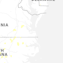


Connect with Interactive Hail Maps