

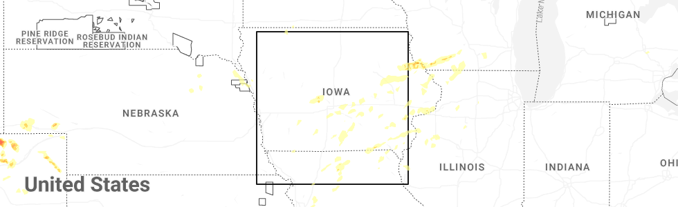
Hail Map for Corydon, IA
The Corydon, IA area has had 1 report of on-the-ground hail by trained spotters, and has been under severe weather warnings 9 times during the past 12 months. Doppler radar has detected hail at or near Corydon, IA on 54 occasions, including 3 occasions during the past year.
| Name: | Corydon, IA |
| Where Located: | 59.4 miles SSE of Des Moines, IA |
| Map: | Google Map for Corydon, IA |
| Population: | 1585 |
| Housing Units: | 785 |
| More Info: | Search Google for Corydon, IA |
2
The Top Recent Hail Date for Corydon, IA is Friday, July 11, 2025 (16th out of 54)
Hail and Wind Damage Spotted near Corydon, IA
| Date / Time | Report Details |
|---|---|
| 7/31/2024 8:59 PM CDT |
 The storms which prompted the warning have weakened below severe limits, and no longer pose an immediate threat to life or property. therefore, the warning will be allowed to expire. a severe thunderstorm watch remains in effect until 100 am cdt for south central and southeastern iowa. The storms which prompted the warning have weakened below severe limits, and no longer pose an immediate threat to life or property. therefore, the warning will be allowed to expire. a severe thunderstorm watch remains in effect until 100 am cdt for south central and southeastern iowa.
|
| 7/31/2024 8:47 PM CDT |
 the severe thunderstorm warning has been cancelled and is no longer in effect the severe thunderstorm warning has been cancelled and is no longer in effect
|
| 7/31/2024 8:47 PM CDT |
 At 845 pm cdt, severe thunderstorms were located along a line extending from 4 miles east of melcher-dallas to 6 miles east of millerton to near south lineville, moving east at 50 mph (radar indicated). Hazards include 60 mph wind gusts. Expect damage to roofs, siding, and trees. locations impacted include, oskaloosa, centerville, osceola, chariton, albia, leon, corydon, lamoni, melcher-dallas, eddyville, lake sundown, rathbun lake, seymour, moravia, moulton, russell, lovilia, allerton, humeston, and beacon. This includes interstate 35 between mile markers 1 and 30. At 845 pm cdt, severe thunderstorms were located along a line extending from 4 miles east of melcher-dallas to 6 miles east of millerton to near south lineville, moving east at 50 mph (radar indicated). Hazards include 60 mph wind gusts. Expect damage to roofs, siding, and trees. locations impacted include, oskaloosa, centerville, osceola, chariton, albia, leon, corydon, lamoni, melcher-dallas, eddyville, lake sundown, rathbun lake, seymour, moravia, moulton, russell, lovilia, allerton, humeston, and beacon. This includes interstate 35 between mile markers 1 and 30.
|
| 7/31/2024 8:21 PM CDT |
 Svrdmx the national weather service in des moines has issued a * severe thunderstorm warning for, monroe county in south central iowa, lucas county in south central iowa, decatur county in south central iowa, southeastern madison county in south central iowa, southern marion county in south central iowa, wayne county in south central iowa, southwestern mahaska county in south central iowa, southeastern ringgold county in south central iowa, appanoose county in south central iowa, clarke county in south central iowa, southern warren county in south central iowa, * until 900 pm cdt. * at 821 pm cdt, severe thunderstorms were located along a line extending from near otter creek county park to humeston to near nine eagles state park, moving east at 70 mph (radar indicated). Hazards include 60 mph wind gusts. lamoni airport gusted to 59 mph. expect damage to roofs, siding, and trees Svrdmx the national weather service in des moines has issued a * severe thunderstorm warning for, monroe county in south central iowa, lucas county in south central iowa, decatur county in south central iowa, southeastern madison county in south central iowa, southern marion county in south central iowa, wayne county in south central iowa, southwestern mahaska county in south central iowa, southeastern ringgold county in south central iowa, appanoose county in south central iowa, clarke county in south central iowa, southern warren county in south central iowa, * until 900 pm cdt. * at 821 pm cdt, severe thunderstorms were located along a line extending from near otter creek county park to humeston to near nine eagles state park, moving east at 70 mph (radar indicated). Hazards include 60 mph wind gusts. lamoni airport gusted to 59 mph. expect damage to roofs, siding, and trees
|
| 7/30/2024 4:09 AM CDT | At 408 am cdt, severe thunderstorms were located along a line extending from eddyville to near blakesburg to near moulton to 6 miles northwest of livonia to lemons, moving southeast at 50 mph (public report. at 359 am, a wind gust of 62 mph was measured from a personal weather station in mystic). Hazards include 60 mph wind gusts. Expect damage to roofs, siding, and trees. these severe storms will be near, ottumwa, ottumwa industrial airport, drakesville, kirkville, chillicothe and lake wapello state park around 415 am cdt. bloomfield and bloomfield municipal airport around 420 am cdt. Other locations in the path of these severe thunderstorms include floris, agency, pulaski and eldon. |
| 7/30/2024 4:02 AM CDT | the severe thunderstorm warning has been cancelled and is no longer in effect |
| 7/30/2024 4:02 AM CDT | At 401 am cdt, severe thunderstorms were located along a line extending from 4 miles southwest of beacon to near blakesburg to udell to near cincinnati to 7 miles east of lucerne, moving southeast at 50 mph (automated systems. at 335 am, a measured wind gust of 66 mph was reported at the chariton airport). Hazards include 70 mph wind gusts. Expect considerable tree damage. damage is likely to mobile homes, roofs, and outbuildings. these severe storms will be near, eddyville, lake sundown, moulton, blakesburg, exline, unionville, udell and sharon bluffs state park around 405 am cdt. Other locations in the path of these severe thunderstorms include kirkville, chillicothe, ottumwa, ottumwa industrial airport, drakesville, bloomfield and bloomfield municipal airport. |
| 7/30/2024 3:45 AM CDT | At 344 am cdt, severe thunderstorms were located along a line extending from near pella to near hamilton to 5 miles north of honey creek state park to plano to 5 miles south of allerton, moving southeast at 50 mph (automated systems. at 335 am, a measured wind gust of 66 mph was reported at the chariton airport). Hazards include 70 mph wind gusts. Expect considerable tree damage. damage is likely to mobile homes, roofs, and outbuildings. these severe storms will be near, centerville, albia, rathbun lake, seymour, moravia, mystic, bussey and cincinnati around 350 am cdt. eddyville, lake sundown, beacon, exline, unionville, udell and sharon bluffs state park around 355 am cdt. moulton and blakesburg around 400 am cdt. Other locations in the path of these severe thunderstorms include chillicothe, lake wapello state park, ottumwa, drakesville, kirkville, bloomfield, ottumwa industrial airport, bloomfield municipal airport and floris. |
| 7/30/2024 3:40 AM CDT | Svrdmx the national weather service in des moines has issued a * severe thunderstorm warning for, lucas county in south central iowa, monroe county in south central iowa, marion county in south central iowa, davis county in southeastern iowa, wapello county in southeastern iowa, wayne county in south central iowa, southwestern mahaska county in south central iowa, appanoose county in south central iowa, southeastern warren county in south central iowa, * until 445 am cdt. * at 339 am cdt, severe thunderstorms were located along a line extending from pella municipal airport to hamilton to near melrose to 4 miles north of promise city to near allerton, moving southeast at 50 mph (radar indicated). Hazards include 60 mph wind gusts. Expect damage to roofs, siding, and trees. severe thunderstorms will be near, pella, albia, rathbun lake, seymour, moravia, lovilia, mystic and bussey around 345 am cdt. centerville, cincinnati, albia municipal airport and centerville municipal airport around 350 am cdt. eddyville, lake sundown, beacon, exline, unionville, udell and sharon bluffs state park around 355 am cdt. Other locations in the path of these severe thunderstorms include blakesburg, moulton, chillicothe, lake wapello state park, drakesville, kirkville, ottumwa, bloomfield, ottumwa industrial airport and bloomfield municipal airport. |
| 7/10/2024 2:43 PM CDT |
 the severe thunderstorm warning has been cancelled and is no longer in effect the severe thunderstorm warning has been cancelled and is no longer in effect
|
| 7/10/2024 2:43 PM CDT |
 At 243 pm cdt, a severe thunderstorm was located over plano, or 11 miles west of centerville, moving southeast at 30 mph (radar indicated). Hazards include 60 mph wind gusts and quarter size hail. Hail damage to vehicles is expected. expect wind damage to roofs, siding, and trees. Locations impacted include, corydon, rathbun lake, seymour, allerton, promise city, plano, and honey creek state park. At 243 pm cdt, a severe thunderstorm was located over plano, or 11 miles west of centerville, moving southeast at 30 mph (radar indicated). Hazards include 60 mph wind gusts and quarter size hail. Hail damage to vehicles is expected. expect wind damage to roofs, siding, and trees. Locations impacted include, corydon, rathbun lake, seymour, allerton, promise city, plano, and honey creek state park.
|
| 7/10/2024 2:33 PM CDT |
 At 233 pm cdt, a severe thunderstorm was located over promise city, or 7 miles east of corydon, moving southeast at 30 mph (radar indicated). Hazards include 60 mph wind gusts and quarter size hail. Hail damage to vehicles is expected. expect wind damage to roofs, siding, and trees. Locations impacted include, corydon, rathbun lake, seymour, russell, allerton, promise city, plano, millerton, and honey creek state park. At 233 pm cdt, a severe thunderstorm was located over promise city, or 7 miles east of corydon, moving southeast at 30 mph (radar indicated). Hazards include 60 mph wind gusts and quarter size hail. Hail damage to vehicles is expected. expect wind damage to roofs, siding, and trees. Locations impacted include, corydon, rathbun lake, seymour, russell, allerton, promise city, plano, millerton, and honey creek state park.
|
| 7/10/2024 2:10 PM CDT |
 Svrdmx the national weather service in des moines has issued a * severe thunderstorm warning for, southwestern monroe county in south central iowa, southeastern lucas county in south central iowa, wayne county in south central iowa, northwestern appanoose county in south central iowa, * until 300 pm cdt. * at 210 pm cdt, a severe thunderstorm was located near millerton, or 8 miles north of corydon, moving southeast at 30 mph (radar indicated). Hazards include 60 mph wind gusts and quarter size hail. Hail damage to vehicles is expected. Expect wind damage to roofs, siding, and trees. Svrdmx the national weather service in des moines has issued a * severe thunderstorm warning for, southwestern monroe county in south central iowa, southeastern lucas county in south central iowa, wayne county in south central iowa, northwestern appanoose county in south central iowa, * until 300 pm cdt. * at 210 pm cdt, a severe thunderstorm was located near millerton, or 8 miles north of corydon, moving southeast at 30 mph (radar indicated). Hazards include 60 mph wind gusts and quarter size hail. Hail damage to vehicles is expected. Expect wind damage to roofs, siding, and trees.
|
| 6/25/2024 8:34 PM CDT | Several trees and power lines down. time estimated by rada in wayne county IA, 0.1 miles S of Corydon, IA |
| 6/25/2024 8:15 PM CDT |
 At 815 pm cdt, a severe thunderstorm was located near promise city, or 6 miles east of corydon, moving southeast at 30 mph (radar indicated). Hazards include 60 mph wind gusts and quarter size hail. Hail damage to vehicles is expected. expect wind damage to roofs, siding, and trees. Locations impacted include, centerville, corydon, rathbun lake, seymour, allerton, humeston, mystic, promise city, numa, plano, millerton, and centerville municipal airport. At 815 pm cdt, a severe thunderstorm was located near promise city, or 6 miles east of corydon, moving southeast at 30 mph (radar indicated). Hazards include 60 mph wind gusts and quarter size hail. Hail damage to vehicles is expected. expect wind damage to roofs, siding, and trees. Locations impacted include, centerville, corydon, rathbun lake, seymour, allerton, humeston, mystic, promise city, numa, plano, millerton, and centerville municipal airport.
|
| 6/25/2024 8:15 PM CDT |
 the severe thunderstorm warning has been cancelled and is no longer in effect the severe thunderstorm warning has been cancelled and is no longer in effect
|
| 6/25/2024 8:12 PM CDT |
 Svrdmx the national weather service in des moines has issued a * severe thunderstorm warning for, southwestern davis county in southeastern iowa, southern wayne county in south central iowa, appanoose county in south central iowa, * until 900 pm cdt. * at 812 pm cdt, severe thunderstorms were located along a line extending from centerville to near seymour to near allerton, moving southeast at 15 mph (radar indicated). Hazards include 60 mph wind gusts and quarter size hail. Hail damage to vehicles is expected. Expect wind damage to roofs, siding, and trees. Svrdmx the national weather service in des moines has issued a * severe thunderstorm warning for, southwestern davis county in southeastern iowa, southern wayne county in south central iowa, appanoose county in south central iowa, * until 900 pm cdt. * at 812 pm cdt, severe thunderstorms were located along a line extending from centerville to near seymour to near allerton, moving southeast at 15 mph (radar indicated). Hazards include 60 mph wind gusts and quarter size hail. Hail damage to vehicles is expected. Expect wind damage to roofs, siding, and trees.
|
| 6/25/2024 7:45 PM CDT |
 Svrdmx the national weather service in des moines has issued a * severe thunderstorm warning for, southwestern monroe county in south central iowa, southern lucas county in south central iowa, wayne county in south central iowa, northwestern appanoose county in south central iowa, * until 830 pm cdt. * at 745 pm cdt, a severe thunderstorm was located near millerton, or 8 miles northeast of corydon, moving south at 20 mph (radar indicated). Hazards include 60 mph wind gusts and half dollar size hail. Hail damage to vehicles is expected. Expect wind damage to roofs, siding, and trees. Svrdmx the national weather service in des moines has issued a * severe thunderstorm warning for, southwestern monroe county in south central iowa, southern lucas county in south central iowa, wayne county in south central iowa, northwestern appanoose county in south central iowa, * until 830 pm cdt. * at 745 pm cdt, a severe thunderstorm was located near millerton, or 8 miles northeast of corydon, moving south at 20 mph (radar indicated). Hazards include 60 mph wind gusts and half dollar size hail. Hail damage to vehicles is expected. Expect wind damage to roofs, siding, and trees.
|
| 5/21/2024 5:06 PM CDT |
 At 506 pm cdt, a severe thunderstorm capable of producing a tornado was located over allerton, or near corydon, moving northeast at 55 mph (radar indicated rotation). Hazards include tornado and quarter size hail. Flying debris will be dangerous to those caught without shelter. mobile homes will be damaged or destroyed. damage to roofs, windows, and vehicles will occur. tree damage is likely. this dangerous storm will be near, corydon around 510 pm cdt. millerton around 515 pm cdt. rathbun lake around 520 pm cdt. melrose around 530 pm cdt. Other locations impacted by this tornadic thunderstorm include russell, melrose, red haw lake state park, honey creek state park, millerton, allerton, promise city, clio, plano, and seymour. At 506 pm cdt, a severe thunderstorm capable of producing a tornado was located over allerton, or near corydon, moving northeast at 55 mph (radar indicated rotation). Hazards include tornado and quarter size hail. Flying debris will be dangerous to those caught without shelter. mobile homes will be damaged or destroyed. damage to roofs, windows, and vehicles will occur. tree damage is likely. this dangerous storm will be near, corydon around 510 pm cdt. millerton around 515 pm cdt. rathbun lake around 520 pm cdt. melrose around 530 pm cdt. Other locations impacted by this tornadic thunderstorm include russell, melrose, red haw lake state park, honey creek state park, millerton, allerton, promise city, clio, plano, and seymour.
|
| 5/21/2024 4:53 PM CDT |
 Tordmx the national weather service in des moines has issued a * tornado warning for, southeastern lucas county in south central iowa, southwestern monroe county in south central iowa, wayne county in south central iowa, northwestern appanoose county in south central iowa, * until 545 pm cdt. * at 453 pm cdt, a severe thunderstorm capable of producing a tornado was located over south lineville, or 16 miles southwest of corydon, moving northeast at 55 mph (radar indicated rotation). Hazards include tornado and quarter size hail. Flying debris will be dangerous to those caught without shelter. mobile homes will be damaged or destroyed. damage to roofs, windows, and vehicles will occur. tree damage is likely. this dangerous storm will be near, allerton and clio around 500 pm cdt. corydon around 505 pm cdt. millerton around 515 pm cdt. rathbun lake around 520 pm cdt. melrose around 530 pm cdt. Other locations impacted by this tornadic thunderstorm include russell, melrose, red haw lake state park, honey creek state park, millerton, allerton, promise city, lineville, clio, and plano. Tordmx the national weather service in des moines has issued a * tornado warning for, southeastern lucas county in south central iowa, southwestern monroe county in south central iowa, wayne county in south central iowa, northwestern appanoose county in south central iowa, * until 545 pm cdt. * at 453 pm cdt, a severe thunderstorm capable of producing a tornado was located over south lineville, or 16 miles southwest of corydon, moving northeast at 55 mph (radar indicated rotation). Hazards include tornado and quarter size hail. Flying debris will be dangerous to those caught without shelter. mobile homes will be damaged or destroyed. damage to roofs, windows, and vehicles will occur. tree damage is likely. this dangerous storm will be near, allerton and clio around 500 pm cdt. corydon around 505 pm cdt. millerton around 515 pm cdt. rathbun lake around 520 pm cdt. melrose around 530 pm cdt. Other locations impacted by this tornadic thunderstorm include russell, melrose, red haw lake state park, honey creek state park, millerton, allerton, promise city, lineville, clio, and plano.
|
| 5/20/2024 1:36 AM CDT |
 Svrdmx the national weather service in des moines has issued a * severe thunderstorm warning for, lucas county in south central iowa, monroe county in south central iowa, marion county in south central iowa, eastern wayne county in south central iowa, appanoose county in south central iowa, northeastern clarke county in south central iowa, eastern warren county in south central iowa, * until 230 am cdt. * at 136 am cdt, severe thunderstorms were located along a line extending from 6 miles south of otter creek county park to red haw lake state park to near cincinnati, moving northeast at 30 mph (radar indicated). Hazards include 60 mph wind gusts and penny size hail. expect damage to roofs, siding, and trees Svrdmx the national weather service in des moines has issued a * severe thunderstorm warning for, lucas county in south central iowa, monroe county in south central iowa, marion county in south central iowa, eastern wayne county in south central iowa, appanoose county in south central iowa, northeastern clarke county in south central iowa, eastern warren county in south central iowa, * until 230 am cdt. * at 136 am cdt, severe thunderstorms were located along a line extending from 6 miles south of otter creek county park to red haw lake state park to near cincinnati, moving northeast at 30 mph (radar indicated). Hazards include 60 mph wind gusts and penny size hail. expect damage to roofs, siding, and trees
|
| 5/7/2024 1:26 AM CDT |
 Svrdmx the national weather service in des moines has issued a * severe thunderstorm warning for, lucas county in south central iowa, western poweshiek county in central iowa, monroe county in south central iowa, southeastern polk county in central iowa, davis county in southeastern iowa, marion county in south central iowa, wapello county in southeastern iowa, wayne county in south central iowa, mahaska county in south central iowa, appanoose county in south central iowa, jasper county in central iowa, eastern warren county in south central iowa, * until 230 am cdt. * at 126 am cdt, severe thunderstorms were located along a line extending from near runnells to 5 miles northeast of russell to 5 miles south of seymour, moving east at 50 mph (radar indicated). Hazards include 60 mph wind gusts and penny size hail. expect damage to roofs, siding, and trees Svrdmx the national weather service in des moines has issued a * severe thunderstorm warning for, lucas county in south central iowa, western poweshiek county in central iowa, monroe county in south central iowa, southeastern polk county in central iowa, davis county in southeastern iowa, marion county in south central iowa, wapello county in southeastern iowa, wayne county in south central iowa, mahaska county in south central iowa, appanoose county in south central iowa, jasper county in central iowa, eastern warren county in south central iowa, * until 230 am cdt. * at 126 am cdt, severe thunderstorms were located along a line extending from near runnells to 5 miles northeast of russell to 5 miles south of seymour, moving east at 50 mph (radar indicated). Hazards include 60 mph wind gusts and penny size hail. expect damage to roofs, siding, and trees
|
| 5/7/2024 1:02 AM CDT |
 At 101 am cdt, severe thunderstorms were located along a line extending from near lake ahquabi state park to near corydon, moving northeast at 50 mph (radar indicated). Hazards include 60 mph wind gusts and penny size hail. Expect damage to roofs, siding, and trees. Locations impacted include, chariton, corydon, allerton, humeston, new virginia, lineville, lucas, garden grove, woodburn, williamson, derby, clio, millerton, south lineville, le roy, red haw lake state park, and chariton municipal airport. At 101 am cdt, severe thunderstorms were located along a line extending from near lake ahquabi state park to near corydon, moving northeast at 50 mph (radar indicated). Hazards include 60 mph wind gusts and penny size hail. Expect damage to roofs, siding, and trees. Locations impacted include, chariton, corydon, allerton, humeston, new virginia, lineville, lucas, garden grove, woodburn, williamson, derby, clio, millerton, south lineville, le roy, red haw lake state park, and chariton municipal airport.
|
| 5/7/2024 1:02 AM CDT |
 the severe thunderstorm warning has been cancelled and is no longer in effect the severe thunderstorm warning has been cancelled and is no longer in effect
|
| 5/7/2024 12:33 AM CDT |
 Svrdmx the national weather service in des moines has issued a * severe thunderstorm warning for, lucas county in south central iowa, decatur county in south central iowa, southeastern madison county in south central iowa, wayne county in south central iowa, clarke county in south central iowa, southwestern warren county in south central iowa, * until 115 am cdt. * at 1232 am cdt, severe thunderstorms were located along a line extending from 5 miles south of murray roadside rest area to nine eagles state park, moving north at 65 mph (radar indicated). Hazards include 60 mph wind gusts and penny size hail. expect damage to roofs, siding, and trees Svrdmx the national weather service in des moines has issued a * severe thunderstorm warning for, lucas county in south central iowa, decatur county in south central iowa, southeastern madison county in south central iowa, wayne county in south central iowa, clarke county in south central iowa, southwestern warren county in south central iowa, * until 115 am cdt. * at 1232 am cdt, severe thunderstorms were located along a line extending from 5 miles south of murray roadside rest area to nine eagles state park, moving north at 65 mph (radar indicated). Hazards include 60 mph wind gusts and penny size hail. expect damage to roofs, siding, and trees
|
| 4/30/2024 7:49 PM CDT |
 the severe thunderstorm warning has been cancelled and is no longer in effect the severe thunderstorm warning has been cancelled and is no longer in effect
|
| 4/30/2024 7:11 PM CDT |
 Svrdmx the national weather service in des moines has issued a * severe thunderstorm warning for, southern lucas county in south central iowa, southwestern monroe county in south central iowa, northern wayne county in south central iowa, northwestern appanoose county in south central iowa, * until 800 pm cdt. * at 710 pm cdt, a severe thunderstorm was located over millerton, or near corydon, moving east at 35 mph (radar indicated). Hazards include ping pong ball size hail and 60 mph wind gusts. People and animals outdoors will be injured. expect hail damage to roofs, siding, windows, and vehicles. Expect wind damage to roofs, siding, and trees. Svrdmx the national weather service in des moines has issued a * severe thunderstorm warning for, southern lucas county in south central iowa, southwestern monroe county in south central iowa, northern wayne county in south central iowa, northwestern appanoose county in south central iowa, * until 800 pm cdt. * at 710 pm cdt, a severe thunderstorm was located over millerton, or near corydon, moving east at 35 mph (radar indicated). Hazards include ping pong ball size hail and 60 mph wind gusts. People and animals outdoors will be injured. expect hail damage to roofs, siding, windows, and vehicles. Expect wind damage to roofs, siding, and trees.
|
| 4/30/2024 6:26 PM CDT |
 Svrdmx the national weather service in des moines has issued a * severe thunderstorm warning for, southern lucas county in south central iowa, northern decatur county in south central iowa, northern wayne county in south central iowa, southern clarke county in south central iowa, * until 730 pm cdt. * at 625 pm cdt, a severe thunderstorm was located near grand river, or 7 miles northwest of leon, moving east at 35 mph (radar indicated). Hazards include ping pong ball size hail and 60 mph wind gusts. People and animals outdoors will be injured. expect hail damage to roofs, siding, windows, and vehicles. Expect wind damage to roofs, siding, and trees. Svrdmx the national weather service in des moines has issued a * severe thunderstorm warning for, southern lucas county in south central iowa, northern decatur county in south central iowa, northern wayne county in south central iowa, southern clarke county in south central iowa, * until 730 pm cdt. * at 625 pm cdt, a severe thunderstorm was located near grand river, or 7 miles northwest of leon, moving east at 35 mph (radar indicated). Hazards include ping pong ball size hail and 60 mph wind gusts. People and animals outdoors will be injured. expect hail damage to roofs, siding, windows, and vehicles. Expect wind damage to roofs, siding, and trees.
|
| 4/16/2024 1:03 PM CDT |
 the severe thunderstorm warning has been cancelled and is no longer in effect the severe thunderstorm warning has been cancelled and is no longer in effect
|
| 4/16/2024 12:54 PM CDT |
 At 1254 pm cdt, a severe thunderstorm was located over williamson, or near chariton, moving north at 50 mph (radar indicated). Hazards include 60 mph wind gusts and quarter size hail. Hail damage to vehicles is expected. expect wind damage to roofs, siding, and trees. Locations impacted include, corydon and millerton. At 1254 pm cdt, a severe thunderstorm was located over williamson, or near chariton, moving north at 50 mph (radar indicated). Hazards include 60 mph wind gusts and quarter size hail. Hail damage to vehicles is expected. expect wind damage to roofs, siding, and trees. Locations impacted include, corydon and millerton.
|
| 4/16/2024 12:38 PM CDT |
 At 1238 pm cdt, a severe thunderstorm was located over millerton, or 7 miles north of corydon, moving north at 50 mph (radar indicated). Hazards include 60 mph wind gusts and quarter size hail. Hail damage to vehicles is expected. expect wind damage to roofs, siding, and trees. Locations impacted include, corydon, allerton, humeston, derby, and millerton. At 1238 pm cdt, a severe thunderstorm was located over millerton, or 7 miles north of corydon, moving north at 50 mph (radar indicated). Hazards include 60 mph wind gusts and quarter size hail. Hail damage to vehicles is expected. expect wind damage to roofs, siding, and trees. Locations impacted include, corydon, allerton, humeston, derby, and millerton.
|
| 4/16/2024 12:18 PM CDT |
 Svrdmx the national weather service in des moines has issued a * severe thunderstorm warning for, southwestern lucas county in south central iowa, wayne county in south central iowa, * until 115 pm cdt. * at 1218 pm cdt, a severe thunderstorm was located over clio, or 10 miles southwest of corydon, moving north at 50 mph (radar indicated). Hazards include 60 mph wind gusts and quarter size hail. Hail damage to vehicles is expected. Expect wind damage to roofs, siding, and trees. Svrdmx the national weather service in des moines has issued a * severe thunderstorm warning for, southwestern lucas county in south central iowa, wayne county in south central iowa, * until 115 pm cdt. * at 1218 pm cdt, a severe thunderstorm was located over clio, or 10 miles southwest of corydon, moving north at 50 mph (radar indicated). Hazards include 60 mph wind gusts and quarter size hail. Hail damage to vehicles is expected. Expect wind damage to roofs, siding, and trees.
|
| 7/12/2023 8:30 AM CDT |
 At 829 am cdt, severe thunderstorms were located along a line extending from near russell to near clio to near ridgeway, moving east at 60 mph (radar indicated). Hazards include 60 mph wind gusts and nickel size hail. Expect damage to roofs, siding, and trees. locations impacted include, rathbun lake, russell, melrose, honey creek state park and rathbun. hail threat, radar indicated max hail size, 0. 88 in wind threat, radar indicated max wind gust, 60 mph. At 829 am cdt, severe thunderstorms were located along a line extending from near russell to near clio to near ridgeway, moving east at 60 mph (radar indicated). Hazards include 60 mph wind gusts and nickel size hail. Expect damage to roofs, siding, and trees. locations impacted include, rathbun lake, russell, melrose, honey creek state park and rathbun. hail threat, radar indicated max hail size, 0. 88 in wind threat, radar indicated max wind gust, 60 mph.
|
| 7/12/2023 7:59 AM CDT |
 At 759 am cdt, severe thunderstorms were located along a line extending from near osceola to near decatur city to irena, moving east at 60 mph (radar indicated). Hazards include 60 mph wind gusts and nickel size hail. Expect damage to roofs, siding, and trees. severe thunderstorms will be near, leon, woodburn, decatur city and weldon around 805 am cdt. davis city, le roy and nine eagles state park around 810 am cdt. humeston and derby around 815 am cdt. other locations in the path of these severe thunderstorms include allerton, lineville, clio, millerton, rathbun lake, promise city, plano, mystic, numa, rathbun and honey creek state park. this includes interstate 35 between mile markers 1 and 33. hail threat, radar indicated max hail size, 0. 88 in wind threat, radar indicated max wind gust, 60 mph. At 759 am cdt, severe thunderstorms were located along a line extending from near osceola to near decatur city to irena, moving east at 60 mph (radar indicated). Hazards include 60 mph wind gusts and nickel size hail. Expect damage to roofs, siding, and trees. severe thunderstorms will be near, leon, woodburn, decatur city and weldon around 805 am cdt. davis city, le roy and nine eagles state park around 810 am cdt. humeston and derby around 815 am cdt. other locations in the path of these severe thunderstorms include allerton, lineville, clio, millerton, rathbun lake, promise city, plano, mystic, numa, rathbun and honey creek state park. this includes interstate 35 between mile markers 1 and 33. hail threat, radar indicated max hail size, 0. 88 in wind threat, radar indicated max wind gust, 60 mph.
|
| 6/30/2023 8:09 AM CDT |
 At 808 am cdt, severe thunderstorms were located along a line extending from 6 miles south of russell to 6 miles south of seymour, moving east at 45 mph (radar indicated. at wind just to 60 mph was reported near powersville, mo). Hazards include 60 mph wind gusts and penny size hail. Expect damage to roofs, siding, and trees. locations impacted include, rathbun lake, numa, cincinnati, honey creek state park, centerville municipal airport, exline, rathbun, albia, moravia, lake sundown, moulton, albia municipal airport and unionville. hail threat, radar indicated max hail size, 0. 75 in wind threat, radar indicated max wind gust, 60 mph. At 808 am cdt, severe thunderstorms were located along a line extending from 6 miles south of russell to 6 miles south of seymour, moving east at 45 mph (radar indicated. at wind just to 60 mph was reported near powersville, mo). Hazards include 60 mph wind gusts and penny size hail. Expect damage to roofs, siding, and trees. locations impacted include, rathbun lake, numa, cincinnati, honey creek state park, centerville municipal airport, exline, rathbun, albia, moravia, lake sundown, moulton, albia municipal airport and unionville. hail threat, radar indicated max hail size, 0. 75 in wind threat, radar indicated max wind gust, 60 mph.
|
| 6/30/2023 7:54 AM CDT |
 At 753 am cdt, severe thunderstorms were located along a line extending from near millerton to near powersville, moving east at 45 mph (radar indicated). Hazards include 60 mph wind gusts and penny size hail. Expect damage to roofs, siding, and trees. severe thunderstorms will be near, seymour around 805 am cdt. rathbun lake around 810 am cdt. other locations in the path of these severe thunderstorms include melrose, numa, cincinnati, honey creek state park, centerville municipal airport, exline, rathbun, albia, moravia, albia municipal airport, lake sundown, moulton and unionville. hail threat, radar indicated max hail size, 0. 75 in wind threat, radar indicated max wind gust, 60 mph. At 753 am cdt, severe thunderstorms were located along a line extending from near millerton to near powersville, moving east at 45 mph (radar indicated). Hazards include 60 mph wind gusts and penny size hail. Expect damage to roofs, siding, and trees. severe thunderstorms will be near, seymour around 805 am cdt. rathbun lake around 810 am cdt. other locations in the path of these severe thunderstorms include melrose, numa, cincinnati, honey creek state park, centerville municipal airport, exline, rathbun, albia, moravia, albia municipal airport, lake sundown, moulton and unionville. hail threat, radar indicated max hail size, 0. 75 in wind threat, radar indicated max wind gust, 60 mph.
|
| 6/30/2023 7:43 AM CDT |
 At 742 am cdt, severe thunderstorms were located along a line extending from east peru to 5 miles southeast of leon, moving east at 50 mph (law enforcement). Hazards include 60 mph wind gusts and quarter size hail. Hail damage to vehicles is expected. expect wind damage to roofs, siding, and trees. locations impacted include, clio, allerton, corydon, millerton, seymour, promise city, rathbun lake and plano. this includes interstate 35 between mile markers 16 and 32. hail threat, radar indicated max hail size, 1. 00 in wind threat, observed max wind gust, 60 mph. At 742 am cdt, severe thunderstorms were located along a line extending from east peru to 5 miles southeast of leon, moving east at 50 mph (law enforcement). Hazards include 60 mph wind gusts and quarter size hail. Hail damage to vehicles is expected. expect wind damage to roofs, siding, and trees. locations impacted include, clio, allerton, corydon, millerton, seymour, promise city, rathbun lake and plano. this includes interstate 35 between mile markers 16 and 32. hail threat, radar indicated max hail size, 1. 00 in wind threat, observed max wind gust, 60 mph.
|
| 6/30/2023 7:25 AM CDT |
 At 724 am cdt, severe thunderstorms were located along a line extending from macksburg to lamoni, moving east at 50 mph (law enforcement). Hazards include 70 mph wind gusts and quarter size hail. Hail damage to vehicles is expected. expect considerable tree damage. wind damage is also likely to mobile homes, roofs, and outbuildings. these severe storms will be near, davis city around 730 am cdt. other locations in the path of these severe thunderstorms include leon, decatur city, pleasanton, nine eagles state park, east peru, truro, st. charles, st. marys, clio, allerton, indianola, corydon, lake ahquabi state park and otter creek county park. this includes interstate 35 between mile markers 1 and 52. thunderstorm damage threat, considerable hail threat, radar indicated max hail size, 1. 00 in wind threat, observed max wind gust, 70 mph. At 724 am cdt, severe thunderstorms were located along a line extending from macksburg to lamoni, moving east at 50 mph (law enforcement). Hazards include 70 mph wind gusts and quarter size hail. Hail damage to vehicles is expected. expect considerable tree damage. wind damage is also likely to mobile homes, roofs, and outbuildings. these severe storms will be near, davis city around 730 am cdt. other locations in the path of these severe thunderstorms include leon, decatur city, pleasanton, nine eagles state park, east peru, truro, st. charles, st. marys, clio, allerton, indianola, corydon, lake ahquabi state park and otter creek county park. this includes interstate 35 between mile markers 1 and 52. thunderstorm damage threat, considerable hail threat, radar indicated max hail size, 1. 00 in wind threat, observed max wind gust, 70 mph.
|
| 6/30/2023 7:10 AM CDT |
 At 709 am cdt, severe thunderstorms were located along a line extending from macksburg to lamoni, moving east at 50 mph (law enforcement). Hazards include 70 mph wind gusts and quarter size hail. Hail damage to vehicles is expected. expect considerable tree damage. wind damage is also likely to mobile homes, roofs, and outbuildings. these severe storms will be near, davis city around 715 am cdt. leon, decatur city, pleasanton and nine eagles state park around 720 am cdt. other locations in the path of these severe thunderstorms include east peru, truro, avenue of the saints event center, st. charles, bevington, st. marys, clio, allerton, indianola, corydon, lake ahquabi state park and otter creek county park. this includes interstate 35 between mile markers 1 and 56. thunderstorm damage threat, considerable hail threat, radar indicated max hail size, 1. 00 in wind threat, observed max wind gust, 70 mph. At 709 am cdt, severe thunderstorms were located along a line extending from macksburg to lamoni, moving east at 50 mph (law enforcement). Hazards include 70 mph wind gusts and quarter size hail. Hail damage to vehicles is expected. expect considerable tree damage. wind damage is also likely to mobile homes, roofs, and outbuildings. these severe storms will be near, davis city around 715 am cdt. leon, decatur city, pleasanton and nine eagles state park around 720 am cdt. other locations in the path of these severe thunderstorms include east peru, truro, avenue of the saints event center, st. charles, bevington, st. marys, clio, allerton, indianola, corydon, lake ahquabi state park and otter creek county park. this includes interstate 35 between mile markers 1 and 56. thunderstorm damage threat, considerable hail threat, radar indicated max hail size, 1. 00 in wind threat, observed max wind gust, 70 mph.
|
| 6/30/2023 7:04 AM CDT |
 At 703 am cdt, severe thunderstorms were located along a line extending from near macksburg to near lamoni, moving east at 50 mph (law enforcement). Hazards include 60 mph wind gusts and quarter size hail. Hail damage to vehicles is expected. expect wind damage to roofs, siding, and trees. severe thunderstorms will be near, lamoni municipal airport around 710 am cdt. lorimor, davis city, decatur city and nine eagles state park around 715 am cdt. leon and pleasanton around 720 am cdt. other locations in the path of these severe thunderstorms include truro, east peru, avenue of the saints event center, st. charles, new virginia, st. marys, bevington, clio, allerton and lake ahquabi state park. this includes interstate 35 between mile markers 1 and 56. hail threat, radar indicated max hail size, 1. 00 in wind threat, observed max wind gust, 60 mph. At 703 am cdt, severe thunderstorms were located along a line extending from near macksburg to near lamoni, moving east at 50 mph (law enforcement). Hazards include 60 mph wind gusts and quarter size hail. Hail damage to vehicles is expected. expect wind damage to roofs, siding, and trees. severe thunderstorms will be near, lamoni municipal airport around 710 am cdt. lorimor, davis city, decatur city and nine eagles state park around 715 am cdt. leon and pleasanton around 720 am cdt. other locations in the path of these severe thunderstorms include truro, east peru, avenue of the saints event center, st. charles, new virginia, st. marys, bevington, clio, allerton and lake ahquabi state park. this includes interstate 35 between mile markers 1 and 56. hail threat, radar indicated max hail size, 1. 00 in wind threat, observed max wind gust, 60 mph.
|
| 6/29/2023 9:04 AM CDT |
 At 903 am cdt, a severe thunderstorm was located over leon, moving east at 45 mph (trained weather spotters. the lamoni airport recently reported a gust to 67 mph). Hazards include 60 mph wind gusts. Expect damage to roofs, siding, and trees. this severe thunderstorm will be near, garden grove around 915 am cdt. other locations in the path of this severe thunderstorm include allerton, corydon, millerton, promise city, rathbun lake, plano, mystic and honey creek state park. this includes interstate 35 between mile markers 6 and 20. hail threat, radar indicated max hail size, <. 75 in wind threat, observed max wind gust, 60 mph. At 903 am cdt, a severe thunderstorm was located over leon, moving east at 45 mph (trained weather spotters. the lamoni airport recently reported a gust to 67 mph). Hazards include 60 mph wind gusts. Expect damage to roofs, siding, and trees. this severe thunderstorm will be near, garden grove around 915 am cdt. other locations in the path of this severe thunderstorm include allerton, corydon, millerton, promise city, rathbun lake, plano, mystic and honey creek state park. this includes interstate 35 between mile markers 6 and 20. hail threat, radar indicated max hail size, <. 75 in wind threat, observed max wind gust, 60 mph.
|
| 6/7/2022 9:31 PM CDT |
 At 930 pm cdt, a severe thunderstorm was located 7 miles south of corydon, moving southeast at 40 mph (radar indicated). Hazards include 60 mph wind gusts and half dollar size hail. Hail damage to vehicles is expected. expect wind damage to roofs, siding, and trees. locations impacted include, corydon, seymour, allerton and clio. hail threat, radar indicated max hail size, 1. 25 in wind threat, radar indicated max wind gust, 60 mph. At 930 pm cdt, a severe thunderstorm was located 7 miles south of corydon, moving southeast at 40 mph (radar indicated). Hazards include 60 mph wind gusts and half dollar size hail. Hail damage to vehicles is expected. expect wind damage to roofs, siding, and trees. locations impacted include, corydon, seymour, allerton and clio. hail threat, radar indicated max hail size, 1. 25 in wind threat, radar indicated max wind gust, 60 mph.
|
| 6/7/2022 9:23 PM CDT |
 At 922 pm cdt, a severe thunderstorm was located 7 miles southwest of corydon, moving east at 40 mph (radar indicated). Hazards include 60 mph wind gusts and half dollar size hail. Hail damage to vehicles is expected. expect wind damage to roofs, siding, and trees. locations impacted include, seymour. hail threat, radar indicated max hail size, 1. 25 in wind threat, radar indicated max wind gust, 60 mph. At 922 pm cdt, a severe thunderstorm was located 7 miles southwest of corydon, moving east at 40 mph (radar indicated). Hazards include 60 mph wind gusts and half dollar size hail. Hail damage to vehicles is expected. expect wind damage to roofs, siding, and trees. locations impacted include, seymour. hail threat, radar indicated max hail size, 1. 25 in wind threat, radar indicated max wind gust, 60 mph.
|
| 6/7/2022 9:02 PM CDT |
 At 901 pm cdt, a severe thunderstorm was located 7 miles east of leon, moving southeast at 40 mph (radar indicated). Hazards include 60 mph wind gusts and quarter size hail. Hail damage to vehicles is expected. expect wind damage to roofs, siding, and trees. this severe thunderstorm will be near, allerton and clio around 920 pm cdt. other locations in the path of this severe thunderstorm include corydon and seymour. hail threat, radar indicated max hail size, 1. 00 in wind threat, radar indicated max wind gust, 60 mph. At 901 pm cdt, a severe thunderstorm was located 7 miles east of leon, moving southeast at 40 mph (radar indicated). Hazards include 60 mph wind gusts and quarter size hail. Hail damage to vehicles is expected. expect wind damage to roofs, siding, and trees. this severe thunderstorm will be near, allerton and clio around 920 pm cdt. other locations in the path of this severe thunderstorm include corydon and seymour. hail threat, radar indicated max hail size, 1. 00 in wind threat, radar indicated max wind gust, 60 mph.
|
| 6/6/2022 2:18 PM CDT |
 At 218 pm cdt, severe thunderstorms were located along a line extending from near knoxville to 10 miles southeast of melcher-dallas to 13 miles northwest of corydon, moving east at 40 mph (radar indicated). Hazards include 60 mph wind gusts. Expect damage to roofs, siding, and trees. locations impacted include, knoxville, chariton, corydon, melcher-dallas, knoxville raceway, rathbun lake, russell, lovilia, allerton, humeston, bussey, harvey, lucas, williamson, hamilton, derby, melrose, marysville, millerton and le roy. hail threat, radar indicated max hail size, <. 75 in wind threat, radar indicated max wind gust, 60 mph. At 218 pm cdt, severe thunderstorms were located along a line extending from near knoxville to 10 miles southeast of melcher-dallas to 13 miles northwest of corydon, moving east at 40 mph (radar indicated). Hazards include 60 mph wind gusts. Expect damage to roofs, siding, and trees. locations impacted include, knoxville, chariton, corydon, melcher-dallas, knoxville raceway, rathbun lake, russell, lovilia, allerton, humeston, bussey, harvey, lucas, williamson, hamilton, derby, melrose, marysville, millerton and le roy. hail threat, radar indicated max hail size, <. 75 in wind threat, radar indicated max wind gust, 60 mph.
|
| 6/6/2022 2:05 PM CDT |
 At 205 pm cdt, severe thunderstorms were located along a line extending from near pleasantville to near melcher-dallas to 11 miles southeast of osceola, moving southeast at 35 mph (radar indicated). Hazards include 60 mph wind gusts. Expect damage to roofs, siding, and trees. locations impacted include, melcher-dallas, williamson, knoxville, knoxville raceway, derby, knoxville municipal airport, lovilia, harvey, corydon, allerton, marysville, millerton, bussey and hamilton. hail threat, radar indicated max hail size, <. 75 in wind threat, radar indicated max wind gust, 60 mph. At 205 pm cdt, severe thunderstorms were located along a line extending from near pleasantville to near melcher-dallas to 11 miles southeast of osceola, moving southeast at 35 mph (radar indicated). Hazards include 60 mph wind gusts. Expect damage to roofs, siding, and trees. locations impacted include, melcher-dallas, williamson, knoxville, knoxville raceway, derby, knoxville municipal airport, lovilia, harvey, corydon, allerton, marysville, millerton, bussey and hamilton. hail threat, radar indicated max hail size, <. 75 in wind threat, radar indicated max wind gust, 60 mph.
|
| 6/6/2022 1:46 PM CDT |
 At 145 pm cdt, severe thunderstorms were located along a line extending from near indianola to 8 miles west of melcher-dallas to 6 miles southwest of osceola, moving southeast at 35 mph (radar indicated). Hazards include 60 mph wind gusts. Expect damage to roofs, siding, and trees. severe thunderstorms will be near, milo, lacona and sandyville around 150 pm cdt. pleasantville, melcher-dallas and williamson around 200 pm cdt. garden grove around 205 pm cdt. other locations in the path of these severe thunderstorms include le roy, knoxville, knoxville raceway, humeston, derby, knoxville municipal airport, lovilia, corydon, allerton, bussey, harvey, hamilton, marysville and millerton. this includes interstate 35 between mile markers 27 and 35. hail threat, radar indicated max hail size, <. 75 in wind threat, radar indicated max wind gust, 60 mph. At 145 pm cdt, severe thunderstorms were located along a line extending from near indianola to 8 miles west of melcher-dallas to 6 miles southwest of osceola, moving southeast at 35 mph (radar indicated). Hazards include 60 mph wind gusts. Expect damage to roofs, siding, and trees. severe thunderstorms will be near, milo, lacona and sandyville around 150 pm cdt. pleasantville, melcher-dallas and williamson around 200 pm cdt. garden grove around 205 pm cdt. other locations in the path of these severe thunderstorms include le roy, knoxville, knoxville raceway, humeston, derby, knoxville municipal airport, lovilia, corydon, allerton, bussey, harvey, hamilton, marysville and millerton. this includes interstate 35 between mile markers 27 and 35. hail threat, radar indicated max hail size, <. 75 in wind threat, radar indicated max wind gust, 60 mph.
|
| 3/5/2022 5:49 PM CST |
 At 549 pm cst, a severe thunderstorm capable of producing a tornado was located near corydon, moving northeast at 45 mph (radar indicated rotation). Hazards include tornado and ping pong ball size hail. Flying debris will be dangerous to those caught without shelter. mobile homes will be damaged or destroyed. damage to roofs, windows, and vehicles will occur. tree damage is likely. Locations impacted include, rathbun lake. At 549 pm cst, a severe thunderstorm capable of producing a tornado was located near corydon, moving northeast at 45 mph (radar indicated rotation). Hazards include tornado and ping pong ball size hail. Flying debris will be dangerous to those caught without shelter. mobile homes will be damaged or destroyed. damage to roofs, windows, and vehicles will occur. tree damage is likely. Locations impacted include, rathbun lake.
|
| 3/5/2022 5:36 PM CST |
 At 536 pm cst, a severe thunderstorm capable of producing a tornado was located 7 miles southwest of corydon, moving northeast at 45 mph (radar indicated rotation). Hazards include tornado and ping pong ball size hail. Flying debris will be dangerous to those caught without shelter. mobile homes will be damaged or destroyed. damage to roofs, windows, and vehicles will occur. tree damage is likely. this dangerous storm will be near, corydon around 550 pm cst. Other locations in the path of this tornadic thunderstorm include rathbun lake. At 536 pm cst, a severe thunderstorm capable of producing a tornado was located 7 miles southwest of corydon, moving northeast at 45 mph (radar indicated rotation). Hazards include tornado and ping pong ball size hail. Flying debris will be dangerous to those caught without shelter. mobile homes will be damaged or destroyed. damage to roofs, windows, and vehicles will occur. tree damage is likely. this dangerous storm will be near, corydon around 550 pm cst. Other locations in the path of this tornadic thunderstorm include rathbun lake.
|
| 3/5/2022 5:24 PM CST |
 At 524 pm cst, a severe thunderstorm capable of producing a tornado was located 7 miles north of mercer, or 13 miles southeast of leon, moving northeast at 45 mph (radar indicated rotation). Hazards include tornado and golf ball size hail. Flying debris will be dangerous to those caught without shelter. mobile homes will be damaged or destroyed. damage to roofs, windows, and vehicles will occur. tree damage is likely. Locations impacted include, corydon, allerton, lineville, clio, millerton and south lineville. At 524 pm cst, a severe thunderstorm capable of producing a tornado was located 7 miles north of mercer, or 13 miles southeast of leon, moving northeast at 45 mph (radar indicated rotation). Hazards include tornado and golf ball size hail. Flying debris will be dangerous to those caught without shelter. mobile homes will be damaged or destroyed. damage to roofs, windows, and vehicles will occur. tree damage is likely. Locations impacted include, corydon, allerton, lineville, clio, millerton and south lineville.
|
| 3/5/2022 5:16 PM CST |
 At 516 pm cst, a severe thunderstorm capable of producing a tornado was located 9 miles northwest of mercer, or 10 miles south of leon, moving northeast at 45 mph (radar indicated rotation). Hazards include tornado and golf ball size hail. Flying debris will be dangerous to those caught without shelter. mobile homes will be damaged or destroyed. damage to roofs, windows, and vehicles will occur. Tree damage is likely. At 516 pm cst, a severe thunderstorm capable of producing a tornado was located 9 miles northwest of mercer, or 10 miles south of leon, moving northeast at 45 mph (radar indicated rotation). Hazards include tornado and golf ball size hail. Flying debris will be dangerous to those caught without shelter. mobile homes will be damaged or destroyed. damage to roofs, windows, and vehicles will occur. Tree damage is likely.
|
| 3/5/2022 5:13 PM CST |
 At 512 pm cst, a severe thunderstorm was located 10 miles south of leon, moving northeast at 50 mph (radar indicated). Hazards include golf ball size hail and 60 mph wind gusts. People and animals outdoors will be injured. expect hail damage to roofs, siding, windows, and vehicles. Expect wind damage to roofs, siding, and trees. At 512 pm cst, a severe thunderstorm was located 10 miles south of leon, moving northeast at 50 mph (radar indicated). Hazards include golf ball size hail and 60 mph wind gusts. People and animals outdoors will be injured. expect hail damage to roofs, siding, windows, and vehicles. Expect wind damage to roofs, siding, and trees.
|
| 3/5/2022 4:56 PM CST |
 At 455 pm cst, a severe thunderstorm was located near leon, moving northeast at 45 mph (radar indicated). Hazards include ping pong ball size hail and 60 mph wind gusts. People and animals outdoors will be injured. expect hail damage to roofs, siding, windows, and vehicles. expect wind damage to roofs, siding, and trees. this severe thunderstorm will be near, leon around 500 pm cst. This includes interstate 35 between mile markers 5 and 24. At 455 pm cst, a severe thunderstorm was located near leon, moving northeast at 45 mph (radar indicated). Hazards include ping pong ball size hail and 60 mph wind gusts. People and animals outdoors will be injured. expect hail damage to roofs, siding, windows, and vehicles. expect wind damage to roofs, siding, and trees. this severe thunderstorm will be near, leon around 500 pm cst. This includes interstate 35 between mile markers 5 and 24.
|
| 12/15/2021 6:49 PM CST |
 At 649 pm cst, severe thunderstorms were located along a line extending from melcher-dallas to 12 miles south of corydon, moving east at 50 mph (radar indicated). Hazards include 60 mph wind gusts. Expect damage to roofs, siding, and trees. Locations impacted include, chariton, corydon, rathbun lake, seymour, russell, allerton, humeston, lineville, lucas, garden grove, woodburn, williamson, derby, melrose, promise city, clio, plano, marysville, pleasanton and millerton. At 649 pm cst, severe thunderstorms were located along a line extending from melcher-dallas to 12 miles south of corydon, moving east at 50 mph (radar indicated). Hazards include 60 mph wind gusts. Expect damage to roofs, siding, and trees. Locations impacted include, chariton, corydon, rathbun lake, seymour, russell, allerton, humeston, lineville, lucas, garden grove, woodburn, williamson, derby, melrose, promise city, clio, plano, marysville, pleasanton and millerton.
|
| 12/15/2021 6:13 PM CST |
 At 613 pm cst, severe thunderstorms were located along a line extending from near new virginia to 7 miles southeast of lamoni, moving east at 50 mph (radar indicated). Hazards include 60 mph wind gusts. Expect damage to roofs, siding, and trees. these severe thunderstorms will remain over mainly rural areas of western monroe, lucas, decatur, southwestern marion, wayne, western appanoose, clarke and southern warren counties, including the following locations, melrose, red haw lake state park, pleasanton, promise city, clio, williamson, nine eagles state park, decatur city, humeston and lineville. This includes interstate 35 between mile markers 4 and 44. At 613 pm cst, severe thunderstorms were located along a line extending from near new virginia to 7 miles southeast of lamoni, moving east at 50 mph (radar indicated). Hazards include 60 mph wind gusts. Expect damage to roofs, siding, and trees. these severe thunderstorms will remain over mainly rural areas of western monroe, lucas, decatur, southwestern marion, wayne, western appanoose, clarke and southern warren counties, including the following locations, melrose, red haw lake state park, pleasanton, promise city, clio, williamson, nine eagles state park, decatur city, humeston and lineville. This includes interstate 35 between mile markers 4 and 44.
|
| 6/20/2021 7:24 PM CDT |
 The severe thunderstorm warning for southern wayne county will expire at 730 pm cdt, the storm which prompted the warning has weakened below severe limits, and no longer poses an immediate threat to life or property. therefore, the warning will be allowed to expire. however heavy rain is still possible with this thunderstorm. a severe thunderstorm watch remains in effect until 1100 pm cdt for south central iowa. The severe thunderstorm warning for southern wayne county will expire at 730 pm cdt, the storm which prompted the warning has weakened below severe limits, and no longer poses an immediate threat to life or property. therefore, the warning will be allowed to expire. however heavy rain is still possible with this thunderstorm. a severe thunderstorm watch remains in effect until 1100 pm cdt for south central iowa.
|
| 6/20/2021 7:15 PM CDT |
 At 714 pm cdt, a severe thunderstorm was located near unionville, moving east at 40 mph (radar indicated). Hazards include 60 mph wind gusts and quarter size hail. Hail damage to vehicles is expected. expect wind damage to roofs, siding, and trees. Locations impacted include, corydon, seymour, allerton, lineville, clio and south lineville. At 714 pm cdt, a severe thunderstorm was located near unionville, moving east at 40 mph (radar indicated). Hazards include 60 mph wind gusts and quarter size hail. Hail damage to vehicles is expected. expect wind damage to roofs, siding, and trees. Locations impacted include, corydon, seymour, allerton, lineville, clio and south lineville.
|
| 6/20/2021 7:04 PM CDT |
 At 704 pm cdt, a severe thunderstorm was located 13 miles west of unionville, moving east at 35 mph (radar indicated). Hazards include 60 mph wind gusts and half dollar size hail. Hail damage to vehicles is expected. expect wind damage to roofs, siding, and trees. Locations impacted include, corydon, seymour, allerton, lineville, clio, pleasanton, south lineville and nine eagles state park. At 704 pm cdt, a severe thunderstorm was located 13 miles west of unionville, moving east at 35 mph (radar indicated). Hazards include 60 mph wind gusts and half dollar size hail. Hail damage to vehicles is expected. expect wind damage to roofs, siding, and trees. Locations impacted include, corydon, seymour, allerton, lineville, clio, pleasanton, south lineville and nine eagles state park.
|
| 6/20/2021 6:43 PM CDT |
 At 643 pm cdt, a severe thunderstorm was located near mercer, or 14 miles southwest of corydon, moving east at 40 mph (radar indicated). Hazards include 60 mph wind gusts and half dollar size hail. Hail damage to vehicles is expected. Expect wind damage to roofs, siding, and trees. At 643 pm cdt, a severe thunderstorm was located near mercer, or 14 miles southwest of corydon, moving east at 40 mph (radar indicated). Hazards include 60 mph wind gusts and half dollar size hail. Hail damage to vehicles is expected. Expect wind damage to roofs, siding, and trees.
|
| 6/20/2021 6:15 PM CDT |
 At 615 pm cdt, a severe thunderstorm was located 11 miles west of corydon, moving east at 35 mph (radar indicated). Hazards include ping pong ball size hail and 60 mph wind gusts. People and animals outdoors will be injured. expect hail damage to roofs, siding, windows, and vehicles. Expect wind damage to roofs, siding, and trees. At 615 pm cdt, a severe thunderstorm was located 11 miles west of corydon, moving east at 35 mph (radar indicated). Hazards include ping pong ball size hail and 60 mph wind gusts. People and animals outdoors will be injured. expect hail damage to roofs, siding, windows, and vehicles. Expect wind damage to roofs, siding, and trees.
|
| 6/18/2021 11:55 PM CDT |
 At 1155 pm cdt, a severe thunderstorm was located 8 miles north of corydon, moving southeast at 30 mph (radar indicated). Hazards include ping pong ball size hail and 60 mph wind gusts. People and animals outdoors will be injured. expect hail damage to roofs, siding, windows, and vehicles. expect wind damage to roofs, siding, and trees. this severe thunderstorm will be near, rathbun lake around 1210 am cdt. Other locations in the path of this severe thunderstorm include centerville. At 1155 pm cdt, a severe thunderstorm was located 8 miles north of corydon, moving southeast at 30 mph (radar indicated). Hazards include ping pong ball size hail and 60 mph wind gusts. People and animals outdoors will be injured. expect hail damage to roofs, siding, windows, and vehicles. expect wind damage to roofs, siding, and trees. this severe thunderstorm will be near, rathbun lake around 1210 am cdt. Other locations in the path of this severe thunderstorm include centerville.
|
| 6/18/2021 11:38 PM CDT |
 At 1138 pm cdt, a severe thunderstorm was located 9 miles southwest of chariton, moving southeast at 30 mph (radar indicated). Hazards include ping pong ball size hail and 60 mph wind gusts. People and animals outdoors will be injured. expect hail damage to roofs, siding, windows, and vehicles. expect wind damage to roofs, siding, and trees. Locations impacted include, chariton, corydon, russell, allerton, humeston, lucas, derby, millerton, red haw lake state park and chariton municipal airport. At 1138 pm cdt, a severe thunderstorm was located 9 miles southwest of chariton, moving southeast at 30 mph (radar indicated). Hazards include ping pong ball size hail and 60 mph wind gusts. People and animals outdoors will be injured. expect hail damage to roofs, siding, windows, and vehicles. expect wind damage to roofs, siding, and trees. Locations impacted include, chariton, corydon, russell, allerton, humeston, lucas, derby, millerton, red haw lake state park and chariton municipal airport.
|
| 6/18/2021 11:25 PM CDT |
 At 1125 pm cdt, a severe thunderstorm was located 11 miles east of osceola, moving southeast at 30 mph (radar indicated). Hazards include ping pong ball size hail and 60 mph wind gusts. People and animals outdoors will be injured. expect hail damage to roofs, siding, windows, and vehicles. Expect wind damage to roofs, siding, and trees. At 1125 pm cdt, a severe thunderstorm was located 11 miles east of osceola, moving southeast at 30 mph (radar indicated). Hazards include ping pong ball size hail and 60 mph wind gusts. People and animals outdoors will be injured. expect hail damage to roofs, siding, windows, and vehicles. Expect wind damage to roofs, siding, and trees.
|
| 8/10/2020 11:28 AM CDT |
 At 1128 am cdt, severe thunderstorms were located along a line extending from 6 miles southwest of monroe to 6 miles south of melcher-dallas to 11 miles northwest of corydon, moving east at 50 mph (radar indicated). Hazards include 60 mph wind gusts. expect damage to roofs, siding, and trees At 1128 am cdt, severe thunderstorms were located along a line extending from 6 miles southwest of monroe to 6 miles south of melcher-dallas to 11 miles northwest of corydon, moving east at 50 mph (radar indicated). Hazards include 60 mph wind gusts. expect damage to roofs, siding, and trees
|
| 5/25/2020 5:47 PM CDT |
 At 547 pm cdt, a severe thunderstorm was located 10 miles southwest of chariton, moving north at 40 mph (radar indicated). Hazards include 60 mph wind gusts and penny size hail. Expect damage to roofs, siding, and trees. Locations impacted include, chariton, corydon, russell, humeston, lucas, woodburn, williamson, derby, millerton, le roy, red haw lake state park and chariton municipal airport. At 547 pm cdt, a severe thunderstorm was located 10 miles southwest of chariton, moving north at 40 mph (radar indicated). Hazards include 60 mph wind gusts and penny size hail. Expect damage to roofs, siding, and trees. Locations impacted include, chariton, corydon, russell, humeston, lucas, woodburn, williamson, derby, millerton, le roy, red haw lake state park and chariton municipal airport.
|
| 5/25/2020 5:31 PM CDT |
 At 531 pm cdt, a severe thunderstorm was located 7 miles west of corydon, moving north at 40 mph (radar indicated). Hazards include 60 mph wind gusts and penny size hail. expect damage to roofs, siding, and trees At 531 pm cdt, a severe thunderstorm was located 7 miles west of corydon, moving north at 40 mph (radar indicated). Hazards include 60 mph wind gusts and penny size hail. expect damage to roofs, siding, and trees
|
| 9/27/2019 7:18 PM CDT |
 At 718 pm cdt, a severe thunderstorm was located near corydon, moving east at 45 mph (radar indicated). Hazards include 60 mph wind gusts and quarter size hail. Hail damage to vehicles is expected. expect wind damage to roofs, siding, and trees. Locations impacted include, corydon, rathbun lake, seymour, allerton, lineville, promise city, clio, millerton and south lineville. At 718 pm cdt, a severe thunderstorm was located near corydon, moving east at 45 mph (radar indicated). Hazards include 60 mph wind gusts and quarter size hail. Hail damage to vehicles is expected. expect wind damage to roofs, siding, and trees. Locations impacted include, corydon, rathbun lake, seymour, allerton, lineville, promise city, clio, millerton and south lineville.
|
| 9/27/2019 7:07 PM CDT |
 At 706 pm cdt, a severe thunderstorm was located near corydon, moving east at 40 mph (radar indicated). Hazards include 60 mph wind gusts and quarter size hail. Hail damage to vehicles is expected. expect wind damage to roofs, siding, and trees. Locations impacted include, leon, corydon, rathbun lake, seymour, allerton, lineville, garden grove, davis city, promise city, clio, pleasanton, millerton, south lineville and nine eagles state park. At 706 pm cdt, a severe thunderstorm was located near corydon, moving east at 40 mph (radar indicated). Hazards include 60 mph wind gusts and quarter size hail. Hail damage to vehicles is expected. expect wind damage to roofs, siding, and trees. Locations impacted include, leon, corydon, rathbun lake, seymour, allerton, lineville, garden grove, davis city, promise city, clio, pleasanton, millerton, south lineville and nine eagles state park.
|
| 9/27/2019 7:04 PM CDT |
 At 703 pm cdt, a severe thunderstorm capable of producing a tornado was located 9 miles southwest of corydon, moving east at 40 mph (radar indicated rotation). Hazards include tornado and quarter size hail. Flying debris will be dangerous to those caught without shelter. mobile homes will be damaged or destroyed. damage to roofs, windows, and vehicles will occur. tree damage is likely. this dangerous storm will be near, corydon around 715 pm cdt. Other locations impacted by this tornadic thunderstorm include allerton and clio. At 703 pm cdt, a severe thunderstorm capable of producing a tornado was located 9 miles southwest of corydon, moving east at 40 mph (radar indicated rotation). Hazards include tornado and quarter size hail. Flying debris will be dangerous to those caught without shelter. mobile homes will be damaged or destroyed. damage to roofs, windows, and vehicles will occur. tree damage is likely. this dangerous storm will be near, corydon around 715 pm cdt. Other locations impacted by this tornadic thunderstorm include allerton and clio.
|
| 9/27/2019 6:55 PM CDT |
 At 655 pm cdt, a severe thunderstorm capable of producing a tornado was located 10 miles north of mercer, or 11 miles southeast of leon, moving east at 45 mph (radar indicated rotation). Hazards include tornado. Flying debris will be dangerous to those caught without shelter. mobile homes will be damaged or destroyed. damage to roofs, windows, and vehicles will occur. tree damage is likely. this dangerous storm will be near, corydon around 715 pm cdt. Other locations impacted by this tornadic thunderstorm include allerton and clio. At 655 pm cdt, a severe thunderstorm capable of producing a tornado was located 10 miles north of mercer, or 11 miles southeast of leon, moving east at 45 mph (radar indicated rotation). Hazards include tornado. Flying debris will be dangerous to those caught without shelter. mobile homes will be damaged or destroyed. damage to roofs, windows, and vehicles will occur. tree damage is likely. this dangerous storm will be near, corydon around 715 pm cdt. Other locations impacted by this tornadic thunderstorm include allerton and clio.
|
| 9/27/2019 6:50 PM CDT |
 At 649 pm cdt, a severe thunderstorm was located 8 miles east of leon, moving east at 45 mph (radar indicated). Hazards include 60 mph wind gusts and quarter size hail. Hail damage to vehicles is expected. Expect wind damage to roofs, siding, and trees. At 649 pm cdt, a severe thunderstorm was located 8 miles east of leon, moving east at 45 mph (radar indicated). Hazards include 60 mph wind gusts and quarter size hail. Hail damage to vehicles is expected. Expect wind damage to roofs, siding, and trees.
|
| 8/20/2019 7:05 AM CDT |
 At 704 am cdt, severe thunderstorms were located along a line extending from batavia to near bloomfield to near unionville, moving southeast at 45 mph (radar indicated). Hazards include 60 mph wind gusts. Expect damage to roofs, siding, and trees. Locations impacted include, ottumwa, centerville, albia, bloomfield, corydon, ottumwa industrial airport, lake sundown, rathbun lake, eldon, seymour, moravia, agency, moulton, allerton, mystic, cincinnati, blakesburg, drakesville, exline and floris. At 704 am cdt, severe thunderstorms were located along a line extending from batavia to near bloomfield to near unionville, moving southeast at 45 mph (radar indicated). Hazards include 60 mph wind gusts. Expect damage to roofs, siding, and trees. Locations impacted include, ottumwa, centerville, albia, bloomfield, corydon, ottumwa industrial airport, lake sundown, rathbun lake, eldon, seymour, moravia, agency, moulton, allerton, mystic, cincinnati, blakesburg, drakesville, exline and floris.
|
| 8/20/2019 6:34 AM CDT |
 The national weather service in des moines has issued a * severe thunderstorm warning for. southern monroe county in south central iowa. southeastern lucas county in south central iowa. wapello county in southeastern iowa. Davis county in southeastern iowa. The national weather service in des moines has issued a * severe thunderstorm warning for. southern monroe county in south central iowa. southeastern lucas county in south central iowa. wapello county in southeastern iowa. Davis county in southeastern iowa.
|
| 7/20/2019 7:09 PM CDT |
 At 708 pm cdt, severe thunderstorms were located along a line extending from near leando to 8 miles east of unionville, moving southeast at 35 mph (radar indicated). Hazards include 60 mph wind gusts and quarter size hail. Hail damage to vehicles is expected. expect wind damage to roofs, siding, and trees. Locations impacted include, ottumwa, centerville, albia, bloomfield, corydon, eddyville, ottumwa industrial airport, lake sundown, rathbun lake, eldon, fremont, seymour, moravia, agency, moulton, mystic, cincinnati, blakesburg, pulaski and drakesville. At 708 pm cdt, severe thunderstorms were located along a line extending from near leando to 8 miles east of unionville, moving southeast at 35 mph (radar indicated). Hazards include 60 mph wind gusts and quarter size hail. Hail damage to vehicles is expected. expect wind damage to roofs, siding, and trees. Locations impacted include, ottumwa, centerville, albia, bloomfield, corydon, eddyville, ottumwa industrial airport, lake sundown, rathbun lake, eldon, fremont, seymour, moravia, agency, moulton, mystic, cincinnati, blakesburg, pulaski and drakesville.
|
| 7/20/2019 6:27 PM CDT |
 At 626 pm cdt, severe thunderstorms were located along a line extending from eddyville to near corydon, moving southeast at 55 mph. winds have been as high as 68 mph with some of these storms (radar indicated). Hazards include 60 mph wind gusts and quarter size hail. Hail damage to vehicles is expected. Expect wind damage to roofs, siding, and trees. At 626 pm cdt, severe thunderstorms were located along a line extending from eddyville to near corydon, moving southeast at 55 mph. winds have been as high as 68 mph with some of these storms (radar indicated). Hazards include 60 mph wind gusts and quarter size hail. Hail damage to vehicles is expected. Expect wind damage to roofs, siding, and trees.
|
| 6/28/2019 12:11 PM CDT |
 The severe thunderstorm warning for southeastern monroe, southern wapello, davis, southeastern wayne and appanoose counties will expire at 1215 pm cdt, the storms which prompted the warning are moving out of the area. therefore, the warning will be allowed to expire. The severe thunderstorm warning for southeastern monroe, southern wapello, davis, southeastern wayne and appanoose counties will expire at 1215 pm cdt, the storms which prompted the warning are moving out of the area. therefore, the warning will be allowed to expire.
|
| 6/28/2019 11:48 AM CDT |
 At 1147 am cdt, severe thunderstorms were located along a line extending from near milton to 8 miles southeast of centerville to near corydon, moving south at 25 mph (trained weather spotters have reported strong winds and wind damage, including large branches and other tree damage). Hazards include 60 mph wind gusts and quarter size hail. Hail damage to vehicles is expected. expect wind damage to roofs, siding, and trees. Locations impacted include, centerville, bloomfield, corydon, lake sundown, eldon, seymour, moulton, allerton, mystic, cincinnati, pulaski, drakesville, exline, floris, promise city, unionville, numa, rathbun, plano and udell. At 1147 am cdt, severe thunderstorms were located along a line extending from near milton to 8 miles southeast of centerville to near corydon, moving south at 25 mph (trained weather spotters have reported strong winds and wind damage, including large branches and other tree damage). Hazards include 60 mph wind gusts and quarter size hail. Hail damage to vehicles is expected. expect wind damage to roofs, siding, and trees. Locations impacted include, centerville, bloomfield, corydon, lake sundown, eldon, seymour, moulton, allerton, mystic, cincinnati, pulaski, drakesville, exline, floris, promise city, unionville, numa, rathbun, plano and udell.
|
| 6/28/2019 11:26 AM CDT |
 At 1126 am cdt, severe thunderstorms were located along a line extending from rathbun lake to 6 miles north of corydon, moving south at 30 mph (radar indicated). Hazards include 60 mph wind gusts and quarter size hail. Hail damage to vehicles is expected. expect wind damage to roofs, siding, and trees. Locations impacted include, centerville, corydon, rathbun lake, seymour, russell, allerton, mystic, melrose, promise city, numa, rathbun, plano, millerton, red haw lake state park, honey creek state park and centerville municipal airport. At 1126 am cdt, severe thunderstorms were located along a line extending from rathbun lake to 6 miles north of corydon, moving south at 30 mph (radar indicated). Hazards include 60 mph wind gusts and quarter size hail. Hail damage to vehicles is expected. expect wind damage to roofs, siding, and trees. Locations impacted include, centerville, corydon, rathbun lake, seymour, russell, allerton, mystic, melrose, promise city, numa, rathbun, plano, millerton, red haw lake state park, honey creek state park and centerville municipal airport.
|
| 6/28/2019 11:20 AM CDT |
 At 1118 am cdt, severe thunderstorms were located along a line extending from near batavia to lake sundown to 9 miles southwest of chariton, moving south at 25 mph (trained weather spotters and law enforcement have reported wind damage including trees down). Hazards include 60 mph wind gusts and quarter size hail. Hail damage to vehicles is expected. Expect wind damage to roofs, siding, and trees. At 1118 am cdt, severe thunderstorms were located along a line extending from near batavia to lake sundown to 9 miles southwest of chariton, moving south at 25 mph (trained weather spotters and law enforcement have reported wind damage including trees down). Hazards include 60 mph wind gusts and quarter size hail. Hail damage to vehicles is expected. Expect wind damage to roofs, siding, and trees.
|
| 6/28/2019 11:07 AM CDT |
 At 1107 am cdt, severe thunderstorms were located along a line extending from 7 miles north of rathbun lake to near chariton, moving south at 30 mph (radar indicated). Hazards include 60 mph wind gusts and quarter size hail. Hail damage to vehicles is expected. Expect wind damage to roofs, siding, and trees. At 1107 am cdt, severe thunderstorms were located along a line extending from 7 miles north of rathbun lake to near chariton, moving south at 30 mph (radar indicated). Hazards include 60 mph wind gusts and quarter size hail. Hail damage to vehicles is expected. Expect wind damage to roofs, siding, and trees.
|
| 6/25/2019 11:56 PM CDT |
 The severe thunderstorm warning for southern wayne county will expire at midnight cdt, the storm which prompted the warning has weakened below severe limits, and no longer poses an immediate threat to life or property. therefore, the warning will be allowed to expire. however small hail, gusty winds and heavy rain are still possible with this thunderstorm. a severe thunderstorm watch remains in effect until midnight cdt for south central iowa. to report severe weather, contact your nearest law enforcement agency. they will relay your report to the national weather service des moines. The severe thunderstorm warning for southern wayne county will expire at midnight cdt, the storm which prompted the warning has weakened below severe limits, and no longer poses an immediate threat to life or property. therefore, the warning will be allowed to expire. however small hail, gusty winds and heavy rain are still possible with this thunderstorm. a severe thunderstorm watch remains in effect until midnight cdt for south central iowa. to report severe weather, contact your nearest law enforcement agency. they will relay your report to the national weather service des moines.
|
| 6/25/2019 11:40 PM CDT |
 The severe thunderstorm warning for east central decatur and western wayne counties will expire at 1145 pm cdt, the storm which prompted the warning has moved out of the area. therefore, the warning will be allowed to expire. a severe thunderstorm watch remains in effect until midnight cdt for south central iowa. to report severe weather, contact your nearest law enforcement agency. they will relay your report to the national weather service des moines. remember, a severe thunderstorm warning still remains in effect for central and southern wayne county until midnight. The severe thunderstorm warning for east central decatur and western wayne counties will expire at 1145 pm cdt, the storm which prompted the warning has moved out of the area. therefore, the warning will be allowed to expire. a severe thunderstorm watch remains in effect until midnight cdt for south central iowa. to report severe weather, contact your nearest law enforcement agency. they will relay your report to the national weather service des moines. remember, a severe thunderstorm warning still remains in effect for central and southern wayne county until midnight.
|
| 6/25/2019 11:37 PM CDT |
 At 1137 pm cdt, a severe thunderstorm was located 10 miles southwest of corydon, moving southeast at 25 mph (radar indicated). Hazards include quarter size hail. damage to vehicles is expected At 1137 pm cdt, a severe thunderstorm was located 10 miles southwest of corydon, moving southeast at 25 mph (radar indicated). Hazards include quarter size hail. damage to vehicles is expected
|
| 6/25/2019 11:13 PM CDT |
 At 1112 pm cdt, a severe thunderstorm was located 10 miles west of corydon, moving southeast at 35 mph (radar indicated). Hazards include 60 mph wind gusts and quarter size hail. Hail damage to vehicles is expected. expect wind damage to roofs, siding, and trees. Locations impacted include, corydon, allerton, humeston, lineville, garden grove and clio. At 1112 pm cdt, a severe thunderstorm was located 10 miles west of corydon, moving southeast at 35 mph (radar indicated). Hazards include 60 mph wind gusts and quarter size hail. Hail damage to vehicles is expected. expect wind damage to roofs, siding, and trees. Locations impacted include, corydon, allerton, humeston, lineville, garden grove and clio.
|
| 6/25/2019 11:02 PM CDT |
 At 1102 pm cdt, a severe thunderstorm was located 9 miles east of leon, moving southeast at 35 mph (radar indicated). Hazards include 60 mph wind gusts and quarter size hail. Hail damage to vehicles is expected. Expect wind damage to roofs, siding, and trees. At 1102 pm cdt, a severe thunderstorm was located 9 miles east of leon, moving southeast at 35 mph (radar indicated). Hazards include 60 mph wind gusts and quarter size hail. Hail damage to vehicles is expected. Expect wind damage to roofs, siding, and trees.
|
| 6/25/2019 6:13 PM CDT |
 At 613 pm cdt, a severe thunderstorm was located near corydon, moving east at 40 mph (radar indicated). Hazards include 60 mph wind gusts and quarter size hail. Hail damage to vehicles is expected. Expect wind damage to roofs, siding, and trees. At 613 pm cdt, a severe thunderstorm was located near corydon, moving east at 40 mph (radar indicated). Hazards include 60 mph wind gusts and quarter size hail. Hail damage to vehicles is expected. Expect wind damage to roofs, siding, and trees.
|
| 5/28/2019 8:13 AM CDT |
 The severe thunderstorm warning for southwestern lucas, northeastern decatur, northwestern wayne and southeastern clarke counties will expire at 815 am cdt, the storm which prompted the warning has weakened below severe limits, and no longer poses an immediate threat to life or property. therefore, the warning will be allowed to expire. however gusty winds are still possible with this thunderstorm. a severe thunderstorm watch remains in effect until 1100 am cdt for south central iowa. The severe thunderstorm warning for southwestern lucas, northeastern decatur, northwestern wayne and southeastern clarke counties will expire at 815 am cdt, the storm which prompted the warning has weakened below severe limits, and no longer poses an immediate threat to life or property. therefore, the warning will be allowed to expire. however gusty winds are still possible with this thunderstorm. a severe thunderstorm watch remains in effect until 1100 am cdt for south central iowa.
|
| 5/28/2019 8:06 AM CDT |
 At 805 am cdt, a severe thunderstorm was located 9 miles southwest of chariton, moving east at 45 mph (radar indicated). Hazards include 60 mph wind gusts and quarter size hail. Hail damage to vehicles is expected. expect wind damage to roofs, siding, and trees. Locations impacted include, chariton, corydon, humeston, lucas, woodburn, derby, millerton, le roy and chariton municipal airport. At 805 am cdt, a severe thunderstorm was located 9 miles southwest of chariton, moving east at 45 mph (radar indicated). Hazards include 60 mph wind gusts and quarter size hail. Hail damage to vehicles is expected. expect wind damage to roofs, siding, and trees. Locations impacted include, chariton, corydon, humeston, lucas, woodburn, derby, millerton, le roy and chariton municipal airport.
|
| 5/28/2019 7:56 AM CDT |
 At 755 am cdt, a severe thunderstorm was located 11 miles southeast of osceola, moving east at 45 mph (radar indicated). Hazards include 60 mph wind gusts and quarter size hail. Hail damage to vehicles is expected. expect wind damage to roofs, siding, and trees. locations impacted include, chariton, corydon, humeston, lucas, garden grove, woodburn, weldon, derby, millerton, le roy and chariton municipal airport. This includes interstate 35 between mile markers 30 and 32. At 755 am cdt, a severe thunderstorm was located 11 miles southeast of osceola, moving east at 45 mph (radar indicated). Hazards include 60 mph wind gusts and quarter size hail. Hail damage to vehicles is expected. expect wind damage to roofs, siding, and trees. locations impacted include, chariton, corydon, humeston, lucas, garden grove, woodburn, weldon, derby, millerton, le roy and chariton municipal airport. This includes interstate 35 between mile markers 30 and 32.
|
| 5/28/2019 7:35 AM CDT |
 The national weather service in des moines has issued a * severe thunderstorm warning for. southwestern lucas county in south central iowa. northeastern decatur county in south central iowa. northwestern wayne county in south central iowa. Southern clarke county in south central iowa. The national weather service in des moines has issued a * severe thunderstorm warning for. southwestern lucas county in south central iowa. northeastern decatur county in south central iowa. northwestern wayne county in south central iowa. Southern clarke county in south central iowa.
|
| 5/26/2019 1:26 AM CDT |
 At 119 am cdt, severe thunderstorms were located along a line extending from near corydon to 11 miles northwest of unionville, moving northeast at 30 mph (radar indicated). Hazards include 60 mph wind gusts and quarter size hail. Hail damage to vehicles is expected. expect wind damage to roofs, siding, and trees. Locations impacted include, corydon, seymour and promise city. At 119 am cdt, severe thunderstorms were located along a line extending from near corydon to 11 miles northwest of unionville, moving northeast at 30 mph (radar indicated). Hazards include 60 mph wind gusts and quarter size hail. Hail damage to vehicles is expected. expect wind damage to roofs, siding, and trees. Locations impacted include, corydon, seymour and promise city.
|
| 5/26/2019 1:19 AM CDT |
 At 119 am cdt, severe thunderstorms were located along a line extending from near corydon to 11 miles northwest of unionville, moving northeast at 30 mph (radar indicated). Hazards include 60 mph wind gusts and quarter size hail. Hail damage to vehicles is expected. expect wind damage to roofs, siding, and trees. Locations impacted include, corydon, seymour and promise city. At 119 am cdt, severe thunderstorms were located along a line extending from near corydon to 11 miles northwest of unionville, moving northeast at 30 mph (radar indicated). Hazards include 60 mph wind gusts and quarter size hail. Hail damage to vehicles is expected. expect wind damage to roofs, siding, and trees. Locations impacted include, corydon, seymour and promise city.
|
| 5/26/2019 1:02 AM CDT |
 At 101 am cdt, a severe thunderstorm was located 12 miles south of corydon, moving northeast at 25 mph (radar indicated). Hazards include 60 mph wind gusts and quarter size hail. Hail damage to vehicles is expected. Expect wind damage to roofs, siding, and trees. At 101 am cdt, a severe thunderstorm was located 12 miles south of corydon, moving northeast at 25 mph (radar indicated). Hazards include 60 mph wind gusts and quarter size hail. Hail damage to vehicles is expected. Expect wind damage to roofs, siding, and trees.
|
| 8/28/2018 5:30 PM CDT |
 At 529 pm cdt, a severe thunderstorm was located near corydon, moving northeast at 45 mph (radar indicated). Hazards include 60 mph wind gusts and quarter size hail. Hail damage to vehicles is expected. Expect wind damage to roofs, siding, and trees. At 529 pm cdt, a severe thunderstorm was located near corydon, moving northeast at 45 mph (radar indicated). Hazards include 60 mph wind gusts and quarter size hail. Hail damage to vehicles is expected. Expect wind damage to roofs, siding, and trees.
|
| 6/28/2018 1:18 PM CDT |
 At 118 pm cdt, severe thunderstorms were located along a line extending from near rathbun lake to 13 miles southeast of mercer, moving east at 40 mph (radar indicated). Hazards include 60 mph wind gusts and penny size hail. Expect damage to roofs, siding, and trees. Locations impacted include, centerville, corydon, seymour, allerton, cincinnati, lineville, exline, promise city, numa, clio, plano and centerville municipal airport. At 118 pm cdt, severe thunderstorms were located along a line extending from near rathbun lake to 13 miles southeast of mercer, moving east at 40 mph (radar indicated). Hazards include 60 mph wind gusts and penny size hail. Expect damage to roofs, siding, and trees. Locations impacted include, centerville, corydon, seymour, allerton, cincinnati, lineville, exline, promise city, numa, clio, plano and centerville municipal airport.
|
| 6/28/2018 12:57 PM CDT |
 At 1256 pm cdt, severe thunderstorms were located along a line extending from near corydon to near mercer, moving east at 40 mph (radar indicated). Hazards include 60 mph wind gusts and penny size hail. expect damage to roofs, siding, and trees At 1256 pm cdt, severe thunderstorms were located along a line extending from near corydon to near mercer, moving east at 40 mph (radar indicated). Hazards include 60 mph wind gusts and penny size hail. expect damage to roofs, siding, and trees
|
| 6/28/2018 12:50 PM CDT |
 At 1250 pm cdt, severe thunderstorms were located along a line extending from near chariton to near corydon to 6 miles northwest of mercer, moving southeast at 50 mph. these are very dangerous storms (trained weather spotters. these storms have a history of widespread wind damage). Hazards include 80 mph wind gusts and nickel size hail. Flying debris will be dangerous to those caught without shelter. mobile homes will be heavily damaged. expect considerable damage to roofs, windows, and vehicles. extensive tree damage and power outages are likely. Locations impacted include, chariton, corydon, rathbun lake, seymour, russell, allerton, humeston, lineville, lucas, garden grove, woodburn, derby, promise city, clio, pleasanton, millerton, south lineville, le roy, red haw lake state park and chariton municipal airport. At 1250 pm cdt, severe thunderstorms were located along a line extending from near chariton to near corydon to 6 miles northwest of mercer, moving southeast at 50 mph. these are very dangerous storms (trained weather spotters. these storms have a history of widespread wind damage). Hazards include 80 mph wind gusts and nickel size hail. Flying debris will be dangerous to those caught without shelter. mobile homes will be heavily damaged. expect considerable damage to roofs, windows, and vehicles. extensive tree damage and power outages are likely. Locations impacted include, chariton, corydon, rathbun lake, seymour, russell, allerton, humeston, lineville, lucas, garden grove, woodburn, derby, promise city, clio, pleasanton, millerton, south lineville, le roy, red haw lake state park and chariton municipal airport.
|
| 6/28/2018 12:31 PM CDT |
 At 1230 pm cdt, severe thunderstorms were located along a line extending from 9 miles southwest of melcher-dallas to 7 miles west of chariton to near leon, moving east at 55 mph. these are very dangerous storms (trained weather spotters. a measured gust of 68 mph was reported in indianola at 1215pm. stronger winds to 80 mph are possible). Hazards include 80 mph wind gusts and nickel size hail. Flying debris will be dangerous to those caught without shelter. mobile homes will be heavily damaged. expect considerable damage to roofs, windows, and vehicles. extensive tree damage and power outages are likely. locations impacted include, osceola, chariton, leon, corydon, lamoni, lakeside casino, rathbun lake, seymour, russell, allerton, humeston, new virginia, van wert, lineville, lucas, garden grove, davis city, woodburn, decatur city and weldon. This includes interstate 35 between mile markers 1 and 51. At 1230 pm cdt, severe thunderstorms were located along a line extending from 9 miles southwest of melcher-dallas to 7 miles west of chariton to near leon, moving east at 55 mph. these are very dangerous storms (trained weather spotters. a measured gust of 68 mph was reported in indianola at 1215pm. stronger winds to 80 mph are possible). Hazards include 80 mph wind gusts and nickel size hail. Flying debris will be dangerous to those caught without shelter. mobile homes will be heavily damaged. expect considerable damage to roofs, windows, and vehicles. extensive tree damage and power outages are likely. locations impacted include, osceola, chariton, leon, corydon, lamoni, lakeside casino, rathbun lake, seymour, russell, allerton, humeston, new virginia, van wert, lineville, lucas, garden grove, davis city, woodburn, decatur city and weldon. This includes interstate 35 between mile markers 1 and 51.
|
| 6/28/2018 12:18 PM CDT |
 At 1217 pm cdt, severe thunderstorms were located along a line extending from 10 miles northeast of lakeside casino to 8 miles southeast of osceola to near lamoni, moving southeast at 50 mph (trained weather spotters. these storms have a history of producing widespread wind damage). Hazards include 70 mph wind gusts and nickel size hail. Expect considerable tree damage. damage is likely to mobile homes, roofs, and outbuildings. locations impacted include, osceola, chariton, leon, corydon, lamoni, lakeside casino, rathbun lake, murray, seymour, russell, allerton, humeston, new virginia, kellerton, grand river, van wert, lineville, lucas, garden grove and davis city. This includes interstate 35 between mile markers 1 and 51. At 1217 pm cdt, severe thunderstorms were located along a line extending from 10 miles northeast of lakeside casino to 8 miles southeast of osceola to near lamoni, moving southeast at 50 mph (trained weather spotters. these storms have a history of producing widespread wind damage). Hazards include 70 mph wind gusts and nickel size hail. Expect considerable tree damage. damage is likely to mobile homes, roofs, and outbuildings. locations impacted include, osceola, chariton, leon, corydon, lamoni, lakeside casino, rathbun lake, murray, seymour, russell, allerton, humeston, new virginia, kellerton, grand river, van wert, lineville, lucas, garden grove and davis city. This includes interstate 35 between mile markers 1 and 51.
|
| 6/28/2018 12:04 PM CDT |
 At 1202 pm cdt, severe thunderstorms were located along a line extending from 8 miles north of lakeside casino to 8 miles southwest of osceola to 7 miles east of mount ayr, moving southeast at 55 mph (trained weather spotters. these storms have produced widespread 60 to 70 mph wind gusts with widespread wind damage). Hazards include 70 mph wind gusts and nickel size hail. Expect considerable tree damage. Damage is likely to mobile homes, roofs, and outbuildings. At 1202 pm cdt, severe thunderstorms were located along a line extending from 8 miles north of lakeside casino to 8 miles southwest of osceola to 7 miles east of mount ayr, moving southeast at 55 mph (trained weather spotters. these storms have produced widespread 60 to 70 mph wind gusts with widespread wind damage). Hazards include 70 mph wind gusts and nickel size hail. Expect considerable tree damage. Damage is likely to mobile homes, roofs, and outbuildings.
|
| 6/11/2018 2:04 AM CDT |
 At 145 am cdt, severe thunderstorms were located along a line extending from 8 miles west of corydon to near cainsville, moving east at 35 mph (radar indicated). Hazards include 60 mph wind gusts and penny size hail. expect damage to roofs, siding, and trees At 145 am cdt, severe thunderstorms were located along a line extending from 8 miles west of corydon to near cainsville, moving east at 35 mph (radar indicated). Hazards include 60 mph wind gusts and penny size hail. expect damage to roofs, siding, and trees
|
| 6/11/2018 1:45 AM CDT |
 At 145 am cdt, severe thunderstorms were located along a line extending from 8 miles west of corydon to near cainsville, moving east at 35 mph (radar indicated). Hazards include 60 mph wind gusts and penny size hail. expect damage to roofs, siding, and trees At 145 am cdt, severe thunderstorms were located along a line extending from 8 miles west of corydon to near cainsville, moving east at 35 mph (radar indicated). Hazards include 60 mph wind gusts and penny size hail. expect damage to roofs, siding, and trees
|
| 5/17/2017 4:05 PM CDT |
 At 404 pm cdt, severe thunderstorms were located along a line extending from 8 miles southwest of indianola to 7 miles southeast of corydon, moving northeast at 65 mph (radar indicated). Hazards include 60 mph wind gusts. Expect damage to roofs, siding, and trees. locations impacted include, indianola, chariton, corydon, milo, hartford, russell, allerton, humeston, new virginia, lacona, lucas, garden grove, woodburn, williamson, derby, promise city, ackworth, clio, swan and sandyville. this includes interstate 35 between mile markers 41 and 45. A tornado watch remains in effect until 700 pm cdt for south central and central iowa. At 404 pm cdt, severe thunderstorms were located along a line extending from 8 miles southwest of indianola to 7 miles southeast of corydon, moving northeast at 65 mph (radar indicated). Hazards include 60 mph wind gusts. Expect damage to roofs, siding, and trees. locations impacted include, indianola, chariton, corydon, milo, hartford, russell, allerton, humeston, new virginia, lacona, lucas, garden grove, woodburn, williamson, derby, promise city, ackworth, clio, swan and sandyville. this includes interstate 35 between mile markers 41 and 45. A tornado watch remains in effect until 700 pm cdt for south central and central iowa.
|
| 5/17/2017 3:47 PM CDT |
 At 347 pm cdt, a severe thunderstorm was located 8 miles south of osceola, moving northeast at 65 mph (radar indicated). Hazards include 60 mph wind gusts. expect damage to roofs, siding, and trees At 347 pm cdt, a severe thunderstorm was located 8 miles south of osceola, moving northeast at 65 mph (radar indicated). Hazards include 60 mph wind gusts. expect damage to roofs, siding, and trees
|
| 3/6/2017 8:20 PM CST |
 The severe thunderstorm warning for eastern decatur and wayne counties will expire at 830 pm cst, the storm which prompted the warning has moved out of the area. therefore the warning will be allowed to expire. however gusty winds are still possible with this thunderstorm. a tornado watch remains in effect until 1000 pm cst for south central iowa. remember, a severe thunderstorm warning still remains in effect for portions of eastern wayne county. The severe thunderstorm warning for eastern decatur and wayne counties will expire at 830 pm cst, the storm which prompted the warning has moved out of the area. therefore the warning will be allowed to expire. however gusty winds are still possible with this thunderstorm. a tornado watch remains in effect until 1000 pm cst for south central iowa. remember, a severe thunderstorm warning still remains in effect for portions of eastern wayne county.
|
| 3/6/2017 8:08 PM CST |
 At 807 pm cst, severe thunderstorms were located along a line extending from 12 miles northwest of albia to 11 miles south of corydon, moving east at 50 mph (trained weather spotters. these storms have a history of producing winds in excess of 60 mph). Hazards include 60 mph wind gusts and quarter size hail. Hail damage to vehicles is expected. Expect wind damage to roofs, siding, and trees. At 807 pm cst, severe thunderstorms were located along a line extending from 12 miles northwest of albia to 11 miles south of corydon, moving east at 50 mph (trained weather spotters. these storms have a history of producing winds in excess of 60 mph). Hazards include 60 mph wind gusts and quarter size hail. Hail damage to vehicles is expected. Expect wind damage to roofs, siding, and trees.
|
| 3/6/2017 7:59 PM CST |
 At 758 pm cst, a severe thunderstorm was located 7 miles north of corydon, moving northeast at 60 mph (trained weather spotters. these storms have a history of producing winds in excess of 70 mph). Hazards include 60 mph wind gusts and quarter size hail. Hail damage to vehicles is expected. expect wind damage to roofs, siding, and trees. locations impacted include, corydon, rathbun lake, seymour, allerton, humeston, lineville, garden grove, promise city, clio, millerton, south lineville and le roy. A tornado watch remains in effect until 1000 pm cst for south central iowa. At 758 pm cst, a severe thunderstorm was located 7 miles north of corydon, moving northeast at 60 mph (trained weather spotters. these storms have a history of producing winds in excess of 70 mph). Hazards include 60 mph wind gusts and quarter size hail. Hail damage to vehicles is expected. expect wind damage to roofs, siding, and trees. locations impacted include, corydon, rathbun lake, seymour, allerton, humeston, lineville, garden grove, promise city, clio, millerton, south lineville and le roy. A tornado watch remains in effect until 1000 pm cst for south central iowa.
|
| 3/6/2017 7:56 PM CST |
 At 755 pm cst, a confirmed tornado was located over mercer, or 20 miles southeast of leon, moving northeast at 60 mph (weather spotters confirmed tornado). Hazards include damaging tornado and quarter size hail. Flying debris will be dangerous to those caught without shelter. mobile homes will be damaged or destroyed. damage to roofs, windows, and vehicles will occur. tree damage is likely. This tornadic thunderstorm will remain over mainly rural areas of southeastern wayne county, including the following locations: allerton, lineville, clio and south lineville. At 755 pm cst, a confirmed tornado was located over mercer, or 20 miles southeast of leon, moving northeast at 60 mph (weather spotters confirmed tornado). Hazards include damaging tornado and quarter size hail. Flying debris will be dangerous to those caught without shelter. mobile homes will be damaged or destroyed. damage to roofs, windows, and vehicles will occur. tree damage is likely. This tornadic thunderstorm will remain over mainly rural areas of southeastern wayne county, including the following locations: allerton, lineville, clio and south lineville.
|
| 3/6/2017 7:31 PM CST |
 At 731 pm cst, a severe thunderstorm was located near lamoni, or near leon, moving northeast at 60 mph (radar indicated). Hazards include 60 mph wind gusts and quarter size hail. Hail damage to vehicles is expected. Expect wind damage to roofs, siding, and trees. At 731 pm cst, a severe thunderstorm was located near lamoni, or near leon, moving northeast at 60 mph (radar indicated). Hazards include 60 mph wind gusts and quarter size hail. Hail damage to vehicles is expected. Expect wind damage to roofs, siding, and trees.
|
| 9/19/2016 6:51 PM CDT |
 The severe thunderstorm warning for southeastern wayne and southwestern appanoose counties will expire at 700 pm cdt, the storm which prompted the warning will be moving out of the area. therefore the warning will be allowed to expire. however heavy rain is still possible with this thunderstorm. a tornado watch remains in effect until 1000 pm cdt for south central iowa. The severe thunderstorm warning for southeastern wayne and southwestern appanoose counties will expire at 700 pm cdt, the storm which prompted the warning will be moving out of the area. therefore the warning will be allowed to expire. however heavy rain is still possible with this thunderstorm. a tornado watch remains in effect until 1000 pm cdt for south central iowa.
|
| 9/19/2016 6:35 PM CDT |
 At 635 pm cdt, a severe thunderstorm was located 11 miles southeast of corydon, moving southeast at 30 mph (radar indicated). Hazards include 60 mph wind gusts and quarter size hail. Hail damage to vehicles is expected. expect wind damage to roofs, siding, and trees. locations impacted include, corydon, seymour, allerton and promise city. A tornado watch remains in effect until 1000 pm cdt for south central iowa. At 635 pm cdt, a severe thunderstorm was located 11 miles southeast of corydon, moving southeast at 30 mph (radar indicated). Hazards include 60 mph wind gusts and quarter size hail. Hail damage to vehicles is expected. expect wind damage to roofs, siding, and trees. locations impacted include, corydon, seymour, allerton and promise city. A tornado watch remains in effect until 1000 pm cdt for south central iowa.
|
| 9/19/2016 6:21 PM CDT | Wayne county em reported pole barn downed from strong winds. time and location estimated from radar. delayed report. in wayne county IA, 1.2 miles WNW of Corydon, IA |
| 9/19/2016 6:20 PM CDT |
 At 620 pm cdt, a severe thunderstorm was located near corydon, moving southeast at 30 mph (radar indicated). Hazards include 60 mph wind gusts and quarter size hail. Hail damage to vehicles is expected. Expect wind damage to roofs, siding, and trees. At 620 pm cdt, a severe thunderstorm was located near corydon, moving southeast at 30 mph (radar indicated). Hazards include 60 mph wind gusts and quarter size hail. Hail damage to vehicles is expected. Expect wind damage to roofs, siding, and trees.
|
| 9/19/2016 6:07 PM CDT |
 At 606 pm cdt, a severe thunderstorm was located 10 miles west of rathbun lake, or 10 miles northeast of corydon, moving southeast at 20 mph (radar indicated). Hazards include 60 mph wind gusts and quarter size hail. Hail damage to vehicles is expected. expect wind damage to roofs, siding, and trees. locations impacted include, corydon, rathbun lake, mystic, promise city, plano and millerton. A tornado watch remains in effect until 1000 pm cdt for south central iowa. At 606 pm cdt, a severe thunderstorm was located 10 miles west of rathbun lake, or 10 miles northeast of corydon, moving southeast at 20 mph (radar indicated). Hazards include 60 mph wind gusts and quarter size hail. Hail damage to vehicles is expected. expect wind damage to roofs, siding, and trees. locations impacted include, corydon, rathbun lake, mystic, promise city, plano and millerton. A tornado watch remains in effect until 1000 pm cdt for south central iowa.
|
| 9/19/2016 5:42 PM CDT |
 At 542 pm cdt, a severe thunderstorm was located near chariton, moving southeast at 20 mph (radar indicated). Hazards include 60 mph wind gusts and quarter size hail. Hail damage to vehicles is expected. Expect wind damage to roofs, siding, and trees. At 542 pm cdt, a severe thunderstorm was located near chariton, moving southeast at 20 mph (radar indicated). Hazards include 60 mph wind gusts and quarter size hail. Hail damage to vehicles is expected. Expect wind damage to roofs, siding, and trees.
|
| 7/19/2016 3:23 PM CDT |
 The severe thunderstorm warning for monroe, eastern wayne, southeastern lucas, appanoose and western davis counties will expire at 330 pm cdt, the storms which prompted the warning have moved out of the area. therefore the warning will be allowed to expire. however gusty winds and heavy rain are still possible with these thunderstorms. a severe thunderstorm watch remains in effect until 800 pm cdt for south central and southeastern iowa. remember, a tornado warning still remains in effect for monroe county until 345pm. The severe thunderstorm warning for monroe, eastern wayne, southeastern lucas, appanoose and western davis counties will expire at 330 pm cdt, the storms which prompted the warning have moved out of the area. therefore the warning will be allowed to expire. however gusty winds and heavy rain are still possible with these thunderstorms. a severe thunderstorm watch remains in effect until 800 pm cdt for south central and southeastern iowa. remember, a tornado warning still remains in effect for monroe county until 345pm.
|
| 7/19/2016 2:57 PM CDT |
 At 256 pm cdt, severe thunderstorms were located along a line extending from near albia to near centerville to 10 miles north of unionville, moving east at 40 mph (radar indicated). Hazards include 60 mph wind gusts...quarter size hail...brief tornado. Hail damage to vehicles is expected. Expect wind damage to roofs, siding, and trees. At 256 pm cdt, severe thunderstorms were located along a line extending from near albia to near centerville to 10 miles north of unionville, moving east at 40 mph (radar indicated). Hazards include 60 mph wind gusts...quarter size hail...brief tornado. Hail damage to vehicles is expected. Expect wind damage to roofs, siding, and trees.
|
| 7/19/2016 2:42 PM CDT |
 At 241 pm cdt, severe thunderstorms were located along a line extending from near rathbun lake to 11 miles southeast of corydon to 8 miles northeast of mercer, moving southeast at 40 mph (radar indicated. at 220pm...60 mph winds were reported near chariton). Hazards include 70 mph wind gusts. Expect considerable tree damage. damage is likely to mobile homes, roofs, and outbuildings. Locations impacted include, centerville, chariton, leon, corydon, rathbun lake, seymour, russell, allerton, humeston, mystic, cincinnati, lineville, garden grove, davis city, exline, derby, promise city, numa, clio and plano. At 241 pm cdt, severe thunderstorms were located along a line extending from near rathbun lake to 11 miles southeast of corydon to 8 miles northeast of mercer, moving southeast at 40 mph (radar indicated. at 220pm...60 mph winds were reported near chariton). Hazards include 70 mph wind gusts. Expect considerable tree damage. damage is likely to mobile homes, roofs, and outbuildings. Locations impacted include, centerville, chariton, leon, corydon, rathbun lake, seymour, russell, allerton, humeston, mystic, cincinnati, lineville, garden grove, davis city, exline, derby, promise city, numa, clio and plano.
|
| 7/19/2016 2:37 PM CDT | 8-10 inch diameter tree limbs blown out of tree in wayne county IA, 0.1 miles S of Corydon, IA |
| 7/19/2016 2:23 PM CDT |
 At 222 pm cdt, severe thunderstorms were located along a line extending from near chariton to near corydon to near leon, moving southeast at 40 mph (radar indicated). Hazards include 70 mph wind gusts and quarter size hail. Hail damage to vehicles is expected. expect considerable tree damage. wind damage is also likely to mobile homes, roofs, and outbuildings. Locations impacted include, centerville, chariton, leon, corydon, rathbun lake, seymour, russell, allerton, humeston, mystic, cincinnati, van wert, lineville, lucas, garden grove, davis city, decatur city, exline, williamson and weldon. At 222 pm cdt, severe thunderstorms were located along a line extending from near chariton to near corydon to near leon, moving southeast at 40 mph (radar indicated). Hazards include 70 mph wind gusts and quarter size hail. Hail damage to vehicles is expected. expect considerable tree damage. wind damage is also likely to mobile homes, roofs, and outbuildings. Locations impacted include, centerville, chariton, leon, corydon, rathbun lake, seymour, russell, allerton, humeston, mystic, cincinnati, van wert, lineville, lucas, garden grove, davis city, decatur city, exline, williamson and weldon.
|
| 7/19/2016 2:11 PM CDT |
 At 211 pm cdt, severe thunderstorms were located along a line extending from near chariton to 10 miles northwest of corydon to near leon, moving southeast at 40 mph (radar indicated). Hazards include 60 mph wind gusts and penny size hail. Expect damage to roofs. siding. And trees. At 211 pm cdt, severe thunderstorms were located along a line extending from near chariton to 10 miles northwest of corydon to near leon, moving southeast at 40 mph (radar indicated). Hazards include 60 mph wind gusts and penny size hail. Expect damage to roofs. siding. And trees.
|
| 11/11/2015 3:15 PM CST |
 At 314 pm cst, a severe thunderstorm capable of producing a tornado was located 8 miles east of corydon, moving northeast at 50 mph (radar indicated rotation). Hazards include tornado. Flying debris will be dangerous to those caught without shelter. mobile homes will be damaged or destroyed. damage to roofs, windows and vehicles will occur. tree damage is likely. this dangerous storm will be near, rathbun lake around 325 pm cst. Other locations impacted by this tornadic thunderstorm include seymour and promise city. At 314 pm cst, a severe thunderstorm capable of producing a tornado was located 8 miles east of corydon, moving northeast at 50 mph (radar indicated rotation). Hazards include tornado. Flying debris will be dangerous to those caught without shelter. mobile homes will be damaged or destroyed. damage to roofs, windows and vehicles will occur. tree damage is likely. this dangerous storm will be near, rathbun lake around 325 pm cst. Other locations impacted by this tornadic thunderstorm include seymour and promise city.
|
| 11/11/2015 2:58 PM CST |
 At 257 pm cst, a severe thunderstorm capable of producing a tornado was located 8 miles south of corydon, moving northeast at 50 mph (radar indicated rotation). Hazards include tornado. Flying debris will be dangerous to those caught without shelter. mobile homes will be damaged or destroyed. damage to roofs, windows and vehicles will occur. tree damage is likely. this dangerous storm will be near, corydon around 310 pm cst. rathbun lake around 325 pm cst. Other locations impacted by this tornadic thunderstorm include clio, seymour, promise city, millerton, allerton and lineville. At 257 pm cst, a severe thunderstorm capable of producing a tornado was located 8 miles south of corydon, moving northeast at 50 mph (radar indicated rotation). Hazards include tornado. Flying debris will be dangerous to those caught without shelter. mobile homes will be damaged or destroyed. damage to roofs, windows and vehicles will occur. tree damage is likely. this dangerous storm will be near, corydon around 310 pm cst. rathbun lake around 325 pm cst. Other locations impacted by this tornadic thunderstorm include clio, seymour, promise city, millerton, allerton and lineville.
|
| 11/11/2015 2:44 PM CST |
 At 244 pm cst, a severe thunderstorm capable of producing a tornado was located 4 miles east of mercer, or 17 miles south of corydon, moving northeast at 55 mph (radar indicated rotation). Hazards include tornado. Flying debris will be dangerous to those caught without shelter. mobile homes will be damaged or destroyed. damage to roofs, windows and vehicles will occur. tree damage is likely. this dangerous storm will be near, corydon around 305 pm cst. rathbun lake around 320 pm cst. Other locations impacted by this tornadic thunderstorm include clio, millerton, lineville, allerton, seymour, promise city and south lineville. At 244 pm cst, a severe thunderstorm capable of producing a tornado was located 4 miles east of mercer, or 17 miles south of corydon, moving northeast at 55 mph (radar indicated rotation). Hazards include tornado. Flying debris will be dangerous to those caught without shelter. mobile homes will be damaged or destroyed. damage to roofs, windows and vehicles will occur. tree damage is likely. this dangerous storm will be near, corydon around 305 pm cst. rathbun lake around 320 pm cst. Other locations impacted by this tornadic thunderstorm include clio, millerton, lineville, allerton, seymour, promise city and south lineville.
|
| 8/2/2015 7:36 PM CDT |
 At 736 pm cdt, severe thunderstorms were located along a line extending from 8 miles west of centerville to 6 miles southeast of corydon to 12 miles north of mercer, moving southeast at 45 mph (radar indicated). Hazards include 60 mph wind gusts and half dollar size hail. Hail damage to vehicles is expected. expect wind damage to roofs, siding and trees. Locations impacted include, corydon, rathbun lake, seymour, allerton, cincinnati, lineville, promise city, numa, clio, plano and south lineville. At 736 pm cdt, severe thunderstorms were located along a line extending from 8 miles west of centerville to 6 miles southeast of corydon to 12 miles north of mercer, moving southeast at 45 mph (radar indicated). Hazards include 60 mph wind gusts and half dollar size hail. Hail damage to vehicles is expected. expect wind damage to roofs, siding and trees. Locations impacted include, corydon, rathbun lake, seymour, allerton, cincinnati, lineville, promise city, numa, clio, plano and south lineville.
|
| 8/2/2015 7:28 PM CDT |
 At 728 pm cdt, severe thunderstorms were located along a line extending from 7 miles southwest of rathbun lake to corydon to 13 miles east of leon, moving southeast at 25 mph (radar indicated). Hazards include 60 mph wind gusts and half dollar size hail. Hail damage to vehicles is expected. expect wind damage to roofs, siding and trees. Locations impacted include, corydon, rathbun lake, seymour, allerton, humeston, cincinnati, lineville, garden grove, promise city, numa, clio, plano, millerton and south lineville. At 728 pm cdt, severe thunderstorms were located along a line extending from 7 miles southwest of rathbun lake to corydon to 13 miles east of leon, moving southeast at 25 mph (radar indicated). Hazards include 60 mph wind gusts and half dollar size hail. Hail damage to vehicles is expected. expect wind damage to roofs, siding and trees. Locations impacted include, corydon, rathbun lake, seymour, allerton, humeston, cincinnati, lineville, garden grove, promise city, numa, clio, plano, millerton and south lineville.
|
| 8/2/2015 7:19 PM CDT |
 At 719 pm cdt, severe thunderstorms were located along a line extending from 7 miles west of rathbun lake to 3 miles north of corydon to 12 miles east of leon, moving south at 25 mph (radar indicated). Hazards include 60 mph wind gusts and quarter size hail. Hail damage to vehicles is expected. Expect wind damage to roofs, siding and trees. At 719 pm cdt, severe thunderstorms were located along a line extending from 7 miles west of rathbun lake to 3 miles north of corydon to 12 miles east of leon, moving south at 25 mph (radar indicated). Hazards include 60 mph wind gusts and quarter size hail. Hail damage to vehicles is expected. Expect wind damage to roofs, siding and trees.
|
| 7/28/2015 11:49 PM CDT |
 At 1149 pm cdt, a severe thunderstorm was located 7 miles south of corydon, moving east at 45 mph (radar indicated). Hazards include 60 mph wind gusts. Expect damage to roofs. siding and trees. Locations impacted include, corydon, seymour, allerton, lineville, promise city and clio. At 1149 pm cdt, a severe thunderstorm was located 7 miles south of corydon, moving east at 45 mph (radar indicated). Hazards include 60 mph wind gusts. Expect damage to roofs. siding and trees. Locations impacted include, corydon, seymour, allerton, lineville, promise city and clio.
|
| 7/28/2015 11:36 PM CDT |
 At 1136 pm cdt, a severe thunderstorm was located 9 miles north of mercer, or 12 miles southwest of corydon, moving east at 45 mph (radar indicated). Hazards include 60 mph wind gusts. Expect damage to roofs. Siding and trees. At 1136 pm cdt, a severe thunderstorm was located 9 miles north of mercer, or 12 miles southwest of corydon, moving east at 45 mph (radar indicated). Hazards include 60 mph wind gusts. Expect damage to roofs. Siding and trees.
|
| 7/28/2015 9:53 PM CDT |
 At 953 pm cdt, severe thunderstorms were located along a line extending from 6 miles west of rathbun lake to 4 miles south of corydon to 7 miles northwest of mercer, moving southeast at 50 mph (radar indicated). Hazards include 60 mph wind gusts. Expect damage to roofs. siding and trees. Locations impacted include, leon, corydon, rathbun lake, seymour, allerton, humeston, lineville, garden grove, derby, promise city, clio, pleasanton, millerton, south lineville, le roy and nine eagles state park. At 953 pm cdt, severe thunderstorms were located along a line extending from 6 miles west of rathbun lake to 4 miles south of corydon to 7 miles northwest of mercer, moving southeast at 50 mph (radar indicated). Hazards include 60 mph wind gusts. Expect damage to roofs. siding and trees. Locations impacted include, leon, corydon, rathbun lake, seymour, allerton, humeston, lineville, garden grove, derby, promise city, clio, pleasanton, millerton, south lineville, le roy and nine eagles state park.
|
| 7/28/2015 9:35 PM CDT |
 At 935 pm cdt, a severe thunderstorm was located near rathbun lake, or 12 miles southwest of albia, moving southeast at 35 mph (radar indicated). Hazards include 60 mph wind gusts. Expect damage to roofs. Siding and trees. At 935 pm cdt, a severe thunderstorm was located near rathbun lake, or 12 miles southwest of albia, moving southeast at 35 mph (radar indicated). Hazards include 60 mph wind gusts. Expect damage to roofs. Siding and trees.
|
| 7/28/2015 9:26 PM CDT |
 At 926 pm cdt, severe thunderstorms were located along a line extending from 7 miles west of chariton to 9 miles northeast of leon to 6 miles northwest of lamoni, moving southeast at 40 mph (radar indicated). Hazards include 60 mph wind gusts. Expect damage to roofs. Siding and trees. At 926 pm cdt, severe thunderstorms were located along a line extending from 7 miles west of chariton to 9 miles northeast of leon to 6 miles northwest of lamoni, moving southeast at 40 mph (radar indicated). Hazards include 60 mph wind gusts. Expect damage to roofs. Siding and trees.
|
| 7/13/2015 5:05 PM CDT |
 At 505 pm cdt, a severe thunderstorm was located 12 miles southeast of corydon, moving east at 50 mph (radar indicated). Hazards include 60 mph wind gusts and quarter size hail. Hail damage to vehicles is expected. expect wind damage to roofs, siding and trees. Locations impacted include, corydon, seymour and promise city. At 505 pm cdt, a severe thunderstorm was located 12 miles southeast of corydon, moving east at 50 mph (radar indicated). Hazards include 60 mph wind gusts and quarter size hail. Hail damage to vehicles is expected. expect wind damage to roofs, siding and trees. Locations impacted include, corydon, seymour and promise city.
|
| 7/13/2015 4:58 PM CDT |
 A severe thunderstorm warning remains in effect until 530 pm cdt for southern wayne county. at 457 pm cdt. a severe thunderstorm was located 9 miles northeast of mercer. or 11 miles south of corydon. moving east at 35 mph. hazard. ping pong ball size hail and 60 mph wind gusts. source. trained weather spotters. At 450 pm half dollar sized hail. A severe thunderstorm warning remains in effect until 530 pm cdt for southern wayne county. at 457 pm cdt. a severe thunderstorm was located 9 miles northeast of mercer. or 11 miles south of corydon. moving east at 35 mph. hazard. ping pong ball size hail and 60 mph wind gusts. source. trained weather spotters. At 450 pm half dollar sized hail.
|
| 7/13/2015 4:48 PM CDT |
 At 442 pm cdt, a severe thunderstorm was located 6 miles north of mercer, or 13 miles southeast of leon, moving east at 35 mph (radar indicated). Hazards include 60 mph wind gusts and quarter size hail. Hail damage to vehicles is expected. Expect wind damage to roofs, siding and trees. At 442 pm cdt, a severe thunderstorm was located 6 miles north of mercer, or 13 miles southeast of leon, moving east at 35 mph (radar indicated). Hazards include 60 mph wind gusts and quarter size hail. Hail damage to vehicles is expected. Expect wind damage to roofs, siding and trees.
|
| 7/13/2015 4:42 PM CDT |
 At 442 pm cdt, a severe thunderstorm was located 6 miles north of mercer, or 13 miles southeast of leon, moving east at 35 mph (radar indicated). Hazards include 60 mph wind gusts and quarter size hail. Hail damage to vehicles is expected. Expect wind damage to roofs, siding and trees. At 442 pm cdt, a severe thunderstorm was located 6 miles north of mercer, or 13 miles southeast of leon, moving east at 35 mph (radar indicated). Hazards include 60 mph wind gusts and quarter size hail. Hail damage to vehicles is expected. Expect wind damage to roofs, siding and trees.
|
| 6/24/2015 10:15 PM CDT |
 At 1015 pm cdt, severe thunderstorms were located along a line extending from 4 miles east of rathbun lake to 5 miles northwest of corydon, moving east at 25 mph (radar indicated). Hazards include 60 mph wind gusts and quarter size hail. Hail damage to vehicles is expected. Expect wind damage to roofs, siding and trees. At 1015 pm cdt, severe thunderstorms were located along a line extending from 4 miles east of rathbun lake to 5 miles northwest of corydon, moving east at 25 mph (radar indicated). Hazards include 60 mph wind gusts and quarter size hail. Hail damage to vehicles is expected. Expect wind damage to roofs, siding and trees.
|
| 6/24/2015 10:00 PM CDT |
 At 959 pm cdt, severe thunderstorms were located along a line extending from 6 miles east of rathbun lake to near corydon to 8 miles northeast of leon, moving southeast at 30 mph (trained weather spotters). Hazards include 60 mph wind gusts and quarter size hail. Hail damage to vehicles is expected. expect wind damage to roofs, siding and trees. locations impacted include, centerville, corydon, rathbun lake, seymour, allerton, humeston, mystic, cincinnati, lineville, garden grove, exline, promise city, numa, clio, plano, pleasanton, millerton, le roy and centerville municipal airport. A tornado watch remains in effect until 200 am cdt for south central iowa. At 959 pm cdt, severe thunderstorms were located along a line extending from 6 miles east of rathbun lake to near corydon to 8 miles northeast of leon, moving southeast at 30 mph (trained weather spotters). Hazards include 60 mph wind gusts and quarter size hail. Hail damage to vehicles is expected. expect wind damage to roofs, siding and trees. locations impacted include, centerville, corydon, rathbun lake, seymour, allerton, humeston, mystic, cincinnati, lineville, garden grove, exline, promise city, numa, clio, plano, pleasanton, millerton, le roy and centerville municipal airport. A tornado watch remains in effect until 200 am cdt for south central iowa.
|
| 6/24/2015 9:17 PM CDT |
 At 917 pm cdt, severe thunderstorms were located along a line extending from 6 miles east of chariton to 9 miles southeast of osceola to 8 miles northeast of sun valley lake, moving southeast at 50 mph (trained weather spotters). Hazards include 60 mph wind gusts. Expect damage to roofs. Siding and trees. At 917 pm cdt, severe thunderstorms were located along a line extending from 6 miles east of chariton to 9 miles southeast of osceola to 8 miles northeast of sun valley lake, moving southeast at 50 mph (trained weather spotters). Hazards include 60 mph wind gusts. Expect damage to roofs. Siding and trees.
|
| 6/10/2015 7:01 PM CDT |
 At 700 pm cdt, a severe thunderstorm was located near corydon, moving east at 25 mph (radar indicated). Hazards include 60 mph wind gusts and quarter size hail. Hail damage to vehicles is expected. expect wind damage to roofs, siding and trees. Locations impacted include, corydon, seymour, allerton, lineville, promise city, clio and millerton. At 700 pm cdt, a severe thunderstorm was located near corydon, moving east at 25 mph (radar indicated). Hazards include 60 mph wind gusts and quarter size hail. Hail damage to vehicles is expected. expect wind damage to roofs, siding and trees. Locations impacted include, corydon, seymour, allerton, lineville, promise city, clio and millerton.
|
| 6/10/2015 6:23 PM CDT |
 At 623 pm cdt, a severe thunderstorm was located 9 miles northwest of mercer, or 10 miles southeast of leon, moving east at 25 mph (radar indicated). Hazards include 60 mph wind gusts and quarter size hail. Hail damage to vehicles is expected. Expect wind damage to roofs, siding and trees. At 623 pm cdt, a severe thunderstorm was located 9 miles northwest of mercer, or 10 miles southeast of leon, moving east at 25 mph (radar indicated). Hazards include 60 mph wind gusts and quarter size hail. Hail damage to vehicles is expected. Expect wind damage to roofs, siding and trees.
|
| 5/4/2015 8:32 PM CDT | At 831 pm cdt, a severe thunderstorm was located 5 miles west of corydon, moving northeast at 40 mph (radar indicated). Hazards include 60 mph wind gusts and quarter size hail. Hail damage to vehicles is expected. expect wind damage to roofs, siding and trees. locations impacted include, corydon, rathbun lake, russell, allerton, humeston, promise city, clio, plano, millerton and red haw lake state park. 1. 00in. |
| 5/4/2015 8:08 PM CDT | At 808 pm cdt, a severe thunderstorm was located 11 miles east of leon, moving northeast at 40 mph (radar indicated). Hazards include 60 mph wind gusts and quarter size hail. Hail damage to vehicles is expected. Expect wind damage to roofs, siding and trees. |
| 7/2/2013 4:27 PM CDT | Quarter sized hail reported 0.1 miles S of Corydon, IA, nickel to quarter size hail. hailed for 7.5 minutes after it started at 427 pm. hail up to three inches deep in parts of the city. |
| 6/24/2013 1:15 PM CDT | Several large trees in wayne county IA, 0.1 miles S of Corydon, IA |
Hail Maps for Corydon, IA

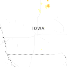


Connect with Interactive Hail Maps