

Hail Map for Coventry Lake, CT
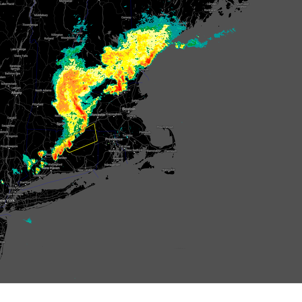
The Coventry Lake, CT area has had 0 reports of on-the-ground hail by trained spotters, and has been under severe weather warnings 15 times during the past 12 months. Doppler radar has detected hail at or near Coventry Lake, CT on 27 occasions, including 1 occasion during the past year.
| Name: | Coventry Lake, CT |
| Where Located: | 47.6 miles W of Providence, RI |
| Map: | Google Map for Coventry Lake, CT |
| Population: | 2990 |
| Housing Units: | 1379 |
| More Info: | Search Google for Coventry Lake, CT |
0
The Top Recent Hail Date for Coventry Lake, CT is Thursday, July 3, 2025 (27th out of 27)

Hail and Wind Damage Spotted near Coventry Lake, CT
| Date / Time | Report Details |
|---|---|
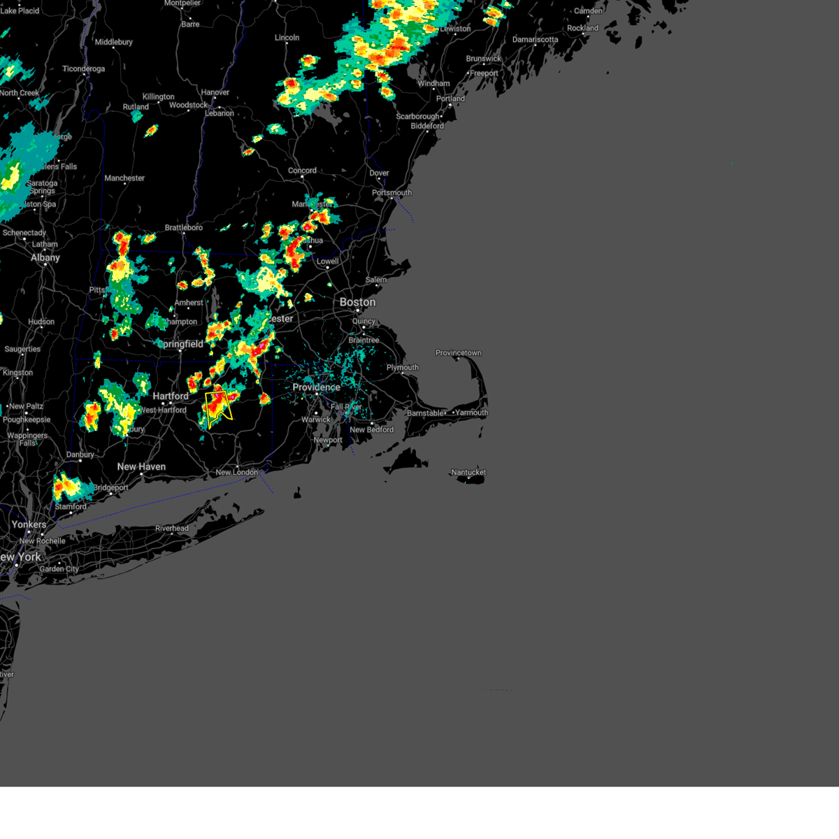
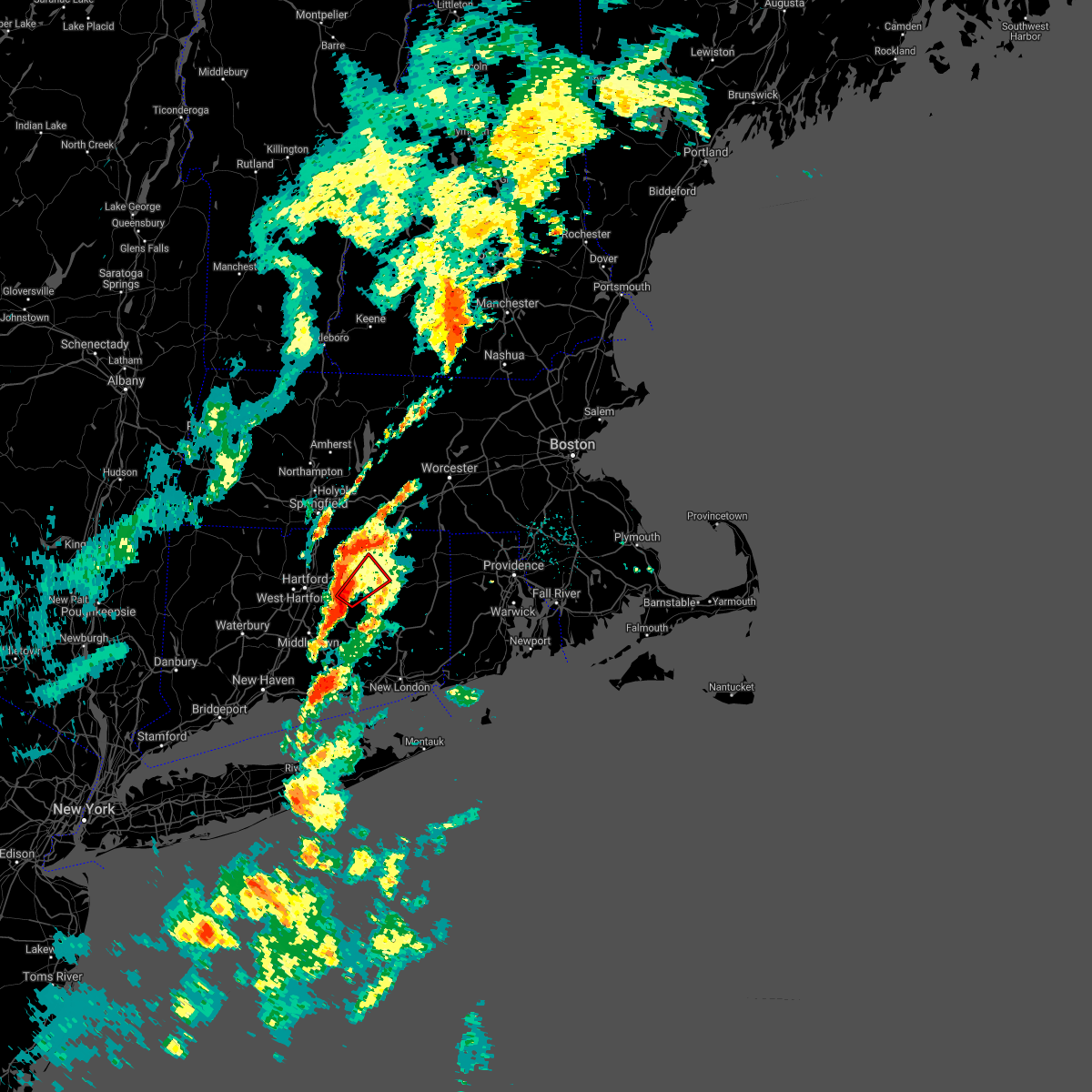
| 7/8/2025 11:40 PM EDT |
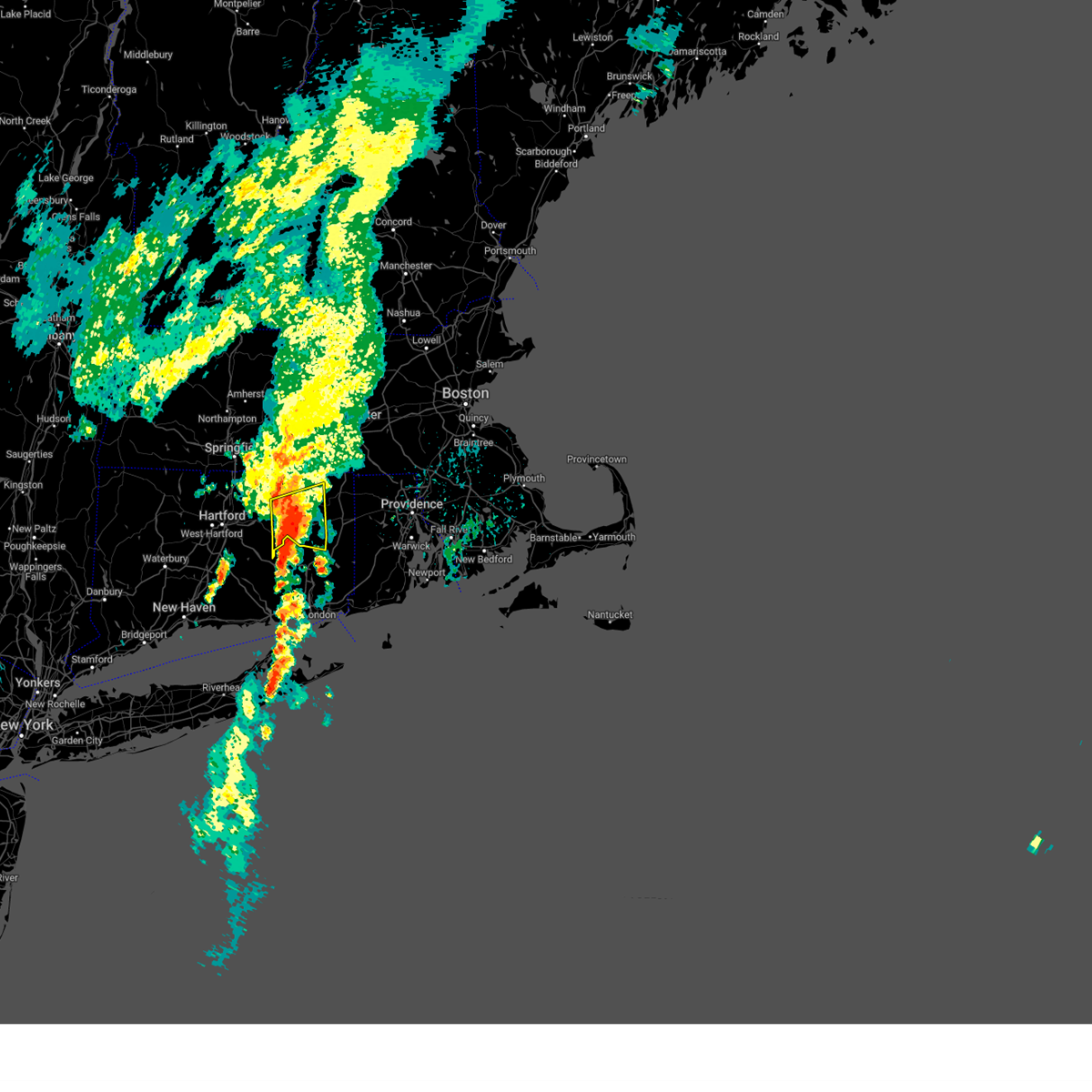
 Svrbox the national weather service in boston/norton has issued a * severe thunderstorm warning for, windham county in northern connecticut, tolland county in northern connecticut, northeastern hartford county in northern connecticut, southern worcester county in central massachusetts, southwestern norfolk county in eastern massachusetts, southeastern hampshire county in western massachusetts, southeastern hampden county in western massachusetts, northwestern bristol county in southeastern massachusetts, north central washington county in rhode island, western kent county in rhode island, providence county in rhode island, * until 1245 am edt. * at 1139 pm edt, severe thunderstorms were located along a line extending from somers to near coventry, moving northeast at 25 mph (radar indicated). Hazards include 60 mph wind gusts and penny size hail. expect damage to trees and power lines Svrbox the national weather service in boston/norton has issued a * severe thunderstorm warning for, windham county in northern connecticut, tolland county in northern connecticut, northeastern hartford county in northern connecticut, southern worcester county in central massachusetts, southwestern norfolk county in eastern massachusetts, southeastern hampshire county in western massachusetts, southeastern hampden county in western massachusetts, northwestern bristol county in southeastern massachusetts, north central washington county in rhode island, western kent county in rhode island, providence county in rhode island, * until 1245 am edt. * at 1139 pm edt, severe thunderstorms were located along a line extending from somers to near coventry, moving northeast at 25 mph (radar indicated). Hazards include 60 mph wind gusts and penny size hail. expect damage to trees and power lines
|
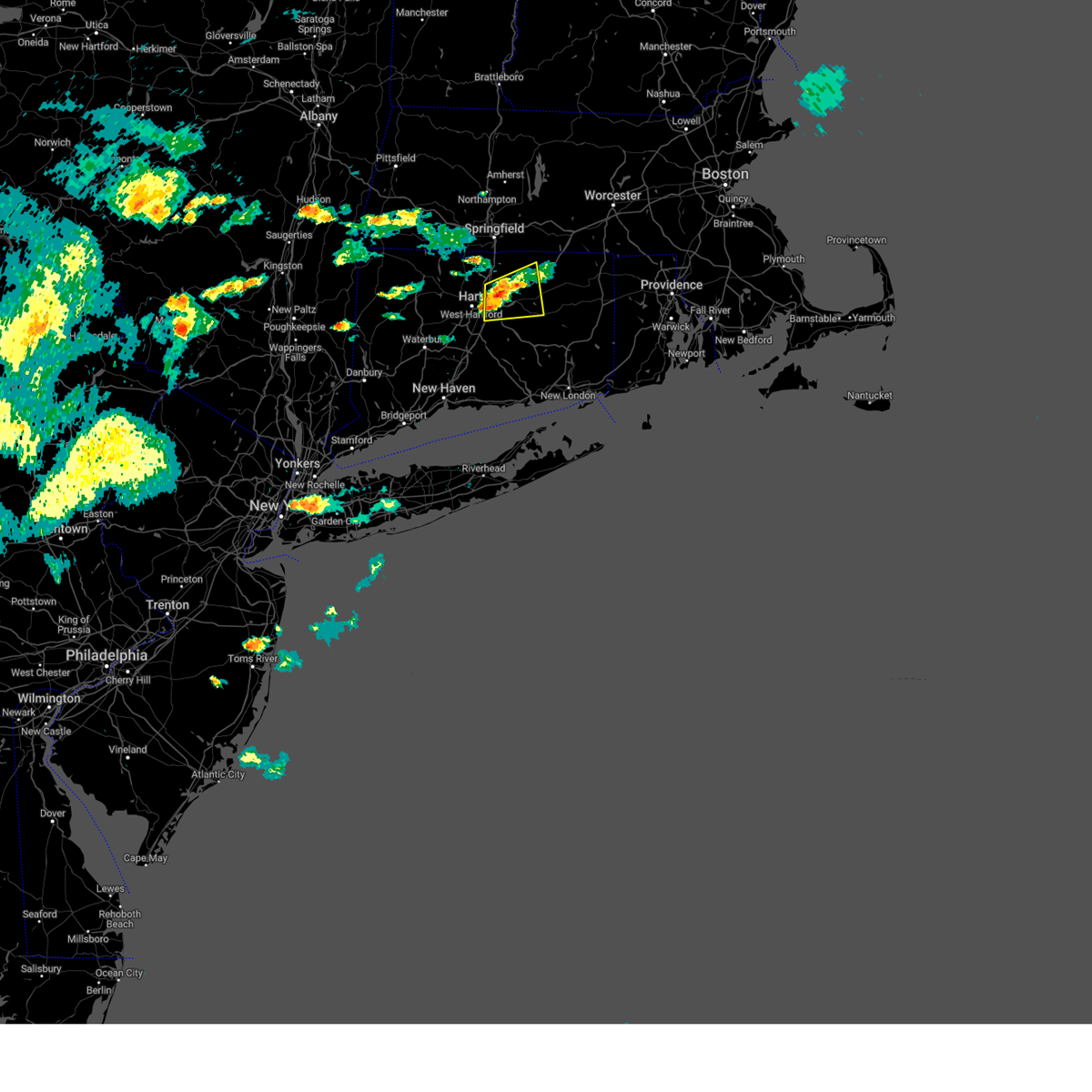
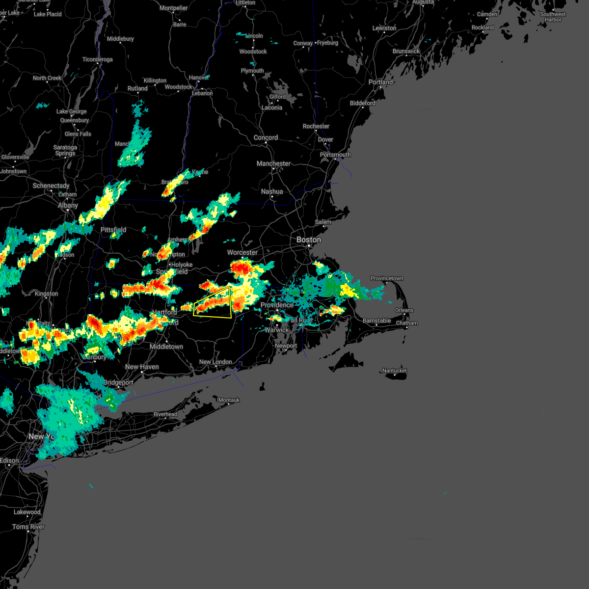
| 7/3/2025 6:12 PM EDT |
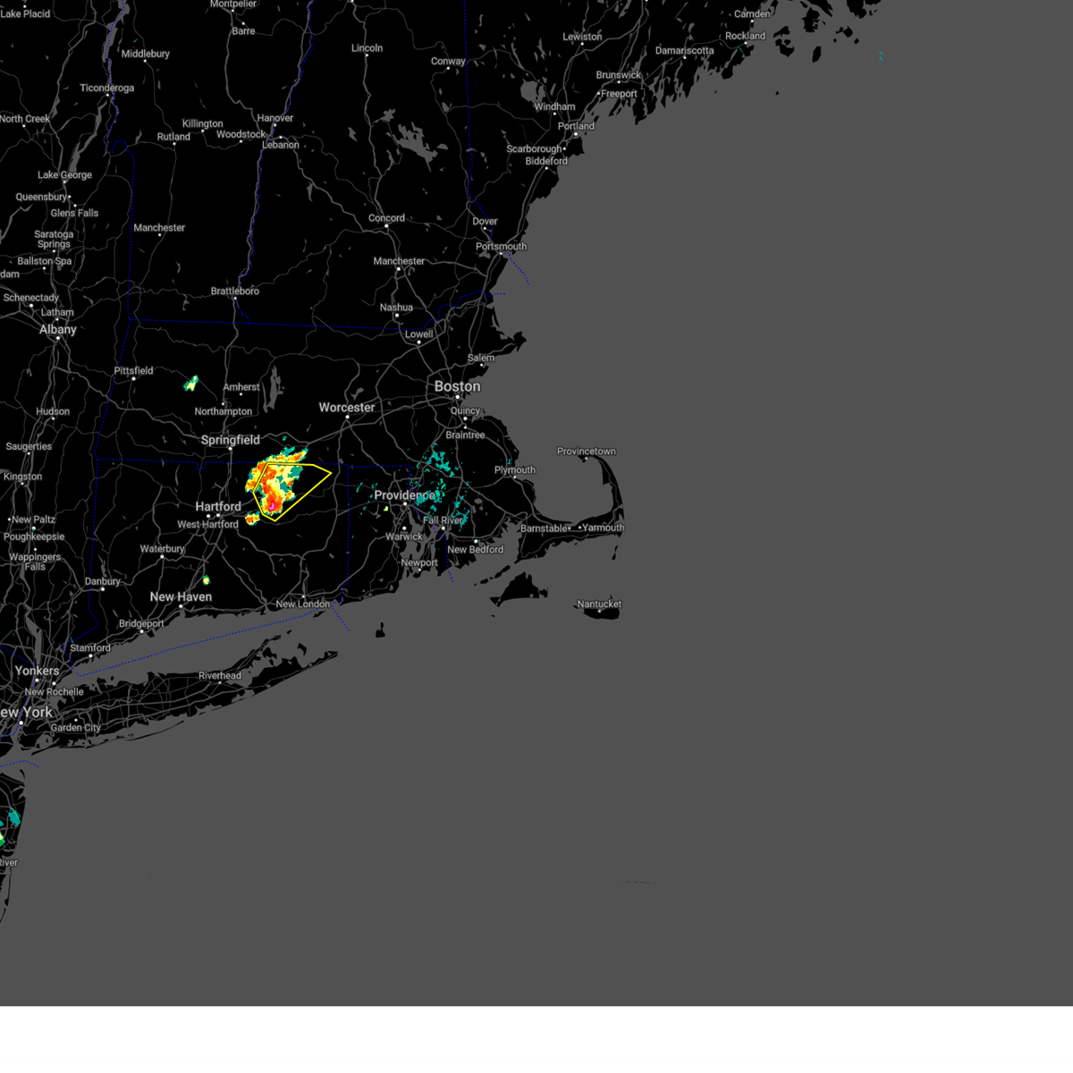
 Svrbox the national weather service in boston/norton has issued a * severe thunderstorm warning for, southwestern windham county in northern connecticut, tolland county in northern connecticut, hartford county in northern connecticut, * until 700 pm edt. * at 611 pm edt, a severe thunderstorm was located over west hartford, moving east at 35 mph (radar indicated). Hazards include 60 mph wind gusts and penny size hail. expect damage to trees and power lines Svrbox the national weather service in boston/norton has issued a * severe thunderstorm warning for, southwestern windham county in northern connecticut, tolland county in northern connecticut, hartford county in northern connecticut, * until 700 pm edt. * at 611 pm edt, a severe thunderstorm was located over west hartford, moving east at 35 mph (radar indicated). Hazards include 60 mph wind gusts and penny size hail. expect damage to trees and power lines
|
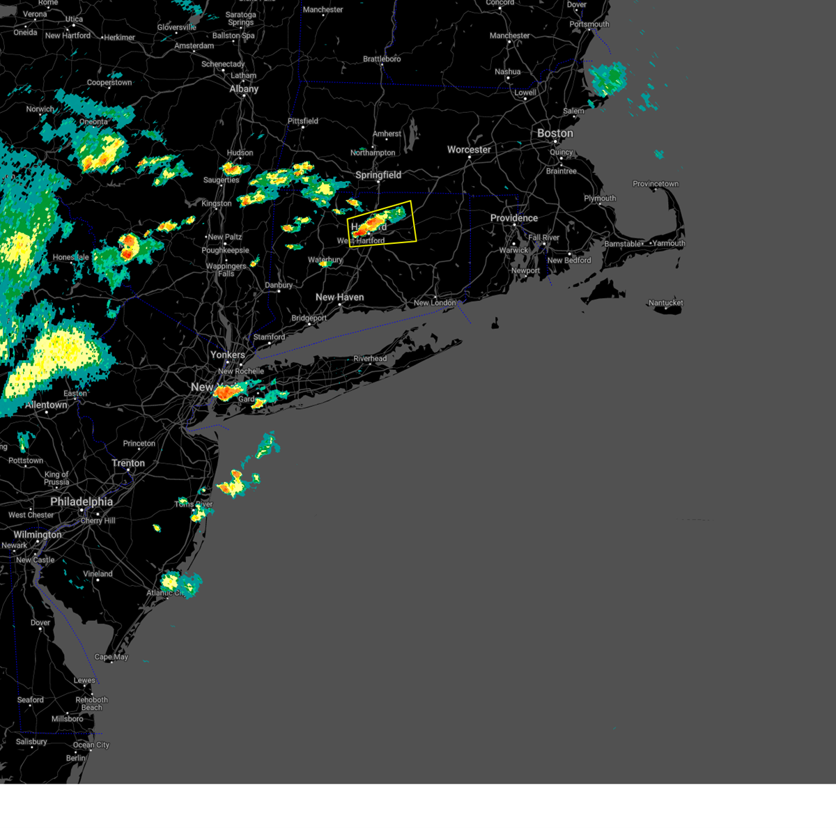
| 7/3/2025 6:09 PM EDT |
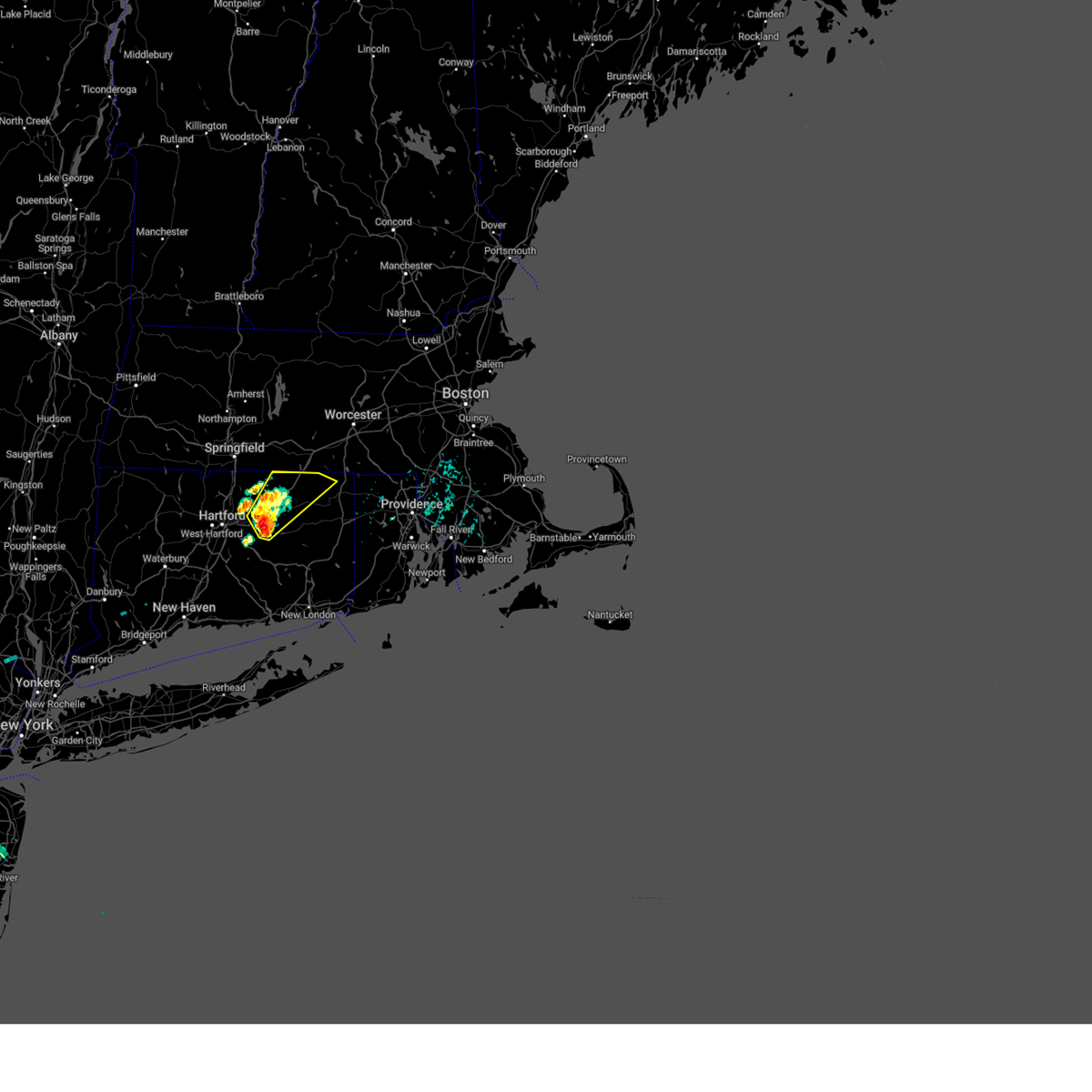
 Svrbox the national weather service in boston/norton has issued a * severe thunderstorm warning for, windham county in northern connecticut, northeastern tolland county in northern connecticut, southeastern worcester county in central massachusetts, southeastern hampden county in western massachusetts, western providence county in rhode island, * until 715 pm edt. * at 609 pm edt, a severe thunderstorm was located over willington, or 9 miles north of mansfield, moving east at 35 mph (radar indicated). Hazards include 60 mph wind gusts and penny size hail. expect damage to trees and power lines Svrbox the national weather service in boston/norton has issued a * severe thunderstorm warning for, windham county in northern connecticut, northeastern tolland county in northern connecticut, southeastern worcester county in central massachusetts, southeastern hampden county in western massachusetts, western providence county in rhode island, * until 715 pm edt. * at 609 pm edt, a severe thunderstorm was located over willington, or 9 miles north of mansfield, moving east at 35 mph (radar indicated). Hazards include 60 mph wind gusts and penny size hail. expect damage to trees and power lines
|
| 7/1/2025 7:29 PM EDT |
 The storm which prompted the warning has weakened below severe limits, and no longer poses an immediate threat to life or property. therefore, the warning will be allowed to expire. The storm which prompted the warning has weakened below severe limits, and no longer poses an immediate threat to life or property. therefore, the warning will be allowed to expire.
|
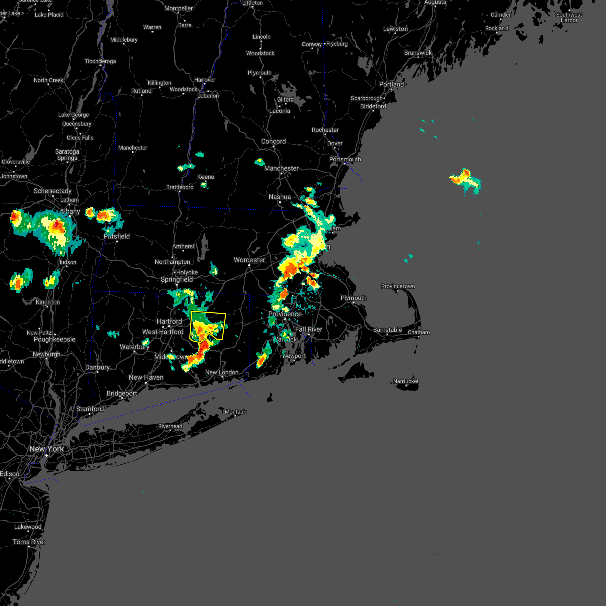
| 7/1/2025 6:49 PM EDT | Svrbox the national weather service in boston/norton has issued a * severe thunderstorm warning for, windham county in northern connecticut, southern tolland county in northern connecticut, east central hartford county in northern connecticut, * until 730 pm edt. * at 649 pm edt, a severe thunderstorm was located over coventry, or near vernon, moving east at 40 mph (radar indicated). Hazards include 60 mph wind gusts and quarter size hail. Hail damage to vehicles is expected. Expect wind damage to trees and power lines. |
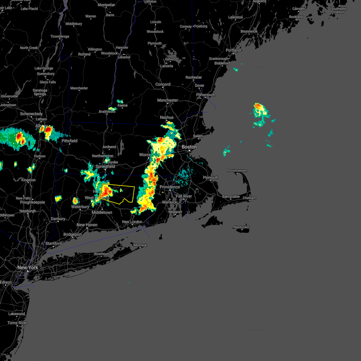
| 5/3/2025 5:11 PM EDT | the severe thunderstorm warning has been cancelled and is no longer in effect |
| 5/3/2025 5:11 PM EDT | At 510 pm edt, a severe thunderstorm was located over hebron, or near colchester, moving northeast at 35 mph (radar indicated). Hazards include 60 mph wind gusts and penny size hail. Expect damage to trees and power lines. Locations impacted include, mansfield, willimantic, ashford, andover, hebron, chaplin, thompson, glastonbury, putnam, eastford, pomfret, coventry, hampton, columbia, manchester, bolton, killingly, marlborough, brooklyn, and willington. |
| 5/3/2025 4:40 PM EDT |
 Svrbox the national weather service in boston/norton has issued a * severe thunderstorm warning for, northern windham county in northern connecticut, tolland county in northern connecticut, east central hartford county in northern connecticut, south central worcester county in central massachusetts, southeastern hampden county in western massachusetts, * until 530 pm edt. * at 440 pm edt, a severe thunderstorm was located over vernon, moving northeast at 45 mph (radar indicated). Hazards include 60 mph wind gusts and nickel size hail. expect damage to trees and power lines Svrbox the national weather service in boston/norton has issued a * severe thunderstorm warning for, northern windham county in northern connecticut, tolland county in northern connecticut, east central hartford county in northern connecticut, south central worcester county in central massachusetts, southeastern hampden county in western massachusetts, * until 530 pm edt. * at 440 pm edt, a severe thunderstorm was located over vernon, moving northeast at 45 mph (radar indicated). Hazards include 60 mph wind gusts and nickel size hail. expect damage to trees and power lines
|
| 5/3/2025 4:07 PM EDT |
 Svrbox the national weather service in boston/norton has issued a * severe thunderstorm warning for, windham county in northern connecticut, tolland county in northern connecticut, central hartford county in northern connecticut, southwestern worcester county in central massachusetts, southeastern hampden county in western massachusetts, * until 445 pm edt. * at 406 pm edt, severe thunderstorms were located along a line extending from near chicopee to near somers to near southington, moving northeast at 65 mph (radar indicated). Hazards include 60 mph wind gusts and penny size hail. expect damage to trees and power lines Svrbox the national weather service in boston/norton has issued a * severe thunderstorm warning for, windham county in northern connecticut, tolland county in northern connecticut, central hartford county in northern connecticut, southwestern worcester county in central massachusetts, southeastern hampden county in western massachusetts, * until 445 pm edt. * at 406 pm edt, severe thunderstorms were located along a line extending from near chicopee to near somers to near southington, moving northeast at 65 mph (radar indicated). Hazards include 60 mph wind gusts and penny size hail. expect damage to trees and power lines
|
| 8/4/2024 5:07 PM EDT |
 The storm which prompted the warning has weakened below severe limits, and no longer poses an immediate threat to life or property. therefore, the warning will be allowed to expire. however gusty winds are still possible with this thunderstorm. The storm which prompted the warning has weakened below severe limits, and no longer poses an immediate threat to life or property. therefore, the warning will be allowed to expire. however gusty winds are still possible with this thunderstorm.
|
| 8/4/2024 4:35 PM EDT |
 At 434 pm edt, a severe thunderstorm was located over tolland, or near vernon, moving east at 20 mph (radar indicated). Hazards include 60 mph wind gusts and penny size hail. Expect damage to trees and power lines. Locations impacted include, vernon, mansfield, windham, willimantic, ellington, tolland, coventry, willington, columbia, bolton, ashford, andover, chaplin, and eastford. At 434 pm edt, a severe thunderstorm was located over tolland, or near vernon, moving east at 20 mph (radar indicated). Hazards include 60 mph wind gusts and penny size hail. Expect damage to trees and power lines. Locations impacted include, vernon, mansfield, windham, willimantic, ellington, tolland, coventry, willington, columbia, bolton, ashford, andover, chaplin, and eastford.
|
| 8/4/2024 4:35 PM EDT |
 the severe thunderstorm warning has been cancelled and is no longer in effect the severe thunderstorm warning has been cancelled and is no longer in effect
|
| 8/4/2024 4:08 PM EDT |
 Svrbox the national weather service in boston/norton has issued a * severe thunderstorm warning for, southwestern windham county in northern connecticut, central tolland county in northern connecticut, northeastern hartford county in northern connecticut, * until 515 pm edt. * at 407 pm edt, a severe thunderstorm was located over south windsor, moving east at 20 mph (radar indicated). Hazards include 60 mph wind gusts and penny size hail. expect damage to trees and power lines Svrbox the national weather service in boston/norton has issued a * severe thunderstorm warning for, southwestern windham county in northern connecticut, central tolland county in northern connecticut, northeastern hartford county in northern connecticut, * until 515 pm edt. * at 407 pm edt, a severe thunderstorm was located over south windsor, moving east at 20 mph (radar indicated). Hazards include 60 mph wind gusts and penny size hail. expect damage to trees and power lines
|
| 7/16/2024 9:26 PM EDT | At 926 pm edt, a severe thunderstorm was located over mansfield, moving east at 50 mph (radar indicated). Hazards include 60 mph wind gusts and quarter size hail. Hail damage to vehicles is expected. expect wind damage to roofs, siding, and trees. Locations impacted include, manchester, vernon, mansfield, windham, plainfield, willimantic, killingly, tolland, coventry, hebron, putnam, thompson, brooklyn, woodstock, willington, columbia, canterbury, bolton, ashford, and pomfret. |
| 7/16/2024 9:11 PM EDT |
 Svrbox the national weather service in boston/norton has issued a * severe thunderstorm warning for, windham county in northern connecticut, central tolland county in northern connecticut, east central hartford county in northern connecticut, * until 1015 pm edt. * at 911 pm edt, a severe thunderstorm was located over east hartford, moving east at 45 mph (radar indicated). Hazards include 60 mph wind gusts and quarter size hail. Hail damage to vehicles is expected. Expect wind damage to roofs, siding, and trees. Svrbox the national weather service in boston/norton has issued a * severe thunderstorm warning for, windham county in northern connecticut, central tolland county in northern connecticut, east central hartford county in northern connecticut, * until 1015 pm edt. * at 911 pm edt, a severe thunderstorm was located over east hartford, moving east at 45 mph (radar indicated). Hazards include 60 mph wind gusts and quarter size hail. Hail damage to vehicles is expected. Expect wind damage to roofs, siding, and trees.
|
| 6/30/2024 2:21 PM EDT |
 The storms which prompted the warning have moved out of the area. therefore, the warning will be allowed to expire. a severe thunderstorm watch remains in effect until 700 pm edt for northern connecticut. The storms which prompted the warning have moved out of the area. therefore, the warning will be allowed to expire. a severe thunderstorm watch remains in effect until 700 pm edt for northern connecticut.
|
| 6/30/2024 2:11 PM EDT |
 At 211 pm edt, severe thunderstorms were located along a line extending from willington to near hebron, moving east at 35 mph (radar indicated). Hazards include golf ball size hail and 70 mph wind gusts...especially in areas around willimantic, columbia, hebron and windham. People and animals outdoors will be injured. expect hail damage to roofs, siding, windows, and vehicles. expect considerable tree damage. wind damage is also likely to mobile homes, roofs, and outbuildings. Locations impacted include, mansfield, windham, plainfield, willimantic, killingly, coventry, stafford, hebron, putnam, thompson, brooklyn, woodstock, willington, columbia, canterbury, ashford, pomfret, sterling, andover, and chaplin. At 211 pm edt, severe thunderstorms were located along a line extending from willington to near hebron, moving east at 35 mph (radar indicated). Hazards include golf ball size hail and 70 mph wind gusts...especially in areas around willimantic, columbia, hebron and windham. People and animals outdoors will be injured. expect hail damage to roofs, siding, windows, and vehicles. expect considerable tree damage. wind damage is also likely to mobile homes, roofs, and outbuildings. Locations impacted include, mansfield, windham, plainfield, willimantic, killingly, coventry, stafford, hebron, putnam, thompson, brooklyn, woodstock, willington, columbia, canterbury, ashford, pomfret, sterling, andover, and chaplin.
|
| 6/30/2024 2:11 PM EDT |
 the severe thunderstorm warning has been cancelled and is no longer in effect the severe thunderstorm warning has been cancelled and is no longer in effect
|
| 6/30/2024 2:03 PM EDT |
 Svrbox the national weather service in boston/norton has issued a * severe thunderstorm warning for, windham county in northern connecticut, central tolland county in northern connecticut, southeastern hartford county in northern connecticut, * until 300 pm edt. * at 203 pm edt, severe thunderstorms were located along a line extending from near willington to marlborough, moving east at 35 mph (radar indicated). Hazards include 60 mph wind gusts and penny size hail. expect damage to roofs, siding, and trees Svrbox the national weather service in boston/norton has issued a * severe thunderstorm warning for, windham county in northern connecticut, central tolland county in northern connecticut, southeastern hartford county in northern connecticut, * until 300 pm edt. * at 203 pm edt, severe thunderstorms were located along a line extending from near willington to marlborough, moving east at 35 mph (radar indicated). Hazards include 60 mph wind gusts and penny size hail. expect damage to roofs, siding, and trees
|
| 6/30/2024 2:00 PM EDT |
 At 159 pm edt, severe thunderstorms were located along a line extending from stafford to coventry to near marlborough, moving east at 35 mph (radar indicated). Hazards include 60 mph wind gusts and nickel size hail. Expect damage to roofs, siding, and trees. Locations impacted include, manchester, glastonbury, vernon, mansfield, ellington, tolland, coventry, stafford, hebron, marlborough, willington, columbia, bolton, and andover. At 159 pm edt, severe thunderstorms were located along a line extending from stafford to coventry to near marlborough, moving east at 35 mph (radar indicated). Hazards include 60 mph wind gusts and nickel size hail. Expect damage to roofs, siding, and trees. Locations impacted include, manchester, glastonbury, vernon, mansfield, ellington, tolland, coventry, stafford, hebron, marlborough, willington, columbia, bolton, and andover.
|
| 6/30/2024 2:00 PM EDT |
 the severe thunderstorm warning has been cancelled and is no longer in effect the severe thunderstorm warning has been cancelled and is no longer in effect
|
| 6/30/2024 1:44 PM EDT |
 At 143 pm edt, severe thunderstorms were located along a line extending from somers to near vernon to near berlin, moving east at 40 mph (radar indicated). Hazards include 60 mph wind gusts and nickel size hail. Expect damage to roofs, siding, and trees. Locations impacted include, hartford, new britain, manchester, east hartford, enfield, glastonbury, newington, vernon, windsor, wethersfield, mansfield, south windsor, berlin, rocky hill, longmeadow, east longmeadow, ellington, tolland, windsor locks, and coventry. At 143 pm edt, severe thunderstorms were located along a line extending from somers to near vernon to near berlin, moving east at 40 mph (radar indicated). Hazards include 60 mph wind gusts and nickel size hail. Expect damage to roofs, siding, and trees. Locations impacted include, hartford, new britain, manchester, east hartford, enfield, glastonbury, newington, vernon, windsor, wethersfield, mansfield, south windsor, berlin, rocky hill, longmeadow, east longmeadow, ellington, tolland, windsor locks, and coventry.
|
| 6/30/2024 1:29 PM EDT |
 Svrbox the national weather service in boston/norton has issued a * severe thunderstorm warning for, tolland county in northern connecticut, eastern hartford county in northern connecticut, southeastern hampden county in western massachusetts, * until 230 pm edt. * at 129 pm edt, severe thunderstorms were located along a line extending from near suffield to near hartford to southington, moving east at 40 mph (radar indicated). Hazards include 60 mph wind gusts and quarter size hail. Hail damage to vehicles is expected. Expect wind damage to roofs, siding, and trees. Svrbox the national weather service in boston/norton has issued a * severe thunderstorm warning for, tolland county in northern connecticut, eastern hartford county in northern connecticut, southeastern hampden county in western massachusetts, * until 230 pm edt. * at 129 pm edt, severe thunderstorms were located along a line extending from near suffield to near hartford to southington, moving east at 40 mph (radar indicated). Hazards include 60 mph wind gusts and quarter size hail. Hail damage to vehicles is expected. Expect wind damage to roofs, siding, and trees.
|
| 6/26/2024 10:39 PM EDT |
 The storms which prompted the warning have moved out of the area. therefore, the warning will be allowed to expire. a severe thunderstorm watch remains in effect until midnight edt for northern connecticut. The storms which prompted the warning have moved out of the area. therefore, the warning will be allowed to expire. a severe thunderstorm watch remains in effect until midnight edt for northern connecticut.
|
| 6/26/2024 10:36 PM EDT |
 the severe thunderstorm warning has been cancelled and is no longer in effect the severe thunderstorm warning has been cancelled and is no longer in effect
|
| 6/26/2024 10:36 PM EDT |
 At 1035 pm edt, severe thunderstorms were located along a line extending from near wilbraham to near willington to near lebanon, moving northeast at 50 mph (radar indicated). Hazards include 70 mph wind gusts. Expect considerable tree damage. damage is likely to mobile homes, roofs, and outbuildings. Locations impacted include, mansfield, ludlow, willimantic, ellington, tolland, wilbraham, coventry, palmer, stafford, somers, hebron, monson, willington, columbia, hampden, brimfield, andover, wales, and union. At 1035 pm edt, severe thunderstorms were located along a line extending from near wilbraham to near willington to near lebanon, moving northeast at 50 mph (radar indicated). Hazards include 70 mph wind gusts. Expect considerable tree damage. damage is likely to mobile homes, roofs, and outbuildings. Locations impacted include, mansfield, ludlow, willimantic, ellington, tolland, wilbraham, coventry, palmer, stafford, somers, hebron, monson, willington, columbia, hampden, brimfield, andover, wales, and union.
|
| 6/26/2024 10:22 PM EDT |
 At 1021 pm edt, severe thunderstorms were located along a line extending from agawam to vernon to near east hampton, moving northeast at 55 mph. these are destructive storms for rockville, tolland, somers and stafford springs. these storms have a history of producing 77 mph winds at bradley international airport. take cover immediately! (radar indicated). Hazards include 80 mph wind gusts. Flying debris will be dangerous to those caught without shelter. mobile homes will be heavily damaged. expect considerable damage to roofs, windows, and vehicles. extensive tree damage and power outages are likely. Locations impacted include, springfield, manchester, chicopee, east hartford, enfield, glastonbury, vernon, agawam, west springfield, mansfield, south windsor, ludlow, willimantic, longmeadow, suffield, east longmeadow, ellington, tolland, wilbraham, and windsor locks. At 1021 pm edt, severe thunderstorms were located along a line extending from agawam to vernon to near east hampton, moving northeast at 55 mph. these are destructive storms for rockville, tolland, somers and stafford springs. these storms have a history of producing 77 mph winds at bradley international airport. take cover immediately! (radar indicated). Hazards include 80 mph wind gusts. Flying debris will be dangerous to those caught without shelter. mobile homes will be heavily damaged. expect considerable damage to roofs, windows, and vehicles. extensive tree damage and power outages are likely. Locations impacted include, springfield, manchester, chicopee, east hartford, enfield, glastonbury, vernon, agawam, west springfield, mansfield, south windsor, ludlow, willimantic, longmeadow, suffield, east longmeadow, ellington, tolland, wilbraham, and windsor locks.
|
| 6/26/2024 10:07 PM EDT |
 Svrbox the national weather service in boston/norton has issued a * severe thunderstorm warning for, tolland county in northern connecticut, eastern hartford county in northern connecticut, southeastern hampden county in western massachusetts, * until 1045 pm edt. * at 1007 pm edt, severe thunderstorms were located along a line extending from granby to near wethersfield to near north madison, moving east at 50 mph (radar indicated). Hazards include 70 mph wind gusts. Expect considerable tree damage. Damage is likely to mobile homes, roofs, and outbuildings. Svrbox the national weather service in boston/norton has issued a * severe thunderstorm warning for, tolland county in northern connecticut, eastern hartford county in northern connecticut, southeastern hampden county in western massachusetts, * until 1045 pm edt. * at 1007 pm edt, severe thunderstorms were located along a line extending from granby to near wethersfield to near north madison, moving east at 50 mph (radar indicated). Hazards include 70 mph wind gusts. Expect considerable tree damage. Damage is likely to mobile homes, roofs, and outbuildings.
|
| 6/23/2024 6:37 PM EDT |
 the severe thunderstorm warning has been cancelled and is no longer in effect the severe thunderstorm warning has been cancelled and is no longer in effect
|
| 6/23/2024 6:23 PM EDT |
 the severe thunderstorm warning has been cancelled and is no longer in effect the severe thunderstorm warning has been cancelled and is no longer in effect
|
| 6/23/2024 6:23 PM EDT |
 At 623 pm edt, a severe thunderstorm was located over tolland, or near vernon, moving east at 40 mph (radar indicated). Hazards include 60 mph wind gusts and quarter size hail. Hail damage to vehicles is expected. expect wind damage to roofs, siding, and trees. Locations impacted include, vernon, mansfield, ellington, tolland, coventry, stafford, willington, bolton, and andover. At 623 pm edt, a severe thunderstorm was located over tolland, or near vernon, moving east at 40 mph (radar indicated). Hazards include 60 mph wind gusts and quarter size hail. Hail damage to vehicles is expected. expect wind damage to roofs, siding, and trees. Locations impacted include, vernon, mansfield, ellington, tolland, coventry, stafford, willington, bolton, and andover.
|
| 6/23/2024 6:09 PM EDT |
 Svrbox the national weather service in boston/norton has issued a * severe thunderstorm warning for, central tolland county in northern connecticut, northeastern hartford county in northern connecticut, * until 700 pm edt. * at 609 pm edt, a severe thunderstorm was located over south windsor, moving east at 35 mph (radar indicated). Hazards include 60 mph wind gusts and quarter size hail. Hail damage to vehicles is expected. Expect wind damage to roofs, siding, and trees. Svrbox the national weather service in boston/norton has issued a * severe thunderstorm warning for, central tolland county in northern connecticut, northeastern hartford county in northern connecticut, * until 700 pm edt. * at 609 pm edt, a severe thunderstorm was located over south windsor, moving east at 35 mph (radar indicated). Hazards include 60 mph wind gusts and quarter size hail. Hail damage to vehicles is expected. Expect wind damage to roofs, siding, and trees.
|
| 5/8/2024 8:46 PM EDT |
 Svrbox the national weather service in boston/norton has issued a * severe thunderstorm warning for, windham county in northern connecticut, central tolland county in northern connecticut, * until 930 pm edt. * at 846 pm edt, a severe thunderstorm was located near coventry, or near mansfield, moving east at 40 mph (radar indicated). Hazards include quarter size hail. damage to vehicles is expected Svrbox the national weather service in boston/norton has issued a * severe thunderstorm warning for, windham county in northern connecticut, central tolland county in northern connecticut, * until 930 pm edt. * at 846 pm edt, a severe thunderstorm was located near coventry, or near mansfield, moving east at 40 mph (radar indicated). Hazards include quarter size hail. damage to vehicles is expected
|
| 9/13/2023 11:04 AM EDT |
 At 1104 am edt, severe thunderstorms were located along a line extending from near mansfield to near lebanon to near colchester, moving northeast at 20 mph (radar indicated). Hazards include 60 mph wind gusts. Expect damage to roofs, siding, and trees. Locations impacted include, mansfield, windham, willimantic, tolland, coventry, hebron, brooklyn, woodstock, willington, columbia, canterbury, ashford, pomfret, andover, chaplin, hampton, eastford, and scotland. At 1104 am edt, severe thunderstorms were located along a line extending from near mansfield to near lebanon to near colchester, moving northeast at 20 mph (radar indicated). Hazards include 60 mph wind gusts. Expect damage to roofs, siding, and trees. Locations impacted include, mansfield, windham, willimantic, tolland, coventry, hebron, brooklyn, woodstock, willington, columbia, canterbury, ashford, pomfret, andover, chaplin, hampton, eastford, and scotland.
|
| 9/13/2023 10:51 AM EDT |
 At 1050 am edt, severe thunderstorms were located along a line extending from coventry to near colchester to near salem, moving northeast at 20 mph (radar indicated). Hazards include 60 mph wind gusts. expect damage to roofs, siding, and trees At 1050 am edt, severe thunderstorms were located along a line extending from coventry to near colchester to near salem, moving northeast at 20 mph (radar indicated). Hazards include 60 mph wind gusts. expect damage to roofs, siding, and trees
|
| 9/13/2023 8:36 AM EDT |
 At 836 am edt, severe thunderstorms were located along a line extending from near canton to plainville to near southington, moving northeast at 35 mph (radar indicated). Hazards include 60 mph wind gusts. expect damage to roofs, siding, and trees At 836 am edt, severe thunderstorms were located along a line extending from near canton to plainville to near southington, moving northeast at 35 mph (radar indicated). Hazards include 60 mph wind gusts. expect damage to roofs, siding, and trees
|
| 9/8/2023 6:17 PM EDT |
 At 616 pm edt, severe thunderstorms were located along a line extending from hampden to stafford to near willington, moving northeast at 50 mph (radar indicated). Hazards include 60 mph wind gusts and quarter size hail. Hail damage to vehicles is expected. expect wind damage to roofs, siding, and trees. locations impacted include, manchester, east hartford, enfield, glastonbury, vernon, windsor, mansfield, south windsor, windham, plainfield, bloomfield, rocky hill, willimantic, killingly, webster, southbridge, suffield, east longmeadow, ellington, and tolland. hail threat, radar indicated max hail size, 1. 00 in wind threat, radar indicated max wind gust, 60 mph. At 616 pm edt, severe thunderstorms were located along a line extending from hampden to stafford to near willington, moving northeast at 50 mph (radar indicated). Hazards include 60 mph wind gusts and quarter size hail. Hail damage to vehicles is expected. expect wind damage to roofs, siding, and trees. locations impacted include, manchester, east hartford, enfield, glastonbury, vernon, windsor, mansfield, south windsor, windham, plainfield, bloomfield, rocky hill, willimantic, killingly, webster, southbridge, suffield, east longmeadow, ellington, and tolland. hail threat, radar indicated max hail size, 1. 00 in wind threat, radar indicated max wind gust, 60 mph.
|
| 9/8/2023 5:58 PM EDT |
 At 558 pm edt, severe thunderstorms were located along a line extending from east windsor to vernon to near manchester, moving northeast at 55 mph (radar indicated). Hazards include 60 mph wind gusts and quarter size hail. Hail damage to vehicles is expected. Expect wind damage to roofs, siding, and trees. At 558 pm edt, severe thunderstorms were located along a line extending from east windsor to vernon to near manchester, moving northeast at 55 mph (radar indicated). Hazards include 60 mph wind gusts and quarter size hail. Hail damage to vehicles is expected. Expect wind damage to roofs, siding, and trees.
|
| 9/8/2023 1:06 PM EDT |
 At 106 pm edt, a severe thunderstorm was located over coventry, or near mansfield, moving northeast at 25 mph (radar indicated). Hazards include 60 mph wind gusts and quarter size hail. Hail damage to vehicles is expected. expect wind damage to roofs, siding, and trees. locations impacted include, vernon, mansfield, ellington, tolland, coventry, stafford, thompson, woodstock, willington, ashford, pomfret, chaplin, eastford, and union. hail threat, radar indicated max hail size, 1. 00 in wind threat, radar indicated max wind gust, 60 mph. At 106 pm edt, a severe thunderstorm was located over coventry, or near mansfield, moving northeast at 25 mph (radar indicated). Hazards include 60 mph wind gusts and quarter size hail. Hail damage to vehicles is expected. expect wind damage to roofs, siding, and trees. locations impacted include, vernon, mansfield, ellington, tolland, coventry, stafford, thompson, woodstock, willington, ashford, pomfret, chaplin, eastford, and union. hail threat, radar indicated max hail size, 1. 00 in wind threat, radar indicated max wind gust, 60 mph.
|
| 9/8/2023 1:00 PM EDT | Corrects previous non-tstm wnd dmg report from andover. corrects previous non-tstm wnd dmg report from andover. tree and wires down on shoddy mill road. relayed by amat in tolland county CT, 3.6 miles NNE of Coventry Lake, CT |
| 9/8/2023 12:52 PM EDT |
 At 1252 pm edt, a severe thunderstorm was located over bolton, or near vernon, moving northeast at 25 mph (radar indicated). Hazards include 60 mph wind gusts and quarter size hail. Hail damage to vehicles is expected. expect wind damage to roofs, siding, and trees. locations impacted include, manchester, vernon, mansfield, ellington, tolland, coventry, stafford, hebron, thompson, woodstock, willington, columbia, bolton, ashford, pomfret, andover, chaplin, eastford, and union. hail threat, radar indicated max hail size, 1. 00 in wind threat, radar indicated max wind gust, 60 mph. At 1252 pm edt, a severe thunderstorm was located over bolton, or near vernon, moving northeast at 25 mph (radar indicated). Hazards include 60 mph wind gusts and quarter size hail. Hail damage to vehicles is expected. expect wind damage to roofs, siding, and trees. locations impacted include, manchester, vernon, mansfield, ellington, tolland, coventry, stafford, hebron, thompson, woodstock, willington, columbia, bolton, ashford, pomfret, andover, chaplin, eastford, and union. hail threat, radar indicated max hail size, 1. 00 in wind threat, radar indicated max wind gust, 60 mph.
|
| 9/8/2023 12:31 PM EDT |
 At 1230 pm edt, a severe thunderstorm was located over glastonbury, moving northeast at 35 mph (radar indicated). Hazards include 60 mph wind gusts and quarter size hail. Hail damage to vehicles is expected. Expect wind damage to roofs, siding, and trees. At 1230 pm edt, a severe thunderstorm was located over glastonbury, moving northeast at 35 mph (radar indicated). Hazards include 60 mph wind gusts and quarter size hail. Hail damage to vehicles is expected. Expect wind damage to roofs, siding, and trees.
|
| 8/18/2023 7:41 AM EDT |
 The severe thunderstorm warning for southwestern windham, central tolland and southeastern hartford counties will expire at 745 am edt, the storm which prompted the warning has weakened below severe limits, and no longer poses an immediate threat to life or property. therefore, the warning will be allowed to expire. however gusty winds and heavy rain are still possible with this thunderstorm. The severe thunderstorm warning for southwestern windham, central tolland and southeastern hartford counties will expire at 745 am edt, the storm which prompted the warning has weakened below severe limits, and no longer poses an immediate threat to life or property. therefore, the warning will be allowed to expire. however gusty winds and heavy rain are still possible with this thunderstorm.
|
| 8/18/2023 7:20 AM EDT |
 At 719 am edt, a severe thunderstorm was located over bolton, or near vernon, moving northeast at 40 mph (radar indicated). Hazards include 60 mph wind gusts and nickel size hail. Expect damage to roofs, siding, and trees. Locations impacted include, manchester, east hartford, glastonbury, vernon, mansfield, windham, willimantic, tolland, coventry, hebron, marlborough, willington, columbia, bolton, ashford, andover, chaplin, and scotland. At 719 am edt, a severe thunderstorm was located over bolton, or near vernon, moving northeast at 40 mph (radar indicated). Hazards include 60 mph wind gusts and nickel size hail. Expect damage to roofs, siding, and trees. Locations impacted include, manchester, east hartford, glastonbury, vernon, mansfield, windham, willimantic, tolland, coventry, hebron, marlborough, willington, columbia, bolton, ashford, andover, chaplin, and scotland.
|
| 8/18/2023 6:49 AM EDT |
 At 649 am edt, a severe thunderstorm was located over meriden, moving east at 30 mph (radar indicated). Hazards include 60 mph wind gusts and nickel size hail. expect damage to roofs, siding, and trees At 649 am edt, a severe thunderstorm was located over meriden, moving east at 30 mph (radar indicated). Hazards include 60 mph wind gusts and nickel size hail. expect damage to roofs, siding, and trees
|
| 7/29/2023 3:06 PM EDT |
 At 306 pm edt, a severe thunderstorm was located over columbia, or 8 miles southwest of mansfield, moving east at 15 mph (radar indicated). Hazards include 60 mph wind gusts and penny size hail. Expect damage to trees and power lines. locations impacted include, mansfield, windham, plainfield, willimantic, coventry, hebron, brooklyn, columbia, canterbury, pomfret, andover, chaplin, hampton and scotland. hail threat, radar indicated max hail size, 0. 75 in wind threat, radar indicated max wind gust, 60 mph. At 306 pm edt, a severe thunderstorm was located over columbia, or 8 miles southwest of mansfield, moving east at 15 mph (radar indicated). Hazards include 60 mph wind gusts and penny size hail. Expect damage to trees and power lines. locations impacted include, mansfield, windham, plainfield, willimantic, coventry, hebron, brooklyn, columbia, canterbury, pomfret, andover, chaplin, hampton and scotland. hail threat, radar indicated max hail size, 0. 75 in wind threat, radar indicated max wind gust, 60 mph.
|
| 7/29/2023 2:50 PM EDT |
 At 250 pm edt, a severe thunderstorm was located over andover, or near manchester, moving east at 25 mph (radar indicated). Hazards include 60 mph wind gusts and penny size hail. expect damage to trees and power lines At 250 pm edt, a severe thunderstorm was located over andover, or near manchester, moving east at 25 mph (radar indicated). Hazards include 60 mph wind gusts and penny size hail. expect damage to trees and power lines
|
| 7/27/2023 5:36 PM EDT |
 At 533 pm edt, a severe thunderstorm was located over ashford, or 8 miles north of mansfield, moving east at 40 mph (trained weather spotters have reported pockets of wind damage west hartford, simsbury and south windsor). Hazards include 60 mph wind gusts and half dollar size hail. Expect wind damage to trees and power lines. minor hail damage to vehicles is possible. locations impacted include, hartford, west hartford, manchester, east hartford, enfield, glastonbury, newington, vernon, windsor, wethersfield, mansfield, south windsor, windham, plainfield, bloomfield, berlin, rocky hill, willimantic, killingly and webster hail threat, radar indicated max hail size, 1. 25 in wind threat, radar indicated max wind gust, 60 mph. At 533 pm edt, a severe thunderstorm was located over ashford, or 8 miles north of mansfield, moving east at 40 mph (trained weather spotters have reported pockets of wind damage west hartford, simsbury and south windsor). Hazards include 60 mph wind gusts and half dollar size hail. Expect wind damage to trees and power lines. minor hail damage to vehicles is possible. locations impacted include, hartford, west hartford, manchester, east hartford, enfield, glastonbury, newington, vernon, windsor, wethersfield, mansfield, south windsor, windham, plainfield, bloomfield, berlin, rocky hill, willimantic, killingly and webster hail threat, radar indicated max hail size, 1. 25 in wind threat, radar indicated max wind gust, 60 mph.
|
| 7/27/2023 5:22 PM EDT |
 At 521 pm edt, a severe thunderstorm was located over east windsor, or near vernon, moving east at 40 mph (radar indicated). Hazards include 60 mph wind gusts and penny size hail. expect damage to trees and power lines At 521 pm edt, a severe thunderstorm was located over east windsor, or near vernon, moving east at 40 mph (radar indicated). Hazards include 60 mph wind gusts and penny size hail. expect damage to trees and power lines
|
| 7/27/2023 5:14 PM EDT |
 At 514 pm edt, a severe thunderstorm was located over east windsor, or near enfield, moving east at 40 mph (radar indicated). Hazards include 60 mph wind gusts and penny size hail. Expect damage to trees and power lines. locations impacted include, springfield, hartford, new britain, west hartford, bristol, manchester, east hartford, enfield, westfield, glastonbury, newington, vernon, windsor, agawam, west springfield, wethersfield, south windsor, farmington, simsbury and bloomfield. hail threat, radar indicated max hail size, 0. 75 in wind threat, radar indicated max wind gust, 60 mph. At 514 pm edt, a severe thunderstorm was located over east windsor, or near enfield, moving east at 40 mph (radar indicated). Hazards include 60 mph wind gusts and penny size hail. Expect damage to trees and power lines. locations impacted include, springfield, hartford, new britain, west hartford, bristol, manchester, east hartford, enfield, westfield, glastonbury, newington, vernon, windsor, agawam, west springfield, wethersfield, south windsor, farmington, simsbury and bloomfield. hail threat, radar indicated max hail size, 0. 75 in wind threat, radar indicated max wind gust, 60 mph.
|
| 7/27/2023 5:03 PM EDT |
 At 502 pm edt, a severe thunderstorm was located over avon, or near farmington, moving east at 35 mph (radar indicated). Hazards include 60 mph wind gusts and penny size hail. Expect damage to trees and power lines. locations impacted include, springfield, hartford, new britain, west hartford, bristol, manchester, east hartford, enfield, westfield, glastonbury, newington, vernon, windsor, agawam, west springfield, wethersfield, south windsor, farmington, simsbury and bloomfield. hail threat, radar indicated max hail size, 0. 75 in wind threat, radar indicated max wind gust, 60 mph. At 502 pm edt, a severe thunderstorm was located over avon, or near farmington, moving east at 35 mph (radar indicated). Hazards include 60 mph wind gusts and penny size hail. Expect damage to trees and power lines. locations impacted include, springfield, hartford, new britain, west hartford, bristol, manchester, east hartford, enfield, westfield, glastonbury, newington, vernon, windsor, agawam, west springfield, wethersfield, south windsor, farmington, simsbury and bloomfield. hail threat, radar indicated max hail size, 0. 75 in wind threat, radar indicated max wind gust, 60 mph.
|
| 7/27/2023 4:35 PM EDT |
 At 435 pm edt, a severe thunderstorm was located near litchfield, or near torrington, moving east at 35 mph (radar indicated). Hazards include 60 mph wind gusts and penny size hail. expect damage to trees and power lines At 435 pm edt, a severe thunderstorm was located near litchfield, or near torrington, moving east at 35 mph (radar indicated). Hazards include 60 mph wind gusts and penny size hail. expect damage to trees and power lines
|
| 7/14/2023 9:32 AM EDT |
 At 932 am edt, a severe thunderstorm was located over bloomfield, or near west hartford, moving northeast at 40 mph (radar indicated). Hazards include 60 mph wind gusts and quarter size hail. Expect wind damage to trees and power lines. minor hail damage to vehicles is possible. locations impacted include, hartford, new britain, west hartford, manchester, east hartford, enfield, glastonbury, newington, vernon, windsor, wethersfield, mansfield, south windsor, farmington, simsbury, bloomfield, berlin, rocky hill, avon and suffield. hail threat, radar indicated max hail size, 1. 00 in wind threat, radar indicated max wind gust, 60 mph. At 932 am edt, a severe thunderstorm was located over bloomfield, or near west hartford, moving northeast at 40 mph (radar indicated). Hazards include 60 mph wind gusts and quarter size hail. Expect wind damage to trees and power lines. minor hail damage to vehicles is possible. locations impacted include, hartford, new britain, west hartford, manchester, east hartford, enfield, glastonbury, newington, vernon, windsor, wethersfield, mansfield, south windsor, farmington, simsbury, bloomfield, berlin, rocky hill, avon and suffield. hail threat, radar indicated max hail size, 1. 00 in wind threat, radar indicated max wind gust, 60 mph.
|
| 7/14/2023 9:11 AM EDT |
 At 911 am edt, a severe thunderstorm was located over bristol, moving northeast at 30 mph (radar indicated). Hazards include 60 mph wind gusts and quarter size hail. Expect wind damage to trees and power lines. Minor hail damage to vehicles is possible. At 911 am edt, a severe thunderstorm was located over bristol, moving northeast at 30 mph (radar indicated). Hazards include 60 mph wind gusts and quarter size hail. Expect wind damage to trees and power lines. Minor hail damage to vehicles is possible.
|
| 7/2/2023 6:02 PM EDT |
 At 602 pm edt, a severe thunderstorm was located over east hartford, moving east at 20 mph (radar indicated). Hazards include 60 mph wind gusts and quarter size hail. Expect wind damage to trees and power lines. minor hail damage to vehicles is possible. locations impacted include, hartford, manchester, east hartford, glastonbury, vernon, windsor, wethersfield, mansfield, south windsor, ellington, tolland, coventry, stafford, east windsor, hebron, willington, columbia, bolton and andover. hail threat, radar indicated max hail size, 1. 00 in wind threat, radar indicated max wind gust, 60 mph. At 602 pm edt, a severe thunderstorm was located over east hartford, moving east at 20 mph (radar indicated). Hazards include 60 mph wind gusts and quarter size hail. Expect wind damage to trees and power lines. minor hail damage to vehicles is possible. locations impacted include, hartford, manchester, east hartford, glastonbury, vernon, windsor, wethersfield, mansfield, south windsor, ellington, tolland, coventry, stafford, east windsor, hebron, willington, columbia, bolton and andover. hail threat, radar indicated max hail size, 1. 00 in wind threat, radar indicated max wind gust, 60 mph.
|
| 7/2/2023 5:38 PM EDT |
 At 538 pm edt, a severe thunderstorm was located over west hartford, moving east at 20 mph (radar indicated). Hazards include 60 mph wind gusts and quarter size hail. Expect wind damage to trees and power lines. Minor hail damage to vehicles is possible. At 538 pm edt, a severe thunderstorm was located over west hartford, moving east at 20 mph (radar indicated). Hazards include 60 mph wind gusts and quarter size hail. Expect wind damage to trees and power lines. Minor hail damage to vehicles is possible.
|
| 6/2/2023 3:19 PM EDT |
 At 318 pm edt, a severe thunderstorm was located over columbia, or 7 miles southwest of mansfield, moving south at 10 mph (radar indicated). Hazards include 60 mph wind gusts and penny size hail. Expect damage to trees and power lines. locations impacted include, mansfield, windham, willimantic, coventry, hebron, willington, columbia and andover. hail threat, radar indicated max hail size, 0. 75 in wind threat, radar indicated max wind gust, 60 mph. At 318 pm edt, a severe thunderstorm was located over columbia, or 7 miles southwest of mansfield, moving south at 10 mph (radar indicated). Hazards include 60 mph wind gusts and penny size hail. Expect damage to trees and power lines. locations impacted include, mansfield, windham, willimantic, coventry, hebron, willington, columbia and andover. hail threat, radar indicated max hail size, 0. 75 in wind threat, radar indicated max wind gust, 60 mph.
|
| 6/2/2023 2:52 PM EDT |
 At 252 pm edt, a severe thunderstorm was located over coventry, or near mansfield, moving south at 10 mph (radar indicated). Hazards include 60 mph wind gusts and quarter size hail. Expect wind damage to trees and power lines. Minor hail damage to vehicles is possible. At 252 pm edt, a severe thunderstorm was located over coventry, or near mansfield, moving south at 10 mph (radar indicated). Hazards include 60 mph wind gusts and quarter size hail. Expect wind damage to trees and power lines. Minor hail damage to vehicles is possible.
|
| 8/26/2022 5:17 PM EDT | At 517 pm edt, severe thunderstorms were located along a line extending from near dudley to near pomfret to chaplin, moving east at 30 mph (radar indicated). Hazards include 60 mph wind gusts and quarter size hail. Expect wind damage to trees and power lines. minor hail damage to vehicles is possible. locations impacted include, hartford, manchester, east hartford, glastonbury, newington, vernon, wethersfield, mansfield, windham, willimantic, tolland, coventry, hebron, putnam, thompson, woodstock, willington, columbia, bolton and ashford. hail threat, radar indicated max hail size, 1. 00 in wind threat, radar indicated max wind gust, 60 mph. |
| 8/26/2022 4:24 PM EDT | At 424 pm edt, severe thunderstorms were located along a line extending from somers to vernon to east hartford, moving east at 30 mph (radar indicated). Hazards include 60 mph wind gusts and quarter size hail. Expect wind damage to trees and power lines. Minor hail damage to vehicles is possible. |
| 8/26/2022 4:24 PM EDT | The national weather service in boston/norton has issued a * severe thunderstorm warning for. central windham county in northern connecticut. tolland county in northern connecticut. northeastern hartford county in northern connecticut. South central worcester county in central massachusetts. |
| 8/26/2022 3:24 PM EDT | At 324 pm edt, severe thunderstorms were located along a line extending from near framingham to douglas to columbia, moving east at 35 mph (radar indicated). Hazards include 60 mph wind gusts and nickel size hail. expect damage to trees and power lines |
| 8/26/2022 3:24 PM EDT | At 324 pm edt, severe thunderstorms were located along a line extending from near framingham to douglas to columbia, moving east at 35 mph (radar indicated). Hazards include 60 mph wind gusts and nickel size hail. expect damage to trees and power lines |
| 8/26/2022 3:24 PM EDT | At 324 pm edt, severe thunderstorms were located along a line extending from near framingham to douglas to columbia, moving east at 35 mph (radar indicated). Hazards include 60 mph wind gusts and nickel size hail. expect damage to trees and power lines |
| 8/23/2022 4:51 PM EDT | At 451 pm edt, a severe thunderstorm was located over tolland, or over vernon, moving east at 30 mph (radar indicated). Hazards include 60 mph wind gusts and nickel size hail. Expect damage to trees and power lines. locations impacted include, manchester, glastonbury, vernon, mansfield, south windsor, southbridge, ellington, tolland, coventry, stafford, somers, east windsor, sturbridge, brooklyn, woodstock, willington, bolton, ashford, pomfret and andover. hail threat, radar indicated max hail size, 0. 88 in wind threat, radar indicated max wind gust, 60 mph. |
| 8/23/2022 4:51 PM EDT | At 451 pm edt, a severe thunderstorm was located over tolland, or over vernon, moving east at 30 mph (radar indicated). Hazards include 60 mph wind gusts and nickel size hail. Expect damage to trees and power lines. locations impacted include, manchester, glastonbury, vernon, mansfield, south windsor, southbridge, ellington, tolland, coventry, stafford, somers, east windsor, sturbridge, brooklyn, woodstock, willington, bolton, ashford, pomfret and andover. hail threat, radar indicated max hail size, 0. 88 in wind threat, radar indicated max wind gust, 60 mph. |
| 8/23/2022 4:51 PM EDT | At 451 pm edt, a severe thunderstorm was located over tolland, or over vernon, moving east at 30 mph (radar indicated). Hazards include 60 mph wind gusts and nickel size hail. Expect damage to trees and power lines. locations impacted include, manchester, glastonbury, vernon, mansfield, south windsor, southbridge, ellington, tolland, coventry, stafford, somers, east windsor, sturbridge, brooklyn, woodstock, willington, bolton, ashford, pomfret and andover. hail threat, radar indicated max hail size, 0. 88 in wind threat, radar indicated max wind gust, 60 mph. |
| 8/23/2022 4:28 PM EDT | At 427 pm edt, a severe thunderstorm was located over south windsor, moving east at 25 mph (radar indicated). Hazards include 60 mph wind gusts and nickel size hail. expect damage to trees and power lines |
| 8/23/2022 4:28 PM EDT | At 427 pm edt, a severe thunderstorm was located over south windsor, moving east at 25 mph (radar indicated). Hazards include 60 mph wind gusts and nickel size hail. expect damage to trees and power lines |
| 8/23/2022 4:28 PM EDT | At 427 pm edt, a severe thunderstorm was located over south windsor, moving east at 25 mph (radar indicated). Hazards include 60 mph wind gusts and nickel size hail. expect damage to trees and power lines |
| 7/21/2022 3:24 PM EDT |
 At 322 pm edt, a severe thunderstorm was located over east hartford, moving east at 35 mph. this storm has a history of producing wind damage (radar indicated). Hazards include 60 mph wind gusts and penny size hail. expect damage to trees and power lines At 322 pm edt, a severe thunderstorm was located over east hartford, moving east at 35 mph. this storm has a history of producing wind damage (radar indicated). Hazards include 60 mph wind gusts and penny size hail. expect damage to trees and power lines
|
| 3/7/2022 10:24 PM EST |
 The severe thunderstorm warning for tolland and eastern hartford counties will expire at 1030 pm est, the storms which prompted the warning have moved out of the area. therefore, the warning will be allowed to expire. The severe thunderstorm warning for tolland and eastern hartford counties will expire at 1030 pm est, the storms which prompted the warning have moved out of the area. therefore, the warning will be allowed to expire.
|
| 3/7/2022 10:05 PM EST |
 At 1005 pm est, severe thunderstorms were located along a line extending from near somers to near north haven, moving east at 60 mph (radar indicated). Hazards include 60 mph wind gusts. Expect damage to trees and power lines. locations impacted include, hartford, new britain, west hartford, manchester, east hartford, enfield, southington, glastonbury, newington, vernon, windsor, wethersfield, mansfield, south windsor, windham, berlin, rocky hill, willimantic, east longmeadow and ellington. hail threat, radar indicated max hail size, <. 75 in wind threat, radar indicated max wind gust, 60 mph. At 1005 pm est, severe thunderstorms were located along a line extending from near somers to near north haven, moving east at 60 mph (radar indicated). Hazards include 60 mph wind gusts. Expect damage to trees and power lines. locations impacted include, hartford, new britain, west hartford, manchester, east hartford, enfield, southington, glastonbury, newington, vernon, windsor, wethersfield, mansfield, south windsor, windham, berlin, rocky hill, willimantic, east longmeadow and ellington. hail threat, radar indicated max hail size, <. 75 in wind threat, radar indicated max wind gust, 60 mph.
|
| 3/7/2022 9:35 PM EST |
 At 934 pm est, severe thunderstorms were located along a line extending from hartland to near brookfield, moving east at 60 mph (radar indicated). Hazards include 60 mph wind gusts. expect damage to trees and power lines At 934 pm est, severe thunderstorms were located along a line extending from hartland to near brookfield, moving east at 60 mph (radar indicated). Hazards include 60 mph wind gusts. expect damage to trees and power lines
|
| 12/11/2021 10:50 PM EST |
 The severe thunderstorm warning for tolland and hartford counties will expire at 1100 pm est, the storms which prompted the warning have weakened below severe limits, and no longer pose an immediate threat to life or property. therefore, the warning will be allowed to expire. however gusty winds are still possible. a wind advisory is in effect until 5 am sunday. The severe thunderstorm warning for tolland and hartford counties will expire at 1100 pm est, the storms which prompted the warning have weakened below severe limits, and no longer pose an immediate threat to life or property. therefore, the warning will be allowed to expire. however gusty winds are still possible. a wind advisory is in effect until 5 am sunday.
|
| 12/11/2021 10:21 PM EST |
 At 1021 pm est, a line of intense showers capable of producing damaging winds extended from near hartland to near woodbury center, moving east at 60 mph (radar indicated). Hazards include 60 mph wind gusts. expect damage to trees and power lines At 1021 pm est, a line of intense showers capable of producing damaging winds extended from near hartland to near woodbury center, moving east at 60 mph (radar indicated). Hazards include 60 mph wind gusts. expect damage to trees and power lines
|
| 9/9/2021 4:13 AM EDT |
 At 412 am edt, a severe thunderstorm capable of producing a tornado was located near coventry, or near mansfield, moving northeast at 30 mph (radar indicated rotation). Hazards include tornado. Flying debris will be dangerous to those caught without shelter. mobile homes will be damaged or destroyed. damage to roofs, windows, and vehicles will occur. tree damage is likely. this dangerous storm will be near, chaplin around 435 am edt. ashford, hampton and eastford around 440 am edt. woodstock and pomfret around 455 am edt. Putnam around 500 am edt. At 412 am edt, a severe thunderstorm capable of producing a tornado was located near coventry, or near mansfield, moving northeast at 30 mph (radar indicated rotation). Hazards include tornado. Flying debris will be dangerous to those caught without shelter. mobile homes will be damaged or destroyed. damage to roofs, windows, and vehicles will occur. tree damage is likely. this dangerous storm will be near, chaplin around 435 am edt. ashford, hampton and eastford around 440 am edt. woodstock and pomfret around 455 am edt. Putnam around 500 am edt.
|
| 9/9/2021 3:59 AM EDT |
 At 359 am edt, a severe thunderstorm capable of producing a tornado was located over andover, or 7 miles southeast of manchester, moving northeast at 30 mph (radar indicated rotation). Hazards include tornado. Flying debris will be dangerous to those caught without shelter. mobile homes will be damaged or destroyed. damage to roofs, windows, and vehicles will occur. tree damage is likely. this dangerous storm will be near, coventry around 415 am edt. mansfield around 420 am edt. tolland around 425 am edt. Willington and ashford around 430 am edt. At 359 am edt, a severe thunderstorm capable of producing a tornado was located over andover, or 7 miles southeast of manchester, moving northeast at 30 mph (radar indicated rotation). Hazards include tornado. Flying debris will be dangerous to those caught without shelter. mobile homes will be damaged or destroyed. damage to roofs, windows, and vehicles will occur. tree damage is likely. this dangerous storm will be near, coventry around 415 am edt. mansfield around 420 am edt. tolland around 425 am edt. Willington and ashford around 430 am edt.
|
| 9/9/2021 3:50 AM EDT |
 At 350 am edt, a severe thunderstorm capable of producing a tornado was located over marlborough, or near glastonbury, moving northeast at 30 mph (radar indicated rotation). Hazards include tornado. Flying debris will be dangerous to those caught without shelter. mobile homes will be damaged or destroyed. damage to roofs, windows, and vehicles will occur. tree damage is likely. this dangerous storm will be near, bolton around 355 am edt. columbia around 405 am edt. vernon, willimantic and andover around 410 am edt. Mansfield, windham, tolland and coventry around 415 am edt. At 350 am edt, a severe thunderstorm capable of producing a tornado was located over marlborough, or near glastonbury, moving northeast at 30 mph (radar indicated rotation). Hazards include tornado. Flying debris will be dangerous to those caught without shelter. mobile homes will be damaged or destroyed. damage to roofs, windows, and vehicles will occur. tree damage is likely. this dangerous storm will be near, bolton around 355 am edt. columbia around 405 am edt. vernon, willimantic and andover around 410 am edt. Mansfield, windham, tolland and coventry around 415 am edt.
|
| 8/12/2021 6:26 PM EDT |
 At 625 pm edt, severe thunderstorms were located along a line extending from stafford to canton, moving east at 25 mph (radar indicated). Hazards include 60 mph wind gusts and quarter size hail. Expect wind damage to trees and power lines. Minor hail damage to vehicles is possible. At 625 pm edt, severe thunderstorms were located along a line extending from stafford to canton, moving east at 25 mph (radar indicated). Hazards include 60 mph wind gusts and quarter size hail. Expect wind damage to trees and power lines. Minor hail damage to vehicles is possible.
|
| 7/17/2021 4:18 PM EDT |
 At 418 pm edt, a severe thunderstorm was located near coventry, or near mansfield, moving east at 10 mph (radar indicated). Hazards include 60 mph wind gusts and quarter size hail. Expect wind damage to trees and power lines. Minor hail damage to vehicles is possible. At 418 pm edt, a severe thunderstorm was located near coventry, or near mansfield, moving east at 10 mph (radar indicated). Hazards include 60 mph wind gusts and quarter size hail. Expect wind damage to trees and power lines. Minor hail damage to vehicles is possible.
|
| 7/16/2021 5:31 PM EDT |
 At 531 pm edt, a severe thunderstorm was located over andover, or 8 miles southwest of mansfield, moving east at 25 mph (radar indicated). Hazards include 60 mph wind gusts. expect damage to trees and power lines At 531 pm edt, a severe thunderstorm was located over andover, or 8 miles southwest of mansfield, moving east at 25 mph (radar indicated). Hazards include 60 mph wind gusts. expect damage to trees and power lines
|
| 7/7/2021 7:06 PM EDT |
 At 705 pm edt, a severe thunderstorm was located near mansfield, moving east at 30 mph (radar indicated). Hazards include 60 mph wind gusts and penny size hail. Expect damage to trees and power lines. Locations impacted include, vernon, mansfield, windham, willimantic, tolland, coventry, hebron, marlborough, willington, columbia, bolton, ashford, andover, chaplin, hampton, eastford and scotland. At 705 pm edt, a severe thunderstorm was located near mansfield, moving east at 30 mph (radar indicated). Hazards include 60 mph wind gusts and penny size hail. Expect damage to trees and power lines. Locations impacted include, vernon, mansfield, windham, willimantic, tolland, coventry, hebron, marlborough, willington, columbia, bolton, ashford, andover, chaplin, hampton, eastford and scotland.
|
| 7/7/2021 6:38 PM EDT |
 At 637 pm edt, a severe thunderstorm was located over manchester, moving east at 30 mph (radar indicated). Hazards include 60 mph wind gusts and penny size hail. expect damage to trees and power lines At 637 pm edt, a severe thunderstorm was located over manchester, moving east at 30 mph (radar indicated). Hazards include 60 mph wind gusts and penny size hail. expect damage to trees and power lines
|
| 7/7/2021 5:57 PM EDT |
 At 556 pm edt, severe thunderstorms were located along a line extending from sturbridge to near ashford to near hebron, moving east at 30 mph (radar indicated. 53 kt gust reported at bdl at 512 pm. this storm also has a history of producing tree damage). Hazards include 60 mph wind gusts and penny size hail. Expect damage to trees and power lines. Locations impacted include, mansfield, windham, plainfield, willimantic, killingly, webster, southbridge, ellington, tolland, oxford, charlton, coventry, stafford, dudley, hebron, putnam, thompson, sturbridge, monson and douglas. At 556 pm edt, severe thunderstorms were located along a line extending from sturbridge to near ashford to near hebron, moving east at 30 mph (radar indicated. 53 kt gust reported at bdl at 512 pm. this storm also has a history of producing tree damage). Hazards include 60 mph wind gusts and penny size hail. Expect damage to trees and power lines. Locations impacted include, mansfield, windham, plainfield, willimantic, killingly, webster, southbridge, ellington, tolland, oxford, charlton, coventry, stafford, dudley, hebron, putnam, thompson, sturbridge, monson and douglas.
|
| 7/7/2021 5:30 PM EDT |
 At 529 pm edt, severe thunderstorms were located along a line extending from near monson to ellington to glastonbury, moving east at 30 mph (radar indicated). Hazards include 60 mph wind gusts and penny size hail. expect damage to trees and power lines At 529 pm edt, severe thunderstorms were located along a line extending from near monson to ellington to glastonbury, moving east at 30 mph (radar indicated). Hazards include 60 mph wind gusts and penny size hail. expect damage to trees and power lines
|
| 7/6/2021 5:54 PM EDT |
 The severe thunderstorm warning for western windham, tolland and southeastern hartford counties will expire at 600 pm edt, the storms which prompted the warning have moved out of the area. therefore, the warning will be allowed to expire. however small hail, gusty winds and heavy rain are still possible with these thunderstorms. a severe thunderstorm watch remains in effect until 800 pm edt for northern connecticut. The severe thunderstorm warning for western windham, tolland and southeastern hartford counties will expire at 600 pm edt, the storms which prompted the warning have moved out of the area. therefore, the warning will be allowed to expire. however small hail, gusty winds and heavy rain are still possible with these thunderstorms. a severe thunderstorm watch remains in effect until 800 pm edt for northern connecticut.
|
| 7/6/2021 5:39 PM EDT |
 At 538 pm edt, severe thunderstorms were located along a line extending from near stafford to hartford to newington to near meriden, moving east at 30 mph (trained weather spotters. trees and power lines were downed in ellington from these severe storms). Hazards include 60 mph wind gusts and quarter size hail. Expect wind damage to trees and power lines. minor hail damage to vehicles is possible. Locations impacted include, hartford, new britain, west hartford, manchester, east hartford, southington, glastonbury, newington, vernon, windsor, wethersfield, mansfield, south windsor, farmington, windham, bloomfield, berlin, rocky hill, willimantic and plainville. At 538 pm edt, severe thunderstorms were located along a line extending from near stafford to hartford to newington to near meriden, moving east at 30 mph (trained weather spotters. trees and power lines were downed in ellington from these severe storms). Hazards include 60 mph wind gusts and quarter size hail. Expect wind damage to trees and power lines. minor hail damage to vehicles is possible. Locations impacted include, hartford, new britain, west hartford, manchester, east hartford, southington, glastonbury, newington, vernon, windsor, wethersfield, mansfield, south windsor, farmington, windham, bloomfield, berlin, rocky hill, willimantic and plainville.
|
| 7/6/2021 5:33 PM EDT |
 At 532 pm edt, severe thunderstorms were located along a line extending from near union to east hartford to newington to near meriden, moving east at 35 mph (radar indicated). Hazards include 60 mph wind gusts and quarter size hail. Expect wind damage to trees and power lines. minor hail damage to vehicles is possible. Locations impacted include, hartford, new britain, west hartford, bristol, manchester, east hartford, enfield, southington, glastonbury, newington, vernon, windsor, wethersfield, mansfield, south windsor, farmington, windham, simsbury, bloomfield and berlin. At 532 pm edt, severe thunderstorms were located along a line extending from near union to east hartford to newington to near meriden, moving east at 35 mph (radar indicated). Hazards include 60 mph wind gusts and quarter size hail. Expect wind damage to trees and power lines. minor hail damage to vehicles is possible. Locations impacted include, hartford, new britain, west hartford, bristol, manchester, east hartford, enfield, southington, glastonbury, newington, vernon, windsor, wethersfield, mansfield, south windsor, farmington, windham, simsbury, bloomfield and berlin.
|
| 7/6/2021 5:00 PM EDT |
 At 459 pm edt, severe thunderstorms were located along a line extending from near granby to near burlington to bristol, moving east at 30 mph (radar indicated). Hazards include 60 mph wind gusts and nickel size hail. expect damage to trees and power lines At 459 pm edt, severe thunderstorms were located along a line extending from near granby to near burlington to bristol, moving east at 30 mph (radar indicated). Hazards include 60 mph wind gusts and nickel size hail. expect damage to trees and power lines
|
| 6/30/2021 8:08 PM EDT |
 At 808 pm edt, a severe thunderstorm was located over mansfield, moving east at 30 mph (radar indicated). Hazards include 60 mph wind gusts and quarter size hail. Expect wind damage to trees and power lines. Minor hail damage to vehicles is possible. At 808 pm edt, a severe thunderstorm was located over mansfield, moving east at 30 mph (radar indicated). Hazards include 60 mph wind gusts and quarter size hail. Expect wind damage to trees and power lines. Minor hail damage to vehicles is possible.
|
| 6/29/2021 8:13 PM EDT |
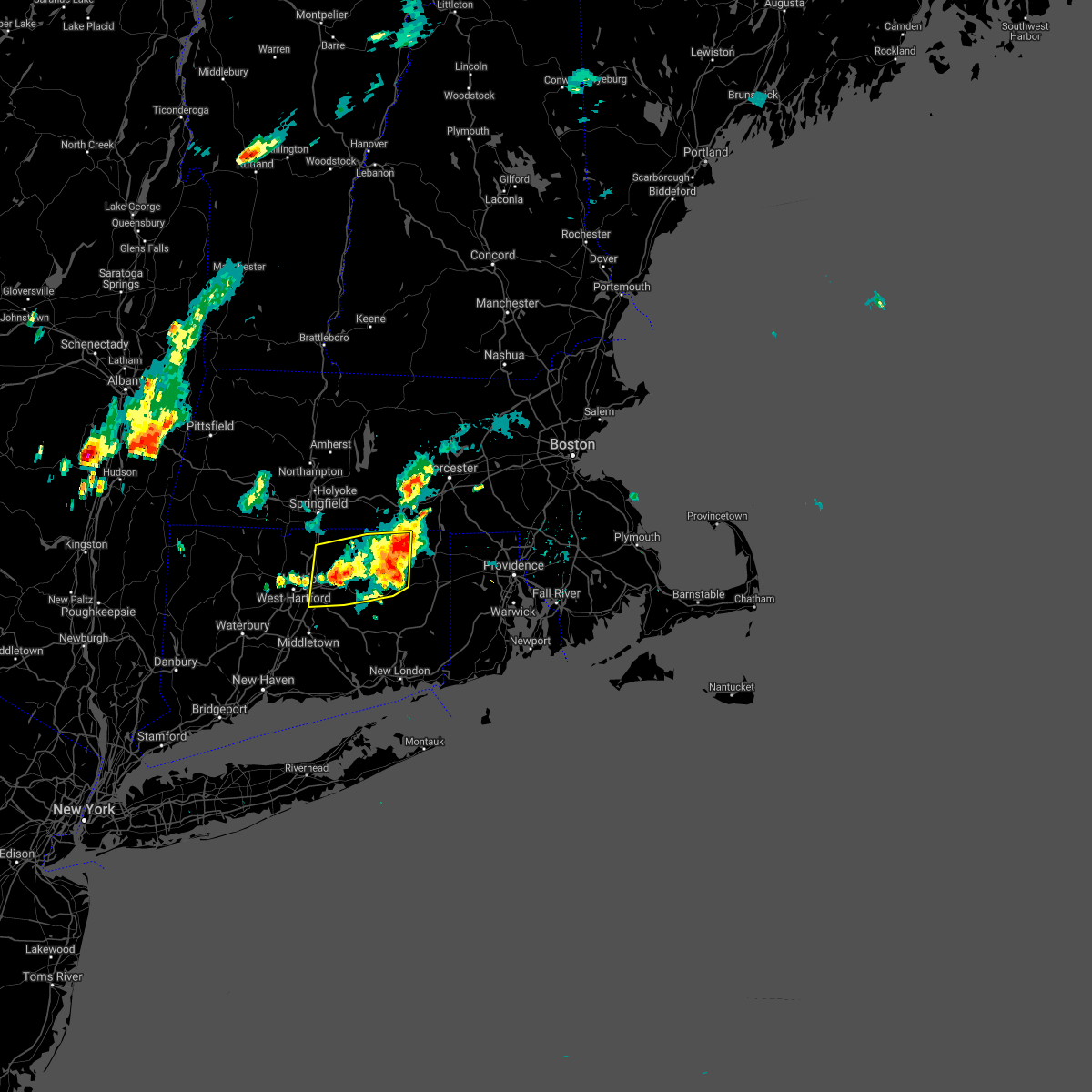 At 812 pm edt, severe thunderstorms were located along a line extending from near somers to near marlborough, moving southeast at 20 mph (trained weather spotters. trees and power lines were downed in somers and tolland from these storms). Hazards include 60 mph wind gusts. Expect damage to trees and power lines. Locations impacted include, manchester, east hartford, enfield, glastonbury, vernon, windsor, wethersfield, mansfield, south windsor, windham, rocky hill, willimantic, ellington, tolland, coventry, stafford, somers, east windsor, hebron and woodstock. At 812 pm edt, severe thunderstorms were located along a line extending from near somers to near marlborough, moving southeast at 20 mph (trained weather spotters. trees and power lines were downed in somers and tolland from these storms). Hazards include 60 mph wind gusts. Expect damage to trees and power lines. Locations impacted include, manchester, east hartford, enfield, glastonbury, vernon, windsor, wethersfield, mansfield, south windsor, windham, rocky hill, willimantic, ellington, tolland, coventry, stafford, somers, east windsor, hebron and woodstock.
|
| 6/29/2021 8:02 PM EDT |
 At 801 pm edt, severe thunderstorms were located along a line extending from somers to near glastonbury, moving southeast at 20 mph (trained weather spotters. trees and wires were downed in somers at 740 pm, with trees and wires downed in tolland at 755 pm). Hazards include 60 mph wind gusts and penny size hail. Expect damage to trees and power lines. Locations impacted include, hartford, manchester, east hartford, enfield, glastonbury, vernon, windsor, wethersfield, mansfield, south windsor, windham, rocky hill, willimantic, suffield, ellington, tolland, coventry, stafford, somers and east windsor. At 801 pm edt, severe thunderstorms were located along a line extending from somers to near glastonbury, moving southeast at 20 mph (trained weather spotters. trees and wires were downed in somers at 740 pm, with trees and wires downed in tolland at 755 pm). Hazards include 60 mph wind gusts and penny size hail. Expect damage to trees and power lines. Locations impacted include, hartford, manchester, east hartford, enfield, glastonbury, vernon, windsor, wethersfield, mansfield, south windsor, windham, rocky hill, willimantic, suffield, ellington, tolland, coventry, stafford, somers and east windsor.
|
| 6/29/2021 7:51 PM EDT |
 At 750 pm edt, severe thunderstorms were located along a line extending from somers to glastonbury, moving southeast at 20 mph (radar indicated). Hazards include 60 mph wind gusts and penny size hail. Expect damage to trees and power lines. Locations impacted include, hartford, manchester, east hartford, enfield, glastonbury, vernon, windsor, wethersfield, mansfield, south windsor, windham, rocky hill, willimantic, suffield, ellington, tolland, coventry, stafford, somers and east windsor. At 750 pm edt, severe thunderstorms were located along a line extending from somers to glastonbury, moving southeast at 20 mph (radar indicated). Hazards include 60 mph wind gusts and penny size hail. Expect damage to trees and power lines. Locations impacted include, hartford, manchester, east hartford, enfield, glastonbury, vernon, windsor, wethersfield, mansfield, south windsor, windham, rocky hill, willimantic, suffield, ellington, tolland, coventry, stafford, somers and east windsor.
|
| 6/29/2021 7:34 PM EDT |
 At 734 pm edt, severe thunderstorms were located along a line extending from near longmeadow to near rocky hill, moving southeast at 20 mph (radar indicated). Hazards include 60 mph wind gusts. expect damage to trees and power lines At 734 pm edt, severe thunderstorms were located along a line extending from near longmeadow to near rocky hill, moving southeast at 20 mph (radar indicated). Hazards include 60 mph wind gusts. expect damage to trees and power lines
|
| 6/9/2021 3:42 PM EDT |
 At 342 pm edt, a severe thunderstorm was located over south windsor, moving southeast at 15 mph (radar indicated). Hazards include 60 mph wind gusts and penny size hail. Expect damage to trees and power lines. Locations impacted include, manchester, east hartford, enfield, glastonbury, vernon, windsor, mansfield, south windsor, ellington, tolland, coventry, somers, east windsor, hebron, willington, bolton and andover. At 342 pm edt, a severe thunderstorm was located over south windsor, moving southeast at 15 mph (radar indicated). Hazards include 60 mph wind gusts and penny size hail. Expect damage to trees and power lines. Locations impacted include, manchester, east hartford, enfield, glastonbury, vernon, windsor, mansfield, south windsor, ellington, tolland, coventry, somers, east windsor, hebron, willington, bolton and andover.
|
| 6/9/2021 3:29 PM EDT |
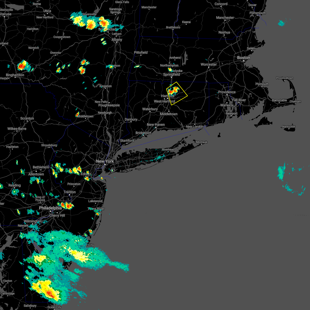 At 329 pm edt, a severe thunderstorm was located over south windsor, moving southeast at 15 mph (radar indicated). Hazards include 60 mph wind gusts and quarter size hail. Expect wind damage to trees and power lines. minor hail damage to vehicles is possible. Locations impacted include, manchester, east hartford, enfield, glastonbury, vernon, windsor, mansfield, south windsor, suffield, ellington, tolland, windsor locks, coventry, somers, east windsor, hebron, willington, bolton and andover. At 329 pm edt, a severe thunderstorm was located over south windsor, moving southeast at 15 mph (radar indicated). Hazards include 60 mph wind gusts and quarter size hail. Expect wind damage to trees and power lines. minor hail damage to vehicles is possible. Locations impacted include, manchester, east hartford, enfield, glastonbury, vernon, windsor, mansfield, south windsor, suffield, ellington, tolland, windsor locks, coventry, somers, east windsor, hebron, willington, bolton and andover.
|
| 6/9/2021 3:23 PM EDT |
 At 323 pm edt, a severe thunderstorm was located over east windsor, or near enfield, moving southeast at 15 mph (radar indicated). Hazards include 60 mph wind gusts and quarter size hail. Expect wind damage to trees and power lines. Minor hail damage to vehicles is possible. At 323 pm edt, a severe thunderstorm was located over east windsor, or near enfield, moving southeast at 15 mph (radar indicated). Hazards include 60 mph wind gusts and quarter size hail. Expect wind damage to trees and power lines. Minor hail damage to vehicles is possible.
|
| 5/26/2021 7:40 PM EDT |
 At 740 pm edt, severe thunderstorms were located along a line extending from canton to litchfield, moving east at 35 mph (radar indicated). Hazards include 60 mph wind gusts. expect damage to trees and power lines At 740 pm edt, severe thunderstorms were located along a line extending from canton to litchfield, moving east at 35 mph (radar indicated). Hazards include 60 mph wind gusts. expect damage to trees and power lines
|
| 11/15/2020 9:45 PM EST |
 At 944 pm est, severe thunderstorms were located along a line extending from granby to east windsor to cromwell, moving east at 55 mph (radar indicated). Hazards include 60 mph wind gusts. expect damage to trees and power lines At 944 pm est, severe thunderstorms were located along a line extending from granby to east windsor to cromwell, moving east at 55 mph (radar indicated). Hazards include 60 mph wind gusts. expect damage to trees and power lines
|
| 11/15/2020 9:17 PM EST |
 At 915 pm est, severe thunderstorms were located along a line extending from near sandisfield to near weston, moving east at 35 mph (radar indicated. reports from trained spotters also indicate downed trees in burlington and west hartford, ct). Hazards include 60 mph wind gusts. Expect damage to trees and power lines. Locations impacted include, hartford, new britain, west hartford, bristol, manchester, east hartford, enfield, southington, glastonbury, newington, vernon, windsor, wethersfield, mansfield, south windsor, farmington, simsbury, bloomfield, berlin and rocky hill. At 915 pm est, severe thunderstorms were located along a line extending from near sandisfield to near weston, moving east at 35 mph (radar indicated. reports from trained spotters also indicate downed trees in burlington and west hartford, ct). Hazards include 60 mph wind gusts. Expect damage to trees and power lines. Locations impacted include, hartford, new britain, west hartford, bristol, manchester, east hartford, enfield, southington, glastonbury, newington, vernon, windsor, wethersfield, mansfield, south windsor, farmington, simsbury, bloomfield, berlin and rocky hill.
|
| 11/15/2020 8:52 PM EST |
 At 852 pm est, severe thunderstorms were located along a line extending from near ashley falls to bedford, moving east at 35 mph (radar indicated). Hazards include 60 mph wind gusts. expect damage to trees and power lines At 852 pm est, severe thunderstorms were located along a line extending from near ashley falls to bedford, moving east at 35 mph (radar indicated). Hazards include 60 mph wind gusts. expect damage to trees and power lines
|
| 10/7/2020 5:47 PM EDT |
 At 546 pm edt, severe thunderstorms were located along a line extending from near woodstock to near simsbury, moving east at 50 mph (radar indicated). Hazards include 70 mph wind gusts. Expect considerable damage to trees and power lines. Damage is likely to mobile homes and outbuildings. At 546 pm edt, severe thunderstorms were located along a line extending from near woodstock to near simsbury, moving east at 50 mph (radar indicated). Hazards include 70 mph wind gusts. Expect considerable damage to trees and power lines. Damage is likely to mobile homes and outbuildings.
|
| 8/2/2020 4:21 PM EDT |
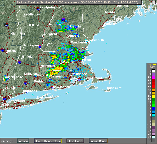 The severe thunderstorm warning for northwestern windham and central tolland counties will expire at 430 pm edt, the storm which prompted the warning has weakened below severe limits, and no longer poses an immediate threat to life or property. therefore, the warning will be allowed to expire. however gusty winds and heavy rain are still possible with this thunderstorm. a tornado watch remains in effect until 1000 pm edt for northern connecticut. The severe thunderstorm warning for northwestern windham and central tolland counties will expire at 430 pm edt, the storm which prompted the warning has weakened below severe limits, and no longer poses an immediate threat to life or property. therefore, the warning will be allowed to expire. however gusty winds and heavy rain are still possible with this thunderstorm. a tornado watch remains in effect until 1000 pm edt for northern connecticut.
|
| 8/2/2020 4:04 PM EDT |
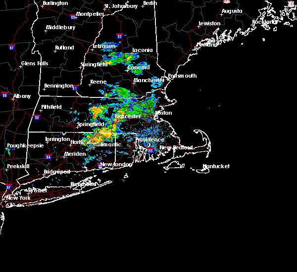 At 404 pm edt, a severe thunderstorm was located over mansfield, moving northeast at 20 mph (radar indicated). Hazards include 60 mph wind gusts. Expect damage to trees and power lines. Locations impacted include, mansfield, storrs, tolland, coventry, woodstock, willington, columbia, ashford, pomfret, chaplin, eastford and union. At 404 pm edt, a severe thunderstorm was located over mansfield, moving northeast at 20 mph (radar indicated). Hazards include 60 mph wind gusts. Expect damage to trees and power lines. Locations impacted include, mansfield, storrs, tolland, coventry, woodstock, willington, columbia, ashford, pomfret, chaplin, eastford and union.
|
| 8/2/2020 3:41 PM EDT |
 At 341 pm edt, a severe thunderstorm was located over coventry, or near mansfield, moving northeast at 25 mph (radar indicated). Hazards include 60 mph wind gusts. expect damage to trees and power lines At 341 pm edt, a severe thunderstorm was located over coventry, or near mansfield, moving northeast at 25 mph (radar indicated). Hazards include 60 mph wind gusts. expect damage to trees and power lines
|
| 7/23/2020 5:58 PM EDT |
 The severe thunderstorm warning for southern windham, southern tolland, north central washington, southwestern kent and southwestern providence counties will expire at 600 pm edt, the storm which prompted the warning has weakened below severe limits, and no longer poses an immediate threat to life or property. therefore, the warning will be allowed to expire. a severe thunderstorm watch remains in effect until 800 pm edt for northern connecticut, and rhode island. The severe thunderstorm warning for southern windham, southern tolland, north central washington, southwestern kent and southwestern providence counties will expire at 600 pm edt, the storm which prompted the warning has weakened below severe limits, and no longer poses an immediate threat to life or property. therefore, the warning will be allowed to expire. a severe thunderstorm watch remains in effect until 800 pm edt for northern connecticut, and rhode island.
|
| 7/23/2020 5:32 PM EDT |
 At 532 pm edt, a severe thunderstorm was located over canterbury, or 7 miles west of plainfield, moving east at 25 mph (radar indicated). Hazards include 60 mph wind gusts and penny size hail. Expect damage to trees and power lines. Locations impacted include, coventry, mansfield, windham, plainfield, willimantic, killingly, scituate, brooklyn, hopkinton, richmond, exeter, west greenwich, columbia, canterbury, bolton, foster, sterling, andover, chaplin and hampton. At 532 pm edt, a severe thunderstorm was located over canterbury, or 7 miles west of plainfield, moving east at 25 mph (radar indicated). Hazards include 60 mph wind gusts and penny size hail. Expect damage to trees and power lines. Locations impacted include, coventry, mansfield, windham, plainfield, willimantic, killingly, scituate, brooklyn, hopkinton, richmond, exeter, west greenwich, columbia, canterbury, bolton, foster, sterling, andover, chaplin and hampton.
|
| 7/23/2020 5:00 PM EDT |
 At 459 pm edt, a severe thunderstorm was located over mansfield, moving east at 30 mph (radar indicated). Hazards include 60 mph wind gusts and penny size hail. expect damage to trees and power lines At 459 pm edt, a severe thunderstorm was located over mansfield, moving east at 30 mph (radar indicated). Hazards include 60 mph wind gusts and penny size hail. expect damage to trees and power lines
|
| 7/23/2020 4:41 PM EDT |
 At 412 pm edt, severe thunderstorms were located along a line extending from near windsor locks to east granby to canton, moving east at 25 mph (radar indicated). Hazards include 60 mph wind gusts and penny size hail. expect damage to trees and power lines At 412 pm edt, severe thunderstorms were located along a line extending from near windsor locks to east granby to canton, moving east at 25 mph (radar indicated). Hazards include 60 mph wind gusts and penny size hail. expect damage to trees and power lines
|
| 7/23/2020 4:41 PM EDT |
 At 441 pm edt, severe thunderstorms were located along a line extending from willington to near vernon to near manchester, moving east at 35 mph (trained weather spotters reported cable wires downed in windsor locks at 415 pm). Hazards include 60 mph wind gusts and penny size hail. Expect damage to trees and power lines. Locations impacted include, hartford, west hartford, manchester, east hartford, enfield, glastonbury, vernon, windsor, mansfield, south windsor, bloomfield, ellington, tolland, coventry, stafford, somers, east windsor, hebron, putnam and thompson. At 441 pm edt, severe thunderstorms were located along a line extending from willington to near vernon to near manchester, moving east at 35 mph (trained weather spotters reported cable wires downed in windsor locks at 415 pm). Hazards include 60 mph wind gusts and penny size hail. Expect damage to trees and power lines. Locations impacted include, hartford, west hartford, manchester, east hartford, enfield, glastonbury, vernon, windsor, mansfield, south windsor, bloomfield, ellington, tolland, coventry, stafford, somers, east windsor, hebron, putnam and thompson.
|
| 7/23/2020 4:12 PM EDT |
 At 412 pm edt, severe thunderstorms were located along a line extending from near windsor locks to east granby to canton, moving east at 25 mph (radar indicated). Hazards include 60 mph wind gusts and penny size hail. expect damage to trees and power lines At 412 pm edt, severe thunderstorms were located along a line extending from near windsor locks to east granby to canton, moving east at 25 mph (radar indicated). Hazards include 60 mph wind gusts and penny size hail. expect damage to trees and power lines
|
| 7/23/2020 3:10 PM EDT | Twelve trees down on southbridge circle... several on home in tolland county CT, 3.6 miles NNE of Coventry Lake, CT |
| 7/14/2020 1:36 PM EDT |
 At 133 pm edt, a severe thunderstorm was located over tolland, or near vernon, moving south at 20 mph (radar indicated and trained spotters. at 120 pm, trees were downed in somers and ellington. in addition, up to quarter sized hailstones were reported by broadcast media in ellington). Hazards include 60 mph wind gusts and quarter size hail. Expect wind damage to trees and power lines. minor hail damage to vehicles is possible. Locations impacted include, manchester, enfield, glastonbury, vernon, mansfield, south windsor, windham, willimantic, ellington, tolland, coventry, stafford, somers, east windsor, hebron, marlborough, willington, columbia, bolton and andover. At 133 pm edt, a severe thunderstorm was located over tolland, or near vernon, moving south at 20 mph (radar indicated and trained spotters. at 120 pm, trees were downed in somers and ellington. in addition, up to quarter sized hailstones were reported by broadcast media in ellington). Hazards include 60 mph wind gusts and quarter size hail. Expect wind damage to trees and power lines. minor hail damage to vehicles is possible. Locations impacted include, manchester, enfield, glastonbury, vernon, mansfield, south windsor, windham, willimantic, ellington, tolland, coventry, stafford, somers, east windsor, hebron, marlborough, willington, columbia, bolton and andover.
|
| 7/14/2020 1:21 PM EDT |
 At 120 pm edt, a severe thunderstorm was located over ellington, or near vernon, moving south at 20 mph (radar indicated and report of nickel size hail in ellington, ct at 120 pm). Hazards include 60 mph wind gusts and half dollar size hail. Expect wind damage to trees and power lines. minor hail damage to vehicles is possible. Locations impacted include, manchester, enfield, glastonbury, vernon, mansfield, south windsor, windham, willimantic, longmeadow, east longmeadow, ellington, tolland, coventry, stafford, somers, east windsor, hebron, monson, marlborough and willington. At 120 pm edt, a severe thunderstorm was located over ellington, or near vernon, moving south at 20 mph (radar indicated and report of nickel size hail in ellington, ct at 120 pm). Hazards include 60 mph wind gusts and half dollar size hail. Expect wind damage to trees and power lines. minor hail damage to vehicles is possible. Locations impacted include, manchester, enfield, glastonbury, vernon, mansfield, south windsor, windham, willimantic, longmeadow, east longmeadow, ellington, tolland, coventry, stafford, somers, east windsor, hebron, monson, marlborough and willington.
|
| 7/14/2020 1:08 PM EDT |
 At 107 pm edt, a severe thunderstorm was located over somers, or near enfield, moving south at 20 mph (radar indicated). Hazards include 60 mph wind gusts and quarter size hail. Expect wind damage to trees and power lines. Minor hail damage to vehicles is possible. At 107 pm edt, a severe thunderstorm was located over somers, or near enfield, moving south at 20 mph (radar indicated). Hazards include 60 mph wind gusts and quarter size hail. Expect wind damage to trees and power lines. Minor hail damage to vehicles is possible.
|
| 7/6/2020 8:08 PM EDT |
 The severe thunderstorm warning for west central windham, northern tolland, northeastern hartford and southeastern hampden counties will expire at 815 pm edt, the storm which prompted the warning has weakened below severe limits, and no longer poses an immediate threat to life or property. therefore, the warning will be allowed to expire. The severe thunderstorm warning for west central windham, northern tolland, northeastern hartford and southeastern hampden counties will expire at 815 pm edt, the storm which prompted the warning has weakened below severe limits, and no longer poses an immediate threat to life or property. therefore, the warning will be allowed to expire.
|
| 7/6/2020 7:31 PM EDT |
 At 730 pm edt, a severe thunderstorm was located near east windsor, or near vernon, moving east at 10 mph (spotters. at 720 pm edt one inch was reported at south windsor ct). Hazards include 60 mph wind gusts and quarter size hail. Expect wind damage to trees and power lines. minor hail damage to vehicles is possible. Locations impacted include, manchester, enfield, vernon, mansfield, south windsor, ellington, tolland, coventry, stafford, somers, east windsor, willington, bolton, ashford, wales and union. At 730 pm edt, a severe thunderstorm was located near east windsor, or near vernon, moving east at 10 mph (spotters. at 720 pm edt one inch was reported at south windsor ct). Hazards include 60 mph wind gusts and quarter size hail. Expect wind damage to trees and power lines. minor hail damage to vehicles is possible. Locations impacted include, manchester, enfield, vernon, mansfield, south windsor, ellington, tolland, coventry, stafford, somers, east windsor, willington, bolton, ashford, wales and union.
|
| 7/6/2020 7:31 PM EDT |
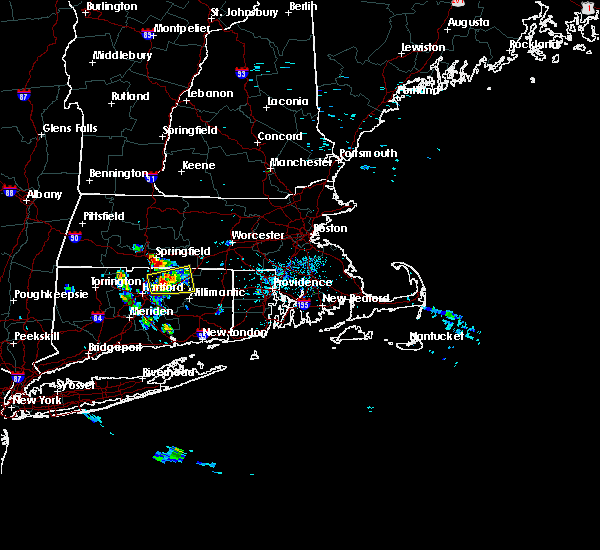 At 730 pm edt, a severe thunderstorm was located near east windsor, or near vernon, moving east at 10 mph (spotters. at 720 pm edt one inch was reported at south windsor ct). Hazards include 60 mph wind gusts and quarter size hail. Expect wind damage to trees and power lines. minor hail damage to vehicles is possible. Locations impacted include, manchester, enfield, vernon, mansfield, south windsor, ellington, tolland, coventry, stafford, somers, east windsor, willington, bolton, ashford, wales and union. At 730 pm edt, a severe thunderstorm was located near east windsor, or near vernon, moving east at 10 mph (spotters. at 720 pm edt one inch was reported at south windsor ct). Hazards include 60 mph wind gusts and quarter size hail. Expect wind damage to trees and power lines. minor hail damage to vehicles is possible. Locations impacted include, manchester, enfield, vernon, mansfield, south windsor, ellington, tolland, coventry, stafford, somers, east windsor, willington, bolton, ashford, wales and union.
|
| 7/6/2020 7:09 PM EDT |
 At 709 pm edt, a severe thunderstorm was located over windsor, moving east at 20 mph (radar indicated). Hazards include 60 mph wind gusts and quarter size hail. Expect wind damage to trees and power lines. Minor hail damage to vehicles is possible. At 709 pm edt, a severe thunderstorm was located over windsor, moving east at 20 mph (radar indicated). Hazards include 60 mph wind gusts and quarter size hail. Expect wind damage to trees and power lines. Minor hail damage to vehicles is possible.
|
| 5/15/2020 8:59 PM EDT |
 At 844 pm edt, severe thunderstorms were located along a line extending from east longmeadow to near east granby to burlington, moving east at 40 mph (radar indicated). Hazards include 60 mph wind gusts. Expect damage to trees and power lines. Locations impacted include, springfield, hartford, new britain, west hartford, bristol, manchester, east hartford, enfield, southington, glastonbury, newington, vernon, windsor, agawam, wethersfield, mansfield, south windsor, farmington, windham and simsbury. At 844 pm edt, severe thunderstorms were located along a line extending from east longmeadow to near east granby to burlington, moving east at 40 mph (radar indicated). Hazards include 60 mph wind gusts. Expect damage to trees and power lines. Locations impacted include, springfield, hartford, new britain, west hartford, bristol, manchester, east hartford, enfield, southington, glastonbury, newington, vernon, windsor, agawam, wethersfield, mansfield, south windsor, farmington, windham and simsbury.
|
| 5/15/2020 8:44 PM EDT |
 At 844 pm edt, severe thunderstorms were located along a line extending from east longmeadow to near east granby to burlington, moving east at 40 mph (radar indicated). Hazards include 60 mph wind gusts. Expect damage to trees and power lines. Locations impacted include, springfield, hartford, new britain, west hartford, bristol, manchester, east hartford, enfield, southington, glastonbury, newington, vernon, windsor, agawam, wethersfield, mansfield, south windsor, farmington, windham and simsbury. At 844 pm edt, severe thunderstorms were located along a line extending from east longmeadow to near east granby to burlington, moving east at 40 mph (radar indicated). Hazards include 60 mph wind gusts. Expect damage to trees and power lines. Locations impacted include, springfield, hartford, new britain, west hartford, bristol, manchester, east hartford, enfield, southington, glastonbury, newington, vernon, windsor, agawam, wethersfield, mansfield, south windsor, farmington, windham and simsbury.
|
| 5/15/2020 8:32 PM EDT |
 At 832 pm edt, severe thunderstorms were located along a line extending from agawam to near granby to northwest harwinton, moving east at 40 mph (at 820 pm trained spotters in agawam, ma reported trees and wires down). Hazards include 60 mph wind gusts. Expect damage to trees and power lines. Locations impacted include, springfield, hartford, new britain, west hartford, bristol, manchester, east hartford, enfield, southington, westfield, glastonbury, newington, vernon, windsor, agawam, west springfield, wethersfield, mansfield, south windsor and farmington. At 832 pm edt, severe thunderstorms were located along a line extending from agawam to near granby to northwest harwinton, moving east at 40 mph (at 820 pm trained spotters in agawam, ma reported trees and wires down). Hazards include 60 mph wind gusts. Expect damage to trees and power lines. Locations impacted include, springfield, hartford, new britain, west hartford, bristol, manchester, east hartford, enfield, southington, westfield, glastonbury, newington, vernon, windsor, agawam, west springfield, wethersfield, mansfield, south windsor and farmington.
|
| 5/15/2020 8:15 PM EDT |
 At 814 pm edt, severe thunderstorms were located along a line extending from near westfield to near hartland to near litchfield, moving southeast at 35 mph (radar indicated). Hazards include 60 mph wind gusts. expect damage to trees and power lines At 814 pm edt, severe thunderstorms were located along a line extending from near westfield to near hartland to near litchfield, moving southeast at 35 mph (radar indicated). Hazards include 60 mph wind gusts. expect damage to trees and power lines
|
| 9/4/2019 6:00 PM EDT |
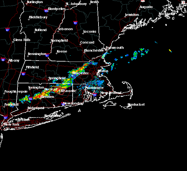 At 559 pm edt, a severe thunderstorm capable of producing a tornado was located over chaplin, or near mansfield, moving east at 30 mph (radar indicated rotation). Hazards include tornado and quarter size hail. Flying debris will be dangerous to those caught without shelter. mobile homes will be damaged or destroyed. damage to roofs, windows, and vehicles will occur. tree damage is likely. this dangerous storm will be near, hampton around 610 pm edt. Scotland around 615 pm edt. At 559 pm edt, a severe thunderstorm capable of producing a tornado was located over chaplin, or near mansfield, moving east at 30 mph (radar indicated rotation). Hazards include tornado and quarter size hail. Flying debris will be dangerous to those caught without shelter. mobile homes will be damaged or destroyed. damage to roofs, windows, and vehicles will occur. tree damage is likely. this dangerous storm will be near, hampton around 610 pm edt. Scotland around 615 pm edt.
|
| 9/4/2019 5:47 PM EDT |
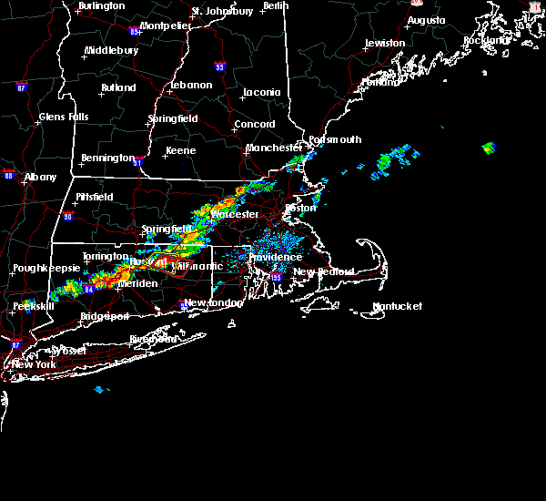 At 547 pm edt, a severe thunderstorm was located near tolland, or near mansfield, moving east at 20 mph (radar indicated). Hazards include 60 mph wind gusts and half dollar size hail. Expect wind damage to trees and power lines. minor hail damage to vehicles is possible. Locations impacted include, manchester, vernon, mansfield, south windsor, windham, willimantic, ellington, tolland, coventry, willington, bolton and ashford. At 547 pm edt, a severe thunderstorm was located near tolland, or near mansfield, moving east at 20 mph (radar indicated). Hazards include 60 mph wind gusts and half dollar size hail. Expect wind damage to trees and power lines. minor hail damage to vehicles is possible. Locations impacted include, manchester, vernon, mansfield, south windsor, windham, willimantic, ellington, tolland, coventry, willington, bolton and ashford.
|
| 9/4/2019 5:43 PM EDT |
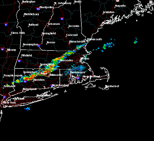 At 543 pm edt, a severe thunderstorm capable of producing a tornado was located near coventry, or near mansfield, moving east at 30 mph (radar indicated rotation). Hazards include tornado and half dollar size hail. Flying debris will be dangerous to those caught without shelter. mobile homes will be damaged or destroyed. damage to roofs, windows, and vehicles will occur. tree damage is likely. this dangerous storm will be near, mansfield around 550 pm edt. willimantic around 555 pm edt. windham around 600 pm edt. chaplin around 605 pm edt. hampton around 610 pm edt. Scotland around 615 pm edt. At 543 pm edt, a severe thunderstorm capable of producing a tornado was located near coventry, or near mansfield, moving east at 30 mph (radar indicated rotation). Hazards include tornado and half dollar size hail. Flying debris will be dangerous to those caught without shelter. mobile homes will be damaged or destroyed. damage to roofs, windows, and vehicles will occur. tree damage is likely. this dangerous storm will be near, mansfield around 550 pm edt. willimantic around 555 pm edt. windham around 600 pm edt. chaplin around 605 pm edt. hampton around 610 pm edt. Scotland around 615 pm edt.
|
| 9/4/2019 5:34 PM EDT |
 At 534 pm edt, a severe thunderstorm capable of producing a tornado was located over tolland, or near vernon, moving east at 30 mph (radar indicated rotation). Hazards include tornado and half dollar size hail. Flying debris will be dangerous to those caught without shelter. mobile homes will be damaged or destroyed. damage to roofs, windows, and vehicles will occur. tree damage is likely. This dangerous storm will be near, mansfield and coventry around 545 pm edt. At 534 pm edt, a severe thunderstorm capable of producing a tornado was located over tolland, or near vernon, moving east at 30 mph (radar indicated rotation). Hazards include tornado and half dollar size hail. Flying debris will be dangerous to those caught without shelter. mobile homes will be damaged or destroyed. damage to roofs, windows, and vehicles will occur. tree damage is likely. This dangerous storm will be near, mansfield and coventry around 545 pm edt.
|
| 9/4/2019 5:30 PM EDT |
 At 529 pm edt, a severe thunderstorm was located over ellington, or near vernon, moving east at 25 mph (radar indicated). Hazards include 60 mph wind gusts and half dollar size hail. Expect wind damage to trees and power lines. minor hail damage to vehicles is possible. Locations impacted include, manchester, enfield, vernon, windsor, mansfield, south windsor, windham, willimantic, ellington, tolland, windsor locks, coventry, stafford, somers, east windsor, willington, bolton, ashford, andover and eastford. At 529 pm edt, a severe thunderstorm was located over ellington, or near vernon, moving east at 25 mph (radar indicated). Hazards include 60 mph wind gusts and half dollar size hail. Expect wind damage to trees and power lines. minor hail damage to vehicles is possible. Locations impacted include, manchester, enfield, vernon, windsor, mansfield, south windsor, windham, willimantic, ellington, tolland, windsor locks, coventry, stafford, somers, east windsor, willington, bolton, ashford, andover and eastford.
|
| 9/4/2019 5:22 PM EDT |
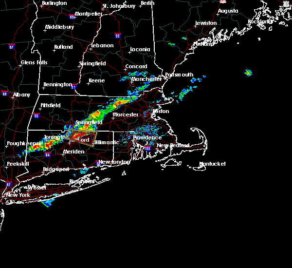 At 522 pm edt, a severe thunderstorm capable of producing a tornado was located over ellington, or near vernon, moving east at 25 mph (radar indicated rotation). Hazards include tornado and half dollar size hail. Flying debris will be dangerous to those caught without shelter. mobile homes will be damaged or destroyed. damage to roofs, windows, and vehicles will occur. tree damage is likely. this dangerous storm will be near, ellington around 530 pm edt. vernon around 535 pm edt. Mansfield, tolland and coventry around 545 pm edt. At 522 pm edt, a severe thunderstorm capable of producing a tornado was located over ellington, or near vernon, moving east at 25 mph (radar indicated rotation). Hazards include tornado and half dollar size hail. Flying debris will be dangerous to those caught without shelter. mobile homes will be damaged or destroyed. damage to roofs, windows, and vehicles will occur. tree damage is likely. this dangerous storm will be near, ellington around 530 pm edt. vernon around 535 pm edt. Mansfield, tolland and coventry around 545 pm edt.
|
| 9/4/2019 5:13 PM EDT |
 At 512 pm edt, a severe thunderstorm was located over windsor locks, or near enfield, moving east at 20 mph (radar indicated). Hazards include 60 mph wind gusts and half dollar size hail. Expect wind damage to trees and power lines. Minor hail damage to vehicles is possible. At 512 pm edt, a severe thunderstorm was located over windsor locks, or near enfield, moving east at 20 mph (radar indicated). Hazards include 60 mph wind gusts and half dollar size hail. Expect wind damage to trees and power lines. Minor hail damage to vehicles is possible.
|
| 9/4/2019 5:13 PM EDT |
 The national weather service in boston/norton has issued a * severe thunderstorm warning for. northwestern windham county in northern connecticut. tolland county in northern connecticut. northeastern hartford county in northern connecticut. South central hampden county in western massachusetts. The national weather service in boston/norton has issued a * severe thunderstorm warning for. northwestern windham county in northern connecticut. tolland county in northern connecticut. northeastern hartford county in northern connecticut. South central hampden county in western massachusetts.
|
| 8/21/2019 6:42 PM EDT |
 At 641 pm edt, a severe thunderstorm was located over glastonbury, moving east at 35 mph (radar indicated). Hazards include 60 mph wind gusts and quarter size hail. Expect wind damage to trees and power lines. Minor hail damage to vehicles is possible. At 641 pm edt, a severe thunderstorm was located over glastonbury, moving east at 35 mph (radar indicated). Hazards include 60 mph wind gusts and quarter size hail. Expect wind damage to trees and power lines. Minor hail damage to vehicles is possible.
|
| 8/21/2019 6:10 PM EDT |
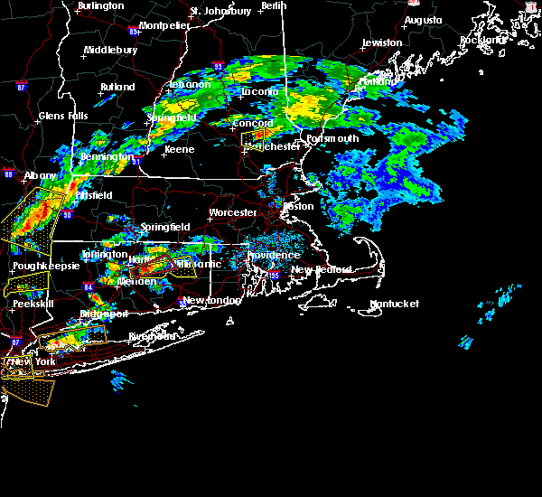 At 609 pm edt, a severe thunderstorm capable of producing a tornado was located over bolton, or near manchester, moving northeast at 30 mph (radar indicated rotation). Hazards include tornado. Flying debris will be dangerous to those caught without shelter. mobile homes will be damaged or destroyed. damage to roofs, windows, and vehicles will occur. tree damage is likely. this dangerous storm will be near, columbia around 620 pm edt. coventry around 625 pm edt. mansfield and tolland around 630 pm edt. windham around 635 pm edt. Chaplin around 645 pm edt. At 609 pm edt, a severe thunderstorm capable of producing a tornado was located over bolton, or near manchester, moving northeast at 30 mph (radar indicated rotation). Hazards include tornado. Flying debris will be dangerous to those caught without shelter. mobile homes will be damaged or destroyed. damage to roofs, windows, and vehicles will occur. tree damage is likely. this dangerous storm will be near, columbia around 620 pm edt. coventry around 625 pm edt. mansfield and tolland around 630 pm edt. windham around 635 pm edt. Chaplin around 645 pm edt.
|
| 8/21/2019 5:54 PM EDT |
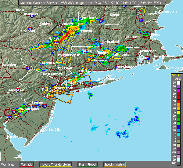 At 554 pm edt, a severe thunderstorm capable of producing a tornado was located over glastonbury, moving east at 25 mph (radar indicated rotation). Hazards include tornado. Flying debris will be dangerous to those caught without shelter. mobile homes will be damaged or destroyed. damage to roofs, windows, and vehicles will occur. tree damage is likely. this dangerous storm will be near, manchester and bolton around 605 pm edt. hebron around 610 pm edt. vernon around 615 pm edt. columbia and andover around 620 pm edt. willimantic and coventry around 625 pm edt. mansfield and tolland around 630 pm edt. windham around 635 pm edt. Chaplin around 645 pm edt. At 554 pm edt, a severe thunderstorm capable of producing a tornado was located over glastonbury, moving east at 25 mph (radar indicated rotation). Hazards include tornado. Flying debris will be dangerous to those caught without shelter. mobile homes will be damaged or destroyed. damage to roofs, windows, and vehicles will occur. tree damage is likely. this dangerous storm will be near, manchester and bolton around 605 pm edt. hebron around 610 pm edt. vernon around 615 pm edt. columbia and andover around 620 pm edt. willimantic and coventry around 625 pm edt. mansfield and tolland around 630 pm edt. windham around 635 pm edt. Chaplin around 645 pm edt.
|
| 8/21/2019 5:47 PM EDT |
 At 547 pm edt, a severe thunderstorm was located over glastonbury, moving east at 35 mph (radar indicated). Hazards include 60 mph wind gusts and quarter size hail. Expect wind damage to trees and power lines. Minor hail damage to vehicles is possible. At 547 pm edt, a severe thunderstorm was located over glastonbury, moving east at 35 mph (radar indicated). Hazards include 60 mph wind gusts and quarter size hail. Expect wind damage to trees and power lines. Minor hail damage to vehicles is possible.
|
| 8/21/2019 3:05 PM EDT |
 At 305 pm edt, a severe thunderstorm was located near coventry, or near mansfield, moving northeast at 20 mph (radar indicated). Hazards include 60 mph wind gusts and quarter size hail. Expect wind damage to trees and power lines. minor hail damage to vehicles is possible. this severe storm will be near, mansfield and willimantic around 310 pm edt. windham around 320 pm edt. chaplin around 335 pm edt. hampton around 345 pm edt. brooklyn around 355 pm edt. Thompson and pomfret around 400 pm edt. At 305 pm edt, a severe thunderstorm was located near coventry, or near mansfield, moving northeast at 20 mph (radar indicated). Hazards include 60 mph wind gusts and quarter size hail. Expect wind damage to trees and power lines. minor hail damage to vehicles is possible. this severe storm will be near, mansfield and willimantic around 310 pm edt. windham around 320 pm edt. chaplin around 335 pm edt. hampton around 345 pm edt. brooklyn around 355 pm edt. Thompson and pomfret around 400 pm edt.
|
| 8/21/2019 2:57 PM EDT |
 The national weather service in boston/norton has issued a * severe thunderstorm warning for. central windham county in northern connecticut. central tolland county in northern connecticut. until 400 pm edt. At 256 pm edt, a severe thunderstorm was located over andover, or. The national weather service in boston/norton has issued a * severe thunderstorm warning for. central windham county in northern connecticut. central tolland county in northern connecticut. until 400 pm edt. At 256 pm edt, a severe thunderstorm was located over andover, or.
|
| 8/21/2019 2:46 PM EDT |
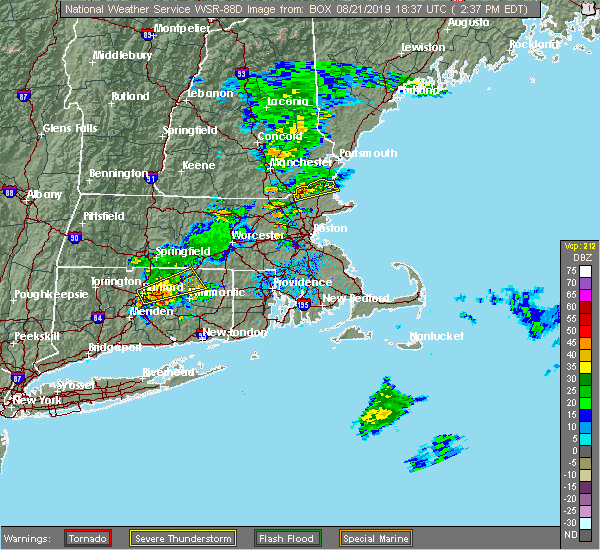 At 246 pm edt, a severe thunderstorm was located over coventry, or near vernon, moving northeast at 40 mph (radar indicated). Hazards include 60 mph wind gusts. Expect damage to trees and power lines. this severe storm will be near, mansfield and tolland around 255 pm edt. willington and chaplin around 305 pm edt. Ashford, hampton and eastford around 310 pm edt. At 246 pm edt, a severe thunderstorm was located over coventry, or near vernon, moving northeast at 40 mph (radar indicated). Hazards include 60 mph wind gusts. Expect damage to trees and power lines. this severe storm will be near, mansfield and tolland around 255 pm edt. willington and chaplin around 305 pm edt. Ashford, hampton and eastford around 310 pm edt.
|
| 8/21/2019 2:26 PM EDT |
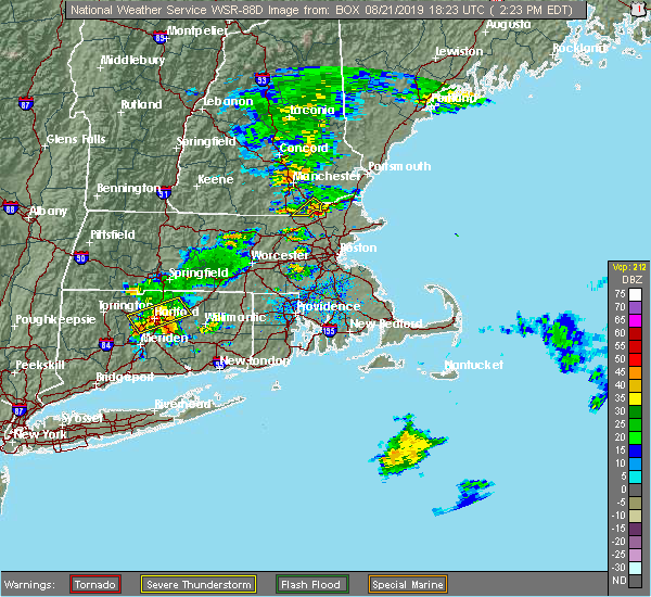 The national weather service in boston/norton has issued a * severe thunderstorm warning for. northwestern windham county in northern connecticut. central tolland county in northern connecticut. east central hartford county in northern connecticut. Until 330 pm edt. The national weather service in boston/norton has issued a * severe thunderstorm warning for. northwestern windham county in northern connecticut. central tolland county in northern connecticut. east central hartford county in northern connecticut. Until 330 pm edt.
|
| 8/7/2019 9:24 PM EDT |
 The severe thunderstorm warning for northwestern tolland and northeastern hartford counties will expire at 930 pm edt, the storm which prompted the warning has moved out of the area. therefore, the warning will be allowed to expire. however, significant flooding has occurred across portions of the region with water rescues. do not drive through flooded roadways. The severe thunderstorm warning for northwestern tolland and northeastern hartford counties will expire at 930 pm edt, the storm which prompted the warning has moved out of the area. therefore, the warning will be allowed to expire. however, significant flooding has occurred across portions of the region with water rescues. do not drive through flooded roadways.
|
| 8/7/2019 9:04 PM EDT |
 At 904 pm edt, a severe thunderstorm was located over east windsor, or near enfield, moving northeast at 25 mph (radar indicated). Hazards include 60 mph wind gusts. Expect damage to trees and power lines. Locations impacted include, manchester, enfield, glastonbury, vernon, windsor, mansfield, south windsor, suffield, east longmeadow, ellington, tolland, windsor locks, coventry, somers, east windsor, hebron, willington, east granby, bolton and andover. At 904 pm edt, a severe thunderstorm was located over east windsor, or near enfield, moving northeast at 25 mph (radar indicated). Hazards include 60 mph wind gusts. Expect damage to trees and power lines. Locations impacted include, manchester, enfield, glastonbury, vernon, windsor, mansfield, south windsor, suffield, east longmeadow, ellington, tolland, windsor locks, coventry, somers, east windsor, hebron, willington, east granby, bolton and andover.
|
| 8/7/2019 8:49 PM EDT |
 At 848 pm edt, a severe thunderstorm was located over windsor, moving northeast at 25 mph (radar indicated). Hazards include 60 mph wind gusts. Expect damage to trees and power lines. Locations impacted include, hartford, west hartford, manchester, east hartford, enfield, glastonbury, newington, vernon, windsor, wethersfield, mansfield, south windsor, simsbury, bloomfield, rocky hill, suffield, east longmeadow, ellington, tolland and cromwell. At 848 pm edt, a severe thunderstorm was located over windsor, moving northeast at 25 mph (radar indicated). Hazards include 60 mph wind gusts. Expect damage to trees and power lines. Locations impacted include, hartford, west hartford, manchester, east hartford, enfield, glastonbury, newington, vernon, windsor, wethersfield, mansfield, south windsor, simsbury, bloomfield, rocky hill, suffield, east longmeadow, ellington, tolland and cromwell.
|
| 8/7/2019 8:37 PM EDT |
 At 836 pm edt, a severe thunderstorm was located over west hartford, moving northeast at 25 mph (radar indicated). Hazards include 60 mph wind gusts and penny size hail. Expect damage to trees and power lines. Locations impacted include, hartford, new britain, west hartford, manchester, east hartford, enfield, glastonbury, newington, vernon, windsor, wethersfield, mansfield, south windsor, farmington, simsbury, bloomfield, berlin, rocky hill, avon and plainville. At 836 pm edt, a severe thunderstorm was located over west hartford, moving northeast at 25 mph (radar indicated). Hazards include 60 mph wind gusts and penny size hail. Expect damage to trees and power lines. Locations impacted include, hartford, new britain, west hartford, manchester, east hartford, enfield, glastonbury, newington, vernon, windsor, wethersfield, mansfield, south windsor, farmington, simsbury, bloomfield, berlin, rocky hill, avon and plainville.
|
| 8/7/2019 8:30 PM EDT |
 At 829 pm edt, a severe thunderstorm was located over west hartford, moving northeast at 25 mph (radar indicated). Hazards include 60 mph wind gusts and penny size hail. expect damage to trees and power lines At 829 pm edt, a severe thunderstorm was located over west hartford, moving northeast at 25 mph (radar indicated). Hazards include 60 mph wind gusts and penny size hail. expect damage to trees and power lines
|
| 10/2/2018 5:55 PM EDT |
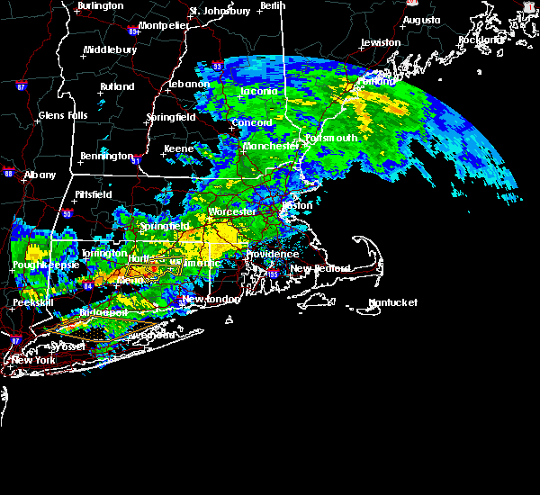 At 555 pm edt, a severe thunderstorm was located over bolton, or near manchester, moving east at 30 mph (radar indicated). Hazards include 60 mph wind gusts. expect damage to trees and power lines At 555 pm edt, a severe thunderstorm was located over bolton, or near manchester, moving east at 30 mph (radar indicated). Hazards include 60 mph wind gusts. expect damage to trees and power lines
|
| 10/2/2018 5:35 PM EDT |
 At 535 pm edt, a severe thunderstorm was located over glastonbury, moving east at 40 mph (radar indicated). Hazards include 60 mph wind gusts. expect damage to trees and power lines At 535 pm edt, a severe thunderstorm was located over glastonbury, moving east at 40 mph (radar indicated). Hazards include 60 mph wind gusts. expect damage to trees and power lines
|
| 7/17/2018 3:33 PM EDT |
 At 332 pm edt, a severe thunderstorm was located over tolland, or near vernon, moving northeast at 30 mph (radar indicated). Hazards include 60 mph wind gusts. expect damage to trees and power lines At 332 pm edt, a severe thunderstorm was located over tolland, or near vernon, moving northeast at 30 mph (radar indicated). Hazards include 60 mph wind gusts. expect damage to trees and power lines
|
| 7/17/2018 2:02 PM EDT |
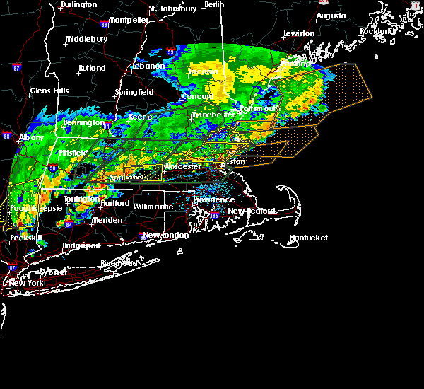 The national weather service in boston/norton has issued a * severe thunderstorm warning for. northwestern tolland county in northern connecticut. northeastern hartford county in northern connecticut. until 300 pm edt. At 202 pm edt, a severe thunderstorm was located over windsor,. The national weather service in boston/norton has issued a * severe thunderstorm warning for. northwestern tolland county in northern connecticut. northeastern hartford county in northern connecticut. until 300 pm edt. At 202 pm edt, a severe thunderstorm was located over windsor,.
|
| 5/15/2018 5:39 PM EDT |
 The severe thunderstorm warning for northern windham, tolland and hartford counties will expire at 545 pm edt, the storms which prompted the warning have weakened below severe limits, and no longer pose an immediate threat to life or property. therefore, the warning will be allowed to expire. however gusty winds and heavy rain are still possible with these thunderstorms. a tornado watch remains in effect until 900 pm edt for northern connecticut, and central massachusetts. The severe thunderstorm warning for northern windham, tolland and hartford counties will expire at 545 pm edt, the storms which prompted the warning have weakened below severe limits, and no longer pose an immediate threat to life or property. therefore, the warning will be allowed to expire. however gusty winds and heavy rain are still possible with these thunderstorms. a tornado watch remains in effect until 900 pm edt for northern connecticut, and central massachusetts.
|
| 5/15/2018 5:07 PM EDT |
 At 442 pm edt, severe thunderstorms were located along a line extending from suffield to near torrington to pawling, moving east at 45 mph (radar indicated). Hazards include 60 mph wind gusts and quarter size hail. Hail damage to vehicles is possible. Expect damage to trees and power lines. At 442 pm edt, severe thunderstorms were located along a line extending from suffield to near torrington to pawling, moving east at 45 mph (radar indicated). Hazards include 60 mph wind gusts and quarter size hail. Hail damage to vehicles is possible. Expect damage to trees and power lines.
|
| 5/15/2018 4:42 PM EDT |
 At 442 pm edt, severe thunderstorms were located along a line extending from suffield to near torrington to pawling, moving east at 45 mph (radar indicated). Hazards include 60 mph wind gusts and quarter size hail. Hail damage to vehicles is possible. Expect damage to trees and power lines. At 442 pm edt, severe thunderstorms were located along a line extending from suffield to near torrington to pawling, moving east at 45 mph (radar indicated). Hazards include 60 mph wind gusts and quarter size hail. Hail damage to vehicles is possible. Expect damage to trees and power lines.
|
| 5/15/2018 4:23 PM EDT |
 At 422 pm edt, a severe thunderstorm was located over enfield, moving east at 40 mph (radar indicated). Hazards include two inch hail and 60 mph wind gusts. People and animals outdoors will be injured. expect hail damage to roofs, windows, siding, and vehicles. expect damage to trees and power lines. locations impacted include, hartford, new britain, west hartford, meriden, bristol, manchester, east hartford, enfield, southington, glastonbury, newington, vernon, windsor, wethersfield, mansfield, south windsor, farmington, windham, wolcott and colchester. A tornado watch remains in effect until 900 pm edt for northern connecticut, and western and central massachusetts. At 422 pm edt, a severe thunderstorm was located over enfield, moving east at 40 mph (radar indicated). Hazards include two inch hail and 60 mph wind gusts. People and animals outdoors will be injured. expect hail damage to roofs, windows, siding, and vehicles. expect damage to trees and power lines. locations impacted include, hartford, new britain, west hartford, meriden, bristol, manchester, east hartford, enfield, southington, glastonbury, newington, vernon, windsor, wethersfield, mansfield, south windsor, farmington, windham, wolcott and colchester. A tornado watch remains in effect until 900 pm edt for northern connecticut, and western and central massachusetts.
|
| 5/15/2018 3:46 PM EDT |
 At 345 pm edt, a severe thunderstorm was located near hartland, or 14 miles northeast of torrington, moving east at 40 mph (radar indicated). Hazards include up to ping pong ball size hail and 60 mph wind gusts. People and animals outdoors will be injured. expect hail damage to roofs, siding, windows, and vehicles. Expect damage to trees and power lines. At 345 pm edt, a severe thunderstorm was located near hartland, or 14 miles northeast of torrington, moving east at 40 mph (radar indicated). Hazards include up to ping pong ball size hail and 60 mph wind gusts. People and animals outdoors will be injured. expect hail damage to roofs, siding, windows, and vehicles. Expect damage to trees and power lines.
|
| 9/5/2017 8:31 PM EDT |
 At 829 pm edt, a severe thunderstorm was located over farmington, moving northeast at 30 mph (radar indicated). Hazards include 60 mph wind gusts and penny size hail. expect damage to trees and power lines At 829 pm edt, a severe thunderstorm was located over farmington, moving northeast at 30 mph (radar indicated). Hazards include 60 mph wind gusts and penny size hail. expect damage to trees and power lines
|
| 8/23/2017 12:13 AM EDT |
 At 1213 am edt, a severe thunderstorm was located over wolcott, moving east at 45 mph (radar indicated). Hazards include 60 mph wind gusts. expect damage to trees and power lines At 1213 am edt, a severe thunderstorm was located over wolcott, moving east at 45 mph (radar indicated). Hazards include 60 mph wind gusts. expect damage to trees and power lines
|
| 8/2/2017 3:56 PM EDT |
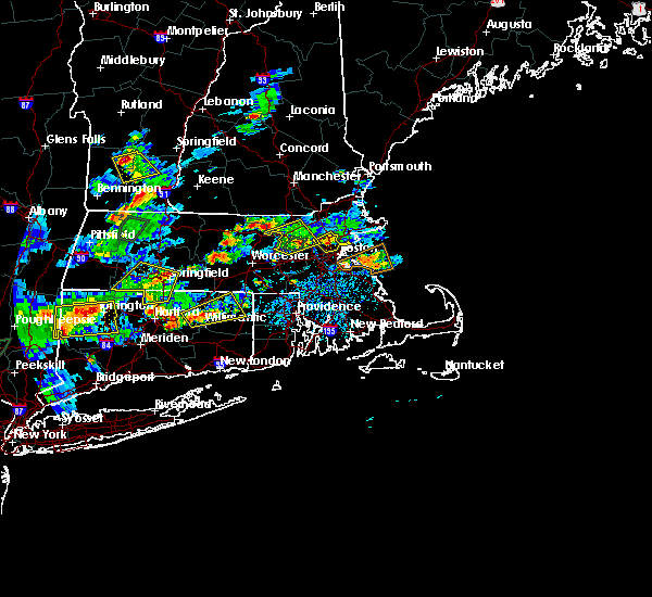 At 356 pm edt, a severe thunderstorm was located over mansfield, moving northeast at 15 mph (radar indicated). Hazards include 60 mph wind gusts and quarter size hail. Hail damage to vehicles is possible. Expect damage to trees and power lines. At 356 pm edt, a severe thunderstorm was located over mansfield, moving northeast at 15 mph (radar indicated). Hazards include 60 mph wind gusts and quarter size hail. Hail damage to vehicles is possible. Expect damage to trees and power lines.
|
| 8/2/2017 2:54 PM EDT |
 At 253 pm edt, a severe thunderstorm was located over vernon, and is nearly stationary (radar indicated). Hazards include 60 mph wind gusts and quarter size hail. Hail damage to vehicles is possible. Expect damage to trees and power lines. At 253 pm edt, a severe thunderstorm was located over vernon, and is nearly stationary (radar indicated). Hazards include 60 mph wind gusts and quarter size hail. Hail damage to vehicles is possible. Expect damage to trees and power lines.
|
| 8/2/2017 1:58 PM EDT |
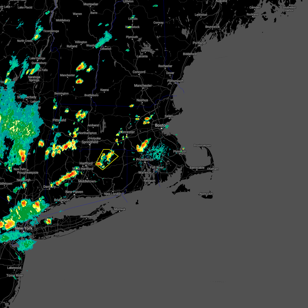 The severe thunderstorm warning for northwestern windham and central tolland counties will expire at 200 pm edt, the storm which prompted the warning has weakened below severe limits, and no longer poses an immediate threat to life or property. therefore the warning will be allowed to expire. however heavy rain is still possible with this thunderstorm. The severe thunderstorm warning for northwestern windham and central tolland counties will expire at 200 pm edt, the storm which prompted the warning has weakened below severe limits, and no longer poses an immediate threat to life or property. therefore the warning will be allowed to expire. however heavy rain is still possible with this thunderstorm.
|
| 8/2/2017 1:11 PM EDT |
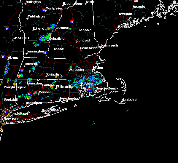 At 110 pm edt, a severe thunderstorm was located over coventry, or near mansfield, moving northeast at 15 mph (radar indicated). Hazards include 60 mph wind gusts and quarter size hail. Hail damage to vehicles is possible. Expect damage to trees and power lines. At 110 pm edt, a severe thunderstorm was located over coventry, or near mansfield, moving northeast at 15 mph (radar indicated). Hazards include 60 mph wind gusts and quarter size hail. Hail damage to vehicles is possible. Expect damage to trees and power lines.
|
| 7/12/2017 2:20 PM EDT |
 At 220 pm edt, a severe thunderstorm was located over vernon, moving east at 20 mph (radar indicated). Hazards include 60 mph wind gusts and quarter size hail. Hail damage to vehicles is possible. expect damage to trees and power lines. Locations impacted include, vernon, mansfield, south windsor, windham, willimantic, ellington, tolland, coventry, hebron, lebanon, willington, columbia, bolton, ashford, pomfret, andover, chaplin and eastford. At 220 pm edt, a severe thunderstorm was located over vernon, moving east at 20 mph (radar indicated). Hazards include 60 mph wind gusts and quarter size hail. Hail damage to vehicles is possible. expect damage to trees and power lines. Locations impacted include, vernon, mansfield, south windsor, windham, willimantic, ellington, tolland, coventry, hebron, lebanon, willington, columbia, bolton, ashford, pomfret, andover, chaplin and eastford.
|
| 7/12/2017 1:57 PM EDT |
 At 156 pm edt, a severe thunderstorm was located over east windsor, or over south windsor, moving east at 15 mph (trained weather spotters). Hazards include 60 mph wind gusts and quarter size hail. Hail damage to vehicles is possible. Expect damage to trees and power lines. At 156 pm edt, a severe thunderstorm was located over east windsor, or over south windsor, moving east at 15 mph (trained weather spotters). Hazards include 60 mph wind gusts and quarter size hail. Hail damage to vehicles is possible. Expect damage to trees and power lines.
|
| 6/27/2017 3:16 PM EDT |
 At 715 pm edt, a severe thunderstorm was located over mansfield, moving east at 25 mph (radar indicated, although spotters report hail up to a half inch). Hazards include 50 mph wind gusts and quarter size hail. Hail damage to vehicles is possible. Expect damage to trees and power lines. At 715 pm edt, a severe thunderstorm was located over mansfield, moving east at 25 mph (radar indicated, although spotters report hail up to a half inch). Hazards include 50 mph wind gusts and quarter size hail. Hail damage to vehicles is possible. Expect damage to trees and power lines.
|
| 6/21/2017 4:19 PM EDT |
 At 418 pm edt, a severe thunderstorm was located over east granby, or near windsor, moving east at 35 mph (radar indicated). Hazards include 60 mph wind gusts and quarter size hail. Hail damage to vehicles is possible. expect damage to trees and power lines. Locations impacted include, hartford, manchester, east hartford, enfield, vernon, windsor, mansfield, south windsor, simsbury, bloomfield, willimantic, suffield, ellington, tolland, windsor locks, coventry, stafford, somers, granby and east windsor. At 418 pm edt, a severe thunderstorm was located over east granby, or near windsor, moving east at 35 mph (radar indicated). Hazards include 60 mph wind gusts and quarter size hail. Hail damage to vehicles is possible. expect damage to trees and power lines. Locations impacted include, hartford, manchester, east hartford, enfield, vernon, windsor, mansfield, south windsor, simsbury, bloomfield, willimantic, suffield, ellington, tolland, windsor locks, coventry, stafford, somers, granby and east windsor.
|
| 6/21/2017 3:58 PM EDT |
 At 358 pm edt, a severe thunderstorm was located near winsted, or 10 miles northeast of torrington, moving east at 45 mph (radar indicated). Hazards include 60 mph wind gusts and quarter size hail. Hail damage to vehicles is possible. Expect damage to trees and power lines. At 358 pm edt, a severe thunderstorm was located near winsted, or 10 miles northeast of torrington, moving east at 45 mph (radar indicated). Hazards include 60 mph wind gusts and quarter size hail. Hail damage to vehicles is possible. Expect damage to trees and power lines.
|
| 5/19/2017 12:27 AM EDT |
 At 1226 am edt, a severe thunderstorm was located over coventry, or near vernon, moving east at 45 mph (radar indicated). Hazards include 60 mph wind gusts. Expect damage to trees and power lines. Locations impacted include, vernon, mansfield, windham, plainfield, willimantic, killingly, ellington, tolland, coventry, griswold, hebron, putnam, brooklyn, woodstock, lebanon, marlborough, willington, columbia, canterbury and bolton. At 1226 am edt, a severe thunderstorm was located over coventry, or near vernon, moving east at 45 mph (radar indicated). Hazards include 60 mph wind gusts. Expect damage to trees and power lines. Locations impacted include, vernon, mansfield, windham, plainfield, willimantic, killingly, ellington, tolland, coventry, griswold, hebron, putnam, brooklyn, woodstock, lebanon, marlborough, willington, columbia, canterbury and bolton.
|
| 5/19/2017 12:17 AM EDT |
 At 1216 am edt, a severe thunderstorm was located over manchester, moving east at 45 mph (radar indicated). Hazards include 60 mph wind gusts. expect damage to trees and power lines At 1216 am edt, a severe thunderstorm was located over manchester, moving east at 45 mph (radar indicated). Hazards include 60 mph wind gusts. expect damage to trees and power lines
|
| 5/18/2017 11:50 PM EDT |
 At 1150 pm edt, severe thunderstorms were located along a line extending from near ashford to tolland to near vernon, moving east at 55 mph (radar indicated). Hazards include 60 mph wind gusts. expect damage to trees and power lines At 1150 pm edt, severe thunderstorms were located along a line extending from near ashford to tolland to near vernon, moving east at 55 mph (radar indicated). Hazards include 60 mph wind gusts. expect damage to trees and power lines
|
| 9/11/2016 10:23 AM EDT |
 The severe thunderstorm warning for windham, tolland, northeastern hartford and northwestern providence counties will expire at 1030 am edt, the storms which prompted the warning have weakened below severe limits, and no longer pose an immediate threat to life or property. therefore, the warning will be allowed to expire. The severe thunderstorm warning for windham, tolland, northeastern hartford and northwestern providence counties will expire at 1030 am edt, the storms which prompted the warning have weakened below severe limits, and no longer pose an immediate threat to life or property. therefore, the warning will be allowed to expire.
|
| 9/11/2016 9:40 AM EDT |
 At 940 am edt, severe thunderstorms were located along a line extending from near litchfield to clinton to near charlton to vernon, moving east at 40 mph (radar indicated). Hazards include 60 mph wind gusts. Expect damage to roofs. siding. And trees. At 940 am edt, severe thunderstorms were located along a line extending from near litchfield to clinton to near charlton to vernon, moving east at 40 mph (radar indicated). Hazards include 60 mph wind gusts. Expect damage to roofs. siding. And trees.
|
| 8/12/2016 6:19 PM EDT |
 At 619 pm edt, severe thunderstorms were located along a line extending from near tolland to chaplin to scituate, moving southeast at 20 mph (radar indicated). Hazards include 60 mph wind gusts. Expect damage to roofs. siding. and trees. Locations impacted include, vernon, mansfield, windham, plainfield, willimantic, tolland, coventry, hebron, brooklyn, willington, columbia, canterbury, bolton, ashford, andover, chaplin, hampton, eastford and scotland. At 619 pm edt, severe thunderstorms were located along a line extending from near tolland to chaplin to scituate, moving southeast at 20 mph (radar indicated). Hazards include 60 mph wind gusts. Expect damage to roofs. siding. and trees. Locations impacted include, vernon, mansfield, windham, plainfield, willimantic, tolland, coventry, hebron, brooklyn, willington, columbia, canterbury, bolton, ashford, andover, chaplin, hampton, eastford and scotland.
|
| 8/12/2016 6:11 PM EDT |
 At 611 pm edt, severe thunderstorms were located along a line extending from near vernon to chaplin to scituate, moving southeast at 15 mph (radar indicated). Hazards include 60 mph wind gusts. Expect damage to roofs. siding. And trees. At 611 pm edt, severe thunderstorms were located along a line extending from near vernon to chaplin to scituate, moving southeast at 15 mph (radar indicated). Hazards include 60 mph wind gusts. Expect damage to roofs. siding. And trees.
|
| 8/11/2016 5:29 PM EDT |
 At 529 pm edt, a severe thunderstorm was located over glastonbury, moving east at 30 mph (radar indicated). Hazards include 60 mph wind gusts. expect damage trees and power lines At 529 pm edt, a severe thunderstorm was located over glastonbury, moving east at 30 mph (radar indicated). Hazards include 60 mph wind gusts. expect damage trees and power lines
|
| 8/11/2016 4:41 PM EDT |
 The national weather service in taunton has issued a * severe thunderstorm warning for. southwestern tolland county in northern connecticut. southeastern hartford county in northern connecticut. until 530 pm edt * at 441 pm edt. Severe thunderstorms were located along a line. The national weather service in taunton has issued a * severe thunderstorm warning for. southwestern tolland county in northern connecticut. southeastern hartford county in northern connecticut. until 530 pm edt * at 441 pm edt. Severe thunderstorms were located along a line.
|
| 8/11/2016 4:30 PM EDT |
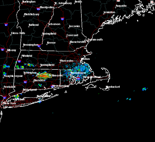 At 430 pm edt, a severe thunderstorm was located over coventry, or near mansfield, moving southeast at 15 mph (radar indicated). Hazards include 60 mph wind gusts and quarter size hail. Hail damage to vehicles is expected. expect wind damage to roofs, siding, and trees. Locations impacted include, vernon, mansfield, windham, willimantic, tolland, coventry, willington, columbia, bolton, ashford, andover, chaplin and scotland. At 430 pm edt, a severe thunderstorm was located over coventry, or near mansfield, moving southeast at 15 mph (radar indicated). Hazards include 60 mph wind gusts and quarter size hail. Hail damage to vehicles is expected. expect wind damage to roofs, siding, and trees. Locations impacted include, vernon, mansfield, windham, willimantic, tolland, coventry, willington, columbia, bolton, ashford, andover, chaplin and scotland.
|
| 8/11/2016 4:22 PM EDT |
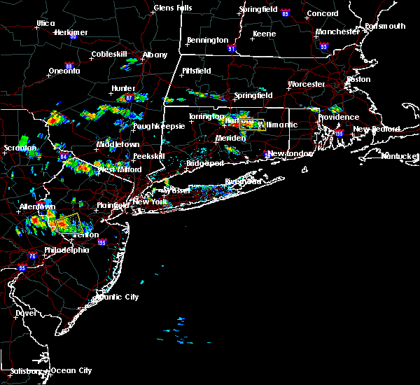 At 422 pm edt, a severe thunderstorm was located over manchester, moving southeast at 15 mph (radar indicated). Hazards include 60 mph wind gusts and nickel size hail. Expect damage to roofs. siding. And trees. At 422 pm edt, a severe thunderstorm was located over manchester, moving southeast at 15 mph (radar indicated). Hazards include 60 mph wind gusts and nickel size hail. Expect damage to roofs. siding. And trees.
|
| 8/11/2016 4:15 PM EDT |
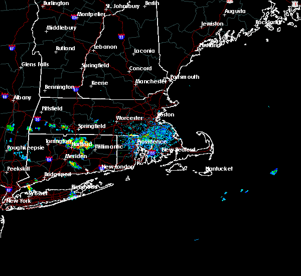 At 415 pm edt, a severe thunderstorm was located over coventry, or near vernon, moving east at 15 mph (radar indicated). Hazards include 60 mph wind gusts and quarter size hail. Hail damage to vehicles is expected. Expect wind damage to roofs, siding, and trees. At 415 pm edt, a severe thunderstorm was located over coventry, or near vernon, moving east at 15 mph (radar indicated). Hazards include 60 mph wind gusts and quarter size hail. Hail damage to vehicles is expected. Expect wind damage to roofs, siding, and trees.
|
| 7/22/2016 10:27 PM EDT |
 At 1026 pm edt, a severe thunderstorm was located over chaplin, or near mansfield, moving east at 35 mph (radar indicated). Hazards include 60 mph wind gusts and penny size hail. Expect damage to roofs. siding. And trees. At 1026 pm edt, a severe thunderstorm was located over chaplin, or near mansfield, moving east at 35 mph (radar indicated). Hazards include 60 mph wind gusts and penny size hail. Expect damage to roofs. siding. And trees.
|
| 7/22/2016 9:06 PM EDT |
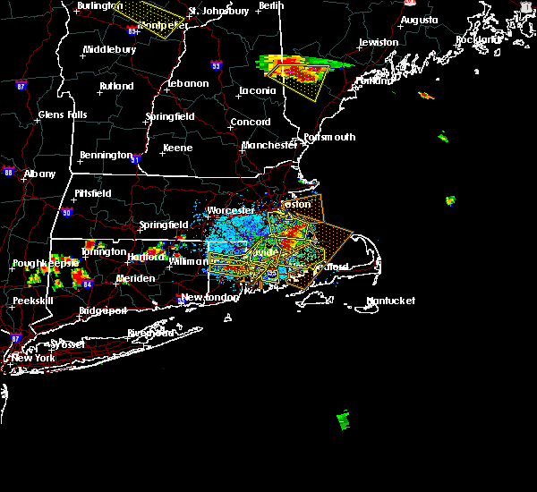 At 906 pm edt, a severe thunderstorm was located over tolland, or near vernon, moving east at 40 mph (radar indicated). Hazards include 60 mph wind gusts. Expect damage to roofs. siding. And trees. At 906 pm edt, a severe thunderstorm was located over tolland, or near vernon, moving east at 40 mph (radar indicated). Hazards include 60 mph wind gusts. Expect damage to roofs. siding. And trees.
|
| 7/18/2016 4:19 PM EDT |
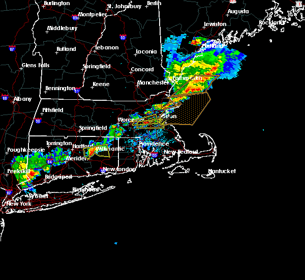 At 418 pm edt, a severe thunderstorm was located over columbia, or 7 miles southwest of mansfield, moving east at 40 mph (radar indicated). Hazards include 60 mph wind gusts and penny size hail. Expect damage to roofs. siding. and trees. Locations impacted include, mansfield, windham, willimantic, coventry, hebron, brooklyn, willington, columbia, canterbury, bolton, ashford, pomfret, andover, chaplin, hampton, eastford and scotland. At 418 pm edt, a severe thunderstorm was located over columbia, or 7 miles southwest of mansfield, moving east at 40 mph (radar indicated). Hazards include 60 mph wind gusts and penny size hail. Expect damage to roofs. siding. and trees. Locations impacted include, mansfield, windham, willimantic, coventry, hebron, brooklyn, willington, columbia, canterbury, bolton, ashford, pomfret, andover, chaplin, hampton, eastford and scotland.
|
| 7/18/2016 3:56 PM EDT |
 At 356 pm edt, a severe thunderstorm was located over glastonbury, moving east at 35 mph (radar indicated). Hazards include 60 mph wind gusts and penny size hail. Expect damage to roofs. siding. And trees. At 356 pm edt, a severe thunderstorm was located over glastonbury, moving east at 35 mph (radar indicated). Hazards include 60 mph wind gusts and penny size hail. Expect damage to roofs. siding. And trees.
|
| 2/25/2016 1:54 AM EST |
 At 153 am est, doppler radar indicated a line of severe thunderstorms capable of producing destructive winds in excess of 70 mph. these storms were located along a line extending from monson to near tolland to near marlborough, and was moving northeast at 85 mph. At 153 am est, doppler radar indicated a line of severe thunderstorms capable of producing destructive winds in excess of 70 mph. these storms were located along a line extending from monson to near tolland to near marlborough, and was moving northeast at 85 mph.
|
| 2/25/2016 1:25 AM EST | Tree and wires dow in tolland county CT, 3.6 miles NNE of Coventry Lake, CT |
| 2/25/2016 12:58 AM EST |
 At 1258 am est, doppler radar indicated a severe thunderstorm capable of producing destructive winds in excess of 70 mph. this storm was located over east windsor, or near south windsor, and was moving northeast at 45 mph. At 1258 am est, doppler radar indicated a severe thunderstorm capable of producing destructive winds in excess of 70 mph. this storm was located over east windsor, or near south windsor, and was moving northeast at 45 mph.
|
| 2/25/2016 12:25 AM EST |
 At 1225 am est, doppler radar indicated a line of severe thunderstorms capable of producing destructive winds in excess of 70 mph. these storms were located along a line extending from canton to portland, and was moving northeast at 45 mph. At 1225 am est, doppler radar indicated a line of severe thunderstorms capable of producing destructive winds in excess of 70 mph. these storms were located along a line extending from canton to portland, and was moving northeast at 45 mph.
|
| 6/23/2015 4:57 PM EDT |
 At 456 pm edt, doppler radar indicated a line of severe thunderstorms capable of producing damaging winds in excess of 60 mph. these storms were located along a line extending from near windsor to near glastonbury to near east hampton, and was moving east at 50 mph. * some locations impacted include, manchester, east hartford, glastonbury, vernon, mansfield, south windsor, windham, plainfield, willimantic, killingly, tolland, coventry, hebron, putnam, brooklyn, marlborough, willington, columbia, canterbury and bolton. At 456 pm edt, doppler radar indicated a line of severe thunderstorms capable of producing damaging winds in excess of 60 mph. these storms were located along a line extending from near windsor to near glastonbury to near east hampton, and was moving east at 50 mph. * some locations impacted include, manchester, east hartford, glastonbury, vernon, mansfield, south windsor, windham, plainfield, willimantic, killingly, tolland, coventry, hebron, putnam, brooklyn, marlborough, willington, columbia, canterbury and bolton.
|
| 6/23/2015 4:21 PM EDT |
 At 420 pm edt, doppler radar indicated a line of severe thunderstorms capable of producing damaging winds in excess of 60 mph. these storms were located along a line extending from near woodbury center to beacon falls to orange, and was moving east at 60 mph. * some locations impacted include, hartford, new britain, west hartford, bristol, manchester, east hartford, southington, glastonbury, newington, wethersfield, mansfield, farmington, windham, berlin, rocky hill, avon, willimantic, plainville, coventry and hebron. At 420 pm edt, doppler radar indicated a line of severe thunderstorms capable of producing damaging winds in excess of 60 mph. these storms were located along a line extending from near woodbury center to beacon falls to orange, and was moving east at 60 mph. * some locations impacted include, hartford, new britain, west hartford, bristol, manchester, east hartford, southington, glastonbury, newington, wethersfield, mansfield, farmington, windham, berlin, rocky hill, avon, willimantic, plainville, coventry and hebron.
|
Hail Maps for Coventry Lake, CT


Connect with Interactive Hail Maps