

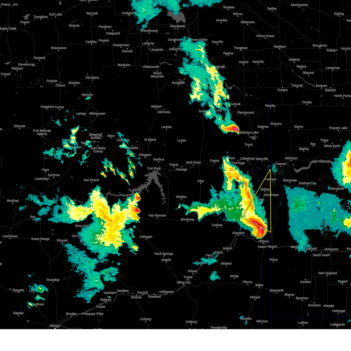
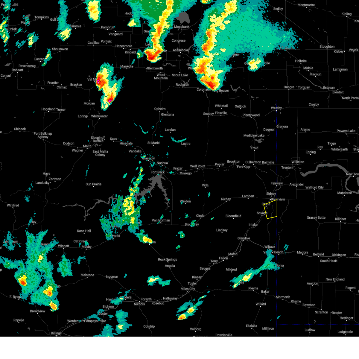
Hail Map for Crane, MT
The Crane, MT area has had 2 reports of on-the-ground hail by trained spotters, and has been under severe weather warnings 7 times during the past 12 months. Doppler radar has detected hail at or near Crane, MT on 33 occasions.
| Name: | Crane, MT |
| Where Located: | 48.9 miles SW of Williston, ND |
| Map: | Google Map for Crane, MT |
| Population: | 102 |
| Housing Units: | 43 |
| More Info: | Search Google for Crane, MT |
1
The Top Recent Hail Date for Crane, MT is Saturday, June 15, 2024 (2nd out of 33)

Hail and Wind Damage Spotted near Crane, MT
| Date / Time | Report Details |
|---|---|
| 6/15/2025 11:22 PM MDT |
 The storm which prompted the warning has weakened below severe limits, and no longer poses an immediate threat to life or property. therefore, the warning will be allowed to expire. however, gusty winds and heavy rain are still possible with this thunderstorm. a severe thunderstorm watch remains in effect until 100 am mdt for northeastern montana. The storm which prompted the warning has weakened below severe limits, and no longer poses an immediate threat to life or property. therefore, the warning will be allowed to expire. however, gusty winds and heavy rain are still possible with this thunderstorm. a severe thunderstorm watch remains in effect until 100 am mdt for northeastern montana.
|
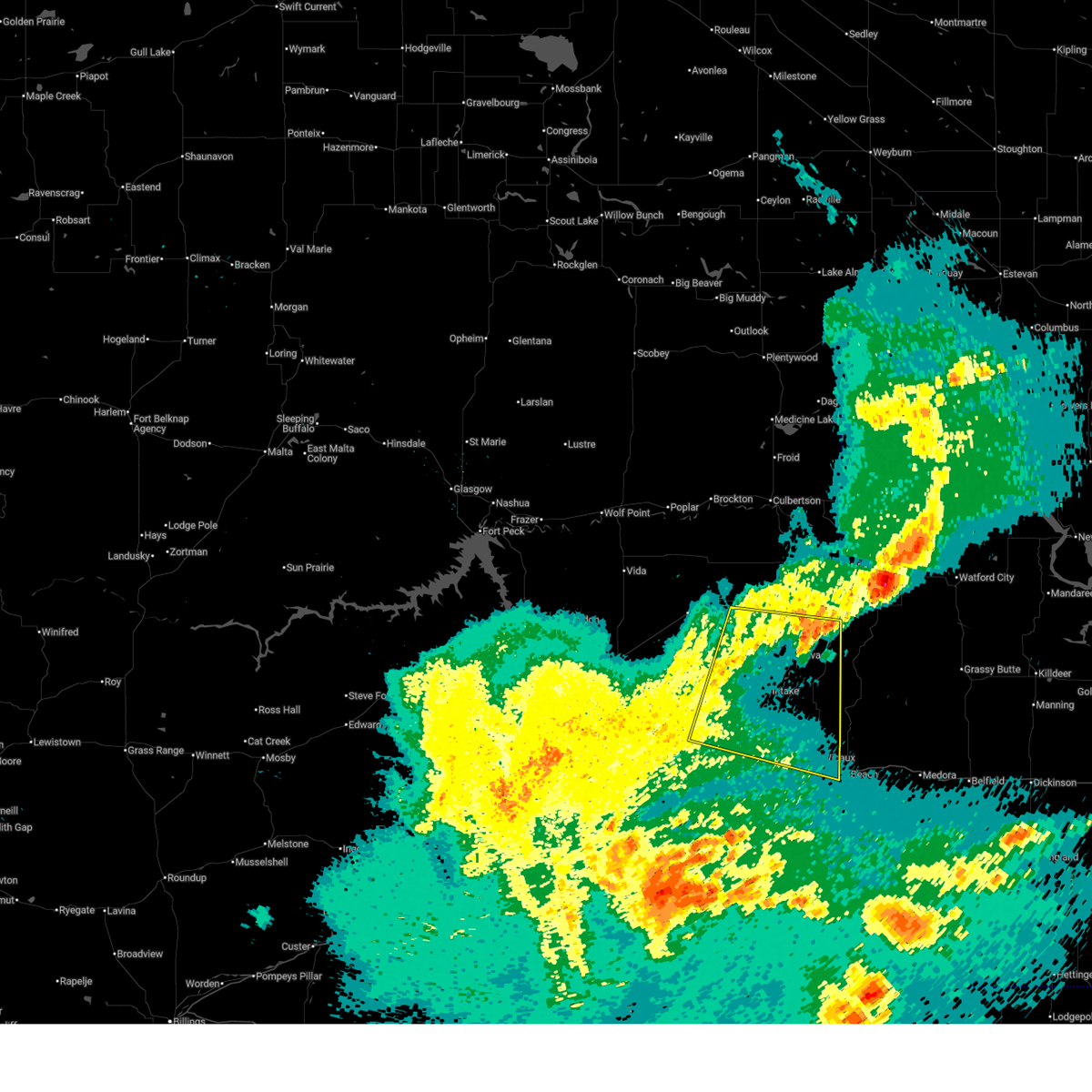
| 6/15/2025 11:00 PM MDT |
 At 1059 pm mdt, a severe thunderstorm was located near savage, or 24 miles southwest of sidney, moving east at 40 mph (radar indicated). Hazards include 60 mph wind gusts. Expect damage to roofs, siding, and trees. Locations impacted include, hodges, forest park, savage, stipek, glendive, intake, west glendive, midway, burns, crane, yates, and wibaux. At 1059 pm mdt, a severe thunderstorm was located near savage, or 24 miles southwest of sidney, moving east at 40 mph (radar indicated). Hazards include 60 mph wind gusts. Expect damage to roofs, siding, and trees. Locations impacted include, hodges, forest park, savage, stipek, glendive, intake, west glendive, midway, burns, crane, yates, and wibaux.
|
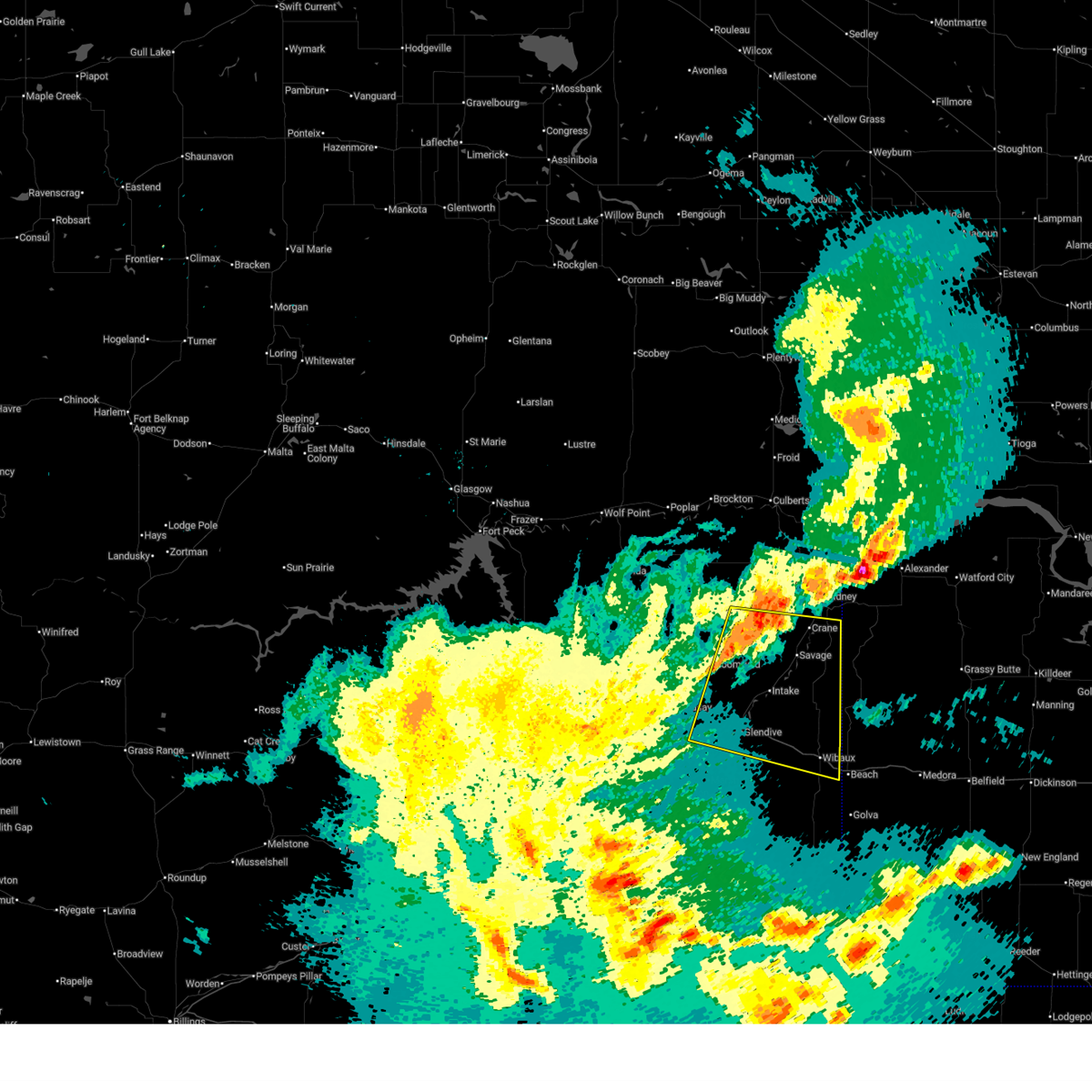
| 6/15/2025 10:22 PM MDT |
 Svrggw the national weather service in glasgow has issued a * severe thunderstorm warning for, northeastern wibaux county in northeastern montana, dawson county in northeastern montana, southern richland county in northeastern montana, * until 1130 pm mdt. * at 1022 pm mdt, a severe thunderstorm was located over bloomfield, or 22 miles northwest of glendive, moving east at 40 mph (radar indicated). Hazards include 70 mph wind gusts. Expect considerable tree damage. Damage is likely to mobile homes, roofs, and outbuildings. Svrggw the national weather service in glasgow has issued a * severe thunderstorm warning for, northeastern wibaux county in northeastern montana, dawson county in northeastern montana, southern richland county in northeastern montana, * until 1130 pm mdt. * at 1022 pm mdt, a severe thunderstorm was located over bloomfield, or 22 miles northwest of glendive, moving east at 40 mph (radar indicated). Hazards include 70 mph wind gusts. Expect considerable tree damage. Damage is likely to mobile homes, roofs, and outbuildings.
|
| 9/12/2024 7:24 PM MDT |
 the severe thunderstorm warning has been cancelled and is no longer in effect the severe thunderstorm warning has been cancelled and is no longer in effect
|
| 9/12/2024 6:51 PM MDT |
 Svrggw the national weather service in glasgow has issued a * severe thunderstorm warning for, northeastern wibaux county in northeastern montana, southeastern roosevelt county in northeastern montana, southeastern richland county in northeastern montana, east central dawson county in northeastern montana, * until 745 pm mdt. * at 650 pm mdt, a severe thunderstorm was located 11 miles east of intake, or 20 miles north of wibaux, moving northeast at 60 mph (radar indicated). Hazards include 60 mph wind gusts and quarter size hail. Hail damage to vehicles is expected. Expect wind damage to roofs, siding, and trees. Svrggw the national weather service in glasgow has issued a * severe thunderstorm warning for, northeastern wibaux county in northeastern montana, southeastern roosevelt county in northeastern montana, southeastern richland county in northeastern montana, east central dawson county in northeastern montana, * until 745 pm mdt. * at 650 pm mdt, a severe thunderstorm was located 11 miles east of intake, or 20 miles north of wibaux, moving northeast at 60 mph (radar indicated). Hazards include 60 mph wind gusts and quarter size hail. Hail damage to vehicles is expected. Expect wind damage to roofs, siding, and trees.
|
| 8/21/2024 10:22 PM MDT |
 The storm which prompted the warning has nearly moved out of the area. therefore, the warning will be allowed to expire. a severe thunderstorm watch remains in effect until 100 am mdt for northeastern montana. The storm which prompted the warning has nearly moved out of the area. therefore, the warning will be allowed to expire. a severe thunderstorm watch remains in effect until 100 am mdt for northeastern montana.
|
| 8/21/2024 10:06 PM MDT |
 Svrggw the national weather service in glasgow has issued a * severe thunderstorm warning for, southeastern richland county in northeastern montana, * until 1030 pm mdt. * at 1005 pm mdt, a severe thunderstorm was located 10 miles northeast of savage, or 13 miles south of sidney, moving east at 35 mph (radar indicated). Hazards include 60 mph wind gusts and quarter size hail. Hail damage to vehicles is expected. Expect wind damage to roofs, siding, and trees. Svrggw the national weather service in glasgow has issued a * severe thunderstorm warning for, southeastern richland county in northeastern montana, * until 1030 pm mdt. * at 1005 pm mdt, a severe thunderstorm was located 10 miles northeast of savage, or 13 miles south of sidney, moving east at 35 mph (radar indicated). Hazards include 60 mph wind gusts and quarter size hail. Hail damage to vehicles is expected. Expect wind damage to roofs, siding, and trees.
|
| 6/27/2024 6:29 PM MDT |
 the severe thunderstorm warning has been cancelled and is no longer in effect the severe thunderstorm warning has been cancelled and is no longer in effect
|
| 6/27/2024 5:47 PM MDT |
 Svrggw the national weather service in glasgow has issued a * severe thunderstorm warning for, eastern wibaux county in northeastern montana, southeastern roosevelt county in northeastern montana, richland county in northeastern montana, northeastern dawson county in northeastern montana, * until 645 pm mdt. * at 547 pm mdt, severe thunderstorms were located along a line extending from 11 miles northwest of lambert to 14 miles northwest of carlyle, moving northeast at 35 mph (radar indicated). Hazards include 70 mph wind gusts and half dollar size hail. Hail damage to vehicles is expected. expect considerable tree damage. Wind damage is also likely to mobile homes, roofs, and outbuildings. Svrggw the national weather service in glasgow has issued a * severe thunderstorm warning for, eastern wibaux county in northeastern montana, southeastern roosevelt county in northeastern montana, richland county in northeastern montana, northeastern dawson county in northeastern montana, * until 645 pm mdt. * at 547 pm mdt, severe thunderstorms were located along a line extending from 11 miles northwest of lambert to 14 miles northwest of carlyle, moving northeast at 35 mph (radar indicated). Hazards include 70 mph wind gusts and half dollar size hail. Hail damage to vehicles is expected. expect considerable tree damage. Wind damage is also likely to mobile homes, roofs, and outbuildings.
|
| 6/27/2024 4:50 PM MDT |
 Svrggw the national weather service in glasgow has issued a * severe thunderstorm warning for, northern wibaux county in northeastern montana, southeastern richland county in northeastern montana, northeastern dawson county in northeastern montana, * until 545 pm mdt. * at 449 pm mdt, a severe thunderstorm was located 9 miles southwest of lambert, or 30 miles west of sidney, moving east at 20 mph (radar indicated). Hazards include 70 mph wind gusts and ping pong ball size hail. People and animals outdoors will be injured. expect hail damage to roofs, siding, windows, and vehicles. expect considerable tree damage. Wind damage is also likely to mobile homes, roofs, and outbuildings. Svrggw the national weather service in glasgow has issued a * severe thunderstorm warning for, northern wibaux county in northeastern montana, southeastern richland county in northeastern montana, northeastern dawson county in northeastern montana, * until 545 pm mdt. * at 449 pm mdt, a severe thunderstorm was located 9 miles southwest of lambert, or 30 miles west of sidney, moving east at 20 mph (radar indicated). Hazards include 70 mph wind gusts and ping pong ball size hail. People and animals outdoors will be injured. expect hail damage to roofs, siding, windows, and vehicles. expect considerable tree damage. Wind damage is also likely to mobile homes, roofs, and outbuildings.
|
| 6/15/2024 9:12 PM MDT |
 The storms which prompted the warning have weakened below severe limits, and no longer pose an immediate threat to life or property. therefore, the warning will be allowed to expire. however, gusty winds are still possible with these thunderstorms. The storms which prompted the warning have weakened below severe limits, and no longer pose an immediate threat to life or property. therefore, the warning will be allowed to expire. however, gusty winds are still possible with these thunderstorms.
|
| 6/15/2024 8:49 PM MDT |
 At 849 pm mdt, severe thunderstorms were located along a line extending from 12 miles northeast of plentywood to 6 miles east of bainville to near skaar, moving east at 50 mph (radar indicated). Hazards include 70 mph wind gusts and quarter size hail. Hail damage to vehicles is expected. expect considerable tree damage. wind damage is also likely to mobile homes, roofs, and outbuildings. Locations impacted include, sidney, plentywood, culbertson, fairview, medicine lake, bainville, froid, westby, archer, savage, lambert, outlook, reserve, raymond, comertown, nohly, wooley, crane, mccabe, and midway. At 849 pm mdt, severe thunderstorms were located along a line extending from 12 miles northeast of plentywood to 6 miles east of bainville to near skaar, moving east at 50 mph (radar indicated). Hazards include 70 mph wind gusts and quarter size hail. Hail damage to vehicles is expected. expect considerable tree damage. wind damage is also likely to mobile homes, roofs, and outbuildings. Locations impacted include, sidney, plentywood, culbertson, fairview, medicine lake, bainville, froid, westby, archer, savage, lambert, outlook, reserve, raymond, comertown, nohly, wooley, crane, mccabe, and midway.
|
| 6/15/2024 8:49 PM MDT |
 the severe thunderstorm warning has been cancelled and is no longer in effect the severe thunderstorm warning has been cancelled and is no longer in effect
|
| 6/15/2024 8:26 PM MDT |
 Svrggw the national weather service in glasgow has issued a * severe thunderstorm warning for, eastern daniels county in northeastern montana, eastern roosevelt county in northeastern montana, sheridan county in northeastern montana, richland county in northeastern montana, northeastern dawson county in northeastern montana, * until 915 pm mdt. * at 826 pm mdt, severe thunderstorms were located along a line extending from 6 miles southwest of port of raymond to near culbertson to 7 miles north of intake, moving east at 50 mph (radar indicated). Hazards include 70 mph wind gusts and quarter size hail. Hail damage to vehicles is expected. expect considerable tree damage. Wind damage is also likely to mobile homes, roofs, and outbuildings. Svrggw the national weather service in glasgow has issued a * severe thunderstorm warning for, eastern daniels county in northeastern montana, eastern roosevelt county in northeastern montana, sheridan county in northeastern montana, richland county in northeastern montana, northeastern dawson county in northeastern montana, * until 915 pm mdt. * at 826 pm mdt, severe thunderstorms were located along a line extending from 6 miles southwest of port of raymond to near culbertson to 7 miles north of intake, moving east at 50 mph (radar indicated). Hazards include 70 mph wind gusts and quarter size hail. Hail damage to vehicles is expected. expect considerable tree damage. Wind damage is also likely to mobile homes, roofs, and outbuildings.
|
| 4/22/2024 1:54 PM MDT |
 The severe winds with showers which prompted the warning has weakened. therefore, the warning will be allowed to expire. however, gusty winds will continue for the remainder of the afternoon. The severe winds with showers which prompted the warning has weakened. therefore, the warning will be allowed to expire. however, gusty winds will continue for the remainder of the afternoon.
|
| 4/22/2024 12:59 PM MDT |
 Svrggw the national weather service in glasgow has issued a * severe thunderstorm warning for, southern roosevelt county in northeastern montana, northeastern mccone county in northeastern montana, richland county in northeastern montana, northwestern dawson county in northeastern montana, * until 200 pm mdt. * at 1258 pm mdt, severe winds with showers were located 9 miles east of wolf point, moving east at 55 mph (radar indicated). Hazards include 60 mph wind gusts. Expect damage to roofs, siding, and trees. Also expect blowing dust and dirt. Svrggw the national weather service in glasgow has issued a * severe thunderstorm warning for, southern roosevelt county in northeastern montana, northeastern mccone county in northeastern montana, richland county in northeastern montana, northwestern dawson county in northeastern montana, * until 200 pm mdt. * at 1258 pm mdt, severe winds with showers were located 9 miles east of wolf point, moving east at 55 mph (radar indicated). Hazards include 60 mph wind gusts. Expect damage to roofs, siding, and trees. Also expect blowing dust and dirt.
|
| 8/30/2023 8:52 PM MDT |
 At 851 pm mdt, severe thunderstorms were located along a line extending from 6 miles northwest of medicine lake to 7 miles north of skaar, moving northeast at 35 mph (radar indicated). Hazards include 60 mph wind gusts. expect damage to roofs, siding, and trees At 851 pm mdt, severe thunderstorms were located along a line extending from 6 miles northwest of medicine lake to 7 miles north of skaar, moving northeast at 35 mph (radar indicated). Hazards include 60 mph wind gusts. expect damage to roofs, siding, and trees
|
| 8/23/2023 12:02 AM MDT |
 At 1202 am mdt, severe thunderstorms were located along a line extending from 9 miles southwest of sidney to near trotters to near beach, moving northeast at 45 mph (radar indicated). Hazards include 60 mph wind gusts. Expect damage to roofs, siding, and trees. locations impacted include, wibaux, savage, intake, hodges, stipek, midway, burns, crane, and yates. hail threat, radar indicated max hail size, <. 75 in wind threat, observed max wind gust, 60 mph. At 1202 am mdt, severe thunderstorms were located along a line extending from 9 miles southwest of sidney to near trotters to near beach, moving northeast at 45 mph (radar indicated). Hazards include 60 mph wind gusts. Expect damage to roofs, siding, and trees. locations impacted include, wibaux, savage, intake, hodges, stipek, midway, burns, crane, and yates. hail threat, radar indicated max hail size, <. 75 in wind threat, observed max wind gust, 60 mph.
|
| 8/22/2023 11:40 PM MDT |
 At 1139 pm mdt, severe thunderstorms were located along a line extending from 12 miles west of savage to 15 miles southeast of intake to 12 miles south of wibaux, moving northeast at 45 mph (radar indicated). Hazards include 60 mph wind gusts. expect damage to roofs, siding, and trees At 1139 pm mdt, severe thunderstorms were located along a line extending from 12 miles west of savage to 15 miles southeast of intake to 12 miles south of wibaux, moving northeast at 45 mph (radar indicated). Hazards include 60 mph wind gusts. expect damage to roofs, siding, and trees
|
| 8/1/2023 4:23 PM MDT |
 At 422 pm mdt, severe thunderstorms were located along a line extending from 9 miles south of culbertson to near richey, moving northeast at 35 mph (radar indicated). Hazards include 60 mph wind gusts and quarter size hail. Hail damage to vehicles is expected. Expect wind damage to roofs, siding, and trees. At 422 pm mdt, severe thunderstorms were located along a line extending from 9 miles south of culbertson to near richey, moving northeast at 35 mph (radar indicated). Hazards include 60 mph wind gusts and quarter size hail. Hail damage to vehicles is expected. Expect wind damage to roofs, siding, and trees.
|
| 7/30/2023 7:10 PM MDT |
 At 708 pm mdt, a severe thunderstorm was located 8 miles northwest of savage, or 20 miles southwest of sidney, moving southeast at 40 mph (radar indicated). Hazards include ping pong ball size hail and 60 mph wind gusts. People and animals outdoors will be injured. expect hail damage to roofs, siding, windows, and vehicles. expect wind damage to roofs, siding, and trees. locations impacted include, sidney, lambert, savage, intake, enid, midway, burns and crane. hail threat, radar indicated max hail size, 1. 50 in wind threat, radar indicated max wind gust, 60 mph. At 708 pm mdt, a severe thunderstorm was located 8 miles northwest of savage, or 20 miles southwest of sidney, moving southeast at 40 mph (radar indicated). Hazards include ping pong ball size hail and 60 mph wind gusts. People and animals outdoors will be injured. expect hail damage to roofs, siding, windows, and vehicles. expect wind damage to roofs, siding, and trees. locations impacted include, sidney, lambert, savage, intake, enid, midway, burns and crane. hail threat, radar indicated max hail size, 1. 50 in wind threat, radar indicated max wind gust, 60 mph.
|
| 7/30/2023 6:35 PM MDT |
 At 634 pm mdt, a severe thunderstorm was located 7 miles west of lambert, or 28 miles west of sidney, moving southeast at 45 mph (radar indicated). Hazards include two inch hail and 70 mph wind gusts. People and animals outdoors will be injured. expect hail damage to roofs, siding, windows, and vehicles. expect considerable tree damage. Wind damage is also likely to mobile homes, roofs, and outbuildings. At 634 pm mdt, a severe thunderstorm was located 7 miles west of lambert, or 28 miles west of sidney, moving southeast at 45 mph (radar indicated). Hazards include two inch hail and 70 mph wind gusts. People and animals outdoors will be injured. expect hail damage to roofs, siding, windows, and vehicles. expect considerable tree damage. Wind damage is also likely to mobile homes, roofs, and outbuildings.
|
| 6/4/2023 5:21 PM MDT |
 At 520 pm mdt, severe thunderstorms were located along a line extending from near east fairview to 17 miles southwest of terry, moving northwest at 25 mph (trained weather spotter reported an estimated wind gust of 60 mph at 5:20 pm). Hazards include 60 mph wind gusts and penny size hail. expect damage to roofs, siding, and trees At 520 pm mdt, severe thunderstorms were located along a line extending from near east fairview to 17 miles southwest of terry, moving northwest at 25 mph (trained weather spotter reported an estimated wind gust of 60 mph at 5:20 pm). Hazards include 60 mph wind gusts and penny size hail. expect damage to roofs, siding, and trees
|
| 5/25/2023 8:03 PM MDT |
 At 803 pm mdt, severe thunderstorms were located along a line extending from 8 miles northwest of alexander to 11 miles south of sidney, moving northwest at 20 mph (radar indicated). Hazards include 60 mph wind gusts and quarter size hail. Hail damage to vehicles is expected. expect wind damage to roofs, siding, and trees. locations impacted include, sidney, wooley and crane. hail threat, radar indicated max hail size, 1. 00 in wind threat, radar indicated max wind gust, 60 mph. At 803 pm mdt, severe thunderstorms were located along a line extending from 8 miles northwest of alexander to 11 miles south of sidney, moving northwest at 20 mph (radar indicated). Hazards include 60 mph wind gusts and quarter size hail. Hail damage to vehicles is expected. expect wind damage to roofs, siding, and trees. locations impacted include, sidney, wooley and crane. hail threat, radar indicated max hail size, 1. 00 in wind threat, radar indicated max wind gust, 60 mph.
|
| 5/25/2023 7:35 PM MDT |
 At 734 pm mdt, severe thunderstorms were located along a line extending from near alexander to 10 miles northeast of skaar, moving north at 20 mph (radar indicated). Hazards include 60 mph wind gusts and quarter size hail. Hail damage to vehicles is expected. Expect wind damage to roofs, siding, and trees. At 734 pm mdt, severe thunderstorms were located along a line extending from near alexander to 10 miles northeast of skaar, moving north at 20 mph (radar indicated). Hazards include 60 mph wind gusts and quarter size hail. Hail damage to vehicles is expected. Expect wind damage to roofs, siding, and trees.
|
| 8/17/2022 7:52 PM MDT |
 The severe thunderstorm warning for east central richland county will expire at 800 pm mdt, the storm which prompted the warning has moved out of the area. therefore, the warning will be allowed to expire. The severe thunderstorm warning for east central richland county will expire at 800 pm mdt, the storm which prompted the warning has moved out of the area. therefore, the warning will be allowed to expire.
|
| 8/17/2022 7:33 PM MDT |
 At 732 pm mdt, a severe thunderstorm was located 11 miles southeast of sidney, moving southeast at 30 mph (radar indicated). Hazards include 60 mph wind gusts and quarter size hail. Hail damage to vehicles is expected. expect wind damage to roofs, siding, and trees. this severe thunderstorm will remain over mainly rural areas of east central richland county. hail threat, radar indicated max hail size, 1. 00 in wind threat, radar indicated max wind gust, 60 mph. At 732 pm mdt, a severe thunderstorm was located 11 miles southeast of sidney, moving southeast at 30 mph (radar indicated). Hazards include 60 mph wind gusts and quarter size hail. Hail damage to vehicles is expected. expect wind damage to roofs, siding, and trees. this severe thunderstorm will remain over mainly rural areas of east central richland county. hail threat, radar indicated max hail size, 1. 00 in wind threat, radar indicated max wind gust, 60 mph.
|
| 8/17/2022 6:57 PM MDT |
 At 656 pm mdt, a severe thunderstorm was located 8 miles northwest of sidney, moving southeast at 30 mph (radar indicated). Hazards include 60 mph wind gusts and half dollar size hail. Hail damage to vehicles is expected. Expect wind damage to roofs, siding, and trees. At 656 pm mdt, a severe thunderstorm was located 8 miles northwest of sidney, moving southeast at 30 mph (radar indicated). Hazards include 60 mph wind gusts and half dollar size hail. Hail damage to vehicles is expected. Expect wind damage to roofs, siding, and trees.
|
| 7/18/2022 4:53 PM MDT |
 At 453 pm mdt, a severe thunderstorm was located 13 miles west of richey, or 18 miles northeast of circle, moving east at 55 mph (radar indicated). Hazards include 60 mph wind gusts and quarter size hail. Hail damage to vehicles is expected. Expect wind damage to roofs, siding, and trees. At 453 pm mdt, a severe thunderstorm was located 13 miles west of richey, or 18 miles northeast of circle, moving east at 55 mph (radar indicated). Hazards include 60 mph wind gusts and quarter size hail. Hail damage to vehicles is expected. Expect wind damage to roofs, siding, and trees.
|
| 7/9/2022 11:48 PM MDT |
 At 1148 pm mdt, severe thunderstorms were located along a line extending from 13 miles southwest of richey to 12 miles south of terry, moving east at 60 mph (radar indicated). Hazards include 70 mph wind gusts and half dollar size hail. Hail damage to vehicles is expected. expect considerable tree damage. wind damage is also likely to mobile homes, roofs, and outbuildings. locations impacted include, sidney, glendive, terry, wibaux, fallon, fairview, richey, savage, west glendive, intake, bloomfield, lambert, carlyle, lindsay, east fairview, enid, wooley, crane, mildred and calypso. thunderstorm damage threat, considerable hail threat, radar indicated max hail size, 1. 25 in wind threat, radar indicated max wind gust, 70 mph. At 1148 pm mdt, severe thunderstorms were located along a line extending from 13 miles southwest of richey to 12 miles south of terry, moving east at 60 mph (radar indicated). Hazards include 70 mph wind gusts and half dollar size hail. Hail damage to vehicles is expected. expect considerable tree damage. wind damage is also likely to mobile homes, roofs, and outbuildings. locations impacted include, sidney, glendive, terry, wibaux, fallon, fairview, richey, savage, west glendive, intake, bloomfield, lambert, carlyle, lindsay, east fairview, enid, wooley, crane, mildred and calypso. thunderstorm damage threat, considerable hail threat, radar indicated max hail size, 1. 25 in wind threat, radar indicated max wind gust, 70 mph.
|
| 7/9/2022 11:27 PM MDT |
 At 1126 pm mdt, severe thunderstorms were located along a line extending from 10 miles northwest of circle to 15 miles north of miles city, moving east at 60 mph (radar indicated). Hazards include 70 mph wind gusts and half dollar size hail. Hail damage to vehicles is expected. expect considerable tree damage. Wind damage is also likely to mobile homes, roofs, and outbuildings. At 1126 pm mdt, severe thunderstorms were located along a line extending from 10 miles northwest of circle to 15 miles north of miles city, moving east at 60 mph (radar indicated). Hazards include 70 mph wind gusts and half dollar size hail. Hail damage to vehicles is expected. expect considerable tree damage. Wind damage is also likely to mobile homes, roofs, and outbuildings.
|
| 7/9/2022 10:30 PM MDT |
 At 1030 pm mdt, severe thunderstorms were located along a line extending from 11 miles southwest of vida to 14 miles west of terry, moving east at 60 mph (radar indicated). Hazards include 70 mph wind gusts and half dollar size hail. Hail damage to vehicles is expected. expect considerable tree damage. Wind damage is also likely to mobile homes, roofs, and outbuildings. At 1030 pm mdt, severe thunderstorms were located along a line extending from 11 miles southwest of vida to 14 miles west of terry, moving east at 60 mph (radar indicated). Hazards include 70 mph wind gusts and half dollar size hail. Hail damage to vehicles is expected. expect considerable tree damage. Wind damage is also likely to mobile homes, roofs, and outbuildings.
|
| 7/9/2022 1:41 AM MDT | At 140 am mdt, severe thunderstorms were located along a line extending from 6 miles southeast of bonetrail to 7 miles southwest of beach, moving east at 45 mph (radar indicated). Hazards include 60 mph wind gusts and quarter size hail. Hail damage to vehicles is expected. expect wind damage to roofs, siding, and trees. locations impacted include, sidney, wibaux, fairview, hodges, snowden, saint phillip, nohly, wooley and yates. hail threat, radar indicated max hail size, 1. 00 in wind threat, radar indicated max wind gust, 60 mph. |
| 7/9/2022 1:23 AM MDT | At 123 am mdt, severe thunderstorms were located along a line extending from 9 miles southwest of bonetrail to 17 miles southwest of wibaux, moving east at 50 mph (radar indicated). Hazards include 60 mph wind gusts and quarter size hail. Hail damage to vehicles is expected. Expect wind damage to roofs, siding, and trees. |
| 7/9/2022 1:09 AM MDT | At 108 am mdt, severe thunderstorms were located along a line extending from 8 miles north of archer to 7 miles east of richey, moving east at 70 mph (radar indicated). Hazards include 60 mph wind gusts and penny size hail. Expect damage to roofs, siding, and trees. locations impacted include, sidney, glendive, plentywood, culbertson, wibaux, fairview, medicine lake, bainville, froid, westby, port of raymond, savage, west glendive, intake, lambert, reserve, raymond, enid, comertown and nohly. hail threat, radar indicated max hail size, 0. 75 in wind threat, observed max wind gust, 60 mph. |
| 7/9/2022 12:53 AM MDT | At 1252 am mdt, severe thunderstorms were located along a line extending from 6 miles north of redstone to near richey, moving east at 60 mph (radar indicated). Hazards include 60 mph wind gusts and nickel size hail. Expect considerable tree damage. damage is likely to mobile homes, roofs, and outbuildings. locations impacted include, sidney, glendive, plentywood, poplar, culbertson, wibaux, fairview, brockton, medicine lake, bainville, froid, richey, westby, archer, port of raymond, savage, west glendive, intake, bloomfield and lambert. thunderstorm damage threat, considerable hail threat, radar indicated max hail size, 0. 88 in wind threat, observed max wind gust, 70 mph. |
| 7/9/2022 12:38 AM MDT | At 1237 am mdt, severe thunderstorms were located along a line extending from 6 miles north of redstone to richey, moving east at 70 mph (radar indicated). Hazards include 60 mph wind gusts and nickel size hail. expect damage to roofs, siding, and trees |
| 7/9/2022 12:07 AM MDT | At 1206 am mdt, severe thunderstorms were located along a line extending from 6 miles southeast of port of scobey to 11 miles southeast of vida, moving east at 60 mph (radar indicated). Hazards include 60 mph wind gusts and penny size hail. Expect damage to roofs, siding, and trees. locations impacted include, sidney, wolf point, plentywood, scobey, poplar, culbertson, fairview, brockton, medicine lake, bainville, froid, richey, westby, flaxville, archer, port of raymond, madoc, lambert, bredette and redstone. hail threat, radar indicated max hail size, 0. 75 in wind threat, observed max wind gust, 60 mph. |
| 7/8/2022 11:41 PM MDT | At 1140 pm mdt, severe thunderstorms were located along a line extending from 11 miles north of peerless to 12 miles west of vida, moving east at 60 mph (radar indicated). Hazards include 70 mph wind gusts and penny size hail. Expect considerable tree damage. Damage is likely to mobile homes, roofs, and outbuildings. |
| 7/3/2022 9:24 PM MDT |
 The severe thunderstorm warning for wibaux and southeastern richland counties will expire at 930 pm mdt, the storms which prompted the warning have moved out of the area. therefore, the warning will be allowed to expire. however heavy rain is still possible with these thunderstorms. a severe thunderstorm watch remains in effect until 1100 pm mdt for northeastern montana. The severe thunderstorm warning for wibaux and southeastern richland counties will expire at 930 pm mdt, the storms which prompted the warning have moved out of the area. therefore, the warning will be allowed to expire. however heavy rain is still possible with these thunderstorms. a severe thunderstorm watch remains in effect until 1100 pm mdt for northeastern montana.
|
| 7/3/2022 9:12 PM MDT |
 At 912 pm mdt, severe thunderstorms were located along a line extending from 12 miles southeast of sidney to near golva, moving east at 35 mph (radar indicated). Hazards include 70 mph wind gusts. Expect considerable tree damage. damage is likely to mobile homes, roofs, and outbuildings. locations impacted include, wibaux, carlyle, skaar, saint phillip, midway, crane and yates. thunderstorm damage threat, considerable hail threat, radar indicated max hail size, <. 75 in wind threat, radar indicated max wind gust, 70 mph. At 912 pm mdt, severe thunderstorms were located along a line extending from 12 miles southeast of sidney to near golva, moving east at 35 mph (radar indicated). Hazards include 70 mph wind gusts. Expect considerable tree damage. damage is likely to mobile homes, roofs, and outbuildings. locations impacted include, wibaux, carlyle, skaar, saint phillip, midway, crane and yates. thunderstorm damage threat, considerable hail threat, radar indicated max hail size, <. 75 in wind threat, radar indicated max wind gust, 70 mph.
|
| 7/3/2022 8:53 PM MDT |
 At 852 pm mdt, severe thunderstorms were located along a line extending from 7 miles northeast of savage to 10 miles west of carlyle, moving east at 35 mph (radar indicated). Hazards include 70 mph wind gusts. Expect considerable tree damage. Damage is likely to mobile homes, roofs, and outbuildings. At 852 pm mdt, severe thunderstorms were located along a line extending from 7 miles northeast of savage to 10 miles west of carlyle, moving east at 35 mph (radar indicated). Hazards include 70 mph wind gusts. Expect considerable tree damage. Damage is likely to mobile homes, roofs, and outbuildings.
|
| 7/3/2022 7:26 PM MDT |
 At 726 pm mdt, severe thunderstorms were located along a line extending from near richey to 7 miles south of bloomfield to 16 miles southeast of fallon, moving east at 30 mph (radar indicated). Hazards include 70 mph wind gusts and half dollar size hail. Hail damage to vehicles is expected. expect considerable tree damage. wind damage is also likely to mobile homes, roofs, and outbuildings. Locations impacted include, sidney, glendive, terry, wibaux, fallon, richey, savage, west glendive, intake, bloomfield, lambert, carlyle, lindsay, enid, wooley, crane, mildred, midway, hoyt and saint phillip. At 726 pm mdt, severe thunderstorms were located along a line extending from near richey to 7 miles south of bloomfield to 16 miles southeast of fallon, moving east at 30 mph (radar indicated). Hazards include 70 mph wind gusts and half dollar size hail. Hail damage to vehicles is expected. expect considerable tree damage. wind damage is also likely to mobile homes, roofs, and outbuildings. Locations impacted include, sidney, glendive, terry, wibaux, fallon, richey, savage, west glendive, intake, bloomfield, lambert, carlyle, lindsay, enid, wooley, crane, mildred, midway, hoyt and saint phillip.
|
| 7/3/2022 7:01 PM MDT |
 At 701 pm mdt, severe thunderstorms were located along a line extending from near vida to 6 miles northeast of lindsay to 13 miles west of west glendive, moving northeast at 45 mph (radar indicated). Hazards include 60 mph wind gusts and quarter size hail. Hail damage to vehicles is expected. Expect wind damage to roofs, siding, and trees. At 701 pm mdt, severe thunderstorms were located along a line extending from near vida to 6 miles northeast of lindsay to 13 miles west of west glendive, moving northeast at 45 mph (radar indicated). Hazards include 60 mph wind gusts and quarter size hail. Hail damage to vehicles is expected. Expect wind damage to roofs, siding, and trees.
|
| 6/10/2021 8:23 PM MDT |
 At 822 pm mdt, severe thunderstorms were located along a line extending from near circle to near lindsay, moving northeast at 50 mph (radar indicated). Hazards include tennis ball size hail and 70 mph wind gusts. People and animals outdoors will be injured. expect hail damage to roofs, siding, windows, and vehicles. expect considerable tree damage. Wind damage is also likely to mobile homes, roofs, and outbuildings. At 822 pm mdt, severe thunderstorms were located along a line extending from near circle to near lindsay, moving northeast at 50 mph (radar indicated). Hazards include tennis ball size hail and 70 mph wind gusts. People and animals outdoors will be injured. expect hail damage to roofs, siding, windows, and vehicles. expect considerable tree damage. Wind damage is also likely to mobile homes, roofs, and outbuildings.
|
| 6/10/2021 7:42 PM MDT |
 At 741 pm mdt, a severe thunderstorm was located 8 miles southeast of sidney, moving northeast at 30 mph (public). Hazards include golf ball size hail. People and animals outdoors will be injured. Expect damage to roofs, siding, windows, and vehicles. At 741 pm mdt, a severe thunderstorm was located 8 miles southeast of sidney, moving northeast at 30 mph (public). Hazards include golf ball size hail. People and animals outdoors will be injured. Expect damage to roofs, siding, windows, and vehicles.
|
| 6/10/2021 4:38 PM MDT |
 At 437 pm mdt, a severe thunderstorm was located near sidney, moving northeast at 20 mph (public). Hazards include ping pong ball size hail and 60 mph wind gusts. People and animals outdoors will be injured. expect hail damage to roofs, siding, windows, and vehicles. Expect wind damage to roofs, siding, and trees. At 437 pm mdt, a severe thunderstorm was located near sidney, moving northeast at 20 mph (public). Hazards include ping pong ball size hail and 60 mph wind gusts. People and animals outdoors will be injured. expect hail damage to roofs, siding, windows, and vehicles. Expect wind damage to roofs, siding, and trees.
|
| 6/10/2021 4:12 PM MDT |
 At 411 pm mdt, a severe thunderstorm capable of producing a tornado was located near sidney, moving north at 15 mph (radar indicated rotation). Hazards include tornado and ping pong ball size hail. Flying debris will be dangerous to those caught without shelter. mobile homes will be damaged or destroyed. damage to roofs, windows, and vehicles will occur. tree damage is likely. this dangerous storm will be near, fairview around 440 pm mdt. Other locations impacted by this tornadic thunderstorm include nohly, snowden, wooley, fort union and crane. At 411 pm mdt, a severe thunderstorm capable of producing a tornado was located near sidney, moving north at 15 mph (radar indicated rotation). Hazards include tornado and ping pong ball size hail. Flying debris will be dangerous to those caught without shelter. mobile homes will be damaged or destroyed. damage to roofs, windows, and vehicles will occur. tree damage is likely. this dangerous storm will be near, fairview around 440 pm mdt. Other locations impacted by this tornadic thunderstorm include nohly, snowden, wooley, fort union and crane.
|
| 6/10/2021 3:59 PM MDT |
 At 340 pm mdt, a severe thunderstorm capable of producing a tornado was located 7 miles southwest of sidney, moving northeast at 35 mph (radar indicated rotation). Hazards include tornado and ping pong ball size hail. Flying debris will be dangerous to those caught without shelter. mobile homes will be damaged or destroyed. damage to roofs, windows, and vehicles will occur. tree damage is likely. this dangerous storm will be near, sidney around 355 pm mdt. Other locations impacted by this tornadic thunderstorm include wooley, crane and midway. At 340 pm mdt, a severe thunderstorm capable of producing a tornado was located 7 miles southwest of sidney, moving northeast at 35 mph (radar indicated rotation). Hazards include tornado and ping pong ball size hail. Flying debris will be dangerous to those caught without shelter. mobile homes will be damaged or destroyed. damage to roofs, windows, and vehicles will occur. tree damage is likely. this dangerous storm will be near, sidney around 355 pm mdt. Other locations impacted by this tornadic thunderstorm include wooley, crane and midway.
|
| 6/10/2021 3:49 PM MDT |
 At 348 pm mdt, severe thunderstorms were located along a line extending from 8 miles west of bonetrail to 10 miles east of fort union trading post to 14 miles southwest of alexander, moving northeast at 35 mph (public). Hazards include ping pong ball size hail and 60 mph wind gusts. People and animals outdoors will be injured. expect hail damage to roofs, siding, windows, and vehicles. expect wind damage to roofs, siding, and trees. Locations impacted include, sidney, culbertson, fairview, bainville, froid, mccabe, snowden, homestead, midway, nohly, wooley and crane. At 348 pm mdt, severe thunderstorms were located along a line extending from 8 miles west of bonetrail to 10 miles east of fort union trading post to 14 miles southwest of alexander, moving northeast at 35 mph (public). Hazards include ping pong ball size hail and 60 mph wind gusts. People and animals outdoors will be injured. expect hail damage to roofs, siding, windows, and vehicles. expect wind damage to roofs, siding, and trees. Locations impacted include, sidney, culbertson, fairview, bainville, froid, mccabe, snowden, homestead, midway, nohly, wooley and crane.
|
| 6/10/2021 3:41 PM MDT |
 At 340 pm mdt, a severe thunderstorm capable of producing a tornado was located 7 miles southwest of sidney, moving northeast at 35 mph (radar indicated rotation). Hazards include tornado and ping pong ball size hail. Flying debris will be dangerous to those caught without shelter. mobile homes will be damaged or destroyed. damage to roofs, windows, and vehicles will occur. tree damage is likely. this dangerous storm will be near, sidney around 355 pm mdt. Other locations impacted by this tornadic thunderstorm include wooley, crane and midway. At 340 pm mdt, a severe thunderstorm capable of producing a tornado was located 7 miles southwest of sidney, moving northeast at 35 mph (radar indicated rotation). Hazards include tornado and ping pong ball size hail. Flying debris will be dangerous to those caught without shelter. mobile homes will be damaged or destroyed. damage to roofs, windows, and vehicles will occur. tree damage is likely. this dangerous storm will be near, sidney around 355 pm mdt. Other locations impacted by this tornadic thunderstorm include wooley, crane and midway.
|
| 6/10/2021 3:14 PM MDT |
 At 314 pm mdt, severe thunderstorms were located along a line extending from 6 miles southeast of froid to 8 miles northwest of fairview to 9 miles northeast of savage, moving northeast at 35 mph (radar indicated). Hazards include ping pong ball size hail and 60 mph wind gusts. People and animals outdoors will be injured. expect hail damage to roofs, siding, windows, and vehicles. Expect wind damage to roofs, siding, and trees. At 314 pm mdt, severe thunderstorms were located along a line extending from 6 miles southeast of froid to 8 miles northwest of fairview to 9 miles northeast of savage, moving northeast at 35 mph (radar indicated). Hazards include ping pong ball size hail and 60 mph wind gusts. People and animals outdoors will be injured. expect hail damage to roofs, siding, windows, and vehicles. Expect wind damage to roofs, siding, and trees.
|
| 6/10/2021 2:32 PM MDT |
 At 231 pm mdt, a severe thunderstorm was located 9 miles northwest of savage, or 16 miles southwest of sidney, moving north at 25 mph (radar indicated). Hazards include ping pong ball size hail and 60 mph wind gusts. People and animals outdoors could be injured. expect hail damage to roofs, siding, windows, and vehicles. Expect wind damage to roofs, siding, and trees. At 231 pm mdt, a severe thunderstorm was located 9 miles northwest of savage, or 16 miles southwest of sidney, moving north at 25 mph (radar indicated). Hazards include ping pong ball size hail and 60 mph wind gusts. People and animals outdoors could be injured. expect hail damage to roofs, siding, windows, and vehicles. Expect wind damage to roofs, siding, and trees.
|
| 6/8/2021 10:23 PM MDT |
 At 1022 pm mdt, severe thunderstorms were located along a line extending from 7 miles south of bainville to near sidney to intake, moving east at 45 mph (radar indicated). Hazards include 60 mph wind gusts and quarter size hail. Hail damage to vehicles is expected. expect wind damage to roofs, siding, and trees. Locations impacted include, sidney, fairview, bainville, lambert, savage, intake, snowden, midway, nohly, wooley, burns and crane. At 1022 pm mdt, severe thunderstorms were located along a line extending from 7 miles south of bainville to near sidney to intake, moving east at 45 mph (radar indicated). Hazards include 60 mph wind gusts and quarter size hail. Hail damage to vehicles is expected. expect wind damage to roofs, siding, and trees. Locations impacted include, sidney, fairview, bainville, lambert, savage, intake, snowden, midway, nohly, wooley, burns and crane.
|
| 6/8/2021 9:53 PM MDT |
 At 952 pm mdt, severe thunderstorms were located along a line extending from 12 miles southwest of culbertson to lambert to 11 miles northwest of west glendive, moving east at 45 mph (radar indicated). Hazards include 60 mph wind gusts and quarter size hail. Hail damage to vehicles is expected. Expect wind damage to roofs, siding, and trees. At 952 pm mdt, severe thunderstorms were located along a line extending from 12 miles southwest of culbertson to lambert to 11 miles northwest of west glendive, moving east at 45 mph (radar indicated). Hazards include 60 mph wind gusts and quarter size hail. Hail damage to vehicles is expected. Expect wind damage to roofs, siding, and trees.
|
| 6/8/2021 9:12 PM MDT |
 The severe thunderstorm warning for northwestern wibaux, eastern mccone, northern prairie, dawson and richland counties will expire at 915 pm mdt, the storms which prompted the warning have weakened below severe limits, and no longer pose an immediate threat to life or property. therefore, the warning will be allowed to expire. however gusty winds and heavy rain are still possible with these thunderstorms. a severe thunderstorm watch remains in effect until 1100 pm mdt for northeastern montana. to report severe weather, contact your nearest law enforcement agency. they will relay your report to the national weather service glasgow. The severe thunderstorm warning for northwestern wibaux, eastern mccone, northern prairie, dawson and richland counties will expire at 915 pm mdt, the storms which prompted the warning have weakened below severe limits, and no longer pose an immediate threat to life or property. therefore, the warning will be allowed to expire. however gusty winds and heavy rain are still possible with these thunderstorms. a severe thunderstorm watch remains in effect until 1100 pm mdt for northeastern montana. to report severe weather, contact your nearest law enforcement agency. they will relay your report to the national weather service glasgow.
|
| 6/8/2021 9:02 PM MDT |
 At 900 pm mdt, severe thunderstorms were located along a line extending from 6 miles east of wolf point to 12 miles north of richey to near circle to 14 miles northwest of terry, moving east at 25 mph (radar indicated). Hazards include 60 mph wind gusts and quarter size hail. Hail damage to vehicles is expected. expect wind damage to roofs, siding, and trees. Locations impacted include, glendive, circle, fallon, richey, bloomfield, savage, west glendive, brockway, lambert, vida, intake, lindsay, hoyt, enid, mccloud, crane, hodges, watkins, forest park and stipek. At 900 pm mdt, severe thunderstorms were located along a line extending from 6 miles east of wolf point to 12 miles north of richey to near circle to 14 miles northwest of terry, moving east at 25 mph (radar indicated). Hazards include 60 mph wind gusts and quarter size hail. Hail damage to vehicles is expected. expect wind damage to roofs, siding, and trees. Locations impacted include, glendive, circle, fallon, richey, bloomfield, savage, west glendive, brockway, lambert, vida, intake, lindsay, hoyt, enid, mccloud, crane, hodges, watkins, forest park and stipek.
|
| 6/8/2021 8:20 PM MDT |
 At 819 pm mdt, severe thunderstorms were located along a line extending from 10 miles southeast of frazer to near vida to 8 miles north of brockway to 12 miles north of miles city, moving east at 70 mph (radar indicated). Hazards include 60 mph wind gusts and quarter size hail. Hail damage to vehicles is expected. Expect wind damage to roofs, siding, and trees. At 819 pm mdt, severe thunderstorms were located along a line extending from 10 miles southeast of frazer to near vida to 8 miles north of brockway to 12 miles north of miles city, moving east at 70 mph (radar indicated). Hazards include 60 mph wind gusts and quarter size hail. Hail damage to vehicles is expected. Expect wind damage to roofs, siding, and trees.
|
| 6/8/2021 6:27 PM MDT |
 The severe thunderstorm warning for northeastern wibaux, northeastern dawson and southeastern richland counties will expire at 630 pm mdt, the storms which prompted the warning have weakened below severe limits, and have exited the warned area. therefore, the warning will be allowed to expire. however heavy rain is still possible with these thunderstorms. a severe thunderstorm watch remains in effect until 1100 pm mdt for northeastern montana. to report severe weather, contact your nearest law enforcement agency. they will relay your report to the national weather service glasgow. remember, a severe thunderstorm warning still remains in effect for north central richland county until 700 pm mdt. The severe thunderstorm warning for northeastern wibaux, northeastern dawson and southeastern richland counties will expire at 630 pm mdt, the storms which prompted the warning have weakened below severe limits, and have exited the warned area. therefore, the warning will be allowed to expire. however heavy rain is still possible with these thunderstorms. a severe thunderstorm watch remains in effect until 1100 pm mdt for northeastern montana. to report severe weather, contact your nearest law enforcement agency. they will relay your report to the national weather service glasgow. remember, a severe thunderstorm warning still remains in effect for north central richland county until 700 pm mdt.
|
| 6/8/2021 6:14 PM MDT |
 At 613 pm mdt, severe thunderstorms were located along a line extending from 7 miles north of intake to near trotters, moving north at 35 mph. these are very dangerous storms (trained weather spotters. at 605 pm mdt, a storm chaser reported baseball sized hail 15 miles north of wibaux). Hazards include baseball size hail and 60 mph wind gusts. People and animals outdoors will be severely injured. expect shattered windows, extensive damage to roofs, siding, and vehicles. Locations impacted include, skaar, intake, savage, midway, burns and crane. At 613 pm mdt, severe thunderstorms were located along a line extending from 7 miles north of intake to near trotters, moving north at 35 mph. these are very dangerous storms (trained weather spotters. at 605 pm mdt, a storm chaser reported baseball sized hail 15 miles north of wibaux). Hazards include baseball size hail and 60 mph wind gusts. People and animals outdoors will be severely injured. expect shattered windows, extensive damage to roofs, siding, and vehicles. Locations impacted include, skaar, intake, savage, midway, burns and crane.
|
| 6/8/2021 6:01 PM MDT |
 A severe thunderstorm warning remains in effect until 630 pm mdt for northeastern wibaux. northeastern dawson and southeastern richland counties. at 559 pm mdt, severe thunderstorms were located along a line extending from near intake to near skaar, moving north at 25 mph. hazard. Ping pong ball size hail and 60 mph wind gusts. A severe thunderstorm warning remains in effect until 630 pm mdt for northeastern wibaux. northeastern dawson and southeastern richland counties. at 559 pm mdt, severe thunderstorms were located along a line extending from near intake to near skaar, moving north at 25 mph. hazard. Ping pong ball size hail and 60 mph wind gusts.
|
| 6/8/2021 5:27 PM MDT |
 At 527 pm mdt, severe thunderstorms were located along a line extending from 8 miles southwest of lambert to 13 miles north of wibaux, moving north at 40 mph (radar indicated). Hazards include ping pong ball size hail and 60 mph wind gusts. People and animals outdoors will be injured. expect hail damage to roofs, siding, windows, and vehicles. Expect wind damage to roofs, siding, and trees. At 527 pm mdt, severe thunderstorms were located along a line extending from 8 miles southwest of lambert to 13 miles north of wibaux, moving north at 40 mph (radar indicated). Hazards include ping pong ball size hail and 60 mph wind gusts. People and animals outdoors will be injured. expect hail damage to roofs, siding, windows, and vehicles. Expect wind damage to roofs, siding, and trees.
|
| 8/20/2020 11:35 PM MDT |
 The severe thunderstorm warning for western wibaux, southeastern daniels, roosevelt, southwestern sheridan, prairie, dawson and richland counties will expire at 1145 pm mdt, the storms which prompted the warning have weakened below severe limits, and no longer pose an immediate threat to life or property. therefore, the warning will be allowed to expire. however gusty winds are still possible with these thunderstorms. The severe thunderstorm warning for western wibaux, southeastern daniels, roosevelt, southwestern sheridan, prairie, dawson and richland counties will expire at 1145 pm mdt, the storms which prompted the warning have weakened below severe limits, and no longer pose an immediate threat to life or property. therefore, the warning will be allowed to expire. however gusty winds are still possible with these thunderstorms.
|
| 8/20/2020 11:23 PM MDT |
 At 1122 pm mdt, severe thunderstorms were located along a line extending from 12 miles south of redstone to 10 miles northwest of culbertson to 9 miles south of lambert to 24 miles south of fallon, moving east at 45 mph (radar indicated). Hazards include 60 mph wind gusts. Expect damage to roofs, siding, and trees. Locations impacted include, glendive, poplar, culbertson, terry, fallon, brockton, medicine lake, froid, richey, savage, west glendive, intake, bloomfield, lambert, bredette, lindsay, enid, crane, mildred and mccabe. At 1122 pm mdt, severe thunderstorms were located along a line extending from 12 miles south of redstone to 10 miles northwest of culbertson to 9 miles south of lambert to 24 miles south of fallon, moving east at 45 mph (radar indicated). Hazards include 60 mph wind gusts. Expect damage to roofs, siding, and trees. Locations impacted include, glendive, poplar, culbertson, terry, fallon, brockton, medicine lake, froid, richey, savage, west glendive, intake, bloomfield, lambert, bredette, lindsay, enid, crane, mildred and mccabe.
|
| 8/20/2020 11:05 PM MDT |
 At 1104 pm mdt, severe thunderstorms were located along a line extending from 9 miles north of bredette to 6 miles north of brockton to 10 miles north of bloomfield to 20 miles south of terry, moving east at 45 mph (radar indicated). Hazards include 60 mph wind gusts. Expect damage to roofs, siding, and trees. Locations impacted include, glendive, wolf point, poplar, culbertson, circle, terry, fallon, brockton, medicine lake, froid, richey, savage, west glendive, brockway, intake, bloomfield, lambert, bredette, vida and lindsay. At 1104 pm mdt, severe thunderstorms were located along a line extending from 9 miles north of bredette to 6 miles north of brockton to 10 miles north of bloomfield to 20 miles south of terry, moving east at 45 mph (radar indicated). Hazards include 60 mph wind gusts. Expect damage to roofs, siding, and trees. Locations impacted include, glendive, wolf point, poplar, culbertson, circle, terry, fallon, brockton, medicine lake, froid, richey, savage, west glendive, brockway, intake, bloomfield, lambert, bredette, vida and lindsay.
|
| 8/20/2020 10:43 PM MDT |
 At 1039 pm mdt, severe thunderstorms were located along a line extending from 11 miles southeast of peerless to 11 miles northwest of poplar to 8 miles southwest of richey to 15 miles northeast of miles city, moving east at 45 mph (radar indicated). Hazards include 60 mph wind gusts. expect damage to roofs, siding, and trees At 1039 pm mdt, severe thunderstorms were located along a line extending from 11 miles southeast of peerless to 11 miles northwest of poplar to 8 miles southwest of richey to 15 miles northeast of miles city, moving east at 45 mph (radar indicated). Hazards include 60 mph wind gusts. expect damage to roofs, siding, and trees
|
| 7/23/2020 6:21 PM MDT |
 The severe thunderstorm warning for northeastern wibaux, northeastern dawson and southeastern richland counties will expire at 630 pm mdt, the storm which prompted the warning has weakened below severe limits, and no longer poses an immediate threat to life or property. therefore, the warning will be allowed to expire. however gusty winds and heavy rain are still possible with this thunderstorm. a severe thunderstorm watch remains in effect until 900 pm mdt for northeastern montana. The severe thunderstorm warning for northeastern wibaux, northeastern dawson and southeastern richland counties will expire at 630 pm mdt, the storm which prompted the warning has weakened below severe limits, and no longer poses an immediate threat to life or property. therefore, the warning will be allowed to expire. however gusty winds and heavy rain are still possible with this thunderstorm. a severe thunderstorm watch remains in effect until 900 pm mdt for northeastern montana.
|
| 7/23/2020 6:00 PM MDT |
 At 559 pm mdt, a severe thunderstorm was located 7 miles southeast of intake, or 17 miles northeast of glendive, moving northeast at 30 mph (radar indicated). Hazards include 60 mph wind gusts and quarter size hail. Hail damage to vehicles is expected. expect wind damage to roofs, siding, and trees. Locations impacted include, skaar, intake, savage, midway, burns and crane. At 559 pm mdt, a severe thunderstorm was located 7 miles southeast of intake, or 17 miles northeast of glendive, moving northeast at 30 mph (radar indicated). Hazards include 60 mph wind gusts and quarter size hail. Hail damage to vehicles is expected. expect wind damage to roofs, siding, and trees. Locations impacted include, skaar, intake, savage, midway, burns and crane.
|
| 7/23/2020 5:35 PM MDT |
 At 535 pm mdt, a severe thunderstorm was located near glendive, moving northeast at 30 mph (radar indicated). Hazards include 60 mph wind gusts and quarter size hail. Hail damage to vehicles is expected. Expect wind damage to roofs, siding, and trees. At 535 pm mdt, a severe thunderstorm was located near glendive, moving northeast at 30 mph (radar indicated). Hazards include 60 mph wind gusts and quarter size hail. Hail damage to vehicles is expected. Expect wind damage to roofs, siding, and trees.
|
| 7/10/2020 3:03 PM MDT |
 At 302 pm mdt, severe thunderstorms were located along a line extending from 10 miles south of culbertson to 7 miles southeast of savage, moving east at 40 mph (radar indicated). Hazards include 60 mph wind gusts and quarter size hail. Hail damage to vehicles is expected. expect wind damage to roofs, siding, and trees. Locations impacted include, sidney, fairview, bainville, savage, snowden, midway, nohly, wooley and crane. At 302 pm mdt, severe thunderstorms were located along a line extending from 10 miles south of culbertson to 7 miles southeast of savage, moving east at 40 mph (radar indicated). Hazards include 60 mph wind gusts and quarter size hail. Hail damage to vehicles is expected. expect wind damage to roofs, siding, and trees. Locations impacted include, sidney, fairview, bainville, savage, snowden, midway, nohly, wooley and crane.
|
| 7/10/2020 2:45 PM MDT |
 At 244 pm mdt, severe thunderstorms were located along a line extending from 16 miles south of brockton to near intake, moving east at 40 mph (mesonet measured 58 mph wind gust). Hazards include 60 mph wind gusts and quarter size hail. Hail damage to vehicles is expected. Expect wind damage to roofs, siding, and trees. At 244 pm mdt, severe thunderstorms were located along a line extending from 16 miles south of brockton to near intake, moving east at 40 mph (mesonet measured 58 mph wind gust). Hazards include 60 mph wind gusts and quarter size hail. Hail damage to vehicles is expected. Expect wind damage to roofs, siding, and trees.
|
| 7/7/2020 8:24 PM MDT |
 At 824 pm mdt, severe thunderstorms were located along a line extending from 12 miles north of skaar to 17 miles west of carlyle, moving east at 45 mph (radar indicated). Hazards include 60 mph wind gusts. expect damage to roofs, siding, and trees At 824 pm mdt, severe thunderstorms were located along a line extending from 12 miles north of skaar to 17 miles west of carlyle, moving east at 45 mph (radar indicated). Hazards include 60 mph wind gusts. expect damage to roofs, siding, and trees
|
| 7/7/2020 8:04 PM MDT |
 At 803 pm mdt, severe thunderstorms were located along a line extending from near bonetrail to near east fairview to west glendive, moving east at 60 mph (radar indicated). Hazards include 60 mph wind gusts. Expect damage to roofs, siding, and trees. Locations impacted include, sidney, glendive, culbertson, wibaux, fallon, fairview, bainville, froid, savage, west glendive, intake, lambert, carlyle, nohly, wooley, crane, mildred, mccabe, midway and hoyt. At 803 pm mdt, severe thunderstorms were located along a line extending from near bonetrail to near east fairview to west glendive, moving east at 60 mph (radar indicated). Hazards include 60 mph wind gusts. Expect damage to roofs, siding, and trees. Locations impacted include, sidney, glendive, culbertson, wibaux, fallon, fairview, bainville, froid, savage, west glendive, intake, lambert, carlyle, nohly, wooley, crane, mildred, mccabe, midway and hoyt.
|
| 7/7/2020 7:24 PM MDT |
 At 724 pm mdt, severe thunderstorms were located along a line extending from 9 miles southwest of froid to 12 miles northwest of lambert to 14 miles northwest of terry, moving east at 55 mph (radar indicated). Hazards include 70 mph wind gusts. Expect considerable tree damage. Damage is likely to mobile homes, roofs, and outbuildings. At 724 pm mdt, severe thunderstorms were located along a line extending from 9 miles southwest of froid to 12 miles northwest of lambert to 14 miles northwest of terry, moving east at 55 mph (radar indicated). Hazards include 70 mph wind gusts. Expect considerable tree damage. Damage is likely to mobile homes, roofs, and outbuildings.
|
| 7/7/2020 7:11 PM MDT |
 At 710 pm mdt, severe thunderstorms were located along a line extending from 6 miles east of froid to 10 miles northeast of lambert to 11 miles south of lindsay, moving east at 90 mph (radar indicated). Hazards include 60 mph wind gusts. Expect damage to roofs, siding, and trees. Locations impacted include, sidney, glendive, wolf point, poplar, culbertson, circle, fairview, brockton, bainville, froid, richey, savage, west glendive, brockway, skaar, intake, bloomfield, lambert, vida and lindsay. At 710 pm mdt, severe thunderstorms were located along a line extending from 6 miles east of froid to 10 miles northeast of lambert to 11 miles south of lindsay, moving east at 90 mph (radar indicated). Hazards include 60 mph wind gusts. Expect damage to roofs, siding, and trees. Locations impacted include, sidney, glendive, wolf point, poplar, culbertson, circle, fairview, brockton, bainville, froid, richey, savage, west glendive, brockway, skaar, intake, bloomfield, lambert, vida and lindsay.
|
| 7/7/2020 6:27 PM MDT |
 At 627 pm mdt, severe thunderstorms were located along a line extending from 12 miles north of wolf point to 14 miles southwest of vida to near hillside, moving east at 70 mph (radar indicated). Hazards include 70 mph wind gusts and quarter size hail. Hail damage to vehicles is expected. expect considerable tree damage. Wind damage is also likely to mobile homes, roofs, and outbuildings. At 627 pm mdt, severe thunderstorms were located along a line extending from 12 miles north of wolf point to 14 miles southwest of vida to near hillside, moving east at 70 mph (radar indicated). Hazards include 70 mph wind gusts and quarter size hail. Hail damage to vehicles is expected. expect considerable tree damage. Wind damage is also likely to mobile homes, roofs, and outbuildings.
|
| 5/20/2020 9:05 PM MDT |
 At 905 pm mdt, severe thunderstorms were located along a line extending from 7 miles northeast of vida to 9 miles northwest of sidney, moving north at 65 mph (radar indicated). Hazards include 60 mph wind gusts. Expect damage to roofs, siding, and trees. Locations impacted include, sidney, poplar, culbertson, brockton, richey, lambert, sprole, mccabe, fort kipp, enid and crane. At 905 pm mdt, severe thunderstorms were located along a line extending from 7 miles northeast of vida to 9 miles northwest of sidney, moving north at 65 mph (radar indicated). Hazards include 60 mph wind gusts. Expect damage to roofs, siding, and trees. Locations impacted include, sidney, poplar, culbertson, brockton, richey, lambert, sprole, mccabe, fort kipp, enid and crane.
|
| 5/20/2020 8:36 PM MDT |
 At 835 pm mdt, severe thunderstorms were located along a line extending from 10 miles northeast of circle to near savage, moving north at 65 mph (radar indicated). Hazards include 70 mph wind gusts. Expect considerable tree damage. Damage is likely to mobile homes, roofs, and outbuildings. At 835 pm mdt, severe thunderstorms were located along a line extending from 10 miles northeast of circle to near savage, moving north at 65 mph (radar indicated). Hazards include 70 mph wind gusts. Expect considerable tree damage. Damage is likely to mobile homes, roofs, and outbuildings.
|
| 7/16/2019 8:44 PM MDT |
 At 842 pm mdt, a severe thunderstorm was located near lambert, or 24 miles west of sidney, moving east at 40 mph. at 832 pm mdt, a train spotter reported wind gusts to 60 mph 10 miles northeast of bloomfield (trained weather spotters). Hazards include 60 mph wind gusts. expect damage to roofs, siding, and trees At 842 pm mdt, a severe thunderstorm was located near lambert, or 24 miles west of sidney, moving east at 40 mph. at 832 pm mdt, a train spotter reported wind gusts to 60 mph 10 miles northeast of bloomfield (trained weather spotters). Hazards include 60 mph wind gusts. expect damage to roofs, siding, and trees
|
| 7/16/2019 8:17 PM MDT |
 At 816 pm mdt, severe thunderstorms were located along a line extending from 10 miles southeast of culbertson to 11 miles west of fairview to 10 miles southwest of sidney to 7 miles north of bloomfield, moving east at 25 mph (radar indicated). Hazards include 60 mph wind gusts. Expect damage to roofs, siding, and trees. Locations impacted include, sidney, fairview, lambert, snowden, nohly, wooley, crane and fort union. At 816 pm mdt, severe thunderstorms were located along a line extending from 10 miles southeast of culbertson to 11 miles west of fairview to 10 miles southwest of sidney to 7 miles north of bloomfield, moving east at 25 mph (radar indicated). Hazards include 60 mph wind gusts. Expect damage to roofs, siding, and trees. Locations impacted include, sidney, fairview, lambert, snowden, nohly, wooley, crane and fort union.
|
| 7/16/2019 7:48 PM MDT |
 At 748 pm mdt, severe thunderstorms were located along a line extending from 8 miles south of culbertson to 19 miles west of sidney to near lambert to 14 miles northeast of bloomfield, moving east at 35 mph (radar indicated). Hazards include 60 mph wind gusts and quarter size hail. Hail damage to vehicles is expected. Expect wind damage to roofs, siding, and trees. At 748 pm mdt, severe thunderstorms were located along a line extending from 8 miles south of culbertson to 19 miles west of sidney to near lambert to 14 miles northeast of bloomfield, moving east at 35 mph (radar indicated). Hazards include 60 mph wind gusts and quarter size hail. Hail damage to vehicles is expected. Expect wind damage to roofs, siding, and trees.
|
| 6/28/2019 1:48 AM MDT |
 At 148 am mdt, a severe thunderstorm was located near skaar, or 19 miles south of sidney, moving east at 40 mph (radar indicated). Hazards include 60 mph wind gusts. Expect damage to roofs, siding, and trees. Locations impacted include, savage, crane and midway. At 148 am mdt, a severe thunderstorm was located near skaar, or 19 miles south of sidney, moving east at 40 mph (radar indicated). Hazards include 60 mph wind gusts. Expect damage to roofs, siding, and trees. Locations impacted include, savage, crane and midway.
|
| 6/28/2019 1:19 AM MDT |
 At 119 am mdt, a severe thunderstorm was located near intake, or 22 miles northeast of glendive, moving east at 40 mph (radar indicated). Hazards include 60 mph wind gusts. expect damage to roofs, siding, and trees At 119 am mdt, a severe thunderstorm was located near intake, or 22 miles northeast of glendive, moving east at 40 mph (radar indicated). Hazards include 60 mph wind gusts. expect damage to roofs, siding, and trees
|
| 7/21/2018 5:48 PM MDT |
 At 547 pm mdt, a severe thunderstorm was located near east fairview, or 16 miles northeast of sidney, moving east at 25 mph (a wind gust to 58 mph was measured at the sidney airport at 5:41 pm mdt). Hazards include 60 mph wind gusts and quarter size hail. Hail damage to vehicles is expected. expect wind damage to roofs, siding, and trees. Locations impacted include, sidney, fairview, wooley and crane. At 547 pm mdt, a severe thunderstorm was located near east fairview, or 16 miles northeast of sidney, moving east at 25 mph (a wind gust to 58 mph was measured at the sidney airport at 5:41 pm mdt). Hazards include 60 mph wind gusts and quarter size hail. Hail damage to vehicles is expected. expect wind damage to roofs, siding, and trees. Locations impacted include, sidney, fairview, wooley and crane.
|
| 7/21/2018 5:20 PM MDT |
 At 519 pm mdt, a severe thunderstorm was located near fort union trading post, or 16 miles north of sidney, moving east at 25 mph (radar indicated). Hazards include 70 mph wind gusts and half dollar size hail. Hail damage to vehicles is expected. expect considerable tree damage. wind damage is also likely to mobile homes, roofs, and outbuildings. Locations impacted include, sidney, fairview, snowden, nohly, wooley, fort union and crane. At 519 pm mdt, a severe thunderstorm was located near fort union trading post, or 16 miles north of sidney, moving east at 25 mph (radar indicated). Hazards include 70 mph wind gusts and half dollar size hail. Hail damage to vehicles is expected. expect considerable tree damage. wind damage is also likely to mobile homes, roofs, and outbuildings. Locations impacted include, sidney, fairview, snowden, nohly, wooley, fort union and crane.
|
| 7/21/2018 4:53 PM MDT |
 At 453 pm mdt, a severe thunderstorm was located 10 miles southeast of culbertson, moving east at 25 mph (radar indicated). Hazards include 70 mph wind gusts and ping pong ball size hail. People and animals outdoors will be injured. expect hail damage to roofs, siding, windows, and vehicles. expect considerable tree damage. Wind damage is also likely to mobile homes, roofs, and outbuildings. At 453 pm mdt, a severe thunderstorm was located 10 miles southeast of culbertson, moving east at 25 mph (radar indicated). Hazards include 70 mph wind gusts and ping pong ball size hail. People and animals outdoors will be injured. expect hail damage to roofs, siding, windows, and vehicles. expect considerable tree damage. Wind damage is also likely to mobile homes, roofs, and outbuildings.
|
| 7/3/2018 9:02 PM MDT |
 At 902 pm mdt, a severe thunderstorm was located 7 miles northeast of intake, or 22 miles northeast of glendive, moving northeast at 45 mph (radar indicated). Hazards include 60 mph wind gusts and quarter size hail. Hail damage to vehicles is expected. expect wind damage to roofs, siding, and trees. Locations impacted include, intake, savage, midway, burns and crane. At 902 pm mdt, a severe thunderstorm was located 7 miles northeast of intake, or 22 miles northeast of glendive, moving northeast at 45 mph (radar indicated). Hazards include 60 mph wind gusts and quarter size hail. Hail damage to vehicles is expected. expect wind damage to roofs, siding, and trees. Locations impacted include, intake, savage, midway, burns and crane.
|
| 7/3/2018 8:37 PM MDT |
 At 837 pm mdt, a severe thunderstorm was located 7 miles north of west glendive, or 8 miles north of glendive, moving northeast at 45 mph (radar indicated). Hazards include 60 mph wind gusts and quarter size hail. Hail damage to vehicles is expected. Expect wind damage to roofs, siding, and trees. At 837 pm mdt, a severe thunderstorm was located 7 miles north of west glendive, or 8 miles north of glendive, moving northeast at 45 mph (radar indicated). Hazards include 60 mph wind gusts and quarter size hail. Hail damage to vehicles is expected. Expect wind damage to roofs, siding, and trees.
|
| 6/28/2018 8:18 PM MDT |
 At 818 pm mdt, severe thunderstorms were located along a line extending from 9 miles east of fort union trading post to 8 miles northwest of skaar, moving east at 65 mph (radar indicated). Hazards include 70 mph wind gusts and nickel size hail. Expect considerable tree damage. damage is likely to mobile homes, roofs, and outbuildings. locations impacted include, sidney, savage, intake, stipek, midway, wooley, burns and crane. A tornado watch remains in effect until 1100 pm mdt for northeastern montana. At 818 pm mdt, severe thunderstorms were located along a line extending from 9 miles east of fort union trading post to 8 miles northwest of skaar, moving east at 65 mph (radar indicated). Hazards include 70 mph wind gusts and nickel size hail. Expect considerable tree damage. damage is likely to mobile homes, roofs, and outbuildings. locations impacted include, sidney, savage, intake, stipek, midway, wooley, burns and crane. A tornado watch remains in effect until 1100 pm mdt for northeastern montana.
|
| 6/28/2018 7:44 PM MDT |
 At 744 pm mdt, severe thunderstorms were located along a line extending from 11 miles north of lambert to near bloomfield, moving east at 65 mph (radar indicated). Hazards include 70 mph wind gusts and nickel size hail. Expect considerable tree damage. Damage is likely to mobile homes, roofs, and outbuildings. At 744 pm mdt, severe thunderstorms were located along a line extending from 11 miles north of lambert to near bloomfield, moving east at 65 mph (radar indicated). Hazards include 70 mph wind gusts and nickel size hail. Expect considerable tree damage. Damage is likely to mobile homes, roofs, and outbuildings.
|
| 5/26/2018 11:52 PM MDT |
 The severe thunderstorm warning for northeastern wibaux, southeastern mccone, northeastern prairie, southeastern richland and dawson counties will expire at midnight mdt, the storms which prompted the warning have weakened below severe limits, and no longer pose an immediate threat to life or property. therefore the warning will be allowed to expire. however, gusty winds and heavy rain are still possible with these thunderstorms. a severe thunderstorm watch remains in effect until 100 am mdt for northeastern montana. The severe thunderstorm warning for northeastern wibaux, southeastern mccone, northeastern prairie, southeastern richland and dawson counties will expire at midnight mdt, the storms which prompted the warning have weakened below severe limits, and no longer pose an immediate threat to life or property. therefore the warning will be allowed to expire. however, gusty winds and heavy rain are still possible with these thunderstorms. a severe thunderstorm watch remains in effect until 100 am mdt for northeastern montana.
|
| 5/26/2018 11:30 PM MDT |
 At 1128 pm mdt, a line of thunderstorms were located along a line extending from near fairview to 10 miles southwest of lindsay, moving southeast at 30 mph (doppler radar indicated). Hazards include 70 mph wind gusts. Expect considerable tree damage. damage is likely to mobile homes, roofs, and outbuildings. Locations impacted include, sidney, glendive, fallon, fairview, bloomfield, savage, west glendive, intake, lindsay, east fairview, hoyt, wooley, crane, forest park, stipek, marsh, midway and burns. At 1128 pm mdt, a line of thunderstorms were located along a line extending from near fairview to 10 miles southwest of lindsay, moving southeast at 30 mph (doppler radar indicated). Hazards include 70 mph wind gusts. Expect considerable tree damage. damage is likely to mobile homes, roofs, and outbuildings. Locations impacted include, sidney, glendive, fallon, fairview, bloomfield, savage, west glendive, intake, lindsay, east fairview, hoyt, wooley, crane, forest park, stipek, marsh, midway and burns.
|
| 5/26/2018 11:02 PM MDT |
 At 1100 pm mdt, severe thunderstorms were located along a line extending from 12 miles west of fort union trading post to 9 miles west of lindsay, moving southeast at 30 mph (asos measured 66 mph wind gust in sidney). Hazards include 70 mph wind gusts. Expect considerable tree damage. Damage is likely to mobile homes, roofs, and outbuildings. At 1100 pm mdt, severe thunderstorms were located along a line extending from 12 miles west of fort union trading post to 9 miles west of lindsay, moving southeast at 30 mph (asos measured 66 mph wind gust in sidney). Hazards include 70 mph wind gusts. Expect considerable tree damage. Damage is likely to mobile homes, roofs, and outbuildings.
|
| 5/23/2018 8:02 PM MDT |
 At 801 pm mdt, a severe thunderstorm was located 9 miles west of sidney, moving northeast at 20 mph (radar indicated). Hazards include 60 mph wind gusts and quarter size hail. Hail damage to vehicles is expected. Expect wind damage to roofs, siding, and trees. At 801 pm mdt, a severe thunderstorm was located 9 miles west of sidney, moving northeast at 20 mph (radar indicated). Hazards include 60 mph wind gusts and quarter size hail. Hail damage to vehicles is expected. Expect wind damage to roofs, siding, and trees.
|
| 5/23/2018 7:54 PM MDT |
 At 754 pm mdt, a severe thunderstorm was located 10 miles east of lambert, or 13 miles southwest of sidney, moving northeast at 15 mph (radar indicated). Hazards include 60 mph wind gusts and quarter size hail. Hail damage to vehicles is expected. expect wind damage to roofs, siding, and trees. Locations impacted include, crane. At 754 pm mdt, a severe thunderstorm was located 10 miles east of lambert, or 13 miles southwest of sidney, moving northeast at 15 mph (radar indicated). Hazards include 60 mph wind gusts and quarter size hail. Hail damage to vehicles is expected. expect wind damage to roofs, siding, and trees. Locations impacted include, crane.
|
| 5/23/2018 7:34 PM MDT |
 At 733 pm mdt, a severe thunderstorm was located 10 miles southeast of lambert, or 18 miles southwest of sidney, moving northeast at 15 mph (radar indicated). Hazards include 60 mph wind gusts and quarter size hail. Hail damage to vehicles is expected. expect wind damage to roofs, siding, and trees. Locations impacted include, crane. At 733 pm mdt, a severe thunderstorm was located 10 miles southeast of lambert, or 18 miles southwest of sidney, moving northeast at 15 mph (radar indicated). Hazards include 60 mph wind gusts and quarter size hail. Hail damage to vehicles is expected. expect wind damage to roofs, siding, and trees. Locations impacted include, crane.
|
| 5/23/2018 7:18 PM MDT |
 At 718 pm mdt, a severe thunderstorm was located 10 miles northwest of savage, or 22 miles southwest of sidney, moving northeast at 15 mph (radar indicated). Hazards include 60 mph wind gusts and quarter size hail. Hail damage to vehicles is expected. Expect wind damage to roofs, siding, and trees. At 718 pm mdt, a severe thunderstorm was located 10 miles northwest of savage, or 22 miles southwest of sidney, moving northeast at 15 mph (radar indicated). Hazards include 60 mph wind gusts and quarter size hail. Hail damage to vehicles is expected. Expect wind damage to roofs, siding, and trees.
|
| 8/11/2017 6:52 PM MDT |
 At 651 pm mdt, a severe thunderstorm was located near skaar, or 20 miles south of sidney, moving southeast at 25 mph (radar indicated). Hazards include ping pong ball size hail and 60 mph wind gusts. People and animals outdoors will be injured. expect hail damage to roofs, siding, windows, and vehicles. expect wind damage to roofs, siding, and trees. This severe thunderstorm will remain over mainly rural areas of northeastern wibaux and southeastern richland counties. At 651 pm mdt, a severe thunderstorm was located near skaar, or 20 miles south of sidney, moving southeast at 25 mph (radar indicated). Hazards include ping pong ball size hail and 60 mph wind gusts. People and animals outdoors will be injured. expect hail damage to roofs, siding, windows, and vehicles. expect wind damage to roofs, siding, and trees. This severe thunderstorm will remain over mainly rural areas of northeastern wibaux and southeastern richland counties.
|
| 8/11/2017 6:12 PM MDT |
 At 612 pm mdt, a severe thunderstorm was located 7 miles north of savage, or 16 miles southwest of sidney, moving southeast at 20 mph (radar indicated). Hazards include ping pong ball size hail and 60 mph wind gusts. People and animals outdoors will be injured. expect hail damage to roofs, siding, windows, and vehicles. Expect wind damage to roofs, siding, and trees. At 612 pm mdt, a severe thunderstorm was located 7 miles north of savage, or 16 miles southwest of sidney, moving southeast at 20 mph (radar indicated). Hazards include ping pong ball size hail and 60 mph wind gusts. People and animals outdoors will be injured. expect hail damage to roofs, siding, windows, and vehicles. Expect wind damage to roofs, siding, and trees.
|
| 8/11/2017 5:52 PM MDT |
 At 551 pm mdt, a severe thunderstorm was located near lambert, or 18 miles southwest of sidney, moving southeast at 20 mph (radar indicated). Hazards include 60 mph wind gusts and quarter size hail. Hail damage to vehicles is expected. expect wind damage to roofs, siding, and trees. Locations impacted include, crane and midway. At 551 pm mdt, a severe thunderstorm was located near lambert, or 18 miles southwest of sidney, moving southeast at 20 mph (radar indicated). Hazards include 60 mph wind gusts and quarter size hail. Hail damage to vehicles is expected. expect wind damage to roofs, siding, and trees. Locations impacted include, crane and midway.
|
| 8/11/2017 5:19 PM MDT |
 At 519 pm mdt, a severe thunderstorm was located over lambert, or 23 miles west of sidney, moving southeast at 15 mph (radar indicated). Hazards include 60 mph wind gusts and quarter size hail. Hail damage to vehicles is expected. Expect wind damage to roofs, siding, and trees. At 519 pm mdt, a severe thunderstorm was located over lambert, or 23 miles west of sidney, moving southeast at 15 mph (radar indicated). Hazards include 60 mph wind gusts and quarter size hail. Hail damage to vehicles is expected. Expect wind damage to roofs, siding, and trees.
|
| 7/10/2017 7:32 PM MDT |
 At 731 pm mdt, severe thunderstorms were located along a line extending from 10 miles northeast of savage to near baker, moving east at 35 mph (radar indicated). Hazards include 60 mph wind gusts and penny size hail. expect damage to roofs, siding, and trees At 731 pm mdt, severe thunderstorms were located along a line extending from 10 miles northeast of savage to near baker, moving east at 35 mph (radar indicated). Hazards include 60 mph wind gusts and penny size hail. expect damage to roofs, siding, and trees
|
| 9/2/2016 8:57 PM MDT |
 At 856 pm mdt, a severe thunderstorm was located near savage, or 19 miles southwest of sidney, moving northeast at 45 mph (trained weather spotters). Hazards include 60 mph wind gusts. Expect damage to roofs. siding. and trees. Locations impacted include, sidney, glendive, wibaux, fairview, richey, west glendive, intake, bloomfield, savage, lambert, lindsay, east fairview, yates, burns, stipek, enid, wooley, forest park, saint phillip and crane. At 856 pm mdt, a severe thunderstorm was located near savage, or 19 miles southwest of sidney, moving northeast at 45 mph (trained weather spotters). Hazards include 60 mph wind gusts. Expect damage to roofs. siding. and trees. Locations impacted include, sidney, glendive, wibaux, fairview, richey, west glendive, intake, bloomfield, savage, lambert, lindsay, east fairview, yates, burns, stipek, enid, wooley, forest park, saint phillip and crane.
|
| 9/2/2016 8:23 PM MDT |
 At 823 pm mdt, a severe thunderstorm was located near bloomfield, or 17 miles northwest of glendive, moving northeast at 45 mph (trained weather spotters). Hazards include 60 mph wind gusts. Expect damage to roofs. siding. And trees. At 823 pm mdt, a severe thunderstorm was located near bloomfield, or 17 miles northwest of glendive, moving northeast at 45 mph (trained weather spotters). Hazards include 60 mph wind gusts. Expect damage to roofs. siding. And trees.
|
| 7/5/2016 4:08 AM MDT |
 At 408 am mdt, a severe thunderstorm was located over savage, or 19 miles south of sidney, moving east at 40 mph (radar indicated). Hazards include quarter size hail. damage to vehicles is expected At 408 am mdt, a severe thunderstorm was located over savage, or 19 miles south of sidney, moving east at 40 mph (radar indicated). Hazards include quarter size hail. damage to vehicles is expected
|
| 6/24/2016 8:22 PM MDT |
 At 821 pm mdt, severe thunderstorms were located along a line extending from 11 miles east of lambert to 11 miles northwest of wibaux, moving east at 55 mph (radar indicated. at 754 pm...75 mph wind gust occurred 8 miles south of richey). Hazards include 70 mph wind gusts and quarter size hail. Hail damage to vehicles is expected. expect considerable tree damage. wind damage is also likely to mobile homes, roofs, and outbuildings. Locations impacted include, sidney, savage, lambert, burns, crane, enid, midway and wooley. At 821 pm mdt, severe thunderstorms were located along a line extending from 11 miles east of lambert to 11 miles northwest of wibaux, moving east at 55 mph (radar indicated. at 754 pm...75 mph wind gust occurred 8 miles south of richey). Hazards include 70 mph wind gusts and quarter size hail. Hail damage to vehicles is expected. expect considerable tree damage. wind damage is also likely to mobile homes, roofs, and outbuildings. Locations impacted include, sidney, savage, lambert, burns, crane, enid, midway and wooley.
|
| 6/24/2016 7:46 PM MDT |
 At 746 pm mdt, severe thunderstorms were located along a line extending from near richey to 9 miles west of west glendive, moving east at 55 mph (radar indicated). Hazards include 70 mph wind gusts and quarter size hail. Hail damage to vehicles is expected. expect considerable tree damage. Wind damage is also likely to mobile homes, roofs, and outbuildings. At 746 pm mdt, severe thunderstorms were located along a line extending from near richey to 9 miles west of west glendive, moving east at 55 mph (radar indicated). Hazards include 70 mph wind gusts and quarter size hail. Hail damage to vehicles is expected. expect considerable tree damage. Wind damage is also likely to mobile homes, roofs, and outbuildings.
|
| 6/18/2016 10:54 PM MDT |
 The severe thunderstorm warning for sheridan, richland and eastern roosevelt counties will expire at 1100 pm mdt, the storms which prompted the warning have moved out of the area. therefore, the warning will be allowed to expire. a severe thunderstorm watch remains in effect until midnight mdt for northeastern montana. The severe thunderstorm warning for sheridan, richland and eastern roosevelt counties will expire at 1100 pm mdt, the storms which prompted the warning have moved out of the area. therefore, the warning will be allowed to expire. a severe thunderstorm watch remains in effect until midnight mdt for northeastern montana.
|
| 6/18/2016 10:19 PM MDT |
 At 1019 pm mdt, severe thunderstorms were located along a line extending from 10 miles west of westby to 14 miles northwest of sidney, moving east at 50 mph (trained weather spotters). Hazards include two inch hail and 70 mph wind gusts. People and animals outdoors will be injured. expect hail damage to roofs, siding, windows, and vehicles. expect considerable tree damage. wind damage is also likely to mobile homes, roofs, and outbuildings. Locations impacted include, sidney, plentywood, culbertson, fairview, medicine lake, bainville, froid, westby, port of raymond, lambert, mccabe, wooley, coalridge, comertown, homestead, crane, fort union, dooley, reserve and enid. At 1019 pm mdt, severe thunderstorms were located along a line extending from 10 miles west of westby to 14 miles northwest of sidney, moving east at 50 mph (trained weather spotters). Hazards include two inch hail and 70 mph wind gusts. People and animals outdoors will be injured. expect hail damage to roofs, siding, windows, and vehicles. expect considerable tree damage. wind damage is also likely to mobile homes, roofs, and outbuildings. Locations impacted include, sidney, plentywood, culbertson, fairview, medicine lake, bainville, froid, westby, port of raymond, lambert, mccabe, wooley, coalridge, comertown, homestead, crane, fort union, dooley, reserve and enid.
|
| 6/18/2016 9:54 PM MDT |
 At 952 pm mdt, severe thunderstorms were located along a line extending from 7 miles south of port of raymond to 15 miles south of brockton, moving east at 45 mph (trained weather spotters). Hazards include two inch hail and 70 mph wind gusts. People and animals outdoors will be injured. expect hail damage to roofs, siding, windows, and vehicles. expect considerable tree damage. Wind damage is also likely to mobile homes, roofs, and outbuildings. At 952 pm mdt, severe thunderstorms were located along a line extending from 7 miles south of port of raymond to 15 miles south of brockton, moving east at 45 mph (trained weather spotters). Hazards include two inch hail and 70 mph wind gusts. People and animals outdoors will be injured. expect hail damage to roofs, siding, windows, and vehicles. expect considerable tree damage. Wind damage is also likely to mobile homes, roofs, and outbuildings.
|
| 6/11/2016 12:41 AM MDT | The severe thunderstorm warning for southern richland, dawson and northeastern wibaux counties will expire at 1245 am mdt, the storm which prompted the warning has moved out of the area. therefore the warning will be allowed to expire. a severe thunderstorm watch remains in effect until 200 am mdt for northeastern montana. |
| 6/11/2016 12:07 AM MDT |
 At 1206 am mdt, a severe thunderstorm was located near glendive, moving southeast at 35 mph (glendive airport at midnight). Hazards include 70 mph wind gusts. Expect considerable tree damage. damage is likely to mobile homes, roofs, and outbuildings. Locations impacted include, sidney, glendive, wibaux, richey, west glendive, intake, bloomfield, savage, lambert, lindsay, yates, burns, stipek, enid, wooley, forest park, crane, hodges and midway. At 1206 am mdt, a severe thunderstorm was located near glendive, moving southeast at 35 mph (glendive airport at midnight). Hazards include 70 mph wind gusts. Expect considerable tree damage. damage is likely to mobile homes, roofs, and outbuildings. Locations impacted include, sidney, glendive, wibaux, richey, west glendive, intake, bloomfield, savage, lambert, lindsay, yates, burns, stipek, enid, wooley, forest park, crane, hodges and midway.
|
| 6/10/2016 11:41 PM MDT |
 At 1140 pm mdt, a severe thunderstorm was located 8 miles northeast of bloomfield, or 27 miles north of glendive, moving east at 40 mph (trained weather spotters). Hazards include 60 mph wind gusts. Expect damage to roofs. siding. And trees. At 1140 pm mdt, a severe thunderstorm was located 8 miles northeast of bloomfield, or 27 miles north of glendive, moving east at 40 mph (trained weather spotters). Hazards include 60 mph wind gusts. Expect damage to roofs. siding. And trees.
|
| 7/27/2015 9:55 PM MDT |
 At 951 pm mdt, severe thunderstorms were located along a line extending from bloomfield to 9 miles west of savage to savage, and moving northeast at 45 mph (trained weather spotters). Hazards include 70 mph wind gusts. Expect considerable tree damage. damage is likely to mobile homes, roofs and outbuildings. severe thunderstorms will be near, lambert around 1010 pm mdt. sidney around 1015 pm mdt. Other locations in the warning include midway, crane and enid. At 951 pm mdt, severe thunderstorms were located along a line extending from bloomfield to 9 miles west of savage to savage, and moving northeast at 45 mph (trained weather spotters). Hazards include 70 mph wind gusts. Expect considerable tree damage. damage is likely to mobile homes, roofs and outbuildings. severe thunderstorms will be near, lambert around 1010 pm mdt. sidney around 1015 pm mdt. Other locations in the warning include midway, crane and enid.
|
| 7/27/2015 9:15 PM MDT |
 At 911 pm mdt, severe thunderstorms were located along a line extending from 11 miles south of lindsay to 8 miles north of glendive to 8 miles east of intake, and moving northeast at 45 mph (radar indicated). Hazards include 70 mph wind gusts. Expect considerable tree damage. damage is likely to mobile homes, roofs and outbuildings. severe thunderstorms will be near, lindsay around 925 pm mdt. savage around 930 pm mdt. bloomfield around 945 pm mdt. sidney around 1000 pm mdt. lambert around 1005 pm mdt. Other locations in the warning include burns, midway, crane, wooley and enid. At 911 pm mdt, severe thunderstorms were located along a line extending from 11 miles south of lindsay to 8 miles north of glendive to 8 miles east of intake, and moving northeast at 45 mph (radar indicated). Hazards include 70 mph wind gusts. Expect considerable tree damage. damage is likely to mobile homes, roofs and outbuildings. severe thunderstorms will be near, lindsay around 925 pm mdt. savage around 930 pm mdt. bloomfield around 945 pm mdt. sidney around 1000 pm mdt. lambert around 1005 pm mdt. Other locations in the warning include burns, midway, crane, wooley and enid.
|
| 7/27/2015 7:40 PM MDT |
 At 738 pm mdt, severe thunderstorms were located along a line extending from 9 miles south of poplar to 6 miles north of fairview, and moving north at 85 mph. these are very dangerous storms (trained weather spotters). Hazards include 80 mph wind gusts and quarter size hail. Flying debris will be dangerous to those caught without shelter. mobile homes will be heavily damaged. expect considerable damage to roofs, windows and vehicles. extensive tree damage and power outages are likely. severe thunderstorms will be near, poplar and culbertson around 745 pm mdt. bainville around 750 pm mdt. froid around 755 pm mdt. bredette and medicine lake around 805 pm mdt. flaxville and plentywood around 815 pm mdt. madoc and whitetail around 820 pm mdt. Other locations in the warning include sprole, snowden, fort kipp, mccabe, homestead, reserve, dagmar, navajo, coalridge and antelope. At 738 pm mdt, severe thunderstorms were located along a line extending from 9 miles south of poplar to 6 miles north of fairview, and moving north at 85 mph. these are very dangerous storms (trained weather spotters). Hazards include 80 mph wind gusts and quarter size hail. Flying debris will be dangerous to those caught without shelter. mobile homes will be heavily damaged. expect considerable damage to roofs, windows and vehicles. extensive tree damage and power outages are likely. severe thunderstorms will be near, poplar and culbertson around 745 pm mdt. bainville around 750 pm mdt. froid around 755 pm mdt. bredette and medicine lake around 805 pm mdt. flaxville and plentywood around 815 pm mdt. madoc and whitetail around 820 pm mdt. Other locations in the warning include sprole, snowden, fort kipp, mccabe, homestead, reserve, dagmar, navajo, coalridge and antelope.
|
| 7/27/2015 7:20 PM MDT |
 At 719 pm mdt, severe thunderstorms were located along a line extending from 8 miles northwest of bloomfield to 9 miles east of intake, and moving north at 35 mph (radar indicated). Hazards include 60 mph wind gusts. Expect damage to roofs. siding and trees. severe thunderstorms will be near, richey and savage around 740 pm mdt. Other locations in the warning include burns and midway. At 719 pm mdt, severe thunderstorms were located along a line extending from 8 miles northwest of bloomfield to 9 miles east of intake, and moving north at 35 mph (radar indicated). Hazards include 60 mph wind gusts. Expect damage to roofs. siding and trees. severe thunderstorms will be near, richey and savage around 740 pm mdt. Other locations in the warning include burns and midway.
|
| 7/27/2015 6:47 PM MDT |
 At 642 pm mdt, severe thunderstorms were located along a line extending from lindsay to 13 miles west of wibaux, and moving north at 45 mph (radar indicated). Hazards include 60 mph wind gusts. Expect damage to roofs. siding and trees. severe thunderstorms will be near, glendive around 655 pm. mdt. intake and bloomfield around 705 pm mdt. savage around 715 pm mdt. lambert around 730 pm mdt. Other locations in the warning include stipek, burns, midway, enid, crane and wooley. At 642 pm mdt, severe thunderstorms were located along a line extending from lindsay to 13 miles west of wibaux, and moving north at 45 mph (radar indicated). Hazards include 60 mph wind gusts. Expect damage to roofs. siding and trees. severe thunderstorms will be near, glendive around 655 pm. mdt. intake and bloomfield around 705 pm mdt. savage around 715 pm mdt. lambert around 730 pm mdt. Other locations in the warning include stipek, burns, midway, enid, crane and wooley.
|
| 6/30/2015 4:24 PM MDT |
 At 422 pm mdt, a severe thunderstorm was located 10 miles west of fairview, and moving southeast at 30 mph (radar indicated). Hazards include 60 mph wind gusts and quarter size hail. Hail damage to crops and plants is expected. some damage to vehicles is possible. expect wind damage to roofs, siding and trees. the severe thunderstorm will be near, sidney around 445 pm mdt. Other locations in the warning include wooley. At 422 pm mdt, a severe thunderstorm was located 10 miles west of fairview, and moving southeast at 30 mph (radar indicated). Hazards include 60 mph wind gusts and quarter size hail. Hail damage to crops and plants is expected. some damage to vehicles is possible. expect wind damage to roofs, siding and trees. the severe thunderstorm will be near, sidney around 445 pm mdt. Other locations in the warning include wooley.
|
| 6/30/2015 4:04 PM MDT |
 At 402 pm mdt, a severe thunderstorm was located 14 miles southeast of culbertson, and moving southeast at 30 mph (radar indicated). Hazards include 60 mph wind gusts and quarter size hail. Hail damage to crops and plants is expected. some damage to vehicles is possible. expect wind damage to roofs, siding and trees. the severe thunderstorm will be near, sidney around 445 pm mdt. Other locations in the warning include wooley. At 402 pm mdt, a severe thunderstorm was located 14 miles southeast of culbertson, and moving southeast at 30 mph (radar indicated). Hazards include 60 mph wind gusts and quarter size hail. Hail damage to crops and plants is expected. some damage to vehicles is possible. expect wind damage to roofs, siding and trees. the severe thunderstorm will be near, sidney around 445 pm mdt. Other locations in the warning include wooley.
|
| 7/11/2013 5:00 PM MDT | Storm damage reported in mckenzie county ND, 17.1 miles WNW of Crane, MT |
| 7/8/2013 5:37 PM MDT | Wind speed could be higher. large cottonwood trees with a 3 feet diameter are really bending in the win in richland county MT, 0.8 miles ESE of Crane, MT |
| 7/21/2012 6:18 PM MDT | Quarter sized hail reported 0.8 miles ESE of Crane, MT |
| 7/21/2012 6:15 PM MDT | Half Dollar sized hail reported 3.7 miles NNE of Crane, MT |
Hail Maps for Crane, MT


Connect with Interactive Hail Maps