

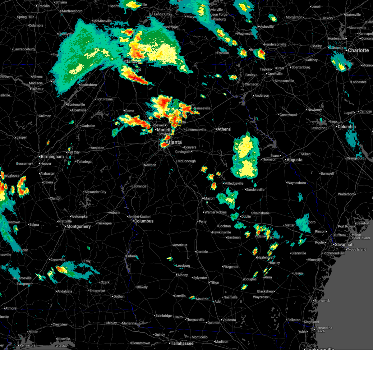
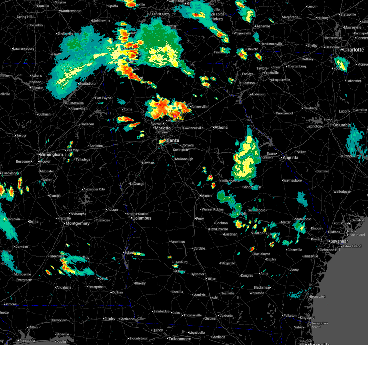
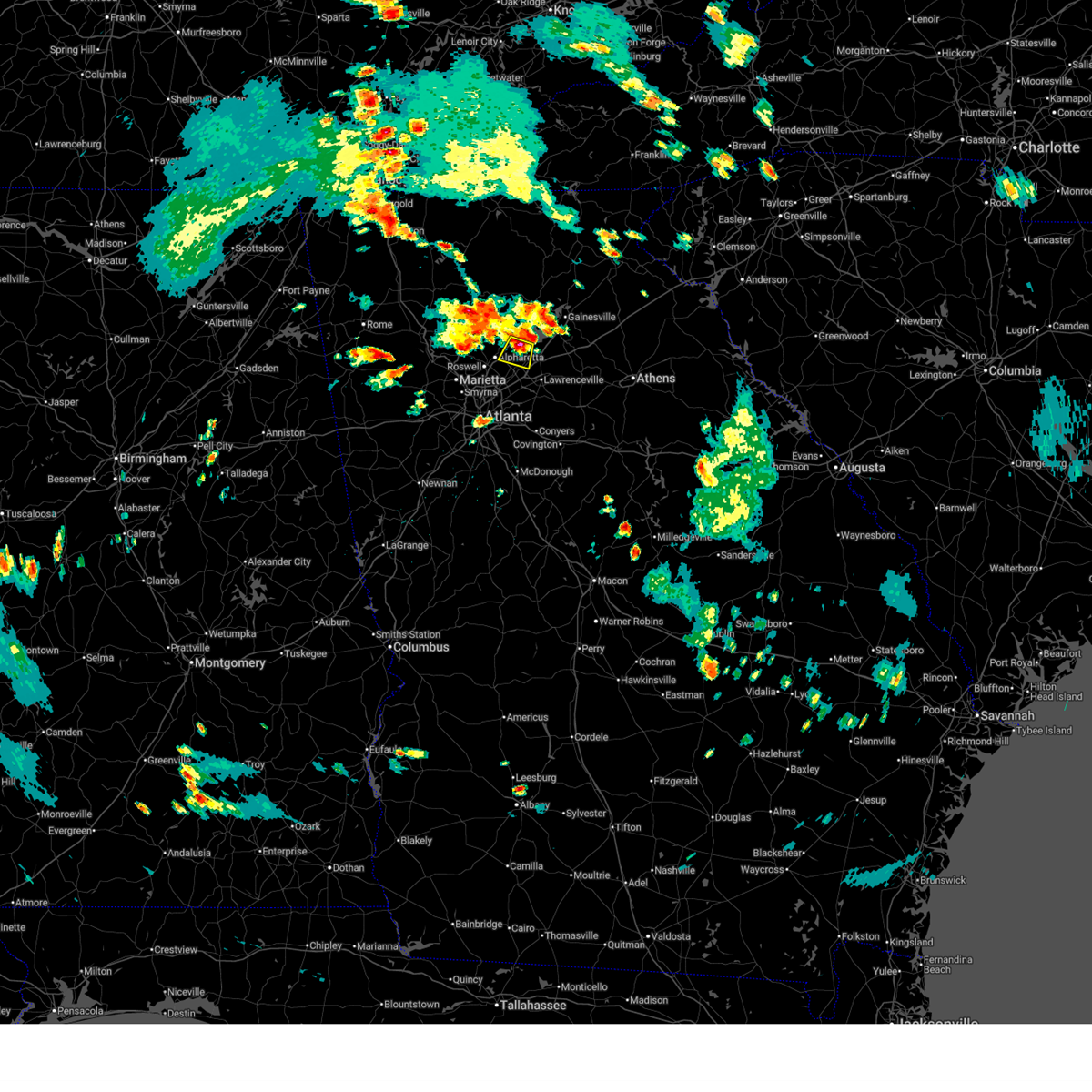
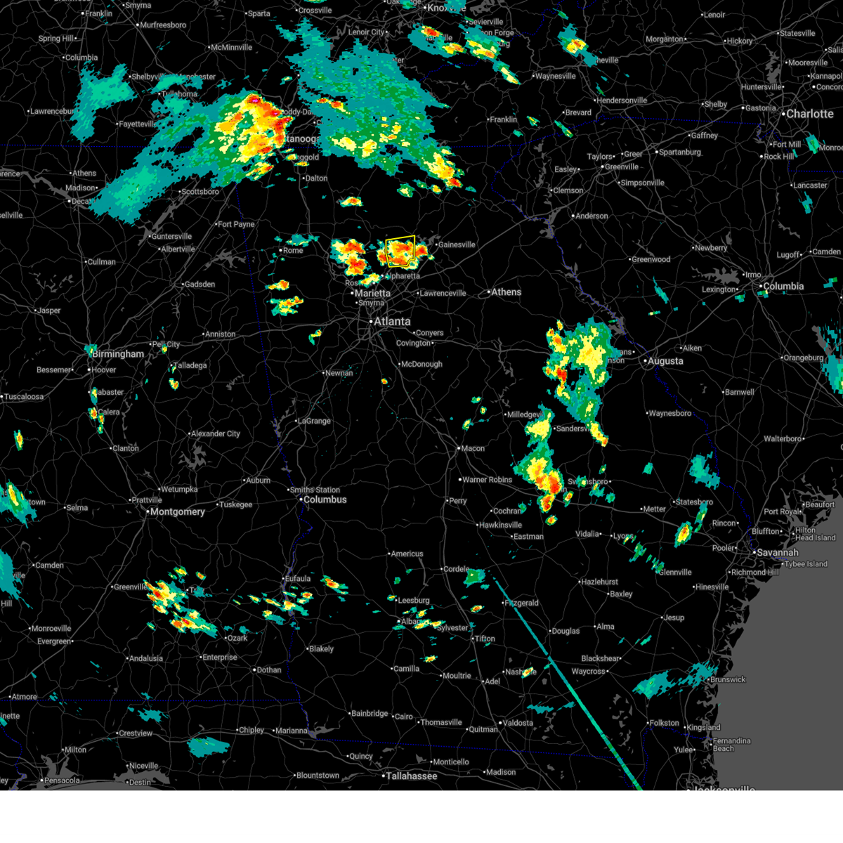
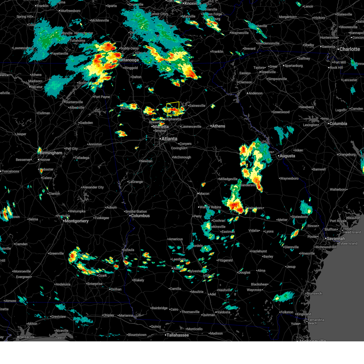
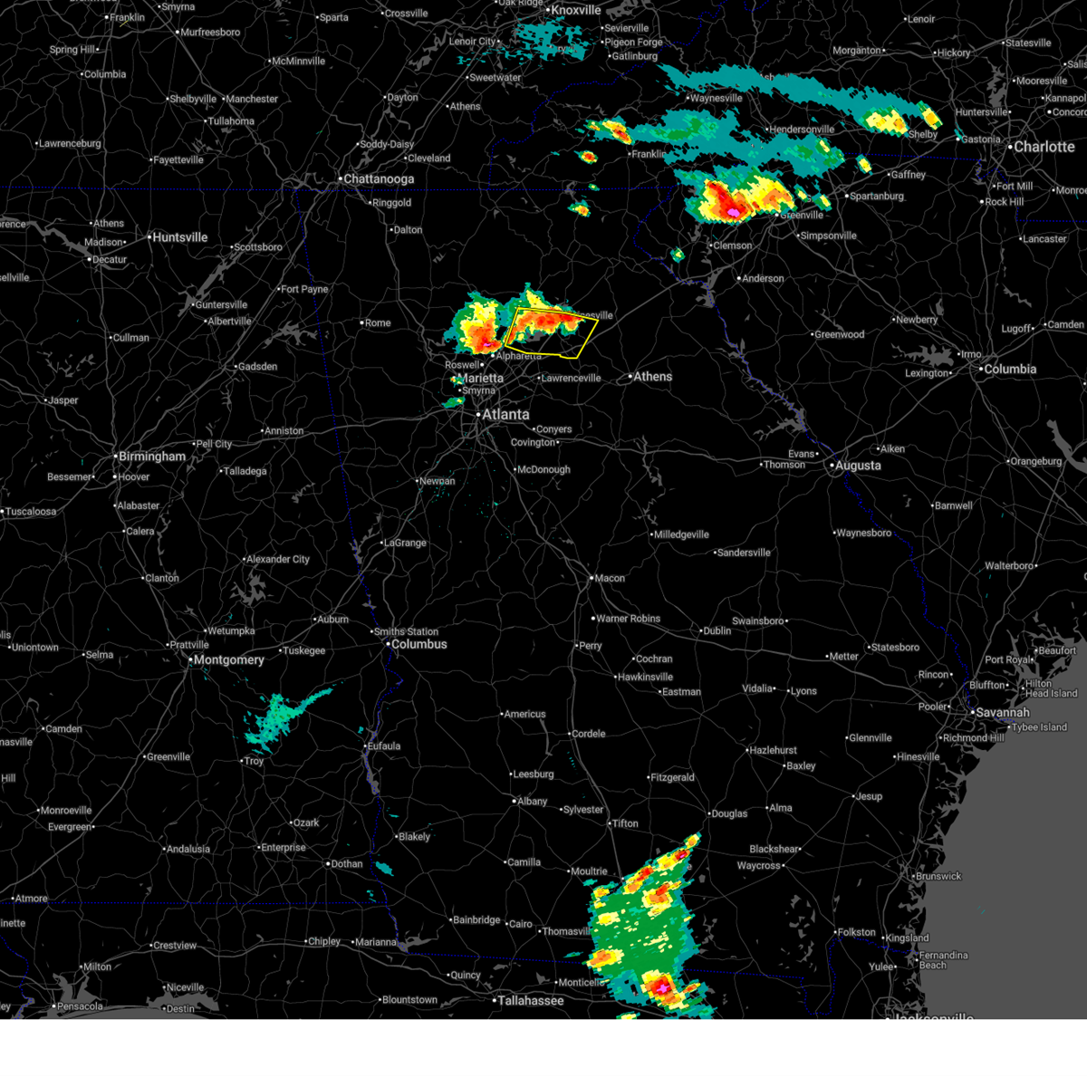
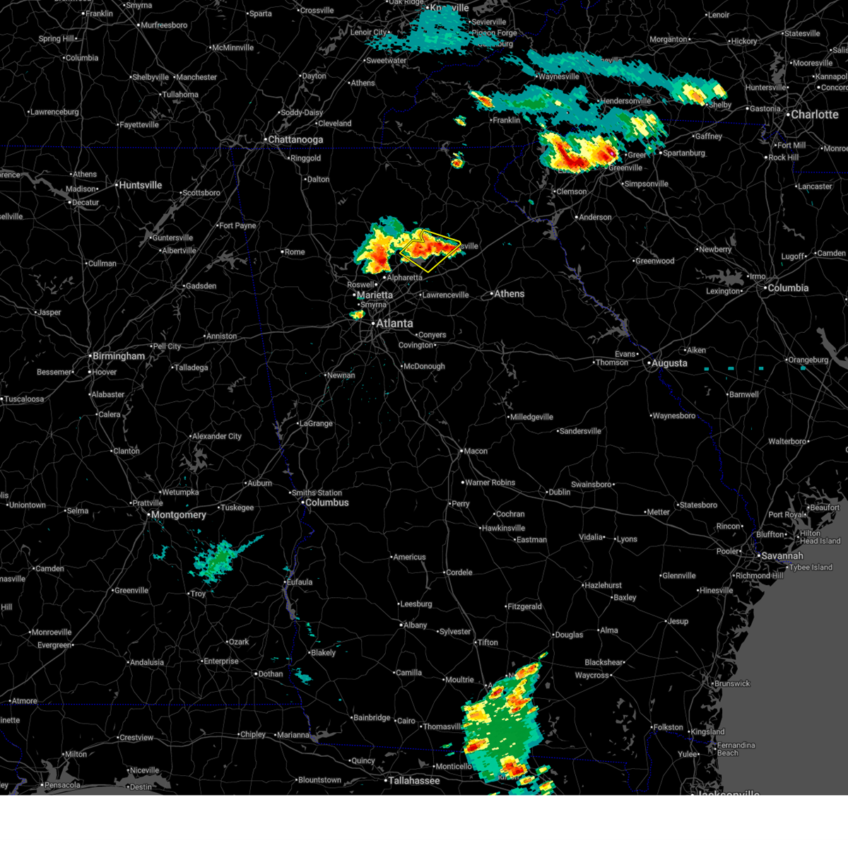
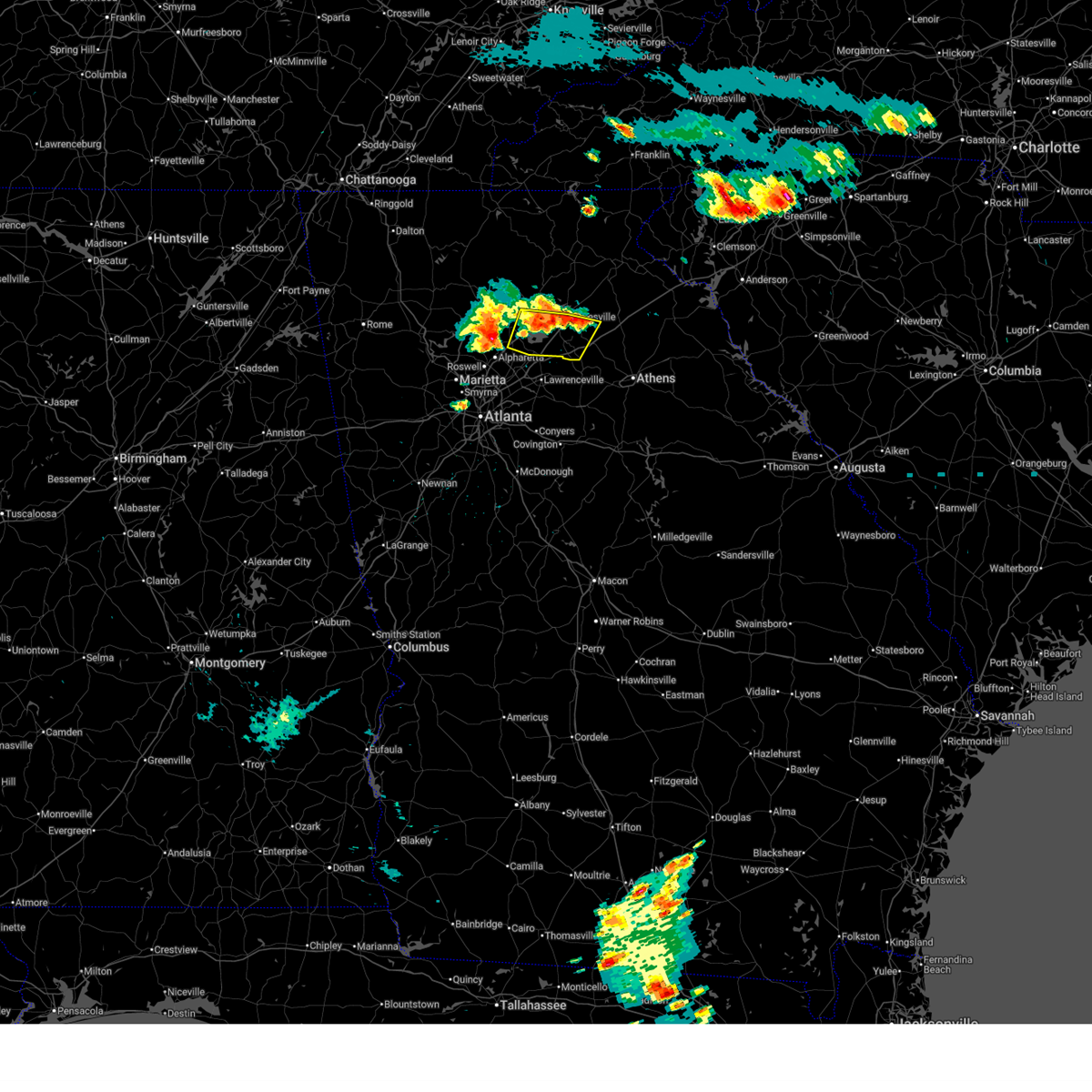
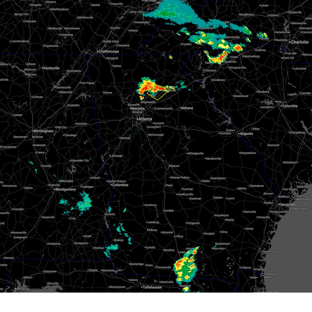
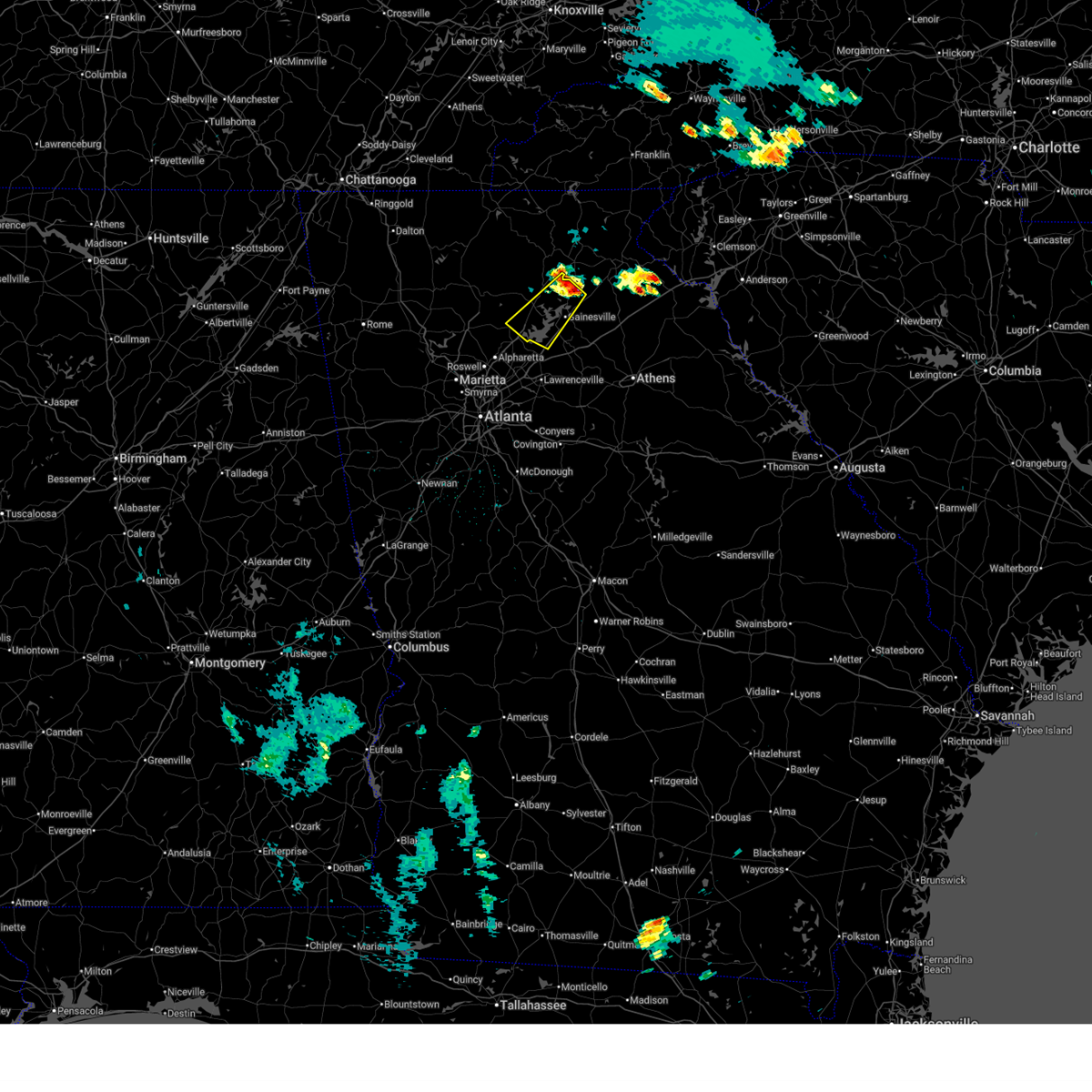
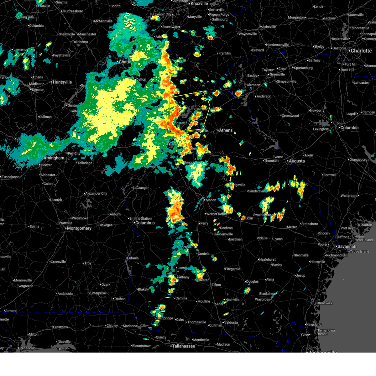
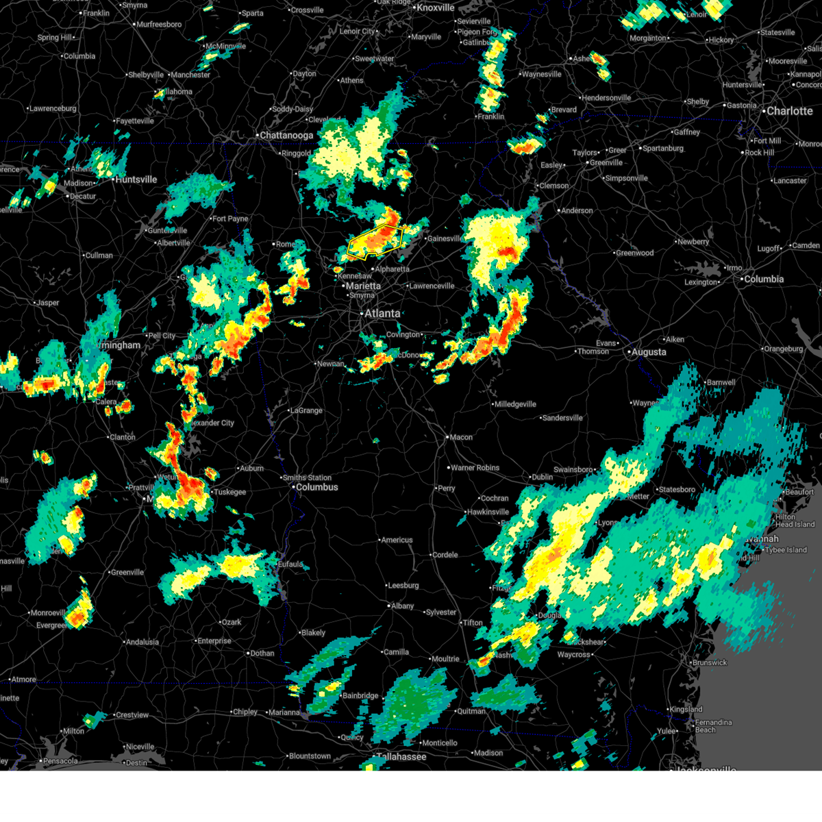
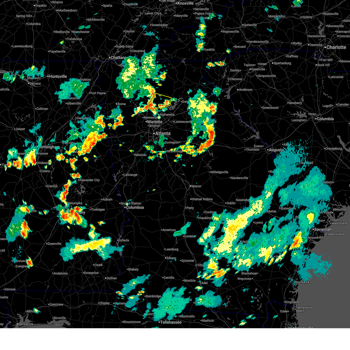
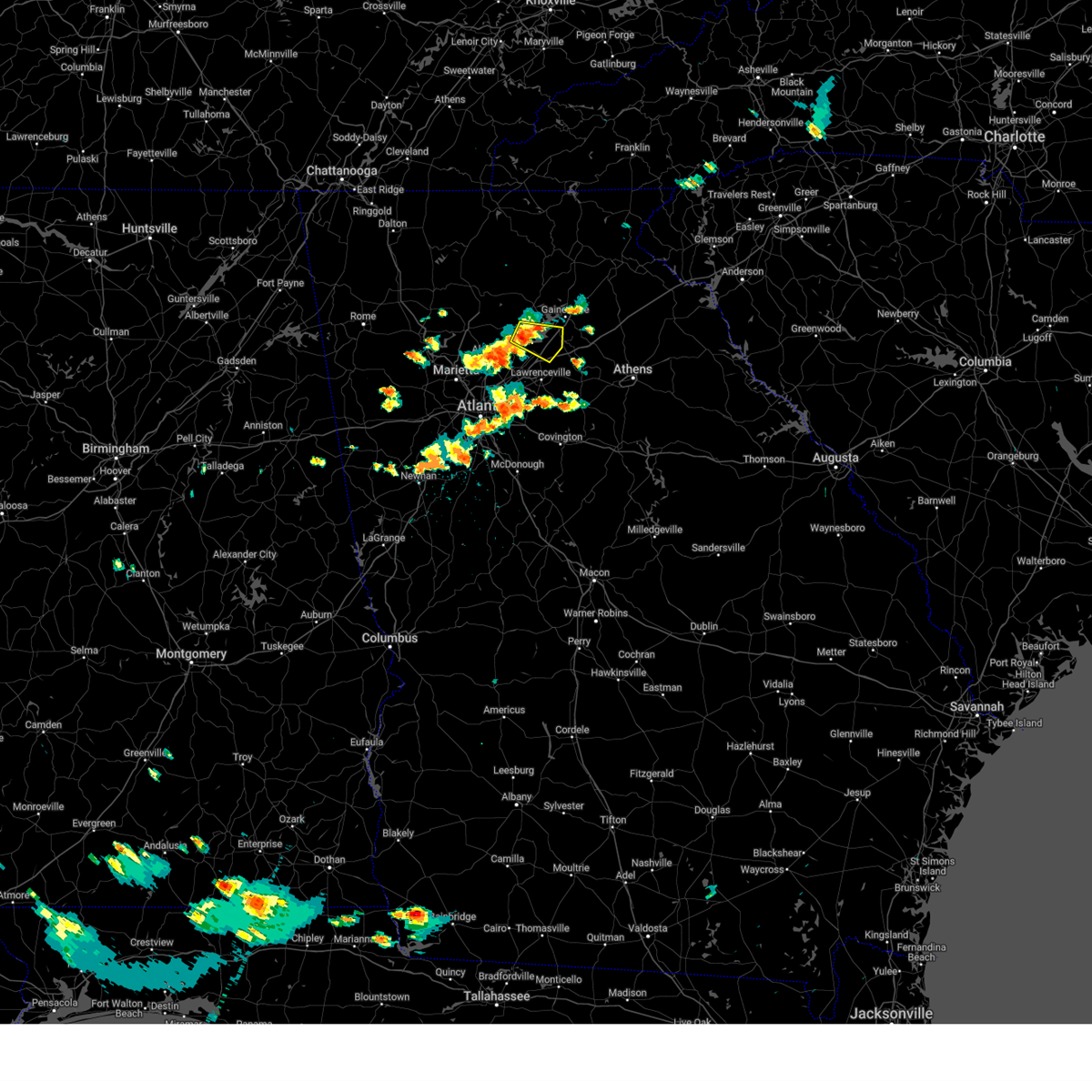
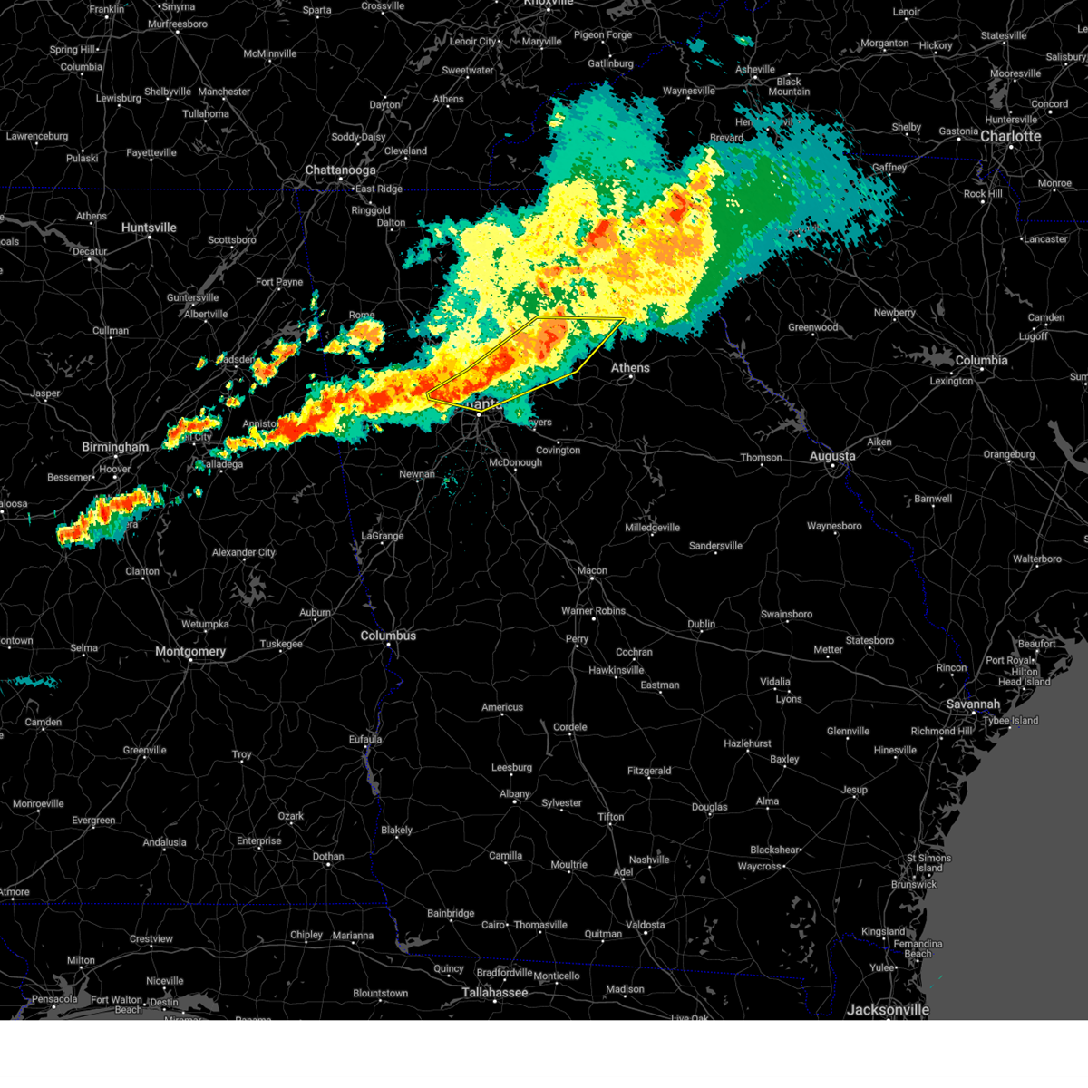
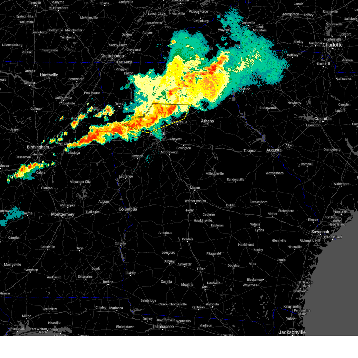
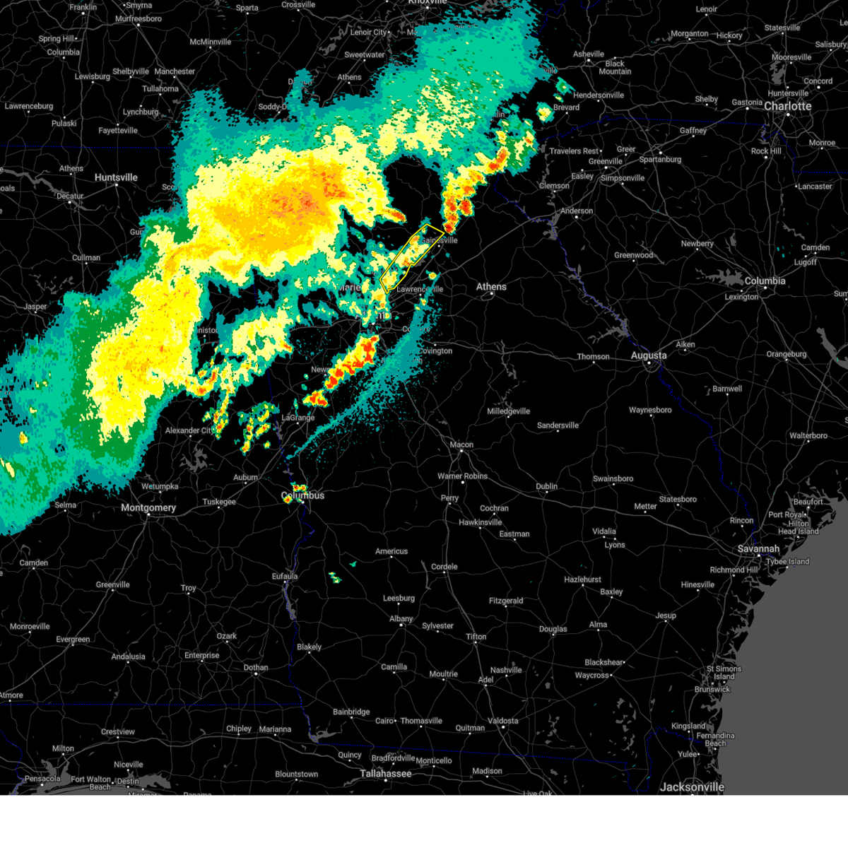
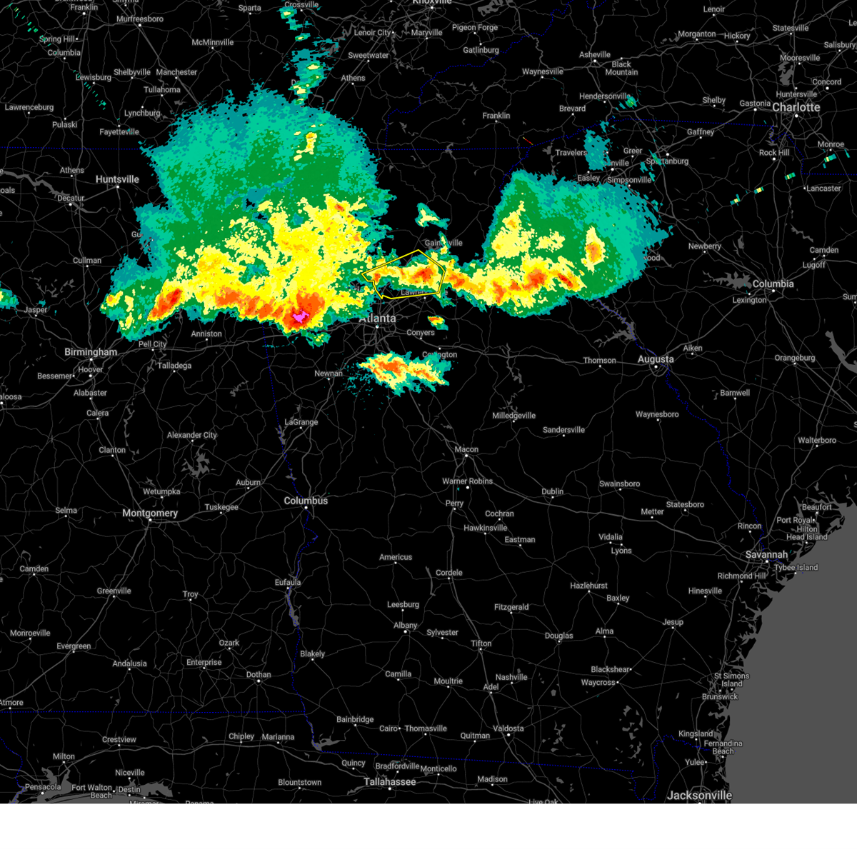
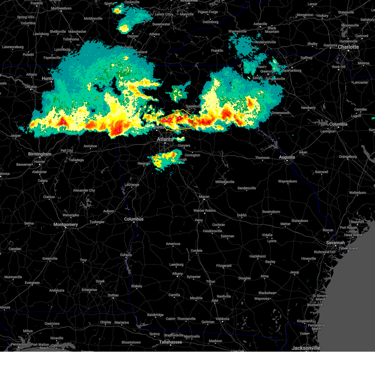
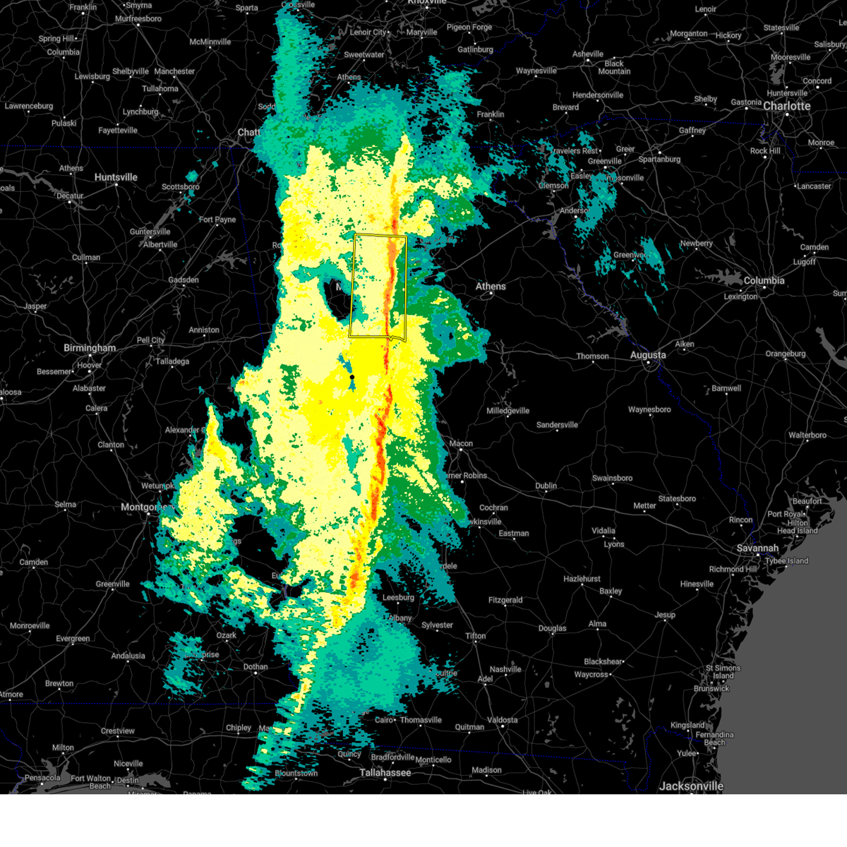
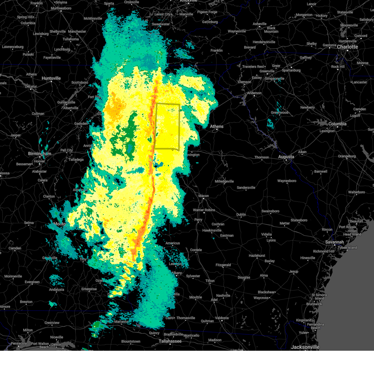
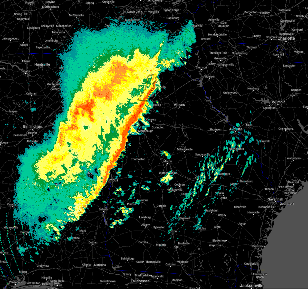
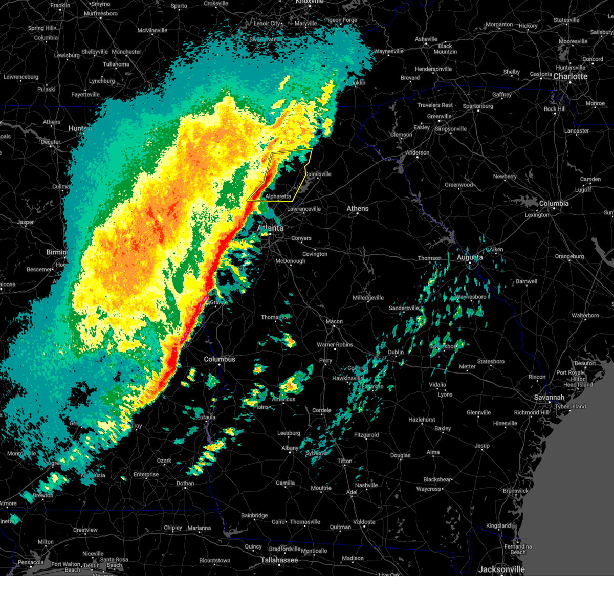
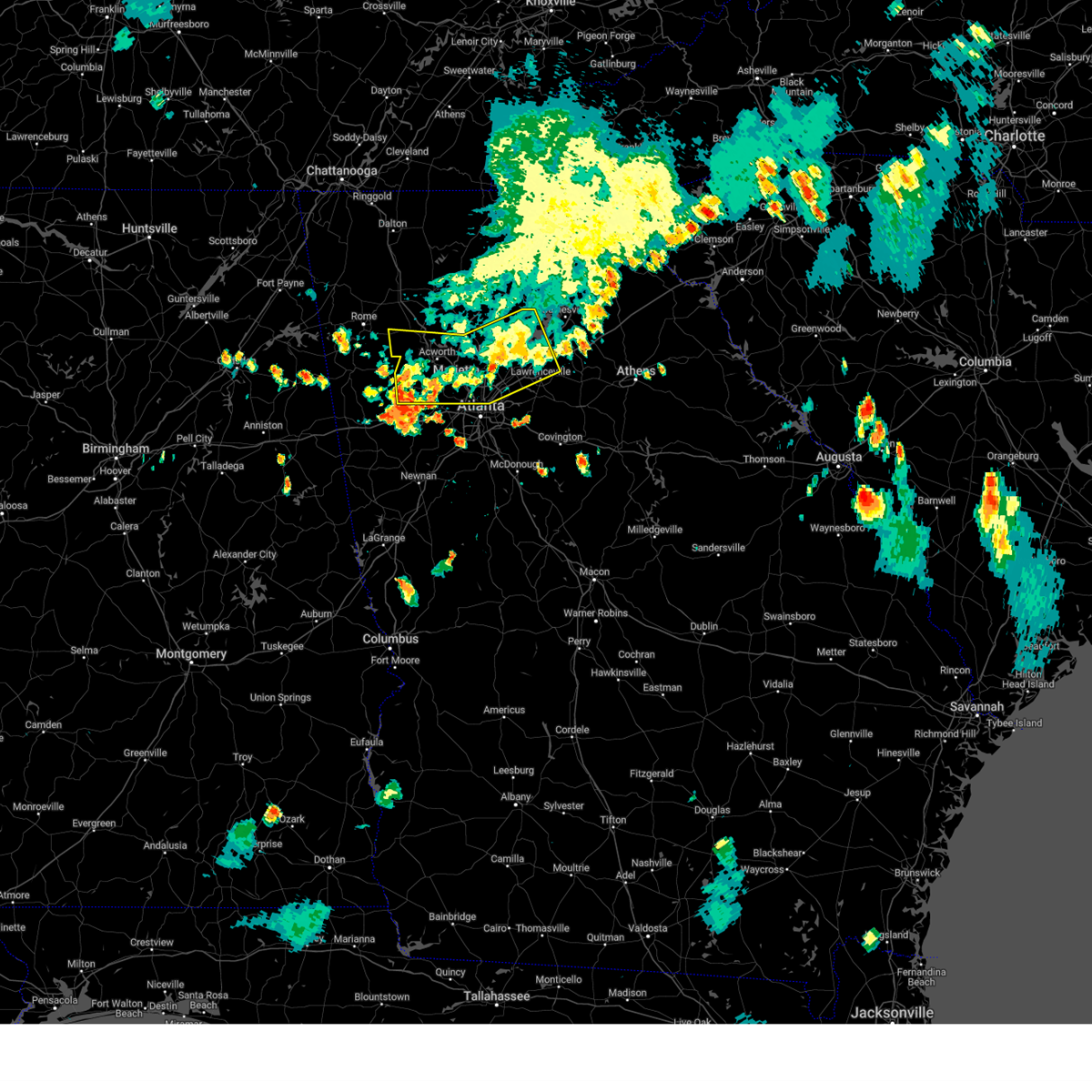
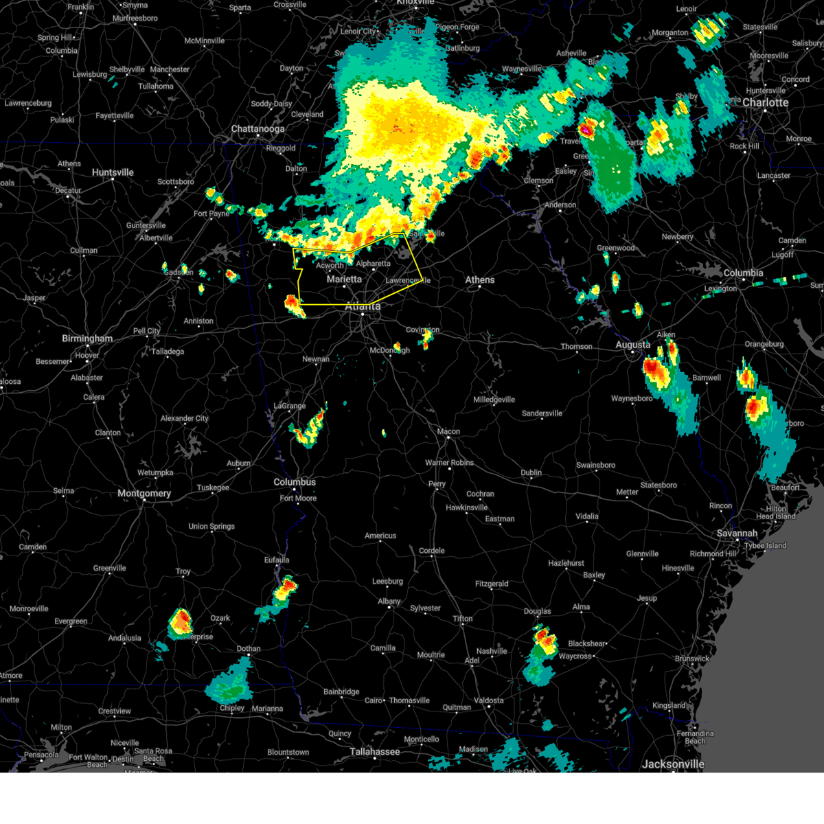
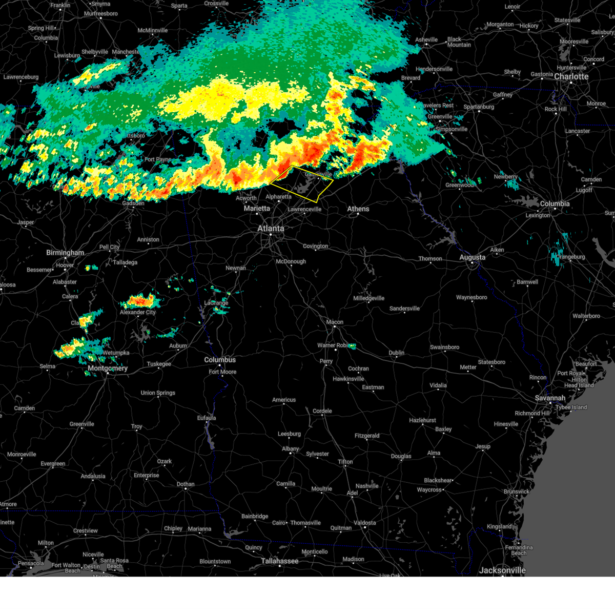
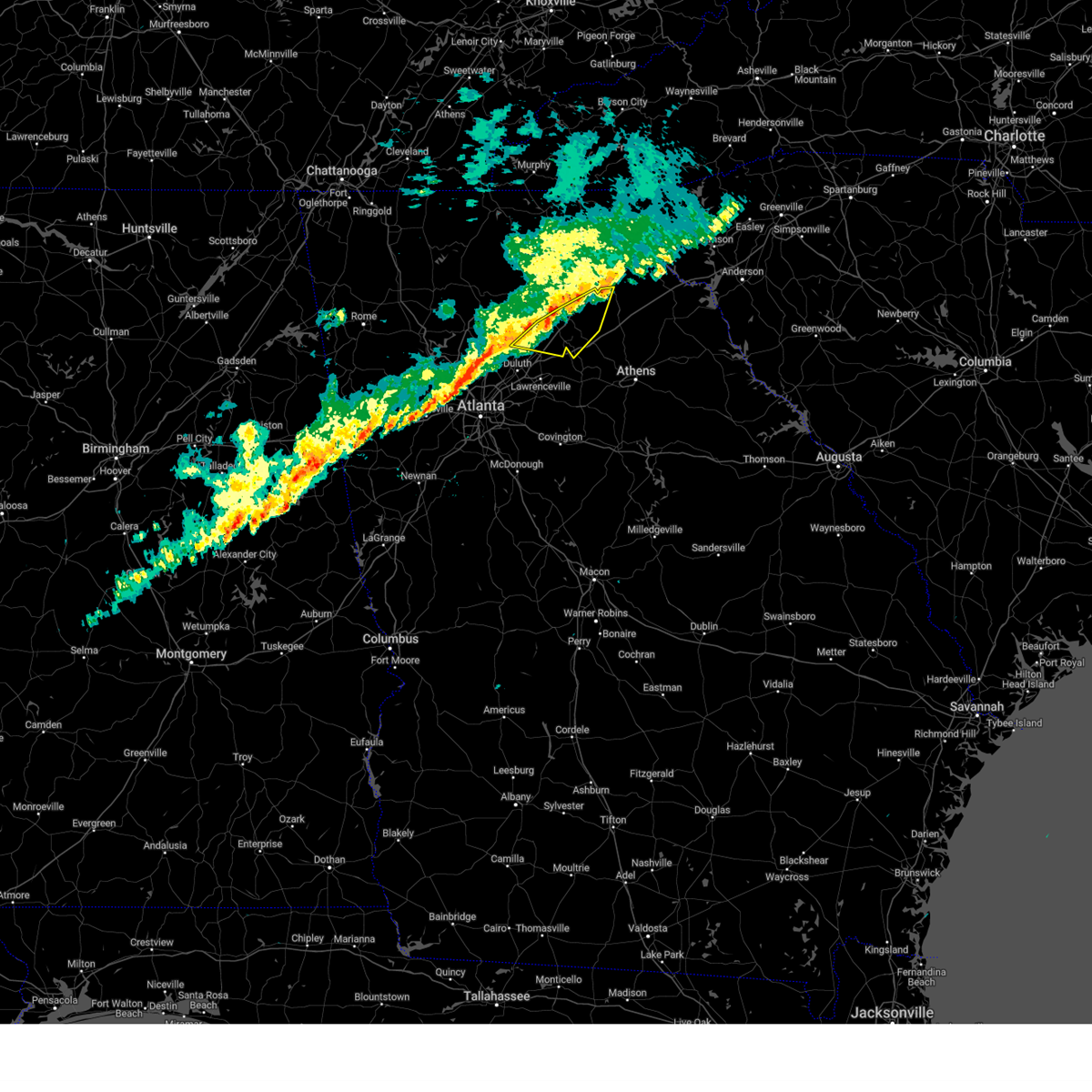
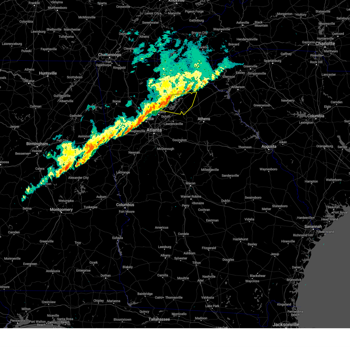
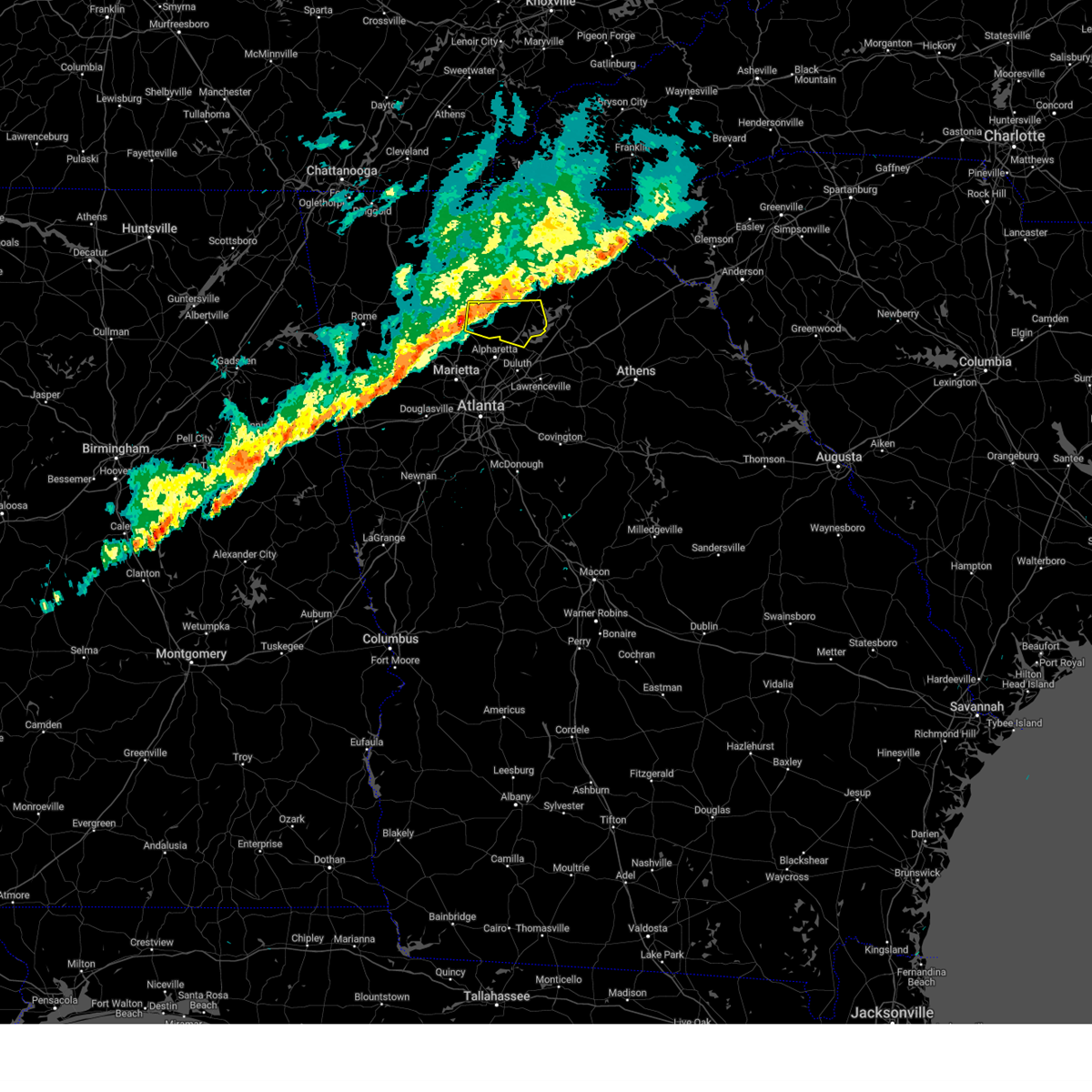
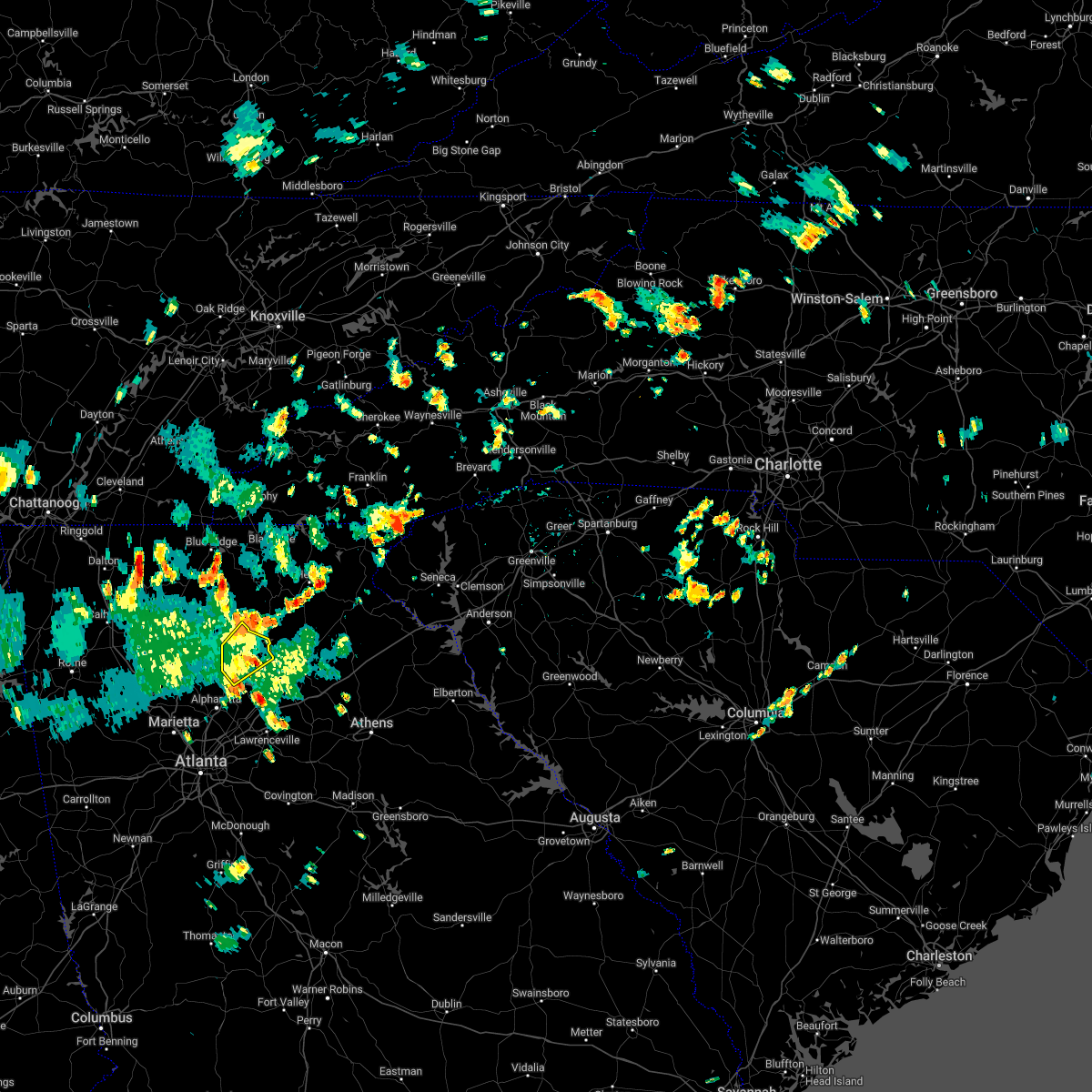
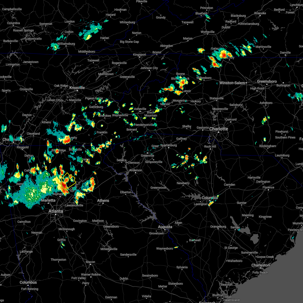
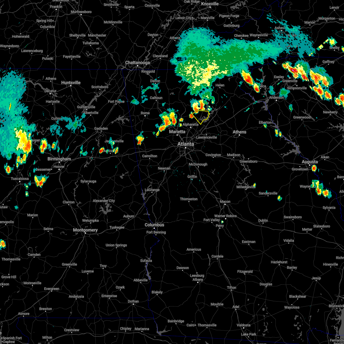
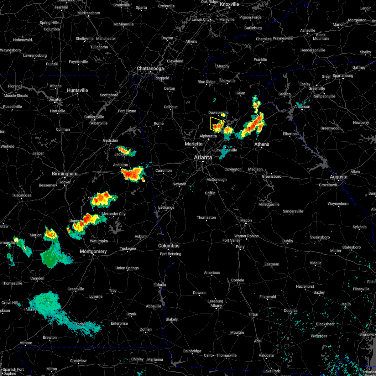
Hail Map for Cumming, GA
The Cumming, GA area has had 22 reports of on-the-ground hail by trained spotters, and has been under severe weather warnings 44 times during the past 12 months. Doppler radar has detected hail at or near Cumming, GA on 46 occasions, including 4 occasions during the past year.
| Name: | Cumming, GA |
| Where Located: | 34.8 miles NNE of Atlanta, GA |
| Map: | Google Map for Cumming, GA |
| Population: | 5430 |
| Housing Units: | 2037 |
| More Info: | Search Google for Cumming, GA |
1
The Top Recent Hail Date for Cumming, GA is Thursday, April 10, 2025 (12th out of 46)

Hail and Wind Damage Spotted near Cumming, GA
| Date / Time | Report Details |
|---|---|
| 6/27/2025 7:05 PM EDT |
 The storm which prompted the warning has weakened below severe limits, and no longer poses an immediate threat to life or property. therefore, the warning has been allowed to expire. however, heavy rain is still possible with this thunderstorm. The storm which prompted the warning has weakened below severe limits, and no longer poses an immediate threat to life or property. therefore, the warning has been allowed to expire. however, heavy rain is still possible with this thunderstorm.
|
| 6/27/2025 6:36 PM EDT |
 The storm which prompted the warning has moved out of the area. therefore, the warning will be allowed to expire. however, gusty winds and heavy rain are still possible with this thunderstorm. remember, a severe thunderstorm warning still remains in effect for southern forsyth and northern gwinnett counties. The storm which prompted the warning has moved out of the area. therefore, the warning will be allowed to expire. however, gusty winds and heavy rain are still possible with this thunderstorm. remember, a severe thunderstorm warning still remains in effect for southern forsyth and northern gwinnett counties.
|
| 6/27/2025 6:29 PM EDT |
 Svrffc the national weather service in peachtree city has issued a * severe thunderstorm warning for, southwestern forsyth county in north central georgia, north central gwinnett county in north central georgia, northeastern fulton county in north central georgia, * until 700 pm edt. * at 629 pm edt, a severe thunderstorm was located near brookwood, or near cumming, and is nearly stationary (radar indicated). Hazards include 60 mph wind gusts and quarter size hail. Hail damage to vehicles is expected. Expect wind damage to roofs, siding, and trees. Svrffc the national weather service in peachtree city has issued a * severe thunderstorm warning for, southwestern forsyth county in north central georgia, north central gwinnett county in north central georgia, northeastern fulton county in north central georgia, * until 700 pm edt. * at 629 pm edt, a severe thunderstorm was located near brookwood, or near cumming, and is nearly stationary (radar indicated). Hazards include 60 mph wind gusts and quarter size hail. Hail damage to vehicles is expected. Expect wind damage to roofs, siding, and trees.
|
| 6/27/2025 6:10 PM EDT |
 Svrffc the national weather service in peachtree city has issued a * severe thunderstorm warning for, central forsyth county in north central georgia, north central gwinnett county in north central georgia, southwestern hall county in north central georgia, * until 645 pm edt. * at 610 pm edt, a severe thunderstorm was located near buford dam-lake lanier parks, or near cumming, and is nearly stationary (radar indicated). Hazards include 60 mph wind gusts and nickel size hail. expect damage to roofs, siding, and trees Svrffc the national weather service in peachtree city has issued a * severe thunderstorm warning for, central forsyth county in north central georgia, north central gwinnett county in north central georgia, southwestern hall county in north central georgia, * until 645 pm edt. * at 610 pm edt, a severe thunderstorm was located near buford dam-lake lanier parks, or near cumming, and is nearly stationary (radar indicated). Hazards include 60 mph wind gusts and nickel size hail. expect damage to roofs, siding, and trees
|
| 6/27/2025 5:58 PM EDT |
 The storm which prompted the warning has weakened below severe limits, and no longer poses an immediate threat to life or property. therefore, the warning will be allowed to expire. however, gusty winds and heavy rain are still possible with this thunderstorm. remember, a severe thunderstorm warning still remains in effect for eastern forsyth. The storm which prompted the warning has weakened below severe limits, and no longer poses an immediate threat to life or property. therefore, the warning will be allowed to expire. however, gusty winds and heavy rain are still possible with this thunderstorm. remember, a severe thunderstorm warning still remains in effect for eastern forsyth.
|
| 6/27/2025 5:32 PM EDT |
 Svrffc the national weather service in peachtree city has issued a * severe thunderstorm warning for, forsyth county in north central georgia, south central dawson county in north central georgia, * until 600 pm edt. * at 532 pm edt, a severe thunderstorm was located over cumming, moving north at 10 mph (radar indicated). Hazards include 60 mph wind gusts and nickel size hail. expect damage to roofs, siding, and trees Svrffc the national weather service in peachtree city has issued a * severe thunderstorm warning for, forsyth county in north central georgia, south central dawson county in north central georgia, * until 600 pm edt. * at 532 pm edt, a severe thunderstorm was located over cumming, moving north at 10 mph (radar indicated). Hazards include 60 mph wind gusts and nickel size hail. expect damage to roofs, siding, and trees
|
| 6/26/2025 4:40 PM EDT |
 the severe thunderstorm warning has been cancelled and is no longer in effect the severe thunderstorm warning has been cancelled and is no longer in effect
|
| 6/26/2025 4:26 PM EDT |
 The storm which prompted the warning has moved out of the area. therefore, the warning will be allowed to expire. however, small hail and gusty winds are still possible with this thunderstorm. The storm which prompted the warning has moved out of the area. therefore, the warning will be allowed to expire. however, small hail and gusty winds are still possible with this thunderstorm.
|
| 6/26/2025 4:25 PM EDT |
 Svrffc the national weather service in peachtree city has issued a * severe thunderstorm warning for, northwestern barrow county in north central georgia, central forsyth county in north central georgia, northeastern gwinnett county in north central georgia, southern hall county in north central georgia, northwestern jackson county in northeastern georgia, * until 500 pm edt. * at 425 pm edt, severe thunderstorms were located along a line extending from near talmo to oakwood to coal mountain, moving southwest at 10 mph (radar indicated). Hazards include 60 mph wind gusts and quarter size hail. Hail damage to vehicles is expected. Expect wind damage to roofs, siding, and trees. Svrffc the national weather service in peachtree city has issued a * severe thunderstorm warning for, northwestern barrow county in north central georgia, central forsyth county in north central georgia, northeastern gwinnett county in north central georgia, southern hall county in north central georgia, northwestern jackson county in northeastern georgia, * until 500 pm edt. * at 425 pm edt, severe thunderstorms were located along a line extending from near talmo to oakwood to coal mountain, moving southwest at 10 mph (radar indicated). Hazards include 60 mph wind gusts and quarter size hail. Hail damage to vehicles is expected. Expect wind damage to roofs, siding, and trees.
|
| 6/26/2025 4:14 PM EDT | Svrffc the national weather service in peachtree city has issued a * severe thunderstorm warning for, eastern cherokee county in north central georgia, southwestern forsyth county in north central georgia, northeastern fulton county in north central georgia, * until 445 pm edt. * at 414 pm edt, a severe thunderstorm was located over holbrook, or 7 miles west of cumming, moving southwest at 5 mph (radar indicated). Hazards include 60 mph wind gusts and quarter size hail. Hail damage to vehicles is expected. Expect wind damage to roofs, siding, and trees. |
| 6/26/2025 4:05 PM EDT |
 Svrffc the national weather service in peachtree city has issued a * severe thunderstorm warning for, northeastern forsyth county in north central georgia, central hall county in north central georgia, * until 430 pm edt. * at 405 pm edt, a severe thunderstorm was located over gainesville, moving southwest at 5 mph (radar indicated). Hazards include 60 mph wind gusts and quarter size hail. Hail damage to vehicles is expected. Expect wind damage to roofs, siding, and trees. Svrffc the national weather service in peachtree city has issued a * severe thunderstorm warning for, northeastern forsyth county in north central georgia, central hall county in north central georgia, * until 430 pm edt. * at 405 pm edt, a severe thunderstorm was located over gainesville, moving southwest at 5 mph (radar indicated). Hazards include 60 mph wind gusts and quarter size hail. Hail damage to vehicles is expected. Expect wind damage to roofs, siding, and trees.
|
| 6/26/2025 3:02 PM EDT |
 Svrffc the national weather service in peachtree city has issued a * severe thunderstorm warning for, northern forsyth county in north central georgia, southeastern lumpkin county in north central georgia, southeastern dawson county in north central georgia, central hall county in north central georgia, * until 345 pm edt. * at 301 pm edt, a severe thunderstorm was located near murrayville, or 9 miles north of gainesville, moving southwest at 20 mph (radar indicated). Hazards include 60 mph wind gusts and penny size hail. expect damage to roofs, siding, and trees Svrffc the national weather service in peachtree city has issued a * severe thunderstorm warning for, northern forsyth county in north central georgia, southeastern lumpkin county in north central georgia, southeastern dawson county in north central georgia, central hall county in north central georgia, * until 345 pm edt. * at 301 pm edt, a severe thunderstorm was located near murrayville, or 9 miles north of gainesville, moving southwest at 20 mph (radar indicated). Hazards include 60 mph wind gusts and penny size hail. expect damage to roofs, siding, and trees
|
| 6/17/2025 6:32 PM EDT |
 Svrffc the national weather service in peachtree city has issued a * severe thunderstorm warning for, northwestern dekalb county in north central georgia, northern gwinnett county in north central georgia, hall county in north central georgia, northwestern jackson county in northeastern georgia, northwestern barrow county in north central georgia, northeastern cherokee county in north central georgia, forsyth county in north central georgia, southern lumpkin county in north central georgia, western banks county in northeastern georgia, southern white county in northeastern georgia, dawson county in north central georgia, northeastern fulton county in north central georgia, southeastern pickens county in north central georgia, * until 715 pm edt. * at 631 pm edt, severe thunderstorms were located along a line extending from near juno to cumming to johns creek to near mechanicsville, moving east at 45 mph (radar indicated. at 615 pm a 54 mph wind gust was reported in canton). Hazards include 60 mph wind gusts. expect damage to roofs, siding, and trees Svrffc the national weather service in peachtree city has issued a * severe thunderstorm warning for, northwestern dekalb county in north central georgia, northern gwinnett county in north central georgia, hall county in north central georgia, northwestern jackson county in northeastern georgia, northwestern barrow county in north central georgia, northeastern cherokee county in north central georgia, forsyth county in north central georgia, southern lumpkin county in north central georgia, western banks county in northeastern georgia, southern white county in northeastern georgia, dawson county in north central georgia, northeastern fulton county in north central georgia, southeastern pickens county in north central georgia, * until 715 pm edt. * at 631 pm edt, severe thunderstorms were located along a line extending from near juno to cumming to johns creek to near mechanicsville, moving east at 45 mph (radar indicated. at 615 pm a 54 mph wind gust was reported in canton). Hazards include 60 mph wind gusts. expect damage to roofs, siding, and trees
|
| 6/14/2025 6:19 PM EDT |
 the severe thunderstorm warning has been cancelled and is no longer in effect the severe thunderstorm warning has been cancelled and is no longer in effect
|
| 6/14/2025 6:19 PM EDT |
 At 618 pm edt, a severe thunderstorm was located over lathemtown, or 10 miles east of canton, moving northeast at 25 mph (radar indicated). Hazards include 60 mph wind gusts and dime size hail. Expect damage to roofs, siding, and trees. Locations impacted include, canton, cumming, holly springs, ball ground, free home, buffington, hickory flat, drew, union hill, coal mountain, hightower, matt, silver city, hollis lathem reservoir, holbrook, lathemtown, and ducktown. At 618 pm edt, a severe thunderstorm was located over lathemtown, or 10 miles east of canton, moving northeast at 25 mph (radar indicated). Hazards include 60 mph wind gusts and dime size hail. Expect damage to roofs, siding, and trees. Locations impacted include, canton, cumming, holly springs, ball ground, free home, buffington, hickory flat, drew, union hill, coal mountain, hightower, matt, silver city, hollis lathem reservoir, holbrook, lathemtown, and ducktown.
|
| 6/14/2025 6:02 PM EDT |
 Svrffc the national weather service in peachtree city has issued a * severe thunderstorm warning for, eastern cherokee county in north central georgia, northwestern forsyth county in north central georgia, southwestern dawson county in north central georgia, southeastern pickens county in north central georgia, * until 645 pm edt. * at 602 pm edt, a severe thunderstorm was located over buffington, or near canton, moving northeast at 25 mph (radar indicated). Hazards include 60 mph wind gusts and dime size hail. expect damage to roofs, siding, and trees Svrffc the national weather service in peachtree city has issued a * severe thunderstorm warning for, eastern cherokee county in north central georgia, northwestern forsyth county in north central georgia, southwestern dawson county in north central georgia, southeastern pickens county in north central georgia, * until 645 pm edt. * at 602 pm edt, a severe thunderstorm was located over buffington, or near canton, moving northeast at 25 mph (radar indicated). Hazards include 60 mph wind gusts and dime size hail. expect damage to roofs, siding, and trees
|
| 6/10/2025 3:38 PM EDT | A tree was reported down in the 1500 block of lockridge driv in forsyth county GA, 1.5 miles NW of Cumming, GA |
| 6/10/2025 3:34 PM EDT |
 Svrffc the national weather service in peachtree city has issued a * severe thunderstorm warning for, central forsyth county in north central georgia, northeastern gwinnett county in north central georgia, southwestern hall county in north central georgia, * until 415 pm edt. * at 334 pm edt, a severe thunderstorm was located over cumming, moving east at 15 mph (radar indicated). Hazards include 60 mph wind gusts. expect damage to roofs, siding, and trees Svrffc the national weather service in peachtree city has issued a * severe thunderstorm warning for, central forsyth county in north central georgia, northeastern gwinnett county in north central georgia, southwestern hall county in north central georgia, * until 415 pm edt. * at 334 pm edt, a severe thunderstorm was located over cumming, moving east at 15 mph (radar indicated). Hazards include 60 mph wind gusts. expect damage to roofs, siding, and trees
|
| 6/7/2025 5:57 PM EDT | Tree down on a house just to the west of the intersection of pilgrim mill road and faa roa in forsyth county GA, 3.4 miles W of Cumming, GA |
| 5/25/2025 8:31 PM EDT | The storms which prompted the warning have moved out of the area. therefore, the warning will be allowed to expire. a severe thunderstorm warning still remains in effect for northeastern cobb and northeastern fulton counties until 900 pm edt. a severe thunderstorm watch remains in effect until midnight edt for north central and northwestern georgia. |
| 5/25/2025 8:07 PM EDT | Svrffc the national weather service in peachtree city has issued a * severe thunderstorm warning for, southern cherokee county in north central georgia, southwestern forsyth county in north central georgia, northeastern cobb county in north central georgia, northeastern fulton county in north central georgia, * until 830 pm edt. * at 807 pm edt, severe thunderstorms were located along a line extending from buffington to oak grove, moving southeast at 35 mph (radar indicated). Hazards include 60 mph wind gusts and quarter size hail. Hail damage to vehicles is expected. Expect wind damage to roofs, siding, and trees. |
| 5/21/2025 1:09 AM EDT |
 the severe thunderstorm warning has been cancelled and is no longer in effect the severe thunderstorm warning has been cancelled and is no longer in effect
|
| 5/21/2025 12:54 AM EDT |
 The storms which prompted the warning have moved out of the area. therefore, the warning will be allowed to expire. a tornado watch remains in effect until 200 am edt for north central and northwestern georgia. remember, a severe thunderstorm warning still remains in effect for cobb, fulton, forsyth, hall, gwinnett, and dekalb. The storms which prompted the warning have moved out of the area. therefore, the warning will be allowed to expire. a tornado watch remains in effect until 200 am edt for north central and northwestern georgia. remember, a severe thunderstorm warning still remains in effect for cobb, fulton, forsyth, hall, gwinnett, and dekalb.
|
| 5/21/2025 12:50 AM EDT |
 Svrffc the national weather service in peachtree city has issued a * severe thunderstorm warning for, northwestern barrow county in north central georgia, northwestern dekalb county in north central georgia, central forsyth county in north central georgia, central cobb county in north central georgia, gwinnett county in north central georgia, southwestern banks county in northeastern georgia, southern hall county in north central georgia, northwestern jackson county in northeastern georgia, northeastern fulton county in north central georgia, * until 130 am edt. * at 1250 am edt, severe thunderstorms were located along a line extending from near oscarville to near roswell to near hiram, moving east at 45 mph (radar indicated). Hazards include 60 mph wind gusts and penny size hail. expect damage to roofs, siding, and trees Svrffc the national weather service in peachtree city has issued a * severe thunderstorm warning for, northwestern barrow county in north central georgia, northwestern dekalb county in north central georgia, central forsyth county in north central georgia, central cobb county in north central georgia, gwinnett county in north central georgia, southwestern banks county in northeastern georgia, southern hall county in north central georgia, northwestern jackson county in northeastern georgia, northeastern fulton county in north central georgia, * until 130 am edt. * at 1250 am edt, severe thunderstorms were located along a line extending from near oscarville to near roswell to near hiram, moving east at 45 mph (radar indicated). Hazards include 60 mph wind gusts and penny size hail. expect damage to roofs, siding, and trees
|
| 5/21/2025 12:48 AM EDT | Ham radio operator reported a tree down at a residence near pilgrim mill road and faa roa in forsyth county GA, 3.4 miles W of Cumming, GA |
| 5/21/2025 12:47 AM EDT |
 the severe thunderstorm warning has been cancelled and is no longer in effect the severe thunderstorm warning has been cancelled and is no longer in effect
|
| 5/21/2025 12:47 AM EDT |
 At 1247 am edt, severe thunderstorms were located along a line extending from murrayville to near sugar hill to white water park, moving east at 50 mph (radar indicated). Hazards include 60 mph wind gusts and quarter size hail. Hail damage to vehicles is expected. expect wind damage to roofs, siding, and trees. Locations impacted include, atlanta, marietta, gainesville, canton, dallas, cumming, peachtree corners, mountain park, sandy springs, roswell, johns creek, alpharetta, smyrna, dunwoody, milton, kennesaw, duluth, woodstock, acworth, and sugar hill. At 1247 am edt, severe thunderstorms were located along a line extending from murrayville to near sugar hill to white water park, moving east at 50 mph (radar indicated). Hazards include 60 mph wind gusts and quarter size hail. Hail damage to vehicles is expected. expect wind damage to roofs, siding, and trees. Locations impacted include, atlanta, marietta, gainesville, canton, dallas, cumming, peachtree corners, mountain park, sandy springs, roswell, johns creek, alpharetta, smyrna, dunwoody, milton, kennesaw, duluth, woodstock, acworth, and sugar hill.
|
| 5/21/2025 12:19 AM EDT |
 Svrffc the national weather service in peachtree city has issued a * severe thunderstorm warning for, central paulding county in northwestern georgia, cherokee county in north central georgia, northwestern dekalb county in north central georgia, forsyth county in north central georgia, cobb county in north central georgia, northern gwinnett county in north central georgia, southern dawson county in north central georgia, hall county in north central georgia, northeastern fulton county in north central georgia, southeastern pickens county in north central georgia, * until 100 am edt. * at 1219 am edt, severe thunderstorms were located along a line extending from near marblehill to lebanon to near braswell, moving east at 50 mph (radar indicated). Hazards include 60 mph wind gusts and quarter size hail. Hail damage to vehicles is expected. Expect wind damage to roofs, siding, and trees. Svrffc the national weather service in peachtree city has issued a * severe thunderstorm warning for, central paulding county in northwestern georgia, cherokee county in north central georgia, northwestern dekalb county in north central georgia, forsyth county in north central georgia, cobb county in north central georgia, northern gwinnett county in north central georgia, southern dawson county in north central georgia, hall county in north central georgia, northeastern fulton county in north central georgia, southeastern pickens county in north central georgia, * until 100 am edt. * at 1219 am edt, severe thunderstorms were located along a line extending from near marblehill to lebanon to near braswell, moving east at 50 mph (radar indicated). Hazards include 60 mph wind gusts and quarter size hail. Hail damage to vehicles is expected. Expect wind damage to roofs, siding, and trees.
|
| 5/2/2025 10:03 PM EDT |
 the severe thunderstorm warning has been cancelled and is no longer in effect the severe thunderstorm warning has been cancelled and is no longer in effect
|
| 5/2/2025 9:51 PM EDT |
 At 951 pm edt, a severe thunderstorm was located near chestatee, or 8 miles southeast of dawsonville, moving northeast at 15 mph (radar indicated). Hazards include 60 mph wind gusts and penny size hail. Expect damage to roofs, siding, and trees. Locations impacted include, gainesville, cumming, peachtree corners, sandy springs, roswell, johns creek, alpharetta, sugar hill, coal mountain, brookwood, chestatee, murrayville, oscarville, lake lanier islands, and war hill park. At 951 pm edt, a severe thunderstorm was located near chestatee, or 8 miles southeast of dawsonville, moving northeast at 15 mph (radar indicated). Hazards include 60 mph wind gusts and penny size hail. Expect damage to roofs, siding, and trees. Locations impacted include, gainesville, cumming, peachtree corners, sandy springs, roswell, johns creek, alpharetta, sugar hill, coal mountain, brookwood, chestatee, murrayville, oscarville, lake lanier islands, and war hill park.
|
| 5/2/2025 9:51 PM EDT |
 the severe thunderstorm warning has been cancelled and is no longer in effect the severe thunderstorm warning has been cancelled and is no longer in effect
|
| 5/2/2025 9:26 PM EDT |
 Svrffc the national weather service in peachtree city has issued a * severe thunderstorm warning for, southeastern cherokee county in north central georgia, forsyth county in north central georgia, southeastern dawson county in north central georgia, northwestern hall county in north central georgia, northeastern fulton county in north central georgia, * until 1015 pm edt. * at 926 pm edt, a severe thunderstorm was located over coal mountain, or over cumming, moving northeast at 15 mph (radar indicated). Hazards include 60 mph wind gusts and penny size hail. expect damage to roofs, siding, and trees Svrffc the national weather service in peachtree city has issued a * severe thunderstorm warning for, southeastern cherokee county in north central georgia, forsyth county in north central georgia, southeastern dawson county in north central georgia, northwestern hall county in north central georgia, northeastern fulton county in north central georgia, * until 1015 pm edt. * at 926 pm edt, a severe thunderstorm was located over coal mountain, or over cumming, moving northeast at 15 mph (radar indicated). Hazards include 60 mph wind gusts and penny size hail. expect damage to roofs, siding, and trees
|
| 5/2/2025 1:26 PM EDT | the severe thunderstorm warning has been cancelled and is no longer in effect |
| 5/2/2025 1:13 PM EDT | the severe thunderstorm warning has been cancelled and is no longer in effect |
| 5/2/2025 1:13 PM EDT | At 113 pm edt, a severe thunderstorm was located over sugar hill, or 7 miles southeast of cumming, moving east at 20 mph (radar indicated). Hazards include 60 mph wind gusts and quarter size hail. Hail damage to vehicles is expected. expect wind damage to roofs, siding, and trees. Locations impacted include, cumming, duluth, sugar hill, suwanee, buford, rest haven, buford dam-lake lanier parks, and lake lanier islands. |
| 5/2/2025 12:54 PM EDT |
 Svrffc the national weather service in peachtree city has issued a * severe thunderstorm warning for, central forsyth county in north central georgia, northern gwinnett county in north central georgia, southwestern hall county in north central georgia, northeastern fulton county in north central georgia, * until 145 pm edt. * at 1254 pm edt, a severe thunderstorm was located over brookwood, or 8 miles north of peachtree corners, moving east at 20 mph (radar indicated). Hazards include 60 mph wind gusts and quarter size hail. Hail damage to vehicles is expected. Expect wind damage to roofs, siding, and trees. Svrffc the national weather service in peachtree city has issued a * severe thunderstorm warning for, central forsyth county in north central georgia, northern gwinnett county in north central georgia, southwestern hall county in north central georgia, northeastern fulton county in north central georgia, * until 145 pm edt. * at 1254 pm edt, a severe thunderstorm was located over brookwood, or 8 miles north of peachtree corners, moving east at 20 mph (radar indicated). Hazards include 60 mph wind gusts and quarter size hail. Hail damage to vehicles is expected. Expect wind damage to roofs, siding, and trees.
|
| 4/10/2025 8:48 PM EDT |
 the severe thunderstorm warning has been cancelled and is no longer in effect the severe thunderstorm warning has been cancelled and is no longer in effect
|
| 4/10/2025 8:24 PM EDT |
 At 823 pm edt, severe thunderstorms were located along a line extending from near rest haven to sweat mountain, moving southeast at 20 mph (public). Hazards include golf ball size hail and 60 mph wind gusts. People and animals outdoors will be injured. expect hail damage to roofs, siding, windows, and vehicles. expect wind damage to roofs, siding, and trees. Locations impacted include, drew, duluth, suwanee, rest haven, buford dam-lake lanier parks, johns creek, brookwood, alpharetta, lake lanier islands, hog mountain, berkeley lake, cumming, birmingham, buford, aqualand park, roswell, peachtree corners, sugar hill, mountain park, and flowery branch. At 823 pm edt, severe thunderstorms were located along a line extending from near rest haven to sweat mountain, moving southeast at 20 mph (public). Hazards include golf ball size hail and 60 mph wind gusts. People and animals outdoors will be injured. expect hail damage to roofs, siding, windows, and vehicles. expect wind damage to roofs, siding, and trees. Locations impacted include, drew, duluth, suwanee, rest haven, buford dam-lake lanier parks, johns creek, brookwood, alpharetta, lake lanier islands, hog mountain, berkeley lake, cumming, birmingham, buford, aqualand park, roswell, peachtree corners, sugar hill, mountain park, and flowery branch.
|
| 4/10/2025 8:18 PM EDT |
 Svrffc the national weather service in peachtree city has issued a * severe thunderstorm warning for, southeastern cherokee county in north central georgia, central forsyth county in north central georgia, northern gwinnett county in north central georgia, southwestern hall county in north central georgia, northeastern fulton county in north central georgia, * until 900 pm edt. * at 818 pm edt, severe thunderstorms were located along a line extending from rest haven to sweat mountain, moving southeast at 20 mph (radar indicated). Hazards include 60 mph wind gusts and half dollar size hail. Hail damage to vehicles is expected. Expect wind damage to roofs, siding, and trees. Svrffc the national weather service in peachtree city has issued a * severe thunderstorm warning for, southeastern cherokee county in north central georgia, central forsyth county in north central georgia, northern gwinnett county in north central georgia, southwestern hall county in north central georgia, northeastern fulton county in north central georgia, * until 900 pm edt. * at 818 pm edt, severe thunderstorms were located along a line extending from rest haven to sweat mountain, moving southeast at 20 mph (radar indicated). Hazards include 60 mph wind gusts and half dollar size hail. Hail damage to vehicles is expected. Expect wind damage to roofs, siding, and trees.
|
| 4/10/2025 8:13 PM EDT | Quarter sized hail reported 5.6 miles NE of Cumming, GA, quarter sized hail reported near summit overlook way. |
| 4/10/2025 8:10 PM EDT | Golf Ball sized hail reported 3.9 miles NE of Cumming, GA, golf ball size hail reported on ga 400 near exit 13. |
| 3/5/2025 2:37 AM EST |
 The storms which prompted the warning have weakened below severe limits, and no longer pose an immediate threat to life or property. therefore, the warning will be allowed to expire. a severe thunderstorm watch remains in effect until 400 am est for north central georgia. The storms which prompted the warning have weakened below severe limits, and no longer pose an immediate threat to life or property. therefore, the warning will be allowed to expire. a severe thunderstorm watch remains in effect until 400 am est for north central georgia.
|
| 3/5/2025 2:07 AM EST |
 Svrffc the national weather service in peachtree city has issued a * severe thunderstorm warning for, cherokee county in north central georgia, dekalb county in north central georgia, forsyth county in north central georgia, eastern cobb county in north central georgia, western gwinnett county in north central georgia, south central dawson county in north central georgia, fulton county in north central georgia, * until 245 am est. * at 207 am est, severe thunderstorms were located along a line extending from near talmadge to near east point, moving east at 35 mph (radar indicated). Hazards include 60 mph wind gusts. expect damage to roofs, siding, and trees Svrffc the national weather service in peachtree city has issued a * severe thunderstorm warning for, cherokee county in north central georgia, dekalb county in north central georgia, forsyth county in north central georgia, eastern cobb county in north central georgia, western gwinnett county in north central georgia, south central dawson county in north central georgia, fulton county in north central georgia, * until 245 am est. * at 207 am est, severe thunderstorms were located along a line extending from near talmadge to near east point, moving east at 35 mph (radar indicated). Hazards include 60 mph wind gusts. expect damage to roofs, siding, and trees
|
| 2/16/2025 4:35 AM EST |
 At 434 am est, severe thunderstorms were located along a line extending from near porter springs to near dougherty to drew, moving east at 60 mph (radar indicated). Hazards include 60 mph wind gusts. Expect damage to roofs, siding, and trees. Locations impacted include, cumming, dahlonega, dawsonville, alpharetta, milton, dougherty, drew, coal mountain, brookwood, matt, silver city, chestatee, and auraria. At 434 am est, severe thunderstorms were located along a line extending from near porter springs to near dougherty to drew, moving east at 60 mph (radar indicated). Hazards include 60 mph wind gusts. Expect damage to roofs, siding, and trees. Locations impacted include, cumming, dahlonega, dawsonville, alpharetta, milton, dougherty, drew, coal mountain, brookwood, matt, silver city, chestatee, and auraria.
|
| 2/16/2025 4:35 AM EST |
 the severe thunderstorm warning has been cancelled and is no longer in effect the severe thunderstorm warning has been cancelled and is no longer in effect
|
| 2/16/2025 4:11 AM EST |
 Svrffc the national weather service in peachtree city has issued a * severe thunderstorm warning for, central cherokee county in north central georgia, forsyth county in north central georgia, southern lumpkin county in north central georgia, dawson county in north central georgia, northeastern fulton county in north central georgia, eastern pickens county in north central georgia, * until 445 am est. * at 411 am est, severe thunderstorms were located along a line extending from near lake tamarack to buffington to oak grove, moving east at 60 mph (radar indicated). Hazards include 60 mph wind gusts. expect damage to roofs, siding, and trees Svrffc the national weather service in peachtree city has issued a * severe thunderstorm warning for, central cherokee county in north central georgia, forsyth county in north central georgia, southern lumpkin county in north central georgia, dawson county in north central georgia, northeastern fulton county in north central georgia, eastern pickens county in north central georgia, * until 445 am est. * at 411 am est, severe thunderstorms were located along a line extending from near lake tamarack to buffington to oak grove, moving east at 60 mph (radar indicated). Hazards include 60 mph wind gusts. expect damage to roofs, siding, and trees
|
| 7/30/2024 8:21 PM EDT |
 The storms which prompted the warning have weakened below severe limits, and no longer pose an immediate threat to life or property. therefore, the warning will be allowed to expire. a severe thunderstorm watch remains in effect until 1100 pm edt for north central and northwestern georgia. The storms which prompted the warning have weakened below severe limits, and no longer pose an immediate threat to life or property. therefore, the warning will be allowed to expire. a severe thunderstorm watch remains in effect until 1100 pm edt for north central and northwestern georgia.
|
| 7/30/2024 7:52 PM EDT |
 Svrffc the national weather service in peachtree city has issued a * severe thunderstorm warning for, paulding county in northwestern georgia, southern cherokee county in north central georgia, northwestern dekalb county in north central georgia, forsyth county in north central georgia, cobb county in north central georgia, central gwinnett county in north central georgia, southwestern hall county in north central georgia, northeastern fulton county in north central georgia, southern bartow county in northwestern georgia, * until 830 pm edt. * at 752 pm edt, severe thunderstorms were located along a line extending from near silver city to holly springs to near kingston, moving south at 30 mph (radar indicated). Hazards include 60 mph wind gusts and quarter size hail. Hail damage to vehicles is expected. Expect wind damage to roofs, siding, and trees. Svrffc the national weather service in peachtree city has issued a * severe thunderstorm warning for, paulding county in northwestern georgia, southern cherokee county in north central georgia, northwestern dekalb county in north central georgia, forsyth county in north central georgia, cobb county in north central georgia, central gwinnett county in north central georgia, southwestern hall county in north central georgia, northeastern fulton county in north central georgia, southern bartow county in northwestern georgia, * until 830 pm edt. * at 752 pm edt, severe thunderstorms were located along a line extending from near silver city to holly springs to near kingston, moving south at 30 mph (radar indicated). Hazards include 60 mph wind gusts and quarter size hail. Hail damage to vehicles is expected. Expect wind damage to roofs, siding, and trees.
|
| 7/30/2024 7:17 PM EDT | Svrffc the national weather service in peachtree city has issued a * severe thunderstorm warning for, cherokee county in north central georgia, northern forsyth county in north central georgia, southeastern gilmer county in north central georgia, eastern floyd county in northwestern georgia, dawson county in north central georgia, gordon county in northwestern georgia, pickens county in north central georgia, bartow county in northwestern georgia, * until 800 pm edt. * at 716 pm edt, severe thunderstorms were located along a line extending from near amicalola falls state park to hinton to near everett springs, moving south at 35 mph (radar indicated). Hazards include 60 mph wind gusts and quarter size hail. Hail damage to vehicles is expected. Expect wind damage to roofs, siding, and trees. |
| 5/9/2024 7:42 AM EDT |
 Svrffc the national weather service in peachtree city has issued a * severe thunderstorm warning for, paulding county in northwestern georgia, southern cherokee county in north central georgia, northwestern dekalb county in north central georgia, southwestern forsyth county in north central georgia, northeastern haralson county in northwestern georgia, cobb county in north central georgia, northeastern douglas county in north central georgia, northern gwinnett county in north central georgia, northeastern fulton county in north central georgia, eastern polk county in northwestern georgia, southern bartow county in northwestern georgia, * until 830 am edt. * at 742 am edt, a severe thunderstorm was located over acworth, or 10 miles northwest of marietta, moving southeast at 65 mph (radar indicated). Hazards include 60 mph wind gusts and penny size hail. expect damage to roofs, siding, and trees Svrffc the national weather service in peachtree city has issued a * severe thunderstorm warning for, paulding county in northwestern georgia, southern cherokee county in north central georgia, northwestern dekalb county in north central georgia, southwestern forsyth county in north central georgia, northeastern haralson county in northwestern georgia, cobb county in north central georgia, northeastern douglas county in north central georgia, northern gwinnett county in north central georgia, northeastern fulton county in north central georgia, eastern polk county in northwestern georgia, southern bartow county in northwestern georgia, * until 830 am edt. * at 742 am edt, a severe thunderstorm was located over acworth, or 10 miles northwest of marietta, moving southeast at 65 mph (radar indicated). Hazards include 60 mph wind gusts and penny size hail. expect damage to roofs, siding, and trees
|
| 5/9/2024 7:33 AM EDT |
 Svrffc the national weather service in peachtree city has issued a * severe thunderstorm warning for, east central cherokee county in north central georgia, forsyth county in north central georgia, northeastern gwinnett county in north central georgia, southeastern dawson county in north central georgia, southern hall county in north central georgia, * until 815 am edt. * at 733 am edt, a severe thunderstorm was located over hightower, or 8 miles northwest of cumming, moving east at 50 mph (radar indicated). Hazards include 60 mph wind gusts and penny size hail. expect damage to roofs, siding, and trees Svrffc the national weather service in peachtree city has issued a * severe thunderstorm warning for, east central cherokee county in north central georgia, forsyth county in north central georgia, northeastern gwinnett county in north central georgia, southeastern dawson county in north central georgia, southern hall county in north central georgia, * until 815 am edt. * at 733 am edt, a severe thunderstorm was located over hightower, or 8 miles northwest of cumming, moving east at 50 mph (radar indicated). Hazards include 60 mph wind gusts and penny size hail. expect damage to roofs, siding, and trees
|
| 2/28/2024 3:07 PM EST |
 At 307 pm est, severe thunderstorms were located along a line extending from near lula to near gainesville to lake lanier islands, moving east at 50 mph (radar indicated). Hazards include 60 mph wind gusts and quarter size hail. Hail damage to vehicles is expected. expect wind damage to roofs, siding, and trees. Locations impacted include, gainesville, cumming, sugar hill, buford, braselton, flowery branch, oakwood, lula, hoschton, pendergrass, gillsville, talmo, rest haven, candler, buford dam-lake lanier parks, aqualand park, chestnut mountain, oscarville, road atlanta-lanier speedway, and lake lanier islands. At 307 pm est, severe thunderstorms were located along a line extending from near lula to near gainesville to lake lanier islands, moving east at 50 mph (radar indicated). Hazards include 60 mph wind gusts and quarter size hail. Hail damage to vehicles is expected. expect wind damage to roofs, siding, and trees. Locations impacted include, gainesville, cumming, sugar hill, buford, braselton, flowery branch, oakwood, lula, hoschton, pendergrass, gillsville, talmo, rest haven, candler, buford dam-lake lanier parks, aqualand park, chestnut mountain, oscarville, road atlanta-lanier speedway, and lake lanier islands.
|
| 2/28/2024 2:51 PM EST |
 Svrffc the national weather service in peachtree city has issued a * severe thunderstorm warning for, central forsyth county in north central georgia, northeastern gwinnett county in north central georgia, western banks county in northeastern georgia, southeastern dawson county in north central georgia, hall county in north central georgia, northwestern jackson county in northeastern georgia, * until 315 pm est. * at 251 pm est, severe thunderstorms were located along a line extending from near war hill park to near coal mountain to near milton, moving east at 50 mph (radar indicated). Hazards include 60 mph wind gusts and quarter size hail. Hail damage to vehicles is expected. Expect wind damage to roofs, siding, and trees. Svrffc the national weather service in peachtree city has issued a * severe thunderstorm warning for, central forsyth county in north central georgia, northeastern gwinnett county in north central georgia, western banks county in northeastern georgia, southeastern dawson county in north central georgia, hall county in north central georgia, northwestern jackson county in northeastern georgia, * until 315 pm est. * at 251 pm est, severe thunderstorms were located along a line extending from near war hill park to near coal mountain to near milton, moving east at 50 mph (radar indicated). Hazards include 60 mph wind gusts and quarter size hail. Hail damage to vehicles is expected. Expect wind damage to roofs, siding, and trees.
|
| 2/28/2024 2:40 PM EST | Trees and powerlines down at the intersection of edwards mill road and newt green roa in cherokee county GA, 9.3 miles ESE of Cumming, GA |
| 2/28/2024 2:31 PM EST |
 Svrffc the national weather service in peachtree city has issued a * severe thunderstorm warning for, northeastern cherokee county in north central georgia, forsyth county in north central georgia, southeastern dawson county in north central georgia, * until 300 pm est. * at 231 pm est, a severe thunderstorm was located over buffington, or near canton, moving east at 45 mph (radar indicated). Hazards include 60 mph wind gusts and quarter size hail. Hail damage to vehicles is expected. Expect wind damage to roofs, siding, and trees. Svrffc the national weather service in peachtree city has issued a * severe thunderstorm warning for, northeastern cherokee county in north central georgia, forsyth county in north central georgia, southeastern dawson county in north central georgia, * until 300 pm est. * at 231 pm est, a severe thunderstorm was located over buffington, or near canton, moving east at 45 mph (radar indicated). Hazards include 60 mph wind gusts and quarter size hail. Hail damage to vehicles is expected. Expect wind damage to roofs, siding, and trees.
|
| 8/28/2023 7:07 PM EDT |
 The severe thunderstorm warning for southern cherokee, northwestern dekalb, southwestern forsyth, cobb, southwestern gwinnett and northeastern fulton counties will expire at 715 pm edt, the storm which prompted the warning has weakened below severe limits, and no longer poses an immediate threat to life or property. therefore, the warning will be allowed to expire. however, heavy rain is still possible with this thunderstorm. The severe thunderstorm warning for southern cherokee, northwestern dekalb, southwestern forsyth, cobb, southwestern gwinnett and northeastern fulton counties will expire at 715 pm edt, the storm which prompted the warning has weakened below severe limits, and no longer poses an immediate threat to life or property. therefore, the warning will be allowed to expire. however, heavy rain is still possible with this thunderstorm.
|
| 8/28/2023 6:34 PM EDT |
 At 633 pm edt, a severe thunderstorm was located over dobbins air reserve base, or near marietta, moving northeast at 15 mph (radar indicated). Hazards include 60 mph wind gusts and nickel size hail. expect damage to roofs, siding, and trees At 633 pm edt, a severe thunderstorm was located over dobbins air reserve base, or near marietta, moving northeast at 15 mph (radar indicated). Hazards include 60 mph wind gusts and nickel size hail. expect damage to roofs, siding, and trees
|
| 8/28/2023 4:52 PM EDT |
 The severe thunderstorm warning for southwestern forsyth, northwestern gwinnett and northeastern fulton counties will expire at 500 pm edt, the storm which prompted the warning has weakened below severe limits, and no longer poses an immediate threat to life or property. therefore, the warning will be allowed to expire. however, small hail is still possible with this thunderstorm. The severe thunderstorm warning for southwestern forsyth, northwestern gwinnett and northeastern fulton counties will expire at 500 pm edt, the storm which prompted the warning has weakened below severe limits, and no longer poses an immediate threat to life or property. therefore, the warning will be allowed to expire. however, small hail is still possible with this thunderstorm.
|
| 8/28/2023 4:10 PM EDT |
 At 410 pm edt, a severe thunderstorm was located over alpharetta, or near peachtree corners, moving east at 10 mph (radar indicated). Hazards include 60 mph wind gusts and nickel size hail. expect damage to roofs, siding, and trees At 410 pm edt, a severe thunderstorm was located over alpharetta, or near peachtree corners, moving east at 10 mph (radar indicated). Hazards include 60 mph wind gusts and nickel size hail. expect damage to roofs, siding, and trees
|
| 8/27/2023 4:06 PM EDT |
 At 405 pm edt, a severe thunderstorm was located over lake lanier islands, or near cumming, moving northeast at 15 mph (radar indicated). Hazards include 60 mph wind gusts. Expect damage to roofs, siding, and trees. locations impacted include, gainesville, cumming, sugar hill, suwanee, buford, flowery branch, oakwood, rest haven, buford dam-lake lanier parks, aqualand park, chestatee, chestnut mountain, oscarville, and lake lanier islands. hail threat, radar indicated max hail size, <. 75 in wind threat, radar indicated max wind gust, 60 mph. At 405 pm edt, a severe thunderstorm was located over lake lanier islands, or near cumming, moving northeast at 15 mph (radar indicated). Hazards include 60 mph wind gusts. Expect damage to roofs, siding, and trees. locations impacted include, gainesville, cumming, sugar hill, suwanee, buford, flowery branch, oakwood, rest haven, buford dam-lake lanier parks, aqualand park, chestatee, chestnut mountain, oscarville, and lake lanier islands. hail threat, radar indicated max hail size, <. 75 in wind threat, radar indicated max wind gust, 60 mph.
|
| 8/27/2023 3:31 PM EDT |
 At 330 pm edt, a severe thunderstorm was located near brookwood, or near cumming, moving northeast at 15 mph (radar indicated). Hazards include 60 mph wind gusts. expect damage to roofs, siding, and trees At 330 pm edt, a severe thunderstorm was located near brookwood, or near cumming, moving northeast at 15 mph (radar indicated). Hazards include 60 mph wind gusts. expect damage to roofs, siding, and trees
|
| 8/7/2023 5:05 PM EDT |
 The severe thunderstorm warning for southern cherokee, forsyth, northeastern gwinnett, southern hall and northeastern fulton counties will expire at 515 pm edt, the storms which prompted the warning have weakened below severe limits, and have exited the warned area. therefore, the warning will be allowed to expire. a severe thunderstorm watch remains in effect until 800 pm edt for north central, northeastern and northwestern georgia. The severe thunderstorm warning for southern cherokee, forsyth, northeastern gwinnett, southern hall and northeastern fulton counties will expire at 515 pm edt, the storms which prompted the warning have weakened below severe limits, and have exited the warned area. therefore, the warning will be allowed to expire. a severe thunderstorm watch remains in effect until 800 pm edt for north central, northeastern and northwestern georgia.
|
| 8/7/2023 4:33 PM EDT |
 At 432 pm edt, severe thunderstorms were located along a line extending from matt to birmingham to near george washington carver state park, moving east at 35 mph (radar indicated). Hazards include 60 mph wind gusts and quarter size hail. Hail damage to vehicles is expected. Expect wind damage to roofs, siding, and trees. At 432 pm edt, severe thunderstorms were located along a line extending from matt to birmingham to near george washington carver state park, moving east at 35 mph (radar indicated). Hazards include 60 mph wind gusts and quarter size hail. Hail damage to vehicles is expected. Expect wind damage to roofs, siding, and trees.
|
| 8/7/2023 3:30 PM EDT | Mesonet station 0637w 2.2 ne cumming (weatherstem in forsyth county GA, 1.5 miles SW of Cumming, GA |
| 7/20/2023 9:16 PM EDT | Multiple trees down at watson road and watson farms lan in forsyth county GA, 6.6 miles ESE of Cumming, GA |
| 7/20/2023 6:03 PM EDT |
 At 603 pm edt, severe thunderstorms were located along a line extending from 6 miles northeast of banks crossing to near duluth, moving southeast at 50 mph (trained weather spotters). Hazards include 70 mph wind gusts and penny size hail. Expect considerable tree damage. damage is likely to mobile homes, roofs, and outbuildings. locations impacted include, gainesville, canton, jefferson, commerce, cumming, homer, sugar hill, suwanee, buford, braselton, auburn, flowery branch, dacula, oakwood, lula, maysville, hoschton, clermont, pendergrass and gillsville. thunderstorm damage threat, considerable hail threat, radar indicated max hail size, 0. 75 in wind threat, observed max wind gust, 70 mph. At 603 pm edt, severe thunderstorms were located along a line extending from 6 miles northeast of banks crossing to near duluth, moving southeast at 50 mph (trained weather spotters). Hazards include 70 mph wind gusts and penny size hail. Expect considerable tree damage. damage is likely to mobile homes, roofs, and outbuildings. locations impacted include, gainesville, canton, jefferson, commerce, cumming, homer, sugar hill, suwanee, buford, braselton, auburn, flowery branch, dacula, oakwood, lula, maysville, hoschton, clermont, pendergrass and gillsville. thunderstorm damage threat, considerable hail threat, radar indicated max hail size, 0. 75 in wind threat, observed max wind gust, 70 mph.
|
| 7/20/2023 6:00 PM EDT | Mesonet station 1914w forsyth public safety comple in forsyth county GA, 5.1 miles SSW of Cumming, GA |
| 7/20/2023 5:55 PM EDT | Reports on social media show a large carport/awning was sheared and collapsed off the side of a building along browns bridge r in forsyth county GA, 7 miles WSW of Cumming, GA |
| 7/20/2023 5:50 PM EDT | 65 mph gust reported from mesonet station 0637w 2.2 ne cumming (weatherstem in forsyth county GA, 1.5 miles SW of Cumming, GA |
| 7/20/2023 5:50 PM EDT | Corrects previous non-tstm wnd gst report from 2 ene cumming. 59 mph wind gust reported at mesonet station 1076w 1.6 ne cumming (weatherstem in forsyth county GA, 1.2 miles SSW of Cumming, GA |
| 7/20/2023 5:41 PM EDT | Multiple trees and powerlines down throughout the matt community of forsyth count in forsyth county GA, 6.2 miles SSE of Cumming, GA |
| 7/20/2023 5:38 PM EDT | Report of numerous trees with their tops sheared off in the fields pond neighborhood in n forsyth count in forsyth county GA, 8.1 miles S of Cumming, GA |
| 7/20/2023 5:30 PM EDT |
 At 529 pm edt, severe thunderstorms were located along a line extending from mossy creek to buffington, moving southeast at 50 mph (radar indicated). Hazards include 60 mph wind gusts and quarter size hail. Hail damage to vehicles is expected. Expect wind damage to roofs, siding, and trees. At 529 pm edt, severe thunderstorms were located along a line extending from mossy creek to buffington, moving southeast at 50 mph (radar indicated). Hazards include 60 mph wind gusts and quarter size hail. Hail damage to vehicles is expected. Expect wind damage to roofs, siding, and trees.
|
| 7/2/2023 6:16 PM EDT |
 At 616 pm edt, a severe thunderstorm was located over aqualand park, or 8 miles east of cumming, moving northeast at 25 mph (radar indicated). Hazards include 60 mph wind gusts. expect damage to roofs, siding, and trees At 616 pm edt, a severe thunderstorm was located over aqualand park, or 8 miles east of cumming, moving northeast at 25 mph (radar indicated). Hazards include 60 mph wind gusts. expect damage to roofs, siding, and trees
|
| 6/25/2023 5:56 PM EDT |
 The severe thunderstorm warning for northwestern barrow, forsyth, northeastern gwinnett, banks, southeastern dawson, hall and jackson counties will expire at 600 pm edt, the storms which prompted the warning have moved out of the area. therefore, the warning will be allowed to expire. however gusty winds are still possible with these thunderstorms. a severe thunderstorm watch remains in effect until 800 pm edt for north central georgia. remember, a severe thunderstorm warning still remains in effect for barrow, northern gwinnett, southern forsyth, southern banks, southern hall, and jackson counties. The severe thunderstorm warning for northwestern barrow, forsyth, northeastern gwinnett, banks, southeastern dawson, hall and jackson counties will expire at 600 pm edt, the storms which prompted the warning have moved out of the area. therefore, the warning will be allowed to expire. however gusty winds are still possible with these thunderstorms. a severe thunderstorm watch remains in effect until 800 pm edt for north central georgia. remember, a severe thunderstorm warning still remains in effect for barrow, northern gwinnett, southern forsyth, southern banks, southern hall, and jackson counties.
|
| 6/25/2023 5:43 PM EDT |
 At 543 pm edt, severe thunderstorms were located along a line extending from banks crossing to milton, moving southeast at 45 mph (radar indicated). Hazards include 60 mph wind gusts and penny size hail. expect damage to roofs, siding, and trees At 543 pm edt, severe thunderstorms were located along a line extending from banks crossing to milton, moving southeast at 45 mph (radar indicated). Hazards include 60 mph wind gusts and penny size hail. expect damage to roofs, siding, and trees
|
| 6/25/2023 5:15 PM EDT |
 At 515 pm edt, severe thunderstorms were located along a line extending from free home to near hollingsworth, moving southeast at 25 mph (radar indicated). Hazards include 60 mph wind gusts. expect damage to roofs, siding, and trees At 515 pm edt, severe thunderstorms were located along a line extending from free home to near hollingsworth, moving southeast at 25 mph (radar indicated). Hazards include 60 mph wind gusts. expect damage to roofs, siding, and trees
|
| 6/12/2023 1:11 AM EDT | Report from mping: 1-inch tree limbs broken; shingles blown of in forsyth county GA, 6.6 miles SSE of Cumming, GA |
| 3/26/2023 10:19 PM EDT |
 At 1019 pm edt, a severe thunderstorm was located over hog mountain, or 7 miles north of lawrenceville, moving northeast at 30 mph (radar indicated). Hazards include 60 mph wind gusts and quarter size hail. Hail damage to vehicles is expected. Expect wind damage to roofs, siding, and trees. At 1019 pm edt, a severe thunderstorm was located over hog mountain, or 7 miles north of lawrenceville, moving northeast at 30 mph (radar indicated). Hazards include 60 mph wind gusts and quarter size hail. Hail damage to vehicles is expected. Expect wind damage to roofs, siding, and trees.
|
| 3/3/2023 5:20 PM EST |
 At 520 pm est, a severe thunderstorm was located over oscarville, or 9 miles east of cumming, moving northeast at 80 mph (radar indicated). Hazards include 60 mph wind gusts. Expect damage to roofs, siding, and trees. Locations impacted include, gainesville, cumming, mountain park, sandy springs, roswell, johns creek, alpharetta, milton, sugar hill, suwanee, buford, flowery branch, oakwood, rest haven, dougherty, drew, buford dam-lake lanier parks, coal mountain, brookwood and matt. At 520 pm est, a severe thunderstorm was located over oscarville, or 9 miles east of cumming, moving northeast at 80 mph (radar indicated). Hazards include 60 mph wind gusts. Expect damage to roofs, siding, and trees. Locations impacted include, gainesville, cumming, mountain park, sandy springs, roswell, johns creek, alpharetta, milton, sugar hill, suwanee, buford, flowery branch, oakwood, rest haven, dougherty, drew, buford dam-lake lanier parks, coal mountain, brookwood and matt.
|
| 3/3/2023 5:00 PM EST |
 At 500 pm est, a severe thunderstorm was located over roswell, or near mountain park, moving northeast at 80 mph (radar indicated). Hazards include 60 mph wind gusts. expect damage to roofs, siding, and trees At 500 pm est, a severe thunderstorm was located over roswell, or near mountain park, moving northeast at 80 mph (radar indicated). Hazards include 60 mph wind gusts. expect damage to roofs, siding, and trees
|
| 3/3/2023 4:11 PM EST |
 At 411 pm est, severe thunderstorms were located along a line extending from ball ground to buffington to acworth, moving east at 55 mph (radar indicated). Hazards include 60 mph wind gusts. expect damage to roofs, siding, and trees At 411 pm est, severe thunderstorms were located along a line extending from ball ground to buffington to acworth, moving east at 55 mph (radar indicated). Hazards include 60 mph wind gusts. expect damage to roofs, siding, and trees
|
| 1/12/2023 3:56 PM EST |
 At 356 pm est, severe thunderstorms were located along a line extending from near gainesville to near duluth, moving east at 60 mph (radar indicated). Hazards include 60 mph wind gusts. expect damage to roofs, siding, and trees At 356 pm est, severe thunderstorms were located along a line extending from near gainesville to near duluth, moving east at 60 mph (radar indicated). Hazards include 60 mph wind gusts. expect damage to roofs, siding, and trees
|
| 1/12/2023 3:31 PM EST |
 At 331 pm est, severe thunderstorms were located along a line extending from sandy plains to near mableton to chattahoochee hills, moving northeast at 55 mph (radar indicated). Hazards include 60 mph wind gusts. expect damage to roofs, siding, and trees At 331 pm est, severe thunderstorms were located along a line extending from sandy plains to near mableton to chattahoochee hills, moving northeast at 55 mph (radar indicated). Hazards include 60 mph wind gusts. expect damage to roofs, siding, and trees
|
| 8/9/2022 3:07 PM EDT |
 The severe thunderstorm warning for northwestern forsyth and southeastern dawson counties will expire at 315 pm edt, the storm which prompted the warning has weakened below severe limits, and has exited the warned area. therefore, the warning will be allowed to expire. The severe thunderstorm warning for northwestern forsyth and southeastern dawson counties will expire at 315 pm edt, the storm which prompted the warning has weakened below severe limits, and has exited the warned area. therefore, the warning will be allowed to expire.
|
| 8/9/2022 2:25 PM EDT |
 At 225 pm edt, a severe thunderstorm was located over silver city, or near dawsonville, moving northeast at 20 mph (radar indicated). Hazards include 60 mph wind gusts and quarter size hail. Hail damage to vehicles is expected. Expect wind damage to roofs, siding, and trees. At 225 pm edt, a severe thunderstorm was located over silver city, or near dawsonville, moving northeast at 20 mph (radar indicated). Hazards include 60 mph wind gusts and quarter size hail. Hail damage to vehicles is expected. Expect wind damage to roofs, siding, and trees.
|
| 8/5/2022 6:38 PM EDT |
 The severe thunderstorm warning for southern cherokee, southwestern forsyth, northeastern cobb and northeastern fulton counties will expire at 645 pm edt, the storm which prompted the warning has weakened below severe limits, and no longer poses an immediate threat to life or property. therefore, the warning will be allowed to expire. however small hail, gusty winds and heavy rain are still possible with this thunderstorm. The severe thunderstorm warning for southern cherokee, southwestern forsyth, northeastern cobb and northeastern fulton counties will expire at 645 pm edt, the storm which prompted the warning has weakened below severe limits, and no longer poses an immediate threat to life or property. therefore, the warning will be allowed to expire. however small hail, gusty winds and heavy rain are still possible with this thunderstorm.
|
| 8/5/2022 6:12 PM EDT |
 At 612 pm edt, a severe thunderstorm was located over sweat mountain, or over mountain park, moving north at 30 mph (radar indicated). Hazards include ping pong ball size hail. People and animals outdoors will be injured. Expect damage to roofs, siding, windows, and vehicles. At 612 pm edt, a severe thunderstorm was located over sweat mountain, or over mountain park, moving north at 30 mph (radar indicated). Hazards include ping pong ball size hail. People and animals outdoors will be injured. Expect damage to roofs, siding, windows, and vehicles.
|
| 7/8/2022 9:44 PM EDT |
 At 944 pm edt, severe thunderstorms were located along a line extending from hightower to milton to near sweat mountain, moving southeast at 30 mph (radar indicated). Hazards include 60 mph wind gusts. Expect damage to roofs, siding, and trees. locations impacted include, canton, cumming, sandy springs, roswell, alpharetta, milton, woodstock, holly springs, free home, buffington, hickory flat, drew, union hill, sweat mountain, hightower, birmingham, matt, little river landing, lebanon and holbrook. hail threat, radar indicated max hail size, <. 75 in wind threat, radar indicated max wind gust, 60 mph. At 944 pm edt, severe thunderstorms were located along a line extending from hightower to milton to near sweat mountain, moving southeast at 30 mph (radar indicated). Hazards include 60 mph wind gusts. Expect damage to roofs, siding, and trees. locations impacted include, canton, cumming, sandy springs, roswell, alpharetta, milton, woodstock, holly springs, free home, buffington, hickory flat, drew, union hill, sweat mountain, hightower, birmingham, matt, little river landing, lebanon and holbrook. hail threat, radar indicated max hail size, <. 75 in wind threat, radar indicated max wind gust, 60 mph.
|
| 7/8/2022 9:26 PM EDT |
 At 926 pm edt, severe thunderstorms were located along a line extending from ball ground to near buffington to lebanon, moving southeast at 30 mph (radar indicated). Hazards include 60 mph wind gusts. expect damage to roofs, siding, and trees At 926 pm edt, severe thunderstorms were located along a line extending from ball ground to near buffington to lebanon, moving southeast at 30 mph (radar indicated). Hazards include 60 mph wind gusts. expect damage to roofs, siding, and trees
|
| 7/7/2022 5:17 PM EDT |
 At 516 pm edt, a severe thunderstorm was located over sugar hill, or 8 miles southeast of cumming, moving southeast at 5 mph (radar indicated). Hazards include 60 mph wind gusts and quarter size hail. Hail damage to vehicles is expected. Expect wind damage to roofs, siding, and trees. At 516 pm edt, a severe thunderstorm was located over sugar hill, or 8 miles southeast of cumming, moving southeast at 5 mph (radar indicated). Hazards include 60 mph wind gusts and quarter size hail. Hail damage to vehicles is expected. Expect wind damage to roofs, siding, and trees.
|
| 6/17/2022 5:29 PM EDT | Quarter sized hail reported 5.4 miles NNW of Cumming, GA, quarter sized hail was reported at the mr. clean car wash on highway 20. |
| 6/17/2022 5:27 PM EDT |
 At 527 pm edt, a severe thunderstorm was located near buford dam-lake lanier parks, or near cumming, moving east at 20 mph (radar indicated). Hazards include 60 mph wind gusts and quarter size hail. Hail damage to vehicles is expected. Expect wind damage to roofs, siding, and trees. At 527 pm edt, a severe thunderstorm was located near buford dam-lake lanier parks, or near cumming, moving east at 20 mph (radar indicated). Hazards include 60 mph wind gusts and quarter size hail. Hail damage to vehicles is expected. Expect wind damage to roofs, siding, and trees.
|
| 6/17/2022 5:06 PM EDT |
 The severe thunderstorm warning for forsyth county will expire at 515 pm edt, the storm which prompted the warning has weakened below severe limits, and no longer poses an immediate threat to life or property. therefore, the warning will be allowed to expire. a severe thunderstorm watch remains in effect until 700 pm edt for north central georgia. to report severe weather, contact your nearest law enforcement agency. they will relay your report to the national weather service peachtree city. The severe thunderstorm warning for forsyth county will expire at 515 pm edt, the storm which prompted the warning has weakened below severe limits, and no longer poses an immediate threat to life or property. therefore, the warning will be allowed to expire. a severe thunderstorm watch remains in effect until 700 pm edt for north central georgia. to report severe weather, contact your nearest law enforcement agency. they will relay your report to the national weather service peachtree city.
|
| 6/17/2022 5:01 PM EDT |
 At 501 pm edt, a severe thunderstorm was located over matt, or near cumming, moving southeast at 30 mph (radar indicated). Hazards include 60 mph wind gusts and quarter size hail. Hail damage to vehicles is expected. expect wind damage to roofs, siding, and trees. locations impacted include, cumming, sugar hill, matt, silver city, chestatee, oscarville, coal mountain and hightower. hail threat, radar indicated max hail size, 1. 00 in wind threat, radar indicated max wind gust, 60 mph. At 501 pm edt, a severe thunderstorm was located over matt, or near cumming, moving southeast at 30 mph (radar indicated). Hazards include 60 mph wind gusts and quarter size hail. Hail damage to vehicles is expected. expect wind damage to roofs, siding, and trees. locations impacted include, cumming, sugar hill, matt, silver city, chestatee, oscarville, coal mountain and hightower. hail threat, radar indicated max hail size, 1. 00 in wind threat, radar indicated max wind gust, 60 mph.
|
| 6/17/2022 4:44 PM EDT |
 At 444 pm edt, a severe thunderstorm was located over hollis lathem reservoir, or 7 miles west of dawsonville, moving southeast at 30 mph (radar indicated). Hazards include 60 mph wind gusts and quarter size hail. Hail damage to vehicles is expected. Expect wind damage to roofs, siding, and trees. At 444 pm edt, a severe thunderstorm was located over hollis lathem reservoir, or 7 miles west of dawsonville, moving southeast at 30 mph (radar indicated). Hazards include 60 mph wind gusts and quarter size hail. Hail damage to vehicles is expected. Expect wind damage to roofs, siding, and trees.
|
| 6/17/2022 2:13 AM EDT |
 At 213 am edt, a severe thunderstorm was located near matt, or near cumming, and is nearly stationary (radar indicated). Hazards include 60 mph wind gusts and quarter size hail. Hail damage to vehicles is expected. Expect wind damage to roofs, siding, and trees. At 213 am edt, a severe thunderstorm was located near matt, or near cumming, and is nearly stationary (radar indicated). Hazards include 60 mph wind gusts and quarter size hail. Hail damage to vehicles is expected. Expect wind damage to roofs, siding, and trees.
|
| 12/29/2021 11:52 PM EST |
 The severe thunderstorm warning for southeastern cherokee, forsyth, northern cobb and northeastern fulton counties will expire at midnight est, the storms which prompted the warning have weakened below severe limits, and no longer pose an immediate threat to life or property. therefore, the warning will be allowed to expire. however gusty winds, lightning and very heavy rain are still possible with these thunderstorms. a tornado watch remains in effect until 500 am est for north central and northwestern georgia. The severe thunderstorm warning for southeastern cherokee, forsyth, northern cobb and northeastern fulton counties will expire at midnight est, the storms which prompted the warning have weakened below severe limits, and no longer pose an immediate threat to life or property. therefore, the warning will be allowed to expire. however gusty winds, lightning and very heavy rain are still possible with these thunderstorms. a tornado watch remains in effect until 500 am est for north central and northwestern georgia.
|
| 12/29/2021 11:37 PM EST |
 At 1137 pm est, severe thunderstorms were located along a line extending from ducktown to near alpharetta to near white water park, moving east at 55 mph (radar indicated). Hazards include 60 mph wind gusts. Expect damage to roofs, siding, and trees. locations impacted include, marietta, cumming, sandy springs, roswell, johns creek, alpharetta, milton, kennesaw, acworth, free home, drew, kennesaw state university, coal mountain, brookwood, birmingham, matt, chestatee, oscarville, sandy plains and holbrook. hail threat, radar indicated max hail size, <. 75 in wind threat, radar indicated max wind gust, 60 mph. At 1137 pm est, severe thunderstorms were located along a line extending from ducktown to near alpharetta to near white water park, moving east at 55 mph (radar indicated). Hazards include 60 mph wind gusts. Expect damage to roofs, siding, and trees. locations impacted include, marietta, cumming, sandy springs, roswell, johns creek, alpharetta, milton, kennesaw, acworth, free home, drew, kennesaw state university, coal mountain, brookwood, birmingham, matt, chestatee, oscarville, sandy plains and holbrook. hail threat, radar indicated max hail size, <. 75 in wind threat, radar indicated max wind gust, 60 mph.
|
| 12/29/2021 11:26 PM EST |
 At 1125 pm est, severe thunderstorms were located along a line extending from marblehill to hollis lathem reservoir to lathemtown to hickory flat to near due west, moving east at 55 mph (radar indicated). Hazards include 60 mph wind gusts. Expect damage to roofs, siding, and trees. locations impacted include, marietta, canton, cumming, dawsonville, sandy springs, roswell, johns creek, alpharetta, milton, kennesaw, woodstock, acworth, holly springs, ball ground, braswell, free home, buffington, dougherty, hickory flat and kellogg creek. hail threat, radar indicated max hail size, <. 75 in wind threat, radar indicated max wind gust, 60 mph. At 1125 pm est, severe thunderstorms were located along a line extending from marblehill to hollis lathem reservoir to lathemtown to hickory flat to near due west, moving east at 55 mph (radar indicated). Hazards include 60 mph wind gusts. Expect damage to roofs, siding, and trees. locations impacted include, marietta, canton, cumming, dawsonville, sandy springs, roswell, johns creek, alpharetta, milton, kennesaw, woodstock, acworth, holly springs, ball ground, braswell, free home, buffington, dougherty, hickory flat and kellogg creek. hail threat, radar indicated max hail size, <. 75 in wind threat, radar indicated max wind gust, 60 mph.
|
| 12/29/2021 11:08 PM EST |
 At 1108 pm est, severe thunderstorms were located along a line extending from near salacoa valley to waleska to little river landing to emerson to near braswell, moving east at 55 mph (radar indicated). Hazards include 60 mph wind gusts. expect damage to roofs, siding, and trees At 1108 pm est, severe thunderstorms were located along a line extending from near salacoa valley to waleska to little river landing to emerson to near braswell, moving east at 55 mph (radar indicated). Hazards include 60 mph wind gusts. expect damage to roofs, siding, and trees
|
| 5/4/2021 2:08 PM EDT |
 A severe thunderstorm warning remains in effect until 230 pm edt for central forsyth. northern gwinnett. southwestern hall and northeastern fulton counties. at 207 pm edt, a severe thunderstorm was located over johns creek, or 10 miles south of cumming, moving east at 45 mph. hazard. 60 mph wind gusts. A severe thunderstorm warning remains in effect until 230 pm edt for central forsyth. northern gwinnett. southwestern hall and northeastern fulton counties. at 207 pm edt, a severe thunderstorm was located over johns creek, or 10 miles south of cumming, moving east at 45 mph. hazard. 60 mph wind gusts.
|
| 5/4/2021 1:52 PM EDT |
 At 151 pm edt, a severe thunderstorm was located over roswell, or 10 miles northeast of marietta, moving east at 45 mph (radar indicated). Hazards include 60 mph wind gusts. expect damage to roofs, siding, and trees At 151 pm edt, a severe thunderstorm was located over roswell, or 10 miles northeast of marietta, moving east at 45 mph (radar indicated). Hazards include 60 mph wind gusts. expect damage to roofs, siding, and trees
|
| 4/24/2021 7:23 PM EDT | Quarter sized hail reported 8.5 miles SSW of Cumming, GA |
| 4/24/2021 7:18 PM EDT | Half Dollar sized hail reported 6.3 miles SSW of Cumming, GA, hail between quarter and half dollar size. |
| 4/24/2021 7:18 PM EDT | Quarter sized hail reported 5.7 miles SSW of Cumming, GA, quarter-sized hail was reported near the intersection of highway 9 and hopewell road. |
| 4/24/2021 7:09 PM EDT |
 At 707 pm edt, a severe thunderstorm was located over cumming, moving northeast at 40 mph (public. at 703 pm quarter sized hail was reported over southwestern portions of forsyth county). Hazards include 60 mph wind gusts and quarter size hail. Hail damage to vehicles is expected. expect wind damage to roofs, siding, and trees. Locations impacted include, cumming, matt, drew, silver city, chestatee, oscarville, ducktown, coal mountain, hightower and war hill park. At 707 pm edt, a severe thunderstorm was located over cumming, moving northeast at 40 mph (public. at 703 pm quarter sized hail was reported over southwestern portions of forsyth county). Hazards include 60 mph wind gusts and quarter size hail. Hail damage to vehicles is expected. expect wind damage to roofs, siding, and trees. Locations impacted include, cumming, matt, drew, silver city, chestatee, oscarville, ducktown, coal mountain, hightower and war hill park.
|
| 4/24/2021 7:03 PM EDT | Quarter sized hail reported 7.3 miles ENE of Cumming, GA |
| 4/24/2021 7:00 PM EDT | Quarter sized hail reported 7 miles E of Cumming, GA, spotter reported quarter size hail 2 miles se of holbrook. |
| 4/24/2021 6:50 PM EDT |
 At 650 pm edt, a severe thunderstorm was located near alpharetta, or 12 miles southeast of canton, moving northeast at 40 mph (radar indicated). Hazards include 60 mph wind gusts and quarter size hail. Hail damage to vehicles is expected. Expect wind damage to roofs, siding, and trees. At 650 pm edt, a severe thunderstorm was located near alpharetta, or 12 miles southeast of canton, moving northeast at 40 mph (radar indicated). Hazards include 60 mph wind gusts and quarter size hail. Hail damage to vehicles is expected. Expect wind damage to roofs, siding, and trees.
|
| 3/25/2021 1:58 PM EDT |
 At 157 pm edt, a severe thunderstorm was located over oakwood, or near gainesville, moving east at 60 mph (trained weather spotters). Hazards include 60 mph wind gusts and nickel size hail. Expect damage to roofs, siding, and trees. Locations impacted include, gainesville, cumming, sugar hill, suwanee, buford, braselton, flowery branch, oakwood, hoschton, pendergrass, talmo, rest haven, candler, drew, chateau elan, buford dam-lake lanier parks, brookwood, road atlanta-lanier speedway, lake lanier islands and thompsons mill. At 157 pm edt, a severe thunderstorm was located over oakwood, or near gainesville, moving east at 60 mph (trained weather spotters). Hazards include 60 mph wind gusts and nickel size hail. Expect damage to roofs, siding, and trees. Locations impacted include, gainesville, cumming, sugar hill, suwanee, buford, braselton, flowery branch, oakwood, hoschton, pendergrass, talmo, rest haven, candler, drew, chateau elan, buford dam-lake lanier parks, brookwood, road atlanta-lanier speedway, lake lanier islands and thompsons mill.
|
| 3/25/2021 1:43 PM EDT |
 At 142 pm edt, a severe thunderstorm was located over cumming, moving east at 60 mph (trained weather spotters have reported wind damage and nickel-sized hail with this storm. storm has a history of quarter-sized hail). Hazards include 60 mph wind gusts and nickel size hail. Expect damage to roofs, siding, and trees. Locations impacted include, gainesville, cumming, roswell, johns creek, alpharetta, milton, sugar hill, suwanee, buford, braselton, flowery branch, oakwood, hoschton, pendergrass, talmo, rest haven, candler, drew, chateau elan and buford dam-lake lanier parks. At 142 pm edt, a severe thunderstorm was located over cumming, moving east at 60 mph (trained weather spotters have reported wind damage and nickel-sized hail with this storm. storm has a history of quarter-sized hail). Hazards include 60 mph wind gusts and nickel size hail. Expect damage to roofs, siding, and trees. Locations impacted include, gainesville, cumming, roswell, johns creek, alpharetta, milton, sugar hill, suwanee, buford, braselton, flowery branch, oakwood, hoschton, pendergrass, talmo, rest haven, candler, drew, chateau elan and buford dam-lake lanier parks.
|
| 3/25/2021 1:30 PM EDT |
 At 130 pm edt, a severe thunderstorm was located near birmingham, or 9 miles southeast of canton, moving east at 60 mph (radar indicated). Hazards include 60 mph wind gusts and quarter size hail. Hail damage to vehicles is expected. Expect wind damage to roofs, siding, and trees. At 130 pm edt, a severe thunderstorm was located near birmingham, or 9 miles southeast of canton, moving east at 60 mph (radar indicated). Hazards include 60 mph wind gusts and quarter size hail. Hail damage to vehicles is expected. Expect wind damage to roofs, siding, and trees.
|
| 3/25/2021 1:04 PM EDT |
 At 104 pm edt, a severe thunderstorm was located near emerson, or near cartersville, moving east at 70 mph (radar indicated). Hazards include 60 mph wind gusts and quarter size hail. Hail damage to vehicles is expected. Expect wind damage to roofs, siding, and trees. At 104 pm edt, a severe thunderstorm was located near emerson, or near cartersville, moving east at 70 mph (radar indicated). Hazards include 60 mph wind gusts and quarter size hail. Hail damage to vehicles is expected. Expect wind damage to roofs, siding, and trees.
|
| 8/19/2020 4:48 PM EDT | A tree was reported down in a yard along emerald driv in forsyth county GA, 2.1 miles SSW of Cumming, GA |
| 8/10/2020 2:55 PM EDT | A couple of trees reported down along bayberry rd... west of cumming... with some isolated roof damage sustaine in forsyth county GA, 4.8 miles ESE of Cumming, GA |
| 8/10/2020 2:54 PM EDT |
 At 253 pm edt, severe thunderstorms were located along a line extending from woodstock to cumming and chestatee, moving southeast at 40 mph (radar indicated). Hazards include 60 mph wind gusts and nickel size hail. expect damage to roofs, siding, and trees At 253 pm edt, severe thunderstorms were located along a line extending from woodstock to cumming and chestatee, moving southeast at 40 mph (radar indicated). Hazards include 60 mph wind gusts and nickel size hail. expect damage to roofs, siding, and trees
|
| 8/10/2020 2:30 PM EDT | Report of a snapped tree blown down and significantly damaging a golf cart on magnolia creek dr in forsyth county GA, 5.9 miles S of Cumming, GA |
| 8/3/2020 2:30 PM EDT |
 At 229 pm edt, a severe thunderstorm was located near aqualand park, or 10 miles east of cumming, moving north at 15 mph. other strong storms were approaching from the south and moving toward northern gwinnett county (radar indicated). Hazards include golf ball size hail and 60 mph wind gusts. People and animals outdoors will be injured. expect hail damage to roofs, siding, windows, and vehicles. expect wind damage to roofs, siding, and trees. Locations impacted include, gainesville, sugar hill, suwanee, buford, flowery branch, oakwood, rest haven, buford dam-lake lanier parks, aqualand park, chestatee, chestnut mountain, oscarville, lake lanier islands and hog mountain. At 229 pm edt, a severe thunderstorm was located near aqualand park, or 10 miles east of cumming, moving north at 15 mph. other strong storms were approaching from the south and moving toward northern gwinnett county (radar indicated). Hazards include golf ball size hail and 60 mph wind gusts. People and animals outdoors will be injured. expect hail damage to roofs, siding, windows, and vehicles. expect wind damage to roofs, siding, and trees. Locations impacted include, gainesville, sugar hill, suwanee, buford, flowery branch, oakwood, rest haven, buford dam-lake lanier parks, aqualand park, chestatee, chestnut mountain, oscarville, lake lanier islands and hog mountain.
|
| 8/3/2020 2:10 PM EDT |
 At 209 pm edt, a severe thunderstorm was located over rest haven, or 10 miles southeast of cumming, moving northwest at 10 mph (radar indicated). Hazards include 60 mph wind gusts and half dollar size hail. Hail damage to vehicles is expected. Expect wind damage to roofs, siding, and trees. At 209 pm edt, a severe thunderstorm was located over rest haven, or 10 miles southeast of cumming, moving northwest at 10 mph (radar indicated). Hazards include 60 mph wind gusts and half dollar size hail. Hail damage to vehicles is expected. Expect wind damage to roofs, siding, and trees.
|
| 7/27/2020 5:30 PM EDT | An oak tree was reported down along devonshire wa in forsyth county GA, 3.4 miles ENE of Cumming, GA |
| 7/22/2020 6:48 PM EDT | 35 ft tree dow in forsyth county GA, 4.5 miles W of Cumming, GA |
| 7/22/2020 6:38 PM EDT | Tree dow in forsyth county GA, 4.1 miles NW of Cumming, GA |
| 7/22/2020 6:35 PM EDT | 2 trees dow in forsyth county GA, 4.3 miles NNW of Cumming, GA |
| 7/22/2020 6:35 PM EDT | 30 ft tree dow in forsyth county GA, 5.4 miles NNW of Cumming, GA |
| 7/8/2020 9:30 PM EDT | Tall pine tree down along rosewood lane which damage vehicle windshiel in forsyth county GA, 2.6 miles ESE of Cumming, GA |
| 6/29/2020 5:35 PM EDT | Tree reported down on maple valley d in forsyth county GA, 1.6 miles NE of Cumming, GA |
| 5/24/2020 4:28 PM EDT |
 At 428 pm edt, a severe thunderstorm was located over brookwood, or 7 miles south of cumming, and is nearly stationary (radar indicated). Hazards include 60 mph wind gusts and quarter size hail. Hail damage to vehicles is expected. Expect wind damage to roofs, siding, and trees. At 428 pm edt, a severe thunderstorm was located over brookwood, or 7 miles south of cumming, and is nearly stationary (radar indicated). Hazards include 60 mph wind gusts and quarter size hail. Hail damage to vehicles is expected. Expect wind damage to roofs, siding, and trees.
|
| 5/22/2020 1:10 PM EDT | Golf Ball sized hail reported 1.3 miles SSE of Cumming, GA, a trained spotter reported hail the size of golf balls 1 mile north of cumming. |
| 5/22/2020 1:05 PM EDT | Half Dollar sized hail reported 4.8 miles ENE of Cumming, GA, the public reported hail the size of quaters to half-dollars near the polo golf and country club. |
| 5/22/2020 12:59 PM EDT |
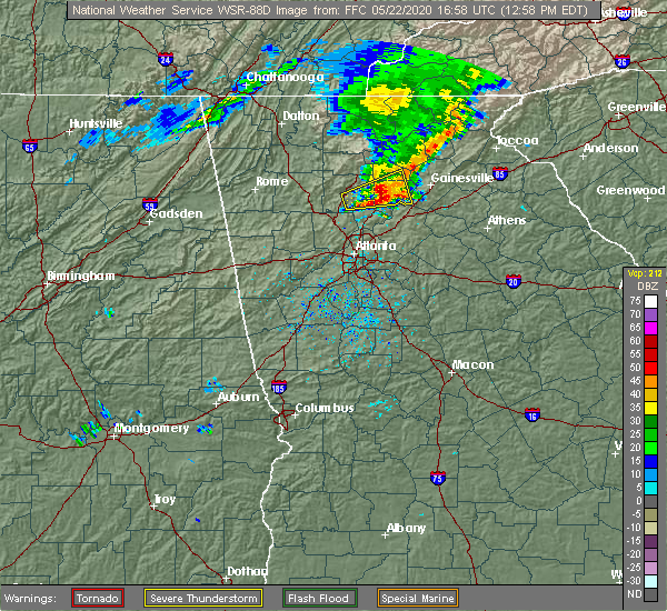 At 1258 pm edt, a severe thunderstorm was located over drew, or near cumming, moving east at 30 mph (radar indicated). Hazards include 60 mph wind gusts and half dollar size hail. Hail damage to vehicles is expected. expect wind damage to roofs, siding, and trees. Locations impacted include, cumming, free home, dougherty, matt, drew, silver city, holbrook, lathemtown, ducktown, coal mountain, hightower and lake lanier islands. At 1258 pm edt, a severe thunderstorm was located over drew, or near cumming, moving east at 30 mph (radar indicated). Hazards include 60 mph wind gusts and half dollar size hail. Hail damage to vehicles is expected. expect wind damage to roofs, siding, and trees. Locations impacted include, cumming, free home, dougherty, matt, drew, silver city, holbrook, lathemtown, ducktown, coal mountain, hightower and lake lanier islands.
|
| 5/22/2020 12:38 PM EDT |
 At 1237 pm edt, a severe thunderstorm was located over union hill, or near canton, moving east at 35 mph (radar indicated). Hazards include 60 mph wind gusts and quarter size hail. Hail damage to vehicles is expected. Expect wind damage to roofs, siding, and trees. At 1237 pm edt, a severe thunderstorm was located over union hill, or near canton, moving east at 35 mph (radar indicated). Hazards include 60 mph wind gusts and quarter size hail. Hail damage to vehicles is expected. Expect wind damage to roofs, siding, and trees.
|
| 4/23/2020 5:35 PM EDT | Quarter sized hail reported 7.3 miles WSW of Cumming, GA, 1 inch hail reported at the intersection of parks rd and little mill rd. hail reported to cause minor damage to vehicles. |
| 4/13/2020 2:30 AM EDT |
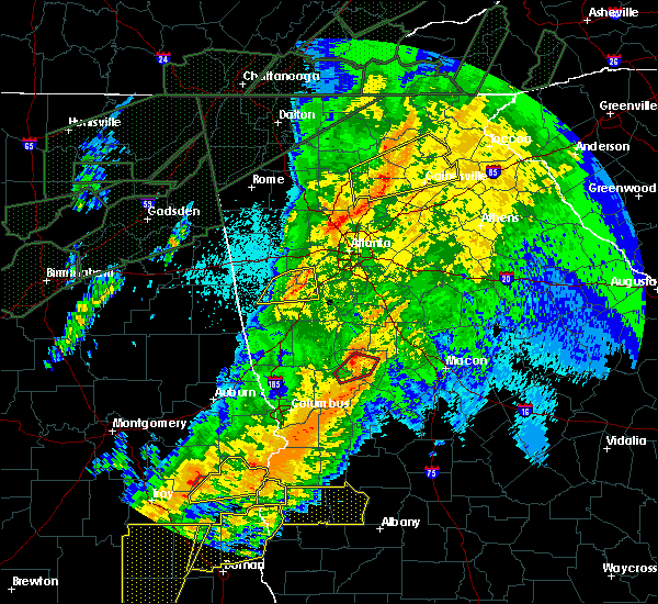 At 229 am edt, a severe thunderstorm was located over murrayville, or 7 miles southeast of dahlonega, moving northeast at 55 mph (radar indicated). Hazards include 60 mph wind gusts. Expect damage to roofs, siding, and trees. Locations impacted include, gainesville, cumming, dahlonega, cleveland, oakwood, lula, clermont, gillsville, drew, coal mountain, mossy creek, matt, silver city, chestatee, murrayville, oscarville, auraria, ducktown, leaf and garland. At 229 am edt, a severe thunderstorm was located over murrayville, or 7 miles southeast of dahlonega, moving northeast at 55 mph (radar indicated). Hazards include 60 mph wind gusts. Expect damage to roofs, siding, and trees. Locations impacted include, gainesville, cumming, dahlonega, cleveland, oakwood, lula, clermont, gillsville, drew, coal mountain, mossy creek, matt, silver city, chestatee, murrayville, oscarville, auraria, ducktown, leaf and garland.
|
| 4/13/2020 2:22 AM EDT |
 At 222 am edt, a severe thunderstorm was located over roswell, or 11 miles northeast of marietta, moving east at 85 mph (radar indicated). Hazards include 60 mph wind gusts. expect damage to roofs, siding, and trees At 222 am edt, a severe thunderstorm was located over roswell, or 11 miles northeast of marietta, moving east at 85 mph (radar indicated). Hazards include 60 mph wind gusts. expect damage to roofs, siding, and trees
|
| 4/13/2020 2:01 AM EDT |
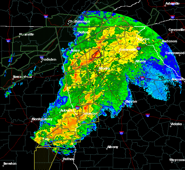 At 201 am edt, a severe thunderstorm was located near lathemtown, or 10 miles northeast of canton, moving northeast at 55 mph (radar indicated). Hazards include 60 mph wind gusts. expect damage to roofs, siding, and trees At 201 am edt, a severe thunderstorm was located near lathemtown, or 10 miles northeast of canton, moving northeast at 55 mph (radar indicated). Hazards include 60 mph wind gusts. expect damage to roofs, siding, and trees
|
| 2/6/2020 7:41 AM EST | Recieved a social media photo of a tree down across seabolt r in forsyth county GA, 8.4 miles SE of Cumming, GA |
| 1/11/2020 5:35 PM EST | Trees were reported down near the intersection of dogwood trail and lanier dr. time indicated by rada in forsyth county GA, 4.5 miles W of Cumming, GA |
| 1/11/2020 5:26 PM EST | A tree was reported down near the intersection of chestnut hill rd and lanier dr. time indicated by rada in forsyth county GA, 4.5 miles W of Cumming, GA |
| 1/11/2020 5:24 PM EST |
 At 523 pm est, severe thunderstorms were located along a line extending from near hollis lathem reservoir to near palmetto, moving east at 40 mph (radar indicated). Hazards include 60 mph wind gusts. expect damage to roofs, siding, and trees At 523 pm est, severe thunderstorms were located along a line extending from near hollis lathem reservoir to near palmetto, moving east at 40 mph (radar indicated). Hazards include 60 mph wind gusts. expect damage to roofs, siding, and trees
|
| 8/24/2019 2:50 PM EDT | Quarter sized hail reported 3 miles WSW of Cumming, GA, public sent picture of quarter sized hail at the intersection of pilgrim mill rd and still rd. |
| 8/24/2019 2:50 PM EDT | Several trees down with damage to a fence along williams circle from pictures sent by publi in forsyth county GA, 1.5 miles SW of Cumming, GA |
| 8/19/2019 4:24 PM EDT | Several trees down near the intersection of settingdown road and hampton park drive. time estimated from rada in forsyth county GA, 7.4 miles SSW of Cumming, GA |
| 8/19/2019 4:01 PM EDT |
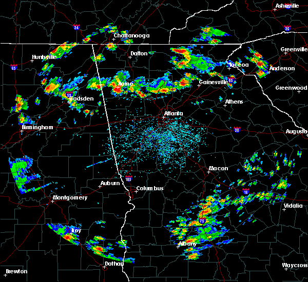 At 401 pm edt, a severe thunderstorm was located over silver city, or near dawsonville, moving southwest at 5 mph (radar indicated). Hazards include 60 mph wind gusts and half dollar size hail. Hail damage to vehicles is expected. Expect wind damage to roofs, siding, and trees. At 401 pm edt, a severe thunderstorm was located over silver city, or near dawsonville, moving southwest at 5 mph (radar indicated). Hazards include 60 mph wind gusts and half dollar size hail. Hail damage to vehicles is expected. Expect wind damage to roofs, siding, and trees.
|
| 6/24/2019 6:39 PM EDT |
 At 638 pm edt, a severe thunderstorm was located over mount bethel, or 7 miles east of marietta, moving east at 35 mph (radar indicated). Hazards include 60 mph wind gusts and penny size hail. expect damage to roofs, siding, and trees At 638 pm edt, a severe thunderstorm was located over mount bethel, or 7 miles east of marietta, moving east at 35 mph (radar indicated). Hazards include 60 mph wind gusts and penny size hail. expect damage to roofs, siding, and trees
|
| 6/24/2019 6:24 PM EDT | A tree was reported down on lillie lane near john burruss roa in forsyth county GA, 6 miles SSE of Cumming, GA |
| 6/24/2019 6:22 PM EDT | A tree was reported down on tolbert street near cherokee chase driv in forsyth county GA, 1.2 miles ENE of Cumming, GA |
| 6/24/2019 6:19 PM EDT | A tree was reported down on settingdown road near ga 40 in forsyth county GA, 5.9 miles SSW of Cumming, GA |
| 6/24/2019 6:18 PM EDT | A tree was reported down janton way near riley roa in forsyth county GA, 8 miles S of Cumming, GA |
| 6/24/2019 6:16 PM EDT | A tree was reported down on ashworth driv in forsyth county GA, 3.7 miles ESE of Cumming, GA |
| 6/24/2019 6:09 PM EDT | Tree reported down at the intersection of cumming hwy and county line r in cherokee county GA, 7.9 miles ESE of Cumming, GA |
| 6/22/2019 1:50 AM EDT |
 At 150 am edt, severe thunderstorms were located along a line extending from near eastanolee to near suwanee, moving southeast at 45 mph (radar indicated). Hazards include 60 mph wind gusts. Expect damage to roofs, siding, and trees. Locations impacted include, gainesville, cumming, sandy springs, roswell, johns creek, alpharetta, milton, duluth, sugar hill, suwanee, buford, braselton, flowery branch, oakwood, berkeley lake, rest haven, candler, drew, buford dam-lake lanier parks and coal mountain. At 150 am edt, severe thunderstorms were located along a line extending from near eastanolee to near suwanee, moving southeast at 45 mph (radar indicated). Hazards include 60 mph wind gusts. Expect damage to roofs, siding, and trees. Locations impacted include, gainesville, cumming, sandy springs, roswell, johns creek, alpharetta, milton, duluth, sugar hill, suwanee, buford, braselton, flowery branch, oakwood, berkeley lake, rest haven, candler, drew, buford dam-lake lanier parks and coal mountain.
|
| 6/22/2019 1:17 AM EDT |
 At 116 am edt, severe thunderstorms were located along a line extending from near sautee to canton, moving southeast at 45 mph (radar indicated). Hazards include 60 mph wind gusts. expect damage to roofs, siding, and trees At 116 am edt, severe thunderstorms were located along a line extending from near sautee to canton, moving southeast at 45 mph (radar indicated). Hazards include 60 mph wind gusts. expect damage to roofs, siding, and trees
|
| 6/7/2019 4:24 PM EDT |
 At 402 pm edt, a severe thunderstorm was located over coal mountain, or near cumming, moving east at 35 mph (radar indicated). Hazards include 60 mph wind gusts and penny size hail. expect damage to roofs, siding, and trees At 402 pm edt, a severe thunderstorm was located over coal mountain, or near cumming, moving east at 35 mph (radar indicated). Hazards include 60 mph wind gusts and penny size hail. expect damage to roofs, siding, and trees
|
| 6/7/2019 4:02 PM EDT |
 At 402 pm edt, a severe thunderstorm was located over coal mountain, or near cumming, moving east at 35 mph (radar indicated). Hazards include 60 mph wind gusts and penny size hail. expect damage to roofs, siding, and trees At 402 pm edt, a severe thunderstorm was located over coal mountain, or near cumming, moving east at 35 mph (radar indicated). Hazards include 60 mph wind gusts and penny size hail. expect damage to roofs, siding, and trees
|
| 6/7/2019 3:54 PM EDT | A tree was reported down near the intersection of fields pond overlook and mockingbird roa in forsyth county GA, 5.1 miles SSW of Cumming, GA |
| 6/7/2019 3:00 PM EDT | A tree was reported down on trammel road a mile down from buford highwa in forsyth county GA, 3.7 miles N of Cumming, GA |
| 4/19/2019 5:03 AM EDT |
 At 503 am edt, a severe thunderstorm capable of producing a tornado was located near berkeley lake, or 14 miles west of lawrenceville, moving northeast at 30 mph (radar indicated rotation). Hazards include tornado. Flying debris will be dangerous to those caught without shelter. mobile homes will be damaged or destroyed. damage to roofs, windows, and vehicles will occur. Tree damage is likely. At 503 am edt, a severe thunderstorm capable of producing a tornado was located near berkeley lake, or 14 miles west of lawrenceville, moving northeast at 30 mph (radar indicated rotation). Hazards include tornado. Flying debris will be dangerous to those caught without shelter. mobile homes will be damaged or destroyed. damage to roofs, windows, and vehicles will occur. Tree damage is likely.
|
| 11/6/2018 7:04 AM EST |
 At 704 am est, a severe thunderstorm was located near hightower, or 9 miles northwest of cumming, moving east at 40 mph (radar indicated). Hazards include 60 mph wind gusts. expect damage to roofs, siding, and trees At 704 am est, a severe thunderstorm was located near hightower, or 9 miles northwest of cumming, moving east at 40 mph (radar indicated). Hazards include 60 mph wind gusts. expect damage to roofs, siding, and trees
|
| 7/21/2018 9:37 PM EDT |
 At 937 pm edt, a severe thunderstorm was located over flowery branch, or 10 miles southwest of gainesville, moving east at 35 mph (radar indicated). Hazards include 60 mph wind gusts and penny size hail. Expect damage to roofs, siding, and trees. Locations impacted include, gainesville, cumming, sugar hill, suwanee, buford, braselton, flowery branch, oakwood, rest haven, candler, drew, buford dam-lake lanier parks, brookwood, aqualand park, chestnut mountain, oscarville, road atlanta-lanier speedway, ducktown and lake lanier islands. At 937 pm edt, a severe thunderstorm was located over flowery branch, or 10 miles southwest of gainesville, moving east at 35 mph (radar indicated). Hazards include 60 mph wind gusts and penny size hail. Expect damage to roofs, siding, and trees. Locations impacted include, gainesville, cumming, sugar hill, suwanee, buford, braselton, flowery branch, oakwood, rest haven, candler, drew, buford dam-lake lanier parks, brookwood, aqualand park, chestnut mountain, oscarville, road atlanta-lanier speedway, ducktown and lake lanier islands.
|
| 7/21/2018 9:18 PM EDT |
 At 917 pm edt, a severe thunderstorm was located near buford dam-lake lanier parks, or near cumming, moving east at 35 mph (radar indicated). Hazards include 60 mph wind gusts and quarter size hail. Hail damage to vehicles is expected. expect wind damage to roofs, siding, and trees. Locations impacted include, gainesville, cumming, sugar hill, suwanee, buford, braselton, flowery branch, oakwood, rest haven, candler, drew, buford dam-lake lanier parks, brookwood, aqualand park, chestnut mountain, oscarville, road atlanta-lanier speedway, ducktown and lake lanier islands. At 917 pm edt, a severe thunderstorm was located near buford dam-lake lanier parks, or near cumming, moving east at 35 mph (radar indicated). Hazards include 60 mph wind gusts and quarter size hail. Hail damage to vehicles is expected. expect wind damage to roofs, siding, and trees. Locations impacted include, gainesville, cumming, sugar hill, suwanee, buford, braselton, flowery branch, oakwood, rest haven, candler, drew, buford dam-lake lanier parks, brookwood, aqualand park, chestnut mountain, oscarville, road atlanta-lanier speedway, ducktown and lake lanier islands.
|
| 7/21/2018 9:01 PM EDT |
 At 901 pm edt, a severe thunderstorm was located over holbrook, or 8 miles west of cumming, moving east at 35 mph (radar indicated). Hazards include 60 mph wind gusts and half dollar size hail. Hail damage to vehicles is expected. Expect wind damage to roofs, siding, and trees. At 901 pm edt, a severe thunderstorm was located over holbrook, or 8 miles west of cumming, moving east at 35 mph (radar indicated). Hazards include 60 mph wind gusts and half dollar size hail. Hail damage to vehicles is expected. Expect wind damage to roofs, siding, and trees.
|
| 7/21/2018 6:04 AM EDT |
 At 603 am edt, severe thunderstorms were located along a line extending from near hightower to near holbrook, moving southeast at 40 mph (radar indicated). Hazards include 60 mph wind gusts and quarter size hail. Hail damage to vehicles is expected. expect wind damage to roofs, siding, and trees. Locations impacted include, lawrenceville, cumming, sugar hill, suwanee, buford, flowery branch, oakwood, rest haven, drew, buford dam-lake lanier parks, coal mountain, brookwood, hightower, matt, aqualand park, oscarville, ducktown, lake lanier islands and hog mountain. At 603 am edt, severe thunderstorms were located along a line extending from near hightower to near holbrook, moving southeast at 40 mph (radar indicated). Hazards include 60 mph wind gusts and quarter size hail. Hail damage to vehicles is expected. expect wind damage to roofs, siding, and trees. Locations impacted include, lawrenceville, cumming, sugar hill, suwanee, buford, flowery branch, oakwood, rest haven, drew, buford dam-lake lanier parks, coal mountain, brookwood, hightower, matt, aqualand park, oscarville, ducktown, lake lanier islands and hog mountain.
|
| 7/21/2018 5:44 AM EDT |
 At 544 am edt, severe thunderstorms were located along a line extending from near amicalola falls state park to hollis lathem reservoir to near buffington, moving southeast at 50 mph (radar indicated). Hazards include ping pong ball size hail and 60 mph wind gusts. People and animals outdoors will be injured. expect hail damage to roofs, siding, windows, and vehicles. Expect wind damage to roofs, siding, and trees. At 544 am edt, severe thunderstorms were located along a line extending from near amicalola falls state park to hollis lathem reservoir to near buffington, moving southeast at 50 mph (radar indicated). Hazards include ping pong ball size hail and 60 mph wind gusts. People and animals outdoors will be injured. expect hail damage to roofs, siding, windows, and vehicles. Expect wind damage to roofs, siding, and trees.
|
| 6/22/2018 5:41 PM EDT | A tree was blown down on a.t. moore rd at kelly bridge r in dawson county GA, 8.7 miles S of Cumming, GA |
| 6/22/2018 5:38 PM EDT |
 At 537 pm edt, a severe thunderstorm was located over matt, moving northeast at 35 mph (radar indicated). Hazards include 60 mph wind gusts and penny size hail. expect damage to roofs, siding, and trees At 537 pm edt, a severe thunderstorm was located over matt, moving northeast at 35 mph (radar indicated). Hazards include 60 mph wind gusts and penny size hail. expect damage to roofs, siding, and trees
|
| 6/22/2018 5:32 PM EDT |
 At 531 pm edt, a severe thunderstorm was located over cumming, moving northeast at 40 mph (radar indicated). Hazards include 60 mph wind gusts and penny size hail. Expect damage to roofs, siding, and trees. Locations impacted include, cumming, sugar hill, free home, matt, drew, holbrook, lathemtown, ducktown, coal mountain, brookwood, hightower and silver city. At 531 pm edt, a severe thunderstorm was located over cumming, moving northeast at 40 mph (radar indicated). Hazards include 60 mph wind gusts and penny size hail. Expect damage to roofs, siding, and trees. Locations impacted include, cumming, sugar hill, free home, matt, drew, holbrook, lathemtown, ducktown, coal mountain, brookwood, hightower and silver city.
|
| 6/22/2018 5:24 PM EDT | A tree was blown down on majors road near the intersection of castleberry roa in forsyth county GA, 5.2 miles ENE of Cumming, GA |
| 6/22/2018 5:22 PM EDT | Forsyth county sheriffs office reports a tree was blown down on valley stream driv in forsyth county GA, 7.3 miles ENE of Cumming, GA |
| 6/22/2018 5:22 PM EDT | A tree and power lines were reported down on post road at derby trai in forsyth county GA, 7.1 miles ENE of Cumming, GA |
| 6/22/2018 5:13 PM EDT |
 At 511 pm edt, a severe thunderstorm was located over alpharetta, moving northeast at 40 mph (radar indicated). Hazards include 60 mph wind gusts and penny size hail. expect damage to roofs, siding, and trees At 511 pm edt, a severe thunderstorm was located over alpharetta, moving northeast at 40 mph (radar indicated). Hazards include 60 mph wind gusts and penny size hail. expect damage to roofs, siding, and trees
|
| 6/1/2018 4:02 PM EDT |
 At 402 pm edt, a severe thunderstorm was located near coal mountain, or near cumming, moving east at 15 mph (radar indicated). Hazards include 60 mph wind gusts and quarter size hail. Hail damage to vehicles is expected. Expect wind damage to roofs, siding, and trees. At 402 pm edt, a severe thunderstorm was located near coal mountain, or near cumming, moving east at 15 mph (radar indicated). Hazards include 60 mph wind gusts and quarter size hail. Hail damage to vehicles is expected. Expect wind damage to roofs, siding, and trees.
|
| 6/1/2018 4:00 PM EDT | 2 trees down in the vacinity of mountain rd and dahlonega hw in forsyth county GA, 3.3 miles SSW of Cumming, GA |
| 6/1/2018 1:13 AM EDT |
 At 112 am edt, severe thunderstorms were located along a line extending from near cumming to near red top mountain state park, moving south at 25 mph (radar indicated). Hazards include 60 mph wind gusts and quarter size hail. Hail damage to vehicles is expected. expect wind damage to roofs, siding, and trees. Locations impacted include, canton, cartersville, cumming, milton, woodstock, holly springs, emerson, free home, buffington, hickory flat, drew, kellogg creek, red top mountain state park, coal mountain, hightower, matt, lathemtown, hobgood park, union hill and lake arrowhead. At 112 am edt, severe thunderstorms were located along a line extending from near cumming to near red top mountain state park, moving south at 25 mph (radar indicated). Hazards include 60 mph wind gusts and quarter size hail. Hail damage to vehicles is expected. expect wind damage to roofs, siding, and trees. Locations impacted include, canton, cartersville, cumming, milton, woodstock, holly springs, emerson, free home, buffington, hickory flat, drew, kellogg creek, red top mountain state park, coal mountain, hightower, matt, lathemtown, hobgood park, union hill and lake arrowhead.
|
| 6/1/2018 12:44 AM EDT |
 At 1243 am edt, severe thunderstorms were located along a line extending from silver city to near white, moving south at 25 mph (radar indicated). Hazards include 60 mph wind gusts and quarter size hail. Hail damage to vehicles is expected. Expect wind damage to roofs, siding, and trees. At 1243 am edt, severe thunderstorms were located along a line extending from silver city to near white, moving south at 25 mph (radar indicated). Hazards include 60 mph wind gusts and quarter size hail. Hail damage to vehicles is expected. Expect wind damage to roofs, siding, and trees.
|
| 5/31/2018 5:54 PM EDT |
 At 553 pm edt, a severe thunderstorm was located near hightower, or 10 miles northwest of cumming, moving southeast at 20 mph (radar indicated). Hazards include 60 mph wind gusts and quarter size hail. Hail damage to vehicles is expected. Expect wind damage to roofs, siding, and trees. At 553 pm edt, a severe thunderstorm was located near hightower, or 10 miles northwest of cumming, moving southeast at 20 mph (radar indicated). Hazards include 60 mph wind gusts and quarter size hail. Hail damage to vehicles is expected. Expect wind damage to roofs, siding, and trees.
|
| 7/6/2017 2:00 PM EDT | Power lines reported down at the intersection of keith bridge rd and parks r in forsyth county GA, 6 miles SW of Cumming, GA |
| 7/2/2017 5:59 PM EDT | 15-20 downed trees scattered along redbud way... gran forest drive... and haw creek drive. four trees down on homes. no injuries. time estimated from rada in forsyth county GA, 2.4 miles N of Cumming, GA |
| 6/23/2017 8:13 PM EDT |
 At 812 pm edt, severe thunderstorms were located along a line extending from near silver city to near chestatee to buford dam-lake lanier parks, moving northeast at 45 mph (radar indicated). Hazards include 60 mph wind gusts. expect damage to roofs, siding, and trees At 812 pm edt, severe thunderstorms were located along a line extending from near silver city to near chestatee to buford dam-lake lanier parks, moving northeast at 45 mph (radar indicated). Hazards include 60 mph wind gusts. expect damage to roofs, siding, and trees
|
| 6/23/2017 8:06 PM EDT | A tree was reported down near the intersection of dahlonega highway and punch hammond roa in forsyth county GA, 3.3 miles SSW of Cumming, GA |
| 6/23/2017 8:00 PM EDT | A tree was reported down near the intersection of castleberry road and bethelview roa in forsyth county GA, 4.2 miles NE of Cumming, GA |
| 6/23/2017 7:59 PM EDT |
 At 757 pm edt, severe thunderstorms were located along a line extending from near free home to near milton to alpharetta, moving northeast at 45 mph. a second storm was located along a line from kennesaw to jim miller park moving northeast at 45 mph (radar indicated). Hazards include 60 mph wind gusts. Expect damage to roofs, siding, and trees. Locations impacted include, marietta, canton, cumming, sandy springs, roswell, johns creek, alpharetta, dunwoody, milton, kennesaw, woodstock, acworth, sugar hill, powder springs, holly springs, berkeley lake, free home, fair oaks, buffington and mount bethel. At 757 pm edt, severe thunderstorms were located along a line extending from near free home to near milton to alpharetta, moving northeast at 45 mph. a second storm was located along a line from kennesaw to jim miller park moving northeast at 45 mph (radar indicated). Hazards include 60 mph wind gusts. Expect damage to roofs, siding, and trees. Locations impacted include, marietta, canton, cumming, sandy springs, roswell, johns creek, alpharetta, dunwoody, milton, kennesaw, woodstock, acworth, sugar hill, powder springs, holly springs, berkeley lake, free home, fair oaks, buffington and mount bethel.
|
| 6/23/2017 7:54 PM EDT | A tree was reported down on hyde roa in forsyth county GA, 6.6 miles ESE of Cumming, GA |
| 6/23/2017 7:26 PM EDT |
 At 726 pm edt, severe thunderstorms were located along a line extending from hobgood park to kennesaw state university to lost mountain park, moving northeast at 40 mph (radar indicated). Hazards include 60 mph wind gusts. expect damage to roofs, siding, and trees At 726 pm edt, severe thunderstorms were located along a line extending from hobgood park to kennesaw state university to lost mountain park, moving northeast at 40 mph (radar indicated). Hazards include 60 mph wind gusts. expect damage to roofs, siding, and trees
|
| 5/23/2017 9:51 PM EDT | A tree was reported down on a power line at 4880 dahlonega highway in forsyth county GA, 7.5 miles SSW of Cumming, GA |
| 5/23/2017 9:40 PM EDT | A tree was reported down near the intersection of chamblee gap road and kelly mill roa in forsyth county GA, 2.4 miles E of Cumming, GA |
| 3/30/2017 9:15 PM EDT | Roof was blown off of an rv trailer near browns bridge rd and hammond industrial dr in forsyth county GA, 4.6 miles SW of Cumming, GA |
| 3/21/2017 8:44 PM EDT |
 At 843 pm edt, severe thunderstorms were located extending from demorest to near gainesville to buford, moving east-southeast at 50 mph (radar indicated, plus multiple reports of downed trees and powerlines due to the very strong winds). Hazards include 60 mph wind gusts and penny size hail. expect damage to roofs, siding, and trees At 843 pm edt, severe thunderstorms were located extending from demorest to near gainesville to buford, moving east-southeast at 50 mph (radar indicated, plus multiple reports of downed trees and powerlines due to the very strong winds). Hazards include 60 mph wind gusts and penny size hail. expect damage to roofs, siding, and trees
|
| 3/21/2017 8:40 PM EDT |
 At 838 pm edt, severe thunderstorms were located extending from near milton to sandy plains to near eubank lake to near piedmont, moving southeast at 40 mph (radar indicated, plus multiple reports of downed trees and powerlines due to the very strong winds). Hazards include 60 mph wind gusts and penny size hail. expect damage to roofs, siding, and trees At 838 pm edt, severe thunderstorms were located extending from near milton to sandy plains to near eubank lake to near piedmont, moving southeast at 40 mph (radar indicated, plus multiple reports of downed trees and powerlines due to the very strong winds). Hazards include 60 mph wind gusts and penny size hail. expect damage to roofs, siding, and trees
|
| 3/21/2017 8:30 PM EDT | Gdot rwis site reported 61 mph wind gust with the line in forsyth county GA, 1.8 miles NNE of Cumming, GA |
| 3/21/2017 8:30 PM EDT | Trees down in forsyth county...possible tree on house on pleasant grove roa in forsyth county GA, 5.4 miles SSE of Cumming, GA |
| 3/21/2017 8:14 PM EDT |
 At 812 pm edt, severe thunderstorms were located extending from near hightower to near canton to near taylorsville to near forney, moving southeast at 50 mph (radar indicated, plus multiple reports of very strong winds knocking down trees and powerlines across northwest georgia). Hazards include 60 mph wind gusts and nickel size hail. expect damage to roofs, siding, and trees At 812 pm edt, severe thunderstorms were located extending from near hightower to near canton to near taylorsville to near forney, moving southeast at 50 mph (radar indicated, plus multiple reports of very strong winds knocking down trees and powerlines across northwest georgia). Hazards include 60 mph wind gusts and nickel size hail. expect damage to roofs, siding, and trees
|
| 3/10/2017 3:28 AM EST |
 At 328 am est, a severe thunderstorm was located over lathemtown, or 9 miles east of canton, moving east at 55 mph (radar indicated). Hazards include 60 mph wind gusts and quarter size hail. Hail damage to vehicles is expected. Expect wind damage to roofs, siding, and trees. At 328 am est, a severe thunderstorm was located over lathemtown, or 9 miles east of canton, moving east at 55 mph (radar indicated). Hazards include 60 mph wind gusts and quarter size hail. Hail damage to vehicles is expected. Expect wind damage to roofs, siding, and trees.
|
| 11/30/2016 2:14 PM EST |
 At 211 pm est, a severe thunderstorm capable of producing a tornado was located over brookwood, or near cumming, moving east at 25 mph (radar indicated rotation). Hazards include tornado. Flying debris will be dangerous to those caught without shelter. mobile homes will be damaged or destroyed. damage to roofs, windows, and vehicles will occur. Tree damage is likely. At 211 pm est, a severe thunderstorm capable of producing a tornado was located over brookwood, or near cumming, moving east at 25 mph (radar indicated rotation). Hazards include tornado. Flying debris will be dangerous to those caught without shelter. mobile homes will be damaged or destroyed. damage to roofs, windows, and vehicles will occur. Tree damage is likely.
|
| 11/30/2016 2:11 PM EST |
 At 210 pm est, a severe thunderstorm capable of producing a tornado was located over brookwood, or near cumming, moving east at 25 mph (radar indicated rotation). Hazards include tornado. Flying debris will be dangerous to those caught without shelter. mobile homes will be damaged or destroyed. damage to roofs, windows, and vehicles will occur. Tree damage is likely. At 210 pm est, a severe thunderstorm capable of producing a tornado was located over brookwood, or near cumming, moving east at 25 mph (radar indicated rotation). Hazards include tornado. Flying debris will be dangerous to those caught without shelter. mobile homes will be damaged or destroyed. damage to roofs, windows, and vehicles will occur. Tree damage is likely.
|
| 11/30/2016 1:58 PM EST |
 At 157 pm est, severe thunderstorms were located along a line extending from near lathemtown to near milton to near mechanicsville, moving northeast at 40 mph (radar indicated). Hazards include 60 mph wind gusts. Expect damage to roofs. siding. And trees. At 157 pm est, severe thunderstorms were located along a line extending from near lathemtown to near milton to near mechanicsville, moving northeast at 40 mph (radar indicated). Hazards include 60 mph wind gusts. Expect damage to roofs. siding. And trees.
|
| 8/1/2016 8:07 PM EDT | Tree downed along lemans street in forsyth county GA, 2.8 miles SW of Cumming, GA |
| 7/11/2016 6:41 PM EDT |
 At 640 pm edt, severe thunderstorms were located along a line extending from 7 miles west of holly springs to near free home to near milton, moving northeast at 35 mph (spotter indicated). Hazards include 60 mph wind gusts and quarter size hail. Hail damage to vehicles is expected. expect wind damage to roofs, siding, and trees. Other locations in the warning include but are not limited to canton, cartersville, cumming, roswell, johns creek, alpharetta, milton, woodstock, holly springs, berkeley lake, emerson, white, waleska, buffington, free home, lathemtown, holbrook, lebanon, union hill and red top mountain state park. At 640 pm edt, severe thunderstorms were located along a line extending from 7 miles west of holly springs to near free home to near milton, moving northeast at 35 mph (spotter indicated). Hazards include 60 mph wind gusts and quarter size hail. Hail damage to vehicles is expected. expect wind damage to roofs, siding, and trees. Other locations in the warning include but are not limited to canton, cartersville, cumming, roswell, johns creek, alpharetta, milton, woodstock, holly springs, berkeley lake, emerson, white, waleska, buffington, free home, lathemtown, holbrook, lebanon, union hill and red top mountain state park.
|
| 7/11/2016 6:30 PM EDT | Emergency manager reports a tree down on briarwood trail in cumming...francis circle near milton...westbrook road near chestatee... crooked o trail northeast of chestat in forsyth county GA, 0.8 miles ESE of Cumming, GA |
| 7/11/2016 6:12 PM EDT |
 At 612 pm edt, severe thunderstorms were located along a line extending from 7 miles southwest of emerson to near kennesaw to near roswell, moving northeast at 20 mph (radar indicated). Hazards include 60 mph wind gusts and quarter size hail. Hail damage to vehicles is expected. expect wind damage to roofs, siding, and trees. Other locations in the warning include but are not limited to marietta, canton, cartersville, cumming, sandy springs, roswell, johns creek, alpharetta, dunwoody, milton, kennesaw, woodstock, acworth, holly springs, berkeley lake, emerson, white, waleska, braswell and buffington. At 612 pm edt, severe thunderstorms were located along a line extending from 7 miles southwest of emerson to near kennesaw to near roswell, moving northeast at 20 mph (radar indicated). Hazards include 60 mph wind gusts and quarter size hail. Hail damage to vehicles is expected. expect wind damage to roofs, siding, and trees. Other locations in the warning include but are not limited to marietta, canton, cartersville, cumming, sandy springs, roswell, johns creek, alpharetta, dunwoody, milton, kennesaw, woodstock, acworth, holly springs, berkeley lake, emerson, white, waleska, braswell and buffington.
|
| 6/2/2016 3:56 PM EDT | The forsyth county emergency manager reported 3 trees blown down...one on a power line...in the vicinity of georgia highway 9 and spot roa in forsyth county GA, 4 miles SSW of Cumming, GA |
| 6/2/2016 3:49 PM EDT |
 At 349 pm edt, a severe thunderstorm was located over cumming, moving north at 5 mph (radar indicated). Hazards include 60 mph wind gusts. Expect damage to roofs. siding. and trees. Other locations in the warning include but are not limited to cumming, chestatee, drew, matt, hightower, silver city, coal mountain, war hill park and oscarville. At 349 pm edt, a severe thunderstorm was located over cumming, moving north at 5 mph (radar indicated). Hazards include 60 mph wind gusts. Expect damage to roofs. siding. and trees. Other locations in the warning include but are not limited to cumming, chestatee, drew, matt, hightower, silver city, coal mountain, war hill park and oscarville.
|
| 6/1/2016 6:51 PM EDT |
 At 651 pm edt, a severe thunderstorm was located near cumming, moving north at 10 mph (radar indicated). Hazards include 60 mph wind gusts and quarter size hail. Hail damage to vehicles is expected. expect wind damage to roofs, siding, and trees. Other locations in the warning include but are not limited to cumming, dougherty, chestatee, silver city, coal mountain and matt. At 651 pm edt, a severe thunderstorm was located near cumming, moving north at 10 mph (radar indicated). Hazards include 60 mph wind gusts and quarter size hail. Hail damage to vehicles is expected. expect wind damage to roofs, siding, and trees. Other locations in the warning include but are not limited to cumming, dougherty, chestatee, silver city, coal mountain and matt.
|
| 4/7/2016 12:01 AM EDT | Quarter sized hail reported 3.5 miles E of Cumming, GA, social media report of hail on bramblett rd and pleasant grove road. |
| 4/7/2016 12:00 AM EDT | A large tree was blown onto sr-9 near spot r in forsyth county GA, 4 miles SSW of Cumming, GA |
| 4/6/2016 11:58 PM EDT |
 At 1158 pm edt, a severe thunderstorm was located near free home, or near cumming, moving east at 35 mph (radar indicated). Hazards include 60 mph wind gusts and quarter size hail. Hail damage to vehicles is expected. expect wind damage to roofs, siding, and trees. Other locations in the warning include but are not limited to cumming, roswell, alpharetta, milton, sugar hill, free home, lathemtown, holbrook, drew, matt, birmingham, hightower, ducktown, silver city and coal mountain. At 1158 pm edt, a severe thunderstorm was located near free home, or near cumming, moving east at 35 mph (radar indicated). Hazards include 60 mph wind gusts and quarter size hail. Hail damage to vehicles is expected. expect wind damage to roofs, siding, and trees. Other locations in the warning include but are not limited to cumming, roswell, alpharetta, milton, sugar hill, free home, lathemtown, holbrook, drew, matt, birmingham, hightower, ducktown, silver city and coal mountain.
|
| 4/6/2016 11:29 PM EDT |
 At 1129 pm edt, a severe thunderstorm was located over holly springs, or near canton, moving east at 35 mph (radar indicated). Hazards include 60 mph wind gusts and quarter size hail. Hail damage to vehicles is expected. expect wind damage to roofs, siding, and trees. Other locations in the warning include but are not limited to canton, cumming, roswell, alpharetta, milton, woodstock, sugar hill, holly springs, buffington, free home, lathemtown, holbrook, lebanon, union hill, drew, hickory flat, matt, birmingham, hightower and ducktown. At 1129 pm edt, a severe thunderstorm was located over holly springs, or near canton, moving east at 35 mph (radar indicated). Hazards include 60 mph wind gusts and quarter size hail. Hail damage to vehicles is expected. expect wind damage to roofs, siding, and trees. Other locations in the warning include but are not limited to canton, cumming, roswell, alpharetta, milton, woodstock, sugar hill, holly springs, buffington, free home, lathemtown, holbrook, lebanon, union hill, drew, hickory flat, matt, birmingham, hightower and ducktown.
|
| 4/6/2016 11:10 PM EDT | Quarter sized hail reported 4.4 miles SSW of Cumming, GA |
| 4/6/2016 11:02 PM EDT |
 At 1102 pm edt, a severe thunderstorm was located near ball ground, or near canton, moving northeast at 35 mph (radar indicated). Hazards include 60 mph wind gusts and quarter size hail. Hail damage to vehicles is expected. expect wind damage to roofs, siding, and trees. Other locations in the warning include but are not limited to gainesville, canton, cumming, dahlonega, jasper, dawsonville, flowery branch, oakwood, ball ground, nelson, waleska, buffington, free home, dougherty, lathemtown, holbrook, aqualand park, union hill, drew and matt. At 1102 pm edt, a severe thunderstorm was located near ball ground, or near canton, moving northeast at 35 mph (radar indicated). Hazards include 60 mph wind gusts and quarter size hail. Hail damage to vehicles is expected. expect wind damage to roofs, siding, and trees. Other locations in the warning include but are not limited to gainesville, canton, cumming, dahlonega, jasper, dawsonville, flowery branch, oakwood, ball ground, nelson, waleska, buffington, free home, dougherty, lathemtown, holbrook, aqualand park, union hill, drew and matt.
|
| 4/6/2016 10:31 PM EDT |
 At 1030 pm edt, a severe thunderstorm was located over holly springs, or near canton, moving east at 40 mph (radar indicated). Hazards include 60 mph wind gusts and quarter size hail. Hail damage to vehicles is expected. expect wind damage to roofs, siding, and trees. Other locations in the warning include but are not limited to canton, cumming, roswell, johns creek, alpharetta, milton, woodstock, sugar hill, suwanee, buford, holly springs, ball ground, buffington, free home, lathemtown, holbrook, lebanon, union hill, bridgemill and kellogg creek. At 1030 pm edt, a severe thunderstorm was located over holly springs, or near canton, moving east at 40 mph (radar indicated). Hazards include 60 mph wind gusts and quarter size hail. Hail damage to vehicles is expected. expect wind damage to roofs, siding, and trees. Other locations in the warning include but are not limited to canton, cumming, roswell, johns creek, alpharetta, milton, woodstock, sugar hill, suwanee, buford, holly springs, ball ground, buffington, free home, lathemtown, holbrook, lebanon, union hill, bridgemill and kellogg creek.
|
| 8/10/2015 5:06 PM EDT |
 At 506 pm edt, a severe thunderstorm was located near free home, or 8 miles west of cumming, moving east at 30 mph (radar indicated). Hazards include 60 mph wind gusts and quarter size hail. Hail damage to vehicles is expected. expect wind damage to roofs, siding and trees. Other locations in the warning include but are not limited to cumming, johns creek, alpharetta, milton, sugar hill, free home, drew, lathemtown, brookwood, holbrook, birmingham and ducktown. At 506 pm edt, a severe thunderstorm was located near free home, or 8 miles west of cumming, moving east at 30 mph (radar indicated). Hazards include 60 mph wind gusts and quarter size hail. Hail damage to vehicles is expected. expect wind damage to roofs, siding and trees. Other locations in the warning include but are not limited to cumming, johns creek, alpharetta, milton, sugar hill, free home, drew, lathemtown, brookwood, holbrook, birmingham and ducktown.
|
| 7/14/2015 8:20 PM EDT |
 At 820 pm edt, severe thunderstorms were located extending from 7 miles northwest of oakwood to near rest haven to near milton, moving east at 80 mph (radar indicated). Hazards include 60 mph wind gusts and nickel size hail. Expect damage to roofs. siding and trees. Other locations in the warning include but are not limited to cumming, johns creek, alpharetta, milton, duluth, sugar hill, buffington, free home, lathemtown, holbrook, union hill, chestatee, drew, matt, brookwood, birmingham, hightower, ducktown, coal mountain and oscarville. At 820 pm edt, severe thunderstorms were located extending from 7 miles northwest of oakwood to near rest haven to near milton, moving east at 80 mph (radar indicated). Hazards include 60 mph wind gusts and nickel size hail. Expect damage to roofs. siding and trees. Other locations in the warning include but are not limited to cumming, johns creek, alpharetta, milton, duluth, sugar hill, buffington, free home, lathemtown, holbrook, union hill, chestatee, drew, matt, brookwood, birmingham, hightower, ducktown, coal mountain and oscarville.
|
| 7/14/2015 8:12 PM EDT |
 At 811 pm edt, severe thunderstorms were located extending from 9 miles northwest of gainesville to near flowery branch to near free home, moving southeast at 35 mph (radar indicated). Hazards include 60 mph wind gusts. Expect damage to roofs. siding and trees. Other locations in the warning include but are not limited to gainesville, lawrenceville, winder, jefferson, cumming, duluth, sugar hill, suwanee, buford, braselton, auburn, flowery branch, dacula, oakwood, statham, arcade, hoschton, bethlehem, pendergrass and carl. At 811 pm edt, severe thunderstorms were located extending from 9 miles northwest of gainesville to near flowery branch to near free home, moving southeast at 35 mph (radar indicated). Hazards include 60 mph wind gusts. Expect damage to roofs. siding and trees. Other locations in the warning include but are not limited to gainesville, lawrenceville, winder, jefferson, cumming, duluth, sugar hill, suwanee, buford, braselton, auburn, flowery branch, dacula, oakwood, statham, arcade, hoschton, bethlehem, pendergrass and carl.
|
| 7/14/2015 7:43 PM EDT |
 At 743 pm edt, severe thunderstorms were located extending from east of jasper to near nelson to ball ground, moving southeast at 30 mph (radar indicated). Hazards include 60 mph wind gusts and nickel size hail. Expect damage to roofs. siding and trees. Other locations in the warning include but are not limited to cumming, dawsonville, johns creek, alpharetta, milton, duluth, sugar hill, buffington, free home, dougherty, lathemtown, holbrook, union hill, drew, matt, mckee, ducktown, coal mountain, fausett lake and hollis lathem reservoir. At 743 pm edt, severe thunderstorms were located extending from east of jasper to near nelson to ball ground, moving southeast at 30 mph (radar indicated). Hazards include 60 mph wind gusts and nickel size hail. Expect damage to roofs. siding and trees. Other locations in the warning include but are not limited to cumming, dawsonville, johns creek, alpharetta, milton, duluth, sugar hill, buffington, free home, dougherty, lathemtown, holbrook, union hill, drew, matt, mckee, ducktown, coal mountain, fausett lake and hollis lathem reservoir.
|
| 6/26/2015 4:51 PM EDT | At 451 pm edt, a severe thunderstorm was located 7 miles northeast of free home, or 8 miles southwest of dawsonville, moving northeast at 5 mph (radar indicated). Hazards include 60 mph wind gusts and quarter size hail. Hail damage to vehicles is expected. expect wind damage to roofs, siding and trees. Other locations in the warning include but are not limited to cumming, dawsonville, dougherty, chestatee, matt, hightower, mckee, silver city, coal mountain, hollis lathem reservoir, war hill park and ducktown. |
| 6/24/2015 6:15 PM EDT | Quarter sized hail reported 8.7 miles S of Cumming, GA, 911 call center has received report of hail up to quarter size near the forsyth and dawson county border...in the vicinity of ga 400 near silver city. |
| 6/24/2015 6:08 PM EDT |
 At 608 pm edt, a severe thunderstorm was located near dawsonville, and is nearly stationary (radar indicated). Hazards include 60 mph wind gusts and quarter size hail. Hail damage to vehicles is expected. expect wind damage to roofs, siding and trees. Other locations in the warning include but are not limited to cumming, dawsonville, dougherty, war hill park, chestatee, drew, matt, hightower, ducktown, silver city, coal mountain, hollis lathem reservoir and oscarville. At 608 pm edt, a severe thunderstorm was located near dawsonville, and is nearly stationary (radar indicated). Hazards include 60 mph wind gusts and quarter size hail. Hail damage to vehicles is expected. expect wind damage to roofs, siding and trees. Other locations in the warning include but are not limited to cumming, dawsonville, dougherty, war hill park, chestatee, drew, matt, hightower, ducktown, silver city, coal mountain, hollis lathem reservoir and oscarville.
|
| 6/18/2015 4:42 PM EDT | At 441 pm edt, a severe thunderstorm was located near cumming, and is nearly stationary (radar indicated). Hazards include 60 mph wind gusts and quarter size hail. Hail damage to vehicles is expected. expect wind damage to roofs, siding and trees. Other locations in the warning include but are not limited to cumming and sugar hill. |
| 6/18/2015 4:35 PM EDT | The forsyth county emergency manager reported 8 trees down...one on a house...in southwest forsyth count in forsyth county GA, 3 miles N of Cumming, GA |
| 6/18/2015 4:18 PM EDT | The forsyth county emergency manager reported 4-5 trees down on roads and power lines in the southwestern portion of the count in forsyth county GA, 4.5 miles N of Cumming, GA |
| 6/18/2015 4:16 PM EDT | At 416 pm edt, a severe thunderstorm was located near cumming, moving east at 10 mph (radar indicated). Hazards include 60 mph wind gusts and quarter size hail. Hail damage to vehicles is expected. expect wind damage to roofs, siding and trees. Other locations in the warning include but are not limited to cumming. |
| 5/31/2015 1:49 PM EDT | At 148 pm edt, a severe thunderstorm was located over rest haven, or 10 miles east of cumming, moving northeast at 10 mph (radar indicated). Hazards include 60 mph wind gusts... nickel size hail and heavy rain. Expect damage to roofs. siding and trees. Other locations in the warning include but are not limited to gainesville, cumming, sugar hill, suwanee, buford, braselton, flowery branch, oakwood, rest haven, candler, buford dam-lake lanier parks, aqualand park, lake lanier islands, road atlanta-lanier speedway, chestnut mountain, hog mountain and oscarville. |
| 4/22/2015 9:00 PM EDT | 1 tree down on house 2 miles south of cumming. 6 other trees down around the count in forsyth county GA, 1.8 miles NNE of Cumming, GA |
| 4/20/2015 1:33 PM EDT | At 132 pm edt, a severe thunderstorm was located over buffington, or near canton, moving east at 30 mph (radar indicated). Hazards include 60 mph wind gusts and quarter size hail. Hail damage to vehicles is expected. expect wind damage to roofs, siding and trees. other locations in the warning include but are not limited to canton, cumming, dawsonville, ball ground, buffington, free home, dougherty, lathemtown, holbrook, union hill, war hill park, chestatee, drew, hickory flat, matt, hightower, ducktown, silver city, coal mountain and hollis lathem reservoir. a tornado watch remains in effect until 800 pm edt for north central georgia. 1. 00in. |
| 4/20/2015 1:00 PM EDT | At 1259 pm edt, severe thunderstorms were located along a line extending from near clermont to near dawsonville, moving northeast at 45 mph (radar indicated). Hazards include 60 mph wind gusts and quarter size hail. Hail damage to vehicles is expected. expect wind damage to roofs, siding and trees. other locations in the warning include but are not limited to gainesville, cumming, dahlonega, cleveland, dawsonville, clermont, helen, unicoi state park, dougherty, sautee, smithgall woods conservation are, leaf, qualatchee lake, matt, mckee, coal mountain, hollis lathem reservoir, mossy creek, garland and war hill park. 1. 00in. |
| 6/5/2014 7:55 PM EDT | Forsyth ema relayed a report of at least 6 trees down across the county. at least 3 roads are closed from trees down on them. most of the trees are south of hwy 2 in forsyth county GA, 0.8 miles ESE of Cumming, GA |
| 6/5/2014 7:55 PM EDT | Several trees and powerlines down. two roads closed due to powerlines down. one is exit 16 ramp on ga 400 in forsyth county GA, 2.4 miles SW of Cumming, GA |
| 5/14/2014 8:08 PM EDT | A tree and power line were blown down on browns bridge roa in forsyth county GA, 4.8 miles SSW of Cumming, GA |
| 4/11/2013 8:45 PM EDT | Golf Ball sized hail reported 6.5 miles SE of Cumming, GA, some hail stones may have been bigger than golf balls. |
| 4/11/2013 8:44 PM EDT | Golf Ball sized hail reported 0.8 miles ESE of Cumming, GA, golfball sized hail reported near heardsville road. |
| 4/11/2013 8:44 PM EDT | Golf Ball sized hail reported 6.8 miles ESE of Cumming, GA, golfball sized hail reported near heardsville road. this is a correction. |
| 4/11/2013 8:43 PM EDT | Golf Ball sized hail reported 8.7 miles SE of Cumming, GA, also reported winds to 60 mph. |
| 1/30/2013 2:20 PM EST | Several trees were down across the county from the storm that moved through as reported by emergency management. time estimated from the rada in forsyth county GA, 0.8 miles ESE of Cumming, GA |
| 8/10/2012 10:15 PM EDT | Forsyth county 911 relayed reports of 2 downed trees in the northern portion of the county. time estimated from rada in forsyth county GA, 7.2 miles SSE of Cumming, GA |
| 8/1/2012 4:37 PM EDT | Forsyth ema relayed a report of trees down on houses...powerlines down...street lights and stoplights downed by thunderstorm wind across the county. also 4 mobile homes in forsyth county GA, 0.8 miles ESE of Cumming, GA |
| 8/1/2012 4:37 PM EDT | Forsyth ema relayed a report of trees down on houses...powerlines down...street lights and stoplights downed by thunderstorm wind across the count in forsyth county GA, 0.8 miles ESE of Cumming, GA |
| 5/17/2012 7:05 PM EDT | Multiple trees blown down off of catalina drive. one tree is on a hous in forsyth county GA, 2.5 miles WSW of Cumming, GA |
| 3/16/2012 12:27 AM EDT | Golf Ball sized hail reported 0.8 miles ESE of Cumming, GA, golfball sized hail reported between 1227-1239am. |
| 1/1/0001 12:00 AM | Em relayed a report of a tree on a house in cummun in forsyth county GA, 2.6 miles ENE of Cumming, GA |
| 1/1/0001 12:00 AM | Forysth county emegency management relayed report of a tree downed along bettis tribble gap road. power outages were also reported in the silver city are in forsyth county GA, 2.6 miles SSE of Cumming, GA |
| 7/13/2011 3:15 PM EDT | Large oak tree uprooted on karr road. nickel size hail also reported at this sit in forsyth county GA, 7.8 miles SE of Cumming, GA |
| 1/1/0001 12:00 AM | 9-10 trees dow in forsyth county GA, 0.8 miles ESE of Cumming, GA |
| 1/1/0001 12:00 AM | Trees down on house in forsyth county GA, 2.8 miles SW of Cumming, GA |
| 1/1/0001 12:00 AM | Trees down on house in forsyth county GA, 3 miles WNW of Cumming, GA |
| 6/15/2011 6:22 PM EDT | Quarter sized hail reported 0.8 miles ESE of Cumming, GA |
| 6/15/2011 6:10 PM EDT | Forsyth county 911 relayed reports of 15-20 downed trees in and around forsyth. 15-20 powerlines were also reported downed...with 3-4 transformer fires. several house f in forsyth county GA, 0.8 miles ESE of Cumming, GA |
| 3/26/2011 10:40 PM EDT | Quarter sized hail reported 0.8 miles ESE of Cumming, GA, public reports quarter-sized hail in cumming. |
Hail Maps for Cumming, GA

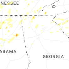


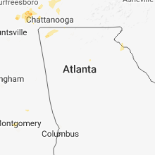


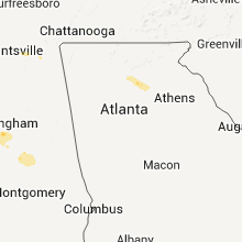


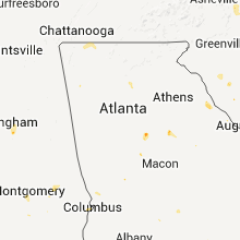


Connect with Interactive Hail Maps