

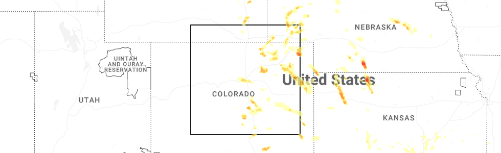
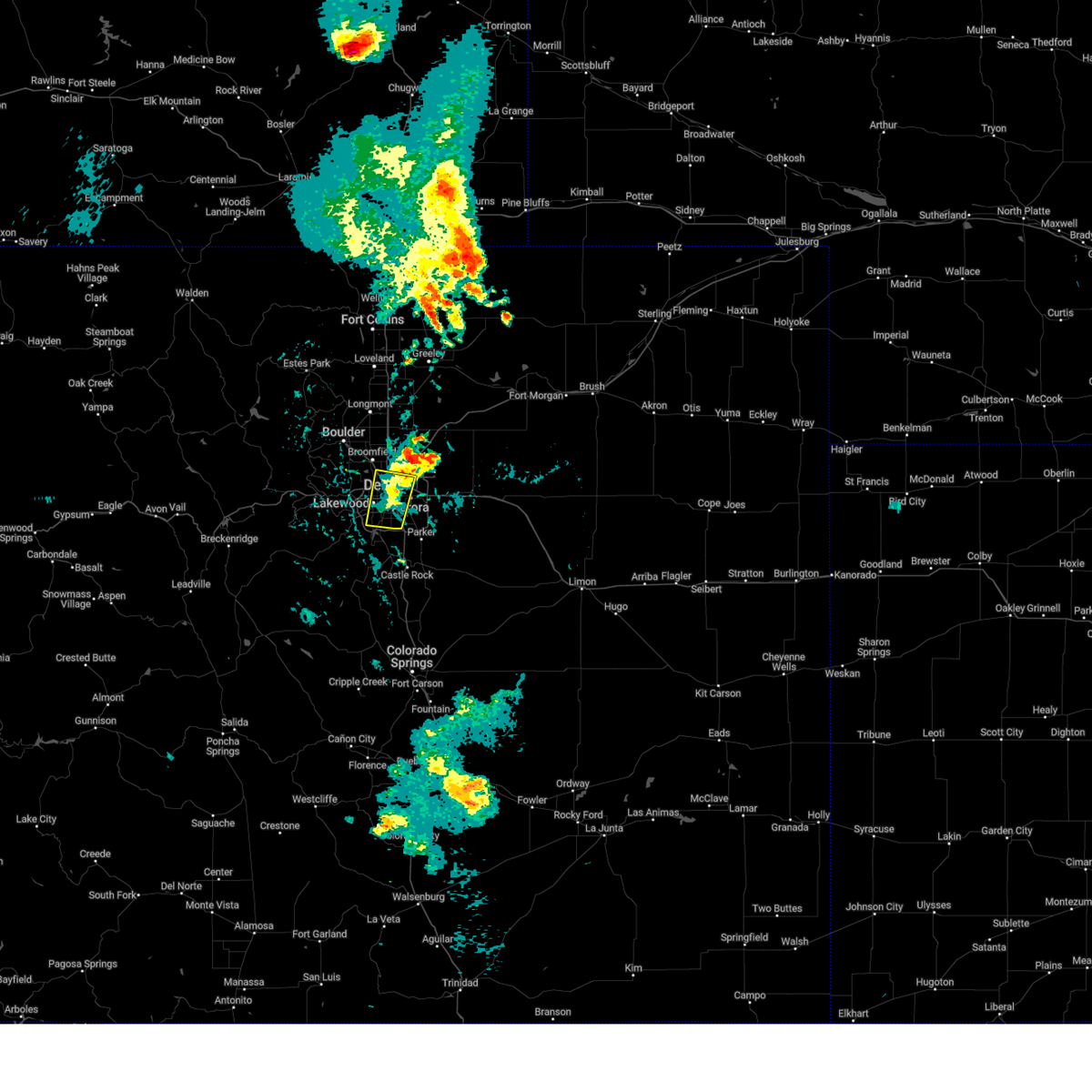
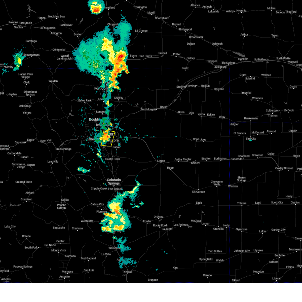
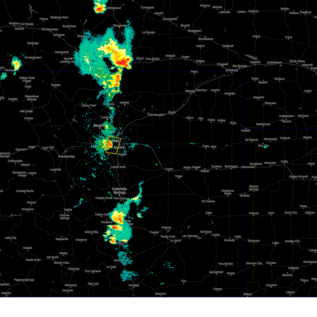
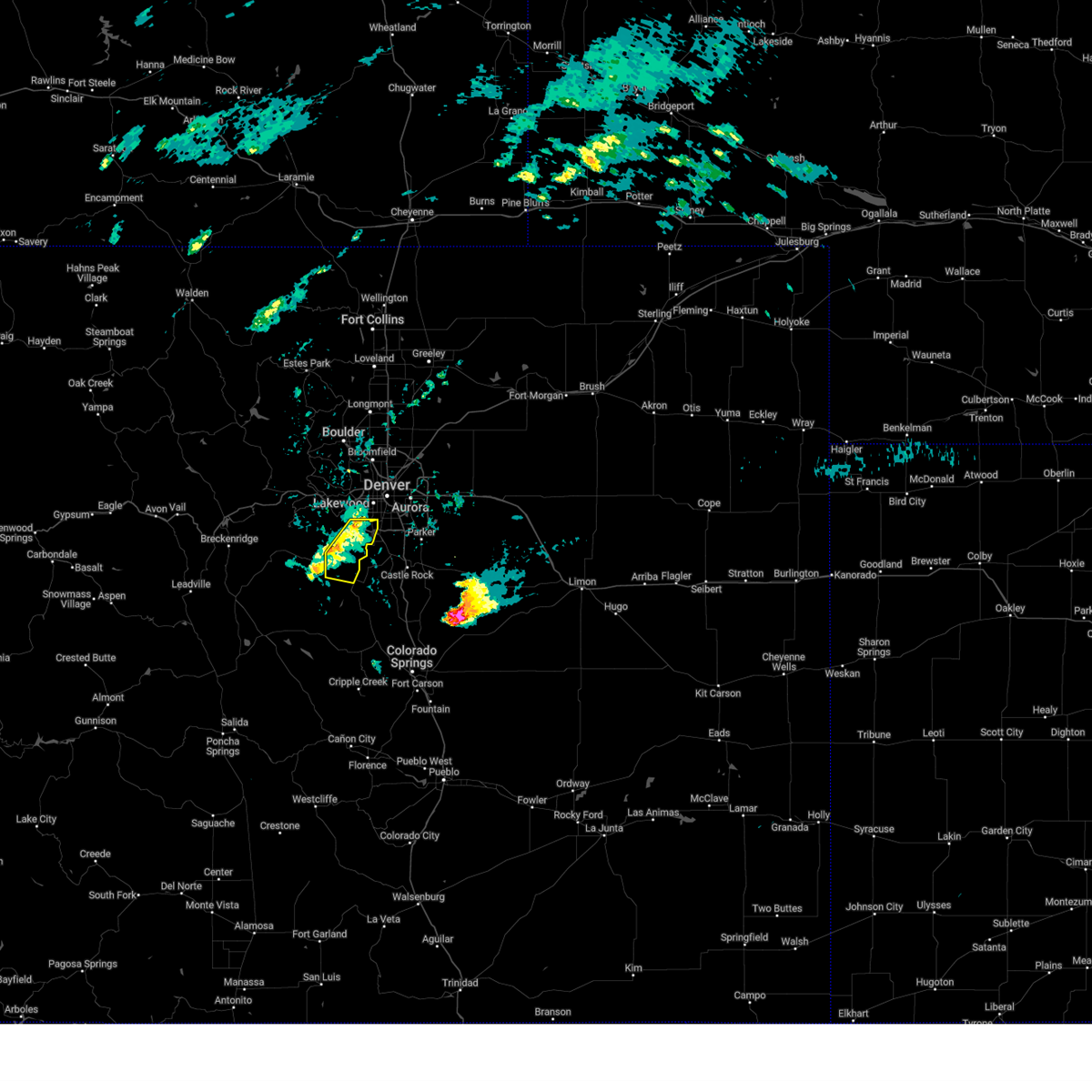
Hail Map for Dakota Ridge, CO
The Dakota Ridge, CO area has had 0 reports of on-the-ground hail by trained spotters, and has been under severe weather warnings 4 times during the past 12 months. Doppler radar has detected hail at or near Dakota Ridge, CO on 68 occasions, including 2 occasions during the past year.
| Name: | Dakota Ridge, CO |
| Where Located: | 11.7 miles SW of Denver, CO |
| Map: | Google Map for Dakota Ridge, CO |
| Population: | 32005 |
| Housing Units: | 12334 |
| More Info: | Search Google for Dakota Ridge, CO |
0
The Top Recent Hail Date for Dakota Ridge, CO is Sunday, July 6, 2025 (44th out of 68)
Hail and Wind Damage Spotted near Dakota Ridge, CO
| Date / Time | Report Details |
|---|---|
| 6/1/2025 5:10 PM MDT |
 The storm which prompted the warning has weakened below severe limits, and no longer poses an immediate threat to life or property. therefore, the warning will be allowed to expire. however, small hail, gusty winds, and heavy rain are still possible with this thunderstorm. The storm which prompted the warning has weakened below severe limits, and no longer poses an immediate threat to life or property. therefore, the warning will be allowed to expire. however, small hail, gusty winds, and heavy rain are still possible with this thunderstorm.
|
| 6/1/2025 4:52 PM MDT |
 At 452 pm mdt, a severe thunderstorm was located near denver, moving east at 15 mph (radar indicated). Hazards include 60 mph wind gusts and small hail. Expect damage to roofs, siding, and trees. Locations impacted include, denver, western aurora, eastern lakewood, southwestern thornton, southeastern arvada, southern westminster, southwestern centennial, southwestern commerce city, littleton, englewood, eastern wheat ridge, greenwood village, federal heights, sheridan, cherry hills village, edgewater, mountain view, cherry creek reservoir, columbine and ken caryl. At 452 pm mdt, a severe thunderstorm was located near denver, moving east at 15 mph (radar indicated). Hazards include 60 mph wind gusts and small hail. Expect damage to roofs, siding, and trees. Locations impacted include, denver, western aurora, eastern lakewood, southwestern thornton, southeastern arvada, southern westminster, southwestern centennial, southwestern commerce city, littleton, englewood, eastern wheat ridge, greenwood village, federal heights, sheridan, cherry hills village, edgewater, mountain view, cherry creek reservoir, columbine and ken caryl.
|
| 6/1/2025 4:38 PM MDT |
 Svrbou the national weather service in denver has issued a * severe thunderstorm warning for, east central jefferson county in central colorado, southwestern adams county in northeastern colorado, western arapahoe county in northeastern colorado, denver county in northeastern colorado, * until 515 pm mdt. * at 438 pm mdt, a severe thunderstorm was located near englewood, or near denver, moving east at 15 mph (radar indicated). Hazards include 60 mph wind gusts and small hail. expect damage to roofs, siding, and trees Svrbou the national weather service in denver has issued a * severe thunderstorm warning for, east central jefferson county in central colorado, southwestern adams county in northeastern colorado, western arapahoe county in northeastern colorado, denver county in northeastern colorado, * until 515 pm mdt. * at 438 pm mdt, a severe thunderstorm was located near englewood, or near denver, moving east at 15 mph (radar indicated). Hazards include 60 mph wind gusts and small hail. expect damage to roofs, siding, and trees
|
| 5/24/2025 5:09 PM MDT |
 Svrbou the national weather service in denver has issued a * severe thunderstorm warning for, central jefferson county in central colorado, * until 600 pm mdt. * at 509 pm mdt, severe thunderstorms were located along a line from over tiny town to over bailey, or along a line from 18 miles southwest of denver to 36 miles southwest of denver, moving east at 15 mph (radar indicated). Hazards include half dollar size hail. damage to vehicles is expected Svrbou the national weather service in denver has issued a * severe thunderstorm warning for, central jefferson county in central colorado, * until 600 pm mdt. * at 509 pm mdt, severe thunderstorms were located along a line from over tiny town to over bailey, or along a line from 18 miles southwest of denver to 36 miles southwest of denver, moving east at 15 mph (radar indicated). Hazards include half dollar size hail. damage to vehicles is expected
|
| 6/14/2024 2:07 PM MDT |
 At 207 pm mdt, a severe thunderstorm was located over chatfield reservoir, or 12 miles southwest of denver, moving northeast at 30 mph (radar indicated). Hazards include quarter size hail. Damage to vehicles is expected. Locations impacted include, denver, western aurora, lakewood, southeastern arvada, southwestern centennial, northwestern highlands ranch, southwestern commerce city, littleton, englewood, eastern wheat ridge, greenwood village, roxborough park, sheridan, morrison, and chatfield reservoir. At 207 pm mdt, a severe thunderstorm was located over chatfield reservoir, or 12 miles southwest of denver, moving northeast at 30 mph (radar indicated). Hazards include quarter size hail. Damage to vehicles is expected. Locations impacted include, denver, western aurora, lakewood, southeastern arvada, southwestern centennial, northwestern highlands ranch, southwestern commerce city, littleton, englewood, eastern wheat ridge, greenwood village, roxborough park, sheridan, morrison, and chatfield reservoir.
|
| 6/14/2024 1:52 PM MDT |
 Svrbou the national weather service in denver colorado has issued a * severe thunderstorm warning for, north central douglas county in northeastern colorado, western arapahoe county in northeastern colorado, denver county in northeastern colorado, east central jefferson county in central colorado, * until 230 pm mdt. * at 152 pm mdt, a severe thunderstorm was located 6 miles northwest of roxborough park, or 19 miles southwest of denver, moving northeast at 30 mph (radar indicated). Hazards include 60 mph wind gusts and quarter size hail. Expect damage to roofs, siding, and trees. Hail damage to vehicles is expected. Svrbou the national weather service in denver colorado has issued a * severe thunderstorm warning for, north central douglas county in northeastern colorado, western arapahoe county in northeastern colorado, denver county in northeastern colorado, east central jefferson county in central colorado, * until 230 pm mdt. * at 152 pm mdt, a severe thunderstorm was located 6 miles northwest of roxborough park, or 19 miles southwest of denver, moving northeast at 30 mph (radar indicated). Hazards include 60 mph wind gusts and quarter size hail. Expect damage to roofs, siding, and trees. Hail damage to vehicles is expected.
|
| 6/7/2024 3:03 PM MDT |
 the severe thunderstorm warning has been cancelled and is no longer in effect the severe thunderstorm warning has been cancelled and is no longer in effect
|
| 6/7/2024 2:42 PM MDT |
 At 241 pm mdt, a severe thunderstorm was located over chatfield reservoir, or 14 miles southwest of denver, moving east at 30 mph (radar indicated). Hazards include 60 mph wind gusts. Expect damage to roofs, siding, and trees. Locations impacted include, southern centennial, highlands ranch, littleton, louviers, lone tree, northern castle pines, greenwood village, parker and southern aurora. At 241 pm mdt, a severe thunderstorm was located over chatfield reservoir, or 14 miles southwest of denver, moving east at 30 mph (radar indicated). Hazards include 60 mph wind gusts. Expect damage to roofs, siding, and trees. Locations impacted include, southern centennial, highlands ranch, littleton, louviers, lone tree, northern castle pines, greenwood village, parker and southern aurora.
|
| 6/7/2024 2:23 PM MDT |
 Svrbou the national weather service in denver colorado has issued a * severe thunderstorm warning for, northeastern douglas county in northeastern colorado, western arapahoe county in northeastern colorado, southwestern denver county in northeastern colorado, northeastern jefferson county in central colorado, * until 315 pm mdt. * at 223 pm mdt, a severe thunderstorm was located near aspen park, or 20 miles southwest of denver, moving east at 30 mph (radar indicated). Hazards include 60 mph wind gusts and nickel size hail. Expect damage to roofs, siding, and trees. this severe thunderstorm will be near, littleton around 230 pm mdt. highlands ranch, roxborough park, and chatfield reservoir around 235 pm mdt. Other locations in the path of this severe thunderstorm include southwestern centennial, louviers, lone tree, northern castle pines and western parker. Svrbou the national weather service in denver colorado has issued a * severe thunderstorm warning for, northeastern douglas county in northeastern colorado, western arapahoe county in northeastern colorado, southwestern denver county in northeastern colorado, northeastern jefferson county in central colorado, * until 315 pm mdt. * at 223 pm mdt, a severe thunderstorm was located near aspen park, or 20 miles southwest of denver, moving east at 30 mph (radar indicated). Hazards include 60 mph wind gusts and nickel size hail. Expect damage to roofs, siding, and trees. this severe thunderstorm will be near, littleton around 230 pm mdt. highlands ranch, roxborough park, and chatfield reservoir around 235 pm mdt. Other locations in the path of this severe thunderstorm include southwestern centennial, louviers, lone tree, northern castle pines and western parker.
|
| 4/26/2024 6:51 PM MDT |
 The storm which prompted the warning has weakened below severe limits, and no longer poses an immediate threat to life or property. therefore, the warning will be allowed to expire. however, small hail is still possible with this thunderstorm. The storm which prompted the warning has weakened below severe limits, and no longer poses an immediate threat to life or property. therefore, the warning will be allowed to expire. however, small hail is still possible with this thunderstorm.
|
| 4/26/2024 6:47 PM MDT |
 At 647 pm mdt, a severe thunderstorm was located over northern lakewood, or 9 miles west of denver, moving north at 20 mph (radar indicated). Hazards include quarter size hail. Damage to vehicles is expected. Locations impacted include, northeastern lakewood, southern wheat ridge and northern golden. At 647 pm mdt, a severe thunderstorm was located over northern lakewood, or 9 miles west of denver, moving north at 20 mph (radar indicated). Hazards include quarter size hail. Damage to vehicles is expected. Locations impacted include, northeastern lakewood, southern wheat ridge and northern golden.
|
| 4/26/2024 6:22 PM MDT |
 Svrbou the national weather service in denver colorado has issued a * severe thunderstorm warning for, southwestern denver county in northeastern colorado, northeastern jefferson county in central colorado, * until 700 pm mdt. * at 620 pm mdt, a severe thunderstorm was located near morrison, or 13 miles southwest of denver, moving north at 20 mph (radar indicated). Hazards include quarter size hail. Damage to vehicles is expected. this severe thunderstorm will be near, southwestern denver, lakewood, morrison, and red rocks park around 625 pm mdt. eastern golden around 630 pm mdt. Southern wheat ridge around 635 pm mdt. Svrbou the national weather service in denver colorado has issued a * severe thunderstorm warning for, southwestern denver county in northeastern colorado, northeastern jefferson county in central colorado, * until 700 pm mdt. * at 620 pm mdt, a severe thunderstorm was located near morrison, or 13 miles southwest of denver, moving north at 20 mph (radar indicated). Hazards include quarter size hail. Damage to vehicles is expected. this severe thunderstorm will be near, southwestern denver, lakewood, morrison, and red rocks park around 625 pm mdt. eastern golden around 630 pm mdt. Southern wheat ridge around 635 pm mdt.
|
| 8/2/2023 8:42 PM MDT |
 At 841 pm mdt, severe thunderstorms were located along a line extending from westminster to aurora to near elizabeth, or along a line extending from 9 miles northwest of denver to 68 miles southwest of fort morgan to 34 miles north of colorado springs, moving northeast at 35 mph (radar indicated). Hazards include 60 mph wind gusts, brief heavy rain and small hail. Expect damage to roofs, siding, and trees. locations impacted include, aurora, federal heights, buckley sfb, arapahoe park, southeastern westminster, northglenn, thornton, brighton, commerce city, todd creek and southwestern denver international airport. hail threat, radar indicated max hail size, <. 75 in wind threat, observed max wind gust, 60 mph. At 841 pm mdt, severe thunderstorms were located along a line extending from westminster to aurora to near elizabeth, or along a line extending from 9 miles northwest of denver to 68 miles southwest of fort morgan to 34 miles north of colorado springs, moving northeast at 35 mph (radar indicated). Hazards include 60 mph wind gusts, brief heavy rain and small hail. Expect damage to roofs, siding, and trees. locations impacted include, aurora, federal heights, buckley sfb, arapahoe park, southeastern westminster, northglenn, thornton, brighton, commerce city, todd creek and southwestern denver international airport. hail threat, radar indicated max hail size, <. 75 in wind threat, observed max wind gust, 60 mph.
|
| 8/2/2023 8:18 PM MDT |
 At 817 pm mdt, severe thunderstorms were located along a line extending from near red rocks park to near louviers to near greenland, or along a line extending from 14 miles west of denver to 82 miles southwest of fort morgan to 24 miles north of colorado springs, moving northeast at 35 mph (radar indicated). Hazards include 60 mph wind gusts and penny size hail. Expect damage to roofs, siding, and trees. severe thunderstorms will be near, highlands ranch and castle pines around 825 pm mdt. littleton, wheat ridge and lone tree around 830 pm mdt. southeastern arvada, centennial, parker and greenwood village around 835 pm mdt. other locations in the path of these severe thunderstorms include aurora, franktown, federal heights, elizabeth, the pinery, northglenn, buckley sfb, ponderosa park, arapahoe park, southeastern westminster, thornton, commerce city, brighton and todd creek. hail threat, radar indicated max hail size, 0. 75 in wind threat, radar indicated max wind gust, 60 mph. At 817 pm mdt, severe thunderstorms were located along a line extending from near red rocks park to near louviers to near greenland, or along a line extending from 14 miles west of denver to 82 miles southwest of fort morgan to 24 miles north of colorado springs, moving northeast at 35 mph (radar indicated). Hazards include 60 mph wind gusts and penny size hail. Expect damage to roofs, siding, and trees. severe thunderstorms will be near, highlands ranch and castle pines around 825 pm mdt. littleton, wheat ridge and lone tree around 830 pm mdt. southeastern arvada, centennial, parker and greenwood village around 835 pm mdt. other locations in the path of these severe thunderstorms include aurora, franktown, federal heights, elizabeth, the pinery, northglenn, buckley sfb, ponderosa park, arapahoe park, southeastern westminster, thornton, commerce city, brighton and todd creek. hail threat, radar indicated max hail size, 0. 75 in wind threat, radar indicated max wind gust, 60 mph.
|
| 7/20/2023 4:01 PM MDT |
 At 359 pm mdt, a severe thunderstorm was located over southwestern lakewood, or 12 miles southwest of denver, moving southeast at 30 mph (radar indicated). Hazards include half dollar size hail. Damage to vehicles is expected. this severe thunderstorm will be near, englewood and sheridan around 410 pm mdt. littleton and chatfield reservoir around 415 pm mdt. other locations in the path of this severe thunderstorm include roxborough park, centennial, highlands ranch, louviers, lone tree, sedalia, castle pines and western parker. hail threat, radar indicated max hail size, 1. 25 in wind threat, radar indicated max wind gust, <50 mph. At 359 pm mdt, a severe thunderstorm was located over southwestern lakewood, or 12 miles southwest of denver, moving southeast at 30 mph (radar indicated). Hazards include half dollar size hail. Damage to vehicles is expected. this severe thunderstorm will be near, englewood and sheridan around 410 pm mdt. littleton and chatfield reservoir around 415 pm mdt. other locations in the path of this severe thunderstorm include roxborough park, centennial, highlands ranch, louviers, lone tree, sedalia, castle pines and western parker. hail threat, radar indicated max hail size, 1. 25 in wind threat, radar indicated max wind gust, <50 mph.
|
| 7/8/2023 3:47 PM MDT |
 At 346 pm mdt, a severe thunderstorm was located over southeastern littleton, or 11 miles south of denver, moving southeast at 30 mph (radar indicated. spotters have reported quarter sized hail with this storm). Hazards include golf ball size hail. People and animals outdoors will be injured. expect damage to roofs, siding, windows, and vehicles. this severe storm will be near, louviers around 350 pm mdt. other locations in the path of this severe thunderstorm include highlands ranch, greenwood village, sedalia, southwestern centennial, lone tree, castle pines and northwestern parker. thunderstorm damage threat, considerable hail threat, radar indicated max hail size, 1. 75 in wind threat, radar indicated max wind gust, <50 mph. At 346 pm mdt, a severe thunderstorm was located over southeastern littleton, or 11 miles south of denver, moving southeast at 30 mph (radar indicated. spotters have reported quarter sized hail with this storm). Hazards include golf ball size hail. People and animals outdoors will be injured. expect damage to roofs, siding, windows, and vehicles. this severe storm will be near, louviers around 350 pm mdt. other locations in the path of this severe thunderstorm include highlands ranch, greenwood village, sedalia, southwestern centennial, lone tree, castle pines and northwestern parker. thunderstorm damage threat, considerable hail threat, radar indicated max hail size, 1. 75 in wind threat, radar indicated max wind gust, <50 mph.
|
| 7/8/2023 3:33 PM MDT |
 At 333 pm mdt, a severe thunderstorm was located near morrison, or 12 miles southwest of denver, moving southeast at 25 mph (radar indicated). Hazards include quarter size hail. Damage to vehicles is expected. this severe thunderstorm will be near, southern englewood and sheridan around 340 pm mdt. littleton and chatfield reservoir around 345 pm mdt. roxborough park around 350 pm mdt. other locations in the path of this severe thunderstorm include highlands ranch, louviers, southwestern centennial, sedalia, lone tree, castle pines and northwestern parker. hail threat, radar indicated max hail size, 1. 00 in wind threat, radar indicated max wind gust, <50 mph. At 333 pm mdt, a severe thunderstorm was located near morrison, or 12 miles southwest of denver, moving southeast at 25 mph (radar indicated). Hazards include quarter size hail. Damage to vehicles is expected. this severe thunderstorm will be near, southern englewood and sheridan around 340 pm mdt. littleton and chatfield reservoir around 345 pm mdt. roxborough park around 350 pm mdt. other locations in the path of this severe thunderstorm include highlands ranch, louviers, southwestern centennial, sedalia, lone tree, castle pines and northwestern parker. hail threat, radar indicated max hail size, 1. 00 in wind threat, radar indicated max wind gust, <50 mph.
|
| 6/29/2023 6:21 PM MDT |
 The severe thunderstorm warning for north central douglas and east central jefferson counties will expire at 630 pm mdt, the storm which prompted the warning has weakened below severe limits, and no longer poses an immediate threat to life or property. therefore, the warning will be allowed to expire. however small hail is still possible with this thunderstorm. a tornado watch remains in effect until 900 pm mdt for central and northeastern colorado. The severe thunderstorm warning for north central douglas and east central jefferson counties will expire at 630 pm mdt, the storm which prompted the warning has weakened below severe limits, and no longer poses an immediate threat to life or property. therefore, the warning will be allowed to expire. however small hail is still possible with this thunderstorm. a tornado watch remains in effect until 900 pm mdt for central and northeastern colorado.
|
| 6/29/2023 6:07 PM MDT |
 At 607 pm mdt, a severe thunderstorm was located 5 miles northwest of roxborough park, or 20 miles southwest of denver, moving northeast at 25 mph (radar indicated). Hazards include quarter size hail. Damage to vehicles is expected. locations impacted include, southeastern lakewood, western highlands ranch, western littleton, roxborough park, chatfield reservoir, louviers, south platte and sedalia. hail threat, radar indicated max hail size, 1. 00 in wind threat, radar indicated max wind gust, <50 mph. At 607 pm mdt, a severe thunderstorm was located 5 miles northwest of roxborough park, or 20 miles southwest of denver, moving northeast at 25 mph (radar indicated). Hazards include quarter size hail. Damage to vehicles is expected. locations impacted include, southeastern lakewood, western highlands ranch, western littleton, roxborough park, chatfield reservoir, louviers, south platte and sedalia. hail threat, radar indicated max hail size, 1. 00 in wind threat, radar indicated max wind gust, <50 mph.
|
| 6/29/2023 5:42 PM MDT |
 At 542 pm mdt, a severe thunderstorm was located near pine grove, or 27 miles southwest of denver, moving northeast at 25 mph (radar indicated). Hazards include half dollar size hail. damage to vehicles is expected At 542 pm mdt, a severe thunderstorm was located near pine grove, or 27 miles southwest of denver, moving northeast at 25 mph (radar indicated). Hazards include half dollar size hail. damage to vehicles is expected
|
| 6/29/2023 3:55 PM MDT |
 The severe thunderstorm warning for southwestern denver and northeastern jefferson counties will expire at 400 pm mdt, the storm which prompted the warning has moved out of the area. therefore, the warning will be allowed to expire. a tornado watch remains in effect until 900 pm mdt for central and northeastern colorado. The severe thunderstorm warning for southwestern denver and northeastern jefferson counties will expire at 400 pm mdt, the storm which prompted the warning has moved out of the area. therefore, the warning will be allowed to expire. a tornado watch remains in effect until 900 pm mdt for central and northeastern colorado.
|
| 6/29/2023 3:39 PM MDT |
 At 337 pm mdt, a severe thunderstorm was located over southern lakewood, or 11 miles southwest of denver, moving northeast at 20 mph (trained weather spotters. at 3:33 pm quarter size hail was reported 3 ese of morrison). Hazards include quarter size hail. Damage to vehicles is expected. locations impacted include, western denver, lakewood, southeastern arvada, southern westminster, northern englewood, wheat ridge, golden, sheridan, morrison and red rocks park. hail threat, observed max hail size, 1. 00 in wind threat, radar indicated max wind gust, <50 mph. At 337 pm mdt, a severe thunderstorm was located over southern lakewood, or 11 miles southwest of denver, moving northeast at 20 mph (trained weather spotters. at 3:33 pm quarter size hail was reported 3 ese of morrison). Hazards include quarter size hail. Damage to vehicles is expected. locations impacted include, western denver, lakewood, southeastern arvada, southern westminster, northern englewood, wheat ridge, golden, sheridan, morrison and red rocks park. hail threat, observed max hail size, 1. 00 in wind threat, radar indicated max wind gust, <50 mph.
|
| 6/29/2023 3:17 PM MDT |
 At 317 pm mdt, a severe thunderstorm was located over red rocks park, or 14 miles west of denver, moving northeast at 10 mph (radar indicated). Hazards include quarter size hail. damage to vehicles is expected At 317 pm mdt, a severe thunderstorm was located over red rocks park, or 14 miles west of denver, moving northeast at 10 mph (radar indicated). Hazards include quarter size hail. damage to vehicles is expected
|
| 6/22/2023 8:25 PM MDT |
 At 825 pm mdt, a severe thunderstorm was located near aspen park, or 20 miles southwest of denver, moving east at 30 mph (radar indicated). Hazards include quarter size hail. Damage to vehicles is expected. this severe thunderstorm will be near, morrison around 835 pm mdt. roxborough park around 840 pm mdt. southeastern lakewood and chatfield reservoir around 845 pm mdt. other locations in the path of this severe thunderstorm include louviers, littleton, englewood, sheridan, southwestern centennial and highlands ranch. hail threat, radar indicated max hail size, 1. 00 in wind threat, radar indicated max wind gust, <50 mph. At 825 pm mdt, a severe thunderstorm was located near aspen park, or 20 miles southwest of denver, moving east at 30 mph (radar indicated). Hazards include quarter size hail. Damage to vehicles is expected. this severe thunderstorm will be near, morrison around 835 pm mdt. roxborough park around 840 pm mdt. southeastern lakewood and chatfield reservoir around 845 pm mdt. other locations in the path of this severe thunderstorm include louviers, littleton, englewood, sheridan, southwestern centennial and highlands ranch. hail threat, radar indicated max hail size, 1. 00 in wind threat, radar indicated max wind gust, <50 mph.
|
| 6/22/2023 3:15 PM MDT |
 At 314 pm mdt, a severe thunderstorm was located over southwestern denver, moving east at 10 mph (trained weather spotters). Hazards include tennis ball size hail. People and animals outdoors will be injured. expect damage to roofs, siding, windows, and vehicles. this severe thunderstorm will be near, chatfield reservoir around 325 pm mdt. englewood and sheridan around 330 pm mdt. other locations in the path of this severe thunderstorm include littleton, louviers, highlands ranch, southwestern aurora, centennial, greenwood village, lone tree and northwestern castle pines. thunderstorm damage threat, considerable hail threat, radar indicated max hail size, 2. 50 in wind threat, radar indicated max wind gust, <50 mph. At 314 pm mdt, a severe thunderstorm was located over southwestern denver, moving east at 10 mph (trained weather spotters). Hazards include tennis ball size hail. People and animals outdoors will be injured. expect damage to roofs, siding, windows, and vehicles. this severe thunderstorm will be near, chatfield reservoir around 325 pm mdt. englewood and sheridan around 330 pm mdt. other locations in the path of this severe thunderstorm include littleton, louviers, highlands ranch, southwestern aurora, centennial, greenwood village, lone tree and northwestern castle pines. thunderstorm damage threat, considerable hail threat, radar indicated max hail size, 2. 50 in wind threat, radar indicated max wind gust, <50 mph.
|
| 6/22/2023 3:01 PM MDT |
 At 300 pm mdt, a severe thunderstorm was located over southwestern lakewood, or 10 miles west of denver, moving east at 10 mph. this is a destructive storm for southern denver metro area (trained weather spotters). Hazards include baseball size hail. People and animals outdoors will be severely injured. expect shattered windows, extensive damage to roofs, siding, and vehicles. this severe thunderstorm will be near, southern wheat ridge around 310 pm mdt. lakewood around 315 pm mdt. Other locations in the path of this severe thunderstorm include littleton, englewood, sheridan, western centennial and greenwood village. At 300 pm mdt, a severe thunderstorm was located over southwestern lakewood, or 10 miles west of denver, moving east at 10 mph. this is a destructive storm for southern denver metro area (trained weather spotters). Hazards include baseball size hail. People and animals outdoors will be severely injured. expect shattered windows, extensive damage to roofs, siding, and vehicles. this severe thunderstorm will be near, southern wheat ridge around 310 pm mdt. lakewood around 315 pm mdt. Other locations in the path of this severe thunderstorm include littleton, englewood, sheridan, western centennial and greenwood village.
|
| 6/22/2023 2:53 PM MDT |
 At 252 pm mdt, a severe thunderstorm was located over southwestern lakewood, or 12 miles southwest of denver, moving east at 15 mph. this is a destructive storm for southern metro denver (trained weather spotters). Hazards include baseball size hail. People and animals outdoors will be severely injured. expect shattered windows, extensive damage to roofs, siding, and vehicles. locations impacted include, southwestern denver, lakewood, northern littleton, western englewood, sheridan, morrison, tiny town, red rocks park and indian hills. thunderstorm damage threat, destructive hail threat, radar indicated max hail size, 2. 75 in wind threat, radar indicated max wind gust, <50 mph. At 252 pm mdt, a severe thunderstorm was located over southwestern lakewood, or 12 miles southwest of denver, moving east at 15 mph. this is a destructive storm for southern metro denver (trained weather spotters). Hazards include baseball size hail. People and animals outdoors will be severely injured. expect shattered windows, extensive damage to roofs, siding, and vehicles. locations impacted include, southwestern denver, lakewood, northern littleton, western englewood, sheridan, morrison, tiny town, red rocks park and indian hills. thunderstorm damage threat, destructive hail threat, radar indicated max hail size, 2. 75 in wind threat, radar indicated max wind gust, <50 mph.
|
| 6/22/2023 2:45 PM MDT |
 At 245 pm mdt, a severe thunderstorm was located over morrison, or 14 miles west of denver, moving east at 15 mph (radar indicated). Hazards include two inch hail. People and animals outdoors will be injured. Expect damage to roofs, siding, windows, and vehicles. At 245 pm mdt, a severe thunderstorm was located over morrison, or 14 miles west of denver, moving east at 15 mph (radar indicated). Hazards include two inch hail. People and animals outdoors will be injured. Expect damage to roofs, siding, windows, and vehicles.
|
| 6/22/2023 2:21 PM MDT |
 At 221 pm mdt, a severe thunderstorm was located over idledale, or 16 miles west of denver, moving east at 10 mph (trained weather spotters). Hazards include golf ball size hail. People and animals outdoors will be injured. expect damage to roofs, siding, windows, and vehicles. this severe storm will be near, golden and red rocks park around 235 pm mdt. other locations in the path of this severe thunderstorm include morrison, lakewood, northern englewood and wheat ridge. thunderstorm damage threat, considerable hail threat, radar indicated max hail size, 1. 75 in wind threat, radar indicated max wind gust, <50 mph. At 221 pm mdt, a severe thunderstorm was located over idledale, or 16 miles west of denver, moving east at 10 mph (trained weather spotters). Hazards include golf ball size hail. People and animals outdoors will be injured. expect damage to roofs, siding, windows, and vehicles. this severe storm will be near, golden and red rocks park around 235 pm mdt. other locations in the path of this severe thunderstorm include morrison, lakewood, northern englewood and wheat ridge. thunderstorm damage threat, considerable hail threat, radar indicated max hail size, 1. 75 in wind threat, radar indicated max wind gust, <50 mph.
|
| 6/22/2023 2:15 PM MDT |
 At 215 pm mdt, a severe thunderstorm was located over southwestern golden, or 15 miles west of denver, moving east at 15 mph (radar indicated). Hazards include quarter size hail. Damage to vehicles is expected. this severe thunderstorm will be near, golden around 225 pm mdt. other locations in the path of this severe thunderstorm include lakewood, wheat ridge, southeastern arvada and northern englewood. hail threat, radar indicated max hail size, 1. 00 in wind threat, radar indicated max wind gust, <50 mph. At 215 pm mdt, a severe thunderstorm was located over southwestern golden, or 15 miles west of denver, moving east at 15 mph (radar indicated). Hazards include quarter size hail. Damage to vehicles is expected. this severe thunderstorm will be near, golden around 225 pm mdt. other locations in the path of this severe thunderstorm include lakewood, wheat ridge, southeastern arvada and northern englewood. hail threat, radar indicated max hail size, 1. 00 in wind threat, radar indicated max wind gust, <50 mph.
|
| 6/21/2023 11:50 PM MDT |
 The severe thunderstorm warning for central jefferson county will expire at midnight mdt, the storm which prompted the warning has weakened below severe limits, and no longer poses an immediate threat to life or property. therefore, the warning will be allowed to expire. however small hail and heavy rain are still possible with this thunderstorm. a severe thunderstorm watch remains in effect until 400 am mdt for central and northeastern colorado. The severe thunderstorm warning for central jefferson county will expire at midnight mdt, the storm which prompted the warning has weakened below severe limits, and no longer poses an immediate threat to life or property. therefore, the warning will be allowed to expire. however small hail and heavy rain are still possible with this thunderstorm. a severe thunderstorm watch remains in effect until 400 am mdt for central and northeastern colorado.
|
| 6/21/2023 11:35 PM MDT |
 At 1134 pm mdt, a severe thunderstorm was located over conifer, or 24 miles southwest of denver, moving east at 15 mph (radar indicated). Hazards include quarter size hail. damage to vehicles is expected At 1134 pm mdt, a severe thunderstorm was located over conifer, or 24 miles southwest of denver, moving east at 15 mph (radar indicated). Hazards include quarter size hail. damage to vehicles is expected
|
| 6/21/2023 9:56 PM MDT |
 The severe thunderstorm warning for west central arapahoe, southwestern denver and northeastern jefferson counties will expire at 1000 pm mdt, the storm which prompted the warning has moved out of the area. therefore, the warning will be allowed to expire. however small hail and heavy rain are still possible with this thunderstorm. a severe thunderstorm watch remains in effect until 1000 pm mdt for central and northeastern colorado. The severe thunderstorm warning for west central arapahoe, southwestern denver and northeastern jefferson counties will expire at 1000 pm mdt, the storm which prompted the warning has moved out of the area. therefore, the warning will be allowed to expire. however small hail and heavy rain are still possible with this thunderstorm. a severe thunderstorm watch remains in effect until 1000 pm mdt for central and northeastern colorado.
|
| 6/21/2023 9:42 PM MDT |
 At 941 pm mdt, a severe thunderstorm was located near lakewood, or 10 miles southwest of denver, moving east at 20 mph (trained weather spotters reported golf ball size hail at red rocks amphitheater). Hazards include golf ball size hail and 60 mph wind gusts. Expect damage to roofs, siding, and trees. people and animals outdoors will be injured. expect hail damage to roofs, siding, windows, and vehicles. locations impacted include, northeastern littleton, englewood, sheridan, western centennial and greenwood village. thunderstorm damage threat, considerable hail threat, radar indicated max hail size, 1. 75 in wind threat, radar indicated max wind gust, 60 mph. At 941 pm mdt, a severe thunderstorm was located near lakewood, or 10 miles southwest of denver, moving east at 20 mph (trained weather spotters reported golf ball size hail at red rocks amphitheater). Hazards include golf ball size hail and 60 mph wind gusts. Expect damage to roofs, siding, and trees. people and animals outdoors will be injured. expect hail damage to roofs, siding, windows, and vehicles. locations impacted include, northeastern littleton, englewood, sheridan, western centennial and greenwood village. thunderstorm damage threat, considerable hail threat, radar indicated max hail size, 1. 75 in wind threat, radar indicated max wind gust, 60 mph.
|
| 6/21/2023 9:20 PM MDT |
 At 920 pm mdt, a severe thunderstorm was located over indian hills, or 15 miles west of denver, moving east at 20 mph (trained weather spotters). Hazards include golf ball size hail and 60 mph wind gusts. Expect damage to roofs, siding, and trees. people and animals outdoors will be injured. expect hail damage to roofs, siding, windows, and vehicles. this severe thunderstorm will be near, morrison around 930 pm mdt. other locations in the path of this severe thunderstorm include lakewood, sheridan, southwestern centennial, northwestern highlands ranch, littleton, englewood and greenwood village. thunderstorm damage threat, considerable hail threat, radar indicated max hail size, 1. 75 in wind threat, radar indicated max wind gust, 60 mph. At 920 pm mdt, a severe thunderstorm was located over indian hills, or 15 miles west of denver, moving east at 20 mph (trained weather spotters). Hazards include golf ball size hail and 60 mph wind gusts. Expect damage to roofs, siding, and trees. people and animals outdoors will be injured. expect hail damage to roofs, siding, windows, and vehicles. this severe thunderstorm will be near, morrison around 930 pm mdt. other locations in the path of this severe thunderstorm include lakewood, sheridan, southwestern centennial, northwestern highlands ranch, littleton, englewood and greenwood village. thunderstorm damage threat, considerable hail threat, radar indicated max hail size, 1. 75 in wind threat, radar indicated max wind gust, 60 mph.
|
| 5/10/2023 3:12 PM MDT |
 At 311 pm mdt, a severe thunderstorm capable of producing a tornado was located over louviers, or 16 miles south of denver, moving northeast at 30 mph (radar indicated rotation). Hazards include tornado and half dollar size hail. Flying debris will be dangerous to those caught without shelter. mobile homes will be damaged or destroyed. damage to roofs, windows, and vehicles will occur. tree damage is likely. Locations impacted include, chatfield reservoir, castle pines, highlands ranch, lone tree, southern centennial and southern littleton. At 311 pm mdt, a severe thunderstorm capable of producing a tornado was located over louviers, or 16 miles south of denver, moving northeast at 30 mph (radar indicated rotation). Hazards include tornado and half dollar size hail. Flying debris will be dangerous to those caught without shelter. mobile homes will be damaged or destroyed. damage to roofs, windows, and vehicles will occur. tree damage is likely. Locations impacted include, chatfield reservoir, castle pines, highlands ranch, lone tree, southern centennial and southern littleton.
|
| 5/10/2023 2:56 PM MDT |
 At 255 pm mdt, a severe thunderstorm capable of producing a tornado was located over sprucewood, or 25 miles south of denver, moving northeast at 35 mph (radar indicated rotation). Hazards include tornado and half dollar size hail. Flying debris will be dangerous to those caught without shelter. mobile homes will be damaged or destroyed. damage to roofs, windows, and vehicles will occur. tree damage is likely. this dangerous storm will be near, roxborough park and sedalia around 310 pm mdt. louviers around 315 pm mdt. Other locations in the path of this tornadic thunderstorm include chatfield reservoir, castle pines, highlands ranch, lone tree, southern centennial and southern littleton. At 255 pm mdt, a severe thunderstorm capable of producing a tornado was located over sprucewood, or 25 miles south of denver, moving northeast at 35 mph (radar indicated rotation). Hazards include tornado and half dollar size hail. Flying debris will be dangerous to those caught without shelter. mobile homes will be damaged or destroyed. damage to roofs, windows, and vehicles will occur. tree damage is likely. this dangerous storm will be near, roxborough park and sedalia around 310 pm mdt. louviers around 315 pm mdt. Other locations in the path of this tornadic thunderstorm include chatfield reservoir, castle pines, highlands ranch, lone tree, southern centennial and southern littleton.
|
| 7/27/2022 11:52 PM MDT |
 The severe thunderstorm warning for north central douglas, southwestern arapahoe, southwestern denver and east central jefferson counties will expire at midnight mdt, the storm which prompted the warning has weakened below severe limits, and no longer poses an immediate threat to life or property. therefore, the warning will be allowed to expire. however heavy rain is still possible with this thunderstorm. The severe thunderstorm warning for north central douglas, southwestern arapahoe, southwestern denver and east central jefferson counties will expire at midnight mdt, the storm which prompted the warning has weakened below severe limits, and no longer poses an immediate threat to life or property. therefore, the warning will be allowed to expire. however heavy rain is still possible with this thunderstorm.
|
| 7/27/2022 11:27 PM MDT |
 At 1127 pm mdt, a severe thunderstorm was located over chatfield reservoir, or 13 miles southwest of denver, moving east at 15 mph (radar indicated). Hazards include 60 mph wind gusts and quarter size hail. Expect damage to roofs, siding, and trees. hail damage to vehicles is expected. this severe thunderstorm will be near, littleton and sheridan around 1145 pm mdt. other locations in the path of this severe thunderstorm include louviers, sedalia, centennial, highlands ranch, greenwood village, lone tree and castle pines. hail threat, radar indicated max hail size, 1. 00 in wind threat, radar indicated max wind gust, 60 mph. At 1127 pm mdt, a severe thunderstorm was located over chatfield reservoir, or 13 miles southwest of denver, moving east at 15 mph (radar indicated). Hazards include 60 mph wind gusts and quarter size hail. Expect damage to roofs, siding, and trees. hail damage to vehicles is expected. this severe thunderstorm will be near, littleton and sheridan around 1145 pm mdt. other locations in the path of this severe thunderstorm include louviers, sedalia, centennial, highlands ranch, greenwood village, lone tree and castle pines. hail threat, radar indicated max hail size, 1. 00 in wind threat, radar indicated max wind gust, 60 mph.
|
| 7/26/2022 5:42 PM MDT |
 The severe thunderstorm warning for northwestern douglas, southwestern arapahoe, southwestern denver and east central jefferson counties will expire at 545 pm mdt, the storm which prompted the warning has weakened below severe limits, and no longer poses an immediate threat to life or property. therefore, the warning will be allowed to expire. however heavy rain is still likely with this thunderstorm. The severe thunderstorm warning for northwestern douglas, southwestern arapahoe, southwestern denver and east central jefferson counties will expire at 545 pm mdt, the storm which prompted the warning has weakened below severe limits, and no longer poses an immediate threat to life or property. therefore, the warning will be allowed to expire. however heavy rain is still likely with this thunderstorm.
|
| 7/26/2022 5:15 PM MDT |
 At 514 pm mdt, a severe thunderstorm was located near morrison, or 13 miles southwest of denver, moving east at 15 mph (radar indicated). Hazards include 60 mph wind gusts and quarter size hail. Expect damage to roofs, siding, and trees. hail damage to vegetation is expected. this severe thunderstorm will be near, southern lakewood around 530 pm mdt. other locations in the path of this severe thunderstorm include chatfield reservoir, northwestern highlands ranch, littleton, englewood and sheridan. hail threat, radar indicated max hail size, 1. 00 in wind threat, radar indicated max wind gust, 60 mph. At 514 pm mdt, a severe thunderstorm was located near morrison, or 13 miles southwest of denver, moving east at 15 mph (radar indicated). Hazards include 60 mph wind gusts and quarter size hail. Expect damage to roofs, siding, and trees. hail damage to vegetation is expected. this severe thunderstorm will be near, southern lakewood around 530 pm mdt. other locations in the path of this severe thunderstorm include chatfield reservoir, northwestern highlands ranch, littleton, englewood and sheridan. hail threat, radar indicated max hail size, 1. 00 in wind threat, radar indicated max wind gust, 60 mph.
|
| 6/24/2020 6:58 PM MDT |
 At 657 pm mdt, strong and damaging outflow from a thunderstorm was located over northeastern denver, moving east at 40 mph (radar indicated). Hazards include 60 mph wind gusts. expect damage to roofs, siding, and trees At 657 pm mdt, strong and damaging outflow from a thunderstorm was located over northeastern denver, moving east at 40 mph (radar indicated). Hazards include 60 mph wind gusts. expect damage to roofs, siding, and trees
|
| 6/6/2020 3:46 PM MDT |
 At 342 pm mdt, severe thunderstorms were located along a line extending from 3 miles north of drake to near aspen springs to 7 miles west of elevenmile canyon reservoir, or along a line extending from 15 miles west of fort collins to 28 miles west of denver to 39 miles north of hayden pass burn scar, the storms are moving northeast at 60 mph. these are very dangerous storms (an automated weather station in lakewood recorded a peak wind gust to 70 mph at bear creek golf club in southwest lakewood). Hazards include 75 mph wind gusts. Flying debris will be dangerous to those caught without shelter. mobile homes will be heavily damaged. expect considerable damage to roofs, windows, and vehicles. extensive tree damage and power outages are likely. Locations impacted include, denver, fort collins, greeley, aurora, lakewood, thornton, arvada, westminster, centennial, boulder, longmont, loveland, broomfield, highlands ranch, castle rock, commerce city, parker, littleton, northglenn and brighton. At 342 pm mdt, severe thunderstorms were located along a line extending from 3 miles north of drake to near aspen springs to 7 miles west of elevenmile canyon reservoir, or along a line extending from 15 miles west of fort collins to 28 miles west of denver to 39 miles north of hayden pass burn scar, the storms are moving northeast at 60 mph. these are very dangerous storms (an automated weather station in lakewood recorded a peak wind gust to 70 mph at bear creek golf club in southwest lakewood). Hazards include 75 mph wind gusts. Flying debris will be dangerous to those caught without shelter. mobile homes will be heavily damaged. expect considerable damage to roofs, windows, and vehicles. extensive tree damage and power outages are likely. Locations impacted include, denver, fort collins, greeley, aurora, lakewood, thornton, arvada, westminster, centennial, boulder, longmont, loveland, broomfield, highlands ranch, castle rock, commerce city, parker, littleton, northglenn and brighton.
|
| 6/6/2020 3:03 PM MDT |
 At 303 pm mdt, severe thunderstorms were located along a line extending from 3 miles north of drake to near aspen springs to 8 miles west of elevenmile canyon reservoir, or along a line extending from 15 miles west of fort collins to 28 miles west of denver to 39 miles north of hayden pass burn scar, moving northeast at 65 mph. these are very dangerous storms (radar indicated). Hazards include 80 mph wind gusts. Flying debris will be dangerous to those caught without shelter. mobile homes will be heavily damaged. expect considerable damage to roofs, windows, and vehicles. Extensive tree damage and power outages are likely. At 303 pm mdt, severe thunderstorms were located along a line extending from 3 miles north of drake to near aspen springs to 8 miles west of elevenmile canyon reservoir, or along a line extending from 15 miles west of fort collins to 28 miles west of denver to 39 miles north of hayden pass burn scar, moving northeast at 65 mph. these are very dangerous storms (radar indicated). Hazards include 80 mph wind gusts. Flying debris will be dangerous to those caught without shelter. mobile homes will be heavily damaged. expect considerable damage to roofs, windows, and vehicles. Extensive tree damage and power outages are likely.
|
| 9/6/2019 3:26 PM MDT |
 At 325 pm mdt, a severe thunderstorm was located 5 miles southwest of chatfield reservoir, or 18 miles southwest of denver, moving east at 15 mph (radar indicated). Hazards include quarter size hail. damage to vehicles is expected At 325 pm mdt, a severe thunderstorm was located 5 miles southwest of chatfield reservoir, or 18 miles southwest of denver, moving east at 15 mph (radar indicated). Hazards include quarter size hail. damage to vehicles is expected
|
| 9/6/2019 3:13 PM MDT |
 At 312 pm mdt, a severe thunderstorm was located over southeastern lakewood, or 7 miles southwest of denver, moving east at 15 mph (trained weather spotters reported quarter sized hail 3 miles southwest of tiny town). Hazards include 60 mph wind gusts and quarter size hail. Expect damage to roofs, siding, and trees. hail damage to vehicles is expected. Locations impacted include, southwestern denver, southern lakewood, southwestern centennial, northwestern highlands ranch, littleton, southwestern englewood, greenwood village, evergreen, morrison, tiny town, chatfield reservoir, indian hills, aspen park and conifer. At 312 pm mdt, a severe thunderstorm was located over southeastern lakewood, or 7 miles southwest of denver, moving east at 15 mph (trained weather spotters reported quarter sized hail 3 miles southwest of tiny town). Hazards include 60 mph wind gusts and quarter size hail. Expect damage to roofs, siding, and trees. hail damage to vehicles is expected. Locations impacted include, southwestern denver, southern lakewood, southwestern centennial, northwestern highlands ranch, littleton, southwestern englewood, greenwood village, evergreen, morrison, tiny town, chatfield reservoir, indian hills, aspen park and conifer.
|
| 9/6/2019 2:44 PM MDT |
 At 244 pm mdt, a severe thunderstorm was located over idledale, or 13 miles west of denver, moving east at 15 mph (radar indicated). Hazards include 60 mph wind gusts and quarter size hail. Expect damage to roofs, siding, and trees. Hail damage to vehicles is expected. At 244 pm mdt, a severe thunderstorm was located over idledale, or 13 miles west of denver, moving east at 15 mph (radar indicated). Hazards include 60 mph wind gusts and quarter size hail. Expect damage to roofs, siding, and trees. Hail damage to vehicles is expected.
|
| 9/6/2019 2:30 PM MDT |
 At 202 pm mdt, a severe thunderstorm was located near floyd hill, or 21 miles west of denver, moving east at 15 mph (radar indicated). Hazards include quarter size hail. damage to vehicles is expected At 202 pm mdt, a severe thunderstorm was located near floyd hill, or 21 miles west of denver, moving east at 15 mph (radar indicated). Hazards include quarter size hail. damage to vehicles is expected
|
| 9/6/2019 2:02 PM MDT |
 At 202 pm mdt, a severe thunderstorm was located near floyd hill, or 21 miles west of denver, moving east at 15 mph (radar indicated). Hazards include quarter size hail. damage to vehicles is expected At 202 pm mdt, a severe thunderstorm was located near floyd hill, or 21 miles west of denver, moving east at 15 mph (radar indicated). Hazards include quarter size hail. damage to vehicles is expected
|
| 7/20/2019 3:37 PM MDT |
 The severe thunderstorm warning for north central douglas, western arapahoe, denver and east central jefferson counties will expire at 345 pm mdt, the storm which prompted the warning has weakened below severe limits, and no longer poses an immediate threat to life or property. therefore, the warning will be allowed to expire. a severe thunderstorm watch remains in effect until 1100 pm mdt for central and northeastern colorado. The severe thunderstorm warning for north central douglas, western arapahoe, denver and east central jefferson counties will expire at 345 pm mdt, the storm which prompted the warning has weakened below severe limits, and no longer poses an immediate threat to life or property. therefore, the warning will be allowed to expire. a severe thunderstorm watch remains in effect until 1100 pm mdt for central and northeastern colorado.
|
| 7/20/2019 3:05 PM MDT |
 At 305 pm mdt, a severe thunderstorm was located over northeastern littleton, or 8 miles south of denver, moving east at 15 mph (radar indicated). Hazards include 60 mph wind gusts and half dollar size hail. Expect damage to roofs, siding, and trees. Hail damage to vehicles is expected. At 305 pm mdt, a severe thunderstorm was located over northeastern littleton, or 8 miles south of denver, moving east at 15 mph (radar indicated). Hazards include 60 mph wind gusts and half dollar size hail. Expect damage to roofs, siding, and trees. Hail damage to vehicles is expected.
|
| 7/4/2019 5:59 PM MDT |
 At 559 pm mdt, a severe thunderstorm was located 5 miles south of tiny town, or 18 miles southwest of denver, moving northeast at 10 mph (radar indicated). Hazards include half dollar size hail. damage to vehicles is expected At 559 pm mdt, a severe thunderstorm was located 5 miles south of tiny town, or 18 miles southwest of denver, moving northeast at 10 mph (radar indicated). Hazards include half dollar size hail. damage to vehicles is expected
|
| 8/14/2018 5:39 PM MDT |
 At 538 pm mdt, a severe thunderstorm was located near lakewood, or 9 miles southwest of denver, moving southeast at 20 mph (radar indicated). Hazards include 60 mph wind gusts, quarter size hail and heavy rain. Expect damage to roofs, siding, and trees. Hail damage to vehicles is expected. At 538 pm mdt, a severe thunderstorm was located near lakewood, or 9 miles southwest of denver, moving southeast at 20 mph (radar indicated). Hazards include 60 mph wind gusts, quarter size hail and heavy rain. Expect damage to roofs, siding, and trees. Hail damage to vehicles is expected.
|
| 8/3/2018 9:26 PM MDT |
 The severe thunderstorm warning for north central douglas, broomfield, southwestern arapahoe, southeastern gilpin, southwestern denver, jefferson, west central adams and southeastern boulder counties will expire at 930 pm mdt, the winds which prompted the warning have weakened below severe limits, and no longer poses an immediate threat to life or property. therefore, the warning will be allowed to expire. however gusty winds to 50 mph are still possible with in and near the foothills. The severe thunderstorm warning for north central douglas, broomfield, southwestern arapahoe, southeastern gilpin, southwestern denver, jefferson, west central adams and southeastern boulder counties will expire at 930 pm mdt, the winds which prompted the warning have weakened below severe limits, and no longer poses an immediate threat to life or property. therefore, the warning will be allowed to expire. however gusty winds to 50 mph are still possible with in and near the foothills.
|
| 8/3/2018 9:15 PM MDT |
 At 912 pm mdt, doppler radar and reports indicate strong winds to 65 mph in and near the foothiills associated with dissipating thunderstorms over the foothills northwest of denver. wind gusts of 60 to 65 mph will remain possible with this activity over western parts of the denver metro area (radar indicated). Hazards include 60 mph wind gusts. Expect damage to roofs, siding, and trees. Locations impacted include, western denver, lakewood, southwestern thornton, arvada, westminster, southwestern centennial, boulder, broomfield, highlands ranch, northwestern castle rock, littleton, southwestern northglenn, englewood, wheat ridge, lafayette, golden, louisville, erie, greenwood village and evergreen. At 912 pm mdt, doppler radar and reports indicate strong winds to 65 mph in and near the foothiills associated with dissipating thunderstorms over the foothills northwest of denver. wind gusts of 60 to 65 mph will remain possible with this activity over western parts of the denver metro area (radar indicated). Hazards include 60 mph wind gusts. Expect damage to roofs, siding, and trees. Locations impacted include, western denver, lakewood, southwestern thornton, arvada, westminster, southwestern centennial, boulder, broomfield, highlands ranch, northwestern castle rock, littleton, southwestern northglenn, englewood, wheat ridge, lafayette, golden, louisville, erie, greenwood village and evergreen.
|
| 8/3/2018 8:39 PM MDT |
 At 839 pm mdt, doppler radar showed thunderstorms dissipating over the foothills northwest of denver. wind gusts of 60 to 65 mph will be possible with this activity as it pushes through the denver metro area (radar indicated). Hazards include 60 mph wind gusts. expect damage to roofs, siding, and trees At 839 pm mdt, doppler radar showed thunderstorms dissipating over the foothills northwest of denver. wind gusts of 60 to 65 mph will be possible with this activity as it pushes through the denver metro area (radar indicated). Hazards include 60 mph wind gusts. expect damage to roofs, siding, and trees
|
| 7/24/2018 6:00 PM MDT |
 At 559 pm mdt, a severe thunderstorm was located 4 miles northwest of chatfield reservoir, or 13 miles southwest of denver, moving east at 15 mph (radar indicated). Hazards include golf ball size hail and 60 mph wind gusts. Expect damage to roofs, siding, and trees. people and animals outdoors will be injured. expect hail damage to roofs, siding, windows, and vehicles. Locations impacted include, southwestern denver, southeastern lakewood, southwestern centennial, highlands ranch, littleton, englewood, greenwood village, roxborough park, sheridan, morrison, louviers, chatfield reservoir and sedalia. At 559 pm mdt, a severe thunderstorm was located 4 miles northwest of chatfield reservoir, or 13 miles southwest of denver, moving east at 15 mph (radar indicated). Hazards include golf ball size hail and 60 mph wind gusts. Expect damage to roofs, siding, and trees. people and animals outdoors will be injured. expect hail damage to roofs, siding, windows, and vehicles. Locations impacted include, southwestern denver, southeastern lakewood, southwestern centennial, highlands ranch, littleton, englewood, greenwood village, roxborough park, sheridan, morrison, louviers, chatfield reservoir and sedalia.
|
| 7/24/2018 5:56 PM MDT |
 At 556 pm mdt, a severe thunderstorm was located near tiny town, or 14 miles southwest of denver, moving east at 15 mph (radar indicated). Hazards include golf ball size hail. People and animals outdoors will be injured. Expect damage to roofs, siding, windows, and vehicles. At 556 pm mdt, a severe thunderstorm was located near tiny town, or 14 miles southwest of denver, moving east at 15 mph (radar indicated). Hazards include golf ball size hail. People and animals outdoors will be injured. Expect damage to roofs, siding, windows, and vehicles.
|
| 6/19/2018 12:53 PM MDT |
 At 1253 pm mdt, a severe thunderstorm was located near morrison, or 13 miles southwest of denver, moving east at 20 mph (radar indicated). Hazards include quarter size hail. damage to vehicles is expected At 1253 pm mdt, a severe thunderstorm was located near morrison, or 13 miles southwest of denver, moving east at 20 mph (radar indicated). Hazards include quarter size hail. damage to vehicles is expected
|
| 6/6/2018 8:08 PM MDT |
 At 807 pm mdt, a severe thunderstorm was located over sheridan, or 6 miles southwest of denver, moving east at 15 mph. a gust to 58 mph was reported south of ken caryl at 801 pm (radar indicated). Hazards include 60 mph wind gusts. Expect damage to roofs, siding, and trees. Locations impacted include, western denver, lakewood, southeastern arvada, southwestern centennial, highlands ranch, littleton, englewood, wheat ridge, southern golden, greenwood village, roxborough park, sheridan, morrison, chatfield reservoir and red rocks park. At 807 pm mdt, a severe thunderstorm was located over sheridan, or 6 miles southwest of denver, moving east at 15 mph. a gust to 58 mph was reported south of ken caryl at 801 pm (radar indicated). Hazards include 60 mph wind gusts. Expect damage to roofs, siding, and trees. Locations impacted include, western denver, lakewood, southeastern arvada, southwestern centennial, highlands ranch, littleton, englewood, wheat ridge, southern golden, greenwood village, roxborough park, sheridan, morrison, chatfield reservoir and red rocks park.
|
| 6/6/2018 7:55 PM MDT |
 At 754 pm mdt, a severe thunderstorm was located near morrison, or 12 miles southwest of denver, moving northeast at 5 mph. the s severe winds will precede the precipitation and last for 10 minutes or more (radar indicated). Hazards include 60 mph wind gusts. expect damage to roofs, siding, and trees At 754 pm mdt, a severe thunderstorm was located near morrison, or 12 miles southwest of denver, moving northeast at 5 mph. the s severe winds will precede the precipitation and last for 10 minutes or more (radar indicated). Hazards include 60 mph wind gusts. expect damage to roofs, siding, and trees
|
| 5/28/2018 4:54 PM MDT |
 The severe thunderstorm warning for southwestern arapahoe, southwestern denver and northeastern jefferson counties will expire at 500 pm mdt, the storm which prompted the warning has weakened below severe limits, and has exited the warned area. therefore, the warning will be allowed to expire. a severe thunderstorm watch remains in effect until 900 pm mdt for central and northeastern colorado. The severe thunderstorm warning for southwestern arapahoe, southwestern denver and northeastern jefferson counties will expire at 500 pm mdt, the storm which prompted the warning has weakened below severe limits, and has exited the warned area. therefore, the warning will be allowed to expire. a severe thunderstorm watch remains in effect until 900 pm mdt for central and northeastern colorado.
|
| 5/28/2018 4:27 PM MDT |
 At 427 pm mdt, a severe thunderstorm was located over southeastern lakewood, or 6 miles southwest of denver, moving east at 20 mph (radar indicated). Hazards include half dollar size hail. Damage to vehicles is expected. Locations impacted include, denver, lakewood, western centennial, northeastern littleton, englewood, southeastern wheat ridge, greenwood village and sheridan. At 427 pm mdt, a severe thunderstorm was located over southeastern lakewood, or 6 miles southwest of denver, moving east at 20 mph (radar indicated). Hazards include half dollar size hail. Damage to vehicles is expected. Locations impacted include, denver, lakewood, western centennial, northeastern littleton, englewood, southeastern wheat ridge, greenwood village and sheridan.
|
| 5/28/2018 4:13 PM MDT |
 At 412 pm mdt, a severe thunderstorm was located over southwestern lakewood, or 11 miles southwest of denver, moving east at 20 mph (radar indicated). Hazards include quarter size hail. damage to vehicles is expected At 412 pm mdt, a severe thunderstorm was located over southwestern lakewood, or 11 miles southwest of denver, moving east at 20 mph (radar indicated). Hazards include quarter size hail. damage to vehicles is expected
|
| 5/28/2018 3:39 PM MDT |
 A severe thunderstorm warning remains in effect until 415 pm mdt for southeastern clear creek and northern jefferson counties. at 338 pm mdt, a severe thunderstorm was located near evergreen, or 22 miles southwest of denver, moving northeast at 25 mph. hazard. quarter size hail. source. Radar indicated. A severe thunderstorm warning remains in effect until 415 pm mdt for southeastern clear creek and northern jefferson counties. at 338 pm mdt, a severe thunderstorm was located near evergreen, or 22 miles southwest of denver, moving northeast at 25 mph. hazard. quarter size hail. source. Radar indicated.
|
| 5/28/2018 3:25 PM MDT |
 At 324 pm mdt, a severe thunderstorm was located 4 miles northeast of harris park, or 28 miles southwest of denver, moving northeast at 25 mph (radar indicated). Hazards include quarter size hail. damage to vehicles is expected At 324 pm mdt, a severe thunderstorm was located 4 miles northeast of harris park, or 28 miles southwest of denver, moving northeast at 25 mph (radar indicated). Hazards include quarter size hail. damage to vehicles is expected
|
| 8/10/2017 3:46 PM MDT |
 At 345 pm mdt, a severe thunderstorm was located over northeastern lakewood, or 6 miles west of denver, moving southeast at 30 mph (radar indicated). Hazards include quarter size hail. Damage to vehicles is expected. Locations impacted include, denver, western aurora, lakewood, southeastern arvada, southwestern centennial, northwestern highlands ranch, southwestern commerce city, littleton, englewood, wheat ridge, southern golden, greenwood village and sheridan. At 345 pm mdt, a severe thunderstorm was located over northeastern lakewood, or 6 miles west of denver, moving southeast at 30 mph (radar indicated). Hazards include quarter size hail. Damage to vehicles is expected. Locations impacted include, denver, western aurora, lakewood, southeastern arvada, southwestern centennial, northwestern highlands ranch, southwestern commerce city, littleton, englewood, wheat ridge, southern golden, greenwood village and sheridan.
|
| 8/10/2017 3:18 PM MDT |
 At 317 pm mdt, a severe thunderstorm was located near white ranch open space, or 20 miles west of denver, moving southeast at 30 mph (radar indicated). Hazards include half dollar size hail. damage to vehicles is expected At 317 pm mdt, a severe thunderstorm was located near white ranch open space, or 20 miles west of denver, moving southeast at 30 mph (radar indicated). Hazards include half dollar size hail. damage to vehicles is expected
|
| 5/8/2017 3:25 PM MDT |
 The severe thunderstorm warning for broomfield, west central denver, northern jefferson, west central adams and southeastern boulder counties will expire at 330 pm mdt, the storm which prompted the warning has moved out of the area. therefore the warning will be allowed to expire. however large hail is still possible with this thunderstorm. a severe thunderstorm watch remains in effect until 800 pm mdt for central and northeastern colorado. The severe thunderstorm warning for broomfield, west central denver, northern jefferson, west central adams and southeastern boulder counties will expire at 330 pm mdt, the storm which prompted the warning has moved out of the area. therefore the warning will be allowed to expire. however large hail is still possible with this thunderstorm. a severe thunderstorm watch remains in effect until 800 pm mdt for central and northeastern colorado.
|
| 5/8/2017 2:59 PM MDT |
 At 258 pm mdt, a severe thunderstorm was located over northern lakewood, or 8 miles west of denver, moving northeast at 25 mph (public). Hazards include 1.5 inch hail reported. People and animals outdoors will be injured. expect damage to roofs, siding, windows, and vehicles. Locations impacted include, northwestern denver, lakewood, thornton, arvada, westminster, boulder, broomfield, commerce city, northglenn, brighton, wheat ridge, lafayette, golden, louisville, evergreen, superior, federal heights, morrison, idledale and rocky flats. At 258 pm mdt, a severe thunderstorm was located over northern lakewood, or 8 miles west of denver, moving northeast at 25 mph (public). Hazards include 1.5 inch hail reported. People and animals outdoors will be injured. expect damage to roofs, siding, windows, and vehicles. Locations impacted include, northwestern denver, lakewood, thornton, arvada, westminster, boulder, broomfield, commerce city, northglenn, brighton, wheat ridge, lafayette, golden, louisville, evergreen, superior, federal heights, morrison, idledale and rocky flats.
|
| 5/8/2017 2:45 PM MDT |
 At 245 pm mdt, a severe thunderstorm was located near red rocks park, or 13 miles west of denver, moving northeast at 25 mph (radar indicated). Hazards include two inch hail. People and animals outdoors will be injured. Expect damage to roofs, siding, windows, and vehicles. At 245 pm mdt, a severe thunderstorm was located near red rocks park, or 13 miles west of denver, moving northeast at 25 mph (radar indicated). Hazards include two inch hail. People and animals outdoors will be injured. Expect damage to roofs, siding, windows, and vehicles.
|
| 5/8/2017 2:25 PM MDT |
 At 224 pm mdt, a severe thunderstorm was located near evergreen, or 22 miles southwest of denver, moving northeast at 5 mph (radar indicated). Hazards include 60 mph wind gusts and quarter size hail. Hail damage to vehicles is expected. Expect wind damage to roofs, siding, and trees. At 224 pm mdt, a severe thunderstorm was located near evergreen, or 22 miles southwest of denver, moving northeast at 5 mph (radar indicated). Hazards include 60 mph wind gusts and quarter size hail. Hail damage to vehicles is expected. Expect wind damage to roofs, siding, and trees.
|
| 7/28/2016 9:53 PM MDT |
 The severe thunderstorm warning for eastern jefferson, southwestern arapahoe, north central douglas and southwestern denver counties will expire at 1000 pm mdt, the storm which prompted the warning has weakened below severe limits, and no longer poses an immediate threat to life or property. therefore the warning will be allowed to expire. however small hail, gusty winds and heavy rain are still possible with this thunderstorm. The severe thunderstorm warning for eastern jefferson, southwestern arapahoe, north central douglas and southwestern denver counties will expire at 1000 pm mdt, the storm which prompted the warning has weakened below severe limits, and no longer poses an immediate threat to life or property. therefore the warning will be allowed to expire. however small hail, gusty winds and heavy rain are still possible with this thunderstorm.
|
| 7/28/2016 9:42 PM MDT |
 At 942 pm mdt, a severe thunderstorm was located over littleton, or 10 miles southwest of denver, moving southeast at 25 mph (radar indicated). Hazards include 60 mph wind gusts and quarter size hail. Hail damage to vehicles is expected. expect wind damage to roofs, siding, and trees. Locations impacted include, southwestern denver, southeastern lakewood, southwestern centennial, highlands ranch, littleton, englewood, greenwood village, sheridan and chatfield reservoir. At 942 pm mdt, a severe thunderstorm was located over littleton, or 10 miles southwest of denver, moving southeast at 25 mph (radar indicated). Hazards include 60 mph wind gusts and quarter size hail. Hail damage to vehicles is expected. expect wind damage to roofs, siding, and trees. Locations impacted include, southwestern denver, southeastern lakewood, southwestern centennial, highlands ranch, littleton, englewood, greenwood village, sheridan and chatfield reservoir.
|
| 7/28/2016 9:30 PM MDT |
 At 929 pm mdt, a severe thunderstorm was located near lakewood, or 9 miles southwest of denver, moving southeast at 25 mph (radar indicated). Hazards include 60 mph wind gusts and half dollar size hail. Hail damage to vehicles is expected. Expect wind damage to roofs, siding, and trees. At 929 pm mdt, a severe thunderstorm was located near lakewood, or 9 miles southwest of denver, moving southeast at 25 mph (radar indicated). Hazards include 60 mph wind gusts and half dollar size hail. Hail damage to vehicles is expected. Expect wind damage to roofs, siding, and trees.
|
| 7/28/2016 9:16 PM MDT |
 At 916 pm mdt, a severe thunderstorm was located over northwestern lakewood, or 10 miles west of denver, moving southeast at 25 mph (trained weather spotters). Hazards include 60 mph wind gusts and half dollar size hail. Hail damage to vehicles is expected. expect wind damage to roofs, siding, and trees. Locations impacted include, lakewood, arvada, southwestern wheat ridge, golden, morrison, idledale, red rocks park and indian hills. At 916 pm mdt, a severe thunderstorm was located over northwestern lakewood, or 10 miles west of denver, moving southeast at 25 mph (trained weather spotters). Hazards include 60 mph wind gusts and half dollar size hail. Hail damage to vehicles is expected. expect wind damage to roofs, siding, and trees. Locations impacted include, lakewood, arvada, southwestern wheat ridge, golden, morrison, idledale, red rocks park and indian hills.
|
| 7/28/2016 9:06 PM MDT |
 At 905 pm mdt, a severe thunderstorm was located over golden, or 14 miles west of denver, moving southeast at 25 mph (radar indicated). Hazards include ping pong ball size hail and 60 mph wind gusts. People and animals outdoors will be injured. expect hail damage to roofs, siding, windows, and vehicles. Expect wind damage to roofs, siding, and trees. At 905 pm mdt, a severe thunderstorm was located over golden, or 14 miles west of denver, moving southeast at 25 mph (radar indicated). Hazards include ping pong ball size hail and 60 mph wind gusts. People and animals outdoors will be injured. expect hail damage to roofs, siding, windows, and vehicles. Expect wind damage to roofs, siding, and trees.
|
| 7/19/2016 6:40 PM MDT |
 The severe thunderstorm warning for central jefferson, northeastern park, north central douglas and southeastern clear creek counties will expire at 645 pm mdt, the storm which prompted the warning has moved out of the area. therefore the warning will be allowed to expire. however small. The severe thunderstorm warning for central jefferson, northeastern park, north central douglas and southeastern clear creek counties will expire at 645 pm mdt, the storm which prompted the warning has moved out of the area. therefore the warning will be allowed to expire. however small.
|
| 7/19/2016 6:30 PM MDT |
 At 630 pm mdt, a severe thunderstorm was located near tiny town, or 15 miles southwest of denver, moving northeast at 20 mph (radar indicated). Hazards include 60 mph wind gusts and penny size hail. Expect damage to roofs. siding. and trees. Locations impacted include, lakewood, western littleton, southeastern wheat ridge, southeastern golden, evergreen, roxborough park, morrison, kittredge, south platte, idledale, buffalo creek, aspen park, indian hills, pine junction, conifer, tiny town, chatfield reservoir, red rocks park and pine. At 630 pm mdt, a severe thunderstorm was located near tiny town, or 15 miles southwest of denver, moving northeast at 20 mph (radar indicated). Hazards include 60 mph wind gusts and penny size hail. Expect damage to roofs. siding. and trees. Locations impacted include, lakewood, western littleton, southeastern wheat ridge, southeastern golden, evergreen, roxborough park, morrison, kittredge, south platte, idledale, buffalo creek, aspen park, indian hills, pine junction, conifer, tiny town, chatfield reservoir, red rocks park and pine.
|
| 7/19/2016 5:56 PM MDT |
 At 555 pm mdt, a severe thunderstorm was located near pine junction, or 27 miles southwest of denver, moving northeast at 20 mph (radar indicated). Hazards include 60 mph wind gusts and quarter size hail. Hail damage to vehicles is expected. Expect wind damage to roofs, siding, and trees. At 555 pm mdt, a severe thunderstorm was located near pine junction, or 27 miles southwest of denver, moving northeast at 20 mph (radar indicated). Hazards include 60 mph wind gusts and quarter size hail. Hail damage to vehicles is expected. Expect wind damage to roofs, siding, and trees.
|
| 6/28/2016 6:42 PM MDT |
 At 641 pm mdt, a severe thunderstorm was located over northwestern denver, moving southeast at 20 mph (radar indicated). Hazards include 60 mph wind gusts and quarter size hail. Hail damage to vehicles is expected. expect wind damage to roofs, siding, and trees. Locations impacted include, denver, southwestern aurora, lakewood, southwestern thornton, arvada, westminster, centennial, northern highlands ranch, southwestern commerce city, littleton, southwestern northglenn, englewood, wheat ridge, golden, greenwood village, federal heights, sheridan, morrison and chatfield reservoir. At 641 pm mdt, a severe thunderstorm was located over northwestern denver, moving southeast at 20 mph (radar indicated). Hazards include 60 mph wind gusts and quarter size hail. Hail damage to vehicles is expected. expect wind damage to roofs, siding, and trees. Locations impacted include, denver, southwestern aurora, lakewood, southwestern thornton, arvada, westminster, centennial, northern highlands ranch, southwestern commerce city, littleton, southwestern northglenn, englewood, wheat ridge, golden, greenwood village, federal heights, sheridan, morrison and chatfield reservoir.
|
| 6/28/2016 6:24 PM MDT |
 At 624 pm mdt, a severe thunderstorm was located over southeastern arvada, or 7 miles northwest of denver, moving southeast at 15 mph (radar indicated). Hazards include half dollar size hail. damage to vehicles is expected At 624 pm mdt, a severe thunderstorm was located over southeastern arvada, or 7 miles northwest of denver, moving southeast at 15 mph (radar indicated). Hazards include half dollar size hail. damage to vehicles is expected
|
| 6/7/2016 4:58 PM MDT |
 At 456 pm mdt, a severe thunderstorm was located 4 miles south of brookvale, or 26 miles southwest of denver, moving east at 25 mph (radar indicated). Hazards include 60 mph wind gusts and quarter size hail. Hail damage to vehicles is expected. Expect wind damage to roofs, siding, and trees. At 456 pm mdt, a severe thunderstorm was located 4 miles south of brookvale, or 26 miles southwest of denver, moving east at 25 mph (radar indicated). Hazards include 60 mph wind gusts and quarter size hail. Hail damage to vehicles is expected. Expect wind damage to roofs, siding, and trees.
|
| 9/29/2015 5:10 PM MDT |
 The severe thunderstorm warning for northeastern jefferson and southwestern denver counties will expire at 515 pm mdt, the storm which prompted the warning has moved out of the area. therefore the warning will be allowed to expire. remember, a severe thunderstorm warning still remains in effect for portions of denver, jefferson, arapahoe and douglas counties. The severe thunderstorm warning for northeastern jefferson and southwestern denver counties will expire at 515 pm mdt, the storm which prompted the warning has moved out of the area. therefore the warning will be allowed to expire. remember, a severe thunderstorm warning still remains in effect for portions of denver, jefferson, arapahoe and douglas counties.
|
| 9/29/2015 5:02 PM MDT |
 At 458 pm mdt, a severe thunderstorm was located over lakewood, moving south at 25 mph. this thunderstorm will continue moving south, affecting the western suburbs of denver, the western parts of denver county and the southern portions of the denver metro area (radar indicated). Hazards include ping pong ball size hail and 70 mph wind gusts. People and animals outdoors will be injured. expect hail damage to roofs, siding, windows and vehicles. expect considerable tree damage. wind damage is also likely to mobile homes, roofs and outbuildings. Locations impacted include, western denver, lakewood, arvada, southern westminster, western littleton, western englewood, wheat ridge, golden, sheridan, morrison, chatfield reservoir and red rocks park. At 458 pm mdt, a severe thunderstorm was located over lakewood, moving south at 25 mph. this thunderstorm will continue moving south, affecting the western suburbs of denver, the western parts of denver county and the southern portions of the denver metro area (radar indicated). Hazards include ping pong ball size hail and 70 mph wind gusts. People and animals outdoors will be injured. expect hail damage to roofs, siding, windows and vehicles. expect considerable tree damage. wind damage is also likely to mobile homes, roofs and outbuildings. Locations impacted include, western denver, lakewood, arvada, southern westminster, western littleton, western englewood, wheat ridge, golden, sheridan, morrison, chatfield reservoir and red rocks park.
|
| 9/29/2015 4:55 PM MDT |
 At 453 pm mdt, a severe thunderstorm was located over lakewood, moving southeast at 35 mph. this storm has a history of producing one-inch diameter hail (radar indicated). Hazards include 70 mph wind gusts and half dollar size hail. Hail damage to vehicles is expected. expect considerable tree damage. Wind damage is also likely to mobile homes, roofs and outbuildings. At 453 pm mdt, a severe thunderstorm was located over lakewood, moving southeast at 35 mph. this storm has a history of producing one-inch diameter hail (radar indicated). Hazards include 70 mph wind gusts and half dollar size hail. Hail damage to vehicles is expected. expect considerable tree damage. Wind damage is also likely to mobile homes, roofs and outbuildings.
|
| 9/29/2015 4:43 PM MDT |
 At 441 pm mdt, a severe thunderstorm was located near wheat ridge, or 9 miles west of denver, moving south at 25 mph. this storm has produced quarter sized hail on highway 93 to the north of golden and in golden (radar indicated). Hazards include 60 mph wind gusts and quarter size hail. Hail damage to vehicles is expected. Expect wind damage to roofs, siding and trees. At 441 pm mdt, a severe thunderstorm was located near wheat ridge, or 9 miles west of denver, moving south at 25 mph. this storm has produced quarter sized hail on highway 93 to the north of golden and in golden (radar indicated). Hazards include 60 mph wind gusts and quarter size hail. Hail damage to vehicles is expected. Expect wind damage to roofs, siding and trees.
|
| 8/17/2015 2:32 PM MDT |
 At 231 pm mdt, a severe thunderstorm was located near evergreen, or 22 miles west of denver, moving southeast at 35 mph (radar indicated). Hazards include 60 mph wind gusts and quarter size hail. Hail damage to vehicles is expected. Expect wind damage to roofs, siding and trees. At 231 pm mdt, a severe thunderstorm was located near evergreen, or 22 miles west of denver, moving southeast at 35 mph (radar indicated). Hazards include 60 mph wind gusts and quarter size hail. Hail damage to vehicles is expected. Expect wind damage to roofs, siding and trees.
|
| 6/5/2015 1:00 AM MDT | At 100 am mdt, a severe thunderstorm was located near englewood, or 5 miles south of denver, moving northeast at 15 mph (radar indicated). Hazards include half dollar size hail. Damage to vehicles is expected. Locations impacted include, denver, western aurora, southeastern lakewood, western centennial, northwestern highlands ranch, littleton, englewood, greenwood village, sheridan and chatfield reservoir. |
| 6/5/2015 12:42 AM MDT | At 1242 am mdt, a severe thunderstorm was located over northeastern littleton, or 8 miles south of denver, moving northeast at 15 mph (radar indicated). Hazards include half dollar size hail. damage to vehicles is expected |
| 6/4/2015 11:15 PM MDT | At 1115 pm mdt, a severe thunderstorm was located over western denver, moving northeast at 15 mph (radar indicated). Hazards include half dollar size hail. Damage to vehicles is expected. Locations impacted include, denver, eastern lakewood, northern englewood, southeastern wheat ridge and sheridan. |
| 6/4/2015 11:00 PM MDT | At 1100 pm mdt, a severe thunderstorm was located over southeastern lakewood, or 6 miles southwest of denver, moving northeast at 15 mph (radar indicated). Hazards include half dollar size hail. damage to vehicles is expected |
| 6/3/2015 7:04 PM MDT | At 704 pm mdt, a severe thunderstorm was located over northwestern lakewood, or 10 miles west of denver, moving east at 25 mph (radar indicated). Hazards include quarter size hail. Damage to vehicles is expected. locations impacted include, lakewood, southern arvada, western wheat ridge, golden, morrison and red rocks park. A tornado watch remains in effect until 900 pm mdt for northeastern colorado. |
| 6/3/2015 6:47 PM MDT | At 647 pm mdt, a severe thunderstorm was located near idledale, or 16 miles west of denver, moving east at 25 mph (radar indicated). Hazards include quarter size hail. Damage to vehicles is expected. locations impacted include, lakewood, southern arvada, western wheat ridge, golden, evergreen, morrison, bergen park, kittredge, idledale, red rocks park and indian hills. A tornado watch remains in effect until 900 pm mdt for northeastern colorado. |
| 6/3/2015 6:29 PM MDT | At 629 pm mdt, a severe thunderstorm was located over brookvale, or 23 miles west of denver, moving east at 25 mph (radar indicated). Hazards include quarter size hail. damage to vehicles is expected |
| 6/3/2015 4:59 PM MDT | At 458 pm mdt, a severe thunderstorm was located near lakewood, or 9 miles southwest of denver, moving northeast at 30 mph (radar indicated). Hazards include half dollar size hail. damage to vehicles is expected |
| 6/3/2015 4:40 PM MDT | At 439 pm mdt, a severe thunderstorm was located 5 miles northwest of roxborough park, or 19 miles southwest of denver, moving northeast at 15 mph (radar indicated). Hazards include quarter size hail. Damage to vehicles is expected. locations impacted include, southern lakewood, western highlands ranch, southwestern littleton, roxborough park, chatfield reservoir and louviers. A tornado watch remains in effect until 900 pm mdt for northeastern colorado. |
| 6/3/2015 4:23 PM MDT | At 422 pm mdt, a severe thunderstorm was located near south platte, or 24 miles southwest of denver, moving northeast at 15 mph (radar indicated). Hazards include quarter size hail. damage to vehicles is expected |
| 5/1/2015 3:12 PM MDT | At 312 pm mdt, a severe thunderstorm was located 4 miles west of tiny town, or 20 miles southwest of denver, moving southeast at 20 mph (radar indicated). Hazards include quarter size hail. damage to vehicles is expected |
Hail Maps for Dakota Ridge, CO


Connect with Interactive Hail Maps