

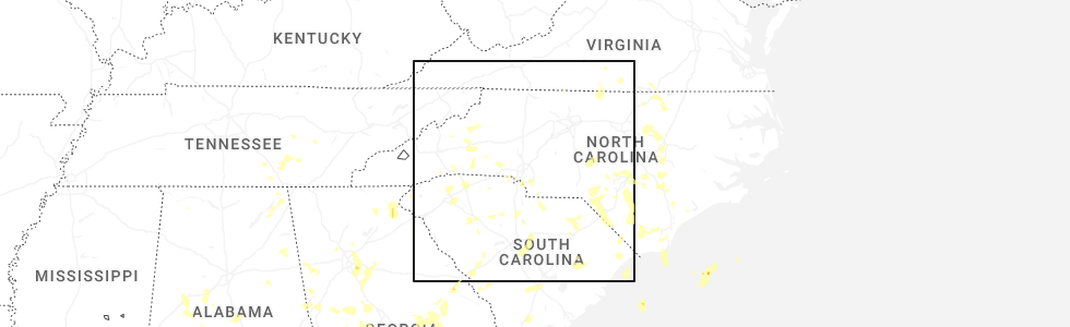
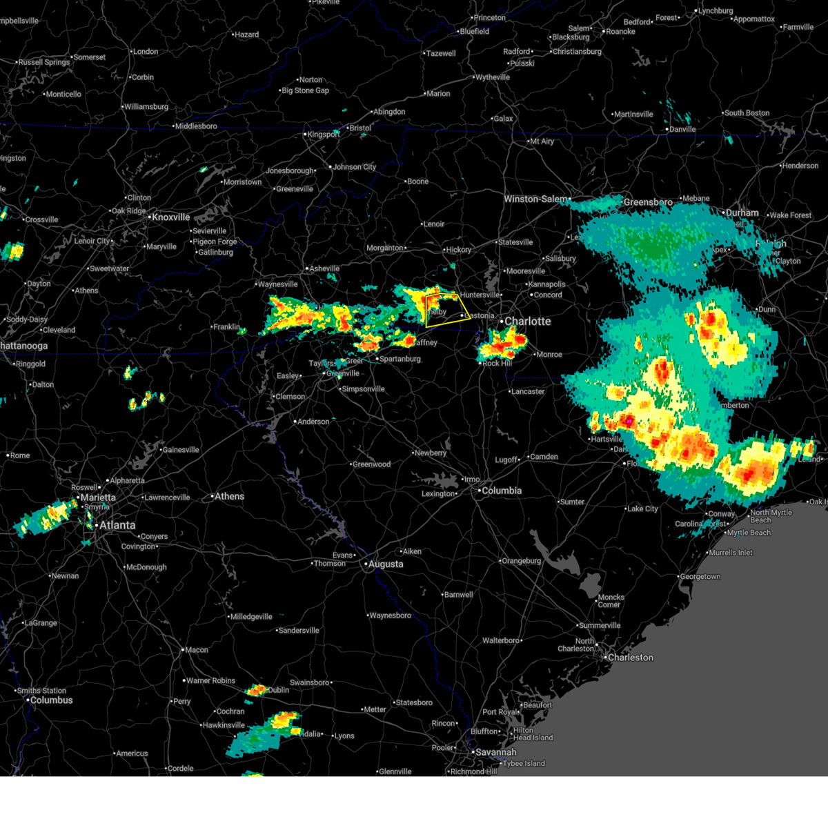
Hail Map for Dallas, NC
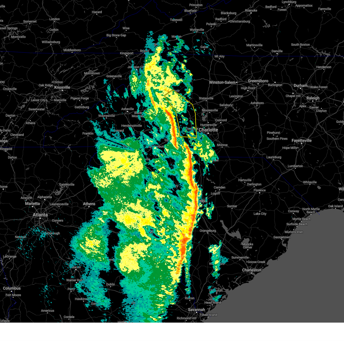
The Dallas, NC area has had 6 reports of on-the-ground hail by trained spotters, and has been under severe weather warnings 41 times during the past 12 months. Doppler radar has detected hail at or near Dallas, NC on 47 occasions, including 2 occasions during the past year.
| Name: | Dallas, NC |
| Where Located: | 20.2 miles WNW of Charlotte, NC |
| Map: | Google Map for Dallas, NC |
| Population: | 4488 |
| Housing Units: | 2003 |
| More Info: | Search Google for Dallas, NC |
0
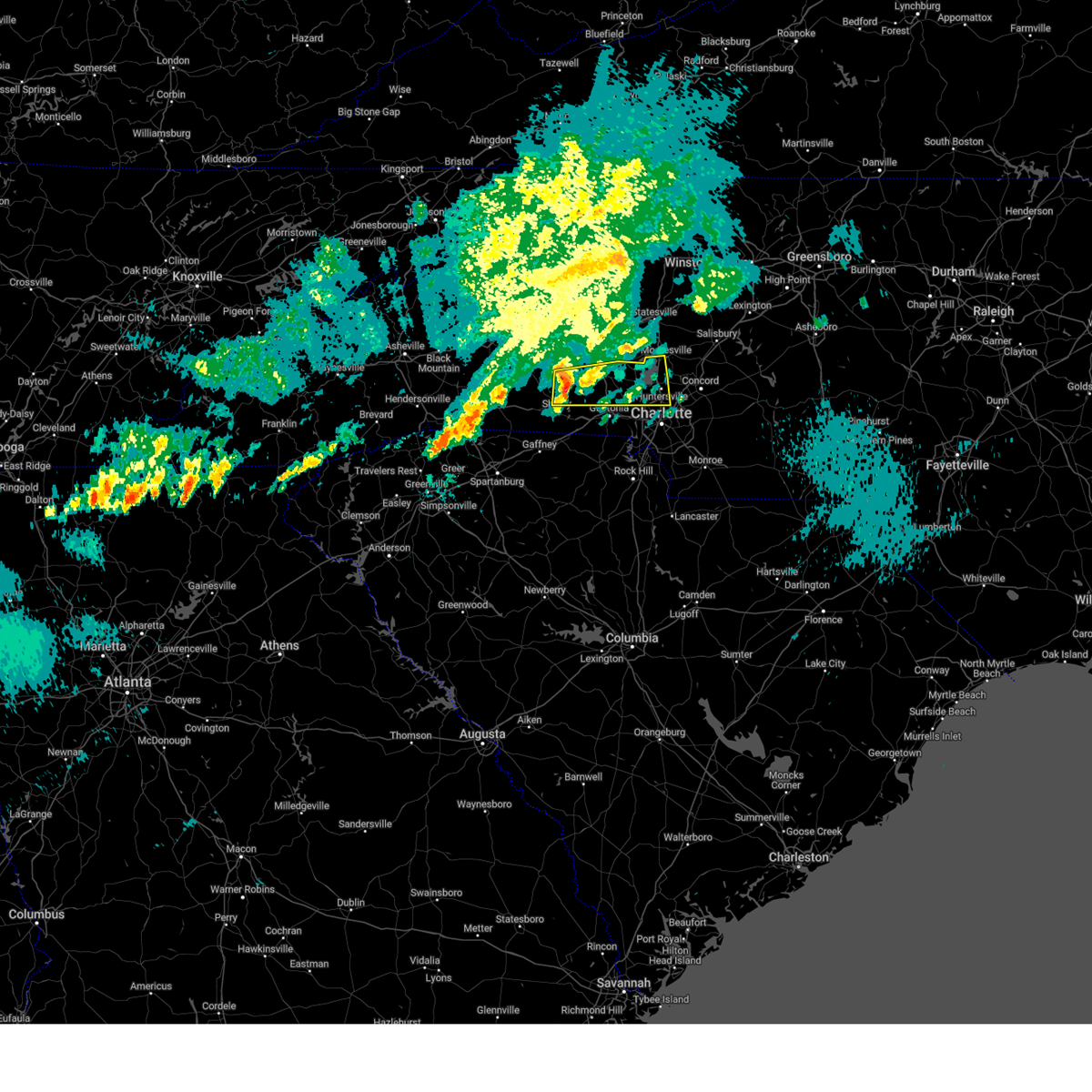
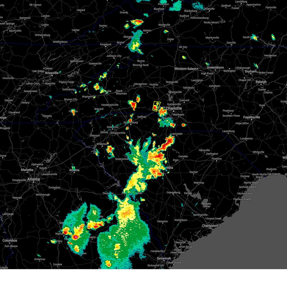
The Top Recent Hail Date for Dallas, NC is Wednesday, June 25, 2025 (21st out of 47)
Hail and Wind Damage Spotted near Dallas, NC
| Date / Time | Report Details |
|---|---|
| 7/1/2025 8:30 PM EDT |
 The storms which prompted the warning have weakened below severe limits, and no longer pose an immediate threat to life or property. therefore, the warning will be allowed to expire. however, gusty winds and heavy rain are still possible with these thunderstorms. to report severe weather to the national weather service greenville-spartanburg, call toll free, 1, 800, 2 6 7, 8 1 0 1, or post on our facebook page, or post it to x using hashtag nwsgsp. your message should describe the event and the specific location where it occurred. The storms which prompted the warning have weakened below severe limits, and no longer pose an immediate threat to life or property. therefore, the warning will be allowed to expire. however, gusty winds and heavy rain are still possible with these thunderstorms. to report severe weather to the national weather service greenville-spartanburg, call toll free, 1, 800, 2 6 7, 8 1 0 1, or post on our facebook page, or post it to x using hashtag nwsgsp. your message should describe the event and the specific location where it occurred.
|
| 7/1/2025 8:11 PM EDT |
 At 811 pm edt, severe thunderstorms were located along a line extending from 13 miles west of lincolnton to 8 miles northeast of gaffney, moving northeast at 25 mph (radar indicated). Hazards include 60 mph wind gusts. Expect damage to trees and power lines. Locations impacted include, shelby, lincolnton, kings mountain, cherryville, bessemer city, south gastonia, blacksburg, belwood, grover, and lawndale. At 811 pm edt, severe thunderstorms were located along a line extending from 13 miles west of lincolnton to 8 miles northeast of gaffney, moving northeast at 25 mph (radar indicated). Hazards include 60 mph wind gusts. Expect damage to trees and power lines. Locations impacted include, shelby, lincolnton, kings mountain, cherryville, bessemer city, south gastonia, blacksburg, belwood, grover, and lawndale.
|
| 7/1/2025 7:51 PM EDT |
 At 750 pm edt, severe thunderstorms were located along a line extending from 7 miles northwest of shelby to 4 miles northwest of gaffney, moving east at 25 mph (radar indicated). Hazards include 60 mph wind gusts and quarter size hail. Minor hail damage to vehicles is expected. expect wind damage to trees and power lines. Locations impacted include, shelby, gaffney, lincolnton, kings mountain, cherryville, bessemer city, south gastonia, boiling springs nc, blacksburg, and belwood. At 750 pm edt, severe thunderstorms were located along a line extending from 7 miles northwest of shelby to 4 miles northwest of gaffney, moving east at 25 mph (radar indicated). Hazards include 60 mph wind gusts and quarter size hail. Minor hail damage to vehicles is expected. expect wind damage to trees and power lines. Locations impacted include, shelby, gaffney, lincolnton, kings mountain, cherryville, bessemer city, south gastonia, boiling springs nc, blacksburg, and belwood.
|
| 7/1/2025 7:51 PM EDT |
 the severe thunderstorm warning has been cancelled and is no longer in effect the severe thunderstorm warning has been cancelled and is no longer in effect
|
| 7/1/2025 7:46 PM EDT |
 Svrgsp the national weather service in greenville-spartanburg has issued a * severe thunderstorm warning for, southeastern rutherford county in western north carolina, western lincoln county in the piedmont of north carolina, cleveland county in the piedmont of north carolina, western gaston county in the piedmont of north carolina, northwestern york county in upstate south carolina, northern cherokee county in upstate south carolina, * until 830 pm edt. * at 746 pm edt, severe thunderstorms were located along a line extending from 7 miles northwest of shelby to 4 miles northwest of gaffney, moving east at 20 mph (radar indicated). Hazards include 60 mph wind gusts. expect damage to trees and power lines Svrgsp the national weather service in greenville-spartanburg has issued a * severe thunderstorm warning for, southeastern rutherford county in western north carolina, western lincoln county in the piedmont of north carolina, cleveland county in the piedmont of north carolina, western gaston county in the piedmont of north carolina, northwestern york county in upstate south carolina, northern cherokee county in upstate south carolina, * until 830 pm edt. * at 746 pm edt, severe thunderstorms were located along a line extending from 7 miles northwest of shelby to 4 miles northwest of gaffney, moving east at 20 mph (radar indicated). Hazards include 60 mph wind gusts. expect damage to trees and power lines
|
| 6/25/2025 6:42 PM EDT |
 the severe thunderstorm warning has been cancelled and is no longer in effect the severe thunderstorm warning has been cancelled and is no longer in effect
|
| 6/25/2025 6:42 PM EDT |
 At 642 pm edt, a severe thunderstorm was located 6 miles northwest of gastonia, or near bessemer city, moving south at 10 mph (radar indicated). Hazards include 60 mph wind gusts and quarter size hail. Minor hail damage to vehicles is expected. expect wind damage to trees and power lines. Locations impacted include, gastonia, bessemer city, dallas, and crowders mountain state park. At 642 pm edt, a severe thunderstorm was located 6 miles northwest of gastonia, or near bessemer city, moving south at 10 mph (radar indicated). Hazards include 60 mph wind gusts and quarter size hail. Minor hail damage to vehicles is expected. expect wind damage to trees and power lines. Locations impacted include, gastonia, bessemer city, dallas, and crowders mountain state park.
|
| 6/25/2025 6:24 PM EDT | Trees down on dallas cherryville hwy & puetts chapel rd. time estimated from rada in gaston county NC, 4.3 miles ESE of Dallas, NC |
| 6/25/2025 6:09 PM EDT |
 Svrgsp the national weather service in greenville-spartanburg has issued a * severe thunderstorm warning for, southeastern cleveland county in the piedmont of north carolina, western gaston county in the piedmont of north carolina, * until 700 pm edt. * at 609 pm edt, a severe thunderstorm was located 10 miles southwest of lincolnton, or near cherryville, moving south at 10 mph (radar indicated). Hazards include 60 mph wind gusts and quarter size hail. Minor hail damage to vehicles is expected. Expect wind damage to trees and power lines. Svrgsp the national weather service in greenville-spartanburg has issued a * severe thunderstorm warning for, southeastern cleveland county in the piedmont of north carolina, western gaston county in the piedmont of north carolina, * until 700 pm edt. * at 609 pm edt, a severe thunderstorm was located 10 miles southwest of lincolnton, or near cherryville, moving south at 10 mph (radar indicated). Hazards include 60 mph wind gusts and quarter size hail. Minor hail damage to vehicles is expected. Expect wind damage to trees and power lines.
|
| 6/17/2025 10:36 PM EDT | The storms which prompted the warning have weakened below severe limits, and no longer pose an immediate threat to life or property. therefore, the warning will be allowed to expire. however, gusty winds are still possible with these thunderstorms. |
| 6/17/2025 10:24 PM EDT |
 the severe thunderstorm warning has been cancelled and is no longer in effect the severe thunderstorm warning has been cancelled and is no longer in effect
|
| 6/17/2025 10:24 PM EDT |
 At 1024 pm edt, severe thunderstorms were located along a line extending from 7 miles east of morganton to 6 miles southwest of newton to 8 miles southwest of gastonia to near chester, moving northeast at 45 mph (radar indicated). Hazards include 60 mph wind gusts. Expect damage to trees and power lines. locations impacted include, gastonia, rock hill, hickory, morganton, newton, lincolnton, york, chester, mt holly, and st. Stephens. At 1024 pm edt, severe thunderstorms were located along a line extending from 7 miles east of morganton to 6 miles southwest of newton to 8 miles southwest of gastonia to near chester, moving northeast at 45 mph (radar indicated). Hazards include 60 mph wind gusts. Expect damage to trees and power lines. locations impacted include, gastonia, rock hill, hickory, morganton, newton, lincolnton, york, chester, mt holly, and st. Stephens.
|
| 6/17/2025 10:18 PM EDT |
 At 1018 pm edt, severe thunderstorms were located along a line extending from 4 miles southeast of morganton to 9 miles northwest of lincolnton to 9 miles northwest of york to 5 miles west of chester, moving east at 50 mph (radar indicated). Hazards include 60 mph wind gusts. Expect damage to trees and power lines. Locations impacted include, gastonia, rock hill, hickory, shelby, morganton, newton, gaffney, lincolnton, union, and york. At 1018 pm edt, severe thunderstorms were located along a line extending from 4 miles southeast of morganton to 9 miles northwest of lincolnton to 9 miles northwest of york to 5 miles west of chester, moving east at 50 mph (radar indicated). Hazards include 60 mph wind gusts. Expect damage to trees and power lines. Locations impacted include, gastonia, rock hill, hickory, shelby, morganton, newton, gaffney, lincolnton, union, and york.
|
| 6/17/2025 10:02 PM EDT | the severe thunderstorm warning has been cancelled and is no longer in effect |
| 6/17/2025 10:02 PM EDT | At 1002 pm edt, severe thunderstorms were located along a line extending from 9 miles southwest of morganton to 14 miles north of shelby to 11 miles east of gaffney to 11 miles southeast of union, moving east at 50 mph (radar indicated). Hazards include 60 mph wind gusts. Expect damage to trees and power lines. Locations impacted include, gastonia, rock hill, hickory, shelby, morganton, newton, gaffney, lincolnton, union, and york. |
| 6/17/2025 9:43 PM EDT |
 Svrgsp the national weather service in greenville-spartanburg has issued a * severe thunderstorm warning for, catawba county in the piedmont of north carolina, rutherford county in western north carolina, lincoln county in the piedmont of north carolina, gaston county in the piedmont of north carolina, southeastern mcdowell county in western north carolina, cleveland county in the piedmont of north carolina, southern burke county in western north carolina, southeastern laurens county in upstate south carolina, union county in upstate south carolina, chester county in upstate south carolina, york county in upstate south carolina, eastern spartanburg county in upstate south carolina, cherokee county in upstate south carolina, * until 1045 pm edt. * at 943 pm edt, severe thunderstorms were located along a line extending from 10 miles north of rutherfordton to 10 miles east of forest city to 9 miles south of gaffney to 13 miles south of union, moving northeast at 50 mph (radar indicated). Hazards include 60 mph wind gusts. expect damage to trees and power lines Svrgsp the national weather service in greenville-spartanburg has issued a * severe thunderstorm warning for, catawba county in the piedmont of north carolina, rutherford county in western north carolina, lincoln county in the piedmont of north carolina, gaston county in the piedmont of north carolina, southeastern mcdowell county in western north carolina, cleveland county in the piedmont of north carolina, southern burke county in western north carolina, southeastern laurens county in upstate south carolina, union county in upstate south carolina, chester county in upstate south carolina, york county in upstate south carolina, eastern spartanburg county in upstate south carolina, cherokee county in upstate south carolina, * until 1045 pm edt. * at 943 pm edt, severe thunderstorms were located along a line extending from 10 miles north of rutherfordton to 10 miles east of forest city to 9 miles south of gaffney to 13 miles south of union, moving northeast at 50 mph (radar indicated). Hazards include 60 mph wind gusts. expect damage to trees and power lines
|
| 5/17/2025 6:55 AM EDT |
 The storm which prompted the warning has weakened below severe limits, and has exited the warned area. therefore, the warning will be allowed to expire. a severe thunderstorm watch remains in effect until noon edt for the piedmont of north carolina. The storm which prompted the warning has weakened below severe limits, and has exited the warned area. therefore, the warning will be allowed to expire. a severe thunderstorm watch remains in effect until noon edt for the piedmont of north carolina.
|
| 5/17/2025 6:40 AM EDT |
 At 639 am edt, a severe thunderstorm was located 9 miles west of huntersville, or 5 miles south of westport, moving east at 50 mph (radar indicated). Hazards include 60 mph wind gusts and quarter size hail. Minor hail damage to vehicles is expected. expect wind damage to trees and power lines. Locations impacted include, westport, davidson, high shoals, huntersville, croft, cornelius, boger city, northeast charlotte, stanley, and iron station. At 639 am edt, a severe thunderstorm was located 9 miles west of huntersville, or 5 miles south of westport, moving east at 50 mph (radar indicated). Hazards include 60 mph wind gusts and quarter size hail. Minor hail damage to vehicles is expected. expect wind damage to trees and power lines. Locations impacted include, westport, davidson, high shoals, huntersville, croft, cornelius, boger city, northeast charlotte, stanley, and iron station.
|
| 5/17/2025 6:26 AM EDT |
 the severe thunderstorm warning has been cancelled and is no longer in effect the severe thunderstorm warning has been cancelled and is no longer in effect
|
| 5/17/2025 6:26 AM EDT |
 At 626 am edt, a severe thunderstorm was located near lincolnton, or near high shoals, moving east at 60 mph (radar indicated). Hazards include 60 mph wind gusts and quarter size hail. Minor hail damage to vehicles is expected. expect wind damage to trees and power lines. Locations impacted include, westport, davidson, high shoals, crouse, huntersville, croft, lincolnton, cornelius, boger city, and northeast charlotte. At 626 am edt, a severe thunderstorm was located near lincolnton, or near high shoals, moving east at 60 mph (radar indicated). Hazards include 60 mph wind gusts and quarter size hail. Minor hail damage to vehicles is expected. expect wind damage to trees and power lines. Locations impacted include, westport, davidson, high shoals, crouse, huntersville, croft, lincolnton, cornelius, boger city, and northeast charlotte.
|
| 5/17/2025 6:15 AM EDT |
 Svrgsp the national weather service in greenville-spartanburg has issued a * severe thunderstorm warning for, lincoln county in the piedmont of north carolina, south central iredell county in the piedmont of north carolina, northwestern mecklenburg county in the piedmont of north carolina, central cleveland county in the piedmont of north carolina, northern gaston county in the piedmont of north carolina, * until 700 am edt. * at 614 am edt, a severe thunderstorm was located 9 miles northeast of shelby, or near fallston, moving east at 60 mph (radar indicated). Hazards include 60 mph wind gusts and quarter size hail. Minor hail damage to vehicles is expected. Expect wind damage to trees and power lines. Svrgsp the national weather service in greenville-spartanburg has issued a * severe thunderstorm warning for, lincoln county in the piedmont of north carolina, south central iredell county in the piedmont of north carolina, northwestern mecklenburg county in the piedmont of north carolina, central cleveland county in the piedmont of north carolina, northern gaston county in the piedmont of north carolina, * until 700 am edt. * at 614 am edt, a severe thunderstorm was located 9 miles northeast of shelby, or near fallston, moving east at 60 mph (radar indicated). Hazards include 60 mph wind gusts and quarter size hail. Minor hail damage to vehicles is expected. Expect wind damage to trees and power lines.
|
| 5/8/2025 8:12 PM EDT |
 The storm which prompted the warning has weakened below severe limits, and no longer poses an immediate threat to life or property. therefore, the warning will be allowed to expire. however, gusty winds and heavy rain are still possible with this thunderstorm. a severe thunderstorm watch remains in effect until midnight edt for the piedmont of north carolina, and upstate south carolina. The storm which prompted the warning has weakened below severe limits, and no longer poses an immediate threat to life or property. therefore, the warning will be allowed to expire. however, gusty winds and heavy rain are still possible with this thunderstorm. a severe thunderstorm watch remains in effect until midnight edt for the piedmont of north carolina, and upstate south carolina.
|
| 5/8/2025 7:57 PM EDT | At 756 pm edt, a severe thunderstorm was located near gastonia, or near cramerton, moving east at 15 mph. other storms over cleveland county could strengthen as they move into the western portion of gaston county through 830 pm (radar indicated). Hazards include 60 mph wind gusts and penny size hail. Expect damage to trees and power lines. Locations impacted include, gastonia, crowders, ranlo, south gastonia, crowders mountain state park, lowell, belmont, mt holly, bessemer city, and cramerton. |
| 5/8/2025 7:09 PM EDT | Svrgsp the national weather service in greenville-spartanburg has issued a * severe thunderstorm warning for, southern gaston county in the piedmont of north carolina, * until 815 pm edt. * at 709 pm edt, a severe thunderstorm was located 9 miles west of gastonia, or near crowders mountain state park, moving east at 20 mph (radar indicated). Hazards include two inch hail and 60 mph wind gusts. People and animals outdoors will be injured. expect hail damage to roofs, siding, windows, and vehicles. Expect wind damage to trees and power lines. |
| 12/29/2024 9:27 AM EST |
 At 927 am est, a severe thunderstorm capable of producing a tornado was located 5 miles northeast of gastonia, or near lowell, moving northeast at 55 mph (radar indicated rotation). Hazards include tornado. Flying debris will be dangerous to those caught without shelter. mobile homes will be damaged or destroyed. damage to roofs, windows, and vehicles will occur. tree damage is likely. this dangerous storm will be near, mt holly, lowell, ranlo, and mcadenville around 930 am est. huntersville, cornelius, lake norman, and ramsey creek park around 940 am est. davidson around 950 am est. Other locations impacted by this tornadic thunderstorm include lowesville, lucia, and croft. At 927 am est, a severe thunderstorm capable of producing a tornado was located 5 miles northeast of gastonia, or near lowell, moving northeast at 55 mph (radar indicated rotation). Hazards include tornado. Flying debris will be dangerous to those caught without shelter. mobile homes will be damaged or destroyed. damage to roofs, windows, and vehicles will occur. tree damage is likely. this dangerous storm will be near, mt holly, lowell, ranlo, and mcadenville around 930 am est. huntersville, cornelius, lake norman, and ramsey creek park around 940 am est. davidson around 950 am est. Other locations impacted by this tornadic thunderstorm include lowesville, lucia, and croft.
|
| 12/29/2024 9:19 AM EST |
 At 919 am est, severe thunderstorms were located along a line extending from 3 miles north of lenoir to near hickory to near lincolnton to near gastonia, moving northeast at 55 mph (radar indicated). Hazards include 60 mph wind gusts. Expect damage to trees and power lines. locations impacted include, gastonia, hickory, lenoir, newton, lincolnton, st. Stephens, conover, bessemer city, south gastonia, and longview. At 919 am est, severe thunderstorms were located along a line extending from 3 miles north of lenoir to near hickory to near lincolnton to near gastonia, moving northeast at 55 mph (radar indicated). Hazards include 60 mph wind gusts. Expect damage to trees and power lines. locations impacted include, gastonia, hickory, lenoir, newton, lincolnton, st. Stephens, conover, bessemer city, south gastonia, and longview.
|
| 12/29/2024 9:19 AM EST |
 the severe thunderstorm warning has been cancelled and is no longer in effect the severe thunderstorm warning has been cancelled and is no longer in effect
|
| 12/29/2024 9:17 AM EST |
 Torgsp the national weather service in greenville-spartanburg has issued a * tornado warning for, northwestern cabarrus county in the piedmont of north carolina, southeastern lincoln county in the piedmont of north carolina, northwestern mecklenburg county in the piedmont of north carolina, gaston county in the piedmont of north carolina, * until 1000 am est. * at 917 am est, a severe thunderstorm capable of producing a tornado was located 5 miles southwest of gastonia, or near south gastonia, moving northeast at 55 mph (radar indicated rotation). Hazards include tornado. Flying debris will be dangerous to those caught without shelter. mobile homes will be damaged or destroyed. damage to roofs, windows, and vehicles will occur. tree damage is likely. this dangerous storm will be near, gastonia, south gastonia, lowell, and ranlo around 920 am est. mt holly and mcadenville around 930 am est. huntersville, cornelius, lake norman, and ramsey creek park around 940 am est. davidson around 950 am est. Other locations impacted by this dangerous thunderstorm include lowesville, crowders, croft, and lucia. Torgsp the national weather service in greenville-spartanburg has issued a * tornado warning for, northwestern cabarrus county in the piedmont of north carolina, southeastern lincoln county in the piedmont of north carolina, northwestern mecklenburg county in the piedmont of north carolina, gaston county in the piedmont of north carolina, * until 1000 am est. * at 917 am est, a severe thunderstorm capable of producing a tornado was located 5 miles southwest of gastonia, or near south gastonia, moving northeast at 55 mph (radar indicated rotation). Hazards include tornado. Flying debris will be dangerous to those caught without shelter. mobile homes will be damaged or destroyed. damage to roofs, windows, and vehicles will occur. tree damage is likely. this dangerous storm will be near, gastonia, south gastonia, lowell, and ranlo around 920 am est. mt holly and mcadenville around 930 am est. huntersville, cornelius, lake norman, and ramsey creek park around 940 am est. davidson around 950 am est. Other locations impacted by this dangerous thunderstorm include lowesville, crowders, croft, and lucia.
|
| 12/29/2024 9:06 AM EST |
 At 906 am est, severe thunderstorms were located along a line extending from 7 miles southwest of lenoir to 9 miles south of hickory to 10 miles southwest of lincolnton to 10 miles northwest of york, moving northeast at 50 mph (radar indicated). Hazards include 60 mph wind gusts. Expect damage to trees and power lines. locations impacted include, gastonia, hickory, lenoir, newton, lincolnton, kings mountain, st. Stephens, conover, cherryville, and bessemer city. At 906 am est, severe thunderstorms were located along a line extending from 7 miles southwest of lenoir to 9 miles south of hickory to 10 miles southwest of lincolnton to 10 miles northwest of york, moving northeast at 50 mph (radar indicated). Hazards include 60 mph wind gusts. Expect damage to trees and power lines. locations impacted include, gastonia, hickory, lenoir, newton, lincolnton, kings mountain, st. Stephens, conover, cherryville, and bessemer city.
|
| 12/29/2024 9:06 AM EST |
 the severe thunderstorm warning has been cancelled and is no longer in effect the severe thunderstorm warning has been cancelled and is no longer in effect
|
| 12/29/2024 8:53 AM EST |
 At 853 am est, severe thunderstorms were located along a line extending from 8 miles northwest of morganton to 15 miles southwest of hickory to 4 miles northeast of shelby to 9 miles northeast of gaffney, moving northeast at 55 mph (radar indicated). Hazards include 60 mph wind gusts. Expect damage to trees and power lines. locations impacted include, gastonia, hickory, shelby, lenoir, morganton, newton, lincolnton, kings mountain, st. Stephens, and conover. At 853 am est, severe thunderstorms were located along a line extending from 8 miles northwest of morganton to 15 miles southwest of hickory to 4 miles northeast of shelby to 9 miles northeast of gaffney, moving northeast at 55 mph (radar indicated). Hazards include 60 mph wind gusts. Expect damage to trees and power lines. locations impacted include, gastonia, hickory, shelby, lenoir, morganton, newton, lincolnton, kings mountain, st. Stephens, and conover.
|
| 12/29/2024 8:25 AM EST |
 Svrgsp the national weather service in greenville-spartanburg has issued a * severe thunderstorm warning for, western catawba county in the piedmont of north carolina, southeastern mcdowell county in western north carolina, eastern rutherford county in western north carolina, lincoln county in the piedmont of north carolina, southern caldwell county in western north carolina, cleveland county in the piedmont of north carolina, gaston county in the piedmont of north carolina, burke county in western north carolina, eastern cherokee county in upstate south carolina, * until 945 am est. * at 824 am est, severe thunderstorms were located along a line extending from 10 miles southwest of marion to near forest city to 9 miles west of gaffney to 8 miles southeast of spartanburg, moving northeast at 55 mph (radar indicated). Hazards include 60 mph wind gusts. expect damage to trees and power lines Svrgsp the national weather service in greenville-spartanburg has issued a * severe thunderstorm warning for, western catawba county in the piedmont of north carolina, southeastern mcdowell county in western north carolina, eastern rutherford county in western north carolina, lincoln county in the piedmont of north carolina, southern caldwell county in western north carolina, cleveland county in the piedmont of north carolina, gaston county in the piedmont of north carolina, burke county in western north carolina, eastern cherokee county in upstate south carolina, * until 945 am est. * at 824 am est, severe thunderstorms were located along a line extending from 10 miles southwest of marion to near forest city to 9 miles west of gaffney to 8 miles southeast of spartanburg, moving northeast at 55 mph (radar indicated). Hazards include 60 mph wind gusts. expect damage to trees and power lines
|
| 9/24/2024 10:27 PM EDT |
 the severe thunderstorm warning has been cancelled and is no longer in effect the severe thunderstorm warning has been cancelled and is no longer in effect
|
| 9/24/2024 10:27 PM EDT |
 At 1026 pm edt, a severe thunderstorm was located 5 miles southeast of lincolnton, or near high shoals, moving northeast at 40 mph (radar indicated). Hazards include 60 mph wind gusts and quarter size hail. Minor hail damage to vehicles is expected. expect wind damage to trees and power lines. Locations impacted include, gastonia, lincolnton, kings mountain, mt holly, belmont, cherryville, bessemer city, south gastonia, dallas, and stanley. At 1026 pm edt, a severe thunderstorm was located 5 miles southeast of lincolnton, or near high shoals, moving northeast at 40 mph (radar indicated). Hazards include 60 mph wind gusts and quarter size hail. Minor hail damage to vehicles is expected. expect wind damage to trees and power lines. Locations impacted include, gastonia, lincolnton, kings mountain, mt holly, belmont, cherryville, bessemer city, south gastonia, dallas, and stanley.
|
| 9/24/2024 10:04 PM EDT |
 Svrgsp the national weather service in greenville-spartanburg has issued a * severe thunderstorm warning for, lincoln county in the piedmont of north carolina, southeastern cleveland county in the piedmont of north carolina, gaston county in the piedmont of north carolina, northeastern cherokee county in upstate south carolina, * until 1045 pm edt. * at 1004 pm edt, a severe thunderstorm was located 7 miles east of shelby, or near waco, moving northeast at 40 mph (radar indicated). Hazards include 60 mph wind gusts and quarter size hail. Minor hail damage to vehicles is expected. Expect wind damage to trees and power lines. Svrgsp the national weather service in greenville-spartanburg has issued a * severe thunderstorm warning for, lincoln county in the piedmont of north carolina, southeastern cleveland county in the piedmont of north carolina, gaston county in the piedmont of north carolina, northeastern cherokee county in upstate south carolina, * until 1045 pm edt. * at 1004 pm edt, a severe thunderstorm was located 7 miles east of shelby, or near waco, moving northeast at 40 mph (radar indicated). Hazards include 60 mph wind gusts and quarter size hail. Minor hail damage to vehicles is expected. Expect wind damage to trees and power lines.
|
| 8/16/2024 10:05 PM EDT |
 The storms which prompted the warning have weakened below severe limits, and no longer pose an immediate threat to life or property. therefore, the warning will be allowed to expire. The storms which prompted the warning have weakened below severe limits, and no longer pose an immediate threat to life or property. therefore, the warning will be allowed to expire.
|
| 8/16/2024 9:23 PM EDT |
 Svrgsp the national weather service in greenville-spartanburg has issued a * severe thunderstorm warning for, southeastern catawba county in the piedmont of north carolina, eastern lincoln county in the piedmont of north carolina, southern iredell county in the piedmont of north carolina, northwestern mecklenburg county in the piedmont of north carolina, gaston county in the piedmont of north carolina, * until 1015 pm edt. * at 923 pm edt, severe thunderstorms were located along a line extending from near newton to 3 miles northeast of lincolnton to 14 miles north of shelby, moving southeast at 35 mph (radar indicated). Hazards include 60 mph wind gusts and penny size hail. expect damage to trees and power lines Svrgsp the national weather service in greenville-spartanburg has issued a * severe thunderstorm warning for, southeastern catawba county in the piedmont of north carolina, eastern lincoln county in the piedmont of north carolina, southern iredell county in the piedmont of north carolina, northwestern mecklenburg county in the piedmont of north carolina, gaston county in the piedmont of north carolina, * until 1015 pm edt. * at 923 pm edt, severe thunderstorms were located along a line extending from near newton to 3 miles northeast of lincolnton to 14 miles north of shelby, moving southeast at 35 mph (radar indicated). Hazards include 60 mph wind gusts and penny size hail. expect damage to trees and power lines
|
| 8/2/2024 5:00 PM EDT |
 At 500 pm edt, a severe thunderstorm was located 4 miles west of lincolnton, moving east at 25 mph (radar indicated). Hazards include 60 mph wind gusts. Expect damage to trees and power lines. Locations impacted include, lincolnton, cherryville, high shoals, boger city, iron station, crouse, vale, and stanley. At 500 pm edt, a severe thunderstorm was located 4 miles west of lincolnton, moving east at 25 mph (radar indicated). Hazards include 60 mph wind gusts. Expect damage to trees and power lines. Locations impacted include, lincolnton, cherryville, high shoals, boger city, iron station, crouse, vale, and stanley.
|
| 8/2/2024 5:00 PM EDT |
 the severe thunderstorm warning has been cancelled and is no longer in effect the severe thunderstorm warning has been cancelled and is no longer in effect
|
| 8/2/2024 4:43 PM EDT |
 Svrgsp the national weather service in greenville-spartanburg has issued a * severe thunderstorm warning for, central lincoln county in the piedmont of north carolina, central cleveland county in the piedmont of north carolina, northwestern gaston county in the piedmont of north carolina, * until 530 pm edt. * at 443 pm edt, a severe thunderstorm was located 11 miles west of lincolnton, or near fallston, moving east at 25 mph (radar indicated). Hazards include 60 mph wind gusts. expect damage to trees and power lines Svrgsp the national weather service in greenville-spartanburg has issued a * severe thunderstorm warning for, central lincoln county in the piedmont of north carolina, central cleveland county in the piedmont of north carolina, northwestern gaston county in the piedmont of north carolina, * until 530 pm edt. * at 443 pm edt, a severe thunderstorm was located 11 miles west of lincolnton, or near fallston, moving east at 25 mph (radar indicated). Hazards include 60 mph wind gusts. expect damage to trees and power lines
|
| 7/30/2024 8:24 PM EDT | Emergency manager reported a tree down and blocking old willis school r in gaston county NC, 3.6 miles SSW of Dallas, NC |
| 7/30/2024 8:20 PM EDT |
 At 820 pm edt, a severe thunderstorm was located near gastonia, or near south gastonia, moving east at 40 mph (radar indicated). Hazards include 60 mph wind gusts. Expect damage to trees and power lines. Locations impacted include, gastonia, kings mountain, mt holly, belmont, bessemer city, south gastonia, dallas, cramerton, lowell, and ranlo. At 820 pm edt, a severe thunderstorm was located near gastonia, or near south gastonia, moving east at 40 mph (radar indicated). Hazards include 60 mph wind gusts. Expect damage to trees and power lines. Locations impacted include, gastonia, kings mountain, mt holly, belmont, bessemer city, south gastonia, dallas, cramerton, lowell, and ranlo.
|
| 7/30/2024 7:58 PM EDT |
 Svrgsp the national weather service in greenville-spartanburg has issued a * severe thunderstorm warning for, southeastern cleveland county in the piedmont of north carolina, gaston county in the piedmont of north carolina, * until 845 pm edt. * at 758 pm edt, a severe thunderstorm was located 4 miles southeast of shelby, or near patterson springs, moving east at 40 mph (radar indicated). Hazards include 60 mph wind gusts. expect damage to trees and power lines Svrgsp the national weather service in greenville-spartanburg has issued a * severe thunderstorm warning for, southeastern cleveland county in the piedmont of north carolina, gaston county in the piedmont of north carolina, * until 845 pm edt. * at 758 pm edt, a severe thunderstorm was located 4 miles southeast of shelby, or near patterson springs, moving east at 40 mph (radar indicated). Hazards include 60 mph wind gusts. expect damage to trees and power lines
|
| 5/26/2024 9:45 PM EDT |
 The storms which prompted the warning have weakened below severe limits, and no longer pose an immediate threat to life or property. therefore, the warning will be allowed to expire. however, gusty winds and heavy rain are still possible with these thunderstorms. a severe thunderstorm watch remains in effect until 1100 pm edt for the piedmont of north carolina. a severe thunderstorm watch also remains in effect until 1100 pm edt for the piedmont of north carolina, and upstate south carolina. The storms which prompted the warning have weakened below severe limits, and no longer pose an immediate threat to life or property. therefore, the warning will be allowed to expire. however, gusty winds and heavy rain are still possible with these thunderstorms. a severe thunderstorm watch remains in effect until 1100 pm edt for the piedmont of north carolina. a severe thunderstorm watch also remains in effect until 1100 pm edt for the piedmont of north carolina, and upstate south carolina.
|
| 5/26/2024 9:28 PM EDT |
 the severe thunderstorm warning has been cancelled and is no longer in effect the severe thunderstorm warning has been cancelled and is no longer in effect
|
| 5/26/2024 9:28 PM EDT |
 At 927 pm edt, severe thunderstorms were located along a line extending from 5 miles northwest of kannapolis to 4 miles north of gastonia, moving east at 40 mph (radar indicated). Hazards include 60 mph wind gusts. Expect damage to trees and power lines. Locations impacted include, gastonia, charlotte, huntersville, kannapolis, and concord. At 927 pm edt, severe thunderstorms were located along a line extending from 5 miles northwest of kannapolis to 4 miles north of gastonia, moving east at 40 mph (radar indicated). Hazards include 60 mph wind gusts. Expect damage to trees and power lines. Locations impacted include, gastonia, charlotte, huntersville, kannapolis, and concord.
|
| 5/26/2024 8:48 PM EDT |
 Svrgsp the national weather service in greenville-spartanburg has issued a * severe thunderstorm warning for, western cabarrus county in the piedmont of north carolina, southeastern catawba county in the piedmont of north carolina, lincoln county in the piedmont of north carolina, southeastern iredell county in the piedmont of north carolina, mecklenburg county in the piedmont of north carolina, southeastern cleveland county in the piedmont of north carolina, southwestern rowan county in the piedmont of north carolina, gaston county in the piedmont of north carolina, northeastern york county in upstate south carolina, * until 945 pm edt. * at 847 pm edt, a severe thunderstorm was located 11 miles north of shelby, or near fallston, moving southeast at 40 mph (radar indicated). Hazards include 60 mph wind gusts and penny size hail. expect damage to trees and power lines Svrgsp the national weather service in greenville-spartanburg has issued a * severe thunderstorm warning for, western cabarrus county in the piedmont of north carolina, southeastern catawba county in the piedmont of north carolina, lincoln county in the piedmont of north carolina, southeastern iredell county in the piedmont of north carolina, mecklenburg county in the piedmont of north carolina, southeastern cleveland county in the piedmont of north carolina, southwestern rowan county in the piedmont of north carolina, gaston county in the piedmont of north carolina, northeastern york county in upstate south carolina, * until 945 pm edt. * at 847 pm edt, a severe thunderstorm was located 11 miles north of shelby, or near fallston, moving southeast at 40 mph (radar indicated). Hazards include 60 mph wind gusts and penny size hail. expect damage to trees and power lines
|
| 5/25/2024 2:36 AM EDT |
 The storm which prompted the warning has weakened below severe limits, and no longer poses an immediate threat to life or property. therefore, the warning will be allowed to expire. however, gusty winds are still possible with this thunderstorm. The storm which prompted the warning has weakened below severe limits, and no longer poses an immediate threat to life or property. therefore, the warning will be allowed to expire. however, gusty winds are still possible with this thunderstorm.
|
| 5/25/2024 2:22 AM EDT |
 At 222 am edt, a severe thunderstorm was located near gastonia, or near cramerton, moving east at 25 mph (radar indicated). Hazards include 60 mph wind gusts. Expect damage to trees and power lines. Locations impacted include, gastonia, central charlotte, southwest charlotte, northwest charlotte, mt holly, belmont, south gastonia, dallas, cramerton, and lowell. At 222 am edt, a severe thunderstorm was located near gastonia, or near cramerton, moving east at 25 mph (radar indicated). Hazards include 60 mph wind gusts. Expect damage to trees and power lines. Locations impacted include, gastonia, central charlotte, southwest charlotte, northwest charlotte, mt holly, belmont, south gastonia, dallas, cramerton, and lowell.
|
| 5/25/2024 2:04 AM EDT |
 Svrgsp the national weather service in greenville-spartanburg has issued a * severe thunderstorm warning for, southwestern mecklenburg county in the piedmont of north carolina, gaston county in the piedmont of north carolina, northeastern york county in upstate south carolina, * until 245 am edt. * at 203 am edt, a severe thunderstorm was located 4 miles west of gastonia, or near crowders mountain state park, moving east at 25 mph (radar indicated). Hazards include 60 mph wind gusts. expect damage to trees and power lines Svrgsp the national weather service in greenville-spartanburg has issued a * severe thunderstorm warning for, southwestern mecklenburg county in the piedmont of north carolina, gaston county in the piedmont of north carolina, northeastern york county in upstate south carolina, * until 245 am edt. * at 203 am edt, a severe thunderstorm was located 4 miles west of gastonia, or near crowders mountain state park, moving east at 25 mph (radar indicated). Hazards include 60 mph wind gusts. expect damage to trees and power lines
|
| 5/8/2024 3:48 PM EDT |
 At 348 pm edt, a severe thunderstorm was located 4 miles southeast of gastonia, or near cramerton, moving east at 40 mph (radar indicated). Hazards include 70 mph wind gusts and half dollar size hail. Minor hail damage to vehicles is expected. expect considerable tree damage. wind damage is also likely to mobile homes, roofs, and outbuildings. Locations impacted include, gastonia, uptown charlotte, huntersville, central charlotte, south charlotte, northeast charlotte, southwest charlotte, east charlotte, northwest charlotte, and west concord. At 348 pm edt, a severe thunderstorm was located 4 miles southeast of gastonia, or near cramerton, moving east at 40 mph (radar indicated). Hazards include 70 mph wind gusts and half dollar size hail. Minor hail damage to vehicles is expected. expect considerable tree damage. wind damage is also likely to mobile homes, roofs, and outbuildings. Locations impacted include, gastonia, uptown charlotte, huntersville, central charlotte, south charlotte, northeast charlotte, southwest charlotte, east charlotte, northwest charlotte, and west concord.
|
| 5/8/2024 3:21 PM EDT |
 Svrgsp the national weather service in greenville-spartanburg has issued a * severe thunderstorm warning for, central cabarrus county in the piedmont of north carolina, eastern lincoln county in the piedmont of north carolina, mecklenburg county in the piedmont of north carolina, southeastern cleveland county in the piedmont of north carolina, gaston county in the piedmont of north carolina, northern york county in upstate south carolina, northeastern cherokee county in upstate south carolina, * until 445 pm edt. * at 321 pm edt, a severe thunderstorm was located 5 miles east of shelby, or 5 miles northeast of patterson springs, moving east at 40 mph (radar indicated). Hazards include 70 mph wind gusts and half dollar size hail. Minor hail damage to vehicles is expected. expect considerable tree damage. Wind damage is also likely to mobile homes, roofs, and outbuildings. Svrgsp the national weather service in greenville-spartanburg has issued a * severe thunderstorm warning for, central cabarrus county in the piedmont of north carolina, eastern lincoln county in the piedmont of north carolina, mecklenburg county in the piedmont of north carolina, southeastern cleveland county in the piedmont of north carolina, gaston county in the piedmont of north carolina, northern york county in upstate south carolina, northeastern cherokee county in upstate south carolina, * until 445 pm edt. * at 321 pm edt, a severe thunderstorm was located 5 miles east of shelby, or 5 miles northeast of patterson springs, moving east at 40 mph (radar indicated). Hazards include 70 mph wind gusts and half dollar size hail. Minor hail damage to vehicles is expected. expect considerable tree damage. Wind damage is also likely to mobile homes, roofs, and outbuildings.
|
| 4/20/2024 3:40 PM EDT | Tree on structure on dallas spencer mountain r in gaston county NC, 2.5 miles W of Dallas, NC |
| 1/9/2024 12:58 PM EST |
 At 1258 pm est, severe thunderstorms were located along a line extending from 9 miles southeast of newton to 8 miles west of huntersville to 7 miles northeast of gastonia, moving northeast at 80 mph (radar indicated). Hazards include 60 mph wind gusts. Expect damage to trees and power lines. locations impacted include, gastonia, huntersville, kannapolis, northeast charlotte, northwest charlotte, cornelius, mooresville, mt holly, davidson, and belmont. hail threat, radar indicated max hail size, <. 75 in wind threat, radar indicated max wind gust, 60 mph. At 1258 pm est, severe thunderstorms were located along a line extending from 9 miles southeast of newton to 8 miles west of huntersville to 7 miles northeast of gastonia, moving northeast at 80 mph (radar indicated). Hazards include 60 mph wind gusts. Expect damage to trees and power lines. locations impacted include, gastonia, huntersville, kannapolis, northeast charlotte, northwest charlotte, cornelius, mooresville, mt holly, davidson, and belmont. hail threat, radar indicated max hail size, <. 75 in wind threat, radar indicated max wind gust, 60 mph.
|
| 1/9/2024 12:44 PM EST |
 At 1244 pm est, severe thunderstorms were located along a line extending from 7 miles south of lincolnton to near gastonia to 6 miles north of york, moving northeast at 80 mph (radar indicated). Hazards include 60 mph wind gusts. Expect damage to trees and power lines. locations impacted include, gastonia, huntersville, kannapolis, northeast charlotte, northwest charlotte, cornelius, mooresville, mt holly, davidson, and belmont. hail threat, radar indicated max hail size, <. 75 in wind threat, radar indicated max wind gust, 60 mph. At 1244 pm est, severe thunderstorms were located along a line extending from 7 miles south of lincolnton to near gastonia to 6 miles north of york, moving northeast at 80 mph (radar indicated). Hazards include 60 mph wind gusts. Expect damage to trees and power lines. locations impacted include, gastonia, huntersville, kannapolis, northeast charlotte, northwest charlotte, cornelius, mooresville, mt holly, davidson, and belmont. hail threat, radar indicated max hail size, <. 75 in wind threat, radar indicated max wind gust, 60 mph.
|
| 1/9/2024 12:35 PM EST |
 At 1234 pm est, severe thunderstorms were located along a line extending from 6 miles southeast of shelby to 9 miles northwest of york to 16 miles southeast of gaffney, moving northeast at 80 mph (radar indicated). Hazards include 60 mph wind gusts. expect damage to trees and power lines At 1234 pm est, severe thunderstorms were located along a line extending from 6 miles southeast of shelby to 9 miles northwest of york to 16 miles southeast of gaffney, moving northeast at 80 mph (radar indicated). Hazards include 60 mph wind gusts. expect damage to trees and power lines
|
| 10/20/2023 3:41 PM EDT |
 The severe thunderstorm warning for southeastern catawba, lincoln and north central gaston counties will expire at 345 pm edt, the storms which prompted the warning have weakened below severe limits, and have exited the warned area. therefore, the warning will be allowed to expire. however, small hail and gusty winds are still possible with these thunderstorms. The severe thunderstorm warning for southeastern catawba, lincoln and north central gaston counties will expire at 345 pm edt, the storms which prompted the warning have weakened below severe limits, and have exited the warned area. therefore, the warning will be allowed to expire. however, small hail and gusty winds are still possible with these thunderstorms.
|
| 10/20/2023 3:19 PM EDT |
 At 318 pm edt, severe thunderstorms were located along a line extending from 4 miles south of newton to near lincolnton, moving east at 35 mph (radar indicated). Hazards include 60 mph wind gusts and quarter size hail. Minor hail damage to vehicles is expected. expect wind damage to trees and power lines. locations impacted include, newton, lincolnton, maiden, westport, high shoals, boger city, iron station, denver, lowesville, and sherrills ford. hail threat, radar indicated max hail size, 1. 00 in wind threat, radar indicated max wind gust, 60 mph. At 318 pm edt, severe thunderstorms were located along a line extending from 4 miles south of newton to near lincolnton, moving east at 35 mph (radar indicated). Hazards include 60 mph wind gusts and quarter size hail. Minor hail damage to vehicles is expected. expect wind damage to trees and power lines. locations impacted include, newton, lincolnton, maiden, westport, high shoals, boger city, iron station, denver, lowesville, and sherrills ford. hail threat, radar indicated max hail size, 1. 00 in wind threat, radar indicated max wind gust, 60 mph.
|
| 10/20/2023 3:02 PM EDT |
 At 302 pm edt, severe thunderstorms were located along a line extending from 6 miles southwest of hickory to 10 miles northwest of lincolnton to 15 miles north of shelby, moving east at 35 mph (radar indicated). Hazards include 60 mph wind gusts and quarter size hail. Minor hail damage to vehicles is expected. Expect wind damage to trees and power lines. At 302 pm edt, severe thunderstorms were located along a line extending from 6 miles southwest of hickory to 10 miles northwest of lincolnton to 15 miles north of shelby, moving east at 35 mph (radar indicated). Hazards include 60 mph wind gusts and quarter size hail. Minor hail damage to vehicles is expected. Expect wind damage to trees and power lines.
|
| 9/7/2023 7:09 PM EDT |
 The severe thunderstorm warning for south central lincoln, east central cleveland and northwestern gaston counties will expire at 715 pm edt, the storm which prompted the warning has weakened below severe limits, and no longer poses an immediate threat to life or property. therefore, the warning will be allowed to expire. The severe thunderstorm warning for south central lincoln, east central cleveland and northwestern gaston counties will expire at 715 pm edt, the storm which prompted the warning has weakened below severe limits, and no longer poses an immediate threat to life or property. therefore, the warning will be allowed to expire.
|
| 9/7/2023 6:23 PM EDT |
 At 623 pm edt, a severe thunderstorm was located near bessemer city, or 8 miles northwest of gastonia, moving north at 5 mph (radar indicated). Hazards include 60 mph wind gusts and quarter size hail. Minor hail damage to vehicles is expected. Expect wind damage to trees and power lines. At 623 pm edt, a severe thunderstorm was located near bessemer city, or 8 miles northwest of gastonia, moving north at 5 mph (radar indicated). Hazards include 60 mph wind gusts and quarter size hail. Minor hail damage to vehicles is expected. Expect wind damage to trees and power lines.
|
| 8/26/2023 10:23 PM EDT |
 At 1022 pm edt, severe thunderstorms were located along a line extending from near downtown concord to near gastonia, moving southeast at 20 mph (radar indicated). Hazards include 60 mph wind gusts and penny size hail. expect damage to trees and power lines At 1022 pm edt, severe thunderstorms were located along a line extending from near downtown concord to near gastonia, moving southeast at 20 mph (radar indicated). Hazards include 60 mph wind gusts and penny size hail. expect damage to trees and power lines
|
| 8/15/2023 3:20 PM EDT |
 At 320 pm edt, a severe thunderstorm was located 6 miles northeast of gastonia, or near mcadenville, moving east at 30 mph (radar indicated). Hazards include 60 mph wind gusts and quarter size hail. Minor hail damage to vehicles is expected. expect wind damage to trees and power lines. locations impacted include, northwest charlotte, mt holly, belmont, stanley, cramerton, lowell, ranlo, mcadenville, charlotte douglas airport and paw creek. hail threat, radar indicated max hail size, 1. 00 in wind threat, radar indicated max wind gust, 60 mph. At 320 pm edt, a severe thunderstorm was located 6 miles northeast of gastonia, or near mcadenville, moving east at 30 mph (radar indicated). Hazards include 60 mph wind gusts and quarter size hail. Minor hail damage to vehicles is expected. expect wind damage to trees and power lines. locations impacted include, northwest charlotte, mt holly, belmont, stanley, cramerton, lowell, ranlo, mcadenville, charlotte douglas airport and paw creek. hail threat, radar indicated max hail size, 1. 00 in wind threat, radar indicated max wind gust, 60 mph.
|
| 8/15/2023 3:06 PM EDT |
 At 306 pm edt, a severe thunderstorm was located over gastonia, moving east at 30 mph (radar indicated). Hazards include 60 mph wind gusts and quarter size hail. Minor hail damage to vehicles is expected. Expect wind damage to trees and power lines. At 306 pm edt, a severe thunderstorm was located over gastonia, moving east at 30 mph (radar indicated). Hazards include 60 mph wind gusts and quarter size hail. Minor hail damage to vehicles is expected. Expect wind damage to trees and power lines.
|
| 8/7/2023 5:32 PM EDT |
 At 531 pm edt, severe thunderstorms were located along a line extending from 5 miles west of huntersville to 5 miles south of gastonia, moving east at 45 mph (radar indicated). Hazards include 60 mph wind gusts and penny size hail. Expect damage to trees and power lines. locations impacted include, gastonia, kings mountain, mt holly, belmont, bessemer city, south gastonia, dallas, stanley, cramerton and lowell. hail threat, radar indicated max hail size, 0. 75 in wind threat, radar indicated max wind gust, 60 mph. At 531 pm edt, severe thunderstorms were located along a line extending from 5 miles west of huntersville to 5 miles south of gastonia, moving east at 45 mph (radar indicated). Hazards include 60 mph wind gusts and penny size hail. Expect damage to trees and power lines. locations impacted include, gastonia, kings mountain, mt holly, belmont, bessemer city, south gastonia, dallas, stanley, cramerton and lowell. hail threat, radar indicated max hail size, 0. 75 in wind threat, radar indicated max wind gust, 60 mph.
|
| 8/7/2023 5:22 PM EDT |
 At 522 pm edt, severe thunderstorms were located along a line extending from 10 miles west of huntersville to 6 miles southwest of gastonia, moving east at 35 mph (radar indicated). Hazards include 70 mph wind gusts and penny size hail. Expect considerable tree damage. Damage is likely to mobile homes, roofs, and outbuildings. At 522 pm edt, severe thunderstorms were located along a line extending from 10 miles west of huntersville to 6 miles southwest of gastonia, moving east at 35 mph (radar indicated). Hazards include 70 mph wind gusts and penny size hail. Expect considerable tree damage. Damage is likely to mobile homes, roofs, and outbuildings.
|
| 8/7/2023 5:15 PM EDT |
 At 514 pm edt, severe thunderstorms were located along a line extending from 7 miles southeast of lincolnton to 11 miles southeast of shelby, moving east at 40 mph (radar indicated). Hazards include 70 mph wind gusts and penny size hail. Expect considerable tree damage. damage is likely to mobile homes, roofs, and outbuildings. locations impacted include, gastonia, shelby, kings mountain, mt holly, belmont, cherryville, bessemer city, south gastonia, boiling springs nc and dallas. thunderstorm damage threat, considerable hail threat, radar indicated max hail size, 0. 75 in wind threat, radar indicated max wind gust, 70 mph. At 514 pm edt, severe thunderstorms were located along a line extending from 7 miles southeast of lincolnton to 11 miles southeast of shelby, moving east at 40 mph (radar indicated). Hazards include 70 mph wind gusts and penny size hail. Expect considerable tree damage. damage is likely to mobile homes, roofs, and outbuildings. locations impacted include, gastonia, shelby, kings mountain, mt holly, belmont, cherryville, bessemer city, south gastonia, boiling springs nc and dallas. thunderstorm damage threat, considerable hail threat, radar indicated max hail size, 0. 75 in wind threat, radar indicated max wind gust, 70 mph.
|
| 8/7/2023 4:59 PM EDT |
 At 459 pm edt, severe thunderstorms were located along a line extending from 11 miles west of lincolnton to 3 miles southeast of shelby, moving east at 45 mph (radar indicated). Hazards include 70 mph wind gusts and quarter size hail. Minor hail damage to vehicles is expected. expect considerable tree damage. Wind damage is also likely to mobile homes, roofs, and outbuildings. At 459 pm edt, severe thunderstorms were located along a line extending from 11 miles west of lincolnton to 3 miles southeast of shelby, moving east at 45 mph (radar indicated). Hazards include 70 mph wind gusts and quarter size hail. Minor hail damage to vehicles is expected. expect considerable tree damage. Wind damage is also likely to mobile homes, roofs, and outbuildings.
|
| 8/6/2023 3:32 PM EDT |
 At 332 pm edt, a severe thunderstorm was located 6 miles southeast of gastonia, or 5 miles southwest of cramerton, moving east at 35 mph (radar indicated). Hazards include 60 mph wind gusts and penny size hail. expect damage to trees and power lines At 332 pm edt, a severe thunderstorm was located 6 miles southeast of gastonia, or 5 miles southwest of cramerton, moving east at 35 mph (radar indicated). Hazards include 60 mph wind gusts and penny size hail. expect damage to trees and power lines
|
| 8/6/2023 3:13 PM EDT |
 At 312 pm edt, severe thunderstorms were located along a line extending from 6 miles north of lincolnton to 18 miles west of huntersville to 7 miles southwest of gastonia, moving east at 30 mph (radar indicated). Hazards include 60 mph wind gusts and penny size hail. Expect damage to trees and power lines. locations impacted include, gastonia, lincolnton, bessemer city, south gastonia, clover, dallas, maiden, stanley, cramerton and lowell. hail threat, radar indicated max hail size, 0. 75 in wind threat, radar indicated max wind gust, 60 mph. At 312 pm edt, severe thunderstorms were located along a line extending from 6 miles north of lincolnton to 18 miles west of huntersville to 7 miles southwest of gastonia, moving east at 30 mph (radar indicated). Hazards include 60 mph wind gusts and penny size hail. Expect damage to trees and power lines. locations impacted include, gastonia, lincolnton, bessemer city, south gastonia, clover, dallas, maiden, stanley, cramerton and lowell. hail threat, radar indicated max hail size, 0. 75 in wind threat, radar indicated max wind gust, 60 mph.
|
| 8/6/2023 2:59 PM EDT |
 At 258 pm edt, severe thunderstorms were located along a line extending from 11 miles southwest of newton to 7 miles south of lincolnton to 12 miles southwest of gastonia, moving east at 35 mph (radar indicated). Hazards include 60 mph wind gusts and penny size hail. Expect damage to trees and power lines. locations impacted include, gastonia, lincolnton, kings mountain, cherryville, bessemer city, south gastonia, clover, dallas, maiden and stanley. hail threat, radar indicated max hail size, 0. 75 in wind threat, radar indicated max wind gust, 60 mph. At 258 pm edt, severe thunderstorms were located along a line extending from 11 miles southwest of newton to 7 miles south of lincolnton to 12 miles southwest of gastonia, moving east at 35 mph (radar indicated). Hazards include 60 mph wind gusts and penny size hail. Expect damage to trees and power lines. locations impacted include, gastonia, lincolnton, kings mountain, cherryville, bessemer city, south gastonia, clover, dallas, maiden and stanley. hail threat, radar indicated max hail size, 0. 75 in wind threat, radar indicated max wind gust, 60 mph.
|
| 8/6/2023 2:42 PM EDT |
 At 242 pm edt, severe thunderstorms were located along a line extending from 15 miles west of lincolnton to 5 miles east of shelby to 7 miles east of gaffney, moving east at 30 mph (radar indicated). Hazards include 60 mph wind gusts and penny size hail. expect damage to trees and power lines At 242 pm edt, severe thunderstorms were located along a line extending from 15 miles west of lincolnton to 5 miles east of shelby to 7 miles east of gaffney, moving east at 30 mph (radar indicated). Hazards include 60 mph wind gusts and penny size hail. expect damage to trees and power lines
|
| 7/29/2023 8:18 PM EDT |
 At 817 pm edt, severe thunderstorms were located along a line extending from 7 miles northwest of huntersville to 9 miles southeast of shelby, moving southeast at 35 mph (trained weather spotters and doppler radar). Hazards include 60 mph wind gusts and pea to dime size hail. expect damage to trees and power lines At 817 pm edt, severe thunderstorms were located along a line extending from 7 miles northwest of huntersville to 9 miles southeast of shelby, moving southeast at 35 mph (trained weather spotters and doppler radar). Hazards include 60 mph wind gusts and pea to dime size hail. expect damage to trees and power lines
|
| 7/29/2023 8:09 PM EDT |
 At 809 pm edt, severe thunderstorms were located along a line extending from 5 miles south of statesville to 11 miles northwest of huntersville to 4 miles northeast of shelby, moving southeast at 30 mph (radar indicated). Hazards include 60 mph wind gusts. Expect damage to trees and power lines. locations impacted include, gastonia, huntersville, shelby, cornelius, kings mountain, mt holly, davidson, cherryville, bessemer city and south gastonia. hail threat, radar indicated max hail size, <. 75 in wind threat, radar indicated max wind gust, 60 mph. At 809 pm edt, severe thunderstorms were located along a line extending from 5 miles south of statesville to 11 miles northwest of huntersville to 4 miles northeast of shelby, moving southeast at 30 mph (radar indicated). Hazards include 60 mph wind gusts. Expect damage to trees and power lines. locations impacted include, gastonia, huntersville, shelby, cornelius, kings mountain, mt holly, davidson, cherryville, bessemer city and south gastonia. hail threat, radar indicated max hail size, <. 75 in wind threat, radar indicated max wind gust, 60 mph.
|
| 7/29/2023 7:34 PM EDT |
 At 734 pm edt, severe thunderstorms were located along a line extending from 7 miles southeast of taylorsville to 3 miles south of newton to 9 miles northeast of forest city, moving southeast at 35 mph (radar indicated). Hazards include 60 mph wind gusts. expect damage to trees and power lines At 734 pm edt, severe thunderstorms were located along a line extending from 7 miles southeast of taylorsville to 3 miles south of newton to 9 miles northeast of forest city, moving southeast at 35 mph (radar indicated). Hazards include 60 mph wind gusts. expect damage to trees and power lines
|
| 5/16/2023 10:19 PM EDT |
 At 1019 pm edt, a severe thunderstorm was located 7 miles northwest of gastonia, or near bessemer city, moving east at 35 mph (radar indicated). Hazards include 60 mph wind gusts. expect damage to trees and power lines At 1019 pm edt, a severe thunderstorm was located 7 miles northwest of gastonia, or near bessemer city, moving east at 35 mph (radar indicated). Hazards include 60 mph wind gusts. expect damage to trees and power lines
|
| 5/16/2023 7:26 PM EDT |
 At 725 pm edt, a severe thunderstorm was located 9 miles east of gastonia, or near mt holly, moving east at 30 mph (radar indicated). Hazards include 60 mph wind gusts and quarter size hail. Minor hail damage to vehicles is expected. Expect wind damage to trees and power lines. At 725 pm edt, a severe thunderstorm was located 9 miles east of gastonia, or near mt holly, moving east at 30 mph (radar indicated). Hazards include 60 mph wind gusts and quarter size hail. Minor hail damage to vehicles is expected. Expect wind damage to trees and power lines.
|
| 5/16/2023 6:56 PM EDT |
 At 655 pm edt, a severe thunderstorm was located 8 miles northwest of gastonia, or near high shoals, moving east at 30 mph (radar indicated). Hazards include 60 mph wind gusts and half dollar size hail. Minor hail damage to vehicles is expected. Expect wind damage to trees and power lines. At 655 pm edt, a severe thunderstorm was located 8 miles northwest of gastonia, or near high shoals, moving east at 30 mph (radar indicated). Hazards include 60 mph wind gusts and half dollar size hail. Minor hail damage to vehicles is expected. Expect wind damage to trees and power lines.
|
| 4/22/2023 7:00 AM EDT |
 At 700 am edt, a severe thunderstorm was located 6 miles south of lincolnton, or near high shoals, moving east at 40 mph (radar indicated). Hazards include 60 mph wind gusts. expect damage to trees and power lines At 700 am edt, a severe thunderstorm was located 6 miles south of lincolnton, or near high shoals, moving east at 40 mph (radar indicated). Hazards include 60 mph wind gusts. expect damage to trees and power lines
|
| 3/3/2023 8:12 PM EST |
 At 812 pm est, severe thunderstorms were located along a line extending from 9 miles west of huntersville to near york, moving northeast at 75 mph (radar indicated). Hazards include 60 mph wind gusts. expect damage to trees and power lines At 812 pm est, severe thunderstorms were located along a line extending from 9 miles west of huntersville to near york, moving northeast at 75 mph (radar indicated). Hazards include 60 mph wind gusts. expect damage to trees and power lines
|
| 1/12/2023 6:15 PM EST |
 At 615 pm est, severe thunderstorms were located along a line extending from 11 miles east of newton to 8 miles northeast of gastonia to 9 miles north of york, moving northeast at 55 mph (radar indicated). Hazards include 60 mph wind gusts and penny size hail. Expect damage to trees and power lines. Locations impacted include, gastonia, mt holly, belmont, south gastonia, stanley, cramerton, lowell, ranlo, westport and mcadenville. At 615 pm est, severe thunderstorms were located along a line extending from 11 miles east of newton to 8 miles northeast of gastonia to 9 miles north of york, moving northeast at 55 mph (radar indicated). Hazards include 60 mph wind gusts and penny size hail. Expect damage to trees and power lines. Locations impacted include, gastonia, mt holly, belmont, south gastonia, stanley, cramerton, lowell, ranlo, westport and mcadenville.
|
| 1/12/2023 6:12 PM EST | Reports of numerous tress... powerlines down... and a few blown transformers across gaston count in gaston county NC, 0.9 miles WSW of Dallas, NC |
| 1/12/2023 6:10 PM EST |
 At 610 pm est, a severe thunderstorm capable of producing a tornado was located 6 miles north of gastonia, or near stanley, moving east at 55 mph (radar indicated rotation). Hazards include tornado. Flying debris will be dangerous to those caught without shelter. mobile homes will be damaged or destroyed. damage to roofs, windows, and vehicles will occur. tree damage is likely. this dangerous storm will be near, huntersville and cornelius around 620 pm est. northeast charlotte, northwest charlotte, ramsey creek park and davidson around 630 pm est. Other locations impacted by this dangerous thunderstorm include lowesville, lucia and croft. At 610 pm est, a severe thunderstorm capable of producing a tornado was located 6 miles north of gastonia, or near stanley, moving east at 55 mph (radar indicated rotation). Hazards include tornado. Flying debris will be dangerous to those caught without shelter. mobile homes will be damaged or destroyed. damage to roofs, windows, and vehicles will occur. tree damage is likely. this dangerous storm will be near, huntersville and cornelius around 620 pm est. northeast charlotte, northwest charlotte, ramsey creek park and davidson around 630 pm est. Other locations impacted by this dangerous thunderstorm include lowesville, lucia and croft.
|
| 1/12/2023 6:04 PM EST |
 At 603 pm est, severe thunderstorms were located along a line extending from 5 miles north of lincolnton to 6 miles northwest of gastonia to 11 miles east of gaffney, moving northeast at 55 mph (radar indicated). Hazards include 60 mph wind gusts and penny size hail. Expect damage to trees and power lines. Locations impacted include, gastonia, lincolnton, kings mountain, mt holly, belmont, bessemer city, south gastonia, dallas, stanley and cramerton. At 603 pm est, severe thunderstorms were located along a line extending from 5 miles north of lincolnton to 6 miles northwest of gastonia to 11 miles east of gaffney, moving northeast at 55 mph (radar indicated). Hazards include 60 mph wind gusts and penny size hail. Expect damage to trees and power lines. Locations impacted include, gastonia, lincolnton, kings mountain, mt holly, belmont, bessemer city, south gastonia, dallas, stanley and cramerton.
|
| 1/12/2023 5:50 PM EST |
 At 550 pm est, severe thunderstorms were located along a line extending from 10 miles west of lincolnton to 4 miles southeast of shelby to 3 miles south of gaffney, moving northeast at 55 mph (radar indicated). Hazards include 60 mph wind gusts and penny size hail. Expect damage to trees and power lines. locations impacted include, gastonia, shelby, lincolnton, kings mountain, mt holly, belmont, cherryville, bessemer city, south gastonia and dallas. hail threat, radar indicated max hail size, 0. 75 in wind threat, radar indicated max wind gust, 60 mph. At 550 pm est, severe thunderstorms were located along a line extending from 10 miles west of lincolnton to 4 miles southeast of shelby to 3 miles south of gaffney, moving northeast at 55 mph (radar indicated). Hazards include 60 mph wind gusts and penny size hail. Expect damage to trees and power lines. locations impacted include, gastonia, shelby, lincolnton, kings mountain, mt holly, belmont, cherryville, bessemer city, south gastonia and dallas. hail threat, radar indicated max hail size, 0. 75 in wind threat, radar indicated max wind gust, 60 mph.
|
| 1/12/2023 5:32 PM EST |
 At 532 pm est, severe thunderstorms were located along a line extending from 12 miles northeast of forest city to 8 miles northwest of gaffney to near spartanburg, moving east at 55 mph (radar indicated). Hazards include 60 mph wind gusts and penny size hail. expect damage to trees and power lines At 532 pm est, severe thunderstorms were located along a line extending from 12 miles northeast of forest city to 8 miles northwest of gaffney to near spartanburg, moving east at 55 mph (radar indicated). Hazards include 60 mph wind gusts and penny size hail. expect damage to trees and power lines
|
| 8/15/2022 5:23 PM EDT |
 At 523 pm edt, severe thunderstorms were located along a line extending from 3 miles east of lincolnton to near gastonia, moving southeast at 15 mph (radar indicated). Hazards include 60 mph wind gusts and quarter size hail. Minor hail damage to vehicles is expected. expect wind damage to trees and power lines. Locations impacted include, gastonia, huntersville, northwest charlotte, cornelius, mt holly, belmont, stanley, cramerton, lowell and ranlo. At 523 pm edt, severe thunderstorms were located along a line extending from 3 miles east of lincolnton to near gastonia, moving southeast at 15 mph (radar indicated). Hazards include 60 mph wind gusts and quarter size hail. Minor hail damage to vehicles is expected. expect wind damage to trees and power lines. Locations impacted include, gastonia, huntersville, northwest charlotte, cornelius, mt holly, belmont, stanley, cramerton, lowell and ranlo.
|
| 8/15/2022 5:22 PM EDT |
 The severe thunderstorm warning for central lincoln and north central gaston counties will expire at 530 pm edt, the storm which prompted the warning has moved out of the area. therefore, the warning will be allowed to expire. a severe thunderstorm watch remains in effect until 1000 pm edt for the piedmont of north carolina. remember, a severe thunderstorm warning still remains in effect for eastern gaston and eastern lincoln counties. The severe thunderstorm warning for central lincoln and north central gaston counties will expire at 530 pm edt, the storm which prompted the warning has moved out of the area. therefore, the warning will be allowed to expire. a severe thunderstorm watch remains in effect until 1000 pm edt for the piedmont of north carolina. remember, a severe thunderstorm warning still remains in effect for eastern gaston and eastern lincoln counties.
|
| 8/15/2022 5:12 PM EDT |
 At 512 pm edt, severe thunderstorms were located along a line extending from near lincolnton to 18 miles west of huntersville to 3 miles northwest of gastonia, moving southeast at 15 mph (radar indicated). Hazards include 60 mph wind gusts and quarter size hail. Minor hail damage to vehicles is expected. Expect wind damage to trees and power lines. At 512 pm edt, severe thunderstorms were located along a line extending from near lincolnton to 18 miles west of huntersville to 3 miles northwest of gastonia, moving southeast at 15 mph (radar indicated). Hazards include 60 mph wind gusts and quarter size hail. Minor hail damage to vehicles is expected. Expect wind damage to trees and power lines.
|
| 8/15/2022 5:04 PM EDT |
 At 504 pm edt, a severe thunderstorm was located 7 miles east of shelby, or near waco, moving southeast at 20 mph (radar indicated). Hazards include 60 mph wind gusts and quarter size hail. Minor hail damage to vehicles is expected. expect wind damage to trees and power lines. Locations impacted include, lincolnton, dallas, high shoals, iron station, crouse, boger city, bessemer city and gastonia. At 504 pm edt, a severe thunderstorm was located 7 miles east of shelby, or near waco, moving southeast at 20 mph (radar indicated). Hazards include 60 mph wind gusts and quarter size hail. Minor hail damage to vehicles is expected. expect wind damage to trees and power lines. Locations impacted include, lincolnton, dallas, high shoals, iron station, crouse, boger city, bessemer city and gastonia.
|
| 8/15/2022 4:44 PM EDT |
 At 444 pm edt, a severe thunderstorm was located 7 miles north of shelby, or near lawndale, moving southeast at 20 mph (radar indicated). Hazards include 60 mph wind gusts and quarter size hail. Minor hail damage to vehicles is expected. expect wind damage to trees and power lines. Locations impacted include, lincolnton, kings mountain, cherryville, bessemer city, dallas, belwood, high shoals, lawndale, fallston and waco. At 444 pm edt, a severe thunderstorm was located 7 miles north of shelby, or near lawndale, moving southeast at 20 mph (radar indicated). Hazards include 60 mph wind gusts and quarter size hail. Minor hail damage to vehicles is expected. expect wind damage to trees and power lines. Locations impacted include, lincolnton, kings mountain, cherryville, bessemer city, dallas, belwood, high shoals, lawndale, fallston and waco.
|
| 8/15/2022 4:39 PM EDT |
 At 439 pm edt, a severe thunderstorm was located 8 miles north of shelby, or over lawndale, moving southeast at 20 mph (radar indicated). Hazards include 60 mph wind gusts and quarter size hail. Minor hail damage to vehicles is expected. Expect wind damage to trees and power lines. At 439 pm edt, a severe thunderstorm was located 8 miles north of shelby, or over lawndale, moving southeast at 20 mph (radar indicated). Hazards include 60 mph wind gusts and quarter size hail. Minor hail damage to vehicles is expected. Expect wind damage to trees and power lines.
|
| 8/4/2022 6:15 PM EDT | Tree and lines down along robinson-clemmer r in gaston county NC, 1.2 miles NNE of Dallas, NC |
| 7/25/2022 4:51 PM EDT |
 The severe thunderstorm warning for catawba, lincoln, southeastern cleveland and gaston counties will expire at 500 pm edt, the storms which prompted the warning have weakened below severe limits, and no longer pose an immediate threat to life or property. therefore, the warning will be allowed to expire. however, gusty winds and heavy rain are still possible with these thunderstorms. The severe thunderstorm warning for catawba, lincoln, southeastern cleveland and gaston counties will expire at 500 pm edt, the storms which prompted the warning have weakened below severe limits, and no longer pose an immediate threat to life or property. therefore, the warning will be allowed to expire. however, gusty winds and heavy rain are still possible with these thunderstorms.
|
| 7/25/2022 4:31 PM EDT |
 At 431 pm edt, severe thunderstorms were located along a line extending from 7 miles east of newton to 7 miles northeast of lincolnton to near shelby, moving southeast at 30 mph (radar indicated). Hazards include 60 mph wind gusts and penny size hail. Expect damage to trees and power lines. locations impacted include, gastonia, shelby, newton, lincolnton, kings mountain, mt holly, st. stephens, belmont, conover and cherryville. hail threat, radar indicated max hail size, 0. 75 in wind threat, radar indicated max wind gust, 60 mph. At 431 pm edt, severe thunderstorms were located along a line extending from 7 miles east of newton to 7 miles northeast of lincolnton to near shelby, moving southeast at 30 mph (radar indicated). Hazards include 60 mph wind gusts and penny size hail. Expect damage to trees and power lines. locations impacted include, gastonia, shelby, newton, lincolnton, kings mountain, mt holly, st. stephens, belmont, conover and cherryville. hail threat, radar indicated max hail size, 0. 75 in wind threat, radar indicated max wind gust, 60 mph.
|
| 7/25/2022 4:13 PM EDT |
 At 413 pm edt, severe thunderstorms were located along a line extending from 4 miles east of hickory to 6 miles north of lincolnton to near shelby, moving southeast at 30 mph (radar indicated). Hazards include 60 mph wind gusts and penny size hail. expect damage to trees and power lines At 413 pm edt, severe thunderstorms were located along a line extending from 4 miles east of hickory to 6 miles north of lincolnton to near shelby, moving southeast at 30 mph (radar indicated). Hazards include 60 mph wind gusts and penny size hail. expect damage to trees and power lines
|
| 7/23/2022 2:54 PM EDT |
 At 254 pm edt, a severe thunderstorm was located 7 miles east of shelby, or near waco, moving northeast at 10 mph (radar indicated). Hazards include 60 mph wind gusts and quarter size hail. Minor hail damage to vehicles is expected. expect wind damage to trees and power lines. locations impacted include, cherryville, bessemer city, waco, crouse, dallas and kings mountain. hail threat, radar indicated max hail size, 1. 00 in wind threat, radar indicated max wind gust, 60 mph. At 254 pm edt, a severe thunderstorm was located 7 miles east of shelby, or near waco, moving northeast at 10 mph (radar indicated). Hazards include 60 mph wind gusts and quarter size hail. Minor hail damage to vehicles is expected. expect wind damage to trees and power lines. locations impacted include, cherryville, bessemer city, waco, crouse, dallas and kings mountain. hail threat, radar indicated max hail size, 1. 00 in wind threat, radar indicated max wind gust, 60 mph.
|
| 7/23/2022 2:35 PM EDT |
 At 235 pm edt, a severe thunderstorm was located near shelby, moving northeast at 10 mph (radar indicated). Hazards include 60 mph wind gusts and quarter size hail. Minor hail damage to vehicles is expected. Expect wind damage to trees and power lines. At 235 pm edt, a severe thunderstorm was located near shelby, moving northeast at 10 mph (radar indicated). Hazards include 60 mph wind gusts and quarter size hail. Minor hail damage to vehicles is expected. Expect wind damage to trees and power lines.
|
| 7/20/2022 6:21 PM EDT |
 The severe thunderstorm warning for southeastern cleveland, gaston, northwestern york and northeastern cherokee counties will expire at 630 pm edt, the storms which prompted the warning have weakened below severe limits, and no longer pose an immediate threat to life or property. therefore, the warning will be allowed to expire. however, gusty winds and heavy rain are still possible with these thunderstorms. The severe thunderstorm warning for southeastern cleveland, gaston, northwestern york and northeastern cherokee counties will expire at 630 pm edt, the storms which prompted the warning have weakened below severe limits, and no longer pose an immediate threat to life or property. therefore, the warning will be allowed to expire. however, gusty winds and heavy rain are still possible with these thunderstorms.
|
| 7/20/2022 6:00 PM EDT | Powerlines down on whitaker r in gaston county NC, 2.1 miles SE of Dallas, NC |
| 7/20/2022 5:58 PM EDT |
 At 558 pm edt, severe thunderstorms were located along a line extending from 8 miles southeast of lincolnton to 6 miles west of gastonia to 7 miles south of shelby, moving east at 20 mph (radar indicated). Hazards include 60 mph wind gusts and quarter size hail. Minor hail damage to vehicles is expected. expect wind damage to trees and power lines. locations impacted include, gastonia, kings mountain, mt holly, bessemer city, south gastonia, clover, dallas, stanley, cramerton and lowell. hail threat, radar indicated max hail size, 1. 00 in wind threat, radar indicated max wind gust, 60 mph. At 558 pm edt, severe thunderstorms were located along a line extending from 8 miles southeast of lincolnton to 6 miles west of gastonia to 7 miles south of shelby, moving east at 20 mph (radar indicated). Hazards include 60 mph wind gusts and quarter size hail. Minor hail damage to vehicles is expected. expect wind damage to trees and power lines. locations impacted include, gastonia, kings mountain, mt holly, bessemer city, south gastonia, clover, dallas, stanley, cramerton and lowell. hail threat, radar indicated max hail size, 1. 00 in wind threat, radar indicated max wind gust, 60 mph.
|
| 7/20/2022 5:37 PM EDT |
 At 537 pm edt, severe thunderstorms were located along a line extending from 7 miles southwest of lincolnton to near shelby, moving southeast at 25 mph (radar indicated). Hazards include 60 mph wind gusts and quarter size hail. Minor hail damage to vehicles is expected. Expect wind damage to trees and power lines. At 537 pm edt, severe thunderstorms were located along a line extending from 7 miles southwest of lincolnton to near shelby, moving southeast at 25 mph (radar indicated). Hazards include 60 mph wind gusts and quarter size hail. Minor hail damage to vehicles is expected. Expect wind damage to trees and power lines.
|
| 7/19/2022 7:00 PM EDT |
 At 659 pm edt, a severe thunderstorm was located 5 miles west of gastonia, or near bessemer city, moving east at 15 mph (radar indicated). Hazards include 60 mph wind gusts and quarter size hail. Minor hail damage to vehicles is expected. expect wind damage to trees and power lines. locations impacted include, gastonia, mt holly, belmont, cherryville, bessemer city, south gastonia, dallas, stanley, cramerton and lowell. hail threat, radar indicated max hail size, 1. 00 in wind threat, radar indicated max wind gust, 60 mph. At 659 pm edt, a severe thunderstorm was located 5 miles west of gastonia, or near bessemer city, moving east at 15 mph (radar indicated). Hazards include 60 mph wind gusts and quarter size hail. Minor hail damage to vehicles is expected. expect wind damage to trees and power lines. locations impacted include, gastonia, mt holly, belmont, cherryville, bessemer city, south gastonia, dallas, stanley, cramerton and lowell. hail threat, radar indicated max hail size, 1. 00 in wind threat, radar indicated max wind gust, 60 mph.
|
| 7/19/2022 6:40 PM EDT | Multiple trees reported down in dallas... n in gaston county NC, 0.6 miles NNE of Dallas, NC |
| 7/19/2022 6:37 PM EDT |
 At 636 pm edt, a severe thunderstorm was located 5 miles east of shelby, or 4 miles south of waco, moving east at 20 mph (radar indicated). Hazards include 60 mph wind gusts and quarter size hail. Minor hail damage to vehicles is expected. Expect wind damage to trees and power lines. At 636 pm edt, a severe thunderstorm was located 5 miles east of shelby, or 4 miles south of waco, moving east at 20 mph (radar indicated). Hazards include 60 mph wind gusts and quarter size hail. Minor hail damage to vehicles is expected. Expect wind damage to trees and power lines.
|
| 7/6/2022 5:45 PM EDT |
 At 545 pm edt, a severe thunderstorm was located 8 miles west of gastonia, or near kings mountain, moving southeast at 15 mph (radar indicated). Hazards include 60 mph wind gusts and nickel size hail. Expect damage to trees and power lines. locations impacted include, gastonia, kings mountain, bessemer city, south gastonia, crowders mountain state park, dallas, ranlo, crowders and lowell. hail threat, radar indicated max hail size, 0. 88 in wind threat, radar indicated max wind gust, 60 mph. At 545 pm edt, a severe thunderstorm was located 8 miles west of gastonia, or near kings mountain, moving southeast at 15 mph (radar indicated). Hazards include 60 mph wind gusts and nickel size hail. Expect damage to trees and power lines. locations impacted include, gastonia, kings mountain, bessemer city, south gastonia, crowders mountain state park, dallas, ranlo, crowders and lowell. hail threat, radar indicated max hail size, 0. 88 in wind threat, radar indicated max wind gust, 60 mph.
|
| 7/6/2022 5:18 PM EDT |
 At 517 pm edt, a severe thunderstorm was located 9 miles northeast of shelby, or near cherryville, moving southeast at 15 mph (radar indicated). Hazards include 60 mph wind gusts and quarter size hail. Minor hail damage to vehicles is expected. Expect wind damage to trees and power lines. At 517 pm edt, a severe thunderstorm was located 9 miles northeast of shelby, or near cherryville, moving southeast at 15 mph (radar indicated). Hazards include 60 mph wind gusts and quarter size hail. Minor hail damage to vehicles is expected. Expect wind damage to trees and power lines.
|
| 7/5/2022 8:05 PM EDT |
 At 804 pm edt, severe thunderstorms were located along a line extending from near shelby to 9 miles west of albemarle, moving southeast at 35 mph (radar indicated). Hazards include 60 mph wind gusts and penny size hail. expect damage to trees and power lines At 804 pm edt, severe thunderstorms were located along a line extending from near shelby to 9 miles west of albemarle, moving southeast at 35 mph (radar indicated). Hazards include 60 mph wind gusts and penny size hail. expect damage to trees and power lines
|
| 7/5/2022 7:24 PM EDT |
 At 723 pm edt, severe thunderstorms were located along a line extending from 15 miles southwest of hickory to 5 miles northwest of salisbury, moving south at 15 mph (radar indicated). Hazards include 60 mph wind gusts and quarter size hail. Minor hail damage to vehicles is expected. Expect wind damage to trees and power lines. At 723 pm edt, severe thunderstorms were located along a line extending from 15 miles southwest of hickory to 5 miles northwest of salisbury, moving south at 15 mph (radar indicated). Hazards include 60 mph wind gusts and quarter size hail. Minor hail damage to vehicles is expected. Expect wind damage to trees and power lines.
|
| 6/17/2022 5:09 PM EDT |
 At 509 pm edt, a severe thunderstorm was located 4 miles northwest of gastonia, or near dallas, moving east at 20 mph (radar indicated). Hazards include 60 mph wind gusts and quarter size hail. Minor hail damage to vehicles is expected. Expect wind damage to trees and power lines. At 509 pm edt, a severe thunderstorm was located 4 miles northwest of gastonia, or near dallas, moving east at 20 mph (radar indicated). Hazards include 60 mph wind gusts and quarter size hail. Minor hail damage to vehicles is expected. Expect wind damage to trees and power lines.
|
| 6/16/2022 4:50 PM EDT |
 At 450 pm edt, a severe thunderstorm was located near gastonia, moving east at 15 mph (radar indicated). Hazards include 60 mph wind gusts and quarter size hail. Minor hail damage to vehicles is expected. Expect wind damage to trees and power lines. At 450 pm edt, a severe thunderstorm was located near gastonia, moving east at 15 mph (radar indicated). Hazards include 60 mph wind gusts and quarter size hail. Minor hail damage to vehicles is expected. Expect wind damage to trees and power lines.
|
| 6/16/2022 3:42 PM EDT |
 At 342 pm edt, a severe thunderstorm was located 9 miles northeast of gastonia, or near stanley, moving southeast at 15 mph (radar indicated). Hazards include 60 mph wind gusts and quarter size hail. Minor hail damage to vehicles is expected. expect wind damage to trees and power lines. locations impacted include, gastonia, mt holly, belmont, dallas, stanley, cramerton, lowell, ranlo, high shoals and mcadenville. hail threat, radar indicated max hail size, 1. 00 in wind threat, radar indicated max wind gust, 60 mph. At 342 pm edt, a severe thunderstorm was located 9 miles northeast of gastonia, or near stanley, moving southeast at 15 mph (radar indicated). Hazards include 60 mph wind gusts and quarter size hail. Minor hail damage to vehicles is expected. expect wind damage to trees and power lines. locations impacted include, gastonia, mt holly, belmont, dallas, stanley, cramerton, lowell, ranlo, high shoals and mcadenville. hail threat, radar indicated max hail size, 1. 00 in wind threat, radar indicated max wind gust, 60 mph.
|
| 6/16/2022 3:22 PM EDT |
 At 322 pm edt, a severe thunderstorm was located 8 miles southeast of lincolnton, or near stanley, moving southeast at 15 mph (radar indicated). Hazards include 60 mph wind gusts and quarter size hail. Minor hail damage to vehicles is expected. Expect wind damage to trees and power lines. At 322 pm edt, a severe thunderstorm was located 8 miles southeast of lincolnton, or near stanley, moving southeast at 15 mph (radar indicated). Hazards include 60 mph wind gusts and quarter size hail. Minor hail damage to vehicles is expected. Expect wind damage to trees and power lines.
|
| 6/16/2022 3:04 PM EDT |
 At 304 pm edt, a severe thunderstorm was located 8 miles southeast of lincolnton, or near stanley, moving southeast at 20 mph (radar indicated). Hazards include 60 mph wind gusts and quarter size hail. Minor hail damage to vehicles is expected. expect wind damage to trees and power lines. locations impacted include, lincolnton, westport, high shoals, boger city, iron station, denver, crouse, dallas and cherryville. hail threat, radar indicated max hail size, 1. 00 in wind threat, radar indicated max wind gust, 60 mph. At 304 pm edt, a severe thunderstorm was located 8 miles southeast of lincolnton, or near stanley, moving southeast at 20 mph (radar indicated). Hazards include 60 mph wind gusts and quarter size hail. Minor hail damage to vehicles is expected. expect wind damage to trees and power lines. locations impacted include, lincolnton, westport, high shoals, boger city, iron station, denver, crouse, dallas and cherryville. hail threat, radar indicated max hail size, 1. 00 in wind threat, radar indicated max wind gust, 60 mph.
|
| 6/16/2022 2:28 PM EDT |
 At 228 pm edt, a severe thunderstorm was located near lincolnton, moving southeast at 20 mph (radar indicated). Hazards include 60 mph wind gusts and quarter size hail. Minor hail damage to vehicles is expected. Expect wind damage to trees and power lines. At 228 pm edt, a severe thunderstorm was located near lincolnton, moving southeast at 20 mph (radar indicated). Hazards include 60 mph wind gusts and quarter size hail. Minor hail damage to vehicles is expected. Expect wind damage to trees and power lines.
|
| 6/14/2022 8:01 AM EDT | At 800 am edt, severe thunderstorms were located along a line extending from 9 miles northeast of shelby to 8 miles east of gastonia to 11 miles south of downtown concord, moving south at 10 mph (radar indicated). Hazards include 60 mph wind gusts and quarter size hail. Minor hail damage to vehicles is expected. expect wind damage to trees and power lines. locations impacted include, charlotte, gastonia, shelby, matthews and mint hill. hail threat, radar indicated max hail size, 1. 00 in wind threat, radar indicated max wind gust, 60 mph. |
| 6/14/2022 7:41 AM EDT |
 At 739 am edt, severe thunderstorms were located along a line extending from 16 miles southeast of morganton to 4 miles southeast of downtown concord, moving south at 20 mph (radar indicated). Hazards include 60 mph wind gusts and quarter size hail. Minor hail damage to vehicles is expected. Expect wind damage to trees and power lines. At 739 am edt, severe thunderstorms were located along a line extending from 16 miles southeast of morganton to 4 miles southeast of downtown concord, moving south at 20 mph (radar indicated). Hazards include 60 mph wind gusts and quarter size hail. Minor hail damage to vehicles is expected. Expect wind damage to trees and power lines.
|
| 6/14/2022 7:28 AM EDT |
 At 726 am edt, severe thunderstorms were located along a line extending from 8 miles northwest of burnsville to 13 miles southwest of hickory to near downtown concord, moving south at 20 mph (radar indicated). Hazards include 60 mph wind gusts and quarter size hail. Minor hail damage to vehicles is expected. expect wind damage to trees and power lines. locations impacted include, charlotte, huntersville, kannapolis, concord, morganton, lincolnton, marion, spruce pine, and burnsville. hail threat, radar indicated max hail size, 1. 00 in wind threat, radar indicated max wind gust, 60 mph. At 726 am edt, severe thunderstorms were located along a line extending from 8 miles northwest of burnsville to 13 miles southwest of hickory to near downtown concord, moving south at 20 mph (radar indicated). Hazards include 60 mph wind gusts and quarter size hail. Minor hail damage to vehicles is expected. expect wind damage to trees and power lines. locations impacted include, charlotte, huntersville, kannapolis, concord, morganton, lincolnton, marion, spruce pine, and burnsville. hail threat, radar indicated max hail size, 1. 00 in wind threat, radar indicated max wind gust, 60 mph.
|
| 6/14/2022 6:55 AM EDT |
 At 655 am edt, severe thunderstorms were located along a line extending from 6 miles southeast of erwin to 12 miles north of morganton to 4 miles southwest of kannapolis, moving south at 25 mph (radar indicated). Hazards include 60 mph wind gusts. expect damage to trees and power lines At 655 am edt, severe thunderstorms were located along a line extending from 6 miles southeast of erwin to 12 miles north of morganton to 4 miles southwest of kannapolis, moving south at 25 mph (radar indicated). Hazards include 60 mph wind gusts. expect damage to trees and power lines
|
| 5/26/2022 8:16 PM EDT |
 At 816 pm edt, a severe thunderstorm was located 11 miles west of huntersville, or 6 miles southwest of westport, moving northeast at 40 mph (radar indicated). Hazards include 60 mph wind gusts and quarter size hail. Minor hail damage to vehicles is expected. expect wind damage to trees and power lines. Locations impacted include, gastonia, statesville, lincolnton, cornelius, mooresville, mt holly, davidson, belmont, bessemer city and south gastonia. At 816 pm edt, a severe thunderstorm was located 11 miles west of huntersville, or 6 miles southwest of westport, moving northeast at 40 mph (radar indicated). Hazards include 60 mph wind gusts and quarter size hail. Minor hail damage to vehicles is expected. expect wind damage to trees and power lines. Locations impacted include, gastonia, statesville, lincolnton, cornelius, mooresville, mt holly, davidson, belmont, bessemer city and south gastonia.
|
| 5/26/2022 7:58 PM EDT |
 At 758 pm edt, a severe thunderstorm was located 6 miles southeast of lincolnton, or over iron station, moving northeast at 40 mph (radar indicated). Hazards include 60 mph wind gusts and quarter size hail. Minor hail damage to vehicles is expected. Expect wind damage to trees and power lines. At 758 pm edt, a severe thunderstorm was located 6 miles southeast of lincolnton, or over iron station, moving northeast at 40 mph (radar indicated). Hazards include 60 mph wind gusts and quarter size hail. Minor hail damage to vehicles is expected. Expect wind damage to trees and power lines.
|
| 5/26/2022 7:48 PM EDT |
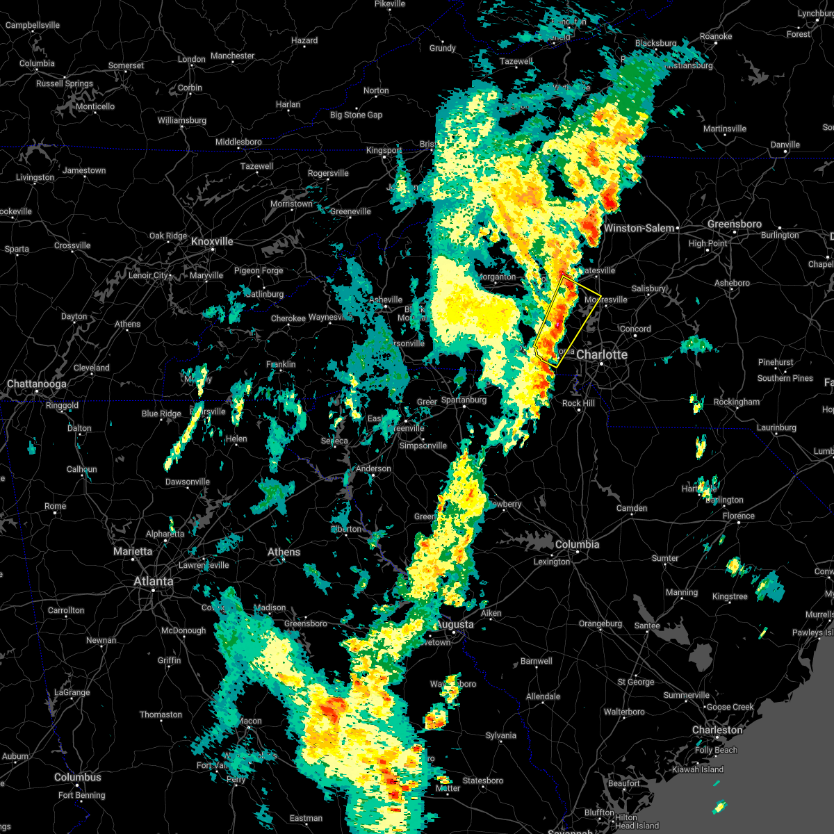 At 748 pm edt, a severe thunderstorm was located 7 miles northeast of lincolnton, or 5 miles northeast of boger city, moving northeast at 35 mph (radar indicated). Hazards include 60 mph wind gusts and quarter size hail. Minor hail damage to vehicles is expected. expect wind damage to trees and power lines. Locations impacted include, gastonia, lincolnton, bessemer city, south gastonia, dallas, maiden, stanley, westport, claremont and catawba. At 748 pm edt, a severe thunderstorm was located 7 miles northeast of lincolnton, or 5 miles northeast of boger city, moving northeast at 35 mph (radar indicated). Hazards include 60 mph wind gusts and quarter size hail. Minor hail damage to vehicles is expected. expect wind damage to trees and power lines. Locations impacted include, gastonia, lincolnton, bessemer city, south gastonia, dallas, maiden, stanley, westport, claremont and catawba.
|
| 5/26/2022 7:32 PM EDT |
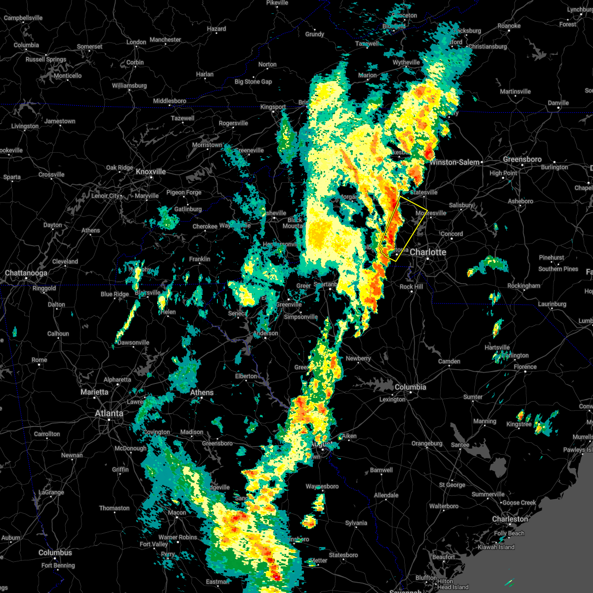 At 731 pm edt, a severe thunderstorm was located 5 miles south of lincolnton, or over high shoals, moving northeast at 30 mph (radar indicated). Hazards include 60 mph wind gusts and quarter size hail. Minor hail damage to vehicles is expected. expect wind damage to trees and power lines. Locations impacted include, gastonia, lincolnton, bessemer city, south gastonia, dallas, maiden, stanley, westport, claremont and catawba. At 731 pm edt, a severe thunderstorm was located 5 miles south of lincolnton, or over high shoals, moving northeast at 30 mph (radar indicated). Hazards include 60 mph wind gusts and quarter size hail. Minor hail damage to vehicles is expected. expect wind damage to trees and power lines. Locations impacted include, gastonia, lincolnton, bessemer city, south gastonia, dallas, maiden, stanley, westport, claremont and catawba.
|
| 5/26/2022 7:16 PM EDT |
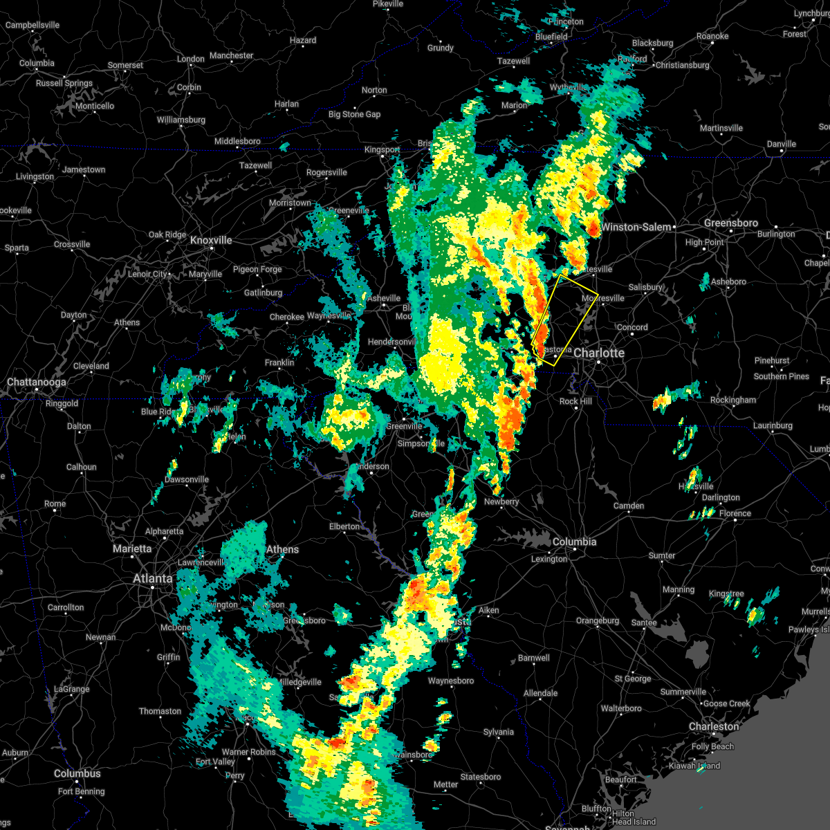 At 716 pm edt, a severe thunderstorm was located 7 miles northwest of gastonia, or near bessemer city, moving northeast at 35 mph (radar indicated). Hazards include 60 mph wind gusts and quarter size hail. Minor hail damage to vehicles is expected. Expect wind damage to trees and power lines. At 716 pm edt, a severe thunderstorm was located 7 miles northwest of gastonia, or near bessemer city, moving northeast at 35 mph (radar indicated). Hazards include 60 mph wind gusts and quarter size hail. Minor hail damage to vehicles is expected. Expect wind damage to trees and power lines.
|
| 5/26/2022 6:48 PM EDT |
 At 648 pm edt, a severe thunderstorm capable of producing a tornado was located 10 miles southwest of lincolnton, or over cherryville, moving north at 30 mph (radar indicated rotation). Hazards include tornado. Flying debris will be dangerous to those caught without shelter. mobile homes will be damaged or destroyed. damage to roofs, windows, and vehicles will occur. tree damage is likely. this dangerous storm will be near, lincolnton and boger city around 710 pm edt. maiden around 720 pm edt. Other locations impacted by this tornadic thunderstorm include crouse. At 648 pm edt, a severe thunderstorm capable of producing a tornado was located 10 miles southwest of lincolnton, or over cherryville, moving north at 30 mph (radar indicated rotation). Hazards include tornado. Flying debris will be dangerous to those caught without shelter. mobile homes will be damaged or destroyed. damage to roofs, windows, and vehicles will occur. tree damage is likely. this dangerous storm will be near, lincolnton and boger city around 710 pm edt. maiden around 720 pm edt. Other locations impacted by this tornadic thunderstorm include crouse.
|
| 5/26/2022 6:32 PM EDT |
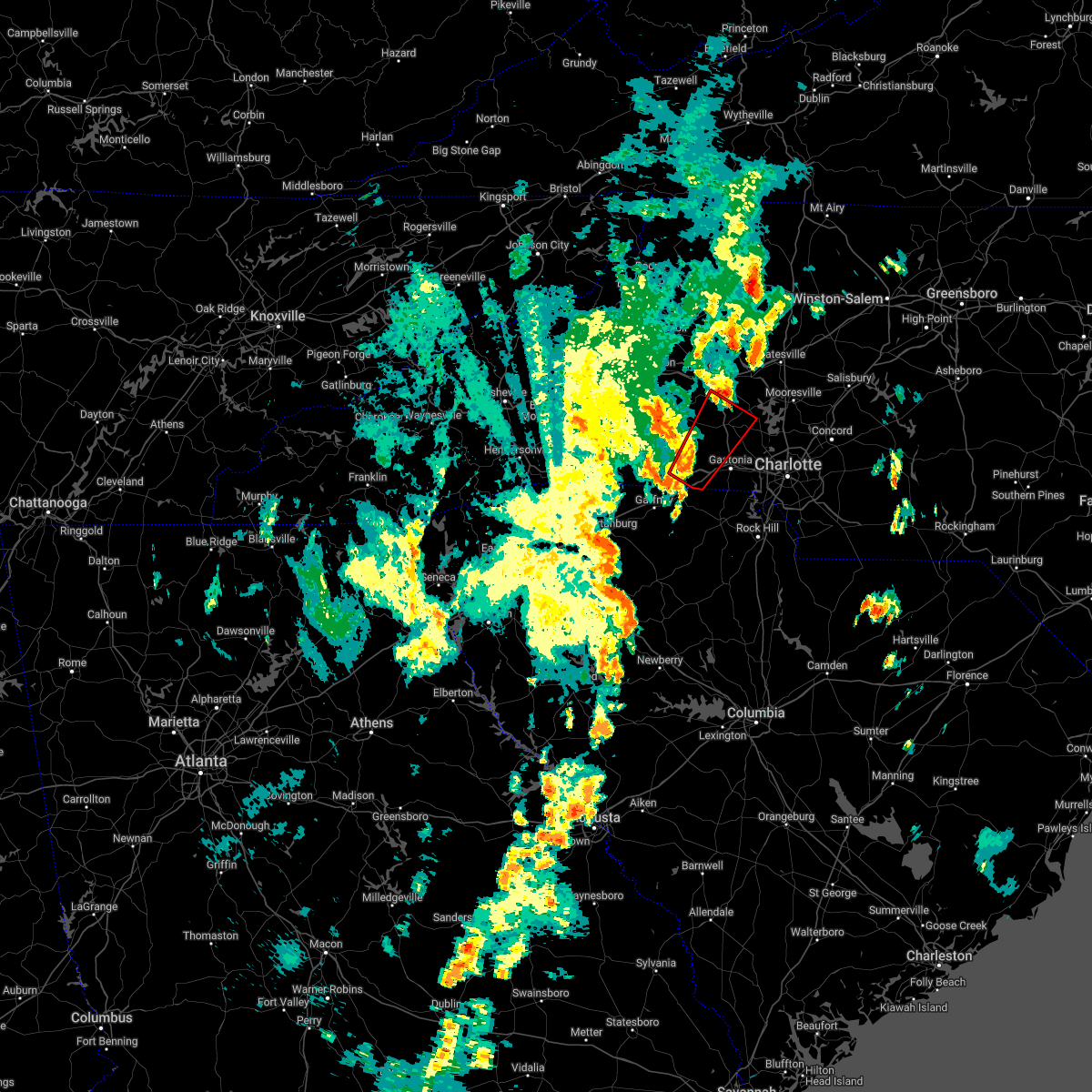 At 632 pm edt, a severe thunderstorm capable of producing a tornado was located 6 miles east of shelby, or 4 miles west of kings mountain, moving northeast at 25 mph (radar indicated rotation). Hazards include tornado. Flying debris will be dangerous to those caught without shelter. mobile homes will be damaged or destroyed. damage to roofs, windows, and vehicles will occur. tree damage is likely. this dangerous storm will be near, waco and bessemer city around 650 pm edt. cherryville around 700 pm edt. lincolnton, boger city, high shoals and iron station around 710 pm edt. Other locations impacted by this dangerous thunderstorm include crouse. At 632 pm edt, a severe thunderstorm capable of producing a tornado was located 6 miles east of shelby, or 4 miles west of kings mountain, moving northeast at 25 mph (radar indicated rotation). Hazards include tornado. Flying debris will be dangerous to those caught without shelter. mobile homes will be damaged or destroyed. damage to roofs, windows, and vehicles will occur. tree damage is likely. this dangerous storm will be near, waco and bessemer city around 650 pm edt. cherryville around 700 pm edt. lincolnton, boger city, high shoals and iron station around 710 pm edt. Other locations impacted by this dangerous thunderstorm include crouse.
|
| 5/26/2022 5:46 PM EDT |
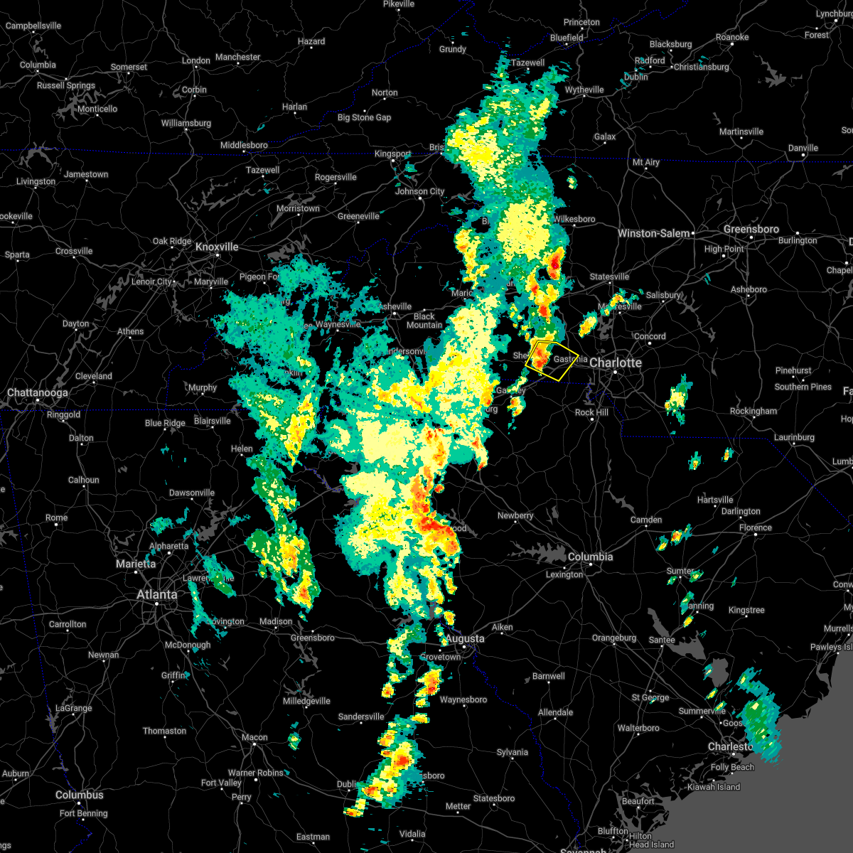 At 546 pm edt, a severe thunderstorm was located 8 miles east of shelby, or 4 miles northwest of kings mountain, moving north at 25 mph (radar indicated). Hazards include 60 mph wind gusts and quarter size hail. Minor hail damage to vehicles is expected. expect wind damage to trees and power lines. Locations impacted include, kings mountain, cherryville, bessemer city, dallas, waco, crowders mountain state park, crouse, shelby and gastonia. At 546 pm edt, a severe thunderstorm was located 8 miles east of shelby, or 4 miles northwest of kings mountain, moving north at 25 mph (radar indicated). Hazards include 60 mph wind gusts and quarter size hail. Minor hail damage to vehicles is expected. expect wind damage to trees and power lines. Locations impacted include, kings mountain, cherryville, bessemer city, dallas, waco, crowders mountain state park, crouse, shelby and gastonia.
|
| 5/26/2022 5:29 PM EDT |
 At 528 pm edt, a severe thunderstorm was located 9 miles southeast of shelby, or over grover, moving northeast at 15 mph (radar indicated). Hazards include 60 mph wind gusts and quarter size hail. Minor hail damage to vehicles is expected. Expect wind damage to trees and power lines. At 528 pm edt, a severe thunderstorm was located 9 miles southeast of shelby, or over grover, moving northeast at 15 mph (radar indicated). Hazards include 60 mph wind gusts and quarter size hail. Minor hail damage to vehicles is expected. Expect wind damage to trees and power lines.
|
| 5/26/2022 5:29 PM EDT |
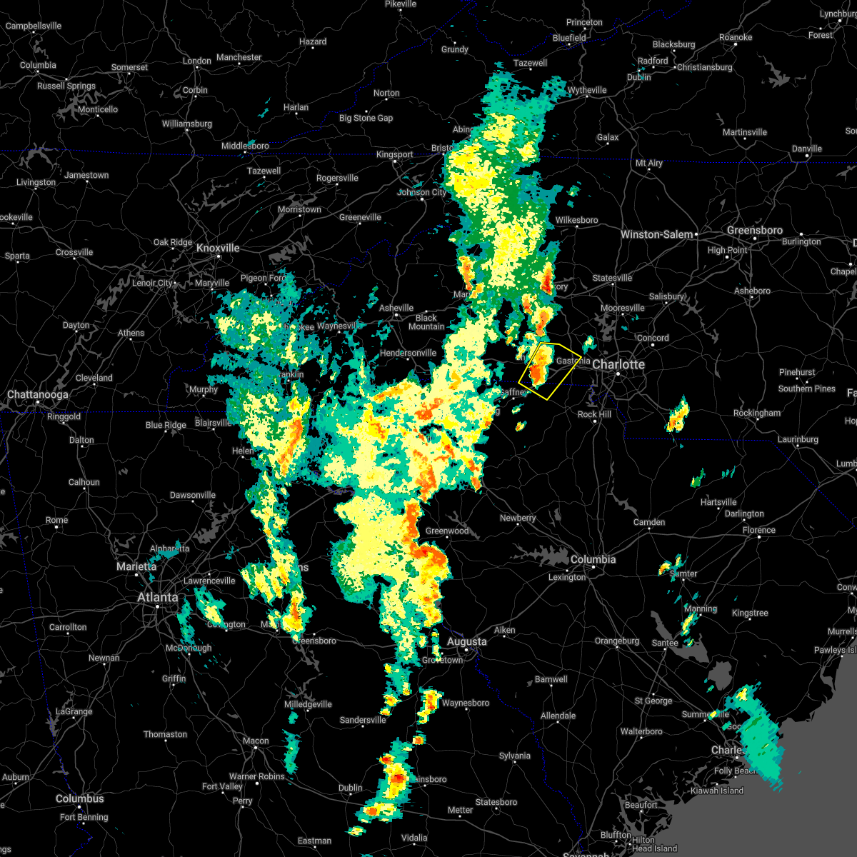 At 528 pm edt, a severe thunderstorm was located 9 miles southeast of shelby, or over grover, moving northeast at 15 mph (radar indicated). Hazards include 60 mph wind gusts and quarter size hail. Minor hail damage to vehicles is expected. Expect wind damage to trees and power lines. At 528 pm edt, a severe thunderstorm was located 9 miles southeast of shelby, or over grover, moving northeast at 15 mph (radar indicated). Hazards include 60 mph wind gusts and quarter size hail. Minor hail damage to vehicles is expected. Expect wind damage to trees and power lines.
|
| 5/6/2022 6:25 PM EDT |
 The severe thunderstorm warning for western lincoln, western mecklenburg, gaston, north central chester and central york counties will expire at 630 pm edt, the storms which prompted the warning have exited the warned area. therefore, the warning will be allowed to expire. a tornado watch remains in effect until 800 pm edt for the piedmont of north carolina, and upstate south carolina. The severe thunderstorm warning for western lincoln, western mecklenburg, gaston, north central chester and central york counties will expire at 630 pm edt, the storms which prompted the warning have exited the warned area. therefore, the warning will be allowed to expire. a tornado watch remains in effect until 800 pm edt for the piedmont of north carolina, and upstate south carolina.
|
| 5/6/2022 6:08 PM EDT |
 At 607 pm edt, severe thunderstorms were located along a line extending from 4 miles west of lincolnton to 5 miles south of gastonia to 7 miles north of chester, moving northeast at 35 mph (radar indicated). Hazards include 60 mph wind gusts and half dollar size hail. Minor hail damage to vehicles is expected. Expect wind damage to trees and power lines. At 607 pm edt, severe thunderstorms were located along a line extending from 4 miles west of lincolnton to 5 miles south of gastonia to 7 miles north of chester, moving northeast at 35 mph (radar indicated). Hazards include 60 mph wind gusts and half dollar size hail. Minor hail damage to vehicles is expected. Expect wind damage to trees and power lines.
|
| 5/6/2022 6:04 PM EDT |
 At 604 pm edt, severe thunderstorms were located along a line extending from 3 miles southwest of shelby to 9 miles west of york to 9 miles southeast of union, moving east at 20 mph (radar indicated). Hazards include golf ball size hail and 60 mph wind gusts. People and animals outdoors will be injured. expect hail damage to roofs, siding, windows, and vehicles. expect wind damage to trees and power lines. Locations impacted include, gastonia, lincolnton, york, cherryville, bessemer city, south gastonia, tega cay, clover, newport and dallas. At 604 pm edt, severe thunderstorms were located along a line extending from 3 miles southwest of shelby to 9 miles west of york to 9 miles southeast of union, moving east at 20 mph (radar indicated). Hazards include golf ball size hail and 60 mph wind gusts. People and animals outdoors will be injured. expect hail damage to roofs, siding, windows, and vehicles. expect wind damage to trees and power lines. Locations impacted include, gastonia, lincolnton, york, cherryville, bessemer city, south gastonia, tega cay, clover, newport and dallas.
|
| 5/6/2022 5:56 PM EDT |
 At 555 pm edt, severe thunderstorms were located along a line extending from 4 miles west of shelby to 11 miles west of york to 7 miles southeast of union, moving east at 20 mph (radar indicated). Hazards include golf ball size hail and 60 mph wind gusts. People and animals outdoors will be injured. expect hail damage to roofs, siding, windows, and vehicles. expect wind damage to trees and power lines. Locations impacted include, gastonia, lincolnton, york, kings mountain, cherryville, bessemer city, south gastonia, tega cay, clover and newport. At 555 pm edt, severe thunderstorms were located along a line extending from 4 miles west of shelby to 11 miles west of york to 7 miles southeast of union, moving east at 20 mph (radar indicated). Hazards include golf ball size hail and 60 mph wind gusts. People and animals outdoors will be injured. expect hail damage to roofs, siding, windows, and vehicles. expect wind damage to trees and power lines. Locations impacted include, gastonia, lincolnton, york, kings mountain, cherryville, bessemer city, south gastonia, tega cay, clover and newport.
|
| 5/6/2022 5:41 PM EDT |
 At 540 pm edt, severe thunderstorms were located along a line extending from 9 miles west of shelby to 7 miles east of gaffney to 4 miles south of union, moving east at 20 mph (radar indicated). Hazards include golf ball size hail and 60 mph wind gusts. People and animals outdoors will be injured. expect hail damage to roofs, siding, windows, and vehicles. Expect wind damage to trees and power lines. At 540 pm edt, severe thunderstorms were located along a line extending from 9 miles west of shelby to 7 miles east of gaffney to 4 miles south of union, moving east at 20 mph (radar indicated). Hazards include golf ball size hail and 60 mph wind gusts. People and animals outdoors will be injured. expect hail damage to roofs, siding, windows, and vehicles. Expect wind damage to trees and power lines.
|
| 5/6/2022 1:56 PM EDT |
 At 155 pm edt, a severe thunderstorm was located 6 miles north of gastonia, or near stanley, moving northeast at 40 mph (radar indicated). Hazards include 60 mph wind gusts and quarter size hail. Minor hail damage to vehicles is expected. Expect wind damage to trees and power lines. At 155 pm edt, a severe thunderstorm was located 6 miles north of gastonia, or near stanley, moving northeast at 40 mph (radar indicated). Hazards include 60 mph wind gusts and quarter size hail. Minor hail damage to vehicles is expected. Expect wind damage to trees and power lines.
|
| 5/4/2022 4:22 PM EDT |
 The severe thunderstorm warning for lincoln and north central gaston counties will expire at 430 pm edt, the storm which prompted the warning has weakened below severe limits, and no longer poses an immediate threat to life or property. therefore, the warning will be allowed to expire on schedule at 430 pm. however, gusty winds are still possible with this thunderstorm across northern gaston county. The severe thunderstorm warning for lincoln and north central gaston counties will expire at 430 pm edt, the storm which prompted the warning has weakened below severe limits, and no longer poses an immediate threat to life or property. therefore, the warning will be allowed to expire on schedule at 430 pm. however, gusty winds are still possible with this thunderstorm across northern gaston county.
|
| 5/4/2022 4:01 PM EDT |
 At 401 pm edt, a severe thunderstorm was located near lincolnton, moving southeast at 10 mph (radar indicated). Hazards include 60 mph wind gusts and quarter size hail. Minor hail damage to vehicles is expected. expect wind damage to trees and power lines. locations impacted include, lincolnton, dallas, stanley, ranlo, westport, high shoals, boger city, iron station, crouse and denver. hail threat, radar indicated max hail size, 1. 00 in wind threat, radar indicated max wind gust, 60 mph. At 401 pm edt, a severe thunderstorm was located near lincolnton, moving southeast at 10 mph (radar indicated). Hazards include 60 mph wind gusts and quarter size hail. Minor hail damage to vehicles is expected. expect wind damage to trees and power lines. locations impacted include, lincolnton, dallas, stanley, ranlo, westport, high shoals, boger city, iron station, crouse and denver. hail threat, radar indicated max hail size, 1. 00 in wind threat, radar indicated max wind gust, 60 mph.
|
| 5/4/2022 3:43 PM EDT |
 At 343 pm edt, a severe thunderstorm was located near lincolnton, moving southeast at 10 mph (radar indicated). Hazards include 60 mph wind gusts and quarter size hail. Minor hail damage to vehicles is expected. Expect wind damage to trees and power lines. At 343 pm edt, a severe thunderstorm was located near lincolnton, moving southeast at 10 mph (radar indicated). Hazards include 60 mph wind gusts and quarter size hail. Minor hail damage to vehicles is expected. Expect wind damage to trees and power lines.
|
| 8/17/2020 4:43 PM EDT |
 At 442 pm edt, severe thunderstorms were located along a line extending from 8 miles southwest of lincolnton to 5 miles northeast of shelby, moving southeast at 15 mph (radar indicated). Hazards include 60 mph wind gusts and quarter size hail. Minor hail damage to vehicles is expected. Expect wind damage to trees and power lines. At 442 pm edt, severe thunderstorms were located along a line extending from 8 miles southwest of lincolnton to 5 miles northeast of shelby, moving southeast at 15 mph (radar indicated). Hazards include 60 mph wind gusts and quarter size hail. Minor hail damage to vehicles is expected. Expect wind damage to trees and power lines.
|
| 8/13/2020 6:30 PM EDT | 911 call center reported a tree down blocking a roadway on the intersection of miles rd and huffstetler lake r in gaston county NC, 4.5 miles SE of Dallas, NC |
| 8/3/2020 1:13 AM EDT |
 The severe thunderstorm warning for southwestern lincoln, southeastern cleveland and northwestern gaston counties will expire at 115 am edt, the storm which prompted the warning has weakened below severe limits, and no longer poses an immediate threat to life or property. therefore, the warning will be allowed to expire. however, gusty winds and heavy rain are still possible with this thunderstorm. The severe thunderstorm warning for southwestern lincoln, southeastern cleveland and northwestern gaston counties will expire at 115 am edt, the storm which prompted the warning has weakened below severe limits, and no longer poses an immediate threat to life or property. therefore, the warning will be allowed to expire. however, gusty winds and heavy rain are still possible with this thunderstorm.
|
| 8/3/2020 12:55 AM EDT |
 At 1255 am edt, a severe thunderstorm was located 6 miles east of shelby, or near waco, moving northeast at 20 mph (radar indicated). Hazards include 60 mph wind gusts and penny size hail. Expect damage to trees and power lines. Locations impacted include, shelby, kings mountain, cherryville, bessemer city, dallas, waco, crouse and gastonia. At 1255 am edt, a severe thunderstorm was located 6 miles east of shelby, or near waco, moving northeast at 20 mph (radar indicated). Hazards include 60 mph wind gusts and penny size hail. Expect damage to trees and power lines. Locations impacted include, shelby, kings mountain, cherryville, bessemer city, dallas, waco, crouse and gastonia.
|
| 8/3/2020 12:36 AM EDT |
 At 1236 am edt, a severe thunderstorm was located 4 miles south of shelby, or near patterson springs, moving northeast at 20 mph (radar indicated). Hazards include 60 mph wind gusts and penny size hail. expect damage to trees and power lines At 1236 am edt, a severe thunderstorm was located 4 miles south of shelby, or near patterson springs, moving northeast at 20 mph (radar indicated). Hazards include 60 mph wind gusts and penny size hail. expect damage to trees and power lines
|
| 7/21/2020 7:17 PM EDT |
 At 717 pm edt, a severe thunderstorm was located 9 miles southwest of uptown charlotte, or near steele creek, moving northeast at 15 mph (radar indicated). Hazards include 60 mph wind gusts and half dollar size hail. Minor hail damage to vehicles is expected. expect wind damage to trees and power lines. Locations impacted include, uptown charlotte, central charlotte, southwest charlotte, northwest charlotte, mt holly, belmont, pineville, tega cay, cramerton and lowell. At 717 pm edt, a severe thunderstorm was located 9 miles southwest of uptown charlotte, or near steele creek, moving northeast at 15 mph (radar indicated). Hazards include 60 mph wind gusts and half dollar size hail. Minor hail damage to vehicles is expected. expect wind damage to trees and power lines. Locations impacted include, uptown charlotte, central charlotte, southwest charlotte, northwest charlotte, mt holly, belmont, pineville, tega cay, cramerton and lowell.
|
| 7/21/2020 7:04 PM EDT |
 At 704 pm edt, a severe thunderstorm was located 11 miles southwest of uptown charlotte, or over steele creek, moving north at 15 mph (radar indicated). Hazards include 60 mph wind gusts and quarter size hail. Minor hail damage to vehicles is expected. Expect wind damage to trees and power lines. At 704 pm edt, a severe thunderstorm was located 11 miles southwest of uptown charlotte, or over steele creek, moving north at 15 mph (radar indicated). Hazards include 60 mph wind gusts and quarter size hail. Minor hail damage to vehicles is expected. Expect wind damage to trees and power lines.
|
| 7/18/2020 4:30 PM EDT |
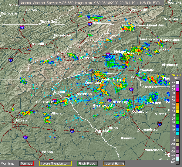 At 430 pm edt, a severe thunderstorm was located 4 miles east of lincolnton, or near iron station, moving east at 10 mph (radar indicated). Hazards include 60 mph wind gusts and quarter size hail. Minor hail damage to vehicles is expected. Expect wind damage to trees and power lines. At 430 pm edt, a severe thunderstorm was located 4 miles east of lincolnton, or near iron station, moving east at 10 mph (radar indicated). Hazards include 60 mph wind gusts and quarter size hail. Minor hail damage to vehicles is expected. Expect wind damage to trees and power lines.
|
| 6/22/2020 6:23 PM EDT |
 At 622 pm edt, severe thunderstorms were located along a line extending from 6 miles southeast of lincolnton to 4 miles northeast of gastonia to 14 miles northeast of york, moving east at 35 mph (radar indicated). Hazards include 60 mph wind gusts and quarter size hail. Minor hail damage to vehicles is expected. Expect wind damage to trees and power lines. At 622 pm edt, severe thunderstorms were located along a line extending from 6 miles southeast of lincolnton to 4 miles northeast of gastonia to 14 miles northeast of york, moving east at 35 mph (radar indicated). Hazards include 60 mph wind gusts and quarter size hail. Minor hail damage to vehicles is expected. Expect wind damage to trees and power lines.
|
| 6/22/2020 6:13 PM EDT |
 At 612 pm edt, a severe thunderstorm was located near gastonia, or near dallas, moving east at 35 mph (radar indicated). Hazards include 60 mph wind gusts and quarter size hail. Minor hail damage to vehicles is expected. expect wind damage to trees and power lines. Locations impacted include, gastonia, mt holly, belmont, bessemer city, south gastonia, dallas, stanley, cramerton, lowell and ranlo. At 612 pm edt, a severe thunderstorm was located near gastonia, or near dallas, moving east at 35 mph (radar indicated). Hazards include 60 mph wind gusts and quarter size hail. Minor hail damage to vehicles is expected. expect wind damage to trees and power lines. Locations impacted include, gastonia, mt holly, belmont, bessemer city, south gastonia, dallas, stanley, cramerton, lowell and ranlo.
|
| 6/22/2020 5:44 PM EDT |
 At 544 pm edt, a severe thunderstorm was located 6 miles east of shelby, or 4 miles west of kings mountain, moving northeast at 30 mph (radar indicated). Hazards include 60 mph wind gusts and quarter size hail. Minor hail damage to vehicles is expected. Expect wind damage to trees and power lines. At 544 pm edt, a severe thunderstorm was located 6 miles east of shelby, or 4 miles west of kings mountain, moving northeast at 30 mph (radar indicated). Hazards include 60 mph wind gusts and quarter size hail. Minor hail damage to vehicles is expected. Expect wind damage to trees and power lines.
|
| 5/22/2020 3:51 PM EDT |
 At 350 pm edt, severe thunderstorms were located along a line extending from near gastonia to 5 miles east of york, moving east at 50 mph (radar indicated). Hazards include 60 mph wind gusts and penny size hail. expect damage to trees and power lines At 350 pm edt, severe thunderstorms were located along a line extending from near gastonia to 5 miles east of york, moving east at 50 mph (radar indicated). Hazards include 60 mph wind gusts and penny size hail. expect damage to trees and power lines
|
| 5/22/2020 3:34 PM EDT |
 At 333 pm edt, severe thunderstorms were located along a line extending from near shelby to 11 miles northeast of union, moving east at 50 mph (radar indicated). Hazards include 60 mph wind gusts and penny size hail. expect damage to trees and power lines At 333 pm edt, severe thunderstorms were located along a line extending from near shelby to 11 miles northeast of union, moving east at 50 mph (radar indicated). Hazards include 60 mph wind gusts and penny size hail. expect damage to trees and power lines
|
| 4/25/2020 9:37 PM EDT |
 At 937 pm edt, a severe thunderstorm was located 7 miles northwest of uptown charlotte, or near paw creek, moving east at 40 mph (radar indicated). Hazards include 60 mph wind gusts and quarter size hail. Minor hail damage to vehicles is expected. Expect wind damage to trees and power lines. At 937 pm edt, a severe thunderstorm was located 7 miles northwest of uptown charlotte, or near paw creek, moving east at 40 mph (radar indicated). Hazards include 60 mph wind gusts and quarter size hail. Minor hail damage to vehicles is expected. Expect wind damage to trees and power lines.
|
| 4/25/2020 9:25 PM EDT |
 At 925 pm edt, a severe thunderstorm capable of producing a tornado was located near gastonia, moving east at 45 mph (radar indicated rotation). Hazards include tornado and half dollar size hail. Flying debris will be dangerous to those caught without shelter. mobile homes will be damaged or destroyed. damage to roofs, windows, and vehicles will occur. tree damage is likely. this dangerous storm will be near, cramerton, mcadenville, belmont and town of lake wylie around 930 pm edt. lake wylie and mt holly around 940 pm edt. Other locations impacted by this dangerous storm include crowders. At 925 pm edt, a severe thunderstorm capable of producing a tornado was located near gastonia, moving east at 45 mph (radar indicated rotation). Hazards include tornado and half dollar size hail. Flying debris will be dangerous to those caught without shelter. mobile homes will be damaged or destroyed. damage to roofs, windows, and vehicles will occur. tree damage is likely. this dangerous storm will be near, cramerton, mcadenville, belmont and town of lake wylie around 930 pm edt. lake wylie and mt holly around 940 pm edt. Other locations impacted by this dangerous storm include crowders.
|
| 4/25/2020 9:14 PM EDT |
 At 914 pm edt, a severe thunderstorm capable of producing a tornado was located 7 miles southwest of gastonia, or near crowders mountain state park, moving east at 40 mph (radar indicated rotation). Hazards include tornado and half dollar size hail. Flying debris will be dangerous to those caught without shelter. mobile homes will be damaged or destroyed. damage to roofs, windows, and vehicles will occur. tree damage is likely. this dangerous storm will be near, gastonia and south gastonia around 920 pm edt. cramerton, mcadenville, ranlo and lowell around 930 pm edt. lake wylie, belmont and mt holly around 940 pm edt. Other locations impacted by this dangerous thunderstorm include bethany and crowders. At 914 pm edt, a severe thunderstorm capable of producing a tornado was located 7 miles southwest of gastonia, or near crowders mountain state park, moving east at 40 mph (radar indicated rotation). Hazards include tornado and half dollar size hail. Flying debris will be dangerous to those caught without shelter. mobile homes will be damaged or destroyed. damage to roofs, windows, and vehicles will occur. tree damage is likely. this dangerous storm will be near, gastonia and south gastonia around 920 pm edt. cramerton, mcadenville, ranlo and lowell around 930 pm edt. lake wylie, belmont and mt holly around 940 pm edt. Other locations impacted by this dangerous thunderstorm include bethany and crowders.
|
| 4/13/2020 4:13 AM EDT |
 At 411 am edt, strong to severe thunderstorms were located along a line extending from 11 miles southeast of wilkesboro to 7 miles southeast of shelby, moving northeast at 70 mph. scattered pockets of wind damage will occur across the north carolina piedmont early this morning, including portions of the charlotte metropolitan area (radar indicated). Hazards include 60 mph wind gusts. expect damage to trees and power lines At 411 am edt, strong to severe thunderstorms were located along a line extending from 11 miles southeast of wilkesboro to 7 miles southeast of shelby, moving northeast at 70 mph. scattered pockets of wind damage will occur across the north carolina piedmont early this morning, including portions of the charlotte metropolitan area (radar indicated). Hazards include 60 mph wind gusts. expect damage to trees and power lines
|
| 4/8/2020 9:43 PM EDT |
 The severe thunderstorm warning for mecklenburg, cleveland, gaston, union, central york and northeastern cherokee counties will expire at 945 pm edt, the storms which prompted the warning have weakened below severe limits, and no longer pose an immediate threat to life or property. therefore the warning will be allowed to expire. however heavy rain is still possible with these thunderstorms. The severe thunderstorm warning for mecklenburg, cleveland, gaston, union, central york and northeastern cherokee counties will expire at 945 pm edt, the storms which prompted the warning have weakened below severe limits, and no longer pose an immediate threat to life or property. therefore the warning will be allowed to expire. however heavy rain is still possible with these thunderstorms.
|
| 4/8/2020 9:26 PM EDT |
 At 925 pm edt, severe thunderstorms were located along a line extending from 3 miles south of shelby to 10 miles east of monroe, moving southeast at 5 mph (radar indicated). Hazards include 60 mph wind gusts and quarter size hail. Minor hail damage to vehicles is expected. expect wind damage to trees and power lines. Locations impacted include, gastonia, rock hill, uptown charlotte, monroe, shelby, york, central charlotte, south charlotte, southwest charlotte and east charlotte. At 925 pm edt, severe thunderstorms were located along a line extending from 3 miles south of shelby to 10 miles east of monroe, moving southeast at 5 mph (radar indicated). Hazards include 60 mph wind gusts and quarter size hail. Minor hail damage to vehicles is expected. expect wind damage to trees and power lines. Locations impacted include, gastonia, rock hill, uptown charlotte, monroe, shelby, york, central charlotte, south charlotte, southwest charlotte and east charlotte.
|
| 4/8/2020 8:56 PM EDT |
 At 855 pm edt, severe thunderstorms were located along a line extending from 3 miles west of shelby to 8 miles east of monroe, moving southeast at 5 mph (radar indicated). Hazards include 60 mph wind gusts and quarter size hail. Minor hail damage to vehicles is expected. Expect wind damage to trees and power lines. At 855 pm edt, severe thunderstorms were located along a line extending from 3 miles west of shelby to 8 miles east of monroe, moving southeast at 5 mph (radar indicated). Hazards include 60 mph wind gusts and quarter size hail. Minor hail damage to vehicles is expected. Expect wind damage to trees and power lines.
|
| 2/6/2020 11:04 AM EST |
 At 1104 am est, a tornado producing storm was located 4 miles southwest of gastonia, or near south gastonia, moving east at 60 mph (radar confirmed tornado). Hazards include damaging tornado. Flying debris will be dangerous to those caught without shelter. mobile homes will be damaged or destroyed. damage to roofs, windows, and vehicles will occur. tree damage is likely. this dangerous storm will be near, ranlo, lowell and dallas around 1110 am est. southwest charlotte, paw creek, belmont, lake wylie and charlotte douglas airport around 1120 am est. uptown charlotte, central charlotte, northwest charlotte, hidden valley and the plaza around 1130 am est. downtown concord, harrisburg, charlotte motor speedway, west concord and university city around 1140 am est. Other locations impacted by this dangerous thunderstorm include crowders and croft. At 1104 am est, a tornado producing storm was located 4 miles southwest of gastonia, or near south gastonia, moving east at 60 mph (radar confirmed tornado). Hazards include damaging tornado. Flying debris will be dangerous to those caught without shelter. mobile homes will be damaged or destroyed. damage to roofs, windows, and vehicles will occur. tree damage is likely. this dangerous storm will be near, ranlo, lowell and dallas around 1110 am est. southwest charlotte, paw creek, belmont, lake wylie and charlotte douglas airport around 1120 am est. uptown charlotte, central charlotte, northwest charlotte, hidden valley and the plaza around 1130 am est. downtown concord, harrisburg, charlotte motor speedway, west concord and university city around 1140 am est. Other locations impacted by this dangerous thunderstorm include crowders and croft.
|
| 2/6/2020 10:59 AM EST |
 At 1058 am est, a confirmed tornado was located 11 miles west of gastonia, or near kings mountain, moving east at 40 mph (radar confirmed tornado). Hazards include damaging tornado. Flying debris will be dangerous to those caught without shelter. mobile homes will be damaged or destroyed. damage to roofs, windows, and vehicles will occur. tree damage is likely. this tornado will be near, crowders mountain state park and kings mountain around 1100 am est. gastonia, south gastonia and bessemer city around 1110 am est. ranlo, lowell and dallas around 1120 am est. belmont, mcadenville and cramerton around 1130 am est. Other locations impacted by this dangerous storm include crowders. At 1058 am est, a confirmed tornado was located 11 miles west of gastonia, or near kings mountain, moving east at 40 mph (radar confirmed tornado). Hazards include damaging tornado. Flying debris will be dangerous to those caught without shelter. mobile homes will be damaged or destroyed. damage to roofs, windows, and vehicles will occur. tree damage is likely. this tornado will be near, crowders mountain state park and kings mountain around 1100 am est. gastonia, south gastonia and bessemer city around 1110 am est. ranlo, lowell and dallas around 1120 am est. belmont, mcadenville and cramerton around 1130 am est. Other locations impacted by this dangerous storm include crowders.
|
| 2/6/2020 10:55 AM EST |
 At 1055 am est, a severe thunderstorm capable of producing a tornado was located 10 miles southeast of shelby, or near grover, moving east at 40 mph (radar indicated rotation). Hazards include tornado. Flying debris will be dangerous to those caught without shelter. mobile homes will be damaged or destroyed. damage to roofs, windows, and vehicles will occur. tree damage is likely. this dangerous storm will be near, crowders mountain state park and kings mountain around 1100 am est. gastonia, south gastonia and bessemer city around 1110 am est. ranlo, lowell, mcadenville, dallas and cramerton around 1120 am est. belmont around 1130 am est. Other locations impacted by this dangerous thunderstorm include crowders. At 1055 am est, a severe thunderstorm capable of producing a tornado was located 10 miles southeast of shelby, or near grover, moving east at 40 mph (radar indicated rotation). Hazards include tornado. Flying debris will be dangerous to those caught without shelter. mobile homes will be damaged or destroyed. damage to roofs, windows, and vehicles will occur. tree damage is likely. this dangerous storm will be near, crowders mountain state park and kings mountain around 1100 am est. gastonia, south gastonia and bessemer city around 1110 am est. ranlo, lowell, mcadenville, dallas and cramerton around 1120 am est. belmont around 1130 am est. Other locations impacted by this dangerous thunderstorm include crowders.
|
| 2/6/2020 10:46 AM EST |
 At 1046 am est, a severe thunderstorm was located 7 miles northeast of gaffney, or near blacksburg, moving northeast at 65 mph (radar indicated). Hazards include 60 mph wind gusts. expect damage to trees and power lines At 1046 am est, a severe thunderstorm was located 7 miles northeast of gaffney, or near blacksburg, moving northeast at 65 mph (radar indicated). Hazards include 60 mph wind gusts. expect damage to trees and power lines
|
| 1/11/2020 9:41 PM EST |
 At 941 pm est, severe thunderstorms were located along a line extending from 12 miles northeast of taylorsville to 9 miles east of newton to 8 miles northeast of gaffney, moving northeast at 25 mph (radar indicated). Hazards include 60 mph wind gusts. expect damage to trees and power lines At 941 pm est, severe thunderstorms were located along a line extending from 12 miles northeast of taylorsville to 9 miles east of newton to 8 miles northeast of gaffney, moving northeast at 25 mph (radar indicated). Hazards include 60 mph wind gusts. expect damage to trees and power lines
|
| 1/11/2020 8:57 PM EST |
 At 857 pm est, severe thunderstorms were located along a line extending from 4 miles south of boomer to 5 miles south of hickory to 6 miles northeast of gaffney, moving northeast at 35 mph (radar indicated). Hazards include 70 mph wind gusts. Expect considerable tree damage. Damage is likely to mobile homes, roofs, and outbuildings. At 857 pm est, severe thunderstorms were located along a line extending from 4 miles south of boomer to 5 miles south of hickory to 6 miles northeast of gaffney, moving northeast at 35 mph (radar indicated). Hazards include 70 mph wind gusts. Expect considerable tree damage. Damage is likely to mobile homes, roofs, and outbuildings.
|
| 10/31/2019 5:10 PM EDT |
 At 509 pm edt, severe thunderstorms were located along a line extending from 5 miles east of gastonia to 13 miles north of rock hill to 4 miles east of york, moving northeast at 55 mph. another line of severe storms was located in southern iredell and northern mecklenburg counties, also moving northeast at 50-55 mph (radar indicated). Hazards include 60 mph wind gusts. Expect damage to trees and power lines. locations impacted include, gastonia, rock hill, uptown charlotte, huntersville, kannapolis, downtown concord, salisbury, york, central charlotte and south charlotte. A tornado watch remains in effect until 1100 pm edt for the piedmont of north carolina, and upstate south carolina. At 509 pm edt, severe thunderstorms were located along a line extending from 5 miles east of gastonia to 13 miles north of rock hill to 4 miles east of york, moving northeast at 55 mph. another line of severe storms was located in southern iredell and northern mecklenburg counties, also moving northeast at 50-55 mph (radar indicated). Hazards include 60 mph wind gusts. Expect damage to trees and power lines. locations impacted include, gastonia, rock hill, uptown charlotte, huntersville, kannapolis, downtown concord, salisbury, york, central charlotte and south charlotte. A tornado watch remains in effect until 1100 pm edt for the piedmont of north carolina, and upstate south carolina.
|
| 10/31/2019 4:58 PM EDT |
 At 457 pm edt, severe thunderstorms were located along a line extending from 10 miles east of lincolnton to 3 miles southeast of gastonia to 13 miles northwest of chester, moving northeast at 55 mph (radar indicated). Hazards include 60 mph wind gusts. expect damage to trees and power lines At 457 pm edt, severe thunderstorms were located along a line extending from 10 miles east of lincolnton to 3 miles southeast of gastonia to 13 miles northwest of chester, moving northeast at 55 mph (radar indicated). Hazards include 60 mph wind gusts. expect damage to trees and power lines
|
| 10/31/2019 4:50 PM EDT |
 At 450 pm edt, severe thunderstorms were located along a line extending from 3 miles southeast of lincolnton to 3 miles south of gastonia to 9 miles northeast of union, moving northeast at 50 mph (radar indicated). Hazards include 60 mph wind gusts. Expect damage to trees and power lines. locations impacted include, gastonia, union, york, kings mountain, mt holly, belmont, cherryville, bessemer city, south gastonia and clover. A tornado watch remains in effect until 1100 pm edt for the piedmont of north carolina, and upstate south carolina. At 450 pm edt, severe thunderstorms were located along a line extending from 3 miles southeast of lincolnton to 3 miles south of gastonia to 9 miles northeast of union, moving northeast at 50 mph (radar indicated). Hazards include 60 mph wind gusts. Expect damage to trees and power lines. locations impacted include, gastonia, union, york, kings mountain, mt holly, belmont, cherryville, bessemer city, south gastonia and clover. A tornado watch remains in effect until 1100 pm edt for the piedmont of north carolina, and upstate south carolina.
|
| 10/31/2019 4:30 PM EDT |
 At 430 pm edt, severe thunderstorms were located along a line extending from 3 miles southeast of shelby to 12 miles southeast of gaffney to 12 miles northeast of laurens, moving northeast at 40 mph (radar indicated). Hazards include 60 mph wind gusts. expect damage to trees and power lines At 430 pm edt, severe thunderstorms were located along a line extending from 3 miles southeast of shelby to 12 miles southeast of gaffney to 12 miles northeast of laurens, moving northeast at 40 mph (radar indicated). Hazards include 60 mph wind gusts. expect damage to trees and power lines
|
| 7/19/2019 11:55 PM EDT | Trees blown down along the dallas stanley highwa in gaston county NC, 2.5 miles SW of Dallas, NC |
| 7/19/2019 11:52 PM EDT |
 At 1152 pm edt, a severe thunderstorm was located 6 miles northeast of gastonia, or near mt holly, moving west at 10 mph (radar indicated). Hazards include 60 mph wind gusts and quarter size hail. Minor hail damage to vehicles is expected. Expect wind damage to trees and power lines. At 1152 pm edt, a severe thunderstorm was located 6 miles northeast of gastonia, or near mt holly, moving west at 10 mph (radar indicated). Hazards include 60 mph wind gusts and quarter size hail. Minor hail damage to vehicles is expected. Expect wind damage to trees and power lines.
|
| 6/24/2019 9:27 PM EDT |
 At 927 pm edt, severe thunderstorms were located along a line extending from 6 miles south of yadkinville to 4 miles north of statesville to 8 miles north of kannapolis to near huntersville to 7 miles northeast of indian land to 4 miles southwest of rock hill to 11 miles north of winnsboro, moving east at 40 mph (radar indicated). Hazards include 70 mph wind gusts. Expect considerable tree damage. Damage is likely to mobile homes, roofs, and outbuildings. At 927 pm edt, severe thunderstorms were located along a line extending from 6 miles south of yadkinville to 4 miles north of statesville to 8 miles north of kannapolis to near huntersville to 7 miles northeast of indian land to 4 miles southwest of rock hill to 11 miles north of winnsboro, moving east at 40 mph (radar indicated). Hazards include 70 mph wind gusts. Expect considerable tree damage. Damage is likely to mobile homes, roofs, and outbuildings.
|
| 6/24/2019 9:16 PM EDT |
 At 916 pm edt, severe thunderstorms were located along a line extending from 15 miles east of taylorsville to 7 miles northwest of statesville to 14 miles northwest of kannapolis to 5 miles west of huntersville to 6 miles southwest of uptown charlotte to 7 miles south of york to 6 miles south of chester, moving northeast at 70 mph (radar indicated). Hazards include 70 mph wind gusts. Expect considerable tree damage. damage is likely to mobile homes, roofs, and outbuildings. Locations impacted include, gastonia, rock hill, uptown charlotte, huntersville, statesville, lincolnton, york, chester, mocksville and central charlotte. At 916 pm edt, severe thunderstorms were located along a line extending from 15 miles east of taylorsville to 7 miles northwest of statesville to 14 miles northwest of kannapolis to 5 miles west of huntersville to 6 miles southwest of uptown charlotte to 7 miles south of york to 6 miles south of chester, moving northeast at 70 mph (radar indicated). Hazards include 70 mph wind gusts. Expect considerable tree damage. damage is likely to mobile homes, roofs, and outbuildings. Locations impacted include, gastonia, rock hill, uptown charlotte, huntersville, statesville, lincolnton, york, chester, mocksville and central charlotte.
|
| 6/24/2019 9:05 PM EDT |
 At 904 pm edt, severe thunderstorms were located along a line extending from 8 miles southeast of taylorsville to 11 miles east of newton to 9 miles southeast of lincolnton to 7 miles southeast of gastonia to 5 miles west of york to 13 miles southeast of union, moving east at 35 mph (radar indicated). Hazards include 60 mph wind gusts. Expect damage to trees and power lines. locations impacted include, gastonia, hickory, newton, lincolnton, union, york, mt holly, st. Stephens, belmont and clinton. At 904 pm edt, severe thunderstorms were located along a line extending from 8 miles southeast of taylorsville to 11 miles east of newton to 9 miles southeast of lincolnton to 7 miles southeast of gastonia to 5 miles west of york to 13 miles southeast of union, moving east at 35 mph (radar indicated). Hazards include 60 mph wind gusts. Expect damage to trees and power lines. locations impacted include, gastonia, hickory, newton, lincolnton, union, york, mt holly, st. Stephens, belmont and clinton.
|
| 6/24/2019 9:00 PM EDT |
 At 859 pm edt, severe thunderstorms were located along a line extending from 4 miles southeast of taylorsville to 10 miles southwest of statesville to 7 miles southeast of lincolnton to 8 miles southeast of gastonia to 7 miles southwest of york to 16 miles southeast of union, moving northeast at 50 mph (radar indicated). Hazards include 70 mph wind gusts. Expect considerable tree damage. Damage is likely to mobile homes, roofs, and outbuildings. At 859 pm edt, severe thunderstorms were located along a line extending from 4 miles southeast of taylorsville to 10 miles southwest of statesville to 7 miles southeast of lincolnton to 8 miles southeast of gastonia to 7 miles southwest of york to 16 miles southeast of union, moving northeast at 50 mph (radar indicated). Hazards include 70 mph wind gusts. Expect considerable tree damage. Damage is likely to mobile homes, roofs, and outbuildings.
|
| 6/24/2019 8:45 PM EDT |
 At 845 pm edt, severe thunderstorms were located along a line extending from 5 miles northeast of hickory to 5 miles northeast of lincolnton to 8 miles west of gastonia to 7 miles north of york to 13 miles northeast of union to 16 miles north of newberry, moving east at 60 mph (radar indicated). Hazards include 60 mph wind gusts. Expect damage to trees and power lines. Locations impacted include, gastonia, hickory, shelby, newton, gaffney, lincolnton, union, york, kings mountain and mt holly. At 845 pm edt, severe thunderstorms were located along a line extending from 5 miles northeast of hickory to 5 miles northeast of lincolnton to 8 miles west of gastonia to 7 miles north of york to 13 miles northeast of union to 16 miles north of newberry, moving east at 60 mph (radar indicated). Hazards include 60 mph wind gusts. Expect damage to trees and power lines. Locations impacted include, gastonia, hickory, shelby, newton, gaffney, lincolnton, union, york, kings mountain and mt holly.
|
| 6/24/2019 8:26 PM EDT |
 At 826 pm edt, severe thunderstorms were located along a line extending from 8 miles southwest of hickory to 7 miles southeast of shelby to 11 miles north of union to 7 miles southeast of laurens, moving northeast at 35 mph (radar indicated). Hazards include 60 mph wind gusts. expect damage to trees and power lines At 826 pm edt, severe thunderstorms were located along a line extending from 8 miles southwest of hickory to 7 miles southeast of shelby to 11 miles north of union to 7 miles southeast of laurens, moving northeast at 35 mph (radar indicated). Hazards include 60 mph wind gusts. expect damage to trees and power lines
|
| 6/20/2019 4:20 PM EDT | Fire dept/rescue reported a tree down on a house on joe cloninger r in gaston county NC, 3.2 miles ESE of Dallas, NC |
| 6/20/2019 4:20 PM EDT |
 At 420 pm edt, a severe thunderstorm was located near gastonia, or near dallas, moving east at 35 mph (radar indicated). Hazards include 60 mph wind gusts. expect damage to trees and power lines At 420 pm edt, a severe thunderstorm was located near gastonia, or near dallas, moving east at 35 mph (radar indicated). Hazards include 60 mph wind gusts. expect damage to trees and power lines
|
| 5/31/2019 3:12 PM EDT |
 The severe thunderstorm warning for northwestern mecklenburg and northeastern gaston counties will expire at 315 pm edt, the storm which prompted the warning has weakened below severe limits, and no longer poses an immediate threat to life or property. therefore the warning will be allowed to expire. a severe thunderstorm watch remains in effect until 1100 pm edt for the piedmont of north carolina. The severe thunderstorm warning for northwestern mecklenburg and northeastern gaston counties will expire at 315 pm edt, the storm which prompted the warning has weakened below severe limits, and no longer poses an immediate threat to life or property. therefore the warning will be allowed to expire. a severe thunderstorm watch remains in effect until 1100 pm edt for the piedmont of north carolina.
|
| 5/31/2019 3:02 PM EDT |
 At 301 pm edt, a severe thunderstorm was located 5 miles northeast of gastonia, or near ranlo, moving east at 25 mph (radar indicated). Hazards include 60 mph wind gusts. Expect damage to trees and power lines. Locations impacted include, northwest charlotte, mt holly, belmont, stanley, cramerton, lowell, ranlo, mcadenville, charlotte douglas airport and paw creek. At 301 pm edt, a severe thunderstorm was located 5 miles northeast of gastonia, or near ranlo, moving east at 25 mph (radar indicated). Hazards include 60 mph wind gusts. Expect damage to trees and power lines. Locations impacted include, northwest charlotte, mt holly, belmont, stanley, cramerton, lowell, ranlo, mcadenville, charlotte douglas airport and paw creek.
|
| 5/31/2019 2:33 PM EDT |
 At 233 pm edt, a severe thunderstorm was located 9 miles west of gastonia, or near bessemer city, moving east at 25 mph (radar indicated). Hazards include 60 mph wind gusts and penny size hail. expect damage to trees and power lines At 233 pm edt, a severe thunderstorm was located 9 miles west of gastonia, or near bessemer city, moving east at 25 mph (radar indicated). Hazards include 60 mph wind gusts and penny size hail. expect damage to trees and power lines
|
| 5/11/2019 2:16 PM EDT |
 At 216 pm edt, a severe thunderstorm capable of producing a tornado was located 7 miles west of gastonia, or over crowders mountain state park, moving east at 15 mph (radar indicated rotation). Hazards include tornado. Flying debris will be dangerous to those caught without shelter. mobile homes will be damaged or destroyed. damage to roofs, windows, and vehicles will occur. tree damage is likely. this dangerous storm will be near, south gastonia around 230 pm edt. gastonia around 240 pm edt. Other locations impacted by this dangerous thunderstorm include crowders. At 216 pm edt, a severe thunderstorm capable of producing a tornado was located 7 miles west of gastonia, or over crowders mountain state park, moving east at 15 mph (radar indicated rotation). Hazards include tornado. Flying debris will be dangerous to those caught without shelter. mobile homes will be damaged or destroyed. damage to roofs, windows, and vehicles will occur. tree damage is likely. this dangerous storm will be near, south gastonia around 230 pm edt. gastonia around 240 pm edt. Other locations impacted by this dangerous thunderstorm include crowders.
|
| 4/14/2019 11:54 PM EDT |
 The severe thunderstorm warning for eastern lincoln, southeastern cleveland, gaston, northwestern york and northeastern cherokee counties will expire at midnight edt, the storms which prompted the warning are moving east of the severe thunderstorm warning area. however, a new tornado warning is now in effect across eastern lincoln and gaston counties until 1215 am edt. a tornado watch remains in effect until 500 am edt for the piedmont of north carolina, and upstate south carolina. The severe thunderstorm warning for eastern lincoln, southeastern cleveland, gaston, northwestern york and northeastern cherokee counties will expire at midnight edt, the storms which prompted the warning are moving east of the severe thunderstorm warning area. however, a new tornado warning is now in effect across eastern lincoln and gaston counties until 1215 am edt. a tornado watch remains in effect until 500 am edt for the piedmont of north carolina, and upstate south carolina.
|
| 4/14/2019 11:45 PM EDT | Media relayed social media reports of trees down in the area around highway 321 and hardin r in gaston county NC, 4.6 miles SSE of Dallas, NC |
| 4/14/2019 11:45 PM EDT | Trees down on bob friday roa in gaston county NC, 3.7 miles S of Dallas, NC |
| 4/14/2019 11:44 PM EDT |
 At 1144 pm edt, a severe thunderstorm capable of producing a tornado was located 7 miles north of gastonia, or near high shoals, moving northeast at 50 mph (radar indicated rotation). Hazards include tornado. Flying debris will be dangerous to those caught without shelter. mobile homes will be damaged or destroyed. damage to roofs, windows, and vehicles will occur. tree damage is likely. this dangerous storm will be near, mt holly around 1150 pm edt. huntersville, cornelius, westport and denver around 1200 am edt. davidson, mooresville and ramsey creek park around 1210 am edt. Other locations impacted by this dangerous thunderstorm include lowesville, doolie and lucia. At 1144 pm edt, a severe thunderstorm capable of producing a tornado was located 7 miles north of gastonia, or near high shoals, moving northeast at 50 mph (radar indicated rotation). Hazards include tornado. Flying debris will be dangerous to those caught without shelter. mobile homes will be damaged or destroyed. damage to roofs, windows, and vehicles will occur. tree damage is likely. this dangerous storm will be near, mt holly around 1150 pm edt. huntersville, cornelius, westport and denver around 1200 am edt. davidson, mooresville and ramsey creek park around 1210 am edt. Other locations impacted by this dangerous thunderstorm include lowesville, doolie and lucia.
|
| 4/14/2019 11:29 PM EDT |
 At 1128 pm edt, severe thunderstorms were located along a line extending from 10 miles east of shelby to 9 miles west of gastonia to 9 miles northwest of york, moving east at 50 mph (radar indicated). Hazards include 60 mph wind gusts. Expect damage to trees and power lines. locations impacted include, gastonia, kings mountain, mt holly, belmont, cherryville, bessemer city, south gastonia, clover, dallas and stanley. A tornado watch remains in effect until 500 am edt for the piedmont of north carolina, and upstate south carolina. At 1128 pm edt, severe thunderstorms were located along a line extending from 10 miles east of shelby to 9 miles west of gastonia to 9 miles northwest of york, moving east at 50 mph (radar indicated). Hazards include 60 mph wind gusts. Expect damage to trees and power lines. locations impacted include, gastonia, kings mountain, mt holly, belmont, cherryville, bessemer city, south gastonia, clover, dallas and stanley. A tornado watch remains in effect until 500 am edt for the piedmont of north carolina, and upstate south carolina.
|
| 4/14/2019 11:12 PM EDT |
 At 1112 pm edt, severe thunderstorms were located along a line extending from near shelby to 19 miles west of gastonia to 6 miles east of gaffney, moving east at 35 mph (radar indicated). Hazards include 60 mph wind gusts. expect damage to trees and power lines At 1112 pm edt, severe thunderstorms were located along a line extending from near shelby to 19 miles west of gastonia to 6 miles east of gaffney, moving east at 35 mph (radar indicated). Hazards include 60 mph wind gusts. expect damage to trees and power lines
|
| 4/8/2019 4:00 PM EDT |
 At 400 pm edt, a severe thunderstorm was located 7 miles west of huntersville, or 6 miles southwest of ramsey creek park, moving northeast at 35 mph (radar indicated). Hazards include 60 mph wind gusts and penny size hail. Expect damage to trees and power lines. Locations impacted include, uptown charlotte, central charlotte, northwest charlotte, mt holly, belmont, stanley, cramerton, lowell, ranlo and mcadenville. At 400 pm edt, a severe thunderstorm was located 7 miles west of huntersville, or 6 miles southwest of ramsey creek park, moving northeast at 35 mph (radar indicated). Hazards include 60 mph wind gusts and penny size hail. Expect damage to trees and power lines. Locations impacted include, uptown charlotte, central charlotte, northwest charlotte, mt holly, belmont, stanley, cramerton, lowell, ranlo and mcadenville.
|
| 4/8/2019 3:52 PM EDT |
 At 351 pm edt, a severe thunderstorm was located 9 miles northeast of gastonia, or near stanley, moving northeast at 35 mph (radar indicated). Hazards include 60 mph wind gusts and quarter size hail. Minor hail damage to vehicles is expected. expect wind damage to trees and power lines. Locations impacted include, gastonia, uptown charlotte, lincolnton, central charlotte, northwest charlotte, mt holly, belmont, dallas, stanley and cramerton. At 351 pm edt, a severe thunderstorm was located 9 miles northeast of gastonia, or near stanley, moving northeast at 35 mph (radar indicated). Hazards include 60 mph wind gusts and quarter size hail. Minor hail damage to vehicles is expected. expect wind damage to trees and power lines. Locations impacted include, gastonia, uptown charlotte, lincolnton, central charlotte, northwest charlotte, mt holly, belmont, dallas, stanley and cramerton.
|
| 4/8/2019 3:42 PM EDT |
 At 342 pm edt, a severe thunderstorm was located near gastonia, or near dallas, moving northeast at 35 mph (radar indicated). Hazards include 60 mph wind gusts and quarter size hail. Minor hail damage to vehicles is expected. expect wind damage to trees and power lines. Locations impacted include, gastonia, uptown charlotte, lincolnton, york, central charlotte, northwest charlotte, mt holly, belmont, bessemer city and south gastonia. At 342 pm edt, a severe thunderstorm was located near gastonia, or near dallas, moving northeast at 35 mph (radar indicated). Hazards include 60 mph wind gusts and quarter size hail. Minor hail damage to vehicles is expected. expect wind damage to trees and power lines. Locations impacted include, gastonia, uptown charlotte, lincolnton, york, central charlotte, northwest charlotte, mt holly, belmont, bessemer city and south gastonia.
|
| 4/8/2019 3:28 PM EDT |
 At 327 pm edt, a severe thunderstorm was located 7 miles west of gastonia, or over crowders mountain state park, moving northeast at 35 mph (radar indicated). Hazards include 60 mph wind gusts and quarter size hail. Minor hail damage to vehicles is expected. Expect wind damage to trees and power lines. At 327 pm edt, a severe thunderstorm was located 7 miles west of gastonia, or over crowders mountain state park, moving northeast at 35 mph (radar indicated). Hazards include 60 mph wind gusts and quarter size hail. Minor hail damage to vehicles is expected. Expect wind damage to trees and power lines.
|
| 9/27/2018 8:45 PM EDT |
 The national weather service in greenville-spartanburg has issued a * severe thunderstorm warning for. western cabarrus county in the piedmont of north carolina. southeastern catawba county in the piedmont of north carolina. lincoln county in the piedmont of north carolina. Southeastern iredell county in the piedmont of north carolina. The national weather service in greenville-spartanburg has issued a * severe thunderstorm warning for. western cabarrus county in the piedmont of north carolina. southeastern catawba county in the piedmont of north carolina. lincoln county in the piedmont of north carolina. Southeastern iredell county in the piedmont of north carolina.
|
| 9/27/2018 8:45 PM EDT |
 At 845 pm edt, severe thunderstorms were located along a line extending from 8 miles southwest of lincolnton to near gastonia to 5 miles east of york, moving northeast at 50 mph (radar indicated). Hazards include 60 mph wind gusts. expect damage to trees and power lines At 845 pm edt, severe thunderstorms were located along a line extending from 8 miles southwest of lincolnton to near gastonia to 5 miles east of york, moving northeast at 50 mph (radar indicated). Hazards include 60 mph wind gusts. expect damage to trees and power lines
|
| 9/27/2018 8:36 PM EDT |
 At 835 pm edt, severe thunderstorms were located along a line extending from 7 miles northeast of forest city to near shelby to 10 miles west of gastonia to near york, moving northeast at 50 mph (law enforcement and skywarn spotters have reported tree and roof damage with this line of storms). Hazards include 60 mph wind gusts. Expect damage to trees and power lines. Locations impacted include, gastonia, shelby, lincolnton, kings mountain, cherryville, bessemer city, south gastonia, dallas, lowell and ranlo. At 835 pm edt, severe thunderstorms were located along a line extending from 7 miles northeast of forest city to near shelby to 10 miles west of gastonia to near york, moving northeast at 50 mph (law enforcement and skywarn spotters have reported tree and roof damage with this line of storms). Hazards include 60 mph wind gusts. Expect damage to trees and power lines. Locations impacted include, gastonia, shelby, lincolnton, kings mountain, cherryville, bessemer city, south gastonia, dallas, lowell and ranlo.
|
| 9/27/2018 8:18 PM EDT |
 At 816 pm edt, severe thunderstorms were located along a line extending from near rutherfordton to 5 miles southeast of forest city and across cherokee county south carolina, moving northeast at 50 mph (law enforcement has reported damage along this line of thunderstorms). Hazards include 60 mph wind gusts and penny size hail. Expect damage to trees and power lines. Locations impacted include, gastonia, shelby, lincolnton, forest city, rutherfordton, kings mountain, cherryville, bessemer city, south gastonia and longview. At 816 pm edt, severe thunderstorms were located along a line extending from near rutherfordton to 5 miles southeast of forest city and across cherokee county south carolina, moving northeast at 50 mph (law enforcement has reported damage along this line of thunderstorms). Hazards include 60 mph wind gusts and penny size hail. Expect damage to trees and power lines. Locations impacted include, gastonia, shelby, lincolnton, forest city, rutherfordton, kings mountain, cherryville, bessemer city, south gastonia and longview.
|
| 9/27/2018 7:51 PM EDT |
 At 749 pm edt, severe thunderstorms were located along a line extending from 12 miles southwest of columbus to near inman to spartanburg to near pauline, moving northeast at 55 mph (law enforcement). Hazards include 60 mph wind gusts and penny size hail. expect damage to trees and power lines At 749 pm edt, severe thunderstorms were located along a line extending from 12 miles southwest of columbus to near inman to spartanburg to near pauline, moving northeast at 55 mph (law enforcement). Hazards include 60 mph wind gusts and penny size hail. expect damage to trees and power lines
|
| 9/9/2018 4:38 PM EDT |
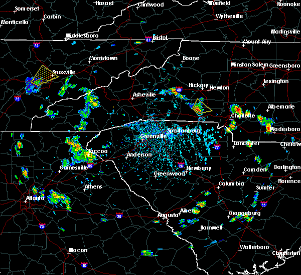 At 437 pm edt, a severe thunderstorm was located 10 miles southwest of lincolnton, or over cherryville, moving northeast at 10 mph (radar indicated). Hazards include 60 mph wind gusts and quarter size hail. Minor hail damage to vehicles is expected. Expect wind damage to trees and power lines. At 437 pm edt, a severe thunderstorm was located 10 miles southwest of lincolnton, or over cherryville, moving northeast at 10 mph (radar indicated). Hazards include 60 mph wind gusts and quarter size hail. Minor hail damage to vehicles is expected. Expect wind damage to trees and power lines.
|
| 8/31/2018 6:40 PM EDT | Trees down near philadelphia church and hardin rd in gaston county NC, 5.7 miles S of Dallas, NC |
| 8/31/2018 6:30 PM EDT |
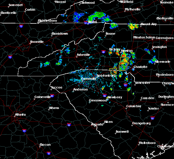 At 630 pm edt, a severe thunderstorm was located 7 miles south of lincolnton, or near high shoals, moving north at 10 mph (radar indicated). Hazards include 60 mph wind gusts and quarter size hail. Minor hail damage to vehicles is expected. Expect wind damage to trees and power lines. At 630 pm edt, a severe thunderstorm was located 7 miles south of lincolnton, or near high shoals, moving north at 10 mph (radar indicated). Hazards include 60 mph wind gusts and quarter size hail. Minor hail damage to vehicles is expected. Expect wind damage to trees and power lines.
|
| 8/31/2018 6:16 PM EDT |
 At 615 pm edt, a severe thunderstorm was located 6 miles north of gastonia, or near dallas, moving north at 10 mph (radar indicated). Hazards include 60 mph wind gusts and quarter size hail. Minor hail damage to vehicles is expected. expect wind damage to trees and power lines. Locations impacted include, gastonia, mt holly, belmont, south gastonia, dallas, stanley, cramerton, lowell, ranlo and high shoals. At 615 pm edt, a severe thunderstorm was located 6 miles north of gastonia, or near dallas, moving north at 10 mph (radar indicated). Hazards include 60 mph wind gusts and quarter size hail. Minor hail damage to vehicles is expected. expect wind damage to trees and power lines. Locations impacted include, gastonia, mt holly, belmont, south gastonia, dallas, stanley, cramerton, lowell, ranlo and high shoals.
|
| 8/31/2018 6:03 PM EDT |
 At 602 pm edt, a new severe thunderstorm was located 7 miles northeast of gastonia, or near stanley, moving north at 5 mph (radar indicated). Hazards include 60 mph wind gusts and quarter size hail. Minor hail damage to vehicles is expected. expect wind damage to trees and power lines. Locations impacted include, gastonia, mt holly, belmont, south gastonia, clover, dallas, stanley, cramerton, lowell and ranlo. At 602 pm edt, a new severe thunderstorm was located 7 miles northeast of gastonia, or near stanley, moving north at 5 mph (radar indicated). Hazards include 60 mph wind gusts and quarter size hail. Minor hail damage to vehicles is expected. expect wind damage to trees and power lines. Locations impacted include, gastonia, mt holly, belmont, south gastonia, clover, dallas, stanley, cramerton, lowell and ranlo.
|
| 8/31/2018 5:46 PM EDT |
 At 545 pm edt, a severe thunderstorm was located 8 miles southeast of gastonia, or near town of lake wylie, moving north at 5 mph (radar indicated). Hazards include 60 mph wind gusts and quarter size hail. Minor hail damage to vehicles is expected. Expect wind damage to trees and power lines. At 545 pm edt, a severe thunderstorm was located 8 miles southeast of gastonia, or near town of lake wylie, moving north at 5 mph (radar indicated). Hazards include 60 mph wind gusts and quarter size hail. Minor hail damage to vehicles is expected. Expect wind damage to trees and power lines.
|
| 8/31/2018 5:46 PM EDT |
 The national weather service in greenville-spartanburg has issued a * severe thunderstorm warning for. gaston county in the piedmont of north carolina. north central york county in upstate south carolina. until 630 pm edt. At 545 pm edt, a severe thunderstorm was located 8 miles southeast. The national weather service in greenville-spartanburg has issued a * severe thunderstorm warning for. gaston county in the piedmont of north carolina. north central york county in upstate south carolina. until 630 pm edt. At 545 pm edt, a severe thunderstorm was located 8 miles southeast.
|
| 8/18/2018 4:39 PM EDT |
 The severe thunderstorm warning for south central lincoln and central gaston counties will expire at 445 pm edt, the storm which prompted the warning has weakened below severe limits, and no longer poses an immediate threat to life or property. therefore the warning will be allowed to expire. however gusty winds and heavy rain are still possible with this thunderstorm. if you observed large hail or wind damage, please report it to the national weather service greenville-spartanburg by calling toll free, 1, 800, 2 6 7, 8 1 0 1, or by posting on our facebook page, or tweet it using hashtag nwsgsp. your message should describe the event and the specific location where it occurred. The severe thunderstorm warning for south central lincoln and central gaston counties will expire at 445 pm edt, the storm which prompted the warning has weakened below severe limits, and no longer poses an immediate threat to life or property. therefore the warning will be allowed to expire. however gusty winds and heavy rain are still possible with this thunderstorm. if you observed large hail or wind damage, please report it to the national weather service greenville-spartanburg by calling toll free, 1, 800, 2 6 7, 8 1 0 1, or by posting on our facebook page, or tweet it using hashtag nwsgsp. your message should describe the event and the specific location where it occurred.
|
| 8/18/2018 4:32 PM EDT |
 At 431 pm edt, a severe thunderstorm was located 6 miles northwest of gastonia, or near dallas, moving east at 25 mph (radar indicated). Hazards include 60 mph wind gusts. Expect damage to trees and power lines. Locations impacted include, gastonia, bessemer city, dallas, stanley, lowell, ranlo, high shoals, iron station, crouse and south gastonia. At 431 pm edt, a severe thunderstorm was located 6 miles northwest of gastonia, or near dallas, moving east at 25 mph (radar indicated). Hazards include 60 mph wind gusts. Expect damage to trees and power lines. Locations impacted include, gastonia, bessemer city, dallas, stanley, lowell, ranlo, high shoals, iron station, crouse and south gastonia.
|
| 8/18/2018 4:03 PM EDT |
 At 403 pm edt, a severe thunderstorm was located 7 miles northeast of shelby, or near waco, moving east at 25 mph (radar indicated). Hazards include 60 mph wind gusts and penny size hail. expect damage to trees and power lines At 403 pm edt, a severe thunderstorm was located 7 miles northeast of shelby, or near waco, moving east at 25 mph (radar indicated). Hazards include 60 mph wind gusts and penny size hail. expect damage to trees and power lines
|
| 8/8/2018 5:51 PM EDT |
 At 550 pm edt, severe thunderstorms were located along a line extending from 4 miles east of lincolnton to 4 miles southeast of gastonia, moving east at 30 mph (radar indicated). Hazards include 70 mph wind gusts and quarter size hail. Minor hail damage to vehicles is expected. expect considerable tree damage. wind damage is also likely to mobile homes, roofs, and outbuildings. Locations impacted include, gastonia, belmont, dallas, stanley, cramerton, lowell, ranlo, mcadenville, boger city and iron station. At 550 pm edt, severe thunderstorms were located along a line extending from 4 miles east of lincolnton to 4 miles southeast of gastonia, moving east at 30 mph (radar indicated). Hazards include 70 mph wind gusts and quarter size hail. Minor hail damage to vehicles is expected. expect considerable tree damage. wind damage is also likely to mobile homes, roofs, and outbuildings. Locations impacted include, gastonia, belmont, dallas, stanley, cramerton, lowell, ranlo, mcadenville, boger city and iron station.
|
| 8/8/2018 5:48 PM EDT |
 At 547 pm edt, severe thunderstorms were located along a line extending from 7 miles southeast of taylorsville to 9 miles south of gastonia, moving east at 20 mph (radar indicated). Hazards include 70 mph wind gusts and quarter size hail. Minor hail damage to vehicles is expected. expect considerable tree damage. Wind damage is also likely to mobile homes, roofs, and outbuildings. At 547 pm edt, severe thunderstorms were located along a line extending from 7 miles southeast of taylorsville to 9 miles south of gastonia, moving east at 20 mph (radar indicated). Hazards include 70 mph wind gusts and quarter size hail. Minor hail damage to vehicles is expected. expect considerable tree damage. Wind damage is also likely to mobile homes, roofs, and outbuildings.
|
| 8/8/2018 5:23 PM EDT |
 At 523 pm edt, severe thunderstorms were located along a line extending from 7 miles northeast of shelby to 11 miles southwest of gastonia, moving northeast at 20 mph (radar indicated). Hazards include 60 mph wind gusts and quarter size hail. Minor hail damage to vehicles is expected. Expect wind damage to trees and power lines. At 523 pm edt, severe thunderstorms were located along a line extending from 7 miles northeast of shelby to 11 miles southwest of gastonia, moving northeast at 20 mph (radar indicated). Hazards include 60 mph wind gusts and quarter size hail. Minor hail damage to vehicles is expected. Expect wind damage to trees and power lines.
|
| 7/23/2018 5:03 PM EDT |
 At 503 pm edt, a severe thunderstorm capable of producing a tornado was located near gastonia, or near lowell, moving north at 20 mph (radar indicated rotation). Hazards include tornado. Expect damage to mobile homes, roofs, and vehicles. this dangerous storm will be near, ranlo, mt holly and lake wylie around 510 pm edt. dallas around 520 pm edt. stanley and high shoals around 530 pm edt. Other locations impacted by this dangerous thunderstorm include crowders and lucia. At 503 pm edt, a severe thunderstorm capable of producing a tornado was located near gastonia, or near lowell, moving north at 20 mph (radar indicated rotation). Hazards include tornado. Expect damage to mobile homes, roofs, and vehicles. this dangerous storm will be near, ranlo, mt holly and lake wylie around 510 pm edt. dallas around 520 pm edt. stanley and high shoals around 530 pm edt. Other locations impacted by this dangerous thunderstorm include crowders and lucia.
|
| 7/6/2018 3:50 PM EDT |
 At 350 pm edt, a severe thunderstorm was located 6 miles west of lincolnton, or 4 miles north of cherryville, moving south at 10 mph (radar indicated). Hazards include 60 mph wind gusts and quarter size hail. Minor hail damage to vehicles is expected. Expect wind damage to trees and power lines. At 350 pm edt, a severe thunderstorm was located 6 miles west of lincolnton, or 4 miles north of cherryville, moving south at 10 mph (radar indicated). Hazards include 60 mph wind gusts and quarter size hail. Minor hail damage to vehicles is expected. Expect wind damage to trees and power lines.
|
| 6/25/2018 6:46 PM EDT |
 At 645 pm edt, severe thunderstorms were located along a line extending from 10 miles northeast of gastonia to 8 miles southwest of gaffney, moving east at 35 mph (radar indicated). Hazards include 60 mph wind gusts and quarter size hail. Minor hail damage to vehicles is expected. expect wind damage to trees and power lines. Locations impacted include, gastonia, spartanburg, shelby, gaffney, kings mountain, mt holly, cherryville, bessemer city, south gastonia and boiling springs sc. At 645 pm edt, severe thunderstorms were located along a line extending from 10 miles northeast of gastonia to 8 miles southwest of gaffney, moving east at 35 mph (radar indicated). Hazards include 60 mph wind gusts and quarter size hail. Minor hail damage to vehicles is expected. expect wind damage to trees and power lines. Locations impacted include, gastonia, spartanburg, shelby, gaffney, kings mountain, mt holly, cherryville, bessemer city, south gastonia and boiling springs sc.
|
| 6/25/2018 6:22 PM EDT |
 At 621 pm edt, severe thunderstorms were located along a line extending from 6 miles northwest of gastonia to 4 miles northwest of spartanburg, moving east at 35 mph (radar indicated). Hazards include 60 mph wind gusts and quarter size hail. Minor hail damage to vehicles is expected. Expect wind damage to trees and power lines. At 621 pm edt, severe thunderstorms were located along a line extending from 6 miles northwest of gastonia to 4 miles northwest of spartanburg, moving east at 35 mph (radar indicated). Hazards include 60 mph wind gusts and quarter size hail. Minor hail damage to vehicles is expected. Expect wind damage to trees and power lines.
|
| 6/15/2018 12:21 AM EDT |
 At 1143 pm edt, severe thunderstorms were located along a line extending from 6 miles east of lincolnton to 12 miles northeast of shelby, moving south at 10 mph (radar indicated). Hazards include 60 mph wind gusts and quarter size hail. Minor hail damage to vehicles is expected. Expect wind damage to trees and power lines. At 1143 pm edt, severe thunderstorms were located along a line extending from 6 miles east of lincolnton to 12 miles northeast of shelby, moving south at 10 mph (radar indicated). Hazards include 60 mph wind gusts and quarter size hail. Minor hail damage to vehicles is expected. Expect wind damage to trees and power lines.
|
| 6/14/2018 11:43 PM EDT |
 The national weather service in greenville-spartanburg has issued a * severe thunderstorm warning for. central lincoln county in the piedmont of north carolina. northern gaston county in the piedmont of north carolina. until 1230 am edt. At 1143 pm edt, severe thunderstorms were located along a line. The national weather service in greenville-spartanburg has issued a * severe thunderstorm warning for. central lincoln county in the piedmont of north carolina. northern gaston county in the piedmont of north carolina. until 1230 am edt. At 1143 pm edt, severe thunderstorms were located along a line.
|
| 6/14/2018 10:37 PM EDT |
 At 1037 pm edt, a severe thunderstorm was located 9 miles east of lincolnton, or 4 miles east of iron station, moving southeast at 15 mph (radar indicated). Hazards include 60 mph wind gusts and quarter size hail. Minor hail damage to vehicles is expected. expect wind damage to trees and power lines. Locations impacted include, newton, lincolnton, cherryville, bessemer city, dallas, maiden, stanley, catawba, high shoals and boger city. At 1037 pm edt, a severe thunderstorm was located 9 miles east of lincolnton, or 4 miles east of iron station, moving southeast at 15 mph (radar indicated). Hazards include 60 mph wind gusts and quarter size hail. Minor hail damage to vehicles is expected. expect wind damage to trees and power lines. Locations impacted include, newton, lincolnton, cherryville, bessemer city, dallas, maiden, stanley, catawba, high shoals and boger city.
|
| 6/14/2018 10:09 PM EDT |
 At 1009 pm edt, a severe thunderstorm was located 6 miles northeast of lincolnton, or near boger city, moving southeast at 15 mph (radar indicated). Hazards include 60 mph wind gusts and quarter size hail. Minor hail damage to vehicles is expected. Expect wind damage to trees and power lines. At 1009 pm edt, a severe thunderstorm was located 6 miles northeast of lincolnton, or near boger city, moving southeast at 15 mph (radar indicated). Hazards include 60 mph wind gusts and quarter size hail. Minor hail damage to vehicles is expected. Expect wind damage to trees and power lines.
|
| 6/3/2018 7:48 PM EDT |
 At 747 pm edt, severe thunderstorms were located along a line extending from 6 miles west of huntersville to 10 miles northwest of uptown charlotte, moving southeast at 20 mph (radar indicated). Hazards include 60 mph wind gusts and quarter size hail. Minor hail damage to vehicles is expected. Expect wind damage to trees and power lines. At 747 pm edt, severe thunderstorms were located along a line extending from 6 miles west of huntersville to 10 miles northwest of uptown charlotte, moving southeast at 20 mph (radar indicated). Hazards include 60 mph wind gusts and quarter size hail. Minor hail damage to vehicles is expected. Expect wind damage to trees and power lines.
|
| 6/3/2018 7:42 PM EDT |
 At 741 pm edt, a severe thunderstorm was located 6 miles east of lincolnton, or over iron station, moving east at 25 mph (radar indicated). Hazards include 60 mph wind gusts and quarter size hail. Minor hail damage to vehicles is expected. expect wind damage to trees and power lines. Locations impacted include, lincolnton, mt holly, belmont, cherryville, dallas, maiden, stanley, cramerton, lowell and ranlo. At 741 pm edt, a severe thunderstorm was located 6 miles east of lincolnton, or over iron station, moving east at 25 mph (radar indicated). Hazards include 60 mph wind gusts and quarter size hail. Minor hail damage to vehicles is expected. expect wind damage to trees and power lines. Locations impacted include, lincolnton, mt holly, belmont, cherryville, dallas, maiden, stanley, cramerton, lowell and ranlo.
|
| 6/3/2018 7:28 PM EDT |
 At 728 pm edt, severe thunderstorms were located along a line extending from 12 miles southwest of lincolnton to 9 miles southeast of shelby, moving east at 30 mph (radar indicated). Hazards include 60 mph wind gusts and quarter size hail. Minor hail damage to vehicles is expected. Expect wind damage to trees and power lines. At 728 pm edt, severe thunderstorms were located along a line extending from 12 miles southwest of lincolnton to 9 miles southeast of shelby, moving east at 30 mph (radar indicated). Hazards include 60 mph wind gusts and quarter size hail. Minor hail damage to vehicles is expected. Expect wind damage to trees and power lines.
|
| 6/3/2018 7:23 PM EDT |
 At 723 pm edt, severe thunderstorms were located along a line extending from 5 miles north of lincolnton to 14 miles northeast of shelby, moving east at 25 mph. this storm will produce widespread wind damage across lincolnton (radar indicated). Hazards include 70 mph wind gusts and ping pong ball size hail. People and animals outdoors will be injured. expect hail damage to roofs, siding, windows, and vehicles. expect considerable tree damage. wind damage is also likely to mobile homes, roofs, and outbuildings. Locations impacted include, newton, lincolnton, mt holly, belmont, conover, cherryville, dallas, maiden, stanley and cramerton. At 723 pm edt, severe thunderstorms were located along a line extending from 5 miles north of lincolnton to 14 miles northeast of shelby, moving east at 25 mph. this storm will produce widespread wind damage across lincolnton (radar indicated). Hazards include 70 mph wind gusts and ping pong ball size hail. People and animals outdoors will be injured. expect hail damage to roofs, siding, windows, and vehicles. expect considerable tree damage. wind damage is also likely to mobile homes, roofs, and outbuildings. Locations impacted include, newton, lincolnton, mt holly, belmont, conover, cherryville, dallas, maiden, stanley and cramerton.
|
| 6/3/2018 7:14 PM EDT |
 At 714 pm edt, severe thunderstorms were located along a line extending from 6 miles southwest of newton to 9 miles west of lincolnton, moving east at 25 mph (radar indicated). Hazards include 60 mph wind gusts and half dollar size hail. Minor hail damage to vehicles is expected. Expect wind damage to trees and power lines. At 714 pm edt, severe thunderstorms were located along a line extending from 6 miles southwest of newton to 9 miles west of lincolnton, moving east at 25 mph (radar indicated). Hazards include 60 mph wind gusts and half dollar size hail. Minor hail damage to vehicles is expected. Expect wind damage to trees and power lines.
|
| 6/1/2018 5:59 PM EDT |
 At 558 pm edt, severe thunderstorms were located along a line extending from 8 miles west of huntersville to 5 miles east of gastonia to 7 miles north of york, moving east at 30 mph (radar indicated). Hazards include 60 mph wind gusts. expect damage to trees and power lines At 558 pm edt, severe thunderstorms were located along a line extending from 8 miles west of huntersville to 5 miles east of gastonia to 7 miles north of york, moving east at 30 mph (radar indicated). Hazards include 60 mph wind gusts. expect damage to trees and power lines
|
| 6/1/2018 5:42 PM EDT |
 At 541 pm edt, severe thunderstorms were located along a line extending from 7 miles south of lincolnton to 11 miles northwest of york, moving east at 20 mph (radar indicated). Hazards include 60 mph wind gusts. Expect damage to trees and power lines. Locations impacted include, gastonia, york, kings mountain, mt holly, belmont, bessemer city, south gastonia, clover, dallas and stanley. At 541 pm edt, severe thunderstorms were located along a line extending from 7 miles south of lincolnton to 11 miles northwest of york, moving east at 20 mph (radar indicated). Hazards include 60 mph wind gusts. Expect damage to trees and power lines. Locations impacted include, gastonia, york, kings mountain, mt holly, belmont, bessemer city, south gastonia, clover, dallas and stanley.
|
| 6/1/2018 5:28 PM EDT |
 At 528 pm edt, severe thunderstorms were located along a line extending from 7 miles southwest of lincolnton to 9 miles northeast of gaffney, moving east at 20 mph (radar indicated). Hazards include 60 mph wind gusts. expect damage to trees and power lines At 528 pm edt, severe thunderstorms were located along a line extending from 7 miles southwest of lincolnton to 9 miles northeast of gaffney, moving east at 20 mph (radar indicated). Hazards include 60 mph wind gusts. expect damage to trees and power lines
|
| 5/29/2018 9:06 PM EDT |
 At 904 pm edt, a tornado tornado confirmed by law enforcement was located 7 miles east of gastonia, or near cramerton, moving north at 15 mph (law enforcement confirmed tornado). Hazards include damaging tornado. Flying debris will be dangerous to those caught without shelter. mobile homes will be damaged or destroyed. damage to roofs, windows, and vehicles will occur. tree damage is likely. This dangerous storm will remain over mainly rural areas of west central mecklenburg and eastern gaston counties. At 904 pm edt, a tornado tornado confirmed by law enforcement was located 7 miles east of gastonia, or near cramerton, moving north at 15 mph (law enforcement confirmed tornado). Hazards include damaging tornado. Flying debris will be dangerous to those caught without shelter. mobile homes will be damaged or destroyed. damage to roofs, windows, and vehicles will occur. tree damage is likely. This dangerous storm will remain over mainly rural areas of west central mecklenburg and eastern gaston counties.
|
| 5/29/2018 8:55 PM EDT |
 At 855 pm edt, a severe thunderstorm capable of producing a tornado was located 7 miles east of gastonia, or near belmont, moving north at 15 mph (radar indicated rotation). Hazards include tornado. Flying debris will be dangerous to those caught without shelter. mobile homes will be damaged or destroyed. damage to roofs, windows, and vehicles will occur. tree damage is likely. this dangerous storm will be near, lake wylie and paw creek around 900 pm edt. Gastonia, mt holly, mcadenville, lowell and ranlo around 910 pm edt. At 855 pm edt, a severe thunderstorm capable of producing a tornado was located 7 miles east of gastonia, or near belmont, moving north at 15 mph (radar indicated rotation). Hazards include tornado. Flying debris will be dangerous to those caught without shelter. mobile homes will be damaged or destroyed. damage to roofs, windows, and vehicles will occur. tree damage is likely. this dangerous storm will be near, lake wylie and paw creek around 900 pm edt. Gastonia, mt holly, mcadenville, lowell and ranlo around 910 pm edt.
|
| 5/29/2018 8:43 PM EDT |
 At 842 pm edt, a severe thunderstorm capable of producing a tornado was located 8 miles southeast of gastonia, or near cramerton, moving north at 15 mph (radar indicated rotation). Hazards include tornado. Flying debris will be dangerous to those caught without shelter. mobile homes will be damaged or destroyed. damage to roofs, windows, and vehicles will occur. tree damage is likely. this dangerous storm will be near, lake wylie and charlotte douglas airport around 850 pm edt. cramerton and paw creek around 900 pm edt. Gastonia, belmont, mcadenville, mt holly and lowell around 910 pm edt. At 842 pm edt, a severe thunderstorm capable of producing a tornado was located 8 miles southeast of gastonia, or near cramerton, moving north at 15 mph (radar indicated rotation). Hazards include tornado. Flying debris will be dangerous to those caught without shelter. mobile homes will be damaged or destroyed. damage to roofs, windows, and vehicles will occur. tree damage is likely. this dangerous storm will be near, lake wylie and charlotte douglas airport around 850 pm edt. cramerton and paw creek around 900 pm edt. Gastonia, belmont, mcadenville, mt holly and lowell around 910 pm edt.
|
| 4/15/2018 3:25 PM EDT |
 At 324 pm edt, a severe thunderstorm was located 4 miles southwest of huntersville, moving northeast at 50 mph (radar indicated). Hazards include 60 mph wind gusts and quarter size hail. Minor hail damage to vehicles is expected. Expect wind damage to trees and power lines. At 324 pm edt, a severe thunderstorm was located 4 miles southwest of huntersville, moving northeast at 50 mph (radar indicated). Hazards include 60 mph wind gusts and quarter size hail. Minor hail damage to vehicles is expected. Expect wind damage to trees and power lines.
|
| 4/15/2018 3:17 PM EDT |
 At 314 pm edt, a severe thunderstorm capable of producing a tornado was located 9 miles west of uptown charlotte, or near belmont, moving northeast at 50 mph (radar indicated rotation). Hazards include tornado and quarter size hail. Flying debris will be dangerous to those caught without shelter. mobile homes will be damaged or destroyed. damage to roofs, windows, and vehicles will occur. tree damage is likely. this dangerous storm will be near, lake wylie around 320 pm edt. huntersville and northwest charlotte around 330 pm edt. Other locations impacted by this dangerous storm include lucia and croft. At 314 pm edt, a severe thunderstorm capable of producing a tornado was located 9 miles west of uptown charlotte, or near belmont, moving northeast at 50 mph (radar indicated rotation). Hazards include tornado and quarter size hail. Flying debris will be dangerous to those caught without shelter. mobile homes will be damaged or destroyed. damage to roofs, windows, and vehicles will occur. tree damage is likely. this dangerous storm will be near, lake wylie around 320 pm edt. huntersville and northwest charlotte around 330 pm edt. Other locations impacted by this dangerous storm include lucia and croft.
|
| 4/15/2018 3:02 PM EDT |
 At 301 pm edt, a severe thunderstorm capable of producing a tornado was located 10 miles southeast of gastonia, or near town of lake wylie, moving northeast at 50 mph (radar indicated rotation). Hazards include tornado and quarter size hail. Flying debris will be dangerous to those caught without shelter. mobile homes will be damaged or destroyed. damage to roofs, windows, and vehicles will occur. tree damage is likely. this dangerous storm will be near, lake wylie, cramerton, mcadenville, charlotte douglas airport and lowell around 310 pm edt. paw creek, southwest charlotte, mt holly and belmont around 320 pm edt. huntersville and northwest charlotte around 330 pm edt. Other locations impacted by this dangerous thunderstorm include crowders, lucia and croft. At 301 pm edt, a severe thunderstorm capable of producing a tornado was located 10 miles southeast of gastonia, or near town of lake wylie, moving northeast at 50 mph (radar indicated rotation). Hazards include tornado and quarter size hail. Flying debris will be dangerous to those caught without shelter. mobile homes will be damaged or destroyed. damage to roofs, windows, and vehicles will occur. tree damage is likely. this dangerous storm will be near, lake wylie, cramerton, mcadenville, charlotte douglas airport and lowell around 310 pm edt. paw creek, southwest charlotte, mt holly and belmont around 320 pm edt. huntersville and northwest charlotte around 330 pm edt. Other locations impacted by this dangerous thunderstorm include crowders, lucia and croft.
|
| 8/4/2017 8:59 PM EDT |
 At 859 pm edt, a severe thunderstorm was located 6 miles southeast of lincolnton, or near high shoals, moving southeast at 20 mph (radar indicated). Hazards include 60 mph wind gusts. Expect damage to trees and power lines. Locations impacted include, dallas, high shoals, iron station, boger city and gastonia. At 859 pm edt, a severe thunderstorm was located 6 miles southeast of lincolnton, or near high shoals, moving southeast at 20 mph (radar indicated). Hazards include 60 mph wind gusts. Expect damage to trees and power lines. Locations impacted include, dallas, high shoals, iron station, boger city and gastonia.
|
| 8/4/2017 8:47 PM EDT |
 At 847 pm edt, a severe thunderstorm was located near lincolnton, or near high shoals, moving southeast at 20 mph (radar indicated). Hazards include 60 mph wind gusts. Expect damage to trees and power lines. Locations impacted include, lincolnton, cherryville, dallas, high shoals, boger city, iron station, crouse and gastonia. At 847 pm edt, a severe thunderstorm was located near lincolnton, or near high shoals, moving southeast at 20 mph (radar indicated). Hazards include 60 mph wind gusts. Expect damage to trees and power lines. Locations impacted include, lincolnton, cherryville, dallas, high shoals, boger city, iron station, crouse and gastonia.
|
| 8/4/2017 8:26 PM EDT |
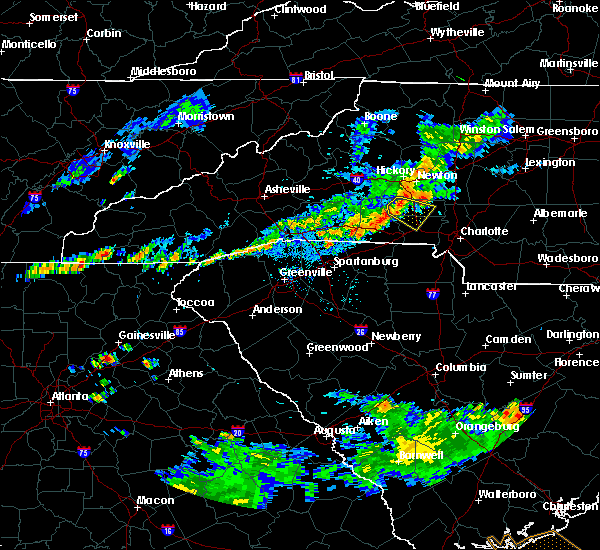 At 826 pm edt, a severe thunderstorm was located 6 miles west of lincolnton, moving southeast at 20 mph (radar indicated). Hazards include 60 mph wind gusts and nickel size hail. expect damage to trees and power lines At 826 pm edt, a severe thunderstorm was located 6 miles west of lincolnton, moving southeast at 20 mph (radar indicated). Hazards include 60 mph wind gusts and nickel size hail. expect damage to trees and power lines
|
| 7/28/2017 4:28 PM EDT |
 At 428 pm edt, severe thunderstorms were located along a line extending from 12 miles east of lincolnton to near gastonia to 4 miles southwest of lancaster, moving east at 25 mph (radar indicated). Hazards include 60 mph wind gusts. Expect damage to trees and power lines. Locations impacted include, gastonia, rock hill, lincolnton, york, mt holly, fort mill, belmont, bessemer city, south gastonia and tega cay. At 428 pm edt, severe thunderstorms were located along a line extending from 12 miles east of lincolnton to near gastonia to 4 miles southwest of lancaster, moving east at 25 mph (radar indicated). Hazards include 60 mph wind gusts. Expect damage to trees and power lines. Locations impacted include, gastonia, rock hill, lincolnton, york, mt holly, fort mill, belmont, bessemer city, south gastonia and tega cay.
|
| 7/28/2017 4:22 PM EDT |
 At 422 pm edt, severe thunderstorms were located along a line extending from 10 miles northeast of lincolnton to 9 miles southeast of gastonia to 8 miles south of rock hill, moving east at 30 mph (radar indicated). Hazards include 60 mph wind gusts. expect damage to trees and power lines At 422 pm edt, severe thunderstorms were located along a line extending from 10 miles northeast of lincolnton to 9 miles southeast of gastonia to 8 miles south of rock hill, moving east at 30 mph (radar indicated). Hazards include 60 mph wind gusts. expect damage to trees and power lines
|
| 7/28/2017 4:04 PM EDT |
 At 404 pm edt, severe thunderstorms were located along a line extending from 4 miles north of lincolnton to 10 miles west of gastonia to 9 miles east of chester, moving east at 15 mph (radar indicated). Hazards include 60 mph wind gusts. Expect damage to trees and power lines. Locations impacted include, gastonia, rock hill, shelby, gaffney, lincolnton, york, chester, kings mountain, mt holly and fort mill. At 404 pm edt, severe thunderstorms were located along a line extending from 4 miles north of lincolnton to 10 miles west of gastonia to 9 miles east of chester, moving east at 15 mph (radar indicated). Hazards include 60 mph wind gusts. Expect damage to trees and power lines. Locations impacted include, gastonia, rock hill, shelby, gaffney, lincolnton, york, chester, kings mountain, mt holly and fort mill.
|
| 7/28/2017 3:55 PM EDT |
 At 355 pm edt, severe thunderstorms were located along a line extending from 3 miles north of lincolnton to 9 miles southeast of shelby to 8 miles southeast of chester, moving northeast at 15 mph (radar indicated). Hazards include 60 mph wind gusts. expect damage to trees and power lines At 355 pm edt, severe thunderstorms were located along a line extending from 3 miles north of lincolnton to 9 miles southeast of shelby to 8 miles southeast of chester, moving northeast at 15 mph (radar indicated). Hazards include 60 mph wind gusts. expect damage to trees and power lines
|
| 7/23/2017 3:22 PM EDT |
 At 322 pm edt, a severe thunderstorm was located 6 miles southeast of huntersville, or near charlotte motor speedway, moving southeast at 20 mph (radar indicated). Hazards include 60 mph wind gusts and quarter size hail. Minor hail damage to vehicles is expected. Expect wind damage to trees and power lines. At 322 pm edt, a severe thunderstorm was located 6 miles southeast of huntersville, or near charlotte motor speedway, moving southeast at 20 mph (radar indicated). Hazards include 60 mph wind gusts and quarter size hail. Minor hail damage to vehicles is expected. Expect wind damage to trees and power lines.
|
| 7/18/2017 9:51 PM EDT |
 The severe thunderstorm warning for southeastern lincoln and gaston counties will expire at 1000 pm edt, the storm which prompted the warning has weakened below severe limits, and no longer poses an immediate threat to life or property. therefore the warning will be allowed to expire. however gusty winds and heavy rain are still possible with this thunderstorm. if you observed large hail or wind damage, please report it to the national weather service greenville-spartanburg by calling toll free, 1, 800, 2 6 7, 8 1 0 1, or by posting on our facebook page, or tweet it using hashtag nwsgsp. your message should describe the event and the specific location where it occurred. The severe thunderstorm warning for southeastern lincoln and gaston counties will expire at 1000 pm edt, the storm which prompted the warning has weakened below severe limits, and no longer poses an immediate threat to life or property. therefore the warning will be allowed to expire. however gusty winds and heavy rain are still possible with this thunderstorm. if you observed large hail or wind damage, please report it to the national weather service greenville-spartanburg by calling toll free, 1, 800, 2 6 7, 8 1 0 1, or by posting on our facebook page, or tweet it using hashtag nwsgsp. your message should describe the event and the specific location where it occurred.
|
| 7/18/2017 9:09 PM EDT |
 At 908 pm edt, a severe thunderstorm was located 7 miles northeast of gastonia, or over stanley, moving southwest at 5 mph (radar indicated). Hazards include 60 mph wind gusts and quarter size hail. Minor hail damage to vehicles is expected. Expect wind damage to trees and power lines. At 908 pm edt, a severe thunderstorm was located 7 miles northeast of gastonia, or over stanley, moving southwest at 5 mph (radar indicated). Hazards include 60 mph wind gusts and quarter size hail. Minor hail damage to vehicles is expected. Expect wind damage to trees and power lines.
|
| 7/15/2017 2:45 PM EDT |
 At 244 pm edt, a severe thunderstorm was located 7 miles west of uptown charlotte, or near charlotte douglas airport, moving southeast at 15 mph (radar indicated). Hazards include 60 mph wind gusts and quarter size hail. Minor hail damage to vehicles is expected. expect wind damage to trees and power lines. Locations impacted include, gastonia, uptown charlotte, central charlotte, southwest charlotte, northwest charlotte, mt holly, belmont, stanley, cramerton and lowell. At 244 pm edt, a severe thunderstorm was located 7 miles west of uptown charlotte, or near charlotte douglas airport, moving southeast at 15 mph (radar indicated). Hazards include 60 mph wind gusts and quarter size hail. Minor hail damage to vehicles is expected. expect wind damage to trees and power lines. Locations impacted include, gastonia, uptown charlotte, central charlotte, southwest charlotte, northwest charlotte, mt holly, belmont, stanley, cramerton and lowell.
|
| 7/15/2017 2:20 PM EDT |
 At 220 pm edt, a severe thunderstorm was located 6 miles east of gastonia, or near mcadenville, moving southeast at 15 mph (radar indicated). Hazards include 60 mph wind gusts and quarter size hail. Minor hail damage to vehicles is expected. Expect wind damage to trees and power lines. At 220 pm edt, a severe thunderstorm was located 6 miles east of gastonia, or near mcadenville, moving southeast at 15 mph (radar indicated). Hazards include 60 mph wind gusts and quarter size hail. Minor hail damage to vehicles is expected. Expect wind damage to trees and power lines.
|
| 7/6/2017 5:09 PM EDT |
 At 508 pm edt, a severe thunderstorm was located 7 miles west of huntersville, or 5 miles northeast of mt holly, moving east at 25 mph (radar indicated). Hazards include 60 mph wind gusts and quarter size hail. Minor hail damage to vehicles is expected. expect wind damage to trees and power lines. Locations impacted include, huntersville, northeast charlotte, northwest charlotte, cornelius, mt holly, davidson, dallas, stanley, lowell and ranlo. At 508 pm edt, a severe thunderstorm was located 7 miles west of huntersville, or 5 miles northeast of mt holly, moving east at 25 mph (radar indicated). Hazards include 60 mph wind gusts and quarter size hail. Minor hail damage to vehicles is expected. expect wind damage to trees and power lines. Locations impacted include, huntersville, northeast charlotte, northwest charlotte, cornelius, mt holly, davidson, dallas, stanley, lowell and ranlo.
|
| 7/6/2017 4:49 PM EDT |
 At 449 pm edt, a severe thunderstorm was located 9 miles north of gastonia, or near stanley, moving east at 25 mph (radar indicated). Hazards include 60 mph wind gusts and quarter size hail. Minor hail damage to vehicles is expected. Expect wind damage to trees and power lines. At 449 pm edt, a severe thunderstorm was located 9 miles north of gastonia, or near stanley, moving east at 25 mph (radar indicated). Hazards include 60 mph wind gusts and quarter size hail. Minor hail damage to vehicles is expected. Expect wind damage to trees and power lines.
|
| 7/1/2017 4:59 PM EDT |
 At 459 pm edt, severe thunderstorms were located along a line extending from 7 miles southwest of huntersville to 3 miles southwest of lincolnton, moving southeast at 20 mph (radar indicated). Hazards include 60 mph wind gusts and quarter size hail. Minor hail damage to vehicles is expected. expect wind damage to trees and power lines. Locations impacted include, gastonia, northwest charlotte, mt holly, belmont, dallas, stanley, cramerton, lowell, ranlo and high shoals. At 459 pm edt, severe thunderstorms were located along a line extending from 7 miles southwest of huntersville to 3 miles southwest of lincolnton, moving southeast at 20 mph (radar indicated). Hazards include 60 mph wind gusts and quarter size hail. Minor hail damage to vehicles is expected. expect wind damage to trees and power lines. Locations impacted include, gastonia, northwest charlotte, mt holly, belmont, dallas, stanley, cramerton, lowell, ranlo and high shoals.
|
| 7/1/2017 4:36 PM EDT |
 At 436 pm edt, a severe thunderstorm was located 5 miles southeast of lincolnton, or near high shoals, moving southeast at 25 mph (radar indicated). Hazards include 60 mph wind gusts and penny size hail. expect damage to trees and power lines At 436 pm edt, a severe thunderstorm was located 5 miles southeast of lincolnton, or near high shoals, moving southeast at 25 mph (radar indicated). Hazards include 60 mph wind gusts and penny size hail. expect damage to trees and power lines
|
| 5/29/2017 6:05 PM EDT |
 At 604 pm edt, a severe thunderstorm was located 8 miles southeast of lincolnton, or near high shoals, moving east at 40 mph (radar indicated). Hazards include 60 mph wind gusts and quarter size hail. Minor hail damage to vehicles is expected. Expect wind damage to trees and power lines. At 604 pm edt, a severe thunderstorm was located 8 miles southeast of lincolnton, or near high shoals, moving east at 40 mph (radar indicated). Hazards include 60 mph wind gusts and quarter size hail. Minor hail damage to vehicles is expected. Expect wind damage to trees and power lines.
|
| 5/28/2017 2:24 AM EDT |
 The severe thunderstorm warning for catawba, lincoln, eastern cleveland and gaston counties will expire at 230 am edt, the storms which prompted the warning have moved out of the area. therefore the warning will be allowed to expire. however gusty winds and heavy rain are still possible with these thunderstorms. a severe thunderstorm watch remains in effect until 400 am edt for the piedmont of north carolina. a severe thunderstorm watch also remains in effect until 600 am edt for upstate south carolina. The severe thunderstorm warning for catawba, lincoln, eastern cleveland and gaston counties will expire at 230 am edt, the storms which prompted the warning have moved out of the area. therefore the warning will be allowed to expire. however gusty winds and heavy rain are still possible with these thunderstorms. a severe thunderstorm watch remains in effect until 400 am edt for the piedmont of north carolina. a severe thunderstorm watch also remains in effect until 600 am edt for upstate south carolina.
|
| 5/28/2017 1:35 AM EDT |
 The national weather service in greenville-spartanburg has issued a * severe thunderstorm warning for. catawba county in the piedmont of north carolina. lincoln county in the piedmont of north carolina. eastern cleveland county in the piedmont of north carolina. Gaston county in the piedmont of north carolina. The national weather service in greenville-spartanburg has issued a * severe thunderstorm warning for. catawba county in the piedmont of north carolina. lincoln county in the piedmont of north carolina. eastern cleveland county in the piedmont of north carolina. Gaston county in the piedmont of north carolina.
|
| 4/3/2017 4:02 PM EDT |
 At 402 pm edt, severe thunderstorms were located along a line extending from 9 miles east of newton to 10 miles west of huntersville to 4 miles southeast of gastonia, moving east at 45 mph (radar indicated). Hazards include 60 mph wind gusts. Expect damage to trees and minor damage to roofs and siding. locations impacted include, gastonia, uptown charlotte, huntersville, central charlotte, northeast charlotte, southwest charlotte, northwest charlotte, cornelius, mooresville and mt holly. A tornado watch remains in effect until 900 pm edt for the piedmont of north carolina, and upstate south carolina. At 402 pm edt, severe thunderstorms were located along a line extending from 9 miles east of newton to 10 miles west of huntersville to 4 miles southeast of gastonia, moving east at 45 mph (radar indicated). Hazards include 60 mph wind gusts. Expect damage to trees and minor damage to roofs and siding. locations impacted include, gastonia, uptown charlotte, huntersville, central charlotte, northeast charlotte, southwest charlotte, northwest charlotte, cornelius, mooresville and mt holly. A tornado watch remains in effect until 900 pm edt for the piedmont of north carolina, and upstate south carolina.
|
| 4/3/2017 3:52 PM EDT |
 At 351 pm edt, severe thunderstorms were located along a line extending from 5 miles south of newton to 10 miles southeast of lincolnton to 5 miles southwest of gastonia, moving east at 45 mph (radar indicated). Hazards include 60 mph wind gusts. expect damage to trees and minor damage to roofs and siding At 351 pm edt, severe thunderstorms were located along a line extending from 5 miles south of newton to 10 miles southeast of lincolnton to 5 miles southwest of gastonia, moving east at 45 mph (radar indicated). Hazards include 60 mph wind gusts. expect damage to trees and minor damage to roofs and siding
|
| 4/3/2017 3:31 PM EDT |
 At 331 pm edt, severe thunderstorms were located along a line extending from 9 miles southeast of shelby to 9 miles west of york to 14 miles northeast of union, moving east at 45 mph (radar indicated). Hazards include 60 mph wind gusts. expect damage to trees and minor damage to roofs and siding At 331 pm edt, severe thunderstorms were located along a line extending from 9 miles southeast of shelby to 9 miles west of york to 14 miles northeast of union, moving east at 45 mph (radar indicated). Hazards include 60 mph wind gusts. expect damage to trees and minor damage to roofs and siding
|
| 3/21/2017 8:33 PM EDT |
 At 832 pm edt, a severe thunderstorm was located 10 miles west of huntersville, or 4 miles southwest of westport, moving east at 30 mph (radar indicated). Hazards include 60 mph wind gusts and quarter size hail. Hail damage to vehicles is expected. expect wind damage to roofs, siding and trees. Locations impacted include, stanley, westport, high shoals, boger city, denver and iron station. At 832 pm edt, a severe thunderstorm was located 10 miles west of huntersville, or 4 miles southwest of westport, moving east at 30 mph (radar indicated). Hazards include 60 mph wind gusts and quarter size hail. Hail damage to vehicles is expected. expect wind damage to roofs, siding and trees. Locations impacted include, stanley, westport, high shoals, boger city, denver and iron station.
|
| 3/21/2017 8:07 PM EDT |
 At 807 pm edt, a severe thunderstorm was located near lincolnton, moving east at 25 mph (radar indicated). Hazards include 60 mph wind gusts and quarter size hail. Hail damage to vehicles is expected. Expect wind damage to roofs, siding and trees. At 807 pm edt, a severe thunderstorm was located near lincolnton, moving east at 25 mph (radar indicated). Hazards include 60 mph wind gusts and quarter size hail. Hail damage to vehicles is expected. Expect wind damage to roofs, siding and trees.
|
| 3/21/2017 8:02 PM EDT |
 At 802 pm edt, a severe thunderstorm was located 6 miles southeast of huntersville, or over northeast charlotte, moving east at 25 mph (radar indicated). Hazards include 60 mph wind gusts and quarter size hail. Hail damage to vehicles is expected. Expect wind damage to roofs, siding and trees. At 802 pm edt, a severe thunderstorm was located 6 miles southeast of huntersville, or over northeast charlotte, moving east at 25 mph (radar indicated). Hazards include 60 mph wind gusts and quarter size hail. Hail damage to vehicles is expected. Expect wind damage to roofs, siding and trees.
|
| 3/1/2017 6:19 PM EST |
 At 618 pm est, a severe thunderstorm was located 7 miles southeast of lincolnton, or near high shoals, moving east at 50 mph (public). Hazards include 60 mph wind gusts and quarter size hail. Hail damage to vehicles is expected. Expect wind damage to roofs, siding and trees. At 618 pm est, a severe thunderstorm was located 7 miles southeast of lincolnton, or near high shoals, moving east at 50 mph (public). Hazards include 60 mph wind gusts and quarter size hail. Hail damage to vehicles is expected. Expect wind damage to roofs, siding and trees.
|
| 3/1/2017 6:08 PM EST |
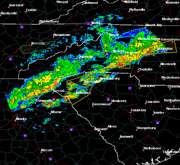 At 607 pm est, a severe thunderstorm was located 8 miles southwest of lincolnton, or near cherryville, moving east at 55 mph (radar indicated). Hazards include 60 mph wind gusts and quarter size hail. Hail damage to vehicles is expected. expect wind damage to roofs, siding and trees. Locations impacted include, cherryville, dallas, stanley, high shoals, boger city, iron station, crouse and lincolnton. At 607 pm est, a severe thunderstorm was located 8 miles southwest of lincolnton, or near cherryville, moving east at 55 mph (radar indicated). Hazards include 60 mph wind gusts and quarter size hail. Hail damage to vehicles is expected. expect wind damage to roofs, siding and trees. Locations impacted include, cherryville, dallas, stanley, high shoals, boger city, iron station, crouse and lincolnton.
|
| 3/1/2017 5:45 PM EST |
 At 544 pm est, a severe thunderstorm was located 9 miles east of forest city, or near mooresboro, moving east at 50 mph (radar indicated). Hazards include 60 mph wind gusts and quarter size hail. Hail damage to vehicles is expected. Expect wind damage to roofs, siding and trees. At 544 pm est, a severe thunderstorm was located 9 miles east of forest city, or near mooresboro, moving east at 50 mph (radar indicated). Hazards include 60 mph wind gusts and quarter size hail. Hail damage to vehicles is expected. Expect wind damage to roofs, siding and trees.
|
| 11/30/2016 6:13 PM EST |
 At 613 pm est, severe thunderstorms were located along a line extending from 6 miles north of mocksville to 9 miles southwest of statesville to 10 miles northeast of lincolnton to 9 miles north of winnsboro, moving east at 35 mph (radar indicated). Hazards include 60 mph wind gusts. Expect damage to roofs. Siding and trees. At 613 pm est, severe thunderstorms were located along a line extending from 6 miles north of mocksville to 9 miles southwest of statesville to 10 miles northeast of lincolnton to 9 miles north of winnsboro, moving east at 35 mph (radar indicated). Hazards include 60 mph wind gusts. Expect damage to roofs. Siding and trees.
|
| 11/30/2016 6:07 PM EST |
 At 606 pm est, severe thunderstorms were located along a line extending from near east bend to 7 miles southwest of statesville to near lincolnton to 6 miles southwest of rock hill to 12 miles south of chester, moving northeast at 55 mph (radar indicated). Hazards include 60 mph wind gusts. Expect damage to roofs. siding and trees. Locations impacted include, gastonia, rock hill, hickory, statesville, newton, lincolnton, york, chester, taylorsville and mt holly. At 606 pm est, severe thunderstorms were located along a line extending from near east bend to 7 miles southwest of statesville to near lincolnton to 6 miles southwest of rock hill to 12 miles south of chester, moving northeast at 55 mph (radar indicated). Hazards include 60 mph wind gusts. Expect damage to roofs. siding and trees. Locations impacted include, gastonia, rock hill, hickory, statesville, newton, lincolnton, york, chester, taylorsville and mt holly.
|
| 11/30/2016 5:42 PM EST |
 At 542 pm est, severe thunderstorms were located along a line extending from 11 miles southwest of yadkinville to 8 miles southwest of newton to 3 miles northwest of shelby to 10 miles east of union to 6 miles north of newberry, moving northeast at 55 mph (radar indicated). Hazards include 60 mph wind gusts. Expect damage to roofs. siding and trees. Locations impacted include, gastonia, rock hill, hickory, statesville, shelby, newton, gaffney, lincolnton, union and york. At 542 pm est, severe thunderstorms were located along a line extending from 11 miles southwest of yadkinville to 8 miles southwest of newton to 3 miles northwest of shelby to 10 miles east of union to 6 miles north of newberry, moving northeast at 55 mph (radar indicated). Hazards include 60 mph wind gusts. Expect damage to roofs. siding and trees. Locations impacted include, gastonia, rock hill, hickory, statesville, shelby, newton, gaffney, lincolnton, union and york.
|
| 11/30/2016 5:26 PM EST |
 At 526 pm est, severe thunderstorms were located along a line extending from 8 miles east of taylorsville to 14 miles north of shelby to 8 miles southeast of forest city to 5 miles south of union to 8 miles west of newberry, moving northeast at 55 mph (radar indicated). Hazards include 60 mph wind gusts. Expect damage to roofs. Siding and trees. At 526 pm est, severe thunderstorms were located along a line extending from 8 miles east of taylorsville to 14 miles north of shelby to 8 miles southeast of forest city to 5 miles south of union to 8 miles west of newberry, moving northeast at 55 mph (radar indicated). Hazards include 60 mph wind gusts. Expect damage to roofs. Siding and trees.
|
| 8/27/2016 5:29 PM EDT |
 At 528 pm edt, severe thunderstorms were located along a line extending from 8 miles northeast of shelby to 10 miles west of gastonia to 9 miles northeast of york, moving west at 20 mph (radar indicated). Hazards include 60 mph wind gusts. Expect damage to roofs. siding and trees. Locations impacted include, gastonia, shelby, york, kings mountain, cherryville, bessemer city, south gastonia, clover, newport and dallas. At 528 pm edt, severe thunderstorms were located along a line extending from 8 miles northeast of shelby to 10 miles west of gastonia to 9 miles northeast of york, moving west at 20 mph (radar indicated). Hazards include 60 mph wind gusts. Expect damage to roofs. siding and trees. Locations impacted include, gastonia, shelby, york, kings mountain, cherryville, bessemer city, south gastonia, clover, newport and dallas.
|
| 8/27/2016 5:15 PM EDT |
 At 515 pm edt, severe thunderstorms were located along a line extending from 10 miles southwest of lincolnton to 4 miles west of gastonia to 8 miles north of rock hill, moving northwest at 20 mph (radar indicated). Hazards include 60 mph wind gusts. Expect damage to roofs. Siding and trees. At 515 pm edt, severe thunderstorms were located along a line extending from 10 miles southwest of lincolnton to 4 miles west of gastonia to 8 miles north of rock hill, moving northwest at 20 mph (radar indicated). Hazards include 60 mph wind gusts. Expect damage to roofs. Siding and trees.
|
| 7/8/2016 9:55 PM EDT |
 At 955 pm edt, a severe thunderstorm was located near shelby, moving east at 35 mph (radar indicated). Hazards include 60 mph wind gusts. Expect damage to roofs. siding and trees. Locations impacted include, shelby, kings mountain, bessemer city, south gastonia, patterson springs, earl, crowders mountain state park, crowders, grover and boiling springs nc. At 955 pm edt, a severe thunderstorm was located near shelby, moving east at 35 mph (radar indicated). Hazards include 60 mph wind gusts. Expect damage to roofs. siding and trees. Locations impacted include, shelby, kings mountain, bessemer city, south gastonia, patterson springs, earl, crowders mountain state park, crowders, grover and boiling springs nc.
|
| 7/8/2016 9:40 PM EDT |
 At 940 pm edt, a severe thunderstorm was located 9 miles west of shelby, or near boiling springs nc, moving east at 35 mph (radar indicated). Hazards include 60 mph wind gusts. Expect damage to roofs. Siding and trees. At 940 pm edt, a severe thunderstorm was located 9 miles west of shelby, or near boiling springs nc, moving east at 35 mph (radar indicated). Hazards include 60 mph wind gusts. Expect damage to roofs. Siding and trees.
|
| 7/8/2016 8:26 PM EDT |
 The severe thunderstorm warning for gaston, east central cleveland and southeastern lincoln counties will expire at 830 pm edt, the storm which prompted the warning has moved out of the area. therefore the warning will be allowed to expire. however small. The severe thunderstorm warning for gaston, east central cleveland and southeastern lincoln counties will expire at 830 pm edt, the storm which prompted the warning has moved out of the area. therefore the warning will be allowed to expire. however small.
|
| 7/8/2016 8:08 PM EDT |
 At 807 pm edt, a severe thunderstorm was located 11 miles west of huntersville, or near stanley, moving southeast at 20 mph (radar indicated). Hazards include 60 mph wind gusts and quarter size hail. Hail damage to vehicles is expected. Expect wind damage to roofs, siding and trees. At 807 pm edt, a severe thunderstorm was located 11 miles west of huntersville, or near stanley, moving southeast at 20 mph (radar indicated). Hazards include 60 mph wind gusts and quarter size hail. Hail damage to vehicles is expected. Expect wind damage to roofs, siding and trees.
|
| 7/8/2016 8:03 PM EDT |
 At 802 pm edt, a severe thunderstorm was located 10 miles northwest of gastonia, or 4 miles northwest of bessemer city, moving southeast at 30 mph (radar indicated). Hazards include 60 mph wind gusts and quarter size hail. Hail damage to vehicles is expected. expect wind damage to roofs, siding and trees. Locations impacted include, gastonia, cherryville, bessemer city, south gastonia, dallas, stanley, lowell, ranlo, high shoals and mcadenville. At 802 pm edt, a severe thunderstorm was located 10 miles northwest of gastonia, or 4 miles northwest of bessemer city, moving southeast at 30 mph (radar indicated). Hazards include 60 mph wind gusts and quarter size hail. Hail damage to vehicles is expected. expect wind damage to roofs, siding and trees. Locations impacted include, gastonia, cherryville, bessemer city, south gastonia, dallas, stanley, lowell, ranlo, high shoals and mcadenville.
|
| 7/8/2016 7:39 PM EDT |
 At 738 pm edt, a severe thunderstorm was located 8 miles north of shelby, or near fallston, moving east at 35 mph (radar indicated). Hazards include 60 mph wind gusts and quarter size hail. Hail damage to vehicles is expected. Expect wind damage to roofs, siding and trees. At 738 pm edt, a severe thunderstorm was located 8 miles north of shelby, or near fallston, moving east at 35 mph (radar indicated). Hazards include 60 mph wind gusts and quarter size hail. Hail damage to vehicles is expected. Expect wind damage to roofs, siding and trees.
|
| 7/3/2016 7:09 PM EDT |
 At 708 pm edt, a severe thunderstorm was located 6 miles west of gastonia, or near crowders mountain state park, moving southeast at 20 mph (radar indicated). Hazards include 60 mph wind gusts and quarter size hail. Hail damage to vehicles is expected. expect wind damage to roofs, siding and trees. Locations impacted include, gastonia, bessemer city, south gastonia, lowell, ranlo, crowders mountain state park, crowders, mcadenville, clover and dallas. At 708 pm edt, a severe thunderstorm was located 6 miles west of gastonia, or near crowders mountain state park, moving southeast at 20 mph (radar indicated). Hazards include 60 mph wind gusts and quarter size hail. Hail damage to vehicles is expected. expect wind damage to roofs, siding and trees. Locations impacted include, gastonia, bessemer city, south gastonia, lowell, ranlo, crowders mountain state park, crowders, mcadenville, clover and dallas.
|
| 7/3/2016 6:57 PM EDT |
 At 657 pm edt, a severe thunderstorm was located 10 miles east of shelby, or near kings mountain, moving southeast at 20 mph (radar indicated). Hazards include 60 mph wind gusts and half dollar size hail. Hail damage to vehicles is expected. expect wind damage to roofs, siding and trees. Locations impacted include, gastonia, kings mountain, bessemer city, south gastonia, lowell, ranlo, crowders mountain state park, crowders, dallas and mcadenville. At 657 pm edt, a severe thunderstorm was located 10 miles east of shelby, or near kings mountain, moving southeast at 20 mph (radar indicated). Hazards include 60 mph wind gusts and half dollar size hail. Hail damage to vehicles is expected. expect wind damage to roofs, siding and trees. Locations impacted include, gastonia, kings mountain, bessemer city, south gastonia, lowell, ranlo, crowders mountain state park, crowders, dallas and mcadenville.
|
| 7/3/2016 6:45 PM EDT |
 At 645 pm edt, a severe thunderstorm was located 8 miles east of shelby, or near kings mountain, moving east at 20 mph (radar indicated). Hazards include 60 mph wind gusts and penny size hail. Expect damage to roofs. Siding and trees. At 645 pm edt, a severe thunderstorm was located 8 miles east of shelby, or near kings mountain, moving east at 20 mph (radar indicated). Hazards include 60 mph wind gusts and penny size hail. Expect damage to roofs. Siding and trees.
|
| 5/12/2016 6:37 PM EDT |
 At 636 pm edt, a severe thunderstorm was located 6 miles northwest of gastonia, or near bessemer city, moving east at 25 mph (radar indicated). Hazards include 60 mph wind gusts and quarter size hail. Hail damage to vehicles is expected. expect wind damage to roofs, siding and trees. Locations impacted include, cherryville, bessemer city, south gastonia, crowders mountain state park, crowders, gastonia, high shoals, dallas and crouse. At 636 pm edt, a severe thunderstorm was located 6 miles northwest of gastonia, or near bessemer city, moving east at 25 mph (radar indicated). Hazards include 60 mph wind gusts and quarter size hail. Hail damage to vehicles is expected. expect wind damage to roofs, siding and trees. Locations impacted include, cherryville, bessemer city, south gastonia, crowders mountain state park, crowders, gastonia, high shoals, dallas and crouse.
|
| 5/12/2016 6:14 PM EDT |
 At 613 pm edt, a severe thunderstorm was located 5 miles east of shelby, moving east at 25 mph (radar indicated). Hazards include 60 mph wind gusts and quarter size hail. Hail damage to vehicles is expected. Expect wind damage to roofs, siding and trees. At 613 pm edt, a severe thunderstorm was located 5 miles east of shelby, moving east at 25 mph (radar indicated). Hazards include 60 mph wind gusts and quarter size hail. Hail damage to vehicles is expected. Expect wind damage to roofs, siding and trees.
|
| 5/2/2016 5:54 PM EDT |
 At 553 pm edt, severe thunderstorms were located along a line extending from 8 miles north of gastonia to 8 miles southwest of lincolnton, moving northeast at 30 mph (radar indicated). Hazards include 60 mph wind gusts and quarter size hail. Hail damage to vehicles is expected. expect wind damage to roofs, siding and trees. Locations impacted include, gastonia, huntersville, lincolnton, cornelius, mt holly, davidson, cherryville, bessemer city, south gastonia and dallas. At 553 pm edt, severe thunderstorms were located along a line extending from 8 miles north of gastonia to 8 miles southwest of lincolnton, moving northeast at 30 mph (radar indicated). Hazards include 60 mph wind gusts and quarter size hail. Hail damage to vehicles is expected. expect wind damage to roofs, siding and trees. Locations impacted include, gastonia, huntersville, lincolnton, cornelius, mt holly, davidson, cherryville, bessemer city, south gastonia and dallas.
|
| 5/2/2016 5:36 PM EDT |
 At 536 pm edt, severe thunderstorms were located along a line extending from 4 miles northwest of gastonia to 4 miles east of shelby, moving northeast at 25 mph (radar indicated). Hazards include 60 mph wind gusts and quarter size hail. Hail damage to vehicles is expected. Expect wind damage to roofs, siding and trees. At 536 pm edt, severe thunderstorms were located along a line extending from 4 miles northwest of gastonia to 4 miles east of shelby, moving northeast at 25 mph (radar indicated). Hazards include 60 mph wind gusts and quarter size hail. Hail damage to vehicles is expected. Expect wind damage to roofs, siding and trees.
|
| 5/1/2016 8:05 PM EDT |
 At 804 pm edt, a severe thunderstorm was located 6 miles east of gastonia, or over belmont, moving east at 30 mph (radar indicated). Hazards include 60 mph wind gusts and quarter size hail. Hail damage to vehicles is expected. expect wind damage to roofs, siding and trees. Locations impacted include, gastonia, mt holly, belmont, bessemer city, south gastonia, dallas, cramerton, lowell, ranlo and mcadenville. At 804 pm edt, a severe thunderstorm was located 6 miles east of gastonia, or over belmont, moving east at 30 mph (radar indicated). Hazards include 60 mph wind gusts and quarter size hail. Hail damage to vehicles is expected. expect wind damage to roofs, siding and trees. Locations impacted include, gastonia, mt holly, belmont, bessemer city, south gastonia, dallas, cramerton, lowell, ranlo and mcadenville.
|
| 5/1/2016 7:12 PM EDT |
 At 712 pm edt, a severe thunderstorm was located near shelby, moving east at 30 mph (radar indicated). Hazards include 60 mph wind gusts and quarter size hail. Hail damage to vehicles is expected. Expect wind damage to roofs, siding and trees. At 712 pm edt, a severe thunderstorm was located near shelby, moving east at 30 mph (radar indicated). Hazards include 60 mph wind gusts and quarter size hail. Hail damage to vehicles is expected. Expect wind damage to roofs, siding and trees.
|
| 2/24/2016 11:51 AM EST |
 At 1150 am est, doppler radar indicated a line of severe thunderstorms with a history of producing damaging winds in excess of 60 mph. these storms were located along a line extending from 6 miles southeast of newton to 10 miles southwest of gastonia, and moving northeast at 75 mph. * locations in the warning include, gastonia, statesville, lincolnton, mocksville, cornelius, mooresville, davidson, bessemer city, south gastonia and dallas. At 1150 am est, doppler radar indicated a line of severe thunderstorms with a history of producing damaging winds in excess of 60 mph. these storms were located along a line extending from 6 miles southeast of newton to 10 miles southwest of gastonia, and moving northeast at 75 mph. * locations in the warning include, gastonia, statesville, lincolnton, mocksville, cornelius, mooresville, davidson, bessemer city, south gastonia and dallas.
|
| 2/24/2016 11:50 AM EST | Large tree down blocking alexis high shoals road and jack griffin driv in gaston county NC, 1 miles SSE of Dallas, NC |
| 9/10/2015 5:28 PM EDT |
 At 527 pm edt, doppler radar indicated a severe thunderstorm capable of producing quarter size hail and damaging winds in excess of 60 mph. this storm was located 10 miles southwest of huntersville, or near mt holly, and moving east at 25 mph. * locations in the warning include, huntersville, mt holly, harrisburg, stanley, hidden valley, northwest charlotte, paw creek, charlotte motor speedway, reedy creek park and northeast charlotte. At 527 pm edt, doppler radar indicated a severe thunderstorm capable of producing quarter size hail and damaging winds in excess of 60 mph. this storm was located 10 miles southwest of huntersville, or near mt holly, and moving east at 25 mph. * locations in the warning include, huntersville, mt holly, harrisburg, stanley, hidden valley, northwest charlotte, paw creek, charlotte motor speedway, reedy creek park and northeast charlotte.
|
| 9/10/2015 5:06 PM EDT |
 At 504 pm edt, doppler radar indicated a severe thunderstorm capable of producing quarter size hail and damaging winds in excess of 60 mph. this storm was located 8 miles southeast of lincolnton, or near stanley, moving east at 30 mph. locations impacted include, mt holly, dallas, stanley, westport, high shoals, iron station, lowesville, lucia, boger city and lincolnton. At 504 pm edt, doppler radar indicated a severe thunderstorm capable of producing quarter size hail and damaging winds in excess of 60 mph. this storm was located 8 miles southeast of lincolnton, or near stanley, moving east at 30 mph. locations impacted include, mt holly, dallas, stanley, westport, high shoals, iron station, lowesville, lucia, boger city and lincolnton.
|
| 9/10/2015 4:49 PM EDT |
 At 449 pm edt, doppler radar indicated a severe thunderstorm capable of producing quarter size hail and damaging winds in excess of 60 mph. this storm was located 6 miles south of lincolnton, or 4 miles west of high shoals, and moving east at 30 mph. * locations in the warning include, mt holly, dallas, stanley, westport, high shoals, boger city, iron station, lowesville, lucia and crouse. At 449 pm edt, doppler radar indicated a severe thunderstorm capable of producing quarter size hail and damaging winds in excess of 60 mph. this storm was located 6 miles south of lincolnton, or 4 miles west of high shoals, and moving east at 30 mph. * locations in the warning include, mt holly, dallas, stanley, westport, high shoals, boger city, iron station, lowesville, lucia and crouse.
|
| 7/20/2015 9:36 PM EDT |
 At 935 pm edt, doppler radar indicated a severe thunderstorm capable of producing damaging winds in excess of 60 mph. this storm was located 10 miles northeast of shelby, or near cherryville, moving east at 30 mph. locations impacted include, lincolnton, kings mountain, cherryville, bessemer city, south gastonia, dallas, high shoals, waco, crowders mountain state park and boger city. At 935 pm edt, doppler radar indicated a severe thunderstorm capable of producing damaging winds in excess of 60 mph. this storm was located 10 miles northeast of shelby, or near cherryville, moving east at 30 mph. locations impacted include, lincolnton, kings mountain, cherryville, bessemer city, south gastonia, dallas, high shoals, waco, crowders mountain state park and boger city.
|
| 7/20/2015 9:11 PM EDT |
 At 910 pm edt, doppler radar indicated a severe thunderstorm capable of producing damaging winds in excess of 60 mph. this storm was located 12 miles northwest of shelby, or near polkville, and moving east at 25 mph. * locations in the warning include, shelby, lincolnton, kings mountain, cherryville, bessemer city, south gastonia, dallas, belwood, high shoals and lawndale. At 910 pm edt, doppler radar indicated a severe thunderstorm capable of producing damaging winds in excess of 60 mph. this storm was located 12 miles northwest of shelby, or near polkville, and moving east at 25 mph. * locations in the warning include, shelby, lincolnton, kings mountain, cherryville, bessemer city, south gastonia, dallas, belwood, high shoals and lawndale.
|
| 7/8/2015 4:51 PM EDT |
 At 450 pm edt, doppler radar indicated a line of severe thunderstorms capable of producing damaging winds in excess of 60 mph. these storms were located along a line extending from 10 miles east of lincolnton to near gastonia, and moving east at 25 mph. penny size hail may also accompany the damaging winds. At 450 pm edt, doppler radar indicated a line of severe thunderstorms capable of producing damaging winds in excess of 60 mph. these storms were located along a line extending from 10 miles east of lincolnton to near gastonia, and moving east at 25 mph. penny size hail may also accompany the damaging winds.
|
| 6/24/2015 6:39 PM EDT |
 The severe thunderstorm warning for gaston and southeastern cleveland counties will expire at 645 pm edt, the storm which prompted the warning has weakened below severe limits, and no longer poses an immediate threat to life or property. therefore the warning will be allowed to expire. however gusty winds and heavy rain are still possible with this thunderstorm. The severe thunderstorm warning for gaston and southeastern cleveland counties will expire at 645 pm edt, the storm which prompted the warning has weakened below severe limits, and no longer poses an immediate threat to life or property. therefore the warning will be allowed to expire. however gusty winds and heavy rain are still possible with this thunderstorm.
|
| 6/24/2015 6:12 PM EDT |
 At 612 pm edt, doppler radar indicated a severe thunderstorm capable of producing damaging winds in excess of 60 mph. this storm was located 8 miles northwest of gastonia, or near bessemer city, moving southeast at 10 mph. penny size hail may also accompany the damaging winds. locations impacted include, gastonia, kings mountain, belmont, cherryville, bessemer city, south gastonia, dallas, cramerton, lowell and ranlo. At 612 pm edt, doppler radar indicated a severe thunderstorm capable of producing damaging winds in excess of 60 mph. this storm was located 8 miles northwest of gastonia, or near bessemer city, moving southeast at 10 mph. penny size hail may also accompany the damaging winds. locations impacted include, gastonia, kings mountain, belmont, cherryville, bessemer city, south gastonia, dallas, cramerton, lowell and ranlo.
|
| 6/24/2015 5:51 PM EDT |
 At 551 pm edt, doppler radar indicated a severe thunderstorm capable of producing damaging winds in excess of 60 mph. this storm was located 9 miles southwest of lincolnton, or near cherryville, and moving southeast at 10 mph. penny size hail may also accompany the damaging winds. At 551 pm edt, doppler radar indicated a severe thunderstorm capable of producing damaging winds in excess of 60 mph. this storm was located 9 miles southwest of lincolnton, or near cherryville, and moving southeast at 10 mph. penny size hail may also accompany the damaging winds.
|
| 6/22/2015 5:56 PM EDT | The severe thunderstorm warning for northwestern mecklenburg, northeastern gaston and eastern lincoln counties will expire at 600 pm edt, the storm which prompted the warning has weakened below severe limits, and no longer poses an immediate threat to life or property. therefore the warning will be allowed to expire. however gusty winds are still possible with this thunderstorm. |
| 6/22/2015 5:31 PM EDT |
 At 531 pm edt, doppler radar indicated a severe thunderstorm capable of producing quarter size hail and damaging winds in excess of 60 mph. this storm was located 9 miles east of lincolnton, or 4 miles northeast of iron station, moving east at 10 mph. locations impacted include, mt holly, stanley, westport, high shoals, iron station, denver, lowesville, lucia, cornelius and paw creek. At 531 pm edt, doppler radar indicated a severe thunderstorm capable of producing quarter size hail and damaging winds in excess of 60 mph. this storm was located 9 miles east of lincolnton, or 4 miles northeast of iron station, moving east at 10 mph. locations impacted include, mt holly, stanley, westport, high shoals, iron station, denver, lowesville, lucia, cornelius and paw creek.
|
| 6/22/2015 5:09 PM EDT |
 At 509 pm edt, doppler radar indicated a severe thunderstorm capable of producing quarter size hail and damaging winds in excess of 60 mph. this storm was located 5 miles east of lincolnton, or near iron station, and moving east at 10 mph. At 509 pm edt, doppler radar indicated a severe thunderstorm capable of producing quarter size hail and damaging winds in excess of 60 mph. this storm was located 5 miles east of lincolnton, or near iron station, and moving east at 10 mph.
|
| 6/20/2015 4:20 PM EDT | Powerlines down on dallas high shoals road in gaston county NC, 2.5 miles SE of Dallas, NC |
| 4/20/2015 3:56 PM EDT | Quarter sized hail reported 0.6 miles NNE of Dallas, NC |
| 4/20/2015 3:55 PM EDT | Quarter sized hail reported 0.6 miles NNE of Dallas, NC |
| 4/20/2015 3:36 PM EDT | Golf Ball sized hail reported 0.6 miles NNE of Dallas, NC, large hail in dallas... nc. |
| 4/20/2015 3:36 PM EDT | At 326 pm edt, national weather service doppler radar continued to indicate a severe thunderstorm capable of producing large damaging hail up to golf ball size. this storm was located near dallas, or near gastonia, moving east at 45 mph. other locations in the warning include but are not limited to mount holly, lucia, lowesville, paw creek, croft, huntersville, cornelius, davidson and unc charlotte. |
| 4/20/2015 3:12 PM EDT | The national weather service in columbia has issued a * severe thunderstorm warning for. cleveland county in north carolina. this includes the city of shelby. gaston county in north carolina. This includes the city of gastonia. |
| 4/20/2015 9:30 AM EDT | At 930 am edt, doppler radar indicated a severe thunderstorm capable of producing damaging winds in excess of 60 mph. this storm was located 9 miles west of gastonia, or over kings mountain, and moving east at 50 mph. |
| 8/20/2014 3:26 PM EDT | Tree and high tension power lines across roadway in gaston county NC, 2 miles E of Dallas, NC |
| 6/20/2014 3:44 PM EDT | Spotter reported power lines blown down at s gaston st and e church st. another tree is on a house on s gaston s in gaston county NC, 0.6 miles NNE of Dallas, NC |
| 6/20/2014 3:44 PM EDT | Spotter reported power lines blown down at s gaston st and e church st. another tree is on a house on s gaston s in gaston county NC, 0.6 miles NNE of Dallas, NC |
| 6/20/2014 3:44 PM EDT | Spotter reports a carport damaged and large tree limbs down on jessica l in gaston county NC, 2.1 miles SW of Dallas, NC |
| 6/13/2013 5:00 PM EDT | Large limbs blown down at carr elementary school and at trade and walnut street in gaston county NC, 0.6 miles NNE of Dallas, NC |
| 6/13/2013 4:52 PM EDT | Trees down along lorey farm roa in gaston county NC, 3.9 miles SE of Dallas, NC |
| 7/16/2012 4:45 PM EDT | Tree down on mobile home which split it in two section in gaston county NC, 0.6 miles NNE of Dallas, NC |
| 5/16/2012 1:22 AM EDT | Large branches broken off tre in gaston county NC, 0.6 miles NNE of Dallas, NC |
| 1/1/0001 12:00 AM | Several trees down in and around dallas...2 trees that fell on separate houses...and several other trees either down or snapped off about half way up the tre in gaston county NC, 0.6 miles NNE of Dallas, NC |
| 4/9/2011 6:49 PM EDT | Golf Ball sized hail reported 4.3 miles ESE of Dallas, NC, hw-279 and puetts chapel rd |
| 1/1/0001 12:00 AM | Half Dollar sized hail reported 1.8 miles SSE of Dallas, NC, along hw-321 just outside of dallas. |
| 1/1/0001 12:00 AM | Quarter sized hail reported 0.6 miles NNE of Dallas, NC |
Hail Maps for Dallas, NC


Connect with Interactive Hail Maps