

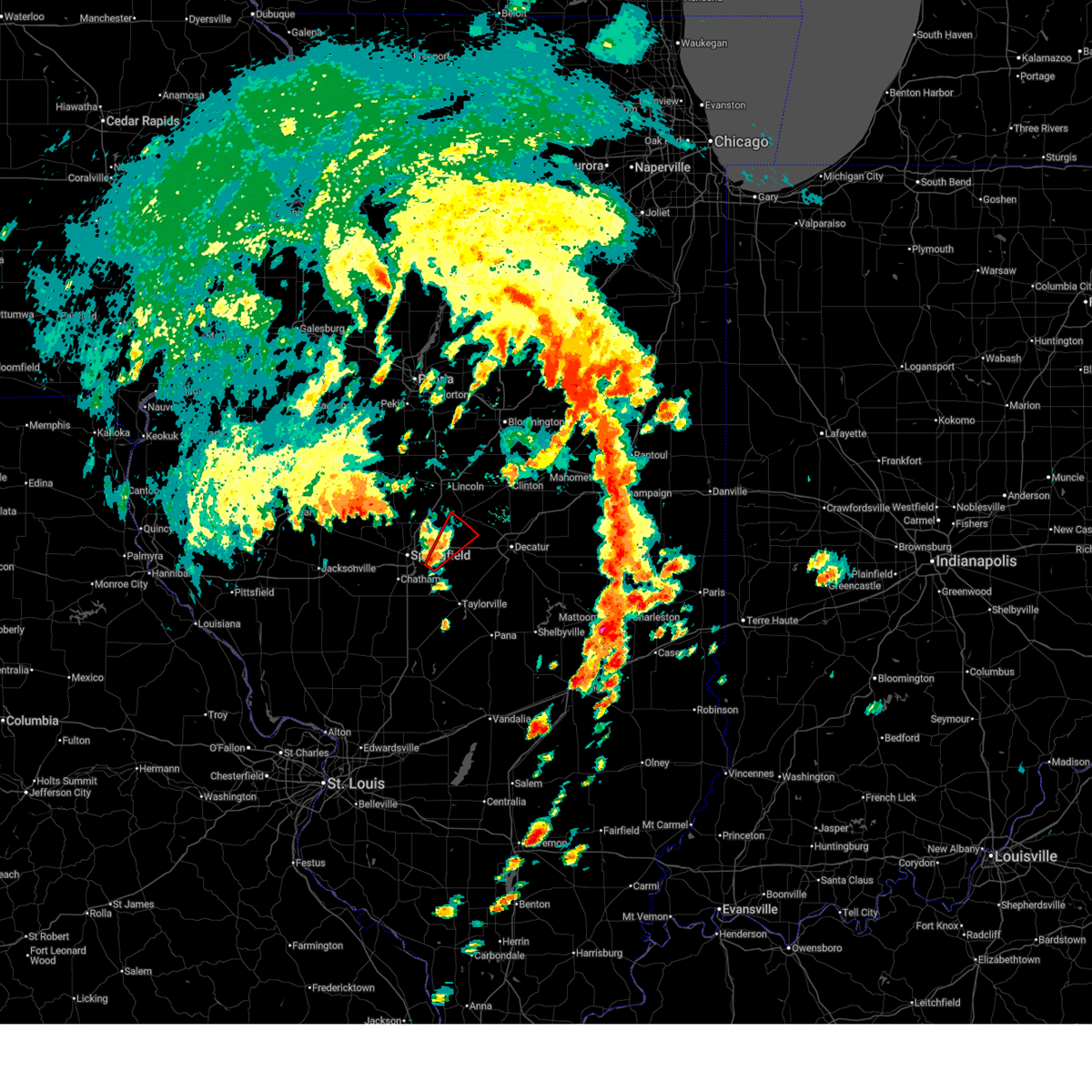
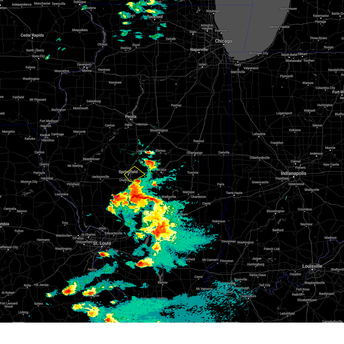
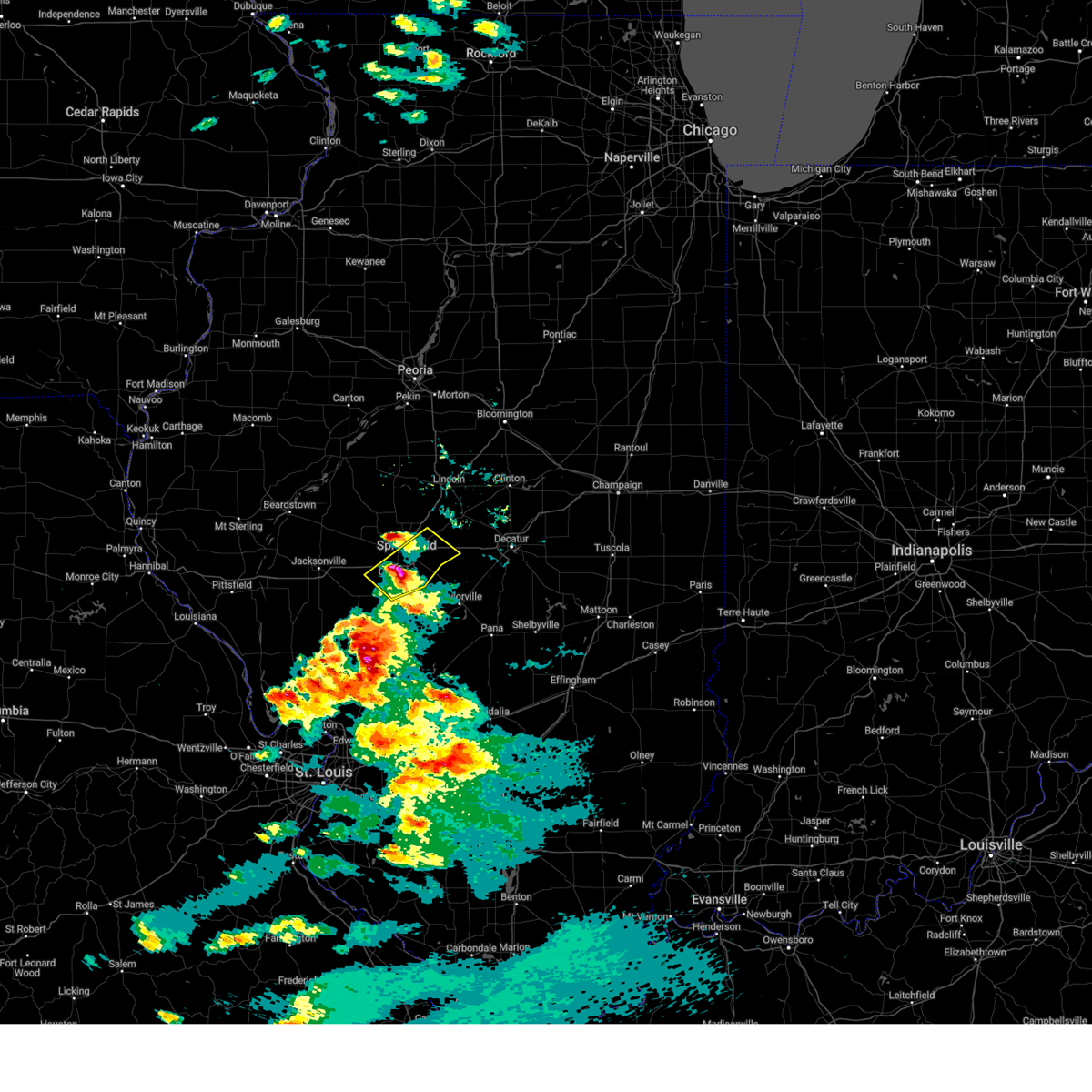
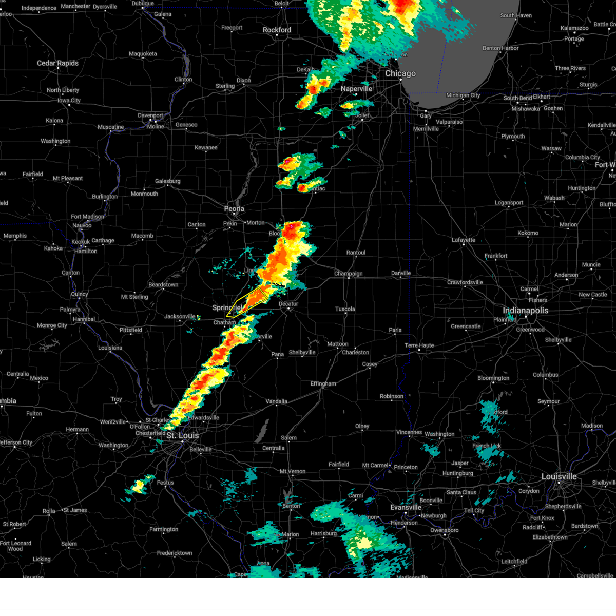
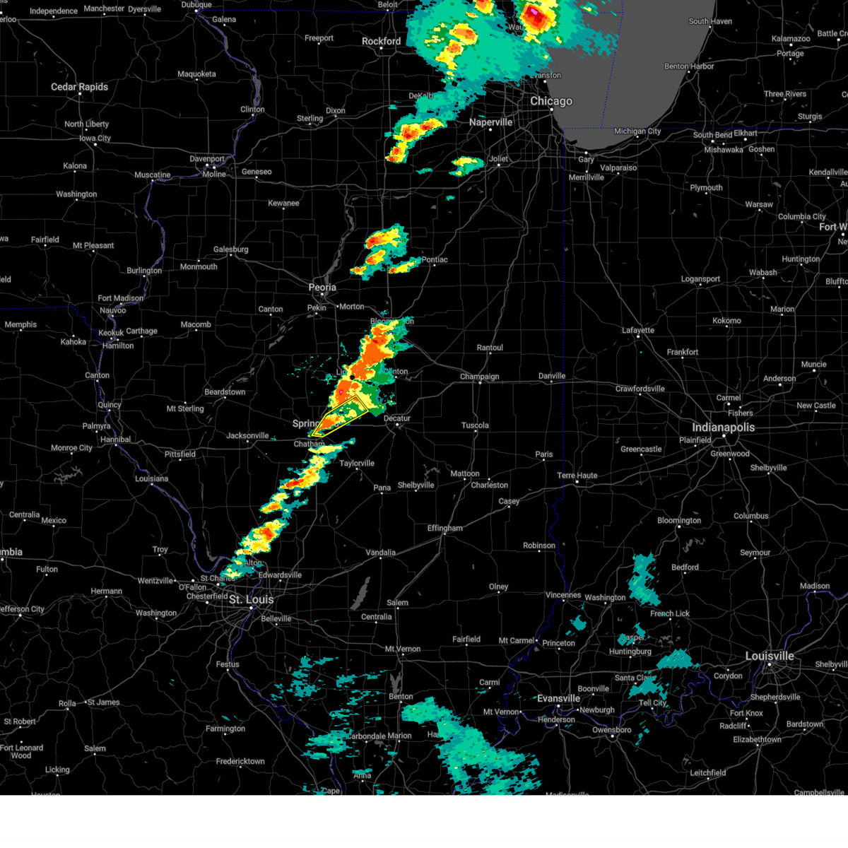
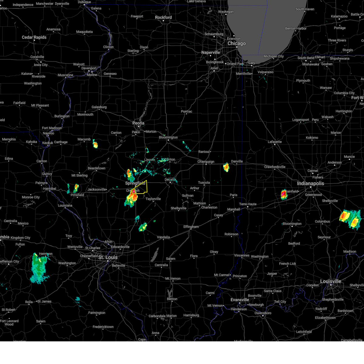
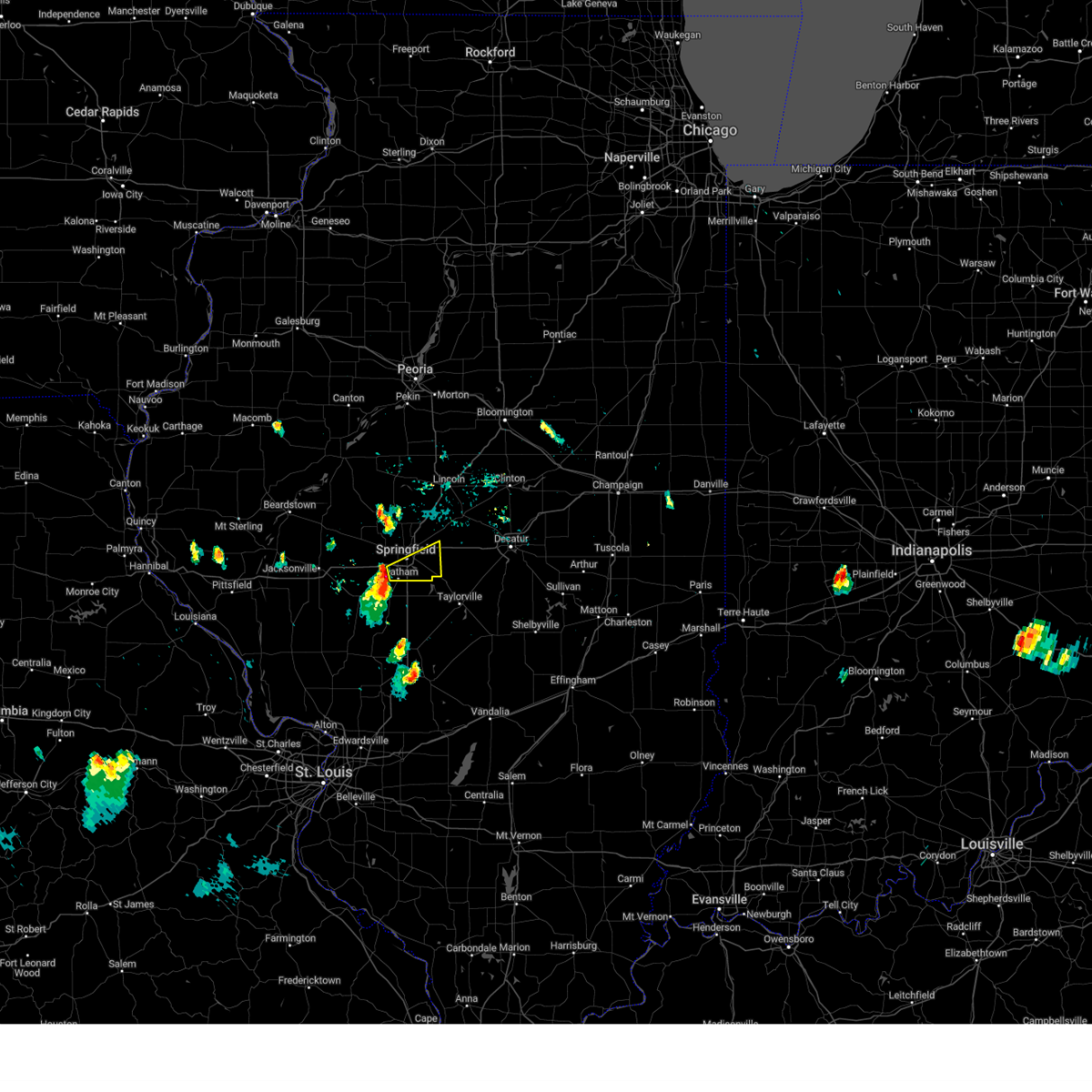
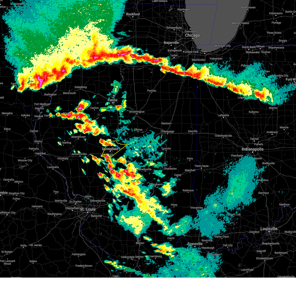
Hail Map for Dawson, IL
The Dawson, IL area has had 1 report of on-the-ground hail by trained spotters, and has been under severe weather warnings 38 times during the past 12 months. Doppler radar has detected hail at or near Dawson, IL on 44 occasions, including 9 occasions during the past year.
| Name: | Dawson, IL |
| Where Located: | 58.2 miles S of Peoria, IL |
| Map: | Google Map for Dawson, IL |
| Population: | 509 |
| Housing Units: | 228 |
| More Info: | Search Google for Dawson, IL |
5
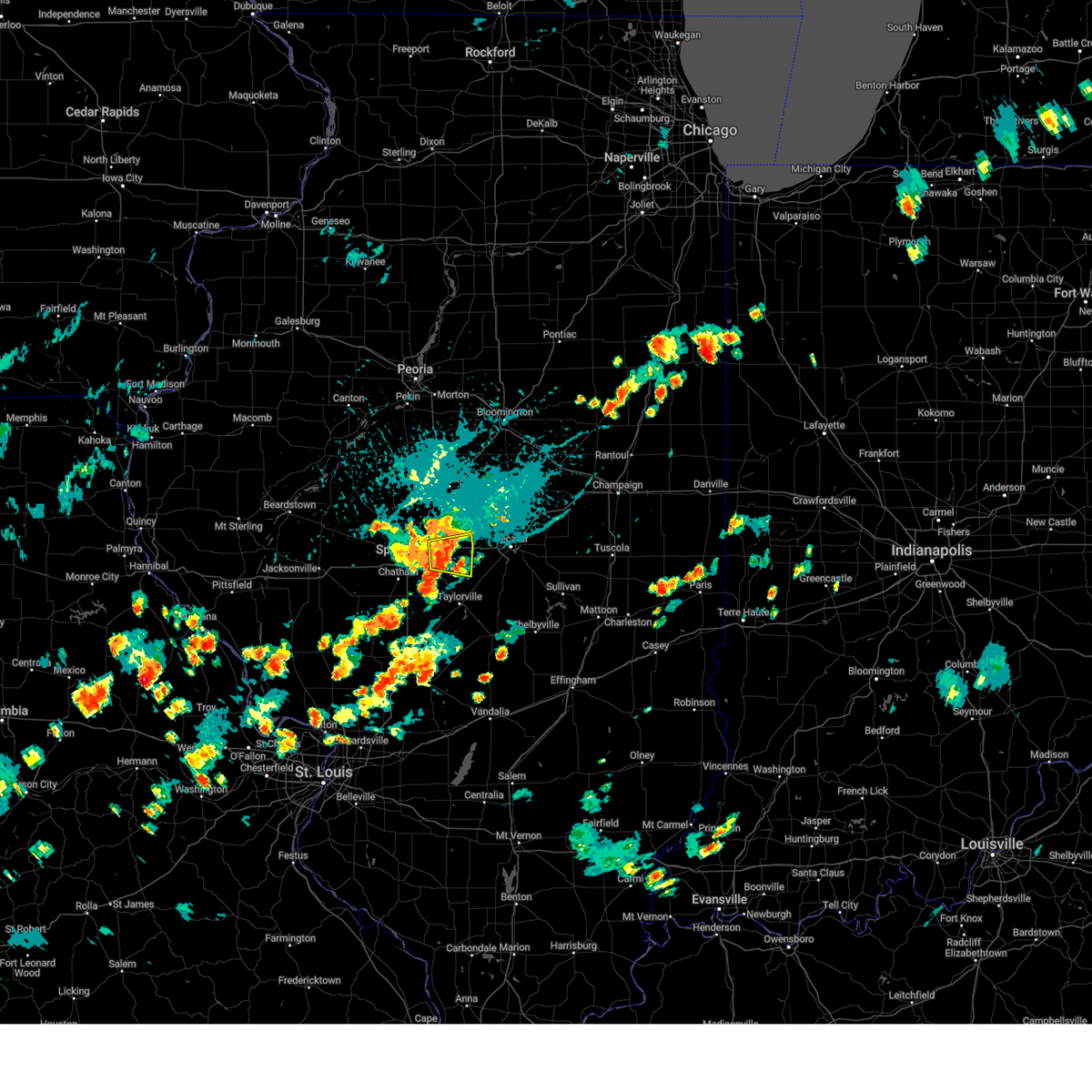
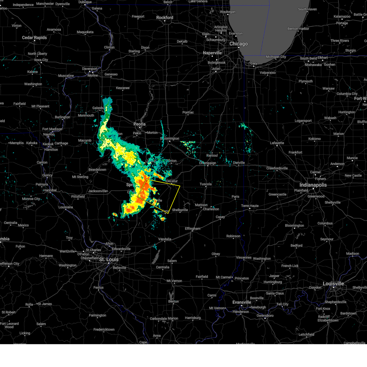
The Top Recent Hail Date for Dawson, IL is Friday, May 16, 2025 (1st out of 44)

Hail and Wind Damage Spotted near Dawson, IL
| Date / Time | Report Details |
|---|---|
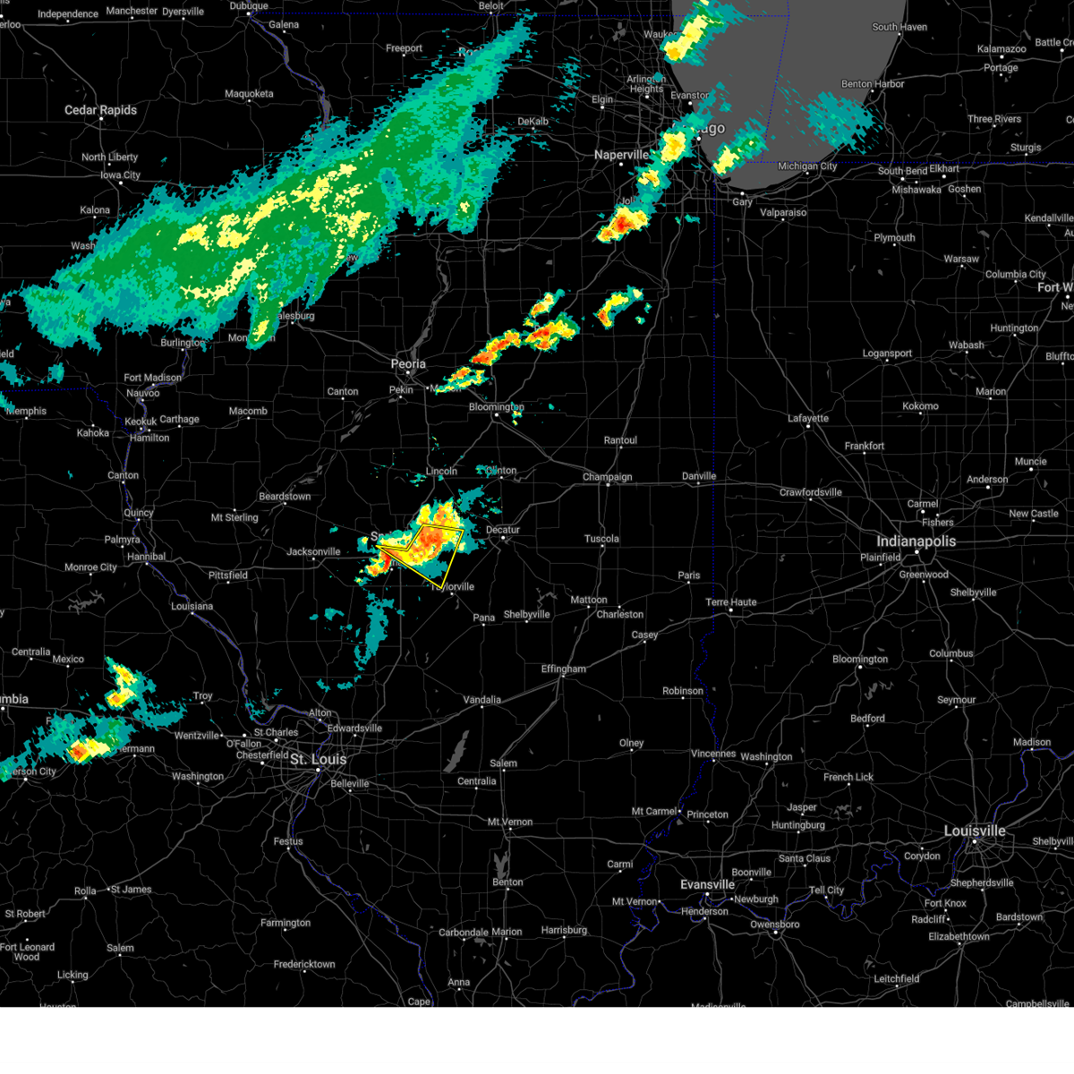
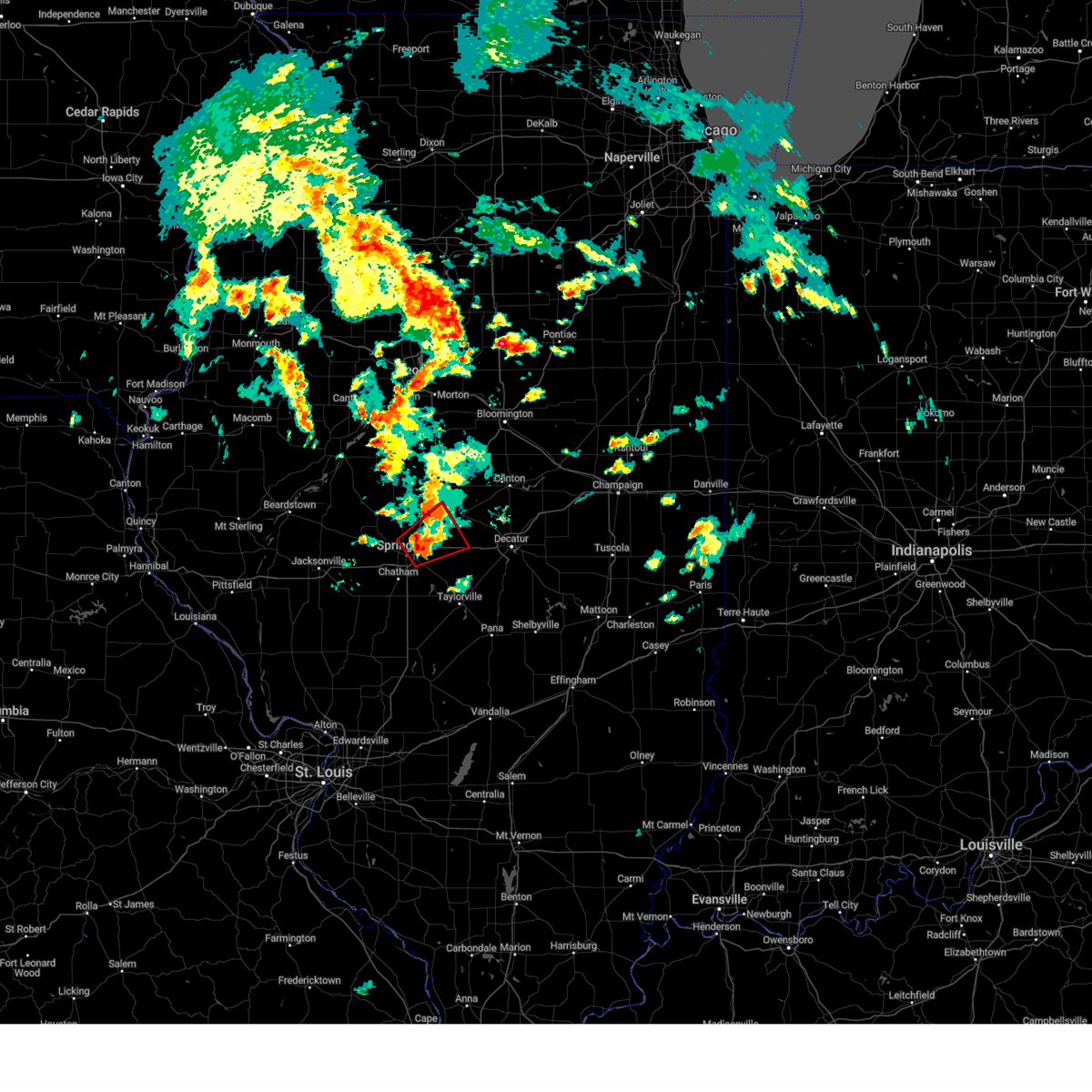
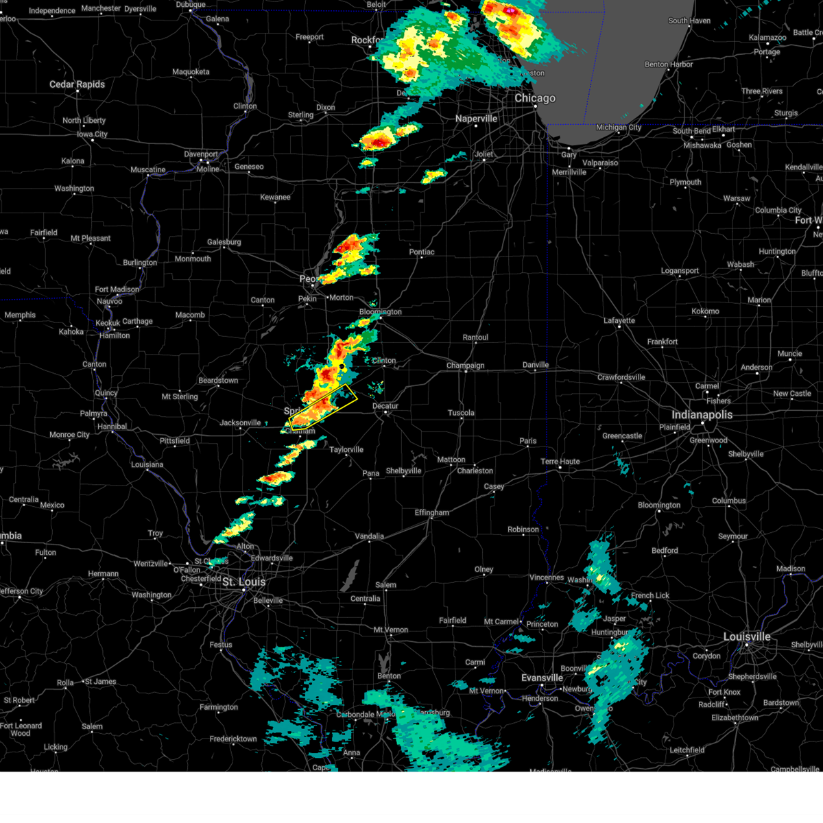
| 7/8/2025 4:04 PM CDT | Svrilx the national weather service in lincoln has issued a * severe thunderstorm warning for, north central christian county in central illinois, northeastern sangamon county in central illinois, * until 430 pm cdt. * at 403 pm cdt, severe thunderstorms were located along a line extending from near illiopolis to near mechanicsburg, moving southeast at 15 mph (radar indicated). Hazards include 60 mph wind gusts. Expect damage to roofs, siding, and trees. severe thunderstorms will be near, illiopolis, mechanicsburg, and buffalo around 410 pm cdt. This includes interstate 72 between mile markers 110 and 125. |
| 6/18/2025 12:43 PM CDT |
 At 1243 pm cdt, a severe thunderstorm capable of producing a tornado was located over mechanicsburg, or 11 miles east of springfield, moving northeast at 40 mph (radar indicated rotation). Hazards include tornado. Flying debris will be dangerous to those caught without shelter. mobile homes will be damaged or destroyed. damage to roofs, windows, and vehicles will occur. tree damage is likely. this dangerous storm will be near, mechanicsburg, dawson, and buffalo around 1250 pm cdt. This includes interstate 72 between mile markers 112 and 121. At 1243 pm cdt, a severe thunderstorm capable of producing a tornado was located over mechanicsburg, or 11 miles east of springfield, moving northeast at 40 mph (radar indicated rotation). Hazards include tornado. Flying debris will be dangerous to those caught without shelter. mobile homes will be damaged or destroyed. damage to roofs, windows, and vehicles will occur. tree damage is likely. this dangerous storm will be near, mechanicsburg, dawson, and buffalo around 1250 pm cdt. This includes interstate 72 between mile markers 112 and 121.
|
| 6/18/2025 12:27 PM CDT |
 Torilx the national weather service in lincoln has issued a * tornado warning for, south central logan county in central illinois, northwestern christian county in central illinois, northeastern sangamon county in central illinois, west central macon county in central illinois, * until 100 pm cdt. * at 1227 pm cdt, a severe thunderstorm capable of producing a tornado was located near pawnee, or 7 miles southeast of springfield, moving northeast at 40 mph (radar indicated rotation). Hazards include tornado. Flying debris will be dangerous to those caught without shelter. mobile homes will be damaged or destroyed. damage to roofs, windows, and vehicles will occur. tree damage is likely. this dangerous storm will be near, springfield and rochester around 1230 pm cdt. mechanicsburg around 1240 pm cdt. dawson and buffalo around 1245 pm cdt. This includes interstate 72 between mile markers 110 and 127. Torilx the national weather service in lincoln has issued a * tornado warning for, south central logan county in central illinois, northwestern christian county in central illinois, northeastern sangamon county in central illinois, west central macon county in central illinois, * until 100 pm cdt. * at 1227 pm cdt, a severe thunderstorm capable of producing a tornado was located near pawnee, or 7 miles southeast of springfield, moving northeast at 40 mph (radar indicated rotation). Hazards include tornado. Flying debris will be dangerous to those caught without shelter. mobile homes will be damaged or destroyed. damage to roofs, windows, and vehicles will occur. tree damage is likely. this dangerous storm will be near, springfield and rochester around 1230 pm cdt. mechanicsburg around 1240 pm cdt. dawson and buffalo around 1245 pm cdt. This includes interstate 72 between mile markers 110 and 127.
|
| 6/18/2025 12:14 PM CDT |
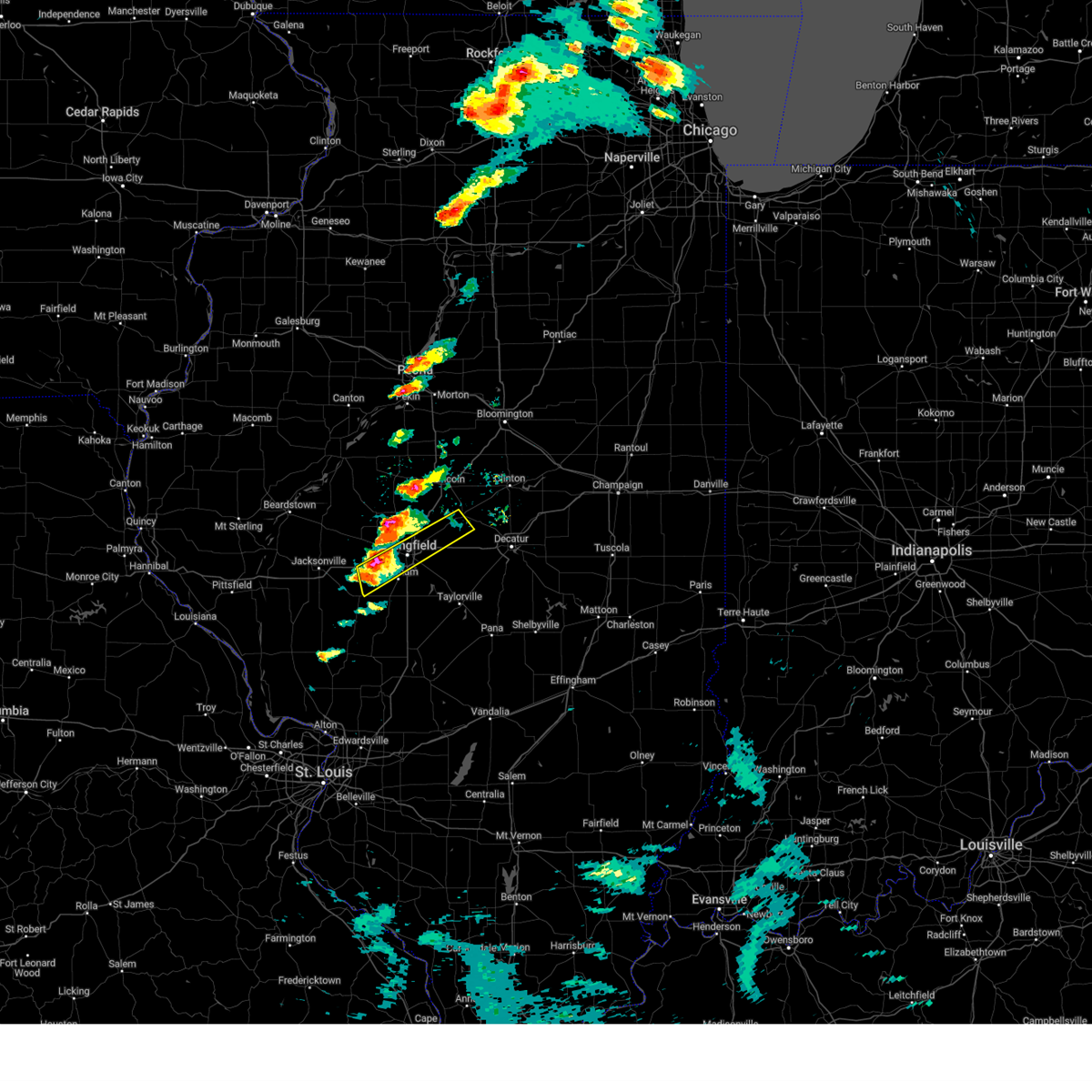
 The storm which prompted the warning has weakened below severe limits, and no longer appears capable of producing a tornado. therefore, the warning will be allowed to expire. a tornado watch remains in effect until 400 pm cdt for central illinois. The storm which prompted the warning has weakened below severe limits, and no longer appears capable of producing a tornado. therefore, the warning will be allowed to expire. a tornado watch remains in effect until 400 pm cdt for central illinois.
|
| 6/18/2025 12:08 PM CDT |
 At 1208 pm cdt, a severe thunderstorm capable of producing a tornado was located over dawson, or 12 miles northeast of springfield, moving northeast at 40 mph (radar indicated rotation). Hazards include tornado. Flying debris will be dangerous to those caught without shelter. mobile homes will be damaged or destroyed. damage to roofs, windows, and vehicles will occur. tree damage is likely. this dangerous storm will be near, cornland around 1215 pm cdt. other locations impacted by this tornadic thunderstorm include spaulding. This includes interstate 72 between mile markers 110 and 113. At 1208 pm cdt, a severe thunderstorm capable of producing a tornado was located over dawson, or 12 miles northeast of springfield, moving northeast at 40 mph (radar indicated rotation). Hazards include tornado. Flying debris will be dangerous to those caught without shelter. mobile homes will be damaged or destroyed. damage to roofs, windows, and vehicles will occur. tree damage is likely. this dangerous storm will be near, cornland around 1215 pm cdt. other locations impacted by this tornadic thunderstorm include spaulding. This includes interstate 72 between mile markers 110 and 113.
|
| 6/18/2025 11:51 AM CDT |
 At 1151 am cdt, a severe thunderstorm capable of producing a tornado was located over rochester, or near springfield, moving northeast at 40 mph (radar indicated rotation). Hazards include tornado. Flying debris will be dangerous to those caught without shelter. mobile homes will be damaged or destroyed. damage to roofs, windows, and vehicles will occur. tree damage is likely. this dangerous storm will be near, springfield, rochester, and riverton around 1155 am cdt. dawson around 1200 pm cdt. buffalo around 1205 pm cdt. other locations impacted by this tornadic thunderstorm include clear lake and spaulding. this includes the following highways, interstate 55 near mile marker 94. Interstate 72 near mile marker 100, and between mile markers 105 and 115. At 1151 am cdt, a severe thunderstorm capable of producing a tornado was located over rochester, or near springfield, moving northeast at 40 mph (radar indicated rotation). Hazards include tornado. Flying debris will be dangerous to those caught without shelter. mobile homes will be damaged or destroyed. damage to roofs, windows, and vehicles will occur. tree damage is likely. this dangerous storm will be near, springfield, rochester, and riverton around 1155 am cdt. dawson around 1200 pm cdt. buffalo around 1205 pm cdt. other locations impacted by this tornadic thunderstorm include clear lake and spaulding. this includes the following highways, interstate 55 near mile marker 94. Interstate 72 near mile marker 100, and between mile markers 105 and 115.
|
| 6/18/2025 11:44 AM CDT |
 Torilx the national weather service in lincoln has issued a * tornado warning for, south central logan county in central illinois, central sangamon county in central illinois, * until 1215 pm cdt. * at 1144 am cdt, a severe thunderstorm capable of producing a tornado was located near rochester, or near springfield, moving northeast at 40 mph (radar indicated rotation). Hazards include tornado. Flying debris will be dangerous to those caught without shelter. mobile homes will be damaged or destroyed. damage to roofs, windows, and vehicles will occur. tree damage is likely. this dangerous storm will be near, springfield and rochester around 1150 am cdt. riverton around 1155 am cdt. dawson and buffalo around 1200 pm cdt. other locations in the path of this tornadic thunderstorm include cornland. this includes the following highways, interstate 55 between mile markers 82 and 90, and between mile markers 93 and 97. Interstate 72 between mile markers 99 and 116. Torilx the national weather service in lincoln has issued a * tornado warning for, south central logan county in central illinois, central sangamon county in central illinois, * until 1215 pm cdt. * at 1144 am cdt, a severe thunderstorm capable of producing a tornado was located near rochester, or near springfield, moving northeast at 40 mph (radar indicated rotation). Hazards include tornado. Flying debris will be dangerous to those caught without shelter. mobile homes will be damaged or destroyed. damage to roofs, windows, and vehicles will occur. tree damage is likely. this dangerous storm will be near, springfield and rochester around 1150 am cdt. riverton around 1155 am cdt. dawson and buffalo around 1200 pm cdt. other locations in the path of this tornadic thunderstorm include cornland. this includes the following highways, interstate 55 between mile markers 82 and 90, and between mile markers 93 and 97. Interstate 72 between mile markers 99 and 116.
|
| 6/8/2025 4:23 PM CDT |
 At 423 pm cdt, a severe thunderstorm was located near mount auburn, or 13 miles north of taylorville, moving east at 45 mph (broadcast media). Hazards include 60 mph wind gusts and quarter size hail. Hail damage to vehicles is expected. expect wind damage to roofs, siding, and trees. this severe thunderstorm will remain over mainly rural areas of northwestern christian and northeastern sangamon counties, including the following locations, clear lake, sangchris lake state park, southern view, jerome, and leland grove. this includes the following highways, interstate 55 between mile markers 91 and 95. Interstate 72 between mile markers 96 and 101, and between mile markers 105 and 123. At 423 pm cdt, a severe thunderstorm was located near mount auburn, or 13 miles north of taylorville, moving east at 45 mph (broadcast media). Hazards include 60 mph wind gusts and quarter size hail. Hail damage to vehicles is expected. expect wind damage to roofs, siding, and trees. this severe thunderstorm will remain over mainly rural areas of northwestern christian and northeastern sangamon counties, including the following locations, clear lake, sangchris lake state park, southern view, jerome, and leland grove. this includes the following highways, interstate 55 between mile markers 91 and 95. Interstate 72 between mile markers 96 and 101, and between mile markers 105 and 123.
|
| 6/8/2025 4:08 PM CDT | At 407 pm cdt, a severe thunderstorm was located near rochester, or 8 miles east of springfield, moving east at 45 mph (broadcast media). Hazards include 60 mph wind gusts and quarter size hail. Hail damage to vehicles is expected. expect wind damage to roofs, siding, and trees. this severe storm will be near, mechanicsburg around 415 pm cdt. other locations impacted by this severe thunderstorm include sangchris lake state park, spaulding, clear lake, southern view, grandview, jerome, and leland grove. this includes the following highways, interstate 55 between mile markers 91 and 105. Interstate 72 between mile markers 96 and 123. |
| 6/8/2025 3:49 PM CDT | Svrilx the national weather service in lincoln has issued a * severe thunderstorm warning for, northwestern christian county in central illinois, central sangamon county in central illinois, * until 430 pm cdt. * at 349 pm cdt, a severe thunderstorm was located over abraham lincoln capital airport, or 7 miles south of athens, moving east at 40 mph (radar indicated). Hazards include 60 mph wind gusts and half dollar size hail. Hail damage to vehicles is expected. expect wind damage to roofs, siding, and trees. this severe thunderstorm will be near, springfield, sherman, abraham lincoln capital airport, and illinois state fairgrounds around 355 pm cdt. rochester and riverton around 400 pm cdt. other locations in the path of this severe thunderstorm include mechanicsburg. this includes the following highways, interstate 55 between mile markers 91 and 105. Interstate 72 between mile markers 96 and 123. |
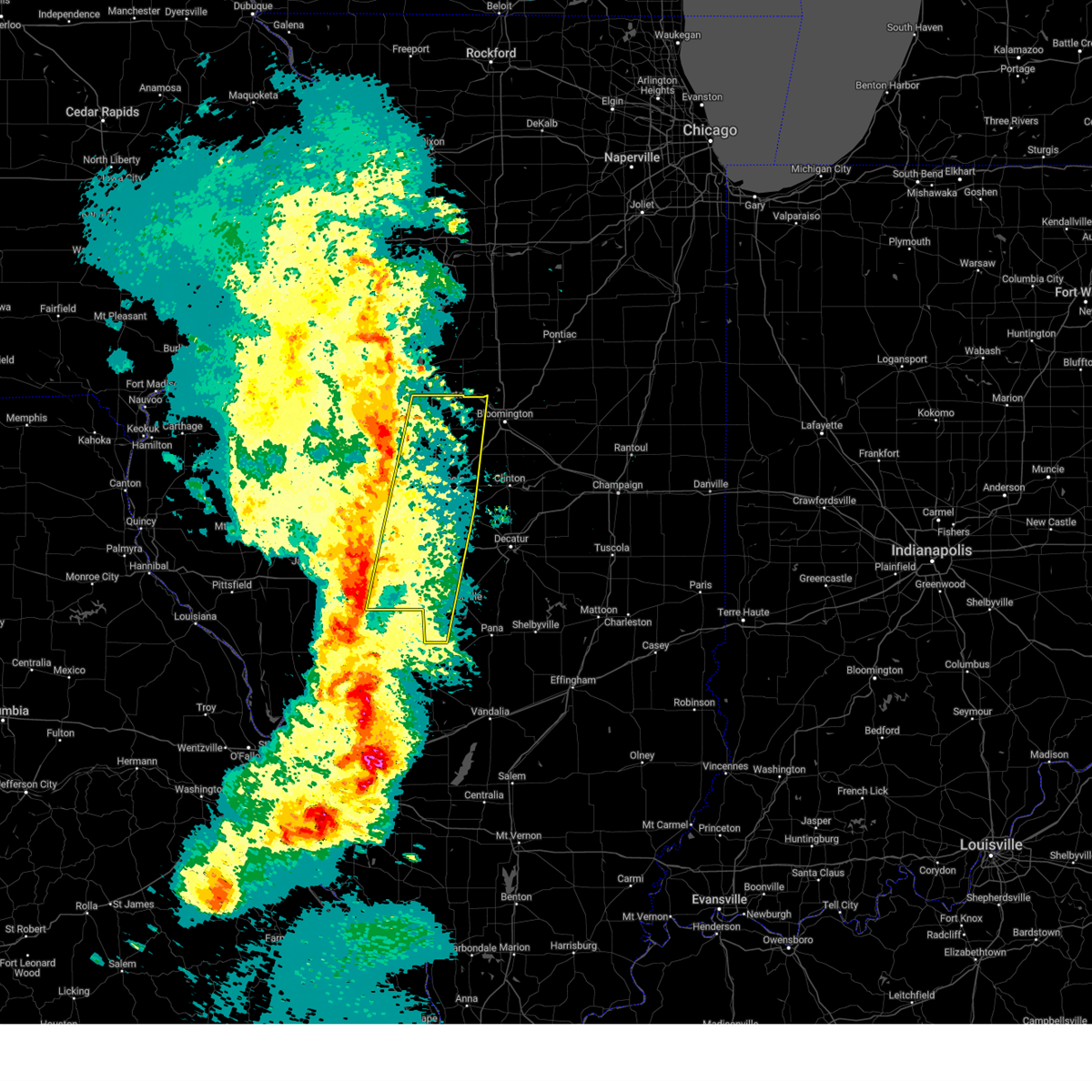
| 5/20/2025 2:53 PM CDT |
 At 253 pm cdt, a severe thunderstorm capable of producing a tornado was located over riverton, moving northeast at 35 mph (radar indicated rotation). Hazards include tornado and golf ball size hail. Flying debris will be dangerous to those caught without shelter. mobile homes will be damaged or destroyed. damage to roofs, windows, and vehicles will occur. tree damage is likely. this dangerous storm will be near, riverton, dawson, and buffalo around 300 pm cdt. cornland around 305 pm cdt. other locations impacted by this tornadic thunderstorm include clear lake, spaulding, and grandview. this includes the following highways, interstate 55 between mile markers 95 and 113. Interstate 72 between mile markers 101 and 123. At 253 pm cdt, a severe thunderstorm capable of producing a tornado was located over riverton, moving northeast at 35 mph (radar indicated rotation). Hazards include tornado and golf ball size hail. Flying debris will be dangerous to those caught without shelter. mobile homes will be damaged or destroyed. damage to roofs, windows, and vehicles will occur. tree damage is likely. this dangerous storm will be near, riverton, dawson, and buffalo around 300 pm cdt. cornland around 305 pm cdt. other locations impacted by this tornadic thunderstorm include clear lake, spaulding, and grandview. this includes the following highways, interstate 55 between mile markers 95 and 113. Interstate 72 between mile markers 101 and 123.
|
| 5/20/2025 2:36 PM CDT | Torilx the national weather service in lincoln has issued a * tornado warning for, southwestern logan county in central illinois, northern sangamon county in central illinois, * until 315 pm cdt. * at 236 pm cdt, a confirmed tornado was located near curran, moving northeast at 35 mph (weather spotters confirmed tornado). Hazards include damaging tornado and golf ball size hail. Flying debris will be dangerous to those caught without shelter. mobile homes will be damaged or destroyed. damage to roofs, windows, and vehicles will occur. tree damage is likely. the tornado will be near, springfield, abraham lincoln capital airport, and illinois state fairgrounds around 240 pm cdt. sherman and riverton around 250 pm cdt. other locations in the path of this tornadic thunderstorm include dawson, williamsville and cornland. this includes the following highways, interstate 55 between mile markers 91 and 113. Interstate 72 between mile markers 92 and 123. |
| 5/16/2025 3:38 PM CDT |
 The severe thunderstorm which prompted the warning has moved out of the warned area. therefore, the warning will be allowed to expire. another severe thunderstorm warning is in effect for southeast sangamon county until 415 pm cdt. a tornado watch remains in effect until 1000 pm cdt for central illinois. The severe thunderstorm which prompted the warning has moved out of the warned area. therefore, the warning will be allowed to expire. another severe thunderstorm warning is in effect for southeast sangamon county until 415 pm cdt. a tornado watch remains in effect until 1000 pm cdt for central illinois.
|
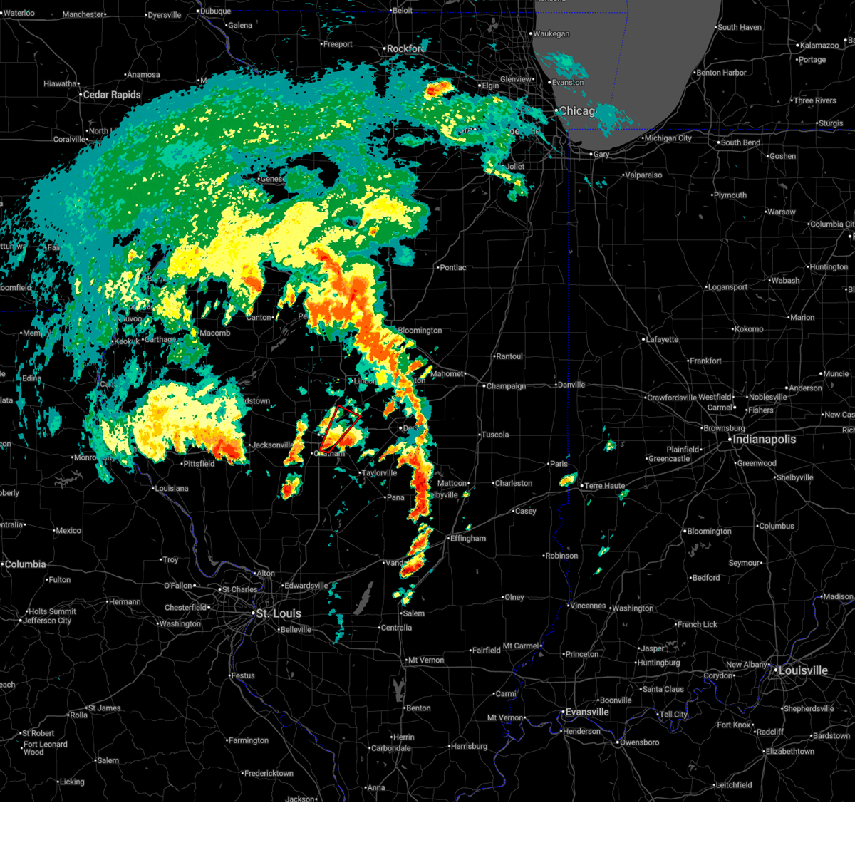
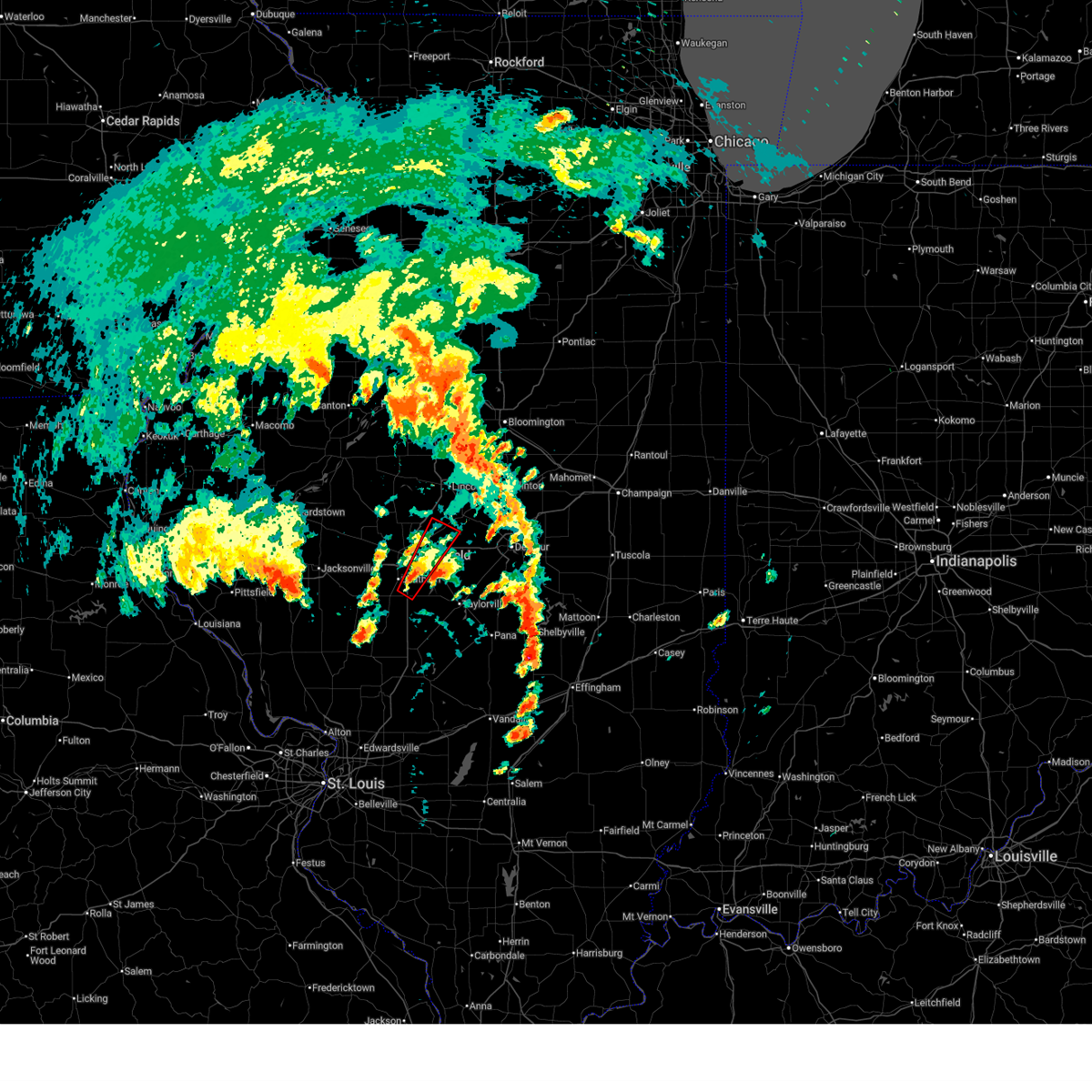
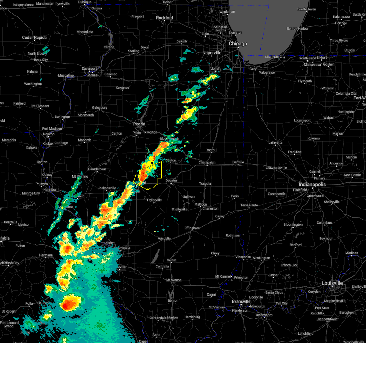
| 5/16/2025 3:24 PM CDT | Svrilx the national weather service in lincoln has issued a * severe thunderstorm warning for, southeastern logan county in central illinois, northeastern sangamon county in central illinois, western de witt county in central illinois, northern macon county in central illinois, * until 415 pm cdt. * at 324 pm cdt, a severe thunderstorm was located over dawson, or 12 miles northeast of springfield, moving northeast at 65 mph (trained weather spotters). Hazards include two inch hail and 60 mph wind gusts. People and animals outdoors will be injured. expect hail damage to roofs, siding, windows, and vehicles. expect wind damage to roofs, siding, and trees. this severe thunderstorm will be near, mount pulaski and cornland around 330 pm cdt. chestnut around 340 pm cdt. other locations in the path of this severe thunderstorm include kenney, beason, clinton and wapella. this includes the following highways, interstate 55 mile marker 103 and near mile marker 140. Interstate 72 between mile markers 108 and 116. |
| 5/16/2025 3:20 PM CDT | At 320 pm cdt, a severe thunderstorm was located over riverton, or 7 miles northeast of springfield, moving northeast at 70 mph (radar indicated). Hazards include two inch hail and 70 mph wind gusts. People and animals outdoors will be injured. expect hail damage to roofs, siding, windows, and vehicles. expect considerable tree damage. wind damage is also likely to mobile homes, roofs, and outbuildings. this severe storm will be near, dawson and buffalo around 325 pm cdt. other locations impacted by this severe thunderstorm include clear lake, southern view, spaulding, grandview, jerome, and leland grove. this includes the following highways, interstate 55 between mile markers 91 and 103. Interstate 72 between mile markers 98 and 118. |
| 5/16/2025 3:10 PM CDT |
 At 309 pm cdt, a severe thunderstorm was located near chatham, or near springfield, moving northeast at 65 mph (radar indicated). Hazards include 70 mph wind gusts and ping pong ball size hail. People and animals outdoors will be injured. expect hail damage to roofs, siding, windows, and vehicles. expect considerable tree damage. wind damage is also likely to mobile homes, roofs, and outbuildings. this severe storm will be near, springfield, rochester, and illinois state fairgrounds around 315 pm cdt. sherman and riverton around 320 pm cdt. dawson around 325 pm cdt. other locations impacted by this severe thunderstorm include spaulding, curran, glenarm, clear lake, southern view, grandview, jerome, and leland grove. this includes the following highways, interstate 55 between mile markers 83 and 103. Interstate 72 between mile markers 87 and 118. At 309 pm cdt, a severe thunderstorm was located near chatham, or near springfield, moving northeast at 65 mph (radar indicated). Hazards include 70 mph wind gusts and ping pong ball size hail. People and animals outdoors will be injured. expect hail damage to roofs, siding, windows, and vehicles. expect considerable tree damage. wind damage is also likely to mobile homes, roofs, and outbuildings. this severe storm will be near, springfield, rochester, and illinois state fairgrounds around 315 pm cdt. sherman and riverton around 320 pm cdt. dawson around 325 pm cdt. other locations impacted by this severe thunderstorm include spaulding, curran, glenarm, clear lake, southern view, grandview, jerome, and leland grove. this includes the following highways, interstate 55 between mile markers 83 and 103. Interstate 72 between mile markers 87 and 118.
|
| 5/16/2025 3:00 PM CDT | Svrilx the national weather service in lincoln has issued a * severe thunderstorm warning for, sangamon county in central illinois, * until 345 pm cdt. * at 300 pm cdt, a severe thunderstorm was located near waverly, or 8 miles northwest of virden, moving northeast at 55 mph (radar indicated). Hazards include 60 mph wind gusts and quarter size hail. Hail damage to vehicles is expected. expect wind damage to roofs, siding, and trees. this severe thunderstorm will be near, auburn around 305 pm cdt. chatham around 310 pm cdt. springfield around 315 pm cdt. rochester around 320 pm cdt. other locations in the path of this severe thunderstorm include mechanicsburg, dawson and buffalo. this includes the following highways, interstate 55 between mile markers 78 and 103. Interstate 72 between mile markers 87 and 118. |
| 5/15/2025 7:15 PM CDT |
 The storm which prompted the warning has moved out of the area. therefore, the warning will be allowed to expire. a tornado watch remains in effect until 1000 pm cdt for central illinois. a new severe thunderstorm warning has been issued for far eastern sangamon county. The storm which prompted the warning has moved out of the area. therefore, the warning will be allowed to expire. a tornado watch remains in effect until 1000 pm cdt for central illinois. a new severe thunderstorm warning has been issued for far eastern sangamon county.
|
| 5/15/2025 7:01 PM CDT |
 At 701 pm cdt, a severe thunderstorm was located over dawson, or 11 miles northeast of springfield, moving northeast at 45 mph (radar indicated). Hazards include 60 mph wind gusts and quarter size hail. Hail damage to vehicles is expected. expect wind damage to roofs, siding, and trees. this severe storm will be near, buffalo and cornland around 705 pm cdt. other locations impacted by this severe thunderstorm include clear lake, spaulding, grandview, jerome, and leland grove. this includes the following highways, interstate 55 between mile markers 95 and 101. Interstate 72 between mile markers 101 and 114. At 701 pm cdt, a severe thunderstorm was located over dawson, or 11 miles northeast of springfield, moving northeast at 45 mph (radar indicated). Hazards include 60 mph wind gusts and quarter size hail. Hail damage to vehicles is expected. expect wind damage to roofs, siding, and trees. this severe storm will be near, buffalo and cornland around 705 pm cdt. other locations impacted by this severe thunderstorm include clear lake, spaulding, grandview, jerome, and leland grove. this includes the following highways, interstate 55 between mile markers 95 and 101. Interstate 72 between mile markers 101 and 114.
|
| 5/15/2025 6:48 PM CDT |
 At 648 pm cdt, a severe thunderstorm was located over dawson, or 12 miles northeast of springfield, moving northeast at 55 mph (radar indicated). Hazards include 60 mph wind gusts and quarter size hail. Hail damage to vehicles is expected. expect wind damage to roofs, siding, and trees. this severe storm will be near, cornland around 655 pm cdt. mount pulaski around 700 pm cdt. other locations impacted by this severe thunderstorm include spaulding, curran, clear lake, southern view, grandview, jerome, and leland grove. this includes the following highways, interstate 55 between mile markers 92 and 103. Interstate 72 between mile markers 91 and 114. At 648 pm cdt, a severe thunderstorm was located over dawson, or 12 miles northeast of springfield, moving northeast at 55 mph (radar indicated). Hazards include 60 mph wind gusts and quarter size hail. Hail damage to vehicles is expected. expect wind damage to roofs, siding, and trees. this severe storm will be near, cornland around 655 pm cdt. mount pulaski around 700 pm cdt. other locations impacted by this severe thunderstorm include spaulding, curran, clear lake, southern view, grandview, jerome, and leland grove. this includes the following highways, interstate 55 between mile markers 92 and 103. Interstate 72 between mile markers 91 and 114.
|
| 5/15/2025 6:26 PM CDT |
 Svrilx the national weather service in lincoln has issued a * severe thunderstorm warning for, south central logan county in central illinois, central sangamon county in central illinois, * until 715 pm cdt. * at 625 pm cdt, a severe thunderstorm was located near new berlin, or 10 miles west of springfield, moving northeast at 55 mph (radar indicated). Hazards include 60 mph wind gusts and half dollar size hail. Hail damage to vehicles is expected. expect wind damage to roofs, siding, and trees. this severe thunderstorm will be near, springfield and abraham lincoln capital airport around 630 pm cdt. sherman and illinois state fairgrounds around 635 pm cdt. riverton around 640 pm cdt. other locations in the path of this severe thunderstorm include cornland and mount pulaski. this includes the following highways, interstate 55 between mile markers 91 and 104. Interstate 72 between mile markers 80 and 115. Svrilx the national weather service in lincoln has issued a * severe thunderstorm warning for, south central logan county in central illinois, central sangamon county in central illinois, * until 715 pm cdt. * at 625 pm cdt, a severe thunderstorm was located near new berlin, or 10 miles west of springfield, moving northeast at 55 mph (radar indicated). Hazards include 60 mph wind gusts and half dollar size hail. Hail damage to vehicles is expected. expect wind damage to roofs, siding, and trees. this severe thunderstorm will be near, springfield and abraham lincoln capital airport around 630 pm cdt. sherman and illinois state fairgrounds around 635 pm cdt. riverton around 640 pm cdt. other locations in the path of this severe thunderstorm include cornland and mount pulaski. this includes the following highways, interstate 55 between mile markers 91 and 104. Interstate 72 between mile markers 80 and 115.
|
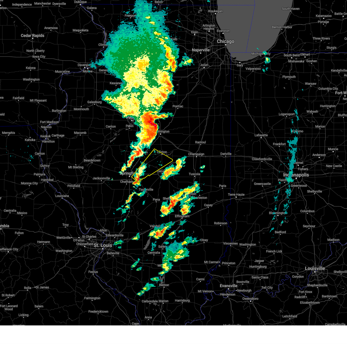
| 4/20/2025 8:25 PM CDT | Svrilx the national weather service in lincoln has issued a * severe thunderstorm warning for, menard county in central illinois, logan county in central illinois, northwestern christian county in central illinois, sangamon county in central illinois, tazewell county in central illinois, eastern mason county in central illinois, southeastern peoria county in central illinois, * until 900 pm cdt. * at 825 pm cdt, severe thunderstorms were located along a line extending from glasford to near virden, moving northeast at 55 mph (radar indicated). Hazards include 60 mph wind gusts. Expect damage to roofs, siding, and trees. severe thunderstorms will be near, mason city, greenview, south pekin, mapleton, bartonville, chatham, peoria international airport, manito, green valley, and pekin around 830 pm cdt. west peoria, peoria, middletown, bellevue, san jose, new holland, marquette heights, creve coeur, east peoria, and sherman around 835 pm cdt. williamsville, delavan, rochester, and riverton around 840 pm cdt. tremont, morton, elkhart, emden, and washington around 845 pm cdt. other locations in the path of these severe thunderstorms include dawson, hartsburg, cornland, buffalo, hopedale, lincoln and mechanicsburg. this includes the following highways, interstate 155 between mile markers 0 and 31. interstate 474 between mile markers 6 and 14. interstate 55 between mile markers 77 and 131. interstate 72 between mile markers 86 and 119. Interstate 74 between mile markers 92 and 108. |
| 4/2/2025 4:42 PM CDT |
 At 442 pm cdt, severe thunderstorms were located along a line extending from near weldon to near taylorville, moving northeast at 50 mph (radar indicated). Hazards include 70 mph wind gusts and quarter size hail. Hail damage to vehicles is expected. expect considerable tree damage. wind damage is also likely to mobile homes, roofs, and outbuildings. these severe storms will be near, stonington, oreana, blue mound, weldon, forsyth, taylorville, decatur, argenta, and harristown around 445 pm cdt. de land, mount zion, decatur airport, macon, and cisco around 450 pm cdt. long creek around 455 pm cdt. other locations impacted by these severe thunderstorms include sangchris lake state park, willeys, clinton power station, weldon springs state park, glenarm, thayer, southern view, elwin, clear lake, and lodge. this includes the following highways, interstate 55 between mile markers 77 and 99. Interstate 72 between mile markers 95 and 163. At 442 pm cdt, severe thunderstorms were located along a line extending from near weldon to near taylorville, moving northeast at 50 mph (radar indicated). Hazards include 70 mph wind gusts and quarter size hail. Hail damage to vehicles is expected. expect considerable tree damage. wind damage is also likely to mobile homes, roofs, and outbuildings. these severe storms will be near, stonington, oreana, blue mound, weldon, forsyth, taylorville, decatur, argenta, and harristown around 445 pm cdt. de land, mount zion, decatur airport, macon, and cisco around 450 pm cdt. long creek around 455 pm cdt. other locations impacted by these severe thunderstorms include sangchris lake state park, willeys, clinton power station, weldon springs state park, glenarm, thayer, southern view, elwin, clear lake, and lodge. this includes the following highways, interstate 55 between mile markers 77 and 99. Interstate 72 between mile markers 95 and 163.
|
| 4/2/2025 4:24 PM CDT | Svrilx the national weather service in lincoln has issued a * severe thunderstorm warning for, southeastern logan county in central illinois, central christian county in central illinois, central sangamon county in central illinois, central piatt county in central illinois, southern de witt county in central illinois, macon county in central illinois, * until 515 pm cdt. * at 423 pm cdt, severe thunderstorms were located along a line extending from near wapella to near pawnee, moving northeast at 65 mph (radar indicated). Hazards include 60 mph wind gusts and quarter size hail. Hail damage to vehicles is expected. expect wind damage to roofs, siding, and trees. severe thunderstorms will be near, edinburg, mount auburn, maroa, latham, clinton, warrensburg, jeisyville, niantic, kincaid, and illiopolis around 430 pm cdt. forsyth, decatur, and harristown around 435 pm cdt. weldon around 440 pm cdt. other locations in the path of these severe thunderstorms include oreana, blue mound, argenta, de land, mount zion, decatur airport, long creek and cisco. this includes the following highways, interstate 55 between mile markers 77 and 100. Interstate 72 between mile markers 95 and 163. |
| 4/2/2025 4:12 PM CDT |
 At 411 pm cdt, severe thunderstorms were located along a line extending from near mount pulaski to girard, moving northeast at 35 mph (radar indicated). Hazards include 60 mph wind gusts and quarter size hail. Hail damage to vehicles is expected. expect wind damage to roofs, siding, and trees. locations impacted include, dawson, sangchris lake state park, mechanicsburg, curran, glenarm, thayer, southern view, latham, riverton, illinois state fairgrounds, kenney, williamsville, elkhart, chestnut, clear lake, loami, sherman, lowder, chatham, and pawnee. this includes the following highways, interstate 55 between mile markers 77 and 114. Interstate 72 between mile markers 89 and 123. At 411 pm cdt, severe thunderstorms were located along a line extending from near mount pulaski to girard, moving northeast at 35 mph (radar indicated). Hazards include 60 mph wind gusts and quarter size hail. Hail damage to vehicles is expected. expect wind damage to roofs, siding, and trees. locations impacted include, dawson, sangchris lake state park, mechanicsburg, curran, glenarm, thayer, southern view, latham, riverton, illinois state fairgrounds, kenney, williamsville, elkhart, chestnut, clear lake, loami, sherman, lowder, chatham, and pawnee. this includes the following highways, interstate 55 between mile markers 77 and 114. Interstate 72 between mile markers 89 and 123.
|
| 4/2/2025 3:56 PM CDT | Svrilx the national weather service in lincoln has issued a * severe thunderstorm warning for, southeastern menard county in central illinois, southern logan county in central illinois, northwestern christian county in central illinois, sangamon county in central illinois, western de witt county in central illinois, southeastern morgan county in west central illinois, * until 430 pm cdt. * at 355 pm cdt, severe thunderstorms were located along a line extending from near cornland to near palmyra, moving northeast at 35 mph (radar indicated). Hazards include 60 mph wind gusts and quarter size hail. Hail damage to vehicles is expected. Expect wind damage to roofs, siding, and trees. |
| 4/2/2025 3:23 PM CDT |
 At 321 pm cdt, severe thunderstorms were located along a line extending from near elkhart to near riverton, moving northeast at 70 mph (broadcast media. at 319 pm golf ball hail was reported on north grand in springfield). Hazards include golf ball size hail and 60 mph wind gusts. People and animals outdoors will be injured. expect hail damage to roofs, siding, windows, and vehicles. expect wind damage to roofs, siding, and trees. these severe storms will be near, cornland and elkhart around 325 pm cdt. mount pulaski and beason around 330 pm cdt. chestnut around 335 pm cdt. other locations impacted by these severe thunderstorms include clear lake, spaulding, broadwell, grandview, and cantrall. this includes the following highways, interstate 55 between mile markers 98 and 120. Interstate 72 between mile markers 105 and 124. At 321 pm cdt, severe thunderstorms were located along a line extending from near elkhart to near riverton, moving northeast at 70 mph (broadcast media. at 319 pm golf ball hail was reported on north grand in springfield). Hazards include golf ball size hail and 60 mph wind gusts. People and animals outdoors will be injured. expect hail damage to roofs, siding, windows, and vehicles. expect wind damage to roofs, siding, and trees. these severe storms will be near, cornland and elkhart around 325 pm cdt. mount pulaski and beason around 330 pm cdt. chestnut around 335 pm cdt. other locations impacted by these severe thunderstorms include clear lake, spaulding, broadwell, grandview, and cantrall. this includes the following highways, interstate 55 between mile markers 98 and 120. Interstate 72 between mile markers 105 and 124.
|
| 4/2/2025 3:23 PM CDT |
 the severe thunderstorm warning has been cancelled and is no longer in effect the severe thunderstorm warning has been cancelled and is no longer in effect
|
| 4/2/2025 3:14 PM CDT | Svrilx the national weather service in lincoln has issued a * severe thunderstorm warning for, east central menard county in central illinois, southern logan county in central illinois, northeastern sangamon county in central illinois, * until 345 pm cdt. * at 314 pm cdt, severe thunderstorms were located along a line extending from near williamsville to abraham lincoln capital airport, moving northeast at 65 mph (radar indicated). Hazards include golf ball size hail and 60 mph wind gusts. People and animals outdoors will be injured. expect hail damage to roofs, siding, windows, and vehicles. expect wind damage to roofs, siding, and trees. severe thunderstorms will be near, williamsville, sherman, springfield, elkhart, and illinois state fairgrounds around 320 pm cdt. this includes the following highways, interstate 55 between mile markers 90 and 120. Interstate 72 between mile markers 92 and 124. |
| 3/19/2025 4:13 PM CDT |
 Svrilx the national weather service in lincoln has issued a * severe thunderstorm warning for, southeastern logan county in central illinois, northeastern sangamon county in central illinois, southwestern de witt county in central illinois, northern macon county in central illinois, * until 500 pm cdt. * at 413 pm cdt, a severe thunderstorm was located over mechanicsburg, or 15 miles east of springfield, moving northeast at 60 mph (radar indicated). Hazards include 70 mph wind gusts and quarter size hail. Hail damage to vehicles is expected. expect considerable tree damage. wind damage is also likely to mobile homes, roofs, and outbuildings. this severe thunderstorm will be near, illiopolis around 420 pm cdt. latham around 425 pm cdt. other locations in the path of this severe thunderstorm include kenney and clinton. This includes interstate 72 between mile markers 105 and 126. Svrilx the national weather service in lincoln has issued a * severe thunderstorm warning for, southeastern logan county in central illinois, northeastern sangamon county in central illinois, southwestern de witt county in central illinois, northern macon county in central illinois, * until 500 pm cdt. * at 413 pm cdt, a severe thunderstorm was located over mechanicsburg, or 15 miles east of springfield, moving northeast at 60 mph (radar indicated). Hazards include 70 mph wind gusts and quarter size hail. Hail damage to vehicles is expected. expect considerable tree damage. wind damage is also likely to mobile homes, roofs, and outbuildings. this severe thunderstorm will be near, illiopolis around 420 pm cdt. latham around 425 pm cdt. other locations in the path of this severe thunderstorm include kenney and clinton. This includes interstate 72 between mile markers 105 and 126.
|
| 3/14/2025 10:41 PM CDT | Svrilx the national weather service in lincoln has issued a * severe thunderstorm warning for, christian county in central illinois, eastern sangamon county in central illinois, western shelby county in central illinois, macon county in central illinois, * until 1145 pm cdt. * at 1041 pm cdt, severe thunderstorms were located along a line extending from near cornland to near white oak to near van burensburg, moving northeast at 60 mph (radar indicated). Hazards include 70 mph wind gusts. Expect considerable tree damage. damage is likely to mobile homes, roofs, and outbuildings. severe thunderstorms will be near, edinburg, morrisonville, mechanicsburg, jeisyville, buffalo, and kincaid around 1045 pm cdt. mount auburn, taylorville, and illiopolis around 1050 pm cdt. owaneco and niantic around 1055 pm cdt. stonington and pana around 1100 pm cdt. other locations in the path of these severe thunderstorms include blue mound, warrensburg, harristown, herrick, assumption, tower hill, decatur, cowden, moweaqua, forsyth, macon and shelbyville. This includes interstate 72 between mile markers 112 and 148. |
| 3/14/2025 10:04 PM CDT |
 Svrilx the national weather service in lincoln has issued a * severe thunderstorm warning for, eastern menard county in central illinois, logan county in central illinois, western christian county in central illinois, sangamon county in central illinois, tazewell county in central illinois, southwestern mclean county in central illinois, east central mason county in central illinois, * until 1100 pm cdt. * at 1004 pm cdt, severe thunderstorms were located along a line extending from near manito to near greenview to near waverly, moving northeast at 60 mph (radar indicated). Hazards include 70 mph wind gusts. Expect considerable tree damage. damage is likely to mobile homes, roofs, and outbuildings. severe thunderstorms will be near, mason city, middletown, san jose, delavan, new holland, chatham, green valley, pekin, sherman, and springfield around 1010 pm cdt. williamsville, hartsburg, tremont, morton, elkhart, emden, hopedale, and riverton around 1015 pm cdt. mackinaw, rochester, and lincoln around 1020 pm cdt. other locations in the path of these severe thunderstorms include dawson, minier, buffalo, cornland, armington, mechanicsburg, mount pulaski, atlanta, stanford, danvers, beason, mclean, illiopolis and carlock. this includes the following highways, interstate 155 between mile markers 0 and 31. interstate 55 between mile markers 77 and 145. interstate 72 between mile markers 87 and 122. Interstate 74 between mile markers 119 and 121. Svrilx the national weather service in lincoln has issued a * severe thunderstorm warning for, eastern menard county in central illinois, logan county in central illinois, western christian county in central illinois, sangamon county in central illinois, tazewell county in central illinois, southwestern mclean county in central illinois, east central mason county in central illinois, * until 1100 pm cdt. * at 1004 pm cdt, severe thunderstorms were located along a line extending from near manito to near greenview to near waverly, moving northeast at 60 mph (radar indicated). Hazards include 70 mph wind gusts. Expect considerable tree damage. damage is likely to mobile homes, roofs, and outbuildings. severe thunderstorms will be near, mason city, middletown, san jose, delavan, new holland, chatham, green valley, pekin, sherman, and springfield around 1010 pm cdt. williamsville, hartsburg, tremont, morton, elkhart, emden, hopedale, and riverton around 1015 pm cdt. mackinaw, rochester, and lincoln around 1020 pm cdt. other locations in the path of these severe thunderstorms include dawson, minier, buffalo, cornland, armington, mechanicsburg, mount pulaski, atlanta, stanford, danvers, beason, mclean, illiopolis and carlock. this includes the following highways, interstate 155 between mile markers 0 and 31. interstate 55 between mile markers 77 and 145. interstate 72 between mile markers 87 and 122. Interstate 74 between mile markers 119 and 121.
|
| 8/30/2024 4:41 PM CDT |
 Svrilx the national weather service in lincoln has issued a * severe thunderstorm warning for, north central christian county in central illinois, northeastern sangamon county in central illinois, * until 500 pm cdt. * at 441 pm cdt, a severe thunderstorm was located over mechanicsburg, or 13 miles east of springfield, moving east at 25 mph (radar indicated). Hazards include 60 mph wind gusts and quarter size hail. Hail damage to vehicles is expected. expect wind damage to roofs, siding, and trees. this severe thunderstorm will be near, mount auburn around 450 pm cdt. illiopolis around 455 pm cdt. This includes interstate 72 between mile markers 110 and 125. Svrilx the national weather service in lincoln has issued a * severe thunderstorm warning for, north central christian county in central illinois, northeastern sangamon county in central illinois, * until 500 pm cdt. * at 441 pm cdt, a severe thunderstorm was located over mechanicsburg, or 13 miles east of springfield, moving east at 25 mph (radar indicated). Hazards include 60 mph wind gusts and quarter size hail. Hail damage to vehicles is expected. expect wind damage to roofs, siding, and trees. this severe thunderstorm will be near, mount auburn around 450 pm cdt. illiopolis around 455 pm cdt. This includes interstate 72 between mile markers 110 and 125.
|
| 8/1/2024 3:49 AM CDT |
 The storms which prompted the warning have moved out of the area. therefore, the warning has been allowed to expire. The storms which prompted the warning have moved out of the area. therefore, the warning has been allowed to expire.
|
| 8/1/2024 3:30 AM CDT |
 At 330 am cdt, severe thunderstorms were located along a line extending from near delavan to near abraham lincoln capital airport, moving east at 40 mph (radar indicated). Hazards include 60 mph wind gusts and quarter size hail. Hail damage to vehicles is expected. expect wind damage to roofs, siding, and trees. these severe storms will be near, springfield, sherman, williamsville, emden, middletown, hartsburg, new holland, abraham lincoln capital airport, and illinois state fairgrounds around 335 am cdt. lincoln, riverton, elkhart, and armington around 340 am cdt. dawson and cornland around 350 am cdt. buffalo around 355 am cdt. other locations impacted by these severe thunderstorms include salisbury, spaulding, clear lake, grandview, cantrall, fancy prairie, broadwell, leland grove, sweetwater, and lawndale. this includes the following highways, interstate 155 between mile markers 0 and 14. interstate 55 between mile markers 96 and 134. Interstate 72 between mile markers 102 and 114. At 330 am cdt, severe thunderstorms were located along a line extending from near delavan to near abraham lincoln capital airport, moving east at 40 mph (radar indicated). Hazards include 60 mph wind gusts and quarter size hail. Hail damage to vehicles is expected. expect wind damage to roofs, siding, and trees. these severe storms will be near, springfield, sherman, williamsville, emden, middletown, hartsburg, new holland, abraham lincoln capital airport, and illinois state fairgrounds around 335 am cdt. lincoln, riverton, elkhart, and armington around 340 am cdt. dawson and cornland around 350 am cdt. buffalo around 355 am cdt. other locations impacted by these severe thunderstorms include salisbury, spaulding, clear lake, grandview, cantrall, fancy prairie, broadwell, leland grove, sweetwater, and lawndale. this includes the following highways, interstate 155 between mile markers 0 and 14. interstate 55 between mile markers 96 and 134. Interstate 72 between mile markers 102 and 114.
|
| 8/1/2024 3:07 AM CDT |
 Svrilx the national weather service in lincoln has issued a * severe thunderstorm warning for, menard county in central illinois, logan county in central illinois, northwestern sangamon county in central illinois, southeastern tazewell county in central illinois, southeastern mason county in central illinois, * until 345 am cdt. * at 306 am cdt, severe thunderstorms were located along a line extending from 6 miles northeast of easton to near ashland, moving east at 40 mph (radar indicated). Hazards include 60 mph wind gusts and quarter size hail. Hail damage to vehicles is expected. expect wind damage to roofs, siding, and trees. severe thunderstorms will be near, mason city, petersburg, pleasant plains, and greenview around 310 am cdt. athens and san jose around 315 am cdt. delavan and new holland around 320 am cdt. springfield, emden, middletown, and abraham lincoln capital airport around 325 am cdt. other locations in the path of these severe thunderstorms include sherman, hartsburg, illinois state fairgrounds, williamsville and elkhart. this includes the following highways, interstate 155 between mile markers 0 and 14. interstate 55 between mile markers 96 and 134. Interstate 72 between mile markers 102 and 114. Svrilx the national weather service in lincoln has issued a * severe thunderstorm warning for, menard county in central illinois, logan county in central illinois, northwestern sangamon county in central illinois, southeastern tazewell county in central illinois, southeastern mason county in central illinois, * until 345 am cdt. * at 306 am cdt, severe thunderstorms were located along a line extending from 6 miles northeast of easton to near ashland, moving east at 40 mph (radar indicated). Hazards include 60 mph wind gusts and quarter size hail. Hail damage to vehicles is expected. expect wind damage to roofs, siding, and trees. severe thunderstorms will be near, mason city, petersburg, pleasant plains, and greenview around 310 am cdt. athens and san jose around 315 am cdt. delavan and new holland around 320 am cdt. springfield, emden, middletown, and abraham lincoln capital airport around 325 am cdt. other locations in the path of these severe thunderstorms include sherman, hartsburg, illinois state fairgrounds, williamsville and elkhart. this includes the following highways, interstate 155 between mile markers 0 and 14. interstate 55 between mile markers 96 and 134. Interstate 72 between mile markers 102 and 114.
|
| 7/30/2024 8:05 AM CDT |
 Svrilx the national weather service in lincoln has issued a * severe thunderstorm warning for, christian county in central illinois, eastern sangamon county in central illinois, northwestern shelby county in central illinois, southern macon county in central illinois, * until 845 am cdt. * at 804 am cdt, a severe thunderstorm was located near mechanicsburg, or 14 miles east of springfield, moving east at 45 mph (radar indicated). Hazards include 60 mph wind gusts. Expect damage to roofs, siding, and trees. this severe thunderstorm will be near, mount auburn around 810 am cdt. blue mound and stonington around 820 am cdt. other locations in the path of this severe thunderstorm include moweaqua and macon. This includes interstate 72 between mile markers 110 and 134. Svrilx the national weather service in lincoln has issued a * severe thunderstorm warning for, christian county in central illinois, eastern sangamon county in central illinois, northwestern shelby county in central illinois, southern macon county in central illinois, * until 845 am cdt. * at 804 am cdt, a severe thunderstorm was located near mechanicsburg, or 14 miles east of springfield, moving east at 45 mph (radar indicated). Hazards include 60 mph wind gusts. Expect damage to roofs, siding, and trees. this severe thunderstorm will be near, mount auburn around 810 am cdt. blue mound and stonington around 820 am cdt. other locations in the path of this severe thunderstorm include moweaqua and macon. This includes interstate 72 between mile markers 110 and 134.
|
| 7/29/2024 8:05 PM CDT |
 Torilx the national weather service in lincoln has issued a * tornado warning for, northeastern christian county in central illinois, northeastern sangamon county in central illinois, southwestern macon county in central illinois, * until 845 pm cdt. * at 804 pm cdt, a severe thunderstorm capable of producing a tornado was located over buffalo, or 16 miles east of springfield, moving southeast at 20 mph (radar indicated rotation). Hazards include tornado and quarter size hail. Flying debris will be dangerous to those caught without shelter. mobile homes will be damaged or destroyed. damage to roofs, windows, and vehicles will occur. tree damage is likely. this dangerous storm will be near, mechanicsburg around 810 pm cdt. illiopolis around 815 pm cdt. mount auburn around 820 pm cdt. This includes interstate 72 between mile markers 111 and 132. Torilx the national weather service in lincoln has issued a * tornado warning for, northeastern christian county in central illinois, northeastern sangamon county in central illinois, southwestern macon county in central illinois, * until 845 pm cdt. * at 804 pm cdt, a severe thunderstorm capable of producing a tornado was located over buffalo, or 16 miles east of springfield, moving southeast at 20 mph (radar indicated rotation). Hazards include tornado and quarter size hail. Flying debris will be dangerous to those caught without shelter. mobile homes will be damaged or destroyed. damage to roofs, windows, and vehicles will occur. tree damage is likely. this dangerous storm will be near, mechanicsburg around 810 pm cdt. illiopolis around 815 pm cdt. mount auburn around 820 pm cdt. This includes interstate 72 between mile markers 111 and 132.
|
| 5/24/2024 2:29 PM CDT |
 The storm which prompted the warning has weakened below severe limits, and no longer poses an immediate threat to life or property. therefore, the warning will be allowed to expire. however, small hail, gusty winds and heavy rain are still possible with this thunderstorm. The storm which prompted the warning has weakened below severe limits, and no longer poses an immediate threat to life or property. therefore, the warning will be allowed to expire. however, small hail, gusty winds and heavy rain are still possible with this thunderstorm.
|
| 5/24/2024 1:59 PM CDT |
 Svrilx the national weather service in lincoln has issued a * severe thunderstorm warning for, northwestern christian county in central illinois, central sangamon county in central illinois, * until 230 pm cdt. * at 159 pm cdt, a severe thunderstorm was located over pawnee, or 12 miles south of springfield, moving northeast at 40 mph (radar indicated). Hazards include 60 mph wind gusts and quarter size hail. Hail damage to vehicles is expected. expect wind damage to roofs, siding, and trees. this severe thunderstorm will be near, rochester around 205 pm cdt. other locations in the path of this severe thunderstorm include mechanicsburg, dawson and buffalo. this includes the following highways, interstate 55 between mile markers 77 and 111. Interstate 72 between mile markers 97 and 124. Svrilx the national weather service in lincoln has issued a * severe thunderstorm warning for, northwestern christian county in central illinois, central sangamon county in central illinois, * until 230 pm cdt. * at 159 pm cdt, a severe thunderstorm was located over pawnee, or 12 miles south of springfield, moving northeast at 40 mph (radar indicated). Hazards include 60 mph wind gusts and quarter size hail. Hail damage to vehicles is expected. expect wind damage to roofs, siding, and trees. this severe thunderstorm will be near, rochester around 205 pm cdt. other locations in the path of this severe thunderstorm include mechanicsburg, dawson and buffalo. this includes the following highways, interstate 55 between mile markers 77 and 111. Interstate 72 between mile markers 97 and 124.
|
| 5/24/2024 1:47 PM CDT |
 The storm which prompted the warning has weakened below severe limits, and no longer poses an immediate threat to life or property. therefore, the warning has been allowed to expire. however, small hail, gusty winds and heavy rain are still possible with this thunderstorm. The storm which prompted the warning has weakened below severe limits, and no longer poses an immediate threat to life or property. therefore, the warning has been allowed to expire. however, small hail, gusty winds and heavy rain are still possible with this thunderstorm.
|
| 5/24/2024 1:21 PM CDT |
 Svrilx the national weather service in lincoln has issued a * severe thunderstorm warning for, central sangamon county in central illinois, * until 145 pm cdt. * at 121 pm cdt, a severe thunderstorm was located near chatham, moving northeast at 40 mph (radar indicated). Hazards include 60 mph wind gusts and quarter size hail. Hail damage to vehicles is expected. expect wind damage to roofs, siding, and trees. this severe thunderstorm will be near, springfield and abraham lincoln capital airport around 125 pm cdt. illinois state fairgrounds around 130 pm cdt. sherman and riverton around 135 pm cdt. this includes the following highways, interstate 55 between mile markers 83 and 107. Interstate 72 between mile markers 87 and 118. Svrilx the national weather service in lincoln has issued a * severe thunderstorm warning for, central sangamon county in central illinois, * until 145 pm cdt. * at 121 pm cdt, a severe thunderstorm was located near chatham, moving northeast at 40 mph (radar indicated). Hazards include 60 mph wind gusts and quarter size hail. Hail damage to vehicles is expected. expect wind damage to roofs, siding, and trees. this severe thunderstorm will be near, springfield and abraham lincoln capital airport around 125 pm cdt. illinois state fairgrounds around 130 pm cdt. sherman and riverton around 135 pm cdt. this includes the following highways, interstate 55 between mile markers 83 and 107. Interstate 72 between mile markers 87 and 118.
|
| 5/4/2024 6:10 PM CDT |
 The storm which prompted the warning has weakened below severe limits, and no longer poses an immediate threat to life or property. therefore, the warning will be allowed to expire. The storm which prompted the warning has weakened below severe limits, and no longer poses an immediate threat to life or property. therefore, the warning will be allowed to expire.
|
| 5/4/2024 6:00 PM CDT |
 At 600 pm cdt, a severe thunderstorm was located over buffalo, or 13 miles east of springfield, moving east at 25 mph (radar indicated). Hazards include 60 mph wind gusts and nickel size hail. Expect damage to roofs, siding, and trees. this severe storm will be near, illiopolis around 610 pm cdt. This includes interstate 72 between mile markers 109 and 124. At 600 pm cdt, a severe thunderstorm was located over buffalo, or 13 miles east of springfield, moving east at 25 mph (radar indicated). Hazards include 60 mph wind gusts and nickel size hail. Expect damage to roofs, siding, and trees. this severe storm will be near, illiopolis around 610 pm cdt. This includes interstate 72 between mile markers 109 and 124.
|
| 5/4/2024 5:46 PM CDT |
 At 546 pm cdt, a severe thunderstorm was located over riverton, or 7 miles northeast of springfield, moving east at 25 mph (radar indicated). Hazards include 60 mph wind gusts and nickel size hail. Expect damage to roofs, siding, and trees. this severe storm will be near, riverton, dawson, and buffalo around 550 pm cdt. mechanicsburg around 555 pm cdt. illiopolis around 610 pm cdt. other locations impacted by this severe thunderstorm include sangchris lake state park, spaulding, clear lake, southern view, grandview, jerome, and leland grove. this includes the following highways, interstate 55 between mile markers 88 and 113. Interstate 72 between mile markers 96 and 124. At 546 pm cdt, a severe thunderstorm was located over riverton, or 7 miles northeast of springfield, moving east at 25 mph (radar indicated). Hazards include 60 mph wind gusts and nickel size hail. Expect damage to roofs, siding, and trees. this severe storm will be near, riverton, dawson, and buffalo around 550 pm cdt. mechanicsburg around 555 pm cdt. illiopolis around 610 pm cdt. other locations impacted by this severe thunderstorm include sangchris lake state park, spaulding, clear lake, southern view, grandview, jerome, and leland grove. this includes the following highways, interstate 55 between mile markers 88 and 113. Interstate 72 between mile markers 96 and 124.
|
| 5/4/2024 5:32 PM CDT |
 Svrilx the national weather service in lincoln has issued a * severe thunderstorm warning for, southern logan county in central illinois, northwestern christian county in central illinois, sangamon county in central illinois, western macon county in central illinois, * until 615 pm cdt. * at 531 pm cdt, a severe thunderstorm was located over illinois state fairgrounds, or near springfield, moving east at 25 mph (radar indicated). Hazards include 60 mph wind gusts and nickel size hail. Expect damage to roofs, siding, and trees. this severe thunderstorm will be near, springfield, sherman, riverton, and illinois state fairgrounds around 535 pm cdt. dawson around 545 pm cdt. buffalo around 550 pm cdt. other locations in the path of this severe thunderstorm include mechanicsburg. this includes the following highways, interstate 55 between mile markers 88 and 113. Interstate 72 between mile markers 82 and 124. Svrilx the national weather service in lincoln has issued a * severe thunderstorm warning for, southern logan county in central illinois, northwestern christian county in central illinois, sangamon county in central illinois, western macon county in central illinois, * until 615 pm cdt. * at 531 pm cdt, a severe thunderstorm was located over illinois state fairgrounds, or near springfield, moving east at 25 mph (radar indicated). Hazards include 60 mph wind gusts and nickel size hail. Expect damage to roofs, siding, and trees. this severe thunderstorm will be near, springfield, sherman, riverton, and illinois state fairgrounds around 535 pm cdt. dawson around 545 pm cdt. buffalo around 550 pm cdt. other locations in the path of this severe thunderstorm include mechanicsburg. this includes the following highways, interstate 55 between mile markers 88 and 113. Interstate 72 between mile markers 82 and 124.
|
| 4/18/2024 7:05 PM CDT |
 Svrilx the national weather service in lincoln has issued a * severe thunderstorm warning for, southern logan county in central illinois, northern christian county in central illinois, northeastern sangamon county in central illinois, western de witt county in central illinois, western macon county in central illinois, * until 745 pm cdt. * at 705 pm cdt, severe thunderstorms were located along a line extending from near elkhart to near rochester, moving east at 45 mph (radar indicated). Hazards include 60 mph wind gusts. Expect damage to roofs, siding, and trees. severe thunderstorms will be near, lincoln, mount pulaski, mechanicsburg, buffalo, and cornland around 710 pm cdt. illiopolis and mount auburn around 715 pm cdt. latham, chestnut, and beason around 720 pm cdt. niantic and kenney around 725 pm cdt. other locations in the path of these severe thunderstorms include harristown and warrensburg. this includes the following highways, interstate 55 between mile markers 113 and 124. Interstate 72 between mile markers 108 and 132. Svrilx the national weather service in lincoln has issued a * severe thunderstorm warning for, southern logan county in central illinois, northern christian county in central illinois, northeastern sangamon county in central illinois, western de witt county in central illinois, western macon county in central illinois, * until 745 pm cdt. * at 705 pm cdt, severe thunderstorms were located along a line extending from near elkhart to near rochester, moving east at 45 mph (radar indicated). Hazards include 60 mph wind gusts. Expect damage to roofs, siding, and trees. severe thunderstorms will be near, lincoln, mount pulaski, mechanicsburg, buffalo, and cornland around 710 pm cdt. illiopolis and mount auburn around 715 pm cdt. latham, chestnut, and beason around 720 pm cdt. niantic and kenney around 725 pm cdt. other locations in the path of these severe thunderstorms include harristown and warrensburg. this includes the following highways, interstate 55 between mile markers 113 and 124. Interstate 72 between mile markers 108 and 132.
|
| 3/14/2024 8:13 AM CDT |
 Svrilx the national weather service in lincoln has issued a * severe thunderstorm warning for, christian county in central illinois, central sangamon county in central illinois, western shelby county in central illinois, southwestern macon county in central illinois, * until 900 am cdt. * at 812 am cdt, severe thunderstorms were located along a line extending from riverton to near farmersville, moving east at 40 mph (radar indicated). Hazards include 60 mph wind gusts and quarter size hail. Hail damage to vehicles is expected. expect wind damage to roofs, siding, and trees. severe thunderstorms will be near, kincaid, edinburg, mechanicsburg, dawson, and buffalo around 820 am cdt. jeisyville around 825 am cdt. taylorville, illiopolis, and mount auburn around 830 am cdt. other locations in the path of these severe thunderstorms include blue mound, stonington, niantic, harristown and owaneco. this includes the following highways, interstate 55 between mile markers 77 and 102. Interstate 72 between mile markers 98 and 137. Svrilx the national weather service in lincoln has issued a * severe thunderstorm warning for, christian county in central illinois, central sangamon county in central illinois, western shelby county in central illinois, southwestern macon county in central illinois, * until 900 am cdt. * at 812 am cdt, severe thunderstorms were located along a line extending from riverton to near farmersville, moving east at 40 mph (radar indicated). Hazards include 60 mph wind gusts and quarter size hail. Hail damage to vehicles is expected. expect wind damage to roofs, siding, and trees. severe thunderstorms will be near, kincaid, edinburg, mechanicsburg, dawson, and buffalo around 820 am cdt. jeisyville around 825 am cdt. taylorville, illiopolis, and mount auburn around 830 am cdt. other locations in the path of these severe thunderstorms include blue mound, stonington, niantic, harristown and owaneco. this includes the following highways, interstate 55 between mile markers 77 and 102. Interstate 72 between mile markers 98 and 137.
|
| 8/25/2023 8:10 PM CDT |
 At 810 pm cdt, a severe thunderstorm was located over mount pulaski, or 10 miles south of lincoln, moving southeast at 45 mph (radar indicated). Hazards include 60 mph wind gusts and quarter size hail. Hail damage to vehicles is expected. expect wind damage to roofs, siding, and trees. this severe thunderstorm will be near, chestnut around 815 pm cdt. illiopolis and latham around 820 pm cdt. niantic around 825 pm cdt. harristown and warrensburg around 830 pm cdt. other locations in the path of this severe thunderstorm include decatur, forsyth, mount zion and long creek. this includes the following highways, interstate 55 between mile markers 106 and 124, and between mile markers 129 and 131. interstate 72 between mile markers 112 and 148. hail threat, radar indicated max hail size, 1. 00 in wind threat, radar indicated max wind gust, 60 mph. At 810 pm cdt, a severe thunderstorm was located over mount pulaski, or 10 miles south of lincoln, moving southeast at 45 mph (radar indicated). Hazards include 60 mph wind gusts and quarter size hail. Hail damage to vehicles is expected. expect wind damage to roofs, siding, and trees. this severe thunderstorm will be near, chestnut around 815 pm cdt. illiopolis and latham around 820 pm cdt. niantic around 825 pm cdt. harristown and warrensburg around 830 pm cdt. other locations in the path of this severe thunderstorm include decatur, forsyth, mount zion and long creek. this includes the following highways, interstate 55 between mile markers 106 and 124, and between mile markers 129 and 131. interstate 72 between mile markers 112 and 148. hail threat, radar indicated max hail size, 1. 00 in wind threat, radar indicated max wind gust, 60 mph.
|
| 8/25/2023 7:50 PM CDT |
 At 749 pm cdt, a severe thunderstorm was located over middletown, or 8 miles southeast of mason city, moving southeast at 30 mph (radar indicated). Hazards include 70 mph wind gusts. Expect considerable tree damage. damage is likely to mobile homes, roofs, and outbuildings. this severe thunderstorm will be near, williamsville and elkhart around 805 pm cdt. other locations in the path of this severe thunderstorm include mount pulaski and cornland. this includes the following highways, interstate 155 between mile markers 0 and 5. interstate 55 between mile markers 107 and 135. thunderstorm damage threat, considerable hail threat, radar indicated max hail size, <. 75 in wind threat, radar indicated max wind gust, 70 mph. At 749 pm cdt, a severe thunderstorm was located over middletown, or 8 miles southeast of mason city, moving southeast at 30 mph (radar indicated). Hazards include 70 mph wind gusts. Expect considerable tree damage. damage is likely to mobile homes, roofs, and outbuildings. this severe thunderstorm will be near, williamsville and elkhart around 805 pm cdt. other locations in the path of this severe thunderstorm include mount pulaski and cornland. this includes the following highways, interstate 155 between mile markers 0 and 5. interstate 55 between mile markers 107 and 135. thunderstorm damage threat, considerable hail threat, radar indicated max hail size, <. 75 in wind threat, radar indicated max wind gust, 70 mph.
|
| 7/23/2023 7:42 PM CDT |
 At 742 pm cdt, a severe thunderstorm was located near chatham, or near springfield, moving east at 25 mph (trained weather spotters). Hazards include two inch hail. People and animals outdoors will be injured. expect damage to roofs, siding, windows, and vehicles. locations impacted include, rochester. this includes the following highways, interstate 55 between mile markers 87 and 96. interstate 72 between mile markers 96 and 102, and between mile markers 110 and 113. thunderstorm damage threat, considerable hail threat, observed max hail size, 2. 00 in wind threat, radar indicated max wind gust, <50 mph. At 742 pm cdt, a severe thunderstorm was located near chatham, or near springfield, moving east at 25 mph (trained weather spotters). Hazards include two inch hail. People and animals outdoors will be injured. expect damage to roofs, siding, windows, and vehicles. locations impacted include, rochester. this includes the following highways, interstate 55 between mile markers 87 and 96. interstate 72 between mile markers 96 and 102, and between mile markers 110 and 113. thunderstorm damage threat, considerable hail threat, observed max hail size, 2. 00 in wind threat, radar indicated max wind gust, <50 mph.
|
| 7/23/2023 7:34 PM CDT |
 At 734 pm cdt, a severe thunderstorm was located near chatham, or near springfield, moving east at 25 mph (trained weather spotters). Hazards include ping pong ball size hail. People and animals outdoors will be injured. expect damage to roofs, siding, windows, and vehicles. this severe thunderstorm will be near, springfield around 745 pm cdt. other locations in the path of this severe thunderstorm include rochester. this includes the following highways, interstate 55 between mile markers 87 and 97. interstate 72 between mile markers 93 and 106, and between mile markers 109 and 113. hail threat, observed max hail size, 1. 50 in wind threat, radar indicated max wind gust, <50 mph. At 734 pm cdt, a severe thunderstorm was located near chatham, or near springfield, moving east at 25 mph (trained weather spotters). Hazards include ping pong ball size hail. People and animals outdoors will be injured. expect damage to roofs, siding, windows, and vehicles. this severe thunderstorm will be near, springfield around 745 pm cdt. other locations in the path of this severe thunderstorm include rochester. this includes the following highways, interstate 55 between mile markers 87 and 97. interstate 72 between mile markers 93 and 106, and between mile markers 109 and 113. hail threat, observed max hail size, 1. 50 in wind threat, radar indicated max wind gust, <50 mph.
|
| 6/29/2023 12:25 PM CDT | Extensive tree damage in dawson with numerous roads blocked by debris. time estimated by rada in sangamon county IL, 0.5 miles SSW of Dawson, IL |
| 6/29/2023 12:24 PM CDT |
 At 1224 pm cdt, a confirmed tornado was located near riverton, or 11 miles northeast of springfield, moving east at 80 mph (public confirmed tornado). Hazards include damaging tornado and half dollar size hail. Flying debris will be dangerous to those caught without shelter. mobile homes will be damaged or destroyed. damage to roofs, windows, and vehicles will occur. tree damage is likely. this tornado will be near, illiopolis around 1230 pm cdt. This includes interstate 72 between mile markers 112 and 123. At 1224 pm cdt, a confirmed tornado was located near riverton, or 11 miles northeast of springfield, moving east at 80 mph (public confirmed tornado). Hazards include damaging tornado and half dollar size hail. Flying debris will be dangerous to those caught without shelter. mobile homes will be damaged or destroyed. damage to roofs, windows, and vehicles will occur. tree damage is likely. this tornado will be near, illiopolis around 1230 pm cdt. This includes interstate 72 between mile markers 112 and 123.
|
| 6/29/2023 12:20 PM CDT |
 At 1220 pm cdt, a confirmed tornado was located over riverton, or 9 miles northeast of springfield, moving east at 80 mph (public confirmed tornado). Hazards include damaging tornado and half dollar size hail. Flying debris will be dangerous to those caught without shelter. mobile homes will be damaged or destroyed. damage to roofs, windows, and vehicles will occur. tree damage is likely. the tornado will be near, mechanicsburg and cornland around 1225 pm cdt. illiopolis around 1230 pm cdt. this includes the following highways, interstate 55 between mile markers 101 and 110. Interstate 72 between mile markers 108 and 123. At 1220 pm cdt, a confirmed tornado was located over riverton, or 9 miles northeast of springfield, moving east at 80 mph (public confirmed tornado). Hazards include damaging tornado and half dollar size hail. Flying debris will be dangerous to those caught without shelter. mobile homes will be damaged or destroyed. damage to roofs, windows, and vehicles will occur. tree damage is likely. the tornado will be near, mechanicsburg and cornland around 1225 pm cdt. illiopolis around 1230 pm cdt. this includes the following highways, interstate 55 between mile markers 101 and 110. Interstate 72 between mile markers 108 and 123.
|
| 6/29/2023 12:17 PM CDT |
 At 1217 pm cdt, a severe thunderstorm capable of producing a tornado was located over sherman, or 8 miles north of springfield, moving east at 80 mph (radar indicated rotation). Hazards include tornado and half dollar size hail. Flying debris will be dangerous to those caught without shelter. mobile homes will be damaged or destroyed. damage to roofs, windows, and vehicles will occur. tree damage is likely. this dangerous storm will be near, mechanicsburg and cornland around 1225 pm cdt. illiopolis around 1230 pm cdt. this includes the following highways, interstate 55 between mile markers 101 and 110. Interstate 72 between mile markers 108 and 123. At 1217 pm cdt, a severe thunderstorm capable of producing a tornado was located over sherman, or 8 miles north of springfield, moving east at 80 mph (radar indicated rotation). Hazards include tornado and half dollar size hail. Flying debris will be dangerous to those caught without shelter. mobile homes will be damaged or destroyed. damage to roofs, windows, and vehicles will occur. tree damage is likely. this dangerous storm will be near, mechanicsburg and cornland around 1225 pm cdt. illiopolis around 1230 pm cdt. this includes the following highways, interstate 55 between mile markers 101 and 110. Interstate 72 between mile markers 108 and 123.
|
| 6/29/2023 12:10 PM CDT |
 At 1209 pm cdt, severe thunderstorms were located along a line extending from san jose to near waverly, moving east at 70 mph (emergency management). Hazards include 70 mph wind gusts and half dollar size hail. Hail damage to vehicles is expected. expect considerable tree damage. wind damage is also likely to mobile homes, roofs, and outbuildings. severe thunderstorms will be near, san jose and emden around 1215 pm cdt. hartsburg around 1220 pm cdt. auburn and divernon around 1225 pm cdt. other locations in the path of these severe thunderstorms include pawnee, atlanta, waynesville, bulpitt, taylorville, kincaid, edinburg, jeisyville, stonington and moweaqua. this includes the following highways, interstate 155 between mile markers 0 and 11. interstate 55 between mile markers 77 and 141. Interstate 72 between mile markers 77 and 146. At 1209 pm cdt, severe thunderstorms were located along a line extending from san jose to near waverly, moving east at 70 mph (emergency management). Hazards include 70 mph wind gusts and half dollar size hail. Hail damage to vehicles is expected. expect considerable tree damage. wind damage is also likely to mobile homes, roofs, and outbuildings. severe thunderstorms will be near, san jose and emden around 1215 pm cdt. hartsburg around 1220 pm cdt. auburn and divernon around 1225 pm cdt. other locations in the path of these severe thunderstorms include pawnee, atlanta, waynesville, bulpitt, taylorville, kincaid, edinburg, jeisyville, stonington and moweaqua. this includes the following highways, interstate 155 between mile markers 0 and 11. interstate 55 between mile markers 77 and 141. Interstate 72 between mile markers 77 and 146.
|
| 6/29/2023 8:19 AM CDT |
 At 819 am cdt, a severe thunderstorm was located over petersburg, or 15 miles southwest of mason city, moving southeast at 30 mph (radar indicated). Hazards include half dollar size hail. Damage to vehicles is expected. this severe thunderstorm will be near, athens around 830 am cdt. other locations in the path of this severe thunderstorm include sherman, williamsville and riverton. this includes the following highways, interstate 55 between mile markers 96 and 110. interstate 72 between mile markers 102 and 111. hail threat, radar indicated max hail size, 1. 25 in wind threat, radar indicated max wind gust, <50 mph. At 819 am cdt, a severe thunderstorm was located over petersburg, or 15 miles southwest of mason city, moving southeast at 30 mph (radar indicated). Hazards include half dollar size hail. Damage to vehicles is expected. this severe thunderstorm will be near, athens around 830 am cdt. other locations in the path of this severe thunderstorm include sherman, williamsville and riverton. this includes the following highways, interstate 55 between mile markers 96 and 110. interstate 72 between mile markers 102 and 111. hail threat, radar indicated max hail size, 1. 25 in wind threat, radar indicated max wind gust, <50 mph.
|
| 5/7/2023 7:00 PM CDT |
 At 659 pm cdt, a severe thunderstorm was located near chatham, or near springfield, moving northeast at 35 mph (radar indicated). Hazards include golf ball size hail. People and animals outdoors will be injured. expect damage to roofs, siding, windows, and vehicles. this severe thunderstorm will be near, springfield around 705 pm cdt. rochester around 715 pm cdt. other locations in the path of this severe thunderstorm include sherman, riverton and mechanicsburg. this includes the following highways, interstate 55 between mile markers 87 and 111. interstate 72 between mile markers 88 and 117. thunderstorm damage threat, considerable hail threat, radar indicated max hail size, 1. 75 in wind threat, radar indicated max wind gust, <50 mph. At 659 pm cdt, a severe thunderstorm was located near chatham, or near springfield, moving northeast at 35 mph (radar indicated). Hazards include golf ball size hail. People and animals outdoors will be injured. expect damage to roofs, siding, windows, and vehicles. this severe thunderstorm will be near, springfield around 705 pm cdt. rochester around 715 pm cdt. other locations in the path of this severe thunderstorm include sherman, riverton and mechanicsburg. this includes the following highways, interstate 55 between mile markers 87 and 111. interstate 72 between mile markers 88 and 117. thunderstorm damage threat, considerable hail threat, radar indicated max hail size, 1. 75 in wind threat, radar indicated max wind gust, <50 mph.
|
| 8/29/2022 7:36 PM CDT |
 The severe thunderstorm warning for western sangamon and northeastern morgan counties will expire at 745 pm cdt, the storms which prompted the warning have weakened below severe limits, and no longer pose an immediate threat to life or property. therefore, the warning will be allowed to expire. however gusty winds and heavy rain are still possible with these thunderstorms. a severe thunderstorm watch remains in effect until 1000 pm cdt for central and west central illinois. The severe thunderstorm warning for western sangamon and northeastern morgan counties will expire at 745 pm cdt, the storms which prompted the warning have weakened below severe limits, and no longer pose an immediate threat to life or property. therefore, the warning will be allowed to expire. however gusty winds and heavy rain are still possible with these thunderstorms. a severe thunderstorm watch remains in effect until 1000 pm cdt for central and west central illinois.
|
| 8/29/2022 7:20 PM CDT |
 At 719 pm cdt, severe thunderstorms were located along a line extending from riverton to near loami, moving southeast at 20 mph (radar indicated). Hazards include 60 mph wind gusts and penny size hail. Expect damage to roofs, siding, and trees. locations impacted include, springfield, chatham, auburn, sherman, rochester, riverton, new berlin, pleasant plains, loami, jerome, southern view, leland grove, grandview, spaulding, dawson, clear lake, curran, berlin, glenarm and capital airport. this includes the following highways, interstate 55 between mile markers 83 and 102. interstate 72 between mile markers 76 and 113. hail threat, radar indicated max hail size, 0. 75 in wind threat, radar indicated max wind gust, 60 mph. At 719 pm cdt, severe thunderstorms were located along a line extending from riverton to near loami, moving southeast at 20 mph (radar indicated). Hazards include 60 mph wind gusts and penny size hail. Expect damage to roofs, siding, and trees. locations impacted include, springfield, chatham, auburn, sherman, rochester, riverton, new berlin, pleasant plains, loami, jerome, southern view, leland grove, grandview, spaulding, dawson, clear lake, curran, berlin, glenarm and capital airport. this includes the following highways, interstate 55 between mile markers 83 and 102. interstate 72 between mile markers 76 and 113. hail threat, radar indicated max hail size, 0. 75 in wind threat, radar indicated max wind gust, 60 mph.
|
| 8/29/2022 7:13 PM CDT |
 At 712 pm cdt, severe thunderstorms were located along a line extending from riverton to near loami, moving east at 20 mph (radar indicated). Hazards include 60 mph wind gusts and nickel size hail. Expect damage to roofs, siding, and trees. locations impacted include, sherman, riverton, springfield and rochester. this includes the following highways, interstate 55 between mile markers 83 and 107. interstate 72 between mile markers 76 and 113. hail threat, radar indicated max hail size, 0. 88 in wind threat, radar indicated max wind gust, 60 mph. At 712 pm cdt, severe thunderstorms were located along a line extending from riverton to near loami, moving east at 20 mph (radar indicated). Hazards include 60 mph wind gusts and nickel size hail. Expect damage to roofs, siding, and trees. locations impacted include, sherman, riverton, springfield and rochester. this includes the following highways, interstate 55 between mile markers 83 and 107. interstate 72 between mile markers 76 and 113. hail threat, radar indicated max hail size, 0. 88 in wind threat, radar indicated max wind gust, 60 mph.
|
| 8/29/2022 6:56 PM CDT |
 At 655 pm cdt, severe thunderstorms were located over mainly rural areas of morgan, menard, sangamon, and cass counties moving southeast at 15 mph (radar indicated). Hazards include 60 mph wind gusts and nickel size hail. Expect damage to roofs, siding, and trees. severe thunderstorms will be near, sherman around 700 pm cdt. riverton around 715 pm cdt. other locations in the path of these severe thunderstorms include rochester, chatham, auburn and springfield. this includes the following highways, interstate 55 between mile markers 83 and 107. interstate 72 between mile markers 76 and 113. hail threat, radar indicated max hail size, 0. 88 in wind threat, radar indicated max wind gust, 60 mph. At 655 pm cdt, severe thunderstorms were located over mainly rural areas of morgan, menard, sangamon, and cass counties moving southeast at 15 mph (radar indicated). Hazards include 60 mph wind gusts and nickel size hail. Expect damage to roofs, siding, and trees. severe thunderstorms will be near, sherman around 700 pm cdt. riverton around 715 pm cdt. other locations in the path of these severe thunderstorms include rochester, chatham, auburn and springfield. this includes the following highways, interstate 55 between mile markers 83 and 107. interstate 72 between mile markers 76 and 113. hail threat, radar indicated max hail size, 0. 88 in wind threat, radar indicated max wind gust, 60 mph.
|
| 8/2/2022 8:46 AM CDT |
 At 846 am cdt, a severe thunderstorm was located near athens, or 14 miles north of springfield, moving south at 40 mph (radar indicated). Hazards include 60 mph wind gusts. expect damage to roofs, siding, and trees At 846 am cdt, a severe thunderstorm was located near athens, or 14 miles north of springfield, moving south at 40 mph (radar indicated). Hazards include 60 mph wind gusts. expect damage to roofs, siding, and trees
|
| 8/2/2022 3:42 AM CDT |
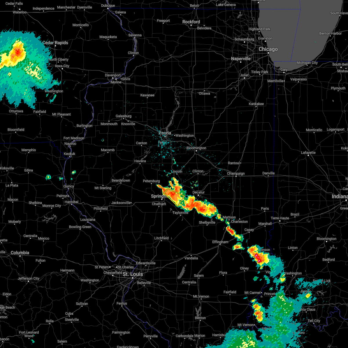 At 342 am cdt, a severe thunderstorm was located over mechanicsburg, or 11 miles east of springfield, and is nearly stationary (radar indicated). Hazards include 60 mph wind gusts and quarter size hail. Hail damage to vehicles is expected. expect wind damage to roofs, siding, and trees. locations impacted include, sherman, riverton, mechanicsburg, spaulding, dawson, buffalo and roby. this includes the following highways, interstate 55 near mile marker 102. interstate 72 between mile markers 107 and 123. hail threat, radar indicated max hail size, 1. 00 in wind threat, radar indicated max wind gust, 60 mph. At 342 am cdt, a severe thunderstorm was located over mechanicsburg, or 11 miles east of springfield, and is nearly stationary (radar indicated). Hazards include 60 mph wind gusts and quarter size hail. Hail damage to vehicles is expected. expect wind damage to roofs, siding, and trees. locations impacted include, sherman, riverton, mechanicsburg, spaulding, dawson, buffalo and roby. this includes the following highways, interstate 55 near mile marker 102. interstate 72 between mile markers 107 and 123. hail threat, radar indicated max hail size, 1. 00 in wind threat, radar indicated max wind gust, 60 mph.
|
| 8/2/2022 3:39 AM CDT | Quarter sized hail reported 0.3 miles NNW of Dawson, IL, report from mping: quarter (1.00 in.). |
| 8/2/2022 3:08 AM CDT |
 At 308 am cdt, a severe thunderstorm was located over riverton, or 9 miles northeast of springfield, moving southeast at 20 mph (radar indicated). Hazards include 60 mph wind gusts and quarter size hail. Hail damage to vehicles is expected. Expect wind damage to roofs, siding, and trees. At 308 am cdt, a severe thunderstorm was located over riverton, or 9 miles northeast of springfield, moving southeast at 20 mph (radar indicated). Hazards include 60 mph wind gusts and quarter size hail. Hail damage to vehicles is expected. Expect wind damage to roofs, siding, and trees.
|
| 8/2/2022 2:51 AM CDT |
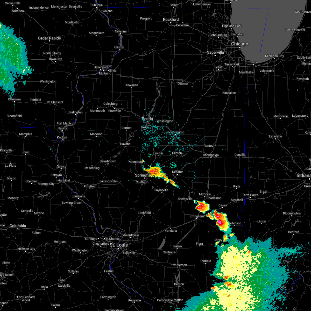 At 251 am cdt, a severe thunderstorm was located near williamsville, or 11 miles northeast of springfield, moving southeast at 15 mph (radar indicated). Hazards include 60 mph wind gusts and quarter size hail. Hail damage to vehicles is expected. expect wind damage to roofs, siding, and trees. locations impacted include, riverton, spaulding and dawson. this includes interstate 72 between mile markers 110 and 112. hail threat, radar indicated max hail size, 1. 00 in wind threat, radar indicated max wind gust, 60 mph. At 251 am cdt, a severe thunderstorm was located near williamsville, or 11 miles northeast of springfield, moving southeast at 15 mph (radar indicated). Hazards include 60 mph wind gusts and quarter size hail. Hail damage to vehicles is expected. expect wind damage to roofs, siding, and trees. locations impacted include, riverton, spaulding and dawson. this includes interstate 72 between mile markers 110 and 112. hail threat, radar indicated max hail size, 1. 00 in wind threat, radar indicated max wind gust, 60 mph.
|
| 8/2/2022 2:28 AM CDT |
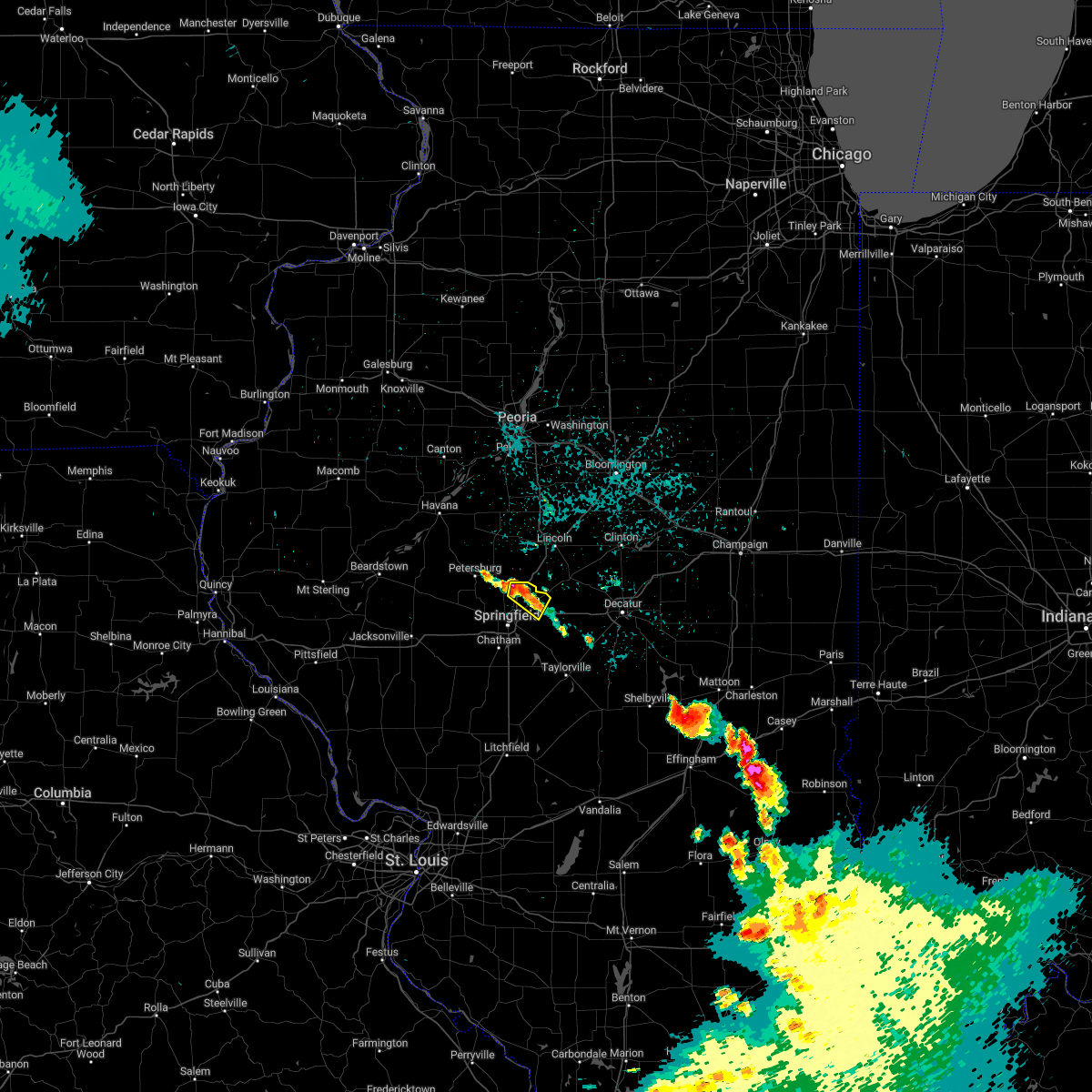 At 228 am cdt, a severe thunderstorm was located over williamsville, or 12 miles north of springfield, moving southeast at 15 mph (radar indicated). Hazards include 60 mph wind gusts and quarter size hail. Hail damage to vehicles is expected. Expect wind damage to roofs, siding, and trees. At 228 am cdt, a severe thunderstorm was located over williamsville, or 12 miles north of springfield, moving southeast at 15 mph (radar indicated). Hazards include 60 mph wind gusts and quarter size hail. Hail damage to vehicles is expected. Expect wind damage to roofs, siding, and trees.
|
| 6/25/2022 9:56 PM CDT |
 The severe thunderstorm warning for southeastern logan and northeastern sangamon counties will expire at 1000 pm cdt, the storm which prompted the warning has weakened below severe limits, and no longer poses an immediate threat to life or property. therefore, the warning will be allowed to expire. however heavy rain is still possible with this thunderstorm. a severe thunderstorm watch remains in effect until midnight cdt for central illinois. The severe thunderstorm warning for southeastern logan and northeastern sangamon counties will expire at 1000 pm cdt, the storm which prompted the warning has weakened below severe limits, and no longer poses an immediate threat to life or property. therefore, the warning will be allowed to expire. however heavy rain is still possible with this thunderstorm. a severe thunderstorm watch remains in effect until midnight cdt for central illinois.
|
| 6/25/2022 9:39 PM CDT |
 The severe thunderstorm warning for northern christian and northeastern sangamon counties will expire at 945 pm cdt, the storm which prompted the warning has weakened below severe limits, and has exited the warned area. therefore, the warning will be allowed to expire. however small hail and gusty winds are still possible with this thunderstorm. a severe thunderstorm watch remains in effect until midnight cdt for central illinois. The severe thunderstorm warning for northern christian and northeastern sangamon counties will expire at 945 pm cdt, the storm which prompted the warning has weakened below severe limits, and has exited the warned area. therefore, the warning will be allowed to expire. however small hail and gusty winds are still possible with this thunderstorm. a severe thunderstorm watch remains in effect until midnight cdt for central illinois.
|
| 6/25/2022 9:33 PM CDT |
 At 932 pm cdt, a severe thunderstorm was located near williamsville, or 13 miles northeast of springfield, moving east at 30 mph (radar indicated). Hazards include 60 mph wind gusts and quarter size hail. Hail damage to vehicles is expected. expect wind damage to roofs, siding, and trees. this severe thunderstorm will be near, cornland around 940 pm cdt. other locations in the path of this severe thunderstorm include mount pulaski and illiopolis. this includes interstate 55 between mile markers 102 and 111. hail threat, radar indicated max hail size, 1. 00 in wind threat, radar indicated max wind gust, 60 mph. At 932 pm cdt, a severe thunderstorm was located near williamsville, or 13 miles northeast of springfield, moving east at 30 mph (radar indicated). Hazards include 60 mph wind gusts and quarter size hail. Hail damage to vehicles is expected. expect wind damage to roofs, siding, and trees. this severe thunderstorm will be near, cornland around 940 pm cdt. other locations in the path of this severe thunderstorm include mount pulaski and illiopolis. this includes interstate 55 between mile markers 102 and 111. hail threat, radar indicated max hail size, 1. 00 in wind threat, radar indicated max wind gust, 60 mph.
|
| 6/25/2022 9:22 PM CDT |
 At 922 pm cdt, a severe thunderstorm was located near mechanicsburg, or 15 miles east of springfield, moving east at 45 mph (radar indicated). Hazards include 60 mph wind gusts and quarter size hail. Hail damage to vehicles is expected. expect wind damage to roofs, siding, and trees. locations impacted include, illiopolis and mount auburn. this includes interstate 72 between mile markers 106 and 124. hail threat, radar indicated max hail size, 1. 00 in wind threat, radar indicated max wind gust, 60 mph. At 922 pm cdt, a severe thunderstorm was located near mechanicsburg, or 15 miles east of springfield, moving east at 45 mph (radar indicated). Hazards include 60 mph wind gusts and quarter size hail. Hail damage to vehicles is expected. expect wind damage to roofs, siding, and trees. locations impacted include, illiopolis and mount auburn. this includes interstate 72 between mile markers 106 and 124. hail threat, radar indicated max hail size, 1. 00 in wind threat, radar indicated max wind gust, 60 mph.
|
| 6/25/2022 9:05 PM CDT |
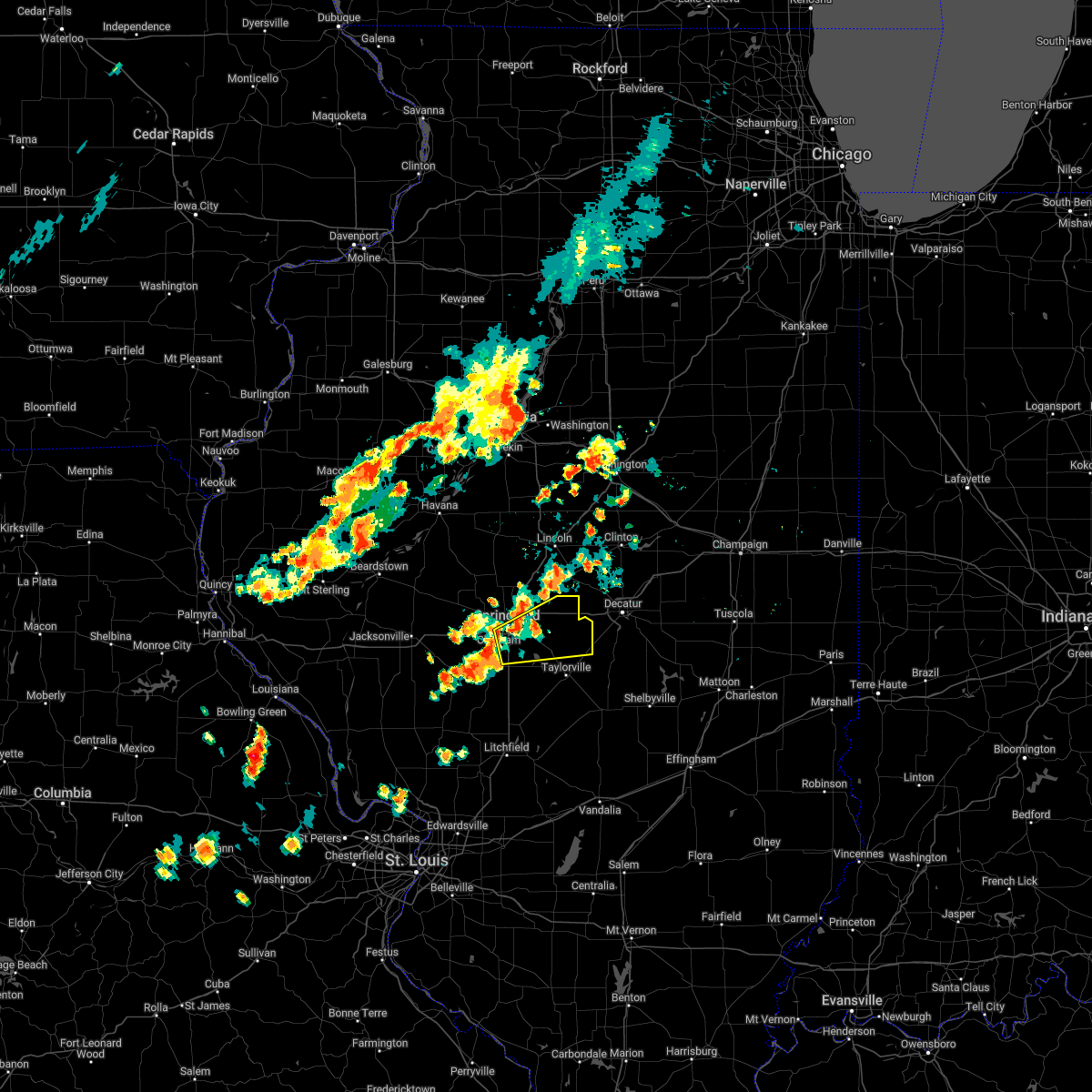 At 905 pm cdt, a severe thunderstorm was located near rochester, or near springfield, moving east at 45 mph (radar indicated). Hazards include 60 mph wind gusts and half dollar size hail. Hail damage to vehicles is expected. expect wind damage to roofs, siding, and trees. this severe thunderstorm will be near, edinburg and mechanicsburg around 920 pm cdt. other locations in the path of this severe thunderstorm include illiopolis and mount auburn. this includes the following highways, interstate 55 between mile markers 83 and 98. interstate 72 between mile markers 94 and 124. hail threat, radar indicated max hail size, 1. 25 in wind threat, radar indicated max wind gust, 60 mph. At 905 pm cdt, a severe thunderstorm was located near rochester, or near springfield, moving east at 45 mph (radar indicated). Hazards include 60 mph wind gusts and half dollar size hail. Hail damage to vehicles is expected. expect wind damage to roofs, siding, and trees. this severe thunderstorm will be near, edinburg and mechanicsburg around 920 pm cdt. other locations in the path of this severe thunderstorm include illiopolis and mount auburn. this includes the following highways, interstate 55 between mile markers 83 and 98. interstate 72 between mile markers 94 and 124. hail threat, radar indicated max hail size, 1. 25 in wind threat, radar indicated max wind gust, 60 mph.
|
| 6/17/2022 4:00 AM CDT | Report from mping: 1-inch tree limbs broken and/or shingles blown off. time estimated by rada in sangamon county IL, 0.3 miles NNW of Dawson, IL |
| 4/30/2022 5:34 PM CDT |
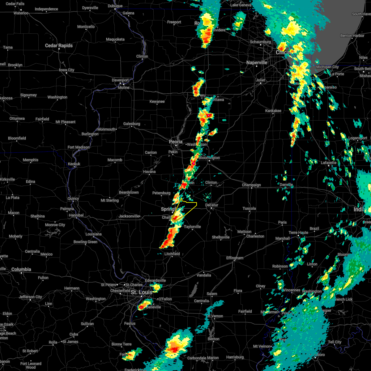 At 534 pm cdt, a severe thunderstorm was located near rochester, or near springfield, moving northeast at 45 mph (radar indicated). Hazards include 60 mph wind gusts and quarter size hail. Hail damage to vehicles is expected. expect wind damage to roofs, siding, and trees. locations impacted include, riverton and mechanicsburg. this includes the following highways, interstate 55 between mile markers 89 and 90, and between mile markers 93 and 97. interstate 72 between mile markers 99 and 121. hail threat, radar indicated max hail size, 1. 00 in wind threat, radar indicated max wind gust, 60 mph. At 534 pm cdt, a severe thunderstorm was located near rochester, or near springfield, moving northeast at 45 mph (radar indicated). Hazards include 60 mph wind gusts and quarter size hail. Hail damage to vehicles is expected. expect wind damage to roofs, siding, and trees. locations impacted include, riverton and mechanicsburg. this includes the following highways, interstate 55 between mile markers 89 and 90, and between mile markers 93 and 97. interstate 72 between mile markers 99 and 121. hail threat, radar indicated max hail size, 1. 00 in wind threat, radar indicated max wind gust, 60 mph.
|
| 4/30/2022 5:24 PM CDT |
 At 524 pm cdt, a severe thunderstorm was located near chatham, or 9 miles northeast of virden, moving northeast at 45 mph (radar indicated). Hazards include 60 mph wind gusts and quarter size hail. Hail damage to vehicles is expected. expect wind damage to roofs, siding, and trees. this severe thunderstorm will be near, springfield around 530 pm cdt. rochester around 540 pm cdt. other locations in the path of this severe thunderstorm include sherman, riverton, mechanicsburg and williamsville. this includes the following highways, interstate 55 between mile markers 81 and 104, and between mile markers 106 and 111. interstate 72 between mile markers 96 and 121. hail threat, radar indicated max hail size, 1. 00 in wind threat, radar indicated max wind gust, 60 mph. At 524 pm cdt, a severe thunderstorm was located near chatham, or 9 miles northeast of virden, moving northeast at 45 mph (radar indicated). Hazards include 60 mph wind gusts and quarter size hail. Hail damage to vehicles is expected. expect wind damage to roofs, siding, and trees. this severe thunderstorm will be near, springfield around 530 pm cdt. rochester around 540 pm cdt. other locations in the path of this severe thunderstorm include sherman, riverton, mechanicsburg and williamsville. this includes the following highways, interstate 55 between mile markers 81 and 104, and between mile markers 106 and 111. interstate 72 between mile markers 96 and 121. hail threat, radar indicated max hail size, 1. 00 in wind threat, radar indicated max wind gust, 60 mph.
|
| 3/5/2022 10:52 PM CST |
 At 1052 pm cst, a severe thunderstorm was located over riverton, or 7 miles northeast of springfield, moving northeast at 65 mph (radar indicated). Hazards include 60 mph wind gusts. Expect damage to roofs, siding, and trees. this severe thunderstorm will be near, cornland around 1100 pm cst. illiopolis around 1105 pm cst. mount pulaski and latham around 1110 pm cst. this includes the following highways, interstate 55 between mile markers 91 and 100. interstate 72 between mile markers 97 and 129. hail threat, radar indicated max hail size, <. 75 in wind threat, radar indicated max wind gust, 60 mph. At 1052 pm cst, a severe thunderstorm was located over riverton, or 7 miles northeast of springfield, moving northeast at 65 mph (radar indicated). Hazards include 60 mph wind gusts. Expect damage to roofs, siding, and trees. this severe thunderstorm will be near, cornland around 1100 pm cst. illiopolis around 1105 pm cst. mount pulaski and latham around 1110 pm cst. this includes the following highways, interstate 55 between mile markers 91 and 100. interstate 72 between mile markers 97 and 129. hail threat, radar indicated max hail size, <. 75 in wind threat, radar indicated max wind gust, 60 mph.
|
| 10/24/2021 7:43 PM CDT |
 The severe thunderstorm warning for eastern menard, logan, northeastern sangamon, western de witt, southeastern tazewell, southwestern mclean and northwestern macon counties will expire at 745 pm cdt, the storms which prompted the warning have weakened below severe limits, and no longer pose an immediate threat to life or property. therefore, the warning will be allowed to expire. however small hail, gusty winds and heavy rain are still possible with these thunderstorms. a tornado watch remains in effect until 100 am cdt for central illinois. The severe thunderstorm warning for eastern menard, logan, northeastern sangamon, western de witt, southeastern tazewell, southwestern mclean and northwestern macon counties will expire at 745 pm cdt, the storms which prompted the warning have weakened below severe limits, and no longer pose an immediate threat to life or property. therefore, the warning will be allowed to expire. however small hail, gusty winds and heavy rain are still possible with these thunderstorms. a tornado watch remains in effect until 100 am cdt for central illinois.
|
| 10/24/2021 7:21 PM CDT |
 At 720 pm cdt, severe thunderstorms were located along a line extending from near mclean to near cornland, moving east at 50 mph (radar indicated). Hazards include 60 mph wind gusts and penny size hail. Expect damage to roofs, siding, and trees. locations impacted include, atlanta, mclean, bloomington, beason and kenney. this includes the following highways, interstate 155 between mile markers 0 and 13. interstate 55 between mile markers 106 and 155. interstate 72 between mile markers 105 and 117. hail threat, radar indicated max hail size, 0. 75 in wind threat, radar indicated max wind gust, 60 mph. At 720 pm cdt, severe thunderstorms were located along a line extending from near mclean to near cornland, moving east at 50 mph (radar indicated). Hazards include 60 mph wind gusts and penny size hail. Expect damage to roofs, siding, and trees. locations impacted include, atlanta, mclean, bloomington, beason and kenney. this includes the following highways, interstate 155 between mile markers 0 and 13. interstate 55 between mile markers 106 and 155. interstate 72 between mile markers 105 and 117. hail threat, radar indicated max hail size, 0. 75 in wind threat, radar indicated max wind gust, 60 mph.
|
| 10/24/2021 7:04 PM CDT |
 At 704 pm cdt, severe thunderstorms were located along a line extending from near delavan to near sherman, moving northeast at 45 mph (radar indicated). Hazards include 60 mph wind gusts and quarter size hail. Hail damage to vehicles is expected. expect wind damage to roofs, siding, and trees. severe thunderstorms will be near, emden around 710 pm cdt. armington around 715 pm cdt. other locations in the path of these severe thunderstorms include mount pulaski, latham, chestnut, bloomington, beason and kenney. this includes the following highways, interstate 155 between mile markers 0 and 13. interstate 55 between mile markers 106 and 155. interstate 72 between mile markers 105 and 117. hail threat, radar indicated max hail size, 1. 00 in wind threat, radar indicated max wind gust, 60 mph. At 704 pm cdt, severe thunderstorms were located along a line extending from near delavan to near sherman, moving northeast at 45 mph (radar indicated). Hazards include 60 mph wind gusts and quarter size hail. Hail damage to vehicles is expected. expect wind damage to roofs, siding, and trees. severe thunderstorms will be near, emden around 710 pm cdt. armington around 715 pm cdt. other locations in the path of these severe thunderstorms include mount pulaski, latham, chestnut, bloomington, beason and kenney. this includes the following highways, interstate 155 between mile markers 0 and 13. interstate 55 between mile markers 106 and 155. interstate 72 between mile markers 105 and 117. hail threat, radar indicated max hail size, 1. 00 in wind threat, radar indicated max wind gust, 60 mph.
|
| 8/12/2021 3:00 PM CDT |
 At 300 pm cdt, a severe thunderstorm was located near edinburg, or 12 miles southeast of springfield, moving southeast at 30 mph (trained weather spotters). Hazards include 60 mph wind gusts and penny size hail. Expect damage to roofs, siding, and trees. locations impacted include, edinburg, kincaid, bulpitt, jeisyville, taylorville and stonington. this includes the following highways, interstate 55 between mile markers 88 and 97. interstate 72 between mile markers 97 and 120. hail threat, radar indicated max hail size, 0. 75 in wind threat, radar indicated max wind gust, 60 mph. At 300 pm cdt, a severe thunderstorm was located near edinburg, or 12 miles southeast of springfield, moving southeast at 30 mph (trained weather spotters). Hazards include 60 mph wind gusts and penny size hail. Expect damage to roofs, siding, and trees. locations impacted include, edinburg, kincaid, bulpitt, jeisyville, taylorville and stonington. this includes the following highways, interstate 55 between mile markers 88 and 97. interstate 72 between mile markers 97 and 120. hail threat, radar indicated max hail size, 0. 75 in wind threat, radar indicated max wind gust, 60 mph.
|
| 8/12/2021 2:43 PM CDT |
 At 243 pm cdt, a severe thunderstorm was located over rochester, or near springfield, moving southeast at 30 mph (radar indicated). Hazards include 60 mph wind gusts and penny size hail. Expect damage to roofs, siding, and trees. this severe thunderstorm will be near, mechanicsburg around 250 pm cdt. other locations in the path of this severe thunderstorm include edinburg, kincaid, bulpitt, jeisyville, taylorville and stonington. this includes the following highways, interstate 55 between mile markers 88 and 107. interstate 72 between mile markers 93 and 120. hail threat, radar indicated max hail size, 0. 75 in wind threat, radar indicated max wind gust, 60 mph. At 243 pm cdt, a severe thunderstorm was located over rochester, or near springfield, moving southeast at 30 mph (radar indicated). Hazards include 60 mph wind gusts and penny size hail. Expect damage to roofs, siding, and trees. this severe thunderstorm will be near, mechanicsburg around 250 pm cdt. other locations in the path of this severe thunderstorm include edinburg, kincaid, bulpitt, jeisyville, taylorville and stonington. this includes the following highways, interstate 55 between mile markers 88 and 107. interstate 72 between mile markers 93 and 120. hail threat, radar indicated max hail size, 0. 75 in wind threat, radar indicated max wind gust, 60 mph.
|
| 6/19/2021 7:06 AM CDT |
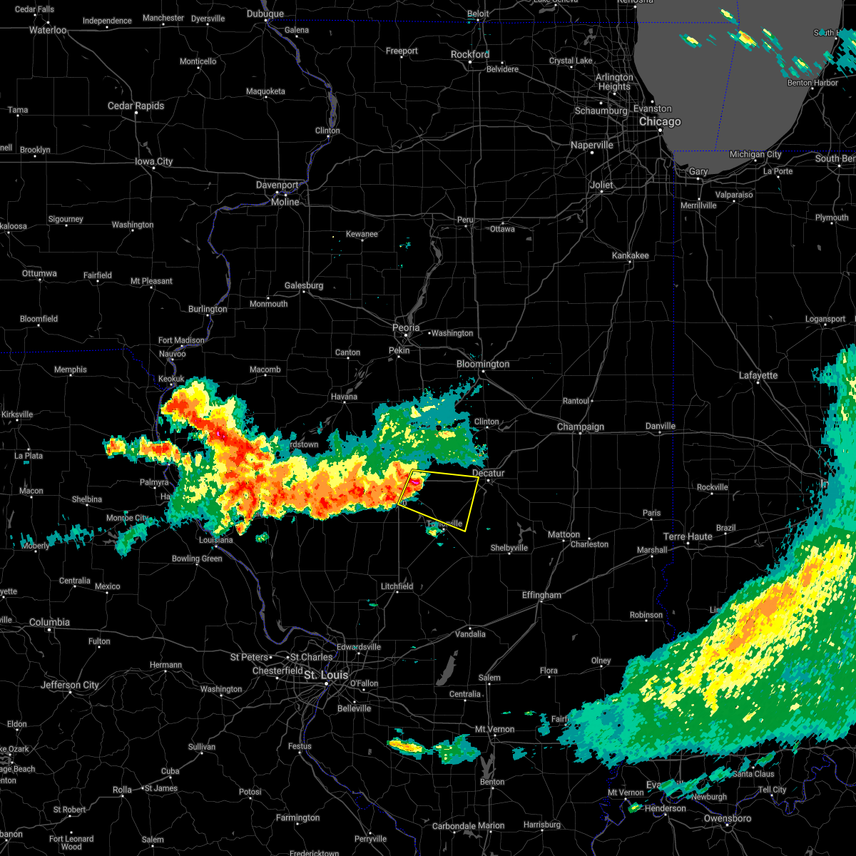 At 706 am cdt, a severe thunderstorm was located near rochester, or near springfield, moving east at 55 mph (radar indicated). Hazards include 70 mph wind gusts and nickel size hail. Expect considerable tree damage. damage is likely to mobile homes, roofs, and outbuildings. this severe thunderstorm will be near, mechanicsburg around 710 am cdt. edinburg around 715 am cdt. illiopolis and mount auburn around 720 am cdt. stonington around 725 am cdt. other locations in the path of this severe thunderstorm include blue mound. this includes the following highways, interstate 55 near mile marker 89, and between mile markers 93 and 97. Interstate 72 between mile markers 100 and 135. At 706 am cdt, a severe thunderstorm was located near rochester, or near springfield, moving east at 55 mph (radar indicated). Hazards include 70 mph wind gusts and nickel size hail. Expect considerable tree damage. damage is likely to mobile homes, roofs, and outbuildings. this severe thunderstorm will be near, mechanicsburg around 710 am cdt. edinburg around 715 am cdt. illiopolis and mount auburn around 720 am cdt. stonington around 725 am cdt. other locations in the path of this severe thunderstorm include blue mound. this includes the following highways, interstate 55 near mile marker 89, and between mile markers 93 and 97. Interstate 72 between mile markers 100 and 135.
|
| 6/18/2021 9:24 PM CDT |
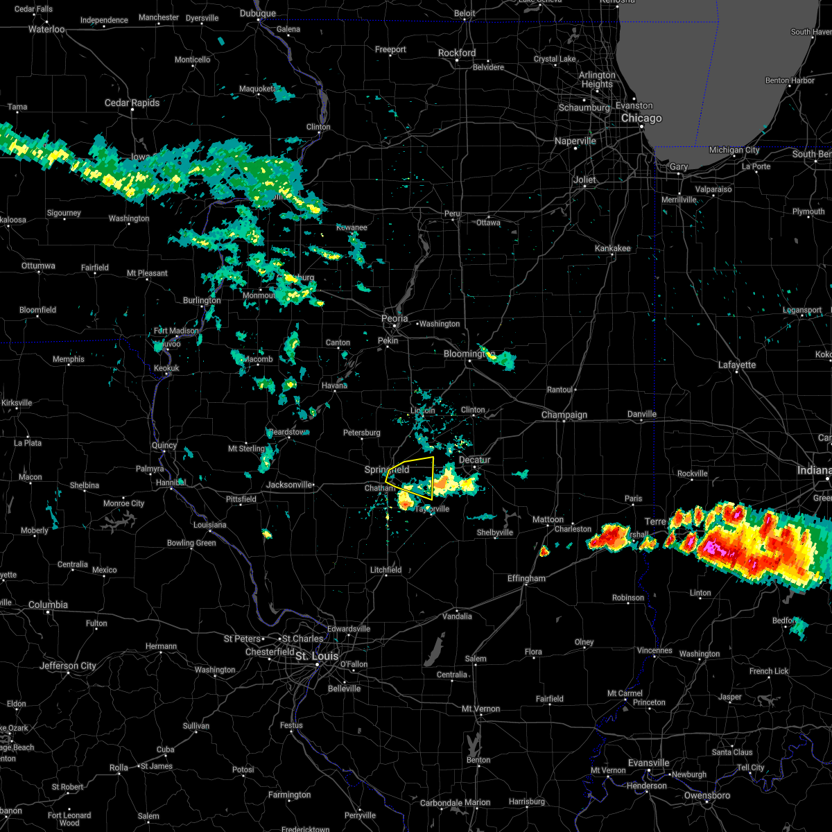 The severe thunderstorm warning for northwestern christian and northeastern sangamon counties will expire at 930 pm cdt, the storm which prompted the warning has weakened below severe limits, and has exited the warned area. therefore, the warning will be allowed to expire. a severe thunderstorm watch remains in effect until 400 am cdt for central illinois. The severe thunderstorm warning for northwestern christian and northeastern sangamon counties will expire at 930 pm cdt, the storm which prompted the warning has weakened below severe limits, and has exited the warned area. therefore, the warning will be allowed to expire. a severe thunderstorm watch remains in effect until 400 am cdt for central illinois.
|
| 6/18/2021 9:09 PM CDT |
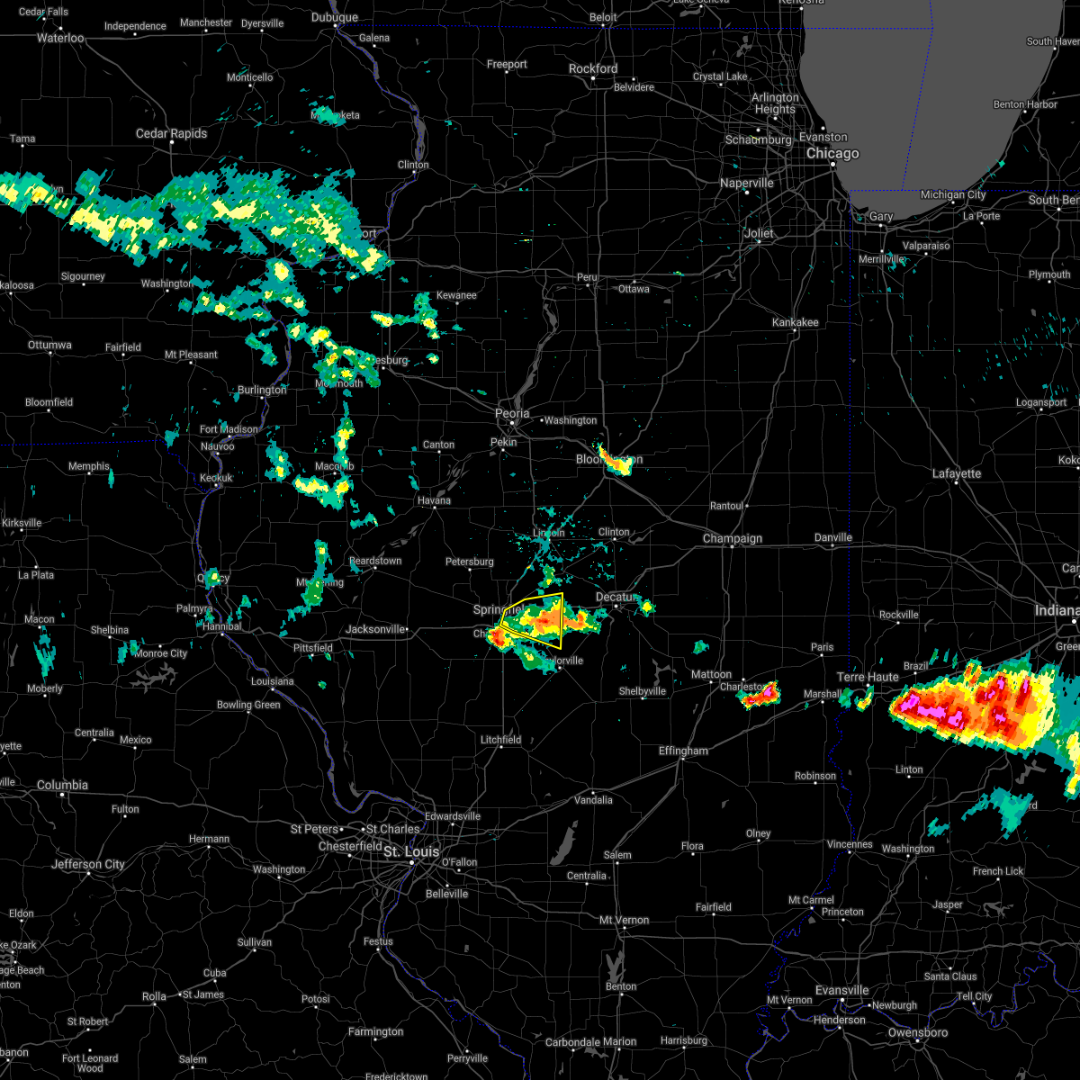 At 908 pm cdt, a severe thunderstorm was located over mechanicsburg, or 12 miles east of springfield, moving east at 35 mph (radar indicated). Hazards include 60 mph wind gusts and quarter size hail. Hail damage to vehicles is expected. expect wind damage to roofs, siding, and trees. this severe thunderstorm will remain over mainly rural areas of northwestern christian and northeastern sangamon counties, including the following locations, dawson, roby, berry, clear lake, southern view, grandview and buffalo. this includes the following highways, interstate 55 between mile markers 93 and 99. Interstate 72 between mile markers 99 and 121. At 908 pm cdt, a severe thunderstorm was located over mechanicsburg, or 12 miles east of springfield, moving east at 35 mph (radar indicated). Hazards include 60 mph wind gusts and quarter size hail. Hail damage to vehicles is expected. expect wind damage to roofs, siding, and trees. this severe thunderstorm will remain over mainly rural areas of northwestern christian and northeastern sangamon counties, including the following locations, dawson, roby, berry, clear lake, southern view, grandview and buffalo. this includes the following highways, interstate 55 between mile markers 93 and 99. Interstate 72 between mile markers 99 and 121.
|
| 6/18/2021 8:43 PM CDT |
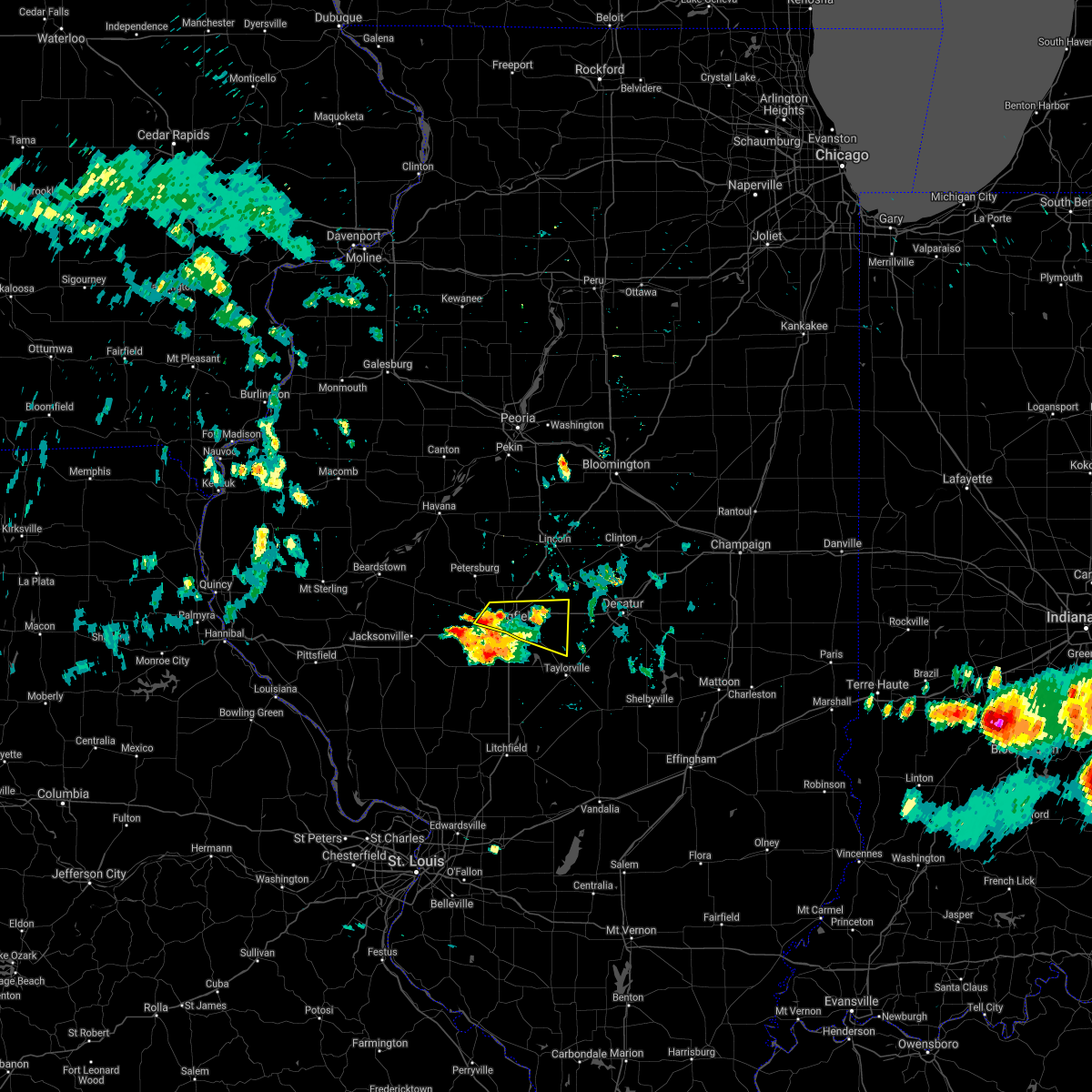 At 843 pm cdt, a severe thunderstorm was located over springfield, moving east at 35 mph (radar indicated). Hazards include 60 mph wind gusts and quarter size hail. Hail damage to vehicles is expected. expect wind damage to roofs, siding, and trees. this severe thunderstorm will be near, rochester and riverton around 855 pm cdt. other locations in the path of this severe thunderstorm include mechanicsburg. this includes the following highways, interstate 55 between mile markers 93 and 103. Interstate 72 between mile markers 99 and 121. At 843 pm cdt, a severe thunderstorm was located over springfield, moving east at 35 mph (radar indicated). Hazards include 60 mph wind gusts and quarter size hail. Hail damage to vehicles is expected. expect wind damage to roofs, siding, and trees. this severe thunderstorm will be near, rochester and riverton around 855 pm cdt. other locations in the path of this severe thunderstorm include mechanicsburg. this includes the following highways, interstate 55 between mile markers 93 and 103. Interstate 72 between mile markers 99 and 121.
|
| 5/3/2021 6:16 PM CDT |
 At 615 pm cdt, a confirmed tornado was located near mechanicsburg, or 15 miles east of springfield, moving east at 35 mph (weather spotters confirmed tornado). Hazards include damaging tornado and golf ball size hail. Flying debris will be dangerous to those caught without shelter. mobile homes will be damaged or destroyed. damage to roofs, windows, and vehicles will occur. tree damage is likely. the tornado will be near, illiopolis and mount auburn around 625 pm cdt. niantic around 635 pm cdt. harristown around 640 pm cdt. other locations impacted by this tornadic thunderstorm include buffalo and dawson. This includes interstate 72 between mile markers 112 and 132. At 615 pm cdt, a confirmed tornado was located near mechanicsburg, or 15 miles east of springfield, moving east at 35 mph (weather spotters confirmed tornado). Hazards include damaging tornado and golf ball size hail. Flying debris will be dangerous to those caught without shelter. mobile homes will be damaged or destroyed. damage to roofs, windows, and vehicles will occur. tree damage is likely. the tornado will be near, illiopolis and mount auburn around 625 pm cdt. niantic around 635 pm cdt. harristown around 640 pm cdt. other locations impacted by this tornadic thunderstorm include buffalo and dawson. This includes interstate 72 between mile markers 112 and 132.
|
| 5/3/2021 6:09 PM CDT |
 At 608 pm cdt, a severe thunderstorm capable of producing a tornado was located over cornland, or 14 miles northeast of springfield, moving east at 35 mph (radar indicated rotation). Hazards include tornado and golf ball size hail. Flying debris will be dangerous to those caught without shelter. mobile homes will be damaged or destroyed. damage to roofs, windows, and vehicles will occur. tree damage is likely. this tornadic thunderstorm will remain over mainly rural areas of south central logan and northeastern sangamon counties, including the following locations, dawson, spaulding and buffalo. this includes the following highways, interstate 55 between mile markers 101 and 108. Interstate 72 between mile markers 108 and 119. At 608 pm cdt, a severe thunderstorm capable of producing a tornado was located over cornland, or 14 miles northeast of springfield, moving east at 35 mph (radar indicated rotation). Hazards include tornado and golf ball size hail. Flying debris will be dangerous to those caught without shelter. mobile homes will be damaged or destroyed. damage to roofs, windows, and vehicles will occur. tree damage is likely. this tornadic thunderstorm will remain over mainly rural areas of south central logan and northeastern sangamon counties, including the following locations, dawson, spaulding and buffalo. this includes the following highways, interstate 55 between mile markers 101 and 108. Interstate 72 between mile markers 108 and 119.
|
| 5/3/2021 5:52 PM CDT |
 At 551 pm cdt, a severe thunderstorm capable of producing a tornado was located over sherman, or 8 miles north of springfield, moving east at 35 mph (radar indicated rotation). Hazards include tornado and golf ball size hail. Flying debris will be dangerous to those caught without shelter. mobile homes will be damaged or destroyed. damage to roofs, windows, and vehicles will occur. tree damage is likely. this dangerous storm will be near, riverton and williamsville around 600 pm cdt. mechanicsburg and cornland around 610 pm cdt. other locations impacted by this tornadic thunderstorm include dawson, spaulding, cantrall and buffalo. this includes the following highways, interstate 55 between mile markers 101 and 112. Interstate 72 between mile markers 108 and 119. At 551 pm cdt, a severe thunderstorm capable of producing a tornado was located over sherman, or 8 miles north of springfield, moving east at 35 mph (radar indicated rotation). Hazards include tornado and golf ball size hail. Flying debris will be dangerous to those caught without shelter. mobile homes will be damaged or destroyed. damage to roofs, windows, and vehicles will occur. tree damage is likely. this dangerous storm will be near, riverton and williamsville around 600 pm cdt. mechanicsburg and cornland around 610 pm cdt. other locations impacted by this tornadic thunderstorm include dawson, spaulding, cantrall and buffalo. this includes the following highways, interstate 55 between mile markers 101 and 112. Interstate 72 between mile markers 108 and 119.
|
| 4/7/2021 8:26 PM CDT |
 The severe thunderstorm warning for southern menard, sangamon and east central cass counties will expire at 830 pm cdt, the storms which prompted the warning have weakened below severe limits, and have exited the warned area. therefore, the warning will be allowed to expire. however gusty winds and heavy rain are still possible with these thunderstorms. The severe thunderstorm warning for southern menard, sangamon and east central cass counties will expire at 830 pm cdt, the storms which prompted the warning have weakened below severe limits, and have exited the warned area. therefore, the warning will be allowed to expire. however gusty winds and heavy rain are still possible with these thunderstorms.
|
| 4/7/2021 8:13 PM CDT |
 At 813 pm cdt, severe thunderstorms were located along a line extending from near petersburg to sherman to near rochester, moving northeast at 60 mph (radar indicated). Hazards include 60 mph wind gusts and penny size hail. Expect damage to roofs, siding, and trees. locations impacted include, springfield, chatham, auburn, sherman, rochester, riverton, pawnee, petersburg, athens, williamsville, new berlin, ashland, divernon, pleasant plains, loami, mechanicsburg, tallula, jerome, southern view and leland grove. this includes the following highways, interstate 55 between mile markers 77 and 108. Interstate 72 between mile markers 83 and 116. At 813 pm cdt, severe thunderstorms were located along a line extending from near petersburg to sherman to near rochester, moving northeast at 60 mph (radar indicated). Hazards include 60 mph wind gusts and penny size hail. Expect damage to roofs, siding, and trees. locations impacted include, springfield, chatham, auburn, sherman, rochester, riverton, pawnee, petersburg, athens, williamsville, new berlin, ashland, divernon, pleasant plains, loami, mechanicsburg, tallula, jerome, southern view and leland grove. this includes the following highways, interstate 55 between mile markers 77 and 108. Interstate 72 between mile markers 83 and 116.
|
| 4/7/2021 7:49 PM CDT |
 At 749 pm cdt, severe thunderstorms were located along a line extending from near ashland to near waverly to virden, moving northeast at 50 mph (radar indicated). Hazards include 60 mph wind gusts and penny size hail. expect damage to roofs, siding, and trees At 749 pm cdt, severe thunderstorms were located along a line extending from near ashland to near waverly to virden, moving northeast at 50 mph (radar indicated). Hazards include 60 mph wind gusts and penny size hail. expect damage to roofs, siding, and trees
|
| 6/22/2020 3:45 PM CDT |
 At 345 pm cdt, a severe thunderstorm was located near chatham, or near springfield, moving north at 20 mph (radar indicated). Hazards include 60 mph wind gusts. Expect damage to roofs, siding, and trees. locations impacted include, springfield, chatham, auburn, sherman, rochester, riverton, pawnee, williamsville, divernon, mechanicsburg, jerome, southern view, leland grove, grandview, spaulding, dawson, buffalo, berry, clear lake and cantrall. this includes the following highways, interstate 55 between mile markers 77 and 111. Interstate 72 between mile markers 92 and 115. At 345 pm cdt, a severe thunderstorm was located near chatham, or near springfield, moving north at 20 mph (radar indicated). Hazards include 60 mph wind gusts. Expect damage to roofs, siding, and trees. locations impacted include, springfield, chatham, auburn, sherman, rochester, riverton, pawnee, williamsville, divernon, mechanicsburg, jerome, southern view, leland grove, grandview, spaulding, dawson, buffalo, berry, clear lake and cantrall. this includes the following highways, interstate 55 between mile markers 77 and 111. Interstate 72 between mile markers 92 and 115.
|
| 6/22/2020 3:27 PM CDT |
 At 327 pm cdt, a severe thunderstorm was located near pawnee, or 10 miles south of springfield, moving north at 25 mph (emergency management). Hazards include 60 mph wind gusts. expect damage to roofs, siding, and trees At 327 pm cdt, a severe thunderstorm was located near pawnee, or 10 miles south of springfield, moving north at 25 mph (emergency management). Hazards include 60 mph wind gusts. expect damage to roofs, siding, and trees
|
| 5/2/2020 9:49 PM CDT |
 At 948 pm cdt, a severe thunderstorm was located near mechanicsburg, or 16 miles east of springfield, moving east at 45 mph (radar indicated). Hazards include 60 mph wind gusts and quarter size hail. Hail damage to vehicles is expected. expect wind damage to roofs, siding, and trees. locations impacted include, decatur, mount zion, rochester, moweaqua, harristown, long creek, blue mound, macon, edinburg, stonington, illiopolis, niantic, mechanicsburg, mount auburn, dawson, buffalo, berry, boody, elwin and decatur airport. This includes interstate 72 between mile markers 111 and 134. At 948 pm cdt, a severe thunderstorm was located near mechanicsburg, or 16 miles east of springfield, moving east at 45 mph (radar indicated). Hazards include 60 mph wind gusts and quarter size hail. Hail damage to vehicles is expected. expect wind damage to roofs, siding, and trees. locations impacted include, decatur, mount zion, rochester, moweaqua, harristown, long creek, blue mound, macon, edinburg, stonington, illiopolis, niantic, mechanicsburg, mount auburn, dawson, buffalo, berry, boody, elwin and decatur airport. This includes interstate 72 between mile markers 111 and 134.
|
| 5/2/2020 9:38 PM CDT |
 At 936 pm cdt, a severe thunderstorm was located near rochester, moving east at 45 mph (radar indicated. at 935 pm, 50 mph wind gusts were reported near the north edge of lake springfield, and nickel size hail occurred as the storm passed through downtown springfield). Hazards include 60 mph wind gusts and quarter size hail. Hail damage to vehicles is expected. Expect wind damage to roofs, siding, and trees. At 936 pm cdt, a severe thunderstorm was located near rochester, moving east at 45 mph (radar indicated. at 935 pm, 50 mph wind gusts were reported near the north edge of lake springfield, and nickel size hail occurred as the storm passed through downtown springfield). Hazards include 60 mph wind gusts and quarter size hail. Hail damage to vehicles is expected. Expect wind damage to roofs, siding, and trees.
|
| 4/28/2020 7:07 PM CDT |
 At 707 pm cdt, a severe thunderstorm was located over mechanicsburg, or 14 miles east of springfield, moving east at 35 mph (radar indicated). Hazards include 60 mph wind gusts. expect damage to roofs, siding, and trees At 707 pm cdt, a severe thunderstorm was located over mechanicsburg, or 14 miles east of springfield, moving east at 35 mph (radar indicated). Hazards include 60 mph wind gusts. expect damage to roofs, siding, and trees
|
| 4/8/2020 5:44 PM CDT |
 At 543 pm cdt, a severe thunderstorm was located over niantic, or 11 miles west of decatur, moving east at 50 mph (radar indicated). Hazards include 70 mph wind gusts and quarter size hail. Hail damage to vehicles is expected. expect considerable tree damage. wind damage is also likely to mobile homes, roofs, and outbuildings. locations impacted include, springfield, decatur, sherman, rochester, forsyth, riverton, harristown, warrensburg, blue mound, stonington, illiopolis, niantic, mechanicsburg, mount auburn, grandview, spaulding, dawson, buffalo, clear lake and boody. this includes the following highways, interstate 55 between mile markers 96 and 105. Interstate 72 between mile markers 102 and 141. At 543 pm cdt, a severe thunderstorm was located over niantic, or 11 miles west of decatur, moving east at 50 mph (radar indicated). Hazards include 70 mph wind gusts and quarter size hail. Hail damage to vehicles is expected. expect considerable tree damage. wind damage is also likely to mobile homes, roofs, and outbuildings. locations impacted include, springfield, decatur, sherman, rochester, forsyth, riverton, harristown, warrensburg, blue mound, stonington, illiopolis, niantic, mechanicsburg, mount auburn, grandview, spaulding, dawson, buffalo, clear lake and boody. this includes the following highways, interstate 55 between mile markers 96 and 105. Interstate 72 between mile markers 102 and 141.
|
| 4/8/2020 5:10 PM CDT |
 At 509 pm cdt, a severe thunderstorm was located over athens, or 10 miles north of springfield, moving east at 50 mph (radar indicated). Hazards include ping pong ball size hail and 60 mph wind gusts. People and animals outdoors will be injured. expect hail damage to roofs, siding, windows, and vehicles. Expect wind damage to roofs, siding, and trees. At 509 pm cdt, a severe thunderstorm was located over athens, or 10 miles north of springfield, moving east at 50 mph (radar indicated). Hazards include ping pong ball size hail and 60 mph wind gusts. People and animals outdoors will be injured. expect hail damage to roofs, siding, windows, and vehicles. Expect wind damage to roofs, siding, and trees.
|
| 11/26/2019 11:48 PM CST |
 At 1147 pm cst, a severe thunderstorm was located over sherman, or 7 miles north of springfield, moving northeast at 60 mph (radar indicated). Hazards include 60 mph wind gusts. Expect damage to roofs, siding, and trees. locations impacted include, springfield, sherman, riverton, athens, williamsville, elkhart, jerome, southern view, leland grove, grandview, spaulding, dawson, clear lake, curran, cantrall, capital airport and fancy prairie. this includes the following highways, interstate 55 between mile markers 96 and 115. Interstate 72 between mile markers 92 and 95, and between mile markers 102 and 112. At 1147 pm cst, a severe thunderstorm was located over sherman, or 7 miles north of springfield, moving northeast at 60 mph (radar indicated). Hazards include 60 mph wind gusts. Expect damage to roofs, siding, and trees. locations impacted include, springfield, sherman, riverton, athens, williamsville, elkhart, jerome, southern view, leland grove, grandview, spaulding, dawson, clear lake, curran, cantrall, capital airport and fancy prairie. this includes the following highways, interstate 55 between mile markers 96 and 115. Interstate 72 between mile markers 92 and 95, and between mile markers 102 and 112.
|
| 11/26/2019 11:38 PM CST |
 At 1138 pm cst, a severe thunderstorm was located 7 miles east of pleasant plains, or 8 miles northwest of springfield, moving northeast at 60 mph (radar indicated). Hazards include 60 mph wind gusts. expect damage to roofs, siding, and trees At 1138 pm cst, a severe thunderstorm was located 7 miles east of pleasant plains, or 8 miles northwest of springfield, moving northeast at 60 mph (radar indicated). Hazards include 60 mph wind gusts. expect damage to roofs, siding, and trees
|
| 8/20/2019 10:17 AM CDT |
 At 1016 am cdt, severe thunderstorms were located along a line extending from near cornland to rochester to near palmyra, moving east at 55 mph (radar indicated). Hazards include 70 mph wind gusts and quarter size hail. Hail damage to vehicles is expected. expect considerable tree damage. Wind damage is also likely to mobile homes, roofs, and outbuildings. At 1016 am cdt, severe thunderstorms were located along a line extending from near cornland to rochester to near palmyra, moving east at 55 mph (radar indicated). Hazards include 70 mph wind gusts and quarter size hail. Hail damage to vehicles is expected. expect considerable tree damage. Wind damage is also likely to mobile homes, roofs, and outbuildings.
|
| 8/12/2019 8:37 PM CDT |
 At 837 pm cdt, a severe thunderstorm was located over rochester, or 7 miles east of springfield, moving southeast at 25 mph (radar indicated). Hazards include 60 mph wind gusts and quarter size hail. Hail damage to vehicles is expected. Expect wind damage to roofs, siding, and trees. At 837 pm cdt, a severe thunderstorm was located over rochester, or 7 miles east of springfield, moving southeast at 25 mph (radar indicated). Hazards include 60 mph wind gusts and quarter size hail. Hail damage to vehicles is expected. Expect wind damage to roofs, siding, and trees.
|
| 6/16/2019 12:05 AM CDT |
 At 1205 am cdt, a severe thunderstorm was located over alsey, or near winchester, moving east at 45 mph (radar indicated). Hazards include 60 mph wind gusts and quarter size hail. Hail damage to vehicles is expected. Expect wind damage to roofs, siding, and trees. At 1205 am cdt, a severe thunderstorm was located over alsey, or near winchester, moving east at 45 mph (radar indicated). Hazards include 60 mph wind gusts and quarter size hail. Hail damage to vehicles is expected. Expect wind damage to roofs, siding, and trees.
|
| 5/29/2019 8:21 PM CDT |
 At 821 pm cdt, a severe thunderstorm was located near cornland, or 13 miles northeast of springfield, moving north at 40 mph (trained weather spotters). Hazards include 60 mph wind gusts. expect damage to roofs, siding, and trees At 821 pm cdt, a severe thunderstorm was located near cornland, or 13 miles northeast of springfield, moving north at 40 mph (trained weather spotters). Hazards include 60 mph wind gusts. expect damage to roofs, siding, and trees
|
| 5/29/2019 8:14 PM CDT |
 At 814 pm cdt, severe thunderstorms were located along a line extending from sherman to near mechanicsburg, moving northeast at 40 mph (radar indicated). Hazards include 60 mph wind gusts and quarter size hail. Hail damage to vehicles is expected. expect wind damage to roofs, siding, and trees. locations impacted include, springfield, sherman, rochester, riverton, williamsville, mechanicsburg, jerome, southern view, leland grove, grandview, spaulding, dawson, buffalo, berry, clear lake, sangchris lake state park and roby. this includes the following highways, interstate 55 between mile markers 91 and 106. Interstate 72 between mile markers 95 and 122. At 814 pm cdt, severe thunderstorms were located along a line extending from sherman to near mechanicsburg, moving northeast at 40 mph (radar indicated). Hazards include 60 mph wind gusts and quarter size hail. Hail damage to vehicles is expected. expect wind damage to roofs, siding, and trees. locations impacted include, springfield, sherman, rochester, riverton, williamsville, mechanicsburg, jerome, southern view, leland grove, grandview, spaulding, dawson, buffalo, berry, clear lake, sangchris lake state park and roby. this includes the following highways, interstate 55 between mile markers 91 and 106. Interstate 72 between mile markers 95 and 122.
|
| 5/29/2019 7:55 PM CDT |
 At 755 pm cdt, severe thunderstorms were located along a line extending from near chatham to near bulpitt, moving northeast at 40 mph (radar indicated). Hazards include 60 mph wind gusts and quarter size hail. Hail damage to vehicles is expected. Expect wind damage to roofs, siding, and trees. At 755 pm cdt, severe thunderstorms were located along a line extending from near chatham to near bulpitt, moving northeast at 40 mph (radar indicated). Hazards include 60 mph wind gusts and quarter size hail. Hail damage to vehicles is expected. Expect wind damage to roofs, siding, and trees.
|
| 5/26/2019 12:55 AM CDT |
 The severe thunderstorm warning for northwestern christian and northeastern sangamon counties will expire at 100 am cdt, the storms which prompted the warning have weakened below severe limits, and have exited the warned area. therefore, the warning will be allowed to expire. a severe thunderstorm watch remains in effect until 200 am cdt for central illinois. to report severe weather, contact your nearest law enforcement agency. they will relay your report to the national weather service lincoln. The severe thunderstorm warning for northwestern christian and northeastern sangamon counties will expire at 100 am cdt, the storms which prompted the warning have weakened below severe limits, and have exited the warned area. therefore, the warning will be allowed to expire. a severe thunderstorm watch remains in effect until 200 am cdt for central illinois. to report severe weather, contact your nearest law enforcement agency. they will relay your report to the national weather service lincoln.
|
| 5/26/2019 12:40 AM CDT |
 At 1239 am cdt, severe thunderstorms were located along a line extending from near cornland to near bulpitt, moving east at 35 mph (radar indicated). Hazards include 60 mph wind gusts. Expect damage to roofs, siding, and trees. locations impacted include, springfield, chatham, rochester, edinburg, illiopolis, mechanicsburg, mount auburn, dawson, buffalo, berry, sangchris lake state park and roby. this includes the following highways, interstate 55 between mile markers 85 and 91. Interstate 72 between mile markers 110 and 124. At 1239 am cdt, severe thunderstorms were located along a line extending from near cornland to near bulpitt, moving east at 35 mph (radar indicated). Hazards include 60 mph wind gusts. Expect damage to roofs, siding, and trees. locations impacted include, springfield, chatham, rochester, edinburg, illiopolis, mechanicsburg, mount auburn, dawson, buffalo, berry, sangchris lake state park and roby. this includes the following highways, interstate 55 between mile markers 85 and 91. Interstate 72 between mile markers 110 and 124.
|
| 5/26/2019 12:15 AM CDT |
 At 1214 am cdt, a severe thunderstorm was located over springfield, moving east at 40 mph (radar indicated. at 1204 am, a 53 mph wind gust was reported at abraham lincoln capital airport). Hazards include 60 mph wind gusts. expect damage to roofs, siding, and trees At 1214 am cdt, a severe thunderstorm was located over springfield, moving east at 40 mph (radar indicated. at 1204 am, a 53 mph wind gust was reported at abraham lincoln capital airport). Hazards include 60 mph wind gusts. expect damage to roofs, siding, and trees
|
| 5/23/2019 12:12 AM CDT |
 A severe thunderstorm warning remains in effect until 1245 am cdt for menard and sangamon counties. at 1211 am cdt, a severe thunderstorm was located over loami, or 12 miles west of springfield, moving east at 40 mph. this is a very dangerous storm. hazard. 80 mph wind gusts and half dollar size hail. Several brief. A severe thunderstorm warning remains in effect until 1245 am cdt for menard and sangamon counties. at 1211 am cdt, a severe thunderstorm was located over loami, or 12 miles west of springfield, moving east at 40 mph. this is a very dangerous storm. hazard. 80 mph wind gusts and half dollar size hail. Several brief.
|
| 5/22/2019 11:56 PM CDT |
 At 1155 pm cdt, a severe thunderstorm was located over alexander, or 9 miles east of jacksonville, moving east at 40 mph. this is a very dangerous storm (radar indicated). Hazards include 80 mph wind gusts and half dollar size hail. Flying debris will be dangerous to those caught without shelter. mobile homes will be heavily damaged. expect considerable damage to roofs, windows, and vehicles. Extensive tree damage and power outages are likely. At 1155 pm cdt, a severe thunderstorm was located over alexander, or 9 miles east of jacksonville, moving east at 40 mph. this is a very dangerous storm (radar indicated). Hazards include 80 mph wind gusts and half dollar size hail. Flying debris will be dangerous to those caught without shelter. mobile homes will be heavily damaged. expect considerable damage to roofs, windows, and vehicles. Extensive tree damage and power outages are likely.
|
| 8/16/2018 11:12 PM CDT |
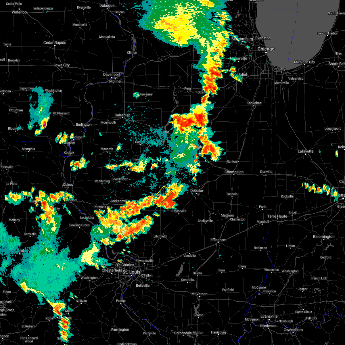 The severe thunderstorm warning for central sangamon county will expire at 1115 pm cdt, the storm which prompted the warning has moved out of the area. therefore, the warning will be allowed to expire. however hail, gusty winds and heavy rain are still possible with this thunderstorm. remember, a severe thunderstorm warning still remains in effect for portions of sangamon county until midnight. The severe thunderstorm warning for central sangamon county will expire at 1115 pm cdt, the storm which prompted the warning has moved out of the area. therefore, the warning will be allowed to expire. however hail, gusty winds and heavy rain are still possible with this thunderstorm. remember, a severe thunderstorm warning still remains in effect for portions of sangamon county until midnight.
|
| 8/16/2018 11:09 PM CDT |
 At 1108 pm cdt, a severe thunderstorm was located near edinburg, or 12 miles southeast of springfield, moving southeast at 35 mph (radar indicated). Hazards include ping pong ball size hail and 60 mph wind gusts. People and animals outdoors will be injured. expect hail damage to roofs, siding, windows, and vehicles. Expect wind damage to roofs, siding, and trees. At 1108 pm cdt, a severe thunderstorm was located near edinburg, or 12 miles southeast of springfield, moving southeast at 35 mph (radar indicated). Hazards include ping pong ball size hail and 60 mph wind gusts. People and animals outdoors will be injured. expect hail damage to roofs, siding, windows, and vehicles. Expect wind damage to roofs, siding, and trees.
|
| 8/16/2018 10:49 PM CDT |
 At 1048 pm cdt, a severe thunderstorm was located over springfield, moving southeast at 30 mph (radar indicated). Hazards include 60 mph wind gusts and quarter size hail. Hail damage to vehicles is expected. expect wind damage to roofs, siding, and trees. locations impacted include, springfield, chatham, sherman, rochester, riverton, williamsville, jerome, southern view, leland grove, grandview, spaulding, dawson, clear lake, curran and capital airport. those attending the illinois state fair are in the path of this storm and should prepare for imminent dangerous weather conditions. seek shelter now! this includes the following highways, interstate 55 between mile markers 89 and 107. Interstate 72 between mile markers 91 and 112. At 1048 pm cdt, a severe thunderstorm was located over springfield, moving southeast at 30 mph (radar indicated). Hazards include 60 mph wind gusts and quarter size hail. Hail damage to vehicles is expected. expect wind damage to roofs, siding, and trees. locations impacted include, springfield, chatham, sherman, rochester, riverton, williamsville, jerome, southern view, leland grove, grandview, spaulding, dawson, clear lake, curran and capital airport. those attending the illinois state fair are in the path of this storm and should prepare for imminent dangerous weather conditions. seek shelter now! this includes the following highways, interstate 55 between mile markers 89 and 107. Interstate 72 between mile markers 91 and 112.
|
| 8/16/2018 10:25 PM CDT |
 At 1024 pm cdt, a severe thunderstorm was located near athens, or 11 miles northwest of springfield, moving southeast at 20 mph (radar indicated). Hazards include 60 mph wind gusts and quarter size hail. Hail damage to vehicles is expected. Expect wind damage to roofs, siding, and trees. At 1024 pm cdt, a severe thunderstorm was located near athens, or 11 miles northwest of springfield, moving southeast at 20 mph (radar indicated). Hazards include 60 mph wind gusts and quarter size hail. Hail damage to vehicles is expected. Expect wind damage to roofs, siding, and trees.
|
| 6/28/2018 4:44 PM CDT |
 At 444 pm cdt, severe thunderstorms were located along a line extending from near elkhart to rochester to near virden, moving southeast at 45 mph (radar indicated). Hazards include 70 mph wind gusts. Expect considerable tree damage. Damage is likely to mobile homes, roofs, and outbuildings. At 444 pm cdt, severe thunderstorms were located along a line extending from near elkhart to rochester to near virden, moving southeast at 45 mph (radar indicated). Hazards include 70 mph wind gusts. Expect considerable tree damage. Damage is likely to mobile homes, roofs, and outbuildings.
|
| 6/28/2018 4:18 PM CDT |
 At 418 pm cdt, severe thunderstorms were located along a line extending from manito to petersburg to near alexander, moving east at 55 mph (radar indicated). Hazards include 70 mph wind gusts. Expect considerable tree damage. Damage is likely to mobile homes, roofs, and outbuildings. At 418 pm cdt, severe thunderstorms were located along a line extending from manito to petersburg to near alexander, moving east at 55 mph (radar indicated). Hazards include 70 mph wind gusts. Expect considerable tree damage. Damage is likely to mobile homes, roofs, and outbuildings.
|
| 6/10/2018 2:51 PM CDT |
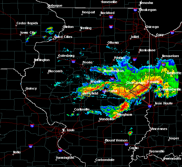 At 250 pm cdt, a severe thunderstorm was located near mechanicsburg, or 12 miles northeast of springfield, moving east at 40 mph (radar indicated). Hazards include 60 mph wind gusts and quarter size hail. Hail damage to vehicles is expected. expect wind damage to roofs, siding, and trees. locations impacted include, springfield, sherman, riverton, williamsville, mechanicsburg, grandview, spaulding, dawson, buffalo and clear lake. this includes the following highways, interstate 55 between mile markers 98 and 104, and between mile markers 106 and 110. Interstate 72 between mile markers 104 and 116. At 250 pm cdt, a severe thunderstorm was located near mechanicsburg, or 12 miles northeast of springfield, moving east at 40 mph (radar indicated). Hazards include 60 mph wind gusts and quarter size hail. Hail damage to vehicles is expected. expect wind damage to roofs, siding, and trees. locations impacted include, springfield, sherman, riverton, williamsville, mechanicsburg, grandview, spaulding, dawson, buffalo and clear lake. this includes the following highways, interstate 55 between mile markers 98 and 104, and between mile markers 106 and 110. Interstate 72 between mile markers 104 and 116.
|
| 6/10/2018 2:26 PM CDT |
 At 226 pm cdt, a severe thunderstorm was located near athens, or 10 miles northwest of springfield, moving east at 40 mph (radar indicated). Hazards include 60 mph wind gusts and quarter size hail. Hail damage to vehicles is expected. Expect wind damage to roofs, siding, and trees. At 226 pm cdt, a severe thunderstorm was located near athens, or 10 miles northwest of springfield, moving east at 40 mph (radar indicated). Hazards include 60 mph wind gusts and quarter size hail. Hail damage to vehicles is expected. Expect wind damage to roofs, siding, and trees.
|
| 5/27/2018 2:39 PM CDT |
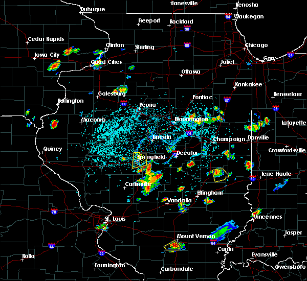 At 238 pm cdt, a severe thunderstorm was located over sherman, or near springfield, moving south at 15 mph (trained weather spotters). Hazards include quarter size hail. damage to vehicles is expected At 238 pm cdt, a severe thunderstorm was located over sherman, or near springfield, moving south at 15 mph (trained weather spotters). Hazards include quarter size hail. damage to vehicles is expected
|
| 7/10/2017 10:14 PM CDT |
 At 1014 pm cdt, severe thunderstorms were located along a line extending from near mechanicsburg to near rochester to near loami, moving southeast at 45 mph (radar indicated). Hazards include 70 mph wind gusts. Expect considerable tree damage. Damage is likely to mobile homes, roofs, and outbuildings. At 1014 pm cdt, severe thunderstorms were located along a line extending from near mechanicsburg to near rochester to near loami, moving southeast at 45 mph (radar indicated). Hazards include 70 mph wind gusts. Expect considerable tree damage. Damage is likely to mobile homes, roofs, and outbuildings.
|
| 6/17/2017 10:41 PM CDT |
 At 1041 pm cdt, a severe thunderstorm was located near new berlin, or 15 miles east of jacksonville, moving east at 40 mph (radar indicated). Hazards include 60 mph wind gusts and quarter size hail. Hail damage to vehicles is expected. Expect wind damage to roofs, siding, and trees. At 1041 pm cdt, a severe thunderstorm was located near new berlin, or 15 miles east of jacksonville, moving east at 40 mph (radar indicated). Hazards include 60 mph wind gusts and quarter size hail. Hail damage to vehicles is expected. Expect wind damage to roofs, siding, and trees.
|
| 5/19/2017 6:41 AM CDT |
 The severe thunderstorm warning for menard, christian, sangamon, cass and northern morgan counties will expire at 645 am cdt, the storms which prompted the warning have weakened below severe limits, and no longer pose an immediate threat to life or property. therefore the warning will be allowed to expire. however gusty winds and heavy rain are still possible with these thunderstorms. The severe thunderstorm warning for menard, christian, sangamon, cass and northern morgan counties will expire at 645 am cdt, the storms which prompted the warning have weakened below severe limits, and no longer pose an immediate threat to life or property. therefore the warning will be allowed to expire. however gusty winds and heavy rain are still possible with these thunderstorms.
|
| 5/19/2017 6:28 AM CDT |
 At 627 am cdt, severe thunderstorms were located along a line extending from near virginia to near pawnee to near schram city, moving northeast at 60 mph (radar indicated). Hazards include 60 mph wind gusts. Expect damage to roofs, siding, and trees. locations impacted include, springfield, jacksonville, taylorville, virginia, chatham, alexander, auburn, sherman, rochester, riverton, pawnee, petersburg, athens, kincaid, williamsville, new berlin, ashland, divernon, edinburg and morrisonville. this includes the following highways, interstate 55 between mile markers 79 and 109. Interstate 72 between mile markers 68 and 124. At 627 am cdt, severe thunderstorms were located along a line extending from near virginia to near pawnee to near schram city, moving northeast at 60 mph (radar indicated). Hazards include 60 mph wind gusts. Expect damage to roofs, siding, and trees. locations impacted include, springfield, jacksonville, taylorville, virginia, chatham, alexander, auburn, sherman, rochester, riverton, pawnee, petersburg, athens, kincaid, williamsville, new berlin, ashland, divernon, edinburg and morrisonville. this includes the following highways, interstate 55 between mile markers 79 and 109. Interstate 72 between mile markers 68 and 124.
|
| 5/19/2017 6:07 AM CDT |
 At 606 am cdt, severe thunderstorms were located along a line extending from near meredosia to near girard to near sorento, moving northeast at 55 mph (radar indicated). Hazards include 70 mph wind gusts. Expect considerable tree damage. damage is likely to mobile homes, roofs, and outbuildings. locations impacted include, springfield, jacksonville, taylorville, virginia, winchester, chatham, alexander, auburn, sherman, rochester, riverton, pawnee, petersburg, athens, kincaid, williamsville, new berlin, ashland, waverly and divernon. this includes the following highways, interstate 55 between mile markers 77 and 109. Interstate 72 between mile markers 46 and 124. At 606 am cdt, severe thunderstorms were located along a line extending from near meredosia to near girard to near sorento, moving northeast at 55 mph (radar indicated). Hazards include 70 mph wind gusts. Expect considerable tree damage. damage is likely to mobile homes, roofs, and outbuildings. locations impacted include, springfield, jacksonville, taylorville, virginia, winchester, chatham, alexander, auburn, sherman, rochester, riverton, pawnee, petersburg, athens, kincaid, williamsville, new berlin, ashland, waverly and divernon. this includes the following highways, interstate 55 between mile markers 77 and 109. Interstate 72 between mile markers 46 and 124.
|
| 5/19/2017 5:47 AM CDT |
 At 547 am cdt, severe thunderstorms were located along a line extending from near naples to 7 miles west of carlinville to near marine, moving northeast at 60 mph (radar indicated). Hazards include 70 mph wind gusts. Expect considerable tree damage. Damage is likely to mobile homes, roofs, and outbuildings. At 547 am cdt, severe thunderstorms were located along a line extending from near naples to 7 miles west of carlinville to near marine, moving northeast at 60 mph (radar indicated). Hazards include 70 mph wind gusts. Expect considerable tree damage. Damage is likely to mobile homes, roofs, and outbuildings.
|
| 4/10/2017 4:17 PM CDT |
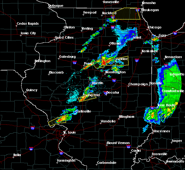 At 416 pm cdt, a severe thunderstorm was located over springfield, moving northeast at 40 mph (radar indicated. at 415 pm, trained spotters reported dime size hail on the south side of springfield). Hazards include quarter size hail. Damage to vehicles is expected. locations impacted include, springfield, chatham, rochester, riverton, mechanicsburg, mount auburn, jerome, southern view, leland grove, grandview, dawson, buffalo, berry, clear lake, curran and roby. this includes the following highways, interstate 55 between mile markers 87 and 99. Interstate 72 between mile markers 92 and 120. At 416 pm cdt, a severe thunderstorm was located over springfield, moving northeast at 40 mph (radar indicated. at 415 pm, trained spotters reported dime size hail on the south side of springfield). Hazards include quarter size hail. Damage to vehicles is expected. locations impacted include, springfield, chatham, rochester, riverton, mechanicsburg, mount auburn, jerome, southern view, leland grove, grandview, dawson, buffalo, berry, clear lake, curran and roby. this includes the following highways, interstate 55 between mile markers 87 and 99. Interstate 72 between mile markers 92 and 120.
|
| 4/10/2017 4:09 PM CDT |
 At 409 pm cdt, a severe thunderstorm was located near loami, or 9 miles southwest of springfield, moving east at 50 mph (radar indicated). Hazards include quarter size hail. damage to vehicles is expected At 409 pm cdt, a severe thunderstorm was located near loami, or 9 miles southwest of springfield, moving east at 50 mph (radar indicated). Hazards include quarter size hail. damage to vehicles is expected
|
| 3/7/2017 12:56 AM CST |
 At 1252 am cst, severe thunderstorms were located along a line extending from near kenney to white oak, moving east at 55 mph (radar indicated). Hazards include 70 mph wind gusts and quarter size hail. Hail damage to vehicles is expected. expect considerable tree damage. wind damage is also likely to mobile homes, roofs, and outbuildings. locations impacted include, springfield, decatur, taylorville, auburn, rochester, forsyth, pawnee, maroa, kincaid, harristown, warrensburg, divernon, blue mound, edinburg, morrisonville, stonington, illiopolis, niantic, mechanicsburg and mount auburn. this includes the following highways, interstate 55 between mile markers 77 and 85. interstate 72 between mile markers 112 and 144. A tornado watch remains in effect until 400 am cst for sangamon county, and a severe thunderstorm watch remains in effect until 500 am cst for logan county, christian county, macon county and dewitt county. At 1252 am cst, severe thunderstorms were located along a line extending from near kenney to white oak, moving east at 55 mph (radar indicated). Hazards include 70 mph wind gusts and quarter size hail. Hail damage to vehicles is expected. expect considerable tree damage. wind damage is also likely to mobile homes, roofs, and outbuildings. locations impacted include, springfield, decatur, taylorville, auburn, rochester, forsyth, pawnee, maroa, kincaid, harristown, warrensburg, divernon, blue mound, edinburg, morrisonville, stonington, illiopolis, niantic, mechanicsburg and mount auburn. this includes the following highways, interstate 55 between mile markers 77 and 85. interstate 72 between mile markers 112 and 144. A tornado watch remains in effect until 400 am cst for sangamon county, and a severe thunderstorm watch remains in effect until 500 am cst for logan county, christian county, macon county and dewitt county.
|
| 3/7/2017 12:30 AM CST |
 At 1229 am cst, severe thunderstorms were located along a line extending from near williamsville to near waverly, moving east at 65 mph (radar indicated). Hazards include 70 mph wind gusts and quarter size hail. Hail damage to vehicles is expected. expect considerable tree damage. Wind damage is also likely to mobile homes, roofs, and outbuildings. At 1229 am cst, severe thunderstorms were located along a line extending from near williamsville to near waverly, moving east at 65 mph (radar indicated). Hazards include 70 mph wind gusts and quarter size hail. Hail damage to vehicles is expected. expect considerable tree damage. Wind damage is also likely to mobile homes, roofs, and outbuildings.
|
| 3/7/2017 12:05 AM CST |
 At 1205 am cst, severe thunderstorms were located along a line extending from pleasant plains to near murrayville, moving east at 60 mph (radar indicated). Hazards include 70 mph wind gusts and quarter size hail. Hail damage to vehicles is expected. expect considerable tree damage. Wind damage is also likely to mobile homes, roofs, and outbuildings. At 1205 am cst, severe thunderstorms were located along a line extending from pleasant plains to near murrayville, moving east at 60 mph (radar indicated). Hazards include 70 mph wind gusts and quarter size hail. Hail damage to vehicles is expected. expect considerable tree damage. Wind damage is also likely to mobile homes, roofs, and outbuildings.
|
| 11/2/2016 5:10 PM CDT |
 At 509 pm cdt, severe thunderstorms capable of producing both tornadoes and extensive straight line wind damage were located along a line extending from near cornland to near rochester, moving east at 45 mph (radar indicated rotation. storm spotters also reported a brief but weak tornado touchdown near williamsville shortly after 5 pm. wind gusts of 48 mph were also reported at capital airport at 458 pm). Hazards include tornado. Expect damage to mobile homes. roofs. and vehicles. these dangerous storms will be near, mount pulaski around 515 pm cdt. illiopolis around 520 pm cdt. niantic and latham around 525 pm cdt. mount auburn around 530 pm cdt. other locations impacted by these tornadic storms include dawson, roby and buffalo. This includes interstate 72 between mile markers 108 and 126. At 509 pm cdt, severe thunderstorms capable of producing both tornadoes and extensive straight line wind damage were located along a line extending from near cornland to near rochester, moving east at 45 mph (radar indicated rotation. storm spotters also reported a brief but weak tornado touchdown near williamsville shortly after 5 pm. wind gusts of 48 mph were also reported at capital airport at 458 pm). Hazards include tornado. Expect damage to mobile homes. roofs. and vehicles. these dangerous storms will be near, mount pulaski around 515 pm cdt. illiopolis around 520 pm cdt. niantic and latham around 525 pm cdt. mount auburn around 530 pm cdt. other locations impacted by these tornadic storms include dawson, roby and buffalo. This includes interstate 72 between mile markers 108 and 126.
|
| 7/13/2016 4:47 PM CDT |
 At 447 pm cdt, severe thunderstorms were located along a line extending from near latham to near moweaqua to near nokomis, moving east at 50 mph (radar indicated). Hazards include 60 mph wind gusts. Expect damage to roofs. siding. and trees. locations impacted include, decatur, taylorville, shelbyville, pana, mount zion, forsyth, moweaqua, harristown, long creek, warrensburg, assumption, blue mound, macon, edinburg, stonington, illiopolis, niantic, cowden, tower hill and mechanicsburg. This includes interstate 72 between mile markers 112 and 145. At 447 pm cdt, severe thunderstorms were located along a line extending from near latham to near moweaqua to near nokomis, moving east at 50 mph (radar indicated). Hazards include 60 mph wind gusts. Expect damage to roofs. siding. and trees. locations impacted include, decatur, taylorville, shelbyville, pana, mount zion, forsyth, moweaqua, harristown, long creek, warrensburg, assumption, blue mound, macon, edinburg, stonington, illiopolis, niantic, cowden, tower hill and mechanicsburg. This includes interstate 72 between mile markers 112 and 145.
|
| 7/13/2016 4:31 PM CDT |
 At 431 pm cdt, severe thunderstorms were located along a line extending from near mason city to near williamsville, moving east at 40 mph (radar indicated). Hazards include 60 mph wind gusts. Expect damage to roofs. siding. And trees. At 431 pm cdt, severe thunderstorms were located along a line extending from near mason city to near williamsville, moving east at 40 mph (radar indicated). Hazards include 60 mph wind gusts. Expect damage to roofs. siding. And trees.
|
| 7/13/2016 4:24 PM CDT |
 At 423 pm cdt, severe thunderstorms were located along a line extending from near riverton to near pawnee to near litchfield, moving east at 45 mph (radar indicated). Hazards include 60 mph wind gusts. Expect damage to roofs. siding. And trees. At 423 pm cdt, severe thunderstorms were located along a line extending from near riverton to near pawnee to near litchfield, moving east at 45 mph (radar indicated). Hazards include 60 mph wind gusts. Expect damage to roofs. siding. And trees.
|
| 5/13/2016 7:41 PM CDT |
 At 740 pm cdt, a severe thunderstorm was located over cornland, or 13 miles south of lincoln, moving east at 55 mph (trained weather spotters reported a 65 mph wind gust just north of williamsville in northern sangamon county at 732 pm cdt). Hazards include 60 mph wind gusts. Expect damage to roofs. siding. And trees. At 740 pm cdt, a severe thunderstorm was located over cornland, or 13 miles south of lincoln, moving east at 55 mph (trained weather spotters reported a 65 mph wind gust just north of williamsville in northern sangamon county at 732 pm cdt). Hazards include 60 mph wind gusts. Expect damage to roofs. siding. And trees.
|
| 5/13/2016 7:23 PM CDT |
 At 723 pm cdt, a severe thunderstorm was located near athens, or 14 miles north of springfield, moving east at 50 mph (radar indicated). Hazards include 60 mph wind gusts. Expect damage to roofs. siding. and trees. locations impacted include, springfield, sherman, riverton, petersburg, athens, williamsville, pleasant plains, greenview, elkhart, middletown, spaulding, dawson, broadwell, cantrall, sweetwater, salisbury, lincolns new salem and fancy prairie. This includes interstate 55 between mile markers 101 and 120. At 723 pm cdt, a severe thunderstorm was located near athens, or 14 miles north of springfield, moving east at 50 mph (radar indicated). Hazards include 60 mph wind gusts. Expect damage to roofs. siding. and trees. locations impacted include, springfield, sherman, riverton, petersburg, athens, williamsville, pleasant plains, greenview, elkhart, middletown, spaulding, dawson, broadwell, cantrall, sweetwater, salisbury, lincolns new salem and fancy prairie. This includes interstate 55 between mile markers 101 and 120.
|
| 5/13/2016 6:57 PM CDT |
 At 656 pm cdt, a severe thunderstorm was located near chandlerville, or 8 miles northeast of virginia, moving east at 50 mph (trained weather spotters reported 60 mph wind gusts just southwest of beardstown). Hazards include 60 mph wind gusts. Expect damage to roofs. siding. And trees. At 656 pm cdt, a severe thunderstorm was located near chandlerville, or 8 miles northeast of virginia, moving east at 50 mph (trained weather spotters reported 60 mph wind gusts just southwest of beardstown). Hazards include 60 mph wind gusts. Expect damage to roofs. siding. And trees.
|
| 5/11/2016 2:08 PM CDT |
 At 208 pm cdt, a severe thunderstorm was located over cornland, or 13 miles south of lincoln, moving east at 35 mph (radar indicated). Hazards include 60 mph wind gusts and quarter size hail. Hail damage to vehicles is expected. Expect wind damage to roofs, siding, and trees. At 208 pm cdt, a severe thunderstorm was located over cornland, or 13 miles south of lincoln, moving east at 35 mph (radar indicated). Hazards include 60 mph wind gusts and quarter size hail. Hail damage to vehicles is expected. Expect wind damage to roofs, siding, and trees.
|
| 4/27/2016 11:57 PM CDT | The severe thunderstorm warning for northeastern sangamon and northwestern christian counties will expire at 1200 am cdt. the storm which prompted the warning has weakened below severe limits. and no longer pose an immediate threat to life or property. therefore the warning will be allowed to expire. However hail up to dime size is still possible with this thunderstorm. |
| 4/27/2016 11:36 PM CDT |
 At 1135 pm cdt, a severe thunderstorm was located near edinburg, or 11 miles southeast of springfield, moving northeast at 35 mph (trained weather spotters. at 1115 pm...one inch hail was reported in pawnee). Hazards include quarter size hail. Damage to vehicles is expected. locations impacted include, springfield, rochester, riverton, edinburg, mechanicsburg, mount auburn, spaulding, dawson, buffalo, berry, sharpsburg, roby and sangchris lake state park. This includes interstate 72 between mile markers 106 and 120. At 1135 pm cdt, a severe thunderstorm was located near edinburg, or 11 miles southeast of springfield, moving northeast at 35 mph (trained weather spotters. at 1115 pm...one inch hail was reported in pawnee). Hazards include quarter size hail. Damage to vehicles is expected. locations impacted include, springfield, rochester, riverton, edinburg, mechanicsburg, mount auburn, spaulding, dawson, buffalo, berry, sharpsburg, roby and sangchris lake state park. This includes interstate 72 between mile markers 106 and 120.
|
| 4/27/2016 11:26 PM CDT |
 At 1126 pm cdt, a severe thunderstorm was located near pawnee, or 12 miles southeast of springfield, moving northeast at 35 mph (radar indicated). Hazards include quarter size hail. Damage to vehicles is expected. locations impacted include, springfield, rochester, riverton, pawnee, kincaid, edinburg, mechanicsburg, mount auburn, bulpitt, jeisyville, spaulding, tovey, dawson, buffalo, berry, sharpsburg, roby, sicily and sangchris lake state park. this includes the following highways, interstate 55 near mile marker 85. Interstate 72 between mile markers 106 and 120. At 1126 pm cdt, a severe thunderstorm was located near pawnee, or 12 miles southeast of springfield, moving northeast at 35 mph (radar indicated). Hazards include quarter size hail. Damage to vehicles is expected. locations impacted include, springfield, rochester, riverton, pawnee, kincaid, edinburg, mechanicsburg, mount auburn, bulpitt, jeisyville, spaulding, tovey, dawson, buffalo, berry, sharpsburg, roby, sicily and sangchris lake state park. this includes the following highways, interstate 55 near mile marker 85. Interstate 72 between mile markers 106 and 120.
|
| 4/27/2016 11:01 PM CDT |
 At 1101 pm cdt, a severe thunderstorm was located over farmersville, or 8 miles southeast of virden, moving northeast at 35 mph (radar indicated). Hazards include 60 mph wind gusts and quarter size hail. Hail damage to vehicles is expected. Expect wind damage to roofs, siding, and trees. At 1101 pm cdt, a severe thunderstorm was located over farmersville, or 8 miles southeast of virden, moving northeast at 35 mph (radar indicated). Hazards include 60 mph wind gusts and quarter size hail. Hail damage to vehicles is expected. Expect wind damage to roofs, siding, and trees.
|
| 3/30/2016 3:16 PM CDT |
 At 315 pm cdt, a severe thunderstorm was located over mechanicsburg, or 12 miles east of springfield, moving northeast at 50 mph (radar indicated). Hazards include quarter size hail. Damage to vehicles is expected. locations impacted include, springfield, decatur, chatham, mount zion, rochester, riverton, pawnee, mount pulaski, harristown, long creek, warrensburg, blue mound, edinburg, illiopolis, niantic, mechanicsburg, mount auburn, latham, cornland and jerome. this includes the following highways, interstate 55 between mile markers 84 and 99. Interstate 72 between mile markers 95 and 138. At 315 pm cdt, a severe thunderstorm was located over mechanicsburg, or 12 miles east of springfield, moving northeast at 50 mph (radar indicated). Hazards include quarter size hail. Damage to vehicles is expected. locations impacted include, springfield, decatur, chatham, mount zion, rochester, riverton, pawnee, mount pulaski, harristown, long creek, warrensburg, blue mound, edinburg, illiopolis, niantic, mechanicsburg, mount auburn, latham, cornland and jerome. this includes the following highways, interstate 55 between mile markers 84 and 99. Interstate 72 between mile markers 95 and 138.
|
| 3/30/2016 3:06 PM CDT |
 At 305 pm cdt, a severe thunderstorm was located near rochester, or 7 miles southeast of springfield, moving northeast at 50 mph (radar indicated). Hazards include quarter size hail. damage to vehicles is expected At 305 pm cdt, a severe thunderstorm was located near rochester, or 7 miles southeast of springfield, moving northeast at 50 mph (radar indicated). Hazards include quarter size hail. damage to vehicles is expected
|
| 3/15/2016 8:11 PM CDT |
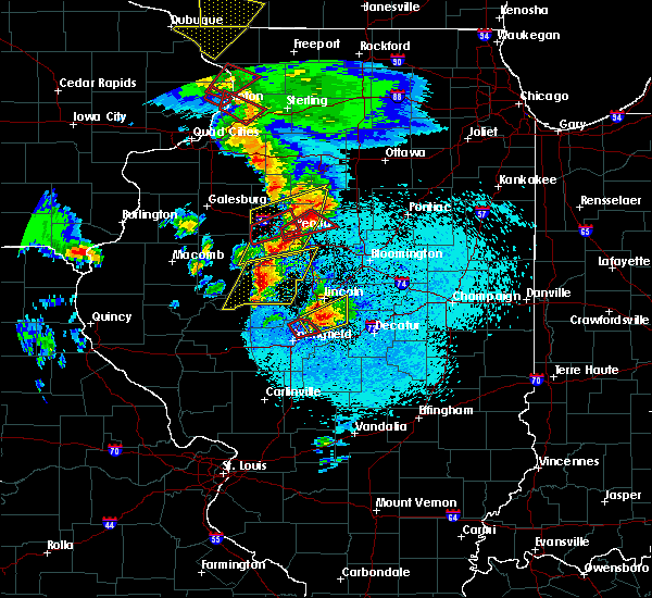 The tornado warning for northeastern sangamon county will expire at 815 pm cdt, the storm which prompted the warning has moved out of the area. therefore the warning will be allowed to expire. the tornado watch has been extended until 1100 pm cdt for central illinois. remember, a severe thunderstorm warning still remains in effect for northeast sangamon county until 830 pm. The tornado warning for northeastern sangamon county will expire at 815 pm cdt, the storm which prompted the warning has moved out of the area. therefore the warning will be allowed to expire. the tornado watch has been extended until 1100 pm cdt for central illinois. remember, a severe thunderstorm warning still remains in effect for northeast sangamon county until 830 pm.
|
| 3/15/2016 8:05 PM CDT |
 At 804 pm cdt, a severe thunderstorm was located over cornland, or 14 miles south of lincoln, moving northeast at 50 mph (radar indicated). Hazards include 60 mph wind gusts and half dollar size hail. Hail damage to vehicles is expected. Expect wind damage to roofs, siding and trees. At 804 pm cdt, a severe thunderstorm was located over cornland, or 14 miles south of lincoln, moving northeast at 50 mph (radar indicated). Hazards include 60 mph wind gusts and half dollar size hail. Hail damage to vehicles is expected. Expect wind damage to roofs, siding and trees.
|
| 3/15/2016 8:02 PM CDT |
 At 801 pm cdt, a severe thunderstorm capable of producing a tornado was located over sherman, moving northeast at 55 mph (radar indicated rotation. storm spotters continue to report rotation with this storm, and it has a history of producing funnel clouds and a tornado). Hazards include tornado and half dollar size hail. Flying debris will be dangerous to those caught without shelter. mobile homes will be damaged or destroyed. damage to roofs, windows and vehicles will occur. tree damage is likely. this tornadic thunderstorm will remain over mainly rural areas of northeastern sangamon county, including the following locations, dawson and spaulding. this includes the following highways, interstate 55 between mile markers 99 and 110. Interstate 72 between mile markers 107 and 109. At 801 pm cdt, a severe thunderstorm capable of producing a tornado was located over sherman, moving northeast at 55 mph (radar indicated rotation. storm spotters continue to report rotation with this storm, and it has a history of producing funnel clouds and a tornado). Hazards include tornado and half dollar size hail. Flying debris will be dangerous to those caught without shelter. mobile homes will be damaged or destroyed. damage to roofs, windows and vehicles will occur. tree damage is likely. this tornadic thunderstorm will remain over mainly rural areas of northeastern sangamon county, including the following locations, dawson and spaulding. this includes the following highways, interstate 55 between mile markers 99 and 110. Interstate 72 between mile markers 107 and 109.
|
| 3/15/2016 7:55 PM CDT |
 At 754 pm cdt, trained spotters reported a funnel cloud over downtown springfield. the severe thunderstorm is moving northeast at 50 mph (weather spotters reported a funnel cloud). Hazards include tornado and half dollar size hail. Flying debris will be dangerous to those caught without shelter. mobile homes will be damaged or destroyed. damage to roofs, windows and vehicles will occur. tree damage is likely. this dangerous storm will be near, springfield at 755 pm cdt. sherman around 800 pm cdt. riverton and williamsville around 805 pm cdt. other locations impacted by this tornadic thunderstorm include leland grove, fancy prairie, clear lake, spaulding, cantrall, grandview, dawson, capital airport and buffalo. this includes the following highways, interstate 55 between mile markers 97 and 110. Interstate 72 between mile markers 103 and 116. At 754 pm cdt, trained spotters reported a funnel cloud over downtown springfield. the severe thunderstorm is moving northeast at 50 mph (weather spotters reported a funnel cloud). Hazards include tornado and half dollar size hail. Flying debris will be dangerous to those caught without shelter. mobile homes will be damaged or destroyed. damage to roofs, windows and vehicles will occur. tree damage is likely. this dangerous storm will be near, springfield at 755 pm cdt. sherman around 800 pm cdt. riverton and williamsville around 805 pm cdt. other locations impacted by this tornadic thunderstorm include leland grove, fancy prairie, clear lake, spaulding, cantrall, grandview, dawson, capital airport and buffalo. this includes the following highways, interstate 55 between mile markers 97 and 110. Interstate 72 between mile markers 103 and 116.
|
| 3/15/2016 7:52 PM CDT |
 At 751 pm cdt, a confirmed tornado was located 6 miles west northwest of downtown springfield, moving northeast at 50 mph (weather spotters confirmed tornado. a tornado was reported near loami at 747 pm). Hazards include damaging tornado and half dollar size hail. Flying debris will be dangerous to those caught without shelter. mobile homes will be damaged or destroyed. damage to roofs, windows and vehicles will occur. tree damage is likely. this tornado will be near, springfield around 755 pm cdt. sherman around 800 pm cdt. riverton and williamsville around 805 pm cdt. other locations impacted by this tornadic thunderstorm include leland grove, fancy prairie, clear lake, spaulding, cantrall, grandview, dawson, capital airport and buffalo. this includes the following highways, interstate 55 between mile markers 97 and 110. Interstate 72 between mile markers 103 and 116. At 751 pm cdt, a confirmed tornado was located 6 miles west northwest of downtown springfield, moving northeast at 50 mph (weather spotters confirmed tornado. a tornado was reported near loami at 747 pm). Hazards include damaging tornado and half dollar size hail. Flying debris will be dangerous to those caught without shelter. mobile homes will be damaged or destroyed. damage to roofs, windows and vehicles will occur. tree damage is likely. this tornado will be near, springfield around 755 pm cdt. sherman around 800 pm cdt. riverton and williamsville around 805 pm cdt. other locations impacted by this tornadic thunderstorm include leland grove, fancy prairie, clear lake, spaulding, cantrall, grandview, dawson, capital airport and buffalo. this includes the following highways, interstate 55 between mile markers 97 and 110. Interstate 72 between mile markers 103 and 116.
|
| 3/15/2016 7:48 PM CDT |
 At 747 pm cdt, a severe thunderstorm capable of producing a tornado was located 7 miles southeast of pleasant plains, or 8 miles west of springfield, moving northeast at 50 mph (weather spotters reported funnel cloud. spotters reported a funnel cloud southwest of springfield). Hazards include tornado and half dollar size hail. Flying debris will be dangerous to those caught without shelter. mobile homes will be damaged or destroyed. damage to roofs, windows and vehicles will occur. tree damage is likely. this dangerous storm will be near, athens around 755 pm cdt. sherman and riverton around 800 pm cdt. williamsville around 805 pm cdt. other locations impacted by this tornadic thunderstorm include curran, leland grove, clear lake, spaulding, cantrall, salisbury, grandview, dawson, farmingdale and fancy prairie. this includes the following highways, interstate 55 between mile markers 96 and 110. Interstate 72 between mile markers 89 and 94, and between mile markers 102 and 116. At 747 pm cdt, a severe thunderstorm capable of producing a tornado was located 7 miles southeast of pleasant plains, or 8 miles west of springfield, moving northeast at 50 mph (weather spotters reported funnel cloud. spotters reported a funnel cloud southwest of springfield). Hazards include tornado and half dollar size hail. Flying debris will be dangerous to those caught without shelter. mobile homes will be damaged or destroyed. damage to roofs, windows and vehicles will occur. tree damage is likely. this dangerous storm will be near, athens around 755 pm cdt. sherman and riverton around 800 pm cdt. williamsville around 805 pm cdt. other locations impacted by this tornadic thunderstorm include curran, leland grove, clear lake, spaulding, cantrall, salisbury, grandview, dawson, farmingdale and fancy prairie. this includes the following highways, interstate 55 between mile markers 96 and 110. Interstate 72 between mile markers 89 and 94, and between mile markers 102 and 116.
|
| 6/28/2015 6:33 PM CDT |
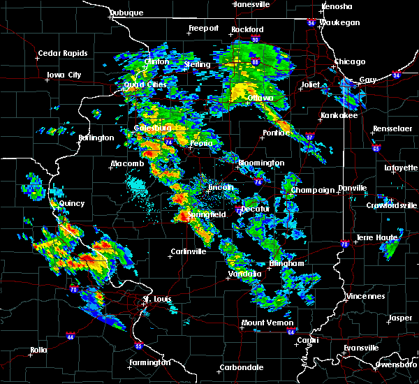 At 632 pm cdt, a severe thunderstorm was located near springfield, moving east at 20 mph (radar indicated). Hazards include quarter size hail. damage to vehicles is expected At 632 pm cdt, a severe thunderstorm was located near springfield, moving east at 20 mph (radar indicated). Hazards include quarter size hail. damage to vehicles is expected
|
| 6/20/2015 10:23 PM CDT |
 The severe thunderstorm warning for sangamon, southeastern morgan and southern scott counties will expire at 1030 pm cdt, the storms which prompted the warning have moved out of the area. therefore the warning will be allowed to expire. a tornado watch remains in effect until 1100 pm cdt for west central illinois. to report severe weather, contact your nearest law enforcement agency. they will relay your report to the national weather service lincoln. remember, a severe thunderstorm warning still remains in effect for far eastern sangamon county until 1115 pm. The severe thunderstorm warning for sangamon, southeastern morgan and southern scott counties will expire at 1030 pm cdt, the storms which prompted the warning have moved out of the area. therefore the warning will be allowed to expire. a tornado watch remains in effect until 1100 pm cdt for west central illinois. to report severe weather, contact your nearest law enforcement agency. they will relay your report to the national weather service lincoln. remember, a severe thunderstorm warning still remains in effect for far eastern sangamon county until 1115 pm.
|
| 6/20/2015 10:03 PM CDT |
 At 1002 pm cdt, severe thunderstorms were located along a line extending from riverton to near auburn to near alsey, moving southeast at 45 mph (trained weather spotters). Hazards include 60 mph wind gusts. Expect damage to roofs. siding and trees. locations impacted include, springfield, winchester, chatham, auburn, sherman, rochester, riverton, pawnee, williamsville, new berlin, waverly, divernon, loami, franklin, mechanicsburg, murrayville, woodson, manchester, alsey and jerome. this includes the following highways, interstate 55 between mile markers 78 and 110. interstate 72 between mile markers 86 and 119. A tornado watch remains in effect until 1100 pm cdt for west central illinois. At 1002 pm cdt, severe thunderstorms were located along a line extending from riverton to near auburn to near alsey, moving southeast at 45 mph (trained weather spotters). Hazards include 60 mph wind gusts. Expect damage to roofs. siding and trees. locations impacted include, springfield, winchester, chatham, auburn, sherman, rochester, riverton, pawnee, williamsville, new berlin, waverly, divernon, loami, franklin, mechanicsburg, murrayville, woodson, manchester, alsey and jerome. this includes the following highways, interstate 55 between mile markers 78 and 110. interstate 72 between mile markers 86 and 119. A tornado watch remains in effect until 1100 pm cdt for west central illinois.
|
| 6/20/2015 9:34 PM CDT |
 At 933 pm cdt, severe thunderstorms were located along a line extending from near greenview to 4 miles south of ashland to near bluffs, moving southeast at 45 mph (trained weather spotters). Hazards include 60 mph wind gusts. Expect damage to roofs. Siding and trees. At 933 pm cdt, severe thunderstorms were located along a line extending from near greenview to 4 miles south of ashland to near bluffs, moving southeast at 45 mph (trained weather spotters). Hazards include 60 mph wind gusts. Expect damage to roofs. Siding and trees.
|
| 5/24/2015 11:31 PM CDT | At 1131 pm cdt, a severe thunderstorm was located over mount auburn, or 14 miles north of taylorville, moving north at 50 mph (radar indicated). Hazards include 60 mph wind gusts. Expect damage to roofs. siding and trees. locations impacted include, taylorville, pana, moweaqua, kincaid, assumption, edinburg, morrisonville, stonington, illiopolis, mechanicsburg, mount auburn, bulpitt, jeisyville, tovey, dawson, buffalo, rosamond, berry, owaneco and palmer. this includes interstate 72 between mile markers 110 and 124. A tornado watch remains in effect until 100 am cdt for central illinois. |
| 5/24/2015 11:03 PM CDT | At 1102 pm cdt, a severe thunderstorm was located near morrisonville, or near nokomis, moving north at 55 mph (radar indicated). Hazards include 60 mph wind gusts. Expect damage to roofs. Siding and trees. |
| 1/1/0001 12:00 AM | Several metal power poles toppled and high tension power lines snapped on old route 3 in sangamon county IL, 1.2 miles WNW of Dawson, IL |
Hail Maps for Dawson, IL


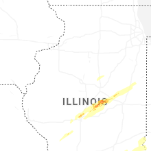


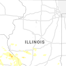


Connect with Interactive Hail Maps